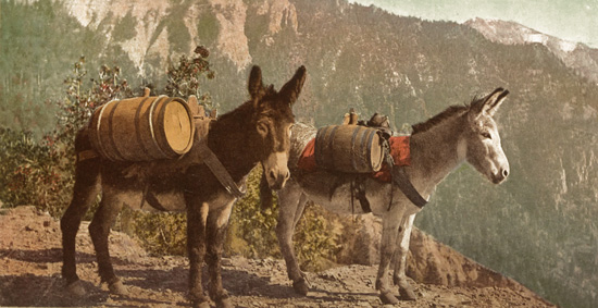
The Temperance Outfit
Transcriber's Note:
Obvious typographical errors have been corrected. Inconsistent spelling and hyphenation in the original document have been preserved.
The Title Page and Table of Contents for this book refer to it as Volume V. The page and chapter numbering are consistent with this being the first half of Volume III.
The Temperance Outfit
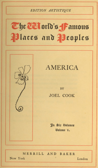
EDITION ARTISTIQUE
The World's Famous Places and Peoples
BY
JOEL COOK
In Six Volumes
Volume V.
MERRILL AND BAKER
New York London
THIS EDITION ARTISTIQUE OF THE WORLD'S FAMOUS PLACES AND PEOPLES IS LIMITED TO ONE THOUSAND NUMBERED AND REGISTERED COPIES, OF WHICH THIS COPY IS NO. 205
Copyright, Henry T. Coates & Co., 1900
VOLUME V
| PAGE | ||
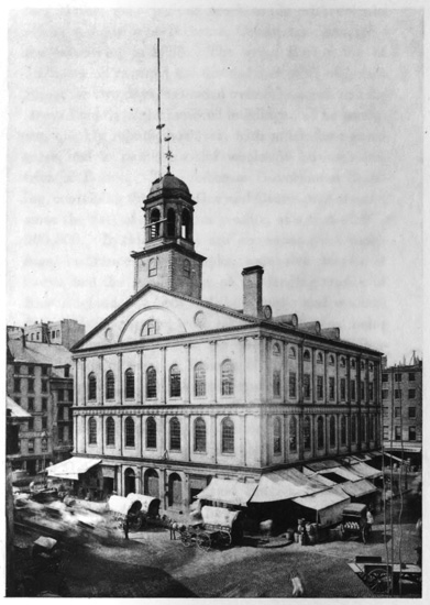
| Faneuil Hall, Boston | 44 | |
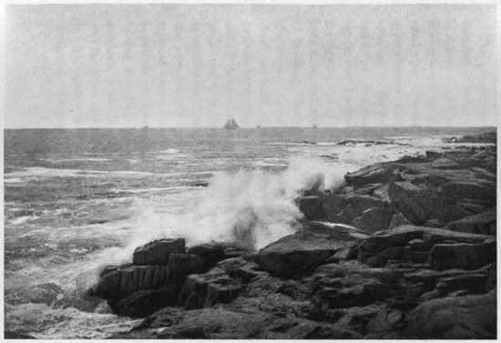
| Along the Shore at Cape Anne, Gloucester, Mass. | 86 | |
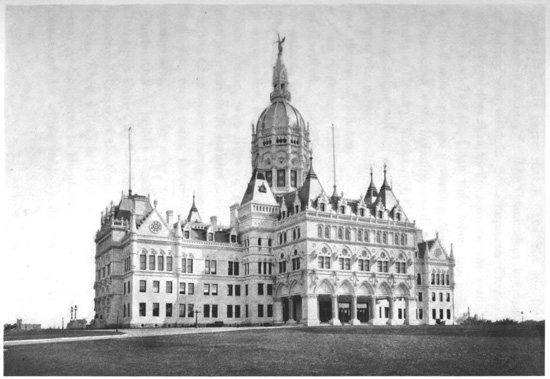
| State Capitol, Hartford, Conn. | 162 | |
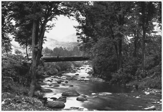
| Log Bridge over the Wild Cat, near Jackson, N. H. | 212 | |
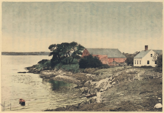
| House of "The Pearl of Orr's Island," Casco Bay, Me. | 244 | |
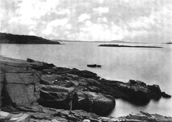
| Along the Coast of Bar Harbor, Me. | 270 | |
AMERICA,
PICTURESQUE AND DESCRIPTIVE.
Early Explorations—John Cabot—Bartholomew Gosnold—The Old Colony—The Mayflower—Plymouth—Plymouth Rock—Duxbury—Samoset—Governor Bradford—Miles Standish—Cape Cod—Chatham—Barnstable—Truro—Highland Light—Provincetown—The Puritan Compact—Quincy—Marshfield—Daniel Webster—Minot's Ledge—Nantasket—Hingham—Squantum—Boston—Shawmut—Boston Harbor and Islands—Boston Common—Beacon Hill and the State House—The Codfish—Boston Attractions—Old South Church—Old State House—Faneuil Hall—Old Christ Church—Boston Fire—Boston Development—The New West End—Parks and Suburbs—Brook Farm—Newton—Nonatum Hill—Natick—Cochituate Lake—Wellesley—Sudbury—The Wayside Inn—Charlestown—Old Ironsides—Jackson's Head—Bunker Hill—Cambridge—Harvard University—Henry W. Longfellow—James Russell Lowell—Oliver Wendell Holmes—Margaret Fuller—Waltham—Lexington—Concord in Middlesex and its Bridge—Ralph Waldo Emerson—Nathaniel Hawthorne—Henry D. Thoreau—The Alcotts—Massachusetts North Shore—Lynn—Nahant—Swampscott—Marblehead—Salem and the Witches—Beverley—Wenham Lake—Ipswich—Andover—Merrimack River—Salisbury—Concord in New Hampshire—Manchester—Nashua—Lowell—Lawrence—Haverhill—Newburyport—Bridal of Pennacook—Cape Ann—Gloucester—The 4 Fisheries—Norman's Woe—Wreck of the Hesperus—Land's End—Thatcher's Island—Rockport—Lanesville—Granite—The Fishermen.
EARLY EXPLORATIONS.
John Cabot was the first explorer of the coasts of New England under British auspices. After Columbus had discovered America, fabulous tales were told of its outlying islands. The primitive maps represented the Atlantic Ocean as full of islands, some being very large, especially the Island of Brazil, and the fabled Island of the Seven Cities. The latter was said by sailors to be inhabited by Christians who years before had fled from seven cities of Asia, under their seven bishops, taking refuge there. Bristol was then the leading English seaport, and five years after the discovery by Columbus, John Cabot started from it on a western voyage of exploration in search of these famous islands. King Henry VII. encouraged the enterprise, and in May, 1497, Cabot sailed in the little ship "Matthew," with a crew of eighteen, and going westward he discovered one of these islands, which he called the New Found Land. It was Cape Breton Island, but being apparently unproductive and without inhabitants, although some signs of people were seen, he soon returned to England. The greatest excitement followed his arrival home, and the report got abroad that he had discovered the Island of the Seven Cities and the coast of Asia. Cabot became all the rage in England, 5 and a writer of that time records that Englishmen called him "the Great Admiral," followed him about "like madmen," that he was "dressed in silks," and "treated like a prince." Cabot, feeling his importance, wanted his friends to share his good fortune, so he appointed some of them governors, and others bishops over the new world he had discovered, while King Henry was so delighted at the success of the voyage that he sent Cabot a letter of thanks and the munificent present of £10. King Henry VII. was always regarded as being "a little near."
In 1498, another and larger expedition was fitted out, Cabot planning to sail westward until he reached the land he had discovered in the previous year, and then he thought by turning south he would come to the Island of Cipango (Japan), where he would fill his ships with spices and jewels, a half-dozen small vessels making up the fleet. They took a more northerly course than before, got among icebergs, and where the summer days were so long there was very little night. They reached Labrador, where the sailors were frightened at the amount of ice, and turning south, Cabot sailed along the American coast nearly to Florida, once trying to plant a colony, but being discouraged by the barren soil, abandoning it. Yet sterile as the land might be, the waters were filled with fish, so that Cabot called the country the "Land of the Codfish," there was such an abundance of them. The explorers recorded that the 6 bears were harmless, they could so easily get food, describing how they would swim out into the sea and catch the fish. Then Cabot disappeared from view. Whether he died on the homeward voyage or after he returned is unknown, as everything about his subsequent career has faded from history. But his two voyages were the foundation of the British claim to the Atlantic coast from Labrador to Florida, and the basis of all the English grants for the subsequently formed American colonies.
Bartholomew Gosnold planted the first English colony in the Old Bay State. Upon Friday, May 14, 1602, after elaborate preparations, he sailed from Falmouth, England, in the ship "Concord," his party numbering thirty-two, of whom about a dozen expected to remain in the new country as settlers. Crossing the ocean and coming into view of the American coast, he steered south, soon finding his progress barred by a bold headland, which encircled him about. He had got into the bight of Cape Cod Bay, and thus discovered that great bended, sandy peninsula, to which he gave the name from the abundance of codfish he found disporting in the waters. Many whales were also seen, and vast numbers of fish of all kinds. He tried to get out of the bay, and coasting around the long and curiously hooked cape, emerged into the Atlantic, and then coming down the outer side got into Vineyard Sound, where he planted his colony on Cuttyhunk Island, but soon abandoned 7 it. Gosnold returned to England, and in 1607 sailed with Newport's expedition, carrying Captain John Smith to Virginia.
THE OLD COLONY.
The first English settlement permanently planted in New England was the famous "Old Colony" at Plymouth. The Puritan Separatists, from the Church of England, sought refuge from English persecution in Holland, living in Leyden under their pastor, John Robinson, for eleven years, when they decided to migrate to America. They arranged with the Virginia Company to send them across the ocean, and about the middle of the summer of 1620 the little band of Pilgrims sailed from Delft-haven, the port of Leyden, on the "Speedwell," in charge of Elder Brewster. The "Mayflower" joined at Southampton with other Puritans from England, but the "Speedwell" sprung a leak and they put into Plymouth roads. Then they decided to go on in the "Mayflower" alone, and the party left Plymouth early in September. They were seeking Virginia, but found the land, after a voyage of over two months, at Cape Cod, anchoring inside the Cape. Then they thanked God, "who had brought them over the vast and furious ocean, and delivered them from all the perils and miseries thereof, again to set their feet on the firm and stable earth." While the ship lay there, the famous "Mayflower Compact" was drawn up, pledging 8 the signers to obey the government that it established, and John Carver was chosen the first Governor, forty-one men signing the compact. After nearly a month spent in exploration, their shallop going all about the coasts, Plymouth was selected, and the pioneers landed December 21, 1620, the day being now annually celebrated as "Forefathers' Day."
Plymouth has a little land-locked harbor behind a long and narrow sand beach, projected northward from the ridge of Manomet below, this beach acting as a protective breakwater to the wharves. The harbor is so shallow, however, that there is little trade by sea. The town spreads upon the bluff shores, and on a plateau to the hills in the rear. There is now a population of about nine thousand, engaged mainly in manufacturing cordage and textiles, and having a considerable fishery fleet. While the town is of modern build, yet it is devoted to the memory which gives it deathless fame, every relic of the Pilgrims being restored and perpetuated. There is little to be seen that comes from the olden time, however, outside of the hills and harbor and original streets, excepting the carefully cherished relics of the "Mayflower's" passengers, that have been gathered together. The choice of Plymouth as the landing-place seems to have been mainly from necessity, when protracted explorations failed to find a better place, and the coming of winter compelled a landing somewhere. The actual location was hardly well considered, the 9 Pilgrims themselves being far from satisfied. After the "Mayflower" anchored inside of Cape Cod, several weeks were passed in explorations, and finally, upon a Sunday in December, 1620, a landing was made upon Clark's Island, where religious services were held, the first in New England. Upon the most elevated part of this island stands a huge boulder, about twelve feet high, called from some local circumstance the "Election Rock." Its face bears the words taken from Mourt's Relation, which chronicled the voyage of the "Mayflower":
"Upon the Sabbath-Day wee rested, 20 December, 1620."
Eighteen of the Pilgrims thus "rested," after their shallop, in making the shore, had been almost shipwrecked. The next day they sailed across the bay to the mainland, their first landing being then made at Plymouth, and upon the second day, December 22d, the entire company came ashore and the settlement began.
Within the Pilgrim Hall, a fireproof building upon the chief street, are kept the precious relics of the "Mayflower" and the Pilgrims, with paintings of the embarkation from Delft-haven and landing at Plymouth, and old portraits of the leaders of the colony. Among the interesting documents are autograph writings, establishing a chain of acquaintanceship connecting the original Pilgrims with the present time. Peregrine White was the first child of the new colony, 10 the infant being born on the "Mayflower" after she came into Cape Cod Bay, in November, 1620, and he was only a month old when they landed. The baby, surviving all their hardships, lived to a ripe old age, and "Grandfather Cobb," born in 1694, knew him well. Cobb, in his day, lived to be the oldest man in New England, his life covering space in three centuries, for he exceeded one hundred and seven years, dying in 1801. William R. Sever, born in 1790, knew Cobb and recollected him well, and living until he was ninety-seven years old, died in 1887. These three lives connected the Pilgrim landing almost with the present day. The old cradle that rocked Peregrine White on the "Mayflower," and after they landed, is preserved—an upright, stiff-backed, wicker-work basket, upon rude wooden rockers. One of the chief paintings represents the signing of the memorable "Mayflower Compact." There are also in the hall some of the old straight-backed chairs of the Pilgrims, with their pots and platters, and among other relics Miles Standish's sword. In the court-house are the original records of the colony, the first allotment of lands among the settlers, their deeds, agreements and wills, and the patent given the colony by Earl Warwick in 1629. There are also shown in quaint handwriting, with the ink partly faded out, records of how they divided their cattle, when it was decided to change from the original plan of holding them in common. Signatures of the Pilgrims 11 are attached to many of these documents. Governor Carver died the first year, William Bradford succeeding, and there is preserved in Governor Bradford's writing the famous order establishing trial by jury in the colony.
THE PLYMOUTH ROCK.
"The breaking waves dashed high
On a stern and rock-bound coast."
Thus begins Mrs. Hemans' beautiful hymn on the landing of the Pilgrims. Unfortunately for the poetry, however, sand is everywhere about, and scarcely a rock or boulder can be seen for miles, excepting the very little one on which they landed. Down near the water-side is this sacred stone, worshipped by all the Pilgrim descendants, the retrocession of the sea having left it some distance back. It is a gray syenite boulder, oval-shaped, and about six feet long. It was some time ago unfortunately split, and the parts have been cemented together. At the time of the landing this boulder lay on the sandy beach, partly embedded, being almost solitary on these sands, for unlike the verge of Manomet to the southward, and the coast north of Boston, this sandy shore is almost without rocks of any kind. Dropped here in the glacial period, and lying partly in the water, the rock made a boat-landing naturally attractive to the water-weary Pilgrims when they coasted along in their shallop from Clark's Island, so they 12 stepped out upon it to get ashore dry-shod. The rock is in its original location, but has been elevated several feet to a higher level, is surmounted by an imposing granite canopy, and is railed in for protection from the relic-hunter. The numerals "1620" are rudely carved upon its side, and a sort of fissure in its face seems like the impress of a foot. Surmounting the canopy is a scallop shell, the distinctive emblem of the pilgrim. The scallop has been called the "Butterfly of the Sea," and in the time of the Crusades, a scallop shell fastened in the cap denoted that the wearer had made a pilgrimage to the Holy Land. Thus it is said in the Hermit:
"He quits his cell, the pilgrim staff he bore,
And fixed his scallop in his hat before."
Behind the Plymouth Rock rises the bluff shore into Cole's Hill, having its steep slopes sodded, this having been the place up which the Pilgrims climbed after the landing. A view to the front shows the wharves, and across the bay the narrow sandspit protecting the harbor, while on the right hand is the long ridge of Manomet, and over the water to the left appear distant sand-dunes along Duxbury Beach. Off to the northward rises the "Captain's Hill" of Duxbury, surmounted with the monument to Captain Miles Standish, erected in 1889, rising one hundred and ten feet. Upon Cole's Hill was the first burial-place of the Pilgrims, and here were interred about 13 half the intrepid band, who died from the privations of the first winter. Their bones were occasionally washed out by heavy rains, or found in digging for the foundations of buildings, but all have been carefully collected, and, with several of the dead thus exposed, were again entombed in the canopy over Plymouth Rock. A little way to the southward is Leyden Street, running from the water's edge for some distance back up the slope to the side of the "Burial Hill," the first cemetery. This was the earliest highway laid out in New England, although it did not receive its present name until long afterwards. Upon this street the Pilgrims built their first rude houses, the lots extending southward from it to the "Town Brook," a short distance beyond, which supplied them with good water, and was the chief feature inducing them to select this place for settlement.
The story of their landing is told in Mourt's Relation, written by one of the actors in this great historical drama. After describing their explorations and hasty selection of the place, he continues: "So, in the morning, after we had called on God for direction, we came to this resolution, to go presently ashore again, and to take a better view of two places which we thought most fitting for us; for we could not now take time for further search or consideration, our victuals being much spent, especially our beer, and it being now the 19th of December. After our 14 landing and viewing the places so well as we could, we came to a conclusion, by most voices, to set on a high ground, where there is a great deal of land cleared, and hath been planted with corn three or four years ago; and there is a very sweet brook runs under the hillside, and many delicate springs of as good water as can be drunk, and where we may harbor our shallops and boats exceeding well; and in this brook fish in their season; on the further side of the river also much corn-ground cleared. In one field is a great hill on which we point to make a platform and plant our ordnance, which will command all around about. From thence we may see into the bay and far into the sea, and we may see thence Cape Cod. Our greatest labor will be the fetching of our wood, which is half a quarter of an English mile; but there is enough so far off. What people inhabit here we know not, for as yet we have seen none. So there we made our rendezvous, and a place for some of our people, about twenty, resolving in the morning to come all ashore and to build houses." About a week after landing they began constructing their first fort on the hill, and allotted the plots of land on their street, subsequently named Leyden. Thus the town was begun, and behind it rose two hills, the one now known as the Burial Hill being at the head of this street, and elevated about one hundred and fifty feet above the sea. Miles Standish, with his military eye, for he had seen veteran 15 service in Flanders, selected this hill for the fort, and here in 1622 was built the square timber block-house that made them both a fort and a church, the entire settlement as it then existed being enclosed with a stockade for further protection. This caused the hill to be named Fort Hill, and it was not until long afterward that it was used as a cemetery and called Burial Hill, the first interred being some of the original Pilgrims after the graveyard on Cole's Hill, down by the waterside, had been abandoned.
Upon Fort Hill was built the "Watch House," where an outlook was kept for the Indians. Stones now mark the locations both of the fort and the watchhouse, and surrounding them are the graves of several of the "Mayflower" Pilgrims, with many of their descendants, the dark slate gravestones having been brought out from England. There is a fine outlook from Burial Hill, far over the sea to the distant yellow sand-streak of Cape Cod. About a half-mile northward is the other hill, rising somewhat higher, and upon it is the National Monument to the Pilgrims, dedicated in 1889. This is a massive granite pedestal forty-five feet high, surmounted by the largest stone statue in existence, a colossal figure of Faith, thirty-six feet high, and adorned by large seated statues emblematic of the principles upon which the settlement was founded, representing Law, Morality, Freedom and Education. Upon this great monument are also representations of the landing of the Pilgrims, 16 their names, and the "Mayflower Compact." It was into this infant colony of Plymouth, after some weeks of careful parley and investigation, there strode the stalwart Indian Samoset, making their acquaintance and paving the way for the subsequent treaty and alliance with Massasoit, which for many years was scrupulously observed by both parties, and not broken until after he died. Canonicus, of the Narragansetts, to the southward, sent to the colony after Massasoit's death a sheaf of arrows bound with a rattlesnake's skin as a token of hostility. Governor Bradford did not want war, but he knew they must maintain a brave outlook, so he promptly filled the skin with powder and shot and sent it back to Canonicus, who understood the grim challenge, and fearing the deadly musketry, prudently restrained the hostile instincts of his tribe. The privations of the first year, which killed half the settlers, and were only relieved by succor from England, are said to have originated the New England Thanksgiving Festival Day, which has since spread over the whole country. In December, 1621, they had their first Thanksgiving, upon the arrival of a relief ship from abroad. Such was the dawning of the ruling race of the American nation.
DUXBURY AND MILES STANDISH.
Upon the upper side of Plymouth Bay, enclosing its northern portion, is one of those long peninsulas of sand and rocks, abounding upon the Massachusetts 17 coasts, which projects about six miles southeastward into the sea and terminates in a high knob, called the Gurnet, with a hook turned inward. This elongated sand-strip is Duxbury Beach, the town of Duxbury being upon the mainland inside, a fishing village probably best known as the terminus of the French Atlantic Cable. It was at Duxbury that the first regular pastor was Ralph Partridge, whom Cotton Mather described as having "the innocence of a dove and the loftiness of an eagle." The Pilgrims allotted this district to Miles Standish and to their youngest member, John Alden. Standish named it from Duxbury Hall, in Lancashire, the seat of his English ancestors. The brave Miles was not a Puritan and did not belong to their church, but as he was an experienced warrior, they made him the commander of their standing army of twelve men. Is is said that there have been only two renowned military chieftains in history who were personally acquainted with all their soldiers—Julius Cæsar and Miles Standish. The redoubtable old captain lost his wife Rose soon after the landing, and he then engaged the fascinating and youthful Alden to do his courtship for him and woo the gentle Priscilla Mullins, with the usual result that the maiden preferred the more attractive Alden to the grim old soldier. Standish has been described as "a short man, very brave, but impetuous and choleric, and his name soon became a terror to all hostile Indians." His is the romance of early Plymouth, 18 for he has been made the hero of Longfellow's poem, and of renowned operas and many New England tales, while the fair Priscilla gave her name to the great Long Island Sound steamer. Standish lived upon the "Captain's Hill," out on the Duxbury peninsula, the highest land thereabout, rising one hundred and eighty feet, upon a broad point projecting into Plymouth Bay. His monument is near the site of his house upon the bare-topped, oval-shaped hill, a rather bleak place, however, to have selected for a home. Beyond it the projecting Duxbury Beach ends in the high Gurnet, with twin lighthouses, and then hooks inward to another bold terminating bulb, the headland of Saquish. To the northward is Clark's Island, where the Pilgrims first landed, a similarly round-topped mass rising from the water. Thus is Plymouth Bay environed, for to the southward its long guarding ridge on that side, Manomet, projects far into the sea.
CAPE COD.
The Old Bay State presents a front to the rough Atlantic like a gladiator at bay. She has in Cape Cod one defensive forearm boldly extended, and she likewise is prepared, if necessary, to thrust out the other, which keeps close guard upon her rugged granite breast in Cape Ann. These capes are the portals of Massachusetts Bay, and of the ocean entrance to Boston. Everyone, in viewing the map, marvels at the extraordinary formation of Cape Cod. Thoreau, 19 who in days gone by tramped all over the Cape, says, "A man may stand there and put all America behind him." This great sandy headland stretches eastward from the mainland at Sandwich about thirty miles, then turns north and northwest thirty miles more, finally terminating in a huge hook, bent around to the south and east again, and forming the spacious landlocked harbor of Provincetown. At Harwich and Chatham the elbow sharply bends, the shoulder is at Buzzard's Bay, the wrist at Truro, and the closing fingers make Provincetown's haven. The Cape is nearly all white sand, with boulders occasionally appearing, particularly near the extremity. Thin layers of soil extend as far as Truro, but the sand is seen through many rents, and the extremity is completely bare, being a wilderness of sand, kept in partial motion by the winds, and making constantly shifting dunes. The prevalent northeast winds and surf are regarded as having made the hooked end of the Cape by gradually moving the sands upon the shore around to the west and south. This hooked end impressed the Colonial navigators, and the ancient Dutch maps call it Staaten Hoeck, and the enclosed waters Staaten Bay. The extremely white sand, in contrast with the darker rocks of more northern shores, led Champlain to name it Cape Blanc. Gosnold, as already announced, from the abundance of codfish named it Cape Cod, whereof the faithful historian, Cotton Mather, who 20 records the fact, writes naïvely that he supposes it will never lose its name "till swarms of codfish be seen swimming on the highest hills."
This remarkable cape came near being an island, Buzzard's Bay on the south and Cape Cod bay on the north being so deeply indented that their waters approach within about seven miles. The isthmus is a low, broad alluvial valley stretching between, having Monumet River flowing from Herring Pond south into Buzzard's Bay, and the Scusset River north from the divide, their headwaters only a thousand yards apart, so that this narrow neck of land, nowhere elevated more than twenty-five feet, is all that saves the famous Cape from being an island. A canal was projected there as early as 1676, and the proposed "Cape Cod Ship Canal" has been regularly agitated ever since, and may at some time be constructed, saving the shipping from the long detour around the Cape. This neck has been called "the collar of the Cape," and beyond was the Indian domain of Monomoy. Chatham then was Nauset, and Barnstable was Cummaquid, these, as indeed every village on the Cape, being famous nurseries of sailors and fishermen. Here is some agriculture, the farms and towns having roomy old houses, and the extensive cranberry bogs showing one of the chief industries of the people. Along the southern shore are Marshpee, Cotuit, and Hyannis, all changing from fishing-ports to modern fashionable watering-places. The surface is 21 composed of sharply defined hills of white sand, having broad sandy levels between that are almost desert plains. There are some trees, but the growth becomes gradually stunted, as the journey is made out upon the Cape, and villages are less frequent and population sparser. Modern cottages crown the hilltops, and the frequent cranberry bogs are as level as a floor, being thickly grown with the myriad runners and sombre foliage of the prolific plant.
Passing Yarmouth and Harwich, the railway turns northward at the elbow of the cape, where Chatham is on the ocean shore. Brewster is northward, and Eastham, noted for its fortified church, whose colonial pastor received by law, for his salary, part of every stranded whale coming upon the shore. To the left is Welfleet, on the bay shore, and to the right the triple lighthouses of Nauset Beach, in front of which the ocean tides divide, moving in opposite directions, one current south to Nantucket Sound, and the other north, to go around the Cape into Massachusetts Bay. Northward is the sandy desert of Truro, the "Dangerfield" of early days, regarded as the most fatal coast in New England. This town of Truro has been described as "a village where its able-bodied men are all ploughing the ocean together as a common field," while in North Truro "the women and girls may sit at their doors and see where their husbands and brothers are harvesting their mackerel fifteen to twenty miles off on the sea, with hundreds 22 of white harvest-wagons." Here, upon the high hill making the ocean shore, where the headland curves from north around to the west, is the guardian beacon of Cape Cod, the lofty Highland Light, forty-one miles southeast of Boston Light, and whose powerful white rays shine for twenty miles over the ocean without, and the bay within. The tower stands on a hill one hundred and forty-two feet high, and the light is elevated nearly two hundred feet. Along here Thoreau walked on the "sand-bar in the midst of the sea," and as he gazed far over the ocean, thus reflected: "The nearest beach to us on the east was on the coast of Galicia in Spain, whose capital is Santiago, though by old poets' reckoning it should have been Atlantis, or the Hesperides; but Heaven is found to be farther west now. At first we were abreast of that part of Portugal entre Douro e Mino, and then Galicia and the port of Pontevedro opened to us as we walked along, but we did not enter, the breakers ran so high. The bold headland of Cape Finisterre, a little north of east, jutted toward us next with its vain brag; for we flung back 'Here is Cape Cod, Cape Land's Beginning.' A little indentation toward the north—for the land loomed to our imaginations like a common mirage—we knew was the Bay of Biscay, and we sang, 'There we lay, till next day, in the Bay of Biscay, O!' A little south of east was Palos, where Columbus weighed anchor, and further yet the pillars which Hercules set up." 23
THE PURITAN COMPACT.
At the extremity of Cape Cod is Provincetown, among the sand dunes, a town with about forty-five hundred inhabitants, encircling the harbor on its western verge, a long, narrow settlement between the high white sand-hills and the beach. There are two main streets, one along the beach and the other parallel to it back among the hills. Upon the highest hill is the Town Hall, the mariner's landmark entering the harbor, and from it are good views over ocean and bay, displaying the curious end of the Cape sweeping grandly around and enclosing the spacious harbor with room enough for anchoring an enormous fleet. To the west and south is the great bended hook having Race Point on its northwesterly verge and a lighthouse on the southern termination, whence a tongue of beach juts over towards Truro. This is a haven for many fishermen, and the people, who are among the purest descendants of the original Puritans, devote their energies largely to catching mackerel and cod, curing and stacking the fish all around the bay. The first appearance of Provincetown in history was when the "Mayflower" entered the harbor with the Pilgrims in November, 1620. Cape Cod was the first land they saw after leaving the English Channel, then not bare as now, but wooded down to the shore. They anchored in the bay, and the men were forced to wade "a bow-shoot" to the 24 shore to make a landing, and it was this wading and subsequent exposure which gave them the colds and sickness resulting in the deaths of so many during the subsequent winter. It is recorded that upon Monday, November 23, 1620, the women went ashore to wash, and thus they inaugurated that universal institution which has extended all over the country, the great American Monday washing-day. It was while anchored in Provincetown harbor the Pilgrims framed and signed the celebrated Puritan Compact, so long ruling Plymouth, which is regarded as the foundation of constitutional government. John Quincy Adams said of it: "This is perhaps the only instance in human history of that positive original social compact which speculative philosophers imagined as the only legitimate source of government." It was signed by forty-one Pilgrims, of whom twenty-one died during the ensuing four months. It reads:
"In the name of God, amen. We, whose names are underwritten, the loyal subjects of our direct sovereign lord King James, by the grace of God, of Great Britain, France and Ireland, King, Defender of the Faith, etc., having undertaken, for the glory of God and advancement of the Christian faith and honor of our King and country, a voyage to plant the first colony in the northern parts of Virginia, do by these presents solemnly and mutually, in the presence of God and of one another, covenant and combine 25 ourselves together into a civil body politic, for our better ordering and preservation, and furtherance of the ends aforesaid; and by virtue hereof to enact, constitute and frame such just and equal laws, ordinances, acts, constitutions and offices, from time to time, as shall be thought most meet and expedient for the general good of the colony; unto which we promise all due submission and obedience. In witness whereof, we have hereunder inscribed our names at Cape Cod, the 11th day of November (old style), in the year of the reign of our sovereign lord King James, of England, France and Ireland, the 18th, and of Scotland, the 54th, Anno Domini, 1620."
Provincetown was a long time afterwards started, and began with a few fishermen's huts, which grew in the eighteenth century to a small village with extensive fish-drying flakes. The people top-dressed the soft sands with clay, shells and pebble, thus making the streets. There are relics of wrecks all about the extremity of the Cape, and it has had a sad history, though now, being better lighted and having life-saving stations, these terrible disasters are rare. The town has become an attractive summer resort, and has quite a development of pleasant homes. The visitor mounts High Pole Hill to get the view, and all around it is over the sea, for, gaze whither one may as the winds blow freshly across the Cape, the scene is of dazzling white sand or deeply blue water. 26
APPROACHING MASSACHUSETTS BAY.
From Plymouth Harbor northward to Massachusetts Bay is but a short distance. Inland from the coast-line the land rises into the noted "Blue Hills of Milton," their highest dome-like summit elevated six hundred and fifty feet and surmounted by an Observatory. These are granite hills, having the picturesque town of Quincy stretching down to the sea, with a broad fringe of salt marshes in front. Thus are named the "Quincy granites," famous for building, and it was to get these huge stones out that the earliest rude railway in New England was constructed in 1826, a line three miles long to Neponset River, the cars being drawn by horses. It is said by the geologists that these hills of Milton are an older formation than the Alps, and their earliest English name, designated by King Charles I., was the Cheviot Hills. Among the salt marshes just north of Duxbury is Marshfield, the home of Daniel Webster, whose remains lie in an ancient graveyard on an ocean-viewing hill not far away. Beside him are the graves of his sons—Edward, killed in the Mexican War, and Fletcher, killed at Bull Run in the Civil War. An ornamental villa has replaced his old house, which was burnt, and the homestead has gone to strangers. Close by Webster's is the grave of the early Pilgrim Governor Winslow, whose quaint old dwelling is near. Quincy is famous as 27 the home of the greatest families of the original colony of Massachusetts Bay—Quincy and Adams. The antique church of Quincy, known as the Adams Temple, has in the yard the graves of the two Presidents Adams, father and son. John Hancock, whose bold signature leads the Congress in the Declaration of Independence, was a native of Quincy. It was among the earliest Massachusetts settlements, having been colonized by a number of Episcopalians at Merry Mount, who were such jovial people that the strict Puritans of Plymouth were aghast at their goings on, and sent Miles Standish with the whole army against them, and capturing the leaders shipped them prisoners back to England. This severe treatment was administered a second time before they were subdued. Thomas Morton, who was among those twice banished, wrote the New England Canaan, giving this curious account of the aborigines: "The Indians may be rather accompted as living richly, wanting nothing that is needful, and to be commended for leading a contented life, the younger being ruled by the elder and the elder ruled by the Powahs, and the Powahs are ruled by the Devill; and then you may imagine what good rule is like to be amongst them." This theory was generally prevalent among the early colonists, for Cotton Mather was convinced that "the Indians are under the special protection of the Devill."
The coast, as Massachusetts Bay is approached, 28 rises into the rocky shores of Scituate and Cohasset. Here is the dangerous reef of Minot's Ledge in the offing, guarded by the leading beacon of the New England waters, about four miles from the shore. The original lighthouse was washed away in a terrific storm in April, 1851. The catastrophe occurred in the night, when those on shore heard a violent tolling of the lighthouse bell, and in the morning the tower was gone, with all the light keepers, the only relic being a chair washed ashore, which was recognized as one that had been in the watch-room of the tower. Scituate was the birthplace of Samuel Woodworth, author of the Old Oaken Bucket. These shores are all lined with villas and attractive coast resorts, and the noted Jerusalem Road is the chief highway of Cohasset, following the coast-line around to the westward. Here projects the narrow and strange peninsula of Nantasket Beach, five miles out into the sea to Point Allerton, then hooking around and terminating in the town of Hull, and making one of the most popular seaside resorts of Bostonians. Farther to the westward, behind it, is Hingham Harbor, the quaint old village of Hingham on its shores, settled in 1635, having the oldest occupied church in New England, dating from 1681. This most ancient church of Yankeedom is a square building of the colonial style, its steep roof sloping up on all four sides to a platform at the top surrounded by a balustrade and surmounted by a little pointed belfry. Still farther 29 westward, and within the entrance to Boston Harbor, projects the bold bluff of Squantum, thrust out into the bay, it having been named in memory of the old sachem who ruled all the country round about when Boston was first colonized, his home being on an adjacent hill. Sturdy old Squantum was a firm friend of the colonists, and when he was dying he besought Governor Bradford to pray for him, "that he might go to the Englishman's God in Heaven."
THE CITY OF BOSTON.
The approach to the New England metropolis, especially by way of the harbor, is fine. The city rises gradually ridge above ridge, until the centre culminates in Beacon Hill, surmounted by the bright gilded dome and lantern-top of the Massachusetts State House. From all sides the land, with its varied surfaces of hill and vale, slopes down towards the water courses, leading into the deep indentation of Boston Harbor. The pear-shaped peninsula, forming the original town, was the Indian Shawmut, or the "sweet waters," a name reproduced in many ways in the modern city. William Blackstone, the recluse Anglican clergyman of London who could not get on there with the "Lords Bishops" and emigrated, was the first white inhabitant of Shawmut, coming in 1623. Governor John Winthrop, of the Massachusetts colony, who came out in 1630 to Salem, removed to Shawmut the same year with Thomas Dudley and 30 a number of Puritans, crossing over from Charlestown in a search for good water, which led them to select this place, which, from its three hills, they called the Tri-mountain, since shortened into Tremont. Blackstone, having lived there in solitude for several years, soon tired of having such near neighbors, and in 1634 he sold out the whole town site to them for about $150, and being disgusted with these "Lords Brethren," as he had previously been with the "Lords Bishops," avoided controversy by going farther into the wilderness. Winthrop and Dudley had come originally from Boston in England, and making this the capital of the Massachusetts colony, they gave it that name. The English Boston in Lincolnshire grew around the monastery of the Saxon St. Botolph, established in the seventh century, and hence its name of Botolph's Town, which has been condensed into Boston. Some years ago the English Bostonians presented a Gothic window from the ruins of old St. Botolph's to Trinity Episcopal Church in Boston. When this Massachusetts colony was originally established, one of Winthrop's depressed companions, writing home, described Shawmut as "a hideous wilderness possessed by barbarous Indians, very cold, sickly, rocky, barren, unfit for culture, and like to keep the people miserable." Yet the settlement grew, and, as an early historian says, "Philadelphia was a forest and New York was an insignificant village long after its rival, Boston, had become 31 a great commercial town." In 1663 an English visitor, describing the place, wrote that "the buildings are handsome, joining one to the other, as in London, with many large streets, most of them paved with pebble-stones. In the high street toward the Common there are faire houses, some of stone." The young colony encouraged commerce and became possessed of many ships, the earliest built at Boston being the bark "Blessing of the Bay" of thirty tons, a noted vessel belonging to Governor Winthrop, and considered a wonder in her time. The first solid wharf was built in 1673. It was Governor Winthrop who put into one of his official messages this chunk of wisdom: "The best part of a community is always the least, and of that part the wiser are still less." Anterior to the Revolution, Boston was the largest and most important American city, then having twenty-five thousand inhabitants.
Boston Harbor covers about seventy-five square miles, having various arms, such as South Boston Bay and Dorchester Bay, and the estuaries of the Charles, Mystic and Neponset Rivers, which enlarge the landing-spaces. The outer harbor has great natural beauty, increased by the improvements and adornments of buildings, the water surface gradually narrowing towards the city, and dotted with craggy, undulating islands, having long stretches of bordering beaches, interspersed with jutting cliffs, broad and bold promontories, and both low and lofty shores. The 32 adjacent coasts are lined with villages that gradually merge into the suburbs of the great city. In this spacious harbor there are at least fifty large and small islands, and most of these, which were bare in Winthrop's day, are now crowned with forts, lighthouses, almshouses, hospitals and other civic institutions, several being most striking edifices, giving a pleasing variety to the scene. The splendid guiding beacon for the harbor entrance stands upon Little Brewster or Lighthouse Island, at the northern edge of Nantasket Roads. This is Boston Light, elevated about one hundred feet, a revolving light visible sixteen miles. George's Island, near the entrance and commanding the approach from the sea, has upon it the chief defensive work of the harbor, Fort Warren, about two miles west of Boston Light. Farther in, and near the city, off South Boston, is Castle Island, with Fort Independence, the successor of the earliest Boston fort, the "Castle," built by Winthrop in 1634. Opposite and about one mile northward is Governor's Island, containing Fort Winthrop. This island was originally the "Governor's garden," and Winthrop paid a yearly rent of two bushels of apples for it. These forts are nearly all constructed of Quincy granite, but none has seen actual warfare. Long Island spreads its high crags across the harbor, outside of the inner forts, and has a lighthouse on its northern end, while to the eastward is a low, rocky islet, bearing as a warning to the mariner a curious 33 stone monument, known as Nix's Mate. It was here the colonists used to hang the pirates caught on the New England coasts. Upon Deer and Rainsford Islands are hospitals and reformatories, and upon Thompson's Island, which is fantastically shaped like an unfledged chicken, is an asylum and farm-school for indigent boys. Spectacle, Half Moon and Apple Islands received their names from their shapes.
At the inward, western extremity of the harbor is the pear-shaped Shawmut peninsula of Boston, having water ways almost all around it. Upon the one side is South Boston and upon the other Charlestown, the comparatively narrow intervening water courses of Fort Point Channel and Charles River being in parts nearly roofed over with bridges, that grudgingly open their draws to let through the vessels laden with lumber and coal. To the northeast, upon another peninsula, which formerly was an island, is East Boston, having Chelsea beyond to the northward. Towards the west, across the broadened estuary of Charles River, is Cambridge, this part of the estuary known as the Back Bay having been largely encroached upon to create more land for the crowded and spreading city. To the southward are Roxbury and Dorchester, and to the westward Brookline, Brighton and Somerville. Upon the Shawmut peninsula, the original city of Boston covered only seven hundred and eighty-three acres, but by the reclamations this has been more than doubled. 34 It absorbed Dorchester Neck to enlarge South Boston; took in Noddle's Island for East Boston; and annexed about all the other suburbs, so that the city now covers forty-three square miles. The hills have been partly levelled and the whole face of the ancient town altered, these improvements and the great changes wrought by fires obliterating the older narrow and crooked streets, having thus wrought a complete transformation. The alignments of the colonial maps can now hardly be recognized, and scarcely a vestige, beyond the three old burying-grounds and a few buildings, remains of primitive Boston. When the first settlers coming from Charlestown saw Shawmut or the Tri-mountain, it seemed to chiefly consist of the three high hills which they called Copp's, Beacon and Fort Hills, the highest of these, the Beacon, being itself a sort of tri-mountain, having three well-developed surmounting little peaks. These, however, were afterwards cut down, although the massive elevation of Beacon Hill, whereon the colonists burnt their signal-fires, remains the crowning glory of the peninsula.
BOSTON COMMON.
The city of Boston has a population of six hundred thousand, and the centre around which it clusters is the well-known Boston Common, set apart in 1634, and always jealously reserved for public uses, the surface rising upon its northern verge towards 35 Beacon Hill. No matter by what route approached, the city has the appearance of a broad cone with a wide-spreading base, ascending gradually to the bulb-like apex of the gilded State House dome. Occasionally a tall building looms above the mass, or it is surmounted by church-spires and the fanciful towers of modern construction, or by a high chimney pouring out black smoke; but it is a symmetrical scene in the general view, though in many parts the surface of the actual city is very uneven. The Common rises towards the State House from the south and west by a graceful plane interspersed with hillocks. It is crossed by many pleasant walks, and has broad open spaces used for sports and military displays. It is rich in noble old trees, and covers nearly fifty acres, while to the westward is an additional level park of half the size, known as the Public Garden, separated by a wide street accommodating the cross-town traffic. This noted Boston Common was the ancient Puritan pasture-ground, and it is rich in traditions. In the colonial wars, the captured hostile Indians were put to death here, their grinning heads impaled on stakes for a public warning. Murderers were gibbeted, witches burnt and duels fought here. The impassioned George Whitefield, in the middle of the eighteenth century, preached here to a congregation of twenty thousand. An English traveller in the late seventeenth century described the place as "a small but pleasant Common 36 where the gallants, a little before sunset, walk with their marmalet-madams till the bell at nine o'clock rings them home." Sometimes it was a fortified camp, and it was always a pleasure-ground, while during the great fire of 1872, which destroyed the chief business section with property valued at $70,000,000, enormous piles of hastily saved goods filled the eastern portions next to Tremont Street, bounding it on that side. Beacon Street is the northern border and Boylston Street the southern, there being rows of stately elms upon the walks along these streets and the pathways leading across the Common in various directions.
Flagstaff Hill, the most prominent eminence, near the centre of the Common, is surmounted by the Soldiers' Monument, rising ninety feet, with a colossal statue of America on the apex, overlooking the city. It was designed by Milmore, and is one of the most imposing memorials of the Civil War in the country. Nearby stood the "Old Elm," which was much older than the city, and was blown down in 1876. The adjacent sheet of water is the noted "Frog Pond" of colonial memory, and dear to the hearts of all old Bostonians. Near the northeastern boundary the Brewer Fountain, famous for its magnificent bronzes, the munificent gift of a prominent citizen, pours out its limpid waters. A colossal equestrian statue of Washington adorns the Public Garden. These attractive grounds are additionally 37 embellished by tasteful little lakes, statues and lovely floral displays. On the southern side of the Common is the old Central Burying-Ground, which contains the grave of Gilbert Stuart, the portrait painter, who died in 1828. Beneath the edge of the Common on the southern and eastern sides is the great Subway, which crosses Boston, giving needed relief to the congested traffic, and was completed in 1898 at a cost of nearly $5,000,000, a most commodious, airy and well-lighted tunnel, accommodating many lines of electric cars, and providing speedy transit across the crowded city.
THE STATE HOUSE.
The famous Boston State House, fronting on Beacon Street at the summit of the hill, stands upon ground which, in the eighteenth century, was John Hancock's cow-pasture, his residence, for many years alongside, having been replaced by the ornamental "swell-fronts" of the Somerset Club. This rounded construction, known as the swell-front, is a distinctive feature of the old-time Boston residential architecture, and in many buildings the effect is heightened by the luxuriant overrunning vines of the Boston ivy, which is especially fine in the autumn. A Corinthian portico fronts the State House, which was built about the beginning of the nineteenth century, but has since been repeatedly enlarged, the latest extension being completed in 1898, so that the 38 whole building is now four hundred by two hundred and twelve feet, the lantern on the dome rising one hundred and fifty feet. Upon the terrace in front are statues of Daniel Webster and Horace Mann. The eastern side of the last extension has a small park, and here, on top of Beacon Hill, has been erected a reproduction, practically on the original site, of the Beacon Monument, which was put there in 1790 to commemorate the success of the Revolution, but was removed in 1812. Within the State House is the Memorial Hall, containing the battle-flags of Massachusetts regiments and other historical relics. Portraits, busts and statues of the great men of Massachusetts adorn the interior rooms. From the lantern surmounting the dome is the finest view of Boston, with the mass of estuaries penetrating the land on all sides, the harbor and islands, and over the neighboring country for many miles. In the Representatives' Chamber hangs, high on the wall, one of the precious relics of the Old Bay State, the noted carved codfish, typifying a great industry. In the original State House preceding this one, down on Washington Street, in the heart of the older town, on March 17, 1785, Representative Rowe—who is also said to have been the suggester of throwing the tea overboard in Boston harbor—according to the minutes moved, "That leave might be given to hang up the representation of a codfish in the room where the House sit, as a memorial of the importance of the 39 cod-fishery to the welfare of the Commonwealth, as had been usual formerly." Leave was accordingly given, and this emblem was brought in time to the present State House and hung on the wall, and it has always been an object of interest to visitors, not only as emblematic of sundry fishery problems that perplex the statesmen, but also as recalling a question always of lively interest in New England and elsewhere, "Does the codfish salt the ocean, or the ocean salt the codfish?" Another great treasure is held by the State Library, which has a hundred thousand volumes; and the chief of its possessions, exhibited under glass, is the "History of the Plimouth Plantation," popularly known as the "Log of the 'Mayflower,'" written by Governor William Bradford. This manuscript, discovered in London in 1846, was presented to Massachusetts in 1898.
NOTABLE BOSTON ATTRACTIONS.
A ramble through the older parts of Boston discloses many objects of interest. Near the northern edge of the Common, at the corner of Park and Tremont Streets, is the old "Brimstone Corner," where stands the citadel of orthodoxy, the Puritan meeting-house, Park Street Church. Adjoining is an ancient graveyard, the "Old Granary Burying-Ground," where lie the remains of some of the most famous men of Boston, John Hancock, Samuel Adams, Paul Revere, James Otis, Peter Faneuil, many of the colonial Governors, 40 and also the parents of Benjamin Franklin, a prominent monument marking the graves of the latter. The rows of ancient, dark-looking and half-effaced gravestones in this quiet burial-place, in one of the busiest parts of the city, are an antique novelty. Many noted buildings are near it—Tremont Temple, the Horticultural and Music Halls, the Athenæum, and not far away, fronting Pemberton Square, the massive County Court-house of granite in Renaissance style, four hundred and fifty feet long, having in its imposing central hall a statue of Rufus Choate. On Tremont Street was established the first Episcopal Church in Boston, the King's Chapel, the present building replacing the original one in 1754. Adjacent is the oldest burying-place of the colony, where lie the remains of Governor John Winthrop and his sons, with other early settlers. Most of the old gravestones in this yard have been taken away from the graves and reset in strange fashion as edge-stones along the paths. One of these odd old stones of a greenish hue marked the grave of William Paddy, dying in 1658. In an unique poetical effusion it records these quaint words:
"Hear sleaps that blessed one
Whoes lief God help us all
To live that so when tiem shall be
That we this world must liue,
We ever may be happy
With blessed William Paddy."
Adjoining this old-time region is the splendid City 41 Hall, grandly rising beyond the graveyard, in Italian Renaissance, with an imposing louvre dome. In front, upon School Street, are statues of Benjamin Franklin and Josiah Quincy.
Various intricate streets and passages lead eastward from Tremont Street into Washington Street, these two chief business highways in a certain sense being parallel. Washington Street is the main thoroughfare of the city, having prominent theatres, newspaper offices, many of the largest stores and great office buildings, and it finally crosses over into the South End, being a wider and straighter street in this newer portion. Benjamin Franklin was born in a little old dwelling near Washington Street, where now stands a newspaper office. Alongside is the "Old South Church," the most famous church of Boston, but now an historical relic and museum of Revolutionary antiquities, the congregation having built themselves a magnificent temple, the "New Old South Church," upon Boylston Street, in the fashionable quarter of the Back Bay. This ancient church is a curious edifice of colonial style, built in 1729, when it replaced an earlier building. It has a tall spire and a clock, to which it is said more eyes are upturned than to any other dial in New England. The interior is square, with double galleries on the ends, and its original condition has been entirely restored. It is brimful of history, and was the colonial shrine of Boston, wherein were held the spirited 42 meetings of the exciting days that hatched the Revolution. Within it were arranged the preliminaries leading to the march from its doors of the party of disguised men who went down to the Liverpool wharf and threw the tea overboard in December, 1773. Behind the pulpit is the famous window through which climbed Dr. Joseph Warren in 1775 to make the oration on the anniversary of the "Boston Massacre," that had so much to do with creating the high condition of feeling producing the final defiance of the British soldiery, culminating in the battle of Lexington. The British afterwards turned the building into a riding-school. Franklin was baptized in the original church, and here Whitefield preached. For nearly two centuries there was delivered, in this noted church, the annual "election sermon" before the Governor and Legislature. It was only by the greatest exertions that the venerable building was saved from the fire of 1872, which halted at its edge. It now belongs to a patriotic society, who maintain it as a precious historical relic.
Also fronting upon Washington Street is the "Old State House," an oblong and unpretending building at the head of State Street, dating from 1748, which was the headquarters of the Massachusetts Provincial Government. The "Boston Massacre," in March, 1770, originating in an encounter between a British sentry and the crowd, resulting in the troops firing upon the populace, occurred in the street on its eastern 43 side. Afterwards Samuel Adams, voicing the public indignation, made within the building, in an address to the Executive Council, his memorable and successful demand that the British soldiery should be removed outside the city. It has been restored as far as possible to its original condition, even the figures of the British "Lion and Unicorn," which had been taken down in Revolutionary days, having been replaced on the wings of the roof over the southern front. The upper rooms contain a valuable collection of relics and paintings, and much that is of interest in connection with early Boston history. Opposite are the tall Ames and Sears Buildings of modern construction, while State Street extends northeast through the financial district to the harbor, passing the massive granite dome-surmounted Custom House.
Dock Square is not far away, and Change Alley and other intricate passages lead over to the Boston "Cradle of Liberty," Faneuil Hall. Old Peter Faneuil, a Huguenot merchant, built it for a market and presented it to the city in 1742, but it was unfortunately burnt, being rebuilt in 1761. Within it were held the early town-meetings, and it is still the great place for popular assemblages. It was enlarged to its present size in 1805. This famous Hall is a plain rectangular building, seventy-six feet square inside, the lower floor a market, and the upper portion an assembly room. It is located, with surmounting cupola, in an open square, and when anything excites 44 the public it is crowded with standing audiences, there being no seats. Across the end is a raised platform for the orators, behind which, on the wall, is Healy's large painting, representing the United States Senate listening to a speech by Daniel Webster, his noted oration in the South Carolina nullification days of 1832, when Webster was the champion of the Union. There are numerous historical portraits on the walls. The "Ancient and Honorable Artillery Company," dating from 1638, occupy the floor above the Hall, while in front of it and extending towards the harbor is the spacious Quincy Market.
At the corner of Washington and School Streets is another ancient building, its quaint gambrels and gables recalling primitive architecture—the "Old Corner Book-store," long a favorite literary haunt. Northward, Washington Street extends to Haymarket Square, and beyond is Charlestown Street, passing by Copp's Hill, now reduced in size. Upon this hill is the oldest Boston church,—Christ Church in Salem Street,—dating from 1723, from whose steeple, on the eve of the battle of Lexington, in April, 1775, were displayed the lights giving warning of the movement of the British troops starting from Boston for Concord. These signals notified Paul Revere, across the Charles River, who made his famous midnight ride that roused the country. The silver-plate, service-books and Bible of the church were gifts from King George II., and in the adjacent 45 burial-ground are the graves of the three noted Doctors Mather, who had so much to do with colonial affairs and history—Increase, Cotton and Samuel—the last dying in 1785. The great Boston fire of 1872, which ravaged the district east of Washington Street for two days, extended over fifty acres, and destroyed nearly eight hundred buildings. The section was quickly rebuilt, however, with much finer structures, and is now the chief wholesale business district of Boston. The elaborate Government Building, containing the Post-office and Courts, was erected, since the fire, of Cape Ann granite, at a cost of $7,500,000. In this district are enormous office-buildings, insurance-offices, banks, extensive blocks of stores, and the headquarters of the leading trades of New England, the boot and shoe, cotton and woollen, dry goods, paper and wool merchants, Boston being the greatest wool mart in the country. When Boston, having preserved Beacon Hill and reduced in size Copp's Hill, decided to remove the third eminence of the "Tri-mountain," Fort Hill, its earth and rocks were used to give better commercial facilities by filling in and grading the magnificent marginal highway fronting the harbor, Atlantic Avenue. In front of this broad street the wharves project many hundreds of feet, having rows of capacious storehouses in their centres, while on either side are wide docks for the shipping. Here is conducted an extensive traffic with all parts of the world, and to 46 these wharves come the yacht-like fishing-smacks to unload their catch of cod and mackerel, while there are piles of fish in the stores. Thus is realized the significance of the emblematic codfish hanging in the State House.
BOSTON DEVELOPMENT.
When the great Boston fire had been quenched, and an estimate was being formed of the enormous losses, the significant statement was made that "the best treasure of Boston cannot be burnt up. Her grand capital of culture and character, of science and skill, humanity and religion, is beyond the reach of flame. Sweep away every store and house, every school and church, and let the people with their history and habits remain, and they still have one of the richest and strongest cities on earth." This is the prominent characteristic of Boston public spirit. The people take the greatest pride in their city, its high rank and achievements, and the wealthy and energetic townsfolk are always alert to extend them. There are more libraries, schools, colleges, art and scientific collections, museums, conservatories of music and educational foundations in and near Boston than in any other American city. Magnificent structures, the homes of art, science and education, are scattered with prodigality all about. Next to the Library of Congress, the Boston Public Library is the largest in America. Bostonians love the fine arts, and the many open spaces and public grounds 47 are adorned with statues of eminent men and groups representing historical events. The people seem to be always studying and investigating, the women as well as the men pursuing the difficult paths of abstruse knowledge, so that armies of them, fully equipped, scatter over the country to impart the learning of the "Modern Athens" to less fortunate communities. There are many fine churches, especially in the newer parts of the West End, whither have removed into grand temples of modern artistic construction quite a number of the wealthy congregations of the older town. Boston is also full of clubs, in endless variety, formed for every conceivable purpose, and several of them very handsomely housed.
To get available room and facilitate business, the city has gathered the terminals of all the railways into two enormous stations on the northern and southern sides of the town, and for nearly a half century it has been filling-in the fens and lowlands to the westward, so that now this reclaimed West End is the fashionable section, containing the finest churches, hotels, and residences. Through this splendid district extends for over a mile the grand Commonwealth Avenue, two hundred and forty feet wide, its centre being a tree-embowered park adorned by statues of Alexander Hamilton, John Glover, William Lloyd Garrison, and Leif Ericson, and having on either side a magnificent boulevard. The bordering residences 48 are fronted by delicious gardens, and at regular intervals fine streets cross at right angles, their names arranged alphabetically, in proceeding westward, with the well-known English titles, Arlington, Berkeley, Clarendon, Dartmouth, Exeter, Fairfield, Gloucester, Hereford, etc. Parallel to the Avenue are also laid out Boylston, Marlborough, Newbury and Beacon Streets through this favorite residential section. Proceeding out Boylston Street are passed the stately buildings of the Museum of Natural History, and the Massachusetts Institute of Technology, with twelve hundred students, the leading institution of its kind in America. Beyond, at the intersection of Dartmouth Street, is Copley Square, displaying around it the finest architectural group in the city, five magnificent buildings, three of them churches. Trinity Episcopal Church, built on the northern side, in free Romanesque, is formed as a Latin cross, with a massive central tower, two hundred and ten feet high. It has elaborate interior decoration and fine windows. The Public Library, on the southern side, is in Roman Renaissance, two hundred and twenty-eight by two hundred and twenty-five feet, and sixty-eight feet high, erected at a cost of nearly $2,400,000. It contains eight hundred thousand volumes, and the interior is excellently adapted to its uses, being tastefully adorned. The Second Unitarian Church, on the northern side of the square, built in 1874, was the church of the three Mathers, and of 49 Ralph Waldo Emerson. The Museum of Fine Arts, on the eastern side of the square, is constructed of red brick and terra-cotta, and contains extensive collections. The fifth building fronting the square is the "New Old South Church," in Italian Gothic, with a tower rising two hundred and forty-eight feet.
Beyond this fashionable district, the "Back Bay Fens" have been skillfully laid out in a series of boulevards and parks, making a chain extending several miles south and southwest through the suburbs, Franklin Park, covering nearly a square mile, being the chief. Here, on grounds with great natural adornments, in Roxbury, Brookline, and Brighton, is a region of much beauty. The surface is undulating, finely wooded, dotted with lakes, and displaying many costly suburban houses, in full glory of garden and foliage. This pleasant region spreads to Chestnut Hill, where the city has its great water reservoir, holding eight hundred million gallons, the favorite drive from Boston being to and around this reservoir, the route giving splendid views from the hilltop. Jamaica Pond and Jamaica Plain are near by, two of Boston's attractive cemeteries being beyond the latter, Mount Hope and Forest Hills. Here is also the famous Arnold Arboretum, the greatest institution of its kind, now part of the park system, and having a grand outlook from its central hill. In West Roxbury is the Martin Luther Orphan Home, which now occupies the noted "Brook Farm," where 50 a group of cultivated people, led by George Ripley, and including Hawthorne, Curtis, Dana, Channing, Thoreau, Emerson, and Margaret Fuller, made their famous attempt to found a socialistic community in 1841, but found that it would not work. It was described as an experiment in "plain living and high thinking," the articles of association calling it the "Brook Farm Institute of Agriculture and Education," for the establishment of an "agricultural, literary, and scientific school or college." Pupils were taken, and in its most successful period there were about one hundred and fifty persons in the community; "kitchen and table were in common; very little help was hired, but philosophers, clergymen and poets worked at the humblest tasks, milking cows, pitching manure, cleaning stables, etc., while cultivated women cooked, washed, ironed, and waited at table; all work, manual or intellectual, was credited to members at a uniform rate of ten cents an hour." Later, it became a Fourieristic "phalanstery," under the title of the "Brook Farm Phalanx;" then, in 1845, the chief building burnt down, and financial difficulties following, the experiment, which had excited world-wide comment, was abandoned in 1847.
NONATUM AND SUDBURY.
To the westward of Brighton is the extensive and wealthy suburban city of Newton, a favorite place of rural residence for Bostonians. Here rises, near 51 Newton Corner, the ancient Nonatum Hill, where the Apostle Eliot first preached to the Indians, the name being now classically modernized into Mount Ida. Eliot converted these Indians, who became the Christian tribe of Nonatum and formed their system of government after the plan set forth in the Book of Exodus, with rulers of hundreds, of fifties, and of tens. For them the Bible was translated into the Indian language by Eliot and printed at Cambridge in 1663. They removed nearer to Charles River, where there were better soils, at Natick, their village consisting of three streets lined with little huts and gardens, a large circular fort, and a building for a church and school, at the same time having a rude bridge constructed over the river. Natick is now a busy shoemaking town, with about ten thousand people, and in South Natick is the old Indian cemetery and Eliot's Oak. To the northward of Natick is Cochituate Lake, the chief source of Boston's water supply, over three miles long, and having with tributary ponds nearly a thousand acres area when full of water in the spring. To the eastward of Natick is Wellesley, where the famous Wellesley Female College, with seven hundred students, has its spacious buildings located in a beautiful park. To the northward is the valley of Sudbury River, into which Lake Cochituate discharges, and here at Sudbury was the old colonial tavern which Longfellow has given renown in his "Tales of a Wayside Inn": 52
"One autumn night in Sudbury town,
Across the meadows bare and brown,
The windows of the wayside inn
Gleamed red with firelight through the leaves
Of woodbine hanging from the eaves
Their crimson curtains rent and thin.
"As ancient is this hostelrie
As any in the land may be.
Built in the old Colonial day,
When men lived in a grander way,
With ampler hospitality.
A kind of old Hobgoblin Hall,
Now somewhat fallen to decay,
With weather stains upon the wall,
And stairways worn, and crazy doors,
And creaking and uneven floors,
And chimneys huge, and tiled and tall.
"A region of repose it seems,
A place of slumber and of dreams,
Remote among the wooded hills!"
Here Longfellow located his modern Canterbury tales by the landlord, the student, the theologian, the poet, the musician, and other sojourners, which have become interwoven so attractively with our better American literature.
CHARLESTOWN AND BUNKER HILL.
Across the Charles River, northward from the Shawmut peninsula of Boston, is Charlestown, one of the earliest settled suburbs, a large part of the river front being occupied by the Navy Yard, which covers a surface approximating a hundred acres. 53 Here were built many famous vessels of the older navy, anterior to the change to steel construction, and the first Government dry-dock in the country was placed at this yard, which after the war of 1812 became one of the leading naval stations. Among the historical features of the yard has been the famous ship "Constitution," familiarly known as "Old Ironsides," which is again to be rebuilt for preservation. This noted ship, with others that achieved renown in the war of 1812, was kept at Charlestown, and all of them having rotted, the Navy Department in 1830 decided to destroy them so as to save further trouble, and an article announcing this appeared in a Boston newspaper. Little did the naval authorities, however, appreciate the sentimental love the country had for the old "Constitution." Two days after the newspaper announcement, Oliver Wendell Holmes, then twenty-one years of age, published his poem of "Old Ironsides," which caused such a sensation.
"Aye, tear her tattered ensign down!
Long has it waved on high,
And many an eye has danced to see
That banner in the sky;
Beneath it rung the battle's shout,
And burst the cannon's roar;—
The meteor of the ocean's air
Shall sweep the land no more.
"Her deck—once red with heroes' blood,
Where knelt the vanquished foe,
When winds were hurrying o'er the flood,
And waves were white below— 54
No more shall feel the victor's tread,
Or know the conquered knee;—
The harpies of the shore shall pluck
The eagle of the sea!
"O, better that her shattered hulk
Should sink beneath the wave;
Her thunders shook the mighty deep,
And there should be her grave:
Nail to the mast her holy flag,
Set every threadbare sail;
And give her to the god of storms,
The lightning and the gale!"
These stirring lines of earnest protest touched the popular heart, there was an universal outburst of indignation, and the "Constitution" was saved. The old ship was rebuilt on her original lines, only a few timbers, including the keel, being retained, and the former allegorical figure-head was replaced by one modelled in the image of Andrew Jackson, then President of the United States. This change was sanctioned by the Secretary of the Navy, although Commodore Hull, who had charge of rebuilding the ship, protested against it. The reconstructed "Constitution" was launched in 1834, and anchored, with her figure-head, but a short distance from Charlestown bridge. Politics ran high at the time, and the change caused great controversy, particularly in and around Boston. One stormy night, Captain Samuel W. Dewey, then a hardy young sailor, managed without discovery to saw off Jackson's head, and carried it away. When the mutilation 55 was disclosed next day there was another great clamor, and so intense was the excitement that the utmost exertions were vainly made to find the man who did the daring deed. Dewey kept his secret for several weeks, but suddenly, under an unexplainable impulse, decided he would go to Washington and give the sawed-off head to President Jackson himself. He appeared before the Secretary of the Navy, and stating that he was the man who had removed the figure-head from the "Constitution," said he had brought it along to restore it, exhibiting the grim features tied up in a bandana handkerchief. The Secretary was indignant, and spoke of having him arrested, but Dewey said there was no statute that he had violated, and the Secretary, calming down finally, listened to the man's story of how he took away the head, and agreed to take it to President Jackson. He took the mutilated head over to the White House, exhibited it to Jackson, and repeated to him Dewey's story. When Jackson had heard the tale he burst out in loud laughter, and pointing at the head, said: "That is the most infernal graven image I ever saw. The fellow did perfectly right; you've got him, you say; well, give him a kick and my compliments, and tell him to saw it off again." Captain Dewey was afterwards called the "figure-head man," and was given a public dinner in Philadelphia on his return from Washington. He died at an advanced age, in 1899. 56
The crowning glory of Charlestown is the Bunker Hill Monument, marking the greatest historical event of Boston, the famous battle fought June 17, 1775, when the British stormed the Yankee redoubt on the hilltop north of Charles River, which was then open country, but long ago became surrounded by the buildings of the expanding city, excepting the small space of the battlefield, now reserved for a park around the monument. The granite shaft rises two hundred and twenty-one feet, upon the highest part of the eminence. The Provincial troops had assembled in large numbers north and west of Boston, mainly in Cambridge to the westward, and hearing that the British intended to occupy Bunker and Breed's Hills, in Charlestown, a force was sent under Colonel William Prescott, a veteran of the old French war, in the night, to fortify Bunker Hill. Upon crossing over, they hastily decided that it was better to occupy Breed's Hill, which, while part of the same ridge, was nearer Boston, and they constructed upon it a square redoubt. The British ships in Charles River discovered this at daylight, and began a cannonade; American reinforcements were sent from Cambridge; and in the afternoon General Gage attacked, his onslaught being three times repulsed with heavy slaughter, when, the Americans' ammunition being spent, they could only resist with clubbed muskets and stones, and had to retreat. Facing Boston, in front of the monument, the direction from which 57 the attack came, is the bronze statue of Prescott, the broad-brimmed hat shading his earnest face, as, with deprecatory yet determined gesture, he uttered the memorable words of warning that resulted in such terrible punishment of the British storming column: "Don't fire until I tell you; don't fire until you see the whites of their eyes." The traces of the hastily constructed breastworks of the redoubt can be seen on the brow of the hill, and a stone shows where Dr. Joseph Warren fell, he being killed in the battle. He came to the fight as a volunteer, and had been made a General in the Provincial army. The top of the tall monument gives a splendid view in all directions over the harbor and suburbs of Boston, with traces of Mount Wachusett far to the westward, and on clear days a dim outline of the distant White Mountains. The corner-stone of the monument was laid by Lafayette on his American visit in 1825, and it was completed and dedicated in 1842, the oration on both occasions being delivered by Daniel Webster. One of his glowing passages thus tells the purpose of the monument:
"We come as Americans to mark a spot which must forever be dear to us and to our posterity. We wish that whosoever, in all coming time, shall turn his eye hither, may behold that the place is not undistinguished where the first great battle of the Revolution was fought. We wish that this structure may proclaim the magnitude and importance of that 58 event to every class and every age. We wish that infancy may learn the purpose of its erection from eternal lips, and that weary and withered age may behold it and be solaced by the recollections which it suggests. We wish that labor may look up here and be proud in the midst of its toil. We wish that in those days of disaster which, as they come upon all nations, must be expected to come upon us also, desponding patriotism may turn its eyes hitherward, and be assured that the foundations of our national powers are still strong."
CAMBRIDGE AND HARVARD.
Various long causeways over the wide expanse of Charles River where it spreads out to form the Back Bay, and passing in front of the newly filled-in West End, lead from Boston to the academic city of Cambridge. This populous city, best known from Harvard University, is beautifully situated on a plain, has important manufacturing industries, handsome public buildings, and a large number of elegant private residences in spacious grounds ornamented with fine old trees, shrubbery and flower-gardens. Cambridge was settled soon after Boston, as the "Newe Towne," in 1630. Its Common contains the venerable "Washington Elm," over three hundred years old, under which, after the battle of Bunker Hill, General Washington assumed command, July 3, 1775, of the American army besieging Boston. Opposite the southern 59 end of the Common are old Christ Church, built of materials sent out from England, and the First Parish Church, with a Gothic steeple, having between them the burying-ground of the old town. Of these, Oliver Wendell Holmes has written:
"Like Sentinel and Nun they keep
Their vigil on the green;
One seems to guard and one to weep
The dead that lie between."
In the suburbs of Cambridge, adjoining Charles River, is Boston's chief place of interment, Mount Auburn Cemetery, a romantic enclosure of hill and vale, covering one hundred and twenty-five acres, with a grand development of tombs and landscape. The tower upon the summit of the Mount gives a beautiful outlook over the winding Charles River valley and the Brookline, Brighton and West Roxbury villa and park districts beyond, the distant view being closed by the charming Blue Hills of Milton. In this cemetery are interred many of the famous men of Massachusetts, including Longfellow, Lowell, Holmes, Everett, Sumner, Motley, Choate, Quincy, Agassiz and Prescott.
The great Cambridge institution, however, is Harvard University, the oldest, largest and wealthiest seat of learning in America. In 1636 the Massachusetts Legislature founded a school at the "Newe Towne," voting £400 for the purpose, and in 1638 60 John Harvard, who had been for a short time a pastor in Charlestown, died at the age of thirty-one, and left to this school his library of two hundred and sixty volumes and half his estate, valued at about £800. Then the school was made a college and named Harvard, and the town was called Cambridge by the Legislature. The monument of the youthful patron is in Charlestown, and, cast in heroic bronze, he now sits in a capacious chair in front of the Harvard Memorial Hall. This great University far antedates its rival Yale at New Haven, for its first class was graduated in 1642, and in 1650 "The President and Fellows of Harvard College" were incorporated. In fact, Harvard was founded only ninety years later than the great College of English Cambridge—Emmanuel. John Harvard and Henry Dunster, who was the first President of Harvard, and several other prominent Boston colonists, had been students at Emmanuel, and thus from the older Puritan foundation came the younger, and it was natural to adopt for the town the name of the English University city. The first New England printing-press was set up in 1639 at Cambridge, and in the Riverside Press and the University Press of to-day it is succeeded by two renowned book-making establishments. Closely allied, in a scientific way, has also been at Cambridgeport for many years the works of Alvan Clark & Co., the noted makers of telescope lenses. 61
Harvard University has sent out many thousands of famous graduates, and Longfellow, Holmes and Lowell have been members of its faculty. It is liberally endowed, has ample grounds, and there are over sixty buildings devoted to the purposes of the University, the annual disbursements exceeding $1,000,000. Its government was formerly a strictly religious organization, most of the graduates becoming clergymen, but it was recently secularized so that no denominational religion is now insisted upon, and comparatively few graduates enter the pulpit. There are schools of law, medicine, dentistry, divinity, agriculture, the arts and sciences, all the learned professions being provided for, but everything is elective. In the various departments there are more than four thousand students, taught by about four hundred professors and instructors. It has some seven hundred acres of land, interest-bearing endowments exceeding $8,000,000, receives, besides, annual gifts sometimes reaching $400,000, and has a library of five hundred thousand volumes and almost as many pamphlets. Much attention is given outdoor sports and athletic training, Harvard having the finest gymnasium in the country, and an athletic field of twenty acres south of the river. Among the graduates have been two Presidents, John Adams and his son John Quincy Adams; also his grandson, Charles Francis Adams, William Ellery Channing, Edward Everett, George Bancroft, Jared Sparks, William H. 62 Prescott, Emerson, Holmes, Sumner, Lowell, Motley and Thoreau.
The University buildings are in the centre of the old city, enclosing two large quadrangles shaded by elms. Massachusetts Hall, the oldest building now standing, dates from 1720, Harvard Hall from 1766, and University Hall from 1815. The most elaborate modern building is the Memorial Hall, a splendid structure of brick and Nova Scotia stone, three hundred and ten feet long, having a cloister at one end and a massive tower at the other. This was erected in memory of the Harvard graduates who fell in the Civil War; and in the grand Vestibule which crosses the building like a transept, having a marble floor and rich vaulted ceiling of ash, and fine windows through which pours a mellowed light, there are tablets set in the arcaded sides bearing the names of the dead. Upon one side of this impressive Vestibule is the spacious Saunders Theatre, used for the commencements and public services, having as an adornment the statue of Josiah Quincy, a President of the College and long the Mayor of Boston. Upon the other side of the Vestibule is the college Great Hall, one hundred and sixty-four feet long and eighty feet high, with a splendid roof of open timber-work and magnificent windows. This is the refectory where a thousand students can dine, and in it centre the most hallowed memories of Harvard, portraits and busts of the distinguished graduates and benefactors 63 adorning it, with the great western window in the afternoon throwing a flood of rich sunlight over the scene. Harvard has been patterned much after the original Cambridge, thus adding to the English vogue of many things seen about Boston. When Charles Dilke visited America he wrote of Harvard, "Our English Universities have not about them the classic repose, the air of study, which belongs to Cambridge, Massachusetts; our Cambridge comes nearest to her daughter-town, but even the English Cambridge has a breathing street or two, and a weekly market-day, while Cambridge in New England is one great academic grove, buried in a philosophic calm, which our universities cannot rival as long as men resort to them for other purposes than work." The people at Boston told Dilke, when he was here, that they spoke "the English of Elizabeth," and they heartily congratulated him at the same time upon using what they said was "very good English for an Englishman."
Adjoining Cambridge Common is Radcliffe College, for women, named in honor of the English Lady Anne Radcliffe, afterwards Lady Moulson, the first woman giving a scholarship to Harvard (in 1640). Some four hundred women receive instruction here from Harvard professors, and the graduates are granted the college degrees. Near by, in Brattle Street, is the Craigie House, dating from 1759, which was Washington's headquarters in 1775-6, and later, for 64 nearly a half century, was the home of Henry W. Longfellow, until he died in 1882. Longfellow was for twenty years Professor of Modern Languages in Harvard, being succeeded in 1854 by James Russell Lowell, whose home of Elmwood, an old colonial house, is farther out Brattle Street. Lowell was born in Cambridge in 1819, dying in 1891. Oliver Wendell Holmes was born in Cambridge in 1809, and being a skillful physician as well as a litterateur, he was Professor of Anatomy and Physiology at Harvard from 1847 till 1882. He resided in Boston on Beacon Street, dying in 1894. Margaret Fuller, the noted transcendentalist, was born in Cambridge in 1810, and after writing several books, and achieving fame as a linguist and conversationalist, she went abroad, marrying the Marquis d'Ossoli in Rome, and returning to New York, they were both lost by shipwreck at Fire Island in 1850.
LEXINGTON AND CONCORD.
Following up the Charles River, about ten miles west of Boston is Waltham, with twenty-two thousand people, noted for the works of the American Waltham Watch Company, the largest in the world, producing nearly six hundred thousand watches and movements in a year. The extensive factory buildings spread along the river, and there are also large cotton mills. General Nathaniel P. Banks was a native of Waltham. To the northward and about 65 twelve miles from Boston is the quiet village of Lexington, chiefly built on one long tree-shaded street, which terminates at its western end in a broad Green of about two acres, whereon a plain monument recalls the eight Revolutionary patriots killed there April 19, 1775. A handsome Memorial Hall of brick is built on the Green to commemorate the Lexington soldiers who fell in the Civil War. It also contains statues of John Hancock and Samuel Adams, and of the "Minute Man of 1775" and the "Volunteer of 1861."
The British commander in Boston, having learnt that the Massachusetts patriots had collected arms and military stores at Concord, about twenty miles northwest of Boston, on the night of April 18, 1775, despatched a force to destroy them, and incidentally to capture Hancock and Adams, who were at Lexington. The roads leading westward out of Boston were picketed to prevent news being carried of the expedition, but the signals from the old Christ Church on Copp's Hill enabled Paul Revere to start from Charlestown through Cambridge, and he made his rapid horseback ride, arriving by midnight at Lexington. The bells of the village churches rang out the alarm, signal-guns were fired, and messengers were sent in every direction to arouse the people. About five o'clock in the morning Major Pitcairn with six British companies arrived at Lexington, where the patriots, numbering about seventy, were drawn up in line on the 66 Green. Pitcairn rode forward and shouted "Disperse, ye rebels; throw down your arms and disperse!" They held their ground, and a volley was fired over their heads, when, not dispersing, a second volley was fired, killing eight and wounding ten men, the first blood shed in the American Revolution. The American commander, seeing resistance was useless, withdrew and dispersed his little band, some, as they retired, discharging their muskets at the British, three of the latter being wounded and Pitcairn's horse struck. Then the British made a rapid movement to Concord, and some of the military stores which had not been removed were found and destroyed. Meanwhile about four hundred Minute Men gathered near the North Bridge over Concord River, about a mile from the Common, and under orders they attacked and drove away the British infantry, who had been placed on guard there. As the morning advanced, the whole country became aroused, and armed patriots assembled from every direction, those of Lexington having rallied and placed themselves along the Concord road. The British commander was greatly alarmed and ordered a retreat. They marched back to Boston under a rattling fire, every house, barn and stone wall being picketed by patriot sharpshooters, so that the road was strewn with dead and dying British. Passing through Lexington, the British met reinforcements, but they were still pursued to Cambridge and Charlestown, the slaughter only ceasing when they had got 67 under protection of the guns of the fleet. The British loss was about two hundred and seventy, and the Americans lost one hundred. In Concord the British graves and the battle monuments are on one side of the historic bridge, and on the other is a fine bronze statue of the "Minute Man." This Concord fight was the first organized attack made by the Americans upon the British in the Revolution, thus beginning the patriot rebellion against British rule, as the Minute Men were acting under authority of the Provincial Congress of Massachusetts, assembled in Concord, and protecting their military stores.
"By the rude bridge that arched the flood,
Their flag to April's breeze unfurled,
Here once the embattled farmers stood,
And fired the shot heard round the world."
Concord has about six thousand people, and is also famous for its literary history and associations. It is near the tranquil Concord River and the junction of the little Assabet and Sudbury Rivers, a pleasant tree-embowered quiet place of rural residence. Peter Bulkley, an English rector, who was oppressed by Archbishop Laud, fled to New England, and in 1636 buying of the Indians their domain of Musketaquid, founded the town and church of Concord, thus naming it because of its peaceful acquisition. In the nineteenth century it became noted as the home of some of the greatest men of letters in America. Near Concord bridge is an ancient gambrel-roofed house 68 built for Parson William Emerson in 1765, and from its windows he watched the fight. This is the "Old Manse" in which Ralph Waldo Emerson, himself once a clergyman, and descended from seven generations of clergymen, was born in 1803. Emerson was known as the "Sage of Concord," or, as Fredrika Bremer the novelist, who visited him there, described him, the "Sphinx in Concord," and was the head of the modern school of transcendental philosophy. He died in 1882. Nathaniel Hawthorne lived for awhile in the "Old Manse" at Concord, and there wrote his "Mosses from an Old Manse." The house was afterwards burnt. Hawthorne died in 1864. Both Emerson and Hawthorne are buried in the attractive little Sleepy Hollow Cemetery, Emerson's grave being marked by a large block of pink quartz. Henry D. Thoreau, the eccentric but profound scholar and naturalist, in 1845 built himself a hut on the shores of the sequestered Walden Pond near Concord, leading the life of a recluse, raising a few vegetables, and now and then, to get a little money, doing some work as carpenter or surveyor. He was profoundly skilled in Oriental and classic literature, and was an ardent naturalist, delighting in making long pedestrian excursions to the forests, lakes and ocean shores of New England. He never voted, nor paid a tax, nor entered a church for worship, and of himself he said, "I am as unfit for any practical purpose as gossamer is for ship-timber." 69 Emerson tells us that "Thoreau dedicated his genius with such entire love to the fields, hills and waters of his native town, that he made them known and interesting to all; he grew to be revered and admired by his townsmen, who had at first known him only as an oddity." Dying in 1862, he, too, is buried in Sleepy Hollow Cemetery. In the Orchard House in Concord lived the Alcotts, of whom Louisa M. Alcott, author of Little Women, is so widely known. Adjacent is the building used by the "Concord School of Philosophy," established in 1879 by A. Bronson Alcott. They also rest in the little Cemetery. Thus is Concord famed, and it has well been said of this historic old place that "it is dangerous to turn a corner suddenly for fear of running over some first-class saint, philosopher or sage."
THE MASSACHUSETTS NORTH SHORE.
The outer verge of Boston Harbor may be described as protected on the south by the long projection of Nantasket Beach, while on the northern side there comes out, as if to meet it, another curiously-formed peninsula, making the bluffs of Winthrop, and a strip beyond terminating in the rounded headland of Point Shirley. Deer Island, almost connected with the Point, stretches farther, and we were anciently told it was so called "because of the deare who often swim thither from the maine when they are chased by the wolves." All these places are popular 70 resorts, and their odd formations assist in making the Boston surroundings picturesque. Some distance up the coast, and eleven miles from Boston, is the shoemaking city of Lynn, with seventy thousand people, the flourishing society of the "Knights of St. Crispin" ruling the shoemakers' "teams" and largely running the politics of the town. Most of the work is done by machinery, there being over two hundred factories, making more women's shoes than any other place in the country. The first colonists were brought by their pastor from Lynn-Regis, England, in 1629, and thus the town was named. It spreads broadly along the water-front, its attractive City Hall seen from afar, and many ornamental villas adorning the shore. Out beyond it, thrust into the sea, is the long, low and narrow sand-strip barely a hundred yards wide, leading for nearly four miles to Nahant. This is a most curious formation, the name meaning the "Lovers' Walk," a mass of rocks and soil at the outer end of the sand-strip covering nearly five hundred acres, and crowned with villas, the neat tower of a pretty white church rising on the highest part near the centre. The Bostonians have made Nahant, thus surrounded by the ocean, one of their most fashionable suburban sections, and it is popularly known as "Cold Roast Boston." This strange rocky promontory was originally bought from the Sagamore Poquanum for a suit of clothes, and it is now valued at over $10,000,000. 71 Many are the poems written about this curious projection, and N. P. Willis says of it: "If you can imagine a buried Titan lying along the length of a continent, with one arm stretched out into the midst of the sea, the spot to which I would transport you, reader mine, would be, as it were, in the palm of the giant's hand." Invocations have been addressed to Nahant by Longfellow, Whittier and Mrs. Sigourney; there Longfellow wrote part of Hiawatha, Motley began his Dutch Republic, Prescott wrote his Spanish histories, and Agassiz composed Brazil.
The region beyond Lynn and Nahant is the famous Massachusetts "North Shore," stretching to the extremity of Cape Ann, a domain of villas and summer homes, pleasant sea-beaches, and brisk towns with interesting past history, now devoted largely to shoemaking and the fisheries. From Boston State House to the extremity of the Cape at Halibut Point, or the Land's End, is thirty-one miles, and Lucy Larcom thus attractively describes the route along the shore:
"You may ride in an hour or two, if you will,
From Halibut Point to Beacon Hill,
With the sea beside you all the way,
Through pleasant places that skirt the bay;
By Gloucester harbor and Beverley beach,
Salem's old steeples, Nahant's long reach,
Blue-bordered Swampscott, and Chelsea's wide
Marshes laid bare to the drenching tide,
With a glimpse of Saugus' spire in the west,
And Malden Hills in their dreamy rest."
Saugus, Lynn, Nahant, Swampscott, Salem and Marblehead were originally the Indian domains of Saugus, Naumkeag and Massabequash. Beyond Lynn, most of the coast has undergone a modern evolution from fishery stations to smart summer resorts; and here, around the swamps and marshes, abounding crags protrude, with many fine villas in another fashionable Boston suburb, Swampscott, as populous and almost as famous as Nahant, with huge hotels down by the seaside. Swampscott merges into Clifton, and then an uneven backbone of granite covering about six square miles is thrust into the ocean in the direction of Cape Ann, and is hedged about with rocky islets. On one side this granite peninsula forms Salem harbor, while on the other a miniature haven is made by a craggy appendage to the southeastward, attached to the main peninsula by a ligature of sand and shingle. The quaint old town of Marblehead occupies most of the surface, and the appendage is the modern yachtsmen's headquarters, Marblehead Neck. This is a very ancient place, dating back to the early seventeenth century, and was once pre-eminently nautical and the second port in Massachusetts; but the sailors and fishermen are missing, excepting those who man the summer yacht fleets, and the people, like so many other Massachusetts communities, have gone largely into shoemaking, the big shoe-factories being scattered about. The crooked narrow streets run 73 in all directions among and over the rocks, which appear everywhere and have gained the mastery. When George Whitefield, the preacher, visited Marblehead, he gazed in astonishment upon these superabundant rocks, and asked, in surprise, "Where do they bury their dead?" Out on the headland is the superannuated little Fort Sewall, once protecting the port and commanding both harbors, and though the walls are decaying, it is preserved as a memento of the past. Fine villas are all about, and the numerous islands add picturesqueness to the sea-view. Elbridge Gerry, of "Gerrymander" fame, was a native of Marblehead, and its hardy sailors formed most of the crew of the old ship "Constitution" when she fought and captured the "Guerriere," and afterwards the "Cyane" and "Levant." Marblehead was also the scene of "Skipper Ireson's Ride," which Whittier has made historic:
"Old Floyd Ireson, for his hard heart,
Tarred and feathered and carried in a cart
By the women of Marblehead!"
He had refused to take some of his townsmen off a drifting wreck, because it would cost too much to feed them on the way home.
SALEM AND THE WITCHES.
Westward of the Marblehead peninsula, there stretches into the mainland another noted haven of 74 the olden time, Salem harbor, dividing it into two arms, the North and South Rivers, having between them the town, chiefly built upon a peninsula about two miles long. This was the Indian domain of Naumkeag, a name preserved in many titles there, and meaning the "Eel-Land." It was the mother-colony on Massachusetts Bay, the first house being built in 1626, and old John Endicott having got a grant from Plymouth for the colony, he came out and founded the town two years afterwards, calling it Salem, "from the peace which they had and hoped in it." But despite this peacefulness, the people soon developed warlike tendencies. They scourged Philip Ratcliffe, and cut off his ears and banished him soon after the founding, for "blasphemy against the First Church," and when the port had got well under way, an annual trade statement showed imports of $110,000 in arms and cannon, against $90,000 in everything else. The "First Church," formed in 1629, was the earliest church organization in New England, and it still exists. There were then ten houses in the town, besides the Governor's house, which the early history describes as "garnished with great ordnance;" adding, "thus we doubt not that God will be with us, and if God be with us, who can be against us?" John Winthrop was here as Governor, briefly, in 1630, soon migrating to Shawmut, to found Boston for the capital of the colony. After the Revolution, Salem was the leading seaport of New 75 England; but its glory has departed, and the trade has gone to Boston. In 1785 it sent out the first American vessel that doubled the Cape of Good Hope, and during a half century afterwards it held almost a monopoly of the East India and China trade with the United States, having at one time fifty-four large ships thus engaged. The Salem ships also went to the Southern seas, Japan and Africa. This trade gave its people great wealth and influence, and it was said, about 1810, that a Salem merchant was then the largest shipowner in the world. But this has retired into the dim past, and now it is a restful city of about forty thousand people, its leading townsmen, the descendants of the merchants and captains, living in comfortable mansions surrounding the Common and along the quiet elm-shaded streets in the residential section. The rest of the population have gone into shoemaking and other manufactures.
George Peabody, the philanthropist, was the most noted citizen of Salem, born in the suburb of Danvers (since changed to Peabody) in 1795, and, dying in 1869, his remains rest in Harmony Grove Cemetery. In the Peabody Institute, which he founded in Danvers, is kept as a sacred relic Queen Victoria's portrait, her gift to him in recognition of his benefactions. General Putnam, Nathaniel Bowditch, William H. Prescott, the historian, W. W. Story, the sculptor, and Nathaniel Hawthorne, were natives of Salem. The East India Marine Hall is its most noted institution, 76 a fine building filled with a remarkable Oriental collection, gathered in the many voyages made by Salem ships, and also having a valuable Natural History Museum, designed to show the development of animal life. In the Essex Institute are interesting historical paintings and relics, including the charter given by King Charles I. to the colony of Massachusetts Bay. Also, carefully kept near by, is the original "First Church," built in 1634 for the organization formed in 1629, and of which Roger Williams was the pastor before the Puritans banished him from the colony. When the enlarging congregation built a more spacious church, this quaint little house, with its high-pointed roof, diamond-paned windows and gallery, which is revered as the shrine of Salem, was removed to its present location. In Essex Street is also the old "Roger Williams House," a low-roofed structure with a little shop in front, his home for a brief period in 1635-36. This house has acquired additional fame as a relic of the witchcraft days, for in it was held the court trying some of the witches in 1692, who were afterwards taken to the gallows or Witch Hill, on the western verge of the town, to be put to death. The witchcraft delusion began in the Danvers suburb and soon overran most of New England, the prosecutions continuing more than a year. Nineteen proven witches were executed, while one, under the ancient English law, was pressed to death for standing mute when told to plead. Old Cotton 77 Mather, the historian and pastor, was a leader in the movement against the witches.
The North Shore, beyond Salem Harbor, stretches far along the rock-bound coast of Cape Ann. Here all the old fishing towns have become modern villa-studded summer resorts, picturesque and attractive in their newer development. Beverley, Manchester-by-the-Sea and Magnolia all have grand headlands and fine beaches. Beverley also has shoe-factories, and is proud of the memory of Nathan Dane, the eminent jurist, who named Dane Hall, the Harvard Law School. Manchester has the "Singing Beach," where the white sand, when stirred, emits a musical sound. Magnolia, on a rocky bluff, is adjoined by the attractive Crescent Beach, and has around it very fine woodland. To the eastward is Rafe's Chasm, sixty feet deep and only a few feet wide, and off shore, almost opposite, is the bleak reef of Norman's Woe. Inland is Wenham Lake, near Beverley, noted for its ice supply, upon which all these places depend, while beyond, the Ipswich River comes down through the pleasant town of Ipswich, covering both banks with houses, and flowing into Ipswich Bay north of the peninsula of Cape Ann. To the westward is Andover, where the thrifty Puritan Fathers, having bought the domain from the Indians "for twenty-six dollars and sixty-four cents and a coat," established the noted Andover Theological Seminary of the Congregational Church, where its ablest divines have been taught in 78 what has been called "the school of the prophets." Here, on "Andover Hill," abstruse theology has been the ruling influence and intense religious controversies have been waged, over three thousand clergymen having been graduated. Mrs. Harriet Beecher Stowe lived here after publishing Uncle Tom's Cabin, and is buried here. Elizabeth Stuart Phelps was born here, and wrote Gates Ajar in the venerable "Phelps House." The Seminary buildings, the local guidebook tells us, cause visitors to wonder "if orthodox angels have not lifted up old Harvard and Massachusetts Halls and carried them by night from Cambridge to Andover Hill." Ipswich, too, has a famous Seminary, but it is for the opposite sex. We are told that one reason for the popularity of Ipswich Female Seminary is that its location tends to softening the rigors of study, as this is the place "where Andover theological students are wont to take unto themselves wives of the daughters of the Puritans." The indented shore of Ipswich Bay was ancient Agawam, of which Captain John Smith, coasting along in 1614, recorded in his narrative that he saw "the many cornfields and delightful groves of Agawam." The fertile valley of Ipswich River is a veritable oasis among the rocks, moors and salt-marshes that environ it.
THE MERRIMACK RIVER.
Near the northern boundary of Massachusetts is the famous Merrimack River, flowing northeastward 79 into the Atlantic, and noted for the enormous water-powers it provides for the various mill-towns that line its banks. It is a vigorous stream, having frequent waterfalls and carrying a powerful current, the name appropriately meaning "the swift water." Oliver Wendell Holmes writes of it in The School Boy:
"Do pilgrims find their way to Indian Ridge,
Or journey onward to the far-off bridge,
And bring to younger ears the story back
Of the broad stream, the mighty Merrimack?"
The Merrimack drains the southern slopes of the White Mountains, and takes the outflow of Lake Winnipesaukee, a vast reservoir, the waters being regulated at its outlet to suit the wants of the mills below. It flows southward through New Hampshire into Massachusetts, turning northeast to the ocean. The river passes near Salisbury, where Daniel Webster was born in 1782; then, seventy-five miles northwest of Boston, comes to Concord, the capital of New Hampshire, which has a fine Capitol building and quarries of excellent granite; and eighteen miles below, it reaches Manchester, the chief city of New Hampshire, having sixty thousand people and many large mills owned by wealthy corporations. Here are the Amoskeag Falls (the Indian name meaning the "fishing-place"), the largest on the Merrimack, having fifty-five feet descent, and their water-power being utilized through two canals. The chief products 80 are textile goods, locomotives and steam fire-engines. Eighteen miles farther southward the Nashua River comes up from the southwest, having passed the industrial town of Fitchburg on the way, and here at its confluence with the Merrimack is Nashua, another busy factory town. At Amherst, not far away, Horace Greeley was born in 1811. Crossing the boundary into Massachusetts, the river comes to the Pawtucket Falls, having thirty-two feet descent, and furnishing the water-power, twenty-six miles northwest of Boston, for the great mills of Lowell, the third city of Massachusetts, having a hundred thousand people, and spreading along the Merrimack at its confluence with Concord River, coming up from Concord Bridge of Revolutionary fame. The first mill was built at Lowell in 1823, and its industries have assumed a wide range and enormous output, though the operatives are nearly all French Canadians, and the language heard in this once Yankee mill-town is now mainly French. The Merrimack, having turned northeast, next comes to Lawrence, where it descends rapids of twenty-eight feet in the course of a half-mile. Here the Lawrence family, of which the noted Abbott Lawrence was the chief, established a town of cotton and woollen mills, utilizing the rapids by constructing a huge dam nine hundred feet long and thirty feet high, in 1845, at a cost of $250,000. Here are the great Pacific Mills, among the largest textile works in the world, and the 81 city has over sixty thousand inhabitants. Nine miles farther down the river is Haverhill, another manufacturing town, with forty thousand people, largely engaged in shoemaking. The poet John G. Whittier was born in 1807 near Lake Kenoza, the scene of his Snowbound, on the northeastern verge of Haverhill.
Below Haverhill the Merrimack is a navigable, tidal stream, broadening into a spacious harbor at its mouth in the town of Newbury, where the "ancient sea-blown city" of Newburyport is built on the southern shore, while five miles to the westward, on the Pow-wow River, is Amesbury, long the home of Whittier, who died in 1892, after having celebrated this whole region in his poems. His house is maintained as a memorial. Newburyport long since turned its attention from commerce to making shoes and other manufactures, and it now has about eighteen thousand population. Its splendid High Street, upon the crest of the ridge, one of the noted tree-embowered highways of New England, stretches several miles parallel to the river, down towards the sea, bordered by the stately mansions of the olden time. The Merrimack sweeps grandly along in front of them with a broad curve to the ocean, three miles below. The Newburyport Marine Museum contains foreign curiosities brought home by the old-time sea captains, and the Public Library, endowed by George Peabody, occupies an impressive colonial mansion, 82 which has been flavored by the entertainment of Generals Washington and Lafayette. The Old South Presbyterian Church has the body of the famous preacher George Whitefield, who died in Newburyport in 1770, interred in a vault under the pulpit. In a little wooden house behind this church, William Lloyd Garrison, the Abolitionist, was born in 1805. Caleb Cushing the jurist and John B. Gough the temperance lecturer lived in Newburyport; but its resident who probably achieved the greatest notoriety in his day was "Lord" Timothy Dexter, an eccentric merchant of the eighteenth century, who made a large fortune by singular ventures, among them shipping a cargo of warming-pans to the West Indies, where they were sold to the planters at a stiff profit for boiling sugar.
Whittier's home was on the Merrimack, and he has written for the river a noble invocation:
"Stream of my fathers! sweetly still
The sunset rays thy valley fill;
Poured slantwise down the long defile,
Wave, wood, and spire beneath them smile.
"Centuries ago, that harbor bar,
Stretching its length of foam afar,
And Salisbury's beach of shining sand,
And yonder island's wave-smoothed strand,
Saw the adventurer's tiny sail
Flit, stooping from the eastern gale;
And o'er these woods and waters broke
The cheer from Britain's hearts of oak, 83
As, brightly on the voyager's eye,
Weary of forest, sea and sky,
Breaking the dull continuous wood,
The Merrimack rolled down his flood.
"Home of my fathers! I have stood
Where Hudson rolled his lordly flood:
Seen sunrise rest and sunset fade
Along his frowning Palisade;
Looked down the Appalachian peak,
On Juniata's silver streak;
Have seen along his valley gleam
The Mohawk's softly winding stream;
The level light of sunset shine
Through broad Potomac's hem of pine;
And autumn's rainbow-tinted banner
Hang lightly o'er the Susquehanna;
Yet wheresoe'er his step might be,
Thy wandering child looked back to thee:
Heard in his dreams thy river's sound
Of murmuring on its pebbly bound,
The unforgotten swell and roar
Of waves on thy familiar shore."
THE BRIDAL OF PENNACOOK.
It was in the valley of the Merrimack that Whittier located the scene of his famous poem, the "Bridal of Pennacook." This American epic tells—
"A story of the marriage of the chief
Of Saugus to the dusky Weetamoo,
Daughter of Passaconaway, who dwelt
In the old time upon the Merrimack."
Winnepurkit was the son of Nanapashemet, or the New Moon, and was the Sagamore of Saugus, Naumkeag, 84 and the adjoining domain. He was of noble blood and valor, and for his bride chose the daughter of Passaconaway, the great chief, ruling all the tribes in the Merrimack Valley, who lived at Pennacook, now Concord. Not only was Passaconaway a mighty chief, but he was also the greatest Powah or wizard of his time, the colonial annalists gravely telling that he could make trees dance, waters burn, and green leaves grow in winter, through his necromancy. When Winnepurkit married this wizard's daughter, great was the feasting at this "Bridal of Pennacook." Then Passaconaway caused a select party of warriors to escort his daughter to her husband's home at Saugus, where they received princely entertainment. Not long afterwards the bride expressed a wish to again see her father and her home at Pennacook, whereupon her husband sent her thither, escorted by a trusty band, who were graciously received and rewarded. After some time Weetamoo desired to return to Saugus, and her father sent word of this to his son-in-law by messengers, requesting that a suitable guard be provided to escort her down. But Winnepurkit liked not this method, and bade the messengers return with this reply, "That when his wife departed from him he caused his own men to wait upon her to her father's territories, as did become him; but now that she had an intent to return, it did become her father to send her back with a convoy of his own people, and that it stood not with 85 Winnepurkit's reputation either to make himself or his men so servile as to fetch her again." This reply, as may be imagined, ruffled the old chief, and he sent a sharp answer "That his daughter's blood and birth deserved more respect than to be slighted in such a manner, and therefore, if Winnepurkit would have her company, he were best to send or come for her." Neither would yield the point of Indian etiquette, and the colonial narrator leaves it to be inferred that she then remained with her father, though it is supposed she subsequently rejoined her husband. The poet has made good use of the story, illustrating the scenery of the region with great felicity, but giving the tale a highly dramatic ending. Whittier makes the heart-broken bride, in her effort to return to her husband, launch her canoe upon the swollen Merrimack above the falls at Amoskeag when a spring freshet was bringing down masses of ice:
"Down the vexed centre of that rushing tide,
The thick, huge ice-blocks threatening either side,
The foam-white rocks of Amoskeag in view,
With arrowy swiftness sped that light canoe.
"Sick and aweary of her lonely life,
Heedless of peril, the still faithful wife
Had left her mother's grave, her father's door,
To seek the wigwam of her chief once more!
"Down the white rapids, like a sere leaf whirled,
On the sharp rocks and piled-up ices hurled,
Empty and broken, circled the canoe,
In the vexed pool below—but where was Weetamoo?"
CAPE ANN.
Out in front of the region we have been describing projects the famous "ridge of rocks and roses," the gaunt headland of Cape Ann. This is a ponderous mass of hornblende granite, advanced forward twelve to fifteen miles into the ocean, with Thatcher's Island beyond, on which are the twin lighthouses that guard the mariner, forty-two miles north of the Highland Light on Cape Cod. The granite hills of the iron-bound headland are fringed with forests, while jagged reefs and rocky islets surround it, against which the sea beats in perpetual warfare. The surface is strewn with boulders, many of large size, and beds of the finest white sand are interspersed. The Indians called this promontory Wingaersheek, and when Captain John Smith came along he named it Cape Tragabizonda, in memory of a Moslem princess who had befriended him when a prisoner in Constantinople, also calling three small islands off the cape the "Three Turks' Heads." But King Charles I. would have none of this, however, and called the headland Cape Ann, after his royal mother, and thus it has remained. The haven on the southern side, Gloucester harbor, was early sought as a fishing station, being known in 1624, and it received its name in 1642, most of the early settlers coming from Gloucester in England. Champlain found it a safe harbor when in peril, and writes of it 87 as "Le Beau Port." In August, 1892, this famous fishery port celebrated its two hundred and fiftieth anniversary with great fervor.
The prosperity of Gloucester has come from the fisheries, it being the greatest cod and mackerel port in America, and having the most extensive fleet of fishing-boats in the world, exceeding six hundred, employing over six thousand men. The population approximates thirty thousand, and it is said their earnings on the fishery product are over $4,000,000 annually. The earliest form of the Cape Ann fishing-smack was known as the "Chebacco," two-masted, cat-rigged, and of ten or twelve tons, made sharp at both ends, and getting the name from the first place of building, Chebacco Parish, in Ipswich, adjoining the Cape. From this was developed the popular American build of vessel known as the schooner, the first one being launched at Gloucester in 1713. After sliding down the launching-ways, she so gracefully glided out upon the water that a bystander exclaimed in admiration, "See how she schoons!" and thus was she unexpectedly named, for a "schooner" has that style of vessel been ever since called. Gloucester surrounds its spacious harbor as a broad crescent, having Ten Pound Island in front sentinelling the entrance to the inner haven, so named because that was the price said to have been paid the Indians for it. The deeply indented harbor opens towards the southwest, being protected from the ocean by the 88 long peninsula of Eastern Point, having a fort and lighthouse on its extremity. Some seventy wharves jut out from the circular head of the bay, with granite hills rising behind, up which the town is terraced. Shipping of all kinds are scattered about, including large salt-laden ships, while fishermen and sailors wander through the streets and assemble around the docks, spinning yarns and preparing for fishing ventures out to the "Banks." The odd old town around the harbor has seen little change for years, but the newer portions are greatly improved, having many imposing buildings, including a fine City Hall. The numerous churches have gained for it the title of "Many-spired Gloucester," and no place could disclose more picturesque sea views.
But the fishery interest pervades the whole town, dwarfing everything else. The main street winds about the head of the harbor, bending with the sinuosities of the shore, and from it other streets, without much regularity, go down to the wharves. Fishing-boats are everywhere, with new ones building, and on most of the open spaces are "cod-flakes," or drying-places, where the fish are piled when first landed, preparatory to being cut up and packed in the extensive packing-houses adjoining the wharves. Here many hundreds are employed in preparing the fish for market, both men and women working. The best fish are either packed whole or cut into squares, so they may be pressed by machinery into what are 89 known as "cod-bricks," one and two-pound bricks being put into forty-pound boxes for shipment. When packed whole, the best fish are known as "white clover," in this stage of what is called the fishery "haymaking." This fish-packing is an enormous industry, and the Gloucester product goes to all parts of the world. But the fishery has its sombre side; the vessels are small, rarely over one hundred tons, and the crews are numerous, so that wrecks and loss of life are frequent. Often a tremendous storm will destroy a whole fleet on the "Banks," with no tidings ever received; and scarcely a family exists in Gloucester or its neighborhood that has not lost a member at sea. Sometimes the badges of mourning are universal.
An enormous development of rocks and boulders is seen everywhere in and around Gloucester. The houses are built upon rocks, the sea beats against rocks; but though excellent building-material is here, the houses are mostly of wood throughout the whole Cape Ann district. There is almost universally an ocean outlook over a sea of deepest blue. The outer extremity of the harbor to the westward is a long granite ridge ending in the popular watering-place of Magnolia Point. Down on the Eastern Point, alongside its terminating lighthouse, is a curious granitic formation, the rocks reproducing an elderly dame with muffled form and apron, known as "Mother Ann," this rude image being locally regarded as representing, 90 in the eternal granite, the lady who named the Cape, the royal mother of King Charles I. The white flashing light upon Ten Pound Island between them is said to have for one of its chief duties the guiding of the mariner past the treacherous reefs of Norman's Woe, just west of the harbor entrance, which Longfellow has immortalized in his poem The Wreck of the Hesperus. One "Goodman Norman" and his son were among the first settlers near there, and hence the name, but no record is found as to the "Woe" he may have had. Neither is it known that any wreck ever occurred on this famous reef. In the winter of 1839 a terrific storm caused many disasters around Cape Ann, and forty dead bodies, one being a woman lashed to a spar, were washed on the Gloucester shore. Longfellow read in a newspaper the story of these wrecks and the horrible details, one of the vessels being named the "Hesperus," and he somewhere saw a reference to "Norman's Woe." This name so impressed him that he determined to write a ballad on the wrecks. Late one night, as he sat by the fireside smoking his pipe, he conjured up the vivid scene and wrote the ballad. He retired to bed, but, as he relates, it was not to sleep; new thoughts crowded his mind, and he rose and added them to the ballad, and at three o'clock in the morning had finished his immortal poem. There was no such wreck at the place, but his genius has associated it with the iron-bound coast of Cape Ann, 91 and Norman's Woe is a monument consecrated to one of America's greatest poets.
"It was the schooner Hesperus
That sailed the wintry sea;
And the skipper had taken his little daughter
To bear him company.
"And fast through the midnight dark and drear,
Through the whistling sleet and snow,
Like a sheeted ghost the vessel swept
Towards the reef of Norman's Woe.
"She struck where the white and fleecy waves
Looked soft as carded wool,
But the cruel rocks they gored her sides
Like the horns of an angry bull.
"Her rattling shrouds, all sheathed in ice,
With the masts went by the board;
Like a vessel of glass, she stove and sank,
Ho! ho! the breakers roared!
"At daybreak on the bleak sea-beach,
A fisherman stood aghast,
To see the form of a maiden fair,
Lashed close to a drifting mast.
"The salt sea was frozen on her breast,
The salt tears in her eyes;
And he saw her hair, like the brown sea-weed,
On the billows fall and rise.
"Such was the wreck of the Hesperus,
In the midnight and the snow!
Christ save us all from a death like this
On the reef of Norman's Woe!"
THE LAND'S END.
The impressive scenery and bold picturesqueness all about attract many artists, who haunt the rocks and sea views of Cape Ann. The whole district is full of summer-homes, with flower-gardens and shrubbery amid the rocks and boulders, and the cliffs and ocean presenting an endless variety of changing scenery. The outer extremity of the Cape, long called Halibut Point, has been modernized into the Land's End, thus being rightly named as the termination of the great Massachusetts granite ridge, which falls away sharply into the sea. Upon the one hand Pigeon Cove, with its adjacent Sandy Bay, indents the rocky buttress, while upon the other side is Whale Cove. Just off the Land's End is the noted Thatcher's Island, low-lying on the sea, elongated, narrow and barren, with its tall twin lighthouses, and having nearby, in front of Whale Cove, the diminutive Milk Island. To the northward, off Pigeon Cove, is another barren rock surmounted by a lighthouse, Straitsmouth Island. These three outlying islands were the "Three Turks' Heads," as originally named by Captain John Smith. Thatcher's Island has about eighty acres of mainly gravelly surface strewn with boulders, being named from Anthony Thatcher's shipwreck there in 1635 in the most awful tempest known to colonial New England. Rockport is a town of quarries extended around 93 Sandy Bay, protected by breakwaters, behind which vessels come to load stone almost alongside the quarry. Pigeon Cove is the port for shipping stone taken out of Pigeon Hill, where the granite ridge is humped up into a grand eminence. Lanesville, to the north, is another large exporter of paving-blocks and building-stone. Alongside is Folly Point, guarding Folly Cove, at the northeastern extremity of the Cape, and to the westward are the villages of Bay View and Annisquam, with more quarries, and having, not far away, flowing out to Ipswich Bay through a lovely valley in the very heart of the Cape, the attractive little Squam River. The people of Cape Ann outside of Gloucester are almost all quarrymen, their product, largely paving-blocks, being shipped to all the seaboard cities. So extensive is this trade that it is difficult to decide which now brings the district most profit, the granite or the fish. There is no doubt, however, that the greatest fame of this celebrated Cape comes from its fisheries and the venturesome men who make them so successful. Edmund Burke, in the British House of Commons, in 1774, thus spoke of these Massachusetts fishermen: "No sea but what is vexed by their fisheries; no climate that is not witness of their toils; neither the perseverance of Holland, nor the activity of France, nor the dexterous and firm sagacity of English enterprise, ever carried their most perilous mode of hardy industry to the extent to which it has 94 been pursued by this recent people—a people who are yet in the gristle, and not yet hardened into manhood."
For three centuries, almost, this perilous trade has been carried on, and they are fully as daring and even more enterprising now than in the colonial days. Thus Whittier describes them:
"Wild are the waves which lash the reefs along St. George's Bank,
Cold on the shore of Labrador the fog lies white and dank;
Through storm and wave and blinding mist, stout are the hearts which man
The fishing-smacks of Marblehead, the sea-boats of Cape Ann.
"The cold North light and wintry sun glare on their icy forms
Bent grimly o'er their straining lines, or wrestling with the storms;
Free as the winds they drive before, rough as the waves they roam,
They laugh to scorn the slaver's threat against their rocky home."
XVI.
THE NEIGHBORHOOD OF NARRAGANSETT.
The State of Rhode Island—Narragansett Bay—Point Judith—Aquidneck—Conanicut Island—Jamestown—Beaver Tail Light—Patience, Hope and Despair Islands—The Starved Goat—Durfee Hill—Narragansett Indians—Canonicus—Miantonomoh—The Narragansett Fort Fight—Uncas—Norwich—Sachem's Plain—Nanunteno—Yantic Falls—Narragansett Pier—Commodore Perry—Stuart the Artist—Wickford—Clams—Rocky Point—Blackstone River—Seeconk River—Vinland—Roger Williams—What Cheer Rock—Providence—General Burnside—Malbone's Masterpiece—Brown University—Pawtucket—Samuel Slater—Central and Valley Falls—William Blackstone—Study Hill—Woonsocket—Worcester—George Bancroft—Lake Quinsigamond—Ware—Mount Hope Bay—The Vikings—Taunton Great River—Bristol Neck—Taunton—Dighton Rock—The Skeleton in Armor—Bristol—Mount Hope—King Philip—Last of the Wampanoags—Massasoit—Death of Philip—Fall River—Watuppa Ponds—Newport—Brenton's Point—Fort Adams—William Coddington—Bishop Berkeley—The Cliff Walk—Newport Cottages—The Casino—Bellevue Avenue—Judah Touro—Touro Park—The Old Stone Mill—Buzzard's Bay—Acushnet River—New Bedford—The Whale Fishery—Clark's Point—Fort Taber—Nonquitt—Vineyard Sound—Bartholomew Gosnold—No Man's Land—Elizabeth Islands—Cuttyhunk—Sakonnet Point—Hen and Chickens—Sow and Pigs—Gay Head—Naushon—Penikese—Nashawena—Pasque Island—James Bowdoin—Wood's Holl—Martha's Vineyard—Vineyard Haven—Thomas Mayhew—Cottage City—Edgartown—Chappaquidick Island—Cape Poge—Nantucket—Manshope—Thomas Macy—Wesco—Whaling—Nantucket Sound—Nantucket Shoals—Nantucket Town—Siasconset—Wrecks.
THE STATE OF RHODE ISLAND.
Narragansett Bay is one of the finest harbors on the New England coast. It stretches thirty miles inland, the rivers emptying into it making the water-power for the numerous and extensive textile factories of Rhode Island, which embraces the shores surrounding and the islands within the bay. It opens broadly, having beautiful shores, lined with pleasant beaches which dissolve into low cliffs and water-worn crags; for the character of the coast gradually changes from the sandy borders of Long Island Sound to the rocks of New England. Its western boundary, stretching far out into the sea, is the famous Point Judith, a long, low, narrow and protruding sandspit thrust into the Atlantic, a headland dreaded by the traveller, to whom "rounding Point Judith" and its brilliant flashing beacon, thus changing the course over the long ocean swells, when voyaging upon a Sound steamer, means a great deal in the way of tribute to Neptune. This headland was always feared by the mariner, and we are romantically told that in the colonial days a storm-tossed vessel was driven in towards this shore, her anxious skipper at the wheel, when suddenly his bright-eyed daughter, Judith, called out, "Land, father, I see the land!" His dim vision not discerning it, he shouted, "Where away? Point, Judith, point!" She pointed; he was warned; and quickly 99 changing the course, escaped disaster. This story was often repeated, so that in time the sailors gave her name to the headland. It is an interesting tale, but there are people, more prosaic, who insist that the Point was really named after Judith Quincy, wife of John Hull, the coiner of the ancient "pine-tree shillings," who bought the land there from the Indians. But, however named, and whoever the sponsor, Judith is usually well-remembered by those circumnavigating the dreaded Point.
Within Narragansett Bay, the chief island is Aquidneck, or Rhode Island, about fifteen miles long and of much fertility, having the best farm land in New England, and at the southern end the noted watering-place of Newport. This island furnishes the first half of the long official title of the little State—"Rhode Island and Providence Plantations." The memory of the old Narragansett chieftain, Canonicus, is preserved in Conanicut Island, west of Rhode Island, and seven miles long, there being between the two islands the capacious anchorage-ground of Newport Harbor. This island in 1678 was named Jamestown in honor of King James, and at its southern end, near the ruins of an old British fort, is the famous Beaver Tail Light, the guide into Newport harbor, the oldest lighthouse in America, dating from 1667. Roger Williams, who founded the "Providence Plantations," distributed various names to the other islands, several of them now 100 popular resorts, among these titles, which represent the varying phases of his early emotions, being Prudence, Patience, Hope and Despair, while some later colonists with different ideas, evidently named Dutch Island, Hog Island, and the Starved Goat. Rhode Island is the smallest State in the Union, though among the first in manufactures, and in wealth proportionately to population. It has barely twelve hundred square miles of surface, of which more than one-eighth is water, and the highest land, Durfee Hill, is elevated only eight hundred feet.
THE LAND OF THE NARRAGANSETTS.
The region back of Point Judith and around Narragansett Bay was the home of the Narragansett Indians, who were early made, by Roger Williams, the friends of the white man. When the Pilgrims landed at Plymouth, there were said to be thirty thousand of them, but they were afterwards wasted by pestilence, and when Williams fled to Providence and was received by them, he said they had twelve towns within twenty miles, and five thousand warriors. They fought the Pequots, to the westward, but were friendly with the tribes of Massachusetts, to which they really gave the name, for, living in a comparatively flat country, they described these tribes as belonging "near the great hills or mountains," which is the literal meaning of the word, they telling Williams it meant the many hills of that State, including 101 the "blue hills of Milton." Canonicus and Miantonomoh were the great chiefs of the Narragansetts, described by the early colonists as wise, brave and magnanimous. The former made the grant of the lands at Providence to Roger Williams, and was his firm friend. The latter, the nephew and successor of Canonicus, joined the Puritans under Mason at Pequot Hill in the attack and defeat of the Pequots. In their original theology they looked forward to a mystic realm in the far southwest where the gods and pure spirits dwelt, while the souls of murderers, thieves and liars were doomed forever to wander abroad. Their friendship with the whites ended in 1675, however, when King Philip incited them to join in his war, and the colonists attacked them on a hill in a pine and cedar swamp near Kingston, west of Narragansett Bay, where scanty remains still exist of their fortifications. It was in December, amid the winter snows, and after a furious struggle their wigwams were fired, and in the most blinding confusion a band of warriors dashed out and covered the retreat of fully three thousand of their people, leaving the whites in possession. Both sides had heavy losses, but the result was the scattering and final annihilation of the tribe. This was the famous "Fort Fight in Narragansett," of which the memorial of the Connecticut Legislature says, "The bitter cold, the tarled swamp, the tedious march, the strong fort, the numerous and stubborn enemy they 102 contended with for their God, King and country, be their trophies over death."
To the westward, beyond the Rhode Island border, lived Uncas, the enemy of Miantonomoh. His domain extended to the river Thames, and he had been a chief of the Pequots, who revolted in 1634 against the Sachem Sassacus and joined the Mohicans, being chosen their chief sachem. He was friendly to the colonists, and by sagacious alliances with them increased the power of his tribe, which had previously been in a relatively subordinate position. He helped defeat the Pequots, and became so strong that he was described as the "most powerful and prosperous prince in New England." He sold the shores of the Thames River to the whites, reserving a small tract on the river bank, and in 1660 disposed of the present site of Norwich, Connecticut, to a nomadic church from Saybrook, for £70. He held his people friendly to the colonists, even in King Philip's war, frequently visited their capitals at Hartford and Boston, and after reigning nearly fifty years, died in 1683. He is described as crafty, cruel and rapacious, but, as the head of a savage people, far-sighted and sagacious; skillful and fearless as a military leader. His holding aloof from the Indian alliances adverse to the colonists and fighting with the whites against the powerful hostile tribes, are regarded as having really saved colonial New England. His quarrel with Miantonomoh resulted in the battle of Sachem's Plain, on the 103 outskirts of Norwich, in 1643. This was then a Mohican village, and Miantonomoh marched to attack it with nine hundred Narragansetts, Uncas defending with five hundred warriors. By a preconcerted plan, Uncas invited him to a parley, and while it was going on, and the Narragansetts were off their guard, the Mohicans made a sudden onslaught, defeating and pursuing them for a long distance. Hundreds of the Narragansetts were slain, and Miantonomoh, being captured, was taken prisoner to the English at Hartford. He was ultimately surrendered back to Uncas, who took him again to the Sachem's Plain, where he was put to death, the historian says, "by the advice and consent of the English magistrates and elders." A monument marks the place of execution, inscribed "Miantonomoh, 1643." His son, Nanunteno, who succeeded, led the tribe into King Philip's war, as he hated the colonists, and being captured, he declined to treat with them for a pardon, saying, when threatened with death, "I like it well; I shall die before my heart is soft or I have spoken anything unworthy of myself," whereupon he was shot. He was "acting herein," says old Cotton Mather, "as if, by a Pythagorean metempsychosis, some old Roman ghost had possessed the body of this Western Pagan, like Attilius Regulus."
A few miles south of Norwich is the ancient fortress of Uncas on a hill, and a handful of weak half-breeds are all that remain of his famous people. In 104 the city, on Sachem Street, near the Yantic Falls, is a little cemetery in a cluster of pine trees. This, centuries ago, was the burial-place of the Mohican chiefs, and the whole line of sachems is here interred, down to the last of them, Mazeen, buried in 1826 in the presence of a small remnant of the tribe. Ancient stones mark their graves, and in the centre is an obelisk in memory of Uncas, of which President Andrew Jackson laid the foundation-stone. The Yantic and Shetucket Rivers unite at Norwich to form the Thames, and the town has arisen around their admirable water-powers, which serve many mills. The city has about twenty thousand people, being in a beautiful situation between and on the acclivities adjoining the two rivers. The praises of the Yantic Falls were sung by Mrs. Sigourney and others, but their glory has departed, for the stream has been diverted into another channel, leaving a deep cutting in the hard rock, the bottom filled with curiously-piled and water-worn boulders.
ASCENDING NARRAGANSETT BAY.
On the western shore of Narragansett Bay, just inside of Point Judith, stood the little fishing village of Narragansett Pier, originally named from its ancient, sea-battered and ruined pier, built for a breakwater in early times, which has since become one of the most fashionable New England coast resorts, having many large hotels spreading in imposing 105 array along the shore. The smooth sands of its bathing-beach look out upon Newport far over the bay and behind Conanicut Island in front. Upon the southern border of this beach there are precipitous cliffs against which the Atlantic Ocean breakers dash, the last rocks on the coast of the United States until the Florida reefs are reached. The famous Commodore Oliver Hazard Perry was a native of this town, born in 1785, a midshipman in the war with Tripoli, and the victor in the naval battle on Lake Erie in 1813. His brother, Commodore M. C. Perry, born in Newport in 1794, commanded the noted expedition to Japan in 1852-54, and concluded the treaty with that country, cementing the friendly relations with the United States ever since existing. The celebrated portrait painter Gilbert Stuart was also a native of this place, born in 1755, his portrait of Washington being regarded as the best existing. The western shores of the bay north of the Pier are lined with coast resorts. Here is quaint old Wickford, on Coweset Bay, which has a ferry twelve miles across to Newport, and still exhibits the "Rolling Rock," where Canonicus and Roger Williams are said to have signed their compact, and the old Blockhouse built for a defense in 1641. Farther northward is the ancient Shawomet, whither Samuel Gorton came, changing its name to Old Warwick in honor of his friend and patron, the Earl of Warwick. It appears that Gorton, a layman, who had a penchant 106 for theological disputation, made himself obnoxious to the Plymouth Puritans in the early colonial time, and they banished him in 1637. He went to Newport and expressed his opinions too freely, and was banished thence in 1641. Wandering to Providence, he was driven from there to Cranston, nearby, the next year, and again expelled from Cranston a few months later, and he finally settled at Shawomet. But they still pursued him, and in 1643 a detachment of troops came from Boston and took him and ten others back as prisoners, and they were tried and sentenced as "damnable heretics" to banishment from America. Gorton sought Warwick's protection, and the Earl sent him back to Shawomet, where he lived undisturbed, but, after changing its name, spent the rest of his life in publishing pamphlets attacking Massachusetts and Rhode Island, among them being the "Antidote Against Pharisaic Teachers" and "Simplicitie's Defence against Seven-Headed Policy." The next thing of note occurring in Warwick was the disfranchisement, in 1652, of the clerk of the unfortunate town on seven charges: first, calling the officers of the town rogues and thieves; second, calling all the town rogues and thieves; third, threatening to kill all the mares in town, etc. In 1676 the Indians attacked and burnt it, and since, it has had little history. General Greene was a native of Warwick, born in 1742.
In sailing up Narragansett Bay, one is struck with 107 the universality of the prolific crop of these waters,—the clam. Many of the inhabitants seem to spend much of their time gathering them; men and boys in boats are dredging all the coves and shallows for the clams, seizing enormous numbers by the skillful use of their handy double rakes. These people are proud of their home institution, the Rhode Island "clam-bake," which is a main-stay of all the shore resorts, and is considered a connecting link, binding them to the Narragansetts, who originated it. To properly conduct the "clam-bake" a wood fire is built in the open air, upon a layer of large stones, and when these are sufficiently heated, the embers and ashes are swept off, the hot stones covered with sea-weed, and clams in the shells, with other delicacies, put upon it, being enveloped by masses of sea-weed and sail-cloths to keep in the steam. The clams are thus baked by the heated stones, and steamed and seasoned by the moisture from the salt sea-weed. The coverings are then removed, the clams opened, and the feasting begins. With appetite whetted by the delicious breezes coming over the bright waters of the bay, the meal is relished beyond description. There are millions of clams thus consumed, but their growth is enormous, and the supply seems perennial. The chief of these places is Rocky Point, a forest-covered promontory, the favorite resort of the population of the Rhode Island capital, where the "clam-bakes" have acquired great fame. 108
ROGER WILLIAMS.
There flows southeastward out of Massachusetts the Blackstone River into Rhode Island, and going over Pawtucket Falls it then becomes for a brief space the Pawtucket River, and finally, at its mouth, the Seeconk River, making part of Providence harbor and one of the heads of Narragansett Bay. The shores of this river swarm with industrial operatives, for its valley is one of the greatest regions of textile mills in the world, and half the people of Rhode Island live in the chief city on its banks, Providence. Nine centuries ago the Norsemen are said to have sailed up into this region, which they called Vinland, but the first settlement was not made until 1636. The brave and pious Welshman, Roger Williams, the heretical Salem preacher whom the Puritans in 1635 banished from Massachusetts, went afoot through the forest to the Seeconk Plains along the lower Blackstone River, and halting there, lived with the Narragansetts, who were always his firm friends. But the wrathful Puritans would not long permit this, and ordered him to move on, so that in the spring of 1636, with five companions, he embarked in a log canoe and floated down the Seeconk River, his movements being watched by Indian groups upon the banks. He crossed over the stream finally, and landed on what has since been called "What Cheer Rock," on the eastern edge of Providence, thus 109 named because, when Williams stepped ashore, some of the Indians saluted him with the pleasant greeting, "What cheer, Notop?" (friend)—words that are still carefully preserved throughout Providence and the State in the names of banks, buildings, and various associations. He regarded this as a decidedly good omen, and started a settlement, calling it Providence, "in grateful acknowledgment of God's merciful providence to him in his distress." His exalted piety was beyond question, and not only is the religious spirit in which the city was founded indicated by its name, but even in the titles of the streets are incorporated the cardinal virtues and the higher emotions, as in Joy Street, Faith Street, Happy Street, Hope Street, Friendship Street, Benefit Street, Benevolent Street, and many more. We are told that his early colonists adopted the Indian foods, such as parched corn, which the aborigines called "anhuminea," from which has come the name of hominy, and the famous Narragansett mixture of corn and beans, the "m'sickquatash," which has become succotash.
Roger Williams in Rhode Island, in 1639, became a Baptist, and the "Society of the First Baptist Church," which he founded that year in Providence, claims to be the oldest Baptist organization in America. But Williams seems to have been somewhat unstable, for he only remained with this church as pastor four years, then withdrawing, as he had 110 grave doubts of the validity of his own baptism. It appears that when this church was started, a layman, Ezekiel Holliman, first baptized Williams, and then Williams baptized Holliman and the others. When he withdrew, it was not only from the pastoral relation, but he ceased worshipping with the brethren, and his conscientious scruples finally brought him to the conclusion that there is "no regularly constituted church on earth, nor any person authorized to administer any church ordinance, nor could there be until new apostles were sent by the great Head of the Church, for whose coming he was seeking." During many years thereafter he held his religious meetings in a grove. This venerable Baptist society which Roger Williams founded built a new church in 1726, and in its honor they had a "grand dinner." The elaborate banquet of those primitive days consisted of the whole congregation dining upon one sheep, one pound of butter, two loaves of bread, and a peck of peas, at a cost of twenty-seven shillings. Their white wooden church, with its surmounting steeple, overlooks the city from a slope rising above Providence River.
THE CITY OF PROVIDENCE.
Providence is beautifully situated on the hills at the head of Narragansett Bay, and its centre is a fine new Union Railway Station, completed in 1897. Near by is the massive City Hall, one of the chief 111 public buildings in Rhode Island, a granite structure costing $1,500,000. In high relief upon its front is a medallion bust of the founder of the little State, Roger Williams, wearing the typical sugar-loaf hat. A feature of this impressive building is the magnificent stair-hall, lighted from above; and from the surmounting tower there is a wide view over the city and suburbs, and far down the bay towards the ocean. In front is the public square, with a stately Soldiers' and Sailors' Monument of blue Westerly granite, bearing the names of nearly seventeen hundred men of Rhode Island who fell in the Civil War, and guarded by well-executed bronze statues representing the different arms of the service. Facing it is a statue in heroic bronze of the Rhode Island General Burnside, who died in 1881. These works are artistic, but the priceless art gem in Providence is the exquisite little picture of "The Hours," painted on a sheet of ivory six by seven inches, in London, by the great portrait and miniature painter, Edward Greene Malbone, of Newport—the three Grecian nymphs, Eunomia, Dice and Irene, representing the Past, Present and Future. The President of the Royal Academy said of it, "I have seen a picture, painted by a young man of the name of Malbone, which no man in England could excel." This is his masterpiece, one of the most admired paintings in America, and is kept carefully in the Athenæum (to which it was presented by a public subscription in 112 1853), a solid little granite house built on the hillside, not far from the Baptist church.
Farther up this hill are the campus and rows of buildings of Brown University, the great Rhode Island Baptist College with seven hundred students, founded in 1764, and bearing the name of one of the leading families of the wealthy manufacturing house of Brown & Ives. The campus is shaded with fine old elms, and some of the newer buildings are handsome and elaborate structures. Around this university, and all through the extensive suburbs, are the splendid homes of the capitalists and mill-owners of the State, who have made this hill, rising between the Providence and Seeconk Rivers, the most attractive residential section. Benefit Street, on the hill, is lined with the palaces of these textile millionaires. Providence is, in fact, a city of many hills, and its houses are mostly of wood. Extensive sections can be traversed without seeing a single brick or stone building. There is a large railway traffic, but only a small trade by sea, beyond bringing coal and cotton, though the city formerly enjoyed an extensive China trade. Like all the Rhode Island towns it has many mills and much wealth, and there are thirty or forty banks to take care of its money. Besides textiles, its mills make locomotives and Corliss steam-engines, silverware and jewelry, cigars, rifles and stoves, gimlet-pointed wood-screws, tortoise-shell work and cocoanut dippers, cottonseed and peanut oils, and many other 113 things, not overlooking the famous "Pain-killer," for the ills of humanity, which is consumed by the hundred thousand gallons in all parts of the world. The "Pain-killer" factory was always one of the lions of the town, although now the new Rhode Island State House, finished in 1898, also commands great public admiration. This is a huge dome-surmounted building in Renaissance, constructed of Georgia marble and pink granite. But Providence, above everything else, reveres the memory of Roger Williams, who died in 1683, and is interred in the old North Burying Ground. On Abbott Street is carefully preserved, as a precious relic, a small old house with quaint peaked roof, built in the seventeenth century, and reverenced as the place where he held some of his religious meetings. His bronze statue ornaments the Roger Williams Park to which Broad Street leads, a beautiful tract of about one hundred acres, surrounding the quaint gambrel-roofed house in which lived his great-great-granddaughter, Betsy Williams, for many years, who gave this domain to the city in 1871, as her tribute to his memory. Here are refreshments served at "What Cheer Cottage." But the most treasured memorial of the founder is his original landing-place of "What Cheer Rock," where the Indians greeted him alongside the Seeconk River,—a pile of slaty rocks, enclosed by a railing, near the foot of Williams Street, down by the waterside. 114
PROVIDENCE TO WORCESTER.
We ascend the Seeconk River to Pawtucket, about five miles distant, a busy manufacturing town of thirty thousand people, noted as the place where Samuel Slater introduced the cotton manufacture into the United States in 1790, the original Slater mill still standing. The Pawtucket Falls of fifty feet give the valuable water-power which has made the place, and here are some of the greatest thread factories in the world. The town extends up into the villages of Central and Valley Falls, and the enormous power furnished by the river is drawn upon at different levels from several dams. All sorts of cotton textiles, muslins and calicoes are made, and the slopes running up from the valley, with the plateaus above, are covered with the operatives' houses. This town has the most attractive situation on the Blackstone River, which here changes its name to the Pawtucket, and finally to the Seeconk. Samuel Slater, who started it, was a native of Belper, in Derbyshire, England, having worked there for both Strutt and Arkwright, the fathers of the textile industries. Learning that American bounties had been offered for the introduction of Arkwright's patents in cotton-spinning, he crossed the ocean, landing at Newport in 1789. Here he heard that Moses Brown had attempted cotton-spinning by machinery in Rhode Island. He wrote Brown, telling what he 115 could do, and received a reply in which Brown said his attempt had been unsuccessful, and added: "If thou canst do this thing, I invite thee to come to Rhode Island and have the credit and the profit of introducing cotton manufacture into America." Slater went to Pawtucket, and on December 21, 1790, he started three carding-machines and spinning-frames of seventy-two spindles. He afterwards became very prominent, building large mills at Pawtucket and elsewhere, and the impetus thus given the place made it the leading American manufacturing centre for a half-century. The Indian name of the falls was retained by the city.
The Blackstone River was named after the recluse Anglican clergyman, Rev. William Blackstone, who, as heretofore stated, first settled Boston about 1625. When he found, after a brief experience, that he could not get on with the Puritan colonists, who came in there too numerously, he sold out and "retired into the wilderness." He wandered for over forty miles into the forests, and during more than forty years made his home on the banks of this stream among the Indians, not far above Pawtucket Falls. He lived there in his hermit home at Study Hill among his books, the river rushing by, and the Providence and Worcester Branch of the New Haven Consolidated Railroad now cuts its route deeply through his hill, running among the dams, and in some cases over them, on its way up the busy valley 116 of this very crooked river. Its waters, which do such good service for so many mills, become more and more polluted as they descend, so that its lower course is a malodorous and dark-colored stream. The river is about forty-five miles long, rising in the hills adjacent to Worcester and flowing in winding reaches towards the southeast, descending over five hundred feet to Providence. The mills, however, have grown vastly beyond its capacity as a water-power, so that auxiliary steam is now largely used. Numerous ponds and other feeders accumulate a vast amount of water for the Blackstone in Southern Massachusetts, and its lower course for nearly thirty miles is a succession of dams, canals and mills, making one of the greatest factory districts in existence. Over a half-million people work and live in this busy valley, the operatives being chiefly French Canadians, Swedes, and the various British races, the French preponderating in some of the towns. The Yankees long ago left, seeking better pay elsewhere, being replaced by a more contented people satisfied to work in mills. Most of the huge factories lining the river are owned by wealthy corporations having their head offices in Boston or Providence, and it is said that, the buildings being without signs or names, many of the operatives actually do not know who they work for. These mills are four and five stories high, often a thousand feet long, with hundreds of windows and ponderous stairway-towers. 117
Ascending the river, the factory settlements of Lonsdale, Ashton, Albion and Manville are passed, and we come to Woonsocket Hill, one of the highest in Rhode Island. Here the river goes around various bends admirably arranged for conducting its waters through the mills, and the town of Woonsocket is built where twenty thousand people make cotton and woollen cloths, the noted "Harris cassimere" having been long the chief manufacture at the Social Mills. To the northward, Woonsocket spreads into the towns of Blackstone and Waterford, also industrial hives; and finally, having followed the river up to its sources, the route leads to Worcester, the second city of Massachusetts, forty-five miles west of Boston, styled the "heart of the Commonwealth," with a population of over one hundred thousand people. Its chief newspaper, the Massachusetts Spy, is noted as having actually started as a spy upon the royalists in the exciting times preceding the Revolutionary War, and is still a prosperous publication. It was at a Worcester banquet in 1776 that the "Sons of Freedom" drank the noted toast: "May the freedom and independence of America endure till the sun grows dim with age and this earth returns to chaos; perpetual itching without the benefit of scratching to the enemies of America!" Worcester is a great manufacturing city, but has almost lost its New England population from the steady Yankee migration westward, they being replaced in its numerous mills by 118 French Canadians, Swedes and Irish, the latter predominating. It has a noble Soldiers' Monument, a splendid railway station, and the fine buildings of the Massachusetts Lunatic Asylum standing on the highest hill in the suburbs. Its new white marble City Hall, completed in 1898, is an imposing edifice. The huge Washburn & Moen Wire Works are on Salisbury Pond, in the outskirts. Among the interesting old dwellings is the Bancroft House, where the historian, George Bancroft, was born, in 1800, dying in 1891. The great attraction of Worcester is Lake Quinsigamond, on the eastern verge, a long, deep, narrow loch, stretching among the hills four miles away, with little gems of islands and villa-bordered shores. Scattered over the distant rim of enclosing hills are several typical Yankee villages, with their church-spires set against the horizon. Worcester had a chequered colonial career, the Indians repeatedly driving out the early settlers, until they built a fortress-like church on the Common, where each man attended on the Sabbath, carrying his musket. These resolute colonists were Puritans, bent on enforcing their own ideas, for when a few Scotch Presbyterians came in 1720, and built a church of that creed, it was declared a "cradle of heresy" and demolished. A considerable number of the French Acadians, exiled from Nova Scotia in the eighteenth century, came to Worcester, and their descendants are now among its prominent people. 119
New England, as is well known, was forced to adopt manufacturing, because the inhabitants could not extract a living from the soil. It is difficult to say where is the most sterile region, but in Massachusetts it seems to be generally agreed that the town of Ware, on the Ware River, northwest of Worcester, is hard to beat in this respect. It is a picturesquely located mill-village, with a soil that is stony and sterile. The original grant of the land was made to soldiers as a reward for bravery in King Philip's War. They thankfully accepted the gift and went there, but after examination left, and sold all their domain at the rate of about two cents an acre. President Dwight, of Yale College, rode through the town, but never wanted to see it again, saying regretfully, in describing the land: "It is like self-righteousness; the more a man has of it, the poorer he is." Someone wrote a poem describing the creation of the place, of which this a specimen stanza:
"Dame Nature once, while making land,
Had refuse left of stone and sand.
She viewed it well, then threw it down
Between Coy's Hill and Belchertown,
And said, 'You paltry stuff, lie there,
And make a town, and call it Ware.'"
MOUNT HOPE BAY.
On the northeastern verge of Narragansett Bay is Mount Hope Bay, its shores attractive alike in lovely scenery and the most interesting tradition. It is also 120 a region of most venerable antiquity in America. Hither came the ancient Norsemen Vikings, who explored it, and sojourned there almost a thousand years ago. These wandering Norsemen, early colonizing Iceland and Greenland, are said to have discovered the mainland of North America in the tenth century, the energetic Leif, a son of Eric the Red, afterwards, in the year 1001, sailing along the American coast, and finding first, Helluland, or the "Flat Land," supposed to be Newfoundland, then Mark Land, or the "Wood Land," now Nova Scotia, and Vinland, or the "Vine Land," being the coasts of Massachusetts and Rhode Island, and wintering in Narragansett and Mount Hope Bays. The next year Leif's brother, Thorvald, came along these coasts with thirty men, and also passed a winter in Mount Hope Bay. The following season he sent a party of explorers hither, and in the year 1004 he again came personally, and was killed in a skirmish with the Indians, his companions returning to Greenland. There seem to have been subsequent Norsemen visits, and the name of Vinland was given by them on account of the profusion of vines growing on the shores and islands, which was a novelty to these wanderers from the far north.
Mount Hope Bay is the broadening estuary of Taunton Great River, and the elongated peninsula of Bristol Neck divides it from Narragansett Bay to the westward, stretching up to Providence. Upon 121 Taunton Great River is a magnificent water-power which has produced the success of Taunton, a busy manufacturing town of thirty thousand people, where they make locomotives and tacks, bricks, screws and britannia ware, its name coming from Taunton in Somersetshire, its founder having been Elizabeth Pool, a pious Puritan lady of that place. When the first settlers explored the river they made a wonderful antiquarian discovery. Upon the shore, below Taunton, and opposite what are now the gardens and pleasure-grounds of Dighton, was found the famous "Writing Rock," lying partly submerged by the waterside, and when the tide is out, presenting a smooth face slightly inclined towards the river. It is a large greenstone boulder, the color changed to dusky red by the elements, and it now has the faint impression of hieroglyphics on its surface that have been almost effaced by the action of the water. In the early colonial days these marks were very distinct, and even after the beginning of the nineteenth century they could be plainly distinguished from the deck of a passing vessel. These inscriptions on the Dighton rock excited much wonder, and were generally attributed to the Norsemen. Old Cotton Mather described it, saying that among the "curiosities of New England, one is that of a mighty rock, on a perpendicular side whereof, by a river which at high tide covers part of it, there are very deeply engraved, no man alive knows how or when, about 122 half a score lines, near ten foot long and a foot and a half broad, filled with strange characters." Another learned man speaks of them as "Punic inscriptions which remain to this day," made by the Phœnicians. Below, and near Fall River, many years ago, there was exhumed a skeleton in sitting posture, wearing a brass breast-plate and a belt of brass armor. Much marvel resulted from this important discovery, which was thought to have produced a veritable dead Viking, and it is said to have inspired Longfellow's poem of "The Skeleton in Armor":
"Speak! speak! thou fearful guest!
Who, with thy hollow breast
Still in rude armor drest,
Comest to daunt me!
"Wrapt not in Eastern balms,
But with thy fleshless palms
Stretched, as if asking alms,
Why dost thou haunt me?"
Thus he answers:
"I was a Viking old!
My deeds, though manifold,
No Skald in song has told,
No Saga taught thee!
"Take heed, that in thy verse,
Thou dost the tale rehearse,
Else dread a dead man's curse;
For this I sought thee."
And then the poet unfolds his weird and romantic history. Despite the Norsemen traditions, however, 123 it is regarded as more probable that both the hieroglyphics and the skeleton were of Indian origin.
KING PHILIP.
Upon the western shore of Mount Hope Bay is the town of Bristol, quiet, with wide, grassy, tree-shaded streets leading down to the waterside, now a pleasant summer-resort, having a ferry over to Fall River. Farther up the peninsula is Warren, with its factories. In Bristol rises the splendid isolated eminence of Mount Hope, which gives the bay its name. Its rounded summit is a mass of quartzite rock, almost covered by grass. It is hardly three hundred feet high, but being the most elevated spot anywhere around, has a grand outlook, every town in Rhode Island being visible from it, and all the islands of Narragansett Bay, while far to the southward, upon distant Aquidneck, Newport gleams in the sunlight. Eastward, across Mount Hope Bay, the city of Fall River, with its rising terraces of huge granite mills, is built apparently into the sloping side of a ledge of rocks. Upon this mountain lived the famous chief, King Philip, and from it, with his warrior band, he sallied forth to carry slaughter and rapine among the Puritan settlements. The eastern side of Mount Hope falls off precipitously to the bay, and when he was finally surprised by the colonists in his lair, he is said to have rolled down this steep declivity like a barrel. The mountain top is now known as "King 124 Philip's Seat;" there is a natural excavation in the mountain side, called "King Philip's Throne;" and from the foot the waters of "Philip's Spring" flow away, a little purling brook, out to Taunton River. One disgruntled early colonial annalist described the place as "Philip's Sty at Mount Hope." The greatest tradition of this region tells of the ambush, surprise and death of this famous sachem, the "Last of the Wampanoags."
The name of Wampanoag means "the men of the East Land," or the Indians to the eastward of Narragansett Bay. When the Pilgrims landed at Plymouth, the noted Massasoit was the Grand Sachem of the Wampanoags, or Pokanokets, whose territory embraced most of the country from Narragansett Bay to Cape Cod. The tribe had previously numbered thirty thousand, but a pestilence had reduced them to a small figure, barely three hundred, not long before the arrival of the "Mayflower." Massasoit felt his weakness and made friends with the colonists, his treaties of peace being faithfully kept for a half-century. The old sachem lived north of Mount Hope, at Sowamset, now the town of Warren, where his favorite "Massasoit Spring" still pours out its libations. He died in 1661, at the age of eighty, leaving two sons, Mooanum and Metacomet. Shortly after his death, these sons went to Plymouth to confirm the treaties with the whites, and were so much pleased with their reception that they asked to be 125 given English names. The colonial court accordingly conferred upon them the names of Alexander and Philip. The former was chief sachem, but died within a year, Philip succeeding. During the next decade he lived in comparative friendliness, but was always unsatisfied and restless. He grew to distrust the colonists, and never could be made to comprehend their religion. When John Eliot, the Indian apostle, who converted so many, preached before him, Philip pulled a button off Eliot's doublet, saying in contempt that he valued it more than the discourse, a remark which led pious old Cotton Mather to exclaim, in horror, "the monster!" It was not long before the peaceful relations were broken, and, after 1671, Philip travelled among the tribes throughout New England, exciting them to a crusade against the colonists, and forming a powerful league, including the Narragansetts, who had been friendly. The result was the most desolating Indian war from which the colonies ever suffered. The whites were everywhere attacked, but made heroic defense, and in 1675-6 they defeated all the tribes, the Narragansetts and Wampanoags being practically annihilated.
KING PHILIP'S DEATH.
Defeated, and left without resources, the savage king was then hunted from one place to another, finally seeking refuge in his eyrie on Mount Hope, with a handful of followers. Here Captain Church attacked 126 him, and on August 12, 1676, he was killed by a bullet fired by an Indian. In Church's annals of that terrible war the story is told of the death of this chief, the last of his line. Philip was ambushed and completely surprised on the mountain, and running away, rolled down its side, the Indians trying to escape through a swamp at the foot. The attacking party was posted around the swamp in couples, hidden from view. Philip, partly clad, ran directly towards two of the ambush, an Englishman and an Indian. The former fired, but missed him; then the Indian fired twice, sending one bullet through his heart and the other not more than two inches from it. Philip fell dead upon his face in the mud and water; most of his companions escaped. In Church's recital is told what followed:
"Captain Church ordered Philip's body to be pulled out of the mire on to the upland. So some of Captain Church's Indians took hold of him by his stockings, and some by his small breeches, being otherwise naked, and drew him through the mud to the upland; and a doleful, great, naked, dirty beast he looked like. Captain Church then said that, forasmuch as he had caused many an Englishman's body to lie unburied and rot above ground, not one of his bones should be buried. And, calling his old executioner, bid him behead and quarter him. Accordingly he came with his hatchet and stood over him, but before he struck, he made a small speech, directing 127 it to Philip, and said 'he had been a very great man, and had made many a man afraid of him, but so big as he was, he would now chop him in pieces.' And so went to work and did as he was ordered. Philip having one very remarkable hand, being very much scarred, occasioned by the splitting of a pistol in it formerly, Captain Church gave the head and that hand to Aldermon, the Indian who shot him, to show to such gentlemen as would bestow gratuities upon him, and accordingly he got many a penny by it. This being on the last day of the week, the Captain with his company returned to the island (Aquidneck), tarried there until Tuesday, and then went off and ranged through all the woods to Plymouth, and received their premium, which was 30 shillings per head for the enemies which they had killed or taken, instead of all wages, and Philip's head went at the same price. Methinks it is scanty reward and poor encouragement, though it was better than what had been some time before. For this much they received four shillings and sixpence a man, which was all the reward they had, except the honor of killing Philip."
When the party brought Philip's head to Plymouth, the Puritan meeting was celebrating a solemn thanksgiving, and quoting, again, the words of old Cotton Mather, "God sent them in the head of a leviathan for a thanksgiving feast." This head was exposed on a gibbet at Plymouth for twenty years, as the arch-enemy 128 of the colony. But things were different afterwards. The "monster" of the seventeenth century became a martyr in the nineteenth century. Irving wrote King Philip's biography; Southey was his bard; and Edwin Forrest nobly impersonated him. Thus the great Metacomet, in the light of history, is regarded as sinned against as well as sinning, for he was trying to drive the invader from his native land. The resistless westward march of the white man overcame him, the first of a long line of famous Indians to fall in front of American colonization.
FALL RIVER.
Across Mount Hope Bay is Fall River, in Massachusetts, now the leading American city in cotton-spinning and the manufacture of print cloths. Its huge granite mills stand in ranks, like the platoons of a marching regiment, upon the successive rising terraces of the eastern shore. Nestling among the hills above the town are the extensive Watuppa ponds, long and narrow lakes, spreading eight or ten miles back upon the higher plateau. These, with other tributary ponds, cover about twelve square miles surface, discharging through a comparatively small stream, yet one carrying a large volume of water. This is the Fall River, dammed at the outlet of the ponds, and barely two miles long, but running so steeply down hill that within about eight hundred yards distance it descends one hundred and thirty-six 129 feet, thus being appropriately named, and in turn giving its name to the town gathered around this admirable water-power. The mills, however, have grown so far beyond the ability of the water-wheels that they now run chiefly by steam, and Fall River has a population approximating one hundred thousand. The prolific granite quarries in the surrounding hills have furnished the stone for these imposing mills, and also for the chief buildings. Although a New England manufacturing city of the first rank, it is not a Yankee settlement, for the operatives are chiefly English, Irish, Welsh and French Canadians. When the settlement began, it was called Freetown, and afterwards Troy, but the name of the stream finally became so popular that the others were discarded, and Fall River was adopted officially upon its incorporation as a city. The rocky environment enabled it to cheaply construct the grand mill buildings, and thus had much to do with its success.
NEWPORT OF AQUIDNECK.
The eastern side of Narragansett Bay is chiefly occupied by Aquidneck, or Rhode Island, upon which is the queen of American seaside resorts, Newport. Aquidneck is the Indian "Isle of Peace," the word literally meaning "floating on the water," and its southwestern extremity broadens into a wide peninsula of almost level and quite fertile land, making a plateau elevated about fifty feet above the sea. The 130 island is fifteen miles long and from three to four miles wide, and this plateau rests upon rock, the strata making cliffs all around it, with coves worked into them by the waters, presenting smooth sand beaches having intervening bold promontories. The southeastern border of this plateau, facing the Atlantic, has an irregular front of little bays and projections, with the waves dashing against the bases of the cliffs and among the rocks profusely strewn beyond them. Behind the western extremity of the island is Brenton's Point, projecting in such a way as to protect the inner harbor of Newport. Here are the wharves, facing the westward, and the ancient part of the town, its narrow streets and older houses covering considerable surface. The harbor is protected by a breakwater, and beyond is Conanicut Island. This was "Charming Newport of Aquidneck," as the colonial histories recorded it, then a leading seaport of New England. Thames Street, fronting it, was, in the eighteenth century, one of the busiest highways of America. Protecting the harbor entrance, upon Brenton's Point, is Fort Adams, which was a formidable fortification before modern-gunnery improvements superseded the old systems, and, next to Fortress Monroe, it is the largest defensive work in the United States, having accommodations for a garrison of three thousand men. It was built during the Presidency of John Adams, and named for him, being then hurried to completion as a defense 131 against French attacks, war with that country seeming to be imminent, and the French particularly desiring to possess Newport. All around the ancient town, and spreading over the plateau, to which the surface slopes upward in gentle ascent from the harbor, is the modern Newport of the American nineteenth century multi-millionaires. From the older town, southward across the plateau, stretches the chief street, Bellevue Avenue, through the fashionable residential district.
William Coddington, whose name is preserved in various ways, but whose descendants are said to have been degenerate, founded Newport. He led a band of dissenters from the Puritan church in Massachusetts and bought Aquidneck from the Indians, starting his colony in 1639. Most of the earlier settlers, in fact, were people of various religious sects driven out of the strictly Puritan New England towns. Having abandoned England because they objected to a State Church, we are told that the Puritans forthwith proceeded to set up in Massachusetts what was very like a State Church of their own, and soon made it hot for the unbelievers. They drove out both William Blackstone and Roger Williams. Blackstone, when he had to go over the border and establish his hermitage at Study Hill on Blackstone River, said: "I came from England because I did not like the Lords Bishops, but I cannot join with you, because I would not be under the Lords Brethren." After 132 Blackstone and Williams, many others came to Rhode Island and settled at Newport, for there they enjoyed the completest liberty of conscience. The Quakers were unmolested and came in large numbers; the Baptists flocked in and built a meeting-house; the Hebrews came, solid business men, originally from Portugal, and established the first synagogue in the United States; the sternest doctrines of the Calvinists were preached; the Moravians held their impressive love-feasts; and orthodox Churchmen fervently prayed for the English King. There were all shades of belief, and dissenters of all ilks, and many having no belief at all, so that the fair town on Aquidneck was pervaded with such an atmosphere of religious toleration and cosmopolitan irregularity that it became famous for its sharp contrast with the stern rigidity of New England. Hence it was not unnatural that at the opening of the nineteenth century President Dwight should have declared that an alleged laxity of morals in Stonington was due to "its nearness to Rhode Island." But despite these peculiarities the Newport colony got on well, so that the growing settlement on the "Isle of Peace" in time came to be designated as the "Eden of America." Dean Berkeley, afterwards Bishop, visited Newport in 1729, remaining several years, and gave the colony an elevated literary tone. An Utopian plan for converting the Indians brought him over from England, but he soon discovered that it was impracticable, and 133 went back home to become a Bishop. His favorite resort is shown at the part of the Newport Cliffs called the "Hanging Rocks," and it is said he there composed his Alciphron, or the Minute Philosopher, and the noble lyric closing with the famous verse proclaiming the patriotic prophecy which Leutze made the subject of his grand mural painting in the Capitol at Washington:
"Westward the course of empire takes its way."
NEWPORT DEVELOPMENT.
Newport, before the Revolution, was a most important seaport. When Dean Berkeley was there it had about forty-five hundred inhabitants, and they had grown to twelve thousand when the Revolution began. The preceding half-century was the era of its greatest maritime prosperity, when Newport ships circumnavigated the globe. The salubrity of the climate and advantages of the harbor providing safe anchorage but a few miles from the ocean attracted many merchants and a large trade, and in those days the Quakers and the Hebrews were the leading citizens. In 1770 Boston alone surpassed Newport in the extent of its trade, which then was much greater than that of New York. It was about this time that a visitor to New York wrote back to the Newport Mercury that "at its present rate of progress, New York will soon be as large as Newport." The Revolutionary War, however, almost ruined the town, 134 and annihilated its commerce. The port was at first held by the English, and afterwards by the French, both battering and maltreating it, so that it emerged from the conflict in a dilapidated condition, with the population reduced to barely five thousand. The French learned to love the attractive island, and sought earnestly after the war to have it annexed to France, in return for the aid given the Americans, but Washington strongly opposed this and prevented it. The trade was gone, never to return, the merchants went away to Providence, New York and Boston, and it existed in quiet and uneventful neglect until the nineteenth century had made some progress, when people began seeking its pleasant shores for summer recreation. In 1840 two hotels were built, and this began the renaissance. The Civil War made vast fortunes, and their owners sought Newport, and it has since become the great summer home of the fashionable world of America, where they can, in friendly rivalry, make the most lavish displays possible for wealth to accomplish at a seaside resort.
Unlike most American watering-places, Newport is not an aggregation of hotels and lodging-houses, but it is pre-eminently a gathering of the costliest and most elaborate suburban homes this country can show. Built upon the extensive space surrounding the older town, and between it and the ocean, south and east, modern Newport is a galaxy of large and 135 expensive country-houses, each in an enclosure of lawns, flower-gardens and foliage, highly ornamental and exceedingly well kept. Many of them are spacious palaces upon which enormous sums have been expended; and in front of their lawns, for several miles along the winding brow of the cliffs that fall off precipitously to the ocean's edge, is laid the noted "Cliff Walk." This is a narrow footpath at the edge of the greensward that has the waves dashing against the bases of the rocks supporting it, while inland, beyond the lawns, are the noble palaces of Newport. Each is a type of different architecture, and no matter how grand and imposing, each is called a "cottage." The greatest rivalry has been shown in construction, and the styles cover all known methods of building—Gothic, Elizabethan, Tudor, Swiss, Flemish, French, with every sort of ancient house in Britain or Continental Europe, imitated and improved upon, and in some cases widely varying systems being condensed together. Some of these "cottages" have thus become piles of buildings, with all sorts of porticos, doorways, pavilions, dormers, oriels, bow-windows, bays and turrets, towers, chimneys, gambrel roofs and gables, the whole being charmingly elaborated into wide-spreading, imposing and sometimes astonishing houses. Occasionally the villa is elongated into the stable, in an extended house, which includes the family, horses, hounds, domestics and grooms, all living under the same roof. 136 A low and rambling style of architecture, with many gables and prominent colors, is the favorite for various Newport cottages. To the southward of the town are the Ocean Avenue and Ocean Drive, skirting the whole lower coast of the island for some ten miles, and displaying fine marine views.
There have been lavished upon these palaces of Newport, in construction and decoration, large portions of the greatest incomes of the multi-millionaires of New York and Boston, and hither they hie to enjoy the summer and early autumn in a sort of fashionable semi-seclusion, mingling only in their own sets, and rather resenting the excursions occasionally made by the plebeian folk into Newport to look at their displays. These princes of inherited wealth have made Newport peculiarly their own, and, their expenditures being on a scale commensurate with their millions, the growth and improvement of the newer part of the place have been extraordinary. Land in choice locations is quoted above $50,000 an acre, and a Newport "cottage" costs $500,000 to $1,000,000 to build, with more for the furnishing. Once, when I asked what was the qualification necessary to become a director of one of the great banks of New York, I was told that it was the ownership of ten shares of stock and a cottage at Newport. The sense of newness is sometimes impressive in gazing at these Aladdin palaces, for while the architecture reproduces quaint and ancient forms, the ancestral ivy does 137 not yet cling to the walls, and the trees are still young. But there are older sites in Newport, back from the sea-front, where some of the estates, existing many years, have smaller and more subdued houses with signs of maturity, where the ivy broadly spreads and the trees have grown. Some of the foliage-embowered lanes, leading through the older suburbs, are charming in leafy richness and make scenes of exquisite rural beauty.
The Casino is the fashionable centre of Newport, a building in Old English style, fronting on Bellevue Avenue, having reading-rooms, a theatre, gardens and tennis-court, and here the band plays in the season, and there are concerts and balls. During the fashionable period, Bellevue Avenue is the daily scene of a stately procession of handsome equipages of all styles, as it is decreed that the great people of Newport shall always ride when on exhibition, and they thus pass and repass in the afternoons in splendid review. In the earlier times the town's chief benefactor was Judah Touro, who gave it Touro Park. His father was the rabbi of Newport synagogue, which now has no congregation. Judah spent fifty years in New Orleans amassing a fortune, which was bequeathed to various charities. He also liberally aided the fund for building Bunker Hill Monument. The synagogue, with the beautiful garden adjacent, the Jewish Cemetery, is maintained in perfect order. Touro Park is a pretty enclosure in the older town, 138 containing statues of Commodore M. C. Perry and William Ellery Channing, who were natives of Newport, and a statue of the former's brother, Commodore Oliver H. Perry, the victor of Lake Erie, is also at the City Hall, not far away. In Touro Park is the great memorial around which the antiquarian treasures of this famous place are clustered, the "Old Stone Mill," a small round tower, overrun with ivy and supported on pillars between which are arched openings. Its origin is a mystery, and this is the antiquarian shrine at which Newport worships. Longfellow tells weirdly of it in his Skeleton in Armor, and some of the wise men suggest that it was built by the Norsemen when they first came this way and found Vinland so long ago. But the more practical townsfolk generally incline to the belief that an early colonist put it up for a windmill to grind corn, the weight of the evidence appearing to favor the theory that it was erected by Governor Benedict Arnold, of the colony, who died in 1678, and described it in his will as "my stone-built wind-will." It is, however, of sufficient antiquity and mystery to have a halo cast around it, and is the great relic of the town. The seacoast rocks that make the Newport Cliffs show some wonderful formations of chasms and spouting rocks. A fine fleet of yachts is usually in Newport water, and it is a favorite naval rendezvous, having the Training Station, War College and Torpedo Station, and a new Naval Hospital. This most 139 famous of American seaside watering-places has a permanent population approximating twenty-five thousand, considerably increased by the summer visitors.
NEW BEDFORD.
To the eastward of Narragansett another bay is thrust far up into the land of Massachusetts, Buzzard's Bay, which almost bisects the great defensive forearm of Massachusetts, Cape Cod. This bay is thirty miles long and about seven miles wide. Between it and Narragansett are the tree-clad hills of the sparsely-settled regions which the Indians called Aponigansett and Acoaksett, out of which the Acushnet River runs down to its broadening estuary, now the harbor of New Bedford. Originally this city was peopled by Quakers of the English Russell family, of which the Duke of Bedford is the head, so that the colony was named from his title. A numerous Portuguese migration to the early settlements has caused one of the suburbs to still retain the name of Fayal. New Bedford stretches two miles along the western river-bank and far back upon the gradually ascending surface, and the population, including the opposite suburb of Fairhaven, numbers seventy thousand. Early a shipping port, it grew into celebrity with the advance of the whale fishery, which became its chief industry, and it was then said to be the wealthiest city in the country in proportion to population, having in 1854 four hundred 140 and ten whaling ships, with ten thousand sailors, its fleets patrolling the remotest seas. When this fishery died out, the people went to manufacturing, and now they have numerous large mills busily spinning cotton, its noted product being the Wamsutta muslins. There still remain a few of the little bluff-bowed and flush-decked old whalers rotting at the wharves, with huge overhanging davits, and still redolent of oil—the relics of an almost obsolete industry. The ample fortunes originally gathered in the fishery enabled the marine aristocracy of the town to build their stately and comfortable old mansions which now enjoy an honorable repose in ample grounds along the quiet streets on the higher plateau back from the river.
When Samuel de Champlain came into the St. Lawrence River, he wrote that whales were killed by firing cannon-balls at them, and later explorers described how the Indians captured them. The colonists early began the fishery along the New England coasts, and New Bedford sent out its first ships in 1755. The period of greatest success in whaling was between 1820 and 1857. The advent of gas and petroleum, financial reverses, the gradual extermination of the whales, which had been pursued to the remotest regions, the substitution of steel for whalebone, and the use of hard rubber, all contributed to the decline of the business, and it was given its death-blow by the ravages of the Confederate privateers among the Pacific whaling fleets. Its 141 memory is kept alive, however, by many romances of the sea, it having furnished an extensive and interesting literature. Not long ago it was related that the unfortunate sculptor who had carved the figure-heads for the whaleships was since compelled to earn a precarious livelihood by chopping out rude wooden idols for the South Sea islanders. Acushnet River is dammed in its upper waters, making an immense reservoir, furnishing power to the extensive mills. The harbor gradually broadens as it opens into Buzzard's Bay, and Clark's Point stretches far into the bay, having on the extremity an old-time square stone fort, with bastions at the corners, formerly the trusted defender of the harbor and the town, Fort Taber. Now, its only use is to furnish, on the outer corner, a foundation for a lighthouse lantern. The whaling fleet it formerly guided is all gone, but now it is the beacon for an enormous trade in coal, landed here for distribution by railway throughout New England. Another little stone fort is also built on the opposite side of the harbor, on a rock at the lower end of Fairhaven. Outside is the broad surface of the bay, a noble inland sea, with irregular and generally thinly populated shores, but with attractions that have drawn to it, in various localities, a large summer population, with many ornate villas of modern fashion. Just below Clark's Point is villa-studded Nonquitt, upon an upland among the undulating hills, where lived General 142 Philip Sheridan, and to which he was brought home in a United States warship to die, in July, 1888. They tell us that when the venturesome Norsemen came along here, the bay was given the name of the Straum Fiord, but the antiquary is at a loss to find a satisfactory derivation for the present name of Buzzard's Bay. Far over its waters, as seen from Clark's Point, is the low, dark, gray forest-clad eastern shore, stretching down to the distant strait of Wood's Holl, leading out of the bay into Vineyard Sound. Spread across the bay entrance to the southward, and protecting it from the open sea, are the Elizabeth Islands.
VINEYARD SOUND.
After Captain Bartholomew Grosnold had discovered Cape Cod in May, 1602, he coasted along its shores, and coming down into what is known as Vineyard Sound, found himself in an archipelago of islands. He halted at the one called "No Man's Land," and gave it the name of Martha's Vineyard, which is now applied to the largest of these islands. Who his favorite Martha was, and why she should have been immortalized, old Bartholomew never told, thus disappointing many industrious people who have vainly sought the lady's personal history. "The Vineyard," as it is familiarly called, lies southeast of Buzzard's Bay, across which is the extended and narrow range of the Elizabeth Islands, trending far away to the southwestward, and ending with Cuttyhunk, 143 where the first English spade was driven into New England soil. It was upon this, the outermost island, that Gosnold landed and planted his colony, naming it Elizabeth, in honor of his queen, a title afterwards given the entire range. The island had a pond in which was a rocky islet, and here, as they feared the Indians, the colonists built a fort and resided while they gathered a cargo of sassafras for their ship, that being then a much-prized specific in Europe. The settlement was brief; frightened by savage threats and rent by quarrels, they soon abandoned the place, loading their ship and returning to England disheartened. This settlement antedated by eighteen years the arrival of the "Mayflower" at Plymouth.
The Elizabeth group is a range of sixteen islands, stretching in a long line from the Cape Cod shore for eighteen miles southwest to the extremity of Cuttyhunk. It makes the southeastern boundary of Buzzard's Bay, with Martha's Vineyard beyond, there being between them the long and rather narrow channel of Vineyard Sound. The mariner going eastward out of Long Island Sound passes Sakonnet Point at the eastern verge of Narragansett Bay, and finds in front a chain of beacons posted across the route. Two of these are lightships, marking reefs to which are given the bucolic names of the "Hen and Chickens" and the "Sow and Pigs." If the shipmaster wishes to enter Buzzard's Bay for New Bedford, 144 he sails between these two unromantic shoals, passing a lightship on either hand, and being further guided by a lighthouse on the extremity of Cuttyhunk. But if he wishes to follow the great maritime route to the eastward around Cape Cod, he gives the "Sow and Pigs" a wide berth to the northward and passes between it and the splendid flashing red and white beacon on Gay Head, the western extremity of Martha's Vineyard, south of Cuttyhunk. Gosnold was the first Englishman who saw the brilliant and variegated coloring of this remarkable promontory when the sun shone upon it, and appropriately called it the Gay Head. Its magnificent Fresnel lens, the most powerful in this region, is elevated one hundred and seventy feet above the sea, and is thirty miles east of Point Judith. The breadth of the entrance to Vineyard Sound from this lighthouse across to the lightship is about seven miles.
The northeastern extremity of the Elizabeth Islands is Naushon, and between it and the main land of Cape Cod are the strait and harbor formerly known to the sailor as Wood's Hole, but now refined into Wood's Holl, just as "Holmes's Hole," another popular harbor over on "the Vineyard," has since become Vineyard Haven. Both of these "holes," and particularly the latter, have always been favorite places for schooner skippers to run into and avoid adverse winds. The Elizabeth group has four large islands, the others being small. Narrow and often 145 tortuous channels separate them. Cuttyhunk is about two and one-half miles long, and the present successor of Gosnold's ill-starred colony is a club from New York who have a seaside establishment there. Not far away, to the northward, is Penikese Island, covering about one hundred acres, which was formerly the location of Professor Agassiz's "Summer School of Natural History." East of Cuttyhunk is Nashawena, three miles long, and next comes Pasque Island, also the abiding-place of an attractive club comfortably housed. Naushon is the largest island, eight miles long, stretching from Pasque almost to Wood's Holl, and having opposite each other, on its northern and southern shores, two noted harbors of refuge, the Kettle and Tarpaulin Coves. Upon Naushon, early in the nineteenth century, lived James Bowdoin, the diplomatist and benefactor of Bowdoin College in Maine, which was named for his father. Naushon is a very pretty island, and was described in those days by a distinguished English lady traveller as "a little pocket America, a liliputian Western world, a compressed Columbia." Clustering around its northeastern extremity are some of the smaller islets of the group—the Ram Islands, and Wepecket, Uncatina and Nonamesset. The strait at Wood's Holl forms a rocky gateway leading from Buzzard's Bay into Vineyard Sound, and just beyond, on the Cape Cod shore, is its guiding beacon on the point of Nobska Hill. Wood's Holl has but a small 146 harbor on the edge of the contracted and tortuous passage, which is full of rocks, difficult to navigate, and generally having the tide running through like a millrace. The settlement is small, displaying attractive cottages on the adjacent shores, and here are located the station and buildings of the United States Fish Commission and the Marine Biological Laboratory.
MARTHA'S VINEYARD.
Between the Elizabeth Islands and Martha's Vineyard is the great route of vessels passing to and from New England waters, and the lighthouse keeper at the entrance has counted more than a thousand of them passing in a single week. Aquatic birds skim the waters, and all about the Sound are islands great and small, their granite coasts contrasting with the blue waters they protect from the severity of ocean storms. A tale is told of the origin of the names of some of the islands, which is original, if apocryphal. The story comes as a tradition from the "oldest inhabitant" of these parts, who is said to have been the owner of all these islands, and who determined, before he died, to bestow the chief ones upon his four favorite daughters. Accordingly, Rhoda took Rhode Island; Elizabeth took hers; Martha was given "the Vineyard;" and there was left for Nancy the remaining large island—so "Nan-took-it."
Martha's Vineyard is shaped much like a triangle, and is twenty-three miles long and about ten miles 147 broad in the widest part. Vineyard Haven, its chief harbor, is deep and narrow, opening like a pair of jaws at the northern apex of the triangle, the entrance being guarded by the pointed peninsulas of the East Chop and West Chop, each provided with a lighthouse. Within is one of the most fairly constructed natural harbors ever seen, a spacious haven of protection, often crowded with vessels, which run in there to escape rough treatment outside. Here is the pleasant village of Vineyard Haven, prettily located upon the sloping banks of a small cove inside, and having down at the end of the harbor a Government Marine Hospital. "The Vineyard's" famous western promontory of Gay Head is composed of ponderous cliffs, falling off steeply to the water, and presents an interesting geological study. The inclined strata rise about two hundred feet above the sea, being gaily colored in tints of red, white, yellow, green, and black. About forty-five hundred people reside on this island, including fishermen, sailors and farmers, but mostly gaining a livelihood by ministering to the wants of the large population of summer visitors. The first colonist was Thomas Mayhew, a Puritan from Southampton, who came in 1642, being then the grantee both of Martha's Vineyard and Nantucket.
Cottage City is the chief settlement, built upon the eastern ocean shore of "the Vineyard," a wonderful place attracting twenty to thirty thousand people in 148 the summer. The bluff shore rises precipitously for thirty feet from the narrow beach forming the verge of the sea, and there are myriads of cottages, many hotels, and a complete summer town spreading over a large surface. Here are held the great Camp Meetings which are the attraction in August—one Methodist and the other Baptist. The former is the "Martha's Vineyard Camp Meeting Association," first established and meeting in the Wesleyan Grove, back from the sea. The other is the "Oak Bluffs Association," out by the ocean's edge. This place, thoroughly alive in summer, is dormant, however, for nearly nine months of the year. From it a railroad runs several miles southward along the shore to the little village of Edgartown, the place of original colonization, and the county-seat of Dukes County, Massachusetts, which is composed of all these islands. Towards the southeast, out of sight, is the distant island of Nantucket. Nearer is seen the misty outline of old Chappaquadick Island, called "the Old Chap," for short, with its long terminating extremity of Cape Poge. To the northward is the hazy mainland of Cape Cod, a streak upon the horizon, whence, long ago, these islands are supposed to have been sliced off during the glacial epoch, and going adrift, were thus anchored out in the ocean.
NANTUCKET.
The island of Nantucket, dropped in the Atlantic, everyone has heard of, but few visit. We are told 149 by tradition that it was originally formed by the mythical Indian giant, Manshope, who, when he was tired of smoking, emptied here into the sea the ashes from his pipe. It was also the smoke from this pipe which created the fogs so plentifully abounding around the place. These fogs are very dense, and it is said of a certain noted Nantucket skipper going away on a long voyage that he marked one of them with his harpoon, and returning to the harbor three years later, at once recognized the same fog by his private mark. Old Manshope, the giant, was the tutelary genius of all the Indian tribes on the islands of Vineyard Sound and the adjacent mainland, and his home was on the cliffs of Gay Head, in an ancient extinct volcanic crater, now called the Devil's Den. He feasted here on the flesh of whales, which he broiled on live coals, obtaining fuel by uprooting huge trees. His firelight, thus made, is said to have been the earliest beacon seen by superstitious sailors passing the headland, and as it flickered in his midnight orgies, they solemnly shook their heads, saying, "Old Manshope is at it again." This powerful giant seems to have waded around Vineyard and Nantucket Sounds and regulated all the affairs of the neighborhood. But finally the sailors and colonists became so numerous that he waxed very wroth. With a single stroke of his ponderous club he separated "No Man's Land" from "the Vineyard," and then transformed his children into fishes. His wife lamented this cruelty, 150 and he seized and threw her over to the mainland on Sakonnet Point, where she still lies, a misshapen rock. Then the disgusted giant vanished forever.
The Norsemen first named the island Nautikon, appropriately meaning the "Far Away Land." From this, on an early map, it appears as Natocko, then as Nantukes, and finally it became Nantucquet, from which the present name is derived. When Gosnold came along in 1602, he first saw its great eastern promontory, Sankaty Head, describing the island as covered with oak trees and populous with Indians. After the original grant was made to Thomas Mayhew, he sold it in 1659 to the "ten original purchasers" for £30 and two beaver hats, one for himself and one for his wife, he reserving one-tenth. These purchasers colonized the island, Thomas Macy, a Quaker who fled from Puritan persecution in New England, beginning the first settlement, and Peter Foulger, who came there somewhat later, had a daughter, who was the mother of Benjamin Franklin. John G. Whittier, the good Quaker poet, thus sings of Macy's flight to the island:
"Far round the bleak and stormy cape
The vent'rous Macy passed,
And on Nantucket's naked isle
Drew up his boat at last."
Macy landed at the site of the town of Nantucket, then the Indian village of Wesco, or the "White Stone," which lay on the shore of the harbor, and 151 afterwards had a wharf built over it. The whale fishery, which made Nantucket's prosperity, began early, in boats from the island, and the population had increased by the Revolution to about forty-five hundred, Sherburne, as it then was called, being the chief whaling port in the world, with one hundred and fifty whale ships. The island was covered with trees, but they were all destroyed during the Revolution, and it was then made almost a desert, losing also the greater part of its population and much of the fishery fleet. There was a revival subsequently, and Nantucket reached its maximum prosperity in 1840, with nearly ten thousand population. Afterwards came the final decline of whaling, and the sandy, almost treeless island now has about three thousand people, who depend for a living chiefly on the summer visitors. It is without a whaleship, but it has many snug cottages, and those going for health and rest can well say, with Whittier:
"God bless the sea-beat island!
And grant forever more
That charity and freedom dwell,
As now, upon her shore."
Nantucket is southeast of Martha's Vineyard and south of Cape Cod, the sea between them being known as Nantucket Sound. The island is an irregular spherical triangle, sixteen miles long and three to four miles wide, the outer coast bent around like 152 a bow, as the Gulf Stream currents wash the shores. To the south and east are the great Nantucket Shoals, dangerous to the navigator, but acting as a breakwater, preventing the island being entirely washed away by the sea, which makes constant encroachments. The harbor of Nantucket town presents sandy beaches and bluff shores, rising with some boldness from the water, the sand dunes stretching away in regular lines behind them. The town is snugly located at the bottom of a deep and secure harbor, having a breakwater outside, and its chief daily event is the arrival of the steamboat from the mainland, from which it is frequently cut off for days together by winter ice and stormy weather. There are various ancient and dilapidated wharves, fronting a collection of strange-looking old gabled houses, many having raised platforms on top of the peaked roofs, where the former inhabitants used to go up to watch for vessels. It is a healthy place, with modern hotels, tree-lined, pleasant streets, many gardens, and a magnificent climate, the winter rigors corrected by the closeness of the Gulf Stream. The surrounding country, outside the town, is almost everywhere a flat prairie-land, with the one horizon all around, of the distant blue sea. A narrow-gauge railroad leads over to the southeastern coast at Siasconset, the quaint original gem of the island, familiarly called 'Sconset, a curious little village of fishermen's huts, existing now about the same as in the primitive 153 days. Its outlook is over the South Shoals, but not a sail is to be seen, for these shoals are the grave of every vessel getting upon them. It is a dismal reminder of vanished maritime prestige to see about the Nantucket coasts the gaunt ribs of the old hulks, half sunken in the sands where they have been cast ashore, as year by year they gradually break up in the great storms and slowly disappear. In the Boston Daily Advertiser a poet plaintively mourns the fate of these marine skeletons seen "at midnight off the coast":
"Half-tombed in drifting sands upon the shore
Are ye, and heedless lashed by angry seas,
As through your blackened ribs the breeze
Exultant plays, and crested breakers roar,
And screeching sea-gulls round thee, prostrate, soar.
Wert thou allured by sighs of moaning trees,
As sirens sought to charm with songs like these
Ulysses and his brave companions o'er
To reefs deep hidden, silent, save in storm?
The rolling thunder of the sullen surge,
The mournful sobbing of the gathering gale,
Plain answer make, as round the spectre form
Of these gaunt skeletons they ceaseless scourge
The giant's battered coat of oaken mail!"
XVII.
THE CONNECTICUT RIVER AND WHITE MOUNTAINS.
The Long Tidal River—Middletown—Wethersfield—Blue Hills of Southington—Meriden—Berlin—Hartford—The Charter Oak—Samuel Colt and the Revolver—New Britain—Enfield Rapids—Windsor Locks—Agawam—Springfield and the Armory—Westfield River—Brookfield—Chicopee Falls—Hadley Falls—Holyoke—Mount Tom—Mount Holyoke—Nonotuck—Northampton—Old Hadley and its Street—The Ox-Bow—Goffe and Whalley—Mount Holyoke College—Amherst—Deerfield River and Old Deerfield—Greenfield—Shelburne Falls—Brattleboro'—Ashuelot River—Keene—Mount Monadnock—Williams River—Bellows Falls—Lake Sunapee—Windsor, Vermont—Ascutney Mountain—White River—Olcott Falls—Hanover—Dartmouth College—Mooseilauke—Newbury—Wells River—Littleton—Passumpsic River—St. Johnsbury—Lake Memphramagog—Dixville Notch—Lake Umbagog—Rangeley Lakes—Connecticut Lakes—Source of the Connecticut—White Mountains—Ammonoosuc River—Bethlehem—Gale River—Sugar Hill—Franconia Notch—Coös—Echo Lake—Profile Lake—Old Man of the Mountain—Pemigewasset River—Flume and Pool—North Woodstock—Plymouth—Squam Lake—Ethan's Pond—Thoreau and the Merrimack—White Mountain Notch—Israel River—Jefferson—Lancaster—Fabyan's—Crawford's—The Presidential Range—Saco River—Willey Slide—View from Mount Willard—Giant's Grave—Mount Washington—Grand Gulf—The Summit and View—Tuckerman's Ravine—The Glen—Pinkham Notch—Peabody River—Gorham—Androscoggin River—Ellis River—Jackson—Lower Bartlett—Intervale—North Conway—Mount Kearsarge—Pequawket—Madison—Ossipee—Lake Winnepesaukee—Sandwich Mountains—Chocorua—Wolfboro'—Weirs—Alton Bay—Centre Harbor—Red Hill—Whittier's Poetry on the Lake and the Merrimack.
THE LONG TIDAL RIVER.
The greatest New England river, the Connecticut, was first explored by the redoubtable Dutch navigator, Captain Adraien Blok. When he made his memorable voyage of discovery from New Amsterdam along Long Island Sound, Blok ascended the Connecticut to Enfield Falls. Its source is in the highlands of northern New Hampshire upon the Canadian boundary, at an elevation of twenty-five hundred feet, and it flows four hundred and fifty miles southward to the Sound. Its Indian title was Quonektakat, or "the long tidal river," from which the name has been derived. It is noted for beautiful scenery and has many cataracts, the chief being Olcott Falls, at Wilder in Vermont, South Hadley in Massachusetts, and Enfield in Connecticut. The soils of its valley are extremely fertile, making a garden-spot in the otherwise generally sterile New England, the most luxuriant crop being the tobacco-plant, known as "Connecticut seed-leaf," used largely for cigar-wrappers, and often yielding two thousand pounds to the acre. Steamboats navigate the river to Hartford, about fifty miles from the Sound. The blazing red beacon of the Cornfield Point Lightship is the outer guide for the mariner entering its mouth, while the white lights of Saybrook guard the inner channel. The lower Connecticut flows through a region of farms, enriched by copious dressings of 159 manures made from the fish caught in the stream, and it passes picturesque shores and pleasant villages in the domain of Haddam, an extensive tract which the Indians originally sold to Hartford people for thirty coats.
Middletown, the "Forest City," at a great bend in the lower river, has many mills making pumps, tapes, plated wares, webbing and sewing-machines, its shaded streets leading up the hill-slopes, bordering the water, that have in them valuable quarries of rich brown Portland stone. The county Court-house of Middletown is a quaint little miniature of the Parthenon. The Wesleyan Methodist College, having three hundred students, is located here, the chief buildings being the Memorial and Judd Halls, built of the native Portland stone, the latter the gift of Orange Judd. The large buildings of the Connecticut Insane Hospital, also of Portland stone, overlook the river from a high hill southeast of the city, and are in a spacious park. To the northward of Middletown, level green and exceedingly fertile meadows adjoin the river, their product being the noted onion crops of Wethersfield, which permeate the whole country. This was the earliest Connecticut settlement in 1635, and here in the next year convened the first Connecticut Legislature to make the arrangements for the war against the Pequots which annihilated that tribe. In one of its old mansions General Washington had his headquarters, where, in conjunction 160 with the French officers, the plans were prepared for the campaign closing the Revolution by the victory at Yorktown.
To the westward of the river are the famous "Blue Hills of Southington," the most elevated portion of the State of Connecticut, and nestling under their shadow is Meriden, the hills rising high above its western and northern verge, in the West Peak and Mount Lamentation. Here are gathered over thirty thousand people in an active factory town, the neat wooden dwellings of the operatives forming the nucleus of the city adjacent to the extensive mills, and having as a surrounding galaxy the attractive villas of their owners, scattered in pleasant places upon the steep adjacent hills. They are industrious iron and steel, bronze, brass and tin workers, and the Meriden Britannia and electro-plated silver wares are famous everywhere. The Meriden Britannia Company has enormous mills, and is the greatest establishment of its kind in the world. Meriden and Berlin, a short distance northward, have long been the headquarters of the peripatetic Connecticut tin-pedler, who goes forth laden with all kinds of pots and pans, and other bright and useful utensils, to wander over the land, and charm the country folk with his attractive bargains. Berlin began in the eighteenth century the first American manufacture of tinware. There are scores of villages about, cast almost in the same mould. Each has the same beautiful 161 central Public Green, the charm of the New England village, shaded by rows of stately elms; the tall-spired churches; the village graveyard, usually on a gently-sloping hillside, with the lines of older white gravestones, supplemented in the modern interments by more elaborate monuments; the attractive wooden houses nestling amid abundant foliage, and surrounded by gardens and flower-beds, that are the homes of the people, and the huge factories giving them employment. Some of these villages are larger than others, thus covering more space, but excepting in size, all are substantially alike.
HARTFORD.
The high gilded dome of the Capitol at Hartford and the broad fronts of the stately buildings of Trinity College surmounting Rocky Hill, above a labyrinth of factories, are seen rising on the Connecticut River bank to the northward. This is the noted city, with about seventy thousand people, which has reproduced in New England the name in the mother country of the ancient Saxon village just north of London at the "Ford of Harts," whence some of its early settlers came. The brave and pious Thomas Hooker led his flock from the seacoast through the wilderness in 1636 to Hartford, to establish an English colony at the Indian post of Suckiang, the Dutch three years before having built a fort and trading-station at a bend of the Connecticut, where 162 the little Park River flowing in gave a water-power which turned the wheels of a small grist-mill, to which all the country around afterwards brought grain to be ground. Cotton Mather, the quaint historian, described Hooker as "the renowned minister of Hartford and pillar of Connecticut, and the light of the Western churches." Hartford is known as the "Queen City," and its centre is the attractive Bushnell Park, fronting on the narrow and winding Park River. An airy bridge leads from the railway station over this little stream, to the tasteful Park entrance, a triumphal brownstone arch with surmounting conical towers, erected as a memorial to the soldiers who fell in the Civil War. A grand highway then continues up the hill to the Connecticut State Capitol, which cost $2,500,000 to build, one of the finest structures in New England, an imposing Gothic temple of white marble, three hundred feet long, the dome rising two hundred and fifty feet, and all the fronts elaborately ornamented with statuary and artistic decoration. The statue of General Putnam, who died at Hartford in 1790, is in the Park, and his tombstone, battered and weatherworn, is kept as a precious relic in the Capitol. The "Putnam Phalanx" is the great military organization of Hartford. In the east wing of the Capitol is the bronze statue of Nathan Hale, whom the British hanged as a spy in the Revolution. It is a masterpiece, the almost living figure seeming animated with 163 the full vigor of earnest youth, as with outstretched hands he actually appears to speak his memorable words: "I only regret that I have but one life to lose for my country." The Connecticut law-makers of to-day who meet in this sumptuous Capitol are milder legislators than their ancestors who made the "blue laws" of the olden time, when the iron rule of the Puritan pastors governing the colony enacted a Draconian code, inflicting death penalties for the crimes of idolatry, unchastity, blasphemy, witchcraft, murder, man-stealing, smiting parents, and some others, with savage punishment for Sabbath-breaking and the use of tobacco.
The celebrated Charter Oak is the great memory of Hartford. In 1856 the old tree was blown down in a storm, and a marble slab marks where it stood. The remains of the tree were fashioned into many precious relics, and our friend of humorous memory, Mark Twain, who lives in Hartford, says he has seen all conceivable articles made out of this precious timber, there being, among others, "a walking-stick, dog-collar, needle-case, three-legged stool, bootjack, dinner-table, tenpin alley, toothpick, and enough Charter Oak to build a plank-road from Hartford to Great Salt Lake City." This ancient tree concealed the royal charter of the Connecticut colony, granted by the King, when, in 1687, the tyrannical Governor Andros came to Hartford with his troops and demanded its surrender. While the subject was 164 being discussed in the Legislature, the lights were suddenly put out, and in the darkness a bold colonist seized the precious document, and running out, concealed it in the hollow of the oak. The fine statue surmounting the Capitol dome and overlooking the city is now, with extended arm, crowning the municipality with a wreath of Charter Oak leaves, and the oak leaf is repeated in many ways in the decoration of the Capitol and of many other buildings in the city. The Charter Oak Bank and Life Insurance Company are also flourishing institutions. In proportion to population, Hartford is regarded as the wealthiest city in America, and it is financially great, particularly in Life and Fire Insurance Companies, whose business is wide-spread. It has many charitable foundations, book-publishing houses, banks, manufacturing establishments and educational institutions, the most noted of the latter being Trinity College, in the southern part of the city, its brownstone Early English buildings having a grand view across the intervening valley to the hills of Farmington and Talcott Mountain, nine miles westward.
Picturesque suburbs adorned by magnificent villas environ the built-up parts of Hartford, making a splendid semi-rural residential section, where arching elms embower the lawn-bordered avenues, many localities being adorned by superb hedges. There is a fine artistic and historical collection in the Wadsworth Atheneum, where, among other precious 165 relics, are kept General Putnam's sword and the Indian King Philip's club. Mrs. Harriet Beecher Stowe, and Mrs. Sigourney, the poetess, were long residents of Hartford. The citizen whom it holds in steadfast memory, however, is Colonel Samuel Colt, who invented the revolving pistol. He was born in Hartford, and his remains rest under a fine monument in Cedar Hill Cemetery. His widow built as his memorial a beautiful little brownstone chapel, the Church of the Good Shepherd, which is not far away from the huge works of the Colt Arms Company, the chief industrial establishment of the city. Colt, when a boy, ran away from home and went to sea, and is said to have there conceived the idea of his great invention. He sought vainly during several years to establish a factory to make it, but did not prosper until 1852, when he started in Hartford; and with the great demand for small-arms then stimulated by the opening of the California gold mines and the exploration of the Western plains, afterwards expanded by the Civil War, his factory grew enormously. The heraldic "colt rampant" adopted by the inventor is stamped on all the arms and reproduced in all the decorations of these vast works. Among other large factories is also the Pope bicycle works. A short distance west of Hartford is New Britain, where there are twenty thousand people engaged in making hardware, locks and jewelry, its noted resident having 166 been Elihu Burritt, the "Learned Blacksmith," who was born there in 1810 and died in 1879.
SPRINGFIELD AND THE ARMORY.
To the north of Hartford is a fertile intervale, the rich meadows of Mattaneag, where the Connecticut River pours down the Enfield Rapids, and the diverted water flows through a canal formerly used to take the river-craft around the obstruction, but now giving ample power to many paper and other mills at Windsor Locks. The original colony was started here by John Warham, said to have been the first New England pastor who used notes in preaching. He sustained the "blue laws," but his colony to-day is a great tobacco-growing section, through which the Farmington River flows down from the western hills. At South Windsor, John Fitch, the steamboat inventor, was born. The Hazardville Powder Works, one of the greatest gunpowder factories in the world, are beyond, and also Thompsonville, a prodigious maker of carpets, and then the boundary is crossed into Massachusetts. Just north of the line, the Connecticut River sweeps grandly around in approaching Springfield, built on the eastern bank, and spreading for a long distance up the slopes of the adjacent hills. It is a busy manufacturing city, with sixty thousand population and an important railway junction, where the roads along the river cross the route from Boston to Albany and the West. This 167 was the Indian land of Agawam—"fish-abounding"—to which the Puritan missionary William Pynchon led his hardy flock in 1636, and the statue of Miles Morgan, a noted soldier of the early time, representing the "Puritan," stands, matchlock in hand, in heroic bronze on the Public Square. Springfield is noted for its great firearms factories, having the extensive works of the Smith & Wesson Company, and also the United States Armory. This enormous Government factory, making rifles for the army previously on a large scale, quadrupled its output during the Spanish War of 1898. It occupies an extensive enclosure on Armory Hill, up to which the surface gradually slopes from the river, giving an admirable view over the city. The chief buildings stand around a quadrangle, making a pleasant stretch of lawn, with regular rows of trees crossing it. There are a few old cannon planted about, giving a military air, and here are made the Springfield rifles. During the Revolution most of the arms for the American army were made here, and the cannon were cast that helped defeat Burgoyne at Saratoga. In the Civil War the main works were constructed, and they ran day and night for four years, making nearly eight hundred thousand rifles for the Union armies. The Arsenal, a large building on the western side of the quadrangle, contains two hundred and twenty-five thousand arms, tastefully arranged, and rivalling the collection at the Tower of London. 168 This armory is the chief industrial establishment of Springfield, and Longfellow has thus described its great Arsenal:
"This is the Arsenal. From floor to ceiling,
Like a huge organ rise the burnished arms;
But from their silent pipes no anthem pealing
Startles the villages with strange alarms.
"Ah! what a sound will rise, how wild and dreary,
When the death-angel touches those swift keys!
What loud lament and dismal Miserere
Will mingle with their awful symphonies!
"I hear even now the infinite fierce chorus,
The cries of agony, the endless groan,
Which, through the ages that have gone before us,
In long reverberations reach our own.
"Were half the power that fills the world with terror,
Were half the wealth bestowed on camps and courts,
Given to redeem the human mind from error,
There were no need of arsenals or forts:
"The warrior's name would be a name abhorred!
And every nation that should lift again
Its hand against a brother, on its forehead
Would wear for evermore the curse of Cain!
"Down the dark future, through long generations,
The echoing sounds grow fainter and then cease;
And like a bell, with solemn, sweet vibrations,
I hear once more the voice of Christ say 'Peace!'
"Peace! and no longer from its brazen portals
The blast of war's great organ shakes the skies!
But beautiful as songs of the immortals,
The holy melodies of Love arise."
At Springfield the Agawam River flows from the westward into the Connecticut, and along its broad bordering meadows comes the Boston and Albany Railroad. This is one of the Vanderbilt lines, crossing Massachusetts from the Berkshires to Boston, and it was among the earliest railways built in New England, being in construction from 1833 to 1842. The project while zealously pushed was then generally derided as chimerical, the Boston Courier of that time saying the road could only be built at "an expense of little less than the market value of the whole territory of Massachusetts, and, if practicable, every person of common sense knows it would be as useless as a railroad from Boston to the moon." Yet it was built, and prospered so much that, to break its profitable monopoly, Massachusetts had afterwards to bore the costly Hoosac Tunnel on the only available route, to provide a competing line. The railroad climbs up the Taghkanic range from the Hudson River Valley, crosses the Berkshire Hills, going through Pittsfield and over Hoosac Mountain at an elevation of fourteen hundred and fifty feet, then coming down a wild and picturesque defile made by a mountain brook flowing into Westfield River, which in turn flows into the Agawam. It is a route of magnificent scenery, gradually leading from a mountain gorge to a broadening intervale, where it passes the fertile Indian domain of Woronoco and the pleasant town of Westfield, noted for its whips and cigars. Then the winding 170 reaches of the Agawam lead through broad meadows and past many mills to Springfield. The various streams around the Armory City, like so much of the clear waters elsewhere in Massachusetts, are largely devoted to paper-making, and eastward from Springfield the railroad ascends the valley of the swift-flowing Chicopee, meaning the "large spring," among more paper-mills. This is a vast industry developed by the pure, clean waters of Central Massachusetts. Farther eastward, however, the character of the mills changes, and at Brookfield shoemaking villages appear, while elsewhere there are textile and leather factories. Brookfield was the birthplace, in 1818, of the noted female agitator Lucy Stone, its Quaboag Pond furnishing the water turning the mill-wheels, and then flowing off through Podunk meadows by the Sashaway River to the Chicopee. At Spencer, not far away, was born in 1819 Elias Howe, the inventor of the sewing-machine. Farther eastward the railway route leads to Worcester, and thence to Boston.
THE LAND OF NONOTUCK.
The valley of the Connecticut north of Springfield is a hive of busy industries where are made most of the finer papers used in the United States. All the tributary water-courses teem with factories. Four miles above Springfield the Chicopee flows in from the eastern hills, there being a population of twenty thousand, and the mills, served by the power from its 171 falls two miles eastward, working cotton and wool, brass and bronze, as well as making paper. Chicopee Falls was the home of Edward Bellamy, author of Looking Backward, who died in 1898. A few miles above the Chicopee, on the Connecticut, are the Hadley Falls, the greatest water-power of New England, and the creator of Holyoke, with fifty thousand people, the chief manufactory of fine papers in the world. In a little more than a mile the river descends sixty feet in falls and rapids, and by a system of canals the water is led for three miles along the banks, thus serving the factories, which have great advantages of position, as the river winds around them on three sides, and its flow is also supplemented by steam-power. The water, from its great descent, is used several times over. The main Hadley fall descends thirty feet, and to prevent erosion is aproned with stout timbers sheathed with boiler iron. The river is bridled by a huge dam one thousand feet long, and has a boom to catch the floating logs.
The scenery above the Hadley Falls grows more attractive; the hills approach nearer the river and rise sharply into mountains; the river winds about their bases, and, abruptly turning, goes through a gorge between them. Upon the western side is the Mount Tom range, and upon the eastern bank Mount Holyoke, with inclined-plane railways ascending both, Mount Tom rising twelve hundred and fifteen feet, and Mount Holyoke nine hundred and fifty-five 172 feet. The Connecticut flows out between them from the extensive valley above. These guardian peaks of Tom and Holyoke bear the names of two pioneers of the valley, who are said to have first discovered the pass, and the tradition is that the broad and fertile plain above, spreading almost to the northern Massachusetts boundary, was once a lake with the outlet towards the west, behind Mount Tom, until the waters broke a passage through the ridge, and made the Connecticut River route to the Sound. The origin of these mountains was evidently volcanic, being built up of trap-rock lifting its columned masses abruptly from the level floor of the valley, and almost without foothills to dwarf the greater elevation. The broad vale beyond is the fertile land of Nonotuck, bought from the Indians in 1653 for "one hundred fathoms of wampum and ten coats." Here to the westward of the river is Northampton, a most lovely and attractive town, well described as "the frontispiece of the book of beauty which Nature opens wide in the valley of the Connecticut." The fairest fields surround it, with thrifty farmers cultivating their rich bottom-lands, and the people have a splendid outlook in front of their doors, in the glorious panorama of the noble mountains, with the river flowing away through the deep gorge. The place was named Northampton because most of the original settlers came from that English town. Solomon Stoddart was the sturdy Puritan pastor, ruling the flock at Nonotuck 173 for over a half-century, the village being for protection surrounded by a palisade and wall. The little church in which he preached measured eighteen by twenty-six feet, being built in 1655 at a cost of $75, and the congregation were summoned to meeting armed and by the blasts of a trumpet:
"Each man equipped on Sunday morn
With psalm-book, shot and powder-horn,
And looked in form, as all must grant,
Like th' ancient, true Church militant."
This renowned pastor was of majestic appearance, and as good a fighter as he was a preacher. He never hesitated to lead his people in their Indian wars, and once he is said to have got into an ambush, but the awestruck savages, impressed by his noble bearing, hesitated to shoot him, telling their French allies, "That is the Englishman's god." The present stone church is the fifth built on the original site. During nearly a quarter-century the noted Jonathan Edwards was the Northampton pastor, but he was dismissed in 1750, because, owing to the growing laxity of church members, he insisted upon "a higher and purer standard of admission to the communion-table." Northampton is famed for its educational development, the chief institution, endowed by Sophia Smith in 1871, being Smith College for women, having a thousand students and possessing fine buildings, with an art gallery, music hall and gymnasium. There are various attractive 174 public buildings, including an Institution for Mutes and the State Lunatic Asylum. The level land of Nonotuck raises much tobacco, the Connecticut River winding in wide circular sweeps among the fields and meadows, but making little progress as it goes around great curves of miles in circuit. Upon an isthmus thus formed, with the broad river loop stretching far to the westward, is "Old Hadley," the Connecticut having made a five-mile circuit to accomplish barely one mile of distance. Across the level isthmus from the river above to the river below, stretching through the village, is the noted "Hadley Street," the handsomest highway in natural adornments in the Old Bay State. Over three hundred feet wide, this street is lined by two double rows of noble elms, with a broad expanse of greenest lawn between, and nearly a thousand ancient trees arching their graceful branches over it. This very quiet street has perfect greensward, for it is almost untravelled, and its inhabitants grow tobacco and make brooms. Another of these wayward river loops is the great "ox-bow" of the Connecticut, where the river used to flow around a circuit of nearly four miles and accomplished only one hundred and fifty yards of actual distance, until an ice-freshet broke through the narrow isthmus and made a straight channel across it, which has become the course of the river. The abandoned channel of the "ox-bow" is now usually stored with logs awaiting 175 the sawmill. Hadley was the final home and burial-place of Goffe and Whalley, the regicides, who fled there from New Haven. When their house was pulled down, it was said the bones of Whalley, who died in 1679, were found entombed just outside the cellar-wall. It was the house of the pastor, and they were concealed in it fifteen years, from 1664 to 1679, their presence known only to three persons. Once, during the hiding, Indians attacked the town, and after a sharp fight the people gave way, when there suddenly appeared "an ancient man with hoary locks, of a most venerable and dignified aspect," who rallied them to a fresh onslaught, driving the Indians off. He then disappeared, the inhabitants attributing their deliverance to a "militant angel." This was Goffe, and the tale is the chief legend of "Old Hadley." General Joseph Hooker of the Civil War was born in Hadley. At South Hadley is the Mount Holyoke College for girls, almost under the shadow of the mountain, amid magnificent scenery, a noted institution with four hundred students, where, during the past century, have been educated many missionary women for their labors in distant lands.
MOUNT HOLYOKE AND BEYOND.
There is a grand view from the summit of Mount Holyoke, spreading almost from Long Island Sound to the White Mountains, and from the Berkshire 176 Hills in the west to the cloud-capped mountains Monadnock and Wachusett, fifty miles to the eastward. This is regarded as the finest view in New England, for the wide and highly cultivated valley of the Connecticut, with its wayward, winding stream flowing apparently in all directions over the rich bottom-lands cut up into diminutive farms and fields like so many "plaided meadows," gives a charm that is lacking in most other mountain views. The grand panorama displays parts of four New England States. Off to the northeast several miles is seen the town of Amherst, with four thousand people, the seat of another noted educational institution, Amherst College, having over four hundred students and a fine archæological museum.
The Hoosac Mountain range in the Berkshires sends down various streams on its eastern slopes through wild and romantic gorges into the Connecticut Valley, and one of these is Deerfield River, coming into the main stream some distance north of Mount Holyoke. Here is the village of "Old Deerfield," settled in 1670, on the Indian domain of Pocomtuck, and named from the abundance of deer found in the forests. Its streets often ran with blood in King Philip's and the later Indian Wars, and its young men were then described by the quaint Puritan chronicler as "the very flower of Essex County, none of whom were ashamed to speak with the enemy in the gate." Its guardian peaks are the Sugar Loaf, 177 rising seven hundred and ten feet, and on the opposite eastern side of the river Mount Toby, nearly thirteen hundred feet high. King Philip, in his attack upon the settlers here in 1675, made the tall and isolated Sugar Loaf his lookout station, whence he directed the movements of his forces, and a crag on the top is yet called "King Philip's Chair." Nearby, a monument marks the battlefield of Bloody Brook in 1675, where the Indians killed Captain Lathrop and eighty young men of Essex County. The Fitchburg Railroad from Boston through Fitchburg comes across the Connecticut Valley, and passing the village of Greenfield, takes advantage of the winding canyon of Deerfield River to ascend westward to the wall of Hoosac Mountain, where the great tunnel is pierced. The route is in a wild and picturesque defile, in the heart of which is the pleasant village of Shelburne Falls, where the stream glides down a series of cataracts and rapids having one hundred and fifty feet descent. Here are mills making cutlery, hooks, gimlets and other things, and there are sheep-pastures on the mountain sides, and the people also tap the maple trees for sugar. There are more villages among these mountains farther up the gorge, where it may broaden to give a little arable land, and at one of these, under the shadow of the great Pocomtuck Mountain, was born in 1797 Mary Lyon, the devout and noted teacher who founded Mount Holyoke College for girls. Finally 178 the railway reaches the Hoosac wall, and leaving the little Deerfield River which comes down from the north, disappears westward in the tunnel.
The Connecticut River beyond the Massachusetts northern boundary divides the States of New Hampshire and Vermont, and its scenery, as ascended, becomes more romantic and mountainous. At Northfield, near the boundary, lived Dwight L. Moody, the evangelist. Above the boundary, the Massachusetts colony, as a protection to the river settlements, in 1724 built Fort Dummer, which was often attacked by the French and Indians in their forays from Canada, but never captured, and near it was made the first settlement in Vermont, a village named in 1753 Brattleborough, in honor of Colonel Brattle of Boston, one of the landowners. The Whetstone Brook flows in, making a fine water-power, and the town, now having six thousand people, is charmingly situated on an elevated plateau, surrounded by lofty hills. Brattleboro' is the centre of the Vermont maple-sugar industry, and it has the largest organ-works existing, those of the Estey Company. Just south of the town rises Cemetery Hill, overlooking it with a fine view, and here is the grand monument erected in memory of the notorious James Fisk, Jr., who was a native of the place. It bears emblematic female statues representing Railroads, Commerce, Navigation and the Drama, and was executed by Larkin G. Mead, the sculptor, also a native of the 179 town. It is recorded that when a lad, Mead worked one long winter night on a snow figure at the head of the Main Street, and next morning, the people were surprised to see there a beautiful figure of the Recording Angel, modeled in the purest snow. Southwest of Brattleboro' is Sadawga Lake, in the town of Whitingham, near which, in a poor log hut, Brigham Young was born in 1801. He was a farmer's son, educated in the Baptist Church, and afterwards emigrating to Ohio, joined the Mormons there when about thirty years old. When Rudyard Kipling had his home in Vermont, it was about three miles north of Brattleboro'.
From the eastern highlands of New Hampshire the Ashuelot River flows into the Connecticut below Brattleboro', and to the northeast in its alluvial valley is Keene, the centre of an agricultural district, and having about eight thousand people, some of whom make leather goods, furniture and wooden ware. The Ashuelot means a "collection of many waters," and the place was named before the Revolution in honor of Sir Benjamin Keene, a British friend of Governor Wentworth of New Hampshire, in consequence of which the colonial historian recorded that "Keene is a proud little spot." To the southeast boldly rises Mount Monadnock, its high and rugged top elevated nearly thirty-two hundred feet, and having a hotel half-way up its side. This mountain is about eighty miles from Boston, and the town 180 of Jaffrey, at its southeastern base, has an old church, the frame of which was raised on the day of the battle of Bunker Hill, the workmen claiming that they heard the cannonading. The Williams River, coming from the slopes of the Green Mountains, flows into the Connecticut on the Vermont side, at Bellows Falls, a picturesque summer resort located at the river rapids, where there is a descent of forty-two feet in about a half-mile, the power being availed of for various factories. Above, at Claremont, the Sugar River flows in from New Hampshire, and to the eastward is the charming Lake Sunapee, nine miles long, and surrounded by wooded highlands, which has been often called the American Loch Katrine. Over on the Vermont side, north of Claremont, is Windsor, where it is recorded that during a fearful thunder-storm, and with the appalling news of the loss of Fort Ticonderoga ringing in their ears, the deputies of Vermont adopted the State Constitution, July 2, 1777. Southwest of the village rises Ascutney Mountain, its Indian name meaning the "Three Brothers," being supposed to refer to three singular valleys running down the western slope. Its summit is elevated thirty-three hundred and twenty feet. William M. Evarts, who was a native of Boston, has his summer home Runnymede near Windsor, and at Cornish, nearby, Chief Justice Salmon P. Chase was born in 1808, emigrating to Ohio in 1830. 181
HANOVER TO MEMPHRAMAGOG.
The White River, coming out from the Green Mountains, flows into the Connecticut at a noted railway junction, while a short distance above is the Olcott Falls, a cataract amid picturesque surroundings which provides power for large paper-mills at Wilder, Vermont. To the northward is Hanover, in New Hampshire, the seat of the most famous educational foundation of northern New England, Dartmouth College, having some seven hundred students. Rev. Eleazer Wheelock began it in 1770, and his name is preserved in the chief hotel. He started a school in the forest to educate missionaries for the Indians, having twenty-four students domiciled in rude log huts. He also educated several Indians, giving them Master's degrees; but after some of them had returned to savage life he changed his plan, and this object was subordinated to the purposes of general and higher education, the College, which was named for the Earl of Dartmouth, entering upon a successful career subsequently to the Revolution. Among the graduates have been Daniel Webster, Amos Kendall, Levi Woodbury, Benjamin Greenleaf, George P. Marsh, George Ticknor, Rufus Choate, Thaddeus Stevens and Salmon P. Chase. There are numerous buildings surrounding an extensive elm-shaded campus, and also a spacious college park. The Connecticut River above Hanover winds 182 about the level fertile intervale, making numerous "ox-bow" bends, and there appear numerous mountain peaks which are outlying sentinels of the Franconia Mountains to the eastward. The best known of these is Moosilauke, rising forty-eight hundred feet, which formerly was the "Moose Hillock" of the colonists. On the western river bank is the Vermont town of Newbury, founded by General Bailey of Massachusetts. It is related that during the Revolution a detachment of British troops came there to capture him, but a friend who learned their object went out where he was ploughing and dropped in the furrow a note, saying, "The Philistines be upon thee, Samson!" Bailey, returning down the long furrow, saw the note, took the hint and escaped. The crooked little Wells River flows out of the Green Mountains and falls into the Connecticut at the village of Wells River, nestling in a deep basin among the high hills; and here is another important railway junction, with routes going westward to Lake Champlain, northward to Canada, and eastward to the White Mountains. The latter route is up the Ammonoosuc River valley, past Littleton, with its glove factories and summer boarding-houses, on the edge of the mountain district, and thence to Bethlehem and into the heart of the White Mountain region.
The Passumpsic River flows from Vermont into the Connecticut a few miles above, and about ten 183 miles up that winding and hill-environed stream is the picturesque town of St. Johnsbury, with about seven thousand people, noted as the location of the extensive Fairbanks Scale Works. St. John de Crevecœur, the French Consul at New York, was very popular in the Revolutionary times and a benefactor of Vermont, and this town, settled in 1786, was named in his honor. It is related that in 1830, when there was a good deal of excitement about hemp-culture in the United States, the Fairbanks Brothers established a hemp-dressing factory here, and one of them conceived the idea of a platform-scale to weigh the hemp, which construction was the origin of their extensive business, the works sending scales all over the world. The railroad route to Montreal and Quebec ascends the Passumpsic, crosses the watershed, passing Lake Memphramagog at Newport, and then enters Canada. This noted lake is on the national boundary, more than two-thirds of it being in Canada, and is thirty miles long. Memphramagog means the "beautiful water," and the mountain ranges enclosing it with their wooded slopes present fine views. The national boundary is marked by clearings in the forests on either side of the lake. The massive rounded summit of the Owl's Head rises thirty-three hundred feet on the western shore in imposing magnificence, and many other peaks are sentinelled all around. Steamboats ply on the lake from Newport to Magog at the foot, where its waters discharge northward 184 into Magog River and thence flow over the vast plain of Canada, which is so conspicuously contrasted with the mountains to the southward, until at Sherbrooke they reach St. Francis River, and finally the St. Lawrence. Lake Memphramagog has its Indian legends of massacre and escape, but its chief modern tradition is of a noted smuggler named Skinner, who in the early nineteenth century performed prodigious feats of skill in eluding the revenue officers. Near the boundary is Skinner's Island, having a spacious cavern on its northwestern side. The smuggler usually disappeared near this island, which came in time to be named for him, and it is related that one night the officers, having had a long chase, found his boat on this island and turned it adrift on the lake. The smuggler never appeared afterwards, but some years later a fisherman, seeking shelter from a squall under the lee of the island, discovered the cave hidden under foliage and explored it.
"And what do you think the fisherman found?
Neither a gold nor a silver prize,
But a skull with sockets where once were eyes;
Also some bones of arms and thighs,
And a vertebral column of giant size;
How they got there he could not devise,
For he'd only been used to commonplace graves,
And knew naught of 'organic remains' in caves;
On matters like those his wits were dull,
So he dropped the subject as well as the skull.
'Tis needless to say
In this latter day, 185
'Twas the smuggler's bones in the cave that lay:
All I've to add is—the bones in a grave
Were placed, and the cavern was called 'Skinner's Cave.'"
SOURCES OF THE CONNECTICUT.
The Connecticut River comes from the northeast to its confluence with the Passumpsic, a stream of reduced volume, flowing down rapids. There is only sparse population above, and in New Hampshire, some distance east of Colebrook, is the famous Dixville Notch. This is an attractive ravine about ten miles long, cut through the isolated Dixville Range. It is not a mountain pass in the usual sense, but a wonderful gorge among high hills, the cliffs being worn and broken down into strange forms of ruin and desolation. Theodore Winthrop describes the Dixville Notch as "briefly, picturesque—a fine gorge between a crumbling, conical crag and a scarped precipice—a place easily defensible, except at the season when raspberries would distract sentinels." Approached from Colebrook to the westward, the view is disappointing, as it is entered at a high level, but after an abrupt turn to the right, the tall columnar sides are seen frowning at each other across the narrow chasm; cliffs of decaying mica slate presenting a scene of shattered ruin that is mournful to behold. To the right of the Notch, Table Rock rises five hundred and sixty feet above the road, being elevated nearly twenty-five hundred feet 186 above the sea, and is ascended by a rude stairway of stone blocks called Jacob's Ladder. Its summit is a narrow pinnacle only eight feet wide, with precipitous sides. It gives an extensive view over the Connecticut Valley northward to the Connecticut Lakes, and over the upper Androscoggin Valley to the southeastward. Its most impressive sight, however, is much nearer, the narrow dreary chasm immediately below, with its broken palisades that seem almost ready to fall. Beyond is the Ice Cave, a deep ravine where snow and ice remain throughout the summer. Washington's Monument and the Pinnacle, remarkable rock formations, rise high on the north side of the Notch. Beyond the Notch southeastward is the Androscoggin, which small steamboats ascend to Lake Umbagog on the Maine boundary. Still farther eastward and deep in the Maine forests are the noted fishery waters of the Rangeley Lakes, which have polysyllabic names, such as Mooselucmaguntic, Mollychunkamunk, and Welokenebacook. They are elevated fifteen hundred feet above the sea and cover eighty square miles of surface.
We have now ascended the picturesque Connecticut River to its mountain sources. It has become only a brook, and having followed it up to the Canadian boundary of Vermont, it is found to come out of Northern New Hampshire, flowing westward from the Connecticut Lakes. The main lake of this group 187 is twenty-five miles northeast of Colebrook, covering about twelve square miles, a favorite haunt of anglers, and navigated by a small steamboat. The second lake, four miles farther northeast through the forest, has about five square miles of surface, and the third lake is to the northward, covering two hundred acres. The Canadian northern boundary of New Hampshire is a low mountain range, and on its southern slope is the fourth and highest lake, at twenty-five hundred feet elevation above the sea, a pond of about three acres, in which the great New England river has its head. These Connecticut Lakes are in an almost unbroken forest.
THE WHITE MOUNTAINS.
To the eastward of the Connecticut River, which we have explored from its mouth to the source, lies one of the most attractive regions in America, the White Mountain district. It covers about thirteen hundred square miles, stretching forty-five miles eastward from the Connecticut to the Maine boundary, and being thirty miles wide from the Ammonoosuc and Androscoggin on the north to the base of the Sandwich range on the south. There are some two hundred of these mountains rising from a plateau elevated generally sixteen hundred feet above the sea. They cluster mainly in two groups, separated by a broad table-land ten to twenty miles wide, the western group being the Franconia Mountains 188 and the eastern group the Presidential range, or White Mountains proper. Their great mass is of granite, overlaid by mica slate; their scenery is varied and beautiful; and the country has nowhere a more popular resort than these mountains in the summer. They send out from their glens and notches various rivers, westward to the Connecticut, eastward to the Androscoggin and Saco, and southward to the Merrimack. The Indians called the White Mountains Agiochook, meaning "the Mountains of the Snowy Forehead and Home of the Great Spirit," and held them in the utmost reverence and awe. They rarely ascended the peaks, as it was believed no intruder upon these sacred heights was ever known to return. The legend was that the Great Spirit once bore a blameless chief and his squaw in a mighty whirlwind to the summit, while the world below was overspread by a flood destroying all the people. It was said that the great Passaconaway, the wizard-king at Pennacook, was wont to commune with celestial messengers on the summit of Agiochook, whence he was finally borne to heaven. The first white man who visited these mountains was Darby Field, who came up from Portsmouth on the seacoast in June, 1642, by the valley of the Saco. The Indians tried to dissuade him, saying he would never return alive, but he pressed on, attended by two seashore Indians, passing through cloud-banks and storms, reaching the highest peak, whence he 189 saw, as he related, "the sea by Saco, the Gulf of Canada, and the great lake Canada River came out of;" and he found many crystals that he thought were diamonds, from which the range long bore the name of the "Chrystal Hills." Towards the close of the eighteenth century colonists began moving into the outlying glens; in 1792 Abel Crawford lived on the Giant's Grave, now Fabyan's; in 1803 a small inn was built there; and in 1820 a party of seven ascended and slept on the summit of Mount Washington, giving the principal peaks the names they now have.
From the Connecticut River the chief route of entrance to the White Mountain region is by railway up the Ammonoosuc River alongside its swift-flowing amber waters, and through the villages of North Lisbon and Littleton, then coming to Bethlehem Junction, whence a short narrow-gauge railroad leads steeply up the hill-slope westward to Maplewood and Bethlehem. This is one of the most populous resorts of the district—Bethlehem Street—a well-kept highway, stretching two miles along a plateau upon the northern hill-slope at an elevation of almost three hundred feet above the river. When old President Dwight, in his early wanderings over New England, first saw this place, it was known as the "Lord's Hill," and he recorded it as remote and sterile, having "only log huts, recent, few, poor and planted on a soil singularly rough and rocky," but he saw "a 190 magnificent prospect of the White Mountains and a splendid collection of other mountains in this neighborhood." It is now an aggregation of fine hotels and summer boarding-houses, the whole "Street" having a grand view of the imposing Presidential range, seen nearly twenty miles to the eastward over the Ammonoosuc Valley, while other mountain ranges are to the north and west, so that Bethlehem is in a vast amphitheatre, presenting, when the clouds permit, an environment of unsurpassed magnificence. To the southward, the visitors climb Mount Agassiz, rising twenty-four hundred feet, formerly known as the Peaked Hill, and get an unrivalled view of mountains all around the horizon, the Green Mountains of Vermont being plainly visible beyond the Connecticut River to the westward. The southern flanks of Mount Agassiz are drained by the pretty little Gale River, flowing through a deep glen westward to the Ammonoosuc at North Lisbon. Down in this glen, to the southwest of Bethlehem, is the village of Franconia, with numerous hotels and boarding-houses, while to the southwest of the glen rises Sugar Hill, another popular resort, with its great hotels set high on the hilltop, and having superb views of the Franconia and White Mountains to the eastward, and far away westward over the Connecticut Valley where the horizon is enclosed by the long line of the Green Mountains. It is a breezy and health-giving place. 191
THE OLD MAN OF THE MOUNTAIN.
To the southward of Bethlehem is the Franconia group, of which Mount Lafayette is the crowning peak, its pyramidal summit rising fifty-two hundred and seventy feet. A notch is cut down into the group, and through this, the Franconia or Profile Notch, another narrow-gauge railway going up-hill for ten miles in the forest, traverses the flanks of Lafayette and leads to the Echo Lake and Profile House, the most extensive hotel in the region. This is in Coös County, the mountain county of northern New Hampshire, getting its strangely pronounced name from the Indian word cooash, meaning the "pine woods," with which almost the whole country was then covered. Here lived the Abenaqui tribe, known as the "swift deer-hunting Coosucks." At the highest part of the Notch, where its floor broadens sufficiently for a few acres of smooth surface between the enormous enclosing mountains, is built the hotel and its attendant cottages, standing between two long, narrow lakes at the summit of the pass, the waters flowing out respectively north and south, from the one, Echo Lake to Gale River and the Ammonoosuc, and from the other, Profile Lake to the Pemigewasset, seeking the Merrimack. The Pemigewasset means "the place of the Crooked Pines," and Profile Lake used to be called the "Old Man's Washbowl." On its western side rises Mount Cannon, forty-one hundred 192 feet high, on the southeastern face of which is the "Old Man of the Mountain," the noted Franconia Profile. The mountain rises abruptly from the edge of the lake, and twelve hundred feet above the water is this "Great Stone Face," about which Nathaniel Hawthorne wrote so famously. It is a remarkable semblance of the human countenance, and can be properly seen from only one position. Move but a short distance either north or south from this spot, and the profile becomes distorted and is soon obliterated. It is composed of three distinct ledges of granite projecting from the face of the mountain, one forming the forehead, another the nose and upper lip, and a third the chin. These three ledges are in different vertical lines, the actual length of the profile being forty feet, and they make an overhanging brow, a powerful and clearly-defined nose, and a sharp and massive projecting chin, the very mark of complete decision of character, so that the realism of the profile is almost startling. The Old Man's severe and somewhat melancholy gaze is directed towards the southeast over the lake, as if looking earnestly down the Notch.
The white man's discovery of this profile was made in the early nineteenth century by two road-makers, mending the highway through the Notch. Stooping to wash their hands in the lake, just at the right spot, they casually looked up and saw it, being struck instantly by the wonderful facial resemblance. 193 "That is Jefferson," said one of them, Thomas Jefferson then being President of the United States, and the stern countenance certainly looks like some of his portraits. There he is, gazing far away, with sturdy, unchanging expression, as he has done for thousands of years. Thomas Starr King, who has so well described these mountains, regards the "Great Stone Face" as "a piece of sculpture older than the Sphinx—an imitation of the human countenance which is the crown of all beauty, that was pushed out from the coarse strata of New England, thousands of years before Adam." Yet a slight change from the proper position for view greatly alters the profile. Move a few paces northward, and the nose and face are flattened, only the projecting forehead finally being seen. Go a short distance to the southward, and the Old Man's decisive countenance quickly deteriorates into that of a toothless old woman wearing a cap, and soon the lower portion of the face is so distorted that the human profile is obliterated. The Cannon Mountain bearing the famous profile is a majestic ridge named from a spacious granite ledge on its steep slope, presenting, when observed from a certain position below, the appearance of a cannon ready for firing. Its summit rises seven hundred feet above the profile.
From the Profile Lake, the Pemigewasset River flows southward, deep down in the narrow Franconia Notch, the stream descending over five hundred feet 194 in five miles. Here is the "Flume," and beyond it the gorge widens, giving a view which Thomas Starr King has described as "a perpetual refreshment," for it extends far away southward over the broadening intervale, one of the fairest scenes in nature, stretching many miles to and beyond Plymouth. The "Flume" is made by a brilliant little tributary brook dashing along the bottom of a fissure for several hundred feet, bordered by high walls rising sixty to seventy feet above the torrent and only a few feet apart. The water rushes towards the Pemigewasset between these smooth granite walls, and the awe-struck visitor walks through in startled admiration. The "Pool" is beyond, a deep, dark basin, into which the Pemigewasset falls, surrounded by a high rocky enclosure, making an abyss over a hundred feet across and one hundred and fifty feet deep. There is also another pellucid green basin below, into which the river tumbles by a pretty white cascade, this being a huge pothole originally ground out by the action of boulders whirled around in it by the current. A galaxy of peaks environ this pleasant glen in the Franconia and Pemigewasset ranges, the highest of them, Mount Lincoln, rising fifty-one hundred feet, and having Mount Liberty, a lower peak, to the southward.
TO PLYMOUTH AND BEYOND.
Emerging from the Franconia Notch, the broadened valley reaches the attractive village of North 195 Woodstock, another cluster of hotels and summer boarding-houses in an attractive location. The Pemigewasset receives its eastern branch, passes other villages, is swollen by the brisk torrent of the Mad River, and then, amid lower mountains and broader vales, but still with the most delicious views, comes to the typical White Mountain outpost town of Plymouth, at the confluence of the Pemigewasset and Baker Rivers, the latter coming in from the northwest. Captain Baker with a company of Massachusetts rangers, early in the eighteenth century, attacked an Indian village here, and his name was given the tributary stream. The Puritan colonists, however, did not actually settle Plymouth until 1764. The town is full of summer cottages and boarding-houses, is noted for its manufacture of fine buckskin gloves, and has as its chief relic the little old building, then the court-house, in which Daniel Webster made his first speech to a jury. It was here that Nathaniel Hawthorne suddenly died in May, 1864. He was travelling with his intimate friend, ex-President of the United States Franklin Pierce, and stopping overnight at a hotel, was found dead in his room next morning, having passed quietly away while sleeping. Far away beyond Plymouth the bright Pemigewasset flows, receiving the outlets of the Waukawan Lake, and of the beautiful and island-dotted Squam Lake, its enclosing hills being most superb sites for summer villas. This is the "mountain-girdled 196 Squam" of which Whittier sings, and a giant pine tree is pointed out on its banks where the poet used to sit and watch the lake by hours, and in honor of which he wrote the Wood Giant, one of his most admirable poems. The Pemigewasset joins the outlet stream of Lake Winnepesaukee at Franklin, and they together form the noble Merrimack, which, in its useful flow to the sea, turns so many New England mill-wheels. The Pemigewasset and its branches drain the southern slopes of the Franconia ranges in a vast primeval forest, whose inner solitudes are rarely explored. Upon its eastern verge, far up on the southwestern slope of Mount Willey, is Ethan's Pond, said to be the most elevated source of the Merrimack, twenty-five hundred feet above the sea. Its most remote source is the Profile Lake, at the head of the Pemigewasset, over which the "Great Stone Face" mounts guard. Thus writes Thoreau of the Merrimack:
"At first it comes on, murmuring to itself, by the base of stately and retired mountains, through moist, primitive woods, whose juices it receives, where the bear still drinks it and the cabins of settlers are far between, and there are few to cross its stream; enjoying in solitude its cascades still unknown to fame; by long ranges of mountains of Sandwich and of Squam, slumbering like tumuli of Titans, with the peaks of Moosilauke, the Haystacks and Kearsarge reflected in its waters; where the maple and the 197 raspberry, those lovers of the hills, flourish amid temperate dews; flowing long and full of meaning, but untranslatable as its name, Pemigewasset, by many a pastured Pelion and Ossa, where unnamed muses haunt, tended by Oreades, Dryads and Nereids, and receiving the tribute of many an untasted Hippocrene:
"'Such water do the gods distil,
And pour down every hill,
For their New England men.
A draught of this will nectar bring,
And I'll not taste the spring
Of Helicon again.'
"Where it meets the sea is Plum Island, its sand ridges scalloping along the horizon like the sea-serpent, and its distant outline broken by many a tall ship, leaning, still, against the sky. Standing at its mouth, looking up its sparkling stream to its source,—a silver cascade which falls all the way from the White Mountains to the sea,—and behold a city on each successive plateau, a busy colony of human beavers around every fall. Not to mention Newburyport and Haverhill, see Lawrence and Lowell, and Nashua and Manchester and Concord, gleaming one above the other."
THE WHITE MOUNTAIN NOTCH.
The most remarkable pass in this attractive mountain district is the great White Mountain Notch, 198 through the heart of the range. The valley of the Ammonoosuc, farther ascended from Bethlehem Junction, soon becomes an enormous chasm, cut deeply down, and sweeping grandly around from the south towards the east, disclosing in magnificent array the splendid galaxy of Presidential Peaks as it is carved along their western bases. This Notch is formed by the headwaters of the Ammonoosuc rising among the foothills of Mount Washington, flowing out towards the west, and by the Saco River, flowing southeast to the Atlantic. The Maine Central Railway avails of this remarkable pass to get through the White Mountains, and bring the traffic of northwestern New England and Canada down to the sea. To the northward arises the Owl's Head, around which this railway circles after emerging from the western portal of the Notch, and on the northern flanks of this mountain are the head-streams of Israel River, over beyond which is Mount Starr King. Here is Jefferson, another gathering of hotels and cottages, enjoying one of the finest views of the White Mountain range, a popular resort, from which there are grand drives around the northern side of the Presidential range, seventeen miles eastward to Gorham on the Androscoggin. It was on this route that the famous view of these mountains was painted by George L. Brown—the "Crown of New England," owned by the Prince of Wales. Jefferson Hill has been described by Starr King as "the 199 ultima thule of grandeur in an artist's pilgrimage among the New Hampshire mountains." Seven miles northwest, down the Israel River, is Lancaster, with nearly four thousand people, another favorite resort, though with more distant mountain views.
Where the Ammonoosuc, now become so small, curves around from the east towards the south at the western portal of the Notch, is Fabyan's, and here are located some of the great hotels of the district, right in front of Mount Washington. Between Fabyan's and Crawford's, four miles southward, the Presidential Range is the eastern border of the Notch and is passed in grand review. The headspring of the Ammonoosuc is on the slope of the mountain alongside Crawford's, where the floor of the valley is at its highest elevation, nineteen hundred feet above the sea and three hundred and thirty feet above Fabyan's. Higher than this the massive walls of the Notch rise some two thousand feet farther, and then slope backward up to the mountain summits, which are much higher, but invisible from the bottom of the valley. In front of Crawford's, where there is a rather broader space, one looks southward at the little oval lake which is the source of Saco River. Just beyond is the "Gate of the Notch," where the rocky projections of the huge mountains on either hand come out and almost close the passage, leaving an opening of only a few feet width for the diminutive Saco, here a mere rill, to start on its 200 career, soon becoming a vigorous mountain torrent, leaping and bounding down the canyon. Upon the left hand of the stream the rocks have been cut out to give the wagon-road room, and on the right hand the railroad has hewn its route through the granite, the three being closely compressed between the high cliffs towering above. The Elephant's Head, formed of dark rocks, with trunk and eye well fashioned, looks down upon this "Gate," and just beyond, another cliff presents the semblance of an Indian papoose clinging to its mother's back. The little Saco soon cuts the Notch deeply down, such is its steep descent, so that in a short distance it becomes a vast ravine. Thus, with the railway high up on a gallery upon the mountain side, and the road deep down by the Saco, the ravine is cleft between Mounts Webster and Willard, the latter, as the chasm bends, falling sharply off, a tremendous precipice of steep and bare rock, when Mount Willey appears beyond. Thus the Notch deepens and broadens, becoming an enormous chasm, with the rapid river down in the bottom, constantly increasing in volume. The Saco is said to have been thus named by the Indians because of the mass of water it brings down, the word meaning "pouring out."
About three miles below the "Gate," the Notch broadens into a sort of basin enclosed by the bare walls of Mount Willard to the westward and Mount Willey to the south, curving around the long 201 crescent-shaped slope of Mount Webster, which makes the northern border. Here is the Willey House, the scene of the Willey Slide, the great tragedy of the Notch, a small and antiquated inn, now adjoined by a modern hotel. In August, 1826, there was a terrific landslide down the slope of Mount Willey behind the old house, then kept by Samuel Willey, from whom the mountain was afterwards named. A heavy storm after a long drouth had made a flood in the Saco, and Willey, fearing an overflow, deserted his house in the night, with his family of nine persons, to seek higher ground. Suddenly the slide came down the mountain and the flight was fatal, the avalanche of rocks and dirt overwhelming them all, while a convenient boulder behind the house so deviated it that, although almost covered with rubbish, the building was uninjured. A traveller who afterwards came through the Notch found the half-buried inn deserted, with the doors open, the supper-table spread, and a Bible lying open upon it, with a pair of spectacles on the page, evidently just as they had been left in the sudden flight. Owing to the bend in the Notch there is an unrivalled view down it from the summit of Mount Willard, which thus stands practically at the head of the deep pass. The southern face of this mountain is a vast and almost perpendicular precipice, out on the brow of which the observer stands to look down the deep valley stretching far away, and enclosed 202 between mountains rising nearly two thousand feet above him on either hand, so that the view has a singular individuality, as if one were looking at it through a camera. The depth of the gorge and the precipitous front of the mountain make the Notch a tremendous gulf. The deeply concave chasm is scooped out like an immense cylinder, having the inside covered with dense green foliage, and grandly bending around to the left until lost afar off behind the distant projecting slope of Mount Webster. The railroad stretches, a streak of brown, along the right-hand wall of the valley, twisting in and out about the promontories. Down in the bottom the thick forest hides the wagon-road and the bed of the Saco until they come out in a flat cleared green spot in front of the Willey House. The towering mountain slopes are scratched and scarred where slides have come down, and two or three bright little ribbons of white water are suspended on their sides, making cascades that help fill the river beneath. Beyond the outlet of the Notch, the eastern background is a vast sea of mountain ranges and billowy peaks, having the bold, white, pyramidal crown of proud Chocorua rising behind them. This splendid scene, regarded by many as the finest in the White Mountains, had a peculiar charm for Anthony Trollope on his American visit. He did not usually view America with favor, but he emphatically wrote: "Much of this scenery, I say, is superior to the famed and classic lands of Europe," 203 adding "I know nothing, for instance, on the Rhine equal to the view from Mount Willard and the mountain Pass called the Notch." Most experienced observers are convinced that as an impressive exhibition of a deep mountain canyon with an enchanting background, this is not surpassed in Switzerland.
MOUNT WASHINGTON.
The Fabyan House, in front of Mount Washington, stands upon the location of the "Giant's Grave," which was an elongated mound of sand and gravel formed by the waves of an ancient lake, reacting from the adjacent mountain slopes, and rising about fifty feet. Being high, long and wide, it was just the place for a house. The tradition is that once a fierce-looking Indian stood upon this mound at night, waving a flaming torch and shouting "No paleface shall take root here; this the Great Spirit whispered in my ear." The successive burnings of hotels on this site would seem to indicate this as prophetic, and in fact no hotel did stand there any length of time until the projectors of the present large building, after the last one was burnt, as if to avoid fate, had the mound making the "Giant's Grave" levelled and obliterated. Here was built the earliest inn of the White Mountains in 1803 by a sawmill owner on the Ammonoosuc River, named Crawford. His grandson, Ethan Allen Crawford, the famous "White Mountain Giant," was the noted guide who made the 204 first path to ascend Mount Washington and built the first house on its summit. Now, the mountain is ascended from this western side by an inclined-plane railway, reached by an ordinary railway extending from Fabyan's five miles across to the base of the mountain. The railway to the summit is about three miles long, with an average gradient of thirteen hundred feet to the mile, the maximum being thirteen and one-half inches in the yard. It is worked by a cog-wheel locomotive acting upon a central cogged rail, and the ascent is accomplished in about ninety minutes. It is an exhilarating ride up the slope, for, as the car is elevated, the horizon of view widens decidedly to the west and northwest, while the trees of the forest get smaller and smaller, and their character changes. The sugar-maples, yellow birches and mossy-trunked beeches, with an occasional aspen or mountain ash, are gradually left behind in the valley, being replaced on the higher slope by white pine and hemlock, white birch, and dark spruces and firs hung with gray moss. These gradually becoming smaller, soon the only trees left are a sort of dwarf fir intertangled with moss. Then, rising above the limit of trees, there is only a stunted arctic vegetation, and this permits a grand and unobstructed view all around the western horizon.
The route of the railway goes over and up various steep trestles, the most startling of all being "Jacob's Ladder," elevated about thirty feet and having the 205 steepest gradient. Here is a perfect arctic desolation, the surface being broken blocks and rough stones of schist and granite, cracked, honeycombed and moss-grown, having endured the storms and frosts of centuries. There is a little vegetation where it may get root, the reindeer-moss, saxifrage clumps and sandwort of dreary Labrador or Greenland. The view covers a wide expanse far away westward to the Green Mountains, the landscape being everywhere dark forests and peaks, with the massive slopes of Mount Clay nearer to the northward, and the whole Presidential range, Mounts Jefferson, Adams and Madison, stretching beyond. As one looks over the vast, dark, undulating wilderness of peaks, it can be realized how the flood of emotion made an entranced observer exclaim, in the hearing of Mr. Starr King, "See the tumultuous bombast of the landscape." Nearing the summit, the railway gradient is less steep, and here an opportunity is given to peer over the edge of the "Great Gulf," a profound abyss on the eastern mountain slope between Washington, Clay and Jefferson. This hollow gulf, its sides and bottom covered with dark trees, relieved by a little glistening pond at the bottom, stretches out to the narrow valley along the eastern base of the range, known as the Glen, down into which one can look at an angle of about forty-five degrees. Rounding the mountain summit, the train halts at a broad platform in front of the Summit Hotel. 206
The top of Mount Washington is the highest elevation in the United States east of the Rockies and north of the Carolinas. It is what may be described as an arctic island, elevated sixty-two hundred and ninety feet, in the temperate zone, and displaying both arctic vegetation and temperature, the flora and climate being alike that of Greenland. An observatory gives a higher view over the tops of the buildings, and the first great impression of it is that the view seems to be all around the world, limited only by the horizon. In every direction are oceans of billowy peaks, the whole enormous circuit of almost a thousand miles, embracing New England, New York, Canada and the sea. The grand scene is at the same time gloomy. The almost universal forests overspread everything with a mournful pall of sombre green. The summit is spacious, and the contour of the mountain can on all sides be plainly seen. Its slope to the westward, like all of the Presidential range, is steeper than to the eastward, down which a wagon-road zigzags into the Glen. Upon the eastern side, two long spurs seem to brace the mountain, though profound ravines are there cut into it. The southern slope of the summit pitches off suddenly, while to the north there is a more gradual descent, both the railway and wagon-road approaching that way. The original Tip-Top House, the first inn erected, is preserved as a curiosity, a low and damp structure built of the rough stones gathered on the 207 mountain. The newer hotel is of wood, with a steep roof, and is chained down to the rocks to prevent the gales from blowing it over. There is a weather-signal station at the summit, one of the most important posts in the country.
THE GRAND MOUNTAIN VIEW.
The Indians always held the White Mountains in reverent awe. They were the religious shrine of the Pennacooks, who roamed over the region between the mountains and the sea. The early historian Josselyn in the seventeenth century recorded, of these Indians: "Ask them whither they go when they dye; they will tell you, pointing with their finger, to Heaven, beyond the White Mountains." Passaconaway, the great wizard-chief of the Pennacooks, who was finally converted to Christianity by the Apostle Eliot, is said to have lived to the great age of one hundred and twenty years, and then to have been translated. The Pennacook tradition was that in the cold of mid-winter he was carried away from them in a weird sleigh drawn by wolves, that took him to the summit of Mount Washington, whence he was straightway received into Heaven:
"Far o'er Winnepiseogee's ice,
With brindled wolves all harnessed then and there,
High seated on a sledge made in a trice
On Mount Agiochook of hickory,
He lashed and reeled and sang right jollily, 208
And once upon a car of flaming fire,
The dreadful Indian shook with fear to see
The King of Pennacook, his chief, his sire,
Ride flaming up to Heaven, than any mountain higher."
The first house on the mountain, built by Ethan Allen Crawford in 1821, was a small stone cabin having the floor covered with moss for bedding, the only furniture being a chest to contain blankets, and a stove; a roll of sheet-lead serving as the "register," on which the guests scratched their names and the date of visit. This cabin was swept away by a terrific storm in August, 1826. Some time later an eccentric individual took possession of the summit, naming it "Trinity Height," and called himself the modern "Israel of Jerusalem," proposing to inaugurate in this exalted place a new Order, styled "The Christian or Purple and Royal Democracy." With an eye to business, he put toll-gates on the bridlepaths and taxed each visitor a dollar. There were bitter quarrels about the ownership for years afterwards, and the first winter ascent was made by a sheriff, who went up to serve a writ in 1858, and found frost over a foot thick enveloping everything. The lawsuits, however, were ultimately fought out and settled, and the present owners have been undisturbed for years.
The view from the summit is widespread. The most distant objects that have been recognized are Mount Beloeil, northwest in Canada, and Mount 209 Ebeeme, northeast beyond the Moosehead Lake in Maine, each one hundred and thirty-five miles away. These distant mountain tops are said to be brought into view only by the aid of atmospheric refraction, in raising them, as they are actually below the horizon. Also northeast is Mount Abraham, sixty-eight miles away; and were it not for this, Maine's greatest mountain, Katahdin, in the wilderness of the upper Penobscot, might be seen, but Abraham obstructs the view. Katahdin, rising nearly fifty-four hundred feet, is one hundred and sixty-five miles northeast. Saddleback, at the head of the Rangeley Lakes, is seen sixty miles away, and Bald Mountain, to the right, one hundred miles off in Maine. To the eastward is seen Mount Megunticook, in the Camden range, on Penobscot Bay, one hundred and fifteen miles off. To the east and southeast for many miles is the ocean between Casco Bay and Cape Ann. The sea, however, is never well viewed from Mount Washington, because it is so nearly the color of the sky at the horizon as to be difficult of acute discernment. The moving vessels, however, can be readily seen by the aid of a glass. The bright waters of Sebago Lake are to the southeast, and beyond are the shores of Casco Bay and the city of Portland, sixty-seven miles off. The low round swell of Mount Agamenticus shows faintly above the horizon, seventy-nine miles south-southeast, and to the right there is also a faint trace of the Isles of Shoals, 210 ninety-six miles off. To the southeast, twenty-two miles, is the sharpest and noblest peak of all in the galaxy of view, the high, white, pyramidal top of Chocorua, having the broad island-studded Lake Winnepesaukee to the right, with the distant double peak of Mount Belknap seen over its clear waters. Just to the west of south, and one hundred and four miles distant, is the faint rounded summit of Mount Monadnock, near the southwest corner of New Hampshire, and nearer is Mount Kearsarge, seventy miles off, and appearing much similar. The Nelson Pinnacle, farther away, is to the right of Kearsarge. The most distant mountain discernible in that direction is Mount Wachusett, one hundred and twenty-six miles off. To the southwest are seen Ascutney and the twin Killington Peaks, near Rutland, Vermont, eighty-eight miles away. To the west are seen plainly the two Green Mountain peaks of Mansfield and the Camel's Hump, seventy-eight miles off, and over the northern slope of the latter can be faintly detected the great Adirondack Mount Whiteface, one hundred and thirty miles distant. Such is the splendid circuit of mountains forming the horizon for Mount Washington. Among the striking objects in the view are the deep river valleys as they go out from the Presidential range. The Peabody flows through the Glen north to the Androscoggin, which can be traced far northeast. The Ellis flows south to the Saco, which goes out through the Notch and 211 away southeast. The valley of the Ammonoosuc runs off westward, where along the horizon is the great trough of the Connecticut Valley stretching all across the scene. Lakes and ponds are studded among the dark summits, and at the observer's feet are the springs feeding many great rivers of New England, the Merrimack, to the southward, also having its sources in this great wilderness of mountains, which on all sides sends out babbling brooks and silvery cataracts to bear their waters down to old ocean.
THE GLEN AND NORTH CONWAY.
The wagon-road from Mount Washington summit down to the base, is on the eastern side, and is a little more than eight miles long, with an average gradient of one to eight, descending into the Glen and displaying magnificent views. The descent occupies about one hour, and the ascent five hours. On the southeastern side of the mountain is Tuckerman's Ravine, a huge gorge enclosed by rocky walls a thousand feet high. This ravine usually displays the "Snow Arch" until late in August, formed by a stream flowing out from under the huge masses of snow piled up in winter, until it gradually melts away and collapses. The main Glen is formed by the deep and thickly-wooded Pinkham Notch at the eastern base of Mount Washington, its floor being at two thousand feet elevation, and this Notch continues north and south in deeply-carved stream beds, the 212 Peabody River flowing northward to the Androscoggin at Gorham and the Ellis River southward to the Saco. The Peabody descends rapidly to the Androscoggin, entering it at about eight hundred feet elevation, the active town of Gorham being located here in a beautiful situation, and having two thousand people, at the northern gateway to the White Mountains. The Androscoggin, having drained the eastern mountain slopes, flows away into the State of Maine to seek the Kennebec, and thence the sea. In the Glen, in the coaching days, the old Glen House was the headquarters at the foot of the road down Mount Washington, but it was burnt in 1894, and has not been rebuilt. To the eastward, bounding the Glen, rise the Wild Cat Ridge and the impressive Carter Dome, which would be a grand mountain elsewhere, but here is dwarfed by the overshadowing Presidential range on the western side. From the Pinkham Notch the little Ellis River goes southward, and below the outlet of Tuckerman's Ravine is the beautiful Crystal Cascade, where it pours down eighty feet over successive step-like terraces. Another lovely cataract it makes is the Glen Ellis Fall, which is considered the finest in the White Mountains, on the slope of the Wild Cat Ridge. The stream slides down an inclined plane of twenty feet over ledges, and then falls seventy feet through a deep groove, twisted by bulges in the rocks and making almost a complete turn. Thus sliding, foaming 213 and falling, the stream leaps nearly a hundred feet into a dark green pool beneath. The Glen broadens as it progresses southward, and soon becomes a widened intervale, having many houses for summer boarders.
Here is the pleasant village of Jackson in a broad basin, surrounded by low mountains, making splendid views in all directions. There are the Tin, Iron, Thorn and Moat Mountains, with others, the intervale being almost covered with hotels, boarding-houses, and the accessories of a popular summer resort, and having pretty cottages perched on the hill-slopes all about. This pleasant resting-place was originally called New Madbury, but at the opening of the nineteenth century it was named in honor of President John Adams. It continued contentedly as Adams until his son John Quincy became President, and in 1828, when politics ran high and John Quincy Adams was again a candidate, it happened that all the votes in the town of Adams but one were given to his competitor, Andrew Jackson, who was elected, whereupon the town changed its name to Jackson. Since then it has had a quiet history excepting once, when, in 1875, they were building the railroad through the White Mountain Notch, and the bears, scared by the powder-blasts of the builders, came in droves to Jackson and almost captured the town from the frightened inhabitants. Just beyond Jackson, in Lower Bartlett, the Ellis flows into the Saco in a 214 magnificent environment, the Ellis and the Eastern Branch from the Carter range coming in together, and making the Saco a great river. This is another paradise for the seeker after the picturesque. From the little church of the village, looking down over the Saco intervales, when flooded with sunset light, gives a most fascinating view. An enraptured visitor has written of this landscape seen from the church door: "One might believe that he was looking through an air that had never enwrapped any sin, upon a floor of some nook of the primitive Eden." Bartlett was named in honor of Josiah Bartlett, a signer of the Declaration of Independence, and its pioneer settler, John Poindexter, came eighty miles on foot through the wilderness from Portsmouth, dragging his few household effects on a hand-sled, his wife riding an old horse, with the feather-bed for a saddle, and carrying the baby in her arms.
The Saco Valley broadens below, and Intervale, another summer village, is passed, and then North Conway, one of the most popular of the White Mountain resorts. It spreads along a low sloping terrace on the eastern verge of the widening valley, and looks out upon the river with the elongated and massive ridge of Moat Mountain grandly rising beyond. The town is largely built along a pleasant tree-bordered street, having the Presidential range spread in magnificent array to the northwest, sixteen miles away. To the southward the valley opens over 215 long stretches of fertile lowlands until the Saco turns sharply to the eastward, seeking the sea. To the northward, the immediate guardian of the valley is Mount Kearsarge, sometimes called Pequawket, rising thirty-three hundred feet. Kearsarge means the "pointed pine mountain," and its name was given the famous warship which fought and sunk the privateer "Alabama." It is the beauty of the surroundings which gives North Conway its charm, and the valley is called the "Arcadia of the White Hills," where the harshness of the granite ramparts beyond are in strange contrast with the genial repose of these meadows, and the delicate curves of the long, swelling hills. The restfulness of the scene is its attraction, everything contributing to its serenity; even distant Mount Washington is said to "not seem so much to stand up as to lie out at ease across the north; the leonine grandeur is there, but it is the lion, not erect, but couchant, a little sleepy, stretching out his paws and enjoying the sun." Proud Chocorua, which is not far away, is also said to even appear "a little tired," as seen from North Conway, and as if looking wistfully down into
"A land
In which it seemed always afternoon."
These Conway intervales of the Saco were the Indian valley of Pequawket, and its people have long been known as the Pigwackets. An Indian village first occupied the site of North Conway, gradually giving 216 place to the rude huts of the colonists. It progressed greatly by the trade through the mountain district, before the advent of the railway, and was the chief stage-coach headquarters in those days. Now it is quiet and restful, the excitements of the coaching times being gone. Three miles below, the magnificent valley makes its grand bend to the eastward, and the swelling Saco flows out through the State of Maine and to the sea at the twin towns of Saco and Biddeford.
LAKE WINNEPESAUKEE.
The southern verge of the White Mountains has many lower peaks and ridges, including the Ossipee and Sandwich ranges, and finally they all run off into the serrated shores of the extensive and beautiful Lake Winnepesaukee, cut by long, sloping promontories and abounding in islands. Thirteen miles southward from North Conway, near Madison, is the largest erratic boulder of granite known to exist, which was brought down and dropped there by the great glacier and is estimated to weigh eight thousand tons. It is seventy-five feet long, forty wide, and from thirty to thirty-seven feet high. Lake Winnepesaukee washes all the southeastern flanks of the mountain region, and has many peaks in grand array around its northern borders. The Indians were so impressed with the attractive scenery of the lake that they gave it the poetical name, meaning "the Smile of the Great Spirit." The Sandwich Mountains are spread across 217 its northern horizon, showing the rocky summit of Mount Tecumseh, rising over four thousand feet; Tripyramid and its great "Slide," marked along its face, where a vast mass of rocks and forest went down the slope in the rainy season of 1869, moving over a distance of two miles and falling twenty-one hundred feet; the broad, rounded summit of the Sandwich "Dome;" the sharp peak of Whiteface, also scratched by a wide landslide on its southern slope; the lofty top of Passaconaway, rising forty-two hundred feet; and the proud apex of Chocorua, regarded as the most picturesque of all these mountains. Its much-admired peaks do not rise as high as some of the others, thirty-five hundred feet, but are built of a brilliant crystalline labradorite, called Chocorua granite, presenting a striking appearance, and being entirely denuded of trees. Chocorua was an Indian prophet of the Pequawkets, whose family was slain by the whites, and he took a terrible revenge. A reward was offered for his scalp, and his pursuers followed him to the mountain top and shot him down. When dying, he invoked the curses of the Great Spirit upon them, and the mountain now bears his sonorous name. For years afterwards the curses came true; pestilence raged in the adjacent valleys, cattle could not be kept, for they all died, and the people submitted humbly to the affliction, believing it to be the realization of the Indian's imprecation. But one day a scientific fellow wandered that way, 218 and being of an investigating turn, he soon found the sickness was due to muriate of lime in the water. After that discovery the Indian's curse went for naught. Now the whole country roundabout is healthy, and filled with the balsamic atmosphere which invigorates the admiring thousands who come to see the noble mountain. Thus sings Whittier of it in Among the Hills, after a storm:
"Through Sandwich Notch the west wind sang
Good morrow to the cotter;
And once again Chocorua's horn
Of shadow pierced the water.
"Above his broad Lake Ossipee,
Once more the sunshine wearing,
Stooped, tracing on that silver shield
His grim armorial bearing.
"For health comes sparkling in the streams
From cool Chocorua stealing:
There's iron in our northern winds;
Our pines are trees of healing."
Lake Winnepesaukee, thus magnificently outstretched in front of these lofty hills, is twenty-five miles long and in the centre about seven miles wide, covering a surface, exclusive of its many islands, of seventy square miles. It has wonderfully transparent water, being fed by springs, and its outline is very irregular, pierced by deep, elongated bays, and having broad peninsulas or necks of land stretching far out from the mainland. The shores are composed 219 mostly of rocks, myriads of boulders being piled up along the water's edge as if for a wall, making an attractive rocky border with the foliage growing out of it. An archipelago of islands of all sizes and characters is dotted over the lake, there being two hundred and seventy-four of them, several having inhabitants. These are what Starr King calls "the fleet of islands that ride at anchor on its bosom—from little shallops to grand three-deckers." This attractive lake is the storage-reservoir for the many mills on the Merrimack, keeping their water-supply equable throughout the year by a dam at the Weirs, the western outlet, raising the surface six feet and making its level about five hundred feet above the sea. The railroads approach the lake both at the Weirs and at Wolfboro' on the eastern verge, and steamboats take the people over the lake to the various settlements on its shores. Wolfboro' was named after the British General Wolfe who fell on the Plains of Abraham, and is the largest town on the lake, having three thousand people. It has a beautiful outlook over the water from the adjacent high hills of Copple Crown and Tumble-Down Dick, the latter getting its name from an unfortunate blind horse "Dick," who once fell over a cliff on its side.
The steamboat journey upon the lake discloses its beauties, the gentle tree-clad shores with higher hills and mountains behind them, the many pleasant cottages, 220 and the wonderfully clear green waters. It is a curious place, all arms and bays and great protruding necks of land, the open spaces dotted with islands, so that everywhere there are long vista views across the water and far up into the inlets of the shores, while the large double peak of Mount Belknap stands up massive and impressive at the southwestern border, and opposite in the northeast is the proud white summit of Chocorua. Edward Everett, speaking of his extensive travels in Europe, says, "My eye has yet to rest on a lovelier scene than that which smiles around you as you sail from Weirs Landing to Centre Harbor." The Weirs Landing is at the head of a deep bay made by the outlet stream, and is a popular summer camping-ground, the edge of the water fringed with cottages and the adjacent groves used by the camps. Many fish ascended the outlet stream in the early times seeking the clear waters, and the shallows at the outlet were availed of by the Indians to set their nets, so that it naturally got the name of the Weirs. Here, adjoining the shore, is the ancient "Endicott Rock," which was marked by the first surveyors sent up by Governor Endicott of Massachusetts to find the source of the Merrimack. The outlet stream goes through a region of many ponds and lakes bordered by large icehouses, the chief of these waters being Lake Winnisquam, and all these extensive reservoirs help to supply the great river of mill-wheels. The longest 221 fiord indented in the southern shore of Winnepesaukee is narrow and five miles long, called Alton Bay, and it has a most attractive environment, with Mount Belknap rising to the westward twenty-four hundred feet high.
Upon the northern shore, grandly encircled by the Sandwich Mountains, the most extensive bay running up into the land is Centre Harbor, and here is a popular place of summer sojourn. Its background is a grand mountain amphitheatre from Red Hill to the westward around to the dark Ossipee range to the east, while in front, over the lake, is one of the most charming views in nature, with its many islands, long arms, deep bays, and strangely protruding elongated necks of wooded land. Thus the delicious water scene stretches for over twenty miles away, having in the distance the twin peaks of Belknap and the long and wavy summits of the attendant ridges nestling low and blue at the southern horizon. Climbing to the top of Red Hill, rising over two thousand feet, this magnificent view is got in a way which one charmed observer says "defies competition, as it transcends description; it is the perfection of earthly prospects." Whittier, who was passionately fond of this whole region, after admiring it from Red Hill, wrote the noble invocation:
"O, watched by silence and the night,
And folded in the strong embrace
Of the great mountains, with the light
Of the sweet heavens upon thy face— 222
"Lake of the Northland! keep thy dower
Of beauty still, and while above
Thy silent mountains speak of power,
Be thou the mirror of God's love."
Far over to the westward can be traced the outlet stream, flowing past many lakes and seeking the great river where these pellucid waters do such useful work. Thus has Whittier, from this mountain outlook, sung of the Merrimack:
"O child of that white-crested mountain whose springs
Gush forth in the shade of the cliff-eagle's wings,
Down whose slopes to the lowlands thy cold waters shine,
Leaping gray walls of rock, flashing through the dwarf pine.
"From that cloud-curtained cradle, so cold and so lone,
From the arms of that wintry-locked mother of stone,
By hills hung with forests, through vales wide and free,
Thy mountain-born brightness glanced down to the sea."
XVIII.
GOING DOWN EAST.
Salisbury, Hampton and Rye Beaches—Portsmouth—Kittery—Newcastle Island—Wentworth House—Isles of Shoals—Appledore—Star Island—Pirates' Haunts—Boon Island—Nottingham Wreck—Agamenticus—York Beach—Cape Neddick—Wells—Kennebunk River—Saco River—Biddeford and Saco—Old Orchard—Scarborough—Casco Bay—Portland—Cape Elizabeth—"Enterprise" and "Boxer" Fight—Sebago Lake—Poland Springs—Androscoggin River—Rumford Falls—Livermore Falls—Lewiston Falls—Brunswick—Bowdoin College—Merry Meeting Bay—Kennebec River—Moosehead Lake—Mount Kineo—Norridgewock—Mogg Megone—Father Rale—Skowhegan Falls—Taconic Falls—Waterville—Augusta—Lumber and Ice—Bath—Sheepscott Bay—Monhegan—Pemaquid—Fort Frederick—Wiscasset—Penobscot River—Norumbega—Sieur de Monts—Acadia—Pentagoet—Baron de Castine—The Tarratines—Muscongus—Camden Mountains—Rockland—Islesboro'—Penobscot Archipelago—Belfast—Bucksport—Bangor—Mount Desert Island—Bar Harbor—Somes' Sound—Fogs—Mount Desert Rock—Passamaquoddy Bay—Grand Manan—Quoddy Head—Lubec—Campobello—Eastport—St. Croix River—Calais and St. Stephen—New Brunswick—Bay of Fundy—High Tides—St. John City—Madame La Tour—River St. John—The Reversible Cataract—Grand Falls—Tobique River—Pokiok River—Frederickton—Maugerville—Gagetown—Kennebecasis Bay—Digby Gut—Annapolis Basin—Digby Wharf—Yarmouth—Annapolis Royal—Basin of Minas—Land of Evangeline—Grand Pré—Cape Blomidon—The Acadian Removal—Cape Split—Glooscap—Chignecto Ship Railway—Windsor—Sam Slick—The Flying Bluenose—Halifax—Chebucto—Seal Island—Tusket River—Guysborough—Cape Canso—Sable Island—Truro—Pictou—Prince 226 Edward Island—Charlottetown—Summerside—Canso Strait—Cape Breton Island—The Arm of Gold—Isle Madame—St. Peter's Inlet—The Bras d'Or Lakes—Baddeck—Sydney—Spanish Bay—Cape Breton—English Port—Louisbourg—The Great Acadian Fortress—Its Two Surrenders—Its Destruction—Magdalen Islands—Gannet Rock—Deadman's Isle—Tom Moore's Poem.
NEWBURYPORT TO PORTSMOUTH.
We will start on a journey towards the rising sun, searching for the elusive region known as "Down East." Most people recognize this as the country beyond New York, but when they inquire for it among the Connecticut Yankees they are always pointed onward. Likewise in Boston, the true "Down East" is said to be farther along the coast. Pass the granite headland of Cape Ann, and it is still beyond. Samuel Adams Drake tells of asking the momentous question of a Maine fisherman getting up his sail on the Penobscot: "Whither bound?" Promptly came the reply: "Sir, to you—Down East." Thus the mythical land is ever elusive, and finally gets away off among the "Blue Noses" of the Canadian maritime provinces. We cross the Merrimack from Newburyport in searching for it, and enter the New Hampshire coast border town of Seabrook, where the people are known as the "Algerines," and where salt-marshes, winding streams, forests and rocks vary the view with long, sandy beaches out on the ocean front, having hotels and cottages scattered along them. Here are noted 227 resorts—Salisbury Beach, Hampton Beach and Rye Beach—all crowded with summer visitors. For over two centuries on a certain day in August, the New Hampshire people have visited Salisbury Beach by thousands, to keep up an ancient custom. Here Whittier pitched his Tent on the Beach he has so graphically described. It was at Hampton village in 1737, that occurred the parley which resulted in giving the infant colony of New Hampshire its narrow border of seacoast. Massachusetts had settled this region, and that powerful province was bound to possess it, though the King had made an adverse grant. Into Hampton rode in great state the Governor of Massachusetts at the head of his Legislature, and escorted by five troops of horse, formally demanding possession of the maritime townships. He met the Governor of New Hampshire in the George Tavern, and the demand was refused. The latter sent a plaintive appeal to the King, declaring that "the vast, opulent and overgrown province of Massachusetts was devouring the poor, little, loyal, distressed province of New Hampshire." The royal heart was touched and the King commanded Massachusetts to surrender her claim to two tiers of townships, twenty-eight in number, thus giving New Hampshire her present scant eighteen miles of coast-line. Rye Beach is the most popular of these seashore resorts, and not far beyond is Piscataqua River, the New Hampshire eastern boundary. 228
Here is the quaint and quiet old town of Portsmouth, three miles from the sea, and having about ten thousand people. Opposite, on Continental Island, adjoining the Maine shore, is the Kittery Navy Yard, where the warship "Kearsarge" was built. Commerce has about surrendered to the superior attractions of a summer resort at Portsmouth, and the comfortable old dwellings in their extensive gardens show the wealth accumulated by bygone generations. To this place originally came the "founder of New Hampshire," Captain Mason, who had been the Governor of the Southsea Castle in Portsmouth harbor, England, and at his suggestion, the settlement, originally called Strawberry Bank, from the abundance of wild strawberries, was named Portsmouth. The Piscataqua is formed above by the union of the Salmon Falls and Cocheco Rivers, both admirable water-powers, serving large factories, and the whole region adjacent to Portsmouth harbor is bordered by islands and interlaced with waterways, some of them yet displaying the remains of the colonial defensive forts. At Kittery Point, near the Navy Yard, was born and is buried the greatest man of colonial fame in that region, Sir William Pepperell, the famous leader of the Puritan expedition that captured Louisbourg from the French in 1745. The noted "Mrs. Partington," B. P. Shillaber, was born in Portsmouth in 1814.
Adjoining the harbor, and with a broad beach facing 229 the sea, is Newcastle Island, incorporated for the annual fee of three peppercorns, by King William III. and Queen Mary in the seventeenth century. Here lived in semi-regal state the Wentworths, who were the colonial governors, their memory now preserved by the vast modern Wentworth Hotel, whose colossal proportions are visible far over land and sea. The old Wentworth House at Little Harbor, wherein was held the provincial court, still remains—an irregular, quaint but picturesque building—its most noted occupant having been the courtly and gouty old Governor Benning Wentworth, who named Bennington in Vermont, and whose wedding on his sixtieth birthday has given Longfellow one of his most striking themes, the "Poet's Tale" at The Wayside Inn. The poet tells of the appearance one day in Queen Street, Portsmouth, of Martha Hilton,
"A little girl,
Barefooted, ragged, with neglected hair,
Eyes full of laughter, neck and shoulders bare,
A thin slip of a girl, like a new moon,
Sure to be rounded into beauty soon,
A creature men would worship and adore,
Though now, in mean habiliments, she bore
A pail of water, dripping, through the street,
And bathing, as she went, her naked feet."
The buxom landlady at the inn, "Mistress Stavers in her furbelows," felt called upon to give her sharp reproof: 230
"'O Martha Hilton! Fie! how dare you go
About the town half-dressed, and looking so!'
At which the gypsy laughed, and straight replied:
'No matter how I look; I yet shall ride
In my own chariot, ma'am.'"
The old Governor was a widower and childless, and in course of time Martha came to be employed at Wentworth House as maid-of-all-work, not wholly unobserved by him, as the sequel proved. He arranged a feast for his sixtieth birthday, and all the great people of the colony were at his table.
"When they had drunk the King, with many a cheer,
The Governor whispered in a servant's ear,
Who disappeared, and presently there stood
Within the room, in perfect womanhood,
A maiden, modest and yet self possessed,
Youthful and beautiful, and simply dressed.
Can this be Martha Hilton? It must be!
Yes, Martha Hilton, and no other she!
Dowered with the beauty of her twenty years,
How lady-like, how queen-like she appears;
The pale, thin crescent of the days gone by
Is Dian now in all her majesty!
Yet scarce a guest perceived that she was there
Until the Governor, rising from his chair,
Played slightly with his ruffles, then looked down,
And said unto the Reverend Arthur Brown:
'This is my birthday; it shall likewise be
My wedding day; and you shall marry me!'
"The listening guests were greatly mystified,
None more so than the rector, who replied:
'Marry you? Yes, that were a pleasant task,
Your Excellency; but to whom? I ask.'
The Governor answered: 'To this lady here;' 231
And beckoned Martha Hilton to draw near.
She came, and stood, all blushes, at his side.
The rector paused. The impatient Governor cried:
'This is the lady; do you hesitate?
Then I command you as chief magistrate.'
The rector read the service loud and clear:
'Dearly beloved, we are gathered here,'
And so on to the end. At his command,
On the fourth finger of her fair left hand
The Governor placed the ring; and that was all:
Martha was Lady Wentworth of the Hall!"
THE ISLES OF SHOALS.
Out in the Atlantic Ocean, six miles off the harbor entrance, and ten miles from Portsmouth, is one of the strangest places existing, the collection of crags and reefs known as the Isles of Shoals, their dim and shadowy outline lying like a cloud along the edge of the horizon. There are nine islands in the group, the chief being Appledore, rising from the sea much like a hog's back, and hence the original name of Hog Island. It covers about four hundred acres, and the whole group does not have much over six hundred acres. Star Island is smaller; Haley's or Smutty Nose, with Malaga and Cedar, are connected by a sort of breakwater; and there are four little islets—Duck, White's, Seavey's and Londoner's—and upon White Island is the lighthouse for the group, with a revolving light of alternating red and white flashes, elevated eighty-seven feet and visible fifteen miles at sea. A covered way leads 232 back over the crags from the tower to the keeper's cottage. To this light there come answering signals from the Whale's Back Light at the Piscataqua entrance, from solitary Boon Island out at sea to the northward, and from the twin beacons of Thatcher's Island off Cape Ann to the south. As darkness falls, one after another these beacons blaze out as so many guiding stars across the waters. One of the noted sayings of John Quincy Adams was that he never saw these coast lights in the evening without recalling the welcoming light which Columbus said he saw flashing from the shore, when he discovered the New World.
"I lit the lamps in the lighthouse tower,
For the sun dropped down and the day was dead;
They shone like a brilliant clustered flower,
Two golden and five red."
The Isles of Shoals are a remarkable formation—rugged ledges of rock out in the ocean bearing scarcely any vegetation; and on some of them not a blade of grass is seen. Four islands stretching in a line make the outside of the strange group—bare reefs, with water-worn, flinty surfaces, against which the sea beats. Not a tree grew anywhere until a little one was planted on Appledore, in front of the hotel, and another dwarf was coaxed to grow in the little old graveyard on Star Island. Their best vegetation was low huckleberry bushes, until someone thought of gathering soil enough to make grass 233 patches for a cow or two. The utter desolation of these rocks, thus cast off apparently from the rest of the world, can hardly be realized, yet they have their admirers. Celia Thaxter, the poetess, was the daughter of the White's Island lightkeeper, and to her glowing pen much of their fame is due. She died on Appledore in 1894. The curious name of these islands first appears in the log of their discoverer, Champlain, who coasted along here in 1605. They were always prolific fishery grounds, and the name seems to have been given them from "the shoaling or schooling of the fish around them." In a deed from the Indians in 1629 they are called the Isles of Shoals. Captain John Smith visited and described them in 1614, and with his customary audacity tried to name them "Smith's Islands," but without success. The boundary-line dividing Maine and New Hampshire passes through the group between Star and Appledore. The peculiar grouping makes a good harbor between these two, opening westward towards the mainland, and amply protected from the sea by the smaller islands outside. These rugged crags resemble the bald and rounded peaks of a sunken volcano thrust upward from the sea, with this little harbor forming its crater. When Nathaniel Hawthorne visited them, he wrote: "As much as anything else, it seems as if some of the massive materials of the world remained superfluous after the Creator had finished, and were carelessly thrown 234 down here, where the millionth part of them emerge from the sea, and in the course of thousands of years have become partially bestrewn with a little soil." Their savagery during violent storms, when surrounded by surf and exposed to the ocean's wildest fury, becomes almost overwhelming, and they actually seem to reel beneath the feet.
Star Island originally had a village of fishermen, until they were sent away to make room for the summer hotel. It was the town of Gosport, and its little church and tiny bell-tower are visible from afar over the water. The original church was built of timbers from the wreck of a Spanish vessel in 1685, and the present little stone church is as old as the nineteenth century. It had several faithful pastors, who were buried on the island, among them Rev. John Brook, of whom the quaint historian Cotton Mather tells the anecdote illustrating the efficacy of prayer: A child lay sick and so nearly dead those present believed it had actually expired, "but Mr. Brook, perceiving some life in it, goes to prayer, and in his prayer used this expression: 'Lord, wilt thou not grant some sign before we leave prayer that thou wilt spare and heal this child? We cannot leave thee till we have it.' The child sneezed immediately." On the highest part of Star Island is the broken monument to John Smith, put up by some of his admirers not long ago, bearing the three Moslem heads representing the Turks he had slain, but vandals 235 have ruined it. The diminutive fort defending Star Island in colonial times has been abandoned more than a century, and nestling beneath it is the old graveyard, part of the walls remaining, and a few dilapidated gravestones. All the original inhabitants of the island are dead, their descendants scattered, and fashionable pleasuring now dominates this reef and its restless waters.
As might be expected, a place like these islands was a favorite haunt for pirates in the colonial days. Around them cruised Captain Kidd, the notorious Blackbeard, and Hawkins, Phillips, Low, Ponad, and other famous pirates, and in fact the ghost of one of Kidd's men is said to still haunt Appledore. Many and bold were the gentry who in those days hoisted the "Jolly Roger" flag, with its grinning skull and cross-bones, and cruised in this picturesque region for glory and plunder. It was near the route between Boston and the Provinces and to Europe, and hence the valuable prey that allured them. Here sailed Captain Teach of ferocious countenance, piercing black eyes and enormous beard, who came to be familiarly known and feared as "Blackbeard." He was said to be "in league with the Devil and the Governor of North Carolina," and had an uncomfortable habit of firing loaded pistols in the dark, without caring much who got hit. In fact, it is recorded he once told his trusty crew he had to kill a man occasionally merely to prove he was captain. He also 236 kept a diary, making characteristic entries, such as these: "Rum all out; our company somewhat sober; rogues a-plotting; confusion among us; so I looked for a prize." And this next day: "Took a prize with a great deal of liquor on board; so kept the ship's company hot, and all went well again." Blackbeard is supposed to have buried treasures on these islands, and the fishermen tell how they have seen the ghost of his mistress, gazing intently seaward, on a low, projecting point of White Island, a tall and shapely figure wrapped in a long cloak. Blackbeard ruled these waters until Lieutenant Maynard, with two armed sloops, went after him, captured his ship, met him in single combat, and after a hand-to-hand fight, in which both received fearful wounds, finally pinned the pirate to the deck with his dagger, closing his interesting career.
Captain Kidd, who sailed in these parts, was not so ferocious as Blackbeard. It is said that at first he always swore-in his crew on the Bible, but afterwards finding this interfered with business, he buried his Bible in the sand. Captain Low captured a fishing-smack off these islands, but disappointed of booty, had the crew flogged, and then gave each man the alternative of being hanged or of three times vigorously cursing old Cotton Mather, which latter, it is recorded, "all did with alacrity." It is probable this punishment was inflicted by the pirate because it was the custom of the Puritan clergymen, 237 when pirates were condemned, to have them brought into church, and as a proper preliminary to the hanging, preach long and powerful sermons to them on the enormity of their crimes and the torments awaiting in the next world. This same Captain Low is said to have once captured a Virginia vessel, and was so pleased with her captain that he invited him to share a bowl of punch. The Virginian, however, demurred, having scruples about drinking with a pirate, whereupon Low presented a cocked pistol to his ear and a glass of punch to his mouth, pleasantly remarking: "Either take one or the other." The captain took punch. Another rover of the seas, Phillips, captured the Dolphin, a fishing-vessel, and made all her crew turn pirates. John Fillmore, one of them, started a mutiny, killed Phillips, and took the Dolphin back to Boston. His great-great-grandson was President Millard Fillmore. There was also at one time a famous woman pirate in this region—Anne Bonney, an Irish girl from Cork, who fell in love with Captain Rockham, a pirate, who was afterwards captured and hanged. Before the capture she fought bravely, and, as she expressed it, "was one of the last men left upon the deck." There was much that was fascinating in the desperate careers of the lawless buccaneers who swept the New England coasts in the seventeenth and early eighteenth centuries. They were for years masters of the ocean, and they even sent defiance to the King himself: 238
"Go tell the King of England, go tell him thus from me,
Though he reigns king o'er all the land, I will reign king at sea."
All around the Isles of Shoals, when the sun sinks and twilight comes—
"From the dim headlands many a lighthouse gleams,
The street lamps of the ocean."
Far away to the northeast a single white star appears eleven miles off, on the solitary rock of Boon Island, out in mid-ocean, where not a pound of soil exists, excepting what has been carried there. One of the worst wrecks of modern times occurred on this rock before the lighthouse was built. The "Nottingham," from London, was driven ashore, the crew with difficulty gaining the island when the ship broke up. They had no food; day by day their sufferings from cold and hunger increased; the mainland was in full view and they built a raft of pieces of wreck to try and get there, but it was swamped; they signalled passing vessels, but could not attract attention. Gradually they sank into hopelessness, but thought to make a final effort by constructing another rude raft, on which two of them tried to reach the shore. It too was wrecked, being afterwards found on the beach with a dead man alongside. Then hope entirely failed them, and to sustain life they became cannibals, living on the body of the ship's carpenter, sparingly doled out to them by the captain. Eventually 239 the survivors were rescued, the wrecked raft being their preserver. When it was found, the people on shore started a search for the builders, and they were discovered and taken off the island, after twenty-four days of starvation. Then the lighthouse was built on Boon Island, and its steady white star gleams in nightly warning:
"Steadfast, serene, immovable, the same
Year after year, through all the silent night,
Burns on for evermore that quenchless flame,
Shines on that inextinguishable light!
"A new Prometheus chained upon the rock,
Still grasping in his hand the fire of Jove,
It does not hear the cry nor heed the shock,
But hails the mariner with words of love.
"'Sail on!' it says, 'sail on, ye stately ships!
And with your floating bridge the ocean span;
Be mine to guard this light from all eclipse;
Be yours to bring man nearer unto man!'"
MOUNT AGAMENTICUS TO OLD ORCHARD.
Beyond the Piscataqua River is the famous "Pine-Tree State," noted for its noble forests and its many splendid havens. This is Whittier's "hundred-harbored Maine," and such are the sinuosities of its remarkable coast, that while its whole distance from Kittery Point to Quoddy Head is two hundred and seventy-eight miles, the actual length of the shore-line stretches to twenty-five hundred miles, and if straightened out would reach across the Atlantic. 240 The great landmark of this coast beyond Kittery, standing in gloomy isolation down by the shore, is the "sailor's mountain," Agamenticus, rising six hundred and seventy-three feet, a sentinel visible far out at sea. It is a solitary eminence, lifted high above the surrounding country and having three summits of almost equal altitude, the sides clothed with dark forests. This graceful and imposing mountain gave James Russell Lowell an attractive theme in his Pictures from Appledore:
"He glowers there to the north of us,
Wrapt in his mantle of blue haze,
Unconvertibly savage, and scorns to take
The white man's baptism on his ways.
Him first on shore the coaster divines
Through the early gray, and sees him shake
The morning mist from his scalplock of pines;
Him first the skipper makes out in the west
Ere the earliest sunstreak shoots tremulous,
Plashing with orange the palpitant lines
Of mutable billow, crest after crest,
And murmurs 'Agamenticus!'
As if it were the name of a saint."
Almost under the shadow of the mountain is the quiet old town of York, the "ancient city of Agamenticus," founded by Sir Ferdinando Gorgues in the early seventeenth century as Gorgeana, the place of first settlement in Maine. Now it is a summer-resort, with York Beach stretching along the coast, having Cape Neddick at its northern end thrust out 241 into the sea, with the curious rocky islet of the Nubble, and surmounting lighthouse, off its extremity. Four miles beyond, there projects the frowning promontory of the Bald Head Cliff and its lofty Pulpit Rock, an almost perpendicular wall rising ninety feet, with the breakers beating at its base. Farther along, the coast is a succession of magnificent beaches all the way to Casco Bay, and the broad road they furnish is the chief highway. Wells is a popular summer resort, and beyond it the charming little Kennebunk River comes down through the hills and woods and over falls, past Kennebunkport to the sea. Then the broader Saco River is reached, its ample current drawn from the White Mountains, plunging down a cataract of fifty-five feet around which are gathered the mills of the twin towns of Biddeford and Saco, having the river between them, and a population of over twenty thousand. Their steeples rise above the trees, and one of these, a French Catholic church in Biddeford, has little trees growing out of its spire. Sawmills and cotton-mills largely use the ample power of the Saco Falls. The beach fronting Saco gradually dissolves into the noted Old Orchard Beach, stretching nearly ten miles to Scarborough River, the finest beach in New England, over three hundred feet wide and named from an apple orchard that once stood there, of which the last ancient tree died before the Revolution. There are numerous hotels and boarding-houses scattered along 242 this broad beach, and its people completed in 1898 one of the longest ocean piers existing, which extends nearly two thousand feet into the sea. Scarborough Beach is beyond, and around the broad end of Cape Elizabeth is the entrance to Casco Bay, marked by the "Two Lights" on the eastern extremity of the cape, these powerful white beacons being about nine hundred feet apart. Almost under their shadow, in 1862, the Allan Line steamer "Bohemian" was wrecked with fearful loss of life. Within Casco Bay is an archipelago of over three hundred and fifty islands, stretching eastward for twenty miles to the mouth of the Kennebec. Many of these islands are favorite summer resorts, and their surrounding waters are always haunts for yachts, the bay being an admirable yachting ground.
PORTLAND.
The city of Portland, with over forty thousand people, is the metropolis of Maine and the winter port of Canada, which has to use it when the river St. Lawrence is frozen. It is built upon an elevated and hilly peninsula projecting eastwardly into Casco Bay, and having commanding eminences at each extremity,—the western being Bramhall's Hill and the eastern Munjoy's Hill,—spacious promenades having been made around both for outlooks. The city being almost surrounded by water, and the bold shores of the bay enclosing so many beautiful tree-clad islands, 243 there are magnificent views in every direction. The streets are finely shaded, mostly with elms, so that it is often called the "Forest City." This was the Indian land of Machigonne, to which the English first came in 1632, and there yet remain some stately trees of that time, which are among the charms of the pleasant park of the Deering Oaks at the West End, from which State Street leads into the best residential section, bordered by double rows of elms, making a grand overarching bower. Here, in a circle at the intersection of Congress Street, is an impressive bronze statue of Longfellow, who was born in Portland in 1807, the poet sitting meditatively in his chair. Among the other distinguished citizens have been Commodore Edward Preble, Neal Dow, N. P. Willis, Mrs. Parton (Fanny Fern) and Thomas B. Reed, who long represented Portland in Congress. The city has an air of comfort, and its broad-fronted, vine-covered homes look enticing. From its hills the outlook is superb, particularly that from the Eastern Promenade encircling Munjoy's Hill, where the view is over Casco Bay and its many arms and forest-fringed rocky islands. On the eastern side, Falmouth Foreside stretches out to the distant ocean, while the western shore is the broad peninsula terminating in Cape Elizabeth. This hill has a commanding prospect over one of the most bewitching scenes in nature,—the island-studded Casco Bay, having the famous Cushing's Island at the outer 244 verge of the archipelago protecting most of the harbor from the ocean waves. Upon other islands down the bay are three old forts, two of them abandoned, while the flag floats over the more modern works of Fort Preble. Portland was originally called Falmouth, not receiving the present name till 1786. In a beautiful spot on Munjoy's Hill is the monument to the founder, its inscription being "George Cheeves, Founder of Portland, 1699." Upon this hill is the old cemetery containing Preble's grave. He commanded the American squadron in the war against Tripoli in 1803, and died in Portland in 1807. Also in this cemetery rest alongside each other two noted naval officers of the War of 1812-14 with England—Burrows and Blythe. They commanded rival warships, the American "Enterprise" and the British "Boxer," that fought on Sunday, September 5, 1814, off Pemaquid Point, near the mouth of the Kennebec, the adjacent shores being covered with spectators. The "Enterprise" captured the "Boxer" and brought her a prize into Portland harbor. Both commanders were killed in the fight, and their bodies were brought ashore, each wrapped in the flag he had so bravely served, and the same honors were paid both in the double funeral. Longfellow recalls this as one of the memories of his youth:
"I remember the sea-fight far away,
How it thundered o'er the tide!
And the dead captains, as they lay 245
In their graves, o'erlooking the tranquil bay,
Where they in battle died."
THE ANDROSCOGGIN.
Maine has more than fifteen hundred lakes, scattered everywhere through its extensive forests. Seventeen miles northwest of Portland is Sebago Lake, one of the most attractive, an islet-dotted expanse, fourteen miles long and ten miles wide, its Indian name meaning "the stretch of water." Into it flows the rapid and devious Songo River, discharging Long Lake, a little over two miles distant, but the boat journey on the river to that lake is for six miles and around twenty-seven bends. Thirty-eight miles northwest of Portland is Poland Springs, the chief inland watering-place of Maine, with pure air, the finest waters and large hotels. To the northward the Androscoggin River, flowing from the flanks of the White Mountains, sweeps eastwardly across the State, and then turns southward to unite its current with the Kennebec in Merry Meeting Bay. Not far from the New Hampshire boundary it pours down the Rumford Falls, one of the finest of cataracts, the river making three or four leaps over ragged, granite ledges, aggregating one hundred and sixty feet descent, the final fall being nearly seventy feet, making a great roaring, heard for a long distance. Here is a town of textile and paper-mills, with three thousand people. Having turned to the southward, the river comes to the Livermore Falls, another manufacturing 246 village on the Indian domain of Rockomeka, or the "great corn land." Here were born the famous brothers Israel, Elihu B. and Cadwalader C. Washburne, who were so long in the public service, representing Maine, Illinois and Wisconsin. A handsome Gothic public library built of granite has been erected as their memorial. Farther along is Leeds, the birthplace of General Oliver O. Howard, and then some distance below the river plunges down the Lewiston Falls of fifty-two feet at the second city in Maine, the towns of Auburn and Lewiston having twenty-five thousand population, chiefly employed in the manufacture of textiles, there being large numbers of French Canadians in the mills. Bates College, with two hundred students, is one of the chief buildings of Lewiston.
Eastward from Casco Bay to the Androscoggin is a rough wooded country becoming, however, rather more level as the river is approached. The Androscoggin having come down from the north, sweeps around to the northeast to enter Merry Meeting Bay, and at the bend, about thirty miles from Portland, is Brunswick, at the head of tidewater, with over six thousand population, largely employed in its mills. The river falls forty-one feet here in three separate cataracts, giving an enormous water-power. This was the Indian Pejepscot, where the English built Fort George in 1715, known as "the key of Western Maine." The city is chiefly noted now as 247 the seat of Bowdoin College, the chief educational institution of Maine, incorporated in 1794, and opened in 1802 with an endowment by the State. It has nearly four hundred students and attractive buildings, the most conspicuous one being surmounted by twin spires, which are seen from afar in approaching the town, rising above the trees with a thick growth of pines behind them. This college had President Franklin Pierce, Hawthorne, Longfellow and Chief Justice Fuller among its graduates, and Longfellow was its professor of modern languages until 1835, when he was called to Harvard. Harriet Beecher Stowe wrote Uncle Tom's Cabin in Brunswick in 1851-2, when her husband was in the Bowdoin College faculty. Pierre Baudouin, a Huguenot refugee from La Rochelle, came to Portland in 1687; and his grandson, who was Governor of Massachusetts in 1785-6, had his name given the college, the great-grandson, James Bowdoin 2nd, the noted diplomatist, having been most liberal in his gifts to it. Beyond Brunswick the Androscoggin broadens into Merry Meeting Bay, which is finally absorbed by the Kennebec.
THE KENNEBEC.
The Kennebec River, the Indian "large water place," is one of the greatest streams of Maine, having its source in its largest lake, Moosehead, surrounded by forests. This lake is at an elevation of over a thousand feet, is thirty-five miles long, and 248 has a surface of two hundred and twenty square miles. The shores are generally monotonous, excepting where the long peninsula of Mount Kineo is projected from the eastern side so far into the lake as to narrow it to little more than a mile width. Mount Kineo is nine hundred feet high, rising abruptly on the south and east, but sloping gradually to the water on the other sides. To the northeast, Spencer Mountain is seen rising four thousand feet, with Katahdin, the Indian "greatest mountain," in the distance. This magnificent summit, the highest in Maine, rises nearly fifty-four hundred feet. All about Moosehead Lake and far to the northward over the Canadian border is a vast forest wilderness, full of lakes and streams, visited chiefly by the timber-cutters and sportsmen, and one of the favorite hunting and angling regions of the country. From the southwestern extremity of the lake the Kennebec River flows out towards the sea, and in a winding course of a hundred miles descends a thousand feet of rapids and cataracts, until it reaches the tidal level at Augusta. It narrows at Solon to only forty feet as it goes over the Carrituck Falls of twenty feet. Then it passes Old Point and comes to Norridgewock, where several ancient elms of enormous size border the street along the river bank. This is the scene of Whittier's poem of Mogg Megone, and along here lived the ancient Norridgewocks. At Old Point was their chief town, and as early as 1610 249 French missionary priests sent out from Quebec settled among them, the famous Jesuit, Sebastian Rale, coming about 1670 and living there over forty years, being not only the spiritual but finally the political head of the tribe. He was a man of high culture, and had been professor of Greek at the College of Nismes, in France. The tribe belonged to the Canabis branch of the Abenaquis nation, and he prepared a complete dictionary of their language (now preserved in Harvard University), which he described as "a powerful and flexible language—the Greek of America."
In the early eighteenth century wars broke out between these Indians under the French flag and the Puritans of New England. It is said that Father Rale had a superb consecrated banner floating before his church, emblazoned with the cross, and a bow and sheaf of arrows. This was often borne as a crusading flag against the Puritan border villages. Norridgewock was destroyed by a sudden raid in 1705, and peace following, an envoy was sent to Boston to demand an indemnity, and also that workmen be sent to rebuild the church. Both were promised on condition that they would accept a Puritan pastor, but this was declined. The Indians rebuilt their village, and it was again destroyed by a plundering raid in 1722, and in revenge they then made a fearful ravaging expedition in which the Maine coast towns paid dearly. The English seacoast colonists 250 consequently decided that for protection Norridgewock must be taken and the tribe driven away, a price being set upon Rale's head. In August, 1724, a strong party of New England rangers marched secretly and swiftly, and, before their presence was known, had surrounded the village and began firing through the wigwams. A few Indians escaped, but nearly the whole tribe—men, women and children—were massacred. Charlevoix writes of it that "the noise and tumult gave Père Rale notice of the danger his converts were in, and he fearlessly showed himself to the enemy, hoping to draw all their attention to himself, and to secure the safety of his flock at the peril of his life. He was not disappointed. As soon as he appeared the English set up a great shout, which was followed by a shower of shot, when he fell dead near to the cross which he had erected in the midst of the village. Seven chiefs, who sheltered his body with their own, fell around him." His mutilated body was afterwards found at the foot of the cross and buried there. The place lay desolate for a half-century, when English settlers came in 1773, and in 1833 a granite memorial obelisk was erected on the site of the ancient church. Thus Whittier describes the tragedy:
"Fearfully over the Jesuit's face,
Of a thousand thoughts, trace after trace,
Like swift cloud shadows, each other chase.
One instant, his fingers grasp his knife, 251
For a last vain struggle for cherished life,—
The next, he hurls the blade away,
And kneels at his altar's foot to pray;
Over his beads his fingers stray,
And he kisses the cross, and calls aloud
On the Virgin and her Son;
For terrible thoughts his memory crowd
Of evils seen and done,—
Of scalps brought home by his savage flock
From Casco and Sawga and Sagadahock
In the Church's service won.
"Through the chapel's narrow doors,
And through each window in the walls,
Round the priest and warrior pours
The deadly shower of English balls.
Low on his cross the Jesuit falls:
While at his side the Norridgewock
With failing breath essays to mock
And menace yet the hated foe,—
Shakes his scalp-trophies to and fro
Exultingly before their eyes,—
Till cleft and torn by shot and blow,
Defiant still, he dies."
The Kennebec, turning grandly to the eastward, five miles below pours over the falls of Skowhegan, descending twenty-eight feet upon rough ledges, having a picturesque island ending at the crest of the cataract, with the stream beyond compressed within the high, rocky walls of a canyon. Here are numerous factories and a population of six thousand. Eighteen miles beyond, the river, having resumed its southern course, tumbles down the Taconic Falls at Waterville, a town of seven thousand people and 252 extensive cotton-mills, also having the Colby College of the Baptist Church where General Benjamin F. Butler was a student. Farther down the Kennebec are the ruins of Fort Halifax, near the confluence with Sebasticook River, draining various lakes to the northeastward. This was one of the chain of forts built in the middle eighteenth century to defend the Puritan coast towns from French and Indian raids, and large Indian settlements formerly occupied the broad intervales in the neighborhood. Twenty miles below Waterville is Augusta, the Maine capital, situate at the head of navigation, the city being beautifully located upon the high hills and their slopes bordering the river. Just above the town is the great Kennebec dam, built at an expense of $300,000 to make an admirable water-power, and rising fifteen feet above high water. Here are over ten thousand people, among whom lived for many years James G. Blaine, who died in 1893. There are large textile factories giving employment to the inhabitants, and the chief building is the State House, of white granite, fronted by a Doric colonnade, standing upon a high hill and surmounted by a graceful dome. Across the Kennebec is the fine granite Insane Hospital in extensive ornamental grounds, while down by the bank are the remains of Fort Western, built as a defensive outpost in 1754, being then surrounded by palisaded outworks garnished with towers. It was here that Benedict Arnold 253 gathered his expedition against Quebec in 1775, going up the Kennebec, crossing the border wilderness and enduring the greatest hardships, before he appeared like an apparition with his army of gaunt heroes under the walls of that fortress.
Below Augusta is the quiet town of Hallowell, and then Gardiner, and beyond, the Kennebec spreads out in the broad expanse of Merry Meeting Bay, where it receives the Androscoggin coming up from the southwest. Along here are seen to perfection the two great crops of these rivers—the lumber and the ice. The largest icehouses in existence line the banks, and the prolific ice-crop of these pure waters, thus gathered by the millions of tons, is shipped by sea from Gardiner and Bath throughout the coast and over to Europe. The people seem to saw logs all summer and cut ice all winter. The river next passes Bath, formerly a great ship-building port, and still doing much work in the construction of steel vessels, though the population has rather decreased of late years. The town, with its front of shipyards and kindred industries, fringes the western river-bank for two or three miles, and on either hand the rocky shores slope steeply down to the water. A clergyman from Salem bought this domain in 1660 from Damarine, the old sachem of Sagadahoc, whom the whites called Robin Hood, but the place did not grow much until after the Revolution, when extensive shipbuilding began. It is about thirteen miles from 254 the sea, the Kennebec entering the Atlantic through Sheepscott Bay, an irregular indentation of the coast studded with many attractive islands. At Bath, more than anywhere else in New England, has been practically realized Longfellow's invocation:
"Build me straight, O worthy master!
Staunch and strong, a goodly vessel,
That shall laugh at all disaster,
And with wave and whirlwind wrestle!"
ANCIENT PEMAQUID.
Eastward from the Kennebec the long peninsula of Pemaquid Point stretches to the sea, between John's Bay and Muscongus Bay, and far out beyond it, off the western entrance to Penobscot Bay, is Monhegan, the most famous island on the New England coast. It is twelve miles off the Point, and the surface rises into highlands. Monhegan appears upon the earliest charts made by the first navigators, Champlain naming it in 1604 and Weymouth coming there the next year to trade with the Indians of Pemaquid before he ascended the great river, which he said was called Norumbega, and about which there was long so much mystery and wonder in Europe. Smith was there in 1614, it was colonized in 1618, in 1621 it sent succor to the starving Pilgrims at Plymouth, and in 1626 two proprietors bought the island for £50. It had a stirring colonial history, and on account of its location its grand flashing beacon-light 255 is a landmark for the mariners coasting along Maine or entering the Penobscot. Yet it has barely a hundred people to-day, mostly fishermen, though its isolation has manifest advantages, for it is said to have no public officials, and to be the one place where there are no taxes. In fair sight of each other, over the blue sea, are the highlands of Monhegan and the rocks and coves of Pemaquid Point, the great stronghold of early British colonial power in Maine. Rival French and English grants covered the whole of Maine, and at the outstart the English took possession of the Kennebec, and the French of the Penobscot. The colonists were in almost constant enmity, as also were the Indians upon the two rivers, the warfare continuing a hundred and fifty years, until after the Revolution. The English made Pemaquid Point their fortified outpost, while the French established old Fort Pentagoet, afterwards Castine, as their stronghold on the Penobscot. The earliest settlement at the mouth of the Kennebec was made in 1607 by Chief Justice George Popham, who came there with one hundred and twenty colonists in two ships, named the "Mary and John" and the "Gift of God." They founded Fort St. George, and built the first vessel on the Kennebec, the "Virginia" of thirty tons, but Popham dying the next year, they became discouraged and abandoned the colony.
Pemaquid saw constant disturbances. Weymouth, 256 when he traded there in 1605, kidnapped several Indians and carried them back to England. The fierce Abenaquis from Penobscot Bay attacked the place in 1615 and massacred all the Wawenock Indians who lived there. Then the old Sagamore Samoset appeared upon the scene, the same who welcomed the Pilgrims to Plymouth. He lived near Pemaquid, and told them at Plymouth his home was distant "a daye's sayle with a great wind, and five dayes by land." He sold Pemaquid to the first English colonists in 1625 by deed, his sign manual upon it being a bended bow with an arrow fitted to the string, ready to shoot. They saw the strategic importance of the place and built a small fort in 1630. Then a pirate came along, captured and plundered the settlement, holding it until an armed ship from Massachusetts recaptured it in 1635, the pirate being hanged. Then stronger forts were built, and Fort Charles was constructed in 1674, but in King Philip's War the French and Indians attacked it, driving out the people, who escaped by boats to Monhegan. Again, in 1689, the Abenaquis from old Pentagoet, under their chief Madockawando, captured it with great slaughter, destroying the works. The English in 1693 once more took possession, this time building a stone fort regarded as impregnable and said to be the finest work then in New England. French frigates soon attacked it and were repulsed, and its fame was great throughout the colonies. But the 257 French and the Abenaquis were bound to defeat its possessors, and in 1696 the former with a fleet and the latter under Baron de Castine again attacked, and captured it with a horrible massacre, all the survivors being carried into captivity. The English did not reoccupy the Point for some time, but in 1724 they repaired the ruined fort, and deciding that a place of so much importance must be held at all hazards, in 1730 Fort Frederick, the great defensive work of Pemaquid, was built, and a town grew around it. The French and Indians made unsuccessful attacks in 1745, and again in 1747. Thus fiercely raged the battle between the rival possessors of the Penobscot and the Kennebec, and the ruins of this last and greatest work, Fort Frederick, have been the place where for years the antiquarians have been delving for relics, much as they do in Pompeii. It was an extensive exterior fortress with an interior citadel, located upon a slope rising from a rocky shore and controlling the approach from the sea. A high rock in the southeastern angle, forming part of the magazine, is the most prominent portion of the ruins. A martello tower stood in front on the sea-beach, but is now pulverized into broken fragments. A graveyard, several paved streets, and cellars of buildings have been disclosed. The final destruction of Fort Frederick was by the Americans in the Revolution, to prevent its becoming a British stronghold, and its last battle was in 1814, when a force in 258 boats from a British frigate attacked the Point, but were repulsed with heavy loss. Its present condition is thus described in the mournful ballad of Pemaquid:
"The restless sea resounds along the shore,
The light land breeze flows outward with a sigh,
And each to each seems chanting evermore
A mournful memory of the days gone by.
"Here, where they lived, all holy thoughts revive,
Of patient striving, and of faith held fast;
Here, where they died, their buried records live,
Silent they speak from out the shadowy past."
THE PENOBSCOT.
The peninsula between the Kennebec and the Penobscot River is traversed by a railway route through the forests of Lincoln and Knox Counties, named after two famous Revolutionary Generals. It crosses the Sheepscott and St. George Rivers and skirts the head of Muscongus Bay, amid a goodly crop of rocks, passing Wiscasset, Damariscotta (near the lake of that name, which got its title from the old Indian chief, Damarine), Waldeboro' and Thomaston to Rockland, upon the deeply indented Owl's Head Bay looking out upon the Penobscot. This peninsula is serrated by more of the numerous bays and havens of which Whittier sings:
"From gray sea-fog, from icy drift,
From peril and from pain,
The homebound fisher greets thy lights,
O hundred-harbored Maine!"
We have now come to the chief river of Maine, the Penobscot, draining the larger portion of its enormous forests, and emptying into the ocean through a vast estuary, which is the greatest of the many bays upon this rugged coast. Three centuries ago this was the fabulous river of Norumbega, enclosing unknown treasures and a mysterious city, as weirdly described by the Spaniards and Portuguese, who were the first visitors to the prolific fishing-grounds of America. At that time Europe knew of no river that was its equal, and no bay with such broad surface and enormous tidal flow. Hence many were the tales about wonderful Norumbega. The Penobscot estuary, with its connecting waters, embraces an archipelago said to contain five hundred islands, making a large portion of the Maine coast, which in many respects is the most remarkable in the country. It is jagged and uneven, seamed with deep inlets and guarded by craggy headlands, projecting far out into the ocean, while between are myriads of rocky and in many cases romantic islands. This coast is composed almost wholly of granites, syenites and other metamorphic rocks that have been deeply scraped and grooved ages ago by the huge glacier which, descending from Greenland and extending far into the sea, was of such vast thickness and ponderous weight as to plough out these immense valleys and ravines in the granite floor. The chief of these ridges and furrows lie almost north and south, so that 260 the Maine shore-line is a series of long, rocky peninsulas separated by deep and elongated bays, having within and beyond them myriads of long islands and sunken ledges, with the same general southern trend as the mainland. Large rocks and boulders are also strewn over the land and upon the bottom of the sea, where they have been left by the receding glacier. These fragments are piled in enormous quantities in various places, many of the well-known fishing-banks, such as George's Shoals, being glacial deposits. These rocks and sunken ledges are covered with marine animals, making the favorite food of many of the most important food-fishes. The Penobscot from its source to the sea flows about three hundred miles. The wide bay and wedge-shape of the lower river, by gathering so large a flow of tidal waters, which are suddenly compressed at the Narrows just below Bucksport, make a rapidly-rushing tide, and an ebb and flow rising seventeen feet at Bangor, sixteen miles above. When Weymouth came in 1605 he set up a cross near where Belfast now stands, on the western shore of the bay, and took possession for England, and he marvelled greatly at what he saw, writing home that "many who had been travellers in sundry countries and in most famous rivers affirmed them not comparable to this—the most beautiful, rich, large, secure harboring river that the world affordeth." The Indians whom he found on its shores were the Tarratines, an Abenaquis 261 tribe, who inhabited all that part of Maine. The Jesuit missionaries early came among them from Canada, and they were firm friends of the French. They called the great river Pentagoet, or "the stream where there are rapids," while its shores were the Penobscot, meaning "where the land is covered with rocks."
PENTAGOET AND CASTINE.
Pierre du Guast, Sieur de Monts, as a reward for his faithfulness, was given, in 1602, by the French King Henry of Navarre, a grant of all America from the 40th to the 46th parallels of latitude. He came out and founded a colony on Passamaquoddy Bay, and finding that the Indians called the region Acadie, or the "land of plenty," he named his domain Acadia. The French afterwards extended their explorations westward along the Maine coast, claiming under this grant, and this was the source of the many subsequent conflicts. Coming into Penobscot Bay, they made their outpost and stronghold upon the peninsula of Pentagoet on its eastern shore, marking the western limit of Acadia. Their famous old Fort Pentagoet, from which the French and Indian raiders for more than a century swooped down upon the English border settlements, is now the pleasant summer resort of Castine. Originally, the English from Plymouth established a trading-post there, but the French captured it, and then in the French religious conflicts it was alternately held by the 262 Catholic and Huguenot chieftains sent out to rule Acadia. Sometimes pirates took it, and once some bold Dutchmen came up from New York and were its captors. But the French held it for a full century, though repeatedly attacked, until just before the Revolution, when the English conquered and held it throughout that war, again seizing it in the War of 1812. This noted old fort was captured and scarred in wars resulting in no less than five different national occupations. The present name is derived from Baron Castine, who came with his French regiment to Acadia, and gave Pentagoet its great romance. He was Vincent, Baron de St. Castine, lord of Oléron in the French Pyrenees, who arrived in 1667, and inspired by a chivalrous desire to extend the Catholic religion among the Indians, went into the wilderness to live among the fierce Tarratines. As Longfellow tells it in the Student's Tale at The Wayside Inn:
"Baron Castine of St. Castine
Has left his château in the Pyrenees
And sailed across the Western seas."
Pentagoet then was a populous town ruled by the Sachem Madockawando, and the young Baron, tarrying there, soon found friends among the Indians. The sachem had a susceptible daughter, and this dusky belle, captivated by the courtly graces of the handsome Baron, fell in love: 263
"For man is fire, and woman is tow,
And the Somebody comes and begins to blow."
The usual results followed, so that it was not long before—
"Lo! the young Baron of St. Castine,
Swift as the wind is, and as wild,
Has married a dusky Tarratine,
Has married Madocawando's child!"
This marriage made him one of the tribe, and he soon became their leader. The restless and warlike Indians almost worshipped the chivalrous young Frenchman; he was their apostle, and led them in repeated raids against their English and Indian foes. But ultimately tiring of this roving life in the forests, he returned to "his château in the Pyrenees," taking his Indian bride along. They were welcomed with surprise and admiration:
"Down in the village day by day
The people gossip in their way,
And stare to see the Baroness pass
On Sunday morning to early mass;
And when she kneeleth down to pray,
They wonder, and whisper together, and say,
'Surely this is no heathen lass!'
And in course of time they learn to bless
The Baron and the Baroness.
"And in course of time the curate learns
A secret so dreadful, that by turns
He is ice and fire, he freezes and burns.
The Baron at confession hath said, 264
That though this woman be his wife,
He hath wed her as the Indians wed,
He hath bought her for a gun and a knife!"
Then there was trouble, but it seems to have been soon cured by a Christian wedding:
"The choir is singing the matin song,
The doors of the church are opened wide,
The people crowd, and press and throng,
To see the bridegroom and the bride.
They enter and pass along the nave;
They stand upon the father's grave;
The bells are ringing soft and slow;
The living above and the dead below
Give their blessing on one and twain;
The warm wind blows from the hills of Spain,
The birds are building, the leaves are green,
And Baron Castine of St. Castine
Hath come at last to his own again."
In course of time the son of the Baron by his Tarratine princess became chief of the tribe and ruled it until in a raid in 1721 he was captured by the English and taken to Boston. When brought before the Council there for trial he wore his French uniform, and was accused of attending an Abenaqui council-fire. He sturdily replied, "I am an Abenaqui by my mother; all my life has been passed among the nation that has made me chief and commander over it. I could not be absent from a council where the interests of my brethren were to be discussed. The dress I now wear is one becoming my rank and birth as an officer of 265 the Most Christian King of France, my master." After being held prisoner several months, he was released, and finally also returned to the ancestral château in the Pyrenees. His lineal descendants are still at the head of the tribe, which has dwindled to almost nothing. Pentagoet honoring the memory, afterwards became Castine. Remains of the old fort and batteries are preserved, and a miniature earthwork commands the harbor. The Tarratines and all the Abenaqui tribes were firm friends of the Americans in the Revolution; there are remnants of them in Canada, but the best preserved is the Indian settlement on Indian Island, in the Penobscot River, above Bangor. For fealty in the Revolution they were given a reservation, where a few hundred descendants now live in a village around their church, having a town hall and schools, with books printed in their own Abenaqui language, and ruled by their tribal officials. This last remnant of a warlike nation with such an interesting history gets a modest subsistence by catching fish and lobsters, and rafting logs on their great river of Norumbega.
ASCENDING THE PENOBSCOT.
The Penobscot drains an immense territory covered with pine, spruce and hemlock forests. Two hundred millions of feet of lumber will be floated down it in a single season. Its bold western bay shore rises into the Camden Mountains, and both 266 sides of the bay were embraced for thirty miles in the Muscongus Patent, a grant of King George I. which came to the colonial Governor Samuel Waldo, of Massachusetts, and afterwards, by descent through his wife, to General Henry Knox. Thus Knox became the Patroon of Penobscot Bay, building a palace at Thomaston, where he lived in baronial state and spent so much money in princely hospitality that he bankrupted himself and almost ruined his Revolutionary compatriot, General Lincoln, who became involved with him. On this western shore, Rockland, with nine thousand people, is a town of sea-captains, fishermen and lime-burners, its rocks making the best lime of the district, and a hundred kilns illuminating the hills at night. Adjacent are Dix Island, and to the southward Vinalhaven Island, producing fine granites shipped abroad for building. To the northward is Camden, under the shadow of Mount Megunticook, its two peaks rising fourteen hundred feet above the harbor. Out in front is an archipelago of pretty islands, the chief being "the insular town of Islesboro," stretching about thirteen miles along the centre of Penobscot Bay, its ten square miles of irregular contour having of late developed into a region of cottages built in all the pleasant places and making a very popular resort. To the northeastward the massive Blue Hill stands up an isolated guardian behind the peninsula of Castine, where the attractive white houses are spread over 267 the broad and sloping point enclosing its deep harbor, and its church-spire rises sharply among the trees. In the eastern archipelago of Penobscot Bay are the Fox Island group of about one hundred and fifty islands, and the larger islands of North Haven and Vinalhaven are to the southward, beyond which are the shores of Cape Rosier, making the eastern border of the bay, while through a vista looms up the distant Isle au Haut, an outer guardian upon the ocean's edge. At the eastern horizon behind the cape rise the hazy, bisected, round-topped peaks of Mount Desert, thirty miles away.
Belfast is another maritime town of Penobscot Bay on a deeply-indented harbor under the shadow of the Camden Hills, the place where Weymouth in 1605 landed and set up the cross. It was settled and named by Scotch-Irish Presbyterians in 1770, and it looks out pleasantly across the broad bay upon Castine. Above are Searsport and Fort Point, with the ruins of the colonial Fort Pownall, and then the river is quickly contracted into the Narrows, where the swift tides run at Bucksport. The upper river is sinuous and picturesque, and at the head of navigation, sixty miles from the sea, is Bangor, with twenty thousand people, finely located on commanding hills, its chief industry being the sawing and shipment of lumber. The sawmills line the shores and the log-booms extend for miles along the river. The chief assembly room of the city is the Norumbega Hall, and there also 268 is a Theological Seminary of high standing. It is said that the settlement, which had languished during the Revolution, in 1791 ordered Rev. Seth Noble, its representative in the Legislature, to have it incorporated under the name of Sunbury, but he, being very fond of the old tune of Bangor, wrote that name inadvertently, and it thus was given the town. Thirteen miles northward is Oldtown, another great gathering-place for logs and sawmills, and having the Tarratine Indian settlement on the island in mid-stream. The Penobscot River receives various tributaries above, which drain the extensive northern forests of Maine—the Piscataquis coming from the westward, the Mattawamkeag from the northeast, and the Seboois. The main stream rises near the western Canada border of Maine and flows eastward into Chesuncook Lake, whence its general course to the sea is southeast and south. The river thus drains a broad basin, embracing myriads of lakes in the northern Maine forests, and it has an enormous water-power, as yet only partially utilized.
MOUNT DESERT ISLAND.
Beyond the archipelago, eastward from the Penobscot estuary, is the noted island, presenting the only land along the Atlantic coast where high mountains are in close proximity to the sea. It appears to-day just at it did to Champlain when he first saw it in September, 1604, and, being impressed with its 269 craggy, desolate summits, named it the Isle des Monts déserts, the "Island of Desert Mountains." He then wrote of it, "The land is very high, intersected by passes, appearing from the sea like seven or eight mountains ranged near each other; the summits of the greater part of these are bare of trees, because they are nothing but rocks." In approaching from the southwestward by sea, the distant gray recumbent elephant that has been lying at the horizon gradually resolves its two rounded summits into different peaks; but the finer approach is rather from the northward by the railway route, which is the one most travelled. The quick advance of the train unfolds the separate mountain peaks, and the whole range is well displayed, there being apparently eight eminences, but upon coming nearer, others seem to detach themselves. Green Mountain is the highest, rising over fifteen hundred feet, near the eastern side, while Western Mountain terminates the range on the other side, and at the eastern verge is Newport Mountain, having the fashionable settlement of Bar Harbor at its northern base. There are several beautiful lakes high up among these peaks, the chief being Eagle Lake. Beech and Dog Mountains have peculiarities of outline, and a wider opening between two ponderous peaks shows where the sea has driven-in the strange and deeply carved inlet of Somes' Sound, six miles from the southern side, to almost bisect the island. Hung closely upon the coast of 270 Maine, in Frenchman Bay, this noted island, the ancient Indian Pemetic, is about fifteen miles long, of varying width, and covers a hundred square miles. It has many picturesque features, its mountains, which run in roughly parallel ridges north and south, separated by narrow trough-like valleys, displaying thirteen distinct eminences, the eastern summits being the highest, and terminating generally at or near the water's edge on that side in precipitous cliffs, with the waves dashing against their bases. Upon the southeastern coast, fronting the ocean, as a fitting termination to the grand scenery of these mountain-ranges, the border of the Atlantic is a galaxy of stupendous cliffs, the two most remarkable being of national fame—Schooner Head and Great Head—the full force of old ocean driving against their massive rocky buttresses. Schooner Head has a surface of white rock on its face, which when seen from the sea is fancied to resemble the sails of a small vessel, apparently moving in front of the giant cliff. Great Head, two miles southward, is an abrupt projecting mass of rock, the grim and bold escarpment having deep gashes across the base, evidently worn by the waves. It is the highest headland on the island. Castle Head is a perpendicular columned mass, appearing like a colossal, castellated doorway, flanked by square towers.
For more than a century after Champlain first looked upon this island, the French made ineffectual 271 attempts at settlement, but it was not until 1761 that any one succeeded in establishing a permanent home. Then old Abraham Somes, a hardy mariner from Cape Ann, came along, and entering the Sound that bears his name, settled on the shore, and his descendant is said to still keep the inn at Somesville on the very spot of his earliest colonization. After the little colony was planted, the cultivation of the cranberry and the gathering of blueberries kept the people alive, these being almost the only food-products raised in the moderate allowance of soil allotted the island. The population grew but slowly, though artists and summer saunterers came this way, and about 1860 it began to attract the pleasure-seekers. When the island, in its early government, was divided into towns, the eastern portion was called, with a little irony, Eden. Bar Harbor, an indentation of Frenchman Bay, having a bar uncovered at low tide, which named it, being easy of access, the village of East Eden on its shores became the fashionable resort. It has a charming outlook over the bay, with its fleets of gaily-bannered yachts and canoes and the enclosing Porcupine Islands, but there is not much natural attractiveness. It is a town of summer hotels and boarding-houses, built upon what was a treeless plain, the outskirts being a galaxy of cottages, many of great pretensions. Here will congregate ten to twenty thousand visitors in the season, and Bar Harbor has become one of the most fashionable resorts 272 on the Atlantic coast. Its bane, however, is the fog, a frequent sojourner in the summer, though even fogs, in their way, have charms. There are days that it lies in banks upon the sea, with only occasional incursions upon the shore, when under a shining sun the mist creeps over the water and finally blots out the landscape. But light breezes and warm sunshine then soon disperse it and the view reappears. The fog-rifts are wonderful picture-makers. Sometimes the mist obscures the sea and lower shores of the attendant islands, leaving a narrow fringe of tree-tops resting against the horizon, as if suspended in mid-air. Often a yacht sails through the fog, looking like a colossal ghost, when suddenly its sails flash out in the sunlight like huge wings. Thus the mist paints dissolving views, so that the fogs of Mount Desert become an attraction, and occasionally through them appears the famed mirage which Whittier describes:
"Sometimes in calms of closing day
They watched the spectral mirage play;
Saw low, far islands looming tall and high,
And ships, with upturned keels, sail like a sea the sky."
Somes Sound has off its entrance on the southern side of Mount Desert, the group of Cranberry Islands with a lighthouse on Baker's Island, the outermost of the cluster. These make a picturesque outlook for the summer settlements which have grown 273 around the spacious indentations of North East Harbor and South West Harbor, on either side of the entrance to the Sound. To the eastward is another indentation in the southern coast, Seal Harbor, also a popular resort, having one of the finest beaches on the island. The five high rocky Porcupine Islands partially enclosing Bar Harbor get their names from their bristling crests of pines and spruces, one of them, the Bald Porcupine, having some stupendous cliffs. The visits to the cliffs along the shores and the ascent of the mountains are the chief excursions from Bar Harbor. Four miles southward is the summit of Green Mountain, its sides being rugged, and the charming Eagle Lake to the westward nestling among the mountain peaks. The view from the top is fine, over the deeply-cut Somes Sound, penetrating almost through the island, and the grand expanse of Maine coast, seen, with its many bays and islands, stretching from the Penobscot northeast to Quoddy Head. All around to the southward and eastward spreads the open ocean bounded by the horizon, and like a speck, to the south-southeast, twenty miles away, is the lighthouse upon the bleak crag known as Mount Desert Rock, far out at sea, the most remote beacon, in its distant isolation, upon the New England coast.
ENTERING THE MARITIME PROVINCES.
The Maine coast beyond Mount Desert has more deep harbors and long peninsulas. Here are Englishman's 274 Bay, Machias Bay, Cutler Harbor and others, and finally Passamaquoddy Bay, opening into the Bay of Fundy. Grand Manan Island lies off this Bay, the first land of the British Maritime Provinces, twenty-two miles long and distant about nine miles from the coast of Maine, the frowning yet attractive precipices of its western verge rising four hundred feet. Over opposite in Maine, as the strait between the two narrows, are dark, storm-worn crags, which end with a promontory bearing a conspicuously red and white-striped lighthouse tower. This is the termination of the coast of Maine and of the United States at Quoddy Head, and the entrance to St. Croix River to the northward, the boundary between New England and the Canadian Province of New Brunswick. Quoddy Head is a long peninsula, with Campobello Island directly in front. Just beyond is another peninsula, bearing a village of white cottages, rising on the slopes of a high rounded hill having a church with a tall spire perched upon its pinnacle. This is Lubec, the easternmost town of the United States. Out in front upon Campobello lived for many years the eccentric old sailor, William Fitzwilliam Owen, a retired British Admiral, who built there on the rocks a regulation "quarter-deck" of a man-of-war, whereon he solemnly promenaded in full uniform and issued orders to a mythical crew. Finally he died, and as he had desired, was buried by candlelight in the churchyard of the little chapel 275 he had built on the island. Campobello is now a summer resort, with numerous hotels and cottages. All these waters are filled with wicker-work fish-weirs, wherein are caught the herring supplying the Eastport sardine-packing establishments. This is another town of white houses on an island adjoining the mainland, having a little fort and a prominent display of the sardine-factories in front, with a background of fir-clad hills in Maine.
St. Croix River falling into Passamaquoddy Bay is, for its whole length of one hundred and twenty-five miles, the national boundary. Upon Neutral Island near its mouth was made the first unfortunate settlement of Acadie by the Sieur De Monts in 1604. He named both the island and river St. Croix because, just above, various bends of the river and its branches form a cross. The St. Croix discharges the noted Schoodic Lakes far up in the forest on the boundary, which have become a favorite resort of sportsmen and anglers. It brings down many logs, and the sawmills have made the prosperity of the twin towns of Calais and St. Stephen on its banks, which represent the two nations, and being very friendly, are connected by a bridge. Upon a peninsula near the mouth of the river is St. Andrews, in New Brunswick, which like most other places in this pleasant region is developing into a summer resort. When De Monts came and landed, he named the country Acadie because that was what the Indians called it. 276 The Indians, however, in pronouncing it made the sound like "a-quoddy," and from this is derived Passamaquoddy, the name of the bay into which the St. Croix flows, the word Pesmo-acadie meaning the "pollock place of plenty," as these fish were prolific there. It is at North Perry in Maine, a village on the western verge of the bay and between Eastport and Calais, that the Government has erected the obelisk marking the forty-fifth parallel of north latitude, midway between the equator and the pole.
The Canadian Province of New Brunswick into which we have now come in the journey "Down East" is described as "a region of ships, of pine trees, salmon, deals, hemlock bark and most excellent red granite." The first impression upon entering it is made by the highways, where the change from the United States to the British methods is shown in the reversal of the usual "rule of the road," from right to left. The vehicles all "keep to the left," and hence the appropriate proverb:
"The rule of the road is a parodox quite,
In driving your carriage along,
If you keep to the left you are sure to go right,
If you keep to the right you go wrong."
We have also got into the region of the Bay of Fundy, the Portuguese Bayo Fondo, or "deep bay," with its high tides. This huge inlet of the Atlantic is about one hundred and seventy miles long, thrust up between 277 New Brunswick and Nova Scotia, stretching from thirty to fifty miles wide between them. Its eastern extremity branches into two arms, the northern, Chignecto Bay, about thirty miles long, and the southern, Minas Channel, opening into the Minas Basin. Besides the St. Croix, this bay also receives St. John River, the greatest in the Maritime Provinces. The bay is remarkable for its tides, which are probably the highest in the world, owing to the concentration of the tidal wave by the approach of the shores and the gradual shoaling of the bottom. The very moderate tides of the Massachusetts coast increase to about nine feet rise at the mouth of the Kennebec. The configuration of the Maine coast to the northeast further increases this to fifteen or twenty feet rise at Eastport. Beyond this the Bay of Fundy is a complete cul-de-sac, and the farther the tide gets in the higher it rises. In St. John harbor it becomes twenty-one to twenty-three feet, and farther up it is greater, in Minas Basin the rise reaching forty feet, and in Chignecto Bay, near the upper extremity, sixty feet. These tremendous tides cause peculiar phenomena; they make the rivers seem to actually run up-hill at times, while the tidal "bore" or wall of water, which is the advance of the flood, moves up the streams and across the extensive mudflats with the speed of a railway train, often catching the unsuspecting who may be wandering over them. The elaborate wharves made for boat-landings are 278 built up like three-story houses, with different floor-levels, so as to enable the vessels to get alongside at all stages of the tide.
THE CITY OF ST. JOHN.
Upon St. John's Day, June 24, 1604, De Monts piloted by Champlain, coasting along the monotonous forest-clad shores of New Brunswick, sailed into the mouth of the River St. John, and named it in memory of the day of its discovery. Off the entrance is Partridge Island, now surmounted by a lighthouse and what is said to be the most powerful fog-siren in the world, whose hoarse blasts can be heard thirty miles away, a necessity in this region, where fogs prevail so generally. From the Negro Head, a high hill on the western shore, a breakwater extends across the harbor entrance, and within is the city covering the hills running down to the water as the inner harbor curves toward the westward. Timber being the great export, lumber-piles and timber-ships fill the wharves, sawdust floats on the water, and vessels are anchored out in the stream loading deals from lighters.
De Monts found some Micmac Indians at St. John, but he did not remain there, and it was not until 1634 when Claude de St. Estienne, Sieur de la Tour, a Huguenot who had been granted Acadie by King Charles I. of England, came out with his son and built a fort at the mouth of St. John River, the son 279 Charles de la Tour for some years afterwards holding it and enjoying a lucrative trade. The French King, however, had made a rival grant of Acadie, which had come into possession of Charles de Menon, Sieur d'Aulnay Charnisay, who made a settlement at Annapolis Royal over in Nova Scotia, where De Monts took the remnant of his unfortunate colony from St. Croix River. D'Aulnay envied La Tour his prosperity, provoked a quarrel, accused him of treason, and finally came over and blockaded the mouth of the St. John with six ships. La Tour, anticipating this attack, had implored aid from the Huguenots in France, and they sent out the ship "Clement" with one hundred and forty men, which remained in the offing. One cloudy night La Tour and his wife slipped out of the harbor on the ebb tide in a boat and got aboard the ship, which carried them to Boston, where additional help was sought. Old Cotton Mather records that the Puritans hearkened unto him and searched the Scriptures to see if there was Divine sanction for interference in a French quarrel. They found sundry texts that were interpreted as possibly forbidding such action, but they nevertheless concluded "it was as lawful for them to give La Tour succor as it was for Joshua to aid the Gideonites against the rest of the Canaanites, or for Jehoshaphat to aid Jehoram against Moab." So they quickly started five Massachusetts ships that way, with which La Tour raised the blockade and drove 280 D'Aulnay across the Bay of Fundy back to his own post of Annapolis Royal. D'Aulnay did not rest content under defeat, however, but two years later again attacked the fort. Two spies, who had gained entrance in the disguise of monks, informed him La Tour was absent, the fort being under command of his wife. Expecting easy victory, he ordered an assault, but was met by Madame La Tour at the head of the little garrison and defeated with heavy loss. He awaited another opportunity, and in 1647 when La Tour was away on a trading expedition, leaving but a small force, he again attacked. During three days his assaults were repulsed, but a treacherous sentry admitted the enemy within the fort. Even then the brave woman fought with such intrepidity that she was given her own terms of capitulation. No sooner had she surrendered, however, than D'Aulnay violated his agreement and hanged the garrison, compelling Madame La Tour to witness it with a halter around her neck. This so preyed upon her mind that a few days afterwards she died of a broken heart. Whittier has woven this story into his romantic poem St. John, describing La Tour returning to the fort and expecting his wife's greeting, but instead he found its walls shattered and the buildings burnt. A priest appearing, La Tour seizes him, demanding an explanation, and thus spoke the priest:
"'No wolf, Lord of Estienne, has ravaged thy hall,
But thy red-handed rival, with fire, steel and ball! 281
On an errand of mercy, I hitherward came,
While the walls of thy castle yet spouted with flame.
"'Pentagoet's dark vessels were moored in the bay,
Grim sea-lions roaring aloud for their prey.'
'But what of my lady?' cried Charles of Estienne:
'On the shot-crumbled turret, thy lady was seen:
"'Half-veiled in the smoke-cloud, her hand grasped thy pennon,
While her dark tresses swayed in the hot breath of cannon!
But woe to the heretic, evermore woe!
When the son of the Church and the Cross is his foe!
"'In the track of the shell, in the path of the ball,
Pentagoet swept over the breach of the wall!
Steel to steel, gun to gun, one moment—and then
Alone stood the victor, alone with his men!
"'Of its sturdy defenders, thy lady alone
Saw the cross-blazoned banner float over St. John.'
'Let the dastard look to it,' cried fiery Estienne,
'Were D'Aulnay King Louis, I'd free her again.'
"'Alas for thy lady! No service from thee
Is needed by her whom the Lord hath set free:
Nine days in stern silence her thraldom she bore,
But the tenth morning came, and Death opened her door!'"
La Tour returned, but hardly in the manner justifying the revenge indicated in the poem. D'Aulnay died shortly afterwards, whereupon La Tour recaptured his fort and domain in 1653, but not at the head of an army, diplomatically accomplishing his victory by marrying D'Aulnay's widow. This post was known as Fort La Tour until the British conquest in the eighteenth century, when it was changed 282 to Fort Frederick. It then became a fishing station, and was plundered in the Revolution. Afterwards, in 1783, about ten thousand exiled tories from the United States were landed there, this being the "Landing of the Loyalists" commemorated on May 18th as the founding of St. John, the charter dating from that day in 1785. Benedict Arnold was one of these refugees, he living in St. John for several years from 1786. A Monument in King Square commemorates the landing of the loyalists and the grant of the charter. Being built largely of wood, the city suffered from many disastrous fires, the worst being in June, 1877, when one-third of the place was burnt, involving a loss of over sixteen hundred buildings and nearly $30,000,000. St. John rose from the ruins with great vitality, the new construction being largely of brick and stone. The population now exceeds forty thousand.
THE RIVER ST. JOHN.
The great curiosity of St. John is the "reversible cataract" in the river, caused in the gorge just west of the city by the enormous tides of the Bay of Fundy. The great river above the city is a wide estuary, but before entering the harbor it is compressed into a short, deep and narrow gorge, barely one hundred and fifty yards wide in some places, and obstructed by several rocky islets. As this is the best crossing-place, two bridges are thrown side by 283 side over the chasm, one for a railway and the other for a street, resting upon the limestone cliffs a hundred feet above the water. As the tide ebbs and flows, the rushing river currents make the reversible cataract, almost under the bridges, with the water pouring down both ways at different tidal stages. Through this contracted pass the entire current of the vast St. John valley finds its outlet to the sea. When the ebb tide quickly empties the harbor below, the accumulated river waters cannot get into the gorge fast enough to reduce as rapidly the level of the broad basin above, and they consequently rush down, a cataract, swelling sometimes to ten or twelve feet at the upper entrance to the gorge, and make whirling, seething rapids below. When the tide turns, this outflow is gradually checked by the rise in the harbor, but soon the tremendous incoming flood from the Bay of Fundy overpowers the river current, fills up the gorge, and rapidly rising in the gorge rushes inward to the broad basin, thus making the cataract fall the other way. Twice every day this ever-changing contest is fought, and were it not for the obstruction made by this narrow, rocky gateway, these enormous tides would rush along in full force and overflow a large surface of the very low-lying interior of New Brunswick. The river makes a sharp bend just at the outlet of the gorge, turning from south to northeast around a rocky cape protruding far into the stream; then it broadens out into a 284 rounded bay, and a short distance beyond sharply bends again into the harbor of St. John. Vessels are taken through the gorge at proper tidal stages, guided by tugs and floating at high speed with the rushing current. This is one of the most remarkable exhibitions made of the curious influence of these enormous Bay of Fundy tides.
The River St. John, flowing out of the vast forests of Maine, stretches four hundred and fifty miles from its sources to the sea. The Micmac Indians of its upper reaches called it Ouangondie, while the Etechemins of the lower waters and the St. Croix valley named it Looshtook, or the "Long River." Its sources interlock in the Maine forests, at two thousand feet elevation, with those of the Penobscot flowing south and the Chaudiere flowing north to the St. Lawrence, near Quebec. At first the St. John flows northwest, then east and southeast to its Grand Falls, then by a winding southern course to the Bay of Fundy. For a long distance its upper waters are the national boundary between Maine and Canada. It receives several large tributaries and drains a valley embracing seventeen millions of acres. The immense forest wilderness of Maine, wherein are the sources of these streams, is seven times the size of the famous "Black Forest" of Germany. Upon the upper St. John waters are various villages of French Acadians, the descendants of those who were driven out of Nova Scotia in the eighteenth century. 285 It receives the Allegash, St. Francis, Madawaska, Grand and St. Leonard's Rivers, and thus comes to its cataract with augmented waters—the Grand Falls. Above, the stream expands into a broad basin, flowing from which its enormous current is compressed into a narrow rock-bound canyon, and after running down a moderate incline suddenly plunges over the front and sides of an abyss. This is about sixty feet deep and formed of slate, the water falling into the cauldron below, and also over the outer ledges in minor cascades. Then, with lightning rapidity the foaming current dashes through another canyon of two hundred and fifty feet width for three-fourths of a mile, the walls, of dark, rugged rock, being one hundred and fifty feet high. Within this terrific chasm there is a descent of sixty feet more, in which the waters do not rush along as in the rapids below Niagara, but are actually belched and volleyed forth, as if shot out of ten thousand great guns, with enormous boiling masses hurled into the air and huge waves leaping high against the enclosing cliffs. This ungovernable fury continues throughout most of the passage, the stream at times heaping itself all on one side, and giving brief glimpses of the rocky bed of the chasm. Finally an immense frothy cataract flows over into a lower basin, said to be unfathomable, where the stream becomes tranquil and then goes along peacefully between its farther banks. Majestic scenery surrounds these 286 Grand Falls, there being high mountains in all directions.
Like all great cataracts, this one has its romance and tragedy. Alongside the final unfathomable basin rises a towering precipice two hundred feet high, its perpendicular wall as smooth as glass. Down it the ancient Micmacs hurled their captives taken in war. The implacable foes of these Micmacs, as of all the tribes allied to the French, were the New York Iroquois, and particularly the Mohawks. Once a party of Mohawks penetrated all the way to this remote region, surprising and capturing a Micmac village with a fearful massacre. One young squaw, who promised obedience, they spared, because they wanted her to guide them down the river. She was put in the foremost canoe, and the fatigued Mohawks lashed their canoes together to float with the current in the night, and then went to sleep. The girl was to guide them to a safe landing above the cataract, so they could land and next day go around the portage. She steered them into the mid-stream current instead, and dropping quietly overboard swam ashore. They floated to the brink of the cataract, and when its thunders awoke them, too late for safety, the whole party were swept over and perished. This was the last Mohawk invasion of the region. Twenty miles below, the Tobique River comes into the St. John, and is regarded as the most picturesque stream in New Brunswick, being noted for its lumber camps 287 and good angling. Here is Andover, a little village supplying the lumbermen, and also Florenceville and Woodstock, with busy sawmills. For miles the river shores are lofty and bold, affording charming scenery. The Meduxnekeag flows in from the Maine forests, bringing down many logs, and below the Meduntic Rapids are passed. Then the Pokiok, its Indian name meaning the "dreadful place," flows to the St. John through a sombre and magnificent gorge four hundred yards long, very deep and only twenty-five feet wide. The little river, after plunging down a cataract of forty feet, rushes over the successive ledges of this remarkable pass until it reaches the St. John. For a long distance the great river passes villages originally settled by disbanded British troops after the Revolution and now peopled by their descendants, and then it winds through the pastoral district of Aukpaque, which was held by Americans within New Brunswick for two years after the Revolution began, they finally retreating in 1777 over the border into the wilderness of Maine, and reaching the coast at Machias. Seven miles below is Frederickton, the New Brunswick capital, a small city, quiet and restful, with broad streets lined by old shade trees, and covering a good deal of level land adjoining the river. It has a fine Parliament House, a small but attractive Cathedral, with a spire one hundred and eighty feet high, and on the hills back of the town is the University of New Brunswick. 288 The Nashwaak River flows in opposite among sawmills and cotton-mills, and there was the old French Fort Nashwaak where the Chevalier de Villebon, who was sent in 1690 to govern Acadie, fixed his capital (removing it from Annapolis Royal), and used to fit out expeditions against the Puritans in New England, they attacking him once in retaliation, but being beaten off. The St. John passes through a pleasant intervale below, the garden-spot of the Province, where at Maugerville was the earliest English settlement on the river, colonized from New England in 1763, after the French surrender of Canada. Then the St. John receives Jemseg River, the outlet of Grand Lake, where a French fort was built as early as 1640 and was fought about for more than a century. This is a deep, slow-winding stream in a region of perfect repose, having opposite its outlet Gagetown, a pretty place with a few hundred people, and said to be the most slumbrous village of all this sleepy region:
"Oh, so drowsy! in a daze,
Sleeping mid the golden haze;
With its one white row of street
Carpeted so green and sweet,
And the loungers smoking, still,
Over gate and window sill;
Nothing coming, nothing going,
Locusts grating, one cock crowing,
Few things moving up or down;
All things drowsy—Drowsytown!"
The St. John below is much like a broad and placid lake flowing through a pastoral country, having long tributary lakes and bays, including the extensive and attractive Kennebecasis, which is the favorite rural resort of the St. John people and the scene of their aquatic sports. The river farther down broadens into Grand Bay, and then passing the narrow gorge of the "reversible cataract," makes the expansive harbor of St. John, and is ultimately swallowed up by the Bay of Fundy.
ANNAPOLIS AND MINAS BASINS.
From St. John River across the Bay of Fundy to Digby Gut in Nova Scotia is forty-five miles. For one hundred and thirty miles, the North Mountain Ridge, elevated six hundred feet, stretches along the bay upon the Nova Scotia shore, sharply notched down at Digby Gut, the entrance to Annapolis Basin. This strait, barely a half-mile wide, is cut two miles through the mountain ridge, having a tidal current of six miles an hour, and within is a magnificent salt-water lake, surrounded by forests sloping up the hillsides, and one of the pleasantest sheets of water in the world. It is no wonder that De Monts, when his colonists abandoned the dreary island in St. Croix River, sought refuge here, and that his companion, Baron de Poutrincourt, obtained a grant for the region. It is one of the most attractive parts of Acadia, and as the old song has it: 290
"This is Acadia—this the land
That weary souls have sighed for;
This is Acadia—this the land
Heroic hearts have died for."
Digby is within the Gut, fronted by a long and tall wooden wharf that has to deal with fifty feet of tide, its end being an enormous square timber crib, built up like a four-story house. The town is noted for luscious cherries and for "Digby Chickens," the most prized brand of herrings cured by the "Blue-noses," and it has also developed into quite an attractive watering-place. To the southwestward a railway runs to Yarmouth, at the western extremity of Nova Scotia, a small but very busy port, having steamer lines in various directions. To the northeastward Annapolis Basin stretches sixteen miles between the enclosing hills, gradually narrowing towards the extremity. Here, on the lowlands adjoining Annapolis River, is the quaint little town of Annapolis Royal and the extensive ramparts of the ancient fort that guarded it, covering some thirty acres. This was the original French capital of Acadia, and the first permanent settlement made by Europeans in America north of St. Augustine, De Monts founding the colony in 1605. He named it Port Royal, but the English Puritans a century later changed this, in honor of their "good Queen Anne," to Annapolis Royal. Almost from the first settlement to the final capture by the Puritan expedition 291 from Boston in 1710, its history was a tale of battles, sieges and captures by many chieftains of the rival nations. As the Marquis of Lorne in his Canadian book describes it: "This is the story which is repeated with varying incidents through all the long-drawn coasts of the old Acadia. We see, first, the forest village of the Red Indians, with its stockades and patches of maize around it; then the landing from the ships, under the white flag sown with golden lilies, of armored arquebussiers and spearsmen; the skirmishing and the successful French settlement; to be followed by the coming of other ships, with the red cross floating over the high-built sterns, and then the final conflict and the victory of the British arms." Now everything is peaceful, and the people raise immense crops of the most attractive apples for shipment to Europe.
East of Annapolis is the "Garden of Nova Scotia." The long ridge of the North Mountain on the coast screens it from the cold winds and fogs, while the parallel ridge of the South Mountain stretches for eighty miles, and between these noble ranges, which are described as "most gracefully moulded," is a broad and rich intervale extending to the Basin of Minas and the land of Evangeline, which Longfellow has made so sadly poetical. Good crops of hay grow on the fertile red soils, which the farmers gather with their slowly-plodding ox-teams; and of this region the poet sang mournfully: 292
"This is the forest primeval. The murmuring pines and the hemlocks,
Bearded with moss, and in garments green, indistinct in the twilight,
Stand like Druids of old, with voices sad and prophetic,
Stand like harpers hoar, with beards that rest on their bosoms,
Loud from its rocky caverns, the deep-voiced neighboring ocean
Speaks, and in accents disconsolate, answers the wail of the forest."
To-day, however, "the murmuring pines and the hemlocks" are not there, excepting in stunted growth in occasional thickets, the land being meadow and grain fields, with many orchards. Upon a low-lying peninsula, washed by the placid waters of the Basin of Minas, is the "Great Meadow," the Grand Pré of the unfortunate Acadians, where in that early time they had reclaimed from the enormous tides some three square miles of land, while south of the meadow, on somewhat higher ground, was their little village. Beyond it the dark North Mountain ridge stretches to the promontory of Cape Blomidon, dropping off abruptly six hundred feet into the Basin of Minas. The contented French lived secluded lives here, avoiding much of the ravages of the wars raging elsewhere around the Bay of Fundy, and when France ceded Nova Scotia to England in 1713 they numbered about two thousand. They took the oaths of loyalty to the British crown, but in the subsequent French and Indian wars there was much disaffection, and it was determined in 1755 to remove 293 all the French who lived around the Bay of Fundy, numbering some eight thousand, so that a loyal British population might replace them. In September the embarkation began from Grand Pré, one hundred and sixty young men being ordered aboard ship. They slowly marched from the church to the shore between ranks of the women and children, who, kneeling, prayed for blessings upon them, they also praying and weeping and singing hymns. The old men were sent next, but the wives and children were kept till other ships arrived. These wretched people were herded together near the sea, without proper food, raiment or shelter for weeks, until the transports came, and it was December before the last of them had embarked. In one locality a hundred men fled to the woods, and soldiers were sent to hunt them, often shooting them down. Many in various places managed to escape, some getting to St. John River, while not a few went to Quebec, and others found refuge in Indian wigwams in the forests. There were seven thousand, however, carried on shipboard from the Bay of Fundy to the various British colonies from New Hampshire to Georgia, being landed without resources and having generally to subsist on charity. To prevent their returning, all the French villages around the Bay of Fundy were laid waste and their homes ruined. In the Minas district two hundred and fifty houses and a larger number of barns were burnt. Edmund Burke in the British 294 Parliament cried out against this treatment, saying: "We did, in my opinion, most inhumanly, and upon pretences that, in the eye of an honest man, are not worth a farthing, root out this poor, innocent, deserving people, whom our utter inability to govern or to reconcile gave us no sort of right to extirpate." The sad story of Grand Pré and of Evangeline was historic before Longfellow's day, but he made it immortal.
MINAS TO HALIFAX.
The Basin of Minas, in the Micmac Indian tradition, was the beaver-pond and favorite abiding-place of their divinity, Glooscap. On the great promontory of Cape Blomidon, which stretches northward to enclose the Basin on its western side, he had his home. The ridge of the cape turns sharply to the westward and ends in Cape Split, alongside the Minas Channel. This formation has been compared to the curved handle of a huge walking-stick, the long North Mountain stretching far away being the stick. The Micmacs tell us that this ridge, now bent around to the westward, was Glooscap's beaver-dam, which he beneficently swung open, so that the surplus waters might run out and not overflow the meadows around the Basin of Minas. In swinging it around, however, the terminal cliff of Cape Split was broken off, and now rises in a promontory four hundred feet high just beyond the main ridge. Glooscap, we are told, began a conflict in the Basin with the Great 295 Beaver, and threw at him the five vast rocks now known as the Five Islands on the northern shore to the eastward of Parrsboro'. The Beaver was chased out of the Basin, westward through the Minas Channel, and as a parting salute Glooscap threw his kettle at him, which overturning, became Spencer's Island, on the northern shore beyond Cape Split. The enormous tides run through the Minas Channel at eight miles an hour, and they helped to drive the Great Beaver over to St. John, where Glooscap finally conquered and killed him.
The formation around the head of the Bay of Fundy is largely of rich and fertile red lowlands, marsh and meadow, much of it being reclaimed by dyking. The same formation is carried over the Chignecto isthmus, east of the bay, where the Nova Scotia Peninsula is joined to the mainland. This is only seventeen miles wide, and across it has been projected the "Chignecto Ship Railway," designed to shorten by about five hundred miles the passage of vessels around the Nova Scotia Peninsula into the St. Lawrence. It is a system of railway tracks on which the design was to carry ships over the isthmus. Vessels of two thousand tons were to be lifted out of the water, placed in a huge cradle, and drawn across by locomotives. The project, estimated as costing $5,000,000, was stopped in partial completion for want of funds. On the meadow land to the southward of the Basin of Minas is Windsor on the Avon, 296 a small shipping town, in which the most famous building near the river is a broad and oddly-constructed one-story house, called the Clifton Mansion, which was the home of the author of Sam Slick—Judge Thomas C. Haliburton, a native of Windsor, who died in 1865. Beyond is Ardoise Mountain, rising seven hundred feet and having on its northern verge the great Aylesford sand-plain whereof Sam Slick says: "Plain folks call it, in a gin'ral way, the Devil's Goose Pasture. It is thirteen miles long and seven miles wide; it ain't just drifting sands, but it's all but that, it's so barren. It's uneven or wavy, like the swell of the sea in a calm, and it's covered with short, thin, dry, coarse grass, and dotted here and there with a half-starved birch and a stunted, misshapen spruce. It is just about as silent and lonesome and desolate a place as you would wish to see. All that country thereabout, as I have heard tell when I was a boy, was once owned by the Lord, the king and the devil. The glebe-lands belonged to the first, the ungranted wilderness-lands to the second, and the sand-plain fell to the share of the last—and people do say the old gentleman was rather done in the division, but that is neither here nor there—and so it is called to this day the Devil's Goose Pasture." Over this sand-plain and the rocky, desolate ridge beyond, runs the great railway train of the Provinces, on the route between St. John and Halifax—dignified by the title of the "Flying Bluenose." It crosses 297 the bleak flanks of Ardoise Mountain and Mount Uniacke, with its gold mines, through a region which the local chronicler describes as having "admirable facilities for the pasturage of goats and the procuring of ballast for breakwaters;" and then comes to the pleasant shores of Bedford Basin, running several miles along its beautiful western bank down to Halifax harbor.
THE GREAT BRITISH-AMERICAN FORTRESS.
The city of Halifax is the stronghold of British power in North America, and is said to be, with the exception of Gibraltar, the best fortified outpost of the British empire. It is a fortress and naval station of magnificent development upon an unrivalled harbor. This is an arm of the sea, thrust for sixteen miles up into the land, and the Indians called it Chebucto, meaning the "chief haven." A thousand ships can be accommodated on its spacious anchorages. Its Northwest Arm, a narrow waterway opening on the western shore just inside the entrance, makes a long peninsula with water on either side, which in the centre rises into Citadel Hill, two hundred and fifty-six feet high. Upon its eastern slopes, running down to the harbor and spreading two or three miles along it, is the narrow and elongated town, having the Queen's Dockyard at the northern end. Covering the broad hilltop is the spacious granite Citadel of Fort George, its green slopes, covered 298 with luxuriant grass, being now devoted to the peaceful usefulness of a cow-pasture. Along the harbor and across in the suburb of Dartmouth are the streets and buildings of the town, containing forty thousand people. To the southward is the modern green-covered Fort Charlotte on St. George's Island, commanding the entrance and looking not unlike a sugar-loaf hat, and both shores are lined with powerful batteries and forts that make the position impregnable. The Citadel was begun by the Duke of Kent, Queen Victoria's father, when he commanded the British forces in Canada in the latter part of the eighteenth century, and it has since been enlarged and strengthened. At the entrance gate, grim memorials of the past, are mounted two old mortars, captured at the downfall of Louisbourg, on Cape Breton, in 1758.
Halifax did not have an early settlement, though in the Colonial times the French came into Chebucto to refit their ships. The Massachusetts Puritans, who had long been fighting the French and Indians, first recognized its importance, and in 1748 they sent a petition to Parliament urging the establishment of a post there, and $200,000 was voted for a colonizing expedition, of which the English "Lords of Trade," George Montagu, Earl of Halifax, being the chief, took charge, hoping for commercial as well as military advantage. Lord Edward Cornwallis commanded the expedition, which brought twenty-five 299 hundred colonists, largely disbanded soldiers, into Chebucto, landing June 21, 1749, and founding Halifax, named in honor of the Chief Lord of Trade. They were soon attacked by the French and Indians, the suburbs being burnt, and they were harassed in many ways, leading to the erection of stockades and forts for defense; but they held the place, and it was the control of this fine harbor which finally enabled the British to secure Canada. The fleets and armies were concentrated here that took and destroyed the famous fortress of Louisbourg, which, with Quebec, held the Dominion for the French, and here was also organized the subsequent expedition under Wolfe that captured Quebec and ended a century and a half of warfare by the cession of Canada to England. In the American Revolution, Halifax was a chief base of the British operations, and when that war ended, large numbers of American loyalists exiled themselves to Halifax. There is now maintained a garrison of two thousand men and a strong fleet at Halifax, and the sailor and the soldier are picturesque features of the streets. The city has pleasant parks and suburbs, but everything is subordinated to the grim necessities of the fortress, although in all its noted career Halifax has never been the scene of actual warfare.
The Atlantic coast of Nova Scotia is indented by numerous bays that are good harbors, most of them having small towns and fishery stations. The western 300 portal of Halifax harbor is Chebucto Head and Cape Sambro, with dangerous shoals beyond. There have been many serious wrecks in steering for this entrance during fogs, one of the most awful being the loss of the steamship "Atlantic" in 1873, when five hundred and thirty-five persons were drowned. Westward from Sambro are the broad St. Margaret's and Mahone Bays, and beyond, Lunenburg on its spacious harbor, a shipping and fishery town of four thousand people. To the westward are Bridgewater, Liverpool and Shelburne, with Cape Sable Island at the southwestern extremity of Nova Scotia, having behind it Barrington within a deep harbor. Off shore is Seal Island, with its great white guiding light, this being called, from its position, the "Elbow of the Bay of Fundy," and then around the "Elbow" is reached the broad estuary of the Tusket River and the beautiful archipelago of the Tusket Islands. The Tusket is one of the noted angling and sporting districts of the Province, this river draining a large part of the lake region of southwestern Nova Scotia, and having a succession of lakes connected by rapids and carrying a large amount of water down to the sea. There are eighty of these lakes of varying sizes. The salmon in the spring run up numerously, and the trout seek the cool recesses of the forests, while the rapids, the many islands and the charming woodlands are all attractive. In the archipelago of the estuary are some three hundred islands, the 301 group extending out into the sea and having the powerful tidal currents flowing through their tortuous passages with the greatest velocity. These islands vary from small and barren rocks up to larger ones rising grandly from the water and thickly covered with trees, the channels between being narrow and deep. Among these islands are some of the best lobster fisheries in America.
Eastward from Halifax are more deep bays and good harbors, but the shores are only sparsely peopled, being mostly a wilderness yet to be permanently occupied, though the venturesome fishermen have their huts dropped about in pleasant nooks. Here are Musquidoboit and Ship harbors, with Sherbrooke village in Isaac's harbor. Beyond, the long projecting peninsula of Guysborough terminates in the famous Cape Canso, the eastern extremity of Nova Scotia. This peninsula was named in honor of Sir Guy Carleton, and has the deep indentation of Chedabucto Bay on its northern side. Here is a village of a few hundred sailors and fishermen, where the French had a fort in the seventeenth century, until the Puritans under Sir William Phips came from Boston in 1690, drove them out and burnt it. Off this coast and ninety miles out at sea to the southward is the dreaded Sable Island, a long and narrow sandspit without trees, producing nothing but salt grass and cranberries. A lighthouse stands at either end, and there are three flagstaffs for signals at intervals 302 between them, with also a life-saving station, and the bleaching bones of many a wreck imbedded in the sands. It has few visitors, excepting those who are cast away, and everyone avoids it. Yet, strangely enough, the first American explorers were infatuated with the idea of planting a colony on this bleak and barren sandbar, and its history has mainly been a record of wrecks. Cabot originally saw this island, and in 1508 the first futile attempt was made to settle it, the colony being soon abandoned, though some live-stock were left there. Sir Humphrey Gilbert in 1583 lost his ship "Delight" here, with a hundred men, and going home on her consort, he lost his own life on the Azores. It was on this fateful voyage that Sir Humphrey, on his storm-tossed vessel "Squirrel," sweeping past the other, shouted to her crew: "Courage, my lads, we are as near Heaven by sea as by land." In 1598 a colony of forty French convicts was placed on the island and forgotten for seven years, when they were hunted up and twelve survivors found, whom the King pardoned, and they were then carried back to France dressed in seal-skins and described as "gaunt, squalid and long-bearded." This seems to have ended the attempts to colonize Sable Island. The Spaniards sent out an expedition to settle Cape Breton, but the fleet was dashed to pieces on this island. The great French Armada, sailing to punish the Puritans for capturing Louisbourg, suffered severely 303 on its shoals. The French afterwards lost there the frigate "L'Africaine," and later the steamer "Georgia" was wrecked. It is a long, narrow island, bent in the form of a bow, spreading twenty-six miles including the terminating bars, and nowhere over a mile wide. A long, shallow lake extends for thirteen miles in the centre. There is the French Garden, the traditionary spot where the convicts suffered during their exile, and a graveyard where the shipwrecked are buried. Wild ponies gallop about, the descendants of those left by the first settlers, seals bask on the sands, and ducks swim the lake. Such to-day is Sable Island.
PRINCE EDWARD ISLAND.
From Halifax a railroad leads northward across Nova Scotia to Pictou. It passes through the gold-digging regions of Waverley, Oldham and Renfrew, then over the rich red soils of the head of the Bay of Fundy and down the Shubenacadie River, meaning the "place of wild potatoes," and reaches Truro, an active manufacturing town of over five thousand people near the head of Cobequid Bay. Beyond, through forests and hills, it crosses the peninsula to the Pictou coal-fields and comes out on Northumberland Strait at Pictou harbor. The coal is sent here for shipment, the name having come from the Indian word Pictook, meaning "bubbling or gas exploding," in allusion to the boiling of the waters near the coal-beds. 304 Over across the Strait is Prince Edward Island, its red bluff shores along the edge of the horizon surmounted by a fringe of green foliage. The Micmacs recognized its peculiarity, calling it Epayquit, or "Anchored on the Wave." It is one hundred and thirty miles long and rather narrow, having deep bays, sometimes almost bisecting the island. The surface is low and undulating, with fertile soils mostly derived from the old red sandstone. The French first called it the Isle de St. Jean, but after the cession to England an effort was made to call it New Ireland, as Nova Scotia was New Scotland, and finally in 1800 it was given the present name in honor of Queen Victoria's father. It raises horses, oats, eggs and potatoes, and relatively to size is the best populated of all the Maritime Provinces. Charlottetown, inside of Hillsborough Bay,—called popularly "Ch-town," for short,—is the capital, a quiet place with about eleven thousand population, the Parliament House being its best building. A narrow-gauge railway is constructed through the island, near its western terminal being Summerside, on Bedeque Bay, where there is a little trade and three thousand people, probably its most active port.
THE ARM OF GOLD.
The eastern boundary of Nova Scotia is the Canso Strait, separating it from Cape Breton Island. At Canso, its southern entrance, various Atlantic cables 305 are landed, while others go off southward to New York. This strait is a picturesque waterway, fifteen miles long and about a mile wide, a highway of commerce for the shipping desirous of avoiding the long passage around Cape Breton, and it is called by its admirers "The Golden Gate of the St. Lawrence Gulf." The geologists describe it as a narrow transverse valley excavated by the powerful currents of the drift period. As it leads directly from the Atlantic Ocean into the Gulf, more vessels are said to pass it than any other strait excepting Gibraltar. It has several villages upon the shores, mainly with Scottish inhabitants, the chief being Port Hawkesbury, Port Mulgrave and Port Hastings, the latter a point for gypsum export. Cape Breton Island is about one hundred miles long and eighty miles wide, its greatest natural feature being the famous "Arm of Gold," thus named in admiration by the early French explorers. Nearly one-half the surface of the island is occupied by the lakes and swamps of this "Bras d'Or," an extensive and almost tideless inland sea of salt water, ramifying with deep bays and long arms through the centre, having two large openings into the sea at its northeastern end, and almost communicating with the Atlantic on its southwestern corner. This "Arm of Gold" has fine scenery, and presents within the rocky confines of the island a large lake, the Great Bras d'Or, where the mariner gets almost out of sight of land. To the 306 southward of Cape Breton Island is Arichat, or the Isle Madame, having the Lennox Passage between, this Isle being inhabited by a colony of French Acadian fishermen. Originally this region was colonized by the Count de Fronsac, Sieur Denys, the first French Governor of Cape Breton, in whose honor they always called the Canso Strait the Passage Fronsac, though since then its present title was adopted, being derived from the Micmac name of Camsoke, meaning "facing the frowning cliffs." Each little French settlement here, as on the St. Lawrence, has the white cottages clustering around the church with the tall spire, and the curé's house not far away, usually the most elaborate in the settlement. From the Lennox Passage a short canal has been cut through the rocks into the southwestern extremity of the Bras d'Or, thus actually dividing Cape Breton into two islands.
The village of "St. Peter at the Gate" is passed, and the lake entered at St. Peter's Inlet, a beautiful waterway filled with islands making narrow winding channels. Several of these islands are a Government reservation for a remnant of the Micmacs, and they have a small white church upon Chapel Island, where they gather from all parts of Cape Breton for their annual festival on St. Anne's Day. Beyond, the Great Bras d'Or broadens, an inland sea, the opposite shore almost out of vision, for the lake is eighteen miles across and fully fifty miles long. The 307 banks come together at the Grand Narrows, making the contracted Strait of Barra, and then they expand again into another lake, neither so long nor so wide, the Little Bras d'Or to the northeastward, but still nearly fifty miles long, including its northeastern prolongation of St. Andrew Channel. This in turn opens by a wider strait into yet another lake to the northward, upon the farther shore of which is Baddeck. To the westward this lake spreads into St. Patrick's Channel, and to the northeastward there are thrust out in parallel lines the two "Arms of Gold" connecting with the sea. An island over thirty miles long and varying in width separates these two curious arms. These strangely-fashioned lakes present varied scenery; the shores in some places are low meadows, in others gently-swelling hills, and elsewhere they rise into forest-clad mountains. In the pellucid waters swim jelly-fish of exquisite tints. The atmosphere blends the outlines and colors so well that it smoothes the roughness of the wilder regions, and casts a softness over the scene which adds to its charms. Beyond the bordering mountains, to the northward, is a dreary and almost uninhabited table-land stretching to the Atlantic Ocean, where the long projection of remote Cape North stands in silent grandeur within seventy-five miles of Newfoundland.
Upon the verge of the northern Bras d'Or Lake, in a charming situation, is the little town of Baddeck, 308 its houses scattered over the sloping hillsides and the church spires rising among the trees. A pretty island stands out in front as a protective breakwater, for storms often sweep wildly across the broad waters. This is the chief settlement of the lake district, the Highland Scottish inhabitants having twisted its present name out of the original French title of Bedique, there being a population of about one thousand. At the eastern extremity of Cape Breton Island, on an inlet from the Atlantic, and near the terminating arms of the Bras d'Or, is the coal-shipping port of Sydney, with a population of twenty-five hundred, though excepting coal-piers and colliers there is not much there to see. This is the port for the Sydney coal-fields, covering nearly three hundred square miles of the island, and the mine-galleries being prolonged in various places under the ocean. These were the first coal deposits worked in America, the French having got coal out of them in the seventeenth century. They are now all controlled by the wealthy Dominion Coal Company of Boston. Sydney, C. B., is a seaport known from its coaling facilities throughout the world, and while prosaic enough now, it saw stirring scenes in the Colonial times. The early name for its admirable harbor was Spanish Bay, because Spanish fishermen gathered there. It was a favorite anchorage for both French and English fleets in their preparations, as the tide of battle turned, for attacking New England 309 or Acadia in the long struggle for supremacy. In 1696 the French assembled in Spanish Bay for a foray upon Pemaquid. In 1711 Admiral Hovenden Walker, returning from his unsuccessful expedition against Quebec, his ships having been dispersed by a storm, collected in this capacious roadstead the most formidable fleet it had seen, forty-two vessels. The doughty British Admiral felt so good about it that he set up on shore a large signboard made by his carpenters, whereon was inscribed a pompous proclamation claiming possession of the whole country in honor of his sovereign Queen Anne. The French soon came along, however, and smashed his signboard, built their fortress of Louisbourg, and there was a half-century of warfare before the proclamation was made good and England had undisputed possession. The settlement on Spanish Bay was not named after Lord Sydney and made the Cape Breton capital until 1784, when exiled loyalists came from the United States to inhabit it.
THE GREAT ACADIAN FORTRESS.
Upon the seacoast, twenty-five miles southeast of Sydney, is a low headland with a dark rocky island in the offing. This headland is Cape Breton, originally named for the Breton French fishermen who frequented it, and it in turn named Cape Breton Island. Just west of Cape Breton is an admirable harbor which, being frequented in the early days by 310 English fishermen, the French named the Havre aux Anglais, or the "English Port." Upon Point Rochefort, on its western side, stood the famous French fortress and town of Louisbourg, which was called "the Dunkirk of America." While grass-grown ruins and some of the ramparts are still traceable, and visitors find relics, yet little is left of this great fortress, once regarded as the "Key to New France," or of the populous French town on the harbor which in the eighteenth century had a trade of the first importance. It was twice captured, after remarkable sieges and battles of world-wide renown, causing the most profound sensations at the time, and now absolutely nothing is left of the original place but an old graveyard on the point, where French and English dust commingle in peace under a mantle of dark greensward. There is at present a settlement of about a thousand people around the harbor, mainly engaged in the fisheries. The Treaty of Utrecht in 1713 transferred Newfoundland and Acadia from France to England, but the French held Cape Breton Island, and many of their refugees came hither. It was not long before the French King, Louis XIV., stirred by Admiral Walker's proclamation and anxious about Canada, determined to fortify the "English Port" and make a commercial depot there, and in 1714 the plan was laid out, the name being changed to Louisbourg. In 1720 work began on a prodigious scale, the intention being to make it the 311 leading fortress in America, and for more than twenty years France devoted its energy and resources to the completion of the stupendous fortifications, attracting inhabitants to the place by bounties, and creating a brisk trade by sea which soon drew inhabitants for a large town. When completed, this town stood upon the neck of land on the southwest side of the harbor enclosed by stone walls having a circuit of nearly three miles. These walls were thirty-six feet high and forty feet thick at the base, with a ditch outside eighty feet wide. The fortress was constructed in the first system of the noted French engineer, Vauban, and required a large garrison. A battery of thirty guns was located on Goat Island, at the harbor entrance, and at the bottom of the harbor opposite the entrance was another, the Royal Battery, also of thirty guns. The land and harbor sides of the town were defended by ramparts and bastions on which eighty guns were mounted, the land side also having a deep moat and projecting bastions, the West Gate on that side being overlooked by a battery of sixteen guns. There was a ponderous Citadel, and in the centre of the town the stately stone church of St. John de Dieu, with attendant nunnery and hospitals. The streets crossed at right angles, and five gates in the walls on the harbor side communicated with the wharves. Such was the greatest stronghold in North America in 1745, the famous Louisbourg fortress. 312
The people of New England, whose commerce was being preyed upon by privateers which found refuge in its harbor, and whose frontiers were harassed by forays thence directed, we are told by the historian, "looked with awe upon the sombre walls of Louisbourg, whose towers rose like giants above the northern seas." But the Puritans were not wont to lie still under such inflictions, nor to confine their efforts to prayers alone. Massachusetts planned an attack, and the command of the expedition was given William Pepperell of Kittery, a merchant ignorant of the art of war. Then followed one of the most extraordinary events in history. A fleet of about a hundred vessels carried a force of forty-one hundred undisciplined militia upon a Puritan crusade, which was started with religious services, the eloquent preacher, George Whitefield, imploring a blessing and giving them the motto, Nil desperandum, Christo duce. They rendezvoused at Canso, meeting there Commodore Warren and the British West Indian fleet by arrangement, and landing at Gabarus Bay, west of Louisbourg, April 30, 1745. They did not know much about war, but they set fire to some storehouses, and the black smoke drove down in such volumes upon the Royal Battery at the bottom of the harbor that its scared French defenders spiked the guns and fled in the night. The Puritans took possession, beat off the French who attacked them, got smiths at work, who drilled out the spikes, 313 and soon from this, the key to the position, they turned the guns upon the town. Then began a regular siege, though most unscientific in manner. They captured a French ship with stores and reinforcements, and by June had breached the walls twenty-four feet at the King's Bastion, dismounted all the neighboring guns, made the Goat Island Battery untenable, and ruined the town by showers of bombs and red-hot balls. Upon June 15th the British fleet of ten ships was drawn up off the harbor entrance for an attack, and the land forces were arrayed to assault the West Gate, when the French commander, knowing he could hold out no longer, decided to surrender, and on June 17th, the forty-ninth day of the siege, he capitulated.
Thus the grand fortress fell, as the Puritan historian describes it, upon the attack of "four thousand undisciplined militia or volunteers, officered by men who had, with one or two exceptions, never seen a shot fired in anger in all their lives, encamped in an open country and sadly deficient in suitable artillery." He continues: "As the troops, entering the fortress, beheld the strength of the place, their hearts for the first time sank within them. 'God has gone out of his way,' said they, 'in a remarkable and most miraculous manner, to incline the hearts of the French to give up and deliver this strong city into our hands.'" The capture was the marvel of the time, and caused the greatest rejoicings throughout 314 the British Empire; while Pepperell, who was made a Baronet, attributed his success, not to the guns nor the ships, but to the constant prayers of New England, daily arising from every village in behalf of the absent army. This victory at Louisbourg gave them an experience to which is attributed the American success at Bunker Hill thirty years afterwards. Colonel Gridley, who planned Pepperell's batteries, is said to have laid out the hastily constructed entrenchments on Bunker Hill, and the same old drums that beat in the siege of Louisbourg were at Bunker Hill, the spirit which this great victory imparted to the Yankee soldiers having never deteriorated.
The French were terribly chagrined at the loss of their great fortress, and in 1746 they sent out the "French Armada" of seventy ships under the Duc d'Anville, instructed to "occupy Louisbourg, reduce Nova Scotia, destroy Boston, and ravage the coast of New England." But storms wrecked and dispersed the fleet, and the vexed and disappointed commander died of apoplexy, his Vice-Admiral killing himself. Then a second expedition of forty-four ships was sent under La Jonquiere to retake Louisbourg, but the English squadrons attacked and destroyed this fleet off Cape Finisterre, Admirals Warren and Anson gaining one of the greatest British naval victories of the eighteenth century. The fortress which thus could not be retaken by arms was, however, to the general astonishment, surrendered 315 back to France by diplomacy. The peace of Aix la Chapelle in 1748 ended the war by restoring Louisbourg and Cape Breton Island to France, and the historian bluntly records that "after four years of warfare in all parts of the world, after all the waste of blood and treasure, the war ended just where it began." France then rebuilt, improved and strengthened the idolized fortress, sending it a powerful garrison.
War was renewed in 1755,—the terrible French and Indian War. Halifax was then the base of British-American operations, and fleets soon blockaded Louisbourg. The French had twelve warships in the harbor and ten thousand men in the garrison, but the British, bewailing the shortsightedness that gave it up by treaty, were bound to retake it at all hazards. They sent a fleet of one hundred and fifty-six warships and transports from Spithead, the most powerful England had down to that time assembled, carrying thirteen thousand six hundred men, with Admiral Boscawen commanding the navy and General Amherst the army, the immortal Wolfe being one of the brigadiers. Rendezvousing at Halifax, this great force sailed against Louisbourg May 28, 1758, the troops landing at Gabarus Bay, and beginning the attack June 8th, with Wolfe leading. The French commander sank five of his warships to blockade the harbor entrance. Wolfe closely followed Pepperell's method, got batteries in position to 316 bombard the city, and silenced the Goat Island Battery by his tremendous cannonade. In time he had destroyed the West Gate, the Citadel and barracks, and burnt three of the French ships by his red-hot balls. Two more ships ran out of the harbor in a fog to escape, and one was captured. Two French frigates alone remained, and a daring attack in boats was made on these, and both were destroyed. Breaches were rent in the walls, so that the place became untenable, and finally, after forty-eight days of terrific siege, Louisbourg, on July 26th, again surrendered to the British. Then more rejoicings came throughout the Empire, Wolfe was made a Major General, and the gain to ocean commerce by the downfall of the fortress, which had been a refuge for privateers, was seen in an immediate decline in marine insurance rates from thirty to twelve per cent. The next year the great British fleet and army sailed away from Louisbourg under Wolfe for the capture of Quebec and the final conquest of Canada. Then went forth the edict of the conqueror that the famous French fortress should be utterly destroyed. It was found as a seaport to be inferior to Halifax, where the admirable harbor is never closed by ice, and where the forts could make the place impregnable. The Louisbourg garrison was withdrawn, and the people scattered, many going to Sydney. All the guns, stores and everything valuable went to Halifax. In 1760 a corps of sappers and miners worked 317 six months, demolishing the fortifications and buildings, overthrowing the walls and glacis into the ditches, leaving nothing standing but a few small half-ruined private houses, and thus the proud Acadian fortress was humbled into heaps of rubbish. The merciful hand of time, left to complete the ruin, has during the centuries healed most of the ghastly wounds with its generous mantle of greensward, and the neighboring ocean sounds along the low shores the eternal requiem of proud Louisbourg.
THE MAGDALEN ISLANDS.
We have come to the uttermost verge of the Continent in quest of "Down East," and find it elusive and still beyond us. There is yet the remote island of Newfoundland, and we are pointed thither as still "Down East." To the northward, lying in the Gulf of St. Lawrence, are the group of Magdalen Islands, where a steamer calls once a week, sailing from Pictou, these probably being about as far away as one would wish to go in his search. There are thirteen in the group, sixty miles off the extremity of Cape Breton Island, the bleak Cape North. Acadian fishermen live there, the population being about three thousand, and New England fishery fleets visit them for cod, mackerel and seals, with lobsters and sea-trout also abundant, so that these islands have come to be called in the Provinces the "Kingdom of Fish." Amherst Island is the chief, having the village 318 and Custom House, the surface of this and other islands rising in high hills seen from afar. Coffin Island is the largest of the group, named after Admiral Sir Isaac Coffin, the original owner. Coffin was a native of Boston, and in colonial times a distinguished British naval officer. When he was a Captain he took Governor General Lord Dorchester to Canada in his frigate, and designing to enter the St. Lawrence, a furious storm arose. With skill he saved his vessel by managing to get under the lee of these islands, which broke the force of the gale, and Lord Dorchester in gratitude procured the grant of the group for Coffin. There are also the Bird Isles, two bare rocks of sandstone, the principal one called the Gannet Rock. These are haunted by immense numbers of sea-birds, whose eggs the islanders gather. The surf dashes violently against the gaunt rocks on all sides, and they have been visited by the greatest naturalists of the world, who found them a most interesting study. A lighthouse is erected on one of them. Charlevoix, in 1720, recorded his visit here, and his wonder how "in such a multitude of nests every bird immediately finds her own." It is also recorded of this remote region that it, too, is a colonizer, the people of the Magdalen Islands having established three small but prosperous colonies over on the Labrador shore. Outlying the group to the westward, eight miles from Amherst, is the desolate rock, resembling a corpse prepared for burial, 319 known as Deadman's Isle. Tom Moore sailed past this gruesome place in 1804, and wrote the poem making it famous:
"There lieth a wreck on the dismal shore
Of cold and pitiless Labrador,
Where, under the moon, upon mounts of frost,
Full many a mariner's bones are tossed.
"Yon shadowy bark hath been to that wreck,
And the dim blue fire that lights her deck
Doth play on as pale and livid a crew
As ever yet drank the churchyard dew.
"To Deadman's Isle in the eye of the blast,
To Deadman's Isle she speeds her fast;
By skeleton shapes her sails are furled,
And the hand that steers is not of this world."