
| Transcriber’s note: |
A few typographical errors have been corrected. They
appear in the text like this, and the
explanation will appear when the mouse pointer is moved over the marked
passage. Sections in Greek will yield a transliteration
when the pointer is moved over them, and words using diacritic characters in the
Latin Extended Additional block, which may not display in some fonts or browsers, will
display an unaccented version. Links to other EB articles: Links to articles residing in other EB volumes will be made available when the respective volumes are introduced online. |
Articles in This Slice
MAP, a representation, on a plane and a reduced scale, of part or the whole of the earth’s surface. If specially designed to meet the requirements of seamen it is called a chart, if on an exceptionally large scale a plan. The words map and chart are derived from mappa and charta, the former being the Latin for napkin or cloth, the latter for papyrus or parchment. Maps were thus named after the material upon which they were drawn or painted, and it should be noted that even at present maps intended for use in the open air, by cyclists, military men and others, are frequently printed on cloth. In Italian, Spanish and Portuguese the word mappa has retained its place, by the side of carta, for marine charts, but in other languages both kinds of maps1 are generally known by a word derived from the Latin charta, as carte in French, Karte in German, Kaart in Dutch. A chart, in French, is called carte hydrographique, marine or des côtes; in Spanish or Portuguese carta de marear, in Italian carta da navigare, in German Seekarte (to distinguish it from Landkarte), in Dutch Zeekaart or Paskaart. A chart on Mercator’s projection is called Wassende graadkaart in Dutch, carte réduite in French. Lastly, a collection of maps is called an atlas, after the figure of Atlas, the Titan, supporting the heavens, which ornamented the title of Lafreri’s and Mercator’s atlases in the 16th century.
Classification of Maps.—Maps differ greatly, not only as to the scale on which they are drawn, but also with respect to the fullness or the character of the information which they convey. Broadly speaking, they may be divided into two classes, of which the first includes topographical, chorographical and general maps, the second the great variety designed for special purposes.
Topographical maps and plans are drawn on a scale sufficiently large to enable the draughtsman to show most objects on a scale true to nature.2 Its information should not only be accurate, but also conveyed intelligibly and with taste. Exaggeration, however, is not always to be avoided, for even on the British 1 in. ordnance map the roads appear as if they were 130 ft. in width.
Chorographical (Gr. χώρα, country or region) and general maps are either reduced from topographical maps or compiled from such miscellaneous sources as are available. In the former case the cartographer is merely called upon to reduce and generalize the information given by his originals, to make a judicious selection of place names, and to take care that the map is not overcrowded with names and details. Far more difficult is his task where no surveys are available, and the map has to be compiled from a variety of sources. These materials generally include reconnaissance survey of small districts, route surveys and astronomical observations supplied by travellers, and information obtained from native sources. The compiler, in combining these materials, is called upon to examine the various sources of information, and to form an estimate of their value, which he can only do if he have himself some knowledge of surveying and of the methods of determining positions by astronomical observation. A knowledge of the languages in which the accounts of travellers are written, and even of native languages, is almost indispensable. He ought not to be satisfied with compiling his map from existing maps, but should subject each explorer’s account to an independent examination, when he will frequently find that either the explorer himself, or the draughtsman employed by him, has failed to introduce into his map the whole of the information available. Latitudes from the observations of travellers may generally be trusted, but longitudes should be accepted with caution; for so competent an observer as Captain Speke placed the capital of Uganda in longitude 32° 44′ E., when its true longitude as determined by more trustworthy observations is 32° 26′ E., an error of 18′. Again, on the map illustrating Livingstone’s “Last Journals” the Luapula is shown as issuing from the Bangweulu in the north-west, when an examination of the account of the natives who carried the great explorer’s remains to the coast would have shown that it leaves that lake on the south.
The second group includes all maps compiled for special purposes. Their variety is considerable, for they are designed to illustrate physical and political geography, travel and navigation, trade and commerce, and, in fact, every subject connected with geographical distribution and capable of being illustrated by means of a map. We thus have (1) physical maps in great variety, including geological, orographical and hydrographical maps, maps illustrative of the geographical distribution of meteorological phenomena, of plants and animals, such as are to be found in Berghaus’s “Physical Atlas,” of which an enlarged English edition is published by J. G. Bartholomew of Edinburgh; (2) political maps, showing political boundaries; (3) ethnological maps, illustrating the distribution of the varieties of man, the density of population, &c.; (4) travel maps, showing roads or railways and ocean-routes (as is done by Philips’ “Marine Atlas”), or designed for the special use of cyclists or aviators; (5) statistical maps, illustrating commerce and industries; (6) historical maps; (7) maps specially designed for educational purposes.
Scale of Maps.—Formerly map makers contented themselves with placing upon their maps a linear scale of miles, deduced from the central meridian or the equator. They now add the proportion which these units of length have to nature, or state how many of these units are contained within some local measure of length. The former method, usually called the “natural scale,” may be described as “international,” for it is quite independent of local measures of length, and depends exclusively upon the size and figure of the earth. Thus a scale of 1 : 1,000,000 signifies that each unit of length on the map 630 represents one million of such units in nature. The second method is still employed in many cases, and we find thus:—
| 1 in. = 1 statute mile (of 63,366 in.) | corresponds to | 1 : 63,366 |
| 6 in. = 1 ” ” ” | ” | 1 : 10,560 |
| 1 in. = 5 chains (of 858 in.) | ” | 1 : 4,890 |
| 1 in. = 1 nautical mile (of 73,037 in.) | ” | 1 : 73,037 |
| 1 in. = 1 verst (of 42,000 in.) | ” | 1 : 42,000 |
| 2 Vienna in. = 1 Austrian mile (of 288,000 in.) | ” | 1 : 144,000 |
| 1 cm. = 500 metres (of 100 cm.) | ” | 1 : 50,000 |
In cases where the draughtsman has omitted to indicate the scale we can ascertain it by dividing the actual length of a meridian degree by the length of a degree measure upon the map. Thus a degree between 50° and 51° measures 111,226,000 mm.; on the map it is represented by 111 mm. Hence the scale is 1 : 1,000,000 approximately.
The linear scale of maps can obviously be used only in the case of maps covering a small area, for in the case of maps of greater extension measurements would be vitiated owing to the distortion or exaggeration inherent in all projections, not to mention the expansion or shrinking of the paper in the process of printing. As an extreme instance of the misleading character of the scale given on maps embracing a wide area we may refer to a map of a hemisphere. The scale of that map, as determined by the equator or centre meridian, we will suppose to be 1 : 125,000,000, while the encircling meridian indicates a scale of 1 : 80,000,000; and a “mean” scale, equal to the square root of the proportion which the area of the map bears to the actual area of a hemisphere, is 1 : 112,000,000. In adopting a scale for their maps, cartographers will do well to choose a multiple of 1000 if possible, for such a scale can claim to be international, while in planning an atlas they ought to avoid a needless multiplicity of scales.
Map Projections are dealt with separately below. It will suffice therefore to point out that the ordinary needs of the cartographer can be met by conical projections, and, in the case of maps covering a wide area, by Lambert’s equal area projection. The indiscriminate use of Mercator’s projection, for maps of the world, is to be deprecated owing to the inordinate exaggeration of areas in high latitudes. In the case of topographical maps sheets bounded by meridians and parallels are to be commended.
The meridian of Greenwich has been universally accepted as the initial meridian, but in the case of most topographical maps of foreign countries local meridians are still adhered to—the more important among which are:—
| Paris (Obs. nationale) | 2° 20′ 14″ | E. of Greenwich. |
| Pulkova (St Petersburg) | 30° 19′ 39″ | E. ” |
| Stockholm | 18° 3′ 30″ | E. ” |
| Rome (Collegio Romano) | 12° 28′ 40″ | E. ” |
| Brussels (Old town) | 4° 22′ 11″ | E. ” |
| Madrid | 3° 41′ 16″ | W. ” |
| Ferro (assumed) | 20° 0′ 0″ | W. of Paris. |
The outline includes coast-line, rivers, roads, towns, and in fact all objects capable of being shown on a map, with the exception of the hills and of woods, swamps, deserts and the like, which the draughtsman generally describes as “ornament.” Conventional signs and symbols are universally used in depicting these objects.
 |
| Fig. 1. |
Delineation of the Ground.—The mole-hills and serrated ridges of medieval maps were still in almost general use at the close of the 18th century, and are occasionally met with at the present day, being cheaply produced, readily understood by the unlearned, and in reality preferable to the uncouth and misleading hatchings still to be seen on many maps. Far superior are those scenographic representations which enable a person consulting the map to identify prominent landmarks, such as the Pic du Midi, which rises like a pillar to the south of Pau, but is not readily discovered upon an ordinary map. This advantage is still fully recognized, for such views of distant hills are still commonly given on the margin of marine charts for the assistance of navigators; military surveyors are encouraged to introduce sketches of prominent landmarks upon their reconnaissance plans, and the general public is enabled to consult “Picturesque Relief Maps”—such as F. W. Delkeskamp’s Switzerland (1830) or his Panorama of the Rhine. Delineations such as these do not, however, satisfy scientific requirements. All objects on a map are required to be shown as projected horizontally upon a plane. This principle must naturally be adhered to when delineating the features of the ground. This was recognized by J. Picard and other members of the Academy of Science whom Colbert, in 1668, directed to prepare a new map of France, for on David Vivier’s map of the environs of Paris (1674, scale 1 : 86,400) very crude hachures bounding the rivers have been substituted for the scenographic hills of older maps. Little progress in the delineation of the ground, however, was made until towards the close of the 18th century, when horizontal contours and hachures regulated according to the angle of inclination of all slopes, were adopted. These contours intersect the ground at a given distance above or below the level of the sea, and thus bound a series of horizontal planes (see fig. 1). Contours of this kind were first utilized by M. S. Cruquius in his chart of the Merwede (1728); Philip Buache (1737) introduced such contours or isobaths (Gr. ἶσος, equal; βαθύς, deep) upon his chart of the Channel, and intended to introduce similar contours or isohypses (ὔψος, height) for a representation of the land. Dupain-Triel, acting upon a suggestion of his friend M. Ducarla, published his La France considérée dans les différentes hauteurs de ses plaines (1791), upon which equidistant contours at intervals of 16 toises found a place. The scientific value of these contoured maps is fully recognized. They not only indicate the height of the land, but also enable us to compute the declivity of the mountain slopes; and if minor features of ground lying between two contours—such as ravines, as also rocky precipices and glaciers—are indicated, as is done on the Siegfried atlas of Switzerland, they fully meet the requirements of the scientific man, the engineer and the mountain-climber. At the same time it cannot be denied that these maps, unless the contours are inserted at short intervals, lack graphic expression. Two methods are employed to attain this: the first distinguishes the strata or layers by colours; the second indicates the varying slopes by shades or hachures. The first of these methods yields a hypsographical, or—if the sea-bottom be included, in which case all contours are referred to a common datum line—a bathy hypsographical map. Carl Ritter, in 1806, employed graduated tints, increasing in lightness on proceeding from the lowlands to the highlands; while General F. von Hauslab, director of the Austrian Surveys, in 1842, advised that the darkest tints should be allotted to the highlands, so that they might not obscure details in the densely peopled plains. The desired effect may be produced by a graduation of the same colour, or by a polychromatic scale—such as white, pale red, pale brown, various shades of green, violet and purple, in ascending order. C. von Sonklar, in his map of the Hohe Tauern (1 : 144,000; 1864) coloured plains and valleys green; mountain slopes in five shades of brown; glaciers blue or white. E. G. Ravenstein’s map of Ben Nevis (1887) first employed the colours of the spectrum, viz. green to brown, in ascending order for the land; blue, indigo and violet for the sea, increasing in intensity with the height or the depth. At first cartographers chose their colours rather arbitrarily. Thus Horsell, who was the first to introduce tints 631 on his map of Sweden and Norway (1 : 600,000; 1835), coloured the lowlands up to 300 ft. in green, succeeded by red, yellow and white for the higher ground; while A. Papen, on his hypsographical map of Central Europe (1857) introduced a perplexing range of colours. At the present time compilers of strata maps generally limit themselves to two or three colours, in various shades, with green for the lowlands, brown for the hills and blue for the sea. On the international map of the world, planned by Professor A. Penck on a scale of 1 : 1,000,000, which has been undertaken by the leading governments of the world, the ground is shown by contours at intervals of 100 metres (to be increased to 200 and 500 metres in mountainous districts); the strata are in graded tints, viz. blue for the sea, green for lowlands up to 300 metres, yellow between 300 and 500 metres, brown up to 2000 metres, and reddish tints beyond that height.
 |
| Fig. 2. |
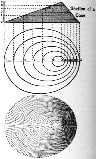
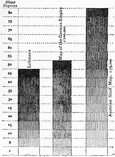
The declivities of the ground are still indicated in most topographical maps by a system of strokes or hachures, first devised by L. Chr. Müller (Plan und Kartenzeichnen, 1788) and J. G. Lehmann, who directed a survey of Saxony, 1780-1806, and published his Theorie der Bergzeichnung in 1799. By this method the slopes are indicated by strokes or hachures crossing the contour lines at right angles, in the direction of flowing water, and varying in thickness according to the degree of declivity they represent (cf. for example, the map of Switzerland in this work). The light is supposed to descend vertically upon the country represented, and in a true scale of shade the intensity increases with the inclination from 0° to 90°; but as such a scale does not sufficiently differentiate the lesser inclinations which are the most important, the author adopted a conventional scale, representing a slope of 45° or more, supposed to be inaccessible, as absolutely black, the level surfaces, which reflect all the light which falls upon them, as perfectly white, and the intervening slopes by a proportion between black and white, as in fig. 2. The main principles of this system have been maintained, but its details have been modified frequently to suit special cases. Thus the French survey commission of 1828 fixed the proportion of black to white at one and a half times the angle of slope; while in Austria, where steep mountains constitute an important feature, solid black has been reserved for a slope of 80°, the proportion of black to white varying from 80 : 0 (for 50°) to 8 : 72 (for 5°). On the map of Germany (1 : 100,000) a slope of 50° is shown in solid black while stippled hachures are used for gentle slopes up to 10°. Instead of shading lines following the greatest slopes, lines following the contours and varying in their thickness and in their intervals apart, according to the slope of the ground to be represented, may be employed. This method affords a ready and expeditious means of sketching the ground, if the draughtsman limits himself to characteristically indicating its features by what have been called “form lines.” This method can be recommended in the case of plotting the results of an explorer’s route, or in the case of countries of which we have no regular survey (cf. the map of Afghanistan in this work).
Instead of supposing the light to fall vertically upon the surface it is often supposed to fall obliquely, generally at an angle of 45° from the upper left-hand corner. It is claimed for this method that it affords a means of giving a graphic representation of Alpine districts where other methods of shading fail. The Dufour map of Switzerland (1 : 100,000) is one of the finest examples of this style of hill-shading. For use in the field, however, and for scientific work, a contoured map like Siegfried’s atlas of Switzerland, or, in the case of hilly country, a map shaded on the assumption of a vertical light, will prove more useful than one of these, notwithstanding that truth to nature and artistic beauty are claimed on their behalf.
Instead of shading by lines, a like effect may be produced by mezzotint shading (cf. the map of Italy, or other maps, in this work, on a similar method), and if this be combined with contour lines very satisfactory results can be achieved. If this tint be printed in grey or brown, isohypses, in black or red, show distinctly above it. The same combination is possible if hills engraved in the ordinary manner are printed in colours, as is done in an edition of the 1-inch ordnance map, with contours in red and hills hachured in brown.
Efforts have been made of late years to improve the available methods of representing ground, especially in Switzerland, but the so-called stereoscopic or relief maps produced by F. Becker, X. Imfeld, Kümmerly, F. Leuzinger and other able cartographers, however admirable as works of art, do not, from the point of utility, supersede the combination of horizontal contours with shaded slopes, such as have been long in use. There seems to be even less chance for the combination of coloured strata and hachures proposed by K. Peucker, whose theoretical disquisitions on aerial perspective are of interest, but have not hitherto led to satisfactory practical results.3
The above remarks apply more particularly to topographic maps. In the case of general maps on a smaller scale, the orographic features must be generalized by a skilful draughtsman and artist. One of the best modern examples of this kind is Vogel’s map of Germany, on a scale of 1 : 500,000.
Selection of Names and Orthography.—The nomenclature or “lettering” of maps is a subject deserving special attention. Not only should the names be carefully selected with special reference to the objects which the map is intended to serve, and to prevent overcrowding by the introduction of names which can serve no useful object, but they should also be arranged in such a manner as to be read easily by a person consulting the map. It is an accepted rule now that the spelling of names in countries using the Roman alphabet should be retained, with such exceptions as have been familiarized by long usage. In such cases, however, the correct native form should be added within brackets, as Florence (Firenze), Leghorn (Livorno), Cologne (Cöln) and so on. At the same time these corrupted forms should be eliminated as far as possible. Names in languages not using the Roman alphabet, or having no written alphabet should be spelt phonetically, as pronounced on the spot. An elaborate universal alphabet, abounding in diacritical marks, has been devised for the purpose by Professor Lepsius, and various other systems have been adopted for Oriental languages, and by certain missionary societies, adapted to the languages in which they teach. The following simple rules, laid down by a Committee of the Royal Geographical Society, will be found sufficient as a rule; according to this system the vowels are to be sounded as in Italian, the consonants as in English, and no redundant letters are to be introduced. The diphthong ai is 632 to be pronounced as in aisle; au as ow in how; aw as in law. Ch is always to be sounded as in church, g is always hard; y always represents a consonant; whilst kh and gh stand for gutturals. One accent only is to be used, the acute, to denote the syllable on which stress is laid. This system has in great measure been followed throughout the present work, but it is obvious that in numerous instances these rules must prove inadequate. The introduction of additional diacritical marks, such as ˉ and ˜, used to express quantity, and the diaeresis, as in aï, to express consecutive vowels, which are to be pronounced separately, may prove of service, as also such letters as ä, ö and ü, to be pronounced as in German, and in lieu of the French ai, eu or u.
The United States Geographic Board acts upon rules practically identical with those indicated, and compiles official lists of place-names, the use of which is binding upon government departments, but which it would hardly be wise to follow universally in the case of names of places outside America.
Measurement on Maps
Measurement of Distance.—The shortest distance between two places on the surface of a globe is represented by the arc of a great circle. If the two places are upon the same meridian or upon the equator the exact distance separating them is to be found by reference to a table giving the lengths of arcs of a meridian and of the equator. In all other cases recourse must be had to a map, a globe or mathematical formula. Measurements made on a topographical map yield the most satisfactory results. Even a general map may be trusted, as long as we keep within ten degrees of its centre. In the case of more considerable distances, however, a globe of suitable size should be consulted, or—and this seems preferable—they should be calculated by the rules of spherical trigonometry. The problem then resolves itself in the solution of a spherical triangle.
In the formulae which follow we suppose l and l′ to represent the latitudes, a and b the co-latitudes (90 − l or 90° − l′), and t the difference in longitude between them or the meridian distance, whilst D is the distance required.
If both places have the same latitude we have to deal with an isosceles triangle, of which two sides and the included angle are given. This triangle, for the convenience of calculation, we divide into two right-angled triangles. Then we have sin 1⁄2 D = sin a sin 1⁄2 t, and since sin a = sin (90° − l) = cos t, it follows that
sin 1⁄2 D = cos l sin 1⁄2 t.
If the latitudes differ, we have to solve an oblique-angled spherical triangle, of which two sides and the included angle are given. Thus,
| cos t = | cos D − cos a cos b |
| sin a sin b |
cos D = cos a cos b + sin a sin b cos t
= sin l sin l′ + cos l cos l′ cos t.
In order to adapt this formula to logarithms, we introduce a subsidiary angle p, such that cot p = cot l cos t; we then have
cos D = sin l cos (l′ − p) / sin p.
In the above formulae our earth is assumed to be a sphere, but when calculating and reducing to the sea-level, a base-line, or the side of a primary triangulation, account must be taken of the spheroidal shape of the earth and of the elevation above the sea-level. The error due to the neglect of the former would at most amount to 1%, while a reduction to the mean level of the sea necessitates but a trifling reduction, amounting, in the case of a base-line 100,000 metres in length, measured on a plateau of 3700 metres (12,000 ft.) in height, to 57 metres only.
These orthodromic distances are of course shorter than those measured along a loxodromic line, which intersects all parallels at the same angle. Thus the distance between New York and Oporto, following the former (great circle sailing), amounts to 3000 m., while following the rhumb, as in Mercator sailing, it would amount to 3120 m.
These direct distances may of course differ widely with the distance which it is necessary to travel between two places along a road, down a winding river or a sinuous coast-line. Thus, the direct distance, as the crow flies, between Brig and the hospice of the Simplon amounts to 4.42 geogr. m. (slope nearly 9°), while the distance by road measures 13.85 geogr. m. (slope nearly 3°). Distances such as these can be measured only on a topographical map of a fairly large scale, for on general maps many of the details needed for that purpose can no longer be represented. Space runners for facilitating these measurements, variously known as chartometers, curvimeters, opisometers, &c., have been devised in great variety. Nearly all these instruments register the revolution of a small wheel of known circumference, which is run along the line to be measured.
The Measurement of Areas is easily effected if the map at our disposal is drawn on an equal area projection. In that case we need simply cover the map with a network of squares—the area of each of which has been determined with reference to the scale of the map—count the squares, and estimate the contents of those only partially enclosed within the boundary, and the result will give the area desired. Instead of drawing these squares upon the map itself, they may be engraved or etched upon glass, or drawn upon transparent celluloid or tracing-paper. Still more expeditious is the use of a planimeter, such as Captain Prytz’s “Hatchet Planimeter,” which yields fairly accurate results, or G. Coradi’s “Polar Planimeter,” one of the most trustworthy instruments of the kind.4
When dealing with maps not drawn on an equal area projection we substitute quadrilaterals bounded by meridians and parallels, the areas for which are given in the “Smithsonian Geographical Tables” (1894), in Professor H. Wagner’s tables in the geographical Jahrbuch, or similar works.
It is obvious that the area of a group of mountains projected on a horizontal plane, such as is presented by a map, must differ widely from the area of the superficies or physical surface of those mountains exposed to the air. Thus, a slope of 45° having a surface of 100 sq. m. projected upon a horizontal plane only measures 59 sq. m., whilst 100 sq. m. of the snowclad Sentis in Appenzell are reduced to 10 sq. m. A hypsographical map affords the readiest solution of this question. Given the area A of the plane between the two horizontal contours, the height h of the upper above the lower contour, the length of the upper contour l, and the area of the face presented by the edge of the upper stratum t·h = A1, the slope α is found to be tan α = h·l / (A − A1); hence its superficies, A = A2 sec α. The result is an approximation, for inequalities of the ground bounded by the two contours have not been considered.
The hypsographical map facilitates likewise the determination of the mean height of a country, and this height, combined with the area, the determination of volume, or cubic contents, is a simple matter.5
Relief Maps are intended to present a representation of the ground which shall be absolutely true to nature. The object, however, can be fully attained only if the scale of the map is sufficiently large, if the horizontal and vertical scales are identical, so that there shall be no exaggeration of the heights, and if regard is had, eventually, to the curvature of the earth’s surface. Relief maps on a small scale necessitate a generalization of the features of the ground, as in the case of ordinary maps, as likewise an exaggeration of the heights. Thus on a relief on a scale of 1 : 1,000,000 a mountain like Ben Nevis would only rise to a height of 1.3 mm.
The methods of producing reliefs vary according to the scale and the materials available. A simple plan is as follows—draw an outline of the country of which a map is to be produced upon a board; mark all points the altitude of which is known or can be estimated by pins or wires clipped off so as to denote the heights; mark river-courses and suitable profiles by strips of vellum and finally finish your model with the aid of a good map, in clay or wax. If contoured maps are available it is easy to build up a strata-relief, which facilitates the completion of the relief so that it shall be a fair representation of nature, which the strata-relief cannot claim to be. A pantograph armed with cutting-files6 which carve the relief out of a block of gypsum, was employed in 1893-1900 by C. Perron of Geneva, in producing his relief map of Switzerland on a scale of 1 : 100,000. After copies of such reliefs have been taken in gypsum, cement, statuary pasteboard, fossil dust mixed with vegetable oil, or some other suitable material, they are painted. If a number of copies is required it may be advisable to print a map of the country represented in colours, and either to emboss this map, backed with papier-mâché, or paste it upon a copy of the relief—a task of some difficulty. Relief maps are frequently objected to on 633 account of their cost, bulk and weight, but their great use in teaching geography is undeniable.
Globes.7—It is impossible to represent on a plane the whole of the earth’s surface, or even a large extent of it, without a considerable amount of distortion. On the other hand a map drawn on the surface of a sphere representing a terrestrial globe will prove true to nature, for it possesses, in combination, the qualities which the ingenuity of no mathematician has hitherto succeeded in imparting to a projection intended for a map of some extent, namely, equivalence of areas of distances and angles. Nevertheless, it should be observed that our globes take no account of the oblateness of our sphere; but as the difference in length between the circumference of the equator and the perimeter of a meridian ellipse only amounts to 0.16%, it could be shown only on a globe of unusual size.
The method of manufacturing a globe is much the same as it was at the beginning of the 16th century. A matrix of wood or iron is covered with successive layers of papers, pasted together so as to form pasteboard. The shell thus formed is then cut along the line of the intended equator into two hemispheres, they are then again glued together and made to revolve round an axis the ends of which passed through the poles and entered a metal meridian circle. The sphere is then coated with plaster or whiting, and when it has been smoothed on a lathe and dried, the lines representing meridians and parallels are drawn upon it. Finally the globe is covered with the paper gores upon which the map is drawn. The adaption of these gores to the curvature of the sphere calls for great care. Generally from 12 to 24 gores and two small segments for the polar regions printed on vellum paper are used for each globe. The method of preparing these gores was originally found empirically, but since the days of Albert Dürer it has also engaged the minds of many mathematicians, foremost among whom was Professor A. G. Kästner of Göttingen. One of the best instructions for the manufacture of globes we owe to Altmütter of Vienna.8
Larger globes are usually on a stand the top of which supports an artificial horizon. The globe itself rotates within a metallic meridian to which its axis is attached. Other accessories are an hour-circle, around the north pole, a compass placed beneath the globe, and a flexible quadrant used for finding the distances between places. These accessories are indispensable if it be proposed to solve the problems usually propounded in books on the “use of the globes,” but can be dispensed with if the globe is to serve only as a map of the world. The size of a globe is usually given in terms of its diameter. To find its scale divide the mean diameter of the earth (1,273,500 m.) by the diameter of the globe; to find its circumference multiply the diameter by π (3.1416).
Map Printing.—Maps were first printed in the second half of the 15th century. Those in the Rudimentum novitiarum published at Lübeck in 1475 are from woodcuts, while the maps in the first two editions of Ptolemy published in Italy in 1472 are from copper plates. Wood engraving kept its ground for a considerable period, especially in Germany, but copper in the end supplanted it, and owing to the beauty and clearness of the maps produced by a combination of engraving and etching it still maintains its ground. The objection that a copper plate shows signs of wear after a thousand impressions have been taken has been removed, since duplicate plates are readily produced by electrotyping, while transfers of copper engravings, on stone, zinc or aluminium, make it possible to turn out large editions in a printing-machine, which thus supersedes the slow-working hand-press.9 These impressions from transfers, however, are liable to be inferior to impressions taken from an original plate or an electrotype. The art of lithography greatly affected the production of maps. The work is either engraved upon the stone (which yields the most satisfactory result at half the cost of copper-engraving), or it is drawn upon the stone by pen, brush or chalk (after the stone has been “grained”), or it is transferred from a drawing upon transfer paper in lithographic ink. In chromolithography a stone is required for each colour. Owing to the great weight of stones, their cost and their liability of being fractured in the press, zinc plates, and more recently aluminium plates, have largely taken the place of stone. The processes of zincography and of algraphy (aluminium printing) are essentially the same as lithography. Zincographs are generally used for producing surface blocks or plates which may be printed in the same way as a wood-cut. Another process of producing such blocks is known as cerography (Gr. κηρός), wax. A copper plate having been coated with wax, outline and ornament are cut into the wax, the lettering is impressed with type, and the intaglio thus produced is electrotyped.10 Movable types are utilized in several other ways in the production of maps. Thus the lettering of the map, having been set up in type, is inked in and transferred to a stone or a zinc-plate, or it is impressed upon transfer-paper and transferred to the stone. Photographic processes have been utilized not only in reducing maps to a smaller scale, but also for producing stones and plates from which they may be printed. The manuscript maps intended to be produced by photographic processes upon stone, zinc or aluminium, are drawn on a scale somewhat larger than the scale on which they are to be printed, thus eliminating all those imperfections which are inherent in a pen-drawing. The saving in time and cost by adopting this process is considerable, for a plan, the engraving of which takes two years, can now be produced in two days. Another process, photo- or heliogravure, for obtaining an engraved image on a copper plate, was for the first time employed on a large scale for producing a new topographical map of the Austrian Empire in 718 sheets, on a scale of 1 : 75,000, which was completed in seventeen years (1873-1890). The original drawings for this map had to be done with exceptional neatness, the draughtsman spending twelve months on that which he would have completed in four months had it been intended to engrave the map on copper; yet an average chart, measuring 530 by 630 mm., which would have taken two years and nine months for drawing and engraving, was completed in less than fifteen months—fifty days of which were spent in “retouching” the copper plate. It only cost £169 as compared with £360 had the old method been pursued.
For details of the various methods of reproduction see Lithography; Process, &c.
History of Cartography
A capacity to understand the nature of maps is possessed even by peoples whom we are in the habit of describing as “savages.” Wandering tribes naturally enjoy a great advantage in this respect over sedentary ones. Our arctic voyagers—Sir E. W. Parry, Sir J. Ross, Sir F. L. MacClintock and others—have profited from rough maps drawn for them by Eskimos. Specimens of such maps are given in C. F. Hall’s Life with the Esquimaux (London, 1864). Henry Youle Hind, in his work on the Labrador Peninsula (London, 1863) praises the map which the Montagnais and Nasquapee Indians drew upon bark. Similar essays at map-making are reported in connexion with Australians, Maoris and Polynesians. Tupaya, a Tahitian, who accompanied Captain Cook in the “Endeavour” to Europe, supplied his patron with maps; Raraka drew a map in chalk of the Paumotu archipelago on the deck of Captain Wilkes’s vessel; the Marshall islanders, according to Captain Winkler (Marine Rundschau, Oct. 1893) possess maps upon which the bearings of the islands are indicated by small strokes. Far superior were the maps found among the semi-civilized Mexicans when the Spaniards first discovered and invaded their country. Among them were cadastral plans of villages, maps of the provinces of the empire of the Aztecs, of towns and of the coast. Montezuma presented Cortes with a map, painted on Nequen cloth, of the Gulf coast. Another map did the Conquistador good service on his campaign against Honduras (Lorenzana, Historia de nueva España, Mexico, 1770; W. H. Prescott, History of the Conquest of Mexico, New 634 York, 1843). Peru, the empire of the Incas, had not only ordinary maps, but also maps in relief, for Pedro Sarmiento da Gamboa (History of the Incas, translated by A. R. Markham, 1907) tells us that the 9th Inca (who died in 1191) ordered such reliefs to be produced of certain localities in a district which he had recently conquered and intended to colonize. These were the first relief maps on record. It is possible that these primitive efforts of American Indians might have been further developed, but the Spanish conquest put a stop to all progress, and for a consecutive history of the map and map-making we must turn to the Old World, and trace this history from Egypt and Babylon, through Greece, to our own age.
The ancient Egyptians were famed as “geometers,” and as early as the days of Rameses II. (Sesostris of the Greeks, 1333-1300 B.C.) there had been made a cadastral survey of the country showing the rows of pillars which separated the nomens as well as the boundaries of landed estates. It was upon a map based upon such a source that Eratosthenes (276-196 B.C.) measured the distance between Syene and Alexandria which he required for his determination of the length of a degree. Ptolemy, who had access to the treasures of the famous library of Alexandria was able, no doubt, to utilize these cadastral plans when compiling his geography. It should be noted that he places Syene only two degrees to the east of Alexandria instead of three degrees, the actual meridian distance between the two places; a difference which would result from an error of only 7° is the orientation of the map used by Ptolemy. Scarcely any specimens of ancient Egyptian cartography have survived. In the Turin Museum are preserved two papyri with rough drawings of gold mines established by Sesostris in the Nubian Desert.11 These drawings have been commented upon by S. Birch, F. Chabas, R. J. Lauth and other Egyptologists, and have been referred to as the two most ancient maps in existence. They can, however, hardly be described as maps, while in age they are surpassed by several cartographical clay tablets discovered in Babylonia. On another papyrus in the same museum is depicted the victorious return of Seti I. (1366-1333) from Syria, showing the road from Pelusium to Heroopolis, the canal from the Nile with crocodiles, and a lake (mod. Lake Timsah) with fish in it. Apollonius of Rhodes who succeeded Eratosthenes as chief librarian at Alexandria (196 B.C.) reports in his Argonautica (iv. 279) that the inhabitants of Colchis whom, like Herodotus (ii., 104) he looks upon as the descendants of Egyptian colonists, preserved, as heirlooms, certain graven tablets (κύρβεις) on which land and sea, roads and towns were accurately indicated.12 Eustathius (since 1160 archbishop of Thessalonica) in his commentary on Dionysius Periegetes, mentions route-maps which Sesostris caused to be prepared, while Strabo (i., 1. 5) dwells at length upon the wealth of geographical documents to be found in the library of Alexandria.
A cadastral survey for purposes of taxation was already at work in Babylonia in the age of Sargon of Akkad, 3800 B.C. In the British Museum may be seen a series of clay tablets, circular in shape and dating back to 2300 or 2100 B.C., which contain surveys of lands. One of these depicts in a rough way lower Babylonia encircled by a “salt water river,” Oceanus.
Development of Map-making among the Greeks.13—Ionian mercenaries and traders first arrived in Egypt, on the invitation of Psammetichus I. about the middle of the 7th century B.C. Among the visitors to Egypt, there were, no doubt, some who took an interest in the science of the Egyptians. One of the most distinguished among them was Thales of Miletus (640-543 B.C.), the founder of the Ionian school of philosophy, whose pupil, Anaximander (611-546 B.C.) is credited by Eratosthenes with having designed the first map of the world. Anaximander looked upon the earth as a section of a cylinder, of considerable thickness, suspended in the centre of the circular vault of the heavens, an idea perhaps borrowed from the Babylonians, for Job (xxvi. 7) already speaks of the earth as “hanging upon nothing.” Like Homer he looked upon the habitable world (οἰκουμένη) as being circular in outline and bounded by a circumfluent river. The geographical knowledge of Anaximander was naturally more ample than that of Homer, for it extended from the Cassiterides or Tin Islands in the west to the Caspian in the east, which he conceived to open out into Oceanus. The Aegean Sea occupied the centre of the map, while the line where ocean and firmament seemed to meet represented an enlarged horizon.
Anaximenes, a pupil of Anaximander, was the first to reject the view that the earth was a circular plane, but held it to be an oblong rectangle, buoyed up in the midst of the heavens by the compressed air upon which it rested. Circular maps, however, remained in the popular favour long after their erroneousness had been recognized by the learned.
Even Hecataeus of Miletus (549-472 B.C.), the author of a Periodos or description of the earth, of whom Herodotus borrowed the terse saying that Egypt was the gift of the Nile, retained this circular shape and circumfluent ocean when producing his map of the world, although he had at his disposal the results of the voyage of Scylax of Caryanda from the Indus to the Red Sea, of Darius’ campaign in Scythia (513), the information to be gathered among the merchants from all parts of the world who frequented an emporium like Miletus, and what he had learned in the course of his own extensive travels. Hecataeus was probably the author of the “bronze tablets upon which was engraved the whole circuit of the earth, the sea and rivers” (Herod, v. 49), which Aristagoras, the tyrant of Miletus, showed to Cleomenes, the king of Sparta, in 504, whose aid he sought in vain in a proposed revolt against Darius, which resulted disastrously in 494 in the destruction of Miletus. The map of the world brought upon the stage in Aristophanes’ comedy of The Clouds (423 B.C.), whereon a disciple of the Sophists points out upon it the position of Athens and of other places known to the audience, was probably of the popular circular type, which Herodotus (iv. 36) not many years before had derided and which was discarded by Greek cartographers ever after. Thus Democritus of Abdera (b. c. 450, d. after 360), the great philosopher and founder, with Leucippus, of the atomic theory, was also the author of a map of the inhabited world which he supposed to be half as long again from west to east, as it was broad.
Dicaearcus of Messana in Sicily, a pupil of Aristotle (326-296 B.C.), is the author of a topographical account of Hellas, with maps, of which only fragments are preserved; he is credited with having estimated the size of the earth, and, as far as known he was the first to draw a parallel across a map.14 This parallel, or dividing line, called diaphragm (partition) by a commentator, extended due east from the Pillars of Hercules, through the Mediterranean, and along the Taurus and Imaus (Himalaya) to the eastern ocean. It divided the inhabited world, as then known, into a northern and a southern half. In compiling his map he was able to avail himself of the information obtained by the bematists (surveyors who determined distances by pacing) who accompanied Alexander the Great on his campaigns; of the results of the voyage of Nearchus from the Indus to the Euphrates, and of the “Periplus” of Scylax of Caryanda, which described the coast from between India and the head of the Arabian Gulf. On the other hand he unwisely rejected the results of the observations for latitude made by Pytheas in 326 B.C. at his native town, Massilia, and during a subsequent voyage to northern Europe. In the end the map of Dicaearcus resembled that of Democritus.
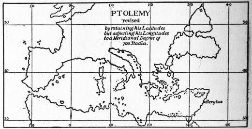
Scientific geography profited largely from the labours of Eratosthenes of Cyrene, whom Ptolemy Euergetes appointed 635 keeper of the famous library of Alexandria in 247 B.C., and died in that city in 195 B.C. He won fame as having been the first to determine the size of the earth by a scientific method. Having determined the difference of latitude between Alexandria and Syene which he erroneously believed to lie on the same meridian, and obtained the distance of those places from each other from the surveys made by Egyptian geometers, he concluded that a degree of the meridian measured 700 stadia.15
Eratosthenes is the author of a treatise which deals systematically with the geographical knowledge of his time, but of which only fragments have been preserved by Strabo and others. This treatise was intended to illustrate and explain his map of the world. In this task he was much helped by the materials collected in his library. Among the travellers of whose information he was thus able to avail himself were Pytheas of Massilia, Patroclus, who had visited the Caspian (285-282 B.C.), Megasthenes, who visited Palibothra on the Ganges, as ambassador of Seleucus Nicator (302-291 B.C.), Timosthenus of Rhodes, the commander of the fleet of Ptolemy Philadelphus (284-246 B.C.) who wrote a treatise “On harbours,” and Philo, who visited Meroe on the upper Nile. His map formed a parallelogram measuring 75,800 stadia from Usisama (Ushant island) or Sacrum Promontorium in the west to the mouth of the Ganges and the land of the Coniaci (Comorin) in the east, and 46,000 stadia from Thule in the north to the supposed southern limit of Libya. Across it were drawn seven parallels, running through Meroe, Syene, Alexandria, Rhodes, Lysimachia on the Hellespont, the mouth of the Borysthenes and Thule, and these were crossed at right angles by seven meridians, drawn at irregular intervals, and passing through the Pillars of Hercules, Carthage, Alexandria, Thapsacus on the Euphrates, the Caspian gates, the mouth of the Indus and that of the Ganges. The position of all the places mentioned was supposed to have been determined by trustworthy authorities. The inhabited world thus delineated formed an island of irregular shape, surrounded on all sides by the ocean, the Erythrean Sea freely communicating with the western ocean. In his text Eratosthenes ignored the popular division of the world into Europe, Asia and Libya, and substituted for it a northern and southern division, divided by the parallel of Rhodes, each of which he subdivided into sphragides or plinthia—seals or plinths. The principles on which these divisions were made remain an enigma to the present day.
This map of Eratosthenes, notwithstanding its many errors, such as the assumed connexion of the Caspian with a northern ocean and the supposition that Carthage, Sicily and Rome lay on the same meridian, enjoyed a high reputation in his day. Even Strabo (c. 30 B.C.) adopted its main features, but while he improved the European frontier, he rejected the valuable information secured by Pytheas and retained the connexion between the Caspian and the outer ocean. In the extreme east his information extended no further than that of Eratosthenes, viz. to India and Taprobane (Ceylon) and the Sacae (Kirghiz).
Hipparchus, the famous astronomer, on the other hand, (c. 150 B.C.) proved a somewhat captious critic. He justly objected to the arbitrary network of the map of Eratosthenes. The parallels or climata16 drawn through places, of which the longest day is of equal length and the decimation (distance) from the equator is the same, he maintained, ought to have been inserted at equal intervals, say of half an hour, and the meridians inserted on a like principle. In fact, he demanded that maps should be based upon a regular projection, several descriptions of which he had adopted for his star maps. He moreover accuses Eratosthenes, (whose determination of a degree he accepts without hesitation) with trusting too much to hypothesis in compiling his map instead of having recourse to latitudes and longitudes deduced by astronomical observations. Such observations, however, were but rarely available at the time. A few latitudes had indeed been observed, but although Hipparchus had shown how longitudes could be determined by the observation of eclipses, this method was in reality not available for want of trustworthy time-keepers. The determination of an ocean surrounding the inhabited earth he declared to be based on a mere hypothesis and that it would be equally allowable to describe the Erythraea as a sea surrounded by land. Hipparchus is not known to have compiled a map himself.
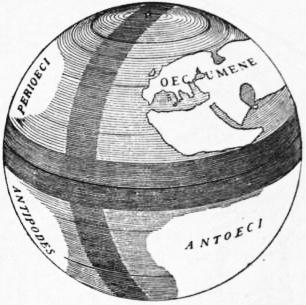
About the same time Crates of Mallus (d. 145 B.C.) embodied the views of the Stoic school of philosophy in a globe which has become typical as one of the insignia of royalty. On this globe an equatorial and a meridional ocean divide our earth into four quarters, each inhabited, thus anticipating the discovery of North and South America and Australia.17
 |
| Fig. 2.—The Globe of Crates of Mallus. |
The period between Eratosthenes and Marinus of Tyre was one of great political importance. Carthage had been destroyed (146 B.C.), Julius Caesar had carried on his campaign in Gaul (58-51 B.C.), Egypt had been occupied (30 B.C.), Britannia conquered (A.D. 41-79), and the Roman empire had attained its greatest extent and power under the emperor Trajan (A.D. 98-117). But although military operations added to our knowledge of the world, scientific cartography was utterly neglected.
Among Greek works written during this period there are several which either give us an idea of the maps available at that time, or furnish information of direct service to the compiler of a map. Among the latter a Periplus or coastal guide of the Erythrean Sea, which clearly reveals the peninsular shape of India (A.D. 90) and Arrian’s Periplus Ponti Euxeni (A.D. 131) which Festus Avienus translated into Latin. Among travellers Eudoxus of Cyzicus occupies a foremost rank, since, between 115-87 B.C. he visited India and the east coast of Africa, which subsequently he attempted in vain to circumnavigate by 636 following the route of Hanno, along the west coast. Among geographers should be mentioned Posidonius (135-51), the head of the Stoic school of Rhodes, who is stated to be responsible for having reduced the length of a degree to 500 stadia; Artemidorus of Ephesus, whose “Geographumena” (c. 100 B.C.) are based upon his own travels and a study of itineraries, and above all, Strabo, who has already been referred to. Among historians who looked upon geography as an important aid in their work are numbered Polybius (c. 210-120 B.C.), Diodorus Siculus (c. 30 B.C.) and Agathachidus of Cnidus (c. 120 B.C.) to whom we are indebted for a valuable account of the Erythrean Sea and the adjoining parts of Arabia and Ethiopia. The Periegesis of Dionysius of Alexandria is a popular description of the world in hexameters, of no particular scientific value (c. A.D. 130). He as well as Artemidorus and others accepted a circular or ellipsoidal shape of the world and a circumfluent ocean; Strabo alone adhered to the scientific theories of Eratosthenes.
 |
| Fig. 3.—Ptolemy’s Map. |
The credit of having returned to the scientific principles innovated by Eratosthenes and Hipparchus is due to Marinus of Tyre (c. A.D. 120) which, though no longer occupying the pre-eminent position of former times, was yet an emporium of no inconsiderable importance, having extensive connexions by sea and land. The map of Marinus and the descriptive accounts which accompanied it have perished, but we learn sufficient concerning them from Ptolemy to be able to appreciate their merits and demerits. Marinus was the first who laid down the position of places on a projection according to their latitude and longitude, but the projection used by him was of the rudest. Parallels and meridians were represented by straight lines intersecting each other at right angles, the relative proportions between degrees of longitude and latitude being retained only along the parallel of Rhodes. The distortion of the countries represented would thus increase with the distance, north and south, from this central parallel. The number of places whose position had been determined by astronomical observation was as yet very small, and the map had thus to be compiled mainly from itineraries furnished by travellers or the dead reckoning of seamen. The errors due to an exaggeration of distances were still further increased on account of his assuming a degree to be equal to 500 stadia, as determined by Posidonius, instead of accepting the 700 stadia of Eratosthenes. He was thus led to assume that the distance from the first meridian drawn through the Fortunate islands to Sera (mod. Si-ngan-fu), the capital of China, was equal to 225°, which Ptolemy reduced to 177°, but which in reality only amount to 126°. A like overestimate of the distances covering the march of Julius Maternus to Agisymba, which Marinus places 24° south of the equator, a latitude which Ptolemy reduces to 18°, but which is probably no farther south than lat. 12° N. The map of Marinus was accompanied by a list of places arranged according to latitude and longitude. It must have been much in demand, for three editions of it were prepared. Masudi (10th century) saw a copy of it and declared it to be superior to Ptolemy’s map.
 |
| Fig. 4. |
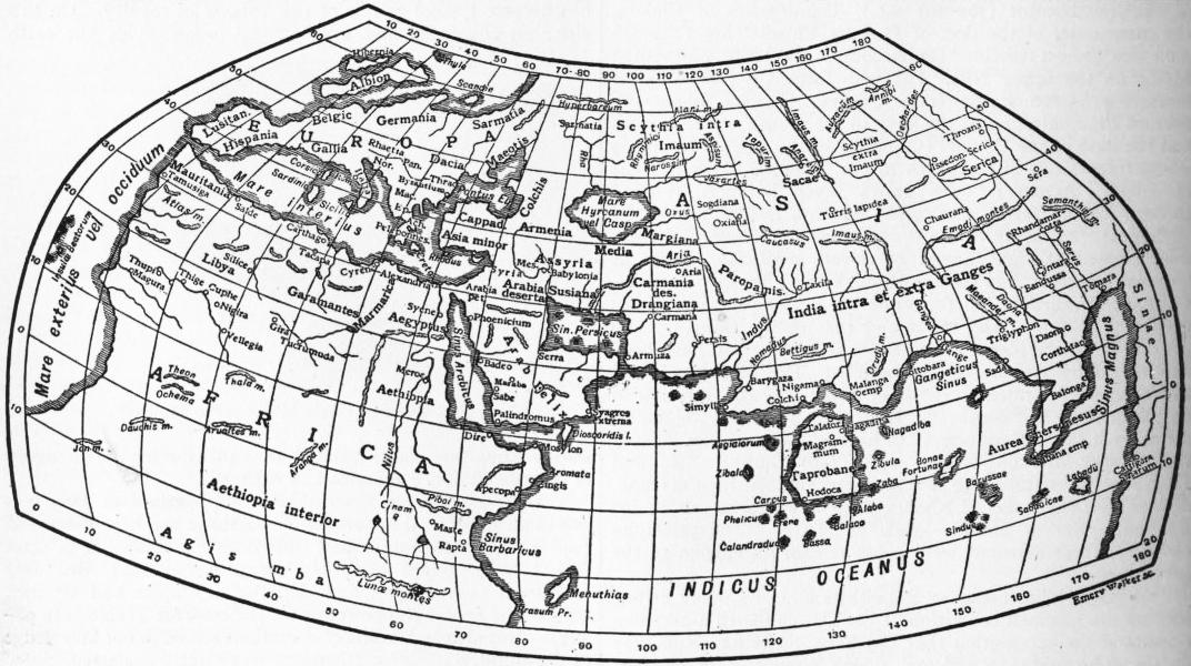
Ptolemy (q.v.) was the author of a Geography18 (c. A.D. 150) in eight books. “Geography,” in the sense in which he uses the term, signifies the delineation of the known world, in the shape of a map, while chorography carries out the same objects in fuller detail, with regard to a particular country. In Book I. he deals with the principles of mathematical geography, map projections, and sources of information with special reference to his predecessor Marinus. Books II. to VII. form an index to the maps. They contain about 8000 names, with their latitudes and longitudes, and with their aid it is possible to reconstruct the maps. These maps existed, as a matter of course, before such an index could be compiled, but it is doubtful whether the maps in our available manuscript, which are attributed to Agathodaemon, are copies of Ptolemy’s originals or have been compiled, after their loss, from this index. Book VIII. gives further details with reference to the principal towns of each map, as to geographical position, length of day, climata, &c.
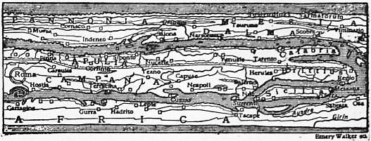
Ptolemy’s great merit consists in having accepted the views of Hipparchus with respect to a projection suited for a map of the world. Of the two projections proposed by him one is a modified conical projection with curved parallels and straight meridians; in the second projection (see fig. 3) both parallels and meridians are curved. The correct relations in the length of degrees of latitude and longitude are maintained in the first case along the latitude of Thule and the equator, in the second along the parallel of Agisymba, the equator and the parallels of Meroe, Syene and Thule. Following Hipparchus he divided the equator into 360° drawing his prime meridian through the Fortunate Islands (Canaries). The 26 special maps are drawn on a rectangular projection. As a map compiler Ptolemy does not take a high rank. In the main he copied Marinus whose work he revised and supplemented in some points, but he failed to realize the peninsular shape of India, erroneously exaggerated the size of Taprobane (Ceylon), and suggested that the Indian Ocean had no connexion with the western ocean, but formed Mare Clausum. Ptolemy knew but of a few latitudes which had been determined by actual observation, while of three longitudes resulting from simultaneous observation of eclipses he unfortunately accepted the least satisfactory, namely, that which placed Arbela 45° to the east of Carthage, while the actual meridian distance only amounts to 34°. An even graver source of error was Ptolemy’s acceptance of a degree of 500 instead of 700 stadia. The extent to which the more correct proportion would have affected the delineation of the Mediterranean is illustrated by fig. 4. But in spite of his errors the scientific method pursued by Ptolemy was correct, and though he was neglected by the Romans and during the middle ages, once he had become known, in the 15th century, he became the teacher of the modern world.
Map-Making among the Romans.—We learn from Cicero, Vitruvius, Seneca, Suetonius, Pliny and others, that the Romans had both general and topographical maps. Thus, Varro (De rustici) mentions a map of Italy engraved on marble, in the temple of Tellus, Pliny, a map of the seat of war in Armenia, of the time of the emperor Nero, and the more famous map of the Roman Empire which was ordered to be prepared for Julius Caesar (44 B.C.), but only completed in the reign of Augustus, who placed a copy of it, engraved in marble, in the Porticus of his sister Octavia (7 B.C.). M. Vipsanius Agrippa, the son-in-law of Augustus (d. 12 B.C.), who superintended the completion of this famous map, also wrote a commentary illustrating it, quotations from which of Ammianus Marcellinus of Antioch (d. 330), Pliny and others, afford the only means of judging of its character. The map is supposed to be based upon actual surveys or rather reconnaissances, and if it be borne in mind that the Roman Empire at that time was traversed in all directions by roads furnished with mile-stones, that the Agrimensores employed upon such a duty were skilled surveyors, and that the official reports of the commanders of military expeditions and of provincial governors were available, this map, as well as the provincial maps upon which it was based, must have been a work of superior excellence, the loss of which is much to be regretted. A copy of it may possibly have been utilized by Marinus and Ptolemy in their compilations. The Romans have been reproached for having neglected the scientific methods of map-making advocated by Hipparchus. Their maps, however, seem to have met the practical requirements of political administration and of military undertakings.
Only two specimens of Roman cartography have come down to us, viz. parts of a plan of Rome, of the time of the emperor 637 Septimius Severus (A.D. 193-211), now in the Museo Capitolino, and an itinerarium scriptum, or road map of the world, compressed within a strip 745 mm. in length and 34 mm. broad. Of its character the reduced copy of one of its 12 sections (fig. 5) conveys an idea. The map, apparently of the 3rd century, was copied by a monk at Colmar, in 1265, who fortunately contented himself with adding a few scriptural names, and having been acquired by the learned Conrad Peutinger of Augsburg it became known as Tabula peutingeriana. The original is now in the imperial library of Vienna.19
 |
| Fig. 5.—A Section of Peutinger’s Tabula. |
 |
| Fig. 6.—The World according to Cosmas Indicopleustes (535). |
 |
| Fig. 7.—Map of Albi (8th century). |
Map-Making in the Middle Ages.—In scientific matters the early middle ages were marked by stagnation and retrogression. The fathers of the church did not encourage scientific pursuits, which Lactantius (4th century) declared to be unprofitable. The doctrine of the sphericity of the earth was still held by the more learned, but the heads of the church held it to be unscriptural. Pope Zachary, when in 741 he condemned the views of Virgilius, the learned bishop of Salzburg, an Irishman who had been denounced as a heretic by St Boniface, declares it to be perversa et iniqua doctrina. Even after Gerbert of Aurillac, better known as Pope Sylvester II. (999-1063), Adam of Bremen (1075), Albertus Magnus (d. 1286), Roger Bacon (d. 1294), and indeed all men of leading had accepted as a fact and not a mere hypothesis the geocentric system of the universe and sphericity of the globe, the authors of maps of the world, nearly all of whom were monks, still looked in the main to the Holy Scriptures for guidance in outlining the inhabited world. We have to deal thus with three types of these early maps, viz. an oblong rectangular, a circular and an oval type, the latter being either a compromise between the two former, or an artistic development of the circular type. In every instance the inhabited world is surrounded by the ocean. The authors of rectangular maps look upon the Tabernacle as an image of the world at large, and believe that such expressions as the “four corners of the earth” (Isa. x. 12), could be reconciled only with a rectangular world. On the other hand there was the expression “circuit of the earth” (Isa. xl. 22), and the statement (Ezek. v. 5) that “God had set Jerusalem in the midst of the nations and countries.” In 638 nearly every case the East occupies the top of the map. Neither parallels nor meridians are indicated, nor is there a scale. Other features frequently met with are the Paradise in the Far East, miniatures of towns, plants, animals, human beings and monsters, and an indication of the twelve winds around the margin.
 |
| Fig. 8.—Anglo-Saxon Map of the World (9th century). |
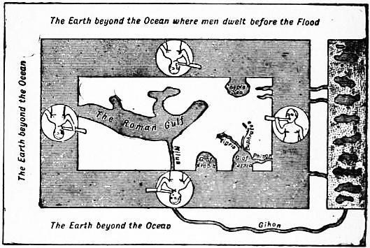
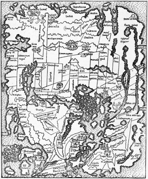
The oldest rectangular map of the world is contained in a most valuable work written by Cosmas, an Alexandrian monk, surnamed Indicopleustes, after returning from a voyage to India (535 A.D.), and entitled Christian Topography. According to Cosmas (fig. 6) the inhabited earth has the shape of an oblong rectangle surrounded by an ocean which breaks in in four great gulfs—the Roman or Mediterranean, the Arabian, Persian and Caspian Sea. Beyond this ocean lies another world, which was occupied by man before the Deluge, and within which Cosmas placed the Terrestrial Paradise. Above this rise the walls of the heavens like unto the tent of the Tabernacle. Far more simple is a small map of the world of the 8th century found in a codex in the library of Albi, an archiepiscopal seat in the department of Tarn. Its scanty nomenclature is almost wholly derived from the “Historiae adversum paganos” of Paulus Orosius (418). Far greater interest attaches to the so-called Anglo-Saxon Map of the World in the British Museum (Cotton MSS.), where it is bound up in a codex which also contains a copy of the Periegesis of Priscianus. Map and Periegesis are copies by the same hand, but no other connexion exists between them. More than half the nomenclature of the map is derived from Orosius, an annotated Anglo-Saxon version of which had been produced by King Alfred (871-901). The Anglo-Saxons of the time were of course well acquainted with Island (first thus named in 870) Slesvic and Norweci (Norway), and there is no need to have recourse to Adam of Bremen (1076) to account for their presence upon this map. The broad features of the map were derived no doubt from an older document which may likewise have served as the basis for the map of the world engraved on silver for Charlemagne, and was also consulted by the compilers of the Hereford and Ebstorf maps (see fig. 11).
 |
| Fig. 9.—T map from Isidor of Seville’s Origines. |
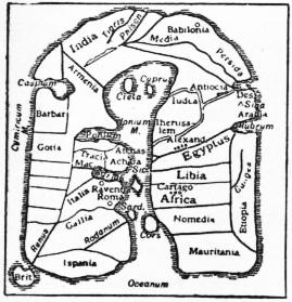
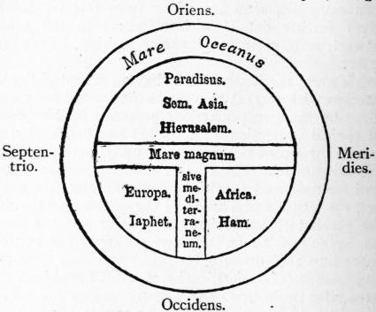
The map or diagram of which Leonardo Dati in his poem on the Sphere (Della Spera) wrote in 1422 “un T dentre a uno O mostra il disegno” (a T within an O shows the design) is one of the most persistent types among the circular or wheel maps of the world. It perpetuates the tripartite division of the world by the ancient Greeks and survives in the Royal Orb. A diagram of this description will be found in Isidor of Seville’s Origines (630), see fig. 9.
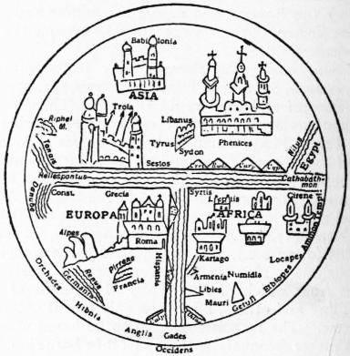
T maps of more elaborate design illustrate the MS. copies of Sallust’s Bellum jugurthinum; one of these taken from a codex of the 11th century in the Leipzig town library is shown in fig. 10.
 |
| Fig. 10.—Map illustrating Sallust’s Bellum jugurthinum (11th century, Leipzig). |
The outlines of several medieval maps resemble each other to such an extent that there can be no doubt that they are derived from the same original source. This source by some authors is assumed to have been the official map of the Roman Empire, but if we compare the crude outline given to the Mediterranean with the more correct delineation of Ptolemy, who was certainly in a position to avail himself of these official sources, such an assumption is untenable. The earliest delineation of the description has already been referred to as the Anglo-Saxon map of the world. Next in the order of age, follows the oval map which Henry, canon of Mayence Cathedral, dedicated to Mathilda, consort of the emperor Henry V. (1110). Of far greater importance is the map seen in Hereford Cathedral. It is the work of Richard of Haldingham, and has a diameter of 134 cm. (53 ins.). The “survey” ordered by Julius Caesar is referred to in the legend, evidently derived from the Cosmography of 639 Aethicus a work widely read at the time, but this does not prove that the author was able to avail himself of a map based upon that survey. A map essentially identical with that of Hereford, but larger—its diameter is 15.6 cm. (6 in.), and consequently fuller of information—was discovered in 1830 in the old monastery of Ebstorf in Hanover. Its date is 1484. Both maps abound in miniature pictures of towns, animals, fabulous beings and other subjects. The Hereford map is surmounted by a picture of the Day of Judgment. Similar in design, though much smaller of scale and oval in form, are the maps which illustrate the popular Polychronicon of Ranulf Higden, a monk of St Werburgh’s Abbey of Chester (d. 1363).
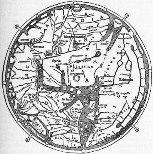 |
| Fig. 11.—The Hereford Map (c. 1280). |
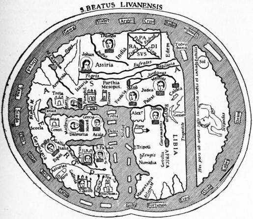 |
| Fig. 12.—The Map of Beatus (776). |
Pomponius Mela tells us that beyond the Ethiopian Ocean which sweeps round Africa in the south and the uninhabitable torrid zone, there lies an alter orbis, or fourth part of the world inhabited by Antichthones. On a diagram illustrating the origines of Isidore of Seville (d. 636) this country is shown, but is described as a terra inhabitabilis. It is shown likewise upon a number of maps which illustrate the Commentaries on the Apocalypse, by Beatus, a Benedictine monk of the abbey of Valcavado at the foot of the hills of Liebana in Asturia (776).
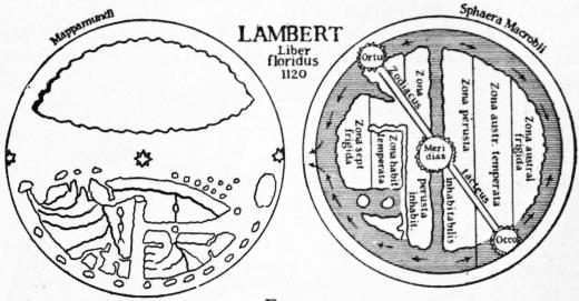
Our little map (fig. 12) is taken from a copy of Beatus’ work made in 1203, and preserved at Burgo de Osma in Castille. Similar maps illustrating the Commentaries exist at St Sever (1050), Paris (1203), and Tunis; others are rectangular, the oldest being in Lord Ashburnham’s library (970). Beatus, too, describes the southern land as inhabitabilis. The habitable world is divided among the twelve apostles, whose portraits are given. On the maps illustrating the encyclopaedic Liber floridus by Lambert, a canon of St Omer (1120), this south land “unknown to the sons of Adam,” is stated to be inhabited “according to the philosophers” by Antipodes. Lambert, indeed, seems to have believed in the sphericity of the earth. Fig. 13 shows his map of the world reduced from a MS. at Wolfenbüttel, to which is added a diagram of the zones from a MS. at Ghent, which illustrates Macrobius’ commentary on Cicero’s Somnium Scipionis. Diagrams illustrating the division of the world into climata, are to be found in the opus majus of Roger Bacon (d. 1294) and in Cardinal Pierre d’Ailly’s De imagine Mundi (1410).
 |
| Fig. 13. |
Among countries represented on a larger scale on maps, Palestine not unnaturally occupies a prominent place in this age of pilgrimages and crusades (1095-1291). The maps which accompany St Jerome’s translation of the Onomasticon of St Eusebius (388). The same subject is illustrated by a picture-map in mosaic, portions of which were discovered in 1896 on the floor of the church of Madaba to the east of the Dead Sea. This is the oldest original of a map in existence, for it dates back to the 6th century. Among more recent maps of Palestine, that by Petrus Vesconte (1320) is greatly superior to the earlier maps. It illustrates Marino Sanuto’s Secreta fidelium crucis, in which its author vainly appeals to Christendom to undertake another crusade. One of the earliest plans of Jerusalem is contained in Gesta Francorum, a history of the Crusades up to 1106, based upon information furnished by Fulcherius of Chartres (c. 1109).
 |
| Fig. 14.—Matthew of Paris (1236-1259). |
There existed, no doubt, special maps of European countries, but the only documents of that description are two maps of Great Britain, the one of the 12th century, the other by Matthew of Paris, the famous historiographer of the monastery of St Albans (1236-1259).20
Celestial globes were known in the time of Bede; they formed part of the educational apparatus of the monastic schools. Gerbert of Aurillac is known to have made such globes (929). Their manufacture is described by Alphonso the Wise (1252), as also in De sphaera solida of G. Campanus of Novara (1303). Terrestrial globes, however, are not referred to.
Map-making among the Arabians and other Nations of the East.—Bagdad early became a famous seat of learning. Indian astronomers found apt pupils there among the Arabs; the works of 640 Ptolemy were translated into Arabic, and in 827, in the reign of the caliph Abdullah al Mamun, an arc of the meridian was measured in the plain of Mesopotamia. Most famous among these Arabian astronomers were Al Batani (d. 998), Ibn Yunis of Cairo (d. 1008), Zarkala (Azarchel), who determined the meridian distance between his observatory in Toledo and Bagdad to amount to 51° 30′, an error of 3° only, as compared with Ptolemy’s error of 18°, and Abul Hassan (1230) who reduced the great axis of the Mediterranean to 44°.
 |
| Fig. 15.—Idrisi (1154). |
 |
| Fig. 16.—Idrisi (1154). |
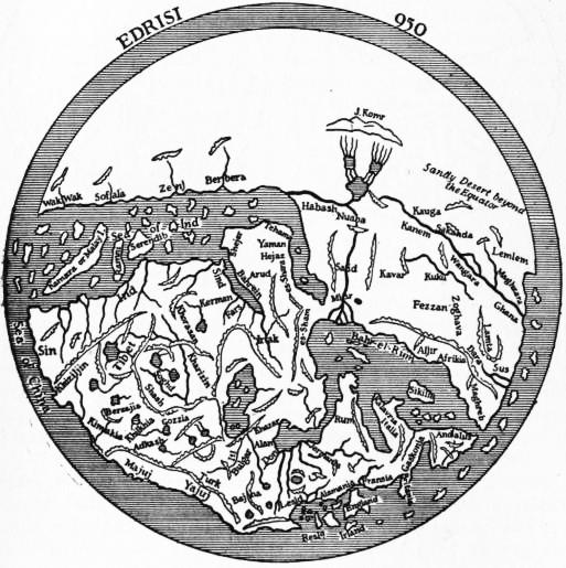
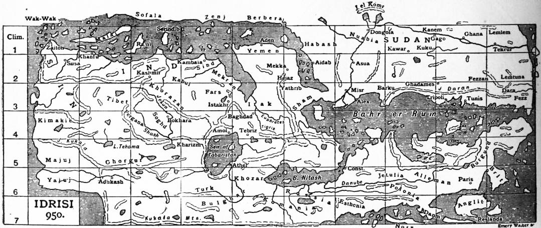
Further materials serviceable to the compilers of maps were supplied by numerous Arabian travellers and geographers, among whom Masudi (915-940), Istakhri (950), Ibn Haukal (942-970), Al Biruni (d. 1038), Ibn Batuta (1325-1356) and Abul Feda (1331-1370), occupy a foremost place, yet the few maps which have reached us are crude in the extreme. Masudi, who saw the maps in the Horismos or Rasm el Ard, a description of the world by Abu Jafar Mahommed ben Musa of Khiva, the librarian of the caliph el Mamun (833), declares them to be superior to the maps of Ptolemy or Marinus, but maps of a later date by Istakhri (950) or Ibn al Wardi (1349) are certainly of a most rudimentary type. Nor can Idrisi’s map of the world, which was engraved for King Roger of Sicily upon a silver plate, or the rectangular map in 70 sheets which accompanies his geography (Nushat-ul Mushtat) take rank with Ptolemy’s work. These maps are based upon information collected during many years at the instance of King Roger. The seven climates adopted by Idrisi are erroneously supposed to be equal in latitudinal extent. The Mediterranean occupies nearly half the inhabited world in longitude, and the east coast of Africa is shown as if it extended due east.
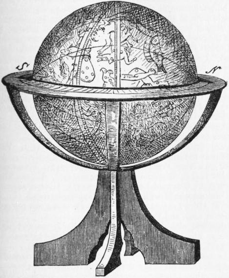
The Arabians are not known to have produced a terrestrial globe, but several of their celestial globes are to be found in our collections. The oldest of these globes was made at Valentia, and is now in the museum of Florence. Another globe (of 1225) is at Velletri; a third by Ibn Hula of Mosul (1275) is the property of the Royal Asiatic Society of London; a fourth (1289) from the observatory of Maragha, in the Dresden Museum, two globes of uncertain age at Paris (see fig. 17) and another in London. All these globes are of metal (bronze), or they might not have survived so many years.
The charts in use of the medieval navigators of the Indian Ocean—Arabs, Persians or Dravidas—were equal in value if not superior to the charts of the Mediterranean. Marco Polo mentions such charts; Vasco da Gama (1498) found them in the hands of his Indian pilot, and their nature is fully explained in the Mohit or encyclopaedia of the sea compiled from ancient sources by the Turkish admiral Sidi Ali Ben Hosein in 1554.21 These charts are covered with a close network of lines intersecting each other at right angles. The horizontal lines are parallels, depending upon the altitude of the pole star, the Calves of the Little Bear and the Barrow of the Great Bear above the horizon. This altitude was expressed in isbas or inches each equivalent to 1° 42′ 50″. Each isba was divided into zams or eights. The interval between two parallels thus only amounted to 12′ 51″. These intervals were mistaken by the Portuguese occasionally for degrees, which account for Malacca, which is in lat. 2′ 13″ N., being placed on Cantino’s Chart (1502) in lat. 14′ S. It may have been a map of this kind which accounts for Ptolemy’s moderate exaggerations of the size of Taprobana (Ceylon). A first meridian, separating a leeward from a windward region, passed through Ras Kumhari (Comorin) and was thus nearly identical with the first meridian of the Indian astronomers which passed through the sacred city of Ujjain (Ozere of Ptolemy) or the meridian of Azin of the Arabs. Additional meridians were drawn at intervals of zams, supposed to be equal to three hours’ sail.
In China, maps in the olden time were engraved on bronze 641 or stone, but after the 10th century they were printed from wood-blocks. Among the more important productions of more recent times, may be mentioned a map of the empire, said to be based upon actual surveys by Yhang (721), who also manufactured a celestial globe (an older globe by Ho-shing-tien, 4 metres in circumference, was produced in 450), and an atlas of the empire on a large scale by Thu-sie-pun (1311-1312) of which new enlarged editions with many maps were published in the 16th century and in 1799. None of these maps was graduated, which is all the more surprising as the Chinese astronomers are credited with having made use of the gnomon as early as 1000 B.C. for determining latitudes.
 |
| Fig. 17.—Globe in Bibliothèque Nationale, Paris |
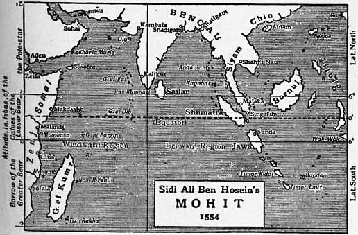 |
| Fig. 18.—The Indian Ocean according to Mohit, as interpreted by Dr Tomaschek. |
In the case of Japan, the earliest reference to a map is of 646, in which year the emperor ordered surveys of certain provinces to be made.
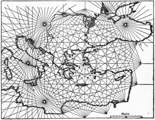
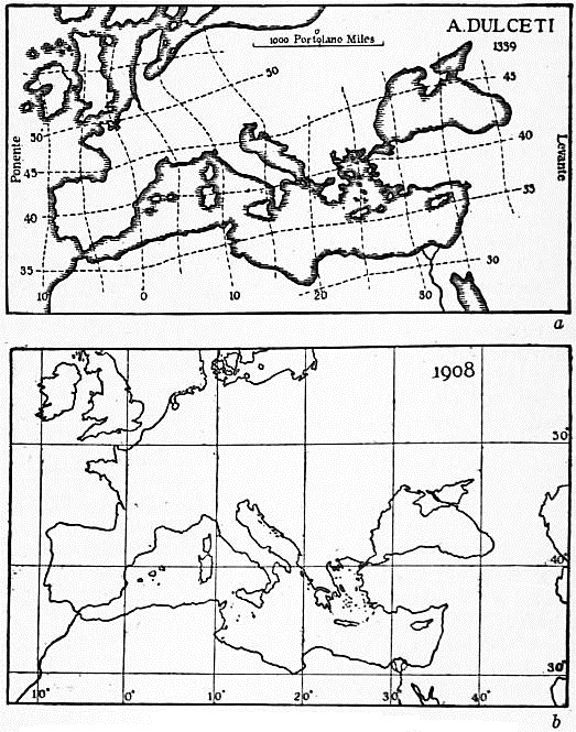
Portolano Maps.—During the long period of stagnation in cartography, which we have already dealt with, there survived among the seamen of the Mediterranean charts of remarkable accuracy, illustrating the Portolani or sailing directories in use among them. Charts of this description are first mentioned in connexion with the Crusade of Louis XI. in 1270, but they originated long before that time, and in the eastern part of the Mediterranean they embody materials available even in the days before Ptolemy, while the correct delineation of the west seems to be of a later date, and may have been due to Catalan seamen. These charts are based upon estimated bearings and distances between the principal ports or capes, the intervening coast-line being filled in from more detailed surveys. The bearings were dependent upon the seaman’s observation of the heavens, for these charts were in use long before the compass had been introduced on board ship (as early as 1205, according to Guiot de Provins) although it became fully serviceable only after the needle had been attached to the compass card, an improvement probably introduced by Flavio Gioja of Amalfi in the beginning of the 14th century. The compass may of course have been used for improving these charts, but they originated without its aid, and it is therefore misleading to describe them as Compass or Loxodromic charts, and they are now known as Portolano charts.
 |
| Fig. 19.—The Eastern Mediterranean, by Petrus Vesconte (1311). |
 |
| Fig. 20.—The Mediterranean. |
| a, According to A. Dulceti, 1339, and b, On Mercator’s projection, according to modern maps. |
None of these charts is graduated, and the horizontal and vertical lines which cross many of them represent neither parallels nor meridians. Their most characteristic feature, and one by which they can most readily be recognized, is presented by groups or systems of rhumb-lines, each group of these lines radiating from a common centre, the central group being generally encircled by eight or sixteen satellite groups. In the course of time the centres of radiation of all these groups had imposed upon them ornate rose dei venti, or windroses, such as may still be seen upon our compass-cards. Each chart was furnished with a scale of miles. These miles, however, were not the ordinary Roman miles of 1000 paces or 5000 ft., but smaller miles of Greek or Oriental origin, of which six were equal to five Roman miles, and as the latter were equal to 1480 metres, the Portolano miles had a length of only 1233 metres, and 75.2 of the former, and 90.3 of the latter were equal to a degree. The difference between these miles was known, however, only to the more learned among the map-makers, and when the charts were extended to the Atlantic seaboard the two were assumed to be identical.
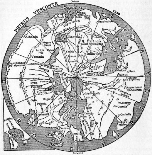 |
| Fig. 21.—Map illustrating Marino Sanuto’s Liber secretorum fidelium crucis. |
On these old charts the Mediterranean is delineated with surprising fidelity. The meridian distance between the Straits of Gibraltar and Beirut in Syria amounts upon them to about 3000 Portolano miles, equal in lat. 36° N. to 40.9°, as compared with an actual difference of 41.2°, and a difference of 61° assumed by Ptolemy. There exists, however, a serious error of orientation, due, according to Professor H. Wagner, to the inexperience of the cartographers who first combined the charts of the separate basins of the Mediterranean so as to produce a chart of the whole. This accounts for Gibraltar and Alexandria being shown as lying due east and west of each other, although there is a difference of 5° of latitude between them, a fact known long before Ptolemy.
The production of these charts employed numerous licensed draughtsmen in the principal seaports of Italy and Catalonia, and among seamen these MS. charts remained popular long after the productions of the printing-press had become available. The oldest of these maps which have been preserved, the so-called “Pisan chart,” which belongs probably to the middle of the 13th century, and a set of eight charts, known by the name of its former owner, the Cavaliere Tamar Luxoro, of somewhat later date, are both the work of Genoese artists. Among more eminent Genoese cartographers are Joannes da Carignano (d. 1344), Petrus Vesconte, who worked in 1311 and 1327, and is the draughtsman of the maps illustrating Marino Sanuto’s Liber secretorum fidelium crucis, which was to have roused Christendom to engage in another crusade (figs. 19 and 21) Battista Beccario (1426, 1435) and Bartolomeo Pareto (1455). Venice ranks next to Genoa as a centre of cartographic activity. Associated with it are Francesco Pizigano (1367-1373), Francesco de Cesanis (1421), Giacomo Giroldi (1422-1446), Andrea Bianco (1436-1448) Giovanni Leardo (1442-1452), Alvise Cadamosto, who was associated with the Portuguese explorers on the west coast of Africa (1454-1456) and whose Portolano was printed at Venice in 1490, and Fra Mauro (1457).
Associated with Ancona are Grazioso Benincasa and his son Andreas, whose numerous charts were produced between 1461 and 1508, and Count Ortomano Freducci (1497-1538).
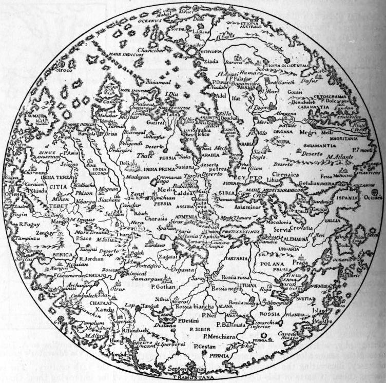 |
| Fig. 22.—Fra Mauro (1457). |
The earliest among Majorcan and Catalonian cartographers is Angelino Dulcert (1325-1339) whom A. Managhi claims as a Genoese, whose true name according to him was Angelino Dalorto. 643 Other Catalans are Jahuda Cresques, a Jew of Barcelona, the supposed author of the famous Catalan map of the world (1375), Guglielmo Solerio (1384), Mecia de Viladestes (1413-1433) Gabriel de Valleseche (1439-1447) and Pietro Roselli, a pupil of Beccario of Genoa (1462).
These maps were originally intended for the use of seamen navigating the Mediterranean and the coasts of the Atlantic, but in the course of time they were extended to the mainland and ultimately developed into maps of the whole world as then known. Thus Pizigano’s map of 1367 extends as far east as the Gulf of Persia, whilst the Medicean map of 1356 (at Florence) is remarkable on account of a fairly correct delineation of the Caspian, the Shari river in Africa, and the correct direction given to the west coast of India, which had already been pointed out in a letter of the friar Giovanni da Montecorvino of 1252. Most of the expansions of Portolano maps into maps of the world are circular in shape, and resemble the wheel maps of an earlier period. This is the character of the map of Petrus Vesconte of 1320 (fig. 21), of Giovanni Leardo (1448) and of a Catalan map of 1450. Jerusalem occupies the centre of these maps, Arab sources of information are largely drawn upon, while Ptolemy is neglected and contemporary travellers are ignored. Far superior to these maps is Fra Mauro’s map (1457), for the author has availed himself not only of the information collected by Marco Polo and earlier travellers, but was able, by personal intercourse, to gather additional information from Nicolo de’ Conti, who had returned from the east in 1440, and more especially from Abyssinians who lived in Italy at that time. His delineation of Abyssinia, though unduly spread over a wide area, is indeed wonderfully correct.
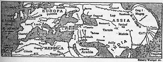 |
| Fig. 23.—Catalan Map of the World (1375). |
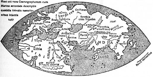 |
| Fig. 24.—Genoese Map (1457). |
Very different in character is the Catalan map of 1375, for its author, discarding Ptolemy, shows India as a peninsula. On the other hand, an anonymous Genoese would-be reformer of maps (1457; fig. 24), still adheres to the erroneous Ptolemaic delineation of southern Asia, and the same error is perpetuated by Henricus Marvellus Germanus on a rough map showing the Portuguese discoveries up to 1489. None of these maps is graduated, but if we give the Mediterranean a length of 3000 Portolano miles, equivalent in 36° N. to 41°, then the longitudinal extent of the old world as measured on the Genoese map of 1457 would be 136° instead of 177° or more as given by Ptolemy.
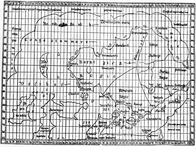 |
| Fig. 25.—Claudius Clavus Swartha (1427). |
The Revival of Ptolemy.—Ptolemy’s great work became known in western Europe after Jacobus Angelus de Scarparia had translated it into Latin in 1410. This version was first printed in 1475 at Vicenza, but its contents had become known through MS. copies before this, and their study influenced the construction of maps in two respects. They led firstly to the addition of degree lines to maps, and secondly to the compilation of new maps of those countries which had been inadequately represented by Ptolemy. Thus Claudius Clavus Swartha (Niger), who was at Rome in 1424, compiled a map of the world, extending westward as far as Greenland. The learned Cardinal Nicolaus Krebs, of Cusa (Cues) on the Moselle, who died 1464, drew a map of Germany which was first published in 1491; D. Nicolaus Germanus, a monk of Reichenbach, in 1466 prepared a set of Ptolemy’s maps on a new projection with converging meridians; and Paolo del Pozzo Toscanelli in 1474 compiled a new chart on a rectangular projection, which was to guide the explorer across the western ocean to Cathay and India.
Of the seven editions of Ptolemy which were published up to the close of the 15th century, all except that of Vicenza (1475) contained Ptolemy’s 27 maps, while Francesco Berlinghieri’s version (Florence 1478), and two editions published at Ulm (1482 and 1486), contained four or five modern maps in addition, those of Ulm being by Nicolaus Germanus.
The geographical ideas which prevailed at the time Columbus started in search of Cathay may be most readily gathered from two contemporary globes, the one known as the Laon globe because it was picked up in 1860 at a curiosity shop in that town, the other produced at Nuremberg in 1492 by Martin Behaim.22 The Laon globe is of copper gilt, and has a diameter of 170 mm. The information which it furnishes, in spite of a legend intended to lead us to believe that it presents us with the results of Portuguese explorations up to the year 1493, is of more ancient date. The Nuremberg globe is a work of a more ambitious order. It was undertaken at the suggestion of George Holzschuher, a travelled member of the town council. The work was entrusted to Martin Behaim, who had resided for six years in Portugal and the Azores, and was believed to be a thoroughly qualified cosmographer. 644 The globe is of pasteboard covered with whiting and parchment, and has a diameter of 507 mm. The author followed Ptolemy not only in Asia, but also in the Mediterranean. He did not avail himself of the materials available in his day. Not even the coasts of western Africa are laid down correctly, although the author claimed to have taken part in one of the Portuguese expeditions. The ocean separating Europe from Asia is assumed as being only 126° wide, in accordance with Toscanelli’s ideas of 1474. Very inadequate use has been made of the travels of Marco Polo, Nicolo de’ Conti, and of others in the east.23 On the other hand, the globe is made gay with flags and other decorations, the work of George Glockendon, a well-known illuminator of the time.
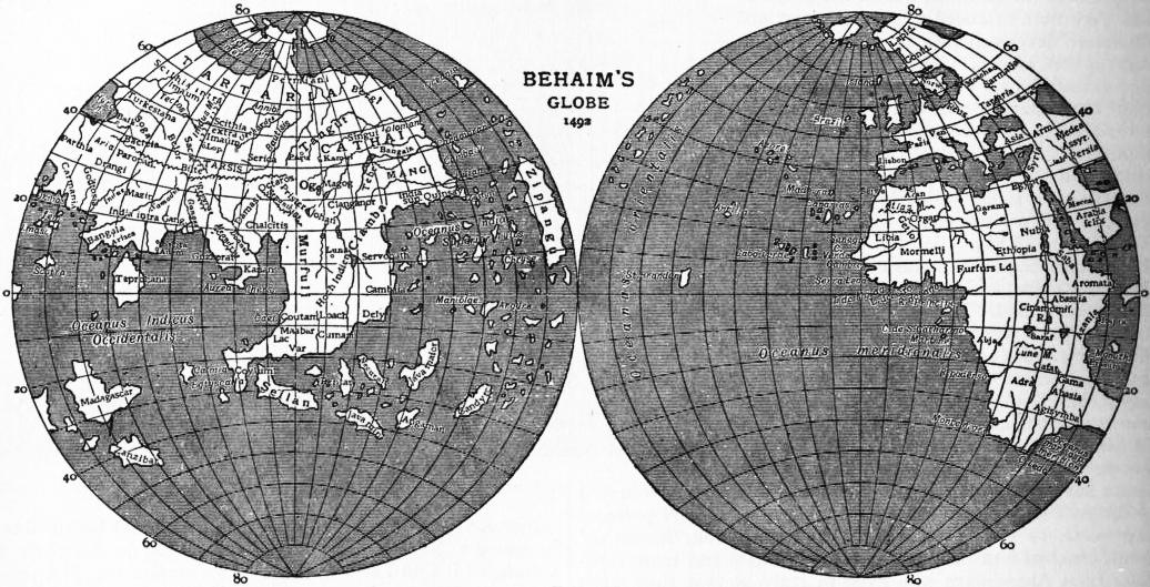 |
| Fig. 26. |
The maritime discoveries and surveys of that age of great discoveries were laid down upon so-called “plane-charts,” that is, charts having merely equidistant parallels indicated upon them, together with the equator, the tropics and polar circles, or, in a more advanced stage, meridians also. The astrolabe quadrant or cross-staff enabled the mariner to determine his latitude with a certain amount of accuracy, but for his longitude he was dependent upon dead reckoning, for although various methods for determining a longitude were known, the available astronomical ephemerides were not trustworthy, and errors of 30° in longitude were by no means rare. It was only after the publication of Kepler’s Rudolphine Table (1626) that more exact results could be obtained. A further difficulty arose in connexion with the variation of the compass, which induced Pedro Reinel to introduce two scales of latitude on his map of the northern Atlantic (1504; fig. 27).
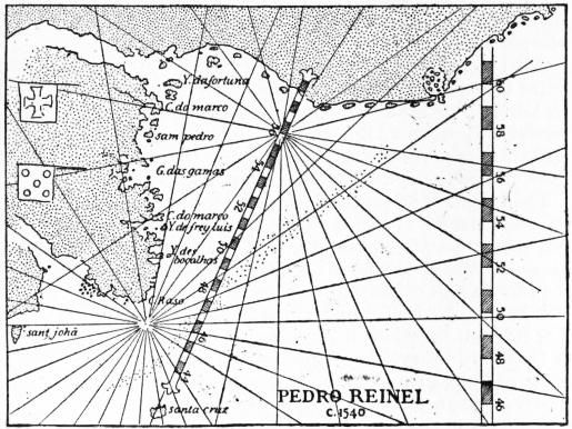 |
| Fig. 27. |
The chart of the world by Juan de la Cosa, the companion of Columbus, is the earliest extant which depicts the discoveries in the new world (1500), Nicolaus de Canerio, a Genoese, and the map which Alberto Cantino caused to be drawn at Lisbon for Hercules d’Este of Ferrara (1502), illustrating in addition the recent discoveries of the Portuguese in the East. Other cosmographers of distinction were Pedro Reinel (1504-1542), Nuno Garcia de Toreno (1520), to whom we are indebted for 21 charts, illustrating Magellan’s voyage, Diogo Ribero (maps of the world 1527, 1529),24 Alonzo de Santa Cruz, of Seville, whose Isolario general includes charts of all parts of the world (1541), John Rotz or Rut (1542), Sebastian Cabot (1544), as also Nicolas Desliens, Pierre Desceliers, G. Breton and V. Vallard, all of Arques, near Dieppe, whose charts were compiled between 1541 and 1554.
Of the many general maps of the world or of particular countries, a large number illustrate such works as G. Reisch’s Margarita philosophica (1163), the cosmographies of Peter Apianus or Bienewitz (1520, 1522, 1530), Seb. Münster (1544), J. Honter (1546) and Gulielmus Postel (1561) or the Geographia of Livio Sanuto (1588); others, and these the more numerous and important, supplement the original maps of several editions of Ptolemy. Thus the Roman edition of 1507, edited by Marcus Benaventura and Joa Cota, contains 6 modern maps, and to these was added in 1508 Joh. Ruysch’s famous map of the world on a modified conical projection. The next edition published at Venice in 1511 contained a heart-shaped world by Bernhard Sylvanus. The Strassburg Ptolemy of 1513 has a supplement of as many as 20 modern maps by Martin Waldseemüller or Ilacomilus, several among which are copied from Portuguese originals. Waldseemüller was one of the most distinguished cartographers of his day. He was born at Radolfzell in Baden in 1470, was associated with Ringmann at the gymnasium of 645 St Dié, and died in 1521. He published in 1507 a huge map of the world, in 12 sheets, together with a small globe of a diameter of 110 mm., the segments for which were printed from wood-blocks. On these documents the new world is called America, after Amerigo Vespucci, its supposed discoverer. In 1511 Waldseemüller published a large map of Europe, in 1513 he prepared his maps for the Strassburg edition of Ptolemy, and in 1516 he engraved a copy of Canerio’s map of the world. The Strassburg Ptolemy of 1522 contains Waldseemüller’s maps,25 edited on a reduced scale by Laurentius Frisius, together with three additional ones. The same set of maps is reprinted in the Strassburg edition of 1524, newly translated by W. Pirckheimer with notes by Joh. Müller Regiomontanus, and in the Lyon edition of 1535, edited by Michael Servetus. The new maps of the Basel edition of 1540, twenty-one in number, are by Sebastian Münster; Jacob Gastaldo supplied the Venice edition of 1548 with 34 modern maps, and these with a few additions are repeated in Girolamo Ruscelli’s Italian translation of Ptolemy published at Venice in 1561.
Equally interesting with these Ptolemaic supplements are collections like that of Anton Lafreri, which contains reprints of 142 maps of all parts of the world originally published between 1556 and 1572 (Geografica tavole moderne, Rome, n.d.), or that of J. F. Camocio, published at Venice in 1576, which contains 88 reprints.
The number of cartographers throughout Europe was considerable, and we confine ourselves to mentioning a few leading men. Among them Germany is then represented by G. Glockedon, the author of an interesting road-map of central Europe (1501), Sebastian Münster (1489-1552), Elias Camerarius, whose map of the mark of Brandenburg won the praise of Mercator; Wolfgang Latz von Lazius, to whom we are indebted for maps of Austria and Hungary (1561), and Philip Apianus, who made a survey of Bavaria (1553-1563), which was published 1568 on the reduced scale of 1 : 144,000, and is fairly described as the topographical masterpiece of the 16th century. For maps of Switzerland we are indebted to Konrad Türst (1495-1497), Johann Stumpf (1548) and Aegidius Tschudi (1538). A map of the Netherlands from actual survey was produced by Jacob of Deventer (1536-1539). Leonardo da Vinci, the famous artist, while in the service of Cesare Borgia as military engineer, made surveys of several districts in central Italy. Other Italian cartographers of merit were Giovanni Battiste Agnese of Venice, whose atlases (1517-1564) enjoyed a wide popularity; Benedetto Bordone (1528); Giacomo Gastaldo, cosmographer of the Venetian Republic (1534-1568), and his successor, Paolo Forlani. New maps of Spain and Portugal appeared in 1560, the former being due to Pedro de Medina, the latter to Fernando Alvarez Secco and Hernando Alvaro. Among the French map-makers of this period may be mentioned Oronce Finée (Finaeus), who in 1525 published a map of France, and Jean Jolivet (c. 1560). Gregorio Lilly (1546) and Humphrey Lhuyd of Denbigh (d. 1510) furnished maps of the British Isles, Olaus Magnus (1539) of Scandinavia, Anton Wied (1542), Sigismund von Herberstein (1549) and Anthony Jenkinson (1562) of Muscovy.
The cylindrical and modified conical projections of Marinus and Ptolemy were still widely used, the stereographical projection of Hipparchus, was for the first time employed for terrestrial maps in the 16th century, but new projections were introduced in addition to these. The earliest of these, a trapeziform projection with equidistant parallels, by D. Nicolaus Germanus (1466), naturally led to what is generally known as Flamsteed’s projection. Joh. Stabius (1502) and his pupil J. Werner (1514) devised three heart-shaped projections, one of which was equivalent. Petrus Apianus (1524) gave his map an elliptical shape. H. Glareanus (1510) was the first to employ an equidistant zenithal polar projection.
No reasonable fault can be found with the marine surveyors of this period, but the scientific cartographers allowed themselves too frequently to be influenced by Ptolemaic traditions. Thus Gastaldo (1548) presents us with a map of Italy, which, except as to nomenclature, differs but little from that of Ptolemy, although on the Portolano charts the peninsula had long since assumed its correct shape. Many of the local maps, too, were excellent specimens of cartography, but when we follow any cartographer of the period into regions the successful delineation of which depended upon an intelligent interpretation of itineraries, and of information collected by recent travellers, they are generally found to fail utterly. This is illustrated by the four sketch maps shown in fig. 28.
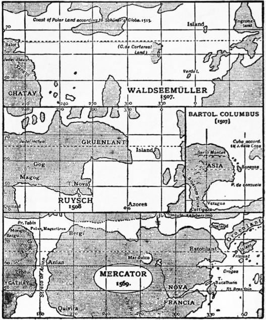 |
| Fig. 28. |
Columbus, trusting to Toscanelli’s misleading chart, looked upon the countries discovered by him as belonging to eastern Asia, a view still shared about 1507 by his brother Bartolomeo. Waldseemüller (1507) was the first to separate America and Asia by an ocean of considerable width, but J. Ruysch (1508) returns to the old idea, and even joins Greenland (Gruenlant) to eastern Asia. Bologninus Zalterius on a map of 1566, and Mercator on his famous chart of 1569, separates the two continents by a narrow strait which they call Streto de Anian, thus anticipating the discovery of Bering Strait by more than a hundred and fifty years. Anian, however, which they place upon the American coast, is no other than Marco Polo’s Anica or Anin, our modern Annam. Such an error could never have arisen had the old compilers of maps taken the trouble to plan Marco Polo’s routes.
Globes, both celestial and terrestrial, became popular after the discovery of America. They were included among the scientific apparatus of ships and of educational establishments. Columbus and Magellan had such globes, those of the latter produced by P. Reinel (1519), and Conrad Celtes tells us that he illustrated his lectures at the university of Vienna with the help of globes (1501). Globes were still engraved on copper, or painted by hand, but since 1507, in which year Waldseemüller published a small globe of a diameter of 110 mm., covered with printed segments or gores, this cheap and expeditious method has come into general use. Waldseemüller constructed his gores graphically, A. Dürer (1525) and Hen. Loriti Glareanus (1527) were the first who dealt scientifically with the principles underlying their construction. Globes 646 covered with printed gores were produced by L. Boulenger (1514), Joh. Schöner (1515), P. Apianus, Gemma Frisius (1530) and G. Mercator (1541). Leonardo da Vinci’s rough map of the world in 8 segments (c. 1513) seems likewise to have been intended for a globe. Of J. Schöner we know that he produced four globes, three printed from segments (1515, 1523, 1533), and one of larger size (diam. 822 mm.), which is drawn by hand, and is preserved in the Germanic Museum at Nuremberg. Among engraved globes, one of the most interesting is that which was discovered by R. M. Hunt in Paris, and is preserved in the Lenox Library, New York. Its diameter is only 41⁄2 in. (127 mm.). The so-called “Nancy globe” is of chased silver, richly ornamented, and formerly served the purpose of a pyx. Its diameter is 160 mm., its date about 1530. About the same date is assigned to a globe by Robert de Bailly, engraved on copper and gilt (diam. 440 mm.). Celestial globes were manufactured by Regiomontanus (d. 1476) at Nuremberg, by Joh. Stöffler (1499), and by G. Hartmann (1535).
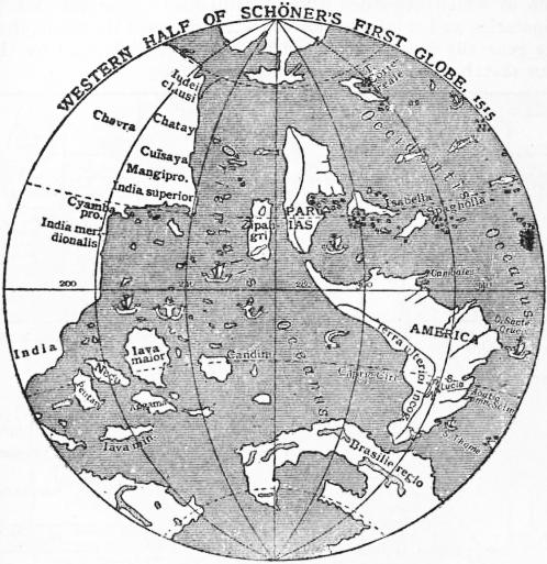 |
| Fig. 29. |
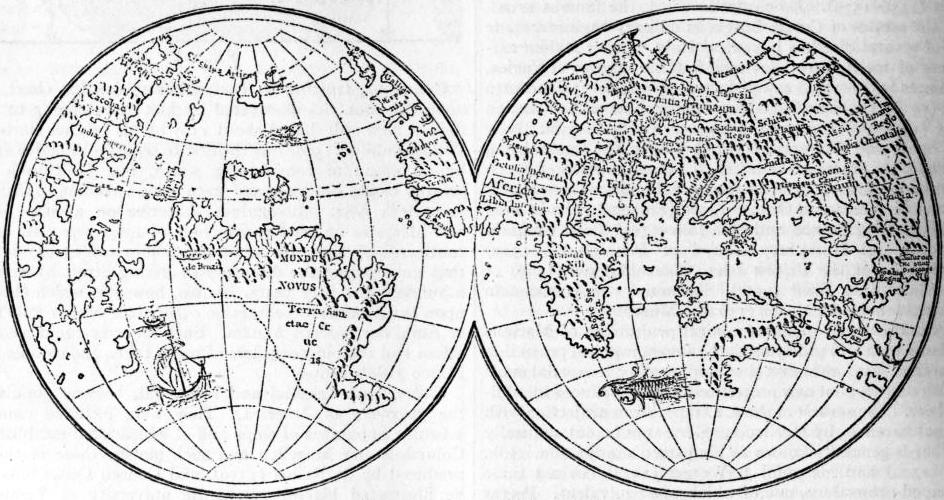 |
| Fig. 30.—Lenox Globes (1510). |
Mercator and his Successors.—Of Gerhard Kremer (1512-1594) the earliest works are a map of Palestine (1537), a map of the world on a double heart-shaped projection (1525), and a topographical map of Flanders based upon his own surveys (1540), a pair of globes (1541, diam. 120 mm.), and a large map of Europe which has been praised deservedly for its accuracy (1554). He is best known by his marine chart (1569) and his atlas. The projection of the former may have been suggested by a note by W. Pirkheimer in his edition of Ptolemy (1525). Mercator constructed it graphically, the mathematical principles underlying it being first explained by E. Wright (1594). The “Atlas” was only published after Mercator’s death, in 1595. It only contained nine maps, but after the plates had been sold to Jodocus (Jesse) Hondius the number of maps was rapidly increased, although Mercator’s name was retained. Mercator’s maps are carefully engraved on copper. Latin letters are used throughout; the miniatures of older maps are superseded by symbols, and in the better-known countries the maps are fairly correct, but they fail lamentably when we follow their author into regions—the successful delineation of which depends upon a critical combination of imperfect information.
Even before Mercator’s death, Antwerp and Amsterdam had become great centres of cartographic activity, and they maintained their pre-eminence until the beginning of the 18th century. Abraham Ortelius (1527-1592), of Antwerp, a man of culture and enterprise, but not a scientific cartographer, published the first edition of his Theatrum orbis terrarum in 1570. It then contained 53 maps, by various authors. By 1595 the number of maps had increased to 119, including a Parergon or supplement of 12 maps illustrating ancient history. In 1578 was published the Speculum orbis terrarum of Gerard de Jude or de Judaeis. Lucas Janszon Waghenaer (Aurigarius) of Enkhuizen published the first edition of his Spiegel der Zeevaart (Mariners’ Mirror) at Leiden in 1585. It was the first collection of marine maps, lived through many editions, was issued in several languages and became known as Charettier and Waggoner. In the same year Adrian Gerritsz published a valuable Paskaarte of the European Sea. Ten years afterwards, in 1595, W. Barentszoon published a marine atlas of the Mediterranean, the major axis of which he reduced to 42 degrees. Jodocus Hondius has already been referred to as the purchaser of Mercator’s plates. The business founded by him about 1602 was continued by his sons and his son-in-law, Jan Janszon (Jansonius) and others. By 1653 this firm had already produced atlases including 451 charts. Willem Janszon, the father of Hondius’s partner, published a collection of charts (1608), to which he gave the title of Het Licht der Zeevaart (the seaman’s light). 647 Another cartographic publishing firm was established at Amsterdam in 1612 by Willem Janszon Blaeu (1571-1638), a friend of Tycho Brahe, from 1633 “mapmaker” of the states-general, and a man of scientific culture. He was succeeded by his son Jan (d. 1673) and grandson Cornelius, and before the end of the century turned out a Zee-Spiegel of 108 charts (1623), an Atlas novus (Nieuwe Atlas), 1642, enlarged in the course of time until it consisted of 12 folio volumes containing hundreds of maps. J. A. Colom in 1633 published a collection of maps under the quaint title of Vurig Colom der Zeevaert (Fiery Column of Navigation). Among more recent Dutch map publishers are Nicolaus Vischer (Piscator), R. Goos, H. Doncker, F. de Wit, and J. and G. van Keulen, whose atlases were published between 1681 and 1722. These Dutch maps and charts are generally accompanied by descriptive notes or sailing directions printed on the back of them. A similar work is the Arcano del mare of Sir Robert Dudley, duke of Northumberland, the numerous sheets of which are on Mercator’s projection (1631).
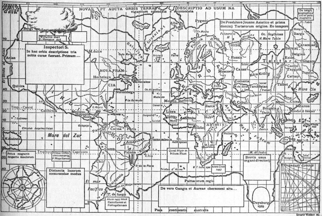 |
| Fig. 31.—Mercator’s Chart of the World (1569). |
In France, in the meantime, an arc of the meridian had been measured (1669-1670) by Jean Picard, numerous longitudes had been observed between 1672 and 1680 by the same, and by Phil. de Lahire (d. 1719), and these were utilized in a Carte de France “as corrected from the observations of the members of the Academy of Sciences” (1666-1699), in a map of the world (1694) by D. Cassini, as also in Le Neptune François (1693) with contributions by Pene, D. Cassini and others. These corrected longitudes were not yet available for the maps produced by Nicolas Sanson of Abbeville, since 1627. The cartographical establishment founded by him in that year was carried on after his death in 1667 by his sons, his son-in-law, P. Duval (d. 1683) and his grandson Robert du Vaugondy (d. 1766). Among the cartographers whom he employed were M. Tavernier and Mariette, and in many instances he mentioned the authors whose maps he copied. By 1710 the maps published by the firm numbered 466. Nicolas de Fer, the great rival of Sanson, and his heirs, are stated to have published as many as 600 maps after 1700.
In no other country of Europe was there at the close of the 16th century a geographical establishment capable of competing with the Dutch towns or with Sanson, but the number of those who produced maps, in many instances based upon original surveys, was large. Germany is thus represented, among others, by C. Henneberger (map of Prussia, 1576), by M. Oeder, (survey of Saxony, 1586-1607), A. Rauh (fine hill features on a map of the environs of Wangen and Lindau, 1617), W. Schickhardt (survey of Württemberg, 1624-1635), and G. M. Vischer (map of Austria and Styrai, 1669-1786); Switzerland by H. C. Gyger (Canton of Zürich, a masterpiece, 1667); Italy by G. A. Magini (1558-1610), and V. Coronelli, appointed cosmographer of the Venetian Republic, 1685, and founder of the Ac. Cosmogr. dei Argonauti, the earliest geographical society, and Diogo Homem, a Portuguese settled at Venice (1558-1574); Denmark by J. Mejer of Husum (1650); Sweden by A. Buraeus, the “father of Swedish cartographers” (1650-1660); the British Islands by Ch. Saxton (County Atlas of England and Wales 1575), J. Speed (Theatrum of Great Britain, 1610), Timothy Pont and Robert Gordon of Strathloch (map of Scotland, 1608), and A. Moll. A Novus atlas sinensis, based upon Chinese surveys, was published in 1655 by Martin Martini, S.J., a missionary recently returned from China. Isaac Voss, in his work De Nili (1659), published a map of central Africa, in which he anticipated D’Anville by rejecting all the fanciful details which found a place upon Filippo Pigafetta’s map of that continent.
The first maps illustrating the variation of the compass were published by Chris. Burrus (d. 1632) and Athanasius Kircher (Magnes, Rome, 1643), and maps of the ocean and tidal currents by the latter in his Mundus subterraneus (1665). Edmund Halley, the astronomer, compiled the first variation chart of scientific value (1683), as also a chart of the winds (1686).
Globes manufactured for commercial purposes by Blaeu and others have already been mentioned, but several large globes, for show rather than for use, were produced in addition to these. Thus A. Busch, of Limburg (1656-1664), manufactured a globe for Duke Frederick of Holstein, formerly at Gottorp, but since 1713 at Tsarskoye Zelo. It has a diameter of 11 ft. (3.57 metres) and is hollow, the inner surface of the shell being covered with a star map, and the outer surface with a map of the world. Professor Erh. Weigel (1696) produced a hollow celestial globe in copper, having a small terrestrial globe in its centre. Its diameter is 3.25 metres. Lastly there is a pair of giant globes of artistic design, turned out by V. Coronelli (1623), and intended as presents to Louis XIV. Their diameter is nearly 5 metres. A pair of globes of 1592 by Emeric Molineux (diam. 610 mm.) is now in the Temple Library, and is referred to in Blundeville’s Exercises (1594).
The Eighteenth Century.—It was no mere accident which enabled France to enjoy a pre-eminence in cartographic work during the greater part of the 18th century. Not only had French men of science and scientific travellers done excellent work as explorers in different parts of the world, but France could also boast of two men, Guillaume Delisle and J. B. Bourguignon d’Anville, able to utilize in the compilation of their maps the information they acquired.
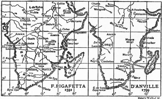 |
| Fig. 32. |
Delisle (1675-1726) published 98 maps, and although as works of art they were inferior to the maps of certain contemporaries, they were far superior to them in scientific value. On one of his earliest maps compiled under advice of his father Claude (1700), he gave the Mediterranean its true longitudinal extension of 41°. It was Delisle who assumed the meridian of Ferro, which had been imposed upon French navigators by royal order (1634), to lie exactly 20° to the west of Paris. The work of reform was carried further by B. D’Anville (1697-1782). Altogether he published 211 maps, of which 66 are included in his Atlas général (1737-1780); he swept away the fanciful lakes from off the face of Africa, thus forcibly bringing home to us the poverty of our knowledge (fig. 32), delineated the Chinese Empire in accordance with the map based on the surveys conducted during the reign of the emperor Kanghi, with the aid of Jesuit missionaries, and published in 1718; boldly refused to believe in the existence of an Antarctic continent covering half the southern hemisphere, and always brought a sound judgment to bear upon the materials which the ever-increasing number of travellers placed at his disposal. Among other French works of importance deserving notice are Le Neptune oriental of Mannevillette (1745) and more especially the Carte géometrique de la France, which is based upon surveys carried on (1744-1783) by César François Cassini de Thury and his son Dominique de Cassini. It is on a transversal cylindrical (rectangular) projection devised by Jacques Cassini (d. 1746). The hills are shown in rough hachures.
England, which had entered upon a career of naval conquest and scientific exploration, had reason to be proud of J. F. W. Desbarres, Atlantic Neptune (1774), a North-American Pilot (1779), which first made known the naval surveys of J. Cook and of others; and Tho. Jefferys’s West Indian and American Atlases (1775, 1778). James Rennell (1742-1830), who was surveyor-general of India, published the Bengal Atlas (1781), and sagaciously arranged the vast mass of information collected by British travellers and others in India and Africa, but it is chiefly with the name of Aaron Arrowsmith, who came to London in 1778, and his successors, with which the glory of the older school of cartographers is most intimately connected. His nephew John died in 1873. Among local cartographers may be mentioned H. Moll (d. 1732), J. Senex, whose atlas was published in 1725, and Dowet, whose atlas was brought out at the expense of the duke of Argyll.
In Germany J. B. Homann (d. 1724) founded a geographical establishment in 1702, which depended at first upon copies of British and French maps, but in course of time published also original maps such as J. M. Hase’s Africa (1727) and Tobias Meyer’s Mappa critica of Germany (1780), J. T. Güssfeld’s map of Brandenburg (1773), John Majer’s Württemburg (1710), and J. C. Müller’s Bavaria, both based on trigonometrical surveys. Colonel Schmettau’s excellent survey of the country to the west of the Weser (1767-1787) was never published, as Frederick the Great feared it might prove of use to his military enemies. Switzerland is represented by J. J. Scheuchzer (1712), J. Gessner (d. 1790), G. Walser (Atlas novus Helvetiae, 1769), and W. R. Meyer, Atlas der Schweiz (1786-1802). Of the Austrian Netherlands, Count Joseph de Ferrari published a chorographic map on the same scale as Cassini’s Carte de la France (1777). Of Denmark a fine map was published under the auspices of the Academy of Science of Copenhagen (1766-1825); of Spain and Portugal an atlas in 102 sheets by Thomas Lopez (1765-1802); of Russia a map by J. N. Delisle in 19 sheets (1730-1745); charts illustrating the variation of the compass and of magnetic “dip” by E. Dunn (1776), J. C. Wiffe (1768); a chart of the world by W. Dampier (1789). Map projections were dealt with by two eminent mathematicians, J. H. Lambert (1772) and Leonh. Euler (1777).
On the maps of Delisle and d’Anville the ground is still represented by “molehills.” Hachures of a rude nature first made their appearance on David Vivier’s map of the environs of Paris (1674), and on Cassini’s Carte de la France. Contour lines (isobaths) were introduced for the first time on a chart of the Merwede by M. S. Cruquius (1728), and on a chart of the English Channel by Phil. Buache (1737). Dupain-Triel, acting on a suggestion of Du Carla, compiled a contoured map of France (1791), and it only needed the introduction of graduated tints between these contours to secure a graphic picture of the features of the ground. It was J. G. Lehmann (1783) who based his method of hill-shading or hachuring upon these horizontal contours. More than 80 methods of showing the hills have found advocates since that time, but all methods must be based upon contours to be scientifically satisfactory.
Two relief maps of Central Switzerland deserve to be mentioned, the one by R. L. Pfyffer in wax, now in Lucerne, the other by J. R. Meyer of Aarau and Müller of Engelberg in papier mâché, now in Zurich. Globes of the usual commercial type were manufactured in France by Delisle (1700), Forbin (1710-1731), R. and J. de Vaugondy (1752), Lalande (1771); in England by E. and G. Adams (1710-1766); Germany by Homann and Seutter (1750). A hollow celestial globe 18 ft. in diameter was set up by Dr Roger Long at Cambridge; the terrestrial globe which Count Ch. Gravie of Vergennes presented to Louis XVI. in 1787 had a diameter of 26 metres, or 85 ft.
Modern Cartography.—The compiler of maps of the present day enjoys many advantages not enjoyed by men similarly occupied a hundred years ago. Topographical surveys are gradually extending, and explorers of recent years are better trained for their work than they were a generation ago, whilst technical processes of recent invention—such as lithography, photography and heliogravure—facilitate or expedite the completion of his task. This task, however, has grown more difficult and exacting. Mere outline maps, such as formerly satisfied the public, suffice no longer. He is called upon more 649 especially to give a satisfactory delineation of the ground, he must meet the requirements of various classes of the public, and be prepared to record cartographically all the facts of physical or political geography which are capable of being recorded on his maps. The ingenuity of the compiler is frequently taxed when called upon to illustrate graphically the results of statistical information of every description.
Germany since the middle of the 19th century has become the headquarters of scientific cartography. This is due as much to the inspiriting teachings of Ritter and Humboldt as to the general culture and scientific training combined with technical skill commanded by the men who more especially devote themselves to this branch of geography, which elsewhere is too frequently allowed to fall into the hands of mere mechanics. Men like H. Berghaus (1797-1884), H. Kiepert (1818-1899), and A. Petermann (1822-1878) must always occupy a foremost place in the history of cartography. Among the geographical establishments of Germany, that founded by Justus Perthes (1785), at Gotha, occupies the highest rank. Among its publications are A. Stieler’s Hand-Atlas (1817-1832), K. von Spruner’s Historical Atlas (1438-1488), H. Berghaus’ Physical Atlas (1838-1842), E. von Sydow’s Wall Maps for Schools (1838-1840) and School Atlas (1847). The titles of these atlases survive, though the authors of the original editions are long dead, and the maps have been repeatedly superseded by others bringing the information up to the date of publication. To the same firm we are indebted for Petermann’s Mitteilungen, started in 1855 by A. Petermann, after whose death in 1902 they were successively edited by E. Behm, A. Supan and P. Langhans, as also the Geographisches Jahrbuch (since 1866), at first edited by E. Behm, afterwards by Professor H. Wagner. Among other geographical institutes in Germany which deserve mention are the Weimar Institut, founded in 1791 by F. J. Bertuch, and directed in 1845-1852 by H. Kiepert; Paul Fleming at Glogau (K. Sohr’s Handatlas, 1845), A. Ravenstein at Frankfort, D. Reimer at Berlin (H. Kiepert, Handatlas, 1860); R. Andree (Hand-Atlas, 1880), and E. Debes (Hand-Atlas, 1894) in Leipzig, and E. Hölzer in Vienna (Vincenz von Haardt’s maps). France is represented by the publishing firms of Ch. Delagrave (Levaseur’s maps), Hachette (Vivien de St Martin’s Atlas universel, in progress since 1875, F. Schrader’s Atlas de géographie moderne, 1880), and Armand Colin (Vidal de la Blache’s Atlas général, 1894). In Great Britain A. Arrowsmith established himself in London in 1770 (General Atlas, 1817), but the cartographical business ceased on the death of John Arrowsmith in 1873. John Walker, to whose initiative the charts published by the admiralty are indebted for the perspicuous, firm and yet artistic execution, which facilitate their use by the mariner, was also the author of the maps published by the Society for the Diffusion of Useful Knowledge (1820-1840). Among more recent firms are W. and A. K. Johnston (founded 1825; Royal Atlas, 1855); J. Bartholomew & Co., now carried on by J. G. Bartholomew (Reduced Survey maps, Atlas of the World’s Commerce, 1906); Philip & Sons (Imperial Atlas, 1890; Systematic Atlas by E. G. Ravenstein, 1894; Mercantile Marine Atlas, 1904, globes), and E. Stanford (London Atlas).
In 1890 Professor A. Penck proposed to prepare a map of the world, including the oceans, on a scale of 1 : 1,000,000, and his scheme was promised the support of a committee which met in London in 1909, and upon which were represented the leading powers of the world. Maps on that scale of a great part of Africa, Asia and America have been published by British, French, German and United States authorities. A bathymetrical chart of the oceans, by Professor J. Thoulet was published in 1904 at the expense of Prince Albert of Monaco.
Reliefs from printed maps were first produced by Bauerkeller of Darmstadt and Dondorf at Frankfort, from originals furnished by A. Ravenstein (1838-1844). The exaggeration in altitude, on these maps and on those of a later date and on a larger scale, was very considerable. No such exaggeration exists in the case of reliefs of parts of the Alps, on a large scale, by P. Keil and Pelikan (1890), X. Imfeld (1891), P. Oberlerchner (1891-1895), C. Perron (1893-1900), F. Becker (1900), A. Heim (1904) and others. A relief globe was first suggested in a letter of M. Maestlin to J. Kepler (1596). The first globe of this description for the use of the blind, was made by A. Zeune in 1810. H. Erben is the author of a rough relief on a convex surface (1842), but the finest example of this description is a relief of Italy, by César Pomba and H. Fritsche, on a scale of 1 : 1,000,000 and without exaggeration of heights (1880-1884). A map of Italy in the baptistery of St Peter at Rome has occasionally been described as a relief, though it is merely a rude outline map of Italy, by Carlo Fontana (1698), carved into a convex surface.
Several globes of unusual dimensions were produced in the course of last century. That which Colonel Langlois erected in the Champs Elysées (1824) had a diameter of 39 metres. James Wyld’s hollow globe, or “Georama,” diam. 18 metres, occupied Leicester Square until swept away as a nuisance. The giant globe proposed by Elisée Reclus in 1895 has never been erected; he has, however, produced maps on a concave surface, as suggested by J. D. Hauber in 1742.
Authorities.—The history of maps is dealt with ably in Vivien de Saint Martin’s Histoire de la géographie (Paris, 1875), and in Peschel’s Geschichte der Erdkunde (2nd ed. by Sophus Ruge, Berlin, 1877), as also by W. Wollkenhauer (Leitfaden zur Geschichte der Kartographie, Breslau, 1895), and H. Zondervan (Allgemeine Kartenkunde, Leipzig, 1901). J. Lelewel’s Geographie du moyen âge, with an atlas (Brussels, 1850-1857), has in part been superseded by more recent researches. There are, however, a number of works, beautifully illustrated, which deal fully with particular periods of the subject. Among these may be mentioned Konrad Miller’s Die ältesten Weltkarten (Stuttgart, 1895-1897), which only deals with maps not influenced by the ideas of Ptolemy. The contents of the following collections are more varied in their nature, viz. E. F. Jomard’s Monuments de la géographie (Paris, 1862), Santarem’s Atlas composé de mappemondes et de portulans, &c. (Paris, 1842-1853, 78 plates). A. E. Nordenskiöld’s Facsimile Atlas (Stockholm, 1889), Gabriel Marcell, Choix de cartes et de mappemondes XIVe et XVe siècles (Paris, 1896). C. H. Coote’s Remarkable Maps of the XVth, XVIth and XVIIth Centuries reproduced in their Original Size (Amsterdam, 1894-1897), and Bibliotheca lindesiana (London, 1898) with facsimiles of the Harleian and other Dieppese maps of the 16th century. Nautical charts are dealt with in A. E. Nordenskiöld’s Periplus (Stockholm, 1869), and Th. Fischer’s Sammlung mittelälterlicher Welt- und Seekarten (Vienna, 1886). The discovery and mapping of America are illustrated by F. Kunstmann’s Entdeckung Amerikas (Munich, 1859), K. Kretschmer’s Atlas zur Entdeckung Amerikas (Berlin, 1892), G. Marcel’s Reproductions de cartes et de globes relatives à la découverte de l’Amérique du XVIe au XVIIIe siècle (Paris, 1893) and E. L. Stevenson’s Maps Illustrating the early Discovery and Exploration of America, 1502-1530 (New Brunswick, N.J., 1906). In addition to these collections, numerous single maps have been published in geographical periodicals or separately. See also V. Hantzsch and L. Schmidt, Kartog. Denkmäler zur Entdeckungsgeschichte von Amerika, Asien, Australien und Afrika aus der k. Bibliothek zu Dresden (Leipzig, 1903), and the Crown Collection of photographs of American maps (1600-1800), selected and edited by A. B. Hulbert (Cleveland, 1904-1909).
For reports on the progress of cartography, see Geographisches Jahrbuch (Gotha, since 1866); for announcements of new publications, Bibliotheca geographica, published annually by the Berlin Geographical Society, and to the geographical Journal (London).
Topographical Surveys.
The year 1784 marks the beginning of the ordnance survey, for in that year Major-General Roy measured a base line of 27,404 ft. on Hounslow Heath. Six additional base lines were measured up to 1849, including the Lough United Kingdom. Foyle, in 1827-1828, and that on Salisbury Plain, in 1849. The primary triangulation was only completed in 1858, but in the meantime, in 1791, the detail survey had begun. At first it was merely intended to produce a map sufficiently accurate on a scale of 1 in. to a mile (1 : 63,360). Ireland having been surveyed (1824-1842) on a scale of 6 in. to a mile (1 : 10,560), it was determined in 1840, after the whole of England and Wales, with the exception of Lancashire and Yorkshire, had been completed on one-inch scales, to adopt that scale for the whole of the United Kingdom. Finally, in 1854, a cadastral survey of the whole of the United Kingdom, only excepting uncultivated districts, was resolved upon, on a scale of 1 : 2500, still larger scales (1 : 500 or 1 : 1000) being adopted for town plans. Parish boundaries are laid down with the help of local meresmen appointed by justices at quarter sessions. The horizontal 650 contours are based upon instrumental measurement, and as a whole these ordnance maps were undoubtedly superior in accuracy, with rare exceptions, to similar maps published by foreign governments. Even though the hill hachures on the older one-inch maps are not quite satisfactory, this deficiency is in a large measure compensated for by the presence of absolutely trustworthy contours. Originally the maps were engraved on copper, and the progress of publication was slow; but since the introduction of modern processes, such as electrotyping (in 1840), photography (in 1855) and zincography (in 1859), it has been rapid. A plan, the engraving of which formerly took two years, can now be produced in two days.
The one-inch map for the whole of the United Kingdom was completed in 1890. It covers 697 sheets (or 488 of a “new series” in large sheets), and is published in three editions, viz. (a) in outline, with contours in black, (b) with hills hachured in brown or black, and (c) printed in five colours. Carefully revised editions of these and of the other maps are brought out at intervals of 15 years at most. Since 1898 the department has also published maps on a smaller scale, viz. a map of England and Wales, on a scale of 2 m. to 1 in., in two editions, both printed in colour, the one with hills stippled in brown, the other coloured on the “layer system” as a strata-relief map; a map of the United Kingdom on a scale of 4 m. to 1 in., also in two editions, the one in outline, showing five classes of roads and parish boundaries, the other in colours, with stippled hills; a map on a scale of 10 m. to 1 in., also in two editions, and finally a map of the United Kingdom on a scale of 1 : 1,000,000.
The geological surveys of Great Britain and Ireland were connected from 1832 to 1853 with the ordnance survey, but are now carried on independently. The ordnance survey, too, no longer depends on the war office but upon the board of agriculture and fisheries. A Bathymetrical Survey of the Freshwater Lochs of Scotland, under the direction of Sir John Murray and L. Pullar, was completed in 1908, and the results published by the Royal Geographical Society.
Proposals for a new map of France, to replace the famous Cassini map of 1744-1793 were made in 1802 and again by R. Bonne in 1808, but owing to the wars then devastating Europe no steps were taken until 1817, and France. the Carte de France de l’état major on a scale of 1 : 80,000 was only completed in 1880. It is engraved on copper. The hachured hills are based upon contours, and are of admirable commensurability. It has served as a basis for a Carte de la France, published by the Service Vicinal on a scale of 1 : 100,000, in 596 sheets, and of a general map prepared by the ministère des travaux publics on a scale of 1 : 200,000 in 80 sheets. On both these maps the hills are printed in grey chalk. A third topographical map of France is being published in accordance with the recommendation of a committee presided over by General de la Noix in 1897. The surveys for this map were begun in 1905. The maps are based upon the cadastral plans (1 : 1000), thoroughly revised and connected with the triangulation of France and furnished with contours at intervals of 5 m. by precise measurement. These minutes are published on a scale of 1 : 10,000 or 1 : 20,000 for mountain districts, while the scale of the general map is 1 : 50,000. Each sheet is bounded by parallels and meridians. The hills are shown in brown contours at intervals of 10 m. and grey shading in chalk (Berthaut, La Carte de France, 1750-1898; Paris, 1899). A geological map of France on a scale of 1 : 80,000 is nearly completed, there are also a map (1 : 500,000) by Carez and Vasseur, and an official Carte géologique (1 : 1,000,000; 1906).
By the middle of the 19th century topographical maps of the various German states had been completed, and in several instances surveys of a more exact nature had been completed or begun, when in 1878 the governments of Germany. Prussia, Saxony, Bavaria and Württemberg agreed to supersede local maps by publishing a map of the empire (Reichskarte) in 674 sheets on a scale of 1 : 100,000. The earlier sheets of this excellent map were lithographed, but these are gradually being superseded by maps engraved on copper. Colour-printing is employed since 1901. The hills are hachured and in some instances contours at intervals of 50 metres are introduced. The map was completed in 1909, but is continually undergoing renewal. The Messtischblätter, called Positionsblätter in Bavaria, are on a scale of 1 : 25,000. The older among them leave much to be desired, but those of a later date are satisfactory. This applies more especially to the maps of Saxony (since 1879) and Württemberg (since 1893). The features of the ground on most of these maps are shown by contours at intervals of 10 metres. The map produced on this large scale numbers over 5000 sheets, and is used as a basis for the geological surveys carried on in several of the states of Germany. A general map of the German Empire (Uebersichtskarte) on a scale of 1 : 200,000, in 196 sheets, is in progress since 1893. It is printed in three colours, and gives contours at intervals of 10 metres. In addition to these maps there are D. G. Reymann’s well-known Specialkarte von Mittel Europa (1 : 200,000), acquired by the Prussian government in 1874 (it will ultimately consist of 796 sheets), a government and Liebenow’s map of central Europe (1 : 300,000) and C. Vogel’s beautiful map of Germany (1 : 500,000).
The Specialkarte of Austria-Hungary on a scale of 1 : 75,000 (765 sheets), based upon a triangulation and cadastral surveys (1816-1867), was completed in 1889, and published in heliogravure. This map was repeatedly revised, Austria-Hungary. but as it no longer met modern requirements as to accuracy the director of the military geographical establishment at Vienna, Field Marshal Chr. von Steeb, in 1896, organized what practically amounts to a re-survey of the entire monarchy, to be completed in 75 years. At the same time the cadastral plans, reduced to a scale of 1 : 25,000, are being published in photo-lithography. A general map of central Europe in 283 sheets published by the Austrian government (1 : 200,000) includes nearly the whole of the Balkan Peninsula.
The famous map of Switzerland, with which is associated the name of General H. Dufour (d. 1875), is based upon a triangulation (1809-1833) and surveys on a scale of 1 : 25,000 for the lowlands, 1 : 50,000 for the alpine districts, and Switzerland. was published (1842-1865) on a scale of 1 : 100,000. The hills are hachured, the light, in the case of the loftier regions, being supposed to fall obliquely. The original surveys, carefully revised, have been published since 1870 as a Topographical Atlas of Switzerland—the so-called Siegfried Atlas, in 552 sheets. They are printed in three colours, contours at intervals of 10 and 20 metres being in brown, incidental features (ravines, cliffs, glaciers) in black or blue. To mountain-climbers these contour maps are invaluable, but for ordinary purposes “strata maps,” such as J. M. Ziegler’s hypsometric maps (1856) or so-called “relief maps,” which attempt to delineate the ground so as to give the impression of a relief, are generally preferred.
The new survey of Belgium was completed in 1872 and there have been published 527 plane-table sections or planchettes on Belgium. a scale of 1 : 20,000 (1866-1880), a “Carte topographique de la Belgique,” in 72 sheets, on a scale of 1 : 40,000 (1861-1883), and a more recent map in 26 sheets on a scale of 1 : 100,000 (1903-1912). The last is printed in five colours, the ground is shown in contours of 10 metres interval and grey stippling.
The new survey of the Netherlands, based upon General Krayenhoff’s primary triangulation (1802-1811) was completed Holland. in 1855. The results have been published on a scale of 1 : 25,000 (776 sheets, since 1866), 1 : 50,000 (Topographic and Military Map, 62 sheets, 1850-1864, and a Waterstaatskaart, 1864-1892), and 1 : 200,000 (Topographical Atlas, 21 sheets, 1868-1871).
In Denmark, on the proposal of the Academy of Science, a survey was carried out in 1766-1825, but the maps issued by the Danish general staff depend upon more Denmark. recent surveys. These include plane-table sections (Maalebordsblade), 1209 sheets on a scale of 1 : 20,000, with contours at intervals of 5 to 10 ft., published since 1830; Atlasblade 651 of Jutland and of De Danske Öer, on a scale of 1 : 40,000, the former in 131 sheets, since 1870, the latter, on the same scale, in 94 sheets, since 1890, and still in progress, and a general staff map on a scale of 1 : 100,000, in 68 sheets, since 1890. Maps of the Faroer and of Iceland have likewise been issued.
Modern surveys in Sweden date from the organization of a corps of “Landemätare,” known since 1874 as a topographical department of the general staff. The maps issued Scandinavia. by this authority include one of southern Sweden, 1 : 100,000, another of northern Sweden, 1 : 200,000, and a general map on a scale of 1 : 1,000,000. In Norway a geographical survey (Opmaaling) has been in progress since 1783, but the topographical map of the kingdom on a scale of 1 : 100,000 in 340 sheets, has not yet been completed.
Of Russia in Europe only the more densely peopled governments have been surveyed, since 1816, in the manner of other European countries, while for most regions there are only so-called “military surveys.” The most Russia. readily available map of the whole country is the 10-verst map (1 : 420,000), known as General J. A. Strelbitzki’s, and published 1865-1880. A topographic map (1 : 126,000) embracing the whole of western Russia, with Poland and the country of the Don Cossacks, is designed to be extended over the whole empire. Certain governments—Moscow, Kief, Volhynia, Bessarabia, the Crimea, &c.—have been published on a scale of 1 : 24,000, while Finland, as far as 61° N., was re-surveyed in 1870-1895, and a map on a scale of 1 : 42,000 is approaching completion.
Surveys in Asiatic Russia are conducted by the topographical departments organized at Orenburg, Tashkent, Omsk, Irkutsk and Tiflis. To the latter we are indebted for a valuable map of Caucasia, 1 : 210,000, which since the first publication (1863-1885) has undergone careful revision. The Siberian departments have published a number of maps on a scale of 1 : 420,000. In addition to these the survey for the Trans-Siberian railway has been published on a scale of 1 : 630,000, as also maps of the Russo-Chinese frontier districts, 1 : 210,000 and 1 : 1,168,000. A map of Asiatic Russia, 1 : 420,000, by Bolshef, in 192 sheets, is in course of publication.
Passing to southern Europe we find that Portugal has completed a Charta chorographica (1 : 100,000) since 1856. In Portugal and Spain. Spain a plane-table survey on a scale of 1 : 20,000 has been in progress since 1870, but of the map of Spain in 1078 sheets on a scale of 1 : 50,000 only 150 had been issued by the depósito de la guerra up to 1910. Meanwhile reference may be made to B. F. Coello’s Atlas de la España (1848-1890), the maps of which are on a scale of 1 : 200,000.
In Italy Tavulette rilevata on a scale of 1 : 25,000 or 1 : 50,000, Italy. with contours, based on surveys made 1862-1890, are being published, and a Carta del regno d’Italia, 1 : 100,000, is practically complete. There are a Carta idrologica and a Carta geologica on the same scale, and a Carta orografica on a scale of 1 : 500,000.
Greece is still dependent upon foreigners for its maps, among which the Carte de Grèce (1 : 200,000) from rapid surveys made by General Palet in 1828, was published in a new edition in 1880. A similar map, mainly based upon Greece. surveys made by Austrian officers and revised by H. Kiepert (1 : 300,000), was published by the Military Geographical Institute of Vienna in 1885. Far superior to these maps is the Karte von Attika (1 : 100,000 and 1 : 25,000) based upon careful surveys made by Prussian officers and published by E. Curtius and J. H. Kaupert on behalf of the German Archaeological Institute in Athens (1878), or A. Philippson’s map of the Peloponnese (1 : 300,000; 1901).
For maps of the Balkan Peninsula we are still largely indebted to the rapid surveys carried on by Austrian and Russian officers. The Austrian map of central Europe embraces the whole of the Balkan Peninsula on a scale Balkan States. of 1 : 200,000; the Russian surveys (1877-1879) are embodied in a map of the eastern part of the Balkan on a scale 1 : 126,000, and a map of Bulgaria and southern Rumelia, on a scale 1 : 200,000, both published in 1883. A map of Turkey in Europe, scale 1 : 210,000, was published by the Turkish general staff (1899), and another map, scale 1 : 250,000, by the intelligence division of the British war office is in progress since 1906. Bosnia and Herzegovina are now included with the surveys of the Austrian Empire, the kingdom of Servia has been surveyed (1880-1891) and the results published on a scale of 1 : 75,000; in eastern Rumania surveys have been in progress since 1874 and the results have been published on a scale of 1 : 50,000; a general map of the entire kingdom, scale 1 : 200,000, was published in 1906-1907; a map of Montenegro (1 : 75,000), based on surveys by Austrian and Russian officers, was published at Vienna in 1894.
In Asiatic Turkey several districts of historical interest have been surveyed, and surveys have likewise been made in the interest of railways, or by boundary commissions, but there is no such thing as a general survey Asia. carried on under the direction of government. We are thus, to a large extent, still dependent upon compilations, such as R. Kiepert’s Asia Minor (1 : 400,000; 1904-1908), a map of eastern Turkey in Asia, Syria and western Persia (1 : 2,000,000; 1910), published by the Royal Geographical Society, or a Russian general map (1 : 630,000, published 1880-1885). Among maps based upon actual surveys those of Palestine, by Lieutenant G. R. Conder and H. H. (afterwards Lord) Kitchener (1 : 63,360, 1880), of the Sinai Peninsula by Sir C. W. Wilson and H. S. Palmer (1 : 126,730, 1870), of Arabia Petraea by Dr A. Musil (1 : 300,000, 1907) or of the Aden territory (1905) are among the more interesting. Of Cyprus an excellent map from surveys by Major (Lord) H. H. Kitchener was published in 1884 (1 : 63,360).
In the case of Persia and Afghanistan we are still dependent upon compilations such as a Russian staff map (1 : 840,000, published in 1886), Colonel Sir T. H. Holdich’s map of Persia (1 : 1,014,000, Simla, 1897-1899), or a smaller map (1 : 2,028,000 and 1 : 4,056,000), published by the geographical division of the general staff. The settlement of boundaries in northern Afghanistan (1883) and in Seistan (1870) has necessitated surveys of some interest.
A trigonometrical survey of British India was begun in 1800 and the country can now boast of a survey which in most respects is equal to those of most European states. The surveys are made on scales varying according to the necessities of the case or the nature of the country, and they have been extended since 1862 beyond the boundaries of India proper. Revenue surveys for land settlement are published on a scale of 1 : 4000, but the usual scale for topographical maps is 1 : 63,360. An Indian Atlas, on a scale of 1 : 255,660, includes also Ceylon and the Malay Peninsula, but although begun so long ago as 1827 many of its sheets are unpublished. There are in addition an official map of India (1 : 1,000,000), the first edition of which was published in 1903, as also maps of the great provinces of India, including Burma, all on a scale of 1 : 2,827,520, and a variety of physical and statistical maps. Ceylon and the Straits Settlements, with the Federal Malay States, have their own surveyors-general. The British North Borneo Company published a Map of British North Borneo, on a scale of 1 : 633,600 (1905).
In Siam a regular survey was organized by Mr J. McCarthy (1881-1883), a former official of the Indian survey, which did good work in connexion with the determination of the Franco-Siamese frontier (1906). The surveys are made on the scales of 1 : 4000, 1 : 31,680 and 1 : 63,360.
In French Indo-China surveys have been in progress since 1881. The Bureau of the Indo-Chinese general staff, has published a map of Indo-China, including Cambodia, in 45 sheets (1 : 200,000, 1895), while to the service géographique de l’Indo-Chine, organized in 1899, we owe a Carte de l’Indo-Chine (1 : 500,000).
For China we are still largely dependent upon careful compilations like Baron F. von Richthofen’s Atlas von China (1 : 750,000, 652 Berlin, 1885-1890) or Bretschneider’s Map of China (1 : 4,600,000) a new edition of which appeared at St Petersburg in 1900. There are good survey maps of the British colony of Hong-Kong, of Wei-hai-Wei and of the country around Kiao-chou, and the establishment of topographical offices at Peking and Ngan-king holds out some promise of native surveys. In the meantime large scale maps prepared by European authorities are to be welcomed, such as maps of Chih-li and Shan-tung (1 : 200,000), from surveys by Prussian officers, 1901-1905, maps on East China (1 : 1,000,000) and of Yun-nan by British, German and Indian officers, of the Indo-Chinese frontier (1 : 200,000, Paris 1908), and of the upper Yangtsze-kiang by S. Chevalier (Shanghai, 1900).
Japan has a regular survey department originated by Europeans and successfully carried on by natives. The primary triangulation was completed in 1880, a topographical map coloured geologically (1 : 200,000) was published 1889-1897, and in addition to this there are being published an agronomical map on a scale of 1 : 100,000 (since 1887) and others. The Japanese government has likewise published a map of Korea (1 : 1,000,000; 1898).
The Philippine Islands are represented in a carefully compiled map by C. W. Hodgson (1 : 1,115,000, New York, 1908). Of Java we possess an excellent topographical map based upon surveys made 1850-1887 (1 : 100,000). A similar map has been in progress for Sumatra since 1883, while the maps for the remaining Dutch Indies are still based, almost exclusively, upon flying surveys. For general purposes the Atlas der Nederlandsche Bezittingen in Oost-Indie by J. N. Stemfoort and J. J. Ten Siethoff, of which a new edition has been published since 1900, may be consulted with confidence.
In Africa nearly all the international boundaries have been carefully surveyed and marked on the ground, since 1880, and yield a good basis as a guide for the map compiler. A general map of Africa, by Colonel Lannoy de Africa. Bissy, on a scale of 1 : 2,000,000 was first published in 1882-1888, but is carefully revised from time to time. The geographical section of the British general staff is publishing maps of all Africa on scales of 1 : 250,000 and 1 : 1,000,000. In Egypt excellent work has been done by a survey department organized and directed by Captain H. G. Lyons up to 1909. It has published a topographical map of the Nile valley (1 : 50,000), an irrigation map (1 : 100,000), a general map (1 : 250,000), numerous cadastral plans, &c. Work on similar lines is carried on in the Anglo-Egyptian Sudan. Algeria has been in course of survey since 1868, Tunis since 1878, and the results have been published on scales of 1 : 50,000 and 1 : 250,000. Of Morocco there are many maps, among which several compiled by the French service géographique de l’armée, including a Carte du Maroc (1 : 200,000), in progress since 1909. In the British colonies of tropical and of South Africa26 surveys for the most part are carried on actively. Of the Gambia Colony there is a map by Major E. L. Cowie (1 : 250,000, 1904-1905); the survey of the Gold Coast Colony is being published by Major F. G. Guggisberg since 1907 (1 : 125,000 and 1 : 200,000); southern and northern Nigeria are adequately represented on the maps of the general staff (1 : 250,000). The states of British South Africa have each their surveyor-general, and a reconnaissance survey has been in progress since 1903. It is based upon a careful triangulation, superintended by Sir D. Gill, and carried in 1907 within 70 m. of Lake Tanganyika. This survey is rapidly superseding other maps, such as the surveyor-general’s map of Cape Colony (1 : 127,000); A. Duncan’s map of the Orange River State (1 : 148,705; 1902-1904) and Jeppe’s map of the Transvaal (1 : 476,000; 1899). The results of a survey of southern Rhodesia are given on the map of the British general staff (1 : 500,000; 1909), while of north-eastern Rhodesia we have an excellent map compiled by C. L. Beringer in 1907 (1 : 1,000,000). Surveys in British Central Africa were taken up in 1894; a survey of Lake Nyasa, by Lieut. E. L. Rhoades and W. B. Phillips, was published in 1902. As regards British East Africa and Uganda, the surveys in the latter (on scales of 1 : 10,000 and 1 : 125,000) have made considerable progress. The Victoria Nyanza was surveyed by Captain B. Whitehouse (1898-1900), and the results have been published on a scale of 1 : 292,000. These British possessions, together with the whole of Somaliland and southern Abyssinia, are satisfactorily represented on the maps of the British general staff.
Maps of the French Africa Colonies have been published by the service géographique de l’Afrique occidental and the service géographique des colonies. A map of Senegal (1 : 100,000) is in progress since 1905. The official maps of the other colonies have been compiled by A. Meunier between 1902 and 1909. They include French West Africa, (1 : 2,000,000; 2nd ed., 1908), French Guinea (1 : 500,000; 1902) and the Ivory Coast and Dahomey (1 : 1,500,000; 1907-1908). A map of the French Congo by J. Hansen (1 : 1,500,000), was published in 1907. In Madagascar a topographical bureau was established by General J. S. Gallieni in 1896, and the surveys are being published since 1900 on a scale of 1 : 100,000.
As regards the German colonies we are dependent upon compilations by R. Kiepert, P. Sprigade and M. Moisel. Good maps of the Portuguese colonies are to be found in an Atlas colonial Portugues, a second edition of which was published by the Commissão de Cartographia in 1909. Of the Congo State we have an official map on a scale of 1 : 1,000,000, published in 1907. Of Italian Eritrea we have excellent maps on various scales of 1 : 100,000, 1 : 200,000 and 1 : 500,000, based upon surveys made between 1888 and 1900.
In the states of Australia cadastral surveys conducted by surveyors-general have been in progress for many years, as also trigonometrical surveys (Western Australia excepted), and the publication of parish and township or county Australia. maps keeps pace with the settlement of the country; but with the exception of Victoria none of these states is in possession of a topographical map equal in accuracy to similar maps published in Europe. In Victoria the so-called geodetic survey was begun in 1858; the maps are published on a scale of 1 : 126,730. There exists also a general map, on a scale of 1 : 506,930. Maps on the same scale are available of New South Wales, South Australia and Tasmania, on a scale of 1 : 560,000 for Western Australia, on a scale of 1 : 253,460 for Queensland. There are likewise maps on smaller scales, which undergo frequent revision. The map of British New Guinea is on a scale of 1 : 330,200 (1898). New Zealand has a good general map on a scale of 1 : 633,700. A trigonometrical survey was given up and only details of immediate practical use are required. The “Lands Department” of the Fiji Islands has published a map on a scale of 1 : 380,000 (1908).
The cadastral surveys in Canada are carried on by a commission of Crown-lands in the old provinces and by a Dominion land office, which lays out townships as in the United States, but with greater accuracy. A surveyor-general North America. is attached to the department of the interior, at Ottawa. He publishes the topographical maps (1 : 63,366) since 1906. They are based upon theodolite traverses 15 m. apart, and connected with the United States lake and coast surveys, the details being filled in by plane-table surveys on a scale of 1 : 31,680. The contours, 25 ft. apart, depend upon spirit-levelling. In the Rocky Mountains surveys photographic apparatus is successfully employed. The surveyor-general issues also “sectional maps” (1 : 190,000 and 1 : 40,000) and so-called “Standard” topographical maps for the thinly peopled west, on scales of 1 : 250,000 and 1 : 500,000. He is responsible likewise for maps of Yukon and of Labrador, supplied by the geological survey, the former on a scale of 1 : 380,200, the latter of 1 : 1,584,000. The intelligence branch of the Canadian department of military defence is publishing since 1904 topographical maps on scales of 1 : 63,366 and 1 : 126,730, with contours. A geodetic survey department, under Dr. W. F. King, chief astronomer of the Dominion, was established in 1909.
Maps of Newfoundland, orographical as well as geological, scale 1 : 1,584,200, have been published.
In the United States a “geological survey” was organized in 1879, under Clarence King as director, whose successor, Major J. W. Powell, rightly conceived that it was necessary to produce good topographical maps before a geological survey could be pursued with advantage. It is under his wise guidance that the survey has attained its present efficiency. It is based upon a triangulation by the U.S. Coast and Geodetic Survey. The maps of the more densely peopled parts of the Union are published on a scale of 1 : 62,500, and those of the remainder of the country on half or a quarter of that scale. The hills are shown by contours at intervals of 10 or 100 ft. The details given are considered sufficient to admit of the selection of general routes for railways or other public works. The survey progresses at the rate of about 40,000 sq. m. annually, and in course of time it will supersede the map of the separate states, based on older surveys. A “reconnaissance” map of Alaska (on a scale of 1 : 250,000) was published in 1908.
In Mexico the surveys are in charge of a comision geografica-exploradora attached to the secretaria de Fomento, but only about 140 sheets of a Carta general on a scale of Central America. 1 : 100,000 have been published. There are also a map of the state of S. Luis Potosi (1 : 250,000), of the environs of Puebla (1 : 50,000) and a Carta general de la republica mexicana (1 : 250,000).
A useful map of Central America has been published by the topographical section of the British general staff on a scale of 1 : 170,300. Of great value for cartographical work is a careful survey, carried out by American engineers (1897-1898), for a continental railway running along the west coast from Mexico to Chile. In South America, in proportion to the area of the country, only few surveys of a thoroughly scientific nature have been made, and it is therefore satisfactory that the service géographique of the French army should be publishing, since 1900, a map of the entire continent on a scale of 1 : 1,000,000.
Colombia is but inadequately represented by rough maps. For Colombia we have F. L. Vergara y Velasco’s Atlas de geografia colombiana (1906-1908); Ecuador is fairly well represented by Th. Wolf (1892) and Hans Meier (1907); in the case of Peru we still largely depend upon Paz Soldan’s Atlas geografica (1865-1867) and A. Raimondi’s Mapa del Peru (1 : 500,000) based upon surveys made before 1869. Sir Martin Conway’s “Map of the Andes of La Paz” (1 : 600,000; 1900) as well as Major P. H. Fawcett’s survey of the Brazilian boundary (1906-1907) are welcome additions to our knowledge of Bolivia. In Chile a comision topografica was appointed as long ago as 1848, but the map produced under its auspices by Professor F. Pissis (1 : 250,000, 1870-1877), leaves much to be desired. Since that time, however, valuable maps have been published by an Oficina de mensura de tierras, by a seccion de geografia y minas connected with the department of public works, by the Oficina hidrografica, and more especially in connexion with surveys necessitated by the boundary disputes with Argentina, which were settled by arbitration in 1899 and 1902. The surveys which led to the latter were conducted by Sir Thomas Holdich.
In Venezuela a commission for producing a plano militar or military map of the country was appointed by General Castro in 1904, but little progress seems to have been made, and meantime we are dependent upon a revised edition of A. Codazzi’s map of 1840 which was published in 1884. In Brazil little or nothing is done by the central government, but the progressive states of São Paulo and Mines Gerães have commissãos geographicos e geologicos engaged in the production of topographical maps. Valuable materials have likewise been acquired by several river surveys including those of the Amazonas by Azevedo and Pinto (1862-1864) and W. Chandless (1862-1869) and of the Rio Madeira by Colonel G. Earl Church and Keller-Leuzinger (1860-1875). The proposal of a committee presided over by the Marshal H. de Beaurepaire-Rohan (1876) to prepare a map of Brazil on a scale of 1 : 200,000 has never been acted upon, and in the meantime we are dependent upon works like the Atlas do imperio do Brazil by Mendes de Almeida (1868) or the maps in our general atlases.
In Argentina an official geographical institute was established in 1879, but neither A. Seelstrang’s Atlas (1886-1892) nor H. Hoskold’s Mapa topografica (1 : 2,000,000; London, 1895), which were published by it, nor any of the numerous provincial maps are based upon scientific surveys.
It need hardly be said that hydrographic surveys have been of great service to compilers of maps. There are few coast-lines, frequented by shipping, which have not yet been surveyed in a definite manner. In this work the British hydrographic office may justly claim the credit of having contributed the chief share. Great Britain has likewise taken the lead in those deep-sea explorations which reveal to us the configuration of the sea-bottom, and enable us to construct charts of the ocean bed corresponding to the contoured maps of dry land yielded by topographical surveys.
Map Projections
In the construction of maps, one has to consider how a portion of spherical surface, or a configuration traced on a sphere, can be represented on a plane. If the area to be represented bear a very small ratio to the whole surface of the sphere, the matter is easy: thus, for instance, there is no difficulty in making a map of a parish, for in such cases the curvature of the surface does not make itself evident. If the district is larger and reaches the size of a county, as Yorkshire for instance, then the curvature begins to be sensible, and one requires to consider how it is to be dealt with. The sphere cannot be opened out into a plane like the cone or cylinder; consequently in a plane representation of configurations on a sphere it is impossible to retain the desired proportions of lines or areas or equality of angles. But though one cannot fulfil all the requirements of the case, we may fulfil some by sacrificing others; we may, for instance, have in the representation exact similarity to all very small portions of the original, but at the expense of the areas, which will be quite misrepresented. Or we may retain equality of areas if we give up the idea of similarity. It is therefore usual, excepting in special cases, to steer a middle course, and, by making compromises, endeavour to obtain a representation which shall not involve large errors of scale.
A globe gives a perfect representation of the surface of the earth; but, practically, the necessary limits to its size make it impossible to represent in this manner the details of countries. A globe of the ordinary dimensions serves scarcely any other purpose than to convey a clear conception of the earth’s surface as a whole, exhibiting the figure, extent, position and general features of the continents and islands, with the intervening oceans and seas; and for this purpose it is indeed absolutely essential and cannot be replaced by any kind of map.
The construction of a map virtually resolves itself into the drawing of two sets of lines, one set to represent meridians, the other to represent parallels. These being drawn, the filling in of the outlines of countries presents no difficulty. The first and most natural idea that occurs to one as to the manner of drawing the circles of latitude and longitude is to draw them according to the laws of perspective. Perhaps the next idea which would occur would be to derive the meridians and parallels in some other simple geometrical way.
 |
| Fig. 1. |
Cylindrical Equal Area Projection.—Let us suppose a model of the earth to be enveloped by a cylinder in such a way that the cylinder touches the equator, and let the plane of each parallel such as PR be prolonged to intersect the cylinder in the circle pr. Now unroll the cylinder and the projection will appear as in fig. 2. The whole world is now represented as a rectangle, each parallel is a straight line, and its total length is the same as that of the equator, the distance of each parallel from the equator is sin l (where l is the latitude and the radius of the model earth is taken as unity). The meridians are parallel straight lines spaced at equal distances.
 |
| Fig. 2. |
This projection possesses an important property. From the
elementary geometry of sphere and cylinder it is clear that each
strip of the projection is equal in area to the zone on the model
which it represents, and that each portion of a strip is equal in
area to the corresponding portion of a zone. Thus, each
small four-sided figure (on the model) bounded by meridians
and parallels  is represented on the projection by a
rectangle
is represented on the projection by a
rectangle  which is of exactly the same area, and this
applies to any such figure however small. It therefore follows
that any figure, of any shape on the model, is correctly
represented as regards area by its corresponding figure on
the projection. Projections having this property are said to
be equal-area projections or equivalent projections; the
name of the projection just described is “the cylindrical
equal-area projection.” This projection will serve to exemplify
the remark made in the first paragraph that it is
possible to select certain qualities of the model which shall
be represented truthfully, but only at the expense of other
qualities. For instance, it is clear that in this case all meridian
lengths are too small and all lengths along the parallels, except
the equator, are too large. Thus although the areas are preserved
the shapes are, especially away from the equator, much
distorted.
which is of exactly the same area, and this
applies to any such figure however small. It therefore follows
that any figure, of any shape on the model, is correctly
represented as regards area by its corresponding figure on
the projection. Projections having this property are said to
be equal-area projections or equivalent projections; the
name of the projection just described is “the cylindrical
equal-area projection.” This projection will serve to exemplify
the remark made in the first paragraph that it is
possible to select certain qualities of the model which shall
be represented truthfully, but only at the expense of other
qualities. For instance, it is clear that in this case all meridian
lengths are too small and all lengths along the parallels, except
the equator, are too large. Thus although the areas are preserved
the shapes are, especially away from the equator, much
distorted.
The property of preserving areas is, however, a valuable one when the purpose of the map is to exhibit areas. If, for example, it is desired to give an idea of the area and distribution of the various states comprising the British Empire, this is a fairly good projection. Mercator’s, which is commonly used in atlases, preserves local shape at the expense of area, and is valueless for the purpose of showing areas.
Many other projections can be and have been devised, which depend for their construction on a purely geometrical relationship between the imaginary model and the plane. Thus projections may be drawn which are derived from cones which touch or cut the sphere, the parallels being formed by the intersection with the cones of planes parallel to the equator, or by lines drawn radially from the centre. It is convenient to describe all projections which are derived from the model by a simple and direct geometrical construction as “geometrical projections.” All other projections may be known as “non-geometrical projections.” Geometrical projections, which include perspective projections, are generally speaking of small practical value. They have loomed much more largely on the map-maker’s horizon than their importance warrants. It is not going too far to say that the expression “map projection” conveys to most well-informed persons the notion of a geometrical projection; and yet by far the greater number of useful projections are non-geometrical. The notion referred to is no doubt due to the very term “projection,” which unfortunately appears to indicate an arrangement of the terrestrial parallels and meridians which can be arrived at by direct geometrical construction. Especially has harm been caused by this idea when dealing with the group of conical projections. The most useful conical projections have nothing to do with the secant cones, but are simply projections in which the meridians are straight lines which converge to a point which is the centre of the circular parallels. The number of really useful geometrical projections may be said to be four: the equal-area cylindrical just described, and the following perspective projections—the central, the stereographic and Clarke’s external.
Perspective Projections.
In perspective drawings of the sphere, the plane on which the representation is actually made may generally be any plane perpendicular to the line joining the centre of the sphere and the point of vision. If V be the point of vision, P any point on the spherical surface, then p, the point in which the straight line VP intersects the plane of the representation, is the projection of P.
 |
| Fig. 3. |
Orthographic Projection.—In this projection the point of vision is at an infinite distance and the rays consequently parallel; in this case the plane of the drawing may be supposed to pass through the centre of the sphere. Let the circle (fig. 3) represent the plane of the equator on which we propose to make an orthographic representation of meridians and parallels. The centre of this circle is clearly the projection of the pole, and the parallels are projected into circles having the pole for a common centre. The diameters aa′, bb′ being at right angles, let the semicircle bab′ be divided into the required number of equal parts; the diameters drawn through these points are the projections of meridians. The distances of c, of d and of e from the diameter aa′ are the radii of the successive circles representing the parallels. It is clear that, when the points of division are very close, the parallels will be very much crowded towards the outside of the map; so much so, that this projection is not much used.
For an orthographic projection of the globe on a meridian plane let qnrs (fig. 4) be the meridian, ns the axis of rotation, then qr is the projection of the equator. The parallels will be represented by straight lines passing through the points of equal division; these lines are, like the equator, perpendicular to ns. The meridians will in this case be ellipses described on ns as a common major axis, the distances of c, of d and of e from ns being the minor semiaxes.
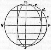 |
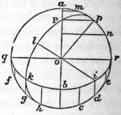 |
| Fig. 4. | Fig. 5. |
Let us next construct an orthographic projection of the sphere on the horizon of any place.
 |
| Fig. 6.—Orthographic Projection. |
Set off the angle aop (fig. 5) from the radius oa, equal to the latitude. Drop the perpendicular pP on oa, then P is the projection of the pole. On ao produced take ob = pP, then ob is the minor semiaxis of the ellipse representing the equator, its major axis being qr at right angles to ao. The points in which the meridians meet this elliptic equator are determined by lines drawn parallel to aob through the points of equal subdivision cdefgh. Take two points, as d and g, which are 90° apart, and let ik be their projections on the equator; then i is the pole of the meridian which passes through k. This meridian is of course an ellipse, and is described with reference to i exactly as the equator was described with reference to P. Produce io to l, and make lo equal to half the shortest chord that can be drawn through i; then lo is the semiaxis of the elliptic meridian, and the major axis is the diameter perpendicular to iol.
For the parallels: let it be required to describe the parallel whose co-latitude is u; take pm = pn = u, and let m′n′ be the projections of m and n on oPa; then m′n′ is the minor axis of the ellipse representing the parallel. Its centre is of course midway between m′ and n′, and the greater axis is equal to mn. Thus the construction is obvious. When pm is less than pa the whole of 655 the ellipse is to be drawn. When pm is greater than pa the ellipse touches the circle in two points; these points divide the ellipse into two parts, one of which, being on the other side of the meridian plane aqr, is invisible. Fig. 6 shows the complete orthographic projection.
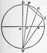 |
| Fig. 7. |
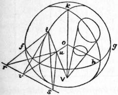 |
| Fig. 8. |
Stereographic Projection.—In this case the point of vision is on the surface, and the projection is made on the plane of the great circle whose pole is V. Let kplV (fig. 7) be a great circle through the point of vision, and ors the trace of the plane of projection. Let c be the centre of a small circle whose radius is cp = cl; the straight line pl represents this small circle in orthographic projection.
We have first to show that the stereographic projection of the small circle pl is itself a circle; that is to say, a straight line through V, moving along the circumference of pl, traces a circle on the plane of projection ors. This line generates an oblique cone standing on a circular base, its axis being cV (since the angle pVc = angle cVl); this cone is divided symmetrically by the plane of the great circle kpl, and also by the plane which passes through the axis Vc, perpendicular to the plane kpl. Now Vr·Vp, being = Vo sec kVp·Vk cos kVp = Vo·Vk, is equal to Vs·Vl; therefore the triangles Vrs, Vlp are similar, and it follows that the section of the cone by the plane rs is similar to the section by the plane pl. But the latter is a circle, hence also the projection is a circle; and since the representation of every infinitely small circle on the surface is itself a circle, it follows that in this projection the representation of small parts is strictly similar. Another inference is that the angle in which two lines on the sphere intersect is represented by the same angle in the projection. This may otherwise be proved by means of fig. 8, where Vok is the diameter of the sphere passing through the point of vision, fgh the plane of projection, kt a great circle, passing of course through V, and ouv the line of intersection of these two planes. A tangent plane to the surface at t cuts the plane of projection in the line rvs perpendicular to ov; tv is a tangent to the circle kt at t, tr and ts are any two tangents to the surface at t. Now the angle vtu (u being the projection of t) is 90° − otV = 90° − oVt = ouV = tuv, therefore tv is equal to uv; and since tvs and uvs are right angles, it follows that the angles vts and vus are equal. Hence the angle rts also is equal to its projection rus; that is, any angle formed by two intersecting lines on the surface is truly represented in the stereographic projection.
In this projection, therefore, angles are correctly represented and every small triangle is represented by a similar triangle. Projections having this property of similar representation of small parts are called orthomorphic, conform or conformable. The word orthomorphic, which was introduced by Germain27 and adopted by Craig,28 is perhaps the best to use.
Since in orthomorphic projections very small figures are correctly represented, it follows that the scale is the same in all directions round a point in its immediate neighbourhood, and orthomorphic projections may be defined as possessing this property. There are many other orthomorphic projections, of which the best known is Mercator’s. These are described below.
We have seen that the stereographic projection of any circle of the sphere is itself a circle. But in the case in which the circle to be projected passes through V, the projection becomes, for a great circle, a line through the centre of the sphere; otherwise, a line anywhere. It follows that meridians and parallels are represented in a projection on the horizon of any place by two systems of orthogonally cutting circles, one system passing through two fixed points, namely, the poles; and the projected meridians as they pass through the poles show the proper differences of longitude.
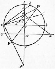 |
| Fig. 9. |
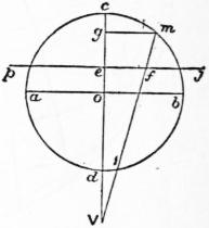 |
| Fig. 10. |
To construct a stereographic projection of the sphere on the horizon of a given place. Draw the circle vlkr (fig. 9) with the diameters kv, lr at right angles; the latter is to represent the central meridian. Take koP equal to the co-latitude of the given place, say u; draw the diameter PoP′, and vP, vP′ cutting lr in pp′: these are the projections of the poles, through which all the circles representing meridians have to pass. All their centres then will be in a line smn which crosses pp′ at right angles through its middle point m. Now to describe the meridian whose west longitude is ω, draw pn making the angle opn = 90° − ω, then n is the centre of the required circle, whose direction as it passes through p will make an angle opg = ω with pp′. The lengths of the several lines are
op = tan 1⁄2u; op′ = cot 1⁄2u; om = cot u; mn = cosec u cot ω.
Again, for the parallels, take Pb = Pc equal to the co-latitude, say c, of the parallel to be projected; join vb, vc cutting lr in e, d. Then ed is the diameter of the circle which is the required projection; its centre is of course the middle point of ed, and the lengths of the lines are
od = tan 1⁄2(u − c); oe = tan 1⁄2(u + c).
The line sn itself is the projection of a parallel, namely, that of which the co-latitude c = 180° − u, a parallel which passes through the point of vision.
Notwithstanding the facility of construction, the stereographic projection is not much used in map-making. It is sometimes used for maps of the hemispheres in atlases, and for star charts.
External Perspective Projection.—We now come to the general case in which the point of vision has any position outside the sphere. Let abcd (fig. 10) be the great circle section of the sphere by a plane passing through c, the central point of the portion of surface to be represented, and V the point of vision. Let pj perpendicular to Vc be the plane of representation, join mV cutting pj in f, then f is the projection of any point m in the circle abc, and ef is the representation of cm.
Let the angle com = u, Ve = k, Vo = h, ef = ρ; then, since ef: eV = mg : gV, we have ρ = k sin u/(h + cos u), which gives the law connecting a spherical distance u with its rectilinear representation ρ. The relative scale at any point in this system of projection is given by
| σ = dρ / du, σ′ = ρ / sin u, |
| σ = k (1 + h cos u) / (h + cos u)2; σ′ = k / (h + cos u), |
the former applying to measurements made in a direction which passes through the centre of the map, the latter to the transverse direction. The product σσ′ gives the exaggeration of areas. With respect to the alteration of angles we have Σ = (h + cos u) / (l + k cos u), and the greatest alteration of angle is
| sin−1 ( | h − 1 | tan2 | u | ). |
| h + 1 | 2 |
This vanishes when h = 1, that is if the projection be stereographic; or for u = 0, that is at the centre of the map. At a distance of 90° from the centre, the greatest alteration is 90° − 2 cot−1 √h. (See Phil. Mag. 1862.)
Clarke’s Projection.—The constants h and k can be determined, so that the total misrepresentation, viz.:
M = ∫β0 { (σ − 1)2 + (σ′ − 1)2 } sin u du,
shall be a minimum, β being the greatest value of u, or the spherical radius of the map. On substituting the expressions for σ and σ′ the integration is effected without difficulty. Put
| λ = (1 − cos β) / (h + cos β); ν = (h − 1) λ, |
| H = ν − (h + 1) loge (λ + 1), H′ = λ (2 − ν + 1⁄3ν2) / (h + 1). |
Then the value of M is
M = 4 sin2 1⁄2β + 2kH + k2H′.
When this is a minimum,
dM / dh = 0; dM / dk = 0
∴ kH′ + H = 0; 2 dH / dh + k dh H′ / dh = 0.
Therefore M = 4 sin2 1⁄2β − H2/H1, and h must be determined so as to make H2 : H′ a maximum. In any particular case this maximum can only be ascertained by trial, that is to say, log H2 − log H′ must be calculated for certain equidistant values of h, and then the 656 particular value of h which corresponds to the required maximum can be obtained by interpolation. Thus we find that if it be required to make the best possible perspective representation of a hemisphere, the values of h and k are h = 1.47 and k = 2.034; so that in this case
| ρ = | 2.034 sin u | . |
| 1.47 + cos u |
For a map of Africa or South America, the limiting radius β we may take as 40°; then in this case
| ρ = | 2.543 sin u | . |
| 1.625 + cos u |
For Asia, β = 54, and the distance h of the point of sight in this case is 1.61. Fig. 11 is a map of Asia having the meridians and parallels laid down on this system.
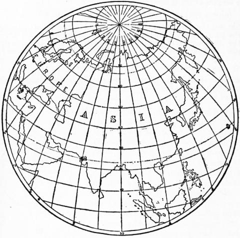 |
| Fig. 11. |
Fig. 12 is a perspective representation of more than a hemisphere, the radius β being 108°, and the distance h of the point of vision, 1.40.
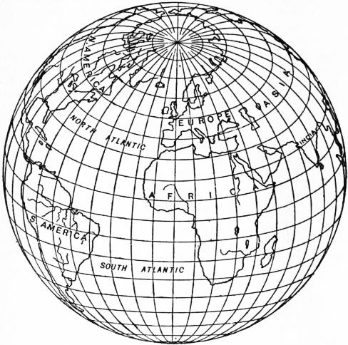 |
| Fig. 12.—Twilight Projection. Clarke’s Perspective Projection for a Spherical Radius of 108°. |
The co-ordinates xy of any point in this perspective may be expressed in terms of latitude and longitude of the corresponding point on the sphere in the following manner. The co-ordinates originating at the centre take the central meridian for the axis of y and a line perpendicular to it for the axis of x. Let the latitude of the point G, which is to occupy the centre of the map, be γ; if φ, ω be the latitude and longitude of any point P (the longitude being reckoned from the meridian of G), u the distance PG, and μ the azimuth of P at G, then the spherical triangle whose sides are 90° − γ, 90° − φ, and u gives these relations—
| sin u sin μ = cos φ sin ω, |
| sin u cos μ = cos γ sin φ − sin γ cos φ cos ω, |
| cos u = sin γ sin φ + cos γ cos φ cos ω. |
Now x = ρ sin μ, y = ρ cos μ, that is,
| x | = | cos φ sin ω | , |
| k | h + sin γ sin φ + cos γ cos φ cos ω |
| y | = | cos γ sin φ − sin γ cos φ cos ω | , |
| k | h + sin γ sin φ + cos γ cos φ cos ω |
by which x and y can be computed for any point of the sphere. If from these equations we eliminate ω, we get the equation to the parallel whose latitude is φ; it is an ellipse whose centre is in the central meridian, and its greater axis perpendicular to the same. The radius of curvature of this ellipse at its intersection with the centre meridian is k cos φ / (h sin γ + sin φ).
The elimination of φ between x and y gives the equation of the meridian whose longitude is ω, which also is an ellipse whose centre and axes may be determined.
The following table contains the computed co-ordinates for a map of Africa, which is included between latitudes 40° north and 40° south and 40° of longitude east and west of a central meridian.
| φ | Values of x and y. | ||||
| ω = 0° | ω = 10° | ω = 20° | ω = 30° | ω = 40° | |
| 0° | x = 0.00 | 9.69 | 19.43 | 29.25 | 39.17 |
| y = 0.00 | 0.00 | 0.00 | 0.00 | 0.00 | |
| 10° | x = 0.00 | 9.60 | 19.24 | 28.95 | 38.76 |
| y = 9.69 | 9.75 | 9.92 | 10.21 | 10.63 | |
| 20° | x = 0.00 | 9.32 | 18.67 | 28.07 | 37.53 |
| y = 19.43 | 19.54 | 19.87 | 20.43 | 21.25 | |
| 30° | x = 0.00 | 8.84 | 17.70 | 26.56 | 35.44 |
| y = 29.25 | 29.40 | 29.87 | 30.67 | 31.83 | |
| 40° | x = 0.00 | 8.15 | 16.28 | 24.39 | 32.44 |
| y = 39.17 | 39.36 | 39.94 | 40.93 | 42.34 | |
 |
| Fig. 13. |
Central or Gnomonic (Perspective) Projection.—In this projection the eye is imagined to be at the centre of the sphere. It is evident that, since the planes of all great circles of the sphere pass through the centre, the representations of all great circles on this projection will be straight lines, and this is the special property of the central projection, that any great circle (i.e. shortest line on the spherical surface) is represented by a straight line. The plane of projection may be either parallel to the plane of the equator, in which case the parallels are represented by concentric circles and the meridians by straight lines radiating from the common centre; or the plane of projection may be parallel to the plane of some meridian, in which case the meridians are parallel straight lines and the parallels are hyperbolas; or the plane of projection may be inclined to the axis of the sphere at any angle λ.
In the latter case, which is the most general, if θ is the angle any meridian makes (on paper) with the central meridian, α the longitude of any point P with reference to the central meridian, l the latitude of P, then it is clear that the central meridian is a straight line at right angles to the equator, which is also a straight line, also tan θ = sin λ tan α, and the distance of p, the projection of P, from the equator along its meridian is (on paper) m sec α sin l / sin (l + x), where tan x = cot λ cos α, and m is a constant which defines the scale.
The three varieties of the central projection are, as is the case with other perspective projections, known as polar, meridian or horizontal, according to the inclination of the plane of projection.
 |
| (From Text Book of Topographical Surveying, by permission of the Controller of H. M. Stationery Office.) |
| Fig. 14.—Part of the Atlantic Ocean on a Meridian Central Projection. The shortest path between any two points is shown on this projection by a straight line. |
Fig. 14 is an example of a meridian central projection of part of the Atlantic Ocean. The term “gnomonic” was applied 657 to this projection because the projection of the meridians is a similar problem to that of the graduation of a sun-dial. It is, however, better to use the term “central,” which explains itself. The central projection is useful for the study of direct routes by sea and land. The United States Hydrographic Department has published some charts on this projection. False notions of the direction of shortest lines, which are engendered by a study of maps on Mercator’s projection, may be corrected by an inspection of maps drawn on the central projection.
There is no projection which accurately possesses the property of showing shortest paths by straight lines when applied to the spheroid; one which very nearly does so is that which results from the intersection of terrestrial normals with a plane.
We have briefly reviewed the most important projections which are derived from the sphere by direct geometrical construction, and we pass to that more important branch of the subject which deals with projections which are not subject to this limitation.
Conical Projections.
Conical projections are those in which the parallels are represented by concentric circles and the meridians by equally spaced radii. There is no necessary connexion between a conical projection and any touching or secant cone. Projections for instance which are derived by geometrical construction from secant cones are very poor projections, exhibiting large errors, and they will not be discussed. The name conical is given to the group embraced by the above definition, because, as is obvious, a projection so drawn can be bent round to form a cone. The simplest and, at the same time, one of the most useful forms of conical projection is the following:
 |
| Fig. 15. |
Conical Projection with Rectified Meridians and Two Standard Parallels.—In some books this has been, most unfortunately, termed the “secant conical,” on account of the fact that there are two parallels of the correct length. The use of this term in the past has caused much confusion. Two selected parallels are represented by concentric circular arcs of their true lengths; the meridians are their radii. The degrees along the meridians are represented by their true lengths; and the other parallels are circular arcs through points so determined and are concentric with the chosen parallels.
Thus in fig. 15 two parallels Gn and G′n′ are represented by their true lengths on the sphere; all the distances along the meridian PGG′, pnn′ are the true spherical lengths rectified.
Let γ be the co-latitude of Gn; γ′ that of Gn′; ω be the true difference of longitude of PGG′ and pnn′; hω be the angle at O; and OP = z, where Pp is the representation of the pole. Then the true length of parallel Gn on the sphere is ω sin γ, and this is equal to the length on the projection, i.e. ω sin γ = hω (z + γ); similarly ω sin γ′ = hω (z + γ′).
The radius of the sphere is assumed to be unity, and z and γ are expressed in circular measure. Hence h = sin γ/(z + γ) = sin γ′ (z + γ′); from this h and z are easily found.
In the above description it has been assumed that the two errorless parallels have been selected. But it is usually desirable to impose some condition which itself will fix the errorless parallels. There are many conditions, any one of which may be imposed. In fig. 15 let Cm and C′m′ represent the extreme parallels of the map, and let the co-latitudes of these parallels be c and c′, then any one of the following conditions may be fulfilled:—
(a) The errors of scale of the extreme parallels may be made equal and may be equated to the error of scale of the parallel of maximum error (which is near the mean parallel).
(b) Or the errors of scale of the extreme parallels may be equated to that of the mean parallel. This is not so good a projection as (a).
(c) Or the absolute errors of the extreme and mean parallels may be equated.
(d) Or in the last the parallel of maximum error may be considered instead of the mean parallel.
(e) Or the mean length of all the parallels may be made correct. This is equivalent to making the total area between the extreme parallels correct, and must be combined with another condition, for example, that the errors of scale on the extreme parallels shall be equal.
We will now discuss (a) above, viz. a conical projection with rectified meridians and two standard parallels, the scale errors of the extreme parallels and parallel of maximum error being equated.
Since the scale errors of the extreme parallels are to be equal,
| h (z + c) | − 1 = | h (z + c′) | − 1, whence z = | c′ sin c − c sin c′ | . |
| sin c | sin c′ | sin c′ − sin c |
The error of scale along any parallel (near the centre), of which the co-latitude is b is
1 − { h (z + b) / sin b }.
This is a maximum when
tan b − b = z, whence b is found.
Also
| 1 − | h (z + b) | = | h (z + c) | − 1 whence h is found. |
| sin b | sin c |
For the errorless parallels of co-latitudes γ and γ′ we have
h = (z + γ) / sin γ = (z + γ′) / sin γ′.
If this is applied to the case of a map of South Africa between the limits 15° S. and 35° S. (see fig. 16) it will be found that the parallel of maximum error is 25° 20′; the errorless parallels, to the nearest degree, are those of 18° and 32°. The greatest scale error in this case is about 0.7%.
In the above account the earth has been treated as a sphere. Of course its real shape is approximately a spheroid of revolution, and the values of the axes most commonly employed are those of Clarke or of Bessel. For the spheroid, formulae arrived at by the same principles but more cumbrous in shape must be used. But it will usually be sufficient for the selection of the errorless parallels to use the simple spherical formulae given above; then, having made the selection of these parallels, the true spheroidal lengths along the meridians between them can be taken out of the ordinary tables (such as those published by the Ordnance Survey or by the U.S. Coast and Geodetic Survey). Thus, if a1, a2, are the lengths of 1° of the errorless parallels (taken from the tables), d the true rectified length of the meridian arc between them (taken from the tables),
h = { (a2 − a1) / d} 180 / π,
and the radius on paper of parallel, a1 is a1d/(a2 − a1), and the radius of any other parallel = radius of a1 ± the true meridian distance between the parallels.
This class of projection was used for the 1/1,000,000 Ordnance map of the British Isles. The three maximum scale errors in this case work out to 0.23%, the range of the projection being from 50° N. to 61° N., and the errorless parallels are 59° 31′ and 51°44′.
Where no great refinement is required it will be sufficient to take the errorless parallels as those distant from the extreme parallels about one-sixth of the total range in latitude. Thus suppose it is required to plot a projection for India between latitudes 8° and 40° N. By this rough rule the errorless parallels should be distant from the extreme parallels about 32°/6, i.e. 5° 20′; they should therefore, to the nearest degree, be 13° and 35° N. The maximum scale errors will be about 2%.
The scale errors vary approximately as the square of the range of latitude; a rough rule is, largest scale error = L2/50,000, where L is the range in the latitude in degrees. Thus a country with a range of 7° in latitude (nearly 500 m.) can be plotted on this projection with a maximum linear scale error (along a parallel) of about 0.1%;29 there is no error along any meridian. It is immaterial with this 658 projection (or with any conical projection) what the extent in longitude is. It is clear that this class of projection is accurate, simple and useful.
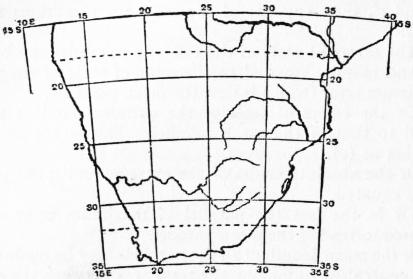 |
| (From Text Book of Topographical Surveying, by permission of the Controller of H. M. Stationery Office.) |
| Fig. 16.—South Africa on a conical projection with rectified meridians and two standard parallels. Scale 800 m. to 1 in. |
In the projections designated by (c) and (d) above, absolute errors of length are considered in the place of errors of scale, i.e. between any two meridians (c) the absolute errors of length of the extreme parallels are equated to the absolute error of length of the middle parallel. Using the same notation
h (z + c) − sin c = h (z + c′) − sin c′ = −h (z + 1⁄2c + 1⁄2c′) − sin 1⁄2 (c + c′).
L. Euler, in the Acta Acad. Imp. Petrop. (1778), first discussed this projection.
If a map of Asia between parallels 10° N. and 70° N. is constructed on this system, we have c = 20°, c′ = 80°, whence from the above equations z = 66.7° and h = .6138. The absolute errors of length along parallels 10°, 40° and 70° between any two meridians are equal but the scale errors are respectively 5, 6.7, and 15%.
The modification (d) of this projection was selected for the 1 : 1,000,000 map of India and Adjacent Countries under publication by the Survey of India. An account of this is given in a pamphlet produced by that department in 1903. The limiting parallels are 8° and 40° N., and the parallel of greatest error is 23° 40′ 51″. The errors of scale are 1.8, 2.3, and 1.9%.
It is not as a rule desirable to select this form of the projection. If the surface of the map is everywhere equally valuable it is clear that an arrangement by which errors of scale are larger towards the pole than towards the equator is unsound, and it is to be noted that in the case quoted the great bulk of the land is in the north of the map. Projection (a) would for the same region have three equal maximum scale errors of 2%. It may be admitted that the practical difference between the two forms is in this case insignificant, but linear scale errors should be reduced as much as possible in maps intended for general use.
f. In the fifth form of the projection, the total area of the projection between the extreme parallels and any two meridians is equated to the area of the portion of the sphere which it represents, and the errors of scale of the extreme parallels are equated. Then it is easy to show that
| z = (c′ sin c − c sin c′) / (sin c′ − sin c); |
| h = (cos c − cos c′) / (c′ − c) {z + 1⁄2 (c + c′)}. |
It can also be shown that any other zone of the same range in latitude will have the same scale errors along its limiting parallels. For instance, a series of projections may be constructed for zones, each having a range of 10° of latitude, from the equator to the pole. Treating the earth as a sphere and using the above formulae, the series will possess the following properties: the meridians will all be true to scale, the area of each zone will be correct, the scale errors of the limiting parallels will all be the same, so that the length of the upper parallel of any zone will be equal to that of the lower parallel of the zone above it. But the curvatures of these parallels will be different, and two adjacent zones will not fit but will be capable of exact rolling contact. Thus a very instructive flat model of the globe may be constructed which will show by suitably arranging the points of contact of the zones the paths of great circles on the sphere. The flat model was devised by Professor J. D. Everett, F.R.S., who also pointed out that the projection had the property of the equality of scale errors of the limiting parallels for zones of the same width. The projection may be termed Everett’s Projection.
Simple Conical Projection.—If in the last group of projections the two selected parallels which are to be errorless approach each other indefinitely closely, we get a projection in which all the meridians are, as before, of the true rectified lengths, in which one parallel is errorless, the curvature of that parallel being clearly that which would result from the unrolling of a cone touching the sphere along the parallel represented. And it was in fact originally by a consideration of the tangent cone that the whole group of conical projections came into being. The quasi-geometrical way of regarding conical projections is legitimate in this instance.
 |
| Fig. 17. |
The simple conical projection is therefore arrived at in this way: imagine a cone to touch the sphere along any selected parallel, the radius of this parallel on paper (Pp, fig. 17) will be r cot φ, where r is the radius of the sphere and φ is the latitude; or if the spheroidal shape is taken into account, the radius of the parallel on paper will be ν cot φ where ν is the normal terminated by the minor axis (the value ν can be found from ordinary geodetic tables). The meridians are generators of the cone and every parallel such as HH′ is a circle, concentric with the selected parallel Pp and distant from it the true rectified length of the meridian arc between them.
This projection has no merits as compared with the group just described. The errors of scale along the parallels increase rapidly as the selected parallel is departed from, the parallels on paper being always too large. As an example we may take the case of a map of South Africa of the same range as that of the example given in (a) above, viz. from 15° S. to 35° S. Let the selected parallel be 25° S.; the radius of this parallel on paper (taking the radius of the sphere as unity) is cot 25°; the radius of parallel 35° S. = radius of 25° − meridian distance between 25° and 35° = cot 25° − 10π/180 = 1.970. Also h = sin of selected latitude = sin 25°, and length on paper along parallel 35° of ω° = ωh × 1.970 = ω × 1.970 × sin 25°,
but length on sphere of ω = ω cos 35°,
| hence scale error = | 1.970 sin 25° | − 1 = 1.6%, |
| cos 35° |
an error which is more than twice as great as that obtained by method (a).
Bonne’s Projection.—This projection, which is also called the “modified conical projection,” is derived from the simple conical, just described, in the following way: a central meridian is chosen and drawn as a straight line; degrees of latitude spaced at the true rectified distances are marked along this line; the parallels are concentric circular arcs drawn through the proper points on the central meridian, the centre of the arcs being fixed by describing one chosen parallel with a radius of ν cot φ as before; the meridians on each side of the central meridian are drawn as follows: along each parallel distances are marked equal to the true lengths along the parallels on sphere or spheroid, and the curve through corresponding points so fixed are the meridians (fig. 18).
 |
| Fig. 18. |
This system is that which was adopted in 1803 by the “Dépôt de la Guerre” for the map of France, and is there known by the title of Projection de Bonne. It is that on which the ordnance survey map of Scotland on the scale of 1 in. to a mile is constructed, and it is frequently met with in ordinary atlases. It is ill-adapted for countries having great extent in longitude, as the intersections of the meridians and parallels become very oblique—as will be seen on examining the map of Asia in most atlases.
If φ0 be taken as the latitude of the centre parallel, and co-ordinates be measured from the intersection of this parallel with the central meridian, then, if ρ be the radius of the parallel of latitude φ, we have ρ = cot φ0 + φ0 − φ. Also, if S be a point on this parallel whose co-ordinates are x, y, so that VS = ρ, and θ be the angle VS makes with the central meridian, then ρθ = ω cos φ; and x = ρ sin θ, y = cot φ0 − ρ cos θ.
The projection has the property of equal areas, since each small element bounded by two infinitely close parallels is equal in length and width to the corresponding element on the sphere or spheroid. Also all the meridians cross the chosen parallel (but no other) at right angles, since in the immediate neighbourhood of that parallel the projection is identical with the simple conical projection. Where an equal-area projection is required for a country having no great extent in longitude, such as France, Scotland or Madagascar, this projection is a good one to select.
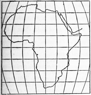 |
| Fig. 19.—Sinusoidal Equal-area Projection. |
Sinusoidal Equal-area Projection.—This projection, which is 659 sometimes known as Sanson’s, and is also sometimes incorrectly called Flamsteed’s, is a particular case of Bonne’s in which the selected parallel is the equator. The equator is a straight line at right angles to the central meridian which is also a straight line. Along the central meridian the latitudes are marked off at the true rectified distances, and from points so found the parallels are drawn as straight lines parallel to the equator, and therefore at right angles to the central meridian. True rectified lengths are marked along the parallels and through corresponding points the meridians are drawn. If the earth is treated as a sphere the meridians are clearly sine curves, and for this reason d’Avezac has given the projection the name sinusoidal. But it is equally easy to plot the spheroidal lengths. It is a very suitable projection for an equal-area map of Africa.
Werner’s Projection.—This is another limiting case of Bonne’s equal-area projection in which the selected parallel is the pole. The parallels on paper then become incomplete circular arcs of which the pole is the centre. The central meridian is still a straight line which is cut by the parallels at true distances. The projection (after Johann Werner, 1468-1528), though interesting, is practically useless.
Polyconic Projections.
These pseudo-conical projections are valuable not so much for their intrinsic merits as for the fact that they lend themselves to tabulation. There are two forms, the simple or equidistant polyconic, and the rectangular polyconic.
The Simple Polyconic.—If a cone touches the sphere or spheroid along a parallel of latitude φ and is then unrolled, the parallel will on paper have a radius of ν cot φ, where ν is the normal terminated by the minor axis. If we imagine a series of cones, each of which touches one of a selected series of parallels, the apex of each cone will lie on the prolonged axis of the spheroid; the generators of each cone lie in meridian planes, and if each cone is unrolled and the generators in any one plane are superposed to form a straight central meridian, we obtain a projection in which the central meridian is a straight line and the parallels are circular arcs each of which has a different centre which lies on the prolongation of the central meridian, the radius of any parallel being ν cot φ.
So far the construction is the same for both forms of polyconic. In the simple polyconic the meridians are obtained by measuring outwards from the central meridian along each parallel the true lengths of the degrees of longitude. Through corresponding points so found the meridian curves are drawn. The resulting projection is accurate near the central meridian, but as this is departed from the parallels increasingly separate from each other, and the parallels and meridians (except along the equator) intersect at angles which increasingly differ from a right angle. The real merit of the projection is that each particular parallel has for every map the same absolute radius, and it is thus easy to construct tables which shall be of universal use. This is especially valuable for the projection of single sheets on comparatively large scales. A sheet of a degree square on a scale of 1 : 250,000 projected in this manner differs inappreciably from the same sheet projected on a better system, e.g. an orthomorphic conical projection or the conical with rectified meridians and two standard parallels; there is thus the advantage that the simple polyconic when used for single sheets and large scales is a sufficiently close approximation to the better forms of conical projection. The simple polyconic is used by the topographical section of the general staff, by the United States coast and geodetic survey and by the topographical division of the U.S. geological survey. Useful tables, based on Clarke’s spheroid of 1866, have been published by the war office and by the U.S. coast and geodetic survey.
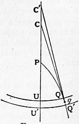 |
| Fig. 20. |
Rectangular Polyconic.—In this the central meridian and the parallels are drawn as in the simple polyconic, but the meridians are curves which cut the parallels at right angles.
In this case, let P (fig. 20) be the north pole, CPU the central meridian, U, U′ points in that meridian whose co-latitudes are z and z+dz, so that UU′ = dz. Make PU = z, UC = tan z, U′C′ = tan (z + dz); and with CC′ as centres describe the arcs UQ, U′Q′, which represent the parallels of co-latitude z and z + dz. Let PQQ′ be part of a meridian curve cutting the parallels at right angles. Join CQ, C′Q′; these being perpendicular to the circles will be tangents to the curve. Let UCQ = 2α, UC′Q′ = 2(α + dα), then the small angle CQC′, or the angle between the tangents at QQ′, will = 2dα. Now
CC′ = C′U′ − CU − UU′ = tan (z + dz) − tan z − dz = tan2 z dz.
The tangents CQ, C′Q′ will intersect at q, and in the triangle CC′q the perpendicular from C on C′q is (omitting small quantities of the second order) equal to either side of the equation
tan2 z dz sin 2α = −2 tan zd α.
−tan z dz = 2 dα / sin 2α,
which is the differential equation of the meridian: the integral is tan α = ω cos z, where ω, a constant, determines a particular meridian curve. The distance of Q from the central meridian, tan z sin 2α, is equal to
| 2 tan z tan α | = | 2ω sin z | . |
| 1 + tan2 α | 1 + ω2 cos2 α |
 |
| Fig. 21. |
At the equator this becomes simply 2ω. Let any equatorial point whose actual longitude is 2ω be represented by a point on the developed equator at the distance 2ω from the central meridian, then we have the following very simple construction (due to O’Farrell of the ordnance survey). Let P (fig. 21) be the pole, U any point in the central meridian, QUQ′ the represented parallel whose radius CU = tan z. Draw SUS′ perpendicular to the meridian through U; then to determine the point Q, whose longitude is, say, 3°, lay off US equal to half the true length of the arc of parallel on the sphere, i.e. 1° 30′ to radius sin z, and with the centre S and radius SU describe a circular arc, which will intersect the parallel in the required point Q. For if we suppose 2ω to be the longitude of the required point Q, US is by construction = ω sin z, and the angle subtended by SU at C is
| tan−1 ( | ω sin z | ) = tan−1 (ω cos z) = α, |
| tan z |
and therefore UCQ = 2α as it should be. The advantages of this method are that with a remarkably simple and convenient mode of construction we have a map in which the parallels and meridians intersect at right angles.
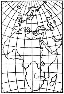 |
| Fig. 22. |
Fig. 22 is a representation of this system of the continents of Europe and Africa, for which it is well suited. For Asia this system would not do, as in the northern latitudes, say along the parallel of 70°, the representation is much cramped.
With regard to the distortion in the map of Africa as thus constructed, consider a small square in latitude 40° and in 40° longitude east or west of the central meridian, the square being so placed as to be transformed into a rectangle. The sides, originally unity, became 0.95 and 1.13, and the area 1.08, the diagonals intersecting at 90° ± 9° 56′. In Clarke’s perspective projection a 660 square of unit side occupying the same position, when transformed to a rectangle, has its sides 1.02 and 1.15, its area 1.17, and its diagonals intersect at 90° ± 7° 6′. The latter projection is therefore the best in point of “similarity,” but the former represents areas best. This applies, however, only to a particular part of the map; along the equator towards 30° or 40° longitude, the polyconic is certainly inferior, while along the meridian it is better than the perspective—except, of course, near the centre. Upon the whole the more even distribution of distortion gives the advantage to the perspective system. For single sheets on large scales there is nothing to choose between this projection and the simple polyconic. Both are sensibly perfect representations. The rectangular polyconic is occasionally used by the topographical section of the general staff.
Zenithal Projections.
Some point on the earth is selected as the central point of the map; great circles radiating from this point are represented by straight lines which are inclined at their true angles at the point of intersection. Distances along the radiating lines vary according to any law outwards from the centre. It follows (on the spherical assumption), that circles of which the selected point is the centre are also circles on the projection. It is obvious that all perspective projections are zenithal.
Equidistant Zenithal Projection.—In this projection, which is commonly called the “equidistant projection,” any point on the sphere being taken as the centre of the map, great circles through this point are represented by straight lines of the true rectified lengths, and intersect each other at the true angles.
In the general case—
if z1 is the co-latitude of the centre of the map, z the co-latitude of any other point, α the difference of longitude of the two points, A the azimuth of the line joining them, and c the spherical length of the line joining them, then the position of the intersection of any meridian with any parallel is given (on the spherical assumption) by the solution of a simple spherical triangle.
Thus—
let tan θ = tan z cos α, then cos c = cos z sec θ cos (z − θ), and sin A = sin z sin α cosec c.
The most useful case is that in which the central point is the pole; the meridians are straight lines inclined to each other at the true angular differences of longitude, and the parallels are equidistant circles with the pole as centre. This is the best projection to use for maps exhibiting the progress of polar discovery, and is called the polar equidistant projection. The errors are smaller than might be supposed. There are no scale errors along the meridians, and along the parallels the scale error is (z / sin x) − 1, where z is the co-latitude of the parallel. On a parallel 10° distant from the pole the error of scale is only 0.5%.
General Theory of Zenithal Projections.—For the sake of simplicity it will be at first assumed that the pole is the centre of the map, and that the earth is a sphere. According to what has been said above, the meridians are now straight lines diverging from the pole, dividing the 360° into equal angles; and the parallels are represented by circles having the pole as centre, the radius of the parallel whose co-latitude is z being ρ, a certain function of z. The particular function selected determines the nature of the projection.
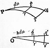 |
| Fig. 23. |
Let Ppq, Prs (fig. 23) be two contiguous meridians crossed by parallels rp, sq, and Op′q′, Or′s′ the straight lines representing these meridians. If the angle at P is dμ, this also is the value of the angle at O. Let the co-latitude
Pp = z, Pq = z + dz; Op′ = ρ, Oq′ = ρ + dρ,
the circular arcs p′r′, q′s′ representing the parallels pr, qs. If the radius of the sphere be unity,
p′q′ = dρ; p′r′ = ρ dμ,
pq = dz; pr = sin z dμ.
Put
σ = dρ / dz; σ′ = ρ / sin z,
then p′q′ = σpq and p′r′ = σ′pr. That is to say, σ, σ′ may be regarded as the relative scales, at co-latitude z, of the representation, σ applying to meridional measurements, σ′ to measurements perpendicular to the meridian. A small square situated in co-latitude z, having one side in the direction of the meridian—the length of its side being i—is represented by a rectangle whose sides are iσ and iσ′; its area consequently is i2σσ′.
If it were possible to make a perfect representation, then we should have σ = 1, σ′ = 1 throughout. This, however, is impossible. We may make σ = 1 throughout by taking ρ = z. This is the Equidistant Projection just described, a very simple and effective method of representation.
Or we may make σ′= 1 throughout. This gives ρ = sin z, a perspective projection, namely, the Orthographic.
Or we may require that areas be strictly represented in the development. This will be effected by making σσ′ = 1, or ρ dρ = sin z dz, the integral of which is ρ = 2 sin 1⁄2z, which is the Zenithal Equal-area Projection of Lambert, sometimes, though wrongly referred to as Lorgna’s Projection after Antonio Lorgna (b. 1736). In this system there is misrepresentation of form, but no misrepresentation of areas.
Or we may require a projection in which all small parts are to be represented in their true forms i.e. an orthomorphic projection. For instance, a small square on the spherical surface is to be represented as a small square in the development. This condition will be attained by making σ = σ′, or dρ/ρ = dz/sin z, the integral of which is, c being an arbitrary constant, ρ = c tan 1⁄2z. This, again, is a perspective projection, namely, the Stereographic. In this, though all small parts of the surface are represented in their correct shapes, yet, the scale varying from one part of the map to another, the whole is not a similar representation of the original. The scale, σ = 1⁄2c sec2 1⁄2z, at any point, applies to all directions round that point.
These two last projections are, as it were, at the extremes of the scale; each, perfect in its own way, is in other respects objectionable. We may avoid both extremes by the following considerations. Although we cannot make σ = 1 and σ′ = 1, so as to have a perfect picture of the spherical surface, yet considering σ − 1 and σ′ − 1 as the local errors of the representation, we may make (σ − 1)2 + (σ′ − 1)2 a minimum over the whole surface to be represented. To effect this we must multiply this expression by the element of surface to which it applies, viz. sin zd zd μ, and then integrate from the centre to the (circular) limits of the map. Let β be the spherical radius of the segment to be represented, then the total misrepresentation is to be taken as
| ∫β0 { ( | dρ | − 1 )2 + ( | ρ | − 1 )2 } sin z dz, |
| dz | sin z |
which is to be made a minimum. Putting ρ = z + y, and giving to y only a variation subject to the condition δy = 0 when z = 0, the equations of solution—using the ordinary notation of the calculus of variations—are
| N − | d(P) | = 0; Pβ = 0, |
| dz |
Pβ being the value of 2p sin z when z = β. This gives
| sin2 z | d2y | + sin z cos z | dy | − y = z − sin z ( | dy | ) β = 0. |
| dz2 | dz | dz |
This method of development is due to Sir George Airy, whose original paper—the investigation is different in form from the above, which is due to Colonel Clarke—will be found in the Philosophical Magazine for 1861. The solution of the differential equation leads to this result—
| ρ = 2 cot 1⁄2z loge sec 1⁄2z + C tan 1⁄2z, |
| C = 2 cot2 1⁄2β loge sec 1⁄2β. |
The limiting radius of the map is R = 2C tan 1⁄2β. In this system, called by Sir George Airy Projection by balance of errors, the total misrepresentation is an absolute minimum. For short it may be called Airy’s Projection.
Returning to the general case where ρ is any function of z, let us consider the local misrepresentation of direction. Take any indefinitely small line, length = i, making an angle α with the meridian in co-latitude z. Its projections on a meridian and parallel are i cos α, i sin α, which in the map are represented by iσ cos α, iσ′ sin α. If then α′ be the angle in the map corresponding to α,
tan α′ = (σ′ / σ) tan α.
Put
σ′ / σ = ρ dz / sin z dρ = Σ,
and the error α′ − α of representation = ε, then
| tan ε = | (Σ − 1) tan α | . |
| 1 + Σ tan2 α |
Put Σ = cot2 ζ, then ε is a maximum when α = ζ, and the corresponding value of ε is
ε = 1⁄2π − 2ζ.
For simplicity of explanation we have supposed this method of development so applied as to have the pole in the centre. There is, however, no necessity for this, and any point on the 661 surface of the sphere may be taken as the centre. All that is necessary is to calculate by spherical trigonometry the azimuth and distance, with reference to the assumed centre, of all the points of intersection of meridians and parallels within the space which is to be represented in a plane. Then the azimuth is represented unaltered, and any spherical distance z is represented by ρ. Thus we get all the points of intersection transferred to the representation, and it remains merely to draw continuous lines through these points, which lines will be the meridians and parallels in the representation.
Thus treating the earth as a sphere and applying the Zenithal Equal-area Projection to the case of Africa, the central point selected being on the equator, we have, if θ be the spherical distance of any point from the centre, φ, α the latitude and longitude (with reference to the centre), of this point, cos θ = cos φ cos α. If A is the azimuth of this point at the centre, tan A = sin α cot φ. On paper a line from the centre is drawn at an azimuth A, and the distance θ is represented by 2 sin 1⁄2θ. This makes a very good projection for a single-sheet equal-area map of Africa. The exaggeration in such systems, it is important to remember, whether of linear scale, area, or angle, is the same for a given distance from the centre, whatever be the azimuth; that is, the exaggeration is a function of the distance from the centre only.
General Theory of Conical Projections.
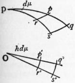 |
| Fig. 24. |
Meridians are represented by straight lines drawn through a point, and a difference of longitude ω is represented by an angle hω. The parallels of latitude are circular arcs, all having as centre the point of divergence of the meridian lines. It is clear that perspective and zenithal projections are particular groups of conical projections.
Let z be the co-latitude of a parallel, and ρ, a function of z, the radius of the circle representing this parallel. Consider the infinitely small space on the sphere contained by two consecutive meridians, the difference of whose longitude is dμ, and two consecutive parallels whose co-latitudes are z and z + dz. The sides of this rectangle are pq = dz, pr = sin z dμ; in the projection p′q′r′s′ these become p′q′ = dρ, and p′r′ = ρhdμ.
The scales of the projection as compared with the sphere are p′q′/pq = dρ/dz = the scale of meridian measurements = σ, say, and p′r′/pr = ρhdμ/sin zdμ = ρh/sin z = scale of measurements perpendicular to the meridian = σ′, say.
Now we may make σ = 1 throughout, then ρ = z + const. This gives either the group of conical projections with rectified meridians, or as a particular case the equidistant zenithal.
We may make σ = σ′ throughout, which is the same as requiring that at any point the scale shall be the same in all directions. This gives a group of orthomorphic projections.
In this case dρ/dz = ρh/sin z, or dρ/ρ = h dz/sin z.
Integrating,
ρ = k(tan 1⁄2z)h,
where k is a constant.
Now h is at our disposal and we may give it such a value that two selected parallels are of the correct lengths. Let z1, z2 be the co-latitudes of these parallels, then it is easy to show that
| h = | log sin z1 − log sin z2 | . |
| log tan 1⁄2z1 − log tan 1⁄2z2 |
This projection, given by equations (i.) and (ii.), is Lambert’s orthomorphic projection—commonly called Gauss’s projection; its descriptive name is the orthomorphic conical projection with two standard parallels.
The constant k in (i.) defines the scale and may be used to render the scale errors along the selected parallels not nil but the same; and some other parallel, e.g. the central parallel may then be made errorless.
The value h = 1⁄3, as suggested by Sir John Herschel, is admirably suited for a map of the world. The representation is fan-shaped, with remarkably little distortion (fig. 24).
If any parallel of co-latitude z is true to scale hk(tan 1⁄2z1)h = sin z, if this parallel is the equator, so that z1 = 90°, kh = 1, then equation (i.) becomes ρ = (tan 1⁄2z)h/h, and the radius of the equator = 1/h. The distance r of any parallel from the equator is 1/h − (tan 1⁄2z)h/h = (1/h){1 − (tan 1⁄2z)h}.
If, instead of taking the radius of the earth as unity we call it a, r = (a/h){1 − (tan 1⁄2z)h}. When h is very small, the angles between the meridian lines in the representation are very small; and proceeding to the limit, when h is zero the meridians are parallel—that is, the vertex of the cone has removed to infinity. And at the limit when h is zero we have r = a loge cot 1⁄2z, which is the characteristic equation of Mercator’s projection.
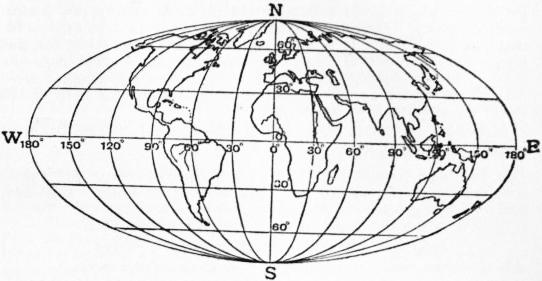 |
| Fig. 25.—Elliptical equal-area Projection, showing the whole surface of the globe. |
Mercator’s Projection.—From the manner in which we have arrived at this projection it is clear that it retains the characteristic property of orthomorphic projections—namely, similarity of representation of small parts of the surface. In Mercator’s chart the equator is represented by a straight line, which is crossed at right angles by a system of parallel and equidistant straight lines representing the meridians. The parallels are straight lines parallel to the equator, and the distance of the parallel of latitude φ from the equator is, as we have seen above, r = a loge tan (45° + 1⁄2φ). In the vicinity of the equator, or indeed within 30° of latitude of the equator, the representation is very accurate, but as we proceed northwards or southwards the exaggeration of area becomes larger, and eventually excessive—the poles being at infinity. This distance of the parallels may be expressed in the form r = a (sin φ + 1⁄3 sin3 φ + 1⁄5 sin5 φ + ...), showing that near the equator r is nearly proportional to the latitude. As a consequence of the similar representation of small parts, a curve drawn on the sphere cutting all meridians at the same angle—the loxodromic curve—is projected into a straight line, and it is this property which renders Mercator’s chart so valuable to seamen. For instance: join by a straight line on the chart Land’s End and Bermuda, and measure the angle of intersection of this line with the meridian. We get thus the bearing which a ship has to retain during its course between these ports. This is not great-circle sailing, and the ship so navigated does not take the shortest path. The projection of a great circle (being neither a meridian nor the equator) is a curve which cannot be represented by a simple algebraic equation.
If the true spheroidal shape of the earth is considered, the semiaxes being a and b, putting e = √(a2 − b2) / a, and using common logarithms, the distance of any parallel from the equator can be shown to be
(a / M) {log tan (45° + 1⁄2φ) − e2 sin φ − 1⁄3 e4 sin3 φ ...}
where M, the modulus of common logarithms, = 0.434294. Of course Mercator’s projection was not originally arrived at in the manner above described; the description has been given to show that Mercator’s projection is a particular case of the conical orthomorphic group. The introduction of the projection is due to the fact that for navigation it is very desirable to possess charts which shall give correct local outlines (i.e. in modern phraseology shall be orthomorphic) and shall at the same time show as a straight line any line which cuts the meridians at a constant angle. The latter condition clearly necessitates parallel meridians, and the former a continuous increase of scale as the equator is departed from, i.e. the scale at any point must be equal to the scale at the equator × sec. latitude. In early days the calculations were made by assuming that for a small increase of latitude, say 1′, the scale was constant, then summing up the small lengths so obtained. Nowadays (for simplicity the earth will be taken as a sphere) we should say that a small length of meridian adφ is represented in this projection by a sec φ dφ, and the length of the meridian in the projection between the equator and latitude φ,
√φ0 a sec φ dφ = a loge tan (45° + 1⁄2φ),
which is the direct way of arriving at the law of the construction of this very important projection.
Mercator’s projection, although indispensable at sea, is of little value for land maps. For topographical sheets it is obviously unsuitable; and in cases in which it is required to show large areas on small scales on an orthomorphic projection, that form should be chosen which gives two standard parallels (Lambert’s conical orthomorphic). Mercator’s projection is often used in atlases for maps of the world. It is not a good projection to select for this purpose on account of the great exaggeration of scale near the poles. The misconceptions arising from this exaggeration of scale may, however, be corrected by the juxtaposition of a map of the world on an equal-area projection.
It is now necessary to revert to the general consideration of conical projections.
It has been shown that the scales of the projection (fig. 23) as compared with the sphere are p′q′ / pq = dp / dz = σ along a meridian, and p′r′ / pr′ = ρh / sin z = σ′ at right angles to a meridian.
Now if σσ′ = 1 the areas are correctly represented, then
hρ dρ = sin z dz, and integrating 1⁄2hρ2 = C − cos z;
this gives the whole group of equal-area conical projections.
As a special case let the pole be the centre of the projected parallels, then when
z = 0, ρ = 0, and const = 1, we have p = 2 sin 1⁄2z / δh
Let z1 be the co-latitude of some parallel which is to be correctly represented, then 2h sin 1⁄2z1 / δh = sin z1, and h = cos2 1⁄2z1; putting this value of h in equation (ii.) the radius of any parallel
= ρ = 2 sin 1⁄2z sec 1⁄2z1
This is Lambert’s conical equal-area projection with one standard parallel, the pole being the centre of the parallels.
If we put z1=θ, then h = 1, and the meridians are inclined at their true angles, also the scale at the pole becomes correct, and equation (iii.) becomes
ρ = 2 sin 1⁄2z;
this is the zenithal equal-area projection.
Reverting to the general expression for equal-area conical projections
ρ = √{2 (C − cos z) / h},
we can dispose of C and h so that any two selected parallels shall be their true lengths; let their co-latitudes be z1 and z2, then
2h (C − cos z1) = sin2 z1
2h (C − cos z2) = sin2 z2
from which C and h are easily found, and the radii are obtained from (i.) above. This is H. C. Albers’ conical equal-area projection with two standard parallels. The pole is not the centre of the parallels.
Projection by Rectangular Spheroidal Co-ordinates.
If in the simple conical projection the selected parallel is the equator, this and the other parallels become parallel straight lines and the meridians are straight lines spaced at equatorial distances, cutting the parallels at right angles; the parallels are their true distances apart. This projection is the simple cylindrical. If now we imagine the touching cylinder turned through a right-angle In such a way as to touch the sphere along any meridian, a projection is obtained exactly similar to the last, except that in this case we represent, not parallels and meridians, but small circles parallel to the given meridian and great circles at right angles to it. It is clear that the projection is a special case of conical projection. The position of any point on the earth’s surface is thus referred, on this projection, to a selected meridian as one axis, and any great circle at right angles to it as the other. Or, in other words, any point is fixed by the length of the perpendicular from it on to the fixed meridian and the distance of the foot of the perpendicular from some fixed point on the meridian, these spherical or spheroidal co-ordinates being plotted as plane rectangular co-ordinates.
The perpendicular is really a plane section of the surface through the given point at right angles to the chosen meridian, and may be briefly called a great circle. Such a great circle clearly diverges from the parallel; the exact difference in latitude and longitude between the point and the foot of the perpendicular can be at once obtained by ordinary geodetic formulae, putting the azimuth = 90°. Approximately the difference of latitude in seconds is x2 tan φ cosec 1″ / 2ρν where x is the length of the perpendicular, ρ that of the radius of curvature to the meridian, ν that of the normal terminated by the minor axis, φ the latitude of the foot of the perpendicular. The difference of longitude in seconds is approximately x sec ρ cosec 1″ / ν. The resulting error consists principally of an exaggeration of scale north and south and is approximately equal to sec x (expressing x in arc); it is practically independent of the extent in latitude.
It is on this projection that the 1/2,500 Ordnance maps and the 6-in. Ordnance maps of the United Kingdom are plotted, a meridian being chosen for a group of counties. It is also used for the 1-in., 1⁄2 in. and 1⁄4 in. Ordnance maps of England, the central meridian chosen being that which passes through a point in Delamere Forest in Cheshire. This projection should not as a rule be used for topographical maps, but is suitable for cadastral plans on account of the convenience of plotting the rectangular co-ordinates of the very numerous trigonometrical or traverse points required in the construction of such plans. As regards the errors involved, a range of about 150 miles each side of the central meridian will give a maximum error in scale in a north and south direction of about 0.1%.
Elliptical Equal-area Projection.
In this projection, which is also called Mollweide’s projection the parallels are parallel straight lines and the meridians are ellipses, the central meridian being a straight line at right angles to the equator, which is equally divided. If the whole world is represented on the spherical assumption, the equator is twice the length of the central meridian. Each elliptical meridian has for one axis the central meridian, and for the other the intercepted portion of the equally divided equator. It follows that the meridians 90° east and west of the central meridian form a circle. It is easy to show that to preserve the property of equal areas the distance of any parallel from the equator must be √2 sin δ where π sin φ = 2δ + sin 2δ, φ being the latitude of the parallel. The length of the central meridian from pole to pole = 2 √2, where the radius of the sphere is unity. The length of the equator = 4 √2.
The following equal-area projections may be used to exhibit the entire surface of the globe: Cylindrical equal area, Sinusoidal equal area and Elliptical equal area.
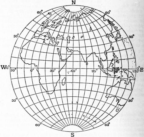 |
| Fig. 26.—Globular Projection. |
Conventional or Arbitrary Projections.
These projections are devised for simplicity of drawing and not for any special properties. The most useful projection of this class is the globular projection. This is a conventional representation of a hemisphere in which the equator and central meridian are two equal straight lines at right angles, their intersection being the centre of the circular boundary. The meridians divide the equator into equal parts and are arcs of circles passing through points so determined and the poles. The parallels are arcs of circles which divide the central and extreme meridians into equal parts. Thus in fig. 26 NS = EW and each is divided into equal parts (in this case each division is 10°); the circumference NESW is also divided into 10° spaces and circular arcs are drawn through the corresponding points. This is a simple and effective projection and one well suited for conveying ideas of the 663 general shape and position of the chief land masses; it is better for this purpose than the stereographic, which is commonly employed in atlases.
 |
| (From Text Book of Topographical Surveying, by permission of the Controller of H.M. Stationery Office.) |
| Fig. 27.—Plane Table Graticule, dimensions in inches, for a scale of 4 in. to 1 m. |
Projections for Field Sheets.
Field sheets for topographical surveys should be on conical projections with rectified meridians; these projections for small areas and ordinary topographical scales—not less than 1/500,000—are sensibly errorless. But to save labour it is customary to employ for this purpose either form of polyconic projection, in which the errors for such scales are also negligible. In some surveys, to avoid the difficulty of plotting the flat arcs required for the parallels, the arcs are replaced by polygons, each side being the length of the portion of the arc it replaces. This method is especially suitable for scales of 1 : 125,000 and larger, but it is also sometimes used for smaller scales.
Fig. 27 shows the method of plotting the projection for a field sheet. Such a projection is usually called a graticule. In this case ABC is the central meridian; the true meridian lengths of 30′ spaces are marked on this meridian, and to each of these, such as AB, the figure (in this case representing a square half degree), such as ABED, is applied. Thus the point D is the intersection of a circle of radius AD with a circle of radius BD, these lengths being taken from geodetic tables. The method has no merit except that of convenience.
Summary.
The following projections have been briefly described:—
| Perspective | 1. Cylindrical equal-area. |
| 2. Orthographic. | |
| 3. Stereographic (which is orthomorphic). | |
| 4. General external perspective. | |
| 5. Minimum error perspective. (Clarke’s). | |
| 6. Central. | |
| Conical | 7. Conical, with rectified meridians and two standard parallels (5 forms). |
| 8. Simple conical. | |
| 9. Simple cylindrical (a special case of 8). | |
| 10. Modified conical equal-area (Bonne’s). | |
| 11. Sinusoidal equal-area (Sanson’s). | |
| 12. Werner’s conical equal-area | |
| 13. Simple polyconic. | |
| 14. Rectangular polyconic. | |
| 15. Conical orthomorphic with 2 standard parallels (Lambert’s, commonly called Gauss’s). | |
| 16. Cylindrical orthomorphic (Mercator’s). | |
| 17. Conical equal-area with one standard parallel. | |
| 18. Conical equal-area with two standard parallels. | |
| 19. Projection by rectangular spheroidal co-ordinates. | |
| Zenithal | 20. Equidistant zenithal. |
| 21. Zenithal equal-area. | |
| 22. Zenithal projection by balance of errors (Airy’s). | |
| 23. Elliptical equal-area (Mollweide’s). | |
| 24. Globular (conventional). | |
| 25. Field sheet graticule. |
Of the above 25 projections, 23 are conical or quasi-conical, if zenithal and perspective projections be included. The projections may, if it is preferred, be grouped according to their properties. Thus in the above list 8 are equal-area, 3 are orthomorphic, 1 balances errors, 1 represents all great circles by straight lines, and in 5 one system of great circles is represented correctly.
Among projections which have not been described may be mentioned the circular orthomorphic (Lagrange’s) and the rectilinear equal-area (Collignon’s) and a considerable number of conventional projections, which latter are for the most part of little value.
The choice of a projection depends on the function which the map is intended to fulfil. If the map is intended for statistical purposes to show areas, density of population, incidence of rainfall, of disease, distribution of wealth, &c., an equal-area projection should be chosen. In such a case an area scale should be given. At sea, Mercator’s is practically the only projection used except when it is desired to determine graphically great circle courses in great oceans, when the central projection must be employed. For conveying good general ideas of the shape and distribution of the surface features of continents or of a hemisphere Clarke’s perspective projection is the best. For exhibiting the progress of polar exploration the polar equidistant projection should be selected. For special maps for general use on scales of 1/1,000,000 and smaller, and for a series of which the sheets are to fit together, the conical, with rectified meridians and two standard parallels, is a good projection. For topographical maps, in which each sheet is plotted independently and the scale is not smaller than 1/500,000, either form of polyconic is very convenient.
The following are the projections adopted for some of the principal official maps of the British Empire:—
Conical, with Rectified Meridians and Two Standard Parallels.—The 1 : 1,000,000 Ordnance map of the United Kingdom, special maps of the topographical section, General Staff, e.g. the 64-mile map of Afghanistan and Persia. The 1 : 1,000,000 Survey of India series of India and adjacent countries.
Modified Conical, Equal-area (Bonne’s).—The 1 in., 1⁄2 in., 1⁄4 in. and 1⁄10 in. Ordnance maps of Scotland and Ireland. The 1 : 800,000 map of the Cape Colony, published by the Surveyor-General.
Simple Polyconic and Rectangular Polyconic maps on scales of 1 : 1,000,000, 1 : 500,000, 1 : 250,000 and 1 : 125,000 of the topographical section of the General Staff, including all maps on these scales of British Africa. A rectilinear approximation to the simple polyconic is also used for the topographical sheets of the Survey of India. The simple polyconic is used for the 1 in. maps of the Militia Department of Canada.
Zenithal Projection by Balance of Errors (Airy’s).—The 10-mile to 1 in. Ordnance map of England.
Projection by Rectangular Spheroidal Co-ordinates.—The 1 : 2500 and the 6 in. Ordnance sheets of the United Kingdom, and the 1 in., 1⁄2 in. and 1⁄4 in. Ordnance maps of England. The cadastral plans of the Survey of India, and cadastral plans throughout the empire.
Authorities.—See Traité des projections des cartes géographiques, by A. Germain (Paris, 1865) and A Treatise on Projections, by T. Craig, United States Coast and Geodetic Survey (Washington, 1882). Both Germain and Craig (following Germain) make use of the term projections by development, a term which is apt to convey the impression that the spherical surface is developable. As this is not the case, and since such projections are conical, it is best to avoid the use of the term. For the history of the subject see d’Avezac, “Coup d’œil historique sur la projection des cartes géographiques,” Société de géographie de Paris (1863).
J. H. Lambert (Beiträge zum Gebrauch der Mathematik, u.s.w. Berlin, 1772) devised the following projections of the above list: 1, 15, 17, and 21; his transverse cylindrical orthomorphic and the transverse cylindrical equal-area have not been described, as they are seldom used. Among other contributors we mention Mercator, Euler, Gauss, C. B. Mollweide (1774-1825), Lagrange, Cassini, R. Bonne (1727-1795), Airy and Colonel A. R. Clarke.
1 The ancient Greeks called a map Pinax, The Romans Tabula geographica. Mappa mundi was the medieval Latin for a map of the world which the ancients called Tabula totius orbis descriptionem continens.
2 Close, “The Ideal Topographical Map,” Geog. Journal, vol. xxv. (1905).
3 K. Peucker, Schattenplastik und Farbenplastik (Vienna, 1898); Geograph. Zeitschrift (1902 and 1908).
4 Professor Henrici, Report on Planimeters (64th meeting of the British Association, Oxford, 1894); J. Tennant, “The Planimeter” (Engineering, xlv. 1903).
5 H. Wagner’s Lehrbuch (Hanover, 1908, pp. 241-252) refers to numerous authorities who deal fully with the whole question of measurement.
6 Kienzl of Leoben in 1891 had invented a similar apparatus which he called a Relief Pantograph (Zeitschrift, Vienna Geog. Soc. 1891).
7 M. Fiorini, Erd- und Himmelsgloben, frei bearbeitet von S. Günther (Leipzig, 1895).
8 Jahrb. des polytechn. Instituts in Wien, vol. xv.
9 Compare the maps of Europe, Asia, &c., in this work.
10 The great majority of the maps in this work are made by this process.
11 Lepsius, Urkundenbuch, Pl. XXII.
12 These Colchians certainly were not Egyptians. The maps referred to may have been Assyrian.
13 We are indebted to Strabo for nearly all we know about Greek cartographers anterior to Ptolemy, for none of their maps has been preserved.
14 The gnomon was known to the Chinese in the 5th century B.C., and reached the Greeks (Anaximander) through Babylon. Pytheas, as far as known, was the first to utilize it for the determination of a latitude.
15 If, with W. Dörpfeld, we assume an Attic stadium of 200 steps (500 ft.) to be equal to 164 metres, a degree of 700 stad. would be equal to 114,800 metres, its actual length according to modern measurement being 110,808 metres.
16 Climata based on the length of the longest day were introduced by Hippocrates (c. 400 B.C.). Zones similar to those already drawn out for the celestial sphere were first introduced by the Pythagoreans. Parmenides of Elea (544-430 B.C.) distinguishes five of these zones, viz. a torrid zone, between the tropics of summer and winter, which was uninhabitable on account of heat; two frigid zones, uninhabitable on account of cold, and two intermediate temperate zones.
17 Celestial globes were made much earlier than terrestrial ones. In the museum of Naples there is a celestial globe, 2 metres in diameter, supported upon the shoulders of an Atlas, which E. Heis, judging by the constellations engraved upon it (Atlas coelestis novus, Bonn, 1872) judges to date from the 4th century B.C. It may even be the work of Eudoxus (d. 386 B.C.) the famous astronomer. Aratus of Soli in Cilicia, in his poetical Prognostics of Stars and the World, refers to a globe in his possession. Archimedes, the famous mathematician, had a celestial globe of glass, in the centre of which was a small terrestrial globe. Hero of Alexandria (284-221 B.C.), the ingenious inventor of “Hero’s Fountain,” is believed to have possessed a similar apparatus. The celestial globe of Hipparchus still existed in the Alexandrian library in the time of Ptolemy, who himself refers to globes in his Almagest, as also in the Geography. Leontius, who wrote a book on the manufacture of globes (first published at Basel in 1539), is identified by Fiorini with a bishop of Neapolis (Cyprus) of the time of Constantine III. (642-668).
18 The oldest MS. of Ptolemy’s Geography is found in the Vatopedi monastery of Mt Athos. It dates from the 12th or 13th century and was published by Victor Langlois in 1867. For the latest edition we are indebted to the late Carl Müller (Paris, 1883-1906) to whom we are likewise indebted for an edition of the Geographi graeci minores (1855-1861).
19 Facsimiles of it have been published by Desjardins(1869-1871), by K. Miller (1886), who ascribes it to Castorius, A.D. 366, and by others.
20 R. Gough, British Topography (London 1768). His “Histories” are published in Rerum brit. scriptores XL. and LVII. 1866-1869.
21 M. Bittner, Die topogr. Capital des ind. Seespiegels (Vienna, 1897).
22 E. G. Ravenstein, Martin Behaim, his Life and his Globe (London, 1908). On the original only equator, ecliptics, tropics, polar circles and one meridian 80° to the west of Lisbon are laid down.
23 See fig. 23, Catalan Map of the World (1375).
24 J. G. Kohl published facsimiles of the American section of the maps (Weimar, 1860).
25 Facsimiles of the maps of 1507 and 1517 were published by J. Fischer and F. M. von Wieser (Innsbruck, 1903).
26 See “The Survey in British Africa”: the Annual Report of the Colonial Survey Commission.
27 A. Germain, Traité des Projections (Paris, 1865).
28 T. Craig, A Treatise on Projections (U.S. Coast and Geodetic Survey, Washington, 1882).
29 This error is much less than that which may be expected from contraction and expansion of the paper upon which the projection is drawn or printed.
MAPLE, SIR JOHN BLUNDELL, Bart. (1845-1903), English business magnate, was born on the 1st of March 1845. His father, John Maple (d. 1900), had a small furniture shop in Tottenham Court Road, London, and his business began to develop about the time that his son entered it. The practical management soon devolved on the younger Maple, under whom it attained colossal dimensions. The firm became a limited liability company, with a capital of two millions, in 1890, with Mr Maple as chairman. He entered parliament as Conservative member for Dulwich in 1887, was knighted in 1892, and was made a baronet in 1897. He was the owner of a large stud of race-horses, and from 1885 onwards won many important races, appearing at first under the name of “Mr Childwick.” His public benefactions included a hospital and a recreation ground to the city of St Albans, near which his residence, Childwickbury, was situated, and the rebuilding, at a cost of more than £150,000, of University College Hospital, London. He died on the 24th of November 1903. His only surviving daughter married in 1896 Baron von Eckhardstein, of the German Embassy.
MAPLE, in botany. The maple (O.E. mapel-tréow, mapulder) and sycamore trees are species of Acer, of the order Acerineae. The genus includes about sixty species, natives of Europe, North America and Asia, especially the Himalayas, China and Japan. Maples are for the most part trees with opposite, long-stalked, palmately lobed leaves. The flowers are in fascicles, appearing before the leaves as in the Norway maple, or in racemes or panicles appearing with, or later than, the leaves as in sycamore. Some of the flowers are often imperfect, the stamens or pistil being more or less aborted. The fruit is a two-winged “samara.” The genus was represented in the Tertiary flora of Europe, when it extended into the polar regions; nineteen species have been recorded from the Miocene strata of Oeningen in Switzerland. The common maple, A. campestre, is the only species indigenous to Great Britain. This and the sycamore were described by Gerard in 1597 (Herball, p. 1299), the latter being “a stranger to England.” Many species have been introduced, especially from Japan, for ornamental purposes. The following are more especially worthy of notice.
Acer campestre, the common maple, is common in hedgerows, but less often seen as a tree, when it is seldom more than 20 ft. high, though in sheltered situations 30 ft. or more is attained. The leaves are generally less than 2 in. across, and the five main lobes are blunter than in the sycamore. The clusters of green flowers terminate the young shoots and are erect; the two wings of the fruit spread almost horizontally, and are smaller than in the sycamore. It occurs in northern Europe, the Caucasus, and northern Asia. The wood is excellent fuel, and makes the best charcoal. It is compact, of a fine grain, sometimes beautifully veined, and takes a high polish. Hence it has been celebrated from antiquity for tables, &c. The wood of the roots is frequently knotted, and valuable for small objects of cabinet work. The young shoots, being flexible and tough, are employed in France as whips.
A. pseudo-platanus, the sycamore or great maple, is a handsome tree of quick growth, with a smooth bark. The leaves are large, with finely acute and serrated lobes, affording abundant shade. The flowers are borne in long pendulous racemes, and the two wings of the fruit are ascending. It lives from 140 to 200 years. It is found wild chiefly in wooded mountainous situations in central Europe. The wood when young is white, but old heartwood is yellow or brownish. Like the common maple it is hard and takes a high polish. It is much prized by wheelwrights, cabinet-makers, sculptors, &c., on the Continent; while knotted roots are used for inlaying. Sugar has been obtained from the sap of this as from other species, the most being one ounce from a quart of sap. The latter has also been made into wine in the Highlands of Scotland. It withstands the sea and mountain breezes better than most other timber trees, and is often planted near farm-houses and cottages in exposed localities for the sake of its dense foliage. Its wood is valued in turnery for cups, bowls and pattern blocks. It produces abundance of seeds, and is easily raised, but it requires good and tolerably dry soil; it will not thrive on stiff clays nor on dry sands or chalks. There are many varieties, the variegated and cut-leaved being the most noticeable. The lobed shape of its leaf and its dense foliage caused it to be confused with the true sycamore—Ficus sycamorus—of scripture.
A. platanoides, the Norway maple, is met with from Norway to Italy, Greece, and central and south Russia. It was introduced into Britain in 1683. It is a lofty tree (from 40 to 70 ft.), resembling the sycamore, but with yellow flowers, appearing before the leaves, and more spreading wings to the fruit. There are several varieties. The wood is used for the same purposes as that of the sycamore. Sugar has been made from the sap in Norway and Sweden.
Many varieties of A. palmatum, generally known as polymorphum, with variously laciniated and more or less coloured foliage, have been introduced from Japan as ornamental shrubs. The branches and corolla are purple, the fruit woolly. The foliage of the typical form is bright green with very pointed lobes. It occurs in the central mountains of Nippon and near Nagasaki. Beautiful varieties have been introduced under the varietal names, ampelopsifolium, atropurpureum, dissectum, &c. They are remarkable for the coppery purple tint that pervades the leaves and young growths of some of the varieties. Other Japanese species are A. japonicum, the varieties of which are among the most handsome of small deciduous shrubs; A. rufinerve, with the habit of the sycamore; A. distylum, bearing leaves without lobes; A. diabolicum, with large plane-like leaves; and A. carpinifolium, with foliage resembling that of the hornbeam.
A. saccharinum, a North American species, the sugar, rock, or bird’s-eye maple, was introduced in 1735. It sometimes attains to 70 or even over 100 ft., more commonly 50 to 60 ft. It is remarkable for the whiteness of the bark. The wood is white, but acquires a rosy tinge after exposure to light. The grain is fine and close, and when polished has a silky lustre. The timber is used instead of oak where the latter is scarce, and is employed for axle-trees and spokes, as well as for Windsor chairs, &c. It exhibits two accidental forms in the arrangement of the fibres, an undulated one like those of the curled maple (A. rubrum), and one of spots, which gives the name bird’s-eye to the wood of this species. Like the curled maple, it is used for inlaying mahogany. It is much prized for bedsteads, writing-desks, shoe-lasts, &c. The wood forms excellent fuel and charcoal, while the ashes are rich in alkaline principles, furnishing a large proportion of the potash exported from Boston and New York. Sugar is principally extracted from this species, the sap being boiled and the syrup when reduced to a proper consistence runs into moulds to form cakes. Trees growing in low and moist situations afford the most sap but least sugar. A cold north-west wind, with frosty nights and sunny days in alternation, tends to incite the flow, which is more abundant during the day than the night. A thawing night is said to promote the flow, and it ceases during a south-west wind and at the approach of a storm; and so sensitive are the trees to aspect and climatic variations that the flow of sap on the south and east side has been noticed to be earlier than on the north and west side of the same tree. The average quantity of sap per tree is from 12 to 24 gallons in a season.
A. rubrum, the red-flowering or scarlet maple, is a middle-sized tree, and was introduced in 1656. The bright scarlet or dull red flowers appear before the leaves in March and April. The wood, like that of other species, is applicable to many purposes—as for the seats of Windsor chairs, turnery, &c. The grain in very old trees is sometimes undulated, which suggested the name of curled maple, and gives beautiful effects of light and shade on polished surfaces. The most constant use of curled maple is for the stocks of fowling-pieces and rifles, as it affords toughness and strength combined with lightness and elegance. The inner bark is dusky red. On boiling, it yields a purple colour which with sulphate of iron affords a black dye. The wood is inferior to that of the preceding species in strength and as fuel. Sugar was made from the sap by the French Canadians, but the production is only half as great as that from the sugar maple. In Britain it is cultivated as an ornamental tree, as being conspicuous for its flowers in spring, and for its red fruit and foliage in autumn.
A. macrophyllum, a north-western American species, is a valuable timber tree.
For a good account of the North American species see C. S. Sargent’s Silva of North America, vol. ii. See also under Sugar.
MAPU, ABRAHAM (1808-1867), Hebrew novelist. His works are chiefly historical romances in Hebrew. His most famous books were The Love of Zion and the Transgression of Samaria. Besides their intrinsic merits, these novels stand high among the works which produced the romantic movement in modern Hebrew literature. Mapu’s plots were somewhat sensational, incident being more prominent than characterization. But underlying all was a criticism of contemporary life. His novels made a deep impression and became instantly popular. Mapu’s Hebrew style is simple and classical. An English translation of the Love of Zion bears the title Amnon, Prince and Peasant, by F. Jaffe (1887). Mapu’s stories have been often translated into other languages.
See N. Slouschz, The Renascence of Hebrew Literature (1909), ch. v.
MAQQARĪ, or Maḳḳarī [Abū-l-‘Abbās Ahmad ibn Maḥommed ul-Maqqarī] (c. 1591-1632), Arabian historian, was born at Tlemcen in Algeria and studied at Fez and Marrakesh, where he remained engaged in literary work until he made the pilgrimage to Mecca in 1618. In the following year he settled in Cairo. In 1620 he visited Jerusalem and Damascus, and during the next six years made the pilgrimage five times. In 1628 he was again in Damascus, where he gave a course of lectures on Bukhārī’s collection of Traditions, spoke much of the glories of Moslem Spain, and received the impulse to write his work on this subject later. In the same year he returned to Cairo, where he spent a year in writing his history. He was just making preparations to settle definitely in Damascus when he died in 1632.
His great work, The Breath of Perfume from the Branch of Green Andalusia and Memorials of its Vizier Lisān ud-Dīn ibn ul-Khatīīb, consists of two parts. The first is a compilation from many authors on the description and history of Moslem Spain; it was published by Wright, Krehl, Dozy and Dugat as Analectes sur l’histoire et la littérature des Arabes d’Espagne (Leiden, 1855-1861), and in an abridged English translation by P. de Gayangos (London, 1840-1843). The whole work has been published at Būlāq (1863) and Cairo (1885).
For other works of Maqqarī see C. Brockelmann’s Gesch. der arabischen Litteratur (Berlin, 1902), ii. 297.
MAQRĪZĪ, or Makrizi [Taqī ud-Dīn Aḥmad ibn ‘Alī] (1364-1442), Arabian historian, known as al-Maqrīzī because of his ancestral connexion with Maqrīz, a suburb of Baalbek, was born at Cairo and spent most of his life in Egypt, where he was trained in the Hanifite school of law, though later he became a Shāfi’ite with an inclination to Zāhirite views. In 1385 he made the pilgrimage. For some time he was secretary in a government office, and in 1399 became inspector of markets for Cairo and northern Egypt. This post he soon gave up to become preacher at the mosque of ‘Amr, president of the mosque ul-Hākim, and a lecturer on tradition. In 1408 he went to Damascus to become inspector of the Qalānisīyya and lecturer. Later he retired into private life at Cairo. In 1430 he made the pilgrimage with his family and travelled for some five years. His learning was great, his observation accurate and his judgment good, but his books are largely compilations, and he does not always acknowledge the sources to which he is indebted. Most of his works are concerned with Egypt. The most important is the Mawā‘iz wal-I’tibār fī dhikr ul-Ḥitaṭ wal-Āihār (2 vols., Bulāq, 1854), translated into French by U. Bouriant as Description topographique et historique de l’Égypte (Paris, 1895-1900; cf. A. R. Guest, “A List of Writers, Books and other Authorities mentioned by El Maqrīzī in his Khiṭat,” in Journal of the Royal Asiatic Society, 1902, pp. 103-125). Of his History of the Fatimites an extract was published by J. G. L. Kosegarten in his Chrestomathia (Leipzig, 1828), pp. 115-123; the History of the Ayyūbit and Mameluke Rulers has been translated into French by E. Quatremère (2 vols., Paris, 1837-1845). Maqrīzī began a large work called the Muqaffā, a cyclopaedia of Egyptian biography in alphabetic order. It was intended to be in 80 volumes, but only 16 were written. Three autograph volumes exist in MS. in Leiden, and one in Paris.
Among smaller works published are the Mahommedan Coinage (ed. O. G. Tychsen, Rostock, 1797; French translation by S. de Sacy, Paris, 1797); Arab Weights and Measures (ed. Tychsen, Rostock, 1800); the Arabian Tribes that migrated to Egypt (ed. F. Wüstenfeld, Göttingen, 1847); the Account of Hadhramaut (ed. P. B. Noskowyj, Bonn, 1866); the Strife between the Banī Umayya and the Banī Hāshim (ed G. Vos, Leiden, 1888), and the Moslems in Abyssinia (ed. F. T. Rink, Leiden, 1790). For Maqrīzī’s life see the quotations from contemporary biographies in S. de Sacy’s Chrestomathie arabe (2nd ed., Paris, 1826), ii. 112 seq., and for other works still in MS. C. Brockelmann, Gesch. der arabischen Litteratur (Berlin, 1902), ii. 38-41.
MAR, EARLDOM OF. Mar, one of the ancient divisions or provinces of Scotland, comprised the larger portion of Aberdeenshire, extending from north of the Don southward to the Mounth. Like other such districts, it was in Celtic times under the rule of a mormaer. In the 12th century his place was taken by an earl, but no definite succession of earls appears till the 13th century, nor is any connexion established between them and the mormaers. From the middle of the 13th century the earls were recognized as among “the seven earls of Scotland” and held a great position. Earl Gratney (fl. c. 1300) married a sister of (King) Robert Bruce, who brought him the lordship of Garioch and castle of Kildrummy, which she held against the earl of Athole, an ally of the English (1335). Their son Donald was made regent in July 1332, but was disastrously defeated and slain at Dupplin next month. His daughter and eventual heir, Margaret, brought the earldom to her husband, William, earl of Douglas, and on the accession of her daughter Isabél a troublous time followed.
While she was living as a widow at her castle of Kildrummy, it was stormed by Alexander Stewart, a bastard, who forced her to execute a charter (August 12, 1404) settling the reversion to the earldom on himself and his heirs. This act she revoked by a charter of the 19th of September 1404, which cannot now be found; but on marrying him, on the 9th of December 1404, she granted him the earldom for life, the king confirming this on the 21st of June 1405. After her death in 1408 the earl played a great part, commanding the royal forces at the battle of Harlaw, when the Lord of the Isles was defeated in 1411, and afterwards acting as warden of the Marches. In 1426 he resigned the earldom to the Crown, the king granting it by a fresh creation to him and certain heirs, with reversion to the Crown. On the earl’s death in 1435 the earldom was claimed by Robert, Lord Erskine, as heir of Gratney, earl of Mar, through a daughter; but the Crown claimed as reversionary under the creation of 1426. A long struggle followed, till in 1457 James II. obtained from a justiciary court at Aberdeen a recognition of the Crown’s right to the earldom and its lands, and shortly after bestowed them on his son John as earl of Mar and Garioch. He died unmarried in 1479, and in 1483 his elder brother Alexander duke of Albany received the earldom, but was soon forfeited. James III. created his son John earl of Mar and Garioch in 1486, and after his death unmarried in 1503, James IV. alienated to Lord Elphinstone (1507-1510) many of the Mar lands, including Kildrummy. The title was not revived till 1562, when James Stewart, earl of Murray, held it for a few months.
In 1565 John, Lord Erskine, succeeded in getting returned heir to the earldom, and shortly after (June 23, 1565) Queen Margaret restored the charter to him and his heirs “all and hail the said earldom of Mar.” As earl he took part against the queen in 1567, and in 1571 was made regent of Scotland, which post he retained till his death (1572). His son, earl John (c. 1558-1634), played a great part in the history of the family. His great achievement was the recovery of the Mar estates, alienated by the Crown during the long period that his family had been out of possession, including Kildrummy, the “head” of the earldom. It was in his time that the precedence of the earldom (see below) was settled. John, the next earl (c. 1585-1654) was a Royalist, as was his son John (d. 1668), much to the injury of the family fortune, which was further impaired by the attachment of the family, after the Revolution, to the Stuarts. His son Charles (1650-1689) was arrested by the government just before his death (1689), and the next earl, John (1675-1732), a prominent Jacobite (see below), was attainted, the earldom remaining under forfeiture for 108 years; by the Old Pretender he was created duke of Mar.
Alloa and other Erskine estates of the attainted earl were repurchased for the family, and descended to John Francis Erskine (1741-1825), his heir-male, who was also his heir of line through his daughter. To him, in his eighty-third year, as grandson and lineal representative of the attainted earl, the earldom was restored by act of parliament in 1824. His grandson, who succeeded him in 1828, inherited the earldom of Kellie (1619) and other Erskine dignities by decision of 1835. At his death in 1866, his earldom of Mar was the subject of rival claims, and the right to the succession was not determined till 1875. His estates passed to his cousin and heir-male, who succeeded to his earldom of Kellie and claimed “the honour and dignity of earl of Mar.” But the latter was also claimed by a Mr Goodeve, whose father had married the late earl’s eldest sister, and who assumed the title. It was not suggested that the late earl had more than one earldom of Mar, but Lord Kellie claimed it as descendible to heirs-male under a creation by Queen Mary, and Mr Goodeve as descendible to heirs of line under an earlier creation. The House of Lords decided (Feb. 25, 1875) that Lord Kellie was entitled to the earldom as having been created by Queen Mary in 1565, with a limitation which must be presumed to be to heirs-male of the body. This decision gave great dissatisfaction, but was described as “final, right or wrong, and not to be questioned” by Lord Selborne and the lord chancellor in 1877, and Lord Kellie was thenceforth recognized as holding the earldom on the Union Roll, the only one known, though Mr Goodeve continued to assume the title. The Lords’ decision could not be reversed, but in 1885, after much agitation, a means was found of evading it in practice by the “Earldom of Mar Restitution Act.” By “an equivocation on the facts of the case,” it was recited that “doubts may exist whether the said ancient honour, dignity, and title of peerage of earl of Mar ... was or was not ... by any lawful means surrendered or merged in the Crown” before 1565, and that the House of Lords had decided that Queen Mary’s known charter of 1565 applied only to lands and “did not operate 666 or extend to restore” the peerage dignity, and enacted that “John Francis Erskine Goodeve Erskine” (which last name the claimant had added) should be “restored to” the ancient earldom. His previous assumption of the title was thus rejected as invalid, but from the passing of the act two earldoms of Mar were in existence, that of Lord Kellie being confirmed and allowed the precedence of 1565, while the restored earldom was allowed that of the dignity on the Union Roll, the only one known till then. This precedence had been assigned to it by the Decreet of Ranking (1606), and assigns to it an origin in 1404 (or, as some say, 1395). It is frequently, but absurdly, stated to have been “created before 1014,” and wrongly spoken of as the Premier Scottish Earldom (see Earl). A barony of Garioch is also wrongly said to be annexed to it, but the title is used by the earl’s eldest son in default of any other.
Bibliography.—Minutes of Evidence, 1875 and 1885; Riddell’s Peerage and Consistorial Law; Skene, Celtic Scotland; Lord Crawford’s Earldom of Mar in Sunshine and Shade; articles by G. Burnett (Lyon), Sir H. Barkly, Cornelius Hallen, W. A. Lindsay and J. H. Round in Genealogist (N.S.), vols. 3, 4, 9; Lord Redesdale’s The Earldom of Mar, a Letter to the Lord Clerk Register (reply to Lord Crawford) (1883); J. H. Round’s “Are there two Earls of Mar?” in Foster’s Collectanea genealogica, and “The later Earldom of Mar” in Walford’s Antiquarian Magazine, vol. ii.; also his Studies in Peerage and Family History.
MAR, JOHN ERSKINE, 1st or 6th Earl of (d. 1572), regent of Scotland, was a son of John, 5th Lord Erskine (d. 1552), who was guardian of King James V., and afterwards of Mary Queen of Scots. The younger John, who succeeded his father as 6th Lord Erskine in 1552, joined the religious reformers, but he was never very ardent in the cause, although he subscribed the letter asking Knox to return to Scotland in 1557. The custody of Edinburgh Castle was in his hands, and during the struggle between the regent, Mary of Lorraine, and the lords of the Congregation he appears to have acted consistently in the interests of peace. When Mary Stuart returned to Scotland in 1561 Lord Erskine was a member of her council, he favoured her marriage with Lord Darnley, and his wife, Annabella Murray, called by Knox a “verray Jesabell,” was a frequent companion of the queen. In 1565 Erskine was granted the earldom of Mar (see above). As guardian of James, afterwards King James VI., he prevented the young prince from falling into the hands of Bothwell, and when the Scottish nobles rose against Mary and Both well, Mar was one of their leaders; he took part in the government of Scotland during Mary’s imprisonment at Lochleven, and also after her subsequent abdication. In September 1571 he was chosen regent of Scotland, but he was overshadowed and perhaps slighted by the earl of Morton, and he died at Stirling on the 29th of October 1572.
MAR, JOHN ERSKINE, 2nd or 7th Earl of (c. 1558-1634), Scottish politician, was the only son of the preceding. Together with King James VI. he was educated by George Buchanan. After attaining his majority he was nominally the guardian of the young king, who was about seven years his junior, and who lived with him at Stirling; but he was in reality a puppet in the hands of the regent, the earl of Morton; and he lost power and position when Morton was imprisoned. He was concerned in the seizure of James VI. in 1582 (a plot known as the raid of Ruthven); but when James escaped from his new custodians the earl fled into the west of Scotland. Then leaving his hiding-place Mar seized Stirling Castle, whereupon James marched against him, and he took refuge in England. Queen Elizabeth interceded for him, but in vain, and after some futile communications between the governments of England and Scotland Mar and his friends gathered an army, entered the presence of the king at Stirling, and were soon in supreme authority (1585). Mar was restored to his lands and titles. Henceforward he stood high in the royal favour; he became governor of Edinburgh Castle and was made tutor to James’s son, Prince Henry, and for his second wife he married Mary, daughter of Esmé Stewart, duke of Lennox. In 1601 the earl was sent as envoy to London; here Elizabeth assured him that James should be her successor, and his mission was conducted with tact and prudence. Having joined the English privy council Mar was created Lord Cardross in 1610; he was a member of the Court of High Commission and was lord high treasurer of Scotland from 1615 to 1630. He died at Stirling on the 14th of December 1634. John (c. 1585-1654), his only son by his first wife, succeeded to his earldom; by his second wife he had five sons, among them being James (d. 1640), earl of Buchan; Henry (d. 1628), whose son David (d. 1671) succeeded to the barony of Cardross; and Charles, the ancestor of the earls of Rosslyn.
MAR, JOHN ERSKINE, 6th or 11th Earl of (1675-1732), Scottish Jacobite, was the eldest son of Charles, the 5th earl (1650-1689), from whom he inherited estates which were heavily loaded with debt. He was associated with the party favourable to the English government; he was one of the commissioners for the Union, and was made a Scottish secretary of state, becoming after the Union of 1707 a representative peer for Scotland, keeper of the signet and a privy councillor. In 1713 Mar was made an English secretary of state by the Tories, but he seems to have been equally ready to side with the Whigs, and in 1714 he assured the new king, George I., of his loyalty. However, like the other Tories, he was deprived of his office, and in August 1715 he went in disguise to Scotland and placed himself at the head of the adherents of James Edward, the Old Pretender. Meeting many Highland chieftains at Aboyne he avowed an earnest desire for the independence of Scotland, and at Braemar on the 6th of September 1715 he proclaimed James VIII. king of Scotland, England, France and Ireland. Gradually the forces under his command were augmented, but as a general he was a complete failure. Precious time was wasted at Perth, a feigned attack on Stirling was resultless, and he could give little assistance to the English Jacobites. At Sheriffmuir, where a battle was fought in November 1715, Mar’s forces largely outnumbered those of his opponent, Archibald Campbell, afterwards 3rd duke of Argyll; but no bravery could atone for the signal incompetence displayed by the earl, and the fight was virtually a decisive defeat for the Jacobites. Mar then met James Edward at Fetteresso; the cause however was lost, and the prince and the earl fled to France. Mar sought to interest foreign powers in the cause of the Stuarts; but in the course of time he became thoroughly distrusted by the Jacobites. In 1721 he accepted a pension of £3500 a year from George I., and in the following year his name was freely mentioned in connexion with the trial of Bishop Atterbury, whom it was asserted that Mar had betrayed. This charge may perhaps be summarized as not proven. At the best his conduct was highly imprudent, and in 1724 he left the Pretender’s service. His later years were spent in Paris and at Aix-la-Chapelle, where he died in May 1732.
Mar, who was known as “bobbing John,” married for his second wife, Frances (d. 1761), daughter of the 1st duke of Kingston, and was thus a brother-in-law of Lady Mary Wortley Montagu. He had been attainted in 1716, and his only son, Thomas, Lord Erskine, died childless in March 1766.
Mar’s brother, James Erskine (1679-1754), was educated as a lawyer and became lord justice clerk of the Court of Session and Lord Grange in 1710. He took no part in the rising of 1715, although there is little doubt that at times he was in communication with the Jacobites; but was rather known for his piety and for his sympathy with the Presbyterians. He is more famous, however, owing to the story of his wife’s disappearance. This lady, Rachel Chicely, was a woman of disordered intellect; probably with reason she suspected her husband of infidelity, and after some years of unhappiness Grange arranged a plan for her seizure. In January 1732 she was conveyed with great secrecy from Edinburgh to the island of Hesker, thence to St Kilda, where she remained for about ten years, thence she was taken to Assynt in Sutherland, and finally to Skye. To complete the idea that she was dead her funeral was publicly celebrated, but she survived until May 1745. Meanwhile in 1734 Grange had resigned his judgeship and had become an English member of parliament; here he was a bitter opponent of Sir Robert Walpole. He died in London on the 20th of January 1754.
See the Journal of the Earl of Mar (1716); R. Patten, History of the late Rebellion (1717); and A. Lang, History of Scotland, vol. iv. (1907).
MARA, GERTRUD ELISABETH (1749-1833), German singer, was born at Cassel, the daughter of a poor musician named Schmeling. From him she learnt the violin, and while still a child her playing at the fair at Frankfort was so remarkable that money was collected to provide for her. She was helped by influential friends, and studied under Hillel at Leipzig for five years, proving to be endowed with a wonderful soprano voice. She began to sing in public in 1771, and was soon recognized as the greatest singer that Germany had produced. She was permanently engaged for the Prussian Court, but her marriage to a debauched violinist named Mara created difficulties, and in 1780 she was released. After singing at Vienna, Munich and elsewhere, she appeared in Paris in 1782, where her rivalry with the singer Todi developed into a regular faction. In 1784 she went to London, and continued to appear there with great success, with visits at intervals to Italy and to Paris till 1802, when for some years she retired to Russia. She visited England again in 1819, but then abandoned the stage. She went to Livonia, and died on the 20th of January 1833 at Revel.
MARABOUT (the French form of the Arab. murābit, “one who pickets his horse on a hostile frontier”; cf. Portug. marabute; Span. morabito), in Mahommedan religion a hermit or devotee. The word is derived from ribāṭ, a fortified frontier station. To such stations pious men betook them to win religious merit in war against the infidel; their leisure was spent in devotion, and the habits of the convent superseded those of the camp (see M’G. De Slane in Jour. As., 1842, i. 168; Dozy, Suppl. i. 502). Thus ribāṭ came to mean a religious house or hospice (zāwiya). The great sphere of the marabouts is North Africa. There it was that the community formed by Yahya b. Ibrāhīm and the doctor Abdullah developed into the conquering empire of the Murābiṭs, or, as Christian writers call them, the Almoravides (q.v.), and there still, among the Berbers, the marabouts enjoy extraordinary influence, being esteemed as living saints and mediators. They are liberally supported by alms, direct all popular assemblies, and have a decisive voice in intertribal quarrels and all matters of consequence. On their death their sanctity is transferred to their tombs (also called marabouts), where chapels are erected and gifts and prayers offered. The marabouts took a prominent part in the resistance offered to the French by the Algerian Moslems; and they have been similarly active in politico-religious movements in Tunisia and Tripoli.
See L. Rinn, Marabouts et Khouan (Algiers, 1884); and the article Dervish.
MARACAIBO, a large lake of western Venezuela, extending southward from the Gulf of Venezuela, into which it opens through a long neck, or strait, obstructed at its mouth by islands and bars, and having a large drainage basin bounded on the W. by the Eastern Cordillera, on the S.E. by the Cordillera de Merida, and on the E. by a low range of mountains extending N. by W. from Trujillo to the coast. The lake is roughly quadrangular in shape, and extends from the 9th to the 11th parallel of S. lat. and from the 71st to the 72nd meridian. It opens into the Gulf through 13 channels, the depth on the bar in the main channel ranging from 7 ft. at low water to 12 ft. at high water. Inside the bar the depth is about 30 ft., and the lake is navigable for vessels of large size. It receives the waters of many rivers, principally on its west and south sides, the largest of which are the Catatumbo and Zulia, Escalante, Chanudo, Ceniza, Sant’Ana, Negro, Apan and Palmar. The first three have navigable channels for river steamers. There are a number of small lakes near Lake Maracaibo’s southern and western margins, the largest of which is the Laguna de Zulia. The heavy rainfall on the eastern slopes of the Eastern Cordillera, which is said to exceed 86 in. per annum, is responsible for the great volume of water discharged into the lake. The average annual precipitation over the whole basin is said to be 70 in. In the upper half of the lake the water is sweet, but below that, where the tidal influence is stronger, it becomes brackish. The only port of consequence on the lake is Maracaibo, but there are small ports at its upper end which are in direct communication with the inland cities of Trujillo, Merida and San Cristobal. The Catatumbo River, which enters from the west near the north end of the lake, and its principal tributary, the Zulia, are navigable as far as Villamizar, in Colombia, and afford an excellent transportation route for the coffee and other products of Santander.
MARACAIBO (sometimes Maracaybo), a city and seaport of Venezuela and capital of the state of Zulia (formerly Maracaibo), on the west shore of the broad channel or neck which connects Lake Maracaibo with the Gulf of Venezuela, or Maracaibo, about 25 m. from the mouth of the channel opening into the latter. Pop. (1889), 34,284; (1905), 49,817; there is a considerable German element in the vicinity. The best residential suburb, Haticos, extends along the lake shore toward the south. The city is provided with tramways, telephone service and electric lighting, but the water supply and drainage are inferior. The most important buildings are the executive’s residence, the legislative chambers, the municipal hall, the Baralt theatre, the prison, the market, a hospital and six churches. The city also has a school of arts, a public library, and a public garden. In colonial times Maracaibo had a famous Jesuits’ college (now gone) and was one of the educational centres of Spanish America; the city now has a national college and a nautical school. The industries include shipbuilding, and the manufacture of saddlery and other leather products, bricks and tile, rum, beer, chocolate and coco-nut oil. Maracaibo is chiefly known, however, as one of the principal commercial centres and shipping ports on the northern coast of South America. The bar at the entrance to Maracaibo channel does not admit vessels drawing more than 12 ft., but there is a depth of 30 ft. inside and near the city. Steam communication is maintained on the Catatumbo and Zulia rivers to Villamizar, and on the Escalante to Santa Cruz. The principal exports from Maracaibo are coffee, hides and skins, cabinet and dye-woods, cocoa, and mangrove bark, to which may be added dividivi, sugar, copaiba, gamela and hemp straw for paper-making, and fruits. In 1906, 26% of the coffee exports was of Colombian origin.
Maracaibo was founded in 1571 by Alonso Pacheco, who gave it the name Nueva Zamora. Up to 1668 the entrepôt for the inland settlements was a station named Gibraltar at the head of the lake, but the destruction of that station by pirates in that year transferred this valuable trade to Maracaibo. The city did not figure actively in the War of Independence until 1821 (Jan. 28), when the province declared its independence and sought an alliance with Colombia. This brought to an end the armistice between Bolívar and Morillo, and thenceforward the city experienced all the changing fortunes of war until its final capture by the revolutionists in 1823.
MARĀGHA, a town of Persia in the province of Azerbaijan, on the Safi River, in 37° 23′ N., 46° 16′ E., 80 m. from Tabriz. Pop. about 16,000. It is pleasantly situated in a narrow valley running nearly north and south at the eastern extremity of a well-cultivated plain opening towards Lake Urmia, which lies 18 m. to the west. The town is encompassed by a high wall ruined in many places, and has four gates. Two stone bridges in good condition, said to have been constructed during the reign of Hulaku Khan (1256-1265), and since then several times repaired, lead over the Safi River on the western side of the town. The place is surrounded by extensive vineyards and orchards, all well watered by canals led from the river, and producing great quantities of fruit for exportation to Russia. On a hill west of the town are the remains of a famous observatory (rasad) constructed under the direction of the great astronomer Nasr-ud-din of Tus. The hills west of the town consist of horizontal strata of sandstone covered with irregular pieces of basalt and the top of the hill on which the observatory stood was made level by taking away the basalt. The building, which no doubt served as a citadel as well, enclosed a space of 380 yds. by 150, and the foundations of the walls were 41⁄2 to 5 ft. in thickness. The marble, which is known throughout Persia as Marāgha marble, is a travertine obtained at the village of Dashkesen (Turkish for 668 “stone-breakers”) about 30 m. north-west from Maragha. It is deposited from water, which bubbles up from a number of springs in the form of horizontal layers, which at first are thin crusts and can easily be broken, but gradually solidify and harden into blocks with a thickness of 7 to 8 in. It is a singularly beautiful substance, being of pink, greenish, or milk-white colour, streaked with reddish, copper-coloured veins. An analysis of the marble gave the following result: calcium carbonate, 90.93; magnesium, .75; iron, 1.37; manganese, 4.34; calcium sulphate, 2.30; calcium phosphate, .24 (R. T. Günther, Geog. Journ. xiv. 517).
MARANHÃO, or Maranham (Span. Marañon, the name given to the upper Amazon), a northern state of Brazil, bounded N. by the Atlantic, E. and S.E. by Piauhy, S.W. and W. by Goyaz and Pará. Area, 177,569 sq. m.; pop. (1890), 430,854; (1900), 499,308. The coastal zone and the north-west corner of the state belong to the Amazon valley region, being a heavily forested plain traversed by numerous rivers. The eastern and southern parts, however, belong to the lower terraces of the great Brazilian plateau, broken by eroded river-courses between which are high open plains. There are no true mountain ranges in Maranhão, those indicated on the maps being only plateau escarpments marking either its northern margin or the outlines of river valleys. The climate is hot, and the year is divided into a wet and dry season, extreme humidity being characteristic of the former. The heat, however, is greatly modified on the coast by the south-east trade winds, and the climate is generally considered healthy, though beri-beri and eruptive diseases are common on the coast. The coast itself is broken and dangerous, there being many small indentations, which are usually masked by islands or shoals. The largest of these are the Bay of Tury-assú, facing which is the island of São João, and several others of small size, and the contiguous bays of São Marcos and São José, between which is the large island of Maranhão. The rivers of the state all flow northward to the Atlantic and a majority of them have navigable channels. The Parnahyba forms the eastern boundary of Maranhão, but it has one large tributary, the Balsas, entirely within the state. A part of the western boundary is formed by the Tocantins, and another part by the Gurupy, which separates the state from Pará. The principal rivers of the state are the Maracassumé and Tury-assú, the Mearim and its larger tributaries (the Pindaré, Grajahú, Flôres and Corda) which discharge into the Bay of São Marcos, and the Itapicurú and Monim which discharge into the Bay of São José. Like the Amazon, the Mearim has a pororoca or bore in its lower channel, which greatly interferes with navigation. There are a number of small lakes in the state, some of which are, apparently, merely reservoirs for the annual floods of the rainy season.
The principal industries of Maranhão are agricultural, the river valleys and coastal zone being highly fertile and being devoted to the cultivation of sugar-cane, cotton, rice, coffee, tobacco, mandioca and a great variety of fruits. The southern highlands, however, are devoted to stock-raising, which was once an important industry. Troublesome insects, vampire bats, and the failure to introduce new blood into the degenerated herds, are responsible for its decline. Agriculture has also greatly declined, the state producing for export only a comparatively small quantity of cotton, rice, sugar and aguardiente. Besides São Luiz, the capital of the state, the principal towns, with the population of their municipal districts in 1890, are: Caxias (19,443), Alcantara (4730), Carolina (7266), Grajahú (11,704), Tury-assú (8983) and Viana (9965).
The coast of Maranhão was first discovered by Pinzon in 1500, but it was included in the Portuguese grant of captaincies in 1534. The first European settlement, however, was made by a French trading expedition under Jacques Riffault, of Dieppe, in 1594, who lost two of his three vessels in the vicinity of the island of Maranhão, and left a part of his men on that island when he returned home. Subsequently Daniel de la Rivardière was sent to report on the place, and was then commissioned by the French crown to found a colony on the island; this was done in 1612. The French were expelled by the Portuguese in 1615, and the Dutch held the island from 1641 to 1644. In 1621 Ceará, Maranhão and Pará were united and called the “Estado do Maranhão,” which was made independent of the southern captaincies. Ceará was subsequently detached, but the “state” of Maranhão remained independent until 1774, when it again became subject to the colonial administration of Brazil. Maranhão did not join in the declaration of independence of 1822, but in the following year the Portuguese were driven out by Admiral Lord Cochrane and the province became a part of the new empire of Brazil.
MARANO (accursed or banned), a term applied to Jewish Christians in Spain. Converted to Roman Catholicism under compulsion, these “New Christians” often continued to observe Jewish rites in their homes, as the Inquisition records attest. It was in fact largely due to the Maranos that the Spanish Inquisition was founded. The Maranos made rapid strides in prosperity, and “accumulated honours, wealth and popular hatred” (Lea, History of the Spanish Inquisition, i. 125). This was one of the causes that led to the expulsion of the Jews from Spain in 1492. Maranos emigrated to various countries, but many remained in the Peninsula. Subsequently distinguished individuals left home for more tolerant lands. The Jewish community in London was refounded by Maranos in the first half of the 17th century. Hamburg commerce, too, owed much to the enterprise of Portuguese Maranos. In Amsterdam many Maranos found asylum; Spinoza was descended from such a family. There are still remnants of Marano families in Portugal.
See Lea, loc. cit. and elsewhere; see index s.v. “New Christian”; Graetz, History of the Jews, Eng. trans. see index s.v. “Marranos”; M. Kayserling, in Jewish Encyclopedia, viii. 318 seq.; and for the present day Jewish Quarterly Review, xv. 251 seq.
MARASH (anc. Germanicia-Marasion), the chief town of a sanjak of the same name in the Aleppo vilayet, altitude 2600 ft. situated E. of the Jihan river, at the foot of Mt Taurus. The sanjak lies almost wholly in Mt Taurus, and includes the Armenian town of Zeitun. Marash is prosperous, and has a large trade in Kurd carpets and embroideries. The climate is good, except in summer. Of the population (50,000) about half are Turkish-speaking Armenians. There are a college, church and schools belonging to the American mission, a native Protestant church and a Jesuit establishment. The site, which lies near the mouths of the three main passes over the eastern Taurus—viz. those descending from Geuksun (Cocysus), Albistan-Yarpuz (Arabissus), and Malatia (Melitene)—is shown to have had early importance, not only by the occurrence of Marasi in Assyrian inscriptions, but by the discovery of several “Hittite” monuments on the spot. These, said to have been unearthed, for the most part, near the Kirk Geuz spring above the modern town, are now in Constantinople and America, and include an inscribed lion, once built into the wall of the citadel known in the middle ages as al-Marwani, and several stelae. No more is known of the place until it appears as Germanicia-Caesarea, striking imperial coins with the head of L. Verus (middle of 2nd cent. A.D.). The identification of Marash with Germanicia has been disputed, but successfully defended by Sir W. M. Ramsay; and it is borne out by the Armenian name Kermanig, which has been given to the place since at least the 12th century. Before the Roman period Marash doubtless shared the fortunes of the Seleucid kingdom of Commagene. Germanicia-Marasion played a great part in Byzantine border warfare: Heraclius was there in A.D. 640; but before 700 it had passed into Saracen hands and been rebuilt by the caliph Moawiya. During the 8th and 9th centuries, when the direct pass from Cocysus came into military use, Marasion (the older name had returned into general use) was often the Byzantine objective and was more than once retaken; but after 770, when Mansur incorporated it in “Palestine” it remained definitely in Moslem power and was refortified by Harun-al-Rashid. It was seized by the crusaders after their march across Mt Taurus, A.D. 1097, became an important town of Lesser Armenia and was taken by the Seljuks in 1147. In the 16th century it was added to the Osmanli Empire by Selim I. Marash 669 passed with the rest of Syria into Egyptian hands in 1832, and in 1839 received fugitives from the defeat of Nizib, among whom was Moltke. Ibrahim Pasha was encamped near it when directed by his father, at the bidding of the powers, to stay his further advance. Since its reversion to Ottoman power (1840) the history of Marash has been varied only by Armenian troubles, largely connected with the fortunes of Zeitun, for the reduction of which place it has more than once been used as a base. There was less disturbance there in 1895-1896 than in other north Syrian towns.
MARAT, JEAN PAUL (1743-1793), French revolutionary leader, eldest child of Jean Paul Marat, a native of Cagliari in Sardinia, and Louise Cabrol of Geneva, was born at Boudry, in the principality of Neuchâtel, on the 24th of May 1743. His father was a designer, who had abandoned his country and his religion, and married a Swiss Protestant. On his mother’s death in 1759 Marat set out on his travels, and spent two years at Bordeaux in the study of medicine, whence he moved to Paris, where he made use of his knowledge of his two favourite sciences, optics and electricity, to subdue an obstinate disease of the eyes. After some years in Paris he went to Holland, and then on to London, where he practised his profession. In 1773 he made his first appearance as an author with a Philosophical Essay on Man. The book shows a wonderful knowledge of English, French, German, Italian and Spanish philosophers, and directly attacks Helvetius, who had in his De l’esprit declared a knowledge of science unnecessary for a philosopher. Marat declares that physiology alone can solve the problems of the connexion between soul and body, and proposes the existence of a nervous fluid as the true solution. In 1774 he published The Chains of Slavery, which was intended to influence constituencies to return popular members, and reject the king’s friends. Its author declared later that it procured him an honorary membership of the patriotic societies of Carlisle, Berwick and Newcastle. He remained devoted to his profession, and in 1775 published in London a little Essay on Gleets, and in Amsterdam a French translation of the first two volumes of his Essay on Man. In this year he visited Edinburgh, and on the recommendation of certain Edinburgh physicians was made an M. D. of St Andrews. On his return to London he published an Enquiry into the Nature, Cause, and Cure of a Singular Disease of the Eyes, with a dedication to the Royal Society. In the same year there appeared the third volume of the French edition of the Essay on Man, which reached Ferney, and exasperated Voltaire, by its onslaught on Helvetius, into a sharp attack which only made the young author more conspicuous. His fame as a clever doctor was now great, and on the 24th of June 1777, the comte d’Artois, afterwards Charles X. of France, made him by brevet physician to his guards with 2000 livres a year and allowances.
Marat was soon in great request as a court doctor among the aristocracy; and even Brissot, in his Mémoires, admits his influence in the scientific world of Paris. The next years were much occupied with scientific work, especially the study of heat, light and electricity, on which he presented memoirs to the Académie des Sciences, but the academicians were horrified at his temerity in differing from Newton, and, though acknowledging his industry, would not receive him among them. His experiments greatly interested Benjamin Franklin, who used to visit him and Goethe always regarded his rejection by the academy as a glaring instance of scientific despotism. In 1780 he had published at Neuchâtel a Plan de législation criminelle, founded on the principles of Beccaria. In April 1786 he resigned his court appointment. The results of his leisure were in 1787 a new translation of Newton’s Optics, and in 1788 his Mémoires académiques, ou nouvelles découvertes sur la lumière.
His scientific life was now over, his political life was to begin; in the notoriety of that political life his great scientific and philosophical knowledge was to be forgotten, the high position he had given up denied, and he himself scoffed at as an ignorant charlatan, who had sold quack medicines about the streets of Paris, and been glad to earn a few sous in the stables of the comte d’Artois. In 1788 the notables had met, and advised the assembling of the states-general. The elections were the cause of a flood of pamphlets, of which one, Offrande à la patrie, was by Marat, and, though now forgotten, dwelt on much the same points as the famous brochure of the Abbé Siéyès: Qu’est-ce que le tiers état? When the states-general met, Marat’s interest was as great as ever, and in June 1789 he published a supplement to his Offrande, followed in July by La constitution, in which he embodies his idea of a constitution for France, and in September by his Tableau des vices de la constitution d’Angleterre, which he presented to the Assembly. The latter alone deserves remark. The Assembly was at this time full of anglomaniacs, who desired to establish in France a constitution similar to that of England. Marat had seen that England was at this time being ruled by an oligarchy using the forms of liberty, which, while pretending to represent the country, was really being gradually mastered by the royal power. His heart was now all in politics; and he decided to start a paper. At first appeared a single number of the Moniteur patriote, followed on the 12th of September by the first number of the Publiciste parisien, which on the 16th of September took the title of L’Ami du peuple and which he edited, with some interruptions, until the 21st of September 1792.
The life of Marat now becomes part of the history of the French Revolution. From the beginning to the end he stood alone. He was never attached to any party; the tone of his mind was to suspect whoever was in power. About his paper, the incarnation of himself, the first thing to be said is that the man always meant what he said; no poverty, no misery or persecution, could keep him quiet; he was perpetually crying, “Nous sommes trahis.” Whoever suspected any one had only to denounce him to the Ami du peuple, and the denounced was never let alone till he was proved innocent or guilty. Marat began by attacking the most powerful bodies in Paris—the Constituent Assembly, the ministers, the corps municipal, and the court of the Châtelet. Denounced and arrested, he was imprisoned from the 8th of October to the 5th of November 1789. A second time, owing to his violent campaign against Lafayette, he narrowly escaped arrest and had to flee to London (Jan. 1790). There he wrote his Dénonciation contre Necker, and in May dared to return to Paris and continue the Ami du peuple. He was embittered by persecution, and continued his vehement attacks against all in power, and at last, after the day of the Champs du Mars (July 17, 1790), against the king himself. All this time he was in hiding in cellars and sewers, where he was attacked by a horrible skin disease, tended only by the woman Simonne Evrard, who remained true to him. The end of the Constituent Assembly he heard of with joy and with bright hopes for the future, soon dashed by the behaviour of the Legislative Assembly. When almost despairing, in December 1791, he fled once more to London, where he wrote his Ecole du citoyen. In April 1792, summoned again by the Cordeliers’ Club, he returned to Paris, and published No. 627 of the Ami. The war was now the question, and Marat saw clearly that it was to serve the purposes of the Royalists and the Girondins, who thought of themselves alone. Again denounced, Marat had to remain in hiding until the 10th of August. The early days of the war being unsuccessful, the proclamation of the duke of Brunswick excited all hearts; who could go to save France on the frontiers and leave Paris in the hands of his enemies? Marat, like Danton, foresaw the massacres of September. After the events of the 10th of August he took his seat at the commune, and demanded a tribunal to try the Royalists in prison. No tribunal was formed, and the massacres in the prisons were the inevitable result. In the elections to the Convention, Marat was elected seventh out of the twenty-four deputies for Paris, and for the first time took his seat in an assembly of the nation. At the declaration of the republic, he closed his Ami du peuple, and commenced, on the 25th, a new paper, the Journal de la république française, which was to contain his sentiments as its predecessor had done, and to be always on the watch. In the Assembly Marat had no party; he would always suspect and oppose the powerful, refuse power for himself. After the battle of Valmy, Dumouriez was the 670 greatest man in France; he could almost have restored the monarchy; yet Marat did not fear to denounce him in placards as a traitor.
His unpopularity in the Assembly was extreme, yet he insisted on speaking on the question of the king’s trial, declared it unfair to accuse Louis for anything anterior to his acceptance of the constitution, and though implacable towards the king, as the one man who must die for the people’s good, he would not allow Malesherbes, the king’s counsel, to be attacked in his paper, and speaks of him as a “sage et respectable vieillard.” The king dead, the months from January to May 1793 were spent in an unrelenting struggle between Marat and the Girondins. Marat despised the ruling party because they had suffered nothing for the republic, because they talked too much of their feelings and their antique virtue, because they had for their own virtues plunged the country into war; while the Girondins hated Marat as representative of that rough red republicanism which would not yield itself to a Roman republic, with themselves for tribunes, orators and generals. The Girondins conquered at first in the Convention, and ordered that Marat should be tried before the Revolutionary Tribunal. But their victory ruined them, for on the 24th of April Marat was acquitted, and returned to the Convention with the people at his back. The fall of the Girondins on the 31st of May was a triumph for Marat. But it was his last. The skin disease he had contracted in the subterranean haunts was rapidly closing his life; he could only ease his pain by sitting in a warm bath, where he wrote his journal, and accused the Girondins, who were trying to raise France against Paris. Sitting thus on the 13th of July he heard in the evening a young woman begging to be admitted to see him, saying that she brought news from Caen, where the escaped Girondins were trying to rouse Normandy. He ordered her to be admitted, asked her the names of the deputies then at Caen, and, after writing their names, said, “They shall be soon guillotined,” when the young girl, whose name was Charlotte Corday (q.v.), stabbed him to the heart.
His death caused a great commotion at Paris. The Convention attended his funeral, and placed his bust in the hall where it held its sessions. Louis David painted “Marat Assassinated,” and a veritable cult was rendered to the Friend of the People, whose ashes were transferred to the Panthéon with great pomp on the 21st of September 1794—to be cast out again in virtue of the decree of the 8th of February 1795.
Marat’s name was long an object of execration on account of his insistence on the death penalty. He stands in history as a bloodthirsty monster, yet in judging him one must remember the persecutions he endured and the terrible disease from which he suffered.
Besides the works mentioned above, Marat wrote: Recherches physiques sur l’électricité, &c. (1782); Recherches sur l’électricité médicale (1783); Notions élémentaires d’optique (1764); Lettres de l’observateur Bon Sens à M. de M. ... sur la fatale catastrophe des infortunés Pilatre de Rozier et Romain, les aéronautes et l’aérostation (1785); Observations de M. l’amateur Avec à M. l’abbé Sans ... &c., (1785); Éloge de Montesquieu (1785), published 1883 by M. de Bresetz; Les Charlatans modernes, ou lettres sur le charlatanisme académique (1791); Les Aventures du comte Potowski (published in 1847 by Paul Lacroix, the “bibliophile Jacob”); Lettres polonaises (unpublished). Marat’s works were published by A. Vermorel, Œuvres de J. P. Marat, l’ami du peuple, recueillies et annotées (1869). Two of his tracts, (1) On Gleets, (2) A Disease of the Eyes, were reprinted, ed. J. B. Bailey, in 1891.
See A. Vermorel, Jean Paul Marat (1880); François Chévremont, Marat: esprit politique, accomp. de sa vie (2 vols., 1880); Auguste Cabanès, Marat inconnu (1891); A. Bougeait, Marat, l’ami du peuple (2 vols., 1865); M. Tourneux, Bibliographie de l’histoire de Paris pendant la révolution française (vol. ii., 1894; vol. iv., 1906), and E. B. Bax, J. P. Marat (1900). The Correspondance de Marat has been edited with notes by C. Villay (1908).
MARATHI (properly Marāthī),1 the name of an important Indo-Aryan language spoken in western and central India. In 1901 the number of speakers was 18,237,899, or about the same as the population of Spain. Marathi occupies an irregular triangular area of approximately 100,000 sq.m., having its apex about the district of Balaghat in the Central Provinces, and for its base the western coast of the peninsula from Daman on the Gulf of Cambay in the north to Karwar on the open Arabian Sea in the south. It covers parts of two provinces of British India—Bombay and the Central Provinces (including Berar)—with numerous settlers in Central India and Madras, and is also the principal language of Portuguese India and of the north-western portion of His Highness the Nizam’s dominions. The standard form of speech is that of Poona in Bombay, and, in its various dialects it covers the larger part of that province, in which it is the vernacular of more than eight and a half millions of people.
As explained in the article Indo-Aryan Languages, there were in ancient times two main groups of these forms of speech—one, the language of the Midland, spoken in the country near the Gangetic Doab, and the other, the languages of the so-called “Outer Band,” containing the Midland on three sides, west, east and south. The country to the south of the Midland, in which members of this Outer group of languages were formerly spoken, included the modern Rajputana and Gujarat, and extended to the basin of the river Nerbudda, being bounded on the south by the Vindhya hills. In the course of time the population of the Midland expanded, and gradually occupied this tract, reaching the sea in Gujarat. The language of the Outer Band was thus forced farther afield. Its speakers crossed the Vindhyas and settled in the central plateau of the Deccan and on the Konkan coast. Here they came into contact with speakers of the Dravidian languages of southern India. As happened elsewhere in India, they retained their own Aryan tongue, and gradually through the influence of their superior civilization imposed it upon the aborigines, so that all the inhabitants of this tract became the ancestors of the speakers of modern Marathi.
In Rajputana and Gujarat the language (see Gujarat) is to a certain extent mixed. Near the original Midland there are few traces of the Outer language, but as we go farther and farther away from that centre we find, as might be expected, the influence of the Midland language becoming weaker and weaker, and traces of the Outer language becoming more and more evident, until in Gujarati we recognize several important survivals of the old language once spoken by the earlier Aryan inhabitants.
Dialects.—Besides the standard form of speech, there is only one real dialect of Marathi, viz. Konkani (Kōnkaṇī), spoken in the country near Goa. There are also several local varieties, and we may conveniently distinguish between the Marathi of the Deccan, that of the Central Provinces (including Berar), and that of the northern and central Konkan. In the southern part of the district of Ratnagiri this latter Konkani variety of Marathi gradually merges into the true Konkani dialect through a number of intermediate forms of speech. There are also several broken jargones, based upon Marathi, employed by aboriginal tribes surviving in the hill country.
Relations with other Indo-Aryan Languages.—Marathi has to its north, in order from west to east, Gujarati, Rajasthani, Western Hindi and Eastern Hindi. To its east and south it has the Dravidian languages, Gondi, Telugu and Kanarese. Elsewhere in India Aryan languages gradually fade away into each other, so that it is impossible to fix any definite boundary line between them. But this is not the case with Marathi. It does not merge into any of the cognate neighbouring forms of speech, but possesses a distinct linguistic frontier. A native writer2 says: “The Gujarati language agrees very closely with the languages of the countries lying to the north of it, because the Gujarati people came from the north. If a native of Delhi, Ajmere, Marwar, Mewar, Jaipur, &c., comes into Gujarat, the Gujarati people find no difficulty in understanding his language. But it is very wonderful that when people from countries bordering Gujarat on the south, as the Konkan, Maharashtra, &c. 671 (i.e. people speaking Marathi) come to Gujarat, the Gujarati people do not in the least comprehend what they say.” This isolated character of Marathi is partly due to the barrier of the Vindhya range which lies to its north, and partly to the fact that none of the northern languages belongs now to the Outer Band, but are in more or less close relationship to the language of the Midland. There was no common ground either physical or linguistic, upon which the colliding forms of speech could meet on equal terms. Eastern Hindi is more closely related to Marathi than the others, and in its case, in its bordering dialects, we do find a few traces of the influence of Marathi—traces which are part of the essence of the language, and not mere borrowed waifs floating on the top of a sea of alien speech and not absorbed by it.
Written Character.—Marathi books are generally printed in the well-known Nagari character (see Sanskrit), and this is also used to a great extent in private transactions and correspondence. In the Maratha country it is known as the Bālbōdh (“teachable to children,” i.e. “easy”) character. A cursive form of Nagari called Mōḍī, or “twisted,” is also employed as a handwriting. It is said to have been invented in the 17th century by Balaji Avaji, the secretary of the celebrated Sivaji. Its chief merit is that each word can be written as a whole without lifting the pen from the paper, a feat which is impossible in the case of Nagari.3
Origin of the Language.—The word “Marāṭhī” signifies (the language) of the Maratha country. It is the modern form of the Sanskrit Māhārāṣṭrī, just as “Marāṭhā” represents the old Māhā-rāṣṭra, or Great Kingdom. Māhārāṣṭrī was the name given by Sanskrit writers to the particular form of Prakrit spoken in Māhārāṣṭra, the great Aryan kingdom extending southwards from the Vindhya range to the Kistna, broadly corresponding to the southern part of the Bombay Presidency and to the state of Hyderabad. As pointed out in the article Prakrit this Māhārāṣṭrī early obtained literary pre-eminence in India, and became the form of Prakrit employed as the language not only of lyric poetry but also of the formal epic (kāvya). Dramatic works were composed in it, and it was the vehicle of the non-canonical scriptures of the Jaina religion. The oldest work in the language of which we have any knowledge is the Sattasaī, or Seven Centuries of verses, compiled at Pratiṣṭhāna, on the Gōdāvarī, the capital of King Hāla, at some time between the 3rd and 7th centuries A.D. Pratiṣṭhāna is the modern Paithan in the Aurangabad district of Hyderabad, and that city was for long famous as a centre of literary composition. In later times the political centre of gravity was changed to Poona, the language of which district is now accepted as the standard of the best Marathi.
General Character of the Language.—In the following account of the main features of Marathi, the reader is presumed to be familiar with the leading facts stated in the articles Indo-Aryan Languages and Prakrit. In the Prakrit stage of the Indo-Aryan languages we can divide the Prakrits into two well-defined groups, an Inner, Śaurasēnī and its connected dialects on the one hand, and an Outer, Māhārāṣṭrī, Ardhamāgadhī, and Māgadhī with their connected dialects on the other. These two groups differed in their phonetic laws, in their systems of declension and conjugation, in vocabulary, and in general character.4 In regard to the last point reference may be made to the frequent use of meaningless suffixes, such as -alla, -illa, -ulla, &c., which can be added, almost ad libitum to any noun, adjective or particle in Māhārāṣṭrī and Ardhamāgadhī, but which are hardly ever met in Śaurasēnī. These give rise to numerous secondary forms of words, used, it might be said, in a spirit of playfulness, which give a distinct flavour to the whole language. Similarly the late Mr Beames (Comparative Grammar, i. 103) well describes Marathi as possessing “a very decided individuality, a type quite its own, arising from its comparative isolation for so many centuries.” Elsewhere (p. 38) he uses language which would easily well apply to Māhārāṣṭrī Prakrit when he says, “Marathi is one of those languages which we may call playful—it delights in all sorts of jingling formations, and has struck out a larger quantity of secondary and tertiary words, diminutives, and the like, than any of the cognate tongues,” and again (p. 52):—
“In Marathi we see the results of the Pandit’s file applied to a form of speech originally possessed of much natural wildness and licence. The hedgerows have been pruned and the wild briars and roses trained into order. It is a copious and beautiful language, second only to Hindi. It has three genders, and the same elaborate preparation of the base as Sindhi, and, owing to the great corruption which has taken place in its terminations, the difficulty of determining the gender of nouns is as great in Marathi as in German. In fact, if we were to institute a parallel in this respect, we might appropriately describe Hindi as the English, Marathi as the German of the Indian group—Hindi having cast aside whatever could possibly be dispensed with, Marathi having retained whatever has been spared by the action of time. To an Englishman Hindi commends itself by its absence of form, and the positional structure of its sentences resulting therefrom; to our High-German cousins the Marathi, with its fuller array of genders, terminations, and inflexions, would probably seem the completer and finer language.”
In the article Prakrit it is explained that the literary Prakrits were not the direct parents of the modern Indo-Aryan vernaculars. Each Prakrit had first to pass through an intermediate stage—that of the Apabhramśa—before it took the form current at the present day. While we know a good deal about Māhārāṣṭrī and very little about Śaurasēnī Prakrit, the case is reversed in regard to their respective Apabhramśas. The Śaurasēnā Apabhramśa is the only one concerning which we have definite information. Although it would be quite possible to reason from analogy, and thus to obtain what would be the corresponding forms of Māhārāṣṭra Apabhramśa, we should often be travelling upon insecure ground, and it is therefore advisable to compare Marathi, not with the Apabhramśa from which it is immediately derived, but with its grandmother, Māhārāṣṭrī Prakrit. We shall adopt this course, so far as possible, in the following pages.
Vocabulary.—In the article Indo-Aryan Languages it is explained that, allowing for phonetic development, the vocabulary of Śaurasēnī Prakrit was the same as that of Sanskrit, but that the farther we go from the Midland, the more examples we meet of a new class of words, the so-called dēśyas, descendants of the old Primary Prakrits spoken outside the Midland, and strange to Sanskrit. Māhārāṣṭrī Prakrit, the most independent of the Outer languages, was distinguished by the large proportion of these dēśyas found in its vocabulary, and the same is consequently the case in Marathi. The Brahmins of the Maratha country have always had a great reputation for learning, and their efforts to create a literary language out of their vernacular took, as in other parts of India, the direction of borrowing tatsamas from Sanskrit, to lend what they considered to be dignity to their sentences. But the richness of the language in dēśya words has often rendered such borrowing unnecessary, and has saved Marathi, although the proportion of tatsamas to tadbhavas5 in the language is more than sufficiently high, from the fate of the Pandit-ridden literary Bengali, in which 80 to 90% of the vocabulary is pure Sanskrit. There is indeed a tradition of stylistic chastity in the Maratha country from the earliest times, and even Sanskrit writers contrasted the simple elegance of the Deccan (or Vaidarbhī) style with the flowery complexity of eastern India.
The proportion of Persian and, through Persian, of Arabic words in the Marathi vocabulary is comparatively low, when compared with, say, Hindostani. The reason is, firstly, the predominance in the literary world of these learned Brahmins, and, secondly, the fact that the Maratha country was not conquered by the Mussulmans till a fairly late period, nor was it so thoroughly occupied by them as were Sind, the Punjab, and the Gangetic valley.
Phonetics.6—In the standard dialect the vowels are the same as in Sanskrit, but ṛ and ḷ only appear in words borrowed directly from that language (tatsamas). Final short vowels (a, i and u) have all disappeared in prose pronunciation, except in a few local dialects, and final i and u are not even written. On the other hand, in the Nagari character, the non-pronunciation of a final a is not indicated. After an accented syllable a medial a is pronounced very lightly, even when the accent is not the main accent of the word. Thus, if we indicate the main accent by ’, and subsidiary accents (equivalent 672 to the Hebrew methegh) by `, then the word kárawat, a saw, is pronounced kárawat; and kàḷakáḷaṇễ, to be agitated, is pronounced kàḷakáḷaṇễ. In Konkani the vowel a assumes the sound of o in “hot,” a sound which is also heard in the language of Bengal. In dialectic speech ē is often interchangeable with short or long a, so that the standard sāṅgitalễ, it was said, may appear as sāṅgitalā or sāṅgitalẫ. The vowels ē and ō are apparently always long in the standard dialect, thus following Sanskrit; but in Konkani there is a short and a long form of each vowel. Very probably, although the distinction is not observed in writing, and has not been noticed by native scholars, these vowels are also pronounced short in the standard dialect under the circumstances to be now described. When a long ā, ī or ū precedes an accented syllable it is usually shortened. In the case of ā the shortening is not indicated by the spelling, but the written long ā is pronounced short like the ă in the Italian ballo. Thus, the dative of pīk, a ripe crop, is pikā̇s, and that of hāt, a hand, is hātā̇s, pronounced hătā̇s. Almost the only compound consonants which survived in the Prakrit stage were double letters, and in M. these are usually simplified, the preceding vowel being lengthened in compensation. Thus, the Prakrit kannō becomes kān, an ear; Pr. bhikkhā becomes bhīk, alms; and Pr. puttō becomes pūt, a son. In the Piśāca (see Indo-Aryan Languages) and other languages of north-western India it is not usual to lengthen the vowel in compensation, and the same tendency is observable in Konkani, which, it may be remarked, appears to contain many relics of the old Prakrit (Saurāṣṭrī) spoken in the Gujarat country before the invasion from the Midland. Thus, in Konkani, we have put as well as pūt, while the word corresponding to the Pr. ekkō, one, is ek as well as the standard ēk.
On the whole, the consonantal system is much the same as in other Indian languages. Nasalization of long vowels is very common, especially in Konkani. In this article it is indicated by the sign ~ placed over the affected vowel. The palatals are pronounced as in Skr. in words borrowed from that language or from Hindostani, and also in Marathi tadbhavas before i, ī, ē or y. Thus, caṇḍ (tatsama), fierce; jamā (Hindostani), collected; cikhal (M. tadbhava), mud. In other cases they are pronounced ts, tsh, dz, dzh respectively. Thus tsākar (for cākar), a servant; dzāṇễ (for jāṇễ), to go. There are two s-sounds in the standard dialect which are very similarly distinguished. Ś, pronounced like an English sh, is used before i, ī, ē or y; and s, as in English “sin,” elsewhere. Thus, śimphī, a caste-name; śīl, a stone; śēt, a field; śyām, dark blue; but sāp, a snake; sumār (Persian shumār), an estimate; strī, a woman. In the dialects s is practically the only sibilant used, and that is changed by the vulgar speakers of Konkani to h (again as in north-western India). Aspirated letters show a tendency to lose their aspiration, especially in Konkani. Thus, bhīk (for bhīkh), alms, quoted above; hāt (Pr. hatthō), a hand. In Konkani we have words such as boiṇ, a sister, against standard bhain; gēr, standard gharī̇, in a house; āmī, standard āmhī, we. Here again we have agreement with north-western India. Generally speaking Marathi closely follows Māhārāṣṭrā when that differs from the Prakrits of other parts of India. Thus we have Skr. vrajati, Māhārāṣṭrī vaccai (instead of vajjai), he goes; Konkani votsū, to go; Saurasēnī genhiduim, Māhārāṣṭrī ghettuṁ, to take; Marathi ghētalễ, taken. There is similarly both in Marathi and Māhārāṣṭrī a laxness in distinguishing between cerebral and dental letters (which again reminds us of north-western India). Thus, Skr. daśati, Māhārāṣṭrī ḍasai, he bites; M. ḍāsaṇễ to bite; Skr. dahati, Māhārāṣṭrī ḍahai, he burns; M. ḍādzaṇễ, to be hot; Skr. gardabhas; Śaurasēnī gaddahō; Hindostani gadhā; but Māhārāṣṭrī gaḍḍahō; M. gāḍhav, an ass; and so many others. In Māhārāṣṭrī every n becomes ṇ, but in Jaina MSS. when the n was initial or doubled it remained unchanged. A similar rule is followed regarding l and the cerebral ḷ common in Vedic Sanskrit, in MSS. coming from southern India, and, according to the grammarians, also in the Piśāca dialects of the north-west. In M. a Pr. double nn or ll is simplified, according to the usual rule, to n or l respectively, with lengthening of the preceding vowel in compensation. Both ṇ and ḷ are of frequent occurrence in M., but only as medial letters, and then only when they represent ṇ or ḷ in the Pr. stage. When the letter is initial or represents a double nn or ll of Pr. it is always n or l respectively, thus offering a striking testimony to the accuracy of the Jaina and southern MSS. Thus, ordinary Māhārāṣṭrī ṇa, but Jaina Māhārāṣṭrī na, M. na, not; Māhārāṣṭrī (both kinds) ghaṇō, M. ghaṇ, dense; Māhārāṣṭrī soṇṇaaṁ, Jaina sonnaaṁ, M. sōnē̇, gold; Māhārāṣṭrī kālō, time, southern MSS. of the same kālō, M. kāḷ, time; Māhārāṣṭrī callai, M. tsālē, he goes or used to go. In some of the local dialects, following the Vedic practice, we find ḷ where d is employed elsewhere, as in (Berar) ghōḷā for ghōḍā, a horse; and there are instances of this change occurring even in Māhārāṣṭrī; e.g. Skr. taḍagaṁ, Māhārāṣṭrī taḷāam, M. taḷễ, a pond.
The Skr. compound consonant jñ is pronounced dny in the standard dialect, but gy in the Konkan. Thus, Skr. jñānaṁ becomes dnyān or gyān according to locality.
Declension.—Marathi and Gujarati are the only Indo-Aryan languages which have retained the three genders, masculine, feminine and neuter, of Sanskrit and Prakrit. In rural dialects of Western Hindi and of Rajasthani sporadic instances of the neuter gender have survived, but elsewhere the only example occurs in the interrogative pronoun. In Marathi the neuter denotes not only inanimate things but also animate beings when both sexes are included, or when the sex is left undecided. Thus, ghōḍễ, neut., a horse, without regard to sex. In the Konkan the neuter gender is further employed to denote females below the age of puberty, as in cēḍū, a girl. Numerous masculine and feminine words, however, denote inanimate objects. The rules for distinguishing the gender of such nouns are as complicated as in German, and must be learned from the grammars. For the most part, but not always, words follow the genders of their Skr. originals, and the abrasion of terminations in the modern language renders it impossible to lay down any complete set of rules on the subject. We may, however, say that strong bases (see below) in ā—and these do not include tatsamas—are masculine, and that the corresponding feminine and neuter words end in ī and ễ respectively. Thus, mulagā, a son; mulagī, a daughter; mulagễ, a child of so and so. As a further guide we may say that sex is usually distinguished by the use of the masculine and feminine genders, and that large and powerful inanimate objects are generally masculine, while small, delicate things are generally feminine. In the case of some animals (as in our “horse” and “mare”) sex is distinguished by the use of different words; e.g. bōkaḍ, he-goat, and śēḷī, a nanny-goat.
The nominative form of a tadbhava word is derived from the nominative form in Sanskrit and Prakrit, but tatsama words are generally borrowed in the form of the Sanskrit crude base. Thus, Skr. crude base mālin, nom. sing, mālī; Pr. nom. māliō (māḷiō); M. māḷī (tadbhava), a gardener; Skr. base mati-; nom. matis; M. mati (tatsama). Some tatsamas are, however, borrowed in the nominative form, as in Skr. dhanin, nom. dhanī; M. dhanī, a rich man. In Prakrit the nominative singular of many masculine tatsamas ended in ō. In the Apabhraṁśa stage this ō was weakened to u, and in modern Marathi, under the general rule, this final short u was dropped, the noun thus reverting as stated above to the form of the Sanskrit crude base. But in old Marathi, the short u was still retained. Thus, the Sanskrit īśvaras, lord, became, as a Prakrit tatsama, īśvarō, which in Apabhraṁśa took the form īśvaru. The old Marathi form was also īśvaru, but in modern Marathi we have īśvar. Tadbhavas derived from Sanskrit bases in a are treated very similarly, the termination being dropped in the modern language. Thus, Skr. nom. masc. karṇas, Pr. kannō, M. kān; Skr. nom. sing. fem. khaṭvā, Pr. khaṭṭā, M. khāṭ, a bed; Skr. nom. sing. neut. gṛhaṁ, Pr. gharaṁ, M. ghar, a house. Sometimes the Skr. nom. sing. fem. of these nouns ends in ī, but this makes no difference, as in Skr. and Pr. cullī, M. cūl, a fireplace. There is one important set of exceptions to this rule. In the article Prakrit attention is drawn to the frequent use of pleonastic suffixes, especially of -(a)ka- (masc. and neut.), -(i)kā(fem.). This could in Sanskrit be added to any noun, whatever the termination of the base might be. In Prakrit the k of this suffix, being medial, was elided, so that we get forms like Skr. nom. sing. masc. ghōṭa-kas, Pr. ghōḍa-ō, M. ghōḍā, a horse; Skr. nom. sing. fem. ghōṭi-kā, Pr. ghōḍi-ā, M. ghōḍī, a mare; Skr. ghōṭa-kaṁ, Pr. ghōḍa-(y)am, M. ghōḍe, a horse (without distinction of sex). Such modern forms made with this pleonastic suffix, and ending in ā, ī or ễ are called “strong forms,” while all those made without it are called “weak forms.” As a rule the fact that a noun is in a weak or a strong form does not affect its meaning, but sometimes the use of a masculine strong form indicates clumsiness or hugeness. Thus bhākar (weak form) means “bread,” while bhākarā (strong form) means “a huge loaf of bread.” The other pleonastic suffixes mentioned under Prakrit are also employed in Marathi, but usually with specific senses. Thus the suffix -illa- generally forms adjectives, while -ḍa-ka- (in M. -ḍā, fem. -ḍī, neut. -ḍễ) implies contempt.
The synthetic declension of Sanskrit and Prakrit has been preserved in Marathi more completely than in any other Indo-Aryan language. While Māhārāṣṭrī Prakrit, like all others, passed through the Apabhraṁśa stage in the course of its development, the conservative character of the language retained even in that stage some of the old pure Māhārāṣṭrī forms. In the article Prakrit we have seen how there gradually arose a laxity in distinguishing the cases. In Māhārāṣṭrī the Sanskrit dative fell into almost entire disuse, the genitive being used in its place, while in Apabhraṁśa the case terminations become worn down to -hu, -ho, -hi, -hī and -hā, of which -hi and -hī were employed for several cases, both singular and plural. There was also a marked tendency for these terminations to become confused, so that in the earliest stages of most of the modern Indo-Aryan vernaculars we find -hi freely employed for any oblique case of the singular, and -hī for any oblique case of the plural. Another feature of Prakrit was the simplification of the complicated declensional system of Sanskrit by assimilating it in all cases to the declension of a-bases, corresponding to the first and second declensions in Latin.
In the formation of the plural the Prakrit declensions are very closely followed by Marathi. We shall confine our remarks to a-bases, which may be either weak or strong forms, and of which the feminine ends sometimes in ā, and sometimes in ī. In Prakrit the nom. plur. of these nouns ends masc. ā, fem. āō, īō, neut. āiṁ. We thus get the following:—
| Masculine. | Feminine. | Neuter. | ||||||
| Nom. Sing. | Nom. Plur. | Nom. Sing. | Nom. Plur. | Nom. Sing. | Nom. Plur. | Nom. Sing. | Nom. Plur. | |
| Weak form. | ||||||||
| Prakrit | kannō, | kannā | khaṭṭā, | khaṭṭāō | cullī, | cullīō | gharaṁ, | gharāiṁ |
| an ear. | a bed. | a fireplace. | a house. | |||||
| Marathi | kān | kān | khāṭ | khāṭā | cūl | cūlī | ghar | gharễ |
| Strong form. | ||||||||
| Prakrit | ghōḍaō, | ghōḍayā | ghōḍiā, | ghōḍiāō | — | — | *ghōḍayaṁ, | *ghōḍayāiṁ |
| a horse. | a mare. | a horse. | ||||||
| Marathi | ghōḍā | ghōḍē | ghōḍī | ghōḍyā | — | — | ghōḍễ | ghōḍī |
Several of the old synthetic cases have survived in Marathi, especially in the antique form of the language preserved in poetry. Most of them have fallen into disuse in the modern prose language. We may note the following, some of which have preserved the Māhārāṣṭrī forms, while others are directly derived from the Apabhraṁśa stage of the language. We content ourselves with giving some of the synthetic cases of one noun, a weak neuter a-base, ghar, a house.
| Māhārāṣṭrī Prakrit. | Apabhraṁśa. | Marathi. | |
| Sing. | |||
| Nominative | gharaṁ | gharu | ghar |
| Dative | gharassa (genitive) | gharaho (genitive) | gharās (dative) |
| Locative | gharē | gharahi (-hī) | gharī̃, gharā |
| General oblique | gharassa (genitive) | gharaho (genitive) | gharās, gharā |
| Plur. | |||
| Nominative | gharāiṁ | gharaī̃ | gharễ |
| Locative | gharēsu | gharahi (-hī) | gharī̃ |
| General oblique | gharāṇa (genitive) | gharahā (genitive) | gharẫ |
As already stated, in Prakrit the genitive is employed instead of the dative, and thus forms the basis of the Marathi dative singular. The genitive plural is not used as a dative plural in Marathi, but it is the basis of the plural general oblique case. The Marathi singular general oblique case is really the same as the Marathi dative singular, but in the standard form of speech when so used the final s is dropped, gharās, as a general oblique case, being only found in dialects. This general oblique case is the result of the confusion of the various oblique cases originally distinguished in Sanskrit and in literary Prakrit. In Apabhraṁśa the genitive began to usurp the function of all the other cases. It is obvious that if it were regularly employed in so indeterminate a sense, it would give rise to great confusion. Hence when it was intended to show clearly what particular case was meant, it became usual to add, to this indeterminate genitive, defining particles corresponding to the English “of,” “to,” “from,” “by,” &c., which, as in all Indo-Aryan languages they follow the main word, are called “postpositions.” Before dealing with these, it will be convenient to give the modern Marathi synthetic declension of the commoner forms of nouns. The only synthetic case which is now employed in prose is the dative, and this can always be formed from the general oblique case by adding an s to the end of the word. It is therefore not given in the following table.
| Masculine. | Feminine. | Neuter. | |||||||
| Meaning. | Ear. | Horse. | Gardener. | Bed. | Fireplace. | Mare. | House. | Horse. | Pearl. |
| Sing. | |||||||||
| Nom. | kān | ghōḍā | māḷī | khāṭ | cūl | ghōḍī | ghar | ghōḍễ | motī |
| Gen. obl. | kānā | ghōḍyā | māḷyā | khāṭē | cūlī | ghōḍī | gharā | ghōḍyā | mōtyā |
| Plur. | |||||||||
| Nom. | kān | ghōḍễ | māḷī | khāṭā | cūlī | ghōḍyā | gharễ | ghōḍī̃ | mōtyễ |
| Gen. obl. | kānẫ | ghōḍyẫ | māḷyẫ | khāṭẫ | cūlī | ghōḍyẫ | gharẫ | ghōḍyẫ | mōtyẫ |
The usual postpositions are:—
Instrumental: nễ, plural nī̃, by. Dative: lā, plural also nā, to or for. Ablative: hūn, ūn, from. Genitive: tsā, of. Locative: ~t, in. We thus get the following complete modern declension of ghar, a house (neut.):—
| Sing. | Plur. | |
| Nom. | ghar | gharễ |
| Acc. | ghar | gharễ |
| Instr. | gharānễ | gharẫnī̃ |
| Dat. | gharās, gharālā | gharẫs, gharẫlā, gharẫnā |
| Abl. | gharāhūn, gharūn | gharẫhūn |
| Gen. | gharātsā | gharẫtsa |
| Loc. | gharẫt | gharẫt |
The accusative is usually the same as the nominative, but when definiteness is required the dative is employed instead. The termination nễ, with its plural nī̃, is, as explained in the article Gujarati, really the oblique form, by origin a locative, of the nā or nō, employed in Gujarati to form the genitive. The suffix nā of the dative plural is derived from the same word. Here it is probably a corruption of the Apabhraṁśa nāu or naho. The postposition lā is probably a corruption of the Sanskrit lābhē, Apabhraṁśa lahi, for the benefit (of). As regards the ablative, we have in old Marathi poetry a form corresponding to gharāhu-niyẫ, which explains the derivation. Gharāhu is a by-form of the Prakrit synthetic ablative gharāu, to which niyā, another oblique form of nā, is added to define the meaning. The locative termination ~t is a contraction of the Pr. antō, Skr. antar, within.
The genitive gharātsā is really an adjective meaning “belonging to the house,” and agrees in gender, number and case with the noun which is possessed. Thus:
māḷyātsā ghōḍā, the gardener’s horse. māḷyācē ghōḍē, the gardener’s horses.
māḷyācī ghōḍī, the gardener’s mare. māḷyācyā ghōḍyā, the gardener’s mares.
māḷyācễ ghōḍễ, the gardener’s horse (neut.). māḷyācī̃ ghōḍī, the gardener’s horses (neut.).
The suffix tsā, cī, cễ, is derived from the Sanskrit suffix tyakas, Pr. caō, which is used in much the same sense. In Sanskrit it may be added either to the locative or to the unmodified base of the word to which it is attached, thus, ghōṭakē-tyakas or ghōṭaka-tyakas. Similarly in Marathi, while it is usually added to the general oblique base, it may also be added to the unmodified noun, in which case it has a more distinctly adjectival force. The use of tsā has been influenced by the fact that the Sanskrit word kṛtyas, Pr. kiccaō, also takes the same form in Marathi. As explained in the article Hindostani, synonyms of this word are used in other Indo-Aryan languages to form suffixes of the genitive.7
Strong adjectives, including genitives, can be declined like substantives, and agree with the qualified noun in gender, number and case. When the substantive is in an oblique case, the adjective is put into the general oblique form without any defining postposition, which is added to the substantive alone. Weak adjectives are not inflected in modern prose, but are inflected in poetry. As in other Indo-Aryan languages, comparison is effected by putting the noun with which comparison is made in the ablative case.
The pronouns closely follow the Prakrit originals. The origin of all these is discussed in the article Hindostani, and the account need not be repeated here. As usual in these languages, there is no pronoun of the third person, its place being supplied by the demonstratives. The following are the principal pronominal forms:—
mī̃, I, instr. mī̃, myā, dat. malā, obl. madz; āmhī, we, instr. āmhī̃, obl. āmhẫ; mādzhā, my, of me; āmtsā, our, of us.
tū̃, thou, instr. tū̃, twā, dat. tulā, obl. tudz; tumhī, you, instr. tumhī̃, obl. tumhẫ; tudzhā, thy, of thee; tumtsā, your, of you.
āpan, self, obl. āpaṇa, gen. āpalā. This is also employed as an honorific pronoun of the second person, and, in addition, to mean “we including you.”
hā, this, fem., hī, neut. hễ; tō, he, that, fem. tī, neut. tễ; dzō, who, fem., jī, neut. jễ.
kōṇ, who? kāy, what? obl. kāśa; kōṇī, any one; kẫhī, anything.
In all these the plural is employed honorifically instead of the singular.
Conjugation.—In Prakrit (q.v.) the complicated system of Sanskrit conjugation had already disappeared, and all verbs fell into two classes, the first, or a-, conjugation, and the second, or ē-, conjugation, in which the ē represents the aya of the Sanskrit tenth conjugation and of causal and denominative verbs. Marathi follows Prakrit in this respect and has two conjugations. The first, corresponding to the Prakrit a-class, as a rule consists of intransitive verbs, and the second, corresponding to the e- or causal class, of transitive verbs, but there are numerous exceptions. Verbs whose roots end in vowels or in h belong partly to one and partly to the other conjugation. These conjugations differ only in the present and past participles and in the tenses formed from them. Here, in the first conjugation an a, and in the second conjugation an i, is inserted between the base and the termination.
The only original Prakrit tenses which have survived in Marathi are the present and the imperative. The present has lost its original meaning and is now a habitual past. It is also the base of the Marathi future. These three tenses, the habitual past, the imperative and the future, are conjugated as follows. They should be compared with the corresponding forms in the article Prakrit. The verb selected is the root uṭh, rise, of the first conjugation.
| Person. | Habitual past (old present), I used to rise. | Imperative. Let me rise. | Future. I shall rise. | |||
| Sing. | Plural. | Sing. | Plural. | Sing. | Plural. | |
| 1 | uṭhễ | uṭhū̃ | uṭhū̃ | uṭhū̃ | uṭhēn | uṭhū̃ |
| 2 | uṭhēs | uṭhẫ | uṭh | uṭhā | uṭhaśīl | uṭhāl |
| 3 | uṭhē | uṭhat | uṭhō | uṭhōt | uṭhēl | uṭhatīl |
As in Rajasthani, Bihari and the Indo-Aryan language of Nepal (see Pahari), the future is formed by adding l, or in the first person singular n, to the old present. In the second person singular the l has been added to a form derived from the Pr. uṭṭhasi, which is also the origin of the old present uṭhēs. Some scholars, however, see in uṭhaśī a derivation of the Prakrit future uṭṭhihisi, thou shalt arise, and a confusion of the Prakrit present and future is quite possible.
The remaining tenses are modern forms derived from the participles. The verbal nouns, participles and infinitives are as follows:—
| Prakrit (First Conjugation). | Marathi First Conjugation. | Marathi Second Conjugation. | |
| Verbal Noun | uṭṭhaṇīaṁ | uṭhaṇễ, the act of rising. | māraṇễ, the act of killing. |
| Infinitive | uṭṭhiuṁ | uṭhū̃, to rise. | mārū̃, to kill. |
| Present Participle | uṭṭhantō, uṭṭhantaō | uṭhat, uṭhatā, rising. | mārīt, māritā, killing. |
| Past Participle | uṭṭhiallaō | uṭhalā, risen. | mārilā, killed. |
| Future Participle Active | uṭṭhaṇaaḍō | uṭhaṇār, about to rise. | māraṇār, about to kill. |
| Future Participle Passive | uṭṭhiavvaō | uṭhāwā, about to be risen. | mārāwā, about to be killed. |
| Conjunctive Participle | uṭṭhiu | uṭhūn, having risen. | mārūn, having killed. |
The only form that requires notice is that of the conjunctive participle. It is derived from the Apabhrarṁśa form uṭṭhiu, to which the dative suffix n (old Marathi ni, niyẫ) has been added.
Various tenses are formed by adding personal suffixes to the present, past or future passive participle. When the subject of the verb is in the nominative the tense so formed agrees with it in gender, number and person. We may note four such tenses: a present, uṭhatō̃, I rise; a past, uṭhalō̃, I rose; past conditional, uṭhatō̃, had I risen; and a subjunctive, uṭhāwā, I should rise. In the present, the terminations are relics of the verb substantive, and in the other tenses of the personal pronouns. In these latter, as there is no pronoun of the third person, the third persons have no termination, but are simply the unmodified participle. We thus get the present and the past conjugated as follows, with a masculine subject:—
| Present, I rise. | Past, I rose. | |||
| Singular. | Plural. | Singular. | Plural. | |
| 1 | uṭhatō̃ | uṭhatō | uṭhalō̃ | uṭhalō̃ |
| 2 | uṭhatōs | uṭhatẫ | uṭhalās | uṭhalẫ |
| 3 | uṭhatō | uṭhatāt | uṭhalā | uṭhalē |
The feminine and neuter forms differ from the above: thus, uṭhatēs, thou (fem.) risest; uṭhalīs, thou (fem.) didst rise; and so on for the other persons and for the neuter.
It will be observed that, in the case of transitive verbs, while the present participle is active, the past and future passive participles are passive in meaning. The same is the case with the future passive participle of the intransitive verb. In tenses, therefore, formed from these participles the sentence must be construed passively. The subject must be put into the instrumental case, and the participle inflected to agree with the object. If the object is not expressed, or, as is sometimes the case, is expressed in the guise of a kind of ethic dative, the participle is construed impersonally, and is employed in the neuter form. Thus (present tense) mulagā (nom. masc.) pōthī vācitō, the boy reads a book, but (past tense) mulagyānễ (instrumental pōthī (nom. fem.) vācilī (fem.) the boy read a book, literally, by-the-boy a-book was-read; or mulagyānễ pōthīlā (dative) vācilễ (neuter), the boy read the book, literally, by-the-boy, with-reference-to-the-book, it-(impersonal)-was-read. Similarly in the subjunctive formed from the future passive participle, mulagyānễ pōthī vācāwī, the boy should read a book (by-the-boy a-book is-to-be-read) or mulagyānễ pōthīlā vācāwễ, the boy should read the book [by-the-boy with-reference-to-the-book, it (impersonal)-is-to-be-read]. As an example of the subjunctive of an intransitive verb, we have twā uṭhāwễ, by-thee it-is-to-be-risen, thou shouldst rise. As in intransitive verbs the passive sense is not so strong, in their case the tense may also be used actively, as in tū̃ uṭhāwās, thou shouldst rise, lit., thou (art) to-be-risen. It will be noted that when a participle is used passively it takes no personal suffix.
We have seen that the present tense is formed by compounding the present participle with the verb substantive. Further tenses are similarly made by suffixing, without compounding, various tenses of the verb substantive to the various participles. Thus mī uṭhat āhễ, I am rising; mī uṭhat hōtō̃, I was rising; myā uṭhāvễ hōtễ (impersonal construction), I should have risen. In the case of tenses formed from the past participle, the auxiliary is appended, not to the participle, but to the past tense, as in mī̃ uṭhalō̃ āhē, I have risen; myā mārilā āhē (personal passive construction) or myā mārilễ āhē (impersonal passive construction), I have killed. Similarly mī uṭhalō̃ hōtō̃ (active construction), I had risen. The usual forms of the present and past of the verb substantive are:—
| Present, I am. | Past, I was (masc). | |||
| Singular. | Plural. | Singular. | Plural. | |
| 1 | āhễ | āhễ | hōtō̃ | hōtō̃ |
| 2 | āhēs | āhẫ | hōtās | hōtẫ |
| 3 | āhē | āhēt | hōtā | hōtē |
The past changes for gender, but the present is immutable in this respect. Ahễ is usually considered to be a descendant of the Sanskrit asmi, I am,8 while hōtō̃ is derived from the Pr. hoṁtaō, the present participle of what corresponds to the Skr. root bhū, become.
A potential passive and a causal are formed by adding av to the root of a simple verb. The former follows the first, or intransitive, and the latter the second or transitive conjugation. The potential passive of a neuter verb is necessarily construed impersonally. The causal verb denotes indirect agency; thus, karanễ, to do, karavanễ, to cause a person to do; tyācyā-kaḍūn myā tễ karavilễ, I caused him to do that, literally, by-means-of-him by-me that was-caused-to-be-done. The potential, being passive, has the subject in the dative (cf. Latin mihi est ludendum) or in the instrumental of the genitive, as in malā (dative), or mājhyānễ (instr. of mādzhā, of me), uthavatē̃, I can rise, literally, for-me, or by-my-(action), rising-can-be-done. So, Rāmālā, or Rāmācyānễ, pōthī vācavalī, Rām could read a book (by R. a book could be read).
Several verbs are irregular. These must be learnt from the grammars. Here we may mention hōṇễ, to become, past participle dzhālā; yēṇễ, to come, past participle ālā; and dzāṇễ, to go, past participle gēlā. There are also numerous compound verbs. One of these, making a passive, is formed by conjugating the verb dzāṇễ, to go, with the past participle of the principal verb. Thus, mārilā dzātō, he is being killed, literally, he goes killed.
Literature.—As elsewhere in India, the modern vernacular literature of the Maratha country arose under the influence of the religious reformation inaugurated by Rāmānuja early in the 12th century. He and his followers taught devotion to a personal deity instead of the pantheism hitherto prevalent. The earliest writer of whom we have any record is Nāmdēv (13th century), whose hymns in honour of Vithoba, a personal form of Vishnu, have travelled far beyond the home of their writer, and are even found in the Sikh Àdi Granth. Dnyānōbā, a younger contemporary, wrote a paraphrase of the Sanskrit Bhagavad Gītā, which is still much admired. Passing over several intermediate writers we come to the period of the warrior Sivaji, the opponent of Aurangzeb. He was a disciple of Rāmdās (1608-1681), who exercised great influence over him, and whose Dāsbōdh, a work on religious duty, is a classic. Contemporary with Rāmdās and Sivaji was Tukārām (1608-1649), a Śūdra by caste, and yet the greatest writer in the language. He began life as a petty shopkeeper, and being unsuccessful both in his business and in his family relations, he abandoned the world and became a wandering ascetic. His Abhangs or “unbroken” hymns, probably so called from their indefinite length and loose, flowing metre, are famous in the country of his birth. They are fervent, but though abounding in excellent morality, do not rise to any great height as poetry. Other Marathi poets who may be mentioned are Śrīdhar (1678-1728), the most copious of all, who translated the Bhāgavata Purāna, and the learned Mayūra or Mōrōpant (1729-1794), whose works smell too much of the lamp to satisfy European standards of criticism. Mahīpati (1715-1790) was an imitator of Tukārām, but his chief importance rests on the fact that he collected the popular traditions about national saints, and was thus the author of the Acta sanctorum of the Marathas. Lāvaṇīs, or erotic lyrics, by various writers, are popular, but are often more passionate than decent. Another branch of Marathi literature is composed of Pāwāḍās or war-ballads, mostly by nameless poets, which are sung everywhere throughout the country. There is a small prose literature, consisting of narratives of historical events (the so-called Bakhars), moral maxims and popular tales.
In the 19th century the facilities of the printing press are responsible for a great mass of published matter. Most of the best works have been written in English by learned natives, upon whom the methods of European scholarship have exercised more influence than elsewhere in India, and have given rise to a happy combination of western science with Oriental lore. No vernacular authors of outstanding merit have appeared during the last century.
Konkani once had a literature of its own, which is said to have been destroyed by the Inquisition at Goa. Temples and manuscripts were burnt wholesale. Under Roman Catholic auspices a new literature arose, the earliest writer being an Englishman, Thomas Stephens (Thomaz Estevão), who came to Goa in 1579, wrote the first Konkani grammar, and died there in 1619. Amongst other works, he was the author of a Konkani paraphrase of the New Testament in metrical form, which has been several times reprinted and is still a favourite work with the native Christians. Since his time there has grown up a considerable body of Christian literature from the pens of Portuguese missionaries and native converts.
Authorities.—Marathi is fortunate in possessing the best dictionary of any modern Indian language, J. T. Molesworth’s (2nd ed., Bombay, 1857). Navalkar’s (3rd ed., Bombay, 1894) is the best grammar. The earliest students of Marathi were the Portuguese, who were familiar only with the language as spoken on the coast, i.e. with the standard dialect of the northern Konkan and with Konkani. They have since devoted themselves to these two forms of speech. For the former, reference may be made to the Grammatica da lingua Concani no dialecto do norte, by J. F. da Cunha Rivara (Goa, 1858). For Konkani proper, see A. F. X. Maffei’s Grammar (Mangalore, 1882) and Dictionaries (ibid., 1883). These are in English. Monsenhor S. R. Dalgado is the author of a Konkan-Portuguese Dictionary (Bombay, 1893).
For further information regarding Marathi in general, see the list of authorities under Indo-Aryan Languages. For accounts of Marathi literature, see the preface to Molesworth’s Dictionary; also J. Murray Mitchell’s “The Chief Marathi Poets” in Transactions of the Congress of Orientalists, London, 1892, i. 282 sqq., and ch. viii. of M. G. Ranade’s Rise of the Maratha Power (Bombay, 1900). For Konkani literature, see J. Gerson da Cunha’s “Materials for the History of Oriental Studies among the Portuguese,” in the Proceedings of the Fourth International Congress of Orientalists, ii. 179 sqq. (Florence, 1881). A full account of Marathi, given in great detail, will be found in vol. vii. of the Linguistic Survey of India (Calcutta, 1905).
1 The name is sometimes spelt Mahrāthī, with an h before the r, but, according to a phonetic law of the Aryan languages of western India, this is incorrect. The original h in “Māhārāṣṭrī,” from which the word is derived, is liable to elision on coming between two vowels.
2 Shastri Vrajlal Kalidas, quoted by Beames in Comparative Grammar, i. 102.
3 See B. A. Gupte in Indian Antiquary (1905), xxxiv. 27.
4 For details see Dr Sten Konow’s article on Māhārāṣṭrī and Marāṭhī in Indian Antiquary (1903), xxxii. 180 seq.
5 For the explanation of these terms see Indo-Aryan Languages.
6 Abbreviations: Skr. = Sanskrit. Pr. = Māhārāṣṭrī Prakrit. M. = Marathi.
7 Fuller information regarding all the above postpositions will be found in G. A. Grierson’s article “On Certain Suffixes in the Modern Indo-Aryan Vernaculars,” on pp. 473 seq. of the Zeitschrift für vergleichende Sprachforschung for 1903.
8 See, however, Hoernle, Comparative Grammar, p. 364.
MARATHON,, a plain on the N.E. coast of Attica, divided from the plain of Athens by the range of Pentelicus; it contained four villages—Marathon, Probalinthos, Tricorythos and Oenoe—which originally formed an independent tetrapolis and in historical times still upheld peculiar rites and legendary associations, chiefly connected with Heracles and Theseus. In the 6th century B.C. it served as a base for Peisistratus (q.v.), who owned much property in that district, for securing the rest of Attica. The plain derives its fame mainly from the battle in which the Athenians and Plataeans defeated the Persians (490 B.C.). The Persian force had been sent by King Darius to punish the Athenians for previous interferences in Asia and to restore their tyrant Hippias. It was probably by advice of the latter that the generals Datis and Artaphernes landed their troops, numbering perhaps 50,000, at Marathon. The Athenians, on the recommendation of their strategus Miltiades, resolved to meet this force in the open field, and sent out their full levy of 9000 heavy infantry under the polemarch Callimachus. They were joined on the way by 1000 Plataeans, but were disappointed of the assistance which they expected from Sparta. From their station at the head of the Vrana valley, which slopes down to Marathon plain, the Athenians for some days observed the Persian army, which gave no sign of proceeding to attack. After some waiting, Miltiades, who seems throughout to have played a more prominent part than his superior Callimachus, drew up the Athenian army for battle and charged down upon the enemy, whose line was formed on the level about a mile distant. The Athenian wings, whose formation had been made specially deep, broke the opposing divisions by their impact; the centre was at first overborne by the superior weight of the native Persians, but ultimately was relieved by the victorious wings, which closed in upon the Persian centre. The Persians were thereupon driven back into the sea all along the line, and, although the majority regained their ships, no less than 6400 were left dead, as against 192 Athenians. The Persian fleet, of which perhaps a detachment had been sent on before the battle, now sailed round Cape Sunium in order to effect a landing at Phalerum, close by Athens, and with the help of traitors within the walls to take the city by surprise. But Miltiades, who had suspected some plot all along, and had lately been warned by a signal on Mt Pentelicus which he interpreted as a message to the Persians, marched back the victorious army in time to defend Athens. The enemy, upon noticing his presence, did not venture a second disembarcation and retired straightway out of Greek waters. The details of the battle, and the Persian plan of campaign, are not made clear by our ancient sources, but reconstructions have been attempted by numerous modern authorities.
The tumulus or “Soros” was excavated by M. Stais in 1891 and 1892. A slight previous excavation had brought to light some prehistoric implements, and it was supposed that the mound had no connexion with the battle; but it has now been discovered that the presence of those prehistoric objects was accidental. Underlying the mound was found a stratum about 85 ft. long by 20 broad, consisting of a layer of sand, above which lay the ashes and bones of many corpses; together with these were the remains of many lecythi and other vases, some of them contemporary with the Persian wars, some of them of much earlier style, and probably taken in the emergency from neighbouring cemeteries. It is conjectured with some probability that a large vase containing ashes may have been used as the burial urn of one of the Athenian generals who fell. There was also, in the middle of the stratum, a trench for funeral offerings about 30 ft. by 3; it contained bones of beasts, with ashes and fragments of vases. There can therefore be no doubt that the tumulus was piled up to commemorate the Athenians who fell in the battle, and that it marks the place where the carnage was thickest. A selection from the contents of the tumulus has been placed in the National Museum at Athens.
See Herodotus vi. 102-117; W. M. Leake, The Topography of Athens (London, 1841), ii. 203-227; R. W. Macan, Herodotus, iv.-vi. (London, 1895), ii. 149-248; G. B. Grundy, The Great Persian War (London, 1901), pp. 145-194; J. A. Munro in Journal of Hellenic Studies, 1899, pp. 186-197. For the tumulus, Ἀρχαιολογικὸν Δελτίον 1891, pp. 67 sqq. See also Miltiades.
MARAZION, a small seaport in the St Ives parliamentary division of Cornwall, England, on the shore of Mount’s Bay, 2 m. E. of Penzance, served by the Great Western railway. Pop. (1901), 1251. A causeway of boulders and pebbles, thrown up by the sea and passable at low tide, unites Marazion with the insular St Michael’s Mount (q.v.). The church of St Hilary, destroyed by fire in 1853, had a very fine spire, which has been 676 faithfully reproduced in the restored building. Unusual archaeological interest attaches to the churchyard. Its inscribed stones date from the 4th century, one being in honour of Constantine the Great. Another has Cornish lettering, which can no longer be deciphered; and there are British and Roman crosses. Market gardening and fishing are the main industries.
The charter attributed to Robert count of Mortain, granting lands and liberties to St Michael’s Mount, opposite Marazion, included a market on Thursdays. This appears to have been held from the first on the mainland. From it is probably derived the Marghasbigan (Parvum Forum) of the earlier and the Marghasyewe or Marketjew (Forum Jovis) of the later charters. It may be added that a Jewish origin has been ascribed to the place from the name Marketjew. It is certain that Richard king of the Romans provided that the three fairs, on the two feasts of St Michael and at Mid-Lent, and the three markets which had hitherto been held by the priors of St Michael’s Mount on land not their own at Marghasbighan, should in future be held on their own land at Marchadyou. He transferred in fact the fairs and markets from the demesne lands of the Bloyous in Marazion to those of the prior. To remedy the loss incurred by this measure Ralph Bloyou in 1331 procured for himself and his heirs a market on Mondays and a fair on the vigil, feast and morrow of St Andrew at Marghasyon. In Leland’s time the market was held at Marhasdeythyow (Forum Jovis), and both Norden (1582) and Carew (1602) tell us that Marcajewe signifies the Thursday’s market, which, whether etymologically sound or not, shows that the prior’s market had prevailed over its rival. In 1595 Queen Elizabeth granted to Marazion a charter of incorporation. This ratified the grant of St Andrew’s fair, provided for another on the Feast of St Barnabas and established a market on Saturdays. The corporation was to consist of a mayor, 8 aldermen and 12 capital burgesses. This corporation continued to administer the affairs of the borough until it was dissolved under the Municipal Corporations Act in 1835, when the property belonging to it was vested in charity commissioners. The chairman of the commissioners retains possession of the regalia. Of the fairs only the Michaelmas fair has survived and all the markets have gone. It is frequently stated that Marazion had formerly the right of returning two members to parliament, but that owing to its inability to pay the members’ expenses the right was lost. Under the Commonwealth an attempt was made to secure or recover the right, and two members are said to have been returned, but they were not allowed to take their seats. Remains of an ancient bronze furnace, discovered near the town, tend to prove that tin-smelting was practised here at an early period. Marazion was once a flourishing town, and owed its prosperity to the throng of pilgrims who came to visit St Michael’s Mount. During the first half of the 16th century it was twice plundered; first by the French, and later by the Cornish rebels. The rise and progress of the neighbouring borough of Penzance in the 17th century was the undoing of Marazion.
MARBLE (from Lat. marmar, Gr. μάρμαρος, shining stone), a term applied to any limestone or dolomite which is sufficiently close in texture to admit of being polished. Many other ornamental stones—such as serpentine, alabaster and even granite—are sometimes loosely designated marble, but by accurate writers the term is invariably restricted to those crystalline and compact varieties of carbonate of lime (occasionally with carbonate of magnesia) which, when polished, are applicable to purposes of decoration. The crystalline structure is typically shown in statuary marble. A fractured surface of this stone displays a multitude of sparkling facets, which are the rhombohedral cleavage-planes of the component grains. The beautiful lustre of polished statuary marble is due to the light penetrating for a short distance into the rock and then suffering reflection at the surfaces of the deeper-lying crystals. The durability of marble in a dry atmosphere or when protected from rain renders it a valuable building stone (q.v.); on the other hand, when exposed to the weather or the acid atmosphere of large cities, its surface readily crumbles.
Statuary and Economic Marbles.—Among statuary marbles the first place may be assigned to the famous Pentelic marble, the material in which Pheidias, Praxiteles, and other Greek sculptors executed their principal works. The characteristics of this stone are well seen in the Elgin marbles, which were removed from the Parthenon at Athens, and are now at the British Museum. The marble was derived from the quarries of Mount Pentelicus in Attica. Several large buildings have recently been constructed with this marble in London. The neighbouring mountain of Hymettus likewise yielded marbles, but these were neither so pure in colour nor so fine in texture as those of Pentelicus. Parian marble, another stone much used by Greek sculptors and architects, was quarried in the isle of Paros, chiefly at Mount Marpessa. It is called by ancient writers lychnites (from the Gr. λύχνος, a lamp) in allusion to the fact that the quarries were worked by the light of lamps. The Venus de’ Medici is a notable example of work in this material. Carrara marble is better known than any of the Greek marbles, inasmuch as it constitutes the stone invariably employed by the best sculptors of the present day. This marble occurs abundantly in the Apuan Alps, an offshoot of the Apennines, and is largely worked in the neighbourhood of Carrara, Massa and Serravezza. Stone from this district was employed in Rome for architectural purposes in the time of Augustus, but the finer varieties, adapted to the needs of the sculptor, were not discovered until some time later. It is in Carrara marble that the finest works of Michelangelo and of Canova are executed. The purest varieties of this stone are of snow-white colour and of fine saccharoidal texture. Silica is disseminated through some of the marble, becoming a source of annoyance to the workman; while occasionally it separates as beautifully pellucid crystals of quartz known as “Carrara diamonds.” The geological age of the marbles of the Apuan Alps has been a subject of much dispute, some geologists regarding them as metamorphosed Triassic, Liassic or Rhaetic rocks. Much of the common marble is of a bluish colour, and therefore unfit for statuary purposes; when streaked with blue and grey veins the stone is known as bardiglio. Curiously enough, the common white marble of Tuscany comes to England as Sicilian marble—a name probably due to its having been formerly re-shipped from some port in Sicily.
Although crystalline marbles fit for statuary work are not found to any extent in Great Britain, the limestones of the Palaeozoic formations yield a great variety of marbles well suited for architectural purposes. The Devonian rocks of south Devon are rich in handsome marbles, presenting great diversity of tint and pattern. Plymouth, Torquay, Ipplepen, Babbacombe and Chudleigh may be named as the principal localities. Many of these limestones owe their beauty to the fossil corals which they contain, and are hence known as “madrepore marbles.”
Of far greater importance than the marbles of the Devonian system are those of Carboniferous age. It is from the Carboniferous or Mountain Limestone that British marbles are mainly derived. Marbles of this age are worked in Derbyshire and Yorkshire, in the neighbourhood of Bristol, in North Wales, in the Isle of Man, and in various parts of Ireland. One of the most beautiful of these stones is the “encrinital marble,” a material which owes its peculiarities to the presence of numerous encrinites, or stone-lilies. These fossils, when cut in various directions, give a characteristic pattern to the stone. The joints of the stems and arms are known from their shape as “wheel-stones,” and the rock itself has been called “entrochal marble.” The most beautiful varieties are those in which the calcareous fossils appear as white markings on a ground of grey limestone. In Belgium a black marble with small sections of crinoid stems is known as petit granit, while in Derbyshire a similar rock, crowded with fragments of minute encrinites, is termed “bird’s-eye marble.”
Perhaps the most generally useful marbles yielded by the Carboniferous system are the black varieties, which are largely employed for chimney-pieces, vases, and other ornamental objects. The colour of most black limestone is due to the presence of bituminous matter. Such limestone commonly 677 emits a fetid odour when struck; and the colour, being of organic origin, is discharged on calcination. Black marbles, more or less dense in colour, are quarried in various parts of Ireland, especially at Kilkenny and near Galway, but the finest kind is obtained from near Ashford in Derbyshire. From Ashford is also derived a very beautiful stone known as “rosewood marble.” This is a dense brown laminated limestone, displaying when polished a handsome pattern somewhat resembling the grain of rosewood; it occurs in very limited quantity, and is used chiefly for inlaid work. The black marble of Frosterley, Yorkshire, is another Carboniferous example which owes its “figure” or pattern to the presence of large corals.
With the rosewood marble may be compared the well-known “landscape marble” or Cotham stone, an argillaceous limestone with peculiar dendritic markings, due probably to the infiltration of water containing oxide of manganese. This limestone occurs in irregular masses near the base of the White Lias, or uppermost division of the Rhaetic series. It is found principally in the neighbourhood of Bristol. The arborescent forms depicted in bluish-grey upon this landscape marble form a marked contrast to the angular markings of warm brown colour which are seen on slabs of “ruin marble” from Florence—a stone occasionally known also as landscape stone, or pietra paesina.
British limestones of Secondary and Tertiary age are not generally compact enough to be used as marbles, but some of the shelly beds are employed to a limited extent for decorative purposes. “Ammonite marble” is a dark brown limestone from the Lower Lias of Somersetshire, crowded with ammonites, principally A. planicostata. Under the name of Forest marble, geologists recognize a local division of the Lower Oolitic series, so named by W. Smith from Wychwood Forest in Oxfordshire, where shelly limestones occur; and these, though of little economic value, are capable of being used as rough marbles. But the most important marbles of the Secondary series are the shelly limestones of the Purbeck formation. Purbeck marble was a favourite material with medieval architects, who used it freely for slender clustered columns and for sepulchral monuments. It consists of a mass of the shells of a fresh-water snail, Paludina carinifera, embedded in a blue, grey or greenish limestone, and is found in the Upper Purbeck beds of Swanage in Dorsetshire. Excellent examples of its use may be seen in Westminster Abbey and in the Temple Church, as well as in the cathedrals of Salisbury, Winchester, Worcester and Lincoln. Sussex marble is a very similar stone, occurring in thin beds in the Weald clay, and consisting largely of the shells of Paludina, principally P. sussexiensis and P. fluviorum. The altar stones and the episcopal chair in Canterbury Cathedral are of this material.
Certain calcareous metamorphic rocks frequently form stones which are sufficiently beautiful to be used for ornamental purposes, and are generally classed as marbles. Such serpentinous limestones are included by petrologists under the term “ophicalcite.” The famous verde antico is a rock of this character. Mona marble is an ophicalcite from the metamorphic series of the Isle of Anglesey, while the “Irish green” of architects is a similar rock from Connemara in western Galway. It is notable that some of the “white marble” of Connemara has been found by W. King and T. H. Rowney to consist almost wholly of malacolite, a silicate of calcium and magnesium.
A beautiful marble has been worked to a limited extent in the island of Tiree, one of the Hebrides, but the quarry appears to be now exhausted. This Tiree marble is a limestone having a delicate carnelian colour diffused through it in irregular patches, and containing rounded crystals of sahlite, a green augitic mineral resembling malacolite in composition.
Many marbles which are prized for the variegated patterns they display owe these patterns to their formation in concentric zones—such marbles being in fact stalagmitic deposits of carbonate of lime, sometimes consisting of aragonite. One of the most beautiful stalagmitic rocks is the so-called onyx marble of Algeria. This stone was largely used in the buildings of Carthage and Rome, but the quarries which yielded it were not known to modern sculptors until 1849, when it was rediscovered near Oued-Abdallah. The stone is a beautifully translucent material, delicately clouded with yellow and brown, and is greatly prized by French workmen. Large deposits of a very fine onyx-like marble, similar to the Algerian stone, have been worked at Técali, about 35 miles from the city of Mexico. Among other stalagmitic marbles, mention may be made of the well-known Gibraltar stone, which is often worked into models of cannon and other ornamental objects. This stalagmite is much deeper in colour and less translucent than the onyx marbles of Algeria and Mexico. A richly tinted stalagmitic stone worked in California is known as Californian marble. It is worth noting that the “alabaster” of the ancients was stalagmitic carbonate of lime, and that this stone is therefore called by mineralogists “Oriental alabaster” in order to distinguish it from our modern “alabaster,” which is a sulphate, and not a carbonate, of lime. Gypsum capable of taking a polish is found at Fauld in Staffordshire and in Italy and Spain.
The brown and yellow colours which stalagmitic marbles usually present are due to the presence of oxide of iron. This colouring matter gives special characters to certain stones, such as the giallo antico, or antique yellow marble of the Italian antiquaries. Siena marble is a reddish mottled stone obtained from the neighbourhood of Siena in Tuscany; and a somewhat similar stone is found in King’s County, Ireland. True red marble is by no means common, but it does occur, of bright and uniform colour, though in very small quantity, in the Carboniferous limestone of Derbyshire and north-east Staffordshire. The red marble called rosso antico is often confounded with the porfiro rosso antico, which is really a mica-hornblende porphyrite owing its red colour to the mineral withamite.
Fire marble is the name given to a brown shelly limestone containing ammonites and other fossil shells, which present a brilliant display of iridescent colours, like those of precious opal. It occurs in rocks of Liassic age at the lead-mines of Bleiberg in Carinthia, and is worked into snuff-boxes and other small objects. By mineralogists it is often termed lumachella, an Italian name which may, however, be appropriately applied to any marble which contains small shells.
The quarries of France, Belgium, Italy and Spain, not to mention less important localities, yield a great diversity of marbles, and almost each stone bears a distinctive name, often of trivial meaning; but in this article it is impossible to enumerate the local names used by marble-workers in different countries to distinguish the various stones which pass under their hands.
America possesses some valuable deposits of marble, which in the eastern States have been extensively worked. The crystalline limestones of western New England furnish an abundance of white and grey marble, while a beautiful material fit for statuary work has been quarried near Rutland in Vermont. A grey bird’s-eye marble is obtained from central New York, and the greyish clouded limestones of Thomaston in Maine have been extensively quarried. Of the variegated and coloured marbles, perhaps the most beautiful are those from the northern part of Vermont, in the neighbourhood of Lake Champlain. A fine brecciated marble is found on the Maryland side of the Potomac, below Point of Rocks. Among the principal localities for black marble may be mentioned Shoreham in Vermont and Glen Falls in New York. In 1908 the American States producing marble were, in order of value, Vermont, Georgia, Tennessee, New York, Massachusetts, Alabama, Pennsylvania, Maryland, California, Colorado, Alaska, N. Carolina, Kentucky, New Mexico, Utah, Missouri and Idaho. In Canada the crystalline limestones of the pre-Cambrian series yield beautiful marbles.
In India we find important quarries at Makrana in Rajputana,—a locality which is said to have yielded the marble for the famous Taj Mahal at Agra. In the valley of the Nerbudda, near Jabalpur, there is a large development of marble. The white marble which is used for the delicately pierced screens called jalee work is obtained from near Raialo, in Ulwar.
Petrography.—Marbles are uniformly crystalline, and hence have no bedding or schistosity which would tend to make them fissile, 678 but are entirely massive and free from grain. The microstructure of pure marble is comparatively simple. In thin sections they are seen to be built up of somewhat rounded grains of calcite, fitting closely together in a mosaic; very rarely do any grains show traces of crystalline form. They are colourless and transparent, and are usually traversed by a lattice-work of sharply defined cleavage cracks, which correspond to the rhombohedral faces. In polarized light the colours are pinkish or greenish white, or in very thin sections iridescent because the mineral has a very strong double refraction. They may also be crossed by bars or stripes, each of which indicates a twin plate, for the crystals are usually polysynthetic. This twinning may be produced by pressure acting either during the crystallization of the rock or at a later period.
The purest marbles generally contain some accessory minerals, and in many of these rocks they form a considerable proportion of the whole mass. The commonest are quartz in small rounded grains, scales of colourless or pale yellow mica (muscovite and phlogopite), dark shining flakes of graphite and small crystals of pyrites or iron oxides. Even fine Carrara marble leaves a residue of this sort when dissolved in acid. Many marbles contain other minerals which are usually silicates of lime or magnesia. The list of these accessories is a very large one. Augite is very frequent and may be white (malacolite) or pale green (coccolite, sahlite, diopside); hornblende occurs as white bladed tremolite or pale green actinolite; feldspars may be present also, such as orthoclase, or more frequently some plagioclase such as albite, labradorite and anorthite; scapolite (or wernerite); various kinds of garnet; vesuvianite, spinel, forsterite, periclase, brucite, talc, zoisite and epidote, chondrodite, biotite, datolite, sphene and apatite may be mentioned as typical accessory minerals. The presence of metalliferous minerals such as galena, grey or red silver ores, zinc blende, antimonite, chalcopyrite, molybdenite, cassiterite, usually indicates impregnation by ore-bearing solutions, especially if these substances occur in workable quantities. The rubies of Burma are found in crystalline limestones and are constantly accompanied by precious spinel (or balas-ruby).
These minerals represent impurities in the original limestone which crystallized at the time that the marble became crystalline. The silicates derive their silica mainly from sand or infiltrated siliceous deposits; the alumina represents an admixture of clay; the iron came from limonite or hematite in the original state of the rock. Where the silicates bulk largely because the original limestone was highly impure, all the carbonic acid may be driven out and replaced by silica during the process of recrystallization. The rock is then a calc-silicate rock, hard, tough, flinty and no longer readily soluble in acids. They are sometimes fine-grained hornstones (known as calc-silicate hornfelses). Where white minerals predominate (wollastonite, tremolite, feldspar) these rocks may have a close resemblance to marbles, but often they are green from the abundance of green augites and amphiboles, or brown (when garnet and vesuvianite are present in quantity) or yellow (with epidote, chondrodite or sphene). Decomposition induces further changes in colour owing to the formation of green or yellow serpentine, pale green talc, red hematite, and brown limonite. Most of the coloured or variegated crystalline marbles have originated in this manner. Often bands of calc-silicate rock alternate with bands of marble, and they may be folded or bent; in other cases, nodules and patches of silicates occur in a matrix of pure marble. Earth movements may shatter the rocks, producing fissures afterwards filled with veins of calcite; in this way the beautiful brecciated or veined marbles are produced. Sometimes the broken fragments are rolled and rounded by the flow of the marble under pressure and pseudo-conglomerates or “crush conglomerates” result. In other cases the banding of the marble indicates the original bedding of the calcareous sediments. Crystalline limestones which contain much mica may be called cipollins; in them quartz, garnet and hornblende often also occur. The ophicalcites are marbles containing much serpentine, which has been formed by the decomposition of forsterite, olivine or augite. The much-discussed Eozoon, at one time supposed to be the earliest known fossil and found in Archaean limestones in Canada, is now known to be inorganic and to belong to the ophicalcites.
Many marbles, probably all of them, are metamorphosed limestones. The passage of limestones rich in fossils into true marbles as they approach great crystalline intrusions of granite is a phenomenon seen in many parts of the world; occasionally the recrystallization of the rock has not completely obliterated the organic structures (e.g. at Carrara and at Bergen in Norway). The agencies which have induced the metamorphism are heat and pressure, the heat arising from the granite and the pressure from overlying masses of rock, for these changes took place before the granite cooled and while it was still deeply buried beneath the surface. In 1806 Sir James Hall described a series of experiments proving this. He enclosed chalk in a gun-barrel securely plugged and heated it to a high temperature in a furnace. Carbonic acid was given off by the chalk and produced a great pressure in the interior of the tube. After slow cooling the mass was found to have become converted into granular crystalline marble. As rocks which have undergone changes of this kind are commonest in the oldest and deepest layers of the earth’s crust, most marbles are Palaeozoic or pre-Cambrian. They occur very often with mica schists, phyllites, &c., which were beds of clay alternating with the original limestone. Formerly it was supposed that some of these marbles were crystalline sediments or even igneous rocks, but the tendency of modern geology is to assume that they were ordinary limestones, many of which may have been fossiliferous. In regions where the sedimentary rocks have been converted into schists, gneisses and granulites, the limestones are represented by calc schists, cipollins and marbles. Often no granite or other intrusive rock is present which may be regarded as the cause of the metamorphism. The marbles are often banded or schistose, and under the microscope show crushing and deformation of the component crystals, such as would have been produced by the earth pressures which accompany rock-folding. These crush structures have been obtained experimentally in marbles subjected to great pressures in steel cylinders. In the recrystallization of these limestones the direct heating action of igneous intrusions may have played no part, but the rise of temperature and increase of pressure due to the folding of great rock masses have probably been the operating causes. This type of metamorphism has been distinguished by the name marmarosis (Sir A. Geikie, Text Book of Geology, 1882).
For descriptions of ancient marbles see F. Corsi, Delle pietre antiche (Rome, 1845); M. W. Porter, What Rome was built with (Oxford, 1907), and for marbles in general consult E. Hull, Building and Ornamental Stones (1872); G. P. Merrill, Stones for Building and Decoration (3rd ed., 1905, New York).
MARBLEHEAD, a township of Essex county, Massachusetts, U.S.A., occupying a rocky promontory on Massachusetts Bay, about 16 m. N. of Boston. Pop. (1890), 8202; (1900), 7582; (1905), 7209; (1910), 7338. Area, about 4 sq. m. Marblehead is served by the Boston & Maine railroad, and by electric railways connecting with Salem, Lynn and Boston. It is a quaint old town, with a number of houses dating back to the 17th and 18th centuries. Among the older buildings are the Lee mansion (1768), St Michael’s church (P. E., 1714), and the old town-hall (1727), sometimes called Marblehead’s “Cradle of Liberty.” Abbot Hall (1877), the municipal building, also contains the public library and several noteworthy paintings, including “The Spirit of ’76” or “Yankee Doodle” by Archibald M. Willard. The post office and custom-house was completed in 1904. There are several parks (Crocker, Fort Sewall, Seaside, and Fountain), and an old burying-ground, in which many of the early settlers and a number of soldiers of the War of Independence (including General John Glover) are buried; and a granite monument near the railway station commemorates the taking of the British supply and powder ship “Hope” off Marblehead in 1776 by Captain James Mugford, who was killed during the fight. The commodious harbour, nearly landlocked, is formed by a rocky peninsula known as Marblehead Neck. On this are the club-houses of the Eastern and Corinthian Yacht clubs; and Marblehead is a popular yachting centre. The manufacture of children’s shoes is the principal industry. Shipbuilding, once important, has been superseded by yacht and launch construction.
Marblehead, originally a part of Salem, known as Marble Harbor, was settled about 1629 by English emigrants (probably mostly from Lincolnshire and Devonshire); later (after about 1700) many emigrants from the Channel Islands settled here, and to them the dialectical peculiarities of Marblehead have often (perhaps mistakenly) been attributed. Marblehead was separately incorporated as a town in 1649. In the colonial period Marblehead was an important commercial port, and at one time was one of the most populous places in Massachusetts. After the passage of the Boston Port Bill (1774) it was made the port of entry instead of Boston, but its merchants refused to take advantage of this opportunity and patriotically invited the Boston merchants to use their wharves and warehouses. During the War of Independence many “state cruisers” (chartered at the Continental expense) set out from this port, the most famous being the “Lee,” commanded by John Manley1 (1733-93); in November 1775 this cruiser captured the “Nancy” with military stores valued at £20,541, which were taken to the American army at Cambridge. The “Lee” was manned by fifty men of the “amphibious regiment,” which under General John Glover (1732-1797) rendered invaluable services to 679 Washington in conveying his troops across the East River after the battle of Long Island, and later in ferrying them across the Delaware before the battle of Trenton. Marblehead furnished more than 1000 men to the Continental army. During the war of 1812 the sea fight between the “Chesapeake” and the “Shannon” took place (June 1, 1813) off the adjacent coast. Marblehead was the scene of Benjamin (nicknamed “Flood”) Ireson’s ride, immortalized by J. G. Whittier.
See Samuel Roads, jun., The History and Traditions of Marblehead (Boston, 1880; 3rd ed., Marblehead, 1897).
1 See Robert E. Peabody, “Naval Career of Captain John Manley of Marblehead”, in Essex Institute Historical Collections (Salem, Mass.) for January 1909.
MARBLES, a children’s game of great antiquity, wide distribution, and uncertain origin, played with small spheres of stone, glass, baked clay or other material, from one-third of an inch to two inches in diameter. The game was once popular with all classes. Tradition, both at Oxford and Cambridge, attests that the game was formerly prohibited among undergraduates on the steps of the Bodleian or the Senate House. There is a similar tradition at Westminster School that the boys were forbidden to play marbles in Westminster Hall on account of the complaints made by members of parliament and lawyers. An anonymous poem of the 17th century speaks of a boy about to leave Eton as
“A dunce at syntax, but a dab at taw.”
Rogers, in The Pleasures of Memory, recalls how
| “On yon grey stone that fronts the chancel-door, Worn smooth by busy feet, now seen no more, Each eve we shot the marble through the ring.” |
Defoe (1720) writes of the seer Duncan Campbell: “Marbles, which he used to call children’s playing at bowls, yielded him mighty diversion; and he was so dexterous an artist at shooting that little alabaster globe from between the end of his forefinger and the knuckle of his thumb, that he seldom missed hitting plumb, as the boys call it, the marble he aimed at, though at the distance of two or three yards.” The locus classicus on marbles in the 19th century is in the trial in Pickwick, where Serjeant Buzfuz pathetically says of Master Bardell that “his ‘alley tors’ and his ‘commoneys’ are alike neglected; he forgets the long familiar cry of ‘knuckle down,’ and at tip-cheese, or odd and even, his hand is out.” Many similar passages might be adduced to prove the former popularity of marbles with the young of all classes. In some rural parts of Sussex Good Friday was known as “marble-day” till late in the 19th century, since on that day both old and young, including many who would never have thought of playing marbles at other times, took part in the game. There was some traditional reason for regarding marbles as a Lenten sport—perhaps, as the Rev. W. D. Parish suggests, “to keep people from more boisterous and mischievous enjoyments.”
The origin of the game is concealed in the mists of antiquity. Marbles used by Egyptian and Roman children before the Christian era are to be seen in the British Museum. Probably some of the small stone spheres found among neolithic remains, which Evans (Ancient Stone Implements, 2nd ed., p. 420) admits to be too small for projectiles, are prehistoric marbles. It is commonly assumed that the game which the youthful Augustus, like other Roman children, played with nuts was a form of marbles, and that the Latin phrase of relinquere nuces, in the sense of putting away childish things, referred to this game. Strutt believed that nuts of the roundest sort were the original “marbles.” The earliest unmistakable reference to marbles in literature seems to be in a French poem of the 12th century, quoted by Littré s.v. Bille.
The marbles with which various games are nowadays played are small spheres of stone, glass or baked clay. In the 18th century they were mostly made from chips of marble (whence the name) or other stone, which were ground into a roughly spherical shape by attrition in a special iron mill. Nuremberg was then the centre of the trade in marbles, though some were made in Derbyshire, and indeed wherever there was a stonemason’s yard to afford raw material. The “alley taw,” as its name indicates, was made of alabaster. In the first decade of the 20th century English marbles were all imported from central Germany, and the alleys, or most valuable marbles, used for shooting, were mostly made of coloured glass, sold retail from ten a penny to a penny each. Coloured stone marbles and so-called china marbles—really of baked clay—were sold at prices varying from forty to a hundred a penny, though even the cheapest of these were painted by hand with concentric rings. The well-made and highly valued alleys of earlier times were no longer procurable, owing to the decline in popularity of the sport. In the United States, however, much more expensive and accurately rounded marbles were still manufactured, the latest being of hollow steel.
There has never been any recognized authority on the game of marbles, and it is probable that, in the past as in the present, every parish and school and set of boys made its own rules. There are, however, three or four distinct games which are traditional, and may be found, with trifling variations, wherever the game is played. Strutt, writing at the end of the 18th century, describes these as follows: (1) “Taw, wherein a number of boys put each of them one or two marbles in a ring and shoot at them alternately with other marbles, and he who obtains the most of them by beating them out of the ring is the conqueror.” The marbles placed in the ring—whence the game is often known as “ring-taw”—are usually of the cheaper kind known as “commoneys,” “stoneys” or “potteys,” and the marble with which the player shoots is a more valuable one, known as an “alley,” or “alley taw,” sometimes spelt “tor,” as by Dickens. Usually it is necessary that the alley should emerge from the ring as well as drive out another marble; under other rules the ring is smaller, not more than a foot in diameter, and the player must be skilful enough to leave his alley inside it, whilst driving the object marble outside. (2) “Nine holes: which consists in bowling of marbles at a wooden bridge with nine arches.” Each arch bears a number, and the owner of the bridge pays that number of marbles to the player who shoots through it, making his profit from the missing marbles, which he confiscates; or the game may simply be played so many up—usually 100. (3) “There is also another game of marbles where four, five or six holes, and sometimes more, are made in the ground at a distance from each other; and the business of every one of the players is to bowl a marble by a regular succession into all the holes, which he who completes in the fewest bowls obtains the victory.” This primitive form of golf is played by Zulu adults with great enthusiasm, and is still popular among the car-drivers of Belfast. (4) “Boss out, or boss and span, also called hit and span, wherein one bowls a marble to any distance that he pleases, which serves as a mark for his antagonist to bowl at, whose business it is to hit the marble first bowled, or lay his own near enough to it for him to span the space between them and touch both marbles; in either case he wins, if not, his marble remains where it lay and becomes a mark for the first player, and so alternately until the game be won.” In rural parts of England this was known as a “going-to-school game,” because it helped the players along the road.
Mr F. W. Hackwood states that, in the middle of the 19th century, taverns in the Black Country had regular marble alleys, consisting of a cement bed 20 ft. long by 12 ft. wide and 18 in. from the ground, with a raised wooden rim to prevent the marbles from running off. Players knelt down to shoot, and had to “knuckle down” fairly—i.e. to place the knuckle of the shooting hand on the ground, so that the flip of the thumb was not aided by a jerk of the wrist. The game was usually ring-taw. But marbles is now obsolete in England as a game for adults (Old English Sports, London, 1907).
A writer in Notes and Queries (IX. ii. 314) thus describes the marbles used by English boys in the middle of the 19th century: “In ring-taw the player put only commoneys in the ring, and shot with the taws, which included stoneys, alleys and blood-alleys. Commoneys were unglazed; potteys glazed in the kiln. Stoneys were made from common pebbles such as were used for road-mending; alleys and blood-alleys out of marble. The blood-alleys were highly prized, and were called by this name because of the spots or streaks of red in them. In Derbyshire, where large numbers were made, they had relative values. The stoney was worth three commoneys or two potteys. An alley was worth six commoneys or four potteys. Blood-alleys were worth more, according to the depth and arrangement of colour—from twelve to fifty commoneys and stoneys in proportion.” “A taw with a history was prized above rubies,” another correspondent observes (IX. ii. 76). “All the best-made marbles were taws, and no commoneys or potteys were used for shooting with, either in ring-taw or the various hole-games.” In Belfast, 1854-1858, the marble season extended from Easter to June, when the ground was usually dry and hard. The marbles were stoneys, of composition painted; crockeries, of slightly glazed stone-ware, dark brown and yellow; clayeys, of red brick clay baked in the fire; marbles, of white marble; china alleys, with white glaze and painted rings; and glass marbles. The two chief games were ring-taw and hole and taw; in the latter three holes were made in a line, 6 ft. to 12 ft. apart, and the player 680 had to go three times up and down according to somewhat elaborate rules (Notes and Queries, IX. iii. 65). The stoneys and crockeries were sold at twenty a penny; the clayeys were cheaper and were not used as stakes; the marbles proper and china alleys, used as taws for shooting, cost a halfpenny and a farthing respectively. In other parts of the country the phraseology of marbles affords some interesting problems for the philologist. We hear of “alleys, barios, poppos and stoneys”; of “marididdles,” home-made marbles of rolled and baked clay; in Scotland of “bools, whinnies, glassies, jauries”; of “Dutch alleys,” and so forth. “Dubs, trebs and fobs,” stand for twos, threes and fours. To be “mucked” is to lose all one’s “mivvies” or marbles. When the taw stayed in the ring it was a “chuck.” “Phobbo slips” was a phrase used to forbid the correction of an error.
The fullest account of the various games of marbles played by English children is to be found in Mrs Gomme’s Traditional Games of England, Scotland and Ireland (London, 1898), under the headings Boss-out, Bridgeboard, Bun-hole, Cob, Ho-go, Holy Bang, Hundreds, Lag, Long-Tawl, Marbles, Nine-Holes, Ring-taw, Three-Holes. Other games are known as Plum-pudding, or Picking the Plums, in which one shoots at marbles in a row; Pyramids, in which the marbles are arranged in a pyramid; Bounce About, Bounce Eye, Conqueror, Die Shot, Fortifications, Handers, Increase Pound, Knock Out, Rising Taw, Spanners, Tip-shears; Strutt’s Sports and Pastimes, ed. J. C. Cox (London, 1902). Much information will also be found in Notes and Queries, passim—especially the 9th series. For marbles in France see Larousse, s.v. Billes. See also Solitaire.
MARBOT, JEAN BAPTISTE ANTOINE MARCELIN, Baron de (1782-1854), French soldier, son of General Jean Antoine de Marbot (1754-1800), who died in the defence of Genoa under Masséna, was born at La Rivière (Corrèze), on the 18th of August 1782. He joined the republican army as a volunteer in 1799, rose rapidly to commissioned rank, and was aide-de-camp to Marshal Augereau, commanding the VII. corps, in the war against Prussia and Russia in 1806-7. After this he served with great distinction in the Peninsular War under Lannes and Masséna, and showed himself to be a dashing leader of light cavalry in the Russian War of 1812 and the German campaign of the following year. After a slow recovery from the wounds he had received at Leipzig and Hanau, he was promoted general of brigade by Napoleon during the Hundred Days, and took part in, and was wounded at, the battle of Waterloo. He was exiled at the second restoration and only returned to France in 1819, after which, however, his intimacy with the duke of Orleans secured him important military positions. After the July restoration he was made maréchal-de-camp, and in this rank he was present at the siege of Antwerp in 1832. He was promoted lieutenant-general in 1836. From 1835 to 1840 he served in various Algerian expeditions, and in 1845 he was made a member of the Chamber of Peers. Three years later, at the fall of Louis Philippe, he retired into private life. He died at Paris on the 16th of November 1854. Marbot wrote two pamphlets, Remarques critiques sur l’ouvrage de M. le général Roguet, intitulé Considérations sur l’art de la guerre (1820), and La Nécessité d’augmenter les forces militaires de la France (1825), but his fame rests chiefly, if not indeed wholly, on the fascinating Memoirs of his Life and Campaigns which were published in Paris in 1891 (Eng. trans., 1902). To ordinary readers and to students of history alike these give a picture of the Napoleonic age of warfare which for vividness and romantic interest has never been surpassed.
His elder brother, Antoine Adolphe Marcelin de Marbot (1781-1844), was born at La Rivière, on the 22nd of March 1781, entered the army at an early age, obtained commissioned rank in the revolutionary wars and became aide-de-camp to Bernadotte. In 1802 he was arrested on the ground of being concerned in a plot of the Republicans against the Consulate, but he was released, though Napoleon continued to regard him as an opponent of the established régime. After a term of duty with the army in Santo Domingo he participated in the campaigns of 1806-7, and from 1808 to 1811 he was employed in the Peninsular War. In the Russian War of 1812 he was wounded and made prisoner. At the end of two years of captivity he returned to France at the general peace, was aide-de-camp to Marshal Davout during the Hundred Days, and thereafter passed into retirement, from which he did not emerge till 1830. He attained the rank of maréchal-de-camp under Louis Philippe, and died at Bra, near Tulle, on the 2nd of June 1844.
MARBURG, a town of Austria, in Styria, 41 m. S. of Graz by rail. Pop. (1900), 24,501. It is very picturesquely situated on the left bank of the river Drave, on a plain called the Pettauer-Feld, at the base of the well-wooded Bachergebirge. To the north of the town the train passes through the Leitersberg tunnel (725 yds. long), opened in 1846, while the Drave, which has here a width of 200 yds., is spanned by a magnificent iron bridge, built in 1845. The principal buildings are the cathedral, dating from the 16th century, the tower of which, erected in 1623, is 136 ft. high, and the old castle. Its situation in the midst of a fertile vine and fruit-growing district, connected by the navigable Drave with Hungary, and by railway with Vienna, Trieste, Tirol and Carinthia, makes it the centre of a considerable traffic in wine and grain. Its industrial products are leather, boots and shoes, iron and tin wares, liqueurs and sparkling wine, and it also contains the extensive workshops of the South Austrian railway. Marburg is the seat of the bishop of Lavant, and is the native town of the famous Austrian admiral, Baron Wilhelm of Tegetthoff (1827-1871). Near Marburg is the village of Mariarast, the church of which is a popular place of pilgrimage.
MARBURG, an ancient university town of Germany, in the Prussian province of Hesse-Nassau, situated on the slope of a hill on the right bank of the Lahn, 60 m. by rail N. of Frankfort-on-Main, on the main line to Cassel. Pop. (1905), 20,137. On the opposite bank of the river, here spanned by two bridges, lie the suburb of Weidenhausen and the railway station of the Prussian state railway. The hill on which the town lies is crowned by the extensive old Schloss, a fine Gothic building, the most noteworthy parts of which are the Rittersaal, dating from 1277-1312, and the beautiful little chapel. This Schloss was formerly the residence of the landgraves of Hesse, served afterwards as a prison, and is now the repository of the historically interesting and valuable archives of Hesse. The chief architectural ornament of Marburg is, however, the Elisabethenkirche, a veritable gem of the purest Early Gothic style, erected by the grand master of the Teutonic Order in 1235-1283, to contain the tomb of St Elizabeth of Hungary. The remains of the saint were deposited in a rich silver-gilt sarcophagus, which may still be seen, and were afterwards visited by myriads of pilgrims, until the Protestant zeal of Landgrave Philip the Generous caused him to remove the body to some unknown spot in the church. The church also contains the tombs of numerous Hessian landgraves and knights of the Teutonic Order. The Lutheran church is another good Gothic edifice, dating mainly from the 15th century. The town-hall, built in 1512, and several fine houses in the Renaissance style, also deserve mention. The university of Marburg, founded by Philip the Magnanimous in 1527, was the first university established without papal privileges, and speedily acquired a great reputation throughout Protestant Europe. It has a library of 140,000 volumes, is admirably equipped with medical and other institutes, which form some of the finest modern buildings in the town, and was attended, in 1905, by 1576 students. Marburg also possesses a gymnasium, a “Realschule,” an agricultural school, a society of naturalists, a hospital, and an extensive lunatic asylum. It is the seat of a district court, and of superintendents of the Lutheran and Reformed Churches. Marburg pottery is renowned; and leather, iron wares and surgical instruments are also manufactured there. The environs are very picturesque.
Marburg is first historically mentioned in a document of the beginning of the 13th century, and received its municipal charter from the landgrave Louis of Thuringia in 1227. On his death it became the residence of his wife, Elizabeth of Hungary, who built a hospital there, and died in 1231, at the age of twenty-four, worn out with works of religion and charity. She was canonized in 1235 at the instance of the Teutonic Knights, who had settled in Marburg in 1233 and were zealous in promoting her cult. By 1247 Marburg had already become the second town of Hesse, and in the 15th and 16th centuries it alternated with Cassel as 681 the seat of the landgraves. In 1529 the famous conference between Luther and Zwingli on the subject of Transubstantiation took place there in the Rittersaal of the Schloss (see Marburg, Colloquy of). During the Thirty Years’ and Seven Years’ Wars Marburg suffered considerably from sieges and famine. In 1806, and again in 1810, it was the centre of an abortive rising against the French, in consequence of which the fortifications of the castle were destroyed.
See Kolbe, Marburg im Mittelalter (Marb., 1879); Bücking, Mittheilungen aus Marburgs Vorzeit (Marb., 1886); Schoof, Marburg die Perle des Hessenlandes (2nd ed., 1903).
MARBURG, COLLOQUY OF (Marburger Religionsgespräch), the name given to a conference of divines held in 1529 in the interests of the unity of Protestant Germany. The circumstances in which it was held, the influence of the men who conducted its deliberations, and the result of its proceedings, combine to render it of no small importance for the history of the Reformation in Germany.
After the Imperial Diet of Spires in 1526 had decreed that all states of the empire should observe the Edict of Worms (1521), banning Luther and his adherents, in such a manner that they should not be afraid to answer it before God and the emperor, the reform movement had received such an access of strength that the Catholic party felt itself menaced in earnest, and in 1529 again passed a resolution at Spires, deigned not merely to preclude any further expansion of the Reformation, but even to prevent it from maintaining the ground already won. This decision was at once challenged, on the 19th of April, by the protest of the Evangelical states (whence the name Protestants); and the effect of this disclaimer was not small. Still, it was devoid of political significance, unless backed by the united force of all the princes and states subscribing to the Evangelical teaching; and this unity was wanting. The feud which raged round the doctrine of the Lord’s Supper had already broken out before the first diet of Spires, and had aroused great and immediate excitement. At a very early period, however, efforts were made to allay the dissension. Strassburg pronounced for conciliation: but the most powerful and zealous champion of peace was to be found in the landgrave Philip of Hesse, who recognized the absolute necessity—from a political standpoint—of the union of all German Protestants. It is probable that he had invited Luther to a religious conference as early as the year 1527; but on that occasion he met with a refusal. True, the impression conveyed by the attitude of the Catholic party at the second Diet of Spires had served to awaken the feeling for solidarity among the Evangelicals there assembled; and on the 22nd of April they had even secured the basis for a provisional alliance in the shape of a formula drawn up by Bucer and dealing with the Lord’s Supper. But it was obvious that a permanent coalition could not be expected unless some definite understanding on the debated point could be attained; and on the very same day the landgrave despatched to Zwingli an invitation to a colloquy, and received his prompt acquiescence. Melanchthon, who in the tension which prevailed at the synod had shown himself inclined to negotiation, became suspicious on his return, and endeavoured to influence the elector of Saxony and Luther in accordance with his views. The landgrave, however, was so far successful that the beginning of October (1529) saw the colloquy opened in the castle at Marburg. With Zwingli, who had arrived on the 27th of September, he had several interviews of considerable political importance before the Wittenberg divines made their appearance. These interviews settled the preliminaries of an alliance; but they rested on the assumption that the theological feud between Wittenberg and Zürich could be removed, or its violence at least abated.
The proceedings opened on the 1st of October with conferences between Luther and Oecolampadius, and Melanchthon and Zwingli: then on the two following days the discussion proper—confined almost entirely to Luther and Zwingli—was held before the landgrave and his guest Duke Ulrich of Württemberg, in the presence of more than fifty persons. As regards the main point of contention, i.e. the doctrine of the Lord’s Supper, no agreement was found practicable; and the private conversations on the 4th of October, which formed the sequel of the debate, carried matters no farther. “You have another spirit,” said Luther. Since the landgrave, however, was reluctant to see the colloquy brought to an absolutely fruitless close, he requested Luther to draw up a list of the most important points of doctrine on which it might yet be possible to arrive at some degree of unanimity. This was done on the 4th of October; and a few alterations were introduced to meet the wishes of the Swiss deputies. The Articles of Marburg, which thus came into being, contain the doctrine of the Trinity, of the personality of Christ, of faith and justification, of the Scriptures, of baptism, of good works, of confession, of government, of tradition, and of infant baptism. The fifteenth article, treating of the Lord’s Supper, defines the ground common to both parties even in this debateable region, recognizing the necessity of participation in both kinds, and rejecting the sacrifice of the Mass. It then proceeds to fix the point of difference in the fact that no agreement had been reached on the question “whether the true body and blood of Christ are corporeally present in the bread and wine” (“Nit vergleicht haben wir uns, ob der war leib und plut Christi leiblich im brot und wein sey”). Nevertheless, the adherents of each doctrine are recommended to display Christian charity to those of the other. These articles were signed by the ten official members of the colloquy: Luther, Jonas, Melanchthon, Osiander, Agricola, Brenz, Oecolampadius, Bucer, Hedio and Zwingli. The personal contact between Luther and Zwingli led to no mental rapprochement between the two; but in the following year the Articles of Marburg did good service as one of the preliminaries to the Augsburg Confession, and remain a valuable document for the fundamental principles common to the Lutheran and Reformed Churches.
See T. Kolde, s.v. “Marburger Religionsgespräch,” in Realencyklopädie f. protestant. Theologie, 3rd ed. xii. 248 seq.
MARCA, PIERRE DE (1594-1662), French prelate and historian, was born at Gan, near Pau, on the 24th of January 1594. His family was known among judicial circles in the 16th century, and maintained the Roman Catholic faith after the official introduction of the Reformed religion into Navarre. After having studied law at the university of Toulouse he practised successfully at Pau. But he was ambitious, and turned to a larger sphere. He ardently called for the armed intervention of King Louis XIII. in Béarn, and on this occasion published his first writing, Discours d’un Béarnais, très fidèle sujet du roi, sur l’édit du rétablissement de l’exercice de la religion catholique dans tout le Béarn (1618). After the easy campaign of 1620, the possessions which had been taken by the Protestants were given back to the Roman Catholic church; this task was performed, under his supervision, with judgment and moderation. During the siege of La Rochelle he performed a mission which brought him in touch with Richelieu, who shortly afterwards nominated him intendant de justice in Béarn (1631), and in 1639 summoned him to Paris with the title of counsellor of state. The following year, the question of the intervention of kings in the election of bishops having been raised in a pamphlet by Charles Hersent (Optalus Gallus de cavendo schismate, 1640), Marca defended what were then called the liberties of the Gallican Church, in his celebrated treatise De concordia sacerdotii et imperii, seu de libertalibus ecclesiae gallicanae (1641). He was soon rewarded for this service. Although he had not yet taken even the minor holy orders, he was nominated bishop of Couserans by the king on the 28th of December 1641, but the pope refused to give his sanction. It was only after Marca had formally denied those propositions contained in De concordia which were displeasing to Rome that he was proclaimed in the consistory (Jan. 13, 1648). During this time, and until 1651, he was governor of the province of Catalonia, then occupied by the French. After the Treaty of the Pyrenees, he was sent to direct the conference which had been formed to fix the limits of Roussillon, which had just been ceded to France (1660). Marca now interested himself in the fortunes of Mazarin, and remained faithful to him even during the 682 Fronde. As a recompense, he was nominated archbishop of Toulouse (May 28, 1652), but had to wait for the bulls of investiture till the 23rd of March 1654. It was difficult for him to please both pope and king. In the struggle against the Jansenists he used all the influence he had with the clergy to secure the passage of the apostolic constitution of the 31st of March 1653 (Relation de ce qui s’est fait depuis 1653 dans les assemblées des évêques au sujet des cinq propositions, 1657); but in the rebellion raised by Retz, archbishop of Paris, against the king, he took the part of the king against the pope. Michel Le Tellier having ordered him to refute a thesis of the college of Clermont on the infallibility of the pope, Marca wrote a treatise which was most Gallican in its ideas, but refused to publish it for fear of drawing down “the indignation of Rome.” These tactics were successful, and when Retz, weary of a struggle without definite results, resigned the archbishopric, Marca became his successor (Feb. 26, 1662). He did not derive much profit from this new favour, as he died on the 29th of June following, without his nomination having been sanctioned by the pope.
Marca, clever and covetous, was also an historian of note. When very young he showed his interest in the past history of his native land, and in 1617, at the age of twenty-three, he had set to work looking through archives, copying charters, and corresponding with the principal men of learning of his time, the brothers Dupuy, André Duchesne and Jean Besly, whom he visited in Poitou. His Histoire de Béarn was published at Paris in 1640. It was not so well received as his De concordia, but is more appreciated by posterity. If Marca’s criticism is too often undecided, both in the ancient epochs, where he supports the text by a certain amount of guesswork and in certain points where he touches on religion, yet he always gives the text correctly. A number of chapters end with an interesting collection of charters. It is to be regretted that this incomplete work does not go beyond 1300. During his long stay in Catalonia he made preparations for a geographical and historical description of this province, which was bound to France by so many political and literary associations. Baluze, who became his secretary in 1656, helped him with the work and finished it, adding clever appendices and publishing the whole in 1688 under the title Marca hispanica.
Marca married Marguerite de Forgues on the 4th of June 1618, and had one son and three daughters. His son, Galactoire, who was president of the parlement of Navarre, died on the 10th of February 1689.
Marca’s biography was written in Latin by two of his intimate friends, Étienne Baluze, his secretary (Epistola ad Samuelem Sorbierium, de vita, gestis et scriptis Petri de Marca, Paris, 1663), and his cousin, Paul de Faget (at the beginning of a collection of Marca’s theological pamphlets, first published by Paul de Faget in 1668). This contained four treatises on the Eucharist, the sacrifice of the Mass, the erection of the patriarchate of Constantinople (in Latin), and the sacrament of the Eucharist (in French). It was supposed to contain heretical propositions and caused a good deal of scandal, inciting Baluze against Faget, both of whom abused the other, to defend the memory of the prelate.
See Bayle’s article in the Dictionnaire historique et critique (s.v. “Marca”), and the Vie de Marca in the Histoire de Béarn (vol. i., 1894) of V. Dubarat.
MARCANTONIO [Marcantonio Raimondi], the chief Italian master of the art of engraving in the age of the Renaissance, and the first who practised it in order to reproduce, not designs of his own invention, as earlier craftsmen had commonly done, but those of other artists almost exclusively. The date of his birth is uncertain, nor is there any good authority for assigning it, as is commonly done, approximately to the year 1488. He was probably born some years at least earlier than this, inasmuch as he is mentioned by a contemporary writer, Achillini, as being an artist of repute in 1504. His earliest dated plate, illustrating the story of Pyramus and Thisbe, belongs to the following year, 1505. Marcantonio received his training in the workshop of the famous goldsmith and painter of Bologna, Francesco Raibolini, usually called Francia. “Having more aptitude in design,” says Vasari, “than his master, and managing the graver with facility and grace, he made waist-buckles and many other things in niello, such being then greatly in fashion, and made them most beautifully, as being in truth most excellent in that craft.” The real fame, however, of Marcantonio was destined to be founded on his attainments, not in the goldsmith’s art generally, but in that particular development of it which consists of engraving designs on metal plates for the purpose of reproduction by the printing press. This art was not new in Italy in the days of Marcantonio’s apprenticeship. It had been practised, in a more or less elementary form, for not less than forty or fifty years in the workshops alike of Venetia, the Emilia, Tuscany and Lombardy. But the technical aim of the Italian engravers had not hitherto been directed, like that of Schongauer or Dürer north of the Alps, towards securing such freedom and precision in the use of the burin as should impart to the impressions taken from their engraved plates both a striking decorative effect and a power of suggesting to the eye a complex variety of natural objects and surfaces in light and shade. The Italian masters had been satisfied with much more rudimentary effects. The Florentine primitives had been content either with very simple cloudy patches of cross-hatching in fine straight lines, or with broad open shadings in the manner of a bold pen-drawing. Mantegna and Pollaiuolo, the two chief original masters who practised the art, had used the latter method with great power but at the same time great simplicity.
By the beginning of the 16th century a desire for a more complicated kind of effects was already arising among the followers of the art in Italy. Both backgrounds and passages of foreground detail were often imitated, inartificially enough, from the works of the northern masters. Marcantonio himself was among the foremost in this movement. About eighty engravings can be referred to the first five or six years of his career (1505-1511). Their subjects are very various, including many of pagan mythology, and some of obscure allegory, along with those of Christian devotion. The types of figures and drapery, and the general character of the compositions, bespeak for the most part the inspiration, and sometimes the direct authorship, of Francia. But the influence of German example is very perceptible also, particularly in the landscape backgrounds, and in the endeavour to express form by means of light and shadow with greater freedom than had been hitherto the practice of the southern schools. In a few subjects also the figures themselves correspond to a coarse Teutonic, instead of to the refined Italian, ideal. But so far we find Marcantonio only indirectly leaning on the north for the sake of self-improvement. It must have been for the sake of commercial profit that he by-and-by produced a series of direct counterfeits on copper from Albert Dürer’s woodcuts. These facsimiles are sixty-nine in number, including seventeen of Dürer’s “Life of the Virgin,” thirty-seven of his “Little Passion,” on wood, and a number of single pieces. According to Vasari, Dürer’s indignation over those counterfeits was the cause of his journey to Venice, where he is said to have lodged a complaint against Marcantonio, and induced the Senate to prohibit the counterfeiting of his monogram, at any rate, upon any future imitations of the kind. Vasari’s account must certainly be mistaken, inasmuch as Dürer’s journey to Venice took place in 1506, and neither of the two series of woodcuts imitated by Marcantonio was published until 1511. The greater part of the designs for the “Life of the Virgin” had, it is true, been made and engraved seven years earlier than the date of their publication; and it is to be remarked that, whereas Marcantonio’s copies of the “Little Passion” leave out the monogram of Dürer, it is inserted in his copies of the “Life of the Virgin”; whence it would, after all, seem possible that he had seen and counterfeited a set of impressions of this series at the time when they were originally executed, and before their publication. But the real nature of the transaction, if transaction there was, which took place between Dürer and Marcantonio we cannot now hope to recover. Enough that the Bolognese engraver evidently profited, both in money and in education of the hand, by his 683 work in imitating in a finer material the energetic characters of these northern woodcuts. He was soon to come under a totally different influence, and to turn the experience he had gained to account in interpreting the work of a master of a quite other stamp. Up till the year 1510 Marcantonio had lived entirely at Bologna, with the exception, it would appear, of a visit or visits to Venice. (A few of his early engravings are from drawings of the school of Giorgione.) Very soon afterwards he was attracted, for good and all, into the circle which surrounded Raphael at Rome. Where or when he had first made Raphael’s acquaintance is uncertain. His passage to Rome by way of Florence has been supposed to be marked by an engraving, dated 1510, and known as “The Climbers,” Les Grimpeurs (Bartsch, 487), in which he has reproduced a portion of the design of Michelangelo’s cartoon of the Soldiers surprised bathing, and has added behind the figures a landscape imitated from the then young Dutch engraver Lucas of Leiden. Contemporary or somewhat earlier than this is a large engraving done by him from a design by Baldassare Peruzzi, a Sienese artist drawn about the same time into the Raphael circle. The piece in which he is recorded to have first tried his hand after Raphael himself is the Lucretia (Bartsch 192). From that time until he disappears in the catastrophe of 1527, Marcantonio was almost exclusively engaged in reproducing by means of engraving the designs of Raphael or of his immediate pupils. Raphael, the story goes, was so delighted with the print of the Lucretia that he personally trained and helped Marcantonio afterwards. A printing establishment was set up under the charge of Raphael’s colour-grinder, Il Baviera, and the profits, in the early stage of the business, were shared between the engraver and the printer. The sale soon became very great; pupils gathered round about Marcantonio, of whom the two most distinguished were Marco Dente, known as Marco da Ravenna, and Agostino de’ Musi, known as Agostino Veneziano; and he and they, during the last ten years of Raphael’s life, and for several years following his death, gave forth a great profusion of engravings after the master’s work—not copying, in most instances, his finished paintings, but working up, with the addition of simple backgrounds and accessories, his first sketches and trials, which often give the composition in a different form from the finished work, and are all the more interesting on that account.
The best of these engravings produced in the workshop of Marcantonio—those, namely, done by his own hand, and especially those done during the first few years after he had attached himself to Raphael—count among the most prized and coveted examples of the art. In them he enters into the genius of his master, and loses little of the chastened science and rhythmical purity of Raphael’s contours, or of the inspired and winning sentiment of his faces; while in the parts where he is left to himself—the rounding and shading, the background and landscape—he manages his burin with all the skill and freedom which he had gained by the imitation of northern models, but puts away the northern emphasis and redundance of detail. His work, however, does not long remain at the height marked by pieces like the Lucretia, the Dido, the Judgment of Paris, the Poetry, the Philosophy, or the first Massacre of the Innocents. Marcantonio’s engravings after the works of Raphael’s later years are cold, ostentatious, and soulless by comparison. Still more so, as is natural, were those which he and his pupils produced after the designs of the degenerate scholars of Raphael and Michelangelo, of a Giulio Romano, a Polidoro, or a Bandinelli. Marcantonio’s association with Giulio Romano was the cause of his first great disaster in life. He engraved a series of obscene designs by that painter in illustration of the Sonnetti lussuriosi of Pietro Aretino, and thereby incurred the anger of pope Clement VII., at whose order he was thrown into prison. Marcantonio’s ruin was completed by the calamities attendant on the sack of Rome in 1527. He had to pay a heavy ransom in order to escape from the hands of the Spaniards, and fled from Rome, in the words of Vasari, “all but a beggar.” It is said that he took refuge in his native city, Bologna; but he never again emerges from obscurity, and all we know with certainty is that in 1534 he was dead.
MARCASITE, a mineral with the same chemical composition as pyrites, being iron disulphide FeS2, but crystallizing in the orthorhombic instead of in the cubic system. The name is of Arabic origin and was long applied to crystallized pyrites (q.v.); it was restricted to the present species by W. Haidinger in 1845. The mineral was known to G. Agricola in 1546 under the names Wasserkies or Weisserkies and Leberkies, and it has been variously known as white pyrites, hepatic pyrites, lamellar pyrites, radiated pyrites (German Strahlkies) and prismatic pyrites. The orthorhombic form of the crystals, as distinct from the cubic form of pyrites, was recognized by Romé de l’Isle in 1772, though later R. J. Haüy considered the crystals to be only distorted cubic forms.
 |
The crystals are isomorphous with mispickel (q.v.), but only rarely are they distinctly developed and simple (fig.). Usually they are twinned on a prism plane, M, producing pentagonal stellate groups of five crystals; twinning on the plain g, in which the crystals intercross at angles of nearly 60°, is less common. This frequent twinning gives rise to characteristic forms, with many re-entrant angles, to which the names “spear pyrites” and “cockscomb pyrites” are applied. The commonest state of aggregation is that of radially arranged fibres, the external surface of the mass being globular, nodular or stalactitic in form.
Apart from crystalline form, the external characters of marcasite are very similar to those of pyrites, and when distinct crystals are not available the two species cannot always be easily distinguished. The colour is usually pale bronze-yellow, often rather lighter than that of pyrites; on freshly fractured surfaces of pure marcasite the colour is tin-white, but this rapidly tarnishes on exposure to air. The lustre is metallic and brilliant. The streak is greyish or brownish-black. The hardness (6-61⁄2) is the same as that of pyrites, and the specific gravity (4.8-4.9) as a rule rather less. Arsenical varieties of marcasite, containing up to 5% of arsenic, are known as lonchidite and kyrosite.
Marcasite readily oxidizes on exposure to moist air, with the production of sulphuric acid and a white fibrous efflorescence of ferrous sulphate, and in course of time specimens in collections often became completely disintegrated. In nature it is frequently altered to limonite with the separation of native sulphur. Marcasite is thus the less stable of the two modifications of iron disulphide. Many experiments have been made with a view to determining the difference in chemical constitution of marcasite and pyrites, but with no very definite results. It is a noteworthy fact that whilst pyrites has been prepared artificially, marcasite has not.
Marcasite occurs under the same conditions as pyrites, but is much less common. Whilst pyrites is found abundantly in the older crystalline rocks and slates, marcasite is more abundant in clays, and has often been formed as a concretion around organic remains. It is abundant, for example, in the plastic clay of the Brown Coal formation at Littmitz, near Carlsbad, in Bohemia, at which place it has been extensively mined for the manufacture of sulphur and ferrous sulphate. In the Chalk of the south-east of England nodules of marcasite with a fibrous radiated structure are abundant, and in the Chalk Marl between Dover and Folkestone fine twinned groups of “spear pyrites” are common. The mineral is also met with in metalliferous veins, though much less frequently than pyrites; for example the “cockscomb pyrites” of the lead mines of Derbyshire and Cumberland.
MARCEAU-DESGRAVIERS, FRANÇOIS SÉVERIN (1769-1796), French general, was born at Chartres on the 1st of March 1769. His father was a law officer, and he was educated for a legal career, but at the age of sixteen he enlisted in the regiment of Savoy-Carignan. Whilst on furlough in Paris Marceau joined in the attack on the Bastille (July 14, 1789); after that event he took his discharge from the regular army and returned to Chartres, but the embarrassments of his family soon compelled him to seek fresh military employment. He became drill instructor, and afterwards captain in the departmental (Eure-et-Loire) regiment of the National Guard. Early 684 in March 1792 he was elected lieutenant-colonel of one of the battalions of the Eure-et-Loire; he took part in the defence of Verdun in 1792, and it fell to his lot to bear the proposals of capitulation to the Prussian camp. The spiritless conduct of the defenders excited the wrath of the revolutionary authorities, and Marceau was fortunate in escaping arrest and finding re-employment as a captain in the regular service. Early in 1793 he became with other officers “suspect,” and was for some time imprisoned. On his release he hurried to take part in the defence of Saumur against the Vendéan royalists, and distinguished himself at the combat of Saumur (June 10, 1793) by gallantly rescuing the representative Bourbotte from the hands of the insurgents. The Convention voted him the thanks of the country, and thenceforward his rise was rapid. His conduct at Chantonnay (Sept. 5) won him the provisional rank of general of brigade. On the 17th of October he bore a great part in the victory of Cholet, and on the field of this battle began his friendship with Kléber. For the victory of Cholet Kléber was made general of division and Marceau confirmed as general of brigade. Their advice was of the greatest value to the generals in command, and the military talents of each were the complement of the other’s. Marceau, who became general of division (Nov. 10), succeeded to the chief command ad interim, and with his friend won important victories near Le Mans (Dec 12-13) and Savenay (Dec. 23). After the battle of Le Mans, Marceau rescued and protected a young Royalist lady, Angélique des Mesliers. It is often supposed that he was in love with his prisoner; but the help even of the commander-in-chief did not avail to save her from the guillotine (Jan. 22, 1794). Marceau had already retired from the war, exhausted by the fatigues of the campaign, and he and Kléber were saved from arrest and execution only by the intervention of Bourbotte. Marceau became affianced about this time to Agathe Leprêtre de Châteaugiron, but his constant military employment, his broken health, and the opposition of the comte de Châteaugiron on the one hand and of Marceau’s devoted half-sister “Emira,” wife of the Republican politician Sergent, on the other, prevented the realization of his hopes. After spending the winter of 1793-1794 in Paris he took a command in the army under Jourdan, in which Kléber also served. He took part in the various battles about Charleroi, and at the final victory of Fleurus (June 26, 1794) he had a horse shot under him. He distinguished himself again at Jülich and at Aldenhoven, and stormed the fines of Coblenz on the 23rd of October. With the Army of the Sambre and Meuse he took his share in the campaign of 1795 on the Rhine and the Lahn, distinguishing himself particularly with Kléber in the fighting about Neuwied on the 18th and 19th of October, and at Sulzbach on the 17th of December. In the campaign of 1796 the famous invasion of Germany by the armies of Jourdan and Moreau ended in disaster, and Marceau’s men covered Jourdan’s retreat over the Rhine. He fought the desperate actions on the Lahn (Sept. 16 and 18), and at Altenkirchen on the 19th received a mortal wound, of which he died on the 21st, at the early age of twenty-seven. The Austrians vied with his own countrymen in doing honour to the dead general. His body was burned, and his ashes, which at the time were placed under a pyramid designed by Kléber, were transferred in 1889 to the Pantheon at Paris.
See Maze, Le Général Marceau (1889); Parfait, Le Général Marceau (1892); and T. C. Johnson, Marceau (London, 1896).
MARCEL, ÉTIENNE (d. 1358), provost of the merchants of Paris under King John II., belonged by birth to the wealthy Parisian bourgeoisie, being the son of a clothier named Simon Marcel and of Isabelle Barbou. He is mentioned as provost of the Grande-Confrérie of Notre Dame in 1350, and in 1354 he succeeded Jean de Pacy as provost of the Parisian merchants. His political career began in 1356, when John was made prisoner after the battle of Poitiers. In conjunction with Robert le Coq, bishop of Laon, he played a leading part in the states-general called together by the dauphin Charles on the 17th of October. A committee of eighty members, constituted on their initiative, pressed their demands with such insistence that the dauphin prorogued the states-general; but financial straits obliged him to summon them once more on the 3rd of February 1357, and the promulgation of a great edict of reform was the consequence. John the Good forbade its being put into effect, whereupon a conflict began between Marcel and the dauphin, Marcel endeavouring to set up Charles the Bad, king of Navarre, in opposition to him. The states-general assembled again on the 13th of January 1358, and on the 22nd of February the populace of Paris, led by Marcel, invaded the palace and murdered the marshals of Champagne and Normandy before the prince’s eyes. Thenceforward Marcel was in open hostility to the throne. After vainly hoping that the insurrection of the Jacquerie might turn to his advantage, he next supported the king of Navarre, whose armed bands infested the neighbourhood of Paris. On the night of the 31st of July Marcel was about to open the gates of the capital to them, but Jean Maillart prevented the execution of this design, and killed him before the Porte Saint-Antoine. During the following days his adherents were likewise put to death, and the dauphin was enabled to re-enter Paris. Étienne Marcel married first Jeanne de Dammartin, and secondly Marguerite des Essars, who survived him.
See F. T. Perrens, Étienne Marcel et le gouvernement de la bourgeoisie au xive siècle (Paris, 1860); P. Frémaux, La Famille d’Étienne Marcel, in the Mémoires of the Société de l’histoire de Paris et de l’Île de France (1903), vol. xxx.; and Hon. R. D. Denman, Étienne Marcel (1898).
MARCELLINUS, ST, according to the Liberian catalogue, became bishop of Rome on the 30th of June, 296; his predecessor was Caius or Gaius. He is not mentioned in the Martyrologium hieronymianum, or in the Depositio episcoporum, or in the Depositio martyrum. The Liber pontificalis, basing itself on the Acts of St Marcellinus, the text of which is lost, relates that during Diocletian’s persecution Marcellinus was called upon to sacrifice, and offered incense to idols, but that, repenting shortly afterwards, he confessed the faith of Christ and suffered martyrdom with several companions. Other documents speak of his defection, and it is probably this lapse that explains the silence of the ancient liturgical calendars. In the beginning of the 5th century Petilianus, the Donatist bishop of Constantine, affirmed that Marcellinus and his priests had given up the holy books to the pagans during the persecution and offered incense to false gods. St Augustine contents himself with denying the affair (Contra litt. Petiliani, ii. 202; De unico baptismo, 27). The records of the pseudo-council of Sinuessa, which were fabricated at the beginning of the 6th century, state that Marcellinus after his fall presented himself before a council, which refused to try him on the ground that prima sedes a nemine iudicatur. According to the Liber pontificalis, Marcellinus was buried, on the 26th of April 304, in the cemetery of Priscilla, on the Via Salaria, 25 days after his martyrdom; the Liberian catalogue gives as the date the 25th of October. The fact of the martyrdom, too, is not established with certainty. After a considerable interregnum he was succeeded by Marcellus, with whom he has sometimes been confounded.
See L. Duchesne, Liber pontificalis, I. lxxiii.-lxxiv. 162-163, and II. 563.
MARCELLO, BENEDETTO (1686-1739), Italian musical composer, was born in 1686, either on the 31st of July or on the 1st of August. He was of noble family (in his compositions he is frequently described as “Patrizio Veneto”), and although a pupil of Lotti and Gasparini, was intended by his father to devote himself to the law. In 1711 he was a member of the Council of Forty, and in 1730 went to Pola as Provveditore. His health having been impaired by the climate of Istria, he retired after eight years to Brescia in the capacity of Camerlengo, and died there on the 24th of July 1739.
Marcello is best remembered by his Estro poetico-armonico (Venice, 1724-1727), a musical setting for voices and strings 685 of the first fifty Psalms, as paraphrased in Italian by G. Giustiniani. They were much admired by Charles Avison, who with John Garth brought out an edition with English words (London, 1757). Some extracts are to be found in Hawkins’s History of Music. His other works are chiefly cantatas, either for one voice or several; the library of the Brussels conservatoire possesses some interesting volumes of chamber-cantatas composed for his mistress. Although he produced an opera, La Fede riconosciuta, at Vicenza in 1702, he had little sympathy with this form of composition, and vented his opinions on the state of musical drama at the time in the satirical pamphlet Il Teatro alla moda, published anonymously in Venice in 1720. This little work, which was frequently reprinted, is not only extremely amusing, but is also most valuable as a contribution to the history of opera.
A catalogue of his works is given in Monatshefte für Musikgeschichte, vol. xxiii. (1891).
MARCELLUS, the name of two popes.
Marcellus I. succeeded Marcellinus, after a considerable interval, most probably in May 308, under Maxentius. He was banished from Rome in 309 on account of the tumult caused by the severity of the penances he had imposed on Christians who had lapsed under the recent persecution. He died the same year, being succeeded by Eusebius. He is commemorated on the 16th of January.
Marcellus II. (Marcello Cervini), the successor of Julius III., was born on the 6th of May 1501, and was elected pope on the 9th of April 1555. He had long been identified with the rigorist party in the church, and as president of the Council of Trent had incurred the anger of the emperor by his jealous defence of papal prerogative. His motives were lofty, his life blameless, his plans for reform nobly conceived. But death removed him (April 30, 1555) before he could do more than give an earnest of his intentions. He was followed by Paul IV.
Contemporary lives are to be found in Panvinio, continuator of Platina, De vitis pontiff, rom.; and Ciaconius, Vitae et res gestae summorum pontiff. rom. (Rome, 1601-1602). P. Polidoro, De gestis, vita et moribus Marcelli II. (Rome, 1744), makes use of an unpublished biography of the pope by his brother, Alessandro Cervini. See also Brilli, Intorno alla vita e alle azioni di Marcello II. (Montepulciano, 1846); Ranke, Popes (Eng. trans., Austin), i. 284 seq.; A. von Reumont, Gesch. der Stadt Rom, iii. 2, 512, seq.
MARCELLUS, a Roman plebeian family belonging to the Claudian gens. Its most distinguished members were the following:—
1. Marcus Claudius Marcellus (c. 268-208 B.C.), one of the Roman generals during the Second Punic War and conqueror of Syracuse. He first served against Hamilcar in Sicily. In his first consulship (222) he was engaged, with Cn. Cornelius Scipio as colleague, in war against the Insubrian Gauls, and won the spolia opima for the third and last time in Roman history by slaying their chief Viridomarus or Virdumarus (Polybius ii. 34; Propertius v. 10, 39). In 216, after the defeat at Cannae, he took command of the remnant of the army at Canusium, and although he was unable to prevent Capua going over to Hannibal, he saved Nola and southern Campania. In 214 he was in Sicily as consul at the time of the revolt of Syracuse; he stormed Leontini and besieged Syracuse, but the skill of Archimedes repelled his attacks. After a two years’ siege he gradually forced his way into the city and took it in the face of strong Punic reinforcements. He spared the lives of the inhabitants, but carried off their art treasures to Rome, the first instance of a practice afterwards common. Consul again in 210, he took Salapia in Apulia, which had revolted to Hannibal, by help of the Roman party there, and put to death the Numidian garrison. Proconsul in 209, he attacked Hannibal near Venusia, and after a desperate battle retired to that town; he was accused of bad generalship, and had to leave the army to defend himself in Rome. In his last consulship (208), he and his colleague, while reconnoitring near Venusia, were unexpectedly attacked, and Marcellus was killed. His successes have been exaggerated by Livy, but the name often given to him, the “sword of Rome,” was well deserved.
Livy xxiii. 14-17, 41-46; xxiv. 27-32, 35-39; xxv. 5-7, 23-31; xxvi. 26, 29-32; xxvii. 1-5, 21-28; Polybius viii. 5-9, x. 32; Appian, Hannib. 50; Florus ii. 6.
2. M. Claudius Marcellus, an inveterate opponent of Julius Caesar. During his consulship (51 B.C.) he proposed to remove Caesar from his army in March 49, but this decision was delayed by Pompey’s irresolution and the skilful opposition of the tribune C. Curio (see Caesar, Julius). In January 49 he tried to put off declaring war against Caesar till an army could be got ready, but his advice was not taken. When Pompey left Italy, Marcus and his brother Gaius followed, while his cousin withdrew to Liternum. After Pharsalus M. Marcellus retired to Mytilene, where he practised rhetoric and studied philosophy. In 46 his cousin and the senate successfully appealed to Caesar to pardon him, and Marcellus reluctantly consented to return. On this occasion Cicero’s1 speech Pro Marcello was delivered. Marcellus left for Italy, but was murdered in May by one of his own attendants, P. Magius Chilo, in the Peiraeus. Marcellus was a thorough aristocrat. He was an eloquent speaker (Cicero, Brutus, 71), and a man of firm character, although not free from avarice.
See Cicero, Ad fam. iv. 4, 7, 10, and Ad Att. v. 11 (ed. Tyrrell and Purser); Caesar, B. C. i. 2; Suetonius, Caesar, 29; G. Boissier, Cicero and his Friends (Eng. trans., 1897).
3. M. Claudius Marcellus (c. 43-23 B.C.), son of C. Marcellus and Octavia, sister of Augustus. In 25 he was adopted by the emperor and married to his daughter Julia. This seemed to mark him out as the heir to the throne, but Augustus, when attacked by a serious illness, gave his signet to M. Vipsanius Agrippa. In 23 Marcellus, then curule aedile, died at Baiae. Livia was suspected of having poisoned him to get the empire for her son Tiberius. Great hopes had been built on the youth, and he was celebrated by many writers, especially by Virgil in a famous passage (Aeneid, vi. 860). He was buried in the Campus Martius, and Augustus himself pronounced the funeral oration. The Theatrum Marcelli (remains of which can still be seen) was afterwards dedicated in his honour.
Horace, Odes, i. 12; Propertius iii. 18; Dio Cassius liii. 28, 30; Tacitus, Annals, ii. 41; Suetonius, Augustus, 63; Vell. Pat. ii. 93.
1 The authorship of this speech has been disputed.
MARCESCENT (Lat. marcescens, withering), a botanical term for withering without falling off.
MARCH, EARLS OF, title derived from the “marches” or boundaries (1) between England and Wales, and (2) England and Scotland, and held severally by great feudal families possessed of lands in those border districts. The earls of March on the Welsh borders were descended from Roger de Mortemer (so called from his castle of Mortemer in Normandy), who was connected by marriage with the dukes of Normandy. His son Ralph (d. c. 1104) figures in Domesday as the holder of vast estates in Shropshire, Herefordshire and other parts of England, especially in the west; and his grandson Hugh de Mortimer, founder of the priory of Wigmore in Herefordshire, was one of the most powerful of the barons reduced to submission by Henry II., who compelled him to surrender his castles of Cleobury and Wigmore. The Mortimers, however, continued to exercise almost undisputed sway, as lords of Wigmore, over the western counties and the Welsh marches.
I. Welsh Marches.—Roger de Mortimer (c. 1286-1330), 8th baron of Wigmore and 1st earl of March, being an infant at the death of his father, Edmund, was placed by Edward I. under the guardianship of Piers Gaveston, and was knighted by Edward in 1306; Mortimer’s mother being a relative of Edward’s consort, Eleanor of Castile. Through his marriage with Joan de Joinville, or Genevill, Roger not only acquired increased possessions on the Welsh marches, including the important castle of Ludlow, which became the chief stronghold of the Mortimers, but also extensive estates and influence in Ireland, whither he went in 1308 to enforce his authority. This brought him into conflict with the De Lacys, who turned for support to Edward Bruce, brother of Robert Bruce, king of Scotland. Mortimer was appointed lord-lieutenant of Ireland by Edward II. in 1316, 686 and at the head of a large army drove Bruce to Carrickfergus, and the De Lacys into Connaught, wreaking vengeance on their adherents whenever they were to be found. He was then occupied for some years with baronial disputes on the Welsh border until about 1318, when he began to interest himself in the growing opposition to Edward II. and his favourites, the Despensers; and he supported Humphrey de Bohun, earl of Hereford, in refusing to obey the king’s summons to appear before him in 1321. Forced to surrender to the king at Shrewsbury in January 1322, Mortimer was consigned to the Tower of London, whence he escaped to France in August 1324. In the following year Isabella, wife of Edward II., anxious to escape from her husband, obtained his consent to her going to France to use her influence with her brother, Charles IV., in favour of peace. At the French court the queen found Roger Mortimer; she became his mistress soon afterwards, and at his instigation refused to return to England so long as the Despensers retained power as the king’s favourites. The scandal of Isabella’s relations with Mortimer compelled them both to withdraw from the French court to Flanders, where they obtained assistance for an invasion of England. Landing in England in September 1326, they were joined by Henry, earl of Lancaster; London rose in support of the queen; and Edward took flight to the west, whither he was pursued by Mortimer and Isabella. After wandering helplessly for some weeks in Wales, the king was taken on the 16th of November, and was compelled to abdicate in favour of his son. But though the latter was crowned as Edward III. in January 1327, the country was ruled by Mortimer and Isabella, who procured the murder of Edward II. in the following September. Rich estates and offices of profit and power were now heaped on Mortimer, and in September 1328 he was created earl of March. Greedy and grasping, he was no more competent than the Despensers to conduct the government of the country. The jealousy and anger of Lancaster having been excited by March’s arrogance, Lancaster prevailed upon the young king, Edward III., to throw off the yoke of his mother’s paramour. At a parliament held at Nottingham in October 1330 a plot was successfully carried out by which March was arrested in the castle, and, in spite of Isabella’s entreaty to her son to “have pity on the gentle Mortimer,” was conveyed to the Tower. Accused of assuming royal power and of various other high misdemeanours, he was condemned without trial and hanged at Tyburn on the 29th of November 1330, his vast estates being forfeited to the crown. March’s wife, by whom he had four sons and eleven daughters, survived till 1356. The daughters all married into powerful families, chiefly of Marcher houses. His eldest son, Edmund, was father of Roger Mortimer (c. 1328-1360), who was knighted by Edward III. in 1346, and restored to his grandfather’s title as 2nd earl of March.
Edmund de Mortimer (1351-1381), 3rd earl of March, was son of Roger, 2nd earl of March, by his wife Philippa, daughter of William Montacute, 1st earl of Salisbury. Being an infant at the death of his father, Edmund, as a ward of the crown, was placed by Edward III. under the care of William of Wykeham and Richard Fitzalan, earl of Arundel. The position of the young earl, powerful on account of his possessions and hereditary influence in the Welsh marches, was rendered still more important by his marriage in 1368 to Philippa, only daughter of Lionel, duke of Clarence, third son of Edward III. Lionel’s wife was Elizabeth, daughter and heiress of William de Burgh, 6th Lord of Connaught and 3rd earl of Ulster, and Lionel had himself been created earl of Ulster before his marriage. The earl of March, therefore, not only became the representative of one of the chief Anglo-Norman lordships in Ireland in right of his wife Philippa, but the latter, on the death of her father shortly after her marriage, stood next in succession to the crown after the Black Prince and his sickly son Richard, afterwards king Richard II. This marriage had, therefore, far-reaching consequences in the history of England, giving rise to the claim of the house of York to the crown of England, contested in the War of the Roses; Edward IV. being descended from the third son of Edward III. as great-great-grandson of Philippa, countess of March, and in the male line from Edmund, duke of York, fifth son of Edward III.
Mortimer, now styled earl of March and Ulster, became marshal of England in 1369, and was employed in various diplomatic missions during the next following years. He was a member of the committee appointed by the Peers to confer with the Commons in 1373—the first instance of such a joint conference since the institution of representative parliaments—on the question of granting supplies for John of Gaunt’s war in France; and in the opposition to Edward III. and the court party, which grew in strength towards the end of the reign, March took the popular side, being prominent in the Good Parliament of 1376 among the lords who, encouraged by the Prince of Wales, concerted an attack upon the court party led by John of Gaunt. The Speaker of the Commons in this parliament was March’s steward, Peter de la Mare; he firmly withstood John of Gaunt in stating the grievances of the Commons, in supporting the impeachment of several high court officials, and in procuring the banishment of the king’s mistress, Alice Perrers. March was a member of the administrative council appointed by the same parliament after the death of the Black Prince to attend the king and advise him in all public affairs. On the accession of Richard II., a minor, in 1377, the earl became a member of the standing council of government; though as father of the heir-presumptive to the crown he wisely abstained from claiming any actually administrative office. The most powerful person in the realm was, however, John of Gaunt, duke of Lancaster, whose jealousy of March led to the acceptance by the latter of the lieutenancy of Ireland in 1379. March succeeded in asserting his authority in eastern Ulster, but failed to subdue the O’Neills farther west. Proceeding to Munster to put down the turbulency of the chieftains of the south, March died at Cork on the 27th of December 1381. He was buried in Wigmore Abbey, of which he had been a benefactor, and where his wife Philippa who died about the same time was also interred. The earl had two sons and two daughters, the elder of whom, Elizabeth, married Henry Percy (Hotspur), son of the earl of Northumberland. His eldest son Roger succeeded him as 4th earl of March and Ulster. His second son Edmund (1376-1409) played an important part in conjunction with his brother-in-law Hotspur against Owen Glendower; but afterwards joined the latter, whose daughter he married about 1402.
Roger de Mortimer, 4th earl of March and Ulster (1374-1398), son of the 3rd earl, succeeded to the titles and estates of his family when a child of seven, and a month afterwards he was appointed lord-lieutenant of Ireland, his uncle Sir Thomas Mortimer acting as his deputy. Being a ward of the Crown, his guardian was the earl of Kent, half-brother to Richard II.; and in 1388 he married Kent’s daughter, Eleanor. The importance which he owed to his hereditary influence and possessions, and especially to his descent from Edward III., was immensely increased when Richard II. publicly acknowledged him as heir-presumptive to the crown in 1385. In 1394 he accompanied Richard to Ireland, but notwithstanding a commission from the king as lieutenant of the districts over which he exercised nominal authority by hereditary right, he made little headway against the native Irish chieftains. March enjoyed great popularity in England though he took no active part in opposing the despotic measures of the king; in Ireland he illegally assumed the native Irish costume. In August 1398 he was killed in fight with an Irish clan, and was buried in Wigmore Abbey. March’s daughter Anne married Richard earl of Cambridge, son of Edmund duke of York, fifth son of Edward III.; their son Richard, duke of York, was father of King Edward IV., who thus derived his title to the crown and acquired the estates of the house of Mortimer.
Edmund de Mortimer (1391-1425), 5th earl of March and Ulster, son of the 4th earl, succeeded to his father’s claim to the crown as well as to his title and estates on the death of the latter in Ireland in 1398. In the following year Richard II. was deposed and the crown seized by Henry of Lancaster. The young earl of March and his brother Roger were then kept in custody 687 by Henry IV., who, however, treated them honourably, until March 1405, when they were carried off from Windsor Castle by the opponents of the Lancastrian dynasty, of whom their uncle Sir Edmund Mortimer (see above) and his brother-in-law Henry Percy (Hotspur) were leaders in league with Owen Glendower. The boys were recaptured, and in 1409 were committed to the care of the prince of Wales. On the accession of the latter as Henry V., in 1413, the earl of March was set at liberty and restored to his estates, his brother Roger having died some years previously; and he continued to enjoy the favour of the king in spite of a conspiracy in 1415 to place him on the throne, in which his brother-in-law, the earl of Cambridge, played the leading part. March accompanied Henry V. throughout his wars in France, and on the king’s death in 1422 became a member of the council of regency. He died in Ireland in 1425, and as he left no issue the earldom of March in the house of Mortimer became extinct, the estates passing to the last earl’s nephew Richard, who in 1435 was officially styled duke of York, earl of March and Ulster, and baron of Wigmore. Richard’s son Edward having ascended the throne in 1461 as Edward IV., the earldom of March became merged in the crown.
See Thomas Rymer, Foedera, &c. (London, 1704-1732); T. F. Tout, The Political History of England, vol. iii., ed. by William Hunt and R. L. Poole (London, 1905); Sir William Dugdale, Monasticon anglicanum (3 vols., London, 1655-1673); William Stubbs, Constitutional History of England, vol. ii.
II. Scottish Marches.—The Scottish earls of March were descended from Crinan, whose son Maldred married Algitha, daughter of Ughtred, earl of Northumberland, by Elgiva, daughter of the Saxon king Æthelred. Maldred’s son Cospatrick, or Gospatrick, was made earl of Northumberland by William the Conqueror; but being soon afterwards deprived of this position he fled to Scotland, where Malcolm Canmore, king of Scotland, welcomed him and granted him Dunbar and the adjoining lands. Two generations of Cospatricks followed in lineal succession, bearing the title of earl, but without territorial designation. Cospatrick II. witnessed the charter of Alexander I. founding the abbey of Scone in 1115. The 3rd earl, also named Cospatrick, a liberal benefactor of Melrose Abbey, died in 1166, leaving two sons, the younger of whom was the ancestor of the earls of Home. The elder son, Waltheof, was the first of the family to be styled “Comes de Dunbar,” about the year 1174. His importance is proved by the fact that he was one of the hostages for the performance of the Treaty of Falaise for the liberation of William the Lion in 1175. Waltheof’s son Patrick Dunbar (the name Dunbar, derived from the family estates, now becoming an hereditary surname), styled 5th earl of Dunbar, although his father had been the first to adopt the territorial designation, was keeper of Berwick Castle, and married Ada, natural daughter of William the Lion. His grandson Patrick, 7th earl, headed the party that liberated King Alexander III. in 1255 from the Comyns, and in the same year was nominated guardian of the king and queen by the Treaty of Roxburgh. He signed the Treaty of Perth (July 6, 1266) by which Magnus VI. of Norway ceded the Isle of Man and the Hebrides to Scotland. His wife was Christian, daughter of Robert Bruce, the competitor for the crown of Scotland.
Patrick Dunbar, 8th earl of Dunbar and 1st earl of March, claimed the crown of Scotland in 1291 as descendant of Ada, daughter of William the Lion. He was one of the “seven earls of Scotland,” a distinct body separate from the other estates of the realm, who claimed the right to elect a king in cases of disputed succession, and whose authority was, perhaps, to be traced to the seven provinces of the Pictish kingdom. He was the first of the earls of Dunbar to appear in the records as “comes de Marchia,” or earl of March. Like most of his family in later times, he was favourable to the English interest in Scottish affairs, and he did homage to Edward I. of England. His wife Marjory, daughter of Alexander Comyn, earl of Buchan, took the other side and held the castle of Dunbar for Baliol, but was forced to surrender it to Edward in 1296. In 1298 he was appointed the English king’s lieutenant in Scotland.
Patrick Dunbar (1285-1369), 9th earl of Dunbar and 2nd earl of March, son of the preceding, gave refuge to Edward II. of England after Bannockburn, and contrived his escape by sea to England. Later, he made peace with Robert Bruce, and by him was appointed governor of Berwick Castle, which he held against Edward III. until the defeat of the Scots at Halidon Hill (July 19, 1333) made it no longer tenable. His countess, known in Scottish history and romance as “Black Agnes,” daughter of Thomas Randolph, earl of Moray (Murray), and grandniece of Robert Bruce, is famous for her defence of Dunbar Castle against the English under the earl of Salisbury in 1338, Salisbury being forced to abandon the attempt after a fierce siege lasting nineteen weeks. This lady succeeded to the estates and titles of her brother, John Randolph, 3rd earl of Moray. The earldom of Moray passed after her death to her second son, John Dunbar, who married Marjory, daughter of King Robert II. Black Agnes also bore to the earl of March two daughters, the elder of whom, Agnes, after being the mistress of King David II., married Sir James Douglas, lord of Dalkeith, from whom were descended the first three earls of Morton; the younger, Elizabeth, married John Maitland of Lethington, ancestor of the duke of Lauderdale, whose second title was marquess of March.
George Dunbar (d. 1420), 10th earl of Dunbar and 3rd earl of March, great-nephew of the 8th earl and warden of the marches, accompanied Douglas in his foray into England in 1388, and commanded the Scots after Otterburn. He afterwards quarrelled with the Douglases, because his daughter was passed over in favour of a daughter of Archibald, “the Grim Earl of Douglas,” as wife for David, duke of Rothesay, son of Robert III. When Douglas seized March’s lands the latter fled to England, where he was welcomed by Henry IV., to whom he was related. He fought on the English side at Homildon Hill; and, having revealed to Henry the defection of the Percies, who were in league with Douglas and Owen Glendower, he fought against those allies at the battle of Shrewsbury (July 23, 1403). Becoming reconciled with Douglas, he returned to Scotland in 1409, and was restored to his earldom by the regent Albany. He died in 1420.
George Dunbar, 11th earl of Dunbar and 4th earl of March, was one of the negotiators for the release of James I. of Scotland in 1423 from his captivity in England, and was knighted at that king’s coronation. In 1434, however, on the ground that the regent had had no power to reverse his father’s forfeiture for treason, March was imprisoned and his castle of Dunbar seized by the king; and the parliament at Perth declared his lands and titles forfeited to the crown. The earl, being released, retired to England with his son Patrick, whose daughter and heiress Margaret was ancestress of Patrick, 5th earl of Dumfries, now represented by the marquess of Bute.
The earldom of March in the house of Dunbar having thus been forfeited to the crown, James II. in 1455 conferred the title, together with that of warden of the marches, on his second son Alexander, duke of Albany; but this prince entered into treasonable correspondence with Edward IV. of England, and in 1487 the earldom of March and the barony and castle of Dunbar were again declared forfeited and annexed to the crown of Scotland.
The title of earl of March was next held by the house of Lennox. In 1576 the earldom of Lennox became extinct on the death without male issue of Charles (father of Lady Arabella Stuart), 5th earl of Lennox; and it was then revived in favour of Robert Stuart, a grand-uncle of King James VI., second son of John, 3rd earl of Lennox. But in 1579 Esmé Stuart, a member of a collateral branch which in 1508 had inherited the lordship of Aubigny in France, came to Scotland and obtained much favour with James VI. The earldom of Lennox (soon afterwards raised to a dukedom) was taken from Robert and conferred upon Esmé; and Robert was compensated by being created earl of March and baron of Dunbar (1582). Robert died without legitimate issue in 1586, when the earldom of March again reverted to the crown. In 1619 Esmé, 3rd duke of Lennox, was created 688 earl of March; and his son James was created duke of Richmond in 1641. On the death without issue of Charles, 6th duke of Lennox and 3rd duke of Richmond, in 1672, his titles devolved upon King Charles II. as nearest collateral heir-male. In 1675 Charles conferred the titles of duke of Richmond and Lennox and earl of March on Charles Lennox, his natural son by Louise de Keroualle, duchess of Portsmouth, from whom the earldom of March has descended to its present holder the duke of Richmond and Gordon. (See Richmond, Earls and Dukes of; and Lennox.)
The title of earl of March in the peerage of Scotland, by another creation, was conferred in 1697 on William Douglas, second son of William, 1st duke of Queensberry. His grandson William, 3rd earl of March, became 4th duke of Queensberry on the death without surviving male issue of his cousin Charles, 3rd duke of Queensberry, in 1778. Dying unmarried in 1810, the several titles of the duke passed to different branches of the house of Douglas. The earldom of March is stated by Sir Bernard Burke and other authorities to have devolved upon Francis, 8th earl of Wemyss, great-great-grandson of David, 3rd earl of Wemyss, whose wife was Anne, daughter of the 1st duke of Queensberry and sister of the 1st earl of March; and the title is now assumed by the earl of Wemyss. On the other hand, Francis, 8th earl of Wemyss, not having been an heir of the body of the 1st earl of March, Sir Robert Douglas says in The Peerage of Scotland that on the death of the 4th duke of Queensberry in 1810 “the earldom of March, it is supposed, became extinct.”
See Andrew Lang, History of Scotland (4 vols., London, 1900-1907); Sir Bernard Burke, A Genealogical History of Dormant and Extinct Peerages (London, 1866); Sir Robert Douglas, The Peerage of Scotland (2 vols., Edinburgh 1813); Lady Elizabeth Cust, Some Account of the Stuarts of Aubigny in France (London, 1891).
MARCH, AUZIAS (c. 1395-1458), Catalan poet, was born at Valencia towards the end of the 14th century. Little is known of his career except that he was twice married—first to Na Ysabel Martorell, and second to Na Johanna Scorna—that he died on the 4th of November 1458, and that he left several natural children. Inheriting an easy fortune from his father, the treasurer to the duke of Gandia, and enjoying the powerful patronage of Prince Carlos de Viana of Aragon, March was enabled to devote himself to poetical composition. He is an undisguised follower of Petrarch, carrying the imitation to such a point that he addresses his Cants d’amor to a lady whom he professes to have seen first in church on Good Friday; so far as the difference of language allows, he reproduces the rhythmical cadences of his model, and in the Cants de mort touches a note of brooding sentiment peculiar to himself. Though his poems are disfigured by obscurity and a monotonous morbidity, he was fully entitled to the supremacy which he enjoyed among his contemporaries, and the success of his innovation no doubt encouraged Boscán to introduce the Italian metres into Castilian.
His verses were first printed in Catalan in 1543, but they had already become known through the Castilian translation published by Baltasar de Romani in 1539.
MARCH, FRANCIS ANDREW (1825- ), American philologist and educationalist, was born on the 25th of October 1825 in Millbury, Massachusetts. He graduated in 1845 at Amherst, where his attention was turned to the study of Anglo-Saxon by Noah Webster. He was a teacher at Swanzey, New Hampshire, and at the Leicester Academy, Massachusetts, in 1845-1847, and attempted the philological method of teaching English “like Latin and Greek,” later described in his Method of Philological Study of the English Language (1865); at Amherst in 1847-1849; at Fredericksburg, Virginia, in 1852-1855; and in 1855 became a tutor at Lafayette College, where he became adjunct professor of belles-lettres and English literature in 1856, and professor of English language and comparative philology—the first chair of the kind established—in 1857. He lectured on constitutional and public law and Roman law in 1875-1877, and also taught subjects as diverse as botany and political economy. In 1907 he became professor emeritus. At Lafayette he introduced the first carefully scientific study of English in any American college, and in 1870 published A Comparative Grammar of the Anglo-Saxon Language, in which its Forms are Illustrated by Those of the Sanskrit, Greek, Latin, Gothic, Old Saxon, Old Friesic, Old Norse and Old High German, and An Anglo-Saxon Reader; he was editor of the “Douglass Series of Christian Greek and Latin Classics,” to which he contributed Latin Hymns (1874); he was chairman of the Commission of the State of Pennsylvania on Amended Orthography; and was consulting editor of the Standard Dictionary, and in 1879-1882 was director of the American readers for the Philological Society’s (New Oxford) Dictionary. He was president of the American Philological Association in 1873-1874 and in 1895-1896, of the Spelling Reform Association after 1876, and of the Modern Language Association in 1891-1893. Among American linguistic scholars March ranks with Whitney, Child and Gildersleeve; and his studies in English, though practically pioneer work in America, are of undoubted value. His article “On Recent Discussions of Grimm’s Law” in the Transactions and Proceedings of the American Philological Association for 1873 in large part anticipated Verner’s law. With his son, Francis Andrew March, jun. (b. 1863), adjunct-professor of modern languages in 1884-1891 and subsequently professor of English literature at Lafayette, he edited A Thesaurus Dictionary of the English Language (1903).
See Addresses in Honor of Professor Francis A. March, LL.D., L.H.D., delivered at Easton, Pennsylvania, on the 24th of October 1895.
MARCH, a market town in the Wisbech parliamentary division of Cambridgeshire, England, 30 m. N. by W. of Cambridge. Pop. of urban district (1901), 7565. It lies in the midst of the flat fen country, on the old course of the river Nene. It is an important junction on the Great Eastern railway and the starting-point of a line worked by that company jointly with the Great Northern to Lincoln and Doncaster. The church of St Wendreda, in Early English and later styles, is remarkable for a magnificent Perpendicular timber roof, beautifully carved. There are agricultural implement and engineering works, and corn mills.
MARCH, the third month of the modern calendar, containing thirty-one days. It was the Romans’ first month until the adoption of the Julian calendar, 46 B.C., and it continued to be the beginning of the legal year in England until the 18th century. In France it was reckoned the first month of the year until 1564, when, by an edict of Charles IX., January was decreed to be thenceforth the first month. Scotland followed the example of France in 1599; but in England the change did not take place before 1752. The Romans called the month Martius, a name supposed to have been conferred on it by Romulus in honour of his putative father, Mars, the god of war; but Ovid declares the month to have existed before the time of Romulus, though in a different position in the calendar. The Anglo-Saxons called March Hlyd-monath, “loud or stormy month,” or Lencten-monath, “lengthening month,” in allusion to the fact that the days then rapidly become longer. There is an old saying, common to both England and Scotland—which has its equivalent among the Basques and many European peoples—representing March as borrowing three days from April; the last three days of March being called the “borrowing” or the “borrowed days.” As late as the end of the 18th century the first three days of March were known in Devonshire as “Blind Days,” and were deemed so unlucky that no farmer would sow seed then.
The chief festival days of March are the 1st, St David; the 12th, St Gregory; the 17th, St Patrick; and the 25th, Lady Day, one of the quarter days in England.
MARCH (1) (from Fr. marcher, to walk; the earliest sense in French appears to be “to trample,” and the origin has usually been found in the Lat. marcus, hammer; Low Lat. marcare, to hammer; hence to beat the road with the regular tread of a soldier: cf. “beat,” of a policeman’s round), the movement of military troops with regular rhythmical steps, often with the 689 time marked by the beat of drum, the sound of pipes or bugles or the music of a military band; hence the advance or movement of a body of troops from one point to another, and the distance covered in so doing. The word is also naturally applied to the music composed for marching to, and to the steady regular advance or progress of non-military bodies or persons, or of events, &c. In the military sense, “marching” is walking in formed bodies of troops, either during drill evolutions on parade or on the “line of march” from one place to another. In both senses the word is used with mounted troops as well as with dismounted men. Formerly all evolutions were carried out at the so-called “parade-march” pace of about 75-80 paces to the minute, and in one or two armies of the 18th century the parade step cadence was as slow as 60. These cadences are now, however, reserved in all armies for ceremonial occasions, and the usual manœuvre and marching pace (“quick march”) is about 120, the “double” march pace (pas gymnastique) about 180. The “quick” march, translated into miles and hours, is about 31⁄2 or 35⁄8 miles an hour in all armies, though a few special bodies of light troops such as the Italian Bersaglieri are trained to move at a much faster rate for hours together, either by alternate “quick” and “double” marching or by an unvarying “jog-trot.” The paces recognized for cavalry are the walk, the trot, the canter and the gallop; the usual practice on the line of march being to alternate the walk and the trot, which combination gives a speed of about 5 miles an hour for many hours together. A “day’s march,” or more simply a “march,” is usually reckoned to be 15-16 miles for a large body of troops, a “forced” march being one of 20 miles or over, or one in which, from whatever cause, the troops are on foot for more than about seven hours. For large bodies of troops the rate of movement on the line of march rarely exceeds 3 miles an hour. The immense assistance afforded by music to marching troops has been recognized from the earliest times of organized armies, and a great deal of special march-music has been written for military bands, formerly often in 3⁄4 or 6⁄8 time (one bar representing one pace with the foot), but now almost invariably in common or 2⁄4 time, which is more suitable for the “quick march.” The music itself is usually a combination of simple, lively melody and well-marked accents for the drums, with little attempt at contrapuntal writing. The fife or piccolo, the natural bugle (in Italy and elsewhere the chromatic key-bugle is used), and the drum are the principal instruments, the “band,” as distinct from the “drums” and “bugles,” having in addition to drum and fifes clarinets (saxophones in France and Belgium) and saxhorns of all types. In Scottish regiments, and in a few isolated cases elsewhere, bagpipes provide the marching music. The importance of music on the march is attested further by the almost universal practice of singing or whistling marching songs, and even playing them on concertinas, &c., in the absence of the band and drums.
2. From marche, the French form of a common Teutonic word represented in English by “mark” (q.v.), a boundary or frontier region between two countries or districts. The word appears to have been first used in this sense in the 8th century, and the earliest “mark” or “march” districts were tracts of land on the borders of the Carolingian Empire. Wherever Charlemagne pushed forward the frontiers of the Frankish realm he provided for the security of his lands, new and old alike, by establishing mark districts on the borders. The defence and oversight of these were entrusted to special officers, afterwards called margraves, or counts of the mark, who usually enjoyed more extensive powers than fell to the lot of an ordinary count. It is at this time that we hear first of the Spanish mark (marca hispanica) and the Bavarian mark (marca bajoariae). These mark districts were practically obliterated during the reigns of the feeble sovereigns who succeeded Charlemagne, but the system was revived with the accession of Henry the Fowler to the German throne early in the 10th century and with a renewal of the work of conquering and colonizing the regions east of the Elbe, and in eastern Germany generally. Under Henry and his son, Otto the Great, marks were again set upon the borders of Germany, and this time the organization was more lasting. The mark districts increased in size and strength, especially those which fell under the dominion of an able and energetic ruler, and some of them became powerful states, retaining the name mark long after the original significance of the word had been forgotten. It is interesting to note that the two most important of the modern German states, Austria and Prussia, both had their origin in mark districts, the mark of Brandenburg, the nucleus of the kingdom of Prussia, being at first a border district to the east of the duchy of Saxony, and the east mark, or mark of Austria, being a border district of the duchy of Bavaria. In Italy march districts made their appearance about the same time as in other parts of the Frankish Empire. The best known of these is the march of Ancona, which with other marches and adjoining districts, was known later as the Marches, a province lying about the centre of Italy between the Apennines and the Adriatic Sea. After forming part of the states of the Church the Marches were united with the kingdom of Italy in 1860 (see Marches, The).
In England in the same connexion the plural word “marches” was the form commonly adopted, and soon after the Norman Conquest the disturbed districts on the borders of Wales began to be known as the Welsh marches. Lands therein were granted to powerful nobles on condition that they undertook the defence of the neighbouring counties of England. These lords of the marches, or lords marcher, as they were often called, had special privileges, but they were generally so fully occupied in fighting against each other and in seeking to increase their own wealth and power that the original object of their appointment was entirely forgotten. The condition of the marches grew worse and worse, and during disturbed reigns, like those of Henry III. and Edward II., lawlessness was rampant and rebellion was centred therein. A more satisfactory condition of affairs, however, prevailed after the conclusion of the Wars of the Roses; and the establishment by Henry VIII. in 1542 of a council of Wales and the marches was followed by a notable diminution of disorder in this region. About the time of Elizabeth the Welsh marches ceased to have any but an historical importance. In 1328 Roger Mortimer, a member of one of the most powerful of the marcher families, was created earl of March (comes de marchia Waliae), and in the reign of Edward III. (1354) the marches were declared to be no part of the principality, but directly subject to the English crown. It is difficult to define the boundaries of the Welsh marches, as their extent varied considerably from time to time, but under Edward I. and again under the Lancastrian kings the marcher lordships included more than half of the area of Wales; they embraced practically the whole of the principality except the counties of Anglesea, Carnarvon and Merioneth in the north and Carmarthen and Cardigan in the south, together with parts of the English border counties, Monmouth, Hereford and Shropshire.
The debateable ground between England and Scotland was also known as the marches, although its condition began to attract the attention of the southern kingdom somewhat later than was the case with Wales. Arrangements were made for garrisoning them and at one time they were divided into three sections: the east, the west, and the middle marches, the oversight of each being entrusted to a warden. Roughly speaking, they embraced the modern counties of Northumberland and Cumberland, together with a tract on the Scottish side of the border. The need for protecting them ceased soon after the accession of James VI. of Scotland to the English throne, and they have now only an historical and legendary significance. About 1200 Patrick de Dunbar, earl of Dunbar, called himself earl of March, taking the name from the merse, or march, a tract of land in Berwickshire.
In France under the ancien régime there was a county of La Marche, and in north-east Germany there was the county of La Marck, now part of the kingdom of Prussia.
MARCHE, or La Marche, one of the former provinces of France. It owes its name to its position, it having been in the 10th century a march or border district between the duchy of Aquitaine and the domains of the Frankish kings in central 690 France. Sometimes it was called the Marche Limousine, and originally it was a small district cut partly from Limousin and partly from Poitou. Its area was increased during the 13th century, after which, however, it remained unaltered until the time of the Revolution. It was bounded on the N. by Berry; on the E. by Bourbonnais and Auvergne; on the S. by Limousin; and on the W. by Poitou. It embraced the greater part of the modern department of Creuse, a considerable part of Haute Vienne, and a fragment of Indre. Its area was about 1900 sq. m.; its capital was Charroux and later Guéret, and among its other principal towns were Dorat, Bellac and Confolens.
Marche first appears as a separate fief about the middle of the 10th century when William III., duke of Aquitaine, gave it to one of his vassals named Boso, who took the title of count. In the 12th century it passed to the counts of Limousin, and this house retained it until the death of the childless Count Hugh in 1303, when it was seized by the French king, Philip IV. In 1316 it was made a duchy for Prince Charles, afterwards King Charles IV., and a few years later (1327) it passed into the hands of the family of Bourbon. The family of Armagnac held it from 1435 to 1477, when it reverted to the Bourbons, and in 1527 it was seized by Francis I. and became part of the domains of the French crown. It was divided into Haute Marche and Basse Marche, the estates of the former being in existence until the 17th century. From 1470 until the Revolution the province was under the jurisdiction of the parlement of Paris.
See A. Thomas, Les États provinciaux de la France centrale (1879).
MARCHE, a town of Belgium in the province of Luxemburg, 33 m. S.W. of Liége and about 28 m. S.E. of Namur. Pop. (1904), 3540. It dates from the 7th century, when it was the chief town of the pagus falmiensis, as it still is of the same district now called Famène. Formerly it was fortified, and a treaty was signed there in 1577 between Philip II. and the United Provinces. In 1792 Lafayette was taken prisoner by the Austrians in a skirmish near it.
MARCHENA, a town of southern Spain, in the province of Seville, on the Cordova-Utrera and Marchena-La Roda railways. Pop. (1900), 12,468. Marchena occupies a sandy valley near the river Corbones, a left-hand territory of the Guadalquivir. Formerly it was surrounded with walls and towers, a large portion of which still remains. Among the principal buildings is the palace of the dukes of Arcos, within the enclosure of which is an ancient Moorish building, now the church of Santa Maria de la Mota. At the eastern end of the town is a sulphur spring. There is some trade in wheat, barley, olives, oil and wine. Marchena (perhaps the Castra Gemina of Pliny) was taken from the Moors by St Ferdinand in 1240.
MARCHENA RUIZ DE CASTRO, JOSÉ (1768-1821?), Spanish author, was born at Utrera on the 18th of November 1768 and studied with distinction at the university of Seville. He took minor orders and was for some time professor at the seminary of Vergara, but he became a convert to the doctrines of the French philosophes, scandalizing his acquaintances by his professions of materialism and his denunciations of celibacy. His writings being brought before the Inquisition in 1792, Marchena escaped to Paris, where he is said to have collaborated with Marat in L’Ami du peuple; at a later date he organized a revolutionary movement at Bayonne, returned to Paris, avowed his sympathies with the Girondists, and refused the advances of Robespierre. He acted as editor of L’Ami des lois and other French journals till 1799, when he was expelled from France; he succeeded, however, in obtaining employment under Moreau, upon whose fall in 1804 he declared himself a Bonapartist. In 1808 he accompanied Murat to Spain as private secretary; in this same year he was imprisoned by the Inquisition, but was released by Joseph Bonaparte, who appointed him editor of the official Gaceta. In 1813 Marchena retired to Valencia, and thence to France, where he supported himself by translating into Spanish the works of Montesquieu, Rousseau, Voltaire and Volney. The Liberal triumph of 1820 opened Spain to him once more, but he was coldly received by the revolutionary party. He died at Madrid shortly before the 26th of February 1821. The interest of his voluminous writings is almost wholly ephemeral, but they are excellent specimens of trenchant journalism. His Fragmentum Petronii (Basel, 1802), which purports to reconstruct missing passages in the current text of Petronius, is a testimony to Marchena’s fine scholarship; but, by the irony of fate, Marchena is best known by his ode to Christ Crucified, which breathes a spirit of profound and tender piety.
MARCHES, THE (It. Le Marche), a territorial division of Italy, embracing the provinces of Pesaro and Urbino, Ancona, Macerata, and Ascoli Piceno, with an area of 3763 sq. m., and a population of 1,088,763 in 1901. It is bounded by the Emilia on the N., the Adriatic on the E., the Abruzzi on the S., and Umbria and Tuscany on the W. The four provinces follow one another in the order given from north to south and have a certain amount of coast-line. The chief rivers, all of which run into the Adriatic eastwards and north-eastwards, are the Metauro (anc. Metaurus, q.v.) and the Tronto (anc. Truentus), the latter forming the southern boundary of the compartimento for some distance. Except for the river valleys and the often very narrow coast strip, the general level is more than 500 ft. above the sea. The lower hills are very largely composed of loose, clayey, unstable earth, while the Apennines are of limestone. The province of Pesaro and Urbino falls within the boundaries of the ancient Umbria (q.v.), while the territory of the other three belonged to Picenum (q.v.). The railway from Bologna to Brindisi runs along the coast-line of the entire territory. At Ancona it is joined by the main line from Foligno and Rome; at Porto Civitanova is a branch to Macerata, San Severino and Fabriano (a station on the line from Ancona to Rome and the junction for Urbino); at Porto S. Giorgio is a branch to Fermo and, at Porto d’Ascoli, a branch to Ascoli Piceno. But, with the exception of the railway along the coast, there is no communication north and south, owing to the mountainous nature of the country, except by somewhat devious roads.
Owing largely to the mezzadria or métayer system, under which products are equally divided between the owners and the cultivators of the land, the soil is fairly highly cultivated, though naturally poor in quality. The silk industries, making of straw-plait and straw hats, rearing of silkworms and cocoons, with some sugar-refining, tobacco, terra-cotta manufacture, brickworks and ironworks, furnish the chief occupations of the people next after agriculture and pastoral pursuits. Another important branch of activity is the paper industry, especially at Fabriano. Chiaravalle possesses one of the largest tobacco factories of the Italian régie. Limestone quarries and sulphur mines supply building stone and sulphur to the regions of central Italy; chalk and petroleum are also found. As regards maritime trade the province possesses facilities in the port of Ancona (the only really good harbour, where are also important shipbuilding works), the canal ports of Senegallia (Sinigaglia), Pesaro, Fano and other smaller harbours chiefly used by fishing boats. Fishing is carried on by the entire coast population, which furnishes a large contingent of sailors to the Italian navy.
For the early history of the territory of the Marches see Picenum. From the Carolingian period onwards the name Marca begins to appear—first the Marca Fermana for the mountainous part of Picenum, the Marca Camerinese for the district farther north, including a part of Umbria, and the Marca Anconitana for the former Pentapolis. In 1080 the Marca Anconitana was given in investiture to Robert Guiscard by Gregory VII., to whom the countess Matilda ceded the Marches of Camerino and of Fermo. In 1105 we find the emperor Henry IV. investing Werner with the whole territory of the three marches under the name of March of Ancona. It was afterwards once more recovered by the Church and governed by papal legates. It became part of the kingdom of Italy in 1860.
The pictorial art of the Marches from the 13th century onwards has become the object of considerable interest since the important exhibition held at Macerata in 1905, when many interesting works, scattered all over the district in small towns and villages, were brought together. The result was something of a revelation, 691 for, though the influence of Umbria was always considerable, there were many independent elements (see F. M. Perkins in Rassegna d’ Arte, 1906, 49 sqq.).
MARCHMONT, EARLS OF. The 1st earl of Marchmont was Sir Patrick Hume or Home (1641-1724), son of Sir Patrick Hume, bart. (d. 1648), of Polwarth, Berwickshire, and a descendant of another Sir Patrick Hume, a supporter of the Reformation in Scotland. A member of the same family was Alexander Hume (c. 1560-1609), the Scottish poet, whose Hymns and Sacred Songs were published in 1599 (new ed. 1832). Polwarth, as Patrick Hume was usually called, became a member of the Scottish parliament in 1665. Here he was active in opposing the harsh policy of the earl of Lauderdale towards the Covenanters, and for his contumacy he was imprisoned. After his release he went to London, where he associated himself with the duke of Monmouth. Suspected of complicity in the Rye House plot, he remained for a time in hiding and then crossed over to the Netherlands, where he took part in the deliberations of Monmouth, the earl of Argyll and other exiles about the projected invasion of Great Britain. Although he appeared to distrust Argyll, Polwarth sailed to Scotland with him in 1685, and after the failure of the rising he escaped to Utrecht, where he lived in great poverty until 1688. He accompanied William of Orange to England, and in 1689 he was again a member of the Scottish parliament. In 1690 he was made a peer as Lord Polwarth; in 1696 he became lord high chancellor of Scotland, and in 1697 was created earl of Marchmont. When Anne became queen in 1702 he was deprived of the chancellorship. He died on the 2nd of August 1724. His son Alexander, the 2nd earl (1676-1740), took the name of Campbell instead of Hume after his marriage in 1697 with Margaret, daughter and heiress of Sir George Campbell of Cessnock, Ayrshire. He was a lord of session from 1704 to 1714; ambassador to Denmark from 1715 to 1721, and lord clerk register from 1716 to 1733. His son Hugh Hume, 3rd earl (1708-1794), who entered parliament in 1734 at the same time as his twin brother Alexander (d. 1756), afterwards lord clerk register of Scotland, was keeper of the great seal of Scotland, one of Bolingbroke’s most intimate friends and one of Pope’s executors. His two sons having predeceased their father, the earldom became dormant, Marchmont House, Berwickshire, and the estates passing to Sir Hugh Purves, bart., a descendant of the 2nd earl, who took the name of Hume-Campbell. The 3rd earl had, however, three daughters, one of whom, Diana (d. 1827), married Walter Scott of Harden, Berwickshire; and in 1835 her son Hugh Hepburne-Scott (1758-1841) successfully claimed the Scottish barony of Polwarth. In 1867 his grandson, Walter Hugh (b. 1838), became 6th Lord Polwarth.
See The Marchmont Papers, ed. Sir G. H. Rose (1831).
MARCHPANE, or Marzipan, a sweetmeat made of sweet almonds and sugar pounded and worked into a paste, and moulded into various shapes, or used in the icing of cakes, &c. The best marchpane comes from Germany, that from Königsberg being celebrated. The origin of the word has been much discussed. It is common in various forms in most European languages, Romanic or Teutonic; Italian has marzapane, French massepain, and German marzipan, which has in English to some extent superseded the true English form “marchpane.” Italian seems to have been the source from which the word passed into other languages. In Johann Burchard’s Diarium curiae romanae (1483-1492) the Latin form appears as martiapanis (Du Cange, Glossarium s.v.), and Minshseu explains the word as Martius Panis, bread of Mars, from the “towers, castles and such like” that appeared on elaborate works of the confectioner’s art made of this sweatmeat. Another derivation is that from Gr. μάζα, barley cake, and Lat. panis. A connexion has been sought with the name of a Venetian coin, matapanus (Du Cange, s.v.), on which was a figure of Christ enthroned, struck by Enrico Dandolo, doge of Venice (1192-1205). From the coin the word was applied to a small box, and hence apparently to the sweetmeat contained in it.
MARCIAN (c. 390-457), emperor of the East (450-457), was born in Thrace or Illyria, and spent his early life as an obscure soldier. He subsequently served for nineteen years under Ardaburius and Aspar, and took part in the wars against the Persians and Vandals. Through the influence of these generals he became a captain of the guards, and was later raised to the rank of tribune and senator. On the death of Theodosius II. he was chosen as consort by the latter’s sister and successor, Pulcheria, and called upon to govern an empire greatly humbled and impoverished by the ravages of the Huns. Marcian repudiated the payment of tribute to Attila; he reformed the finances, checked extravagance, and repeopled the devastated districts. He repelled attacks upon Syria and Egypt (452), and quelled disturbances on the Armenian frontier (456). The other notable event of his reign is the Council of Chalcedon (451), in which Marcian endeavoured to mediate between the rival schools of theology.
See Gibbon, The Decline and Fall of the Roman Empire (ed. Bury, London, 1896), iii. 384, iv. 444-445; J. Bury, The Later Roman Empire (London, 1889), i. 135-136.
MARCIANUS (c. A.D. 400), Greek geographer, was born at Heraclea in Pontus. Two of his works have been preserved in a more or less mutilated condition. In the first, the Periplus of the Outer Sea, in two books, in which he proposed to give a complete description of the coasts of the eastern and western oceans, his chief authority is Ptolemy; the distances from one point to another are given in stades, with the object of rendering the work easier for the ordinary student. In this he follows Protagoras, who, according to Photius (cod. 188), wrote a sketch of geography in six books. The work contains nothing that cannot be learned from Ptolemy, whom he follows in calling the promontory of the Novantae (Mull of Galloway) the most northern point of Britain. Improving on Ptolemy, he makes the island of Taprobane (Ceylon) twenty times as large as it is in reality. The second, the Periplus of the Inner Sea (the Mediterranean), is a meagre epitome of a similar work by Menippus of Pergamum, who lived during the times of Augustus and Tiberius. It contains a description of the southern coast of the Euxine from the Thracian Bosporus to the river Iris in Pontus. A few fragments remain of an epitome by Marcianus of the eleven books of the Geographumena of Artemidorus of Ephesus.
See J. Hudson, Geographiae veteris scriptores graeci minores, vol. i. (1698), with Dodwell’s dissertation; C. W. Müller, Geographici graeci minores, vol. i. pp. cxxix., 515-573; E. Miller, Périple de Marcien d’Héraclée (1839); S. F. G. Hoffmann, Marciani Periplus (1841); E. H. Bunbury, Hist. of Ancient Geography (1879), ii. 660; A. Forbiger, Handbuch der alten Geographie, vol. i. (1842).
MARCION and THE MARCIONITE CHURCHES. In the period between 130 and 180 A.D. the varied and complicated Christian fellowships in the Roman Empire crystallized into close and mutually exclusive societies—churches with fixed constitutions and creeds, schools with distinctive esoteric doctrines, associations for worship with peculiar mysteries, and ascetic sects with special rules of conduct. Of ecclesiastical organizations the most important, next to Catholicism, was the Marcionite community. Like the Catholic Church, this body professed to comprehend everything belonging to Christianity. It admitted all believers without distinction of age, sex, rank or culture. It was no mere school for the learned, disclosed no mysteries for the privileged, but sought to lay the foundation of the Christian community on the pure gospel, the authentic institutes of Christ. The pure gospel, however, Marcion found to be everywhere more or less corrupted and mutilated in the Christian circles of his time. His undertaking thus resolved itself into a reformation of Christendom. This reformation was to deliver Christendom from false Jewish doctrines by restoring the Pauline conception of the gospel,—Paul being, according to Marcion, the only apostle who had rightly understood the new message of salvation as delivered by Christ. In Marcion’s own view, therefore, the founding of his church—to which he was first driven by opposition—amounts to a reformation of Christendom through a return to the gospel of Christ and to Paul; nothing was to be accepted beyond that. This of itself shows that it is a mistake to reckon Marcion among the Gnostics. A dualist he certainly was, but he was not a Gnostic. For he ascribed salvation, not to “knowledge” but to 692 “faith”; he appealed openly to the whole Christian world; and he nowhere consciously added foreign elements to the revelation given through Christ. It is true that in many features his Christian system—if we may use the expression—resembles the so-called Gnostic systems; but the first duty of the historian is to point out what Marcion plainly aimed at; only in the second place have we to inquire how far the result corresponded with those purposes.
The doctrines of Marcion and the history of his churches from the 2nd to the 7th century are known to us from the controversial works of the Catholic fathers. From Justin onwards, almost every eminent Church teacher takes some notice of Marcion, while very many write extensive treatises against him. The most important of those which have come down to us are the controversial pieces of Irenaeus (in his great work against heretics), Tertullian (Adv. Marc. i.-v.), Hippolytus, Pseudo-Origen Adamantius, Epiphanius, and the Armenian Esnik.1 From these works the contents of the Marcionite Gospel, and also the text of Paul’s epistles in Marcion’s recension, can be settled with tolerable accuracy. His opponents, moreover, have preserved some expressions of his, with extracts from his principal work; so that our knowledge of Marcion’s views is in part derived from the best sources.
Marcion was a wealthy shipowner, belonging to Sinope in Pontus. He appears to have been a convert from Paganism to Christianity, although it was asserted in later times that his father had been a bishop. That report is probably as untrustworthy as another, that he was excommunicated from the Church for seducing a virgin. What we know for certain is that after the death of Hyginus, bishop of Rome (or c. 139 A.D.), he arrived, in the course of his travels, at Rome, and made a handsome donation of money to the local church. Even then, however, the leading features of his peculiar system must have been already thought out. At Rome he tried to gain acceptance for them in the college of presbyters and in the church; indeed he had previously made similar attempts in Asia Minor. But he now encountered such determined opposition from the majority of the congregation that he found it necessary to withdraw from the great church and establish in Rome a community of his own. This was about the year 144. The new society increased in the two following decades; and very soon numerous sister-churches were flourishing in the east and west of the empire. Marcion took up his residence permanently in Rome, but still undertook journeys for the propagation of his opinions. In Rome he became acquainted with the Syrian Gnostic Cerdo, whose speculations influenced the development of the Marcionite theology. Still Marcion seems never to have abandoned his design of gaining over the whole Church to his gospel. The proof of this is found, partly in the fact that he tried to establish relations with Polycarp of Smyrna, from whom he got a sharp rebuff, partly in a legend to the effect that towards the end of his life he sought readmission to the Church. Such, presumably, was the construction put in after times on his earnest endeavour to unite Christians on the footing of the “pure gospel.” When he died is not known, but his death can scarcely have been much later than the year 165.
The distinctive teaching of Marcion originated in a comparison of the Old Testament with the gospel of Christ and the theology of the apostle Paul. Its motive was not cosmological or metaphysical, but religious and historical. In the gospel he found a God revealed who is goodness and love, and who desires faith and love from men. This God he could not discover in the Old Testament; on the contrary, he saw there the revelation of a just, stern, jealous, wrathful and variable God, who requires from his servants blind obedience, fear and outward righteousness. Overpowered by the majesty and novelty of the Christian message of salvation, too conscientious to rest satisfied with the ordinary attempts at the solution of difficulties, while prevented by the limitations of his time from reaching an historical insight into the relation of Christianity to the Old Testament and to Judaism, he believed that he expressed Paul’s view by the hypothesis of two Gods: the just God of the law (the God of the Jews, who is also the Creator of the world), and the good God, the Father of Jesus Christ. Paradoxes in the history of religion and revelation which Paul draws out, and which Marcion’s contemporaries passed by as utterly incomprehensible, are here made the foundation of an ethico-dualistic conception of history and of religion. It may be said that in the 2nd century only one Christian—Marcion—took the trouble to understand Paul; but it must be added that he misunderstood him. The profound reflections of the apostle on the radical antithesis of law and gospel, works and faith, were not appreciated in the 2nd century. Marcion alone perceived their decisive religious importance, and with them confronted the legalizing, and in this sense judaizing, tendencies of his Christian contemporaries. But the Pauline ideas lost their truth under his treatment; for, when it is denied that the God of redemption is at the same time the almighty Lord of heaven and earth, the gospel is turned upside down.
The assumption of two Gods necessarily led to cosmological speculations. Under the influence of Cerdo, Marcion carried out his ethical dualism in the sphere of cosmology; but the fact that his system is not free from contradictions is the best proof that all along religious knowledge, and not philosophical, had the chief values in his eyes. The main outlines of his teaching are as follows. Man is, in spirit, soul and body, a creature of the just and wrathful god. This god created man from ὔλη (matter),2 and imposed on him a strict law. Since no one could keep this law, the whole human race fell under the curse, temporal and eternal, of the Demiurge. Then a higher God, hitherto unknown, and concealed even from the Demiurge, took pity on the wretched, condemned race of men. He sent his Son (whom Marcion probably regarded as a manifestation of the supreme God Himself)3 down to this earth in order to redeem men. Clothed in a visionary body, in the likeness of a man of thirty years old, the Son made his appearance in the fifteenth year of Tiberius, and preached in the synagogue at Capernaum. But none of the Jewish people understood him. Even the disciples whom he chose did not recognize his true nature, but mistook him for the Messiah promised by the Demiurge through the prophets, who as warrior and king was to come and set up the Jewish empire. The Demiurge himself did not suspect who the stranger was; nevertheless he became angry with him, and, although Jesus had punctually fulfilled his law, caused him to be nailed to the cross. By that act, however, he pronounced his own doom. For the risen Christ appeared before him in his glory, and charged him with having acted contrary to his own law. To make amends for this crime, the Demiurge had now to deliver up to the good God the souls of those who were to be redeemed; they are, as it were, purchased from him by the death of Christ. Christ then proceeded to the underworld to deliver the spirits of the departed. It was not the Old Testament saints, however, but only sinners and malefactors like Cain, Esau and Saul, who obeyed his summons. The prophets and patriarchs, having been often deceived by the Demiurge, suspected a trick and would not avail themselves of the promised salvation, remaining content with the bliss of being in Abraham’s bosom. Then, to gain the living, Christ raised up Paul as his apostle. He alone understood the gospel, and recognized the difference between the just God and the good. Accordingly, he opposed the original apostles with their Judaistic doctrines, and founded small congregations of true Christians. But the preaching of the false Jewish Christians gained the upper hand; nay, they even falsified the evangelical oracles and the letters of Paul. Marcion himself was the next raised up by the good God, to proclaim once more the true gospel. This he did by setting aside the spurious gospels, purging the real gospel (the Gospel of Luke) from supposed judaizing interpolations, and restoring the true text of 693 the Pauline epistles.4 He likewise composed a book, called the Antitheses,5 in which he proved the disparity of the two Gods, from a comparison of the Old Testament with the evangelical writings.
On the basis of these writings Marcion proclaimed the true Christianity, and founded churches. He taught that all who put their trust in the good God, and his crucified Son, renounce their allegiance to the Demiurge, and approve themselves by good works of love, shall be saved. But he taught further—and here we trace the influence of the current gnosticism on Marcion—that only the spirit of man is saved by the good God; the body, because material, perishes. Accordingly his ethics also were thoroughly dualistic. By the “works of the Demiurge,” which the Christian is to flee, he meant the whole “service of the perishable.” The Christian must shun everything sensual, and especially marriage, and free himself from the body by strict asceticism. The original ethical contrast of “good” and “just” is thus transformed into the cosmological contrast of “spirit” and “matter.” The good God appears as the god of spirit, the Old Testament God as the god of matter. That is Gnosticism; but it is at the same time illogical. For, since, according to Marcion, the spirit of man is derived, not from the good, but from the just God, it is impossible to see why the spiritual should yet be more closely related to the good God than the material. There is yet another direction in which the system ends with a contradiction. According to Marcion, the good God never judges, but everywhere manifests His goodness—is, therefore, not to be feared, but simply to be loved, as a father. But here the question occurs, What becomes of the men who do not believe the gospel? Marcion answers, The good God does not judge them, but merely removes them from His presence. Then they fall under the power of the Demiurge, who—rewards them for their fidelity? No, says Marcion, but on the contrary—punishes them in his hell! The contradiction here is palpable; and at the same time the antithesis of “just” and “good” ultimately vanishes. For the Demiurge now appears as an inferior being, who in reality executes the purposes of the good God. It is plain that dualism here terminates in the idea of the sole supremacy of the good God.
It is not surprising, therefore, that even in the 2nd century the disciples of Marcion diverged in several directions. Rigorous asceticism, the rejection of the Old Testament, and the recognition of the “new God” remained common to all Marcionites, who, moreover, like the Catholics, lived together in close communities ruled by bishops and presbyters (although their constitution was originally very loose, and sought to avoid every appearance of “legality”). Some, however, accepted three first principles (the evil, the just, the good); others held by two, but regarded the Demiurge as the god of evil, i.e. the devil; while a third party, like Apelles, the most distinguished of Marcion’s pupils, saw in the Demiurge only an apostate angel of the good God—thus returning to monotheism. The golden age of the Marcionite churches falls between the years 150 and 250. During that time they were really dangerous to the great Church; for in fact they maintained certain genuine Christian ideas, which the Catholic Church had forgotten. The earliest inscription (A.D. 318) on a Christian place of worship is Marcionite, and was found on a stone which had stood over the doorway of a house in a Syrian village. From the beginning of the 4th century they began to die out in the West, or rather they fell a prey to Manichaeism. In the East also many Marcionites went over to the Manichaeans; but there they survived much longer. They can be traced down to the 7th century, and then they seem to vanish. But it was unquestionably from Marcionite impulses that the new sects of the Paulicians and Bogomils arose; and in so far as the western Cathari, and the antinomian and anticlerical sects of the 13th century are connected with these, they also may be included in the history of Marcionitism.
See A. Harnack, History of Dogma, i. 266, 286; F. Loofs, Dogmengeschichte pp. 111-114; G. Krüger, Early Christian Literature, and art. in Hauck-Herzog’s Realencyklopädie für prot. Theol. und Kirche, xii.; F. J. Foakes Jackson’s Christian Difficulties of the Second and Twentieth Centuries, is a study of Marcion and his relation to modern thought.
1 Esnik’s presentation of the Marcionite system is a late production, and contains many speculations that cannot be charged upon Marcion himself.
2 On the relation of matter to the Creator, Marcion himself seems not to have speculated, though his followers may have done so.
3 Marcion’s teaching at this point forestalls the patripassian christology of Noetus and Praxeas (see Neander, Church Hist. ii. 143).—[Ed.]
4 Marcion was the earliest critical student of the New Testament canon and text. It is noteworthy that he refused to admit the genuineness of the Pastoral Epistles and said that the letter to the Ephesians was really addressed to the Laodiceans (Tertullian, Adv. Marc. v. 11, 21).—(Ed.)
5 Some have seen a reference to this work in 1 Tim. vi. 20.—(Ed.)
MARCOMANNI (i.e. men of the mark, or border), the name of a Suevic tribe. With kindred peoples they were often in conflict with the Roman Empire, and gave their name to the Marcomannic War, a struggle waged by the emperor Marcus Aurelius against them and the Quadi. The Marcomanni disappeared from history during the 4th century, being probably merged in the Baiouarii, the later Bavarians.
See Suebi; also F. M. Wittmann, Die älteste Geschichte der Markomannen (Munich, 1855), and E. Devrient, “Hermunduren und Markomannen” in Neues Jahrb. f. das klassische Altertum (1901), 51.
MARCOS DE NIZA (c. 1495-1558), a Franciscan friar born in Nice about 1495. He went to America in 1531, and after serving his order zealously in Peru, Guatemala and Mexico, was chosen to explore the country north of Sonora, whose wealth was pictured in the hearsay stories of Alvar Nuñez Cabeza de Vaca. Preceded by Estevanico, the negro companion of Cabeza de Vaca in his wanderings and the “Black Mexican” of Zuñi traditions, Fray Marcos left Culiacan in March 1539, crossed south-eastern Arizona, penetrated to Zuñi or the “Seven Cities of Cibola,” and in September returned to Culiacan. He saw Zuñi only from a distance, and his description of it as equal in size to the city of Mexico was probably exact; but he embodied much mere hearsay in his report, the Descubrimiento de las siete ciudades, which led F. V. de Coronado to make his famous expedition next year to Zuñi, of which Fray Marcos was the guide; and the realities proved a great disappointment. Fray Marcos was made Provincial of his order for Mexico before the second trip to Zuñi, and returned in 1541 to the capital, where he died on the 25th of March 1558.
The Descubrimiento is one of the world’s famous narratives of travel. It may be found in J. F. Pacheco’s Documentos (vol. iii.) and Hakluyt’s Voyages (vol. iii.); also in G. Ramusio, Navigazione (vol. iii.) and H. Ternaux-Compans, Voyages (vol. iii.). See A. F. A. Bandelier, The Gilded Man (El Dorado), (New York, 1893); H. H. Bancroft, Arizona and New Mexico (San Francisco, 1888), and, for critical opinions, G. P. Winship, “The Coronado Expedition,” in U.S. Bureau of Ethnology, Fourteenth Annual Report (for 1892-1893), (Washington, 1896).
MARCOU, JULES (1824-1898), Swiss-American geologist, was born at Salins, in the department of Jura, in France, on the 20th of April 1824. He was educated at Besançon and at the college of St Louis, Paris. He worked in early years with J. Thurmann (1804-1855) on the geology of the Jura mountains. In 1847 he went to North America as travelling geologist for the Jardin des Plantes, and in the following year in Boston he joined Agassiz, whom he had met in Switzerland, and accompanied him to the Lake Superior region. Marcou spent two years in studying the geology of various parts of the United States and Canada, and returned to Europe for a short time in 1850. In 1853 he published a Geological Map of the United States, and the British Provinces of North America. In 1855 he became professor of geology and palaeontology at the polytechnic school of Zurich, but relinquished this office in 1859, and in 1861 again returned to the United States, when he assisted Agassiz in founding the Museum of Comparative Zoology. In 1861 he published his Geological Map of the World (2nd ed. 1875). Of his published papers the more noteworthy are those on the Jura-Cretaceous formations of the Jura, on the “Dyas” (Permian) of Nebraska, and on the Taconic rocks of Vermont and Canada. His other works include Lettres sur les roches du Jura et leur distribution géographique dans les deux hémisphères (1857-1860) and Geology of North America (1858). Marcou died at Cambridge, Mass., on the 17th of April 1898.
MARCUS AURELIUS ANTONINUS (121-180), Roman emperor and Stoic philosopher, was born in Rome A.D. 121, the date of his birth being variously stated as the 6th, 21st and 26th of April. 694 His original name was Marcus Annius Verus.1 His mother Domitia Calvilla (or Lucilla) was a lady of consular rank, and the family of his father Annius Verus (prefect of the city and thrice consul), originally Spanish, had received patrician rank from Vespasian. Marcus was three months old when his father died, and was thereupon adopted by his grandfather. The moral training which he received from his grandfather and his mother must have been all but perfect. The noble qualities of the child attracted the attention of Hadrian, who, playing upon the name “Verus,” said that it should be changed to “Verissimus” (BHPICCIMOC on medals). Hadrian adopted, as his successor, Titus Antoninus Pius (uncle of Marcus), on condition that he in turn adopted both Marcus (then seventeen) and Lucius Ceionius Commodus, the son of Aelius Caesar, who had originally been intended by Hadrian as his successor, but had died before him. Marcus had been, at the age of fifteen, betrothed to Fabia, the sister of Commodus; the engagement was broken off by Antoninus Pius, and he was betrothed to Faustina, the daughter of the latter. In 139 the title of Caesar was conferred upon him and he dropped the name of Verus. The full name he then bore was Marcus Aelius Aurelius Antoninus, Aelius coming from Hadrian’s family, and Aurelius being the original name of Antoninus Pius. In 140 he was made consul.
The education of Aurelius in his youth was minute (see Medit. i. 1-16). A better guardian than Antoninus Pius could not be conceived. Marcus himself says, “To the gods I am indebted for having good grandfathers, good parents, a good sister, good teachers, good associates, good kinsmen and friends, nearly everything good.” He was educated, not at school, but by tutors, Herodes Atticus and M. Cornelius Fronto (q.v.) in the usual curriculum of rhetoric and poetry; but at the age of eleven he became acquainted with Diognetus the painter and Stoic philosopher (Hist. script. aug. i. 305, notes), was fascinated by the philosophy he taught, assumed the dress of his sect, and ultimately abandoned rhetoric and poetry for philosophy and law, having among his teachers of the one Sextus of Chaeronea, grandson of Plutarch, and later Q. Junius Rusticus, and of the other L. Volusius Maecianus (or Metianus), a distinguished jurist. He went thoroughly into the practice as well as the theory of Stoicism, and lived so abstemious and laborious a life that he injured his health. From his Stoic teachers he learned to work hard, to deny himself, to avoid listening to slander, to endure misfortunes, never to deviate from his purpose, to be grave without affectation, delicate in correcting others, “not frequently to say to any one, nor to write in a letter, that I have no leisure,” nor to excuse the neglect of duties by alleging urgent occupations. Through all his Stoical training Aurelius preserved the natural sweetness of his nature.
During the reign of Antoninus Pius (138 to 161), the concord between him and Aurelius was complete; Capitolinus (c. 7) says “nec praeter duas noctes per tot annos mansit diversis vicibus.” The two were associated in the administration and in the simple country occupations of the seaside villa of Lorium, the birthplace of Pius, to which he loved to retire. It has been assumed on the strength of a passage in Capitolinus that Aurelius married Faustina in 146, but the passage is not clear, and other evidence points strongly to 140; at all events it seems certain that a daughter was born to him in 140. Antoninus Pius died in 161, having recommended as his successor Aurelius, then forty years of age, without mentioning Commodus, his other adopted son, commonly called Lucius Verus. It is believed that the senate urged Aurelius to take the sole administration. But he showed the magnanimity of his nature by at once admitting Verus as his partner, giving him the tribunician and proconsular powers, and the titles Caesar and Augustus. This was the first time that Rome had two emperors as colleagues. Verus, a weak, self-indulgent man, had a high respect for his adoptive brother, and deferred uniformly to his judgment. In the first year of his reign Faustina gave birth to twins, one of whom became the emperor Commodus.
The early part of the reign of Aurelius was clouded by national misfortunes. An inundation of the Tiber swept away a large part of Rome, destroying fields, drowning cattle, and causing a famine (162); then came earthquakes, fires and plagues of insects; the soldiers in Britain tried to induce their general Statius Priscus to proclaim himself emperor; finally, the Parthians under Vologaeses III. resumed hostilities, annihilated the Roman forces under Severianus at Elegia in Cappadocia, and devastated Syria. Verus, originally a man of considerable courage and ability, was sent to oppose the Parthians, but gave himself up to sensual excesses, and the Roman cause in Armenia would have been lost, and the empire itself, perhaps, imperilled, had not Verus had under him able generals,2 the chief of whom was Avidius Cassius (see Cassius, Avidius). By them the Parthian War was brought to a conclusion in 165, but Verus and his army brought back with them a terrible pestilence, which spread through the whole empire. The people seem to have thought that the last days of the empire had come. The Parthians had at the best been beaten, not subdued; the Britons threatened revolt; there were signs that various tribes beyond the Alps intended to break into Italy. Indeed, the bulk of the reign of Aurelius was spent in efforts to ward off the attacks of the barbarians. He went himself to the wars with Verus in 167, first to Aquileia and then on into Pannonia and Noricum, wintering at Sirmium in Pannonia. Ultimately the Marcomanni, the fiercest of the tribes that inhabited the country between Illyria and the sources of the Danube, sued for peace in 168. In January or February 160 Verus died at Altinum, apparently of apoplexy, though some ventured to say that he was poisoned by Aurelius.
Aurelius was thenceforth indisputed master of the empire, during one of the most troubled periods of its history. His reign is well described by F. W. Farrar (Seekers after God): “He regarded himself as being, in fact, the servant of all. The registry of the citizens, the suppression of litigation, the elevation of public morals, the care of minors, the retrenchment of public expenses, the limitation of gladiatorial games and shows, the care of roads, the restoration of senatorial privileges, the appointment of none but worthy magistrates, even the regulation of street traffic, these and numberless other duties so completely absorbed his attention that, in spite of indifferent health, they often kept him at severe labour from early morning till long after midnight. His position, indeed, often necessitated his presence at games and shows, but on these occasions he occupied himself either in reading, in being read to, or in writing notes. He was one of those who held that nothing should be done hastily, and that few crimes were worse than the waste of time.” The comprehensiveness of his legal and judicial reforms is very striking. Slaves, heirs, women and children, were benefited, and he made serious attempts to deal with the steady fall in the birth-rate of legitimate children.
In the autumn of 169 two of the German tribes, the Quadi and the Marcomanni, with their allies the Vandals, Iazyges and Sarmatians, renewed hostilities and, for three years, Aurelius resided almost constantly at Carnuntum. In the end the Marcomanni were driven out of Pannonia, and were almost destroyed in their retreat across the Danube. In 174 Aurelius gained over the Quadi a decisive victory, which is commemorated by one of the sculptures on the column of Antonine. The story is that the Romans, entangled in a defile, were suffering from thirst. A sudden storm gave abundance of rain, while hail and thunder confounded their enemies, and enabled the Romans to gain an easy and complete victory. This triumph was universally considered at the time, and for long afterwards, to have been a miracle, and bore the title of “The Miracle of the Thundering Legion.” The pagan writers (e.g. Dio Cassius, lxx. 8-10) ascribed the victory to the magic arts of an Egyptian named Arnuphis who prevailed on Mercury and other gods to 695 give relief, while the Christians attributed it to the prayers of their brethren in a legion to which, they affirmed, the emperor then gave the name of “The Thundering.” Dacier, however, and others who adhere to the Christian view of the miracle, admit that the appellation of “Thundering” or “Lightning” (κεραυνοβόλος, or κεραυνοφόρος) was given to the legion because there was a figure of lightning on their shields. It has also been virtually proved that it had the title even in the reign of Augustus.
Aurelius next marched to Germany. There news reached him that Avidius Cassius, the commander of the Roman troops in Asia, had revolted and proclaimed himself emperor (175). But after three months Cassius was assassinated, and his head was brought to Aurelius, who with characteristic magnanimity, persuaded the senate to pardon all the family of Cassius. It is a proof of the wisdom of Aurelius’s clemency that he had little or no trouble in pacifying the provinces which had been the scene of rebellion. He treated them all with forbearance, and it is said that when the correspondence of Cassius was brought him he burnt it without reading it. During his journey of pacification, Faustina, who had borne him eleven children, died. Dio Cassius and Capitolinus charge Faustina with the most shameless infidelity to her husband, who is even blamed for not paying heed to her crimes. But none of these stories rests on trustworthy evidence; on the other hand, there can be no doubt that Aurelius trusted her while she lived, and mourned her loss.
After the death of Faustina and the pacification of Syria, Aurelius proceeded, on his return to Italy, through Athens, and was initiated in the Eleusinian mysteries, the reason assigned for his doing so being that it was his custom to conform to the established rites of the countries he visited. He gave large sums of money for the endowment of chairs in philosophy and rhetoric, with a view to making the schools the resort of students from all parts of the empire. Along with his son Commodus he entered Rome in 176, and obtained a triumph for victories in Germany. In 177 occurred that persecution of Christians, the share of Aurelius in which has been the subject of so much controversy. Meanwhile the German War continued, and the two Quintilii, who had been left in command, begged Aurelius once more to take the field. In this campaign Aurelius, after a series of successes, was attacked, according to some authorities, by an infectious disease, of which he died after a seven days’ illness, either in his camp at Sirmium (Mitrovitz), on the Save, in Lower Pannonia, or at Vindobona (Vienna), on the 17th of March 180, in the fifty-ninth year of his age. Other accounts are: (1) that he was poisoned in the interests of Commodus (Dio. Cass. lxxi. 33, 4), (2) that he died of a chronic stomachic disease; the latter is perhaps the most likely. His ashes (according to some authorities, his body) were taken to Rome. By common consent he was deified and all those who could afford the cost obtained his statue or bust; for a long time his statues held a place among the penates of the Romans. Commodus, who was with his father when he died, erected to his memory the Antonine column (now in the Piazza Colonna at Rome), round the shaft of which are sculptures in relief commemorating the miracle of the Thundering Legion and the various victories of Aurelius over the Quadi and the Marcomanni. A bronze equestrian statue was set up in the Forum, now on the Capitol.
Aurelius throughout his reign was hostile to Christianity. The Christians suffered from systematic persecution, and many historians, with a strange lack of historical insight, have poured denunciation upon him for an attitude which was the natural outcome of his convictions. During his reign the atmosphere of Roman society was heavily charged with the popular Greek philosophy to which, ethics apart, Christianity was diametrically opposed. Under Antoninus the “pursuit” of Christians was unknown; under Trajan and Hadrian it was forbidden (cf. Keim, Aus dem Urchrist, p. 99). But Aurelius was an eager patriot and a man of logical mind. From his earliest youth he had learned to identify the ritual of the Roman religion with the very essence of the imperial idea. He became a Salian priest at the age of eight, and soon knew by heart all the forms and liturgical order of the official worship, and even the sacred music. In the earliest statue we have he is a youth offering incense; he is a priest at the sacrificial altar in the latest triumphal reliefs. Naturally he felt that the prevalence of Christianity was incompatible with his ideal of Roman prosperity, and therefore that the policy of the Flavian emperors was the only logical solution of an important problem. Neumann argued that the recrudescence of active persecution was initiated by a deliberate ad hoc rescript issued probably in A.D. 176. Sir W. M. Ramsay, however, doubts this (The Church in the Roman Empire, London, 1893), and argues that it was due to a long series of instructions to provincial governors (mandata, not decreta) who interpreted their duty largely in conformity with the attitude of the reigning emperor. In other words the governors were ordered merely to punish sacrilege, and, under Aurelius, Christianity was regarded as such. In the second place, though it is true that the persecutions indicated by Celsus (Origen, Celsus, viii. 69), Justin, Melito (in Eusebius, H.E., iv. 26), Athenagoras (Libellus pro Christianis) and the Acts of Martyrs, were greatly in excess of those recorded in previous reigns, it must not be forgotten that it was only in this period that the Christians began to keep records. Thirdly, there can be no doubt that the Christians had recently assumed a much bolder attitude, and thus segregated themselves from the mass of those unorthodox sects which the Roman could afford to despise. Like the Druids in Gaul (cf. T. Mommsen, Prov. Rom. Emp., Eng. trans. i. 105, and V. Duruy, Rev. archéol., Apr. 1880), the Christians were particularly dangerous, inasmuch as they taught a unity which transcended that of the Roman Empire, and must, therefore, have been regarded as antagonistic to the existing political and social organism.
When, therefore, we remember that Aurelius knew little of the Christians, that the only mention of them in the Meditations is a contemptuous reference to certain fanatics of their number whom even Clement of Alexandria compares for their thirst for martyrdom to the Indian gymnosophists, and finally that the least worthy of them were doubtless the most prominent, we cannot doubt that Aurelius was acting unquestionably in the best interests of a perfectly intelligible ideal. He was “Roman in resolution and repression, Roman in civic nobility and pride, Roman in tenacity of imperial aim, Roman in respect for law, Roman in self-effacement for the service of the State” (G. H. Rendall).
Philosophy.—The book which contains the philosophy of Aurelius is known by the title of his Reflections, or Meditations, although that is not the name which he gave to it himself (Τὰ εἰς ἑαυτόν). Of the genuineness of the work no doubts are now entertained. It is believed that he wrote also an autobiography, which has perished. The Meditations were written, it is evident, as occasion offered—in the midst of public business, and on the eve of battles on which the fate of the empire depended—hence their fragmentary appearance, but hence also much of their practical value and even of their charm. It is believed by many critics that they were intended for the guidance of Aurelius’s son, Commodus (q.v.); at all events they are generally considered as one of the most precious of the legacies of antiquity. Renan even called them “the most human of all books,” and they are described by J. S. Mill in his Utility of Religion as almost equal in ethical elevation to the Sermon on the Mount.
Aurelius throughout his life adhered to the Stoical philosophy. But, as Tenneman says, he imparted to it “a character of gentleness and benevolence, by making it subordinate to a love of mankind, allied to religion.” His thoughts represent a transitional movement, and it is difficult to discover in them anything like a systematic philosophy. From the manner, however, in which he seeks to distinguish between matter and cause or reason, and from the earnestness with which he advises men to examine all the impressions on their minds, it may be inferred that he held the view of Anaxagoras—that God and matter exist independently, but that God governs matter. There can be no doubt that Aurelius believed in a deity, although Schultz is probably right in maintaining that all his theology amounts to this—the soul of man is most intimately united to his body, and together they make one animal which we call man; and so the deity is most intimately united to the world or the material universe, and together they form one whole. We find in the Meditations no speculations on the absolute nature of the deity, and no clear expressions of opinion as to a future state. 696 We may also observe here that, like Epictetus, he is by no means so decided on the subject of suicide as the older Stoics. Aurelius is, above all things, a practical moralist. The goal in life to be aimed at, according to him, is not happiness, but tranquillity, or equanimity. This condition of mind can be obtained only by “living conformably to nature,” that is to say, one’s whole nature, and as a means to that man must cultivate the four chief virtues, each of which has its distinct sphere—wisdom, or the knowledge of good and evil; justice, or the giving to every man his due; fortitude, or the enduring of labour and pain; and temperance, or moderation in all things. It is no “fugitive and cloistered virtue” that Aurelius seeks to encourage; on the contrary, man must lead the “life of the social animal,” must “live as on a mountain”; and “he is an abscess on the universe who withdraws and separates himself from the reason of our common nature through being displeased with the things which happen.” While the prime principle in man is the social, “the next in order is not to yield to the persuasions of the body, when they are not conformable to the rational principle which must govern.” This divinity “within a man,” this “legislating faculty,” which, looked at from one point of view, is conscience, and from another is reason, must be implicitly obeyed. He who thus obeys it will attain tranquillity of mind; nothing can irritate him, for everything is according to nature, and death itself “is such as generation is, a mystery of nature, a composition out of the same elements, and a decomposition into the same, and altogether not a thing of which any man should be ashamed, for it is not contrary to the nature of a reasonable animal, and not contrary to the reason of our constitution.”
The morality of Marcus Aurelius cannot be said to have been new when it was given to the world. Its charm lies in its exquisite accent and its infinite tenderness. But above all, what gives the sentences of Marcus Aurelius their enduring value and fascination, and renders them superior to the utterances of Epictetus and Seneca, is that they are the gospel of his life. His precepts are simply the records of his practice. To the saintliness of the cloister he added the wisdom of the man of the world; he was constant in misfortune, not elated by prosperity, never “carrying things to the sweating-point,” but preserving, in a time of universal corruption, unreality and self-indulgence, a nature sweet, pure, self-denying, unaffected.
Bibliography.—P. B. Watson’s M. Aurelius Antoninus (1884) contains a general account—life, character, philosophy, relations with Christianity—as well as a bibliography; see also art. in Pauly-Wissowa, Realencyclopädie, s.v. “Annius” (No. 94), col. 2279. For special points see: (1) Historical: Authorities under Rome: Ancient History; S. Dill, Roman Society from Nero to M. Aurelius (London, 1904). (2) Relations to Christianity: Sir W. M. Ramsay, op. cit.; W. Moeller, History of the Christian Church, A.D. 1-600 (Eng. trans., A. Rutherford, 1892); W. E. Addis, Christianity and the Roman Empire (1893); E. G. Hardy, Christianity and the Roman Government (1894), pp. 145 sqq., which criticizes both Neumann and Ramsay; Leonard Alston, Stoic and Christian of the 2nd century (1906); J. Dartigue-Peyrou, Marc-Aurèle dans ses rapports avec le christianisme (Paris, 1897). (3) Philosophical: Besides article Stoics, E. Renan, Marc. Antoninus et la fin du monde antique (Paris, 1882; Eng. trans., W. Hutchinson, 1904); W. Pater, Marius the Epicurean (London, 1888); Matthew Arnold’s Essays; C. H. W. Davis, Greek and Roman Stoicism (1903); editions of the Meditations (5, below). (4) Military: E. Napp, De rebus imperat. M. Aurel. Anton, in oriente gestis (Bonn, 1879); Conrad, Mark Aurels Markomannenkrieg (1889); Th. Mommsen, Provinces of the Roman Empire (Eng. trans., W. P. Dickson, London, 1886); for the Aurelius column, E. Petersen, A. von Domaszewski, and G. Calderini, Die Marcussäule (Munich, 1896), with historical introduction by Th. Mommsen. (5) The Meditations were published by Xylander in 1558; the best critical edition is that of J. Stich in the Teubner series (Leipzig, 1882; 2nd ed., 1903); textual emendations also in Journal of Philology, xxiii. 116-160 (G. H. Rendall); Classical Review, xix. (1905), pp. 18 sqq. (Herbert Richards), ibid., pp. 301 sqq. (A. J. Kronenberg). Translations exist in almost every language; that of George Long (London, 1862, re-edited 1900) has been superseded by those of G. H. Rendall (London, 1898, with valuable introduction) and J. Jackson (Oxford, 1906, with introduction by Charles Bigg). (6) For a full account of the correspondence of Aurelius and Fronto, see Robinson Ellis, Correspondence of Fronto and M. Aurelius (Oxford, 1904).
1 Capitolinus states that he was originally called Catilius Severus after his mother’s grandfather; if so the name was early discarded.
2 Aurelius has been severely criticized for sending Verus. Among various reasons, the most convincing is that the presence of Aurelius was required in Rome; moreover, the real leader was evidently Cassius.
MARCY, WILLIAM LEARNED (1786-1857), American statesman, was born in Southbridge (then part of Sturbridge), Massachusetts, on the 12th of December 1786. He graduated at Brown University in 1808, studied law, was admitted to the bar in Troy, New York, and began practice there in 1810. During the War of 1812 he served first as a lieutenant and afterwards as a captain of volunteers, and on the 22nd of October 1812 took part in the storming of the British post at St Regis, Canada. In 1816 he became recorder of Troy, but as he sided with the Anti-Clinton faction of the Democratic-Republican Party, known as the “Bucktails,” he was removed from office in 1818 by his political opponents. As editor of the Troy Budget (daily) he was a vigorous supporter of Martin Van Buren, and when Van Buren’s followers acquired control of the legislature in 1821 Marcy was made adjutant-general of the New York militia. From 1823 to 1829 Marcy was comptroller of the state, an office then especially important on account of the large expenditures for internal improvements, and during this period he became the leading member of the famous “Albany Regency,” a group of able Democratic politicians who exerted a powerful influence throughout the state by their control of the party patronage and machinery. He was one of the associate justices of the New York Supreme Court from 1829 to 1831, presiding over the trial of the alleged murderers of William Morgan and in other important cases; and was a member of the United States Senate from December 1831 to July 1832, when he resigned to become governor of New York. In a speech in the Senate defending Van Buren against an attack by Henry Clay, Marcy made the unfortunate remark that “to the victors belong the spoils of the enemy,” and thereby became widely known as a champion of the proscription of political opponents. He served as governor of New York for six years (Jan. 1, 1833 to Dec. 31, 1838), but was defeated in 1838 by the Whig candidate, William H. Seward. As governor he checked the issue of bank charters by the legislature and secured the enactment, in 1838, of a general banking law, which abolished the monopoly features incident to the old banking system. In 1839-1842 Marcy was a member of a commission appointed by President Van Buren, in accordance with the treaty of 1839 between the United States and Mexico to “examine and decide upon” certain claims of citizens of the United States against Mexico. In 1843 he presided over the Democratic state convention at Syracuse, and in 1844-1845 he was recognized as one of the leaders of the “Hunkers,” or regular Democrats in New York, and an active opponent of the “Barnburners.” He was secretary of war under President Polk from 1845 to 1849, and as such, discharged with ability the especially onerous duties incident to the conduct of the Mexican War; he became involved, however, in controversies with Generals Scott and Taylor, who accused him, it seems very unjustly, of seeking to embarrass their operations in the field because they were political opponents of the administration. In the Democratic convention at Baltimore, in 1852, Marcy was a prominent candidate for the presidential nomination, and from 1853 to 1857 he was secretary of state in the cabinet of President Pierce. Few cabinet officers in time of peace have had more engrossing duties. His circular of the 1st of June 1853 to American diplomatic agents abroad, recommending that, whenever practicable, they should “appear in the simple dress of an American citizen,” created much discussion in Europe; in 1867 his recommendation was enacted into a law of Congress. One of the most important matters with which he was called upon to deal was the “Koszta Affair”;1 his “Hülsemann letter” (1853), is an important 697 state paper, and the principles it enunciates have been approved by leading authorities on international law. In the same year he secured the negotiation of the Gadsden Treaty (see Gadsden, James), by which the boundary dispute between Mexico and the United States was adjusted and a large area was added to the Federal domain; and in June 1854 he concluded with Lord Elgin, governor-general of Canada, acting for the British Government, a treaty designed to settle the fisheries question and providing for tariff reciprocity (as regards certain enumerated commodities) between Canada and the United States. In 1854 Marcy had to deal with the complications growing out of the bombardment of San Juan del Norte (Greytown), Nicaragua, by the United States sloop-of-war “Cyane” for insults offered the American minister by its inhabitants and for their refusal to make restitution for damages to American property. The expedition of William Walker (q.v.) to Nicaragua in 1855 further complicated the Central American question. The Crimean War, on account of the extensive recruiting therefor by British consuls in several American cities, in violation of American neutrality, led to a diplomatic controversy with Great Britain, and in May 1856 the British minister, John F. T. Crampton (1805-1886), received his passports, and the exequaturs of the British consuls at New York, Philadelphia and Cincinnati were revoked. The incident created great excitement in England, but in 1857 the British government sent Sir Francis Napier to Washington to take Crampton’s place. To the Declaration of Paris of 1856, prescribing certain rules of naval warfare, Marcy on behalf of his government refused to subscribe, because Great Britain had rejected his proposed amendment exempting from seizure in time of war all private property not contraband. The diplomatic relations of the United States and Spain furnished, perhaps, the most perplexing of Marcy’s problems. Upon the seizure (on Feb. 28, 1854) of the American vessel “Black Warrior,” the confiscation of her cargo, and the fining of her captain by the Cuban authorities, on the ground that this vessel had violated the customs regulations of the port of Havana, slavery propagandists sought to force the administration into an attitude that would lead to war with Spain and make possible the seizure of Cuba; and it was largely due to Marcy’s influence that war was averted, Spain restoring the confiscated cargo and remitting the captain’s fine.2 The secretary, however, was not averse to increasing his popularity and his chances for the presidency by obtaining Cuba in an honourable manner, and it was at his suggestion that James Buchanan, J. Y. Mason and Pierre Soulé, the ministers respectively to Great Britain, France and Spain, met at Ostend and Aix-la-Chapelle in October 1854 to discuss the Cuban question. But the remarkable “Ostend Manifesto” (see Buchanan, James), the outcome of their conference, was quite unexpected, and Marcy promptly disavowed the document. Marcy died at Ballston Spa, New York, on the 4th of July 1857, a short time after the close of Pierce’s administration. In domestic affairs Marcy was a shrewd, but honest partisan; in diplomacy he exhibited the qualities of a broad-minded, patriotic statesman, endowed, however, with vigour, rather than brilliancy, of intellect.
For his early career, consult J. S. Jenkins, Lives of the Governors of New York (Auburn, New York, 1851), and for his work as secretary of state, see James Ford Rhodes, History of the United States (vols. i. and ii., New York, 1892), and an article by Sidney Webster, “Mr Marcy, the Cuban Question, and the Ostend Manifesto,” in vol. viii. of the Political Science Quarterly (New York, 1893).
1 The “Koszta Affair” involved an interesting question of international law—i.e. the right of an alien domiciled in any country to the protection of that country—and has served as a precedent for the American government in somewhat similar cases that have arisen. Martin Koszta, a Hungarian revolutionist of 1848, had emigrated to the United States and had there taken the preliminary step for naturalization by formally declaring his intention to become a citizen of the United States. In 1853 he went on personal business to Smyrna, where he secured a passport from the American consul; the Austrian consul, however, caused him to be seized and detained on an Austrian brig-of-war. Soon afterward Captain Duncan N. Ingraham (1802-1891), in command of a United States sloop-of-war, arrived at Smyrna, and threatened to attack the Austrian vessel unless Koszta were released; and as a compromise Koszta was placed in the custody of the French consul. To Chevalier Hülsemann, then representing Austria at Washington, who had demanded from the United States the disavowal of the acts of its agents, the complete surrender of Koszta, and “satisfaction proportionate to the magnitude of the outrage,” Marcy wrote on the 26th of September 1853, that Koszta “when seized and imprisoned was invested with the nationality of the United States” and had a right to the protection of the United States government, and added: “Whenever by the law of nations an individual becomes clothed with our national character—he can claim the protection of this government, and it may respond to that claim without being obliged to explain its conduct to any foreign power; for it is its duty to make its nationality respected by other nations and respectable in every quarter of the globe.” Eventually Koszta was released and returned to the United States. The Hülsemann letter was published and greatly increased Marcy’s popularity.
2 See Henry L. James, “The Black Warrior Affair” in the American Historical Review, vol. xii. (1907).
MARDIN, the chief town of a sanjak of the Diarbekr vilayet of Asiatic Turkey. It is a military station on the Diarbekr-Mosul road. It occupies a remarkable site on the south side of a conical hill of soft limestone, and the houses rise tier above tier. The streets are narrow and paved in steps, while often the roadway runs along the roof of the house in the tier below. The hill is almost surrounded by old walls, while on the summit are the remains of the famous castle of the Kaleh Shubha (Lat. Maride or Marde,) which from Roman times has played an important part in history. The Arab geographers considered it impregnable, and from its steep approaches and well-arranged defences it was able to offer a protracted resistance to the Mongolian conqueror Hulagu and to the armies of Timur. It was also for several centuries the residence of more or less independent princes of the Ortokid Turkoman dynasty. The climate is healthy and dry, and fruit grows well, but water is sometimes scanty in the summer. Mardin is the centre of a good corn-growing district, and is important chiefly as a border town for the Kurds on the north and the Arab tribes to the south. It is the chief centre of the Jacobite Christians, who have many villages in the Tor Abdin hills to the north-east, and whose patriarch lives at Deir Zaferan, a Syrian monastery of the 9th century not far off in the same direction. The population is estimated at 27,000, of whom about one-half are Christians of the Armenian, Chaldean, Jacobite, Protestant and Roman Catholic communities. Besides many mosques and churches there are three monasteries (Syrian, Franciscan and Capuchin), and an important American Mission station, with church, schools and a medical officer.
MARDUK (Bibl. Merodach1), the name of the patron deity of the city of Babylon, who, when Babylon permanently became the political centre of the united states of the Euphrates valley under Khammurabi (c. 2250 B.C.), rose to the position of the head of the Babylonian pantheon. His original character was that of a solar deity, and he personifies more specifically the sun of the spring-time who conquers the storms of the winter season. He was thus fitted to become the god who triumphs over chaos that reigned in the beginning of time. This earlier Marduk, however, was effaced by the reflex of the political development through which the Euphrates valley passed and which led to imbuing him with traits belonging to gods who at an earlier period were recognized as the heads of the pantheon. There are more particularly two gods—Ea and Bel—whose powers and attributes pass over to Marduk. In the case of Ea the transfer proceeds pacifically and without involving the effacement of the older god. Marduk is viewed as the son of Ea. The father voluntarily recognizes the superiority of the son and hands over to him the control of humanity. This association of Marduk and Ea, while indicating primarily the passing of the supremacy once enjoyed by Eridu to Babylon as a religious and political centre, may also reflect an early dependence of Babylon upon Eridu, not necessarily of a political character but, in view of the spread of culture in the Euphrates valley from the south to the north, the recognition of Eridu as the older centre on the part of the younger one. At all events, traces of a cult of Marduk at Eridu are to be noted in the religious literature, and the most reasonable explanation for the existence of a god Marduk in Eridu is to assume that Babylon in this way paid its homage to the old settlement at the head of the Persian Gulf.
While the relationship between Ea (q.v.) and Marduk is thus marked by harmony and an amicable abdication on the part of the father in favour of his son, Marduk’s absorption of the power and prerogatives of Bel of Nippur was at the expense of the latter’s prestige. After the days of Khammurabi, the cult of Marduk eclipses that of Bel (q.v.), and although during the five centuries of Cassite control in Babylonia (c. 1750-1200 B.C.), Nippur and the cult of the older Bel enjoy a period of renaissance, when the reaction ensued it marked the definite and permanent triumph of Marduk over Bel until the end of the Babylonian empire. The only serious rival to Marduk after 1200 B.C. is Assur (q.v.) in Assyria. In the south Marduk reigns supreme, and his supremacy is indicated most significantly by making him the Bel, “the lord,” par excellence.
The old myths in which Bel of Nippur was celebrated as the hero were transformed by the priests of Babylon in the interest 698 of the Marduk cult with the chief rôle assigned to their favourite. The hymns once sung in the temple of Bel were re-edited and adapted to the cult of Babylon. In this process the older Bel was deliberately set aside, and the climax was reached when the conquest of the monster Tiamat, symbolizing the chaos prevailing in primeval days, was ascribed to Marduk instead of, as in the older form of the epic, to Bel. With this stroke Marduk became the creator of the world, including mankind—again setting aside the far older claims of Bel to this distinction.
Besides absorbing the prerogatives of Ea and Bel, Marduk was also imbued with the attributes of other of the great gods, such as Adad, Shamash, Nergal and Ninib, so that, more particularly as we approach the days of the Neo-Babylonian Empire, the impression is created that Marduk was the only real deity recognized, and that the other gods were merely the various forms under which he manifested himself. So far as one can speak of a monotheistic tendency in Babylonia it connects itself with this conception that was gradually crystallized in regard to the old solar deity of Babylon.
The history of the city of Babylon can now be traced back to the days of Sargon of Agade (before 3000 B.C.) who appears to have given the city its name. There is every reason to assume, therefore, that the cult of Marduk existed already at this early period, though it must always be borne in mind that, until the days of Khammurabi, his jurisdiction was limited to the city of which he was the patron and that he was viewed solely as a solar deity.
On monuments and cylinders he is represented as armed with the weapon with which he despatched the monster Tiamat. At times this monster is also depicted lying vanquished at his feet, and occasionally the monster with the lance or the lance alone is reproduced instead of the god himself.
In the astral-theological system, Marduk is identified with the planet Jupiter. As the creator of the world, the New Year’s festival, known as Zagmuk and celebrated at the time of the vernal equinox, was sacred to him. The festival, which lasted for eleven days, symbolized the new birth of nature—a reproduction therefore of the creation of the world. The arbiter of all fates, Marduk, was pictured as holding an assembly of the gods during the New Year’s festival for the purpose of deciding the lot of each individual for the year to come. The epic reciting his wonderful deed in despatching the monster Tiamat and in establishing law and order in the world in the place of chaos was recited in his temple at Babylon known as E-Saggila, “the lofty house,” and there are some reasons for believing that the recital was accompanied by a dramatical representation of the epic.
The meaning of the name Marduk is unknown. By a species of word-play the name was interpreted as “the son of the chamber,” with reference perhaps to the sacred chamber of fate in which he sat in judgment on the New Year’s festival. Ideographically he is represented by two signs signifying “child of the day” (or “of the sun”) which is a distinct allusion to his original solar character. Other ideographic signs describe him as the “strong and universal ruler.” The name of his consort was Sarpanit, i.e. the shining or brilliant one—again an allusion to Marduk’s solar traits—and this name was playfully twisted by the Babylonian priests to mean “the seed-producing” (as though compounded of zēr, seed, and bānit, producing), which was regarded as an appropriate appellation for the female counterpart of the creator of mankind and of life in general. The punning etymology betrays the evident desire of the priests to see in Marduk’s consort a form or manifestation of the great mother-goddess Ishtar (q.v.), just as in Assyria Ishtar frequently appears as the consort of the chief god of Assyria, known as Assur (q.v.).
1 The name Mordecai denotes “belonging to Marduk.”
MARE, the English term for the female of any animal of the family Equidae, of the ass, or zebra, but particularly of the horse. It is also used of the camel. To find a “mare’s nest” is an old proverbial saying for a purely imaginary discovery. In “night-mare,” an oppressive or terrifying dream, the termination is a word appearing as mar, maer and mara in various Teutonic languages for a goblin, supposed to sit on a sleeper’s chest and cause these dreams: cf. elf. This Teutonic word also appears in the French cauchemar, the first part being from caucher, to tread or trample upon, Lat. calcare.
MARE CLAUSUM and MARE LIBERUM (Lat. for “closed sea” and “free sea”), in international law, terms associated with the historic controversy which arose out of demands on the part of different states to assert exclusive dominion over areas of the open or high sea. Thus Spain laid claim to exclusive dominion over whole oceans, Great Britain to all her environing narrow seas and so on. These claims gave rise to vigorous opposition by other powers and led to the publication of Grotius’s work (1609) called Mare liberum. In Mare clausum (1635) John Selden endeavoured to prove that the sea was practically as capable of appropriation as territory. Owing to the conflict of claims which grew out of the controversy, maritime states had to moderate their demands and base their pretensions to maritime dominion on the principle that it extended seawards from land.
A formula was found by Bynkershoek in his De dominio maris (1702) for the restriction of dominion over the sea to the actual distance to which cannon range could protect it. This became universally adopted and developed into the three-mile belt (see Territorial Waters). In recent times controversies have arisen in connexion with the Baltic, the Black Sea and more especially the Bering Sea. In the latter case the United States, after the purchase of Alaska, vainly attempted to assert dominion beyond the three-mile limit. Still more recently the hardship of treating the greater part of Moray Firth as open sea to the exclusion of British and to the advantage of foreign fishermen has been raised (see North Sea Fisheries Convention; Territorial Waters).
Conventions for the suppression of the slave trade, including the Brussels General Act of 1885, and the North Sea Fisheries Convention, have placed restrictions on the freedom of the high sea, and possibly, in the general interest, other agreements will bring it further under control, on the principle that what is the property of all nations must be used without detriment to its use by others (see High Seas).
MAREE, LOCH, a fresh-water lake in the county of Ross and Cromarty, Scotland. Its name—of which Maroy and Mourie are older variants—does not, as is often supposed, commemorate the Virgin, but St Maelrubha, who came from Bangor in Ireland in 671 and founded a monastery at Applecross and a chapel (now in ruins) on Isle Maree. Trending in a south-easterly to north-westerly direction, the lake has a length of 131⁄2 m. from Kinlochewe at the head of the dam erected in the 16th century (or earlier) by the iron-smelters of the Cheardach Ruardh, or Red Smiddy, on the short but impetuous river Ewe by which it drains to the sea. It lies at a height of 32 ft. above sea-level; the greatest breadth is just over 2 m. at Slattadale, the mean breadth being 9⁄10 of a mile; and the greatest depth, 367 ft., occurs in the upper basin, the mean depth being 125 ft. Its waters cover an area of fully 11 sq. m., and its islands nearly 1 sq. m., while the drainage area is 171 sq. m. A remarkable feature is the large number (more than 30) and considerable area of the islands. Excepting Loch Cròcach, a small lake in the Assynt district of Sutherlandshire, its insularity (i.e. the ratio of the total area of the islands to that of the water surface) is higher than that of any other lake in Great Britain, Loch Lomond coming next. Nearly all the islands lie north and east of Slattadale, the largest being Eilean Subhainn, or St Swithin’s Isle, which contains a small lake 750 ft. long, 300 ft. broad and 64 ft. deep. For two-thirds of its length the loch is flanked by magnificent mountains. On the north-east the principal heights are Ben Slioch (3217 ft.), whose sugar-loaf form dominates the landscape, Ben Lair (2817) and Ben Airidh-a-Char (2593), and, on the south-west, the peaks of Ben Eay, four of which exceed 3000 ft.
MAREMMA (a corruption of Marittima, “situated on the sea”), a marshy region of Tuscany, Italy, extending from the mouth of the Cecina to Orbetello and varying in breadth from 15 to 20 m. In Etruscan and Roman times the Maremma was a 699 populous and fertile coast plain, with considerable towns situated on the hills—Populonia, Russellae, Cosa, &c., and was drained by a complete system of subterranean canals which were brought to light by the excavations made in connexion with the railways passing through the district. But the decline of agriculture at the end of the Republic led to a conversion of the land to pasture, and later the unsettled state of affairs consequent on the fall of the Roman Empire resulted in neglect of the watercourses. Leopold II. of Tuscany (1822-1844) made the first successful efforts to counteract the malaria which has affected the district, by drainage, the filling up of swamps, and the establishment of new farms, and since his time continuous efforts have been made with considerable success.
MARENGO, a village of north Italy, on the road between Alessandria and Tortona, and 43⁄4 m. E.S.E. of the gates of the former. It is situated on the Fontanone brook, a small affluent of the Tanaro which marks the western edge of the plain of Marengo, the scene of the great victory won by Napoleon over the Austrians under Baron Melas (1729-1806) on the 14th of June 1800. (The antecedents of the battle are described under French Revolutionary Wars).
The French army, in ignorance of its opponent’s position, had advanced westward from the Scrivia towards Alessandria on the 12th, and its outposts had reached the Bormida on the evening of the 13th. But contact with the main Austrian army was not obtained, and on the assumption that it was moving towards either Valenza or Genoa Napoleon weakened his army by considerable detachments sent out right and left to find the enemy and to delay his progress. Unknown, however, to Napoleon Melas’s army was still at Alessandria, and on the morning of the 14th of June it filed out of the fortress and began its advance into the great plain of Marengo, one of the few favourable cavalry battle-grounds in north Italy.
The dispersion of the French army allowed only a fragmentary, though most energetic, resistance to be offered to the Austrian onset. The latter, considerably delayed at first by the crossing of the river Bormida, broke up into two columns,1 which advanced, the right by the main road on Marengo, the left on Castel Ceriolo. The former, personally commanded by Melas, was 20,000 strong, and General Victor, its immediate opponent, about 10,000, or including some 5000 of Lannes’ corps who fought on his right, about 15,000 strong; the Austrians were, moreover, greatly superior in guns and cavalry. The French disputed every yard of ground, holding their first line until they had by fire and counter-attack forced practically the whole of the Austrian right to deploy, and two hours passed before the Austrians managed to reach the Fontanone brook. But Victor’s troops, being disorganized and short of ammunition, had then to retire more rapidly across the plain. The retreat was orderly, according to Victor’s report, and made in échelon from the centre, and it is certain that at any rate the regiments held together, for the 6000 Austrian sabres found no opportunity to charge home. Many guns and wagons were, however, abandoned.
On the French right, opposed to the column of Lieut.-Field-Marshal Ott, was Lannes, with some 4000 men (excluding Watrin’s division which was with Victor) against 7500. He too was after a time forced to retire, with heavy losses. Thus, about 11 a.m. the First Consul, who was at some distance from the field, was at last convinced that he had to deal with Melas’s army. At once he sent out his staff officers to bring back his detachments, and pushed forward his only reserve, Monnier’s division, to support Lannes and Victor. But before this help arrived Lannes had been driven out of Castel Ceriolo, and Victor and Watrin forced back almost to San Giuliano. A little after 2 p.m. Monnier’s division (3500) came into action, and its impetuous advance drove the Austrians out of Castel Ceriolo. But after an hour it was forced back in its turn, and by 3 p.m. therefore, the 20,000 French troops, disordered and exhausted, and in one line without reserves,2 held a ragged line of battle to the right and left of San Giuliano. The best that could be expected was a prolongation of the struggle till nightfall and a fairly orderly retreat. The Austrian general, believing that the battle was won, returned to Alessandria, leaving a younger man, his chief of staff Zach, to organize the pursuit.
Then followed one of the most dramatic events in military history. Of the two detachments sent away by Napoleon in search of the enemy, one only received its orders of recall. This was Boudet’s division of Desaix’s corps, away to the south at Rivalta and at noon heading for Pozzolo-Formigaro on the Alessandria-Genoa road. At 1 p.m. a brief message, “Revenez, au nom de Díeu!” altered the direction of the column, and between 4 and 5, after a forced march, the division, headed by Desaix, came on to the battle-field. It was deployed as a unit and moved forward at the word of command along the main road Alessandria-Tortona, the sight of their closed line giving fresh courage to the men of Lannes and Victor. Then, while on the other side Zach was arraying a deep column of troops to pursue along the main road, Napoleon and Desaix, themselves under fire, hastily framed a plan of attack. All arms were combined. First, Marmont with eight of Boudet’s guns and ten others (the rest had been abandoned in the retirement) came into action on the right of the road, replying to the fire of the Austrian guns and checking their advanced infantry; close in rear of the artillery was Desaix’s infantry with the remnants of Lannes’ and Victor’s troops rallying on its right and left; on Lannes’ right, still facing Ott’s column, was Monnier, supported by the Consular Guard of horse and foot; lastly 400 sabres of Kellermann’s cavalry brigade, which had already been engaged several times and had lost heavily, formed up on the right of Desaix. About 5 p.m. Desaix advanced against the head of the Austrian main column formed by Zach. He himself fell in the attack, but the onset of his intact troops drove back the leading Austrians upon their supports, and at the critical moment when the attack of Boudet’s single weak division had almost spent its force, Kellermann with his 400 sabres sallied out of the French line. Marmont had brought up two guns to assist the infantry, and as he fired his last round of case-shot the cavalry raced past him to the front, wheeled inwards against the flank of the great column, and rode through and through it. Zach was taken prisoner with more than 2000 men, and Kellermann, rallying some of his troopers, flung himself upon the astonished Austrian cavalry and with the assistance of the Consular Guard cavalry defeated it. The “will to conquer” spread along the whole French line, while the surprise of the Austrians suddenly and strangely became mere panic. Lannes, Victor and Monnier advanced afresh, pushing the Austrians back on Marengo. A few Austrian battalions made a gallant stand at that place, while Melas himself, as night came on, rallied the fugitives beyond. Next day the completely exhausted, but victorious, 700 French army extorted from the dazed Austrians a convention by which all Italy up to the Mincio was evacuated by them. The respective losses were: French about 4000, Austrians 9500.
See the French official Campagne de l’armée de réserve, vol. ii., by C. de Cugnac.
1 A third column was sent out to the extreme right (3000 under O’Reilly). This destroyed a small French detachment on the extreme left, but took little or no part in the main battle.
2 The Austrians, too, fighting in “linear” formation had few reserves. About one-third only of the imperial forces in Italy was actually engaged in the battle.
MAREOTIS (Arabic Mariut), the most westerly of the lakes in the Delta of Egypt. On the narrow strip of land separating the lake from the Mediterranean the city of Alexandria is built. (See Egypt; and Alexandria.)
MARE’S-TAIL, in botany, the popular name for an aquatic herb known botanically as Hippuris vulgaris (natural order Haloragaceae). It grows on margins of lakes, ponds and similar localities, and has a submerged stout creeping rootstock from which spring many-jointed cylindrical stems bearing numerous narrow leaves close-set in whorls. The minute greenish flowers are borne in the leaf-axils. Like many fresh-water plants it has a wide distribution, occurring in arctic and temperate regions in the northern hemisphere and reappearing in antarctic South America.
MARET, HUGUES-BERNARD, Duc de Bassano (1763-1839), French statesman and publicist, was born at Dijon. After receiving a sound education, he entered the legal profession and became advocate at the King’s Council at Paris. The ideas of the French Revolution profoundly influenced him, and wholly altered his career. The interest aroused by the debates of the first National Assembly suggested to him the idea of publishing them, conjointly with Méjean, in the Bulletin de l’Assemblée. The publicist Charles Joseph Panckoucke (1736-1798), owner of the Mercure de France and publisher of the famous Encyclopédie (1781), persuaded him to merge this in a larger paper, the Moniteur universel, which gained a wide repute for correctness and impartiality. He was a member of the moderate club, the Feuillants; but after the overthrow of the monarchy on the 10th of August 1792 he accepted an office in the ministry of foreign affairs, where he sometimes exercised a steadying influence. On the withdrawal of the British legation from Paris Maret went on a mission to London, where he had a favourable interview with Pitt on the 2nd of December 1792. All hope of an accommodation was, however, in vain. After the execution of Louis XVI. (Jan. 21, 1793), the chief French diplomatic agent, Chauvelin, was ordered to leave England, while the French Convention declared war (Feb. 1, 1793). These events precluded the possibility of success attending a second mission of Maret to London in January. After a space, in which he held no diplomatic post, he became ambassador of the French Republic at Naples; but, while repairing thither with De Sémonville he was captured by the Austrians and was kept in durance by them for some thirty months, until, at the close of 1795, the two were set free in return for the liberation of the daughter of Louis XVI. For a time Maret betook himself to journalism; but he played a useful part in the negotiations for a peace with Great Britain which went on at Lille during the summer of 1797, until the victory of the Jacobins at Paris in the coup d’état of Fructidor (Sept. 1797) frustrated the hopes of Pitt for peace and inflicted on Maret another reverse of fortune. On the return of Bonaparte from Egypt in 1799 Maret joined the general’s party which came to power with the coup d’état of Brumaire (Nov. 9-10, 1799).
Maret now became one of the First Consul’s secretaries and shortly afterwards secretary of state. In this position his moderation, industry, good sense, knowledge of men and of affairs, made his services of great value. The Moniteur, which became the official journal of the state in 1800, was placed under his control. He sometimes succeeded in toning down the hard, abrupt language of Napoleon’s communications, and in every way proved a useful intermediary. It is known that he had a share in the drawing up of the new constitutions for the Batavian and Italian Republics. In 1804 he became Minister; in 1807 he was named count, and in 1809 he received the title of duc de Bassano, an honour which marked the sense entertained by Napoleon of his strenuous toil, especially in connexion with the diplomatic negotiations and treaties of this period. His personal devotion to the emperor was of that absolute unwavering kind which Napoleon highly valued; it is seen in the attempt to defend the unworthy artifices adopted by the great man in April-May 1808 in order to make himself master of the destinies of Spain. Maret also assisted in drawing up the constitution destined for Spain, which the Spaniards at once rejected.
Maret accompanied Napoleon through most of his campaigns, including that of 1809; and at its close he expressed himself in favour of the marriage alliance with the archduchess Marie Louise of Austria, which took place in 1810. In the spring of 1811, the duc de Bassano replaced Champagny, duc de Cadore, as minister of Foreign Affairs. In this capacity he showed his usual industry and devotion, concluding the treaties between France and Austria and France and Prussia, which preceded the French invasion of Russia in 1812. He was with Napoleon through the greater part of that campaign; and after its disastrous conclusion helped to prepare the new forces with which Napoleon waged the equally disastrous campaign of 1813. But in November 1813 Napoleon replaced him by Caulaincourt, duc de Vicence, who was thought to be more devoted to the cause of peace and personally grateful to the emperor Alexander I. of Russia. Maret, however, as private secretary of the emperor, remained with his master through the campaign of 1814, as also during that of 1815. After the second restoration of the Bourbons he was exiled, and retired to Grätz where he occupied himself with literary work. In 1820 he was allowed to return to France, and after the Revolution of 1830, Louis Philippe, king of the French, made him a peer of France; he also held two high offices for a few days. He died at Paris in 1839. He shares with Daru the honour of being the hardest worker and most devoted supporter in Napoleon’s service; but it has generally been considered that he carried devotion to the length of servility, and thus often compromised the real interests of France. This view has been contested by Baron Ernouf in his work Maret, duc de Bassano, which is the best biography.
For Maret’s mission to England in 1792 and his work at Lille in 1797, see Augustus W. Miles, Letters on the French Revolution; J. H. Rose, The Life and Times of William Pitt, and for other incidents of Maret’s career, the memoirs of Bourrienne, Pasquier, Méneval and Savary (duc de Rovigo), may be consulted. Thiers’s account of Maret is in general hostile to him.
MARGARET (Fr. Marguerite, It. Margherita, Ger. Margareta, and Margarete, with dim. Grete, Gretchen, Meta, fr. Lat. margarita, Gr. μαργαρίτης, a pearl), a female proper name, which became very popular in all Christian countries as that of the saint noticed below. Biographies of some who have borne it are arranged below in the following order: saints, queens of Scotland, queens of other countries, princesses and duchesses.
MARGARET, ST (Sancta Margarita), virgin and martyr, is celebrated by the Church of Rome on the 20th of July. According to the legend, she was a native of Antioch, daughter of a pagan priest named Aedesius. She was scorned by her father for her Christian faith, and lived in the country with a foster mother keeping sheep. Olybrius, the “praeses orientis,” offered her marriage as the price of her renunciation of Christianity. Her refusal led to her being cruelly tortured, and after various miraculous incidents, she was put to death. Among the Greeks she is known as Marina, and her festival is on the 17th of July. She has been identified with St Pelagia (q.v.)—Marina being the Latin equivalent of Pelagia—who, according to a legend, was also called Margarito. We possess no historical documents on St Margaret as distinct from St Pelagia. An attempt has been made, but without success, to prove that the group of legends with which that of St Margaret is connected is derived from a transformation of the pagan divinity Aphrodite into a Christian saint. The problem of her identity is a purely literary question. The cult of St Margaret was very widespread in England, where more than 250 churches are dedicated to her.
See Acta sanctorum, July, v. 24-45; Bibliotheca hagiographica. Latina (Brussels, 1899), n. 5303-5313; Frances Arnold-Forster, Studies in Church Dedications (London, 1899), i. 131-133 and iii. 19.
MARGARET, ST (c. 1045-1093), the queen of Malcolm III. Canmore king of Scotland, was the daughter of the English prince Edward, son of Edmund Ironside, and sister of Edgar Ætheling, and was probably born in Hungary. In 1067 the widow and children of Edward fled from Northumberland with a large number of followers and sought the protection of the Scottish king. The marriage of Malcolm and Margaret soon took place and was followed by several invasions of Northumberland by the Scottish king, probably in support of the claims of his brother-in-law Edgar. These, however, had little result beyond the devastation of the province. Far more important were the effects of this alliance upon the history of Scotland. A considerable portion of the old Northumbrian kingdom had been reduced by the Scottish kings in the previous century, but up to this time the English population had little influence upon the ruling element of the kingdom. Malcolm’s marriage undoubtedly improved the condition of the English to a great extent, and under Margaret’s sons, Edgar, Alexander I. and David I., the Scottish court practically became anglicized. Margaret died on the 17th of November 1093, four days after her husband and her eldest son Edward, who were slain in an invasion of Northumberland. She rebuilt the monastery of Iona, and was canonized in 1251 on account of her great benefactions to the Church.
See Chronicles of the Picts and Scots (Edinburgh, 1867), edited 1876, by W. F. Skene; and W. F. Skene, Celtic Scotland (Edinburgh).
MARGARET (1489-1541), queen of Scotland, eldest daughter of Henry VII., king of England, by his wife Elizabeth, daughter of Edward IV., was born at Westminster on the 29th of November 1489. Before she was six years old negotiations were opened, which dragged on for several years, for marrying the princess to James IV. of Scotland, whose support of the pretender Perkin Warbeck it was hoped to avert by such an alliance. Eventually the marriage was celebrated in Edinburgh on the 8th of August 1503. The avaricious Henry VII. gave his daughter a scanty dowry and quarrels on this head embittered the relations between the two kingdoms, which the marriage, although accompanied by a treaty of perpetual peace, did nothing to heal. The whole of Margaret’s life after her marriage with James IV. was an unending series of intrigues, first with one political faction then with another; at one time in favour of her native country, at another in hostility to it, her conduct being mainly influenced at all times by considerations affecting her pocket.
Margaret was crowned at Edinburgh in March 1504. Until 1507 she had no children; between that date and 1510 two sons and a daughter were born, all of whom died in infancy; in 1512 she gave birth to a son who succeeded his father as James V.; in 1514 she bore a posthumous son, Alexander, created duke of Ross, who died in the following year. A dispute with her brother Henry VIII. over a legacy claimed by Margaret was a contributory cause of the war which ended at Flodden, where James IV. was killed on the 9th of September 1513, having by his will appointed Margaret sole guardian of her infant son, now King James V. Scotland was divided mainly into two parties, one in favour of alliance with England, and the other with France. The leader of the latter was John Stewart, duke of Albany, next heir to the crown of Scotland after Margaret’s sons; Margaret herself for the most part inclined to the English faction; and when Albany returned to Scotland from France on the invitation of the Scottish parliament in the spring of 1514, the conflict grew almost to civil war. Various projects for Margaret’s remarriage had already been started, Louis XII. of France and the emperor Maximilian being proposed as suitable husbands for the young widow, when the queen privately married Archibald Douglas, earl of Angus, on the 6th of August 1514. The consequences of this marriage were to alienate many of the most powerful of the nobility, especially the earls of Arran and Home, and to make Margaret entirely dependent on the house of Douglas; while it furnished the council with a pretext for removing her from the regency and guardianship of the king in favour of Albany in July 1515. Albany had to blockade Margaret in Stirling Castle before she would surrender her sons. After being obliged to capitulate, Margaret returned to Edinburgh, and being no longer responsible for the custody of the king she fled to England in September, where a month later she bore to Angus a daughter, Margaret, who afterwards became countess of Lennox, mother of Lord Darnley and grandmother of James I. of England.
In the summer of 1516 Margaret went to her brother’s court in London, while Angus, much to his wife’s displeasure, returned to Scotland, where he made his peace with Albany and was restored to his estates. The rivalry between the French and English factions in Scotland was complicated by private feuds of the Hamiltons and Douglases, the respective heads of which houses, Arran and Angus, were contending for the supreme power in the absence of Albany in France, where at the instance of Henry VIII. he was detained by Francis I. Margaret, quarrelling with her husband over money matters, sided at first with Arran and began to agitate for a divorce from Angus. In this she was probably aided by Albany, who had been in Rome, and who found an unexpected ally in the queen-mother, Margaret being temporarily alienated from the English party by her brother Henry’s opposition to her divorce. When Albany returned to Scotland in 1521 his association with Margaret gave rise to the accusation that it was with the intention of marrying her himself that he favoured her divorce from Angus, and it was even suggested that she was Albany’s mistress. As Albany was strongly supported by the Scottish parliament, Angus found it necessary to withdraw to France till 1524. During these years there was constant warfare between the English and the Scots on the border, but in May 1524 Albany was obliged to retire to France. Henry VIII. continually aimed at securing the person of his nephew, the king of Scots; while Margaret veered from faction to faction without any settled policy, unless it were the “erection” of her son, i.e. his proclamation as a reigning sovereign, which she successfully brought about in July 1524. The queen-mother had at this time fallen in love with Henry Stewart, second son of Lord Avondale, whom she married immediately after obtaining her divorce from Angus in 1527. Margaret and her new husband, who was created Lord Methven, now became for a time the ruling influence in the counsels of James V. But when her desire to arrange a meeting between James and Henry VIII. in 1534 was frustrated by the opposition of the clergy and the council, Margaret in her disappointment revealed certain secrets to Henry which led to her being accused by her son of betraying him for money and of acting as an English spy. In 1537 she was anxious to obtain a divorce from Methven, and her desire was on the point of being realized when it was defeated by the intervention of James. Two years later she was reconciled to her husband, by whom she had no children; and, continuing to the end to intrigue both in Scotland and England, she died at Methven Castle on the 18th of October 1541.
See Andrew Lang, History of Scotland, vol. i. (London, 1900); Mary A. E. Green, Lives of the Princesses of England (6 vols., London, 1849-1855); The Hamilton Papers, ed. by J. Bain (2 vols., Edinburgh, 1890); John Leslie, History of Scotland, ed. by T. Thompson (4 vols., Edinburgh, 1830); Sir H. Ellis, Original Letters Illustrative of English History (London, 1825-1846).
MARGARET (1283-1290), titular queen of Scotland, and generally known as the “maid of Norway,” was the daughter of Eric II. king of Norway, and Margaret, daughter of Alexander III. king of Scotland. Her mother died soon after Margaret’s birth, and in 1284 the estates of Scotland decided that if Alexander died childless the crown should pass to his granddaughter. In March 1286 Alexander was killed and Margaret became queen. The English king Edward I. was closely watching affairs in Scotland, and in 1289 a marriage was arranged between the infant queen and Edward’s son, afterwards Edward II. Margaret sailed from Norway and reached the Orkneys, where she died about the end of September 1290. The news of this occurrence 702 was first made known in a letter dated the 7th of October 1290. Some mystery, however, surrounded her death, and about 1300 a woman from Leipzig declared she was Queen Margaret. The impostor, if she were such, was burned as a witch at Bergen.
See A. Lang, History of Scotland, vol. i. (Edinburgh, 1904).
MARGARET (1353-1412), queen of Denmark, Norway and Sweden, the daughter of Valdemar IV. of Denmark, was born in 1353 and married ten years later to King Haakon VI. of Norway. Her first act, after her father’s death (1375), was to procure the election of her infant son Olaf as king of Denmark. Olaf died in 1387, having in 1380 also succeeded his father; and in the following year Margaret, who had ruled both kingdoms in his name, was chosen regent of Norway and Denmark. She had already given proofs of her superior statesmanship by recovering possession of Schleswig from the Holstein counts, who had held it absolutely for a generation, and who now received it back indeed as a fief (by the compact of Nyborg 1386), but under such stringent conditions that the Danish crown got all the advantage of the arrangement. By this compact, moreover, the chronically rebellious Jutish nobility lost the support they had hitherto always found in Schleswig-Holstein, and Margaret, free from all fear of domestic sedition, could now give her undivided attention to Sweden, where the mutinous nobles were already in arms against their unpopular king, Albert of Mecklenburg. At a conference held at Dalaborg Castle, in March 1388, the Swedes were compelled to accept all Margaret’s conditions, elected her “Sovereign Lady and Ruler,” and engaged to accept from her any king she chose to appoint. On the 24th of February 1389, Albert, who had returned from Mecklenburg with an army of mercenaries, was routed and taken prisoner at Aasle near Falköping, and Margaret was now the omnipotent mistress of three kingdoms. Stockholm then almost entirely a German city, still held out; fear of Margaret induced both the Mecklenburg princes and the Wendish towns to hasten to its assistance; and the Baltic and the North Sea speedily swarmed with the privateers of the Viktualien brödre or Vitalianer, so called because their professed object was to revictual Stockholm. Finally the Hansa intervened, and by the compact of Lindholm (1395) Albert was released by Margaret on promising to pay 60,000 marks within three years, the Hansa in the meantime to hold Stockholm in pawn. Albert failing to pay his ransom within the stipulated time, the Hansa surrendered Stockholm to Margaret in September 1398, in exchange for very considerable commercial privileges.
It had been understood that Margaret should, at the first convenient opportunity, provide the three kingdoms with a king who was to be her nearest kinsman, and in 1389 she proclaimed her infant cousin, Eric of Pomerania, king of Norway. In 1396 homage was rendered to him in Denmark and Sweden likewise, Margaret reserving to herself the office of regent during his minority. To weld the united kingdoms still more closely together, Margaret summoned a congress of the three councils of state to Kalmar in June 1397; and on Trinity Sunday, the 17th of June, Eric was solemnly crowned king of Denmark, Norway and Sweden. The proposed act of union divided the three Rigsraads, but the actual deed embodying the terms of the union never got beyond the stage of an unratified draft. Margaret revolted at the clauses which insisted that each country should retain exclusive possession of its own laws and customs, and be administered by its own dignitaries, as tending in her opinion to prevent the complete amalgamation of Scandinavia. But with her usual prudence she avoided every appearance of an open rupture.
A few years after the union of Kalmar, Eric, now in his eighteenth year, was declared of age and homage was rendered to him in all his three kingdoms, but during her lifetime Margaret was the real ruler of Scandinavia. So long as the union was insecure, Margaret had tolerated the presence near the throne of “good men” from all three realms (the Rigsraad, or council of state, as these councillors now began to be called); but their influence was always insignificant. In every direction the royal authority remained supreme. The offices of high constable and earl marshal were left vacant; the Danehoffer or national assemblies fell into desuetude, and the great queen, an ideal despot, ruled through her court officials acting as superior clerks. But law and order were well maintained; the licence of the nobility was sternly repressed; the kingdoms of Sweden and Norway were treated as integral parts of the Danish state, and national aspirations were frowned upon or checked, though Norway, as being more loyal, was treated more indulgently than Sweden. Margaret also recovered for the Crown all the landed property which had been alienated during the troublous days of Valdemar IV. This so-called “reduktion,” or land-recovery, was carried out with the utmost rigour, and hundreds of estates fell into the Crown. Margaret also reformed the Danish currency, substituting good silver coins for the old and worthless copper tokens, to the great advantage both of herself and the state. She had always large sums of money to dispose of, and a considerable proportion of this treasure was dispensed in works of charity. Margaret’s foreign policy was sagaciously circumspect, in sharp contrast with the venturesomeness of her father’s. The most tempting offer of alliance, the most favourable conjunctures, could never move her from her system of neutrality. On the other hand she spared no pains to recover lost Danish territory. Gotland she purchased from its actual possessors, Albert of Mecklenburg and the Livonian Order, and the greater part of Schleswig was regained in the same way.
Margaret died suddenly on board her ship in Flensborg harbour on the 28th of October 1412. We know very little of her private character. Contemporary records are both scanty and hostile to a sovereign who squeezed the utmost out of the people. Craft and wiliness are the qualities most generally attributed to her, coupled with the cynical praise that “in temporal matters she was very lucky.”
See Danmarks riges historie, den senere Middelalder, pp. 358-412 (Copenhagen, 1897-1905); Erslev, Danmarks historie under dronning Margrethe (Copenhagen, 1882-1901); Hill, Margaret of Denmark (London, 1898).
MARGARET OF ANJOU (1430-1482), queen of England, daughter of René of Anjou, titular king of Naples and Jerusalem, was born on the 23rd of March 1430. When just fourteen she was betrothed to Henry VI. king of England, and in the following year was brought to England and married at Titchfield Abbey, near Southampton, on the 23rd of April 1445. On the 28th of May she was welcomed at London with a great pageant, and two days later crowned at Westminster. Margaret’s marriage had been negotiated by William de la Pole, duke of Suffolk, and when she came to England, Suffolk and his wife were her only friends. Naturally she fell under Suffolk’s influence, and supported his policy. This, added to her French origin and sympathies, made her from the start unpopular. Though clever and good-looking, she was self-willed and imperious, and without the conciliatory manners which her difficult position required. In almost everything she was the opposite of her gentle husband, but entered into his educational schemes, and gave her patronage to the foundation of Queen’s College, Cambridge. Margaret’s really active share in politics began after Suffolk’s fall in 1450. She not only supported Edmond Beaufort, duke of Somerset, in his opposition to Richard of York, but concerned herself also in the details of government, seeking not over-wisely pecuniary benefits for herself and her friends. But as a childless queen her influence was limited; and when at last her only son, Edward, was born on the 13th of October 1453, her husband was stricken with insanity. From this time she was the ardent champion of her husband’s and son’s rights; to her energy the cause of Lancaster owed its endurance, but her implacable spirit contributed to its failure. When York’s protectorate was ended by Henry’s recovery in January 1455, Margaret, not content with the restoration of Somerset and her other friends to liberty and office, pushed her politics to extremes. The result was the defeat of the Lancastrians at St Albans, and for a year Margaret had to 703 acquiesce in York’s power. Yet at this time one wrote of her: “The queen is a great and strong laboured woman, for she spareth no pain to sue her things to an intent and conclusion to her power” (Paston Letters, i. 378). All the while she was organizing her party; and ultimately, in October 1456 at Coventry, procured some change in the government. Though formally reconciled to York in March 1458, she continued to intrigue with her partisans in England, and even with friends in France, like Pierre de Brezé, the seneschal of Normandy. After the Yorkist failure at Ludlow in 1459, it was Margaret’s vindictiveness that embittered the struggle by a wholesale proscription of her opponents in the parliament at Coventry. She was not present with her husband at Northampton on the 10th of July 1460. After romantic adventures, in which she owed her safety to the loyalty of a boy of fourteen, her only companion, she escaped with her little son to Harlech. Thence after a while she made her way to Scotland. From Mary of Gelderland, the queen regent, she purchased the promise of help at the price of surrendering Berwick. Margaret was still in Scotland at the date of Wakefield, so was not, as alleged by hostile writers, responsible for the barbarous treatment of York’s body. But she at once joined her friends, and was with the northern army which defeated Warwick at St Albans on the 17th of February 1461; for the executions which followed she must bear the blame. After Towton Margaret with her husband and son once more took refuge in Scotland.
A year later she went to France, and with help from her father and Louis XI. equipped an expedition under Pierre de Brezé. She landed in Northumberland in October, and achieved some slight success; but when on the way to seek further help from Scotland the fleet was overwhelmed in a storm, and Margaret herself barely escaped in an open boat to Berwick. In the spring she was again trying to raid Northumberland, meeting with many hardships and adventures. Once she owed her escape from capture to the generosity of a Yorkist squire, who carried her off on his own horse; finally she and her son were brought to Bamburgh through the compassionate help of a robber, whom they had encountered in the forest. Thence in August 1463 she crossed to Sluys in Flanders. She was almost destitute, but was courteously treated by Charles the Bold, then count of Charolais, and so made her way to her father in France. For seven years she lived at Saint-Michel-en-Barrois, educating her son with the help of Sir John Fortescue, who wrote at this time: “We be all in great poverty, but yet the queen sustaineth us in meat and drink. Her highness may do no more than she doth” (Works, ii. 72, ed. Clermont). Margaret never lost her hopes of her son’s restoration. But when at last the quarrel between Warwick and Edward IV. brought her the opportunity, it was with difficulty that she could consent to be reconciled to so old and bitter an enemy. After Warwick’s success and Henry’s restoration Margaret still remained in France. When at last she was ready to sail she was delayed by contrary winds. So it was only on the very day of Warwick’s defeat at Barnet (14th of April) that Margaret and Edward landed at Weymouth. Three weeks later the Lancastrians were defeated at Tewkesbury, and Edward was killed. Margaret was not at the battle; she was captured a few days after, and brought to London on the 21st of May. For five years she remained a prisoner, but was treated honourably and for part at least of the time was in charge of her old friend the duchess of Suffolk. Finally Louis XI. ransomed her under the Treaty of Pecquigny, and she returned to France on the 29th of January 1476. Margaret lived for six years at different places in Bar and Anjou, in poverty and dependent for a pension on Louis, who made her surrender in return her claims to her father’s inheritance. She died on the 25th of April 1482 and was buried at Angers Cathedral. René, whom she probably never saw after 1470, had died in the previous year. During her last years Chastellain wrote for her consolation his Temple de Bocace dealing with the misfortunes of contemporary princes.
As the courageous champion of the rights of her son and her husband, Margaret must command a certain sympathy. But she was politically unwise, and injured their cause by her readiness to purchase foreign help at the price of English interests. Comines wrote well of her that she would have done more prudently if she had endeavoured to adjust the disputes of the rival factions instead of saying “I am of this party, and will maintain it” (Mémoires vi. ch. 13). Her fierce partisanship embittered her enemies, and the Yorkists did not hesitate to allege that her son was a bastard. This, like the scandal concerning Margaret and Suffolk, is baseless; the tradition, however, continued and found expression in the Mirror for Magistrates and in Drayton’s Heroical Epistles, as well as in Shakespeare’s Henry VI.
Bibliography.—For contemporary English authorities see under Henry VI. French authorities and especially the Chroniques of George de Chastellain, and the Mémoires of Philippes de Comines contain much that is of value. The Letters of Margaret of Anjou (Camden Soc., 1863) have small historical importance. There have been numerous biographies, the chief is Mrs Hookham’s Life of Margaret of Anjou (1872). But the best modern accounts are to be found in G. du Fresne de Beaucourt’s Histoire de Charles VII., Dr Gairdner’s Introductions to the Paston Letters, Sir James Ramsay’s Lancaster and York (1892), and The Political History of England, vol. iv. (1906), by Professor C. Oman. Dr Karl Schmidt’s Margareta von Anjou, vor und bei Shakespeare (Palaestra, liv., Berlin, 1906) is a useful digest of authorities.
MARGARET OF AUSTRIA (1480-1530), duchess of Savoy and regent of the Netherlands from 1507 to 1530, daughter of the archduke Maximilian of Austria, afterwards the emperor Maximilian I., was born at Brussels on the 10th of January 1480. At two years of age she was betrothed to the dauphin Charles, son of Louis XI. of France, and was brought up at the French court. In 1489, however, Charles, now king as Charles VIII., to prevent Maximilian taking as his second wife the duchess Anne of Brittany, threw over Margaret and married the Breton heiress himself. Her ambitious father now sought for Margaret another throne, and in April 1497 she was married at Burgos to the Infant John, heir to the throne of Castile and Aragon. She was left a widow, however, a few months later. In 1501 Margaret became the wife of Philibert II., duke of Savoy, who only survived until 1504. The sudden death of her brother the archduke, Philip the Handsome (Sept 25, 1506), opened out to her a new career. In 1507 she was appointed by her father regent of the Netherlands and guardian of her nephew Charles, afterwards the emperor Charles V. Charles came of age in 1515, but he entrusted Margaret with the regency, as the vast extent of his dominions permitted him but seldom to visit the Netherlands, and she continued to hold the post until her death in 1530. She was a wise and prudent ruler, of masculine temper and intrepidity, and very capable in affairs.
See E. Münch, Margaretha von Österreich (Leipzig, 1883); Th. Juste, Charles-Quint et Marguérite d’Autriche (Brussels, 1858); A. Le Glay, Maximilien I. et Marguérite d’Autriche (with correspondence, Paris, 1839); De Quinsonas, Matériaux pour servir à l’histoire de Marguérite d’Autriche (Paris, 1855), and E. E. Tremayne, The First Governors of the Netherlands: Margaret of Austria (1908).
MARGARET OF AUSTRIA (1522-1586), duchess of Parma and regent of the Netherlands from 1559 to 1567, was a natural daughter of Charles V. Her mother, Margaret van Ghent, was a Fleming. She was brought up by her aunts Margaret of Austria and Maria of Hungary, who were successively regents of the Netherlands from 1507 to 1530 and from 1530 to 1555. In 1533 she was married to Alexander de’ Medici, duke of Florence, who was assassinated in 1537, after which she became the wife of Ottavio Farnese, duke of Parma, in 1542. The union proved an unhappy one. Like her aunts, who had trained her, she was a woman of masculine abilities, and Philip II., when he left the Netherlands in 1559 for Spain, acted wisely in appointing her regent. In ordinary times she would probably have proved as successful a ruler as her two predecessors in that post, but her task was very different from theirs. She had to face the rising storm of discontent against the Inquisition and Spanish despotism, and Philip left her but nominal authority. He was determined to pursue his own arbitrary course, and the 704 issue was the revolt of the Netherlands. In 1567 Margaret resigned her post into the hands of the duke of Alva and retired to Italy. She had the satisfaction of seeing her son Alexander Farnese appointed to the office she had laid down, and to watch his successful career as governor-general of the Netherlands. She died at Ortona in 1586.
See L. P. Gachard, Correspondance de Marguérite d’Autriche avec Phillippe II. 1554-1568 (Brussels, 1867-1887); R. Fruin, Het voorspel van den tachtig jarigen vorlog (Amsterdam, 1856); E. Rachfahl, Margaretha von Parma, Statthalterin der Niederlande, 1559-1567 (Munich, 1895); also bibliography in Cambridge Modern History, iii. 795-809 (1904).
MARGARET OF PROVENCE (1221-1295), queen of France, was the daughter of Raymond Berenger V., count of Provence. She was married to Saint Louis at Sens on the 27th of May 1234, and was crowned the next day. Blanche of Castile, the queen-mother, arranged the marriage to win over to the cause of France the powerful count of Provence, but treated her daughter-in-law most unkindly, and her jealousy of the energetic young queen was naturally shared by Louis, whose coldness towards and suspicion of his wife are well known. Margaret did not lack courage, she followed the king on his crusade, and bore herself heroically at Damietta. But her ambition and strong personal prejudices often led her to actions injurious to the realm. This is most noticeable in her hostility to her brother-in-law Charles of Anjou, who had married her sister Beatrice, and her devotion to Henry III. of England, who had married her other sister Eleanor. Aspiring during the reign of her son to the same rôle which she had seen Blanche of Castile play, she induced, in 1263, the young Philip, heir to the throne, to promise to obey her in everything up to the age of thirty; and Saint Louis was obliged to ask for a bull from Urban IV. which would release the prince from his oath. After Saint Louis’ death, Margaret continued obstinately to claim her rights on the county of Provence against Charles of Anjou. She sought to employ force of arms, calling upon her son, her nephew Edward II. of England, and the German king Rudolph of Habsburg. She did not give up her claim until after the death of Charles of Anjou (1285), when Philip the Bold succeeded in getting her to accept an income from the county of Anjou in exchange for her rights in Provence. She died on the 31st of December 1295.
See E. Boutaric, Marguérite de Provence, in Revue des questions historiques (1867), pp. 417-458.
MARGARET MAULTASCH (1318-1369), countess of Tirol, who received the name of Maultasch (pocket-mouth) on account of the shape of her mouth, was the daughter and heiress of Henry, duke of Carinthia and count of Tirol. When Henry died in 1335 Carinthia passed to Albert II., duke of Austria; but Tirol was inherited by Margaret and her young husband, John Henry, son of John, king of Bohemia, whom she had married in 1330. This union was not a happy one, and the Tirolese disliked the government of Charles, afterwards the emperor Charles IV., who ruled the county for his brother. The result was that John Henry was driven from Tirol, and Margaret’s cause was espoused by the emperor Louis IV., who was anxious to add the county to his possessions. Declaring her marriage dissolved on the ground that it had not been consummated, Louis married Margaret in 1342 to his own son Louis, margrave of Brandenburg. But as this action on the emperor’s part entrenched on the privileges of the Church, Pope Clement VI. placed father and son under the ban, from which they were not released until 1359. In 1361 Margaret’s husband died, followed two years later by her only son, Meinhard, when she handed over Tirol to Rudolph IV., duke of Austria, and retired to Vienna, where she died on the 3rd of October 1369. She lived long in the memory of the people of Carinthia, who regarded her as an amazon, and called her the Wicked Gretl.
See A. Huber, Geschichte der Vereinigung Tirols mit Oesterreich (Innsbruck, 1864).
MARGARINE, the name, first given by Chevreul, to an artificial substitute for butter, made from beef and other animal fats, and sometimes mixed with real butter. The name of “butterine” has also been used. Artificial butter, or “margarine-mouries,” was for some years manufactured in Paris according to a method made public by the eminent chemist Mège-Mouries. Having surmised that the formation of butter contained in milk was due to the absorption of fat contained in the animal tissues, he was led to experiment on the splitting up of animal fat. The process he ultimately adopted consisted in heating finely minced beef suet with water, carbonate of potash, and fresh sheep’s stomach cut up into small fragments. The mixture he raised to a temperature of 45° C. (113° F.). The influence of the pepsine of the sheep’s stomach with the heat separated the fat from the cellular tissue; he removed the fatty matter, and submitted it when cool to powerful hydraulic pressure, separating it into stearin and oleomargarin, which last alone he used for butter-making. Of this fat about the proportions of 10 ℔ with 4 pints of milk, and 3 pints of water were placed in a churn, to which a small quantity of anatto was added for colouring, and the whole churned together. The compound so obtained when well washed was in general appearance, taste and consistency like ordinary butter, and when well freed from water it was found to keep a longer time. Margarine is a perfectly wholesome butter-substitute, and is now largely used, but the ease with which it may be passed off as real butter has led to much discussion and legislative action. (See Adulteration.)
MARGARITA, an island in the Caribbean Sea belonging to Venezuela, about 12 m. N. of the peninsula of Araya, and constituting, under the constitution of 1904,—with Tortuga, Cubagua and Coche—a political division called the Eastern Federal District. The island is about 40 m. long from east to west, has an area of 400 sq. m., and consists of two mountainous extremities, nearly separated by the Laguna Grande on the south, but connected by a low, narrow isthmus. The highest elevation on the island is the peak of Macanao, 4484 ft., in the western part, the highest point in the eastern part being the peak of Copei, 4170 ft. The higher valleys of the interior are highly fertile and are well adapted to grazing and stock-raising. The principal industries are fishing and the making of salt. The pearl fisheries, which were so productive in the 16th and 17th centuries, are no longer important. A domestic industry of the women is that of making coarse straw hats, which are sold on the mainland. The products of Margarita, however, are insufficient to support its population, and large numbers periodically emigrate to the mainland, preventing the increase in population which its healthful climate favours. The population was estimated in 1904 at 40,000, composed in great part of half-caste Guayqueri Indians. The capital is Asunción (pop. about 3000), on the east side of the island, and its principal port is Pompatar on the south coast. The two small ports of Puebla de la Mar (Porlamar) and Puebla del Norte are merely open roadsteads.
The island of Margarita (from Span. Margarita, pearl) was discovered by Columbus in 1498, and was bestowed in 1524 upon Marceto Villalobos by Charles V. In 1561 the freebooter Lope de Aguirre ravaged the island, and in 1662 the town of Pompatar was destroyed by the Dutch. For a long time Margarita was attached to Cumana, but in the eighteenth century it was made administratively independent. Its traders and sailors rendered invaluable assistance to the revolutionists in the war of independence, and the Spanish general, Morillo, was driven from its shores in 1817; in recognition of this it was made a separate state and was renamed Nueva Esparta (New Sparta). In 1904-1909 it was a part of the Federal District with Asunción as its capital. The first Spanish settlement in South America was Nueva Cadiz, founded in 1515 on the barren island of Cubagua; but the place was abandoned when pearl-fishing and slave-trading ceased to be profitable.
MARGATE, a municipal borough and seaside resort in the Isle of Thanet parliamentary division of Kent, England, 74 m. E. by S. of London by the South Eastern & Chatham railway. Pop. (1891), 18,662; (1901), 23,118. It lies on the north coast 705 of Thanet, and is practically contiguous with Westgate on the west and with Broadstairs on the south-east, owing to the modern extension of these popular watering-places. An electric tramway connects Margate with Broadstairs and Ramsgate, and during the season it is served by numerous pleasure steamers from London. An esplanade faces the sea along nearly the entire front of the town, and is lined with hotels, shops and dwelling-houses. A jetty exceeding a quarter of a mile in length permits the approach of vessels at all tides. It was built in 1854 and subsequently enlarged, but a pier was constructed by John Rennie in 1815, and is now chiefly used by fishermen and colliers. The church of St John the Baptist, founded in 1050, contains some portions of Norman architecture, the remainder being Decorated and Perpendicular. It is rich in ancient brasses and monuments, including a brass to Sir John Daundelyon (1443), whose family occupied a manor in the neighbourhood as early as the 13th century. The manor house of Daundelyon, or Dent de Lion, with its gateway of the early part of the 15th century, remains between Margate and Westgate. Charitable institutions include a deaf and dumb asylum (1875-1886), the Metropolitan infirmary for children (1841), and the royal sea-bathing infirmary, established in 1791 and enlarged through the munificence of Sir Erasmus Wilson in 1882. Dane Park (33 acres) was opened in 1898.
Margate (Meregate, Mergate), formerly a small fishing village, was an ancient and senior non-corporate member of Dover. In 1347 it contributed 15 ships of small tonnage at the time of the siege of Calais. Throughout the 14th century references are made to Margate in crown regulations regarding fisheries and shipping. A pier existed before 1500, but by the reign of Henry VIII. it was in a decayed condition. The amount of corn shipped was evidently small, the droits being insufficient to keep the pier in repair. Under Elizabeth Margate was still an obscure fishing village employing about 20 small vessels (“hoys”) in the coasting and river trades, chiefly in the conveyance of grain, on which in 1791 it chiefly subsisted. The droits increased, but were not properly collected until 1724. In 1777 the pier was rebuilt. It was about this time that Margate first began to be known as a bathing-place owing to its fine stretch of firm sand. In 1835 Margate was still a liberty of Dover and no right of citizenship could be acquired. In 1857 it was incorporated. In 1777 a weekly market was granted on Wednesday and Saturday. It is now held daily, but principally on those two days.
MARGGRAF, ANDREAS SIGISMUND (1709-1782), German chemist, was born at Berlin on the 3rd of March 1709. After studying chemistry at Berlin and Strassburg, medicine at Halle, and mineralogy and metallurgy at Freiberg, he returned to his native city in 1735 as assistant to his father, Henning Christian Marggraf, chief apothecary at the court. Three years later he was elected to the Berlin Academy of Sciences, which in 1754 put him in charge of its chemical laboratory and in 1760 appointed him director of its physics class. He died in Berlin on the 7th of August 1782. His name is especially associated with the discovery of sugar in beetroot. In 1747 he published an account of experiments undertaken with the definite view of obtaining true sugar from indigenous plants, and found that for this purpose the first place is taken by beetroot and carrot, that in those plants sugar like that of cane exists ready formed, and that it may be extracted by boiling the dried roots in alcohol, from which it is deposited on cooling. This investigation is also memorable because he detected the minute sugar-crystals in the roots by the help of the microscope, which was thus introduced as an adjunct to chemical inquiry. In another research dealing with the nature of alum he showed that one of the constituents of that substance, alumina, is contained in common clay, and further that the salt cannot be prepared by the action of sulphuric acid on alumina alone, the addition of an alkali being necessary. He explained and simplified the process of obtaining phosphorus from urine, and made some admirable observations on phosphoric acid; but though he noted the increase in weight that attends the conversion of phosphorus into phosphoric acid he was content to remain an adherent of the phlogistic doctrine. For his time he was a skilful chemical analyst; he knew how to distinguish potash and soda by the different colorations they produce in flame, and how to test for iron with prussiate of potash: he was aware that sulphate of potash, gypsum and heavy spar, in spite of their different appearances, all contain sulphuric acid; and he recognized that there are different varieties of urinary calculi. In metallurgy he devised improved methods for the manufacture of zinc and the purification of silver, tin and other metals.
His papers, mostly written in French, were presented to the Berlin Academy, and with the exception of a few of the latest were collected in two volumes of Chymische Schriften in 1761-1767.
MARGHELAN, or Marghilan, a town of Asiatic Russia, situated in 40° 28′ N. and 71° 45′ E., the administrative centre of the province of Ferghana. Pop. (1900), 42,855, mostly Sarts, with Tajiks and Jews. It is a very old town, with high earthen walls and twelve gates, commanded by a fort. It lies in a beautiful, extraordinary fertile and well irrigated district. The heat in summer is excessive. The principal industry is the manufacture of silk; camels’ hair and woollen fabrics are also made. The new Russian town, founded in 1877, is 10 m. distant to the south-east, and has a population (1897) of 8977.
MARGRAVE (Ger. Markgraf), a German title meaning literally “count of the March” (Lat. marchio, comes marchae, marchisus). The margraves had their origin in the counts established by Charlemagne and his successors to guard the frontier districts of the empire, and for centuries the title was always associated with this function. The margraves had within their own jurisdiction the authority of dukes, but at the outset they were subordinate to the dukes in the feudal army of the empire. In the 12th century, however, the margraves of Brandenburg and Austria (the north and east marks) asserted their position as tenants-in-chief of the empire; with the break-up of the great duchies the others did the same; and the margraves henceforward took rank with the great German princes. The title of margrave very early lost its original significance, and was borne by princes whose territories were in no sense frontier districts, e.g. by Hermann, a son of Hermann, margrave of Verona, who assumed in 1112 the title of margrave of Baden. Thus, too, when the elector Albert Achilles of Brandenburg in 1473 gave Bayreuth and Ansbach as apanages to his sons and their descendants these styled themselves margraves. The title, however, retained in Germany its sovereign significance, and has not, like “marquis” in France and “marchese” in Italy, sunk into a mere title of nobility; it is not, therefore, in its present sense the equivalent of the English title “marquess.” The German margraviates have now all been absorbed into other sovereignties, and the title margrave is borne only as a subsidiary title in the full style of their sovereigns.
MARGUERITE, the popular name for the plant known botanically as Pyrethrum (or Chrysanthemum) frutescens (natural order Compositae), a shrubby perennial with smooth leaves cut pinnately into narrow segments and flower-heads two to three inches across produced singly in summer and autumn on slender erect stalks. The white ray-florets surround a yellow disk. It is a native of the Canary Isles, and a favourite for decoration and for greenhouse cultivation, window-boxes and open ground in the summer. The yellow marguerite (étoile d’or) has somewhat larger pale yellow flowers and glaucous leaves. The plant is propagated from cuttings taken in autumn from old plants and placed in sandy loamy soil in cold frames. By pruning the shoots in autumn the plants may be grown into very large specimens in the course of a few seasons.
MARGUERITE DE VALOIS. The name Marguerite was common in the Valois dynasty, and during the 16th century there were three princesses, all of whom figure in the political as well as in the literary history of the time, and who have 706 been not unfrequently confounded. The first and last are the most important, but all deserve some account.
I. Marguerite d’Angoulême (1492-1549). This, the most celebrated of the Marguerites, bore no less than four surnames. By family she was entitled to the name of Marguerite de Valois; as the daughter of Charles d’Orléans, count d’Angoulême, she is more properly, and by careful writers almost invariably, called Marguerite d’Angoulême. From her first husband she took, during no small part of her life, the appellation Marguerite d’Alençon, and from her second, Henri d’Albret, king of Navarre, that of Marguerite de Navarre. She was born at Angoulême on the 11th of April 1492, and was two years older than her brother Francis I. She was betrothed early to Charles, duke d’Alençon, and married him in 1509. She was not very fortunate in this first marriage, but her brother’s accession to the throne made her, next to their mother Louise of Savoy, the most powerful woman of the kingdom. She became a widow in 1525, and was sought in marriage by many persons of distinction, including, it is said, Charles V. and Henry VIII. In 1527 she married Henri d’Albret, titular king of Navarre, who was considerably younger than herself, and whose character was not faultless, but who seems on the whole, despite slander, to have both loved and valued his wife. Navarre was not reconquered for the couple as Francis had promised, but ample apanages were assigned to Marguerite, and at Nérac and Pau miniature courts were kept up, which yielded to none in Europe in the intellectual brilliancy of their frequenters. Marguerite was at once one of the chief patronesses of letters that France possessed, and the chief refuge and defender of advocates of the Reformed doctrines. Round her gathered C. Marot, Bonaventure Des Périers, N. Denisot, J. Peletier, V. Brodeau, and many other men of letters, while she protected Rabelais, E. Dolet, &c. For a time her influence with her brother, to whom she was entirely devoted, and whom she visited when he was imprisoned in Spain, was effectual, but latterly political rather than religious considerations made him discourage Lutheranism, and a fierce persecution was begun against both Protestants and freethinkers, a persecution which drove Des Périers to suicide and brought Dolet to the stake. Marguerite herself, however, was protected by her brother, and her personal inclinations seem to have been rather towards a mystical pietism than towards dogmatic Protestant sentiments. Nevertheless bigotry and the desire to tarnish the reputation of women of letters have led to the bringing of odious accusations against her character, for which there is not the smallest foundation. Marguerite died at Odot-en-Bigorre on the 21st of September 1549. By her first husband she had no children, by her second a son who died in infancy, and a daughter, Jeanne d’Albret, who became the mother of Henry IV. Although the poets of the time are unwearied in celebrating her charms, she does not, from the portraits which exist, appear to have been regularly beautiful, but as to her sweetness of disposition and strength of mind there is universal consent.
Her literary work consists of the Heptameron, of poems entitled Les Marguerites de la marguerite des princesses, and of Letters. The Heptameron, constructed, as its name indicates, on the lines of the Decameron of Boccaccio, consists of seventy-two short stories told to each other by a company of ladies and gentlemen who are stopped in the journey homewards from Cauterets by the swelling of a river. It was not printed till 1558, ten years after the author’s death, and then under the title of Les Amants fortunés. Internal evidence is strongly in favour of its having been a joint work, in which more than one of the men of letters who composed Marguerite’s household took part. It is a delightful book, and strongly characteristic of the French Renaissance. The sensuality which characterized the period appears in it, but in a less coarse form than in the great work of Rabelais; and there is a poetical spirit which, except in rare instances, is absent from Pantagruel. The Letters are interesting and good. The Marguerites consist of a very miscellaneous collection of poems, mysteries, farces, devotional poems of considerable length, spiritual and miscellaneous songs, &c. The Dernières poésies, not printed till 1896 (by M. A. Lefranc), are interesting and characteristic, consisting of verse-epistles, comédies (pieces in dramatic form on the death of Francis I., &c.), Les Prisons, a long allegorical poem of amorous-religious-historical tenor; some miscellaneous verse chiefly in dizains, and a later and remarkable piece, Le Navire, expressing her despair at her brother’s death. Of the other works, never yet completely edited, the best editions are, for the Heptameron, Leroux de Lincy (1855); for the Lettres, Genin (1841-1842); and for the Marguerites, &c., Frank (1873). English translations of the Heptameron are rather numerous: one appeared in 1887 by A. Machen, with an introduction by Miss A. M. F. Robinson (Mme Darmesteter) and another (anonymous) in 1894, with an essay by G. Saintsbury. The religious poem, Le Miroir de l’âme pécheresse was translated by Queen Elizabeth. Books on Marguerite and her court are also many. There may be noted Durand’s Marguerite de Valois et la cour de François Ier (1848); La Ferrière’s Marguerite d’Angoulême (1891); Lotheissen’s Königin Margareta von Navarra (1885); Miss Edith Sichel’s Women and Men of the French Renaissance (1901), and P. Courtault’s Marguerite de Navarre (1904).
II. The second Marguerite (1523-1574), daughter of Francis I., was born on the 5th of June, 1523, at St Germain-en-Laye, and, at an age the lateness of which caused lampoons, married Emmanuel Philibert, duke of Savoy, in 1559. Like her aunt and her niece she was a good scholar and strongly interested in men of letters. She is noteworthy as having given the chief impulse at the court of her brother Henry II. to the first efforts of the Pléiade (see Ronsard), and as having continued her patronage of literature at Turin. The poet Marc Antonio Flaminio, for instance, congratulates himself in pretty Latin verses on her singing his poems.
Her Letters have been published by A. G. Spinelli.
III. The third Marguerite (1553-1615), called more particularly Marguerite de Valois, was great-niece of the first and niece of the second, being daughter of Henry II. by Catherine de’ Medici. She was born on the 14th of May 1553. When very young she became famous for her beauty, her learning, and the looseness of her conduct. She was married, after a liaison with the duke of Guise, to Henry of Navarre, afterwards Henry IV., on the eve of St Bartholomew’s Day. Both husband and wife were extreme examples of the licentious manners of the time, but they not unfrequently lived together for considerable periods, and nearly always on good terms. Later, however, Marguerite was established in the castle of Usson in Auvergne, and after the accession of Henry the marriage was dissolved by the pope. But Henry and Marguerite still continued friends; she still bore the title of queen; she visited Marie de’ Medici on equal terms; and the king frequently consulted her on important affairs, though his somewhat parsimonious spirit was grieved by her extravagance. Marguerite exhibited during the rest of her life, which was not a short one, the strange Valois mixture of licentiousness, pious exercises, and the cultivation of art and letters, and died in Paris on the 27th of March 1615. She left letters and memoirs the latter of which are admirably written, and rank among the best of the 16th century. She was the idol of Pierre de Bourdeille Brantôme, and is the “Reine Margot” of anecdotic history and romance.
The Mémoires are contained in the collection of Michaud and Poujoulat, and have been published separately by Guessard (the best, 1842), Lalanne, Caboche, &c. An English translation with introduction by Violet Fane appeared in 1892. Her character, and still more her circumstances, made the pen very unamiably busy with her in her lifetime, the chief of many lampoons being the famous Divorce satirique, variously attributed to Agrippa d’Aubigné, Palma Cayet, and others. The chief recent book on her is Saint Poucy’s Histoire de Marguerite de Valois (1887).
MARGUERITTE, PAUL (1860- ) and VICTOR (1866- ), French novelists, both born in Algeria, were the sons of General Jean Auguste Marguerite (1823-1870), who after an honourable career in Algeria was mortally wounded in the great cavalry charge at Sedan, and died in Belgium, on the 6th of September 1870. An account of his life was published by Paul Marguerite as Mon père (1884; enlarged ed., 1897). The names of the two brothers are generally associated, on account of their collaboration. Paul Marguerite, who has given a picture of his home in Algiers in Le Jardin du passé (1895), was sent to the military school of La Flèche for the sons of officers, and became in 1880 clerk to the minister of public instruction. He designed two pantomimes, Pierrot assassin de sa femme (Théâtre Libre, 1882), and Colombine pardonnée (Cercle funambulesque, 1888), 707 in which the traditional Pierrot, played by Margueritte himself, became a nervous, tragic creature. He resigned his clerkship in 1889 to devote himself entirely to literature, producing in rapid succession a series of novels, among which were Tous quatre (1885), La Confession posthume (1886), Maison ouverte (1887), Pascal Géfosse (1887), Jours d’épreuve (1889), Amants (1890), La Force des choses (1891), Sur le retour (1892), La Tourmente (1893), Ma grande (1892), Âme d’enfant (1894) and L’Eau qui dort (1896). Paul Margueritte had begun as a realistic novelist, but he was one of the five writers who signed a manifesto against Zola’s La Terre, and he made his reputation by delicate, sober studies of the by-ways of sentiment. His brother Victor entered his father’s regiment, the 1st chasseurs d’Afrique, in 1888, and served in the army until 1896, when he resigned his commission. He was already known by some volumes of poetry, and by a translation from Calderon (La Double méprise, played at the Odéon, 1898) when he began to collaborate with his brother. From the time of this collaboration Paul Margueritte’s work gained in colour and force.
Among the books written in common by the brothers, the most famous is the series known under the collective title, Une Époque, dealing with the events of 1870-1871, and including the novels Le Désastre (1898), Les Tronçons du glaive (1900), Les Braves gens (1901), La Commune (1904). They also collaborated in an Histoire de la guerre de 1870-1877 (1903). These books were founded on a mass of documentary and verbal information, amassed with great care and arranged with admirable art; the authors are historians rather than novelists. The disasters and humiliations of the campaigns are faithfully described, but are traced to defects of organization and leadership; while the courage and patriotism of the army itself is made the basis of an assured confidence in the destinies of France. La Commune is a bold indictment of the methods adopted by the victorious party. The novelists also attacked the laws governing marriage and divorce and the abuses entailed by the dowry demanded from the bride, in pamphlets and in the novels, Femmes nouvelles (1899), Les Deux vies (1902), and Le Prisme (1905). Their literary partnership was dissolved in 1907. Paul Marguerite was one of the original members of the Académie de Goncourt.
See P. et V. Margueritte (1905) by E. Pilon, in the series of Célébrités d’aujourd’hui, and A. France, La Vie littéraire (4th series, 1892).
MARHEINEKE, PHILIP KONRAD (1780-1846), German Protestant divine, was born at Hildesheim, Hanover, on the 1st of May 1780. He studied at Göttingen, and in 1805 was appointed professor extraordinarius of philosophy at Erlangen; in 1807 he moved to Heidelberg. In 1811 he became professor ordinarius at Berlin, where from 1820 he was also preacher at Trinity Church and worked with Schleiermacher. When he died, on the 31st of May 1846, he was a member of the supreme consistorial council. At first influenced by Schelling, Marheineke found a new master in Hegel, and came to be regarded as the leader of the Hegelian Right. He sought to defend and explain all the orthodox doctrines of the Church in an orthodox way in the terms of Hegel’s philosophy. The dogmatic system that resulted from this procedure was inevitably more Hegelian than Christian; it was in fact an essentially new form of Christianity. Marheineke’s developed views on dogmatics are given in the third edition (1847) of his Die Grundlehren der christlichen Dogmatik als Wissenschaft. When he published the first edition (1819) he was still under the influence of Schelling; the second edition (1827) marked his change of view. His works on symbolics show profound scholarship, keen critical insight, and rare impartiality. The Christliche Symbolik (1810-1814) has been pronounced his masterpiece.
His other works include Institutiones symbolicae (1812; 3rd ed., 1830), Geschichte der deutschen Reformation (1816; 2nd ed., 1831-1834); Die Reformation, ihre Entstehung und Verbreitung in Deutschland (1846; 2nd ed., 1858), and the posthumous Theol. Vorlesungen (1847-1849).
See F. Lichtenberger, History of German Theology (1889); A. Weber, Le Système dogmatique de Marheineke (1857); and cf. O. Pfleiderer, Development of Theology in Germany (1890).
MARIANA, JUAN DE (1536-1624), Spanish historian, was born at Talavera. He studied at the university of Alcalá, and was admitted at the age of seventeen into the Society of Jesus. In 1561 he went to teach theology in Rome, reckoning among his pupils Robert Bellarmine, afterwards cardinal; then passed into Sicily; and in 1569 he was sent to Paris, where his expositions of the writings of Thomas Aquinas attracted large audiences. In 1574, owing to ill health, he obtained permission to return to Spain; the rest of his life being passed at the Jesuits’ house in Toledo in vigorous literary activity. He died at Madrid, on the 17th of February 1624.
Mariana’s great work, Historiae de rebus Hispaniae, first appeared in twenty books at Toledo in 1592; ten books were subsequently added (1605), bringing the work down to the accession of Charles V. in 1519, and in a still later abstract of events the author completed it to the accession of Philip IV. in 1621. It was so well received that Mariana was induced to translate it into Spanish (the first part in 1601; completed, 1609; Eng. trans., by J. Stevens, 1699). Mariana’s Historiae, though in many parts uncritical, is justly esteemed for its research, accuracy, sagacity and style. Of his other works the most interesting is the treatise De rege et regis institutione (Toledo, 1598). In its sixth chapter the question whether it is lawful to overthrow a tyrant is freely discussed and answered in the affirmative, a circumstance which brought much odium upon the Jesuits, especially after the assassination of Henry IV. of France, in 1610. A volume entitled Tractatus VII. theologici et historici (published by Mariana at Cologne, in 1609, containing in particular a tract, “De morte et immortalitate,” and another, ”De mutatione monetae”) was put upon the index expurgatorius, and led to the confinement of its author by the Inquisition. During his confinement there was found among his papers a criticism upon the Jesuits, which was printed after his death as Discursus de erroribus qui in forma gubernationis societatis Jesu occurrunt (Bordeaux, 1625), and was reprinted by order of Charles III. when he banished the Jesuits from Spain.
See L. von Ranke, Zur Kritik neuerer Geschichtsschreiber (Leipzig, 1874), and Cirot, Études sur les historiographes espagnols; Mariana, historien (Bordeaux, 1905).
MARIANAO, a city of the province of Havana, Cuba, 6 m. W. by S. of the city of Havana, with which it is connected by the Marianao railway. Pop. (1899), 5416; (1907), 9332. Marianao is on a range of hills about 1500 ft. above the sea, is noted for its salubrious climate, and is mainly a place of residence for the families of prosperous business men of Havana. On the neighbouring coast is Marianao Beach, a popular bathing resort. The city dates from about 1830.
MARIANAS, Mariannes, or Ladrones (Ger. Marianen), an archipelago in the north-western Pacific Ocean, in about 12° to 21° N. and 145° E. With the exception of the island of Guam (United States) it belongs to Germany, and administratively forms part of the New Guinea protectorate. It consists of two groups—a northern of ten volcanic main islands, of which only four (Agrigan, Anatahan, Alamagan and Pagan) are inhabited; and a southern of five coralline limestone islands (Rota, Guam, Aguijan, Tinian and Saypan), all inhabited save Aguijan. In the volcanic group an extreme elevation of about 2700 ft. is reached, and there are craters showing signs of activity, while earthquakes are not uncommon. Coral reefs fringe the coasts of the southern isles, which are of slight elevation. The total area, excluding Guam, is about 245 sq. m. and the population 2500, mostly descendants of the Tagal immigrants from the Philippines. All the islands except Farallon de Medinilla and Urracas or Mangs (in the northern group) are more or less densely wooded, and the vegetation is luxuriant, much resembling that of the Carolines, and also of the Philippines, whence many species of plants have been introduced. Owing to the humidity of the soil cryptogams are numerous, as also most kinds of grasses. Coco-nut and areca palms, yams, sweet potatoes, manioc, coffee, cocoa, sugar, cotton, tobacco and mother-of-pearl are the chief products, and copra is the principal export. Agriculture is neglected, in spite of the exceptional advantages offered by the climate and soil. On most of the islands there is a plentiful supply of water. The native population known to the early Spanish colonists as Chamorros has died out as a distinct people, though their descendants have intermarried with the immigrant Tagals and natives of the Carolines. At the Spanish occupation in 1668 the Chamorros were estimated at 40,000 to 60,000, but 708 less than a century later only 1800 remained. They were typical Micronesians, with a considerable civilization. In the island of Tinian are some remarkable remains attributed to them, consisting of two rows of massive square stone columns, about 5 ft. 4 in. broad and 14 ft. high, with heavy round capitals. According to early Spanish accounts cinerary urns were found imbedded in the capitals.
The fauna of the Marianas, though inferior in number and variety, is similar in character to that of the Carolines, and certain species are indigenous to both colonies. Swine and oxen run wild, and are hunted when required: the former were known to the earlier inhabitants; the latter with most other domestic animals were introduced by the Spaniards. The climate though damp is healthy, while the heat, being tempered by the trade winds, is milder than that of the Philippines; the variations of temperature are not great.
The discovery of this archipelago is due to Magellan, who on the 6th of March 1521 observed the two southernmost islands, and sailed between them (O. Peschel, Geschichte des Zeitalters der Entdeckungen, Stuttgart, 1877). The name Islas de los Ladrones (or “Islands of the Thieves”) was given them by the ship’s crew of Magellan on account of the thieving propensity of the inhabitants; and the islands are still commonly called the Ladrones. Magellan himself styled them Islas de las Velas Latinas (“Islands of the Lateen Sails”). San Lazarus archipelago, Jardines and Prazeres are among the names applied to them by later navigators. They received the name Las Marianas in 1668 in honour of Maria Anna of Austria, widow of Philip IV. of Spain. Research in the archipelago was carried out by Commodore Anson, who in August 1742 landed upon the island of Tinian (George, Lord Anson, Voyage round the World, bk. iii., 1748). The Ladrones were visited by Byron in 1765, Wallis in 1767 and Crozet in 1772. The entire archipelago (except Guam) together with the Caroline and Pelew Islands was sold by Spain to Germany for £837,500 in 1899.
See Anson, op. cit.; L. de Freycinet, Voyage autour du monde (Paris, 1826-1844); “The Marianas Islands” in Nautical Magazine, xxxiv., xxxv. (London, 1865-1866); O. Finsch, Karolinen und Marianen (Hamburg, 1900); Costenoble, ”Die Marianen” in Globus, lxxxviii. (1905).
MARIANAS, or Maranhas, a tribe of South American Indians on the river Jutahy, north-western Brazil. They wear small pieces of wood in their ears and lips, but are not tattooed. Marianas are also found on the upper reaches of the Putumayo across to the Yapurá.
MARIANUS SCOTUS (1028-1082 or 1083), chronicler (who must be distinguished from his namesake Marianus Scotus, d. 1088, abbot of St Peter’s, Regensburg), was an Irishman by birth, and called Moelbrigte, or servant of Bridget. He was educated by a certain Tigernach, and having become a monk he crossed over to the continent of Europe in 1056, and his subsequent life was passed in the abbeys of St Martin at Cologne and of Fulda, and at Mainz. He died at Mainz, on the 22nd of December 1082 or 1083.
Marianus wrote a Chronicon, which purports to be a universal history from the creation of the world to 1082. The Chronicon was very popular during the middle ages, and in England was extensively used by Florence of Worcester and other writers. It was first printed at Basel in 1559, and has been edited with an introduction by G. Waitz for the Monumenta Germaniae historica. Scriptores (Bd. v.). See also W. Wattenbach, Deutschlands Geschichtsquellen (Bd. ii., 1894).
MARIA STELLA, the self-styled legitimate daughter of Philip, duke of Orleans. According to her, Louis Philippe was not the son of Philip duke of Orleans, but a suppositious child, his father being one Lorenzo Chiappini, constable at the village of Modigliana in Tuscany. The story is that the duke and duchess of Orleans, travelling under the incognito of Comte and Comtesse de Joinville, were at this village in April 1773, when the duchess gave birth to a daughter; and that the duke, desiring a son in order to prevent the rich Penthièvre inheritance from reverting to his wife’s relations in the event of her death, bribed the Chiappinis to substitute their newly-born male child for his own.
Maria Stella, the supposed daughter of Chiappini, went on the stage at Florence, where her putative parents had settled, and there at the age of thirteen became the wife of the first Lord Newborough, after whose death she married the Russian Count Ungern-Sternberg. On the death of her putative father in 1821 she received a letter, written by him shortly before his death, in which he confessed that she was not his daughter, adding “Heaven has repaired my fault, since you are in a better position than your real father, though he was of almost similar rank” (i.e. a French nobleman). Maria Stella henceforward devoted her time and fortune to establishing her identity. Her first success was the judgment of the episcopal court at Faenza, which in 1824 declared that the Comte Louis de Joinville exchanged his daughter for the son of Lorenzo Chiappini, and that the Demoiselle de Joinville had been baptized as Maria Stella, “with the false statement that she was the daughter of L. Chiappini and his wife.” The discovery that Joinville was a countship of the Orleans family, and a real or fancied resemblance of Louis Philippe to Chiappini, convinced her that the duke of Orleans was the person for whose sake she had been cheated of her birthright, a conviction strengthened by the striking resemblance which many people discovered in her to the princesses of the Orleans family. In 1830 she published her proofs under the title Maria Stella ou un échange d’une demoiselle du plus haut rang contre un garçon de plus vile condition (reprinted 1839 and 1849). This coincided with the advent of Louis Philippe to the throne, and her claim became a weapon for those who wished to throw discredit and ridicule on the “bourgeois monarch.” He for his part treated the whole thing with amused contempt, and Baroness Newborough-Sternburg de Joinville, or Marie Étoile d’Orléans, as she called herself, was suffered to live in Paris until on the 23rd of December 1843 she died in poverty and obscurity.
In spite of much discussion and investigation, the case of Maria Stella remains one of the unsolved problems of history. Sir Ralph Payne Gallwey’s Mystery of Maria Stella, Lady Newborough (London, 1907), is founded on her own accounts and argues in favour of her point of view. More convincing, however, is Maurice Vitrac’s Philippe-Egalité et M. Chiappini (Paris, 1907), which is based on unpublished material in the Archives nationales. M. Vitrac seeks to overthrow Maria Stella’s case by an alibi. The duke and duchess of Chartres could not have been at Modigliana in April 1773, for the simple reason that they can be proved at that time to have been in Paris. On the 8th of April the duke, according to the official Gazette de France, took part in the Maundy Thursday ceremonies at Versailles; from the 7th to the 14th he was in constant attendance at the lodge of Freemasons of which he had just been elected grand master. Moreover, it was impossible for the first prince of the blood royal to leave France without the royal permission, and his absence would certainly have been remarked. Lastly, the duchess’s accouchement, a semi-public function in the case of royal princesses, did not take place till the 6th of October. M. Vitrac identifies the real father of Maria Stella with Count Carlo Battaglini of Rimini, who died in 1796 without issue: the case being not one of substitution, but of ordinary “farming out” to avoid a scandal.
MARIA THERESA (1717-1780), archduchess of Austria, queen of Hungary and Bohemia, and wife of the Holy Roman emperor Francis I., was born at Vienna on the 13th of May 1717. She was the eldest daughter of the Emperor Charles VI. (q.v.) and his wife Elizabeth of Brunswick-Wolfenbüttel. On the 12th of February 1736 she was married to her cousin Francis of Lorraine (q.v.), then grand duke of Tuscany, and afterwards emperor. Five sons and eleven daughters were born of this marriage. From the date of her father’s death on the 20th of October 1740, till her own death in 1780, Maria Theresa was one of the central figures in the wars and politics of Europe. But unlike some sovereigns, whose reigns have been agitated, but whose personal character has left little trace, Maria Theresa had a strong and in the main a noble individuality. Her great qualities were relieved by human traits which make her more sympathetic. It must be allowed that she was fairly open to the criticism implied in a husbandly jest attributed to Francis I. While they were returning from the opera house at Vienna she said to him that the singer they had just heard was the greatest actress who had ever lived, and he answered “Next to you, Madam.” Maria Theresa had undoubtedly an instinctive histrionic sense of the perspective of the theatre, and could adopt the appropriate attitude and gesture, passionate, dignified or pathetic, required to impress those she wished to influence. But there was no affectation in her assumption of a becoming bearing or in her picturesque words. The common story, that she appeared before the Hungarian magnates in the diet at Pressburg in 1741 with her infant son, afterwards 709 Joseph II., in her arms, and so worked on their feelings that they shouted Moriamur pro rege nostro Maria Theresia, is only mythically true. But during the delicate negotiations which were required to secure the support of the Hungarian nobles she undoubtedly did appeal to them with passionate eloquence, and, we may believe, with a very pardonable sense of the advantage she obtained from her youth, her beauty and her sex. Her beauty, inherited from her mother, was of an open and noble German type. The official portrait by Muytens, engraved by Petit, gives a less convincing impression that an excellent chalk drawing of the head by Gabriel Mattei. In the conflict between her sense of what was morally just and her sense of duty to the state she laid herself open to the scoffing taunt of Frederick of Prussia, who said that in the first partition of Poland elle pleurait et prenait toujours. But the king of Prussia’s taunt is deprived of its sting by the almost incredible candour of her own words to Kaunitz, that if she was to lose her reputation before God and man for respecting the rights of others it must not be for a small advantage—if, in fact, Austria was to share in the plunder of Poland, she was to be consoled for the distress caused to her feelings by the magnitude of her share of the booty. There was no hypocrisy in the tears of the empress. Her intellectual honesty was as perfect as Frederick’s own, and she was as incapable as he was of endeavouring to blind herself to the quality of her own acts. No ruler was ever more loyal to a conception of duty. Maria Theresa considered herself first and foremost as the heiress of the rights of the house of Austria. Therefore, when her inheritance was assailed at the beginning of her reign, she fought for it with every weapon an honest woman could employ, and for years she cherished the hope of recovering the lost province of Silesia, conquered by Frederick. Her practical sense showed her the necessity of submitting to spoliation when she was overpowered. She accepted the peace of Berlin in 1742 in order to have a free hand against her Bavarian enemy, the emperor Charles VII. (q.v.). When Frederick renewed the war she accepted the struggle cheerfully, because she hoped to recover her own. Down to the peace of Aix-la-Chapelle in 1748 she went on fighting for Silesia or its equivalent. In the years following the peace she applied herself to finding allies in France and Russia who would help her to recover Silesia. Here, as later in the case of Poland, she subordinated her feelings to her duty to the state. Though she denied that she had ever written directly to Madame de Pompadour, it is certain that she allowed her ministers to make use of the favourite’s influence over the French king. When fate decided against her in the Seven Years’ War she bowed to the inevitable, and was thenceforward a resolute advocate of peace.
In her internal government she showed herself anxious to promote the prosperity of her people, and to give more unity to an administration made up by the juxtaposition of many states and races with different characters and constitutions. Her instincts, like those of her enemy Frederick and her son Joseph II., were emphatically absolutist. She suspended the meetings of the estates in most parts of her dominions. She was able to do so because the mass of her subjects found her hand much lighter than that of the privileged classes who composed these bodies. Education, trade, religious toleration, the emancipation of the agricultural population from feudal burdens—all had her approval up to a certain point. She would favour them, but on the distinct condition that nothing was to be done to weaken the bonds of authority. She took part in the suppression of the Jesuits, and she resisted the pope in the interest of the state. Her methods were those of her cautious younger son, Leopold II., and not of her eldest son and immediate successor, Joseph II. She did not give her consent even to the suppression of torture in legal procedure without hesitation, lest the authority of the law should be weakened. Her caution had its reward, for whatever she did was permanently gained, whereas her successor in his boundless zeal for reform brought his empire to the verge of a general rebellion.
In her private life Maria Theresa was equally the servant of the state and the sovereign of all about her. She was an affectionate wife to her husband Francis I.; but she was always the queen of Hungary and Bohemia and archduchess of Austria, like her ancestress, Isabella the Catholic, who never forgot, nor allowed her husband to forget, that she was “proprietary queen” of Castile and Leon. She married her daughters in the interest of Austria, and taught them not to forget their people and their father’s house. In the case of Marie Antoinette (q.v.), who married the dauphin, afterwards Louis XVI., she gave an extraordinary proof of her readiness to subordinate everything to the reason of state. She instructed her daughter to show a proper respect to her husband’s grandfather, Louis XV., by behaving with politeness to his mistresses, in order that the alliance between the two courts might run no risk. The signing of the peace of Teschen, which averted a great war with Prussia, on the 13th of May 1779, was the last great act of her reign, and so Maria Theresa judged it to be in a letter to Prince Kaunitz; she said that she had now finished her life’s journey and could sing a Te Deum, for she had secured the repose of her people at whatever cost to herself. The rest, she said, would not last long. Her fatal illness developed in the autumn of the following year, and she died on the 28th of November 1780. When she lay painfully on her deathbed her son Joseph said to her, “You are not at ease,” and her last words were the answer, “I am sufficiently at my ease to die.”
See A. von Arneth, Geschichte Maria Theresas (Vienna, 1863-1879) and J. F. Bright, Maria Theresa (London, 1897); also the article Austria.
MARIAZELL, a village of Austria, in Styria, 89 m. N. of Graz. Pop. (1900), 1499. It is picturesquely situated in the valley of the Salza, amid the north Styrian Alps. Its entire claim to notice lies in the fact that it is the most frequented sanctuary in Austria, being visited annually by about 200,000 pilgrims. The object of veneration is a miracle-working image of the Virgin, carved in lime-tree wood, and about 18 in. high. This was presented to the place in 1157, and is now enshrined in a chapel lavishly adorned with objects of silver and other costly materials. The large church of which the chapel forms part was erected in 1644 as an expansion of a smaller church built by Louis I., king of Hungary, after a victory over the Turks in 1363. In the vicinity of Mariazell is the pretty Alpine lake of Erlafsee.
See M. M. Rabenlehrer, Mariazell, Österreichs Loreto (Vienna, 1891); and O. Eigner, Geschichte des aufgeshobenen Benedictinerstiftes Mariazell (Vienna, 1900).
MARIE AMÉLIE THÉRÈSE (1782-1866), queen of Louis Philippe, king of the French, was the daughter of Ferdinand IV., king of Naples, and the archduchess Maria Carolina, daughter of the empress Maria Theresa, and belonged to the house of Bourbon. She was born at Caserta, on the 26th of April 1782, and received a careful education which developed the naturally pious and honourable disposition that earned for her in the family circle the nickname of La Santa. Driven from Naples in 1798, the Neapolitan royal family fled to Palermo, and the years from 1800 to 1802 were spent by Marie Amélie with her mother at the Austrian court. In 1806 they were again in flight before the armies of Masséna, and it was during the second residence of her father’s court at Palermo that she met the exiled Louis Philippe, then duke of Orleans, whom she married in November 1809. Returning to France in 1814, the duke and duchess of Orleans had barely established themselves in the Palais Royal in Paris when the Hundred Days drove them into exile. Marie Amélie took refuge with her four children in England, where she spent two years at Orleans House, Twickenham. Again in France in 1817, her life at Neuilly until 1828 was the happiest period of her existence. Neither then nor at any other time did she take any active share in politics; but she was not without indirect influence on affairs, because her strong royalist and legitimist traditions prevented the court from including her in the suspicion with which her husband’s liberal views were regarded. Her attention was absorbed by the care and education of her numerous family, even after the revolution of 1830 had made her queen of the French, a position accepted by her with forebodings of disaster justified by her early experience of 710 revolutions. During her second exile, from 1848 to the end of her life, she lived at Claremont, where her charity and piety endeared her to the many English friends of the Orleans family. Marie Amélie died at Claremont, on the 24th of March 1866.
See A. Trognon, Vie de Marie Amélie (1872); A. L. Baron Imbert de St Amand, La Jeunesse de Marie Amélie (1891), Marie Amélie au Palais Royal (1892), Marie Amélie et la cour de Palerme (1891), Marie Amélie et la cour des Tuileries (1892), Marie Amélie et l’apogée de règne de Louis Philippe (1893), Marie Amélie et la société française en 1847 (1894), and Marie Amélie et la duchesse d’Orleans (1893).
MARIE ANTOINETTE (1755-1793), queen of France, ninth child of Maria Theresa and the emperor Francis I., was born at Vienna, on the 2nd of November 1755. She was brought up under a simple and austere régime and educated with a view to the French marriage arranged by Maria Theresa, the abbé Vermond being appointed as her tutor in 1769. Her marriage with the dauphin, which took place at Versailles on the 16th of May 1770, was intended to crown the policy of Choiseul and confirm the alliance between Austria and France. This fact, combined with her youth and the extreme corruption of the French court, made her position very difficult. Madame du Barry, whose influence over Louis XV. was at that time supreme, formed the centre of a powerful anti-Choiseul cabal, which succeeded in less than a year after the dauphin’s marriage in bringing about the fall of Choiseul and seriously threatening the stability of the Austrian alliance. Thus the young princess was surrounded by enemies both at court and in the dauphin’s household, and came to rely almost entirely upon the Austrian ambassador, the comte de Mercy-Argenteau, whom Maria Theresa had instructed to act as her mentor, at the same time arranging that she herself should be kept informed of all that concerned her daughter, so that she might at once advise her and safeguard the alliance. Hence arose the famous secret correspondence of Mercy-Argenteau, an invaluable record of all the details of Marie Antoinette’s life from her marriage in 1770 till the death of Maria Theresa in 1780.
Marie Antoinette soon won the affection and confidence of the dauphin and endeared herself to the king, but her position was precarious, and both Mercy and Maria Theresa had continually to urge her to conquer her violent dislike for the favourite and try to conciliate her.
The accession of the young king and queen on the death of Louis XV. (May 10, 1774), was hailed with great popular enthusiasm. But her first steps brought Marie Antoinette into open hostility with the anti-Austrian party. She was urgent in obtaining the dismissal of d’Aiguillon, and did all in her power to secure the recall of Choiseul, though without success. Thus from the very first she appeared in the light of a partisan, having against her all the enemies of Choiseul and of the Austrian alliance, and was already given the nickname of “l’autrichienne” by mesdames the king’s aunts. At the same time her undisguised impatience of the cumbrous court etiquette shocked many people, and her taste for pleasure led her to seek the society of the comte d’Artois and his young and dissolute circle. But the greatest weakness in her position lay in her unsatisfactory relations with her husband. The king, though affectionate, was cold and apathetic, and it was not till seven years after her marriage that there was any possibility of her bearing him an heir. This fact naturally decreased her popularity, and as early as September 1774, was made the subject of offensive pamphlets and the like, as in the case of the affaire Beaumarchais. (See Beaumarchais.)
The end of the period of mourning for the late king was the signal for a succession of gaieties, during which the queen displayed a passion for amusement and excitement which led to unfortunate results. Being childless, and with a husband who could not command her respect, her longing for affection led her to form various intimate friendships, above all with the princesse de Lamballe and the comtesse Jules de Polignac, who soon obtained such an empire over her affections that no favour was too great for them to ask, and often to obtain. Thus for the benefit of Madame de Lamballe the queen revived the superfluous and expensive office of superintendent of her household, which led to constant disagreements and jealousies among her ladies and offended many important families. In frequenting the salons of her friends the queen not only came in contact with a number of the younger and more dissipated courtiers, whose high play and unseemly amusements she countenanced, but she fell under the influence of various ambitious intriguers, such as the baron de Bésenval, the comte de Vaudreuil, the duc de Lauzun and the comte d’Adhémar, whose interested manœuvres she was induced to further by her affection for her favourites. Thus she was often led to interfere for frivolous reasons in public affairs, sometimes with serious results, as in the case of the trial of the comte de Guines (1776), when her interference was responsible for the fall of Turgot. At the same time her extravagance in dress, jewelry and amusements (including the gardens and theatricals at Trianon, of the cost of which such exaggerated reports were spread about) and her presence at horse-races and masked balls in Paris without the king, gave rise to great scandal, which was seized upon by her enemies, among whom were Mesdames, the count of Provence, and the duke of Orleans and the Palais Royal clique.
At this critical period her brother, the emperor Joseph II., decided to visit France. As the result of his visit he left with the queen a memorandum in which he pointed out to her in plain terms the dangers of her conduct.1 He also took advantage of his visit to advise the king, with such success that at last, in 1778, the queen had the hope of becoming a mother. For a time the emperor’s remonstrances had some effect, and after the birth of her daughter, Marie Thérèse Charlotte (afterwards duchesse d’Angoulême) in December 1778, the queen lived a more quiet life. The death of Maria Theresa (Nov. 29, 1780) deprived her of a wise and devoted friend, and by removing all restraint on the rashness of Joseph II. was bound to increase the dislike of the Austrian alliance and cause embarrassment to Marie Antoinette. Her position was very much strengthened by the birth (Oct. 22, 1781) of a dauphin, Louis Joseph Xavier François, and on the death of Maurepas, which left the king without a chief minister, she might have exerted a considerable influence in public affairs had she taken a consistent interest in them; but her repugnance to serious matters triumphed, and she preferred to occupy herself with the education of her children, to whom she was a wise and devoted mother,2 and with her friends and amusements at Trianon. Personal motives alone would lead her to interfere in public affairs, especially when it was a question of obtaining places or favours for her favourites and their friends. The influence of the Polignacs was now at its height, and they obtained large sums of money, a dukedom, and many nominations to places. It was Madame de Polignac who obtained the appointment of Calonne as controller-general of the finances,3 and who succeeded Madame de Guéménée as “governess of the children of France” after the bankruptcy of the prince de Guéménée in 1782.4 Again, in response to Mercy and Joseph II.’s urgent representations, Marie Antoinette exerted herself on behalf of Austria in the affairs of the opening of the Scheldt (1783-1784) and the exchange of Bavaria (1785), in which, though she failed to provoke active interference on the part of France, she succeeded in obtaining the payment of considerable indemnities to Austria, a fact which led to the popular legend of her having sent millions to Austria, and aroused much indignation against her. Later, on the recommendation of Mercy and Vermond, she supported the nomination of Loménie de Brienne in 1787, an appointment which, though widely approved at the time, was laid to the queen’s blame when it ended in failure.
Two more children were born to her; Louis Charles, duke of Normandy, afterwards dauphin, on the 27th of March 1785, and Sophie Hélène Beatrix (d. June 19, 1787), on the 9th of July 1786. In 1785-1786 the affair of the Diamond Necklace (q.v.) 711 revealed the depth of the hatred which her own follies and the calumnies of her enemies had aroused against her. The public held her responsible for the bankrupt state of the country; and though in 1788, following the popular outcry, she prevailed upon the king to recall Necker, it was impossible for him to avert the Revolution. The year 1789 was one of disaster for Marie Antoinette; on the 10th of March her brother Joseph II. died, and on the 4th of June her eldest son. The same year saw the assembling of the States-general, which she had dreaded; the taking of the Bastille, and the events leading to the terrible days of the 5th and 6th of October at Versailles and the removal of the royal family to the Tuileries. Then began the negotiations with Mirabeau, whose high estimate of the queen is well-known (e.g. his famous remark, “The king has only one man on his side, and that is his wife”). But the queen was violently prejudiced against him, believing him among other things to be responsible for the events of the 5th and 6th of October, and he never gained her full confidence. She was naturally incapable of seeing the full import of the Revolution, and merely temporised with Mirabeau. She dreaded the thought of civil war; and even when she had realized the necessity for decisive action the king’s apathy and indecision made it impossible for her to persuade him to carry into effect Mirabeau’s plan of leaving Paris and appealing to the provinces. Her difficulties were increased by the departure of Mercy for the Hague in September 1790, for Montmorin who now took his place in the negotiations had not her confidence to the same extent. Feeling herself helpless and almost isolated in Paris, she now relied chiefly on her friends outside France—Mercy, Count Axel Fersen, and the baron de Breteuil; and it was by their help and that of Bouillé that after the death of Mirabeau, on the 8th of April 1791, the plan was arranged of escaping to Montmédy, which ended in the flight to Varennes (June 21, 1791).
After the return from Varennes the royal family were closely guarded, but in spite of this they still found channels of communication with the outside world. The king being sunk in apathy, the task of negotiation devolved upon the queen; but in her inexperience and ignorance of affairs, and the uncertainty of information from abroad, it was hard for her to follow any clear policy. Her courageous bearing during the return from Varennes had greatly impressed Barnave, and he now approached her on behalf of the Feuillants and the constitutional party. For about a year she continued to negotiate with them, forwarding to Mercy and the emperor Leopold II. letters and memoranda dictated by them, while at the same time secretly warning her friends not to accept these letters as her own opinions, but to realize that she was dependent on the Constitutionals.5 She agreed with their plan of an armed congress, and on this idea both she and Fersen insisted with all their might, Fersen leaving Brussels and going on a mission to the emperor to try and gain support and checkmate the émigrés, whose desertion the queen bitterly resented, and whose rashness threatened to frustrate her plans and endanger the lives of her family.
As to the acceptance of the constitution (Sept. 1791), “tissue of absurdities” though the queen thought it, and much as she would have preferred a bolder course, she considered that in the circumstances the king was bound to accept it in order to inspire confidence.6 Mercy was also in correspondence with the Constitutionals, and in letter after letter to him and the emperor, the queen, strongly supported by Fersen, insisted that the congress should be formed as soon as possible, her appeals increasing in urgency as she saw that Barnave’s party would soon be powerless against the extremists. But owing to the lengthy negotiations of the powers the congress was continually postponed. On the 1st of March 1792 Leopold II. died, and was succeeded by the young Francis II. Marie Antoinette’s actions were now directed entirely by Fersen, for she suspected Mercy and the emperor of sacrificing her to the interests of Austria (Fersen, i. 251; Arneth, pp. 254, 256, &c.). The declaration of war which the king was forced to make (April 20) threw her definitely into opposition to the Revolution, and she betrayed to Mercy and Fersen the plans of the French generals (Arneth, p. 259; Fersen, ii. 220, 289, 308, 325, 327). She was now certain that the life of the king was threatened, and the events of the 20th of June added to her terrors. She considered their only hope to lie in the intervention of the powers and in the appeal to force, and endorsed the suggestion of a threatening manifesto7 which should hold the National Assembly and Paris responsible for the safety of the king and royal family. Immediately after Brunswick’s manifesto followed the storming of the Tuileries and the removal of the royal family to the Temple (Aug. 10). During all these events and the captivity in the Temple Marie Antoinette showed an unvarying courage and dignity, in spite of her failing health and the illness of her son. After the execution of the king (Jan. 17, 1793) several unsuccessful attempts were made by her friends to rescue her and her children, among others by Jarjayes, Toulan and Lepître, and the “baron de Batz,” and negotiations for her release or exchange were even opened with Danton; but as the allied armies approached her trial and condemnation became a certainty. She had already been separated from her son, the sight of whose ill-treatment added terribly to her sufferings; she was now parted from her daughter and Madame Elizabeth, and removed on the 1st of August 1793 to the Conciergerie. Even here, where she was under the closest guard and subjected to the most offensive espionnage, attempts were made to rescue her, among others Michonis’ “Conspiration de l’oeillet.”
On the 14th of October began her trial, her defence being entrusted to Chauveau-Lagarde and Tronson-Ducourdray. Her noble attitude, even in the face of the atrocious accusations of Fouquier-Tinville, commanded the admiration even of her enemies, and her answers during her long examination were clear and skilful. The following were the questions finally put to the jury:—
(1) Is it established that manœuvres and communications have existed with foreign powers and other external enemies of the republic, the said manœuvres, &c., tending to furnish them with assistance in money, give them an entry into French territory, and facilitate the progress of their armies?
(2) Is Marie Antoinette of Austria, the widow Capet, convicted of having co-operated in these manœuvres and maintained these communications?
(3) Is it established that a plot and conspiracy has existed tending to kindle civil war within the republic, by arming the citizens against one another?
(4) Is Marie Antoinette, the widow Capet, convicted of having participated in this plot and conspiracy?
The jury decided unanimously in the affirmative, and on the 16th of October 1793 Marie Antoinette was led to the guillotine, leaving behind her a touching letter to Madame Elizabeth, known as her “Testament.”
As to the justice of these charges, we have seen how the queen was actually guilty of betraying her country, though it was only natural for her to identify the cause of the monarchy with that of France. To civil war she was consistently opposed, and never ceased to dissociate herself from the plans of the émigrés, but here again her very position made her an enemy of the republic. In any case, all her actions had as their aim—firstly, the safeguarding of the monarchy and the king’s position, and later, when she saw this to be impossible, that of securing the safety of her husband and her son.
For a bibliographical study see: M. Tourneux, Marie Antoinette devant l’histoire. Essai bibliographique (2nd ed., Paris, 1901); id. Bibliogr. de la ville de Paris ... (vol. iv. 1906), nos. 20980-21338; also Bibliogr. de femmes célèbres (Turin and Paris, 1892, &c.). The most important material for her life is to be found in her letters and in the correspondence of Mercy-Argenteau, but a large number of forgeries have found their way into certain of the collections, such as those of Paul Vogt d’Hunolstein (Correspondance inédite de Marie Antoinette, (3rd ed., Paris, 1864), and F. Feuillet des Conches Louis XVI., Marie Antoinette et Madame Élisabeth, lettres et documents inédits (6 vols., Paris, 1864-1873), while most of the works on Marie Antoinette published before the appearance of Arneth’s publications (1865, &c.) are based partly on these forgeries. For a detailed examination of the question of the authenticity of the letters see the introduction to Lettres de Marie Antoinette. Recueil des lettres authentiques de la reine, publié pour la société d’histoire contemporaine, par M. de la Rocheterie et le marquis de Beaucourt (2 vols., Paris, 1895-1896); also A. Geffroy, Gustave III. et la cour de France (2 vols., Paris, 1869), vol. ii., appendix. Of the highest importance are the letters from the archives of Vienna published by Alfred von Arneth and others: A. von Arneth, Maria Theresia und Marie Antoinette, ihr Briefwechsel 1770-1780 (Paris and Vienna, 1865); id., Marie Antoinette, Joseph II. und Leopold II. ihr Briefwechsel (Leipzig, Paris and Vienna, 1866); id. and A. Geffroy, Correspondance secrète de Marie-Thérèse et du comte de Mercy-Argenteau (3 vols., Paris, 1874); id. and J. Flammermont, Correspondance secrète du comte de Mercy-Argenteau avec Joseph II. et le prince de Kaunitz (2 vols., Paris, 1889-1891); for further letters see Comte de Reiset, Lettres de la reine Marie Antoinette à la landgrave Louise de Hesse-Darmstadt (1865); id. Lettres inédites de Marie Antoinette et de Marie-Clotilde, reine de Sardaigne (1877). See also Correspondance entre le comte de Mirabeau et le comte de la Marck, 1789-1791, recueillie ... par F. de Bacourt (3 vols., Paris, 1857), and Baron R. M. de Klinckowström, Le Comte de Fersen et la cour de France (2 vols., Paris, 1877-1878). Memoirs: See most contemporary memoirs, e.g. those of the prince de Ligne, Choiseul, Ségur, Bouillé, Dumouriez, &c. Some, such as those of Madame Campan, Weber, Cléry, Mme de Tourzel, are prejudiced in her favour; others, such as those of Besenval, Lauzun, Soulavie, are equally prejudiced against her. M. Tourneux (op. cit.) discusses the authenticity of the memoirs of Tilly, Cléry, Lauzun, &c. The chief of these memoirs are: Mme Campan, Mémoires sur la vie privée de Marie Antoinette (5th ed., 2 vols., Paris, 1823, Eng. trans. 1887), the inaccuracy of which is clearly demonstrated by J. Flammermont in Études critiques sur les sources de l’histoire du xviiie siècle: Les Mémoires de Mme Campan, in the Bulletin de la Faculté des lettres de Poitiers (4th year, 1886, pp. 56, 109); J. Weber, Mémoires concernant Marie Antoinette (3 vols., London, 1804-1809; Eng. trans., 3 vols., London, 1805-1806); Mémoires de M. le baron de Besenval (3 vols., Paris, 1805); Mémoires de M. le duc de Lauzun (2nd ed., 2 vols., Paris, 1822); E. Bavoux, Méms. secrets de J. M. Augeard, secrétaire des commandements de la reine M. Antoinette (Paris, 1866); Mme Vigée-Le-Brun, Mes souvenirs (2 vols., Paris, 1867); Mémoires de Mme la duchesse de Tourzel, ed. by the duc de Cars (2 vols., Paris, 1883); Mémoires de la baronne d’Oberkirch (2 vols., Paris, 1853).
General Works:—See the general works on the period and on Louis XVI., and bibliographies to articles Louis XVI. and French Revolution. A. Sorel, L’Europe et la Rév. fr. (ii. passim) contains a good estimate of Marie Antoinette. See also E. and J. de Goncourt, Histoire de Marie Antoinette (Paris, 1859); P. de Nolhac, Marie Antoinette, dauphine (Paris, 1897); id. La Reine Marie Antoinette (8th cd., 1898), which gives good descriptions of Versailles, Trianon, &c.; M. de la Rocheterie, Histoire de Marie Antoinette (2 vols., Paris, 1890); A. L. Bicknell, The Story of Marie Antoinette; R. Prölss, Königin Marie Antoinette, Bilder aus ihrem Leben (Leipzig, 1894); G. Desjardins, Le Petit-Trianon (Versailles, 1885). For her trial and death, see E. Campardon, Marie Antoinette à la Conciergerie (1863). H. Belloc’s Marie Antoinette (London, 1909) is very biassed and sometimes misleading.
1 See Arneth, Marie Antoinette, Joseph II. and Leopold II., pp. 1-18.
2 v. the Instructions données à la marquise de Tourzel, governess of the children of France, dated the 24th of July, 1789, in la Rocheterie and Beaucourt, Lettres de Marie Antoinette, ii. 131.
3 But see Arneth and Flammermont, i. 228, foot-note.
4 This had reflected discredit on the queen, Madame de Guéménée having been one of her intimate friends.
5 Letters of 31st July 1791 to Mercy. Arneth, p. 193 and 194, and letter of 1st August.
6 Arneth, pp. 196, 203; Klinekowström, Fersen, i. 192.
7 H. Belloc, Marie-Antoinett, pp. 311-312, states that clause VIII. of Brunswick’s manifesto was “drafted” by Marie Antoinette, i.e. that the idea of holding Paris responsible for the safety of the royal family was first suggested by her. He bases this statement entirely upon the queen’s letters of July 3rd to Fersen, of July 4th to Mercy, the reception of which Fersen notes in his Journal on July 8th and 9th (Fersen ii. 21). But these letters were obviously the answer to Fersen’s letter of June 30th to the queen (Fersen ii. 315), in which he tells her the terms of the manifesto. Moreover, the suggestion of holding the Assembly responsible is to be found as early as in the memo. of the Constitutionals of September the 8th, 1791, and is included in the Instructions of Mallet du Pan (Mems. ed. Sayous, i. 281, and appendix 445). Fersen (Fersen ii. 329, 337, 18th July and 28th July to the queen, and p. 338, 29th July to Taube) states that it was he who drew up the manifesto by means of the marquis de Limon.
MARIE DE FRANCE (fl. c. 1175-1190), French poet and fabulist. In the introduction (c. 1240) to his Vie Seint Edmund le Rey1 Denis Pyramus says she was one of the most popular of authors with counts, barons and knights, but especially with ladies. She is also mentioned by the anonymous author of the Couronnement Renart. Her lays were translated into Norwegian2 by order of Haakon IV.; and Thomas Chestre, who is generally supposed to have lived in the reign of Henry VI., gave a version of Lanval.3 Very little is known about her history, and until comparatively recently the very century in which she lived remained a matter of dispute. In spite of her own statement in the epilogue to her fables: “Marie ai num, si suis de France,” generally interpreted to mean that Marie was a native of the Île de France, she seems to have been of Norman origin, and certainly spent most of her life in England. Her language, however, shows little trace of Anglo-Norman provincialism. Like Wace, she used a literary dialect which probably differed very widely from common Norman speech. The manuscripts in which Marie’s poems are preserved date from the late 13th or even the 14th century, but the language fixes the date of the poems in the second half of the 12th century. The Lais are dedicated to an unknown king, who is identified as Henry II. of England; and the fables, her Ysopet, were written according to the Epilogus for a Count William, generally recognized to be William Longsword, earl of Salisbury. The author of Couronnement Renart, says that Marie had dedicated her poem to the count William to whom the unknown poet addresses himself. This is William of Dampierre (d. 1251), the husband of the countess Margaret of Flanders, and his identification with Marie’s count William is almost certainly an error. Marie lived and wrote at the court of Henry II., which was very literary and purely French. Queen Eleanor was a Provençal, and belonged to a family in which the patronage of poetry was a tradition. There is no evidence to show whether Marie was of noble origin or simply pursued the profession of a trouvère for her living.
The origin of the lais has been the subject of much discussion. Marie herself says that she had heard them sung by Breton minstrels. It seems probable that it is the lesser or French Brittany from which the stories were derived, though something may be due to Welsh and Cornish sources. Gaston Paris (Romania, vol. xv.) maintained that Marie had heard the stories from English minstrels, who had assimilated the Celtic legends. In any case the Breton lays offer abundant evidence of traditions from Scandinavian and Oriental sources. The Guigemar of Marie de France presents marked analogies with the ordinary Oriental romance of escape from a harem, for instance, with details superadded from classical mythology. Marie seems to have contented herself with giving new literary form to the stories she heard by turning them into Norman octosyllabic verse, and apparently made few radical changes from her originals. Joseph Bédier thinks that the lays of the Breton minstrels were prose recitals interspersed with short lyrics something after the manner of the cante-fable of Aucassin et Nicolette. Marie’s task was to give these cante-fables a narrative form destined to be read rather than sung or recited.
The Lais which may be definitely attributed to Marie are: Guigemar, Equitan, Le Frêne, Le Bisclavret (the werewolf), Les Deux amants, Laustic, Chaitivel, Lanval, Le Chèvrefeuille, Milon, Yonec and Eliduc. The other similar lays are anonymous except the Lai d’Ignaure by Renant and the Lai du cor of Robert Biket, two authors otherwise unknown. They vary in length from some twelve thousand lines to about a hundred. Le Chèvrefeuille, a short episode of the Tristan story, telling how Tristan makes known his presence in the wood to Iseult, is the best known of them all. Laustic4 (Le Rossignol) is almost as short and simple. In Yonec a mysterious bird visits the lady kept in durance by an old husband, and is turned into a valiant knight. The lover is killed by the husband, but in due time is avenged by his son. The scene of the story is partly laid in Chester, but the fable in slightly different forms occurs in the folk-lore of many countries.5 Lanval6 is a fairy story, and the hero vanishes eventually with his fairy princess to the island of Avallon or Avilion. Eliduc is more elaborately planned than any of these, and the action is divided between Exeter and Brittany. Here again the story of the man with two brides is not new, but the three characters of the story are so dealt with that each wins the reader’s sympathy. The resignation of the wife of Eliduc and her reception of the new bride find a parallel in another of the lays, 713 Le Frêne. The story is in both cases more human and less repugnant than the, in some respects, similar story of Griselda.
Marie’s Ysopet is translated from an English original which she erroneously attributed to Alfred the Great, who had, she said, translated it from the Latin. The collection includes many fables that have come down from Phaedrus, some Oriental stories derived from Jewish sources, with many popular apologues that belong to the Renard cycle, and differ from those of older origin in that they are intended to amuse rather than to instruct. Marie describes the misery of the poor under the feudal régime, but she preaches resignation rather than revolt. The popularity of this collection is attested by the twenty-three MSS. of it that have been preserved.
Another poem attributed to Marie de France is L’Espurgatoire Seint Patriz, a translation from the Tractatus de purgatorio S. Patricii (c. 1185) of Henri de Salterey, which brings her activity down almost to the close of the century.
See Die Fabeln der Marie de France (1898), edited by Karl Warnke with the help of materials left by Eduard Mall; and Die Lais der Marie de France (2nd ed., 1900), edited by Karl Warnke, with comparative notes by Reinhold Köhler; the two works being vols. vi. and iii. of the Bibliotheca Normannica of Hermann Suchier; also an extremely interesting article by Joseph Bédier in the Revue des deux mondes (Oct. 1891); another by Alice Kemp-Welch in the Nineteenth Century (Dec. 1907). For an analysis of the Lais see Revue de philologie française, viii. 161 seq.; Karl Warnke, Die Quellen der Esope der Marie de France (1900). The Lais were first published in 1819 by B. de Roquefort. L’Espurgatoire Seint Patriz was edited by T. A. Jenkins (Philadelphia, 1894). Some of the Lays were paraphrased by Arthur O’Shaughnessy in his Lays of France (1872).
1 Cotton MS. Domit. A xi. (British Museum), edited for the Rolls Series by Thomas Arnold in 1892.
2 Edited by R. Keyser and C. R. Unger as Strengleikar eða Lioðabok (Christiania, 1850).
3 Chestre’s Sir Launfal was printed by J. Ritson in Ancient English Metrical Romances (1802); and by L. Erling (Kempten, 1883).
4 The soi-disant Breton folk-song “Ann Eostik” on the same subject translated by La Villemarque in his Barzaz-Breiz (1840) is rejected by competent authorities. Similar stories in which the nightingale is slain by an angry husband occur in Renard contrefait and in the Gesta Romanorum.
5 Cf. the Oiseau bleu of Mme d’Aulnoy.
6 Sir Lambewell in Bishop Percy’s Folio MS. (ed. Hales and Furnivall, vol. ii., 1867), is another version of Lanval, and differs from Chestre’s. For the relations between Lanval and the Lai de Graelent, wrongly ascribed to Marie by Roquefort, see W. H. Schofield, “The Lays of Graelent and Lanval, and the story of Wayland,” in the Publications of the Mod. Lang. Assoc. of America, vol. xv. (Baltimore, 1900).
MARIE DE’ MEDICI (1573-1642), queen consort and queen regent of France, daughter of Francis de’ Medici, grand duke of Tuscany, and Joanna, an Austrian archduchess, was born in Florence on the 26th of April 1573. After Joanna’s death in 1578 duke Francis married the notorious Bianca Capello, and the grand-ducal children were brought up away from their father at the Pitti Palace in Florence, where after the death of her brother and sister and the marriage of her elder sister Eleonora, duchess of Mantua, a companion was chosen for Marie, this being Leonora Dori, afterwards known as Leonora Galigaï. She received a good education in company with her half-brother Antonio. After many projects of marriage for Marie had failed Henry IV. of France, who was under great monetary obligations to the house of Medici, offered himself as a suitor although his marriage with Marguerite de Valois was not yet dissolved; but the marriage was not celebrated until October 1600. Her eldest son, the future Louis XIII., was born at Fontainebleau in September of the next year; the other children who survived were Gaston duke of Orleans; Elizabeth queen of Spain; Christine duchess of Savoy; and Henrietta Maria queen of England. During her husband’s lifetime Marie de’ Medici showed little sign of political taste or ability; but after his murder in 1610 when she became regent, she devoted herself to affairs with unfailing regularity and developed an inherited passion for power. She gave her confidence chiefly to Concini, the husband of Leonora Galigaï, who squandered the public money and secured a series of important charges with the title of Maréchal d’Ancre. Under the regent’s lax and capricious rule the princes of the blood and the great nobles of the kingdom revolted; and the queen, too weak to assert her authority, consented at Sainte Menehould (May 15, 1614) to buy off the discontented princes. In 1616 her policy was strengthened by the accession to her councils of Richelieu, who had come to the front at the meeting of the states general in 1614; but Louis XIII., who was now sixteen years old, was determined to throw off the tutelage of his mother and Concini. By his orders Concini was murdered, Leonora Galigaï was tried for sorcery and beheaded, Richelieu was banished to his bishopric, and the queen was exiled to Blois. After two years of virtual imprisonment she escaped in 1619 and became the centre of a new revolt. Louis XIII. easily dispersed the rebels, but through the mediation of Richelieu was reconciled with his mother, who was allowed to hold a small court at Angers, and resumed her place in the royal council in 1621. But differences between her and the cardinal rapidly arose, and the queen mother intrigued to drive Richelieu again from court. For a single day the journée des dupes, the 12th of November 1630, she seemed to have succeeded; but the triumph of Richelieu was followed by her exile to Compiêgne, whence she escaped in 1631 to Brussels. From that time till her death at Cologne on the 3rd of July 1642 she intrigued in vain against the cardinal.
Among contemporary authorities for the history of Marie de’ Medici, see Mathieu de Morgues, Deux faces de la vie et de la mort de Marie de Médicis (Antwerp, 1643); J. B. Matthieu, Éloge historial de Marie de Médicis (Paris, 1626); Florentin du Ruau, Le Tableau de la régence de Marie de Médicis (Poitiers, 1615); F. E. Mézeray, Histoire de la mère et du fils, ou de Marie de Médicis et de Louis XIII. (Amsterdam, 1730); and A. P. Lord, The Regency of Marie de Médicis (London, 1904). For the political history see the bibliographies to Henry IV. and Louis XIII.
There are lives by Thiroux d’Arconville (3 vols., Paris, 1774) by Miss J. S. H. Pardoe (London, 1852, and again 1890); and by B. Zeller, Henri IV. et Marie de Médicis (Paris, 1877). There is a technical discussion of the causes of her death in A. Masson’s La Sorcellerie et la science des poisons au xviie siècle (Paris, 1904), and the minutest details of her private life are in L. Batiffol’s La Vie intime d’une reine de France (Paris, 1906; Eng. trans., 1908).
MARIE GALANTE, an island in the French West Indies. It lies in 15° 55′ N. and 61° 17′ W., 16 m. S.E. of Guadeloupe, of which it is a dependency. It is nearly circular in shape and 55 sq. m. in area. A rocky limestone plateau, rising in the east to a height of 675 ft., occupies the centre of the island, and from it the land descends in a series of well-wooded terraces to the sea. The shores are rocky, there are no harbours, and the roadstead off Grand Bourg is difficult of access, owing to the surrounding reefs. The climate is healthy and the soil rich; sugar, coffee and cotton being the chief products. The largest town is Grand Bourg (pop. 6901) on the south-west coast. The island was discovered by Columbus in 1493, and received its name from the vessel on which he was sailing. The French who settled here in 1648 suffered numerous attacks both from the Dutch and the British, but since 1766, except for a short period of British rule in the early part of the 19th century, they have held undisturbed possession.
MARIE LESZCZYNSKA (1703-1768), queen consort of France, was born at Breslau on the 23rd of June 1703, being the daughter of Stanislas Leszczynski (who in 1704 became king of Poland) and of Catherine Opalinska. During a temporary flight from Warsaw the child was lost, and eventually discovered in a stable; on another occasion she was for safety’s sake hidden in an oven. In his exile Stanislas found his chief consolation in superintending the education of his daughter. Madame de Prie first suggested the Polish princess as a bride for Louis duke of Bourbon, but she was soon betrothed not to him but to Louis XV., a step which was the outcome of the jealousies of the houses of Condé and Orléans, and was everywhere regarded as a mésalliance for the French king. The marriage took place at Fontainebleau on the 5th of September 1725. Marie’s one attempt to interfere in politics, an effort to prevent the disgrace of the duke of Bourbon, was the beginning of her husband’s alienation from her; and after the birth of her seventh child Louise, Marie was practically deserted by Louis, who openly avowed his liaison with Louise de Nesle, comtesse de Mailly, who was replaced in turn by her sisters Pauline marquise de Vintimille, and Marie Anne, duchess de Châteauroux, and these by Madame de Pompadour. In the meantime the queen saw her father Stanislas established in Lorraine, and the affectionate intimacy which she maintained with him was the chief consolation of her harassed life. After a momentary reconciliation with Louis during his illness at Metz in 1744, Marie shut herself up more closely with her own circle of friends until her death at Versailles on the 24th of June 1768.
See V. des Diguières, Lettres inédites de le reine Marie Leczinska et de la duchesse de Luynes au Président Hénault (1886); Marquise des Réaux, Le Roi Stanislas et Marie Leczinska (1895); P. de Raynal, Le Mariage d’un roi (Paris, 1887); H. Gauthier Villars, Le Mariage de Louis XV. d’après des documents nouveaux (1900); P. de Nolhac, La Reine Marie Leczinska (1900) and Louis XV. et Marie Leczynska (1900); P. Boyé, Lettres du roi Stanislas à Marie Leszczynska 1754-1766 (Paris and Nancy, 1901); and C. Stryienski’s book on Marie Joséphs de Saxe (La Mère des trois derniers Bourbons, Paris, 1902). See also the memoirs of Président Hénault and of the duc de Luynes (ed. Dussieux and Soulié, 1860, &c.).
MARIE LOUISE (1791-1847), second wife of Napoleon I., was the daughter of Francis I., emperor of Austria, and of the princess Theresa of Naples, and was born on the 12th of December 1791. Her disposition, fresh and natural but lacking the qualities that make for distinction, gave no promise of eminence until reasons of state brought Napoleon shortly after his divorce of Josephine to sue for her hand (see Napoleon and Josephine). It is probable, though not quite certain, that the first suggestions as to this marriage alliance emanated secretly from the Austrian chancellor, Metternich. The prince de Ligne claimed to have been instrumental in arranging it. In any case the proposal was well received at Paris both by Napoleon and by his ministers; and though there were difficulties respecting the divorce, of Josephine, yet these were surmounted in a way satisfactory to the emperor and the prelates of Austria. The marriage took place by proxy in the church of St Augustine, Vienna, on the 11th of March 1810. The new empress was escorted into France by Queen Caroline Murat, for whom she soon conceived a feeling of distrust. The civil and religious contracts took place at Paris early in April, and during the honeymoon, spent at the palace of Compiègne, the emperor showed the greatest regard for his wife. “He is so evidently in love with her,” wrote Metternich “that he cannot conceal his feelings, and all his customary ways of life are subordinate to her wishes.” His joy was complete when on the 20th of March 1811 she bore him a son who was destined to bear the empty titles of “king of Rome” and “Napoleon II.” The regard of Napoleon for his consort was evidenced shortly before the birth of this prince, when he bade the physicians, if the lives of the mother and of the child could not both be saved, to spare her life. Under Marie Louise the etiquette of the court of France became more stately and the ritual of religious ceremonies more elaborate. Before the campaign of 1812 she accompanied the emperor to Dresden; but after that scene of splendour misfortunes crowded upon Napoleon. In January 1814 he appointed her to act as regent of France (with Joseph Bonaparte as lieutenant-general) during his absence in the field.
At the time of Napoleon’s first abdication (April 11, 1814), Joseph and Jerome Bonaparte tried to keep the empress under some measure of restraint at Blois; but she succeeded in reaching her father the emperor Francis while Napoleon was on his way to Elba. She, along with her son, was escorted into Austria by Count von Neipperg, and refused to comply with the entreaties and commands of Napoleon to proceed to Elba; and her alienation from him was completed when he ventured to threaten her with a forcible abduction if she did not obey. During the Hundred Days she remained in Austria and manifested no desire for the success of Napoleon in France. At the Congress of Vienna the Powers awarded to her and her son the duchies of Parma, Piacenza and Guastalla, in conformity with the terms of the treaty of Fontainebleau (March, 1814); in spite of the determined opposition of Louis XVIII. she gained this right for herself owing largely to the support of the emperor Alexander, but she failed to make good the claims of her son to the inheritance (see NAPOLEON II.). She proceeded alone to Parma, where she fell more and more under the influence of the count von Neipperg, and had to acquiesce in the title “duke of Reichstadt” accorded to her son. Long before the tidings of the death of Napoleon at St Helena reached her she was living in intimate relations with Neipperg at Parma, and bore a son to him not long after that event. Napoleon on the other hand spoke of her in his will with marked tenderness, and both excused and forgave her infidelity to him. Thereafter Neipperg became her morganatic husband; and they had other children. In 1832, at the time of the last illness of the duke of Reichstadt, she visited him at Vienna and was there at the time of his death; but in other respects she shook off all association with Napoleon. Her rule in Parma, conjointly with Neipperg, was characterized by a clemency and moderation which were lacking in the other Italian states in that time of reaction. She preserved some of the Napoleonic laws and institutions; in 1817 she established the equality of women in heritage, and ordered the compilation of a civil code which was promulgated in January 1820. The penal code of November 1821 abolished many odious customs and punishments of the old code, and allowed publicity in criminal trials. On the death of Neipperg in 1829 his place was taken by Baron Werklein, whose influence was hostile to popular liberty. During the popular movements of 1831 Marie Louise had to take refuge with the Austrian garrison at Piacenza; on the restoration of her rule by the Austrians its character deteriorated, Parma becoming an outwork of the Austrian empire. She died at Vienna on the 18th of December 1847.
See Correspondance de Marie Louise 1799-1847 (Vienna, 1887); J. A. Baron von Helfert, Marie Louise (Vienna, 1873); E. Wertheimer, Die Heirath der Erzherzogin Marie Louise mit Napoléon I. (Vienna, 1882); and The Duke of Reichstadt (Eng. ed., London, 1905). See also the Memoirs of Bausset, Mme Durand Méneval and Metternich; and Max Billard, The Marriage Ventures of Marie Louise, English version by Evelyn duchess of Wellington (1910).
MARIENBAD, a town of Bohemia, Austria, 115 m. W. of Prague by rail. Pop. (1900), 4588. It is one of the most frequented watering-places of Europe, lying on the outskirts of the Kaiserwald at an altitude of 2093 ft., and is 40 m. S.W. of Carlsbad by rail. Marienbad is enclosed on all sides except the south by gently sloping hills clad with fragrant pine forests, which are intersected by lovely walks. The principal buildings are: the Roman Catholic church, which was completed in 1851; the English church, the theatre, the Kurhaus, built in 1901, and several bathing establishments and hospitals. The mineral springs, which belong to the adjoining abbey of Tepl, are eight in number, and are used both for bathing and drinking, except the Marienquelle, which is used only for bathing. Some of them, like the Kreuzbrunnen and the Ferdinandsbrunnen, contain alkaline-saline waters which resemble those of Carlsbad, except that they are cold and contain nearly twice the quantity of purgative salts. Others, like the Ambrosiusbrunnen and the Karolinenbrunnen, are among the strongest iron waters in the world, while the Rudolfsbrunnen is an earthy-alkaline spring. The waters are used in cases of liver affections, gout, diabetes and obesity; and the patients must conform during the cure to a strictly regulated diet. Besides the mineral water baths there are also moor or mud-baths, and the peat used for these baths is the richest in iron in the world. About 1,000,000 bottles of mineral water are exported annually.
Amongst the places of interest round Marienbad is the basaltic rock of Podhorn (2776 ft.), situated about 3 m. to the east, from which an extensive view of the Böhmerwald, Fichtelgebirge and Erzgebirge is obtained. About 7 m. in the same direction lies the old and wealthy abbey of Tepl, founded in 1193. The actual building dates from the end of the 17th and the beginning of the 18th century, and contains a fine library with a collection of rare manuscripts and incunabula; near it is the small and old town of Tepl (pop. 2789). To the north-east of Marienbad lies the small watering-place of Königswart; near it is a castle belonging since 1618 to the princes of Metternich, which contains an interesting museum, created by the famous Austrian statesman in the first part of the 19th century. It contains, besides a fine library, a collection of the presents he received during his long career; numerous autographs, and other historical relics, a collection of rare coins, armour, portraits and various minerals.
Marienbad is among the youngest of the Bohemian watering-places, although its springs were known from of old. They appear in a document dating from 1341, where they are called “the Auschowitzer springs belonging to the abbey of Tepl;” but it was only through the efforts of Dr Josef Nehr, the doctor of the abbey, who from 1779 until his death in 1820 worked hard to demonstrate the curative properties of the springs, that the waters began to be used for medicinal purposes. The place obtained its actual name of Marienbad in 1808; became a watering-place in 1818, and received its charter as a town in 1868.
See Lang, Führer durch Marienbad und Umgebung (Marienbad, 1902); and Kisch, Marienbad, seine Umgebung und Heilmittel (Marienbad, 1895).
MARIENBERG, a town of Germany, in the kingdom of Saxony 16 m. S.E. of Chemnitz on the Flöha-Reitzenhain railway. 715 Pop. (1905), 7603. It has an Evangelical church, a Roman Catholic church, a non-commissioned officers’ school and a preparatory school; and the industries comprise wool-spinning, flax-dressing, the making of lace, toys and cigars, and silver-mining.
MARIENBURG (Polish, Malborg), a town of Germany, in the Prussian province of West Prussia, 30 m. by rail to the S.E. of Danzig in a fertile plain on the right bank of the Nogat, a channel of the Vistula, here spanned by a handsome railway bridge and by a bridge of boats. Pop. (1905), 13,095. Marienburg contains large chemical wool-cleaning works and several other factories, carries on a considerable trade in grain, wood, linen, feathers and brushes, and is the seat of important cattle, horse and wool markets. Its educational institutions include a gymnasium and a Protestant normal school. In the old market-place, many of the houses in which are built with arcades, stands a Gothic town-hall, dating from the end of the 14th century. The town is also embellished with a fine statue of Frederick the Great, who added this district to Prussia, and a monument commemorating the war of 1870-71. Marienburg is chiefly interesting from its having been for a century and a half the residence of the grand masters of the Teutonic order. The large castle of the order here was originally founded in 1274 as the seat of a simple commandery against the pagan Prussians, but in 1309 the headquarters of the grand master were transferred hither from Venice, and the “Marienburger Schloss” soon became one of the largest and most strongly fortified buildings in Germany. On the decline of the order in the middle of the 15th century, the castle passed into the hands of the Poles, by whom it was allowed to fall into neglect and decay. It came into the possession of Prussia in 1772, and was carefully restored at the beginning of the 19th century. This interesting and curious building consists of three parts, the Alt- or Hochschloss, the Mittelschloss, and the Vorburg. It is built of brick, in a style of architecture peculiar to the Baltic provinces, and is undoubtedly one of the most important secular buildings of the middle ages in Germany.
Of the numerous monographs published in Germany on the castle of Marienburg, it will suffice to mention here Büsching’s Schloss der deutschen Ritter zu Marienburg (Berlin, 1828); Voigt’s Geschichte von Marienburg (Königsberg, 1824); Bergau’s Ordenshaupthaus Marienburg (Berlin, 1871); and Steinbrecht, Schloss Marienburg in Preussen (8th ed., Berlin, 1905).
MARIENWERDER, a town of Germany, in the Prussian province of West Prussia, 3 m. E. of the Vistula, 23 m. S. of Marienburg by rail. Pop. (1905), 10,258. The town was founded in the year 1233 by the Teutonic order. It has a cathedral of the same century, a triple Gothic edifice, restored in 1874 and containing the tombs of several grand masters of the Teutonic order; a (Gothic) town-hall (1880); a Roman Catholic basilica (1858); a non-commissioned officers’ school; a monument of the war of 1870-71 (1897); an archaeological collection; and a seminary for female teachers. The industries include iron-foundries, saw-mills, sugar-refineries, breweries and printing-works.
MARIE THÉRÈSE (1638-1683), queen consort of France, was born on the 10th of September 1638 at the Escurial, being the daughter of Philip IV. of Spain and Elizabeth of France. By pretending to seek a bride for his master in Margaret of Savoy, Mazarin had induced the king of Spain to make proposals for the marriage of his daughter with Louis XIV., and the treaty of the Pyrenees in 1659 stipulated for her marriage with the French king, Marie renouncing any claim to the Spanish succession. As the treaty, however, hinged on the payment of her dowry, which was practically impossible for Spain, Mazarin could evade the other terms of the contract. Marie Thérèse was married in June 1660, when Philip IV. with his whole court accompanied the bride to the Isle of Pheasants in the Bidassoa, where she was met by Louis. The new queen’s amiability and her undoubted virtues failed to secure her husband’s regard and affection. She saw herself neglected in turn for Louise de la Vallière, Mme. de Montespan and others; but Marie Thérèse was too pious and too humble openly to resent the position in which she was placed by the king’s avowed infidelities. With the growing influence of Madame de Maintenon over his mind and affections he bestowed more attention on his wife, which she repaid by lavishing kindness on the mistress. She had no part in political affairs except in 1672, when she acted as regent during Louis XIV.’s campaign in Holland. She died on the 30th of July 1683 at Versailles, not without suspicion of foul play on the part of her doctors. Of her six children only one survived her, the dauphin Louis, who died in 1711.
See the funeral oration of Bossuet (Paris, 1684), E. Ducéré, Le Mariage de Louis XIV. d’après les contemporains et des documents inédits (Bayonne, 1905); Dr Cabanès, Les Morts mystérieuses de l’histoire (1900), and the literature dealing with her rivals Louise de la Vallière, Madame de Montespan and Madame de Maintenon.
MARIETTA, a city and the county-seat of Cobb county, Georgia, U.S.A., in the N.W. of the state, about 17 m. N.W. of Atlanta. Pop. (1890), 3384; (1900), 4446, of whom 1928 were negroes; (1910), 5940. The city is served by the Louisville & Nashville, the Nashville, Chattanooga & St. Louis, and the Western & Atlantic railways, and is connected with Atlanta by an electric line. Marietta is situated about 1118 ft. above the sea, has a good climate, and is both a summer and a winter resort. The principal industries are the manufacture of chairs and paper, and the preparation of marble for the markets; there are also locomotive works, planing mills, a canning factory, a knitting mill, &c. At Marietta there is a national cemetery, in which more than 10,000 Federal soldiers are buried, and at Kenesaw Mountain (1809 ft.), about 21⁄2 m. west of the city, one of the fiercest battles of the Civil War was fought. After the Confederate retreat from Dalton in May 1864, General William T. Sherman, the Federal commander, made Marietta his next intermediate point in his Atlanta campaign, and the Confederate commander, General Joseph E. Johnston, established a line of defence west of the town. After several preliminary engagements Sherman on the 26th and 27th of June made repeated unsuccessful attempts to drive the Confederates from their defences at Kenesaw Mountain; he then resorted to a flanking movement which forced the Confederate general to retire (July 2) toward Atlanta. Marietta was settled about 1840, and was chartered as a city in 1852.
MARIETTA, a city and the county-seat of Washington county, Ohio, U.S.A., on the Ohio River, at the mouth of the Muskingum, about 115 m. S.E. of Columbus. Pop. (1890), 8273; (1900), 13,348, including 679 foreign-born and 361 negroes; (1910), 12,923. It is served by the Pennsylvania (Marietta Division), the Baltimore & Ohio (Marietta & Parkersburg, Marietta & Zanesville, and Ohio River divisions) and the Marietta, Columbus & Cleveland railways, and by steamboat lines to several river ports; a bridge across the Ohio connects it with Williamstown, West Virginia. The city is in a hilly country of much natural beauty, and is of considerable historic interest. On the banks of the Muskingum is a public park, facing which stood the oldest church in the state; this was burned in 1905, but was subsequently rebuilt in the old style. Near by are some 18th century buildings, some interesting earthworks of the “mound-builders,” and a cemetery in which are buried many soldiers who fought in the War of Independence. Marietta is the seat of Marietta College, dating from 1830, which in 1908 had more than 500 students. It possesses a library of 60,000 volumes, including some rare collections, especially the Stimson collection of books bearing on the history of the North-West Territory. Petroleum, coal, and iron-ore abound in the neighbouring region, and the city has a considerable trade in these and in its manufactures of chairs, leather, flour, carriages, wagons, boats, boilers, bricks and glass. In 1905 the factory products were valued at $2,599,287.
Marietta, named in honour of Marie Antoinette, is the oldest settlement in the state and in the North-west Territory. It was founded in 1788 by a company of Revolutionary officers from New England under the leadership of General Rufus Putnam, and in the same year the North-West Territory was formally organized here. The pseudo-classicism of the period of Marietta’s foundation is indicated by the names—Capitolium for one of 716 the public squares, Sacra Via for one of the principal streets, and Campus Martius for the fortification. The settlement was incorporated as a town in 1800 and chartered as a city in 1852. In 1800 the village of Harmar, including the site on which Fort Harmar was built in 1785, was annexed.
See Henry Howe, Historical Collections of Ohio (Columbus, 1891).
MARIETTE, AUGUSTE FERDINAND FRANÇOIS (1821-1881), French Egyptologist, was born on the 11th of February 1821 at Boulogne, where his father was town clerk. Educated at the Boulogne municipal college, where he distinguished himself and showed much artistic talent, he went to England in 1839 when eighteen as professor of French and drawing at a boys’ school at Stratford-on-Avon. In 1840 he became pattern-designer to a ribbon manufacturer at Coventry; but weary of ill-paid exile he returned the same year to Boulogne, and in 1841 took his degree at Douai. He now became a professor at his old college, and for some years supplemented his salary by giving private lessons and writing on historical and archaeological subjects for local periodicals. Meanwhile his cousin Nestor L’Hôte, the friend and fellow-traveller of Champollion, died, and upon Mariette devolved the task of sorting the papers of the deceased savant. He thenceforth became passionately interested in Egyptology, devoted himself to the study of hieroglyphs and Coptic, and in 1847 published a Catalogue analytique of the Egyptian Gallery of the Boulogne Museum; in 1849, being appointed to a subordinate position in the Louvre, he left Boulogne for Paris. Entrusted with a government mission for the purpose of seeking and purchasing Coptic, Syriac, Arabic and Ethiopic MSS. for the national collection, he started for Egypt in 1850; and soon after his arrival he made his celebrated discovery of the ruins of the Serapeum and the subterraneous catacombs of the Apisbulls. His original mission being abandoned, funds were now advanced for the prosecution of his researches, and he remained in Egypt for four years, excavating, discovering and despatching archaeological treasures to the Louvre, of which museum he was on his return appointed an assistant conservator. In 1858 he accepted the position of conservator of Egyptian monuments to the ex-khedive, Ismail Pasha, and removed with his family to Cairo. His history thenceforth becomes a chronicle of unwearied exploration and brilliant success. The museum at Bula was founded immediately. The pyramid-fields of Memphis and Sakkara, and the necropolis of Meydum, and those of Abydos and Thebes were examined; the great temples of Dendera and Edfu were disinterred; important excavations were carried out at Karnak, Medinet-Habu and Deir el-Bahri; Tanis (the Zoan of the Bible) was partially explored in the Delta; and even Gebel Barkal in the Sudan. The Sphinx was bared to the rock-level, and the famous granite and alabaster monument miscalled the “Temple of the Sphinx” was discovered. Mariette was raised successively to the rank of bey and pasha in his own service. Honours and orders were showered on him: the Legion of Honour and the Medjidie in 1852; the Red Eagle (first class) of Prussia in 1855; the Italian order of SS. Maurice and Lazarus in 1857; and the Austrian order of Francis-Joseph in 1858. In 1873 the Academy of Inscriptions decreed to him the biennial prize of 20,000 francs, and in 1878 he was elected a member of the Institute. He was also an honorary member of most of the learned societies of Europe. In 1877 his health broke down through overwork. He lingered for a few years, working to the last, and died at Cairo on the 19th of January 1881.
His chief published works are: Le Sérapéum de Memphis (1857 and following years); Dendérah, five folios and one 4to (1873-1875); Abydos, two folios and one 4to (1870-1880); Karnak, folio and 4to (1875); Deir el-Bahari, folio and 4to (1877); Listes géographiques des pylônes de Karnak, folio (1875); Catalogue du Musée de Boulaq (six editions 1864-1876); Aperçu de l’histoire d’Égypte (four editions, 1864-1874, &c.); Les Mastabas de l’ancien empire (edited by Maspero) (1883). See “Notice biographique,” by Maspero in Auguste Mariette. Œuvres diverses (tome 1, Paris, 1904), and art. Egypt: Exploration and Research.
MARIGNAC, JEAN CHARLES GALISSARD DE (1817-1894), Swiss chemist, was born at Geneva on the 24th of April 1817. When sixteen years old he began to attend the École Polytechnique in Paris, and from 1837 to 1839 studied at the École des Mines. Then, after a short time in Liebig’s laboratory at Giessen, and in the Sèvres porcelain factory, he became in 1841 professor of chemistry in the academy of Geneva. In 1845 he was appointed professor of mineralogy also, and held both chairs till 1878, when ill-health obliged him to resign. He died at Geneva on the 15th of April 1894. Marignac’s name is well known for the careful and exact determinations of atomic weights which he carried out for twenty-eight of the elements. In undertaking this work he had, like J. S. Stas, the purpose of testing Prout’s hypothesis, but he remained more disposed than the Belgian chemist to consider the possibility that it may have some degree of validity. Throughout his life he paid great attention to the “rare earths” and the problem of separating and distinguishing them; in 1878 he extracted ytterbia from what was supposed to be pure erbia, and two years later found gadolinia and samaria in the samarskite earths. In 1858 he pointed out the isomorphism of the fluostannates and the fluosilicates, thus settling the then vexed question of the composition of silicic acid; and subsequently he studied the fluosalts of zirconium, boron, tungsten, &c., and prepared silicotungstic acid, one of the first examples of the complex inorganic acids. In physical chemistry he carried out many researches on the nature and process of solution, investigating in particular the thermal effects produced by the dilution of saline solutions, the variation of the specific heat of saline solutions with temperature and concentration, and the phenomena of liquid diffusion.
A memorial lecture by P. T. Cleve, printed in the Journal of the London Chemical Society for 1895, contains a list of Marignac’s papers.
MARIGNAN, BATTLE OF, fought on the 13th and 14th of September 1515 between the French army under Francis I. and the Swiss. The scene of the battle—which was also that of a hard fought engagement in 1859 (see Italian Wars)—was the northern outskirts of the village of Melegnano, on the river Lambro, 10 m. S.E. of Milan. The circumstances out of which the battle of Marignan arose, almost inconceivable to the modern mind, were not abnormal in the conditions of Italian warfare and politics then prevailing. The young king of France had gathered an army about Lyons, wherewith to overrun the Milanese; his allies were the republics of Venice and Genoa. The duke of Milan, Maximilian Sforza, had secured the support of the emperor, the king of Spain, and the pope, and also that of the Swiss cantons, which then supplied the best and most numerous mercenary soldiers in Europe. The practicable passes of the Alps and the Apennines were held by Swiss and papal troops. Francis however boldly crossed the Col de l’Argentière (Aug. 1515) by paths that no army had hitherto used, and Marshal de La Palisse surprised and captured a papal corps at Villafranca near Pinerolo, whereupon the whole of the enemy’s troops fell back on Milan. The king then marching by Vercelli, Novara and Pavia, joined hands with Alviano, the Venetian commander, and secured a foothold in the Milanese. But in order to avoid the necessity of besieging Milan itself, he offered the Swiss a large sum to retire into their own country. They were about to accept his offer, not having received their subsidies from the pope and the king of Spain, when a fresh corps of mercenaries descended into Italy, desirous both of gaining booty and of showing their prowess against their new rivals the French and Lower Rhine “lansquenets” (Landsknechts) and against the French gendarmerie, whom (alluding to the “Battle of the Spurs” at Guinegatte in 1513) they called “hares in armour.” The French took position at Melegnano to face the Swiss, the Venetians at Lodi to hold in check the Spanish army at Piacenza. Alviano, who was visiting the king when the Swiss appeared before Melegnano, hurried off to bring thither his own army. Meantime the French and the Swiss engaged in an incredibly fierce struggle.
The king’s army was grouped in front of the village, facing in the direction of Milan, with a small stream separating it from the oncoming Swiss. On either side of the Milan road was a 717 large body of landsknechts, a third being in reserve. The French and Gascon infantry (largely armed with arquebuses) was on the extreme right, the various bodies of gendarmerie in the centre. In front of all was the French artillery. The battle opened in the afternoon of the 13th of September. As the Swiss advanced in three huge columns, the French guns fired into them with terrible effect, but the assailants reached the intersected ground bordering the stream, and thus protected from the rush of the French gendarmerie, they debouched on the other side, and fell upon the landsknechts. The crowd of combatants, the gathering darkness, and the dust, prevented any general direction being given to the battle by the leaders of either side. Francis himself at the head of two hundred gendarmes charged and drove back two large bodies of Swiss which were pressing the landsknechts hard. The battle went on by moonlight till close on midnight, when the Swiss retired a short distance. Both sides spent the rest of the night on the battlefield, reorganizing their broken corps. Francis and his gendarmes were the outpost line of the French army, and remained all night mounted, lance in hand and helmet on head. Next morning at sunrise, the battle was renewed. The Swiss now left their centre inactive opposite the king and with two strong corps attempted to work round his flanks. That on the left made for the French baggage, but found it strongly guarded by landsknechts, who drove them back. The nearest French gendarmerie joined in the pursuit, but a detachment from the Swiss centre fell upon these and destroyed them. This detachment in turn followed up its advantage until as Francis himself expressed it, “the whole camp turned out” to aid the landsknechts and “hunted out” the Swiss. Meantime the Swiss left attack had closed with the French infantry bands and the “aventuriers” (afterwards the famous corps of Picardie and Piedmont), who were commanded on this day by the famous engineer Pedro Navarro. It was in the main struggle of arquebus against pike, but it was not the arquebus alone, or even principally, that gave the victory to the French. When the Swiss ranks had been disordered, the short pike and the sword came into play, and aided by the constable de Bourbon with a handful of the gendarmerie, the French right more than held its own until Alviano with the cavalry from Lodi rode on to the field and completed the rout of the Swiss. In the centre meanwhile the two infantries stood fast for eight hours, separated by the brook, while the artillery on both sides fired into it at short range. But the landsknechts, animated by the king, endured it as well as the Swiss; and at the last, Francis leading a final advance of his exhausted troops, the Swiss gave way and fled. Only 3000 Swiss escaped out of some 25,000 who fought. On the French side probably 8000 were killed or died of wounds. The battle lasted twenty-eight hours. Its tactical lesson was the efficacy of combining two arms against one. The French gendarmerie, burning to avenge the insult of “hares in armour,” made more than thirty charges by squadrons, and they were admirably supported by their light artillery. The landsknechts retrieved their first day’s defeat by their conduct on the second day. Nevertheless Marignan was in the main the work of the gendarmerie, the last and greatest triumph of the armoured lancer; and as a fitting close to the battle the young king was knighted by Bayard on the field.
MARIGNOLLI, GIOVANNI DE’, a notable traveller to the Far East in the 14th century, born probably before 1290, and sprung from a noble family in Florence. The family is long extinct, but a street near the cathedral (Via de’ Cerretani) formerly bore the name of the Marignolli. In 1338 there arrived at Avignon, where Benedict XII. held his court, an embassy from the great khan of Cathay (the Mongol-Chinese emperor), bearing letters to the pontiff from the khan himself, and from certain Christian nobles of the Alan race in his service. These latter represented that they had been eight years (since Monte Corvino’s death) without a spiritual guide, and earnestly desired one. The pope replied to the letters, and appointed four ecclesiastics as his legates to the khan’s court. The name of John of Florence, i.e. Marignolli, appears third on the letters of commission. A large party was associated with the four chief envoys; when in Peking the embassy still numbered thirty-two, out of an original fifty.
The mission left Avignon in December 1338; picked up the Tatar envoys at Naples; stayed nearly two months in Constantinople (Pera, May 1-June 24, 1339); and sailed across the Black Sea to Kaffa, whence they travelled to the court of Mahommed Uzbeg, khan of the Golden Horde, at Sarai on the Volga. The khan entertained them hospitably during the winter of 1339-1340 and then sent them across the steppes to Armalec, Almalig or Almaligh (Kulja), the northern seat of the house of Chaghatai, in what is now the province of Ili. “There,” says Marignolli, “we built a church, bought a piece of ground ... sung masses, and baptized several persons, notwithstanding that only the year before the bishop and six other minor friars had there undergone glorious martyrdom for Christ’s salvation.” Quitting Almaligh in 1341, they seem to have reached Peking (by way of Kamul or Hami) in May or June 1342. They were well received by the reigning khan, the last of the Mongol dynasty in China. An entry in the Chinese annals fixes the year of Marignolli’s presentation by its mention of the arrival of the great horses from the kingdom of Fulang (Farang or Europe), one of which was 11 ft. 6 in. in length, and 6 ft. 8 in. high, and black all over.
Marignolli stayed at Peking or Cambalec three or four years, after which he travelled through eastern China to Zayton or Amoy Harbour, quitting China apparently in December 1347, and reaching Columbum (Kaulam or Quilon in Malabar) in Easter week of 1348. At this place he found a church of the Latin communion, probably founded by Jordanus of Séverac, who had been appointed bishop of Columbum by Pope John XXII. in 1330. Here Marignolli remained sixteen months, after which he proceeded on what seems a most devious voyage. First he visited the shrine of St Thomas near the modern Madras, and then proceeded to what he calls the kingdom of Saba, and identifies with the Sheba of Scripture, but which seems from various particulars to have been Java. Taking ship again for Malabar on his way to Europe, he encountered great storms. They found shelter in the little port of Pervily or Pervilis (Beruwala or Berberyn) in the south-west of Ceylon; but here the legate fell into the hands of “a certain tyrant Coya Jaan (Khoja Jahān), a eunuch and an accursed Saracen,” who professed to treat him with all deference, but detained him four months, and plundered all the gifts and Eastern rarities that he was carrying home. This detention in Seyllan enables Marignolli to give a variety of curious particulars regarding Adam’s Peak, Buddhist monasticism, the aboriginal races of Ceylon, and other marvels. After this we have only fragmentary notices, showing that his route to Europe lay by Ormuz, the ruins of Babel, Bagdad, Mosul, Aleppo and thence to Damascus and Jerusalem. In 1353 he arrived at Avignon, and delivered a letter from the great khan to Pope Innocent VI. In the following year the emperor Charles IV., on a visit to Italy, made Marignolli one of his chaplains. Soon after, the pope made him bishop of Bisignano; but he seems to have been in no hurry to reside there. He appears to have accompanied the emperor to Prague in 1354-1355; in 1356 he is found acting as envoy to the Pope from Florence; and in 1357 he is at Bologna. We know not when he died. The last trace of Marignolli is a letter addressed to him, which was found in the 18th century among the records in the Chapter Library at Prague. The writer is an unnamed bishop of Armagh, easily identified with Richard Fitz Ralph, a strenuous foe of the Franciscans, who had broken lances in controversy with Ockham and Burley. The letter implies that some intention had been intimated from Avignon of sending Marignolli to Ireland in connexion with matters then in debate—a project which stirs Fitz Ralph’s wrath.
The fragmentary notes of Marignolli’s Eastern travels often contain vivid remembrance and graphic description, but combined with an incontinent vanity, and an incoherent lapse from one thing to another. They have no claim to be called a narrative, and it is with no small pains that anything like a narrative can be pieced out of them. Indeed the mode in which they were elicited curiously illustrates how little medieval travellers thought of publication 718 The emperor Charles, instead of urging his chaplain to write a history of his vast journeys, set him to the repugnant task of recasting the annals of Bohemia; and he consoled himself by salting the insipid stuff by interpolations, à propos de bottes, of his recollections of Asiatic travel.
Nobody seems to have noticed the work till 1768, when the chronicle was published in vol. ii. of the Monumenta hist. Bohemiae nusquam antehac edita by Father Gelasius Dobner. But, though Marignolli was thus at last in type, no one seems to have read him till 1820, when an interesting paper on his travels was published by J. G. Meinert. Professor Friedrich Kunstmann of Munich also devoted to the subject one of his admirable series of papers on the ecclesiastical travellers of the middle ages.
See Fontes rerum bohemicarum, iii. 492-604 (1882, best text); G. Dobner’s Monumenta hist. boh., vol. ii. (Prague, 1768); J. G. Meinert, in Abhandl. der k. böhm. Gesellsch. der Wissenschaften, vol. vii.; F. Kunstmann, in Historisch-politische Blätter von Phillips und Görres, xxxviii. 701-719, 793-813 (Munich, 1859); Luke Wadding, Annales minorum, A.D. 1338, vii. 210-219 (ed. of 1733, &c.); Sbaralea, Supplementum et castigatio ad scriptores trium ordinum S. Francisci a Waddingo, p. 436 (Rome, 1806); John of Winterthur, in Eccard, Corpus historicum medii aevi, vol. i., 1852; Mosheim, Historia Tartarorum ecclesiastica, part i., p. 115; Henry Yule, Cathay and the Way Thither, ii. 309-394 (Hak. Soc., 1866); C. Raymond Beazley, Dawn of Modern Geography, iii. 142, 180-181, 184-185, 215, 231, 236, 288-309 (1906).
MARIGNY, ENGUERRAND DE (1260-1315), French chamberlain, and minister of Philip IV. the Fair, was born at Lyons-la-Forêt in Normandy, of an old Norman family of the smaller baronage called Le Portier, which took the name of Marigny about 1200. Enguerrand entered the service of Hugues de Bonville, chamberlain and secretary of Philip IV., as a squire, and then was attached to the household of Queen Jeanne, who made him one of the executors of her will. He married her god-daughter, Jeanne de St Martin. In 1298 he received the custody of the castle of Issoudun. After the death of Pierre Flotte and Hugues de Bonville at the battle of Mons-en-Pevèle in 1304, he became Philip’s grand chamberlain and chief minister. In 1306 he was sent to preside over the exchequer of Normandy. He received numerous gifts of land and money from Philip as well as a pension from Edward II. of England. Possessed of an ingratiating manner, politic, learned and astute, he acted as an able instrument in carrying out Philip’s plans, and received corresponding confidence. He shared the popular odium which Philip incurred by debasing the coinage. He acted as the agent of Philip in his contest with Louis de Nevers, the son of Robert count of Flanders, imprisoning Louis and forcing Robert to surrender Lille, Douay and Béthune. He obtained for his half-brother Philip de Marigny in 1301 the bishopric of Cambray, and in 1309 the archbishopric of Sens, and for his brother Jean in 1312 the bishopric of Beauvais. Still another relative, Nicolas de Fréauville, became the king’s confessor and a cardinal. He addressed the estates general in 1314 and succeeded in getting further taxes for the Flemish war, incurring at the same time much ill will. This soon came to a head when the princes of the blood, eager to fight the Flemings, were disappointed by his negotiating a peace in September. He was accused of receiving bribes, and Charles of Valois denounced him to the king himself; but Philip stood by him and the attack was of no avail. The death of Philip IV. on the 29th of November 1314 was a signal for a reaction against his policy. The feudal party, whose power the king had tried to limit, turned on his ministers and chiefly on his chamberlain. Enguerrand was arrested by Louis X. at the instigation of Charles of Valois, and twenty-eight articles of accusation including charges of receiving bribes were brought against him. He was refused a hearing; but his accounts were correct, and Louis was inclined to spare him anything more than banishment to the island of Cyprus. Charles then brought forward a charge of sorcery which was more effectual. He was condemned at once and hanged on the public gallows at Montfaucon, protesting that in all his acts he had only been carrying out Philip’s commands (April 30, 1315). Louis X. seems to have repented of his treatment of Marigny, and left legacies to his children. When his chief enemy, Charles of Valois, lay dying in 1325, he was stricken with remorse and ordered alms to be distributed among the poor of Paris with a request to “pray for the souls of Enguerrand and Charles.” Marigny founded the collegiate church of Notre Dame d’Escoës near Rouen in 1313. He was twice married, first to Jeanne de St Martin, by whom he had three children, Louis, Marie and Isabelle (who married Robert, son of Robert de Tancarville); and the second time to Alips de Mons.
See contemporary chroniclers in vols. xx. to xxiii. of D. Bouquet, Historiens de la France; P. Clément, Trois drames historiques (Paris, 1857); Ch. Dufayard, La Réaction féodale sous les fils de Philippe le Bel, in the Revue historique (1894, liv. 241-272) and lv. 241-290.
MARIGNY, JEAN DE (d. 1350), French bishop, was a younger brother of the preceding. Entering the church at an early age, he was rapidly advanced until in 1313 he was made bishop of Beauvais. During the next twenty years he was one of the most notable of the members of the French episcopate, and was particularly in favour with King Philip VI. He devoted himself in 1335 to the completion of the choir of Beauvais Cathedral, the enormous windows of which were filled with the richest glass. But this building activity, which has left one of the most notable Gothic monuments in Europe, was broken into by the Hundred Years’ War. Jean de Marigny, a successful administrator and man of affairs rather than a saintly churchman, was made one of the king’s lieutenants in southern France in 1341 against the English invasion. His most important military operation, however, was when in 1346 he successfully held out in Beauvais against a siege by the English, who had overrun the country up to the walls of the city. Created archbishop of Rouen in 1347 as a reward for this defence, he enjoyed his new honours only three years; he died on the 26th of December 1350.
MARIGOLD. This name has been given to several plants, of which the following are the best known: Calendula officinalis, the pot-marigold; Tagetes erecta, the African marigold; T. patula, the French marigold; and Chrysanthemum segetum, the corn marigold. All these belong to the order Compositae; but Caltha palustris, the marsh marigold, belongs to the order Ranunculaceae.
The first-mentioned is the familiar garden plant with large orange-coloured blossoms, and is probably not known in a wild state. There are now many fine garden varieties of it. The florets are unisexual, the “ray” florets being female, the “disk” florets male. This and the double variety have been in cultivation for at least three hundred years, as well as a proliferous form, C. prolifera, or the “fruitful marigolde” of Gerard (Herball, p. 602), in which small flower-heads proceed from beneath the circumference of the flower. The figure of “the greatest double marigold,” C. multiflora maxima, given by Gerard (loc. cit. p. 600) is larger than most specimens now seen, being 3 in. in diameter. He remarks of “the marigolde” that it is called Calendula “as it is to be seene to flower in the calends of almost euerie moneth.” It was supposed to have several specific virtues, but they are non-existent. “The marigold, that goes to bed wi’ the sun,” is mentioned by Shakespeare, Winter’s Tale, iv. 3.
Tagetes patula, and T. erecta, the French and African marigolds, are natives of Mexico, and are equally familiar garden plants, having been long in cultivation. Gerard figures five varieties of Flos africanus, of the single and double kind (loc. cit., p. 609). Besides the above species the following have been introduced later, T. lucida, T. signata, also from Mexico, and T. tenuifolia from Peru.
Chrysanthemum segetum, the yellow corn marigold, is indigenous to Great Britain, and is frequent in corn-fields in most parts of England. When dried it has been employed as hay. It is also used in Germany for dyeing yellow. Gerard observes that in his day “the stalke and leaues of Corne Marigolde, as Dioscorides saith, are eaten as other potherbes are.”
Caltha palustris, the marsh marigold, or king-cups, the “winking Mary-buds” of Shakespeare (Cymb., ii. 3), is a common British plant in marshy meadows and beside water. It bears smooth heart-shaped leaves, and flowers with a golden yellow calyx but no corolla, blossoming in March and April. The flower-buds preserved in salted vinegar are a good substitute for capers. A double-flowered variety is often cultivated, and is occasionally found wild.
MARIINSK, a town of Russia, in West Siberia and the government of Tomsk, on the bank of the Kiya river and on the Siberian railway, 147 m. E.S.E. of Tomsk. Pop. (1897), 8300. It is built of timber, but has a stately cathedral. There are tanneries and soapworks; and Mariinsk is an entrepôt for the goldmines.
MARILLAC, CHARLES DE (c. 1510-1560), French prelate and diplomatist, came of a good family of Auvergne, and at the age of twenty-two was advocate at the parlement of Paris. Suspected, however, of sympathizing with the reformers, he deemed it prudent to leave Paris, and in 1535 went to the East with his cousin Jean de la Forêt, the first French ambassador at Constantinople. Cunning and ambitious, he soon made his mark, and his cousin having died during his embassy, Marillac was appointed his successor. He did not return from the East until 1538, when he was sent almost immediately to England, where he remained ambassador until 1543. He retained his influence during the reign of Henry II., fulfilling important missions in Switzerland and at the imperial court (1547-1551), and at the courts of the German princes (1553-1554). In 1555 he was one of the French deputies at the conferences held at Mark near Ardres to discuss peace with England. His two last missions were at Rome (1557) and at the Diet of Augsburg (1559). In 1550 he was given the bishopric of Vannes, and in 1557 the archbishopric of Vienne; he also became a member of the privy council. He distinguished himself as a statesman at the Assembly of Notables at Fontainebleau in 1560, when he delivered an exceedingly brilliant discourse, in which he opposed the policy of violence and demanded a national council and the assembly of the states general. Irritated by his opposition, the Guises compelled him to leave the court, and he died on the 2nd of December of the same year.
His works include: Discours sur la roupture de la Trefve en l’an 1556 (Paris, 1556), and “Sommaire de l’ambassade en Allemagne de feu Mr. l’archévesque de Vienne en l’an 1550,” published in Ranke’s Deutsche Geschichte im Zeitalter der Reformation, vol. vi. (Leipzig, 1882). See J. Kaulek, Correspondance politique de Castillon et Marillac (1537-1542) (Paris, 1885); P. de Vassière, Charles de Marillac (Paris, 1896).
MARINES (from Lat. mare, sea), the technical term for sea-soldiers, i.e. troops appropriated and specially adapted to the requirements of maritime war. This force—formerly (1694) styled “mariners”—is in origin, use and application peculiarly British. The only other nation possessing a special force discharging exactly similar functions is the United States (see below). In the armed forces of the great European Powers marines and marine artillery are mentioned, but these troops have little in common with British and American marines. In France their duties are to garrison military forts and colonies and take part in marine and other wars. In Germany they are used for coast defence. In Holland, Austria and Italy they have a military organization, but not as complements of sea-going ships.
The origin of the British marine force was an order in council 1664, directing “1200 Land souldgers to be forthwith rayzed to be in readiness to be distributed in His Majesty’s fleete prepared for sea service.” This body was named the “Admiral’s regiment.” At this period land warfare had developed a system and was waged by men organized, disciplined and trained. Sea warfare was left “to every man’s own conceit.” War-ships were built to be manned in a hurry, by “the press,” when needed. Men were thus obtained by force and grouped without organization or previous training in ships. When no longer required they were turned adrift. The administration of England’s fleet was “a prodigy of wastefulness, corruption and indolence; no estimate could be trusted, no contract was performed, no check was enforced.” Such officers as had been “bred to the sea seemed a strange and savage race.” They robbed the king and cheated the seamen. As regards land force, it was a violation of the law to keep at home in the king’s pay “any other body of armed men, save as a guard for the royal person.” On the other hand it was “illegal to land press men” in a foreign country, but soldiers “only required a little persuasion to land.” Thus by thrusting into naval chaos and confusion a nucleus of disciplined, trained and organized land troops, an expedient was found which offered a solution of the many political and administrative difficulties of the time. This “Admiral’s regiment.” was the germ which by a constant process of evolution during a period of over 235 years has produced not merely the marine forces, but the royal navy, organized, disciplined and trained as it is to-day. In 1668 the experiment of the Admiral’s regiment was extended. At a council held “to discourse about the fitness for entering men presently for manning the fleete,” King Charles II. “cried very civilly, ‘If ever you intend to man the fleet without being cheated by the captains and pursers, you may go to bed and resolve never to have it manned.’” This seems to throw some light on the council’s order a few days later “to draw out and furnish such numbers of His Majesty’s Foot Guards for His Majesty’s service at sea this summer, as H.R.H. the duke of York, lord high admiral of England, shall from time to time desire.” The men were to be paid and accounted for by their own officers. This maritime force subsequently disappeared, but two new regiments of “marines” were raised in 1694, the House of Commons directing they “were to be employed in the service of the navy only.” One regiment only was to be on shore at a time, and to be employed in the dockyards with extra pay. None of the officers were to be sea commanders, save two colonels. The intention was to make these regiments feeders for the navy, captains being ordered to report periodically “the names of such soldiers as shall in any measure be made seamen, and how far each of them is qualified toward being an able seaman.” In 1697 these regiments were disbanded, but early in the reign of Queen Anne a number of regiments of marines were raised, and independent companies of marines were also enlisted in the West Indies. At the peace of Utrecht (1713) the marines were disbanded, but reappeared in 1739 as part of the army; and in 1740 three regiments of marines were raised in America, the colonels being appointed by the crown, the captains by the provinces. In 1747 the marine regiments were transferred from the control of the secretary at war to that of the admiralty, and the next year once more wholly disappeared on the treaty of Aix-la-Chapelle (1748).
During the preceding period of fifty-four years the marine force appeared and disappeared with war. It was a military body, applied to naval purposes. Its main functions were three-fold—(1) for fighting in ships; (2) for seizing and holding land positions necessary or advantageous to the naval operations of war; (3) for maintaining discipline of the ships, and by “expertness in handling arms to incite our seamen to the imitation of them.” Incidentally the force came to be regarded as so good a feeder for the navy that Admiral Vernon (1739) urged “the necessity of converting most of our marching regiments into marines, and if, as they became seamen they were admitted to be discharged as such, that would make a good nursery for the breeding of them.”
The organization of the force was purely military. Regiments were embarked in fleets, and distributed in the ships. The officers were interchangeable with those of the guards and line. John Churchill (afterwards duke of Marlborough) and George Rooke (afterwards Admiral Sir George Rooke) were together at one time ensigns of marines. During this period the marines were never regarded as a reserve for the fleet. The navy in peace did without them. The necessities of maritime war demanded a mobile military force adapted to naval conditions and at naval disposal, and so in all naval operations during these eighty-four years the marines played a conspicuous part. The navy had been slowly groping towards a system. For example, sea officers had been granted a uniform, and a naval academy (1729) had been established for the education of young gentlemen for the sea service. But in its main features the navy remained in 1748 as it was in 1664. The sailor was kidnapped and forced into ships, to become an outcast when no longer wanted. The marine when not in a ship was comfortably housed and looked after by his officers in barracks on shore.
In 1755 the marine force once more reappeared under the Admiralty, and from that date its history has been continuous. 720 But the regimental system was abandoned, and an entirely new principle of organization was applied. Companies were raised, and these companies were grouped into great depots, called divisions, at Portsmouth, Plymouth and Chatham. At these divisions this force could be increased and reduced at pleasure, without disturbing the basis of organization, and from them could be supplied as many or as few sea-soldiers as fleets or ships needed, while preserving in the varying units so provided all the essentials of uniformity of system, drill, training, ties of comradeship and esprit de corps. This force then and for ninety-eight years afterwards was the only continuously trained, disciplined and organized fighting force placed by the country at the disposal of naval officers. On the establishment of this new marine force the purchase of commissions was abolished, but interchange with the army was for a time permitted. When embarked, marines were under the naval code of discipline; when on shore, under the marine Mutiny Act, identical with that of the army. When the seamen of the fleet mutinied at the Nore, at the close of the 18th century, and turned their officers out of the ships, the marines, undaunted, stood firm by theirs.
Mutiny lurked beneath the deck of many a ship before and long years after that event. The control of admirals and captains over their own men was precarious in the extreme. This was the natural result of the country’s neglect of its seamen. The discipline of the fleet in those days rested on the firm bayonets of the marines. What England owes to them may be gathered from Lord St Vincent’s recorded testimony: “There never was an appeal made to them for honour, courage or loyalty, that they did not more than realize my highest expectation. If ever real danger should come to England, the marines will be found the country’s sheet-anchor.” At his earnest solicitation the marines were made a royal corps in 1802. It is worthy of note that in those days of masts, yards, sails and pure seamanship, this greatest of naval statesmen, this matchless naval strategist, whose practical experience of maritime war was unrivalled, strenuously advocated as the true policy for England what in these days of steam and mastless ships would be scouted and ridiculed. It was to make service afloat as marines a part of the duty of every regiment of the line in rotation.
Down to 1804 the marines were an infantry force; the improvement in artillery towards the close of the century had necessitated the occasional putting into the fleet of detachments of Royal Artillery. This, as regards gunnery duties in the fleet, was repeating on a smaller scale the expedient adopted in the time of Charles II. So much friction arose between the naval and the artillery officers that a special corps of Royal Marine Artillery was raised in 1804, on the recommendation of Nelson. This special corps fulfilled the expectations of its founders. It was charged with the care, equipment and working of the larger ordnance afloat and field-guns ashore, and was employed also as a body of gunnery instructors to the fleet. In 1831, a certain number of naval officers being thought to be sufficiently trained in gunnery, this corps, of which Napier wrote, “Never in my life have I seen soldiers like the Royal Marine Artillery,” was, without warning, abolished. Then the marine force ceased to be composed of two corps, artillery and infantry, and it reverted to a single one of infantry. Very soon afterwards, however, the Admiralty began to build up what they had so suddenly and ruthlessly destroyed, by ordering the conversion of one company of each infantry marine division into artillery. The number of these artillery companies gradually increased, and were grouped in a separate depot. Just as the wars from Charles II. to George III. had demanded marines, so the Crimean War led to their increase. Thus in 1859 the artillery companies of marines were formed into a separate division, and in 1862 the old name of Royal Marine Artillery was restored.
The marines thus became once more and still remain two corps, the official designation of the whole being Royal Marine Forces. In 1855 the marine infantry corps became light infantry, and in 1869 the Woolwich division (added in 1805) was abolished; and more recently a marine depot, as a feeder of the other divisions, was established at Walmer. The headquarters of the R.M.A. are at Eastney, Southsea. The divisions R.M.L.I. are at Gosport, Chatham and Devonport. The uniform of the R.M.A. is blue with red facings, that of R.M.L.I. red with blue facings. The badge of both corps is the globe surrounded with the laurel wreath, with the motto “Per mare per terram.” The Royal Marine Forces share with the 3rd Battalion Grenadier Guards, the East Kent Regiment (formerly the Buffs), and the Royal London Militia the privilege of marching through the city of London with colours flying, bands playing and bayonets fixed. This is due to a common original association with the London train bands.
War Services.—To describe these would be to review the wars waged by England by sea and by land for over 200 years. In every sea fight, great or small, marines have taken part, and on every continent they have served in big and little wars, sometimes as part of the army, sometimes with naval contingents, sometimes alone.
Throughout the Napoleonic war the marines took part in every sort of operation afloat and ashore. During the Crimean War, mortar-boat flotillas in the Baltic and Black Sea were commanded and manned by R.M.A., while comrades in the same corps served with the Royal Artillery in the trenches before Sebastopol—a marine infantry brigade occupying the heights of Balaclava. During the Indian Mutiny, marines (artillery and infantry) served with the Naval Brigade under Peel. In the China wars batteries and brigades of the marine force played a prominent part, and likewise were represented in all the Egyptian and Sudan campaigns, 1881 to 1898. In one action the R.M.A. gunners came to the relief of the Royal Horse Artillery when exhausted, and fought their guns; in another the R.M.A., out of the débris of the enemy’s Krupp guns captured, built up one complete gun and fought it with effect; in the final campaign gunboats were brought up in pieces, put together and fought by a detachment of the R.M.A.
In 1899 in the Boer War the marine artillery and infantry took part with the Naval Brigade, maintaining their historic reputation, and at the battle of Enslin their losses were exceptionally severe.
Characteristics of Marine System.—The recruit first goes to the depot at Walmer, and is trained as a soldier before joining his division to complete instruction as a marine. His division is his permanent military home, from which he goes on service and to which he returns at its conclusion. Restrictions on marriage, necessary under the army system, are not necessary in the marine forces. The permanent home of the wife and family is not broken up by the marine going abroad; the wife thus can continue any local goodwill in any business her industry may secure. This fixed home enables a marine to learn a trade in the workshops of his division which supply the clothing, &c., to the corps. Marines are enlisted for 12 years, and if of good character they can re-engage to complete 21 years, entitling to pension. The periods of service abroad for marines are shorter (generally 3 years), but more constantly recurrent than for the army. The administrative, as distinct from the instructional, staff necessary for a marine division is more simple and less expensive than that of a numerical army equivalent expressed in regiments. The system of pay and accounts is also less complex. The following table shows the relative proportions of marine forces to the whole navy at different periods up to the South African War of 1899:—
| Year. | Navy proper. Officers and Men. | Marines. Officers and Men. | Grand Total. | Maritime. Peace or War. | Percent. Marines to Total Forces. | Nature of Ships. |
| 1805 | 90,000 | 30,000 | 120,000 | War | 25 | Sailing. |
| (Trafalgar) | ||||||
| 1838 | 23,165 | 9,000 | 32,165 | Peace | 28 | Sailing. |
| 1858 | 40,219 | 14,919 | 55,138 | 27 | Sailing with auxiliary steam. | |
| 1878 | 42,046 | 13,727 | 55,773 | 24 | Steam with auxiliary sail. | |
| 1898 | 78,4411 | 17,099 | 95,540 | 17 | Steam and mastless ships. |
The above table indicates a gradual change in naval policy and practice as regards marines. It will be observed that, concurrently with the gradual disappearance of masts, sails and yards, the proportion of marines has steadily declined. Down to very recent times the marine spent more time ashore than afloat. Now the reverse is the case.
By the introduction of the Continuous Service Act 1853, the blue-jacket was placed on exactly the same footing as the marine in respect 721 of conditions of service and pension, and now the blue-jacket when not afloat is quartered in barracks. The main difference between the blue-jacket and marine is the dress and the pay. The blue-jacket is better paid than the marine. As regards opportunity of discipline, there is now no difference; and in short, all the reasons for the existence of a marine force have disappeared except as regards duties on shore incidental to naval operations of war, e.g. the holding of ports and the seizing of minor positions necessary to prosecution of maritime war. The facts that modern ships cannot now as formerly carry a supernumerary force sufficient for such purposes, and are more dependent on fixed bases of supply and repair than in old days, point to a different method of using and applying the marine force to the sole purpose for which they are now necessary as a distinct branch of the naval service. If employed at the headquarters of a naval station, their efficiency as marines could be preserved by occasional embarcation of the officers and men in rotation. The substitution of marine for army garrisons at coaling stations would also relieve the army of a class of duties incidental to naval warfare which the marine force formerly performed, and which prejudicially affects the organization and arrangement of the army as a mobile field force.
Marine Corps, United States.—This dates from the establishment of the American navy. It is a wholly separate military body, though under the control of the Navy Department. It was formed in 1775, and it has a history of brilliant services rendered by land and sea in all the wars of America since that date. The headquarters of the corps are at Washington, and the strength of the corps was fixed by Act of Congress (March 3, 1899) at 211 officers and 5920 non-commissioned officers and men. Its organization and system are based on the British model, and the dress corresponds to that of the United States army. The corps is commanded by a brigadier-general who bears to the secretary a relation similar to that of a chief of bureau. Although the organization closely follows the army system, regimental or even permanent battalion organizations are impracticable, owing to their numerous and widely-separated stations. Practically all shore stations have barracks where marines are enlisted and drilled. At these places they also do sentry, police and orderly duties. From such stations they are sent to ships for sea duty. Nearly all ships carry a body of marines known as the guard, varying in size from a few men commanded by a sergeant, on small ships, to eighty or more, with one or more commissioned officers, on large vessels. It is customary to cause all marines to serve at sea three of the four years of each enlistment. On board ship they perform sentry and orderly duty, and assist in police duties. They are also instructed in many exercises pertaining to the navy, as rowing, naval signalling, gun drill, &c. In action they act as riflemen, and on many ships serve a portion of the guns. When circumstances require a force to be landed from ships present to guard American interests in foreign countries, legations, &c., the marine guard is usually sent, though, if numerically insufficient, sailors are landed also. Marines also garrison places beyond the territorial limits of the United States which are under navy control. Candidates for first enlistment must be between the ages of 21 and 35 and unmarried, must be citizens of the United States, be able to read, write and speak English, and pass a physical examination. Second lieutenants are appointed from civil life after examination or from the graduates of the Naval Academy. Promotion is by seniority as in the navy.
Admiral Farragut’s opinion that “the marine guard is one of the great essentials of a man-of-war” is corroborated by that of Admiral Wilkes, who considered that “marines constituted the great difference between a man-of-war and a privateer.” In the famous battles between the “Bonhomme Richard” and “Serapis” in 1777, and in that between the “Chesapeake” and “Shannon,” the American marines displayed brilliant gallantry; and while on the one hand they at Derne in 1803 first planted the American flag on a fortress of the Old World, for which exploit “Tripoli” is inscribed on their colours, they on the other shared in the hard fighting of the Mexican War as well as all the important coast actions of the Civil War of 1861-65. A proposal to incorporate them with the army after the struggle met with universal condemnation from the authorities best qualified to judge of their value. A brigade of three battalions served in the Philippines in 1899. Their device is a globe resting on an anchor and surmounted by an eagle. “Ever faithful” is the title which Captain Luce, the historian of the force, appropriately applies to them.
1 Including 22,289 of the engineer branch providing the locomotion of modern ships—just as seamen from 1805-1858 provided it for ships of the past.
MARINETTE, a city and the county-seat of Marinette county, Wisconsin, U.S.A., 162 m. N. of Milwaukee, on the W. shore of Green Bay, at the mouth of the Menominee River. Pop. (1890), 11,523; (1900), 16,195, of whom 5542 were foreign-born; (1905), 15,354; (1910), 14,610. It is served directly by the Wisconsin & Michigan, the Chicago, Milwaukee & St Paul, and the Chicago & North-Western railways, and by several steamboat lines connecting with lake ports; and is connected by ferry with Frankfort, Michigan (served by the Ann Arbor railroad). The city has a fine harbour and a considerable commerce in iron and lumber products. Five bridges connect Marinette with Menominee, Michigan, on the other side of the river. Marinette has a Federal building; the Stephenson public library, founded by Senator Isaac Stephenson (b. 1829), a local “lumber king”; a county agricultural school and training school for rural teachers, and three public parks. The Northern Chautauqua Assembly holds its annual summer session in Chautauqua Park, on the shore of Green Bay. The growth of Marinette began with the development of the neighbouring pine forests; and the manufacture of lumber and lumber products has always been its principal industry. The water-power of the Menominee River is largely utilized for the manufacture of paper and flour. Other manufactures are boxes, furniture and woodware, boats, boilers and agricultural machinery. In 1905 the factory products were valued at $3,633,399. The first white settlement was made here on the site of a Menominee Indian village in 1830, and the city was named in honour of the daughter of an Indian chief, Marinette (Jacobs), whose name was a composite of Marie and Antoinette. A city charter was granted in 1887.
MARINI (or Marino), GIAMBATTISTA (1560-1625), Italian poet, was born at Naples on the 18th of October 1569. After a somewhat disreputable youth, during which he became known for his Canzone de’ baci, he secured the powerful patronage of Cardinal Aldobrandini, whom he accompanied from Rome to Ravenna and Turin. An edition of his poems, La Lira, was published at Venice in 1602-1614. His ungoverned pen and disordered life compelled him to leave Turin and take refuge from 1615 to 1622 in Paris, where he was favourably recognized by Marie de’ Medici. There his long poem Adone was published in 1623. He died at Naples on the 25th of March 1625. The licence, extravagance and conceits of Marini, the chief of the school of “Secentisti” (see Italy: Literature), were characteristic of a period of literary decadence.
See M. Menghini, G. B. Marini (Rome, 1888).
MARINO, a town of Italy, in the province of Rome, 15 m. S.E. of it by rail, and also accessible by electric tramway. Pop. (1901), 7307. It is picturesquely situated on a spur of the Alban Hills, 1165 ft. above sea level, and occupies the site of the ancient Castrimoenium, a municipium of no great importance, though the surrounding district, which now produces much wine, is full of remains of ancient villas. The origin of the name is uncertain; perhaps it is derived from the medieval Morena (itself derived from the Latin Murena, from one of the Roman owners of the district), a name originally given to the lower ground between the 9th and 11th mile of the Via Latina. In the early 13th century it belonged to the Frangipani family, but passed into the hands of the Orsini in 1266. In 1378 a battle took place here between the partisans of Urban VI. and those of the anti-pope Clement VII. of Geneva (the Orsini having taken the side of the latter), who were, however, defeated; and in 1399 Marino was apparently under the Papacy. In 1408 it passed to the Colonna family, to whom it still belongs. There are some remains of the medieval fortifications.
See G. Tomassetti, La Via latina nel medio evo (Rome, 1886), p. 96 seq.; T. Ashby, in Papers of the British School at Rome, vol. iv. (1907).
MARINUS, the name of two popes. Marinus I., sometimes called Martin II., pope from 882 to 884, was the son of a Tuscan priest, and entered the church at an early age, becoming a deacon about 862. Three successive popes sent him as legate to Constantinople, his mission in each case having reference to 722 the controversy excited by Photius (q.v.); and having become an archdeacon and a bishop, he also negotiated on behalf of pope John VIII. with the emperor Charles the Fat. About the end of December 882 he succeeded John VIII. as pope, but his election did not pass unchallenged either in eastern or in western Europe. However, having secured his position, Marinus restored Formosus, cardinal-bishop of Porto, and anathematized Photius. This pope was on friendly terms with the English king, Alfred the Great. He died in May 884, and was succeeded by Adrian III.
Marinus II., sometimes called Martin III., pope from 942 to 946, was merely the puppet of Alberic (d. 954), prince and senator of the Romans. He died in May 946, and was succeeded by Agapetus II.
MARINUS, neo-Platonist philosopher, was born in Palestine and was early converted to the old Greek religion. He came to Athens at a time when, with the exception of Proclus, there was a great dearth of eminent men in the neo-Platonic school. It was for this reason rather than for any striking ability of his own that he succeeded to the headship of the school on the death of Proclus. During this period the professors of the old Greek religion suffered severe persecution at the hands of the Christians and Marinus was compelled to seek refuge at Epidaurus. His chief work was a biography of Proclus, which is extant. It was first published with the works of Marcus Antoninus in 1559; it was republished separately by Fabricius at Hamburg in 1700, and re-edited in 1814 by Boissonade with emendations and notes. Other philosophical works are attributed to him, including commentaries on Aristotle and on the Philebus. It is said that he destroyed the latter because Isidore, his successor, expressed disapproval of it.
MARINUS OF TYRE, geographer and mathematician, the founder of mathematical geography, flourished in the 2nd century A.D. He lived before Ptolemy, who acknowledges his great obligations to him. His chief merits were that he assigned to each place its proper latitude and longitude, and introduced improvements in the construction of his maps. He also carefully studied the works of his predecessors and the diaries of travellers. His geographical treatise is lost.
See A. Forbiger, Handbuch der alten Geographie, vol. i. (1842); E. H. Bunbury, Hist. of Ancient Geography (1879), ii. p. 519; and especially E. H. Berger, Geschichte der wissenschaftlichen Erdkunde der Griechen (1903).
MARIO, GIUSEPPE, Count of Candia (1810-1883), Italian singer, the most famous tenor of the 19th century, son of General di Candia, was born at Cagliari in 1810. His career as a singer was the result of accidental circumstances. While serving as an officer in the Sardinian army he was imprisoned at Cagliari for some trifling offence. When his period of confinement was over, he resigned his commission. His resignation was refused, and he fled to Paris. There his success as an amateur vocalist produced an offer of an engagement at the Opera. He studied singing for two years under M. Ponchard and Signor Bordogni, and made his début in 1838 as the hero of Meyerheer’s Robert le Diable. His success was immediate and complete, but he did not stay long at the Opera. In 1839 he joined the company of the Théâtre Italien, which then included Malibran, Sontag, Persiani and Grisi, Rubini, Tamburini and Lablache. His first appearance here was made in the character of Nemorino in Donizetti’s Elisir d’Amore. He sang in London for the first time in the same year. His success in Italian opera far surpassed that which he had won in French, and in a short time he acquired a European reputation. He had a handsome face and a graceful figure, and his voice, though less powerful than that of Rubini or that of Tamberlik, had a velvety softness and richness which have never been equalled. Experience gave him ease as an actor, but he never excelled in tragic parts. He was an ideal stage lover, and he retained the grace and charm of youth long after his voice had begun to show signs of decay. He created very few new parts, that of Ernesto in Don Pasquale (1843) being perhaps the only one deserving of mention. Among the most successful of his other parts were Otello in Rossini’s opera of that name, Gennaro in Lucrezia Borgia, Alamviva in Il Barbiere di Siviglia, Fernando in La Favorita, and Manrico in Il Trovatore. Mario made occasional appearances in oratorio singing at the Birmingham Festival of 1849 and at the Hereford Festival of 1855, and undertook various concert tours in the United Kingdom, but his name is principally associated with triumphs in the theatre. In 1856 he married Giulia Grisi, the famous soprano, by whom he had five daughters. Mario bade farewell to the stage in 1871. He died at Rome in reduced circumstances on the 11th of December 1883.
MARION, FRANCIS (1732-1795), American soldier, was born in 1732, probably at Winyah, near Georgetown, South Carolina, of Huguenot ancestry. In 1759 he settled on Pond Bluff plantation near Eutaw Springs, in St John’s parish, Berkeley county. In 1761 he served as a lieutenant under William Moultrie in a campaign against the Cherokees. In 1775 he was a member of the South Carolina Provincial Congress; and on the 21st of June was commissioned captain in the 2nd South Carolina regiment under W. Moultrie, with whom he served in June 1776 in the defence of Fort Sullivan (Fort Moultrie), in Charleston Harbor. In September 1776 the Continental Congress commissioned him a lieutenant-colonel. In the autumn of 1779 he took part in the siege of Savannah, and early in 1780, under General Benjamin Lincoln, was engaged in drilling militia. After the capture of Charleston (May 12,1780) and the defeats of General Isaac Huger at Monk’s Corner (Berkeley county, South Carolina) and Lieut.-Colonel Abraham Buford at the Waxhaws (near the North Carolina line, in what is now Lancaster county), Marion organized a small troop—which usually consisted of between 20 and 70 men—the only force then opposing the British in the state. Governor John Rutledge made him a brigadier-general of state troops, and in August 1780 Marion took command of the scanty militia, ill equipped and ill fed. With this force he was identified for almost all the remainder of the war in a partisan warfare in which he showed himself a singularly able leader of irregular troops. On the 20th of August he captured 150 Maryland prisoners, and about a score of their British guard; and in September and October repeatedly surprised larger bodies of Loyalists or British regulars. Colonel Banastre Tarleton, sent out to capture him, despaired of finding the “old swamp fox,” who eluded him by following swamp paths. When General Nathanael Greene took command in the south, Marion and Colonel Henry Lee were ordered in January 1781 to attack Georgetown, but they were unsuccessful. In April, however, they took Fort Watson and in May Fort Motte, and they succeeded in breaking communications between the British posts in the Carolinas. On the 31st of August Marion rescued a small American force hemmed in by Major C. Fraser with 500 British; and for this he received the thanks of Congress. He commanded the right wing under General Greene at Eutaw Springs. In 1782, during his absence as state senator at Jacksonborough, his brigade deteriorated and there was a conspiracy to turn him over to the British. In June of the same year he put down a Loyalist uprising on the banks of the Pedee river; and in August he left his brigade and returned to his plantation. He served several terms in the state Senate, and in 1784, in recognition of his services, was made commander of Fort Johnson, practically a courtesy title with a salary of £500 per annum. He died on his estate on the 27th of February 1795. Marion was small, slight and sickly-looking. As a soldier he was quick, watchful, resourceful and calm, the greatest of partisan leaders in the bitter struggle in the Carolinas.
See the Life (New York, 1844) by W. G. Simms; Edward McCrady, South Carolina in the Revolution (New York, 1901-1902); and a careful study of Marion’s ancestry and early life by “R. Y.” in vols. i. and ii. of the Southern and Western Monthly Magazine and Review (Charleston, 1845).
MARION, HENRI FRANÇOIS (1846-1896), French philosopher and educationalist, was born at Saint-Parize-en-Viry (Nièvre) on the 9th of September 1846. He studied at Nevers, and at the École Normale, where he graduated in 1868. After occupying several minor positions, he returned to Paris in 1875 as professor 723 of the Lycée Henri IV., and in 1880 he became docteur-ès-lettres. In the same year he was elected a member of the Council of Public Instruction, and devoted himself to improving the scheme of French education, especially in girls’ schools. He was largely instrumental in the foundation of écoles normales in provincial towns, and himself gave courses of lectures on psychology and practical ethics in their early days. He died in Paris on the 5th of April 1896.
His chief philosophical works were an edition of the Théodicée of Leibnitz (1874), a monograph on Locke (1878), Devoirs et droits de l’homme (1880), Glissonius utrum Leibnitio de natura substantiae cogitanti quidquam tribuerit (1880); De La solidarité morale (4th ed., 1893). His lectures at Fontenoy have been published in two volumes entitled Leçons de psychologie appliquée à l’éducation, and Leçons de morale; those delivered at the Sorbonne are collected in L’Éducation dans l’université (1892).
MARION, a city and the county-seat of Grant county, Indiana, U.S.A., about 60 m. N.E. of Indianapolis, on the Mississinewa River. Pop. (1910), 19,359. It is served by the Chicago, Cincinnati & Louisville, the Cleveland, Cincinnati, Chicago & St Louis, the Pittsburgh, Cincinnati, Chicago & St Louis, and the Toledo, St Louis & Western railways, and by interurban electric lines connecting with Indianapolis, Muncie, Fort Wayne, Kokomo and many other towns and cities. The city is the seat of the Marion Normal College and Business University, and has a Carnegie library. Marion lies in a good farming country and in the centre of the state’s natural gas region. Among the manufactures are glass, stoves, iron bedsteads, foundry and machine-shop products, steel, planing-mill products, paper and pulp, and leather. The total value of the factory products in 1905 was $4,290,166, the value of the glass product alone being $1,042,057, or 24.3% of the total. Marion was settled in 1832, and was named in honour of General Francis Marion.
MARION, a city and the county-seat of Marion county, Ohio, U.S.A., 44 m. N. by W. of Columbus. Pop. (1900), 11,862, including 782 foreign-born and 112 negroes; (1900), 18,232. Marion is served by the Pennsylvania, the Erie, the Cleveland, Cincinnati, Chicago & St. Louis, and the Hocking Valley railways, and by interurban electric railway to Columbus. It is the trade centre of a rich farming district. Limestone is abundant, and the city has various manufactures, including lime, foundry and machine-shop products, agricultural implements, planing-mill products, engines, steam shovels, dredges, pianos and silks. In 1905 the value of factory products was $3,227,712, being 33.1% greater than in 1900. Marion was laid out in 1821, and was chartered as a city in 1890.
MARIONETTES (probably from Ital. morio, a fool or buffoon, but also said to be derived from the mariolettes, or little figures of the Virgin Mary), Fantoccini (from fantino, a child) or Puppets (Fr. poupée Lat. pupa, a baby or doll), the names given to figures, generally below life-size, suspended by threads or wires and imitating with their limbs and heads the movements of living persons.
The high antiquity of puppets appears from the fact that figures with movable limbs have been discovered in the tombs of Egypt and among the remains of Etruria; they were also common among the Greeks, from whom they were imported to Rome. Plays in which the characters are represented by puppets or by the shadows of moving figures, worked by concealed performers who deliver the dialogue, are not only popular in India and China, but during several centuries past maintained an important position among the amusements of the people in most European countries. Goethe and Lessing deemed them worthy of attention; and in 1721 Le Sage wrote plays for puppets to perform.
The earliest performances in English were drawn or founded upon Bible narratives and the lives of the saints, in the same vein as the “morality” plays which they succeeded. Popular subjects in the 16th century were The Prodigal Son and Nineveh, with Jonah and the Whale. And in a pamphlet of 1641, describing Bartholomew Fair, we read, “Here a knave in a fool’s coat, with a trumpet sounding or a drum beating, invites you to see his puppets. Here a rogue like a wild woodman, or in an antic shape like an incubus, desires your company to view his motion.” In 1667 Pepys recorded how at Bartholomew Fair he found “my Lady Castlemaine at a puppet play, Patient Grizill.” Besides The Sorrows of Griselda, other puppet plays of the period were Dick Whittington, The Vagaries of Merry Andrew, and The Humours of Bartholomew Fair. Powell’s noted marionette show was the subject of an article in The Tatler, 1709, and again in The Spectator, 1711. The latter refers also to Pinkethman, a “motion-maker,” in whose scenes the divinities of Olympus ascended and descended to the strains of music. An idea of the class of representation may be gathered from an advertisement of Crawley, a rival of Pinkethman, which sets forth—“The Old Creation of the World, with the addition of Noah’s Flood,” also several fountains playing water during the time of the play. The best scene represented “Noah and his family coming out of the ark, with all the animals two by two, and all the fowls of the air seen in a prospect sitting upon trees; likewise over the ark is the sun rising in a gorgeous manner; moreover a multitude of angels in a double rank,” the angels ringing bells. “Likewise machines descending from above, double, with Dives rising out of hell and Lazarus seen in Abraham’s bosom; besides several figures dancing jiggs, sarabands, and country dances, with the merry conceits of Squire Punch and Sir John Spendall.” Yates showed a moving picture of a city, with an artificial cascade, and a temple—with mechanical birds in which attention was called to the exact imitation of living birds, the quick motion of the bills, just swelling of the throat, and fluttering of the wings. The puppets were wax figures 5 ft. in stature. Toward the end of the 18th century, Flockton’s show presented five hundred figures at work at various trades. Brown’s Theatre of Arts showed at country fairs, from 1830 to 1840, the battle of Trafalgar, Napoleon’s army crossing the Alps, and the marble palace of St Petersburg; and at a still later date Clapton’s similar exhibition presented Grace Darling rescuing the crew of the “Forfarshire” steamer wrecked on the Fern Islands, with many ingenious moving figures of quadrupeds, and, in particular, a swan which dipped its head into imitation water, opened its wings, and with flexible neck preened and trimmed its plumage. In these mechanical scenes the figures, painted upon a flat surface and cut out, commonly of pasteboard, are slid along grooves arranged transversely in front of the set scenery, the actions of legs and arms being worked by wires from the hands of persons below the stage, though sometimes use is made of clockwork. In recent days the literature for the marionette stage has had an important literary recruit in the person of the Belgian author Maurice Maeterlinck.
Marionettes proper, and the dolls exhibited in puppet shows (not including Punch and his companion actors), are constructed of wood or of pasteboard, with faces of composition, sometimes of wax; and each figure is suspended by a number of threads to a short bar of wood which is commonly held in one hand of the hidden performer while the finger of his other hand poses the figure or gives action to it by means of the threads. In the mode of constructing the joints, and the greater elaboration with which the several parts of the limbs are supported and moved, and especially in the fine degrees of movement given to the heads, marionettes have been so improved as to present very exact imitations of the gestures of actors and actresses, and the postures and evolutions of acrobats; and, in addition, ingenious exhibitors such as Theodon, who introduced many novelties in the ’sixties of the 19th century, have employed mechanical arrangements for accomplishing the tricks of pantomime harlequinade. Among the puppet personages presented in the small street shows are generally included a sailor who dances a hornpipe, a hoop-dancer, a dancer of the Highland fling, a wooden-legged pensioner, a vaulter on a pole also balancing two chairs, a clown playing with a butterfly, a dancing figure without head until the head rises out of the body, gradually displaying an enormously long neck, and a skeleton, seen at first in scattered parts lying about the stage, but piece successively flying to piece, the body first sitting up, then standing, and finally capped by the skull, when the completed figure begins to dance.
Ombres Chinoises are performances by means of the shadows of figures projected upon a stretched sheet of thin calico or a gauze scene painted as a transparency. The cardboard flat figures are held behind this screen, illuminated from behind—the performer supporting each figure by a long wire held in one hand while wires 724 from all the movable parts terminate in rings in which are inserted the fingers of his other hand.
See also C. Magnin, Histoire des marionettes (1852; 2nd ed., 1862); L. de Neuville, Histoire des marionettes (1892).
MARIOTTE, EDME (c. 1620-1684), French physicist, spent most of his life at Dijon, where he was prior of St Martin sous Beaune. He was one of the first members of the Academy of Sciences founded at Paris in 1666. He died at Paris on the 12th of May 1684. The first volume of the Histoire et mémoires de l’Académie (1733) contains many original papers by him upon a great variety of physical subjects, such as the motion of fluids, the nature of colour, the notes of the trumpet, the barometer, the fall of bodies, the recoil of guns, the freezing of water, &c.
His Essais de physique, four in number, of which the first three were published at Paris between 1676 and 1679, are his most important works, and form, together with a Traité de la percussion des corps, the first volume of the Œuvres de Mariotte (2 vols., Leiden, 1717). The second of these essays (De La nature de l’air) contains the statement of the law that the volume of a gas varies inversely as the pressure, which, though very generally called by the name of Mariotte, had been discovered in 1660 by Robert Boyle. The fourth essay is a systematic treatment of the nature of colour, with a description of many curious experiments and a discussion of the rainbow, halos, parhelia, diffraction, and the more purely physiological phenomena of colour. The discovery of the blind spot is noted in a short paper in the second volume of his collected works.
MARIPOSAN, or Yokuts, a linguistic stock of North American Indians, including some 40 small tribes. Its former territory was in southern California, around Tulare lake. The Mariposans were fishers and hunters. Their villages consisted of a single row of wedge-shaped huts, with an awning of brush along the front. In 1850 they numbered some 3000; in 1905 there were 154 on the Tule river reservation.
MARIS, JACOB (1837-1899), Dutch painter, first studied at the Antwerp Academy, and subsequently in Hébert’s studio during a stay in Paris from 1865 till 1871. He returned to Holland when the Franco-Prussian War broke out, and died there in August 1899. Though he painted, especially in early life, domestic scenes and interiors invested with deeply sympathetic feeling, it is as a landscape painter that Maris will be famous. He was the painter of bridges and windmills, of old quays, massive towers, and level banks; even more was he the painter of water, and misty skies, and chasing clouds. In all his works, whether in water or oil colour, and in his etchings, the subject is always subordinate to the effect. His art is suggestive rather than decorative, and his force does not seem to depend on any preconceived method, such as a synthetical treatment of form or gradations of tone. And yet, though his means appear so simple, the artist’s mind seems to communicate with the spectator’s by directness of pictorial instinct, and we have only to observe the admirable balance of composition and truthful perspective to understand the sure knowledge of his business that underlies such purely impressionist handling. Maris has shown all that is gravest or brightest in the landscape of Holland, all that is heaviest or clearest in its atmosphere—for instance, in the “Grey Tower, Old Amsterdam,” in the “Landscape near Dordrecht,” in the “Sea-weed Carts, Scheveningen,” in “A Village Scene,” and in the numerous other pictures which have been exhibited in the Royal Academy, London, in Edinburgh (1885), Paris, Brussels and Holland, and in various private collections. “No painter,” says M. Philippe Zilcken, “has so well expressed the ethereal effects, bathed in air and light through floating silvery mist, in which painters delight, and the characteristic remote horizons blurred by haze; or again, the grey yet luminous weather of Holland, unlike the dead grey rain of England or the heavy sky of Paris.”
See Max Rooses, Dutch Painters of the Nineteenth Century (London, 1899); R. A. M. Stevenson, “Jacob Maris,” Magazine of Art (1900); Ph. Zilcken, Peintres Hollandais modernes (Amsterdam, 1893); Jan Veth, “Een Studie over Jacob Maris,” Onze Kunst (Antwerp, 1902).
MARITIME PROVINCE (Russ., Primorskaya Oblast), a province of Russia, in East Siberia. It consists of a strip of territory along the coast of the Pacific from Korea to the Arctic Ocean, including also the peninsula of Kamchatka, part of the island of Sakhalin, and several small islands along the coast. Its western boundary stretches northwards from a point S.W. of Peter the Great Bay (42° 40′ N.) by Lake Hanka or Khanka and along the Usuri, then goes due north from the mouth of the Usuri as far as 52° N., runs along the Stanovoi watershed, crosses the spurs of this plateau through barren tundras, and finally reaches the Arctic Ocean at Chaun Bay (70° N.). Area, 715,735 sq. m.
The northern part lies between the Arctic Ocean and the Seas of Bering and Okhotsk, and has the character of a barren plateau 1000 to 2000 ft. high, deeply indented by the rivers of the Anadyr basin and by long fiords, such as Kolyuchin Bay (the wintering-place of Nordenskjöld s “Vega”), the Gulf of Anadyr, and the Bays of Penzhina and Ghizhiga. To the north this plateau is bordered by a chain of mountains, several summits of which reach 8000 ft. (Makachinga peak), while the promontories by which the Asiatic continent terminates towards Bering Strait run up to 1000 to 2000 ft. Only lichens and mosses, with a few dwarf species of Siberian trees, grow in this district. The fauna, however, is far richer than might be expected. A few American birds and mammals cross the strait when it is frozen. This country, and the seas which surround it, have for the last two centuries supplied Siberian trade with its best furs. The blue fox and black sable have been nearly exterminated, and the whale has become very rare. The sea-otter is rapidly becoming extinct, as well as the sea-lion (Otaria stelleri); while the sea-cow (Rhytina stelleri) was completely extirpated in the course of forty years. The sea-bear (Otaria ursina), which at one time seemed likely to meet with the same fate, is now nearly domesticated, and multiplies rapidly. The middle part of the province is a narrow strip (40 to 60 m. wide) along the Sea of Okhotsk, including the basin of the Uda in the south. This area is occupied by rugged mountains, 4000 to 7000 ft. high, forming the eastern border of the high plateau of East Siberia. Thick forests of larch clothe the mountains half way up, as well as the deep valleys. The undulating hills of the basin of the Uda, which is a continuation to the south-west, between the Stanovoi and Bureya mountains, of the deep indentation of the Sea of Okhotsk, are covered with forests and marshes.
The southern part of the province includes two distinct regions. From the north-eastern extremity of the Bureya, or Little Khingan range, of which the group of the Shantar Islands is a continuation, a wide, deep depression runs south-west to the confluence of the Amur and the Usuri, and thence to the lowlands of the lower Sungari. This is for the most part less than 500 ft. above sea-level. The region on the right banks of the Amur and the Usuri, between these rivers and the coast, is occupied by several systems of mountains, usually represented as a single range, the Sikhota-alin. The summits reach 5150 ft. (Golaya Gora), and the average elevation of the few passes is about 2500 ft. There is, however, one depression occupied by Lake Kidzi, which may have been at one time an outflow of the Amur to the sea. The Sikhota-alin mountains are covered with impenetrable forests. The flora and fauna of this region (especially in the Usuri district) exhibit a striking combination of species of warm climates with those of subarctic regions; the wild vine clings to the larch and the cedar-pine, and the tiger meets the bear and the sable. The quantity of fish in the rivers is immense, and in August the Amur and the Usuri swarm with salmon.
The best part of the Maritime Province is at its southern extremity in the valley of the Suifeng river, which enters the Pacific in the Gulf of Peter the Great, and on the shores of the bays of the southern coast. But even there the climate is very harsh. The warm sea-current of the Kuro-Siwo does not reach the coasts of Siberia, while a cold current originating in the Sea of Okhotsk brings its icy water and chilling fogs to the coasts of Sakhalin, and flows along the Pacific shore to the eastern coast of Korea. The high mountains of the sea-coast and the monsoons of the Chinese Sea produce in the southern parts of the Maritime Province cold winters and wet summers. Accordingly, at Vladivostok (on the Gulf of Peter the Great), although it has the same latitude as Marseilles, the average yearly temperature is only 39.5° F., and the harbour is frozen for nearly three months in the year; the Amur and the Usuri are frozen in November. Towards the end of summer the moist monsoons bring heavy rains, which destroy the harvests and give rise to serious inundations of the Amur. The sea-coast farther north has a continental and arctic climate. At Nikolayevsk, temperatures as low as −41.5° F. are observed in winter, and as high as 94.6° in summer, the average yearly temperature being below zero (−0.9°). At Ayan (56° 27′ N.) the average temperature of the year is 25.5° (−0.4° in winter and 50.5° in summer), and at Okhotsk (59° 21′ N.) it is 23° (−6° in winter and 52.5° in summer).
Russian settlements occur throughout the whole of the province, but, with the exception of those on the banks of the Amur and the Usuri, and the southern ports of the sea-coast, they are mere centres of administration.
Okhotsk is one of the oldest towns of East Siberia, having been founded in 1649. Nikolayevsk, on the left bank of the Amur, was formerly the capital of the Maritime Province; but the difficulties of navigation and of communication with the interior, and the complete failure of the governmental colonization of the Amur, 725 caused the seat of government to be transferred to Khabarovsk. Since the loss (1905) of Port Arthur to the Japanese, Vladivostok on Peter the Great Bay has again become the chief naval station of Russia on the Pacific. The trade is in the hands of the Chinese, who export stags’ horns, seaweed and mushrooms, and of the Germans, who import groceries and spirits.
The total population was 209,516 in 1897, of whom 57.7% were Russians, the others being Tunguses, Golds, Orochons, Lamuts, Chuvantses, Chukchis, Koryaks, Ghilyaks and Kamchadales. Their chief occupations are hunting and fishing; the Russians carry on agriculture and trade in furs. Active measures were taken in 1883-1897 for increasing the Russian population in the South Usuri district, the result being that over 29,000 immigrants, chiefly Little Russian peasants, settled there; while Cossacks from the Don and Orenburg came to settle among the Usuri Cossacks. Agriculture is gradually developing in the South Usuri region. Gold-mining has been started on the Amguñ, a tributary of the Amur. Coal is found near Vladivostok, as well as in Kamchatka. Roads exist only in the South Usuri district. A railway runs from Vladivostok to Nikolsk (69 m.), and thence to Khabarovsk along the right bank of the Usuri (412 m.). At Nikolsk the Manchurian railway begins.
MARITIME TERRITORY, a term used in international law to denote coastal waters which are not Territorial Waters though in immediate contact with the sea. In the case of Territorial Waters (q.v.) the dominion of the adjacent state is subject to a limitation. Dominion over maritime territory is not subject to any limitation. Thus any strait through which the right of passage of foreign vessels can be forbidden (as the Solent or the Inland Sea of Japan), or bays so land-locked that they cannot be held to form part of any ocean-highway, are maritime territory.
MARIUPOL, a seaport of Russia, on the north shore of the Sea of Azov, at the mouth of the Kalmius, in the government of Ekaterinoslav, 67 m. W. of Taganrog. Pop. (1900), 52,770, including the inhabitants of two suburbs, Mariinsk and Kara-su. The place is said to have been inhabited in remote times under the name of Adamakha; the present town was built only in 1779, by Greek emigrants from the Crimea. Its inhabitants are engaged in agriculture, cattle-breeding, fishing, and the manufacture of leather, agricultural implements, iron goods and bricks. In export trade Mariupol ranks next to Taganrog among the ports of the Sea of Azov; but its harbour is open to the south-east and shallow, though it is being gradually deepened by systematic dredging. The principal articles of export are cereals, with some oilcake, phosphate and coal; but the total value is only about £2,000,000 annually. The imports do not reach a quarter of a million sterling.
MARIUS OF AVENCHES (or Aventicum) (d. 593 or 594), chronicler and ecclesiastic, was born in the neighbourhood of Autun probably in 530, and became bishop of Avenches about 573. In addition to being a good bishop, Marius was a clever goldsmith; he was present at the council of Mâcon in 585, and transferred the seat of his bishopric from Avenches to Lausanne. He died on the 31st of December 593 or 594. As a continuation of the Chronicon of Prosper of Aquitaine, Marius wrote a short Chronicon dealing with the period from 455 to 581; and although he borrowed from various sources his work has some importance for the history of Burgundy. Regarding himself and his land as still under the authority of the Roman empire, he dates his Chronicon according to the years of the Roman consuls and of the East Roman emperors.
The only extant manuscript of the Chronicon is in the British Museum. Among several editions may be mentioned the one in the Monumenta Germaniae historica, chronica minora, Band II. (1893), with introduction by T. Mommsen. See also W. Arndt, Bischof Marius von Aventicum (Leipzig, 1875); and W. Wattenbach, Deutschlands Geschichtsquellen, Bd. I. (1904).
MARIUS, GAIUS (155-86 B.C.), Roman general, of plebeian descent, the son of a small farmer of Cereatae (mod. Casamare, “home of Marius”) near Arpinum. He served first in Spain under the great Scipio Africanus, and rose from the ranks to be an officer. In 119 as tribune he proposed a law intended to limit the influence of the nobles at elections. This brought him into conflict with the aristocratic party, who prevented him from obtaining the aedileship. When about forty years of age he married a lady of patrician rank, Julia, the aunt of Julius Caesar. This gave him a new social status, and being at the same time a popular favourite and a brave, energetic soldier, he was in 115 elected praetor, in which capacity he effected the subjugation of the troublesome province of Further Spain. In the war with Jugurtha (109-106) he came to the front as lieutenant of the consul Quintus Caecilius Metellus Numidicus. When he had already achieved some important successes over Jugurtha (q.v.), in 107 he was elected consul for the first time (an almost unheard-of honour for a “new man”), his popularity with the army and people being sufficient to bear down all opposition. In the following year, in conjunction with Sulla, he brought the war to a triumphant issue, and passed two years in his province of Numidia, which he thoroughly subdued and annexed. The surrender of the person of Jugurtha to Sulla gave rise to the view that he, not Marius, had really ended the war, and so laid the foundation of the subsequent enmity between the two leaders.
By this time Marius was generally recognized as the ablest general of the day, and was appointed to the chief command against the Cimbri and Teutones. Two Roman armies had been destroyed near the Lake of Geneva, and it seemed as if a repetition of the disaster of the Allia and the capture of Rome itself might not be impossible. Marius, out of unpromising materials and a demoralized soldiery, organized a well-disciplined army, with which he inflicted on the invaders two decisive defeats, the first in 102 at Aquae Sextiae (Aix), 18 m. north of Marseilles, and the second in the following year on the Raudian plain near Vercellae (Vercelli), about midway between Turin and Milan. For some centuries afterwards Rome remained unmolested by northern barbarians. In 101 Marius was elected consul a fifth time (previously in 107, 104, 103, 102), hailed as the “saviour of his country,” and honoured with a triumph of unprecedented splendour.
The glorious part of his career was now over. Though a very able soldier, he was without the intellectual culture which the Gracchi, his political ancestors, possessed. As a politician he on the whole failed, though he retained the confidence of the popular party almost to the last. But he unfortunately associated himself with the demagogues Saturninus (q.v.) and Glaucia, in order to secure the consulship for the sixth time (100). The manner in which he turned against his former associates (although he probably had no choice in the matter) alienated the sympathies of the plebs; and Marius, feeling that his only chance of rehabilitation lay in war, left Rome for Asia, where he endeavoured to provoke Mithradates to hostilities. On his return he served as legate in the Social War (90), and defeated the Marsi on two occasions. In 88 war broke out with Mithradates, and Sulla was appointed by the senate to the chief command, which was eagerly desired by Marius. This led to a rupture. With the assistance of the tribune Sulpicius Rufus, Marius succeeded in getting the command transferred to himself. Sulla marched upon Rome and defeated Marius, who fled to the marshes of Minturnae in Latium. He was discovered and taken prisoner; and the local magistrates, in accordance with Sulla’s proclamation, resolved to put him to death. The Gallic trooper sent to strike off the old man’s head quailed, it is said, before the fire of his eyes, and fled exclaiming, “I cannot kill Gaius Marius.” The inhabitants out of compassion then allowed Marius to depart, and put him on board a ship which conveyed him to Carthage. When forbidden to land, he told the messenger to inform the governor that he had seen Marius sitting as a fugitive among the ruins of Carthage. Having been joined by his son, he took refuge in the island of Cercina. Meantime, Sulla having left Italy for the Mithradatic war, Cinna’s sudden and violent revolution put the senate at the mercy of the popular leaders, and Marius greedily caught at the opportunity of a bloody vengeance, which became in fact a reign of terror in which senators and nobles were slaughtered wholesale. He had himself elected consul for the seventh time, in fulfilment of a prophecy given to him in early manhood. Less than three weeks afterwards he died of fever, on the 13th of January 86.
Marius was not only a great general, but also a great military reformer. From his time a citizen militia was replaced by a professional soldiery, which had hitherto been little liked by the Roman people. He further made the cohort the military unit instead of the maniple, and his cavalry and light-armed troops were drawn from foreign countries, so that it may be said that Marius was the originator of the mercenary army. The Roman soldier was henceforth a man who had no trade but war. A great general could hardly fail to become the foremost man in the state. Marius, however, unlike Caesar, did not attempt to overturn the oligarchy by means of the army; he used rather such expedients as the constitution seemed to allow, though they had to be backed up by riot and violence. He failed as a political reformer because the merchants and the moneyed classes, whom the Gracchi had tried to conciliate, feared that they would themselves be swept away by a revolution of which the mob and its leaders would be the ultimate controllers. Marius had a decided tinge of fanaticism and superstition. In canvassing for the consulship he was guided by the counsels of an Etruscan soothsayer, and was accompanied in his campaigns by a Syrian prophetess. The fashionable accomplishments of the day, and the new Greek culture, were wholly alien to his taste.
For the life of Marius the original sources are numerous passages in Cicero’s works, Sallust’s Jugurtha, the epitomes of the lost books of Livy, Plutarch’s Lives of Sulla and Marius, Velleius Paterculus, Florus and Appian’s Bellum civite. See F. D. Gerlach, Marius und Sulla (Basel, 1856); I. Gilles, Campagne de Marius dans la Gaule (1870); W. Votsch, Marius als Reformator des römischen Heerwesens (with notes and references to ancient authorities, 1886); A. H. J. Greenidge, History of Rome, vol. i. (1904); also Rome: History, II. “The Republic.”
MARIVAUX, PIERRE CARLET DE CHAMBLAIN DE (1688-1763), French novelist and dramatist, was born at Paris on the 4th of February 1688. His father was a financier of Norman extraction whose real name was Carlet, but who assumed the surname of Chamblain, and then superadded that of Marivaux. M. Carlet de Marivaux was a man of good reputation, and he received the appointment of director of the mint at Riom in Auvergne, where and at Limoges the young Pierre was brought up. It is said that he developed literary tastes early, and wrote his first play, the Père prudent et équitable, when he was only eighteen; it was not, however, published till 1712, when he was twenty-four. His chief attention in those early days was paid to novel writing, not the drama. In the three years from 1713 to 1715 he produced three novels—Effets surprenants de la sympathie; La Voiture embourbée, and a book which had three titles—Pharsamon, Les Folies romanesques, and Le Don Quichotte moderne. All these books were in a curious strain, not in the least resembling the pieces which long afterwards were to make his reputation, but following partly the Spanish romances and partly the heroic novels of the preceding century, with a certain intermixture of the marvellous. Then Marivaux’s literary ardour took a new phase. He fell under the influence of Antoine Hondar[d] de La Motte, and thought to serve the cause of that ingenious paradoxer by travestying Homer, an ignoble task, which he followed up (perhaps, for it is not certain) by performing the same office in regard to Fénelon. His friendship for La Motte, however, introduced him to the Mercure, the chief newspaper of France, where in 1717 he produced various articles of the “Spectator” kind, which were distinguished by much keenness of observation and not a little literary skill. It was at this time that the peculiar style called Marivaudage first made its appearance in him. The year 1720 and those immediately following were very important ones for Marivaux; not only did he produce a comedy, now lost except in small part, entitled L’Amour et la vérité, and another and far better one entitled Arlequin poli par l’amour, but he wrote a tragedy, Annibal (printed 1737), which was and deserved to be unsuccessful. Meanwhile his worldly affairs underwent a sudden revolution. His father had left him a comfortable subsistence, but he was persuaded by friends to risk it in the Mississippi scheme, and after vastly increasing it for a time lost all that he had. His prosperity had enabled him to marry (perhaps in 1721) a certain Mlle Martin, of whom much good is said, and to whom he was deeply attached, but who died very shortly. His pen now became almost his sole resource. He had a connexion with both the fashionable theatres, for his Annibal had been played at the Comédie Française and his Arlequin poli at the Comédie Italienne, where at the time a company who were extremely popular, despite their imperfect command of French, were established. He endeavoured too to turn his newspaper practice in the Mercure to more account by starting a weekly Spectateur Français (1722-1723), to which he was the sole contributor. But his habits were the reverse of methodical; the paper appeared at the most irregular intervals; and, though it contained some excellent work, its irregularity killed it. For nearly twenty years the theatre, and especially the Italian theatre, was Marivaux’s chief support, for his pieces, though they were not ill received by the actors at the Français, were rarely successful there. The best of a very large number of plays (Marivaux’s theatre numbers between thirty and forty items) were the Surprise de l’amour (1722), the Triomphe de Plutus (1728), the Jeu de l’amour et du hasard (1730), Les Fausses confidences (1737), all produced at the Italian theatre, and Le Legs (1736), produced at the French. Meanwhile he had at intervals returned to both his other lines of composition. A periodical publication called L’Indigent philosophe appeared in 1727, and another called Le Cabinet du philosophe in 1734, but the same causes which had proved fatal to the Spectateur prevented these later efforts from succeeding. In 1731 Marivaux published the first two parts of his best and greatest work, Marianne, a novel of a new and remarkable kind. The eleven parts appeared in batches at intervals during a period of exactly the same number of years, and after all it was left unfinished. In 1735 another novel, Le Paysan parvenu, was begun, but this also was left unfinished. He was elected a member of the Academy in 1742. He survived for more than twenty years, and was not idle, again contributing occasionally to the Mercure, writing plays, “reflections” (which were seldom of much worth), and so forth. He died on the 12th February 1763, aged seventy-five years.
The personal character of Marivaux was curious and somewhat contradictory, though not without analogies, one of the closest of which is to be found in Goldsmith. He was, however, unlike Goldsmith, at least as brilliant in conversation as with the pen. He was extremely good-natured, but fond of saying very severe things, unhesitating in his acceptance of favours (he drew a regular annuity from Helvetius), but exceedingly touchy if he thought himself in any way slighted. He was, though a great cultivator of sensibilité, on the whole decent and moral in his writings, and was unsparing in his criticism of the rising Philosophes. This last circumstance, and perhaps jealousy as well, made him a dangerous enemy in Voltaire, who lost but few opportunities of speaking disparagingly of him. He had good friends, not merely in the rich, generous and amiable Helvetius, but in Mme de Tencin, in Fontenelle and even in Mme de Pompadour, who gave him, it is said, a considerable pension, of the source of which he was ignorant. His extreme sensitiveness is shown by many stories. He had one daughter, who took the veil, the duke of Orleans, the regent’s successor, furnishing her with her dowry.
The so-called Marivaudage is the main point of importance about Marivaux’s literary work, though the best of the comedies have great merits, and Marianne is an extremely important step in the legitimate development of the French novel—legitimate, that is, in opposition to the brilliant but episodic productions of Le Sage. Its connexion, and that of Le Paysan parvenu, with the work not only of Richardson but of Fielding is also an interesting though a difficult subject. The subject matter of Marivaux’s peculiar style has been generally and with tolerable exactness described as the metaphysic of love-making. His characters, in a happy phrase of Claude Prosper Jolyot Crébillon’s, not only tell each other and the reader everything they have thought, but everything that they would like to persuade themselves that they have thought. The style chosen for this is justly regarded as derived mainly from Fontenelle, and through him from the Précieuses, though there are traces of it even in La Bruyère. It abuses metaphor somewhat, and delights to turn off a metaphor itself in some unexpected and bizarre fashion. Now it is a familiar phrase which is used where dignified language would be expected; now the reverse. In the criticism of Crébillon’s already quoted occurs another happy description of Marivaux’s style as being “an introduction to each other of words which have never made acquaintance, and which think that they 727 will not get on together,” a phrase as happy in its imitation as in its satire of the style itself. This kind of writing, of course, recurs at several periods of literature, and did so remarkably at the end of the 19th century in more countries than one. Yet this fantastic embroidery of language has a certain charm, and suits perhaps better than any other style the somewhat unreal gallantry and sensibilité which it describes and exhibits. The author possessed, moreover, both thought and observation, besides considerable command of pathos.
The best and most complete edition of Marivaux is that of 1781 in 12 vols. reprinted with additions 1825-1830. The plays had been published during the author’s lifetime in 1740 and 1748. There are modern editions by Paul de Saint Heylli Victor (1863), by G. d’Heylli (1876) and by E. Fournier (1878), while issues of selections and separate plays and novels are numerous. Of works concerning him J. Fleury’s Marivaux et le Marivaudage (Paris, 1881), G. Larroumet’s Marivaux, sa vie et ses œuvres (1882; new ed., 1894), the standard work on the subject, and G. Deschamps’s Marivaux (1897), in the Grands écrivains français, are the most important. Separate articles on him will be found in the collected essays of the chief modern French critics from Sainte-Beuve onwards.
MARJORAM, (O. Fr. majorane, Med. Lat. majorana; not connected with major, greater, nor with amaracus), in botany, the common name for some aromatic herbs or undershrubs, belonging to the genus Origanum (natural order Labiatae). Wild marjoram is O. vulgare, a perennial common in England in dry copses and on hedge-banks, with many stout stems 1 to 3 ft. high, bearing short-stalked somewhat ovate leaves and clusters of purple flowers. Sweet or knotted marjoram, O. Marjorana, and pot marjoram, O. Onites, are cultivated for the use of their aromatic leaves, either green or dry, for culinary purposes; the tops are cut as the plants begin to flower and are dried slowly in the shade.
MARK, ST, the traditional author of the second Gospel. His name occurs in several books of the New Testament, and doubtless refers in all cases to the same person, though this has been questioned. In the Acts of the Apostles (xii. 12) we read of “John, whose surname was Mark,” and gather that Peter was a familiar visitor at the house of his mother Mary, which was a centre of Christian life in Jerusalem. That he was, as his Roman surname would suggest, a Hellenist, follows from the fact that he was also cousin (“nephew” is a later sense of ἀνεψιός, see J. B. Lightfoot on Col. iv. 10) of Barnabas, who belonged to Cyprus. When Barnabas and Paul returned from their relief visit to Judaea (c. A.D. 46), Mark accompanied them (xii. 25). Possibly he had shown in connexion with their relief work that practical capacity which seems to have been his distinctive excellence (cf. 2 Tim. iv. 11). When, not long after, they started on a joint mission beyond Syria, Mark went as their assistant, undertaking the minor personal duties connected with travel, as well as with their work proper (xiii. 5). As soon, however, as their plans developed, after leaving Cyprus and on arrival at Perga in Pamphylia (see Paul), Mark withdrew, probably on some matter of principle, and returned to Jerusalem (xiii. 13). When, then, Paul proposed, after the Jerusalem council of Acts xv., to revisit with Barnabas the scenes of their joint labours, he naturally demurred to taking Mark with them again, feeling that he could not be relied on should fresh openings demand a new policy. But Barnabas stood by his younger kinsman and “took Mark and sailed away to Cyprus” (xv. 38 seq.). Barnabas does not reappear, unless we trust the tradition which makes him an evangelist in Alexandria (Clem. Hom. i. 9 seq., cf. the attribution to him of the Alexandrine Epistle of Barnabas).
When Mark appears once more, it is in Paul’s company at Rome, as a fellow-worker joining in salutations to Christians at Colossae (Col. iv. 10; Philem. 24). We gather, too, that his restoration to Paul’s confidence took place some time earlier, as the Colossians had already been bidden by oral message or letter to welcome him if he should visit them. This points to a reconciliation during Paul’s last sojourn in Jerusalem or Caesarea. Not long after Col. iv. 10 Mark seems to have been sent by Paul to some place in the province of Asia, lying on the route between Ephesus and Rome. For in 2 Tim. iv. 11 Paul bids Timothy, “Pick up Mark and bring him with thee, for he is useful to me for ministering.”
Once more Mark’s name occurs in the New Testament, this time with yet another leader, Peter, the friend of his earliest Christian years in Jerusalem, to whom he attached himself after the deaths of Barnabas and Paul. Peter’s words, “Mark, my son,” show how close was the spiritual tie between the older and the younger man (1 Pet. v. 13); and as he is writing from Rome (“Babylon,” since Paul’s death and the change of policy it implied), this forms a link between the New Testament and early tradition, which speaks of Mark as an Evangelist writing his Gospel under the influence of Peter’s preaching (in Rome). This is the essence of the tradition preserved from “the elders of former days” by Clement of Alexandria (in Eus. ii. 15, vi. 14), a tradition probably based on Papias’s record (cf. Eus. iii. 39) of the explanation given by “the Elder” (John) as to the contrast in form between Mark’s memoirs of Peter’s discourses and the Gospel of Matthew (see Gospels; Papias), but defining the place where these memoirs were written as Rome. That he acted to some degree as Peter’s interpreter or dragoman (ἑρμηνεύς), owing to the apostle’s imperfect mastery of Greek, is held by some but denied by others (e.g. by Zahn). His rôle throughout his career was servus servorum dei; and the fact that he was this successively to Barnabas, Paul and Peter, helps to show the essential harmony of their message.
The identification of the author of the second Gospel with Mark, which we owe to tradition, enables us to fill in our picture of him a little further. Thus it is possible that Mark was himself the youth (νεανίσκος) to whom his Gospel refers as present at Jesus’s arrest (xiv. 51 seq.; cf. his detailed knowledge as to the place of the last supper, 13 seq.). It is probably as evangelist, and not in his own person, that he became known as “he of the stunted extremities” (κολοβοδάκτυλος, “curt-fingered”), a title first found in Hippolytus (Haer. vii. 30), in a context which makes its metaphorical reference to his Gospel pretty evident.1 It was too as evangelist that he became personally a subject of later interest, and of speculative legends due to this, e.g. he was one of the Seventy (first found in Adamantius, Dial. de recta fide, 4th century), he was the founder of the Alexandrine Church (recorded as a tradition by Eusebius, ii. 16) and its first bishop (id. ii. 2), and was author of the local type of liturgy (cf. the Acts of Mark, ch. vii., not earlier than the end of the 4th century).
As to his last days and death nothing is really known. It is possible—even probable, if we accept the theory that he had already2 been there with Barnabas—that Alexandria was his final sphere of work, as the earliest tradition on the point implies (the Latin Prologue, and Eusebius as above, probably after Julius Africanus in the early 3rd century), and as was widely assumed in the 4th century. That he died and was buried there is first stated by Jerome (De vir. ill. 8), to which his Acts adds the glory of martyrdom (cf. Ps.-Hippolytus, De LXX Apostolis).
Literature.—H. B. Swete, The Gospel acc. to St Mark (1898), Introduction, § I., where the authorities are fully cited; also the art. in Hastings’s Dict. Bible. The Patristic and other legends are discussed at length by R. A. Lipsius, Die apokr. Apostelgesch. u.s.w. (1884), ii. 2, and T. Schermann, Propheten- und Apostellegenden (1907), 285 seq. (with special reference to Ps.-Hippolytus and Ps.-Dorotheus).
Medieval Legends.
The majority of medieval writers on the subject state that Mark was a Levite; but this is probably no more than an inference from his supposed relationship to Barnabas. The Alexandrian tradition seems to have been that he was of Cyrenaean origin; and Severus, a writer of the 10th century, adds to this the statement that his father’s name was Aristobulus, who, with his wife Mary, was driven from the Pentapolis to Jerusalem by an invasion of barbarians 728 (Severus Aschimon in Renaudot, Hist. patriarch. alex., p. 2). In the apocryphal Acts of Barnabas, which profess to be written by him, he speaks of himself as having been formerly a servant of Cyrillus, the high priest of Zeus, and as having been baptized at Iconium. The presbyter John, whom Papias quotes, says distinctly that “he neither heard the Lord nor accompanied Him” (Eusebius, loc. cit.); and this positive statement is fatal to the tradition, which does not appear until about two hundred and fifty years afterwards, that he was one of the seventy disciples (Epiphanius, pseudo-Origen De recta in Deum fide, and the author of the Paschal Chronicle). Various other results of the tendency to fill up blank names in the gospel history must be set aside on the same ground; it was, for example, believed that Mark was one of the disciples who “went back” because of the “hard saying” (pseudo-Hippolyt., De LXX Apostolis in Cod. Barocc. Migne, Patrol. graec. x. 955); there was an Alexandrian tradition that he was one of the servants at the miracle of Cana of Galilee, that he was the “man bearing a pitcher of water” in whose house the last supper was prepared, and that he was also the owner of the house in which the disciples met on the evening of the resurrection (Renaudot, loc. cit.); and even in modern times there has been the conjecture that he was the “certain young man” who “fled naked” from Gethsemane, Mark xiv. 51, 52 (Olshausen).
A tradition which was widely diffused, and which is not in itself improbable, was that he afterwards preached the gospel and presided over the church at Alexandria (the earliest extant testimony is that of Eusebius, H. E. ii. 16, 1; ii. 24; for the fully-developed legend of later times see Symeon Metaphrastes, Vita S. Marci, and Eutychius Origines ecclesiae Alexandrinae). There was another, though perhaps not incompatible, tradition that he preached the gospel and presided over the church at Aquileia in North Italy. The earliest testimony in favour of this tradition is the vague statement of Gregory of Nazianzus that Mark preached in Italy, but its existence in the 7th century is shown by the fact that in A.D. 629 Heraclius sent the patriarchal chair from Alexandria to Grado, to which city the patriarchate of Aquileia had been then transferred (Chron. patriarch. Gradens., in Ughelli, Italia sacra, tom. v. p. 1086; for other references to the general tradition see De Rubeis, Monum. eccles. aquileien., c. 1; Acta sanctorum, ad April, xxv.). It was through this tradition that Mark became connected with Venice, whither the patriarchate was further transferred from Grado; an early Venetian legend, which is represented in the Cappella Zen in the basilica of St Mark, antedates this connexion by picturing the evangelist as having been stranded on the Rialto, while it was still an uninhabited island, and as having had the future greatness of the city revealed to him (Danduli, Chron. iv. 1, ap. Muratori, Rer. ital. script. xii. 14).
The earliest traditions appear to imply that he died a natural death (Eusebius, Jerome, and even Isidore of Seville); but the Martyrologies claim him as a martyr, though they do not agree as to the manner of his martyrdom. According to the pseudo-Hippolytus he was burned; but Symeon Metaphrastes and the Paschal Chronicle represent him to have been dragged over rough stones until he died. But, however that may be, his tomb appears to have been venerated at Alexandria, and there was a firm belief at Venice in the middle ages that his remains had been translated thither in the 9th century (the fact of the translation is denied even by Tillemont; the weakness of the evidence in support of the tradition is apparent even in Molini’s vigorous defence of it, lib. ii. c. 2; the minute account which the same writer gives, lib., ii. c. 11, of the discovery of the supposed actual bones of the evangelist in A.D. 1811, is interesting). There was another though less widely accepted tradition, that the remains soon after their translation to Venice were retranslated to the abbey of Reichenau on Lake Constance; a circumstantial account of this retranslation is given in the treatise Ex miraculis S. Marci, in Pertz, Mon. hist. german. script., tom. iv. p. 449. It may be added that the Venetians prided themselves on possessing, not only the body of St Mark, but also the autograph of his Gospel; this autograph, however, proved on examination to be only part of a 6th-century book of the Gospels, the remainder of which was published by Bianchini as the Evangeliarium forojuliense; the Venetian part of this MS. was found some years ago to have been wholly destroyed by damp.
It has been at various times supposed that Mark wrote other works besides the Gospel. Several books of the New Testament have been attributed to him: viz. the Epistle to the Hebrews (Spanheim, Op. miscell. ii. 240), the Epistle of Jude (cf. Holtzmann, Die synoptischen Evangelien, p. 373), the Apocalypse (Hitzig, Ueber Johannes Marcus, Zürich, 1843). The apocryphal Acta Barnabae purport to have been written by him. There is a liturgy which bears his name, and which exists in two forms; the one form was found in a MS. of the 12th century in Calabria, and is, according to Renaudot, the foundation of the three liturgies of St Basil, St Gregory Nazianzen and St Cyril; the other is that which is used by the Maronite and Jacobite Syrians. Both forms have been published by Renaudot, Liturg. oriental. collect, i. 127, and ii. 176, and in Neale’s History of the Holy Eastern Church; but neither has any substantial claim to belong to the ante-Nicene period of Christian literature.
The symbol by which Mark is designated in Christian art is usually that of a lion. Each of the “four living creatures” of Ezekiel and the Apocalypse has been attributed to each of the four evangelists in turn; Augustine and Bede think that Mark is designated by the “man”; Theophylact and others think that he is designated by the eagle; Anastasius Sinaita makes his symbol the ox; but medieval art acquiesced in the opinion of Jerome that he was indicated by the lion. Most of the martyrologies and calendars assign April 25 as the day on which he should be commemorated; but the Martyr. Hieron. gives the 23rd of September, and some Greek martyrologies give the 11th of January. This unusual variation probably arises from early differences of opinion as to whether there was one Mark or more than one.
See Canon Molini of Venice, De vita et lipsanis S. Marci Evangelistae, edited, after the author’s death, by S. Pieralisi, the librarian of the Barberini library (1864); R. A. Lipsius, Die apokryphen Apostelgesch. und Apostellegenden (1883 foll). vol. ii. part 2, pp. 321-353.
1 The divergent lines of the later attempts at a literal interpretation—e.g. he amputated his thumb in order to escape the Levitical priesthood (Latin Prologue), or it was a natural defect (Cod. Tolet.)—suggest that all they had to start from was the epithet itself.
2 Nicephorus Callistus, Hist. Eccl. ii. 43, assumes this in his picturesque account of Mark’s preaching in a quarter of the city which seems to have contained the tomb of the early bishops of Alexandria (cf. his Acts).
MARK, a word of which the principal meanings are in their probable order of development,—boundary, an object set up to indicate a boundary or position; hence a sign or token, impression or trace. The word in O. Eng. is mearc, and appears in all Teutonic languages, cf. Du. merk, Ger. Mark, boundary, marke, sign, impression; Romanic languages have borrowed the word, cf. Fr. marque, Ital. marca. Cognate forms outside Teutonic have been found in Lat. margo, “margin,” and Pers. marz, boundary. Others would refer to the Lith. margas, striped, parti-coloured, and Sanskrit marga, trace, especially of hunted game. In the sense of boundary, or a tract of country on or near a boundary or frontier, “mark” in English usage proper is obsolete, and “march” (q.v.) has established itself. It still remains, however, to represent the German mark, a tract of land held in common by a village community (see Mark System), and also historically the name of certain principalities, such as the mark of Brandenburg. The Italian marca is also sometimes rendered by “mark,” as in the mark of Ancona.
Mark is also the name of a modern silver coin of the German empire. This is apparently a distinct word and not of Teutonic origin; it is found in all Teutonic and Romanic languages, Latinized as marca or marcus. The mark was originally a measure of weight only for gold and silver and was common throughout western Europe and was equivalent to 8 oz. The variations, however, throughout the middle ages were considerable (see Du Cange, Gloss. med. et infim. Lat., s.v. Marca for a full list). In England the “mark” was never a coin, but a money of account only, and apparently came into use in the 10th century through the Danes. It first was taken as equal to 100 pennies, but after the Norman Conquest was equal to 160 pennies (20 pennies to the oz.) = 2⁄3 of the pound sterling, or 13s. 4d., and therefore in Scotland 131⁄2d. English; the mark (merk) Scots was a silver coin of this value, issued first in 1570 and afterwards in 1663. The modern German mark was adopted in 1873 as the standard of value and the money of account. It is of the value of 6.146 grains of gold, 900 fine, and is equal to English standard gold of the value of 11.747 pence. The modern silver coin, nearly equal in value to the English shilling, was first issued in 1875. (See Numismatics, § iv.)
MARK, GOSPEL OF ST, the second of the four canonical Gospels of the Christian Church. Till quite recent times this Gospel, though nominally equal to the others in authority, has unquestionably not aroused the same interest or feelings of attachment as they have, partly from its not bearing the name of an apostle for its author, as the first and fourth do, partly, also, owing to the fact that the first and third, while they include most of what is found in it, contain much additional matter, which is of the highest value. Of late, however, it has acquired new importance through the critical inquiries which have led to the conclusion that the two other synoptic Gospels are based upon it, or upon a document which is upon the whole most truly represented in it (see Gospel), so that it possesses the advantage of being an earlier source of information, or at least of bringing us more fully into contact with such a source. The significance of all that we can learn as to the history of the composition of Mark’s Gospel is clearly enhanced by this consideration.
(1) Early Account of a Writing by Mark.—According to a fragment of Papias (ap. Eus. Hist. Eccl. III. 39) taken from 729 a work probably written c. A.D. 140, Mark, who was the follower and interpreter of Peter, recorded after the latter’s decease the words of Christ and the narratives of His deeds which he had heard the Apostle deliver, but he could not arrange the matter “in order,” because he had not himself been a personal follower of Jesus. This account Papias had derived, he tells us, from an informant who had heard it repeatedly given by “the elder,” a Christian of the first generation.
There can be little doubt that the work to which Papias himself supposed this story to apply was the Gospel of Mark virtually as we know it. The tradition in regard to this work must have been continuous between his time and that of Irenaeus, who (c. A.D. 180) gives a similar account of its composition. It may be noted also that the same view of the origin of the Gospel of Mark appears to have been held by a contemporary of Papias, Justin Martyr. In his Dialogue with Trypho (c. 106) he cites a fact about the name of Peter from “his Memoirs,” and adds also another similar fact about the name given to the sons of Zebedee, just as they are stated in Mark iii. 16, 17, and nowhere else so far as we know. He may well have been ready to call the work “Peter’s,” though he believed that Mark actually composed it, on the ground that the latter recorded what the Apostle said (cf. ibid. c. 103).
But is our Gospel of Mark also to be identified with the writing by Mark spoken of by “the elder” whose account had been reported to Papias? Some confusion is here more conceivable; while, if it is supposed that such a writing was worked up in our second Gospel, this may seem sufficient to explain the connexion of Mark’s name with the latter.
In support of this view it is urged, though it is so much less often now than it used to be, that the description “not in order” does not fit our Gospel of Mark, the order in which is from an historical point of view as good as, if not better than, in the other Gospels. But from whomsoever the expression proceeds—whether from Papias, or his informant, or “the elder”—we may feel sure that considerations such as appeal to us from our training in historical criticism are not those which suggested it, but rather the want of agreement between this Gospel and some standard which on altogether different grounds was applied to it. This argument, then, for supposing that the original writing by Mark differed widely in form and contents from the Gospel which now bears his name appears to be without force. The question whether the two differed to any, and if so to what, extent can be decided only from an examination of the Gospel itself.
(2) The Question of the Integrity of the Gospel of Mark.—There are in a good many parts of this Gospel indications that the narrative has been derived from Simon Peter, or some one else who was a personal follower of Jesus in the days of His earthly ministry. It has been widely felt that the account of the call of the first four disciples and of the events which immediately followed (i. 15-39) at the opening of the Galilean ministry, bears strong marks of proceeding from Simon Peter. Other passages might be pointed out in which it is suitable to suppose that this disciple in particular was the informant. But we will content ourselves with noticing signs that the reminiscences of some eyewitness are recorded. (a) Traits appear which are wholly without importance, and upon which no stress is laid in the context, but which it was natural for a narrator who was actually present, and only for such a one to introduce, because he remembered them as associated with the principal events. The following are instances and others might be cited: the mention of “other boats,” iv. 36; the half-foolish remark made by Peter when in a dazed condition at the Transfiguration, ix. 5, 6; the young man who, when Jesus was arrested, followed, “having a linen cloth cast about him,” xiv. 51, 52; the fact that Simon of Cyrene was “coming from the country,” xv. 21. (b) There is great truth of local colouring. The references to places and the descriptions of natural features (the lake-shore, i. 16; ii. 13; iii. 7; the hills near at hand, iii. 13; v. 5, 13; vi. 46; the desert places among the hills or by the shore, i. 35, 45; vi. 31, 32) appear to be accurate; the routes indicated in the journeys that are taken are probable (vii. 24, 31; viii. 27; x. 17, 32, 46; xi. 1). Again, the term “village-towns” (i. 38) is a remarkably appropriate one (cf. Josephus, B. I. III. iii. 2). There would, indeed, be an exception to the general correctness of the topography if we were compelled to suppose that “country of the Gerasenes” (which is the best reading according to existing MS. evidence at Mark v. 1) must mean the territory of the city of Gerasa. But it is easy to imagine that some confusion may have arisen in the transliteration of the name into Greek, and that the place really indicated is Khersa, near the middle of the eastern shore of the lake. The pair of references (vi. 45, 53) which might also be adduced as an exception, will be noticed below. Further, the conditions of life and thought in Palestine at the time in question are faithfully represented, Aramaic words spoken on some important occasions are preserved (iii. 17; v. 41; xv. 34). And, to mention a point of a different kind, the parts played by different sections among the Jewish people are such as might be expected. The point of view of speakers and actors is throughout that belonging to the time of the ministry of Jesus, not to that when the Christian Church had come into existence. (c) The good order in this Gospel, i.e. the natural development of the narrative, will be indicated below. It has without good reason, as we have seen, been supposed to show that it cannot be the record by Mark referred to by Papias. And in reality it would be difficult to account for this feature except on the supposition that one who had lived through the events had been accustomed, when required to give a comprehensive sketch of the history of the ministry and sufferings of Jesus, to relate the facts in the main as they happened; and that a hearer of his has to a considerable extent reproduced them in the same order.
The last consideration seems to show that the general form and structure of the Gospel, and not merely certain portions of it, are original. In point of style, also, there is a large amount of uniformity. The chief exceptions are that, whereas some incidents are related in a very concise manner (e.g. i. 23-28, and 40-45), there is in other cases considerable amplitude of description (see esp. v. 1-20, 35-43 and ix. 14-27). But Mark’s own writing might exhibit this variety, according to what he had been told or could remember. Moreover, a tendency to amplitude of language may be noticed here and there in some of the more concise narratives. Further, it would be unreasonable to suppose that Mark, even if he relied chiefly on what he had heard Peter teach, would refrain from using any other sources of information which he possessed. Some have supposed that the same Logian document in Greek which was used by the first and third evangelists was also used by Mark. This is highly improbable, but he may have derived particular sayings from the Aramaic source itself of that document by independent translation; and may also have learned both sayings and narratives in other ways. It would seem also that the Discourse on the Last Things in ch. xiii., differing as it does both in its greater length and in its systematic structure from other discourses recorded by him, must have come to his hands in a written form. In it some genuine sayings of Christ appear to have been worked up along with matter taken from Jewish Apocalypses and in accordance with an Apocalyptic model.
There does not, then, seem to be good reason for thinking that the work which proceeded from the hands of Mark differed widely in character and contents from the Gospel which now bears his name. But there are indications that some passages have been interpolated in it: e.g. in Mark iv. 10 there is some want of fitness in the inquiry of the disciples as to the meaning of “the parables” after only one has been given, and again a want of agreement between that inquiry and the words of Jesus at v. 13, “Know ye not this parable, and how shall ye know all the parables?” We notice further that the two parables in vv. 26-32 are somewhat loosely appended. It looks as if they were insertions in the passage as it originally stood, and that the references to parables in the plural, together 730 with the statement at vv. 33, 34, had been introduced in order to adapt the context to these additions. This view is confirmed by the fact that in Luke viii. 4 seq. only one parable, that of the sower, is given or referred to. This evangelist has probably here followed the original form of Mark. Similarly the collection of sayings after Mark ix. 40 (vv. 41-50) has probably been interpolated. They are thrown together in a way unusual with Mark, who is accustomed to place each important saying in a setting of its own. Here again we note that they do not appear at the corresponding point in Luke, though some of them are given by him in other contexts. The account of the crossing of the lake (vi. 45-53) after the feeding of the five thousand furnishes an instance of a different kind. The difficulty as to the position of Bethsaida, or (if εἰς τὸ πέραν, “unto the other side,” at v. 45 is taken to refer only to the crossing of a bay at the north-eastern corner of the lake) the discrepancy between “crossing” in this sense and in that of v. 53 would be explained if the narrative (which is not in Luke) may be held to be an interpolation by one not familiar with the localities. Once more, the account of the feeding of the four thousand (viii. 1-9) resembles that of the feeding of the five thousand (vi. 35-44) closely in all respects except that of the numbers given, about which differences might easily arise in tradition, and it looks therefore as if it might be a “doublet,” i.e. another form of the same narrative derived through a different channel. And it is not so likely that Mark should have mistaken it for a distinct incident as that an editor of his Gospel should have done so. Some other instances, of greater or less probability, might be mentioned.
In addition to such larger insertions, the text of the original document seems to have undergone a certain amount of revision. Some of the cases in which the first and third evangelist agree against Mark in a word or clause may be best accounted for by their both having reproduced the common source (an example may be seen under 4 below).
As we have found it necessary to distinguish between the original composition by Mark, to whom in the main the work appears to be due, and some enlargement and alteration which it subsequently underwent whereby it reached its present form, these stages must be borne in mind in considering dates that may be assigned in connexion with this Gospel. According to Papias, Mark wrote after the death of Peter, i.e. after A.D. 64, if we suppose, as it is usual to do, that Peter was martyred in the massacre by Nero after the burning of Rome. It would be natural for Mark to set himself to make his record soon after the Apostle’s death; and in confirmation of the view that he did so it may be pointed out that in the form of the prophecy in ch. xiii. of the calamities that were to come upon Jerusalem, no details occur of a kind to suggest that it had actually taken place. Further, Mark’s work may very probably have been used by Luke in its original form. On the other hand, it was known to our first evangelist very nearly in the form in which we have it. The chief revision of Mark would seem, then, to have taken place between the times of the composition of the first and third Gospels, which cannot be far removed from one another (see Matthew, Gospel of St). The last twelve verses were added later still, probably early in the 2nd century, probably to take the place of the ending which had been lost, or which was regarded as defective. (On the evidence that the last 12 verses are not by the same hand as the rest of the Gospels see Westcott and Hort’s New Testament in Greek, append., p. 29 seq. and Swete’s St Mark in loc. and p. xcvi. seq. of his introduction.)
(3) The Gospel History as represented in Mark.—After a (i) prefatory passage, i. 1-13, the Gospel deals with (ii) Christ’s ministry in Galilee and other parts of northern Palestine, i. 14-ix. 50. This portion of the history may suitably be divided into three periods: (a) Early period. From the opening of the work of Jesus to the first plot to destroy Him (i. 14-iii. 6). (b) Middle period. From the gathering of crowds from all parts and appointment of the Twelve to the sending forth of the Twelve to extend Christ’s work and the alarm of Herod (iii. 7-vi. 29). (c) Closing period. From Christ’s withdrawal with His disciples after their return from their mission to His final departure from Galilee (vi. 30-ix. 50). Throughout we can trace a development as to (a) the stir created and the attitude of men towards Jesus: i. 32-34, 37 (excitement at Capernaum); 38, 45 (fame spreads through a wide district); iii. 7, 8 (people from distant parts appear in the crowds); iv. 2 seq. (the word of the Kingdom is received in very various ways); viii. 28 (great diversity of opinions as to the claims of Jesus); (b) the opposition to Him, ii. 1-iii. 6-iii. 22 (scribes come from Jerusalem and a more heinous charge is preferred); (c) the formation of a band of disciples and the position accorded to them: i. 16-20 (four are called to follow Him); ii. 14 (yet another); iii. 14 (He “makes twelve” including those before called); vi. 7 seq (He sends them out to preach and work cures); (d) the methods which he adopts: i. 21, 39-iii. 1 (preaches in the synagogues, later more commonly by the lake-shore or on the mountain sides; or He teaches in a house where He happens to be); at iv. 1 seq. he adopts a new mode of address because a sifting-process was required; from vi. 45 onwards He mainly devotes Himself to the training of the Twelve, while seeking retirement from the multitude; (e) in the districts which he visits: i. 38 (tour in the neighbourhood of Capernaum); v. 1 (crosses to eastern shore of the lake); vi. 6b (a tour which includes Nazareth); vi. 45 (Bethsaida); vii. 31 (journey to Tyre and Sidon and back through Decapolis); viii. 22, 27 (is at Bethsaida and visits neighbourhood of Caesarea Philippi); (f) His self-revelation; viii. 27 seq. (first unambiguous declaration of His Messiahship).
(iii) The Journey from Galilee to Jerusalem, the Last Days, Passion and Resurrection, x. 1 to end. He goes first to “the borders of Judaea and beyond Jordan” (Peraea), and exercises His ministry there, x. 1-16. In connexion with the journey from this region to Jerusalem three striking incidents are recorded, x. 17-52. The account of the time in Jerusalem includes a series of conflicts with opponents xi. 27-xii. 40, and the discourse on the Last Things, xiii. The only notes of time in the Gospel occur in connexion with the conspiracy to kill Jesus (xiv. 1) and the Last Supper (verse 12).
(4) The Leading Ideas of St Mark.—Ch. i. 1, which stands as a title, was probably, even according to the short form of it which is supported by MS. evidence, due to a reviser of the original. Both Matthew and Luke show signs of having had a somewhat different beginning before them. Nevertheless, that title fitly describes the work. It is emphatically “the Gospel,” because it sets forth the person and work of the Christ. The evangelist is conscious of this aim. It appears not only at great moments of the history such as the Baptism (i. 11), the confession of Peter (viii. 29), the Transfiguration (ix. 7); nor again merely in the prominence given to the miracles of Jesus and in particular to the casting out of devils, but also in many of the sayings recorded in it, as in the great series contained in the narratives in ch. ii. 5, 10, 17, 19; and again in the reply of Jesus to those who charged Him with being in collusion with Satan (iii. 27). The character of the genuine disciples of the Christ and the demands that are made of them form, as it were, the complement to the representation of what He Himself is, and are set forth in other striking sayings, related along with the memorable occasions on which they were spoken: (iii. 34, 35; viii. 34-36; ix. 23, 29, 35-37; x. 14, 15, 42-45).
See Swete, Commentary on St Mark (2nd ed., 1902); A. Menzies, The Earliest Gospel (1901); D. W. Wrede, Das Messiasgeheimniss in den Evangelien, zugleich ein Beitrag zum Verständniss des Markusevangeliums (1901); E. J. Weiss, Das älteste Evangelium (1903). Also bibliography to the article Gospel.
MARKBY, SIR WILLIAM (1829- ), English jurist, the fourth son of the Rev. William Henry Markby, rector of Duxford St Peter’s, was born at Duxford, Cambridge, in 1829. He was educated at Bury St Edmunds and Merton College, Oxford, where he took his degree in 1850. In 1856 he was called to the bar, and in 1865 he became recorder of Buckingham. In 1866 he went to India as judge of the High Court of Calcutta. This post he held for twelve years, and on his retirement was appointed Reader in Indian Law at Oxford. In 1892 he was a member of the Commission to inquire into the administration of justice at Trinidad and Tobago. Besides Lectures on Indian Law, he wrote Elements of Law considered with reference to the General Principles of Jurisprudence. The latter, being intended in the first place for Indian students, calls attention to many difficulties in the definition and application of legal conceptions which are usually passed over in textbooks, and it ranks as one of the few books on the philosophy of law which are both useful to beginners and profitable to teachers and thinkers. In 1897 appeared The Indian Evidence Act, with Notes. Sir William Markby 731 also contributed to the law magazines, articles on Law and Fact, German Jurists and Roman Law, Legal Fictions, &c., several of which are embodied in the later editions of the Elements. He was made D.C.L. of Oxford in 1879, and K.C.I.E. in 1889.
MARKET (Lat. mercatus, trade or place of trade). This term is used in two well-defined senses. (1) It means a definite place where (a) traders who are retail sellers of a specific class of commodity or commodities are in the habit of awaiting buyers every day in shops or stalls; or whither (b) they are in the habit of proceeding on specified days at more or less frequent regular intervals. Covent Garden market for fruit and flowers, and Leadenhall market for meat and poultry, are good examples in London of the kind of institution included in class (a). They are a very ancient economic phenomenon, dating from the earliest period of the development of organized communities of human beings, and in general characteristics have changed little since they began to exist. Markets of the type of class (b) are also of very ancient origin (see Fairs), but inasmuch as they are constituted essentially by the presence of persons, many of whom assemble from various places outside the place of meeting, they were capable of a little more development than those belonging to class (a), owing to increased facilities for locomotion. The nature of an ancient market of class (a), whither a citizen, say of Athens, or his chief slave, proceeded daily to make household purchases, differs little from the group of shops visited by the wives of the less wealthy citizens of modern states. In many places abroad, and not a few in England, actual markets still exist. It may be said that the huge collections of shops, such as the various cooperative stores, are only a revival of the old “market-place,” with its shops or booths gathered round a central area, adapted to the needs of modern big cities. (2) The term “market” has come to be used in another and more general sense in modern times. According to Jevons, a market is “any body of persons who are in intimate business relations, and carry on extensive transactions in any commodity.” He adds that “these markets may or may not be localized,” and he instances the money market as a case in which the term “market” denotes no special locality. As a rule, however, most of the business of a market is transacted at some particular place, such as the London Stock Exchange, the Baltic, the Bourse of Paris, the Chicago “Wheat-pit.” Even in the case of the London money market, merchants still meet twice a week at the Royal Exchange to deal in foreign bills, although a considerable part of the dealings in these securities is arranged daily at offices and counting-houses by personal visits or by telegraphic or telephonic communication. The markets in any important article are all closely interconnected. The submarine cable has long ago made Chicago as important an influence on the London corn market as Liverpool, or rather both London and Liverpool affect and are simultaneously affected by Chicago and other foreign markets. In like manner the Liverpool cotton market is influenced by the markets in New Orleans and other American cities separated from it widely in space. In a minor degree the dealers in all places where a cotton market exists affect the bigger markets to some extent. What is true of the cotton market is also true to some extent of all markets, though few markets are so highly organized or show such large transactions as that for cotton. Among other markets of the first class may be mentioned those for pig-iron, wheat, copper, coffee, and sugar. There are many articles the markets for which are of considerable dimensions at times, but are of an intermittent character, such as the London Wool Sales, which take place now in five “series” during the year. Formerly the number of “series” was four. (For “market overt,” see Sale of Goods and Stolen Goods.)
Characteristics of Markets.—The conditions required in order that the operations of a trading body may display the fully-developed features of a modern market, whether for commodities or securities, are:—
(1) A large number of parties dealing.
(2) A large amount of the commodities or securities to be dealt with.
(3) An organization by which all persons interested in the commodity or security can rapidly communicate with one another.
(4) Existence and frequent publication of statistical and other information as to the present and probable future supply of the commodity or security.
The movements which take place in prices in any market, whether fully organized or not, depend largely on changes of opinion among buyers and sellers. The changes of opinion may be caused by erroneous as well Movements of Prices. as by correct information. They may also be the result of wrong inferences drawn from correct information. In markets for commodities of the first importance, such as wheat, cotton, iron, and other articles which are dealt in daily, the state of opinion may vary much during a few hours. The broad characteristics of markets of this class are similar. There is a tendency in all of them to show phenomena of annual periodicity, due partly to the seasons, the activity of certain months being in normal years greater in the case of any given market than that of other months. This tendency was always liable to be interfered with by the special forces at work in particular years; and the great increase in the facilities of communication between dealers by telegraph, and of transportation of commodities between widely distant points, which was one of the marked features of the development of the economic organism in all actively commercial countries during the last thirty years of the 19th century, has still further interfered with it. Nevertheless, a tendency to annual periodicity is still perceptible, especially in markets for produce of the soil, the supply of which largely depends on the meteorological conditions of the areas where they are grown on a scale sufficient to furnish an appreciable proportion of the total produce.
Periodicity of another kind known as “cyclic,” and due to a different set of causes, is believed to exist by many persons Cycles. competent to form a judgment; but although the evidence for this view is very strong, the theory expounding it is not yet in a sufficiently advanced state to admit of its being regarded as established.
Phenomena of Markets.—Bagehot said of the money market that it is “often very dull and sometimes extremely excited.” This classical description of the market for “money” applies to a large extent to all markets.
Every market is at every moment tending to an equilibrium between the quantity of commodities offered and that of commodities desired; supposing equilibrium to have Tendency to Equilibrium. been attained in a given market, and that for some appreciable period it is not disturbed, the price for the commodity dealt in, in the market, will remain practically unchanged during that period. Not that there will be no transactions going on, but that the amounts offered daily will be approximately equal to the amounts demanded daily.
We have briefly described the statical condition of a market; Disturbance of Equilibrium. we must now briefly examine its dynamics. Disturbance may take place through a change in—
(1) Supply, or opinion as to future probable supply.
(2) Demand, or opinion as to future probable demand.
(3) In both simultaneously, but such a change that demand is increased or decreased more than the supply, or vice versa.
A moderate disturbance caused by one of the above changes, or a combination of them, will produce an immediate effect on the price of the commodity, which again will tend to react on both the supply and the demand by altering the opinions of sellers and buyers. If no further change tending to disturb the market takes place, the market will gradually settle down again to a state of equilibrium. But if the disturbance has been considerable, a relatively long time may elapse before the market becomes quiet; and very likely the level of price at which the new equilibrium is established will be very different from that ruling before the disturbance set in. Further scientific 732 investigation of the dynamics of a market is in any case very difficult, and is impossible without a complete analysis of the statical condition, such as is found at length in the textbooks of mathematical economics; but it is possible to describe briefly certain dynamical phenomena of markets which are of a comparatively simple character, and are also of practical interest.
Every great market is organized with a view not merely to the purchase and sale of a commodity at once, or “on the spot,” but also with a view to the future requirements of buyers and sellers. This organization Future Delivery. arises naturally from the necessities of business, since modern industry and commerce are carried on continuously, and provision has to be made for the requirements, say, of a spinning-mill, by arranging for the delivery of successive quantities of cotton, wool or silk over a period of months “ahead.” In the case of cotton, “forward deliveries” can be purchased six or seven months in advance, and the person who undertakes to deliver the cotton at the times stated is said in the language of the market to “sell forward.” If the quantity of cotton produced each year were always the same, no very remarkable results would follow from this mode of doing business, except the economy resulting to the spinner from not being compelled to lock up part of his capital in raw material before he could use it. But as the cotton and other crops vary considerably from year to year, some curious consequences follow from the practice of “selling forward.” The seller, of course, makes his bargain in the belief that he will be able to “cover” the sale he has made at a profit—that is, he hopes to be able to buy the cotton he has to deliver at a lower price than he undertook to deliver it at. If so, all is well for both parties, for the buyer has had the advantage of having insured a supply of cotton. But supposing something has happened to raise the price considerably, such as a great “shortage” of the crop, the seller may lose. If a great many other persons have taken the same mistaken view of the probabilities of the market, a condition of things may arise in which they may be “cornered.” (See Cotton.)
A “corner” in an exchangeable article is an abnormal condition of the market for it, in which, owing to a serious miscalculation of probable supply, many traders who have made contracts to deliver at a certain “Corners.” date are unable to fulfil them. In most cases the fact that the market is “oversold” becomes known some time before the date for the completion of the contracts, and other traders take advantage of the position to raise the price against those who are “short” of the article. A corner is therefore usually a result of the failure of a speculation for the fall. Theoretically a trader who has undertaken to deliver 100 tons of an article, but cannot, after every endeavour, obtain more than 90 tons, could be made to pay his whole capital in order to be relieved from the bargain. In practice he gets off more easily than this. Frequently when many traders have sold largely “forward” other traders deliberately try to use that position as a basis for creating a “corner.” Generally, however, they only succeed in causing great inconvenience to all parties, themselves included, for as a rule they are only able to make the “corner” effective by buying up so much of the article that when they have compelled their opponents to pay largely to be relieved of contracts to deliver, they are left with so big a stock of the article that they cannot sell it except at a loss, which is sometimes big enough to absorb the gain previously secured. In the case of very small markets “corners” may be complete, but in big markets they are never complete, something always happening to prevent the full realization of the operators’ plans. The idea of a “corner” is, however, so fascinating to the commercial mind, especially in the United States, that probably no year passes without an attempt at some operation of the kind, though the conditions may in most cases prevent any serious result.
“Corners” have what is called a “moral” aspect. It is curious to note that the indignation of the “market” at the disturbance to prices which results from operations of this kind is generally directed against the speculators for the fall, while that of the public, including trade consumers, is directed against the operator for the rise. The operator for the fall, or “bear,” is denounced for “selling what he has not got,” a very inaccurate description of his action, while the “bull” or operator for the rise is spoken of by a much wider circle as a heartless person who endeavours to make a profit out of the necessities of others. From a strict ethical standpoint there is really nothing to choose between the two.
The Money Market.—There is one market which presents features of so peculiar a character that it is necessary to describe it more particularly than other phenomena of the kind, and that is the money market. The term money is here used to denote “money-market money” or “bankers’ money,” a form of wealth which has existed from early times, but not in great abundance until within the last two or three hundred years. Immense wealth has existed in certain countries at various epochs, owing to the fertility of the soil, success in trade, or the plunder of other communities, and all states which have been great have at the time of their greatness possessed wealth; but the wealth which the countries, or a few fortunate individuals belonging to them, owned consisted largely of what is still called real property—that is, land and buildings—and of the produce of the soil or of mines. The balance consisted partly of merchandise of various kinds and shipping, and to a large extent of the precious metals in the form of coin or bullion, or of precious stones and jewelry. Where no settled government was established no one could become or remain very wealthy who was not in a position to defend himself by the strong hand or allied with those who were; and as a rule the only people who could so defend themselves were possessors of large areas of rich land, who were able to retain the services of those who dwelt on it either through their personal military qualities or in virtue of habit and custom. The inhabitants of wealthy cities were able to protect themselves to some extent, but they nearly always found it necessary to ally themselves with the neighbouring land-owners, whom they aided with money in return for military support.
A money market in the modern sense of the word could only exist in a rudimentary form under these conditions. There was a sort of money market, for there was a changing rate of interest and a whole code of law relating to it (Macleod, Banking, 3rd ed., p. 174) in republican Rome; but although large lending and borrowing transactions were part of the daily life of the Roman business world, as well as of those of the Greek cities and of Carthage and its dependencies, none of these communities presented the phenomena of a highly organised market. Money-lending was also a regular practice in Egypt, Chaldea and other ancient seats of civilization, as recent discoveries show. It was only in comparatively recent times, however, when Europe had formed itself into more or less organized states, with conditions fairly favourable to the steady growth of trade and industry, that organized money markets came into existence in places such as Venice, Genoa, Augsburg, Basel, the Hanse towns, and various cities in the Low Countries, Spain and Portugal, as well as in London. The financial strength of these rudimentary money markets was not very great, and as it depended a good deal on the possession by individuals of actual cash, the existence of these markets was precarious. “Hoarded ducats” were too often an attraction to needy princes, whose unwelcome attentions a rich merchant, even when an influential burgher of a powerful city, was less able to resist than the violence of a housebreaker, against whom strong vaults and well-secured chests situated in defensible mansions were a good protection. The necessitous potentate could often urge his desire for a “loan” by very persuasive methods. Occasionally, if his predecessors had acquired the confidence of the banking class sufficiently to induce them to place their cash reserves in one of his strong places “for safety” an unscrupulous ruler could help himself, as Charles II. helped himself to the stores of the London goldsmiths which were left in the Mint. The power of the banking class continued to grow, however, and a real market for money had come into 733 existence in many cities of Europe by the middle of the 17th century. (See Banks and Banking.)
In the 18th century the “money market” consisted of the Bank of England and various banks and merchants, and distinction between the two being still not complete. Towards the end of that century arose an important class of dealers in credit, the bill brokers, and with their appearance the modern money market of London may be said to have assumed its present The Early Money Market. form, for though the process of development has not ceased, the changes have been of the nature of growth and not of the acquisition of new organs. The formation of joint-stock banks and discount companies, however, and the reconstitution of the Bank of England by the Act of 1844, exercised an important influence on the way in which the money market of London has developed. It must be explained that in the every-day talk of the City “the market” has a special meaning, by which only the banks and discount houses, or even only the latter in some cases, are denoted, as in the phrases constantly seen in the daily reports published in the newspapers towards the end of a quarter, “the market has to-day borrowed largely from the Bank of England,” or, “the market was obliged to renew part of the loans which fell The Modern Money Market of London. due to the Bank to-day.” But this use of the term in a special sense, thoroughly understood by those to whom it is habitual, and resulting in no ambiguity in practice, is not in accord with the requirements of economic analysis.
The working organs of the money market of London at the beginning of the 20th century were:—
| A. | (1) The Bank of England. |
| (2) Banks, joint-stock and private, including several great foreign banks. | |
| (3) Discount houses and bill-brokers. | |
| B. | (4) Certain members of the Stock Exchange. |
| (5) Certain great merchants and finance houses. |
The institutions included in group A are the most constantly active organs of the money market; those included in group B are intermittently active, but in the case of section (4), though their activity is greater at some times than others, they are never wholly outside the market. Even in the case of (5) a certain amount of qualification is needed, which is indicated by the fact that most of the great merchant houses are “registered” as bankers, though they do not perform the functions usually associated with that term in the United Kingdom. Several of the great houses were originally and still are nominally merchants, but are largely concerned with finance business—that is, with the making of loans to foreign governments and the issue of capital on behalf of companies. These powerful capitalists often have large amounts of money temporarily in their hands, and lend it in the money market or on the Stock Exchange; one or two of them are large buyers of bills from time to time, and generally the members of this group may be said to be in sufficiently close touch with the active organs of the money market to form part of it.
The actual working of the money market has been described by Walter Bagehot in his Lombard Street, a work which has attained the rank of a classic. Most of what he said in 1873 is true now, but in certain minor respects The Working of the Money Market. developments have taken place, the most important being the greater extent to which money is “used up” every day, or rather every night. In Bagehot’s time the discount houses only quoted “allowance” rates for “loans at call and short notice,” based on the rate “allowed” by the banks for loans at seven days’ notice; but since then the bill-brokers have been obliged—(1) occasionally to fix their terms independently of the banks, and (2) to “allow” a rate for “money for the night.” This latter practice became usual about 1888 or 1889. The change it introduced was not a vital one, but has some importance from the point of view of the historian. A good deal of the “money” thus dealt with is derived from the group of traders included in class (5). It is (a) money which is temporarily in the hands of houses or institutions which have just received subscriptions to loans or other capital offered to the public; (b) balances left temporarily with finance houses or banks on behalf of foreign governments or other parties who have payments to make in London. In the former case the “money” is almost invariably only available for a short time, probably only for a few days; in the latter case also it probably will be only available for a few days, but may be available for months. Money derived from either of these sources is usually to be had cheap, but is not, in the slang of the City, “good,” because it is uncertain how long loans at call obtained from either of them will remain undisturbed. Nevertheless, there has been at times so much “money” of this fugitive character, and derived from such varied sources since about 1888, that its cheapness has been an attraction to the less wealthy bill-brokers, who have occasionally been able to go on using it profitably for many continuous weeks, or even months, in their business. The risk run by employing it is, of course, the certainty that it will be “called” from the borrower sooner or later, and probably at a time when it is very inconvenient to repay it. The more wealthy houses take money of this kind when it suits them, but never rely on it as a basis for business.
Since Bagehot wrote the growth of the big joint-stock banks has been enormous, not so much through the increased business done by banks generally, though the expansion in banking has been considerable, as by the absorption The Great Banks. of a great number of small banks by three or four large institutions (see Banks and Banking). The growth of these large institutions tends to facilitate combination for purposes of common concern among banks generally—e.g. to support the Bank of England in maintaining its reserve, which is the sole reserve of all the banks, at a proper level, and thus render the money market more stable. Two or three of the banks have for a long time, owing to their large holding of bills, had much more influence than the Bank of England over the foreign exchanges, on which the foreign bullion movements chiefly depend; and since 1890 persons of weight in the joint-stock banking body have implicitly, though not explicitly, admitted a certain degree of responsibility in the matter on behalf of their institutions. It is, however, characteristic of British business arrangements that the question of the responsibility for the reserve of the Bank of England, the ultimate reserve of the whole country, is still in as nebulous a condition, so far as explicit acceptance of responsibility by any institution is concerned, as it was in 1870. There has been no improvement in theory, though in practice there has been real improvement, since Bagehot’s time. The tendency is, indeed, decidedly in the direction of closer combination between the Bank and the banks. On more than one occasion the Bank has, not merely by borrowing “in the market,” but by more or less private negotiations with the big banks, obtained temporary control of large sums belonging to the banks in order to take cash off the market. This proceeding, and its concomitants, did not meet with universal approval; but the results were satisfactory on the whole, and on the later occasions when the measure was carried out there was little or no friction.
The enormous war loans raised by Japan in 1904, 1905, 1906 exemplified aptly the more modern methods of dealing with the disturbance to the money market which such operations produce. The loans were issued by three Effect of Big Foreign Loans. banks, one of which was a Japanese institution and represented the Japanese government in the operations connected with the various loans. Of the other two, one was a leading London bank and the other the principal British bank doing business in China. These large loans were issued with the minimum of disturbance to the London money market. The very large amounts of cash which were suddenly withdrawn from other banks, and deposited with the institutions issuing the loan as “application money,” were lent out again in the short loan market as soon as possible, usually on the afternoon of the day of issue. The work involved was very heavy, as a great number of cheques had to be cleared in a brief space of time, but by skilful organization this was done. Similar promptitude was displayed when the successive instalments on the loans 734 became due and were paid, most of the cash being available for borrowers a few hours after it was paid in by the holders of the scrip which represented the loans until the definitive bonds were ready. The task of dealing with cash forming instalments of the loans was not, however, the only problem before the banks which issued them. As the scrip of each loan gradually became “fully paid” the proceeds of the loan in the hands of the banks became a very large sum. The Japanese government held the whole of it at its disposal, and might have seriously embarrassed the London money market if it had not dealt with its huge balances considerately. The Japanese government had promised not to withdraw any portion of the loans raised in London in gold, but it was under no restrictions as to how it should employ the money lying to its account. It might have kept it locked up until it had a bill for ships or clothing to pay. As might be expected, the government from the outset transferred a portion of what was deposited with the banks to the Bank of England, finding it advantageous on various grounds to do so. The remainder was lent for short periods by the banks, but for some time no means were available for lending for any considerable length of time, though the Japanese government had no immediate use for the whole of it. It was suggested to the government by its advisers that it would be a convenience to the money market, and no inconvenience to Japanese policy, if any balances which were not likely to be wanted for some months were invested in British treasury bills, and the government, after fully acquainting itself with the nature of the operation, agreed to it. The plan was found to work well; it released for definite periods money that would otherwise have been of little use to the money market, and it was of pecuniary benefit to the Japanese exchequer to the extent of the interest earned by the portion of the balances so employed. Incidentally it suited the British treasury; the Japanese demand, which became a constant feature in connexion with treasury bill issues, lowered the discount rates at which “sixes” were placed. The Japanese not only applied for treasury bills and bought them in the market, but they also took up some of the exchequer bonds issued in connexion with the South African war towards the end of their currency, thus relieving the money market of a further part of the weight of British government paper which it would otherwise have had to take on itself. A further important development of Japanese management of its London balances took place in 1906, when a portion of these balances was placed under the control of agents of the Bank of England, to be lent, or not lent, in the market as suited the Bank’s policy, which was at that time directed to raising the value of money in order to protect and increase its reserve. The plan worked very well on the whole. It was merely an adaptation of a practice initiated some years before, whereby the Bank sometimes obtained temporary control of moneys belonging to the India Council. The same idea, that of “intercepting” market funds, which were beating down the discount rate, depressing the foreign exchanges and depleting the Bank’s reserve, has been employed in regard to the clearing banks themselves, the banks having on more than one occasion agreed to lend the Bank of England a certain portion of their balances.
The discount houses, though an important body of institutions, are not of so much importance as they were before 1866, when they suffered a serious blow through the failure of “Overend’s,” from which as a body they have never The Discount Houses. fully recovered. The five large concerns which still exist are, however, very powerful and exercise considerable influence on the market. They hold considerable quantities of bills at all times; occasionally their holdings are very large, but they turn out the contents of their bill cases readily if they think fit. Their business is different in practice from that of the smaller “bill-brokers,” who usually are what their name suggests, namely, persons who do not hold many bills, but find them for banks who need them, charging a small commission. The small bill-brokers borrow from the Bank of England much more freely than the big discount houses. The latter only “go to the bank” in ordinary times perhaps once or twice a year. During the South African War, which disturbed the money market very much, they obtained accommodation from the Bank more frequently than usual. The small brokers almost always have to borrow from the Bank at the end of every quarter, when money is scarce owing to the regular quarterly requirements of business, and also, to some extent, because certain of the banks make it a practice to call in loans at the end of each month in order to show a satisfactory cash reserve in their monthly balance-sheet. This practice is not approved by the best authorities, for although it does no great harm in quiet times, the banks who follow it might find it difficult, or even impossible, to call in their loans in times of severe stringency.
Authorities.—Walter Bagehot, Lombard Street (1873); Arthur Ellis, Rationale of Market Fluctuations; Robert Giffen, Stock Exchange Securities (1879); W. Stanley Jevons, Theory of Political Economy (2nd ed., 1879), pp. 91 seq., and Investigations in Currency and Finance; Henry Sidgwick, Principles of Political Economy, book ii. ch. ii.; Augustin Cournot, Theory of Wealth (1838), translated by Nathaniel T. Bacon; George Clare, A Money Market Primer and Key to the Exchanges; John Stuart Mill, Principles of Political Economy, book iii. ch. i.-vi.; John Shield Nicholson, Bankers’ Money; Hartley Withers, The Meaning of Money (1909).
MARKET BOSWORTH, a market town in the Bosworth parliamentary division of Leicestershire, England; 105 m. N.N.W. from London on a branch from Nuneaton of the London & North Western and Midland railways, near the Ashby-de-la-Zouch canal. Pop. (1901), 659. The church of St Peter is Perpendicular, with a lofty tower and spire. At the grammar school, founded in 1528, Dr Samuel Johnson was a master about 1732, but found the work unbearable. The trade of Market Bosworth is principally agricultural, and there are brickworks. Two miles south is the scene of the battle of Bosworth, in 1485, where Richard III. fell before Henry earl of Richmond, who thereupon assumed the crown as Henry VII.
MARKET DRAYTON, a market town in the Newport division of Shropshire, England, on the river Tern and the Shropshire Union canal, 178 m. N.W. from London. Pop. (civil parish of Drayton-in-Hales, 1901), 5167. The Wellington-Crewe line of the Great Western railway is here joined by a branch into Staffordshire of the North Staffordshire railway. The church of St Mary has Norman remains but is modernised by restoration. The town is a centre of agricultural trade, and there are large iron foundries. It is in the parish of Drayton-in-Hales, a name sometimes applied to it; and it is also known as Drayton Magna. It is an ancient town, of which the manor was held successively by the abbots of St Ebrulph in Normandy and Combermere in Cheshire. On Blore Heath, 3 m. east in Staffordshire, Audley Cross marks a great battle in the Wars of the Roses (1459), in which the Yorkists were successful and Lord Audley fell.
MARKET HARBOROUGH, a market town in the Harborough parliamentary division of Leicestershire, England; on the river Welland and the Grand Union Canal. Pop. of urban district (1901), 7735. It is 81 m. N.N.W. from London by the Midland railway, and is served by branches of the London & North Western and Great Northern railways. The church of St Dionysius is Decorated and Perpendicular, with a fine tower and spire. The grammar school was founded in 1614; it occupies modern buildings, but the original house remains, a picturesque half-timbered building, raised upon pillars of wood. Both British and Roman remains have been found in the vicinity. There are malt-houses and boot, shoe and stay factories. The town is also an important fox-hunting centre.
MARKHAM, SIR CLEMENTS ROBERT (1830- ), English traveller, geographer and author, son of the Rev. David F. Markham, canon of Windsor, and of Catherine, daughter of Sir W. Milner, Bart., of Nunappleton, Yorkshire, was born on the 20th of July 1830 at Stillingfleet, near York, and educated at Westminster School. He entered the navy in 1844, became midshipman in 1846, and passed for a lieutenant in 1851. In 1850-1851 he served on the Franklin search expedition in the Arctic regions, under Captain Austin. He retired from the navy in 1852, and in 735 1852-1854 travelled in Peru and the forests of the eastern Andes. He visited South America again in 1860-1861, in order to arrange for the introduction of the cinchona plant into India, a service of the highest value to humanity. In 1865-1866 he visited Ceylon and India, to inspect and report upon the Tinnevelly pearl-fishery and the cinchona plantations. On the Abyssinian expedition of 1867-68 he served as geographer, and was present at the storming of Magdala. In 1874 he accompanied the Arctic expedition under Sir George Nares as far as Greenland. In later years Sir Clements Markham travelled extensively in western Asia and the United States. In 1855 he became a clerk in the Board of Control. From 1867-1877 he was in charge of the geographical department of the Indian Office. He was secretary to the Hakluyt Society from 1858-1887, and became its president in 1890. From 1863-1888 he acted as secretary to the Royal Geographical Society, and on his retirement received the society’s gold medal for his distinguished services to geography. He was elected president of the same society in 1893, and retained office for the unprecedented period of twelve years, taking an active share in the work of the society and in increasing its usefulness in various directions. It was almost entirely due to his exertions that funds were obtained for the National Antarctic Expedition under Captain Robert Scott, which left England in the summer of 1901. Sir Clements Markham was elected F.R.S. in 1873; was created C.B. in 1871, and K.C.B. in 1896; became an honorary member of the principal geographical societies; and was president of the International Geographical Congress which met in London in 1895.
Sir Clements Markham conducted the Geographical Magazine from 1872-1878, when it became merged in the Proceedings of the Royal Geographical Society. Among his other publications may be mentioned the following: Franklin’s Footsteps (1852); Cuzco and Lima (1856); Travels in Peru and India (1862); A Quichua Grammar and Dictionary (1863); Spanish Irrigation (1867); A History of the Abyssinian Expedition (1869); A Life of the Great Lord Fairfax (1870); Ollanta, a Quichua Drama (1871); Memoir on the Indian Surveys (1871; 2nd ed., 1878); General Sketch of the History of Persia (1873); The Threshold of the Unknown Region (1874, 4 editions); A Memoir of the Countess of Chinchon, (1875); Missions to Thibet, (1877; 2nd ed., 1879); Memoir of the Indian Surveys; Peruvian Bark (1880); Peru (1880); The War between Chili and Peru (1879-81; 3rd ed., 1883); The Sea Fathers (1885); The Fighting Veres (1888); Paladins of King Edwin (1896); Life of John Davis the Navigator (1889); a Life of Richard III. (1906), in which he maintained that the king was not guilty of the murder of the two princes in the Tower; also lives of Admiral Fairfax, Admiral John Markham, Columbus and Major Rennel; A History of Peru; editions with introductions of twenty works for the Hakluyt Society, of which fourteen were also translations; about seventy papers in the Royal Geographical Society’s Journal; the Reports on the Moral and Material Progress of India for 1871-1872 and 1872-1873; Memoir of Sir John Harington for the Roxburghe Club (1880); the Peruvian chapters for J. Winsor’s History of America, and the chapters on discovery and surveying for Clowes’s History of the Navy.
MARKHAM, GERVASE (or Jervis) (1568?-1637), English poet and miscellaneous writer, third son of Sir Robert Markham of Cotham, Nottinghamshire, was born probably in 1568. He was a soldier of fortune in the Low Countries, and later was a captain under the earl of Essex’s command in Ireland. He was acquainted with Latin and several modern languages, and had an exhaustive practical acquaintance with the arts of forestry and agriculture. He was a noted horse-breeder, and is said to have imported the first Arab. Very little is known of the events of his life. The story of the murderous quarrel between Gervase Markham and Sir John Holles related in the Biographia Britannica (s.v. Holles) has been generally connected with him, but in the Dictionary of National Biography, Sir Clements R. Markham, a descendant from the same family, refers it to another contemporary of the same name, whose monument is still to be seen in Laneham church. Gervase Markham was buried at St Giles’s, Cripplegate, London, on the 3rd of February 1637. He was a voluminous writer on many subjects, but he repeated himself considerably in his works, sometimes reprinting the same books under other titles. His booksellers procured a declaration from him in 1617 that he would produce no more on certain topics.
Markham’s writings include: The Teares of the Beloved (1600) and Marie Magdalene’s Teares (1601) long and rather commonplace poems on the Passion and Resurrection of Christ, both reprinted by Dr A. B. Grosart in the Miscellanies of the Fuller Worthies Library (1871); The most Honorable Tragedy of Sir Richard Grinvile (1595), reprinted (1871) by Professor E. Arber, a prolix and euphuistic poem in eight-lined stanzas which was no doubt in Tennyson’s mind when he wrote his stirring ballad; The Poem of Poems, or Syon’s Muse (1595), dedicated to Elizabeth, daughter of Sir Philip Sidney; Devoreux, Vertues Teares (1597). Herod and Antipater, a Tragedy (1622) was written in conjunction with William Sampson, and with Henry Machin he wrote a comedy called The Dumbe Knight (1608). A Discourse of Horsemanshippe (1593) was followed by other popular treatises on horsemanship and farriery. Honour in his Perfection (1624) is in praise of the earls of Oxford, Southampton and Essex, and the Souldier’s Accidence (1625) turns his military experiences to account. He edited Juliana Berners’s Boke of Saint Albans under the title of The Gentleman’s Academie (1595), and produced numerous books on husbandry, many of which are catalogued in Lowndes’s Bibliographer’s Manual (Bohn’s ed., 1857-1864).
MARKHAM, MRS, the pseudonym of Elizabeth Penrose (1780-1837), English writer, daughter of Edmund Cartwright, the inventor of the power-loom. She was born at her father’s rectory at Goadby Marwood, Leicestershire, on the 3rd of August 1780. In 1804 she married the Rev. John Penrose, a country clergyman in Lincolnshire and a voluminous theological writer. During her girlhood Mrs Penrose had frequently stayed with relatives at Markham, a village in Nottinghamshire, and from this place she took the nom de plume of “Mrs Markham,” under which she gained celebrity as a writer of history and other books for the young. The best known of her books was A History of England from the First Invasion by the Romans to the End of the Reign of George III. (1823), which went through numerous editions. In 1828 she published a History of France. Both these works enjoyed a wide popularity in America as well as in England. The distinctive characteristic of “Mrs Markham’s” histories was the elimination of all the “horrors” of history, and of the complications of modern party politics, as being unsuitable for the youthful mind; and the addition to each chapter of “Conversations” between a fictitious group consisting of teacher and pupils bearing upon the subject matter. Her less well-known works were Amusements of Westernheath, or Moral Stories for Children (2 vols., 1824); A Visit to the Zoological Gardens (1829); two volumes of stories entitled The New Children’s Friend (1832); Historical Conversations for Young People (1836); Sermons for Children (1837). Mrs Markham died at Lincoln on the 24th of January 1837.
See Samuel Smiles, A Publisher and his Friends (2 vols., London, 1891); G. C. Boase and W. P. Courtney, Bibliotheca Cornubiensis (3 vols., London, 1874-1882).
MARKHAM, WILLIAM (1719-1807), archbishop of York, was educated at Westminster and at Christ Church, Oxford. He was one of the best scholars of his day, and attained to the headship of his old school and college in 1753 and 1767 respectively. He held from time to time a number of livings, and in 1771 was made bishop of Chester and tutor to George prince of Wales. In 1777 he became archbishop of York, and also lord high almoner and privy councillor. He was for some time a close friend of Edmund Burke, but his strong championship of Warren Hastings caused a breach. He was accused by Lord Chatham of preaching pernicious doctrines, and was a victim of the Gordon riots in 1780. He died in 1807.
MARKHOR (“snake-eater”), the Pushtu name of a large Himalayan wild goat (Capra falconeri), characterized by its spirally twisted horns, and long shaggy winter coat. From the Pir-Panjal range of Kashmir the markhor extends westwards into Baltistan, Astor, Hunza, Afghanistan and the trans-Indus ranges of the Punjab. The twist of the horns varies to a great extent locally, the spiral being most open and corkscrew-like in the typical Astor animal, and closest and most screw-like in the race (C. falconeri jerdoni) inhabiting the Suleiman and adjacent ranges.
MARKIRCH (French, Ste-Marie-aux-Mines), a town of Germany, in Upper Alsace, prettily situated in the valley of the Leber, an affluent of the Rhine, near the French frontier. Pop. (1900), 12,372. The once productive silver, copper and lead 736 mines of the neighbourhood were practically unworked during the whole of the 19th century, but have recently been reopened. The main industries of the place are, however, weaving and dyeing, and it is estimated that there are about 40,000 work-people in the industrial district of which Markirch is the centre. The small river Leber, which intersects the town, was at one time the boundary between the German and French languages, and traces of this separation still exist. The German-speaking inhabitants on the right bank were Protestants, and subject to the counts of Rappoltstein, while the French inhabitants were Roman Catholics, and under the rule of the dukes of Lorraine.
See Mühlenbeck, Documents historiques concernant Ste-Marie aux Mines (Markirch, 1876-1877); Hauser, Das Bergbaugebiet von Markirch (Strass., 1900).
MARKLAND, JEREMIAH (1693-1776), English classical scholar, was born at Childwall in Lancashire on the 29th (or 18th) of October 1693. He was educated at Christ’s Hospital and Peterhouse, Cambridge. He died at Milton, near Dorking, on the 7th of July 1776.
His most important works are Epistola critica (1723), the Sylvae of Statius (1728), notes to the editions of Lysias by Taylor, of Maximus of Tyre by Davies, of Euripides’ Hippolytus by Musgrave, editions of Euripides’ Supplices, Iphigenia in Tauride and in Aulide (ed. T. Gaisford, 1811); and Remarks on the Epistles of Cicero to Brutus (1745).
See J. Nichols’s Literary Anecdotes (1812), iv. 272; also biography by F. A. Wolf, Literarische Analekten, ii. 370 (1818).
MARKO KRALYEVICH, Servian hero, was a son of the Servian king or prince, Vukashin (d. 1371). Chagrined at not himself becoming king after his father’s death, he headed a revolt against the new ruler of the Servians. Later he passed into the service of the sultan of Turkey, and was killed in battle about 1394. Marko, however, is more celebrated in legend than in history. He is regarded as the personification of the Servian race, and stories of strength and wonder have gathered round his name. He is supposed to have lived for 300 years, to have ridden a horse 150 years old, and to have used his enormous physical strength against oppressors, especially against the Turks. He is a great figure in Servian poetry, and his deeds are also told in the epic poems of the Rumanians and the Bulgarians. One tradition relates how he retired from the world owing to the advent of firearms, which, he held, made strength and valour of no account in battle. Goethe regards Marko as the counterpart of Hercules and of the Persian Rustem.
The Servian poems about him were published in 1878; a German translation by Gröber (Marko, der Königssohn) appeared at Vienna in 1883.
MARK SYSTEM, the name given to a social organization which rests on the common tenure and common cultivation of the land by small groups of freemen. Both politically and economically the mark was an independent community, and its earliest members were doubtless blood relatives. In its origin the word is the same as mark or march (q.v.), a boundary. First used in this sense, it was then applied to the land cleared by the settlers in the forest areas of Germany, and later it was used for the system which prevailed—to what extent or for how long is uncertain—in that country. It is generally assumed that the lands of the mark were divided into three portions, forest, meadow and arable, and as in the manorial system which was later in vogue elsewhere, a system of rotation of crops in two, three or even six fields was adopted, each member of the community having rights of pasture in the forest and the meadow, and a certain share of the arable. The mark was a self-governing community. Its affairs were ordered by the markmen who met together at stated times in the markmoot. Soon, however, their freedom was encroached upon, and in the course of a very short time it disappeared altogether.
The extent and nature of the mark system has been, and still is, a subject of controversy among historians. One school holds that it was almost universal in Germany; that it was, in fact, the typical Teutonic method of holding and cultivating the land. From Germany, it is argued, it was introduced by the Angle and Saxon invaders into England, where it was extensively adopted, being the foundation upon which the prevailing land system in early England was built. An opposing school denies entirely the existence of the mark system, and a French writer, Fustel de Coulanges, refers to it contemptuously as “a figment of the Teutonic imagination.” This view is based largely upon the supposition that common ownership of the land was practically unknown among the early Germans, and was by no means general among the early English. The truth will doubtless be found to lie somewhere between the two extremes. The complete mark system was certainly not prevalent in Anglo-Saxon England, nor did it exist very widely, or for any very long period in Germany, but the system which did prevail in these two countries contained elements which are also found in the mark system.
The chief authority on the mark system is G. L. von Maurer, who has written Einleitung zur Geschichte der Mark- Hof- Dorf- und Stadtverfassung und der öffentlichen Gewalt (Munich, 1854; new ed., Vienna, 1896), and Geschichte der Markenverfassung in Deutschland (Erlangen, 1856). See also N. D. Fustel de Coulanges, Recherches sur quelques problèmes de l’histoire (1885); and a translation from the same writer’s works called The Origin of Property in Land, by M. Ashley. This contains an introductory chapter by Professor W. J. Ashley. Other authorities are K. Lamprecht, Deutsches Wirtschaftsleben im Mittelalter (Leipzig, 1886); R. Schröder, Lehrbuch der deutschen Rechtsgeschichte (Leipzig, 1902); and W. Stubbs, Constitutional History of England, vol. i. (1891).
MARL (from O. Fr. marle, Late Lat. margila, dim. of marga; cf. Du. and Ger. Mergel), a calcareous clay, or a mixture of carbonate of lime with argillaceous matter. It is impossible to give a strict definition of a marl, for the term is applied to a great variety of rocks and soils with a considerable range of composition. On the one hand, the marls graduate into clays by diminution in the amount of lime that they contain, and on the other hand they pass into argillaceous limestones (see Limestone). From 25-75% of carbonate of lime may be regarded as characteristic of the marls. But in popular usage many substances are called marls which would not be included under the definition given here. The practice formerly much in vogue of top-dressing land with marls, and the use of many different kinds of earth and clay for that purpose, has led to a very general misapplication of the term; for all sorts of rotted rock, some being of igneous origin while others are rain-wash, loams, and various superficial deposits, have been called “marls” in different parts of Britain, if only it was believed that an application of them to the surface of the fields would result in increased fertility.
The typical marls are soft, earthy, and of a white, grey or brownish colour. Many of them disintegrate in water; and they are readily attacked by dilute hydrochloric acid, which dissolves the carbonate of lime rapidly, giving off bubbles of carbon dioxide. The lime of some marls is present in the form of shells, whole or broken; in others it is a fine impalpable powder mixed with the clay. In many marls there is organic matter (plant fragments or humus). Sand is usually not abundant but is rarely absent. Gypsum occurs in some marls, occasionally in large simple crystals with the form of lozenge-shaped plates or in twinned groups resembling an arrow-head; fine examples of these are obtained in the marls of Montmartre near Paris, where celestine (strontium sulphate) occurs also in nodular or concretionary masses. Large crystals of calcite or of dolomite, lumps of iron pyrites or radiate nodules of marcasite, and small crystals of quartz are found in certain marl deposits; and in Westphalia the marls of the Senonian (part of the Cretaceous system) at Hamm yield masses of strontianite up to two feet in length. A very large variety of accessory minerals may be proved to exist in marls by microscopic examination.
The rocks known as shell marls are found in many parts of Britain and other northern countries, and are much valued by farmers as a source of carbonate of lime, though rarely burned to produce quicklime. They are generally obtained by digging pits in marshy spots or meadows, and often occur below considerable thicknesses of peat. Large numbers of shells of fresh-water mollusca are scattered through a matrix of clay; usually retaining their shapes though they are in a friable and semi-decomposed state. The species represented are very few, and from their unbroken state it is obvious that they 737 have not been transported but lived in the place where their remains are found. As mollusca of this kind thrive best in open stretches of clear water, the sites of the marl deposits must have been shallow lakes and open pools.
Among the older strata it is not uncommon to find beds which have the same composition and in many cases the same origin as shell marl. While some of them are fresh-water deposits, others are of marine origin. The “crag beds” of the Pliocene formation in Norfolk, Suffolk and Essex are essentially sand and gravel, which are often rich in shells; with them occur clays such as the Chillesford clay; and many of these beds have actually been used as marls for dressing the surface of agricultural land. Better examples occur among the Oligocene beds of the Hampshire basin and the Isle of Wight, where the Steadon, Bembridge and Hempstead marls are clays, more or less sandy, containing fresh-water shells. In the Cretaceous rocks of the south of England soft argillaceous limestones of marine origin, which may be described as marls, occur on several horizons. At its base the white chalk is often mixed with clay, and the “chalk marl” is a rock of this kind; it is known in Cambridgeshire, at Folkestone, in the Isle of Wight, &c. The chloritic marl, which underlies the chalk and is well developed in the Isle of Wight, is a greenish argillaceous limestone, the colour being due to the presence of glauconite, not of chlorite; it is often very fossiliferous. The Gault, an argillaceous type of the Upper Greensand, is a stiff greyish calcareous clay, beneath the white chalk, well known for the excellent preservation of its fossils. It outcrops along the base of the escarpment of the North and South Downs; the original name given to it by William Smith was “the blue marl.” In the Jurassic rocks of England there are marls or shelly fresh-water clays in the Purbeck series and also in the estuarine beds of the Great Oolite, but the name “marlstone” has long been reserved for the argillaceous limestone of the Middle Lias. It ranges from the Dorset coast, through Edge Hill in Warwickshire and Lincolnshire, and thence to the sea in the north of Yorkshire, presenting many variations in this long extent of country and often accompanied by, or converted into, beds of clay ironstone. The marlstone is typically a firm, greyish limestone weathering to a rusty brown colour, and is always more or less argillaceous.
In the Triassic rocks of Britain there is a very important series of red, green and mottled clays, over a thousand feet thick in some places, which have been called the New Red marls. They belong to the Keuper or uppermost division of the system, and in Cheshire contain valuable deposits of rock salt, the principal sources of that mineral in Great Britain. In the strict sense these rocks are not marls, being ferruginous clays rather than calcareous clays. Most of them appear to have been laid down in saline lakes in desert regions. As a rule they contain very few fossils, and often they have little or no carbonate of lime, but beds and veins of fibrous gypsum occur in them in considerable profusion. These rocks cover a wide area in the midland counties extending to the south coast near Exmouth, and reappear in the north in the Vale of Eden and a few places in southern Scotland. The clays are used for brick-making, and yield a stiff soil, mostly devoted to pasture and dairy farming. In the Rhaetic beds which immediately overlie the Triassic rocks there are three seams of calcareous clay, often only a few feet thick, which have been called the “grey marls” and the “tea-green marls.”
To rocks older than these the name marl has not often been given, probably because, though argillaceous limestones are often common in the Carboniferous and Silurian rocks, they are usually firm and compact, while marls usually comprise rocks which are more or less soft and friable. In other countries, and especially in Germany, many different kinds of marl and of marl-slate are described. Two of these are of especial importance—the dark copper-bearing marl slate of the Permian rocks near Mansfeld in Germany, which has been long and extensively worked as sources of copper, and the white or creamy Solenhofen limestone, much quarried in Bavaria, and used as a lithographic stone.
MARLBOROUGH, EARLS AND DUKES OF. The earldom of Marlborough was held by the family of Ley from 1626 to 1679. James Ley, the 1st earl (c. 1550-1629), was lord chief justice of the King’s Bench in Ireland and then in England; he was an English member of parliament and was lord high treasurer from 1624 to 1628. In 1624 he was created Baron Ley and in 1626 earl of Marlborough. The 3rd earl was his grandson James (1618-1665), a naval officer who was killed in action with the Dutch. James was succeeded by his uncle William, a younger son of the 1st earl, on whose death in 1679 the earldom became extinct.
In 1689 John Churchill was created earl and in 1702 duke of Marlborough (see below). After the death of his only son Charles in 1703 an act of parliament was passed in 1706 settling the duke’s titles upon his daughters and their issue. Consequently when he died in June 1722 his eldest daughter Henrietta (1681-1733), wife of Francis Godolphin, 2nd earl of Godolphin, became duchess of Marlborough. She died without sons and was succeeded by her nephew Charles Spencer, 5th earl of Sunderland (1706-1758), a son of the great duke’s second daughter Anne (d. 1716). Although at this time Charles handed over the Sunderland estates to his younger brother John, the ancestor of the earls Spencer, he did not obtain Blenheim until Sarah, the dowager duchess, died in 1744. His eldest son George Spencer, the 4th duke (1739-1817), left three sons. The eldest, George Spencer, the 5th duke (1766-1840), was summoned to the House of Lords as Baron Spencer of Wormleighton in 1806, and in 1817, after succeeding to the dukedom, he took the name of Spencer-Churchill. The 4th duke’s second son was Lord Henry John Spencer (1770-1795), envoy to Sweden and to Prussia; and his third son was Lord Francis Almeric Spencer (1779-1845), who was created a peer as Baron Churchill of Whichwood in 1815. His grandson Victor Albert Francis Charles Spencer (b. 1864) succeeded his father as 3rd Baron Churchill in 1886, and was raised to the rank of a viscount in 1902.
The 7th duke of Marlborough, John Winston Spencer-Churchill (1822-1883), a prominent Conservative politician, was lord-lieutenant of Ireland 1876-1880, and when marquess of Blandford (the courtesy title borne by the duke’s eldest son in his father’s lifetime) was responsible for the act of 1856 called the “Blandford Act,” enabling populous parishes to be divided for purposes of Church work. In 1892 his grandson Charles Richard John Spencer-Churchill (b. 1871) became 9th duke of Marlborough.
MARLBOROUGH, JOHN CHURCHILL, 1st Duke of (1650-1722), English soldier, was born in the small manor house of Ash, in Musbury, Devonshire, near Axminster, in May or June 1650. Arabella Churchill, his eldest sister, and the mother of the duke of Berwick, was born in the same house on the 28th of February 1648. They were the children of Winston Churchill of Glanville Wotton in Dorset and Elizabeth the fourth daughter of Sir John Drake, who died in 1636; his widow, after the close of the civil war, received her son-in-law into her own house. From 1663 to 1665 John Churchill went to St Paul’s school, and there is a tradition that during this period he showed the bent of his taste by reading and re-reading Vegetius De re militari. When fifteen years old he became page of honour to the duke of York, and about the same time his sister Arabella became maid of honour to the duchess, two events which contributed greatly to the advancement of the Churchills. On the 14th of September 1667 he received through the influence of his master a commission in the Guards, and left England for service at Tangier but returned home in the winter of 1670-1671. For a short interval Churchill remained in attendance at the court, and it was during this period that the natural carefulness of his disposition was shown by his investing in an annuity a present of £5,000 given him by the duchess of Cleveland.
In June 1672, when England to her shame sent six thousand troops to aid Louis XIV. in his attempt to subdue the Dutch, Churchill was made a captain in the company of which the duke of York was colonel, and soon attracted the attention of Turenne, by whose profound military genius the whole army was directed. At the siege of Nimeguen Churchill acquitted himself with such success that the French commander predicted his ultimate rise to distinction. When Maestricht was besieged in June 1673 he saved the life of the duke of Monmouth, and received the thanks of Louis XIV. for his services. In 1678 he was married to Sarah Jennings (b. June 5, 1660), the favourite attendant on the Princess Anne, younger daughter of the duke of York. Her father, Richard Jennings of Sandridge, near St Albans, had twenty-two brothers and sisters; one of the latter married a London tradesman named Francis Hill, and their daughter Abigail Hill afterwards succeeded her cousin the duchess of Marlborough as favourite to Queen Anne.
On the accession of James II. the Churchills received a great increase in fortune. Colonel Churchill had been created a Scotch peer as Lord Churchill of Eyemouth on the 21st of December 1682; and as a reward for his services in going on a special mission from the new monarch to Louis XIV. he was 738 advanced on the 14th of May 1685 to the English peerage under the title of Baron Churchill of Sandridge in Hertfordshire. When the duke of Monmouth attempted his ill-fated enterprise in the western counties, the second position in command of the king’s army was bestowed on Lord Churchill, and on the 3rd of July 1685 he was raised to the rank of major-general. Through his vigilance and energy at the battle of Sedgemoor (July 6) victory declared itself on the king’s side. After the death of Monmouth he withdrew as far as possible from the administration of public business, but both he and his wife remained the favourite attendants of the princess Anne. Whilst on his embassy to the French court he had declared with emphasis that if the king of England should change the religion of the state he should at once leave his service, and it was not long before the design of James became apparent to the world. Churchill was one of the first to send overtures of obedience to the prince of Orange, to whom he had gone on a commission in 1678. Although he continued in a high position under James and drew the emoluments of his places, he promised William of Orange to use every exertion to bring over the troops to his side. James had been warned against putting any trust in the loyalty of the man on whom he had showered so many favours, but the warnings were in vain, and on the landing of the Dutch prince at Brixham Churchill was promoted to be lieutenant-general (Nov. 7, 1688) and was sent against him with five thousand men. When the royal army had advanced to the downs of Wiltshire and a battle seemed imminent, James was dismayed at finding that in the dead of night his general had stolen away like a thief into the opposite camp.
Churchill was sworn as a privy councillor on the 14th of February 1688/9 and on the 9th of April became earl of Marlborough. William felt, however, that he could not place implicit reliance in his friend’s integrity; and, with a clear sense of the manner in which Marlborough’s talents might be employed without any detriment to the stability of his throne, he sent him in June 1689 with the army into the Netherlands, and in the autumn of 1690 into Ireland, where owing to his generalship Cork and Kinsale fell into his hands after short sieges. For some time there was no open avowal of any distrust in Marlborough’s loyalty, but in May 1692 he was thrown into the Tower on an accusation of treason. Though the evidence which could be brought against him was slight, and he was soon set at liberty, there is no doubt that Marlborough was in close relations with the exiled king at St Germains, and that he even went so far as to disclose, in May 1694, to his late master the intention of the English to attack the town of Brest. The talents of the statesmen of this reign were chiefly displayed in their attempts to convince both the exiled and the reigning king of England of their attachment to his fortunes. The sin of Marlborough lay in the fact that he had been favoured above his fellows by each in turn, and that he betrayed both alike apparently without scruple or without shame. Once again during the Fenwick plot of 1696 he was charged with treason, but William, knowing that if he pushed Marlborough and his friends to extremities there were no other statesmen on whom he could rely, contented himself with ignoring the accusation of Sir John Fenwick, and with executing that conspirator himself. In 1698 the forgiven traitor was made governor to the young duke of Gloucester, the only one of Anne’s numerous children who gave promise of attaining to manhood. During the last years of William’s reign Marlborough once more was placed in positions of responsibility. His daughters were married into the most prominent families of the land; Henrietta, the eldest, became the wife of Francis, the eldest son of Lord Godolphin; the second, the loveliest woman at the court, with her father’s tact and temper and her mother’s beauty, married Charles, Lord Spencer, the only surviving son of the earl of Sunderland. Higher honours came on the accession of Queen Anne in March 1702. He was at once appointed a Knight of the Garter, captain-general of the English troops both at home and abroad, and master-general of the ordnance. The new queen did not forget the life-long service of his wife; three positions at the court by which she was enabled to continue by the side of the sovereign were united in her person. The queen showed her devotion to her friend by another signal mark of favour. The rangership of Windsor Park was granted her for life, with the especial object of enabling Lady Marlborough to live in the Great Lodge. These were the opening days of many years of fame and power. A week or two after the death of William it was agreed by the three great powers, England, Holland and Austria, which formed the grand alliance, that war should be declared against France on the same day, and on the 4th of May 1702 the War of the Spanish Succession was declared by the three countries. Marlborough was made commander-in-chief of the united armies of England and Holland, but throughout the war his plans were impeded by the jealousy of the commanders who were nominally his inferiors, and by the opposite aims of the various countries that were striving to break the power of France. He himself wished to penetrate into the French lines; the anxiety of the Dutch was for the maintenance of their frontier and for an augmentation of their territory; the desire of the Austrian emperor was to secure that his son the Archduke Charles should rule over Spain. To secure concerted action by these different powers taxed all the diplomacy of Marlborough, but he succeeded for the most part in his desires. In the first year of the campaign it was shown that the armies of the French were not invincible. Several fortresses which Louis XIV. had seized upon surrendered to the allies. Kaiserswerth on the Rhine surrendered on the 15th of June, and Venlo on the Meuse on the 23rd of September. The prosperous commercial town of Liége with its commanding citadel capitulated on the 29th of October. The successes of Marlborough caused much rejoicing in his own country, and for these brilliant exploits he was raised (Dec. 14, 1702) to be duke of Marlborough, and received a grant of £5000 per annum for the queen’s life. In the spring of the following year a crushing blow fell upon the duke and duchess. Their eldest and only surviving son, the marquess of Blandford, was seized whilst at King’s College, Cambridge (under the care of Francis Hare, afterwards bishop of Chichester), with the small-pox, and died on the 20th of February 1703, in his seventeenth year. His talents had already justified the prediction that he would rise to the highest position in the state.
The result of the campaign of 1703 inspired the French king with fresh hopes of ultimate victory. The dashing plans of Marlborough were frustrated by the opposition of his Dutch colleagues. When he wished to invade the French territory they urged him to besiege Bonn, and he was compelled to accede to their wishes. It surrendered on the 15th of May, whereupon he returned to his original plan of attacking Antwerp; but, in consequence of the incapacity of the Dutch leaders, the generals (Villeroi and Boufflers) of the French army surprised the Dutch division on the 30th of June and inflicted on it a loss of many thousands of men. Marlborough was forced to abandon his enterprise, and all the compensation which he received was the capture of the insignificant forts of Huy and Limburg. After a year of comparative failure for the allies, Louis XIV. was emboldened to enter upon an offensive movement against Austria; and Marlborough, smarting under the misadventures of 1703, was eager to meet him. A magnificent army was sent by the French king, under the command of Marshal Tallard, to join the forces of the elector of Bavaria and to march by the Danube so as to seize Vienna itself. Marlborough divined the intention of the expedition, and while making a feint of marching into Alsace led his troops into Bavaria. The two armies (that under Marlborough and Prince Eugène numbering more than fifty thousand men, whilst Tallard’s forces were nearly four thousand stronger) met in battle near the village of Blenheim on the left bank of the Danube. The French commander made the mistake of supposing that the enemy’s attack would be directed against his position in the village, and he concentrated an excessive number of his troops at that point. The early part of the fight was in favour of the French. Three times were the troops led by Prince Eugène, which were attacking the Bavarians, the enemy’s left wing, driven back in confusion; Marlborough’s cavalry 739 failed on their first attack in breaking the line of the enemy’s centre. But in the end the victory of the allies was conclusive. Nearly thirty thousand of the French and Bavarians were killed and wounded, and eleven thousand of the French who had been driven down to the Danube were forced to surrender. Bavaria fell into the hands of the allies. Never was a victory more eagerly welcomed than this, and never was a conquering leader more rewarded than Marlborough. Poets and prose writers were employed to do him honour, and the lines of Addison comparing the English commander to the angel who passed over “pale Britannia” in the storm of 1703 have been famous for over two centuries. The manor of Woodstock, which was transferred by act of parliament from the crown to the duke, was a reward more after his own heart. The gift even in that form was noble, but the queen heightened it by instructing Sir John Vanbrugh to build a palace in the park at the royal expense, and £240,000 of public money was spent on the buildings. He was also created a prince of the empire and the principality of Mindelheim was formed in his honour.
The following year was not marked by any stirring incident. Marlborough was hampered by tedious formalities at the Hague and by jealousies at the German courts. The armies of the French were again brought up to their full standard, but the generals of Louis were instructed to entrench themselves behind earthworks and to act on the defensive. In the darkness of a July night these lines were broken through near Tirlemont, and the French were forced to take shelter under the walls of Louvain. Marlborough in vain urged an attack upon them in their new position, and when 1705 had passed away the forces of the French king had suffered no diminution. This immunity from disaster tempted Villeroi in the next spring into meeting the allied forces in an open fight, but his assurance proved his ruin. Through the superior tactics of Marlborough the battle of Ramillies (May 23, 1706) ended in the total rout of the French, and caused the transference of nearly the whole of Brabant and Flanders to the allies. Five days afterwards the victor entered Brussels in state, and the inhabitants acknowledged the rule of the archduke. Antwerp and Ostend surrendered themselves with slight loss. Menin held out until three thousand of the soldiers of the allies were laid low around its walls, but Dendermonde, which Louis had forty years previously besieged in vain, quickly gave itself up to the resistless Marlborough. Again a year of activity and triumph was succeeded by a period of languor and depression. During the whole of 1707 fortune inclined to the other side, with the result that in July 1708 Ghent and Bruges returned to the allegiance of the French, and Marlborough, fearing that their example might be followed by the other cities, advanced with his whole army towards Oudenarde. Had the counsels of Vendôme, one of the ablest of the French generals, prevailed, the fight might have had a different issue, but his suggestions were disregarded by the duke of Burgundy, the grandson of Louis, and the battle, which raged on the high ground above Oudenarde, ended in their defeat (July 11, 1708). After this victory Marlborough, ever anxious for decisive measures, wished to advance on Paris, but he was overruled. The allied army invested the town of Lille, on the fortifications of which Vauban had expended an immensity of thought; and after a struggle of nearly four months, and the loss to the combatants of thirty thousand men, the citadel was surrendered by Marshal Boufflers on the 9th of December. By the end of the year Brabant was again subject to the rule of the allies. The suffering in France at this time weighed so heavily upon the people that its proud king humbled himself to sue for peace. Each of the allies in turn did he supplicate, and Torcy his minister endeavoured by promises of large sums of money to obtain the support of Marlborough to his proposals. These attempts were in vain, and when the winter passed away a French army of one hundred and ten thousand, under the command of Villars, took the field. On the 3rd of September 1709 Tournay capitulated, and the two leaders, Marlborough and Eugène, led their forces to Mons, in spite of the attempt of Villars to prevent them. For the last time during the protracted war the two armies met in fair fight at Malplaquet, on the south of Mons (Sept. 11, 1709), where the French leader had strengthened his position by extensive earthworks. The fight was long and doubtful, and although the French ultimately retreated under the direction of Boufflers, for Villars had been wounded on the knee, it was in good order, and their losses were less than those of their opponents. The campaign lasted for a year or two after this indecisive contest, but it was not signalized by any such “glorious victory” as Blenheim. All that the English could plume themselves on was the acquisition of a few such fortresses as Douai and Bethune, and all that the French had to fear was the gradual tightening of the enemy’s chain until it reached the walls of Paris. The energies of the French were concentrated in the construction of fresh lines of defence, until their commander boasted that his position was impregnable. In this way the war dragged on until the conclusion of the Peace of Utrecht in June 1712.
These victorious campaigns had not prevented the position of Marlborough from being undermined by party intrigues at home. In the early part of Queen Anne’s reign his political friends were to be found among the Tories, and the ministry under Sidney Godolphin was chiefly composed of members of that party. After a year or two, however, the more ardent Tories withdrew, and two younger adherents of the same cause, Harley and St John, were introduced in May 1704 into the ministry. The duchess, partly through the influence of her son-in-law, the earl of Sunderland, who came into office against the queen’s wish on the 3rd of December 1706, and partly through the opposition of the Tories to the French war, had gone over to the Whig cause, and she pressed her views on the sovereign with more vehemence than discretion. She had obtained for her indigent cousin, Abigail Hill, a small position at court, and the poor relation very soon began to injure the benefactor who had befriended her. With Hill’s assistance Harley and St John widened the breach with the queen which was commenced by the imperious manner of the duchess. The love of the two friends changed into hate, and no opportunity for humiliating the family of Marlborough was allowed to pass neglected. Sunderland and Godolphin were the first to fall (July-Aug. 1710); a few months later the duchess was dismissed from her offices; and, although Marlborough himself was permitted to continue in his position a short time longer, his fall was only delayed until the last day of 1711. Life in England had become so unpleasant that he went to the Continent in November 1712 and remained abroad until the death of Anne (Aug. 1, 1714).
Then he once more returned to England and resumed his old military posts, but he took little part in public affairs. Even if he had wished to regain his commanding position in the country, ill health would have prevented him from obtaining his desires. Johnson indeed says, in the Vanity of Human Wishes, that “the streams of dotage” flowed from his eyes; but this is a poetical exaggeration. It is certain that at the time of his death he was able to understand the remarks of others and to express his own wishes. At four o’clock on the morning of the 16th of June 1722 he died at Cranbourn Lodge, near Windsor. His remains were at first deposited in Westminster Abbey, in the vault at the east end of King Henry VII.’s chapel, but they now rest in a mausoleum in the chapel at Blenheim.
His widow, to whom must be assigned a considerable share both in his rise and in his fall, survived till the 18th of October 1744. Those years were spent in bitter animosity with many within and without her own family. Left by her husband with the command of boundless wealth, she used it for the vindication of his memory and for the justification of her own resentment. Two of the leading opponents of the Whig ministry, Chesterfield and Pitt, were especially honoured by her attentions. To Pitt she left ten thousand pounds, to the other statesman twice that sum and a reversionary interest in her landed property at Wimbledon. Whilst a widow she received numerous offers of marriage from titled suitors. She refused them all: from her marriage to her death her heart had no other inmate than the man as whose wife she had become almost a rival to royalty.
The rapid rise of Marlborough to the highest position in the State was due to his singular tact and his diplomatic skill in the management of men. In an age remarkable for grace of manner and for adroitness of compliment, his courteous demeanour and the art with which he refused or granted a favour extorted the admiration of every one with whom he came in contact. Through his consideration for the welfare of his soldiers he held together for years an army drawn from every nation in Christendom. His talents may not have been profound (he possessed “an excellent plain understanding and sound judgment” is the opinion of Lord Chesterfield), but they were such as Englishmen love. Alike in planning and in executing, he took infinite pains in all points of detail. Nothing escaped his observation, and in the hottest moment of the fight the coolness of his intellect shone conspicuous. His enemies indeed affected to attribute his uniform success in the field to fortune, and they magnified his love of money by drawing up balance sheets which included every penny which he had received, but omitted the pounds which he had spent in the cause he had sincerely at heart. All that can be alleged in excuse of his attempts to serve two masters, the king whom he had deserted and the king who had received him into favour, is that not one of his associates was without sin in this respect.
The books on Marlborough are very numerous. Under his name in the catalogue of the British Museum there are 165 entries, and 44 under that of his wife. The chief works are Lediard’s, Archdeacon William Coxe’s (1818-1819), Sir Archibald Alison’s (1855), and Viscount Wolseley’s (1894) Lives, but Wolseley stops with the accession of Queen Anne; a French memoir in three volumes, 1808; Marlborough’s Letters and Despatches, edited by Sir George Murray (5 vols., 1845); and the interesting summaries of Mrs Creighton (1879) and George Saintsbury (1885). The descriptions in John Hill Burton’s Reign of Queen Anne of the battle scenes of Marlborough are from personal observation. A good account of his birthplace and country will be found in G. P. R. Pulman’s Book of the Axe District (4th ed., 1875); and for the home of the duchess the reader can refer to the History of Hertfordshire, by J. E. Cussans. A memoir of her, by one of her descendants, Mrs Arthur Colville, appeared in 1904. The pamphlets written on her conduct at court relate to matters of little interest at the present time.
MARLBOROUGH, a market town and municipal borough in the Devizes parliamentary division of Wiltshire, England, 753⁄4 m. W. of London, on the Great Western and the Midland and South Western Junction railways. Pop. (1901), 3887. It is an old-fashioned place on the skirts of Savernake Forest, lying in a valley of the chalk uplands known as Marlborough Downs, and traversed by the river Kennet. It consists mainly of one broad street, in which a majority of the houses are Jacobean; those on the north side, which have projecting upper storeys, forming the colonnade commended in the Diary of Samuel Pepys for 1668. St Peter’s church, a Perpendicular building, is said to have been the scene of the ordination of Cardinal Wolsey in 1498. The church of Preshute, largely rebuilt, but preserving its Norman pillars, has a curious piscina, and a black basalt font of great size dating from 1100-1150, in which according to a very old tradition King John was baptized. Other noteworthy buildings are the town-hall, 16th century grammar school and Marlborough College. This important public school was opened in 1843, originally for the sons of clergymen, by whom alone certain scholarships are tenable. The number of boys is about 600. Marlborough possesses little trade other than agricultural; but there are breweries, tanneries and roperies. The town is governed by a mayor, 4 aldermen and 12 councillors. Area, 598 acres.
The antiquity of Marlborough is shown by the Castle Mound, a British earthwork, which local legend makes the grave of Merlin; and the name of Marlborough has been regarded as a corrupt form of Merlin’s Berg or Rock.
Near the site of the modern Marlborough (Merleberge, Marleberge) was originally a Roman castrum called Cunetio, and later there was a Norman fortress in which William I. established a mint. In Domesday it was royal demesne and during the following centuries figures in numerous grants generally as the dowry of queens. The castle, built under Henry I., by Roger, bishop of Salisbury, was held for Matilda against Stephen, and became a favourite residence of Henry II., Savernake being a royal deer-park. In 1267 Henry III. held his last parliament here, at which the Statute of Marlborough was passed. The castle ceased to be an important stronghold after the Wars of the Roses, but was garrisoned for Charles I. by its owners, the Seymour family. Marlborough itself, however, is mentioned by Clarendon as “the most notoriously disaffected [town] in Wiltshire,” and was captured by the royal forces in 1642, and partly burnt. At the Restoration Charles II. was received and magnificently entertained by Lord Seymour, whose mansion forms the oldest part of Marlborough College. The town was constituted a suffragan see by Henry II. Sacheverell, the politician and divine, was born here in 1674, and educated at the grammar school. In 1653 the town was nearly destroyed by fire, and it again suffered in 1679 and 1690; after which an act was passed forbidding the use of thatch. Marlborough, from its position on the Great Bath Road, was a famous coaching centre.
The first charter was granted by John in 1204, and conferred a gild merchant, together with freedom from all pleas except pleas of the Crown and from all secular exactions by sea and land. This was confirmed by subsequent sovereigns from Henry III. to Henry VIII. Later charters were obtained from Henry IV. in 1407 and from Elizabeth in 1576. The former granted some additional exemptions whilst the latter incorporated the town under the title of mayor and burgesses of Marlborough. The corporation was finally reconstructed in 1835 under the title of a mayor, 4 aldermen and 12 councillors. Marlborough returned two members to parliament until 1867 when the number was reduced to one, and in 1885 the representation was merged in that of the county. A yearly fair was granted by John in 1204, for eight days from August 14, and two more by Henry III. for three days from November 11 and June 29 respectively. In 1204 John also granted a weekly market on Wednesday and Saturday. In Tudor times the corn trade prospered here.
See “Victoria County History”: Wilts; James Waglen, History of Marlboro (London, 1854).
MARLBOROUGH, a city of Middlesex county, Massachusetts, U.S.A., about 28 m. W. of Boston. Pop. (1900), 13,609 (3311 were foreign-born); (1910), 14,579; it is served by the Boston & Maine and the New York New Haven & Hartford railways, and by interurban electric lines. The city, with a total area of 21.08 sq. m., lies in a fertile hilly country, and contains several ponds, including the beautiful Williams Pond, which covers 1⁄4 sq. m. A public library was established here in 1792; it was housed in a new building in 1904. Other public buildings are the city hall, the Federal building and a state armoury. There is a boarding school for girls, St Ann’s Academy (1887), under the direction of the Sisters of St Ann. The city’s importance is industrial; in 1905 its factory product was valued at $7,468,849 (an increase of 66% since 1900), of which 88.6% was the value of boots and shoes. Whether the city is named from Marlborough in Wiltshire, or, as seems more probable, because of early spellings “Marlberg” and “Marlbridge,” from the presence of marl in the neighbourhood, is uncertain. Settlers from Sudbury in 1665 took possession of a hill called by the Indians Whipsuffenicke and gradually hemmed in the Christian Indian village of Ockoocangansett (or Ognoikonguamescitt), on an adjoining hill still bearing this name. The town was incorporated in 1660. It was destroyed by Indians in March 1676, during King Philip’s war, and was abandoned for a year. Westborough was separated from it in 1717, Southborough in 1727, and a part of Berlin in 1784; parts of it were annexed to Northborough in 1807, to Bolton in 1829 and to Hudson in 1866; and it annexed parts of Framingham in 1791, and of Southborough in 1843. In 1890 it was incorporated as a city.
See S. A. Drake, History of Middlesex County, ii. 137 sqq., “Marlborough” by Rev. R. S. Griffin and E. L. Bigelow (Boston, 1880).
MARLITT, E., the pseudonym of Eugenie John (1825-1887), German novelist, who was born at Arnstadt in Thuringia, the daughter of a merchant, on the 5th of December 1825. By her musical talent she attracted the notice of the reigning princess 741 of Schwarzburg-Sondershausen, who provided for her training as a singer at the Vienna Conservatoire. After three years’ study she made a successful stage début, but was compelled in consequence of deafness to abandon this career. She then became reader and travelling companion to her patroness, and her life at the court and on her many travels furnished her with material for her novels. In 1863 she resigned her post, and then lived with her brother at Arnstadt until her death on the 22nd of June 1887.
Her first novel, Die zwölf Apostel, was published in the Gartenlaube in 1865 and this was followed in 1866 by Goldelse (23rd ed., 1890), with which she established her literary reputation. Among others of her novels may be mentioned Blaubart (1866); Das Geheimnis der alten Mamsell (1867; 13th ed., 1888); Reichsgräfin Gisela (1869; 9th ed., 1900), Das Heideprinzesschen (1871; 8th ed., 1888) and Im Hause des Kommerzienrats (1877; 5th ed., 1891). All these works are directed against social prejudices, but, although attractively written, are deficient in higher literary qualities and appeal mostly to juvenile readers.
E. Marlitt’s Gesammelte Romane und Novellen were published in 10 volumes (1888-1890; 2nd ed., 1891-1894), to which is appended a biographical memoir.
MARLOW (Great Marlow), a market town in the Wycombe parliamentary division of Buckinghamshire, England, 311⁄2 m. W. of London on a branch of the Great Western railway. Pop. of urban district (1901), 4526. It is beautifully situated on the north (left) bank of the Thames, which is here confined closely between low wooded hills. A weir and lock, near which rise the high tower and spire of the modern church of All Saints, separate two fine reaches of the river, and the town is a favourite resort for boating and fishing. The village of Little Marlow, where the foundations of a Benedictine nunnery of the time of Henry III. have been revealed by excavation, lies near the river two miles below. The town is, as a whole, modern in appearance, but a few old houses remain, such as the grammar school, founded as a bluecoat school in 1624, adjoining which is a house occupied by the poet Shelley in 1817. The town has manufactures of chairs, lace and embroidery, paper mills and breweries.
Great Marlow (Merlaue, Merlawe, Marlowe, Marlow) appears as a manor in Domesday Book, but its “borough and liberties” are not mentioned before 1261. It was then held by the earls of Gloucester, and its importance was probably due to the bridge across the Thames, first built, according to tradition, by the Templars at Bisham. No charter of incorporation was ever granted to the town, but there are faint traces of its constitution in the 14th century. In 1342 the mayor and burgesses presented to a chantry and continued to be the patrons till 1394. Later writs addressed to the town only mention two bailiffs as officers of the borough, nor were the pontage rights and dues held by it until the 15th century. Two burgesses sat in parliament from 1300 to 1309, but the representation of the borough lapsed until 1621, when the right to return members was re-established. After the Reform Bill of 1832 the boundaries of the parliamentary borough were enlarged, but in 1867 its representation was reduced to one member, and in 1885 was merged in that of the county. No grant of a market in the borough has been found, but a market was held by the Despensers who had succeeded the De Clares as lords of the manor in the 14th century. In the 16th century the market seems to have been given up, but it was revived and held in the 18th century, only to disappear again before 1862. Fairs were mentioned in 1306 on the death of Gilbert de Clare, when they were held on St Luke’s Day and on the Wednesday in Whit-week by the earl of Gloucester, and Hugh le Despenser was granted a fair in his manor of Marlow in 1324. In 1792 there were two fairs, one of which, for horses and cattle, is still held on the 29th of October. Lace and satin-stitch work used to be made to a considerable extent.
MARLOWE, CHRISTOPHER (1564-1593), English dramatist, the father of English tragedy, and instaurator of dramatic blank verse, the eldest son of a shoemaker at Canterbury, was born in that city on the 6th of February 1564. He was christened at St George’s Church, Canterbury, on the 26th of February, 1563/4, some two months before Shakespeare’s baptism at Stratford-on-Avon. His father, John Marlowe, is said to have been the grandson of John Morley or Marlowe, a substantial tanner of Canterbury. The father, who survived by a dozen years or so his illustrious son, married on the 22nd of May 1561 Catherine, daughter of Christopher Arthur, at one time rector of St Peter’s, Canterbury, who had been ejected by Queen Mary as a married minister. The dramatist received the rudiments of his education at the King’s School, Canterbury, which he entered at Michaelmas 1578, and where he had as his fellow-pupils Richard Boyle, afterwards known as the great earl of Cork, and Will Lyly, the brother of the dramatist. Stephen Gosson entered the same school a little before, and William Harvey, the famous physician, a little after Marlowe. He went to Cambridge as one of Archbishop Parker’s scholars from the King’s School, and matriculated at Benet (Corpus Christi) College, on the 17th of March 1571, taking his B.A. degree in 1584, and that of M.A. three or four years later.
Francis Kett, the mystic, burnt in 1589 for heresy, was a fellow and tutor of his college, and may have had some share in developing Marlowe’s opinions in religious matters. Marlowe’s classical acquirements were of a kind which was then extremely common, being based for the most part upon a minute acquaintance with Roman mythology, as revealed in Ovid’s Metamorphoses. His spirited translation of Ovid’s Amores (printed 1596), which was at any rate commenced at Cambridge, does not seem to point to any very intimate acquaintance with the grammar and syntax of the Latin tongue. Before 1587 he seems to have quitted Cambridge for London, where he attached himself to the Lord Admiral’s Company of Players, under the leadership of the famed actor Edward Alleyn, and almost at once began writing for the stage. Of Marlowe’s career in London, apart from his four great theatrical successes, we know hardly anything; but he evidently knew Thomas Kyd, who shared his unorthodox opinions. Nash criticized his verse, Greene affected to shudder at his atheism; Gabriel Harvey maligned his memory. On the other hand Marlowe was intimate with the Walsinghams of Scadbury, Chiselhurst, kinsmen of Sir Francis Walsingham: he was also the personal friend of Sir Walter Raleigh, and perhaps of the poetical earl of Oxford, with both of whom, and with such men as Walter Warner and Robert Hughes the mathematicians, Thomas Harriott the notable astronomer, and Matthew Royden, the dramatist is said to have met in free converse. Either this free converse or the licentious character of some of the young dramatist’s tirades seems to have sown a suspicion among the strait-laced that his morals left everything to be desired. It is probable enough that this attitude of reprobation drove a man of so exalted a disposition as Marlowe into a more insurgent attitude than he would have otherwise adopted. He seems at any rate to have been associated with what was denounced as Sir Walter Raleigh’s school of atheism, and to have dallied with opinions which were then regarded as putting a man outside the pale of civilized humanity. As the result of some depositions made by Thomas Kyd under the influence of torture, the Privy Council were upon the eve of investigating some serious charges against Marlowe when his career was abruptly and somewhat scandalously terminated. The order had already been issued for his arrest, when he was slain in a quarrel by a man variously named (Archer and Ingram) at Deptford, at the end of May 1593, and he was buried on the 1st of June in the churchyard of St Nicholas at Deptford. The following September Gabriel Harvey referred to him as “dead of the plague.” The disgraceful particulars attached to the tragedy of Marlowe in the popular mind would not seem to have appeared until four years later (1597) when Thomas Beard, the Puritan author of The Theatre of God’s Judgements, used the death of this playmaker and atheist as one of his warning examples of the vengeance of God. Upon the embellishments of this story, such as that of Francis Meres the critic, in 1598, that Marlowe came to be “stabbed to death by a bawdy servingman, a rival of his in his lewde love,” or that of William Vaughan in the Golden Grove of 1600, in which the unfortunate poet’s dagger is thrust into his own eye in prevention of his felonious assault upon an innocent man, his guest, it is impossible now to pronounce. We really do not know the 742 circumstances of Marlowe’s death. The probability is he was killed in a brawl, and his atheism must be interpreted not according to the ex parte accusation of one Richard Baines, a professional informer (among the Privy Council records), but as a species of rationalistic antinomianism, dialectic in character, and closely related to the deflection from conventional orthodoxy for which Kett was burnt at Norwich in 1589. A few months before the end of his life there is reason to believe that he transferred his services from the Lord Admiral’s to Lord Strange’s Company, and may have thus been brought into communication with Shakespeare, who in such plays as Richard II. and Richard III. owed not a little to the influence of his romantic predecessor.
Marlowe’s career as a dramatist lies between the years 1587 and 1593, and the four great plays to which reference has been made were Tamburlaine the Great, an heroic epic in dramatic form divided into two parts of five acts each (1587, printed in 1590); Dr Faustus (1588, entered at Stationers’ Hall 1601); The Famous Tragedy of the Rich Jew of Malta (dating perhaps from 1589, acted in 1592, printed in 1633); and Edward the Second (printed 1594). The very first words of Tamburlaine sound the trumpet note of attack in the older order of things dramatic:—
| “From jigging veins of riming mother wits And such conceits as clownage keeps in pay We’ll lead you to the stately tent of war, Where you shall hear the Scythian Tamburlaine Threatening the world with high astounding terms And scourging kingdoms with his conquering sword.” |
It leapt with a bound to a place beside Kyd’s Spanish Tragedy, and few plays have been more imitated by rivals (Greene’s Alphonsus of Aragon, Peek’s Battle of Alcazar, Selimus, Scanderbeg) or more keenly satirized by the jealousy and prejudice of out-distanced competitors.
The majestic and exquisite excellence of various lines and passages in Marlowe’s first play must be admitted to relieve, if it cannot be allowed to redeem, the stormy monotony of Titanic truculence which blusters like a simoom through the noisy course of its ten fierce acts. With many and heavy faults, there is something of genuine greatness in Tamburlaine the Great; and for two grave reasons it must always be remembered with distinction and mentioned with honour. It is the first poem ever written in English blank verse, as distinguished from mere rhymeless decasyllabics; and it contains one of the noblest passages, perhaps indeed the noblest, in the literature of the world, ever written by one of the greatest masters of poetry in loving praise of the glorious delights and sublime submission to the everlasting limits of his art. In its highest and most distinctive qualities, in unfaltering and infallible command of the right note of music and the proper tone of colour for the finest touches of poetic execution, no poet of the most elaborate modern school, working at ease upon every consummate resource of luxurious learning and leisurely refinement, has ever excelled the best and most representative work of a man who had literally no models before him and probably or evidently was often if not always compelled to write against time for his living.
The just and generous judgment passed by Goethe on the Faustus of his English predecessor in tragic treatment of the same subject is somewhat more than sufficient to counterbalance the slighting or the sneering references to that magnificent poem which might have been expected from the ignorance of Byron or the incompetence of Hallam. And the particular note of merit observed, the special point of the praise conferred, by the great German poet should be no less sufficient to dispose of the vulgar misconception yet lingering among sciolists and pretenders to criticism, which regards a writer than whom no man was ever born with a finer or a stronger instinct for perfection of excellence in execution as a mere noble savage of letters, a rough self-taught sketcher or scribbler of crude and rude genius, whose unhewn blocks of verse had in them some veins of rare enough metal to be quarried and polished by Shakespeare. What most impressed the author of Faust in the work of Marlowe was a quality the want of which in the author of Manfred is proof enough to consign his best work to the second or third class at most. “How greatly it is all planned!” the first requisite of all great work, and one of which the highest genius possible to a greatly gifted barbarian could by no possibility understand the nature or conceive the existence. That Goethe “had thought of translating it” is perhaps hardly less precious a tribute to its greatness than the fact that it has been actually and admirably translated by the matchless translator of Shakespeare—the son of Victor Hugo; whose labour of love may thus be said to have made another point in common, and forged as it were another link of union, between Shakespeare and the young master of Shakespeare’s youth. Of all great poems in dramatic form it is perhaps the most remarkable for absolute singleness of aim and simplicity of construction; yet is it wholly free from all possible imputation of monotony or aridity. Tamburlaine is monotonous in the general roll and flow of its stately and sonorous verse through a noisy wilderness of perpetual bluster and slaughter; but the unity of tone and purpose in Doctor Faustus is not unrelieved by change of manner and variety of incident. The comic scenes, written evidently with as little of labour as of relish, are for the most part scarcely more than transcripts, thrown into the form of dialogue, from a popular prose History of Dr Faustus, and therefore should be set down as little to the discredit as to the credit of the poet. Few masterpieces of any age in any language can stand beside this tragic poem—it has hardly the structure of a play—for the qualities of terror and splendour, for intensity of purpose and sublimity of note. In the vision of Helen, for example, the intense perception of loveliness gives actual sublimity to the sweetness and radiance of mere beauty in the passionate and spontaneous selection of words the most choice and perfect; and in like manner the sublimity of simplicity in Marlowe’s conception and expression of the agonies endured by Faustus under the immediate imminence of his doom gives the highest note of beauty, the quality of absolute fitness and propriety, to the sheer straightforwardness of speech in which his agonizing horror finds vent ever more and more terrible from the first to the last equally beautiful and fearful verse of that tremendous monologue which has no parallel in all the range of tragedy.
It is now a commonplace of criticism to observe and regret the decline of power and interest after the opening acts of The Jew of Malta. This decline is undeniable, though even the latter part of the play (the text of which is very corrupt) is not wanting in rough energy; but the first two acts would be sufficient foundation for the durable fame of a dramatic poet. In the blank verse of Milton alone—who perhaps was hardly less indebted than Shakespeare was before him to Marlowe as the first English master of word-music in its grander forms—has the glory or the melody of passages in the opening soliloquy of Barabbas been possibly surpassed. The figure of the hero before it degenerates into caricature is as finely touched as the poetic execution is excellent; and the rude and rapid sketches of the minor characters show at least some vigour and vivacity of touch.
In Edward the Second the interest rises and the execution improves as visibly and as greatly with the course of the advancing story as they decline in The Jew of Malta. The scene of the king’s deposition at Kenilworth is almost as much finer in tragic effect and poetic quality as it is shorter and less elaborate than the corresponding scene in Shakespeare’s King Richard II. The terror of the death-scene undoubtedly rises into horror; but this horror is with skilful simplicity of treatment preserved from passing into disgust. In pure poetry, in sublime and splendid imagination, this tragedy is excelled by Doctor Faustus; in dramatic power and positive impression of natural effect it is certainly the masterpiece of Marlowe. It was almost inevitable, in the hands of any poet but Shakespeare, that none of the characters represented should be capable of securing or even exciting any finer sympathy or more serious interest than attends on the mere evolution of successive events or the mere display of emotions (except always in the great scene of the deposition) rather animal than spiritual in their expression of rage or tenderness or suffering. The exact balance of mutual effect, the final note of scenic harmony, between ideal 743 conception and realistic execution is not yet struck with perfect accuracy of touch and security of hand; but on this point also Marlowe has here come nearer by many degrees to Shakespeare than any of his other predecessors have ever come near to Marlowe.
Of The Massacre at Paris (acted in 1593, printed 1600?) it is impossible to judge fairly from the garbled fragment of its genuine text which is all that has come down to us. To Mr Collier, among numberless other obligations, we owe the discovery of a noble passage excised in the piratical edition which gives us the only version extant of this unlucky play, and which, it must be allowed, contains nothing of quite equal value. This is obviously an occasional and polemical work, and being as it is overcharged with the anti-Catholic passion of the time has a typical quality which gives it some empirical significance and interest. That antipapal ardour is indeed the only note of unity in a rough and ragged chronicle which shambles and stumbles onward from the death of Queen Jeanne of Navarre to the murder of the last Valois. It is possible to conjecture, what it would be fruitless to affirm, that it gave a hint in the next century to Nathaniel Lee for his far superior and really admirable tragedy on the same subject, issued ninety-seven years after the death of Marlowe.
In the tragedy of Dido Queen of Carthage (completed by Thomas Nash, produced and printed 1594), a servile fidelity to the text of Virgil’s narrative has naturally resulted in the failure which might have been expected from an attempt at once to transcribe what is essentially inimitable and to reproduce it under the hopelessly alien conditions of dramatic adaptation. The one really noble passage in a generally feeble and incomposite piece of work is, however, uninspired by the unattainable model to which the dramatists have been only too obsequious in their subservience. It is as nearly certain as anything can be which depends chiefly upon cumulative and collateral evidence that the better part of what is best in the serious scenes of King Henry VI. is mainly the work of Marlowe. That he is at any rate the principal author of the second and third plays passing under that name among the works of Shakespeare, but first and imperfectly printed as The Contention between the two Famous Houses of York and Lancaster, can hardly be now a matter of debate among competent judges. The crucial difficulty of criticism in this matter is to determine, if indeed we should not rather say to conjecture, the authorship of the humorous scenes in prose, showing as they generally do a power of comparatively high and pure comic realism to which nothing in the acknowledged works of any pre-Shakespearian dramatist is even remotely comparable. Yet, especially in the original text of these scenes as they stand unpurified by the ultimate revision of Shakespeare or his editors, there are tones and touches which recall rather the clownish horseplay and homely ribaldry of his predecessors than anything in the lighter interludes of his very earliest plays. We find the same sort of thing which we find in their writings, only better done than they usually do it, rather than such work as Shakespeare’s a little worse done than usual. And even in the final text of the tragic or metrical scenes the highest note struck is always, with one magnificent and unquestionable exception, rather in the key of Marlowe at his best than of Shakespeare while yet in great measure his disciple.
A Taming of a Shrew, the play on which Shakespeare’s comedy was founded, has been attributed, without good reason, to Marlowe. The passages in the play borrowed from Marlowe’s works provide an argument against, rather than for his authorship; while the humorous character of the play is not in keeping with his other work. He may have had a share in The Troublesome Raigne of King John (1591), and Fleay conjectured that the plays Edward III. and Richard III. usually included in editions of Shakespeare are at least based on plays by Marlowe. Lust’s Dominion, printed in 1657, was incorrectly ascribed to him, and a play no longer extant, The True History of George Scanderbage, was assumed by Fleay on the authority of an obscure passage of Gabriel Harvey to be his work. The Maiden’s Holiday, assigned to Day and Marlowe, was destroyed by Warburton’s cook. Day was considerably Marlowe’s junior, and collaboration between the two is not probable.
Had every copy of Marlowe’s boyish version or perversion of Ovid’s Elegies (P. Ovidii Nasonis Amorum compressed into three books) deservedly perished in the flames to which it was judicially condemned by the sentence of a brace of prelates, it is possible that an occasional bookworm, it is certain that no poetical student, would have deplored its destruction, if its demerits could in that case have been imagined. His translation of the first book of Lucan alternately rises above the original and falls short of it,—often inferior to the Latin in point and weight of expressive rhetoric, now and then brightened by a clearer note of poetry and lifted into a higher mood of verse. Its terseness, vigour and purity of style would in any case have been praiseworthy, but are nothing less than admirable, if not wonderful, when we consider how close the translator has on the whole (in spite of occasional slips into inaccuracy) kept himself to the most rigid limit of literal representation, phrase by phrase and often line by line. The really startling force and felicity of occasional verses are worthier of remark than the inevitable stiffness and heaviness of others, when the technical difficulty of such a task is duly taken into account.
One of the most faultless lyrics and one of the loveliest fragments in the whole range of descriptive and fanciful poetry would have secured a place for Marlowe among the memorable men of his epoch, even if his plays had perished with himself. His Passionate Shepherd remains ever since unrivalled in its way—a way of pure fancy and radiant melody without break or lapse. The untitled fragment, on the other hand, has been very closely rivalled, perhaps very happily imitated, but only by the greatest lyric poet of England—by Shelley alone. Marlowe’s poem of Hero and Leander (entered at Stationers’ Hall in September 1593; completed and brought out by George Chapman, who divided Marlowe’s work into two sestiads and added four of his own, 1598), closing with the sunrise which closes the night of the lovers’ union, stands alone in its age, and far ahead of the work of any possible competitor between the death of Spenser and the dawn of Milton. In clear mastery of narrative and presentation, in melodious ease and simplicity of strength, it is not less pre-eminent than in the adorable beauty and impeccable perfection of separate lines or passages. It is doubtful whether the heroic couplet has ever been more finely handled.
The place and the value of Christopher Marlowe as a leader among English poets it would be almost impossible for historical criticism to over-estimate. To none of them all, perhaps, have so many of the greatest among them been so deeply and so directly indebted. Nor was ever any great writer’s influence upon his fellows more utterly and unmixedly an influence for good. He first, and he alone, guided Shakespeare into the right way of work; his music, in which there is no echo of any man’s before him, found its own echo in the more prolonged but hardly more exalted harmony of Milton’s. He is the greatest discoverer, the most daring and inspired pioneer, in all our poetic literature. Before him there was neither genuine blank verse nor a genuine tragedy in our language. After his arrival the way was prepared, the paths were made straight, for Shakespeare.
Marlowe’s fame, so finely appreciated by Shakespeare and Drayton, was in obscuration from the fall of the theatres until the generation of Lamb and Hazlitt. A collected edition was brought out by Pickering in 1826. This was greatly improved upon by A. Dyce (1858, 1865, 1876). A one-volume edition was prepared by Colonel Francis Cunningham in 1871. The standard edition of Mr A. H. Bullen in 3 vols. appeared in 1884-1885 and is now under revision. The “Best Plays” were edited for the Mermaid series by Havelock Ellis with an Introduction by J. A. Symonds (1887-1889). The best modern text is that edited by C. F. Tucker Brooke (Oxf. Univ. Press, 1910). A sketch in outline of Marlowe’s Life was essayed by J. G. Lewis (Canterbury, 1891). A not very conclusive monograph on Christopher Marlowe and his Associates by J. H. Ingram, followed in 1904. For further information the reader should consult the histories of the stage by Collier, Ward, Fleay, Schelling, and the studies of Shakespeare’s Predecessors by Symonds, Mezières, Boas, Manley, Churton Collins, Feuillerat and J. M. Robertson. See also Verity’s Essay on Marlowe’s Influence (1886); Mod. Lang. Rev. iv. 167 (M. at Cambridge); Swinburne, 744 Study of Shakespeare (1880); Elze, Notes, and Hazlitt Dramatic Lit. of the Age of Elizabeth; Fortnightly Review, xiii., lxxi., and Sept.-Oct., 1905; Jusserand, Hist. of English Lit.; the Cambridge Hist. of English Lit.; Seccombe and Allen, Age of Shakespeare (vol. ii. 3rd ed., 1909), and the separate editions of Dr Faustus, Edward II., &c. The main sources of Marlowe were as follows: for Tamburlaine, Pedro Mexia’s Life of Timur in his Silva (Madrid, 1543), anglicized by Fortescue in his Foreste (1571) and Petrus Perondinus Vita Magni Tamerlanis (1551); for Faustus: a contemporary English version of the Faust-buch or Historia von D. Johann Fausten (Frankfort, 1587), and for Edward II., the Chronicles of Fabyan (1516), Holinshed (1577) and Stow (1580).
MARLOWE, JULIA [Sarah Frances Frost] (1870- ), American actress, was born near Keswick, England, on the 17th of August 1870, and went with her family to America in 1875. Her first formal appearance on the stage was in New York in 1887, although she had before that travelled with a juvenile opera company in H.M.S. Pinafore, and afterwards was given such parts as Maria in Twelfth Night in Miss Josephine Riley’s travelling company. Her first great success was as Parthenia in Ingomar, and her subsequent presentations of Rosalind, Viola, and Julia in The Hunchback confirmed her position as a “star.” In 1894 she married Robert Taber, an actor, with whom she played until their divorce in 1900. Subsequently she had great success as Barbara Frietchie in Clyde Fitch’s play of that name, and other dramas; and from 1904 to 1907 she acted with E. H. Sothern in a notable series of Shakespeare plays, as well as in modern drama.
MARLY-LE-ROI, a village of northern France in the department of Seine-et-Oise, 5 m. N. by W. of Versailles by road. Pop. (1906), 1409. Notwithstanding some fine country houses, Marly is dull and unattractive, and owes all its celebrity to the sumptuous château built towards the end of the 17th century by Louis XIV., and now destroyed. It was originally designed as a simple hermitage to which the king could occasionally retire with a few of his more intimate friends from the pomp of Versailles, but gradually it grew until it became one of the most ruinous extravagances of the Grand Monarque. The central pavilion (inhabited by the king himself) and its twelve subsidiary pavilions were intended to suggest the sun surrounded by the signs of the zodiac. Seldom visited by Louis XV., and wholly abandoned by Louis XVI., it was demolished after the Revolution, its art treasures having previously been dispersed, and the remains now consist of a large basin, the Abreuvoir, a few mouldering ivy-grown walls, some traces of parterres with magnificent trees, the park, and the forest of 81⁄2 sq. m., one of the most pleasant promenades of the neighbourhood of Paris, containing the shooting preserves of the President of the Republic.
Close to the Seine, half-way between Marly-le-Roi and St Germain, is the village of Port-Marly, and one mile farther up is the hamlet of Marly-la-Machine. Here, in 1684, an immense hydraulic engine, driven by the current of the river, was erected; it raised the water to a high tower, where the aqueduct of Marly began (700 yds. in length, 75 in height, with 36 arches, still well-preserved), carrying the waters of the Seine to Versailles.
MARMALADE (adopted from Fr. marmelade, from marmelo, a quince, derived through the Lat. melimelum, from Gr. μέλι, honey, and μῆλον, an apple, an apple grafted on a quince), a preserve originally made of quinces, but now commonly of Seville oranges. The “marmalade-tree” (Lucuma mammosa) bears a fruit whose thick pulp resembles marmalade and is called natural marmalade. “Marmalade box” is the name of the fruit of the Genipa Americana, which opens in the same manner as a walnut, the nut being replaced by a soft pulp.
MARMANDE, a town of south-western France, capital of an arrondissement in the department of Lot-et-Garonne, 35 m. N.W. of Agen, on the Southern railway from Bordeaux to Cette. Pop. (1906), town 6373; commune, 9748. Marmande is situated at the confluence of the Trec with the Garonne on the right bank of the latter river, which is here crossed by a suspension bridge. Public institutions include the sub-prefecture, the tribunals of first instance and commerce, the communal college and schools of commerce and industry and of agriculture. Apart from the administrative offices, the only building of importance is the church of Nôtre-Dame, which dates from the 13th, 14th and 15th centuries. The graceful windows of the nave, the altarpiece of the 18th century, and in particular, the Renaissance cloister adjoining the south side, are its most interesting features. Among the industries are iron-founding, steam sawing, the manufacture of woollens, carriage-making, cooperage and brandy-distilling. There is a large trade in wine, plums, cattle, grain and other agricultural produce.
Marmande was a bastide founded about 1195 on the site of a more ancient town by Richard Cœur de Lion, who granted it a liberal measure of self-government. Its position on the banks of the Garonne made it an important place of toll. It soon passed into the hands of the counts of Toulouse, and was three times besieged and taken during the Albigensian crusade, its capture by Amaury de Montfort in 1219 being followed by a massacre of the inhabitants. It was united to the French crown under Louis IX. A short occupation by the English in 1447, an unsuccessful siege by Henry IV. in 1577 and its resistance of a month to a division of Wellington’s army in 1814, are the chief events in its subsequent history.
MARMIER, XAVIER (1809-1892), French author, was born at Pontarlier, in Doubs, on the 24th of June 1809. He had a passion for travelling, and this he combined throughout his life with the production of literature. After journeying in Switzerland, Belgium and Holland, he was attached in 1835 to the Arctic expedition of the “Recherche”; and after a couple of years at Rennes as professor of foreign literature, he visited (1842) Russia, (1845) Syria, (1846) Algeria, (1848-1849) North and South America, and numerous volumes from his pen were the result. In 1870 he was elected to the Academy, and he was for many years prominently identified with the Sainte-Geneviève library. He did much to encourage the study of Scandinavian literature in France, publishing translations of Holberg, Oehlenschläger and others. He died in Paris on the 11th of October 1892.
MARMONT, AUGUSTE FRÉDÉRIC LOUIS VIESSE DE, Duke of Ragusa (1774-1852), marshal of France, was born at Châtillon-sur-Seine, on the 20th of July 1774. He was the son of an ex-officer in the army who belonged to the petite noblesse and adopted the principles of the Revolution. His love of soldiering soon showing itself, his father took him to Dijon to learn mathematics prior to entering the artillery, and there he made the acquaintance of Bonaparte, which he renewed after obtaining his commission when he served in Toulon. The acquaintance ripened into intimacy; Marmont became General Bonaparte’s aide-de-camp, remained with him during his disgrace and accompanied him to Italy and Egypt, winning distinction and promotion to general of brigade. In 1799 he returned to Europe with his chief; he was present at the coup d’état of the 18th Brumaire, and organized the artillery for the expedition to Italy, which he commanded with great effect at Marengo. For this he was at once made general of division. In 1801 he became inspector-general of artillery, and in 1804 grand officer of the Legion of Honour, but was greatly disappointed at being omitted from the list of officers who were made marshals. In 1805 he received the command of a corps, with which he did good service at Ulm. He was then directed to take possession of Dalmatia with his army, and occupied Ragusa. For the next five years he was military and civil governor of Dalmatia, and traces of his beneficent régime still survive both in great public works and in the memories of the people. In 1808 he was made duke of Ragusa, and in 1809, being summoned by Napoleon to take part in the Austrian War, he marched to Vienna and bore a share in the closing operations of the campaign. Napoleon now made him a marshal and governor-general of all the Illyrian provinces of the empire. In July 1810 Marmont was hastily summoned to succeed Masséna in the command of the French army in the north of Spain. The skill with which he manœuvred his army during the year he commanded it has been always acknowledged. His relief of Ciudad Rodrigo in the autumn of 1811 in spite of the presence of the English army was a great feat, and in the manœuvring which preceded the battle of Salamanca he had 745 the best of it. But Wellington more than retrieved his position in the battle (see Salamanca), and inflicted a severe defeat on the French, Marmont himself being gravely wounded in the right arm and side. He retired to France to recover, and was still hardly cured when in April 1813 Napoleon, who soon forgot his fleeting resentment for the defeat, gave him the command of a corps. With it he served at the battles of Lützen, Bautzen and Dresden, and throughout the great defensive campaign of 1814 until the last battle before Paris, from which he drew back his forces to the commanding position of Essonne. Here he had 20,000 men in hand, and was the pivot of all thoughts. Napoleon said of this camp of Essonne, “C’est là que viendront s’addresser toutes les intrigues, toutes les trahisons; aussi y ai-je placé Marmont, mon enfant élevé sous ma tente.” Marmont then took upon himself a political rôle which has, no doubt justly, been stigmatized as ungrateful and treasonable. A secret convention was concluded, and Marmont’s corps was surrounded by the enemy. Napoleon, who still hoped to retain the crown for his infant son, was prostrated, and said with a sadness deeper than violent words, “Marmont me porte le dernier coup.”
This act was never forgiven by Marmont’s countrymen. On the restoration of the Bourbons he was indeed made a peer of France and a major-general of the royal guard, and in 1820 a knight of the Saint Esprit and a grand officer of the order of St Louis; but he was never trusted. He was the major-general of the guard on duty in July 1830, and was ordered to put down with a strong hand any opposition to the ordinances (see France). Himself opposed to the court policy, he yet tried to do his duty, and only gave up the attempt to suppress the revolution when it became clear that his troops were outmatched. This brought more obloquy upon him, and the duc d’Angoulême even ordered him under arrest, saying, “Will you betray us, as you betrayed him?” Marmont did not betray them; he accompanied the king into exile and forfeited his marshalate thereby. His desire to return to France was never gratified and he wandered in central and eastern Europe, settling finally in Vienna, where he was well received by the Austrian government, and strange to say made tutor to the duke of Reichstadt, the young man who had once for a few weeks been styled Napoleon II. He died at Venice on the 22nd of March 1852.
Much of his time in his last years was spent upon his Mémoires, which are of great value for the military history of his time, though they must be read as a personal defence of himself in various junctures rather than as an unbiased account of his times. They show Marmont, as he really was, an embittered man, who never thought his services sufficiently requited, and above all, a man too much in love with himself and his own glory to be a true friend or a faithful servant. His strategy indeed tended to become pure virtuosity, and his tactics, though neat, appear frigid and antiquated when contrasted with those of the instinctive leaders, the fighting generals whom the theorists affect to despise. But his military genius is undeniable, and he was as far superior to the mere theorist as Lannes and Davout were to the pure divisionnaire or “fighting” general.
His works are Voyage en Hongrie, &c. (4 vols., 1837); Voyage en Sicile (1838); Esprit des institutions militaires (1845); César; Xenophon; and Mémoires (8 vols., published after his death in 1856). See the long and careful notice by Sainte-Beuve, Causeries du Lundi, vol. vi.
MARMONTEL, JEAN FRANÇOIS (1723-1799), French writer, was born of poor parents at Bort, in Cantal, on the 11th of July 1723. After studying with the Jesuits at Mauriac, he taught in their colleges at Clermont and Toulouse; and in 1745, acting on the advice of Voltaire, he set out for Paris to try for literary honours. From 1748 to 1753 he wrote a succession of tragedies which,1 though only moderately successful on the stage, secured the admission of the author to literary and fashionable circles. He wrote for the Encyclopédie a series of articles evincing considerable critical power and insight, which in their collected form, under the title Éléments de Littérature, still rank among the French classics. He also wrote several comic operas, the two best of which probably are Sylvain (1770) and Zémire et Azore (1771). In the Gluck-Piccini controversy he was an eager partisan of Piccini with whom he collaborated in Didon (1783) and Pénélope (1785). In 1758 he gained the patronage of Madame de Pompadour, who obtained for him a place as a civil servant, and the management of the official journal Le Mercure, in which he had already begun the famous series of Contes moraux. The merit of these tales lies partly in the delicate finish of the style, but mainly in the graphic and charming pictures of French society under Louis XV. The author was elected to the French Academy in 1763. In 1767 he published a romance, Bélisaire, now remarkable only on account of a chapter on religious toleration which incurred the censure of the Sorbonne and the archbishop of Paris. Marmontel retorted in Les Incas (1778) by tracing the cruelties in Spanish America to the religious fanaticism of the invaders.
He was appointed historiographer of France (1771), secretary to the Academy (1783), and professor of history in the Lycée (1786). In his character of historiographer Marmontel wrote a history of the regency (1788) which is of little value. Reduced to poverty by the Revolution, Marmontel in 1792 retired during the Terror to Evreux, and soon after to a cottage at Abloville in the department of Eure. To that retreat we owe his Mémoires d’un père (4 vols., 1804) giving a picturesque review of his whole life, a literary history of two important reigns, a great gallery of portraits extending from the venerable Massillon, whom more than half a century previously he had seen at Clermont, to Mirabeau. The book was nominally written for the instruction of his children. It contains an exquisitely drawn picture of his own childhood in the Limousin; its value for the literary historian is very great. Marmontel lived for some time under the roof of Mme Geoffrin, and was present at her famous dinners given to artists; he was, indeed, an habitué of most of the houses where the encyclopaedists met. He had thus at his command the best material for his portraits, and made good use of his opportunities. After a short stay in Paris when elected in 1797 to the Conseil des Anciens, he died on the 31st of December 1799 at Abloville.
See Sainte-Beuve, Causeries du lundi, iv.; Morellet, Éloge (1805).
1 Denys le Tyran (1748); Aristomène (1749); Cléopâtre (1750); Héraclides (1752); Egyptus (1753).
MARMORA (anc. Proconnesus), an island in the sea of the same name. Originally settled by Greeks from Miletus in the 8th century B.C., Proconnesus was annexed by its powerful neighbour Cyzicus in 362. The island has at all times been noted for its quarries of white marble which supplied the material for several famous buildings of antiquity (e.g. the palace of Mausolus at Halicarnassus).
See C. Texier, Asie mineure (Paris, 1839-1849); M. I. Gedeon, Προικόννησος (Constantinople, 1895); an exhaustive monograph by F. W. Hasluek in Journ. Hell. Stud., xxix., 1909.
MARMORA, SEA OF (anc. Propontis; Turk. Mermer Denisi), the small inland sea which (in part) separates the Turkish dominions in Europe from those in Asia, and is connected through the Bosporus with the Black Sea (q.v.) and through the Dardanelles with the Aegean. It is 170 m. long (E. to W.) and nearly 50 m. in extreme width, and has an area of 4500 sq. m. Its greatest depth is about 700 fathoms, the deepest parts (over 500 fathoms) occurring in three depressions in the northern portion—one close under the European shore to the south of Rodosto, another near the centre of the sea, and a third at the mouth of the Gulf of Ismid. There are several considerable islands, of which the largest, Marmora, lies in the west, off the peninsula of Kapu Dagh, along with Afsia, Aloni and smaller islands. In the east, off the Asiatic shore between the Bosporus and the Gulf of Ismid, are the Princes’ Islands.
MARMOSET, a name derived from Fr. marmouset (meaning “of a gross figure”), and used to designate the small tropical American monkeys classed by naturalists in the family Hapalidae (or Chrysothricidae). Marmosets are not larger than squirrels, and present great variation in colour; all have long tails, and many have the ears tufted. They differ from the other American monkeys in having one pair less of molar teeth in each jaw. The common marmoset, Hapale (or Chrysothrix) jacchus, is locally 746 known as the oustiti, while the name piriché is applied to another species (see Primates).
MARMOT, the vernacular name of a large, thickly built, burrowing Alpine rodent mammal, allied to the squirrels, and typifying the genus Arctomys, of which there are numerous species ranging from the Alps through Asia north of (but including the inner ranges of) the Himalaya, and recurring in North America. All these may be included under the name marmot. In addition to their stout build and long thickly haired tails, marmots are characterized by the absence of cheek-pouches, and the rudimentary first front-toe, which is furnished with a flat nail, as well as by certain features of the skull and cheek-teeth. Europe possesses two species, the Alpine or true marmot (A. marmotta), and the more eastern bobac (A. bobac); and there are numerous kinds in Central Asia, one of which, the red marmot (A. caudata), is a much larger animal, with a longer tail. Marmots inhabit open country, either among mountains, or, more to the north, in the plains; and associate in large colonies, forming burrows, each tenanted by a single family. During the daytime the hillock at the entrance to the burrow is frequently occupied by one or more members of the family, which at the approach of strangers sit up on their hind-legs in order to get a better view. If alarmed they utter a shrill loud whistle, and rush down the burrow, but reappear after a few minutes to see if the danger is past. In the winter when the ground is deep in snow, marmots retire to the depths of their burrows, where as many as ten or fifteen may occupy the same chamber. No store of food is accumulated, and the winter sleep is probably unbroken. From two to four is the usual number of young in a litter. In America marmots are known as “wood-chucks” (q.v.), the commonest species being A. monax. The so-called prairie-dogs, which are smaller and more slender North American rodents with small cheek-pouches, form a separate genus, Cynomys; while the term pouched-marmots denotes the various species of souslik (q.v.), Spermophilus (or Citillus), which are common to both hemispheres, and distinguished by the presence of large cheek-pouches (see Rodentia).
 |
| The Alpine Marmot (Arctomys marmotta). |
MARNE, a river of northern France, rising on the Plateau of Langres, 3 m. S. by E. of Langres, and uniting with the Seine at Charenton, an eastern suburb of Paris. Leaving Langres on the left the river flows northward, passing Chaumont, as far as a point a little above St Dizier. Here it turns west and enters the department of Marne, where it waters the Perthois and the wide plain of Champagne-Pouilleuse. Soon after its entrance into this department it receives the Blaise; and turning north-west passes Vitry-le-François where it receives the Saulx, Châlons, below which it resumes a westerly course, and Epernay, where it enters picturesque and undulating country. Its subsequent course lies through the departments of Aisne, where it flows through Chateau-Thierry; Seine-et-Marne, where it drives the picturesque mills of Meaux; Seine-et-Oise and Seine. Its chief tributaries in those departments are the Petit-Morin, the Ourcq and the Grand-Morin. The length of the Marne is 328 m., the area of its basin 4894 sq. m. It is joined a mile from its source of the Marne-Saône canal which is continued at Rouvroy by the Haute-Marne canal as far as Vitry-le-François. From that town, which is the starting-point of the canal between the Marne and the Rhine, it is accompanied by the lateral canal of the Marne to Dizy where its own channel is canalized. At Condé, above Epernay, the river is joined by the canal connecting it with the Aisne. From Lizy, above Meaux, it is accompanied on the right bank, though at some distance, by the Ourcq canal.
MARNE, a department of north-eastern France, made up from Champagne-Pouilleuse, Rémois, Haute-Champagne, Perthois, Tardenois, Bocage and Brie-Pouilleuse, districts formerly belonging to Champagne, and bounded W. by Seine-et-Marne and Aisne, N. by Aisne and Ardennes, E. by Meuse, and S. by Haute-Marne and Aube. Pop. (1906), 434,157. Area 3167 sq. m.
About one-half consists of Champagne-Pouilleuse, a monotonous and barren plain covering a bed of chalk 1300 ft. in thickness. On the west and on the east it is commanded by two ranges of hills. The highest point in the department (920 ft.) is in the hill district of Reims, which rises to the south-west of the town of the same name, between the Vesle and the Marne. The lowest level (164 ft.) where the Aisne leaves the department, is not far distant. To the south of the Marne the hills of Reims are continued by the heights of Brie (700 to 800 ft.). All these belong geologically to the basin of Paris. They slope gently towards the west, but command the plain of Champagne-Pouilleuse by a steep descent on the east. On the farther side of the plain are the heights of Argonne (860 ft.) formed of beds of the Lower Chalk, and covered by forests; they unite the calcareous formations of Langres to the schists of Ardennes, and a continuation of them stretches southward into Perthois and the marshy Bocage. The department belongs entirely to the Seine basin, but includes only 13 miles of that river, in the south-west; it there receives the Aube, which flows for 10 miles within the department. The principal river is the Marne, which runs through the department for 105 miles in a great sweep concave to the south-west. The Aisne enters the department at a point 12 miles from its source, and traverses it for 37 miles. Two of its affluents on the left, the Suippes and the Vesle, on which stands Reims, have a longer course from south-east to north-west across the department.
Marne has the temperate climate of the region of the Seine; the annual mean temperature is 50° F., the rainfall about 24 in. Oats, wheat, rye and barley among the cereals, lucerne, sainfoin and clover, and potatoes, mangold-wurzels and sugar-beet are the principal agricultural crops. The raising of sheep of a mixed merino breed and of other stock together with bee-farming are profitable. The vineyards, concentrated chiefly round Reims and Épernay, are of high value; the manufacture of the sparkling Champagne wines being a highly important industry, of which Épernay, Reims and Châlons are the chief centres. Several communes supply the more valuable vegetables, such as asparagus, onions, &c. The principal orchard fruits are the apple, plum and cherry. Pine woods are largely planted in Champagne-Pouilleuse. The department produces peat, millstones and chalk.
The woollen industry has brought together in the neighbourhood of Reims establishments for spinning, carding, dyeing and weaving. The materials wrought are flannels, merinoes, tartans, shawls, rugs and fancy articles; the manufacture of woollen and cotton hosiery must also be mentioned. The manufacture of wine-cases, corks, casks and other goods for the wine trade is actively carried on. Marne contains blast-furnaces, iron and copper foundries, and manufactories of agricultural implements. Besides these there are tan-yards, currying and leather-dressing establishments and glassworks, which, with sugar, chemical, whiting and oil works, potteries, flour-mills and breweries, complete the list of the most important industries. Biscuits and gingerbread are a speciality of Reims. The chief imports are wool and coal; the exports are wine, grain, live-stock, stone, whiting, pit-props and woollen stuffs. Communication is afforded chiefly by the river Marne with its canal connexions, and by the Eastern railway. There are five arrondissements—those of Châlons (the capital), Épernay, 747 Reims, Ste Ménehould and Vitry-le-François—with 33 cantons and 662 communes. The department belongs partly to the archbishopric of Reims and partly to the see of Châlons. Châlons is the headquarters of the VI. army corps. Its educational centre and court of appeal are at Paris. The principal towns—Châlons-sur-Marne, Reims, Épernay and Vitry-le-François—are separately treated. The towns next in population are Ay (4994) and Sézanne (4504). Other places of interest are Ste Ménehould (3348), formerly an important fortress and capital of the Argonne; Montmort with a Renaissance château once the property of Sully; Trois-Fontaines with a ruined church of the 12th century and the remains of a Cistercian abbey founded in 1115; and Orbais with an abbey church dating from about 1200.
MARNIAN EPOCH, the name given by G. de Mortillet to the period usually called in France the Gallic, which extends from about five centuries before the Christian era to the conquest of Gaul by Caesar. M. de Mortillet objects to the term “Gallic,” as the civilization characteristic of the epoch was not peculiar to the ancient Gauls, but was common to nearly all Europe at the same date. The name is derived from the fact that the French department of Marne has afforded the richest “finds.”
MAROCHETTI, CARLO, Baron (1805-1867), Italian sculptor, was born at Turin. Most of his early life was spent in France, his first systematic instruction being given him by Bosio and Gros in Paris. Here his statue of “A Young Girl playing with a Dog” won a medal in 1829. But between 1822 and 1830 he studied chiefly in Rome. From 1832 to 1848 he lived in France. His “Fallen Angel” was exhibited in 1831. In 1848 Marochetti removed to London, and there he lived for the greater part of his time till his death in 1867. Among his chief works were statues of Queen Victoria, Lord Clyde (the obelisk in Waterloo Place), Richard Cœur-de-Lion (Westminster), Emmanuel Philibert (1833, Turin), the tomb of Bellini (Père-la-Chaise), and the altar in the Madeleine. His style was vigorous and effective, but rather popular than artistic. Marochetti, who was created a baron by the king of Sardinia, was also a chevalier of the Legion of Honour.
MARONITES (Arab. Mawarina), a Christian people of the Ottoman Empire in communion with the Papal Church, but forming a distinct denomination. The original seat and present home of the nucleus of the Maronites is Mt Lebanon; but they are also to be found in considerable force in Anti-Lebanon and Hermon, and more sporadically in and near Antioch, in Galilee, and on the Syrian coast. Colonies exist in Cyprus (with a large convent near Cape Kormakiti), in Alexandria, and in the United States of America. These began to be formed during the troubles of 1860. The Lebanon community numbers about 300,000, and the total of the whole denomination cannot be much under half a million.
The origin of Maronism has been much obscured by the efforts of learned Maronites like Yusuf as-Simani (Assemanus), Vatican librarian under Clement XII., Faustus Nairon, Gabriel Sionita and Abraham Ecchellensis to clear its history from all taint of heresy. We are told of an early Antiochene, Mar Marun or Maro, who died about A.D. 400 in the odour of sanctity in a convent at Ribla on the Orontes, whence orthodoxy spread over mid-Syria. But nothing sure is known of him, and not much more about a more historical personage, Yuhanna Marun (John Sirimensis of Suedia), said to have been patriarch of Antioch, to have converted Lebanon from Monothelism, and to have died in A.D. 707. It is, however, certain that the Lebanon Christians as a whole were not orthodox in the time of Justinian II., against whose supporters, the Melkites, they ranged themselves after having co-operated awhile with the emperor against the Moslems. They were then called Mardaites or rebels, and were mainly Monothelite in the 12th century, and remained largely so even a century later. The last two facts are attested by William of Tyre and Barhebraeus. It seems most probable that the Lebanon offered refuge to Antiochene Monothelites flying from the ban of the Constantinopolitan Council of A.D. 680; that these converted part of the old mountain folk, who already held some kind of Incarnationist creed; and that their first patriarch and his successors, for about 500 years at any rate, were Monothelite, and perhaps also Monophysite. It is worth noting that even as late as the close of the 16th century the Maronite patriarch found it necessary to protest by anathema against imputations of heresy. In 1182 it is said that Amaury, patriarch of Antioch, induced some Maronite bishops, who had fallen under crusading influences, to rally to Rome; and a definite acceptance of the Maronite Church into the Roman communion took place at the Council of Florence in 1445. But it is evident that the local particularism of the Lebanon was adverse to this union, and that even Gregory XIII., who sent the pallium to the patriarch Michael, and Clement VII. who in 1596 dispatched a mission to a synod convoked at Kannobin, the old patriarchal residence, did not prevail on the lower clergy or the mass of the Maronites. A century and a half later Clement XII. was more successful. He sent to Syria, Assemanus, a Maronite educated at the Roman college of Gregory XIII.; and at last, at a council held at the monastery of Lowaizi on the 30th of September 1736, the Maronite Church accepted from Rome a constitution which is still in force, and agreed to abandon some of its more incongruous usages such as mixed convents of monks and nuns. It retained, however, its Syriac liturgy and a non-celibate priesthood. The former still persists unchanged, while the Bible is read and exhortations are given in Arabic; and priests may still be ordained after marriage. But marriage is not permitted subsequent to ordination, nor does it any longer usually precede it. The tendency to a celibate clergy increases, together with other romanizing usages, promoted by the papal legate in Beirut, the Catholic missioners, and the higher native clergy who are usually educated in Rome or at St Sulpice. The legate exercises growing influence on patriarchal and other elections, and on Church government and discipline. The patriarch receives confirmation from Rome, and the political representation of the Maronites at Constantinople is in the hands of the vicar apostolic. Rome has incorporated most of the Maronite saints in her calendar, while refusing (despite their apologists) to canonize either of the reputed eponymous founders of Maronism.
While retaining many local usages, the Maronite Church does not differ now in anything essential from the Papal, either in dogma or practice. It has, like the Greek Church, two kinds of clergy—parochial and monastic. The former are supported by their parishes; the latter by the revenues of the monasteries, which own about one-sixth of the Lebanon lands. There are some 1400 monks in about 120 monastic establishments (many of these being mere farms in charge of one or two monks). All are of the order of St Anthony, but divided into three congregations, the Ishaya, the Halebiyeh (Aleppine) and the Beladiyeh or Libnaniyeh (local). The distinction of the last named dates only from the early 18th century. The lower clergy are educated at the theological college of Ain Warka. There are five archbishoprics and five bishoprics under the patriarch, who alone can consecrate. The sees are Aleppo, Baalbek, Tripoli, Ehden, Damascus, Beirut, Tyre, Cyprus and Jebeil (held by the patriarch himself ex officio). There are also four prelates in partibus.
The Maronites are most numerous and unmixed in the north of Lebanon (districts of Bsherreh and Kesrawan). Formerly they were wholly organized on a clan system under feudal chiefs, of whom those of the house of Khazin were the most powerful; and these fought among themselves rather than with the Druses or other denominations down to the 18th century, when the Arab family of Shehab for its own purposes began to stir up strife between Maronites and Druses (see Druses). Feudalism died hard, but since 1860 has been practically extinct; and so far as the Maronites own a chief of their own people it is the “Patriarch of Antioch and the whole East,” who resides at Bkerkeh near Beirut in winter, and at a hill station (Bdiman or Raifun) in summer. The latter, however, has no recognized jurisdiction except over his clergy. The Maronites have four members on the provincial council, two of whom are the sole representatives of the two mudirats of Kesrawan; and they have derived benefit from the fact that so far the governor of the privileged province has always been a Catholic (see Lebanon). The French protection of them, which dates 748 from Louis XIV., is no longer operative but to French official representatives is still accorded a courteous precedence. The Maronite population has greatly increased at the expense of the Druses, and is now obliged to emigrate in considerable numbers. Increase of wealth and the influence of returned emigrants tend to soften Maronite character, and the last remnants of the barbarous state of the community—even the obstinate blood-feud—are disappearing.
See C. F. Schnurrer, De ecclesia Maronitica (1810); F. J. Bliss in Pal. Expl. Fund Quarterly Statement (1892); and authorities for Druses and Lebanon.
MAROONS. A nègre marron is defined by Littré as a fugitive slave who betakes himself to the woods; a similar definition of cimarron (apparently from cima, a mountain top) is given in the Dictionary of the Spanish Academy. The old English form of the word is symaron (see Hawkins’s Voyage, § 68). The term “Maroons” is applied almost as a proper name to the descendants of those negroes in Jamaica who at the first English occupation in the 17th century fled to the mountains. (See Jamaica.)
MAROS-VÁSÁRHELY, a town of Hungary in Transylvania, capital of the county of Maros-Torda, 79 m. E. of Kolozsvár by rail. Pop. (1900), 19,522. It is situated on the left bank of the Maros, and is a well-built town; once the capital of the territory of the Szeklers. On a hill dominating the town stands the old fortress, which contains a beautiful church in Gothic style built about 1446, where in 1571 the diet was held which proclaimed the equality of the Unitarian Church with the Roman Catholic, the Lutheran, and Calvinistic Churches. The Teleki palace contains the Teleki collections, which include a library of 70,000 volumes and several valuable manuscripts (e.g. the Teleki Codex), a collection of old Hungarian poems, and a manuscript of Tacitus, besides a collection of antiquities and another of minerals. Maros-Vásárhely has also an interesting Szekler industrial museum. The trade is chiefly in timber, grain, wine, tobacco, fruit and other products of the neighbourhood. There are manufactures of sugar, spirits and beer.
MAROT, CLÉMENT (1496-1544), French poet, was born at Cahors, the capital of the province of Quercy, some time during the winter of the year 1496-1497. His father, Jean Marot (c. 1463-1523), whose more correct name appears to have been des Mares, Marais or Marets, was a Norman of the neighbourhood of Caen. Jean was himself a poet of considerable merit, and held the post of escripvain (apparently uniting the duties of poet laureate and historiographer) to Anne of Brittany. He had however resided in Cahors for a considerable time, and was twice married there, his second wife being the mother of Clément. The boy was “brought into France”—it is his own expression, and is not unnoteworthy as showing the strict sense in which that term was still used at the beginning of the 16th century—in 1506, and he appears to have been educated at the university of Paris, and to have then begun the study of law. But, whereas most other poets have had to cultivate poetry against their father’s will, Jean Marot took great pains to instruct his son in the fashionable forms of verse-making, which indeed required not a little instruction. It was the palmy time of the rhétoriqueurs, poets who combined stilted and pedantic language with an obstinate adherence to the allegorical manner of the 15th century and to the most complicated and artificial forms of the ballade and the rondeau. Clément himself practised with diligence this poetry (which he was to do more than any other man to overthrow), and he has left panegyrics of its coryphaeus Guillaume Crétin, the supposed original of the Raminagrobis of Rabelais, while he translated Virgil’s first eclogue in 1512. Nor did he long continue even a nominal devotion to law. He became page to Nicolas de Neuville, seigneur de Villeroy, and this opened to him the way to court life. Besides this, his father’s interest must have been not inconsiderable, and the house of Valois, which was about to hold the throne of France for the greater part of a century, was devoted to letters.
As early as 1514, before the accession of Francis I., Clément presented to him his Judgment of Minos, and shortly afterwards he was either styled or styled himself facteur (poet) de la reine to Queen Claude. In 1519 he was attached to the suite of Marguerite d’Angoulême, the king’s sister, who was for many years to be the mainstay not only of him but of almost all French men of letters. He was also a great favourite of Francis himself, attended the Field of the Cloth of Gold in 1520, and duly celebrated it in verse. Next year he was at the camp in Flanders, and writes of the horrors of war. It is certain that Marot, like most of Marguerite’s literary court, and perhaps more than most of them, was greatly attracted by her gracious ways, her unfailing kindness, and her admirable intellectual accomplishments, but there is not the slightest ground for thinking that his attachment was other than platonic. It is, however, evident that at this time either sentiment or matured critical judgment effected a great change in his style, a change which was wholly for the better. At the same time he celebrates a certain Diane, whom it has been sought to identify with Diane de Poitiers. There is nothing to support this idea and much against it, for it was an almost invariable habit of the poets of the 16th century, when the mistresses whom they celebrated were flesh and blood at all (which was not always the case), to celebrate them under pseudonyms. In the same year, 1524, Marot accompanied Francis on his disastrous Italian campaign. He was wounded and taken at Pavia, but soon released, and he was back again at Paris by the beginning of 1525. His luck had, however, turned. Marguerite for intellectual reasons, and her brother for political, had hitherto favoured the double movement of Aufklärung, partly humanist, partly Reforming, which distinguished the beginning of the century. Formidable opposition to both forms of innovation, however, now began to be manifested, and Marot, who was at no time particularly prudent, was arrested on a charge of heresy and lodged in the Châtelet, February 1526. But this was only a foretaste of the coming trouble, and a friendly prelate, acting for Marguerite, extricated him from his durance before Easter. The imprisonment gave him occasion to write a vigorous poem on it entitled Enfer, which was afterwards imitated by his luckless friend Étienne Dolet. His father died about this time, and Marot seems to have been appointed to the place which Jean had latterly enjoyed, that of valet de chambre to the king. He was certainly a member of the royal household in 1528 with a stipend of 250 livres, besides which he had inherited property in Quercy. In 1530, probably, he married. Next year he was again in trouble, not it is said for heresy, but for attempting to rescue a prisoner, and was again delivered; this time the king and queen of Navarre seem to have bailed him themselves.
In 1532 he published (it had perhaps appeared three years earlier), under the title of Adolescence Clémentine, a title the characteristic grace of which excuses its slight savour of affectation, the first printed collection of his works, which was very popular and was frequently reprinted with additions. Dolet’s edition of 1538 is believed to be the most authoritative. Unfortunately, however, the poet’s enemies were by no means discouraged by their previous ill-success, and the political situation was very unfavourable to the Reforming party. In 1535 Marot was implicated in the affair of “The Placards,”1 and this time he was advised or thought it best to fly. He passed through Béarn, and then made his way to Renée, duchess of Ferrara, a supporter of the French reformers as steadfast as her aunt Marguerite, and even more efficacious, because her dominions were out of France. At Ferrara he wrote a good deal, his work there including his celebrated Blasons (a descriptive poem, improved upon medieval models2), which set all the verse-writers of France imitating them. But the duchess Renée was not able to persuade her husband, Ercole d’Este, to share her views, and Marot had to quit the city. 749 He then went to Venice, but before very long the pope Paul III. remonstrated with Francis I. on the severity with which the Protestants were treated, and they were allowed to return to Paris on condition of recanting their errors. Marot returned with the rest, and abjured his heresy at Lyons. In 1539 Francis gave him a house and grounds in the suburbs.
It was at this time that his famous translations of the Psalms appeared. The merit of these has been sometimes denied, it is, however, considerable, and the powerful influence which the book exercised on contemporaries is not denied by anyone. The great persons of the court chose different pieces, each as his or her favourite. They were sung in court and city, and they are said, with exaggeration doubtless, but still with a basis of truth, to have done more than anything else to advance the cause of the Reformation in France. Indeed, the vernacular prose translations of the Scriptures were in that country of little merit or power, and the form of poetry was still preferred to prose, even for the most incongruous subjects. At the same time Marot engaged in a curious literary quarrel characteristic of the time, with a bad poet named Sagon, who represented the reactionary Sorbonne. Half the verse-writers of France ranged themselves among the Marotiques or the Sagontiques, and a great deal of versified abuse was exchanged. The victory, as far as wit was concerned, naturally rested with Marot, but his biographers are probably not fanciful in supposing that a certain amount of odium was created against him by the squabble, and that, as in Dolet’s case, his subsequent misfortunes were not altogether unconnected with a too little governed tongue and pen.
The publication of the Psalms gave the Sorbonne a handle, and the book was condemned by that body. In 1543 it was evident that he could not rely on the protection of Francis. Marot accordingly fled to Geneva; but the stars were now decidedly against him. He had, like most of his friends, been at least as much of a freethinker as of a Protestant, and this was fatal to his reputation in the austere city of Calvin. He had again to fly, and made his way into Piedmont, and he died at Turin in the autumn of 1544.
In character Marot seems to have been a typical Frenchman of the old stamp, cheerful, good-humoured and amiable enough, but probably not very much disposed to elaborately moral life and conversation or to serious reflection. He has sometimes been charged with a want of independence of character; but it is fair to remember that in the middle ages men of letters naturally attached themselves as dependants to the great. Such scanty knowledge as we have of his relations with his equals is favourable to him. He certainly at one time quarrelled with Dolet, or at least wrote a violent epigram against him, for which there is no known cause. But, as Dolet quarrelled with almost every friend he ever had, and in two or three cases played them the shabbiest of tricks, the presumption is not against Marot in this matter. With other poets like Mellin de Saint Gelais and Brodeau, with prose writers like Rabelais and Bonaventure Desperiers, he was always on excellent terms. And whatever may have been his personal weaknesses, his importance in the history of French literature is very great, and was long rather under than over-valued. Coming immediately before a great literary reform—that of the Pléiade—Marot suffered the drawbacks of his position; he was both eclipsed and decried by the partakers in that reform. In the reaction against the Pléiade he recovered honour; but its restoration to virtual favour, a perfectly just restoration, again unjustly depressed him. Yet Marot is in no sense one of those writers of transition who are rightly obscured by those who come after them. He himself was a reformer, and a reformer on perfectly independent lines, and he carried his own reform as far as it would go. His early work was couched in the rhétoriqueur style, the distinguishing characteristics of which are elaborate metre and rhyme, allegoric matter and pedantic language. In his second stage he entirely emancipated himself from this, and became one of the easiest, least affected and most vernacular poets of France. In these points indeed he has, with the exception of La Fontaine, no rival, and the lighter verse-writers ever since have taken one or the other or both as model. In his third period he lost a little of this flowing grace and ease, but acquired something in stateliness, while he certainly lost nothing in wit. Marot is the first poet who strikes readers of French as being distinctively modern. He is not so great a poet as Villon nor as some of his successors of the Pléiade, but he is much less antiquated than the first (whose works, as well as the Roman de la rose, it may be well to mention that he edited) and not so elaborately artificial as the second. Indeed if there be a fault to find with Marot, it is undoubtedly that in his gallant and successful effort to break up, supple, and liquefy the stiff forms and stiffer language of the 15th century, he made his poetry almost too vernacular and pedestrian. He has passion, and picturesqueness, but rarely; in his hands, and while the style Marotique was supreme, French poetry ran some risk of finding itself unequal to anything but graceful vers de société. But it is only fair to remember that for a century and more its best achievements, with rare exceptions, had been vers de société which were not graceful.
The most important early editions of Marot’s Œuvres are those published at Lyons in 1538 and 1544. In the second of these the arrangement of his poems which has been accepted in later issues was first adopted. In 1596 an enlarged edition was edited by François Mizière. Others of later date are those of N. Lenglet du Fresnoy (the Hague, 1731) and P. Jannet (1868-1872; new ed., 1873-1876), on the whole the best, but there is a very good selection with a still better introduction by Charles d’Héricault, the joint editor of the Jannet edition in the larger Collection Garnier (no date). An elaborate edition by G. Guiffrey remained incomplete, only vols. ii. and iii. (1875-1881) having been issued. For information about Marot himself see Notices biographiques des trois Marot, edited from the MS. of Guillaume Colletet by G. Guiffrey (1871); H. Morley, Clément Marot, a study of Marot as a reformer; O. Douen, Clément Marot et le psautier huguenot; the section concerning him in G. Saintsburys The Early Renaissance (1901); and A. Tilley, Literature of the French Renaissance, vol. i., ch. iv. (1904).
1 These “placards” were the work of the extreme Protestants. Pasted up in the principal streets of Paris on the night of the 17th of October 1534, they vilified the Mass and its celebrants, and thus led to a renewal of the religious persecution.
2 The blason was defined by Thomas Sibilet as a perpetual praise or continuous vituperation of its subject. The blasons of Marot’s followers were printed in 1543 with the title of Blasons anatomiques du corps féminin.
MAROT, DANIEL (seventeenth century), French architect, furniture designer and engraver, and pupil of Jean le Pautre (q.v.), was the son of Jean Marot (1620-1679), who was also an architect and engraver. He was a Huguenot, and was compelled by the Revocation of the Edict of Nantes in 1685 to settle in Holland. His earlier work is characteristic of the second period of Louis XIV., but eventually it became tinged with Dutch influence, and in the end the English style which is loosely called “Queen Anne” owed much to his manner. In Holland he was taken almost immediately into the service of the Stadtholder, who, when he shortly afterwards became William III. of England, appointed him one of his architects and master of the works. Comparatively little is known of his architectural achievements, and his name cannot be attached to any English building, although we know from his own engraving that he designed the great hall of audience for the States-General at the Hague. He also decorated many Dutch country-houses. In England his activities appear to have been concentrated upon the adornment of Hampton Court Palace. Among his plans for gardens is one inscribed: “Parterre d’Amton-court inventé par D. Marot.” Much of the furniture—especially the mirrors, guéridons and beds—at Hampton Court bears unmistakable traces of his authorship; the tall and monumental beds, with their plumes of ostrich feathers, their elaborate valances and chantournes in crimson velvet or other rich stuffs agree very closely with his published designs. As befits an artist of the time of Louis XIV. splendour and elaboration are the outstanding characteristics of Marot’s style, and he appears even to have been responsible for some of the curious and rather barbaric silver furniture which was introduced into England from France in the latter part of the 17th century. At Windsor Castle there is a silver table, attributed to him, supported by caryatid legs and gadrooned feet, with a foot-rail supporting the pine-apple which is so familiar a motive in work of this type. The slab is engraved with the arms of William III. and with the British national emblems with crowns and cherubs. Unquestionably it is an exceedingly fine example of its type. During his life in France Marot made many designs for André Charles Boulle (q.v.), more especially for long case and bracket clocks. The bracket clocks were intended to be mounted in chased and gilded bronze, and with their garlands and masquerons and elegant dials are far superior artistically to those of the “grandfather” variety. It is impossible to examine the designs for Marot’s long clocks without suspecting that Chippendale derived from them some at least of the inspiration which made him a master of that kind of furniture. Marot’s range was extraordinarily wide. He designed practically every detail in the internal ornamentation of the house—carved chimney-pieces, ceilings, panels for walls, girandoles and wall brackets, and even tea urns and cream jugs—he was indeed a prolific 750 designer of gold and silver plate. Many of his interiors are very rich and harmonious although commonly over-elaborated. The craze for collecting china which was at its height in his time is illustrated in his lavish designs for receptacles for porcelain—in one of his plates there are more than 300 pieces of china on the chimney-piece alone. Marot was still living in 1718, and the date of his death is unknown.
We owe much of our knowledge of his work to the volume of his designs published at Amsterdam in 1712: Œuvres du Sieur D. Marot, architecte de Guillaume III. Roi de la Grande Bretagne, and to Receuil des planches des sieurs Marot, père et fils. In addition to decorative work these books contain prints of scenes in Dutch history, and engravings of the statues and vases, produced by Marot, at the Palace of Loo.
MARPLE, an urban district in the Hyde parliamentary division of Cheshire, England, 12 m. S.E. of Manchester, served by the Great Central, Midland & Sheffield and Midland railways, and the Cheshire lines. Pop. (1901), 5595. It lies on and above the valley of the Goyt, and its situation has brought the town into favour as a residential centre for those whose business lies in Manchester, Stockport, and the great manufacturing district to the west. Marple Hall, a beautiful Elizabethan mansion, is connected with the youth, and sometimes stated to be the birthplace, of John Bradshaw the regicide (1602-1659).
MARPRELATE CONTROVERSY, a war of pamphlets waged in 1588 and 1589 between a puritan writer who employed the pseudonym “Martin Marprelate” and defenders of the Established Church. Martin’s tracts are characterized by violent and personal invective against the Anglican dignitaries, by the assumption that the writer had numerous and powerful adherents and was able to enforce his demands for reform, and by a plain and homely style combined with pungent wit. While he maintained the puritan doctrines as a whole, the special point of his attack was the Episcopacy. The pamphlets were printed at a secret press established by John Penry, a Welsh puritan, with the help of the printer Robert Waldegrave, about midsummer 1588, for the issue of puritan literature forbidden by the authorities. The first tract by “Martin Marprelate,” known as the Epistle, appeared at Molesey in November 1588. It is in answer to A Defence of the Government established in the Church of Englande, by Dr. John Bridges, dean of Salisbury, itself a reply to earlier puritan works, and besides attacking the episcopal office in general assails certain prelates with much personal abuse. The Epistle attracted considerable notice, and a reply was written by Thomas Cooper, bishop of Winchester, under the title An Admonition to the People of England, but this was too long and too dull to appeal to the same class of readers as the Marprelate pamphlets, and produced little effect. Penry’s press, now removed to Fawsley, near Northampton, produced a second tract by Martin, the Epitome, which contains more serious argument than the Epistle but is otherwise similar, and shortly afterwards, at Coventry, Martin’s reply to the Admonition, entitled Hay any Worke for Cooper (March 1589). It now appeared to some of the ecclesiastical authorities that the only way to silence Martin was to have him attacked in his own railing style, and accordingly certain writers of ready wit, among them John Lyly, Thomas Nashe and Robert Greene, were secretly commissioned to answer the pamphlets. Among the productions of this group were Pappe with an Hatchet (Sept. 1589), probably by Lyly, and An Almond for a Parrat (1590), which, with certain tracts under the pseudonym of Pasquil, has been attributed to Nashe (q.v.). Some anti-Martinist plays or shows (now lost) performed in 1589 were perhaps also their work. Meanwhile, in July 1589, Penry’s press, now at Wolston, near Coventry, produced two tracts purporting to be by “sons” of Martin, but probably by Martin himself, namely, Theses Martinianae by Martin Junior, and The Just Censure of Martin Junior by Martin Senior. Shortly after this, More Work for Cooper, a sequel to Hay any Worke, was begun at Manchester, but while it was in progress the press was seized. Penry however was not found, and in September issued from Wolston or Haseley The Protestation of Martin Marprelate, the last work of the series, though several of the anti-Martinist pamphlets appeared after this date. He then fled to Scotland, but was later apprehended in London, charged with inciting rebellion, and hanged (May 1593). The authorship of the tracts has been attributed to several persons: to Penry himself, who however emphatically denied it and whose acknowledged works have little resemblance in style to those of Martin, to Job Throckmorton, and to Henry Barrow.
See, for list and full titles of the tracts, related documents, and discussion of the authorship, E. Arber’s Introductory Sketch to the Martin Marprelate Controversy (1880), which, however, gives no connected account of the matter. A good summary, with quotations from the pamphlets, will be found in H. M. Dexter’s Congregationalism (New York, 1880), pp. 129-202. See also articles on John Penry and Job Throckmorton in Dict. of Nat. Biography; and for the history of the press, Bibliographica, ii. 172-180. Maskell’s Martin Marprelate Controversy (1845) is of little service. The more important tracts have been reprinted by Petheram in his series of Puritan Discipline Tracts (1842-1860), in Arber’s English Scholar’s Library (1879-1880), in R. W. Bond’s edition of Lyly and in the editions of Nashe.
MARQUAND, HENRY GURDON (1819-1902), American philanthropist and collector, was born in New York City on the 11th of April 1819. In 1839, upon the retirement from the jewelry business of his brother Frederick (1799-1882), who was a liberal benefactor of Yale College and of the Union Theological Seminary, he became his brother’s agent. He was one of the purchasers in 1868 of the Iron Mountain railroad, afterwards its president, and a director of the Missouri-Pacific system. He was the first honorary member of the American Institute of Architects, and president (1889-1902) of the Metropolitan Museum of Art, to which he made valuable presents and loans from his collection of paintings. He died in New York City, on the 26th of February 1902. His varied and valuable art collection and rare books were sold in 1903. He was a benefactor of Princeton University and other institutions. His son, Allan Marquand (b. 1853), graduated at Princeton in 1874, and in 1883 became professor of archaeology and art.
MARQUARDT, JOACHIM (1812-1882), German historian and writer on Roman antiquities, was born at Danzig on the 19th of April 1812. He studied at Berlin and Leipzig, held various educational appointments from 1833 onwards at Berlin, Danzig and Posen, and became in 1859 head of the gymnasium in Gotha, where he died on the 30th of November 1882. The dedication of his treatise Historiae equitum romanorum libri quatuor (1841) to Lachmann led to his being recommended to the publisher of W. A. Becker’s Handbuch der römischen Alterthümer to continue the work on the death of the author in 1846. It took twenty years to complete, and met with such success that a new edition was soon called for. Finding himself unequal to the task single-handed, Marquardt left the preparation of the first three volumes (Römisches Staatsrecht) to Theodor Mommsen, while he himself contributed vols. iv.-vi. (Römische Staatsverwaltung, 1873-1878; 2nd ed., 1881-1885, vol. v. by H. Dessau and A. von Domaszewski, vol. vi. by G. Wissowa) and vol. vii. (Das Privatleben der Römer, 1879-1882; 2nd ed., by A. Mau, 1886). Its clearness of style, systematic arrangement and abundant references to authorities ancient and modern, will always render it valuable to the student.
See E. Förstemann in Allgemeine deutsche Biographie, Bd. XX; R. Ehwald, Gedächtnisrede (progr. Gotha, 1883).
MARQUESAS or Mendaña Islands (Fr. Les Marquises), an archipelago of the Pacific Ocean lying between 7° 50′ and 10° 35′ S. and 138° 50′ and 140° 50′ W., and belonging to France. It extends over 250 m. from S.E. to N.W., and has a total area of 490 sq. m. The southern or Mendaña group consists of the islands Fatuhiva or Magdalena, Motane or San Pedro, Tahuata or Santa Christina and Hivaoa or Dominica, the last with a coast-line of more than 60 m. With these is often included the rocky islet of Fatuhuku or Hood, lying in mid-channel to the north of Hivaoa. The north-western or Washington group is formed of seven islands, the four largest being Huapu or Adams, Huahuna or Washington, Nukuhiva (70 m. in circumference) and Eiao.1 Along 751 the centre of each island is a ridge of mountains, attaining an altitude of 4042 ft in Huapu, whence rugged spurs forming deep valleys stretch towards the sea. The volcanic origin of the whole archipelago is proved by the principal rocks being of basalt, trachyte and lava. Vegetation is luxuriant in the valleys, which are well watered with streams and, from their seaward termination in small bays, are themselves known as “bays.” The flora includes about four hundred known species, many of them identical with those belonging to the Society Islands. The vegetable products comprise bananas, breadfruit, yams, plantains, wild cotton, bamboos, sugarcane, coconut and dwarf palms, and several kinds of timber trees. The land fauna however is very poor; there are few mammals with the exception of dogs, rats and pigs; and amphibia and insects are also generally scarce. Of twenty species of birds more than half belong to the sea, where animal life is as abundant as about other sub-tropical Polynesian groups. The climate, although hot and damp, is not unhealthy. During the greater part of the year moderate easterly trade-winds prevail, and at the larger islands there are often both land and sea breezes. The rainy season accompanied by variable winds sets in at the end of November, and lasts for about six months. During this period the thermometer varies from 84° to 91° F.; in the dry season its average range is from 77° to 86°. The archipelago, which has some small trade in copra, cotton and cotton seeds, is administered by a French resident, and has a total population of about 4300, nearly all natives.
The natives, a pure Polynesian race, are usually described as physically the finest of all South Sea Islanders. Their traditions point to Samoa as the colonizing centre from which they sprang. Their complexion is a healthy bronze. Until the introduction of civilization they were remarkable for their elaborate tattooing. Their cannibalism seems to have been dictated by taste, for it was never associated with their religion, the sacrifices to their gods being always swine. Of these and fowls they rear a great quantity. Their native drink is kava. Their houses are unlike those usual in Polynesia in being built on platforms raised from the ground. In disposition the islanders are friendly and hospitable, brave and somewhat bloodthirsty; and, although naturally indolent and morose, they have proved industrious and keen traders. As among their kinsfolk the Tahitians, debauchery was systematized and infanticide an organized institution. A population which at the time of the annexation by France (1842) was 20,000 has been reduced to little over 4000. Latterly the natives have for the most part outwardly adopted Christianity.
The Marquesas Islands were discovered on the 21st of July 1595 by Alvaro Mendaña, who, however, only knew of the south-eastern group, to which he gave the name by which they are generally known (although they also bear his own), in honour of Don Garcia Hurtado de Mendoza, marquis of Cañete, viceroy of Peru, and patron of the voyage. Captain Cook pursuing the same track rediscovered this group, with the addition of Fatuhuku, in 1774. The north-western islands were first sighted by the American Captain Ingraham in 1791, and given the name of Washington by him; the French Captain Marchand followed in the same year, and Lieut. Hergest in 1792. The Russian explorer, Adam Ivan Krusenstern, made an extensive investigation of the archipelago in 1804. In 1813 the American Commodore David Porter failed to establish a colony here; and in May 1842, after French Roman Catholic missionaries had prepared the way, Rear-admiral Dupetit-Thouars took formal possession of the archipelago for France. A complete settlement was not effected without bloodshed and about 1860-1870 the colony was practically abandoned.
See Vincendon-Dumoulin Îles Marquises (Paris, 1843); E. Jardin, Essai sur l’histoire naturelle de l’archipel de Mendaña (Paris, 1860); Clavel, Les Marquisiens (Paris, 1885); Dordillon, Grammaire et dictionnaire de la langue des Îles Marquises (Paris, 1904).
1 Most of the islands have each three or four alternative names.
MARQUESS, or Marquis (Fr. marquis, Ital. marchese; from med. Lat. marchio, marchisus, i.e. comes marchiae, “count of the March”), a title and rank of nobility. In the British peerage it is the second in order and therefore next to duke. In this sense the word was a reintroduction from abroad; but lords of the Welsh and Scottish “marches” are occasionally termed marchiones from an early date. The first marquess in England was Robert de Vere, the 9th earl of Oxford, who was created marquess of Dublin by Richard II. on the 1st of December 1385 and assigned precedence between dukes and earls. On the 13th of October following the patent of this marquessate was recalled, Robert de Vere then having been raised to a dukedom. John de Beaufort, earl of Somerset, the second legitimate son of John of Gaunt, was raised to the second marquessate as marquess of Dorset on the 29th of September 1397, but degraded again to earl in 1399. The Commons petitioned for the restoration of his marquessate in 1402, but he himself objected because “le noun de Marquys feust estraunge noun en cest Roialme.” From that period this title appears to have been dormant till the reign of Henry VI., when it was revived (1442), and thenceforward it maintained its place in the British peerage. Anne Boleyn was created marchioness of Pembroke in 1532. A marquess is “most honourable,” and is styled “my lord marquess.” His wife, who is also “most honourable,” is a marchioness, and is styled “my lady marchioness.” The coronet is a circlet of gold on which rest four leaves and as many large pearls, all of them of equal height and connected. The cap and lining, if worn, are the same as in the other coronets (see Crown and Coronet). The mantle of parliament is scarlet, and has three and a half doublings of ermine.
In France, so early as the 9th century, counts who held several counties and had succeeded in making themselves quasi-independent began to describe themselves as marchiones, this use of the word being due to the fact that originally none but the margraves, or counts of the marches, had been allowed to hold more than one county. The marchio or marquess thus came to be no more than a count of exceptional power and dignity, the original significance of the title being lost. In course of time the title was recognized as ranking between those of duke and count; but with the decay of feudalism it lost much of its dignity, and by the 17th century the savour of pretentiousness attached to it had made it a favourite subject of satire for Molière and other dramatists of the classical comedy. Abolished at the Revolution, the title of marquess was not restored by Napoleon, but it was again revived by Louis XVIII., who created many of Napoleon’s counts marquesses. This again tended to cheapen the title, a process hastened under the republic by its frequent assumption on very slender grounds in the absence of any authority to prevent its abuse. In Italy too the title of marchese, once borne only by the powerful margraves of Verona, has shared the fate of most other titles of nobility in becoming common and of no great social significance. (See also Margrave.)
MARQUETRY (Fr. marqueterie, from marqueter, to inlay, literally to mark, marquer), an inlay of ornamental woods, ivory, bone, brass and other metals, tortoise-shell, mother-of-pearl, &c., in which shaped pieces of different materials or tints are combined to form a design. It is a later development of the ornamental inlays of wood known by the name of Intarsia, and though in the main the latter was a true inlay of one or more colours upon a darker or lighter ground, while marquetry is composed of pieces of quite thin wood or other material of equal thickness laid down upon a matrix with glue, there are examples of Intarsia in which this mode of manufacture was evidently followed. For instance, the backs of the stalls in the cathedral of Ferrara show the perspective lines of some of the subjects traced upon the ground where the marquetry has fallen off, but none of the sinkings in the surface which would be there if the panels had been executed as true inlays. In the endeavour to gain greater relief, shading and tinting the wood were resorted to, the shading being generally produced by scorching, either with a hot iron or hot sand, and the tinting by chemical washes and even by the use of actual colour, but the result is usually hardly commensurate with the labour expended. A combination of tortoise-shell and metal, the one forming the ground and the other the pattern upon it, which may be classed as marquetry also appears in the 17th century. The subjects of the intarsiatori are generally arabesques or panels with elaborate perspectives, either of buildings or cupboards with different articles upon the shelves seen through half-open doors, which themselves are frequently of lattice-work delineated with extraordinary perfection, though figure subjects occur also. The later marqueteurs used a freer form of design for the most part, and scrolls and bunches of 752 flowers appear in profusion, while if architectural forms occur they are generally in the shape of ruins amid landscape. The greater portion of the examples in England are importations, either from Holland (in which country very fine work was produced during the latter half of the 16th and 17th centuries) or from France. The reputation of the Dutch marqueteurs was so great that Colbert engaged two, named Pierre Gole and Vordt, for the Gobelins at the beginning of the 17th century. Jean Macé of Blois, the first Frenchman known to have practised the art, who was at work in Paris from 1644 (when he was lodged in the Louvre), or earlier, till 1672, as a sculptor and painter, learnt it in the Netherlands. His title was “menuisier et faiseur de cabinets et tableaux en marqueterie de bois”; but as early as 1576 a certain Hans Kraus had been called “marqueteur du roi.” Jean Macé’s daughter married Pierre Boulle, and the greatest of the family, André Charles Boulle (q.v.), succeeded to his lodging in the Louvre on his death in 1672. The members of this family are perhaps the best known of the French marqueteurs. Their greatest triumphs were gained in the marquetry of metal and tortoise-shell combined with beautifully chiselled ormulu mountings; but many foreign workmen found employment in France from the time of Colbert, and some of them rose to the highest eminence. The names of Roentgen, under whom the later German marquetry perhaps reached its highest point, Riesener and Oeben, testify to their nationality. A good deal of marquetry was executed in England in the later Stuart period, mainly upon long-case clocks, cabinets and chests of drawers, and it is often of real excellence. Marquetry in a shallower form was also extensively used in the latter part of the 18th century. The most beautiful examples of the art in Italy are mainly panels of choir stalls or sacristy cupboards, though marriage coffers were also often sumptuously decorated in this manner. With the increase in luxury and display in the 17th and 18th centuries in France and Germany cabinets and escritoires became objects upon which extraordinary talent and expenditure were lavished. In South Germany musical instruments, weapons and bride chests were often lavishly decorated with marquetry. The cabinets are of elaborate architectural design with inlays of ebony and ivory or with veneers of black and white, the design counterchanging so that one cutting produced several repeats of the same pattern in one colour or the other. In modern practice as many as four or even six thicknesses are put together and so cut. When all the parts have been cut and fitted together face downwards paper is glued over them to keep them in place and the ground and the veneer are carefully levelled and toothed so as to obtain a freshly worked surface. The ground is then well wetted with glue at a high temperature and the surfaces squeezed tightly together between frames called “cauls” till the glue is hard. There are several modes of ensuring the accurate fitting of the various parts, which is a matter of the first importance.
MARQUETTE, JACQUES (1637-1675), French Jesuit missionary and explorer, re-discoverer (with Louis Joliet) of the Mississippi. He was born at Laon, went to Canada in 1666, and was sent in 1668 to the upper lakes of the St Lawrence. Here he worked at Sault Ste Marie, St Esprit (near the western extremity of Lake Superior) and St Ignace (near Michilimackinac or Mackinaw, on the strait between Huron and Michigan). In 1673 he was chosen with Joliet for the exploration of the Mississippi, of which the French had begun to gain knowledge from Indians of the central prairies. The route taken lay up the north-west side of Lake Michigan, up Green Bay and Fox river, across Lake Winnebago, over the portage to the Wisconsin river, and down the latter into the Mississippi, which was descended to within 700 m. of the sea, at the confluence of the Arkansas river. Entering the Mississippi on the 17th of May, Joliet and his companion turned back on the 17th of July, and returned to Green Bay and Michigan (by way of the Illinois river) at the end of September 1673. On the journey Marquette fell ill of dysentery; and a fresh excursion which he undertook to plant a mission among the Indians of the Illinois river in the winter of 1674-1675 proved fatal. He died on his way home to St Ignace on the banks of a small stream (the lesser and older Marquette River) which enters the east side of Lake Michigan in Marquette Bay (May 18, 1675). His name is now borne by a larger watercourse which flows some distance from the scene of his death.
See Marquette’s Journal, first published in Melchissédech Thévenot’s Recueil de Voyages (Paris, 1681), and fully given in Martin’s Relations inédites, and in Shea’s Discovery and Exploration of the Mississippi Valley (New York, 1852); cf. also Pierre Margry’s Découvertes ... des Français dans l’ouest et dans le sud de l’Amérique septentrionale (1614-1754); Mémoires et documents originaux (Paris, 1875), containing Joliet’s Détails and Relations; Francis Parkman, La Salle and the Discovery of the Great West (Boston 1869-1878), esp. pp. x., 20, 32-33, 49-72.
MARQUETTE, a city, a port of entry and the county seat of Marquette county, Michigan U.S.A., on the south shore of Lake Superior. Pop. (1900), 10,058 (3460 foreign-born); (1910), 11,503. It is served by the Duluth, South Shore & Atlantic, the Marquette & South-Eastern, the Chicago, Milwaukee & St Paul, the Chicago & North-Western, and the Lake Superior & Ishpeming railways. The city, which is situated on a bluff 100 ft. above the lake, in a region characterized by rounded hills and picturesque irregularities, has a delightful climate, and is a popular summer resort. Presque Isle park (400 acres), a headland north of the city, is one of its principal attractions. Marquette is the seat of the Northern State Normal School (established 1899) and of the state house of correction and branch prison (established 1885). A county-court-house, the Peter White library, and the Federal building are the most prominent public buildings. Marquette is the seat of Roman Catholic and Protestant Episcopal bishoprics. The city is best known as a shipping centre of one of the richest iron-ore districts in the world, and its large and well-equipped ore docks are among its most prominent features. Marquette is the port of entry of the customs district of Superior. In 1896 its imports were valued at $358,505 and its exports at $4,708,302; in 1908, imports $1,845,724 and exports $7,040,473. Foundries, railway machine-shops, lumber and planing-mills, brewery and bottling works, and quarries of brownish-red sandstone contribute largely to the city’s economic importance. The charcoal iron blast-furnaces of the city manufacture pig-iron, and, as by-products, wood alcohol and acetic acid, recovered from the smoke of the charcoal pits. The value of the city’s factory products increased from $1,585,083 in 1900 to $2,364,081 in 1905, or 49.1%. The first settlement was made about 1845, and in 1849 it was named Worcester; but “Marquette” was soon substituted in honour of Jacques Marquette. It was incorporated as a village in 1859, and chartered as a city in 1871.
MARR, CARL (1858- ), American artist, was born at Milwaukee, Wisconsin, on the 14th of February 1858, the son of an engraver. He was a pupil of Henry Vianden in Milwaukee, of Schauss in Weimar, of Gussow in Berlin, and subsequently of Otto Seitz, Gabriel and Max Lindenschmitt in Munich. His first work, “Ahasuerus, the Wandering Jew,” received a medal in Munich. One of his pictures, “Episode of 1813,” is in the Royal Hanover Gallery, and his “Germany in 1806” received a gold medal in Munich and is in the Royal Academy of Koenigsberg. A large canvas “The Flagellants,” now in the Milwaukee public library, received a gold medal at the Munich Exposition in 1889. Another canvas, “Summer Afternoon,” in the Phoebe Hearst collection, received a gold medal in Berlin, in 1892. Marr became a professor in the Munich Academy in 1893, and in 1895 a member of the Berlin Academy of Arts.
MARRADI, GIOVANNI (1852- ), Italian poet, was born at Leghorn, and educated at Pisa and Florence. At the latter place he started with others a short-lived review, the Nuovi Goliardi, which made some literary sensation. He became a teacher at various colleges, and eventually an educational inspector in Massa Carrara. He was much influenced by Carducci, and became known not only as a critic but as a charming descriptive poet, his principal volumes of verse being Canzone moderne (1870), Fantasie marnie (1881), Canzoni e fantasie (1853), Ricordi lirici (1884), Poesie (1887), Nuovi canti (1891) and Ballate moderne (1895).
MARRĀKESH (erroneously Morocco or Marocco City), one of the quasi-capitals of the sultanate of Morocco, Fez and Mequinez being the other two. It lies in a spacious plain—Blad el Hamra, “The Red”—about 15 m. from the northern underfalls of the Atlas, and 96 m. E.S.E. of Saffi, at a height variously estimated at 1639 ft. (Hooker and Ball) and 1410 ft. (Beaumier). Ranking during the early centuries of its existence as one of the greatest cities of Islām, Marrākesh has long been in a state of grievous decay, but it is rendered attractive by the exceptional beauty of its situation, the luxuriant groves and gardens by which it is encompassed and interspersed, and the magnificent outlook which it enjoys towards the mountains. The wall, 25 or 30 ft. high, and relieved at intervals of 360 ft. by square towers, is so dilapidated that foot-passengers, and in places even horsemen, can find their way through the breaches. Open spaces of great extent are numerous within the walls, but for the most part they are defaced by mounds of rubbish and putrid refuse. With the exception of the tower of the Kutubia Mosque and a certain archway which was brought in pieces from Spain, there is not, it is asserted, a single stone building in the city; and even bricks (although the local manufacture is of excellent quality) are sparingly employed. Tabiya or rammed concrete of red earth and stone is the almost universal building material, and the houses are consequently seldom more than two storeys in height. The palace of the sultan covers an extensive area, and beyond it lie the imperial parks of Agudal, the inner one reserved for the sultan’s exclusive use. The tower of the Kutubia is a memorial of the constructive genius of the early Moors; both it and the similar Hasan tower at Rabat are after the type of the contemporary Giralda at Seville, and if tradition may be trusted, all three were designed by the same architect, Jabir. The mosque to which the tower belongs is a large brick building erected by ‘Abd el Mumin; the interior is adorned with marble pillars, and the whole of the crypt is occupied by a vast cistern excavated by Yakūb el Mansur. Other mosques of some note are those of Ibn Yusef, El Mansur and El Mo’izz; the chapel of Sidi Bel Abbas, in the extreme north of the city, possesses property of great value, and serves as an almshouse and asylum. There is a special Jews’ quarter walled off from the rest. The general population is of a very mixed and turbulent kind; crimes of violence are common, and there are many professional thieves. The murder of a Frenchman, Dr Mauchamp, in March 1907, by the rabble of Marrākesh was the immediate cause of the occupation of Udja by France (see Morocco: History). Almost the only manufacture extensively prosecuted is that of Morocco leather, mainly red and yellow, about 1,500 men being employed as tanners and shoemakers. Scottish missionaries and a few European traders have become established here. The city was founded in 1062 by Yusef bin Tashfin. Before it was a hundred years old it is said to have had 700,000 inhabitants, but the population in 1906 probably did not exceed 50,000 to 60,000.
See Leo Africanus, and Paul Lambert’s detailed description in Notice sur la ville de Maroc (Paris, 1868). Lambert’s plan of Marrākesh is reproduced with some additions by Dr A. Leared, and another may be found in Gatell.
MARRI, a Baluch tribe on the Dera Ghazi Khan border of Baluchistan. In the census of 1901 they numbered 19,161 and their fighting strength is about 3000. Their relations with the British commenced in 1840 with attacks made on the communications of Sir John Keane’s army, after it had passed through the Bolan. An attempt was made to punish the tribe, which ended in disastrous failure. Major Clibborn was repulsed in an attempt to storm the Naffusak Pass, losing 179 killed and 92 wounded out of 650. Many of his force died of heat and thirst. The fort of Kahan, which he was trying to relieve at the time, was forced to capitulate with the honours of war. The Marris, however, joined the British against the Bugtis in 1845. After the annexation of Sind in 1843 the Marris gave much trouble, but were pacified by the policy of General John Jacob and Sir Robert Sandeman. In 1880 during the second Afghan War they made frequent raids on the British line of communications, ending with the plunder of a treasure convoy. A force of 3070 British troops under Brigadier-General Macgregor marched through the country, and the tribe submitted and paid 11⁄4 lakh (£12,500) out of a fine of 2 lakhs (£20,000); they also gave hostages for their future good behaviour. Since then they have given little trouble.
The Marri-Bugti country is classed as a tribal area in Baluchistan, politically controlled from Sibi, but enjoying a large measure of autonomy under its own chieftains. Total area, 7129 sq. m.; total pop. (1901), 38,919, almost equally divided between the two tribes of Marris and Bugtis.
MARRIAGE. Marriage (Fr. mariage, from marier, to marry; Lat. maritare, from mas, maris, a male), or “matrimony” (Lat. matrimonium, from mater, a mother), may be defined either (a) as the act, ceremony, or process by which the legal relationship of husband and wife is constituted; or (b) as a physical, legal and moral union between man and woman in complete community of life for the establishment of a family.1 It is possible to discriminate between three stages, taking marriage in the latter sense as an institution—the animal or physical stage, the proprietary or legal stage, and the personal or moral stage. In the first or physical stage the relation of the sexes was unregulated, and in many cases of brief duration. In the second or legal stage greater permanence was secured in marriage by assigning the husband a property right in his wife or wives. In the last stage the proprietary relation falls more and more into the background, and the relation of husband and wife approximates that of two individuals entirely equal before the law. Although in the history of marriage these three stages have been roughly successive, the order of their entering the conscious experience of the individual is usually the reverse of their order in the development of the race; and in the solemnization of a marriage based upon affection and choice the growth of the relation begins with the moral, advances to the legal and culminates in the physical union, each one of these deriving its meaning and its worth from the preceding. In most legal systems marriage, in the sense of a ceremony, takes the form of a contract—the mutual assent of the parties being the prominent and indispensable feature. Whether it is really a contract or not, and if so to what class of contracts it belongs, are questions which have been much discussed, but into which it is not necessary to enter. While the consent of parties is universally deemed one of the conditions of a legal marriage, all the incidents of the relationship constituted by the act are absolutely fixed by law. The jurist has to deal with marriage in so far as it creates the legal status of husband and wife. It should be added that, while marriage is generally spoken of by lawyers as a contract, its complete isolation from all other contracts is invariably recognized. Its peculiar position may be seen at once by comparing it with other contracts giving rise to continuous relationships with more or less indefinite obligations, like those of landlord and tenant, master and servant, &c. In these the parties may in general make their rights and duties what they please, the law only intervening when they are silent. In marriage every resulting right and duty is fixed by the law.
Besides true marriage, inferior forms of union have from time to time been recognized, and may be briefly noticed here. These have all but disappeared from modern society, depending as they do on matrimonial restrictions now obsolete.
The institution of slavery is a fruitful source of this kind of debased matrimony. In Roman law no slave could contract marriage whether with another slave or a free person. The union of male and female slaves (contubernium) was recognized for various purposes; a free woman entering into a union with a slave incurred under the S.C. Claudianum the forfeiture of her own liberty; but the bondwoman might be the concubine of a freeman. In the United States, where slavery was said to be regulated by the principle of the civil law, the marriage of slaves was so far recognized that on emancipation complete matrimony took effect and the children became legitimate without any new ceremony.
In Roman law no legal marriage could be contracted unless there was connubium between the parties. Originally there was no connubium between plebs and patricians, and the privilege was conceded after a long struggle by the Lex Canuleia. In later times Latini and Peregrini were excluded from connubium except where the right had been expressly conferred. The great matrimonial law of the early empire (Lex Julia et Papia Poppaea) introduced restrictions depending on the condition of the parties which later legislation extended and perpetuated. Senators under that law were forbidden to marry freedwomen or women of inferior rank, and the husband of a freedwoman becoming a senator was set free from his marriage. In the canon law2 new restrictions were developed. Persons who bound themselves not to marry were deemed incapable of marrying. The order of the clergy were forbidden to marry. And disparity of faith was recognized by the early church as a bar to matrimony, e.g. between Christians and pagans and between orthodox and heretics (see Dictionary of Christian Antiquities, art. “Marriage”).
Concubinage, which such restrictions tended to develop, is noticed under a separate heading (q.v.). It might be described as marriage which has no consequences, or only slight and peculiar consequences, in legal status. In the left-handed or “morganatic” marriages of the German royal families we have the nearest approach ever made by concubinage to true marriage, the children being legitimate, but neither they nor the wife acquiring any right to the rank or fortune of the husband. The marriage of persons of different religions frequently requires the intervention of the law as to the faith of the children, more particularly in Europe as between Roman Catholics and Protestants. English law gives the father, except under special circumstances, the right to dictate the faith of his children (see Infant). The practice on this point varies in Europe—the question being ignored in French law, Germany following in some parts the same rule as England, in others giving effect to ante-nuptial stipulations. In Ireland mixed marriages (i.e. between Roman Catholic and Protestant) were by 19 Geo. II. c. 13 null and void if celebrated by a Roman Catholic priest. This act was repealed by 33 & 34 Vict. c. 110, which permits mixed marriages to be validly celebrated by an Episcopalian or Roman Catholic clergyman, subject to conditions set forth in § 38.
Roman law.—The three primitive modes of marriage were confarreatio, coemptio in manum, and usus, all of which had the effect of placing the woman in the “power” (manus) of her husband, and on the same footing as the children. The first was a religious ceremony before ten witnesses, in which an ox was sacrificed and a wheaten cake broken and divided between the spouses by the priest. Coemptio was a conveyance of the woman by mancipatio, and might be described as a fictitious sale per aes et libram, like that employed in emancipation and testamentary disposition and other processes. Usus was the acquisition of the wife by prescription, through her cohabiting with the husband for one year, without having been absent from his house three continuous nights. But a true marriage might be concluded without adopting any of these modes, and they all fell into desuetude and with them the subjection of the wife to the manus. Marriage without manus was contracted by the interchange of consent, without writing or formality of any kind. By some jurists it is regarded as incomplete until consummated by delivery of the woman, and is accordingly referred to the class of real contracts. The restrictions as to age, relationship by consanguinity and affinity, previous marriage, &c., were in the main those which have continued to prevail in modern Europe with one important exception. The consent of the paterfamilias to the marriage of the children under his power was essential.
Canon law.—The canon law of marriage is based partly on the Roman law, the validity of which the Church from the first recognized, partly on the Jewish law as modified by the new principles introduced by Christ and his apostles, developed by the fathers of the Church and medieval schoolmen, and regulated and defined by popes and councils. The most important of these principles was that of the indissolubility of marriage, proclaimed by Christ without qualification according to Mark x. 11, 12, and with the qualifying clause “saving for the cause of fornication” according to Matt. v. 32. This lofty view of marriage, according to which man and wife are made “one flesh” by the act of God (“What therefore God hath joined together, let no man put asunder,” Mark x. 9) was, however, modified by the idea of the consummating act of marriage as in itself something unholy, a result of the Fall. Christ himself, indeed, did not teach this; but for St Paul marriage is clearly a concession to the weakness of the flesh (1 Cor. vii.). “The time is short,” and in view of the imminent coming of the Lord the procreation of children a matter of no importance (v. 29), but “it is better to marry than to burn” (v. 9). He is, however, obviously not clear on the point, and at the end of his argument strikes a note of doubt (v. 40); elsewhere he defends marriage, against those who would have forbidden it altogether, as a gift of God (1 Tit. iv. 3-5) and even, in seeming contradiction to 1 Cor. vii. 29, commands the bearing of children (1 Tit. v. 14). Finally it is to St Paul that the idea of marriage as a sacrament is to be traced, in the mystic comparison of the relations of husband and wife to those of Christ and his Church (Eph. v. 23-32). These are the main foundations in Scripture on which the Christian law of marriage is built up, and they are obviously principles which admit of a large amount of variety of interpretation and of practice. They were developed in the early Church under the influence of the rapidly growing passion for the celibate life, partly an outcome of the same dualistic principle which produced the asceticism of the Jewish Essenes and of the Gnostics, partly perhaps a natural reaction from the appalling moral corruption of the decaying empire. Marriage, it is true, from being no more than a terminable civil contract, became a thing holy, a mystic union of souls and bodies never to be divided; valid, indeed, but not spiritually complete, without the public blessing of the Church (Tertullian, Ad uxorem, lib. ii. cap. 9); and from Augustine’s time onward it was reckoned as a sacrament. But at the same time there was a tendency to restrict its rights and its range. So far as marriage was a physical union, this had for its object solely the perpetuation of the race and the avoidance of fornication; the most that was conceded was that the intention of having offspring not only made the conjugal act blameless, but even gave to the desire that inspired it an element of good (Augustine, de nupt. et conc. 3). But the ideal married life was that attributed to Mary and Joseph. Thus Augustine cited this as an example that a true marriage may exist where there is a mutual vow of chastity (op. cit. 12), and held that the sooner this relation was established the better (de bono conjug. 22). Marriage being then an inferior state, to be discouraged rather than the reverse, the tendency was rapidly to narrow the field within which it might be contracted. Remarriage (bigamy) was only allowed after many struggles, and then only to the laity; St Paul had laid down that a “bishop” must be “the husband of one wife,” and to this day the priests of the Orthodox Eastern Church may not remarry. Clerical celibacy, at first a counsel of perfection, was soon to become the rule of the Church, though it was long before it was universally enforced in the West; in the East it still applies only to monks, nuns and bishops (see Celibacy). The marriage of the laity was hampered by the creation of a number of impediments. The few and definite prohibitions of the Roman and of the Jewish law (Lev. xviii. 6-18; xx.) in the matter of marriage between kindred, were indefinitely extended; until in 506 the council of Agde laid it down that any consanguinity or affinity whatever constituted an impediment.3 Moreover, man and wife being “one flesh,” the Church exaggerated relationship by affinity into equal importance with that of consanguinity as an impediment to matrimony; and, finally, to all this added the impediments created by “spiritual affinity,” i.e. the relations established between baptizer and baptized, confirmer and confirmed, and between godparents, their godchildren and their godchildren’s relatives.
The result of this system was hopeless confusion and 755 uncertainty, and it was early found necessary to modify it. This was done by Pope Gregory I., who limited the impediment to the 7th degree of relationship inclusive (civil computation)4 which was afterwards made the law of the empire by Charlemagne. Later still Innocent III. found it necessary again to issue a decree (4th Lateran Council) permitting marriages between a husband and the relations of his wife, and vice versa, beyond the 4th degree inclusive (canonical computation).5 This remains the canonical rule of the Roman Catholic Church. As regards impediments due to spiritual affinity, these were limited by the Council of Trent to the relation of the baptizer and baptized; the baptizer and the parents of the baptized; the baptizer and the godfather and godmother; the godparents and the baptized and its parents: i.e. a godfather may not marry the mother of the child he has held at the font, nor the godmother the father of such child.
In the fully developed canon law impediments to marriage are of two kinds, public and private (impedimenta publica and privata), i.e. according as the objection arises out of the very nature of marriage itself or from consideration for the rights of particular persons; near relationship, for instance, is a public impediment, impotence (impotentia) and force (vis et metus) are private impediments. Impediments are further divided into separating (impedimenta dirimentia) or merely suspensive (impedimenta tantum impedientia); to the first class belongs, e.g. a previous marriage not dissolved by death, which involves the nullification of the marriage even where through ignorance the crime of bigamy is not involved; to the second belongs the case of one or both of the contracting parties being under the age of puberty.6 Impediments, moreover, are absolute or relative, according as they are of universal application or only affect certain persons; near relationship, for instance, is an absolute impediment, difference of religion between the parties a relative impediment. In addition to consanguinity and affinity, impuberty and existing marriage, the canon law lays down as public and absolute impediments to marriage the taking of holy orders and the vows of chastity made on entering any of the religious orders approved by the Holy See. In these impediments the canon law further distinguishes between those which are based on the law of nature (jus naturae) and those which are based on the law of the Church (jus ecclesiae). From impediments based on the law of nature, or of God, there is no power even in the pope to dispense; e.g. marriage of father and daughter, brother and sister, or remarriage of husband or wife during the lifetime of the wife or husband of another marriage, which is held to be a violation of the very nature of marriage as an indissoluble union.7 From impediments arising out of the law of the Church dispensations are granted, more or less readily, either by the pope or by the bishop of the diocese in virtue of powers delegated by the pope (see Dispensation). Thus dispensations may be granted for marriage between persons related by consanguinity in any beyond the 2nd degree and not in the direct line of ascent or descent; e.g. between uncle and niece (confined by the council of Trent to the case of royal marriages for reasons of state) and between cousins-german, or in the case of marriage with a heretic. In this latter case a dispensation is now (i.e. since the papal decrees ne temere of the 2nd of August 1907, which came into force at Easter 1908) only granted on condition that the parties are married by a Catholic bishop, or a priest accredited by him, that no religious ceremony shall take place except in a Catholic church, and that all the children shall be brought up in the Roman Catholic faith.8
In the absence of any impediment a marriage is according to the canon law completed between baptized persons by the facts of consent and consummation; the principle is still maintained that the parties to the marriage, not the priest, are the “ministers of the sacrament” (ministri sacramenti).9 From the first, however, the Church, while recognizing the validity of private contracts, enjoined the addition of a public religious ceremony, so that they might be “sanctified by the word of God and prayer” (1 Tim. iv. 5).10 Tertullian (de pudicitia, cap. iv.) says that clandestine marriages, not professed in the Church, were reckoned among Christians as all but fornication, and he speaks of the custom of seeking permission to marry from the bishop, priests and deacons (de monogamia, cap. xi.). This latter precaution became increasingly necessary as impediments were multiplied, and Charlemagne, in a capitulary of 802, forbade the celebration of a marriage until “the bishops, priests and elders of the people” had made diligent inquiry into the question of the consanguinity of the parties. This was the origin of the publication of banns which, long customary in France, was made obligatory on the whole Church by Pope Innocent III. In the Eastern Church the primitive practice survives in the ceremonial blessing by the priest of the betrothal, as distinguished from the marriage ceremony. The ecclesiastical recognition of clandestine marriages, however, survived until the crying evil was remedied 756 by a decree of the council of Trent (Sess. xiv. de matrim.),11 which laid it down that for a valid marriage it was at least necessary that consent should be declared before a priest and in the presence of three witnesses. According to the actual law of the Roman Catholic Church, then, a civil marriage is only valid when the Tridentine decree has not been published; where this has been published, or has been in practice without publication, such a marriage can only become valid if followed by a religious ceremony in the prescribed form. Where such form has not followed the ecclesiastical courts must treat the marriage as voidable through the impedimentum clandestinitatis.
Divorce, i.e. the annulment of marriage for any cause but an impediment which makes the marriage ipso facto void, is unknown to the Roman Catholic Church. Separation a vinculo matrimonii is only possible under the canon law by a judicial decree of nullity (annullatio matrimonii), which implies, not the severing of the ties of a real marriage, but the solemn declaration that such marriage has never existed. There may, however, be a “separation from bed and board” (a thoro et mensa), even perpetual, which does not however give either party the right to remarry during the lifetime of the other. But, marriage not being regarded as a sacrament until consummated, it may be dissolved, if non-consummation he proved, by one or both parties taking the religious vows, or by papal dispensation. The Church claims exclusive control over marriage, and the council of Trent anathematized the opinion held by Luther and other Reformers, that it was properly a subject for the civil courts (si quis dixerit causas matrimoniales non spectare ad judices ecclesiasticos anathema sit, Sess. xxiv. cap. 2). This attitude became of extreme political importance when even in Catholic countries the codes established civil marriage as the only legally binding form.
England.—Marriage may be the subject of an ordinary contract on which an action may be brought by either party. It is not necessary that the promise should be in writing, or that any particular time should be named. Promises to marry are not within the meaning of “agreement made in consideration of marriage” in the statute of frauds, which requires such agreements to be in writing. Contracts in restraint of marriage, i.e. whose object is to prevent a person from marrying anybody whatever, are void, as are also contracts undertaking for reward to procure a marriage between two persons. These latter are termed marriage brocage contracts.
Any man and woman are capable of marrying, subject to certain disabilities, some of which are said to be canonical as having been formerly under the cognisance of the ecclesiastical courts, others civil. The effect of a canonical disability as such was to make the marriage not void but voidable. The marriage must be set aside by regular process, and sentence pronounced during the lifetime of the parties. Natural inability at the time of the marriage to procreate children is a canonical disability. So was relationship within the prohibited degrees, which has been made an absolute avoidance of marriage by the Marriage Act 1835. Civil disabilities are (1) the fact that either party is already married and has a spouse still living;12 (2) the fact that either person is a party of unsound mind; (3) want of full age, which for this purpose is fixed at the age of puberty as defined in the Roman law, viz. fourteen for males and twelve for females;13 (4) relationship within the prohibited degrees.
The statute which lawyers regard as establishing the rule on this last point is the 32 Hen. VIII. c. 38 (repealed in part by 2 & 3 Edw. VI. c. 23, in whole by 1 & 2 P. and M. c. 8, but revived by 1 Eliz. c. 1, and so left as under the Act of Edward), which enacts that “no prohibition, God’s law except, shall trouble or impeach any marriage without the Levitical degrees.” The forbidden marriages, as more particularly specified in previous statutes, are those between persons in the ascending and descending line in infinitum, and those between collaterals to the third degree inclusive, according to the computation of the civil law. The prohibitions extend not only to consanguinei (related by blood) but to affines (related by marriage), now altered so far as a deceased wife’s sister is concerned (see below). The act of 1835 enacted that “all marriages which shall hereafter be celebrated between persons within the prohibited degrees of consanguinity or affinity shall be absolutely null and void to all intents and purposes whatsoever.” They had previously been only voidable. The act at the same time legalized marriages within the prohibited degrees of affinity (but not consanguinity) actually celebrated before the 31st of August 1835.
For many years an active and ceaseless agitation was carried on on behalf of the legalization in England of marriage with a deceased wife’s sister. In all the self-governing colonies, with the exception of Newfoundland, the restriction had ceased to Marriage with a Deceased Wife’s Sister. exist. The first act legalizing marriage with a deceased wife’s sister was adopted by South Australia. The royal assent, however, was not given till the parliament of that state had five times passed the bill. In quick succession similar statutes followed in Victoria, Tasmania, New South Wales, Queensland, New Zealand, West Australia, Barbados, Canada, Mauritius, Natal and Cape Colony. As regards the Channel Islands, marriages of the kind in question were made legal in 1899, and in 1907 in the Isle of Man.
In England the bill to render marriage with a deceased wife’s sister valid was first adopted by the House of Commons in 1850, and rejected by the House of Lords in 1851. It was subsequently brought before the legislature in 1855, 1856, 1858, 1859, 1861, 1862, 1866, 1869, 1870, 1871, 1872, 1873, 1875, 1877 and 1878 (Colonial bills), 1879 (6th May, when in the House of Lords the prince of Wales and the duke of Edinburgh voted in favour of it), 1880, 1882, 1883, 1884, 1886, 1888, 1889, 1890, 1891, 1896, and 1898 and 1900 (Colonial bills). In most cases it passed the House of Commons but was rejected in the House of Lords. The bill of 1896, however, which was judiciously drafted to avoid the compulsory celebration by clergymen of marriages against which they had conscientious scruples, was carried in the Lords. Both the prince of Wales and the duke of York were among the “contents.” The prime minister and eighteen bishops, including the two archbishops, voted against the bill, the earl of Rosebery and Lord Kimberley for it. At the third reading the bill was carried by 142 to 104 votes. Its promoters, however, did not succeed in getting an opportunity of bringing it before the House of Commons.
From 1896 to 1901 no further direct steps were taken, but in 1898 and again in 1900 (May 28) the subject was brought forward in the House of Lords by Lord Strathcona in the form of a bill under which marriages with a deceased wife’s sister contracted in any British colony should be deemed valid for all purposes within the United Kingdom. In 1898, and again in 1900, the bill was carried on the third reading without a dissentient vote. The House of Commons took no action on either occasion. An imperial bill reached a second reading in the House of Commons in 1901 and again in 1902, but it was blocked by the High Church opponents of the measure when attempts were made to get it to the committee stage (Feb. 5 and June 6). The reform was, however, finally adopted in 1906 under the title of the Colonial Marriages (Deceased Wife’s Sister) Act. The effect of the act was to make such marriages legal in all respects, including the right of succession to real property and to honours and dignities within the United Kingdom. The natural sequence of the passing of the act of 1906 was the reintroduction in 1907 of the bill relating to England. Introduced by a private member, it was adopted by the government, passed the House of Commons, and finally the House of Lords (on the second reading by 111 votes to 79), and became law as the Deceased Wife’s Sister Marriage Act, 1907. The act contains a proviso justifying clergymen in refusing to solemnize marriages with a deceased wife’s sister, and it preserves the peculiar status of the wife’s sister under the Matrimonial Causes Act 1857, under which adultery with her by the husband is incestuous adultery.
The celebration of marriages is now regulated wholly by statutory legislation. The most important acts in force are the Marriage Acts 1823, 1836, 1886 and 1898.14 The former regulates marriages 757 within the Church of England, but was intended to be of universal application, Jews and Quakers only being excepted by section 31. It requires either the previous publication of banns, or a licence from the proper ecclesiastical authority. As to banns, the rule of the rubric, so far as not altered by the statute, is required to be observed. They must be published on three successive Sundays at morning service after the second lesson, in the church of the parish in which the parties dwell; the bishop may, however, authorize the publication of banns in a public chapel. Seven days’ notice must be given to the clergyman of the names of the parties, their place of abode, and the time during which they have lived there. If either party is under age, the dissent of the parents or guardians expressed at the time of publication of banns renders such publication null and void. Licence in lieu of banns may only be granted by the archbishop, bishop or other authority, for the solemnization of a marriage within the church of the parish in which one of the parties shall have resided for fifteen days before. Before a licence can be granted an oath must be taken as to the fact of residence and that the necessary consent has been obtained in the case of persons under age. The father, or lawful guardian, is the proper person to consent to the marriage of a minor, and the place of any such person incapacitated mentally is taken by the lord chancellor. The absence of such consent does not, however, avoid a marriage once solemnized. But if persons wilfully intermarry (unless by special licence) in a place not being a church or public chapel, or without due publication of banns or proper licence, or before a person not in holy orders, the marriage is null and void to all purposes. Marriage must be celebrated within three months after banns or licence, and between the hours of eight in the morning and three in the afternoon.
For the relief of the great body of Dissenters the act of 1836 was passed. It permits marriage to be solemnized in two additional ways—viz. (1) by certificate of the superintendent registrar of a district without licence, and (2) by such certificate with licence. In the first case, notice must be given to the registrar of the district or districts within which the parties have resided for seven days previous, which notice is inscribed in a marriage-notice book, open to public inspection at all reasonable times, and thereafter suspended for twenty-one days in some conspicuous place in the registrar’s office. Any person whose consent is necessary to an ecclesiastical licence may forbid the issue of a certificate, but in default of such prohibition the certificate will issue at the end of the twenty-one days. The marriage may then take place on any day within three months of the entry of notice, and in one of the following ways: (1) in a certified place of religious worship, registered for the solemnization of marriage; in that case a registrar of the district with two witnesses must be present, and the ceremony must include a mutual declaration of assent by the parties and a disavowal of any impediment; (2) at the superintendent registrar’s office, with the same declaration, but with no religious service; (3) in a church according to the usual form, the consent of the minister thereof having been previously obtained; (4) according to the usages of Jews and Quakers. The place of marriage in all cases must have been specified in the notice and certificate.
In the second case, when it is desired to proceed by licence, notice must be given to the registrar of the district in which one of the persons resides, together with a declaration that he or she has resided for fifteen days therein, that there is no impediment, and that the necessary consents if any have been obtained. The notice is not exhibited in the registrar’s office, and the certificate may be obtained at the expiration of one whole day after entry, together with the licence. No registrar’s licence can be granted for a marriage in church or according to the forms of the Church of England—the ecclesiastical authorities retaining their jurisdiction in that respect. It is also provided that in the case of persons wilfully intermarrying in a place other than that mentioned in the notice and certificate, or without notice or certificate, &c., the marriage shall be null and void.
The various rules as to consent of parents, &c., to the marriages of minors are regulations of procedure only. The absence of the necessary consent is not a disability invalidating a marriage actually solemnized.
The Act 26 Geo. II. c. 33, commonly known as Lord Hardwicke’s Act, which forbids the solemnization of marriage without banns or licence, also enacts that “in no case whatsoever shall any suit or proceeding be had in any ecclesiastical court in order to compel a celebration in facie ecclesiae, by reason of any contract of matrimony whatsoever whether per verba de presenti or per verba de futuro.” Blackstone observes that previous to this act “any contract made per verba de presenti, or in words of the present tense, and in case of cohabitation per verba de futuro also, was deemed valid marriage to many purposes; and the parties might be compelled in the spiritual courts to celebrate it in facie ecclesiae.”
Royal marriages in England have been subject to special laws. The Royal Marriage Act of 1772 (12 Geo. III. c. 11), passed in consequence of the marriages of the dukes of Cumberland and Gloucester, enacted that “no descendant of his late majesty George II. (other than the issue of princesses married or who may marry into foreign families) shall be capable of contracting matrimony without the previous consent of his majesty, his heirs and successors, signified under the Great Seal. But in case any descendant of George II., being above twenty-five years old, shall persist to contract a marriage disapproved of by his majesty, such descendant, after giving twelve months’ notice to the privy council, may contract such marriage, and the same may be duly solemnized without the consent of his majesty, &c., and shall be good except both Houses of Parliament shall declare their disapprobation thereto.”
In 1886 an act was passed in the British parliament to remove doubts which had been entertained as to the validity of certain marriages solemnized in England when one of the parties was resident in Scotland. The Summary Jurisdiction (Married Women) Act of 1895 enabled a wife whose husband is convicted of an assault on her, or who has been deserted by him, or been obliged owing to his cruelty to live apart from him, to apply to the justices, who are empowered by the act to make an order for separation and for payment by the husband to his wife of such weekly sum, not exceeding two pounds, as they may consider reasonable. The Marriage Act 1898 authorized the celebration of marriages in places of worship duly registered for the solemnization of marriages under the Marriage Act of 1836 without the presence of the registrar, on condition of their being solemnized in the presence of a person duly authorized by the governing body of the place of worship in question. It also made further provision for the due recording of all marriages in the general registers. The Marriages Validity Act of 1899 removed doubts as to the validity of marriages in England on Irish banns and in Ireland on English banns. Lastly, the Marriage with Foreigners Act 1906 enabled a British subject desirous of marrying a foreigner in a foreign country to comply with the foreign law by obtaining from a registrar a certificate that no legal impediment to the marriage has been shown. Similar certificates, by arrangement between His Majesty and foreign countries, are issued in the case of a foreigner desirous of marrying a British subject in the United Kingdom.
The Foreign Marriage Act 1892 has consolidated the English law relating to marriages celebrated abroad, and brings it into harmony with the current tendencies of marriage law reform generally. Under it a marriage between British subjects abroad is as valid as a marriage duly solemnized in England (as heretofore), if celebrated in accordance with the local law or in the presence of diplomatic or consular agents who are appointed to act as “marriage officers.” The old fiction of assimilation of a British embassy to British soil can no longer be relied upon to uphold a marriage at a British embassy solemnized by an ordained clergyman. An order in council of the 28th of October 1892, moreover, provides that in the case of any marriage under the act, if it appears to the marriage officer that the woman about to be married is a British subject, and that the man is an alien, he must be satisfied that the marriage will be recognized by the law of the foreign country to which the alien belongs.
A marriage may be solemnized on board one of His Majesty’s ships at a foreign station, provided a warrant of a secretary of state has authorized the commanding officer to be a marriage officer. At sea, marriages on British public or private ships seem still valid at common law, if performed by an episcopally ordained minister. The Merchant Shipping Act 1894 (sect. 240) provides that the master of a ship for which an official log is required shall enter in it every marriage taking place on board, with the names and ages of the parties.
Again, under the Foreign Marriage Act all marriages solemnized within the British lines by a chaplain or officer or other person officiating under the orders of the commanding officer of a British army serving abroad, are as valid in law as if they had been solemnized within the United Kingdom subject to due observance of all forms required by law. The Naval Marriages Act 1908 authorizes, for the purpose of marriages in the United Kingdom, the publication of banns and the issue of certificates on board His Majesty’s ships in certain cases, or when one of the parties to a marriage intended to be solemnized in the United Kingdom is an officer, seaman or marine, borne on the books of one of His Majesty’s ships at sea.
The principle of the English law of marriage, that a marriage contracted abroad is valid if it has been solemnized according to the lex loci, may be now taken to apply just as much to a marriage in a heathen as in a Christian country. Whether the marriage has or has not been celebrated according to Christian laws has no bearing upon the question, providing it is a monogamous marriage—a marriage which prevents the man who enters into it from marrying any other woman while his wife continues alive.
Scotland.—The chief point of distinction, as compared with English law, is the recognition of irregular marriages. (1) “A public or regular marriage,” says Fraser, “is one celebrated, after due proclamation of banns, by a minister of religion; and it may be celebrated either in a church or in a private house, and on any day of the week at any hour of the day.” The ministers of the National Church at first alone could perform the ceremony; but the privilege was extended to Episcopalians by 10 Anne c. 7 (1711), and to other ministers by 4 and 5 Will. IV. c. 28 (1834). (2) A marriage may also “be constituted by 758 declarations made by the man and the woman that they presently do take each other for husband and wife.” These declarations “may be emitted on any day at any time and without the presence of witnesses,” and either by writing or orally or by signs, and in any form which is clearly expressive of intention. Such a marriage is as effectual to all intents and purposes as a public marriage. The children of it would be legitimate; and the parties to it would have all the rights in the property of each other, given by the law of Scotland to husband and wife. (3) A promise followed by copula does not constitute marriage, unless followed either by solemnization in facie ecclesiae or declarator. Lord Moncreiff’s opinion in the case of Brown v. Burns is admitted to be good law, viz. that declarator is essential to the constitution of a marriage of this kind, so that, if no such declarator be brought in the lifetime of both parties, the marriage can never be established afterwards. The copula is presumed to have reference to the promise, but evidence may be adduced to show that such was not the case.
By the Marriage (Scotland) Act 1856 it is enacted that no irregular marriage shall be valid in Scotland, unless one of the parties has lived in Scotland for the twenty-one days next preceding the marriage, or has his or her usual residence there at the time.
“Habit and repute” has sometimes been spoken of as constituting marriage in the law of Scotland, but it is more correctly described as evidence from which marriage may be inferred. The repute must be the general, constant, and unvarying belief of friends and neighbours, not merely the controverted opinion of a section of them. The cohabitation must be in Scotland, but in one case proof of cohabitation in another country was allowed, as tending to throw light on the nature of the cohabitation in Scotland.
The consent of parents is not necessary to the validity of the marriage, even of minors, but marriage under the age of puberty with or without such consent is void.
United States.—The absence of ecclesiastical courts has suggested difficulties as to the extent to which the law of England on this subject continued to prevail after the revolution. Bishop holds it to be the universal fact running through all the cases that everywhere in the country the English decisions on marriage and divorce are referred to with the same apparent deference which is shown on other subjects to the decisions of the English common law and equity tribunals. The same author observes that “all our marriage and divorce laws, and of course all our statutes on the subject, in so far as they pertain to localities embraced within the limits of particular states, are state laws and state statutes, the national power with us not having legislative or judicial cognisance of the matter within those localities.” Some of the states have extended the ages below which marriage cannot take place. The common law of the states is assumed to be that “a contract per verba de presenti, or per verba de futuro cum copula, constitutes a complete marriage.” Conditions, however, may be imposed by the various state legislatures, and as to these the rule has established itself in American jurisprudence that “a marriage good at common law is good notwithstanding the existence of any statute on the subject, unless the statute contains express words of nullity.” Thus in Pennsylvania, where a statute provided that all marriages “should be solemnized before twelve witnesses,” marriages not so celebrated were nevertheless held to be good. In New Hampshire justices and ministers of the gospel are authorized to solemnize marriage, and all other persons are forbidden to do so under penalties; yet a marriage by consent, as at common law, without justice or minister, has been held valid. On the other hand, under a very similar statute in Massachusetts, it was held that “parties could not solemnize their own marriage,” and that a marriage by mutual agreement, not in accordance with the statute, was void. Bishop regards this as an isolated exception to the general course of the decisions. So when state legislation requires any particular form to be used the want thereof only invalidates the act if the statute expressly so enacts. Many of the state codes inflict penalties on ministers or justices for celebrating the marriage of minors without the consent of the parents or guardians. The original law as to prohibited degrees has been considerably modified in the states. The prohibition of marriage with a deceased wife’s sister has been abolished in the United States. But New Hampshire, Ohio, Indiana, Kansas, Arkansas, Nevada, Washington, the Dakotas and Montana have for long forbidden marriages between first cousins by blood, and Louisiana, Oregon, Pennsylvania, Michigan, Nebraska, Utah and Wisconsin have since adopted the same principle. Virginia prohibits the marriage of a woman with the husband of her brother’s or sister’s daughter.
Attention is also being paid to the question of marriage from a physical point of view. New Jersey prohibits the marriage of any person who has been confined in any public asylum as an epileptic, insane or feeble-minded patient, without a medical certificate from two physicians of complete recovery, and that there is no probability of the transmission of such defects. This prohibits the granting of a marriage licence where either party is an habitual drunkard, epileptic, imbecile or insane, or where the applicant at the time of making application is under the influence of any intoxicant or narcotic drug. In Michigan, Minnesota, Kansas and Oregon, marriage is prohibited to epileptics, &c., except when the woman is over forty-five. In Michigan, also, marriage is forbidden to anyone who has suffered from a venereal disease and has not been cured. The equality of property rights between husband and wife is fully established in America. Indeed, in many states the movement has gone so far as to give the wife in matters of property and in reference to divorce greater privileges than the husband. Thus a husband is often liable for a wife’s debts where a wife would not be, mutatis mutandis, for a husband’s; and a wife may usually obtain a decree of divorce for any ground on which one may be awarded to the husband, and, in addition, for neglect to provide sustenance or support. Emphasis on the personal or moral relation of the parties in marriage tends to throw into the background the legal aspects and requirements; and it tends also to minimize, so far as the state is concerned, the religious and sacramental aspect of marriage. Marriage tends to become a relation established by parties between themselves, and one in which the consent of the parties becomes the only constitutive element. In the theory of American law no ceremony is essential to create the marriage relation. But this position has never been endorsed by any considerable proportion of the community, and in fact probably 9⁄10ths and perhaps 99⁄100ths of the marriages in the United States are contracted through some ceremony.
France.—Articles 144-226 of the Code Napoléon, as amended by an act of 1907, prescribe the qualifications and conditions of marriage. The man must be eighteen and the woman fifteen years of age. A son and daughter under twenty-one cannot marry without consent of the father and mother, or of the father only if they disagree, or of the survivor if one be dead. If both are dead grandfather and grandmother take their place. Between the ages of twenty-one and thirty the parties must still obtain the consent of their parents, but if this be refused it can be regulated by means of a “respectful and formal act” before a notary. If the consent is not given within thirty days the marriage may take place without it. If neither parents nor grandparents be alive, parties under twenty-one require the consent of the family council. These rules apply to natural children when affiliated; those not affiliated require the consent of a specially appointed guardian. Marriage is prohibited between all ascendants and descendants in the direct line, and between persons related by marriage in the same line, between brother and sister, between uncle and niece, and brother-in-law and sister-in-law.
Before the solemnization of marriage banns are required to be published for a period of ten days, which must include two Sundays, containing the names, occupations, and domiciles of the parties and their parents. There must be an interval of three days before the marriage can take place, and if a year is allowed to elapse fresh banns must be put up. On the day appointed by the parties, and in the parish to which one of them belongs, the marriage is celebrated by the civil officer or registrar reading over to them the various necessary documents, with the chapter of the code relating to husband and wife, receiving from each a declaration that they take each other for husband and wife, and drawing up the act of marriage. All this has to be done in the presence of four witnesses.
Marriages contracted abroad between French subjects or between French subjects and foreigners are valid in France if celebrated according to the forms of the foreign law, provided the French conditions as to consent of parents have been observed. (See also Marriage with Foreigners Act, supra.)
Germany.—The code of 1900 lays down rules applicable to the celebration of all marriages within the German Empire. Civil marriage alone is recognized by the code. It is effected by the declaration of the parties before a registrar in the presence 759 of each other of their intention to be married. Two witnesses of full age must be present. The registrar asks each of the parties whether he or she will many the other, and on their answer in the affirmative declares them duly married and enters the marriage in the register. The marriage must be preceded by a public notice. Marriages are void between descendants and ascendants; relatives by marriage in the ascending or descending line; brother and sister of the whole or half blood.
Other Countries.—In the great majority of the other European countries civil marriage is obligatory. In Roman Catholic countries the parties usually supplement the obligatory civil marriage by a religious ceremony, more especially since the papal decree Ne temere of the 2nd of August 1907 (which came into force at Easter 1908), which requires marriages between Roman Catholics, or between Roman Catholics and those not professing that faith, to be celebrated before a bishop or priest duly authorized for the celebration thereof.
Authorities.—Eversley, The Law of Domestic Relations (3rd ed., London, 1906); Lush, The Law of Husband and Wife (London, 1909); Crawley, The Law of Husband and Wife (London, 1892); Geary, Marriage and Family Relations (London, 1892); Griffiths, Married Women’s Property Acts (London, 1891); Vaizley, Law of Settlements of Property made on Marriage (London, 1887); Bishop, (America) Marriage, Divorce and Separation (Chicago, 1892); David Murray, (Scotland) The Law relating to the Property of Married Persons (Glasgow, 1892); E. A. Westermarck, History of Human Marriage (3rd ed., 1901), with other works cited in the article Family. M. Neustadt, Kritische Studien zum Familienrecht des bürgerlichen Gesetzbuchs (Berlin, 1907); O. D. Watkins, Holy Matrimony (London, 1895), a comprehensive study of the history and theory of Christian marriage, from the High Anglican point of view, with special reference to missions dealing with heathen converts; J. Wickham Legg, “Notes on the Marriage Service in the Book of Common Prayer of 1549,” in Ecclesiological Essays (London, 1905), a valuable comparative study of Christian marriage rites, with numerous references; the articles “Ehe, Christliche,” by Gottschick, and “Eherecht” (many references), by Sehling, in Herzog-Hauck, Realencyklopädie (3rd ed., Leipzig, 1898, vol. v.); Abbé André, Cours de droit canon (3rd ed., Wagner, Paris, 1901), art. “Mariage,” “Affinité,” &c.
See also Age; Divorce; Family; Husband and Wife; Legitimacy And Legitimation; Morganatic Marriage.
1 It is doubtless true, as anthropologists have pointed out, that in the history of the race “marriage is rooted in the family rather than the family in marriage” (Westermarck: History of Human Marriage, p. 22); but in that conscious experience of the individual with which law and ethics are especially concerned, this relationship is reversed, and the family originates in marriage (see Family, and allied headings).
2 The restrictions are enumerated in the following lines:—
| Error, Conditio, Votum, Cognatio, Crimen, Cultus, Disparitas, Vis, Ordo, Ligamen, Honestas, Aetas, Affinis, si Clandestinus et Impos, Raptave sit mulier nec parti reddita tutae. |
3 Canon lxi. Aut qui ex propria consanguinitate aliquam, aut quam consanguineus habuit ... duceret uxorem ... incestos esse non dubitamus (Mansi Conc. viii. p. 336). According to the canon law “affinity” is the relation between two persons of whom one has had commerce, licit or illicit, with a relation of the other.
4 The civil law counts, in the direct line, as many degrees as there are generations between the parties; e.g. the son is in regard to his father in the 1st degree, the grandson in the 2nd, and vice versa. In the collateral line it computes degrees by generations, i.e. from one of the relations to the common ancestor, without including him or her, and from him or her back to the other relation; e.g. two brothers are in the 2nd degree of relationship to one another, uncle and nephew in the 3rd, cousins-german in the 4th.
The canon law, which in this case derives from the old Germanic law, has the same computation as regards the direct line. In the case of collateral relations, however, it differs, having two rules: (1) In the case of equal line—i.e. when the collaterals are equally removed from the common progenitor, it reckons the same number of degrees between the collaterals as between one of them and the progenitor; e.g. brothers are related in the 1st degree, while cousins-german are related in the 2nd degree because they are two generations from the common grandfather. (2) In the case of unequal line—i.e. when the collaterals are unequally removed from the common ancestor, the degree of their relationship is that of the most remote from the common progenitor; e.g. uncle and niece are related in the 2nd degree—i.e. that of the niece to the grandfather.
The civil computation was furiously attacked by canonists as tending to laxity (see Peter Damianus, “De parentelae gradibus,” in Migne, Patrol. Lat. cxlv. 191, &c.).
5 Innocent III. also decided that the husband’s relations were not related to those of the wife, and vice versa, thus establishing the rule that “affinity does not breed affinity” (affinitas non parit affinitatem).
6 This is fixed by the canon law at 14 for a male, 12 for a female. If, however, owing to the precocious physical development of a girl, the marriage has been consummated before she has reached this age, it cannot be nullified.
7 It is maintained that no pope has ever given a dispensation for such a marriage. Such a case seems, however, to be narrated by Ordericus Vitalis (Hist. eccles. viii. 23; ed. A. le Prévost, Paris, 1838-1855, t. iii. p. 408; ed. A. Duchesne, 1619, 704 B). Robert Mowbray, earl of Northumberland, had only been married to Maud de Laigle three months when he was condemned to perpetual imprisonment for rebellion against King William Rufus. After describing her forlorn state Orderic continues: “Nec ipsa eo vivente, secundum legem Dei, alteri nubere legitime valebat. Tandum, permissu Paschalis Papae (II.), cui res, a curiosis enucleata, patuit, post multos dies Nigellus de Albineo ipsam uxorem accepit.” This may mean no more, of course, than that the curiosi “untied the knot” by discovering an impediment—the usual expedient in such cases. In any case the fact that Nigel de Albini, in his turn, soon afterwards obtained a “divorce” from her on the ground that her first husband was his relative by consanguinity, hardly points to a strict view of the sanctity of the marriage tie.
8 The customary rule for more than three centuries after the Council of Trent was that male children followed the religion of the father, female children that of the mother. On the general subject of the attitude of the Church towards mixed marriages see O. D. Watkins, Holy Matrimony, pp. 468 et seq. For the Roman Catholic view see “An Instruction on Mixed Marriages” in Bishop Ullathorne’s Eccl. Discourses (London, 1876).
9 Among the “errors” denounced by Pope Pius IX. in the Syllabus of 1864 is lxvi.: “Matrimonii sacramentum non est, nisi quid contractui accessorium ab eoque separabile, ipsumque sacramentum in una tantum nuptiali benedictione situm est.” This condemns the attempts of certain canonists (e.g. Melchior Cano) to distinguish between the contractus naturalis and sacramentalis. This view, which was first advanced by the jurist and theologian Johann Gropper (1502-1559) at the council of Cologne (1536), and gained support especially in France, makes the “matter” of the sacrament the consent of the parties, the “form” the prayers and benedictions, the “minister” the priests (see e.g. “Du sacrament de mariage” in vol. v. of the Dissertationes selectae of Petrus de Marca, d. 1662, archbishop of Paris, Bamberg, 1789, p. 148).
10 See the list of quotations from the early fathers given by Watkins, Holy Matrimony, p. 93.
11 The later teaching of the Eastern Church is laid down in the Orthodox Confession of Peter Mogilas, patriarch of Kiev (1640). There are three essentials for a Christian marriage: (1) suitable matter (ὔλη ἁρμόδιος), i.e. a man and woman whose union no impediment bars, (2) a duly ordained bishop or priest, (3) the invocation of the Holy Ghost, and the solemnity of the formularies (τὸ εἶδος τῶν λογίων).
12 A divorce nisi does not enable the parties to marry until it is made absolute.
13 A marriage in which either of the parties is below the age of consent is, however, said to be not absolutely void; if the parties agree to continue together at the age of consent no new marriage is necessary, but either of them may disagree and avoid the marriage.
14 A complete list of the acts regulating the solemnization of marriage or confirming marriages, which through some defect might be void, will be found in Phillimore’s Ecclesiastical Law (2nd ed. 1895).
MARRUCINI, an ancient tribe which occupied a small strip of territory round about Teate (mod. Chieti), on the east coast of Italy. It is first mentioned in history as a member of a confederacy with which the Romans came into conflict in the second Samnite War, 325 B.C., and it entered the Roman Alliance as a separate unit at the end of that war (see further Paeligni). We know something of the language of the Marrucini from an inscription known as the “Bronze of Rapino,” which belongs to about the middle of the 3rd century B.C. It is written in Latin alphabet, but in a dialect which belongs to the North Oscan group (see Paeligni). The name of the city or tribe which it gives us is touta marouca, and it mentions also a citadel with the epithet tarincris. Several of its linguistic features, both in vocabulary and in syntax, are of considerable interest to the student of Latin or Italic grammar (e.g. the use of the subjunctive, without any conjunction, to express purpose, a clause prescribing a sacrifice to Ceres being followed immediately by pacr si ut propitia sit). The earliest Latin inscriptions are of Ciceronian date.
The form of the name is of considerable interest, as it shows the suffix -NO- superimposed upon the suffix -CO-, a change which probably indicates some conquest of an earlier tribe by the invading Safini (or Sabini, q.v.).
For further details as to Marrucine inscriptions and place-names see R. S. Conway, The Italic Dialects, p. 253 seq.
MARRUVIUM, the chief town of the Marsi, on the E. bank of the Lacus Fucinus, 4 m. S. of Cerfennia, on the Via Valeria. Though no doubt of great antiquity, nothing is known of its history before the imperial period; and none of the remains visible there (city walls, various buildings within them, an amphitheatre, &c.), from which it seems to have been a place of some importance, can be attributed to an earlier date. On the site is the insignificant village of St Benedetto.
MARRYAT, FREDERICK (1792-1848), English sailor and novelist, was born at Westminster on the 10th of July 1792. He was the grandson of Thomas Marryat (physician, author of The Philosophy of Masons, and writer of verse), and son of Joseph Marryat, agent for the island of Grenada, who wrote pamphlets in defence of the Slave Trade. His mother was a Bostonian of German extraction. Young Marryat distinguished himself as a boy by frequently running away to go to sea; and at last, at the age of fourteen, he was allowed to enter the navy. His first service was under Lord Cochrane (afterwards tenth earl of Dundonald) in the famous “Impérieuse,” and no midshipman ever had a livelier apprenticeship to the sea. During his two and a half years of service under Cochrane, the young midshipman witnessed more than fifty engagements, and had much experience of service on the coast of Spain in the early stage of the Peninsular War, in the attack on the French squadron in the Roads (April 1809) and in the Walcheren expedition. Before the general peace of 1815 he had served in North America and the West Indies and gained a wide knowledge of conditions of life on board ship under various commanders. In 1815 he was promoted to the rank of commander. After holding various commands he commissioned the “Larne,” 20, for the East Indies and was senior naval officer at Rangoon during the Burmese War from May to September 1824. In the early part of the next year he commanded an expedition up the Bassein River, in which Bassein was occupied and the Burmese stores seized. His services were acknowledged by a nomination as C.B. in 1826. He frequently received honourable mention for his behaviour in action, and in 1818 he received the medal of the Humane Society for “at least a dozen” gallant rescues. Marryat’s honours were not confined to gallant exploits. He adapted Sir Home Popham’s code of signals to a code for the Mercantile Marine, for which he was made F.R.S. in 1819, and received the Legion of Honour from Louis Philippe in 1833. A pamphlet written to propose a substitute for the system of impressment in 1822 is said to have offended King William IV.
Marryat brought ripe experience and unimpaired vivacity to his work when he began to write novels. Frank Mildmay, or the Naval Officer, was published in 1829, and The King’s Own followed in 1830. The novels of the sea captain at once won public favour. The freshness of the new field which was opened up to the imagination—so full of vivid lights and shadows, light-hearted fun, grinding hardship, stirring adventure, heroic action, warm friendships, bitter hatreds—was in exhilarating contrast to the world of the historical romancer and the fashionable novelist, to which the mind of the general reader was at that date given over. He had an admirable gift of lucid, direct narrative, and an unfailing fund of incident, and of humour, sometimes bordering on farce. Of all his portraits of adventurous sailors, “Gentleman Chucks” in Peter Simple and “Equality Jack” in Mr Midshipman Easy are the most famous, but he created many other types which take rank among the characteristic figures in English fiction. Marryat’s first attempt was somewhat severely criticized from an artistic point of view, and he was accused of gratifying private grudges by introducing real personages too thinly disguised; and as he attributed some of his own adventures to Frank Mildmay he was rather shocked to learn that readers identified him with that disagreeable character. The King’s Own was a vast improvement, in point of construction, upon Frank Mildmay; and he went on, through a quick succession of tales, Newton Forster (1832), Peter Simple (1834), Jacob Faithful (1834), The Pacha of Many Tales (1835), Japhet in Search of a Father (1836), Mr Midshipman Easy (1836), The Pirate and the Three Cutters (1836), till he reached his high-water mark of constructive skill in Snarley-yow, or the Dog Fiend (1837). The best of his books after this date are those written expressly for boys, the favourites being Masterman Ready (1841), The Settlers in Canada (1844), and The Children of the New Forest (1847). Among his other works are The Phantom Ship (1839); A Diary in America (1839); Olla Podrida (1840), a collection of miscellaneous papers; Poor Jack (1840); Joseph Rushbrook (1841); Percival Keene (1842); Monsieur Violet (1842); The Privateer’s 760 Man (1844); The Mission, or Scenes in Africa (1845); The Little Savage (1848-1849), published posthumously; and Valerie, not completed (1849). His novels form an important link between Smollett and Fielding and Charles Dickens.
Captain Marryat had retired from the naval service in 1830, becoming equerry to the duke of Sussex. He edited the Metropolitan Magazine from 1832 to 1835, and some of his best stories appeared in that paper. He spent a great part of his time in Brussels, where he was very popular. He visited Canada during Papineau’s revolt and the United States in 1837, and gave a disparaging account of American institutions in a Diary published on his return to England. While at New York he wrote a play, The Ocean Waif, or Channel Outlaw, which was acted, and is forgotten. His versatility is further shown by the fact that he drew rough caricatures and other sketches with some spirit. Some capital snatches of verse are scattered throughout his novels, the best being “Poll put her arms akimbo” in Snarley-yow, and the “Hunter and the Maid” in Poor Jack. In 1843 he settled at Langham Manor, Norfolk. He indulged in costly experiments in farming, so that in spite of the large income earned by his books he was not a rich man. He died at Langham on the 9th of August 1848, his death being hastened by news of the loss of his son by shipwreck.
His daughter, Florence Marryat, herself a novelist, published his Life and Letters in 1872. See also David Hannay, Life of Marryat (1889).
MARS, MLLE [ANNE FRANÇOISE HYPPOLYTE BOUTET] (1779-1847), French actress, was born in Paris on the 9th of February 1779, the natural daughter of the actor-author named Monvel [Jacques Marie Boutet, 1745-1812], and Mlle Mars Salvetat, an actress whose southern accent had made her Paris début a failure. Mlle Mars began her stage career in children’s parts, and by 1799, after the rehabilitation of the Comédie Française, she and her sister (Mars aînée) joined that company, of which she remained an active member for thirty-three years. Her beauty and talents soon placed her at the top of her profession. She was incomparable in ingénue parts, and equally charming as the coquette. Molière, Marivaux, Sedaine, and Beaumarchais had no more accomplished interpreter, and in her career of half a century, besides many comedy rôles of the older répertoire, she created fully a hundred parts in plays which owed success largely to her. For her farewell performance she selected Elmire in Tartuffe, and Silvia in Jeu de l’amour et du hasard, two of her most popular rôles; and for her benefit, a few days after, Célimène in Le Misanthrope and Araminthe in Les Femmes savantes. She retired in 1841, and died in Paris on the 20th of March 1847.
MARS (Mavors, Marmar, Marspiter or Maspiter), after Jupiter the most important deity of the Roman state, and one who, unlike most Roman deities, was never so much affected by foreign influences as to lose his essentially Roman and Italian character. Traces of his worship are found in all parts of central and southern Italy, in Umbria, Picenum, Samnium, and in one or two Etruscan cities, as well as in Latium; and in several communities, as we learn from Ovid (Fasti, 3.93 seq.), he gave his name to a month, as at Rome to the first month of the old Roman year. We know little of the character of his cult except at Rome, and even at Rome it has been variously interpreted. He has been explained as a sun-god, a god of wind and storm, a god of the year and a god of vegetation; and he has been compared with Apollo by Roscher (Apollo, and Mars, 1873, and in the article “Mars” in his Lexicon of Mythology). But in historical times his chief function at Rome was to protect the state in war, and it is as a god of war that he is known to all readers of Roman literature. So entirely did this characteristic get the better of all others, that his name came to be used as a synonym for bellum; and in the latest and most careful of all accounts of the Roman religion he is pronounced to have been from first to last a god of war only (see Wissowa, Religion und Kultus der Römer, p. 129 seq.).
Until the time of Augustus Mars had but two temples at Rome, and both are connected with warlike operations. One of these was originally only an altar; it was in the Campus Martius, the exercising-ground of the army. The other was outside the Porta Capena, the gate through which the army marched on its way to campaigns to the south: here too each year the Equites met in order to start in procession through the city (Dion. Hal. 6. 13). Each of these sites was outside the pomerium, and this has been explained to mean that the war-god “must be kept at a distance” (Carter, Religion of Numa, p. 19). But in the heart of the city there was a sacrarium of Mars in the regia, originally the king’s house, in which the sacred spears of Mars were kept, and the fact that on the outbreak of war the consul had to shake these spears, saying as he did it, Mars vigila (“Mars, wake up!”), shows that the god was believed to reside here in some spiritual sense. If the spears moved of themselves, the omen was bad and called for expiation. The ancilia, or sacred shields, also formed part of this symbolic armoury of the Roman state: they were carried in procession by the Salii (q.v.) or dancing warrior-priests of Mars on several occasions during the month of March up to the 23rd (tubilustrium), when the military trumpets (tubae) were lustrated: and again in October to the 19th (armilustrium), when both the ancilia and the arms of the exercitus were purified and put away for the winter. During the four months of the Italian winter the worship of Mars seems at a standstill: we have no trace of it in the calendar or in Roman literature. His activity is all in the warm season, i.e. in the season of warfare. It is only at the end of February that we find indications of the coming force of the Mars-cult in the month which bears his name: Quirinus, who was probably the Mars of the community settled on the Quirinal Hill, and had his twelve Salii corresponding to those of the Palatine Mars, held his festival on the 17th of February, and on the 27th was the first festival called Equirria, the second being on the 14th of March. The name indicates horse-racing; horses were bred and used at Rome chiefly for military purposes, and it is possible to see here, as in the Equirria of the 14th of March, which we know was a festival of Mars (W. W. Fowler, Roman Festivals, p. 44), an exercise of the war-horses, accompanied with sacrifice to Mars, preparatory to the opening of the season of arms.
There is thus abundant evidence, based on the ancient calendars and the features of the cult, that Mars was all along a deity especially connected with warfare; and it is hardly necessary to add proof of a less convincing kind, e.g. that the wolf, his special animal, is a warlike beast, or that Nerio, a female deity who may anciently have been coupled with him, seems to be etymologically “the strong one,” or that he is in legend the father of Romulus the warlike king and founder of the Roman army, as compared with Numa, who instituted the Roman law and religion. Enough has been said to show why Mars should have become exclusively a god of war, even if the Roman state in its advance in the conquest of other peoples had not given a continual impulse to this aspect of the cult. In founding his famous temple of Mars Ultor (the avenger of Caesar) in the Forum Augusti, Augustus gave a new turn to this worship, and for a time it seems to have been a rival of that of the Capitoline Jupiter (see Carter, Religion of Numa, p. 174 seq.), and late in the period of the empire Mars became the most prominent of the di militares worshipped by the Roman legions.
There are however certain features in the Mars cult which make it probable that this god was not entirely warlike in character. He seems, in early times, at least, to have been also associated with agriculture; and this is in harmony with the facts: (1) that the season of arms is also the season of the growth, ripening and harvesting of the crops; (2) that the early Roman community was an agricultural as well as a military one, as is indicated in its religious calendar (Fowler, Roman Festivals, p. 334). Thus Mars was invoked in the ancient hymn of the Arval Brothers, whose religious duties had as their object to keep off enemies of all kinds from crops and herds (Henzen, Acta Fratr. Arv. p. 26, 1874; Wordsworth, Fragments and Specimens of Early Latin, p. 385 seq.); and his association here 761 with the Lares (q.v.) proves that he is not regarded as a war-god who could avert the raid of an enemy. Still more striking is the invocation of Mars (with the cult-title Silvanus) in the yearly lustration of his land by the Roman farmer (Cato, De re rustica, 141), where it is not a human enemy, but disease, and all unwholesome influences, which the god is besought to avert from the farm and land, plantations and flocks. Three times the procession went round the land, reciting prayers and driving the victims to be sacrificed, viz. ox, sheep and pig (suovetaurilia), representing the farmer’s most valuable stock. We can hardly doubt that in the state ceremony of the Ambarvalia, i.e. the lustratio of the ager romanus in its earliest form, the same god was invoked and the same ritual used (Fowler, op. cit. p. 124 seq.). Again in the curious ritual of the sacrifice to Mars of the October horse (Oct. 15: Fowler op. cit. 241), though the animal was undoubtedly a war-horse, the head was cut off and decked with cakes, as we are told (Paul. Diac. 220) ob frugum eventum. Even Quirinus, the form of Mars worshipped in the Quirinal community, is not without an association with agricultural perils, for it was his flamen who sacrificed the victims at the Robigalia on the 25th of April, when the spirit of the mildew (robigus) was invoked to spare the corn (Ovid, Fasti, 4. 901 seq.).
War and agriculture are thus the two factors of human life and experience which are unquestionably prominent in the cult of Mars, and explain his importance in a community like that of Rome: and there is no need, in a short account of this religious conception, to determine whether he was by origin a solar deity, a storm-god, or a vegetation-spirit. His name gives us no help, its etymology is uncertain (Roscher in Mythological Lexicon, s.v. “Mars,” p. 2436). But we are safe in conjecturing that Mars first came into prominence among the Latins and kindred peoples in the course of their long struggle for settlements among the mountains and forests of Italy. The clearing of primeval woodland, the perils of agriculture from the raids of enemies and of wild beasts, and from the ravages of disease, are all indicated in the later Mars cult. The wolf and the woodpecker, denizens of the forest, always remained his sacred animals, and were believed in Italian legend to have led the Piceni and Hirpini to their places of settlement. Mars is specially associated with the early foundation legends of Italy, as was the case at Rome: and it was to him that the ver sacrum was dedicated, i.e. the entire produce of a spring, including the children born then, who were eventually driven forth from their homes to form new settlements elsewhere (Roscher in Lex. Myth. 2411). The fierce character of the god, gained no doubt in this period of struggle and danger, never entirely left him. Even in the hymn of the Fratres Arvales he is the “fierce Mars” (fere Mars), and in the prayer of Cato’s farmer, though he has become “Father Mars,” he is Silvanus (q.v.), the dweller in the woodland which surrounded the agricultural clearing.
See Roscher in Myth. Lex. s.v. 2385 seq.; Wissowa, Religion und Kultus der Römer, p. 129 seq.; Preller, Römische Mythologie, ed. Jordan, i. 332 seq.; Fowler, Roman Festivals, p. 33 seq.