American Historic Towns
Edited by
LYMAN P. POWELL
Illustrated
G.P. PUTNAM'S SONS
NEW YORK & LONDON
The Knickerbocker Press
1901
Copyright, October, 1901
BY
G.P. PUTNAM'S SONS
The Knickerbocker Press, New York

IN presenting to the reading public this fourth volume in the series of Historic Towns, a volume which brings the series to a close, it is in order for the editor to call attention to the necessarily large measure of liberty accorded to the contributors in their treatment of the records of the several towns. With several of his co-laborers the editor has on one point or another found himself at variance. Examples of such difference of conclusions are presented in the references to the Mormons and to the Mound-builders.
The editor bears in mind, however, the essential difference between editorial responsibilities and those belonging to the writers of the papers. It was his duty to choose as contributors not writers who necessarily share his own view, but those who are most fairly representative of the towns described, who possess the necessary familiarity with the historic[iv] records, and whose narratives would be assured of an appreciative and sympathetic reception from their fellow-townsmen,—men who love their town
In the studies of Western history made by the editor during the past ten years, two historians have been his inspiration: Francis Parkman, of blessed memory, revered by all who love good literature and good history; and Theodore Roosevelt, now by the will of God President of the United States, and a trustworthy and inspiring writer of our nation's history long before he took his place among its distinguished makers.
In offering to the public this final volume of American Historic Towns, the editor ventures to hope that by thus focalizing and localizing Western history, the publishers, authors, and editor are contributing somewhat to the popular knowledge of and interest in the history of the Great West which Parkman and Roosevelt first made possible.
Since with this volume the series is brought[v] to a close, the editor trusts that the publishers, Messrs. G.P. Putnam's Sons, will lay aside their reluctance to be mentioned in the Preface, and will permit the editor to express his admiration and indebtedness for their share, larger than is usual with publishers, in the production of the series. To his wife, Gertrude Wilson Powell, acknowledgment is also due for aid given in this as in the earlier volumes, the full value of which cannot here be indicated. Besides making two important contributions to the volume, Messrs. R.G. Thwaites and Harold Bolce have ever been ready with suggestion and counsel, always valued and almost always followed. To Doctors Talcott Williams, Albert Shaw, and George Petrie, the editor would speak this last word of gratitude for cordial and skilled assistance in connection not alone with this book but with the whole undertaking. This closing volume now goes out, with the editor's best-wishes, to the earlier friends of the series and to the new friends yet to be gained for it.
Lyman P. Powell.
St. John's Rectory,
Lansdowne, Pennsylvania,
September 21, 1901.

| Page | ||
| Introduction | Reuben G. Thwaites | xix |
| Marietta | Muriel Campbell Dyar | 1 |
| Cleveland | Charles F. Thwing | 31 |
| Cincinnati | Milton E. Ailes | 55 |
| Detroit | Silas Farmer | 87 |
| Mackinac | Sara Andrew Shafer | 121 |
| Indianapolis | Perry S. Heath | 147 |
| Vincennes | William Henry Smith | 169 |
| Chicago | Lyman J. Gage | 197 |
| Madison | Reuben G. Thwaites | 235 |
| Minneapolis and St. Paul | Charles B. Elliott | 265 |
| Des Moines | Frank I. Herriott | 301 |
| St. Louis | William Marion Reedy | 331 |
| Kansas City | Charles S. Gleed | 375 |
| Omaha | Victor Rosewater | 401 |
| Denver | John Cotton Dana | 425 |
| Santa Fé | Frederick Webb Hodge | 449 |
| Salt Lake City | James Edward Talmage | 479 |
| Spokane | Harold Bolce | 509 |
| Portland | Thomas L. Cole | 535 |
| San Francisco | Edwin Markham | 569 |
| Monterey | Harold Bolce | 617 |
| Los Angeles | Florence E. Winslow | 645 |
| Index | 685 |

| Page | ||
| The Dearborn Monument | Frontispiece | |
| MARIETTA | ||
|---|---|---|
| Marietta | 3 | |
| General Rufus Putnam | 7 | |
| Old Blockhouse, Marietta | 9 | |
| The Mills Homestead, Marietta | 17 | |
| Harman Blennerhassett | 19 | |
| Mrs. Blennerhassett | 21 | |
| Marietta College Buildings | 23 | |
| Mound Cemetery, Marietta | 25 | |
| Ohio Company's Land Office | 27 | |
| Old Two Horn Church | 29 | |
| CLEVELAND | ||
| View in Gordon Park | 33 | |
| Chamber of Commerce, Cleveland | 35 | |
| Soldiers' and Sailors' Monument, Cleveland | 38 | |
| Armory of the Cleveland Grays | 42 | |
| Lake in Wade Park, Showing Adelbert College in the Distance | 45 | |
| Perry's Monument, Wade Park, Cleveland | 48 | |
| Charles F. Browne ("Artemus Ward") | 49 | |
| Constance Fenimore Woolson | 50 | |
| Garfield Memorial, Cleveland | 52 | |
| CINCINNATI | ||
| Tyler-Davidson Fountain | 59 | |
| Entrance to Spring Grove Cemetery | 65 | |
| Race Street, Cincinnati | 69 | |
| City Hall, Cincinnati | 73 | |
| Chamber of Commerce, Cincinnati | 77 | |
| Suspension Bridge | 79 | |
| Reservoir, Eden Park | 83 | |
| DETROIT | ||
| Cadillac Square Showing City Hall and Majestic Building | 89 | |
| The Detroit River from "Windmill Point, 1838" From a Pencil Drawing. | 93 | |
| West Grand Circus Park | 97 | |
| Wayne County Building, Facing Cadillac Square | 103 | |
| Colonel Arent Schuyler De Peyster | 112 | |
| Evacuation Day Tablet, on Post-Office | 113 | |
| General Grant's Home in Detroit | 115 | |
| Hurlbut Memorial Gate Entrance to Water-Works Park | 117 | |
| MACKINAC ISLAND | ||
| Old Mission Church (Circa) 1823, Mackinac Island | 123 | |
| Arch Rock, Mackinac Island | 127 | |
| Sugar Loaf Rock, Mackinac Island | 131 | |
| Old Blockhouse (1780) Overlooking the Lake | 135 | |
| "Old Stone Quarters," Fort Mackinac, 1780 | 137 | |
| Signatures of the Chippewa Chiefs, who, in 1781, Deeded the Island to King George III | 139 | |
| From "Mackinac," by John R. Bailey, M.D., Brevet Lieut.-Col., U.S.V., by whose kind permission they are here reproduced. | 139 | |
| Fort Mackinac, and the Cannon Captured by Commodore Perry | 141 | |
| Rev. Eleazar Williams | 143 | |
| Reproduced from Latimer's "Scrap-Book of the Revolution," by permission of A.C. McClurg & Co. | ||
| INDIANAPOLIS | ||
| The Old State House, Indianapolis | 149 | |
| The New Public Library, Indianapolis | 151 | |
| Benjamin Harrison | 153 | |
| State House, Indianapolis, East Front | 155 | |
| Soldiers' Monument, Indianapolis | 159 | |
| Marion County Court House | 161 | |
| Columbia Club, Indianapolis | 163 | |
| The Hendricks Monument | 165 | |
| VINCENNES | ||
| Early French Settlers at Vincennes | 175 | |
| Fort Sackville, 1779 | 179 | |
| Clark and His Men Crossing the River | 181 | |
| General George Rogers Clark | 187 | |
| William Henry Harrison | 192 | |
| St. Xavier's Church, 1779 | 193 | |
| CHICAGO | ||
| The Dearborn Monument | 203 | |
| The United States Government Building, Chicago | 207 | |
| Auditorium Hotel, Chicago | 211 | |
| The Art Institute, Chicago | 215 | |
| Statue of Abraham Lincoln | 219 | |
| By St. Gaudens. | ||
| Ruins of the Great Fire, Chicago | 223 | |
| Public Library, Chicago | 231 | |
| MADISON | ||
| The State House, Madison | 237 | |
| The First Executive Residence (still Standing) in use by Governor Doty | 241 | |
| Profile Rock on Lake Mendota | 244 | |
| View of Madison across Lake Monona | 247 | |
| The First State House, Madison | 251 | |
| Madison from the State House, Showing University Buildings in the Distance | 253 | |
| Professor William Francis Allen | 254 | |
| University Hall, State University | 257 | |
| State Historical Library Building | 259 | |
| General Lucius Fairchild | 262 | |
| Ex-Minister to Spain. | ||
| MINNEAPOLIS AND ST. PAUL | ||
| The Falls of St. Anthony about 1850 | 267 | |
| Tower at Fort Snelling | 269 | |
| The Original "Fort" now used as a Guard-House. | ||
| Alexander Ramsey | 272 | |
| Court House and City Hall, Minneapolis | 275 | |
| Falls of St. Anthony during High Water | 279 | |
| The Milling District | 281 | |
| Public Library, Minneapolis | 284 | |
| Ole Bull Monument in Loring Park | 286 | |
| Loring Park, Minneapolis | 289 | |
| The Falls of Minnehaha | 291 | |
| The Capitol, St. Paul | 295 | |
| A Calm Evening | 299 | |
| DES MOINES | ||
| Fort Des Moines in 1844 | 303 | |
| Keokuk at the Age of 67 | 307 | |
| From a Daguerreotype taken in 1847. | ||
| Iowa Soldiers' and Sailors' Monument | 315 | |
| Governor Samuel J. Kirkwood | 319 | |
| Hon. John A. Kasson | 324 | |
| The Capitol, Des Moines | 325 | |
| The Iowa Historical Library | 327 | |
| ST. LOUIS | ||
| Colonel Auguste Chouteau, one of the Founders of St. Louis | 334 | |
| From a painting in Missouri Historical Society Collection. | ||
| The Old Chouteau Mansion, Built for Laclede in 1765 | 336 | |
| From a Daguerreo type in Missouri Historical Society Collection. | ||
| Old French Post-House, Built in 1770, Inhabited until 1870 | 341 | |
| Old Mound, St. Louis. Removed in 1869 | 346 | |
| From a photograph in Missouri Historical Society Collection. | ||
| Washington University as Projected, now under Construction | 359 | |
| St. Louis in 1854 | 365 | |
| From a print in Missouri Historical Society Collection. | ||
| Eads Bridge at St. Louis | 367 | |
| Forest Park, St. Louis | 369 | |
| Union Station, St. Louis | 371 | |
| KANSAS CITY | ||
| Kansas City from the South | 377 | |
| Jackson County Court House, Kansas City | 379 | |
| Convention Hall, Kansas City | 383 | |
| The City Hall, Kansas City | 387 | |
| The Post Office, Kansas City | 391 | |
| A Bit of Gladstone Boulevard, Kansas City | 393 | |
| The Stock Yard Exchange, Kansas City | 396 | |
| The Public Library, Kansas City | 397 | |
| OMAHA | ||
| Alfred D. Jones | 402 | |
| William P. Snowden, Omaha's First White Settler | 404 | |
| A Typical Omaha Indian | 407 | |
| Reproduced by permission of F.A. Rinehart, Omaha. | ||
| The High School, Omaha, on the Site of the Old Capitol | 411 | |
| Reproduced by permission of Heyn, Omaha. | ||
| The City Hall | 414 | |
| Return of the First Nebraska Volunteers, Aug. 30, 1899 | 417 | |
| The Public Library, Omaha | 419 | |
| The Omaha Exposition, 1898 | 421 | |
| Reproduced by permission of F.A. Rinehart, Omaha. | ||
| DENVER | ||
| Sources of Territorial Acquisition in Colorado | 427 | |
| Denver, Colorado | 429 | |
| "Smoky" Jones | 431 | |
| The Prairie Schooner, the Proper Crest for the Coat-of-Arms of the West | 433 | |
| First Schoolhouse in Denver | 435 | |
| Facsimile Letter from Wm. N. Byers, the Founder of the "Rocky Mountain News" | 439 | |
| Prospecting Party, Rico, Colorado, 1880 | 441 | |
| Rico, Colorado, in 1880, a Typical Mining Camp | 443 | |
| William Gilpin | 444 | |
| The Capitol, Denver | 445 | |
| SANTA FÉ | ||
| The So-Called Oldest House in Santa Fé | 451 | |
| Fort Marcy and the Parroquia, Santa Fé | 455 | |
| San Miguel Chapel before its Restoration | 457 | |
| San Miguel Chapel in 1899 | 465 | |
| From a photograph by A.C. Vroman, Pasadena, Cal. | ||
| Christopher ("Kit") Carson | 467 | |
| The Old Palace at Santa Fé | 471 | |
| Santa Fé in 1846 | 473 | |
| The Territorial Capitol, Completed in 1900 | 474 | |
| SALT LAKE CITY | ||
| Pavilion of Saltair, Great Salt Lake | 481 | |
| Brigham Young | 483 | |
| Founder of Salt Lake City. | ||
| East Temple Street, Looking South from the Temple | 485 | |
| Jedediah M. Grant, First Mayor of Salt Lake City | 491 | |
| Eagle Gate | 492 | |
| Brigham Young Monument | 495 | |
| Main Street in 1861 | 497 | |
| House Built in 1847 within the Old Fort | 499 | |
| Mormon Temple | 501 | |
| Mormon Tabernacle | 503 | |
| City and County Building, Salt Lake City | 505 | |
| Lion and Bee-Hive Houses | 506 | |
| SPOKANE | ||
| The County Court House, Spokane | 511 | |
| The Last Chief to Intimidate the Inhabitants of Spokane | 516 | |
| The City Hall, Spokane | 519 | |
| J. Kennedy Stout | 522 | |
| The "Spokesman-Review" Building | 525 | |
| Middle Falls, Spokane | 529 | |
| Middle Falls, Echo Flour Mills, and Old Power House | 531 | |
| PORTLAND | ||
| John Jacob Astor | 537 | |
| Astoria in 1811 | 541 | |
| Based on a print in Gray's "History of Oregon." | ||
| Fort Vancouver, 1833 | 545 | |
| The City Hall, Portland | 555 | |
| Portland in 1850 | 557 | |
| The Port of Portland | 559 | |
| Judge Matthew P. Deady | 560 | |
| View of Portland, 1900 | 561 | |
| A Corner in Chinatown | 563 | |
| The Portland | 565 | |
| SAN FRANCISCO | ||
| View Northwest from Spreckel's Building | 571 | |
| The Discovery of San Francisco Bay | 575 | |
| From the painting by A.F. Mathews. | ||
| Mission Dolores, Built in 1776 | 577 | |
| Seal of the Vigilance Committee | 588 | |
| Union Depot | 597 | |
| Chinese Pharmacy | 599 | |
| Chinese Grocery Store | 603 | |
| Smoking Room, Chinese Restaurant | 604 | |
| A Business Centre | 605 | |
| Prayer-Book Cross, Golden Gate Park | 608 | |
| Seal Rock and Cliff House | 609 | |
| City Hall, San Francisco | 611 | |
| Leland Stanford | 612 | |
| Thomas Starr King | 613 | |
| Henry George | 615 | |
| MONTEREY | ||
| Junípero Serra, Founder of Monterey | 618 | |
| Carmel Mission (Restored) | 620 | |
| Twilight, Monterey Bay | 621 | |
| San Carlos Church | 624 | |
| Old Mexican Jail | 630 | |
| Fishing Village | 636 | |
| Ancient Cypress at Cypress Point | 637 | |
| Statue of Junípero Serra | 638 | |
| Old Mexican Custom-House | 641 | |
| Ancient Adobe Cabin, Monterey | 642 | |
| LOS ANGELES | ||
| Bells of San Gabriel | 647 | |
| San Diego Mission, Founded 1769 | 649 | |
| The Pueblo of Los Angeles. Early Spanish Plan | 653 | |
| Suertes from C. to E. | ||
| Don Pio Pico | 655 | |
| The Last Mexican Governor. | ||
| Don Antonio F. Coronel, with Spanish Cannon Brought to San Diego by Serra in 1769 | 657 | |
| The Old Plaza Church, Los Angeles | 659 | |
| A Typical Cottage | 663 | |
| John C. Frémont | 666 | |
| Old Adobe, Frémont's Headquarters | 671 | |
| First Stage in the Ascent of Mt. Lowe, Connecting with Electric Road on Echo Mountain | 673 | |
| A Modern Residence | 677 | |
| State Normal School | 679 | |
| The Court House, Los Angeles | 681 | |
| Improved Harbor of San Pedro, Port of Los Angeles | 683 |

By REUBEN G. THWAITES
THE first two volumes of this series—those devoted to the historic towns of New England and the Middle States—dealt with communities each group of which has had for the most part a common origin, has progressed along practically parallel lines, and possesses characteristics closely akin. The volume upon the towns of the South brought closely to view the cosmopolitan character of the population which has settled our continent to the South and Southwest of the Appalachian wall. The stories of Baltimore, Washington, Richmond, Charleston, Savannah, and St. Augustine bring into view widely-different origins, experiences, and interests along a single stretch of coast; while Mobile and New Orleans, Knoxville, Nashville, and Louisville, Vicksburg and Little Rock, are groups representing[xx] chapters in our history which appear to have but slight connection save in the view of those who have closely studied the mainsprings of American development.
The present volume represents even a wider range of historical interest. The attentive reader will, however, discover that although these towns of the far-stretching trans-Alleghany region have sprung from curiously divergent beginnings, and are apparently incongruous in composition and in aims, there really is and has been much in common among them.
In order to understand Western history, one must first have knowledge of the details of the titanic struggle for settlement in North America, made respectively by Spain, France, and England. The early decline of Spanish power north of the Red and the Arkansas, save for the later temporary holding of Louisiana; the protracted tragedy which ended on the Plains of Abraham in the Fall of New France; the Revolution of the English colonists, and its portentous results; the Louisiana Purchase of 1803; the Mexican War, the episode of California, the story of Texas, with their consequent ousting of Spain from lands north of the Rio Grande and the Gila—all[xxi] these are factors bearing the closest relation to the history of the West, and consequently of many of the historic towns whose stories have been grouped within these covers.
With these episodes of national rivalry, and consequent diplomacy and war, were intimately concerned the French fur-trade outposts of Detroit, Mackinac, Vincennes, and St. Louis, links in the forted chain which bound Canada and Louisiana, and by means of which it was sought to form a barrier against the Westward growth of the English colonies; also the Spanish stations of San Francisco, Monterey, Los Angeles, and Santa Fé, which were at once political vantage points and mission seats, for the spread of Spanish power and civilization from Mexico, among the brown barbarians of the North. St. Louis experienced both French and Spanish régimes, while Mackinac, Detroit, and Vincennes were much affected by the period of English occupancy.
As settlement grew upon the Atlantic coast, the English frontier was inevitably pushed farther and farther from tidewater. The hunter followed his game westward; so the forest trader, seeking the ever-receding camps of the aborigines, and, in due course, the[xxii] raiser of cattle, horses, and swine who needed fresh pastures for his herds as tillage steadily encroached upon the wild lands of the border. At first timorously occupying the valleys and foothills of the eastern slopes, hunter, trader, and grazier, each in his turn, cautiously followed buffalo traces and Indian war-paths over the crest of the great range, and hailed with glee waters descending into the mysterious West. Not less formidable than the barriers reared by nature were those interposed by the savage, who with dismay saw his hunting grounds fast dwindling under the sway of the land-grabbing English; and by the jealous machinations of the military agents and fur traders of New France, who brooked no rivalry in their commercial exploitation of the forest.
When New France fell, the English crown strictly forbade further settlement in the back country. This order was issued upon the representations of London merchants interested, as had been the merchant adventurers of France, in preserving the forest for the Indians and the fur trade; the ministry were not unmindful also that the bold and liberty-loving frontiersmen who crossed the mountains might[xxiii] come to consider English political control as unessential to their being.
This policy was, however, diametrically opposed to the policy of the border. The fertile fields of the West were far from the observation of London officials, the spirit of unrest and the desire for gain laughed at royal proclamations, and the trans-Alleghany movement but gathered force. By the opening of the Revolution, Kentucky and Tennessee were practically staked out; by its close, Americans were sole white masters of the West to the east of the Mississippi, save for a brief holding by the British of Detroit, Mackinac, and other upper lake posts, as security for treaty obligations as yet unfulfilled.
It had been the custom of England to grant lands for military service; the American colonies had likewise liberally rewarded their defenders in the Indian wars; Revolutionary soldiers were now given free access to the broad acres of the West, the direct result of this policy being the settlements of Marietta and Cleveland.
Water courses have ever been of the highest importance in determining the lines of continental settlement. The river St. Lawrence and the great lakes offered to the people[xxiv] of New France a continual invitation to explore the regions whence they flowed. It was not long before the French found that the sources of south-and west-flowing waters were not far from the banks of the eastering waterways upon which they dwelt. By ascending short tributaries, and carrying their light craft along practicable paths, or portages, first used by the Indians, they could re-launch into strange and devious paths which led to all parts of the continental interior—the Ohio, the Mississippi, the Assiniboine, and their multifarious affluents and connections. Thus easily did New France spread along the St. Lawrence and the lakes, over into the Ohio and the Mississippi, and down their gliding channels to New Orleans and the sea.
In crossing the Alleghanies, the English sought the Ohio and its tributaries—the Alleghany, the Monongahela, the Cumberland, the Tennessee, the Kanawha, the Big Sandy. The Ohio was long the chief gateway to the West. Upon this royal path into the wilderness, the Ohio Company sent Christopher Gist to prospect and report; for its possession, France and England came to final blows through the action at Fort Necessity[xxv] of Major Washington, than whom no man knew the Ohio better; it was an approach to Kentucky more inviting than Boone's Wilderness Road, through Cumberland Gap; Clark's flotilla came swooping down the great river to conquer Kaskaskia and Vincennes; and, the Revolution ended, Rufus Putnam and his fellow veterans from New England claimed their military land grants along this continental highway, at Marietta. Cincinnati, also, was an outpost deliberately planted upon the great pathway to the West, although otherwise differing in genesis. It was by the Great Lakes, that other principal approach to the West, that Moses Cleaveland founded the settlement of Revolutionary soldiers who were redeeming their land warrants in New Connecticut, or the Western Reserve—an incident closely connecting Ohio with colonial history.
Early in the Western experiences of the new nation, came Indian wars. These resulted in treaties where under the defeated tribesmen were either forbidden to enter defined areas of settlement, or were confined within specific reservations. This necessitated the construction of rude but effective frontier forts, which not infrequently proved the nuclei of hamlets[xxvi] that grew into considerable towns. Sometimes these forts were essential to the direct protection of the white settlers, who, upon occasion of alarm, flew to cover within the log palisades, which were stout enough to resist a barbaric foe unpossessed of artillery; such was Fort Washington, which in time became Cincinnati.
The forest trade was long the chief and only commercial interest in the West, and at certain points garrisoned forts were necessary to serve the traders as depôts and as havens of refuge; this was the part played by Detroit, Mackinac, Chicago, St. Paul, Vincennes, and St. Louis. In the case of Des Moines, the fort was established for the protection of a group of reservation Indians who might otherwise have fallen victims to a superior savage foe.
Agricultural settlers rapidly took up lands. Battle against it as he would,—and the early history of the border is a piteous tale of man's inhumanity to man,—the dispossessed savage found this army of occupation impregnable. As the frontier moved to the westward of the Mississippi, it was accompanied by the Indians and the fur trade. Territories were erected by Congress out of the lands of the ousted Iroquois and Algonkins, and these political[xxvii] divisions were soon admitted to the Union as states; mines were exploited, forests were depleted, miscellaneous industries were created, and these new interests not only profoundly affected the old towns, but gave rise to a new order of cities.
Indianapolis and Madison are examples of town sites staked out in virgin forests by ambitious and imaginative speculators, and, before a house could be built, set aside by statute as capitals of their respective young commonwealths. It is not always that towns thus artificially planted have similarly thriven. Under normal conditions, a successful city is as much a matter of natural growth as a tree, whose germ has chanced to fall in favored soil. Many, perhaps most, Western towns of importance, that were planted before the days of the railroad, when waterways were highways, are upon the sites of early villages of aborigines, who made their stands at natural vantage points—at a river mouth, convenient for transportation, or close to considerable fishing grounds; at a waterfall, because here fish are plenty, and canoes must be carried around the obstruction, so that the villagers are masters of the highway; upon a portage path, because[xxviii] of ease in reaching and controlling divergent water systems; upon a bluff overlooking waterways, for facility of observation and control; upon a fertile river bottom, because of good corn lands. In due time, whites came to such a centre of population and established a trading post; here and there, as at Detroit, Chicago, St. Louis, Vincennes, and Kansas City (Westport), the post in due time developed into a garrisoned fort; and the surrounding community, at first dependent on the fur trade or the military, under modern conditions became a town of importance. Scores, possibly hundreds, of such examples might be cited; and even when some thrifty towns of the West appear at first sight to have no connection with such a past, antiquarians have not infrequently discovered evidences that substantially the same reasons which before the railway era had led civilized men to select the site, caused its previous occupancy by aborigines—sometimes at so early a day that the only remaining relics are the curious earthworks which the progenitors of our Western Indians, prompted by religious fervor, constructed anywhere from two and a half to ten centuries ago.
[xxix] Minneapolis and Spokane, both of them old Indian sites, are the direct outgrowth of the superb waterpowers which have given them pre-eminence in the industrial world.
We have seen that the Great Lakes and the great rivers were the paths to the Mississippi basin in the days of the canoe, the bateau, and the pack-horse. The early movement of population over the trans-Mississippi plains and through the passes of the Rockies was by means of wagons along well-worn buffalo traces, which Indians had followed in the pursuit of game. Where rivers intersected these overland trails, ferries were instituted, their keepers doing a thriving business in helping upon their way fur traders, explorers, miners, and settlers. Such was the origin of Kansas City and Omaha, which naturally developed, with the rush of immigration, into great centres of distribution. In every quarter of our land, from the earliest colonial days, the frontier ferryman, with his tavern and trading house, has been a town builder.
The discovery of precious metals in the hills of Colorado gave life to the mining camp of Denver, which in time became the metropolis of a wide district, to which irrigation brought[xxx] a wealth more enduring than gold and silver.
Portland, San Francisco, and Los Angeles are the open doors of the Pacific Coast, and their growth is thus easily accounted for. Prophecies are current of the possible commercial supremacy of these Pacific-coast towns, as a consequence of our new interests in the Far East. It is curious, in this connection, to remember that Spain's motive in founding her California colonies, four generations ago, was, on the temporal side, the more strongly to establish herself in the Philippines.
Strangest of all stories is that of Salt Lake City, the product of religious zeal seeking a supposedly inaccessible desert as a haven from persecution. Finally, when the laborious development of the wilderness has brought rich fruitage, this hermit city finds itself a station on one of the world's most-traveled highways.
The coming of the railway, and the consequent practical abandonment of the waterway, wrought a profound change in the fortunes of the Western towns. The railway paid small heed to watercourses, save in mountainous country; it struck out upon short-cuts over the plains and prairies, almost regardless of topog[xxxi]raphy. Hundreds of staid and promising river and lake towns received a staggering blow when, for various reasons,—sometimes their own failure to encourage the enterprise,—the railway passed them by and entered rival and often less pretentious communities, which now were quickened into new vigor. A more favorable situation for a bridge across the stream was often the determining factor which caused several towns upon a river to die and the fortunate one to be transformed into a metropolis. The arbitrary erection throughout the West of new paths of commerce, of new centres of distribution, during the decade and a half before the War of Secession, was of itself a revolutionary element in urban history.
Almost as profound in its effects was the practically contemporaneous dispersion through this vast territory of millions of European immigrants, who came to open farms, to practise trades, and in city and in village to carry forward, often to inaugurate, hundreds of new commercial and industrial enterprises. The new-comers brought strange habits of thought and social customs; some of the most desirable of these they engrafted upon their American neighbors, while at the same time they them[xxxii]selves were being consciously or unconsciously remoulded into American citizens—who, whatever may be said, will always be essentially but transplanted Englishmen modified by environment and political education.
Of the many nationalities of the European continent which have planted stakes in North America, the Germans and the Scandinavians, closely allied to our Anglo-Saxon stock, have been the most numerous and have exercised the greatest influence. Many considerable towns, like Cincinnati, Detroit, St. Louis, and Omaha, have become strongly German, with not a few of the characteristics of old Germany, such as are evinced in a general fostering of music and rational outdoor recreation. The Scandinavian element vies good-naturedly with the German, as at Madison and Chicago; while Minneapolis may be considered as the centre of Scandinavian influence, fostering sturdy democracy and tenacious enterprise.
In the large towns which have their roots planted in New France, the French element is no longer of considerable importance. The French borderer was a vivacious, fun-loving, easy-going fellow, and upon the road to modern opulence and power has long since been[xxxiii] passed; to-day, as an urban dweller, he is not seriously reckoned with by the politician, and this is a safe guide to the relative standing of a race in any American city. The towns which we have more recently inherited from Spain still possess, in their older quarters, strong characteristics to link them with the past. Here and there, as with the French, individual Spaniards or mixed-bloods rise into prominence in our modern life—but only through the channel of Americanization, which means effacement of the old régime. Spanish traits have left permanent traces on the Southwest and the Pacific, as some French traits are a part of the lasting heritage of the Old Northwest; but Spaniards and Frenchmen as such are rapidly fading from our historic towns.
A half-century ago, few of the twenty-one Western towns whose stories are herein collected had taken upon themselves the characteristics which to-day chiefly distinguish them. We have seen that the advent of the railway was for many the starting-point upon the road to prosperity; the arrival of European immigrants, with traditions of toil and thrift, proved the turning stage for others, and strengthened all. The War of Secession shook the Republic[xxxiv] to its foundations; but from it the North rose with fresh vigor, and rapidly developed in growth and ambition, with the ensuing commercial and industrial conditions which we encounter to-day. Nowhere has this development been quite so noticeable as in the towns of the West.
Pioneer men and women are necessarily too closely engaged in taming the wilderness to have either thought or leisure for any but the most elementary education. But now that the West is no longer the frontier, and mines, forests, fisheries, manufactures, and scientific agriculture have brought wealth and comparative leisure, there is among her people no lack of aspiration for culture. In no section of the United States are study clubs relatively more numerous, in town and country; university extension courses and the lyceum prosper everywhere; the common-school systems, capped by the fast-growing State universities with their thousands of students, are exhibiting a healthy growth along the most approved lines under the guidance of teachers of national reputation; excellent private academies and colleges are numerous in every commonwealth. Several of the towns mentioned in[xxxv] this volume have won wide reputation as educational centres—notably Cleveland, Chicago, Madison, Minneapolis, St. Louis, and San Francisco.
From these Western towns there issues no note of decadence. Theirs is the glowing ambition of youth. Each of our several authors is quite confident, and properly so, that his town is the handsomest, brightest, and most prosperous of all; or, if it is not, that it is soon to be. Its commerce ever widens, its industries expand in capacity and number, its railways connect it each year with some new sphere of trade; and, what is better, it is making strides, in breezy Western fashion, in the cultivation of the higher things of life, in its churches, its schools, its libraries and museums, its charities, its parks, its popular conveniences, its insistence upon moral and material municipal cleanliness. It is pleasant and profitable to trace the careers of communities such as this; to note, for instance, by what means the Indian village became a trading post, then a fort, next a hamlet, and at last comes to be pulsating with the ambitions and struggling with the multifarious problems of a great modern city. Herein is a record of[xxxvi] urban development crowded into the span of a single human life, that in the Old World it took centuries to accomplish.
It is often flippantly asserted that America has no history; and even well-informed Americans, who have come to appreciate their national history at large, are apt to fancy that, in any event, the West has had a prosaic career, being simply an overflow or outgrowth from the East. But a perusal of these pages will surely convince the thoughtful reader that Western history is not so easily disposed of. It will be found a chronicle abounding in complexities, aglow with life and color, freighted with significance to the continent at large. The chief towns of this historic West have come down to us from many sorts of beginnings, have traveled by differing and devious paths, often encountering curious adventures by the way, until, quickened by modern resources and demands, they have each in its kind come creditably to serve mankind in some useful way.
HISTORIC TOWNS OF THE
WESTERN STATES
By MURIEL CAMPBELL DYAR
"The paths from the heights of Abraham led to Independence Hall, Independence Hall led finally to Yorktown, and Yorktown guided the footsteps of your Fathers to Marietta."—Daniels.
AT the point where the Muskingum empties into the Ohio, the River Beautiful, across whose waters the Ohio hills look tenderly away into the distances of West Virginia, there was sown, in 1788, the tiny seed for the development of the Northwest Territory. Here, on the memorable seventh of April, landed forty-eight New England pioneers; here stayed the keel of the second Mayflower, bearing as her[2] burden not only the men whose names have become immortal in American history, but, more than these, the Ordinance of 1787 with its momentous articles of compact—an ordinance ranking "next to the Declaration of Independence in the establishment of Constitutional liberty in the United States." Here was founded that other Plymouth, Marietta, the brave little gateway through which the nation's civilization journeyed onward from the Atlantic seaboard to the fallow empires of the West.
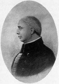
No seer was needed to foreshadow the success the Marietta colony was to have. Two years before its coming, the character of the colony was presaged when there met in Boston, at the Bunch of Grapes Tavern, whose gilded sign creaked temptingly in her high salt winds, a convention called by General Rufus Putnam and General Benjamin Tupper for the formation of the Ohio Company, with the purpose of founding a new State in the territory northwest of the Ohio River. The Company was composed of high-minded men, largely officers in the late war. In their petition to Congress for the purchase of western land they stipulated, for its organization, law and order, provision for education and for the[3] maintenance of religion and the total exclusion of slavery. For these compacts, some of the greatest statesmen in the young Republic brought to bear the power of their genius; for these, the quiet Ipswich clergyman, Manasseh Cutler, as agent of the Ohio Company, pleaded with matchless eloquence in Congress; for these, Rufus Putnam, the "Father and Founder of Ohio," gave the largess of his ability and rugged force.
"An interlude in Congress," says Mr. Bancroft, "was shaping the character and destiny of the United States of America. Sublime and humane and eventful as was the result, it will not take many words to show how it was brought about. For a time wisdom and peace and justice dwelt among men, and the great Ordinance which alone could give continuance to the Union came in serenity and stillness. Every man that had a share in it seemed to be moved by an Invisible Hand to do just what was wanted of him; all that was wrongfully undertaken fell by the wayside; whatever was needed for the happy completion of the work arrived opportunely and at the right moment moved into its place."
To the forty-eight men sent into the wilderness by the Ohio Company history gives a generous and well-merited praise. They were of the same race and of the same upright faith as the brave Englishmen who in 1620 landed[5] on the bleak, gray rock of Plymouth. All that was true and forceful in the Plymouth faith was theirs; they had the same love of law and religion, the same genius for order and a firm self-government, the same courage of conviction, the same independence of thought and action. They possessed, too, much of that ancient war-ready temper which had shorn the English King of his divine right and had created for the English people the House of Commons. Their heroism had adorned every battlefield of the Revolution; their roll included generals, majors, colonels and captains.
"No colony in America," said Washington, with that cautious, unerring judgment of his, "was ever settled under such favorable auspices as that about to commence at the Muskingum. Information, property and strength will be its characteristics. I know many of the settlers personally, and there never were men better calculated to promote the welfare of such a community."
"I know them all," cried the Marquis de La Fayette, his fine French voice trembling with emotion when the list of their names was read to him on his visit to Marietta. "I knew them at Brandywine, Yorktown and Rhode Island. They were the bravest of the brave." General Putnam himself was at their head, the "impress[6] of whose character is strongly marked on the population of Marietta in their business, institutions and manners." Here were Samuel H. Parsons, the distinguished general, the able writer, the accomplished jurist; James M. Varnum, the brilliant scholar, the gallant officer; Abraham Whipple, the brave commodore, to whom belongs the glory of firing the first naval gun in the cause of American independence, an act that gave birth to the American navy. Here were Winthrop Sargent, the Secretary of the Territory, Benjamin Tupper, the hero of many battles and the devoted friend of Putnam in the forming of the Ohio Company; Return Jonathan Meigs, afterwards Governor of Ohio. Here were Nye, Buell, Cutler, Fearing, Foster, Sproat, Cushing, Goodale, Dana, True, Devol and others no less worthy and distinguished, whose names are the richest heritage of their descendants.
The story of the coming of the pioneers is a twice-told tale to the student of our nation's history. In the disheartening gray dawn of a December morning, 1787, the first little band paraded before Manasseh Cutler's own church at Ipswich, and, after the firing of a salute, started "for the Ohio country," as their lead[7]ing wagon proclaimed. Another joined this at Danvers, and yet another, pushing on from famous old Rutland, started from Hartford, Ct., led by the beloved and always inspiring General Putnam. The toilsome journey overland, along an old Indian trail through Connecticut and Pennsylvania, at that season of the year white with winter, ended at last at the Ohio River. Here, at Sumrill's ferry, out of timber that still sang of the forests, was built the Mayflower, her bows raking like a galley, her burthen fifty tons—a humble enough namesake of the famous Pilgrim vessel. As the pioneers went onward down the river, the snow, which at first lay heavy in the hollows of the[8] hills, melted into thin patches here and there, until, when they reached Fort Harmar, at the fair mouth of the Muskingum, April bourgeoned into unexpected beauty about them. It was a golden augury for the little town, to which its soldier founders gave the name of Marietta, in grateful remembrance of the sympathy of Marie Antoinette for the colonies during the weary period of their Revolution, a name which still keeps her citizens lovers of that ill-fated Queen of France.
Enthusiastic news of the first summer of the colony went back over the mountains to Ipswich and Rutland. "The climate is exceeding healthy," blithely carols one of the old letters, "not a man sick since we have been here. We have started twenty buffalo in a drove—deer are plenty as sheep in New England. Turkeys are innumerable. We have already planted a field of one hundred and fifty acres in corn." Another settler drips from his ecstatic, and, we trust, veracious quill, "The corn has grown nine inches in twenty-four hours for two or three days past." The garrison, very soon erected for defence and called the Campus Martius in academic quaintness, is described as the "handsomest pile of buildings this side of the Alleghanies," and as presenting an appearance of almost mediæval stateliness and strength, bastioned as it was with great blockhouses and surrounded by a stout double wall of palisades. The Fourth of July was celebrated by a great "banquet," eaten in a bowery set up on the banks of the Muskingum; its menu tickles even a jaded modern palate—venison barbecued, buffalo steaks, bear-meat, roasted pigs, "the choicest delicacy of all," and a great pike, six feet long, the largest ever caught in the river. "We kept it up till after twelve o'clock at night," succinctly observes one of the participants, "and[10] then went home and slept until after daylight." On the fifteenth of July, a yet more memorable occasion, General St. Clair, the first Governor of the Northwest Territory, was welcomed with great ceremonies, and the Ordinance of 1787 was read with much solemnity in the midst of profound silence. In early August a pleasant little ripple of diversion was caused by the arrival of the families of the pioneers. In the latter part of the same month, Dr. Cutler made a visit to the settlement, and delivered the first sermon ever preached at Marietta. In September was opened the first Court of Common Pleas in the Territory. It was an august spectacle. The sheriff, Colonel Ebenezer Sproat, of the Massachusetts line, preceded by a military escort, marched with his drawn sword and wand of office ahead of the governor, judges, secretary and others, to the blockhouse where the court was held. As the picturesque little procession wound its way along the river banks, the friendly Indians, loitering about the new city, admired immensely the mighty form of Colonel Sproat, who, being six feet four inches tall, towered conspicuously above his companions. Ever thereafter they called him[11] Hetuck, or Big Buckeye, and ever since then the natives of Ohio have been dubbed "Buckeyes."
Great provisions were made for good order in the settlement; almost before the seeds of New England harvests had germinated in the virgin soil, Marietta had her pillory, whipping post and stocks for the discipline of evil-doers, instruments of torture which lingered as late as 1812. Every man was ordered to "entertain emigrants, visit the sick, feed the hungry, attend funerals, cabin-raising's, log-rollings, huskings and to keep his latch-string always out." Once during the fruitful summer the settlers assembled to attend a funeral, for the first death in the colony occurred in August, when little Nabby Cushing, daughter of Major Cushing, passed away. She was buried tenderly in the alien soil, where, in an unmarked grave, she is slumbering still. Although many years have come and gone between, a vague pity stirs to-day at the thought of that little pioneer baby, whose feet so soon grew weary in the vast wilderness.
The hospitality of the latch-strings was put to the test two years later, when a hapless colony of Frenchmen took shelter in the town, lured[12] into the wilderness by the unscrupulous agent of a land company, with the promise that they should find a land where there were no taxes to pay, no military services to be performed, where frost, even in winter, was entirely unknown and where candles grew ready-made on the bushes and sugar dripped spontaneously from the trees. They were a curious crew: carvers, gilders, wig-makers and hair-dressers from Paris, even a Viscount of broken-down fortunes and a young Marquis, with a few peasants as helpless as themselves in the new conditions,—hardly a mother's son of them able to plough or reap or chop for himself, and many a man without a sou in his pocket. The major part of them drifted down the river that winter to what is now Gallipolis, the City of the Gauls, where they at once began to give balls in the cabins which the Marietta settlers helped them build, and proceeded to spend what little money they had in hiring American hunters to bring them game! A few became citizens of Marietta, notably Monsieur Thiery, a Parisian baker and confectioner, who quickly adapted himself to the new life, and made toothsome little sweet-cakes and bread for the settlement,—there is a[13] tradition that while Louis Philippe was whiling away his exile in the United States, he visited Marietta, where he had the pleasure of eating a fair wheaten loaf of his countryman's baking, and Monsieur Cookie, bred to no trade, very short and very stout, who wore at all times and in all seasons a very tall steeple-crowned hat which once saved his life, when the Indians, catching sight of it bobbing up and down in the paw-paw bushes, fired at it in a vain attempt to hit the head within.
After the sober jollity of the first summer, the Marietta colonists experienced the hardships which every early settlement knows. They had their "sick years, their times of famine and their Indian wars." The sick years played a sad havoc in their numbers by dreadful scourges of epidemic diseases. The famous starving-time came in the spring and summer of 1790. A black frost falling out of due season ruined their crops, and the Indians, already beginning their hostilities, had driven from the forest every startled wild thing within their reach. It was a period that tried the Puritan mettle, for the solace of religion may prove vain if the stomach be empty. The only food was nettle-tops and the tender shoots[14] of the pigeon-berry, boiled with a little corn pounded on the hominy block. Occasionally a hunter, faring far afield, brought in a bit of bear-meat or a wild turkey, which made a feast at least fitting if not full. The heroic matrons sipped spice-bush tea, unsweetened, in lieu of a more stimulating beverage. Many a heart turned back in homesick longing to where the blue haze curled comfortably from New England kitchens, but hope returned with the early squashes. The new corn crop was abundant, and from that day to this, whatever may have been their vicissitudes of fortune, the citizens of Marietta have never again been reduced to a starvation diet.
A much graver calamity, coming not long after, was the Indian wars, which were not to end for five long, weary years. During this time the town was strained to its generous capacity to receive under the shelter of the Campus Martius the men, women and children from remoter settlements. The settlers worked in the fields like the Israelites at the rebuilding of the walls of Jerusalem,—every man with his weapon in his hand. On the puncheon cabin-floors, mothers rocked their babies in the first cradles of Ohio, while often, on some far[15]-off hill, they could see savage warriors brandishing their blood-stained hatchets in defiance at the fort.
The news of the defeat of General St. Clair's expedition caused consternation, and threatened for a time to break up the settlement. So disastrous was the defeat that when in 1793 Mad Anthony Wayne camped on the General's battlefield, his soldiers could not lie down to sleep for the bones of the unfortunate army. Humiliated by his misfortune and its implied disgrace, the Governor soon left his Marietta home. The colonists mourned with his loss that of his daughter Louisa, so brave, so lovely, so brilliant, that it seems no mere legend that the great Indian chief, Brandt, was madly in love with her.
In the grim terror of the times, an amusing incident now and then comes like a lilt of girlish laughter. Once the signal gun gave the alarm that the Indians were besieging the town. The night was dark and the confusion indescribable. Men rushed to their posts and the women and children scuttled to the central blockhouse. Colonel Sproat led the way with a box of valuable papers; next came a woman with her bed and children, and tumbling after[16] her, old Mr. Moulton, with his leathern apron full of goldsmith's tools and tobacco. His daughter Anna carried the china tea-pot. Lyddy brought the great Bible. When all were in the frightened cry was raised that Mrs. Moulton was missing—that she had been scalped by the Indians. "Oh, no," said Lyddy calmly, "she'll be here in a minute. She stopped to put things a little to rights; she said she would not leave the house looking so." And in a few moments the old lady scuttled in, bearing the looking-glass—a triumph of New England housewifery!
A certain regularity of living was maintained in spite of the continuous fear. Every Sabbath morning church was held in a blockhouse where Psalms were droned with Puritan unction, and the sermon by Mr. Story, the scholarly Massachusetts divine, was tasted with much critical acumen by the learned backwoodsmen, many of whom were graduates of Harvard and Dartmouth. On the long Sabbath afternoons the children of the settlement studied their catechisms in the simple log cabin of Mrs. Mary Lake, the earnest woman who thus started what was perhaps the first Sunday-school in the United States. On[18][17] week days they were gathered together for lessons, nor was the rod kept in less perpetual pickle because of the proximity of the Indians.
The war once over, a busy activity ensued. Mills were built, bridges made, and more comfortable houses erected. It was not strange that the sons of the old coast States, with the siren voice of the sea still in their ears, should become notable builders of ships. The great trees of the forest were masts ready for felling, and many a stately vessel slipped into the water from this inland ship-yard, to glide down the Ohio into the Mississippi, and from thence to the shining ocean beyond. The town became a centre of industry and traffic, a position which she was not long to keep, for gradually trade drifted from her, and by and by she fell asleep commercially beside her pleasant waters, to nod and dream serenely through years to come. But not only was the early Marietta noted for her industrial prosperity; she was a centre of culture as well, and her place in this regard she has never lost. As soon as a greater wealth and leisure came to the pioneer colony, there bloomed abundantly the flowers of an intellectual refinement,[20] which was the birth-right of those heroic men and women.
It is with this gracious era, redolent of sweet old customs and stately courtesies, that there is associated the romantic, old-time tragedy of the Blennerhassetts. On the lovely island lying some twelve miles below Marietta, Harman Blennerhassett, the dreamy Irish exile, built his idyllic mansion, whose grandeur was the wonder of the West.
"A shrubbery that Shenstone might have envied," wrote Wirt, "blooms around him. Music that might have charmed Calypso and her nymphs, is his. An extensive library spreads its treasures before him. A philosophical apparatus offers him all the secrets and mysteries of nature. Peace, tranquillity, and innocence shed their mingled delights about him. And to crown the enchantment of the scene, a wife, who is said to be lovely even beyond her sex, and graced with every accomplishment that can render it irresistible, has blessed him with her love."
Here he plotted a new empire with the bad and brilliant Aaron Burr, whose hands were still red with the blood of the murdered Alexander Hamilton; and from here he fled accused of treason to his country, disgraced and ruined. Memories of the "Blennerhassett[21] days" are many, for the great man was for several years a partner of Dudley Woodbridge, the first merchant of Marietta, and both he and his accomplished wife were familiar figures in Marietta homes. Fancy, inspired by local annals, has a charming glimpse of the loving mistress of the hospitable mansion, dashing through the woods on her spirited horse, like some brilliant tropical bird, in her habit of scarlet cloth, and white hat with the long drooping plume. A pretty story is told of her wit and beauty at the famous "Burr ball" which the fashion of Marietta once gave in honor of the crafty statesman and his daughter Theodosia. To-day, the site of the[22] regal dwelling is marked only by an old well and some magnificent trees. "Blennerhassett's Island" is a point of attraction for pleasure-seekers, who give little enough thought to its sad story; but sometimes there journeys to it a lover of past years who looks with blurred eyes at the spot where once was enacted one of the most pathetic little tragedies in all American history.
But Marietta is not altogether a tale of yesterdays; she has as well her to-day, with its rich promise for the morrow. To-day, a stranger in the town has pointed out to him "New" and "Old" Marietta. In New Marietta, brought into existence by the discovery of vast surrounding oil-fields, there are thriving factories, modern business blocks, new hotels, improved school-buildings, electric cars; there are evidences of wealth and business prosperity, and signs of an increasing population. This commercial progress, from a civic standpoint, is undeniably a benefit, yet it must be admitted, for the time being, it gives Marietta a little the appearance of a kindly, old-style grandmother, startled from a long afternoon nap in the chimney-corner, to find her cap gone, her scanty petticoats[24] replaced by strangely ample frills, and the caraway seeds in her limp black bag supplanted by indigestible bon-bons. In Old Marietta the scene shifts. Here is the drowsy peace of a New England village; here are wide streets shaded by avenues of splendid trees, and ancient houses, generous-portalled, serene. Here is the burring of bees in old-fashioned gardens. And is not this lingering fragrance the smell of the lotos-flower?
The glory of the old dispensation is the venerable college, whose buildings cluster picturesquely on the green lift of College Hill. Founded in the fear of God by the first scholars of Ohio, it has behind it a proud history. At its head have stood men of rich culture and ability, among whose names shines pre-eminently that of Israel Ward Andrews. In the list of its instructors have been scholars who have led it upward to all that is noblest and best. From its classes have gone out students who have taken a fitting and often distinguished place in the professions and in politics. When the call of 1861 came, the student sons of Marietta responded with a gallant patriotism and a devoted service, some among them winning the highest recognition. To-day, with[26] its able faculty, its fine library, its well equipped class-rooms, it holds no mean place in the roll of American colleges. It pays to its past the precious thanks of a worthy present. And with happy confidence it looks forward to its future, under the guidance of its sixth and latest President, Alfred Tyler Perry, but recently called to its leadership from Hartford Theological Seminary.
In the old Mound Cemetery sleep an honored dead. In its center is the prehistoric mound, as well preserved to-dayy as when it was discovered by the pioneer fathers, a vast monument to the unknown fittingly encircled by the quiet dignity of this ancient Acre of God. General Putnam's grave is marked by a plain granite monument, bearing the simple inscription more touching than the loftiest eulogy:
GENERAL RUFUS PUTNAM
A Revolutionary Officer
And the leader of the
Colony which made the
First settlement in the
Territory of the North-West.
Born April 9, 1738,
Died May 4, 1824.
Not far from him are the majority of the Revolutionary heroes who came with him from New England. It is claimed that there are buried here more officers of the Revolution than in any other burying-ground in the United States. About them lie thirteen soldiers of the War of 1812, and a number of the brave men who fought in the Mexican War. Here too, are the resting-places of many early citizens of Marietta, who are as a "Choir Invisible".
The gates are seldom open now to the silent caravans, for the graves in the cloistral grass lie close.
Many relics of bygone days make Old Marietta interesting. The streets running north and south bear yet the names given them by the early settlers, of Washington and his generals. The "Sacra Via" and the breezy "Capitolium" and "Tiber Way" bear witness to an old scholarship. "The Point" recalls the picketed Point of the Indian wars. There still stands the Ohio Company's Land Office, a wee, weather-beaten building, gray with time, probably the oldest structure in Ohio. Opposite this is the old homestead of Rufus Putnam, which stood within the Campus Martius. On the park, fronting the river, is the quaint Two Horn Church of the Congregationalists, erected in the wilderness in 1806 and now Ohio's oldest church building. On the same street where it stands is the stately old mansion of Governor Meigs, which was built two years earlier and which still holds an honored place among Marietta's beautiful homes. In families whose names mark their descent from the "forty-eight immortals" are treasured numerous heirlooms,—ancestral por[29]traits which look from their tarnished frames pink-cheeked, confident and calm; old dresses, dim and faintly odorous; and divers warming-pans, candlesticks and Blennerhassett chairs, together with sundry bits of sprigged, delightful china.
"Age is a recommendation in four things," runs a Spanish proverb: "Old wood to burn, old wine to drink, old friends to trust, old books to read." To these might well be added a fifth,—old towns to love. To those who know her, Marietta is a hallowed spot. She is[30] a tender-bosomed matron, this mother of many sons. Around her is a fair line of hills, which, whether green with the eternal promise of the spring, or wrapped in the blue smoke from autumn's invisible battlefield, or hoary with winter's snows, are changelessly beautiful. About her are broad fields, now quivering to their resurrection, now white to the harvests. Before her are the lovely, far-stretching rivers, calling to her all day long with their old, sweet notes of running water. By the bonds of her historic beauty she holds her children in a very tender thrall. In all times, and in all places, their hearts yearn unto her in the far Horatian cry: "Septimius,—that angle of the earth laughs for me beyond all others!"
By CHARLES F. THWING
THE first thing to be said about Cleveland is what, with the change of a pronoun, a Cambridge poet said about one of whom he wrote: "It is so pleasant." Its streets are pleasant to live in and to look upon; its parks are pleasant to stroll in or to ride in; its houses are, on the whole, pleasant to the æsthetic sense; its libraries are pleasant for their selectness though not for their bigness; its people are, above all, pleasant for their dignity, graciousness, genuineness, simplicity and appreciation. In the year 1838 the late Asa Gray spent a short time in Cleveland, and wrote from Cleveland to a friend, saying that the city would "ultimately be a very pleasant place"; he adds: "The people show some[32] signs of civilization; they eat ice cream, which is sold in many places."[1] I wish I were able to assure my old friend and neighbor, as he now lives with the immortelles and other fadeless flowers, that he has proved to be a true prophet: Cleveland has become a "very pleasant place," and possibly I might be allowed to assure him that signs of the ice-age of modern civilization still linger.
In that relation in which men commonly use the word "pleasant," the weather, Cleveland is not pleasant. It has as much cloudy weather as almost any part of the world; and yet it has a pleasant climate. Its summers are not hot, its winters not cold. To the worker of any sort this pleasant climate of much unpleasant weather is very pleasing, for in it, as in the climate of London, one can get much work out of himself.
Cleveland is a singular creation of contraries. It is an inland town, but it builds more vessels and owns more vessels than almost any other in the United States. About a quarter of all the steel vessels, rated in tonnage, built in the United States in the last fiscal year of the Government were constructed[34] in Cleveland, the order of precedence being Cleveland, Newport News, Chicago, and Detroit; and almost three quarters of the modern steel ships in service on the Great Lakes are owned or operated by Cleveland vesselmen. It is a city of four hundred thousand people, but it impresses both the visitor and the resident as a big village or a series of big villages. From it can be reached in a long or short night's ride, New York and Chicago, Buffalo and St. Louis, Detroit and Cincinnati; within seven hundred miles of Cleveland dwell more than half the entire population of the country, and yet Cleveland has been called provincial. Its homes are among the most palatial of the world, but the owners of not a few are more at home in New York and Paris than on Euclid Avenue. It is distinguished for its iron, steel and coal interests, but it has scholars and teachers who are known where its steel rails have never been carried. It is a city of the East, and it is also a city of the West—of the East it is the newest, of the West it is the oldest. It is often called conservative, but it is also distinguished by its sense of power and of progress. It represents in its citizens a pure New England type; but it has also gath[35]ered up folks from all over the world,—"Parthians, and Medes, and Elamites, ... strangers of Rome, Jews and proselytes, Cretes and Arabians," who read their newspapers in a dozen different languages. But, be it said, the[36] New England, the Connecticut and Massachusetts type still dominates. The names of the families which are most representative of the things of the spirit include a large number of New England names.
This city of contraries and of contrasts is yet made a great city by only one or two simple elements. One may say that Lake Erie makes Cleveland. Were there no Lake Erie there would be no Cleveland. But Lake Erie is the occasion and not the cause. One may say that the age of steel makes Cleveland. But that this age is the age of steel is only the condition, not the cause. The cause that makes Cleveland Cleveland is that at or near Cleveland the various elements that are necessary in the manufacture of iron and steel can be most economically and efficiently assembled. The iron ores from the Lake Superior region, the coal from the Massillon, Mohoning and Pennsylvania region, the limestone from the Lake Erie islands and southern shores, can here be most profitably brought together. Cleveland is, too, by rail and by boat a good point for the distribution of the finished product as well as a good point for the bringing together of the crude material. Here ore, coal and lime meet[37] and mingle as naturally as the heat of the sun and the life of the seed unite in the springtime. Nothing can prevent their meeting, and little can subsidies or other artificial stimulus do to promote it. From this union spring forth factories making nuts and bolts and sewing-machines and engines and the thousand products and by-products of this age and place of steel. Therefore Cleveland is Cleveland.
It may not only be said that Cleveland is herself; it should also be added that Cleveland has done some things first which are[38] worth doing anyway, and which are especially worth doing first. As among the colleges Williams and Harvard have done not a few first things, so among the cities Cleveland may claim a certain priority. The city was, if not the first, among the first to adopt the federal system of municipal government, a system which, after ten years of usefulness, has proved to be like every other form of democratic government, good if good men are in control, and bad if bad men are in control. Cleveland was the first to adopt the proper method for the government and administration of its public schools, namely the separation of the business side of the administration from the educational, a system, too, which, like the more general plan of government, finds its efficiency in the character of the men who administer it. In Cleveland, too,[39] was organized the great Epworth League of the Methodist Episcopal Church. Here, too, one of the first women in America to enter the medical profession was trained in the old Medical College, now a part of the Western Reserve University. Here the recondite experiments were made by Morley for determining the atomic weight of oxygen, and practical experiments by Brush for giving the best light, as well as the important experiments also made by Brush which resulted in adding "etherion" to the elements. Here, also, important facilities in the use of the public library and in the making of finest machinery, such as is used in astronomical apparatus, were first applied. One, too, should not in a commercial age be suffered to forget that in Cleveland the Standard Oil Company was born and grew to be a lusty youth.
This city of first things had as its first man and founder, one whose name it bears, Moses Cleveland. A Connecticut man, born in Canterbury, Windham County, in 1754, graduated at Yale in 1777, admitted to the bar, interrupting his professional practice by service in the Revolutionary army, serving in the Connecticut Legislature and also in the[40] State militia, Moses Cleveland was made agent for the Connecticut Land Company in 1796, and came into the historic territory of New Connecticut, or the Western Reserve.[2] He seems to have had those elements which usually are found in founders of states and builders of cities. Reserved in speech, vigorous in action, friendly with all, grave, shrewd, he was born to command. His career was brief: he died in the town of his birth in 1806; but he lived long enough to entertain a rational hope of the future greatness of the city he founded and named. It is said that he once remarked: "While I was in New Connecticut I laid out a town, on the bank of Lake Erie, which was called by my name, and I believe the child is now born that may live to see it grow as large as old Windham."
Moses Cleveland was a prophet at once[41] true and false. Cleveland became as large as old Windham and even larger, in the lifetime of children born in the last decade of the eighteenth century. The method by which Cleveland has attained the first place in its State, and the seventh place in the United States, is a process, a growth, and not a manufacture. In the year 1830, thirty-four years after the coming of Moses Cleveland, it had only a thousand people; but the one thousand had increased to six thousand by 1840, and in the next ten years the six thousand increased threefold. In the next ten years the number more than doubled, becoming forty-three thousand in 1860, and yet again doubled in the following decade. By 1870, it had become ninety-two thousand. The doubling process could not long continue, but it came so near it that in 1880 there were one hundred and sixty thousand inhabitants, in 1890 two hundred and sixty thousand and more, and in 1900 almost four hundred thousand.
A growth more normal and steady, a growth which has also carried along with itself elements far more precious than mere size, it would be hard to find. For these folks do not deserve the epithet which Carlyle applied to London's millions. They are a people of vigor, initiative, progressiveness, carefulness, wealth, work, comfortableness, and good-heartedness. Cleveland may be conservative; but it is the conservatism of the English nation[43] which Emerson describes in saying: "The slow, deep English mass smoulders with fire, which at last sets all its borders in flame." Cleveland's fires are the fires of anthracite and not of straw.
A city of comfort, Cleveland has no London's East End. I do not believe that in any other population of the world of its size can be found so few hungry stomachs or homeless bodies. Work abounds. All men work. Its rich men are workers, and, what is far more exceptional, the sons of its rich men are workers. Its wealth is of the solid sort. It represents investments which pay dividends every six months, and which represent the advancement of every commercial and manufacturing interest. But Cleveland is obliged to acknowledge that not a few of its rich men are legal citizens of New York City, ostracized from its pleasant borders by what they and others regard as the unjust tax laws of the State.
The city has not yet reached the condition in which it is understood that in case a will is probated representing a large estate which fails to give at least a considerable sum to charity or to education, the court shall set it aside on the[44] ground that the testator was of unsound mind. Of course money is given away both by gift and by bequest, but more, on the whole, by gift than by bequest, and in large amounts, but not in amounts so large as prevail in communities of an age of two hundred and seventy-five years rather than of one hundred. The rate of increase which money may make for itself is so great, that the holder and the maker hesitate to part with such a remunerative agent. Yet the beneficence viewed in the light of decades is great. A noble school of science, a noble college and university, including professional schools, a noble foundation for an art school, are easily found among the more obvious tokens. Hospitals and orphanages, private schools, endowed churches, Young Men's Christian Association buildings, parks and college settlements, are ready proof of private beneficence for public ends. Testimony should also be borne to the wisdom as well as the generosity which characterize the giving of this people. My pen refuses to write names, but it is free to say that to find beneficence which is, it shall not be said so little harmful, but which is so gloriously efficient, as the beneficence of some of Cleveland's[45] noblest women and men would be difficult. With the gift, before the gift, and after the gift goes the wisdom as well as the graciousness of the giver. One, too, should not neglect to say that in not a few of the great manufacturing concerns of Cleveland prevails a spirit that the employer owes to the employee something more than wages. The dividend to labor consists, in the more obvious relations, in providing rest and recreation rooms, facilities for eating the midday luncheon, and in doing what can be done in creating associations and conditions which make for the enrichment of life and the betterment of character.
Of course Cleveland has societies and clubs: clubs into which the worthiest life of the community naturally organizes itself for worthiest purposes, and clubs which represent the life that is simply worthy and of which the purposes are not the highest. Clubs of women and clubs of men, clubs social and clubs professional, clubs literary and clubs commercial, clubs anthropological and clubs sociological, clubs chemical and clubs engineering, clubs collegiate and clubs pedagogical, clubs athletic and clubs æsthetic, clubs piscatorial and clubs ecclesiastical, clubs architectural and clubs of[47] free-traders, clubs for municipal improvement and clubs for no improvement of any kind—they all and many others are found in this very pleasant city.
And underneath all these associations and organizations it is easy to discover the growth of a distinctly civic spirit, also manifest in special movements and conditions. The endeavor to build in one group buildings so important as a county court-house, a city hall, a public library and others reveals the willingness to surrender individual advantages to the public weal. The attempt to deal largely and justly with all municipal franchises proves the presence of a desire to serve all as well as each. The Municipal Association, an organization of a few gentlemen of high purpose and of patience as well as of great influence, has, in recommending or in refusing to recommend certain candidates for office, promoted the growth of a public sense out of which it has itself sprung. The determination that the public schools shall not be used for partisan purposes is perhaps as strong an illustration as could be given of the presence and potency of the civic spirit of Cleveland.
In the three great professions are found[48] noble members. In this triple service is manifest a high tableland of general excellence rather than a level broken by high and distinct peaks of individual conspicuousness. The highest relative standing belongs, I judge, to the members of the medical profession. This prominence may be the result of the presence for more than fifty years of a medical school which has numbered among its faculty some great investigators and teachers. But not a[49] few of those who are examples of highest service have been unwilling, it must be said, to remain in Cleveland. As the Atlantic draws down the level of the Great Lakes, so the territory of the Atlantic draws away some (not all) of the more eminent members of the great professions. The supply however never becomes exhausted, nor does it deteriorate.
But the most eminent of Cleveland's people belong to the literary or political class rather than to the strictly professional. The earliest of the writers who spread Cleveland's fame and his own was Artemus Ward. It was a short career enough which Artemus Ward had, and its Cleveland part covered only two years, but while it lasted it bore one of Cleveland's daily papers round the world on the wings of his wit. One cannot forget that here lived and wrote John Hay, beloved as among the best of men as well as honored as the most efficient of Secretaries of State. James Ford Rhodes here fitted himself while engaged in business to begin his career as a fascinating writer of later American history. Constance Fenimore Woolson was a Cleve[51]land child, although not born here, and the Great Lakes are the scenes of her stories. Mrs. Sarah Knowles Bolton, writer of useful and pleasing biographies and other books, divides her residence between Boston and Cleveland. Charles W. Chesnutt, too, is esteemed not only for his sketches but also for a distinct charm of character. Cleveland would like to claim that rare poet and great soul, Edward Rowland Sill, for his home was only a few miles away, and in Cleveland he died, in 1887. One should not decline to say that books written by college professors may not only be the material for literature but also literature itself. Such books, written in Cleveland, are neither few nor barren.
The eminence in politics of the Cleveland man belongs rather to the present than to the past. If one should name the gentlemen who have served the city in the national Congress the names would to most prove to be without significance. The name of Senator Payne—and he had been long associated with the life of the city—one recalls, but no name has the meaning of the name of Wade or of Giddings, who came from the little town of Jefferson, a few miles east of Cleveland, or of Sherman, who came from the south. Hayes, Garfield and McKinley might be called citizens of the Greater Cleveland. At the present time, however, in both the Senate and the House[53] the city is not without able and significant representation.
Like a piece of music the chapter returns upon itself. It began with the argument that Cleveland is so pleasant. From the breakwater which the Government builds to keep Cleveland great and to make it greater, along the avenues of residence or of trade, even through its smoky and sooty atmosphere,—sign of prosperity,—out mile after mile to the city of the dead where the well-beloved Garfield sleeps in nobly wrought sepulchre, in all and through all, Cleveland is pleasant. Pleasant to live in, pleasant to work in, I know, and[54] pleasant to go to heaven from, I hope, is Cleveland.

By MILTON E. AILES
ON the day before Christmas, 1788, twenty-six adventurous men, in deerskin hunting shirts and leggins, with tomahawk, powder-horn and scalping knife at their belts, embarked at Limestone on the Ohio River in rude barges of their own construction, and fighting their way through dangerous floes, proceeded on a journey which was to prove memorable in the annals of American colonization.
These pilgrims were well aware of the perils and tragedies awaiting them, for their mission was to build them homes and found a city on the edge of the rich Miami Valley, through which mixed tribes of raging Shawnees, Senecas, Iroquois and Miamis roamed, determined to halt the threatening advance of the hated paleface.[56]
The Indian braves realized that a crucial moment in their history had come. Their allies, the British, had gone down in defeat before the Thirteen Fires. Henceforth the tribes must look to their own councils, and rely upon their own strength, and they swore grimly that the Ohio should run with blood, and that the advent of every western pioneer should bring an additional scalp for the grewsome decoration of their lodges.
But these hardy voyagers, now celebrating a frugal Christmas as they steered their course down the swollen and half-frozen Ohio, were not to be turned aside by impending conflict with savage tribes. To meet grave danger like brave men was for them no new experience; they had passed through seven years of revolution; they had stood the trying tests of honorable hardships, and were now making their way to found a community which was to develop within a few generations into one of the greatest inland cities of the world. Four days they fought their way through floating masses of débris and ice, finally finding their haven in Sycamore Inlet, opposite the mouth of the Licking River. To-day the traveller, smoking meditatively in a Pullman,[57] will cover the same distance before he has occasion to light a fresh cigar.
In a grove of sycamores, osiers and water maples they struck their flint and built their fires. There was no theatrical assertion of dominion, nor is it on record that sacred rites were invoked to consecrate the struggle for civilization that was to centre round this far outpost of the Republic, and yet their first performance was one of the most dramatic incidents in western history; for, knowing that savage armies lurked in the dim woods that overhung the terraces above them, these twenty-six hardy Anglo-Saxons dismantled the crafts that had carried them into the far wilderness, and converted the planks and timbers of their barges into cabins. There was to be no retreat. In the name of the new Democracy, they established the primitive beginnings of a great city in the very centre of the famous Indian path over which for unnumbered centuries naked aborigines from the Great Lakes to the Kentucky hunting grounds had hurried to battle or the chase.
The new settlement thus became a bold and significant challenge to the red man, and in its fate was involved the future of the West and[58] of the nation. The earthquake of war, which the founding of Cincinnati invited, was not long delayed, and when it came it startled Washington from his incomparable composure, and shook the Republic to its foundations.
From the moment of its inception, Cincinnati was the most important point on the Ohio River. Other settlements, it is true, at the start hoped to outstrip Cincinnati in population. There was Marietta, founded two months before, which had a more romantic birth. And there was North Bend, which enjoyed the personal backing of John Cleves Symmes, the famous pioneer who superintended the first development of the Miami Valley, and from whom Denman, Patterson and Filson, the promoters of the settlement that subsequently became Cincinnati, purchased the site of that city. These and other settlements along the river were, for a time, pointed to with pride by their founders as the coming commercial centres. Cincinnati, moreover, began life with an impossible name. Filson, a fantastic pedagogue who had drifted into Kentucky, combining a smattering of tongues with an unbridled imagination, compounded the name "Losantiville," which means when interpreted,[59] "the village opposite the mouth of the Licking." Historians, in malign humor, seem to rejoice in the sudden translation of this picturesque polyglot and town-site boomer, remarking with a certain gleeful unanimity of phrase that "shortly after naming the settlement he was scalped by the Indians."
The offer of free lots to original settlers did not give Cincinnati pre-eminence, for similar lures were held out by other aspiring communities along the Ohio; nor will it be seriously contended that the location there of Fort Washington, although this made the spot the headquarters of the American army in the Northwest, gave Cincinnati a superior start, for the sense of security expected because of the presence of the United States garrison was not abiding. General Harmar marched to defeat in 1790 from this pioneer fort and arsenal, and the victorious savages pursued him until their cries of exultation terrified the little hamlet clustered about the military station.
Then came St. Clair, bold and assertive. Heroes of the Revolution had founded the town. The fort had been named in honor of the great General and President, and as both town[61] and fort represented the extension into the West of that democratic strength of arms which had humbled the most powerful kingdom of Europe, this new settlement from which civilization was to radiate into the western valleys should be dignified with the name of the order that held together in fraternal bond the grizzled survivors of the great war. And so Losantiville, the dream of a bizarre scholar, became Cincinnati.
In the name of that order and city, St. Clair went to war. But sickness laid him low, and he was carried to the field of battle wrapped in flannels. Managing the forces against him was Thayendanegea, the celebrated Mohawk, or Joseph Brandt, as the English called him, as astute as Tecumseh and as fearless. Thayendanegea had been secretary to Sir Guy Johnson. He had learned the tactics of civilized armies, and with masterful native cunning he planned to annihilate the forces of St. Clair. Nearly fifteen hundred officers and men marched away from Cincinnati to crush the semi-savage captain who had directed the massacres of Minisink and Wyoming, and back to Cincinnati in rout and dishonor, their guns and blankets[62] abandoned, rushed in unspeakable terror a pitiful five hundred. Before sundown on the day of that battle, November 4, 1791, nearly a thousand scalps of white men dangled from the wigwams of the armies of Thayendanegea.
Other communities along the Ohio looked with envy upon the federal ramparts at Cincinnati, but the protection afforded by the garrison was at first more fanciful than real. The pioneer clergymen of the town ventured to Sabbath services cautiously, rifle in hand, peering down the dim aisles hewn through dense woods of linden and birch that led to a clearing, in the midst of which some charred stump served as a pulpit; or, as congregations grew, a log-built chapel housed the earnest worshippers. And by the law of Cincinnati and the territory every communicant was required to go to the altar with loaded firearms, that savages, taking advantage of the hour of prayer to attack the town, might be repulsed. Even when pews were built to give regularity to worship, the brethren were commanded to sit at the outer end, with their rifles in readiness.
If Fort Washington had not been built or had been located elsewhere, Cincinnati would have still become the metropolis of the[63] Ohio. Here water highways crossed. And as it marked the path over which the red men had passed for ages, so now it became the intersecting point of civilized adventure. Out of the shadows of the Licking in their pirogues Daniel Boone and George Rogers Clark had hurried across the Ohio to watch hostile campfires from the Cincinnati hills, and thence had descended upon the barbarians to avenge crimes committed in Kentucky. The long beaches at the Cincinnati site afforded safe landing, while the settlement, secure upon the higher ground and the succession of terraces beyond, could not be engulfed by the periodical river floods. North and south the rivers that mingled their waters here furnished natural pathways to vast and fertile valleys.
Here, too, a vanished race once had had a city or perhaps a capital, for Cincinnati is built upon extensive prehistoric ruins of the Mound Builders. It was a walled city with great gates, pyramids and sacrificial altars, and over these surviving memorials of a people whose origin and destiny are alike a mystery grew, when Cincinnati was founded, oak, beech, sycamore and cedar, whose concentric rings revealed that hundreds of years had elapsed[64] since the disappearance of the race which had reared these shrines and tombs and city walls. Among the prehistoric pottery, the polished pipes of catlinite and stone axes such as a race of troglodytes might have swung to brain abhorrent monsters of forgotten periods, they will show you in the artistic Cincinnati Museum in Eden Park, the famed Cincinnati Tablet exhumed from a tumulus near Fifth and Mound streets in that city. Some antiquarians believe the sculptured stone to be an astronomical calendar or a table of measurement and calculation. Some have imagined it to be a sacred relic from the tomb of kings. Nearby, in the same museum, you see records lucidly deciphered from the second Theban dynasty, and carved inscriptions, intelligently translated, from the balustrade of the temple of Athene, but scholarship is dumb and imagination is the only interpreter of these strange mementos of a race which found in the site of Cincinnati a natural spot for the building of a large and fortified city.
Although the star of empire may have been destined at all hazards to pause over Cincinnati until the tenth census of the United States should show that the center of the nation's[65] population had moved westward to that city, there was grave alarm in the settlement when the soldiers of St. Clair arrived in confusion and defeat.
Generations have thrilled over the story of the officer on horseback, who, bearing important news, hurried to the President, tossed his bridle reins to an orderly and leaped up the steps of Washington's reception room only to find that the Chief Executive was dining with distinguished visitors and could not be disturbed. The officer was so importunate and so impressive that the secretary was impelled to grant him audience. The grave President listened without visible emotion to the whispered message from Cincinnati, the officer departed, and Washington returned to the banquet table. Not one of his guests could guess that beneath the calm exterior the far-seeing statesman was experiencing one of the most tragic moments of his career. It was not merely that a trusted general had minimized warning and had met defeat, for Washington had devoted a long life to warfare against both savage and civilized foes, and he was not to be easily moved by the uncertain fortune of battles. But he knew that the defeat which[67] the soldiers of Cincinnati had encountered now threatened the destiny of the country. The East and West were not yet riveted by steel rails into coherent union. Beyond the Alleghanies there were projects of a protectorate under France or Spain, or both, and bolder dreams of a Kentucky republic. With few connecting links with the East, what could hold the western empire, since the federal government had displayed inability to protect the pioneers? Washington's guests departed unaware that their illustrious host who had entertained them with consummate decorum had during those hours felt the nation slipping beneath his feet. But when they had gone the pent spirit of the great leader, in one of the few instances of his lifetime, found expression in tumultuous grief and rage. He voiced in advance the storm of public protest, indignation and fear that broke out when the dismal tidings from Cincinnati became known. And when Congress learned that Washington favored the creation of an army of five thousand to avenge the defeat of Harmar and St. Clair, there was little in the resourceful vocabulary of political abuse spared the President. Anti-expansionists called him an imperialist bent on converting the Republic[68] into an empire. Why send an army to inevitable slaughter beyond mountain frontiers in a vain struggle for the wilderness of the Indians when the colonies then possessed more domain than the citizens of the Republic would ever be able to use?
Fortunately the anti-expansionists, while mordant and powerful, could not prevail, and the war measures became law. Anthony Wayne, whose daring during the Revolution had won for him the admiring sobriquet of "Mad," then took command and hastened to Cincinnati but none too soon. The Six Nations with Little Turtle as their spokesman had followed up their victories by demands that Cincinnati, the capital of the Northwest, should be abandoned and that the Ohio should mark the perpetual boundary between the white man and the red. British arms bristled behind this native ultimatum, and at the rapids of the Maumee, as if to stay Wayne's advance, British forces built a fort and garrisoned it with three companies. The fears of Washington seemed about to be realized.
But at the battle of Fallen Timbers "Mad Anthony" scattered the allied tribes like forest leaves. Nearly half a hundred mighty[70] chiefs fell in that historic engagement, and in their defeat the Indians christened their conquerer "Big Thunder" and for years trembled when they heard his name. Cincinnati and Ohio were saved to the Republic.
Wayne in his campaign and in his no less notable treaties was brilliantly seconded by a young man who, unannounced and unwelcomed, landed at Cincinnati on the day the broken columns of St. Clair fell back upon the fort. The generals there looked upon his smooth cheeks and his boyish frame with soldierly disdain, one remarking that he would as readily send his sister to the front as entrust this beardless neophyte with the responsibilities of border warfare. This youth, in whose veins flowed the blood of one of Cromwell's generals, was to shame his flippant critics, for he was to win a lieutenancy at the battle of Fallen Timbers, and rising steadily in the service of his country was to become a western Napoleon, avenging the disasters of the River Basin and Detroit, defeating the powerful Tecumseh at Tippecanoe, laying firm and broad the foundations of northwestern statehood, serving in the Senate of the United States, and finally going in triumph to the[71] White House. Cincinnati has fostered many famous sons, but none greater than William Henry Harrison.
To many new communities the first settlers have gone with the hope of returning with fortunes to their former homes. Cincinnati was founded and developed by men and women who came to stay. Harrison identified himself with the West at the start by marrying the daughter of John Cleves Symmes, the Miami pioneer, and to the Harrison homestead near Cincinnati, which for a quarter of a century had been an American mecca, the body of the famous General was borne for burial.
From the start, self-reliance has been a prevailing characteristic of Cincinnati. Its isolation in the days of the canoe, the barge and the pack-horse, developed its originality. A copy of the Centinel of the Northwest Territory, published in 1794, graphically illustrates its remoteness at that period, for news from Marietta had been eight days in arriving, Lexington dispatches were twenty-one days old, fifty-six days had been consumed in getting the latest information from New York, and European news antedated the day of issue four months and a half. It was natural among[72] such conditions that the city should look to itself as the centre of interest, and hence at an early day the journals of Cincinnati, instead of canvassing distant localities for belated sensations, were encouraging local writers to entertain the public. It was the press of Cincinnati that first gave the poems of Alice and Phœbe Cary to the world, and they repaid it by conferring immortality in the world of letters upon the blue Miami, where they spent the simple years of their girlhood. And thither, because of the fame their singing had won them, traveled Horace Greeley and other celebrities of the day to do these gifted sisters homage. In Cincinnati was born Gen. Wm. H. Lytle, author of Antony and Cleopatra, and it was the journalism of that city that gave inspiration to his pen. Here, too, was directed the early genius of Wm. D. Howells, Rutherford B. Hayes, Salmon P. Chase, and other men who have dignified literature or public life.
Savage yells had not ceased to echo in its surrounding woods before music began to charm in Cincinnati. Even before Wayne came to silence the exultant war-cries of the tribes, Thomas Kennedy, in whose honor a street in Covington is named, used to entertain[73] the frontier society with his fiddle, and a Mr. McLean, a butcher, took time to train the voices of the primitive colony. The Rev. Daniel Doty, who visited Cincinnati at an early day, was shocked at the singing and fiddling and dancing in the log cabins, as if the people "feared not God nor regarded Indians." Music, since directed in large measure by the German element in the city, has by its Chorus, its musical groves, its Saengerbund, Haydn Society, and other clubs, imparted distinction to Cincinnati and made it the Vienna of the American continent.
It is not surprising that the pioneer butcher of the city found time from his chopping blocks to strike the tuning-fork, for Cincinnati, even after the location there of Fort Washington, was many times on the verge of starvation, and would have starved but for the timely help of frontier hunters under the noted Colonel Wallace, who brought the meat of buffalo, bear and deer to the stricken settlement. To-day the city dines well. In truth, it is famed for its good cheer and its bohemian independence.
Cincinnati is a city of homes and churches, and singularly free from the crime that prowls in the slums of other cities. Therefore some[75] of its citizens take pride that the city is credited with being one of the greatest whiskey markets in America, that forty-three breweries and storage vaults are in demand, and that the city annually turns out 49,000,000 packs of playing-cards, making it the largest center of this industry in the world.
In many industries Cincinnati leads. The wealth of cities throughout the continent is locked in banks and vaults manufactured in Cincinnati. The cowboys on the plains and the horsemen on city paddocks sit in saddles fashioned in Cincinnati. Cigars by the millions in this country are packed in boxes manufactured in Cincinnati. It produces more schoolbooks than any other city, and is near the head of the list in turning out religious publications.
On the 22d of February, 1794, a canoe left Cincinnati with a federal mailbag consigned to Pittsburg. This marked the beginning of regular service with the East. In early days, a Cincinnati merchant seeking to buy goods in New York consumed sixty days in making the journey to the metropolis. To-day he may lunch in the Queen City, take a train and lunch the following noon in Manhattan. Long before the advent of railways,[76] Cincinnati became a center of travel and distribution. As early as 1801, a full-rigged brig took on a cargo at Cincinnati and set sail for the West Indies. Not long after, and many years before Fulton turned his attention to Western waters, citizens of Cincinnati met at Yeatman's Tavern to consider a "contrivance for transporting boats against the current by the power of steam or elastic vapor," but without tangible results; and, in fact, when the first steamboat did paddle noisily past the city the circumstance was dignified with only a four-line notice in the Cincinnati press.
Before long, however, the steamboat revolutionized river travel, and thenceforth Cincinnati leaped by bounds from a village to a great city, and every recurrent trip of these harbingers of vast commerce seemed to find a new suburb springing into bustling life on the Cincinnati uplands.
The fact that this city was originally included and still remains in the New Orleans customs district shows its accessibility to ocean traffic. Its superiority in water communication is shown by a computation made by the Cincinnati Chamber of Commerce regarding the relative cost of transporting freight from[77] points of origin to all parts of the United States. The comparisons per 100 pounds are as follows: From Cincinnati, 81 cents; Chicago, 84 cents; St. Louis, 88 cents; Minneapolis, $1.22. A similar computation applicable to a radius of 600 miles from the point of origin gives the following averages per 100 pounds: From Cincinnati, 66 cents; Chicago, 73 cents; St. Louis, 75 cents; Minneapolis, $1.11.
While growing into greatness, Cincinnati did not forget, in the critical times of the Civil War, its honorable history as the former outpost of the Republic. Its trade was largely with the South, but sternly its citizens decided that arguments in favor of trade interests smacked of treason, and with stoic heroism closed the city to rebellion. And when Lew Wallace, fortifying Cincinnati to anticipate attack, called for volunteers, the whole community responded, and from the Ohio valleys came the sharp-shooting "squirrel hunters" in procession seemingly endless to defend the city.
Since then the growth of Cincinnati has been in keeping with the development of the nation. It does not hope, as Harriet Martineau[79] suggested during her visit here, ever to become the home of the country's capital, but it rejoices in being the great city nearest the American centre of population. Its library of a quarter of a million volumes and its Historical Society cherish the splendid stories of its past and the accumulating data of its current achievements. Its artists and citizens delight in dignifying that record in bronze and marble in the environing parks and city squares.
The visitor to Cincinnati, on a clear afternoon, should take passage on an incline road, rise to the heights of Eden Park, and traversing that high plateau, whose natural beauty and landscape gardening earn for it its name, find his way to the water tower. An elevator lifts him five hundred feet to the observatory platform, where with field-glasses he may behold the splendid panorama of Cincinnati. Far below, spanning the river over which "a crazy craft with sails and paddles" once ferried the people, he sees five massive structures of steel and stone, including the famous suspension bridge, begun in the early part of the Civil War, and by its completion during the stress of that conflict testifying[81] eloquently to the faith of its citizens that strife was not to sever the nation, and that these mammoth girders of steel would constitute an important tie in the inevitable reunion of North and South. It was of this structure that James Parton wrote in 1867, that the whole population of Cincinnati might get upon it without danger of being let down into the water. The five superb bridges in their capacity and security afford marked contrast to the earlier attempts to span the river which floods swept away, including the arched structure which went down in the torrent of 1832, accompanied on its seaward flight by a tumbling Methodist church which the roaring Muskingum had added to the universal baptism.
Not all of the life that now courses through Cincinnati's streets could crowd upon its bridges, for the people of the cities and villages across on the Kentucky shore belong in every commercial and social sense to Cincinnati, and swell its population to the half-million mark. In fact, within a radius which the vision from this tower almost sweeps, there are a dozen ambitious and wealthy Ohio cities, founded by the sturdy men of the Revolution[82] who went forth from Cincinnati and still tributary to the parent town.
The traveler is surveying sacred ground. Mount Auburn beside him marks the site where fell a captain serving under George Rogers Clark, one of the first of the many brave soldiers of the American Revolution to mingle their dust with Ohio soil, which thus enriched has produced many Presidents and renowned statesmen almost without number.
Leading away from the city the observer on the tower sees the Miami and Erie Canal, which, connecting Cincinnati with Toledo and furnishing a highway by which boats could pass from New Orleans via the Queen City through various inland waters, finally reaching the harbor of New York, made Cincinnati as early as 1830 a half-way house for continental traffic. The canal recalls that on the tow-path the barefooted Garfield began his career.
While glancing at the surrounding reservoirs from which water is forced to this tower for the supply of the terrace-built city, the traveler may recall the story of the eccentric wanderer, the celebrated Cincinnati "water witch" who with hazel or willow crook went about from hamlet to hamlet indicating hidden[84] springs and at whose direction, in truth, the Queen City dug its first well.
Descending now, the traveler may view the observatory which John Quincy Adams dedicated to science, or move with the crowds flocking to the Zoo or to the groves where free concerts are given, or he may find his inspiration in roaming through the haunts that still treasure the memory of U.S. Grant, or visit the site of taverns that entertained Webster and Andrew Jackson, who paused here on his way to Washington, and that extended frequent hospitality to Henry Clay, stopping here while journeying to or from the national capital.
Passing over the suspension bridge, the traveler may let the sun go down upon his itinerary as he stands upon the bank of the Licking, made memorable by the vigilant canoe cruises of Daniel Boone. Near by is the cottage home of the Grants. Passing a Shawnee effigy in front of a tobacconist's stand, the visitor sees the illumination of the city beginning to twinkle against the shadowy background. The multi-colored lights of myriad street-cars flash over bridges and up the steep streets of the hill-built metropolis. The headlights of[85] locomotives on nineteen railroads, representing over twenty thousand miles of track, gleam in and out of the city. It is a moving picture, a perpetual memorial and celebration of the valiant labors of those paladins of pioneer conquest who on that Christmas week, 113 years ago, struck their flint and started their fires in the primeval woods, kindling thereby a light which though flaring at times before the whirlwinds of savage war, and all but quenched with baptisms of fraternal bloodshed, now burns with a steadiness and brilliancy that shall last as long as time.
By SILAS FARMER
A stream of crystal clearness, wide and swiftly flowing, the waters of silver and blue alive with fins and scales, a course dotted with islands large and small, wild ducks in myriads diving and dining along shores bordered with pond lilies and flags, stretches of yellow sand and bluffs of yellow clay peopled with buffalo, bear and deer, with wide leagues of grassy pastures and pleasing vistas beyond, walnuts, oaks and maples sentinelling the scene, and skies and sunsets of unrivalled azure and gold adding the final touch of beauty—such was Nature's invitation to the first visitors to the Detroit.
The earliest of the French travellers to this[88] region was the Sieur Joliet, who came in 1670, and was followed the same year by the Sulpician priests, Galinée and Dollier. Eight years later La Salle in Le Griffon, the first sail-vessel on the Great Lakes, passed through the "strait of Lake Erie," and July 24, 1701, Cadillac and his company landed at the present site of Detroit to establish a fort and permanent settlement.
The desire to escape from Roman or Protestant oppression which led to the founding of Baltimore and Plymouth had no place in the thought of those who colonized Acadia and the West. True, there had been one or two feeble efforts to found French Protestant colonies in America. The great Coligny sent a Huguenot colony to Florida more than fifty years before the Mayflower arrived at Plymouth Rock. The Spaniards, however, fell upon and hanged these colonists, their placards stating that it was done, "not because they were Frenchmen, but because they were heretics." Under Cardinal Richelieu, all Protestant emigration to America was discouraged for fear the emigrants would unite with the English or make converts of the Indians. The conversion of the Indians to the[89] Romish faith was always specially designated among the objects of French enterprise in America. The charter of the "Hundred Associates" of April 29, 1627, expressly stated that it was granted for the primary purpose of converting to the Catholic faith the Indians, usually designated as "worshippers of Baal." All these motives played their part in the founding of Detroit, but not quite so important a part as the commercial motive.
Antoine Laumet de la Mothe Cadillac, the founder and commandant, was no mere adventurer. In courage, in scholarship, in mental grasp and in general acumen he deserves a place with the founders of Baltimore and Philadelphia. The confessedly fictitious description of his personal appearance and the one-sided analysis of his character by Gayarré were founded on incomplete knowledge. As an officer of the French marine, Cadillac fearlessly crossed the Atlantic again and again as though it were but an inland ferry. On the coast of America he explored the harbors and islands of New England and noted at length their peculiarities and advantages. As a soldier and knight of the Order of St. Louis, he penetrated into the wildest of western wilds, served as commandant at Mackinaw, Detroit and Mobile, repeatedly defeated the Indians at these posts, and compelled them to sue for peace. He had the scholar's habit of writing detailed memoirs of the places he established or was commanded to inspect. He wielded a pen as sharp as his sharp sword. The opponents of his plans had need to fear its point. He spared no words. "A traveller cannot afford to stop," he said, "for every dog[91] that barks." And illustrating the fact that many of the French lived so much among the Indians that they became like Indians themselves, he sententiously said, "With wolves one learns to howl."
He denounced frauds boldly. Count Frontenac spoke highly of his "valor, wisdom, experience and good conduct." It was no ordinary man to whom a wife could by word and deed alike bear witness as Cadillac's wife bore witness to her husband. After they had been married for fourteen years, and when the colony was less than two years old, in company with Madame Touty, in an open canoe with Indians and woodsmen for an escort, she made the journey of a thousand miles from Quebec to Detroit in the fall of the year when fierce winds and rough waves and heavy rains might be expected. When one of the Quebec ladies reminded her in advance, "At Detroit you will die of ennui," she replied, "A woman who loves her husband as she should has no stronger attraction than his company wherever he may be; everything else should be indifferent to her."
The American cities that equal us in age and population are few indeed. Two hundred[92] years are behind us, and three hundred thousand people fill our homes. Our people are and ever have been of many types. In the early days coureurs des bois, bluff, hearty, reckless, and Indians, the squaw trudging along bent double under her basket of bead-work, the unburdened brave stalking proudly, noiselessly along, frequented the place. Dutch traders from the Mohawk coasting along the Lakes early brought negro slaves from Albany.[3] In our social life the Gallic spirit remains to soften and harmonize. The dash of gorgeous coloring which the almost continuous existence here of a military post has given, the distinction and grace which the early arrival of some of old Virginia's noblest children has lent, the intellectual vigor which Puritan New England has contributed, and the solidity and conservatism furnished by the presence of the many[94] wealthy landed proprietors have all shared in the making of a social life as rich as it is attractive.
After the first settlers came strange sights. Round-towered and red-painted windmills began to dot the banks of the Detroit, and all "along shore" narrow farms, a city block in width and fifty times as long, stretched from the river rearward to meadows and woods. The canoe and the pirogue were always in the stream, and in them the French girls were as much at home as mermaids in the sea. The fort was the centre of every interest. It was a log stockade enclosing a plot of ground three or four hundred feet square, and lay south of what is now Jefferson Avenue, occupying at least the western half of the block between Griswold and Shelby streets. Within it commandant and soldiers were gathered, the church was located, justice administered and goods were kept on sale.
A large influx of immigrants, especially in 1749 and 1754, caused the extension of the stockade, but at no time were grants of farms made within several hundred feet of the fort. The intervening space was in large part used as a "common field," and year after year oats[95] and onions were produced where only paving-stones could now be raised. Eventually of course the houses overflowed the stockade, stretching towards the farms, but for a long time the owners of farms on either side resisted any encroachment of streets or people, and for many years the city could grow only northwards. The French farms that hemmed in the city possessed many advantages. Even when included within the city they, for many years, practically escaped taxation because undivided into lots. Indeed, until a comparatively recent period there was no taxation of real estate and really no need for any; for whenever the city needed money it sold a lot. This reckless style of living continued till 1834, the extraordinary expenses connected with the cholera season of that year making larger taxation needful.
In this connection it is well to recall an unusual state of affairs that placed many lots at the disposal of the city. In the year 1778, during the Revolutionary War, the English, to protect them against the Americans, erected a large fort where the new Post-office is located, in the block bounded by Shelby, Wayne, Lafayette and Fort streets. At the close of[96] the war this fort, with its grounds, passed into the possession of the United States. In 1826 Congress gave this property, worth to-day more than a score of millions, to the city whose expenses had before been paid by fees derived from various licensed persons and pursuits. Upon the reception of this property the city fathers deemed it necessary to level and grade the old fort and its appurtenances and to lay out streets thereon. The cost of the work was paid by the issuing of city "shinplasters" which could soon be bought for sixty cents on the dollar. The lots laid out within the limits of the old cantonment were sold at nominal prices, the purchasers paying for them in the depreciated city bills. The result was that the net proceeds to the city from the sale of this extensive domain amounted to only $15,000, and even this was not permanently invested, and no vestige of the funds remains. In contrast to the dissipation by the city of valuable property is the wisdom displayed by individual holders whose property later became worth millions. If the city officers of that day had possessed foresight as well as power, they might have so conserved the city's possessions as to have made Detroit an Utopia. All the public schools[97] and other civic buildings and appurtenances could have been built and paid for, and the city government could to-day be carried on without taxation, or at least with only a tithe of the amount that is now required to be paid.
It was during the decades of 1820-1840 that the tide of emigration from East to West reached its height. It began in 1825, on the completion of the Erie Canal, and was greatly increased by the larger number of steamboats on the Lakes that immediately followed. The opening in 1854 of the first railroad from the East to the West, the Great Western of Canada, made it possible to go still faster and with greater ease, and during the whole period Detroit gained largely in population. The introduction of street-cars in 1863 afforded opportunity for easy access to outlying regions, and since then the city limits have been several times extended, until now they embrace an area of not far from thirty square miles, with a river frontage of seven miles.
Contemporaneously with the rush of settlers to the State and city between 1830 and 1840, came what is known as the "flush times of 1837." Emigration to the West had become almost a stampede, both steam and sail vessels[99] were crowded to their utmost, and knowing the dearness of Eastern lands and the cheapness at which Western lands could be purchased, nearly every person came prepared to buy and did buy lands for settlement or speculation. So great was the rush that all careful preliminaries were dispensed with, and if only a title could be shown, anything that "lay outdoors" could be disposed of. Town sites were a favorite form of investment, and the supply kept pace with the demand. Surveyors and draftsmen were soon busy day and night representing imaginary cities on paper. On these plans, literally like "Jonah's gourd," there sprang up in a night, stores, dwellings and court-houses, indeed, all the appurtenances of an old established town. The era of "wildcat" banks had just begun and the principal security of their bills was the land covered by these imaginary towns. Theoretically, twenty per cent of the bills issued by the too easily organized banks were to be secured by specie deposits. Actually, not five per cent was so deposited. The same coin—in some cases in the same boxes—was exhibited by a score of different banks, and in some instances "coin boxes" were filled with iron and[100] other substitutes for specie. These frauds were winked at by bank commissioners, who should have inspected the contents of the boxes. There was thus a trinity of imaginings,—imaginary towns, imaginary banks and imaginary inspection. When the bubbles burst there were left in some places towns and houses without a single inhabitant, and certain of these houses contained room after room in which the walls were literally papered with bank bills in sheets that had never been cut apart or signed.
The most important local event was the fire of June 11, 1805, which destroyed every house in the city save one. The memory of the fire is preserved in the present seal of the city, the mottoes, Resurget Cineribus, "She has risen from the ashes," and Speramus Meliora, "We hope for better things," representing both prophecy and fulfilment. Out of the fire grew an entirely new plan of the town, new lot alignments and assignments, and a new form of government. The former streets, twelve feet wide, grew into broad avenues, and the years have added areas and improvements which in any city would be marks of prosperity and beauty.[101]
The form of government which the fire introduced was, however, its unique result. The beginnings of the strange methods of government that obtained are found in the organization of the Ohio Company, and in that notable document, the Ordinance of 1787. Under the latter, Congress was to appoint a governor whose term was for three years, unless sooner revoked, who was required to possess in freehold an estate of one thousand acres in the territory; a secretary for the term of four years, unless revoked, who was required to have five hundred acres of land; and three judges, any two of whom constituted a court to have common-law jurisdiction, and each of whom was required to own five hundred acres of land.
The governor and judges were appointed January 11, 1805. Judges Woodward and Bates arrived at Detroit June 12th, and found the town wiped out by the fire of the previous day. A few stone chimneys and, near the fire line, several antique pear trees alone remained. Governor Hull arrived on the evening of July 1st. The date of the arrival of Judge Griffin is unknown. In many respects the Governor and judges were well fitted to enter upon and[102] complete the laying out of a new Detroit. Judge Woodward came from Alexandria, Va., and understood and admired the plan of Washington, then new. He manifestly desired and determined that Detroit should be modelled after that "City of Magnificent Distances." Sections of his plan as drawn by A.F. Hull, the son of the Governor, could be laid upon the plan of Washington and matched to a line.
There was much delay in adopting the plan; but after summering and wintering as best they could, however, among their friends outside, the inhabitants were gratified with the news that April 21, 1806, Congress had authorized the Governor and judges to lay out a new town, build a court-house and jail, dispose of ten thousand acres near, give former owners and householders lots, convey lots to others and in general settle all details therewith connected. It was not, however, until September 6, 1806, or four months after the date of the act, that the Governor and judges held their first meeting. Interminable slowness seems to have been their purpose; plans and counter-plans, change and repeated change in surveys, their method. Lots were numbered and renumbered, streets laid out on paper, obliterated and then laid out[104] anew in new directions and locations. Decisions were bandied about and referred from one person or authority to another, and questions of ownership of lots, like a shuttlecock, were tossed to and fro. Plans were prepared, approved, used and then discarded. Every new difficulty and scheme seemed to give rise to new and radically different lot outlines and numbers. Lots were capriciously granted and as capriciously withdrawn. Without bond or books of account, without method other than the method of not leaving any record of what moneys were received or how expended, they did as they pleased. As a result, for a year and a half after the fire there was not a single house erected, and up to May, 1807, deeds had been given for only nineteen lots. Meantime, the débris of the fire covered the site of the ancient village, the blackened stone chimneys standing as monuments of the disaster and of the incompetency or worse of those in authority.
The three judges and the Governor in themselves possessed all power, legislative, executive, judicial. They made laws, built court-houses, issued scrip, laid out streets and[105] lots, gave away lots to churches, schools, societies and individuals and were practically "Lords of the Manor of Detroit." The adoption of laws from the original thirteen States, which was all that they were authorized to do, became under their methods a mere burlesque. A writer of that period openly charged, and exaggerated but little in saying, that they would
"parade the laws of the original States before them on the table, and cull letters from the laws of Maryland, syllables from the laws of Virginia, words from the laws of New York, sentences from the laws of Pennsylvania, verses from the laws of Kentucky, and chapters from the laws of Connecticut."
It is due to one or two of those associated as judges during a part of this régime, to say that Judge Woodward, who was in office for the entire period, was very largely responsible for the conditions that existed. The accession of General Cass as Governor, the establishing of the Detroit Gazette, which exposed the proceedings, and the coming of new immigrants finally secured sentiment and people sufficient to have a General Assembly. And with freer discussion and elective methods, order began to reign after twenty years of disorder.[106]
In military matters Detroit has had an almost continuous series of startling experiences. Indians, French, English, and Americans have all struggled in and about the city. Blockhouses, stockades, forts, and cannon have defended it. Stories of attacks, sieges, battles, massacres, and conspiracies crowd its annals. The tramp of regiments, the challenge of sentinels, the bugle-call, the drum-beat, and the war-whoop of the savage were familiar sounds in its past.
Within two years after Fort Pontchartrain was erected, hostile Indians surrounded the stockade, and at varying intervals during many subsequent years the savages sought to dislodge the French and destroy their fortifications. The French traders, however, soon demonstrated that they were willing to deal more liberally than the English, and there can be no doubt but that many Indians came to prefer French methods and manners, for they finally united with the French during the French and Indian War in attacking the English settlements. The victory of Wolfe at Quebec in 1759 and the consequent surrender of Detroit to the English did not please the Indians, and before the final treaty of peace was signed,[107] Pontiac, an Ottawa chief, who had declared his intention to "stand in the path," formed his conspiracy to overthrow all the English posts. He secured the co-operation of a number of tribes and in May, 1763, prepared to strike at Detroit. Fortunately, as has happened more than once in similar plots, female sympathy and tenderness caused the revelation of his design. An Indian maiden gave warning to Gladwin, then commanding at Detroit, who made preparations to foil the conspirators. On the morning of May 7th, Pontiac and a number of his warriors sought admission to the fort.
On arriving at the gateway,[4] Pontiac and his warriors were freely admitted, but found the garrison under arms, the cannons loaded for[108] service and the inhabitants ready for battle. At a glance he foresaw the certain failure of his scheme, and after being warned by Gladwin that his plot had been discovered, he retired still protesting friendship. Within a day or two afterwards he threw off all attempts at concealment, summoned his warriors, massacred several persons on the island now known as Belle Isle and commenced a siege which lasted for five weary months. During the siege, the garrison was relieved several times by provisions and ammunition from Niagara, and on July 29th, by the arrival of 280 soldiers commanded by Captain Dalyell together with 20 rangers from New Hampshire under Major Robert Rogers. Captain Dalyell now determined to "turn the tables" by an attack on the Indians. Gladwin opposed the idea, but was compelled to yield, and on July 31st 250 troops in three detachments marched against the savages. Pontiac in some way was informed of the plan and, ambushed on the border of Parents' Creek, afterwards called Bloody Run, awaited the approach of the soldiers. As the latter reached a small bridge that then crossed the stream not far from what is now the corner of Jefferson Avenue and Adair Street, they heard the war-whoop of the[109] Indians and from every side bullets thinned their ranks. Dalyell and seventeen others were killed, nearly forty soldiers wounded and several captured. Within six hours after this ignominious failure, the rest were glad to be within the shelter of the stockade.
The siege was then renewed with increased vigor until at last General Gage of Boston determined to send a force large enough to subdue the Indians. Accordingly, Colonel Bradstreet was put in command of a combined force of 100 friendly Indians, 900 Canadians, and a detachment of 219 Connecticut militia in charge of the noted Israel Putnam. They came by water from Albany and reached Detroit on August 26, 1764. Their bateaux and barges blocked the river; the display of flags and force alarmed the Indians, and made them yield before an army such as they had never seen before.
Meantime the war-clouds of the Revolution were gathering. The common impression is that the war was fought in the East, around Boston and New York. The important events that occurred at Detroit are usually ignored; that, too, in spite of the fact that at no other point was so much use made of the Indians by the English.[110]
King George and his ministers evidently feared that, unless kept busy defending their homes, the hardy settlers of Western Virginia and Tennessee would aid their brother colonists in the East. In order to prevent them from so doing, deliberate and pitiless plans were made to incite the Indians against the western settlers. Indians were invited to Detroit from as far west and south as Arkansas, and gathered here by thousands. They were feasted, clothed and furnished with guns, scalping-knives, and tomahawks. Blankets, shirts, scarlet cloth and other things were given. The value of the requisitions for this post in a single year reached hundreds of thousands of dollars. The writer has personally seen the original record of the supplying of "sixteen gross of red-handled scalping-knives." Fully equipped, they set forth on their forays, returning with men, women, and children as prisoners, and with many scalps. The expedition which perpetrated the "Massacre of Wyoming" was equipped at this post, as was also the expedition of Captain Bird against Kentucky at a cost of over $300,000. The writer has an original account book of that period giving the names and pay per diem of[111] the French who as guides and interpreters accompanied the English and Indians on some of their raids. The noted Daniel Boone was brought as a prisoner to Detroit after one of these expeditions. After the return of each party the guns of the fort were fired, the prisoners and scalps were counted and recorded, and again the Indians were feasted and given presents.
It was during these days that Col. A.S. De Peyster was in command at Detroit, but he was not in full sympathy with such savage warfare. It will be remembered that it was to him that Burns, while in his sick-chamber, dedicated his last poem, on "Life," beginning:
De Peyster himself could turn a bit of society verse. On one occasion he addressed the following lines to the wife of Lieutenant Pool England, then at Detroit:

The English officers then at Detroit did not[112] have an easy life. There were resident rebel Americans who made much trouble—some of whom were sent away and others fined. American prisoners, too, were brought here. Some were compelled to work in the streets, in ball and chain, and others were forced to cut wood on Belle Isle.
At last Detroit and the West were yielded by treaty to the United States, but on one pretext or another they were not actually surrendered until July 11, 1796. On that day Fort Lernoult for the first time displayed the Stars and Stripes.[5]
The animosities growing out of the Revolutionary War were not allayed by the peace[113] declarations. The Indians continued to hold allegiance to King George, and frequently massacred Americans. British officials on various occasions assumed such authority that at last there came a renewal of strife and the War of 1812. Again Detroit became a focal point. Twelve hundred troops from Ohio, under command of Governor Hull, were soon marching hither to secure the safety of Detroit. Governor Hull's trunk, containing military papers and plans of great value, which had been sent by boat, was captured near Malden, Canada, by the British who had apparently received the earliest announcement of the declaration of war. Governor Hull arrived at Detroit July 5th, soon afterward crossed to Canada and issued a proclamation, but a few days later returned without having accomplished any results of value. On August 16th, without any reasonable excuse, and without the firing of a single gun, he surrendered his entire force and all of the territory under his control to General Brock. He was tried and[116] found guilty of cowardice, unofficer-like conduct and neglect of duty. In his memoirs, Governor Hull, trying to defend himself, seeks to make Secretary of War Eustis a fool or a traitor, Gen. H.A. Dearborn a knave, and Colonel Cass a conspirator. Original letters and testimony, however, from President Madison, ex-President Jefferson, and Secretary of State John Quincy Adams show that Governor Hull was justly condemned. On September 29, 1813, as the result of Commodore Perry's notable victory of September 10th, the whole region was restored to American control.
Detroit's interest in several local and subsequent wars was large, but the unimportance of some and the well-known results of others make comment thereon unnecessary.
While these varied historical events were taking place, the city was steadily gathering to itself prestige and reputation. Its houses now excel in number and beauty, its streets, wide and well paved, are edged with the smoothest of stone walks and lined with elms, maples, and grassy lawns. The distinctive buildings of the municipality, its court-houses, schools, police stations, water-works, and engine houses are remarkable for their excellent architecture and[117] well-kept condition. The churches, by their number and in their construction, indicate the possession of religious desire and æsthetic taste. The manufacturing interests of Detroit are varied. Its commercial representatives are found in almost every country, and "Detroit" stoves, drugs, and chemicals are known in every clime. We have numerous parks, but Belle Isle is indeed the priceless jewel in the crown of Detroit: woods of green and waters of blue, art and nature, moving waves and waving grass, stillness and activity, vistas and broad views, beautiful flowers and lofty trees, the white sails of numerous vessels, and the swift motions of great steamers all alike are combined in the captivating beauties of this favored place.
Besides serving as a charm to drive away care, our beautiful river gives us one of the greatest ports in the world. More tonnage passes annually through "the Detroit" than in the same time enters and clears the combined ports of London and Liverpool. During the season nearly four hundred vessels pass daily, bearing more grain and minerals than traverse any other stream in the world. The city is a central starting-point for reaching all[119] northern summer resorts, and more steamboat passengers arrive and depart from our wharves than from any others on the Lakes. The stream that attracted the earliest visitors attracts later ones as well. The river never overflows and therefore is never a menace, but always a joy and blessing. Yachts, sail-boats, barges, shells, ferries, steamers, and great "whale-backs" fly and ply over it, and in the season it is a panorama of beauty, gay with music, streamers, and happy voyageurs.

By SARA ANDREW SHAFER
AT the northernmost point of the meeting of the waters of the mighty trio of lakes which divide the States of the Middle West from the Dominion of Canada, lies an archipelago in size and beauty like that of the
An old writer says that there are two-and-thirty thousand of them, great and small, clustered chiefly where Huron leans her head to meet those of Michigan and Superior, "as if they were discussing some great matter." Perhaps they are talking over the old days and the things and people they knew long ago.[122] Perhaps they speak of the morning when, according to an old saga, the worshippers of the Rising Sun in February saw the Island like a great turtle—Nocchenemockenung—rise slowly out of the water, to become the home of the Giant Fairies of the Michsawgyegan, or Lake Country, and to be a place of refuge for the vanished peoples, whose names are as the sound of many waters for beauty and for harmony. Perhaps they tell of the wild, free life of those roving, painted bands of fishers, trappers, and hunters which make pictures of so much action and color against the ever-shifting background of these seas and shores. Perhaps they tell of the coming of the Black Robes in the days when the lilies of France had no fear of the lion of England, and the eagle of the American Republic was as yet unthought of. There are things enough of which the Lakes may speak as their waves lapse on the beach of
Occupying as it does, one of the most important strategic points in the new world, it is not strange that the Island of Mackinac should have a rich and varied history, and that in its earlier Indian-French form "Michilimackinac[124] was a word familiar in the cabinets of European monarchs before it was known to people dwelling along the Atlantic." The name was given not only to pioneer settlements on either side of the Straits, but also to a vast province which reached as far south as the Ohio River and as far west as the Red River of the North. The Straits are but a dozen miles in width, and the Island but nine miles in circumference, but whether it be frozen in the long clasp of "Peboan, the Winter," when the white, endless snows are marked only by the dark accents of evergreens on islet and mainland, over which the cold stars look down, or the Northern Lights flame and fade; whether it be decked with the unspeakable splendors of its early autumn, or rejoices with the sudden coming of its tardy summer, it is a land whose beauty is indescribable, and whose spell is supreme.
The village numbers many thousand flitting folk in summer, but it has less than eight hundred permanent residents. It lies along the perfect crescent of a bay worn into the southeastern end of the Island, at the foot of the cliffs, upon which the long lines of the fort stand sentinel, and is a curious conglomeration[125] of huge caravanserai, summer villa, shop, fish-house, pier, half-French, half-Indian cottage, and church. Old days and new meet over and over again in the little streets, where, in the soft patois of the habitants, in the names they bear, and in many of their strongly marked faces, much of the Island's story is suggested. St. Ann's is a true daughter of the first chapels built by the old heroes of the Church. The Mission House tells of the earnest early efforts to teach the tenets and virtues of Calvinism to the savages, made by the reverend geographer, Morse, father of Morse of the electric telegraph, and Mr. Ferry, whose son, born in the village, ably represented Michigan in the Senate of the United States.
Where the fort garden now stands once stood the agency, then the centre of the vast trade of the fur companies. Within its walls Henry Schoolcraft wrote down the precious results of his studies in Indian dialect and folk-lore, from which, as from a root, sprang the perfect flower of our one native epic, Hiawatha. Not to have read Hiawatha with the pine-spiced winds of the north blowing upon the page, with the magnificent prospect[126] of the Straits before one's eyes, lifted while a page is turned, and with the waves breaking into a thousand jewels against the rocks at one's feet, is hardly to have read Hiawatha at all.
The Fort is the successor of the feeble early posts set up by the pioneers of France. The great propellers and the swift-winged yachts that throng the summer waters are of a kindred with the birch canoe, most poetic of all water craft—own brother to the violin by reason of the perfect beauty of its lines, having in it
of the woodland and the wood life. As of old, the deep wild roses and the frail harebells cling to the cliffs; as of old, in the gorges hushed into fragrant silence by pine and larch and hemlock, arbor-vitæ and juniper, beech, and birch, the shy, delicate flora of the north finds shelter. As of old, the winds try their strength against the splendid masonry of the curious limestone formations for which the place is noted, the Arch Rock, the Fairy Arch, the Chimney Rock, the Sugar Loaf, Scott's Cave, Skull Cave, the Devil's Kitchen. Around each of these the legends[128] cluster like bees about a linden-tree in blossom, but how can they be forgiven whose crass stupidity gave them these commonplace titles and who have lost for us their Indian names?
In the days when New France "had two fountain heads, one in the cane brakes of Louisiana, and the other in the snows of Canada," a charter was given by Louis XIII. to the Hundred Association Company, which was thereby invested with rights almost monarchical, together with injunctions to do all that was possible for Holy Church which was consistent with the keeping of a watchful eye upon such earthly advantages as might accrue from a monopoly of the fur trade and the acquisition of new territory. It was in 1634, under the governorship of Champlain, that Jean Nicolet, a fearless explorer, well versed in woodcraft and in the speech of many aboriginal tribes, was the first paleface to see the white cliffs of Mackinac, as he was also the first to carry back to civilization tidings of a great new sea, the Lac des Ilinese, or Michigan, which he had discovered. That he perished by the capsizing of his canoe in the St. Lawrence River was a great loss to the infant[129] colonies to whom his sixteen years' experience in frontier life would have been very valuable. The path he opened, was, however, soon followed by others. The explorers and traders, Des Grosselliers, Radisson, Perrot, and their fellows did for the world what the Jesuits, the Recollets, and the Sulpicians did for the Church. It is in the Relations sent home by the priests that we learn what were the trials overcome by those dauntless sons of "the sturdy North." Perhaps from no country but France, and in no other years than the glittering, romantic, covetous, daring, devoted years of the seventeenth century, could have come adventurers so tireless and churchmen so selfless as these. To read their simple, patient chronicles is to have new belief in man, new faith in the Church Universal, "which is the blessed company of all faithful people," and to clasp hands across years and above creeds with those courageous pioneers and with those humble saints.
The story of Mackinac is for many years the story of the French in Canada. "Not a cape was turned," says Parkman, "not a river was entered, but a Jesuit led the way." Every year the establishment of new posts pushed[130] the realms of the Unknown Territory nearer and nearer to the sunset. Poor little posts they were, slenderly garrisoned, and feebly armed, but beside each one rose a chapel and a cross where the "bloody salvages" might learn, if they would, the religion of the fathers. The missionaries made, perhaps, but few converts to their faith, but they made many friends for their country by their kindly offices to the sick, the aged, the dying, and the infant, by the gentleness and urbanity of their high breeding, and by the perpetual sacrifice of their lives of love and loyalty. Of their hardships we can only read between the lines of their brave, uncomplaining Relations, but what litanies of pain, sorrow, and disappointment, what Te Deums of hope and rejoicing lie in these marks, oft recurring on their queer old maps:
 marque des villages sauvages
 marque des etablissements françois.
By 1668 many missions were strung along the waterways. The Island was the centre of a thriving trade, had thirty native villages, and a palisaded enclosure for defence, and a year later its shores were hallowed by the feet of "The Guardian Angel of the Ottawa Mission,"[132] Father Jacques Marquette.
Here, in what he called "the home of the fishes," and "the playground of all the winds of heaven," he spent the hard winter of 1669-70, going later to the first Fort Michilimackinac, at St. Ignace, where he built a log-and-bark chapel, and whence he wrote the letters which reflect his pure spirit, as a clear pool reflects a star. Ever alert, ever anxious, "Ad Majoram Gloriam Dei," to hear of new countries to be brought to Him, his great opportunity came when the tribes trooped past the Island on their way to the Sault Ste. Marie and the Great Congress, convened on the 14th of June, 1671, by the hardy Perrot. The French wanted to control the frontier trade; the Indians wished a market for their furs. To both peoples pomp and ceremony were natural and dear, so here, in all the splendor of war-paint and wampum, tomahawk, calumet, feathers, bows and arrows, and handsome furs came the braves of many tribes; in all the gay accoutrement of blanket-surtout, scarlet cap, fringed elk-skin leggins, rifle, and dagger-decked sash came the coureurs des bois and the voyageurs; in the dignity of their[133] uniforms came a handful of soldiers; with cross and cassock came the priests, to gather under a great wooden cross, to which the arms of France had been nailed, where, by a procès verbal, the overlordship of the Great West was assumed by Louis XIV.
Among the representatives of so many scattered savages, Father Marquette doubtless made the inquiries about and gained the knowledge concerning the Great Unknown River which served him in such good stead when, on the 17th of May, 1673, he started with Louis Joliet, five voyageurs, and in two canoes, on the voyage which made the Mississippi known to Europe. Of the honor coming from the discovery the good father never thought, but only with joy of new lands to which the message of the Cross could be carried. It is the story of a hero, the story of his short life and of his triumphant death, "alone, a Jesuit, and a Missionary," beside an obscure creek on the Michigan shore, on the 19th of May, 1675, in the eight-and-thirtieth year of his age. Descendants of his Ottawas and his Hurons still tell of his "bright hair, like the sun," and of the great funeral when, two years after his death, his body was brought back to St.[134] Ignace. Whether the dust now held sacred was his or no, is of little moment. In the Book of Life, above and below, the name of Jacques Marquette has long been written, and like the blessing of peace his spirit rests upon the Northland.
In 1679, the Griffin, a little ship of sixty tons, took Robert Cavelier, Sieur de la Salle, and the garrulous, mendacious Recollet friar, Hennepin, past the Island on their way to the Great River, which they were to explore to the Gulf, and beside which the murdered body of the great Norman was to be flung. He only touched the Island, but the touch of La Salle was a royal accolade.
In 1688, La Honton, a soldier of unusual sagacity, noted the importance of the site, and in 1695 M. de la Motte Cadillac says that the fort, with its garrison of two hundred soldiers, and the village of Canadians and Indians to the number of six or seven thousand souls, made it one of the largest posts in Canada. Disputes between the commandant and the Jesuits, chiefly about the sale of liquor to the Indians, resulted in the discouragement of the priests, who, in 1705, burned their chapel and their school, and went back to Quebec. St. Ignace was then gradually abandoned for[136] a second Michilimackinac on the southern peninsula.
When the French and English war was ended on the Plains of Abraham, George III. became indeed sovereign of the soil of Canada, but Louis XV. was lord of the hearts of too many French, half-breeds, and Indians to make the transfer of allegiance easy. Loves and hates and racial sympathies are not matters for cold diplomacy, and the people of the Northwest waited longingly for a leader who should give them again the light-hearted, friendly rule of the French, under which they had been far happier than they found themselves as subjects of the stern, alien English. In the person of an Ottawa chieftain, the most remarkable personage produced by the Indian race, the leader was found. In the brain of Pontiac, grim, far-seeing, fearless, heroic, there arose as a prophetic vision the assurance that English encroachments upon the rights of his people would never cease so long as they held a rod of ground coveted by an English eye. To avert the evils he foresaw, he planned the capture of all forts west of Niagara, the extermination of all English settlers, and the restoration to the Great[138] Father at Versailles of the lands he had just lost. With incredible swiftness he formed the vast conspiracy whose story has been told, once for all, in the living pages of Parkman's narrative.
Whisperings of coming trouble had been heard at Fort Michilimackinac by Major Etherington, the commandant, but none of so serious a nature as to prevent the presence of the soldiery at a great game of baggatiway which was to be played in a field near the fort by rival companies of Sacs and Chippewas, in honor of the King's birthday, August 4, 1763. The game is a very intricate and brilliant one, requiring great agility and skill, and the participation of a large number of players. As was most natural, the excitement of the onlookers was intense, and when an apparently stray ball flew high over the palisades of the unprotected fort (which had been silently invaded by a crowd of squaws with weapons hidden under their blankets) and at least four hundred players in hot pursuit swarmed over the stockade, nothing was thought amiss, until the cries appropriate to the game changed into the war-whoop, and a massacre began. Of the English, all were either killed or made[140] captive, except Alexander Henry, whose narrative curdles the blood even yet.
This event led to the abandonment of the southern fort and the establishment of one on the Island.[6]
"It is now certain," writes Schoolcraft in 1834, "that the occupancy of Old Michilimackinack—the Beekwutenong of the Indians—was kept up by the British until 1774; between that date and 1780 the flag was transferred ... the principal trade went with it, the Indian intercourse likewise. Some residents lingered a few years but the place was finally abandoned, and the site is now covered with loose sand."
By the Treaty of Paris, in 1783, the Island was ceded by Great Britain to the United States. Possession was, however, withheld on one pretext or another, until 1796.
When the second war with England began, it was natural that one of the first points to be attacked should be the fort so commandingly situated. Far from all base of supplies and[141] all possibility of rapid communication, the oft-repeated appeals of General Hull for an effective garrison at this and other important points were totally disregarded in Washington. Only fifty-seven soldiers were in residence in Mackinac when the British forces, 1021 strong, landed before dawn on the 17th of July, 1812, on a point nearly opposite St. Ignace. By eleven o'clock Captain Roberts sent a flag of truce, and a demand of surrender to Lieutenant Porter Hanks, who had had "no intimation" that a war between the powers had been declared until that moment. After considering the[142] futility of resistance, and a consultation with the American traders in the village, with the valor which was ever bettered by discretion, he capitulated.
In August, 1814, an attempt was made to retake the Island. A battle was fought near the scene of the British landing two years before, in which battle Major Holmes and twelve privates were killed, and many men were wounded or missing. The routed Americans, under Colonel Croghan, withdrew to their ships. The Island finally passed into the keeping of the United States in 1815.
Then followed the great days of the fur companies, when the place was astir with a life so gay and vivid that only to hear of it stirs the blood of the untamed savage which centuries of the repressions of civilization have not routed from our hearts. Hundreds of hardy, ill-paid engagés, hundreds of happy-go-lucky, hard-working voyageurs and coureurs des bois and hundreds of Indians crowded into the hundreds of tents set up along the beach; into the log-houses of the primitive village, and into the huge barracks of the company, which counted and weighed the rich peltries they had gathered, paying them in return the miserable[143] wages which in dancing, gambling, drinking, fighting, feasting and sleeping, were spent long before the bateaux freighted with the poor necessities for the fast-coming winter were again rowed out toward the wilderness, the brave[144] chansons of the oarsmen growing fainter and fainter as the boats passed steadily out of sight.
An incident but little known connects the Island with one of the great mysteries of history,—the fate of the little son of Louis XVI. and Marie Antoinette. That the Dauphin did not die in the Temple, but had been secretly conveyed to America and had been placed among the Indians, was believed by persons whose opinions were entitled to respect; but that he might be found in the person of the Rev. Eleazar Williams, a half-breed missionary of the Protestant Episcopal Church among the tribes about Green Bay, was a supposition stranger than any fiction. The story is too long to tell here,[7] but as it touches Mackinac at a single point, it must have a line in this chapter.
On the wharf of the moon-shaped bay, one bright day in October, 1841, a crowd was gathered to see the Prince de Joinville, son of Louis Philippe, then reigning in France, who[145] was on his way to Green Bay, and who had stopped off at Mackinac to visit some of the natural curiosities of the place. A salute had been fired in honor of the royal sailor with true republican fervor, and while the steamer which had brought him waited his pleasure, the village was en fête. Waiting on the dock, and also about to embark for Green Bay, was the Rev. Eleazar Williams, who, before the boat left the bay, was, at the request of the Prince, presented to his Highness. The acquaintance thus begun led to disclosures which, if true, make the identity of the Dauphin and the missionary all but certain.
Wrapped in a legend, the Island of Mackinac comes into sight. With a thousand legends, its old fields, its cliffs, its caves, its gorges, its wooded glens, its shores, and its far, dim distances are haunted. With a thousand mysteries and bewilderments and witcheries it holds captive all who come within reach of its magic. With a mystery, which too may be but a legend, our story closes, as the light that smites the waters of the Straits into a myriad of glittering flakes paints on the sunset sky the old, old golden track which the Indians loved to call "the Path that leads Homeward."[146]
By PERRY S. HEATH
THE visitor to the Hoosier capital familiar with the capital of the nation instantly observes a striking similarity between the two. Well he may, for Alexander Ralston, who carried the chains for Pierre Charles L'Enfant, and placed the stakes which fixed the lines and curves of the City of Magnificent Distances, was the surveyor of Indianapolis. When, in 1821, he carved out of the small cleared space in the centre of a great wilderness the plan just one mile square for Indianapolis, his architectural abilities and ambitions had more than a superficial justification. The result was perhaps the handsomest city between Philadelphia and Denver.
When Indianapolis was platted on the surveyor's map it had but 800 inhabitants. By[148] the year 1840 the town had grown to 2672 inhabitants. There were only 48,244 souls in the city in 1870. But by 1890 the population had increased to 105,436, and the census of 1900 placed the population at 169,164. In the latter decade Indianapolis outstripped Rochester, New York, St. Paul, Minneapolis, Kansas City, Denver, and Omaha in increase of population. And the area occupied by the city grew in three quarters of a century from one to twenty-seven square miles.
Entering Indianapolis to-day upon any one of the seventeen independent railroads operated by steam locomotives, or any one of the many interurban electric systems, the traveller is entranced, in passing the wide, asphalted avenues, by the magnificent view which carries the vision to the hub of the city, where the eye readily perceives the panorama of the State House, four or five magnificent hotels, some majestic club-houses, and the world-famed Soldiers' Monument in the Governor's Circle. The city is not one over which dense clouds of smoke hover daily, marks unmistakable of great manufacturing interests. The sky is usually clear. Natural gas and oil are largely employed as fuel for the production of[149] steam. Where coal is used the consumers are largely located in the remote outskirts. During half the year the foliage from the splendid system of shade and other trees along the avenues and streets and in the parks clothes the city in a verdure producing a pleasing effect upon the vision and the atmosphere. In winter-time the well-paved streets and the universal system of cement sidewalks are ever under the enforcement of perfect city regulations, clear of snow and sleet and other impediments to boulevard driving and pedestrianism.
There is about the history of Indianapolis[150] much of quaint Indian tradition and historical attractiveness. While almost every trace of the rural, or the virgin forests which were in view from any point a few years ago, has disappeared and modern structures and improvements abound, the visitor wherever he goes, cannot forget, that he is in a city which made great progress during the last half of the nineteenth century. On every hand this fact is illustrated. It was as late as April, 1816, that Congress authorized the construction of a constitution for the State. As recently as three quarters of a century ago the White River, on which Indianapolis is situated, was dotted from source to mouth, with the canoes of savages, and lined along its banks, in the dense wilderness, with Indian villages. The white man made his way in constant fear through the country. It is true that Vincennes had been settled by white people generations before, but its citizens had at this time few if any relations, social or commercial, with any other section of the Territory, and everywhere the red man continued to be a prime factor, holding and controlling the affairs of the domain. While the White and Wabash rivers in the interior furnished during a part of the year transportation by raft, the old[152] buffalo trail from Vincennes to the Falls of the Ohio, cleared by immigrants, afforded the only safe outlet or inlet, and was in consequence a great thoroughfare. The Whetzels, known to history as the intrepid Indian fighters, paved the way through the Territory and made it possible for immigrants to find Indianapolis in its early days.
At the time this city was located and titled there was so much of Indian lore in the minds of the legislators, and in fact so much of the red man in the wilderness around, a constant source of apprehension, that great difficulty was found in securing a name for the new metropolis. Tecumseh, Suwarrow, Whetzel, Wayne, Delaware, and other names familiar to the paleface hunted by or hunting the red man, were suggested. Finally Mr. Samuel Merrill, a name significant in the modern history of Indiana and Indianapolis, and prominent in the upbuilding and development of the best institutions of the State and city, proposed indianapolis as the name for the city which is now the pride of all Hoosier hearts.
The original city was platted with streets just[153] one mile in length from end to end. The avenues, or "diagonals," as they were termed on the original plat, radiated from the Circle (the hub) in the centre and constituted that beautiful design which makes the capital of France and the capital of the United States so attractive in appearance, and yet in some respects "a labyrinth or mesh to the unfamiliar." Near the radiating point or Circle was early established a market, which is to-day one of the great conveniences to the residents of the city and to those who market their products and an attraction at most seasons of the year to visitors.
It was not until the removal in November,[154] 1824, of the archives of Indiana from Corydon to Indianapolis, that the latter became the actual capital. In 1827 the Legislature appropriated four thousand dollars for a Governor's residence to be located in the Circle. Its construction was commenced, but never completed. The unfurnished portion was occupied at one time as a schoolhouse, until finally the officers of the Supreme Court made it their headquarters. After some years the crude building was demolished and the ground was converted into a park, the present location of the Soldiers' Monument.
It was not until a third of the nineteenth century had passed, not until near 1840, that Indianapolis became more pretentious than any other country town. The public squares were feeding-grounds for the ox and horse teams of countrymen who came to market. There were practically no industries, and the buildings were primitive and simple. As late as 1875 the wags of the stage and the humorists of the press amused themselves with jeers at the Hoosier capital. The Hoosier was a joke in the East. He was represented as the typical raw character, greatly in need of common advantages and ordinary enlightenment. And the impression persisted[156] until some time after three quarters of the nineteenth century had passed that Indianapolis was simply a congregating-point for him and his kind. About 1880 the city began to take on the appearance of a modern ambitious metropolis. As wealth increased the people resorted in ever increasing numbers to the capital, to enjoy the schools for their children and the best civilization for themselves. Gradually there have gathered there not only the prosperous citizens of the State, but many who have at home or abroad achieved renown in letters, diplomacy, official life, the army and navy. Here have lived two Vice-Presidents of our country. One of our Presidents, the late General Benjamin Harrison, lived and died here. Dialect poets, local historians, and novelists have spent their days here and been the pride of their fellow-citizens.
In 1831 the Legislature made an appropriation of fifty thousand dollars for the construction of a State House. The investment, when completed, however, aggregated about sixty thousand dollars. And the State viewed the result with satisfaction and believed she had one of the most attractive and majestic State[157] Houses in the entire country, as indeed she had after the substitution in 1887, at an expense of $1,936,000, of the present magnificent structure.
Indianapolis has more than one hundred church buildings. The City Hall, with a seating capacity of over five thousand, the gift of Mr. Daniel Tomlinson, was constructed at an expense of $150,000, and is principally used for conventions and musical festivals.
In 1836 the State began an elaborate system of internal improvements. Railroads, canals, and turnpikes were subsidized and encouraged in every manner possible. The first railroad to reach Indianapolis came up in 1847 from Madison, on the Ohio River, creating the usual sensation of the new railroad in those days. As long ago as 1860 Indianapolis became the railroad centre of the Central West. The diversified and almost limitless products of the State, of the farm and the mine, and the fact that Indianapolis is in the direct pathway between the East and the West, afforded great attraction to railroad builders. The Union Railroad Station, until recently the largest and best in the United States, is still one of the most commodious, comfortable, and beautiful in the country.[158]
During the Civil War Indianapolis was a storm-centre. The State was not surpassed by any other in the percentage of soldiers sent out to defend the Union. Here they rendezvoused, and Camp Morton and other points about the city for many years after the war bore signs of the long presence of the "Boys in Blue." Indiana possessed a great war Governor in Oliver P. Morton, the steadfast friend of Lincoln and a loyal anti-slavist. For five years in Indianapolis the shrill sound of the fife and the roll of the drum scarcely ever ceased, day or night. Those living to-day who recall the activities of the days of the Civil War view the Soldiers' Monument, in the heart of the city, and the many evidences of reverence for the memory of our Union soldiers in the beautiful cemeteries without surprise. These to them are but simple sequences, natural results.
The straggling village of the first days of the war soon became a bustling little city. For the first time business blocks began to appear along the leading streets and avenues. The architecture in the residences evinced a tendency toward the modern as time progressed. The corduroy or cobble streets were improved. The heavy artillery and ponderous[160] wagons carrying munitions of war required something more substantial in heavy weather, and gravel was thrown upon the muddy thoroughfares. Level as a plain, but beautifully drained by the slight inclines to the White River, it was possible to transform those streams of mud in winter-time and heaps of brown dust in the dry summer into the magnificently paved or perfectly asphalted streets of the present day. The city now has 150 miles of improved streets—forty miles of asphalt, costing $2,514,576; twenty-three miles of brick, $902,276; twelve miles of wooden block, $710,646, and seventy-five miles of gravel and boulder, $777,306. There are 107 miles of cement sidewalks, which required an expenditure of $552,489, and ninety-one miles of sewers, at an outlay of $1,575,878.
Many beautiful residences, surrounded by well-kept lawns and parks, may be viewed by a drive through the city or by a tour over any of the lines of the splendidly managed consolidated street-railway system. The city has 1207 acres of parks, more attractive than the parks of Washington. Riverside Park, containing 953 acres, the ground for which was purchased in 1900, lies along the White River.[162] Garfield Park contains 103 acres; Brookside Park, eighty-one acres; and there are various smaller parks throughout the city. The municipality of Indianapolis has a large park fund, created from the sale of bonds and from a tax levied for park purposes. The financial condition of the municipality is the pride of the citizens. The value of school property is $1,993,620. The city library is a handsome building, erected especially for library purposes, and contains one hundred thousand volumes.
In 1887 the Legislature appropriated $200,000 for the erection in Governor's Circle of the monument to the soldiers and sailors of the State. The conerstone was laid August 2, 1889. The monument was designed by Bruno Schmidt, of Berlin, and was built of Indiana limestone, at an expense of $600,000, including the images at the base. The monument stands 268 feet in height. Around the approaches are eight magnificent candelabra, valued at $40,000. The two cascades are the largest artificial waterfalls in the world, discharging each minute seven thousand gallons. The water is derived from driven wells beneath the monument, and after flowing over the cascade returns to the reservoir, from[164] which it is again used through power furnished by force pumps. In 1900 the revenue of the city was $1,341,861, and the expenditure $1,245,000. The bonded debt was $2,135,700. The assessed valuation of property for 1900 was $126,672,652. There are five national banks with a combined capital of $2,400,000, and four trust companies with a combined capital of $3,000,000. The wholesale trade is extensive, confined mostly to drygoods, boots and shoes, and hats, and reaches as far south as Texas and west to Oklahoma.
Manufacturing interests are large, consisting mainly of structural iron, mill machinery, engines and various kinds of bent-wood. It is contended that only Cincinnati, Philadelphia, and New York surpass Indianapolis in the amount of many manufactured products. Mill machinery and structural iron is shipped in large quantities to Europe, South America, and other foreign lands. Indianapolis is one of the greatest horse markets in the country, and is surpassed by only three cities as a market for hogs and cattle. A belt railroad circles the city, connecting the two immense stockyards with all the steam railroads.
In May, 1895, John Herron willed to the[166] Art Association $200,000, with which to erect an art gallery. A site has been purchased, and the gallery is this year to be built. The Commercial Club, composed of the leading business men of the city and devoted to advancing the interests of the city, occupies its own building, an elegant eight-story structure. The home for the Columbia Club, a Republican organization of State importance, which has just been completed at an expense of nearly $200,000, is one of the finest club properties in the entire West. The Marion and the University clubs both own their buildings, and the women, too, have a club-house. The Law Building is a handsome and valuable structure of twelve stories, occupied exclusively by attorneys. The corporation has a large law library for the use of the tenants.
State institutions are the Insane Hospital, containing fifteen hundred patients; Institute for the Education of the Blind, and a similar institution for deaf-mutes. The city has a large and handsomely equipped hospital, and there are two others well appointed. A new hotel building will this year take the place of the Bates House, at a cost of more than $2,000,000.[167] The city is adorned with impressive statues of her favorite sons: Morton, Whitcomb, William Henry Harrison, and George Rogers Clark in Monument Place, Vice-President Colfax in University Park, and Vice-President Hendricks in the State House grounds. To these will be added in 1901 one of General Henry W. Lawton, a native Hoosier, who fell in battle in the Philippines, one of General Pleasant A. Hackleman, the only general officer from Indiana killed in the Civil War, and one sometime, of course, of the late ex-President Harrison.
Except Philadelphia, it is doubtful if there is a city in the Union where a greater percentage of the wage-earners possess their own homes. Labor strikes or disturbances are here almost unknown, and the conditions of peace and prosperity are assured for many years to come.[168]
By WILLIAM HENRY SMITH
"ON the banks of the Wabash" is one of the greater historic sites of the great Northwest. Of no great importance, at least commercially, to-day, it was once the seat of the empire of France in the Ohio Valley, and long before, possibly when Moses was leading his people out of bondage, the seat of an empire established by a race we now call prehistoric. When the Mound Builders came, whence they came, when they went away, or whither, will, in all probability never be determined; but they were surely here, and from the works they left behind, must have been here for centuries, and must have numbered millions. The site of their capital is not known, but if it was not on the spot where Vincennes now stands, certainly one of[170] the most populous cities of their empire did stand here. In the immediate vicinity are several large mounds, and around them are hundreds of smaller mounds.
There must have been something attractive about this spot on the Wabash, for after the Mound Builders deserted it and the red men came to occupy the land, they, too, selected it for the site of one of their principal towns. No one knows what tribes have dwelt here, but when it was first visited by white men, the Pi-ank-a-shaws, one of the leading tribes of the great Miami Confederacy, organized to drive back eastward the Six Nations, occupied it as their principal village, and called it Chip-kaw-kay. As the red men depended upon the forests and streams for both food and clothing, this was for them an ideal spot. The finest forests in America were here, filled with buffalo, bear, deer, and other game; while the Wabash furnished them fish and gave them a highway easily traversed by which to visit friends in other sections or to make raids on hostile tribes.
The traditions of the Pi-ank-a-shaws indicate that they occupied the site for more than a century before the coming of the whites.[171] Just when the first white man visited the spot cannot be determined. There is little doubt that La Salle passed up the Wabash about 1669, gave it the name of the Ouabache, and marked it on his maps.[8] Finding an Indian town, he probably stopped and, as was his wont, made friends with the tribes. A few years later the town was abandoned for a while, owing to the irruptions of the fierce Iroquois, who were extremely hostile to the French, and La Salle gathered all the other Indian tribes around his fort on the Illinois, where they remained until about 1711. When the Iroquois retired over the mountains the other tribes returned to their old homes; the Pi-ank-a-shaws to their village on the Wabash, the Weas erecting their wigwams near the mouth of the Tippecanoe, and the twightwees locating at the head of the Maumee. Afterward the Delawares took up their home[172] in Central Indiana, the Shawnees in the eastern portion, and the Pottawatomies around the foot of Lake Michigan.
The Indians had hardly gotten back to their old hunting-grounds before the coureurs des bois began to make excursions into the territory in search of peltries and adventures. Some of them penetrated as far as Chip-kaw-kay and dwelt for some time with the Pi-ank-a-shaws. Traditions tell of the visit of a missionary or two, but there is no certainty.
Rumors grew of English traders crossing the mountains, and as all the territory from the Alleghanies to the Mississippi was claimed by France because of the explorations of La Salle, the French authorities in Canada and Louisiana became alarmed, and in 1718 sent out Jean Baptiste Bissot, the Sieur de Vincent, from Canada to establish posts on the Wabash. He reached Ke-ki-on-ga, the town of the Twightwees, at the head of the Maumee, selected it for one of his posts, and for another, Wea town, below the mouth of the Tippecanoe.
At that time not all of the Ohio Valley was under the jurisdiction of Canada, but the lower half of what are now Ohio, Indiana, and[173] Illinois belonged to the province of Louisiana. For this reason Bissot made no effort to establish posts farther down the Wabash than Wea town, afterward known as Ouiatenon. He died at Ke-ki-on-ga, in 1719. The incursions of the English growing bolder and more frequent, M. Broisbriant, Governor of Louisiana, about 1725, ordered François Margane, Sieur de Vincent, who had succeeded to the title of his uncle, Jean Baptiste Bissot, to prepare to repel the advance of the English and drive them back across the mountains. For this purpose Margane established a post at Chip-kaw-kay, and about seven years later a number of French-Canadian families settled there. This was the first settlement of whites in Indiana, although trading posts had previously been established at the head of the Maumee and at Ouiatenon. This was the beginning of Vincennes, which was called "the Post," "au Poste," and "Old Post," till in 1735 it received the present name. Margane commanded the Post until 1736, when he joined an expedition against the Indians on the Mississippi, and was captured and burned at the stake.
After his death till the territory was ceded in 1763 to the British, the Post was commanded[174] by Lieutenant Louis St. Ange, who had assisted in establishing it. The French during this period lived in peace and friendship with the Indians, the Pi-ank-a-shaws giving the settlers a large tract of land around the Post for their use. This land was held in common by all the inhabitants. In the spring a certain portion was allotted to the head of each family, or to any one else willing to cultivate it, but when the harvest was over the fences were taken down and the land again became public property. After the accession of St. Ange to the command, he made to certain of the more important persons in the little settlement individual grants of some of this land, which later caused great confusion.
Lieutenant St. Ange had much influence with the Indians, and as the French made no attempts to claim the lands of the Indians, or to destroy their hunting-grounds by cutting down the forests, the little settlement at Vincennes lived without molestation or fear, until about 1751, when British agents stirred up some of the tribes to attempt the destruction of the French posts in the Ohio Valley. St. Ange put his post in a secure state of defence, and although a few friendly Indians were[175] killed by the hostiles in the immediate neighborhood, the Post itself was not attacked.
When Canada was ceded to the British it took with it the posts at the head of the Maumee and Wea town. They were garrisoned by small detachments of British troops. Pontiac's conspiracy to drive the British out of the country included the capture and destruction of all the posts then held by the British west of the[176] mountains. The two other posts in Indiana were captured, but Vincennes, being still under the command of St. Ange, was not attacked. Pontiac endeavored to enlist St. Ange in his warfare against the colonists, but that astute officer was proof against all his blandishments. When the treaty of 1763 was made known, St. Ange was transferred to the command of Fort Chartres, on the Mississippi, and left the affairs of Vincennes under the control of three of the more prominent citizens.
The British reoccupied Fort Miamis, at the head of the Maumee, and garrisoned Fort Chartres, but did not occupy Vincennes or assume control over its affairs. General Gage, commander-in-chief of the British forces in America, issued a proclamation to the people of Vincennes offering them the privilege of remaining or of removing to the French or Spanish possessions, assuring them that if they remained they should have the same religious privileges as had been granted to the people of Canada. In a later proclamation he informed the inhabitants that he would not recognize any claim they had to the lands in and around the Post.
The priest of the little parish and some of[177] the leading citizens memorialized the General, showing that the lands had been held by them for many years under grants recognized by the French government, and that it would be a hardship now to deprive them of the rights they had so long enjoyed. On the receipt of this memorial General Gage ordered that all evidences of title be submitted to him at Boston. This, for various reasons, could not be done. Many of the written grants had, as was the custom in France, been left in charge of a notary, who had disappeared with them. In other cases, the grants had been verbal, title passing again, after a French fashion, by the giving of possession with certain ceremonies. While this matter was in contest between the citizens of Vincennes and General Gage, the first mutterings of the American Revolution brought the General duties of more pressing interest, and nothing further was done in regard to the land grants at Vincennes.
From 1763, when St. Ange left for Fort Chartres, until 1777, the people of Vincennes had no civil government except such as they exercised themselves. On May 19, 1777, Lieutenant-Governor Abbott, of Detroit, arrived and formally took possession of the[178] place for the King, establishing a government and building a small stockade fort, which he named "Fort Sackville." He reported the "Wabache" as one of the finest rivers in the world, and spoke highly of the peaceful and correct attitude of the citizens of Vincennes. He also took supervision of the garrisons at Ouiatenon and Fort Miamis, and the work of the British agents in stirring up the Indians to active hostilities against the Americans began.
The arrival of Lieutenant-Governor Abbott, and the hostilities of the Indians he encouraged, gave rise to the most interesting chapter in the history of Vincennes, and one of the most dramatic chapters in the history of the United States. Through the influence of the British agents, the savages made a number of forays against the people of Kentucky, and brought about an event which added an empire to the United States.
In all American history there is no story more remarkable than that of George Rogers Clark, yet it is one of the least known. Some of the encyclopædias do not even mention him, while others dismiss with a few lines a man who gave an empire to the United States. He lived a remarkable life, performed great services for his country, and was then permitted[180] to die in extreme poverty in his old age. His country neglected even to reimburse him for the expenses incurred while winning for it an empire.
In 1777 Clark was a citizen of Kentucky. The great question to the people of Kentucky was how best to defend themselves against the Indian forays. Clark, through reports of spies he had sent out, became satisfied that the Indian hostilities were fomented by the British at the various posts northwest of the Ohio River. He went to Virginia and laid the facts before Governor Patrick Henry. He pointed out that the best, if not the only, way to protect the people of Kentucky was to capture and hold the posts at Kaskaskia, Vincennes, and Detroit; that with those posts in the possession of the Americans they could overawe and hold in subjection the various Indian tribes. He offered in person to lead an expedition for their capture.
It was known to Governor Henry that the Spaniards west of the Mississippi had been secretly trying, with some encouragement, to induce the people of Kentucky to place themselves under Spanish protection. When Clark approached him with the suggestion to capture[182] the posts northwest of the Ohio, Governor Henry at first regarded the project as chimerical. One day, after a long argument, Clark left his presence with the significant remark "that a country that was not worth defending was not worth possessing." Interpreting this remark to mean that if Virginia would not help to defend Kentucky the people there would seek protection from Spain, Governor Henry recalled Clark, and after a further conference, authorized him to recruit 350 men for the capture of the posts.
He gave him also a small supply of Virginia money and some ammunition. Returning to Kentucky, Clark hastily recruited a number of men, without divulging his purpose to them. They rendezvoused on an island in the Ohio River, opposite the site of Louisville. There he explained his full design, and all but about 150 refused to join the expedition. Undismayed, Clark floated the few men remaining with him down the river in boats prepared for the purpose, and captured Kaskaskia on the 4th of July, 1778. Hearing that the British had a large force at Vincennes, and had gathered around the fort a large number of Indians[183] hostile to the Americans, he waited at Kaskaskia till he could get further information.
The cordial welcome which the French inhabitants of Kaskaskia gave the Americans led Clark to believe that the inhabitants of Vincennes would prove friendly. French in both places, they were easily led by their priests. The priest at Kaskaskia, Father Gibault, a warm partisan of Clark, offered to go to Vincennes, sound the inhabitants, and learn the strength of the British there. His offer was accepted, and with a single companion he made the journey. He found the French inhabitants, in the absence of the commander of the post, who had gone to Detroit, willing to welcome a change of rulers, and induced them to go in a body to the little church and take an oath of allegiance to the American colonies. After this they took possession of Fort Sackville, and garrisoned it with some of their own number. Father Gibault also induced the Indians to bury the hatchet and promise to live in peace with the Americans, now the friends, as he reminded them, of their great French father.
The news of his success was speedily sent to Clark. Though he had no troops to[184] send to garrison the fort, he dispatched Captain Leonard Helm to assume direction of affairs. This was a fortunate selection, for Helm added to great courage, tact and an intimate knowledge of the Indian character.
It was not long before the British authorities at Detroit were informed of the change in the situation at Kaskaskia and Vincennes, and at once began preparations to recover the lost ground. At this time Colonel Henry Hamilton, of the British army, was Lieutenant-Governor of Detroit. He assembled a force of five hundred men—regulars, militia and Indians—and started for Vincennes. Captain Helm did not learn of the approach of this force until, about the middle of December, it was within three miles of the fort. His garrison consisted of one American and a few inhabitants of Vincennes. Seeing that it would be impossible to defend the fort, the inhabitants quietly dispersed to their homes, leaving Helm and his one American in the fort. Though he knew he could not successfully defend the fort, Helm put on a bold front, loaded his two cannon, and placed himself at one and his solitary soldier at the other. To Hamilton's demand for the surrender of the post, Helm[185] replied that no man could enter the post until the terms of surrender were made known. Being promised the honors of war, he surrendered himself and his one man, to the chagrin of Hamilton, on discovering the size of the garrison.
The approach of the British had been so sudden that Helm was not able to dispatch a messenger to Clark, who in consequence remained for several weeks in ignorance of the change in the situation. The last word he had received from Helm was a request for more supplies. At that time Francis Vigo, a merchant of St. Louis, happened to be in Kaskaskia. Loving the Americans and hating the British, he volunteered to go to Vincennes and make arrangements to furnish the garrison with supplies. Vigo started on his journey at once, but was captured by the British just before he reached Vincennes, and taken before Hamilton. To his demand for immediate release on the score that he was a citizen of St. Louis, Hamilton was deaf, until the Roman Catholic priest, heading a delegation of citizens, notified Hamilton that they would furnish no supplies for the garrison unless Vigo were released.[186]
Vigo was released, after promising against his will that "on his way to St. Louis he would do no act hostile to the British interest." He at once took a canoe and was rapidly paddled down the Wabash to the Ohio, then on to St. Louis. Keeping the letter of his pledge he did nothing hostile on his way to St. Louis, but on his arrival there he jumped from the boat to the land and then back into the boat, and pushed with all speed for Kaskaskia, where he told Clark of the condition of affairs.
Clark at once saw the danger surrounding him. The term of enlistment of most of his men was about to expire. By making them large promises he induced about 150 to extend their enlistment for a term of eight months, and recruited about fifty more from the inhabitants of Kaskaskia. He could get no reinforcements short of Virginia, even if he could obtain them there. If he waited until spring Hamilton would be largely reinforced, he would be driven from Kaskaskia, and his whole design frustrated. He determined to make a winter campaign. He sent forty-six of his men in boats carrying provisions and ammunition around by water, and with 170 set off February 5, 1779, to make[187] a march of near two hundred miles. It was a fearful enterprise. The land for most of the way was level, and water, when it rained, or when the snow melted, lay in a broad sheet over the whole country. He did not know how many of his foes were before him. He had no tents to shelter his men and no way of transporting baggage; there were a few pack horses to carry what provisions and ammunition the men could not carry on their backs.
His men were all hardy frontiersmen; their leader had imbued them with his own heroic spirit; they feared no danger. Before they left the little settlement of Kaskaskia, the good priest gave them a blessing, and all the people accompanied them the first three or four miles of their journey. Scarcely had the[188] farewells been said and the march begun when the rain began to fall, and for nearly twenty days there was but a brief glimpse of sunshine now and then.
Only a few miles had been covered when they struck a long stretch of overflowed land. Although the water was cold, into it they plunged, their gallant leader in front; and until the evening of the 22d they saw no dry land, except an occasional half-acre or so barely peeping above the flood of waters and furnishing a meagre resting-place. It can hardly be said they rested, for on several occasions they had to remain standing throughout the night, or were compelled to walk about to keep from freezing. When they came to a river that had overflowed its banks and was too deep to ford, they made canoes and rafts and floated over.
Always they found the water covered with a thin coating of ice in the morning, and through the ice and water they forced their way. When the water was deep the sergeant carried the drummer boy on his shoulders, and from that perch he beat his charge. Sometimes the water was only knee-deep; sometimes it reached the middle and often to the[189] shoulders; but not one of the men thought of turning back. The boat with provisions that had been sent around by water failed to connect and to their other discomforts hunger was added.
On the morning of the 21st they came within sound of the morning gun at Fort Sackville, but it required two more days of wandering without provisions before they could cross the Wabash River. At last they captured some Indians and with them the half of a buffalo rump, which they made into a broth. On the 23d they arrived at the heights back of the town, and for the first time since their departure had an opportunity to dry their clothing. Clark sent a letter to the French inhabitants of the town, telling them of his presence, but warning them not to give any information to Hamilton. The news caused the greatest excitement; the French ran about the streets telling it with joy, for Hamilton had won their hatred. They sent out provisions to the hungry Americans, who that night marched into the town and by opening fire on the fort gave the first intimation to Hamilton and the garrison of the presence of an enemy. The firing was continued until[190] about nine o'clock the next morning, when a surrender was demanded, accompanied by a threat that if the place had to be taken by storm the officers would be treated as murderers. A parley ensued, followed after a few hours by the surrender of the fort, and once more the American flag floated over Fort Sackville, which was then renamed Fort Patrick Henry.
Hamilton and the other officers were sent to Williamsburg, Va., where they were held in custody for a year or two. From papers found in the fort, Clark learned that reinforcements, bringing supplies and stores, were on the way, and at once sent a part of his little force to intercept and capture the reinforcements, which was promptly done.[9]
Vincennes was now the most important place in the Illinois country. When Colonel[191] John Todd was appointed Lieutenant for the County of Illinois, he made Colonel Legrace his deputy for Vincennes, who established the first court the place ever had. Virginia ceded the territory to the United States, and by the Ordinance of 1787 a civil government was set up, Governor St. Clair sending Winthrop Sargent to assume direct jurisdiction at Vincennes. The French inhabitants were finally permitted to hold the lands to which they could show title, while all the rest were taken by the Government.
Clark added an empire to the domain of the colonies, made possible the Louisiana Purchase and the future extension of the country to the Pacific, and then in his extreme old age Virginia sent him only a sword when he asked for repayment of what he had disbursed for the country.
In 1800 Indiana Territory was established with Vincennes as its capital. The jurisdiction of the Territory then included what are now the States of Indiana, Illinois, Michigan, and Wisconsin, and a part of Minnesota, and to this was afterward added for a short time the whole of the Louisiana Purchase.
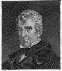
On the 4th of July, 1800, the government[192] of Indiana Territory was formally organized. The Governor, William Henry Harrison, was, however, not present. General John Gibson, who represented him, was one of the Revolutionary heroes. He had married a sister of Logan, the celebrated Mingo chief, and it was to his brother that Logan made his famous speech. On his arrival, Governor Harrison began the work of trading the Indians out of their lands. He made one treaty after another, until more than one half of the present Indiana, together with a good part of Illinois, was ceded. He erected the first brick house in all that section, perhaps the first west of the Alleghanies, in its day a structure so magnificent as to be called the "Governor's Palace." It is still standing, and near it the tree under which the Governor held his historic interview with Tecumseh, when the Indian chief planned the Governor's death.
In 1813 the territorial capital was removed to Corydon, and the political importance of Vincennes ceased. Already a university had been established, Congress giving to it a township of land, and the beginning was made for what is now one of the most valuable libraries in the West. The first church in the Northwest Territory was built in Vincennes about 1742, under the rectorship of Father Meurin, who had come from France to care for the spiritual wants of the settlers. In 1793 M.[194] Rivet, a French priest, driven from his native country by the terrors of the Revolution, arrived at Vincennes and opened the first school taught in Indiana.
The Vincennes of to-day is a thriving, bustling city of ten thousand inhabitants. It has modern schools and modern churches, modern ideas and modern progressiveness. As a city it has had its ups and downs since it lost political prestige, but for some years it has steadily grown, until now it is classed as one of the beautiful cities of the State. Surrounded by a magnificent agricultural section, and with many manufacturing interests, it threw off long ago the old French habits and customs and took on a progressive spirit, which promises a bright future.
Vincennes has had a glorious past; it occupies a unique place among the historic towns of the country. Boston may have been the cradle of American independence; Philadelphia the place where that liberty was first announced; but after all Boston gave to the Union only Massachusetts, and Philadelphia only Pennsylvania. Vincennes gave us Indiana, Ohio, Illinois, Michigan, and Wisconsin, the great Middle West. But for the[195] genius and perseverance of George Rogers Clark, when independence came the United Colonies would have stopped at the Alleghanies. The capture of Vincennes spread the jurisdiction of the colonies to the Mississippi, carrying with it American liberty, American progress, American ideas. More than this, it made possible the Louisiana Purchase, which in turn opened the way to the annexation of Texas, the securing of California and the Pacific coast, and the later acquisition of Hawaii and the Philippines. The capture of Vincennes carried American liberty to a domain stretching from the Alleghany Mountains to the Pacific Ocean, yea even to the Orient—a domain which else would still be British or Spanish.
It was Indiana, of which Vincennes was the chief part, that stopped the extension of slavery at the Ohio River, and made all the Northwest free territory. It was at Vincennes that Aaron Burr received his first decided check in his great scheme to dismember the Union. It was Benjamin Parke, a citizen of Vincennes, who placed in the first constitution of the State the clause making it obligatory on the Legislature to provide for the care and[196] treatment of the insane, the first provision of the kind made by any civilized government, a provision which has revolutionized the treatment of the insane throughout the world. Such is the story of Vincennes, no frontier town like Albany or Pittsburg, for when its history began Vincennes was hundreds of miles out in the wilderness beyond the frontier line, and was still hundreds of miles beyond when the great event occurred which changed it from a French settlement under the jurisdiction of Great Britain into the chief seat of American power west of the Alleghanies.
By LYMAN J. GAGE
THE plotting of the site of Chicago was characteristic of the practical sentiment that has ever stimulated the city. No less a personage than Washington established the streets and boundaries of the national capital; religious romance presided at the founding of San Francisco; interesting legends cluster about the origin of other American communities; and in the old world demigods were supposed to have watched over the beginnings of ancient cities. Chicago, though neither hero nor fabled deity was present when its foundations were laid, had a start none the less imposing, for the genius of industry and trade fixed its metes and bounds. And in the growth of the city into perhaps the industrial capital[198] of the continent there has been presented a supreme expression of that resourceful and triumphant ingenuity which has redeemed the American wilderness. The desolation upon which the plodding engineer planted his theodolite three-score-and-ten years ago is a colossal hive of human activity. A marsh has become a metropolis.
The promoters of the Illinois and Michigan Canal were not the first to see the possibility of water communication via the present site of Chicago between the Great Lakes and the Mississippi River.
In 1673, Joliet wrote to the authorities in Canada that by the cutting of a canal through half a league of prairie it would be possible for boats to "pass from the Lake of Illinois into the St. Louis River [the Illinois including the Desplaines] which empties into the Mississippi." One hundred years before our Republic was conceived, a mathematician, but no mere visionnaire, the son of a wheelwright of Quebec, realized that the "Portage of Checagau" was the meeting-place of the future traffic between the chain of inland seas and the rivers flowing toward the Mexican Gulf.
It is plain that nature located Chicago.[199] The meeting-point between unparalleled watercourses could not but be a place for the distribution of commodities. To the north, awaiting the woodman, were the lumber regions of Michigan and Wisconsin; south and west and east stretched the prairie, to be developed into farms; in Illinois alone, thirty thousand square miles of coal fields were to be uncovered, while Pennsylvania's inexhaustible supply was to find a vast market at this centre of lake shipping; and the iron, red-stone, and copper regions of Lake Superior were to pile their output on Chicago docks. The natural meeting-place of grain, lumber, fuel, and iron would have become a city of commerce and manufactures, even if steam railroads and navigation had not come to assist in the unique development of this entrepôt, by making it the half-way house for transcontinental traffic. But though nature, as the Rev. Robert Collyer has said, "called the lakes, the forest, the prairies together in convention, and they decided that on this spot a great city should be built," Chicago has been singularly blessed in the alert and enterprising genius of her citizens. Her business men have worked with catholic outlook, knowing that what upbuilt the city[200] in general would augment their individual projects.
The city has never been, even in its aboriginal beginnings, an abiding-place for visionaries. The Minneways were a picturesque tribe. Their chiefs assumed poetic names, and the young men cherished the traditions of their people; but the tribe did not take advantage of its strategic opportunities. Checagau to them was not a coign of vantage between great waters. At the shore of a vast lake, or the brink of a broad river, their dominion halted, for they were not navigators. In their dialect, "Checagau" meant "wild onion." As if to typify the force that was to dominate their region in later centuries, the Checagau country fell to the conquering "canoe men," the adventurous Pottawatomies, the Chippewas, the Sacs, and kindred tribes who, unafraid to venture on the water, turned to trade, exchanging furs and pelts with the French pioneers for food, blankets, and ornamental trinkets. They became the masters of the lake country, and the broken remnant of the uncommercial tribe fled to the Wabash, there to wail their plaintive songs.[10]
Meanwhile the conquering tribesmen, whose canoes paddled up the Mississippi and the Illinois to the "Checagau Portage," to barter with Canadian voyageurs, or glided thence across the Lakes, touching at the outposts of colonizers and missionary friars, were prefiguring the gigantic activities of civilized men who in a later age were to radiate from this same coveted point of distribution. But as they had won their Checagau country by might, and established their holdings by commercial enterprise, so they resisted the coming of their European rivals and masters. Although as early as 1795, by the treaty of Greenville, they ceded much domain to our country, including "one piece of land six miles square, at the mouth of the Checagau River," the intrigue of the powerful Tecumseh and his brother, the Prophet, led the tribes to disregard these and subsequent treaty stipulations. So that when, on the same day that saw the capitulation of Detroit, Fort Dearborn was burned and its garrison massacred,
"the last vestige," says Henry Adams, "of American authority on the western lakes disappeared. Thenceforward the line of the Wabash and the Maumee became the military boundary of the United States in the northwest, and the country felt painful doubt whether even that line could be defended."
For four years the unburied bones of the Fort Dearborn victims lay where the bodies had fallen. Then came peace, Christian interment of these pathetic human fragments, and a reorganization of the valuable fur trade of the region. The spot again became the centre of this industry. Trading posts were re-established on the Illinois River and the Kankakee with the Pottawatomies of the prairies; at Rock River with the Winnebagoes; at Milwaukee with the Menomonies, and at Le Large with the Kickapoos. Trains of pack horses carried the furs and peltries to Chicago, and in the spring vessels touching at that port bore these valuable cargoes to Mackinac, where the American Fur Company, organized by John Jacob Astor, had established its headquarters.
In 1821, Governor Lewis Cass of Michigan Territory and Solomon Sibley, with Henry R. Schoolcraft as their secretary, representing the United States, met three thousand Indian[204] braves at Chicago. Topinebee and Meeta were spokesmen for the tribes. In consideration of five thousand dollars, to be paid annually for five years, the Pottawatomies and other tribes ceded to this Government 5,000,000 acres of land lying in Michigan and Illinois. The marvellous real estate transactions subsequently negotiated in Chicago, whereby citizens have multiplied their millions, have not eclipsed this profitable investment of the Federal Government in 1821.
Although some minds foresaw a possible future for Chicago in this centre of a rich domain owned by the Republic, there was no rush to the spot. In 1823, the officials of Fulton County, of which the village was then a part, levied a tax of five mills to the dollar upon property in the new port, with the result that there was carried back to the county treasury the sum of $11.42. Surely a small beginning to lead to taxes in 1900 amounting to $19,086,408.36. In 1823, when the sum of $11.42 was the aggregate of taxes collected from Chicago, the total assessed value of property was $2284. In 1900, the actual valuation of Chicago property was fairly $2,000,000,000.[205]
No one, perhaps, of the few settlers who drifted to the place dreamed of such mighty possibilities, yet as early as 1831 the future of the city was a chosen topic of conversation among those enthusiastic pioneers. One of these, Dr. Elijah D. Harmon, true to his baptismal name, was singularly prophetic. He located in Chicago in 1831, acquired a section of land, built a sod fence about it, and there planted fruit trees of all descriptions. Mrs. Kinzie states that the south path to the settlement led by Dr. Harmon's nursery, and that as people passed he sought to impress upon them "the certain future importance of Chicago."
In 1830, lots were being sold at prices ranging from $10 to $50. In that year Thomas Hartzell purchased eighty acres (being the west half of the northeast quarter section) for $1.55 an acre. Low as these prices were, they were an advance upon valuations a few years before. In the archives of the Chicago Historical Society is a letter written to John Wentworth by Father St. Cyr, recounting how one Bonhomme sold the north half of Chicago to Pierre Ménard for $50, but that the latter, finding land cheaper near Peoria, and more[206] fertile, repented of his bargain, and hurrying back unloaded what he believed to be a poor investment upon John Kinzie, who was not unwilling to take the property at the same figure at which Ménard had purchased it. By 1835, values had so increased that the investment had made Mr. Kinzie rich.
The belief which soon began to take possession of the minds of white men, that the little settlement was to be a city set in the midst of a new empire of civilization, had also aroused the celebrated Indian, Black Hawk. He was convinced that, unless the tribes could be federated into compact opposition to their conquering enemies, the hunting-grounds of his people would speedily be converted into the homes and cities of the paleface. Emulating the career of Tecumseh, Black Hawk in 1832 addressed a grand council, attended by representatives of fifty tribes. "Let all our tribes unite," said he, "and we shall have an army of warriors equal in numbers to the trees of the forest." The appeal was eloquent and moving, but Shawbonee, who had been with Tecumseh when that leader fell at the battle of the Thames, answered Black Hawk. "Your army," he cried, "would equal in number the trees of the forest, and you would encounter[208] an army of palefaces as numerous as the leaves of those trees." The arguments of Shawbonee prevailed, the native attempt at coalition was defeated, and henceforward the activities of the white races in peopling the valley of the Mississippi and building to the northward, on the shore of Lake Michigan, its great metropolis, proceeded without any one to molest or make afraid. Thus Shawbonee (whose name is variously spelled), in successfully opposing the red men's far-reaching conspiracy, assisted materially in advancing the interests of Chicago. In token of this service, the Historical Society has given his portrait a place of honor, and has preserved the record of his deeds.
Late in July, 1833, three years after the canal surveyor, James Thompson, had surveyed and mapped out the town which was to be, a public meeting was held to decide whether incorporation should be effected. There were twelve votes in favor of incorporation, and one against, and the place made its start among historic towns. A few days later the following election notice was posted:[209]
"Publick notice is hereby given that an election will be holden at the house of Mark Beaubien, on Saturday, the 10th day of August, at 11 o'clock in the forenoon of that day, for the purpose of choosing five trustees of the Town of Chicago.
"Chicago, August 5, 1833.
"E.S. Kimberly, Town Clerk.
"N.B. The poll will close at one o'clock."
On the appointed day, twenty-eight electors, the full number of citizens entitled to suffrage in the new town, found their way to Mark Beaubien's house and availed themselves of the privilege of freemen. Thirteen of them announced their willingness to shoulder the responsibilities of office. The first business transacted by the trustees was the establishment of a free ferry across the river at Dearborn Street; the second, the reconstruction of the "estray pen" into a solid and sufficiently commodious log jail. These two programmes—the extension of commercial facilities and the stern suppression of lawlessness—have ever since been conspicuous in the city's history.
Then the town was born. Its development into a municipal Titan is one of the marvels of history. In 1830, P.F.W. Peck arrived on a schooner, bringing with him a small stock[210] of goods. "He built," says Mr. Colbert, "a small log store near the fort, which made an important addition to the trade of Chicago." In the year 1900, just seventy years later, the amount of wholesale goods distributed from this centre throughout the country amounted to $741,000,000, the volume of drygoods alone being $143,000,000; groceries, $99,000,000; clothing, $35,000,000; shoes, $58,500,000; books and paper, $70,000,000, and other items in proportion; while the manufactured products sent forth aggregated in value $786,000,000, and the total business of the city reached the high figure of $1,963,000,000. The year that concluded the nineteenth century recorded transfers of real estate amounting in round numbers to $87,000,000, in striking contrast to that early transaction wherein Chicago's first investor repented him of paying $50 for the northern half of the city.
But the little town was not to achieve great things without a struggle. Fire, flood, panic, and pestilence had first to be faced and fought. The small band in the incorporated town started out determined to develop the settlement into a city, notwithstanding the dismal prophecies of certain learned men that a city[212] would never rise on this unpropitious swamp. Professor William H. Keating, geologist and historiographer, had furnished the pioneer townsmen with the melancholy message:
"The dangers attending the navigation of the lake, and the scarcity of harbors along the shore, must ever prove an obstacle to the increase of the commercial importance of Chicago. The extent of the sand banks which are formed on the eastern and southern shore by the prevailing north and northwesterly winds will likewise prevent any important works from being undertaken to improve the port of Chicago."
In the light of this prediction it is interesting to note that in 1900 the vessels mooring or weighing anchor there numbered 17,553, and brought and carried away cargoes aggregating 14,236,190 tons. Nevertheless, for some years, because of the quagmire condition of streets and the frequent inundations from lake and river, Chicago was termed derisively the "amphibious town." By filling in the land, the city long since literally lifted itself out of the mud, the level of streets to-day being eight feet above the original marsh. But even before the transformation of the town into a city, it was plain that the founders had[213] come to build it into a centre of trade and population. Encouraging progress was being made on the Illinois and Michigan Canal, the population of the town was increasing, neighboring prairies were being tilled, and the water carriers who drove their carts into the lake, filled their barrels, and then distributed water by the bucketful, were giving way to the Hydraulic Company. A new era was at hand, and Chicago on the 4th of March, 1837, became an organized municipality.
The first census, taken in July, 1837, showed a population in the city of 1800 men, 845 women, and 1344 children. With a colored population of 77, the grand total of inhabitants in this its first year's existence as a city was 4066. To-day its population is nearing the two-million mark.
O.D. Wetherell, ex-city Comptroller, recalls a letter, written at an early date by a citizen, in which the prediction was made that some day Chicago would become a city of 10,000 people! At the time, that prophecy seemed to be more wildly optimistic than would a prediction now that the city might ultimately harbor the amazing total of ten million persons.[214]
The early promoters of Chicago were sanguine of a great future, but none dreamed of the amazing destiny in store. At a political gathering in 1838, addressed by Stephen A. Douglas and John T. Stuart, his competing candidate for Congress, a local orator, warmed by the enthusiasm of the occasion, uttered what was derisively referred to the next day as "flamboyant prophecy."
"The child is already born," he exclaimed, "who shall live to see Chicago a city of 50,000 souls."
"Town lots, town lots!" shouted the audience in amiable sarcasm, not wishing the visiting statesman to depart with the suspicion that dreams of real-estate speculation had destroyed the sanity of the whole community.
For three years the town had been the centre of a great land craze, one of the first real-estate booms that have played so important a part in the location and development of Western cities. Dr. Horace Chase, writing in 1883 from Milwaukee, says:
"Soon after the sale of lots in Chicago, in 1833, I think, Robert Kinzie, on his way to Detroit, stopped at Marsh's trading post near Coldwater. There happened to be several of us present and Bob began to boast about Chicago and what a great city it would become. 'Why,'[216] said he, 'I bought some of the best lots in Chicago for twenty dollars apiece, and those lots are worth sixty dollars apiece to-day!' It seemed to us utterly absurd that a lot should be worth sixty dollars, when two hundred dollars would buy one hundred and sixty acres of the best quality. Not a single person in the crowd believed Bob's yarn."
As an example of the spirit which animated these old pioneers who came in the early days to the great city that was to be, the story of one man furnishes an interesting illustration. The writer had it from the lips of the man himself, who recently died at the ripe age of eighty-two.
"I had heard of the West," he said, "in the little hamlet in New England where I was born. My ambition was fired, and I determined at all hazards to seek my fortune there. I soon found myself in Buffalo with seven dollars in my pocket, and with this I had to pay my transportation to the young city in the West. After considerable 'higgling' with the captain of a schooner I arranged for deck passage at a cost of three dollars. Part of my money was then expended to get some cotton cloth. This I sewed up in the shape of a bag, and into it I put some shavings to soften the hard planks of the deck of the ship at night. The balance of the money went for boiled ham, cheese, and bread.
"I was twenty years old, had been a farm boy, and had attained no special knowledge of any manual trade.
I arrived in Chicago and found it a dismal, swampy place, but with every appearance of thrift and activity. My money was exhausted, and work was indispensable. Going along the one important street or road I found a man building a rather pretentious boarding house. He asked me if I 'came off that ship in the harbor,' and when I answered 'yes,' he inquired whether there were any carpenters on board. I told him there was none excepting myself. He wanted to know if I could 'lay out work' so that his men could saw and hammer, which was all they could do. It seemed to me that I could 'lay out work' better than anything else, and engaged myself to him at four dollars a day. Two days satisfied my new boss that my technical knowledge was deficient, and he paid me off. I soon afterwards found work in a harness shop, and by assiduity and attention I acquired a knowledge of that business. Thus I got my start."
This man lived continuously in Chicago for more than sixty years. By early and judicious investments in real estate he acquired wealth. He bought a lot, now centrally located, for $400, and sold a part of it thirty years later for $62,500. He sold it too soon, however, for that same corner will bring at the present time not less than $500,000. At his death he left an estate valued at between $5,000,000 and $6,000,000.
Fortunes were made over night. In 1835[218] the Federal Government opened a land office, and this intensified the excitement. Boundless acres of outlying farmland changed hands in Chicago. Towns and cities that had no existence save on the blue prints of imaginative and wily promoters were plotted, and their mythical blocks sold to hasty and credulous investors. But the panic of 1837 brought both legitimate and illicit real-estate traffic to a close with a crash. The dishonest and the defrauded went down in a common ruin. By 1838 the sheriff was the only real-estate agent who could dispose of property, and at these forced sales the returns were meager. Panic paralyzing business, a mysterious disease like Asiatic cholera stopping progress on the canal, and a drought destroying crops, impoverishing streams, and spreading devastating fever in the city, was the calamitous record of 1838.
Chicago as a city began with $1993 in its treasury. The need for municipal improvement was imperative. Where to get money for sanitary drainage, for the paving of a few streets, and the purchase of two fire engines, was a problem. The Common Council appointed a finance committee with power to act. Peter Bolles was made chairman. It was[220] finally decided to borrow $25,000 from the State Bank of Illinois, pledging the city to redeem the obligation in five years. In due time the committee submitted as its report the following letter:
"State Bank of Illinois,
"Springfield, May 31, 1837.
"Peter Bolles, Esq.,
"Dear Sir:
"Your letter of the 18th, addressed to the president of this bank and proposing on behalf of the city of Chicago a loan from this bank of the sum of $25,000, has been laid before the directors of the bank, and, I regret to have to state, declined.
"I am very respectfully,
"Your o'bt serv't,
"N.H. Ridgely, Cashier."
In 1900 the city which sixty-three years before could not borrow $25,000, could boast of bank clearances amounting to $6,795,876,000.
The poverty and disasters of early days seemed only to nerve the city to renewed determination and prepare her to meet with stoic faith the appalling calamities of later years. In this résumé it is only possible to catalogue the misfortunes that visited her.[221] Floods swept away her shipping, fire destroyed her accumulating industries, raging epidemics reduced her population—cholera alone in 1854 causing 1424 deaths—and financial panic again and again returned to manacle activities. Many times in Chicago's history citizens could well exclaim: "One woe upon another's heels doth tread, so fast they follow!"
Unconquerable in the presence of these recurrent visitations, the city pressed forward to her place as the metropolis of the Mississippi empire. At an early day "prairie schooners," pioneers of the great freight trains to come, laden with grain from the fertile areas round about began to line the prairie roads leading to Chicago. In 1839, two years after the city was begun, a crude grain elevator was constructed. The farmers, too poor to furnish sacks, brought their grain in sheets, blankets, and pieces of canvas. It was hoisted by hand with block and tackle to the elevator, and in the year mentioned 2900 bushels of wheat, consigned to Black Rock, New York, were dumped loose into the hold of the brig Osceola. From this primitive beginning has grown a mighty volume of trade in grain. In 1900 the wheat, corn, oats, rye, and barley shipped from[222] Chicago amounted to 232,267,109 bushels, while the receipts aggregated 307,723,135 bushels.
It was not until 1843 that the Common Council came to the conclusion that the place was sufficiently advanced as a city to warrant the enactment of an ordinance declaring that hogs should no longer be permitted to run at large in the streets. In 1900, far from being unwelcome, over 8,000,000 hogs, safely penned in cars, arrived in the city and were sent to the slaughter.
In writing of Chicago it is customary to deal in superlatives, and this is necessary in the nature of things. Its Union Stock Yards cover 400 acres, nearly twice the area of the original town. Twenty miles of streets thread this meat-packing colony, which pays wages amounting to nearly $9,000,000 a year. In 1900 there were shipped to Chicago 277,205 carloads of hogs, cattle, sheep, etc. Its trade in grain leads every city in the world, while its general mercantile traffic is surpassed by few.
The first railroad at that time was the Galena and Chicago Union, which was chartered January 16, 1836. Galena at that time was believed to be destined far to outrival her[223] neighbor, and therefore demanded and secured the place of honor in the title of the road. To-day thirty-nine distinct railroads enter Chicago, more than half the railway systems of America make that city their objective point, and the aggregate distance traveled by freight and passenger trains daily entering the metropolis is over 80,000 miles. In the thunder of this traffic the clamor of rivalry long since died away. The British critic, Mr. Archer, remarked that he was unable to detect the slightest evidence of competition with Chicago even in a "Pisgah view from the top of the Auditorium."
The employment of large adjectives in the recital of the city's history is not without warrant. "The trouble with you people in Chicago," remarked a visitor, "is that you exaggerate too much." "We have to," retorted a citizen, proudly, "in fact we have to lie to tell the truth." Even when we speak of the fire of 1871, we must call it the "great Chicago fire," for never before perhaps in the history of the world were so many of the piled-up monuments of man's hands consumed so rapidly. Such awful moments, happily, seldom come in the history of communities. It was as if the fires of Dante's Inferno had been permitted[224] for a night and day to devastate a great city of this planet. One thousand four hundred and seventy acres of buildings were utterly consumed. The entire business portion of the city vanished in smoke and flame. One hundred thousand persons were left homeless and in many cases penniless. Seventeen thousand four hundred and fifty buildings were destroyed, the total valuation of the loss by fire being $186,000,000.
In the presence of a catastrophe, so vast that the imagination reeled as the eye wandered over the mighty paths where the cyclones of fire had swept, social inequalities and race prejudices were ignored. All right-minded men stood together in a common bond of fellowship. Doubtless much of the present spirit of amalgamation of the people of the city is an outgrowth of the calamity which thirty years ago brought the representatives of those divers races elbow to elbow in the common cause of rebuilding their homes and reconstructing their lines of industry. The riots at the Haymarket did not indicate bad blood between the races of the city, but merely an incidental if not accidental social unrest not uncommon in all our greater cities.
The city staggered, but did not fall, under the woful wreck the great fire wrought. Through a grim schooling of disaster in the past the city had developed a force of character that fire could not consume. "Nothing," exclaimed the great French Cardinal and Premier of the seventeenth century, when he[226] was temporarily overthrown, "nothing remains but the indomitable spirit of Richelieu." Chicago had similar faith in her own inherent power. There were some broken spirits who, gazing on the melancholy ruin, caught no glimpse of the magnificent city that was to rise, as if by command of a magician's wand, upon the smoking desolation. But the majority did not permit the calamity to crush. The faithful were exhorted to rebuild the city. It was predicted then that Chicago would live, and live to be so mighty and so vast that the great fire would be but an incident in its history. The city was to live because beyond it were the giant forces, the teeming millions, the imperial area of the mighty West, which, having made Chicago the gateway to the East, would recreate it under the same natural necessities.
The city's optimistic faith and determination enlisted the sympathy of the world, and $5,000,000 in relief contributions poured in and thousands of telegrams offering credit to merchants supplemented this hearty and timely exhibition of Good Samaritanism. The deeds of valor displayed by firemen and citizens in fighting an unequal combat with the fire were[227] equalled only by the heroism which appeared in the rebuilding of the city. The first structure to rise over the ruins was a board shanty, twelve by sixteen feet in dimensions. It was on Washington Street, between Dearborn and Clark, near the site of a former flourishing block, where W.D. Kerfoot had conducted a large business in real estate. The tiny structure was built hastily on the morning of October 10th, while the surrounding ashes and heaps of twisted iron were so hot that the little building had to be set in the middle of the street. The comical cabin bore the legend, "Kerfoot's Block. Everything gone but wife, children, and energy." Small as the shanty was, it was an inspiration. It marked the beginning of a city now so vast that the municipality existing before the fire seems but a shadow. Through the city run paved streets whose aggregate length would reach from Chicago to New York, and start the traveller some distance on his way to Boston. More than 100,000 street lights, kept "trimmed and burning" by the municipality at an annual cost of over $1,000,000, twinkle in the city by night.
Over a quarter of a billion of gallons of[228] water are consumed daily by a city now protected by an efficient fire department against a repetition of the disaster of 1871. Nearly 1500 miles of sewers preserve the sanitation, while the superb ingenuity of engineers has changed the courses and reversed the currents of rivers, and with connecting canals turned the city's sewage toward the Gulf of Mexico.
The ambition of this characteristically American city is to excel in everything. When she undertook to hold a World's Fair, she determined to eclipse any previous exposition, and to secure a phenomenal attendance. When she held a Parliament of Religions she arranged that the faiths of every clime should be represented by their most learned and pious men, and that the teachings there set forth should constitute a memorable contribution to the best thought of the world. It has been said of Chicago that when she decides to be the home of the greatest poet among mankind, she will go out and get him, or, better still, produce him.
Cities affecting a more advanced culture sniff at the stock-yard atmosphere which they pretend to believe permeates the literary life of Chicago, and Eugene Field, in playful[229] mood, accepting the jibes of distant critics, printed as the frontispiece of his Culture's Garland a wreath of sausage links; but William D. Howells has acknowledged that out of Chicago is coming a literary virility destined to leave classic record in the annals of letters. Field himself occupies an honored place in the American Pantheon, and his "Little Boy Blue," though dead, forever sings his way to our firesides.
The city takes high rank as a centre for advanced education. In addition to technical schools like the Armour Institute, it has two famous Universities; the Chicago, and the Northwestern. The Chicago University began its career ten years ago. The old denominational University of the same name having been sold at auction under foreclosure, John D. Rockefeller decided to reorganize it and found a great institution of learning, and to that end pledged a portion of his fortune and secured as President, Dr. William R. Harper, of Yale. The University opened in 1892 with 702 students. To-day it has nearly 4000. It began with no less than 135 instructors; it now has 205. The University made its start with grounds, buildings, and[230] equipments valued at $1,600,000, and invested funds amounting to $1,500,000. To-day its productive funds aggregate over $15,000,000. Women have been prominent among the University's donors, and in all the departments women students enjoy equal status with men. A student may enter at the beginning of any quarter and receive his degree at the end of any term. The colleges continue throughout the year. Recently the Chicago Institute, founded by Mrs. Emmons Blaine for training school teachers, was absorbed by the University. In fact, Dr. Harper has succeeded in merging so many professional schools that he has been amiably accused of attempting to form an educational trust. The Northwestern University, located partly in the city and partly in Evanston, a suburb, was founded in 1851. It has 296 instructors and over 3000 students. Its productive funds amount to over $3,000,000. Although conducted under denominational auspices, its charter provides that no particular religious faith shall be required of students. It has a campus of 45 acres on the Lake Michigan shore. The University includes a college of Liberal Arts, and schools of medicine, law, pharmacy, dentistry, music, and theology.[232] Many of the departments are coeducational.
The public schools of Chicago are crowded with three quarters of a million children of parents for few of whom "Plato and the swing of Pleiades and the tall reaches of the peaks of song" had a meaning. And these children of every kindred and tongue are not herded into classes and indifferently taught. Modern science assists them from the start with anthropometric examinations, and scientific methods are in use in every school. There could be no more hopeful "sign and portent" of the city's future than is furnished by its public schools.
Voluntarily, by popular vote of the people, civil service was established in all branches of the city administration, and the principle laid down that industrious merit rather than political influence should fill the thousands of positions in the school department and city branches in general, a graphic illustration that the spoils system is not a Chicago ideal. Benevolent institutions thrive under the munificent endowment of its men of wealth. Seers like Professor David Swing have preached the Gospel to an eager people, thousands[233] on Sunday being turned away, unable to press to the pews through the multitude of churchgoers. All these phenomena present the interesting psychological truth that with Chicago's liberty and cosmopolitan make-up has been developed a reassuring force "making for righteousness." The city is not yet prepared for canonization, but in many ways it is, in its largeness of life and tolerance, an example to the cities of the world. She is still apt, perhaps, in speaking, for example, of her art galleries to dwell overmuch upon the cost of the buildings and paintings and the number of acres.
The unprejudiced critic or historian knows that not all Chicago is pork and pig-iron, though why these industries are not as honorable as poetry and prose, perhaps they who sit in the seat of the scornful will explain. Booker T. Washington well says that a people cannot be truly great until they recognize that it is as dignified to till the soil as it is to pen an epic, and in the same line of thought it might be said that a people who "live laborious days" packing meat and handling lumber, particularly by the thousand carloads, are not necessarily belated travellers on the[234] highway that leads to national integrity and renown.
In wealth, in population, in the high character and eager attendance in her great schools, in libraries, art, and architecture, as evidenced by institutes, buildings, and academies of design, in her letters, as displayed by the literary output, in her spiritual conquests, as shown in the teachings of her poets and preachers, and even in the periodical reforms that purify the political atmosphere, Chicago's future will undoubtedly be, like her past, phenomenal.[235]


By REUBEN G. THWAITES
IN 1836, that portion of Michigan Territory which lay west of Lake Michigan, was erected into the Territory of Wisconsin. Within the borders of the nascent commonwealth there lived at that time about twelve thousand whites and nine thousand Indians. Many of the sites of future cities of Wisconsin were already occupied by agricultural settlers, isolated or in tiny groups.
Green Bay, a straggling French-Canadian settlement, had come down from the seventeenth century, maintaining a sickly existence upon the fur trade and the coasting traffic of the upper Great Lakes; Forts Winnebago (at Portage) and Crawford (at Prairie du Chien) were surrounded by meagre hamlets, chiefly of French creoles; the lead-mining[236] region in the southwest, although sparsely settled, contained the bulk of the white population, with Mineral Point as its centre—a village having at the time an apparently brighter prospect than the new settlement at the mouth of Milwaukee River; there were also a few notches carved, at wide intervals, from the gloomy forest bordering the western shore of Lake Michigan. Outside of the settlements just enumerated, Wisconsin was practically uninhabited by whites. Here and there was to be found an Indian trader, the Yankee successor of the coureur de bois of the old French régime, or some exceptionally adventurous farmer; but their far-separated cabins only emphasized the density of the wilderness, through which roamed untrammelled the shiftless, gipsy-like aborigines,—the comparatively harmless Chippewas, Menomonies, Pottawatomies and Winnebagoes.
On the 4th of July the territorial officers of Wisconsin qualified at Mineral Point, with Henry Dodge, a Black Hawk War hero, as Governor. In October following, the first Legislature assembled within a two-story battlement-fronted house in the little lead-region hamlet of Belmont. The highway which it faced bristled with stumps, while miners' shafts[238] and prospectors' holes thickly dimpled the shanty neighborhood. A month was spent in selecting a capital for the infant Territory. There were seventeen applicants. Some of them were actual settlements, like Green Bay, Fond du Lac, Milwaukee, Racine, Portage, Belmont, Mineral Point, and Platteville; but others were "paper towns," existing only on maps made by real-estate speculators. Of such shadowy substance was Madison, the victor.
James Duane Doty, who had been United States Circuit Judge for the country west of Lake Michigan, had formed a town-site partnership with Stevens T. Mason, then Governor of Michigan Territory. These gentlemen preempted several tracts of government land at presumably desirable spots in the wilderness. Doty advanced the respective claims of these tracts, giving them maps and attractive names. His favorite was an undulating isthmus between Lakes Monona and Mendota,[11]the[239] heart of Southern Wisconsin, midway between Lake Michigan and the Mississippi River. This claimant he named "Madison," after the third President of the United States.
It was freely alleged at the time that Doty presented choice lots in Madison to his legislative friends. However this may be, the ostensible arguments produced were: that the chief centres of settlement in the northeast (Green Bay), the southeast (Milwaukee), and the southwest (the lead region) were so widely separated and had such divergent interests that to select one would alienate the others and make it impossible to harmoniously conduct the territorial government; again, that to build up one corner of the Territory at the expense of the others would unequally distribute the population; it was also urged that the unsettled central portion of the Territory needed the incentive to growth which the capital would give it; and lastly, Doty, the only man in Belmont that winter who seems to have known Madison, declared the site to be the most beautiful spot in the Wisconsin forest. And thus Madison won.
Beyond the understanding that the centre of the Capitol Park was to be the common[240] corner of four sections of land which met near the middle of the isthmus, there had as yet been no thought of how this projected town in the woods should be laid out. A French half-breed, Olivier Armel, who had a temporary trading shanty on the tract, half brush and half canvas, was the only man whom the surveyor found when he arrived in a blinding snowstorm in February (1837) to set the stakes in this virgin wilderness for the future State House of Wisconsin. The streets of the town were laid out, so far as possible, upon the lines of the national capital: wide avenues radiating from the Capitol Park upon the points of the compass were bisected by other highways paralleling the shores of the two principal lakes. For names of the thoroughfares, the patriotic surveyor had recourse to the list of signatures to the federal Constitution, probably the only instance of a city's streets being exclusively named from this venerable body of lawgivers.
The first dwelling in Madison was a log house built in April by one Eben Peck, for the entertainment of the mechanics who were expected out from Milwaukee to construct the State House. It was June 10th before the build[241]ing commissioner and his thirty-six workmen put in an appearance, after a toilsome overland journey of ten days through rain and mud, with no roads, and unbridged rivers which had either to be forded or swam. On the 4th of July the conerstone was laid "with appropriate toasts and speeches" by a small knot of territorial officials.
It was January, 1839, before the territorial[242] Legislature could be accommodated at Madison; and even then the situation brought little comfort. Says a pioneer of those days: "With the session came crowds of people. The public houses were literally crammed—shakedowns were looked upon as a luxury, and lucky was the guest whose fortune it was to rest his weary limbs on a straw or hay mattress."
The little village was charmingly situated in the primeval forest. One of Madison's early teachers thus wrote of the hamlet of his young manhood:
"Those who only know of Madison now, have but a feeble conception of its wonderful and fascinating beauty at the beginning. In 1839 it had the look of a well-kept lawn, shaded by fine white-oak and burr-oak trees, with a fragrant fringe of red cedar all about the lake shores. There was then no underbrush and thicket such as sprung up soon, when the semi-annual fires ceased to do the duty of the rake and mower; but the eye had a stretch quite uninterrupted, except as the surface rose in beautiful green knolls on either lake. The lakes then lay in natural silver beauty, prettily framed in pebbly beach. For simple, quiet beauty, Madison in 1839 was unequalled by anything I remember."
Despite its natural attractiveness, and its[243] presumably favorable location, Madison was a plant of slow growth. In the summer of 1838 the census revealed the presence here of only sixty-two people, and it is recorded that there were at that time "not more than a dozen houses, built and in process of erection, counting every cabin and shanty within three miles of the Capitol," while Indian wigwams were frequently set up within sight of the doors. Four years later there were but 172 people, and in 1846 but 632. By the close of 1850, however, the population had, largely as the result of a mild "boom" in that year, grown to 1672. Five years later Horace Greeley and Bayard Taylor paid the place a visit, and in letters to the New York Tribune highly extolled its beauties. As a result there was an almost immediate increase of population and a considerable advance in the price of real estate; so that at the outbreak of the Civil War there were 7000 Madisonians.
Notwithstanding the general prevalence of financial stringency, Madison prospered during the war. The State's troops were largely mobilized here, and constantly enlivened the streets; a great deal of money was necessarily spent by the State and nation for supplies and salaries, as well as by the soldiers themselves, so that throughout it all the town grew substantially. In 1870 there were 10,000 citizens, but the next decade only slightly advanced this census. About 1882, however, a variety of causes led to the commencement of a stronger growth—chiefly the rapid development of the State University, the expansion of the State's administrative affairs, the bettering of railroad facilities, and an enlargement of local manufacturing interests. During the[245] past eighteen years there has been a steady gain, with every indication of permanency; the census of 1900 revealed the presence at the Wisconsin capital of 20,000 residents, while an additional 5000 dwell in closely abutting suburbs.
Frequent attempts to remove the capital to Milwaukee were long a potent factor in retarding the development of Madison. In 1870 the effort was nearly successful. The fact, however, that the State had by this time invested large sums of money in public buildings in and around Madison, particularly in the State University,—which institution must, by the terms of the constitution, be situated "at or near the seat of State government,"—has of late years cooled the ardor of advocates of removal, so that no fear of renewed agitation is now entertained.
In the early annals of this peaceful little city in the undulating oak grove between Monona and Mendota,—surrounded on every hand by far-stretching lakes and marshes, and thus in a measure isolated from her rural neighbors,—the historian finds little of stirring interest; and that little almost always the reflex of the Legislature, which annually until 1882, when[246] the sessions were made biennial, came and went with much bustle and sometimes brawl. The legislative sessions were, in ante-bellum days, the events of the year, and attracted prominent men from all quarters of Wisconsin. The crude hotels were filled each winter with legislators, lobbyists and visiting politicians. The humors of the time were often uncouth. There was a deal of horse-play, hard drinking, and profanity, and occasionally a personal encounter during the heat of discussion: as in 1842, when Charles C.P. Arndt, of Brown, was killed on the floor of the council chamber by his fellow-member, James R. Vineyard, of Grant, an event to which Dickens alluded in his American Notes, and which gained for Wisconsin an unenviable notoriety the country over. But an undercurrent of good nature was generally observable, and strong attachments were more frequently noticeable than feuds.
Dancing and miscellaneous merry-making were the order of the times, and society at the capital was, from the first, thought to be fashionable. Even when the Legislature was not in session, Madison long remained the social as well as the political centre of Wisconsin, and overland travellers between the outlying settlements on the shores of the Mississippi and[248] Lake Michigan or Green Bay were wont to tarry here upon their way. Several of them have left us, in journals and in letters, pleasing descriptions of their reception by the good-natured inhabitants, and the impressions made on them by the natural attractions of this beauty-spot.
In 1856, Madison was the scene of political excitement of a serious character. William Barstow (Democrat) claimed to have been reelected Governor over Coles Bashford (Republican), by 157 majority. The Democrats controlled the State board of canvassers, and the Republicans claimed that this board had tampered with the returns. Upon January 27th both Barstow and Bashford took the oath of office, but the former and his friends continued to hold the State House. The State Supreme Court was called upon by Bashford, in a quo warranto suit, to oust the incumbent and give the office of Governor to the relator. Thus commenced the most celebrated case ever tried by this bench. This was the first time in the history of the United States that a State court had been called upon to decide as to the right of a Governor to hold his seat. Its juris[249]diction was questioned by Barstow's attorneys. The contest waged fiercely for some weeks, with eminent counsel on both sides, the court at last holding that it had jurisdiction. The court then proceeded with its inquiry, and March 24th declared that Bashford had received a majority of 1009. A few days before this Barstow had resigned, and Lieutenant-Governor McArthur was holding the office by virtue of the constitution. McArthur was defiant, and announced his determination to hold the post at all hazards. But the court promptly ruled that Barstow's title being worthless, McArthur could not, of course, succeed to it.
Throughout this long contest, it may well be imagined that popular excitement in and around Madison ran high. The respective bands of partisans were armed and drilling, in anticipation of a desperate encounter. It would have taken small provocation to ignite this tinder-box, but the management on both sides was judicious; and although the opposing forces had frequent quarrels, and made numerous and vigorous threats of violence, no blows were struck. Upon the day after the court's decision Bashford and a bodyguard advanced through corridors crowded[250] with his followers, to McArthur's office, and, showing his writ, quietly announced that he would henceforth take charge of State affairs. McArthur hesitated, but a glance at the threatening crowd induced him to retire hurriedly through the door. The friends of Bashford cheered in triumph, and then poured into the office to congratulate the new Governor.
As has been previously stated, the corner-stone of the old territorial State House was laid July 4, 1837. The building cost about $60,000. An old engraving of the structure, which we herewith reproduce, shows that it was of the then prevalent Americanized-Greek style of which there are still remaining a few examples, chiefly in the Southern States; contemporary accounts agree that it was rather superior in character to most of the Western capitols of sixty years ago. In 1857, the Legislature authorized the enlargement of the capitol. This "enlargement" was but nominal; the plans developed into a new building on the site of the old, to cost somewhat over half a million dollars. Lack of funds because of the Civil War caused the work to proceed slowly, so that it was 1870 before the dome of the new State House was completed. In 1882, two new transverse wings were provided for. Thus[252] the total cost of the present capitol and the development of the surrounding park has been about $900,000. The building is, however, now sadly behind the times in respect of light, ventilation and sanitary conveniences, and there is some thought of a new State House which shall be more nearly worthy of a rich and fast-growing commonwealth of over two millions of people.
The University of Wisconsin was incorporated under an act of Legislature approved the 26th day of July, 1848; but it was the 16th of January, 1850, before the first chancellor was inaugurated, and the 5th of February before the doors were opened for the reception of pupils. During the first twenty years of its existence, the institution was beset with vicissitudes, and obliged to battle against popular indifference and even opposition. The congressional land grants which were designed to create a fund for its endowment were recklessly disposed of by the legislatures of the '50's, avowedly to encourage speedy settlement of the State, under the plea that when the commonwealth became well populated it would be rich enough to support[254] the University by taxation; it was also maintained that pioneers had little need for or patience with higher education. Gradually, the University gained recognition as the logical head of the educational system of the State; and at last, after a half-century of growth, it has developed from a rustic academy of twenty students into an institution of national reputation, with a talented faculty giving instruction to nearly 3000 students, assembled from many States and countries.
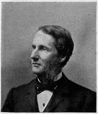
The University is admirably situated, chiefly upon two hills lying a mile to the west of the State House and commanding wide views of the surrounding country. The grounds comprise about 350 acres of hill and plain, the western half of which is occupied by the build[255]ings and experimental farm of the College of Agriculture. Mendota, the largest and most beautiful of the chain of lakes, lies directly to the north, its attractive shores often rising into steep bluffs, surmounted by summer cottages, or swelling into distant hills besprinkled with prosperous farmsteads, while the towers and chimneys of the State Hospital for the Insane fret the sky-line beyond the farthest bay. A broad straight avenue leads directly eastward to the ridge crowned by the white dome of the State House; while to the south the view ordinarily ends with the silvery expanse of Lake Monona, glistening through the trees, but when the foliage has thinned, the southern horizon is sufficiently extended, both from town and university vantage-points, to comprise the far-off waters of Lake Waubesa. The outlook from University Hill, over-topping the tree-embowered town, which spreads gracefully, with up-thrust tower and dome and steeple, over Monona Ridge, is, particularly upon a moonlit night in summer, one of the most charming in America; while from Observatory Hill, just westward, one obtains a widely extended view of lakes and forest and purple hills which, especially under the[256] glow of sunset, has won the unstinted plaudits of competent critics, some of whom have likened it to Old World scenes far-famed in song and story.
Few of the buildings of the State University are architecturally worthy of mention here. The original structures were North and South Halls, mere four-story stone boxes. The Doric University Hall, surmounting University Hill, and one of the early buildings, has of recent years been greatly improved and extended, and now has some dignity of outline as well as historic association. The new Engineering Building, in gray brick, is pleasing in form and color; Science Hall and the Gymnasium, great piles of staring red brick, are conspicuous examples of the average college buildings of our day; while the best one can say of the old Library Hall, Chemical Building, Machine Shop, and Chadbourne Hall (the women's dormitory) is that they will continue to serve a useful purpose until the day when the State feels inclined to replace them with creditable structures. Upon Observatory Hill is the dignified Washburn Observatory, and upon the western slope the growing mass of[258] buildings appertaining to the State Experimental Farm maintained by the College of Agriculture.
At the eastern (townward) front of University Hill, and occupying land once a part of the campus, a building has of late been reared by the commonwealth which not only is far better than any of the University structures, but quite outranks in dignity and thoroughness of modern construction and equipment all other buildings owned by the State of Wisconsin. This is the home of the library and museum of the State Historical Society. The University library and its accompanying seminary rooms for advanced study, each with its special library, occupy quarters here, but the building itself is administered by the society, which serves as the trustee of the State. Built in the Italian Doric order, of Bedford sandstone, the State Historical Library Building is massive, dignified, and graceful, a worthy housing for one of the most important reference libraries in America. The Wisconsin Historical Society[12] has long ceased to be merely a feature of Madison or of Wisconsin; it is to-day regarded[260] as one of the foremost institutions of this character in the country—its splendid library of 235,000 volumes being one of the finest collections of Americana extant, rich in maps and manuscripts as well as books; and its publications rank with those of the similar societies of Massachusetts, New York, and Pennsylvania.
Madison is fortunate in her elementary and secondary public schools as well as in possessing the State University; while several admirable private and denominational schools have found it desirable to settle here, under the wing of the great group of State colleges. As is becoming in an educational centre, much attention is here paid to church life. The large congregations have been careful to select for their pulpits men of prominence and ability, fitted to attract the student mind; and the Christian associations connected with the State University are conducted upon a high plane of usefulness.
In Madison there dwell three well-accentuated classes of inhabitants: those relying upon trade and industry, the State and federal officials, and the university element, each of[261] them growing in numbers and importance. There is, however, far less differentiation of interests and aspirations than is commonly seen in college towns. It has for many years been the continual aim of several influential clubs, notably the Woman's, the Literary, the Contemporary, the Six O'clock, and the Town and Gown,—in which both "townfolk" and "gown folk" freely commingle,—to break down the usual class barriers. The result is that college men coming to Madison from other institutions find here few of the sharp social distinctions to which they have elsewhere become accustomed.
But while town and gown are practically one in Madison, the official class has not until of late been conspicuous in her social life. The brevity of political tenure, rendering the permanent inhabitants in a measure indifferent to the "come-and-goes," has doubtless had much to do with this; while a contributory element has been the fact that many State officials, finding the cost of living at the capital somewhat higher than in the small interior towns, have heretofore left their families at home. With the new statute prohibiting public employés from using railroad passes,[262] transportation to and from home now forms an important item of expense to the office holder, and a large proportion of them are moving their families to the seat of government. It is fair to predict that, through the influence of the clubs, which have recently taken upon themselves the payment of social courtesies to the official class, these barriers may in turn be removed, as they have between town and gown.
The native American element in Madison is chiefly from New York State, with a large sprinkling of New Englanders, especially from Vermont. Perhaps one third of the 25,000 people in this community are of German parentage, and there is a considerable and influential Scandinavian element, mostly Nor[263]wegian; numerous other nationalities there are, but these are the most conspicuous. Despite this large foreign contingent, however, and the cosmopolitan tone of university society, the strong flavor of Vermont and New York, originally given to this community in the days before the Civil War, is still the dominant characteristic in the social life of Madison. Many discriminating visitors frequently in their hours of first impressions, liken her to a staid New England college town; while others revert to some demure hill-town of Western New York for the type which best describes the social side of this city of the Wisconsin lakes.
The railroad facilities of Madison are undoubtedly remarkable for a town of its size; these are attracting wholesale houses and warehousemen, and new factories are talked of. The existing industries employ some fifteen hundred men. The schools, the university, the unusual library facilities and the beauty and healthfulness of the town bring to it an ever-increasing accession of cultured people with moderate fixed incomes. Summer visitors from St. Louis, New Orleans, and other southern cities of the Mississippi Valley[264] are encouraged to come to the Four Lakes. The comfort of the inhabitants is greatly enhanced by a system of macadamized streets which is relatively the best in Wisconsin; and there is also maintained, by popular subscription, a labyrinth of twenty-five miles of suburban drives, enriched by the art of the landscape gardener, and leading to favorite view-points. A "Forty Thousand Club" is strenuously seeking to exploit and double the material interests of the town, within the present decade. But when all is said, Madison's distinguishing characteristics, as well as her neighborhood gossip, will probably long remain such as properly pertain to the political and educational centre of a rapidly developing commonwealth.

By CHARLES B. ELLIOTT
"We are citizens of two fair cities," said a Genoese gentleman to a Florentine artist, "and if I were not a Genoese I should wish to be a Florentine." "And I," replied the artist, "if I were not Florentine—" "You would wish to be a Genoese," said the other. "No," replied the artist, "I should wish to be Florentine."
WITHIN a circle with a radius of ten miles, enclosing the Falls of St. Anthony, are two modern cities with a population of almost four hundred thousand. The pioneer settler died a few months ago and the first child born there is now but passing middle life. And yet a little more than half a century after the landing of the Pilgrims the cross of Christ and the arms of France were carved on an oak tree which stood on the site of the present city of Minneapolis.
In the summer of 1680 Louis Hennepin, a[266] Recollet monk, in company with Michael Accault and a Picard named Du Gay first explored the Upper Mississippi. Hennepin wrote a famous description of his travels, and gave the name to the falls he had discovered. But La Salle, Hennepin's fellow-voyager across the Atlantic, was the first to write a description of the Falls of St. Anthony, from information which must have been furnished by one of Hennepin's party.
For almost a century after Hennepin no white man visited the Falls of St. Anthony. In 1776, Captain Jonathan Carver, of Connecticut, started on an exploring expedition, to the Northwest and reached the falls about the middle of November. Carver made the first picture of the falls and gives an accurate description, from which it appears that the island which is now many feet below the waterfall was then in its midst. Carver greatly appreciated the beauty of the country, but, like Hennepin, passed away leaving only his description and his picture. The War of the Revolution came and left no trace on the Northwest. At its close the sovereignty of France and of the new nation which had been born into the world faced each other on the[267] banks of the Mississippi. In 1803 the west as well as the east bank became part of the domain of the United States. But the inhabitants knew nothing of the change until Captain Zebulon M. Pike, of the army, came to put an end to alleged improper transactions on the part of certain British traders. On an island a few miles below the falls Pike held a council with the Sioux and signed a treaty which extinguished the Indian title to a tract of land extending nine miles on each side of the river north from the mouth of the Minnesota River, and including the Falls of St. Anthony. Twelve years later Major Long, with two grandsons of Carver, ascended the river from St. Louis in[268] a six-oared skiff, and wrote that "the murmuring of the cascade, the roaring of the river and the thunder of the cataract all contribute to render the scene the most interesting and magnificent of any I ever before witnessed."
About 1811 the philanthropic Earl of Selkirk attempted to establish a colony in the Red River Valley. Six years later it was threatened by starvation. The noble Earl then visited the country, and his presence caused so much disquietude in the breasts of the Indian agents that, fearing improper foreign influence over the Indians, they induced the Government to establish a military post in the country. In August, 1819, Colonel Leavenworth, with ninety-eight soldiers of the Fifth Infantry, pitched their tents near the mouth of the Minnesota River, about eight miles below the falls. A year later, Colonel Snelling, who had succeeded to the command, built the fort on the bluff where it now stands, and gave it the name of Fort St. Anthony. In 1824 General Scott suggested to the War Department the propriety of changing the name of the fort to that of one whose services to the country had been more conspicuous than those of Father Hennepin's patron saint.
In 1821 the soldiers built a mill on the west[270] side of the river, near where now stands one of the greatest flouring mills in the world. The fort was, of course, the centre of what life there was in the country, and its people occasionally came into contact with the great world beyond. In 1826 the Indian agent, Major Taliafero, officiated at the marriage of the slave, Dred Scott, who was destined to play a part in history doubtless out of all proportion to his expectations. Colonel Snelling's son Joseph was something of a littérateur, and, after fighting a duel with a young officer, he became involved in a more savage, although less bloody, contest with N.P. Willis.
The land about the falls was a military reservation and therefore not open to settlement. As early as 1837 a Swiss watchmaker by the name of Perry attempted to settle there, but was driven off by the soldiers. Going a few miles down the river, he became in 1838, the first settler upon the present site of the city of St. Paul. His only competitor for this honor is a certain one-eyed personage of evil disposition and unattractive appearance whose true name was Parrant, but who[271] became known to fame as Pig's Eye. With an eye to the advantages of the liquor business, Parrant located his claim beyond the limits of the reservation and near the river, where it became a flourishing resort for soldiers, Indians, and other frontier characters. It was the head of navigation on the river and entered into competition with the neighboring village of Stillwater for the proud position of the metropolis of the Territory. A town near by was surveyed in 1847 and during the following two years, as we are credibly informed by a local historian, "maturative and creative influence, slowly but surely tended towards civilization." From the same source we learn that in 1848 "the nuclei of civilization" consisted of a church, a school, and a hotel,—surely not a bad beginning. The history of the modern city properly begins in 1848, when Minnesota was organized as a territory with St. Paul as the provisional capital. The territorial government was organized with Alexander Ramsey (afterwards Governor of the State, Senator, and Secretary of War) as Governor, and duly proclaimed on June 1, 1848. The enabling act named St. Paul as the temporary capital, but left the people free to choose at the[272] first general election a permanent place of government.

In the meantime, a rival town had grown up at the east end of the Falls of St. Anthony, and the long struggle for supremacy began with the selection of a permanent capital. The Indian title to the lands was extinguished in 1838, but two years earlier the commandant at the fort, Major Plympton, availed himself of his superior facilities and staked out a claim and built a cabin near the east end of the falls. Other claims were located soon after, all of which ultimately became the property of Franklin Steele and Pierre Bottineau, names famous in the early history of the locality. Early in 1847 there were about fifty[273] people in the village, but in that year the van of "that great army which is moving yet but never stopping" began to arrive.
In 1848 three hundred people were on the ground, and the two towns of St. Anthony City and St. Anthony were duly surveyed and launched upon the market. In the same year it is interesting to find the names of Robert Rantoul and Caleb Cushing, famous statesmen of the day, among the purchasers of a nine-tenths interest in the east-side water power. During this year both the villages of St. Anthony and St. Paul were thriving under the impulse given by the organization of a regular government. St. Anthony now obtained a post-office, established a library association with two hundred books on its shelves, and indulged in a lecture course by local talent. St. Paul became the capital, but the controversy was not finally settled until 1872, when a compromise was effected by the permanent location of the State University at Minneapolis. The growth of the two villages during the next decade was very rapid. In 1855 Laurence Oliphant, diplomat and traveller, came down the river in a canoe and wrote interesting descriptions of St. Anthony and St.[274] Paul and uncomplimentary notices of the people to Blackwood's Magazine. He was charmed with the falls and the "comfortable, civilized aspect of the town," which was then becoming known as a "watering place." Hotel manners in the capital city were not satisfactory, but the opinions of England and the Crimean War expressed by prominent citizens in the free and easy vernacular of the frontier made good reading.
In the meantime another village had grown up on the west side of the falls. In 1849 the old government mill, the little house a few yards back and two cabins built by missionaries on the banks of Lake Calhoun were the only buildings on the west side of the river. In that year Robert Smith, a member of Congress from Illinois, through some means best known to himself, obtained from the War Department the privilege of purchasing the mill and the house and of making a claim to 160 acres of land. This tract was carefully selected for the purpose of including the valuable waterpower rights on the west side. In the same year John H. Stevens, then postmaster at the fort, also obtained a permit and entered a claim to the land now covered by the heart of the city. While Smith and Stevens were[276] favored others were driven from the reservation by the soldiers. Stevens built the first frame house in Minneapolis, and it now stands in one of the beautiful parks of the city as an evidence of the antiquity of things. Legal titles could not be obtained on the west side until 1855, although by that time more than two hundred houses had been built. In the following year the city was incorporated, but in 1862 this form of government was abandoned, and the people lived under a simple township organization until 1867. Five years later, in 1872, the two cities of St. Anthony and Minneapolis were consolidated under the name of the City of Minneapolis, which then entered upon a period of phenomenal growth.
We now find two cities in the stress of a rivalry which continued for many years. The west line of St. Paul soon became the east line of Minneapolis. The existence of two cities so near together was, as we have seen, due not to deliberate choice but to circumstances. In early days the fall, with its abundant waterpower and attractive scenery, was the point about which the minds of people revolved; it was, however, on the military reservation ac[277]quired by Pike, and settlers were driven to find a foothold farther down the river but within reach of the fort. There were some difficulties in the way of navigation to the falls, but these would soon have been removed. St. Paul was the capital of the State, and thus became the political and professional centre. In the contest for political honors this supremacy is still maintained. Its leaders control the politics of the State. Governors and senators are created in St. Paul and not in Minneapolis. The business enterprise of St. Paul found vent in building up great wholesale houses and in the development of railway and general transportation enterprises. Minneapolis, by reason of its location, became a great manufacturing centre. The vast pine forests of the north sent millions of logs to its mills. Around the falls were built the greatest flouring mills in the world, and its location upon the eastern edge of the great prairies of Minnesota and Dakota soon made it the primary wheat market of the world. The commercial and business interests of the two cities thus for a number of years developed along different and clearly defined lines. The increase of population is shown by the following table:[278]
| Year. | St. Paul. | Minneapolis. | St. Anthony. |
| 1850 | 1,083 | .... | 538 |
| 1860 | 10,401 | 2,564 | 3,285 |
| 1870 | 20,030 | 13,066 | 5,013 |
| 1880 | 41,473 | 46,887 | .... |
| 1890 | 133,156 | 164,738 | .... |
| 1900 | 163,632 | 202,781 | .... |
The falls was the point at which the early thought and life of Minneapolis centred, and the foundation of its early business prosperity. Paul Bourget, in his Outre Mer, speaking of the reasons for the location of American cities, says, "If any feature such as a waterfall permitted factories, industries were established. Minneapolis had no other origin. The falls of the Mississippi lent themselves to a series of incomparable mills and this was the starting-point of one of the future capitals of the world." When the Government established a fort it took the name of the falls, and the first town-sites were only distinguishable from each other by the difference between St. Anthony and St. Anthony City.
When it was rumored that the waterpower was about to be destroyed, consternation rested upon the little community. In 1868 the historian[280] Parkman had written:
"Great changes, however, have taken place here and are still in progress. The rock is a very soft and friable sandstone, overlaid by a stratum of limestone; and it is crumbling with such rapidity under the action of the water that the cataract will soon be little more than a rapid.[13] Other changes equally disastrous in the artistic point of view are going on even more quickly. Beside the falls stands a city which by an ingenious combination of Greek and Sioux languages received the name of Minneapolis, the City of the Water, and which in 1867 contained ten thousand inhabitants, two national banks, and an opera house, while its rival city of St. Anthony, immediately opposite, boasts a gigantic water cure and the State University. In short, the great natural beauty of the place is utterly spoiled."
Minneapolis is essentially a manufacturing city. For many years the principal industry was the manufacture of lumber, which in its various forms has now reached great magnitude. The annual output for the five years prior to 1850 was 1,500,000 feet a year. In 1870 it reached 118,500,000 feet a year; in 1880 it was 195,500,000; in 1890, 300,000,000; in 1900 more than 500,000,000, and in addition 57,000,000 shingles and 94,000,000 laths. An army of men is engaged in the work of cutting the logs on the timber lands of the north. These are driven or floated down the river to[282] the booms near the mills which line the river in the northern part of the city.
The prominence of the city in flour-milling is due to its location and to the skill and ingenuity of the men who have been engaged in the business. Minneapolis has passed through three well-defined milling periods. Prior to 1870 the ancient process of grinding wheat between the upper and nether millstones was in use, which turned into middlings much of the precious gluten. In 1872 an emigrant French miller named Legroux devised an apparatus for purifying middlings, and as a result the product became famous as "Minnesota Patent Flour," and brought pre-eminence and wealth to the Minnesota millers. A practical monopoly existed until the Eastern millers discovered that the process could be as well applied to the winter wheat of Minnesota as to the spring. Then began a new struggle for pre-eminence. After searching through the world, the Minneapolis millers discovered in Hungary a process of milling hard wheat which finally disposed of the ancient millstone and carried the wheat between rolls of smooth and corrugated surface until, by a process of gradual reduction, the desired[283] fineness was secured. Foremost in the work of developing this great industry was the late Charles A. Pillsbury, to whose enterprise the city is greatly indebted.
At the present time the Minneapolis mills can produce 76,366 barrels of flour a day, which is the largest daily capacity of any group of mills in the world. The flour export for 1900 was 4,702,485 barrels. Thus the mills of Minneapolis, if grinding steadily, could give a loaf of bread every day to every man, woman, and child in the States of Ohio, Pennsylvania, New York, Massachusetts, Connecticut, Rhode Island, Vermont, New Hampshire, and Maine.
The conditions in a new and rapidly growing city cannot be properly understood without careful consideration of such material facts as we have been considering. But there is yet another story to tell. It is doubtful whether any cities in the United States of the size contain so many beautiful pictures and fine libraries. The Minneapolis Public Library is well known to all interested in library management by reason of the liberality and novelty of its methods. In the spring of 1859 Bayard Taylor delivered a lecture in the village and[284] gave the proceeds, less than one hundred dollars, to a library association, which took the name of the Minneapolis Atheneum. Later Dr. Kirby Spencer devised to it a fund which now yields about $8000 each year, for the purchase of books of a certain designated class and character. The Atheneum was not a public library, but it was liberally managed by the trustees and the community was en[285]abled to use it under reasonable restrictions. The trustees finally took the lead in the establishment of a public library into which the collection of the Atheneum was merged. The law created a library board with limited powers of taxation. Public-spirited citizens contributed a valuable site on which there was erected a building not surpassed by any structure of its kind in the country for convenience and general efficiency. In addition to the central building, there are two branch buildings, one erected by the city and the other presented to the city by ex-Governor John S. Pillsbury, who had already made his name synonymous with public generosity by his liberal gifts to the State University. The first librarian was Herbert Putnam, afterwards of the Boston Public Library, and now the Librarian of the Congressional Library at Washington. His successor, an eminent scholar, Dr. James K. Hosmer, has continued building upon the foundation laid by Mr. Putnam. The system gives to the public a much greater liberty of access to the books than had been considered safe and desirable in other large libraries. The plan has been successful and there have been no losses or injuries to the[286] books which would justify the withdrawal or restriction of such freedom. The library now contains 113,000 books, and during the past year the circulation was over 600,000, which was an average of three books for each inhabitant of the city.
The picture gallery and school of the Minneapolis[287] Society of Fine Arts occupies the third floor of the Library Building. The city owns a number of good paintings, which it purchased at the sale of the gallery that formerly belonged to the Exposition Company. Several fine paintings have been presented to the municipality by Mr. J.J. Hill of St. Paul, whose wealth has also been used to advance and cultivate the taste for artistic work in the city of St. Paul. When the collection of casts selected by General Cesnola for the Metropolitan Museum of Art arrived in New York before the building was ready, it was promptly purchased by citizens of Minneapolis, and donated to the Exposition Company, which was then holding annual exhibits. It is now the property of Mr. T.B. Janney, by whom it has been placed in the Public Library, and thus for all practical purposes dedicated to the art education of the people. Mr. Hill in St. Paul and Mr. T.B. Walker in Minneapolis have private collections which include many famous and valuable pictures.
A start has been made in the work of beautifying the city and honoring illustrious citizens by the placing of Fjelde's statue of Ole[288] Bull in Loring Park and Daniel C. French's statue of ex-Governor John S. Pillsbury in the grounds of the State University. A law has recently been passed which provides for the creation of permanent art commissions in St. Paul and Minneapolis. It is hoped that these bodies will prevent the purchase or acceptance of unworthy pictures or statues by the municipalities.
In proportion to the population the parks in Minneapolis exceed in acreage those of any other city in America and of all but three foreign cities. There are twenty-two parks and parkways, not counting numerous parklets formed by the intersection of streets. At the present time the park board controls 1552.81 acres. In the centre of the city lies Loring Park, with its beautiful lake and well-kept verdure. Starting from this point, Kenwood Boulevard carries us along a wooded bluffy region from whose heights are obtained changing views of the Lake of the Isles, which is now entirely enclosed by a boulevard. A short half-mile south is Lake Calhoun, along the eastern terrace of which we pass to the borders of Lakewood Cemetery and thence through Interlaken, rich in the beauty of its wild woods, to the shores of Lake Harriet[290] and its pavilion. At the south angle of the lake the boulevard leads off to Minnehaha Creek, which is the outlet of Lake Minnetonka and flows easterly through a romantic valley until, falling over the Trenton limestone within a half-mile of the Mississippi, it forms the romantic Falls of Minnehaha. Around the Falls of Minnehaha there is a park of one hundred and twenty-five acres, containing a zoological garden and bordered by the grounds of the Soldiers' Home, which for all æsthetic purposes is a part of it.
Another matter of striking interest is the bicycle-path system, which crosses the city in every direction and extends for miles into the country. The paths are constructed and sustained by a license tax of fifty cents on each wheel which uses them. During the past year this tax produced more than $20,000, all of which was expended in the construction and maintenance of the paths.
The State University is the crowning feature of the non-commercial institutions of the city and State. The first class was graduated in 1873, and ten years thereafter the graduating class numbered thirty-five. Its great weakness, as of all Western institutions, was the lack of[292] proper preparatory schools, and President Folwell devised a unique plan by which the State high schools became feeders for the University. There are now about 3500 students in the University, making it the second or third largest in size in the United States. Upon the foundation broadly laid by the first president of the institution, President Northrup has since 1884 builded until the institution now has a magnificent income and an equipment second to few in the country.
Another notable feature in connection with the local government in Minneapolis is her method in dealing with the liquor question. After a period of controversy an ordinance was passed under which a line was drawn around the downtown district. Within this patrol limit saloons can exist upon the payment of a license fee of $1000 a year. As a result, the residence part of the city is entirely free from the demoralizing influence of the saloon.
In a general way the difference in population expresses the present relation between the two cities in other respects. In appearance St. Paul is more metropolitan than Minneapolis, as it is more compactly built.[293] St. Paul lies along the side of a steep bluff. It is rugged and diverse and has the narrow streets and crowded appearance of a large city. From the crest of the hills, many magnificent residences look down upon the river. Westwardly the city straggles over the rolling country until it reaches the Minneapolis line, enclosing in the meantime the State Fair Grounds and centres of population which were originally separate municipalities, such as St. Anthony Park, Merriam Park, and Hamline. Minneapolis is built upon an almost level plain, lying between the river and Lake Calhoun, broken toward the north by a line of high ground parallel with and a mile west of the river. Its streets are broad and the houses set well back in ample grounds. Enclosed grounds are the exception. In St. Paul the fashionable residences are largely concentrated upon the crest of the bluff, while in Minneapolis they are scattered in various localities. There is also a general lack of concentration in the business districts of Minneapolis, which does not exist in St. Paul.
St. Paul's wholesale trade, if we exclude lumber and flour, is greater than that of Minneapolis. It is also the head of practical navigation[294] on the Mississippi and the railway centre of the Northwest, although all trains reach both cities. The Minneapolis and St. Louis and the "Soo" are the only railways with headquarters in Minneapolis, while St. Paul is the headquarters of the Chicago and Great Western and of the great transcontinental lines, the Northern Pacific and the Great Northern.
The electric street-railway system in both cities is owned by one company, but the business is conducted in each city under a local management. There are 150 miles of track in Minneapolis, and 123 in St. Paul. Two busy interurban lines connect the centres of the two cities. The public-school systems are of the same general character and stand well the comparison with those of other cities. St. Paul has many children in the parochial schools. Her park system is extensive and beautiful and comprises about 1100 acres. The most extensive is Como Park, which lies in the interurban district and is a popular resort for thousands of people during the summer months. St. Paul has a large number of successful denominational educational institutions, such as Macallister College and Hamline University. The most conspicuous building in the city is the new white marble capitol now being erected[296] by the State at an expense of over $3,000,000. The St. Paul Public Library is not equal to that of Minneapolis, but her citizens have the advantage of the use of the library of the Minnesota Historical Society, which is the miscellaneous State library.
A great deal of nonsense has been written about the characteristics of the people of these two cities. To render the situation more interesting and romantic all manner of inherent racial and sociological differences have been invented. Their struggle for supremacy has been described as exceeding in bitterness the ancient rivalry of Hooks and Kabbeljaws. Nothing could be further from the truth. The municipal and commercial rivalry was natural and beneficial, and was ordinarily kept within reasonable bounds. Both cities bounded upward under the impulse thus given to energy and enterprise. Each without the other would itself be less. The people are of the same type,—restless, ambitious empire builders. They have striven mightily and manfully in business and politics, but mingled amicably in social intercourse. What differences in character do exist are largely due to the different race[297] elements which compose the population. If God sifted three kingdoms to obtain the seeds with which to plant New England, he resifted New England and the kingdoms for the planting of the Northwest. The present population is diverse, but the predominant element is the old Saxon blood.
For purposes of comparison, Ramsey County is St. Paul, and Hennepin County is Minneapolis. By the State census of 1895, Ramsey County had 147,537 inhabitants, of which 140,292 were in St. Paul; Hennepin County had 217,798 inhabitants, of which 192,833 were in Minneapolis. Bearing this proportion in mind, the following table, which gives the nativity of the population of the counties, is of interest:
| Ramsey. | Hennepin. | |
| Native born | 96,486 | 146,848 |
| England and Canada | 7,036 | 9,646 |
| Ireland | 5,468 | 4,339 |
| Germany | 16,593 | 11,337 |
| France | 281 | 264 |
| Sweden | 10,665 | 22,480 |
| Norway | 3,087 | 12,762 |
| Bohemia | 1,245 | 815 |
| Poland | 1,541 | 1,093 |
This does not show the number of the descendants of such foreign born residents now in the counties who are included under the[298] head of native born. It appears that the percentage of native born is much larger in Minneapolis than in St. Paul. Thus, Ramsey County with 70,261 less population, had 1129 more Irish and 5256 more Germans than Hennepin County. In Hennepin, the Norwegians and Swedes form a large element. St. Paul with its German and Irish born citizens, is Democratic in politics and strongly Roman Catholic in religion, while in Minneapolis the Scandinavians and Republicans predominate. The sons of Maine, Vermont, New York, and Ohio maintain flourishing societies, but are completely eclipsed by the sons of Norway, Sweden, and Denmark. They are everywhere, in all positions and all kinds of business, from the highest to the lowest. Coming of the old Germanic stock, they take to self-government and officeholding as deftly as the sons of the town meeting. At present it is not a homogeneous people but an aggregation of all the elements,—a seething cauldron of the races, the residuum of which we believe will be a type of genuine American citizenship, broadened and liberalized by the ancestral outlook upon the world.
It is fashionable at present to speak lightly of Buckle's theory of the influence of climate upon the character of a people, but it is certain[300] that we cannot understand the development of a people unless we know something of the climatic conditions under which they live. The northwestern climate is much better than the reputation it succeeded in establishing in the early days before the blizzard centre moved eastward. While not strictly like that described in the old hymn,
"December as pleasant as May,"
there are few pleasanter localities in which to spend the entire year. It is a climate for thinking and doing. Spring and autumn are delightful beyond the power of description, and the heat of midsummer is tempered by the myriad lakes which dot the surrounding country. In midwinter the thermometer takes an occasional downward plunge which sadly disarranges the record of averages, but for four days out of every five between December and March the sun shines gloriously through an atmosphere of mountain brilliancy. Then there is in the air a hidden food of life, upon which has fed the strenuous race of men which within the short space of one life has builded two great cities where none were before.
By FRANK I. HERRIOTT
THE beginnings of the city of Des Moines are not shrouded in romance or shadowy tradition. Thrilling episode and epoch-making events do not abound in her history. Cannon have never thundered against the gates of the city, nor hostile armies marched and counter-marched within her environs. Not even the blood-curdling war-whoop of the Indian ever struck terror into the hearts of her pioneers. Yet the story of the capital city of Iowa is neither prosaic nor uninteresting. Her origin and early history typify the beginnings of civilized life throughout almost the entire State of Iowa; and since the seat of government was transferred to the city in 1857, her history is in epitome the history of the great commonwealth of which she is the capital.[302]
The origin of the city's name is a moot question among antiquarians. Popular etymology has derived Des Moines from the early associations of Trappist monks at or near the mouth of the river,—la rivière des Moines: but Dr. Elliot Coues regarded this as spurious etymology. Some local historians have contended that the name arose from the fact that the valley of the Des Moines River was inhabited by the Mound Builders: numerous mounds were found in what is now the heart of the city; hence, the "river of the mounds." The French explorer Nicollet ascribes its origin to the Algonquin name Moingoinan, and the earliest map showing the journeys and discoveries of La Salle, Joliet, and Marquette designate the river by the Algonquin name. In later times the French voyageurs and traders clipped the word, for we find Des Moins, De Moin, De Moyen, Demoin, Demoir and sometimes Demon. The French settlers probably had in mind the great "middle region" between the Mississippi and the Missouri when they referred to the De Moyen or Des Moines.
The city of Des Moines was originally a frontier fort. Unlike the majority of such in the West in early days, this outpost at the[304] "forks of the Raccoon" was not established to protect the whites from the Indians. On the contrary, Fort Des Moines was founded to guard the Sac and Fox Indians, to secure them in the peaceful possession of their hunting-grounds and to protect them against rapacious land agents, the encroachments of the whites and the bloody Sioux. And the event was typical of the relations of the national Government with the Indian tribes of Iowa.
When Iowa became known to the people of the East the tide of emigration soon began to run high and strong toward the Mississippi. It is not extravagant to say that never have more beautiful lands been opened for human settlement than lay beyond the "Father of Waters" in the hunting-grounds of the Sacs and Foxes. "Une ravissante contrée" exclaimed in 1842 King Louis Philippe's son, Prince de Joinville, as he gazed upon the gorgeous green of the river bluffs, forests, and valleys, and meadows and prairies of Iowa. The wonderful stories related of the marvellous fertility of the soil and the attractiveness of nature in this Western Mesopotamia gave a tremendous impetus to emigration. But the national[305] Government firmly held back the tide. The Mississippi was patrolled by troops to prevent the settlers invading the lands. Colonel Zachary Taylor and Lieutenant Jefferson Davis, both later to achieve great fame, were among those who guarded the rights of the Iowa Indians and ejected overzealous frontiersmen and "squatters." But the pressure of population westward was irresistible; and small pretexts were sufficient to break down the barriers. The war with the Sacs and Foxes under their great leader, Black Hawk, came on and by the treaty of 1832, known as the "Black Hawk Purchase," negotiated by General Winfield Scott, a tract along the Mississippi fifty miles wide was opened for settlement. This strip was rapidly populated and in 1836 the Keokuk reserve was ceded to the United States. In 1837 a large tract adjacent on the west, aggregating 1,250,000 acres, was purchased from the Indians. In a short time the settlers began to clamor for the opening of the beautiful lands in the Des Moines Valley and beyond, and to petition Congress; and on October 11, 1842, Governor John Chambers, the second Territorial governor of Iowa, negotiated a treaty at Agency City which obtained title to the rest of[306] Iowa. By its terms the Sacs and Foxes were permitted to remain three years in their beloved hunting-grounds before their departure for Kansas. It was the latter provision that led to the establishment of Fort Des Moines.
In May, 1834, a military camp styled Fort Des Moines was established at the mouth of the river near where Keokuk now is, but abandoned in 1837. As early as 1835 Lieutenant-Colonel Stephen W. Kearny had been ordered by the War Department at Washington to "proceed up the river Des Moines to the Raccoon fork" and reconnoitre with a view to the selection of a military post. He reported adversely, however, believing that a fort should be established farther north near the Minnesota line; and nothing was done until the treaty of 1842 was ratified. Then General Scott, in order to protect the Indians from molestation by the whites, directed that troops be stationed near the Agency buildings then located a few miles south and east of the present city. Captain James Allen of the First Dragoons selected the "forks of the Raccoon," and in May, 1843, a steamboat came up the Des Moines River and landed soldiers and supplies. The soldiers set about building the[307] fort, which, when completed, consisted simply of the officers' and men's quarters, one-story log huts with puncheon floors, a storehouse, hospital, and stables, all so arranged as to form a right angle, the sides of which ran parallel to the banks of the converging rivers, and came to a point at their junction. There was no stockade, embankment, or outlying moat on the exposed view or any other protective feature.
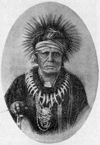
During the time the fort was garrisoned there were a few whites permitted to occupy lands near by,—a representative of the American Fur Company, traders, a tailor, a blacksmith, and gardeners, persons who served the fort in[308] some way,—but the population never exceeded two hundred, soldiers and all. Captain Allen and his dragoons had to give all their time to restraining restless bands of Indians and crowding back the eager settlers who were on the eastern boundaries of the purchase awaiting the departure of the Indians. The latter, although they manifested a disinclination to leave their old haunts, and trouble was anticipated when the order came for them to move, nevertheless peacefully withdrew under their great chief Keokuk.
Even before the Indians' title to the lands had expired many whites had slipped over the borders, dodged the dragoons, spied out the most desirable places for settlement and determined to claim them as soon as they could be entered. Many a story is told of men roosting high in trees for days to keep out of the sight of the troops. On the night of October 10, 1845, men were stationed in all directions from the fort ready to measure off their claims. Precisely at twelve o'clock, midnight, a signal gun was fired at the Agency house. Answering guns rang out sharply in quick succession from hilltop and valley for miles around. The moon was shining dimly[309] and its beams ill supplemented the fitful gleams of the settlers' torches as they hastily made their rough surveys, marked by blazing trees or by setting stones or stakes. Men helped each other. Two friends would run in two directions and each fire a gun when the terminus was reached. When the sun came up a new empire had come into being and the order and industry of the white man had displaced the listless, unprogressive life of the savage.
The rush of the settlers into the region about Des Moines ahead of the surveyor's chain led to the development of an institution of peculiar interest in Western history. Not only was it unique, it was also a striking instance of the spontaneous growth of an institution of government. It was almost if not quite the realization under almost ideal conditions of the theory of Jean Jacques Rousseau that Government arises from and rests on a Social Compact. It was known as a Land Club or League or Claim Association, and it played a large part in the organization of government in Iowa. It overrode the law of the land, or rather it blocked the natural course of the law; yet at the same time it maintained[310] order and secured under strict regulations equity for the early settlers when the enforcement of the law would have worked harsh injustice, and possibly have produced serious outbreaks against national authority.
When Iowa was first opened for settlement the pioneers could not preempt lands or secure title to them until they were surveyed; and then only at public sale. But the surveyor lagged far behind the pioneer, who considered not the law, but, anxious for a home, hurried into the new tracts and settled on his claim. The "squatter" had no legal title to his claim, nor could he obtain it by priority of occupancy; and he knew that any stranger or speculator with a longer purse string could purchase his land and oust him and his family the moment the Government should offer it for sale. It was the likelihood of this dire contingency that led to the formation of Claim Clubs or Associations in nearly every locality in Iowa. These clubs were composed of all the settlers in a township or county. They adopted a constitution, elected officers and conducted their affairs by definite procedure. They governed all matters relating to the amount and character of claims, their occu[311]pancy, improvement, abandonment, transfers, and disputes. The decisions of the club were rigidly enforced. Claims were recorded and the members were under solemn agreement not only to guard each other from interference but to prevent lands claimed from being sold to strangers at the public sales. Unhappy was the fate of a man who had the temerity to "jump" a claim or to outbid a claimant. Tar and feathers or unceremonious banishment or even harsher treatment was not unlikely. At the sale the club selected a member who would bid in the members' claims. He was accompanied by a posse whose presence always prevented outsiders from bidding as the law contemplated. If the Government officials were not always in sympathy with the settlers, at least they were always discreet enough to manifest no disapproval of the proceedings.
These Claim Clubs of Iowa aroused fierce opposition in the East. Calhoun and Clay denounced them as "conspiracies of lawless men" who so terrorized would-be purchasers that bona fide sales were impossible, and they urged that vigorous measures be taken to abate them. Webster came to the settlers' defence. He pleaded for what he called their[312] "reasonable rights" under the circumstances. The Government had delayed the surveys; yet the settlers had been encouraged to go into the new lands and make their homes; to dispossess them would work severe hardship; the clubs, although outside the pale of the law, had enforced order and maintained to a marked degree all the forms of law and government, and violence was extremely rare. To Webster's eloquence was due the passage of the early preemption laws. They were not liberal enough, however, and in 1848 a strong Claim Club was formed at Des Moines.
Although the treaty of 1842 opened the lands in 1845 they were not surveyed until 1847 and title could not be obtained until late in 1848. Meantime claims in large numbers had been entered. In 1848 speculators and "landsharks" came in and roamed about regarding the settlers' claims with envious and designing eyes. Fear of them was a leading motive in the formation of the Claim Club of 1848. Strangers were closely watched. Any suspicious action led to the suspect being warned that discretion was the better part of valor. There were some disturbances but none were serious. The most notable arose within the club itself.[313] One Perkins jumped his neighbor Flemmings's claim. The latter appealed to his club members. A "war" ensued in which Perkins narrowly escaped hanging. When the sale took place at Iowa City, 125 miles east of Des Moines, the club's agent bid in at $1.25 all of the claims and soon thereafter the club ceased to play any part in the life of the community.
The first local government to which the inhabitants of Des Moines were subject was the county government of Polk County provided for by the Territorial Legislature in January, 1846. The town government was not organized until 1851. By this time Fort Des Moines had become a thriving place. It was an important way station on one of the main stage routes to the West. In 1852, the establishment of a Government land office brought to the town for the entry of lands the multitudes of speculators and settlers then rushing into Western Iowa. In the days of the gold fever and during the border wars in Kansas and Nebraska her ferries and hostelries did a bustling trade.
In those early days life was free, easy, simple, and buoyant. The population of Fort Des Moines was made up of people[314] from both Southern and Northern States. They lived in log huts or simple frame buildings. Pork and "corn-dodgers," coffee, sometimes made of parched corn, and tea, often made from native plants, constituted in the main their diet. They had to go many miles to get their flour ground. Oxen were generally used in drawing wagons and ploughs. Stage coaches were the common carriers until the railroads entered the city in 1866. Prior to 1858 the State constitution prohibited the establishment of banks of note issue and the money of the citizens was chiefly "wildcat" and "red dog" currency. In 1857-58 the City Council so far trenched on the powers of Congress as to issue "City Scrip," with the twofold object of paying the city's debt and affording the citizens a circulating medium. As the scrip did not become popular, in a short time the city called in its paper and redeemed it. Like most frontier towns a certain reckless disregard of the sober customs of the Eastern cities characterized the social life. Sunday was a sort of gala day, when horse and foot races between whites and Indians, accompanied by more or less gambling and carousal, were not infrequent. But the garish and reckless life soon gave place to the staid habits of[316] well-ordered communities, and since the Civil War Des Moines has justly sustained the reputation of a "conservative" Western city.
The navigation of the Des Moines River was a great factor in the first years of the city's growth. Steamboats came up the river from Keokuk in the spring and summer months and brought most of the city's supplies. The people living along its course soon perceived that the river could be made a great waterway for commerce. Those were the days of "internal improvements." Congress was induced in 1846 to give to the new State every alternate section of unsold land in a strip five miles wide on either bank of the river to be used for the improvement of the channel. A River Improvement Company was formed. River traffic increased rapidly and the people went wild over the project. As usual the matter soon drifted into politics and decided the fate of political parties. Demagogism ran riot. A story is told of two candidates for Congress in 1850, campaigning together, who rushed across a field to greet a farmer. The first one to reach him, extending his hand, cried:[317]
"Hurrah for river improvement!"
The farmer so eagerly sought proved to be a scarecrow.
The net result of all the excitement and speculation attending the various efforts to improve the river was failure and collapse. The State after expending immense sums abandoned the task in 1862. Worse still, complications arose over the extent of the grant from the Government, and left the people above the city a sorry heritage of costly litigation that continued till 1892 over the titles to their homes. The entire experiment was an instructive illustration of the futility of most of the attempts at "internal improvements" fostered by congressional land grants.
In the summer of 1894 the river achieved notoriety in connection with the epidemic of "Commonweal Armies" that disturbed the public that year. One division, mobilized at San Francisco under a "General" Kelley, when it reached Council Bluffs was refused transportation by the Iowa railroads. The horde then marched overland, levying on communities for provisions, reaching Des Moines Sunday evening, April 29th. The citizens, in much trepidation, lodged the tramps in an[318] abandoned stove factory. The people were frantic to pass them along, for their sojourn threatened plague, pilfering, and multitudinous evils. But the tramps refused to walk farther. The citizens were in despair. Finally some genius suggested that the army be floated down the river. The "General" agreed to evacuate the stove works when the fleet of flatboats was ready to launch. On May 9th, amid general rejoicing, Kelley and his army floated away. The voyageurs reached the Mississippi only to suffer ignominious discomfiture.
In ante-bellum days the subject of slavery made life and politics keenly interesting in Des Moines. Many stanch Southerners and not a few abolitionists generated an electrical atmosphere. The first resident Governor, James W. Grimes, who later brought Iowa fame in the United States Senate, spoke out strongly against the arrogance of the slaveholders and the border outrages. The city was on John Brown's "underground railway," and the spiriting of slaves through the town gave zest to public discussion. When Brown came through with the slaves he had captured in Missouri he stopped over night, February 16, 1859, with James C. Jordan, a State senator.[319] The next day his ferriage was paid by the editor of the State Register, John Teesdale. One of Brown's most trusted companions, who died by his side when Lieutenant Robert E. Lee recaptured Harper's Ferry, was a Des Moines boy, Jeremiah G. Anderson, who had joined Brown's forces in Kansas in 1857.

One of the most dramatic incidents in Iowa history grew out of the ill-fated expedition against Harper's Ferry. With Brown were Edwin and Barclay Coppoc, of Springdale Ia., the Quaker village where the conspirators were drilled. Edwin was captured and hanged. Barclay escaped and after exciting adventures in Maryland and Pennsylvania got back to Springdale, where the entire community armed to prevent his capture by the Virginia author[320]ities. On January 23, 1860, an agent of Governor Letcher, of Virginia, called on Governor Samuel J. Kirkwood with a requisition for young Coppoc. Kirkwood discovered flaws in the papers, among them that no indictment had been found or crime charged, and he refused to honor the requisition. The agent became excited. Just then two members of the Assembly, Ed. Wright and B.F. Gue, came into the Governor's room, overheard the conversation with the agent, and discovered his object. They left and immediately dispatched a messenger to Springdale to warn Coppoc, who was hurried off to Canada. Slavery sympathizers in the Legislature soon heard of the matter and introduced a resolution calling on Kirkwood for an explanation of his proceedings. He sent in a ringing message in which he said:
"Permit me to say in conclusion that one of the most important duties of the official position I hold is to see that no citizen of Iowa is carried beyond her border and subjected to the ignominy of imprisonment and the perils of trial for crimes in another State otherwise than by due process of law. That duty I shall perform...."
In the uncertain days preceding the Civil War, when the friends of liberty in the North[321] were timid, Kirkwood's message had the effect of a tocsin call.
When Sumter was fired on and President Lincoln called for troops, Simon Cameron, Secretary of War, telegraphed Kirkwood that one regiment was expected from Iowa. The Governor was not then in the city. The messenger who carried the telegram from Davenport to Iowa City found him out on his farm working in a field. On reading the message he musingly asked:
"Why, the President wants a whole regiment of men! Do you suppose that I can raise as many as that?"
Within a few days ten regiments were offered him. Iowa sent nearly 79,000 men to the front, who played a conspicuous part in the great struggle. Des Moines contributed her full share; among the number three became generals, one, M.M. Crocker, being an especially brilliant officer under Grant in the campaigns in the West.
The history of the Western States is rife with struggles over the location of county seats and State capitals, the incidents of which are often picturesque and exciting. The selection of Des Moines as the capital city of Iowa was[322] an important event in her history. Largely in consequence thereof the city has become not only the metropolis of the State but its chief nerve centre too.
Iowa's first territorial capital was Burlington. From 1841 to 1857 it was at Iowa City, when the State archives were moved to Des Moines. The change was not made without a spirited contest, the marks of which are seen to-day in the State's constitution. For, in order to placate the people of Iowa City and secure permanency for the arrangement, the constitutional convention of 1857 inserted the provision that the State University should forever remain at Iowa City, and the capital at Des Moines,—a piece of log-rolling not unlike that resorted to by Alexander Hamilton when the national capital was located at Washington. There was a deal of politics and dissension in Des Moines over the selection of the site of the capitol; so much indeed that the animosities then engendered exercise a baneful influence in dividing the city even now. A superb site was chosen on a high hill in East Des Moines whence one can look over the hills and dales of the river valleys for miles around. The first capitol was a plain three-story brick structure, donated by[323] the citizens of the east city as a part of the inducement to the commission to locate where they did. After the Civil War the building became inadequate; the ravages of time rendered it unfit for a repository of the State's precious papers; and the people of Des Moines began to agitate for the erection of a capitol commensurate with the needs and dignity of the State. Thereupon followed a contest whose incidents were most interesting and instructive.

The urgent need of a new capitol was generally admitted. But the justness or propriety of a measure is not alone sufficient to secure legislation. The jealousy of rival towns was fanned into fierce opposition. Their representatives fought an appropriation with tooth and nail. Two million dollars was magnified into unheard-of proportions. Time-serving politicians who admitted privately that the State needed a capitol badly, tore passion to tatters in portraying the poverty and distress of the taxpayers. With a State "full of barefooted women and barefooted children" they asseverated such an expenditure would be criminal. Such "politics" long prevailed. In 1867, the people of Des Moines elected to the House[324] of Representatives, Hon. John A. Kasson, to conduct the fight for the appropriation. No better man could have been chosen. He had attained distinction as Assistant Postmaster-General under President Lincoln, and as a member of Congress. With what tact, patience and diplomacy he carried on the contest his career since as our country's envoy to the courts of Austria and Germany indicates. For five years Mr. Kasson struggled with recalcitrant representatives through trying vicissitudes before he got the appropriation. As it was, he escaped defeat by but one vote to spare, and that vote he would have lost but for the timely aid of a Catholic priest, Father Brazil, of the city. The opposition resorted to the[326] rascally ruse of getting a bibulous member who was friendly to the measure dead drunk and locking him up to prevent his attendance at the time of the vote. On being informed of the trick, Father Brazil sought out the recreant son of Erin, secured him, and marched him up to the House chamber just as the roll was about to be called, and sat severely by until his charge had answered "Aye."
It took twelve years to build the capitol. During practically all of that time its construction was under the absolute control of three commissioners, John G. Foote, Peter A. Dey, and Robert S. Finkbine, and the stately structure that now adorns Capitol Hill is a monument to their intelligence and integrity. Not an unwise expenditure nor a dishonest or corrupt transaction was ever charged against their stewardship, and the people of Iowa hold their names and services in grateful memory. It is a sad commentary on our public morals that the erection of a State capitol without suspicion of corruption is so exceptional as to be noteworthy and the proud distinction of the people of this Western commonwealth.
From a frontier fort and a huddle of huts, Des Moines has grown to be a stately city[328] whose corporate limits include fifty-four square miles and a population of nearly 70,000, almost double the population of any other city in Iowa. Her citizens boast that "without riots, booms, or conflagrations" she has steadily grown in strength and stature. Her industries and commerce make the city a hive of activities. Seventeen railroads radiate from Des Moines, enabling the city to become the wholesale and retail jobbing centre of the State. Sixty miles of electric street-railways and fifty-eight miles of paved streets make her suburbs readily accessible. There are vast deposits of coal and clay under and about the city. The smoke of three hundred factories, large and small, tinge her atmosphere with the hues of Pittsburg. Among insurance men the city is called the "Hartford of the West," as fifty-one insurance companies have their headquarters in Des Moines and employ five thousand people. In her various colleges and schools of law, medicine, and commercial practice there is a population of nearly six thousand. Thousands of visitors annually come to the State Agricultural Fair and to the political and educational conventions that assemble in the city. Congress[329] has recently provided for the establishment of an army post just south of the city limits, and the War Department is about to expend several hundred thousand dollars in erecting barracks and in the preparation of drill-grounds for troops.
Few cities in the West possess scenery of greater natural beauty than that which greets the eye in and about Des Moines. The junction of the rivers near the centre of the city gives her topography a configuration similar to that of Pittsburg. On the south and east her limits are marked by a range of wooded hills through which the silver stream of the united rivers makes its way. The view of the landscape across the river valley to the horizon's edge which is visible from most points is particularly pleasing to the eye in the spring and summer months. The main part of the city between the "Forks" is in a forest of native oaks, elms, and hickories so dense that the looker from the Capitol dome can scarce perceive the residences. To the attractions of nature the landscape gardener and architect have added much. Nearly five hundred acres of parks give the people fine pleasure resorts in the hot summer months. Many handsome[330] wholesale and retail houses and manufacturing establishments grace her thoroughfares. The city has nearly completed a beautiful Public Library, located on the west bank of the Des Moines River, and, as a result of the years of devotion and unremitting labors of Mr. Charles Aldrich, the State has begun the erection of the Historical Library, which will be one of the chief attractions of Des Moines.
By WILLIAM MARION REEDY
SITUATED at the heart of the continent, midway between the East and West, the North and South, St. Louis is a unique mixture of the characteristics of all sections of the United States. In the early seventies a weird character named L.U. Reavis wrote a book called St. Louis, the Future Great City of the West, in which he advocated the removal hither of the seat of the national Government and predicted great things for the city. The fourth of American cities in population, St. Louis is preparing to hold a World's Fair in commemoration of the one hundredth anniversary of the purchase of the Louisiana territory, on a scale of magnificence which attracts universal attention. With the completion of[332] the Chicago drainage canal, destined soon to be a ship canal connecting Lake Michigan with the Mississippi River, with the necessary improvement of the Mississippi to its mouth, and with the certain construction of an Isthmian canal, St. Louis is sure to be in as close touch with the world at large as if it were a seacoast city. Always the natural commercial centre of the Mississippi Valley, since it became the focus of a mighty network of railroads St. Louis has been the market of the prosperous West, the new South and the great Southwest, with its wealth of agriculture, mining, manufactures, and its almost magic development, shown, for instance, in the fact that Texas is now only a few thousand behind Missouri in population, and must in consequence of the recent discoveries of enormous oil lands soon overtake States like Illinois and Ohio and Pennsylvania. The prophecies of the city's greatness are coming to realization. Its future is here, but bright as the future is, it is not so bright as to allure us into forgetting the picturesque past.
The old town on the Mississippi has ever been modest to a degree that has caused the thoughtless to make mock of its conservatism, but the steadiness of character and the regard[333] only for the realities of progress which have marked St. Louis have their justification in that they have resulted in a city known in times of depression and panic as "the solid city." A city that owns itself, with a proper sense of dignity, it has never advertised itself in the modern meretricious fashion. And so the story of St. Louis, an honest tale, will speed best being simply told.
St. Louis was founded by Pierre Laclede Liguest and a few companions, all French voyageurs, in 1764; at least it was in that year that Laclede's lieutenant, Auguste Chouteau, cleared away the site of the present city. Laclede Liguest, or, as he is sometimes known, Liguest Laclede, a merchant of New Orleans, had from the French Government a monopoly of the fur trade in the Missouri River country. He left New Orleans with his family and a small party in August, 1763, with the intention of founding a town near the confluence of the Missouri and Mississippi rivers. Shortly after the town was laid out occurred the cession to Great Britain of the Illinois country, on the east bank of the Mississippi. The French inhabitants of that country having followed from the north in the wake of Marquette in 1673,[334] and of La Salle in 1678, hated the English, and began to move over to the new town, which soon grew into importance. A trading point for the Indians, Laclede and his companions so managed them that there was none of the friction which marked the contact elsewhere of the English and the natives. When[335] the laying out of the city began a band of one hundred and fifty warriors, with their squaws and papooses, outnumbering the whites five to one, appeared and camped near the strangers. The Frenchmen treated the savages with such tact and kindness that they not only did no harm, but even of their own volition assisted in the work. The first cellar was excavated with the aid of the squaws, who carried off the clay in baskets, and were paid in beads and other trinkets which Laclede had brought up from New Orleans. The Indians became so friendly that they were a hindrance rather than a help, and finally, to induce them to depart, Laclede hinted that the French soldiers at Fort Chartres were to be summoned.
Shortly after the little village was begun, news came that the territory of Louisiana had been ceded to Spain. The French Governor, M. d'Abadie, who announced the fact to the people with tears, is said to have died of grief. St. Ange de Bellerive became Commandant or Governor-General in 1765, instituted a government, and demeaned himself in such manner generally that unto this day he is remembered affectionately in every published history of the town. The first two grants of land in the[336] village were made to Laclede by De Bellerive, August 11, 1766. The Spaniards do not appear to have paid much attention to the village of St. Louis, for there was some doubt whether De Bellerive had any authority to make grants. Although the best authorities agree that De Bellerive acted with the authority and consent of the Commandant-General of New Orleans, it seems that he was practically elected Governor by the inhabitants. It is amusing to read in a history of St. Louis and Missouri, published in 1870, that De Bellerive in 1776, began to make grants, "hoping for a retrocession of the country to France,[337] when the grants would be legalized by confirmation." The first marriage in the new colony was celebrated April 20, 1766, the contracting parties being Toussaint Honen and Marie Baugenon. The first mortgage was recorded September, 1766. It was specified that payment should be made in peltries, though no definite value was attached to the number of deer hides to be delivered by Pierre Berger to Francis Latour.
August 11, 1767, news came that Spain was making ready to take possession of the country. The transfer had been made by secret treaty in 1762. The people accepted the situation in a sort of dumb rage. The following year a body of troops arrived under the command of a man named Rios, acting under the authority of Don Antonio d'Ulloa, Governor of Louisiana. To the joy of the inhabitants, De Bellerive was not disturbed in his office, and the Spanish troops left in the summer of 1769.
It was the great distinction of De Bellerive that he was the friend of Pontiac, the Ottawa chieftain, and about the time of the departure of the Spaniards, Pontiac arrived at St. Louis. He represented all the poetry and nobility, the grandeur and genius of the Indian character.[338] After Red Jacket, he was the greatest Indian the New World had known. Dreaming of driving the English into the sea he had confederated the tribes between the Allegheny and the Mississippi, the Ohio and the Lakes into a league against them. He had been known and beloved by the gallant but unfortunate Montcalm at Quebec. He had participated in the ambuscade in which Braddock with his life had paid the penalty of narrow-mindedness, and had planned the massacre of Michilimackinack, in which more than two thousand of the English had lost their lives. The French "loved him for the enemies he had made," and he was "fêted and caressed," says an early chronicler, "by many of the principal inhabitants of the village." St. Ange de Bellerive entertained the warrior at the house of Madame Chouteau, but Pontiac was now a broken man. His dream of driving back the English beyond the Cumberland had faded. His allies had been seduced from his support by presents and by firewater. He, too, had made the acquaintance of the fiery liquor, and drink was then such a passion with him that De Bellerive and his friends not only endeavored to prevent the sale thereof to him in the village, but tried[339] to dissuade him from crossing the river to Cahokia in response to the invitations of certain of his friends there. Not to be dissuaded, Pontiac crossed the river in the uniform of a French officer, which had been given him by Montcalm. Wandering on the outskirts of the village of Cahokia, he was tomahawked by a Kaskaskia Indian, who had been given a barrel of whiskey to do the deed by an English trader named Williamson. His friend De Bellerive had the chief's remains brought to St. Louis, and they were buried somewhere in the vicinity of the site of the present Southern Hotel, in the corridor of which was placed, in 1901, a handsome tablet to the unfortunate warrior's memory. Whether Pontiac was assassinated in accordance with official English instructions, or met his death in consequence of a private grudge, was long a matter of dispute, but there is no doubt that the passionate and sympathetic Frenchmen believed for many long years that the chief was killed to relieve the English of the danger of his presence and a possible utilization of his undoubted abilities by the Power in possession of the west bank of the Mississippi. Pontiac's death, however, was promptly avenged upon[340] the Illinois Indians by members of the tribes with which he had been in alliance.
Next came Don Alexander O'Reilly to take charge of the territory of Louisiana. He arrived at New Orleans at the head of three thousand men to enforce his authority. There was need for the soldiery, for though seven years had elapsed since the cession of the territory, the Spaniards had never actually taken possession. The people were still French to the core. When they heard that Don O'Reilly was coming they even conferred together upon the advisability of meeting him with force and preventing his landing. The head men of the town counselled against this, however, and their advice prevailed, but such was the spirit of insubordination, so many were the execrations heaped upon the Spaniards, so frequent were the threats of violence against them that Don Alexander had at once to adopt stern measures. He promptly arrested a dozen of the ringleaders, had five of them publicly shot, and the others, except one who committed suicide, sent as prisoners to Cuba. The Spanish code was put into operation throughout the territory, and O'Reilly's deputy, Lieutenant-Governor Piernas, arriving in St. Louis in 1770, took possession of St. Louis, with the help of De Bellerive, wisely conciliating the villagers. The village settled into peace. The church, for which ground had been set aside even before the founders of the town had prepared to build their own homes, was dedicated, June 24, 1770, with solemn ceremonies. Where that first church of flattened logs set on end with the interstices filled with mortar stood, there stands a church to-day, and, says Elihu[342] Shepard, since that time "the worship of God on that block has not been suspended for a single day." All De Bellerive's acts were formally confirmed by Piernas, and the little settlement forgot its woes under a benign administration, which recognized village prejudices, and shut its eyes to the loyalty everywhere apparent to France.
Piernas narrowly escaped assassination at the hands of an Osage chieftain who thought himself insulted at a meeting at the Commandant's house. The Osage, while drinking with other Indians, divulged his intention to kill the Governor, whereupon a Shawnee warrior stabbed him to the heart. The slain chief was buried with honors in the big mound to the north of the village, an eminence that gave to St. Louis for many years the name of "The Mound City."
For twelve years the village was orderly and quiet. The people liked the Governor who succeeded Piernas, but the next, Don Fernando de Leyba,—"a drunken, avaricious, and feeble-minded man, without a single redeeming qualification," they did not like. He came upon the scene in 1778, at a critical time. The American Revolution was on. The French[343] and Spaniards, hating the English, were inclined to sympathize with the colonists, so far as they knew or cared about things happening so far away. Fearing an attack of English and Indians, the villagers threw up a trench and stockade about the town, having three gates on the sides other than the one on the river, and built a fort in the centre of the city at what is now, approximately, Fourth and Walnut streets, and supplied it with four small cannon and one company of soldiers. The people were afraid to till the fields outside the trench and stockade, and the men who might have braved attack were busy building the defences. In the spring of 1780 fears of a famine forced the men into the fields to plant the spring seeds.
On the morning of May 26, 1780, the attack came. It was led by Canadian-French renegades, the main body being made up of about one thousand Upper Mississippi Indians. The attacking party came from the north, slew forty of the workers, carried fifteen up the river as prisoners, in their war canoes, while the rest made their way back to the fortifications, amid the booming of the cannon, which saved the fort. Leyba, who was drunk, appeared upon[344] the scene, it is said, sprawling in a wheelbarrow and muttering incoherently, after the Indians had been repulsed. He died a month later, covered with ignominy.
The succeeding Lieutenant-Governor, Francisco Cruzat, thoroughly fortified the town, which was never afterwards molested by the savages. While the more extensive fortifications were in process of construction, indeed to the peace of 1783, the price of provisions in St. Louis was high, and visitors from New Orleans, Ste. Geneviève, Cahokia, Kaskaskia, and other settlements nicknamed the place "Pain Court," or "short of bread." Still, it was a time of prosperity. The town grew, and nothing alarming happened until, in 1785, when the people were terrified by their first sight of the "June rise" of the Mississippi. They saw the great yellow stream spread out over the American Bottoms on the east bank and the Columbia Bottom on the west bank to the north, until it became a vast lake reaching farther than the eye could distinctly see. They saw the mighty flood go raging past, black with the trunks of mighty trees torn up by the wild waters, the villages of Cahokia and Kaskaskia submerged, crops ruined, cattle drowned, and[345] houses melting into the yellow sea. St. Louis was flooded to what is now Main Street, and part of the people were preparing to move farther up the high bank that ran back from the stream, when the waters began to recede, and the anxiety of the town was relieved. The people called this "l'année des grands eaux,"—"the year of the great waters." There have been many such floods since, but none more awe-inspiring than this, seen in a setting of virgin wilderness. The flood increased the population of the city, however, for the settlers in the bottoms went to town and joined in its upbuilding. In those days, notwithstanding all the dangers of war and flood, St. Louis seems to have been a gay place. Society was simple, yet retaining an indefinable air of elegance that bore the flavor of old France. Even if they were "short of bread," the people were hospitable, a trait which still persists characteristic and conspicuous. The French element has almost wholly disappeared in newer elements, but there yet lingers, somehow, the atmosphere of deliberate ease among the people, even in the pressure of modern business. So orderly was this frontier town that during the entire period of the[346] French and Spanish dominations but one murder was reported.
Following the annalists we learn that the city's commerce in those early days was much hampered by a band of pirates that infested the river at a place called Grand Tower, midway between the mouths of the Missouri and Ohio. Lurking at this point, where the stream is very swift, the pirates would dart out and attack the boats plying between New Orleans and St. Louis, kill the boatmen and seize the goods.[347] They secured rich spoil of hides from the down trade, and many luxurious articles from the up trade—treasures even from distant France. One voyageur north bound escaped the pirates through the strategy and courage of a negro who won the confidence of the captors of the barge and the sympathy of two negro slaves of the pirates. At a signal the negroes hurled the buccaneers off the barge, and either shot them or left them to drown. The barge crew then took the boat once more, went back to New Orleans, and told their story to the Governor, who issued an order that all boats leaving for St. Louis should go in company. In obedience in the spring of 1788 ten barges started up the river with crews well armed. Arrived at the rendezvous of the robbers they found none, but they recovered, however, much of the plunder that had been stored away and brought it to St. Louis. The year of their arrival was known for generations as "l'année des dix bateaux,"—"the year of the ten boats."
St. Louis traded not only with New Orleans but with Canada as well. The Indians gave no trouble up stream or down. The Spanish Government wanted settlers, and was liberal in granting land. We read that "there were no[348] mails or taverns, but every house was a welcome house to new comers." In 1798 the population of Upper Louisiana was 6028, of whom 1080 were colored. The population had risen in 1804 to 10,340. In 1803 the Louisiana Purchase was made, and in 1804 St. Louis "contained one hundred and eighty houses built of hewn logs and stone, the latter being generally the rendezvous of the most wealthy, and surrounded by a wall of the same material, enclosing the whole block, which continued in use many years, protecting the fine fruit trees, which shaded the mansion." Frame houses became fashionable after the transfer to the United States. "There were but one bakery, two small taverns, three blacksmiths, two mills, and one doctor in the town." Coffee and sugar were $2.00 per pound, and everything else was costly in proportion. The United States took possession March 10, 1804, when Major Amos Stoddard assumed the duties of Governor of Upper Louisiana. Then history began to make quickly.
Near St. Louis, Lewis and Clark organized their expedition via the Missouri and Columbia rivers to the Pacific Ocean, departing in May, 1804. In August Lieutenant Zebulon Pike[349] started to explore the Mississippi to its source. The Mississippi was opened up to free navigation. General William Henry Harrison came from Indiana to preside over the district. He was succeeded by General James Wilkinson, and the region formerly known as the District of Louisiana became known as the Territory of Louisiana. Later a strangely handsome, dark, romantic man, much honored by every one and indescribably fascinating in manner, visited the town and was fêted. He was entertained by General Wilkinson, through whom it is believed the authorities at Washington first learned of that vast, vague treason which Burr—for it was he—conceived in his restless brain. Wilkinson was later appointed to watch Burr and was succeeded as Governor by Captain Meriwether Lewis, fresh from his adventures in the mysterious Northwest. A ferry had been established in 1797, and at the same spot there is to-day a ferry operating, one of the most profitable of the vested interests of St. Louis. The post-office was established in 1804. In 1810 the population was fourteen thousand. In 1808 was founded the first newspaper, which exists to-day as the St. Louis Republic, a daring enterprise begun[350] when the whole country was suffering from the embargo and non-intercourse with England. The great New Madrid earthquake shook the little city in 1811. The battle of Tippecanoe had been fought a little before the earthquake, and in the same year appeared the first steamboat in Western waters. In 1813 the Territory of Louisiana became the Territory of Missouri, and in June of that year the Bank of St. Louis was founded. The year before that the Governor of the Territory had gathered in the city of St. Louis the chiefs of the Great and Little Osages, the Sacs, Foxes, Delawares, and Shawnees, made peace with them, then conducted them to Washington, arriving there just before the declaration of war against Great Britain, in time to conclude a peace which saved the country from any such conspiracy as had been formed among the Indian tribes to the east, under the leadership of the great Tecumseh.
Being a frontier town, St. Louis was of course a resort for trappers and traders but, unlike the frontier towns of to-day, not for desperadoes. The early settlers seem to have stamped upon the place its distinctive quality of quietness. Here the North American Fur[351] Company had its headquarters for a long time, and from this point the adventurous subordinates of John Jacob Astor went forth in all directions in search of peltries. One of these, a Colonel Russell Farnum, leaving St. Louis afoot reached Behring Strait in 1813-14, crossed over the ice, traversed Siberia and, arriving at St. Petersburg, was presented to the Emperor. This memorable journey was the wonder of Europe at the time, for Farnum went from St. Petersburg to Paris and then came home by way of New York. He wrote a record of his adventures and sent it to a New York publisher but it was lost and the writer died before he could again transcribe his narrative.
The War of 1812 with Great Britain for a time was of small concern to St. Louis. Later, however, the Indians of Missouri were armed by the people and pitted against the Indians employed by the British. The trading-posts in which St. Louis was interested extended twelve hundred miles to the north and there agents from St. Louis counter-plotted against the British. The Yanktons and Omahas were matched by the Americans against the Iowas and several battles were fought in which the[352] British-bought savages were worsted. The war coming to an end, Indian hostilities ceased and the fur trade throve under the peace. Rivals to the American Fur Company were started. The business expanded, and soon the necessities of commercial intercourse led to the organization of two banks, the second of which, known as the Bank of Missouri, was organized February 1, 1817. Inflation was the order of the day. The town took on airs of magnificence and extravagance. Wealth accumulated so rapidly that some seemed at a loss to spend it, and gave entertainments in which the tasteful and the barbaric were strangely mingled. The United States held sales of public lands and there were "rushes" such as we have seen in recent years in Oklahoma. Building was undertaken in a lordly fashion and extravagant prices were asked for everything. The demand for money was so great that recourse was had to lotteries to raise funds for an academy at Potosi, to provide fire-engines for the city, to erect a Masonic Hall. The lotteries soon got into politics and were not dislodged until late in the seventies, after a fight not unlike that waged for many years in Louisiana. It was in 1817 that the Legislature[353] of Missouri established the public-school system and incorporated the institution which persists to-day in the St. Louis Board of Education, though it was many years before there was a public school in the city. In the same year, in St. Louis, Thomas H. Benton, afterwards United States Senator from Missouri for thirty years, leaped into notice, engaged in a quarrel with Charles Lucas, United States Attorney for the Territory of Missouri, and in a duel across the river, or rather on an island in the river that has since become joined to the Illinois shore, killed him. The place where the duel was fought became the rendezvous for duellists and was called "Bloody Island." In 1817 the first Bible Society in the Territory of Missouri was formed. The inflation of the day ended as usual in collapse, but St. Louis and Missouri suffered less harm than other sections.
When, in 1818, the Territory of Missouri applied for admission to the Union the slavery question arose. There was a slight preponderance of sentiment in favor of slavery, but very slight. The Missouri Compromise left its mark on Missouri and St. Louis. The State was always regarded, however its repre[354]sentatives stood, as doubtful on the slavery issue. From 1820 to the breaking out of the Civil War it was always a compromise State and in that war it was ever between two fires, furnishing soldiers in startling abundance to each side and sympathizing with both. St. Louis suffered in that long drawn out situation. A paralyzing incertitude was bred in the city's mind, even toward progress. The people, especially the French, did not take kindly to steamboats. "When Missouri was admitted to the Union," says Elihu Shepard, "there was no steamboat owned in the State and but one steam mill." The assessed valuation of the town property was less than $1,000,000 and the whole corporation tax less than $4000 per year while Missouri remained a territory. The town contained six hundred houses, one third of which were of stone or brick, the remainder wooden, one half of which were framed. The population was estimated at five thousand, one fourth of whom were French. The estimated annual value of the trade was $600,000. Steamboats from the Ohio River took the carrying trade between St. Louis and New Orleans, and the imports were estimated at $1,000,000. All these con[355]ditions, while due in some measure to the extreme conservatism and self-satisfaction of the dominant French element, were undoubtedly due in larger measure to the hard times that prevailed when Missouri became a State. St. Louis was incorporated as a city December 9, 1822. A spice of adventure always entered into the then predominant business of the community, for the fur companies fought with each other, and all of them made common cause against the great Hudson Bay Company in the North, with its headquarters in Canada. The people of that time thought little of distances which even now seem great. Traders and trappers went without hesitation through the wilderness to the very surf of the Pacific and the people of the city never dreamed that what we now call Yellowstone Park was very far away. Often enough the adventurous commercial traveller who left St. Louis came back without his scalp or never came at all. The city was picturesque. Men clad in buckskin and carrying rifles in their hands elbowed representatives of first families attired in the fashion that came from Paris, via New Orleans, or consorted with red Indians in paint and feathers—and too often, too, in[356] liquor. St. Louis and Missouri were "big" in politics about that time. Missouri was for Clay, but Missouri's representative did not vote for him and John Quincy Adams was chosen President. After this Missouri became a Jackson State, and committed herself to the South.
A patch of color in the drab details of the history of St. Louis for the few years after the incorporation was the visit of Lafayette to the city on April 29, 1825, and his sumptuous entertainment by the enthusiastic inhabitants, most of whom, probably, loved the Frenchman more than the friend of Washington. In June, 1825, the first Presbyterian church was consecrated by Rev. Solomon Giddings, who "had a very respectable congregation" for a city which was preponderantly French and Roman Catholic. The French language was spoken in the homes of half the families of the town. There were less than a dozen German families in a city which now is more distinctly Teutonic than any other in the country, except Milwaukee. The slavery issue was all the while growing, and in 1828 there was formed at St. Louis a branch of the American Colonization Society, the purpose of which was to further the settle[357]ment of free blacks in Liberia. Many of the largest slave-owners in the city and State were members and officers of the society. Between 1820 and 1831, a progressive movement started. The new Court House was dedicated in 1829, and the work of opening and paving streets was pushed with energy. The old French families resented the new life and moved into the country. The pace was too fast for them. The hunters, trappers, voyageurs and bargemen began to disappear. The city took on a truly American aspect, but the increase of population was slow. Between 1820 and 1830, the population increased only 2000, but between 1830 and 1840 the increase was nearly 10,000, reaching the total of 16,649.
Gradually Americanism made its impress. The wharf was lined with steamboats and the levee with great stores. Steam ferryboats multiplied. The city became a great river town, second in importance only to New Orleans. The lead mines to the south of the city were productive. Manufactures of various sorts sprang up. An insurance company was incorporated. Prosperity was checked by fear of the great Black Hawk, who, at the[358] head of the Sac and Fox Indians, took the war-path in Illinois. Immigration and transportation of goods to and from the North was checked till Black Hawk was defeated and his tribe transported to the other side of the river, where the influence of Great Britain could not reach them. No sooner, however, had the city recovered from its slight panic than there came another and graver excitement, another lull in business. Jackson's bank veto was the cause. As if this were not enough to discourage the community, along came the cholera, which in five weeks destroyed four per cent of the population. Cholera has reappeared since, from time to time, the most serious visitation being in 1866, but the city as it grew began to pay attention to the sewage question and in half a century had perfected such a sewer system as is not surpassed in any city in the world. In 1835 the City Council sold the town Commons, a tract of about two thousand acres, and devoted nine tenths of the proceeds to street improvements and one tenth to the public schools, and from this small beginning arose the system which to-day directs the education of the children of a city of 575,000 inhabitants. In 1829 the St. Louis University, a Jesuit institution,[360] was founded, which has been since a centre of higher education for the sons of the well-to-do Roman Catholics of the entire South and Southwest. Considerably later was founded the institution now Washington University, one of the best endowed educational establishments in the country, with a manual training department famous the world over, and with its Mary Institute for girls ranking with the best seminaries of the country. At an early day the Roman Catholic religious sisterhoods of charity and instruction established branches here. The Sisters of Charity founded a hospital in 1832, aided by the liberality of John Mullanphy, which has been in continuous service ever since. The Sisters of the Visitation came later and established their convent for the higher education of girls and did for the girls of the West and South what the St. Louis University did for the boys. Still later came the establishment of medical colleges, one in connection with the St. Louis University, and later the institutions founded by McDowell and Popé, from which grew the swarm of large medical and surgical colleges which now make St. Louis[361] one of the most important centres of medical education in the land.
Events moved rapidly after 1835. The growth of river traffic was steady. The drift of emigration westward was beneficial to St. Louis in every way. Men and money flowed in from the East and the South. There were rumors of railroads, and, in April, 1835, a convention was held by representatives of eleven of the most populous counties of the State to take steps to induce the construction of railroads in the State and to and from the city. The modern spirit manifested itself in every direction, and the year 1836 found the people regarding St. Louis as a metropolis, though in that year occurred an incident demonstrating that the taint of barbarism lingered to some extent among the people. A negro who had stabbed a constable was seized by a mob and tied to a tree and burned to death, amid a chorus of execrations,—an episode only too frequently duplicated in different sections of the country of late years. At this time St. Louis had 15,000 inhabitants, but it was not till the year following that a theatre was known. In the same year a brick fire-engine house was built, and leading citizens were proud to be[362] members of the company and "run with the machine."
St. Louis was much interested in the Texan war of independence, and from its stores supplies went to the followers of Houston, while many of the younger men of the community left to join the Lone Star warriors in their struggle. Later, when the war with Mexico began, there were multiplied activities in the city, because the Government here outfitted many of its troops. Here next were heard the first mutterings of the storm that broke in 1861. Elijah P. Lovejoy, anti-slavery in sentiment, edited the St. Louis Observer. On the night of July 21, 1836, persons unknown broke into the publishing room and wrecked the establishment, scattering the type into the street. No one was punished for the offence. Lovejoy went to Alton, where later he was slain by fanatical opponents of his abolitionism, who unwittingly wrote his name high on the list of the martyrs to freedom. St. Louis had its first daily mail September 20, 1836, and on the same day the Missouri Republican commenced the publication of a regular daily edition. In 1837 Daniel Webster was banqueted, and it was estimated that there were more guests at[363] the banquet than there were inhabitants of the city when Lafayette was fêted twelve years before.
Following in quick succession, events too numerous to be recapitulated marked the history of the town. In spite of floods and cholera and a great fire, which swept away the business portion of the city, the community went steadily ahead. The gold-fever helped St. Louis, for the Argonauts going overland outfitted here, as in very recent years their fellows bound for the Klondike and Cape Nome outfitted at Seattle. As the West built up St. Louis builded too. Something substantial from the westward-moving stream always found its way into the coffers of the St. Louis merchants. The prosperity and power of the South lent prestige to the city. The city was a great cotton market. It had a vast trade up and down the Mississippi and Missouri rivers, up and down the Ohio and the Tennessee. The fleets of steamboats at the wharves grew in size, until, old inhabitants say, there were three or four miles of them at the river front at one time, being loaded and unloaded day and night by singing negroes. As agriculture grew in importance, St. Louis became a great wheat market,[364] a great market for cattle and swine, horses and mules. Its manufactures in every line throve, as well they might, for it was the great depot of the West, with a straightaway water route to the sea. There was plenty of work, plenty of money, and more than plenty of pleasure. The society of St. Louis was exclusive and magnificent. The ante-bellum balls were gorgeous affairs. The women were beautiful, of the Southern type, and when it was desired to say of one of them that she was royally bejewelled, a common phrase used was "She wore a nigger on every finger." Steamboatmen, planters, slave-traders, merchants dealing in cotton or in sugar, spent money like water. The town was, as we say in these days, wide open, and of a perilous liveliness, for the incoming Northerners and Easterners were never equal to the task of suppressing what the New England American regards as vices not to be temporized with. The brightness and gayety, however, did not wholly conceal the dread of the sorrow that was to come. St. Louis was, for the most part, intensely Southern; but the Revolution of 1848 had brought to this country and to St. Louis a great number of Germans, who were set against slavery and secession. The storm broke, and the breaking was a severe[366] setback to St. Louis, whose prosperity was founded chiefly on that of the South. Its sympathies, through social, political, business ties, were mainly with the South. The war destroyed business. St. Louis, if not the enemy's country, was strongly suspected of disloyalty, and for a time it seemed as if war would smite the city itself, while there hung in the balance the decision of the alternative of Governor Claiborne Jackson of Missouri that he would "take Missouri out of the Union or into hell." Feeling ran high in the community. Almost a battle was fought on its outskirts. St. Louis had bitter experiences of martial law, while its commercial activities seemed to be mostly controlled by people who had government contracts. Here, where Grant had been known as a none too tidy farmer, his name was loathed, as was Lincoln's, by the larger element, while the Germans were profoundly loyal. The misfortunes of the South were unfortunate for St. Louis in every instance, and when the scourge of war passed, the region whence St. Louis had drawn most of its wealth was devastated, and the sceptre of trade passed to the North. As the fortunes of St. Louis
declined from these causes, they and other[368] causes operated to push Chicago to the front, even though, when Chicago had been twice visited by fire, St. Louis, as the greater city, made large contributions to the relief of the sufferers. St. Louis did not go backward, but the country to the north recovered from the war and improved more rapidly than that to the south and southwest, and the northern and western trade went to Chicago. St. Louis managed, in the face of such obstacles, to hold its own. The work of expansion and extension of improvement went steadily ahead, though with great conservatism. The boom idea, that grew after the war, was never hospitably entertained in St. Louis, though the manufacturers and merchants found a new trade and strenuously developed it in the new Southwest. The southwestern railway systems began to take shape, and the prosperity of St. Louis came back in great measure late in the eighties. The great St. Louis bridge had been opened in 1874, and the city was put in touch with the East, but the greater movement of the country's wealth and energy was being felt in the territory that was out of trade touch and political sympathy with the
field in which St. Louis was once supreme. Nevertheless St. Louis added to her beauties steadily. She acquired Forest Park, the greatest natural public city park in the country, after Fairmount in Philadelphia, also O'Fallon Park, but little less magnificent. Through the philanthropic generosity of Henry Shaw she acquired Tower Grove Park, which is perhaps the finest specimen of the park artificial to be found anywhere. Later, Mr. Shaw left to the city by will his botanical garden, an[370] institution famous the world over for its collection of plants of almost every species. The city paved all its downtown streets with granite, and later its outlying streets with asphalt, erected a new custom house, a Four Courts Building, stupendous water-works, and constructed a gigantic extension of the sewer system. The development of the system of street railway transportation in St. Louis was more rapid and more perfect than in any other city in the world. A new mercantile library was built and the public-school library was made free. Churches increased in great numbers. Schools multiplied and were overcrowded in places where within twenty years had been quarry ponds and cow pastures. The growth of business, the multiplication of banks, the overspreading of the population since 1880, has been bewildering in its progress, and remains so, in spite of the fact that there has been all this time in process of building, directly across the river, a sort of overflow city of sixty thousand people. The city lost its river trade but has made up for it in utilization of the railroads, and is now preparing again to use the mighty, free, natural highway for the transportation of products to the world at large. St. Louis, so often thought of as slow, has really[372] grown with phenomenal rapidity. It is one of the wealthiest cities in the country, a city of homes, and a city of perhaps more beautiful homes widely distributed in different sections than are to be found elsewhere. The wealthy men of St. Louis are almost all young men. The greater fortunes in St. Louis, with but few exceptions, have been made within the past twenty years, and many of them in the last ten years, and these now utterly eclipse the fortunes that have been handed down from the earlier days. The city has to-day a population of 575,000. In the suburban territory there are over 700,000 more people in close relationship daily and almost hourly with the business and social life of the city. The "slow old town" is not so slow when it is remembered that within one year after a cyclone swept it in May, 1896, there was not a trace of the visitation. Its conservatism is very real, but it is not stagnation. St. Louis has gone on with its work, even though war and the industrial tendencies consequent on war, and the political and social drift growing out of war have been in opposition to the city's progress. The city has built steadily but well, passing through the[373] panic of 1893 without a single failure. The earlier history of the town shows how the conservatism so thoughtlessly derided came to be ingrained in the life of the city. It shows, too, the pertinacity which has made St. Louis the fourth city in the Union, in defiance of the disaster that befell its prestige in the great war, and in defiance too of the circumstance that the new popular national activities generated after that great conflict found their most congenial field in regions practically out of reach of, and wholly antipathetic to the interests of the chief city of Missouri. The new South and the new Southwest mean a new St. Louis. And we shall see what the new St. Louis means when the city expresses its higher and better self in the Exposition with which its people purpose to celebrate the purchase, by the United States, in 1803, of the Louisiana[374] Territory.
By CHARLES S. GLEED
IN early literature and in early United States Indian treaties the Indian word "Kansas" appears as Caucis, Konza, Konseas, Kons, Kanzaw, Kanzau, Kaw, and Kanzas. Kansas, meaning smoky, was the name of a tribe of Indians still existing in the Indian Territory and it came to be applied to all the country west of the Missouri River over which the tribe roamed (the country which is now largely in the State of Kansas), and also to its chief river.
There are two Kansas Cities, one in Missouri, the other in Kansas. The Kansas City in Missouri was named after the Kansas Indians, the Kansas River, the Kansas country, or all of them. The Kansas City in Kansas was named after the Kansas City in Missouri. The[376] two cities are one except in law and the line dividing them is not discoverable except by the surveyor. The Kansas City in Kansas was made up of a number of small towns the chief of which was Wyandotte. It was thought that the Kansas town would be helped by adopting the good name belonging to the Missouri town. The Kansas City in Kansas has about 60,000 people; the Kansas City in Missouri has about 225,000. The former is the largest city in Kansas, while the latter is the second city in Missouri. In this sketch the two towns are considered as one.
Among large cities Kansas City is central, for the exact centre of the United States is about two hundred miles west in Kansas. At the point where Kansas City is located, the Kansas or "Kaw" River coming from the west empties into the Missouri River coming from the North. The Kansas-Missouri State line runs south from near the junction of the two rivers. In the angles formed by this junction are very high hills, almost mountains. Standing on the high point close in the southern angle, one may look away for ten to twenty miles to the north and the east along the valley of the Missouri and to the west along the valley of the Kansas. It is in these[378] valleys and on these miniature mountains that the city is built. The parts in the valleys present no special difficulties to the town builder, but in the higher parts almost every difficulty is presented. The hills are composed of rocks which must be blasted, and of yellow clay. The original bluffs are cut by numerous ravines leading towards the rivers, and those streets running parallel with the rivers and therefore crossing the ravines are necessarily in many cases very steep. This topographical situation has required the removal of enormous quantities of earth and rock, the filling of great ravines, and the artificial establishment of the grades of streets. This rendered the city unsightly through its earlier years, but the unsightliness is rapidly giving way to great beauty and picturesqueness.
The first plat of the "Town of Kansas" was filed in 1839. It included the land bordering the Missouri River some distance south and east of the mouth of the Kansas River and bounded by the river, the present Second Street, the present Delaware Street, and the present Grand Avenue. There was no technical incorporation, and the common name of the place was at first Westport Landing—this[380] being the river landing for the trading post called Westport, four or five miles south of the river.
In 1850, the County Court of Jackson County, Missouri, at Independence, created the "Town of Kansas" as an incorporation governed by a Board of Trustees. The first board, appointed February 4, 1850, failed to act and on June 3d of the same year another board was appointed, composed of William Gillis, Madison Walrond, Lewis Ford, Bennoist Troost, and Henry W. Brice. This board controlled the town until the Legislature of Missouri, February 22, 1853, granted the right of incorporation to the city of Kansas. From the small original town, by one addition after another, has grown a city covering an area of nearly one hundred square miles.
Long before any incorporation or any platting of town sites there was much activity in this locality. Judge E.P. West, an eminent local geologist, produces indisputable evidence in the shape of stone arrow-heads and spear-heads found on the present town site that the place was inhabited at least 21,000 years ago. The local museum contains a great[381] number of specimens of flint and stone work indicating to geologists and archæologists the presence of races dating back many centuries.
In 1825, the Jesuit Fathers penetrated all parts of the wilderness surrounding what is now Kansas City. They were doubtless the first white settlers and in all probability they had only the usual purpose, zeal in propagating the religion of their fathers. They are known to have built a small log house in the neighborhood of the northern part of what is now Troost Avenue. It was as much a church as a dwelling, for here the tribes to whom they had come attended religious service. In 1835 a missionary named Father Roux established the first actual church in this locality. There were many trappers and hunters of the French-Canadian type who had intermarried with the Indians. In 1835 Father Roux purchased of a Canadian some forty acres on the hill adjoining the present site of the Roman Catholic Cathedral, almost exactly in the centre of the present city, and in 1839 was instrumental in having a log church built on a part of the land situated between what are now Eleventh and Twelfth Streets on Penn Street. Here for a period of at least twenty years a[382] congregation composed largely of French Canadians and the children of the French and Indian intermarriages worshipped together. In 1845 Father Bernard Donnelly was made pastor of all Western Missouri, and ministered to the Indians and whites alike. Through his efforts a brick church was erected on the corner of what are now Eleventh Street and Broadway, and from 1857 to 1880, when he retired from active work to die a few months later at the age of eighty, he devoted himself entirely to his priestly duties. The church and the city owe an unmeasured debt of gratitude to this unselfish and lovable man.
Questions of transportation have been of overwhelming interest to the people of Kansas City from the beginning. The first crossing of the Missouri River at this point was established in 1836 by the operation of a flatboat at the mouth of the "Kaw." The Rev. Isaac McCoy and his son established the ferry and operated it until 1854. Then came the horse-power ferryboat, and the steam ferryboat. In due time full-fledged steamboats made their appearance on the Missouri. Westport Landing, by reason of a rocky bank and deep water in front of it, afforded an excellent landing. Here were unloaded the goods for[384] the great Indian and Mexican trade of the West, and from here were shipped eastward wool, furs, buffalo robes, and other products of the region. Immigration overland to Colorado, Utah, Nevada, Mexico, and California came to this point in boats and then went westward by the old Santa Fé trail. From about 1850 to the coming of the railroads, from six to ten boats daily came to this landing. In 1857, during the nine months of navigation, no fewer than fifteen hundred boats arrived and departed. Some of them were palatial structures, judged even by the standard of to-day, and many of them were magnificently furnished and equipped to care for passengers.
One of the early features of the travel and traffic between Kansas City and the West was the old Concord Coach and another was the ox and mule wagon known as the "Prairie Schooner." The coaches carried from ten to fifteen passengers, and the passengers as a rule carried from two to a dozen weapons of defence against the Indians. At one time the fare per passenger from Westport to Santa Fé, New Mexico, was $175 in gold, and[385] the schedule time was thirteen days and six hours. The trip involved travelling night and day, asleep and awake, without stopping except for meals. The "Overland Mail Express Company" maintained an office for years on the Levee, and for carrying mails received $172,000 a year. Mail, passengers, and express matter usually yielded from $5000 to $6000 a trip.
In 1843, the Mexican trade from this point was suspended by Santa Anna, who closed the northern port of entry. As soon, however, as the embargo was removed, trade revived and greatly increased. At this time Atchison, Leavenworth, St. Joseph, and Omaha entered upon the same business, but until the Civil War commenced Kansas City retained most of the trade. A book published in 1843 shows the tonnage between Kansas City and Mexico to have increased from 15,000 tons in 1822, to 150,000 tons in 1837, the increase being fairly uniform over the entire period. In 1850, 600 wagons began the overland trip from Kansas City; by 1855 the trade had grown to a total valuation of at least $5,000,000, and by 1860 had still further increased to a point which attracted national attention. In that year a[386] correspondent sent by the New York Herald to study the statistics of the business, reported that there were shipped from Kansas City in that year 16,439,134 pounds of freight, employing 7084 men, 6147 mules, 27,920 yoke of oxen and 3033 wagons, to which should be added the statistics of the trade with the towns of Kansas and Nebraska. This, for that time, enormous bulk of business, passed over the Santa Fé trail which is now almost exactly the route of the Atchison, Topeka & Santa Fé Railroad.
At the close of the Civil War in 1865, during which Kansas City, in common with all the border towns of Missouri and Kansas, was disturbed by the conflict, a tremendous immigration began to flow westward through the city. Railroad enterprises in Kansas and beyond were opening up the country for settlement, and the families of those who had lately been engaged in war rushed westward to take up the vacant lands offered them.
The first railroads entering the city were the Hannibal & St. Joseph (which is now a part of the Chicago, Burlington & Quincy system) and the Missouri Pacific—the first entering from the direction of Chicago, and the last from the direction of St. Louis.[388] The first built to the west was the Union Pacific Railway, Eastern Division, afterwards known as the Kansas Pacific, now a part of the Union Pacific.
Railroad building in the country immediately tributary to Kansas City became active at the close of the Civil War, and has continued until the present time (1901), when two new main lines are under construction towards the city. The railway companies with lines entering Kansas City now are the Chicago, Burlington & Quincy, the Chicago, Rock Island & Pacific, the Atchison, Topeka & Santa Fé, the Chicago, Milwaukee & St. Paul, the Wabash, the Chicago & Alton, the Missouri Pacific, the Missouri, Kansas & Texas, the St. Louis & San Francisco, the St. Joseph & Grand Island, the Kansas City, Fort Scott & Memphis, the Kansas City Southern, the Chicago & Great Western, the Kansas City & Northern, the Union Pacific, the Suburban Belt, and the Kansas City Belt.
Nowhere in the United States can be seen a better demonstration of the wonderful development of the transportation system of the country. Besides its trunk-line railroads the[389] city has two belt railway systems and numerous private tracks, so that its equipment for industrial work is unexcelled. Its street-railway system of nearly two hundred miles is one of the finest in America. The tracks and the equipment are thoroughly modern in every respect.
The first newspaper published in Kansas City was a weekly called the Kansas Ledger. It was established in 1851, but was sold in about fifteen months, and then sold again and removed to Independence. The city after the death of the Ledger was for eighteen months without a newspaper office. In September, 1854, the Kansas City Enterprise made its appearance, edited by W.A. Strong, D.K. Abeel having charge of the publishing department. In August, 1855, the Enterprise was bought out by R.T. Van Horn, who assumed editorial control in October. In January, 1857, Mr. Abeel purchased a half-interest in the paper and in the following October the Enterprise became the Western Journal of Commerce, a larger and greatly improved sheet. The Kansas City Journal grew out of this and at once began to assume the high position among the great dailies of the country which[390] it has since maintained. Theodore Case, in his history of Kansas City, a volume of some seven hundred pages, says of the Journal in 1888 what may well be repeated to-day:
"There is one feature that has always characterized this paper, a never-failing devotion to home and local interests, and an unyielding faith in the destiny of the city, that has made it, more than any other interest, the builder and architect of the present City of Kansas. It has furnished more information, historical, statistical and commercial in regard to Western Missouri, the great western plains and the mountains, their trade, resources and capabilities, than any other paper in the Mississippi Valley, and when the history of the New West comes to be written, it is to its columns that the historian will turn for its earliest facts and figures."
Colonel R.T. Van Horn continued to be the chief owner and editor of the Journal until 1896, besides attending to his duties as Congressman and in other important relations. As the "Grand Old Man" of Kansas City, he is to-day quietly enjoying the fruits of his long and honorable labors.
The only other Kansas City newspaper besides the Journal in existence at the close of the war was the Daily Kansas City Post (German) started in the latter part of 1858, with August Wuerz, Sr., as its first editor. Mr. Wuerz was a strong abolitionist and so aroused[392] the antipathy of the pro-slavery element that he was forced to abandon the city in 1860. He crossed over to Wyandotte (now Kansas City, Kansas), published the Post there for nine months, and then returned to Kansas City. The first democratic daily established here after the war was the Advertiser, which appeared in 1865. It was succeeded in 1868 by the Kansas City Times, which was issued by the proprietors, Messrs. R.B. Drury & Co. Varying fortune marked the paper until 1878, when, under the management of Messrs. Munford, Munford & Hasbrook, it attained a high standing among the dailies of the country. Of the papers which at about this time shared the honor of representing Kansas City should be named the Kansas City News, an evening paper, which suspended after a four years' existence; the Evening Mail, an evening democratic paper, which came into existence in 1875 and which, after frequently changing its proprietors, became, in 1882, the property of the owner of the Kansas City Star, Mr. W.R. Nelson. The Kansas City Star achieved remarkable success in the hands of Mr. Nelson, and now occupies a leading place among the dailies of the city and the country, giving as it always[394] has its best efforts towards the upbuilding and expansion of the city. Another evening paper which has shown evidence of the growth of the city by its own substantial growth, is the Evening World, which, established in 1894, continues to rank well among the papers of the city. Vicious newspapers have never been permitted to flourish in Kansas City.
What may be called the real-estate history of Kansas City is peculiarly interesting. In the year 1830 James H. McGee built a log cabin for a residence near what is now the corner of Twentieth and Central Streets. He made the first kiln of brick west of Independence, built the first brick residence in Kansas City, and furnished the bricks for Father Donnelly's chapel chimney. Mr. McGee acquired by purchase nearly all the land between the towns of Kansas City and Westport, and his name and that of his family is to-day so associated with the record of the city's development that it cannot be lost. The first working town company was formed in 1846 and was composed of men whose names subsequently were conspicuous in the city's history. They were H.M. Northrup,[395] Jacob Ragan, Henry Jobe, William Gillis, Robert Campbell, Fry P. McGee, W.B. Evans, W.M. Chick, and J.C. McCoy. It is said that about 150 lots were then sold at an average price of $55.65 per lot. This was the nucleus of the old town and the beginning of its most picturesque history as a real-estate market. In the years between 1878 and 1888 (the "boom" period) the city grew extraordinarily, the excitement over real-estate transactions reaching a point probably unprecedented in this country. An enormous acreage of what never can be anything but farm land was platted and sold as city property, and prices for all classes of real estate reached figures which will probably never be reached again, at least until the city has a population greater than now seems possible.
At the close of the war in 1865, Kansas City had three banks, one insurance company, one daily and two weekly English newspapers, one German weekly and one bi-monthly medical journal. The churches were two Methodist, one Baptist, two Presbyterian, one Roman Catholic and one Christian. There were two lodges of Masons, two of Odd Fellows, one of Good Templars, a Turn Verein, a Shamrock[396] Benevolent Society, a girl's school, a rectory school, and a German school. The census of 1860 showed a population of 4418. Now the city stands first among the cities of the land in the agricultural implement trade, first in the Southern lumber trade, second in the live-stock trade, first in the horse and mule trade, second as a railroad centre, second in the meat-packing business, tenth in bank clearings, nineteenth in the value of its manufactures. It has 50 public-school buildings, 626 teachers and 34,142 pupils. It has the second largest park system in the country, having over 2000 acres. It handled in 1900 $130,824,270 worth of live-stock; 32,625,850 bushels of wheat; 7,290,000 bushels of corn; 3,035,600 bushels of oats; 156,000 bushels of rye, and 12,000 bushels of barley. It did a wholesale business of $265,000,000, its packing houses turned out $100,000,000 worth of products, slaughtering 1,000,000 cattle, 2,900,[398]000 hogs and 650,673 sheep. Its bank clearings were $698,755,530. Its banking and trust company capital was $8,000,000; it had two hundred miles of paved streets, twenty-seven grain elevators with a storage capacity of 6,484,000 bushels.
On the non-material side the city has made a progress even more remarkable. It is not devoted entirely to money-getting. The humanities have been remembered. There are some thirty-four hospitals, asylums, and benevolent homes. It has eight hospitals proper for the reception of the sick, disabled, and diseased, the Missouri Pacific Railroad Company maintaining one. There are five children's homes, and one industrial home. There are three homes for the aged, one of which is for colored people entirely. There is one convent and an institution each for the Sisters of Charity and the Sisters of Mercy, besides others of lesser importance. In some cases the buildings may not be pretentious, but they are all ample in size, and in many instances would not discredit the cities of the largest population. The exceptional intelligence of the people is proved by other unmistakable signs. Strong, clean newspapers, beautiful opera houses, first-class hotels,[399] hundreds of churches, modern schools, great libraries, charming clubs, beautiful parks and streets, fine hospitals, fine public buildings, admirable public utilities, and above all an enormous proportion of beautiful homes,—these are some of the signs that tell of the fruition of the highest hopes of the hardy pioneers who first gave battle to savagery and the wilderness at this point.
That the city has a much greater growth before it is the opinion of all who are familiar with the conditions there. The vast agricultural, mineral, and manufacturing region surrounding it and directly tributary to it for a thousand miles in every direction is sure to push it steadily forward among American cities until it ranks at last with Boston, Baltimore, and St. Louis.

By VICTOR ROSEWATER
NOW a city of 100,000 population, with prosperous suburbs that make it the business centre for 175,000 people, Omaha is the outgrowth of the Nebraska & Council Bluffs Ferry Company. This company was organized under the incorporation laws of Iowa, in 1853, to carry on the lucrative ferriage traffic for transcontinental pilgrims in quest of the gold-fields of California that had been begun two years previously by a halted gold-seeker, Brown by name, who saw more gold in paddling passengers across the murky Missouri than in washing the yellow sands near Sutter's mill.

As an adjunct to the ferry, the company staked out a claim adjacent to its west landing[402] directly opposite Council Bluffs, and employed Alfred D. Jones, a young civil engineer, to lay out a town site which on pretentious paper was invested, without particular thought or design, with the name Omaha, from the tribe of Indians that was wont to camp upon the creek brushing its north boundary. The survey was conducted in June and July of 1854, and the adoption of the name was doubtless suggested by the fact that a month or more before the representative in Congress for the State of Iowa had prevailed upon the Post-Office Department to issue a commission to Mr. Jones as postmaster at Omaha City, which at that time must have existed solely in his prolific imagination. Postmaster Jones carrying the post-office around[403] with him in his hat is a reminiscence founded on actual fact and not in fancy.
That the ideas of these early pioneers were of the expansible variety is readily gathered from the character of the plat prepared to mark the coming town site as the seat of a great and mighty city. On the broad plateau overlooking the river, building lots were staked out 66 by 132 feet, divided by streets 100 feet wide and alleys of 20 feet. There were 320 blocks in all, each comprising eight lots forming squares of 264 feet. Two squares were reserved, one in the business centre 264 by 280 feet, and the other on the top of the most conspicuous hill 600 feet square, the latter designated as Capitol Square and the hill as Capitol Hill, and a broad avenue 120 feet wide leading to it as Capitol Avenue—all in foreordained honor of the magnificent structure to be erected when the newly born city should have achieved the distinction of the capital of Nebraska Territory. Omaha City was not organized as an incorporated municipality until 1857.
Looking closer into the history and geography of the spot where now run the busy streets of Nebraska's metropolis, lined with substantial business blocks and attractive[404] residences, precisely as platted in that lonely summer of 1854, the conclusion is forced that it was not mere fortuitous chance that built a wonder city upon an empty ferry landing. The location was by nature destined to be a turning point on the great central transcontinental highway bridging the divide between the Atlantic and the Pacific.

Lewis and Clark, who worked their way to Oregon up the Missouri Valley, were the first white men to leave a record of their visit. From their journal is taken the following extract noting their arrival and detention at the mouth of the Platte in July, 1804, whence they continued northward and passed over the ground now included in the city:[405]
"July 27.—Having completed the object of our stay, we set sail with a pleasant breeze for the northwest. The two horses swam over to the southern [western] shore, along which we went, passing by an island, at three and a half miles, formed by a pond, fed by springs; three miles further is a large sand island in the middle of the river, the land on the south [west] being high and covered with timber; that on the north [east] a prairie. At ten and a half miles from our encampment, we saw and examined a curious collection of graves or mounds, on the south [west] side of the river. Not far from a low piece of land and a pond, is a tract of about two hundred acres in extent, which is covered with mounds of different heights, shapes and sizes; some of sand, and some of both earth and sand; the largest being near the river. These mounds indicate the position of the ancient village of the Ottoes, before they retired to the protection of the Pawnees. After making fifteen miles, we camped on the south [east] on the bank of a high, handsome prairie, with lofty cottonwood in groves, near the river."[14]
That the mounds referred to constituted the ancient Indian burial ground, remnants of which long remained in the lower part of the town as objects of curiosity to inquisitive observers, has been established to the satisfaction of historical critics, as also that the council held by Lewis and Clark with the Indians, from
which Council Bluffs derives its name, took place in reality not on the Iowa side opposite Omaha but on the Nebraska side several miles farther up, in the vicinity of what is now Fort Calhoun.
A no less interesting historical chapter is found in the Mormon encampment that for a time promised to make Omaha the centre of its church establishment. It is needless here to state details of the Nauvoo persecutions and the early expeditions in search of the promised land. When the advance-guard sighted the east bank of the Missouri, it took a stand on Miller's hill,—so named after a Mormon elder,—where the various companies into which the emigrants had been divided for their historic march across Iowa converged. It might have been called Miller's hill to this day had not just at that moment a call arrived to enlist a body of volunteers for the United States in its impending war with Mexico, followed by the prompt organization of the Mormon battalion under Colonel T.L. Kane, in whose honor the name of the halting place was changed to Kanesville. Kanesville it might have remained but for the fact that the post-office at that point had been designated
as Council Bluffs City, whither the last mail for the emigrants setting out over the great divide was regularly addressed; and to avoid confusion the name of Kanesville was dropped after two or three years and Council Bluffs[408] left in undisputed possession of that corner of the map.
But the east bank of the river was not suitable for the Mormons' purposes. They crossed over and established themselves in Winter Quarters at a point about six miles north of what later became Omaha, making themselves as comfortable as possible in seven hundred and more hastily built log cabins and dug-outs. The place was fortified with stockades, a tabernacle erected, and various workshops and mills were constructed to provide temporary employment. At Winter Quarters was held the annual conference of the church, April 6, 1847, attended by people from all parts of the country prepared for moving west. From Winter Quarters, on the 14th day of the same month, a party of about 150, all but four or five being men, set out, with seventy-three wagons drawn by horses and oxen, under the personal leadership of Brigham Young, the expedition culminating in the famous founding of Zion in the valley of the Great Salt Lake. The excursion of apostles and pioneers returned to the Missouri for their families and friends, their arrival at Winter Quarters in October calling forth as an occasion for special[409] joy and thanksgiving an elaborate celebration. The summer of 1848 saw the great body of Latter Day Saints following Brigham Young to the new Utah settlement, but Winter Quarters was maintained for years as the stopping point and outfitting station for the Mormon emigrants on their westward wandering. By 1856 the name had been changed to Florence and it is so referred to in the writings of the later Mormons. For years it remained the busy hiving place for the church converts moving on Zion from all quarters of the world. To-day it is a quaint, old-fashioned sleepy village, interesting chiefly for a few ancient landmarks, and visited on good-weather Sundays by recreation seekers from Omaha in cart or on wheel.
The earliest history of Omaha is a chronicle of bitterly waged fights for the possession of the seat of government of the new Nebraska Territory. The proud privilege of advertising itself as the capital city was eagerly sought after not only by Omaha but by every other ambitious town-site company along the eastern frontier. It should be remembered that the initial steps in the territorial organization were taken under the presidency of Franklin Pierce, who,[410] although a Northern man, was almost completely under Southern domination. The position of governor was first offered to General William G. Butler of Kentucky, but unceremoniously declined, whereupon it was passed on to another Southern gentleman in the person of Francis H. Burt of South Carolina. Governor Burt arrived at Bellevue in company with the secretary, Thomas B. Cuming of Iowa, in October, 1854, but before he undertook in any way to exercise his official powers he succumbed to a fatal illness, leaving the succession by virtue of his office to Secretary Cuming. Governor Cuming in due time issued his election proclamation and called the territorial Legislature to convene at Omaha in January. In this connection it should also be remembered that Omaha was located and settled by Iowa promoters while the competing towns to the south looked on slave-holding Missouri as the parent. Had the first capital designation been asserted by the South Carolina executive instead of by his fortuitous Iowa successor we may well doubt whether Omaha would have fared so fortunately.
The earliest territorial legislatures have been described by eye-witnesses and participants as often bordering on an organized mob.[412] To keep the capital at Omaha was the watchword on the one side and to take it away the battle-cry on the other. Money and town-lot stock are said to have played an important part with members who seem to have anticipated later-day legislative methods and yielded to "inducements" that overcame their local loyalty. While the Capitol building rose on Capitol Hill, Omaha had to contest for its retention at every annual session of the Legislature from 1855 to 1858, from which time it was left in undisputed possession until 1867, when with the investiture of Statehood a seat of government was carved anew on the virgin prairie to be christened Lincoln after the martyred President.
The great impetus that sent the infant Omaha forward by leaps and bounds ahead of its rivals in the Missouri Valley north and south came from two closely connected enterprises—the one the building of the Pacific telegraph, the other the construction of the first transcontinental railroad.
The Pacific telegraph assumed tangible form through the unquenchable energies of Edward Creighton. Still in the prime of sturdy man[413]hood, invigorated by the Irish blood inherited from his ancestry, Creighton had come to Omaha in 1856 to visit his brothers, engaging for a time in the lumber business. In 1860 he built the Missouri & Western line from St. Louis to Omaha, but already a year before had evolved a plan for a telegraph from the Missouri River to the Pacific coast. With the encouragement and material assistance of men like Jeptha H. Wade, Ezra Cornell, and Hiram Sibley, whose confidence he earned and kept, his idea, originally received as a weird fancy, took shape in surveys, contracts, and actual construction, the first message transmission occurring in October, 1861, speeding on in an hour by electric current intelligence that would previously have required weeks and months to journey. The fortune sprung from this venturesome undertaking has given the name of Creighton a foundation lasting to the end of time. Edward Creighton died in 1874, leaving $1,500,000 to be bestowed eventually for educational and charitable purposes. The good work he began has been carried further by his brother, John A. Creighton, and the Creighton College, the Creighton Medical School, and the Creighton[414] Memorial Hospital, not to enumerate smaller benefactions, all attest as enduring monuments the activity and foresight that paved the way for the electric fluid to flow unchecked from ocean to ocean.
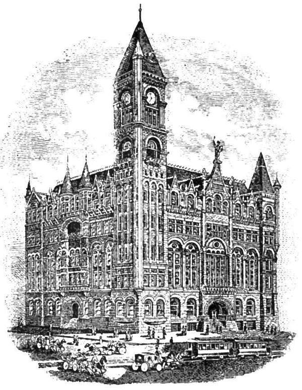
The telegraph was but the forerunner of the railroad. With Omaha the initial point of the Pacific telegraph lines, it enjoyed a marked advantage in the competition for the eastern terminus of the Pacific Railway. Up to that time, all transportation had been by steamboat up the Missouri River or in wagon and coach overland. The race of the iron horse across Iowa had been interrupted, first by the financial crash of 1857, and then by the[415] war of 1861, so that the first locomotive to carry its train to the Missouri River arrived January 17, 1867, bearing the escutcheon of the Chicago & Northwestern. Within two years four railroads converged at the river opposite Omaha eager to share the through transcontinental traffic already in sight.
The history of Omaha and of the Union Pacific is inseparably linked. It is not necessary to weigh the conflicting claims to credit for suggesting the railroad to the Pacific slope. The war demonstrated the military necessity of a rail connection with the coast States and forced Congress to take the steps that made its immediate construction possible. Without the subsidy offered in the Acts of 1862 and 1863 the road certainly would not have been built for years, and the development of the whole western country would have been long retarded.
At the recommendation of the chief engineer, Peter A. Dey, the eastern terminus was fixed "on the western boundary of the State of Iowa, opposite Omaha," an event so auspicious as to provoke a responsive demonstration from the enthusiastic inhabitants of the young city, who made the master-stroke of their cele[416]bration the actual breaking of the ground for the newly projected road. This occurred December 2, 1863, with the thermometer hovering close to the freezing point.
The work of construction was pushed with all possible rapidity, but with the best expedition it was May 10, 1869, before the juncture of the two roads heading for one another from east and west was effected, in the presence of a distinguished body of spectators, by the driving of the golden spike at Promontory Point, girding the continent with bands of steel. According to all accounts the celebration at Omaha of the completion of the Union Pacific was on a scale commensurate with its importance to the commercial and industrial position of the city.
If Engineer Dey was the central figure in the initial work, Thomas C. Durant, as First Vice-President and General Manager, had more to do with its successful completion than any other one man. While many names have since shown bright in the progress of this epoch-making enterprise, those of Dey and Durant must form the base-stones of the arch that has raised this great railroad to its eminence, and carried it through stress and storm.
The prestige acquired by Omaha as a railway[418] centre in those early days has been constantly maintained, until to-day the steel rails radiate in every direction, while three magnificent bridges span the Missouri where Brown's lonely ferry formerly transferred victims of the gold fever from one bank to the other.
With a firmly established industrial foundation, the progress of the city has gone steadily forward. Commercial expansion, it is true, has been broken occasionally by bursting real-estate booms, grasshopper plagues, drought-stricken crops or general financial depression, but in material welfare and ever-widening public activity the community takes rank with its most wide-awake competitors. Besides its extensive jobbing interests, its manufacturing development has been along the lines of silver smelting and refining, linseed oil mills, white lead works, machine and locomotive shops, and the great live-stock market and meat-packing establishments that have formed the nucleus of the magic city braced against its boundary under the name of South Omaha, and sure, sooner or later, to be one with it in corporate existence, as it is already in life and business. Although not yet past the fiftieth anniversary, Omaha boasts of all those advantages that make[420] an attractive living place—good schools, well-stocked free libraries, substantial churches, art galleries, well-paved streets, with water, light, and rapid transit, fine public parks, imposing public buildings. Above all, it is a city of homes and home owners, thick with modest dwellings though only meagrely supplied with palatial mansions. Omaha's contribution to the world of science, art, and literature is perhaps small, but it has given two presidents to the American Bar Association in James M. Woolworth and Charles F. Manderson, the latter also having filled the position of President pro tem. of the United States Senate; in banking circles Herman Kountze and Joseph H. Millard are known throughout the country; Edward Rosewater and his newspaper, The Bee, occupy a place in the front rank of American journalism; the art gallery of George Whininger is classed among the best private collections on this side of the Atlantic; and the benevolence of John A. Creighton has received recognition in the title conferred on him of Count in the Holy Roman See.
The Trans-Mississippi Exposition of 1898 constitutes Omaha's crowning achievement of[422] recent years. Projected in the period of densest industrial gloom and executed in the face of the war with Spain, the enterprise proved an unexpected and unprecedented success, returning to the stock subscribers ninety per cent of the money they had advanced. The financial success was, however, subordinate to the success in other directions. A white city of such architectural perfection could not fail to afford an æsthetic stimulus in itself of wonderful educational effect. Participated in by all the trans-Mississippi States and Territories as an exhibition of the resources and products of this vast region, the Exposition served to open the eyes of visitors from both at home and abroad to the limitless possibilities there spread before them. The Indian Congress alone, including as it did representatives of nearly all the remaining tribes of aboriginal inhabitants gathered together under the direction of the Indian authorities of the Federal Government, formed an ethnic object-lesson the like of which had never before been presented. No fitter culmination could have been prepared than the Peace Jubilee, in its closing month of October, attended by President McKinley,[423] members of his Cabinet, and heroes of the armed conflict just concluded, all uniting in acclaiming the end of war typified in the Exposition as a towering triumph of the arts of peace.


By JOHN COTTON DANA
DENVER has historic background. Behind its own brief chronicles we note the outline of the story, full of the good work of strong men, of the exploration and civic conquest of the wide country between the Mississippi River and the Pacific coast. To ask of Denver's beginnings is to go back of 1858 and the hopeful Aurarians by the ford at the mouth of Cherry Creek, to government explorations, California gold seekers, Mormon emigrants, trappers and traders, and Spanish pioneers.
The incidents which lead up to Denver's origin took place here and there in a great mid-continental area so vast as to make those incidents seem at first sight isolated, unrelated to one another. But there is a simplicity of plan in that great country which, taken with[426] the gold of the west coast and the migrant spirit of the early settlers of the Mississippi Valley, makes the early ventures across the plains seem natural enough and binds them to one another. Given the country and the factors mentioned, and a great central city, at once a focus and distributing point for all that lay across the plains, the Denver of to-day, was foreordained.
Westward of the Mississippi lie six hundred miles of plains, fertile and attractive on their eastern edge, a desert waste beyond, ending abruptly in rocky mountains. The mountains, dropping here and there into high and barren tablelands, roll on a thousand miles to the Pacific. From the Canadian to the Mexican boundary, plains and mountains thus dispose themselves and make the arena for the drama of the Anglo-Saxon conquest of the new West,—a conquest of a not too unwilling nature by energetic and efficient men. The scene was remote; the land, generous when once subdued, was repellent if not hostile in its aspect, and added to the barrier of a desert waste upon its border the deterrents and terrors of the unknown. The Indians who claimed the soil—chiefly Arapahoes and their allies near Denver, and their hereditary foes, the Utes, in the mountains—did all in their power to make a seemingly inhospitable nature yet more inhospitable. They were never large in number. They were foredoomed to defeat. Their presence in this vast area added more of romance than of difficulty and danger to the coming of the white man. Some of their travel-worn paths among the mountains, like the old Navajo trail of Southwest Colorado, may still be traced, can still arouse sympathetic interest in a people for whom the[428] modern man could not wait, and despised as laggard. From Aztec Springs, across Lost Cañon, over the Dolores River near its big bend, out upon Dolores Plateau to Narraguinnep Spring and the borders of Disappointment Valley, and then on and on again, so runs the old Navajo trail; here a single foot-path up the cañon side, there deep triple and quadruple ruts worn by men, women, horses, and dragging teepee poles. With no signs of permanent habitation on its way, out of wild nature it comes, into wild nature it goes; significant of the passing of the people who made it and of the petty trace they left on the world about them.
The Spanish had carried their religion and their rule up into the southern margin of this great area long before the first settlements were made on Massachusetts Bay. Coronado pushed as far northeast as Kansas in 1541. The towns which the Spanish established, many of them three centuries and more ago, led to the brief romance of the old Santa Fé trail, and still give a peculiar flavor to the story of the southern border. But save for a few small towns whose lack of root in the soil is evidenced by the ruins of their churches—churches so far forgotten that our own historians have[430] called them remains of prehistoric times—the Spanish invasion was an invasion always, not a settlement, not an appropriation of even the margin of the vast area we are considering.
Lewis and Clark went northwest to the Columbia in 1803; Pike went up the Arkansas in 1806; and that young man's simple tale of the things he dared and the sights he saw in his march from the Mississippi to the lone fort he built on the banks of the Conejos in the San Luis Valley is charming and adventurous. He was the American pioneer of the future Colorado. Wandering trappers and hunters had preceded him; but none told what they had seen.
Long, with his expedition, in July, 1820, crossed the spot where Denver now stands. Long was an explorer, not a pioneer. Pioneers are prophets, and see the fences and barns that are to come. To Long all west of the Missouri,
"agreeably to the best intelligence that can be had ... is throughout uninhabitable by a people depending upon agriculture for their subsistence.... This region, however," he says, "viewed as a frontier, may prove of infinite importance to the United States, inasmuch [431] as it is calculated to serve as a barrier to prevent too great an extension of our population westward, and secure us against the machinations or incursions of an enemy, that might otherwise be disposed to annoy us in that quarter."
This opinion, widely circulated, perhaps helped to defer the day of actual occupation of that Great American Desert which, after Long's report, took possession, on our maps, of nearly all the country whose history is Denver's prehistoric days.
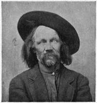
Then came Sublette and his like, and the Rocky Mountain Fur Company, the Santa Fé trail, trappers, Indians; and these also, beginning about 1822, would furnish material for romance, were the simple story thereof not romance enough.
Bonneville in 1832 vanished from sight in[432] the Northwest for three years; and many others, among them Irving, Bonneville's historian, sought profit, adventure, or knowledge in the new land. In '42, Frémont, the Pathfinder, on his first expedition pushed out nearly to the site of Denver. And Frémont's travels, the romantic note in them heightened by the presence of Kit Carson, prince of pioneers,—what color they add to our chronicles of exploration! Five times he set forth. Once he camped on the site of Denver, with 160 lodges of Arapahoe Indians near by. Once he nearly perished with all his party in the Sangre de Cristo range.
Kearney's military expedition to Santa Fé at the time of the Mexican War; Gunnison's exploration for a railroad route to the Pacific, in 1853; Marcy's incredible midwinter march from Fort Bridger, across the very backbone of the continent, south to New Mexico; all these were great deeds, and all served to add to that knowledge of the still wild West which brought about its final conquest.
To speak feelingly of the Mormon exodus, of that venture into the western wilderness of a few men of our own blood and faith, is to be misunderstood. Some day that flight of[433] a few brave exiles for conscience sake, from their brother men to the heart of a continent, where a relentless nature seemed, with her isolation and her desolation, doubly equipped for cruelty—some day that flight, worthily and justly told, will find a place in history.[15]
The gold seekers of California, who crossed by thousands the land the outline of whose human history we are trying to sketch, these have, perhaps, received their due.
Such, then, in broadest outline, is the background of Denver's history. It is almost depressing to consider how little the outline holds of that recognition element which makes "historic" for us a country, a scene, a person, an event. Here is a wide and wonderful country; here have been done great deeds by brave and true men. Coronado, Escalante, Pike, Lewis and Clark, among explorers; Kit Carson, Jim Bridger, the Bents, Jim Baker, among scouts, trappers, and traders; the names could be multiplied many times. Their deeds are fit to provoke emulation or national pride. But mention of either names or deeds stirs the emotions only of the few. This is inevitable. They are not yet part of universal knowledge. They are not yet types of men or actions, as are Ulysses, Agamemnon, Hampden, and the voyage of the Mayflower. Things are not "historic" until later generations have made them so. Perhaps the dominance of Old World types in literature and art, together with the swift[435] rush of affairs of the passing day, will crowd much of the story of America's development out from the domain of history as known to men at large. If so, the story of the taking by our forebears and our brothers of the great West beyond the Mississippi will always remain as little "historic," as barren in its emotional content, as it is to-day. This were a pity, tho' perhaps best. But even then it would seem proper to suggest, in the bare outline I have drawn, the historic possibilities which lie back of, lead up to, explain, the Denver of to-day.
It is 1857; the country has become vaguely known, many have crossed it; the Mormons have taken possession of the Salt Lake basin;[436] from the mountains across the plains there float back rumors of gold; and the region which has been simply a desert to be crossed begins to be a region to be explored, perhaps to be settled. Who first found gold it is idle to inquire. A party of Cherokees from the gold regions of Georgia were perhaps the first to get traces on the Platte. Certain men of Lawrence, Kansas, prophets perhaps, boomers probably, certainly addicted to the town-site habit, and abounding in hope, went up the Arkansas in 1858; tried to start a town on Monument Creek under the shadow of Pike's Peak; wearied soon of waiting for a population which did not come, and crossed the divide north to the Platte; staked out a town, Montana, on that stream a few miles above the site of Denver, and disbanded. Of this party a few moved down the Platte to the mouth of Cherry Creek, and there in the bottom, among the cotton-woods, just where the old military road crossed the creek, laid out the town of St. Charles. Another party, from Iowa, in the same year, settled across the creek on its west side and soon laid out a town and called it Auraria. Then came another party over the divide from the Arkansas, found the St. Charles town-site[437] promoters were absent, saw the city that was to be, jumped the site, and organized a company to build a town thereon to be called Denver in honor of the then Governor of Kansas. And so, in the winter of 1858-59 Denver found itself, on what proved to be "Section 33 and the west half of section 34, in township 3 south of range 68 west of the 6th principal meridian." How fatal to the romantic element in the beginnings of the Western city are the transit and the chain! What can there be of mystery or poetry in "Sec. 33 and W. 1/2 of Sec. 34, Tp. 3 S. of R. 68 W. 6th P.M."?
Denver was a rival of Auraria. Her supremacy was settled early in 1859 by thirty wagons which came up the Platte and unloaded their merchandise on the Denver side of Cherry Creek. In the spring of 1859 a large company, perhaps 1000, were already camped in and about the new towns. The Pike's Peak excitement became intense. A new gold fever was on. Mr. William N. Byers reached Denver April 21, 1859, with a printing outfit and issued the first number of the first paper printed in Colorado, April 23d. On his way across he met the returning tide. Report says 150,000 started that spring across the plains; 50,000 turned[438] back; 100,000 went on to the mountains; not over 40,000 of them stayed. The early months of 1859 were troublous times. Foolish, reckless gold seekers, led West on half-knowledge, tried to lay the blame for their own folly on the shoulders of others. Gold in paying quantities was as yet far from common. Horace Greeley crossed the plains in July, looked over the ground with care, reported favorably on the country in the Tribune, and, in good local phrase, "gave Denver the best advertisement she ever had."
The city, now under way, attained little importance until after 1870. Rival trade centres attracted attention. Mining camps scattered through the mountains drew most of the population. After the Leadville excitement in 1878 and 1879, it rose in 1880 to 35,000, by fairly steady growth to 106,000 in 1890, was checked by the panic and hard times about 1893, and yet rose to 133,000 in 1900.
Once established as the leading distributing point of the mining regions of the New West the city's growth was assured, and followed in the main the lines of many other Western cities. Peculiar to itself were a few incidents due to its position, to ignorance of the climate, its isolation and the difficulty of extending Eastern[440] railways to so remote a point. Early in 1863 a great fire destroyed much of the business portion of the city. The summer following, the plains were burned by a terrible drought. The barrenness of the wide stretches about the city was intensified. To this day the sun-burnt plains of midsummer sweep up to Denver's very door-yards, mock at the blue sky above them, and speak unutterable things of hunger, thirst, and death. In the early '60's it was easy to imagine that they spoke in earnest. Then came a winter, cold beyond all experience. Many suffered. Cattle died. The pride some had felt over the balminess of previous winters was forgotten. With early spring, Cherry Creek, the miserable, despised bed of sand which crept through the town, scorned as a possible stream and used for building sites over all its wide bottom, rose in fury, rolled down from the divide, swept away the cheap bridges that simply served to aggravate the flood, killed twenty persons, and destroyed nearly a million dollars' worth of property. Nor was this the end of troubles. For in 1864 the Indians planned a general massacre, killed a few people near Denver, destroyed stage stations, cut off communication with the East, and left Denver unspeakably alarmed and with only six weeks' supply of food.
In these first years gold seemed the one excuse for the white man's presence in Colorado. Several million dollars were taken out from easily worked placer mines before 1863. The supply then seemed exhausted. All efforts to get the gold from veins were ineffectual. Millions were spent by the overzealous in machinery and mills not adapted to the country's needs. But over this, as over all other[442] obstacles, the triumph was sure; and by 1871 new and proper processes of mining and ore reducing had been successfully adopted.
The fertility of Colorado soil under irrigation was not realized fully for nearly a decade after the founding of Denver. But before 1870 the agricultural possibilities were demonstrated; the cattle industry continued to thrive; and the region north of Denver lying under the several streams which issue from the mountains within sight of the city began to grow into the garden spot it now is, and to lend stability to Denver's factors of growth.
The Union Pacific reached the city via Cheyenne in June, 1870, and the Kansas Pacific soon after. Of that wonderful railway to whose growth Denver owes so much, the Denver & Rio Grande, the first rails were laid in 1871.
What is now Colorado was variously known in early days of its settlement as "Pike's Peak," "Arapahoe County," "Jefferson Territory." The story of the settlement of its governmental difficulties; its miners' and its people's courts; its independent government; the dramatic career of that prophet of the great divide, William Gilpin, first Governor[443] of Colorado, in his headstrong yet wise handling of difficult problems in the opening days of the Civil War,—all this is full of interest, of excitement, of adventure, is instructive to the student of institutions, and full of confirmation for those who have faith in the civic genius of the American people.
The city of Denver lies fifteen miles east of[444] the mountains on the Platte. Its elevation is 5280 feet above sea level. It is the meeting point of nine railroads. It has 165 miles of street railways. It is well paved and its health is well cared for. In parks, churches, journals, schools, hospitals, banks, and kindred institutions it is well supplied. Its manufactured products, including smelter output, amount to over $50,000,000 a year.
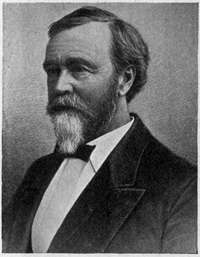
What one may call the natural history of Denver's people is interesting and, perhaps, explanatory of some things in its history. To it have come in good measure the vigorous and energetic. They have brought with them the ideas and customs of all parts of the United States. In the first two decades, the formative period, about half of all comers were[446] from the upper Mississippi Valley, largely of New England descent; and one fourth each from the extreme East and the South. Among these were many invalids. All were young; and old men are still rare in Denver. Put these elements together in a climate of sunshine and dry tonic air; separate them by six hundred miles from all that is old and conventional; give them wide opportunity of choice in occupation,—agriculture, stock raising, mining of precious metals, iron, coal, and stone, and the building of a city and a State; let their city be—much as Paris is France—politically, socially, and financially, the entire State, containing, as it does, nearly one third of all the latter's population;—and you may look for, and you will find, courage, swiftness of execution, easy adjustment of conflicting ideas and habits, tolerance on all matters save those affecting general local interests, where a certain natural State patriotism blooms into a fine bigotry, quick adoption of all modern improvements in living, and a readiness to try any promising social experiment. You would expect politics to be continually threatened with reform; an occasional[447] economic heresy to get a passing boom; newspapers to be wide-awake, vituperative, and not greatly influential. And you would expect to find Denver, as you do find it, a brilliant, active, inspiring city, full of promise in itself and possessed by a people who—being chiefly of American stock and wrought upon by a climate which is the climate of the States intensified—in their alertness and in their intensity perhaps speak of the American citizen as this continent of ours will sometime mould him.

By FREDERICK WEBB HODGE
THERE is probably no settlement within our domain over the history of which so much mystery has hovered as the capital of New Mexico. Some historical writers early claimed for the ancient city a reputation for antiquity exceeding that of St. Augustine, Florida; others were content to give it second place in point of age, and this position it really holds, notwithstanding the strong but groundless belief, still somewhat prevalent, that Santa Fé had a teeming aboriginal population when the Spaniards under Coronado first made their appearance in New Mexico in 1540.
The actual founder of Santa Fé, so far as we can determine, was Juan de Oñate, a wealthy resident of Zacatecas, who married Doña Isabel, granddaughter of Hernan Cortés, and[450] great-granddaughter of Montezuma, the Aztec chief. In the autumn of 1595 Oñate was granted authority and viceregal support to raise an army and to explore and colonize New Mexico, but the intrigues of his rivals caused many delays and it was not until February, 1598, that, with a force of some four hundred colonists, accompanied by eighty-three wagons and seven thousand cattle, he was ready to proceed from the Rio Conchas in Chihuahua, bound for the Rio Grande del Norte and New Mexico.
It is not essential to follow the little army in its northward journeying up the river, across the terrible Jornada del Muerto,—where, as scores of times later, the bones of some were left to whiten the trail. The new country was formally taken possession of, for the fifth time at least, in the name of the King of Spain, and on July 11, 1598, Oñate with his vanguard reached the still inhabited Indian pueblo of San Juan, some thirty miles northwest of the present Santa Fé.
A month later work was begun with Indian aid on the construction of ditches to supply water for a new settlement, the site for which had been selected at the confluence of the Rio Chama with the Rio Grande, on the west bank[452] of the latter stream, where the hamlet of Chamita now stands. On August 23d the erection of a chapel for this new town of San Francisco de los Españoles was begun; it was finished September 7th, and on the following day was consecrated.
This town, which was built on the site of the abandoned Tewa pueblo of Yukewingge (or Yuqueyunque as Coronado's chroniclers called it in 1541), was thus the first European settlement in New Mexico, and the second within the limits of the United States. In 1599 the village became known as San Gabriel, a name which it retained for several years.
The exact date of the founding of Santa Fé is not known, ignorance of the fact probably being due to the destruction by the Indians of the local Spanish archives in 1680. In October, 1604, Oñate started on a journey to the head of the Gulf of California, returning to San Gabriel on April 25, 1605. The return route took the explorer past El Morro, or "Inscription Rock," thirty-five miles east of Zuñi, where he carved his name on April 16th. It seems likely that the building of Santa Fé was begun shortly after[453]ward, although there is also good authority that San Gabriel remained the only settlement of Europeans until 1608, in which year, it is said, the Crown fixed the governmental regulations of the province and assigned a salary of two thousand ducats a year to the Governor, who immediately departed for Santa Fé. About this time Oñate was relieved by Governor Pedro de Peralta.
The prospects of the new capital during its infancy were not promising. Although the Franciscan missionaries manifested such zeal that by 1617 eleven churches had been established in New Mexico and fourteen thousand natives are said to have been baptized, there were only forty-eight soldiers and colonists in the entire province. On January 3, 1617, the King was petitioned to grant succor to the settlement, and by royal decree of May 20, 1620, his Majesty ordered the Viceroy to render the necessary aid, with the result that by 1630 it was recorded by Fray Alonso de Benavides that the town contained 250 Spaniards (some fifty of whom were armed), in addition to seven hundred Indians, "so that, between Spaniards, half-breeds, and Indians, there must be a thousand souls." The[454] expense of the garrison was not borne by the Crown, but by means derived from an encomienda, or trusteeship over the Indians, who paid an annual tribute of a vara of cotton cloth and a fanega of corn per family in return for their teaching and "civilization."
As at San Gabriel, among the first structures reared in the new town was a chapel. The first edifice of this character was an unpretentious affair, a mere hut, which served its purpose until 1622, when Benavides, having become Father Custodian of the province, commenced to build a new church and monastery which, after its completion in 1627, "would shine in whatsoever place." This is believed to have been the Parroquia, which stood on the site of the present cathedral; indeed, some of the walls of the old building are incorporated in the present structure. The chapel of San Miguel, greatly modified in recent years, dates from the middle of the seventeenth century; while the Capilla de los Soldados, which formerly faced the plaza, opposite the Palace, with its grand altar tablet erected by Governor Francisco Antonio Marin del Valle in 1761, probably dates from about 1730.
As already mentioned, there is no ground[456] for the belief that Santa Fé was established at a populous Indian pueblo,—the "capital" of all the village dwellers of New Mexico,—the only excuse for such belief, still popular in New Mexico, being that, in prehistoric times, the town was the site of at least one Indian pueblo.
Of the history of Santa Fé between Benavides's time (1622-1630) and the year 1680 not much is known. More than a dozen governors served the kingdom of Spain in the administration of the affairs of the colony during this period, and knowledge of the geography was somewhat increased by expeditions from the seat of government into parts little known. The Pueblo Indians, always friendly when well treated, cherished the religion of their fathers, which the Spaniards tried in every way to supplant, so that comparatively little progress was made in this rich missionary field aside from the erection of massive churches of stone and adobe and the baptism of many of the natives. Jealousy arose between the civil and ecclesiastical authorities, and so bitter became the feeling that the friars were accused of inciting a rebellion of the Indians in 1642, which resulted in the killing of Governor[458] Luis Rosas. Henceforward the hatred of the natives for the whites became deeper and deeper; many of the natives were hanged from time to time for alleged religious offences, and in 1675 many others were whipped and imprisoned. From this time affairs assumed such a serious aspect that the sedentary tribes, under the leadership of Popé, a native of San Juan pueblo, finally determined to throw off the Spanish yoke by effecting an organization that is still noteworthy in Indian annals.
Popé was a medicine-man of no mean capacity. His story of the wrongs of his people fell on eager ears, and it was not long ere his plan to exterminate the Spaniards received support from all the northerly Pueblo tribes. The day of reckoning was to have been August 13th, while the mystic means of communication was a knotted yucca cord which was dispatched by fleet runners to the outlying tribes. Although all were enjoined to the strictest secrecy, treachery lurked in the Indian ranks, and before the time allotted for the outbreak the Spaniards became aware of its approach through neophytes loyal to their[459] cause. Popé saw that immediate action was necessary to the fulfilment of his designs; news that the secret had been divulged was heralded afar in true Indian fashion, and on August 10th, three days before the time originally fixed, more than four hundred of the twenty-five hundred settlers, soldiers, and friars were cruelly massacred.
On the 13th the refugees at Santa Cruz were taken to Santa Fé, and on the day following the enemy appeared in the suburb of Analco, in the vicinity of the present chapel of San Miguel, which had been erected for the Tlascalan or Mexican members of the colony. A parley was held with a deputation of the Indians, who bore a white cross of peace and a red cross of war: of these they gave the Spaniards their choice, but on condition that if the former were selected their country must be immediately evacuated. Every effort was made by the Spaniards to bring about peace, but the Indians, encouraged by the success of their bloody enterprise, were determined to drive the Spaniards forever from the home of their fathers.
Failing in his efforts at conciliation, Governor Otermin endeavored to dislodge the[460] natives from the outskirts; but already the warriors had arrived by hundreds, and the first desperate effort of the Spaniards to drive off the natives resulted in their own retirement to the great adobe Palace where the surviving women and children had already taken refuge.
The siege continued until the 19th. The Indians grew bolder with the continued arrival of warriors until three thousand were massed in the outskirts of the town. The city was beleaguered; the chapel of San Miguel had been destroyed, and the water-supply of the town cut off; consequently the trembling thousand within the Palace walls under the protection of only a hundred armed men were in desperate straits. The 19th passed. Otermin and his imprisoned colonists spent the night in planning the escape which seemed almost impossible. On the following day the brave hundred made a sortie which met with such success that three hundred of the enemy were slain, and nearly fifty captured and afterward hanged in the plaza, while the main body was driven in confusion to the heights. The Indians became demoralized by this first blow, thus affording the Spaniards the opportunity, on August 21st, of gathering their belongings,[461] and starting on their march of six weeks down the river, under a midsummer's sun and through a ravaged country, to the mission of Guadalupe near the present El Paso, Texas.
The Pueblos were at last in possession of Santa Fé and of the dearly bought independence which they had so long been craving. Everything Spanish was laid aside under strict taboo—the language of the white man was to be forgotten and his religion forever buried; his houses of worship and the civil and ecclesiastical archives were to be fed to the flames, and their own rites revived in the ceremonial chambers which the Spaniards had caused to be abandoned; even the clothing and the crops of the foreigners were to be discarded, and only indigenous products consumed as of old, while soap-weed and the rivulet which flows through Santa Fé provided the means for effacing their baptism into Christianity. The Palace (which then occupied the entire block north of the plaza) seems to have been at least partially spared and was occupied by the Tanos of Galisteo, who built a kiva or ceremonial chamber in its courtyard.
More than one attempt was made to reconquer the province and to re-establish the seat[462] of government during the next few years, but nothing of marked importance was accomplished until after Diego de Vargas Zapata Lujan Ponce de Leon became Governor in 1691. Accompanied by some sixty soldiers, one hundred Indians, and three friars, Vargas started up the Rio Grande from El Paso August 21, 1692, and on September 13th appeared before Santa Fé with part of his force. The fortified Tanos at first showed hostility, but moral suasion soon resulted in effecting their surrender and even in inducing the apostates to renew allegiance and to submit to baptism. Vargas then withdrew for the purpose of extending the conquest over other parts, and it was not until October, 1693, that he was enabled to gather his force of a hundred soldiers, and to renew the journey from El Paso with the seventy families and seventeen friars (about eight hundred souls) who were to form the new colony. On December 16th the little army entered Santa Fé under the very banner borne by Oñate nearly a century before. Although the Tanos were now found to be friendly in the main, they manifested little enthusiasm in providing the Spaniards with food, or in rendering aid in the restora[463]tion of San Miguel Chapel, offering, however, their pagan kiva for the white man's worship.
It was midwinter, and, the altitude being over seven thousand feet, many children perished. As the Indians were occupying the official quarters and such of the dwellings as had not been razed, they were ordered back to Galisteo, but refused to go. Their stronghold was attacked; re-enforcements from the kindred Tewas arrived, but the combined force was overpowered, seventy prisoners were made an example of, and four hundred women and children were distributed among the colonists. Hostilities continued with the outlying tribes until September, 1694, but before the year closed the missionaries were enabled to resume their fields of labor.
The winter of 1695-96 was one of discontent by reason of a failure of the crops during the previous season. This probably in large measure was the cause of another revolt in the following June, when twenty-six Spaniards, including five friars, were murdered; and not until the new century dawned were the last embers of the rebellion smothered. Vargas's term as Governor expired in 1696; but he remained in Santa Fé, where[464] serious charges were preferred against him by his successor, Cubero, which resulted in his imprisonment until 1700. In 1703 he was reappointed Governor, but died April 8, 1704, and was buried in the Parroquia, which meanwhile had been restored to its former condition. San Miguel Chapel remained in ruins until 1708, when its restoration was commenced by Governor José Chacon Medina Salazar y Villaseñor, Marqués de Peñuela. The edifice was completed in 1710, as the following inscription on a gallery beam still testifies:
EL SEÑOR MARQUÉS DE LA PEÑUELA HIZO ESTA FÁBRICA: EL ALFÉREZ REAL DON AGUSTIN FLORES VERGARA SU CRIADO. AÑO DE 1710.
The eighteenth century was marked by expeditions from Santa Fé in various directions (including one in the year of American Independence that resulted in the discovery of Utah Lake), which added materially to geographic knowledge of the period; by an extension of missionary work among some tribes and the chastisement of others who had been conducting their raids uncomfortably close to the capital with its little garrison of[465] eighty soldiers; and by controversies between the authorities of Church and State which did not tend to promote the peace of mind of either side or of the colonists.
In 1767 a freshet so seriously threatened the town that the citizens were called to divert the course of the stream and thus saved the settlement. As in the case of a previous[466] proposal to move the capital to Sia, it was planned in 1780 to transfer the seat of government to Santo Domingo, but Governor Ugarte decided against the project and expended two thousand pesos in improving the plan of the town and in establishing a presidio therein. Before the middle of the century French-Canadian traders had found their way to the Rio Grande, and sporadic bartering with the plains Indians gradually developed into the important industry later known as the "commerce of the prairies." A brisk trade also sprang up between New Mexico and Chihuahua, which in 1780 aggregated $30,000 in value. Santa Fé, therefore, at an early period became the seat of an inland commerce, mainly in sheep, wool, wine, and pelts. In 1804 William Morrison of Kaskaskia dispatched to New Mexico a consignment of goods, which were confiscated; various attempts to introduce merchandise from the United States during the next few years shared a like fate, the participants usually being imprisoned. This action on the part of the New Mexican officials was later probably more or less due to the ill-feeling engendered by the exploit of Lieutenant[467] Zebulon M. Pike, who in January, 1807, while conducting an exploration under military orders, erected a stockade fort in Spanish territory. He and his command were arrested, conducted to Santa Fé, and later taken to Chihuahua as prisoners.
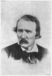
But all efforts to prevent the inroads of traders from the United States were in vain; even the almost prohibitory duty, for a time, of $500 per load of merchandise, regardless of its value, was overcome, and the overland trade conducted by way of the great Santa Fé trail, first by pack-animals from Franklin, and later by wagon from Independence, Missouri, increased from $15,000 in 1822[468] to $750,000 in 1844. The names of McKnight, Pursley, Choteau, Beard, Lalande, Chambers, Cooper, the Bents, Joel Walker, Sublette, Kit Carson, and many other hardy pioneers will long be remembered in the early history of the old Santa Fé trail.
Santa Fé had so long been the hotbed of revolt that its inhabitants must have been lonely for several years without one to engage their attention. The rebellion of 1837 was due to political intrigue for which a former Governor, Manuel Armijo, was held to be largely responsible. The Pueblo Indians participated as usual, and the Governor, Albino Perez, as well as the chief justice and nearly a dozen others, were wantonly murdered. Santa Fé once more fell into the hands of the enemy, who elected José Gonzalez, a Taos Indian, as Governor. Armijo now deserted the rebel cause, and, raising a sufficient force to overcome the Gonzalez faction, declared himself the administrative head. The revolt was quelled in January, 1838, Gonzalez and several of his adherents paying the death penalty, while Armijo's "loyalty" was rewarded by a confirmation of his self imposed governorship, which he retained for eight years.[469]
Meanwhile the Texas troubles had been brewing, and discontent prevailed in that quarter over boundary disputes, and because the large Santa Fé trade came and went by the northern route. In 1841, President Lamar equipped a force, known as the Texan Santa Fé Expedition, consisting of three hundred rangers under General McLeod, for the main purpose of taking New Mexican affairs into their own hands; but before reaching the capital the entire "army" was captured by Armijo's militia, their belongings confiscated, and the command marched to Mexico, where they were released in June, 1842.
The Mexican War and American occupancy followed closely on these exciting episodes. Save during the brief periods of the arrival and departure of the caravans at Santa Fé, with the resultant hubbub and flow of gold, the capital was more dead than alive. The people, for the greater part, were densely ignorant; in 1832 there were only half a dozen schools in the whole territory, and although the salaries of the Santa Fé teachers aggregated only $500 in that year, even this sum, from lack of funds, was unavailable in 1834 and the schools were closed. By 1844 the only schools were "of the[470] lowest primary class," and a keen observer asserted that three fourths of the people were illiterates. Santa Fé was without a newspaper, although a sheet called El Crepúsculo ("The Dawn") was printed at Taos for four weeks in 1835 on the only press then in the territory of seventy thousand inhabitants. Possibly the press later found its way to Santa Fé to become the principal part of the equipment of a "government printing office" which existed in one end of the Palace in 1846, and from which Kearny published his "Code," the first Spanish-English production of the territory.
In its appearance Santa Fé had changed but little since 1807, when Pike described its aggregation of low adobe houses as resembling from a distance a fleet of flat-bottomed Ohio river-boats. The Palace occupied then, as it did early in the seventeenth century and does to-day, the northern side of the plaza. Besides being the only building in New Mexico that could boast the luxury of glass windows, it contained the governmental offices as of yore, as well as quarters for the guard and the government printing office. In Pike's time the opposite side of the plaza was occupied by the houses of the clergy and the public officers, in[471] addition to the military chapel, but with the advent of trade these gave way, before 1846, to the shops of merchants and traders.
General Stephen W. Kearny left Fort Leavenworth, Kansas, in June, 1846, with his "Army of the West," comprising about eighteen hundred men (mostly volunteers), equipped with a supply train of a thousand mules, and overtaking en route the Santa Fé caravan of four hundred wagons. A small force was sent forward to open the way, and although it was favorably received, Kearny later learned that his advance toward the capital would be contested. Nevertheless, the army continued[472] its march and entered the town on August 18th without the slightest opposition on the part of Armijo, who had fled precipitately. The Stars and Stripes were hoisted over the Palace, which Kearny made his headquarters, and the now seasoned volunteers encamped on an eminence overlooking the town. On the following day the inhabitants were assembled in the plaza, where the oath of allegiance was administered to the former Mexican officials, including the acting Governor, Juan B. Vigil. On the 22d Kearny issued his famous proclamation declaring himself Governor and the inhabitants of New Mexico citizens of the United States.
Meanwhile, Captain W.H. Emory selected, as the site for a fort, an eminence on the northern edge of the town, and the construction of defensive works was immediately begun. The fort, named in honor of William L. Marcy, then Secretary of War, was built principally of adobe; the only approachable point was guarded by a blockhouse of pine logs, and the magazine was erected of the same material. The embankments of old Fort Marcy are still plainly traceable, but there is nothing to mark the graves of[473] the two hundred brave Missouri volunteers who were laid to rest at the foot of the slope during the cruel winter of 1846-47.
Kearny took almost immediate steps to provide civil government for New Mexico by appointing as Governor Charles Bent, who had for many years been a prominent trader in the country. But as the months passed many of the New Mexicans grew tired of their new allegiance, and conditions ripened for another revolt. On January 19, 1847, Bent, with other officials, was foully murdered at Fernandez de Taos by Mexicans and Taos Indians, but retribution swift and terrible followed, and the battle-scarred and ruined church at Taos pueblo practically repeated the story of the Alamo.[474]
Although it remained under military control until 1850, New Mexico very soon began to feel the effects of American influence. In 1847 a legislative assembly was held at Santa Fé; the first English newspaper, The Santa Fé Republican, was founded, and the New Mexicans had their first opportunity of becoming familiar with the mysteries of a sawmill, which was placed in operation on Santa Fé Creek. In August, 1848, the treaty of peace was proclaimed from the Palace, and the ancient city formally changed masters for the fifth time in its history. The volunteers were glad to return to their homes, the Santa Fé trade resumed its busy march, and modern ways made further impress on the manners of the old adobe town. In 1848 the first English school was put in operation at the capital; later in the year the New Mexican was founded, and, save for a few intermissions, has ever since been published; while the ecclesiastical importance of the town was augmented by the establishment of the Roman Catholic vicariate-apostolic of Santa Fé, with Bishop Lamy at its head. On March 3, 1851, after much wrangling and many attempts, New Mexico was organized into a full-fledged territory of the United States, James S. Calhoun[476] becoming its first civil governor, and on July 14th the first legislative assembly fixed Santa Fé as the seat of the new government.
Next came the Civil War, the principal operations of which were not so far away that Santa Fé failed to participate. The severe defeat of the Federals under Canby by the Texans under Sibley, at Valverde, in February, 1862 (where Kit Carson's bravery made him a brigadier), opened the northern way to the Confederates. Santa Fé was abandoned by the Union forces on March 3d, and Sibley took possession a week later. On the 22d Colonel Slough's Federal force of thirteen hundred men marched from Fort Union toward the town. On the 26th the vanguard of four hundred met the enemy in Apache Cañon, and in the severe engagements which followed on that day and on the 28th, the Federals were victorious and the way was again opened to their occupancy of Santa Fé on April 11th, the Confederates having evacuated three days earlier. This practically closed the war in New Mexico, the Texans returning to their homes minus half their number.
The recent years of Santa Fé's history have[477] more than ever marked the passage of the ancient town from the lethargy characteristic of the century of its founding to the enterprise which one expects in an American settlement of the present day. The contrast between the sleepy Mexican village in the wilderness during the early years of American occupancy and the progressive, substantial, picturesque town of nowadays is vast. The great awakening came with the first screech of the locomotive on February 9, 1880, which forever hushed the rumble of the long caravan as it rolled its weary way into the crooked streets of the City of the Holy Faith. New Mexico's capital was enabled at last to make the acquaintance of the outer world, although rival settlements, created by the new trail of steel, robbed it more and more, as year after year passed, of the trade which had helped to make it famous. Its genial climate and other advantages attracted many from the East; schools and hospitals were established, and as the seat of federal and territorial administration, as well as of military and ecclesiastical importance, its social advantages became widely recognized.
Despite its modern buildings devoted to[478] various uses, there are parts of the town which have not changed greatly during the half-century of American influence. The plaza, of tragic memory, has evolved from a barren common to a bower of beauty ornamented with a monument dedicated to the heroes of Indian and civil strife. The old Palace, in which the gallant Vargas was dungeoned, and in which Lew Wallace wrote the last chapters of Ben Hur, has been refurbished, but probably no walls within our domain hold in hiding such a wealth of cruelty and horror, of treachery and suffering, of valor and chivalry, as the great adobe structure which still overlooks the historic plaza of our oldest western town.

By JAMES EDWARD TALMAGE
LONG before the first settlement, little more than fifty years ago, of the valley of the Great Salt Lake, strange stories of the briny sea and its desert setting had found their way to the civilized and cultured East; and, mingled with the weird accounts of sun-baked plains, waterless wilderness, and saline solitudes, were the predictions of the wise that the country would never be worth settling. This region was included within the area against which Daniel Webster hurled his anathema of denunciation from the floor of the national Senate, proclaiming the utter worthlessness of the great West, and declaring that he would "never vote one cent from the public treasury to place the Pacific coast one inch nearer to[480] Boston" than it then was. And concerning the Salt Lake Valley itself, Colonel James Bridger, for whom the disputed honor of discovering the Great Salt Lake has been claimed, said that he would offer a thousand dollars in gold for the first ear of corn that could be ripened therein.
The motive spirit actuating the early travellers in these then Mexican wastes was that of exploration and discovery. Worthy as it was, it was insufficient to induce the settlement of the wilderness or to inspire the ambition of subduing the desert and sanctifying the waste places with the name of home. The most potent of all incentives, that of religious conviction and conscientious devotion to what was regarded as sacred duty, was necessary—and not wanting.
It was on the 19th of July, 1847, that the vanguard of the pioneer party of "Mormon" colonists sighted the valley of the Great Salt Lake. For long, weary months they had journeyed; their start from the frontiers of civilization had been hastened by the musket and the sword and the devouring flame of persecution; their course over plain and mountain had been attended by vicissitudes that only those who have toiled through such journeys[482] can comprehend.
And what emotions did that first view of the "Promised Land" inspire! A valley, beautiful it is true, even as the desert is beautiful in its parching splendor; as the mountains are beautiful in their terrible grandeur; as the ocean is beautiful in its calm monotony or in its storm-lashed fury; but such beauty is not suggestive of rest or peace, and it was peace the wanderers sought. From the cañons of the Wasatch, though not the first to traverse the region, yet the first to brave its desolate and forbidding seclusion in search of a home, they looked down on a valley walled by the Wasatch and the Oquirrhs, bare of tree or shrub, except for patches of chaparral oak, and here and there a gnarled willow or cottonwood bravely struggling for existence on the upper parts of the few stream courses that opened from the mountain wall on the east; the only blossoms those of the stunted sunflower and its desert companions, the foliage that of the gray artemisia, or wild sage.
On the 24th of July, 1847, Brigham Young, the founder of Salt Lake City and the pioneer colonizer of Utah, descended from the moun[483]tain gateway, followed by the main division of the company, numbering a hundred and forty and four souls, of whom three were women. One of this trio of heroines was overcome by the treeless and desolate aspect of the valley. "Weak and weary as I am," she said, "I would rather go a thousand miles farther than stop in this forsaken place." Three days earlier an advance detachment, including Orson Pratt and Erastus Snow, each of whom came to be known as a prominent apostle of the "Mormon" Church, had entered the valley; but July 24th is regarded as the first day of occupation, and each recurrence of the date is observed as Pioneer Day, a holiday by law established in the State of Utah.
The pioneers' purpose was not uncertain; having reached their destination they paused not to make experiments or preliminary tests. "This is the place," said their leader, "the very place"; and the company began at once the work of permanently establishing themselves and of preparing for the reception of other immigrant parties then on the march. Ploughs were promptly brought into action, and the soil theretofore unused to the husbandman's touch was in part torn and turned; yet so hard and resistant was it that it measured its strength with the energy of man and for the time held the victory. But the colonists were full of resource. The little stream now known as City Creek, the chief source of the city's water supply, was diverted from its course and made to flood the land chosen for the first desert garden. With its long thirst appeased, its stony heart softened, the virgin soil yielded and received the first seed sown by human agency in the Great American Desert. Thus began the system of irrigation which in its later developments has proved itself the magic wand under whose sway the desert has been conquered and the wilderness transformed into a garden of beauty.
On the 28th of the same month the city[486] was planned and its boundaries were indicated; five days later the survey of the city plat was begun under the direction of Orson Pratt. All the plans were on a scale of unlimited liberality. The streets, each eight rods in width, were made to cross at right angles, dividing the city into rectangular blocks, each of ten acres. The choicest block in point of situation was designated as the site of the prospective temple; and is now occupied by the world-famed Temple, the Tabernacle, and the less pretentious Assembly Hall. The original survey was made to include a hundred and thirty-five of these ten-acre blocks; several were chosen for public squares and parks; the remainder were to be divided into city lots for the accommodation of the thousands soon to come.
Religious devotion, the inspiring cause of this seemingly reckless scheme of colonization, demanded facilities for public worship; and, lacking chapel, synagogue, or temple, the colonists provided a leafy tabernacle. Trees were hauled from the mountains, and of these a bowery was constructed, which for a time was church, court-house, and capitol.[487]
Having learned by experience that Indian attacks were to be expected, the settlers congregated on a single ten-acre block, which they enclosed by erecting their huts of logs and adobe along the eastern border. Each hut opened inward toward the centre of the square and was provided with a loophole on the outer side; the space between the houses and the sides of the block not occupied by habitations was protected by a continuous wall of adobe. With the increase of population additions were made to the fort; but as soon as the ruddy aborigines learned that the white invaders were their friends, the fort was abandoned, and the settlers distributed themselves over the city area.
At the time of its first settlement Utah was a part of the Mexican domain; nevertheless, the "Mormon" colonists, confident as to the destiny of their nation, patriotically raised the Stars and Stripes and took possession of the region in the name of the United States. A prominent hill, part of the Wasatch spur which bounds the present city on the northeast like a fortress wall, was chosen as the flag site; and this elevation is to-day known as Ensign Peak. From its summit, now surmounted by[488] an enduring flag-staff of steel, the banner of freedom is thrown to the mountain breezes on public holidays and other occasions of patriotic celebration.
More colonists arrived in parties great and small; and by the spring of 1848 approximately seventeen hundred souls were encamped in the valley, more than four hundred dwellings had been erected within the confines of the old fort, and about five thousand acres of land had been brought under cultivation. In May and June, the settlers were arrayed in battle order, not against human foes but to fight the dreaded insect scourge, the Rocky Mountain crickets, which in countless hordes descended from the mountains and invaded the fields and gardens. Every member of the little community, man, woman, or child, was called into action but to little purpose. When the people had been reduced to despair they were saved by what they devoutly believed to be a special and miraculous interposition of Providence. There suddenly appeared on the western horizon a tremulous cloud which grew in magnitude as it rapidly approached, until at last it was seen to be the vanguard of an advancing army of gulls.[489] Down swooped the white-winged deliverers, devouring the crickets with incredible voracity until but few were left alive. Since that day the gulls have been sacred in Utah. Every spring they come to follow the plough as it turns the soil for the season's seed, and so confident are they of their safety that they may be approached almost within arm's length. Added to the ruin wrought by the crickets was a further deprivation, due to drought and frosts. The harvest of 1848 was little better than a failure, and the succeeding winter and spring were seasons of extreme destitution. The people were brought to the dire necessity of gathering the wild weeds of the desert and even of boiling the raw hides in their camps for sustenance. The bulbous roots of the sego lily—now the banner-flower of the State—were dug for food; but the pangs of hunger were an experience from which none escaped. However, the following season brought a more abundant return from the soil and the prospects of the colony brightened.
In February, 1848, the treaty of Guadaloupe Hidalgo secured by cession from Mexico to the United States the region now embraced by Arizona, New Mexico, Utah, Nevada, and[490] California. The great republic reached the Pacific, and Salt Lake City became an integral part of the United States. Up to this time, and, indeed, for a year thereafter, the governmental affairs of the new community were administered almost wholly by the Church authorities. In February, 1849, the city was divided into nineteen ecclesiastical wards, over each of which a "bishopric" presided, consisting of a bishop and his two counsellors, who combined with their purely churchly function the duties of magistrates and civil officers. They regulated the levying and disbursing of taxes, the construction of roads and bridges, and the like.[16]

In the early months of 1849 steps were taken toward the establishment of a State government from which the city might hope to derive corporate powers. It was proposed that the State of which Salt Lake City was destined to be the capital be called Deseret—a name occurring in the records of the ancient inhabitants of the continent, as set forth in the Book of[491] Mormon, and meaning "the honey bee." The hive, expressive of the characteristic industry and thrift of the people, was chosen as the symbol and seal of the prospective State. Pending action by the national Congress, the "Provisional Government of the State of Deseret" was established, and its officers were duly elected. The General Assembly of the State of Deseret, in January, 1851, chartered "Great Salt Lake City" and appointed its first Mayor, Jedediah M. Grant, and other municipal officers. The people were not yet informed that four months before, September 9, 1850, the Congress of the United States had refused their petition for statehood and had created the Territory of Utah. The acts[492] of the provisional government were subsequently confirmed by the first territorial Legislature, and the city's charter was thus legalized.
Each passing year added to the attractiveness of the new capital. An orchard had been planted on every unoccupied lot, shade trees were placed along the outer borders of the sidewalks, and to nourish these a small stream was made to flow down either side of every street. The city became the acknowledged business centre of the inter-mountain region. Situated on the road to the gold regions, when the gold fever was at its height, travel was[493] heavy, and the settlers found a ready market for anything they could produce from the soil. Gold-seekers hastening westward and successful miners returning eastward halted at this oasis to replenish their supplies, and left their wealth in lavish abundance to enrich the people of the desert, who, however, had little need of gold in their local trade, and valued it only for the implements of husbandry and building it would buy in the East. A strange spectacle was presented of a city destitute of many necessaries and of most of the luxuries of life, yet rich to affluence in gold, which was sent back to "the States" by the bucketful.
Merchandise was brought in by fleets of "prairie schooners," and the contents of each of these wheeled boats of mountain and plain were eagerly bought up. There was danger of class distinctions arising, of the few who had most gold to spare buying more than their share, and so becoming rich at the expense of their fellows. Acting on the counsel of their President, the people adopted rules to secure an equable distribution of imported goods. Later the settlers established their merchandise business on a plan of co-operation, and Zion's Co-operative Mercantile[494] Institution began its phenomenally successful career. The chief establishment of this system is still operating, with headquarters in Salt Lake City, and its annual sales, officially attested, average over four million dollars.
The city's very existence was threatened in 1857. A detachment of the United States army numbering over two thousand men was ordered to Utah by President Buchanan for the purpose of suppressing an alleged insurrection, which, it was reported, had culminated in the destruction of the court records and the driving of the federal judge, Drummond, from his bench. When news of the libellous charges against the people reached Utah, the clerk of Judge Drummond's own court issued a full denial under official seal. But the mischievous misrepresentation had already produced its effect at the nation's capital, and the army was on the march.
Mail contractors operating between the Missouri River and Salt Lake City brought word of the approaching soldiery, and reported threats of both officers and men as to the summary way in which they would dispose of the people when once they found themselves within the "City of the Saints." The Latter-day Saints understood the intensity of the public sentiment[496] against them; they felt, too, the injustice of the libel. They believed that the army's invasion of their city and Territory meant their massacre. Brigham Young was still Governor of Utah, and the territorial militia was subject to his command. He promptly proclaimed martial law throughout the Territory, and forbade any armed forces to enter its confines. Echo Cañon, the easiest avenue of approach, was fortified. In its defiles an army might well be stopped by a few. The people had been roused to desperation. Force was to be met with force.
The army wintered at Fort Bridger, Wyoming, amid severe vicissitudes. In the meantime a full report of the situation had been made by Governor Young to the President of the United States. President Buchanan tacitly admitted his rashness, but to recall the troops at that juncture would be to openly confess the blunder. A peace commissioner, in the person of Colonel Thomas B. Kane, was dispatched to Salt Lake City, and finally the President's appointees were conducted through the "Mormon" lines by "Mormon" militia, and were duly inducted into office. Then it was demonstrated that the court records were intact, and[498] the people at peace. The army followed later, under pledge that its ranks be not broken within the city limits and that its camp be not within forty miles of the capital. And when at last the soldiers threaded the streets, a strange sight met their view. Salt Lake City was deserted, except for a few men who stood with lighted torches in hand ready to fire the heaps of combustibles that had been piled in every house. For the people, loth to trust too implicitly in the unwilling promises of officers smarting under the consciousness of defeat, had abandoned their homes, with the solemn determination that if the invaders made a single attempt at plunder they should find naught but ashes for their loot.
But the promises were kept in good faith. The army established its headquarters at Camp Floyd, forty miles southwest from the city. There the soldiers remained until summoned back, at the outbreak of the Civil War. During their two years' encampment in Utah, the soldiers were fed by the people. Everything in the nature of food was eagerly bought up at an unusual price, and thus the nation's gold found its way into the hands of the citizens.[499] Then, so great was the hurry of the army's departure, so urgent the need of speedy travel, that all their belongings outside of actual necessities were sold for a trifle or given away. The reason why the people regard the coming of "Buchanan's army" as a blessing to their city is evident.
In 1861 the Overland Telegraph Line, which had been approaching the city from both east and west, was completed, and Salt Lake City was relieved of some of the disadvantages of[500] its desert isolation. Eight years later the Union Pacific and the Central Pacific railways reached Utah, and from that time to the present the development of both city and State has been of phenomenal rapidity.
From the earliest period of its existence Salt Lake City has been strong and untiring in its efforts to secure adequate educational facilities. In October, 1847, only three months after the pioneer entry, a school was opened within the walls of the Old Fort. The schoolhouse was a tent, and for seats and desks hewn slabs and sections of logs were brought into service. Other schools followed and the people thus early voiced their desire for secondary and higher instruction. In February, 1850, when the city was less than three years old, "The University of the State of Deseret" with its seat at "Great Salt Lake City" was incorporated by the legislative assembly of the provisional government. In November of that year the "University" began its work in the field of secondary instruction under the name of "The Parent School." As suggested by this title branch schools were conducted in the smaller settlements. The institution thus grandly projected in the face of seemingly insurmountable obstacles has grown with the commonwealth, and to-day, under the name of the University of Utah, compares favorably with other State colleges of the West. The present public-school system is the pride of[502] the city. Stately school buildings, modern and efficient, and the best equipment procurable are provided; and the schools are free.
And so the city has grown, gathering strength with its years, but in surprising proportion. It has ever been quick to adopt the conveniences of advancing civilization; for there was little of the old to sweep away. Its street-cars are driven by the power of the mountain cataract thirty-five miles away. Its streets, public buildings, and dwellings are lighted by the same mysterious force, and its factories and industrial establishments are electrically operated. In few cities indeed is the electric energy more generally utilized.
Among its notable structures a few demand special mention. First in popular interest, perhaps first also in historic significance, is the great "Mormon" Temple, constructed throughout of solid granite from the eruptive exposures of the Wasatch. The corner-stone was laid April 6, 1853, and the completed Temple was dedicated April 6, 1893. During the four decades occupied in the work over three and a half millions of dollars were expended on the structure. Let it be remembered that the building was begun amid most[503] meagre facilities for such an undertaking—when the services of several yoke of oxen were required for the bringing of a single block of granite from the famed Cottonwood Cañon a score of miles south of the city. Of the four temples already erected in the vales of Utah, the one at Salt Lake City was the first to be commenced and the last to be finished.
The domed roof of the Tabernacle has attracted the attention of every one who has seen even a picture of the city. In some of its architectural features the building is unique.[504] It covers an area of 250 x 180 feet and has a seating capacity of eight thousand. The colossal roof-arch springs from wall to wall without a supporting pillar. Within is the monster organ, which for size and scope is approached by few instruments in the world. It was constructed in early days from native material by Utah artisans, and has been regarded as a marvel of mechanical and artistic achievement.
The story of Salt Lake City is really a chapter of "Mormon" history. To-day its population would probably show a majority of non-Mormons, but the Church of Jesus Christ of Latter-day Saints is the dominant sect in city and State. Numerous other churches have established themselves; many of them have reared imposing sanctuaries and are active in the promulgation of their doctrines.
Non-Mormon citizens have been as ready and earnest in their efforts to build up and sustain the city of their choice as have their Latter-day Saint fellows; and the present beauty, strength, and vitality of the intermountain metropolis are largely due to non-Mormon, or "Gentile," enterprise and energy. The "Gentiles" have ever been the more prominent in mining undertakings, and the[506] large and paying mines of to-day are mostly theirs. Salt Lake City does not belong to the "Mormons"; it is the possession of its citizens without regard to religious profession or political preference.
Since man and nature combined their energies in this once desert spot, the favored situation, the many natural advantages have yearly grown more apparent. Located at the very base of the Wasatch, bounded in part by a spur of this majestic range, the city possesses a wealth of mountain scenery beyond[507] description. The valley floor is part of the bed of an inland sea of Quaternary age; and the benches and hills constituting the choicest residence portions are the terraces of this ancient lake, or the deltas of the prehistoric streams whose mouths were at the present cañon openings. Capitol Hill and the Northeast Bench are parts of the great delta constructed by City Creek in Lake Bonneville. Of this Pleistocene water body, approximately equal to Lake Huron in extent, the present Salt Lake, in spite of its common appellation "great," is but a diminutive fragment.
The present population as attested by the recent census returns is 53,531; though the current city directory, compiled immediately after the census enumeration, gives names and addresses of nearly seventy thousand resident inhabitants. The city's growing importance as a manufacturing, commercial, railroad, and mining centre is generally recognized: while its enterprise, progressiveness, and wealth are of national repute. But beyond all such it is to be characterized as a city of homes. From cottage to mansion its residences are very generally owned by their tenants. Its citizens are, for the most part, permanent[508] residents and the city is theirs. Its increase has been that of development rather than of growth; the distinction is a vital one, for it characterizes the expansion of the living organism as against mere accretion of substance.
With such a development in the course of less than five and a half decades, what shall be its condition and status when its years have linked themselves into centuries?
By HAROLD BOLCE
SCULPTORS have not yet chiselled the glory of the founders of Spokane, for most of the pioneers of that city, heedless of remote epitaphs, still hurry over its now "populous pavements," multiplying their wealth. Boys born in the first year of the city's incorporation have not yet reached the age of suffrage. Less than thirty years ago the settlement began with three citizens and a sawmill. It has developed into a brick and granite city of nearly fifty thousand.
A century ago a few brave men blazed perilous trails through the wilderness of the far Northwest but their picturesque adventures gave no hint of the city of wealth, industry, and architectural beauty that was to rise on both banks of the Spokane cataract. Though[510] Jefferson's renowned secretary, Meriwether Lewis, and his comrade Clark, brother of George Rogers Clark, heralded the day when the Oregon and its affluents should hear sounds more significant than their own dashings, their pilgrimage had become as dim as a tradition to the men of the present generation who first floated Cœur d'Alene tamarack and cedar down the swift Spokane to their sawmill at the falls.
On the Spokane River not far from its confluence with the Columbia the Northwest Fur Company built a post more than ninety years ago, and thence reckless voyageurs found their way through the solitudes, pausing to trade at the villages of the Spokanes, the Flatheads, the Umatillas, the Walla Wallas, the Nez Percés, and others, taking red women cheerfully in marriage and as cheerfully deserting them when occasion called. In this remote frontier, beyond the utmost reach of ethics or law, in a region with a cloud upon its national title, the pioneers fulfilled their semi-savage destiny. Nelson Durham, a writer of Spokane, has patriotically designated the Spokane Plains as the site of the annual horse-racing and saturnalia of these skin-clad trappers and traders, but they left no landmarks and the[512] noise of their revelry had long since died away when the first Anglo-Saxon, lured by the roar of the falls, came to harness those tumultuous waters to his wheel.
There is a tradition that the Spokane Indians shunned this now famed succession of wild cascades, for in the foaming maelstrom at the foot of the falls dwelt a malign goddess, her long hair streaming in the cataract, her shimmering figure half revealed in the enveloping mists of spray. While the waters danced about her she sang merrily and the sound of her singing was like the warbling of a thousand birds. With her outstretched arms she lured Indian fishermen and devoured them. Her flowing hair was a trammel that enmeshed her victims. None had ever returned. Shaman after shaman, under his totem pole, had unavailingly invoked his tomañowash incantations to destroy her power. Then Speelyai or Coyote, the great Indian god, transforming himself into a feather, floated over the falls and was speedily engulfed by the evil goddess. Assuming the form of a strong warrior he began his campaign. Around him were the wrecks of skin and bark canoes, the forms of[513] unnumbered members of his tribes, and a bedraggled eagle which proved to be Whaiama, god of the upper air. With a stone axe Speelyai hewed his way through the monster's side and Whaiama bore the resurrected company to the high banks of the Spokane River. Now Speelyai pronounced a curse upon his groaning enemy. Her career as a destroyer was at an end. Henceforth she might entice some helpless wanderers from distant tribes, but the chosen ones she should destroy no more. And the god prophesied in conclusion that a better race would come some day, a strange people, whom she could not conquer, and who would bind and enslave her forever.
These falls, whose total volume equals the power of forty thousand horses, turn the wheels of factories the value of whose exports to China, Japan, and other lands is expressed in millions. The waterpower speeds electric street-cars over ninety miles of track, and conducts electricity through two hundred and fifty miles of arc mains. All the elevators and printing-presses of the city are operated by power from the falls, and to this all-supplying current are attached many sewing-machines, typewriters, phonographs,[514] graphophones, churns, electric fans, music boxes, door-bells, burglar alarms, clocks, and hundreds of other contrivances calling for constant or occasional motive power. Spokane is credited with being the most modern and best-equipped city in the world, and this is due, first, to the falls whose power brings many utilities, considered luxuries in other communities, within reach of the lowliest consumer; and secondly, to the singular fact that the city is newer than the telephone, the electric light, and other latter-day inventions and discoveries. There were no ancient institutions and prejudices to supplant. To children reared in Spokane, other cities seem archaic, their streets sloven, and their homes grotesquely behind the times. A girl from Spokane visiting in New York is known to have written home about the bizarre appearance of "electric cars drawn by horses."
London gropes by night through dismal glimmerings of gas and it would require millions of reluctant pounds sterling to substitute more modern light. In the new city of Spokane it was the most natural procedure to install the latest conveniences of modern life. When the little settlement was but a cluster[515] of ambitious cabins every abode had its telephone and its electric lights. The Spokane workman does not stumble up the steps of a dim tenement. Lumber is cheap and in variety, and even Spokane granite is within his means. He dwells in a good home. A click of a button at the door floods the dwelling with light. Sputtering wicks have no place in his economy. He can afford, too, to order his groceries by telephone or use the same medium to discuss politics with a friend in a distant part of the city. All members of polite society in Spokane have telephones. A lady planning an impromptu tea or lawn party gets out her calling list, reaches for the telephone, and issues her amiable summons. A great amount of local business is transacted over the wires in the city. The power of the falls likewise enables the telephones of Spokane to talk and trade with a thousand towns, the distant city of San Francisco coming within the Spokane circuit.
Thus, in the employment of waterpower to serve the city in manifold ways, the Indians say, has been fulfilled the prophecy of Speelyai that a race would come which should yoke the goddess of the cataract in perpetual servitude.[516]
In further fulfilment of the prediction that the demoniacal siren of the falls should no longer have dominion over his people, the Spokanes and kindred tribes shunned the river, and from a race of fishers, paddling bent and kneeling in their crude canoes, they became an intrepid race of horsemen. On horseback they rode to war or hunted the moose and antelope, and horses became the sign of wealth[517] and the medium of exchange. For their obedience in carrying out the details of his malediction upon the water demon, Speelyai prospered them. Their wealth increased and their numbers multiplied. Their tepees were warm with many furs and picturesque with the trophies of battle and the chase. Their larders abounded with dried meat, meal, wapatoo, and camas root. They became the most valiant warriors between the Bitter Root Mountains and the sea. The power of the allied tribes of Eastern Washington became so formidable that the American Government was compelled to send its most skilful military leaders to effect their pacification, and it was not until Phil Sheridan eclipsed them in daring and General Miles forced Chief Joseph to capitulation that the scattered settlers in the Spokane country ceased to tremble at the impending descent of mounted savages.
By repeated violation of treaty stipulations, by burnings and massacres and thefts, they had asserted their dominion. In 1858 the Spokanes gave tragic demonstration of their determination to enforce the native declaration that the armies of the whites should never traverse their domain. In that year[518] Colonel Steptoe, seeking to lead a detachment to garrison the post of the Hudson Bay Company at Colville, near the British border, was defeated with great slaughter by the Spokanes. With an unscalped remnant of his force he crawled at night from the scene of his disaster and, abandoning his guns, rushed in confusion back to Walla Walla. The god of Indian battles still reigned and the Government at Washington was alarmed. Then Colonel George Wright was chosen to command, a man whose merciless determination and sanguinary triumphs gave to his notable campaign a distinction not paralleled until the Sirdar of Egypt just forty years later led his expedition to Khartoum, silenced the dervishes near Omdurman, and hurled the severed head of the Khalifa into the Nile. The Spokanes did not attribute their defeat to the superior strategy of their pale-faced foe. Their fatal mistake, they said, was in making their last stand on the Spokane Plains, within sound of the exultant shrieking and sinister roaring of their ancient enemy, the evil spirit of the Spokane cataract, and it was she, not their white conqueror, who herded and stampeded them into terrified surrender. They had fought with abandoned daring, and had[520] employed all their arts of strategy, but were forced back toward the abode of the water monster until her roaring mockery thundered in their ears. Now they set the tall prairie grass afire, and over the site of the coming city there blazed on that parched day of September 5, 1858, a conflagration no less formidable than war. It enveloped, but could not stay the pursuing column. Destiny was striding through flame and blood that day to open a way for civilized occupation of the Pacific Northwest. Hundreds of painted warriors, including the leader of the Palouses, a chief of the Pend d'Oreilles, one of the chiefs of the Cœur d'Alenes, and two brothers of Spokane Gary, the commander of the savage army, lay dead.
As if by a miracle, not one of Colonel Wright's soldiers fell, a further proof to the Indians that their evil goddess had presided over the conflict. In token of their subjection they brought their wives, children, horses, and all portable belongings and made complete offering at the feet of their conqueror. Thus the site of the present city of Spokane became the scene of one of the most striking and[521] significant triumphs of civilized man over the aborigines of the American continent. What William Henry Harrison did at Tippecanoe for the old Northwest in scattering the allied natives under Tecumseh, Colonel Wright accomplished at Spokane Plains for the Northwest in demolishing the league of tribes under the Spokanes. It is true that Chief Joseph later, emulating the ambitions of Black Hawk, sought to reunite the tribes in rebellion against the whites, but though he succeeded in stirring the Federal Government to vigilant campaigns, he failed in his great object, just as did the successor of Tecumseh. Wright's sway was undisputed. Indians convicted of crimes he ordered hanged. Superfluous horses were shot. He spread terror as he moved, and peace followed in his footsteps.
But the Civil War and financial panic delayed the Western movement. In 1863 there were but ninety registered citizens in the Spokane country. And when the first sawmill came, in 1873, its wheels revolved slowly, for the failure of Jay Cooke delayed the transcontinental railway, that was to connect the city with the East. Eight years later, just twenty years ago, the first locomotive rumbled into[522] the new settlement. Now there was to be a city. On September 1st of that year came the first lawyer, J. Kennedy Stout, and it is characteristic of the spirit that has ever continued to quicken the activities of the community that four days after his arrival he had drafted a charter for the city, taken the necessary legal steps toward its incorporation, and had been chosen its attorney.

In 1885, the city, numbering two thousand people, was an alert and distributing centre. Grain was pouring in from the fertile acres of the Palouse to be ground into flour, and the time was at hand when a remarkable discovery in the neighboring mountains of Idaho was to turn the tide of travel toward Spokane, and in less than a decade develop it into the greatest railroad centre west of Chicago. It was in[523] that year that three men and an ass, in the Cœur d'Alenes, a few miles from Spokane, camped toward night in a desolate cañon. Their provisions were nearly exhausted. They held forlorn council, and decided to abandon their search for mines in those gloomy and precipitous solitudes. Toward sundown the animal strayed from its tether. They found it gazing across the ravine at a reflected gleam of the setting sun. A marvellous series of ore seams had mirrored the light. The dumb beast had discovered the greatest deposits of galena on the globe. The whole mountain was a mine.
Within an hour after the arrival of the sensational news at Spokane, that city's unparalleled boom began. Prospectors, engineers, and capitalists from the four corners of the Republic hurried to the new city. A railway magnate rode out on horseback to view the mountain, and within four months from the day of his visit ore was being shipped by rail to Spokane. North and south, for three hundred miles, mines were found on every mountainside, and every additional discovery hastened Spokane's growth and quickened the fever of its speculation. As a local historian[524] said, "Men went to sleep at night on straw mattresses, and woke to find themselves on velvet couches stuffed with greenbacks." Wealth waited for men at every corner. The delirium of speculation whirled the sanest minds. Of the many clergymen, for example, who arrived to advocate the perfecting of titles to homes not made with hands, eleven abdicated the pulpit and, indifferent to the menace of moth and rust, laid up substantial treasure.
Five years from the discovery of the mines in the Cœur d'Alenes the city numbered twenty thousand inhabitants. Fire swept over it and laid twenty-two solid squares in ashes. Before the ruins cooled, the city was being rebuilt, this time in steel and brick and stone. The Spokesman-Review, which began its editorial career in a small, discarded chapel, soon moved into a ten-story structure, and that evolution was, in epitome, the story of the city. Architects of some renown designed palaces and châteaux for the wealthy. Every citizen hoped to outdazzle his neighbor in the beauty of his home, and this has resulted in giving Spokane unique distinction in architectural impressiveness.
Though Spokane has had abundant share[526] of that rampant Western virility, the story of whose unrestraint would constitute a daring contribution to profane history, the city from the start displayed a dominating purpose that made for civic righteousness. It is true that during its earlier years there were many murders in Spokane, for citizens, in the midst of its hurrying events, were impatient of prolix complaints and the tardy judgments of the law. Nor did this reckless code much concern the hangman, for the legal execution of a citizen in Spokane would have been regarded much as the world would now look upon the shuddering crime of burning a Christian at the stake; yet in its blood-shedding there was little, if any, of the wanton element of anarchy, and upon few occasions in the history of the Northwest has crime stooped to assassinate from ambush. Outwardly calm, but with desperation in his mood, the insulted approached the object of his wrath and warned him to "heel" himself. Inevitable shooting marked their next meeting, and their funerals were not infrequently held simultaneously.
The bad man of melodrama is an execrable creation of fiction, whose counterpart was not[527] long tolerated in Spokane's career, and who does not seem to have made his presence felt in other sections of the West. A desperado of the early days sent word from a neighboring town that, because of some dispute, he would kill a certain Spokane citizen on sight. The community could not afford to lose an influential pioneer, and the city fathers met to consider the outlaw's menace. They decided that, inasmuch as they would be called upon to execute him ultimately, they would better hang him before he had opportunity to pull his criminal trigger, and to this programme they pledged their official honor and forwarded notice of their grim deliberation to the desperado, who thereupon deemed it expedient to strike the Lolo trail that led to less discriminating frontiers. Spokane has outlived its lawless days. For several years it enjoyed the police protection of a noted bandit-catcher, whose nerve was unfailing and whose aim was sure. The ensuing hegira of criminal classes was a spectacle for other cities to contemplate with awe. During his stern régime, a riotous stranger, mistaking the temper of the community, flourished weapons and for a few agonizing moments made pedestrians[528] his targets. The clamor brought the cool chief of police. "Did you subdue the stranger?" he was afterward asked. "We buried him the next day," was the reply.
In the few years that have ensued since the country's occupation by the whites, the once masterful Spokane tribe has degenerated, the Indians around Spokane to-day shambling about under the generic epithet of "siwash"; and a writer visiting this region in recent days came to the etymological conclusion that the first syllable in their unhappy title stood for "never."
Though Spokane is famous, its precise locality is not generally known. When it became ambitious and first held expositions, it ordered lithographic posters from Chicago. They came representing steamboats plying placidly in a river whose falls are as deadly as Niagara's. Spokane is twenty-four hours' ride from the cities of Puget Sound. It is three days' journey from San Francisco, and to go from Spokane to Helena or Butte is like travelling from Chicago to Denver. Its future must be great. It has no rival. Eight railroads, three of them transcontinental, assert its supremacy. Southward stretches the most prolific grain empire in the world. Almost[530] boundless forests of valuable timber cover surrounding mountains to the north and east, whose mineral wealth is beyond compute.
A typical Westerner, in an interesting autobiography, states that the ass that discovered the mines of the Cœur d'Alene, and thus caused a stampede of civilization to Spokane, was buried with the ceremonial honors due a potentate. It takes conspicuous place in distinguished company. On the heights of Peor an altar was reared to canonize the ass that saw the Light the prophet Balaam all but passed. An ass by its braying wrought the salvation of Vesta, and the animal's coronation was an event in the festival of that goddess. For ages the Procession of the Ass was a solemn rite in religious observances. In Spokane, a favorite canvas pictures the Cœur d'Alene immortal gazing enraptured across a mountain chasm at shining ledges of galena. When explaining the various causes of the matchless development of Spokane and its tributary region, the resident, in merry mood, does not forget to pilot the visitor to this quaint memorial. Afterward there was litigation over the mineral wealth now valued[532] at $4,000,000 located by this animal, the outcome of which was the following decision handed down by Judge Norman Buck of the District Court of Idaho:
"From the evidence of the witnesses, this Court is of the opinion that the Bunker Hill mine was discovered by the jackass, Phil O'Rourke, and N.S. Kellogg; and as the jackass is the property of the plaintiffs, Cooper & Peck, they are entitled to a half interest in the Bunker Hill, and a quarter interest in the Sullivan claims."
Spokane has a rare climate of cloudless days. The Indians say that once it shared the fogs and copious rains of the seacoast, but that their tutelary god, ascending to the heavens, slew the Thunderer, and that thenceforth they dwelt under radiant skies, and were called Spokanes, or Sons of the Sun.
A college of artists could not have devised a more beautiful location for a city. It is set in a gigantic amphitheatre two thousand feet above sea level. High walls of basalt, picturesque with spruce and cedar and pine, form the city's rim. Against this background have been built mansions that would adorn Fifth Avenue or the Circles of the national capital.[533] Forming the city's southern border winds an abysmal gorge, and along its brink has been built one of the city's fashionable boulevards. The cataracts of the Spokane some day must inspire poets. In some parts of the city, affording adornments for numberless gardens, are volcanic, pyramidal rocks. The Indians say that these columns are the petrified forms of amazons who, issuing from the woods, were about to plunge into the river for a bath, ignorant of the water demon, when Speelyai to save them turned them into stone.
It is significant of the lure of Spokane that men who have accumulated millions and sold their mines still make it their place of permanent residence. Though the city as it is to-day has been built in the dozen years that have elapsed since its great fire, there is no hint of hasty development within its boundaries. Singular fertility in its soil has so fostered its shade trees and its gardens that a sense is conveyed of years of affluent ease and attention to æsthetic detail. Spokane is in many respects the most consummate embodiment on the continent of that typical American genius that has redeemed the wilderness of the frontier.[534]
"Where rolls the Oregon."—Bryant.
By THOMAS L. COLE
ONE autumn evening in 1843, A.M. Overton and A.L. Lovejoy, two residents of Oregon City, on their way home from Vancouver, landed from their canoe and pitched their tent for the night under the pine trees upon the west bank of the Willamette River. Before they resumed their journey, the next day, they had projected a town upon the site of their encampment. Within a few months, a clearing was made and a log cabin built. From this beginning grew the present city of Portland.
But our story must go back of this beginning, for the historical significance of Portland[536] lies not so much in the fact that it is to-day the great metropolis of that vast territory, once all called Oregon, and now divided into the States of Oregon, Washington, Idaho, and parts of Wyoming and Montana, not to mention British Columbia; but its significance is rather to be sought in the consideration that in Portland culminated and found final form the metropolitan life of Oregon Territory, which, in its earlier and richer historical period, found expression successively in Astoria, Vancouver, and Oregon City. Thus, for the essential beginning of the history of the metropolis of the Pacific Northwest, we must go back to the embryo metropolis established by Astor at the mouth of the Columbia River. This point of departure, while relatively remote, yet carries us back over less than a century of time.
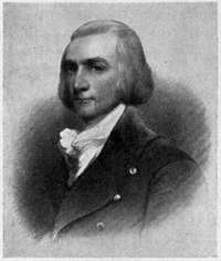
Nearly two hundred years had passed after Henry Hudson sailed the Half-Moon up the North River before the waters of the mighty Oregon were disturbed by any craft save the Indian's canoe. Beyond suspicions and reports of Indians, the great "River of the West" was unknown, and that vast territory beyond the Rocky Mountains which it drains[537] was undiscovered until April 29, 1792, when Captain Gray, commanding the Columbia Rediviva, from Boston, crossed its bar and landed upon its bank, to the consternation of the Indians, who now saw a white face for the first time. Gray named the river after his vessel, the Columbia, and took possession of the country in the name of the United States. A few months later, Broughton, a lieutenant of the explorer Vancouver, to whose incredulous ears Gray had communicated his discovery, entered the Columbia, and in turn claimed everything in the name of King George. These conflicting claims furnish a key to the critical period in the history of the Columbia River territory. For a long time neither America nor Great Britain forced a determination[538] of its claim, and a succession of treaties gave to the citizens of both countries equal rights in the territory. Each government, however, encouraged its citizens to make good the national claim by actual possession. The first attraction to Oregon Territory was that which led Captain Gray, with other expeditions, to the coast, viz., the abundance of fur-bearing animals. The first British occupation was that of the Northwest Fur Company of Canada, which pushed some posts across the Rockies to the far north. The way for American occupation was opened when the successful explorations of the Lewis and Clark expedition, which camped over the winter of 1805 at the mouth of the Columbia, demonstrated the practicability of an overland route to Oregon. Into this opening John Jacob Astor promptly entered. As the "American Fur Company," Astor had successfully checked the aggressions of the powerful Canadian companies in the northern United States. He now projected a scheme, under the name of the "Pacific Fur Company," whereby to check the movements of these same companies beyond the Rocky Mountains, and to possess the new country for the United States.[539] The heart of his plan and purpose was a settlement at the mouth of the Columbia River. Says Washington Irving, to whose fascinating book, Astoria, the reader must go for the story of this magnificent, if ill-starred, enterprise:
"He considered his projected establishment at the mouth of the Columbia as the emporium to an immense commerce, as a colony that would form the germ of a wide civilization, that would, in fact, carry the American population across the Rocky Mountains and spread it along the shores of the Pacific."
Jefferson, who had sent out the Lewis and Clark expedition, heartily endorsed this project, as did also his Cabinet. In prosecution of Astor's purpose, on April 12, 1811, the Tonquin, the precursor of an intended "annual vessel," bringing partners, clerks, voyageurs, and artisans, as well as material and merchandise, crossed the bar of the Columbia and cast anchor. Point George, as it had been named by Broughton, was selected as a site for the embryo metropolis, and was renamed Astoria, after the great commoner whose enterprise it represented. Here, after the Tonquin had sailed away to its tragic[540] fate, the little colony proceeded to establish itself. A fort, a stone mansion, and other buildings were erected, and a schooner, the Dolly, was constructed and launched. The colonists did some trading with the neighboring Indians but delayed to reach out into the surrounding country until the arrival of Wilson Price Hunt, who was bringing an expedition overland and was to establish suitable trading posts en route. Hunt, who was an American and the chief partner under Mr. Astor, was to be in charge at Astoria. While engaged in their work of construction, the colonists were disturbed by rumors that their rivals, the Northwest Company, had entered their territory and established a post on the Spokane River. This rumor was confirmed when a canoe came down the Columbia flying the British standard, and a gentleman, stepping ashore, introduced himself as David Thompson, an astronomer and a partner of the Northwest Company. McDougal, who was temporarily in charge, was, like several of Astor's partners, a Scotchman, and a former Northwest employé. This visitor, therefore, was treated as an honored guest instead of as a spy, which he really was. However, it was determined that David Stuart should at once[542] take a small party and set up a post as a check to the one on the Spokane, which he did at Oakinagen.
Another interruption was occasioned by the shocking news of the massacre of the Tonquin's crew by Indians and the destruction of the vessel. To grief at the loss of their friends was added fear of the Indians, who they now suspected were plotting against them. However, McDougal's wit served and saved them. He threatened to uncork the smallpox, which he professed to hold confined in a bottle, and so gained the fear of the Indians, and the title, "The great smallpox chief."
After a gloomy winter, Astoria was cheered in the spring by the arrival of Hunt and his party. These, after a journey the account of which reads like a romance, through sufferings of all kinds and over difficulties all but insurmountable, reached their destination, haggard and in rags.
The arrival, soon after, of the annual vessel, the Beaver, with reinforcements and supplies, cheered them all and made possible the establishment of interior posts. The Beaver pro[543]ceeded to Alaska, in compliance with an agreement between Astor and the Russian Fur Company, which had been made with the consent of both governments; and Hunt went with her. The absence of Hunt, which was prolonged by untoward events, proved fatal to the Astoria enterprise. Just as the partners from the several posts were bringing to the rendezvous the first-fruits of what promised an abundant harvest in the future, McTavish, another Northwest partner, surprised Astoria's people with the alarming news that war had been declared between the two countries, and that he was expecting a British armed vessel to set up a Northwest establishment at the mouth of the river. Without waiting for the appearance of this vessel, without any attempt to send their treasure inland, and although the Astor Company was in a stronger trading position than its rival, McDougal, chief factor in Hunt's absence, sold out to McTavish all Astor's property for one third its value. Opposition was offered by some of the partners and the American clerks were furious, but Hunt's ominous absence dampened opposition and cleared McDougal's way. It is significant that McDougal soon[544] after received a valuable share in the Northwest Company. Had Astor been there he would have "defied them all." "Had our place and our property been fairly captured I should have preferred it," wrote Mr. Astor to Hunt, who doubtless shared the spirit of his chief. Shortly after the sale, a British officer took formal possession of the country in the name of his Britannic Majesty, and Astoria became Fort George. Although the treaty of Ghent restored the status ante bellum, Oregon remained for many years in the actual possession of England, through the occupation of its chartered companies. Mr. Astor's desire to reoccupy Astoria received no backing by the government and so no American settlement was even attempted until Captain Wyeth's venture at Fort William in 1832, which proved futile.
This change from American to British possession was marked by a transfer of the metropolis from Fort George to Fort Vancouver. When Dr. John McLoughlin, upon the absorption of the Northwestern by the Hudson Bay Company, in 1821, was sent out as "Chief Factor of the Columbia River Territory," he declared that the chief post should be as central as possible to the trade; that after leaving[546] the mouth of the river there is no disadvantage in going to the head of navigation; and that a permanent settlement must be surrounded by an agricultural country. These considerations which took McLoughlin to Vancouver are those which to-day determine the commercial strength of Portland, across the river from Vancouver. Thus Fort George sunk to a subordinate position. After the boundary was determined a new American town sprung up under the old name Astoria, where there are large salmon canneries.
Vancouver, with the outlying posts scattered throughout the territory, was the centre of a semi-feudal organization, and its life was picturesque and full of charm.
Within the palisades was the residence of the Chief Factor ("Governor" by courtesy), surrounded by those of the other gentlemen servants of the Company; together with the stores, offices, and all other important buildings. Between the fort and the river lay a clean, neat, and decorous village of about forty log houses, occupied by the inferior servants of the Company, who were, for the most part, French Canadians. Nearly every man, from[547] the "Governor" down, had an Indian wife; for no white woman had as yet set foot in Oregon. One of these servants writes: "They all had Indian women, never more than one; old Dr. McLoughlin would hang them if they had." The farm, blacksmith's shop, and other productive activities at Vancouver not only furnished the subordinate posts of the Company, but provisions were sent to Alaska, exports were made to the Hawaiian Islands, and the American settlers were dependent upon this post for many of their supplies. Not only was Vancouver the trading centre, it was also the "heart and brains of Oregon Territory." The post hospital offered relief to American settlers as well as to the subordinate posts. Here was established the first school in the territory. The services of the English Church were regularly maintained, and opportunity was offered to missionaries of all denominations to hold service. An annual dispatch kept open communication with the outside world and brought books and papers from the centres of civilization.
The central figure and inspiring genius of Vancouver was Dr. McLoughlin, who was a striking and remarkable character. The[548] remoteness of his post, combined with a self-reliant nature, made him practically independent of his superior officers in Montreal or London. He was indeed, absolute monarch of all the territory west of the Rocky Mountains. But the "good doctor," though firm in character, was a benevolent and a beneficent despot. "Standing over six feet, six inches, in height, he was of commanding presence, with courtly, yet affable manners." Red man and white man alike revered and loved him, for to each alike he was kind, and at the same time just. He was the soul of hospitality and every traveller found at Vancouver a ready welcome to a seat at the rich but temperate board in the common dining-hall, and a bed in the doctor's house. Library, horses, and boats were all at the visitor's command. This spirit of hospitality, joined to a freedom from national prejudice, characterized the attitude of McLoughlin towards the missionaries and other American immigrants who ultimately began to come into the territory. There was scarcely a party which was not indebted to him for material assistance in getting started, as well as for a courteous welcome at the fort. Some indeed owed their lives to him and the[549] other officers at Vancouver, and once at least their prompt help was in marked contrast to the indifference of the American settlement. To this service the missionary records bear constant testimony, and Lieutenant Frémont, "the pathfinder," says in his report: "I found many American Emigrants at the Fort. Others had already crossed the river to their land of promise—the Willamette valley."
We must now follow these American immigrants, for with them the political dominance is to pass from Great Britain to the United States, and the metropolis to move from Vancouver to the Falls of the Willamette. Curiously enough, McLoughlin in his own course will typify this transition.
The very first settlers in the Willamette Valley were servants of the Hudson Bay Company, who settled there by the advice and with the assistance of McLoughlin, who from the first had properly estimated the value of this river and valley. He himself took possession of the falls, with the adjacent land, and held them as a personal claim, "until such time as there should be established a government which could give him title." The town which he developed on this site he called Oregon City.[550]
The first American settlers on the Willamette were the Methodist missionary party, under Jason Lee, which crossed the plains in 1834. To these McLoughlin gave material aid. Of the Canadians, Lee's nephew writes: "They gave us a very polite and generous welcome to the best they could set before us."
Lee's mission was to the Indians, but meeting with great discouragement in this direction, he turned his attention to the more interesting task of forming a political state, which should be American and also Methodist. The missionary work was not abandoned, but only subordinated. In furtherance of his political plans, Lee secured both money and immigrants from the eastern States and invoked the protection of the United States Government. Since 1820 there had been a party in Congress, representing a sentiment in the country outside, which desired to abrogate our treaty with England and establish our government over the whole of Oregon Territory. But notwithstanding an "Oregon fever," developed by Lee and others, the United States was not yet ready for any action with regard to the new territory. In the meantime immigrations from the western States had brought to[551] the Willamette Valley a number of people differing in spirit from the missionaries and not at all in harmony with them. These after a while outnumbered the adherents of the Mission. Hence arose three parties in the Valley of the Willamette, two American and one British. The new American party was in favor of forming a provisional government, which should maintain order until the boundary question now burning between England and America should be decided. The missionary party accepted this as an evil less than the rule of the Hudson Bay Company, which was the only established authority. The Canadians wanted only quiet. As a result, in 1845 was completed the organization of an independent commonwealth, which recognized the sovereignty of neither America nor Great Britain, but which allowed every man to retain his individual citizenship under either government until the territorial question should be settled. Against the wish of most of the missionary party, but upon the insistence of the more liberal Americans, the plan was extended so as to include the country north of the Columbia River, and McLoughlin was invited to unite in this organization. The Chief Factor thought[552] it wise to put the property of his Company under the protection of a government which would probably be formed whether or no, and therefore he entered the organization.
The seat of the new government was called by the legislature, "Willamette Falls," but the place was afterwards incorporated under the name of Oregon City given it by McLoughlin, its founder.
There had long been disaffection in England over McLoughlin's liberal attitude towards the Americans. A climax was reached when Lieutenants Warre and Vasouver, who came to the Columbia River shortly after the formation of the provisional government, reported McLoughlin to be a disloyal subject, if not an unfaithful servant. The Chief Factor's defence was complete and he was not without friends, both in the Council of the Company and in the House of Commons. However, moved by a combination of considerations, he resigned his office, retired to Oregon City, and, after the settlement of the boundary question, became a citizen of the United States. For this much-vexed boundary question was settled by treaty in 1846. Polk was elected upon the platform, "Fifty-four forty, or fight."[553] But more moderate counsels prevailed, and a compromise was made upon the forty-ninth parallel of latitude. This determination of the boundary line had as a result the extinguishing of the Hudson Bay trade on the Columbia River, and Vancouver was purchased by the United States for an army post, which is still maintained. A town has also grown up outside the reservation.
Seldom has fate been more ironical than in its treatment of Dr. McLoughlin. Driven from Vancouver for his kindness to the missionaries, he was now defrauded of his claim at Oregon City by the missionary party, and to accomplish this iniquity anti-British prejudice was appealed to, in concealment of the fact that the doctor had applied for American citizenship. After his death, restitution was made to his children. Some of his descendants now live in Portland.
In presenting a portrait of Dr. McLoughlin to the Oregon Pioneers, in 1887, on behalf of the city of Portland, Judge Deady said: "He stands out to-day in bold relief as the first man in the history of this country—the pioneer of pioneers."
With the passing of Vancouver, Oregon City[554] became the metropolis. And when Oregon was erected into a Territory of the United States, in 1848, Portland was as yet only "a place twelve miles from Oregon City."
Shortly after the incidents mentioned at the opening of this chapter, Overton sold his interest to F.W. Pettygrove. A year later Lovejoy and Pettygrove erected a business building, known as the "shingle store," on what is now the corner of Front and Washington streets. Hitherto known as "the village" or "Stumptown," the little settlement was now dignified with the name of Portland. Lovejoy, who was a native of Boston, wanted to call the town after his birthplace, but Pettygrove, who was equally loyal to Maine, preferred Portland, and the tossing of a coin gave the choice to Pettygrove. What a pity they could not have compromised on the Indian Multnomah! Lovejoy, who was a man of education and had been prominent in the provisional government, sold his interest in the future city to Benjamin Stark and eventually died a poor man. Other transfers of interest made Daniel Lounsbury, Stephen Coffin, and W.W. Chapman partners with Stark in the ownership of the town site, and under these four men began the active development of the[556] town. This development, however, soon met with a decided check from two events which in turn led to the subsequent upbuilding and supremacy of Portland.
The massacre of Whitman and his companions at Walla Walla by the Cayuse Indians led to a war of vengeance, which drew almost every man who could bear arms away from normal pursuits. Portland contributed a company of infantry. The movements of the troops, which rendezvoused at Portland during this war, demonstrated its superiority over the city at the falls as a point of arrival and departure with regard to the Columbia River. This discovery was to influence the future location of the metropolis.
The other event mentioned was the discovery of gold in California. The immediate effect of this discovery was a stampede from Oregon. Portland contained at one time, it is said, but three adults. Soon, however, the demand for provisions in California opened up a lucrative trade in the products of the fertile Willamette Valley and drew men back to the soil. This California trade afforded an opportunity to develop Portland's advantages which[557] the Cayuse war had emphasized, and which Lovejoy suspected when he said, "I observed the masts and booms of vessels which had been left there and it occurred to me that this was the place for a town."
Up to 1848, the annual arrivals in the Columbia had ranged from three to eight vessels. In 1849 there were more than fifty arrivals. The shore of the Willamette at Portland was lined with all kinds of vessels, and wharfs and warehouses were in great demand.
It is upon this command of the two water[558]ways, with her superior port, that the permanent commercial supremacy of Portland rests. The most conspicuous name in connection with this development of Portland's shipping interests is that of John H. Couch. In 1840 Captain Couch brought into the Columbia the first American trader which had crossed the bar since the Wyeth expedition. This was the brig Maryland, from Newburyport, Mass. After subsequent voyages he brought his family from Newburyport and settled in Portland, in 1849. In partnership with his brother-in-law, Captain Flanders, he built wharfs and warehouses and established the first regular shipping business in the city. The first brig sailing from Portland to China, Emma Preston, was dispatched by Couch & Co.
Such has been the development of Portland shipping that it is now well up among the great ports of the country. Last year (1900), according to the annual review by the Oregonian, it was ahead of Philadelphia and Baltimore. Its wheat shipments (15,858,387 bushels) exceeded those of San Francisco, and more than equalled the combined shipments of Tacoma and Seattle.
Henry Villard's great genius suffered no[560] aberration when he selected Portland as the centre of Pacific coast transportation. For not only does this city command the waterways, but it is also the great railway centre. Four transcontinental systems, beside local lines, make the Union Station their actual terminus. The Hotel Portland, one of Villard's many projects, should be to Portlanders a memorial of Villard's brilliance and public spirit, as to the tourist it offers, with its elegance and comforts, a suggestive contrast to the camp of the early traveller.
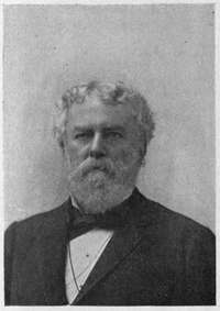
To conclude from Portland's rapid growth and commercial supremacy that it is a typical "western" town, would be to strike wide of[562] the mark. One must go east from Portland to find the typical characteristics, good and bad, of a western town. Portland's character was largely formed before the railway came, for it had a population of nearly twenty thousand before there was connection by rail with the United States. This population was made up of the influx from the Willamette Valley, whose civilization had been deeply impressed by the religious and educational establishment at its foundation, and of a good class of immigrants coming directly from the eastern States. A characterization of Portland by Judge Deady, in 1868, is illuminating: "Theatrical amusements never ranked high. There is no theatre house in the town fit to be called such. On the other hand, church-going is comparatively common."
As early as 1849 some citizens of Portland organized an association, elected trustees, and built a school and meeting-house at a cost of over two thousand dollars. This was the first enterprise of the kind on the coast. Within a few years all the prominent religious denominations were represented by houses of worship. The earliest of these buildings were those of the Methodists and Congregationalists.[564] The Methodists, Roman Catholics, and Episcopalians also supported institutions of learning and of charity. No single religious denomination or individual clergyman has exerted such a commanding influence in the religious development of the city as to warrant any attempt at discrimination. It may be less invidious if two among the many citizens who have influenced the thought and ministered to the higher non-ecclesiastical life of the city should be briefly noticed. Matthew P. Deady, who was prominent in the territorial government of Oregon, and whose was a controlling mind in framing both the organic and statute law of the State, was, upon the admission of the State, appointed Federal Judge, which office he held until his death. Upon his appointment he secured the location of the court at Portland, and identified himself with the city. The city, too, became identified with him, inasmuch as the act of its incorporation passed the Legislature as it came from his hand. Judge Deady ever strove to promote the higher interests of Portland, through his important office, which he filled with great ability; through the institutions of the Episcopal Church, of which[566] he was an honored member; and through the various channels which offer themselves to the public spirited citizen. His monument, perhaps, is the Public Library, which, with its fine building, is largely the result of his interest and efforts; although much of the money for the building was directly derived from a bequest.
When it is known that the Oregonian has been published in Portland practically since the foundation of the city, and that it is deemed by competent judges to be the best edited newspaper west of the Atlantic coast, the conclusion is not far away that the man who has been the editor and master mind of that journal for more than thirty years must have wielded an immense influence upon the thought and opinion of Portland and the Pacific Northwest. That man is Harvey W. Scott.
It is needless to say, these two men do not stand alone. C.E.S. Wood, Esq., might be named as one who has contributed more than any, perhaps, to the development of the city in the appreciation of and interest in art. Judge George H. Williams, who was Attorney[567]-General in Grant's Cabinet, might be cited as an example of those who have served the nation as well as the city. Others, too, have shared in making Portland, but space forbids even the mention of their names.
With almost a hundred thousand inhabitants, drawn from all parts of the world, and with a "Chinatown" in its midst, the social character of Portland has, of course, changed since 1868. And yet Judge Deady's characterization given then would fairly hold good to-day. This means, of course, that Portland is eminently conservative, with the advantages and disadvantages of conservatism.
In externals, Portland is an attractive city, with the trees in its streets and the lawns about its houses and its wonderful roses. Its early architecture is poor, but many of the recent buildings, municipal, ecclesiastical, commercial, domestic, and general, are not only large and imposing, but good. The city is beautifully situated, with the rivers at its feet and the wooded hills behind it, and in the distance the snow mountains, of which the finest and the favorite is Hood. Portland sits to-day mistress of the North Pacific, and with historic and prophetic reasons for expecting[568] to be the metropolis of the whole Pacific coast. If the sceptre slips from her, it will be only because she lacks the faith, the courage, and the enterprise to enter into her inheritance.

"City of gold and destiny"
"With high face held to the ultimate sea."
By EDWIN MARKHAM
If Xenophon had journeyed westward from Athens, pressing beyond the amber caverns of the Baltic, beyond the tin mines of Thule, out past the Gates of Hercules, exactly west, across an ocean and a continent, the next thalatta of his men would have saluted the Pacific at the Golden Gate from the low, shifting sand-hills of the unrisen San Francisco. For the violet-veiled city of Athene and the gray-draped city of St. Francis are in one line of latitude.
San Francisco crowns the extremity of a long, rugged peninsula, a little north of the centre of California,[570]
the land that stretches from pine to palm,
The one break in the mountain wall of the California Coast Range is the Golden Gate, the watery pass that leads from San Francisco to the Pacific. Spurs and peaks and cross ridges of this mountain chain would at long range seem to encompass the city round about; but, on nearer view, the edging waters on three sides make her distinctly a city of the sea.
Looking from the bay, past the fortified islands of the city, one may see San Francisco to the west, rising in airy beauty on clustered gray hills. At night the city hangs against the horizon like a lower sky, pulsing with starry lamps. By day it stretches in profile long and undulating, with spires and domes climbing up the steeps from a shore lined with the shipping of every nation—felucca, ironclad, merchantman, junk, together with bevies of tiny busybody craft, all of them circled and followed by slow-swinging gulls.
For years after the magnificent, all-inclusive claims of the Cabots at Labrador in 1497, nothing was known of the west coast of North[572] America. Cabrillo felt his way along it in 1542, claiming it for Spain. In 1579, Francis Drake, fleeing from plundered Spanish galleons, tarried for repairs beside Cape Reyes, the Cape of Kings, and claimed the country, as New Albion, for Elizabeth of England. Although anchored in a cove within a mile of San Francisco Bay, he doubtless sailed away without guessing its existence behind the forest-covered mountains.
In 1602, Vizcaino, charting the west for Spain, as Gosnold was mapping the east for England, made stay in Drake's old anchorage, and named it the Port of San Francisco.
Notwithstanding the reiterated desire of the Spanish Crown that Mexico, or New Spain, should set about colonizing upper California, it was not till 1769 that the work was begun. Spain needed a harbor in which to retire on the way from the Philippines. The Russian fur-traders were heading down the coast. The French and the English were rumored to be nearing from the east. So it behooved Spain to be on the alert to maintain her right to the new territory.
José de Galvaez, Visitador of Spain, who[573] had been sent to Mexico with powers extraordinary, "to examine and reform all branches of government," seized upon the project of colonization, and found the administrator of his plans in Padre Junipero Serra, of fragrant memory,—a Franciscan monk, who had all his life passioned to save Indians as a Tamerlane would have passioned to destroy them.
Spain's plan of colonization comprehended a triple series of establishments: the ecclesiastical or the mission, the military or the presidio, the civil or the pueblo. The theory of colonization carried the idea of a military and a religious conquest of the new lands. The Indians, whenever belligerent, were to be overcome by force; but as far as possible, they were to be drawn into the mission life by peaceable expedients.
In 1769, four expeditions, composed of soldiers, settlers, and Franciscan friars, set out from Mexico to enter upon the work of colonizing and civilizing California. If in the mists of coming ages the Æneid of California be lost, Spain may prove her sponsorship of the Californian province by the litany of seraphic and apostolic names given to mountain and mesa, to coast and cañon. Andalusian names[574] of saints and angels chime wherever the padres stepped or stopped.
One of the four expeditions, pushing northward by land, unwittingly passed Monterey; and a fragment of the company, while out hunting, came suddenly in sight of the waters now known as the Golden Gate and the San Francisco Bay. For the name San Francisco was soon transferred to this greater water from the old port known to Drake and Vizcaino.
In the summer of 1776 a company of padres, soldiers, and families, with stock and seeds, arrived on the San Francisco peninsula, and built temporary shelter of brush and tulès plastered with mud. On September 17th, the feast of the stigmata of St. Francis, solemn possession was taken of the presidio in the name of Spain; and on October 4th, the day of St. Francis, the mission was formally dedicated. The cross was raised, the Te Deum was chanted, while bells and guns chorused to sea and sky.
The mission was in a little fertile valley four miles from the Presidio, near a small creek now filled in. It became known as the Mission de los Dolores, in honor of the sorrows of Mary.
Hostile tribes from the south had lately fallen[576] upon the Indians of the peninsula, firing their rancherias, murdering many of the inhabitants, and terrorizing the rest into flight. So the savages proved scarce at first. Even in 1802 the Indians at the Mission numbered only about eight hundred. But these natives, like all the Californian Indians, though quite docile, proved stupid and brutish and lazy. They made little progress from savagery to the state of gentes de razon, or "reasonable beings," fit to populate the pueblos.
This mission régime, however futile it may have been, however formal and external its religious training, seems to have touched upon some of the educational and sociological thought of our own time. It made use of the wisdom Spain had learned from her Roman conquerors—the taking of the conquered into full partnership. The idea of the daily contact of superior with inferior; of community of property and co-operation in labor; of the union of manual work with mental drill—all these were rudely exemplified in the mission life. Sixty years was the span of the experiment, a brief time for an effort in civilization.
The Mission Dolores grew after the general[577] plan of the score of others in California. It was built about an open court, the place for work or recreation. The chapel stood at one end of the rectangle; the living rooms, storehouses, and shops lined the other sides. Only the chapel, thrice restored, with its campo santo beside it, remains of the Dolores structure. When Beechy visited it in 1829, it was already a crumbling ruin. The sun-dried bricks, here as at the other unprotected mission relics, are fast melting back into the earth. The adobe, like the swallow's nest, cannot[578] endure the hammers and chisels of wind and rain and sun.
Little of moment occurred at Dolores till the days of secularization. The barren, sand-driven, wind-swept hills were not attractive to the Spanish, and the Mission was not in high estimation with the authorities. Don Pedro de Aberini wrote of it in 1776: "Of all sites in California this Mission is situated upon the worst." Nevertheless, in 1825, the Mission, from a few head of stock and a few sacks of seed brought in 1776, had accumulated 76,000 cattle, 79,000 sheep, 40,000 horses, and $60,000 in money and products.
Mexico's jealousy of the sympathy which the padres felt for Spain, from whom Mexico had torn herself in 1822; the clamoring of settlers for the lands held by the missions; quixotic pleas of Mexican statesmen for Indian autocracy; and perhaps, under all, an itching for the Pious Fund that supported the mission work—these led on to the secularization of the missions in 1836. The Indian, civilized only surface-deep, was unready for civilized self-government; and so he fell back to barbarism, plus dissipation—his last state worse than the first.[579]
The Dolores Indians were especially incompetent, and no attempt was made to organize a pueblo for them. So Dolores, after secularization, dragged out an anomalous existence as a lapsed mission, carried on by political rather than by ecclesiastical rule, with an alcalde rather than a padre in charge.
In 1835 the embarcadero of Yerba Buena two miles from the Presidio, was, at command of Governor Figueroa, made the port of entry. This place (named from a medicinal weed growing about the cove) was only a landing-place for fishermen and hide droghers. Only one house stood here at this time. Not a sail shadowed the bay. Herds of deer came down to the water and schools of seal swam to the shore. Yet Yerba Buena afterward absorbed the Mission and the Presidio on the margin of Golden Gate, and took the name of the Bay, thus becoming the germ of the present city.
A knowledge of the charm and worth of the sovereign bay queening the western shore of North America was rapidly travelling the world. In 1806, the Russian Rezanof had visited it officially. His coming and going has a romantic interest, as his betrothal to[580] Doña Concepcion, the beautiful daughter of Arguello, commandant of the Presidio, his tragic death on his way home, and her retirement to a convent, made the Evangeline tale of early California. England in 1840 sent Belcher to the bay to gather information, and France sent de Mofras.
Both of these nations were suspected of coveting the California province; and the hope of getting possession of it, especially of San Francisco Bay, was doubtless in the background of our national consciousness as one motive of the Mexican War. It was felt by our country that the United States must own the west coast or be pot-bound later on. The Government offered to buy the territory from Mexico, but the proposal was refused.
Gradually it came to be known that the United States, fearing similar action by European powers, was to seize and hold California in the event of a war with Mexico. With the vexed question of motive and action this is not the place to deal. But in 1846, after the Mexican War had fairly started, Frémont, pursuing a scientific exploration in California, received secret Government advices, and, gathering troops in the North, urged a declaration[581] of independence. Commodore Sloat, in command of a frigate at Monterey, in July, 1846, raised the American flag in place of the Spanish nopal and eagle standard, declaring California a part of the United States. The next day, following the order of Sloat, our flag was set flying in the plaza at Yerba Buena by the captain of a frigate in the bay, accompanied by an escort of soldiers and marines. No opposition was offered by the Mexicans. Portsmouth, the name of the vessel, was given to the plaza, and Montgomery, the name of the captain, was given to the street, then along the water front, but now pushed back a half a dozen blocks by the filling in of the cove.
The first alcalde of Yerba Buena under the American flag was Washington Bartlett. Hearing that a new town, Francesca, was to be established farther up the bay, and fearing injury to his own from one with a name so similar to that of the bay, Alcalde Bartlett proceeded, in 1847, to cast the plebeian name of his pueblo. He declared the name Yerba Buena insignificant and unknown to the world; proclaimed that henceforth the settlement should bear the name of the fostering bay beside it. This somewhat tardy edict[582] was accepted by all, and San Francisco became a name to conjure with.
The village nucleated a little back of the cove about its inevitable Spanish plaza, which was to be the scene of wild and whirling days to come. Telegraph Hill, the old observation station, rose on the north of it, and Rincon Hill was off toward the south. When California was ceded to the United States in 1848, San Francisco was fairly afoot upon her triumphant way. Brannan had established a newspaper, The Star, and had sent two thousand copies East, describing the new land, and, curiously enough, prophesying the gold and the wheat of the future—the first "boom" note from California. A school was flourishing; churches were building; two hundred houses were on the hills, and the population was about eight hundred.
And now sweeps into the story the dominant major—the finding of the gold. Told of in Indian legend and in Spanish tradition, the shining sands of Pactolus were found at last in a Californian cañon. San Franciscans, hearing the tale, felt again the wander spirit, and were off to the mountains, seeking quicker fortunes. Soldiers and sailors deserted from[583] the bay. The school closed; the newspaper suspended. Business was at a standstill: there was no one to work or to buy.
A wind of excitement passed across two hemispheres. The tidings of the gold flashed from city to city, swift as the signal fires of Agamemnon telling that Troy had fallen. The faces of men turned expectantly toward this land at the edge of the world. Everywhere were heard the sounds of preparation and farewell, as adventurers by land and sea, by craft and caravan, set out for El Dorado.
By 1849 immigrants from the ends of the earth were pouring in; and the bare, brown hills and curving shores of San Francisco were whitening with tents. Goods were piled high in the open air, and all available walls were covered with grotesque signs and placards speaking in all languages.
By the winter of '49, the drowsy, droning Spanish town had expanded into a little excited city. Everywhere were springing up nondescript lodging and boarding houses, drinking houses, and gambling saloons. Twenty-five thousand people thronged the thoroughfares. There was scarcely such a thing as a home. Crowds of people slept wedged[584] together on floors and tables, in rows of cots or in bunks fastened in tiers to the walls. The streets, full of sticky clay and miry sand, were thronged with struggling horses, mules, and oxen; and crowds of men from all nations and all levels of life jostled by, laughing, railing, or cursing. A whirlwind had rushed in upon the sleepy town. Old habits of life were broken through. Lawyers were turned into draymen and bootblacks; doctors into merchants and carpenters; soldiers into waiters and auctioneers. All men could find work; and none, however rich, could wholly evade it. Gambling was the chief amusement; speculation in a hundred forms was pressing forward, and fortunes were changing hourly.
In all this rude democracy, there was one mark of an aristocracy—high prices. Workmen charged twenty dollars a day; lumber was five hundred dollars a thousand; flour was forty dollars a barrel; eggs were a dollar apiece.
All unready for this tumultuous rise in population and precipitation of business, the infant city had to evolve on the moment accommodation for man and beast and craft,[585] and organization for civic safety. To add to the perplexities, in the first years of the city, fire after fire devoured its flimsy fabric of canvas and shingle. The fourth and worst fire, in May, 1851, destroyed seven million dollars' worth of property. The recurrent devastation made a demand for fireproof buildings, which gave a certain stability and dignity to the city. The bay began to fill with the new clipper ships, which brought steadier crews and more rational cargoes than did the older clumsy ships now rotting at the docks. Secure wharfage, passable streets, an efficient fire-department began to give a feeling of prosperity and permanence.
San Francisco was the stopping-place of every comer and goer; the Egypt of the corn, the depot of supplies for the gold territory. Naturally, forces of good and evil streamed into the young city and came into collision. Strange new conditions were in the environment. The old primitive safeguards of the early mission era were outgrown. The population, representing every form of tradition and government, found itself removed from well-nigh all restraints, all bolstering-up of church and state. Each[586] man of worth, while bent to his private task, had forced upon him the problem of helping to build up a social fabric and of holding it secure.
The Anglo-Saxon has an elastic genius for government. Wherever he goes, finding new conditions, he finds new ways for maintaining the public safety. The reaction of his spirit under the conditions about him in early California furnishes an interesting study in social dynamics.
By 1850, California was running under a State constitution and the city had a charter. The old stable forces of home, and school, and church, the Argonaut soon evolved about him. However, great freedom of action and opinion prevailed, and a tolerance of evil that well-nigh blunted the distinctions between right and wrong. "Sydney coves," and other unruly spirits took advantage of this laxity. Abuses thickened, and anxious problems of public order were upon the young metropolis.
The affair of "The Hounds" was one of the organized outrages that confronted the municipality. A band of lawless ex-convicts, affiliated for mutual protection in evil designs,[587] grew very obnoxious in their bold defiance of authority, their open and wanton outrages upon citizens, especially foreigners. The community, having no municipal organization, rose against the law-breakers, put twenty on trial, and half of these into prison. This show of public indignation quieted the pack for a time. But there was no strong authority to conserve the public good. What was the concern of all found an executive in none.
Yet, finally, out of this sagging and sinking of the public order and its adjustment sprang the most spectacular popular uprising and the most notable object-lesson in self-government known to the West or perhaps to any other land,—the Vigilance Committee of 1852-56. The occasion of this citizens' uprising was a series of unpunished crimes of arson, murder, rapine, and burglary. The perpetrators of these outrages, owing to lax administration of law by corrupt or careless officials, seemed immune from apprehension or punishment. The many fires that had devastated the infant city had without doubt been of incendiary origin. Over a hundred murders had occurred in a few months and not a single capital punishment had followed.[588]
Feeling that this insecurity of life and property was intolerable, and fearing that it would draw down the perils and uncertainties of mob law, a party of prominent citizens, all above suspicion of self-interest, organized a defensive league against the allied rabble. They determined to take the law into their own hands, and to administer it with equal and exact justice, with swiftness and finality.
The first and most exciting case handled by this extraordinary court of justice came swiftly to judgment. Upon the night of organization, in June, 1852, an ex-convict was[589] seized in an act of theft. He was tried in the presence of eighty members sitting with closed doors; was convicted, sentenced, and hanged in Portsmouth Square that night. The general public, sensitive and suspicious, dreading mob tactics, was troubled at first by this summary show of power. But the Committee came out with a complete list of its members, each member assuming equal share of responsibility, each avowing the public welfare as the only end in view, each pledging his life, his fortune, his honor, for the protection of his city and the upholding of the public safety. A profound impression was made by the manifesto of this self-constituted protectorate. When it was found that no secret society, but, instead, a band of the solid men of the city was at the head of the movement, the community rallied to its support with enthusiasm. The Committee quietly kept at its work of investigation and punishment. Its calm, swift justice, its lack of personal bias, its righteous vengeance terrified evil-doers. Many were banished by formal warning. Three other well-known criminals were hanged. Crime rapidly diminished, and for the first time in years people began to feel secure in person[590] and possessions. After thirty days the occupation of the Vigilance Committee was gone. It did not disband, but existed for years a merely nominal tribunal.
By 1854, the growth of San Francisco began to slacken. Inflation began its inevitable counter-movement of collapse. The days of picking up gold were over. Immigration fell off. A large part of the city's population scattered, returning East, or going into the country to try life on ranch or range. Disorder increased; the old suppressed crimes leaped into evil eminence.
A new journal, The Bulletin, edited by James King, of William, assailed the rising corruption, political and personal, social and individual, public and private.
In 1856, without warning, King was shot down in the street by a man who had writhed under the torment of the Bulletin pens,—an unscrupulous ex-convict, James Casey, a rival editor, and a man lately elected supervisor. This murder precipitated public opinion, and exploded the lazy optimism that had waited for things to right themselves. Casey was at once jailed, by chance escaping lynching. It was inevitable that heroic measures should be set[591] in operation. And so there came about a second administration of the Vigilance Committee, this unique social providence, this people's protectorate. But this time it had before it not only the purging of the city's crime, but also a struggle with jealous and sluggish authority vested in city and State officials. In a few days 2500 men had enrolled as Vigilantes, and were drilling in arms, under their former trusted President, William T. Coleman. Meantime the Governor of the State was summoned by the Anti-Vigilantes, representing chiefly the conservative officeholders and the people affiliated in some way with the lawless element. These Anti-Vigilantes came to be known in derision as the Law-and-Order Party. The Know-Nothing Governor swayed first from one side to another. He had no power behind him, for the militia were deserting to the popular cause.
The Vigilantes took charge not only of Casey, but also of one Cora who had wantonly shot a United States marshal and had evaded punishment. After a dispassionate trial, with all form and ceremony, the two criminals were sentenced to death and hanged on the day of King's funeral. It may be worth remember[592]ing that this man Cora was defended in his first trial by the eloquent Col. E.D. Baker.
The Law-and-Order Party now insisted that the Vigilantes disband. But the Committee held that its purpose was not simply to deal out justice to murderers, but also to so clarify the social atmosphere as to make future assassinations punishable by law. Therefore it struck directly at city politics, banishing the openly vicious, and laying the way for a clean administration when the corrupt officials could be rotated out of office.
This Vigilance Committee drew a large following of citizens; but there was a continuous undercurrent of opposition. General Sherman, commander of the second division of the State militia, backed by the vacillating Governor and representing constitutional authority, was the leader of the opposition sentiment. In June, the Law-and-Order Party under him determined to rise against the Vigilantes. He appealed to General Wool, United States Commander in the Department, for arms, and also to Commodore Farragut at Mare Island. These commanders declined to interfere in State troubles without orders from the Government. Governor Johnson declared the[593] city and county of San Francisco in a state of insurrection, and asked aid from Washington. General Sherman, finding himself powerless, resigned. Chief-Justice Terry, an active opponent of the Committee, having come from Sacramento to enforce the law, now complicated matters by stabbing an officer of the Vigilantes. The Committee held him a prisoner but set him free when his victim recovered. After three months of life, after hanging in all four criminals, well-known desperadoes, banishing many others, and paving the way for a purer administration of law, the Committee disbanded, leaving a small body to settle its affairs. The next election saw a full set of honest officials in power, and for twenty years San Francisco had the name of being one of the best-governed cities in the world.
Looking back dispassionately, it appears that the Vigilance Committee had something of the dignity and purpose and procedure of the ancient court of the Areopagus. It was not like the extemporized Sanhedrim that tried Christ, a body which kept the appearance of justice but mocked the reality. It was not a masked band of regulators like the Ku Klux or the White Caps; but it was an irresistible[594] rising of the best citizens in calm debate, in open daylight, with sobriety and decorum and every safeguard of justice. Unlike the anti-Mafia of New Orleans, it put down the mob spirit, but did not engender it. Though acting outside of the constituted authorities, it had the severest reverence for law in the ideal. As President Coleman expressed it, the Committee did not act under lynch law, but under a sort of martial law that obtains in time of siege. Considering the daring wantonness of crime, the subsidized or terrorized condition of the courts of justice, and the immunity of criminals, law-abiding citizens seem to have been justified in reverting to the elemental order of things, as is the man who attacks the thief in the night. But, of course, loyalty from the first to public interests instead of easy optimism and self-absorption, would have held back the occasion for the heroic measures of the historic Committee. Men never learn, save through suffering, that the support of the common welfare is a sacred duty, and that this duty squares exactly with their highest private interests.
During all these years and long after, San Francisco suffered greatly from disputed land[595] titles. Conflicting claims led to labyrinthine legislation, and increasing hardship, one crisis being the Squatter Riots.
The treaty of Guadaloupe Hidalgo had decreed that all property rights should be respected by the new government. So property rights founded on cloudy and ill-understood laws and customs of Spain and Mexico had now to be adjudicated in the Californian courts. San Francisco was entangled in the mazes of two rival Spanish claims, embracing well-nigh all her territory except the "made" land. There was much dispute as to whether or not the city had ever been made a pueblo proper. On this depended the holding or forfeiting of four square leagues of land. Though the city petitioned the Land Commission in 1852 for confirmation of her public grants, the controversy was pending through wearying legislation, with repeated surveys and delays and continual jeopardy of property, until finally settled by the decision of Secretary Lamar in 1887.
The decline of the gold output brought to the front the agricultural resources of the State, and San Francisco came to be the centre of distribution for wheat, wines, and fruits.[596]
The Central Pacific Railroad was completed in 1867, with San Francisco as the Western terminus, and as by a magic stroke the city was only three thousand miles instead of nineteen thousand miles from Eastern markets. Since then three other transcontinental lines and numerous local lines have brought trade and travel into this emporium of the Pacific, while the ships of all nations fetch and carry through her Golden Gate.
The war of secession found California wavering between the Stars and Stripes and the Stars and Bars. A large Southern element, much to the front in politics, had maintained a strong Democratic influence in the State. The celebrated duel, just outside the city limits between Broderick and Terry—the Terry of Vigilance Committee memory—turned the tide toward Republicanism and sympathy for the North. The duel grew out of the Broderick and Gwin senatorial contest. Terry stood for Southern chivalry; Broderick stood for free labor and progressive politics. Not essentially great or noble, Broderick was made heroic by his tragic death. During war times he was a colossal figure in men's minds, and his anti-slavery sentiments echoed[597] through city and State, a slogan and a cleaving sword for freedom and the North.
In the '70's there sprang up in San Francisco a tremendous excitement over the silver mines on the Comstock Lode. The bonanza was estimated to be worth over fifteen hundred millions of dollars. True, this argent field was across the Sierras, in the State of Nevada. But most of the output found its way to San Francisco. The principal owners lived there, and San Francisco was the depot[598] for Comstock supplies. The Stock Board operated there, and stocks bought for less than one hundred thousand dollars soared up to two hundred million. At the highest notch of prices the manipulators sold out, and the airy fabric of speculation fell with a crash. The banks had been emptied by speculators eager to buy stocks, and were greatly embarrassed. Myriads were swept into poverty, leaving immense fortunes in the hands of a few.
Soon after the Comstock collapse the Sand Lot agitation sprang into life. Over one hundred and fifty millions of dollars had been removed from circulation by the Comstock jugglery. The wealth of the outside world was temporarily diverted from the San Francisco markets. A great drought had been on the State during two years and the lean kine had devoured the fat. Harvests were sparse or wholly lacking. Cattle perished beside the dry watercourses. A large body of the outside unemployed had come to swell the tide of the city's drifting, workless ones. The railroad was threatening a reduction of wages to its thousands of men. Riots were on in Philadelphia, Pittsburg, Baltimore, and had sent contagion on the enforced idlers in San[600] Francisco. Feeling long smouldering broke into fire against the Chinese and the railroad, two factors believed by the working-men to be largely instrumental in cheapening wages and robbing men of work. A mob gathered, threatening to rout out the Asiatics. The police could not disperse the rioters.
On July 24th there came a third call for the Vigilance Committee to assemble, which many thought an unnecessary and high-handed summons. William T. Coleman was for a third time given charge. The Committee was to proceed upon lines followed in the '50's. But this time they were to co-operate with the authorities rather than to work in opposition. On July 25th, the mob, infuriated by the menace of the Committee and looking on it as a mere support of capitalistic interests, gathered about the Pacific Mail Dock, where immigrant Chinese were landed. The Committee, armed with pick-handles, met the labor mob at the dock and a few men were killed. This ended the uprising. But the issue was soon thrust into politics. The anti-Chinese believers gathered upon the sand lots in the neighborhood of the City Hall and organized[601] the Working-man's Party. It spread throughout the State. Dennis Kearny, an illiterate but rudely eloquent speaker, became the leader, the Wat Tyler of the hour. The movement ended in the adoption by the State of a new Constitution framed along progressive lines.
The people of San Francisco are of all kindreds and tongues. Buddha, Mahomet, and Confucius are prayed to beside the Christian temples. The Indians of the Mission have faded from the peninsula and the sombreroed Spaniard dashes no more from the Mission to the beach about his bull-fights and bear-baitings. But here are Anglo-Saxons, Teutons, Celts, Greeks, Slavs, Latins, Hindus, Chinese, Kanakas, Japanese, and Chilenos, all mixing in the great crucible and slowly shaping a new type of man, the Western American. All seem to be mixing, it should be explained, except the Chinese, for, after a quarter of a century of experience, San Francisco feels that her Chinese population is still an alien body and sure to remain so even to the third and fourth generation.
The problem of Chinese immigration has come up again and again in San Francisco. In 1869 the Chinese were invited and welcomed[602] from China. In 1892, the Geary law was passed prohibiting the coming of any but the student class and providing for deportation under certain conditions. A generation grew up between this hail and farewell, China in the meantime pouring her tens of thousands of coolies into San Francisco. California welcomes any race that affiliates. But she has found that the Chinese race is not as the impressionable Indian or negro; but is an arrested race in the yoke of caste and ancient tradition, one looking with contempt upon upstart Anglo-Saxon civilization. The Chinese swarmed into a quarter of the city about Portsmouth Square, and have made there a small, evil-smelling Canton, where only a foreign tongue is spoken, and where strange gods are worshipped. Few have brought wives. Slave girls are the only women. Every Chinese prays to die in China, or to have his bones rot there. American law to most of them is but a pestilent thing to be evaded. They have no interest in the growth of the country or its institutions. They work for starvation wages, their living being extremely cheap, requiring only tea and rice and a bare shelf to sleep upon in a room crowded with such[603] shelves. Being imitative, and as patient as cattle, and withal so cheap as hirelings, they have taken the places of women in the household and factory and the places of men and boys in the work of dock and shop and field. The assertion that this labor liberates the whites for higher work does not seem to be verified. Many trace the vicious "hoodlum" class of both sexes to the enforced idleness of these young people, springing from the iron competition of the Chinese in the labor market.[604]
Notwithstanding all this, the little slant-eyed men with their grotesque superstitions, their stiff, stark, unhomelike homes, add a quaintness and a touch of color to this romantic city. Gay placards of intense greens and vermilions flutter from their doorposts. Under the dull outer tunics of the elders gleam surtouts of gay brocades, while the few children, little faithful copies of their sires, all tricked out like the lanterns of the night, go toddling on tiny, rocking shoes through the narrow, dingy streets. The Chinese theatres,[606] temples, and restaurants are full of the Oriental strangeness. The interiors of some of them are lacquered and varnished like huge tea-boxes.
As one gets a strip of Cathay in Chinatown, so he may find a corner of Italy on the south slopes of Telegraph Hill. Here children, looking like the cherubs of their kinsmen, the old masters, swarm through steep narrow streets, upon curious little balconies, out of odd windows, or upon the steps of chapels.
The architecture of San Francisco is a medley of many schools. The buildings, especially the homes, are largely of wood; the recurring feature is the bay window that focuses the light and heat. To the newcomer they all seem of the same color, for the fogs and winds soon reduce all hues to a fine, restful gray. In the beginning, by a curious irony, stone and lumber were shipped from the East and from Asia to this land of forests and granite to build some of the structures still holding their places against the pressure of time. In the newer buildings of the city there is some attempt to make the architecture express the function of the[607] structure—the stability of the business house, the aspiration of the church, the simple security of the home. The new City Hall is an example of permanence and chaste elegance. The old mission architecture is being revived. This Spanish-Moorish adaptation is the most characteristic and harmonious development of Californian architecture. Built of the earth, the old mission piles seem almost as if not made by man, but nature. For they repeat in long stretches and low swells the contour of the hills about them, and give back their color-tones of dun and tan and rusty red.
The year the new and greater name was given to the city, a misfortune fell upon the streets. Regardless of cliff and curve, ignoring height and hollow, the streets were laid out in undeviating straight lines. And so a city on fairer than Roman hills, with circling waterways more lovely than the curve of Constantinople's Golden Horn, was deformed as far as its high bearing could be hurt; was checkered by pitiless compass lines, when it might have had windings and slow curves and gentle slopes.
Market, the main street, runs lengthwise of[608] the peninsula. Its intersection with Kearny is a nerve-centre of the city, whence radiate three great streets. Near this spot are the main newspaper buildings and most of the large hotels. San Francisco's streets, unlike those of Sacramento and Los Angeles, are not lined with trees. But nearly every dooryard has its green place where tall geraniums, camelias, heliotropes, or fuchias fling out, the year round, their splashes of scarlet and purple.
The city boasts of one great park of a thousand acres, on the hills and ravines out by the sea. Central, Prospect, and Fairmount parks of the East fail beside the charm of this Arcadian Western park, probably the finest[609] in North America. The trees of the world, from conifer to cactus, are here, and every flower that blooms. Beyond the park is the Cliff House, overhanging huge rocks, the rendezvous of gulls and seals and shy things of the water.
The old Portsmouth Square is dingy and draggled. It looks upon the scene of the executions of the Vigilantes and is full of memories for the chronicler. Its great charm now is the statue of Robert Louis Stevenson, who when in San Francisco, often sat there,[610] studying the quaint, broken life about him. Another significant monument, poetic and historic presented to the city by Mayor James D. Phelan, stands before the new City Hall in honor of the Native Son of the Golden West.
It is doubtless only a question of time when expanding San Francisco will absorb the cities an hour's ride across the Bay,—Oakland, Berkeley, and Alameda,—the homes now of many of San Francisco's business men.
The University of California at Berkeley draws its largest clientele from San Francisco. By the benefactions of the widow of Senator Hearst of San Francisco, this university has under way a housing perhaps the most spacious and symmetrical in the world. The structure, to cost nearly five million dollars, follows a plan chosen by experts from designs submitted after a world competition, and will crown a long hill slope, looking down on San Francisco City and Bay and out toward sleeping Asia. The allied professional colleges of the University are already in San Francisco. Its art department is in the fine old mansion of Hopkins, the railroad builder, on California Street, the home street of millionaires. A school of mechanic arts, endowed by the pioneer,[612] James Lick, who gave the great astronomical observatory to the State University, is also under way in San Francisco.
Another university drawing its student body largely from San Francisco is an hour or more down the peninsula from the city,—the Leland Stanford, Jr., founded by Jane and Leland Stanford and wife, of San Francisco. This university, by the way, is built, after the old mission plan of one-story buildings, about an inner court, with arcades and Roman towers and tiled roof.

The city has three great working libraries, the Public, the Mercantile, and the Mechanics'[613] Institute. Adolph Sutro, the late owner of about one tenth of the territory of San Francisco City and County, whose fine grounds out by the Cliff House have long been open to the public, left a unique collection of two hundred thousand pamphlets and volumes of rare worth, gathered for the public use. The Bancroft Library is phenomenal in that it has cornered all the original material for the history of the far West. Those myriads of manuscripts, pamphlets, and books have been indexed by experts and the library is a sort of Vatican for California.
The Bohemian Club of San Francisco, a comradery of litterateurs, artists, and lovers of the arts, is a unique expression of the æsthetic individuality of the city, and is one of its strong social forces.
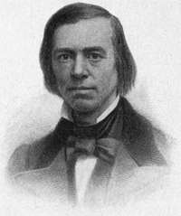
San Francisco has perhaps no famous name[614] that dominates the city as Franklin dominates Philadelphia; as Beecher, Brooklyn; as Carnegie, Pittsburg. But if great-hearted Thomas Starr King had lived longer, he might have been its crowning personality as he is now its most sainted memory. His inflexible loyalty and impassioned eloquence made him at the outbreak of the Civil War a commanding figure, if not the leading citizen of California.
Though only fifty years old, San Francisco has given to literature and art a few names that the world will not willingly let die. For forty years Joaquin Miller, the "Poet of the Sierras," has been a friend and neighbor of her hills and waters, telling in noble numbers the glories and the terrors of the strange new land "by the sundown seas." Here Bret Harte founded the Overland Monthly and with "The Luck of Roaring Camp" began his creation of Californian characters. What matters it if they never existed outside of his pages,—those drinking, dirking dare-devils, those tenor-voiced, soulful-eyed gamblers, striking sorrow to the hearts of ladies? For, touched by his genius, they exist for us there, in perennial charm and invitation.
Here, too, Henry George wrote his[615] Progress and Poverty, a book that was a prophet-cry heard round the world, declaring that every man has a right to a foothold on the earth. Mark Twain, Ambrose Bierce, Charles Warren Stoddard, John Vance Cheney, Charlotte Perkin Gilman, Kate Douglas Wiggin, and Gertrude Atherton did here a deal of their early literary work,[17] but now have wandered away into the world, leaving behind them, however, a goodly group of critics, story-writers, and poets; painters, also, William Keith and the rest, who have caught into splendid captivity some of the[616] immensities and radiances about them.
This is but an abstract and brief chronicle of the great city at the Western gate of the world. There she sits, the ultimate outpost of the passion of progress. Sleepless unrest, forever urging the peoples westward, land by land, now, at the end of centuries, begins to surge and thunder on the shores of Balboa's Sea. But this end is only a beginning—this great city is only the first of a chain of cities fated, under the star of empire, to spring into life on these circling shores, making the Pacific at last the greater Mediterranean of mankind.
By HAROLD BOLCE
To know the story of Monterey, one must go back for a moment to the southern coast of Europe. There, on an island a day's sail from the land that later cradled a prodigy destined to make dynasties his playthings, there was born, in 1713, a boy who by pacific conquests was to perform a part no less significant than Napoleon's in determining the history of nations.
While the infant Bonaparte was listening, perhaps impatiently, to Corsican lullabies, Junípero Serra, a mendicant friar from Majorca, discovered, or rediscovered, on the far shores of this continent the supposedly vanished harbor of Monterey, and thereby marked the genesis of the movement that was finally to give the American republic a western frontage on the sea.[618]

But for this auspicious event and the stimulating effect on Spanish exploration it afterwards provoked, the great domain from San Diego to the Straits of Juan de Fuca would not to-day be rendering tribute to the Government at Washington. The western lines of the Louisiana Purchase would mark our farthermost frontier; the incredible hoard of California's roaring camps would be minted into sovereigns, shillings, rubles, imperials, or francs; no Pacific Squadron would have carried our flag to the gates of the East; and we would to-day be a hemmed-in nation, disputing our land boundaries with encroaching colonies of Europe, instead of a world power projecting[619] canals to sever continents in the interest of our trade, and sailing our ships east and west across the seven seas.
The average tourist, viewing the adobe ruins of the Monterey presidio and recalling the futile guns of that crumbled fortress, does not dream of the place Monterey filled in the march of international events. Nor will the guide enlighten him as he takes him over the seagirt drive to Carmel and the cliffs of Point Lobos, for that profane, though picturesque historian omits even to say that Robert Louis Stevenson furnished the plan for this famous highway.
Some gleams of Monterey's immortal past illumine the reverent traveller who climbs the stone steps of Junípero's Mission at Carmel. He knows, then, vaguely, that he is exploring the venerable tomb of one of the great men of the world. And the irreverent guide, if asked, will indicate indifferently the spot on the gospel side of the sanctuary where rest the bones of this prophet and builder of empire, but before the hurrying train-catcher has returned to the Golden Gate he has ceased to reflect upon the incalculable debt America owes to this mendicant seer and colonizer[620] who, in the name of God, St. Francis, and the King, added half a continent to the Crown of Spain, and, building better than he knew, established the western foundations of the republic that was to rise above Spanish and Mexican decay.
Monterey was an old name on the crude maps of the Mexican frontier. Eighteen years before the Mayflower landed at Plymouth Rock, Don Sebastian Vizcaino had rounded the pine-edged promontory that hides the harbor of Monterey, and, anchoring[622] in the bay, went ashore and with sacred rites named the port in honor of Count de Monterey, the reigning Viceroy. For more than a century and a half the spot was not revisited save by savage hunters. Efforts to relocate the harbor were without success.
Back of the concealing peninsula the bay of Monterey sweeps in a great crescent to Santa Cruz, thirty miles away, and to exploring navigators, shunning possible shoals, the coast presented a seemingly unbroken line. It came to be the scientific belief that some geologic upheaval had altered the contour of the coast. Mariners were mystified. Efforts to rediscover Monterey assumed the nature of crusades. No less a personage than Gaspar de Portala, with a retinue of sixty-five persons, set out overland from Loreto in 1769 to find the vanished harbor. Without identifying the haven he sought, he camped on its tree-rimmed beaches and erected a cross under the ancient oak in whose shade Vizcaino had partaken of the sacrament.
A year later came the seer and scholar Junípero. Long before, in his college in Majorca where he graced with distinction the[623] chair of philosophy, he had read and treasured the description Vizcaino had given. Now he recognized the surviving oak and the neighboring springs, and, turning, he saw unrolled before him the bay which, in its vastness, had to other eyes seemed only a part of the open sea.
Inspecting Portala's wooden cross, Junípero saw that at the base were votive offerings of birds, shells, strings of fish newly caught, and in a beaver-skin quiver a cluster of arrows tipped with obsidian. Here were signs and portents which to Junípero were ever a source of inspiration. In after years he learned that the Eslenes, or Monterey Indians, had for ages handed down a tradition that some day a messiah would come to them; and that just before the advent of Junípero, the cross which Portala had reared seemed to rise in the sky at night until its splendor filled the heavens; and that then the tribes, believing their deliverer was at hand, came with gifts of food and trinkets to this unaccustomed altar and, in token of the peace they felt, tied a quiver of arrows to the cross.
In the fertile valley of Carmel just over the pine-clad cordillera that conceals the bay, on a[624] slope above the thundering surf, Junípero dedicated the Mission that was to be named San Carlos in honor of the King. Hanging his bells on a cypress branch, he chimed the tidings of the gospel he was to preach.
"Why sound this call?" protested his companions; "there are no heathen here."
"Would that these bells might be heard around the world!" replied Junípero.[625]
Few events in Spanish history since the expulsion of the Moors three centuries before had occasioned the joy that greeted the news of the rediscovery of Monterey. In the Mexican capital cathedral bells pealed throughout the night, rockets flared in the sky, and guns in the forts kept up a cannonade. Later, in Madrid the rejoicing was even more tumultuous. Royal salutes were added to the acclaim and the King declared a public holiday. A sandalled monk, seeking neither gain nor temporal glory, the leader of a handful of Franciscan pioneers, had restored a fabled harbor to the world.
The discovery of the bay of San Francisco, reported at the same time, was ignored as a trivial and miscellaneous item.
The celebration in honor of Junípero's discovery gave new impetus to his plans of Christian conquest, and Monterey was declared the capital of the colonial empire.
For a time it appeared that nothing more would be needed to stimulate Spain to hold the western coast of America against the world. But Castilian enthusiasm was short-lived. The mystery of Monterey having been cleared away and the event deliriously lauded, Spain[626] lapsed into an indefinite programme concerning the Californian coast. Both Madrid and Mexico all but forgot Monterey and the activities of wandering friars who, radiating thence, were unconsciously preparing the way for a national destiny as glorious as Spain's, even at the height of her circumstance and pomp.
Now came the critical moment in Junípero's career, a moment that was to decide the fate of the western half of the New World. Antonio Bucareli had been installed as Viceroy of Mexico. A keen man of conventional wisdom, it seemed to him to be a waste of public money to divert a stream of gold to maintain the far-away civilizing dreams of mendicants centred at Carmel. He would close the harbor of San Blas, then maintained to equip expeditions to the Californian settlements, and abandon the fruitless undertaking of trying to populate bleak promontories swept by winds that brought home no rich argosies. The enterprise of his subjects should be devoted to more lucrative pursuits.
Here was need and opportunity for a supreme test of the resources that had made the founder of Monterey the heroic figure of the West. He saw, as did no other Spaniard of his[627] day, the splendid future awaiting the Pacific coast. There was no time to halt between two opinions. Already Captain Behring had explored northwestern waters in the name of Russia, and now the fur traders of that empire, establishing their commercial posts at Unalaska, were prepared to claim the coast as far south as sea-otters run. Captain Cook and Vancouver were about to sail to try to nail the Union Jack on every headland from Sitka to San Diego. Disguised under the standard of Portugal, privateersmen of various nations were hoisting full sail in the race for western conquest, and Louis XVI. was planning to equip François de Gallup, Count de la Pérouse, to transplant the eagles of France to California crags. The end of the Seven Years' War, a decade before Bucareli's remarkable decision, had led to a recarving of America among European powers, and jealousy and world-wide ambition now steered the sea in search of new empire.
All this was not then apparent on the surface, but the cowled monk in his Mission at Carmel divined events. Worldly power and possession by him were trampled underfoot. In humility he had turned his back upon the[628] emoluments of scholarship to labor among savages in the remote wilderness. The fame he had achieved by the rediscovery of Monterey was not of his choosing. Although he counted all earthly things as dross he knew the action of Bucareli meant the downfall of his spiritual kingdom. In the flutter of foreign sails he read a menace to Spain's sovereignty on the coast. And so it happened that in the same year that Patrick Henry, Thomas Jefferson, and Dabney Carr in the Raleigh tavern were pleading the cause that was to wrest the Atlantic colonies from George III., an aged cripple in coarse robe of gray serge, tied at the waist with a girdle of hemp, employed his splendid eloquence in the viceregal palace of the Mexican capital to save the Pacific coast from the hands of navigators who with roving commissions of conquest from European kings and emperors were cruising in the wake of Spanish indecision.
Here, again, Monterey was playing an all-important part in history, for it was the fame Junípero had won through its rediscovery that sped his message to the Viceroy and through him to the King. The humble monk had made the long journey from Monterey with no[629] other escort save an Indian acolyte, and though lame, infirm, and of lowly mien, was received with the consideration due an accredited ambassador.
Bucareli was not only won over to maintain the Californian settlements, but was fired to achieve new conquests along the upper coast. Junípero's memorial, forwarded to Madrid, reawakened the sentiments his rediscovery of Monterey had stirred. By the King's order every recommendation of the pioneer friar was adopted, offices for California were created at permanent salaries, the treasury at Guadalajara was pledged to the colonization of the Pacific coast and Monterey named as the abiding capital.
Thus an open highway to the sea was unconsciously reserved for the United States. Russia was forced up against the Arctic Circle, England did not gain a foothold south of the island Vancouver named, the privateers tacked toward the South Seas, and when the French explorer, Count de la Pérouse, sailed into the harbor of Monterey the only thing he could do to save his name from engulfing obscurity was to introduce potatoes to a smiling land. The following season, instead of the fleur-delis,[630] potato blossoms in the flowering Carmel were the only token that the King of France had ever had designs upon the coast.
The relief the Viceroy sent to Monterey in response to Junípero's plea came none too soon. For thirty-seven days the latter's boyhood friend and lifelong collaborator, Palou, and his comrades at Carmel had gone without a tortilla or a crumb of bread, subsisting patiently on a little meal ground from peas. But now began the years of mission prosperity and peace, and thereafter in Monterey was presented in miniature the story of the glory and decline of Spain.
For half a century it was the brilliant capital of Spain's new empire. It was a thriving[631] metropolis and the gay seat of the Spanish Court fifty years before the settlement at San Francisco became more than a straggling pueblo, struggling to survive against wind and sand. In fact, for two generations after the founding of Monterey San Francisco's chief claim to distinction was that the first craft to pass through the pillared channel that leads to its incomparable harbor was a launch hewn from a redwood felled by Ayala on the banks of the Carmel.
Year after year in Monterey were great fêtes, the laughter of beautifully gowned women, the melody of troubadours, the click of castanets, the trampling of horsemen in gay attire, the triumphs of governors and captains, and the booming of guns in the walled presidio. Here at this capital titled officials sat at the receipt of customs; here galleons from Manila put in for repairs and departed with cargoes of furs, and hither came fragatas and paquebotes from the Mexican coast and imposing craft from the four corners of the earth. Over picturesque adobe consulates in Monterey floated the flags of foreign nations when the only standard reared in San Francisco was a desolate wooden cross in the[632] Mission Dolores. And the road through the mountain pines to Junípero's spiritual capital, his cabecera, three miles away, over which governors followed by glittering retinues marched to solemnize their oaths of office and whither they were borne for sepulture, was worn to its primal rocks long before the path from the San Francisco Mission to the bay became more than a shifting trail.
San Francisco now can stand these invidious comparisons, for when glory finally sailed through the Golden Gate, fame departed from Monterey.
The genius of Junípero gave to Monterey an impetus that long survived his death. As unconscious trustee, Spain, centring power at Monterey, was holding the coast for the larger destiny to follow.
The shadow of new events crept toward Portala's cross. In a winter month in the third decade of the nineteenth century an unprecedented happening awakened the fears of the Franciscans at Carmel,—the holy water in the baptismal font in the San Carlos Mission was found to be frozen. This unparalleled thing in that bland clime could not, they believed, but portend some unhappy fate. In[633] confirmation of their worst fears came the news that the Viceroy had repudiated allegiance to the King. The eagle of Mexico had soared above the lion of Castile, and a rebel had supplanted the King in the litany of prayers. The conerstone of the mission system had been broken; the crumbling process was at hand.
Then came Fernandez, the Canónigo, the most exalted ecclesiastical dignitary that had ever set foot in Monterey. Junípero was a Puritan of humble and contrite virtue. The Canónigo was a swaggering roysterer, pledging the revenues of the Church in games of chance. On the occasions of Junípero's journeyings from his capital, the tears of his neophytes, the sound of mission bells, and the prayers of his comrades attested the reverence he had won. Races, revels, and bull-fights in Monterey celebrated the convivial departure of Fernandez.
A new era was at hand. Under the unstable Mexican régime, chaos followed confusion. In the twenty-four years that intervened before the Stars and Stripes, hoisted over Monterey, proclaimed the advent of the golden age in the West, that city saw thirteen[634] governors come and go. Communication with Mexico was difficult. A governor at Monterey when he rose in the morning did not know whether to salute the flag of a liberator, an emperor, a rebel, a president, or a king. Monterey, too, had turmoils and revolutions of her own. Ambitious intrigue placarded her adobe walls with flaming ultimatos. The alcalde and regidores of one day were prisoners in irons the next. Anarchy to-day sat gravely in the Ayuntamiento to-morrow, and governors turned fugitive as usurpers assumed control.
Yet these Monterey revolutions were anæmic, attended with less shedding of blood than the bull-fights that celebrated the triumphs of her voluble warriors. It was the opera-bouffe warfare of little statesmen making their clamoring exit from the stage of history.
The spectacular caballero in his jacket laced with gold was passing away with the phantoms he had chased. The Mission bells grew silent. New horsemen thronged over the mountain roads. New sailors cast anchor in the harbor. A new flag floated over the presidio, a flag that was not to be pulled down. The American Republic had reached the western sea.[635]
Of these later events the guide informs you with some fidelity to the facts as you start on the famous Twenty-Mile Drive. He tells you how the brig Natalia, upon which Napoleon escaped from Elba, was wrecked by storms in Monterey Bay in 1834 to typify that Europe's power over California was gone forever, and he will sell you fragments of the wreck; he will tell you how Commodore Jones in 1842, by mistake but in prophecy of things to come, hoisted the American ensign over Monterey; how in 1846, that flag, in the hands of Commodore Sloat, went up to stay; how in the following month the first newspaper published on the Pacific coast made its appearance in Monterey; in the corners of the public squares he will show you the cannon of John C. Frémont, and he will point you to the Gabilan Mountains where on their highest peak overlooking Monterey the famed "pathfinder" unfurled the colors of his country and bade defiance to the Mexicans, even before he knew that war raged between the two republics. Then your proud historian will show you the ancient adobe capitol where in 1849, just one hundred years from the time Junípero set sail from Majorca, the first convention met[636] to form the commonwealth of California,—a convention which, though composed in the major part of adventurers, some of whom looked upon murder as a pastime, sent to Washington the unanimous declaration that slavery should never stain the Golden West, and thus revived the great conflict in the Senate and caused the famous compromise.
Then your pilot will guide you to the fishing villages whence Spanish pescadores once put out in their shallops to harvest the bay for the governor and his Court. Later came the[637] American whalers before the tide of commerce turned the sperm whale and the finback to remoter waters. Occasionally yet comes a sulphurbottom following the tides of the Kuro Sirva, and then there is vast excitement in Pescadero Bay.
Now through the groves of giant pines at the edge of the sea where the western Chautauqua meets, and then to Cypress Point, whose trees, the guide informs you loftily, are identical with the cedars of Lebanon, and you are nearing the resting-place of Junípero.[638]
With the adjournment of the convention that met at Monterey in response to the proclamation of the military governor to frame a State, the capital passed from that historic town, and for many years the grave of its founder was forgotten. The rush to the gold[639] mines trod underfoot the old-time glories of Monterey. From a throbbing capital it became for a while a deserted village. Lichens grew in its streets and the roofs of its houses crumbled.
As for the Mission at Carmel, rust muffled its chimes; Spanish moss covered its tumbling pilasters; its sanctuary was choked with wild mustard; storms blew through the fallen roof. The lizard alone kept watch of the ruin.
But when the new civilization had built its cities and established its railways and there was time again to cultivate the arts of rest, romance turned once more to Monterey. Capital saw in its ruins an opportunity for gain. In its environs Stevenson beheld a paradise for poets, and Monterey became a field of dalliance, a mecca for millionaires at play, an unfailing inspiration to every spirit in a mood to dream.
Junípero at Monterey initiated the activities that held the coast against envious nations, and now to his tomb comes the tide of travel. A few years ago Mrs. Leland Stanford, representing patriotic citizens and students whom the eloquent writings of the historian Hittell had inspired to veneration of Junípero, restored the ruined Mission, so that now his tomb is marked by no traces of neglect, and[640] there with the Carmel surf chanting his eternal requiem, side by side with the comrades he loved and the governors he and his followers installed, this unconquerable friar who trudged, lamely, ten thousand miles in the name of God, establishing the outposts of Christianity and opening the way for the Democracy to come, is receiving the tardy homage his genius and character deserve.
He was indeed one of Emerson's men who "pin continents together."
Now you climb to the crest of the cordillera. Before you is the circling bay with its border of white beaches. Beyond, Frémont's Peak, the tall sentinel that first proclaimed the advent of the dominant American. At your feet the quaint capital that Junípero founded, half adobe, half modern. You can distinguish the time-tumbled walls that tell of Spain's departed glory, and you see the crumbling Cuartel and Custom-House of the Mexicans, who lacked the Spaniards' Moorish taste in their homes and public buildings. The old capital has outlived its day. It thrives now on trinkets and abelone shells, painted with memories of the past. But on your left, set in the midst of five hundred acres of flowers and oaks and pines, are luxurious touches of[642] modern life where business comes to forget its cares, and romance spends its honeymoon.
Descend the slope toward the city, passing on your way ruined adobe cabins. Rounding a turn in the historic road you see the smoke of an incoming steamer bringing holiday passengers through waters where, aforetime, Spanish corvettes lurked for wily smugglers. From the Cuartel as you near the old capital you hear, instead of the war ballads of quixotic guerreros, the merriment of school-children at play. On the streets, instead of the alférez[643] coming on caparisoned horse to announce the presence in the harbor of a stranger craft, you encounter hotel-runners clattering in 'buses to the pier. On surviving fragments of villa walls you discern no solemn reglamentos. Advertisements of swimming suits and fishing tackle have supplanted the rhetorical decrees of the Spanish governors. The descendants of the naked Indians that crowded round the royal carriage of Doña Eulalia of Catalonia a century ago, shocking that titled lady to throw them some of her purple and fine linen, now shamble by you in slattern calico and jeans, bearing bundles of laundry to a neighboring lagoon. The cleansing process of their trade has for them no personal contagion. In curio shops that crowd the site of the old presidio where the soldiers of Charles III. performed their part in the programme of civilization Junípero had outlined, you buy your souvenirs.
Then climb to Vizcanio's oak. Beyond the cross reared here are the tottering memorials in the ancient graveyard. A century of strange and stirring romance is buried there. From this weed-grown cemetery haunted by memories which your guide cannot recall, you again see the town and harbor in panorama, and[644] you get clearer glimpses of the paradise into which landscape-gardeners have transformed surrounding acres of sand-dunes over which pobladores once ranged seeking pasturage for their herds.
At your feet, along a well-kept road of pounded shells, and across bridges framed of the skeletons of whales buttressed with moss-grown rocks, roll automobiles and victorias in the pursuit of pleasure. Follow them blithely, if you will, waving your hand to the past; or, in the true spirit of historic pilgrimage, kneel in this place of burial and spell the imperfectly chiselled story of the Spanish pioneers who, despite their visionary dreams, held, for the government Washington was founding, a highway to the Pacific.
By FLORENCE E. WINSLOW
"VERY near the terrestrial paradise," said the old Spanish explorer of the sunlit country, where stood in a later century the pueblo of Los Angeles. Very near the terrestrial paradise has it seemed to weary travellers, hopeful invalids, and delighted home-makers, who have from year to year wandered across the desert to find rest, health, and comfort in a climate where the terms winter and summer are misnomers, where snows are seen only on the mountain-tops above the flowering plain, where severe heats are unknown, and where Nature rewards those who seek her gifts in largest measure. Climate and situation are the environing elements which count for most in the development of the history of Los Angeles. These are[646] responsible both for the easy, courteous, pleasure-loving lives of the Spanish rancheros, and the strenuous, vivid, progressive, municipal experiences of the Americans in this modern "pleasure city."
Los Angeles treasures the memory of ancient Spanish days of daring and romance, among which lie the beginnings of its civil life. All that is left of the old Pueblo de Nuestra Señora la Reina de los Angeles may be seen now clustered about the old plaza, with its church, in what is known as Sonora town. Here the sun-baked adobe walls of the houses nestle, with their Mexican residents, in the midst of the bustling city, awaiting the final decay which marks the passing of the Pueblo.
Precedent to later social conditions of ease, the careful student will find in the lives of the earlier settlers of Alta California a strong, vital, self-sacrificing religious impulse, which, upon Pacific as upon Atlantic shores, induced the initial movement in a civilization which moved to its attempted end indifferent to climate or environment, and using the material only to subserve the interests of the dominant spiritual. Junípero Serra, with his mission settlers of 1769, was in subtlest ways akin to the Pilgrim Fathers of the preceding century.[648] As Los Angeles was but a humble dependent on San Gabriel Mission, its beginnings may best be traced in connection with the history of the mission fathers, the earliest colonizers and civilizers of the sunset land. Their unstinted and self-sacrificing devotion to the Indians of California, their great mission trade-schools, where not only the salvation of souls but the training of the minds and hands of the neophytes was undertaken, their wise administration of their trusts, both spiritual and material, make this initial movement in the colonization of California one of the brightest incidents in the story of the Golden West.
Out of the mists of romance which envelop the earlier explorers of the Pacific Coasts appear the forms of Cabrillo and Vizcaino, the first historic visitors to Southern California.
It may be that Francisco de Ulloa had in 1539 gained from the Pacific a glimpse of the land, or that Hernando de Alarçon from the Gila country saw the plain of Los Angeles in 1540. Sure it is that Cabrillo in 1542, and Vizcaino in 1603 visited San Diego and San Pedro, the port of Los Angeles. The latter[649] landed at San Diego, seeking a suitable port for ships engaged in trade with the Philippines, dug wells, and erected a church tent for three friars who were of the party, and then for 166 years this "fair land without snow" drops out of history. It is left to its Indian residents, left treasuring its resources for future generations, for new peoples.
In 1769 came Junípero Serra—saint, hero, and Franciscan father. In him the romance of missionary enterprise finds embodiment; with him and his missions the colonization of Alta California began. The missions in the peninsula of Lower California were, by the[650] expulsion of the Jesuits in 1767, left in charge of the Franciscans, and Serra's burning zeal for the conversion of the Indians led him to urge the prosecution of a long-cherished plan of the Government. This was to provide the Manila ships with good ports on the northwest coasts and to promote settlements there. There was a union of spiritual and physical forces—soldiers under the military government of Portolá co-operating with the missionaries under Serra. Four expeditions, two proceeding by sea and two by land, were reunited at San Diego, where, on July 16th, the noble missionary dedicated the first mission in Alta California. It was but two years later that the Mission San Gabriel Arcangel was founded, with solemn chants of Veni, Creator Spiritus and Te Deum Laudamus, and in the presence of many Indians. Serra, who had entered in a litter the land of promise where his zeal and courage were to accomplish so much, had already traveled toward San Francisco, crossing mountain and desert on foot, and establishing the Mission of San Carlos. The missions were firmly organized and devoutly conducted, and there were eighteen of them by the end of the century. Forty padres[651] had gathered in these first industrial training-schools a population of 13,500 converted Indian neophytes, to whom they had taught the arts of civilization.
San Gabriel became one of the richest missions. Its church has never been disused; to-day it welcomes strangers as in the time when it received those weary pilgrims, the founders of Los Angeles, who came from Loreto across the deserts of Colorado, on the route first taken by Anza through the San Gorgonio pass, and were provided by the hospitable fathers with all that was needed for rest and refreshment. The centre of the civilized and agricultural life of the district, San Gabriel, was a great material as well as spiritual force. It had its guard of ten soldiers and its three padres. Two of these, Cruzado and Sanchez, ministered side by side to the California Indians for thirty years, and the latter had a missionary experience of fifty-five years.
The name of Los Angeles is first found in the Mission report of 1773. It is given to the river first named Porzinucula discovered by Portolá's expedition of 1769. This discovery, as recorded by Padre Crespi, was made upon[652] the anniversary of the feast of our Lady of Angels. The Pueblo de Nuestra Señora la Reina de los Angeles was founded in 1781. Till then there had been in the new country only missions and presidios, the military stations; but the settlement of colonies in pueblos was part of the original Spanish plan, and the necessity of obtaining additional supplies for the use of the presidios gave the needed stimulus.
Under instructions issued by Governor Néve a site for a dam was first selected, water being then as now a primary essential. The pueblo was placed on high land near these facilities for irrigation, a plaza of two hundred by three hundred varas being laid out, with corners facing the cardinal points, so that three streets should run perpendicularly from each of its four sides, that no street might be swept by the winds. Yet tradition saith that Los Angeles winds have not kept always to the cardinal points. Solares, or house-lots, of twenty by forty varas were given to settlers in numbers equal to the available suertes, field-lots. Two suertes of dry, and two of irrigable land, were given to each family. One fourth of the suertes were left vacant, as realangas or[653] government lands, while a number, called propios, were reserved for municipal expenses. Colonists received ten dollars a month each, for two years; also regular rations, seeds, clothing, and live stock. Twelve men with their families, including eleven women and twenty-six children, were the colonizers of Los Angeles. They were principally Spanish[654] soldiers. On September 14, 1781, the plaza of the new town was solemnly dedicated by the mission priests, who came in procession from San Gabriel, attended by Indian neophytes and a guard of soldiers. To the twelve settlers, twelve building-lots were given. These were laid out on three sides of the plaza, while the fourth was reserved for a church and public buildings. In 1786 the Governor sent José Arguello to formally renew the leases of houses, lots, and branding-irons. At this time not one settler could sign his name. A small church was erected in 1784. It was but twenty-three by fifty feet in size, and was served by the padres of San Gabriel. One of these, Padre Oumetz, was for thirty years a companion of Serra in his missionary labors. He died at San Gabriel in 1811. It was at least twenty years before Los Angeles ceased to be dependent on San Gabriel and to develop a small trade of its own. Outside the pueblo provisional grants of ranchos were soon made. The largest and best of all of these was known later as Los Nietos, and was given to the heirs of Manuel Nito by Figueroa, who divided it into tracts in 1834. The Dominguez rancho, given by[655] Fages to Don José Dominguez, was regranted by Sola in 1822 to Sergeant Christobal Dominguez. La Zanja, the home of the Verdugos, the Encino and the Simi ranchos, Las Virgines, El Conejo Santa Ana, the Bartolo Tapia and Antonio Maria ranchos, were the homes of such families as the Picos and Ortegas, whose wealth and power contributed to the future glory of the pueblo near which they lived, while the Félix ranch was actually within the pueblo bounds.
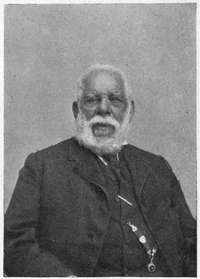
Settled largely by soldiers, Los Angeles came under military government and was slow to develop self-governing local principles. It was ruled by commissionados, of whom[656] Félix was the first, and by alcaldes. But local jurisdiction was limited, and cases went beyond the towns to be decided by military garrisons a hundred miles away. By 1810 the population was 365 and the crops in the fertile, well-watered plain amazingly large. By 1820 the ninety-one pobladores now occupying the town site were able to supply much produce to the presidios, while 56,600 vines were flourishing in the vineyards about San Gabriel.
In 1814 Padre Gil Taboada laid the corner-stone of a new church, but the site was changed and there was difficulty in raising the necessary funds; so the building was not completed until 1822. The builders were Indian neophytes, who were paid at the rate of one real (12-1/2 cts.) a day. The citizens contributed five hundred cattle, and the missions subscribed seven barrels of brandy, worth $575, wine, cattle, and mules. A new government building was added, and both this and the church were surrounded by houses of the aristocracy. Ignacio Coronel was one who at this time petitioned for a house-lot near the "new" church. The first resident priest, Fray Geronimo Boscana, took possession of his parish house in a town of six hundred souls. The church was enlarged in[658] 1841, and reroofed in 1861. Education in Los Angeles began with a village school taught by Maxima Piña, who began his labors in 1790, receiving a salary of $140 a year. Coronel was a later teacher.
In 1822 California became a province of the Mexican Empire, the military office was abolished, the alcaldes were retained, a secretary and treasurer were added, and an elective body, the Ayuntamiento, was established. Thus the government of Los Angeles went on about as it had gone under the rule of Spain. The Ayuntamiento was elected annually until 1839, and proved a most versatile body, constantly changing its political attitudes during the controversies of later years.
The mission fathers made little objection to this change of government, but when, in 1824, Mexico became a republic and Alta California its territory, they opposed themselves to the ruling powers. From this time on the Mexican Government pressed its plans of secularization until, in 1834, the ruin of the missions was complete, and that of the gentle Indians, whose rights they had hitherto guarded, was begun.[659]
Durant Cilly, a visitor to Los Angeles in 1827, found a "city of gardens," and in 1830, a prosperous year of large crops, there were one thousand inhabitants who, by vessels landing at the port of San Pedro, engaged in a large trade in hides and tallow.
In 1818 the first American arrived in Los[660] Angeles. He was followed by a succession of trappers and hunters. There was Captain Paty who, with a party of Kentucky trappers, visited the town and was baptized into the Catholic faith at San Diego, Don Pico acting as sponsor. Pryor's party settled in the pueblo, and built houses and planted vineyards. Next came sailors of the brig Danube, which went ashore off San Pedro on Christmas Eve, 1828. These were all hospitably welcomed in Los Angeles. Samuel Prentice of Connecticut came, and John Gronigen, the first German settler, planted his vineyard on the ground afterwards occupied by the Domingo block. A trade with Santa Fé sprang up, and Wolfskill, who came with a party of trappers in 1830, brought Mojave blankets, exchanging them for mules. In 1832-33 more Americans came from New Mexico. There were Paulding, Carpenter and Chard, Moses Carson, and later Benjamin Hayes, who was for eleven years district judge of Los Angeles, and, after 1847, more trappers and many sailors, who were willing to remain and plough land. Last of all came the American merchant, farmer, and speculator. By 1836, there were in Los Angeles forty-six[661] foreigners, of whom twenty-one were Americans; also 553 Indians, the remaining 2228 inhabitants of the district being Mexicans and Spaniards, the latter of pure Castilian blood, with a generous and wise pride in a high descent, the aristocrats of the coast.
Slight attempts at ship-building were made at San Pedro in 1831, Padre Sanchez of San Gabriel aiding Wolfskill, Pryor, Prentice, Fount, and Loughlin to build a schooner. In 1833, when Antonio Osio had charge of the port trade, Los Angeles shipped one hundred thousand hides and twenty-five thousand centals of tallow, but the trade slackened after the secularization in 1834. The cattle of San Gabriel were all slaughtered, and by 1840 the mission live stock had disappeared. Padre Estenéga in 1845 gave up the mission estates to the Government.
A strenuous and important period in the history of the town followed. From 1831 to 1840 the Angelenos held themselves largely responsible for the salvation of California, as they understood it; and Los Angeles became the centre of political agitation. The South was divided against the North, and often against itself, and many typical California[662] battles, terrific in bluster and intent, but bloodless in reality, occurred near the old pueblo.
It was during the banishment of José Carrillo, with whom Vincente Sanchez, alcalde of Los Angeles, had quarrelled, that the trouble with Victoria, the Mexican Governor, came. Sanchez had been deposed by the Ayuntamiento, but was reinstated as alcalde by Victoria, who at the same time ordered the imprisonment of eight prominent citizens. An insurgent army defeated Victoria in a fight near Los Angeles, and the Governor, deserted by his army, surrendered to Echeandia December 4, 1831, and was allowed to depart the country. Sanchez was put in irons. One hundred citizens took part in this battle.
Los Angeles was made not only a city but the capital in 1835, and soon became the storm-centre of the country. There may have been lack of zeal in providing necessary public buildings for the Government, but there was none at all in furnishing abundantly that quality of fiery zeal essential to Mexican revolutions. Governor Carrillo made the town his residence in 1838. Alvarado succeeded him when the plots and counterplots of the disputacions had sent Carrillo to the North.[663]
José Figueroa made an able governor, but he died in 1835, and a period of conflict, during which Los Angeles, as the capital of the South, was arrayed against the North, followed. Alvarado, who had declared California a sovereign state, entered the town in 1837 and subdued the Mexican sympathizers. Two years later Alvarado divided Alta California into two districts, making Los Angeles the[664] capital of the South, with Santiago Arguello as prefect.
Great efforts were at this time made to beautify the city, and there were gay scenes in these days in the old pueblo. The owners of the great ranches entertained largely, visiting from house to house, dressing gayly, and engaging in all sorts of equestrian sports. The men lived in their saddles; the women were the gayest and sweetest of hostesses, while they were yet domestic, and brought up large families easily in the free, open-air life which the conditions of fine climate and rich soil made possible. When Micheltorena in 1842 made his capital in Los Angeles, the gayeties reached their height; he was received with enthusiasm by the Ayuntamiento; there were speeches, salutes, and illuminations; balls and sports alternated with juntas and revolutions. Yet Los Angeles was glad to be rid of Micheltorena when he removed to Monterey, and its citizens were foremost in a revolt against him in 1845, and fought him without the city in a battle where there was much cannonading and no bloodshed. Pio Pico was head of the Commission which met in Los Angeles and banished Micheltorena.[665]
The city remained the capital of the department of the South, and Pio Pico was Governor while José Castro acted as General. Castro again went to the North and soon joined Carrillo against Pico in a new quarrel of North and South.
It was in 1846, when California was rent with the controversy between Castro, representing the military, and Pico, the civil power, and the March Assembly was in session at Los Angeles, that the approach of the forces of the United States, under Stockton and Frémont, forced the contending commanders to unite at Los Angeles in opposition to a common foe.
Abel Stearns, the confidential agent of the United States in the South, owned a warehouse in San Pedro. John Forster was made, in 1843, captain of the port; in 1845 Commodore Jones landed here to make his apologies to Micheltorena for his premature raising of the Stars and Stripes at Monterey. Here Micheltorena embarked for exile; and here, in 1846, Commodore Stockton disembarked with his sailors for the capture of Los Angeles, having already raised the American flag at Monterey. Refusing all the attempts at conciliation offered by Pico and Castro, Stockton[666] united his forces with those of the California battalion under Frémont, who had landed at San Diego, entered Los Angeles, and raised the American flag at 4 P.M. of August 13, 1846.
Pico and Castro had left the city to escape the dishonor of surrender, and the frightened inhabitants had fled to the neighboring ranchos, but returned to their homes before night, attracted by the irresistible strains of a brass band, and assured that they would be left unharmed.

Stockton ordered the election of new alcaldes, and appointed Frémont military commander of the district. When both commanders returned to the North, Gillespie, with a garrison of fifty men, was left in charge of Los Angeles. He seems to have interfered with the amusements of the people,[667] and to have made himself needlessly unpopular. A revolt was organized, and Flores, one of Castro's generals, appeared, with three hundred men at his back, and summoned the garrison to surrender. This Gillespie did, after bravely holding Fort Hill for a time. The Americans took ship from San Pedro on October 4th.
The reconquest of Los Angeles took place on January 18th. General Kearny, with Kit Carson as guide, had succeeded in joining Stockton at San Diego, and the united forces, after a two-hours' engagement at San Gabriel and another brief skirmish without the city, entered Los Angeles, while the leaders of the revolt fled to Cahuenga, and surrendered to Frémont, who made generous terms of capitulation with Andres Pico, Flores, and Manuel. This clemency endeared him to the Californians. It became his boast that he could ride unharmed alone from one end of the conquered country to the other. Stockton made him Governor of Los Angeles while the controversy between Kearny and Stockton, as to which was the chief authority in the conduct of affairs in the new country, was in progress. Frémont chose to obey Stockton, with whom[668] he had worked in unison during the Northern conquests and before the arrival of Kearny. Kearny was technically in the right in demanding the submission of Frémont, as the court-martial of the latter (in Washington, at a later day) made evident; but under the circumstances of the quarrel of the two leaders at Los Angeles, Frémont's allegiance to Stockton seems to have been his only manly course.
This was an era in which Los Angeles grew from an easy-going Spanish pueblo into a progressive American city. Nowhere have Americans stood more completely in the position of conquerors in a new land. Called upon to improvise hastily a government for a large body of strangers, these citizens showed, together with carelessness and over-hastiness—and an indifference to the rights of strangers, both Indians and Spaniards, of which we cannot be proud—some of our best national traits. From the first, the pioneers were courageous and teachable, and succeeded, after many mistakes, in building up a permanent, well-organized, and progressive municipality. General Frémont was undoubtedly most popular among the Spanish people. His youth enabled him to enter in a large degree into their[669] sports; his clemency in pardoning Flores and the other generals of the rebellion won their applause.
It was from his gubernatorial residence, the old two-story adobe at the corner of Aliso and Los Angeles Streets, that Frémont set forth with Jesus Pico and Jacob Dodson for his famous mustang ride to Monterey. The feat, with its object—to defend his position as Governor against Kearny—was such as to appeal to the imagination of the people of Los Angeles, both Mexican rancheros and American trappers and sailors. Over desert and mountain the three riders flew, leaving on the morning of March 22d and reaching Monterey, five hundred miles away, on the afternoon of the fourth day. The return was accomplished with equal speed, so that the trip of one thousand miles was made in a little over eight days. Frémont did great service in the Senate of the United States, where he pleaded for the land rights of Indian and Spanish residents, and in later years, when his influence aided in the exclusion of slavery from the new State of California. The town council was re-established in 1847, Don José Salazar and Don Enrique Abila[670] being alcaldes; but in 1848 Governor Mason dissolved the council and installed Stephen G. Foster as alcalde. A semi-military rule was kept up under Colonel Stevenson until May, 1849, when a new ayuntamiento was established.
The cattle trade was at its best from 1850 to 1860, when in one year one hundred thousand hides at $15 apiece were shipped from San Pedro, but the business was injured by the drouth of 1863 and 1864. The town grew slowly, increasing in orchards and vineyards, its ranchos—many new ones having been granted by Pico in 1846—sheltered in the bend of the Los Angeles River, which, by ancient decree, is, from the mountains down, the property of the city. In 1851 Los Angeles grapes brought in San Francisco 20 cts. a pound; at the mines, $1. The city escaped the excitement of the gold fever, although the yellow metal was first discovered near Los Angeles in 1835. Among the noted Spanish families at the time of the conquest were the Lugos, the Sepulvedas, the Bandinis, the Estudillos, the Oliveros, the Picos, and the Coronels. Prominent among the pioneers of old Los Angeles were the Workmans, Temples, and Wolfskills, David W. Alexander, Colonel[672] Couts, and Governor Downey, Judge J.R. Scott and Benjamin D. Wilson, Robert S. Baker and Hugo Reid. Hon. H.C. Foster, one of the early mayors of Los Angeles, became a resident of the city in 1847. Governor Pio Pico, who had fled at the approach of Stockton to save the "honor" of Mexico, returned and became a conspicuous private citizen. He lived to a great age, duly performing his duty as a registered voter.
It was Don Antonio Coronel, dead but a decade, who most picturesquely and honorably represented to the new Los Angeles the old régime. He was of "courtly presence, ripe experience, high integrity, and great personal fascination," and was to his latest days "a quenchless patriot, white-haired, clear-eyed, and supple," the life of any circle he might be persuaded to adorn. His father, Don Ignacio Coronel, came to the town with the Hijar Colony. He was a man of note and opened in 1839 a school—much needed, if the fact be true that there were then in the pueblo but fifty-four men who could read and write. Antonio was in 1843 Visitador del Sud under the Mexican, and in 1853 Mayor of Los Angeles under the American, Government.[674] He was a warm friend of Helen Hunt Jackson, who thoroughly identified herself with the interests of the older peoples of Los Angeles and its environs.
Up to 1852 the houses in Los Angeles were of adobe,—the sun-baked brick of the country,—and these were comfortable indeed, cool in summer and warm in winter. It was in one of these ample residences—that of Colonel J.G. Nichols—that the Rev. J.W. Brier, of the M. E. Church, held the first regular Protestant service, and in another that the Rev. Dr. Wicks, a Presbyterian, opened the first English-speaking school. These events were in 1850, so that church and school were ready to receive the first American child (Gregg Nichols, who was born in April, 1851).
The corner of Third and Main Streets blossomed into brick in 1852, in the new, proud, one-story building, serving, in 1859, as the home of Captain Winfield S. Hancock, who was always exceedingly popular in Los Angeles. He revisited the city a few years before his death, and received an enthusiastic ovation.
In 1849 San Pedro had the first steamer, the old Gold Hunter, and by 1859 the Senator[675] made three monthly trips. There was now a stage line to San Diego, and overland stages left for the East three times a week. Frequent freight trains passed between the city and Salt Lake, but it was not until the coming of the several railroads that Los Angeles attained its phenomenal growth and became the great city of the Southwest. Set richly between the sparkling waves of the Pacific and the jasper heights of the Sierra Madre Mountains, Los Angeles now rests in its fertile plains, a radiating jewel, its suburbs climbing the bases of its hills, its roads ascending cañons, its sparkling beaches curving sharply inward from the sea. Its clustered cottages are surrounded with trees and flowers, which bloom throughout the year in inconceivable profusion. Its streets are lined with graceful pepper and eucalyptus trees, its palatial homes are set amid tropic foliage, its hills are crowned with public institutions. The southern portion of the city is level, but on the north and south are hills. Within the city limits, at a level of three hundred feet above the sea, may be found great variety of location, while seven public parks, soon to be united by boulevards, add to the beauty of the natural scenery. No[676] wonder that in twenty years the population has grown from 11,000 to 103,000—increased during the winter months by thousands of tourists, who are brought easily to the gates of this city of the sunset land. Its daring trolleys mount the great hills from rose garden to snowy height, its railroads, entering from east and north, bear the charmed traveller through sunny ranches of olive and walnut tree, through great vineyards and orange orchards; and to ships entering the harbor at San Pedro are revealed the beauties of flower-swept hills, which in their season flaunt their fields of yellow poppy toward the sea.
The saddest event in the history of modern Los Angeles was the land boom, which, after first enriching and then ruining many inhabitants, collapsed in 1889, leaving the town prostrate. The rise in values was so rapid that a corner lot costing in 1851 thirty dollars, and worth in 1860 $300 a front foot, increased by 1870 to $500 and by 1880 to $1,000 a front foot. In 1889 its sale was pushed to $2,500. Other lots worth in 1883 $20, brought in 1889 $800 a front foot. Lands outside the town, worth up to 1868 $1 an acre, brought, in 1887, $1,000.[677]
The effects of this over-expansion on the[678] young, vigorous, richly dowered community were, however, but temporary; the city of the Angels arose from temporary defeat to enter at once upon an era of growth and prosperity unexampled in the history of cities, and all but magic in its extent.
A dozen lines of railroad centre in the city, whose trade extends from Fresno on the north to the easternmost limits of Arizona. Eighteen years ago the city adopted a successful scheme of electric lighting, and its trolley system is one of the best in the United States. For the last decade the building trades have been rapidly growing. Building permits to the value of $23,000,000 have been issued, and in 1900 alone $2,700,000 was invested in new buildings.
The city has 200 miles of paved streets, 330 miles of sidewalks, and 160 miles of sewers; but its complete and perfect system of irrigation is one of its greatest beauties. The "Zanjero" has from its earliest years been an important municipal functionary, and the flowing of well-kept channels of fine water, in sparkling zanjos along the sides of the principal streets, adds to the beauty of roads and grounds, while through a system of new and[680] beautiful parks the visitor can obtain some of the finest views in the world by simply driving about the city.
If the traveller seek the suburbs he will drive for mile after mile through groves of orange and lemon, fig, peach, pear, and apricot orchards; he will see on one side of the town great sweeps of almond and walnut trees; on another, ranches planted in vineyard and olive. There are, perhaps, three million fruit trees growing in the district, half of which are in full bearing. The land bears, too, great crops of alfalfa, which in fertile places is cut from three to six times a year. Oranges, of course, are the chief export; but there are, besides, wine, brandy, wheat and barley, sugar-cane, and all varieties of fresh vegetables. If the tenderfoot hear that Los Angeles corn grows sometimes to a height of twenty feet, that pumpkins weighing four hundred pounds have been raised, or even that holes from which beets have been pulled are of a size sufficient for fence-posts, he need not doubt. There are three large beet-sugar factories, and in the county $100,000 worth of olives, and more than that of honey, are annually produced.
The population of the city is cosmopolitan,[682] as may be known from the fact that, in addition to the exceptionally good English papers of the city, organs in German, French, Spanish, Italian, Basque, and Chinese are issued. A large number of Chinese, several thousand, are engaged in raising vegetables or in domestic labor of the several kinds. As in all California towns, they have a residence section of their own, and are quiet, orderly, reliable, and useful.
Los Angeles is a city of churches, and its philanthropies are many; its educational advantages are remarkably good. At the head of a noticeably complete system of training stands the University of Southern California, which opened its doors in 1880, with Dr. Bovard as President. Its College of Medicine is a well-equipped institution, and its progress is identified with the name of Dr. J.P. Widney. An exceptionally fine normal school completes the training given by the public-school system, with its high schools and fifty-five grammar schools, all housed in buildings which might be the pride of any community. The buildings which house its free library system, its City Hall, and its[683] County Court-House, are well conceived for their several purposes, and architecturally of great beauty.
But Los Angeles is above all a city of homes and of gardens. The mildness of the climate permits the most delicate plants and trees to flourish throughout the winter. Giant bananas, fan and date-palms, rise above the houses, and at Christmas are seen hedges of callas, geraniums ten feet high, heliotropes covering whole sides of houses, and such wealth of roses and orange blossoms as baffles description.[684]
A feature of Los Angeles is its beautiful sea beaches. Easily accessible by trolley and by rail, Santa Monica, Redondo, Long Beach, and San Pedro provide unsurpassed facilities to the citizens, and the island of Santa Catalina, twenty miles off the coast, is even more attractive—a seashore resort where bathing is a comfortable pastime every day in the year, and where fishermen find delights unending.
The construction of the Government breakwater at San Pedro is a great commercial enterprise and will be of certain benefit to the city, which will thus gain a larger share of the increasing trade with the Orient. Three million dollars have been appropriated for deepening the water over the bar, so that large vessels may come to the wharf. Dry docks and fortifications are to follow; and a new railway, with its terminal at San Pedro, will connect Los Angeles with Salt Lake City, and open to trade a new and rich section of country in southern Nevada and in Utah.


[2] This section, known as the Western Reserve, lying between parallels forty-one and forty-two, and a line one hundred and twenty miles west of the western line of Pennsylvania and parallel with it, was "reserved" to Connecticut when she ceded to the United States certain territory which she had received from the grant of Charles II. Of this territory Connecticut granted one half million of acres to such of her soldiers as had suffered from the British during the Revolution. The larger, if not the entire, part of the balance passed into the control of a private-public corporation, known as the Connecticut Land Company.
[3] Under treaty stipulations negro and Indian slaves were held until Michigan became a State. Detroit has always had to do with slavery questions. Before the Civil War it was an important station on the "Underground Railroad," and occasionally slaves were seized on our streets. Some of the conspicuous leaders of the party that secured the abolition of slavery lived at one time or another in Detroit. General Grant's home may still be seen. United States Senator Zachariah Chandler of "blood-letting letter" fame was one of our oldest merchants, and the notable "fire-in-the-rear" editorial appeared in a local paper.
[4] The gateway was located on what is now the corner of Jefferson Avenue and Griswold Street, and a bronze tablet there erected bears a representation of an Indian warrior and the following inscription:
"This Tablet designates the site of one of the gateways of Fort Detroit. The original stockade was known as Fort Pontchartrain and was erected when the city was founded in 1701.
"Through the gateway here located Pontiac, the Ottawa chief, with a band of Indians, passed on May seventh, intending to surprise and massacre the garrison.
"The exposure of his plot on the previous day caused the defeat of his plans and gave the English the supremacy in this region until the close of the Revolutionary War."
[5] The Post-office on Fort Street, which occupies a portion of the site of this fort, displays at its southerly entrance a tablet erected in 1896 which bears the following inscription:
"This Tablet designates the site of an English Fort erected in 1778 by Major R.B. Lernoult as a defense against the Americans. It was subsequently called Fort Shelby, in honor of Gov. Isaac Shelby of Kentucky, and was demolished in 1826.
The evacuation of this Fort by the British at 12 o'clock noon, July 11th, 1796, was the closing act of the War of Independence.
On that day the American Flag was for the first time raised over this soil, all of what was then known as the Western Territory becoming at that time part of the Federal Union."
[6] The deed for the Island, bought from its Indian owners in 1781 by George III. for £5000, was long in possession of Dr. John R. Bailey, Brevet Lieutenant-Colonel U.S.V., and author of a most interesting monograph on Mackinac. It is from its pages, and by his kind permission, that the Indian signatures to the document are here reproduced.
[7] For an admirable statement of the facts bearing upon this interesting problem, the reader is asked to turn to My Notebook of the French Revolution, by Mrs. Elizabeth Wormeley Latimer (A.C. McClurg & Co.). The book upon which Mrs. Latimer has chiefly based her account, The Lost Prince, by the Rev. Mr. Hanson, has long been out of print, and is almost inaccessible.
[8] La Salle, in drawing his maps, made the Ouabache to empty into the Mississippi at Cairo, According to him the Oyo (Ohio) was a tributary of the Ouabache. About 1702, one, M. Juchereau, sent to establish a post for the protection of the traders in peltries, reported that he had established a post about forty leagues above the mouth of the Ouabache. Some writers have taken that to mean Vincennes, and it is so recorded in some of the encyclopædias, but his post was on what is now called the Ohio, and not on the Wabash.
[9] Clark began at once to organize an expedition against Detroit, but it never started. Francis Vigo, who had let Clark have provisions and money for his expedition against Vincennes, aided in like manner in fitting out the new expedition, lending money to the amount of $8616, for which Clark gave him an order on Virginia. The order was never honored, and an appeal was made to Congress. Finally, in 1872, nearly a century after the debt was contracted, and nearly thirty-seven years after Vigo had died in extreme poverty, Congress referred the matter to the Court of Claims, which four years later allowed the claim, together with more than $41,000 in interest.
[10] Among the Sacs, "Checagau" was the name of one of their valiant warriors and colonizers, and meant "He that stands by the tree." Among the several tribes of the Algonquin group "Chekago," "Chicagong," etc., was pronounced in a variety of ways and had as many meanings.
[11] The Indian names now given to the lakes of this region are modern appellations; originally they were numbered First, Second, Third, and Fourth as they progressed towards the source—the order in which they were encountered by the federal surveyors in ascending the Catfish, a branch of Rock River, and the outlet of the lakes. Their present names, adopted in 1856, are Kegonsa, Waubesa, Monona, and Mendota, respectively.
[12] The author has, of course, omitted to say what many of his readers understand, that as secretary he has had a large share in giving the Wisconsin Historical Society its conspicuous position in the public mind.—Editor.
[13] The prediction was fulfilled the following year, when it became necessary to construct elaborate works to save the waterpower.
[14] In this account the directions are misleading, as they thought the river ran east and west instead of north and south at this point.
[15] See chapter on Salt Lake City.
[16] Some secular officials, such as marshals and other peace officers, had been chosen, but these were generally nominated by the Church leaders and elected or "sustained" by vote of the people in Church gatherings. The secular power exercised by the Church officials was expressly delegated to them by vote of the people.
[17] The reader will yet more vividly recall that The Man with the Hoe came out of San Francisco and will heartily approve the editor's selection of Mr. Markham to contribute this chapter to the volume.
American Historic Towns
Historic Towns of New England
Edited by Lyman P. Powell. With Introduction by George P. Morris. Fully illustrated. Large 8o, net $3.00.
Historic Towns of the Middle States
Edited by Lyman P. Powell. With Introduction by Albert Shaw. Fully illustrated. Large 8o, net $3.00.
Historic Towns of the Southern States
Edited by Lyman P. Powell. With Introduction by W.P. Trent. Fully illustrated. Large 8o, net $3.00.
Historic Towns of the Western States
Edited by Lyman P. Powell. With Introduction by R.G. Thwaites, Fully illustrated. Large 8o, net $3.00.
G.P. PUTNAM'S SONS, New York and London
American Historic Towns
Historic Towns of New England
Edited by Lyman P. Powell. With introduction by
George P. Morris. With 161 illustrations. Large
8o, gilt top
net $3.00
Contents: Portland, by Samuel T. Pickard; Rutland, by Edwin D. Mead; Salem, by George D. Latimer; Boston, by Thomas Wentworth Higginson; Cambridge, by Samuel A. Eliot; Concord, by Frank A. Sanborn; Plymouth, by Ellen Watson; Cape Cod Towns, by Katharine Lee Bates; Deerfield, by George Sheldon; Newport, by Susan Coolidge; Providence, by William B. Weeden; Hartford, by Mary K. Talcott; New Haven, by Frederick Hull Cogswell.
"These monographs have permanent literary and historical value. They are from the pens of authors who are saturated with their themes, and do not write to order, but con amore. The beautiful letterpress adds greatly to the attractiveness of the book."—The Watchman.
"The authors of the Boston papers have succeeded in presenting a wonderfully interesting account in which none of the more important events have been omitted.... the quaint Cape Cod towns that have clung tenaciously to their old-fashioned ways are described with a characteristic vividness by Miss Bates.... The other papers are presented in a delightfully attractive manner that will serve to make more deeply cherished the memory of the places described."—New York Times.
Historic Towns of the Middle States
Edited by Lyman P. Powell. With introduction by
Dr. Albert Shaw. With 135 illustrations. Large
8o, gilt top
net $3.00
Contents: Albany, by W.W. Battershall; Saratoga, by Ellen H. Walworth; Schenectady, by Judson S. Landon; Newburgh, by Adelaide Skeel; Tarrytown, by H.W. Mabie; Brooklyn, by Harrington Putnam; New York, by J.B. Gilder; Buffalo, by Rowland B. Mahany; Pittsburgh, by S.H. Church; Philadelphia, by Talcott Williams; Princeton, by W.M. Sloane; Wilmington, by E.N. Vallandigham.
"Mr. Powell's contributors have prepared a most interesting collection of papers on important landmarks of the Middle States. The writers enter into the history of their respective towns with much elaborateness."—N.Y. Tribune.
G.P. PUTNAM'S SONS, New York and London
Historic Towns of the Southern States
Edited by Lyman P. Powell. With introduction by
W.P. Trent. With about 175 illustrations. Large
8o, gilt top
net $3.00
Contents: Baltimore, By St. George L. Sioussat; Annapolis and Frederick, by Sara Andrew Shafer; Washington, by F.A. Vanderlip; Richmond, by William Wirt Henry; Williamsburg, by Lyon G. Tyler; Wilmington, N.C., by J.B. Cheshire; Charlestown, by Yates Snowden; Savannah, by Pleasant A. Stoval; St. Augustine, by G.R. Fairbanks; Mobile, by Peter J. Hamilton; Montgomery, by George Petrie; New Orleans, by Grace King; Vicksburg, by H.F. Simrall; Knoxville, by Joshua W. Caldwell; Nashville, by Gates P. Thruston; Louisville, by Lucien V. Rule; Little Rock, by George B. Rose.
"This very charming volume is so exquisitely gotten up, the scheme is so perfect, the seventeen writers have done their work with such historical accuracy and with such literary skill, the illustrations are so abundant and so artistic, that all must rejoice that Mr. Powell ever attempted to make the historical pilgrimages."—Journal of Education.
Historic Towns of the Western States
Edited by Lyman P. Powell. With introduction by
R.G. Thwaites. With 218 illustrations. Large 8o,
gilt top. (By mail $3.25)
net $3.00
Contents: Detroit, by Silas Farmer; Chicago, by Hon. Lyman T. Gage; St. Louis, by F.M. Crunden; Monterey, by Harold Balce; San Francisco, by Edwin Markham; Portland, by Rev. Thomas L. Cole; Madison, by Prof. R.G. Thwaites; Kansas City, by Charles S. Gleed; Cleveland, by President Charles F. Thwing; Cincinnati, by Hon. M.E. Ailes; Marietta, by Muriel C. Dyar; Des Moines, by Dr. F.I. Herriot; Indianapolis, by Hon. Perry S. Heath; Denver, by J.C. Dana; Omaha, by Dr. Victor Rosewater; Los Angeles, by Florence E. Winslow; Salt Lake City, by Prof. James E. Talmage; Minneapolis and St. Paul, by Hon. Charles B. Elliott; Santa Fé, by Dr. F.W. Hodge; Vincennes, by W.H. Smith.
G.P. PUTNAM'S SONS, New York and London
All advertising material has been placed after the main text.
Obvious punctuation and spelling errors have been corrected.
An entry for the Index has been added to the Table of Contents and one for the Frontispiece to the List of Illustrations.
To preserve the flow of text, illustrations that were half or full page may be accessed via the sidenotes. Smaller portrait illustrations have been left with the main text.
The remaining corrections made are indicated by red dotted lines under the corrections. Scroll the mouse over the word and the original word will appear.

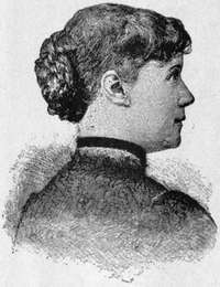
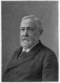
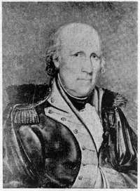

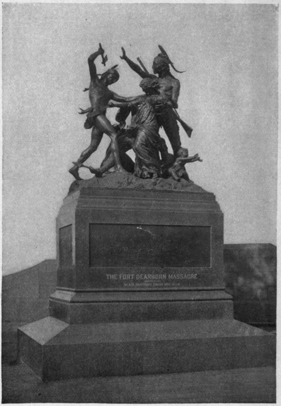
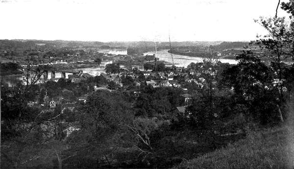
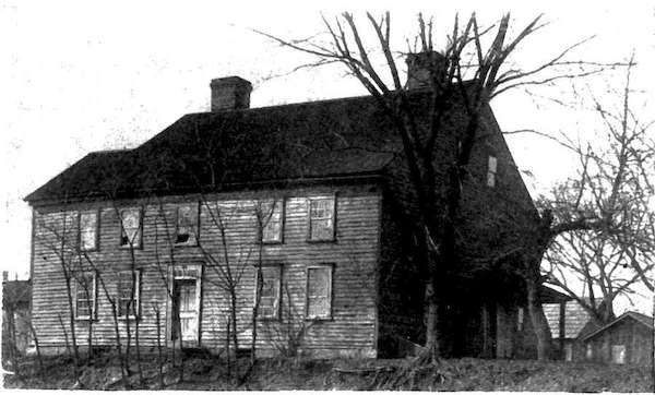
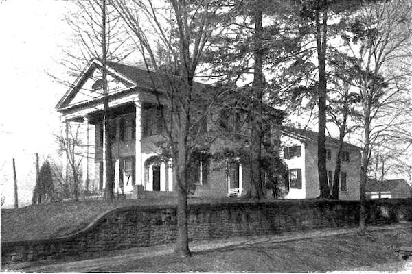
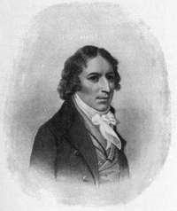
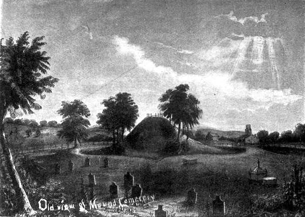
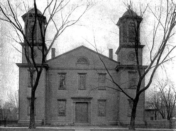
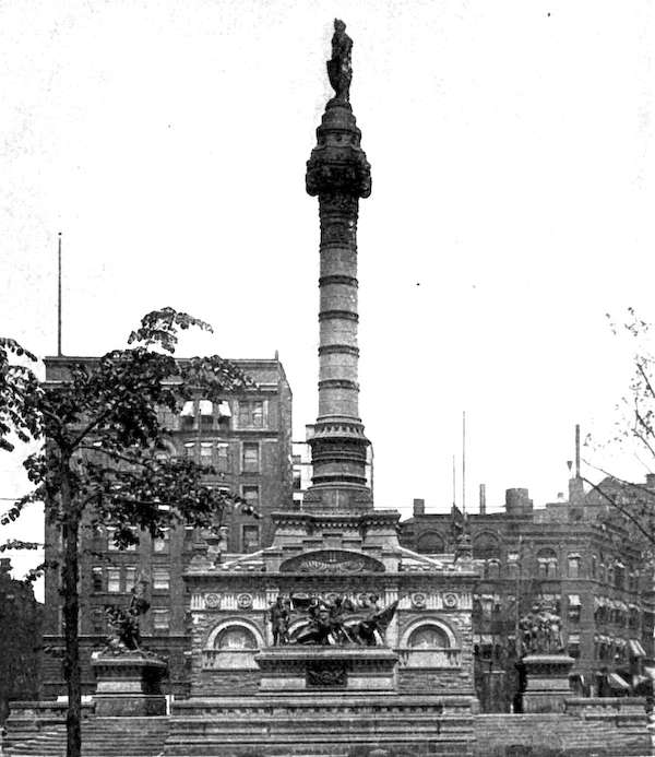
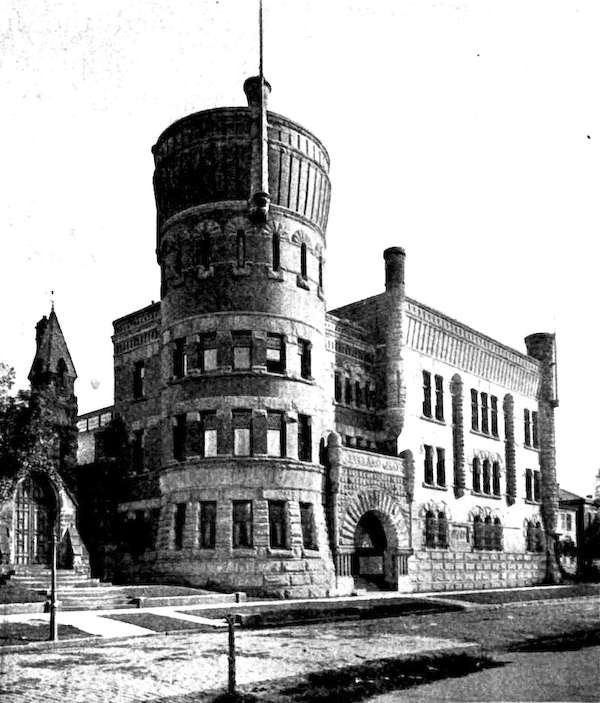
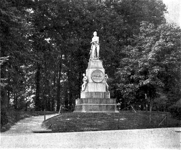
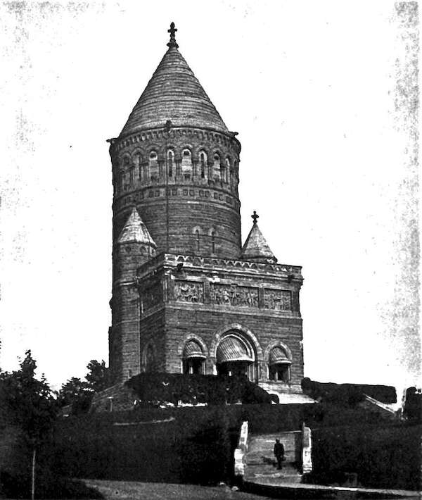
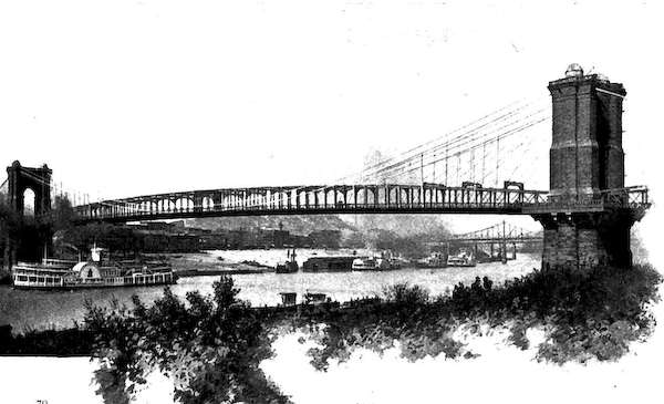
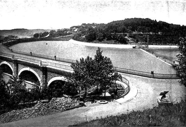
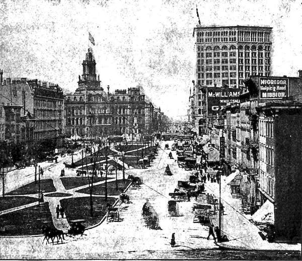
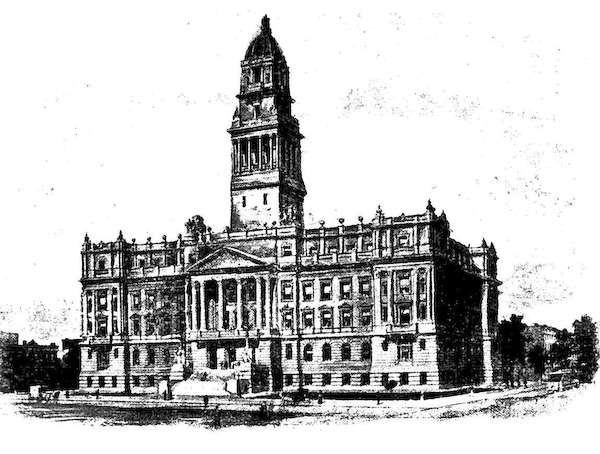
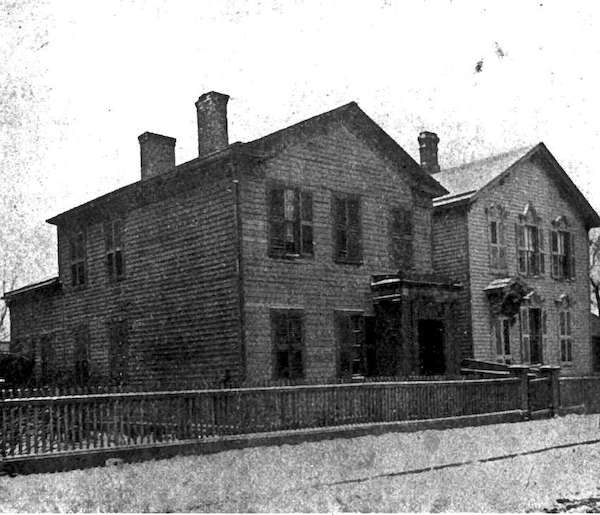
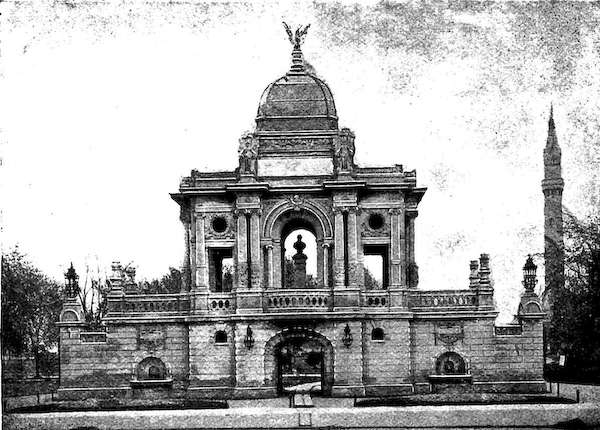
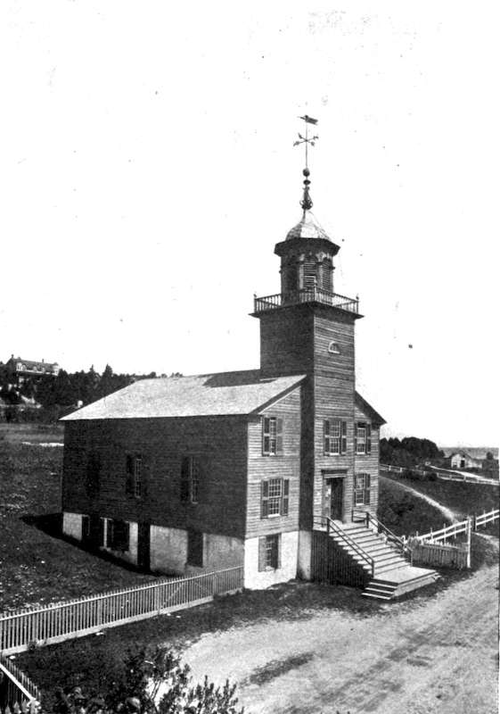
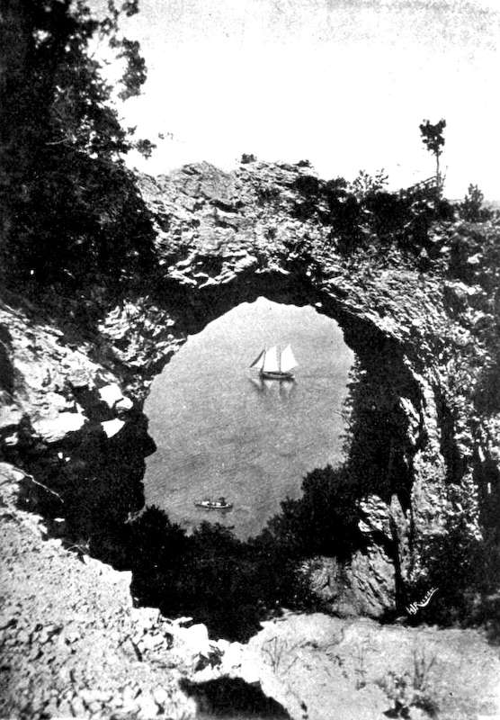
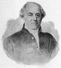
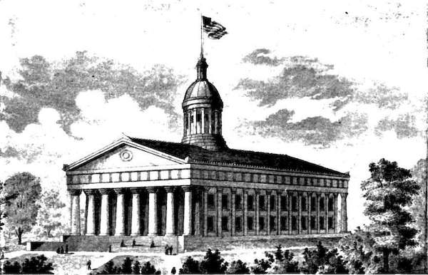
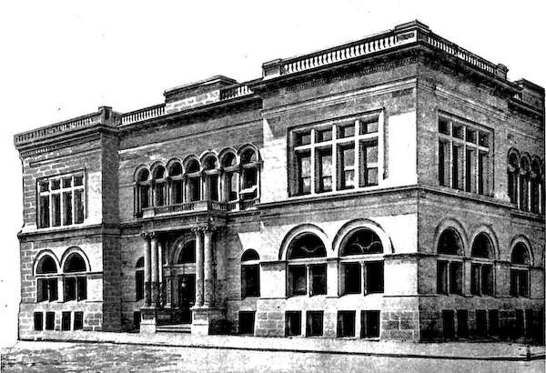
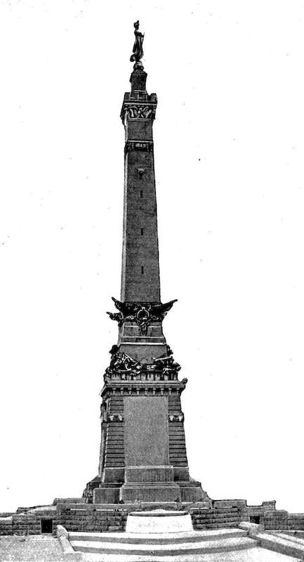
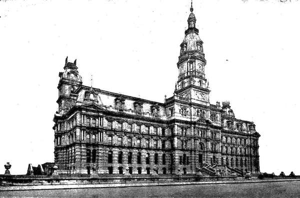
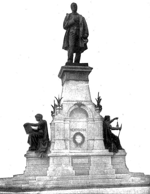
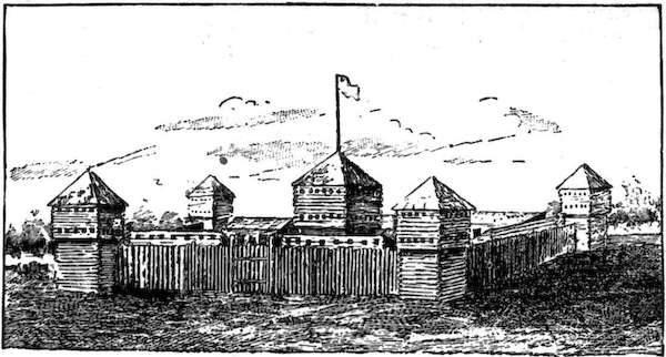
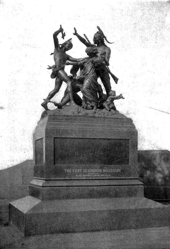
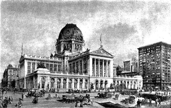
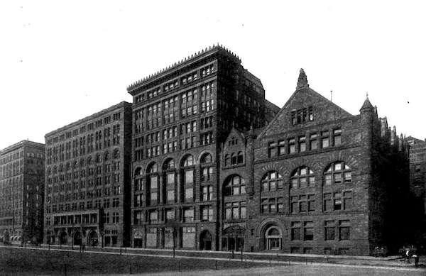
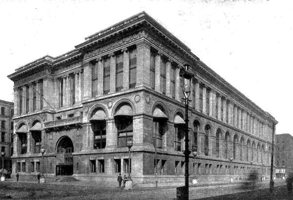
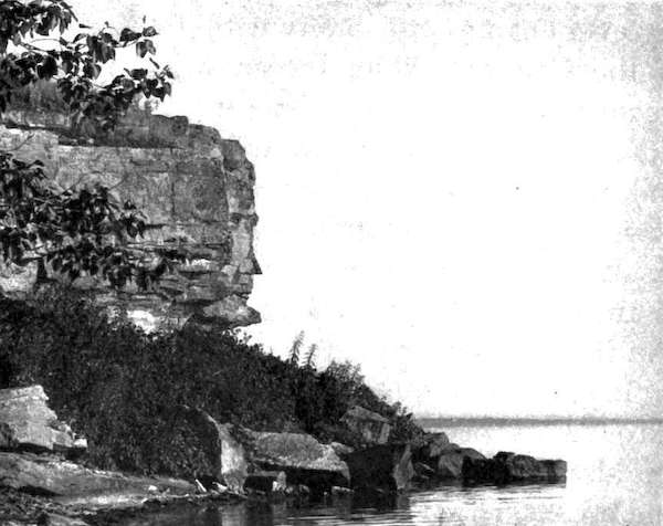
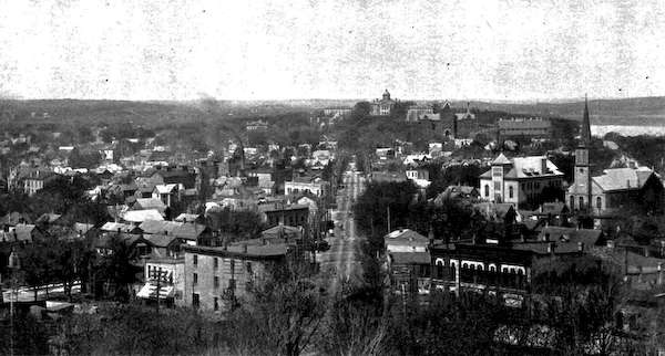
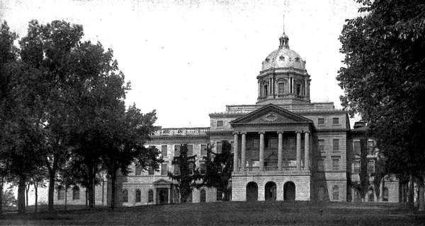
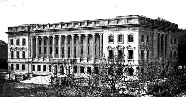
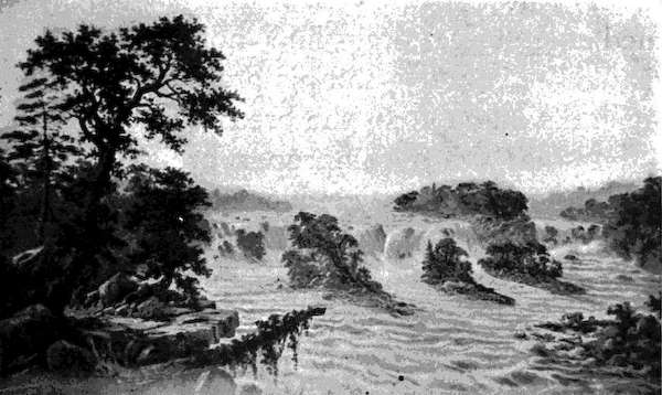
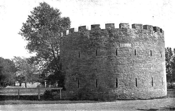
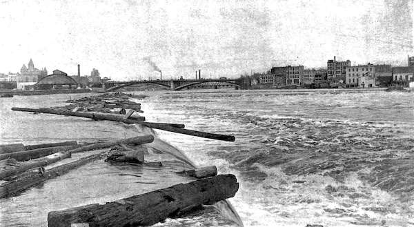
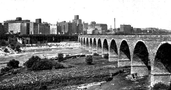
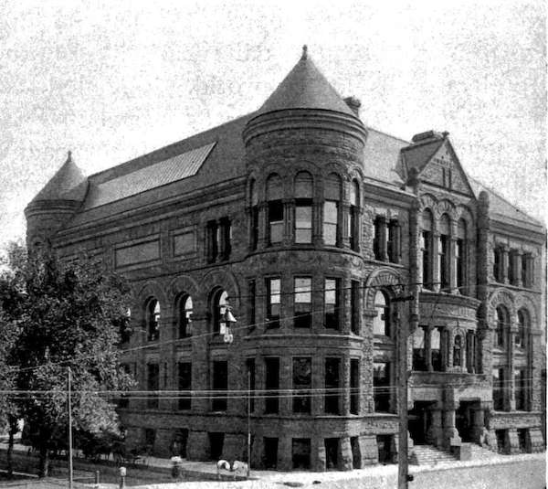
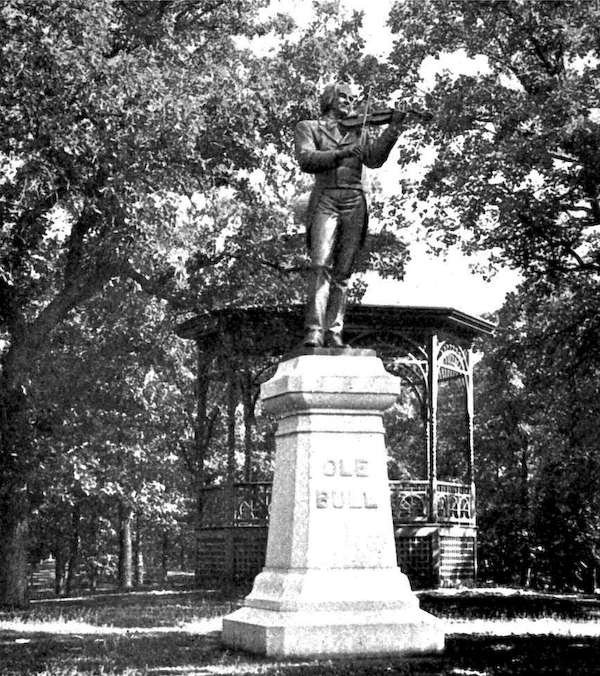
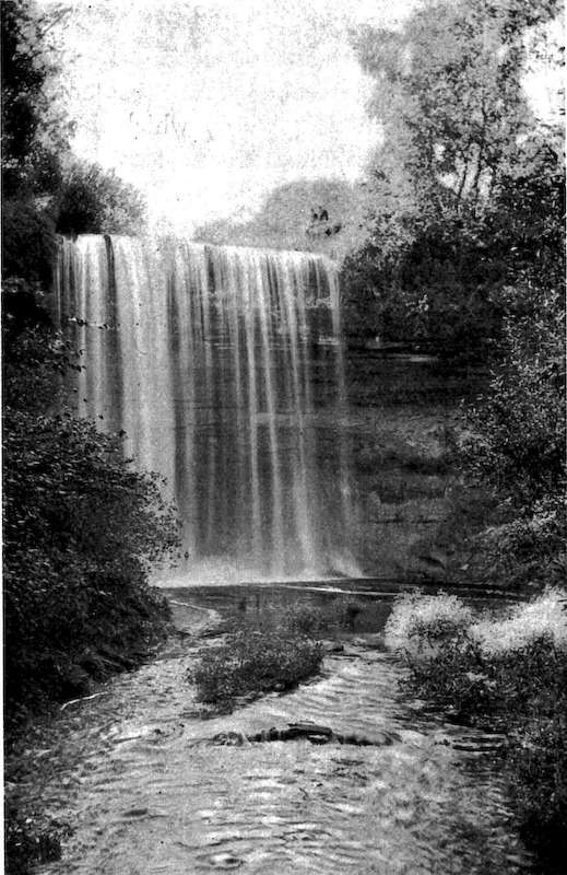
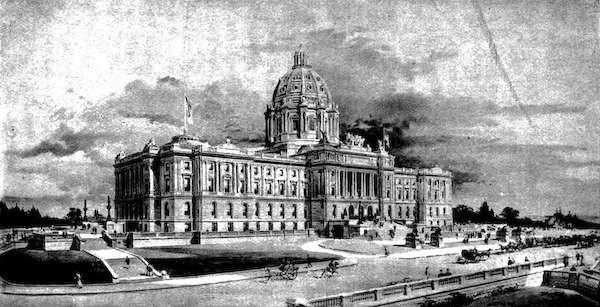
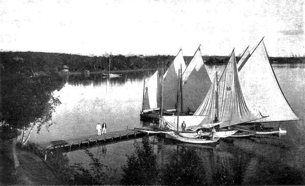
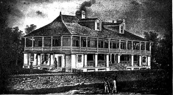
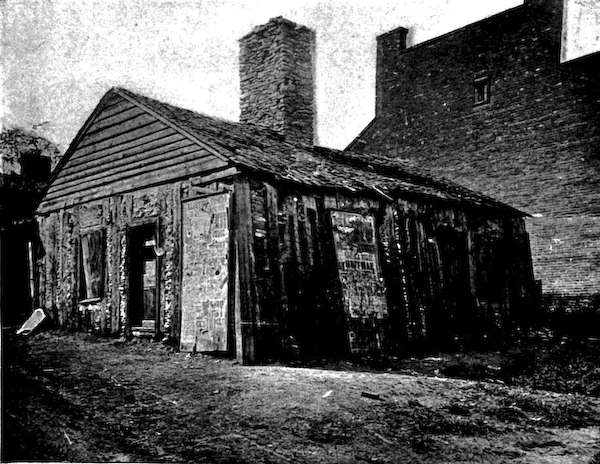
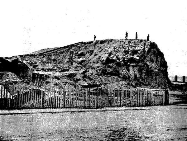
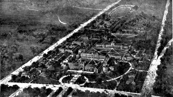
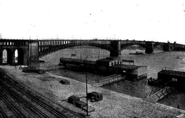
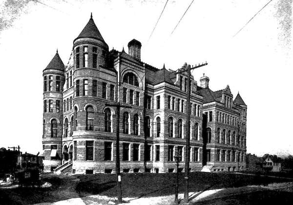
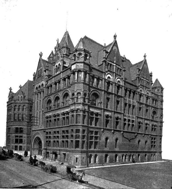
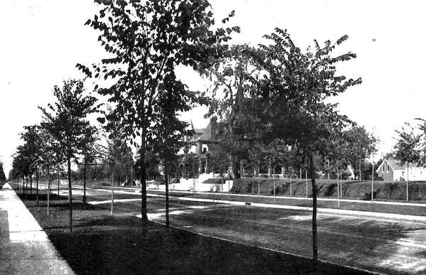
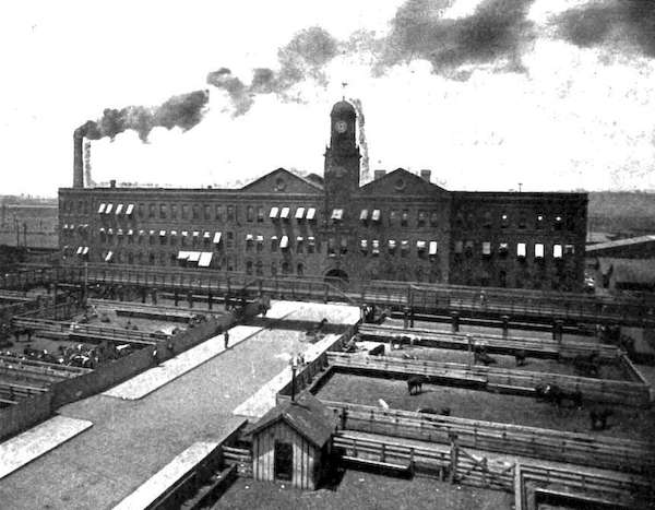
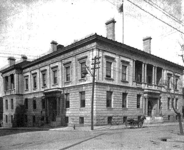
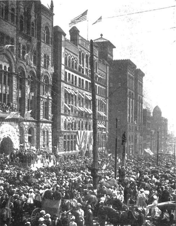
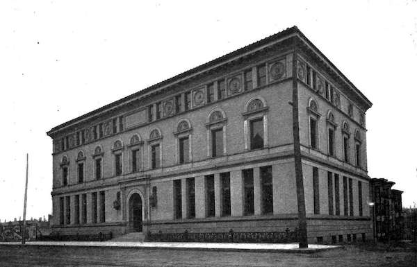
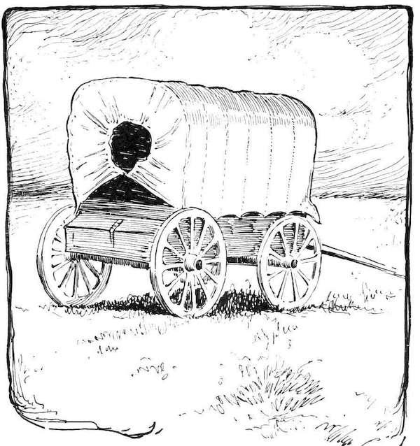
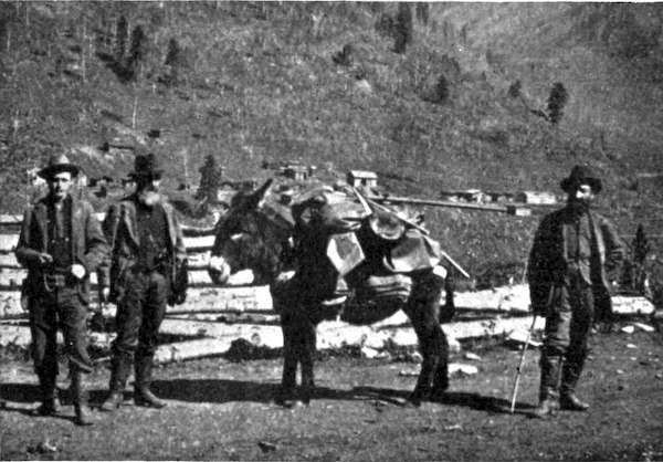
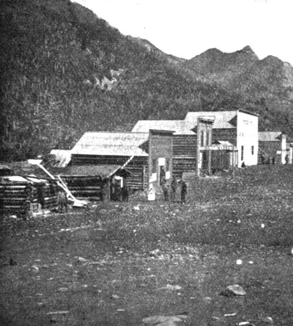
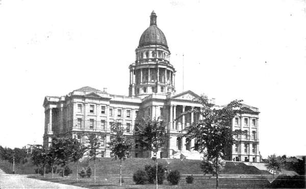
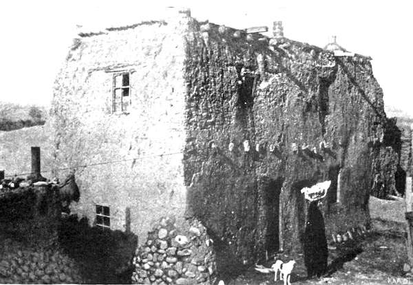
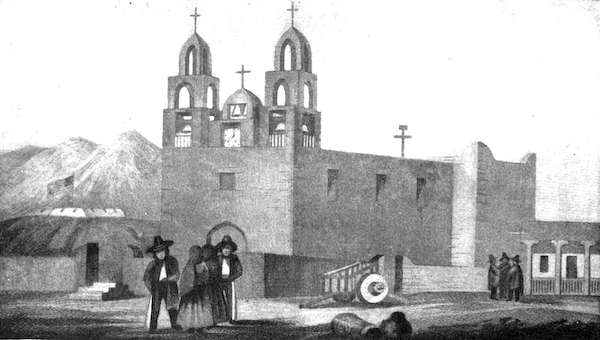
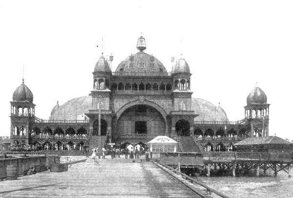
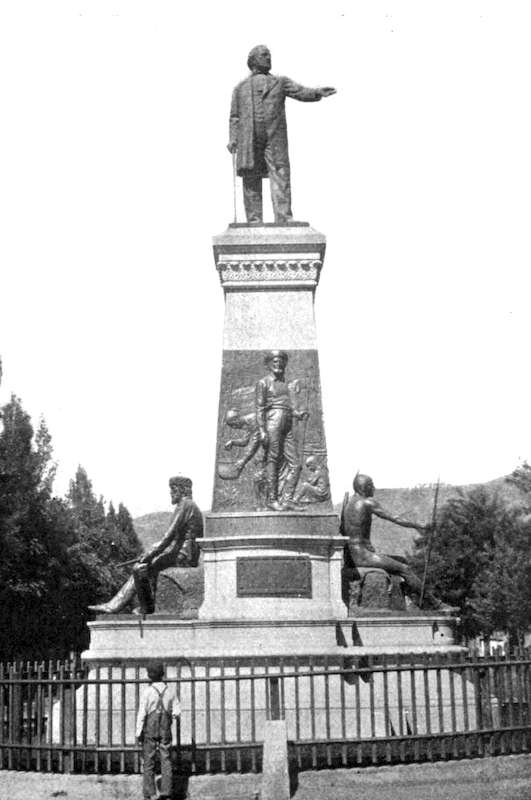
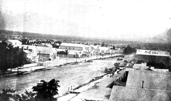
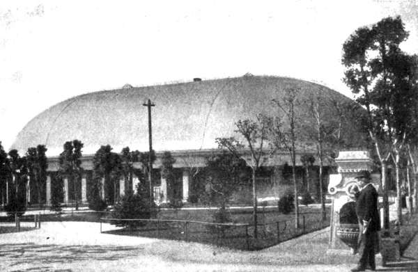
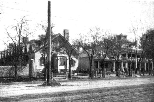
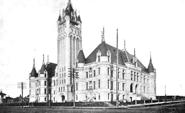
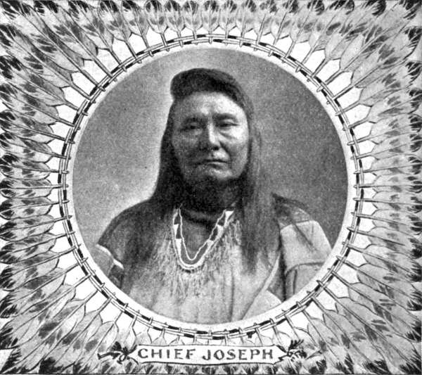
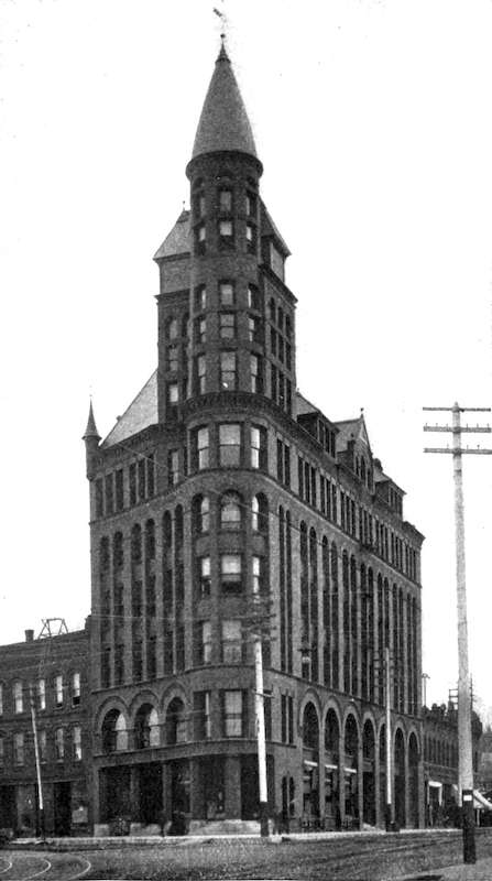
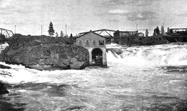
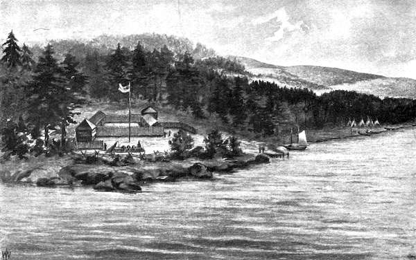
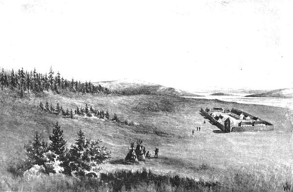
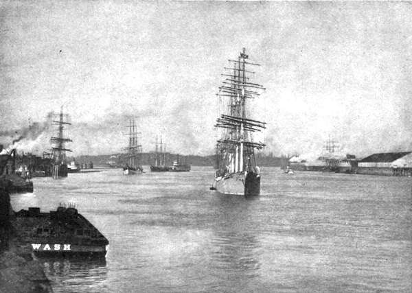
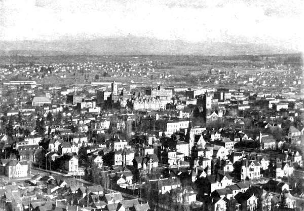
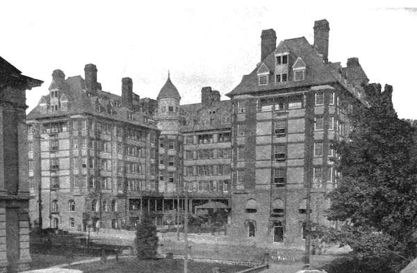
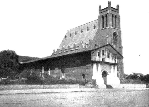
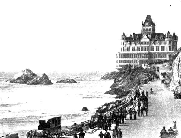
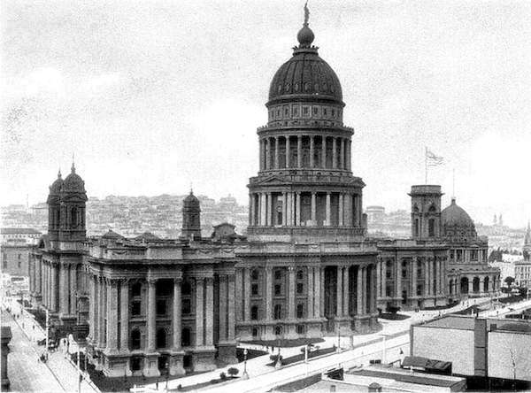
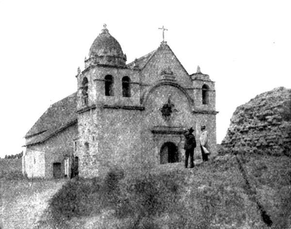
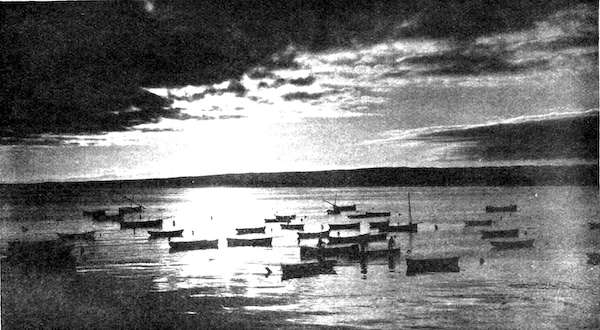
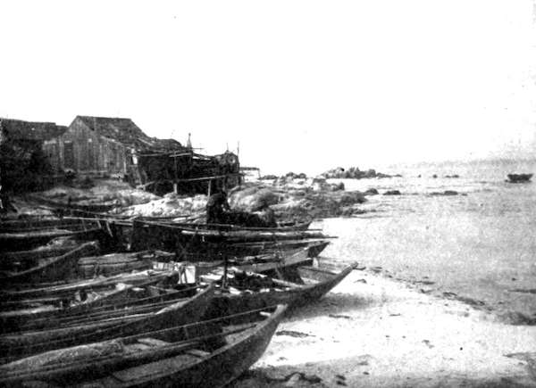
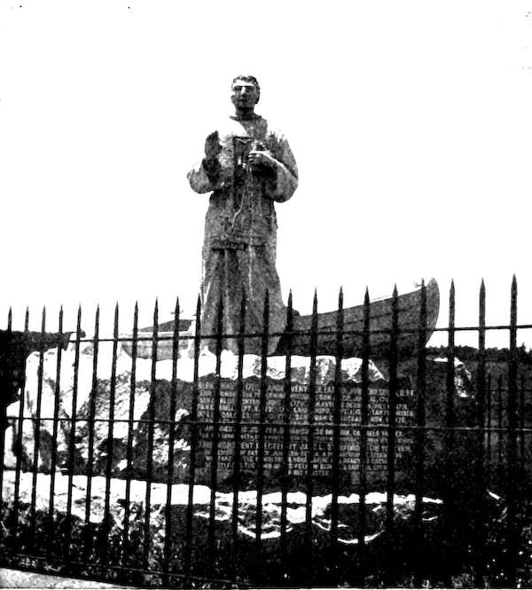
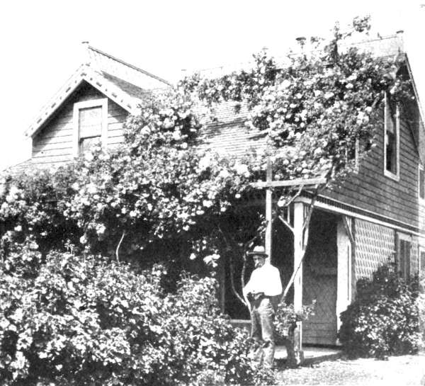
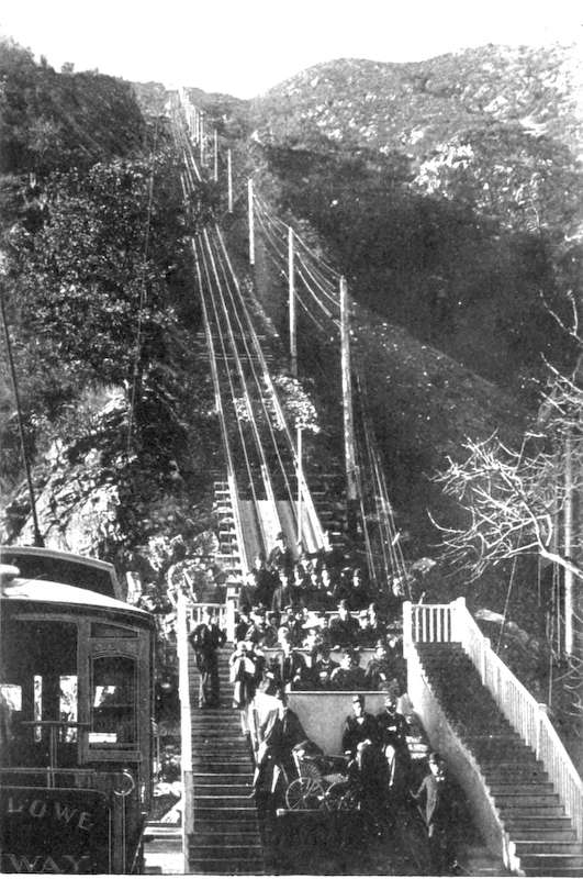
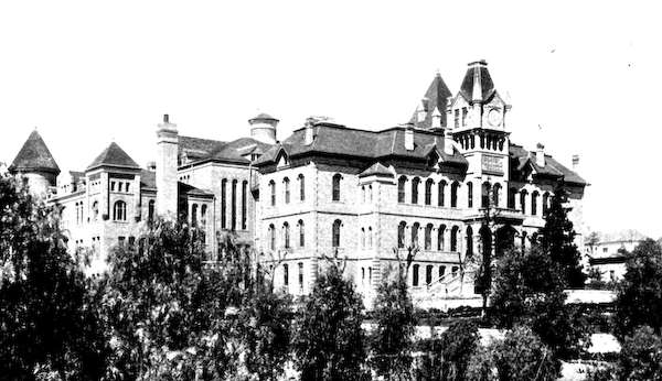
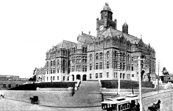
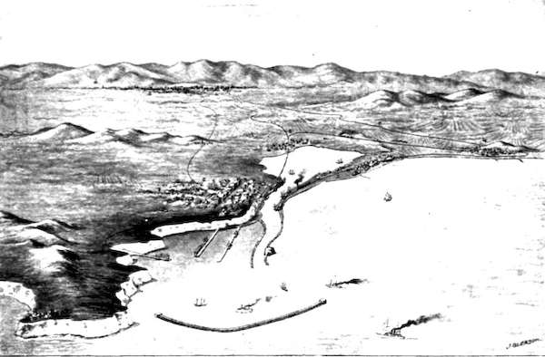