
Project Gutenberg's The World and Its People: Book VII, by Anna B. Badlam

This eBook is for the use of anyone anywhere at no cost and with
almost no restrictions whatsoever.  You may copy it, give it away or
re-use it under the terms of the Project Gutenberg License included
with this eBook or online at www.gutenberg.org


Title: The World and Its People: Book VII
       Views in Africa

Author: Anna B. Badlam

Editor: Larkin Dunton

Release Date: February 12, 2011 [EBook #35245]

Language: English

Character set encoding: ISO-8859-1

*** START OF THIS PROJECT GUTENBERG EBOOK THE WORLD AND ITS PEOPLE: BOOK VII ***


Produced by Juliet Sutherland, Josephine Paolucci and the
Online Distributed Proofreading Team at https://www.pgdp.net.
Designed to supplement the ordinary school reading-books with valuable practice in reading, and at the same time to reënforce the instruction in special lines of school study with useful information and choice selections from the best literature.
Vol. 1. Book I.—AT HOME.
Vol. 2. Book II.—AT PLAY.
Vol. 3. Book III.—IN THE COUNTRY.
Vol. 4. Book IV.—AT SCHOOL.
Vol. 5. Book I.—FIRST LESSONS.
Vol. 6. Book II.—GLIMPSES OF THE WORLD.
Vol. 7. Book III.—OUR OWN COUNTRY.
Vol. 8. Book IV.—OUR AMERICAN NEIGHBORS.
Vol. 9. Book V.—MODERN EUROPE.
Vol. 10. Book VI—LIFE IN ASIA.
Vol. 11. Book VII.—VIEWS IN AFRICA. Part One.
Book VII.—VIEWS IN AFRICA. Part Two.
Book VII.—VIEWS IN AFRICA. Complete.
Vol. 12. Book VIII.—AUSTRALIA AND THE ISLANDS OF THE SEA.
Vol. 13. Book IX.—HAWAII AND ITS PEOPLE.
EDITED BY
LARKIN DUNTON, LL.D.,
HEAD MASTER OF THE BOSTON NORMAL SCHOOL.

SILVER, BURDETT & COMPANY.
New York . . BOSTON . . Chicago.
1900
Copyright, 1895, 1896,
By SILVER, BURDETT & CO.
It is now conceded by all educators that school instruction should be supplemented by reading matter suitable for use by the pupil both in the school and in the home. Whoever looks for such reading, however, must be struck at first with the abundance of what is offered to schools and parents, and then with its lack of systematic arrangement, and its consequent ill adaptation to the needs of young people.
It is for the purpose of supplying this defect, that the publishers have decided to issue a series of volumes, under the general title of the Young Folks' Library for School and Home.
These books are intended to meet the needs of all children and youth of school age; from those who have just mastered their first primer, to those who are about to finish the high school course. Some of the volumes will supplement the ordinary school readers, as a means of teaching reading; some will reënforce the instruction in geography, history, biography, and natural science;[Pg 4] while others will be specially designed to cultivate a taste for good literature. All will serve to develop power in the use of the mother tongue.
The matter for the various volumes will be so carefully selected and so judiciously graded, that the various volumes will be adapted to the needs and capacities of all for whom they are designed; while their literary merit, it is hoped, will be sufficient to make them deserve a place upon the shelves of any well selected collection of juvenile works.
Each volume of the Young Folks' Library will be prepared by some one of our ablest writers for young people, and all will be carefully edited by Larkin Dunton, LL.D., Head Master of the Boston Normal School.
The publishers intend to make this Library at once attractive and instructive; they therefore commend these volumes, with confidence, to teachers, parents, and all others who are charged with the duty of directing the education of the young.
SILVER, BURDETT & CO.
Africa is a vast continent inhabited, for the most part, by people who have not felt the influence of Christianity and modern civilization, and who, consequently, differ from us in character and habits of life.
To become intelligent in regard to the continent, so as to know it, with its rich flora and strange fauna, as a part of the world in which we live, is an important part of a child's education. But a close acquaintance with the people who inhabit it, and with their occupations, interests, homes, and modes of thought and feeling, is an essential condition of that broad sympathy with humanity and that strong unselfish patriotism which should be characteristic of every true American citizen; for we know our blessings only by contrast.
The elevating influence of civilization, both old and new, is made still more apparent by studying its manifestations in the northern and southern sections of the continent, where its power is set off in contrast with the uncivilized interior. This is especially true of the study of ancient and modern Egypt.
It is the purpose of the present volume to furnish the young people of this country an opportunity for such study and knowledge. Many books have been written[Pg 6] about Africa for older folks; but this is an attempt to unlock the treasures of this hitherto inaccessible field for the special benefit of the young, and thus to contribute something towards enlightening their heads and warming their hearts.
The book should be read with a good map of Africa, and, so far as possible, with maps of the various sections of the country, constantly open before the reader.
Acknowledgment is here made of indebtedness to the following excellent works, which are cordially recommended to the readers of this book: "The Countries of the World," Vol. VI; "The Story of Nations," Vol. II; "Africa Illustrated"; "Famous African Explorers," Vols. I and II; "A Journey to Ashango-Land"; "Livingstone's Researches in South Africa"; "Travellers in Africa"; "Home Life on an Ostrich Farm"; "Geography, Physical, Historical, and Descriptive"; and "Polar and Tropical World."
The Editor.
Part I.
GLIMPSES OF THE DARK CONTINENT.
CHAPTER PAGE
I. A Bird's-eye View 13
II. Some Physical Features 16
III. The Oases of the Desert 24
IV. More Physical Features 30
V. Features, Ancient and Modern 36
VI. The Rivers of Africa 43
VII. The Nile, the Most Ancient of Rivers 49
VIII. The Niger, the River of the West 59
IX. The Zambesi, the River of Southeast Africa 63
X. A View of Victoria Falls 69
XI. Another View of the Zambesi 74
XII. The Deserts of South Africa 79
XIII. Glimpses of Rivers 86
XIV. The Congo River 93
XV. The People of the Congo River Basin 98
XVI. Views of the Congo Basin 102
XVII. More Views of the Congo Region 108
XVII. The Congo Free State 114
XIX. The Lake Region of Africa 117
XX. "The Land of the Moon" 121
[Pg 8]XXI. Views of Lake Tanganyika 124
XXII. Some Views of the People 128
XXIII. The March towards Victoria Nyanza 131
XXIV. View of the Nile at Lake Victoria Nyanza 136
XXV. The Approach To Lake Albert Nyanza 140
XXVI. A View of Lake Albert Nyanza 146
XXVII. From Lake Albert Nyanza To Murchison Falls 151
XXVIII. Mountains of Africa 156
XXIX. Some Peculiar Features of African Soil 162
XXX. The Minerals of Africa 166
XXXI. The Diamond Fields 171
XXXII. Glimpses of South Africa 180
XXXIII. Natives of South Africa 189
XXXIV. A View of Cape Colony 197
XXXV. Annexations To Cape Colony 208
XXXVI. Another View of Cape Colony 210
XXXVII. Natal 215
XXXVIII. Kaffraria, or Kaffirland 220
XXXIX. Kaffir Traits and Customs 225
XL. Hottentot Customs 230
XLI. Orange Free State 237
XLII. The South African Republic 243
XLIII. Over the Drachenberg Mountains 251
XLIV. Views of the Boers 254
XLV. Other Sections of South Africa 263
[Pg 9]XLVI. Retrospective Views 269
Part II.
BROADER VIEWS OF THE CONTINENT.
CHAPTER PAGE
XLVII. Views of Western Africa 277
XLVIII. Upper Guinea 283
XLIX. Lower Guinea 298
L. The Climate of Africa 306
LI. The Vegetation of Africa 311
LII. Varieties of Vegetation 317
LIII. Views of Animal Life 322
LIV. The Antelope Family 327
LV. Some of the Ruminants 331
LVI. Views of Elephants 336
LVII. Views of the Hippopotamus 340
LVIII. Views of the Rhinoceros 346
LIX. Lion Hunting 351
LX. Incidental Views of Animal Life 357
LXI. Bird Life in Africa 360
LXII. The Ostrich in a Wild State 366
LXIII. Ostrich Farming at Cape Colony 376
LXIV. Views of an Ostrich Farm 383
LXV. Views in Equatorial Africa 388
LXVI. Crocodiles 393
[Pg 10]LXVII. Ants of Africa 397
LXVIII. The People of Africa 402
LXIX. Pen Portraits 413
LXX. Views from Livingstone 418
LXXI. Views from Andersson 424
LXXII. New Views of Natives 427
LXXIII. More Views from Livingstone 437
LXXIV. Curious Modes 443
LXXV. The Empire of Morocco 451
LXXVI. Into Algeria 470
LXXVII. The State of Tunis 484
LXXVIII. The Province of Tripoli 488
LXXIX. Fezzan 496
LXXX. The Port of Egypt 500
LXXXI. The Nile Delta and the Suez Canal 506
LXXXII. Cairo, the Greatest City in Africa 516
LXXXIII. Education in Cairo 522
LXXXIV. Gizeh and its Pyramids 531
LXXXV. Heliopolis, Thebes, and Karnac 539
Part I.
Encampment of Bedouin Arabs 12
Oasis in the Sahara 25
Gathering Dates 33
Papyrus on the Nile 41
"Smoke-resounding" Falls of the Zambesi 67
A Scene in the Drachenberg Mountains 88
Victoria Nyanza 135
Crocodiles on the Banks of the Nile 152
Crossing the Desert 160
Interior of a Diamond Mine 173
Washing Sand for Diamonds 178
Cape Town and Table Bay 184
Zulus (Natives of South Africa) 271
Part II.
Natives of Senegambia 279
Guinea Coast Native 281
Sierra Leone 284
A Native of the Gaboon River 299
Rhinoceros charging the Hunters 350
Ostriches 370
Dr. Livingstone near the Close of his Last Journey 446
Stanley on the March 448
Pyramid and Sphinx 450
Tangier 456
A Water Carrier at Fez 462
Dinner Time in Morocco 466
Street in Algiers 479
Suez Canal 508
A Street Scene in Cairo 520
 ENCAMPMENT OF BEDOUIN ARABS. Frontispiece.
The name "Dark Continent" has been most aptly applied to Africa. Little was known of its geographical features until within the last twenty-five or thirty years. Some knowledge had been gained of its native tribes, but this was very indefinite, and in many ways unreliable.
Ignorance and superstition clouded the minds of those who heard accounts of the adventures of the early explorers. Stories of their encounters with wild beasts and cruel savages were eagerly listened to, but were regarded as marvelous tales, similar to those of the "Arabian Nights." Descriptions of dreary wastes of sand, tangled forests, wild jungles, and treacherous morasses were exciting topics, but evidently thought to be features of a country that existed only in the minds of those who related its wonders.
Boys and girls of fifty years ago, as they conned their geography lessons or pored over their maps, no[Pg 14] doubt allowed their thoughts to stray beyond the little tract of country represented in bright colors upon the map of Africa. Upon such a map only those portions which represented partially explored territory were thus colored. The portion representing the vast regions unknown alike to the adventurer and to the explorer was colored black, and marked "unexplored territory."
This feature of the map must have been very suggestive to boys and girls in those old school days, when the only stories of adventures that they possessed were of the nature of "Robinson Crusoe" and "Swiss Family Robinson."
No doubt many an imaginative boy lost himself in scenes of wild adventures in these unexplored regions. His ready imagination pictured them as teeming with savage life and fraught with hidden danger.
His most vivid daydreams could never have depicted the real dangers, privations, and cost to life, as they have become known to us through the letters and journals of recent explorers.
These men must always live in the hearts and memories of the people. They must ever be regarded as dauntless heroes who ventured to cross the border land between the known and the unknown territories of Africa.
Through hardship and privation these explorers have gained a definite and accurate knowledge of many portions of Africa. Thus have they shed light upon a portion of the globe which, compared with other continents, we must still regard in many ways as the "Dark Continent."[Pg 15]
Doubtless no part of the earth has been made the subject of so many books in so short a period as Africa. Their number is legion. We find them not only in the language of our own country, but in foreign languages. The recent books written upon Africa would form a library of themselves.
The origin of the name Africa has furnished a topic for wide discussion by students and historians. Some believe the name to have come from a Greek word meaning "south wind." Others believe it to have been formed from the Latin word signifying "sunny." Then there are others who are quite positive that the name came from a Greek word meaning "without cold."
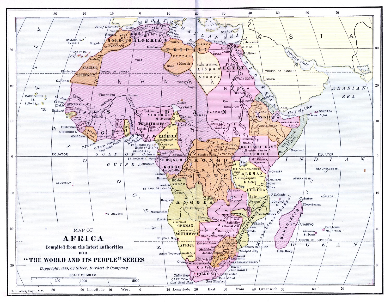
Africa is the most tropical of all the continents. It will be well to look up its position upon the globe. We shall find it situated in the Eastern Hemisphere, south of Europe, and southwest of Asia. It lies very nearly between latitudes 37° N. and 35° S.
If we look at its general shape,—an irregular triangle,—we shall be able to trace quite a resemblance to South America. Wonderful and interesting, however, as we know the characteristics of that continent to be, we shall find that Africa has far more wonders to unfold.
Africa was originally a vast peninsula, attached to Asia by the Isthmus of Suez. The two continents were separated by the completion of the Suez Canal. In all respects, Africa is now an enormous island.
It is larger, by far, than either Europe or Australia, but somewhat smaller than either Asia or America.
It is indeed difficult to get a correct estimate of a[Pg 16] country still shrouded to a great extent in darkness, so far as our actual knowledge of it is concerned. It has been roughly estimated to contain upwards of eleven and one-half millions of square miles.
Let us look at the map of Africa. We find that the continent is indented by no deep gulfs or bays. There are few capes or peninsulas along the coast, which, for the most part, is regular and unbroken.
The absence of deep gulfs and bays running into the interior is one of the principal reasons why the exploration of the continent has been so difficult, and why so little is known of its vast interior.
True, we find upon the Mediterranean coast the Gulf of Sidra, the Gulf of Arabia upon the coast of the Indian Ocean, and the Gulf of Guinea upon the Atlantic coast. The latter is the only important inlet upon the Atlantic coast, and divides into two branches,—the Bight of Biafra and the Bight of Benin.
The extreme points of land upon the several coasts are Cape Bon upon the north, Cape Verd upon the west, Cape of Good Hope upon the south, and Cape Guardafui upon the east.
Naturally, in looking upon the contour of a country, we wish to consider its general features, that we may call up a mental picture of it. You know how quickly[Pg 17] you can recall an absent friend, if you are familiar enough with his form and features to make a clear mental photograph.
The best authors divide Africa, for convenience, into five different sections: first, the triangular-shaped region south of the Gulf of Guinea and Cape Guardafui; second, the great tract called Soudan, which lies north and northwest of this triangular plateau; third, the Sahara, or Great Desert, which stretches between the Soudan and the cultivated tract that borders the Mediterranean Sea; fourth, the Atlas region, which includes the mountainous countries of Morocco, Algeria, Tunis, and Tripoli; fifth, the region which borders on the Red Sea, and comprises Abyssinia, Nubia, and Egypt.
The first section is mostly a high table-land, with mountains fringing its edges. The Lupata range, which runs parallel with the coast, forms the eastern crest of this table-land. Two snow-clad mountains, Kilimanjaro and Kenia, rise to an elevation of about twenty thousand feet, and mark the greatest height of this table-land in any one section of it.
The table-land does not rise abruptly from the coast. A belt of lowlands lies between the coast and where the elevation begins. These lowlands range from fifty to three hundred miles in breadth.
The eastern extremity of the table-land stretches into the mountainous country of Abyssinia. Its most northern extremity, the summit of Abba Yared, is fifteen thousand feet high.
In the south, the hills of Cape Colony rise by gradual[Pg 18] stages from Table Mount to the summits of the mountain ranges in the northern part of the Colony. These summits are estimated to be from seven thousand to ten thousand feet high.
The spaces between these ranges are either valleys covered with shrubs, or broad, elevated terraces. In Cape Colony, which was founded by the Dutch, these valleys have been named kloofs. The terraces have been named karroos. It will be well to remember these names, as we shall find them again in later descriptions of this region.
The second section, Soudan, has sometimes been called Central Nigritia. This tract includes the countries which are watered by the Senegal, Gambia, and Niger, together with the coast of Lower Guinea and the basin of Lake Tchad.
In the western part of this section there is a mountainous table-land. This table-land does not attain any great elevation, but the rivers Senegal, Gambia, and Niger have their rise here.
Many of the older geographers describe a chain of mountains, the Kong, running parallel with the coast of Guinea; but more modern authors, in their descriptions of the edge of the plateau, state that it approaches the coast only at intervals beyond the low delta of the Niger, as far as Cape Verd, and that the supposed Kong Mountains do not exist.
East of the Niger the country is merely hilly, interspersed here and there with very fertile, often swampy, plains. In the basin of Lake Tchad is a vast plain, formed of alluvial deposits. This plain is one of the[Pg 19] largest upon the globe, and is noted for its great fertility.
The third section, or Great Desert, extends south nearly to the Senegal, the northern bend of the Niger, and Lake Tchad. Northward, it extends to the Atlas range in Morocco and Algeria. Towards Egypt it reaches nearly to the Mediterranean Sea.
The Sahara is not a vast plain of trackless sand, as we might suppose. The greater part of it, on the contrary, rises into great table-lands. Some of these table-lands contain groups of mountains, rising often to the height of more than six thousand feet. This height is almost equal to that of Mount Washington in New Hampshire, or Mount Katahdin in Maine. It is somewhat greater than that of Mount Marcy in New York, or Mount Mansfield in Vermont.
We must consider the Sahara, then, not a monotonous expanse of burning sand, but a region presenting great variety in its form and characteristics.
From south to north it has an average breadth of about one thousand miles. From the Atlantic Ocean to the western edge of the Nile valley its length is about two thousand miles.
Throughout the entire desert rain rarely falls. Indeed, over a great portion of it there is never a drop of rain. For this reason the land is dry and sterile.
In some portions of the desert there are vast tracts of shifting sand. Frequent and violent winds blow these sands high into the air, and travelers often find themselves suddenly overtaken by one of these sand-storms, to their great discomfort and danger.[Pg 20]
Most of us have experienced the discomfort from a sudden cloud of dust and dirt, when the rude winds of March have full force. We can imagine, in a slight degree, the fury of one of these storms of blinding, burning sand.
We can picture the unfortunate bewildered traveler overtaken by one of these storms. Blinded, half-smothered, unable to battle with so unsuspected a foe, he sinks helplessly to the ground. The shifting sands heap themselves over his prostrate form. Alone, unknown, with naught to mark his resting place, he lies buried in the wastes of the Sahara.
Fortunately, all parts of the Great Desert are not so dangerous to life. A large portion, if not the greater portion of it, consists of barren but firm soil. This soil is composed of hardened sand, sandstone, and granite. Quartz rock is sometimes found in small quantities. This portion of the Sahara often rises into ridges, or small hills. These chains of hills are often fully as desolate and bare as the plain from which they rise.
Many of the plains of the Sahara vary from the uniform type. Sometimes on one of them the ground is covered with stones or loose boulders. These are fully as fatiguing to the traveler as the loose, drifting sand. Often these plains are rent by deep chasms. Frequently they are hollowed into great basins.
Into the plains which contain these chasms the rain descends from the gullies of the Atlas mountain system. This sometimes forms streams, which the thirsty sands swallow, or which are quickly evaporated by the burning rays of the sun.[Pg 21]
The deeper basins of the Sahara are often of considerable extent. Some of them contain valuable salt deposits.
There are vast tracts, too, of sterile sand, where not even the smallest of plants will take root. In the absence of plant life, animals disappear, and for days the weary traveler may pursue his journey and meet neither beast, bird, nor insect to break the monotony of the dreary waste of sand.
The description of the Sahara by one author is most realistic. "Nowhere are the transitions of light and shade more abrupt than in the desert, for nowhere is the atmosphere more thoroughly free of all vapors. The sun pours a dazzling light on the ground, so that every object stands forth with wonderful clearness, while all that remains in the shade is sharply defined, and appears like a dark spot in the surrounding glare.
"The stillness of these wastes is sometimes awfully interrupted by the loud voice of the simoon. The crystal transparency of the sky is veiled with a hazy dimness. The wind rises, and blows in intermittent gusts, like the laborious breathing of a feverish patient.
"Gradually the convulsions of the storm grow more violent and frequent; and although the sun is unable to pierce the thick dust clouds, and the shadow of the traveler is scarcely visible on the ground, yet so suffocating is the heat, that it seems to him as if the fiercest rays of the sun were scorching his brain.
"The dun atmosphere gradually changes to a leaden blackness, the wind becomes constant, and even the camels stretch themselves upon the ground and turn their backs to the whirling sand storm.[Pg 22]
"At night the darkness is complete; no light or fire burns in the tents, which are hardly able to resist the gusts of the simoon. Silence reigns throughout the whole caravan, yet no one sleeps; the bark of the jackal or the howl of the hyena alone sounds dismally, from time to time, through the loud roaring of the storm."
This same author tells us that the sultry breath of the desert is felt far beyond its bounds. It blows over Italy, and crosses even the Alps. Here it rapidly melts the snow of the higher valleys, causing dangerous inundations.
It is no uncommon thing for the dust of the desert to be whirled high into the air and fall upon the decks of vessels crossing the Atlantic far from the coast of Africa. Frequently it flies in clouds over the Red Sea; thus does Nubia greet Arabia.
Considering the scanty vegetation to be found in the Sahara, the scarcity of animal life is not to be wondered at.
The lion, which has been called the king of the desert, contents himself with the borders of his domain. He rarely leaves the wooded mountains of the Atlas region or the fertile plains of the Soudan to wander far into the Great Desert, where there is little water, and only snakes and scorpions are to be found for food in the dry season.
True, among the animals in those sections of the Sahara that are covered with prickly shrubs, may be found the hare and the rabbit, the hedgehog and the porcupine; but the hyena and the jackal, that also haunt these spots, claim these as their booty.[Pg 23]
Several varieties of lizards are to be found in the desert. Among them is a large gray monitor and a small white skink. The latter has very short legs. Its movements are so rapid that it seems to swim on the surface, as a fish would in water. Just as its pursuer thinks he has captured it, it disappears, diving under the surface.
It can readily be traced in its retreat and easily taken from the sand. When provisions are scarce, the pursuit of the skink is not considered too much trouble, although its body is so insignificant for food.
There is a proverbial saying that the ostrich needs to drink water only every five days, and could exist much longer without it, if necessary. However this may be, it is certain that this enormous bird penetrates far into the interior of the desert.
The animal life of the Sahara fluctuates from north to south, according to the seasons.
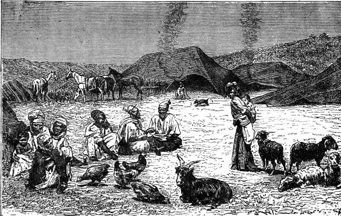
In winter and spring the nomadic tribes wander, with their herds of camels, horses, sheep, and goats, farther into the interior. This is owing to the more favorable conditions; for the heavy rains, falling upon the northern borders of the desert, cover large districts, scorched by the heat of the previous summer, with abundant pasturage and furnish them with a goodly supply of water. As the season advances and the sun gains power, these tribes, with their flocks, retreat again to the borders.
At this favorable season the wild animals—the lion, the gazelle, and the antelope—wander to the sections in the south. Here nature provides the nourishment[Pg 24] which the dry summer season could not afford them.
In the southern portions of the Sahara, and in some more northern sections, the tropical rains produce periodical changes in the character of the desert. Under the influence of these rains, the sandy plains soon become clothed with grasses and shrubs.
During the dry season this carpet of green disappears, and the country becomes again an arid tract. Stubbles and tufts of mimosas are the only signs of vegetable life.
The beneficial change from the dry to the rainy season does not always take place. The tropical rains frequently fail to make their appearance in these northern sections, and the hopes of the desert, thirsting for moisture, are doomed to disappointment.
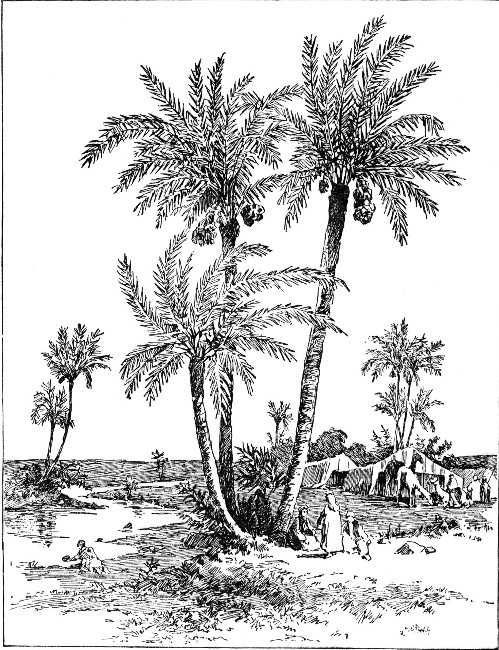
This desolation of the Sahara would be of such a nature that nothing, either in the animal or vegetable world, could survive, were it not for the fertile tracts, or oases, found at intervals throughout its whole extent.
These oases, or roadies, as they are sometimes called, are caused by subterranean, or underground, springs. Oases are more common in the eastern part of the Sahara than in the other sections.[Pg 25]
 OASIS IN THE SAHARA.
Oases differ in character. Sometimes they are mere patches, covered with bushes and coarse grass, usually surrounding a spring. More often they are tracts of[Pg 26] rare beauty and of great fertility, with a good supply of water.
In traveling through the Great Desert, the easiest route is from Tripoli, through the kingdoms of Fezzan, to Lake Tchad. The kingdom of Fezzan is favored as to climate. It has periodical rains, on account of the moist winds which blow from the Mediterranean Sea. These seem to extend farther inland here than in any other part of the continent.
East of this route across the Sahara there is a portion of the desert called the Libyan Desert. Oases are, in this section, very easily cultivated. In the western section of the Sahara the land of the oases is fit only for pasturing goats and sheep.
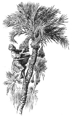
In some of these more fertile oases of the eastern sections, thousands of inhabitants may be found living in comfortable villages. There may be found the date palm in cultivation, together with other fruits and some grains. Gum arabic is also a product of this region. It is obtained from the sap which exudes from the trunk of the acacia tree.
Commerce across the Great Desert is not carried on without difficulty and danger. There are various routes over which caravans of from five hundred to two thousand camels and their drivers travel.
The distance between the springs, or wells, is frequently more than a ten-days' journey. Often such a spring is reached only to be found dry, and then both the men and the animals are in danger of perishing for lack of water.
We, who are so accustomed to an abundance of fresh[Pg 27] water, can scarcely realize how it would seem to travel with one of these caravans, and to be able to quench our thirst only from the supply of water carried in leather bags slung from the sides of the patient camels. A glass of water that has stood over night does not seem very palatable to us; yet, doubtless, it would seem refreshing compared with water that had been carried in a leather bag for ten days, exposed to the burning heat of the desert's sands and sun.
A wise Providence has fitted the camel with a special paunch, or stomach, the cells of which it fills with water before starting out on one of these journeys. This supply has to suffice for its needs until more water can be obtained from some distant spring. It has been stated that the cells of the camel's stomach can absorb and hold upwards of a gallon of water when the animal is preparing to start out upon one of its long journeys across the desert.
Should a caravan, in crossing the desert, reach a spring or well, the waters of which had run dry, perhaps the life of one of the camels would have to be sacrificed, in the hope of getting a supply of water from its stomach. This water would be all that the drivers would have with which to sustain life until another spring could be reached.
Nature has fitted the camel most admirably for its desert home. In addition to its true stomach, with its peculiar cell-like lining, it has a second stomach, or honeycombed paunch. These are both capable of holding a large supply of water.
The hump of the camel is another wise provision to[Pg 28] enable the animal to endure the hardships of its long journeys, often on a very short supply of food. A few beans, dates, or carob pods are all the camel receives after a long day's march, when there is no herbage on which it can browse.
Shrubby plants, such as the camel's thorn, of which the animal is very fond, are all that the sterile sands of the desert can produce for its needs.
The drivers and owners of the camels look very carefully to the condition of the hump of each animal before starting out on a march across the desert.
The hump is really a storehouse for fat. When plump and well rounded, it indicates that the animal is in perfect health. If, after a long march, this hump becomes wasted, whether because the animal has become exhausted, or because he has had insufficient food, it is often necessary to prescribe complete rest. Even with an abundance of food, and no work to do, it may take three or four months before the camel is restored to perfect health and full powers of endurance, as indicated by its firm, plump hump.
The foot of the camel is formed to keep it from sinking in the sand. It is furnished with an extended pad, or cushion. This pad is protected from the heat of the burning sands by means of a thick sole.
The skin on the chest and kneejoints is thickened into what are called callosities. It is upon these that the camel rests when it lies down, or when it kneels to receive a load.
The camel has been called the ship of the desert. It can carry twice the load of a mule. It travels[Pg 29] slowly, yet it moves at a steady, uniform pace. It can thus travel for hundreds and hundreds of miles at the rate of two miles and a half an hour.
The motion of the camel is most peculiar. It is a swaying from side to side, not at all agreeable to one unaccustomed to riding upon its back.
This motion is caused by the camel moving both feet on a side at once. In this way, first one side of its body is thrown forward, then the other.
To protect the camel against the shifting sands and the burning heat of the sun, nature has further fitted it for its peculiar home and life. It has the power to close its nostrils at will to keep out the sand. Long lashes protect its eyes, not only from the storms of wind and sand, but also from the glare and the heat.
From time immemorial the camel has been known as the beast of burden in India, Arabia, and Africa. This species, the one-humped camel, or dromedary, differs somewhat from that having two humps. The latter has been found in Central Asia, Persia, and the south of Russia.
Recently a report has been received from St. Petersburg that wild camels have been discovered in large quantities in a district of Asia; but nowhere in history do we read of camels that are not domesticated.
The sculptures of Assyria depict both species. The patient animal is mentioned in the oldest books of the Bible. Many of our pleasantest associations in connection with our earliest Bible lessons center about this animal, in connection with "the wise men of the East," and other scenes connected with the birth and early life of our Saviour.
The fourth division of Africa comprises what is sometimes called Barbary. It includes the mountainous countries of Morocco, Algeria, Tunis, and Tripoli.
In its general character this northern section bears a strong resemblance to the opposite coast of Europe, with respect to peculiarities of soil and climate and the variety of its products.
The southern slope of the Atlas region gradually merges into the Great Desert. Some parts of this range are above what is called the snow line. The summits of some of the peaks are thirteen thousand feet high.
The Barbary States extend from the borders of Egypt on the east to the Atlantic Ocean on the west. The Mediterranean Sea is the northern boundary; the Sahara is the southern.
Although the country of Morocco is generally mountainous, yet there are deviations from this characteristic feature of it.
The Atlas Mountains traverse the country in several parallel chains, running from southwest to northeast. Towards the coast country and the desert these chains send out spurs of hills and detached mountain groups.
At the western and eastern extremities of Morocco, and along the borders of the desert, there are many level tracts.[Pg 31]
It is in Morocco that the central range of the Atlas Mountains forms a watershed. This watershed separates the rivers which flow into the Atlantic Ocean and Mediterranean Sea from those which flow south towards the desert.
The rivers flowing south have a longer course and more volume of water than the rivers flowing towards the Atlantic and the Mediterranean. The latter rivers are, however, perennial, while those flowing south are apt to become dry in summer. Even after their currents are full, the waters lose themselves in the sands of the Sahara.
The climate of Morocco is temperate between the central range of the Atlas Mountains and the sea. There are no extremes of temperature, owing to the influence of the sea breeze and the shelter which the mountains afford from the scorching winds of the desert. In the southeast districts there are great extremes of heat and cold, and rain is an unknown blessing.
The even climate of the temperate regions is favorable to such productions as wheat, barley, rice, maize, and the sugar cane. Such fruits as the fig, pomegranate, lemon, orange, and date are common here, between the Atlas range and the sea. Cotton, tobacco, and hemp are produced in great quantities, not only for domestic use but for exportation.
Algeria really forms the northern boundary of the great plateau of North Africa. This plateau rises from the sea, at this point, in the form of three terraces. The Atlas Mountains run parallel to the coast line of Algeria.[Pg 32]
Beyond this range of mountains is a vast tract of heath-covered plains. These are interspersed with salt lakes. The vast tract stretches southward till hemmed in by a chain of mountains of various heights.
Beyond this plain lies the Desert of Sahara, which extends to the banks of the Niger.
In the north of Algeria there are many plains and valleys which open out into the sea. Many of those around Oran, Bona, and Algiers are exceedingly fertile. They abound in wood and water, and, having a good soil, are well suited to agriculture. These tracts form what is known as the Tell. This was once one of the granaries of Italy.
In strong contrast to this fertile section are the lesser deserts, which lie back of the Atlas Mountains, where they follow the coast line.
These are covered with herbs and brushwood. They are almost destitute of fresh water. Occasionally an oasis is found, to break the monotony.
Beyond the Atlas Mountains, in the most southern section, the country partakes of the nature of the Sahara. There are, however, large oases, covered with date palms. These oases are well peopled. They form a part of what is called the date country.
Algeria has no rivers of any great importance. There are a few coast streams, which have their rise in the neighboring Atlas range.
The climate of Algeria has greater extremes of temperature than Morocco. In the district of the Tell the heat is often very intense. Along the coast of Algeria the heat is tempered by the sea breeze. Up among the[Pg 33] high mountains, in the interior of the country, the temperature in the winter season is often cold.
 GATHERING DATES.
Algeria is not unfrequently the victim of the simoon, or hot wind. This same wind the Italians call sirocco. The Spaniards term it the solano.[Pg 34]
Large portions of Algeria are covered by extensive forests of oaks, cedars, pines, and pistachio trees. These supply an abundance of timber and resin.
In the Tell section the olive and the various cereals are cultivated.
Tunis, like the other Barbary States, is traversed by the mountains of the Atlas range, which finally terminate here.
The northern coast of Tunis is steep and rocky. It is indented by numerous bays. The largest of these is the Gulf of Tunis. Two promontories, Cape Blanco and Cape Bon, are the most northern points in Africa.
The eastern coast offers a strong contrast to the northern coast. It is flat, sandy, and unproductive. It bears a strong resemblance to Tripoli, as we shall see. The coast has two large gulfs, Hammamet and Gabes.
The southern portion of Tunis belongs to the desert steppe called Belud-el-Jerid.
Tunis has but one fresh-water lake of any extent. This is situated near the north coast.
The brooks and the torrents of Tunis do not make many wanderings. Their waters lose themselves in the sands, or seek a short course to the sea. None of the streams are navigable.
The longest river was well known to the ancients under the name Bagradas. It now bears the name Mejerdah, and flows in a general northeast direction, into the Gulf of Tunis.
Tunis has several fine mineral springs, though it has no rivers. Thus does Nature seem to compensate for the lack of one blessing by the bestowal of another.[Pg 35]
Tunis enjoys a fine climate and an exceedingly fertile soil. The people have only an imperfect knowledge of agriculture, but the natural advantages of the soil and climate are so great that little labor is necessary. Hence, we find wheat, barley, maize, olives, oranges, figs, grapes, pomegranates, almonds, and dates produced in abundance. In the culture of olives for oil more care is expended than in other directions. The supply of oil is very abundant, and exceedingly profitable.
Great herds of cattle and flocks of sheep feed on the plains. The wool of the sheep of Tunis is far famed.
The horses and the dromedaries, or camels, are considered very fine, and command a good price.
Tripoli is the most easterly of the Barbary States. It is not so mountainous as the other countries comprising Barbary. The Atlas Mountains terminate here in two chains that run parallel with the coast. The summits of the mountains in this section never exceed four thousand feet in height.
Tripoli has no rivers. During the long hot summers rain rarely falls. In compensation, there is a copious supply of dew. So plentiful is this dewfall, in some favored sections, as really to support vegetation.
The coast region is about eleven hundred miles in extent. Some sections of it are very fertile and productive. All kinds of tropical fruits are found, together with grain, grapes, cotton, and madder.
Farther to the east, along the shores of the Gulf of Sidra, nothing but dreary wastes of sand prevail. Here desolation may be said to reign.[Pg 36]
The interior sections of Tripoli yield senna, dates, and nutgalls. The carob and the lotus are also found.
Here, as in Tunis, much attention is paid to the rearing of sheep and cattle. The small, yet beautiful horses, and the strong, well-formed mules of Tripoli are highly prized and much sought after.
The fifth division of Africa borders on the Red Sea. It includes the countries of Abyssinia, Nubia, and Egypt.
Between Abyssinia and the Mediterranean Sea is the low valley of the Nile. This is separated from the Red Sea on the east by a bold, mountainous region. A low ridge of limestone and sandstone hills separates it from the Libyan Desert on the west.
Abyssinia, or Habesh, as the Arabs call it, is a large highland tract in East Africa. It rises from the Red Sea, in a series of terraces, towards the southwest.
Between the highlands of Abyssinia and the Red Sea, lies a flat tract of country called Adal. This tract is very narrow at its northern extremity, but gradually widens towards its southern extremity.
The plains of Nubia and Kordofan form the northern and western boundaries of Abyssinia. There is comparatively little known of its southern boundaries.[Pg 37]
The general characteristics of the country are high table-lands, intersected by deep ravines and steep terraces of sandstone.
These ravines have been formed by the action of the rivers upon the rocks. Sandstone, being a comparatively soft rock, would, in the course of ages, be gradually worn away as the waters flowed over it. No doubt the terraces have been formed from the exposure of these rocks to the elements for countless ages.
Above the table-lands rise numerous chains of mountains. These are mostly of volcanic origin. Some of the highest of these summits rise to a height of fifteen thousand feet above sea level. Many of the plains lie at an elevation of from seven to ten thousand feet.
Abyssinia gives rise to numerous rivers. The largest of these are the Blue Nile and the Takazzie, an affluent of the Nile. In the southern part of the country is the Hawash. It flows eastward through a section bearing the same name, and finally enters the salt lake, Assal.
The largest lake of Abyssinia is the Dembea. It is through this lake that the Blue Nile flows.
In the elevated sections of Abyssinia the climate is temperate and salubrious. Along the low coast sections, and in the sections at the north and northwest, the heat is not only excessive but the climate is most noxious.
Taken as a whole, Abyssinia is a very fertile country. It shows, however, as great diversities of products as of climate. This is due to the different degrees of elevation in the various sections.[Pg 38]
Wheat and barley are cultivated to some extent, together with various leguminous, or pod-bearing, plants, cotton, coffee, sugar cane, and tobacco. The coffee plant grows wild to a great extent.
Nubia is the modern name of a country once subject to the Khedive of Egypt. It was probably known to the ancients under the name Ethiopia. The boundaries of Nubia are the Red Sea on the east, Egypt on the north, Abyssinia on the south, and the Sahara on the west.
The country is traversed by the Blue Nile and the White Nile.
Nubia has an arid soil. In many places cultivation is possible only along the banks of the Nile. Some portions of the soil consist only of granite and sandstone.
The products of the cultivated sections are numerous. They comprise maize, dates, tamarinds, gums, aloes, and senna. Among the various exports may be noted musk, wax, myrrh, frankincense, black wool, elephant and rhinoceros hides, and ivory. Ostrich feathers, ebony, gold dust, saltpetre, salt, tobacco, coffee, and cotton are also exported to Egypt.
Some curious customs prevail. Taxes are rated by the number of water wheels a man uses to irrigate his land. The more water wheels he uses, the more valuable his land, hence, the higher his taxes. There is no national currency, but the coins of Egypt and Europe are used. The Spanish dollar is also used to a great extent. Glass beads, coral, shirts, and cloth are used in barter, and take the place of currency. In Kordofan, the value of goods is reckoned by the number of cows they are worth.[Pg 39]
The most primitive system of measurement prevails. Maize is sold by the handful; eighteen of these make what would correspond to one of our larger measures. In measuring cloth, the distance from the elbow to the fingers is employed as we would use a foot rule or a yardstick.
The costumes of the people are peculiar. They consist of turbans, and linen and woolen garments. The men arm themselves with lances, and shields made from the tough hide of the hippopotamus.
The customs of the people are somewhat singular. They are averse to eating meat, and practice the rites of the Mohammedan faith. They live in low huts built of mud or stone. They care little for strangers, and do not wish to engage much in commerce. They are fond of music, and in their leisure moments play upon a guitar of five strings. It is a simple instrument, having a sounding-board made of the skin of a gazelle.
There are few attractions in Nubia beyond the numerous temples and other ancient remains of the Egyptians.
Egypt occupies a position in Northeast Africa. It extends from the Mediterranean Sea to the first cataract of the Nile. The name "Egypt" was derived from the Greek. It is as old as the age of Homer. In the ancient languages Egypt was called by a name signifying "Black Land." This name was given to it, no doubt, from the color of the soil.
Egypt may be regarded as the bed of the Nile. The cultivated portions of it extend only to the limits of the yearly inundation.[Pg 40]
In the days of antiquity the Nile had several mouths. Five of these mouths have, in the course of ages, become filled with silt. The whole alluvial district which these mouths enclosed formed the ancient Delta. The ancients believed that the whole of this alluvial deposit had been gained from the sea.
The basin of the Nile, or Egypt proper, is formed by the ranges of the Arabian hills on the east and the Libyan on the west. The eastern chain of these mountains is about one thousand feet above the level of the sea.
Egypt is separated from Nubia by a low hilly region. This region is about fifty miles broad from north to south. It is composed of granite rocks. The same formation of rocks extends up the shore of the Red Sea, nearly to the opening of the Gulf of Suez. It stretches inland over a tract of some thirty miles in extent.
In this section of Egypt the scenery is wild and picturesque. The course of the Nile is frequently interrupted here by cliffs or broken masses of granite rock. It is in this way that the magnificent, yet disastrous, cataracts of the Nile are formed. The granite section of Egypt terminates at Assouan. Much of the material used in building the great monuments of Egypt must have been brought from this section.
Upper Egypt is bounded by two ranges of hills. Both these ranges run northward. The Arabian range is on the right, the Libyan on the left, of the river. Sandstone prevails to a great extent in both these ranges. It is a durable rock, easily cut. It was used very extensively in the erection of ancient temples. The ancient city of Thebes was built of it.[Pg 41]
The sandstone rocks in a large section of Egypt are covered with moving desert sands. In the lands which border the Nile they are covered with the alluvial deposit which the river brings down in its course.
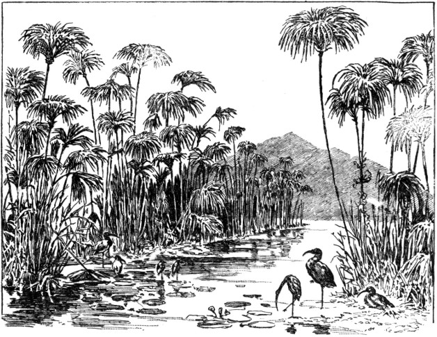 PAPYRUS ON THE NILE.
All along the valley of the Nile the scenery is tame and monotonous. The sandstone is easily worn away by the action of the waters, and this in a measure accounts for the table-lands, which are of frequent occurrence. It would also account for the vast amount of alluvial deposit, most of it being worn-out rocks.
The fertile valley of the Nile differs widely from the desert regions which enclose it. This is true not only of the botanical life, but of the zoölogical life as well.[Pg 42]
Many of the European trees and plants are found in Egypt. The date palm, sycamore, acacia, and tamarisk are some of the trees peculiar to its climate. The papyrus, which the ancients used largely in the manufacture of paper, and the lotus, or water lily of the Nile, are peculiar to Egypt.
Of late years the cultivation of the papyrus plant has been neglected. Specimens of it are now rather rare. Sugar cane, cotton, indigo, and tobacco are cultivated in its place.
Gourds and melons are found in abundance. Wheat and barley were extensively cultivated by the ancients. These are still cultivated, and maize and durra have been added. The latter is a coarse, strong grass. It grows to a height of from four to eight feet. It has thickly crowded panicles. The grain is round, and about the size of a mustard seed. Durra may be regarded as the principal corn plant of Africa. It yields an abundant product. It is even more productive than maize, but the meal from it does not make good bread. Used like rice, it makes an excellent pudding, or may be used in other forms for food. The stalks and husks are coarse, but make excellent fodder for horses and cattle. The grain, too, is often given to them.
Egypt is very deficient in timber land. Pharaoh obtained cedar from Lebanon and ebony from Ethiopia, as our Bible history tells us.
Space will not allow us to linger over either modern or ancient Egypt. The latter is more fascinating than the former. It will be interesting for us to take our[Pg 43] Bibles and, looking over the Old Testament, acquaint ourselves with the stories of Moses, Joseph, Pharaoh, and other characters of the days of ancient history.
Did space permit, we might dwell upon the ancient occupations, as glass blowing and pottery, and upon the various implements connected with them. The bellows, siphons, chisels, presses, balances, levers, and harpoons would awaken our interest and curiosity, if we could but look into some museum of Egyptian relics.
The weapons of war, too,—the spears, clubs, maces, swords, daggers, bows, and hatchets,—would seem to us not only strange, but formidable. No less interesting would be the pictures of war boats, and the galleys used upon the Nile.
We might delight to run our fingers over the ancient harps, lyres, and guitars. The drums, flutes, cymbals, and tambourines would have fascinations for most of us, making us wish to test our musical ear.
There are many books, however, that can satisfy our curiosity over the lives of the ancient Egyptians, and we shall be fascinated by all we may find time to read.
For many years Africa was believed to be a land destitute of rivers in its interior sections. The explorations made by Dr. Livingstone proved to the world that what had been formerly termed the unexplored[Pg 44] territory is not the barren, riverless region that imagination had pictured.
Still, the nature of the rivers was for a long time but imperfectly determined.
It is generally acknowledged that, of all the great rivers, there is scarcely one that has been successfully traced from source to mouth throughout its entire length. Even the tributaries of these rivers are but imperfectly known, owing to the many difficulties attending their exploration.
We have a right, then, to expect much from later investigation, as more and more of the country is opened to observation.
The journals of such men as Livingstone and Stanley open a vast storehouse of knowledge to those who read them. Fascinated, as by a romance, we lose ourselves in these pages, and in imagination follow their footsteps through "Darkest Africa."
The rivers of South Africa have their rise mostly in the neighboring highlands. Many of these rivers are, in fact, not much greater than mountain torrents, whose courses are as short as their currents are rapid.
Most of the rivers of Africa have obstructions, in the form of sand bars, at their mouths. The Orange River is a striking example, the water at its mouth being choked by a vast deposit of sand.
The chief great rivers of Africa are the Nile, the Niger, the Zambesi, the Orange, the Congo, the Senegal, and the Gambia.
Although all the great rivers have served as links to connect the journeys of the various explorers, yet the[Pg 45] Nile, the Niger, the Zambesi, and the Congo have been chosen as the chief guides for the more recent explorations.
Each of these great rivers has distinct characteristics and striking peculiarities. The Nile, though a river of the greatest antiquity, was for many, many years a problem in the minds of those busied with the geography of Africa.
Many of the records kept by the early explorers were, unfortunately, lost. Among those that were preserved were many that were not reliable in their information. Many of the accounts were most conflicting in fact and detail. This led to much confusion and much discussion. Men naturally were slow to accept information which they could not prove to be authentic.
Wars among the natives of the interior were most disastrous to the explorer. At best, his life, interesting and exciting as we might suppose it to have been, could certainly not have been an enviable one. Only dauntless courage and boundless enthusiasm could have led him into regions where he must suffer not only fatigue, but privation; not only danger from wild beasts hungry for their prey, but from cruel, treacherous savages lurking on every side.
The countries watered by the Niger offered an immense field for exploration. Inviting as this region was to the explorer, it afforded many difficulties. Savage beasts and treacherous natives were foes that might be overcome, but who could withstand the attacks of fever and malaria, unsuspected foes to health and life, in this region of pestilence and disease?[Pg 46]
Mungo Park, a Scotch explorer, relates that, out of a party of forty-four, but four survived the exploration, owing to the unhealthy character of the climate. He relates that he received various kinds of treatment at the hands of the natives. The women, however, were for the most part kindly disposed and benevolent.
At one time the king of the region of Bambarra, through which he was passing, forbade him to cross the Niger. He was obliged to remain over night in one of the villages. None of the natives would receive him into their huts. Finally, he took shelter in the branches of a tree. He was worn out from hunger and fatigue. A storm came up, from which he was wholly unprotected, but he was befriended by a woman, who was passing on her way from her daily work in the field. She took him home to her hut, kindly cared for him, and did all she could to make him comfortable.
It is the custom of the women to lighten their labor by singing songs as they work. On this occasion Park was made the subject of this song which was sung by one of the young women of the village. The melody was sweet and rather plaintive; the words simple.
To this a refrain was added, in which all the women joined.
It was to Richard Lander that the geographical students were indebted for much information about the Niger. He encountered many dangers, and, with his followers, was finally taken prisoner by the natives.
Only on the promise of a heavy ransom were they allowed their freedom. By the offer of heavy bribes, he made arrangements with the natives to convey him, with his party, to the sea. The journey was by way of the Niger, and proved to Lander that water communication could be opened into the interior of Africa. Thus he solved one of the greatest problems in the geography of the continent.
In the southern portion of Africa, the more recent explorations have been mostly in connection with the Zambesi River, its extensive basin, and its many affluents. Most of the results were due to the energy of Livingstone, whose footsteps we shall like to trace later. We must regard Livingstone not only as an explorer, but as a zealous missionary in the great field open to him. Only through his indomitable courage, boundless faith, and untiring devotion could he have accomplished his arduous labor.
Most of the difficulties that attended the exploration of the great rivers were due largely to the character of the countries through which they passed. Much of it was, of course, wholly unbroken territory. Tangled forests, treacherous morasses, and wild jungles were difficulties that constantly tried the courage and fortitude of the men who formed the exploring parties.
But these were not all they had to encounter in the way of obstacles. Wild animals, fierce for food, or[Pg 48] angered at having their haunts invaded, lay ready to attack them. Hostile savages lurked in the depths of the forests, or pursued them to the water's edge, eager to shed their blood. Even on the rivers there was no safety; for the enraged natives pursued them in their canoes, and attacked them boldly, trusting to the poisoned arrows which they hurled fiercely at them.
As if these were not difficulties enough to be met and overcome, the hearts of the explorers often sank in dismay as they encountered fresh obstacles in the bed of the streams. Here were dangerous rapids, over which their canoes were liable to be hurled, only to be dashed to pieces on the rocks below. Barred by such obstacles, the canoes often had to be carried overland on the backs of the men, till the course of the river became navigable.
Much of the information received from such friendly natives as they found, living in villages along the course of the river, was unreliable. They were often misled, too, by the various names given to the same river in the different sections of the country.
Many of the rivers make such intricate wanderings as to lose themselves in one section to reappear again in other sections, but under different names. On this account, much time was lost in doubt and speculation.
As we read of the exploits of these explorers, we shall be able to comprehend more fully the extreme difficulty of the work they undertook, and, in many cases, carried out so successfully.
Through the light they shed we shall be able to read the story of Africa. We shall find it both fascinating and instructive.
The Nile is formed by the union of two rivers, the White Nile and the Blue Nile.
The White Nile has its rise in the great equatorial lakes, together with the Victoria and the Albert Nyanza Lakes. It skirts the eastern border of Kordofan and then passes into Nubia. The river flows on to Khartoom, where it is joined by the Blue Nile, which has been tortuously working a passage for itself through the highlands of Abyssinia.
The White and the Blue Nile, thus united in a single stream, sweep in a circuit through Nubia to form a succession of cataracts in the course of the current.
The stream then descends into Egypt under the general name of the Nile River, and flows on till it reaches the Mediterranean Sea through the far-famed Delta.
As we have seen, the mystery of the Nile had claimed the attention of mankind for ages. For centuries it had been a wonder not only to those who dwelt upon its banks, but to those who came into the country of the Egyptians to profit by their wisdom and learning.
Its mysterious waters flowed from unknown regions; for the last thousand miles in its course not a single drop of water was received from the land on either side of its bed. Only at rare intervals was the blessing of rain bestowed. For nine months in the year the stream[Pg 50] flowed between its steep banks, a uniform and majestic flood.
Almost at a stated date each year, for countless centuries, had the river risen and overflowed its banks and spread its waters over the adjoining country. Each year saw the narrow valley of the Nile transformed temporarily into a vast lake.
After some few weeks the flood subsided, and left behind a vast deposit of rich mud which was to fertilize the whole of Egypt.
Little wonder, then, that this most ancient of rivers seemed the most marvelous river of antiquity.
Within the last quarter of a century men have looked to the laws of Nature for an explanation of the sources of this double Nile, as it has been called.
The river with its uniform current is fed from large lakes, or reservoirs. These are so immense that their volume of water does not vary much from one season to another.
At the time of the inundation, or flooding, of the valley the stream must receive its increased volume of waters from its various affluents. These affluents have their rise in mountainous sections subject to an abundant rainfall during a short period of each year. Immediately after this rainfall the Nile waters must begin to rise, from the influence of these swollen streams that flow into them.
Thus has man looked to the great book of Nature to find written on its pages the solution of the problem that so long taxed the minds of the students of past centuries, as well as of the present.[Pg 51]
From the earliest annals of history the valley of the Nile was known as the seat of commerce, the arts, and the sciences.
Egypt might well be regarded as the light of the ancient world. In the glow of her prosperity she formed a strong contrast to the rest of Africa, which remained almost unknown, shrouded in darkness.
The ancient Egyptians gave to the Nile a name which signified in their language "The Genius of the Waters." The Hebrews gave it a name which, in their tongue, meant "The Black."
The Nile presents many interesting features as it pursues its course. Rushing from the Lake Victoria Nyanza like a mountain torrent, it finally loses its impetuosity, and runs over extensive flats. These flats gradually expand so as to form a body of water known as the Ibrahim Pasha Lake.
Near Lake Albert Nyanza the Nile forms a series of rapids, between what are known as the Karuma and Murchison Falls. As the river leaves the lake, it begins its northward journey towards the Mediterranean Sea. During this journey the stream does not expand again into a lake, but retains its character of a river current.
At a point in its course between Lake Albert Nyanza and Gondokoro the Nile makes a descent of several hundred feet, from an elevation some fifteen hundred feet above sea level. This descent in the current causes a series of rapids and cataracts.
As the stream leaves Gondokoro it flows tortuously on, winding first to the northwest, then turning to the northeast, during its journey of five hundred miles.[Pg 52]
Later, the river is joined by its first large tributary, the Bahr-el-Gazal, which does not seem to make any noticeable difference in the current as it enters it from the west. A second tributary, the Giraffe River, flows into the main stream from the east.
From its junction, with its first great tributary, the Nile flows on for about eighty miles in an easterly direction. It then changes its course, winding south for about thirty miles, where it is joined by a third tributary, which flows into it from the east. This tributary, the Sobat River, has quite a full, navigable current.
Beyond the junction of the Nile with these tributaries the river flows on for a distance of upwards of four hundred miles. It flows through this section in a northerly direction, attaining width varying from one to two miles. At intervals along its course several streams flow into it from the east before it reaches Khartoom.
The town of Khartoom is situated just at the junction of the Blue and the White Nile streams.
The Blue Nile was for many years supposed to be the main stream of the Nile. It is, however, formed by the union of two rivers, the Abai and the Blue River.
The Abai River rises in Abyssinia. Its source lies about fifty miles from Lake Dembea.
It enters the lake from the southwest and emerges from it at the southeast. For about ninety miles it flows on in this direction, and finally describes a semi-circular course around the peninsula of Godjam.[Pg 53]
Leaving Godjam, the river winds on in a northwesterly direction for about one hundred and fifty miles, where it is joined by the Blue River from the south.
Under the name Blue Nile the united streams flow on in a single current in a northwesterly direction. During its course the stream receives two large rivers which run nearly parallel to each other.
We have seen that, at the town of Khartoom, the Blue and the White Nile unite to form a single stream. As this stream leaves Khartoom its course is a northerly one for about sixty miles until, passing the ruins of the ancient Meroë, it forms its first cataract. Here, turning to the northeast, it is joined by its last tributary, which bears a name signifying "Black River." It is doubtless so named from the quantities of black, slimy mud which it carries down in its course, eventually to fertilize Egypt.
The Nile, from the point where the last tributary joins it, flows through the thickly populated and fertile district of Berber, with its many villages.
When the stream leaves Berber it enters the desert. As it makes a turn to the west it forms the large island of Mograt. Turning sharply in a southwesterly direction, it describes what is known as "The Great Bend," in which there are two cataracts.
Entering Nubia the stream turns again to the northwest. Here, on either bank, is a narrow strip of fertile land, under cultivation.
Again a cataract is formed, when the stream bends around to the northeast to form later a fifth cataract.[Pg 54]
As the river continues on its course, it gradually grows more and more narrow, till, later, at Assouan, it forms its last cataract, as it descends.
From Assouan to the Mediterranean Sea the Nile has an average fall of two inches to a mile. Its velocity is about three miles an hour as it flows on, watering and fertilizing the land of Egypt throughout its entire length.
The delta, or mouth, of the Nile has an expanse of about one hundred and fifty miles on the Mediterranean.
At the delta the Nile spreads out into numerous streams to enter the sea.
The length of the Nile is about three thousand three hundred miles, if we measure its wandering course from its exit at the lake to its entrance at the sea.
It is a remarkable fact that from the point where the last tributary enters the Nile, a distance of some fifteen hundred miles from the sea, no other waters are received to increase its volume; yet, in spite of this, the stream is able to withstand the scorching sun and burning sands of the Nubian Desert.
Little wonder, then, that the ancient Egyptians held the river sacred. To its influence they owed not only life, health, and strength, but their prosperity and wealth, as well.
Year after year they watched its annual overflow, rejoicing in this blessing of the waters.
At Khartoom the overflow begins in April. Lower Egypt does not become affected by the overflow of the waters till the latter part of June. Here the inundation does not attain its full height for about three[Pg 55] months. The waters remain stationary for about twelve days, and then very gradually begin to subside.
The cultivation of the soil of entire Egypt is wholly dependent upon its inundation by the waters of the Nile. Its failure would mean drought and a total destruction of the crops, since Egypt is, practically, a rainless country.
Should there be a continuous wind from the south, then Egypt would be blessed by a year of prosperity. Should there be a continuous wind from the north, it would mean disaster to the country.
During a good inundation, the rise in the waters varies from forty feet, about the Tropic of Capricorn, to thirty-six feet at Thebes. Near the delta it is but four feet.
If, at Cairo, the waters rise to only eighteen or twenty feet, there is a scarcity of water. Should it rise to even twenty-four feet, there is still a deficiency. From twenty-five to twenty-seven feet is counted good for the welfare of the crops. More of an overflow would cause a flood. This would not only be productive, most likely, of plague and fever, but loss of crops and famine would follow in their wake.
During the months of inundation the whole valley is under water. Here and there the villages rise like islands from the surface of the waters.
Just as the Dutch protect their lands from the inroads of the sea, the Egyptians protect their villages from the inroads of this annual flood by means of dykes.
Of late years the overflow of the Nile has been greater than for many previous centuries.[Pg 56]
We can trace the rise and fall of the waters of the main stream of the Lower Nile to the influence of the periodical rains in the mountains of Abyssinia and in the Lake Nyanza region.
In the equatorial regions it rains more or less throughout the year. The most abundant fall of rain takes place during the equinoxes, as the sun makes its apparent revolution about the earth during her yearly journey in space.
Could we stand upon the banks of the Nile, we should find them swarming with birds. With interest and pleasure we should watch the movements of the various water or reed birds as they seek their food.
We should listen to the discordant cries of the various birds of prey hovering over its waters. For here we should find not only such birds as the goose, pelican, and ibis, but the vulture and cormorant as well.
Standing on the banks of this most ancient of rivers, we should try to picture some of the scenes of past ages. Visions of Pharaoh and his daughter and the infant Moses would come to us.
Gazing into the depths of the soft waters, pure and sweet, we should be brought back to the present, as, with delight, we should find them teeming with many varieties of the finny tribes that sport beneath the surface. Searching along its banks, we might hope to find traces of the lotus, or Egyptian water lily, that once grew wild in such abundance, but now is rarely seen. It would be almost as arduous a task as hunting for a four-leaved clover, I fear.[Pg 57]
It is generally believed that the plant was brought to Egypt from India. It must have been carried there in the very earliest days of the history of the people. The Egyptians regarded it as the emblem of the Nile. It was to them a sacred plant, a symbol of the creation of the world from the waters.
It was the custom to cultivate it in tanks. At the Egyptian feasts the guests wreathed their heads with its flowers, which resemble superb pink tulips.
At an Egyptian funeral each guest was presented with one of the flowers. It was the custom, too, to have the blossoms sculptured upon the tombs.
The lotus has had a very marked influence upon architecture. We find its leaves and buds appearing in the classic columns. In every phase of antique carving we find its flower most frequently chosen to embellish the work.
The lotus has been imported into Japan, and the people seem to have been more inspired in their art work by it than by anything else to be found in the field of nature.
When the petals of the lotus blossom fall, they leave behind a seed cup three inches in diameter. These seed cups contain immense seeds, of such shape that the ancient Greek and Latin writers used to speak of them as "Egyptian beans." They were eaten in large quantities by the people of the valley of the Nile. The Egyptians sometimes made a kind of bread of these seeds.
The question may come to our minds why the problem of the source of the Nile, which had busied the[Pg 58] thoughts of students for centuries, should have been so recently solved. Indeed, it does seem remarkable that the source of a river, at whose mouth one of the earliest and most civilized nations of the globe had established a home, should have remained veiled in darkness.
The great want of success in discovering the sources of the Nile was due, no doubt, to the great length of the river and the difficulty of access to the regions through which it took its course. The peculiarities of climate, too, and the danger from the ignorance, barbarism, and superstition of the native tribes, no doubt had their influence in retarding the exploration of the Nile.
Then, it has been discovered, during the course of the exploration, that a river may bear as many names as there are different tribes in the country which it drains.
Each tribe speaks a different dialect. Often these tribes are hostile in their relations with one another. Sometimes tribes, if not hostile, hold no intercourse, or have no means of communication with others.
Each tribe, in its own tongue, gives to the principal stream a name signifying the river. These differently sounding names were for a long time very misleading and very puzzling to the explorers, as they endeavored to trace a river in its wanderings.
The Niger is the great river of Western Africa. Its name, according to one of the early explorers, is but a contraction from one of the many names given to it by native tribes. The translation of any one of these would be simply "The River."
It was not until the close of the first quarter of this century that the mystery of the Niger was revealed.
Many conflicting reports had been made with regard to the river. In every instance it was found that tributaries of the river had been traced instead of the main stream.
Some explorers had reported it as flowing westward; others had reported it as flowing eastward. In each case a tributary of the river had been followed in its course, and thus the exploring parties had been misled.
Richard Lander and his brother John, in their search for the Niger, found one river, the Joliba, which ran towards the east.
This they resolved to follow to its mouth, wherever that might prove to be. Floating downstream, they came to another large stream flowing into it from the opposite direction. Thus they solved the mystery of the conflicting accounts.
As the Lander brothers floated down the stream formed by the union of these two, they soon found themselves in the Bight of Benin. No one had ever[Pg 60] dreamed that a great river, like the Niger, could empty itself into it.
The Niger, it was discovered, after it reaches the low alluvial region of the coast, spreads out through a broad delta. It then enters the ocean by several mouths. These mouths are several leagues apart, but none of them are of any great size.
The great headwater of the Niger takes its rise in Mount Loma. This peak is in the elevated section designated as the Kong Mountains upon the map. It stands sixteen hundred feet above sea level, in a barren, desolate region, without a tree or a shrub to break the monotony of the scene.
The stream flows northeast to Timbuctoo. There it takes a bend to the east and flows for a distance of two hundred and fifty miles in this direction. From here on to the delta it takes first a southerly, then a southeasterly course, till it separates into the many streams at its mouth. Accurately speaking, the river enters the Gulf of Guinea between the Bight of Benin and the Bight of Biafra.
Along its course, like the other great rivers of Africa, it is known by various names, given to it by different tribes of natives.
The accounts of the character of the river vary somewhat. It has, however, been pretty thoroughly explored throughout the last three hundred and fifty miles of its course.
If we could follow the river through this section to Timbuctoo, we should find that it traversed a tract of very fertile country. The soil is productive. Rice,[Pg 61] maize, and various vegetables are found in abundance for the use of man, while fine pasturage is afforded for cattle.
Southwest of Timbuctoo the river divides itself into many creeks and branches. Here its banks are low and marshy at all times. During the rainy season they are generally overflowed.
In this section of country rice, tobacco, wheat, and barley are raised.
The river now flows on past the town of Burrum. Here it curves to the southeast and makes what is called the Knee of Burrum.
Just below Burrum the Niger does not present much the appearance of the great stream that the natives have, by various names, designated as The River.
Indeed, it presents far from an imposing sight, as it moves slowly, sluggishly along its broad, marshy valley bed. This valley bed is inclosed either by rocky ridges or by high dunes. These dunes are very probably mounds of mud and sand, brought down by the river in the course of ages, and heaped up along its banks.
The broad, marshy valley is thickly studded with water reeds and sedges. Its whole surface is, in fact, cut up into innumerable small creeks and streams.
At the ferry of Burri the Niger attains a breadth of eight or nine hundred yards. At this point the valley is about two miles broad. The land is fertile, carefully cultivated, and well populated.
Somewhat farther south the river passes through two[Pg 62] towns. At this point in its course its bed becomes rocky, and navigation is, in consequence, dangerous.
At the town of Say the bed of the Niger becomes very much narrowed from its previous breadth of from twenty-five hundred to three thousand paces. At this point the bed of the stream is inclosed by rocky banks, and the current flows on at the rate of three miles an hour, with an average width of but one thousand paces.
The most beautiful and picturesque scenery on the Niger is in the section where it flows around the eastern shoulder of the so-called Kong Mountains. In solemn majesty these mighty peaks look from a height of from two thousand to three thousand feet upon the waters at their base.
The delta of the Niger may be described as a dense mangrove forest. This is cut up into beautiful islands by means of the many streams. It is said that there are upwards of twenty of these streams into which the river divides.
The existence of the Niger was known in ancient times. Accounts had been brought by travelers, who, coming from the southern shores of the Mediterranean, crossed the Great Desert, and discovered the course of a great river flowing towards the rising sun.
Herodotus, a famous Greek historian, born nearly five hundred years before Christ, supposed it to be a branch of the Egyptian Nile. Pliny, a famous ancient writer, born early in the first century after Christ, speaks of the Nigris of Ethiopia. He, also, believed that the river flowed into the river Nile.
Many were the attempts to gain definite knowledge[Pg 63] of the river. Just before the middle of the present century the English government sent out an expedition. The result of the expedition proved that the river was navigable from Boussa to the sea.
This was costly information, for which an enormous price was paid; for many human lives were the forfeit. The enervating character and unhealthfulness of the climate of the region explored proved most disastrous to the members of the expedition. Many subsequent expeditions ended with similar results.
About the middle of the present century Dr. Barth followed the river from Timbuctoo to Say.
Much of what is now known to the world with regard to the Niger is due to the explorations he made.
He has estimated the entire length of the river to be upwards of twenty-five hundred miles.
The extensive region in Southeast Africa was described in the geographies of the middle ages under the name of the empire of Monomotapa. It is shown upon the old time maps as being dependent upon the river Zambese, or Zambere, for drainage.
The course of this river is, in the main, correctly designated upon these maps, and several large towns are shown as having a location upon its banks. A small[Pg 64] lake is also indicated, not far from the actual position of Lake N'gami, whose real existence was not proved until within comparatively a few years.
This lake is now considered one of the most southern of inland waters which have any communication with the modern Zambesi River and the more eastern lakes.
On the old maps the Nyassa and the more northern lakes, Victoria Nyanza and Tanganyika, are given with a good deal of accuracy.
We must believe, then, that those who compiled these early maps must have had some definite knowledge of these regions.
It is believed that they gained this knowledge from the Arabs. Various settlements were located along the eastern and southeastern coast of Africa, extending from the Red Sea to Sofala.
Strange to say, although the lower region of the Zambesi, for a distance of three hundred miles at least, has been in the hands of the Portuguese since the early part of the sixteenth century, yet it is only since the middle of the present century that we have succeeded in getting any accurate or scientific knowledge of the vast territory.
This knowledge we owe to the untiring exertion of such intrepid African explorers as Dr. Kirk, Charles Andersson, Dr. Livingstone, and others.
Upon Dr. Livingstone's map the total length of the main stream, from the mouth to the point in the course where the Leeba River joins it, cannot be less than twelve hundred miles.
The Leeba River proceeds from Lake Dilolo, which[Pg 65] is situated on the summit of the watershed which divides the rivers that run northwest into the Atlantic from those which run southeast into the Indian Ocean.
A curious fact is connected with Lake Dilolo; it appears to have two outlets, one to the north and one to the south. The northern outlet probably joins the system of lakes west of Tanganyika.
The river basin of the Zambesi has many features of interest. On the north it probably terminates with a portion of the river system of the Nile. On the west it is separated from the Orange River basin and the various rivers running through Ovampo Land into the Atlantic by a rather undefined watershed, which crosses the Kalahari Desert. On the northwest the main waters very likely have their rise in the near vicinity of the tributaries of the great Congo River.
A well-defined mountain range on the southeast separates the rivers which flow into the Zambesi from those which unite to form the Limpopo.
The Zambesi River retains this name from a point only a short distance above its mouth to the junction of the main stream with the Chobe.
By means of the Chobe the Zambesi is connected with the sluggish intermingling streams of the N'gami region. Flowing on after its junction with the Chobe, the river is known under another name, the Leambye.
Our most accurate knowledge of the river extends as far as its union with the Leeba. At this point it seems to make a sudden bend to the northeast and form a network of streams. These mingle with one another, and, far to the east, seem to form several other connections[Pg 66] with the main stream, if we can believe the reports of the natives.
The portion of Central South Africa through which the Zambesi flows may be regarded as an extensive table-land, or plateau.
This vast table-land stands from three to four thousand feet above the level of the sea. On its outer edge it is fringed by a border of basaltic rocks.
The river cuts its way through the rocks of this region to form one of the most strikingly picturesque scenes upon the globe.
It was to this section of the river that Livingstone gave the name Victoria Falls. The natives gave it the odd name Mosiotunge. This may be translated to mean "Smoke sounds there," or "Smoke which sounds."
The falls of the Zambesi have been compared to those of Niagara. Charles Livingstone, a brother of Dr. Livingstone, considered those of the Zambesi more beautiful and more wonderful than those of Niagara.
The river in the vicinity of the falls is more than a mile in breadth. It flows peacefully along its bed and plunges suddenly into a fissure three hundred feet deep, which lies directly in its course.
This fissure is scarcely two hundred feet wide. It is by no means an even opening in the rocks, but for several miles runs in and out in a series of zigzags, which are separated from each other by four vertical promontories of basaltic rock. These promontories are hardly as wide as the fissure. They are so narrow, that if we could stand on the center of one of them we could easily toss a stone into the chasm lying on either hand.[Pg 67] It is not known accurately how far below the falls this chasm extends.
The height of the cataract has been estimated as twice that of Niagara. In flood time the volume of water pouring over the falls is very probably much greater than that at Niagara.
Dr. Livingstone relates that, when he visited these falls, one of the first questions asked by a native warrior was, "Have you smoke that sounds in your country?"
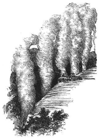 "SMOKE-RESOUNDING" FALLS OF THE ZAMBESI.
The natives were too much in awe of these falls to approach near enough to them to examine them. They viewed them with fear and wonder from a distance. They would refer to the[Pg 68] vapor and noise with the remark, "Smoke does sound there!"
Livingstone learned that at one time another name had been given to these falls by the natives. He was unable to find the exact translation of the name, but believed it to have meant "seething caldron."
Embarking in a canoe Livingstone, after about twenty minutes' sail, came in sight of the falls. The columns of vapor, so appropriately called smoke, rose to a distance of five or six miles. He had noticed much the same appearance when large tracts of grass were burning on the African plains.
As he looked on the wonderful sight, five columns of smoke arose. They seemed to bend in the direction of the wind, as if to lean against a low ridge covered with trees. Seen from a distance, the tops of the columns appeared to mingle with the clouds. White below, and somewhat darker above, the resemblance was a striking one.
The whole scene was most beautiful. The banks of the river and the islands dotting the stream were covered with foliage and vegetation of the most beautiful form and color. At that season of the year several of the trees were covered with blossoms.
Towering over all stood the great burly baobab, with its enormous branches, each as large as the trunk of a tree. To add to the beauty of the scene, groups of graceful palms waved their feather-shaped leaves in the air, against the background of the sky.
To Livingstone the sight of these trees, native to Africa, was always suggestive of "far from home."[Pg 69] He could not remain unconscious of the foreign tone they gave to every picture of the landscape.
A silvery-leaved tree, which bore a strong resemblance to the cedar of Lebanon, stood in pleasing contrast with one of cypress-like form and dark-colored foliage, dotted over with scarlet fruit. Here were trees, too, like our spreading oak; others like our elms and chestnuts.
No one could picture the beauty of the scene as it revealed itself to Livingstone's appreciative eyes. To him it seemed as if so lovely a scene could have been gazed upon only by angels in their flight.
The wonder had never before been viewed by white men; for none had ever penetrated the mysterious realms of the Zambesi waters. Mountains in the background was the only feature lacking to make the picture perfect.
Livingstone found that the falls are bounded on three sides by high ridges. These ridges are from three hundred to four hundred feet high, and are covered with forests. Here and there the red soil appears among the trees.
Not half a mile from the falls Livingstone left the canoe in which he had started upon his journey, and embarked in a lighter one. This was manned by men[Pg 70] well acquainted with the rapids. By passing down the center of the stream and taking advantage of the eddies and still places caused by the jutting rocks, he was able to reach an island in the middle of the river. This island was on the edge of the lip over which the water rolled.
In trying to reach this island there was danger of being swept along in some one of the streams which rushed by it. Fortunately the river was low, and Livingstone thus accomplished what he could not have done had it been high.
Though he had reached the island, and was within a few yards of the falls, of which he could command a good view, yet he could not solve the problem of where the vast volume of water went.
It seemed to lose itself as it disappeared into this fissure, the opposite lip of which was only eighty feet distant.
Livingston could not comprehend this mystery, till, creeping to the edge of the abyss, he peered with awe down into a large rent extending from bank to bank of the Zambesi. The river, a stream a thousand yards broad, took this gigantic leap of a hundred feet and became suddenly compressed into a space of from fifteen to twenty yards.
Livingstone found that the entire falls are but a crack made in a hard basaltic rock. This crack extends from the right to the left bank of the river. It is then prolonged on the left bank of the stream through thirty or forty miles of hills.
Looking down into the fissure on the right of the[Pg 71] island, he saw nothing but a dense white cloud. At the time of his visit two beautiful rainbows gave added beauty to the scene. From this dense white cloud a great jet of vapor, looking exactly like steam, mounted some two hundred or three hundred feet into the air.
As the vapor became condensed, Livingstone saw its hue change to the color of dark smoke. As it fell to the ground in a constant shower, he became wet to the skin.
The shower fell for the most part upon the opposite side of the fissure. Back a few yards from the lip stood a straight hedge of evergreen trees, whose leaves were always wet.
From the roots of these trees numberless little rills ran back into the abyss. As they flowed down the steep rocky wall the columns of ascending vapor greedily absorbed them, and mounted with them into the air.
Constantly running down the side of the fissure, yet never reaching the bottom of it, these rills were an ever-active example of the laws of condensation and vaporization in nature.
On the left of the island, Livingstone saw the water at the bottom of the fissure moving away towards the place of its escape near the left bank of the river. The walls of this gigantic crack he found to be perpendicular. The rock itself is one solid mass. On the side over which the water falls he found the edge worn off two or three feet. Pieces of the rock had fallen away, owing to the action of the water. This gave to the edge a somewhat serrated appearance.[Pg 72]
The rock is of a dark brown color. About ten feet from the bottom he found it somewhat discolored, from the annual rise of the water.
On the left side of the island Livingstone got a good view of the mass of water which causes one of the columns of vapor to rise. It leaped quite clear of the rock. It was the color of snow, and had the appearance of a thick, unbroken fleece all the way to the bottom.
As he describes it, it seemed to break into flakes, all moving in the same direction, like bits of steel giving off sparks when burned in a flame of oxygen gas.
To Livingstone this snow-white sheet of water seemed like myriads of small comets. As they rushed in one general direction, each seemed to leave behind it tiny bodies of foam.
It appeared to him like a mass of water leaping impetuously, at one bound, to clear the rock, and finally breaking gradually into spray.
Three spots near these falls—one of them the island on which Livingstone landed—were former sites of worship. Here it was that the chiefs of native tribes offered prayers and sacrifices.
These places of worship were chosen within hearing of the cataract's roar, and in full sight of the bows in the cloud of vapor.
With awe and wonder these children of Nature looked upon the scene. The river to them was most mysterious, and feelings of fear, no doubt, influenced them somewhat in their selection of places of worship.[Pg 73]
Livingstone describes a canoe-song of the natives, the words of which, rudely translated, are:—
The Leeambye, you remember, was one of the many names of the river given to it by the natives.
The play of colors on the cloud may have given them the idea that this was the abode of the Deity. Elsewhere they had seen this play of colors only in the rainbow. When seen in the heavens they gave it a name signifying "the pestle of the gods."
"Here," says Livingstone, "they could approach the emblem and see it stand steadily above the blustering uproar below,—a type of Him who sits supreme, alone, unchangeable, though ruling all changing things. But not aware of His true character, they had no admiration of the beautiful and good in their bosoms. They did not imitate His benevolence, for they were a bloody, imperious crew."
When the Zambesi River is full, or in flood, the natives told Livingstone that the columns of vapor can be seen ten miles off, and the roar of the cataract can be heard at fully that distance.
It would be interesting if we could linger longer in this region of the Zambesi River; but, for lack of space, we must hasten on towards the sea.
As the river descends to the ocean, it takes a southeast course. During the rainy seasons its width increases from five hundred yards to two miles or more, according to the amount of rainfall.
In its course to the sea the river becomes navigable from the Portuguese town of Tete downward to the mouth. During the dry season, however, navigation is somewhat difficult.
Working its way through the Lupata Mountains the river comes to one or two narrow, rocky gorges which tend to make ugly rapids, except in the rainy season, when the river is high.
About eighty miles from the mouth, the Zambesi receives the waters of the Shiré, which flows out from Lake Nyassa.
Lake Nyassa is a sheet of water about two hundred miles long. It attains a width of fifty miles at its widest point.
The Zambesi enters the low country about fifty miles from its mouth. It separates into various streams to form a large delta. The neighborhood of this delta bears the reputation of being very unhealthy.
The most northern stream of the Zambesi is the Kuaka; the most southern, and the one with the deepest channel, is the Luabo.[Pg 75]
Various ports and entrances lie along the Zambesi. These were formerly used by slaving vessels and others not engaged in very honorable trade.
These ports are not shown very accurately upon the maps, and it is considered a very difficult and dangerous undertaking to attempt to enter the river without a good pilot.
The falls and the rapids of the Zambesi region, together with its elevated lakes and sites of settlements, are its most picturesque features.
Tete, a Portuguese town, is about four hundred feet above the level of the sea. The rapids of Lake Nyassa where the Shiré issues from it, are more than fifteen hundred feet higher than the ocean. A smaller lake southeast of Nyassa is two thousand feet above the level of the sea.
The coast region drained by the Zambesi is inhabited by natives of a pure negro type. In the central and upper parts of the Zambesi region are tribes of a little higher grade of intelligence. They are the conquerors of the original tribes, many of whom still exist.
The Zulu tribes occupy the elevated region which divides the Limpopo from the Zambesi. They have overrun nearly all the territory south of them and subjugated most of its tribes.
In the sections claimed by the Portuguese the slave trade was for many years the shame and disgrace of the white man. All attempts to civilize and educate the natives, by missionaries from other countries, were met by great hostility on the part of the Portuguese. Even the best efforts of the most unselfish and faithful of missionary[Pg 76] workers were well nigh fruitless. The greed and the cruelty of the men engaged in the traffic of human beings were almost beyond belief.
Villages were depopulated, homes were laid waste, and fields once under cultivation were despoiled. On every side, ruin and desolation were the work of the destroying hand of the slave trader.
Torn from home, family, and country, their wretched victims were conveyed to the coast, loaded upon some vessel engaged in the inhuman trade, and sold into slavery.
Most of the productions of the tropics are found in the Zambesi region. The constant insurrections and disturbances among the native tribes have tended to keep the country from being extensively cultivated.[Pg 78]
The animals of this section are very similar to those of South America. The trade in ivory is large. Vast quantities are exported from the west and east coasts.
The mineral wealth is considerable. There are extensive coal fields, and gold has been found near Tete and Senna.
Livingstone relates that when he visited a hot spring near the Zambesi, he found the valleys near Tete very fruitful and well cultivated.
The whole country lying north and northwest of Tete is hilly. These hills are covered with trees, and present a very picturesque scene. It was in this neighborhood that he found evidences of extensive coal mines, which he felt sure could be worked with little labor and at little cost.
While in the vicinity of the hot spring he availed himself of the opportunity of visiting some former gold washing localities. The banks of the rivulet were covered with large groves of fine mango trees. The Portuguese used to live among these trees while they kept supervision over the natives engaged in the gold washing.
The process of washing the sand of the rivulet was hard and very tedious; for the gold was found in minute scales, like mica.
Towards the west various gold washing stations were pointed out to Livingstone. One station, where gold had been found more abundantly than in any other locality, was supposed by some to be the "Ophir of King Solomon."
He saw at this station gold flakes as large as grains of wheat. He found that the natives would wash for gold only when in need of a little calico.[Pg 79]
He was very sure that they knew the value of the gold, for they brought it for sale, packed in goose quills, and demanded twenty-four yards of cloth in exchange for a quill.
They were not unaware of the advantages of this section, for when the waters of the river overflow, they leave a coating of mud upon the banks, and the natives quickly noticed which spots dried soonest, and would begin to dig there, in the firm belief that the gold lay in these spots.
They had a superstition that if they dug deeper than their chins the ground would fall in and kill them.
When they found a piece of gold,—literally a flake,—it was their custom to bury it again. This was due to a superstition that it was the seed of the gold. The value of the flake they knew very well, but they preferred to lose this seed rather than a full crop in the future.
It would be interesting to read more of Livingstone's stories of the Zambesi, but we must pass on to other topics.
The deserts of South Africa, which include the great Kalahari, are, strictly speaking, savannas.
This section of what we might term semi-deserts lies between 20° and 30° south latitude. It is about[Pg 80] one thousand miles long and seven hundred miles wide. The great Kalahari Desert is in the center of this vast area. Naturally, we should look for a variety of physical features in so vast a territory.
On its outer edges the desert tract of South Africa consists of broad plains. These are intersected by rugged, though not very lofty, mountains.
During the wet season these plains are covered with a rich, succulent herbage. This disappears, however, in the dry season. Under the scorching heat it is literally burned off, and leaves the ground parched and dusty.
At intervals in this territory may be found vast tracts overgrown with low bushes covered with thorns. These thorny bushes grow in such dense masses that the traveler is compelled to cut his way through them.
The colonists of South Africa give the name "Wait-a-bit" to this bush. Its short, hooked thorns check the progress of the traveler and compel him to wait a bit at almost every step he takes in advance.
Andersson, an early explorer, once came upon a forest of thornless trees in this section. In his journal he describes his feelings at the sight: "I do not think that I was ever so surprised in my life. I hesitated to trust my senses. Even the dull faces of my attendants seemed to relax from their usual heavy, unintelligent cast, and to express joy at the novel scene."
The climate is characterized by a brief wet season, when the rain falls in torrents. This season is succeeded by months of complete drought. During these droughts water can be found only in solitary fountains,[Pg 81] appearing at rare intervals, or in a few stagnant pools.
Accounts of travelers are filled with the record of suffering that has been endured in this region, by man and beast, just from the lack of water.
Although this country may seem uninviting in many respects, yet to the sportsman it seems a veritable paradise. In no other section of the globe has he so many species of large game to choose from.
South Africa is like a vast zoölogical garden. Here are found the giraffe, the gigantic wild boar, the clumsy hippopotamus, and the rhinoceros. Leopards and hyenas seek their prey here among the many species of the antelope family.
Lions lurk on every side. Elephants haunt the lonely pools, where they seek to quench their thirst.
Ostriches, zebras, deer, springboks, and many other animals, the names of which we do not find in any zoölogy, make their home here.
Naturally, with so much animal life to be supported, there must be the need of vegetable growth.
The beasts of prey find no difficulty in appeasing their hunger; but the animals of the grazing families would fare badly, had not Nature provided them with the proper instinct for seeking their food. This instinct leads them to wander far and wide wherever herbage is to be found.
The region forms so large a pasture ground that it would be unlikely that the whole expanse would suffer from drought at any one time.
As the deer and the antelope families wander in[Pg 82] search of fresh pasturage, the beasts of prey, eager for their food, follow in their wake.
In this peculiar region, nature has provided several plants especially adapted to the limitations of the soil. These plants seem to store up food, and even water, under what seems to be the dry sand of this sterile tract.
One such plant has a low stalk not much larger than the quill of a crow's feather. This plant sends its roots down into the sandy soil. At a depth of one or two feet the root expands into a tuber. This tuber is about the size of a small melon. It consists of a mass of watery, cellular tissue, much like a young turnip.
Another variety of plant is a low creeper. It expands into a cluster of tuberous roots. Some of these tubers are as large as a man's head. The clusters sometimes measure a yard in diameter.
A native searching for one of these clusters pounds the ground with stones, till a hollow sound indicates the spot where he will find the prize.
Many of the animals dig away the sand with their sharp hoofs from these spots, which instinct teaches them to find, just as the reindeer finds the moss of the Arctic regions buried beneath the snow.
A kind of gourd grows in great abundance, covering large tracts. Both men and animals are very fond of it.
One traveler relates that in crossing the desert, during the season for these gourds, he found them in great abundance. So numerous, in fact, were they, that he and his cattle lived on them for three weeks. During[Pg 83] this interval no water was to be had. When a supply of water was reached, all seemed to have lost their liking for it.
Another variety of gourd seeks the low sand hills. It has a fruit about the size of a turnip. The outside of this fruit is of a greenish yellow; the inside is of a deep orange color.
In the neighborhood of Walfish Bay man and beast live upon this gourd almost exclusively for three months in the year.
The seeds of this plant look and taste something like an almond. When the season of the fruit is over, the seeds, which have been carefully gathered, dried, and preserved, are used for food.
Geologists are of the opinion that by boring deep enough in almost any section of this semi-desert territory of South Africa water might be found.
The rainfall in the wet season is very great. Scarcely any of this rainfall finds an outlet through the rivers.
Much of it must sink down through the sand till it reaches beds of clay or strata of rock. Here the water would be held as in a basin, and man, by digging, could obtain it.
Wherever subterranean supplies of water are to be found there are possibilities for the fertilization of the soil.
The perforating of the arid plains of South Africa with artesian wells would soon transform them into luxuriant gardens.
In the Kalahari, pits of slight depth are not unfrequently found. These contain water throughout the[Pg 84] year, unless there have been two successive years of drought.
The natives hide these pits with the utmost precaution. Sometimes they fill them with loose sand and build a fire over them. This is to mislead any one searching for water. One would scarcely expect to find water under a heap of ashes.
When the natives build their huts, they are careful to locate them at some distance from these hidden mines of liquid treasure.
It is a curious sight to see the women of a village start out from their huts for a supply of water. Their water vessels are a string of ostrich eggshells, with a small hole in the end of each shell.
The women make use of a reed for drawing water. This is nearly a yard long, and has a bunch of grass fastened to the end.
The reed, with its bunch of grass, is sunk down through the sand. The sand is then packed closely around it.
Placing her mouth at the upper end of the reed, the woman who wishes to fill her shells makes a vacuum in the sponge-like bunch of grass by sucking through the reed. The water from the pit flows into the grassy sponge, thence up through the reed into the mouth, when, by a dexterous movement, it is thrown into the water vessels.
The women are very skillful in the use of this primitive pump, and it answers very well for water at so little depth.
Livingstone believed that water existed in the Kalahari[Pg 85] at no great depth below the surface. He reasoned from these circumstances: For two successive seasons there had been an extreme drought. During neither of these droughts had more than five inches of rain fallen. Everything was parched. The ground was so hot that if beetles were placed upon it, they were killed in a few seconds, as if they had been placed upon a sheet of hot iron. He noticed that a certain species of ants which always dig their tunnels deep into the ground, did not seem affected by the heat. He opened some of their chambers, curious to learn the reason, and invariably found that the walls were moist.
The inhabitants of this territory are of varied character. Many of them are of the very lowest types of mankind. Others are far superior, and seem susceptible to civilization and education.
In their home life they cultivate their garden patches with a great deal of care and no little skill. They rear small herds of goats, though often forced to dig water for them by the spoonful, as we might say.
In their way they are keen traders. Their trade, though primitive, answers all their needs. They barter the skins of animals that they have slain, for spears, knives, tobacco, and other articles.
Livingstone, in his travels across the Kalahari, speaks of the hot wind which blows over the desert from north to south occasionally. This wind feels as if it came from an oven. Fortunately, it rarely lasts longer than three days. It resembles the harmattan of North Africa.
Many years ago, when missionaries first entered the[Pg 86] country, this wind came loaded with fine reddish sand.
Now it does not come laden with sand, but it is so drying in its effects as to shrink even the best seasoned English wood. Hence all wooden articles become warped.
This wind comes strongly charged with electricity. A bunch of ostrich feathers held for a few seconds against it becomes charged as if by an electrical machine. If one should grasp the bunch, it would give forth a sharp, crackling sound.
Livingstone noticed this electrical state of the atmosphere when traveling in a wagon with one of the native chiefs. The fur of the chief's mantle became, through a slight friction, quite luminous. Livingstone rubbed it smartly with his hand, and found it gave out quite bright sparks, with distinct crackling noises.
Turning to the chief, Livingstone said, "Do you see this?" His reply was, "The white man did not show us this; we had it long before white men came into the country,—we and our forefathers of old."
The Orange River flows through South Africa. It rises in the Mont aux Sources, at an elevation of about ten thousand feet above sea level. It flows in a westerly direction for about one thousand miles, and enters the Atlantic Ocean.[Pg 87]
It is a river of no special importance, and is of little value for any practical purposes of navigation.
It skirts the northern edge of Cape Colony throughout almost its entire course. It thus serves to separate this colony from the Orange River Free State and from the adjoining territories, occupied by various independent native tribes.
Orange River Free State was settled by the Dutch who had previously occupied Natal. When Great Britain established her rule, the Dutch boers, or colonists, migrated from their former home, and settled in the section now known as the Orange River Free State.
The Vaal, a tributary of the Orange River, skirts the northern edge of the State. The Orange River skirts its southern edge.
The Vaal River flows west, then bends a little to the south. The Orange River also flows west, but bends a little to the north.
As the two rivers sweep around, they inclose the Orange River Free State, not only forming its northern and southern boundaries, but turning their courses so as to unite about midway on the western border. Under the name of the Orange River, the united streams flow west, along the northern edge of Cape Colony and the southern edge of Great Namaqua Land, to the Atlantic Ocean.
The Orange River Free State may be called the connecting link between Cape Colony, the Transvaal Republic, and Natal. The total area of the State is estimated above fifty thousand square miles.[Pg 88]
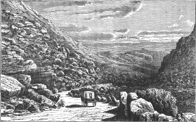 A SCENE IN THE DRACHENBERG MOUNTAINS.
The whole region drained by the Orange River may be considered as a vast plateau, which rises from three thousand to five thousand feet above the level of the sea. Very little woodland is to be found except along the banks of the river and its tributaries.
That portion of the country which comprises the Orange River Free State is diversified by vast undulating plains. These slope from one of the mountain systems down to the Vaal River. They are dotted at intervals by rocky hills.
On the east and southeast the Drachenberg Mountains form a natural barrier between this section and the coast regions.
The northern part of the State is very level. Hundreds of square miles of territory are to be found with scarcely a break in the horizon.
In strong contrast to the northern sections are those of the eastern part of the State.
If we should cross the State from Cape Colony to Natal, we should arrive at the summit of the passes that lead to the latter colony without finding a single mountain in sight. Suddenly, an advance of a step or two would bring us to the edge of an immense mountain chasm. At its foot, nearly a thousand feet below us, we should perceive the coast region stretching out towards the Indian Ocean.
When the Dutch took possession of the Orange River Free State, it was inhabited by different native tribes. Most of these have been driven off to other sections, just as the Indians of America have been driven out by the white man to seek new hunting grounds. A few of the more powerful tribes, however, still dispute the possession of the soil with the settlers.[Pg 90]
All the rivers of the State belong to the Orange River system. Many of them have distinctly Dutch names. In fact, the whole State bears abundant evidence of the presence and personality of the colonists. It is rather curious that they have had to wrest their land from the hands of native tribes, or have had to struggle with foreign powers, just as their ancestors had to wrest Holland from the grasp of Old Father Ocean, or engage in a war with other nations, that looked with longing on the little country of dykes and ditches.
The history of the struggles of the colonists is an interesting one. We are led to wonder if the Dutch nation must always struggle for the possession of any land it may wish to occupy, whether in the Netherlands or in the Dark Continent.
In the early days of colonization vast herds of the larger varieties of antelopes roamed over the great plain of the State; most of them have disappeared as man has invaded their grazing places.
Interest has centered about the Orange River Free State, owing to the discovery of diamonds here, and in Griqualand, a narrow strip of land bounding it upon the west. It will be interesting to view these diamond sections later on in our reading.
The Senegal River rises not very far from the source of the Niger, at the extreme west of the so-called Kong Mountains. It flows first northwest and then west, and loses itself in the Atlantic Ocean a little north of Cape Verd.
The length of the river has been estimated as upwards[Pg 91] of eleven hundred miles. The last seven or eight hundred miles are navigable only for flat-bottomed boats. In fact, here and there throughout its whole course, the navigation of the river is frequently interrupted by cataracts, shoals, and rocks.
The banks of the river are covered with verdure, and in some sections with timber. In the lower part of its course the river is dotted with numerous islands. These are usually large, well cultivated, and fertile.
The entrance to the river is somewhat difficult, owing to the breakers and to the existence of a sandbar. In dry weather this bar has been known to be covered by only eight or nine feet of water.
The Gambia is a smaller stream than the Senegal, flowing about in the same direction and through the same section of country. Its length is estimated at about one thousand miles. The mouth of the river is about four miles broad. Just before the river reaches the sea its current is fully double its width at the mouth.
The river is navigable for vessels of one hundred and fifty tons as far as the town of Barraconda. This town is situated on the right bank of the stream, about two hundred miles from the sea. The river enters the sea a little to the south of Cape Verd.
The Senegal and Gambia drain the tract of country named, most appropriately, Senegambia. It is a large maritime tract, bounded on the north and west by the Sahara and the Soudan, on the south by Sierra Leone, and on the west by the Atlantic Ocean.
Between the two rivers, which are two hundred and[Pg 92] fifty miles apart, there are no very important water-courses. Between the Gambia and the frontier of Sierra Leone there is but one stream of any size, the Rio Grande.
The coast of Senegambia is deeply indented by various arms of the sea, which resemble somewhat the estuaries of rivers.
The country forms the western and northern slope of the Kong plateau. Portions of it are still but partially explored.
The soil of Senegambia differs widely. On the coast we find either low, flat, alluvial plains, or an undulating country broadening to the north. In the northern frontier this tract merges into the Sahara. In the interior the plateau rises from the coast plains in a series of mountainous terraces, and finally loses itself in the Kong Mountains. The loftiest elevations of the soil are only a little more than three thousand feet.
Strictly speaking, the country is divided into three sections, High, Middle, and Low Senegambia. High Senegambia lies to the north of the Senegal and is inhabited chiefly by the Moors. Middle Senegambia is the section along the borders of the Senegal. It is inhabited chiefly by negroes, who divide themselves into numerous tribes. The climate of this section is extremely hot and in the marshy districts it is very unhealthy. The soil is fertile, and yields the usual productions of the hot regions of Africa. Lower Senegambia includes the sections bordering on the Gambia.
As a country, Senegambia has a most luxuriant vegetation. The monkey bread tree is characteristic of the country. It is considered the most enormous tree upon[Pg 93] the globe, and while other trees may surpass it in height none equal it in the size of its gigantic trunk and limbs. Specimens have been found measuring sixty, seventy-five, and even a hundred feet in circumference.
While the native population of Senegambia consists of negroes of various types, European nations are well represented. The British have a number of settlements along the banks of the Gambia. Along the banks of the Senegal are various French settlements. Scattered along the rivers at various points are numerous small factories managed by the Portuguese.
The chief commercial products of Senegambia consist of gum, beeswax, ivory, bark, and hide.
The Congo River flows into the Gulf of Guinea and is a most magnificent river, more wonderful in some respects than the Nile. It is the only one of the large rivers of Africa which has anything approaching an estuary; all the others having delta mouths. So great is the volume of water which it discharges at its mouth, that forty miles out at sea its water is only partially mingled with that of the Atlantic, while nine miles from the coast the water is perfectly fresh.
The Congo River was for many years a veritable Will-o'-the-wisp to explorers. Its identity was lost[Pg 94] so many times, that the geographers looked upon the course of this river as one of the greatest problems connected with the study of Africa they had ever been called upon to solve.
The Congo has a length of more than three thousand miles. The maritime region of the Congo River basin is restricted in its character. For a few miles inward the ground has an upward slope; then the traveler is confronted by ridge upon ridge of hills, which gradually assume the character of high mountains.
The Congo rushes on through this mountainous section, as though through one of our western cañons, till it reaches Stanley Pool. Here the channel becomes much broader, the stream attaining a width of five miles, with an extraordinary depth of water. As the river spreads itself to attain this breadth, it flows placidly on through fertile plains, rich in vegetation.
Geographers have, for convenience, divided the river into well-defined sections, the Upper and the Lower Congo.
The Lower Congo has a length of about three hundred and thirty miles. It is the part of the river between Leopoldville—situated on the banks of Stanley Pool—and the sea and has a navigable current for about one hundred miles, between Vivi and the sea. Above Vivi the river for about fifty miles is lined on either side by high slate cliffs. These tend, of course, to narrow the channel. It is in this section that the Lower Livingstone Falls occur, and prevent navigation.
For a distance of about ninety miles above these falls the course of the river is somewhat broken, but it becomes[Pg 95] navigable as far as Manyanka. Here the Upper Livingstone Falls are situated, and the river again becomes unnavigable.
The Upper Congo starts at Stanley Pool, and as far as Stanley Falls—a distance of over one thousand miles—has a navigable current. It is, in fact, the grand highway for commerce right into the heart of Africa.
From Stanley Falls to Nyangwé, a distance of nearly four hundred miles, the river has a more or less broken current.
Between Nyangwé and Lake Moero there is still another stretch of four hundred miles.
More than two hundred miles from Lake Moero lies Lake Bangweolo, or Bemba. At a distance of nearly four hundred miles from Bemba the Congo, under the name of the Chambesi, takes its rise.
During Dr. Livingstone's explorations to discover the sources of the Nile and to penetrate the secrets of the lake region of Africa, he became much interested in the course of the Chambesi, which he thought, at first, might be one section of the Zambesi. The names seemed to him somewhat similar in sound, and he decided to make an exploration of the stream.
Later, he became convinced that it was not a part of the Zambesi, but he was firmly impressed that its identity with the Lualaba could be established.
Many years of his life were devoted to the study of the Lualaba and the great system of inland lakes of Africa.
Just as the whole of the civilized world looked[Pg 96] eagerly for more definite information of Livingstone's success, all news of him ceased. Much anxiety for his safety and welfare was felt. Months of weary waiting brought at last only the most conflicting reports. Finally the news of his death was received.
This was sad news for the world to believe. Determined to know, if possible, more definitely the fate of this intrepid explorer, those who were most interested sent out relief parties in search of him.
As a final result of all this intense interest, Mr. Henry Stanley was appointed commander of the celebrated expedition which afterwards penetrated into the interior of Africa. The expedition had for its chief object the finding of Livingstone, if he were living. If his life had been sacrificed in the interests of science, the mission of the expedition was to discover his resting place, and the journals and letters that he must have left as a priceless legacy to the world.
The thrilling incidents of Stanley's labor of love, the accounts of the hardships, privations, and stirring adventures, as he relates them in his journals are intensely interesting.
Impressed by the results of Livingstone's work, Stanley followed the Lualaba River from the point where Livingstone's investigations had ceased, and named it the Livingstone, in honor of the great explorer.
Through Stanley's efforts, the identity of the Chambesi, the Lualaba, and the Congo was fully established.
It seems unfortunate that the name Lualaba—which translated means "mother of waters"—could not have been retained throughout the entire course of the stream.[Pg 97] It was a name which, to Livingstone, seemed most appropriate for the wonderful river whose course he had delighted to trace.
Stanley's work was a magnificent proof of what intrepid courage and grand enthusiasm can accomplish. In one expedition after another he completed the discoveries of other explorers, penetrated the mysteries of the lake region and revealed its secrets, explored the very heart of Africa, and traced the course of that wonderful river, Livingstone's Lualaba, till it reached the sparkling waters of the South Atlantic.
The Congo has several large affluents. On the south we find the Kiva, into which a most noble river, the Kasai, flows; the Lulongo, which flows through a densely populated region; and the Ruki River, on the mouth of which Equatorville has been built.
On the north bank of the river we find such tributaries as the Mobangi, the most important of all the rivers flowing into the main stream; for it drains, by means of its multitude of head streams, the whole of the region that lies between the Congo and the equatorial provinces of Egypt. The Itimbiri is another river flowing into the Congo from the north. It enters the river just where the stream attains its greatest breadth. About one hundred and fifty miles below Stanley Falls, the waters of the Aruwimi enter the Congo to swell its current.
Stanley estimated the population of the Upper Congo basin at forty-three millions. Other explorers testify to the dense population and to the extent of the villages, as they are termed.
One writer tells of the great astonishment he felt at the length of these villages. It was no uncommon thing to find five and six miles of continuous street.
An Arab guide told Stanley that he had sometimes been two hours in passing through some of these villages. An eminent German explorer states that in one section of the country an almost unbroken line of huts and structures stretches along the established caravan route.
The people are often barbarous to strangers, yet it is possible to approach them by means of trade. They are very keen to take advantage of the trader who offers the goods of the white man in exchange for the articles they have to barter.
Stanley wrote a detailed account of his explorations in this region under the title "Across the Dark Continent." The book was eagerly read, and had a great influence upon the civilized world at the time of its publication.
The most noticeable result was the establishment of missions, not only along the Congo, but around Lake[Pg 99] Victoria and Lake Tanganyika, and even in West, East, and Central Africa.
Travelers from France, Portugal, and Germany, fired with enthusiasm, set out to explore these vast regions; and, as a result, most of the European nations became interested in making as many annexations as they could to their possessions in Africa.
As a direct result of all this great interest, the savage tribes that infest the region of the Upper Congo were brought into a state of semi-civilization, and to the point where they would show, if not a friendly, at least a reasonably tolerant spirit towards the white man.
The aim of the missionaries was to bring the minds of these poor savages from the darkness, of ignorance, superstition, and idolatry into the light of Christianity, to show them the benefits of peace, the advantages of trade, and the results of an intercourse with the world of civilization.
Above all other objects that the hearts of the missionaries held sacred was the abolition of the slave trade, which, with all its attendant horrors, was the destruction of the people.
The enormity of the African slave trade was not over-estimated. The Arabs made it their special occupation to deal in what was known as the "ebony trade." Under the pretext of searching for ivory, they perpetrated the most cruel and heartless deeds.
Without a thought of the poor savages, they kept up a system of slaughter that knew no mercy, and drained the very life blood of the people of Central Africa.
Even from a selfish point of view, the white man saw[Pg 100] it was for his advantage to destroy the slave trade. How could he be expected to advance into the heart of Africa without the aid of the strong, able-bodied natives? With the depopulation of the country, too, the well-worn, beaten tracks, the shady groves of banana trees, the broad fields of waving grain would disappear, and only devastation and ruin remain, as distressing pictures in this now fertile section.
The white man saw only too plainly that the slave trade did not affect the negro alone, but that it affected the loss or the profit of the whole civilized world. What availed it that the riches of Central Africa were apparently inexhaustible, if the native tribes were not left to help gather them?
We can form some estimate of the cruel work of the Arab slave traders from the account of it given by one author. In his book, "The Arab in Central Africa," he describes the destructive work of an Arab caravan. In the course of eleven months, not only had they pillaged an extent of country containing some thirty thousand square miles, but they had secured nearly twenty-five thousand captives. Nor was this the extent of their cruel work; for, during that time, they destroyed upwards of one hundred villages, and killed about four thousand of the inhabitants.
As this was the fifth caravan which had hunted this territory over, it was estimated that no less than thirty thousand lives had been sacrificed to secure a comparatively small number of slaves.
Another writer declares that it was no unusual thing for four hundred thousand slaves to be brought into[Pg 101] market in the course of a single year, while as many as two million lives were sacrificed in order to bring these slaves to the coast for trading purposes.
Stanley, in his journey through Manyema, was impressed by the extreme fertility of the section and by the numerous villages, as he traversed the country from Tanganyika to Nyangwé. A few months later the whole country presented the distressing pictures of depopulation and devastation.
The region of Tanganyika Lake was considered a high road by caravans. Professor Drummond, in his interesting book, gives a description of the crafty Arab, who would sometimes settle in a well-favored spot for a year, or even longer. Here, he would accumulate immense quantities of ivory, until his money was exhausted. Then, on some slight pretext, he would engage in a quarrel with one or two of the natives. He would soon be pined by his friends, all well armed. The quarrel would become general, and would assume the character of a general massacre. Villages would then be burned, homes laid waste, and the strongest, ablest natives spared only to serve as beasts of burden to transport the tons of ivory to the coast. Here, when his load of ivory had been sold, the wily Arab traded off his "ebony" to the masters of slaving vessels.
In view of such facts, it is not surprising that representatives of different European nations formed "The International Association of the Congo." Its objects were threefold: philanthropic, scientific, and commercial.
We have seen the need of a spirit of philanthropy[Pg 102] and the object of the missionaries in dealing with the tribes of the Congo River basin. Science was now to be advanced by means of surveys of the river basin; for this would reveal the physical features of the country, its natural facilities, and its wealth of productions. The interests of commerce were also to be considered and extended.
First, an outlet was to be provided for the great wealth of the interior of Africa, and an opening made for trade in the manufactures of all Europe. Second, roads and bridges were to be built, settlements were to be formed, and land cultivated. Third, hostile tribes were to be brought into harmony; a main road was to be established, not only for the transportation of goods, but to open a means of communication with the many Congo tribes, and gradually to bring them into a state of civilization.
Stanley was offered the important position of director of the expedition which the association sent out. He sailed for the Congo, after leaving Zanzibar, by way of the Red Sea and the Mediterranean, landing at Banana Point, which is at the mouth of the river.
The Congo, as far as Ponta de Lenha, or Wood Point, at a distance of thirty-four miles from Banana Point, is navigable by large seagoing steamers. Above this[Pg 103] place the river grows rapidly shallow. Though shallow at any time, its waters become very much affected during the change of seasons.
The next important settlement beyond Wood Point is Boma. This, like Banana Point, is a great factory town. Numerous warehouses, belonging to English, Dutch, French, and Portuguese trading companies, comprise its main features.
These different companies own many steamers, both large and small. The small steamers are for river traffic; the large ones ply between Europe and the coast. Stanley found these steamers a frequent feature in the rather monotonous scene; for, at the time of his arrival on the west coast, the Lower Congo, between Banana Point and Boma, had all the bustling appearance of a mercantile river of some importance.
Boma is a most attractive spot in the landscape of this vast region, which stretches far and wide. To the north rise the ridges of a long, uneven mass of hills. Against the background of sultry sky they look cool and beautiful in their blue coloring, seen through the hazy distance. Southward lies a miniature repetition of these hills. In the foreground and midway in the picture, the mighty Congo sweeps towards one on the left, away from one on the right. Silently, steadily, with even pace, it moves onward to the sea.
After a rainy season the whole country rejoices in a carpet of velvety green; a few months later, and the relentless rays of a tropical sun scorch leaf and blade to a dreary waste in the landscape.
Then the earth, dry as tinder, offers an inviting field[Pg 104] for the bush fires, which, departing, leave as a legacy only burning embers, where once flourished the brilliant flowers, dense underbrush, and verdant grasses of a tropical world.
But these are not the only features to be found in this section to-day. Here may be seen machine shops ringing with the clang of busy workmen, iron sheds, and coal yards. Here, too, is a whole settlement of European houses, and a small town of huts, which serve as the dwellings of the native workmen. Situated on an elevated, airy site, a large, handsomely designed hospital greets the eye. While, as a crowning feature, a strong, substantial iron pier extends far out into the river.
Thus can we get some little idea of what the energy and the perseverance of the white man have accomplished within the last few years.
About forty miles from Boma the Congo suddenly changes its character, and temporarily becomes a veritable Colorado River. Madly, tempestuously, it rushes downward in its course, through a canon of bold, bare rocks, which tend to form a succession of falls and rapids. The foot of this canon forms a natural limit to navigation from the sea. Hence, all goods for the upper river stations have to be carried overland.
It was at this point that Stanley formed his first settlement. Just at the foot of the rapids, on the right bank of the river, the mountain of Vivi rises. About three hundred and fifty feet above the river, on an irregular plateau of the mountain, Stanley set to work.
First of all, the plateau was leveled, the immense[Pg 105] rocks that reared their heads here and there were ground to pieces and used for road and house foundations. A road was built from the narrow beach to the selected site. Several houses were built, not only for the representatives of European nations, but for the natives also. Last but not least, a large garden was made by transporting the rich soil of the valley and filling in a tract previously excavated for the purpose.
This garden in a short time became a source of rest and enjoyment to the white residents at the station. It was the only spot on the bare and sterile hills where a particle of shade could be found from the glaring heat of the sun.
Stanley's great success in all his expeditions was due to the fact that he believed in the nobility of labor. It is interesting to learn that, during the work of founding the settlement, Stanley showed such skill in pulverizing the scattered rocks with his sledge hammer as to earn the name of Stone-breaker from the native chiefs. He soon became known by this title among all the tribes dwelling upon the Congo.
At the end of three months the settlement at Vivi was completed. Leaving an American, Mr. Sparhawk, in charge, Stanley proceeded to Isangila. His object was to discover in which direction to build the projected road.
From Vivi to Isangila, we must remember, the river is unnavigable. The numerous cataracts and rapids of Livingstone Falls make a formidable obstruction. Isangila lies about fifty miles from Vivi. The interlying country is of an exceedingly rocky, rugged character.[Pg 106]
The well-worn roads of the natives led, as is the custom, up and down the hills and valleys. "Straight as Roman roads," it was not possible for a wagon road to be laid over such ground.
After much planning and arduous labor a road was completed to Isangila. From this point, goods brought overland from Vivi could be transported by boats launched upon the river. Then, with the exception of the upper Livingstone Falls, the wide stretches of the Congo from Isangila to the foot of Stanley Falls formed a natural highway, which required only navigation.
Stanley's journal gives many details of the work of building the road from Vivi to Isangila. This road, which was fifteen feet broad, took a year to complete, but when finished it was a masterpiece. So strong was it, that heavy wagons, even when laden with steamers, launches, and boats, could safely travel over it.
Just above the cataracts, which mark the sudden decline from Stanley Pool to the river current, the settlement of Leopoldville was founded on the southern bank of the stream. It has an excellent situation on the northwest corner of the pool which serves as the connecting link between the Lower and Upper Congo.
On a piece of lofty ground, sloping down to the river and overlooking Kintamo Bay, Stanley decided to clear a site and begin to build.
Upon a long, wide terrace, which he cut out of the hillside, various buildings were erected. The largest house and all the headquarters were stoutly built of wood, and then plastered over with clay to the depth of two feet. This was to insure a fort in case of[Pg 107] subsequent hostilities, when a garrison would be needed.
A little distance off the native village was built. Its proportions were considerable, as it had to accommodate upwards of one hundred and fifty natives.
The headquarters were commodious. They comprised five bedrooms, a large dining room, and a strong magazine. A large garden was laid out, and sheds and houses for live stock of various sorts were erected.
Petty acts of hostility committed by one of the native tribes occasioned much annoyance to the settlers. In order to preserve peace Stanley had resource to a rite known as blood brotherhood. He thus describes this curious performance, which he had frequently taken part in. The ceremony took place between Stanley and a native chief, Ngalyema.
"We crossed arms, an incision was made in each arm, some salt was placed on the wound, and then a mutual rubbing took place, while the great fetich man of Kintamo pronounced an inconceivable number of curses on my head if I ever proved false. Susi, formerly Livingstone's head man, not to be outdone by him, solicited the gods to visit unheard-of atrocious vengeances on Ngalyema if he dared to make the slightest breach in the sacred brotherhood, which made him and the Stone-breaker one and indivisible forever."
Stanley thus describes the town: "Leopoldville, with its one-story block house, commanding from its windows all approaches, impregnable to musket-armed natives, and proof against fire, despite its grass roof, because underneath that grass roof there was an earth[Pg 108] roof two feet thick, on which fire might burn itself out harmlessly, offered a safe refuge, should trouble arise.
"The terrace was long and wide—the native village was formed of one broad street—flanked by a row of clay huts on either side. Slanting from a point thirty feet below the block house, and sloping gently down to the landing place, gardens of young bananas and vegetables extended beyond these huts. Water was handy, fuel was abundant."
From the summit of Leopold Hill, above the station, a most magnificent view lies before one. "The vast circle of water formed by Stanley Pool, the amphitheater of rocky mountains and lofty white cliffs, the large island of Bamu with many attendant satellites, combine to make a scene of a striking character."
Back, stretching far behind the lofty banks of the noble Congo, lies a country rich in its enormous wealth of natural productions. The toil and enterprise of another generation can hardly hope to gauge its resources, and it is doubtful if even coming generations can exhaust its stores.
The vegetation of the Upper Congo region is most wonderful. Whole forests of the oil palm are a common[Pg 109] feature. From this tree vast quantities of oil are obtained, while the kernels are used for oil cakes. The India-rubber plant is another important production. Stanley believed that enough of the gum could be exported in a single year to defray the cost of a railway through that section. Vegetables of all descriptions are also abundant.
The trade in ivory alone would furnish, according to Stanley, an enormous revenue. He estimated that one million dollars' worth of ivory could be exported annually for twenty-five years, before the elephant would become extinct in the basin of the Upper Congo.
The banana and the plantain flourish, as do fruits and herbs of many kinds. Potatoes, onions, and cabbages have been introduced from Europe, and thrive here. Rice, wheat, and other grains have done well, when suitable localities have been chosen for them. There is, in fact, scarcely any limit to the natural advantages of an area of over a million square miles. Its fertility and richness of soil are at once a wonder and delight.
It must have been a great disappointment to Stanley, when, on his return from an official visit to Europe, he found that there had been gross and wanton neglect on the part of many whom he had left in charge of the settlement at Leopoldville.
He had pictured to himself well-cultivated gardens and flourishing fields. To his dismay, he found the native town almost hidden by the rank growth which held almost undisputed possession of the soil.
The steel boats were at anchor, as they had been for[Pg 110] more than a year. No attempt had been made to clean them or to keep them in repair.
The Europeans and the natives were on the worst of terms. One of the first things he did was to hold a conference with all the neighboring chiefs, and endeavor to restore the feelings of good-fellowship which had previously existed. So successful was he, that he soon induced the chiefs to sign a treaty, in which they agreed to unite with him, as a representative of the Association, to control the entire country south and west of Stanley Pool for the purpose of promoting civilization.
The Association had always been regarded as the chief power. It was in the eyes of the native chiefs invested with sovereign rights affecting peace, war, and commerce. Each chief received a flag of the Association as a symbol of the new confederation. This he was to hoist above his grass-roofed hut on specified state occasions.
Soon after this treaty was signed, Stanley and his little fleet prepared to depart for the Upper Congo. He had a force of about eighty men and a cargo of about six tons, on board his little fleet of vessels, which consisted of two steamers, a launch, a whale boat, and a canoe.
He writes of his outfit: "We have axes to hew the forests, hammers to break the rock, spades to turn up the sod and to drain the marsh, or shovels to raise the rampart, scythes to mow the grass, hatchets to penetrate the jungle, and seeds of all kinds for sowing, saws to rip planking, and hammers, nails, and cabinet-makers' tools to make furniture, needles and thread for sewing all the cloth in these bales, twine to string their[Pg 111] beads; and besides these useful articles in the cases, there are also countless 'notions' and fancy knick-knacks to appease the cupidity of the most powerful chief, or excite the desire for adornment in woman."
Among other items may be mentioned some articles used in trade by the white man when he journeyed on the Congo: "A case of velvet caps and hats, six cases of fancy beads, forty-seven bales of cloth, an enormous quantity of medicine, ammunition, and provisions, and four thousand pounds of brass rods."
It is interesting to know that the currency of this section of Africa consists of a brass rod, short and slender. Great numbers of these are required to equal the value of a very small amount of money. Stanley, at one time, had to pay eight hundred of these rods for provisions enough to last the station at Leopoldville three days.
Stanley gives an interesting description of the Upper Congo above Chumbiri, where the wide stretches of the river are thickly studded with islets.
"We have been voyaging, since leaving Boma and the estuary-like breadth of the Lower Congo, in a pass, or defile. From Boma to Vivi, we steamed between two lines of mountain heights. Between Vivi and Isangila, we traveled in a narrow valley parallel with the chasmic trough of the Congo. Between Isangila and Manyanka, our boats ran up the crooked, ravine-like valley of the river. Between Manyanka and Leopoldville, we marched along the edge of the deep fracture in the high land through which the Congo continuously roars.[Pg 112]
"Then, after a slight relief, obtained by the lake-like expansion called Stanley Pool, we have been confined again between two mountain lines of more or less picturesqueness, up as far as the rocky point above Chumbiri, to finally emerge into the lacustrine breadth, which the voluminous waters of the Congo have scooped out of the plains and lowlands which we now behold on either hand.
"The real heart of Equatorial Africa is this central fertile region, whose bountiful, unparalleled richness of soil will repay the toil and labor required to bring it within the reach of Europe.
"It was not the uplands of the maritime region, with their millions of ravines and narrow, oven-hot valleys, and bald grass tops, and limited bits of grassy plateaus, with here and there a grove of jungly forest scattered like islets amid the grassy wastes, that I strove for; it was this million square miles of almost level area, which we may call the kernel, that was worth the trouble of piercing the two hundred and thirty-five miles of thick, rude mountain husk which separates it from the energies of Europeans, who, could they but reach it, would soon teach the world what good might come out of Africa."
At the junction of the Ruki River with the Congo, Stanley established a settlement, first called Equator Station, then Equatorville, as it is situated on the Equator.
Proceeding always up stream, Stanley passed through a perfect archipelago; for islets without number dotted the river current.[Pg 113]
Here the forest trees attained a height of from one hundred and fifty to two hundred feet. The underbrush was so dense as to require the use of a hatchet before it could be penetrated.
While passing these "green-walled straits," Stanley had an experience with one of the violent storms sometimes met with in a tropical country.
With a sudden rustle and roar, as though mile after mile of forest were buffeted by a mighty whirlwind, such a storm begins.
The river, which a moment before was like glass, now becomes disturbed by waves, which increase in size and strength each minute.
Huge trees, holding their burdens of parasites and creepers, sway to and fro, and shriek and moan, as if in mortal agony.
The wind sweeps the leaves before it in perfect clouds, and then down comes the rain.
Not a gentle shower, but a genuine rain of the tropics. It drenches one to the skin in a twinkling. It pelts one with hailstones as large as marbles.
The ground, which, perhaps, was parched and dry but a moment ago, is now covered with running water. The grass, which was like dry tinder an hour before, is replaced by the vegetation about it, which now begins to revive under the action of the life-giving bounty of Heaven.
Gathering force from the four quarters of the globe, the clouds have first merged, then burst directly overhead, to let fall a flood of water, which is precipitated to the earth as rain,—a tropical rain![Pg 114]
Man and beast must alike seek shelter from the fury of such a tempest, whether its force is felt on the open savanna or amid a forest of trees groaning under the strain of the gigantic wind and the weight of the mighty flood descending from the sky.
In an hour the clouds have scattered, the hail and the rain have ceased. The gusts of wind grow fainter and fainter. The gentle patter of the drops as they fall from leaf to leaf, the rapid streams, and the shattered boughs are but the few footprints that mark the track of the storm.
The sky is as blue, the sun is as fierce as ever; the thermometer ranges higher and higher; the last solitary trace of the storm cloud vanishes below the horizon, and the storm departs as suddenly as it arrived. Such, then, is a tropical tornado!
As Stanley's little fleet puffed its way higher and higher up the stream of the mighty Congo, richer and richer appeared the country through which the expedition was passing.
The soil seemed almost black, so filled was it with decomposed vegetable matter, and its fertile appearance was unparalleled by anything which Stanley had seen in his journeyings.[Pg 115]
On either hand the banks were lined with mile upon mile of the most valuable of the giant growths of the forests. Whole tracts of gum copal trees were seen for hours together. These trees were literally covered with orchids, which, in themselves, represented the foundations of many fortunes to botanists and florists, could they but gather them.
In mid-stream, the islands, which were legion, constantly took on new shapes. All were characterized by the same exuberance of vegetation. Truly, here was a land of plenty!
Stanley, with his little fleet, passed slowly up the river, now exploring any important tributary for a considerable length, now taking part in the ceremony of the blood brotherhood of which we have read, now making treaties with the great chiefs; for this brave explorer never forgot that his expedition was the great mission of commerce and civilization.
At length the little fleet reached the foot of the seventh, or last cataract of Stanley Falls. Here it was the purpose of the expedition to found a settlement destined to be the germ of the future Congo Free State.
The islands and the mainland west of the falls Stanley found inhabited by the Wenyas. This tribe was noted for its skilled fishermen and boatmen. With this tribe Stanley held a council, for the purpose of purchasing land for a settlement.
There was a good deal of agitation among the natives, we may be sure. The idea of trading their land with the white man was a novel one to them. The great chiefs and speechmakers of the tribe were[Pg 116] at first fearful and cautious, and by degrees became prophetic, then indignant and abusive; finally, they became not only shrewd, but philosophic and pacific, and, at the close of the conference, even friendly.
As a result of the contract, Stanley exchanged about eight hundred dollars' worth of beads, knives, cotton cloth, looking-glasses, brass wire, caps, and such articles, used as currency, for a large portion of an extensive island, upon which to found a settlement.
The station had a fine situation just below the rapids. In a creek on the east side of the island was a very good harbor.
East of this Seventh Fall dwelt a powerful tribe, the Bakuma. Stanley made cordial friends with this tribe, as with the Wenyas.
With both tribes he made treaties, in order to insure his people not only safety of person but of property. He also made propositions for civilized methods of conducting commerce.
Thus did Stanley work from point to point along the river to establish stations, which later were to form the links by which the State was to be held in peace and harmony, in civilization and progression.
The achievements of Stanley's expedition were wonderful, when we consider that he had held councils and made treaties with more than four hundred and fifty chiefs.
As a result, these "great men" had sold to him, for large sums in the "currency" of their territory, tracts of land which they or their ancestral fathers, had owned for countless ages. With the transfer of land[Pg 117] they had also yielded their rights as rulers, and given to the new owners the rights and the privileges belonging to a sovereign. Thus was laid the foundation of the present Congo Free State.
Almost all the lakes of Africa are, comparatively speaking, quite shallow, and bear evidence of being the remains of much greater bodies of water that existed in past ages. It is believed that the whole district now drained by the Zambesi River and its tributaries was, at one time, a great fresh water lake.
Many traces of the lake still exist. The whole of the vast area drained by the Zambesi system is covered with a bed of tufa, which is a soft, porous stone formed by deposits from water. This bed of tufa in the Zambesi region is more or less hardened, according to the exposure it has had to atmospheric changes.
The great fissure of the Victoria Falls has, no doubt, drained in no small degree an enormous valley, to leave only the deeper portion of what was originally a sea, but is now known as Lake Nyassa.
Traces of ancient beaches along its borders afford proof that the lake is much diminished in size.
Livingstone writes, that in no part of Africa had he found so dense a population as upon the shores of Lake[Pg 118] Nyassa. Along the south side of the lake there was an almost unbroken line of villages.
It is upon the shores of this lake that much care is bestowed upon the graves. The burying grounds are all well protected, and have good broad paths running through them.
The graves are, in almost every instance, shaded by the deep foliage of the fig tree. Those of the men are distinguished from those of the women by the various implements or utensils which they were in the habit of using during life.
Here, a bit of fishing net, or a bit of broken paddle, tells the story of a fisherman's life; there, a mortar and pestle used for pounding corn, or the bucket used for sifting the meal, tells the story of the domestic life followed by the woman who now lies resting from all labor.
On each grave are the fragments of what were once utensils for holding food. They have been placed there to signify that their late owners have passed beyond the need of daily sustenance.
Lake Tchad is, perhaps, one of the most interesting lakes of Africa. It is, in fact, an immense inland sea, situated in Soudan, a portion of North Africa.
It has an elevation of about eight hundred feet above the level of the sea. According to some writers, it is from two to three hundred miles long and one hundred and forty miles broad.
Although not an especially attractive lake, it is a very interesting one. Its placid waters stretch far away to its distant banks, fringed with tall water[Pg 119] reeds. Often numerous hippopotami may be seen resting in its depths, their ugly noses barely showing above the surface.
Here and there light barks may be seen floating. Many of these are so far in the distance that only the gleam of their sunny sails is visible to the beholder.
Ordinarily, the depth of the lake is from eight to fifteen feet; in some years the water has attained a much higher level along its shores.
Crocodiles abound in these waters, as well as the hippopotami, or river horses. Fish and water fowl are also plenty.
Dr. Barth, the explorer, states that the lake has no apparent outlet, yet its waters are perfectly fresh. From the north the Waube, a river some four hundred miles in length, enters it. From the south the Shari, a stream about eighteen hundred feet broad in its lower course, discharges its waters into the lake.
Lake Tchad seems to be divided into two distinct sections, the open water and the strip of swampy land which surrounds it. The open water, or true Tchad, is dotted with numerous islands. These consist mainly of elevated, sandy dunes. Only the most elevated of these islands afford shelter, but such as are inhabited have a dense population.
The people on these lake islands build numerous boats. Some are twenty feet in length. One writer describes a boat which was fifty feet long, and but six and one-half feet wide.
The explorers, Barth and Overweg, describe Lake Tchad as a remarkably fine sheet of water. They visited[Pg 120] the lake during the dry season, and found the lowlands in the vicinity grassy meadows. During the wet season these lands are usually under water.
Doubtless the ground surrounding the lake was a portion of the former bed of a much larger sheet of water. Along its shores the papyrus is found. This is like the plant from which the ancients about the Nile manufactured their paper. Various other reeds, some of them from ten to fourteen feet high, grow in abundance, there being two distinct varieties of these gigantic reeds.
Interwoven in this thicket of reeds grows a variety of climbing plant with bright yellow blossoms. Another peculiar plant, which floats or rests upon the water, the natives call by a name which signifies "homeless fauna."
As these two explorers, Barth and Overweg, approached open water, after leaving the swampy ground in the nearer vicinity of the lake, they came upon an expanse of quite deep water. Shortly after, they disturbed a herd of kelara, a variety of antelope that is very fond of the water. Proceeding on their way, they came to water so deep that, by stooping in the saddle,—for they were on horseback,—they could easily have drunk from it. This draught, however, would not have been very refreshing, for the water was warm and full of vegetable life.
Lake Tanganyika is situated in East Central Africa, at an elevation of over twenty-seven hundred feet above the level of the sea. It has a length of upwards of four hundred miles, while its breadth is from ten to fifty miles. In shape it is like a leech, with the small end[Pg 121] tapering to the north. This small or northern end lies about two hundred miles southwest of Victoria Nyanza Lake.
Burton and Speke, two African explorers, have given a vivid description of the approach to the lake, as well as of the lake itself.
Burton regarded the Malagarazi River as the western boundary of "The Land of the Moon." It is in this section of country that Lake Tanganyika is situated.
"'The Land of the Moon,' which is the garden of Central Inter-tropical Africa, presents an aspect of peaceful rural beauty, which soothes the eye like a medicine, after the red glare of the barren Ugogo and the dark, monotonous verdure of the western provinces.
"The inhabitants are comparatively numerous in the villages, which rise at short intervals above their impervious walls of the lustrous green milk-bush, with its coral-shaped arms, variegating the well-hoed plains.
"In the pasture lands frequent herds of many-colored cattle, plump, well-rounded, and high-humped, like the Indian breeds, and mingled flocks of goats and sheep dispersed over the landscape, suggest ideas of barbarous comfort and plenty.
"There are few scenes more soft and soothing than a view of 'The Land of the Moon' in the balmy evenings[Pg 122] of spring. As the large yellow sun nears the horizon, a deep stillness falls upon earth; even the zephyr seems to lose the power of rustling the lightest leaf. The charm of the hour seems to affect even the unimaginative Africans, as they sit in the central spaces of their villages, or, stretched under the forest trees, gaze upon the glories around.
"The rainy monsoon is here ushered in, accompanied and terminated by storms of thunder and lightning, and occasional hail falls. The blinding flashes of white, yellow, or rose color play over the firmament uninterruptedly for hours, during which no darkness is visible.
"In the lighter storms, thirty and thirty-five flashes may be counted in a minute. So vivid is the glare that it discloses the finest shades of color, and appears followed by a thick and palpable gloom, such as would hang before a blind man's eyes, while a deafening roar, simultaneously following the flash, seems to travel, as it were, to and fro overhead. Several claps sometimes sound almost at the same moment, and as if coming from different directions. The same storm will, after the most violent of its discharges, pass over, and be immediately followed by a second, showing the superabundance of electricity in the atmosphere."
Burton describes two tribes of this region as worthy of notice, the Wakimbu and the Wanyamwezi. The former are emigrants into The Land of the Moon. They claim a noble origin, having come from tribes living south of this land that has adopted them.
Burton's description of these people is interesting. "In these regions there are few obstacles to immigrants.[Pg 123] They visit the sultan, make a small present, obtain permission to settle, and name the village after their own chief; but the original proprietors still maintain their rights to the soil.
"The Wakimbu build firmly stockaded villages, tend cattle, and cultivate sorghum and maize, millet and pulse, cucumbers and watermelons. Apparently they are poor, being generally clad in skins. They barter slaves and ivory in small quantities to the merchants, and some travel to the coast.
"They are considered treacherous by their neighbors. They are known by a number of small lines formed by raising the skin with a needle, and opening it by points laterally between the hair of the temples and the eyebrows. In appearance they are dark and uncomely; their arms are bows and arrows, spears, and knives stuck in the leathern waist belt; some wear necklaces of a curiously plaited straw, others a strip of white cowskin bound around the brow,—a truly savage and African decoration.
"The Wanyamwezi tribe, the proprietors of the soil, is the typical tribe in this portion of Central Africa. Its comparative industry and commercial activity have secured to it a superiority over the other kindred tribes.
"The natives of this tribe are usually of a dark sepia brown, rarely colored like diluted India ink, as are the slave races to the south. The hair curls crisply, but it grows to the length of four or five inches before it splits. It is usually twisted into many little ringlets, or hanks. It hangs down like a fringe in the neck, and is combed off the forehead after the manner of the ancient Egyptians and the modern Hottentots.[Pg 124]
"The habitations of the Eastern Wanyamwezi are the tembe, which in the west give place to the circular African hut. Among the poorer sub-tribes, the dwelling is a mere stack of straw.
"The best tembe have large projecting eaves, supported by uprights; cleanliness, however, can never be expected in them. Having no limestone, the people ornament the inner and outer walls with long lines of ovals, formed by pressure of the finger-tips, after dipping them in ashes and water for whitewash, and into red clay or black mud for variety of color.
"With this primitive material they sometimes attempt rude imitations of nature,—human beings and serpents. In some parts the cross appears, but the people apparently ignore it as a symbol. Rude carving is also attempted upon the massive posts at the entrance of villages, but the figures, though to appearance idolatrous, are never worshiped."
Burton considered the march from the Malagarazi River to Lake Tanganyika the worst part of his journey. It led through a perfect wilderness, with all the diversities of jungle, swamp, rugged hills, and rocky ravines swept by mountain torrents.
After much labor, Burton and his followers reached the lake. His first feeling was one of disappointment.[Pg 125]
Having traveled through screens of lofty grass, which gradually thinned out into a scanty forest, he climbed a steep, stony hill, thinly covered with thorny trees. From the top of this hill he could see a faint streak of light below. This he judged was the lake. Seen through the veil of trees and the broad rays of sunshine, the lake seemed to be shrunken in its proportions.
As he advanced a few steps, the whole scene burst upon his view. He was filled with admiration, wonder, and delight at its beauty. To quote his words:—
"Nothing could be more beautiful, more picturesque, than the first view of Lake Tanganyika, as it lay in the lap of the mountains, basking in the gorgeous tropical sunshine. Below and beyond a short foreground of rugged and precipitous hill-fold, down which the footpath zigzags painfully, a narrow strip of emerald green, never sere, and marvelously fertile, shelves towards a ribbon of glistening sand, here bordered by sedgy rushes, there cleanly and clearly cut by the breaking wavelets.
"Farther in front stretched the waters, an expanse of the lightest and softest blue, in a breadth varying from thirty to thirty-five miles, and sprinkled by the crisp east wind into tiny crescents of sunny foam.
"The background is a high and broken wall of steel-colored mountain, here flecked and capped with pearly mist, there standing sharply penciled against the azure sky. Its yawning chasms, marked by a deep plum-color, fall towards dwarf hills of mold-like proportions, which apparently dip their feet in the wave.[Pg 126]
"To the south, and opposite the long, low point behind which the Malagarazi River discharges the red loam suspended in its violent stream, lie the bluff headlands and capes of Uguha; and, as the eye dilates, it falls upon a cluster of outlying islets speckling a sea horizon.
"Villages, cultivated lands, the frequent canoes of the fishermen on the waters, and, on a nearer approach, the murmur of the waves breaking upon the shore, give something of variety, of movement, of life to the landscape, which, like all the fairest prospects in these regions, wants but a little of the neatness and finish of art,—mosques and kiosks, palaces and villas, gardens and orchards,—contrasting with the profuse lavishness and magnificence of nature, and diversifying the expanse of excessive vegetation, to rival, if not to excel, the most admired scenery of the classic regions.
"The riant shores of this vast crevasse appeared doubly beautiful to me after the silent and spectral mangrove creeks on the East African seaboard, and the melancholy, monotonous experience of desert and jungle scenery, tawny rock and sun-parched plain, or rank herbage and flats of black mire. Truly it was a revel for soul and sight."
In further accounts this same author describes the African canoe, which is simply a scooped-out log. In such a climate as that of Africa a canoe cracks, and for want of calking it often becomes so leaky as to require constant baling. The crew take turns in thus keeping the craft from sinking.
A canoe of this sort has neither masts nor sails. In place of a rudder there is an iron ring in the stern.[Pg 127] The steering, however, is really done by the paddle. There are no oars, and the paddle, which takes the place of oars, is exceedingly clumsy.
The crew seat themselves on narrow benches, two sitting in a space scarcely large enough for one person. In the center of the canoe is a clear space about six feet long. This is used to store the cargo, passengers, cattle, slaves, and provisions.
In describing the natives Burton says: "The lakists are an almost amphibious race, excellent divers, strong swimmers and fishermen. At times, when excited by the morning coolness and by the prospect of a good haul, they indulge in a manner of merriment which resembles the gambols of sportive water fowls.
"Standing upright and balancing themselves in their hollow logs, which appear but little larger than themselves, they strike the water furiously with their paddles, skimming over the surface, dashing to and fro, splashing one another, urging forward, backing, and wheeling their craft, now capsizing, then regaining their position with wonderful dexterity.
"They make coarse hooks, and have many varieties of nets and creels. Conspicuous on the waters and the villages is the dewa, or otter of Oman, a triangle of stout reeds, which shows the position of the net. A stronger kind, and used for the larger ground fish, is a cage of open basket work, provided like the former with a bait and two entrances. The fish, once entangled, cannot escape, and a log of wood used as a trimmer, attached to a float-rope of rushy reeds, directs the fisherman."[Pg 128]
The results of Burton's trip up and down the lake, owing to the obstinacy of the native guides, were not very important. The shores of the lake he found to be very muddy, and the landscape bright and green with vegetation. The inhospitable natives, although favored with every blessing of so luxuriant a climate, were ignorant and barbarous.
Tanganyika is probably the longest fresh water lake in the world. It occupies an area of nearly thirteen thousand square miles, and has a coast line of nine hundred miles in extent.
Burton and his companion, Speke, remained for over three months at Ujiji, a small province situated upon Lake Tanganyika. It has a convenient situation as a mart, and was a central point for the establishment of trading depots by the Arabs as early as 1840. It was their custom to send decoy slaves with their agents, to navigate the waters of the lake, for the purpose of collecting ivory and slaves upon its shores.
The atmosphere of Ujiji has great humidity, and its soil, consequently, great fertility. The large forest trees and the profusion of ferns give abundant evidence that the province is one of the most productive in this portion of Africa. Vegetables, which in other sections[Pg 129] grow only under cultivation, here have a spontaneous growth.
The Arabs found rice of an excellent quality could be raised upon the shores of the lake. It grew very luxuriantly, sometimes to the height of eight or nine feet. The natives, however, found that the ravages of the monkey, the elephant, and the hippopotamus were such as to spoil their rice fields, and turned their attention to the cultivation of sorghum, for which they have a preference.
"The bazaar at Ujiji is well supplied. Fresh fish of various kinds is always procurable, except during the violence of the rains; the people, however, invariably cut it up and clean it before bringing it to market. Good honey abounds after the wet monsoon. By the favor of the chief, milk and butter may be purchased every day. Long-tailed sheep and well-bred goats, poultry and eggs—the two latter are never eaten by the people—are brought in from the adjoining countries. The Arabs breed a few Manilla ducks, and the people rear, but will not sell, pigeons."
It will be interesting to know the meaning of the various prefixes to native words used in speaking of the land and people of Africa. Captain Burton uses these prefixes invariably in his journal and letters. They are U, meaning the country; Ki, meaning the language; Wa, the people in a body; and M, an individual. These prefixes are used in connection with some special stem or root, as jiji, chosen by a native tribe. Thus we find U-jiji, the country of jiji; Ki-jiji, the language of jiji. Wa-jiji, the people of jiji; M-jiji,[Pg 130] an individual in jiji. This little explanation will tend to help us in our understanding of the various African words we shall meet in our reading.
"The Wajiji are a burly race of barbarians, far stronger than the tribes hitherto traversed, with dark skins, plain features, and straight, sturdy limbs," we are told in Burton's account of his explorations in the region along the shores of the lake. "They are larger and heavier men than the Wanyamwezi, and the type, as it approaches Central Africa, becomes rather negro than negroid.
"Their feet and hands are large and flat, their voices are harsh and strident, and their looks as well as their manners are independent almost to insolence. Many, of both sexes and all ages, are disfigured by the smallpox. The Arabs have vainly taught them inoculation."
In continuation Burton writes: "The Wajiji are considered by the Arabs to be the most troublesome race in these black regions. They are taught by the example of their chiefs to be rude, insolent, and extortionate; they demand beads even for pointing out the road; they will deride and imitate a stranger's speech and manner before his face; they can do nothing without a long preliminary of the fiercest scolding; they are as ready with a blow as with a word; and they may often be seen playing at 'rough and tumble,' fighting, pushing, and tearing hair, in their boats.
"A Mjiji uses his dagger or his spear upon a guest with little hesitation; he thinks twice, however, before drawing blood, if it will cause a feud.
"When the sultan appears among his people, he[Pg 131] stands in a circle and claps his hands, to which all respond in the same way. Women curtsey to one another, bending the right knee almost to the ground. When two men meet, they clasp each other's arms with both hands, rubbing them up and down, and ejaculating for some minutes, 'Nama, sanga? nama sanga?'—Art thou well? They then pass the hands down to the forearm, exclaiming, 'Wáhke? wáhke?'—How art thou?—and finally they clap palms at each other, a token of respect which appears common to these tribes of Central Africa.
"The children have all the frowning and unprepossessing look of their parents. They reject little civilities, and seem to spend life in disputes, biting and clawing like wildcats. There seems to be little family affection in this undemonstrative race."
One of the last of Burton's explorations, before his return to his native country, was an attempt to ascertain some particulars as to the nature of the countries which lay north and south of the route he had followed. He was especially anxious to glean information of a great sea, or lake, which the Arabs told him was an immense body of water, much larger than Tanganyika, at a distance of fifteen or twenty marches to the north.[Pg 132]
Burton saw that if he could prove the existence of such a lake, it would explain many disputed points and confirm many speculations of modern geographers. Owing to illness, Burton was obliged to give up his intention of exploring the new body of water. Speke, his companion, continued the journey, and reached the lake, which he named Victoria Nyanza.
Speke was strongly convinced that here was the long-sought source of that most mysterious of rivers, the Nile. He returned to England to render an account of his exploration to the Royal Geographical Society and proposed the forming of a new expedition party for the purpose of exploring the newly discovered lake, Victoria Nyanza, and the adjacent countries. The plan met with such favor that in the spring of the following year, with a companion named Grant, he started out with an exploring party.
Leaving England they went to the Cape of Good Hope, and then started for Zanzibar. They first proceeded to East London, then north to Delagoa Bay, and finally to Zanzibar. Here the sultan received them courteously, and promised to aid the expedition in every possible way.
Speke's description of the start from Zanzibar is most realistic: "Starting on the march with a large mixed caravan, one could hardly expect to find everybody in his place at the proper time for breaking ground; but, at the same time, it could hardly be expected that ten men, who had actually received their bounty money, and had sworn fidelity, should give one the slip the first day. Such, however, was the case. Ten, out of the[Pg 133] thirty-six given by the sultan, ran away, because they feared that the white men, whom they believed to be cannibals, were only taking them into the interior to eat them; and one porter, more honest than the freed men, deposited his pay upon the ground, and ran away, too. Go we must, however, for one desertion is sure to lead to more; and go we did.
"Our procession was in this fashion: the kirangozi, with a load on his shoulder, led the way, flag in hand, followed by the pagazis, carrying spears or bows and arrows in their hands, and bearing their share of the baggage in the form either of bolster-shaped loads of cloth and beads, covered with matting, each tied into the fork of a three-pronged stick, or else coils of brass or copper wire, tied in even weights to each end of sticks, which they laid on the shoulder."
The kirangozi of whom he speaks was doubtless the leader, or director, of the band of pagazis, or porters. Continuing, he writes: "Then, helter skelter, came the Waguana, carrying carbines in their hands, and boxes, bundles, tents, cooking-pots—all the miscellaneous property—on their heads. Next the Hottentots, dragging the refractory mules laden with ammunition boxes, but very lightly, to save the animals for the future; and, finally, Sheikh Said and the Balock escort, while the goats, sick women, and stragglers brought up the rear."
The whole caravan under Speke mustered about two hundred persons.
The caravan proceeded over a route very similar to the one which the previous expedition had followed.[Pg 134] Finally, after many vicissitudes, it crossed the frontier of Unyamwezi, and entered the district that lay next to it on the north.
The people of this district are described as being pastoral in their occupations. Hence, travelers see very little of them. They roam about with their flocks and build their huts as far as possible from cultivated sections. Most of the district chiefs are directly descended from those who previously ruled in the same places, before the invasion of the country by the white man. It is with these chiefs that travelers have dealings.
The dress of these people is simple in the extreme. It is made of cowhide which has been tanned black. A few magic ornaments and charms, brass or copper bracelets, and odd-looking coverings for their long legs complete the costume. They smear themselves with rancid butter, which serves to render them most offensive to people of a delicate sense of smell. For arms these people carry either bow or spear, generally the latter weapon.
In the northern portions of the country, where the ground is hilly and rugged in character, the people are more energetic and active than in the southern districts. All live in grass huts, which are congregated in villages fenced round on the south, but open on the north.
After a continued journey of many hardships, the caravan crossed a dreary waste of uninhabited land, and entered the next district to the north.
Pushing forward, the travelers crossed a narrow strip of uninhabited territory, and entered the famous and unknown kingdom of Karagwe.[Pg 135]
Throughout this kingdom the caravan received the kindest of treatment from the king and his people under the village chiefs. No taxes were exacted, and food was supplied at the king's expense. Speke writes of the kingdom: "The farther we went in this country the better we liked it, as the people were all kept in good order, and the village chiefs were so civil that we could do as we liked."
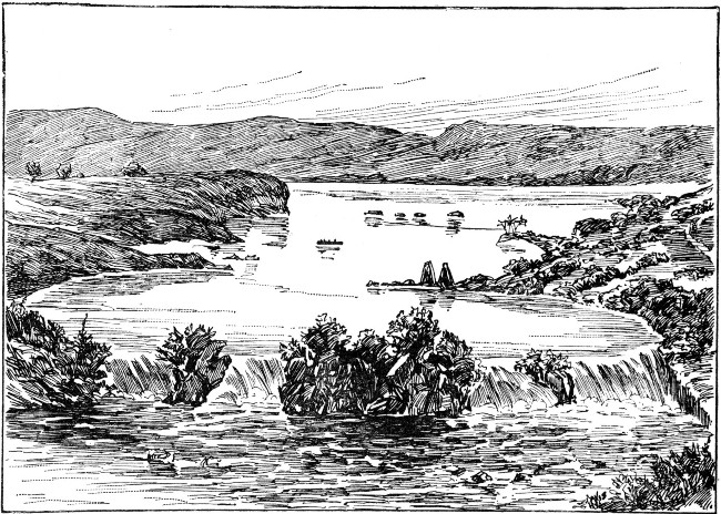 VICTORIA NYANZA.
Speke thus describes the scene when he caught his first glimpse of the lake: "Next day, after crossing more of those abominable rush drains, while in sight of the Victoria Nyanza, we ascended the most beautiful hills, covered with verdure of all descriptions. I felt inclined to stop here a month, everything was so very[Pg 136] pleasant. The temperature was perfect. The roads, as indeed they were everywhere, were as broad as our coach roads, cut through the long grasses, straight over the hills and down through the woods in the dells, a strange contrast to the wretched tracks in all the adjacent countries.
"The huts were kept so clean and so neat, not a fault could be found with them; the gardens the same. Wherever I strolled, I saw nothing but richness, and what ought to be wealth. The whole land was a picture of quiescent beauty, with a boundless sea in the background.
"Looking over the hills, it struck the fancy at once that at one period the whole land must have been at a uniform level with their present tops, but that, by the constant denudation it was subjected to by frequent rains, it had been cut down and sloped into those beautiful hills and dales which now so much pleased the eye."
It was Speke's desire to proceed northward and then to the east, for the purpose of reaching the point where the Nile was supposed to flow out from Victoria Nyanza.
His description of the accomplishment of his purpose is interesting: "Here at last I stood on the brink of the Nile; most beautiful was the scene; nothing[Pg 137] could surpass it! It was the very perfection of the kind of effect aimed at in a highly kept park; with a magnificent stream, from six hundred to seven hundred yards wide, dotted with islets and rocks,—the former occupied by the fishermen's huts, the latter by many crocodiles basking in the sun,—flowing between fine grassy banks, with rich trees and plantations in the background, where herds of the hartbeest could be seen grazing, while the hippopotami were snorting in the water, and florikin and guinea fowl rising at our feet."
He proceeded some distance up the left bank of the Nile, keeping away from the stream. Passing through rich jungles, and gardens of plantain, he reached Isamba Falls. Here he found the river exceedingly beautiful. Deep banks covered with fine grass, beautiful acacias, and festoons of lilac-colored convolvuli stretched, along on either side of the stream.
He continued his journey up stream to Ripon Falls, through extensive village plantations recently despoiled by herds of elephants, and over rugged hills, to be rewarded by the most interesting scene he had yet found in Africa.
Speaking of the falls, he writes: "Everybody ran to see them at once, though the march had been long and fatiguing; even my sketchbook was called into play.
"Though beautiful, the scene was not exactly what I had expected; for the broad surface of the lake was shut out from view by a spur of hill, and the falls, about twelve feet deep and four hundred to five hundred feet broad, were broken by rocks.
"Still, it was a sight that attracted one to it for hours:[Pg 138] the roar of the waters; the thousands of passenger fish, leaping at the falls with all their might; the Wasoga and Waganda fishermen coming out in boats and taking post on all the rocks, with rod and hook; hippopotami and crocodiles lying sleepily on the water; the ferry at work above the falls; and cattle driven down to drink at the margin of the lake, made in all, with the pretty nature of the country,—small hills, grassy topped, with trees in the folds and gardens on the lower slopes,—as interesting a picture as one could wish.
"I saw that Old Father Nile, without any doubt, rises in the Victoria Nyanza. As I had foretold, that lake is the great source of the holy river which cradled the first expounder of our religious belief."
Speke had seen fully one-half of the lake, and had gained enough information of the other half to feel assured that there was as much water on the eastern side of the lake as on the western, possibly more.
The head of the Nile, or its most remote feeder, he found to be the southern end of the lake. It gives to the Nile its surpassing length of above two thousand and three hundred miles.
Speke was disappointed that he could not get an opportunity to visit the northeast corner of the lake to find the connection, by means of a strait, which he had heard described, between Lake Victoria Nyanza and another lake, where the Waganda went to get their salt.
He discovered that from the southern point of the lake, on the west side, to the point where the great Nile stream issues, there is only one river of any great[Pg 139] importance, while from the most southern point, round by the east to the strait, there are no large rivers.
The Arab travelers assured him that from the west of the snow-clad peak of Kilimanjaro to the lake, at the point where the first and second degrees of south latitude cut it, there were salt lakes and plains, in the midst of a hilly country. They further told him that there were no great rivers; that the country was but scantily watered, with only occasional rills and rivulets, and that they were compelled to make long marches to get water, when they started out upon their trading journeys.
Speke could not quite believe in the existence of a salt lake. His experience had taught him that the natives call all lakes salt if they find salt beds or salt islands in their vicinity.
Lake Victoria Nyanza he found to be nearly four thousand feet above sea level, or nearly two thousand feet above the altitude of Lake Tanganyika. It was plain to him, therefore, that there could be no connection between the two lakes.
Some notes from the journal kept by Speke are of interest here. "The first affluent, the Bahr-el-Gazal, took us by surprise. Instead of finding a large lake, as described in our maps, as an elbow of the Nile, we found only a small piece of water resembling a duck pond, buried in a sea of rushes. The old Nile swept through it with majestic grace, and carried us next to the Geraffe branch of the Sobat River, the second affluent, which we found flowing into the Nile with a graceful semi-circular sweep and good stiff current, apparently deep, but not more than fifty yards broad.[Pg 140]
"Next in order came the main stream of the Sobat, flowing into the Nile in the same graceful way as the Geraffe, which in breadth it surpassed, but in velocity it was inferior.
"Next to be treated of is the famous Blue Nile, which we found a miserable river, even when compared with the Geraffe branch of the Sobat. It is very broad at the mouth, it is true, but so shallow that our vessel with difficulty was able to come up to it. It had all the appearance of a mountain stream, subject to great periodical fluctuations.
"The Atbara River, which is the last affluent, was more like the Blue River than any of the other affluents, being decidedly a mountain stream, which floods the country in the rains, but runs nearly dry in the dry season.
"I had now seen quite enough to satisfy myself that the White Nile, which issues from Victoria Nyanza at the Ripon Falls, is the true or parent Nile."
The accounts brought back by Speke of the discovery of Victoria Nyanza and the existence of another lake, which might prove to be a feeder of the Nile, so influenced a friend of his, Sir Samuel Baker, that he and his wife, a mere girl in years, started out with an[Pg 141] expedition to make still closer explorations of the lake region.
The natives had given Speke very graphic accounts of the Nile's westward course, after leaving Victoria Nyanza, till at length its waters fell into a large lake. They had further informed him that this lake came from the south, and that the Nile entered at the northern extremity, and almost immediately made an exit from it in continuing its course to the north.
At the time this information was received by Speke, the country through which he would have needed to pass was in the midst of a native war, and no strangers could penetrate it. He was convinced, however, that the lake described must, in all probability, be a second source of the Nile.
Sir Samuel Baker and his wife had most interesting and thrilling experiences in their search for this supposed second feeder of the Nile. Some sections of the country through which they traveled were most beautiful. Here were jungles and forests alternating with broad plains, and mountains rising to the height of three or four thousand feet.
Some of the people, too, were very interesting. Baker declared the Latookas to be the finest savages he ever met. They were nearly six feet in height, had fine foreheads, very good features, and finely formed bodies. Their manners were frank, good-humored, and polite. In this respect they were a strong contrast to the surrounding tribes. They seemed to him to be of Abyssinian or of Asiatic origin.
The description of the headdress of the men is interesting.[Pg 142] It takes from eight to ten years to perfect the arrangement of this coiffure, and no doubt much pride is taken in this queer conceit of savage fashion.
"The hair is at first 'felted' with fine twine. As the fresh hair grows through this, the twine process is repeated, until at last a compact substance is formed, an inch and a half thick, trained into the form of a helmet, with a frontlet and crest of copper. Of course they never disturb this, and it lasts them their life time. They ornament it with beads, cowries, ostrich feathers, and other decorations."
As it is the custom of these savages to go without clothing of any description, these wonderful headdresses must indeed be the chief aim in the lives of those who are not called upon to follow the changes of fashion, like their more civilized brethren.
One of the towns that Baker visited in Latooka contained about three thousand houses. It was strongly fortified by palisades, with low entrances at short intervals. At night these entrances were closed by thorn bushes.
There was one main street, which was broad, but the other streets were mere lanes, so narrow that only one cow could pass at a time.
These lanes led to the kraals in different portions of the town. Here were housed the cattle, which comprised the chief wealth of the people. The narrowness of the approaches to the kraals was an advantage, for they were thus easily defended from cattle thieves,—a common nuisance in this country.
The houses were conical in shape and, following the[Pg 143] custom almost universal in Africa, were without windows.
Baker had noticed, as he approached the several towns of this section of country, a vast heap of human bones, mingled with bits of pottery. These he found to originate from the peculiar funeral rites of the people. If a man dies a natural death he is buried in the vicinity of his own door, and funeral dances in his honor are held for several weeks; the remains are then dug up, the bones cleaned, placed in an earthen jar, and carried out of town to their final resting place. In course of time these jars become broken, and the fragments, together with the contents, are scattered, or added to an already existing mound.
Baker, in his journey to the southwest, crossed the valley of Latooka. After fording a river, he began the main ascent of the mountains. This he found to be an exceedingly difficult task. At the summit he found a plateau about four thousand feet above the level of the sea, and situated on it was the highland town of Obbo.
The country was very beautiful. Here were bold granite peaks, some of them five thousand feet high, towering on all sides, and looking down upon the wooded valleys below. These valleys were narrowed by the advancing spurs of the mountains, each with a village to crown its summit. These villages looked down fully eight hundred feet upon the traveler.
The air was pure and delicious. On every side was a profusion of beautiful and fragrant flowers. Wild plums and other fruit were to be found in abundance.
The flow of the streams in this section is toward the[Pg 144] northwest. Their waters take their course directly to the Nile, some thirty miles away.
The people are different from those of Latooka, not only in their speech but in their appearance. Instead of dressing their hair in the form of a helmet, they adopt the form of a beaver's tail for a coiffure.
The noses of these people are higher than those of the Latookas. They pay some attention, too, to their clothing, though their covering is very scanty.
They are courteous in their manners, and never ask for presents.
They had for their ruler at the time of Baker's visit a peculiar old man, a sorcerer, and from him Baker gained much information about the country.
Whenever this ruler traveled, it was upon the shoulders of one of his slaves. Always in starting upon a journey he had a retinue of a dozen or more bearers to take turns in carrying him.
From an interpreter Baker learned of a place called Magungo, situated upon a lake so large that no one knew its limits.
Later, Baker gained further information of Magungo from a native woman. She described the lake as a white sheet of water, as far as the eye could reach, and added, "If you put a water jar on the shore, the water would run up, break it, and carry it away." In this simple fashion she intimated to Baker that there were waves of no little force on the lake shores.
Encouraged by the prospect of reaching the lake, Baker, with his expedition, continued on the march, passing a village surrounded by bold granite cliffs, towering[Pg 145] above it. The natives of this village perched like ravens upon the summits of these cliffs to await the approach of the white men. They were very friendly and very ceremonious in their dealings with their visitors.
The journey was continued through a region of prairies and swamps, which finally was replaced by a section of magnificent forest. Coming to an elevated spot, Baker saw a cloud of fog. This hung over a distant valley, and indicated to him the presence of the noble stream which he believed must join the two lakes.
He reached the Nile about one hundred and fifty miles from Victoria Nyanza, and about sixty miles from the lake he was seeking. He was not, however, aware of it at the time.
The expedition under Baker headed upstream towards Karuma Falls, where it was the intention to cross to the south side. They had a picturesque march of about fifteen miles, through an open forest, with the river, which was about one hundred and fifty feet wide, close at hand. It was a beautiful sight, as it came roaring and foaming in many cascades. Here and there the course of the river was broken by rocky islands. On these islands villages and plantain groves were visible.
Baker found the people along this section superior to those of Latooka and Obbo. They were modest in their manners, and well clothed. They were good blacksmiths, and the pottery which they made was of a higher order than that of the other tribes mentioned.
Baker, with the thought of the lake still before him,[Pg 146] pushed on, though often discouraged, and suffering from fatigue and fever. In the course of the journey the expedition had to cross a river. It could be done only in a very peculiar way. The whole stream was covered with a matting, or carpet, of tangled, floating weeds. This was so thick and strong as to bear the weight of a man, if he ran quickly across its surface. The width of the stream was about thirty yards.
Here Mrs. Baker almost lost her life; for, when about halfway across, she was overcome with a sunstroke, and began to sink rapidly through the weeds. Her husband and some of his men seized her and dragged her across the current, though they sank to their waists in the weeds before they succeeded in getting her to the bank.
At a great distance to the northwest could be seen a lofty range of mountains. Baker learned from the natives that these mountains, beyond which he had fancied the lake must lie, were really its western boundary.
A few days later he had the pleasure of looking at this beautiful sheet of water. He was the first Englishman who had ever had the honor to prove its connection with the Nile.
He was about fifteen hundred feet above the lake when he first sighted it. "Opposite to him the lake[Pg 147] was about sixty miles broad, but to the south and southwest lay a boundless horizon like the ocean. Immediately on the other side rose a grand range of mountains, some of them seven thousand feet high, and down two streams in their rifts plunged great waterfalls, visible even at that vast distance, to add their contributions to the fresh-water lake."
Here lay the long-sought-for lake. Wild waves swept over its surface, as he descended the steep declivity to reach its shore. In bold triumph they swelled and burst at his feet upon the white, pebbly beach. Filled with enthusiasm, Baker stooped and drank of the pure, fresh water from the vast reservoir before him.
Near by lay a little fishing village. Around the huts stood beautifully made harpoons, hooks, and the lines used by the fishermen. These fishing outfits were used not only to catch the gigantic fish, of two hundred pounds or more, which abound in the lake, but also the hippopotamus and the crocodile.
Baker found that the lake, which he named the Albert Nyanza,—as an imperishable memorial of one loved and mourned, not only by England's queen, but by all England,—has a length of about three hundred miles in a southwesterly direction. It then turns to the west, but its extent in this direction was not known at the time of Baker's explorations. The extent is believed to be not far from that of Victoria Nyanza, which covers an area of not less than thirty thousand square miles.
It seems remarkable that such a great reservoir had not been sought for before, or at least that the necessity[Pg 148] for its existence had not been seen. Such a vast body of water would seem to be absolutely required to force a river like the Nile over a distance of twenty-five hundred miles to the sea. At the northeast corner, at Magungo, the river which forms the connecting link between the two feeders of the Nile enters this lake. Thirty miles to the north the great Nile flows out of the lake and wends its way to the sea.
Baker soon made preparations for a fortnight's voyage upon the lake. Two canoes, one twenty-six, the other thirty-two feet long, were secured. Both these canoes were hollowed out of logs. In the smaller canoe a cabin was built.
The voyage was most interesting. The scenery along the lake was beautiful. Sometimes the mountains in the west were lost sight of, as the canoes kept within a hundred yards of the shore. Sometimes the cliffs would recede, and leave a meadow, more or less broad, at their base. Frequently the rocky column would descend vertically into deep water. "Again, a grand mass of gneiss and granite, eleven hundred feet high, would present itself, feathered with beautiful evergreens, with every runnel and rivulet in its clefts fringed with graceful wild date trees." Hippopotami floated lazily about in the water, while crocodiles, roused to alarm by the canoe, would rush out of the bushes to hide themselves in the depths of the lake.
The water was beautifully transparent. A crocodile that Baker killed with his rifle sank to a depth of eight feet, yet his bleeding form could be plainly seen at the bottom of the lake.[Pg 149]
Once, an elephant came down out of the forest to bathe. On another occasion, fourteen of these immense animals were seen sporting in a sandy cove, and enjoying themselves by throwing jets of water in all directions.
When the expedition had gone about ninety miles, the lake began to contract. Vast beds of reeds extended to a distance of a mile from shore. They were of the nature of the floating vegetation in the stream where Mrs. Baker so nearly lost her life.
Not caring to cross on this frail support, Baker and his party followed the shore for a mile, till they had passed this mass of floating vegetation, and found a broad, still channel bordered with reeds on each side. Here was the river which links the Albert to the Victoria Nyanza.
The river between the two lakes has a course of about two hundred and fifty miles. There is a succession of cataracts below Karuma Falls. They occupy some forty miles of the river bed.
The mouth of the Victoria Nile is still water. It has a width of half a mile. The river at the mouth, as it tranquilly enters the lake, presents a strong contrast to the current at Karuma Falls, where the water comes seething and boiling, rushing and tearing over the rocky bed.
Baker and his party found the eastern, or Magungo, shore of the lake to be a delightful section, bordered by enormous trees. The soil was firm and sandy, in some instances rocky. The country beyond the shore of the lake rose in a rapid incline towards the town of Magungo,[Pg 150] which is built on an elevated ridge about a mile away.
While Baker's party waited along the shore of the lake, some of the natives arrived from the villages, bringing a goat, some fowls, eggs, milk, and fresh butter. In return, Baker gave the chief a quantity of beads, which greatly delighted this child of nature.
The march up the hill to Magungo was now in order. The day was clear and bright. The soil was sandy and rather poor, but the road was hard and well kept.
A splendid view lay before the little party as they reached Magungo and looked back upon the lake. They were now fully two hundred and fifty feet above the level of the water. The country seemed to have a general elevation of about five hundred feet, for five or six miles, when it began by gentle undulations to descend to the lake.
The most prominent objects to be seen were the mountains on the Magella side, forming the western boundary, while in the foreground lay the lake.
A few miles to the north there appeared an opening in the ridge. The lake, much contracted, continued to the west, while the mountain range on the north side of the gap extended on to the northeast.
The country due north and northeast was remarkably level. As far as the eye could see, an expanse of bright green reeds marked the course of the Nile, as it made its exit from Albert Nyanza Lake.
At Magungo the width of the sheet of water was about seventeen miles. It continued its course in a long strip to the mouth, where it lost itself in a level valley of green rushes.[Pg 151]
Baker and his party could not yet persuade themselves that the quiet, tranquil stream issuing from Albert Nyanza was the same which rushed impetuously on its way at Karuma Falls.
It remained, then, to prove the statements of the guide that the Nile was dead water for a considerable distance from its junction with the lake; that a great waterfall rushed down from the mountain to swell the current near Karuma Falls; and that the river was simply a succession of cataracts in its course to these falls.
On the assurance of the chief of Magungo, and of some of the natives, that these falls were within six days' marching distance, Baker's little party embarked in canoes for the purpose of exploring the river and assuring themselves of its identity with the stream which made its exit from the lake.
Ten miles from Magungo the river suddenly narrowed, till it was but two hundred and fifty yards broad. The great level tracks of rush banks gradually disappeared as they entered a channel shut in by high banks on either side. The hills here were heavily timbered.
Even here the current was so sluggish as to indicate no perceptible stream. A heavy fog soon covered the[Pg 152] river. Gradually it lifted. As Baker watched it slowly rise from the water, he noticed the little, floating, green water plants perceptibly moving to the west. Looking more closely, he saw that their progress, though slow, was certainly towards Albert Nyanza.
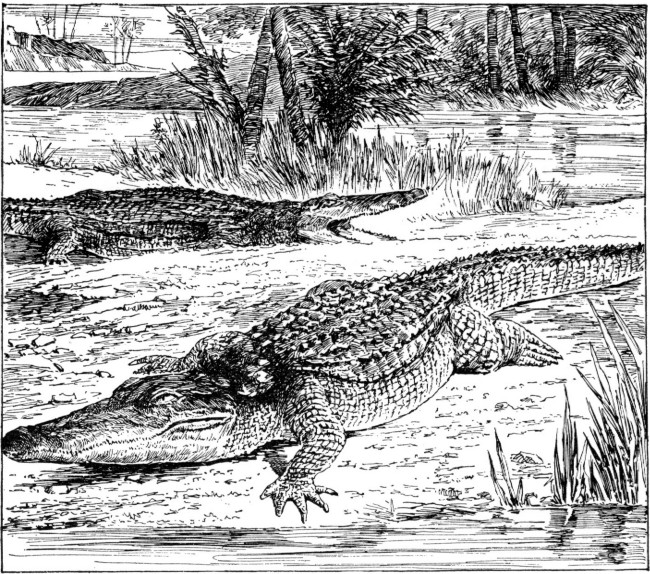 CROCODILES ON THE BANKS OF THE NILE.
They were about eighteen miles from Magungo when they perceived this very slight current in the river. Proceeding on their journey, they found the river gradually narrowing to a width of but one hundred and eighty yards. As they ceased paddling the[Pg 153] roar of the water could be distinctly heard. After two hours of hard pulling, during which the velocity of the water was noticeably increasing and the roar of the fall became extremely loud, they reached a few deserted fishing huts. These were situated at a convenient little bend in the river.
At this point crocodiles were noticed in immense numbers. They lay closely packed together, like timber logs in a lumber region. Upon one bank twenty-seven of the ugly reptiles lay basking in the sunlight. Every nook and turn in the bank disclosed crowds of them lurking in the stream, their hideous jaws just showing on the surface of the water.
The banks on either side, which had gradually been growing steeper, now became decidedly bolder and more rugged. The roar of the fall grew more fearful, and as they rounded the corner of the stream a magnificent view burst upon them. On either side of the river beautifully wooded cliffs rose precipitously to a height of some three hundred feet. Here and there picturesque rocks jutted out from among the green foliage. The river, abruptly contracted from its grand proportions into a narrow stream, rushed madly through a gap cleft in the rock before them. Through a gorge scarcely fifty feet in width it poured its waters with a furious rush and roar, as it plunged with one gigantic leap into a dark abyss lying one hundred and twenty feet below.
To quote from Baker's journal: "The fall of the water was snow-white, which had a superb effect as it contrasted with the dark cliffs that walled the river,[Pg 154] while the graceful palms of the tropics and wild plantains perfected the beauty of the view. This was the greatest waterfall of the Nile, and in honor of the distinguished president of the Royal Geographical Society, I named it the Murchison Falls, as the most important object throughout the entire course of the river."
The canoes of the little party endeavored to approach the falls, but when about three hundred yards from them the strong current and the terrific whirlpools prevented any nearer view.
At their left a sand bank was literally covered with crocodiles. They seemed to have no fear of the canoe till it approached within twenty yards of them, when they slowly and lazily crept out of the water. A huge hippopotamus charged the canoe, and struck the bottom of it with such tremendous force as nearly to throw the crew out of it. Proud of his achievement, the ugly monster raised his head to look at his strange enemy, then sank rapidly in the stream.
The canoe now drifted rapidly down to a landing at a small deserted fishing village, and the little party bade adieu to the lake and river which had interested them so much in Central Africa.
If we look at the map of Africa, we shall find that the great lakes, which form such an important physical feature of the continent, are located chiefly in the southern and eastern sections of it, but are distributed overall the great drainage systems. Let us take a little review of the lake system.
Both lakes of the Nile basin, the Victoria and Albert Nyanza lakes, are really great fresh-water seas.[Pg 155]
If the present estimate of this great extent should ultimately prove to be fairly correct, they are the rivals even of the great American lakes in being the greatest expanse of fresh water on the face of the globe. In 1889, a great lake lying three hundred miles northeast of the Victoria Nyanza was discovered. It has been named Lake Rudolf. It is about one hundred and sixty two miles long and over twenty miles wide.
The principal lakes of the Congo basin are Lake Bangweolo, or Bemba, one hundred and fifty miles long from east to west, and Lake Moero, having a length of sixty miles. There are several lakes of this basin still unvisited. They are said to be of vast extent and to lie two thousand feet above the level of the sea.
Lake Nyassa belongs to the Zambesi basin. It covers an area of nearly nine thousand miles in this great river basin. Lake Shirwa, on the plateau southeast of Lake Nyassa, is enclosed by mountains. It has an elevation of two thousand feet above the sea. Its water is brackish and has no outlet. Lake Tanganyika occupies an area of more than ten thousand square miles. A broad channel unites it with Lake Liemba, in the south. No outlet was for many years discovered for Tanganyika. It is probably a continental lake; for its waters are not perfectly fresh, and its drainage is very small.
Lake Tchad is the greatest lake of the continental system of North Africa. It consists of a shallow lagoon of very variable extent. Numerous islands dot its surface. Its waters are fresh and clear, and the overflow is carried off by the Bahr-el-Gazal to the[Pg 156] northeast. Lake N'gami is in the southern continental system. It corresponds to Lake Tchad of the northern system. It is a shallow, reedy lagoon. Its extent varies according to the seasons. Its surplus water is carried by the Zuga River off to the eastward. Within the areas of continental drainage, salt lakes occur frequently. Assal Lake, in Abyssinia, is the most remarkable of these salt lakes.
No other portion of land on the surface of the globe is so difficult of access as Africa. This is owing to the mountainous character of large portions of its coast line.
"The contrast between the broken European shores and the massive African coasts of the Mediterranean was observed by the earliest geographers; the same continuous, unbroken margin extends along all the sixteen thousand miles of its shore line.
"Guarded by its inhospitable shores, large areas of the interior of the continent are as yet altogether unknown. As a whole, the continent may be regarded as a vast plateau, bordered round by maritime ranges, which form the seaward edges of the interior table-lands."
The ranges of the eastern coast have been so little explored that much has yet to be learned of their character.[Pg 157] They extend from the highlands of Abyssinia to the extreme southern point of the continent. The so-called Mountains of the Moon belong to this system. The early explorers erred when they supposed that they stretched across Central Africa from east to west. So great has been the diversity of opinion, that some authors deny the existence of these mountains.
We must consider the interior of Africa as a vast plateau traversed by mountain chains. The only lowland known to lie within the interior is the section about Lake Tchad.
If we look upon the map of Africa, we shall find that the principal mountain systems are known as the Atlas, the reputed Mountains of the Moon, the Snow, Kong, Crystal, Cameroon, and Lupata.
The Atlas Mountains give character to the Barbary States of Morocco and Algeria. The Mountains of the Moon are supposed to run from south to north, parallel to the eastern coast, and to form the southern continuation of the Abyssinian table-land. The Snow Mountains are found in the southern part of the continent, stretching through Cape Colony. The Kong Mountains, though outlined upon the map, according to the celebrated English geographer, Keith Johnston, of the Royal Geographical Society, do not exist. We shall read his descriptions of mountain systems later on. It is well to take more than one view of any subject.
The Crystal and Cameroon Mountains stretch along the western border, though at some distance from the coast line, while the Lupata Mountains are found in[Pg 158] the region of the Zambesi. But let us look more minutely at these mountain systems, as described by Mr. Johnston.
Beginning at the extreme northeastern corner of Africa, the land suddenly rises west of Suez, at the southern end of the ship canal, to a height of twenty-six hundred feet. Following this, an abrupt chain of heights extends along the western shores of the Red Sea, till the high edge of the Abyssinian highland is reached, seven thousand to eight thousand feet above sea level.
Farther to the south, on the margin of the plateau, rise snow-capped Kenia, eighteen thousand feet, and Kilimanjaro, eighteen thousand seven hundred feet, between the Indian Ocean and the Great Lake region.
Still farther south rise the Livingstone Mountains, to the height of eleven thousand feet, walling in Lake Nyassa. Farther south still rise the steep and wall-like Drachenberg Mountains, to face the Indian Ocean and to round to the terraces which form Cape Colony.
"Turning the high Cape of Good Hope to the Atlantic margin, the same terraced ascents from the sea coast to the borders of the interior present themselves, all along the western side of the continent, from Cape Colony to the head of the Bight of Biafra.
"Round the Guinea coast, beyond the low delta of the Niger, as far as Cape Verd, the plateau edge approaches the coast only at intervals, but the supposed Kong Mountains do not exist.
"In Morocco, the bordering maritime heights are[Pg 159] taken up again by the Atlas range, and are continued along the Mediterranean by the plateau of Barbary, by the ranges called the Black Mountains of Tripoli, and by the heights of Barca, farther east, out again to the delta of the Nile."
Within this border, or fringe, of maritime heights thus traced, we may consider all southern Africa as a vast plateau having a general elevation of about three thousand feet above the sea.
The most prominent interior ranges which rise from this section of the plateau are those called the Mushinga Mountains. These "seem to have an east and west direction, separating the wide basins of the Congo and Zambesi Rivers, and the mountains to the westward of Lakes Albert and Victoria Nyanza and Tanganyika." The latter "form the western edge of the great plateau of eastern equatorial Africa, the center of which is occupied by Unyamwezi, and slope down towards the broad vale of the central Congo."
If we look at the map, "Northern Africa, between the higher southern plateau and the mountains of Barbary on the Mediterranean coast, appears to be generally lower, or at an average elevation of from one thousand to fifteen hundred feet above the sea, though the plateau formation remains the same.
"The prominent lines of height known within it are those which extend from the Marrah Mountains of Dafur, between the Nile basin and that of Lake Tchad, northwestward through the mountain land of Tibesti, in the center of North Africa, to the series of plateaus[Pg 160] occupied by the Tuareg tribes south of the plateau of Barbary.
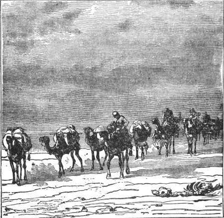 CROSSING THE DESERT.
"A remarkable volcanic belt is traced through the Bight of Biafra in the line of the islands of Annobon, St. Thomas, Princes, and Fernando Po, ten thousand one hundred and ninety feet high, to the high Cameroon Mountains, thirteen thousand seven hundred and sixty feet high, on the coast of the mainland, and thence inland on the same abrupt line to Mounts Alantika and Mendif, midway to Lake Tchad in the interior."[Pg 161]
If we could follow the course taken by the early settlers and the missionaries in Africa, we should, in going from the southern coast northward, have to cross three mountain systems and two table lands, before we could reach the great central plateau.
The mountains would present "steep, wall-like faces on the coast side, as if they were raised to prevent all access to the interior; on the other side they descend gradually to the broad, elevated tracts, which retain the name karroos, barren plains, given them by the natives on account of their general appearance and character."
In such a section as Cape Colony, we might expect that the karroos, enclosed by mountains, would become converted into lakes, did we not remember that little rain falls there, and then for only a brief season. "The karroos appear to have been lakes at some very remote period in the history of the earth's surface; for much of the soil is impregnated with salt; shallow salt lakes or marshes are numerous, and beds of sea shells are to be found here and there."
Nature has looked well to the law of cause and effect; for, while the rivers are dry during some portions of the year, after a tempest the waters flow down over the sides of the mountains in torrents. These, in the course of ages, have worn deep cuts, or valley gorges, called kloofs.
The karroos, or elevated tracts, of which we have read, are not like the vast seas of sand of the Sahara. "They consist of shallow beds of rich soil, which want only the fertilizing power of water to render them most[Pg 162] productive. The soil of the karroos is clay and sand, resting on blue slate rock. As the streams are dry for three-fourths of the year, the ground becomes during that period as hard as brick. After a few days of rain, grasses and other plants with bulbous roots, spring up everywhere from the hard soil in which they have been encased, and soon the land is covered with bright flowers and verdant pasturage."
Probably no part of the globe presents a more beautiful appearance than these karroos when carpeted by the hand of nature. The description of the flowers of Cape Colony by the author of "Life on an Ostrich Farm" gives one a fair idea of their beauty and variety.
In making some of his early explorations Livingstone passed over a country, the firm, compact soil of which was perfectly level. Here he found a little soil covering a limelike tufa deposit. This extended over a tract of several hundred miles. It supported a vegetation of fine, sweet, short grass, and baobab and other trees.
In several parts of this tract he found large salt pans, as they are termed. One was fifteen miles broad and one hundred miles long.
Although these curious spots seemed perfectly level, yet they have a slight slope to the northeast, towards[Pg 163] which the rain water, which sometimes covers them, gently trickles. The salt dissolved in the water has in this way been gradually transferred to one large pan lying to the northeast. On this may be seen a cake of salt and lime an inch and a half thick. Some of these pans have merely a covering of salty lime; others are covered with a thick deposit of shells.
These shells are identical with those of the mollusk species of Lake N'gami. There appear to be three varieties, spiral, univalve, and bivalve.
Livingstone found that in every salt pan of the country there is a spring of water on one side. The water of the spring is brackish. In one instance he found two springs, one salter than the other.
He was of the opinion that the supply could not come from beds of rock salt; for, where the natives have removed the salt from the pans, no new deposit has ever formed.
He thought it probable that these salt deposits are the remains of the slightly brackish lakes of antiquity. Large portions of these lakes must, in the course of ages, have evaporated to leave a deposit where the waters have receded.
An instance of this kind is Lake N'gami; for the waters of the lake when low become brackish.
The largest quantities of salt have been found in the deepest hollows or in the lowest valleys, where there is no outlet. Livingstone cites an instance of a fountain, the temperature of which was upwards of 100°. This fountain, though strongly impregnated with salt, had no deposit, because situated on a flat portion of the country.[Pg 164]
When these salt deposits occur in a flat country with a tufa layer covering the soil, a chemical change takes place in the soil; the tufa is dissolved and the ground kept in a state unfavorable to the growth of plants.
Livingstone discovered one large salt pan with a deposit of salt an inch and a half in thickness. This deposit contained bitter salt in addition, probably the nitrate of lime. In order to make the deposit wholesome and palatable, the natives mix the salt with the juice of a gummy plant. They then place the mixture in the sand and build a fire over it to bake it. The action of the fire renders the lime insoluble and tasteless.
The natives in the vicinity of this salt pan keep large flocks of sheep and goats at various points on the outskirts of the desert. These flocks thrive wonderfully wherever salt and bushes are to be found.
The milk of goats does not coagulate readily, like that of cows, on account of its rich quality. The natives have discovered that by mixing a tea made from the fruit of a special plant with the milk of goats they can cause it to coagulate quickly.
It is the custom among some of the natives to put the milk into sacks of untanned hide from which the hair has been removed. When these sacks are hung in the sun the milk soon thickens. The whey is then drawn off by a plug at the bottom of the sack. Fresh milk is then added, until a thick sour curd fills the sack. When one becomes accustomed to this, its taste is delicious.
The richer natives mix this milk with the porridge they make from their meal. It is considered very[Pg 165] nutritious and strengthening, and takes the place of our roast beef for nutriment.
The natives, in speaking scornfully of those who are poor or weak, use the expression, "They are water-porridge men;" since they cannot afford to mix their porridge in the approved way, and hence cannot expect to gain strength.
Speaking of other sections of the country, Livingstone tells us that he found some portions capped by a conglomerate rock mixed with iron. In many places the iron looked as if it had been melted; for the rounded masses resembled slag in an iron foundry, and the under surface was smooth and even.
Probably this deposit was of an aqueous origin; for it contained water-worn pebbles of various kinds. These were generally small in size.
Below the conglomerate lay a mass of pale red, hardened sandstone, and beneath that a layer of what are called trap rocks. Lowest of all lay a coarse-grained sandstone, which contained a few pebbles. Occasionally a white rock of lime formation was found, and also banks of loose, round pebbles of quartz.
The land slopes contained bogs surrounded by clumps of straight, lofty evergreen trees, which looked extremely graceful on a ground of yellowish grass. Many of these bogs pour forth a solution of iron. These exhibit the prismatic colors upon their surface.
It would be of interest to note the curious conditions and formations of the soil in other sections, but we must pass on to other views.
Those of you who are interested in the life of Livingstone[Pg 166] will find many features of the soil described in the journals this explorer bequeathed to the world.
For many years the knowledge of Africa was so indefinite that it was difficult to determine how rich the continent might be in minerals.
Gold and silver had been found, but the former was believed to be more abundant than the latter, judging from the amounts brought down in the sands of the great rivers which flow through the central portions of the continent. Gold had also been found upon the coast of Guinea and in Southeast Africa.
Precious stones have been found in most of the tropical countries of the globe; but in Africa they were of rare occurrence until the discovery of diamonds in the vicinity of the Cape awakened much interest. The attention of the whole world was then called to the possible resources of the country.
Just as the discovery of gold in California drew to the gold mines many men who were anxious to acquire wealth, so the Kimberley diamond mines attracted hundreds, who, in the pursuit of fortune, forgot fatigue and hardship, lured on by visions of the future.
The largest diamond in the world, the "Excelsior," was found June, 1894, in the mines of Jagersfontein in Cape Colony, by the inspector of the mine.[Pg 167]
Experts have pronounced it a gem of the purest water, and its worth to be about a million sterling.
The greatest precautions were taken to have it conveyed from the mine to the coast. A squadron of the Sixteenth Lancers guarded the carriage to Cape Town; from there it was conveyed to London in the gunboat Antelope, and was deposited for safe keeping in one of the vaults of the Bank of England.
The stone is described as fully three inches in height and nearly three inches in breadth. Its weight is estimated at nine hundred and seventy-one carats, or about seven ounces Troy. Its color is white, with a very slightly bluish tint, and its luster is matchless. In the center of the stone is a very small black spot, but experts consider that it can easily be removed in the cutting.
It has been reported that the British Government has offered half a million pounds sterling for this diamond. The owners, however, have refused this offer. It has also been reported that the German Emperor will be the probable purchaser of the gem.
The great sources of the world's supply of gold have been the United States, Russia, Australia, and South Africa, together with that portion of West Africa, known as Ashantee, bordering on the Gold Coast of Guinea.
There is a curious belief among the natives of the entire Gold Coast, and Ashantee as well. The Great Spirit, it is believed, created three each of white men and women, and as many black, and placed before them a large calabash and a sealed paper. To the black men he gave[Pg 168] the first choice. They chose the calabash. This contained gold, iron, and the choicest products of the earth; but the black race remained ignorant of their use and value. The white man became possessor of the paper, which instructed him in all things, made him the favorite of the Great Spirit, and gave him superior advantages over the black man.
The great bend in the coast of Africa, which makes room for the Gulf of Guinea, is one of the singular land formations that strikes the eye and excites the fancy.
The glowing pictures of the beautiful Gold Coast and the wonders of land and sea under the equator serve to create a taste for travel and a desire to enjoy the strange and wonderful sights to be met.
An English explorer, Alvan Millson, has recently written much to give an added interest to this coast section and to call attention to one of the many freaks of nature.
A little description will be of interest. For a distance of about five hundred miles along the Bight of Benin there is an intricate chain of waterways, which lies just at the edge of the sea.
"In many places these narrow and brimming channels are separated from the onslaught of the Atlantic rollers by no more than five or six level yards of shifting sand. The spray from the ocean drifts over them, and the roar of the surf is heard by the native as he glides over their calm surface in his fragile canoe.
"There are hundreds of miles of similar lagoons bordering the Gulf of Guinea farther to the west. Many[Pg 169] rapid rivers pour into them from uplands behind, bringing down vast quantities of sand and mud.
"At the same time, the 'Guinea Current,' which resembles our Gulf Stream, brings another endless supply of sand, worn from the headlands toward the west, and this sand, heaped up at the ocean's edge, arrests the rivers just where they are about to empty into the sea, and spreads them out into a great system of deltas.
"The resistless strength of the narrow sand barriers is attributed principally to the vast quantities of papyrus and water grass brought down in huge floating islands by the rivers, which take root and flourish in the sand. Only at rare intervals can a passageway be found through the sand. And so, on this singular coast, the ocean and the rivers unite to build up and perpetuate a barrier between them."
No doubt in the Gold Coast section of the Gulf of Guinea there is this same constant carrying down of sand by the rivers. Whenever these rivers pass through gold-bearing regions, the sand carries with it vast quantities of gold grains, or scales, which have to be panned, or separated from it by washing.
We have in our reading gained some little idea of the struggles of the Dutch to obtain possession of the soil of such sections as Natal, Cape Colony, and what has been known until within a few years as the Transvaal Republic.
The Witwatersrand may be considered the great gold-mining district of Africa. It is rapidly pushing its way to the front in the list of sources for the supply[Pg 170] of the precious metal. This region, locally called the Rand, gives Africa the fourth place in the list of the sources of the earth's supply.
The Rand is situated in what has been known as the Transvaal Republic. It is the home of the Dutch settlers, or Boers, but is under the rule of the British power to a great extent.
The great metropolis of the republic and of the Rand is Johannesburg. It is a regular mining center, or what is known by the miners as a "boom" town. From a small settlement it has, in the course of a few years, grown to a city of nearly twenty thousand inhabitants, while around it clusters a mining camp of thirty thousand more.
The Boers are naturally a contented people, caring little for display, but fond of comfort and plenty.
They have had little ambition to dig for such treasures as the earth might hold in its depths, but have been content to till the soil and to gather the harvest or fruits of their labor, or to engage in sheep farming for the purpose of raising wool for exportation.
No doubt, too, they deemed it better policy not to attract strangers to "prospect" for treasure beneath a soil which they preferred to call their own, rather than to see it laid out in "claims" by those eager to mine for its stores.
Now that the miners have rushed into the Rand in such numbers, the Boers must feel that their own claim to the land is but a name, particularly as the largest and most profitable mines are owned by London companies.[Pg 171]
At the close of the year 1893, the mines in the Rand were producing at the average rate of two million five hundred thousand dollars value of bullion each month.
In 1892, the output of the Rand was about twenty-one million two hundred and fifty thousand dollars in value; in 1893, it rose to nearly twenty-six million.
Naturally the question arises how long the deposits will last. The best authorities, however, see no signs of early exhaustion.
There is a strong belief that gold in vast quantities exists in Matabele-land. Should this prove true, South Africa is likely to become even more important than it is to-day, as one of the great sources of the world's supply of gold.
Directly south of the Kalahari Desert lies a region familiarly termed the Diamond Fields. This region, which, properly, should be known as Griqualand West, was formerly a separate colony. Now, however, it is included among the Cape of Good Hope colonies, which comprise Cape Colony.
This region consists of extensive grazing tracts, some few valleys suitable for agricultural purposes, and sections rich in deposits of copper, lead, and iron.
The chief interest at the present time in the Diamond Fields centers about the precious stones which have[Pg 172] been found there. From time to time these gems had been picked up, but the finders did not realize their value.
It is related that a gentleman noticed one of the children of a Dutch farmer playing with a peculiar-looking stone, and offered to buy it. The farmer laughed at the thought of selling a stone, and offered to give it to him. It subsequently proved to be a diamond that weighed almost an ounce. Later, it was sold to the governor of Cape Colony, who paid some five hundred English pounds for it. This stone was found at Hopetown, and search was immediately made for more of the gems, with the result that the diamond fields in that neighborhood and about Kimberley in Griqualand West became famous. It was in 1867 that this stone was found, by accident as it were.
The largest stone from this region is named the "Star of South Africa." It was in the possession of a Kaffir witch doctor, and was bought by a gentleman who afterwards sold it for eleven thousand two hundred English pounds. This stone is about the size of an English walnut. Its weight is three ounces and a half.
In 1871 the first diamonds in the region called Kimberley were discovered under the root of an old thorn-tree, in the now famous mound from which the region is named. Since that time the mountain has been tunnelled in every direction, till the excavations give its interior much the appearance of a gigantic honeycomb.[Pg 173]
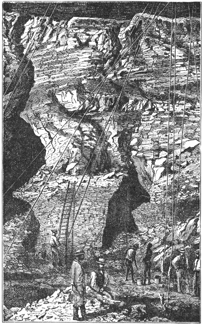 INTERIOR OF A DIAMOND MINE.
Not only in the heart of the mountain, but in the neighboring plains and along the banks of the Vaal River, these gems of "purest ray serene" are sought for. The water of the river is used to wash the precious stones from the clay soil, in which they are often imbedded like plums in a pudding.
Back from the river are what are termed "dry diggings." These consist of pits sunk through decomposed rocks of volcanic origin until a layer of tufa, limestone, and clay is reached. In this layer the gems are imbedded.
Masses of this "stuff," as it is called, are carried to the banks of the river and there washed. The more common custom, however, is to dry the mixture and to sift it by the aid of the workmen, who belong to the Kaffir tribes. These workmen have, however, learned the value of the gems, and need to be carefully watched lest they steal more than they deliver into the hands of their employers.
The most rigid watch is kept over the workmen, who often display the greatest ingenuity and cunning in hiding away the precious stones. Notwithstanding their lack of clothing these workmen manage to hide the stones about them; often secreting them in the hair, the folds of the skin, in the ears, under the tongue, under the nails of the toes, while instances have been known where they have even swallowed the precious gems to secure them from the white man.
Unlicensed dealing in diamonds or the purchasing of them from the natives is considered an offense of the most serious nature in Griqualand West. In spite of all precautions, much of this illegal trading is carried on; for, if the risk is great, the profit to those engaged in the trade is even greater.[Pg 175]
It has been estimated on good authority that fully twenty million pounds' worth of diamonds has been exported from these fields since the first discoveries. As a pound in English money is equal to very nearly five dollars of our money, we can estimate what the revenue of these mines has been.
It is believed that gems of many million pounds' value lie yet undiscovered in the unexplored portions of the diamond region. Statistics show that about two million pounds' worth of the gems is unearthed annually.
Naturally, the great mineral wealth of this region has attracted thousands to the neighborhood of Kimberley. Formerly, the country was roamed over by Griqua Kaffirs, numbering but a few thousands. Now, the region has become peopled "in spots." Many of the settlements have assumed the importance of towns of considerable size. It is estimated that not only some thirteen thousand whites, but upwards of thirty-three thousand blacks, from all sections of South Africa, have flocked to found such settlements as Kimberley, Bult-fontein, and Du Toit's Pan.
Griqualand West is about one-half as large as Scotland. The country has nothing attractive in its physical features. Indeed, it would be difficult to conceive of a dryer, uglier, drearier, more depressing region than the Diamond Fields. These conditions are intensified when no rain has fallen for months and the thermometer notes a steady increase of temperature day after day, till it reaches 90° in the shade.
The great novelist, Anthony Trollope, visited the[Pg 176] Diamond Fields when not a blade of grass could be seen growing on the thirsty ground, and when, as he expressed it, he "seemed to breathe dust rather than air."
His impressions of the Diamond Fields may be judged best from his description: "An atmosphere composed of flies and dust cannot be pleasant,—of dust so thick that the sufferer fears to remove it lest the raising of it may aggravate the evil, and of flies so numerous that one hardly dares to slaughter them by the ordinary means lest their dead bodies should be noisome.
"When a gust of wind would bring the dust in a cloud, hiding everything,—a cloud so thick that it seemed that the solid surface of the earth had risen diluted into the air,—and when flies had rendered occupation altogether impossible, I could be told, when complaining, that I ought to be there in December or February—at some other time of the year than that then present—if I really wanted to see what flies and dust could do. I sometimes thought that the people of Kimberley were proud of their flies and their dust."
Bare and uninviting as this portion of Griqualand West is known to be, there are exceptional tracts along the banks of the Vaal and Orange Rivers, for they are well wooded and not lacking in picturesque beauty of scenery.
Diamond fields have been discovered not only on both sides of the Vaal River, but also in the Orange Free State. At several places in this state the "dry diggings," as they are called, have been very productive; for they may be said to be literally sown with the precious stones.[Pg 177]
The early scenes about the diamond diggings cannot have been unsimilar to those witnessed during the mining fever in California, when the hope of securing fabulous amounts of gold drew all sorts and conditions of men to the grounds.
Houses were more easily constructed from canvas than from wood, and whole towns, as if by magic, sprang into existence. It must have been a curious sight to look upon one of those canvas towns.
In the red letter days of diamond digging, it was no uncommon thing for sixty thousand or more people to gather round the dry river diggings. When the great rush was over, and men settled down to steady labor in the mining districts, the population naturally decreased to a great extent, as the mere fortune hunters left the field of labor to the real workers.
The New Rush Mine of Kimberley has been described as the center of interest. A town has been built around it, and there are churches, clubs, hotels, halls, and even a fine market place, as attractions.
The mine is said to have the appearance of a hollow. This has a circumference of three-fourths of a mile. The mine had naturally a slight elevation above the plain in which it is situated. Since mining operations began, it has been scooped out to quite a depth, the lowest point being estimated as lying more than two hundred feet below the surface.
The greater part of the work in the mines can, of course, be done by the natives. They labor with pick and spade, load the buckets, which are constantly being pulled up and let down by means of ropes and pulleys,[Pg 178] and carry them off to the sorting ground. Here they throw the "stuff" into sieves, where it is carefully sifted, then examined with the closest scrutiny, after having been spread on tables in the open air for the purpose.
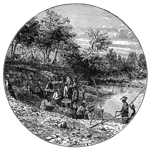 WASHING SAND FOR DIAMONDS.
Just as in the early gold-mining days in America, "claims" were set off by the diamond diggers in South Africa. The owner of a claim then set to work to examine the soil, which he collected in a heap by the[Pg 179] aid of his pick and shovel. This done, he removed the loose stones, and separated the sand by means of fine sieves. The remaining earth and stones he then carried to the washing place on the river bank.
The washing was done in a curious kind of "cradle," as it was called. It really consisted of a double sieve. The upper sieve had holes in it about half an inch in diameter, while the lower one had holes so small as to prevent a diamond of one-half carat from slipping through. When the washing process was once accomplished, it was followed by that of sorting.
The diamond sections have been the scenes of the most intense excitement. It was no uncommon thing for one man to pay another a fabulous price for his claim. One case is cited where half a claim, which measured only thirty by sixteen feet, and which had been dug out to a depth of fifty feet, brought the immense sum of twenty-four thousand English pounds.
Not infrequently these half-worked claims were worth the money and time expended, and many a lucky "find" gladdened the hearts of the fortunate purchaser.
A case is mentioned of the finding of a diamond, after a few hours' search, which brought the fortunate possessor three thousand pounds. Another stone picked up on a deserted claim was described as one of a hundred and fifteen carats' weight.
In those early days life was hard and the barest necessities for existence difficult to obtain. Meat was not only dear, but of poor quality; butter was even worse, and vegetables so scarce as to be veritable luxuries.
It must be remembered that everything for Kimberley[Pg 180] had to be brought up either from the coast, five hundred miles from the Orange Free State, or from some of the more accessible parts of Cape Colony.
All goods had to be brought with ox teams. This was a very slow and sure mode of transportation, and an extremely costly one.
Many changes have taken place in the neighborhood of the mines and dry diggings. Some of the mines have become exhausted, but new ones have constantly been discovered each year. The population has become more settled. The queer "shanties" of canvas and wood have disappeared, and whole towns of substantial brick and stone houses have replaced them.
An air of comfort and thrift pervades the settlements, and the energy and activity of the scene are enhanced by the steam railway, which forms the connecting link between the various mining sections. Improved methods of irrigation tend to relieve the country from the discomfort of dust and flies, and Griqualand West of the present time is as great a contrast to that of the past as can well be imagined.
Probably no section of the continent is more interesting in its history than South Africa. The books which have been written upon the subject would make quite a library in themselves.[Pg 181]
Its coast was first visited in the latter part of the fifteenth century, by Bartholomew Diaz, a Portuguese, in search of a passage to India. He sailed along the western coast till he came to an inlet with a group of islets at its mouth. Here he cast anchor, and landed with his crew.
The neighboring country was a dreary waste of sand. Not a trace of human beings was to be found, nor could any food other than sea birds' eggs be obtained there. Little wonder then that, after planting a cross as a sign of possession, the Portuguese commander sailed away.
Early in the sixteenth century some white men, landing on the South African coast, found that on one side rose a great mass of rock, over three thousand feet in height, with its top marking a level line more than a mile in length on the sky.
This grand mountain was flanked at either end with peaks less lofty, which were supported by buttresses projecting towards the shore.
The recess was a capacious valley, down the center of which flowed a stream of clear sweet water. The valley seemed to be without people, but after a while some Hottentots made their appearance; and from them a cow and two sheep were purchased.
The commander of the white men climbed to the top of the rock to which he gave the name of Table Mountain.
The bay in which he had anchored his little fleet is the so-called Table Bay.
The general conformation of the country is such that there are no navigable rivers. The streams, even the[Pg 182] very largest of them, are all of the nature of mountain torrents, obstructed with rapids and falls, and varying in volume with rain and drought.
There is an utter absence of secure harbors on the coast, except in positions where they could be of little service in the early days of exploration. In addition to all this, a very large portion of the land along the eastern seaboard, as well as of the interior plains, is so dry that it could be traversed only by degrees, as its slender resources became known.
Though the Portuguese fleets to and from India doubled the Cape each year, yet they seldom put in at any point south of Sofala, so unenviable a reputation did the natives of South Africa bear.
In the course of time English, Dutch, and French ships followed in the wake of the Portuguese fleets; but it was not till near the close of the sixteenth century that the English flag was displayed for the first time on South African soil.
Early in the seventeenth century, Table Bay became a port for the purchase of cattle and provisions from the natives.
Just about the time the English flag was floating over South Africa,—near the close of the sixteenth century,—the people of the northern Netherland provinces were struggling bravely against Spanish rule. These same people were destined to found the first European settlement upon the South African coast.
The northern Netherland provinces soon became united as a free republic, and ranked among the greatest commercial powers of the world.[Pg 183]
Two great companies, the English East India and the Dutch East India, were instrumental in locating stations along the South African coast.
In 1620, two English sea captains made an inspection of Table Bay, and proclaimed the adjoining country to be under the rule of King James; but this proclamation was never ratified. It is true that English ships called at Table Bay, but the island of St. Helena was the usual port.
The Dutch fleets were in the habit of putting into Table Bay for fresh water, to give the crews an opportunity to go on shore, to catch fish, and to obtain news from the places to which they were bound. It was the custom to bury letters on the shore and to mark the places of deposit by conspicuous stones. One can imagine that Captain Kidd's treasure was never more eagerly sought for than these buried letters.
Parties of Dutch seal hunters and whale fishers often occupied Table Valley.
Near the middle of the seventeenth century, the ship Haarlem of the East India Company was wrecked off the Blueberg coast. The crew succeeded in saving themselves, their own effects, and the ship's cargo. After everything was secured against the elements, a guard was left in charge of the stores, while the sailors removed to Table Valley.
Somewhere near the center of the present Cape Town they built huts in the vicinity of a stream of fresh water, and threw up an embankment of earth around them.
As the rainy season was now close at hand, they[Pg 184] planted some seeds they had saved, and soon had a garden which furnished an abundance of fresh vegetables. Intercourse with the natives was most friendly, and meat was often obtained in barter from them. Taken all in all, the experience of this shipwrecked crew gave the impression that South Africa was a productive and fruitful land. Six months later, a returning fleet rescued the sailors and took them back to England.
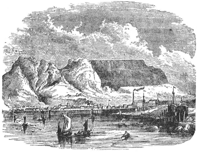 CAPE TOWN AND TABLE BAY.
Two of the officers of the rescued crew, upon their arrival in their home at the Netherlands, set forth the advantages to be derived from the establishment of a station in Table Valley.
A year later three vessels set sail from Texel, not for the purpose of carrying passengers to South Africa to found a colony, but to establish a refreshment station[Pg 185] for the fleets on their way to and from eastern seas.
In 1652, the little fleet from the Netherlands reached the coast, and proceeded to form such a station at Table Valley, under the auspices of the Dutch East India Company.
The only permanent inhabitants at the Cape were a few Hottentots. These subsisted chiefly on shellfish. The little band of settlers found much discomfort from the winter rains. The tents and wooden structures leaked badly, and many of the members became ill and died.
When these rains ceased, however, a change for the better came. Grass began to grow and every sort of edible plant. Ground was dug up, seeds planted, and soon luxuriant vegetable gardens gladdened the eye and the palate. Reeds, to thatch the houses, were obtained, and thus their roofs were made secure from the rainy season.
The pleasantest weather in South Africa is immediately after what are termed the winter rains. Just at the close of this season a clan of Hottentots came to the Cape peninsula. They drove before them great herds of horned cattle and flocks of sheep in search of fresh pasturage. Though always suspicious of each other, this clan and the Europeans maintained the pleasantest relations during the three months of their stay at the peninsula.
During that time the commander of the station secured in barter more than two hundred head of cattle and nearly six hundred sheep.
At the end of the first year, the station was well[Pg 186] established and prosperous. A garden had been planted, a system of irrigation introduced sufficiently great to water the whole extent of cultivated ground, some acres in all. A hospital, plain but substantial, with earthen walls and thatched roof, and large enough to give accommodations to two or three hundred men, had been built; while a cattle trade had been opened with another friendly clan that had visited the peninsula.
The second winter was not very eventful. True, some building was done, oxen were trained to draw timber from the forests behind Devil's Peak, and much new ground was broken up.
"Wild animals gave more trouble than anything else. The lions were so bold that they invaded the cattle pens by night, though armed men were always watching them; and leopards came down from the mountains in broad daylight and carried away sheep under the very eyes of the herdsmen.
"One morning before daybreak there was a great noise in the poultry pens, and when the guards went to see what was the matter, they found that all the ducks and geese had been killed by wildcats. The country appeared to be swarming with ravenous beasts of different kinds."
The Europeans had been settled in Table Valley about a year and a half, when they had their first difficulty with the Hottentots. The treacherous natives, one Sunday, while the settlers were holding church, killed the little white herdsman of the settlement and ran away with almost the entire herd of cattle.[Pg 187]
This was a sad blow. The fort needed to be strengthened by palisades made from the timber cut in the forests back of Devil's Peak. The working oxen were gone, and all timber had to be carried on the shoulders of the settlers. Then, too, the clans that had supplied the settlers with meat deemed it wise to remain at a distance, and the loss of this article of food was keenly felt.
After a few months, quiet and apparent peace were restored. During the next few years, exploring parties were sent out to learn of the physical features of the neighboring country, and to make the acquaintance of well-disposed Hottentot clans.
During these years, nearly every garden plant native to Europe or India was grown at the Cape. Potatoes and maize, however, had not yet been introduced. The oak and the fir tree, various kinds of fruit trees, varieties of vines from France and South Germany, strawberries and blackberries, were all in a thriving condition. Horses had been introduced from Java, and pigs and sheep, together with dogs, rabbits, and poultry, from Europe.
In February, 1657, the first real colony was established along the Liesbeek River, at Rondebosch, by nine of the Company's servants, who obtained their discharges and had small lots of land allotted to them. In this manner the colonization of South Africa was begun.
In 1658 negro slaves were introduced. This was a great mistake on the part of the colonists. In this move they but followed the example of all colonizing nations, who made of the negro merely a hewer of[Pg 188] wood and a drawer of water. No doubt, the cause of all the subsequent troubles of the Dutch settlers with England was due to the establishment of a system of slavery.
Many of the first slaves were taken from a Portuguese slaver which had been captured at sea. Not long after, quite a number of slaves were brought by the vessels of the Company from the coast of Guinea. A few of these were sold to the burghers, but most of them were maintained by the government and employed at all kinds of rough labor.
In addition to negroes, the East India Company began the introduction of Asiatics into the settlement. They were chiefly natives of Malacca, Java, and the Spice Islands. These people were, for the most part, criminals banished to slavery for life or for a term of years by the court of justice at Batavia. South Africa was chosen as their place of banishment. These men were far more intelligent than the natives of Guinea or Mozambique. Many of them were employed by the settlers as masons, harness makers, coopers, and tailors.
Later, South Africa was made a place of banishment for political prisoners of high rank from India. These prisoners were often accompanied by their families. Many of them had numerous attendants, both male and female.
It was thus that the colony at the Cape was settled by three distinct varieties of the human family, and really peopled by four varieties, for we must include the native Hottentots.[Pg 189]
Europeans, negroes, and the Javanese represented the original settlers, but various mixed races of every color soon populated the colony. Hence, it is doubtful if anywhere else in Africa could a greater diversity of hue and of features be found than in the Cape peninsula.
There are now five distinct governments represented in South Africa in the following divisions of territory: Cape Colony, Natal, and British Kaffraria,—all British possessions; the South African Republic, and the Orange Free State,—both independent republics. Of these divisions Cape Colony and the South African Republic, formerly known as the Transvaal, are the most interesting.
In addition to these divisions there are various dependencies, as British Bechuanaland, the British Protectorate, the German Protectorate, the British Chartered Company Territory, the Portuguese Possessions, and Swaziland.
The aborigines of South Africa have been described as savages of a very degraded type. "They were pigmies in size, yellowish-brown in color, hollow-backed, and with skins so loose that in times of famine their bodies were covered with wrinkles and flaps. On their heads were rows of little tufts of wiry hair hardly larger than peppercorns, and leaving the greater portion of the surface bald.[Pg 190]
"Their faces were broad in a line with the eyes, their cheeks were hollow, and they had flat noses, thick lips, and receding chins. They anointed their bodies with grease when any was obtainable, and then painted themselves with soot or colored clay.
"The clothing of the males was the skin of an animal hung loosely over the shoulders; that of the females was little more than a small leathern apron. To the eye of a European, no people in any part of the world were more unattractive.
"These savages were thinly scattered over every part of the country from a very remote period; for implements, such as arrowheads and perforated stones similar to those which they had in use when white men first met them, have been found in positions where the overlying materials must have been undisturbed for an incalculable time."
Such were the Bushmen, as the Europeans have named these pigmies. "They had no domestic animal but the dog, and they made no effort to cultivate the soil. They lived by the chase and upon wild plants, honey, locusts, and carrion.
"They had no government other than parental. This they ceased to acknowledge when able to care for themselves. They had feeble frames, wholly unfitted for toil, yet they possessed very keen vision and could detect objects at a great distance. They were fleet of foot, and could endure great hardships in the chase. Their only weapon was a frail bow. The arrowhead was coated with a poison so deadly that even the slightest wound was mortal."[Pg 191]
In addition to the Bushmen, the first settlers on South African soil found a people much superior. They belonged to the race now known as the Hottentots, and must have occupied the soil long before the advent of the white man. Several points of resemblance can be traced between these two peoples, yet there are many essential differences in the shape of the head and face; for instance, the ear of the Bushman is lobeless, a marked contrast to that of the Hottentot.
The Bushmen and Hottentots were constantly at war with each other. The Hottentots lived in communities, each with its own chief. They depended mainly upon the milk of cows and ewes for food; for they did not practice agriculture. They had horned cattle, gaunt and bony, and sheep covered with hair in place of wool. These sheep had fatty tails of great weight. With the exception of the dog, these were the only domestic animals. The men lived in indolence; their only occupation was moving from place to place with their herds and flocks, as pasturage failed. If the supply of milk became short, the women gathered bulbs and roots of nutritious properties to eke out an existence. These people slept in huts, which consisted of slender wooden frames covered over with matting, and which could be easily taken down at a moment's notice, and set up again on a new camping ground almost as quickly as tents.
Such were the people with whom Europeans had to deal, when the first settlements were made in South Africa. There was another branch of the human family that began to invade South Africa even before it was[Pg 192] settled by the white man. It formed a part of the great Bantu family, which occupies all of Central Africa extending from the Atlantic to the Indian Ocean.
They were a stalwart people, versed in agriculture and working in metal. They had a strict government and a well-defined system of law. They were a people of mixed ancestry, doubtless; some individuals displaying all the physical features and mental peculiarities of the negro, others showing marked Asiatic features and the quick mental powers of a superior race. The Bantu tribes were healthy and vigorous, but they were rarely at peace.
The three classes of people who occupied South Africa before its settlement by the white man "enjoyed the lives they were leading quite as much as Europeans enjoy their lives, though their pleasures were of a lower kind. Given freedom from disease and a slain antelope, and there could be no merrier creature than a Bushman. He was absolutely devoid of harassing cares.
"A Hottentot kraal, in the clear moonlight of Africa, with men, women, and children dancing to the music of reeds, was a scene of the highest hilarity.
"The Bantu woman, tending her garden by day and preparing food in the evening, which she may not partake of herself until her husband and his friends have eaten, is regarded as an unhappy drudge by her European sister. In her own opinion her lot is far more enviable than that of the white woman, whom she regards as being always in a state of anxiety."
As with most of the tribes of Africa, the chief element[Pg 193] of disturbance in their lives was war. The hand of the Bushman was usually against every man, and every man's hand was against him. The Hottentot tribes were constantly robbing one another of cattle, and on their eastern border were struggling in vain against the advancing Bantu. Most of the time every Bantu clan was at war with its nearest neighbors, whoever these might be.
Various reasons have been given for the origin of the term Hottentot. One writer declares, and doubtless he is correct, that the name arose from the peculiarity of the language spoken by this people. It is "much broken, full of monosyllables, uttered with strong aspirations from the chest, and a guttural articulation which it is difficult to acquire."
In conclusion he says, "It is as if one heard nothing from them but hot and tot." A peculiar sound, called the "click," is made in pronouncing words. This is done by pressing the tongue up against the palate and suddenly removing it.
All early records of the Dutch settlers praise the good traits of the Hottentots. The tribes were all distinguished by the title "good men." One writer states that during the first fifty years of the colony not a single instance of theft from the colonists was known.
Later, a waistcoat decorated with silver buttons was stolen. This was hard to conceal, and was soon discovered in the possession of a Hottentot who belonged on a kraal a short distance from Cape Town.
The thief was no sooner discovered by his fellows than he was taken by them to town and delivered into[Pg 194] the hands of the magistrates. So great a disgrace did they deem his offense, that they demanded that he be punished in order to wipe out the stain of his evil deed. Nor was their sense of justice satisfied even when he had received a severe flogging, for they banished him from his clan as unworthy to associate with it.
It is sad to relate that the injuries inflicted on the Hottentots by the colonists have had a very bad influence upon their characters. In the past one hundred and fifty years they have, like the red man, been driven from the lands of their forefathers, and have lost the sturdy independence of which they had reason to be proud.
The Hottentots, before subjugation, usually arranged their encampment about a kraal, or cattle fold, in the shape of a half-moon. The encampment consisted of the cabins, or huts, which, with their covering of mats, looked more like overturned baskets than dwelling places. If possible, the encampment ground was chosen so that a hedge of thorn completed the circle of which the huts formed a part. Thus were the natives and their cattle secure against the wild beasts prowling around the camp.
In sections where lions were numerous, the natives built a curious kind of house, or cabin, on the top of poles or branches, sometimes ten or twelve feet above the ground. This was to protect the children, who soon learned to climb the poles to their airy cabins and to feel secure from harm.
The Hottentots have a curious manner of drinking water. It is thrown into the mouth by means of the[Pg 195] right hand, which is seldom brought nearer than a foot's length from the mouth. So quickly and dexterously is this done that thirst is soon quenched.
The Hottentots are very skillful in breaking in their oxen for riding purposes. This they do when the animals are about a year old. They first pierce the nose to receive the bridle. This is done by making a slit through the cartilage between the nostrils. This slit is large enough to admit a finger. Into this hole a long stick from which the bark has been stripped is thrust. At one end of the stick is a forked branch. This is to prevent its passing through. To each end is then fastened a thong of hide long enough to reach around the neck. These thongs serve as reins. A sheep skin on which the wool still remains is placed across the back of the animal. Another is folded and bound on with a rein long enough to pass around the body several times. This serves for a saddle. Sometimes a pair of stirrups is added. These consist merely of a thong with a loop at each end, slung across the saddle. Very often these loops are distended by a piece of wood to form an easier rest for the foot.
Before the nose of the animal has healed, the Hottentot mounts him and puts him in training. In a week or two he becomes very obedient to his master. "The facility and adroitness with which the Hottentots manage the ox has often excited the traveler's admiration; it is made to walk, trot, or gallop, at the will of its master.
"Being longer legged and rather more lightly made than the English ox, it travels with greater ease and[Pg 196] speed, walking three or four miles in an hour, trotting five, and, on an emergency, galloping seven or eight.
"The ox in South Africa seems little inferior to that most sagacious of all quadrupeds, the dog. Among the Hottentots these animals are their domestics, and the companions of their pleasures and fatigues. While the sheep are grazing, the faithful backley, as this kind of ox is called, stands and grazes beside them. Still attentive, however, to the looks of its master, the backley flies round the field, obliges the flocks of sheep that are straying to keep within proper limits, and shows no mercy to robbers who attempt to plunder, nor even to strangers who come near.
"It is not the plunderers of the flock alone, but even the enemies of the nation, that these oxen are taught to combat. Every army of Hottentots was furnished with a proper herd of these creatures, which were let loose against the foe. Thus sent forward, they overturned all before them, and often procured their masters, even before they had struck a blow, an easy victory."
If a driver loses one of his oxen, he shows much patience and perseverance in searching for it, even though suffering from the oppressive heat of the sun. He will continue the search for days, scanning the ground carefully for footprints, until he comes upon the track of the wanderer. Regardless then of fatigue, hunger, or thirst, he presses on until the lost has been found.
The original colony was settled by the Dutch as early as the middle of the seventeenth century. Near the beginning of the nineteenth century it passed into the hands of the British. The laws, customs, and names of places remained essentially Dutch, and the language spoken is, to a great extent, that of the first settlers.
The old colony comprised the section that occupies the most southern part of the continent of Africa, and borders the Atlantic and Indian Ocean on either side. Griqualand West has been so recently received into the family of Cape provinces that it is hardly as yet recognized as being included in the colony.
The physical features of the country are peculiar. Though intersected by many rivers, yet the Cape is, practically speaking, a dry country. None of the rivers are navigable, and the rainfall is scant and fitful over a large part of the colony.
Generally speaking, the climate of the country is temperate. In most of the hot valleys, however, the temperature is ovenlike in summer. We must not forget that the summer season at the Cape occurs during our winter. On the higher grounds the average temperature in the warmest months equals that of Italy. In winter the temperature often falls below the freezing point. Then the air is clear, fresh, and invigorating.[Pg 198]
Fevers and epidemics—scourges of most of the sections of Africa—are here unknown. On the east coast and in the extreme south there is an abundant fall of rain. The province of Natal is especially fortunate in this respect.
In the interior of the colony there is less rainfall, while in the vicinity of the Orange River there are only a few light showers. It has been asserted that towards the mouth of the river there have been periods when no rain has fallen for many years.
One writer records the curious fact that the westerly winds which prevail in the winter season, from April to October, bring rain to the southeast maritime regions, while on the eastern coast the rainy season is in the summer, from September to April.
The highest mountain ranges are covered with snow for several months. In the inland sections frequent thunderstorms occur; these bring brief but copious falls of rain.
If we should start from the southern portion of the Cape and travel northward, we should find the country rising in a series of terraces. These finally culminate in what is known as Spitz Kop, or Compass Mountain. From this elevation, eight thousand five hundred feet above the sea, the country gradually declines to the Orange River.
These terraces, on their outer edges, resemble mountain ranges. They run in a direction from east to west, or, as one writer has described them, "parallel to the coast and to each other."
The outer, or the seaboard slopes of the ridges, constitute[Pg 199] the best parts of the colony. They are for the most part thickly inhabited. The chief towns and villages are located here, and the fields of grain, the vineyards and orchards, and the tobacco plantations have given the country a well-deserved fame and reputation.
The narrow mountain gorges serve as passageways from one terrace to another. They bear the name of "kloofs." Their sides are the only passes into the interior. It is believed that the mountain torrents, which flow during certain seasons of the year, have worn deep valleys in their sides, and thus occasioned these kloofs, or mountain passes.
Beyond the Zwartebergen, or the Black Mountain, is the great grazing district of Cape Colony. It consists of vast undulating plains, and is known as the Great Karroo.
No trees are found upon the Great Karroo, and but very few shrubs. As soon as the wet season begins, however, this great district is covered with rich verdure and a profusion of flowers. Then the flocks of sheep enjoy all the luxuriance of a paradise of herbage, which clothes field, valley, and hillside alike.
It is at this season that the Great Karroo seems like a beautiful garden. One can scarcely believe the testimony of those who, having visited it a few days before the wet season begins, describe it as a bare, barren, brown waste.
During the summer months this region is dry and dreary in its character. Little or no running water is to be found, and only after a thundershower are the pools filled. For a brief season then the beds of the[Pg 200] streams have running water. They soon run dry, and only by digging deep down in their beds can a scant amount of brackish water be obtained to supply both man and beast until the rainy season begins.
Snow rarely falls upon the coast of Cape Colony, and when it does, it remains but a short time.
The most prominent object seen from Cape Town is Table Mountain, which rises to a height of over thirty-five hundred feet. The summit is sometimes covered with a sprinkling of white, but almost before the people at Cape Town have had time to notice its novel dress, it presents again its wonted aspect.
Cape Colony is by no means the flat, undulating country that many writers would erroneously lead us to believe. On the contrary, it is a wildly picturesque region, with mountainous sections, even, to diversify its character. Interspersed among bold mountain ridges we find light upland tracts and broad elevated plains. While, coursing through the rugged mountain gorges, the drainage of the country finds a path to the Indian or Atlantic Ocean, and even north to the Orange River, and is eventually discharged on the barren northwestern coast. Cape Colony can boast, even within the limits of the sections longest settled by the white man, some of the most picturesque scenery in the world. Hill and valley, barren plain and rich woodland, alternate to add beauty to the landscape.
The rivers of Cape Colony vary as to their extent. The Orange River, though the largest, is so broken up by the various cataracts as to be unsuitable for navigation. This is true of many of the other rivers. A very[Pg 201] few of them can be sailed on for a short distance for pleasure, but so short as to be impractical for navigation or transit.
The general appearance of Cape Colony, like that of the whole of the South African region, is dry. During the rainy season the orchids and different bulbous plants give to the ground the appearance of a gayly flowered carpet. The many varieties of heath, for which the Cape is noted, lend a most beautiful character to small patches of territory.
The objects which are most striking to the traveler are, however, the thorny shrubs. These not only manifest themselves to his sight, but to his sense of feeling, as they come in contact with his skin. Mingled with these shrubs are various cactuslike plants. These are quite characteristic of a country where the vegetation must store up moisture during the abundance of the rainy season for the drought of the dry season.
Wheat is grown in the richer sections, together with maize, oats, barley, millet, and Kaffir corn. Rye is raised in some sections, and rice grows well in some of the best undulated districts. Tobacco is grown in many sections, and cotton has been introduced as an experiment.
The Cape still continues to be, to some extent, a hunting ground. In the early days of the colony vast herds of many varieties of the antelope family, lions, giraffes, rhinoceroses, leopards, hyenas, and jackals, roamed over it. Now the hunter must seek his game far to the north of the Orange River.
Ostriches were once common, but are now few. Most[Pg 202] of the feathers of these birds are obtained from beyond the borders of the colony, or from tame ones kept on farms and reared from eggs heated artificially. The rearing of ostriches has now become a recognized industry in the Cape.
Many species of venomous snakes are common. Troublesome insects are not so common here as in other parts of Africa.
The chief industry of the colony is wool raising. It has been estimated that there are fifteen million sheep throughout the colony. Many of them are of the Merino breed. These are rapidly displacing the big-tailed sheep raised by the early Dutch settlers. The Angora goat is kept quite extensively for the sake of its long silky hair. Cattle of the finest description are found in every part of the country, the better varieties having displaced those owned by the natives and early settlers.
Among the commonest sights at the colony are the long lines of wagons, which lumber slowly over the roads. These are drawn by six, eight, or even ten yokes of oxen, which subsist upon such scanty herbage as they can find along the road. Coaches are common, and the many railways now form a network across the colony. The latter, valuable as they are for the utility of the country, can never rival the picturesqueness of the typical Cape wagon, which, doubtless, for many years will continue to be the most characteristic mode of South African travel.
The history of Cape Colony is one of many vicissitudes. The various Kaffir wars, nine in all, together[Pg 203] with the five seasons of warfare with the Basuto tribes, were enough to paralyze and cripple the energies of any government. The peculiar characteristics of the Dutch settlers were not always pleasing to Great Britain, and she had occasion many times to exercise her power in sections to which she could lay any possible claim. Now, however, that the management of their own affairs has passed into the hands of the Dutch settlers, Cape Colony has made great progress towards good government and prosperity.
The chief industries still continue to be pastoral and agricultural. In the vicinity of the Great Karroo grazing plains, agriculture can be carried on only where there is running water. Consequently, much labor has been expended in making reservoirs, the waters of which irrigate the gardens and orchards. The sinking of artesian wells has recently been attempted, and has proved a successful experiment.
In the districts which adjoin the eastern border, and on the first and second terraces from the southern coast, where the rainfall is sufficient for all purposes of agriculture and cattle raising, both pursuits are followed. While wheat and maize form the principal crops, oats are raised extensively for horses, and almost every variety of vegetable and fruit is grown in abundance.
In this portion of the colony, namely the southwestern corner, which was founded as early as the seventeenth century, the vine, as well as wheat, is largely cultivated.
In the middle of the present century, rich copper mines were opened in that portion called Namaqualand.[Pg 204] This part of the colony had long been regarded as the least valuable of any of the provinces.
To quote from Theal's South Africa, in the The Story of the Nations series: "It is impossible to give the value of the purely colonial products, but the quantity from the whole of South Africa exported in the year that ended on the 30th of June, 1893, was valued at a little over thirteen and a half million pounds sterling, of which twelve and a quarter million passed through the ports of Cape Colony, and one million and a quarter through Durban, Natal."
This same writer tells us: "Of the items that made up this amount gold was first, being valued at four millions and a half, and diamonds came next, being valued at nearly four millions. The copper ore exported was worth over a quarter of a million, and the coal over fifty thousand pounds.
"These figures, representing nearly two-thirds of the total exports, show the importance of the mining industry of South Africa, and it must be remembered that this industry is only in its infancy."
Among the other exports may be mentioned wool, Angora hair, hides, skins, horns, and ostrich feathers. These have been increased in value about tenfold since 1850.
Nearly everything in the way of agricultural products is required for home use. Some fruits and grains are, however, sent out of the country. Among the agricultural products that find a foreign market may be named aloes, bark for tanning purposes from Natal, and dried flowers from Cape Colony. The fisheries, too,[Pg 205] not only supply enormous quantities of food for home consumption, but also export largely to Mauritius. Natal furnishes also great quantities of sugar.
It is interesting to learn that the supply of fish which the harbor of Cape Town affords is apparently inexhaustible. Not only is there a great variety of species, but there are several that are very wholesome and of a fine flavor.
The Cape salmon, in size and appearance somewhat resembling that of Britain, and the snook, a voracious marine pike, are both very abundant. After an excursion of a few hours, boats often return laden with these fish, which are sold very cheap, and form the principal food of the colored population. At the west end of Cape Town, fish may be seen suspended on long lines, as clothes are with us, that they may be dried; and vast quantities are salted for exportation, Mauritius being the principal market.
Fishing for snook is a source of amusement. They may be caught while the boat is in motion, by trailing a leaded hook astern, with some white streamers of rag attached, or when at anchor, by alternately throwing the bait to a distance and drawing it quickly back. Penguins, Cape pigeons, albatross, and some kinds of sea gull, surround the boat, while flocks of gannets and cormorants fly around the fishermen.
The Cape pigeons are an interesting feature about Cape Colony. They seem to welcome the arrival of each ship in the harbor, and to take delight in the sight of mankind about them. After a storm, and when the wind has subsided so that the surface of the ocean[Pg 206] becomes calm, these Cape pigeons settle upon the water and swim gayly about, like ducks in a pond, and with as little fear, apparently, of any danger.
It is no uncommon thing for the sailors on board ship to bait their hooks and catch these pigeons as they would fish. It seems a cruel sport, yet the rest of the crew will line the side of the ship and find amusement in watching what they call "the fun" with the poor creatures.
If caught and placed in a hen coop till morning, they will, on being released, stagger awkwardly about over the slippery deck; for they are unable to take to the wing unless they can have some good starting point, as the edge of a ship's railing or the crest of a heaving wave.
In captivity, if kept alone, they are peaceable; but if not in solitary confinement they are very quarrelsome, and fight continually.
Their powers of flight are somewhat remarkable. When a ship is going at the rate of two hundred miles a day, the Cape pigeon will hover around it, sheer off or approach it, and soar aloft or descend, as if the vessel were absolutely stationary. They really fly without much effort.
It is interesting to watch their flight; for it seems to consist of a series of maneuvers, as they fly, now against the wind, when they always ascend, thus taking advantage of its force; now before the wind, when they descend, that little exertion may be needed to keep them above water; then, whirling rapidly, like a hawk, to exhaust their speed when wishing to check their rapid flight.[Pg 207]
Very different in character is the albatross, one of the most conspicuous of the birds which follow the ships that plow the ocean. When on the wing his appearance is very striking. In solemn, even flight he soars along with outstretched pinions measuring from fifteen to eighteen feet between the tips. Scarcely seeming to stir, he appears rather to float along in his course.
Now and then, with a slow flapping of his wings, he mounts higher into the air; but he seems to scorn the swift motion and animated flutter that characterize the movements of other birds.
Like a specter, he sails silently along almost close to you. His still, motionless form would seem devoid of life were it not that his keen, piercing eye and an occasional quick turn of the head, which gives him a sharp, prying expression, betray him.
But, if you wish to see a complete transformation scene, throw a piece of rusty pork overboard, and the long, curiously crooked beak employs its enormous strength in a manner very suggestive of life and energy.
Now and then the black petrel, with its piercing eye, darts across the ship's stern, while the stormy petrel flutters just overhead, yet beyond the reach of a gun. Truly, the entrance to Cape Colony is as novel as it is interesting, and is filled with pleasant pictures.
About the middle of the present century Cape Colony comprised all the land between the Orange River on the north, the Indian Ocean on the south, the Atlantic Ocean on the west, and British Kaffraria and the rivers Indwe and Tees on the east. During recent years the greater portion of the territory between the Indwe and Kei Rivers on one side, and Natal on the other, has been annexed to Cape Colony; but in some respects it is still regarded as a dependency.
The annexed territory is described as a very beautiful and fertile tract of land. It bears, as we shall see, a resemblance to Natal. The temperature along the coast is not, however, quite so high.
Just below the Drachenberg Mountains lies an elevated tract of country, where the nights are extremely cold, too cold, in fact, for the Bantu tribes; hence, no tribes except the Bushmen have ever resided there permanently until within a short time.
There are fine forests on the lower terraces. Rain is abundant and the drainage perfect, the rivers, on account of their rapid fall, speedily carrying off all superfluous moisture. The climate is on this account exceedingly healthy, though the grass is so rich and other vegetation so luxuriant that, had the land been more nearly level, fever would probably be common.[Pg 209]
South Africa abounds in waterfalls, of which the most celebrated are the great falls of the Orange, the Tugela's leap of sixteen hundred feet over the face of the Drachenberg, and the fall of the Nmgeni, a few miles from Maritzburg; but the most imposing of all, perhaps, is in the Tsitsa in the annexed territory.
Ordinarily this stream tumbles over the precipice in three or four rills, but in times of flood a volume of water from four to five hundred feet wide drops nearly four hundred feet into a narrow chasm.
Various sections have from time to time been annexed to Cape Colony. These sections had become involved in native feuds and wars, with such disastrous results that the chiefs gladly placed their lands under the protection of the British rule. Thus, in 1879, eight districts were formally annexed.
Along the coast of Great Namaqualand there are several small rocky islands upon which sea birds congregate in vast flocks; and as there is but little rain in that region, the guano is of considerable value. These islands became dependencies of Cape Colony a good many years ago. The men employed to gather the guano are their only inhabitants.
Farther north on the same coast is Walfish Bay, the only port through which access can be had to Great Namaqualand and Damaraland. The country around it is a dreary waste of sand, and a more uninviting spot can hardly be imagined. It became a dependency of Cape Colony in 1884.
On this little strip of land some six or seven hundred Hottentots of a very degraded type are living. The[Pg 210] only other inhabitants are the colonial magistrate, with his staff of police, a missionary family, and a few traders and forwarders of goods into the interior.
Basutoland, which was annexed to Cape Colony in 1871, contains at the present time about two hundred and twenty-five thousand Bantu and six hundred Europeans. The white people consist of officials, missionaries, and traders. None other are permitted to settle within its borders, for by the annexation of the territory Cape Colony became responsible for the welfare and good order of the land.
Cape Colony has now a population of three hundred and sixty-six thousand Europeans and seven hundred and fifty-five thousand colored people. This does not include the people occupying the various annexed territories. The colored population includes several native tribes, more than half of which are Bantu, and various mixed races of Asiatics, descendants of freed slaves and Hottentots.
The missionaries have been laboring for many years among the Bantu. Taken as a whole, the results of their labors are discouraging, though a portion of the people have made a considerable advance in civilization. Great efforts have been made to give them a good education.[Pg 211]
The system of public schools is excellent. Those of the first and second class are attended almost exclusively by white children. There are several colleges where the higher branches of education are taught, and many private schools of excellent standing are maintained by the various religious societies. There is also a university, but with rather limited advantages. The towns and villages are well supplied with public libraries; these are aided by the government. There is scarcely a town or a village that has not two or three churches, banks, insurance offices, newspaper printing offices, and various benevolent institutions.
Good roads have been made throughout the colony, even in the wildest sections. The rivers, on the principal routes, have been bridged. Scarcely a hamlet can be found that is not connected by postal service and telegraph wire with all parts of South Africa.
The railway lines form an important feature in the colony. One from Cape Town passes through the Orange Free State to Pretoria in the South African Republic, while lines from Cape Elizabeth, Port Alfred, and East London connect these ports with important towns in both of the above sections. These lines were all constructed by the government, under very liberal conditions and terms.
Numerous improvements have been made in the harbors, particularly in Table Bay. Here, a long time ago, the beach, after winter storms, was frequently strewn with the wrecks of costly fleets; now ships lie in a dock in perfect safety, and are protected by a magnificent breakwater.[Pg 212]
On the coast are many lighthouses, which stand as sentinels to warn seamen of danger by night, and the ancient terror of stormy seas off the Cape of Good Hope has long since been forgotten.
The colony is connected with Europe by two submarine cables; so that everything of importance that occurs there one day is known in England through the newspapers on the next. Splendid steamships, carrying mails and passengers, arrive from, and leave for, England weekly. They make the run of six thousand miles in less than fifteen days; and the passage is certainly one of the pleasantest in the world.
Cape Town, the capital of Cape Colony, has a pleasant situation on the south side of Table Bay. It is a flourishing city of forty-five thousand inhabitants. It has many fine buildings and pretty villas, lighted by gas.
Tramways and railways pour into it the rich agricultural products of the adjacent countries. There is little, indeed, to remind the visitor that he is in a colonial capital founded, and for a long time inhabited, solely by Dutch settlers.
Cape Town is, in many respects, very unlike any city seen in Europe. No two houses can be found of the same size or architecture. The finest stores and other buildings stand in close proximity to the humblest and poorest homes and shanties of galvanized iron. Here the shedlike shop of a grocer or provision dealer stands side by side with the almost palatial building which shelters the display of a wealthy jeweler.[Pg 213]
Here may be seen Kaffirs clothed in the rags of a uniform; Chinamen in their clean blue frocks; lanky Boers in brown velveteens, with their wives in black gowns, with thick black veils and huge poke bonnets; merchants in gray silk coats and white hats; officers in uniform; Parsee washerwomen; Moslem Malays, all passing, in a quick procession, the hotel door.
Hansoms and two-horse broughams are used here; and in the hotels accommodations can be obtained equal to anything found in towns of the same size in Europe and America.
Cape Town is the point of departure for two lines of railways. The one line runs to Worcester, and is to be extended across the Karroo; the other ends in the center of the Constantia wine district.
The atmosphere of Cape Colony is so clear and dry that objects can be distinctly seen even at great distances. The first object which attracts the attention of the traveler, as he approaches the colony from the sea, is Table Mountain. Its massive walls rise to the height of thirty-five hundred feet.
The colonists look with interest upon Table Mountain and watch the clouds as they assume fantastic shapes about and above it. Sometimes a snowy, fleecy vapor seems to spread over its top. This the colonists, not inappropriately, call the tablecloth. When, under the potent rays of the sun, this vapor disappears, they say, "The tablecloth has been rolled up and put away for some other time."
Here and there on some of the mountain spurs may be seen the remains of the blockhouses of the early colonial[Pg 214] days. These were stout structures erected by the early settlers to protect themselves from native tribes with whom they disputed the possession of the soil. But let us return to the capital.
It is of interest to read that early in this century Cape Town contained only about one thousand houses. It had a Dutch castle, a Government House, and a couple of churches, together with a government slave pen; for the colonists were strongly in favor of the sale of slaves.
The town of to-day presents strong contrasts to the old town. The suburbs alone have an extent of some fourteen miles.
There are broad, open streets lined with handsome modern buildings, and various shops, stores, and banks, together with Houses of Parliament, an art museum, and a university, which give a prosperous and modern appearance to the town.
Gas lights the town, cabs rattle over the streets, trams and railways are actively at work. Along the beach stretches a straggling line of buildings. Some of these are used for the drying of skins, the pressing of wool, the curing of fish, and boat building, soap making, and other industries.
The Botanical Gardens are kept in beautiful order. They furnish not only a charming promenade for the people, but serve as a nursery for young plants and trees. On every side the town presents an appearance of thrift and industry.
A walk through the street offers many an attractive picture. The gay and picturesque dress of the people[Pg 215] must needs attract the eye of the stranger. Women with faces of every hue, from tawny black to olive brown, may be seen with their headdresses of gayly colored handkerchiefs, while their shoulders are draped with others of still gayer hues, to lend a finish to the stiffly starched, beflowered cotton gown of gorgeous coloring.
On every side sturdy, healthy children romp about, laughing and displaying their glistening white teeth, as they engage in their various sports.
"In all the world there is not a fairer country than the pleasant land of Natal, stretching in steps from the Drachenberg, which bounds it like a mighty wall, downward to the shore of the Indian Ocean. The coast belt is covered with subtropical vegetation, for it is heated by the warm Mozambique current, which runs southward along it, and gives it a higher temperature than is due to its distance from the equator.
"Each terrace, as the traveler ascends, is cooler than the one below, though it is nowhere cold. It is a well-watered land. Numerous streams, issuing from the Drachenberg and the fronts of the lower terraces, rush along in deep gorges to the sea, and carry off the super-abundant moisture, so that it is also well drained.[Pg 216]"
Its soil is rich, its forests produce excellent timber, and its grazing valleys resemble meadows. Its climate everywhere is healthy for Europeans.
Compared with Cape Colony, Natal is of slight importance. It is much smaller in size, having an area only about one half that of Scotland.
One writer has described the country as spurs of wooded mountain and picturesque hills, which slope down like the fingers of a hand from the higher cliff-like edge of the Drachenberg, some eleven hundred feet high.
Fertile valleys, watered by steadily flowing rivers, lie between these mountain fingers of the land; while between the coast and the mountains lie tracts of level grass-covered land, or fertile undulating sections, on which are pastured great herds of cattle, sheep, and goats.
The climate of Natal we may consider as semi-tropical. It has a favorable position, hence the summer heat is not excessive. The winters are unusually pleasant.
Probably no portion of South Africa is so well watered as Natal. As many as twenty-three rivers flow through the country and enter the Indian Ocean. Owing to the mountainous nature of the country, none of these rivers are navigable.
In many places the scenery is very picturesque. Only a small portion of the colony is as yet settled. There are sugar plantations scattered here and there throughout the entire country, however; for they can be worked to advantage by Indian coolies. These coolies[Pg 217] have, upon trial, been found more skillful and more steady laborers than the natives.
Coffee is grown in the low sections. Wheat, oats, and maize are raised to quite an extent. The latter cereal is universally known by the name "mealies" in South Africa.
The coast region extends inland for about fifteen miles. It is here that the principal settlements are found. The capital of Natal, called Maritzburg, has a situation about sixty miles inland from Port Natal.
Port Natal is the only harbor, and not a specially fine one; for a sand bar across its mouth impedes navigation.
Quite a wagon traffic is carried on through the interior of the colony down into the Orange Free State and also to the Transvaal, or South African Republic. From these countries the products of Natal are transported to Cape Colony. Considerable quantities of the products of Central Africa and neighboring sections, such as wool, ostrich feathers, and ivory, are sent out of the country through the Natal Port.
Natal seems to have a promising future. It was originally chosen by the Dutch Boers, who, fleeing from British rule, sought a home where they might establish their own laws. As far back as the middle of the present century it was made a separate colony, though it had not the strong government to be found at the Cape.
The fertile coast section is capable of producing the various tropical crops in abundance. Here the pineapple ripens out of doors, and sugar, coffee, arrowroot, indigo, tobacco, ginger, rice, pepper, and cotton are grown to a large extent.[Pg 218]
Farther within the interior, in the more elevated sections, the various cereals and the ordinary crops of cooler climates thrive well. Upon the hills and upland valleys is a luxuriant growth of herbage, which fits them for grazing purposes. In some tracts near the coast and in the deep glens of the Drachenberg Mountains fine forests of timber are found. Coal exists in some sections, and limestone is very abundant.
The settlers have sometimes complained of the want of laborers. Although there are but twenty-three Europeans in Natal to two hundred and ninety Zulus and Kaffirs, yet the complaint is made that the white man must depend upon coolie labor. This seems an exaggeration of facts, when we consider that on every farm and in every sugar mill many natives may be found at work, earning profitable wages. True, these native workmen are not very prepossessing laborers; for a long time must elapse before a savage can be trained into habits of industry and thrift.
Sometimes the natives are employed for domestic service, and they generally do remarkably well. The "Cape Boys," or the colored descendants of the St. Helena tribes that emigrated to the Cape, usually drive the coaches; but the Zulus are employed to attend to the wagons, and may be found making themselves generally useful throughout the country.
Port Natal and Maritzburg are both small towns, yet they are the largest to be found in Natal.
The Zulu war caused great expense to the colony, and the contract to build three hundred and forty-five miles of railway has swelled the public debt to an enormous sum.[Pg 219]
War and national debt are a heavy burden for any country to bear. Yet with peace comes prosperity, and thrift and enterprise will accomplish great results in a country's progress. Hence some changes for the better are now apparent.
Maritzburg and Durban have become very thrifty towns of late years. Durban is said to be the only gateway of commerce, not only for the colony itself and for Zululand, but for part of the Orange Free State and the South African Republic.
In order to improve the entrance to the inner harbor extensive works have been constructed, and large ships can now cross the bar and lie beside a wharf as safely as in a dock.
Numerous handsome buildings embellish this town, conspicuous among which is the grandest municipal hall in South Africa.
A railway has been constructed from Durban to Charlestown, on the border of the South African Republic. It passes through Maritzburg and also through the villages of Estcourt, Ladysmith, and Newcastle, farther inland. From Ladysmith there is a branch-line by way of Van Reenen's Pass in the Drachenberg to Harrismith in the Orange Free State. It goes up the Drachenberg in a series of zigzag sections.
The government has in contemplation the completion of this railway from Harrismith until it reaches the great Northeastern, which runs through Cape Colony and the Orange Free State. This will give an unbroken line of communication between Cape Town and Durban. It is very probable that the[Pg 220] Charlestown line will be continued to the gold fields of the South African Republic at an early date.
The chief branch of the system of railways passes through an extensive tract of coal of very good quality. This is a great advantage to the country, for fuel can thus be obtained at a low rate.
This main branch is on the plateau which is at the foot of the Drachenberg. It has a central situation and easily transports the coal to the coast along a descending grade.
Not only do these railways and towns receive their coal from the coal-bearing section, but great quantities are exported. In 1892 nearly three hundred thousand dollars' worth was sent abroad.
Northeast of Cape Colony lies a country rich in the natural beauty of its scenery and noted for the great variety of animal life to be found there.
Kaffraria, or Kaffirland, serves to separate Cape Colony from Natal. It is occupied by various semi-independent tribes of Kaffirs. They number more than five hundred thousand.
They occupy a region about twice the size of Greece. Compared with Natal, it about equals it in area. While if we compare it with the Orange Free State, we find its area only about one-half as large.[Pg 221]
The territory is bounded on the south by the Kei River. It is for this reason we find it sometimes bearing the name Transkei. It is well watered and fertile. In its more elevated sections it is well wooded.
The country possesses vast tracts of land suitable for agricultural and grazing purposes. Both these branches of industry are followed to some extent by the natives.
While the natives are classed together under the general name of Kaffir, yet there are a number of distinct tribes bearing special names and occupying well-defined tracts in the territory. Most of these tribes have been some time under British rule to a certain extent. Constant insurrections and rebellions have been the direct cause of the Kaffir wars, so frequently discussed among the current topics of the newspapers.
The cost to Great Britain in the attempt partially to subjugate these tribes must have been enormous.
Several of the more powerful of them have occupied some of the best agricultural sections of South Africa. Others, while inferior to some tribes in strength and warfare, are superior in intelligence and an adaptability to civilization.
Under the influence of civilization some of the natives have learned not only to cultivate corn and wool, but have become versed in trade and have even learned to acquire money. Periods of war have been of such frequent occurrence that the effects of civilization have not been as lasting as the British nation could desire.
There are several Kaffir countries not included within the area of Kaffraria. The most important of these is[Pg 222] Zululand. This country became quite important under the military discipline of a line of warrior chiefs, and soon extended its boundaries until they reached the Limpopo and the limits of Cape Colony.
A war with Great Britain was disastrous to Zululand; hence, its boundaries since 1880 are not so extensive. The country has been divided among a dozen or more native chiefs, some of whom are in nowise Zulus.
The region north of Delagoa Bay has been under the rule of an independent Zulu chief. He has allowed the Portuguese to found settlements here and there along the coast.
Many dissensions have arisen among the different Zulu conquerors; and neighboring tribes, taking advantage of them, have, in turn, subjugated the Zulu tribes or have risen in arms to exterminate them.
The Kaffirs that live beyond the Fish River, on the eastern border of the colony, belong to one tribe of the Bechuana family.
In character they are bold, warlike, and very independent. From the possession of these qualities and from their cast of features, it is believed by many that they are of Arabian origin.
The men are well proportioned and extremely tall; some of them are six feet and upwards in height. The women have good tempers and are animated and cheerful in their temperament. They have beautiful teeth, white, and regular in form. They have neither the thick lips nor the flat noses of most of the African natives. Their figures, however, form a strong contrast to those of the men; for they are short and sturdy.[Pg 223]
The name Kaffir, or unbeliever, was given by the Moors to the tribes dwelling along the southeastern coast of Africa, and was afterwards adopted by the Portuguese. Later, the term was applied to all the tribes in the same region.
The Kaffirs' mode of life is very simple. The diet consists principally of milk. This is kept in leathern bottles till it becomes sufficiently thick and acid. Boiled corn is a favorite dish. This is served in small baskets, from which each one helps himself with his hands. Some times a kind of pottage is made of the corn. Again, it is formed into thick cakes, and baked upon the hearth.
The winter's provisions are stored either in pits or subterranean granaries. These cakes, with an occasional feast of fresh meat, form a diet substantial enough for this hardy people.
The dress of the Kaffirs is made entirely from the skins of beasts. These are prepared in such a way as to make them soft and elastic. The covering of the men consists of a long cloak, which hangs loosely from the shoulders and reaches nearly to the feet. In order to protect themselves from the parching effects of the sun's rays, these people anoint their bodies with some oily substance. The dress of the women is also made of skins, but fashioned differently.
The chief wealth of the Kaffir consists of his herds of cattle. His highest ambition is to increase the size of his herds, and his chief thought is to look after the welfare of his four-footed friends.
The life of a Kaffir woman is one of bondage. She is expected to perform the most laborious tasks, such as tilling the ground, felling wood, and erecting dwellings.[Pg 224]
The Kaffirs are very shrewd when bartering their goods. When one has goods to dispose of, he will sit down among his comrades and await the approach of one of the colonial traders, who has beads and other articles of traffic to exchange for Kaffir goods.
As neither party can understand the language of the other, the trade is carried on by means of signs; for an interpreter is seldom present.
If the quantity of beads offered for any article does not seem sufficiently large, the Kaffir merely shakes his head to express his dissatisfaction with the price offered. If more beads are added to the quantity already offered, the Kaffir may still continue to show dissent by a still more vigorous shake of the head.
Sometimes such an interview terminates, after much time has been spent in negotiation, without either party coming to terms. The bead merchant does not hesitate to show his vexation and chagrin at the result of the interview, but the Kaffir appears cool and indifferent from first to last.
Often a second and a third dealer will approach the Kaffir, hoping to secure a bargain, but the stubborn fellow not unfrequently refuses to consider any offer, and departs, with his undiminished load, for the next market or fair ground.
Here he may or may not dispose of his goods, according to the mood he may be in. But it is no uncommon thing for him ultimately to exchange his articles for a less quantity of beads than he was originally offered for them.
A curious custom prevails among the tribes of South Africa; namely, the so-called making of rain. Each tribe has its rain maker, who pretends, by certain charms, of which he alone holds the secret, to command the clouds to do his bidding.
These rain doctors, as they are termed by the Kaffirs, are looked upon with awe by the ignorant savages. It is believed that rain can be withheld or granted at the will of these men, who pose as magicians, but who are really the worst of impostors.
When a tribe wishes to invoke the aid of one of these rain makers, much ceremony is shown in approaching him. The chief and his bodyguard of warriors proceed in state to the dwelling of the magician, with presents of cattle to secure his favor. After making known their request a feast is held, lasting often for many days. During all this time the rain maker pretends that he is invoking his magic spells.
One of his devices is to gather a few leaves from each variety of tree in a neighboring forest, and simmer them in large pots over an immense fire. He then kills a sheep by pricking it through the heart with a long needle.
As the simmering goes on in the several pots upon the fire, the steam arises from them. This is supposed[Pg 226] to ascend to the clouds and render them propitious, so that the desired rain may fall in grateful showers.
In the meantime the whole tribe joins in a dance. This is continued throughout the day at least, and often until after midnight. Songs are often sung in which a chorus of long-continued praise is shouted forth by the superstitious natives.
Often this praise may be premature. The rain maker may fail, and the young and tender corn wither in the drought.
Other charms are then tried. The young men of the tribe form a large circle to encompass the side of a mountain,—the haunt of the klipspringers. Gradually they surround the poor creatures, until several specimens of this antelope have been taken captive. It is believed that the voices of these animals have the power to attract rain.
The cunning, wily rain doctor urges the poor hunted creatures about the kraal, or cattle pen, and by pinching, prodding, and other tortures, induces them to utter their cries. Should his efforts prove unavailing and the drought continue, the impostor, believing flight to be his only protection, seeks refuge in this cowardly way, and some other member of the tribe is selected to serve as rain maker.
Truly, in the eyes of the tribe, the rain maker is an important personage. When members of a tribe visit him to induce him to invoke the aid of the elements, he often exhibits his so-called magic powers for the amusement and to the amazement of his credulous visitors.
When he believes them to be sufficiently awed by his[Pg 227] charms, he dismisses them with minute directions as to certain observances to be held, without which his charms will fail. Some of these instructions are of the most trivial nature. On no account are they, like Lot's wife, to look backward, nor must they hold any conversation; they must compel every person they meet to turn back and accompany them home; and there are many other directions equally absurd.
Should rain fall, all credit is given to the wonderful power of the rain maker; should the drought continue, the simple-hearted fanatics blame themselves and say they must have failed to carry out the magician's instructions to the letter.
Of course, much time is spent in all these ceremonies, and, in the natural tide of events, the drought frequently passes, and the rain maker is gratefully regarded as the benefactor of his tribe.
The peculiar and terrific war dance of the Kaffirs is described by an observer as a performance far more astonishing than pleasing, exciting alarm rather than admiration, and displaying in rapid succession the habits and ferocious passions of a savage community.
"Let the reader picture to himself a hundred or more unclad Africans, besmeared and disfigured with copious defilements of red clay, and assuming with frantic gestures all the characteristic vehemence of a furious engagement.
"The dance commenced with a slow movement to a sort of humming noise from the women in the rear, the men stamping and beating time with their feet, until the gradual excitement occasioned a simultaneous[Pg 228] spring with corresponding shouts, when the action proceeded to an unnatural frenzy, and was calculated to produce in the mind of a stranger the most appalling sensations.
"The dusky glare of the fire blazing in front of these formidable warriors gave an additional degree of awful effect to this extraordinary scene; and all that I had ever read in poetry or romance fell infinitely short of the realities before me.
"It was indeed a most seasonable relief, amidst the bewildering fancies of the moment, to hear the gratifying sound of 'All's well' from the sentries on the out-posts of the fort, which imparted to the mind a feeling of security and composure that, as may well be conceived, was truly welcome."
The Kaffirs gave the colonial government a great deal of trouble in the early part of the present century. Exasperated at defeat, and hostile after their country had been invaded and devastated by the colonists, these barbaric clans occupied the mountains and forests near by and sent out numerous marauding expeditions. These poured into the colony, determined to have revenge, to recapture the cattle of which they had been robbed, or to satisfy their claims by carrying off those belonging to the colonists.
The colonists depended upon the courageous, sturdy Hottentots, armed with guns, to guard their cattle, and ten or twelve of the boldest of them were selected to act as herdsmen.
The Kaffirs used only clubs and javelins for weapons. They knew from experience that these Hottentot herdsmen[Pg 229] were unerring marksmen, and that their own weapons and their mode of warfare could in no wise compete with the trusty firelock in the hands of their opponents.
But the Kaffirs were wily and watched their opportunity. This occurred one day when the Hottentots had driven the colonists' cattle into one of the woodland prairies, and were seated in a group about a hundred feet from the edge of the jungle. Seeing no sign of danger, they began to smoke their pipes, their loaded guns in readiness on the grass beside them. The Kaffirs were watching every movement from the neighboring heights and found this a favorable opportunity to make an attack. With all the stealth of the panther they crept through the thickets, and advanced with the greatest caution till they reached the edge of the copse nearest to the unsuspecting herdsmen. Waiting till their enemies were engaged in conversation and had turned their faces in the opposite direction, they burst out upon them, uttering their hideous war cry.
Throwing a perfect avalanche of javelins as they approached, they closed in upon the bewildered Hottentots, club in hand, and soon overpowered them. A single herdsman escaped by fleeing to the jungle, two of the javelins sticking in his body as he ran. The cattle of the colonists, to the number of a thousand head at least, were captured by the enemy.
This is but one instance where the Kaffirs attacked and overpowered those who had inconsiderately dealt with them, or who had shown them cruel and oppressive treatment. The English nation has only too good reason to remember the Kaffir wars. The Kaffir race[Pg 230] has, however, suffered much diminution, and is likely to become, like the red races of North America, less and less. Quite recently, between thirty and forty thousand Kaffirs surrendered themselves to the colonial government at the Cape. These are now largely employed as domestics and laborers.
It will not, perhaps, be out of place here to consider the Hottentots in their native condition, before the white man invaded their country and homes.
It was no uncommon thing to find skilled artisans among them, practicing the art of skinner, tailor, or blacksmith, while the women were expert mat and rope makers.
Their methods of procedure were as simple as they were novel. The tanner took the sheep's skin, warm from the freshly slaughtered carcass, and rubbed as much fat into it as it would contain. This process was conducted slowly and carefully, until the skin became tough and smooth, and the wool rendered secure from falling off.
This was the process if he cured the skin for a European; but if for the use of one of his own tribe, he would give it alternate rubbings with fat and manure from the cattle pen, and then place it in the sun to dry.[Pg 231]
The tanner rubbed wood ashes in abundance into the hair of the hide he wished to tan, whether that of a cow or an ox. He then sprinkled it with water. If this process did not sufficiently loosen the hair, another application of the wood ashes and water was made, and so on until the hair could easily be removed. After the hair had been taken from the skin and as much fat rubbed into it as it would absorb, the skin was then vigorously curried.
The Hottentot skinner usually plied the vocation of tailor too. When he cut out the different parts of the native dress, he employed neither pattern nor rule, but measured accurately with his eye, and performed his work with speed and dexterity. When the several parts were cut out, he assumed a squatting position, and employed as his tools the bone of a bird for an awl, and the split sinews of animals for thread, in fashioning his garment.
If he wished to cut a hide up into straps, he made holes at short distances along its edges. He then tied a string in each hole. To each string he then fastened a peg, and by means of the several pegs stretched the hide to its full extent upon the ground.
Then with a knife, guided only by his eye, he cut out a strap, no matter what its length, with the greatest precision. Whether short or long, the width of the strap rarely varied from one end to the other.
These straps were of great service. The natives used them to tie up the materials for building their huts and their hut furniture, when they migrated to new cattle kraals. By means of the straps they girded these goods[Pg 232] upon the backs of their oxen, and employed them in various ways.
The mat makers were chiefly women. They went out in bands to gather the flags, reeds, and bulrushes which they needed. These they brought home and laid in the sun to dry. When sufficiently dry for the purpose, they were woven by the fingers into mats. If the materials for weaving became too dry, they were moistened slightly in water to render them pliable. So closely were these mats woven that neither light, wind, nor rain could penetrate them.
The mats were used to cover the frames for the huts, and hence the care taken to render them impervious to the action of the elements. A good stock was usually kept on hand; for, in the course of time, as some decayed, new ones had to be provided to replace them.
The ropes were made of the same materials as those used for the mats. The flags, reeds, and bulrushes were twisted separately into small strings. These strings were joined, till each length measured about four yards. When a sufficient number of these lengths had been obtained, they were twisted tightly one around another until the cord was about an inch in thickness. The entire work was done by the hands; yet so strong were these ropes that if they were perfect ones, even oxen rarely broke them when drawing a load.
The Europeans at the Cape frequently bought these ropes of the Hottentots and used them for drawing their plows and in various other ways. When required to do so, these rope makers could by the same process produce a rope of any desired length.[Pg 233]
Each family of Hottentots made its own supply of earthen pots. They used for the purpose the mold from the immense ant hills, of which we shall read in time.
This mold was taken from the surface of the ground, cleaned from every particle of sand or gravel, kneaded closely in order to bruise and mix with it the ant eggs which were scattered through it. These ant eggs acted as a cement.
The mold, which had now become a clay, or dough, was then taken, in sufficient quantity to make a pot of the required size, and shaped on a smooth, flat stone by the aid of the hands. These pots were similar in form to the Roman urn.
When shaped, the vessel was first carefully smoothed both inside and out, and then set on the stone for a couple of days to dry in the sun. When thoroughly dried, it was removed from the stone, to which it had adhered, by drawing a dried sinew back and forth between the stone and the base of the vessel, or pot.
The pot was then put into a hole just its depth, but more than twice its circumference. A brisk fire was then built over and around it. Here it was left to bake till the fire burnt itself out. The Hottentots believed that while the pot was baking in this simple oven, the substances of which the ant eggs were composed spread throughout its surface and gave it the great strength which characterized all their pottery.
The process of smelting iron ore was as primitive as it was unique. A hole was first made in a mound of earth. This hole was large enough to contain a good quantity of iron stones, of which there was an abundance.[Pg 234] A fire was then kindled about the mouth of it. On the slope of the mound, about a foot and a half from this hole, a second hole, much smaller than the first, was made. This was to receive the melted iron.
When the iron in this receiver became cold, it was taken out and broken into pieces with stones. When needed, these pieces of iron were heated in fresh fires and beaten out into shape by means of stones.
One writer thus describes the process, though he neglects to say anything of the action of the fire: "They take a piece of new or old iron, and without any other implement than stone, make a weapon of it. They get the hardest flat stone they can, and putting the iron upon it as on an anvil, bend it with a roundish stone, which serves them for a hammer, into the desired form. They then grind it on the flat stone, and afterwards polish it so nicely that it comes out a very valuable piece of work both for beauty and service, and which no European smith could, perhaps, produce the like to, by the like means."
One traveler watched with interest the process by which a Hottentot smith made knives and spears. His tools were few and primitive. A stone served him for an anvil, while a roughly made hammer and two small bellows made of skin completed his outfit.
The head of the hammer weighed perhaps a pound. The bellows had "a piece of cow horn at one end through which the blast went, the other end being open like a purse and sewed to two round pieces of wood. The two pairs of bellows were laid upon the ground opposite the fire, with a heavy stone to keep the under side steady."[Pg 235] In order to make a blast the workman quickly raised and lowered the upper side of each pair of bellows, and with the greatest ease blew both pairs at once.
The Hottentot woman, as she sat in the shade near her dwelling, often employed her time by twisting cord from the bark of the acacia tree, while some of her companions chopped down its branches or stripped off long pieces of bark from its stems. Others, while working at cord making, busily chewed the fibers of the bark instead of pounding them upon a stone. This was not considered a task, but rather a pleasant pastime, since the juices of the bark had an agreeable taste.
Notwithstanding the laborious process of making this cord, it was done very expeditiously. The worker sat upon the ground with a quantity of prepared bark close beside her. By a clever process she was able to make two yards at once. By rolling them down her thigh with her palm, and then, by bringing them close together and rolling them upwards, with a turn in the contrary way, they were quickly and neatly twisted into a strong, compact cord.
The making of wooden bowls was another industry among the Hottentots when the Cape was first colonized. These bowls and jugs were skillfully carved from green willow wood.
As these willow trees had trunks often a foot or a foot and one-half in diameter, cutting them down was a task well calculated to test the perseverance of this people, whose only tools were small hatchets, that could make but little impression at a time upon anything so formidable. Yet often a fallen tree might be found hacked through by these apologies for hatchets.[Pg 236]
The tree once felled was cut into desired lengths, according to the utensils destined to be carved from the pieces. The soft, tough nature of the wood made it especially valuable for the purpose.
After a rough log had been chopped with the hatchet into a semblance of the desired shape, a common knife was the only tool used to smooth and complete the outer surface. Another knife, with its top bent into a semi-circular hook, was used with the greatest dexterity and neatness to cut and hollow out the inner surface.
When this work was done, the whole surface of the bowl, or jug, was thoroughly rubbed over with fat. This was to keep the wood from warping and splitting on account of the heat and dryness of the atmosphere.
The bowls were of various sizes. Most frequently they measured from twelve to eighteen inches in diameter. In form they were mostly oval and quite shallow. The jugs, or jars, were made in the form of a cylinder, quite short, with the mouth, or neck, only about two-thirds the size of the body. These jugs held usually about a gallon; but they were made of other sizes also, to hold from a pint to five gallons.
The Hottentots also carved ivory rings. These were worn as arm ornaments. They were cut from an elephant's tooth, and from the time the carver began the operation till the completion of the perfect ring—round, smooth, and brightly polished—he employed no other tool than his knife. The process, of course, was an exceedingly tedious and laborious one.
The Dutch settlers at the Cape had always been strongly in favor of slavery; hence, when Great Britain caused the emancipation of slavery throughout her dependencies in South Africa, great dissatisfaction and discontent were felt and manifested by the Boers.
Their only desire seemed to be to get into a country where they might not only steal land from the original owners, but capture and enslave the natives of the sections they chose to invade; in fact, to do as seemed best in their own eyes, irrespective of what others might think, and regardless of the laws of humanity and brotherly love. Accordingly, a large number migrated, with their wagons and various possessions, in a northerly direction across the Drachenberg Mountains and the Orange River. Here they settled in the territories now known as Natal, Orange Free State, and the Transvaal, or South African Republic.
The British government, however, did not relinquish its power, but asserted it to such an extent that in a few years Natal was no longer a refuge for these independently inclined Dutchmen, who, anxious to live after their own fashion, had little regard for the distinctions between mine and thine.
After much trouble and fighting, creditable to neither party, the Dutch were permitted to locate in the central district of South Africa. This concession was made[Pg 238] only on condition that they would not molest the native tribes.
The present republic was then established between the two main streams of the Orange River, west of the Drachenberg Mountains.
Errors in the government which was established threatened, at one time, to sink the country not only into bankruptcy but anarchy. The discovery of the Diamond Fields gave the state a great advantage, and it is now thriving and flourishing, and will continue so while the government can keep on good terms with the neighbors, both black and white.
Orange Free State can never become a very great country. Its natural situation is a disadvantage, shut off as it is from the sea, and accessible only by long railway or wagon journeys either from Port Elizabeth in the Cape, or from Port Natal in the colony of Natal.
Orange Free State is like all this portion of South Africa. As part of the plateau of the inner section, it comprises undulating grassy plains. These are elevated four thousand feet above the level of the sea. They stretch to the north, with scarcely a break to interrupt the view, for miles and miles. In the south we find a little exception to this rule; for the broad level is broken by a number of small, detached hills.
Agriculture is pursued only where there is water or where the system of irrigation can be applied; hence, the people occupy themselves mainly in sheep and cattle grazing. Wool, consequently, is the staple export.
The mineral wealth is considerable. Diamonds, garnets, and other precious stones have been found, and gold is reported to exist.[Pg 239]
The Dutch settlers have not cared to encourage the search for the hidden treasures of their country. They neither wished to awaken the greed of their neighbors nor to attract crowds of adventurers to invade their land.
The climate is favorable to Europeans. The winters are cold, but the summers are not very hot. Even when the heat is intense, its remarkable dryness keeps it from being unhealthy in its effect. Frequently the weather will be sultry for days, with a sulphurous odor in the air. Suddenly the rumbling and the rolling of thunder is heard, and amid a veritable storm of lightning the superabundance of electricity is discharged, and the air becomes once more cool and pleasant.
It is interesting to note the contrast in the lives of a Dutchman and an Englishman in South Africa. Even when a Boer has accumulated considerable wealth, he is content to live in a house the floor of which consists of the hard-trodden earth. Here he will live happily, with scarcely any of the luxuries, or even comforts, which the average English settler would deem necessary to his well-being.
The Dutchman is a picture of content; the Englishman one of discontent with the country, the government, the climate, the soil,—with everything and everybody, his neighbors, even, not excepted. He draws the line only at himself and his own disposition.
While the Englishman is naturally a social body, liking company and the general gossip heard among his own people, the Dutchman is rather solitary in his tastes. He cares for no neighbors, and would resent the sight of smoke rising from any chimney within sight[Pg 240] of his own. His tastes are pastoral, and this leads him to acquire vast tracts of land. He is tormented by the fear that, in the course of time, his cattle and his sheep will increase to such an extent that he will not have grass enough to offer them, nor land enough on which to pasture them.
A Dutchman finds nothing forbidding in the aspect of the dreary country lying north of the Orange River; the stranger, however, finds the change from the most unattractive sections of the Cape to either the Orange Free State or the Transvaal a most depressing one.
There is nothing of a picturesque nature. The land is not wooded, and in the season of drought no more unattractive country can be thought of than this of the Orange Free State.
Still, it is far from being a wilderness. Work is plenty; for it is a country that is well adapted to keep men from indolence or from drifting into that dreamland of ease and idleness, in which the rich man is often led to wander when he has not had to toil for his possessions.
There is much English property and capital, and a good deal of energy is displayed by the English subjects. A few of the Englishmen, or "Africanders," were born in the Cape.
They are scattered through the country, and occupy themselves mostly as shopkeepers in the English towns, where the English language is generally spoken.
Mr. Trollope does not advise the ordinary traveler to visit the Orange Free State in search of scenery; still, there are other attractions to the tourist, one being the[Pg 241] promise of renewed health. At Bloemfontein, the capital, situated on a branch of the Vaal River, the dryness of the air renders it a safe resort for invalids. It is, in fact, an inland Madeira for persons suffering from weak or diseased lungs. The only objection is the tedious five or six days' journey by coach,—even though the railway has now reached Kimberley and promises to cross the border,—which renders the journey not only expensive, but very trying to nerves and patience.
The town itself lies very solitary, but is perhaps the most attractive spot in the country. Kimberley, which is its nearest neighbor of any special importance, is more than one hundred miles away. Cape Town is nearly seven hundred miles distant to the southeast, while Port Elizabeth, from which it obtains most of its supplies, lies about four hundred miles to the south of it.
Bloemfontein is situated upon a plain. Its boundaries are well defined, but it has no suburb, if we except the native village of Wray Hook.
To the traveler, who has been wearily jolted over grassless plains, the sight of even this isolated Dutch town is as welcome as an oasis in the desert.
The inhabitants number about four thousand people. There is nothing about the town to indicate its importance; yet, here the Orange Free State has established a capital, and here it is in this quiet, respectable, and scrupulously clean town that the government assembles to transact its business without display or ostentation, but with dignity, common sense, and judgment.[Pg 242]
The town seems like a Dutch metropolis with a veneering of English and African customs and ways. Very few of the houses are more than one story high. While water is plenty, fuel is very scarce, and, in consequence, very expensive. In fact, everything commands a high price. When Mr. Trollope visited the place, butter was more than a dollar a pound, which indicated that dairy farming was not a very general occupation.
The town—in fact, the whole country—is well supplied with schools. Dutch is the special language supposed to be taught, but English is the far more important, and, as a rule, most of the school books are printed in that tongue.
To quote from the author, Mr. Trollope, who has so charmingly described it: "I will not say that Bloemfontein is itself peculiarly beautiful. It has no rapid rivers flowing through it, as had the capital of Tyrol; no picturesqueness of hills to make it lovely, as had Edinburgh; no glory of buildings, such as belongs to Florence. It is not quaint, as Nuremberg, romantic as Prague, or even embowered in foliage, as are some of the Dutch villages in the western provinces of Cape Colony. But it has a completeness and neatness which make it very pleasing to the eye. No one is kept hungry there, or is overworked. The work, indeed, is very light. Friday is a half holiday for every one. Three o'clock ends the day for all important business. I doubt whether any shop is open after six. At eight, all the servants—who, of course, are colored people—are at home at their own huts in Wray Hook.[Pg 243] No colored person is allowed to walk about Bloemfontein after eight. This, it may be said, is oppressive to them; but, if they are expelled from the streets, so also are they relieved from their work. At Wray Hook they can walk about as much as they please, or go to bed."
Orange Free State, like most of the South African countries, is now provided with railway lines. The Grand Trunk line extends throughout the state and connects with the chief ports of Cape Colony.
To the north of the Orange Free State lies a country known as the South African Republic, or, more familiarly, the Transvaal.
The Transvaal remained undisturbed as a Dutch republic until the year 1877. In that year, however, it was formally annexed to the British possessions as a crown colony.
The Transvaal was established as early as the year 1841 by Boers, who had become discontented with English rule. It is doubtful whether England would have made any effort to annex so undesirable a colony, with its unsettled, turbulent government, had not an impending war with the natives threatened to involve her also in the quarrel.[Pg 244]
Certain it is that the fate of so unimportant a country as the Transvaal was a matter of small concern until it became a recognized fact that the natives on the border of the Transvaal meditated a descent on this thinly populated country. The ultimate result of such an attack was only too apparent, and the outlook most unpromising for England.
Self-preservation is one of the recognized laws of nature. Hence, in self-protection the Transvaal was annexed to England.
In 1880 the Boers took up arms against England. After many little events, which we need not dwell upon, had taken place, a convention was concluded in August, 1880, and the South African Republic was again constituted under the protection of the British crown. Under this new condition the country became exceedingly prosperous.
The area of the South African Republic, or Transvaal, is not much less in extent than Great Britain or Ireland.
The white population does not exceed fifty-five or sixty thousand. It must be remembered, however, that this population is but a small proportion of the people who inhabit the country; for there are two hundred and seventy thousand Zulus and other Kaffir tribes, in addition to the white men.
The white settlers are scattered all over the country. They live in isolated family groups, each family living in the center of a huge farm of from six to ten thousand acres. In fact, the family life of the South African farmer of Dutch descent follows the universal custom[Pg 245] which resembles the patriarchal system as described in the Scriptures.
Recently, gold, both in alluvial deposits and in the reefs of quartz, has been discovered. These deposits have been worked with profit in several districts. Silver, lead, copper, cobalt, iron, and coal are all plentiful.
Generally speaking, the average Boer cares very little for any other occupation than farming. He has little or no aptitude for commerce, and, in consequence, in the various commercial settlements with which the country is dotted there is little that is Dutch except the names of the towns; for the inhabitants are mostly English merchants, and the shopkeepers are invariably English.
There are a few Germans in the Transvaal; but, as in the Orange Free State, the population is essentially Dutch. In the rural districts it is almost without exception of that nationality.
Compared with the Orange Free State, this country is more favorable for a large population than one might suppose, for its general features and climate are to its advantage.
Like the Orange Free State, the Transvaal is an elevated pastoral plateau, or series of plateaux, broken by low ranges of hills. On the west it has for its boundary the country which gradually merges into the Kalahari Desert. Towards the north, along the Limpopo River, the country has a partially tropical character.
A range of hills, which forms the southern edge of the plateau, is known as the High Veldt, or Field. It[Pg 246] comprises an area of about thirty-five thousand square miles, composed chiefly of pastoral land, having an elevation of from three thousand to eight thousand feet above the sea. This section, necessarily, must possess a bracing climate, and is, for the most part, well watered in the summer, but dry during the winter months. We must remember how the seasons are reversed in Africa, hence winter would extend from March or April to October.
Several detached ranges of hills join with the Drachenberg Mountains on the northeast to form the region known as the Middle Veldt. This occupies about twenty-five thousand miles of broken country, intersected with kloofs, or gullies, and many valleys. It is well suited in some portions for the cultivation of grain and other crops of the temperate climates. As a rule, it has not the extent of open country which would fit it for grazing purposes on a large scale.
The Low Veldt, or Bush country, is the region on the north in the direction of the Limpopo River. It rarely has an elevation of more than from two to four thousand feet above the sea.
It is in this section that the usual characteristics of the Transvaal disappear and the features of the hot lands of the north become noticeable.
Mimosa groves and thorn thickets become so numerous as to be disagreeable features in the landscape. The climate, too, changes its character; hitherto it has been healthy; it now becomes malarial, particularly during the rainy season, which takes place in the summer months.[Pg 247]
It seems quite probable that, were it not for the nature of the country, the Transvaal would possess a semi-tropical climate throughout, since its extension northward places it among countries which, farther to the east or to the west, are hot and pestilential.
The Vaal and the Limpopo are the chief rivers. Neither of them is navigable. During the dry season both rivers are interrupted to such an extent by shallows, rapids, and sand bars as to be useless for purposes of transport even in small boats.
To a certain extent agriculture is pursued in the Middle Veldt. The pasturing of vast herds of cattle and flocks of sheep, and the caring for droves of pigs and the rearing of horses, constitute the great occupations of the Transvaal Dutchmen.
The horse disease, a kind of low fever, is a sad pest. In the summer time it is especially prevalent in localities near standing water. Hence, during the summer months the horses are removed to the high hills for safety. Animals which have had the disease and have recovered bring high prices. The country phrase in speaking of such a horse is that it has been "salted."
Dogs which are English-bred rarely survive long in the climate of the Transvaal. In the low-lying regions to the north the bite of the tsetse fly is fatal to horses and to other domestic animals. Throughout a large portion of Africa this fly is a terrible scourge to the farmer. Livingstone thus describes it: "It is not much larger than the common house fly, and is nearly of the same brown color as the common honeybee; the after part of the body has three or four yellow bars[Pg 248] across it; the wings project beyond this part considerably, and it is remarkably alert, avoiding most dexterously all attempts to capture it with the hand at common temperatures; in the cool of the mornings and evenings it is less agile.
"Its peculiar buzz when once heard can never be forgotten by the traveler whose means of locomotion are domestic animals; for it is well known that the bite of this poisonous insect is certain death to the ox, horse, and dog.
"A most remarkable feature in the bite of the tsetse is its perfect harmlessness in man and wild animals."
At one time in the history of the country, lions, elephants, giraffes, buffaloes, and ostriches were common in every part of it.
In the process of settlement the haunts of these animals have been disturbed, and the raids of the hunters have driven them northward or into the more inaccessible parts of the Veldt mountains.
Herds of antelopes, zebras, quaggas, springboks, and other wild beasts are, however, still to be found, and furnish a large portion of the farmers' supplies of animal food.
The Bush Veldt is the least settled portion of the country. Still, even here a few planters find it profitable to grow coffee and the sugar cane.
A greater number of these planters are settled in the Middle Veldt. They are engaged in mixed farming, wheat growing, and other pursuits. Stock keeping is the principal occupation, however.
Various metals are known to exist. Four years after[Pg 249] the republic was established, extensive and rich gold fields were discovered in the district of Leydenburg, and a little later in the highland that forms the watershed between the Vaal and the Limpopo rivers. Long before this, gold mines had been worked in different parts of the country; but the amount of metal procured was not of sufficient quantity to attract attention.
People soon began to migrate from all parts of South Africa and from Europe in search of the hidden treasure. A settlement named Barbertown was built in the center of the eastern mining district, and for some months was one of the busiest places in the country. Not long after, most of the inhabitants removed to the more important fields of the Witwatersrand. Here the city of Johannesburg arose, as if by magic, and streets lined with handsome, substantial buildings, with all modern appliances, added character and beauty to the town.
The South African Republic possesses an abundance of a good quality of iron. In fact, the supply of iron ore is almost limitless. Silver, copper, lead, and several other minerals are also found to quite an extent.
A railway will shortly be completed from Pretoria to Delagoa Bay, with a branch line to Barbertown. The railroad to Delagoa Bay will open the republic to many favorable conditions and opportunities. Even at the present time good carriage roads cannot be said to exist. Those dignified by the name of roads are mere wagon tracks.
A line of railroad from Pretoria to Vereeniging on the Vaal River, passing through Johannesburg, is now open. At Vereeniging it is connected with the Great Trunk[Pg 250] line through the Orange Free State, which branches off to the three chief ports of Cape Colony. From Krugersdorp there is a railway through Johannesburg to the Springs. This passes over a great coal mine, which supplies fuel to the city itself and to the quartz-crushing machinery along a route of fifty-four miles. With railroads at its command, the South African Republic must needs have a brilliant future.
It is rather a curious fact in the history of the country, that as soon as the unbeaten tracks were opened to civilization and cultivation they became freed from malarial fevers. This was particularly noticeable along the borders of the forests and the streams in the lowlands. In course of time vast tracts north of the Vaal became the property of the emigrant farmers, who had been attracted by the facilities for grazing and stock-raising.
As the large game, becoming alarmed, fled from the presence of man, who had invaded their haunts, the dreaded tsetse fly, which had been so numerous as to threaten the extinction of the herds of cattle, also disappeared, much to the delight and satisfaction of the farmers. Hence the republic holds many attractions for the would-be settler, now that its chief plagues no longer have an existence.
In order to enter the South African Republic the traveler must pass the Drachenberg Mountains. These form the source of the Orange and the Vaal rivers.
The undertaking is far from alluring. Some portions of the mountains have a height of over ten thousand feet.
A wagon road has been made by which the range can be crossed. The summit of this road is about sixty-five hundred feet above the sea.
The toil and the danger in crossing the Drachenberg Mountains with an ox wagon has been admirably described by one writer: "Our wagon is to go up first, being supposed to be the heaviest. Hendrick's and Pater's teams are to be put to it,—thirty-six oxen in all,—and if we get to the summit in ten hours we are to deem ourselves fortunate.
"All is in readiness; the cattle are yoked and the treek-trow is stretched out to its greatest length. The drivers have taken their places,—William in front, Pater in the middle, and Hendrick, as the most skillful, behind; whilst Morris and I are instructed to follow close after with a large stone in our hands, which is to be jammed under the hind wheels whenever the wagon stops or we hear the word klip shouted. The sun had long gone down, but we had a grand moon, one that seemed much overgrown, still had lost none of its brilliancy by the process.
"Hendrick passes the signal to the other drivers to[Pg 252] know if they are ready; having received a favorable reply, with good bass voice he shouts, 'Amba treek!' the words being echoed by each of the others, and off moves the wagon in gallant style.
"For about a hundred yards our course is over the sward; after that comes an abrupt turn entering a steep incline, and the ascent has begun. For a hundred yards or more it was a tremendous pull; but as it was the start, the oxen were comparatively fresh, and no stones were required; but in fifty yards more 'Klip!' was called out, and my friend and I did the klipping, Hendrick at the same time rushing behind to the rear of the wagon to put on the brake.
"Now, this klipping may be a very playful amusement for some people, but Morris and myself very soon came to the conclusion that it bore a very strong resemblance to hard work, with every probability of getting your fingers crushed or yourself run over. Neither was it a joke to carry a rock, about twenty-five pounds in weight, up a hill—mountain, I should say—far more favorable for the progression of goats or Shetland ponies than human beings.
"Though seeing the matter in this light, yet we dare not remonstrate, for if we did not klip, the wagons, as likely as not, would go over the ledge, and halt—in fragments.
"Grade after grade the hill increased in steepness, and often the oxen were compelled to stop every twenty or thirty yards. The drivers certainly did their work, and did not spare themselves; and the heavy breathing of the cattle showed that their task was no easy one.[Pg 253] Although our stoppages were most numerous, still we crawled on,—truly, step by step,—still forward; so if we met nothing more formidable, in time we should reach the top. We were in luck, too, as far as the weather was concerned, for a more lovely night could not have been made to order....
"We have come to a terrible grip; the gun-like reports of the whips, crack! crack! crack! incessantly, like the irregular fire of a company skirmishing; and I had just remarked, 'That's hot, Morris!' when that most objectionable—nay, abominated—shout of 'Klip!' struck on our ears. I did my best to be quick, and in consequence got a finger pinched.
"That last pull was a near thing, but the driving and the energy of Hendrick saved us, or at least the wagon, from trying to discover the sea level.
"That, doubtless, was the worst trial we had; for, although it was only in the middle of the incline, halts afterwards became less frequent and less prolonged. At this time it was fearfully cold, and there was no wind; still our progress was so slow that the blood chilled in our veins....
"Again we are off; the whips crack, the drivers scold and shout the names of lagging oxen, while the poor beasts groan and wheeze with their exertions and the effects of the rarefied atmosphere. From the abyss on our left rises an immense riven rock. Here we are informed that a wagon, at no long distant time back, had gone over, but we pass the dangerous place in safety, and—hurrah! hurrah! we are descending, having passed the summit."[Pg 254]
The Drachenberg Mountains were the scene of fierce encounters between the English and the Boers, or settlers, during the late Transvaal war. Two most disastrous battles were fought, in which the English were overpowered and defeated by the Boers, who, though valiant and brave in many respects, did not hesitate to resort to treachery and deceit in their dealings with the English, while they displayed not only cruelty but heartlessness and greed in the victories which they won. They spared neither women nor children in their blind fury and ruthless slaughter, and were indifferent to the cries of the wounded as they searched them for plunder.
The Boers may be considered the real strength of the population of the Transvaal, or South African Republic.
They number at least eight thousand families, which support themselves by farm work of some description.
The Boers are generally peasants, though they are usually the wealthiest land owners in the country.
The character of the Boers has been strongly impressed by their wanderings and sufferings. Their habits of life, too, have necessarily been greatly modified through adverse circumstances and by the peculiar features of their surroundings.
If one of a family is about to ride but a few miles[Pg 255] away from his home, he takes leave of the members of his household with almost as much ceremony and affection as though going on a journey to a foreign country. In the same manner, persons, whether they are visitors, neighbors, or relatives, on entering a household for the first time, greet each member of the family, and, in turn, receive a hearty clasp of the hand from each, as a welcome and a token of hospitality and rejoicing.
This custom evidently originated from the feelings of uncertainty experienced in the vicissitudes of life forty years ago. Friends meeting after an absence were in the habit of greeting one another as though they had been delivered from some great danger. While those who were about to leave home parted from their friends as though they were never to meet again.
In the early days of their settlement the Boers had few candles. Constantly driven from one point to another, their life in the wilderness, where they hoped and planned to found their homes, proved a long and weary pilgrimage. A little coarse fat from the animals which they slaughtered and a bit of rag made their only lamp. Crude as it was, it answered their needs, for these people acquired a habit of going early to their rest and rising at the first break of dawn, in order to utilize every bit of daylight for their labor.
This habit of "early to bed and early to rise" has become characteristic of the Boers. It is a very rare thing to meet with a family that enjoys the pleasant evening hour, clustered around the fireside or about the center table with its cheerful lights, its books, papers, and other features of comfort and culture.[Pg 256]
The daily life of the Boers is of the most primitive character. At the close of the day, or as soon as the sun has sunk below the horizon, the cattle and other stock are gathered into the kraals and places of safety, and the labor of the day is practically over. A short twilight is enjoyed, then follows the evening meal, a dinner and supper in one. This is the social meal of the day. At its close, the table is no sooner cleared than the family assembles for prayers; this has been the custom for years in the wanderings of these people. The hour of prayer over, the members of the family retire to their several quarters to enjoy their well-earned night's rest.
The complaint has often been made that the Boers keep their houses untidy, unfloored, and poorly lighted. We must not forget, however, that a house in the country of the Boers is usually the work of the owner's own hands. Such a house was erected under extreme difficulty in a country recently frequented by wild beasts and still wilder barbarians.
Whether we find it located beside some beautiful stream, or standing upon some barren, desolate plain, or nestled under a steep hillside in some lonely and almost inaccessible kloof among the mountains, we may feel sure that it was erected without the aid of skilled labor, and that only the roughest material, found on or near its site, was used in its construction.
It must be remembered that beams and timbers are not to be found ready cut and prepared for the builder's hands. Those that the Boers used to construct their houses had to be brought from very distant points and at an enormous expense.[Pg 257]
The extreme difficulty in obtaining heavy timbers made it necessary to change the shapes of the houses somewhat from the most approved plan of dwellings. Necessity is the mother of invention; and the Dutch Boers, in accordance with the trite saying, "Cut your coat to fit your cloth," erected their houses to fit the timbers they were able to procure. They had to content themselves with small rooms, and deny themselves the luxury of a broad spreading roof.
Window frames and the glass to fit them were for years almost unobtainable by such settlers as located themselves north of the Orange and Vaal rivers. In many of the houses the windows were not only few in number, but exceedingly small, often seeming like mere shot holes.
The Dutch farmer has been called slow, and he no doubt is slow; for he belongs to a race not noted for its swiftness of thought or action. For generations his ancestors have lived in the wilds of Africa, and such surroundings have not tended to quicken the nature of the average farmer. Yet with all his moderation the Boer makes an excellent pioneer.
The towns in the Transvaal are as primitive in their way as the houses. In most instances they are mere villages; others are barely more than hamlets, which remind one of some of the drier portions of Holland and Germany.
A town in the Transvaal has generally a square in the center. This is usually the site for the church. There is generally one main street, on which one finds the hotel, several taverns, and a store or two.[Pg 258]
The town has usually rather a squalid look. Evidently neither time nor money is ever wasted in mere external ornament. Utility seems to be the plan of life. The one thought of the practical Boer is not, Is it beautiful? but, Is it useful?
In the building of Pretoria, the capital of the Transvaal, the Boers have had some thought of the future. It has a situation in a basinlike hollow on a plateau some forty-five hundred feet above sea level. While so fortunate as to have a mild climate, Pretoria is subject to great and sudden changes of temperature, which are most trying to people of weak lungs or of a rheumatic constitution. Frequent hailstorms of great violence are a peculiar feature of the climate. These affect the temperature to such a degree that a hot day is often followed by a dismal, chilly night.
Pretoria, as the seat of government, has quite a dignity of its own, and with the forty-five hundred or more people within its limits has quite an imposing air of grandeur. It has broad streets, spacious squares, and many fine architectural features. There are few houses as yet upon its broad streets. The square has the usual features, the church and the residences of the chief magistrate, the lawyers, judges, and merchants. The center of the square is a paradise for wayfaring horses, for it is their favorite grazing ground.
The inhabitants of Pretoria, warned by experience, and knowing the value of water, have caused plenty of it to be conveyed into their town. So plentiful is the supply that it not only irrigates the flourishing gardens but runs in streams through the streets. Notwithstanding[Pg 259] these streams may be very refreshing to look at, they must be a source of annoyance to the pedestrian, who would prefer to walk dry-shod through the streets.
On all sides may be seen hedges of roses. The weeping willow trees, which are characteristic of all towns in the Transvaal, seem to be, if possible, still more numerous here.
Provisions are exceedingly dear, except such as are native to the soil. In consequence, while the Boers have the actual necessaries of life, they find it impossible to secure the comforts and the refinement that the average Englishman can obtain at home.
Potchefstroom bears a strong resemblance to Pretoria. The Boers, in laying out the city, planned it on so large a scale that it is rather a difficult matter correctly to estimate its extent.
Here we find the great open grass-covered space, the rose hedges, and rows of weeping willows lining either side of the narrow grass-grown roads with their well-worn cart ruts.
Many writers have given interesting accounts of the home life of the Boers. Mr. Burchell, a traveler, tells us that he met with great hospitality, not only from the wealthy farmers, but from the poorest and humblest laborers. They carried this hospitality to such an extent as to manifest a readiness and a willingness to open their doors to every hungry and belated traveler that appealed for help and shelter.
On one occasion he was the guest of a farmer of the middle class. The house had a bleak and exposed situation, and there was little about it to indicate either[Pg 260] art or culture. This house, which was built upon a broad level space bounded by rugged mountains, had one large room, which occupied the main part of the house. The floor was made of mud, and the solitary window with its broken panes showed very plainly the scarcity and the costliness of glass.
The main occupation of the Boers is raising wool, and great quantities of this product are exported each year from Cape Town. As a matter of economy the meat of the sheep is consumed for food, and the fat, or tallow, is made into soap.
At the time of Mr. Burchell's visit to one of the Boers, there was a large kettle of boiling soap suspended over the deep and spacious open fireplace, in which a cheerful fire was blazing. This open fireplace occupied one end of the main building, the bedrooms occupied the other. A door in the wall at the back led into the kitchen. Near the fireplace was a small window, kept closely covered by means of a wooden shutter. This was the only protection from the cold wind; for the window had neither sash nor glass.
Near the glazed window in the main room of the house was a small table, and on it stood the little old-fashioned copper urn, which was almost constantly in use.
On opposite sides of this table were placed ordinary wooden chairs. These were for the master and mistress. Several chairs and benches and a good-sized dining table were ranged about the room. Upon a shelf lay a large Bible and a few other books.
The labor of the farm was performed by a man slave[Pg 261] and a few Hottentots. The work in the kitchen and about the house was superintended by the mistress, with a black slave and a Hottentot girl to assist her.
There were three daughters in the family. These were under the instruction of a tutor, a native of Holland, who had lived for nearly thirty years in Cape Colony. He had been an inmate of this family for several months. He could speak quite fluently in English and French, and seemed well able to instruct his pupils for the positions they would occupy in life.
It is no uncommon thing to find teachers of this description scattered over the country. They generally traverse the colony and remain stationed at each house for a period of from a half to a whole year. During this time such teachers agree to instruct their pupils in reading, writing, and arithmetic,—in fact, to finish their education.
The head of the family where Mr. Burchell visited employed his time in rearing cattle. For the disposing of his stock he depended upon the butcher's agent. Such a person is sent by his employer in Cape Town to travel through the grazing districts to select and purchase such cattle as he may deem best. For these cattle he does not pay money, but gives notes or drafts signed by his employer, and bearing an official stamp to indicate their genuineness. Such drafts are considered as good as money, and can be converted into cash by the grazier, or he can tender them in payment to his neighbors.
The inland trade connected with Cape Town was in earlier times a matter of great risk and inconvenience.[Pg 262] This was owing to its remote situation at the extremity of the country and to the miserable condition of the roads leading to it. The barren condition of the soil and the lack of good pasturage in the section about the town was a matter of serious inconvenience to the Dutch farmers.
It was the custom for those residing at a great distance to undertake the journey but once in the course of a year. The vehicles on such an occasion resembled very much a traveling menagerie. In addition to the principal members of the family, the poultry, goats, sheep, dogs, monkeys, and other animals reminded the stranger, looking at the motley array, of Noah and the animals that entered the ark. As a matter of protection, and for the purpose of procuring game for food during the journey, a musket or two were carried by the farmer and his aids.
The wagon conveying this mixed load was drawn by a train of at least eight, often ten, or even sixteen, oxen. These, with the enormously long whip of the driver, and the scantily clothed figure of the little Hottentot who led the foremost pair, made a most curious and amusing sight for the stranger visiting the country. The driver's seat was considered a post of honor; the office of leading the oxen was considered a most degrading one, fit only for a Hottentot or a slave.
Between Cape Town and the cultivated farming sections lie extensive sandy plains. These are commonly called the Cape Downs. They are marked by numberless road and wagon ruts in every direction. The soil of these downs, which is composed of[Pg 263] loose white sand resting on a bed of clay, is capable of supporting only a few stunted shrubs and coarse rushes. Here and there are scattered a few solitary huts.
Owing to the general barren nature of the country, travelers find no inducement to remain more than a day at Cape Town. After a journey that has perhaps lasted twenty days, during which the barren downs have been crossed, the farmers frequently unyoke their oxen at Salt River, so as to be in readiness to enter the town the next morning at break of day. In this way they frequently dispose of their produce, procure such articles as they may require, and set out immediately upon the homeward journey in the course of a single day.
Now that the South African Republic is so well supplied with railways, no doubt even the primitive and slow-moving Boer will in time avail himself of the advantages of modern ways, and the old time customs will cease to exist, just as in our own country traveling by stagecoach is a thing of the past, except over some of the mountain roads not yet crossed by railways.
British Bechuanaland consists of vast tracts which have been set apart for the Bechuana clans, large sections occupied by European farmers, and a great extent of country still unoccupied.[Pg 264]
The country is well adapted for grazing grounds, or cattle runs. Agriculture is a success only in limited localities, owing to the scarcity of surface water. With the exception of salt, no mineral wealth has been discovered, hence there is nothing to attract the fortune seeker or adventurer to the country.
The climate of Bechuanaland is exceedingly healthy, though the midsummer days are unpleasantly warm. The nights are always enjoyable, for they are invariably cool and pleasant.
Under the British rule order is well preserved in Bechuanaland. There are said to be over five thousand Europeans in the country.
Vayling is the seat of government. It is connected by rail with the ports of Cape Colony. This line is now being continued to Mafeking on the northern border. As this is along the great trade route to the interior of the country, it thus brings a large area under the protection of the British flag.
At a distance considerably north of Bechuanaland lies a tract under British protection, and named, not inappropriately, the British Protectorate.
All white people within its borders are under the guidance of magistrates appointed by the high commissioner. The native tribes, in their relations to each other, are all under the control of the same government; yet the rule of each chief over his tribe is seldom, if ever, subject to interference.
A large portion of this territory is without surface water. The country is thinly inhabited by Bushmen and wandering Bechuana. These were formerly held[Pg 265] in slavery by various clans in the neighborhood of the Springs. Although the circumstances of these people have improved much of late years, yet their lives are still characterized by want and misery, for they are largely dependent upon the caprices of their masters.
Order is Heaven's first law, and it is a recognized factor within this territory, for it is enforced by a strong body of mounted police selected from among the Europeans.
The British Chartered Company's Territory is another division of South Africa. It is situated beyond the protectorate, and is a vast territory containing fully half a million square miles. This territory was opened by the British South African Company under a royal charter granted in 1889.
The country has often been called Rhodesia, from the originator of the company, and who is still its chief manager.
The native chiefs of this section have given the company proprietary rights to immense tracts of fertile land and to extensive areas of gold-bearing quartz reefs. In some places there are shafts and tunnels to indicate that at some unknown period in the past the mines were worked, and ruins of buildings far superior to the skill of the Bantu give evidence that the land was not always occupied exclusively by Europeans.
The country does not lack modern ways and means of communication with the adjoining ones; for there is a telegraphic connection and a postal service between all the forts and Cape Colony, and a railway is fast being constructed inland from Port Beira. This will[Pg 266] give easy access to the northeastern portion, while the northwestern portion can be reached without much difficulty from the terminus of the Cape Town Mafeking line.
Such is the march of progress that many appliances of modern times, as printing presses, etc., can be found to-day in a region which a few years ago was known only to a few explorers and hunters.
The German Protectorate, as its name indicates, is under the protection of the German government. The territory, which, since 1884, has been thus protected, occupies the southwest coast of Africa and extends from Cape Frio on the north to the Orange River on the south; from the Atlantic Ocean on the west to an irregular line running from the head waters of the Zambesi to the twentieth meridian from Greenwich on the east.
From this vast territory we must exclude the only port on the coast, Walfish Bay, which with a little tract of land around it belongs to Cape Colony.
The southern part of the country is almost rainless. There are but few fountains, but towards the north the moisture increases. Still no part of this extent of territory is capable of supporting an agricultural population. Notwithstanding this, the land is well adapted for cattle raising.
The mineral wealth of the country is not fully determined. Copper is known to exist in large quantities, and it is generally believed that there are other minerals.
As far north as Walfish Bay the population consists of Hottentots, and beyond here the Bantu are found.[Pg 267] The Europeans are chiefly missionaries and a few prospectors.
Thus far the natives have had no trouble with the authorities, except that when one clan refused to acknowledge the German rule, war was imminent; but it was happily averted before the country became involved in a struggle which would have been ruinous to both sides.
Early in the sixteenth century the Portuguese established forts along the principal harbors of the southeastern coast of Africa, but did not attempt to plant colonies.
They at one time occupied a small fort in the magnificent harbor of Delagoa Bay; but, as little trade could be commanded on that part of the coast, the fort was often left abandoned for many years at a time. Mozambique became a resting place for the royal fleets to and from the east, and was of considerable importance. The other Portuguese stations were mere outlying trading posts.
The Portuguese never had any well-defined boundary to their territory; in fact, none was needed, since they had no European rival.
Though they planted no colonies during their days of glory and prosperity, they exerted themselves to open the country to the missionaries, who were zealous to convert the natives. These worthy men penetrated far into the interior, and even established themselves in the deadly localities along the coast.
The traders who crossed the continent from Angola to Mozambique brought vast quantities of gold and ivory and many slaves to the chief ports, to be shipped to Brazil and Europe.[Pg 268]
When the Dutch wrested India from Portugal, they cared little for its possessions along the East African coast. True, they occupied Delagoa Bay for some years in the eighteenth century, but did not remain long. The Portuguese continued to hold their old stations in a state of decay, and had a slight claim over the interior lands.
Some years after the South African Republic was established, the Lebombo Mountains became the boundary line between it and the Portuguese possessions. The British Chartered Company took possession of the interior plateau farther north. A dispute arose, but the boundary finally agreed upon is not yet marked off.
Many improvements are noticeable. From Delagoa Bay a railroad is being constructed to Pretoria. From Port Beira at the Pungwé River a railway is being constructed inland, which will reach a large portion of the British Chartered Company's possessions. Thus all these apparently inaccessible portions of the continent are being rapidly brought into easy communication with one another. Swaziland is a tract of country inclosed on three sides by the South African Republic, and on the remaining side by the Lebombo mountain ranges.
The country contains valuable gold fields, and is characterized by fertile, well-watered sections. The climate is generally healthy.
The Swazis are regarded as the bravest of all the Bantu tribes, and were the stanch friends of the early emigrant farmers.
They number at the present time about sixty or seventy[Pg 269] thousand. Their chief, who died a number of years ago, granted to different white men so many concessions of all kinds—to extract metals, to till ground, to graze cattle—that he left few possessions or rights to his followers. This state of affairs led to the establishment of a mixed government, whereby the Europeans, acting under the approval of the chief, were to rule the country.
At the present time the reigning chief of the Swazis, acting in harmony with the ruling powers in Great Britain and in the South African Republic, has established a form of government which is recognized and upheld by the Europeans of the territory.
It will be remembered that the country east of Cape Colony, extending along the slope of the Drachenberg Mountains to the Indian Ocean, as far as the southern border of the province of Natal, bears the name of British Kaffraria, or Kaffirland.
Doubtless, the European colonists, as they gradually extended their settlements eastward, gave this name to the home of the people whom they found inhabiting this maritime slope and the country beyond it. The term "Kaffir," or infidel, was first given to this people by the Moors or by the Arabs.[Pg 270]
We must make a broad distinction between the coast Kaffirs and the Kaffirs of the plateau. Those of the coast are high-spirited and warlike, while those of the plateau are of a milder and more quiet temperament.
Early in the present century, the Zulus, a clan of the coast Kaffirs, began to imitate the military discipline and system of the Europeans. Forming themselves into well-organized and severely disciplined bands, they soon had all Kaffirland south of the Limpopo to the borders of Cape Colony under their sway.
These fierce warriors gave the Boers serious trouble when they first migrated to Natal.
Some of these bands of warriors marched to the north and conquered all that lay in their pathway. Their leaders not unfrequently founded extensive kingdoms in the range of country lying north of the Zambesi. Most of these kingdoms have remained strong military despotisms until the present time.
Zululand may be called the home of the Zulu Kaffirs. It comprises that portion of Southeast Africa which extends from the northern boundary stream of Natal towards Delagoa Bay. Until 1879 it was under the rule of a strong, warlike chief, and was well peopled. All men of adult age were placed under military discipline, so that the armies of the tribe were estimated at from thirty-five to forty thousand men.[Pg 271]
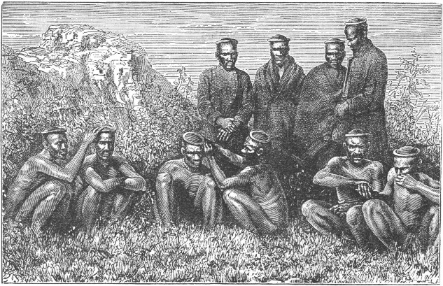 ZULUS (NATIVES OF SOUTH AFRICA).
So strong a military power as this on the frontier made it imperative to place the Transvaal, or South African Republic, under more effective rule than that of the Boers. The British have succeeded in breaking up this military power and have divided the country into districts. Each district is governed by its own chief, subject to the supervision of British magistrates.
The Gasa country stretches north from Delagoa Bay to the Lower Zambesi, and is under the rule of a powerful Zulu chief. He has power over all this vast territory, with the exception of a few places on the coast under the protection of the Portuguese.
Inland from the Gasa country extends the kingdom of the Matabele Kaffirs. It is a complete military despotism.
The land of this kingdom rises higher than that of the Gasa country. The picturesque granite hills of the Matoppo and Mashona ranges often attain an elevation of forty-five hundred feet.
The king of this country has his residence at the kraal, or village, on the southern slope of the Matoppo hills.
A plateau Kaffir tribe, named the Makololo, having adopted the military system of government, marched northward, early in the present century, through the Transvaal to the central valley of the Zambesi, in search of conquest.
Having enslaved the natives of the river valleys, they established a powerful kingdom, which extended south and north across the Zambesi.
Disputes arose in the kingdom as to the right of succession. Those who had been conquered took up arms against their conquerors, and having revenged themselves for the years of servitude they had had to endure, completely destroyed the Makololo tribe.
The Kalahari Desert represents that portion of the[Pg 273] interior of South Africa which has the greatest deficiency in moisture. It may be termed the heart of Bechuanaland.
It reaches away in a northerly direction from the Orange River as far as Lake N'gami.
The change from the fertile, verdant plains of the Transvaal and the Orange Free State to the arid desert is a very gradual one, corresponding to the change from the Soudan to the Sahara in the north.
The Kalahari, as we know, has no running water. It is, for the most part, a dry, sandy region. It is not wholly lacking in vegetation, for it has tufty grass and creeping plants, together with deeply buried bulbous roots, except in the most central section.
The Bushmen are the nomads, or wandering tribes of the desert. They are of low figure, very thin and wiry. They make no attempt to cultivate the land and have no regular homes. Their chief occupation is to chase the herds of antelopes from place to place, and to lie in wait for them with their bows and poisoned arrows, in readiness to shoot them.
The Bushmen are sallow rather than black in color, and in their features and coloring are said to resemble the Chinese more than any other people. They may in reality be termed the children of the desert; for, owing to the march of civilization and colonization, they have sought refuge from the haunts of white men in the wastes and barren mountain ravines.
The locusts, which may well be looked upon as a scourge to any land, are hailed with joy by the Bushmen, for they form an important article of food with them.[Pg 274]
The wild Bushman, happy in his nomadic life, sings a song, the words of which may thus be interpreted:—
The Bushmen are not fastidious in their tastes; for they eat many plants and bulbs which other people would despise as food. Grasshoppers and other insects, and even serpents, are eaten by them with much relish.
Their huts are very inferior to those of other tribes. They are usually mere holes in the ground. They sometimes serve the purpose of a bed. They are only a few inches deep, of rather an oval form, and no more than five or six feet wide.
In extremely cold weather these people gather twigs and earth, till they have a mound heaped up as a protection on the windward side of the hole. In summer they seek the beds of rivers and, lying under the shade of the mimosas, they draw down the branches to shield themselves from the glare of the sun.
The condition of the Bushmen has been very much changed by the circumstances which have governed their lives. Every one's hand has seemed against them, and theirs raised against every one. Like partridges in the mountains, they have been hunted for[Pg 275] generations. Deprived of all that the bountiful hand of Nature had given them, they became at first desperate, then rebellious, wild, and fierce in their characters.
Truly, their condition is a most degraded one, yet it is not hopeless. The civilization of this people seems not only practicable, but there are reasons for feeling that it might be easily accomplished.
The Bushmen are not lacking in intellect, are moved by kindness, and manifest gratitude for favors. They are trustworthy if any service is expected of them, and ready and willing to receive instruction. Under proper management and through the right spirit there is little doubt that they could be easily persuaded to exchange their barbarous way of living for a life offering civilization and comfort.
Just west of the Kalahari we find the extensive countries of the Nama Hottentots and of the Damara tribes. These reach over the hilly border lands of the continent down to the arid shores of this part of the Atlantic.
Namaqualand may, generally speaking, be considered a dreary region, affording but a scanty vegetation of grasses and prickly shrubs. The land is furrowed by water channels. These flow for only a short time after the scanty showers have fallen. The coast land is of a sandy character and destitute of water. It is rendered still more disagreeable by an almost constant haze which overhangs it.
Damaraland is a little farther to the north. It has an aspect a little more favorable, on account of its hill[Pg 276] slopes. Still, it, too, lacks any permanently flowing rivers.
Copper has been found in considerable deposits, and doubtless gold lies yet undiscovered.
Of the animal kingdom we find the ostrich in large numbers, and many specimens of cattle are seen.
The people of Damaraland are principally of two tribes, the Cattle Damaras, who probably migrated from the valley of the Zambesi, and a black, negro-like people, or aboriginal tribe. The latter were once slaves of the Namaquas, and adopted the Hottentot language. A few Bushmen and Griquas, together with German missionaries, are the remaining population.
There is but one highway, or regular track into Namaqualand from the Atlantic. This leads from Angra Pequena Bay to the mission station of Bethany on the plateau. It was formerly visited by guano ships. Recently it has been occupied by a German trading company. From Walfish Bay there are tracks which lead inland to a mission station in Damaraland.
Just north of Damaraland there are a number of tribes that bear a strong resemblance to the Damaras. These are classed together as Ovampos. They occupy the fertile tract of country south of the Cunene River, or the province of Mossamedes, belonging to the Portuguese.
We must not forget that most of these lands occupied by native tribes are, in a measure, governed by the nation to which they have been ceded; and hence these tribes, in many instances, come under the protection of Great Britain, Germany, or Portugal, as the case may be.
Western Africa comprises the west coast of the continent from the borders of the Great Desert to the Nourse River, together with a considerable amount of inland territory.
This inland territory varies considerably in its extent from the shores; and, in fact, is quite undefined as to its limits within the interior of the continent.
Senegambia is the country drained, you will remember, by the Senegal and Gambia, hence its name. It is generally understood to include the tract of country from the Senegal southward to the promontory of Sierra Leone.
The French, Portuguese, and British have settlements. France has the largest possessions. They extend all along the left bank of the lower Senegal River, and along the coast past Cape Verd to near the Gambia.
The seat of government of the French is St. Louis. It is situated at the mouth of the Senegal. The chief commercial town is Dâkir. It is situated on the peninsula[Pg 278] of Cape Verd. The islet fortress of Goric stands guard over it.
Farther to the south there are a number of smaller, isolated possessions. These, too, belong to the French. There are also several stations on the banks of the various smaller rivers.
Since 1880 these scattered possessions of the French have become consolidated. Several native states have placed themselves under a French protectorate. Thus no little progress has been made in consolidating the French possessions in Senegambia with those on the coast of Guinea.
Quite a large extent of seacoast is nominally claimed by the Portuguese; but their actual possessions are exceedingly small.
The Gambia River is navigable for three hundred miles up from the sea. The greater part of the river is held by the British. They have an important little colony at the mouth of the river, and several smaller stations higher up the stream.
Sherboro Island lies fifty miles south of the British colony, Sierra Leone. This island and the coast line as far as Liberia form a part of the British possessions.
The inhabitants of Senegambia, if we except the Europeans and the traders living in the towns and trading stations, are mainly native negroes. All are black in color and have good figures.
We find here, too, representatives of a remarkable people, called the Fellatah. They belong to a much more advanced family than the negro. They differ from the true negro type in their red-brown color, their finer[Pg 279] features, slim figures, and less woolly hair. These Fellatah are to be found, also, considerably farther inland. In the Soudan they are very zealous advocates of the Mohammedan faith.
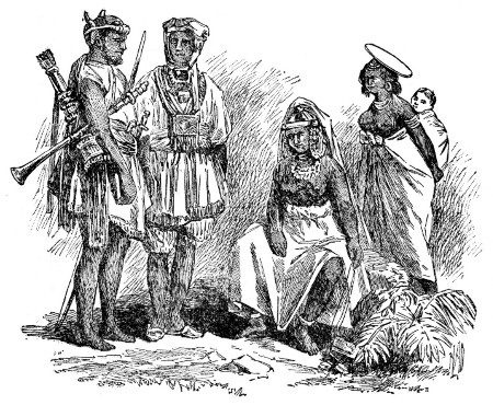 NATIVES OF SENEGAMBIA.
The western portion of Senegambia is very flat. The Great Desert, its near neighbor, affects it by the dry, hot winds; hence the atmosphere is often loaded with fine sand, and dark with clouds of locusts.
The eastern portion of the country is diversified by hills and elevated land. There are a great many rivers, the Senegal, Gambia, and Rio Grande being the most important.[Pg 280]
In the heat of its climate Senegambia ranks with Egypt and Nubia. During the rainy season the heat is most oppressive. Then, from June to November, the country is completely drenched by the enormous fall of rain. During this season the prevailing wind is from the southwest; during the dry season it blows from the east.
The vegetation of Senegambia is very luxuriant and vigorous. The baobab, or monkey-bread tree, is found here. The cottonwood trees, a species of poplar, are very numerous. They rank among the loftiest trees in the world.
The chief trade of Senegambia is in the gums which the acacia forests yield. These forests cover the entire country north of the Senegal.
Farther south we find the factories for the manufacture of palm oil. These are all conducted by Europeans. The palm oil is exported to English ports and is used largely in the manufacture of a superior toilet soap.
The interior sections yield abundant quantities of groundnuts, hides, and wax. These are sent down the rivers and shipped from the coast. Many valuable products, as ginger, pepper, arrowroot, coffee, and rice, are capable of cultivation.
So great is the production of cotton that great quantities can be shipped to England at any time when the supply from other countries is so small as to raise the market price. No matter how extortionate the price may have been before the arrival of the Senegambia supply, it must soon become reasonable when the African cargo reaches English ports.[Pg 281]
The west coast of Africa, from Senegambia to the Nourse River, is called the Guinea Coast. This name was derived from the Portuguese language.
The coast line is, generally speaking, very low. Navigators approaching it are obliged to make the tree tops along the shore their sailing guides until quite close to land; for only then is the outline of the coast visible.
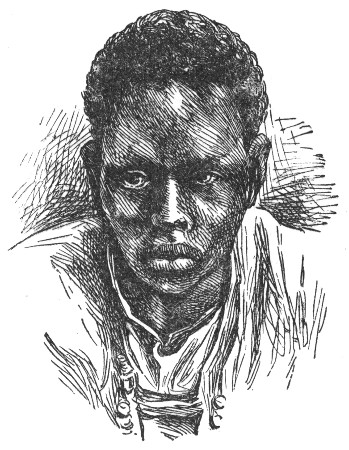 GUINEA COAST NATIVE.
Just north of the equator, in the Bight of Benin, the coast loses this marked characteristic and becomes high and bold, with the Cameroon Mountains for a background. Again, near Sierra Leone it presents a bold front to the sea.
These rugged features in the coast line are, however, noticeable exceptions to its general character. Frequently it presents a dead level, which extends from thirty to fifty miles inland.
"The heights which skirt the northern coast line of the Gulf of Guinea, and which stretch as far as the head waters of the Senegal and Gambia, and in the inner slopes of which the Niger also has its sources, may be considered as an extension of the Great South African Plateau. But they are of less general elevation; and that best known part of the ridge, which has the name[Pg 282] of the Kong Mountains, is, apparently, not higher than from two thousand to three thousand feet."
This, perhaps, will help us to understand more clearly why one authentic author has stated that "the supposed Kong Mountains do not exist." Doubtless, he does not consider the ridge of a lofty enough elevation to be designated as a mountain range.
There are numerous rivers. Some of these extend far back into the deepest recesses of Central Africa.
The climate of the Guinea Coast is very fatal to Europeans; for the muddy creeks and inlets, the putrid swamps, and the mangrove jungles that line the banks of the rivers are all productive of pestilence and malaria.
There are two seasons, the wet and the dry. In the more southern portions the rainy season begins in March, but at Sierra Leone and farther north it begins a month later.
The vegetation is not only very luxuriant but varied. One of the most important trees is a species of palm. The covering of the seed, or nut, of this tree is used for the extraction of the palm oil of commerce.
A bunch of red and yellow fruit will often have a thousand oil-yielding plums, and weigh in some cases half a hundredweight.
It is no uncommon thing for several thousand tons to be exported in a year to English ports, as Liverpool, London, and Bristol.
The palm-oil tree is native to the country between the Gambia and the Congo, and is found in great abundance. The oil from the nuts, however, is manufactured chiefly in the country of the Gold and Slave coasts.[Pg 283]
Nearly all the remarkable animals of Africa are found in the country along the Gold Coast. The domestic animals are mostly of an inferior order; but of the wild animals we find an abundance, as elephants, hippopotamuses, monkeys, lions, leopards, together with crocodiles, serpents, and parrots.
The principal minerals of the country are gold and iron. The chief exports are palm oil, ivory, gold, wax, and various kinds of timber, as well as spices, gums, and rice.
The population consists of a few European colonists and a variety of negro nations. These, though bearing a strong physical resemblance to one another, and holding many customs in common, differ widely in their dispositions and characters.
Guinea is usually divided into Northern, or Upper Guinea, and Lower Guinea.
Upper Guinea has several divisions, which still retain the characteristic names first given to them. These names were founded mostly on the productions of different sections, and becoming popular were retained.
Sierra Leone, named from its bold front "Lion Mountain," stretches from Rokelle River in the north to Kater River in the south, and for about twenty miles inland. It is a British colony, founded in 1787 for the suppression of the slave trade in West Africa, and has been maintained for that purpose.[Pg 284]
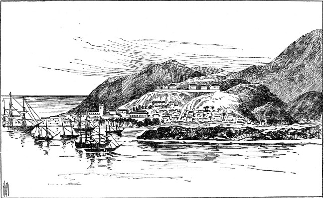 SIERRA LEONE.
The larger portion of the colony is a rugged peninsula of mountains. This has a sterile soil, but it is surrounded by a belt of fertile coast land with a humid and pestilential climate.
The population consists mostly of those who were once slaves, but who have been liberated. In 1869 the population numbered over fifty-five thousand; of these only one hundred and twenty-nine were white men. Freetown is the capital. Next to St. Louis it is the largest European town on the western coast of the continent.
The Grain Coast is named from the grains of the Malaghetta pepper plant. This plant is a species of parasite, and yields very abundantly.
The Malaghetta, or Grain Coast, is often called the Windy, or Windward Coast, on account of the many brief but furious tornadoes which it experiences throughout the year.
The negro republic of Liberia occupies nearly four hundred miles of this coast. It was founded by the American Colonization Society in 1822, for the purpose of establishing a settlement for the freedmen of the United States. Its capital is Monrovia, named after Mr. Monroe, the president of the Colonization Society. It is situated on the rising ground of the coast, within the shelter of Cape Mesurado, which forms a breakwater against the incessant roll of the high surf from the Atlantic. It carries on quite a commerce with England, Holland, Germany, and the United States.[Pg 286]
The Ivory Coast extends from Cape Palmas through three degrees of west longitude. It derived its name from the great quantities of ivory it afforded at one time. Now that the elephant is becoming extinct, the supply must, of course, cease.
Numerous French forts and settlements along this coast have, since 1871, been abandoned.
The Gold Coast is controlled entirely by the British government, and is, in fact, a Crown colony. It reaches from west of Cape Three Points to the river Volta.
The Gold Coast has long been visited for gold dust and other products. It has been described as an outer margin of plain, on the coast of which a roaring surf continually breaks. It extends east and west for about three hundred miles, and is bounded inland by hills covered with primeval forests. It is rich in the oil palm and oil-bearing groundnut, but the climate is exceedingly dangerous to Europeans.
Attempts have been made to introduce cattle and horses. These have all been unsuccessful, owing to that African scourge, the poisonous tsetse fly.
As far back as 1849 all the Dutch possessions along this coast were ceded to England, and by a treaty of 1871 all the Dutch possessions became British property.
The principal British station is Cape Coast Castle. It is named from its great church-like fort on the water's edge beside the filthy native town, above which the European residences peep out from among the woods. Elmina, "the mine," is situated about midway along the coast.
It was, doubtless, the earliest European settlement,[Pg 287] and is to-day one of the largest towns. It has a population of about ten thousand.
Just behind the Gold Coast lies the country of the Ashantees, a warlike negro people. The greater part of the country consists of forest and jungle.
The river Volta forms the western boundary of the Ashantee country. Next to the Niger it is the most important river of this portion of the coast line of Africa. Both of its banks, in the vicinity of the mouth, are included in the Gold Coast colony. The Volta seems to be navigable for about two hundred miles. No doubt, in the near future it will become an important highway of trade.
East of the Volta is a small German territory named Togo. Farther up we find Popo, a French settlement, and Whydah. The latter is the port of the negro kingdom of Dahomey. This kingdom is noted for its cruel rites and barbarous customs.
Farther on is the British town Lagos. This is the largest seaport of the Yoruba country and of all this portion of West Africa. It is in direct communication with Liverpool by steamers. These carry out cargoes of palm oil and cotton, in an unfailing supply, to England.
The kingdoms of Ashantee, Dahomey, Yoruba, and others, occupy the interior of the Guinea Coast country.
Ashantee is about two hundred and eighty miles long and about as many broad. Although a mountainous region, it has no abrupt or precipitous elevations. It is well watered, notwithstanding that it does not lie in any of the basins of the great African rivers. Along[Pg 288] the coast there are the mouths of several large streams, and the various affluents of these streams form a network over the country.
The Asinee River is a stream of some size. It is considered the boundary line between the Gold and the Ivory coasts. For a considerable distance from its mouth it forms the western boundary of Ashantee. The Volta, which is the largest river, is estimated to be four hundred miles in length. There are also several lakes in the country. These frequently overflow during the rainy season.
The heat and unhealthiness of the Guinea Coast are well known. This is partly due to the hot days succeeded by the chilly nights. The main cause, however, is the sulphurous mist which rises from the valleys and river sections in the mornings. This mist is particularly heavy during the rainy season. The kingdom of Ashantee has one dry season and two wet seasons.
The first rains occur near the end of May or the first of June. They are heralded by violent tornadoes. The rains are followed by fogs and haze. These are disagreeable enough at all times, but are particularly so in July and August. The second rains occur in October. These are followed by the hot, dry season, which lasts till April.
Elephants, rhinoceroses, giraffes, buffaloes, deer, antelopes, goats, apes, monkeys, and baboons are among the least harmful animals; but there are lions, tigers, leopards, jackals, wolves, and wild boars of the most ferocious nature. The rivers are found swarming with hippopotamuses and alligators, while serpents, scorpions, and lizards are found in great numbers.[Pg 289]
The population of Ashantee proper has been estimated at one million. The whole empire, if we include the territories under the rule of the native king, is said to have a population of three millions.
The natives are well formed and in many respects do not show the peculiarities of form and feature found in the negro race. They are cleanly in their habits, and do not neglect their daily bath. After bathing they anoint themselves with the oil from the butter tree. This is a good cosmetic, and keeps the skin in fine condition in so hot and trying a climate.
Among the better class the clothing consists of an immense cloak. Sometimes it is made of the most costly silk. In time of warfare this dress is changed for a close vest covered with metal ornaments and scraps of Moorish writing. These are considered charms against danger. Loose cotton drawers, and large boots made of a dull red leather, complete the costume. The great chiefs wear gold breastplates; and as many of the natives as are able wear a profusion of gold ornaments.
The king of Ashantee has over three thousand women laborers, whom he has purchased from their parents for a small sum. During the working season these women are scattered over his numerous plantations. When they are at home, in the capital of the country, they live on two streets. Here they remain in seclusion, seeing only the king and his female relatives. So strict are the laws with regard to the seclusion of these women, who are practically slaves, that to look upon one, even by accident, is to be sentenced to death.[Pg 290]
In every town well-stocked and well-regulated markets are held. These supply the natives with the necessaries of life and with the various European manufactures that are in demand. The poorer classes subsist almost wholly upon fish. The common drink of the people is palm wine.
At all festivals and public meetings the most cruel acts and brutal customs prevail. Should a chief die, many lives must be sacrificed in his honor; and, on the death of the king, all his personal attendants and many others, male and female, numbering often several thousands, are sacrificed.
The chief employment of the Ashantee agriculturist is clearing the ground from the rank, luxuriant growth which covers it. This he does by means of fire. In this way he clears his ground and spreads it over with a layer of rich fertilizer.
The only agricultural implement is the hoe. This is of the crudest description; but it answers the purpose in a country whose productive soil is flooded twice each year, yielding two crops of most kinds of corn, and an abundance of yams and rice.
The natives lay out the plantations with a good deal of regularity. The cultivated grounds are extensive, though not equal to the wants of the people.
The Ashantees do not smelt ores like some of the African tribes, yet they have blacksmiths and gold-smiths much superior to what we might expect to find among them. There are also dyers, potters, tanners, and carpenters.
The fineness of texture and the variety and brilliancy[Pg 291] of coloring in the native cloths would do credit to an English or an American manufacturer. Several specimens of the handiwork of the Ashantees are to be found in the British Museum.
Various insurrections and frequent wars have occurred, in some of which the Ashantees have come into collision with the British nation. Finally, a few years ago, war was formally declared; for the Ashantees paid no regard to treaties formed with neighboring states under the protection of the British flag, and resented bitterly any interference on the part of Great Britain with the slave trade.
They not only insulted and robbed persons trading with the British settlements, but even killed them, in their bitter hatred. At last they took up arms against the British. A war followed, which terminated quite recently, and resulted in the defeat and disbandment of the Ashantees, and in the overthrow of the kingdom.
The capital, as well as the palace, was burned, and the king, in spite of his cunning and duplicity, was finally forced to sue for peace.
A treaty was formed, the conditions of which were most important; human sacrifices were to be abolished, the slave trade discontinued, and honorable commerce protected. Well will it be for Ashantee land if these conditions can be enforced; for the defeat of a native king in Africa means, usually, political chaos and ruin.
Even at the present time many of the Ashantees have thrown off their allegiance to the king; and the kingdom[Pg 292] will, no doubt, resolve itself into a number of petty chieftainships similar to those from which it was formed.
The kingdom of Dahomey is the most celebrated of all the West African countries.
The limits of the kingdom are somewhat uncertain; but the whole country over which the king of Dahomey originally ruled cannot have been less than four thousand square miles.
Formerly, the kingdom was engaged in the slave trade. Whydah, its seaward outlet, was one of the ports where the slavers were loaded with their human cargoes. Now it is an insignificant little town of ruined factories.
The kingdom, since the abolishment of the slave trade, furnishes little of value to commerce, with the exception of olive oil.
The people, and the king in particular, have long furnished the subjects of the most marvelous of stories. Travelers have brought back accounts of the curious serpent house at Whydah. Here are kept the sacred fetich serpents.
The edifice is merely a round structure, with a conical thatched roof. The hut, as we should call it, is from ten to twelve yards in diameter and seven or eight in height. The walls consist of dried earth, similar to those of the dwellings. Two openings, on opposite sides, furnish the doorways through which these serpent divinities trail their hideous forms, in their passage in and out the sacred temple.
Strings of cotton yarn hang from the roof. On the[Pg 293] floor, which, like the walls, is whitewashed, are several pots of water.
One traveler found as many as one hundred serpents within the sacred house. Another found but twenty-two on his visit. They were harmless, for their fangs had been removed.
The length of these reptiles varied from one to three meters. They had spindle-shaped bodies, which terminated gradually in a tail one-third the entire length of the body.
They had large heads, somewhat flattened and triangular, but shaped as if the corners had been rounded off. Their necks were somewhat thinner than their bodies.
Their color varied, ranging from a clear yellow to yellow green. Most of them were marked with two brown lines down the back; a few were irregularly spotted. Dr. Répin believed them to belong to the species of non-poisonous reptiles classified as pythons and adders.
As he watched them, some ascended and descended the tree trunks placed within the sacred house for them. Others suspended themselves by their tails, balanced themselves above his head, and peered down at him with their narrow eyes. Some were coiled up asleep under the rafters which supported the roof, after a feast from the last offerings of the faithful worshipers.
Strangely, weirdly fascinating as the sight was, and wholly devoid of danger, yet he could but give a sigh of satisfaction as he stepped into the open air.
Every one of these serpents is held sacred. If one of[Pg 294] them, astray from its home, is encountered by one of the superstitious negroes, it is approached in a most reverential manner, often on the knees, and then lifted carefully in the arms and carried back into the sacred house with the most humble apologies from the worshiping savage for the liberty he is taking in touching anything so sacred.
When, by accident, a European, unaware of its sacred character, has killed one of these serpents, it has been only with the greatest difficulty that his life has been saved from paying the forfeit for the sacrilegious act; so great has been the wrath of the priests and their fanatical people.
The serpent is thus reverenced because during a siege in war time it appeared to the army, and so inspired the soldiers with courage and ardor that a victory was won.
Abomey is the capital of Dahomey. It is situated seventy miles inland, and stands upon a level plateau. It is a walled city. The walls are of clay, and measure about eight miles in length. They are pierced by four gates, according to some writers; by six, according to others. Each has a double opening, one for the exclusive use of the king, the other for his subjects.
The walls of the town are twenty feet in height. A ditch from four to six feet deep is an added protection, in case an enemy should storm the walls. This ditch is crossed by means of light bridges of wood, which can easily be moved in case of danger.
The houses are widely separated, and in some instances are surrounded by small farms. The[Pg 295] streets are broad and tolerably clean, but by no means crowded; many of them are shaded by magnificent trees.
Near the center of the city is a small edifice, with a round roof sustained by a wooden colonnade. This is the building in which the human sacrifices formerly took place.
Near this is the palace of the king, consisting of a number of ordinary dwellings separated by courts and gardens, and serving as the lodgings of the king's female soldiers and his domestic slaves.
These dwellings are made of clay dried in the sun, and roofed with bamboos, which extend over the fronts and form verandas; only one of them has a doorway which opens on the principal street. This is the royal treasure house and is two stories high. Its walls are festooned with strings of cowries, hanging from the eaves to the ground, an ornamentation which is found nowhere else.
The king has no special apartment out of the many that comprise his palace, but chooses any, from time to time, which suits his fancy.
Surrounding all these dwellings is a wall of clay. This is from fifteen to twenty feet high, and pierced with several gates. Here and there at intervals iron hooks project, and from these are suspended the heads of decapitated subjects, some whitened and bleached by time, others ghastly tokens of recent sacrifices in pagan worship.
In front of the doorways of the dwellings, piles of elephant bones may be found heaped up. These are[Pg 296] probably trophies of the chase, and yet they seem to be held in superstitious fear by the natives.
The Dahomans are tall, well formed, and intelligent. For an African race they are wonderfully honest, and are well advanced in a knowledge of agriculture. They are almost all pagans, and practice the most heathenish rites. The king is an absolute despot, having complete control over the lives and the possessions of his people.
One of the cruel practices, formerly, was the tremendous sacrifice of human lives during any of the religious ceremonies. One king caused seven thousand followers to be killed at the death of his father.
A peculiar feature of the army was the corps of Amazons, or female soldiers. They have been described as more effective than their male comrades in time of war. The flower of the corps perished in a siege in 1867, and the soldiers were greatly reduced in numbers. The remaining force since then has been divided into three brigades, each of which has a distinguishing mode of dressing the hair.
Leaving the Dahomey kingdom, we reach the dead levels of the delta of the Niger, which has twenty-two main channels, separated by swamps of mangrove trees.
The navigation of the Niger is now carried on by a half dozen or more light steamers. These ascend the current from the Atlantic to the factories situated at the junction with the Binue, and even farther up both streams. These steamers carry on an exchange of European goods for ivory, palm oil, and butter from the olivelike seeds of the butter tree. All these steamers[Pg 297] need to be well armed, in case of an attack from hostile natives.
Abo, at the head of the delta, is in the very heart of the oil section. There are two or three important native towns farther up the river, and at the mouth of the Binue is an important mission station. This is under the management of a negro bishop. This mission station, Lukoja, is also a great depot and trading station of the British Niger Company, which has control over the government of the river.
Egga, a large Mohammedan town a day's journey by steamer above Lukoja, is at present the limit of the European trade on the Niger.
Beyond the delta of the Niger we find the estuaries of the Old Calabar and Cameroons rivers. These are famed as being the "oil rivers" of West Africa, owing to the great supply of oil which is brought down their currents from the interior.
At the coast all kinds of European goods are given in barter for the oil in a crude form. This crude oil is then melted and stored in sheds, ready for transportation.
The oil rivers, as far as Rio del Rey, are controlled by the British. The Cameroons coast has been ceded to Germany.
Southern, or Lower Guinea, begins at the equator. It is generally understood to include the maritime coast line of West Africa. For about fifteen hundred miles it extends in a north and south direction from the head of the Bight of Biafra to Cape Frio.
On the northern part of the coast, out from the high peaks of the Cameroons, which stand on a peninsula of the mainland, are four volcanic islands in line.
The largest of these is Fernando Po, which belongs to Spain. Its perfectly conical summit, which rises to an elevation of over ten thousand feet, is wooded completely over. Its harbor of Clarence Cove is one of the most picturesque points in West Africa. At one time it was a place of banishment for political offenders from Spain.
Prince's Island, which has been compared to a volcanic garden, and St. Thomas, beyond it, whose lofty peak rises over seven thousand feet above the sea, belong to Portugal. The little rugged island of Annobon, which is the last of the chain, belongs to Spain.
The section around the Cameroon peaks has, within a short period, been occupied by the Germans. Near the equator, on the coast of Lower Guinea, the Spaniards have some small settlements in the beautiful Bay of Corisco, and on the promontory of San Juan, which adjoins it. The French, too, hold not only the inlet of[Pg 299] the Gaboon, but a large portion of the coast, together with an extensive inland section, which was ceded to them by the Berlin Conference, when the Congo State was established.
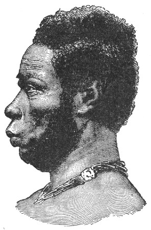 A NATIVE OF THE GABOON RIVER.
One of the chief negro tribes of West Africa, the Fans, occupy the coast line of Lower Guinea. They are a fine race, but are pronounced cannibals. Since they have come in contact with Europeans this revolting practice has been less prevalent.
The Fans have long been famed for their skill in forging weapons and making poisoned arrows. These occupations have declined since the advent of Europeans.
Du Chaillu, the explorer, relates his experience upon arriving at one of the Fan villages. So alarmed were the men, women, and children, that they fled in terror the moment they perceived the white "spirit," as they called him.
In his journal he writes: "If I was not frightened,[Pg 300] I was at least as much surprised by all I saw as the Fans could be. These fellows, who now for the first time saw a white man with straight hair, were to me an equal surprise, for they are real, unmistakable cannibals. And they were by long odds the most remarkable people I had thus far seen in Africa. They were much lighter in shade than any of the coast tribes, strong, tall, well made, and evidently active; and they seemed to me to have a more intelligent look than is usual to the African unacquainted with white men."
He describes these people as almost without clothing. Such as they had was made from the soft inside bark of a tree, while from the waist was suspended the skin of some wild animal. Their teeth were filed, which gave the face not only a ghastly but a ferocious appearance; and, in addition to filing, some had blackened the teeth.
The hair, or rather wool, was pulled out into long, stiff, thin plaits; and on the end of each, white beads or rings of copper or iron were strung.
Some of these natives wore caps made of feathers. Others wore long queues. These were made of their own wool, lengthened out by a kind of tow, which had been dyed black and mixed with it. This gave the wearers a very droll appearance.
Over the shoulders they wore suspended the huge, long knife of the country, and in their hands they bore spears and an immense shield made of elephant hide. About their necks they wore various charms and ornaments, which rattled constantly as they walked.
The shield the Fan carries is made of the hide of a[Pg 301] very aged elephant. Only the part which lies across the back of the animal is used. It is dried and smoked, and thus rendered as hard and impenetrable as iron. The shield when finished is about three feet long and two and a half feet wide.
The charms, or fetiches, which are worn suspended around the neck by the Fans, consist of the fingers and tails of monkeys; human hair, skin, teeth, and bones; clay, old nails, copper chains, shells; feathers, claws, and skulls of birds; pieces of iron, copper, or wood; seeds of plants; and ashes of various substances. This belief in charms indicated to Du Chaillu the highly superstitious nature of the people.
The women of the Fan tribe wear still less clothing than the men. They are small and hideously ugly. They wear their teeth filed like the men, and, in place of clothing, decorate their bodies with red dye.
The babies of this tribe were carried by the mothers in a sling, or rest, which was made of the bark of a tree and worn suspended from the neck.
Du Chaillu writes of these people that they crowded about him as soon as they became convinced that he meant them no harm, calling him "spirit," and examining every detail of his person and dress that he would permit them to touch. They seemed especially impressed by his hair and feet. They could not sufficiently admire the former. On his feet he wore boots, and, as his pantaloons hid the tops of these, they very naturally drew the conclusion that his boots were his feet, and expressed wonder that they should be of so different a color from his face.[Pg 302]
Their color is dark brown, rather than black, and they tattoo themselves more than any of the other tribes north of the equator, though south of it there are tribes that pursue this practice to a much greater extent. The men do not disfigure themselves as much as the women, who take pride in the many blue lines and curves with which they cover their bodies. Their cheeks, too, they mark with various designs, and to add to their hideous appearance they wear in their ears huge copper and iron rings, which are so heavy as to weigh down the lobes to an ugly length.
The men of this tribe are very expert blacksmiths. The tools they make are rude, but they are far superior to those made by any other African tribe. Their weapons are very effective. Their battle-axe is a terrible instrument. One blow from it will split open a human skull. Another weapon is a singular pointed axe. This is thrown from a distance, very much as the American Indian used the tomahawk when on the war-path.
The war knife carried by this tribe is a cruel weapon when used in a hand-to-hand conflict. When not in use it is worn suspended from the side. Another deadly weapon is a huge knife, over a foot long and two-thirds of a foot wide. This is used to cut through the shoulders of an enemy.
The spears, which are fully seven feet long, are thrown with wonderful skill and accuracy to the distance of thirty yards. Crossbows are used in war and on hunting expeditions. Some of the larger arrows, which are used in the hunt, are about two feet in length, and are[Pg 303] tipped with an iron head resembling the sharp barbs of a harpoon.
Some of the axes and knives are decorated with a kind of scroll work. This is wrought in iron with graceful lines and curves, showing considerable artistic taste on the part of the native workmen.
The most deadly of all weapons used by the Fans is a small, insignificant-looking rod of bamboo. It is not more than a foot long, and is simply sharpened at one end. This is the famous poison arrow, a single pin's point prick of which means death. The poison for these arrows is obtained from the sap of a plant which grows in the forests. The point of each arrow is carefully dipped several times in the sap and allowed to dry, when it turns a red color.
These arrows are carried in a small bag made from the skin of some wild beast. They are much dreaded by the tribes at war with the Fans, for they can be thrown with great force at a distance of fifteen feet, and with such velocity that they cannot be evaded. There is no possible cure for a wound inflicted by one of these deadly yet harmless-looking missiles. Death soon follows in its wake.
In addition to skill in iron work, the Fans show considerable ingenuity in making vessels of clay. These they make surprisingly regular in shape, considering that they have no lathe, like ordinary potters.
Just beyond the low coasts above the delta of the Ogowé lies the hilly, thickly wooded shore of Loango. Here oil palms, gum trees, copper, ivory, coffee, cotton, and bananas are found in abundance.[Pg 304]
The great river Congo, or Zaire, forms a line of division across West Africa; and the coast lands south of this line are very different from those which lie north of it.
In place of the lagoons and swamps, backed by evergreen forests, which lie north of the great river, level sandy bays appear along the shores farther south, and the forest vegetation is more distant from the coast; so that only long stretches of coarse grass, with here and there a tall tree, are seen from the ocean.
Behind the coast plain, however, the land rises in terraces, each of which is marked by a change of vegetation, from the first, with its larger shady trees and broad-leaved grasses, to the second, in which creeping plants abound, clasping the biggest trees with a mass of foliage and flowers, up to the third, where the plains are covered with gigantic grasses. Each of these changes of level corresponds to a change of climate, from the hot coast land up to the cool interior.
Here, in the Congo State, under the rule of the King of the Belgians, we find Banana Point, Boma, Vivi, names familiar to us in our reading of the Congo River district. Higher up the river, we find Leopoldville, on Stanley Pool, the principal station amongst the many that dot the river along this part of its course.
All the country for a great distance south of the river was once subject to the king of Congo, from whose dominion the river is named; his capital became the center from which the early Jesuit missionaries spread cultivation and industry far and wide.
Here they built the cathedral and monasteries of San[Pg 305] Salvador, the ruins of which still exist, and by their influence extended the territory of the king of Congo.
On their expulsion, however, the kingdom gradually diminished, till its territory now includes little more than the neighborhood of the capital; though its king still controls several of the chief trade routes to the interior.
Portuguese West Africa is generally called the Province of Angola. It is divided from north to south into five districts. Each district has its chief town corresponding to it in name.
In former times the slave trade was the main traffic of this coast. Since the cessation of that traffic the ivory trade has also declined. The groundnut is now largely cultivated for the oil it yields. Coffee grows wild, cotton is cultivated, and palm oil is brought down the Kuanza River in considerable quantity. Iron has long been smelted in the district of Cazengo, a little north of the Kuanza, and copper and gold appear in small quantity in many parts.
Most of the smaller kinds of game abound, but the elephant has disappeared from the mountain districts.
The capital of the colony is St. Paul de Loanda. It is mainly a European town, situated on a fine bay. It has large houses roofed over with tiles. The open verandas, so characteristic of these houses, give an artistic and beautiful finish to them, and are a source of pleasure and comfort to the owners, since they give free admission to the cool sea breezes.
Benguela, a large port on the coast, was formerly one of the great slave marts, from which thousands of[Pg 306] unfortunates were sent to Brazil and to the island of Cuba. Mossamedes lies farther south. It is a pretty town, built of stone houses and commanded by a fort. Ambriz is the northern port, but is sadly neglected, and presents a desolate picture of ruin and decay.
It is a matter of much interest to note the spread of Christianity in different sections of the dark continent, which, once shrouded in the gloom of superstition and barbarism, now receive the light of the Gospel. To quote from a daily paper:—
"Along the west coast of Africa there are now about two hundred and twenty-five churches, forty thousand converts, one hundred thousand adherents, three hundred schools, forty thousand pupils. Thirty-five languages or dialects have been mastered, and parts of the Bible and other books have been printed in these languages, while it is estimated that eight million of the natives have more or less knowledge of the gospel of Christ."
We have considered the climate of Africa but incidentally in connection with the sections which we have viewed. It will be of interest to note the changes in its character in connection with the form of the continent.
While Africa lies almost entirely within the torrid zone, and is therefore the hottest country known to us,[Pg 307] yet it presents three great varieties of climate. These correspond with its physical structure. Hence, we find the plateaus, the terraces which lead to them, and the coasts, showing great varieties of climate, though lying very nearly in the same latitude.
The highest temperature is to the north of the equator. In Nubia and in Upper Egypt the intense heat of the sun, acting upon the sands, renders it possible to roast eggs in them; while, along the shores of the Mediterranean the influence of the sea makes the climate much more temperate.
In the vast desert of Sahara, which has an area equal in extent to that of the Mediterranean Sea, and yet is almost destitute of water and well-nigh barren of vegetation, we find the climate showing a uniform yet striking contrast between the heat of the day and the coldness of the night. Towards the south of the Sahara the country is more elevated and consequently somewhat cooler. Some of the more elevated portions near the equator reach the altitude of perpetual snow.
There is no regular fall of snow even in the northern or southern portions of the continent. Radiation of the heat is very great in some parts of Africa, as in the northern sections. The soil of the Sahara, for instance, absorbs heat very rapidly during the day, but during the night it radiates the heat still more rapidly, thus making a great fall in temperature. So rapid is this radiation of heat that ice is said to be formed sometimes during the night when water is left exposed to the atmosphere.
In strong contrast to the hot days and cool nights of[Pg 308] the Sahara is the climate of the terraces of Limbu, situated behind the region of the Sierra Leone. Here we find the climate not only temperate but wholesome; while in the region behind the Slave Coast there are beautiful landscapes, abundant springs, new forms of vegetation to delight eye or palate, and an atmosphere as mild and balmy as that of sunny Italy.
In the regions of the Congo the natives call their terrace lands, which are under cultivation and thickly populated, "The Paradise of the World," suggestive of every detail of the beauty of the Garden of Eden, when Adam and Eve were permitted to dwell in it.
The flat coasts of Africa are often flooded over in the rainy season. This renders the climate very oppressive, owing to the humidity of the atmosphere. From the morasses found around the mouths of the rivers a malarious vapor arises, which is most destructive to health. Malarial fever, when it attacks Europeans, is much of the nature of a pestilence in its destruction of life.
This pestilential air along the coast region is supposed to be caused by the decaying vegetable matter brought down from the dense mangrove woods through which the rivers take their course in their journey to the sea.
As this decaying vegetable matter mingles with the salt water of the sea, it forms a poisonous gas, sulphureted hydrogen, most fatal to health. The air of these regions, freighted with this pestilential gas, often extends for one hundred miles inland.
Out at sea we find this gas poisoning the air for about forty miles from the coast, while it affects the[Pg 309] atmosphere for about four hundred feet above sea level. Hence, it would seem desirable to take up one's abode either in the interior of such regions, far out at sea, or even in a balloon, were it possible, rather than to breathe the pestilential atmosphere of these coast terraces.
The influence of the regular winds is felt very little in Africa, with the exception of what comes from the monsoons of the Indian Ocean. These extend over possibly a third of the eastern shores, but they affect to a considerable extent the whole of Africa. Hurricanes are sometimes felt in the southeastern extremity, but rarely in any other portion.
The northern part of Africa is exposed to the hot winds and the storms which sweep from the Sahara. These winds have a distinctive character and are noted for their extreme dryness and heat. They often prove to be most disagreeable and disastrous; for they not only lift the sand in great volumes and fill the air with dust, but they prove fatal to animal life and vegetation in any region over which they sweep.
The supply of rain in Africa is very scanty. As we have seen, the Sahara is almost rainless, as is also the Kalahari Desert.
The clearness of the atmosphere of Africa exceeds that of any other known parts of the globe. It has been a constant surprise and delight to European astronomers, when making their explorations. With wonder and amazement they have beheld the glory and the splendor of the African heavens. With awe and admiration they have gazed at the planets shining[Pg 310] with great brilliancy and often making well-defined shadows, such as we are accustomed to look for from our nearest neighbor, the moon, when it is most brilliant during the harvest months.
The amount of rain which falls in Africa varies not only in the different sections of the continent, as we have seen, but with the season of the year.
To the regions between the Kawara and the Senegal the southeast trade winds bring copious rains. It has been stated that at Sierra Leone as much as one hundred and thirteen inches of rain have been known to fall during the year. These summer monsoons, however, bring the largest supply of rain to Africa upon its eastern coast. They last from April till October, and bring rain to drench the extensive plains and elevated grounds of the great eastern extremity of Africa.
The force of these winds becomes somewhat broken, and their influence diminished, by the vast table-lands of Abyssinia. When the monsoon comes from the Asiatic continent no rain falls in these regions.
The southeast monsoon extends north as far as Lake Tchad and Kordofan, and even farther north. The influence of this monsoon is felt in May, though along the coast it is usually felt a month later in the season.
This fact, it is believed, disproves the old theory that Central Africa has a connected chain of high mountains. For, at the east, where lofty mountains do exist, these same rain-bearing winds become seriously interrupted and retarded. Hence, they do not reach the most northern portions of Abyssinia until fully a month later than they reach Lake Tchad.[Pg 311]
The upper basin of the Nile, not far from the coast, no doubt receives its supply of water with the beginning of the monsoon, and continues to rise till September.
The many extremes of climate necessarily affect the vegetation of Africa. In connection with such views of Africa as we have had, we have gained some little knowledge of the vegetation, but it will be interesting to gain a broader and more comprehensive knowledge in order to understand the great diversity of animal life to be found in Africa.
The vegetation of Africa presents less variety than that of Europe or Asia, yet it has many peculiarities.
Along the coast of the Mediterranean it bears a close resemblance to that of Southern Europe. A traveler starting from the south of Europe for Tangier would note little difference in the vegetation, and might suppose he was still in sunny Spain or France. Groves of orange and olive trees would greet him; wide plains covered with waving grain and barley, thick woods of evergreen and oak, would appear like familiar friends in nature. Even the cork trees and sea pines would not be unknown to him.
Intermixed with these he would find the cypress and the myrtle, the arbutus and the fragrant tree heath, pleasant reminders of home scenes; while plains covered[Pg 312] with rock roses or with palmetto trees and the wild caper would all tend to remind him of his European home.
In the early part of the year the weather seems very much like late spring in New England. The meadows are grassy and bright with myriads of beautiful wild flowers, and the gardens blossom with fresh beauty. The almond, apricot, and peach trees are then in full bloom.
In the summer season a few flowers may still be found along the river banks, although the intense heat in most sections has burned and withered almost every form of vegetable life.
The tropical regions of Africa are not so rich in the variety of plants as those of South America, but they present several kinds peculiar to Africa alone.
As the traveler leaves the sultry coast regions and ascends to the higher portions of land in the interior, he perceives a change in the character of the productions; for they present all the gradual changes noticeable in passing from a torrid to a temperate zone.
The forests of Africa cannot be said to rival those of Brazil, but they are rich in valuable woods, particularly the harder species. Many of them furnish excellent timber, suitable for shipbuilding. In these tropical forests, ebony, certain kinds of rosewood, and the timber called African teak, are produced. The gigantic baobab is also peculiar to these sections of woodland. Livingstone mentions instances where the gigantic trunks of some of these trees had become hollow from old age and served as natural cisterns for rain water.[Pg 313]
The branches of the baobab make a canopy of a hemispherical form, often from one hundred to one hundred and fifty feet in diameter, the outermost branches drooping till they touch the ground. The leaves of this tree are five-fingered or seven-fingered. The flowers are white in color and extremely large, suspended on drooping stems often a yard in length.
The fruit, sometimes called monkey-bread, is about the size of a citron melon. Its pulp is slightly acid and agreeable to the taste, so that it may be eaten with or without sugar. The juice of the fruit, when mixed with sugar, makes a refreshing drink. It is not only effective in quenching thirst, but it is used largely in the treatment of pestilential fevers caused by the malarial vapors arising from many sections of Africa.
The natives of tropical Africa mix the bruised leaves of the tree with their daily food. Travelers use them for fevers and other sicknesses. The bark, too, is used for medicinal purposes.
In the central portions of Africa a most remarkable three, called the butter tree, is found. The fruit of this tree yields a species of oil, which has much the appearance of butter and serves the same purpose for food.
Some of the extensive level plains of Africa are covered with acacias. From the stalks of these trees the sap exudes in large drops, or beads, which, when hardened, form the gum arabic of commerce.
In different sections of Africa there are species of palm trees, characteristic of special localities. These are of the greatest value and importance to the natives.
In the north the date palm, in particular, is a never-failing[Pg 314] means of sustenance, and seems to be a special provision of Providence for the wants of man, flourishing in regions of comparatively barren, and often surrounded by the hot, arid sands of the desert.
The doom palm is another species, and is remarkable for its many-forked stem. It is found in Upper Egypt and in Central Africa, and in some sections is very plentiful, forming forests; while in others it is found in isolated groups, growing in the very sands of the desert.
The leaves of this tree are shaped like a fan. From the fibres of its leafstalks ropes are sometimes made. The tree is, however, still more useful, for it bears a fruit about the size of an orange. In shape it is somewhat different, being larger and more irregular.[Pg 315]
The outer skin of the fruit is red. Upon peeling this off, a thick, spongy, dry substance is found, having rather an insipid sweet taste, and very much the appearance of gingerbread. For this reason the tree is sometimes called the "gingerbread tree."
The substance found within the fruit is used for food, and it is sometimes infused and used as a drink, which is very cooling and useful in fevers. The seeds, one of which is found in each fruit, are semi-transparent and very hard. Beads and other ornaments are made from them.
Amid the tropical growth of the west of Africa the oil palm flourishes. Its products furnish the incentive to an immense commerce, attracting European ships to coasts once given completely over to the slave trade.
Along the tropical coasts the cocoa palm grows, while along the Gambia River vast quantities of a species of plant called the groundnut are extensively cultivated. Nine million bushels of groundnuts have been exported during one year from the valley of the Gambia.
This plant has a peculiar habit of thrusting its pods into the ground for the nuts to ripen; hence the name groundnut. Vast quantities of oil, resembling olive oil and used for the same purposes, are obtained by crushing the nuts. A bushel of nuts will usually yield a gallon of oil.
The plant grows like a trailing vine, with small yellow flowers. After the flower falls, the stalk on which it grew grows longer, and, bending downward, the pod on the end forces its way into the ground to ripen.[Pg 316]
The vines are dug up by means of a pronged fork or hoe. They are then spread out to dry, and finally stacked up to become thoroughly cured.
The pods are first picked by hand from the vines, and then cleaned in a fanning mill to clear them of dust and chaff. Sometimes they are bleached with sulphur before they are packed for market.
The groundnut forms one of the chief articles of food in some sections. It is sometimes eaten raw, but is usually roasted. Recently an interesting account of the process of making a meal from groundnuts appeared in one of the daily journals. The experiment had been tried, in the German armies, of using this meal in place of others obtained from the various cereals. It was found on trial to be very nutritious,—far more so than oat or rye meal.
By actual experiment, not only did the soldiers thrive upon porridge and bread made of this meal, so rich in vegetable oils, but they became very fond of it as a daily food and ate it with good appetite, even in their soups.
As the cost of the meal is very slight, it will be a matter of economy to make groundnut meal one of the ingredients of the daily food of the German soldier. Arrangements have already been made to import large quantities each year from Africa for use in making meal for army consumption in Germany.
You will doubtless be surprised to learn that the groundnut is really only a species of the familiar peanut. So it is really an old friend with a new name. It is sometimes called ground pea, or earth nut. The[Pg 317] former name is given to it because its pod resembles the pod of the pea vine.
In the southern portion of the United States a similar nut bears the name gouber. Not only are the nuts of this plant of value as an article of food and commerce, but the vines form an excellent fodder for cattle.
In the Barbary States, which border upon the Mediterranean Sea, there is an extensive cultivation of grain. Wheat, barley, maize, rice, and a variety of corn called Kaffir corn, are found in considerable quantities. Figs and olives thrive luxuriantly, and pomegranates, grapes, and melons abound.
Tobacco has been introduced and has been cultivated to quite an extent. The white mulberry tree is also cultivated, for use in the silkworm culture. Here, too, are found the indigo and cotton plants, together with the sugar cane, while most of the kitchen vegetables of Europe are easily cultivated.
South of the Barbary States, in the mountainous districts of the Atlas range, is found a peculiar kind of timber growth. It bears the name sandarach, and is almost imperishable. It is generally supposed to be the same species of wood mentioned as the shittim wood in the Scriptures. The ceilings of the Mohammedan[Pg 318] mosques are largely, if not exclusively, built of it.
Passing beyond the chain of the Atlas Mountains, the vegetation changes. There are now but few trees, and there is a noticeable dryness in the atmosphere. It is in these regions that rain seldom falls, while such is the heat of the winds that it is scarcely bearable even by the natives.
Here, the palm, by divine Providence, affords a grateful shade. The mass of foliage formed by its fan-like leaves is almost impervious to the scorching heat, and beneath its towering yet graceful form the orange, lemon, pomegranate, and vine flourish. Strange to say, their fruits, grown thus in the cooling shade, seem to acquire a peculiar richness of flavor not noticeable in those grown in the ordinary way.
The vegetation of Egypt may be said to be somewhat of an intermediate character, for it partakes of the characteristics of the several sections we have already had described.
In the parts watered by the Nile there are found rich productions of grains of all kinds, while in the southern and drier portions are found only stunted, miserable-looking bushes and shrubs. These dispute with the drifts of accumulating sand for the possession of the native soil of these sections.
Indigo and tobacco are found in the parts of Egypt which have the richest soil. Cotton has been cultivated to some extent, by means of an expensive and laborious system of irrigating the soil.
Along the Senegal the cotton plant flourishes, in its[Pg 319] rich, well-watered soil, almost without care or cultivation. One can scarcely estimate what quantities of cotton could be raised under careful and painstaking labor. Coffee grows luxuriantly in all the fertile sections of Africa, and is very abundant.
In the deserts of the interior the eye is greeted by very different pictures from those which the other sections of Africa present. These deserts are mostly destitute of plants, and the few they have are of stunted growth. A very remarkable kind of grass covers entire districts, to the great annoyance of the traveler, on account of its prickles. Agoul, a plant peculiar to the desert, furnishes food for the camel.
In the equatorial parts of Africa all trees peculiar to European countries are lacking. Even the date tree is seldom seen. While the flora of these tropical regions resembles somewhat that of India, yet there are peculiarities of vegetation which belong strictly to African localities.
Here are found masses of the baobab trees of which we have read, and whose fruit furnishes the refreshing drink so necessary to the natives. Here, also, are found the cotton trees, the bases of which form great buttresses; while shrubs in no inconsiderable variety and rich and varied verdure cover the soil. Groups of palm trees, sago palms, and other varieties of the same family bend down to the water's edge along the great streams.
In the thickets climbing plants of every description twine among the branches of the trees. One variety has recently been discovered which yields a very good species of india rubber. These specimens of plant life,[Pg 320] with the masses of wild flowers, showing a brilliant coloring of mingled scarlet, orange, and white, make a scene of rare beauty.
While there is so much that is new and strange in these tropical regions, yet the absence of waving fields of grain and corn is strongly noticeable. Here, too, the vine is quite unknown. The fig is of little or no use, except in a few localities. Only the orange and the lime remain to remind us of the usual fruits of the tropics.
Here and there may be found various kinds of apples and plums; but, owing to the intense heat, they do not attain any perfection of size or flavor. It is a curious fact that all the fruit is not only small and undeveloped, but seems to lose, in a large degree, not only its peculiar flavor, but its succulent juices as well.
In some places in the wooded sections pineapples are very abundant, and seem to be as well established as in their native soil in tropical America.
In the tropics, wherever a broad belt of alluvial soil is exposed by the fall of the tide, as on the shores of the sea, in the estuaries of rivers, and in the shallow lagoons, we may expect to find a dense vegetation of mangroves.
These water-loving trees seem to seek the salt water sections in preference even to other localities equally damp. Their growth is peculiar and picturesque. The seeds germinate on the branches, increase to a considerable length, and then fall into the mud. Here, with their sharp points lying buried, they soon take root.
As the mangrove grows upwards, roots issue from[Pg 321] the trunk and low branches, and ultimately strike into the muddy ground, where they grow and present the appearance of a series of loops and arches, from five to ten feet high, which support the body of the tree like so many stakes.
Their matted roots interrupt the flow of the waters, and by retaining the earthy particles that sink to the bottom between them, gradually raise the level of the land. As the new land is thus built up, seeds begin to grow in it, and thousands of roots descend, still further to consolidate it. Thus, year after year, the mangroves extend the land into the sea.
As we approach the southern portion of the great peninsula of Africa, we find a wilderness of sand. This barren tract occupies the central portion of the country. Here there is little or no vegetation to attract the eye.
In the table-lands of Cape Colony there are numerous fleshy, leafless tribes of aloes and other plants. These fix their hold in the sand by means of a single tough, wiry root. For conveying nourishment to the plants, these roots must be practically useless, since the soil affords little food. Hence the main sustenance of these plants must come from the dews with which a wise Creator supplies their needs. Many varieties of heath are found here, among other plants.
Upon the hills and rocks of some sections of Africa is a curious tribe of plants which seem partly of the nature of palms and partly of the nature of ferns. They may be said to be of an intermediate family. These fernlike palms literally cover the hills and rocky[Pg 322] slopes. After a rain, such portions of the country as have been watered by nature's hand blossom forth into indescribable beauty; for the gladiolus, oxalis, and other native plants are in brilliant bloom.
At Cape Town the American aloe tree has been introduced, and vast impenetrable hedges have been formed by the interlacing of its spinelike leaves, which are often six feet in length. Here, too, flourish the oak and pine of Europe, for the climate is most favorable to their growth.
We have had occasion to speak of the thick-leaved, cactuslike plants of the desert, which seem to prefer the arid soil of the naked plains, where they are fully exposed to the burning rays of a tropical sun.
They furnish a great contrast to the delicately feathered mimosas of the more fertile sections of the continent. Among all the lovely children of Flora, the goddess of flowers, none can rival these plants in the beauty of their foliage.
One can gain but a faint idea of the beauty these plants attain under a tropical sun. In most species the branches extend horizontally, or are umbrella-shaped, and the deep blue sky, shining through the light green foliage, has a very picturesque effect.
As we study the animal life of Africa, we can but notice the great variety in its species. We find not[Pg 323] only those kinds with which we are most familiar, and those which have become known to us through our study of other continents, but many new and strange ones, characteristic of Africa alone.
Here are found the lion, leopard, jackal, hyena, and other carnivora of the cat and dog families. Varieties of the thick-skinned animals are numerous; for we find a species of elephant somewhat different from the elephant of Asia, several varieties of the rhinoceros, the hippopotamus, the wart hog, and boar, all ugly, unwieldy and clumsy in their form and movements.
In the tropics are found great varieties of monkeys, chattering wildly as they spring among the branches of the trees. The fierce gorilla haunts the dense forests, to the terror of the natives and travelers.
Du Chaillu, the explorer, had an encounter with gorillas while crossing the Sierra del Crystal to reach the Fan country. During the journey he had occasion to scale a range of granite hills and to traverse an elevated table-land. Here he found the temperature quite cold at night.
As he climbed a second range of hills he came upon the Ntambounay Falls. These he declared to be one of the grandest sights he ever beheld, and adds:—
"It was not a waterfall, but an immense mountain torrent, dashing downhill at an angle of twenty-five or thirty degrees, for not less than a mile right before us, like a vast, seething, billowy sea.
"The river course was full of the huge granite boulders which lie about here as though the Titans had been playing at skittles in this country; and against these[Pg 324] the angry waters dashed as though they would carry all before them, and breaking up, threw the milky spray up to the very tops of the trees which grew along the edge.
"Where we stood, at the foot of the rapids, the stream took a winding turn up the mountains; but we had the whole mile of foaming rapids before us, seemingly pouring its mass of waters down on our heads."
It was just above these falls that Du Chaillu shot an immense serpent. One can imagine the feeling of repulsion with which he saw his men cut off its head and divide the body into pieces, which they roasted and ate with relish.
A short distance beyond the spot, he came upon the footprints of what the natives declared to be gorillas. These footprints were so fresh that it was decided to give chase to the creatures which had made them. The gorillas were, however, very agile, and soon escaped into the forest depths.
Du Chaillu, in speaking of his experience, says: "I protest I felt almost like a murderer when I saw the gorillas the first time. As they ran, on their hind legs, they looked fearfully like hairy men, their heads down, their bodies inclined forward, their whole appearance like men running for their lives.
"Take this with their awful cry, which, fierce and animal as it is, has something human in its discordance, and you will cease to wonder that the natives have the wildest superstitions about these 'wild men of the woods.'"
One of the superstitions, common wherever the gorilla[Pg 325] is to be found, is that the spirits of certain departed negroes have entered the bodies of a particular species of gorilla. The gorillas of this species can never be caught or killed, since they bear a charmed life. The natives claim, too, that these gorillas show more shrewdness and sense than ordinary animals. In a word, they combine the intelligence of man and the strength and fierceness of the brute creation.
In further description of a gorilla hunt Du Chaillu continues: "I noticed, ahead of us seemingly, a noise as of some one breaking down branches or twigs of trees. This was the gorilla, I knew at once by the eager and satisfied looks of the men.
"They looked once more carefully at their guns, to see if by chance the powder had fallen out of the pans; I also examined mine, to make sure that all was right, and then we marched on cautiously. The singular noise of the breaking of the branches continued. We walked with the greatest care, making no noise at all.
"The countenances of the men showed that they thought themselves engaged in a very serious undertaking; but we pushed on, until finally we thought we saw through the thick woods the moving of the branches and small trees which the great beast was tearing down, probably to get from them the berries and fruits he lives on.
"Suddenly, as we were yet creeping along, in a silence which made a heavy breath seem loud and distinct, the woods were at once filled with the tremendous barking roar of the gorilla.
"Then the underbrush swayed rapidly just ahead,[Pg 326] and presently before us stood an immense male gorilla. He had gone through the jungle on all fours, but when he saw our party he erected himself and looked us boldly in the face.
"He stood about a dozen yards from us, and was a sight, I think, never to forget. Nearly six feet high, with immense body, huge chest, and great muscular arms, with fiercely glaring, large, deep-gray eyes and a malignant expression of face, which seemed to me like some nightmare vision,—thus before us stood the king of the African forests.
"He was not afraid of us. He stood there and beat his breast with his huge fists till it sounded like an immense bass drum, which is their mode of offering defiance, meantime giving vent to roar after roar.
"The roar of the gorilla is the most singular and awful noise heard in these African woods. It begins with a sharp bark, like an angry dog, then glides into a deep bass roll, which literally and closely resembles the roll of distant thunder along the sky, for which I have sometimes been tempted to take it where I did not see the animal. So deep is it that it seems to proceed less from the mouth and throat than from the deep chest of the creature.
"His eyes began to flash fiercer fire as we stood motionless on the defensive, and the crest of short hair which stands on his forehead began to twitch rapidly up and down, while his powerful fangs were shown as he again sent forth a thunderous roar.
"And now he truly reminded me of nothing but some horrible dream creature,—a being of that hideous order,[Pg 327] half man, half beast, which we find pictured by old artists in some representations of the lower regions.
"He advanced a few steps, then stopped to utter that hideous roar again, advanced again, and finally stopped when at a distance of about six yards from us. And here, as he began another of his roars, and beating his breast in rage, we fired, and killed him. With a groan which had something terribly human in it, and yet was full of brutishness, he fell forward on his face."
As soon as the great beast was dead, the men cut up the carcass and divided it in portions to be cooked. The brains were carefully preserved as charms. When prepared in one way, the charm gives the wearer a mighty arm for the chase; when in another, it renders the possessor popular and a favorite in savage society.
In place of the deer, so familiar to us in the study of other countries, we find numerous specimens of the great family of antelopes. Some writers have named as many as twenty varieties.
Among the antelope family the gnu, or horned horse, is perhaps the most curious specimen. In size it is about as large as an ass. In form it has the body, neck, mane, and tail, like those of a horse, while the legs and horns are like those of the antelope.[Pg 328]
The gnu is very spirited, and full of gambols. Its sense of smell is acute, and its sight very keen. It may be seen in herds on the plains which border upon the Orange River, where its free and varied movements, full of grace, can but attract the attention and awaken the interest of the observer.
The gazelle is the fleetest of the antelopes of Africa. It is usually quite small. One variety is no larger than a hare. Other varieties are as large as a deer. It is famed for the beauty of its eyes and the grace of its movements.
The eland is another species which abounds in South Africa wherever fertile planes or low hills exist. In the parts of Cape Colony which have been longest settled, however, it has been so hunted that specimens are rarely seen.
Livingstone describes the eland as the most magnificent of the antelopes. It belongs to the variety called bovine antelope, from the fact that it has some of the characteristics of the ox tribe. In spite of these peculiarities of structure, the eland is not only a very beautiful, but a very graceful animal. It is about the size of a horse. It stand fully five feet high at the shoulders, and weighs from seven to nine hundred pounds.
The horns of the eland are almost straight, turning backwards and inwards. They are quite pointed at the ends. They are very strong, and their great strength is increased by the peculiar spiral formation. They remind one vividly of the old-fashioned paper lamp-lighters used when matches were not so common and the large open fireplaces were found in every home.[Pg 329]
The eland has quite a swelling, or protuberance, of the larynx, similar to that found in the elk. Its tail resembles that of the ox, and has a tuft of long black hair at the end. It may be termed a gregarious animal, since it is always found in herds, which are often very large.
These animals are generally very plump and well filled out in all parts. As they are gentle and not difficult to capture, they furnish sport for the hunters who pursue them. The flesh is much prized. The muscles of the thighs are considered the finest parts. These are dried like tongues.
It is rather a matter of surprise that no attempt has been made to domesticate the eland, possessing, as it does, so many excellent qualities and serving so many useful purposes.
Livingstone describes a species which he found north of Cape Colony as having a very marked bovine form to the body, more so than in the common species, marked with narrow transverse bands of white.
The springbok is another variety of antelope. It is one of the most beautiful and graceful, as well as one of the most numerous, species to be found in South Africa. It is found in immense herds of a thousand or more when the season arrives for it to migrate to the north or when the weather is suitable for it to return to the south.
The springbok derives its name from the habit it has of leaping as it runs. Its leaps are often from fifteen to twenty-five feet. It is extremely beautiful, with its graceful form and fine colors. In size it is larger than[Pg 330] the roebuck. Its neck and limbs are not only longer but much more slender.
The general color of the springbok is a tawny brown on the upper parts of the body. Beneath the body the color is pure white. The colors are separated upon the flanks by a broad band of deep, rich, red wine color.
The head of the animal is white, with the exception of a broad band of brown on each side, which reaches from the eye to the mouth. There are two curious folds of skin which start from the tail and extend to the middle of the back. These folds are usually closed, but open out when the animal is bounding. When open they disclose a large triangular space, which at other times is entirely hidden.
The springbok ordinarily makes its home in the arid, sandy plains called karroos. When, however, the pasturage becomes burned from the heat of the sun, the herds migrate in immense numbers to other sections. Often, as they migrate, they destroy the fields of the colonists in their line of travel.
One writer speaks of seeing the country around Little Fish River specked, as far as eye could reach, with immense herds of springboks. These he estimated as numbering twenty-five to thirty thousand animals.
Another writer describes a still more wonderful sight, where, through an opening among hills, a vast herd poured for hours together in a compact moving mass, half a mile broad.
So immense are these herds of springboks that when a lion or a leopard, lurking on the outskirts of the mass, is swept into the ranks, he is virtually taken prisoner[Pg 331] and has to march along in the midst, a captive not a captor.
When young the springbok is easily tamed. It then becomes a very active, over-familiar, tricky, and troublesome pet.
The domestic animals, such as the cow and sheep, have been introduced into Africa with great success, but they are not native to the continent.
Of the ruminants, or cud-chewing animals, of Africa, the giraffe is a most beautiful yet peculiar specimen. It is found in a wild state only in South Africa. Its name is taken directly from the Spanish language, which received the word from the Arabic tongue. The word in the original signifies long neck.
The animal is sometimes called camelopard, from two Greek words which signify camel and panther, since in some respects it is like a camel, while its spots are suggestive of the panther.
The first giraffe ever seen in Europe was exhibited in the circus at Rome under Julius Cæsar. Other emperors exhibited them at different times; but, after the fall of Rome, no living specimen of the animal was ever taken to Europe until the early part of the present century. At that time the Pacha of Egypt gave a specimen to France and one to England.[Pg 332]
Since then specimens have often been brought from Africa for exhibition in menageries, both in England and in our own country.
When full-grown the giraffe is from sixteen to seventeen feet high. This is nearly three times as tall as a man. The long neck of the animal enables it to reach the tops of trees, from which it gathers the leaves as its chief food.
It has a long, slender tongue, which it can extend far out of its mouth to draw down leaves and branches within its reach.
Two short horns grow between its ears. These are not like those of an ox, but are merely bones covered with a hairy skin.
The giraffe has rather a short body. The front legs are longer than the hind legs, so that the body is higher in front than behind. The back forms a decided slope from the neck to the tail. The legs are slender, while the feet are cleft, like those of an ox. The skin is of a light reddish-orange color, marked with large spots of a decidedly darker shade, and covered with short hairs. Upon the neck is a long mane, and at the end of the tail is a tuft of black hair.
African travelers state that the giraffe, when found in a wild state, is much handsomer than when kept in captivity. In a wild state the color of the skin changes its tints in strong lights and shades, as the animal moves about.
The giraffe has eyes more beautiful even than those of the gazelle, according to some writers. It can see to a great distance and has a keen sense of smell.[Pg 333] When the wind is blowing towards it, it can scent a hunter a long way off. For this reason it is very difficult for a hunter to approach it. Sometimes he conceals himself behind tall grass and bushes; but he is often discovered there by the giraffe, for its tall neck enables it to look over almost any bush.
The giraffe, like the camel, has an awkward gait, since it moves both legs on one side of its body at a time, as a horse does in pacing. It can run very fast, and only a very swift horse is ever able to overtake it. It usually lives in families of a dozen or more. The home is generally along the edges of the deserts. Instinct seems to teach the animal to make its home where it can see in all directions and be on the watch for its enemies, the lion and the panther.
In the open country the giraffe can usually get away by running; but should it be attacked in the woods, it strikes out for its foe with great force from its fore feet. The blow often disables or kills its enemy, though sometimes the giraffe is overpowered and killed.
The Hottentots lie in ambush around the haunts of the giraffe, chiefly where it has watering places. They kill it by means of poisoned arrows. The flesh is eaten, and the thick skin is made into cups, leather bottles, and straps.
The Arabs, too, hunt the giraffe. They are very fond of its flesh, and out of its skin they make leather shields. Its sinews and tendons they make into thread and strings.
The giraffe, as we see it in the menageries, has probably been kept in captivity from babyhood. It is very[Pg 334] seldom that a full-grown specimen is caught. When a baby giraffe is captured it soon becomes tamed, provided it can be made to eat. Often, however, it will refuse all food, and will pine for its mother, like any other baby. It soon dies then for lack of nourishment.
In the menageries the keepers feed the giraffe upon grain, Indian corn, carrots, and hay.
The buffalo is probably the fiercest and the most powerful of all the cud-chewing animals. The Cape buffalo is regarded by naturalists as quite a distinct species from other buffaloes. It is about eight feet long from the base of the horns to the tail, and stands five and one-half feet high. It is considered much more formidable than any other animal of South Africa. This species does not seem to have ever been domesticated, although there is good reason to believe that it could be.
Its horns are very large and spread out almost horizontally over the top of the head. They then bend downward and at the ends take an upward turn. Like the common buffalo, the animal carries its muzzle in a projecting position, with its horns reclining on its shoulders. As it grows older, the narrow space between the horns at the base becomes filled with solid bone as hard as iron. It is thus able to defend itself against any enemy, whether man or beast.
The buffalo is almost always a match for a lion or a leopard. A herd of buffaloes will become as much excited at the sight of a lion as oxen would over a strange dog. If the lion does not succeed in escaping, the herd will kill him by tossing him from one to another on their horns and trampling him under foot.[Pg 335]
On no account will a hunter provoke an encounter with a buffalo, unless the chances are greatly in his own favor, and unless he has every facility for escape. Its great size and strength render it a formidable foe. It is still found in large herds in the interior of South Africa. In Cape Colony, however, though once very common, it is now seldom seen.
The hide of the buffalo is so tough and thick that the Kaffirs make their shields of it. These shields are impenetrable even to musket shot. Huntsmen in shooting at buffaloes use bullets mixed with tin; yet these often become flattened when they strike the tough, resisting hide of the animal.
Its coat is of very scant, irregular hair, somewhat bristly in appearance, and often so thin that the smooth brown skin shines through when the sunlight falls upon it. The smooth, oily polish of the skin is no addition to the appearance of the animal. In fact, it is rather an unpleasant feature of it.
The buffalo is well adapted for marshy districts. It will frequently immerse itself in muddy waters, till only its head can be seen. Here it will stand for hours, protecting its body from insects by a coating of mud. Its food consists of coarse, rank herbage common to the marshes. For this food it seems to have a preference.
The Cape buffalo has a habit of grazing generally in the evening. During the day it lies at rest in the woods and thickets.
Of the thick-skinned animals the elephant is perhaps the most interesting to be found in Africa. The African elephant is much larger than that of Asia, and is rarely, if ever, found tame in menageries. It may be known by its enormous ears, which are three times as large as those of Asiatic elephants. It is very wild and fierce.
The Arabs hunt the elephant for its tusks. These form a staple export, namely, the ivory of commerce. Doubtless thousands of elephants are killed yearly in Africa to supply the demand for ivory. Hence the supply must needs in time cease, as the animal becomes extinct.
The Arabs are the chief of elephant hunters. They usually hunt them on horseback, though they not unfrequently go on foot. When on foot they follow the tracks of the animal, planning to come upon it at noon, when it is usually asleep or lying in the shade to rest.
When an elephant is found asleep, a hunter creeps up and cuts off its trunk with a cruel stroke of the sword. The poor creature, feeling the blow, struggles to its feet, but is so bewildered and stupefied with pain that the hunter escapes and the sufferer bleeds to death in about an hour.
Should the animal happen to be awake, the hunters creep up behind it and cut the sinews of one of the hind[Pg 337] legs just above the heel. This disables it so it cannot stand upon the leg, and hence cannot run. It is but the work of a few minutes to cut the sinews of the other hind leg, when the animal falls to the ground. An artery is then cut, and the unfortunate creature soon bleeds to death.
In a hunt on horseback, the Arabs chase the elephant until they get it so angry that it will turn upon them. It is the work of one hunter then to let the elephant almost overtake him, while he keeps his horse just out of reach of the enraged animal's trunk, with which it tries to seize the steed.
So intent is the elephant upon chasing and capturing this enemy that it does not pay any attention to the other mounted hunters. As soon as one of them can get near enough, he jumps off his horse and cuts the cord of the animal's leg with a powerful blow of his sword, which he wields with both hands.
This done, he jumps upon his horse again. The elephant is now disabled; but, in its frenzy of pain, it struggles to keep its footing upon three legs and retaliates upon its foes. They are too powerful for it, and in a short time the other hind leg is likewise disabled. The animal then falls to the ground, and soon dies from loss of blood. Elephant hunts of this description are exceedingly dangerous. Hunters are not infrequently caught and killed by the infuriated animals.
There are various other ways of capturing the elephants. Among these may be mentioned the native custom of digging pits and covering them with branches of trees and brush concealed under a layer of earth. The[Pg 338] elephant is likely to step into one of these pits if pursued, and is soon at the mercy of its captors. Sometimes the natives burn the grass of the steppes, or plains, and thus surround the bewildered animal by fire.
It is not pleasant to think that the poor inoffensive elephant is thus cruelly hunted to its death that man may be the gainer. All sport that tends to cruelty can but make us wish that man would be more humane to dumb creatures.
Arabs esteem the flesh of the elephant as a great delicacy. The meat is fat and juicy, but it has coarse fibers and a rank smell. The trunk and feet are considered the most delicate portions for eating, and they are very good when well cooked.
When the natives wish to cook one of the enormous feet, they first dig a hole, nearly a yard wide, in the ground. This is filled with wood, which is kept burning until the sides of the hole are very hot. The fire is then put out and the food to be roasted laid upon the hot embers. The hole is first covered over with green wood and wet grass. It is then plastered with mud, which is stamped down until hard and compact. In order to keep all the heat in, earth is then piled over this queer oven, and the whole structure, with its contents, is left undisturbed for more than a day and a half. When the mound is opened, the foot is found so well baked that the bottom drops off, like the sole of an old shoe, while there is sufficient tender, juicy meat inside to feed fifty hearty men.
The elephant in its native state is quite a pioneer. The jungle thickets are not infrequently choked by[Pg 339] underbrush and interlaced with ropelike, trailing plants. These would make the forests well-nigh impenetrable were it not that the monarch of the elephant herd and his followers break a pathway through these sylvan shades.
They force a way through the thickets and trample down and break off the larger branches that obstruct the way. The lighter and loftier branches yield to the pressure of the huge, massive bodies of the herd, as the creatures pass, but spring back into place again to meet in Gothic arches overhead. The immense animals march along in Indian file, and having once broken a pathway soon tread it down as bare and almost as regular as a gravel path.
Were it not for the service thus rendered by the elephant as a pioneer, many of the dense, thorny forests would soon become choked with underbrush and the interlacing of the branches of trees and various creeping plants. Even with the help thus given in forcing a passage through these forest jungles, progress seems almost impossible, though one be very adroit and willing to exert himself to the utmost limit of endurance.
It is interesting to note the chief differences between the Asiatic and the African elephant. In the latter the head is much more rounded, the tusks much larger, and the ears of enormous size,—so large, in fact, as sometimes to cover the entire shoulders. It is said that the natives use the ears as a sort of truck on which to drag loads.
In the African elephant the molar teeth are marked with large, irregular, oval-shaped ridges upon their[Pg 340] thin, flat surfaces. These ridges pass from side to side. In the Asiatic elephant these ridges are like narrow ribbons with indented edges running in parallel lines.
The poet has thus pictured the elephant in its native forest jungles:—
The hippopotamus is a most peculiar, unwieldy animal, found only in Africa. Numerous fossil remains that have been found in other parts of the globe, would tend to prove that this animal was more widely distributed in prehistoric times.
Until quite recently but one variety of the hippopotamus was known in Africa. A new and distinct[Pg 341] variety has been found frequenting the large rivers of West Africa within the tropics. This differs from the other very materially in size. It is much smaller, in fact. It is said, also, to differ from the common hippopotamus and from all fossil specimens in having only two incisors, instead of four, in the lower jaw.
The hippopotamus is aquatic in its habits. It lives mostly in lakes or in rivers. Sometimes it is found in tidal estuaries, where the saltness of the water forces it to resort to springs in order to find water to drink. It has been found sometimes in the sea, but never at any great distance from the shore.
It may be said to be amphibious in its nature; for it spends most of its time in the water, but frequents the land in search of food, which consists of various plants that grow in shallow waters, or that may be found along the shores of lakes and margins of rivers.
The animal is of no little service in keeping the current of sluggish streams free from the luxuriant growth of tropical vegetation. Were it not that the creature browses upon this growth, the streams would soon become choked, and their beds would become dismal swamps, of the kind common to Africa.
When in want of food from the land these animals leave the water at night to feed along the banks, or to make havoc in the cultivated fields, as they trample down and devour the crops. As they always travel in herds of twenty or thirty, it is no small misfortune for a herd to visit any section under cultivation. It is little wonder, then, that war has been waged against them, until in some regions they have ceased to exist.[Pg 342] Doubtless this accounts for the fact that they are no longer found in the districts of Lower Egypt, though found to quite a large extent farther up the Nile.
The common hippopotamus is one of the largest of all living animals. The bulk of its body is very nearly as great as that of the elephant. Its legs, being very short, give it a most ungainly gait as it tries to support its great bulk in walking. Unlike the elephant, it is not a very tall animal, its height rarely reaching above five feet.
The hippopotamus, like the elephant, belongs to the family of thick-skinned animals. The skin on its back and sides is more than two inches thick. The skin is described as dark brown in color, and almost destitute of hair. It is kept constantly lubricated by means of the numerous pores, which exude a thick, oily fluid in great abundance.
The neck of the hippopotamus is short and thick, while the head is very large. Its small eyes and ears are placed so high on the head that, in spite of the shortness of the neck, they can easily be kept above the surface of any body of water in which the animal may lie almost hidden from view. The muzzle is very large, with a rounded, swollen surface. The great ugly nostrils and huge lips, which conceal the large front teeth, give the animal a most unattractive and repulsive expression.
It can cut down grass or corn with its large front teeth as well as if it were done with a scythe. So great is the strength of the teeth that stems of considerable thickness can be easily and neatly bitten through like a blade of grass.[Pg 343]
The legs of the hippopotamus are, as we have seen, short and thick. Its feet are divided into four toes of nearly equal size, each covered with a horny hoof. Its short tail and the shape of its skull remind one of the pig family.
It breathes very slowly, and hence is enabled to remain under water for a long time, coming to the surface only at intervals for air. It can swim and dive easily, and often amuses itself by walking along the bottom of the river or lake with its body completely under water.
It is very active and playful in the water, but it soon learns to hide away from man. If it cannot conceal itself among the reeds, it dives under water and remains there hidden from sight, raising only its nose above water, as it finds it necessary to take another breath. It is no unfrequent thing to see the mother hippopotamus swimming across a stream with her little one clinging to her back.
By nature the hippopotamus is rather an inoffensive animal. Occasionally it becomes greatly enraged, as when pursued by hunters in boats, and then may be well considered dangerous. Its voice, which is loud, harsh, and grating, has been likened to the creaking and groaning of a large wooden door upon its rusty hinges.
Like the elephant, the hippopotamus can be tamed. It then becomes much attached to man. In its wild state it commits such mischief among the crops of the fields and in sections under cultivation that it is closely hunted. Sometimes it is taken in pits which are dug along its usual tracks. Sometimes it is killed by[Pg 344] poisoned arrows, or by pursuing it in canoes. The natives harpoon it or shoot it with rifles.
Its flesh is highly prized. Under the skin there is a thick layer of fat, which is considered a great African delicacy. This fat, when salted, is called "lake-cow bacon" at the Cape of Good Hope. The tongue is much esteemed, as is also a jelly made from the feet. The thick hide is used for a variety of purposes. The great front teeth are very valuable as ivory and form an important feature of African commerce.
Livingstone gives an interesting description of a tribe of hippopotamus hunters, whose ancestors for generations had followed the same pursuit:—
"They follow no other occupation, but when their game is getting scanty at one spot they remove to some other part of the Loangwa, Zambesi, or Shiré, and build temporary huts on an island, where their women cultivate patches. The flesh of the animals they kill is eagerly exchanged by the more settled people for grain. They are not stingy, and are ever welcome guests. I never heard of any fraud in dealing, or that they had been guilty of an outrage on the poorest; their chief characteristic is their courage.
"Their hunting is the bravest thing I ever saw. Each canoe is manned by two men; the canoes are long, light crafts, scarcely half an inch in thickness, about eighteen inches beam, and from eighteen to twenty feet long. They are formed for speed and shaped somewhat like our racing boats.
"The crew use broad, short paddles, and as they guide the canoe slowly down stream to a sleeping hippopotamus,[Pg 345] not a single ripple is raised on the smooth water. They look as if holding in their breath, and communicate by signs only.
"As they come near the prey, the harpooner in the bow lays down his paddle and rises slowly up, and there he stands erect, motionless, and eager, with the long-handled weapon poised at arm's length above his head, till, coming close to the beast, he plunges it with all his might in towards the heart.
"During this exciting feat he has to keep his balance exactly. His neighbor in the stern at once backs his paddle, the harpooner sits down, seizes his paddle, and backs, too, to escape. The animal, surprised and wounded, seldom meets the attack at this stage of the hunt. The next stage, however, is full of danger.
"The barbed blade of the harpoon is secured by a long and very strong rope wound round the handle. It is intended to come out of its socket, and while the iron head is firmly fixed in the animal's body, the rope unwinds and the handle floats on the surface.
"The hunter next goes to the handle and hauls on the rope until he knows that he is right over the beast. When he feels the line suddenly slacken, he is prepared to deliver another harpoon the instant that hippo's enormous jaws appear, with a terrible grunt, above the water.
"The backing by the paddles is again repeated, but hippo often assaults the canoe, crunches it in his jaws as easily as a pig would a bunch of asparagus, or shivers it with a kick by his hind foot.
"Deprived of their canoe the gallant comrades instantly[Pg 346] dive and swim to the shore under water. They say that the infuriated beast looks for them on the surface, and being below they escape his sight. When caught by many harpoons, the crews of several canoes seize the handles and drag him hither and thither till, weakened by loss of blood, he succumbs. This hunting requires the greatest skill, courage, and nerve that can be conceived."
The rhinoceros derives its name from two Greek words meaning nose-horned. Like the elephant and the hippopotamus it belongs to the thick-skinned animals. It ranks among the largest and most powerful of the land animals. The elephant, however, we may consider its superior in size and strength.
The form of the rhinoceros is clumsy and uncouth; while its appearance is dull and heavy. It has thick strong limbs, with feet that are divided into three toes covered with broad, horny nails resembling hoofs. The tail is short, with a small tuft of hair at the end.
The ears are of moderate size, but the eyes are extremely small. The head is large, with a somewhat lengthened muzzle; while the bones of the nose are formed into an arch to give support to a kind of rudimentary horn, which grows out from the skin. This horn is a very peculiar organ, and can be used as a[Pg 347] powerful weapon when needed, or it can be used to root up bushes and small trees from which the animal wishes to eat the foliage and fruit. Though solid, it is not of a bony substance, but resembles in some ways the horny excrescences on the inner surface of a horse's legs. It is, in reality, a mass of tubes around which the horny substance is packed in circular layers one within the other. Sometimes a second horn, also starting from the skin, grows above the first, and rests for support upon the bones of the forehead. The upper lip of the rhinoceros is somewhat prolonged, and also prehensile to no small degree. By means of it the animal can pick up very small objects.
The whole body, the head, and the limbs are covered with a very thick, hard skin. This skin has very little hair, showing, generally, mere traces of it. A striking peculiarity of the skin is that its extreme hardness does not permit the free movements of the animal. This lack of pliancy in the skin is overcome in a measure by means of thick folds, almost joints, in it, in the region of the neck, behind the shoulders, in front of the thighs, and on the limbs.
The rhinoceros is not a very intelligent animal. It is usually harmless, but can be easily provoked. It is then capable of showing a very capricious temper. When irritated it becomes very dangerous; and though usually very slow in moving, it can, when worked into a frenzy, run at a rapid rate.
Its great weight and strength enable it to force a passage through jungles and forests, and thus to break down all small trees that come in its way.[Pg 348]
Its hide is so tough that the animal has nothing to fear from the lion or the leopard, and little to dread in man. It is only at a short distance that the hunter can penetrate the hide with a leaden bullet, and then only in some of the thinnest parts along the neck and chest. Usually bullets of iron or tin are used to shoot the animal.
The rhinoceros, like the hippopotamus, is hunted for its flesh, which is used as food by the natives, though it is not as highly prized as that of the hippopotamus. The tough hide of the South African species is sliced up into thongs, which the natives use in various ways.
The rhinoceros is found sometimes alone, sometimes in pairs, but never in a herd. There are various species of the animal in Asia and India as well as Africa. Let us confine our attention to the African species alone. The bovele, or black rhinoceros of South Africa, is the smallest of all known species. Its first horn is thick at the base and not very long, while its second is quite short and conical. It is a very fierce, dangerous animal. When hunted it is capable of such activity that it is more to be dreaded than the lion.
The keitloa is larger than the bovele, and has its two horns of nearly the same length. The forward horn is curved backward, while the other is curved forward. This species of rhinoceros is also a native of South Africa. It is much dreaded on account of its great strength and ferocity. The white rhinoceros is the largest of all the African species. One of its horns attains the length of four feet.
The food of the black rhinoceros differs from that of[Pg 349] the white. The former species lives almost wholly upon roots, which it digs up with its larger horn. Sometimes it eats the branches and the young sprouts of the thorny acacia tree. The white rhinoceros lives almost wholly upon grasses. Possibly this mild, succulent food gives it a nature resembling more that of the ordinary grazing animals, for it falls an easy prey to the invading Europeans. Even the flesh of the two species varies. That of the black rhinoceros is thin and tough, and has a sharp bitter taste. That of the white rhinoceros is juicy and of a good flavor, and is counted a delicacy by the natives and by the settlers.
The rhinoceros has an extraordinary acuteness of smell and hearing. It listens closely to the sounds of the desert, and can scent the approach of man from a great distance. The size of its unwieldy horns often impedes the range of its small, deep-set eyes, hence it can see only what comes immediately before it. To compensate for its imperfect sight, the rhinoceros is often accompanied by a bird. This bird seems as much attached to it as the dog is to man. Its warning cry acquaints the beast with the approach of danger. When the natives address a superior they call him "My Rhinoceros." This is by way of compliment, and serves to show that the inferior, like this bird, is ready to be of service.
The black rhinoceros has a gloomy, melancholy temper. It often falls into a perfect frenzy of rage from no apparent cause. Yet, to see this creature in its wild haunts, cropping its favorite leaves from the bushes, or moving quietly along over the plains, one might think it one of the most inoffensive and good-tempered animals of the whole continent of Africa. When roused to anger, no more terrific sight can be imagined. The very beasts of the wilderness tremble in fear of it. The lion silently steals away out of its path; even the elephant is glad to escape its notice.[Pg 350]
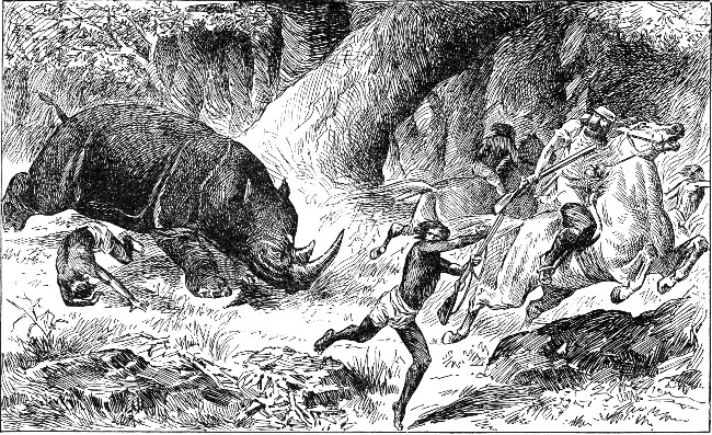 RHINOCEROS CHARGING THE HUNTERS.
The hippopotamus and the rhinoceros have been styled "gigantic hogs," and they well deserve the name. In South Africa, however, the hog proper reaches a size and strength which we, familiar only with the sleepy, indolent farm species, can hardly conceive.
Andersson, the explorer, says "Wild boars were rather numerous, and afforded us excellent coursing. The speed of these animals is surprisingly great. On open ground, when fairly afoot, I found the dogs no match for them. They fight desperately, and I have seen wild boars individually keep off most effectually half a dozen fierce assailants. I have also seen them when hotly pursued, attack and severely wound their pursuers."
The lion has been called the king of beasts, and his majestic form, noble bearing, stately tread, piercing eye, and dreadful roar not only strike terror to the heart of the other animals, but combine to mark him, as it were, with the stamp of royalty.[Pg 352]
He is all nerve and muscle, while his enormous strength is shown in the tremendous bound he makes in rushing upon his prey, and in the rapid lashing of his tail. One stroke from his tail is sufficient to fell a man to the ground.
The expressive wrinkling of his brows is a strong characteristic of the lion. Judging from his appearance, man has endowed him with qualities he does not possess. Modern travelers, far from describing him as a noble beast, deem him a mean-spirited robber, prowling about under the secrecy of night to surprise animals weaker than himself.
The chief food of the lion consists of the flesh of the larger herbivorous animals. There are very few animals he is unable to master. The swift-footed antelope has no foe to be so much dreaded as the lion. Concealing himself in the high rushes which line the river's bank, he lies in ambush for the timid herd, till they approach the water at nightfall to quench their thirst. Slowly, cautiously, the beautiful antelopes approach. They listen with ears erect, straining their eyes to pierce the gloom of the thicket. Nothing suspicious nor alarming appears, and the beautiful creatures move along the bank.
They quaff long, deep draughts of the delicious water, without thought of danger. Suddenly, with a mighty spring, as lightning bursts from the cloud, the wary lion bounds upon the unsuspecting herd, and in a twinkling the leader lies prostrate at the mercy of his foe, while his frightened companions fly blindly into the desert.[Pg 353]
Andersson witnessed the very uncommon sight of a lion seizing his prey in broad daylight. He had had an encounter late one evening with a lion, and had badly wounded him. The following morning he set out with some of his men to follow the tracks of the wounded animal.
"Presently," he writes, "we came upon the trail of a whole troop of lions, as also that of a solitary giraffe. So many tracks confused us, and while endeavoring to pick out from the rest those of the wounded lion, I observed my native attendants suddenly rush forward, and the next instant the jungle re-echoed with the shouts of triumph.
"Thinking they had discovered the lion we were in pursuit of, I also hurried forward; but imagine my surprise when, emerging into an opening in the jungle, I saw, not a dead lion, as I expected, but five living lions,—two males and three females,—two of which were in the act of pulling down a splendid giraffe, the other three watching close at hand, and with devouring looks, the deadly strife.
"The scene was of so imposing a nature that for the moment I forgot I carried a gun. The natives, however, in anticipation of a glorious gorge, dashed madly forward, and with the most piercing shrieks and yells compelled the lions to a hasty retreat. When I reached the giraffe, now stretched at full length on the sand, it made a few ineffectual efforts to raise its head, its body heaved and quivered for a moment, and the next instant the poor animal was dead.
"It had received several deep gashes about the flanks[Pg 354] and chest, caused by the claws and teeth of its fierce assailants. The strong and tough muscles of the neck were also bitten through. All thought of pursuing the wounded lion was now out of the question. The natives remained gorging on the carcass of the giraffe until it was devoured. A day or two afterward, however, I had the good fortune to fall in with my royal antagonist, and finished him without difficulty."
The lion is said to have a special liking for the flesh of the Hottentots, and with great obstinacy will follow one of these unfortunate savages.[Pg 356]
It commits so much devastation among the herds of antelopes that roam over the plains that hunters in North and South Africa pursue him and kill him wherever he appears.
Dr. Livingstone states that the Bushmen take advantage of the torpidity of the lion after a full meal to surprise him in his slumbers. Their mode of attack differs widely from that of the fierce Arabs of North Africa. While one native discharges a poisoned arrow from a distance, his companion dexterously throws his skin coat over the animal's head. In its surprise and amazement the lion loses its presence of mind and bounds away in a panic, terrified and confused.
The poison used in the arrows of the Bushmen is obtained from a caterpillar about half an inch long. It is a very active poison, causing intense agony to any one wounded by one of these arrows. The effect on the lion is equally distressing. He can be heard moaning in distress, and finally becomes furious, biting the trees and ground in his rage and torment.
The African lion differs somewhat from the Asiatic. The latter has a more compressed form and a shorter mane; sometimes the mane is entirely wanting. Its tail, however, has a much larger tuft of hair at the end.
Africa may be said to be the chief home of the lion. It is the part of the world where his peculiar strength and beauty appear in all their perfection.
In some parts of Africa great numbers of different kinds of mice exist. The ground is often so pierced with their burrows that the foot sinks in at every step. Little haycocks two feet high, and more than that in breadth, are made by one variety of these little animals.
Wherever mice abound, serpents may be expected, for the one preys on the other. Some of these are venomous. They all require water, and come long distances to the rivers and pools in search of it.
Other serpents, according to Livingstone, are harmless, and even edible. Of the latter sort is the great python, the largest specimens of which are about fifteen or twenty feet in length. They are perfectly harmless, and live on small animals, chiefly the rodentia. The flesh is much relished by the Bakalahari and Bushmen. When one is killed, they carry away their portions, like logs of wood, over their shoulders.
The carrion-feeding hyenas may be called the vultures among the four-footed animals. Like the owl and the bat they are averse to light, and conceal themselves in dark ruins or burrows so long as the sun is above the horizon; but, as soon as the shades of night appear, they come forth from their gloomy retreats with a lamentable howl or a satanic laugh.
The striped hyena is found in North Africa as far as the Senegal, while the spotted hyena roams over South[Pg 358] Africa from the Cape to Abyssinia. Both species are about the size of a wolf and have the same habits. The brown hyena, found in South Africa from the Cape to Mozambique and Senegambia, has a more shaggy fur than the preceding species. Its habits are widely different. It is exceedingly fond of the shellfish, which the waves at ebb tide leave upon the beach, or which are found there in great quantities after a severe storm.
It inhabits the coasts exclusively, and is known as the seashore wolf. One can trace its tracks plainly upon the strand; for night after night it prowls along the borders of the sea to examine the refuse left behind by the retreating waves of the restless waters.
Africa, as if to make up for the hideousness of the rhinoceros and hippopotamus, can lay claim to being the birthplace of the beautifully striped zebras. These are the most gorgeously attired members of the equine family.
The tawny quagga, with its irregularly banded body marked with dark-brown stripes, is one species. The peculiar appearance of the animal is enhanced by the arrangement of these stripes; for, though stronger on the head and neck, they gradually become fainter until lost behind the shoulders. Its high crest is surmounted by a standing mane, banded alternately in brown and white. Formerly it was found in great numbers within the confines of Cape Colony. It still roams in large herds in the open plains farther to the north.
One traveler states that in the desert of Meritsane, after crossing a park of magnificent camel-thorn trees, he perceived large herds of quaggas and brindled gnus.[Pg 359] These continued to join each other, until the whole plain seemed alive. The clatter of their hoofs was perfectly astounding, resembling the din of a tremendous charge of cavalry, or the rushing of a mighty tempest. They numbered not less than fifteen thousand, a great extent of country being checkered black and white with their congregated masses.
Burchell's zebra does not differ materially from the common quagga, either in shape or size. The quagga is faintly striped only on the head and neck, but the zebra is adorned on every part of the body with broad black bands, which contrast beautifully with a pale yellow ground.
Major Harris remarks of this animal, "Beautifully clad by the hand of nature, possessing much of the graceful symmetry of the horse, with great bones and muscular power united to easy and stylish action, thus combining comeliness of figure with solidity of form, this species, if subjugated and domesticated, would assuredly make the best pony in the world. The senses of sight, hearing, and smell are delicate in the extreme. The slightest noise, the least motion, or the sight of any unfamiliar object, will at once rivet their attention and cause them to stop and listen with the greatest care. Any disagreeable odor in the air will as quickly attract their sense of smell.
"Instinct having taught these beautiful animals that in union consists their strength, they combine in a compact body when menaced by an attack either from man or beast; and, if overtaken by the foe, they unite for mutual defense, with their heads together in a close[Pg 360] circular band, presenting their heels to the enemy, and dealing out kicks in equal force and abundance. Beset on all sides, or partially crippled, they rear on their hind legs, fly at their adversary with jaws distended, and use both teeth and heels with the greatest freedom. While the quagga roams over the plains, the zebra seeks only the high mountainous regions. The beauty of its light, symmetrical form is enhanced by the narrow black bands with which the whole of the white-colored body is covered."
The zebra is supposed to be the tiger horse of the ancients. This is the more probable as it has a much farther range to the north than the quagga; for it approaches the regions of Africa once comprised within the Roman Empire. It seeks the wildest and most secluded spots, hence it is extremely difficult of approach. The herds frequent the steep hillsides for their grazing grounds. A sentinel is always posted on some adjacent cliff, ready to give the alarm in case of danger. No sooner is the signal of alarm given than away they all scamper, with pricked-up ears, and seek shelter in places where few people would venture to follow them.
It would be interesting to view more of the mammals of Africa, did space permit. Certainly the field is a[Pg 361] wide one; for out of the three hundred species which are known to exist among the animals of Africa more than two hundred varieties are found exclusively in that country and in the island of Madagascar.
As in all tropical countries, the birds of Africa are distinguished, in the main, for the brilliancy of their coloring, rather than for the beauty of their song.
In our views of the Nile we have seen that various reed and water birds, as well as birds of prey, frequent its banks.
The African parrot is a bird worthy of mention. Though not as brilliant in coloring as the parrots of other tropical sections, yet it is considered the most valuable, perhaps, of all parrots, since it can easily be trained to speak fluently and very distinctly. Its coat of soft gray feathers and its scarlet-tipped tail make it by no means an unattractive bird, when compared with its more gorgeously dressed relatives from other lands.
The grosbeak of the wilds of Africa affords a wonderful example of nest building; for not one single pair, but hundreds, may be found living under the same roof. These nests resemble a thatch-roofed house with a projecting ridge, so that it is an impossibility for any reptile to approach the entrances, which are deftly hidden below.
One writer states, "Their industry seems almost equal to that of the bee. Throughout the day they appear to be busily employed in carrying a fine species of grass, which is the principal material they employ for the purpose of erecting this extraordinary work, as well as for additions and repairs.[Pg 362]
"Though my short stay in the country was not sufficient to satisfy me, by ocular proof, that they added to their nest as they annually increased in numbers, still from the many trees which I have seen borne down by the weight, and others which I have observed with their boughs completely covered over, it would appear that this really was the case.
"When the tree which is the support of this aerial city is obliged to give way to the increase of weight, it is obvious they are no longer protected, and are under the necessity of rebuilding in other trees.
"One of these deserted nests I had the curiosity to break down, so as to inform myself of its internal structure, and I found it equally ingenious with that of the external. There are many entrances, each of which forms a separate street with nests on both sides, at about two inches from each other."
Livingstone gives the following description of a curious bird called the korwé: "We passed the nest of a korwé just ready for the female to enter. The orifice was plastered on both sides, but a space was left of a heart shape, and exactly the size of the bird's body.
"The hole in the tree was in every case found to be prolonged some distance upward above the opening, and thither the korwé always fled to escape being caught.
"In another nest we found that one white egg, much like that of a pigeon, was laid.
"The first time that I saw this nest I had gone to the forest for some timber. Standing by a tree, a native looked behind me and exclaimed, 'There is the nest of a korwé.' I saw a slit only, about half an inch wide[Pg 363] and three or four inches long, in a slight hollow of the tree.
"Thinking the word korwé denoted some small animal, I waited with interest to see what he would extract. He broke the clay which surrounded the slit, put his arm into the hole, and drew out a red-beaked hornbill. He informed me that when the female enters her nest the male plasters up the entrance, leaving only a narrow slit by which to feed his mate, and which exactly suits the form of his beak.
"The female makes a nest of her own feathers, lays her eggs, hatches them, and remains with the young till they are fully fledged. During all this, which is stated to be two or three months, the male continues to feed her and the young family. The prisoner generally becomes quite fat, and is esteemed a very dainty morsel by the natives, while the poor slave of a husband gets so lean that, on the sudden lowering of the temperature which sometimes happens after a fall of rain, he is benumbed, falls down, and dies.
"The bird comes forth when the young are fully fledged, at the period when the corn is ripe. Indeed, her appearance abroad with her young is one of the signs for knowing when it ought to be harvested.
"She is said sometimes to hatch two eggs, and when the young of these are full-fledged, another pair are just out of the eggshell. She then leaves the nest with the two elder, the orifice is again plastered up, and both male and female attend to the wants of the young which are left."
The African weavers are remarkable for the eccentricity[Pg 364] of the shape and design of their nests. Most of these nests dangle at the end of twigs and sway in every breeze. Some of them are long, others short. Many have the entrance to the nest at one side, some have it at the bottom, others near the top.
Some of these nests are slung like hammocks; others are suspended from the end of a twig; others still are built in palms, and since these trees have no branches nor twigs the nests are fastened to the ends of the leaves.
Some nests are made of the finest and most delicate fibers, while others are of the coarsest kinds of straw. Many are of open texture, so that the eggs within can be easily seen; others are extremely strong and thick, so that one might well believe that they had been constructed by a professional thatcher.
One variety of weaver, though a pretty little bird, is no great favorite with the African farmers. It is very numerous in the cultivated regions, and does not scruple to help itself to the produce of the gardens. Hence the owners are obliged to keep a close watch if they would secure a fair share of the crops.
Another weaver, the yellow-capped, is remarkable for the extreme neatness and compactness of the nest it builds. The body of the nest is of seed-stems, so closely interwoven that it may be roughly handled, or even kicked about like a football, without being destroyed. Its interior is a lining which consists of layers of flat leaves, kept in place by their own elasticity, and thus affording a soft resting place for the eggs and nestlings.[Pg 365]
On one occasion Livingstone, while collecting wood for the evening fire, found a bird's nest which consisted of live leaves sewn together with threads of the spider's web. Nothing could exceed the airiness of this pretty contrivance. The threads had been pushed through small punctures, and thickened to resemble a knot. Unfortunately he lost this nest, which was the second one he had seen resembling that of the tailor bird of India.
This same traveler states that while exploring the rapids of the Leeambye, in passing along under the overhanging trees of the banks, he often saw the pretty turtle doves sitting peacefully on their nests above the roaring torrent. In one instance an ibis had perched her home on the end of a stump. Her loud, harsh scream of "Wa-wa-wa," and the piping of the fish-hawk, were sounds which could never be forgotten by any one who had sailed on the rivers north of 20° south latitude.
As he stepped on shore, a species of plover followed him, flying overhead, and it was most persevering in its attempts to give fair warning to all the animals within hearing to flee from the approaching danger.
The alarm note, "tinc-tinc-tinc," of another variety of the same family has so clear a metallic ring that the bird is called "hammering iron." It has a sharp spur on its shoulder, much like that on the leg of a rooster, but scarcely half an inch in length.
The ostrich may be looked upon as the most peculiar bird of Africa. It is found in almost all sections, and is by far the largest of all living birds, though doubtless many extinct species were much larger. It is an immense bird, often two feet taller than the tallest man, and frequents the barren, sandy plains, such as are common in Africa.
The male is generally of a fine glossy black color, with long, loose, white, plumelike feathers in the wings and tail. These are the feathers for which the bird is hunted. They are largely used for decorating hats and bonnets. The female bird and the young are of a brownish-gray color.
The head and the neck of the ostrich are almost bare of feathers. Upon the body the feathers do not grow closely as they do upon other birds. The wind can thus blow through the feathers, cooling the body, while the covering is sufficient to protect the bird, like a shade, from the heat of the sun.
The ostrich has a keen sense of sight and hearing, and, as it is a swift runner, it is very hard to catch. It cannot fly, but it can use its wings like sails in running, and has been known to run at the rate of thirty miles an hour.
Its food is chiefly fruits, grain, leaves, tender twigs and shoots of plants, snails, and various kinds of insects. We often hear people speak of "the digestion of an[Pg 367] ostrich;" it is rather astonishing what this bird will take into its stomach to assist in grinding its food. Not only does it swallow instinctively vast quantities of small stones, but it has been known to swallow pieces of leather, bits of glass, iron, and other hard substances.
The ostrich has generally been considered rather a stupid bird. Indeed, the Arabs have a saying, "As stupid as an ostrich." This judgment of the bird doubtless arose from the habit it has of hiding its head in the sand or in a bush when hard pressed by its pursuers. No doubt it thinks that, because it cannot see, it cannot be seen by, the hunters it is trying to elude.
The ostrich is not easily caught; for, although its wings are small and weak, yet their flapping aids very materially in the flight from its pursuers. So rapid is this flight that the feet seem scarcely to touch the ground, while the length between the strides is frequently from twelve to fourteen feet. An ostrich at this rate might easily outstrip a locomotive running at good speed.
The strength of the legs is a great help to the bird in battling with its enemies, for it uses them as a means of defense. Many a panther or wild dog has had reason to wish it had kept at a safer distance from these formidable feet.
During its flight the ostrich frequently throws large stones backward with its feet, thus making the chase a more difficult one for its pursuers. Still, in spite of its great strength and rapid flight, the bird must often succumb to the hunter who is well versed in ways of making it a captive.[Pg 368]
The ostrich makes its home in the African plains and wildernesses. Where the lion wanders in search of its prey, where the elephant, rhinoceros, and hippopotamus make the earth tremble under their heavy tread, where the long-necked giraffe plucks the leaves from the top-most branches of the acacia, where the herds of antelope bound gracefully over the ground, a troop of ostriches may not unfrequently be found enjoying the full liberty of the plain, as they wander, unsuspicious of danger, over its vast expanse, where the monotony of the scenery is relieved only by a clump of palms, a patch of candelabra-shaped trees, or a gigantic and solitary baobab.
The scene is an interesting one, as some leisurely feed upon the sprouts of the acacias, the hard, dry leaves of the mimosas, or the prickly, cactuslike shrub of the desert of which the bird is extremely fond. Some flutter their wings to allow the air to circulate through the delicate plumage, which is looked upon as a prize by the covetous eyes of the hunter.
No other birds ever associate with them, nor do any other birds lead a life so isolated as theirs; so we might well consider their lives solitary, did not the zebra and the antelope seek their company, evidently relying on their keenness of vision, which enables them to discern danger even on the extreme edge of the horizon.
This vigilance can avail the ostrich troop but little when the Arab hunters encircle them with their fleetest steeds. Vainly each bird tries to escape. It is driven from one hunter to another; the circle of riders grows[Pg 369] narrower and narrower, till the bird sinks to the ground from exhaustion and resigns itself to its fate.
Before the rainy season, however, it is not necessary to capture the ostrich through a protracted chase. When the heat is most intense, the bird is often found lying upon the sand with outstretched wings and open beak, suffering from the hot, sultry air, and burning sun. It is then an easy matter for a single horseman or a swift-footed Bushman to capture it after a short pursuit.
Just as the Esquimo of the north covers himself with the skin of the seal, and, by imitating its movements, is enabled to mingle with an unsuspicious group of them, so the Bushman of South Africa resorts to similar strategy to outwit the ostrich.
He first forms a saddlelike cushion, which he covers with feathers, to resemble the bird. He then stuffs the head and neck of an ostrich and introduces a small rod as a support. In preparing for the chase, he whitens his black legs with any suitable substance which he can find, and places the saddle on his shoulders. He then takes the bottom part of the neck in his right hand, while he holds his bow and poisoned arrows in the left.
Behind this mask he mimics the ostrich in the smallest details; picks at the verdure, turns his head from side to side as if to keep a sharp lookout for danger, flutters his feathers, walks, trots, till he gets within bowshot, shoots his arrow, and, if the flock runs in its alarm, runs too.
Should some wary old bird suspect the trick, the Bushman must get out of its way as the bird tries to approach him; for on no account does he wish it to catch[Pg 370] the scent and thus break the spell. If an ostrich should get too near in its pursuit, the Bushman has but to run to the windward or throw aside his saddle, to avoid a blow from the bird's wing, powerful enough to lay him prostrate.
Although the ostrich has been called a stupid bird, yet it resorts to many cunning artifices to protect its young. Andersson and a companion, while traversing a sterile plain, caught sight of a male and female ostrich, with a brood of young ones about the size of barnyard fowls. They immediately gave chase, and the pursuit proved of no ordinary interest.
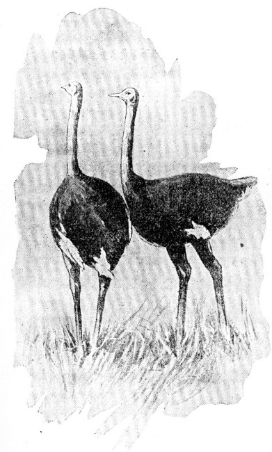 OSTRICHES.
Andersson writes of this experience: "The moment the parent birds became aware of our intention, they set off at full speed, the female leading the way, the young following in her wake, and the male, though at[Pg 371] some little distance, bringing up the rear of the family party.
"It was very touching to observe the anxiety the old birds evinced for the safety of their progeny. Finding that we were quickly gaining upon them, the male at once slackened his pace, and diverged somewhat from his course; but, seeing that we were not to be diverted from our purpose, he again increased his speed, and with wings drooping, so as almost to touch the ground, he hovered round us, now in wide circles, and then decreasing the circumference, till he came almost within pistol shot, when he abruptly threw himself on the ground, and struggled desperately to regain his legs, as it appeared, like a bird that had been badly wounded.
"Having previously fired at him, I really thought he was disabled, and made quickly towards him. But this was only a ruse on his part; for on my nearer approach he slowly rose, and began to run in an opposite direction to that of the female, who by this time was considerably ahead with her charge. After an hour's severe chase, we secured nine of the brood, and, though it consisted of about double that number, we found it necessary to be contented with what we had."
The ostrich resorts to various stratagems to remove intruders from the vicinity of its crude nest, which is merely a cavity scooped out of the sand, usually about a yard in diameter, but only a few inches in depth. One writer happened to ride by the place where a hen ostrich was sitting upon her nest, when the bird sprang up and gave chase, in order to distract his attention from the nest of either young birds or eggs, he could[Pg 372] not ascertain which; for every time he turned his horse towards her, she retreated a few paces, but as soon as he rode on again she would pursue him.
The Creator has given the ostrich a wonderful instinct for providing its young with food. It was formerly supposed that the bird left her young to be hatched by the heat of the sand and sun; but it has been proved that she hatches them with the greatest care, and even reserves some of the eggs for food for the young birds when they first leave the shell. Thus, though a nest may hold from fifteen to twenty eggs, the mother bird sits upon not more than ten or a dozen; the rest are pushed to one side, in anticipation of the time when her hungry brood of little ones will look to her for food. This is a wonderful provision, when we consider how little the arid plains can offer for the support of the young birds.
Nature provides for their protection in still another way; for it gives them a covering suitable for the localities they frequent. This is neither one of down nor feathers; it is of the nature of a prickly stubble, and serves as a fine shield against the gravel and the coarse, stunted vegetation of the plains. Its color, too, renders it difficult to discern the chicks, even when crouching close at hand, so nearly do they resemble the color of the sand and gravel.
In Senegal the heat is so very intense that the ostrich sits upon her eggs only at night. Where the heat is less intense the eggs must be guarded night and day. The father bird usually sits on the nest at night, leaving the care of it to the mother bird during the day.[Pg 373]
Every morning and evening the nest is left uncovered for a quarter of an hour, to allow the eggs to cool. The sight of the nests at this time has probably given rise to the erroneous idea that the ostrich leaves her eggs to hatch in the sun.
She has more sense than to believe in the sun's hatching her eggs; she is indeed quite aware of the fact that, if allowed to blaze down on them, even during the short time she is off the nest, it would injure them; and therefore on a hot morning she does not leave them without first placing on the top of each a good pinch of sand. When she has thus set her nest in order, she walks off, to fortify herself with a good meal for the duties of the day.
Now comes the white-necked crow's opportunity, for which, ever since the earliest dawn, he has been patiently watching; for an ostrich egg is to him the daintiest of all delicacies; but, nature not having bestowed on him a bill strong enough to break its hard shell, he is able only by means of an ingenious device to regale on the interior. So he watches till the parent's back is turned and she is a long distance from the nest; then he flies up into the air and drops a stone from a great height with so accurate an aim as to break an egg. He makes so good use of his quarter of an hour, that he, no less than the hen ostrich, has had an ample meal by the time the latter returns to the nest.
Though this crow is an inveterate egg stealer, he has a most respectable appearance, with his neat suit of black and his little white tie. The Boers have a legend to the effect that these birds are "the ravens"[Pg 374] which fed Elijah. They say that a little of the fat from the meat remained on the birds' necks, in commemoration of which their descendants have this one white spot on their otherwise black plumage.
Tortoise shells of immense size are often found on the plains of Cape Colony, broken in much the same manner as the ostrich eggs. This crow evidently is as fond of the inmate of the tortoise shell as he is of the contents of an ostrich egg.
The white crow is not the only enemy of an ostrich nest. The worst foes are the jackals. These plunder the nests, often rolling the eggs off with their paws to some considerable distance.
The Hottentots are very fond of ostrich eggs. If they discover a nest they will often remove one or two of the eggs from time to time. In her endeavors to raise a brood the mother bird has been known, like the domestic fowl, to lay from forty to fifty eggs in a season.
An ostrich egg is usually as large as two dozen hen's eggs. One might suppose a slice of one of these eggs would make a breakfast for a person of ordinary appetite, while a whole one would seem more than sufficient for a person of the most voracious appetite; yet Andersson saw two natives dispose of five of these eggs during an afternoon, together with a large portion of flour and fat.
Dr. Livingstone did not agree with Andersson, who considered that ostrich eggs made an excellent repast; to the great explorer they had a rank, disagreeable flavor, which only the keen appetite of the desert made acceptable to the palate.[Pg 375]
The shells of ostrich eggs are highly prized, for they are used for holding various kinds of liquids. Among the Bushmen there are scarcely any household utensils other than the ostrich eggshells. The shells are often covered with a light network, so that they may be slung across the saddle. Grass and wood are employed as substitutes for corks to these crude bottles.
In the Kalahari Desert it is no uncommon sight to see the women resorting to some hidden supply of water, with twenty or thirty of their water vessels in a bag or net slung over their backs. These vessels consist of ostrich eggshells, with a hole in the end of each large enough to admit one's finger. The process of filling them we have already learned in the description of the Kalahari Desert.
The Bushmen never touch the eggs, nor leave marks of human feet near them, when they find a nest. They go against the wind to the spot, and with a long stick remove some of them occasionally, and by preventing any suspicion keep the hen laying for months, as we do with fowls.
When the Hottentots discover a quantity of eggs, they remove their lower garment, the legs of which they tie up like bags, to serve as receptacles in which to carry home their bulky and queer-looking load. One can imagine the grotesque appearance a Hottentot would present with a pair of these inflated bags astride his shoulders, while he wends his way homeward to the kraal.
In the early settlement of Cape Colony, ostriches were found in great numbers. No later than fifty years ago flocks could be seen in almost any section of it. The salty nature of the soil, the sweet grass, and the dry atmosphere of the karroo plains are very favorable to the health of these birds.
As the hunters became more and more eager to secure the feathers, which were the real plunder of the chase, they wantonly hunted and killed great numbers of ostriches. In consequence the birds became very scarce, and the hunters had to seek their sport farther and farther to the north.
The settlers soon turned their attention to the rearing of ostriches as they would turkeys or hens, and ostrich farms became a common feature of Cape Colony. Ostrich farming is not only an interesting industry for the Boers, but it is a most lucrative business. The feathers, too, from these farms surpass in quality and value those brought from the wilds of the interior.
As a pound of ostrich plumes is worth about three hundred dollars, the owner of an ostrich farm finds it a profitable business to own as many full-grown birds as possible; for each will yield a quarter of a pound of feathers yearly. A tiny chick a week old is valued at the sum of fifty dollars, while a full-grown bird will command as high a price as two hundred and fifty.
The ugly scenery of Cape Colony, its eccentric plants,[Pg 377] queer beasts, and general look of incompleteness, according to one writer, have called forth the remark from some jocular American that "South Africa was finished off in a hurry late on Saturday night, with a few diamonds thrown in to compensate."
The owner of an ostrich farm, however, finds much in compensation. The author of "Home Life on an Ostrich Farm" thus describes a farm of some twelve hundred acres: "We are in that part of the Karroo which is called the Zwart Ruggens, or 'black rugged country,' so named from the appearance it presents when, during the frequent long droughts, the bush loses all its verdure, and becomes outwardly so black and dry-looking that no one unacquainted with this most curious kind of vegetation would suppose it capable of containing the smallest amount of nutriment for ostriches, sheep, or goats.
"But if you break one of these apparently dried-up sticks, you find it all green and succulent inside, full of a very nourishing saline juice; and thus, even in long droughts, which sometimes last more than a year, this country is able to support stock in a most marvelous manner, of which, judging by outward appearance, it certainly does not seem capable. It seems strange that in this land of dryness the plants are so full of moisture; one wonders whence it can possibly have come.
"The little karroo plant, from which the district takes its name, is one of the best kinds of bush for ostriches, as well as for sheep and goats. It grows in little compact round tufts not more than seven or eight inches from the ground, and though so valuable to farmers it[Pg 378] is but unpretending in appearance, with tiny narrow leaves, and a little, round, bright yellow flower, exactly resembling the center of an English daisy after its last petal has been pulled.
"The fei-bosch is another of our commonest and useful plants. Its pinkish lilac flower is very like that of the portulacca, and its little flat succulent leaves look like miniature prickly pear leaves without the prickles; hence its name, from Turk-fei, Turkish fig. When flowering in large masses, and seen at a little distance, the fei-bosch might almost be taken for heather.
"The brack-bosch, which completes our trio of very best kinds of ostrich bush, is a taller and more graceful plant than either of the preceding, with bluish green leaves, and blossoms consisting of a spike of little greenish tufts; but there are an endless variety of other plants, among which there is hardly one that is not good nourishing food for the birds.
"All are alike succulent and full of salt, giving out a crisp, crackling sound as you walk over them. All have the same strange way of growing, each plant a little patch by itself, just as the tufts of wool grow on the Hottentots' heads; and the flowers of nearly all are of the portulacca type, some large, some small, some growing singly, others in clusters. They are of different colors,—white, yellow, orange, red, pink, lilac, etc. They are very delicate and fragile flowers; and, pretty as they are, it is useless to attempt carrying them home, for they close up and fade as soon as they are gathered.
"The spekboom, which is a good-sized shrub, sometimes[Pg 379] attaining the height of fifteen or twenty feet, grows plentifully a little way up the mountains; and in very protracted droughts, when the karroo and other bush of the plains begin at last to fail, it is our great resource for the ostriches, which then ascend for the purpose of feeding upon it; and though they do not care for it as they do for their usual kinds of food, it is good and nourishing for them. It has a large, soft stem, very thick, round, succulent leaves, and its clusters of star-shaped, waxlike flowers are white, sometimes slightly tinged with pink.
"Thorny plants abound, especially on the mountains, where indeed almost every bush which is not soft and succulent is armed with strong, sharp, often cruelly hooked spikes. On foot you are perpetually assailed by the great strong hooks of the wild asparagus, a troublesome enemy, whose long straggling branches trailing over the ground are most destructive to the skirts of dresses; while boots have deadly foes, not only in the shape of rough ground and hard, sharp-pointed stones, but also in that of numerous prickly and scratchy kinds of small bush.
"Among our troublesome plants, one of the worst and most plentiful is the prickly pear. It spreads with astonishing rapidity, and is so tenacious of life that a leaf, or even a small portion of a leaf, if thrown on the ground, strikes out roots almost immediately, and becomes the parent of a fast-growing plant.
"Sometimes ostriches help themselves to prickly pears, acquire a morbid taste for them, and go on indulging in them, reckless of the long stiff spikes on the leaves,[Pg 380] with which their poor heads and necks soon become so covered as to look like pincushions stuck full of pins, and of the still more cruel, almost invisible fruit thorns which at last line the interior of their throats, besides so injuring their eyes that they become perfectly blind, and are unable to feed themselves."
Speaking of the prickly pear still further, the author acknowledges that it is not without its good qualities: "Its juicy fruit, though rather deficient in flavor, is delightfully cool and refreshing in the dry heat of summer, and a kind of treacle, by no means to be despised, is made from it.
"Great caution is needed in peeling the prickly pear, the proper way being to impale the fruit on a fork or stick while you cut it open and remove the skin. On no account must the latter be touched with the hands, or direful consequences will ensue.
"To the inexperienced eye the prickly pear looks innocent enough, with its smooth, shiny skin, suggestive only of a juicy interior, and telling no tales of lurking mischief; yet each of these soft-looking tufts, with which at regular intervals it is dotted, is a quiver filled with terrible, tiny, hairlike thorns, or rather stings, and woe betide the fingers of the unwary, who with no kind friend at hand to warn him, plucks the treacherous fruit.
"In dry weather at the Cape these spiteful little stings do not even wait for the newly arrived victim; but fly about, light as thistle down, ready to settle on any one who has not learned by experience to give the prickly-pear bushes a wide berth.[Pg 381]
"The leaves of the prickly pear are good for ostriches and cattle, though the work of burning off the thorns and cutting the leaves in pieces is so tedious that it is only resorted to when other food becomes scarce. One kind, the 'bald-leaf,' has no thorns. It is comparatively rare, and farmers plant and cultivate it as carefully as they exterminate its troublesome relative."
Another queer plant this author describes as candle-bush, a stunted, thorny plant, which, if lighted at one end, will burn steadily just like a wax candle, and can be used as a torch for burning off the thorns of the prickly pear.
Speaking of the dry season, this writer says: "The long droughts are certainly very trying; indeed, they could not possibly be endured by any country less wonderfully fertile than South Africa, where it is calculated that three good days' rain in the year, could we but have this regularly, would be sufficient to meet all the needs of the land. But often for more than a year there will be no rain worth mentioning.
"The dams, or large artificial reservoirs, of which each farm usually possesses several, gradually become dry, and the land daily loses more of its verdure, till at last all is one dull, ugly brown, and the whole plain lies parched and burnt up under a sky from which every atom of moisture seems to have departed.
"The stock, with pathetic tameness of thirst, come from all parts of the farm to congregate close round the house, the inquiring ostriches tapping with their bills on the windows, as they look in at you, and the cattle lowing in piteous appeal for water. Then the hot[Pg 382] winds sweep across the country, making everybody tired, languid, headachy, and cross. Even our pets were sulky on a hot, windy day; and as for the ostriches, they were deplorable-looking objects indeed, as they stood gasping for breath, with pendant wings, open bills, and inflated throats, the pictures of imbecile misery."
When the weary drought is over, and the long-wished-for rain begins to fall, every one's heart is gladdened by the sound of abundance of rain, and the voice of many waters.
"It means everything to the farmer: the long drought over at last, the dams full, the parched country revived, the poor thin cattle no longer in danger of starvation, healthier ostriches, a better quality of feathers, a near prospect of nests, and, in fact, the removal of a load of cares and anxieties.
"How early we are all astir on the morning after a big rain! and with what eager excitement we look out, in the first gleam of daylight, for that most welcome sight, the newly filled dam! Everywhere the water is standing in immense pools and ponds. A troop of ostriches come down to drink. They are no doubt delighted to find such an abundant supply of water, after the somewhat scanty allowance which has been portioned out to them of late; and they stand greedily scooping up large quantities with their broad bills, then assuming comical attitudes as they stretch out their distended necks to allow the fluid to run down. In the distance, about a dozen other ostriches are spreading their white wings and waltzing along magnificently—a[Pg 383] pretty way of expressing their satisfaction at this new and delightful change in circumstances."
It would be delightful to quote without limit from this intensely interesting book, but there is not time to linger over its pages longer than to glean a few items:
"There are not many young animals prettier than an ostrich chick during the first few weeks of life. It has such a sweet, innocent baby face, such large eyes, and such a plump, round little body. All its movements are comical, and there is an air of conceit and independence about the tiny creature which is most amusing.
"Instead of feathers it has a little rough coat which seems all made up of narrow strips of material, of as many different shades of brown and gray as there are in a tailor's pattern book, mixed with shreds of black, while the head and neck are apparently covered with the softest plush, striped and colored just like a tiger's skin on a small scale. On the whole the little fellow, on his first appearance in the world, is not unlike a hedgehog on two legs, with a long neck.
"One would like these delightful little creatures to remain babies much longer than they do; but they grow quickly, and with their growth they soon lose all their[Pg 384] prettiness and roundness; their bodies become angular and ill-proportioned, a crop of coarse, wiry feathers sprouts from the parti-colored strips which formed their baby clothes, and they enter on an ugly stage, in which they remain for two or three years.
"A young ostrich's rough, bristly, untidy-looking 'chicken feathers' are plucked for the first time when he is nine months old. They are stiff and narrow, with very pointed tips, and their ugly appearance gives no promise of future beauty. They do not look as if they could be used for anything but making feather brooms. In the second year they are rather more like what ostrich feathers ought to be, though still very narrow and pointed, and not until their wearer is plucked for the third time have they attained their full width and softness.
"At five years of age the bird has attained maturity; the plumage of the male is then of a beautiful glossy black, and that of the female of a soft gray, both having white wings and tails. In each wing there are twenty-four long white feathers, which when the wing is spread out hang gracefully round the bird like a lovely deep fringe.
"On a large farm, when plucking is contemplated, it is anything but an easy matter to collect the birds; the gathering together of ours was generally a work of three days. Men have to be sent out in all directions to drive the birds up, by twos and threes, from the far-off spots to which they have wandered. Little troops are gradually brought together, and collected, first in a large inclosure, then in a small one, the plucking kraal, in[Pg 385] which they are crowded together so closely that the most savage bird has no room to make himself disagreeable.
"Besides the gate through which the ostriches are driven into the kraal, there is an outlet at the opposite end, through the 'plucking-box.' It is a very solid wooden box, in which, though there is just room for an ostrich to stand, he cannot possibly turn round; nor can he kick, the sides of the box being too high. At each end there is a stout door, one opening inside, the other outside the kraal. Each bird in succession is dragged up to the first door, and, after more or less of a scuffle, is pushed in, and the door slammed behind him.
"Then the two operators, standing one on each side of the box, have him completely in their power, and with a few rapid snips of their shears his splendid wings are soon denuded of their long white plumes.
"These, to prevent their tips from being spoilt, are always cut before the quills are ripe. The stumps of the latter are allowed to remain some two or three months longer, until they are so ripe that they can be pulled—generally by the teeth of the Kaffirs—without hurting the bird. It is necessary to pull them, the feathers, which by their weight would have caused the stumps to fall out naturally at the right time, being gone."
In describing the condition of the plumes, this author writes: "Sometimes the white feathers would be dirty,—for there is nothing an ostrich likes better than sitting down to cool himself in the muddiest dam he can find; then it was necessary to wash them, dip them into strong raw starch, and shake them in the hot sun,[Pg 386] beating two bundles of them together till quite dry. The starch makes them look very pretty and fluffy. Ostrich feathers are quite tabooed by ladies in South Africa; they are too common, every Kaffir or Hottentot wearing one in his dirty, tattered hat.
"If an ostrich feather is held upright, its beautiful form, graceful as the frondlike branch of the cocoanut palm, which it somewhat resembles, is at once seen to be perfectly even and equal on both sides, its stem dividing it exactly in the center, whereas the stems of other feathers are all more or less on one side."
Ostriches begin to make their nests soon after a good rain. The father bird becomes very savage, as if to warn all intruders away from the vicinity of the nest. His note of defiant warning can be heard then in every direction. He inflates his neck in a cobralike fashion, and gives utterance to three deep roars; the first two short, the third very prolonged. Lion hunters all agree in asserting that the roar of the king of beasts and that of the most foolish of birds are identical in sound; with this difference only, that the latter, when near, resembles the former when far away.
"When an ostrich challenges, he sits down; and, flapping each broad wing alternately, inflates his neck, and throws his head back, rolling it from side to side, and with each roll striking the back of his head against his bony body with so sharp and resounding a blow that a severe headache seems likely to be the result."
When the birds become aggressive, one dares not walk about the camp unless armed with a weapon called a "tackey." This is merely a long, stout branch of the[Pg 387] mimosa tree, from which all the thorns, except upon one end, have been stripped. It does not seem to be much of a protection against so ferocious and formidable a foe, one stroke of whose powerful leg can easily kill a man, and whose kick, as violent as that of a horse, is much more dangerous, owing to the terrible claw with which nature has armed the foot.
Those versed in the use of the tackey allow the enraged assailant to approach almost unpleasantly near, and then thrust the weapon of defense boldly in his face just as he is about to strike. The thorns are so annoying that he is obliged to close his eyes, and can merely run forward in a blind, helpless fashion. This gives the person bearing the tackey a chance to spring to one side and to proceed upon his way for some little distance, before the bewildered bird is ready for another attack, when he is again met by the same simple but effective instrument.
Some ludicrous stories are related of the encounters newcomers at the Cape have had with ostriches. A sturdy newcomer, six feet in height, on starting for an early morning walk, was cautioned against going into a certain camp where the ostriches were dangerous. He laughed at his friends' advice, told them he was not afraid of a dicky-bird, and disdaining the proffered tackey started off straightway in the forbidden direction. He did not return to dinner; a search was made for him, and eventually he was found perched up on a high ironstone boulder, just out of reach of a large ostrich, which was doing sentry, walking up and down, and keeping a vicious eye on him.[Pg 388]
He had sat there for hours, nearly roasted alive, and there he would have had to sit till sundown, but for the timely appearance of his friends.
Another story is related of a gentleman whose theory was that any creature, however savage, could be quelled by the human eye. One day he tried to quell one of his own ostriches, with the result that he was presently found in a very pitiable predicament, lying flat on the ground, the subject of his experiment jumping up and down on him, and occasionally varying the treatment by sitting on him.
The explorer, Paul Du Chaillu, gives some interesting views of sections of Equatorial Africa, which from the western coast, as far as he had been, are covered with an almost impenetrable jungle, which begins where the sea ceases to beat with its continual waves; how much farther this woody belt extends, only further explorations will be able to show. From the farthest point it extends eastward as far as the eye can reach; near the banks of a large river, however, running from a northeast direction towards the southwest, prairie lands are to be seen.
"Now and then prairies looking like islands, resembling so many gems, are found in the midst of this dark[Pg 389] sea of everlasting foliage; and how gratefully my eyes met them no one can conceive, unless he has lived in such a solitude. Here and there prairies are seen from the seashore, but they do not extend far inland, and are merely sandy patches left by the sea in the progress of time.
"In this great woody wilderness man is scattered and divided into a great number of tribes. The forest, thinly inhabited by man, was still more scantily inhabited by beasts. There were no beasts of burden, neither horse, camel, donkey, nor cattle. Men and women were the only carriers of burdens. Beasts of burden could not live, for the country was not well adapted to them. The only truly domesticated animals were goats and fowls, the goats increasing in number as I advanced into the interior, and the fowls decreasing.
"I was struck by the absence of those species of animals always found in great number in almost every other part of Africa. Neither lions, rhinoceroses, zebras, giraffes, nor ostriches were found; and the great variety of elands and gazelles, although found almost everywhere else in Africa, were not to be seen there.
"Travelers in my locality would never dream that such vast herds of game could be found on the same continent, as those described by different travelers. Hence, large carnivorous animals are scarce, leopards and two or three species of hyenas and jackals only being found. Little nocturnal animals are more common, but they are very difficult to get at.
"Reptiles abound in the forest. There are a great many species of snakes, the greater part of which are[Pg 390] very poisonous. Some are ground snakes, others spend part of their lives upon trees, while some are water snakes. A very dangerous snake is the black variety of the cobra. This snake is much dreaded; for, when surprised or attacked, it rises up as if ready to spring upon you.
"There is also a large water snake found often in the beautiful clear water of the streams of the interior. I have often seen this snake coiled up and resting on the branches of trees under water.
"Lizards are also abundant in some districts, and it is interesting to watch how they prey on the insect world. Among them I noticed a night species, that lives in the houses, and that is the great enemy of cockroaches. They are continually moving from one place to another during the night in search of their prey. During the day, they remain perfectly still, and hide themselves between the bark of trees forming the walls of the huts.
"The country is also very rich in spiders; they are of wonderful diversity of form. Some of them are so large and their webs so strong that birds are said to be caught in them. There are house spiders, tree spiders, and ground spiders. The spiders are exceedingly useful, and rid the country of many unpleasant flies. How many times I have seen them overpower prey which seemed much stronger than themselves.
"The web spiders seemed to have but a few enemies, but the house and wall spiders, which make no web, have most inveterate enemies in the shape of two or three kinds of wasps.[Pg 391]
"During the day I have seen these wasps travel along the walls with a rapidity that astonished me, and, finally, when coming to a spider, immediately pounce upon the unfortunate insect and overpower it by the quickness of the movements of their legs, and succeed in cutting, one after the other, the legs of the spider close to the body, and then suck it, or fly away with it to devour it somewhere else.
"I consider some species of ants, snakes, lizards, and spiders as most useful; for they destroy a great quantity of insects and other vermin. The great moisture of the country I have visited, with its immense jungle, is well adapted for the insect world, and would prove a very rich field for a naturalist and collector.
"I was surprised to see how closely several of them mimicked or imitated other objects. Some looked exactly like the leaves on which they most generally remain; others are exactly of the color of the bark of trees on which they crawl; while others looked exactly like dead leaves, and one or two like pieces of dead branches of trees. Dragon flies of beautiful color were met near the pools.
"Bats are very abundant, and I had succeeded in making a fine collection of them. They sometimes came by hundreds and spent the whole of the night flying round a tree which bore fruits they liked, and the noise made by their wings sounded strangely amid the stillness which surrounded them.
"Squirrels are rather numerous, and there are a good number of species. Birds of prey and snakes are their great enemies.[Pg 392]
"There are eight species of monkeys, but they are not all found in every district. They live in troops, but when old they live generally by themselves or in pairs.
"Of all the mammalian animals inhabiting the forest the monkey tribe is the most numerous; but the poor monkey is surrounded by enemies, the greatest being man, who sets traps everywhere to catch him. Then he is continually hunted by the negroes with guns or arrows. The guanonien, an eagle, is also his inveterate enemy.
"The guanonien is a most formidable eagle, and, in spite of all my endeavors, I have been unable to kill one. Several times I have been startled in the forest by a sudden cry of anguish from a monkey which had been seized by this 'leopard of the air,' as the natives often call it, and then have seen the bird with its prey disappear out of sight.
"One day, hunting through the thick jungle, I came to a spot covered with more than one hundred skulls of monkeys of different sizes. Some of these skulls must have been those of formidable animals, and these now and then succeeded, it appears, in giving such bites to this eagle that they disabled him.
"For a while I thought myself in the Valley of Golgotha. Then I saw at the top of a gigantic tree, at the foot of which were the skulls, the nest of the bird, but the young had flown away. I was told by the natives that the guanonien comes and lays in the same nest year after year. When an adult specimen has been secured, it may be found to rival in size the condor of America.[Pg 393]
"By the side of wild men, roamed the apes, the chimpanzee forming several varieties. Then came the largest of all, the gorilla, which might be truly called the king of the forest. They all roamed in this great jungle, which seems so well adapted to be their homes; for they live on the nuts, berries, and fruits of the forest, found in more or less numbers throughout the year; but they eat such a quantity of food that they are obliged to roam from place to place, and are found periodically in the same district.
"The elephant has become scarce, and recedes farther and farther every year into the fastnesses of the interior.
"Mile after mile was traveled over without hearing the sound of a bird, the chatter of a monkey, or the footstep of a gazelle, the humming of insects, the falling of a leaf; only the gentle murmur of some hidden stream came upon our ears to break the deadness of this awing silence, and disturb the grandest solitude man can ever behold—a solitude which often chilled me, but which was well adapted for the study of nature."
Long before the advent of man upon the globe, there was a period when huge crocodiles swarmed in the rivers of the temperate zones. The diminished heat of[Pg 394] the temperate regions of the earth, as we know them to-day, has driven these scourges of all that live in the waters they frequent into the great rivers and lagoons of the torrid zone.
The crocodile is characterized by the depressed head, so indicative of a low order of intelligence; the vast jaw, which, armed with formidable rows of conical teeth, seems designed to snatch and to swallow; and the elongated, mud-colored body, with its long lizard-like tail, resting on short legs. These all stamp him with a peculiar ugliness and frightfulness.
The female crocodile generally lays her eggs, like the sea turtle, in a hole in the sand, and leaves them to be hatched by the potent rays of a tropical sun. These eggs are about the size of those of a goose, and are covered with a limy shell.
The young of the crocodile have numerous enemies. Many an egg is destroyed by the smaller flesh-eating animals, or by birds, before it can be hatched in the hot sand. Even if the eggs hatch, no sooner do the young creep out of the broken shells and instinctively move towards the water, than the ichneumon, a species of weasel, and the long-legged heron make haste to swallow them; hence their span of life is not usually a long one.
Should they escape these enemies and take refuge in the water, they become the prey of the different sharp-toothed fishes. Even the full-grown crocodile, in spite of its bony covering, is not exempt from attack. Like many other of the lower animals, when surprised, it endeavors to escape by feigning death. Crocodiles are very numerous in the river Shiré. On one occasion[Pg 395] some travelers on board a small vessel counted sixty-seven of them basking in the sun on the same bank.
Women, while drawing water, are sometimes seized by these creatures, and the protection of a fence is required to keep the crocodiles from the river's brink. It is the scourge of the lakes and rivers wherever it is found. Like the eagle among birds, or the lion among beasts, so is the crocodile among reptiles.
Its main food consists of fishes, various aquatic birds, and such animals as it can seize along the borders of the water. It is not only a powerful foe but a cunning one as well.
Like the various carnivorous animals, it can, though a reptile, fast in its aquatic home for weeks and even months without apparent inconvenience. When opportunity offers, it becomes a veritable glutton, and is then indolent and torpid at the close of its meal.
It is when excited by hunger that the crocodile displays its great force and activity. Wherever a river enters a lake, or where a lake empties its waters into some larger body, there the ugly reptile may be found lurking, on the watch for fish. As these pass in the rapidly moving waters, it darts upon them with astonishing velocity.
Again, it conceals itself near where animals have their favorite drinking spot, and rushes out upon the unsuspecting creatures as they approach the water's edge. In the same way it seizes upon the various water birds; often it swims quietly and warily under them and pulls them down by their legs.
Sometimes the crocodile is carried inland by floods,[Pg 396] but, as a general rule, it does not advance far on shore in search of prey. On land it is not difficult to escape from its attack; for its legs are poorly fitted for running and the construction of its neck is such as to prevent its turning easily from one side to the other when in pursuit of a victim.
Winter is the most favorable time for catching the crocodile; then it may be found on the sand banks basking in the warm rays of the sun. Spring, too, is a favorable season, for the mother reptile keeps watch over the sand hills where she has deposited her eggs; and the native who is so successful as to discover this place digs a hole in the sand to the leeward and throws up the earth on the side from which he expects the crocodile to approach. He then conceals himself and awaits its coming. If the reptile has failed to observe him, it soon comes to the accustomed spot and falls asleep. The native huntsman then throws his harpoon with all his might into the creature; for, to make the stroke successful, the iron of the harpoon must penetrate to the depth of four inches. As soon as it is wounded, it rushes into the water. Then the huntsman retreats to the canoe, which a companion has brought to his aid.
When a crocodile is struck by the harpoon, it lashes violently with its tail and tries to bite the rope in two. To prevent such a thing happening, the rope is not woven, but consists of about thirty separate fine lines bound together at intervals of every two feet. These separate lines often get between the creature's teeth or become tangled about them.[Pg 397]
As it moves through the water, a piece of wood attached by a long cord to the harpoon swims upon the surface; this serves to indicate the direction the creature is taking. By pulling upon the rope the natives drag the crocodile to the surface and soon pierce it by a second spear. It frequently happens, however, that the harpoon is pulled out of its body, and thus the prize escapes.
In some of the rivers of Africa the natives are very bold and skillful in attacking the crocodile in the water. Their mode is to arm themselves with a short dagger, dive beneath the reptile, and plunge the weapon into its body. Often the combat becomes a very fierce one, and the only chance of escape on the part of the native is to force his dagger, or, if by any misfortune he has lost this, to thrust his thumbs into the reptile's eyes with all his strength, thus causing great pain and loss of sight.
Among the ancient Egyptians the crocodile was an object of worship, and thus held sacred. In consequence of this idolatry, it became very bold and troublesome. Had it not been for its natural enemy, the ichneumon, this reptile would have increased to an alarming extent in the Nile countries.
Probably no insect is of more interest in Africa than the termite, or white ant. It is found in vast numbers and may well be dreaded. The amount of damage[Pg 398] an army of termites can do is quite appalling; for, in their line of travel, they destroy everything in their pathway.
Du Chaillu devoted the greater part of his leisure hours to studying the habits of the many species of these white ants, the nests of which are very conspicuous on the prairies. He describes them as having wonderful diversity, not only in the form of their bodies and heads, but in their architectural tastes. One species builds a mushroom-shaped structure. Their singular hives are shaped like gigantic mushrooms scattered by tens of thousands over the prairies.
Du Chaillu believed these white ants of the prairies to be of a very different species from those which live in subterranean nests, and make their appearance through the floor of one's hut, removing all substances made of cotton or wood that they find in their pathways. They seemingly have a very keen sense of smell. They are very fond of eating wood, and are often found in dead trees.
One may go to bed with no fear from these little creatures, since no sign of them has been seen, and awake in the morning to find little covered passages overspreading the floor, chests of clothing, and the various stores, and to discover with dismay that the contents of the chests and of the store closets have been entirely destroyed by the thousands of busy ants, that, like an invading host, are engaged in working destruction with their sharp jaw-blades. Wood and cotton are the only materials they destroy; wool and silk they invariably spare.[Pg 399]
Another species of ant which this author describes lives in the forest and is a very near neighbor of the other. He called it the tree ant from its habit of building hives or nests in trees.
Many of the nests of the termites are conical or turret-shaped, and are often twelve, sometimes twenty feet high; they are built in groups like villages. While there is a variety of termites most destructive in their line of march across a country, yet, in some ways, they are very useful; for they destroy every kind of decaying matter, whether animal or vegetable. They will, when pressed for food, eat even grass. Some writers have described the snapping of the mandibles of such a vast multitude of termites as resembling the sound of a gentle breeze among trees.
These termites have been known to attack the woodwork of houses; they can soon destroy even the stoutest timbers, gnawing them till they become mere shells. Some extraordinary stories have been told of their attacking and devouring large animals. Very probably, however, they do this only when the animal is very feeble from illness or old age.
Wherever food is to be found, they come in great hosts, and it is very hard to exterminate them; for, as fast as one multitude is disposed of, other multitudes press on from the rear ranks. They gather into their nests great stores of corn. The natives of Africa are very fond of it and often help themselves from these stores.
The natives often use these insects as food, and consider them very delicate and delicious eating when roasted. Sometimes they are pounded by the natives[Pg 400] into a kind of jam, which the boys and girls of Africa like as well as American children do raspberry or currant jam.
It is no uncommon thing for hunters out searching for game, or even wild animals looking for prey, to mount the hills made by the termites to get a view of the surrounding country; for, so hard do the plastered tops of the unique dwellings of these most curious of masons become, when dry, that they easily sustain the weight of a human being, and even of a beast of the plain.
While the devastation which an army of termites leaves behind in its march is appalling, yet an army of locusts is still more destructive; for it often leaves the country in its line of march as bare as if no vegetation had ever grown there. Africa suffers in no small degree from the inroads of this enemy, small in size, but great in numbers.
Livingstone, in his travels in South Africa, speaks of the hills erected by the termites. These gigantic mounds, as he terms them, are utilized by the natives, who choose their sides as choice spots for rearing early maize, tobacco, or anything which requires a rich soil.
In the parts through which he passed these mounds were generally covered by masses of wild date trees. The fruit was small, for no tree was allowed to stand long. Food was abundant and the natives did not care to spend their time preserving wild fruit trees. So, when a date palm grew too tall for its top to be reached, as soon as the fruit was ripe it was cut down, in order that there should be no occasion to climb it; for it was considered too much trouble to do so.[Pg 401]
Speaking of the swarming from a nest of these ants, he describes them as rushing out of a hole in a perfect stream, and, after flying one or two hundred yards, descending to the ground. If they lighted upon a soil suitable for founding a colony, they immediately bent up their tails, unhooked their wings, and, leaving them on the surface of the ground, quickly began their mining operations.
These wings seem formed only to help the insect in its short flight to a new abode and are then cast aside.
Occasionally this swarming occurs in a house, and, to prevent every corner from being filled with the insects, a fire is built at the orifice of the nest. But they do not hesitate to pass through the fire. While swarming they appear like snowflakes floating about in the air, and it is not uncommon to find dogs, cats, hawks, and almost every kind of bird busily devouring them.
The natives take advantage of the swarming season and collect the ants for food. They are then about half an inch long, about as large round as a goose quill, and very plump. When roasted, they are good eating and resemble grains of boiled rice. The general mode of catching them is to dig into the hill, and as the builders come forth to repair the damage, to sweep them quickly into some cooking utensil.
A singular animal of South Africa is the earth hog. Its food consists wholly of the white ants, whose dome-like structures are found in great numbers in the vicinity of the Orange River, and in other thinly settled localities.
This animal burrows a short distance below the surface[Pg 402] of the ground. During the daytime it is seldom seen; at dusk, however, it ventures forth, intent on creeping up to the ant-hills which shelter its prey. By scratching a hole on the side of one with its fore-feet the little community is disturbed; and as the ants in their confusion run about in various directions, they are easily drawn into the earth hog's mouth by its long slender tongue.
Though apparently defenseless,—for it has no tusks nor efficient teeth,—no animal is safer in its concealment, for it is very rarely seen. When pursued, it burrows a retreat for itself with astonishing speed.
Although Africa may well be considered the home of the black man, yet we must not fail, in considering the people of the dark continent, to refer to the annals of history for many interesting facts about them.
From the days of the remotest antiquity, two Asiatic branches of the human family extended their area southwest into Africa. The emigrants called Hamites, peopled Egypt, Libya, and Numidia. They furnished us with the earliest annals of history; for they invented the hieroglyphics and the arts for which Egypt was celebrated. Their successors, the Semites, who followed them from Asia, spread all over the northern and eastern sections of the continent. Followers of Mohammed,[Pg 403] they carried his faith with them in their journeying and laid the foundation of the Mohammedan religion as we find it in the sections along the Mediterranean Sea. As Arab traders they have extended their journeys into the very heart of the continent to carry on the traffic of ivory and slaves.
The black race is native to Africa. It is divided into three great branches, each of which is divided into numerous tribes and again subdivided into kingdoms.
The negroes, or true blacks, are native to Central Africa. They inhabit the great coasts of Guinea and Senegambia in West Africa, and also the great tract of country which extends eastward through the Soudan, the "Land of the Blacks," to the valley of the Nile. Most of the freed men of the United States are descendants of the negroes of the Guinea coast, who, having been captured as slaves, were shipped across the sea to America and sold into bondage.
The negroid branch of the African race is doubtless of mixed ancestry, descended from the true negro and from the white race inhabiting North and East Africa. It is a well-marked branch, showing plainly the mixed ancestry of the people. The various tribes occupy Nubia, the high grassy plains of East Central Africa, which include the lake region and the basin of the Upper Nile, and the vast territory which contains the watersheds of the mighty Congo and Zambesi Rivers. The various tribes known as Kaffirs, Zulus, Bechuanas, and the many tribes of Bantu in the south of Africa all belong to the negroid branch.[Pg 404]
A third branch, the negrillos, or dwarfs, are a people of small stature. Some of the tribes are found in the thick forests that lie along the northern side of the Congo River. In South Africa we find them represented by the Bushmen, one of the lowest grades of the human family, occupying the land bordering on the Kalahari Desert. The Hottentots are somewhat larger in stature and of a higher order of intelligence. They very likely are of a mixed ancestry, having descended from a mingling of the Bushmen and some of the tribes of the negroid branch in this region.
Notwithstanding that there are but three branches of the native people of Africa, yet owing to their division into numberless tribes, each bearing its own special name, almost as much difficulty is found in tracing their origin as in trying to discover the source of any of the great rivers from their various tributaries which form a network over the country.
We shall later in our reading obtain some knowledge of the Moorish pirates who infested the Mediterranean Sea and who had their headquarters at Algiers.
It is due to the French nation that since 1830 the magnificent port of Algiers has been open to all the fleets of the world, and the coast of the Mediterranean, freed from pirates, has been accessible to all the navies of the world, should they choose to occupy it.
The attention of the French is now turned toward ridding the great sea of sand which extends between Northern Africa and Central Soudan from the fierce Tuaregs that still occupy it. They are a race as wild and barbarous—yes, as lawless—as were ever the terrible[Pg 405] pirates of the Mediterranean Sea. They may be termed the brigands of the desert.
They roam over the vast region between Morocco, Algeria, Tunis, and Tripoli in the north, and Lake Tchad in the south. Mounted upon racing camels, they go upon raiding expeditions and seek the oases, with which the great desert is strewn, for refuge and to replenish their stores. Until recently these mysterious Sahara tribes have seemed determined to bar the road to their territory against all white men.
Who are the Tuaregs? From whence came they? It is believed that they are remnants of the Berber tribes of Northern Africa, who occupied the Libyan Desert. The Romans and other nations, together with the Arabs, from time to time drove them back into the great desert.
The raid and conquest of the Arabs was fierce and bitter. Some of these Berber tribes had been Christians for six centuries and had formed the flourishing African church to which St. Augustine belonged and did not readily forsake their faith to adopt that of Mohammed. In consequence their land was confiscated and their olive orchards burned. Early in the ninth century this work of persecution began, and for two hundred years these people had been crowded back into the desert.
Their homes gone, the migrating Berbers had no way of preserving the annals of the exodus of their tribes into the wilderness; for they had no written language, and in the course of time their memory became dimmed as to their history. They are called Tuaregs by the Arabs, meaning "those who have renounced."[Pg 406]
All memory of their ancient faith has been lost. The Latin cross, which was its emblem, is found on the hilts of their swords and in the ornaments on the bridles of their racing camels, but the Tuaregs, descendants of these ancient Berbers of Christian faith, have no knowledge of its significance.
The only occupations of these people are their wars and the long expeditions across the desert. Mounted upon swift camels, they traverse its vast extent. Their faces, which are concealed by a black veil, remind one of the mailed knights of the Middle Ages. No one has ever seen the face of one of these Tuareg warriors uncovered. The Arabs term them the "Veiled Ones."
The fineness of the texture of the veil with which a Tarki, a native of one of these tribes, conceals his features is indicative of his social rank. If of the higher class, he wears his veil night and day. The strongest proof of friendship he can give is to raise his veil and show his features while talking to any one.
A Tarki of noble rank wears a high cap of red cloth decorated with large black tassels. His upper garments consist of a long white shirt bound about the waist by a broad red scarf, and a sleeveless blouse of some black material adorned with costly gold and silver embroidery. His lower garment is a pair of wide white Turkish trousers which reach to the instep. On his feet lie wears sandals made of goat skin. On his chest are small leather bags or metal cases; these contain amulets, generally large emeralds, of which rich deposits are found in the Sahara. Woven bands of leather fasten these bags or cases to his neck.[Pg 407]
For weapons the Tarki carries a short dagger and a well-sharpened saber. These are fastened to his arm by a copper bracelet. The hilts of these weapons are always in the form of a Latin cross, and are adorned with five nails of copper arranged to represent a cross. He wears a two-handed sword suspended from his neck by a strong cotton cord, ending in two large tassels.
When out on an expedition the Tuaregs plant their long iron spears, inlaid with copper, in the ground, whenever they stop for the night or to rest awhile, and take a squatting position beside them.
Two or three iron javelins carefully sharpened are always fastened to the back or pommel of the saddle of a noble Tarki. These he can hurl to a great distance with considerable skill. As a means of defense he carries an oblong shield made of antelope skin and large enough to cover his whole person. Firearms he scorns to use.
In appearance the Tuaregs are tall, slender, and well formed. In disposition they are grave, silent, impassive, and affect an indifference to their surroundings. In character they are proud, cunning, quarrelsome, and tenacious. They are very excitable, brave, and enduring, and no privation nor fatigue can dishearten them. In their intercourse with others their hatred knows no pity, their vengeance no mercy.
They are the terror of the caravans that cross the desert, where every living being is an enemy. Whenever a solitary man appears on the dim horizon, the caravan makes ready for battle. It never thinks of approaching a well without sending out an advance guard to see if it is safe to proceed.[Pg 408]
In attacking a caravan the Tuaregs first send out scouts in advance. These men are not armed, and under pretense of seeking food or by offering their services as guides, try to mingle with the caravan. Their object is to lead it to wells near which they know their warriors are lying in wait hidden behind sand hills.
Night is the time usually chosen for an onslaught, and generally at watering places a long distance apart. It is the custom for a caravan to stop several days at a well to allow the camels an opportunity to graze. A herd may thus be a long way from the main part of the caravan, and it is at such a time, when the forces are divided, that the Tuaregs usually make an attack.
In their rough life and hard struggle for existence they have become veritable outcasts. They are Mohammedans in name only, and do not repeat the five daily prayers with their faces turned toward Mecca; neither do they take their daily ablutions in the sand, as the prophet required. They use the Koran only when taking an oath, and are very faithful in keeping their pledges.
A curious custom, not unlike that which existed in the Middle Ages between the warrior knights and the religious orders, prevails; for the nobles leave the duty of praying to the tribes that form the middle classes. These tribes were formerly noble, but are now in a half-servile condition. They are excluded from certain privileges enjoyed by the warriors, to whom they pay heavy tribute in cattle, slaves, and dates. Aside from this they enjoy perfect freedom.
The old men, the women, the children, and the slaves[Pg 409] live in stone houses in villages and till the fields which surround them. Their lords dwell under leather tents and move from place to place, when necessary, to find fresh pasturage.
Should the French nation succeed in subjugating these brigand tribes of the Sahara, commerce in the desert will be as safe as that upon the sea.
There are two great branches of the African people, the Somal and Galla tribes, that occupy a large portion of Eastern Africa lying south and east of Abyssinia. These tribes are entirely distinct from the negro.
The Somal tribes occupy the country described as the great eastern horn of Africa, which terminates at Cape Guardafui.
Only a small portion of the country is known to Europeans. On the north it consists of a table-land, diversified by rugged cliffs as it approaches the coast, and by a wide maritime plain as it retreats from it. Inland this table-land stretches away towards the south in immense grassy plains. Great herds of gazelles, zebras, and antelopes roam over them; and the ostrich, giraffe, and elephant are found in large numbers. The central section is famed as a grazing land for camels, ponies, cows, and fat-tailed sheep.
The numerous Somal tribes, through mingling with the Arabs, have become Mohammedan fanatics. They speak a mixed language, have tall, slight, agile figures, and in color they are slightly darker than the Arabs. They have lips and noses almost Grecian in character, but woolly hair like the negro.
The Galla tribes occupy the immense tract of country,[Pg 410] nine hundred miles from north to south, lying south of Abyssinia in the maritime region of East Africa. Somaliland is the eastern limit. Lake Rudolph is probably its western limit, though it may have an extension to the northwest.
The country is, for the most part, unexplored. It consist of a moderately elevated plateau, dotted with isolated mountain groups and affords ample pasturage for cattle, camels, and horses.
The Galla tribes are a tall, finely formed people, who have bright, expressive eyes, and a deep brown complexion. The tribes of the various sections differ widely in their characteristics. Those occupying the southern borders of Abyssinia are brave warriors and keen traders. They are either Mohammedans or professed followers of the Christianity of Abyssinia. The southern Galla tribes are all heathen.
Just southwest of the Galla country, between the snowy peaks of Kenia and Kilimanjaro and the eastern shores of Victoria Nyanza, is a wide plateau section. This is occupied by warlike nomads. They are feared all along the maritime region, for they plunder the Arab caravans which make their way inland towards the lake region in their journey from the coast. The coast tribes live in constant fear of these marauders and are always on the alert against their attacks.
The Portuguese claim all the coast line of southeast Africa from a point near Cape Delgado, for a distance of fourteen hundred miles southward to Delagoa Bay. This possession is know as the Province of Mozambique, and is under the control of a governor appointed by the[Pg 411] Crown of Portugal. He is aided by a small military force, mostly Portuguese convicts, and has almost unlimited authority in controlling the affairs of the settlements. The points along the coast actually occupied by the Portuguese are few and isolated.
On the mainland of East Africa we find a narrow maritime belt, ten miles in width, extending from the Rovuma to Ozi River. This is under the dominion of the Sultan of Zanzibar. Arrangements were made in 1888 and 1889 in which this coast line was to be governed by two companies, the one English, the other German.
Very recently the British East Africa Company made a formal transfer of all its territory to Great Britain. By the terms of the transaction the company surrendered its royal charter in return for the payment of two hundred and fifty thousand dollars. England has thus secured an immense tract of territory, a million square miles, for a comparatively small sum.
The territory over which the British Government will now assume control extends about four hundred miles along the coast northward from Umba, situated at the mouth of a river of the same name. The southern boundary line runs in a northwest direction to the intersection of the Victoria Nyanza with the first parallel of north latitude. It skirts the northern shore of the lake and extends westward as far as the boundary line of the Congo Free State.
Its northern boundary begins at the River Juba. This boundary line extends from the intersection of the river with the sixth parallel, north latitude, to the thirty-fifth meridian, east longitude, which it follows[Pg 412] to its point of intersection with the Blue Nile. The Congo Free State and the western watershed of the basin of the Upper Nile form the western boundary line.
Now that England has come into possession of so much East African territory, we may expect to receive much interesting information about the natives, as their land becomes open to civilization and commerce. A large part of East Africa must now become known to the world, and many improvements are to be looked for. A railway of six hundred and fifty-seven miles in length has at this early date been planned from Mombassa to Lake Nyanza. No doubt this will in time affect the great caravan routes into the interior.
At present the most frequented routes lead in several parallel lines from two coast towns opposite the Island of Zanzibar, extending up through the countries of Usagara and the dry plains of Ugogo to an Arab settlement in Unyamwezi, at a distance of five hundred miles from the coast. From here several routes lead northward to the countries surrounding Victoria Nyanza. The main line, however, passes westward to an Arab station in the country of Ujiji on the shores of Lake Tanganyika.
By means of a ferry across this wide lake the Arabs have extended their trade routes still farther west into the central country of Manyema. Here they have an important trading station on the great Lualaba, or Congo, in the very heart of Africa, fully one thousand miles west of Zanzibar.
Our most interesting descriptions of the people of Africa have been derived from the annals of Egyptian history and from the journals and letters of the many explorers who have from time to time come in contact with them.
According to history the ancient Egyptians were red men. They recognized four races of men, the red, the yellow, the black, and the white. In subsequent ages they were so desirous of preserving this aristocratic distinction of color that they represented themselves in crimson upon their monuments.
The present inhabitants of Egypt range from a yellow color in the north to a deep bronze. One writer believes that the ancient Egyptians belonged to a brown race which included the Nubian tribes and to some extent the Berber tribes of Algiers and Tunis.
The record of the greatness of ancient Egypt is preserved in her works. The pyramids, though but the ruins of their former grandeur, are the marvels of mankind. The river Nile, by means of enormous embankments, was diverted from its course to make a place for the old city of Memphis. The artificial lake of Moëro was created to make a reservoir for the Nile waters. It measured four hundred and fifty miles in circumference. Its depth was three hundred and fifty feet, and it possessed subterranean channels, flood gates, locks, and[Pg 414] dams, by means of which a sterile wilderness could be redeemed and changed into a fruitful valley.
The mason work of the ancient Egyptians was magnificent. In the casing of the Great Pyramid, we are told, the joints are scarcely perceptible, and not wider than the thickness of paper, and the cement so tenacious that fragments of the casing stones still remain in their original position, notwithstanding the lapse of so many centuries.
At one time the whole valley and delta of the Nile from the Cataracts to the sea was covered with temples, palaces, tombs, pyramids, and pillars, and almost every stone was covered with inscriptions.
The ancient Egyptians were the first mathematicians of the Old World and the first surveyors of land. They were the first astronomers, and they not only calculated eclipses but watched the periods of the planets and constellations. They were even aware of the rotundity of the earth, although Columbus has always been credited with being the first to discover this truth.
As early as the year 1722 b.c. the signs of the zodiac were in use among the Egyptians. A delineation of these signs was found upon a mummy case in the British Museum, and the date to which they pointed indicated the autumnal equinox of the year 1722 b.c.
These ancient Egyptians had clocks and dials for measuring time, and they possessed coins of gold and silver. They were the first agriculturists of the Old World, for history tells us that they raised cereals, and gave attention to the rearing of cattle, horses, and sheep. They manufactured linen fabrics of so fine a quality[Pg 415] that, 600 b.c., a single thread of a king's garment was comprised of three hundred and sixty-five fibers. They worked in gold and silver, in copper, bronze, and iron. The latter they tempered to the hardness of steel.
They were the first chemists, and manufactured glass and various kinds of pottery. Out of earthenware they made their boats, and manufactured vessels of paper, just as in modern times we make the wheels for railway cars out of paper. Their dentists understood the art of filling teeth with gold, and their farmers hatched poultry by means of artificial heat.
They were the first musicians, and used guitars, cymbals, drums, lyres, harps, flutes, etc. In medicine and surgery they had acquired such skill that, several hundred years before Christ the removal of cataract from the eye, a most delicate and difficult surgical operation, was performed among them. Their carpenters' and masons' tools were almost identical with those in use to-day.
All these facts of history tend to prove that ancient Egypt was a land peopled by an intellectual and refined race whose works live after them.
The great mass of the people in Lower Egypt are known as the ploughers, and are the descendants of the old Egyptians and of the Arabs who invaded the land. There are still Egyptians of unmixed ancestry to be found in the land. They are called Copts, and profess Christianity. The Arabs of pure ancestry, descendants of the conquerors of the Egyptians, are represented by the Bedouins, most of whom lead a wandering life, though a few have exchanged their nomadic life for a settled one in houses.[Pg 416]
Among the many pleasing pictures of the nations of the interior, Dr. Barth, an explorer, furnishes one of a fine large town in Negroland proper. The houses were built partly of clay, with neatly thatched roofs of reeds; while the courtyard was fenced in with the same material. There was a cool outer building, formed of reeds and latticework, which seemed to be a reception hall for visiting and for the transaction of business; the whole surrounded by spreading trees. To add to the picture, groups of children, goats, fowls, pigeons, and—if the wealth of the family admitted—a horse or pack ox usually surrounded each hut. The people were cheerful and kindly and seemed to enjoy all that a wise Creator had provided for their sustenance.
At another town Dr. Barth found rude fortifications of clay. At this town, like the one before it, there was a dyehouse, for indigo was largely cultivated. The intervening country was exceedingly beautiful, with a great variety of vegetation. Here were many kinds of birds, known and unknown, and great herds of milk-white cattle were scattered over the rich pasture lands.
The population was small, but the people were active and industrious. Some women, bearing on their heads from six to ten calabashes filled with various things, joined the caravan, and not long after, a troop of men loaded with indigo plants passed by on their way to the dyehouse.
Extensive tobacco fields lay before them, and beehives, formed out of thick, hollow logs, were fastened to the giant branches of the colossal trees of the country.[Pg 417] Passing through cultivated fields and populous villages where indigo was grown and prepared, his caravan reached a large, flourishing town, a little world in itself, different in external form from all that is seen in European towns, yet similar in many ways.
Here was a row of shops filled with articles of native and foreign produce, with buyers and sellers in every variety of figure, complexion, and dress. There were all the necessaries of life; the wealthy buying the more palatable things for their tables, the poor stopping to look greedily upon a handful of grain.
Here was a yard neatly fenced with reeds, and a clean, snug-looking cottage, the clay walls nicely polished, a shutter of reeds placed against the low, well-rounded door, a cool shade for the daily household work, a fine spreading tree, with its deep shadow during the hottest hours of the day, or a beautiful specimen unfolding its large featherlike leaves, or the tall date tree waving over the whole. The matron wore a clean, black, cotton gown wound round her waist; her hair was neatly dressed, and she was busy preparing the meal for her absent husband, or spinning cotton, and at the same time urging the female slaves to pound the corn. The children were naked and merry, playing about in the yard, or chasing a stubborn goat. Earthenware pots and wooden bowls, all cleanly washed, stood in order.
No one seemed idle; there was employment for all. Here was an open terrace with its many dye pots, and the people engaged in the various processes of their art. Farther on could be seen a sturdy blacksmith wielding[Pg 418] his clumsy tools and producing, as a result of his labors, a dagger, the sharpness of which was, indeed, a surprise, when one saw the crudeness of his tools. Off in another direction men and women made use of a sheltered space along the fences to hang their cotton thread for weaving. Here was a caravan arriving with the prized kola nut, which had become as necessary to these people as tea or coffee is to the inhabitants of more civilized lands; and there a caravan starting off with salt for the neighboring towns. Arabs were seen leading their camels with heavy loads of the luxuries of the north and east, and troops of gaudy, warlike horsemen came galloping towards the palace of the governor. Everywhere was life in all its various phases.
Livingstone describes a curious custom among the Bechuana and Kaffir tribes south of the Zambesi River. The ceremony, as he describes it, was as follows:—
At break of day a row of boys, about fourteen years of age, stood facing a line of men in preparation for the national dance. All were without clothing. Each boy held a pair of sandals upon his hands as a sort of shield. The men were provided with long thin wands cut from a tough, strong, supple bush.
As the dance progressed, certain questions were put to the boys, as, "Will you guard the chief well?"[Pg 419] "Will you herd the cattle well?" As the boys answered in the affirmative, the men rushed towards them, and each aimed a full, well-directed blow at the back of the boy nearest him. Stroke after stroke of the supple wand descended upon the bared back of the would-be warrior, until the flesh was raw and bleeding. Not a boy dreamed of being coward enough to cry out. All he did was to protect his head by the sandal shields upon his hands, as he held them uplifted.
This treatment was intended to harden the young soldiers and prepare them for their life as brave warriors. At the close of such a dance, it was no uncommon thing for the backs of the boys to be seamed with wounds and cuts, the scars of which would be lifelong.
On the return to town, after this ordeal, a prize was offered to the lad who could run the fastest. This prize was placed in a conspicuous place, where all spectators could see the winner of the race run up to snatch it. The race over, the boys were entitled to sit among the elders and to be called no longer lads but men. When a young brave had succeeded in killing a rhinoceros, he was deemed old enough and skillful enough to support a household of his own and might then marry.
While exploring the banks of the Chobe, Livingstone and his men paddled on from midday till sunset in a small pontoon which they had launched. Just as the short twilight of this section was commencing, they perceived on the north bank two native villages, one belonging to the Makololo tribe. In surprise the ignorant natives exclaimed in figurative speech, "He has[Pg 420] dropped among us from the clouds, yet came riding on the back of a hippopotamus! We Makololo thought no one could cross the Chobe without our knowledge, but here he drops among us like a bird."
The Makololo tribe took great pride in their domestic animals, for they were noted as raisers of fine cattle. The women did little work, for most of the tilling of the soil was done by the tribes subject to the Makololo.
The women wore kilts reaching to the knees, made of ox skin dressed till it was as soft as cloth. This costume was by no means ungraceful, for a soft skin mantle was thrown across the shoulders to complete the effect. When at work the women discarded this mantle and were dressed merely in the kilt. The hair was cut quite short, and no woman felt that her toilet was complete unless her whole body had been rubbed in butter till it shone.
Large brass anklets, as thick as the little finger, and armlets of either brass or ivory, often an inch broad, were the fashionable ornaments coveted by these savage belles. Often these anklets were so heavy as to blister the skin by their weight and pressure. Strings of beads were worn about the neck; light green and pink were the fashionable colors and commanded a great price.
Comparing the huts of some of the natives, Livingstone writes: "The Makololo huts are generally clean, while those of the Makalaka are infested with vermin. The cleanliness of the former is owing to the habit of frequently smearing the floors with a plaster composed of cow manure and earth.[Pg 421]
"If we slept in the tent in some villages, the mice ran over our faces and disturbed our sleep, or hungry, prowling dogs would eat our shoes and leave only the soles. When they were guilty of this and other misdemeanors, we got the loan of a hut.
"The best sort of Makololo huts consist of three circular walls, with small holes as doors, each similar to that in a dog house; and it is necessary to bend down the body to get in, even when on all fours. The roof is formed of reeds or straight sticks, in shape like a Chinaman's hat, bound firmly together with circular bands, which are lashed with the strong inner bark of the mimosa tree. When all is ready, except the thatch, it is lifted upon the circular wall, the rim resting on a circle of poles, between which the third wall is built.
"The roof is thatched with fine grass, and sewed with the same material as the lashings; and, as it projects far beyond the walls, and reaches within four feet of the ground, the shade is the best to be found in the country. These huts are very cool in the hottest day, but are close and deficient in ventilation by night."
Livingstone found much superstition prevailing among the people on the banks of the Leeba, and here and there evidence of the worship of idols was noticeable.
The chiefs were frequently women. One whom Livingstone visited was adorned with oil and red ochre, with a plentiful supply of ornaments upon her wrists, ankles, and about her person; but a very little clothing seemed to satisfy her desire for fine apparel. Her[Pg 422] husband's clothing consisted of a kilt of green and red baize, his arms of a spear and a broadsword of antique fashion.
The houses in the village were found to be well stockaded, and were all separate buildings. The firearms found among the tribes farther south were lacking; bows and arrows were used in their place, and had very effectually cleared the country of game.
While penetrating farther and farther east into the Londa territory, Livingstone encountered some natives of whom he wrote: "Surrounded on all sides by large, gloomy forests, the people have a much more indistinct idea of the geography of their country than those who live in hilly regions.
"The people seemed more slender in form, and their color a lighter olive, than any we had hitherto met. Their mode of dressing the great masses of woolly hair which lay upon their shoulders, together with their general features, again reminded me of the ancient Egyptians.
"A few of the ladies adopt a curious custom of attaching the hair to a hoop which encircles the head, giving it somewhat the appearance of the glory round the head of the Virgin. Others wear an ornament of woven hair and hide adorned with beads. The hair of the tails of buffaloes, which are to be found farther east, is sometimes added; while others weave their own hair on pieces of hide into the form of buffalo horns, or make a single horn in front.
"Many tattoo their bodies by inserting some black substance beneath the skin, which leaves an elevated[Pg 423] cicatrix about half an inch long; these are made in forms of stars, and other figures of no particular beauty."
A little to the southward he found natives who had not been visited by the slave dealers to any great extent, rather timid, but civil. Of these he gives the following account:—
"The same olive color prevailed. They file their teeth to a point, which makes the smile of the women frightful, as it reminds one of the grin of an alligator.
"The inhabitants throughout this country exhibit as great a variety of taste as appears on the surface of society among ourselves. Many of the men are dandies; their shoulders are always wet with the oil dropping from their lubricated hair, and everything about them is ornamented in one way or another. Some thrum a musical instrument the livelong day, and, when they wake at night, proceed at once to their musical performance. Many of these musicians are too poor to have iron keys to their instruments, but make them of bamboo, and persevere though no one hears the music but themselves.
"Others try to appear warlike by never going out of their huts except with a load of bows and arrows or a gun ornamented with a strip of hide for every animal they have shot; and others never go anywhere without a canary in a cage. Ladies may be seen carefully tending little lapdogs, which are intended to be eaten.
"The villages are generally in forests, and composed of groups of irregularly planted brown huts, with banana and cotton trees, and tobacco, growing[Pg 424] around. There is also at every hut a high stage erected for drying manioc roots and meal, and elevated cages to hold domestic fowls.
"Round baskets are laid on the thatch of the huts for the hens to lay in, and on the arrival of strangers, men, women, and children ply their calling as hucksters with a great deal of noisy haggling. All their transactions are conducted with civil banter and good temper."
When Andersson visited Damaraland he found the natives an exceedingly fine-looking race. They were tall, well-formed, and had a graceful carriage. In color they were dark, but not black. So dirty was their skin, however, that it was impossible to discover its natural color under the coating of red ochre and grease with which it was smeared.
Little clothing was worn. The only garment consisted of a sheepskin or goatskin wrapped about the waist or thrown carelessly over the shoulders. The girls wore a kind of apron, made of quantities of small strings, from which were suspended ornaments in the form of iron and copper beads.
The men wore few ornaments, but the women who could afford it decorated their wrists and ankles with iron and copper rings. The headdress of the married[Pg 425] women was curiously picturesque, its general shape and appearance resembling a helmet.
In place of regular garments the men wore strips of leather, often several hundred feet in length, wound around the loins. Their clubs and pipes were carried in these unique belts and bands.
These natives were always well armed; they carried lances, bows and arrows, and clubs. Another national weapon was a stick with a knob on the end. Andersson found these natives very skillful in throwing it, for they often brought down birds upon the wing.
They were nomadic in their life, and with their enormous herds of cattle wandered over the country, leaving it bare of vegetation. They had a curious custom of taking an oath in token of sincerity of purpose, when they swore by "the tears of their mothers."
Andersson was much interested in the natives of Ovampo land and their customs. They cultivated two kinds of corn. One was the common Kaffir corn, and the other a small-grained variety. At the ripening of the corn, these natives simply cut off the ear and left the remainder to the greedy cattle.
In addition to corn, the Ovampo people cultivated calabashes, watermelons, pumpkins, beans, and peas. Some tobacco was also raised. The quality of it was, however, rather poor. To prepare it, the leaves and stalks of the ripened plant were collected and then pressed in a hollow piece of wood by means of blows from a heavy pole.
The Ovampo had, also, great herds of cattle, as well as sheep and goats. They had hogs, too, of an enormous[Pg 426] size. Among the domestic animals Andersson noticed dogs and fowl.
These people were found to be exceedingly hospitable, and Andersson's party was well entertained. The chief was very kindly disposed, and every night after dark held a ball at the royal residence. Here the people danced to the national music of the tom-tom and a species of guitar.
The Ovampo women were not unpleasing in appearance. When young they had very good figures, but the older women were exceedingly ungainly. No doubt the weight of the heavy copper ornaments with which they loaded their wrists and ankles was one great cause of this ungainliness. It was no uncommon thing for these ankle rings to weigh two or three pounds apiece. As a pair was worn on each leg, this was no inconsiderable weight to carry about. In addition, necks, wrists and hips were almost hidden by a profusion of shells, cowries, and beads of every size and color. This was considered an essential feature of their dress.
Both men and women had short, crisp, woolly hair. The men often shaved the head, with the exception of the crown, while the women besmeared and stiffened their hair with grease and a vermilion-colored substance, which, from being constantly added to and pressed upon the upper portion of the head, gave it a somewhat broad, flat look.
The women smeared their bodies with grease and red ochre as an additional touch for full-dress occasions. The men wore few ornaments, with the exception of bead or shell earrings.[Pg 427]
Both men and women had the curious custom of chipping off the middle tooth of the lower jaw in token that they had outgrown childhood and had reached manhood and womanhood.
Wishing to explore the Ovampo River, Andersson hired a native to transport him in a canoe. The man seemed to enjoy the situation, and took pains to paddle slowly along the river's bank and make a halt at every hut, that the inmates might view the white man at their leisure.
The men of this tribe Andersson describes as strong and well-built, but the women were as ugly as any he had ever seen in Africa.
The river itself and the landscape on either side were beautiful beyond description. Fruit trees, and well-wooded ranges of mountains, stretched away on either hand, forming a background for the beautiful scene. Hippopotamuses and waterfowls were in abundance, and hosts of crocodiles sunned themselves upon the islands which here and there showed above the surface of the water.
Among the Bechuana tribes the government is patriarchal, and each man is chief over his own children. Livingstone writes of them: "They build their huts around his, and the greater the number of children,[Pg 428] the more his importance increases. Hence, children are esteemed one of the greatest blessings, and are always treated kindly.
"Near the center of each circle of huts there is a spot called a 'kotla' with a fireplace; here they work, eat, or sit and gossip over the news of the day. A poor man attaches himself to the kotla of a rich one, and is considered a child of the latter.
"An under-chief has a number of these circles around his; and the collection of kotlas around the great one in the middle of the whole, that of the principal chief, constitutes the town. The circle of huts immediately around the kotla of the chief is composed of the huts of his wives and those of his blood relations.
"They are fond of the relationship to great families. If you meet a party of strangers, and the head man's relationship to some uncle of a certain chief is not at once proclaimed by his attendants, you may hear him whispering, 'Tell him who I am.' This usually involves a counting on the fingers of a part of his genealogical tree, and ends in the important announcement that the head of the party is half-cousin to some well-known ruler."
On one occasion, when Livingstone attempted to hold his first public religious service, a great chief remarked that it was one of the customs of his nation to ask questions when any new subject was brought before them, and begged to be allowed to do so on this occasion.
Livingstone's description of the interview is interesting, since it gives us some idea of the intelligence of this untaught child of nature: "On expressing my[Pg 429] willingness to answer his questions, he inquired if my forefathers knew of a future judgment. I replied in the affirmative, and began to describe the scene of the 'great white throne, and him who shall sit on it, from whose face the heaven and earth shall flee away,' etc. He said, 'You startle me; these words make all my bones to shake; I have no more strength in me; but my forefathers were living at the same time as yours were, and how is it that they did not send them word about these terrible things sooner? They all passed away into darkness without knowing whither they were going.'
"I got out of the difficulty by explaining the geographical barriers in the north, and the gradual spread of knowledge from the south, to which we first had access by means of ships; and I expressed my belief that, as Christ had said, the whole world would yet be enlightened by the Gospel.
"Pointing to the great Kalahari Desert, he said, 'You never can cross that country to the tribes beyond; it is utterly impossible even for us black men, except in certain seasons, when more than the usual supply of rain falls, and an extraordinary growth of watermelons follows. Even we who know the country would certainly perish without them.'"
The watermelon may well be considered the most surprising plant of the desert. In certain years, when more than the usual amount of rain has fallen, vast tracts of country are literally covered with these melon plants. Years ago, when the annual fall of rain was greater than it is now, the natives were in the habit[Pg 430] of sending trading parties to the lake section each year.
Now, according to Livingstone's accounts, these extraordinary rains occur only once in ten or eleven years, with the subsequent abundance of melons. When such an event occurs, not only man, but animals of every description, rejoice over the rich harvest. The elephant, monarch of the forest, fairly revels in the fruit; and the rhinoceros, though his tastes are naturally so very different from the elephant's, is equally fond of it. Not only do the antelopes feed upon it with eagerness, but even the lions, hyenas, jackals, and mice seem to recognize its merits and to appreciate this blessing of an agreeable, succulent food in an arid soil.
True, all of these melons are not eatable. Some are sweet; others are bitter, so that the Boers invariably speak of the fruit as the bitter watermelon, and make no distinction between the varieties.
The natives, in selecting the fruit, strike each melon with a hatchet; and then, to distinguish between the bitter and the sweet ones, apply the tongue to the aperture in each. The bitter melons are harmful, but the sweet ones are considered very wholesome. Bees often convey the pollen from the blossoms of a bitter melon vine to those of a sweet variety and completely change the character and flavor of its fruit.
The inhabitants of the Kalahari Desert consist of the nomadic Bushmen and a tribe said to be the oldest of the Bechuana tribes. The Bushmen are the aborigines of the country, and live in the desert from choice. Their chief food consists of the flesh of game, eked out[Pg 431] by such roots, beans, and fruit as the women can collect.
In the hot sandy plains they are generally thin, with wiry frames capable of enduring hardship and privation. Many are of small stature, though by no means dwarfish. Nomadic in their taste, they never cultivate the soil, nor rear any domestic animals, unless it be a few wretched dogs. They possess an intimate knowledge of the habits of the various game animals, and follow them from place to place as their lawful prey.
The descendants of the ancient Bechuana tribes at one time possessed enormous herds of the large horned animals; when despoiled of these, they were driven into the desert, which thus by compulsion became their home.
They are very different in their tastes and habits from the Bushmen. Though subjected to the same influences of climate, and obliged to endure the same thirst, and to subsist upon practically the same food, they stand a race distinct in itself.
They have all the Bechuana love for agriculture and domestic animals. They hoe their gardens annually, though often all they can hope for is a supply of melons and pumpkins. They rear with great care, too, small herds of goats, though they have been known to be obliged to obtain water for them out of small wells with a bit of ostrich eggshell or by the spoonful.
These people have a great dread of strange tribes of Bechuanas, and choose their residences far from the water pits which would naturally attract wayfarers. Not unfrequently they hide all outward signs of such[Pg 432] pits by filling them with sand and by making a fire over them.
The women of the desert take great pride in their ability to bear pain. A mother will say to her little girl from whose foot she has just extracted a thorn, "Now, ma, you are a woman; a woman does not cry."
A curious ceremony is held to train young women to endure the hardships of carrying water. Clad in a dress composed of ropes made of alternate pumpkin seeds and bits of reed strung together, and wound round the body in a figure-of-eight fashion, a number of them are drilled by an old woman of the tribe, until they become accustomed to bear fatigue, and can carry large pots of water without complaint. It is no uncommon thing to find scars upon the forearm, which have been made by bits of burning charcoal. These, without doubt, were inflicted to test the power of the young women to bear pain.
Among the tribes in the country about the Leeambye River they have no stated day of rest, except the day after the appearance of the new moon. At that time the people refrain from going to their gardens.
A curious custom prevails among the black tribes beyond the Bechuanas. They watch eagerly for the first glimpse of the new moon, and when they perceive the faint outline after the sun has set deep in the west, they utter a loud shout of 'Kuā!' and short prayers to it. Livingstone's men, for instance, called out, "Let our journey with the white man be prosperous! Let our enemies perish, and the children of Nake become rich! May he have plenty of meat on this journey."[Pg 433]
At one time in his journeyings, Livingstone was entertained by a party of musicians, consisting of three drummers and four performers on the piano. The drums were neat instruments cut from the trunk of a tree. They had a small hole in the side covered with a bit of spider's web. The ends were covered with antelope skin fastened on by pegs. When the drummers wished to tighten the drumhead, they held it over the fire to make it contract. There were no drumsticks, for the instrument was beaten with the hands.
The piano, as described by Livingstone, consists of two bars of wood placed side by side, sometimes quite straight, sometimes bent round so as to resemble half the tire of a carriage wheel. Across these are placed about fifteen wooden keys, each of which is two or three inches broad, and fifteen or eighteen inches long. Their thickness is regulated according to the deepness of the note required. Each of the keys has a calabash beneath it, from the upper part of which a portion is cut off to enable it to embrace the bar and form a hollow sounding-board to the key; and little drumsticks produce the music. Rapidity of execution was much admired, and the music was pleasant to the ear.
On one occasion Livingstone was exhibiting the pictures of a magic lantern. The first picture shown was that of Abraham in the act of uplifting the knife with which to slay Isaac. After the picture had been explained, he attempted to move the slide, when the uplifted dagger appeared to be moving towards the interested spectators. Thinking it was to be sheathed in their own bodies, all the women with one accord[Pg 434] rushed off helter-skelter, tumbling over each other, and shouting "Mother! mother!" Over the idol huts and tobacco bushes they fled like startled fawns, nor could one of them be induced to return. Their chief, however, sat bravely through the exhibition and afterwards examined the lantern with great interest.
Many of the native tribes are very superstitious, and will not touch food offered to them by other tribes. Among themselves they stand upon much ceremony. Each man has his own hut where he has his fire. Should it go out he will build it afresh rather than to take live coals from a neighbor.
In the deep, dark forest near each village, idols were frequently met. Some were intended to represent the human head or a lion's; others were merely crooked sticks smeared with medicine. Sometimes a little pot of medicine was found in a shed, or miniature huts with little mounds of earth in them.
In the darker recesses of the forest, outlines of human faces cut in the bark of trees were seen. The outlines of these bearded heads bore a close resemblance to those found on Egyptian monuments. At frequent intervals cuts were made on the trees along the path, and offerings of small pieces of massive roots or ears of maize placed on the branches attracted the attention.
Every few miles were found heaps of sticks to which each passer-by contributed. Again, a few sticks were placed in the path, and each traveler turned from his course to one side as though fearing to commit a sacrilege.[Pg 435]
Poor and ignorant as these savages were, their fears seemed intensified by the gloom of the forest recesses, and they appeared to be ever striving to propitiate by their offerings some higher order of being, who might hold sway there.
Many of the tribes were found to have a strong belief in the power of charms for good or evil. This belief seemed productive of honest and gentle dealing among the natives; while the fear that even the weak and helpless might work injury to those stronger than themselves, through their knowledge of the nature of these charms, often held in check those who might otherwise have been despotic in their dealings.
At one of the villages a man showed the grave of his child, and with much display of feeling told how she had been burned to death in her hut. He had come to the place with all his family, and had built huts around it, in order to weep for her. His fear was that if her grave should be left unguarded, witches might come and bewitch the remaining relatives by placing medicines on the grave.
The people of the Barotse tribe have a very decided belief in the continued existence of the spirits of the departed. Livingstone mentions that one of his men suffering from a headache said sadly and thoughtfully, "My father is scolding me because I do not give him any of the food I eat." Upon being asked where his father was, he answered, "Among the Barimo."
Along the banks of the Quilo the country, when visited by Livingstone, was occupied by natives who had once been sold as slaves and afterwards freed. Though[Pg 436] far from their old homes, they seemed contented and happy.
This section of country was full of villages. Food was abundant, and little labor was necessary to cultivate the soil. The ground was so rich that it was not necessary to fertilize it. Whenever a garden became too poor to produce good crops of maize and millet, the owner of it immediately broke ground a little farther into the forest, applying fire to the roots of the larger trees to kill them, and cutting down the smaller ones. This done, his new rich garden was ready for planting.
Such a garden usually presented the appearance of a large number of tall dead trees stripped of their bark, with maize growing between them. The deserted gardens often continued to produce manioc for many years after their owners had sought new spots for their crops of maize and millet.
The character and temperament of the owners of the various gardens in the villages could be easily detected. Sometimes whole villages were the picture of neatness. Others seemed enveloped in a perfect wilderness of weeds growing to such a height that even when sitting on the back of an ox in the midst of a village one could see only the tops of the huts. If a stranger should enter one of these villages at midday the owners would come forth in an indolent fashion, sometimes pipe in hand, or leisurely puffing away in dreamy indifference.
In some of the villages weeds were not allowed to grow, and cotton, tobacco, and various plants used as food were planted around the huts. Fowls were kept in cages, and the gardens were pleasant pictures of grain and pulse in different stages of growth.[Pg 437]
Every village swarmed with children, who turned out in crowds, and ran along with strange cries and antics, to see the white man pass.
Situated a few miles from the edge of a steep descent, Livingstone found a West African village provided with travelers' houses, on the principle of the inns of the East. These were built of twigs and plaster and had benches made of rods, on which the wayfarer could make his bed; a few chairs, a table, and a large jar of water completed the furnishings.
A little farther on lay a village of the Basongo, a tribe subject to the Portuguese, and as the route of Livingstone's expedition lay through a fine, fertile, well-peopled country, luxuriant fields of wheat were seen growing without irrigation. Gradually the country became more open, but remained still abundantly fertile, with a heavy crop of grass growing to a height of two or three feet. The whole section was well wooded and watered.
The landscape was dotted with Basongo villages, while frequently a square house built of twigs and plaster, belonging to some native Portuguese, stood beside them and was used for purposes of trade.
The different sleeping places on the pathway were[Pg 438] from eight to ten miles apart, and were marked by a cluster of sheds made of sticks and grass.
There was a constant stream of people going and returning to and from the coast. Goods were carried upon the head, or upon one shoulder, in a kind of basket fastened to the ends of two poles between five and six feet long.
When the basket was placed upon the head, the poles projected forward horizontally; and if the carrier wished to rest himself, he planted these poles on the ground, and rested his burden against a tree. In this way he was not obliged to lift it from the ground to the level of his head, when he wished to take up his load again. Frequently with the poles planted in the ground a carrier could be seen holding his burden until he had recovered his breath, thus avoiding the exertion of lowering and lifting his load.
Upon the arrival of strangers at any of the sleeping stations, women were seen emerging from the villages bearing baskets filled with manioc meal, roots, groundnuts, yams, bird's eye pepper, and garlic, which they offered for sale. Calico was usually taken in exchange for these goods.
In Angola the markets, or sleeping places, were well supplied with provisions by the native women. These women congregated in great numbers, each spinning cotton with a spindle and distaff, which were precisely like those in use among the ancient Egyptians.
It was not uncommon to see one of them passing through the fields with a jar on her head, a child on her back, and a hoe over her shoulder, while her fingers[Pg 439] were busily employed in spinning. The cotton was brought to market and commanded a penny a pound.
Frequently the cotton seeds, dropped accidentally around the market places, sprouted, and grew luxuriantly in various spots.
Along the roads natives were seen passing with spindles full of cotton thread. These they were carrying to other parts to have woven into cloth. The women did the spinning and the men the weaving.
The loom was of very simple construction. It consisted of two beams placed one over the other, on which the web stood perpendicularly. The threads of the web were separated by means of a thin wooden lath, while the woof passed through by means of the same spindle on which it had been wound in spinning. Each web was about five feet long, and fifteen or eighteen inches wide.
This mode of spinning and weaving in Angola and throughout South Central Africa was very similar to the same pursuits as practiced by the ancient Egyptians.
At the sleeping stations the native smiths carried on their trade, and various articles, as good table knives, and the like, made of country iron, were offered for sale.
Livingstone found the banks of the Lucalla very pretty, and well planted with orange trees, bananas, and the oil palm, and wrote: "Large plantations of maize, manioc, and tobacco are seen along both banks, which are enlivened by the frequent appearance of native houses imbosomed in dense shady groves, with little boys and girls playing about them.
"The banks are steep, the water having cut its bed[Pg 440] in dark red, alluvial soil. Before every cottage a small stage is erected to which the inhabitants may descend to draw water without danger from the alligators. Some have a little palisade made in the water for safety from these reptiles, and others use the shell of the fruit of the baobab tree attached to a pole about ten feet long, with which, standing on the high bank, they may draw water without fear of accident."
The whole of the colored population of Angola was sunk in superstition. When a death occurred, the people busied themselves in beating drums and firing guns. The funeral rites were half festive, half mourning. Nothing could have been more heartrending than the death wails.
When these natives turned their eyes to the future world, they had the most cheerless view of their own utter helplessness. They fancied themselves completely in the power of disembodied spirits, and the prospect of following them was looked upon as the worst of misfortunes. Hence, they were found constantly deprecating the wrath of departed spirits, in the belief that if they could appease them, only one cause of death, witchcraft, could remain, and that they could avert by charms.
The pleasures of a mere animal existence were ever present in their minds as the highest good, and but for these innumerable invisible agents, they believed they might enjoy to the fullest extent the bounties of their luxuriant climate as much as would be possible for man to do.
Another curious custom prevailed among some of the[Pg 441] tribes encountered by Livingstone. This ceremony was for the purpose of cementing friendship. The hands of the parties were joined, and incisions were made on the clasped hands, and on the right cheeks and foreheads. A small quantity of blood was taken from these points in both parties, put into pots of beer, and each then drank the other's blood; and they were supposed thus to become perpetual friends or relations.
During the drinking, some of the party beat the ground with clubs, and uttered sentences to ratify the treaty. The men belonging to each tribe then finished the beer. The principals in the performance were henceforth considered blood relations, and were bound to disclose to each other any impending evil.
Among the Batoka tribes the ancient custom of knocking out the upper front teeth of the young men and women prevailed. In the absence of the upper teeth the lower ones grew long and somewhat bent out, which caused the under lip to protrude in a most unsightly fashion. When asked as to the origin of this custom, the Batoka replied that their object was to look like oxen and that those who retained their incisors were thought to resemble zebras.
A person who possessed his front teeth was considered ugly; and when any of the Batoka borrowed Livingstone's mirror, the disparaging remark would be made of boys and girls who still retained their incisors, "Look at the great teeth!"
The manner of dressing the hair is a peculiar feature among the different African tribes. Livingstone describes one of the modes as follows:—"A circle of[Pg 442] hair at the top of the head, eight inches or more in diameter, is woven into a cone eight or ten inches high, with an obtuse apex, bent, in some cases, a little forward, giving it somewhat the appearance of a helmet.
"Some have only a cone, four or five inches in diameter at the base. It is said that the hair of animals is added; but the sides of the cone are woven somewhat like basket work. The head man of this village, instead of having his brought to a point, had it prolonged into a wand, which extended a full yard from the crown of the head.
"The hair on the forehead, above the ears, and behind, is all shaven off, so the people appear somewhat as if a cap of liberty were perched upon the top of the head. After this weaving is performed, it is said to be painful, as the scalp is drawn tightly up; but they become used to it."
Many other curious customs prevail among the native tribes. Among the different Bechuana tribes it is the custom to select the name of some animal to distinguish one tribe from another. This would seem to indicate that in former times they were addicted to the worship of animals, like the old Egyptians. We find one tribe bearing a name signifying "they of the monkey;" another, "they of the alligator;" or, "they of the fish."
Each tribe holds the animal from which it derived its name in superstitious fear; nor will a man eat the animal for which his tribe was named, and frequently uses a term signifying hate or dread in referring to it.
Each tribe has its favorite and characteristic dance, and many tribes adopt the custom of naming themselves[Pg 443] from the national dance. Hence, it is no uncommon thing to hear the question, "What do you dance?" when the wish is to ascertain to what tribe a man belongs. This custom would seem to indicate that the national dance was a part of the ancient worship in certain sections of Africa.
Livingstone says that among many tribes the mode of salutation was by clapping the hands; and whenever the white man appeared, parties of women came from the several villages, betraying much fear, and clapping the hands with renewed vigor whenever they were addressed.
Near the Zambesi River tribes were met, the women of which were in the habit of piercing the upper lip, and gradually enlarging the orifice until a shell could be inserted. The lip then appeared drawn out beyond the extremity of the nose and gave the face a most ungainly appearance. The chief of another tribe remarked, "These women want to make their mouths like those of ducks." Indeed, it did seem as if their idea of beautiful mouths had been derived from the duck's bill.
In the vicinity of the Falls of the Zambesi, tribes were found where the women had merely a small puncture[Pg 444] in the upper lip in which a tin button was inserted. The perforation had been made by degrees; first a ring with an opening in it had been attached to the lip, and then the ends had been gradually squeezed together. The pressure on the flesh between the ends of the ring had caused it to be absorbed, and a hole had resulted from the treatment. Children were frequently seen with the ring attached to the lip which had not yet been punctured.
It was in the vicinity of Zambesi that many of the gardens were built upon stagings, while some of the huts were built in trees, in case any of the natives should become benighted in the forest. This was for protection from the lions and hyenas, which were very abundant, since no attempt was ever made to exterminate them, owing to the belief that the souls of departed chiefs had entered into them. So superstitious were these natives that they even believed a chief could change himself into a lion, kill any one he chose, and then return to his human form. Whenever a lion was met he was greeted with a tremendous clapping of the hands by way of salutation.
Among the Banyai tribes a fair complexion was considered as much a mark of beauty as among civilized races. Many of these natives were of a light coffee-colored complexion and were considered very handsome throughout the country.
These tribes had a peculiar mode of drawing the hair out into small cords a foot in length and entwining the inner bark of a special tree round each separate cord. The substance for binding the cords was dyed a reddish[Pg 445] color, and the whole arrangement of the hair reminded Livingstone very strongly of one of the ancient Egyptian fashions.
This great mass of dressed hair reached to the shoulders usually; when, however, the natives were about to travel over the country, the mass was drawn up into a bunch and tied on the top of the head.
The people of this section along the shores of Lake Nyassa were found to be very industrious; they combined agriculture and hunting with nets, with various other pursuits; of these blacksmithing was the chief industry.
The sound of the hammer was heard constantly in the villages. This instrument was most primitive in its construction. It was simply a large stone bound around with the strong inner bark of a tree, with loops left to form handles. Two pieces of bark formed the tongs, while the anvil was merely a large stone sunk in the ground. Two goat skins furnished with sticks at the open ends, which opened and shut them at every blast, comprised the bellows.
Primitive as these tools were, yet two native workmen could make several hoes a day, and turn out other work of a wonderful degree of excellence.
The people had quite a Grecian cast of features, and their limbs and feet were delicately moulded. Small hands and feet were the rule. Many of the men were disfigured by having large slits in the lobe of the ear, while each tribe had its own distinctive tattoo. The head man of each village was distinguished from the others by a large ivory bracelet.[Pg 446]
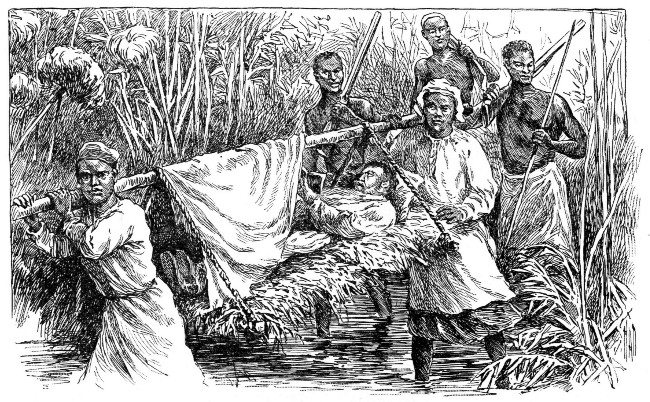 DR. LIVINGSTONE NEAR THE CLOSE OF HIS LAST JOURNEY.
The women were more elaborate in their manner of tattooing than the men, probably because they had so very few ornaments. The following of such a fashion among them must have been a most painful luxury, when we consider how slow and tedious the process of tattooing must be.
Another curious custom was the hollowing of the two front teeth on the cutting edge.
Much politeness was shown in their relations with one another. Clapping of the hands in various ways was employed as the means of expressing such polite sentiments as, "Allow me," "I beg pardon," "Permit me to pass," "Thank you." This clapping of the hands was also used in making introductions and in leave-taking, and was also resorted to in assemblies when it was desirable to attract attention in debates, as in calling out, "Hear, hear!"
The chiefs were mostly friendly and provided Livingstone and his party with food, when necessary, in exchange for "a cloth," which meant two yards of unbleached cotton.
In various villages Livingstone noticed miniature huts about two feet high. These were neatly thatched and plastered. In accordance with a custom, which seemed to belong to this special section, these huts had been built on the death of a child or relative. When any special food was cooked, it was the custom to place a portion in the tiny hut, in the strong belief that it would be enjoyed by the spirit of the departed.[Pg 448]
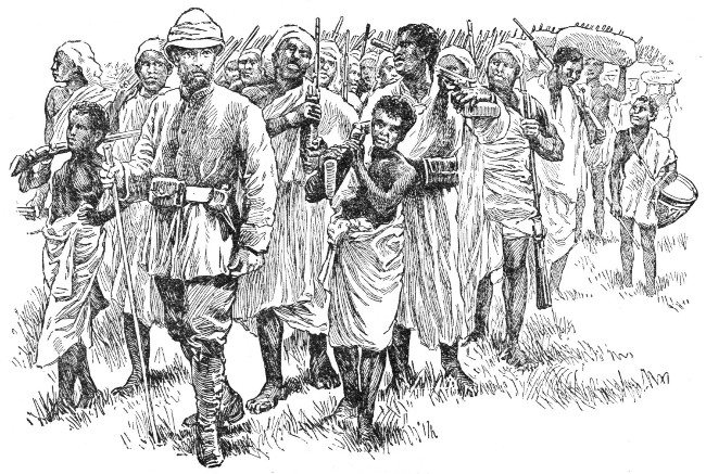 STANLEY ON THE MARCH.
The people of the Mopané Forest are described as having round bulletlike heads, high cheek bones, and an upward slant to the eyes. These features, together with their snub noses, might well enable them to pass for Bushmen or Hottentots.
They file their teeth to points, but wear no lip ring. In dressing the hair they part it so as to let it lie in a net at the nape of the neck.
Their mode of salutation is as absurd as it is inelegant, for the men throw themselves in a half-recumbent position upon the ground, clapping the hands and making a disagreeable half-smacking sound with the lips by way of salute.
It would be interesting to follow out the story of Livingstone's life; his rescue by Stanley when nearly the whole world believed him to have perished from want and privation in some African forest; of his subsequent explorations, his death, and the transportation of his body to England and interment in Westminster Abbey.
No less interesting should we find it to follow Stanley through jungle and thicket, and in hairbreadth encounters with fierce cannibals who cried greedily, "Meat, meat! Give us meat! Ah! now we shall have meat!" whenever they caught sight of the white man. It would be a matter of interest, too, to try to solve the problem of the commercial standing of Africa in the near future.
In imagination we can picture the sad details of strife and conflict and feel our hearts throb with pity for the poor savage, as he makes his piteous appeal to the white man, "What great harm have I done? I have but sought to protect my people and the land of my fathers. I sue only for peace and protection in this, the land of my birth."[Pg 450]
 SPHINX AND PYRAMID.
We have only to look at the map of Africa to realize with what rapidity the leading nations of Europe are taking possession of the choicest portions of the continent. Let us trust that the opening of the country to commercial interests will mean peace, prosperity, and the blessings of civilization for the original owners of the soil; then shall we indeed have reason to rejoice over the future of Africa.
It is difficult, when looking at the map of Africa, to realize that the Straits of Gibraltar are all that separate it from Europe, a continent differing widely from it in every respect.
True, standing upon the northern shore, we find ourselves in a country which will recall to our minds some of the characteristics of sunny Spain. A short journey of three or four hours farther south will transport us, however, into a section where everything is new and strange.
Pleasant as we have found it to catch glimpses of Africa in our reading, interesting as we have found it to trace the footprints of travelers, we shall now find ourselves enjoying nearer and clearer views of the continent, as we approach it from the coast of Europe.[Pg 452]
We will enter the continent from the northwestern extremity, the section known as the Empire of Morocco, called by the Arabs, "the far west."
Tangier, the small seaport at which our little steamer anchors, is situated on a small bay, or inlet, of the Straits of Gibraltar, the division line old Father Ocean has marked between Africa and Europe, and lies thirty-eight miles southwest of the town of Gibraltar.
It is with mingled feelings of awe, curiosity, and interest that we catch our first glimpses of Africa from the bridge of the little steamer which has carried us safely to within sight of shore.
The white walls of Tangier can be distinctly seen, and numerous boats are fast approaching the steamer in quest of passengers. Just behind the boats, following in their wake, a crowd of Arabs, scantily clad in tattered garments, come wading through the water, halfway to their waists.
With outstretched arms, and wild, fierce cries and gestures, they draw nearer and nearer, their actions strikingly suggestive of maniacs bent upon wanton mischief or pirates in search of plunder.
It is with no little fear that we enter one of the boats now at the steamer's side; but as we approach to within a short distance from the shore our fear becomes intensified, for the whole swarm of what we can scarcely recognize as human beings, surround the boat.
They throw themselves upon us, lay hands upon us, and, with frantic gestures and vociferous cries in Arabic and Spanish, endeavor to gain our attention. It is with a feeling of genuine relief that we finally comprehend[Pg 453] the meaning of the strange scene, and find that all this hubbub is to give us the information that the tide is low, that it will be impossible for the boat to approach any nearer to the shore, and that we must be carried the remaining distance upon the shoulders of these uncouth Arabs.
It is not a pleasant mode of reaching land again, but we must submit to the ordeal. It is not so unpleasant for the ladies, for they are safely carried to shore in chairs; but each gentleman considers himself very fortunate when he finally reaches terra firma without having dipped the soles of his feet in the water during this trip to shore, astride his queer two-footed steed.
Once safely landed, however, we begin to look about us. The people passing in the street seem to be enveloped in a long white, woolen garment or cloak. This has a large hood, which is generally brought straight up over the head.
This hooded populace passes us, with grave faces, slowly, silently, as if seeking to escape notice. Others may be found crouching along the walls of the buildings, or seated at the corners of the streets, with eyes as fixed and faces as immovable as though in a trance.
All expression of interest in the surroundings or in the affairs of the world seems to have faded from the faces of the people. They appear to be lost in meditation or sunk in day dreams, impassive to all that is going on around them.
Moving through the crowd, however, we become conscious, upon nearer view, that there is not so much uniformity as we had at first supposed. We perceive[Pg 454] faces of all hues,—black, white, yellow, and even bronze.
As the long, silent procession passes, we perceive old men bent and worn with age, figures shriveled and dried like Egyptian mummies, women with face and body wrapped and concealed in a mass of rags, and children with nothing childlike in face or person unless it be their long tresses. Here are people whose heads are ornamented with long tufts of wooly hair, others with heads glistening like polished ivory or metal, so closely have they been shorn of their locks.
The town of Tangier is a curious sight, with its labyrinth of narrow streets; so narrow as to be scarcely more than corridors.
Rows of white houses line these streets and present an odd appearance to the looker-on. They are usually without windows, and the narrow doorways are scarcely wide enough for a man to enter by them. They give one the impression that they belong to a prison, or possibly a house of refuge or concealment.
Occasionally a door, or even a window, is seen with some Moorish decoration. Again a band of red may be found at the foot of a wall, or a hand may be discerned painted in black upon the doorway. Such marks are superstitiously regarded as charms to keep away evil influences.
The air in the streets is very offensive. Most thoroughfares are littered with heaps of decaying vegetables, old rags, bones, feathers, and other substances, with an occasional dead dog or cat lying about. These render the air most disagreeable and unwholesome.[Pg 455] Added to this are the mingled odors of garlic, burnt aloes, benzoin, fish, and the smoke of various substances that may be burning. Here and there groups of Arab boys may be seen playing at their various games; or they may be heard chanting, in their shrill, nasal tones, verses from the Koran, which is their only schoolbook.
The scene is a varied one. Here is a wretched beggar crouching in the dust in the hope of awakening pity in the heart of the passer-by; there a Moor mounted upon a mule. Then presently an overloaded donkey comes in sight, a half-clothed Arab trotting by his side and showering heavy blows upon him in the vain attempt to urge him on to greater speed; now a half-starved dog or vagrant cat skulks by, as if in terror at the sight of man.
Tangier has one principal square. It is a small rectangular place with one long street running through it. This street ascends from the sea landing through the entire length of the town. Numerous shops are scattered about the square, which are of so simple a character that those of the humblest village in Europe would appear quite grand in comparison.
At one side of the square is a fountain, where at any hour in the day may be found knots of Arabs or groups of negroes, who have come to get water. On the other side of the street, eight or ten women, closely veiled, remain seated on the ground from early dawn till close of day, silently offering for sale the loaves of bread arranged before them.[Pg 456]
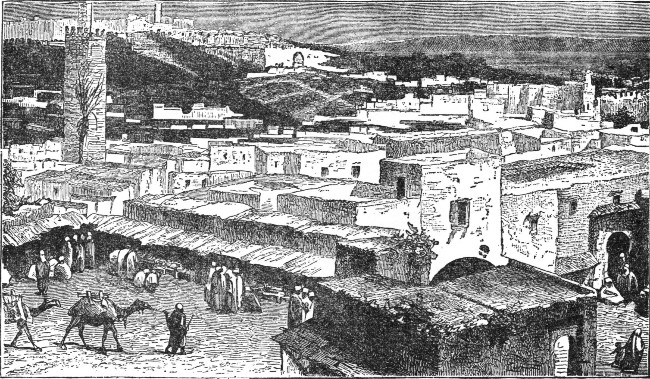 TANGIER.
The square is the business center of Tangier. Grouped about it are found the homes of the representatives of foreign lands. Their houses are very simple, yet, contrasted with the common dingy houses of the town, they appear quite like palaces.
The aspect of business life in this little square is like that of any village center, with its single grocery store, tobacco shop, and unpretentious café. The latter is merely a humble little room, upon the walls of which various printed notices of the current topics of the day are posted.
A billiard table is one of its features, and assembled round it, or lounging about the room, is usually a motley crowd. Rich Moors idle away the hours, Jewish traders discuss their business transactions, half-clothed vagabonds look on with listless expression, Arab porters await the arrival of the steamers, employees of the foreign representatives rest during the noon hour, while various strangers, some just landed, and numerous beggars, add variety to the scene, which is as interesting as it is unique.
The Moorish shops here, as well as those of Cairo in Egypt, differ much from those of the countries in Europe. Each is built like an alcove about a foot above the level of the sidewalk. In front is an opening at which the customer stands as if before a window. The merchant, with his goods spread out before him, sits cross-legged in his narrow shop, like a statue in a niche. We are led to wonder, as we watch him, if he may not be merely of wood or stone, so immovable is he; and we almost expect to find some machinery that may set him in motion.
These merchants seem to pass hours and even days[Pg 458] wrapped in reverie, or mechanically touching a chaplet of beads, as they utter the words of the Koran.
A curious feature of Tangier and other cities of Morocco may often be witnessed by night. Upon the stillness of a slumbering city breaks a sound as of a distant bombardment. This soon brings to the doors and windows a crowd of people, who are at first startled, but who quickly become expectant of what is to follow.
The sound draws nearer and nearer; a surging crowd appears surrounding something shaped like a casket upon end. This is borne upon the back of a horse or camel. The flare of innumerable torches lights up the novel scene. As the procession advances slowly, a droning, plaintive sound of music is heard, accompanying a dismal, nasal chant. Shrill cries, the barking of dogs, and the sound of guns but add to the general confusion.
The curiosity of a stranger makes him keen to know the meaning of this strange scene. The explanation is simple. It is but the wedding procession of a young bride as she is being conducted to the house of her bridegroom; and the upright coffer, or casket, is but the conveyance in which she is being carried to her future home.
Many of the inhabitants use no wine, since they are followers of the Prophet Mohammed, and their faith forbids its use. In some homes this custom is not so rigidly enforced, and at the time of feasts wine is used quite freely.
The master of a Moorish house usually meets his guests in a square courtyard, found in the center of[Pg 459] his mansion. Two large chambers open out from this, which have no windows, but are entered through a large, arched doorway closed by a portiere or a heavy, massive curtain.
The outside walls are generally of dazzling white, the arches of the doorway are not bare of ornament, and the pavement is of beautiful mosaic work.
At intervals in the inner walls are small niches for the slippers which custom demands shall be used by all who enter a Moorish house. The tiles of the floor are often covered with beautiful Moorish rugs and carpets. On each side of the doorway are large chandeliers. These are brilliant with numerous lighted candles of various colorings. On the tables are beautiful mirrors, and masses of brilliant flowers, to add enchantment to the scene.
A stranger, upon entering one of these houses for the first time, might fancy himself looking at the interior decoration of a theatre, the ornamentation of a church, the gilded trimmings of a ballroom, or the luxuriance of a regal palace.
The grace and elegance of the appointments, the brilliant lights and coloring, add novelty and enchantment to a scene that might have been taken from the "Arabian Nights."
Leaving Tangier, we will proceed to Fez, the great metropolis of Morocco. If we wish to gain any definite knowledge of this important city of the Sultan's dominions we must by no means fail to visit it.
Fez was founded more than eight hundred years before Christ. During the Middle Ages it was considered[Pg 460] one of the largest, handsomest, and most important of the Mohammedan cities. At that time it was the capital of Morocco, and was said to have contained ninety thousand dwellings, nearly seven hundred mosques, besides magnificent public buildings, fine schools, and scientific institutions.
About the middle of the sixteenth century the court was removed to Morocco, and Fez gradually exerted less and less influence. It is still, however, a city of importance and the capital of the northern province of the empire of Morocco.
Fez has rather a peculiar situation. It is in a tunnel-shaped valley, surrounded by hills. The higher portions of the valley are covered with a growth of trees. Orange groves and orchards are not uncommon features. The city is divided into Old and New Fez by one of the branches of the Sebu, or "river of pearls."
Fez is regarded as the Holy City by the western Arabs, on account of the many mosques and relics it contains. It is said still to contain one hundred mosques. The most important of these contains the monument of its builder, Sultan Muley Edris. It is sought by criminals as a place of refuge, when they are in danger of arrest. So strong is the feeling for the sanctity of the place, that no refugee is ever molested while under its roof.
The old palace of the Sultan, which still stands, is fast falling into decay since the removal of the court to Morocco.
The external aspect of Fez does not differ materially from other Mohammedan towns. There are the various[Pg 461] baths and bazaars with which the eye becomes familiarized; the numerous caravansaries, or inns, for the accommodation of the many caravans that assemble here on their way to and fro across the desert. These inns are large square buildings with open courtyards in the middle.
The multitude of hotels and shops on all sides is the only feature to remind the stranger of European cities. Fez still carries on quite a considerable trade by means of caravans, which travel into the adjoining countries on the south and east, as far as Timbuctoo.
Both Old and New Fez are surrounded by old brick walls and great towers of limestone. These are fast crumbling to pieces from exposure to the elements.
Outside of the gates of the city and for a good distance into the surrounding country may be seen traces of the foundation of a city. Everything points to its ruin by war and conflagration; for here are seen monuments, ruined tombs, and arches of aqueducts, remnants of the past.
As we enter the city a constantly increasing crowd is seen. Men stop to look at us with an air of astonishment or curiosity; women turn aside their faces, and try to hide themselves from our gaze; the very children flee from us in dismay, uttering cries of fear in their flight.
On either hand we behold fountains richly ornamented in mosaic work, or doorways beautiful with arabesque decorations, characteristic of the Arabian taste, consisting of a fanciful combination of all kinds of figures of men and animals, either real or imaginary.[Pg 462]
Here and there we behold arcades and remnants of fine Arabic architecture, all showing the destroying touch of Father Time. At intervals we plunge into dark covered passage ways and emerge into the light only to enter again into shadow. The principal streets, usually thronged, are only about seven feet wide. On either hand are open bazaars filled with animated buyers.
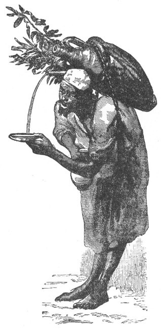 A WATER CARRIER AT FEZ.
The courts of the various inns are piled high with bales of merchandise, and the entrances of the mosques present a long perspective of white arcades and the prostrate figures of the worshipers engaged in prayer.
We find the air impregnated with the varied and penetrating[Pg 463] odor of aloes and aromatic perfumes, or with the oppressive smell of incense, till it seems to us as if we were within the walls of some mammoth drug store. On every side dirt and squalor abound, and clouds of dust fill the air, so that the eyes, nose, and the lungs even, are uncomfortably affected.
The terraces on the house tops are a pleasant sight in the cool of the day. In Fez, as in other cities of the empire, these terraces are reserved for the women, and are considered rather a necessary feature of the harem, or women's apartments.
They are built high above the ground, many of them being surrounded by a wall higher than a man's head. This is pierced with loopholes, since it would be impossible to look over the top of it.
The imperial palace is a very lofty edifice built upon an eminence. The view from the top of it discloses thousands of white terraces. From the palace there is also a fine view of the hills encircling the city and of the mountains towering in the distance.
It is interesting to catch a glimpse of the Moorish women upon the terraced house tops, many of which have parapets, or walls, breast high, to surround them. Most of the women are richly dressed, and may be seen strolling backwards and forwards, or seated upon the parapets. Some of the younger ones amuse themselves by leaping like children from one terrace to another; they play at hide and seek, or laughingly splash water in one another's faces, as merry as children. Others appear older and more sedate, and mingling with them may be seen groups of children of eight or ten years of age.[Pg 464]
The greater part of these Moorish women wear the hair flowing loosely over the shoulders. A large red or green handkerchief is bound around the head to keep the hair in place.
The dress most commonly seen is a loosely flowing robe of varied and brilliant coloring. It has very large flowing sleeves, and is fastened about the waist by a blue or red sash. A jacket, open at the chest, large, full trousers, yellow slippers, and heavy silver anklets complete this curious yet attractive costume. All are arrayed in oriental costumes of the most vivid coloring.
Many of the Moorish women are considered very beautiful, with their almond-shaped eyes veiled by long lashes, a slightly curved nose, and small, rounded mouth; but to our eyes their faces lack animation. The eyes are heavy and sleepy looking, and the rouge, powder, and various cosmetics which they employ when making their toilet render them hideous rather than beautiful in the eyes of practical Americans.
Living as they do in the closest seclusion, with no social nor educational advantages, we cannot wonder that their minds are undeveloped and inactive, and that life at best in the Moorish household, is, for its women, monotonous and dull.
Leaving the city of Fez in the company of a caravan, we reach the capital of Morocco after several days and nights of travel and of camping out.
The city of Morocco stands on a plain and is surrounded by walls six miles in circumference, with square towers one hundred and fifty feet apart rising from[Pg 465] them. These walls are built of a kind of cement made from finely powdered lime and earth. Eleven gates, or entrances, pierce these walls, and crowds of people are coming and going constantly through them during the day.
Morocco cannot be said to be a very brilliant capital. The streets are narrow and dark, and a stranger would not care to wander through them at night. The houses, like those in other parts of the empire, are mostly of one story, with flat roofs. The interior is more attractive than the exterior. The apartments are usually built around a court; within this court a fountain or a statue forms the center of attraction.
The apartments themselves are furnished elaborately, and would seem almost elegant in their appointments, were they fresher and less dilapidated. In many of the houses are rich carvings of a style and finish of earlier and more prosperous times.
Just outside the city walls is the emperor's palace. The grounds surrounding it are very extensive and are kept in excellent order. Although the gardens can in no way be compared with the royal gardens in Europe, yet they do not lack beauty. They cannot be considered as open to the public, yet travelers are admitted to certain parts of them, and Europeans receive marked attention from the officials.
After the heat and noise, to say nothing of the disagreeable odors of the city, it is a relief to get outside the walls and enjoy the beauty and sweetness of the royal gardens. Here in the cool and quiet is the best place from which to view the royal family, the various officers of state, and such distinguished guests as may be in attendance on the court.[Pg 466]
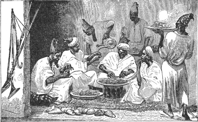 DINNER TIME IN MOROCCO.
The palace of the emperor is far from imposing; there is, in fact, nothing remarkable about it. Some of our hotels present a more elegant and imposing appearance.
The population of Morocco is, as we might suppose, a mixed one. People of all colors, the educated and the ignorant of all classes mingle together. Here, in fact, are all sorts and conditions of men.
Mekinez is the summer residence of the Sultan. It has a fine situation in the midst of olive plantations, about forty miles west of Fez, to which broad streets, lined with beautiful shade trees, present a very pleasing contrast. It is surrounded by a triple row of notched or crenated walls, and the approach to the city in the full light of midday is most beautiful, with the thousands of white terraces standing out in bold relief from the deep blue sky.
Not a column of smoke can we perceive ascending from any of the multitude of houses; not a person is visible either upon the terraces or before the walks; not a sound is to be heard.
We might believe we were in an enchanted city where some "sleeping beauty" lay waiting for the hundred years to expire. We stand in silence, as if spellbound by the grandeur of some wondrous painting.
There is a saying, among the natives, that Mekinez can justly lay claim to having the most beautiful women in the empire of Morocco, the most ornamental[Pg 468] gardens in Africa, and the finest imperial in the world.
Directly west of the city of Morocco and farther south than Mekinez lies Mogadore, the most important seaport of Morocco upon the Atlantic coast. The inhabitants, who take great pride in their town, give it a name signifying square. It is, however, somewhat triangular in shape.
The town is quite modern in its construction. It is built upon a sandy beach; which, fortunately, has a rocky foundation. The streets are somewhat narrow, but they are straight and well laid out. The houses are arranged with much regularity and precision on either side.
The town is divided into two parts. One section contains the citadel, the public buildings, governor's palace, and the residences of the consuls and merchants who represent the several countries of Europe. The other section of the town is occupied by the Jews and Moors. The Moors have their own special quarter, called villah, which the police close at night.
The walls of the town are not especially high nor strong. They are, however, of sufficient height and strength to serve as a defense against the attacks of the savage mountain tribes and the Arabs of the plains.
The harbor of Mogadore is formed by a bay, which is closed by an island of the same name situated about two miles from the mainland. The harbor contains some slight fortifications and a mosque—all situated upon this island.
It has been estimated that the town of Mogadore has[Pg 469] a population numbering between thirteen and fifteen thousand people. About four thousand of these are Jews, and there are possibly one thousand Christians.
If we approach the town from the interior it presents a most curious aspect, surrounded as it is by immense batteries in the form of pyramids. Each of these is constructed in such a way as to serve as a defense to the approaches to the city. An aqueduct, which is filled from a small river, furnishes the water supply for the inhabitants.
The climate of the town is very healthy. There are no lowlands nor marshes to breed malarial fevers. Rain seldom falls, but the dryness of the air is tempered by the Atlas mountain chain on the one side, and the sea on the other. The former serves to keep off the hot land breezes, while the latter lends its refreshing breezes to give coolness and moisture to the atmosphere.
The suburbs of Mogadore consist mainly of desolate waste land. At intervals gardens with a few vegetables and flowers may be seen. These gardens are always cultivated in the very midst of the sand at no little outlay of time and strength. They furnish striking evidence of man's ingenuity to make the most of his resources, even in so sterile a land.
At one side of the town are two cemeteries; one for Christians, the other for natives. That for Christians is desolate in the extreme. Not a sod, nor even the most humble flower is to be seen; not a tree shades the tombs. The mournful winds of Old Ocean sweep over its expanse, and it seems indeed forsaken; but, dreary as it is, the Moorish cemetery is even more unattractive.
Striking off from the empire of Morocco, as we journey eastward into Algeria we come to the town of Tlemcen. A passing glance at the town is, at first, very pleasing. A triple row of fine trees, such as the white poplar, the plane tree, the acacia, the nettle tree, and a species of tree the foliage of which is so thick that no sunbeam can ever penetrate it, lines the avenue of Méchonar, which leads to the gate of Bon Medina. At the left can be seen the old walls of Méchonar, which was the citadel of the town. At the right the eye beholds a scene strongly in contrast, for the houses, with possibly a few exceptions, are squalid in the extreme.
It is impossible to enter the town except from the southwest; as all other approaches to it present steep and rugged sides. The district about it abounds in fruit trees of all descriptions. The olive tree is the most valuable among them. Much of the land is cultivated for the production of cereals, tobacco, etc.
Tlemcen is the capital of the province of Oran. It is situated some eighty miles from its chief town, Oran, and enjoys a delightful situation in an undulating country under a thorough system of irrigation and cultivation. A range of hills, some four thousand or more feet in height, protects it from the south wind sweeping up from the desert sections.
The climate of the town is somewhat remarkable for its sudden changes in temperature, which are as distinct[Pg 471] from day to day as are the changes of our climate from season to season. Sometimes they come in rapid succession, even in a single day, during the summer season.
Rain falls in abundance. The rainy season begins usually in October and continues, with occasional periods of fine weather, until the following May or June. The spring rains and the frequency of morning fogs render the vegetation so luxuriant as to astonish the traveler, even in the heat of the summer. After journeying through districts where the vegetation is parched and withered by the heat of June, the freshness of the verdure around Tlemcen cannot fail to delight as well as surprise the stranger.
The town rarely feels the effect of the sirocco, or wind from the south, and never longer than for two or three days in succession. Thunder is occasionally heard in winter or in the spring, and sometimes at the close of an unusually sultry day. When storms come they pass rapidly, for strong currents of air draw them away, usually towards the southeast.
Although apparently enjoying so many advantages, yet the town cannot be said to be very beautiful, when once we are within its walls. The quarters of the natives are hideous. Often they are scarcely more than ruins. In fact, it is no uncommon thing to find the most wretched buildings constructed out of the remnants of larger ones.
The interior of nearly all the native houses is squalid and destitute of all comfort. Usually a mat serves the purpose of a bed. A painted wooden chest, containing[Pg 472] a few garments of wearing apparel and a scanty supply of linen, serves the double purpose of a closet and a table or seat, as may be needed. A few articles for the kitchen, a chafing dish of earthenware, and some wooden plates made from the poplar tree, complete the articles of household furniture.
The Jews, though much more crowded in their quarters than we should think admitted of comfort for their families of numerous boys and girls, furnish their homes much more comfortably than the natives do.
The natives are divided into two distinct classes very hostile to each other. On account of this hostile spirit the French have been able to maintain a strong hold upon the country.
Many of the people have Turkish fathers and Arab mothers, and constitute an oppressed and despised class. The French have protected them from direct persecution, and this has made them not only very grateful but very loyal to these foreigners, whom they even aid by joining their military forces in time of need.
They are generally tall in stature and vigorous in body, and are more cleanly and careful in their dress than their rivals, and more industrious. Through their labor the fine gardens of the town are kept green. They keep the provision and butcher shops, and as they speak both French and Spanish they easily compete with the foreign tradesmen.
Their rivals, the Haddans, are of pure Arab blood, and in their poverty and indolence are far inferior to their ancestors, who were rather an energetic race. Their bronze complexions and black hair offer a strong[Pg 473] contrast to the white complexions and usually fair hair of the despised half-breeds.
The Israelites are very numerous in Tlemcen. During the persecution of the Jews in the fifteenth century, many of them fled into Algeria and took refuge mainly in the province of Oran.
About the middle of the present century the Kabyles, a sturdy race of mountaineers descended from the ancient Numidians, broke out into decided hostilities against the French. Although they displayed much of the fierce, dauntless spirit of their ancestors, they were speedily quelled.
The work of conquering, colonizing, and, in a measure, civilizing Algeria, went on; while the French troops, penetrating into the remote south, almost to the borders of the Sahara, soon subdued the desert tribes, in spite of their bold resistance.
During the latter half of the present century the French government has given a great deal of attention to Algeria. Unfortunately, the French have not the reputation of making very good colonists.
The Kabyles, who occupy the mountainous section between Algiers and Constantine, were originally strong and powerful tribes, numbering one hundred and fifty thousand fighting men, all deadly foes of the French. Most of them have been subdued, though not without a long, sanguinary struggle.
The Kabyles are the most intelligent and the most industrious of all the Algerian tribes. Not an inch of ground capable of cultivation is allowed to go to waste. The carpets they manufacture are of superb beauty.[Pg 474] Their woolens almost equal those of the English manufacturers in their excellence. Their gunpowder is of so superior a quality that the French for a long time believed it to be of English manufacture.
With the exception of a few Kabyle districts that struggle to maintain an independence of the French government, the whole of Algeria is now so much in subjection that it is perfectly safe to travel through any part of it without fear of being molested.
Among the benefits that have come through the colonization of Algeria, the system of artesian well digging is, by far, the most important. By means of irrigation, many barren and waste lands have been reclaimed and made extremely fertile.
About the middle of the present century, boring was begun in an oasis of the Sahara, within a desert section of the province of Constantine. A splendid fountain of water, yielding at the rate of over four thousand quarts a minute, at a temperature of seventy degrees, was the result. The native priests blessed it, and named it "The Fountain of Peace." Another of these artesian wells was called "The Fountain of Benediction."
In the desert of Sidi-Rached, a region wholly unproductive, owing to lack of water, a well was dug to a depth of a little more than fifty-four meters, which yielded over four thousand quarts a minute. This well is known as "The Fountain of Gratitude." The greatest excitement was shown when it was opened. The Arabs ran in crowds to the spot, and bathed themselves in the welcome stream; mothers dipped their little ones in it, while the aged priest fell upon his knees, wept, and[Pg 475] in broken words of gratitude gave thanks to God, and to the French to whom such knowledge and power had been given.
In some places these artesian wells have been made the centers of settlements, by tribes which formerly were nomadic, or wandering. Around what may be termed "wellsprings of joy," villages have been constructed, and date trees have been planted in their vicinity.
Through so simple an agent as these artesian wells, the wandering habits of the tribes have been changed, and obedience and allegiance to French rule have in a measure been established. With feelings of gratitude these tribes recognize the blessing of a plentiful supply of pure water, and render thanks to those who have unlocked the storehouses of nature.
The oases, or fertile regions, which owe their existence to the digging of artesian wells, are usually surrounded by walls, which serve the purpose of fortifications. Such fortified places are used as storehouses and magazines by wandering tribes, who leave their grain crops and other goods in security, while they travel long distances in search of fresh pasturage for their immense flocks.
The Kabyles are not Arabs, but are descendants of the original African possessors of the soil, the Berbers. It is an interesting sight on a bright spring morning to watch the footpaths that lead to some popular Kabyle market. All along the roadside, under the foliage of the trees, or fording the shallow places in the rivers, swarms of these natives may be seen on their way to market.[Pg 476]
The father of a family, with the younger children perched upon his shoulders, usually leads the way. His wife follows, leading the older children, while the mules, donkeys, and sheep with their drivers follow in a long procession.
Sometimes the wife, if young and easily fatigued, is allowed to ride upon the back of one of the donkeys. This is, however, a rare thoughtfulness on the part of the husband. Usually he thinks nothing of allowing his wife to find her way through streams where the water reaches above the knees even in the shallow places.
The Kabyle villages present a gay festive appearance, if viewed from a distance. A closer inspection is disenchanting, for it reveals the dirt, squalor, and disorder characteristic of the daily life of the natives, and which cannot fail to impress the traveler unpleasantly.
The houses are packed closely together on unpaved streets, so narrow that should two persons attempt to pass each other, one of them would be obliged to step to one side.
Small courts lead to the entrances of one or more of the squalid dwellings, which have but one room on the ground floor, with no opening other than the low doorway. The fireplace is merely a hole dug out in the floor. No chimney, however, is provided to carry off the smoke.
It is indeed hard to choose between the stifling, smoky atmosphere of one of these dwellings and that in the narrow streets impregnated with the vilest odors arising from all kinds of filth and rubbish lying about.[Pg 477]
In some of the villages it is no uncommon thing to find nine or ten persons living in the one room of the house with the various domestic animals. In such a room the floor is of earth. It is unpaved, soiled with dirt, and littered with rubbish. A mat is rarely seen on such a floor, which has to serve as the only sleeping place for the members of the family. A bed is an unheard-of luxury.
The garments worn by the Kabyles are dirty, greasy, and ragged. Their food is coarse, and not always sufficient for the needs of the body.
When death enters the household, little change is made in the habits of the family. The body of the dead person is stretched out upon the dirty, bare floor. Sometimes a cloth or rug is thrown over it. The neighbors are then called into the house of mourning and crouch in a circle around the body, while the mild-eyed cattle, as they quietly chew their cud, look on in contemplative wonder.
During the struggle with the French, many of these tribes of the mountains were in the habit of seeking refuge with their flocks and treasures in the caves of the vicinity. On one occasion, a tribe, when hotly pursued by the French, took refuge in one of these immense caves. The colonel of the French troops ordered the refugees to surrender their firearms and horses, promising life and liberty. The offer was scornfully rejected by the Kabyles, who set at work to collect fagots, which they placed at the entrance of the cave and then ignited.
Three different times the French colonel sent a flag[Pg 478] of truce and begged the imprisoned natives to surrender and accept the terms offered, but without avail. The last messenger was met by a discharge of firearms by the dauntless mountaineers. The fire was then rekindled and the intrepid Kabyles met their death in what had proved a prison rather than a refuge.
Later, when the cave was examined, some six hundred dead bodies were found. Counting those natives who, though alive, did not long survive, and those who could not be reached, it has been roughly estimated that about eight hundred must have perished. Some had been suffocated, others trampled to death by the maddened cattle which had been confined in the cave with their owners.
The capital of Algeria is Algiers. It was built some nine hundred years before Christ. An Arab chief was its founder. It rises from the sea coast up the sides of a bald, rugged hill.
Viewed from a distance the city is somewhat like a triangle in shape. The apex of the triangle is occupied by an ancient fortress. It stands five hundred feet above sea level and commands the whole city.
The modern part of the city is built lower down. On the side facing the sea it has a strong fortification, which the French have improved at a great expense.
It has been estimated that Algiers has a population of between fifty and sixty thousand people.
Oran and Constantine are both situated upon the sea coast. The former is a strongly fortified town upon the west. It is quite Europeanlike in appearance. Its seaport, about five miles to the north, is said to have one of the finest harbors on the northern coast of Africa.[Pg 479]
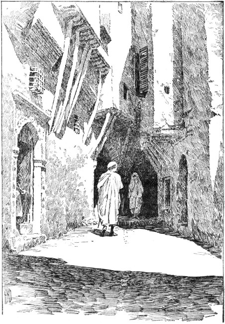 STREET IN ALGIERS.
Constantine has a strikingly picturesque situation in the east. It stands on the summit of a gigantic mass of grayish white limestone, with precipitous sides. To add to the grandeur of the picture, the foaming waters of the Wed Rummel dash against three sides of this limestone mass, as if seeking to overthrow it.
The town and the immediate neighborhood abound in the ruins of ancient Roman structures. The very walls which surround and fortify the town were built by the Arabs from stones sculptured by the Romans. On one side is a fine old Roman bridge spanning a ravine.
In ancient times Constantine was one of the most important towns of Numidia; for a long time it was a residence for the royalty.
About three hundred years before Christ it was destroyed in the wars of Maxentius against Alexander. It was, however, soon rebuilt by Constantine the Great, and derived its present name from him.
The palace of Constantine is the most interesting of all the public monuments of Algeria, both on account of its antiquity and its special architecture. It is not imposing in its character, nor has it any finely finished details of very rare merit; neither can it be said to be perfectly harmonious in its structure.
If we compare it with the other magnificent buildings of the Turkish reign, we shall find that it is superior to them because of its elegant and handsome proportions. Its interior decorations, too, display all the[Pg 481] beauty and luxuriance of the most modern productions of the Algerines.
It was captured about 1830, and now constitutes the headquarters of the commanding general of the province of Constantine. One of the most striking apartments is known as the Saloon of Trophies, which is entered from the grand reception saloon by means of a door at the side. The room presents a delightful view. The rafters of the ceiling are supported by three slender columns of marble, which are most beautifully carved, and twisted into spirals. To add to the unique character of the ceiling, various colored lanterns of handsome form, as well as two beautiful glass chandeliers of ancient Italian style, are suspended from it.
About midway in the apartment is an alcove surrounded with luxurious divans. At the right and left are panels, with magnificent mirrors mounted in beautifully carved woodwork.
The side walls of the room are completely covered with rose work of the most brilliant coloring. The floors, and the walls between the windows, are finished with varnished tiles. The windows are protected by double shutters. These are most attractive in appearance, being decorated with mirrors on the interior, and beautiful rich carvings in cedar wood on the exterior.
A most curious piece of ancient furniture is found in this room. It consists of a candle stand in the form of an egg cup bearing an ostrich egg. The stand is of gilded bronze. It has three branches, or arms, to hold the candles. This stand is believed to have belonged to the daughter of the Turkish ruler who constructed the[Pg 482] palace. The Saloon of Trophies is said to have been her apartment.
The room derives its present name from the large collection of flags and arms, trophies of war, which decorate the walls. They serve to commemorate the various expeditions and war feats of the conquerors in the province of Constantine.
Here may be found guns, sabres, and pistols, of the most varied descriptions. Many of them are surmounted by the curious red, yellow, or green silk banners under which the Turks have fought against all invaders of their territory or disturbers of their religious faith and customs.
The court of the palace bears the name of the Court of the Genii, suggestive of tales from the "Arabian Nights." It is surrounded by five pointed arches on each side. It occupies a somewhat secluded space, and in ancient times served as a great basin, or reservoir, in which the women of the royal household were accustomed to bathe.
In this reservoir was a fountain, the waters of which fell back into a tier of basins, varying in size. On the edges of these basins, beautiful rose work and inter-twining foliage had been carved by a skillful artist, who with the cunning of his art had closely imitated nature.
The waters of the reservoir were filled with fish, which were the special care of the ladies of the royal household.
On one side of the court a staircase led down into a vaulted chamber underneath the palace. Here were[Pg 483] situated Moorish baths arranged exclusively for the royal household.
It was the custom each day to transport to the palace immense water bags made of oxhide. These were filled from the river, which flowed at the foot of the hill, and transported to the palace upon the backs of mules. The water was first poured into a sort of conduit. Pipes of pottery extending from it conducted the stream into the interior of the palace.
Chambers in which the bathers could repose were built over the baths. In one of these chambers was an immense bird cage in which nightingales, finches, parrots, canaries, and various other species were kept for the pleasure and amusement of the royal ladies.
When the French took possession of Algeria, the royal family fled from their palatial residence, many escaping through a hole in the wall, and these baths came into the possession of the conquerors.
Early in the present century, the name Algiers terrified every schoolboy who read of the evil deeds of the pirates, whose business it was to roam over the seas for plunder from foreign vessels.
Many a brave man lost his life trying to save his vessel from surrender, while his crew was mercilessly cut down by the sabres of the infuriated pirates, who were determined to capture the prize at any cost.
Sometimes, forced to surrender, the hapless captain and his crew were conveyed in their vessel to Algiers, and thrust into dark and loathsome dungeons, where life became one long torture.
The confiscated vessel was then employed as a decoy,[Pg 484] or painted over so as not to be recognized on the high seas by the crews of other vessels sailing from the same country.
So desperate were these pirates that, if they saw no chance of securing a vessel, they did not hesitate to scuttle it, and to leave the crew to find a watery grave, as it sank beneath the waves.
Early in the present century, the English nation sent out a fleet to bombard Algiers. Then the French nation, in turn, sent its fleets to wage war against the Algerine pirates, whose name had become a terror, and whose deeds were notorious throughout the commercial world.
Tunis is the smallest and most easterly of the Barbary States.
Ancient Carthage included within its territories those of the modern state of Tunis. The ruins of the ancient city may be found about thirteen miles northeast of the walled city of Tunis.
Nothing remains now of the ancient capital but scattered piles of stones and two crumbling arcades, which, in the course of ages, have yielded to the force of the elements.
Tunis, which is the political capital of the state, is situated upon the Mediterranean Sea. It is located at[Pg 485] the extreme end of a lagoon some twelve miles in circumference. It is connected with the Bay of Tunis by the narrow channel of Goletta. At the mouth of this channel is a little town bearing the same name. Goletta is really the port of Tunis.
The city of Tunis is divided into an upper and a lower part. The upper section is occupied by the Mohammedans. The lower section, as well as the suburbs, is occupied by the Italians, Maltese, French, and Jews.
The streets of the city are narrow and exceedingly dirty. Modern civilization seems to have done little in the way of improving their sanitary conditions.
At Tunis is situated the palace of the bey, or Turkish ruler. There is nothing remarkable about its exterior, but the interior is furnished with all the luxuriance of the Moorish style. This palace is used as a residence for distinguished foreigners. The bey has his residence at El-mersa, which is situated on the sea coast about three leagues from the city.
About two miles northwest of the city of Tunis stands an immense building, the Bardo, with many towers and projections. It is the official seat of government. The state prisons, the garrison, the military school, and an entire street of shops, are included within the government grounds.
The city is connected by rail with several of the other chief towns in the neighborhood. The principal railway, which belongs to a French company, runs from Tunis to the Algerian frontier.
The trade with different ports of Europe, principally with Marseilles, Genoa, and Leghorn, consists in exporting[Pg 486] the productions of inner Africa. Not only Tunis and its seaport Goletta, but also Susa and Sfaks upon the east coast, are concerned in this trade with Europe. The latter port is connected by telegraph with the capital.
Besides its political capital, the state has its spiritual capital, Kairwan. It lies about seventy-five miles south of Tunis in a barren plain and is regarded as one of the sacred cities of Islam. At one time neither a Jew nor a Christian could have his residence there.
The manufactures of the state of Tunis are mostly woolen fabrics. These consist of the burnooses, or Arab mantles, and the peculiar red caps, familiar all along the Mediterranean. Soap, earthenware and the famous Morocco leather are among the manufactures.
Two kinds of alcoholic beverages are made by the people. They are held in great esteem, since the Koran does not forbid Mohammedans to use them. One of these drinks is made from dates; the other from the Indian fig.
Some of the products of the sea coast of Tunis are quite valuable, as coral and sponge. Salt is also obtained. In various parts of the mountains, lead ore and quicksilver are known to exist. Deposits of saltpeter are found in the plateau of Kairwan.
The government of the state is despotic. The ruler bears the title bey. In the spring of 1881 the French invaded the state to punish the Berber inhabitants of the mountains in the extreme northwest, because they had invaded French territory. This invasion by the Berbers was made the pretext to compel the bey to[Pg 487] accept a treaty making the French rule supreme in Tunis.
The inhabitants are, generally speaking, of good figure. The men are rather spare and sinewy. The women are considered very beautiful. When they are young they have a bright color, clear complexion, and large, expressive eyes. Their hair, which is usually of a blue-black color, is allowed to float freely over the shoulders.
In Tunis, as in other Oriental countries, flesh is considered a mark of beauty. It is said that the Moorish ladies have a recipe for becoming fleshy which never fails—to eat freely of young dogs.
The women of the wealthy classes decorate themselves with a profusion of gold and silver ornaments, and carry about with them small mirrors and scent-boxes. They adorn themselves, too, with precious stones, chains, and corals. The poorer women of the Arab populace load themselves down with strings of glass beads, and copper jewelry.
The Arab children when but a few days old have a skin almost as white as a European's, though rather a dull white. Exposure to the sun soon tans the skin, little by little, to a brownish hue. This is by no means unpleasing to the eye.
The Jewish women of Tunis have a very different costume from that of the women of Algeria and Morocco. It is strikingly original and of the most brilliant coloring. Tradition identifies it with the old Hebrew costume of Scriptural times.
Its peculiar features are a pointed cap set upon the[Pg 488] head, and a very loose jacket, which falls a little below the waist, and which is often ornamented with the richest of embroidery. A close-fitting pair of stockings to cover the legs, and peculiar slippers or Hessian boots decorated with tassels, complete the quaint costume.
The Jewish men wear a costume much more like that of the Turks, except that their full, loose trousers do not fall much below the knee.
The women of the Turkish households in Tunis, as well as in all Mohammedan countries, are regarded more as pets and favorites than as the companions and helpmates which they are in American and European households. Their homes are like gilded cages, for the inmates can leave them only by permission of the head of the household. Even when allowed to go upon the street, they are always heavily veiled from observation.
If we leave the port of Tunis on one of the little Maltese schooners, we can, after a sail of some forty-eight hours with a favorable wind, easily discern the walls of Tripoli rising out of the sea from the low, rocky tongue of land in the western extremity of the province.
The coast line is so low that we have been able to see it only upon very near approach to shore. The mountains[Pg 489] of the interior, however, were discernible even at a distance of ten miles from shore, and our pilot has not hesitated to use them as safe landmarks by which to direct the course of our little vessel.
As we approach the coast it is seen as a more distinct line above the waves. Gradually it assumes the form of a long crescent, the white walls of the town rising from the center.
The eastern point of the crescent-shaped shore is overgrown with a dense grove of palm trees, which stand like troops protecting the coast, even to the water's edge, by what seems like an advance guard. The western point of the crescent is but a stretch of the yellow sands of the desert, with here and there a stunted growth to break the monotony.
A small gulf forms the harbor of the town. Across the front of this gulf a reef of low rocks serves as a foundation for a natural breakwater. One would think that it would be an easy matter to add to nature's work and make this feature of valuable service to the harbor; but the indolent Arabs have contented themselves with throwing out a frail rampart for a short distance from the shore.
Doubtless this rampart was made upon foundations laid by the Romans. On it some rusty cannon are mounted, as if to recall the glory of departed days, when the power of this kingdom, with its piratical character, struck terror to all the European nations whose vessels plowed the seas. Like Algiers, Tripoli was, in past ages, notorious for its piracy.
As far back as the middle of the sixteenth century, a[Pg 490] governor of the province, a noted corsair himself, encouraged piracy to such an extent that the town of Tripoli had become the headquarters of the worst class of men that had ever sailed the seas. All commerce was at the mercy of these men, who were hated as much as they were feared.
This condition of affairs had continued until the beginning of the present century, when the English compelled the Tripolitans to abandon their infamous doings upon the seas. Hence, in Tripoli, as in Algiers, piracy is at an end. Thanks to war ships, we can rejoice that the black flag, the skull and crossbones, the clipper ships that carried them, and the dastardly crews that maimed these pirate crafts are all things of the past.
Tripoli, like all the cities of the Orient, is beautiful, if seen from a distance; approach to it is sure to be very disenchanting to the traveler. Let him once step foot upon the little quay, built of masonry, gayly striped in green, yellow, blue, and red, and all poetic fancies leave his mind, as his eyes and nose are greeted with the most disenchanting, yet striking, sights and smells.
As he passes through the little gate of the fishers he emerges into a perfect labyrinth of narrow, irregular streets, far more dirty than any imagination could picture. These streets are lined with the most miserable little shops and old houses crumbling to ruins, and are littered on all sides with dirt of every description.
Only on rare occasions has the town known any spasmodic attempts at cleanliness. Such an occasion offers itself whenever a new pasha arrives from Constantine[Pg 491] to assume official duties and issues an eloquent appeal to the people to cultivate cleanliness.
A spirit of emulation seems then to possess the people. Each person tries to outdo his neighbor. The proprietor of each little shop cleans away all dirt from his house and premises and carefully places it in a little heap in the street, to be removed to a place outside the town limits. Alas! the removal of the garbage is postponed indefinitely, the piles of dirt and waste increase in size, and are finally scattered to the four winds, and the old state of dirt and filth prevails.
Most of the houses are united to one another every few rods by arches of masonry. After heavy rains these supports have to be strengthened by rafters. In spite of these precautions many houses tumble to pieces in the course of a single year. It is hard to assign a cause for this. Possibly it may be due to the poor quality of the lime used in building, to the brackish nature of the water, or to the inferior quality of the building stone, which, is merely a compressed sand.
It is a curious fact that houses rarely last more than a year without showing signs of decay. This condition of things discourages architects and builders. Hence, few handsome edifices and buildings are seen, if we except those of a few Europeans, the buildings of the consul, the convent of the mission, and a few others.
The houses are low, usually of one story, and their flat roofs do not add to the apparent height of the buildings. The arrangement of the houses is about the same in all cases. There is a square court, around which extends a covered gallery, supported by slender columns.[Pg 492]
Long narrow rooms, generally in the form of a Latin cross with the foot wanting, lead from this gallery. At right angles to these narrow rooms, or more strictly speaking, corridors, are two larger rooms which open from them. These several apartments are separated from each other by draperies or portières.
The section of Tripoli which lies nearest to the quay is populated by Christians, who have grouped their dwellings around the two or three churches of the town. The Jews occupy the western section of the town, which is, if possible, more unsanitary than the others.
Still, Tripoli is not without interest; for, both within and without its walls, we find not only beautiful gardens but manufactories for leather, carpets, scarfs, and the like.
From Tripoli we can watch the departure of the great caravans for the Sahara on their way to Timbuctoo Bornoo, and other points, to obtain the products of the Soudan. This overland trade we shall find, however, has to a great extent decreased in recent years. The town of Tripoli may well be considered the center of a large agricultural population. Here the native men of wealth, or capitalists, increase their revenues by acting as money lenders to the peasantry, who of course have to pay high rates of interest for the loans.
It is interesting to notice that in no other section of North Africa does the Great Desert approach so closely to the sea as in the province of Tripoli. The Atlas chain of mountains, which, so far, has served as a protection to the Mediterranean shore from the shifting sands of the desert, here dwindles away to a low ridge of[Pg 493] hills, and finally disappears entirely in the little Gulf of Systa, which lies west of the town of Tripoli.
On this gulf is the natural seaport of the Soudan, from which, according to Dr. Barth, opens the easiest route to the center of the continent.
The boundaries of the province of Tripoli can hardly be said to be definitely fixed. By some writers the whole area, including Fezzan and Barca, has been estimated at four hundred thousand square miles. Some writers include the oasis of Kufra, east of Fezzan; others declare it to be independent. The total population of the province is estimated at upwards of one million. Of this number about three hundred thousand belong to Barca.
Strange to say, the coast line, stretching as it does over a distance of between seven and eight hundred miles, has only one harbor, that of the town of Tripoli.
The eastern part of the interior is really a continuation of the Great Desert, and has the same general character; hence, large tracts of barren sand are common. The southern portion of the province is partly crossed by the Black Mountains, an eastern range of the Atlas. These slope away into successive terraces, which include many valleys and fertile plains. Off to the west, the surface of the country shows still greater variety; here the scenery is often beautiful and grand.
By far the richest tract in the whole province of Tripoli is Mesheea. This has a stretch of about fifteen miles of coast line. Its width, however, does not exceed five miles. Its capital is situated very nearly in the center of the district.[Pg 494]
The whole district of Mesheea is covered with fertile fields producing wheat, barley, millet, Indian corn, together with madder, saffron, and other crops. Olive groves, vineyards, and orchards producing all kinds of southern fruit, abound.
This fertile little district is divided into small inclosures. In the center of each of them are two upright piles of mason-work. Between them a pulley is suspended, and on this a pointed leathern bucket is made to ascend and descend. Each time the bucket ascends it gives out a stream of limpid water.
The pulley is worked, usually, by a half-clothed negro, who leads a most disconsolate-looking specimen of an ox or cow, as he toils up and down an inclined plane, the lowest part of which is below the surface of the land.
All day and all night this work goes on, from the end of one rainy season till the beginning of the next. During these eight months all the gardens are like so many basins, which are under a regulated system of inundation.
Another curious custom prevails at the season when the sap begins to ascend in the date palm. A man begins to mount one of these trees, aided only by his naked feet and a girdle which holds him to the trunk.
Slowly, steadily, he mounts till he reaches the crown, where the branches spread out. He does not scruple to cut these off until only four remain, stretching out as if to indicate the points of the compass.
Over one of these branches, where it joins the trunk, he passes a fine cord and allows the two ends to reach[Pg 495] the ground. He then wounds the tree by making a deep incision between two of the cuts where he chopped off the branches.
Making a descent from the tree, he sends up a bucket by means of the cord, and allows it to hang suspended just under the deep incision he has made. After a space of twelve hours, this bucket is brought down and another is sent up. The former is filled with a pale gray liquid, not quite clear in appearance. It looks much like barley water, is slightly sweet in taste, and is used as we would use mineral waters.
Exposure to the atmosphere for some hours changes the appearance of the liquid. Bubbles rise to the surface, and under this slight fermentation, travelers tell us, it becomes a refreshing beverage, somewhat like soda water.
Left to stand half a day longer, the harmless beverage changes to a thick milk-white fluid with a pungent odor and a slightly acid taste. Worse than all, it has become an intoxicating drink, as evil in its effects as brandy.
It is at this stage that the natives prefer it, and the most rigid Mohammedan, who would shrink with horror at the thought of taking a glass of wine, thinks it no sin to drink a cup of this intoxicating beverage. Without scruple or shame he drinks it publicly, for to him it is only the sap of the palm. If left to stand for another day, it changes to a most nauseating liquid and is unfit for use.
Barca is the eastern division of the province of Tripoli. It lies between the Gulf of Sidra and Egypt.[Pg 496] No definite line separates it from Egypt, but several roving, independent tribes serve as a living boundary line between the two races and their countries.
On the south, Barca consists of a desert plain descending gradually to the northerly depressions of the Libyan Desert. The greater part of the province is an oval plateau. It has, in turn, been held by the Egyptians, Byzantines, Persians, and Arabs, and comprised the Cyrenaica of the ancient world.
Many remnants of ancient towns, particularly in the northwest, bear testimony not only to the important place it held in the past, but to the celebrated fertility of the soil. At the present time the fertile tracts cover only about one fourth of the entire province. In the eastern portions only naked rocks and loose sand greet the eye.
Among the productions of Barca are rice, dates, olives, and saffron. Excellent pasturage is afforded to cattle, and the horses are as much celebrated as in days gone by.
The climate of Barca is very agreeable and healthy in the more elevated portions—often twelve hundred feet high—and in the sections exposed to the sea breezes.
As we journey to the south, on the road to the Soudan, we find the great oasis of Fezzan, which extends far into the midst of the Great Desert. The[Pg 497] rocky plateau of Hammada forms a natural defense for it on the north, and the superstition of the native Bedouins serves as another obstacle, in addition to those nature has placed along the road.
The Bedouins have a legend of the terrible Djin, who are doomed to everlasting imprisonment in the stony Hammada. The Djin were formerly the souls of a great people inhabiting this region. By reason of their great number and strength they not only disdained all humanity, but defied both law and justice, and made themselves feared by all of their neighbors.
King Solomon sent them an apostle, who might bring them to worship one God. They, however, not only spurned and mocked at the precepts and religious ceremonies of the apostle, but put him to death.
Not satisfied, they in derision placed a pig in their temples in imitation of the sacred niche which in the wall of the mosque indicates the direction of Mecca.
These and other sacrilegious acts they committed, trusting that their great isolation, and the vast distance which separated them from all neighbors, would prevent any accounts of their impiety from reaching the ears of the great Solomon.
It happened that there were many cranes in the land. These were so scandalized at the impious acts that they sent one of their number as a deputy to carry the news to the great prophet. Filled with indignation at what had taken place, he sent a summons to the lapwing, his favorite bird, commanding him to call together all the cranes upon the face of the earth.
When they were assembled they formed so vast a[Pg 498] number that they became a great cloud, which threw the earth into shadow from Misda, near Tripoli, to Murzuk, the capital of Fezzan.
Each crane held a stone in its beak. At a preconcerted signal all dropped their loads upon the heads of the wicked infidels, whose souls, set free, still wander over the solitary waste; while never has a crane been able to fly through this space of torment.
Some writers trace a resemblance between this Mohammedan legend and the story of the "Pigmies and the Cranes."
The northern part of the district consists for the most part of hills of a perfectly bare sandstone. There are no rivers nor brooks among these hills to irrigate the soil or to render it fertile. The southern part is mostly a level waste of desert sand, of which only about one tenth is capable of cultivation.
In the neighborhood of the villages of Fezzan, some ninety in number, situated mostly in the wadies, or apologies for valleys, we find wheat, barley, and other grains under cultivation. Camels and horses are raised in great numbers, and many wild animals and birds of prey are frequently found.
The inhabitants of Fezzan number about thirty-five thousand, and a nomadic or wandering population of perhaps nine or ten thousand.
The inhabitants are of a mixed race. Their skin is brown and in many respects they bear a strong resemblance to the negro. Their figures are, however, much more finely formed and better proportioned.
Originally of the Berber tribes, they have gradually[Pg 499] mingled with the Arabs since the invasion of the country by them in the fifteenth century. Hence the Arab characteristics and language are very marked in their influence upon those of the original Berber tribes.
Generally speaking, the people are far behind the rest of the world in civilization. They spend their time in cultivating their gardens and in manufacturing the most indispensable necessaries of life.
Quite a large trade is carried on by means of caravans passing over the routes between the interior of Africa and the coast section.
Murzuk is the capital of Fezzan. It is situated at the foot of a high plateau surrounded by low dunes, or sand hills, thrown up by the wind.
While we can but admire the picturesque situation of the capital, yet, even at first sight, we cannot fail to notice the great barrenness of the scene. This impression is deepened rather than lessened after a few days' sojourn in the town or in its immediate neighborhood.
Cultivation of the soil is simply impossible, except in the shade of the date palms. Here, it is possible to raise only such fruits as the pomegranate, fig, and peach. Vegetables are very scarce, and the milk of the goat is the only kind that can be obtained, since there is no pasturage for cows.
Murzuk is said to have a population of about twenty-eight hundred people. These we find settled in and about the neighborhood of the bazaar. The quarters of the city most distant from it are almost deserted.
A broad street extends from the eastern gate to the[Pg 500] citadel. This peculiarity would seem to indicate that the town is more closely related to negro-land than to the Arab territories on the north.
Murzuk is not inhabited by wealthy merchants. It is not so much the seat of a large commerce, as it is a place of transit.
Alexandria has aptly been called the "doorway of Africa," for it is the port through which the continent has been entered for centuries.
Leaving Europe on a luxurious steamer, and possessing the necessary passport, we shall find the port of Alexandria an easy step from the comforts of European life to the picturesque features of that in Africa.
As we view the city of Alexandria from the harbor, it does not present a specially imposing appearance. Built upon a level plain it offers no great attraction to the eye, unless it be a double row of windmills, which stretch to either hand. Looking either to the right or left as far as the eye can distinguish them, they may be seen diminishing in the perspective of the dim distance, and ceaselessly turning.
In strong contrast to these humble sentinels rises an imposing column, a relic of old Roman days. Still there is little to indicate the former grandeur of the famed city whose ancient glories have disappeared.[Pg 501]
The modern city of Alexandria does not occupy the exact site of the ancient one, but in a great measure is built upon the mole, Heptastadium. This, by means of alluvial deposits, has broadened into quite an extensive neck of land between the two harbors.
The eastern harbor is called the New Port; the western is spoken of as the Old Port. All the largest steamers enter the eastern harbor; hence the stranger from a European port first steps foot upon African soil at the eastern quay.
In no way can the modern city be said to bear any resemblance to the old city; nor has there been any attempt to reproduce the grandeur of the ancient one. It has, in fact, an entirely different character. The Alexandria which endeared itself to the Greeks and Romans was a city rich in its treasures of literature and philosophy. The modern one, on the contrary, was designed for, and is devoted to, the interests of commerce.
The ancient city was founded by Alexander the Great in the year 332 b.c. Its original situation was on the low stretch of land separating the lake Mareotis from the Mediterranean Sea.
Just in front of the city, in the Mediterranean Sea, was the island of Pharos. Upon the northeast corner of this island stood the lighthouse, famous in history, which was constructed by a noted architect at the command of Ptolemy Philadelphus.
Tradition tells us that the architect when building the lighthouse cut his own name in the stone foundations, which he covered with concrete. He then carved the name of his royal master in the more perishable portion[Pg 502] of the structure, trusting that as the years rolled by Old Ocean and Father Time would reveal the name of the true builder. Thus would his name become known to fame, and not only appeal to the eyes of the people, but live on in their memories.
The island of Pharos had connection with the mainland by means of the mole Heptastadium, named from its great length the "Seven Furlong" mole. Thus the two harbors were formed.
The entire length of the original city is said to have been about four miles, while its circumference was not less than fifteen miles.
Two main streets ran straight through the ancient city. These crossed at right angles in the heart of it. The streets were well built and were adorned with colonnades throughout their entire length.
The most beautiful section of the city had a situation upon the eastern harbor; here were located the palaces of the Ptolemies, and the museum and ancient library. Here, too, stood the Soma, or Mausoleum, of Alexander the Great and of the Ptolemies, and the imposing theater of the city.
A little farther to the west was the emporium, or exchange. Rhacotis, or the Egyptian quarter, was in the western section of the city. It contained the temple of Serapis.
Just at the west of the city was the great Necropolis. To the east lay the race course. Just beyond it was the suburban district of Nicopolis.
Most of the houses in ancient Alexandria had spaces under them. In these were built vaulted underground[Pg 503] cisterns, which were capable of holding water enough to supply the wants of the whole city for an entire year.
From its earliest history Alexandria was the "Greek capital of Egypt." We are told that at the time of its greatest prosperity it contained about three hundred thousand free citizens. This did not include the slaves and strangers, who must have doubled the number of the people.
The population, for the most part, consisted of Greeks, Jews, and Egyptians, with settlers, probably, from all nations of the then known world.
On the death of Alexander the Great the city became the residence of the Ptolemies. Under their reign it became the most magnificent city of antiquity except Rome and Antioch. In addition it became the center of learning and Greek literature, while its influence spread over a large portion of the Old World.
The situation of the city was most favorable for its prosperity. The connecting link, as it were, between the East and the West, it soon became the great commercial center of the world.
About 30 b.c., when the Romans took possession of it, it had reached the pinnacle of its glory. From the time of this conquest its prosperity was on the wane. Little by little the influence of the invader was felt. The removal of all works of art to Rome was the death-blow to the prosperity of which Alexandria had been so proud.
Then followed frightful massacres, the laying in waste of the most beautiful portion of the city, the siege and pillage of the now doomed capital, and finally[Pg 504] the increasing prosperity of its rival, the city of Constantinople.
Thus did circumstances rapidly combine to destroy Alexandria. In the fourteenth century, all that remained of its former splendor of buildings was the temple of Serapis.
Soon the strife between Christianity and heathenism arose. The final victory was gained in 389 a.d., when the only remaining seat of heathen theology was stormed by a body of Christians and speedily turned into a place of worship.
Thus ended heathenism in Alexandria. It became the great center of Christian faith and theology, and nothing marred its prosperity till it was taken by the Arabs 638 a.d.. The conquest by the Turks completed the destruction of the city 868 a.d.
True, under the Egyptian califs its prosperity revived somewhat; for, under them, it remained the chief commercial center between the east and the west.
The discovery of America, and the existence of a passage to India by way of the Cape of Good Hope, had a most disastrous effect on the trade of Alexandria, and reduced it to very small proportions compared with that of former days.
Under the dominion of the Mamelukes the city suffered still farther reverses. The conquest of the Osmanli followed this dominion, and destroyed such little prosperity as the Arabs had succeeded in restoring. The effect of these constant changes was such, that in 1778 a.d. there were but about six thousand inhabitants in the whole city.[Pg 505]
At the close of the eighteenth century Egypt was conquered by the French, and this had the effect of reviving the prosperity of her long suffering port.
Under Mehemit Ali, who had his home there for a portion of the year, the city prospered to such an extent that it soon attained the reputation of being one of the chief commercial cities on the Mediterranean Sea.
Through the influence of steam navigation it has, as of old, become the medium of communication between Europe and the East Indies. It is connected with Cairo by means of a canal which was constructed somewhere between the years 1818 and 1820. It is also connected by railway with Suez. Until quite recently, all passengers and freight for India went by the way of Suez.
The population of Alexandria is somewhat mixed, for it consists of Arabians, Turks, Copts, Jews, Greeks, and French.
Ancient Alexandria is associated in history with Julius Cæsar, who, 48 b.c., went there to intercede in the dispute over the rightful successor to the Egyptian throne at the death of Ptolemy Auletes. According to the will of the late ruler, his daughter Cleopatra and her husband Ptolemy Dionysus should have succeeded to the throne.
In consequence of the dispute as to the rightful successor, the Alexandrian War followed. Ptolemy Dionysus was slain, and Cleopatra, after much delay, finally took possession of the throne.
The beauty and power, the extravagance and arrogance of Cleopatra have formed the subject for many a painter, the theme for many a poet and historian.
A trip into Egypt would be incomplete without obtaining a view of the Delta of the Nile, which lies east and southeast of Alexandria.
The ancient Egyptians believed that the alluvial deposit at the mouth of their beloved river had been gained from the sea, but modern geographers believe it to have been formed by particles of earth, which in the course of ages have been deposited at the river's mouth.
The water of the Nile is usually of a deep blue color, which changes to a reddish brown during the annual overflow of its banks.
All the Nile countries, or those which border on its banks, receive a deposit of soil during the annual inundation. This deposit, which covers even the rocks, consists of earth or loam mixed more or less with sand.
Around the Delta we find very noticeable signs of the gradual sinking of the ground. What were known as the "Baths of Cleopatra" at Alexandria have already sunk below the level of the water.
Several changes, due to the annual inundation, have taken place. In 1784 a lagoon, or small lake, was formed at Aboukir by the invasion of the sea. The bed of what now constitutes Lake Menzaleh was once a densely populated region.
The Delta presents the appearance of an immense marsh during the season of inundation; the various[Pg 507] islands, villages, towns, and plantations can barely be discerned above the water's level.
The houses of the well-to-do peasants in the Nile villages are built of bricks dried in the sun; the chief magistrate usually has a more pretentious house built of bricks that have been baked in regular ovens or kilns; the humbler peasants content themselves with huts, which they form from the mud of the Nile and roof over with the leaves and stems of the palm. The whole is then plastered with a coating of mud.
In these villages, a minaret towers above the various houses and hotels; while a few sycamores spread their leafy crowns and make the chief ornament of the village. Slender date trees sway in the breeze, and the long racemes of the acacia shed their delicate perfume abroad.
The rains of the tropics, to which the rise of the Nile is due, reach Egypt about the middle of June; they do not reach the Delta till about the end of the month.
The rise of the river dates from the appearance of the red water, about the middle of July. The water does not reach its maximum height till near the end of September. By the middle of October it has sunk very perceptibly, and by the month of April has gradually subsided to its minimum depth.
By the end of November the irrigated land has dried sufficiently to allow of its being sown. Soon the eye is gladdened by the sight of a rich covering of green crops which brighten the landscape till the close of February. In March comes the harvest time when all the crops are gathered and stored.
Since the days of Moses, Egypt has been associated[Pg 508] in the mind with plague, pestilence, and famine. It can by no means be considered a healthy country. Ophthalmia, a distressing disease of the eyes, prevails to an alarming extent.
It is no uncommon thing to find not only the father, mother, and children in a family suffering from the loss of sight in one or both eyes, but even the cat, dog, and donkey may share the same affliction.
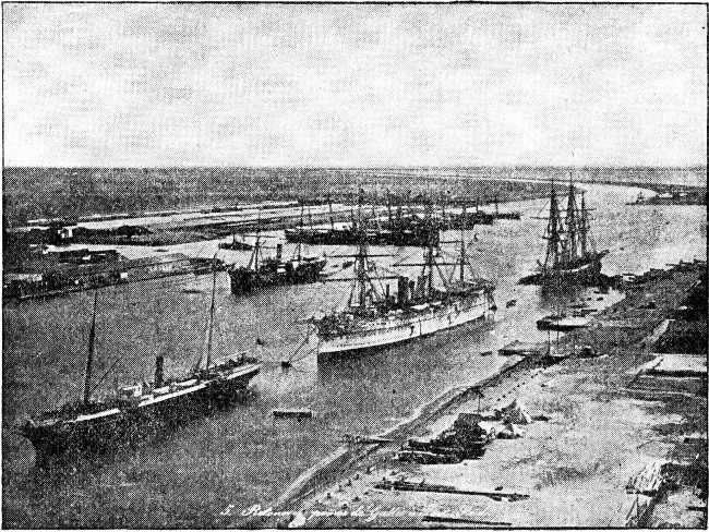 SUEZ CANAL.
Lack of general care and cleanliness is believed to be the chief cause of the disease. The strange apathy of the people, no doubt, has some influence in spreading the disease; for they seem to accept blindness as one of the decrees of Fate.[Pg 509]
The world may well be proud of man's triumph over the forces of nature, upon viewing the Suez Canal. The construction of it was a scheme from the time of the greatest antiquity. It was left for France with her enterprise and science to achieve this brilliant victory over nature, and to add fame to her name through the accomplishment of so wonderful a feat.
It is an undisputed fact, that in the days of ancient history the Red Sea and the Mediterranean were indirectly connected by a canal. We can with no certainty, however, fix the date of its construction. Some writers place the date as far back as six hundred years before Christ.
The subject remains wrapped in mystery. Aristotle and Pliny ascribe its construction to a half-mythical personage. Some writers believe the Persian king, Darius, was its constructer. Others ascribe it to the Ptolemies, so that the originator and maker remain unknown.
Such a canal did exist. It began about a mile and a half from Suez, and extended in a northwesterly direction, through a remarkable series of natural depressions, to ancient Bubastis on the eastern branch of the Nile.
The canal was ninety-two miles long. Sixty miles of this extent had been cut through by the labor of man. The width varied from one hundred and eight to one hundred and sixty-five feet, the depth was fifteen feet. Pliny, an ancient writer, declared it to have been thirty feet deep.
History does not state how long the canal was used. It finally became choked with sand deposits and[Pg 510] remained unused until the second century a.d., when it was cleared for navigation.
Again, in course of time, it became practically useless from sand deposits. It remained in this condition till the conquest of Egypt by Amron. He had it reopened and named it "The Canal of the Prince of the Faithful."
It remained open for nearly a century. In 767 a.d. the sands again conquered, and in this condition it was left till the invasion of Egypt by Napoleon Bonaparte. The attention of modern Europe was then directed to it. A number of engineers were employed to survey it and report upon it; but no result followed their report.
The subject continued to agitate the public mind from time to time; yet no definite action took place till 1847, when France, England, and Austria sent commissioners for the purpose of ascertaining accurately the difference in level of the two seas, the Red and the Mediterranean.
Their report was somewhat astonishing. Instead of a difference of thirty feet in level, as had been previously reported, the seas were found to have precisely the same level. One strong difference was noted, namely, a tide of six and a half feet at one end, and one and a half at the other.
In 1853 an examination was made, but the results remained unchanged. Various plans were projected. One commissioner, who did not believe it possible to construct a canal, proposed a railroad from Cairo to Suez. Some years later such a railroad was opened to the public. It was devoted to the overland transportation of the British, Indian, and Australian mails.[Pg 511]
France, in her energy, was not satisfied with the report of the English commissioner, and later caused to be published in a prominent journal, a plan to connect the two seas by way of Alexandria and a point some six miles below Suez.
In the year 1854 Count de Lesseps, a well-known member of the French representatives in Egypt, attracted the attention of the public by the originality of his plans. Two years later he obtained from the Pacha the exclusive right to construct a ship canal from Tyneh to Suez.
Count de Lesseps' plan differed from all previous ones, for he purposed cutting directly through the isthmus to Suez, rather than to follow an oblique course and to connect the canal with the Nile.
The great masterpiece of his plan was to construct two harbors, one at either end of the canal, Tyneh and Suez.
On the Mediterranean Sea he purposed carrying the harbor five miles out from land. This he deemed necessary in order to obtain depth enough to float a ship drawing twenty-three feet of water. Any natural harbor he knew would be obstructed by the vast quantities of mud and sand brought down annually by the Nile in its passage to the sea.
As many as thirty million cubic feet are thus carried down annually, to be driven by the prevailing winds along the shore in an easterly direction down towards the southern coast line of Palestine.
Count de Lesseps calculated that to construct such a harbor as he wished would require from three to twelve[Pg 512] million cubic yards of stone. Herein lay the great difficulty; for there were no large stone quarries except at a great distance from Tyneh.
De Lesseps planned to carry the pier at Suez three miles out from land. He foresaw many difficulties before he could hope to see his plan completed, yet these difficulties did not seem to him so insurmountable as those on the Mediterranean Sea.
Naturally, his project met with much opposition; but finally public opinion declared the plan, with some modifications, to be practical, and that the construction of such a canal would be profitable to commerce. A company was formed and at the end of five years the canal, at its Mediterranean entrance at Port Said in the eastern portion of the Delta, was finished.
From Port Said the canal had to cross about twenty miles of Lake Menzaleh, a shallow body of salt water, which in general appearance strongly suggested the lagoons of Venice. Beyond the lake much more labor had to be expended, owing to the varying height of the land above sea level. Some twenty-two miles of ground, varying in height from thirty to eighty feet, had to be cut through.
The work of excavation was most laborious, owing to the nature of the soil, which was often mixed with clay. The vast quantities of sand seemed endless, even with the aid of dredging machines and elevators, in excavating a canal as wide as that proposed—three hundred and twenty-seven feet.
When the Bitter Lake region was reached the work of excavation was no longer necessary, but much labor[Pg 513] had to be expended in making an embankment for the better security of the canal.
At the southern end of the Bitter Lake region the work of cutting was again resumed as far as Suez, some thirty miles. This was, perhaps, as difficult a task as any that had to be accomplished. So difficult was it that the width of the canal was here reduced quite a little from that at first planned.
About the middle of March, 1869, the waters of the Mediterranean were successfully conducted into the Bitter Lake. Early in the fall of the same year Count de Lesseps had the well-earned satisfaction of making a steamer trip the entire length of the canal in about fifteen hours.
Thus had the skill and the energy of the French nation overcome the doubts and the objections of the English as to the practicability and possibility of so stupendous a piece of work.
It was a day of triumph when a formal notice of the public opening of the canal, throughout its entire length, was issued by Count de Lesseps in November, 1869. Several of the royal heads of Europe were invited to attend. The Emperor of Austria and the Empress Eugénie were among those present.
November 18, the imperial yacht L'Aigle, of France, with a fleet of forty vessels, made the passage of the first part of the canal to Ismailia in about eight hours and a half. At Ismailia the fleet was met by four vessels recently arrived from the southern terminus of the canal at Suez. The whole fleet set sail for Suez November 19, reaching the Red Sea two days later.[Pg 514]
Examination of the canal proved that the water was never less than twenty feet in its most shallow parts. The usual depth was not less than twenty-five feet. The canal is now open to navigation for vessels from all nations. The usual time of transit is fifteen hours. The total cost of this great achievement of mechanical skill was about sixty million dollars.
The opening of the canal had naturally a great influence upon Suez. Formerly it was but an insignificant little town built upon a small corner of land near the northern arm of the Gulf of Suez. A railway connected it with Cairo some seventy-six miles distant. The town was walled on all sides except that facing the harbor. This harbor was rather an insignificant one, though it had a fairly good quay. Great improvements have been made. French and English houses and various offices and warehouses have been erected in different localities, which lend an air of thrift and enterprise to the town. The shops, or bazaars, have become much more pretentious, and furnish such supplies as clarified butter from Sinai, and fowls, grains, and vegetables from an Egyptian province.
The town, in spite of its improvements, is not attractive. There is little to please the eye in the wastes of burning sand that stretch out on every side. Rain is seen so seldom here as to seem almost a phenomenon. Sometimes intervals of more than three years elapse between the rainfalls.
It is rather interesting, in considering the changes that have taken place in the conditions of the earth's surface, to read that, in the opinion of many learned[Pg 515] men, the Isthmus of Suez, though now only a dreary waste of sand, contained, at some remote time, the far-famed land of Goshen. Accounts of its fertility have been handed down to us from antiquity.
As we approach nearer the vicinity of the Nile we find, about fourteen miles north of Belbeys, the ruins of the ancient city Bubastis, the Pi-beseth of the Scriptures, the Tel Basta of modern times.
The name Bubastis is said to have been derived from that of the Egyptian goddess. It is related, that upon the flight of the gods into Egypt, Diana Bubastis changed herself into a cat. Since then these animals have been held sacred.
Historians give interesting accounts of festivals held at Bubastis in honor of the goddess. It was the custom to embalm all cats that died and send them to the sacred city to be buried.
At the present time there is no trace of these unique tombs, but the memory clings to these ancient sacred rites rather tenaciously, and many of the present customs may be traced back to them. It but serves to show the influence of superstition even in the light of modern days.
It cannot be denied that some of these customs may be regarded, however, in the light of kindness to animals. Not so very many years ago quite a large sum of money was bequeathed in Cairo for the support of homeless and friendless cats.
Until within comparatively a few years pilgrimages were made to Mecca. Each caravan had for its leader an old woman who was accompanied by a number of[Pg 516] cats. In all honor, she was named "The mother of cats."
Even at the present time a man laden with cats accompanies each band of pilgrims to Mecca—a relic of the old time ceremony, which doubtless grew out of the custom of carrying the embalmed bodies of cats to Bubastis.
Herodotus tells us that the temple of the goddess at Bubastis was considered one of the most beautiful of all the Egyptian temples, and that it was the custom of the people in his age to make annual pilgrimages to it.
Nothing remains now of the former beauty of the temple. A few stones of the purest and finest grade of red granite are the only relics of its past splendor.
There are some ruins and mounds which, doubtless, are remains of what were once brick houses, and specimens of ancient pottery.
Cairo is situated at the head of the Delta of the Nile, where the river emerges from among the hills and makes its course through the alluvial plain formed by the annual deposits of silt. Its name, in the Arabic tongue, signifies "The victorious capital."
Below Cairo the Delta spreads out in the form of a half-opened fan to its broadened base on the Mediterranean Sea.[Pg 517]
Standing at the citadel, which occupies the highest ground in the city, we may from this elevation perceive the dividing line between the barren sandy hills of the desert and the well-watered fertile plains of the Nile basin. Spread out before us is a royal panorama of city, river, plain, and hill.
Just across the river we behold the pyramids of Gizeh rising toward the east, together with the Great Pyramid, which is next in size, and another much smaller. Close by is the Sphinx, but we cannot discern it at this distance.
A few miles farther to the south rise the pyramids of Sakkarah, which are nearly as impressive as the others. They are near the site of the ancient city of Memphis.
As we look down upon the city of Cairo, we perceive a hundred or more minarets pointing upwards to the sky. On the outskirts of the city the desolate hills rise to a considerable height. It is here that the hills on either side approach each other so closely as to narrow the valley between them to a width of but five miles.
The citadel of Cairo was built by the famous Saladin in the twelfth century; he took the stones with which to build it from the small pyramids of Gizeh. It stands at the southeast corner of the city, which it seems to crown. The imposing effect of the citadel would be much greater, did not the barren hill in the rear tower over it, thus dwarfing its height.
The citadel is well worthy of description. It is really a small town containing several objects of interest. The old palace of Saladin is no longer in existence. On its former site stands the rich and imposing mosque of[Pg 518] Mohammed Ali. It is of modern construction, built after the style of the mosques of Constantinople. So lofty and airy is its interior that the effect is most pleasing.
The court is paved with square blocks of white marble. Cloisters, supported by columns of alabaster, surround it on three sides. The interior of the mosque is also of alabaster and is surmounted by a lofty dome supported on four massive square pillars. Unlike many of the mosques of Cairo, this mosque is clean and well kept.
The old mosque—for centuries the royal mosque of Cairo—still stands in the center of the citadel. It is, however, in an advanced state of decay and ruin. Near by is St. Joseph's Well, some two hundred and ninety feet deep. Tradition says that the well, which was built by the ancient Egyptians, was, when discovered by Saladin, nearly choked with sand, which he caused to be removed.
The well is about twelve feet square. A gently sloping staircase on the outside descends to the level of the bottom of the well, which is said to be at the level of the Nile. This staircase is no longer used. Travelers, by payment of a small fee, have the privilege of looking at it.
To reach the well we must be willing to wade through deep sand, and to slide down a steep incline some forty feet, before we can hope to gaze down into the illustrious hole. Probably no vertical shaft was ever so impressive as this.
Cairo contains nearly three hundred mosques, the[Pg 519] minarets of which are not only the most beautiful, but the most imposing of any the traveler sees in the Mohammedan world.
To one standing in the citadel, the city presents some of the most striking and picturesque views to be found in the East. Looking beyond the mosques and their towering minarets, some built of alternate layers of red and white stone, we behold the graves of the califs, the white mountains of Mohattan, the gigantic pyramids, the fertile plain of the Nile, and the dreary stretch of the desert.
The life history of Egypt lies before us, and we have but to read the interesting pages of the past, open to our view.
The city of Cairo was founded in 969. It was for ten generations under the rule of the Fatimite califs of Africa, who came from Kairon bringing the bones of their ancestors with them.
Towards the close of the twelfth century Saladin usurped the government.
In the middle of the thirteenth century a descendant of Saladin was deposed. Cairo then remained, until the early part of the sixteenth century, under the government of a line of Mameluke kings, when it was stormed by Sultan Selim.
Under the new rule, Cairo became somewhat European in its character. The ambition of the khedive was to make his capital into a Paris of the East.[Pg 520]
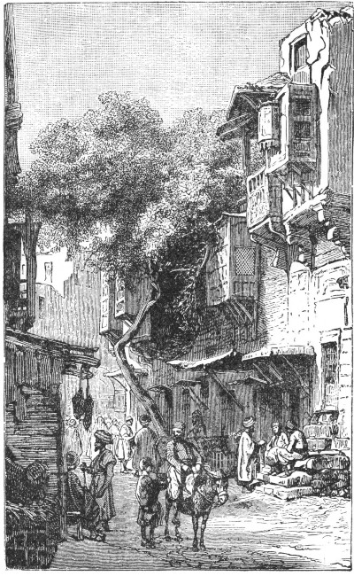 A STREET SCENE IN CAIRO.
Cairo still retains, however, many features strongly suggestive of Arabic origin. We find still its labyrinth of narrow lanes, its flat-roofed houses without chimneys, or windows, its large bazaars, in which all kinds of Oriental ware are exposed for sale, and its forests of minarets.
The narrow streets are in many places arched over; the bazaars are dark and gloomy, and the houses are built of variegated brick with interlinings of wood.
The city is divided into different quarters; one being appropriated to the Turks, one to the Christians, one to the Jews, etc.,—each separated from the adjoining one by a strong gate at the end of the streets. These gates are closed at night and are guarded by a porter, who opens them when any one wishes to pass out.
The great bulk of the population of Cairo consists of Arabs. Their ancestors were the original conquerors of the land. The ruling class of the city now consists of Turks. The tradesmen and the cultivators of the soil are all of Arabic ancestry. Then, too, we find the Copts, descendants of the ancient Egyptians, the original lords of the soil. Jews, Syrians, Africans, and Europeans make up the residue of the population.
As we pass through the streets of Cairo, we cannot fail to notice the great number of blind persons among those who throng these narrow thoroughfares. Here, as in other parts of Egypt, ophthalmia is prevalent.
It has been stated that out of every four Egyptians there will be found one blind man, another with only one eye, another blear-eyed, and one with perfect sight. The intensity of the light does not seem to cause this blindness. It seems due, rather, to the great amount of dust and to a general want of cleanliness from infancy.[Pg 522]
Another cause, too, is assigned for this misfortune. As far back as the days of Mohammed, fathers looked forward with dread to the time when their sons would be obliged to enter military service.
Many a father, to avert this fate for his children, preferred to destroy their eyesight in infancy, or to injure the eyes by cutting the pupils, rather than to see his sons claimed as soldiers when they had reached manhood.
About a mile beyond the walls of the city are the tombs of the califs. These are magnificent, imposing buildings, and may be considered beautiful specimens of Arabian architecture.
The public gardens of the city are also an attractive feature, consisting, as they do, of groves of orange, citron, and palms, intermingled with vines.
Cairo may be called the seat of learning in the East. It is celebrated for its eminent professors, particularly those of Mohammedan theology and law.
Attached to the mosque of Ezher is a university, or college, with quite a large Oriental library. Grammar, arithmetic, algebra, rhetoric, and other branches are taught in the university; while lectures on logic, theology, law, and the articles of the Koran are delivered there.[Pg 523]
Students from all parts of the Mohammedan world congregate to the number of two thousand to receive this instruction, which is free to all. The professors draw no regular salary, but are dependent upon presents from the wealthy and upon what they may receive from private pupils.
In addition to the university there are several schools where grammar, arithmetic, and penmanship are taught. There are still others which are devoted to the arts and sciences, and to engineering. At Abou Zabel is the school of anatomy, medicine, and surgery.
The Arabic language is spoken at Cairo. Although it is not of the purest form, yet it is far superior to that spoken in Syria.
The manners and customs of the population of Cairo may serve as types of those of the cultured people in the various parts of the Mohammedan world. Serious attention is paid not only to the smallest details of social life, but special regard is had to the many precepts of their religion.
Perhaps in no way are the Mohammedan observances more strictly adhered to, and the religious institutions more rigidly enforced, than in the rearing and in the education of children.
In the most trivial matters religious precepts and rules direct the management of the young child. The first duty of the Mohammedan parent is to see that the babe is wrapped in clean white linen. If this cannot be obtained, any other color may be used, provided it be not yellow.
After the babe has been wrapped in linen, it is the[Pg 524] duty of some male to utter the summons to prayer in its ear. This custom is followed religiously by all good Mohammedans in remembrance of the act of the Prophet at the birth of El Hasan.
It is the custom to chant the Mohammedan summons to prayer from the minarets of the mosques just before the service.
It is to this effect: "God is most great!" repeated four times. "I testify that there is no deity like God!" twice in succession. "I testify that Mohammed is God's apostle!"—"Come to prayer!"—"Come to security!"—"God is most great!" each repeated twice in succession, followed by the closing sentence, "There is no deity but God!"
In former times it was usual for a father to give a grand feast of seven days' duration when a little son was born. The gift of a little daughter was not regarded as an occasion for so much rejoicing.
The general custom of modern times is to give an entertainment when the child is seven days old. The mother receives the guests, exhibits the young child to them, and accepts presents of gold or silver coins. These are usually intended as ornaments for the child's headdress. In the evening the father usually entertains his friends in honor of the young child.
The Mohammedan children are most carefully reared, and from their earliest years are taught to show the greatest respect to their fathers. A most tender relation exists between father and child in spite of the ceremonious greetings they exchange.
Each morning the child greets his father by imprinting[Pg 525] a kiss upon the hand. He then stands before him in an attitude of respect, covering his left hand with his right while he awaits directions, or until he receives permission to go. Often, however, when he has kissed his father's hand, he is taken affectionately upon his lap. After the days of his babyhood have passed the well-trained boy is seldom allowed to sit when in the presence of his father.
The natives of all Mohammedan countries are very fond of their children, yet they do not mourn for them to any great extent after the death of the little ones.
This feeling of resignation comes from a religious belief that children who die at an early age are able to intercede for their parents and obtain for them blessings greater than any that can be enjoyed in this world.
There is a popular belief in the promise of the Prophet, that all infant children of true believers shall, on the great judgment day, when the dead shall rise again, refuse to enter into Paradise unless their parents can go too. Then, in answer to their prayers and petitions, the gates of Paradise will be opened to all true Mohammedans.
Just as soon as a son is old enough to understand instruction, his father begins to teach him the most important rules of conduct. One of his first lessons is as follows:—the father places some food before his son and orders him to take it in his right hand. On no account can he employ the left hand, which must be reserved for menial services.[Pg 526]
He is then trained to say, "In the name of God," as he commences to eat what is before him. He is also instructed not to hurry nor to spill any of his food, while it is impressed upon his mind that on no account is he to eat too much.
In addition to the instruction he receives in table manners, he is admonished not to be covetous nor miserly. He is forbidden to spit in the presence of others, or to commit any other rudeness. He is warned against talking too much, turning his back upon any one, standing in a slovenly position, and speaking evil against any one.
The obligations of the father are most binding. He must keep his child from evil companions, teach him the Koran, and all necessary religious and special observances and ordinances. He must give him instruction in the arts of swimming and archery, and see that he is taught some useful trade, as a protection against poverty. In addition, he must counsel him to show respect to his mother, and to endure patiently and submissively the corrections and punishments of his teachers.
Before a boy is old enough to go to school he has to submit to a religious rite which is observed with much pomp and with sumptuous feasts.
Before the observance of this rite, the boy, if he belong to the higher or middle class, is usually paraded about the neighborhood near his father's home, gayly attired, generally in the dress and ornaments of a female, with a boy's turban upon the head.
Accompanied by a group of his female friends and[Pg 527] relatives, who follow behind the horse upon which he is mounted, he rides about, preceded by a band of musicians to herald his coming.
Rich gifts are bestowed upon the young lad by the great men and merchants, till the storehouses and magazines of the household are filled to overflowing with various supplies, as rice, honey, sugar, coffee.
Players and performers of various kinds are engaged to amuse the public. Often at some of the more pretentious entertainments a recital of the entire Koran is given. At others a dance is given by male and female performers in the courtyard before the mansion, or in the street before the doorway.
Very few children of Arab parentage receive much instruction in literature. Instances are rare where they receive even the rudiments of any of the higher sciences. Every town, however, has numerous schools; even the most moderate-sized village can usually boast of one school at least.
The schools of the towns are generally attached to the mosque and other public buildings. Most of these structures and the schools connected with them—like that attached to the mosque of Ezher here in Cairo—have been endowed by princes, men of rank, and wealthy tradesmen.
The schoolmaster's duties are light. Generally he teaches his pupils nothing more than to read the Koran and to recite the whole of it by heart.
After a pupil has committed the first chapter of the sacred book to memory, he learns the rest of the chapters in inverse order. This is done to simplify the task,[Pg 528] as the chapters generally decrease in length towards the end of the book. Hence, he learns on the principle of taking the easiest lessons first. Instruction in writing and arithmetic he usually receives from another master.
One more duty the Arab father has to perform, and one which he deems most important, when his son has arrived at a proper age, which is considered by some to be twenty years. It is the custom of the father to select then a suitable wife for his son.
It is an old saying among the Arabs, "When a son has attained the age of twenty-five years, his father, if able, should marry him, and then take his hand and say, 'I have disciplined thee, and taught thee, and married thee; I now seek refuge with God from thy mischief in the present world and in the next.'"
The girls of an Arab family are seldom taught even reading. Although admission to the schools where the boys are under instruction is allowed, yet very few parents permit their girls to get any benefit from this privilege. They prefer, rather, to give them such literary instruction as they wish, by employing a learned woman to teach them at home.
The duties of such a teacher are to instruct her pupils in the forms of prayer, and to teach them to repeat by heart a few chapters from the Koran.
Instances are rare where the whole book is committed to memory; for parents are instructed not to give their daughters a full knowledge of the laws of the Koran.
Needlework is to some extent taught to the daughters of an Arab household, but it is not a common custom. In the poorer families the daughters frequently[Pg 529] busy themselves with the spindle and many learn to weave.
In the families of the higher and middle classes the daughters are taught to embroider and to do other ornamental work. This is taught to them at home, or in special schools.
Formerly, singing and playing upon the lute were considered necessary accomplishments for the daughters of wealthy Arabs. Now, however, such performances are confined to professionals, or to the slaves of the royal household.
It is very rare now that any musical instrument, other than a species of drum or a tambourine, is ever seen in the hands of an Arab lady. These instruments are used largely by the ladies of the wealthy households and are beaten by the fingers.
In many households the mothers bestow much care in teaching their daughters to acquire a fine gait and elegant carriage, as well as various little details of deportment, to render them attractive and pleasing in the eyes of others.
Those of you who were so fortunate as to visit the World's Fair at Chicago doubtless remember the representation of the streets of Cairo. Not the least among its many unique features was the facsimile of a wedding procession.
Very slowly such a procession wends its way, headed by the quaint musicians, who, with lutes, tambourines, flutes, clarionets, and the peculiar drum of the Arabs, make the air hideous with their so-called music.
The married women, following behind, look like bats,[Pg 530] arrayed as they are in long black silk wrappers. Behind them, wrapped in white veils, come the young friends of the bride, and at last the bride herself, so carefully enveloped in a red cashmere shawl that not a feature can be seen, and but the barest outline of her figure. Her only ornament is a costly gold coronet.
She is accompanied by two relatives, who with much dignity walk on each side of her. A canopy of bright red material, supported on four poles, waves over her, and richly embroidered scarfs hang from it or flutter in the breeze. More musicians bring up the rear.
From time to time the procession halts in order to afford what is considered a rich treat for eye and ear to the people who dwell upon the streets through which the procession passes.
It is the custom of the Arab women to go heavily veiled, in order that their features may be hidden from mankind. When the young bridegroom receives his bride from her family, it is his privilege to lift her veil as he utters the words, "In the name of God, the Compassionate, the Merciful!" For the first time, usually, he now beholds the face of the bride, who, with eyes modestly downcast, stands before him.
The life of a young wife is not an enviable one, for she but leaves the seclusion of her father's home for the still closer seclusion of her husband's, where, surrounded by her women slaves, she passes the time in a monotonous routine.
The slaves of an Arab household are, many of them, fairly educated and possess some little knowledge of sewing. In the wealthy households many of the slaves[Pg 531] have been taught to sing and to dance, or have been trained to repeat lyric poetry for the entertainment and amusement of their owners.
In every Arab household the women's apartments are set off from the others; for it is part of the Mohammedan religion that women shall lead a life of seclusion, surrounded only by their children and female slaves.
The duties of these slaves are not laborious, though they may be monotonous. They consist mostly in waiting upon and serving their mistresses, who have scarcely more liberty than they. The negro slaves are a decided contrast to the white slaves, and are employed mainly in the kitchen and other domestic apartments.
Most of the slaves are well treated and lead happy and contented lives, since they can have no conception of a free, unfettered life such as the humblest tiller of the soil may enjoy when he lives in the land where the "red, white, and blue" floats in the air, a symbol of liberty to all who claim its protection.
On the opposite side of the river from Cairo, about three miles southwest, lies the village of Gizeh. It is situated not far from the boundary of middle Egypt just where the line of the great pyramids begins.
The neighborhood about Gizeh is somewhat noted, for it has twice been associated with the fate of Egypt[Pg 532] in decisive battles—in 969 a.d. with the Fatimite army, and in 1798 with the French army under Bonaparte.
Ancient Gizeh was adorned with beautiful palaces and magnificent mosques. It was once a favorite resort for the merchants of Cairo, when they wished to be set free from the cares of a business life. Nothing remains now on the ancient site but a mere village. Piles of rubbish are all that mark the spot where magnificent buildings once stood.
One ancient custom still prevails in modern Gizeh, the process of hatching eggs in ovens. This custom has descended from the time of the Pharaohs.
Stretching north and south for many miles between the verdant valley of the Nile and the Libyan desert beyond, at an elevation of one hundred feet above the level of the Nile, rises a barren plateau, lying at a distance of about ten miles west of Memphis and running parallel with the river.
To the ancient kings of Egypt this rocky ridge, beneath which the Sun, the chief deity of the Egyptians, appeared to sink to rest, seemed the most fitting site upon which to build their tombs. Sitting in their palace at Memphis and viewing this western plateau, they could but meditate upon the time when their sun of life should sink and they be called to the abode of the Gods.
It was the custom to hew out chambers in the rocks on the sides of the hilly ridge, in which to place the bodies of the common dead. The king, who had reigned over his subjects in life, felt it but a fitting[Pg 533] monument to his memory that his sepulcher should be of the most magnificent proportions.
The royal sarcophagus was usually placed in a spacious chamber under a grand monument of stones. Little by little the heap began to take more definite shape under the hands of the builders, until it assumed the immovable form and severe aspect of a pyramid.
Gradually the structure became more and more regular in the character of its interior and in the outline of its exterior, till it finally stood sharply defined against the sky, the pride of the builders and the marvel of future ages.
It is said by one authority that there were about seventy of these pyramids erected along the plateau west of Memphis, between Abu Roash and Dashur. Among them were some especially noted for their size and magnificence.
According to an ancient writer, the usages and customs of the Egyptians were directly opposite to those of other nations. It was the custom for the women to be employed in business and trade, while the men stayed at home to spin and attend to domestic affairs. This gave rise to the extraordinary law by which the daughters, not the sons, were obliged to provide for their parents.
In carrying burdens, the men bore them upon the head, the women upon the shoulder. Bread was kneaded with the feet, and mortar mixed with the hands. In all other countries the cattle were separated from the members of the household, but in Egypt men and beasts dwelt together.[Pg 534]
According to this author, the Egyptians were the first to assert the immortality of the soul. They believed that the soul, after the corruption of the body, entered some animal, and by a continuous change passed successively into the different kinds of creatures belonging to the air, earth, and water. After a lapse of three thousand years it again dwelt in a human body.
The utmost care was employed to preserve the body as long as possible, that the soul might be obliged to continue with it. As the body was thus cared for, or embalmed, no labor nor cost was spared in building the sepulchers, which were termed eternal mansions. Their houses were built with much less care and expense, for they considered them but inns where men abode as travelers for a few years.
Many of the embalmed bodies, or mummies, have been brought from Egypt and placed in national museums. Some of the coffins in which they lie are very thick. They are generally of sycamore, which does not decay so easily as some wood. Some are of stone, others of cloth pasted together, making them very strong.
The top of the coffin is usually cut into the shape of a head, with a face resembling a woman's painted on it. Some of these coffins are handsomely marked with hieroglyphics. The body of the coffin is plain, with a broad pedestal at the lower end on which it can rest in an upright position.
The embalmed body appears wrapped in a shroud of linen upon which are fastened many linen scrolls painted with sacred characters. The face is covered[Pg 535] with a headpiece of linen fitted with plaster. On this the countenance of the deceased is represented in gold.
The whole body is swathed with linen bands with great neatness and skill. There cannot be less than one thousand yards of these linen bands upon a single body.
The great pyramids of Gizeh have a situation on a hill six miles west of the Nile and at a distance of ninety miles from the Mediterranean Sea. They are three in number.
There is a fine highway, built at some elevation above the plain and shaded by acacia trees, running from Cairo to these pyramids, a distance of about eight miles. As we cross the river by means of a modern iron bridge, we behold from the center of it a series of most beautiful pictures.
The Nile, even at its lowest stage, impresses us as a noble river. It is the longest river of the eastern continent, and is exceeded in length only by the Amazon and the Mississippi. True, the volume of its waters is doubtless exceeded by that of several others, since the amount is diminished by the light rainfall and the narrow watershed of the latter half of the course.
Gazing at the Nile, we can but reflect upon what it has done and what it now does for Egypt, and we realize that its flood is one of the greatest blessings, if not one of the greatest wonders in the world.
We cross the bridge, and the road we follow leads to the western hills, on the northern extremity of which stand the pyramids of Gizeh, at an elevation of one hundred feet above the sea. The whole of this region[Pg 536] was, from the earliest period, one of the cemeteries of old Memphis, which was the residence of the ancient Egyptian kings.
The largest and most ancient of the pyramids was built by Khufu. Within the solemn stillness of the chambers of the pyramid of Khufu the stone coffin which contained the royal mummy was placed. Upon the walls was sculptured the story of the dead king's deeds. A stone sealed the passage leading to these silent chambers. Three hundred and sixty thousand men were employed for twenty years in building this pyramid.
Another of these pyramids, Cheops, was built by the brother and successor of Khufu. It is constructed of huge blocks of red granite upon a vast ledge of hard limestone rock. This ledge is one hundred and thirty-seven feet above the level of the Nile.
History states that the pyramid was originally built in layers which formed steps. These were covered either with marble or alabaster, making a fine smooth surface. The footprints of Time have removed this outer covering, and the foundation steps, once rough, are now worn smooth by the feet of travelers. Cheops covers an area of thirteen acres.
The pyramid has a length of seven hundred and fifty-seven feet on each side. Originally it stood four hundred and eighty feet high; twenty feet have, however been removed.
Two hundred and six steps, or layers of stone, lead to the top, a tedious climb, requiring almost as much courage and zeal as to scale the Alps. The ascent is[Pg 537] usually made from one of the corners by winding back and forth over the angle in a zigzag direction.
It is not safe to attempt to make the ascent without suitable guides, for one soon becomes dizzy and helpless. A little girl carrying a jar of water usually accompanies the traveler, who frequently finds it necessary to avail himself of her proffered services. The descent is less dangerous but quite as exciting, for the guides, taking the traveler by the hand, leap down the steps at a merry rate. It is with a feeling of relief, no doubt, that the traveler finds himself standing on mother earth again.
The third pyramid was built by Menkera, a successor of Khufu. In the central vault the mummy of Menkera was found. The sarcophagus, in which it lies, is of blue basalt, and contains the following description, "Osiris, King Menkera, ever-living one. Thy mother Nut is outstretched over thee; in her name of the mystery of the sky may she deify thee and destroy thy enemies, King Menkera, ever-living one."
According to accounts handed down from the Egyptian priests, the immense masses of stone used in the construction of the pyramids were brought from Arabia. They were put into place by building up huge mounds of earth beneath them, and allowing them to slide into position, as if from an inclined plane. It is certain that stone such as was used in the pyramids is not to be found within many miles of these structures.
Various reasons have been assigned for the building of the pyramids other than that they were intended as burial places for kings.[Pg 538]
Some writers believe that their dimensions were meant for the basis of a system of weights and measures. Some have discovered a geometrical design in the construction, and believe that they were intended for teaching astronomy. Others argue, that only a "divine origin, plan, and purpose could account for the wonderful skill and hidden mysteries of the great monuments."
The wonderful Sphinx of Egypt is supposed to have been planned by the monarch Khafra.
"This great image stands north of the second pyramid of Gizeh. The effigy is the symbolical form of the god Harmachu, meaning Horus the Resplendent, to whom the adjacent temple was dedicated.
"The figure is hewn out of the solid rock. It has the body of a crouching lion and the head of a man capped and bearded. It is one hundred and ninety feet high.
"Between the paws, which are extended to a distance of fifty feet, is a monumental stone bearing the name of Khafra, who is said to have dedicated the image. The shoulders are thirty-six feet in breadth. The head measures from top to chin twenty-eight feet and six inches.
"The drifting sands of centuries have fallen around the mighty effigy, until only the solemn visage, looking out towards the Nile, and a small part of the shoulders and back remain above the level of the desert."
About ten miles northeast of Cairo lie a few crumbled stones and a single obelisk; these are all that remain of the ancient city of Heliopolis. This obelisk, the oldest in Egypt, was erected by the second king of the fourth dynasty, about two hundred years before the dawn of the Christian era.
Heliopolis was not only a famous city of the ancient world, but it was the seat of learning as well. One of its greatest attractions was the Temple of the Sun, possibly the most celebrated building in Egypt.
This temple has been described as standing in an area which measured a mile in length and half a mile in width. The approach to it was by an avenue lined with colossal sphinxes.
The ride to Heliopolis will take us through a growing suburb where a large number of beautiful houses have quite recently been erected. The road then emerges into a highly cultivated plain. This was once barren sand, but is now nourished and fertilized by the waters of the Nile, which have been carried to it.
We pass at intervals extensive buildings, a military school, numbers of old tombs, an astronomical observatory where the calculations are made for the yearly Mohammedan almanac, the palace of Zafforan, built by the late khedive for his mother, and also the palace occupied by the present khedive. This is situated in the midst of a fine plantation.[Pg 540]
Just before reaching Heliopolis we dismount to step aside into a garden where stands an ancient sycamore tree, under whose shade the Holy Family is said to have rested on their flight into Egypt. This tree, which is crooked and gnarled, has its trunk and limbs covered with names, which travelers have cut in the bark.
So zealous have thoughtless travelers been to secure mementoes, that the owner of the tree has been obliged to fence it in, so that it might not be carried away in chips by the desecrating hands of would-be worshippers.
The obelisk at Heliopolis is the only object of interest. It is built of red granite, and stands sixty-six and one-half feet above the pavement on which it rests. Its base is rather more than six feet square. The inscription, which is alike on all four sides, is in large hieroglyphics. The lines are as sharply defined as if cut but yesterday. The pavement upon which the obelisk stands is about six feet below the level of the surrounding plain.
Strabo described the city as standing on a raised site; hence it is apparent that both the river and the alluvial plain have been raised to a considerable extent during the last two thousand years.
Very few of the Egyptian obelisks are to be found on their original sites. Some have been removed to Rome and Alexandria, others transported to places at still greater distances. Cleopatra's Needle, in Central Park, New York City, was brought to America in 1885, at great expense and with much difficulty, from its site under Egyptian skies. It was a gift to the United States from the Khedive of Egypt.
Its counterpart, a gift to England, lay prostrate in[Pg 541] the sands of Alexandria for many years, but was finally taken to London and placed on the banks of the Thames. Curious hieroglyphics upon it prove that it was originally in the Temple of the Sun, at Heliopolis.
Heliopolis was renowned for its fine literature, its beautiful temples, and its great priesthood. It was the University City, and was to Egypt what Cambridge is to England.
Starting out by carriage from Heliopolis, we soon are beyond its limits and in the open country. At once we are transported to the customs of Bible times. Nothing seems to have changed in the space of four thousand years. Here are the hewers of wood, the drawers of water, and the old mode of plowing the soil and of threshing the grain.
On all sides we notice the great fertility of the soil. Work and water seem the only agents lacking to render the country the garden of the world in the course of a few years.
Heliopolis was at one time counted among the wonders of the world. Little remains of its former glory. Gone are the avenues of sphinxes, the groves of statues, and the renowned Temple of the Sun. One solitary obelisk—the sheik of obelisks, the Egyptians call it—remains just where hands which now rest from all labor placed it four thousand years ago.
The hands which planted Mary's tree have long since crumbled and mingled with the dust of eighteen hundred years, yet the tree, of immense size, still stands, and is likely to live for centuries.
We cannot leave Egypt without having viewed the[Pg 542] magnificent ruins of Thebes, the ancient capital of Upper Egypt. Both at Thebes and Karnac we may behold the glories of ancient ruins. Imagination finds it difficult to picture the beauties of the ancient palaces and halls when they were in their early splendor.
"Thebes must have been the greatest and most magnificent city in Egypt. Almost as old as the flood, situated in a fertile valley, where it expanded to a vast and splendid amphitheater, and adorning both banks of the Nile, it was, in extent, wealth, and architectural glory, the flower and crown of ancient civilization."
Homer sang the praises of its hundred gates nearly a thousand years before Christ. Some of the sacred prophets speak of it as containing a "multitude" of people. We cannot gaze on its wondrous ruins, nor linger among its splendid mausoleums of kings and princes, without receiving lasting impressions of its former grandeur and beauty.
The Thebes of the present and of the past come before the imagination in sharp contrast, and we find it difficult to reconcile the ever present fact of Arab filth and squalor with visions of former glory.
We vainly wish for some magic wand that could cause this ancient city to stand again as in the days of its early magnificence. It may not be. Both Thebes and Karnac are too remote from the path of commerce, too far removed from the great trade centers, in too close proximity to the burning sands of the desert, for us ever to hope to see them restored to the ranks of modern life, moved by its spirit of progress.
About a mile and a half north of Luxor we find the[Pg 543] ruins of Karnac. This was the grandest temple in Egypt, possibly in the whole world. We have but to visit it in the early evening to enjoy as glorious a sunset as mortals could desire. Who shall say what varied scenes, what gorgeous pageants, what centuries of glory and of ruin the great sun has looked upon in past ages!
We shall find it hard to give any adequate description of Karnac. Its magnitude and beauty bewilder and delight us. Its marvelous array of gates, towers, columns, obelisks, and statues astonish and enchant us.
How shall we describe a temple of such magnificent proportions! If we include its various halls and apartments, it measures twelve hundred feet in length and about five hundred feet in width. Its massive walls seem like palisades, its immense pillars like forests. Avenues lead to it from each point of the compass. Double rows of colossal sphinxes cut from gray, red, and black granite are ranged for miles along many of these avenues.
Each monarch in his reign enlarged the proportions of the temple from those which it had reached under his predecessors, whom he was anxious to excel, till the temple is said to have finally occupied seventy-five acres.
In the grand hall we find over a hundred columns still standing. They measure from nine to twelve feet in diameter; many of them are over sixty feet in height.
These columns are covered with hieroglyphical sculptures and paintings, in which the coloring is still brilliant, notwithstanding the centuries that have elapsed since they first saw the light of day. Many of these sculptures and paintings depict scenes recorded in sacred history.[Pg 544]
Chronicles of the storied past, these realistic groups depict many a stray chapter in the life history of the old Egyptian kings and their captive hosts. Lost in meditation, we stand before these silent verifiers of the records of sacred history, and with grateful hearts acknowledge the blessings of home and country and the advantages to be derived from an enlightened century, rich in science, philanthropy, and Christianity.
Aba, 52.
Abba Yared, 17.
Abyssinia, 17, 36-38, 49, 52, 55, 157.
Adal, 36.
Africa, 15.
Alantika, 160.
Albert Nyanza, 49, 51, 140, 146-152, 154, 159.
Algeria, 17, 19, 31-34, 157.
Algiers, 32.
Annobon, 160.
Aruwimi River, 97.
Ashantee Land, 167.
Assal, 37, 156.
Assouan, 40, 54.
Assyria, 29.
Atbara, 140.
Atlantic, 16, 31, 65, 86, 90, 91, 158, 168, 192, 197, 200, 208, 266.
Atlas Mountains, 17, 19, 20, 22, 30-32, 34, 35, 157, 158.
Bagradas, 34.
Bahr-el-Gazal, 52, 139, 155.
Bakuma, 116.
Bambara, 46.
Bamu, 108.
Banana Point, 102, 103.
Bantu, 192, 193, 208, 210, 266, 268.
Barbary, 30, 35, 157, 159.
Barbertown, 249.
Barca, 159.
Barraconda, 91.
Basuto, 203.
Basutoland, 210.
Bechuanaland, 222, 264, 273.
Belud-el-Jerid, 34.
Berbers, 53.
Bethany, 276.
Bight of Benin, 16, 59, 60, 168.
Bight of Biafra, 16, 60, 158, 160.
Black Mountains, 159.
Bloemfontein, 241-243.
Blueberg, 183.
Blue Nile, 37, 38, 49, 52, 53, 140.
Boers, 245, 254-261, 270.
Boma, 103, 104, 111.
Bona, 32.
British Bechuanaland, 189, 263, 264.
British Chartered Co.'s Territory, 189, 265.
British Kaffraria, 189, 208, 269.
British Protectorate, 189, 264.
Bult-Fontein, 175.
Burri, 61.
Burrum, 61.
Bushmen, 189, 190, 208, 264, 273-276.
Bush Veldt, 246, 248.
Cairo, 55.
Cameroon Mountains, 157, 160.
Cape Blanco, 34.
Cape Bon, 16, 34.
Cape Colony, 17, 18, 87, 89, 151, 160, 162, 166, 169, 171, 180, 189, 197, 199.
Cape Elizabeth, 211.
Cape Frio, 266.
Cape Guardafui, 16, 17.
Cape of Good Hope, 16, 158, 171, 182, 185, 187, 188, 197, 198, 201, 202, 212, 217, 218, 232, 235, 237, 238, 240, 244.
Cape Town, 167, 183, 193, 200, 205, 211-214, 219, 241, 260-263.
Cape Verd, 16, 18, 90, 91, 158.
Central Africa, 154, 192, 217.
Central Nigritia, 18.
Chambesi River, 95, 96.
Charlestown, 219, 220.
Chobe River, 65.
Chubiri River, 111, 112.
Compass Mountain, 198.
[Pg ii]Congo Free State, 114-117.
Congo River, 44, 45, 65, 93-97, 102-104, 106, 111, 112, 114, 155, 159, 202.
Constantia, 213.
Crystal Mountains, 157.
Cunene River, 276.
Dafur, 159.
Damaraland, 209, 275, 276.
Delagoa Bay, 132, 232, 249, 267, 268, 270.
Delta of the Nile, 40, 49, 54, 159.
Diamond Fields, 171, 175, 176.
Dilolo, 64.
Drachenberg Mountains, 89, 158, 208, 209, 215, 216, 218, 220, 237, 238, 246, 251, 254, 269.
Durban, 204, 219.
Du Toit's Pan, 175.
East London, 211.
Egypt, 17, 19, 30, 36, 38-40, 42, 49, 51, 55.
Equatorville, 97, 112.
Estcourt, 219.
Ethiopia, 38.
Falls of the Zambesi, 66-69.
Fernando Po, 160.
Fezzan, 26.
Fish River, 222.
Gambia River, 18, 44, 45, 91-93.
Gasa County, 272.
Geraffe, or Giraffe River, 52, 139, 140.
German Protectorate, 189, 266.
Godjam, 52, 53.
Gold Coast, 167-169.
Gondokoro, 51.
Great Desert, 17, 19, 20, 22, 26, 30.
Great Karroo, 199, 213.
Great Namaqualand, 87, 209.
Griqualand, 90.
Griqualand West, 171, 172, 174-176, 197.
Griqual, 276.
Guinea, 158, 166-168.
Guinea Current, 169.
Gulf of Arabia, 16.
Gulf of Gabes, 34.
Gulf of Guinea, 16, 17, 60, 93, 168, 169.
Gulf of Sidra, 16, 35.
Gulf of Suez, 40.
Gulf of Tunis, 34.
Hammamet, 34.
Harrismith, 219.
Hawash River, 37.
High Veldt, 245.
Hopetown, 172.
Hottentots, 191-195, 209, 228-236, 266.
Ibrahim Pasha Lake, 51.
Indian Ocean, 68, 89, 158, 192, 197, 200, 208, 215, 216, 269.
Indwe River, 208.
Isambi Falls, 137.
Isangila, 105, 106, 111.
Itimbiri River, 97.
Jagersfontein, 166.
Johannesberg, 170, 249.
Joliba River, 59.
Kaffirland, 220, 269, 270.
Kaffirs, 220-223, 225, 228-230, 269, 270.
Kaffraria, 220, 221.
Kalahari Desert, 65, 79, 80, 83-85, 171, 245, 272, 275.
Karuma Falls, 51, 145, 149, 151.
Kasai River, 97.
Kei River, 208, 221.
Kenia, 17, 158.
Khartoom, 49, 52-54.
Kilimanjaro, 17, 158.
Kimberley, 166, 172, 175-177, 179, 241.
Kintamo Bay, 106.
Kiva River, 97.
Kong Mountains, 60, 62, 90, 92, 157, 158.
Kordofan, 36, 38, 49.
Krugersdorp, 250.
Kuaka, 74.
Ladysmith, 219.
Lake Albert Nyanza, 49, 51, 140, 146-152, 154, 159.
Lake Bangweolo, or Bemba, 95, 154.
Lake Dembea, 37, 52.
Lake Dilolo, 64, 65.
Lake Liemba, 155.
Lake Moero, 95, 154.
Lake N'gami, 64, 65, 153, 156.
Lake Nyassa, 64, 74, 75, 117, 154, 158.
Lake Rudolph, 155.
Lake Shirwa, 155.
[Pg iii]Lake Tanganyika, 99, 101, 120, 121, 124-126, 128, 139, 155.
Lake Tchad, 18, 19, 26, 118-120, 155-157, 160.
Lake Victoria Nyanza, 49, 51, 64, 99, 121, 131, 132, 135, 136, 138-141, 145, 147, 149, 154, 155, 159.
Land of the Moon, 121.
Latookas, 142, 143, 145.
Leambye River, 65.
Lebombo Mountains, 268.
Leeba River, 64, 65.
Leopoldville, 94, 106, 107, 109, 111.
Libyan Desert, 40.
Liesbeek River, 187.
Limpopo River, 65, 75, 222, 245-247, 249, 270.
Livingstone Falls, 105.
Livingstone Mountains, 158.
Livingstone River, 96.
Lower Congo River, 94, 103, 106.
Lower Livingstone Falls, 94.
Low Veldt, 246.
Luabo, 74.
Lualaba River, 95, 96.
Lulongo River. 97.
Lupata Mountains, 17, 74, 157.
Mafeking, 264.
Magella, 150.
Magungo, 144, 148, 149, 151, 152.
Makololo, 272.
Malagarazi River, 121, 124, 126.
Manyanka, 95, 111.
Manyema, 101.
Maritzburg, 209, 217-219.
Marrah Mountains, 159.
Mashona Range, 272.
Matabele-land, 171, 272.
Matoppo Range, 272.
Mauritius Island, 205.
Mediterranean Sea, 17, 26, 30, 31, 39, 49, 51, 54, 102, 156, 159.
Mendif, 160.
Meroë, 53.
Middle Veldt, 246-248.
Mobangi River, 97.
Mograt, 53.
Monomotapa, 63.
Mont aux Sources, 86.
Morocco (Empire), 17, 19, 30, 157, 158.
Mosiotunga Falls, 66.
Mossamedes, 276.
Mountains of the Moon, 157.
Mount Loma, 60.
Mozambique, 188, 215, 268.
Murchison Falls, 51.
Mushinga Mountains, 154, 159.
Namaqualand, 203, 275, 276.
Namaquas, 276.
Natal, 87, 89, 169, 189, 198, 204, 205, 208, 215-218, 220, 237, 238, 269, 270.
Newcastle, 219.
New Rush Mine, 177.
Niger River, 17-19, 44-47, 49, 59-63, 90, 159.
Nile Basin, 40.
Nile River, 37-40, 44, 45, 51, 52, 54, 56-58, 65, 136, 137, 140, 141, 144-146, 148, 150, 151, 154.
Nile Valley, 19, 36, 41, 50, 51, 53, 55, 159.
Nmgeni Fall, 209.
North Africa, 155, 159.
Nubia, 17, 22, 36, 38, 39, 49, 53.
Nyangwé, 95, 101.
Obbo, 143, 145.
Oran (Province), 32.
Orange River, 44, 65, 86, 87, 89, 176, 198, 200, 201, 237, 238, 240, 251, 266.
Orange River Free State, 87, 89, 90, 176, 180, 189, 208, 211, 217, 219, 220, 237, 238, 240, 241, 243, 245, 250, 273.
Ovampoland, 65.
Ovampos, 276.
Ponta de Lenha, 102.
Port Alfred, 211.
Port Beira, 265, 268.
Port Elizabeth, 238, 241.
Port Natal, 217, 218, 238.
Portuguese Possessions, 189.
Potchefstroom, 259.
Pretoria, 249, 258, 268.
Prince's Island, 160.
Province of Oran, 32.
Pungwé River, 268.
Rand, 170, 171.
Red Sea, 22, 36, 38, 40, 64, 101, 158.
Rhodesia, 265.
Rio Grande, 92.
Ripon Falls, 137, 138, 140.
Rondevosch, 187.
Ruke River, 97, 112.
[Pg iv]Sahara Desert, 17, 20-24, 26, 30, 32, 38, 91, 92, 161, 273.
Salt River, 263.
Say, 62, 63.
Senegal, 18, 19, 40, 90, 91, 93.
Senegambia, 91, 92.
Shari River, 119.
Shiré River, 74, 75.
Sierra Leone, 91, 92.
Snow Mountains, 157.
Sobat River, 52, 139, 140.
Sofala, 64, 182.
Soudan, 17, 18, 22, 91, 118, 273.
South Africa, 80, 81, 158, 167, 171, 175, 178, 180, 182, 184, 185, 187, 188, 191, 192, 196, 204, 208, 211, 216, 221, 225, 237, 238, 249, 273.
South African Republic, 189, 211, 217, 219, 220, 237, 243, 249-251, 254, 263, 268, 270.
Southeast Africa, 166, 270.
Spitz Kop Mountains, 198.
Stanley Falls, 95, 97, 106, 115.
Stanley Pool, 94, 106, 108, 112.
St. Helena, 183.
St. Thomas Island, 160.
Suez, 158.
Suez Canal, 15.
Swaziland, 189, 268.
Table Bay, 181-183, 211, 212.
Table Mount, 18, 181, 200, 213.
Table Valley, 183-186.
Takazzie River, 37.
Tanganyika Lake, 99, 101, 120, 121, 124-126, 128, 139, 155.
Tees River, 208.
Tete, 74, 75, 78.
Thebes, 40, 55.
The Cape Downs, 262.
The Fell, 32, 34.
Timbuctoo, 60, 61, 63.
Transvaal Republic, or Transvaal, 87, 169, 170, 189, 217, 237, 240, 243-245.
Tripoli (Province), 17, 26, 30, 35, 36.
Tsitsa Fall, 209.
Tuaregs, 60.
Tugela's Fall, 209.
Tunis (State), 17, 30, 34-36.
Ugogo, 121.
Uguha, 126.
Ujiji, 128.
Unyamwezi, 134, 159.
Upper Congo River, 94, 95, 98, 99, 106, 108, 110, 111.
Upper Livingstone Falls, 95, 106.
Vaal River, 87, 172, 176, 241, 247, 249-251.
Van Reenen's Pass, 219.
Vayling, 264.
Vereeniging, 249.
Victoria Falls, 66, 69-73, 117.
Victoria Nile, 149.
Victoria Nyanza Lake, 49, 51, 64, 99, 121, 131, 132, 135, 136, 138-141, 145, 147, 149, 154, 155, 159.
Vivi, 94, 104-106, 111.
Wajiji, 130, 131.
Wakimbu, 122, 123.
Walfish Bay, 83, 209, 266.
Wanyamwezi, 123, 124, 130.
Wanbe River, 119.
Wenyas, 115.
West Africa, 167.
White Nile, 38, 49, 52, 140.
Witwatersrand, 169, 249.
Wood Point, 102, 103.
Worcester, 213.
Wray Hook, 241, 243.
Zambesi River, 44-46, 63-66, 70, 74, 75, 77, 78, 117, 155, 158, 159, 270, 272.
Zanzibar, 102, 132.
Zuga River, 156.
Zululand, 219, 222, 270.
Zulus, 270.
Zwartebergen, 199.
[Pg v]
Abo, 297.
Abomey, 294.
Aboukir, 506.
Abou Zabel, 523.
Abu Roash, 533.
Abyssinia, 310, 358, 409.
Alexandria, 500-506, 511, 541.
Algeria, 405, 470, 473, 474, 487.
Algiers, 404, 473, 478, 490.
Ambriz, 306.
Angra Pequena, 276.
Annobon, 298.
Ashantee Land, 287-289.
Ashantees, 290, 291.
Asinee, 288.
Atlantic, 276, 285.
Atlas Mountains, 318, 469, 492, 493.
Bakalahari, 357.
Banana Point, 304.
Bantu, 403.
Banzai, 444.
Barbary, 317.
Barca, 493, 495, 496.
Bardo, 485.
Barotse, 435.
Basongo, 437, 438.
Batoka, 441.
Bay of Corsica, 298.
Bay of Tunis, 485.
Bechuanas, 403, 418, 419, 427, 428, 430, 431, 442, 443.
Bedouins, 415, 497.
Belbeys, 515.
Benguela, 303.
Berbers, 405, 475, 486, 498.
Bight of Bonin, 281.
Bight of Biafra, 298.
Binue, 296, 297.
Bitter Lake, 512, 513.
Black Mountains, 493.
Blue Nile, 412.
Boers, 373, 376.
Boma, 304.
Bornoo, 492.
Bubastis, 515, 516.
Bushmen, 356, 357, 369, 375, 404, 430, 448.
Cairo, 457, 505, 510, 514-519, 521, 522, 527, 529, 531, 535, 539.
Cameroon Mountains, 281, 298.
Cameroon River, 297.
Cape Coast Castle, 286.
Cape Delgado, 410.
Cape Frio, 298.
Cape Guardafui, 409.
Cape of Good Hope, 344, 358, 380, 387, 504.
Cape Mesurado, 285.
Cape Palmas, 286.
Cape Three Points, 286.
Cape Town, 321.
Cape Verd, 277, 278.
Carthage, 484.
Cazengo, 305.
Central Africa, 282, 310, 314, 403.
Central Soudan, 404.
Chobe River, 419, 420.
Clarence Cove, 298.
Cleopatra's Needle, 540.
Congo Free State, 299, 304, 411.
Congo River, 304, 307, 403, 404, 412.
Constantine (City), 473, 480.
Constantine Palace, 480-483.
Constantine (Province), 474, 478.
Copts, 415, 421.
Corisco Bay, 298.
Dahomans, 296.
Dahomey, 287, 292, 294, 296.
[Pg vi]Dâkir, 277.
Damaraland, 424, 425.
Dashur, 533.
Delagoa Bay, 410.
Delta of the Nile, 414, 506, 507, 512, 516.
East Africa, 403, 409-412.
East Central Africa, 403.
Egga, 297.
Egypt, 280, 318, 413, 415, 495, 505, 507, 519, 531, 534, 541.
Egyptians, 413-415, 442, 506, 518, 521, 532-535.
El-mersa, 485.
Elmina, 286.
Equatorial Africa, 388.
Ezher, 522, 527.
Fans, 299-303.
Fellatah, 278, 279.
Fernando Po, 298.
Fez, 459-463, 467.
Fezzan, 493, 496, 498.
Freetown, 285.
Gaboon River, 299.
Galla, 409, 410.
Gambia River, 277-279, 281, 282, 315.
Gizeh, 517, 531, 532, 535.
Gold Coast, 283, 286-288.
Goletta, 485, 486.
Goric, 278.
Grain Coast, 285, 286.
Great Desert, 277, 279, 492, 493, 496.
Great South African Plateau, 281.
Guinea, 283, 403.
Guinea Coast, 281, 282, 287, 288.
Gulf of Guinea, 281.
Gulf of Sidra, 495.
Gulf of Suez, 514.
Gulf of Systa, 493.
Hamites, 402.
Hammada, 497.
Heliopolis, 539-541.
Heptastadium, 501, 502.
Hottentots, 333, 355, 374, 375, 378, 386, 404, 448.
Indian Ocean, 309.
Island of Zanzibar, 412.
Ismailia, 513.
Ivory Coast, 286, 288.
Juba River, 411.
Kabyles, 473-478.
Kaffirs, 385, 386, 403, 418.
Kairon, 519.
Kairwan, 486.
Kalahari Desert, 309, 375, 404, 429, 430.
Karnac, 542, 543.
Kater River, 283.
Kawara River, 310.
Kenia, 410.
Kilimanjaro, 410.
Kong Mountains, 282.
Kordofan, 310.
Kuanza River, 305.
Kufra, 493.
Lagos, 287.
Lake Mareotis, 501.
Lake Menzaleh, 506, 512.
Lake Nyassa, 445, 447.
Lake Rudolph, 410.
Lake Tanganyika, 412.
Lake Tchad, 310.
Lake Victoria Nyanza, 410-412.
Leeambye River, 365, 432.
Leeba River, 421.
Leopoldville, 304.
Liberia, 278, 285.
Libyan Desert, 405, 496, 532.
Limbu, 308.
Little Fish River, 330.
Loango, 303.
Loangwa, 344.
Londa, 422.
Lower Egypt, 342, 415.
Lower Guinea, 283, 298.
Lualaba River, 412.
Lucalla River, 439, 440.
Lukoja, 297.
Madagascar, 361.
Makalaka, 420.
Makololo, 420, 421.
Malaghetta Coast, 285.
Manyema, 412.
Mareotis Lake, 501.
Méchonar, 470.
Mediterranean Sea, 307, 311, 501, 510-513, 516, 535.
Mejerdah, 492, 505.
Mekinez, 467.
Memphis, 413, 417, 532, 533.
Meritsane, 358.
Mesheea, 493, 494.
Misda, 498.
[Pg vii]Moëro Lake, 413.
Mogadore, 468, 469.
Mombassa, 412.
Monrovia, 285.
Mopané Forest, 447.
Morocco (City), 460, 464-466.
Morocco (Empire), 405, 451, 487.
Mossamedes, 306.
Mozambique, 358.
Murzuk, 498-500.
Necropolis, 502.
Negroland, 416-418.
Nicopolis, 502.
Niger River, 281, 287.
Nile River, 311, 318, 342, 361, 413, 506, 511, 515, 518, 519, 535, 539.
Nile Valley, 403, 414, 432.
North Africa, 356, 403-405, 492.
Nourse River, 277, 281.
Ntambounay Falls, 323.
Nubia, 280, 307, 403.
Numidia, 480.
Numidians, 473.
Ogowé River, 303.
Old Calabar River, 297.
Oran (Province), 470.
Oran (Town), 478.
Orange River, 328, 401.
Ovampo Land, 425.
Ovampo River, 427.
Ovampos, 425, 426.
Ozi River, 411.
Pharos, 501, 502.
Pi-beseth, 515.
Popo, 287.
Port Said, 512.
Portuguese West Africa, 305.
Prince's Island, 298.
Province of Angola, 305.
Province of Mozambique, 410.
Province of Oran, 470.
Quilo, 435.
Red Sea, 510.
Rhacotis, 502.
Rio del Rey, 297.
Rio Grande, 279.
Rokelle River, 283.
Rovuma River, 411.
Sahara Desert, 307, 309, 406, 474, 492.
Sakkarah, 517.
San Juan, 298.
San Salvador, 305.
Sebu River, 460.
Semites, 402.
Senegal, 277, 279, 280, 281, 310, 318, 357, 372.
Senegambia, 277-281, 358, 403.
Sfaks, 486.
Sherboro Island, 278.
Shiré River, 344, 394.
Sidi Rached, 474.
Sierra del Crystal, 323.
Sierra Leone, 277.
Somal, 409.
Soudan, 279, 403, 492, 493, 496.
South Africa, 328, 329, 331, 334, 335, 348, 351, 356, 358, 381, 400, 401, 403.
South Central Africa, 439.
Southeast Africa, 410.
Sphinx, 517, 528.
Stanley Pool, 304.
St. Louis, 277, 285.
St. Paul de Loanda, 305.
Straits of Gibraltar, 451, 452.
St. Thomas Island, 298.
Suez, 505, 510-514.
Suez Canal, 509-514.
Susa, 486.
Tanganyika Lake, 412.
Tangier, 311, 452, 459.
Tarki, 406, 407.
Tel Basta, 515.
Temple of the Sun, 539.
Thebes, 542.
Timbuctoo, 461, 492.
Tlemcen, 470-473.
Togo, 287.
Tripoli (City), 488-493, 498.
Tripoli (Province), 405, 488, 492, 493, 495.
Tuaregs, 404-409.
Tunis (City), 488-493, 498.
Tunis (State), 405, 484, 486-488.
Tyneh, 511, 512.
Ugogo, 412.
Ujiji, 412.
Umba, 411.
Unyamwezi, 412.
Upper Egypt, 307, 314, 342.
Upper Guinea, 283.
Upper Nile River, 403, 412.
[Pg viii]Usagara, 412.
Victoria Nyanza Lake, 410-412.
Vivi, 304.
Volta River, 286-288.
Wed Rummel, 480.
West Africa, 277, 285, 287, 297-299, 304, 306, 315, 341, 403.
Whydah, 287, 292.
Windy, or Windward, Coast, 285.
Yoruba, 287.
Zaire River, 304.
Zambesi River, 344, 403, 418, 443, 444.
Zanzibar, 412.
Zulus, 403.
The remarkable success of this new series of Readers has exceeded even the anticipations of those who knew the large experience of its authors in educational work, and their peculiar fitness for preparing a series of reading books that should not only meet the needs of the schoolroom but should be educative in the highest degree. Briefly stated, the salient points of the series may be characterized as follows:—
1. It provides a carefully graded reader for each of the eight grades.
2. It is practical. The authors know what children like and what they need.
3. It furnishes more reading matter and of better literary quality than any other series.
4. It is more fully and more beautifully illustrated than any other series.
Every book is a treasure-house of choice thoughts happily clothed in fitting words. While the need of simplicity has been recognized in the lessons for younger pupils, these have been skillfully planned to awaken the child mind, and to give pupils a foretaste of what lies beyond; so that the primary readers, no less than those of higher grades, are truly "stepping stones to literature." The subject-matter in each book has been adapted with rare skill and discrimination to its special grade. It embraces nature study, classical mythology, legendary lore, stories of adventure, patriotic and other poems, historical literature, etc., and gives children an all-round education which proves reactive in every direction. In the higher readers, selections are given entire in many cases, so as to form literary wholes,—a unique and much-approved feature.
The illustrations are no less worthy of mention than the text. They are more numerous than in any series of readers heretofore published. Many of them are reproductions of famous works by great artists, and the pupils are thus familiarized with the best in art as well as in literature. They also serve as language lessons. The portraits of authors lend added interest to their writings. The artistic vertical script used in the earlier grades surpasses anything ever before introduced into elementary reading books.
The series as a whole may justly be said to set a new standard of literary and artistic excellence for school readers.
Our list comprises superior text-books for every grade of instruction.
The following are a few out of many testimonials to the merits and practical value of this notable series of school readers.
Stepping Stones To Literature presents literary gems which appeal to the intelligence and fancy of the child in a manner that will give him a desire to know the best in literature. The illustrations must educate the taste, while they give delight.—J. A. Utter, Principal of Teachers' Training School, Albany, N. Y.
These books are fine, viewed either from the literary or artistic standpoint. The stories selected are so adapted that, while none of their beauty is lost, they are perfectly suited to the ability of our youngest readers.—Bessie M. Schofield, Supervisor of Primary Schools, Providence, R. I.
I know of no readers that compare with them in every point that goes towards making a model series of books.—O. S. Moles, Ph.D., Principal of Sherman School, Denver, Col.
We are using the books in our schools, and teachers and pupils are delighted with them. I have had rather a prejudice against school readers, and have used various supplementary books in place of regular readers, but this series fully meets my ideal of school reading.—B. B. Jackson, Superintendent of Schools, Ashland, Wis.
In beauty of finish, and in the artistic excellence of the illustrations, these readers surpass anything of the kind that I have seen.—W. F. Gordy, Principal of Second North School, Hartford, Conn.
I know of no series that I like so much. They seem to me books for which teachers, parents, and children may be truly thankful.—Mrs. Alice W. Cooley, Asst. Superintendent of Schools, Minneapolis, Minn.
The books commend themselves alike for the beauty of print and pictures and the excellence of the reading matter provided in them. I do not know of anything in the schoolbook line which quite equals them.—J. W. Stearns, Director School of Education, University of Wisconsin.
These books will do more than provide mere practice lessons in reading. They cannot fail to stimulate a thirst for true culture, in the broadest sense.—Review of Reviews, New York.
This is in every way a remarkable series of readers. The books are masterpieces in art, literature, and pedagogy. The aim is to have children see the world about them clearly, appreciate the beautiful in nature and the good in human nature, think more intelligently, and live more helpfully.—New England Journal of Education, Boston.
These readers show a familiarity with child-life, its needs and interests, which every true teacher will appreciate. Both as to matter and attractiveness of appearance they are superior to any yet published.—The Teacher, Philadelphia.
Our list comprises superior text-books for every grade of instruction. Our illustrated catalogue and descriptive circulars sent free on application. Correspondence cordially invited.
| A First Reader | 30 cts. |
| A Second Reader | 40 cts. |
| A Third Reader | 50 cts. |
| A Fourth Reader | 60 cts. |
| A Reader for Fifth Grades | 60 cts. |
| A Reader for Sixth Grades | 60 cts. |
| A Reader for Seventh Grades | 60 cts. |
| A Reader for Higher Grades | 60 cts. |
| First Lessons | 36 cts. |
| Glimpses of the World | 36 cts. |
| Our Own Country | 50 cts. |
| Our American Neighbors | 60 cts. |
| Hawaii and Its People | 68 cts. |
| Modern Europe | 60 cts. |
| Life in Asia | 60 cts. |
| Views in Africa | 72 cts. |
| Australia and the Islands of the Sea | 68 cts |
| NATURE IN VERSE.—Lovejoy | 60 cts. |
| POETRY OF THE SEASONS.—Lovejoy | 60 cts. |
| THROUGH THE YEAR: Books I. and II.—Clyde-Wallace | Each, 36 cts. |
| TWILIGHT STORIES.—Foulke | 36 cts. |
| BRAIDED STRAWS.—Foulke | 40 cts. |
| THE PLANT BABY AND ITS FRIENDS.—Brown | 48 cts. |
| Book I. | For Primary Grades | 36 cts. |
| Book II. | For Lower Grammar Grades | 48 cts. |
| Book III. For Upper Grammar Grades | 54 cts. |
| Primer | 18 cts. |
| New First Reader | 24 cts. |
| Second Reader | 36 cts. |
| Third Reader | 48 cts. |
| Fourth Reader | 60 cts. |
| Fifth Reader | 84 cts. |
| Alternate First Reader | 24 cts. |
| Alternate Second Reader | 36 cts. |
| Alternate Third Reader | 48 cts. |
| Primary Reading Charts | $10.00 |
| Primer | Complete, 36 cts.; Part I., 22 cts.; Part II., 24 cts. |
| First Reader | Complete, 36 cts.; Part I., 22 cts.; Part II., 24 cts. |
| Second Reader | Complete, 44 cts.; Part I., 24 cts.; Part II., 28 cts. |
| Third Reader | Complete, 48 cts. |
| Manual of Instruction for Teachers | 36 cts. |
| Phonetic Cards | First Set, 36 cts.; Second Set, 48 cts.; Third Set, 36 cts. |
Our list comprises superior text-books for every grade of instruction. Our illustrated catalogue and descriptive circulars sent free on application.
The Silver Series of English Classics. Edited by Prof. F. L. Pattee, A. S. Twombly, and others. With Critical and Explanatory Notes.
This series furnishes editions of standard classics in English and American literature, in the best possible form for reading and study. Fourteen volumes now ready: Macaulay's Essay on Milton; Webster's First Oration on Bunker Hill Monument; De Quincey's Flight of a Tartar Tribe; Coleridge's The Rime of the Ancient Mariner; Addison's Sir Roger de Coverley Papers; Milton's Paradise Lost, Books I. and II.; 18 cents each. Burke's Speech on Conciliation with the American Colonies; Macaulay's Essay on Addison; Pope's Translation of Homer's Iliad, Books I., VI., XXII., XXIV., 24 cents each. Carlyle's Essay on Burns; Tennyson's The Princess; 28 cents each. Shakespeare's Macbeth, 30 cents. Southey's Life of Nelson, 36 cents. Dryden's Palamon and Arcite, 20 cents.
A History of American Literature. By Fred Lewis Pattee, M.A., Professor of English and Rhetoric, Penn. State College. 12mo, cloth, $1.20.
Reading Courses in American Literature. By F. L. Pattee, M.A. 12mo, cloth, 36 cents.
American Writers of To-Day. By Henry C. Vedder. A critical analysis of nineteen contemporary authors. 12mo, cloth, $1.50.
Topical Notes on American Authors. By Lucy Tappan, Teacher of English in the Central High School, Minneapolis, Minn. 12mo, cloth, $1.00.
Foundation Studies in Literature. By Margaret S. Mooney, Teacher of Literature and Rhetoric, State Normal College, Albany, N. Y. Popular classic myths and their rendering by famous poets; beautifully illustrated. 12mo, cloth, $1.25.
The Sketch Book. By Washington Irving. Edited, with Notes, by James Chalmers, Ph.D., LL.D., Fellow of the University of St. Andrews, Scotland. 12mo, cloth, 60 cents.
Shakespeare. Edited, with critical comments and suggestions, by Homer B. Sprague, A.M., Ph.D. Admirably adapted to use in classes, literary clubs, and for private reading. 7 vols. now ready: "Merchant of Venice," "Macbeth," "Hamlet," "Julius Cæsar," "As You Like It," "The Tempest," and "A Midsummer Night's Dream." 12mo, cloth, 48 cents each; paper covers, 30 cents each.
The Vicar of Wakefield. By Oliver Goldsmith. Edited, with Notes, by Homer B. Sprague, A.M., Ph.D. 12mo, cloth, 48 cents; paper covers, 30 cents.
The Lady of the Lake. By Sir Walter Scott. Edited, with Notes, by Homer B. Sprague, A.M., Ph.D. 12mo, cloth, 48 cents; paper covers, 30 cents.
Select Minor Poems of John Milton. Edited by James E. Thomas, B.A. (Harvard), Teacher of English in Boys' English High School, Boston. With Biography, Notes, etc. 12mo, cloth, 48 cents; paper covers, 30 cents.
Studies in German Literature: Lessing. With Representative Selections (translated), including "Nathan the Wise," with Notes. By Euretta A. Hoyles. 12mo, cloth, 48 cents.
Select English Classics. Selected and edited, with Notes, by James Baldwin, Ph.D. 4 vols. now ready: "Six Centuries of English Poetry," "The Famous Allegories," "The Book of Elegies," "Choice English Lyrics." 12mo, cloth, 72 cents each.
The Masterpieces of Michelangelo and Milton. By Alexander S. Twombly. With seventeen beautiful illustrations. 8vo, cloth, $1.50.
The Sources of Spenser's Classical Mythology. By Alice Elizabeth Sawtelle, Ph.D. (Yale). 12mo, cloth, 90 cents.
English Masterpiece Course. By A. H. Welsh, A.M. Seven groups of authors with lists of characteristic books. 12mo, cloth, 75 cents.
Essentials of English. By A. H. Welsh, A.M. 12mo, cloth, 90 cents.
Complete Rhetoric. By A. H. Welsh, A.M. 12mo, cloth, $1.12.
Send for our Illustrated Catalogue and for Descriptive Circulars of our Superior Text-books. Correspondence about any books on our list is respectfully solicited.
A First Reader. 128 pp. 130 beautiful illustrations. Introductory price, 30 cents.
The first reader of this delightful series initiates little learners into the world of letters by means of simple stories and rhymes concerning children and animals, the natural objects of interest to children. Its illustrations are language lessons in themselves, and its vertical script presents choice thoughts in choicest dress.
A Second Reader. 160 pp. 100 beautiful illustrations. Introductory price, 40 cents.
In this Reader the lessons are a little longer and more complex. The child's imagination is stimulated by charming fairy tales which have become child classics. He is given a taste of the best poetry. The lessons for seat work are interesting and instructive.
A Third Reader. 224 pp. Beautifully illustrated. Introductory price, 50 cents.
The ethical principle is strongly enforced in the Third Reader by apposite fables and fairy tales of Hans Christian Andersen and others. Beautiful pictures emphasize kindness to animals. There are numerous poetical gems for pupils to memorize.
A Fourth Reader. 320 pp. Beautifully illustrated. Introductory Price, 60 cents.
The child is here given his first distinct introduction to mythology, through the myths of Greece and Rome, the Hiawatha myth, etc. Kingsley's "Water Babies" and other choice writings appear in full; these enthrall the imagination and cultivate the taste.
A Reader for Fifth Grades. 320 pp. Attractively illustrated, Introductory price, 60 cents.
A Reader for Fifth Grades contains a galaxy of illustrious names. Both poetry and prose are of a high order, and will give pupils a genuine love of good literature. The Norse legends are introduced, and most of the mythological selections bear upon history.
A Reader for Sixth Grades. 320 pp. Choicely illustrated. Introductory price, 60 cents.
This Reader contains an unusual number of spirited poetical selections, full of fire and patriotism, such as will irresistibly appeal to growing youth. The myth is succeeded by history, as the tales of Ancient Rome, etc. The love of adventure and sport is also catered to.
A Reader for Seventh Grades. 320 pp. Finely illustrated. Introductory price, 60 cents.
A Reader for Seventh Grades is devoted to American literature, and contains choice representative selections from leading writers of all sections of the country. It will familiarize young people with our best authors, and inspire a just national pride.
A Reader for Higher Grades. 336 pages. Attractively illustrated. Introductory price, 65 cents.
In A Reader for Higher Grades the best representative English literature is presented, of both late and earlier periods. This Reader makes a fitting climax to a remarkable series.
Our list comprises superior text-books for every grade of instruction.
SILVER, BURDETT & COMPANY, Publishers,
Boston ... New York ... Chicago
End of the Project Gutenberg EBook of The World and Its People: Book VII, by
Anna B. Badlam

*** END OF THIS PROJECT GUTENBERG EBOOK THE WORLD AND ITS PEOPLE: BOOK VII ***

***** This file should be named 35245-h.htm or 35245-h.zip *****
This and all associated files of various formats will be found in:
        https://www.gutenberg.org/3/5/2/4/35245/

Produced by Juliet Sutherland, Josephine Paolucci and the
Online Distributed Proofreading Team at https://www.pgdp.net.


Updated editions will replace the previous one--the old editions
will be renamed.

Creating the works from public domain print editions means that no
one owns a United States copyright in these works, so the Foundation
(and you!) can copy and distribute it in the United States without
permission and without paying copyright royalties.  Special rules,
set forth in the General Terms of Use part of this license, apply to
copying and distributing Project Gutenberg-tm electronic works to
protect the PROJECT GUTENBERG-tm concept and trademark.  Project
Gutenberg is a registered trademark, and may not be used if you
charge for the eBooks, unless you receive specific permission.  If you
do not charge anything for copies of this eBook, complying with the
rules is very easy.  You may use this eBook for nearly any purpose
such as creation of derivative works, reports, performances and
research.  They may be modified and printed and given away--you may do
practically ANYTHING with public domain eBooks.  Redistribution is
subject to the trademark license, especially commercial
redistribution.


*** START: FULL LICENSE ***

THE FULL PROJECT GUTENBERG LICENSE
PLEASE READ THIS BEFORE YOU DISTRIBUTE OR USE THIS WORK

To protect the Project Gutenberg-tm mission of promoting the free
distribution of electronic works, by using or distributing this work
(or any other work associated in any way with the phrase "Project
Gutenberg"), you agree to comply with all the terms of the Full Project
Gutenberg-tm License (available with this file or online at
https://gutenberg.org/license).


Section 1.  General Terms of Use and Redistributing Project Gutenberg-tm
electronic works

1.A.  By reading or using any part of this Project Gutenberg-tm
electronic work, you indicate that you have read, understand, agree to
and accept all the terms of this license and intellectual property
(trademark/copyright) agreement.  If you do not agree to abide by all
the terms of this agreement, you must cease using and return or destroy
all copies of Project Gutenberg-tm electronic works in your possession.
If you paid a fee for obtaining a copy of or access to a Project
Gutenberg-tm electronic work and you do not agree to be bound by the
terms of this agreement, you may obtain a refund from the person or
entity to whom you paid the fee as set forth in paragraph 1.E.8.

1.B.  "Project Gutenberg" is a registered trademark.  It may only be
used on or associated in any way with an electronic work by people who
agree to be bound by the terms of this agreement.  There are a few
things that you can do with most Project Gutenberg-tm electronic works
even without complying with the full terms of this agreement.  See
paragraph 1.C below.  There are a lot of things you can do with Project
Gutenberg-tm electronic works if you follow the terms of this agreement
and help preserve free future access to Project Gutenberg-tm electronic
works.  See paragraph 1.E below.

1.C.  The Project Gutenberg Literary Archive Foundation ("the Foundation"
or PGLAF), owns a compilation copyright in the collection of Project
Gutenberg-tm electronic works.  Nearly all the individual works in the
collection are in the public domain in the United States.  If an
individual work is in the public domain in the United States and you are
located in the United States, we do not claim a right to prevent you from
copying, distributing, performing, displaying or creating derivative
works based on the work as long as all references to Project Gutenberg
are removed.  Of course, we hope that you will support the Project
Gutenberg-tm mission of promoting free access to electronic works by
freely sharing Project Gutenberg-tm works in compliance with the terms of
this agreement for keeping the Project Gutenberg-tm name associated with
the work.  You can easily comply with the terms of this agreement by
keeping this work in the same format with its attached full Project
Gutenberg-tm License when you share it without charge with others.

1.D.  The copyright laws of the place where you are located also govern
what you can do with this work.  Copyright laws in most countries are in
a constant state of change.  If you are outside the United States, check
the laws of your country in addition to the terms of this agreement
before downloading, copying, displaying, performing, distributing or
creating derivative works based on this work or any other Project
Gutenberg-tm work.  The Foundation makes no representations concerning
the copyright status of any work in any country outside the United
States.

1.E.  Unless you have removed all references to Project Gutenberg:

1.E.1.  The following sentence, with active links to, or other immediate
access to, the full Project Gutenberg-tm License must appear prominently
whenever any copy of a Project Gutenberg-tm work (any work on which the
phrase "Project Gutenberg" appears, or with which the phrase "Project
Gutenberg" is associated) is accessed, displayed, performed, viewed,
copied or distributed:

This eBook is for the use of anyone anywhere at no cost and with
almost no restrictions whatsoever.  You may copy it, give it away or
re-use it under the terms of the Project Gutenberg License included
with this eBook or online at www.gutenberg.org

1.E.2.  If an individual Project Gutenberg-tm electronic work is derived
from the public domain (does not contain a notice indicating that it is
posted with permission of the copyright holder), the work can be copied
and distributed to anyone in the United States without paying any fees
or charges.  If you are redistributing or providing access to a work
with the phrase "Project Gutenberg" associated with or appearing on the
work, you must comply either with the requirements of paragraphs 1.E.1
through 1.E.7 or obtain permission for the use of the work and the
Project Gutenberg-tm trademark as set forth in paragraphs 1.E.8 or
1.E.9.

1.E.3.  If an individual Project Gutenberg-tm electronic work is posted
with the permission of the copyright holder, your use and distribution
must comply with both paragraphs 1.E.1 through 1.E.7 and any additional
terms imposed by the copyright holder.  Additional terms will be linked
to the Project Gutenberg-tm License for all works posted with the
permission of the copyright holder found at the beginning of this work.

1.E.4.  Do not unlink or detach or remove the full Project Gutenberg-tm
License terms from this work, or any files containing a part of this
work or any other work associated with Project Gutenberg-tm.

1.E.5.  Do not copy, display, perform, distribute or redistribute this
electronic work, or any part of this electronic work, without
prominently displaying the sentence set forth in paragraph 1.E.1 with
active links or immediate access to the full terms of the Project
Gutenberg-tm License.

1.E.6.  You may convert to and distribute this work in any binary,
compressed, marked up, nonproprietary or proprietary form, including any
word processing or hypertext form.  However, if you provide access to or
distribute copies of a Project Gutenberg-tm work in a format other than
"Plain Vanilla ASCII" or other format used in the official version
posted on the official Project Gutenberg-tm web site (www.gutenberg.org),
you must, at no additional cost, fee or expense to the user, provide a
copy, a means of exporting a copy, or a means of obtaining a copy upon
request, of the work in its original "Plain Vanilla ASCII" or other
form.  Any alternate format must include the full Project Gutenberg-tm
License as specified in paragraph 1.E.1.

1.E.7.  Do not charge a fee for access to, viewing, displaying,
performing, copying or distributing any Project Gutenberg-tm works
unless you comply with paragraph 1.E.8 or 1.E.9.

1.E.8.  You may charge a reasonable fee for copies of or providing
access to or distributing Project Gutenberg-tm electronic works provided
that

- You pay a royalty fee of 20% of the gross profits you derive from
     the use of Project Gutenberg-tm works calculated using the method
     you already use to calculate your applicable taxes.  The fee is
     owed to the owner of the Project Gutenberg-tm trademark, but he
     has agreed to donate royalties under this paragraph to the
     Project Gutenberg Literary Archive Foundation.  Royalty payments
     must be paid within 60 days following each date on which you
     prepare (or are legally required to prepare) your periodic tax
     returns.  Royalty payments should be clearly marked as such and
     sent to the Project Gutenberg Literary Archive Foundation at the
     address specified in Section 4, "Information about donations to
     the Project Gutenberg Literary Archive Foundation."

- You provide a full refund of any money paid by a user who notifies
     you in writing (or by e-mail) within 30 days of receipt that s/he
     does not agree to the terms of the full Project Gutenberg-tm
     License.  You must require such a user to return or
     destroy all copies of the works possessed in a physical medium
     and discontinue all use of and all access to other copies of
     Project Gutenberg-tm works.

- You provide, in accordance with paragraph 1.F.3, a full refund of any
     money paid for a work or a replacement copy, if a defect in the
     electronic work is discovered and reported to you within 90 days
     of receipt of the work.

- You comply with all other terms of this agreement for free
     distribution of Project Gutenberg-tm works.

1.E.9.  If you wish to charge a fee or distribute a Project Gutenberg-tm
electronic work or group of works on different terms than are set
forth in this agreement, you must obtain permission in writing from
both the Project Gutenberg Literary Archive Foundation and Michael
Hart, the owner of the Project Gutenberg-tm trademark.  Contact the
Foundation as set forth in Section 3 below.

1.F.

1.F.1.  Project Gutenberg volunteers and employees expend considerable
effort to identify, do copyright research on, transcribe and proofread
public domain works in creating the Project Gutenberg-tm
collection.  Despite these efforts, Project Gutenberg-tm electronic
works, and the medium on which they may be stored, may contain
"Defects," such as, but not limited to, incomplete, inaccurate or
corrupt data, transcription errors, a copyright or other intellectual
property infringement, a defective or damaged disk or other medium, a
computer virus, or computer codes that damage or cannot be read by
your equipment.

1.F.2.  LIMITED WARRANTY, DISCLAIMER OF DAMAGES - Except for the "Right
of Replacement or Refund" described in paragraph 1.F.3, the Project
Gutenberg Literary Archive Foundation, the owner of the Project
Gutenberg-tm trademark, and any other party distributing a Project
Gutenberg-tm electronic work under this agreement, disclaim all
liability to you for damages, costs and expenses, including legal
fees.  YOU AGREE THAT YOU HAVE NO REMEDIES FOR NEGLIGENCE, STRICT
LIABILITY, BREACH OF WARRANTY OR BREACH OF CONTRACT EXCEPT THOSE
PROVIDED IN PARAGRAPH 1.F.3.  YOU AGREE THAT THE FOUNDATION, THE
TRADEMARK OWNER, AND ANY DISTRIBUTOR UNDER THIS AGREEMENT WILL NOT BE
LIABLE TO YOU FOR ACTUAL, DIRECT, INDIRECT, CONSEQUENTIAL, PUNITIVE OR
INCIDENTAL DAMAGES EVEN IF YOU GIVE NOTICE OF THE POSSIBILITY OF SUCH
DAMAGE.

1.F.3.  LIMITED RIGHT OF REPLACEMENT OR REFUND - If you discover a
defect in this electronic work within 90 days of receiving it, you can
receive a refund of the money (if any) you paid for it by sending a
written explanation to the person you received the work from.  If you
received the work on a physical medium, you must return the medium with
your written explanation.  The person or entity that provided you with
the defective work may elect to provide a replacement copy in lieu of a
refund.  If you received the work electronically, the person or entity
providing it to you may choose to give you a second opportunity to
receive the work electronically in lieu of a refund.  If the second copy
is also defective, you may demand a refund in writing without further
opportunities to fix the problem.

1.F.4.  Except for the limited right of replacement or refund set forth
in paragraph 1.F.3, this work is provided to you 'AS-IS' WITH NO OTHER
WARRANTIES OF ANY KIND, EXPRESS OR IMPLIED, INCLUDING BUT NOT LIMITED TO
WARRANTIES OF MERCHANTIBILITY OR FITNESS FOR ANY PURPOSE.

1.F.5.  Some states do not allow disclaimers of certain implied
warranties or the exclusion or limitation of certain types of damages.
If any disclaimer or limitation set forth in this agreement violates the
law of the state applicable to this agreement, the agreement shall be
interpreted to make the maximum disclaimer or limitation permitted by
the applicable state law.  The invalidity or unenforceability of any
provision of this agreement shall not void the remaining provisions.

1.F.6.  INDEMNITY - You agree to indemnify and hold the Foundation, the
trademark owner, any agent or employee of the Foundation, anyone
providing copies of Project Gutenberg-tm electronic works in accordance
with this agreement, and any volunteers associated with the production,
promotion and distribution of Project Gutenberg-tm electronic works,
harmless from all liability, costs and expenses, including legal fees,
that arise directly or indirectly from any of the following which you do
or cause to occur: (a) distribution of this or any Project Gutenberg-tm
work, (b) alteration, modification, or additions or deletions to any
Project Gutenberg-tm work, and (c) any Defect you cause.


Section  2.  Information about the Mission of Project Gutenberg-tm

Project Gutenberg-tm is synonymous with the free distribution of
electronic works in formats readable by the widest variety of computers
including obsolete, old, middle-aged and new computers.  It exists
because of the efforts of hundreds of volunteers and donations from
people in all walks of life.

Volunteers and financial support to provide volunteers with the
assistance they need are critical to reaching Project Gutenberg-tm's
goals and ensuring that the Project Gutenberg-tm collection will
remain freely available for generations to come.  In 2001, the Project
Gutenberg Literary Archive Foundation was created to provide a secure
and permanent future for Project Gutenberg-tm and future generations.
To learn more about the Project Gutenberg Literary Archive Foundation
and how your efforts and donations can help, see Sections 3 and 4
and the Foundation web page at https://www.pglaf.org.


Section 3.  Information about the Project Gutenberg Literary Archive
Foundation

The Project Gutenberg Literary Archive Foundation is a non profit
501(c)(3) educational corporation organized under the laws of the
state of Mississippi and granted tax exempt status by the Internal
Revenue Service.  The Foundation's EIN or federal tax identification
number is 64-6221541.  Its 501(c)(3) letter is posted at
https://pglaf.org/fundraising.  Contributions to the Project Gutenberg
Literary Archive Foundation are tax deductible to the full extent
permitted by U.S. federal laws and your state's laws.

The Foundation's principal office is located at 4557 Melan Dr. S.
Fairbanks, AK, 99712., but its volunteers and employees are scattered
throughout numerous locations.  Its business office is located at
809 North 1500 West, Salt Lake City, UT 84116, (801) 596-1887, email
business@pglaf.org.  Email contact links and up to date contact
information can be found at the Foundation's web site and official
page at https://pglaf.org

For additional contact information:
     Dr. Gregory B. Newby
     Chief Executive and Director
     gbnewby@pglaf.org


Section 4.  Information about Donations to the Project Gutenberg
Literary Archive Foundation

Project Gutenberg-tm depends upon and cannot survive without wide
spread public support and donations to carry out its mission of
increasing the number of public domain and licensed works that can be
freely distributed in machine readable form accessible by the widest
array of equipment including outdated equipment.  Many small donations
($1 to $5,000) are particularly important to maintaining tax exempt
status with the IRS.

The Foundation is committed to complying with the laws regulating
charities and charitable donations in all 50 states of the United
States.  Compliance requirements are not uniform and it takes a
considerable effort, much paperwork and many fees to meet and keep up
with these requirements.  We do not solicit donations in locations
where we have not received written confirmation of compliance.  To
SEND DONATIONS or determine the status of compliance for any
particular state visit https://pglaf.org

While we cannot and do not solicit contributions from states where we
have not met the solicitation requirements, we know of no prohibition
against accepting unsolicited donations from donors in such states who
approach us with offers to donate.

International donations are gratefully accepted, but we cannot make
any statements concerning tax treatment of donations received from
outside the United States.  U.S. laws alone swamp our small staff.

Please check the Project Gutenberg Web pages for current donation
methods and addresses.  Donations are accepted in a number of other
ways including including checks, online payments and credit card
donations.  To donate, please visit: https://pglaf.org/donate


Section 5.  General Information About Project Gutenberg-tm electronic
works.

Professor Michael S. Hart was the originator of the Project Gutenberg-tm
concept of a library of electronic works that could be freely shared
with anyone.  For thirty years, he produced and distributed Project
Gutenberg-tm eBooks with only a loose network of volunteer support.


Project Gutenberg-tm eBooks are often created from several printed
editions, all of which are confirmed as Public Domain in the U.S.
unless a copyright notice is included.  Thus, we do not necessarily
keep eBooks in compliance with any particular paper edition.


Most people start at our Web site which has the main PG search facility:

     https://www.gutenberg.org

This Web site includes information about Project Gutenberg-tm,
including how to make donations to the Project Gutenberg Literary
Archive Foundation, how to help produce our new eBooks, and how to
subscribe to our email newsletter to hear about new eBooks.