Project Gutenberg's A Manual of Elementary Geology, by Charles Lyell

This eBook is for the use of anyone anywhere at no cost and with
almost no restrictions whatsoever.  You may copy it, give it away or
re-use it under the terms of the Project Gutenberg License included
with this eBook or online at www.gutenberg.org


Title: A Manual of Elementary Geology
       or, The Ancient Changes of the Earth and its Inhabitants
              as Illustrated by Geological Monuments

Author: Charles Lyell

Release Date: November 17, 2010 [EBook #34350]

Language: English

Character set encoding: ISO-8859-1

*** START OF THIS PROJECT GUTENBERG EBOOK A MANUAL OF ELEMENTARY GEOLOGY ***


Produced by Julia Miller, Iris Schröder-Gehring and the
Online Distributed Proofreading Team at http://www.pgdp.net
(This file was produced from images generously made
available by The Internet Archive/American Libraries.)
[p.ii]

From a Painting by James Hall, Esq. Engraved by S. Williams.
STRATA OF RED SANDSTONE, SLIGHTLY INCLINED, RESTING ON VERTICAL SCHIST, AT
THE SICCAR POINT, BERWICKSHIRE.
To illustrate unconformable Stratification. See page 60.
"The mind seemed to grow giddy by looking so far into the abyss of time;
and while we listened with earnestness and admiration to the philosopher
who was now unfolding to us the order and series of these wonderful events,
we became sensible how much farther reason may sometimes go than
imagination can venture to follow."—Playfair, Biography of Hutton.
[p.iii]A MANUAL
OF
ELEMENTARY GEOLOGY:
OR,
THE ANCIENT CHANGES OF THE EARTH AND
ITS INHABITANTS
AS ILLUSTRATED BY GEOLOGICAL MONUMENTS.
by Sir CHARLES LYELL, M.A. F.R.S.
AUTHOR OF "PRINCIPLES OF GEOLOGY," "TRAVELS IN NORTH AMERICA,"
"A SECOND VISIT TO THE UNITED STATES,"
ETC. ETC.
"It is a philosophy which never rests—its law is progress: a point which
yesterday was invisible is its goal to-day, and will be its starting post
to-morrow."
Edinburgh Review, No. 132. p. 83. July, 1837.
FOURTH AND ENTIRELY REVISED EDITION.
ILLUSTRATED WITH 500 WOODCUTS.
LONDON:
JOHN MURRAY, ALBEMARLE STREET.
1852.
[p.iv] London:
Spottiswoodes and Shaw,
New-street-Square.
[p.v]PREFACE TO THE FOURTH EDITION.
In consequence of the rapid sale of the third edition of the "Manual," of
which 2000 copies were printed in January last, a new edition has been
called for in less than a twelvemonth. Even in this short interval some new
facts of unusual importance in palæontology have come to light, or have
been verified for the first time. Instead of introducing these new
discoveries into the body of the work, which would render them inaccessible
to the purchasers of the former edition, I have given them in a postscript
to this Preface (printed and sold separately), and have pointed out at the
same time their bearing on certain questions of the highest theoretical
interest.[v-A]
As on former occasions, I shall take this opportunity of stating that the
"Manual" is not an epitome of the "Principles of Geology," nor intended as
introductory to that work. So much confusion has arisen on this subject,
that it is desirable to explain fully the different ground occupied by the
two publications. The first five editions of the "Principles" comprised a
4th book, in which some account was given of systematic geology, and in
which the principal rocks composing the earth's crust and their organic
remains were described. In subsequent editions this book was omitted, it
having been expanded, in 1838, into a separate treatise called the
"Elements of Geology," first re-edited in 1842, and again recast and
enlarged in 1851, and entitled "A Manual of Elementary Geology."
Although the subjects of both treatises relate to geology, as their titles
imply, their scope is very different; the "Principles" containing a view of
the modern changes of the earth and its inhabitants, while the "Manual"
relates to the monuments of ancient changes. In separating the one from
the other, I have endeavoured to render each complete in itself, and
independent; but if asked by a student which he should read first, I would
recommend him to begin with the "Principles," as he may then proceed from
the known to the unknown, and be provided beforehand with a key for
interpreting the ancient phenomena, whether of the organic or inorganic
world, by reference to changes now in progress.
[p.vi] Owing to the former incorporation of the two subjects in one work,
and the supposed identity of their subject matter, it may be useful to give
here a brief abstract of the contents of the "Principles," for the sake of
comparison.
Abstract of the "Principles of Geology," Eighth Edition.
Book I.
- 1. Historical sketch of the early progress of geology, chaps. i. to
iv.
- 2. Circumstances which combined to make the first cultivators of the
science regard the former course of nature as different from the
present, and the former changes of the earth's surface as the effects
of agents different in kind and degree from those now acting, chap. v.
- 3. Whether the former variations in climate established by geology are
explicable by reference to existing causes, chaps. vi. to viii.
- 4. Theory of the progressive development of organic life in former
ages, and the introduction of man into the earth, chap. ix.
- 5. Supposed former intensity of aqueous and igneous causes considered,
chaps. x. and xi.
- 6. How far the older rocks differ in texture from those now forming,
chap. xii.
- 7. Supposed alternate periods of repose and disorder, chap. xiii.
Book II.
CHANGES NOW IN PROGRESS IN THE INORGANIC WORLD.
- 8. Aqueous causes now in action: Floods—Rivers—Carrying power of
ice—Springs and their deposits—Deltas—Waste of cliffs and strata
produced by marine currents: chaps. xiv. to xxii.
- 9. Permanent effects of igneous causes now in operation: Active
volcanos and earthquakes—their effects and causes: chaps. xxiii. to
xxxiii.
Book III.
CHANGES OF THE ORGANIC WORLD NOW IN PROGRESS.
- 10. Doctrine of the transmutation of species controverted, chaps.
xxxiv. and xxxv.
- 11. Whether species have a real existence in nature, chaps. xxxvi. and
xxxvii.
- 12. Laws which regulate the geographical distribution of species,
chaps. xxxviii. to xl.
- 13. Creation and extinction of species, chaps. xli. to xliv.
- 14. Imbedding of organic bodies, including the remains of man and his
works, in strata now forming, chaps. xlv. to l.
- 15. Formation of coral reefs, chap. li.
It will be seen on comparing this analysis of the contents of the
"Principles" with the headings of the chapters of the present work (see p.
xxiii.), that the two treatises have but little in common; or, to repeat
what I have said in the Preface to the 8th edition of the "Principles,"
they have the same kind of connection which Chemistry bears to Natural
Philosophy, each being subsidiary to the other, and yet admitting of being
considered as different departments of science.[vi-A]
Charles Lyell.
11 Harley Street, London, December 10. 1851.
[p.vii] POSTSCRIPT.
Tracks of a Lower Silurian reptile in Canada — Chelonian footprints in
Old Red Sandstone, Morayshire — Skeleton of a reptile in the same
formation in Scotland — Eggs of Batrachians (?) in a lower division of
the "Old Red," or Devonian — Footprints of Lower Carboniferous reptiles
in the United States — Fossil rain-marks of the Carboniferous period in
Nova Scotia — Triassic Mammifer from the Keuper of
Stuttgart — Cretaceous Gasteropoda — Dicotyledonous leaves in Lower
Cretaceous strata — Bearing of the recent discoveries above-mentioned
on the theory of the progressive development of animal life.
Tracks of a Lower Silurian reptile in Canada.—In the year 1847, Mr.
Robert Abraham announced in the Montreal Gazette, of which he was editor,
that the track of a freshwater tortoise had been observed on the surface of
a stratum of sandstone in a quarry opened on the banks of the St. Lawrence
at Beauharnais in Upper Canada. The inhabitants of the parish being
perfectly familiar with the track of the amphibious mud-turtles or
terrapins of their country, assured Mr. Abraham that the fossil impressions
closely resembled those left by the recent species on sand or mud. Having
satisfied himself of the truth of their report, he was struck with the
novelty and geological interest of the phenomenon. Imagining the rock to be
the lowest member of the old red sandstone, he was aware that no traces had
as yet been found of a reptile in strata of such high antiquity.
He was soon informed by Mr. Logan, at that time engaged in the geological
survey of Canada, that the white sandstone above Montreal was really much
older than the "Old Red," or Devonian. It had in fact been ascertained many
years before, by the State surveyors of New York (who called it the
"Potsdam Sandstone"), to lie at the base of the whole Silurian series. As
such it had been pointed out to me in 1841, in the valley of the Mohawk, by
Mr. James Hall[vii-A], and its position was correctly described by Mr.
Emmons, on the borders of Lake Champlain, where I examined it in 1842. It
has there the character of a shallow-water deposit, ripple-marked
throughout a considerable thickness, and full of a species of Lingula. The
flat valves of this shell, of a dark colour, are so numerous, and so
arranged in horizontal layers, as to play the part of mica, causing the
rock to divide into laminæ, as in some micaceous sandstones.
When I mentioned this rock in my Travels[vii-B] as occurring between
Kingston and Montreal, (the same in which the Chelonian foot-prints have
since been found,) I spoke of it as the lowest member of the Lower Silurian
series; but no traces of any organic being of a higher grade than the
Lingula had then been seen in it, [p.viii]and I called attention to the
singular fact, that the oldest fossil form then known in the world, was a
marine shell strictly referable to a genus now existing.
Early in the year 1851, Mr. Logan laid before the Geological Society of
London a slab of this sandstone from Beauharnais, containing no less than
twenty-eight foot-prints of the fore and hind feet of a quadruped, and six
casts in plaster of Paris, exhibiting a continuation of the same trail.
Each cast contained from twenty-six to twenty-eight impressions with a
median channel equidistant from the two parallel rows of foot-prints, the
one made by the feet of the right side, the other by those of the left. In
these specimens a greater number of successive foot-marks belonging to one
and the same series were displayed than had ever before been observed in
any rock ancient or modern. Mr. Abraham has inferred that the breadth of
the quadruped was from five to seven inches. A detailed account of the
trail was published by Professor Owen, in April 1851, from which the
following extracts are made.
"The foot-prints are in pairs, and the pairs extend in two parallel series,
with a channel exactly midway between the right and left series. The pairs
of the same side succeed each other at intervals, varying from one inch and
a half to two inches and a half, the common distance being about two
inches. The interval between the right and left pairs, measured from the
inner border of the small prints, is three inches and a half, and from the
outer border of the exterior or large prints, is seven inches. The shallow
median track is one inch and a quarter in breadth, varying in depth, but
not in its relative position to the right and left foot prints."
"The inference to be deduced from these characters is, that the impressions
were made by a quadruped with the hind feet larger and somewhat wider apart
than the fore feet, with both hind and fore feet either very short, or
prevented by some other part of the animal's structure from making long
steps; and with the limbs of the right side wide apart from those of the
left; consequently, that the quadruped had a broad trunk in proportion to
its length, supported on limbs either short, or capable only of short
steps, and with rounded and stumpy feet, not provided with long claws.
There are faint traces of a fine reticulate pattern of the cuticle of the
sole at the bottom of some of the foot-prints on one portion of the
sandstone; and the surface of the sand is generally smoother there than
where not impressed, which, with the rising of the sand at the border of
the prints, indicates the weight of the impressing body. The median groove
may be interpreted as due either to the abdomen or the tail of the animal;
but as there is no indication of any bending or movement of a tail from
side to side, it was probably scooped out of the soft sand by a hard
breast-plate or plastron. If this were so, it may be inferred that the
species was a freshwater or estuary tortoise rather than a land
tortoise."[viii-A]
Previously to this discovery, the trias was the oldest stratum in [p.ix]
which any remains or signs of a Chelonian had been detected. Numerous other
trails have since been observed (1850-51) in various localities in Canada,
all in the same very ancient fossiliferous rock; and Mr. Logan, who has
visited the spots, will shortly publish a description of the phenomena.
Chelonian foot-prints in Old Red Sandstone, Morayshire.—Captain Lambart
Brickenden has just communicated to the Geological Society of London a
drawing and description of a continuous series of no less than thirty-four
foot-prints of a quadruped observed in the course of last year (1850), on a
slab of sandstone quarried at Cummingstone, near Elgin, in Morayshire, a
rock which has always been considered as an upper member of the Devonian or
"Old Red."[ix-A] A part of the track, the course of which was from A to B,
is represented in the annexed woodcut, fig. 521. The foot-prints are in
pairs, forming two parallel rows, which are somewhat less distant from each
other than those of the Lower Silurian tortoise of Canada above mentioned.
The stride, on the other hand, is four inches, or twice that of the
Beauharnais Chelonian. The hind foot is exactly of the same size, being one
inch in diameter, and larger than the fore foot in the proportion of four
to three.
Fig. 521.

Scale one-sixth the original size.
Part of the trail of a (Chelonian?) quadruped from the Old Red Sandstone of
Cummingstone, near Elgin, Morayshire.—Captain Brickenden.
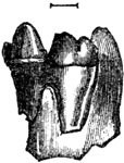
Skeleton of a reptile, allied to the Batrachians, in the Old Red Sandstone
of Morayshire.—Mr. Patrick Duff, author of a "Sketch of the Geology of
Morayshire" (Elgin, 1842), obtained recently (October, 1851), from the rock
above alluded to, the first example ever seen of the skeleton of a reptile
in the Old Red Sandstone. He has kindly allowed me to give a figure of this
fossil, of which Dr. Mantell has drawn up a detailed osteological account
for publication in the "Journal of the Geological Society of London." The
bones in this specimen have decomposed, but the natural position of almost
all of them can be seen, and nearly perfect casts of their form taken from
the hollow moulds which they have left. [p.x]The matrix is a
fine-grained, whitish sandstone, with a cement of carbonate of lime. The
skeleton exhibits the general characters of the Lacertians, blended with
peculiarities that are Batrachian. Hence Dr. Mantell infers that this
reptile was either a freshwater Batrachian, resembling the Triton, or a
small terrestrial Lizard. Slight indications are visible of very minute
conical teeth. Captain Brickenden, who is well acquainted with the geology
of that part of Scotland, informs me that this fossil was found in the Hill
of Spynie, north of the town of Elgin, in a rock quarried for building, and
the same in which the Chelonian foot-prints, alluded to in the last page,
occur. The skeleton is about four and a half inches in length, but part of
the tail is concealed in the rock. Dr. Mantell has proposed for it the
generic name of Telerpeton, from τηλε, afar off, and
ἑρπετον, a reptile; while the specific name Elginense commemorates the
principal place near which it was obtained.
Fig. 522.

Natural size. Telerpeton Elginense. (Mantell.)
Reptile of Old Red Sandstone, from near Elgin, Morayshire.
Eggs of Batrachians (?) in the Old Red Sandstone of Scotland.—At page
344. of this work I have given two figures (figs. 397 and 398.) of small
groups of eggs, very common in the shales and sandstones of the "Old Red"
of Kincardineshire, Forfarshire, and Fife. I threw out as a conjecture,
that they might belong to gasteropodous mollusca, like those represented in
fig. 399. p. 345.; but Dr. Mantell, some years ago, showed me a small
bundle of the dried-up eggs of the common English frog (see fig. 524 a.),
black and carbonaceous, and so identical in appearance with the fossils in
question, that he suggested the probability of these last being of
Batrachian origin. The plants by which they are often accompanied (fig.
398. p. 344.), I formerly supposed to be Fuci, but Mr. Bunbury tells me
that their grass-like form agrees well with the idea of their being
freshwater, and of the family Fluviales.
The absence of all shells, so far as our researches have yet gone, in the
slates and sandstones of Scotland above alluded to, raises a presumption
against their marine origin, and a still stronger one against the fossil
eggs being those of Gasteropoda. It is well known [p.xi]that a single
female of the Batrachian tribe ejects annually an astonishing quantity of
spawn. Mr. Newport, author of many accurate researches into the
metamorphoses of the Amphibia, having examined my fossils from Forfarshire,
concurs in Dr. Mantell's opinion that the clusters of eggs (figs. 397. 398.
p. 344.) may be those of frogs; while other larger ones, occurring singly
or in pairs in the same slates, and often attached to a leaf, may be the
ova of a gigantic Triton or Salamander. (See figs. 523, 524, 525.) I may
observe that the subdivision of the Old Red Sandstone, in which these
plants and ova occur (No. 4. of the section, fig. 62. p. 48.), is
considerably lower in position than the rock in which the Telerpeton of
Elgin is imbedded.
Fig. 523. Fossil.—Old Red.
Fig. 523. Slab of Old Red Sandstone, Forfarshire, with eggs of Batrachians.
- a. Ova in a carbonized state.
- b. Egg cells; the ova shed.
Fig. 524. Recent.

Fig. 524. Eggs of the common frog, Rana temporaria, in a carbonized
state, from a dried-up pond in Clapham Common.
- a. The ova.
- b. A transverse section of the mass exhibiting the form of the egg-cells.
Fig. 525. Eggs of Batrachians.—Old Red Sandstone.
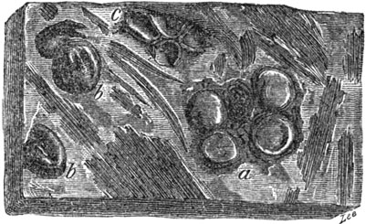
Fig. 525. Shale of Old Red Sandstone, or Devonian, Forfarshire, with
impression of plants and eggs of Batrachians.
- a. Two pair of ova resembling those
large Salamanders or Tritons on the same leaf.
- b b. Detached ova.
- c. Egg-cells of frogs or Ranina.
Foot-prints of Lower Carboniferous reptiles in the United States.—I have
stated, at p. 340., that in 1849, Mr. Isaac Lea observed the foot-marks of
a large reptile in the lowest beds of the coal formation at Pottsville,
about seventy miles N.E. of Philadelphia. These researches have since been
carried farther by Professor H. D. Rogers, in the same region of
anthracitic coal, lying on the eastern flank of the Alleghany Mountains.
Beneath the productive coal-measures of that country occurs a dense mass of
red shales and sandstones, which correspond nearly in position to the
millstone grit and Mountain Limestone of the south-east of England. In
these beds foot-prints, referred to three species of quadrupeds, have
lately been detected, all of them five-toed and in double rows, with an
opposite symmetry, as if made by right and left feet, while they likewise
display the alternation of fore foot and hind foot. One species, the
largest of the three, presents a diameter for each foot-print of about two
inches, and shows the fore and hind feet to be nearly equal in dimensions.
It exhibits a length of stride of about nine inches, and a breadth between
the right and left treads of nearly four inches. The impressions of the
hind feet are but little in the rear of [p.xii]the fore feet. The animal
which made them is supposed to have been allied to a Saurian, rather than
to a Batrachian or Chelonian; but more information is required before so
difficult a point can be decided. With these foot-marks were seen shrinkage
cracks, such as are caused by the sun's heat in mud, and rain-spots, with
the signs of the trickling of water on a wet, sandy beach; all confirming
the conclusion derived from the foot-prints, that the quadrupeds belonged
to air-breathers, and not to aquatic races.[xii-A] The Cheirotherian
foot-prints, figured by me at p. 338., in which the fore and hind feet are
very unequal in size, betoken a distinct genus, and occur in the midst of
the productive coal measures, being consequently less ancient.
On Fossil Rain-marks of the Carboniferous Period in North
America.—Having alluded to the spots left by rain on the surface of
carboniferous strata in the Alleghanies, on which quadrupedal foot-prints
are seen, I may mention that similar rain-prints are conspicuous in the
coal measures of Cape Breton, in Nova Scotia, in which Mr. Richard Brown
has described Stigmariæ and erect trunks of trees, and where there are
proofs, as stated at p. 324., of many fossil forests ranged one above the
other. In such a region, if anywhere, might we expect to detect evidence of
the fall of rain on a sea-beach, so repeatedly must the conditions of the
same area have oscillated between land and sea. The intercalation of
deposits, containing shells of marine or brackish water, indicate the
constant proximity of a body of salt water when the clays which supported
the upright trees were formed. In the course of 1851, Mr. Brown had the
kindness to send me some greenish slates from Sydney, Cape Breton, on which
are imprinted very delicate impressions of rain-drops, with several
worm-tracks (a, b, fig. 526.), such as usually accompany rain-marks on
the recent mud of the Bay of Fundy, and other modern beaches.[xii-B]

Fig. 526. Carboniferous rain-prints with worm-tracks (a,
b) on green shale, from Cape Breton, Nova Scotia.
Fig. 527. Casts of rain-prints on a portion of the same
slab, No. 526. seen on the under side of an incumbent layer of arenaceous
shale.
The arrow represents the direction of the shower.
[p.xiii]
Fig. 528.

Fig. 528. Casts of carboniferous rain-prints and
shrinkage-cracks, (a) on the under side of a layer of sandstone, Cape
Breton, Nova Scotia.
The casts of rain-prints, in figs. 527. and 528., project from the under
side of two layers, occurring at different levels, the one a sandy shale,
resting on the green shale (fig. 526.), the other a sandstone presenting a
similar warty or blistered surface, on which are also observable some small
ridges as at a, which stand out in relief, and afford evidence of cracks
formed by the shrinkage of subjacent clay, on which rain had fallen. Many
of the associated sandstones are described by Mr. Brown as ripple-marked.
The great humidity of the climate of the coal period had been previously
inferred from the nature of its vegetation and the continuity of its
forests for hundreds of miles; but it is satisfactory to have at length
obtained such positive proofs of showers of rain, the drops of which
resembled in their average size those which now fall from the clouds. From
such data we may presume that the atmosphere of the carboniferous period
corresponded in density with that now investing the globe, and that
different currents of air varied then as now, in temperature, so as to give
rise, by their mixture, to the condensation of aqueous vapour.
Triassic Mammifer (Microlestes antiquus Plieninger.)—In the year 1847,
Professor Plieninger, of Stuttgart, published a description of two fossil
molar teeth, referred by him to a warm-blooded quadruped[xiii-A], which he
obtained from a bone-breccia in Würtemberg occurring between the lias and
the keuper. As the announcement of so novel a fact has never met with the
attention it deserved, we are indebted to Dr. Jäger, of Stuttgart, for
having recently reminded us of it in his Memoir on the Fossil Mammalia of
Würtemberg.[xiii-B]
Fig. 529. represents the tooth first found, taken from the plate published
in 1847, by Professor Plieninger; and fig. 530. is a drawing of the same
executed from the original by Mr. Hermann von Meyer, [p.xiv]which he has
been kind enough to send me. Fig. 529. is a second and larger molar, copied
from Dr. Jäger's plate lxxi., fig. 15.
Fig. 529.

Microlestes antiquus, Plieninger. Molar tooth
magnified. Upper Trias, Diegerloch, near Stuttgart, Würtemberg.
- a. View of inner side?
- b. same, outer side?
- c. Same in profile.
- d. Crown of same.
Fig. 530.

Microlestes antiquus, Plien.
View of same molar as No. 529. From a drawing by Herman von Meyer.
- a. View of inner side?
- b. Crown of same.
Fig. 531.
Molar of Microlestes? Plien. 4 times as large as
fig. 529. From the trias of Diegerloch, Stuttgart.
Professor Plieninger inferred in 1847, from the double fangs of this tooth
and their unequal size, and from the form and number of the protuberances
or cusps on the flat crowns, that it was the molar of a Mammifer; and
considering it as predaceous, probably insectivorous, he called it
Microlestes, from μικρος, little, and ληστης, a beast of
prey. Soon afterwards, he found the second tooth also, at the same
locality, Diegerloch, about two miles to the south-east of Stuttgart. Some
of its cusps are broken, but there seem to have been six of them
originally. From its agreement in general characters, it is supposed by
Professor Plieninger to be referable to the same animal, but as it is four
times as big, it may perhaps have belonged to another allied species. This
molar is attached to the matrix consisting of sandstone, whereas the tooth,
No. 529., is isolated. Several fragments of bone, differing in structure
from that of the associated saurians and fish, and believed to be
mammiferous, were imbedded near them in the same rock.
Mr. Waterhouse, of the British Museum, after studying the annexed figs.
529. 531. and the descriptions of Prof. Plieninger, observes, that not only
the double roots of the teeth and their crowns presenting several cusps,
resemble those of Mammalia, but the cingulum also, or ridge surrounding the
base of that part of the body of the tooth which was exposed or above the
gum, is a character distinguishing them from fish and reptiles. "The
arrangement of the six cusps or tubercles in two rows, in fig. 529., with a
groove or depression between them and the oblong form of the tooth, lead
him, he says, to regard it as a molar of the lower jaw. Both the teeth
differ from those of the Stonesfield Mammalia[xiv-A], but do not supply
sufficient data for determining to what order they belonged. Even in regard
to the Stonesfield jaws, where we possess so much ampler materials, we
cannot safely pronounce on the order."
[p.xv]Professor Plieninger has sent me a cast of the smaller tooth, which
exhibits well the characteristic mammalian test, the double fang; but Mr.
Owen, to whom I have shown it, is not able to recognize its affinity with
any mammalian type, recent or extinct, known to him.
It has already been stated that the stratum in which the above-mentioned
fossils occur is intermediate between the lias and the uppermost member of
the trias. That it is really triassic may be deduced from the following
considerations. In Würtemberg there are two "bone-beds," one of great
extent, and very rich in the remains of fish and reptiles, which intervenes
between the muschelkalk and keuper, the other, containing the Microlestes,
less extensive and fossiliferous, which rests on the keuper, or superior
member of the trias, and is covered by the sandstone of the lias. The
last-mentioned breccia therefore occupies the same place as the well-known
English "bone-bed" of Axmouth and Aust-cliff near Bristol, which is
shown[xv-A] to include characteristic species of muschelkalk fish, of the
genus Saurichthys, Hybodus, and Gyrolepis. In both the Würtemberg bone-beds
these three genera are also found, and one of the species, Saurichthys
Mougeotii, is common to both the lower and upper breccias, as is also a
remarkable reptile called Nothosaurus mirabilis. The Saurian called Belodon
by H. Von Meyer of the Thecodont family, is another Triassic form,
associated at Diegerloch with Microlestes.
Previous to this discovery of Professor Plieninger, the most ancient of
known fossil Mammalia were those of the Stonesfield slate, a subdivision of
the Lower Oolite[xv-B] no representative of this class having as yet been
met with in the Fuller's earth, or inferior Oolite (see Table, p. 258.),
nor in any member of the lias.
Thecodont Saurians.—This family of reptiles is common to the Trias and
Permian groups in Germany, and the geologists employed in the government
survey of Great Britain have come to the conclusion, that the rock
containing the two species alluded to at p. 306., and of which the teeth
are represented in figs. 348, 349., ought rather to be referred to the
Trias than to the Permian group.
CRETACEOUS GASTEROPODA.
In speaking of the chalk of Faxoe in Denmark (p. 210.) or the highest
member of the Cretaceous series, I have remarked that it is characterized
by univalve Mollusca, both spiral and patelliform, which are wanting or
rare in the white chalk of Europe. This last statement requires, I find,
some modification. It holds true in regard to certain forms, such as Cypræa
and Oliva, found at Faxoe; but M. A. d'Orbigny enumerates 24 species of
Gasteropoda from the white chalk (Terrain Sénonien) of France alone. The
same author describes 134 French species of Gasteropoda from the chloritic
chalk marl and upper greensand (Turonien), 77 from the gault, and 90 from
the lower greensand (Neocomien), in all 325 species of Gasteropoda,
[p.xvi]from the cretaceous group below the Maestricht beds. Among these
he refers 1 to the genus Mitra, 17 to Fusus, 17 to Trochus, 4 to
Emarginula, and 36 to Cerithium. Notwithstanding, therefore, the
peculiarity of the chambered univalves of various genera, so abundant in
the chalk, the Mollusca of the period approximate in character to the
tertiary and recent Fauna far more than was formerly supposed.
DICOTYLEDONOUS LEAVES IN LOWER CRETACEOUS STRATA.
M. Adolphe Brongniart when founding his classification of the fossiliferous
strata in reference to their imbedded fossil plants, has placed the
cretaceous group in the same division with the tertiary, that is to say, in
his "Age of Angiosperms."[xvi-A] This arrangement is based on the fact,
that the cretaceous plants display a transition character from the
vegetation of the secondary to that of the tertiary periods. Coniferæ and
Cycadeæ still flourished as in the preceding oolitic and triassic epochs;
but with these fossils, some well-marked leaves of dicotyledonous trees
referred to several species of the genus Credneria, had been found in
Germany in the Quadersandstein and Pläner-kalk. Still more recently, Dr.
Debey of Aix-la-Chapelle has met with a great variety of other leaves of
dicotyledonous plants in the cretaceous flora[xvi-B], of which he
enumerates no less than 26 species, some of the leaves being from four to
six inches in length, and in a beautiful state of preservation. In the
absence of the organs of fructification and of fossil fruits, the number of
species may be exaggerated; but we may nevertheless affirm, reasoning from
our present data, that in the lower chalk of Aix-la-Chapelle,
Dicotyledonous Angiosperms flourished nearly in equal proportions with
Gymnosperms; a fact of great significance, as some geologists had wished to
connect the rarity of dicotyledonous trees with a peculiarity in the state
of the atmosphere in the earlier ages of the planet, imagining that a
denser air and noxious gases, especially carbonic acid in excess, were
adverse to the prevalence, not only of the quick-breathing classes of
animals, (mammalia and birds,) but to a flora like that now existing, while
it favoured the predominance of reptile life, and a cryptogamic and
gymnospermous flora. The co-existence, therefore, of dicotyledonous
angiosperms in abundance with Cycads and Coniferæ, and with a rich
reptilian fauna comprising the Iguanodon, Ichthyosaurus, Pliosaurus, and
Pterodactyl, in the lower cretaceous series tends, like the oolitic
mammalia of Stonesfield and Stuttgart, and the triassic birds of
Connecticut, to dispel the idea of a meteorological state of things in the
secondary periods widely distinct from that now prevailing.
General remarks.—In the preliminary chapters of "The Principles of
Geology," in the first and subsequent editions, I have considered the
question, how far the changes of the earth's crust in past times confirm or
invalidate the popular hypothesis of a gradual improvement [p.xvii]in
the habitable condition of the planet, accompanied by a contemporaneous
development and progression in organic life. It had long been a favourite
theory, that in the earlier ages to which we can carry back our geological
researches, the earth was shaken by more frequent and terrible earthquakes
than now, and that there was no certainty nor stability in the order of the
natural world. A few sea-weeds and zoophytes, or plants and animals of the
simplest organization, were alone capable of existing in a state of things
so unfixed and unstable. But in proportion as the conditions of existence
improved, and great convulsions and catastrophes became rarer and more
partial, flowering plants were added to the cryptogamic class, and by the
introduction of more and more perfect species, a varied and complex flora
was at last established. In like manner, in the animal kingdom, the
zoophyte, the brachiopod, the cephalopod, the fish, the reptile, the bird,
and the warm-blooded quadruped made their entrance into the earth, one
after the other, until finally, after the close of the tertiary period,
came the quadrumanous mammalia, most nearly resembling man in outward form
and internal structure, and followed soon afterwards, if not accompanied at
first, by the human race itself.
The objections which, in 1830, I urged against this doctrine[xvii-A], in so
far as relates to the passage of the earth from a chaotic to a more settled
condition, have since been embraced by a large and steadily increasing
school of geologists; and in reference to the animate world, it will be
seen, on comparing the present state of our knowledge with that which we
possessed twenty years ago, how fully I was justified in declaring the
insufficiency of the data on which such bold generalizations, respecting
progressive development, were based. Speaking of the absence, from the
tertiary formations, of fossil Quadrumana, I observed, in 1830, that "we
had no right to expect to have detected any remains of tribes which live in
trees, until we knew more of those quadrupeds which frequent marshes,
rivers, and the borders of lakes, such being usually first met with in a
fossil state."[xvii-B] I also added, "if we are led to infer, from the
presence of crocodiles and turtles in the London clay, and from the
cocoa-nuts and spices found in the isle of Sheppey, that at the period when
our older tertiary strata were formed, the climate was hot enough for the
Quadrumana, we nevertheless could not hope to discover any of their
skeletons, until we had made considerable progress in ascertaining what
were the contemporary Pachydermata; and not one of these has been
discovered as yet in any strata of this epoch in England."
Nine years afterwards, when these fossil Pachyderms had been found in the
London clay, and in the sandy strata at its base, the remains of a monkey,
of the genus Macacus, were detected near Woodbridge, in Suffolk; and other
Quadrumana had been met with, a short time previously, in different stages
of the tertiary series, in India, France, and Brazil.
[p.xviii]When we consider the small area of the earth's surface hitherto
examined geologically, and our scanty acquaintance with the fossil
Vertebrata, even of the environs of great European capitals, it is truly
surprising that any naturalist should be rash enough to assume that the
Lower Eocene deposits mark the era of the first creation of Quadrumana. It
is, however, still more unphilosophical to infer from a single extinct
species of this order, obtained in a latitude far from the tropics, that
the Eocene Quadrumana had not attained as high a grade of organization as
those of our own times, when the naturalist is acquainted with all, or
nearly all, the species of monkeys, apes and orangs which are contemporary
with man.
To return to the year 1830, Mammalia had not then been traced to rocks of
higher antiquity than the Stonesfield Oolite, whereas we have just seen
that memorials of this class have at length made their appearance in the
Trias of Germany. In 1830 birds had been discovered no lower in the series
than the Paris gypsum, or Middle Eocene. Their bones have now been found
both in England and the Swiss Alps in the Lower Eocene, and their existence
has been established by foot-prints in the triassic epoch in North America
(p. 297.). Reptiles in 1830 had not been detected in rocks older than the
Magnesian limestone, or Permian formation; whereas the skeletons of four
species have since been brought to light (see p. 336.) in the
coal-measures, and one in the Old Red sandstone, of Europe, while the
footprints of three or four more have been observed in carboniferous rocks
of North America, not to mention the chelonian trail above described, from
the most ancient of the fossiliferous rocks of Canada, the "Potsdam
Sandstone," which lies at the base of the Lower Silurian system. (See
above, p. vii.)
Lastly, the remains of fish, which in 1830 were scarcely recognized in
deposits older than the coal, have now been found plentifully in the
Devonian, and sparingly in the Silurian, strata; though not in any
formation of such high antiquity as the Chelonian of Montreal.
Previously to the discovery last mentioned, it was by no means uncommon for
paleontologists to speak with confidence of fish as having been created
before reptiles. It was deemed reasonable to suppose that the introduction
of a particular class or order of beings into the planet coincided, in
date, with the age of the oldest rock to which the remains of that class or
order happened then to have been traced back. To be consistent with
themselves, the same naturalists ought now to take for granted that
reptiles were called into existence before fish. This they will not do,
because such a conclusion would militate against their favourite hypothesis
of an ascending scale, according to which Nature "evolved the organic
world," rendering it more and more perfect in the lapse of ages.
In our efforts to arrive at sound theoretical views on such a question, it
would seem most natural to turn to the marine invertebrate animals as to a
class affording the most complete series of monuments that have come down
to us, and where we can find corresponding [p.xix]terms of comparison,
in strata of every age. If, in this more complete series of her archives,
Nature had really exhibited a more simple grade of organization in fossils
of the remotest antiquity, we might have suspected that there was some
foundation of facts in the theory of successive development. But what do we
find? In the Lower Silurian there is a full representation of the Radiata,
Mollusca, and Articulata proper to the sea. The marine Fauna, indeed, in
those three classes, is so rich as almost to imply a more perfect
development than that which now peoples the ocean. Thus, in the great
division of the Radiata, we find asteroid and helianthoid zoophytes,
besides crinoid and cystidean echinoderms. In the Mollusca of the same most
ancient epoch M. Barrande enumerates, in Bohemia alone, the astonishing
number of 253 species of Cephalopoda. In the Articulata we have the
crustaceans, represented by more than 200 species of Trilobites, not to
mention other genera.
It is only then, in reference to the Vertebrata, that the argument of
degeneracy in proportion as we trace fossils back to older formations can
be maintained; and the dogma rests mainly for its support on negative
evidence, whether deduced from the entire absence of the fossil
representatives of certain classes in particular rocks, or the low grade of
the first few species of a class which chance has thrown in our way.
The scarcity of all memorials of birds in strata below the Eocene, has been
a subject of surprise to some geologists. The bones formerly referred to
birds in the Wealden and Chalk, are now admitted to have belonged to flying
reptiles, of various sizes, one of them from the Kentish chalk so large as
to have measured 16 feet 6 inches from tip to tip of its outstretched
wings. Whether some elongated bones of the Stonesfield Oolite should be
referred to birds, which they seem greatly to resemble in microscopic
structure or to Pterodactyles, is a point now under investigation. If it
should be proved that no osseous remains of the class Aves have hitherto
been derived from any secondary or primary formation, we must not too
hastily conclude that birds were even scarce in these periods. The rarity
of such fossils in the Eocene marine strata is very striking. In 1846,
Professor Owen, in his "History of the Fossil Mammalia and Birds of Great
Britain," was unable to obtain more than four or five fragments of bones
and skulls of birds from the London Clay, by the aid of which four species
were recognized. Even so recently, therefore, as 1846, as much was known of
the Mammalia of the Stonesfield Oolite, as of the ornithic Fauna of our
English Eocene deposits.
To reason correctly on the value of negative facts in this branch of
Paleontology, we must first have ascertained how far the relics of birds
are now becoming preserved in new strata, whether marine, fluviatile, or
lacustrine. I have explained, in the "Principles of Geology," that the
imbedding of the bones of living birds in deposits now in progress in
inland lakes appears to be extremely rare. In the shell-marl of Scotland,
which is made up bodily of the shells of the genera Limneus, Planorbis,
Succinea, and Valvata, and in which the [p.xx]skeletons of deer and oxen
abound, we find no bones of birds. Yet we know that, before the lakes were
drained which yield this marl used in agriculture, the surface of the water
and the bordering swamps were covered with wild ducks, herons, and other
fowl. They left no memorials behind them, because, if they perished on the
land, their bodies decomposed or became the prey of carnivorous animals; if
on the water, they were buoyant and floated till they were devoured by
predaceous fish or birds. The same causes of obliteration have no power to
efface the foot-prints which the same creatures may leave, under favourable
circumstances, imprinted on an ancient mud-bank or shore, on which new
strata may be from time to time thrown down. In the red mud of recent
origin spread over wide areas by the high tides of the bay of Fundy,
innumerable foot-tracks of recent birds (Tringa minuta) are preserved in
successive layers, and hardened by the sun. Yet none of the bones of these
birds, though diligently searched for, have yet been discovered in digging
trenches through the red mud. It is true that, in a few spots, the bones of
birds have been met with plentifully in the older tertiary strata, but
always in rocks of freshwater origin, such as the Paris gypsum or the
lacustrine limestone of the Limagne d'Auvergne. In strata of the same age,
in Belgium and other European countries, or in the United States, where no
less careful search has been made, few, if any, fossil birds have come to
light.
We ought, therefore, most clearly to perceive that it is no part of the
plan of Nature to hand down to after times a complete or systematic record
of the former history of the animate world. The preservation of the relics,
even of aquatic tribes of animals, is an exception to the general rule,
although time may so multiply exceptional cases that they may seem to
constitute the rule; and may thus impose upon the imagination, leading us
to infer the non-existence of creatures of which no monuments are extant.
Hitherto our acquaintance with the birds, and even the Mammalia, of the
Eocene period has depended, almost everywhere, on single specimens, or on a
few individuals found in one spot. It has therefore depended on what we
commonly call chance; and we must not wonder if the casual discovery of a
tertiary, secondary, or primary rock, rich in fossil impressions of the
foot-prints of birds or quadrupeds, should modify or suddenly overthrow all
theories based on negative facts.
The chief reason why we meet more readily with the remains of every class
in tertiary than in secondary strata, is simply that the older rocks are
more and more exclusively marine in proportion as we depart farther and
farther from periods during which the existing continents were built up.
The secondary and primary formations are, for the most part, marine,—not
because the ocean was more universal in past times, but because the epochs
which preceded the Eocene were so distant from our own, that entire
continents have been since submerged.
I have alluded at p. 299. to Mr. Darwin's account of the South American
Ostriches, seen on the coast of Buenos Ayres, walking at [p.xxi]low
water over extensive mud-banks, which are then dry, for the sake of feeding
on small fish. Perhaps no bird of such perfect organization as the eagle or
vulture may ever accompany these ostriches. Certainly, we cannot expect the
condor of the Andes to leave its trail on such a shore; and no traveller,
after searching for footprints along the whole eastern coast of South
America, would venture to speculate, from the results of such an inquiry,
on the extent, variety, or development of the feathered Fauna of the
interior of that continent.
The absence of Cetacea from rocks older than the Eocene has been frequently
adduced as lending countenance to the theory of the late appearance of the
highest class of Vertebrata on the earth. That we have hitherto failed to
detect them in the Oolite or Trias, does not imply, as we have now seen,
that Mammalia were not then created. Even in the Eocene strata of Europe,
the discovery of Cetaceans has never kept pace with that of land
quadrupeds. The only instance cited in Great Britain is a species of
Monodon, from the London clay, of doubtful authenticity as to its
geological position. On the other hand, the gigantic Zeuglodon of North
America (see p. 207.), occurs abundantly in the Middle Eocene strata of
Georgia and Alabama, from which as yet no bones of land-quadrupeds have
been obtained.
Professor Sedgwick states in a recent work[xxi-A], that he possesses in the
Woodwardian Museum, a mass of anchylosed cervical vertebræ of a whale which
he found near Ely, and which he believes to have been washed out of the
Kimmeridge clay, a member of the Upper Oolite; but its true geological site
is not well determined. It differs, says Professor Owen, from any other
known fossil or recent whale.
In the present imperfect state then of our information, we can scarcely say
more than that the Cetacea may have been scarce, in the secondary and
primary periods. It is quite conceivable that when aquatic saurians, some
of them carnivorous, like the Ichthyosaurus, were swarming in the sea, and
when there were large herbivorous reptiles, like the Iguanodon, on the
land, such reptiles may, to a certain extent, have superseded the Cetacea,
and discharged their functions in the animal economy.
The views which I proposed originally in the Principles of Geology in
opposition to the theory of progressive development may be thus briefly
explained. From the earliest period at which plants and animals can be
proved to have existed, there has been a continual change going on in the
position of land and sea, accompanied by great fluctuations of climate. To
these ever-varying geographical and climatal conditions the state of the
animate world has been unceasingly adapted. No satisfactory proof has yet
been discovered of the gradual passage of the earth from a chaotic to a
more habitable state, nor of a law of progressive development governing the
extinction and renovation of species, and causing the Fauna and Flora to
pass from an embryonic to a more perfect condition, from a simple to a more
complex organization.
[p.xxii]The principle of adaptation above alluded to, appears to have
been analogous to that which now peoples the arctic, temperate, and
tropical regions contemporaneously with distinct assemblages of species and
genera, or which independently of mere temperature gives rise to a
predominance of the marsupial tribe of quadrupeds in Australia, and of the
placental tribe in Asia and Europe, or to a profusion of reptiles without
mammalia in the Galapagos Archipelago, and of mammalia without reptiles in
Greenland.[xxii-A]
This theory implies, almost necessarily, a very unequal representation at
successive periods of the principal classes and orders of plants and
animals, if not in the whole globe, at least throughout very wide areas.
Thus, for example, the proportional number of genera, species, and
individuals in the vertebrate class may differ, in two different and
distinct epochs, to an extent unparalleled by any two contemporaneous
Faunas, because in the course of millions of ages, the contrast of climate
and geographical conditions may exceed the difference now observable in
polar and equatorial latitudes.
I shall conclude by observing, that if the doctrine of successive
development had been paleontologically true, as the new discoveries above
enumerated show that it is not; if the sponge, the cephalopod, the fish,
the reptile, the bird, and the mammifer had followed each other in regular
chronological order—the creation of each class being separated from the
other by vast intervals of time; and if it were admitted that Man was
created last of all, still we should by no means be able to recognize, in
his entrance upon the earth, the last term of one and the same series of
progressive developments. For the superiority of Man, as compared to the
irrational mammalia, is one of kind, rather than of degree, consisting in a
rational and moral nature, with an intellect capable of indefinite
progression, and not in the perfection of his physical organization, or
those instincts in which he resembles the brutes. He may be considered as a
link in the same unbroken chain of being, if we regard him simply as a new
species—a member of the animal kingdom—subject, like other species, to
certain fixed and invariable laws, and adapted like them to the state of
the animate and inanimate world prevailing at the time of his creation.
Physically considered, he may form part of an indefinite series of
terrestrial changes past, present, and to come; but morally and
intellectually he may belong to another system of things—of things
immaterial—a system which is not permitted to interrupt or disturb the
course of the material world, or the laws which govern its changes.[xxii-B]
[p.xxiii]CONTENTS.
- CHAPTER I.
- ON THE DIFFERENT CLASSES OF ROCKS.
Geology defined — Successive formation of the earth's
crust — Classification of rocks according to their origin and
age — Aqueous rocks — Their stratification and imbedded
fossils — Volcanic rocks, with and without cones and craters — Plutonic
rocks, and their relation to the volcanic — Metamorphic rocks and their
probable origin — The term primitive, why erroneously applied to the
crystalline formations — Leading division of the work Page 1
- CHAPTER II.
- AQUEOUS ROCKS—THEIR COMPOSITION AND FORMS OF STRATIFICATION.
Mineral composition of strata — Arenaceous
rocks — Argillaceous — Calcareous — Gypsum — Forms of
stratification — Original horizontality — Thinning out — Diagonal
arrangement — Ripple mark 10
- CHAPTER III.
- ARRANGEMENT OF FOSSILS IN STRATA—FRESHWATER AND MARINE.
Successive deposition indicated by fossils — Limestones formed of
corals and shells — Proofs of gradual increase of strata derived from
fossils — Serpula attached to spatangus — Wood bored by
Teredina — Tripoli and semi-opal formed of infusoria — Chalk derived
principally from organic bodies — Distinction of freshwater from marine
formations — Genera of freshwater and land shells — Rules for
recognizing marine testacea — Gyrogonite and chara — Freshwater
fishes — Alternation of marine and freshwater deposits — Lym-Fiord 21
- CHAPTER IV.
- CONSOLIDATION OF STRATA AND PETRIFACTION OF FOSSILS.
Chemical and mechanical deposits — Cementing together of
particles — Hardening by exposure to air — Concretionary
nodules — Consolidating effects of pressure — Mineralization of organic
remains — Impressions and casts how formed — Fossil wood — Göppert's
experiments — Precipitation of stony matter most rapid where
putrefaction is going on — Source of lime in solution — Silex derived
from decomposition of felspar — Proofs of the lapidification of some
fossils soon after burial, of others when much decayed 33
- [p.xxiv]CHAPTER V.
- ELEVATION OF STRATA ABOVE THE SEA—HORIZONTAL AND INCLINED
STRATIFICATION.
Why the position of marine strata, above the level of the sea, should
be referred to the rising up of the land, not to the going down of the
sea — Upheaval of extensive masses of horizontal strata — Inclined and
vertical stratification — Anticlinal and synclinal lines — Bent strata
in east of Scotland — Theory of folding by lateral
movement — Creeps — Dip and strike — Structure of the Jura — Various forms
of outcrop — Rocks broken by flexure — Inverted position of disturbed
strata — Unconformable stratification — Hutton and Playfair on the
same — Fractures of strata — Polished surfaces — Faults — Appearance of
repeated alternations produced by them — Origin of great faults 44
Denudation defined — Its amount equal to the entire mass of stratified
deposits in the earth's crust — Horizontal sandstone denuded in
Ross-shire — Levelled surface of countries in which great faults
occur — Coalbrook Dale — Denuding power of the ocean during the
emergence of land — Origin of Valleys — Obliteration of
sea-cliffs — Inland sea-cliffs and terraces in the Morea and
Sicily — Limestone pillars at St. Mihiel, in France — in Canada — in the
Bermudas 66
Alluvium described — Due to complicated causes — Of various ages, as
shown in Auvergne — How distinguished from rocks in
situ — River-terraces — Parallel roads of Glen Roy — Various theories
respecting their origin 79
- CHAPTER VIII.
- CHRONOLOGICAL CLASSIFICATION OF ROCKS.
Aqueous, plutonic, volcanic, and metamorphic rocks, considered
chronologically — Lehman's division into primitive and
secondary — Werner's addition of a transition class — Neptunian
theory — Hutton on igneous origin of granite — How the name of primary
was still retained for granite — The term "transition," why faulty — The
adherence to the old chronological nomenclature retarded the progress
of geology — New hypothesis invented to reconcile the igneous origin of
granite to the notion of its high antiquity — Explanation of the
chronological nomenclature adopted in this work, so far as regards
primary, secondary, and tertiary periods 89
- CHAPTER IX.
- ON THE DIFFERENT AGES OF THE AQUEOUS ROCKS.
On the three principal tests of relative age — superposition, mineral
character, and fossils — Change of mineral character and fossils in the
same continuous formation — Proofs that distinct species of animals and
plants have lived at successive periods — Distinct provinces of
indigenous species — Great extent of single provinces — Similar laws
prevailed at successive geological periods — Relative importance of
mineral and palæontological characters — Test of age by included
fragments — Frequent absence of strata of intervening
periods — Principal groups of strata in western Europe 96
- [p.xxv]CHAPTER X.
- CLASSIFICATION OF TERTIARY FORMATIONS.—POST-PLIOCENE GROUP.
General principles of classification of tertiary strata — Detached
formations scattered over Europe — Strata of Paris and London — More
modern groups — Peculiar difficulties in determining the chronology of
tertiary formations — Increasing proportion of living species of shells
in strata of newer origin — Terms Eocene, Miocene, and
Pliocene — Post-Pliocene strata — Recent or human period — Older
Post-Pliocene formations of Naples, Uddevalla, and Norway — Ancient
upraised delta of the Mississippi — Loess of the Rhine 104
- CHAPTER XI.
- NEWER PLIOCENE PERIOD. — BOULDER FORMATION.
Drift of Scandinavia, northern Germany, and Russia — Its northern
origin — Not all of the same age — Fundamental rocks polished, grooved,
and scratched — Action of glaciers and icebergs — Fossil shells of
glacial period — Drift of eastern Norfolk — Associated freshwater
deposit — Bent and folded strata lying on undisturbed beds — Shells on
Moel Tryfane — Ancient glaciers of North Wales — Irish drift 121
- CHAPTER XII.
- BOULDER FORMATION—continued.
Difficulty of interpreting the phenomena of drift before the glacial
hypothesis was adopted — Effects of intense cold in augmenting the
quantity of alluvium — Analogy of erratics and scored rocks in North
America and Europe — Bayfield on shells in drift of Canada — Great
subsidence and re-elevation of land from the sea, required to account
for glacial appearances — Why organic remains so rare in northern
drift — Mastodon giganteus in United States — Many shells and some
quadrupeds survived the glacial cold — Alps an independent centre of
dispersion of erratics — Alpine blocks on the Jura — Recent
transportation of erratics from the Andes to Chiloe — Meteorite in
Asiatic drift 131
- CHAPTER XIII.
- NEWER PLIOCENE STRATA AND CAVERN DEPOSITS.
Chronological classification of Pleistocene formations, why
difficult — Freshwater deposits in valley of Thames — In Norfolk
cliffs — In Patagonia — Comparative longevity of species in the mammalia
and testacea — Fluvio-marine crag of Norwich — Newer Pliocene strata of
Sicily — Limestone of great thickness and elevation — Alternation of
marine and volcanic formations — Proofs of slow accumulation — Great
geographical changes in Sicily since the living fauna and flora began
to exist — Osseous breccias and cavern
deposits — Sicily — Kirkdale — Origin of stalactite — Australian
cave-breccias — Geographical relationship of the provinces of living
vertebrata and those of the fossil species of the Pliocene
periods — Extinct struthious birds of New Zealand — Teeth of fossil
quadrupeds 146
- CHAPTER XIV.
- OLDER PLIOCENE AND MIOCENE FORMATIONS.
Strata of Suffolk termed Red and Coralline crag — Fossils, and
proportion of recent species — Depth of sea and climate — Reference of
Suffolk crag to the older Pliocene period — Migration of many species
of shells southwards during the glacial period — Fossil
whales — Subapennine beds — Asti, Sienna, Rome — Miocene
formations — Faluns of Touraine — Depth of sea and littoral character of
fauna — Tropical climate implied by the testacea — Proportion of recent
species of [p.xxvi]shells — Faluns more ancient than the Suffolk
crag — Miocene strata of Bordeaux and Piedmont — Molasse of
Switzerland — Tertiary strata of Lisbon — Older Pliocene and Miocene
formations in the United States — Sewâlik Hills in India 161
- CHAPTER XV.
- UPPER EOCENE FORMATIONS.
Eocene areas in England and France — Tabular view of French Eocene
strata — Upper Eocene group of the Paris basin — Same beds in Belgium
and at Berlin — Mayence tertiary strata — Freshwater upper Eocene of
Central France — Series of geographical changes since the land emerged
in Auvergne — Mineral character an uncertain test of age — Marls
containing Cypris — Oolite of Eocene period — Indusial limestone and its
origin — Fossil mammalia of the upper Eocene strata in
Auvergne — Freshwater strata of the Cantal, calcareous and
siliceous — Its resemblance to chalk — Proofs of gradual deposition of
strata 174
- CHAPTER XVI.
- EOCENE FORMATIONS—continued.
Subdivisions of the Eocene group in the Paris basin — Gypseous
series — Extinct quadrupeds — Impulse given to geology by Cuvier's
osteological discoveries — Shelly sands called sables moyens — Calcaire
grossier — Miliolites — Calcaire siliceux — Lower Eocene in France — Lits
coquilliers — Sands and plastic clay — English Eocene strata — Freshwater
and fluvio-marine beds — Barton beds — Bagshot and Bracklesham
division — Large ophidians and saurians — Lower Eocene and London Clay
proper — Fossil plants and shells — Strata of Kyson in Suffolk — Fossil
monkey and opossum — Mottled clays and sand below London
Clay — Nummulitic formation of Alps and Pyrenees — Its wide geographical
extent — Eocene strata in the United States — Section at Claiborne,
Alabama — Colossal cetacean — Orbitoid limestone — Burr stone 190
- CHAPTER XVII.
- CRETACEOUS GROUP.
Divisions of the cretaceous series in North-Western Europe — Upper
cretaceous strata — Maestricht beds — Chalk of Faxoe — White
chalk — Characteristic fossils — Extinct cephalopoda — Sponges and corals
of the chalk — Signs of open and deep sea — White area of white
chalk — Its origin from corals and shells — Single pebbles in
chalk — Siliceous sandstone in Germany contemporaneous with white
chalk — Upper greensand and gault — Lower cretaceous strata — Atherfield
section, Isle of Wight — Chalk of South of Europe — Hippurite
limestone — Cretaceous Flora — Chalk of United States 209
- CHAPTER XVIII.
- WEALDEN GROUP.
The Wealden divisible into Weald Clay, Hastings Sand, and Purbeck
Beds — Intercalated between two marine formations — Weald clay and
Cypris-bearing strata — Iguanodon — Hastings sands — Fossil fish — Strata
formed in shallow water — Brackish water-beds — Upper, middle, and lower
Purbeck — Alternations of brackish water, freshwater, and
land — Dirt-bed, or ancient soil — Distinct species of fossils in each
subdivision of the Wealden — Lapse of time implied — Plants and insects
of Wealden — Geographical extent of Wealden — Its relation to the
cretaceous and oolitic periods — Movements in the earth's crust to
which it owed its origin and submergence 225
- [p.xxvii]CHAPTER XIX.
- DENUDATION OF THE CHALK AND WEALDEN.
Physical geography of certain districts composed of Cretaceous and
Wealden strata — Lines of inland chalk-cliffs on the Seine in
Normandy — Outstanding pillars and needles of chalk — Denudation of the
chalk and Wealden in Surrey, Kent, and Sussex — Chalk once continuous
from the North to the South Downs — Anticlinal axis and parallel
ridges — Longitudinal and transverse valleys — Chalk escarpments — Rise
and denudation of the strata gradual — Ridges formed by harder, valleys
by softer beds — Why no alluvium, or wreck of the chalk, in the central
district of the Weald — At what periods the Weald valley was
denuded — Land has most prevailed where denudation has been
greatest — Elephant bed, Brighton 238
- CHAPTER XX.
- OOLITE AND LIAS.
Subdivisions of the Oolitic or Jurassic group — Physical geography of
the Oolite in England and France — Upper Oolite — Portland stone and
fossils — Lithographic stone of Solenhofen — Middle Oolite, coral
rag — Zoophytes — Nerinæan limestone — Diceras limestone — Oxford clay,
Ammonites and Belemnites — Lower Oolite, Crinoideans — Great Oolite and
Bradford clay — Stonesfield slate — Fossil mammalia, placental and
marsupial — Resemblance to an Australian fauna — Doctrine of progressive
development — Collyweston slates — Yorkshire Oolitic coal-field — Brora
coal — Inferior Oolite and fossils 257
- CHAPTER XXI.
- OOLITE AND LIAS—continued.
Mineral character of Lias — Name of Gryphite limestone — Fossil shells
and fish — Ichthyodorulites — Reptiles of the Lias — Ichthyosaur and
Plesiosaur — Marine Reptile of the Galapagos Islands — Sudden
destruction and burial of fossil animals in Lias — Fluvio-marine beds
in Gloucestershire and insect limestone — Origin of the Oolite and
Lias, and of alternating calcareous and argillaceous
formations — Oolitic coal-field of Virginia, in the United States 273
- CHAPTER XXII.
- TRIAS OR NEW RED SANDSTONE GROUP.
Distinction between New and Old Red Sandstone — Between Upper and Lower
New Red — The Trias and its three divisions — Most largely developed in
Germany — Keuper and its fossils — Muschelkalk — Fossil plants of
Bunter — Triassic group in England — Bone-bed of Axmouth and Aust — Red
Sandstone of Warwickshire and Cheshire — Footsteps of Chirotherium in
England and Germany — Osteology of the Labyrinthodon — Identification
of this Batrachian with the Chirotherium — Origin of Red Sandstone and
rock-salt — Hypothesis of saline volcanic exhalations — Theory of the
precipitation of salt from inland lakes or lagoons — Saltness of the
Red Sea — New Red Sandstone in the United States — Fossil footprints of
birds and reptiles in the Valley of the Connecticut — Antiquity of the
Red Sandstone containing them 286
- CHAPTER XXIII.
- PERMIAN OR MAGNESIAN LIMESTONE GROUP.
Fossils of Magnesian Limestone and Lower New Red distinct from the
Triassic — Term Permian — English and German equivalents — Marine shells
and corals of [p.xxviii]English Magnesian limestone — Palæoniscus
and other fish of the marl slate — Thecodont Saurians of dolomitic
conglomerate of Bristol — Zechstein and Rothliegendes of
Thuringia — Permian Flora — Its generic affinity to the
carboniferous — Psaronites or tree-ferns 301
- CHAPTER XXIV.
- THE COAL OR CARBONIFEROUS GROUP.
Carboniferous strata in the south-west of England — Superposition of
Coal-measures to Mountain limestone — Departure from this type in north
of England and Scotland — Section in South Wales — Underclays with
Stigmaria — Carboniferous Flora — Ferns, Lepidodendra, Calamites,
Asterophyllites, Sigillariæ, Stigmariæ, — Coniferæ — Endogens — Absence
of Exogens — Coal, how formed — Erect fossil trees — Parkfield
Colliery — St. Etienne, Coal-field — Oblique trees or snags — Fossil
forests in Nova Scotia — Brackish water and marine strata — Origin of
Clay-iron-stone 308
- CHAPTER XXV.
- CARBONIFEROUS GROUP—continued.
Coal-fields of the United States — Section of the country between the
Atlantic and Mississippi — Position of land in the carboniferous period
eastward of the Alleghanies — Mechanically formed rocks thinning out
westward, and limestones thickening — Uniting of many coal-seams into
one thick one — Horizontal coal at Brownsville, Pennsylvania — Vast
extent and continuity of single seams of coal — Ancient river-channel
in Forest of Dean coal-field — Absence of earthy matter in
coal — Climate of carboniferous period — Insects in coal — Rarity of
air-breathing animals — Great number of fossil fish — First discovery of
the skeletons of fossil reptiles — Footprints of reptilians — Mountain
limestone — Its corals and marine shells 326
- CHAPTER XXVI.
- OLD RED SANDSTONE, OR DEVONIAN GROUP.
Old Red Sandstone of Scotland, and borders of Wales — Fossils usually
rare — "Old Red" in Forfarshire — Ichthyolites of Caithness — Distinct
lithological type of Old Red in Devon and Cornwall — Term
"Devonian" — Organic remains of intermediate character between those of
the Carboniferous and Silurian systems — Corals and shells — Devonian
strata of Westphalia, the Eifel, Russia, and the United States — Coral
reef at Falls of the Ohio — Devonian Flora 342
- CHAPTER XXVII.
- SILURIAN GROUP.
Silurian strata formerly called transition — Term
grauwacké — Subdivisions of Upper and Lower Silurian — Ludlow formation
and fossils — Wenlock formation, corals and shells — Caradoc and
Llandeilo beds — Graptolites — Lingula — Trilobites — Cystideæ — Vast
thickness of Silurian strata in North Wales — Unconformability of
Caradoc sandstone — Silurian strata of the United States — Amount of
specific agreement of fossils with those of Europe — Great number of
brachiopods — Deep-sea origin of Silurian strata — Absence of fluviatile
formations — Mineral character of the most ancient fossiliferous rocks 350
- [p.xxix]CHAPTER XXVIII.
- VOLCANIC ROCKS.
Trap rocks — Name, whence derived — Their igneous origin at first
doubted — Their general appearance and character — Volcanic cones and
craters, how formed — Mineral composition and texture of volcanic
rocks — Varieties of felspar — Hornblende and
augite — Isomorphism — Rocks, how to be studied — Basalt, greenstone,
trachyte, porphyry, scoria, amygdaloid, lava, tuff — Alphabetical list,
and explanation of names and synonyms, of volcanic rocks — Table of the
analyses of minerals most abundant in the volcanic and hypogene rocks 366
- CHAPTER XXIX.
- VOLCANIC ROCKS—continued.
Trap dike — sometimes project — sometimes leave fissures vacant by
decomposition — Branches and veins of trap — Dikes more crystalline in
the centre — Foreign fragments of rock imbedded — Strata altered at or
near the contact — Obliteration of organic remains — Conversion of chalk
into marble — and of coal into coke — Inequality in the modifying
influence of dikes — Trap interposed between strata — Columnar and
globular structure — Relation of trappean rocks to the products of
active volcanos — Submarine lava and ejected matter correspond
generally to ancient trap — Structure and physical features of Palma
and some other extinct volcanos 378
- CHAPTER XXX.
- ON THE DIFFERENT AGES OF THE VOLCANIC ROCKS.
Tests of relative age of volcanic rocks — Test by superposition and
intrusion — Dike of Quarrington Hill, Durham — Test by alteration of
rocks in contact — Test by organic remains — Test of age by mineral
character — Test by included fragments — Volcanic rocks of the
Post-Pliocene period — Basalt of Bay of Trezza in Sicily — Post-Pliocene
volcanic rocks near Naples — Dikes of Somma — Igneous formations of the
Newer Pliocene period — Val di Noto in Sicily 397
- CHAPTER XXXI.
- ON THE DIFFERENT AGES OF THE VOLCANIC ROCKS—continued.
Volcanic rocks of the Older Pliocene period — Tuscany — Rome — Volcanic
region of Olot in Catalonia — Cones and lava-currents — Ravines and
ancient gravel-beds — Jets of air called Bufadors — Age of the
Catalonian volcanos — Miocene period — Brown-coal of the Eifel and
contemporaneous trachytic breccias — Age of the brown-coal — Peculiar
characters of the volcanos of the upper and lower Eifel — Lake
craters — Trass — Hungarian volcanos 408
- CHAPTER XXXII.
- ON THE DIFFERENT AGES OF THE VOLCANIC ROCKS—continued.
Volcanic rocks of the Pliocene and Miocene periods
continued — Auvergne — Mont Dor — Breccias and alluviums of Mont Perrier,
with bones of quadrupeds — River dammed up by lava-current — Range of
minor cones from Auvergne to the Vivarais — Monts Dome — Puy de
Côme — Puy de Pariou — Cones not denuded by general flood — Velay — Bones
of quadrupeds buried in scoriæ — Cantal — Eocene volcanic rocks — Tuffs
near Clermont — Hill of Gergovia — Trap of Cretaceous period — Oolitic
period — New Red Sandstone period — Carboniferous period — Old Red
Sandstone period — "Rock and Spindle" near St. Andrews — Silurian
period — Cambrian volcanic rocks 422
- [p.xxx]CHAPTER XXXIII.
- PLUTONIC ROCKS—GRANITE.
General aspect of granite — Decomposing into spherical masses — Rude
columnar structure — Analogy and difference of volcanic and plutonic
formations — Minerals in granite, and their arrangement — Graphic and
porphyritic granite — Mutual penetration of crystals of quartz and
felspar — Occasional minerals — Syenite — Syenitic, talcose, and schorly
granites — Eurite — Passage of granite into trap — Examples near
Christiania and in Aberdeenshire — Analogy in composition of trachyte
and granite — Granite veins in Glen Tilt, Cornwall, the Valorsine, and
other countries — Different composition of veins from main body of
granite — Metalliferous veins in strata near their junction with
granite — Apparent isolation of nodules of granite — Quartz
veins — Whether plutonic rocks are ever overlying — Their exposure at
the surface due to denudation 436
- CHAPTER XXXIV.
- ON THE DIFFERENT AGES OF THE PLUTONIC ROCKS.
Difficulty in ascertaining the precise age of a plutonic rock — Test of
age by relative position — Test by intrusion and alteration — Test by
mineral composition — Test by included fragments — Recent and Pliocene
plutonic rocks, why invisible — Tertiary plutonic rocks in the
Andes — Granite altering Cretaceous rocks — Granite altering Lias in the
Alps and in Skye — Granite of Dartmoor altering Carboniferous
strata — Granite of the Old Red Sandstone period — Syenite altering
Silurian strata in Norway — Blending of the same with gneiss — Most
ancient plutonic rocks — Granite protruded in a solid form — On the
probable age of the granites of Arran, in Scotland 449
- CHAPTER XXXV.
- METAMORPHIC ROCKS.
General character of metamorphic rocks — Gneiss — Hornblende-schist
— Mica-schist — Clay-slate — Quartzite — Chlorite-schist — Metamorphic
limestone — Alphabetical list and explanation of other rocks of this
family — Origin of the metamorphic strata — Their stratification is real
and distinct from cleavage — Joints and slaty cleavage — Supposed causes
of these structures — how far connected with crystalline action 463
- CHAPTER XXXVI.
- METAMORPHIC ROCKS—continued.
Strata near some intrusive masses of granite converted into rocks
identical with different members of the metamorphic series — Arguments
hence derived as to the nature of plutonic action — Time may enable
this action to pervade denser masses — From what kinds of sedimentary
rock each variety of the metamorphic class may be derived — Certain
objections to the metamorphic theory considered — Lamination of
trachyte and obsidian due to motion — Whether some kinds of gneiss have
become schistose by a similar action 473
- CHAPTER XXXVII.
- ON THE DIFFERENT AGES OF THE METAMORPHIC ROCKS.
Age of each set of metamorphic strata twofold — Test of age by fossils
and mineral character not available — Test by superposition
ambiguous — Conversion of dense masses of fossiliferous strata into
metamorphic rocks — Limestone and shale of Carrara — Metamorphic strata
of modern periods in the Alps of Switzerland and [p.xxxi]Savoy — Why
the visible crystalline strata are none of them very modern — Order of
succession in metamorphic rocks — Uniformity of mineral character — Why
the metamorphic strata are less calcareous than the fossiliferous 481
- CHAPTER XXXVIII.
- MINERAL VEINS.
Werner's doctrine that mineral veins were fissures filled from
above — Veins of segregation — Ordinary metalliferous veins or
lodes — Their frequent coincidence with faults — Proofs that they
originated in fissures in solid rock — Veins shifting other
veins — Polishing of their walls — Shells and pebbles in lodes — Evidence
of the successive enlargement and re-opening of veins — Fournet's
observations in Auvergne — Dimensions of veins — Why some alternately
swell out and contract — Filling of lodes by sublimation from
below — Chemical and electrical action — Relative age of the precious
metals — Copper and lead veins in Ireland older than Cornish tin — Lead
vein in lias, Glamorganshire — Gold in Russia — Connection of hot
springs and mineral veins — Concluding remarks 488
Dates of the successive Editions of the "Principles" and "Elements" (or
Manual) of Geology, by the Author.
| Principles, 1st vol. in octavo, published in |
|
Jan. 1830. |
| ——, 2d vol. do. |
|
Jan. 1832. |
| ——, 1st vol. 2d edition in octavo |
|
1832. |
| ——, 2d vol. 2d edition do. |
|
Jan. 1833. |
| ——, 3d vol. 1st edition do. |
|
May 1833. |
| ——, New edition (called the 3d) of the whole work in 4 vols. 12mo. |
|
May 1834. |
| ——, 4th edition, 4 vols. 12mo. |
|
June 1835. |
| ——, 5th edition, do. do. |
|
Mar. 1837. |
| Elements, 1st edition in one vol. |
|
July 1838. |
| Principles, 6th edition, 3 vols. 12mo. |
|
June 1840. |
| Elements, 2d edition in 2 vols. 12mo. |
|
July 1841. |
| Principles, 7th edition in one vol. 8vo. |
|
Feb. 1847. |
| ——, 8th edition, now published in one vol. 8vo. |
|
May 1850. |
| Manual of Elementary Geology (or "Elements," 3d edition), now
published in one vol. 8vo. |
|
Jan. 1851. |
[p.xxxii]Works by Sir Charles Lyell.
I.
TRAVELS IN NORTH AMERICA,—1841-2. With Geological Observations on the
United States, Canada, and Nova Scotia. With large coloured geological Map
and Plates. 2 vols. post 8vo. 21s.
II.
A SECOND VISIT TO THE UNITED STATES,—1845-6. Second Edition. 2
vols. post 8vo. 18s.
III.
PRINCIPLES OF GEOLOGY; or the Modern Changes of the Earth and its
Inhabitants considered, as illustrative of Geology. Eighth Edition,
thoroughly revised. With Maps, Plates, and Woodcuts. 8vo. 18s.
IV.
A MANUAL OF ELEMENTARY GEOLOGY; or the ANCIENT CHANGES of the Earth and its
Inhabitants, as illustrated by Geological Monuments. Fourth Edition.
Thoroughly revised. With 531 Woodcuts and Plates. 8vo. 12s.
[p.1]MANUAL OF ELEMENTARY GEOLOGY.
CHAPTER I.
ON THE DIFFERENT CLASSES OF ROCKS.
Geology defined — Successive formation of the earth's
crust — Classification of rocks according to their origin and
age — Aqueous rocks — Their stratification and imbedded
fossils — Volcanic rocks, with and without cones and craters — Plutonic
rocks, and their relation to the volcanic — Metamorphic rocks and their
probable origin — The term primitive, why erroneously applied to the
crystalline formations — Leading division of the work.
Of what materials is the earth composed, and in what manner are these
materials arranged? These are the first inquiries with which Geology is
occupied, a science which derives its name from the Greek γῆ,
ge, the earth, and λογος, logos, a discourse. Previously to
experience we might have imagined that investigations of this kind would
relate exclusively to the mineral kingdom, and to the various rocks, soils,
and metals, which occur upon the surface of the earth, or at various depths
beneath it. But, in pursuing such researches, we soon find ourselves led on
to consider the successive changes which have taken place in the former
state of the earth's surface and interior, and the causes which have given
rise to these changes; and, what is still more singular and unexpected, we
soon become engaged in researches into the history of the animate creation,
or of the various tribes of animals and plants which have, at different
periods of the past, inhabited the globe.
All are aware that the solid parts of the earth consist of distinct
substances, such as clay, chalk, sand, limestone, coal, slate, granite, and
the like; but previously to observation it is commonly imagined that all
these had remained from the first in the state in which we now see
them,—that they were created in their present form, and in their present
position. The geologist soon comes to a different conclusion, discovering
proofs that the external parts of the earth were not all produced in the
beginning of things, in the state in which we now behold them, nor in an
instant of time. On the contrary, he can show that they have acquired their
actual configuration and condition gradually, under a great variety of
circumstances, and at successive periods, during each of which distinct
races of living beings [p.2]have flourished on the land and in the
waters, the remains of these creatures still lying buried in the crust of
the earth.
By the "earth's crust," is meant that small portion of the exterior of our
planet which is accessible to human observation, or on which we are enabled
to reason by observations made at or near the surface. These reasonings may
extend to a depth of several miles, perhaps ten miles; and even then it may
be said, that such a thickness is no more than 1/400 part of the distance
from the surface to the centre. The remark is just; but although the
dimensions of such a crust are, in truth, insignificant when compared to
the entire globe, yet they are vast, and of magnificent extent in relation
to man, and to the organic beings which people our globe. Referring to this
standard of magnitude, the geologist may admire the ample limits of his
domain, and admit, at the same time, that not only the exterior of the
planet, but the entire earth, is but an atom in the midst of the countless
worlds surveyed by the astronomer.
The materials of this crust are not thrown together confusedly; but
distinct mineral masses, called rocks, are found to occupy definite spaces,
and to exhibit a certain order of arrangement. The term rock is applied
indifferently by geologists to all these substances, whether they be soft
or stony, for clay and sand are included in the term, and some have even
brought peat under this denomination. Our older writers endeavoured to
avoid offering such violence to our language, by speaking of the component
materials of the earth as consisting of rocks and soils. But there is
often so insensible a passage from a soft and incoherent state to that of
stone, that geologists of all countries have found it indispensable to have
one technical term to include both, and in this sense we find roche
applied in French, rocca in Italian, and felsart in German. The
beginner, however, must constantly bear in mind, that the term rock by no
means implies that a mineral mass is in an indurated or stony condition.
The most natural and convenient mode of classifying the various rocks which
compose the earth's crust, is to refer, in the first place, to their
origin, and in the second to their relative age. I shall therefore begin by
endeavouring briefly to explain to the student how all rocks may be divided
into four great classes by reference to their different origin, or, in
other words, by reference to the different circumstances and causes by
which they have been produced.
The first two divisions, which will at once be understood as natural, are
the aqueous and volcanic, or the products of watery and those of igneous
action at or near the surface.
Aqueous rocks.—The aqueous rocks, sometimes called the sedimentary, or
fossiliferous, cover a larger part of the earth's surface than any others.
These rocks are stratified, or divided into distinct layers, or strata.
The term stratum means simply a bed, or any thing spread out or strewed
over a given surface; and we infer that these strata have been generally
spread out by the action of water, from what we daily see taking place near
the mouths of rivers, or on [p.3]the land during temporary inundations.
For, whenever a running stream charged with mud or sand, has its velocity
checked, as when it enters a lake or sea, or overflows a plain, the
sediment, previously held in suspension by the motion of the water, sinks,
by its own gravity, to the bottom. In this manner layers of mud and sand
are thrown down one upon another.
If we drain a lake which has been fed by a small stream, we frequently find
at the bottom a series of deposits, disposed with considerable regularity,
one above the other; the uppermost, perhaps, may be a stratum of peat, next
below a more dense and solid variety of the same material; still lower a
bed of shell-marl, alternating with peat or sand, and then other beds of
marl, divided by layers of clay. Now, if a second pit be sunk through the
same continuous lacustrine formation, at some distance from the first,
nearly the same series of beds is commonly met with, yet with slight
variations; some, for example, of the layers of sand, clay, or marl, may be
wanting, one or more of them having thinned out and given place to others,
or sometimes one of the masses first examined is observed to increase in
thickness to the exclusion of other beds.
The term "formation," which I have used in the above explanation,
expresses in geology any assemblage of rocks which have some character in
common, whether of origin, age, or composition. Thus we speak of stratified
and unstratified, freshwater and marine, aqueous and volcanic, ancient and
modern, metalliferous and non-metalliferous formations.
In the estuaries of large rivers, such as the Ganges and the Mississippi,
we may observe, at low water, phenomena analogous to those of the drained
lakes above mentioned, but on a grander scale, and extending over areas
several hundred miles in length and breadth. When the periodical
inundations subside, the river hollows out a channel to the depth of many
yards through horizontal beds of clay and sand, the ends of which are seen
exposed in perpendicular cliffs. These beds vary in colour, and are
occasionally characterized by containing drift-wood or shells. The shells
may belong to species peculiar to the river, but are sometimes those of
marine testacea, washed into the mouth of the estuary during storms.
The annual floods of the Nile in Egypt are well known, and the fertile
deposits of mud which they leave on the plains. This mud is stratified,
the thin layer thrown down in one season differing slightly in colour from
that of a previous year, and being separable from it, as has been observed
in excavations at Cairo, and other places.[3-A]
When beds of sand, clay, and marl, containing shells and vegetable matter,
are found arranged in a similar manner in the interior of the earth, we
ascribe to them a similar origin; and the more we examine their characters
in minute detail, the more exact do we find the resemblance. Thus, for
example, at various heights and depths in the earth, and often far from
seas, lakes, and rivers, we meet with layers [p.4]of rounded pebbles
composed of different rocks mingled together. They are like the shingle of
a sea-beach, or pebbles formed in the beds of torrents and rivers, which
are carried down into the ocean wherever these descend from high grounds
bordering a coast. There the gravel is spread out by the waves and currents
over a considerable space; but during seasons of drought the torrents and
rivers are nearly dry, and have only power to convey fine sand or mud into
the sea. Hence, alternate layers of gravel and fine sediment accumulate
under water, and such alternations are found by geologists in the interior
of every continent.[4-A]
If a stratified arrangement, and the rounded forms of pebbles, are alone
sufficient to lead us to the conclusion that certain rocks originated under
water, this opinion is farther confirmed by the distinct and independent
evidence of fossils, so abundantly included in the earth's crust. By a
fossil is meant any body, or the traces of the existence of any body,
whether animal or vegetable, which has been buried in the earth by natural
causes. Now the remains of animals, especially of aquatic species, are
found almost everywhere imbedded in stratified rocks, and sometimes, in the
case of limestone, they are in such abundance as to constitute the entire
mass of the rock itself. Shells and corals are the most frequent, and with
them are often associated the bones and teeth of fishes, fragments of wood,
impressions of leaves, and other organic substances. Fossil shells, of
forms such as now abound in the sea, are met with far inland, both near the
surface, and at great depths below it. They occur at all heights above the
level of the ocean, having been observed at elevations of 8000 feet in the
Pyrenees, 10,000 in the Alps, 13,000 in the Andes, and above 16,000 feet in
the Himalayas.[4-B]
These shells belong mostly to marine testacea, but in some places
exclusively to forms characteristic of lakes and rivers. Hence it is
concluded that some ancient strata were deposited at the bottom of the sea,
and others in lakes and estuaries.
When geology was first cultivated, it was a general belief, that these
marine shells and other fossils were the effects and proofs of the deluge
of Noah; but all who have carefully investigated the phenomena have long
rejected this doctrine. A transient flood might be supposed to leave behind
it, here and there upon the surface, scattered heaps of mud, sand, and
shingle, with shells confusedly intermixed; but the strata containing
fossils are not superficial deposits, and do not simply cover the earth,
but constitute the entire mass of mountains. Nor are the fossils mingled
without reference to the original habits and natures of the creatures of
which they are the memorials; those, for example, being found associated
together which lived in deep or in shallow water, near the shore or far
from it, in brackish or in salt water.
It has, moreover, been a favourite notion of some modern writers, who were
aware that fossil bodies could not all be referred to the [p.5]deluge,
that they, and the strata in which they are entombed, might have been
deposited in the bed of the ocean during the period which intervened
between the creation of man and the deluge. They have imagined that the
antediluvian bed of the ocean, after having been the receptacle of many
stratified deposits, became converted, at the time of the flood, into the
lands which we inhabit, and that the ancient continents were at the same
time submerged, and became the bed of the present sea. This hypothesis,
although preferable to the diluvial theory before alluded to, since it
admits that all fossiliferous strata were successively thrown down from
water, is yet wholly inadequate to explain the repeated revolutions which
the earth has undergone, and the signs which the existing continents
exhibit, in most regions, of having emerged from the ocean at an era far
more remote than four thousand years from the present time. Ample proofs of
these reiterated revolutions will be given in the sequel, and it will be
seen that many distinct sets of sedimentary strata, each several hundreds
or thousands of feet thick, are piled one upon the other in the earth's
crust, each containing peculiar fossil animals and plants which are
distinguishable with few exceptions from species now living. The mass of
some of these strata consists almost entirely of corals, others are made up
of shells, others of plants turned into coal, while some are without
fossils. In one set of strata the species of fossils are marine; in
another, lying immediately above or below, they as clearly prove that the
deposit was formed in a brackish estuary or lake. When the student has more
fully examined into these appearances, he will become convinced that the
time required for the origin of the rocks composing the actual continents
must have been far greater than that which is conceded by the theory above
alluded to; and likewise that no one universal and sudden conversion of sea
into land will account for geological appearances.
We have now pointed out one great class of rocks, which, however they may
vary in mineral composition, colour, grain, or other characters, external
and internal, may nevertheless be grouped together as having a common
origin. They have all been formed under water, in the same manner as modern
accumulations of sand, mud, shingle, banks of shells, reefs of coral, and
the like, and are all characterized by stratification or fossils, or by
both.
Volcanic rocks.—The division of rocks which we may next consider are the
volcanic, or those which have been produced at or near the surface whether
in ancient or modern times, not by water, but by the action of fire or
subterranean heat. These rocks are for the most part unstratified, and are
devoid of fossils. They are more partially distributed than aqueous
formations, at least in respect to horizontal extension. Among those parts
of Europe where they exhibit characters not to be mistaken, I may mention
not only Sicily and the country round Naples, but Auvergne, Velay, and
Vivarais, now the departments of Puy de Dome, Haute Loire, and Ardèche,
towards the centre and south of France, in which are several hundred
conical hills having the forms of modern volcanos, with craters more or
less [p.6]perfect on many of their summits. These cones are composed
moreover of lava, sand, and ashes, similar to those of active volcanos.
Streams of lava may sometimes be traced from the cones into the adjoining
valleys, where they have choked up the ancient channels of rivers with
solid rock, in the same manner as some modern flows of lava in Iceland have
been known to do, the rivers either flowing beneath or cutting out a narrow
passage on one side of the lava. Although none of these French volcanos
have been in activity within the period of history or tradition, their
forms are often very perfect. Some, however, have been compared to the mere
skeletons of volcanos, the rains and torrents having washed their sides,
and removed all the loose sand and scoriæ, leaving only the harder and more
solid materials. By this erosion, and by earthquakes, their internal
structure has occasionally been laid open to view, in fissures and ravines;
and we then behold not only many successive beds and masses of porous lava,
sand, and scoriæ, but also perpendicular walls, or dikes, as they are
called, of volcanic rock, which have burst through the other materials.
Such dikes are also observed in the structure of Vesuvius, Etna, and other
active volcanos. They have been formed by the pouring of melted matter,
whether from above or below, into open fissures, and they commonly traverse
deposits of volcanic tuff, a substance produced by the showering down
from the air, or incumbent waters, of sand and cinders, first shot up from
the interior of the earth by the explosions of volcanic gases.
Besides the parts of France above alluded to, there are other countries, as
the north of Spain, the south of Sicily, the Tuscan territory of Italy, the
lower Rhenish provinces, and Hungary, where spent volcanos may be seen,
still preserving in many cases a conical form, and having craters and often
lava-streams connected with them.
There are also other rocks in England, Scotland, Ireland, and almost every
country in Europe, which we infer to be of igneous origin, although they do
not form hills with cones and craters. Thus, for example, we feel assured
that the rock of Staffa, and that of the Giant's Causeway, called basalt,
is volcanic, because it agrees in its columnar structure and mineral
composition with streams of lava which we know to have flowed from the
craters of volcanos. We find also similar basaltic and other igneous rocks
associated with beds of tuff in various parts of the British Isles, and
forming dikes, such as have been spoken of; and some of the strata
through which these dikes cut are occasionally altered at the point of
contact, as if they had been exposed to the intense heat of melted matter.
The absence of cones and craters, and long narrow streams of superficial
lava, in England and many other countries, is principally to be attributed
to the eruptions having been submarine, just as a considerable proportion
of volcanos in our own times burst out beneath the sea. But this question
must be enlarged upon more fully in the chapters on Igneous Rocks, in which
it will also be shown, that as different sedimentary formations, containing
each [p.7]their characteristic fossils, have been deposited at
successive periods, so also volcanic sand and scoriæ have been thrown out,
and lavas have flowed over the land or bed of the sea, at many different
epochs, or have been injected into fissures; so that the igneous as well as
the aqueous rocks may be classed as a chronological series of monuments,
throwing light on a succession of events in the history of the earth.
Plutonic rocks (Granite, &c.).—We have now pointed out the existence of
two distinct orders of mineral masses, the aqueous and the volcanic: but if
we examine a large portion of a continent, especially if it contain within
it a lofty mountain range, we rarely fail to discover two other classes of
rocks, very distinct from either of those above alluded to, and which we
can neither assimilate to deposits such as are now accumulated in lakes or
seas, nor to those generated by ordinary volcanic action. The members of
both these divisions of rocks agree in being highly crystalline and
destitute of organic remains. The rocks of one division have been called
plutonic, comprehending all the granites and certain porphyries, which are
nearly allied in some of their characters to volcanic formations. The
members of the other class are stratified and often slaty, and have been
called by some the crystalline schists, in which group are included
gneiss, micaceous-schist (or mica-slate), hornblende-schist, statuary
marble, the finer kinds of roofing slate, and other rocks afterwards to be
described.
As it is admitted that nothing strictly analogous to these crystalline
productions can now be seen in the progress of formation on the earth's
surface, it will naturally be asked, on what data we can find a place for
them in a system of classification founded on the origin of rocks. I
cannot, in reply to this question, pretend to give the student, in a few
words, an intelligible account of the long chain of facts and reasonings by
which geologists have been led to infer the analogy of the rocks in
question to others now in progress at the surface. The result, however, may
be briefly stated. All the various kinds of granite, which constitute the
plutonic family, are supposed to be of igneous origin, but to have been
formed under great pressure, at considerable depths in the earth, or
sometimes, perhaps, under a certain weight of incumbent water. Like the
lava of volcanos, they have been melted, and have afterwards cooled and
crystallized, but with extreme slowness, and under conditions very
different from those of bodies cooling in the open air. Hence they differ
from the volcanic rocks, not only by their more crystalline texture, but
also by the absence of tuffs and breccias, which are the products of
eruptions at the earth's surface, or beneath seas of inconsiderable depth.
They differ also by the absence of pores or cellular cavities, to which the
expansion of the entangled gases gives rise in ordinary lava.
Although granite has often pierced through other strata, it has rarely, if
ever, been observed to rest upon them, as if it had overflowed. But as this
is continually the case with the volcanic rocks, [p.8]they have been
styled, from this peculiarity, "overlying" by Dr. MacCulloch; and Mr.
Necker has proposed the term "underlying" for the granites, to designate
the opposite mode in which they almost invariably present themselves.
Metamorphic, or stratified crystalline rocks.—The fourth and last great
division of rocks are the crystalline strata and slates, or schists, called
gneiss, mica-schist, clay-slate, chlorite-schist, marble, and the like, the
origin of which is more doubtful than that of the other three classes. They
contain no pebbles, or sand, or scoriæ, or angular pieces of imbedded
stone, and no traces of organic bodies, and they are often as crystalline
as granite, yet are divided into beds, corresponding in form and
arrangement to those of sedimentary formations, and are therefore said to
be stratified. The beds sometimes consist of an alternation of substances
varying in colour, composition, and thickness, precisely as we see in
stratified fossiliferous deposits. According to the Huttonian theory, which
I adopt as most probable, and which will be afterwards more fully
explained, the materials of these strata were originally deposited from
water in the usual form of sediment, but they were subsequently so altered
by subterranean heat, as to assume a new texture. It is demonstrable, in
some cases at least, that such a complete conversion has actually taken
place, fossiliferous strata having exchanged an earthy for a highly
crystalline texture for a distance of a quarter of a mile from their
contact with granite. In some cases, dark limestones, replete with shells
and corals, have been turned into white statuary marble, and hard clays
into slates called mica-schist and hornblende-schist, all signs of organic
bodies having been obliterated.
Although we are in a great degree ignorant of the precise nature of the
influence exerted in these cases, yet it evidently bears some analogy to
that which volcanic heat and gases are known to produce; and the action may
be conveniently called plutonic, because it appears to have been developed
in those regions where plutonic rocks are generated, and under similar
circumstances of pressure and depth in the earth. Whether hot water or
steam permeating stratified masses, or electricity, or any other causes
have co-operated to produce the crystalline texture, may be matter of
speculation, but it is clear that the plutonic influence has sometimes
pervaded entire mountain masses of strata.
In accordance with the hypothesis above alluded to, I proposed in the first
edition of the Principles of Geology (1833), the term "Metamorphic" for the
altered strata, a term derived from μετα, meta, trans, and
μορφη, morphe, forma.
Hence there are four great classes of rocks considered in reference to
their origin,—the aqueous, the volcanic, the plutonic, and the
metamorphic. In the course of this work it will be shown, that portions of
each of these four distinct classes have originated at many successive
periods. They have all been produced contemporaneously, and may even now be
in the progress of formation. It is not true, as was formerly supposed,
that all granites, together with [p.9]the crystalline or metamorphic
strata, were first formed, and therefore entitled to be called "primitive,"
and that the aqueous and volcanic rocks were afterwards superimposed, and
should, therefore, rank as secondary in the order of time. This idea was
adopted in the infancy of the science, when all formations, whether
stratified or unstratified, earthy or crystalline, with or without fossils,
were alike regarded as of aqueous origin. At that period it was naturally
argued, that the foundation must be older than the superstructure; but it
was afterwards discovered, that this opinion was by no means in every
instance a legitimate deduction from facts; for the inferior parts of the
earth's crust have often been modified, and even entirely changed, by the
influence of volcanic and other subterranean causes, while superimposed
formations have not been in the slightest degree altered. In other words,
the destroying and renovating processes have given birth to new rocks
below, while those above, whether crystalline or fossiliferous, have
remained in their ancient condition. Even in cities, such as Venice and
Amsterdam, it cannot be laid down as universally true, that the upper parts
of each edifice, whether of brick or marble, are more modern than the
foundations on which they rest, for these often consist of wooden piles,
which may have rotted and been replaced one after the other, without the
least injury to the buildings above; meanwhile, these may have required
scarcely any repair, and may have been constantly inhabited. So it is with
the habitable surface of our globe, in its relation to large masses of rock
immediately below: it may continue the same for ages, while subjacent
materials, at a great depth, are passing from a solid to a fluid state, and
then reconsolidating, so as to acquire a new texture.
As all the crystalline rocks may, in some respects, be viewed as belonging
to one great family, whether they be stratified or unstratified, plutonic
or metamorphic, it will often be convenient to speak of them by one common
name. It being now ascertained, as above stated, that they are of very
different ages, sometimes newer than the strata called secondary, the term
primary, which was formerly used for the whole, must be abandoned, as it
would imply a manifest contradiction. It is indispensable, therefore, to
find a new name, one which must not be of chronological import, and must
express, on the one hand, some peculiarity equally attributable to granite
and gneiss (to the plutonic as well as the altered rocks), and, on the
other, must have reference to characters in which those rocks differ, both
from the volcanic and from the unaltered sedimentary strata. I proposed
in the Principles of Geology (first edition, vol. iii.), the term
"hypogene" for this purpose, derived from ὑπο, under, and
γινομαι, to be, or to be born; a word implying the theory that
granite, gneiss, and the other crystalline formations are alike
nether-formed rocks, or rocks which have not assumed their present form
and structure at the surface. This occurs in the lowest place in the order
of superposition. Even in regions such as the Alps, where some masses of
granite and gneiss can be shown to be of comparatively modern date,
belonging, for example, to the period hereafter [p.10]to be described as
tertiary, they are still underlying rocks. They never repose on the
volcanic or trappean formations, nor on strata containing organic remains.
They are hypogene, as "being under" all the rest.
From what has now been said, the reader will understand that each of the
four great classes of rocks may be studied under two distinct points of
view; first, they may be studied simply as mineral masses deriving their
origin from particular causes, and having a certain composition, form, and
position in the earth's crust, or other characters both positive and
negative, such as the presence or absence of organic remains. In the second
place, the rocks of each class may be viewed as a grand chronological
series of monuments, attesting a succession of events in the former history
of the globe and its living inhabitants.
I shall accordingly proceed to treat of each family of rocks; first, in
reference to those characters which are not chronological, and then in
particular relation to the several periods when they were formed.
CHAPTER II.
AQUEOUS ROCKS—THEIR COMPOSITION AND FORMS OF STRATIFICATION.
Mineral composition of strata — Arenaceous
rocks — Argillaceous — Calcareous — Gypsum — Forms of
stratification — Original horizontality — Thinning out — Diagonal
arrangement — Ripple mark.
In pursuance of the arrangement explained in the last chapter, we shall
begin by examining the aqueous or sedimentary rocks, which are for the most
part distinctly stratified, and contain fossils. We may first study them
with reference to their mineral composition, external appearance, position,
mode of origin, organic contents, and other characters which belong to them
as aqueous formations, independently of their age, and we may afterwards
consider them chronologically or with reference to the successive
geological periods when they originated.
I have already given an outline of the data which led to the belief that
the stratified and fossiliferous rocks were originally deposited under
water; but, before entering into a more detailed investigation, it will be
desirable to say something of the ordinary materials of which such strata
are composed. These may be said to belong principally to three divisions,
the arenaceous, the argillaceous, and the calcareous, which are formed
respectively of sand, clay, and carbonate of lime. Of these, the
arenaceous, or sandy masses, are chiefly made up of siliceous or flinty
grains; the argillaceous, or clayey, of a [p.11]mixture of siliceous
matter, with a certain proportion, about a fourth in weight, of aluminous
earth; and, lastly, the calcareous rocks or limestones consist of carbonic
acid and lime.
Arenaceous or siliceous rocks.—To speak first of the sandy division:
beds of loose sand are frequently met with, of which the grains consist
entirely of silex, which term comprehends all purely siliceous minerals, as
quartz and common flint. Quartz is silex in its purest form; flint usually
contains some admixture of alumine and oxide of iron. The siliceous grains
in sand are usually rounded, as if by the action of running water.
Sandstone is an aggregate of such grains, which often cohere together
without any visible cement, but more commonly are bound together by a
slight quantity of siliceous or calcareous matter, or by iron or clay.
Pure siliceous rocks may be known by not effervescing when a drop of
nitric, sulphuric, or other acid is applied to them, or by the grains not
being readily scratched or broken by ordinary pressure. In nature there is
every intermediate gradation, from perfectly loose sand, to the hardest
sandstone. In micaceous sandstones mica is very abundant; and the thin
silvery plates into which that mineral divides, are often arranged in
layers parallel to the planes of stratification, giving a slaty or
laminated texture to the rock.
When sandstone is coarse-grained, it is usually called grit. If the
grains are rounded, and large enough to be called pebbles, it becomes a
conglomerate, or pudding-stone, which may consist of pieces of one or
of many different kinds of rock. A conglomerate, therefore, is simply
gravel bound together by a cement.
Argillaceous rocks.—Clay, strictly speaking, is a mixture of silex or
flint with a large proportion, usually about one fourth, of alumine, or
argil; but, in common language, any earth which possesses sufficient
ductility, when kneaded up with water, to be fashioned like paste by the
hand, or by the potter's lathe, is called a clay; and such clays vary
greatly in their composition, and are, in general, nothing more than mud
derived from the decomposition or wearing down of various rocks. The purest
clay found in nature is porcelain clay, or kaolin, which results from the
decomposition of a rock composed of felspar and quartz, and it is almost
always mixed with quartz.[11-A] Shale has also the property, like clay,
of becoming plastic in water: it is a more solid form of clay, or
argillaceous matter, condensed by pressure. It usually divides into
irregular laminæ.
One general character of all argillaceous rocks is to give out a peculiar,
earthy odour when breathed upon, which is a test of the presence of
alumine, although it does not belong to pure alumine, but, apparently, to
the combination of that substance with oxide of iron.[11-B]
[p.12]Calcareous rocks.—This division comprehends those rocks which,
like chalk, are composed chiefly of lime and carbonic acid. Shells and
corals are also formed of the same elements, with the addition of animal
matter. To obtain pure lime it is necessary to calcine these calcareous
substances, that is to say, to expose them to heat of sufficient intensity
to drive off the carbonic acid, and other volatile matter, without
vitrifying or melting the lime itself. White chalk is often pure carbonate
of lime; and this rock, although usually in a soft and earthy state, is
sometimes sufficiently solid to be used for building, and even passes into
a compact stone, or a stone of which the separate parts are so minute as
not to be distinguishable from each other by the naked eye.
Many limestones are made up entirely of minute fragments of shells and
coral, or of calcareous sand cemented together. These last might be called
"calcareous sandstones;" but that term is more properly applied to a rock
in which the grains are partly calcareous and partly siliceous, or to
quartzose sandstones, having a cement of carbonate of lime.
The variety of limestone called "oolite" is composed of numerous small
egg-like grains, resembling the roe of a fish, each of which has usually a
small fragment of sand as a nucleus, around which concentric layers of
calcareous matter have accumulated.
Any limestone which is sufficiently hard to take a fine polish is called
marble. Many of these are fossiliferous; but statuary marble, which is
also called saccharine limestone, as having a texture resembling that of
loaf-sugar, is devoid of fossils, and is in many cases a member of the
metamorphic series.
Siliceous limestone is an intimate mixture of carbonate of lime and
flint, and is harder in proportion as the flinty matter predominates.
The presence of carbonate of lime in a rock may be ascertained by applying
to the surface a small drop of diluted sulphuric, nitric, or muriatic
acids, or strong vinegar; for the lime, having a greater chemical affinity
for any one of these acids than for the carbonic, unites immediately with
them to form new compounds, thereby becoming a sulphate, nitrate, or
muriate of lime. The carbonic acid, when thus liberated from its union with
the lime, escapes in a gaseous form, and froths up or effervesces as it
makes its way in small bubbles through the drop of liquid. This
effervescence is brisk or feeble in proportion as the limestone is pure or
impure, or, in other words, according to the quantity of foreign matter
mixed with the carbonate of lime. Without the aid of this test, the most
experienced eye cannot always detect the presence of carbonate of lime in
rocks.
The above-mentioned three classes of rocks, the siliceous, argillaceous,
and calcareous, pass continually into each other, and rarely occur in a
perfectly separate and pure form. Thus it is an exception to the general
rule to meet with a limestone as pure as ordinary white chalk, or with clay
as aluminous as that used in Cornwall for porcelain, or with sand so
entirely composed of siliceous grains as the white sand of Alum Bay in the
Isle of Wight, or sandstone so pure [p.13]as the grit of Fontainebleau,
used for pavement in France. More commonly we find sand and clay, or clay
and marl, intermixed in the same mass. When the sand and clay are each in
considerable quantity, the mixture is called loam. If there is much
calcareous matter in clay it is called marl; but this term has
unfortunately been used so vaguely, as often to be very ambiguous. It has
been applied to substances in which there is no lime; as, to that red loam
usually called red marl in certain parts of England. Agriculturists were in
the habit of calling any soil a marl, which, like true marl, fell to pieces
readily on exposure to the air. Hence arose the confusion of using this
name for soils which, consisting of loam, were easily worked by the plough,
though devoid of lime.
Marl slate bears the same relation to marl which shale bears to clay,
being a calcareous shale. It is very abundant in some countries, as in the
Swiss Alps. Argillaceous or marly limestone is also of common occurrence.
There are few other kinds of rock which enter so largely into the
composition of sedimentary strata as to make it necessary to dwell here on
their characters. I may, however, mention two others,—magnesian limestone
or dolomite, and gypsum. Magnesian limestone is composed of carbonate of
lime and carbonate of magnesia; the proportion of the latter amounting in
some cases to nearly one half. It effervesces much more slowly and feebly
with acids than common limestone. In England this rock is generally of a
yellowish colour; but it varies greatly in mineralogical character, passing
from an earthy state to a white compact stone of great hardness.
Dolomite, so common in many parts of Germany and France, is also a
variety of magnesian limestone, usually of a granular texture.
Gypsum.—Gypsum is a rock composed of sulphuric acid, lime, and water. It
is usually a soft whitish-yellow rock, with a texture resembling that of
loaf-sugar, but sometimes it is entirely composed of lenticular crystals.
It is insoluble in acids, and does not effervesce like chalk and dolomite,
because it does not contain carbonic acid gas, or fixed air, the lime being
already combined with sulphuric acid, for which it has a stronger affinity
than for any other. Anhydrous gypsum is a rare variety, into which water
does not enter as a component part. Gypseous marl is a mixture of gypsum
and marl. Alabaster is a granular and compact variety of gypsum found in
masses large enough to be used in sculpture and architecture. It is
sometimes a pure snow-white substance, as that of Volterra in Tuscany, well
known as being carved for works of art in Florence and Leghorn. It is a
softer stone than marble, and more easily wrought.
Forms of stratification.—A series of strata sometimes consists of one of
the above rocks, sometimes of two or more in alternating beds. Thus, in the
coal districts of England, for example, we often pass through several beds
of sandstone, some of finer, others of coarser grain, some white, others of
a dark colour, and below these, layers of shale and sandstone or beds of
shale, divisible into leaf-like laminæ, [p.14]and containing beautiful
impressions of plants. Then again we meet with beds of pure and impure
coal, alternating with shales and sandstones, and underneath the whole,
perhaps, are calcareous strata, or beds of limestone, filled with corals
and marine shells, each bed distinguishable from another by certain
fossils, or by the abundance of particular species of shells or zoophytes.
This alternation of different kinds of rock produces the most distinct
stratification; and we often find beds of limestone and marl, conglomerate
and sandstone, sand and clay, recurring again and again, in nearly regular
order, throughout a series of many hundred strata. The causes which may
produce these phenomena are various, and have been fully discussed in my
treatise on the modern changes of the earth's surface.[14-A] It is there
seen that rivers flowing into lakes and seas are charged with sediment,
varying in quantity, composition, colour, and grain according to the
seasons; the waters are sometimes flooded and rapid, at other periods low
and feeble; different tributaries, also, draining peculiar countries and
soils, and therefore charged with peculiar sediment, are swollen at
distinct periods. It was also shown that the waves of the sea and currents
undermine the cliffs during wintry storms, and sweep away the materials
into the deep, after which a season of tranquillity succeeds, when nothing
but the finest mud is spread by the movements of the ocean over the same
submarine area.
It is not the object of the present work to give a description of these
operations, repeated as they are, year after year, and century after
century; but I may suggest an explanation of the manner in which some
micaceous sandstones have originated, those in which we see innumerable
thin layers of mica dividing layers of fine quartzose sand. I observed the
same arrangement of materials in recent mud deposited in the estuary of La
Roche St. Bernard in Brittany, at the mouth of the Loire. The surrounding
rocks are of gneiss, which, by its waste, supplies the mud: when this dries
at low water, it is found to consist of brown laminated clay, divided by
thin seams of mica. The separation of the mica in this case, or in that of
micaceous sandstones, may be thus understood. If we take a handful of
quartzose sand, mixed with mica, and throw it into a clear running stream,
we see the materials immediately sorted by the water, the grains of quartz
falling almost directly to the bottom, while the plates of mica take a much
longer time to reach the bottom, and are carried farther down the stream.
At the first instant the water is turbid, but immediately after the flat
surfaces of the plates of mica are seen alone reflecting a silvery light,
as they descend slowly, to form a distinct micaceous lamina. The mica is
the heavier mineral of the two; but it remains longer suspended, owing to
its great extent of surface. It is easy, therefore, to perceive that where
such mud is acted upon by a river or tidal current, the thin plates of mica
will be carried [p.15]farther, and not deposited in the same places as
the grains of quartz; and since the force and velocity of the stream varies
from time to time, layers of mica or of sand will be thrown down
successively on the same area.
Original horizontality.—It has generally been said that the upper and
under surfaces of strata, or the planes of stratification, as they are
termed, are parallel. Although this is not strictly true, they make an
approach to parallelism, for the same reason that sediment is usually
deposited at first in nearly horizontal layers. The reason of this
arrangement can by no means be attributed to an original evenness or
horizontality in the bed of the sea; for it is ascertained that in those
places where no matter has been recently deposited, the bottom of the ocean
is often as uneven as that of the dry land, having in like manner its
hills, valleys, and ravines. Yet if the sea should sink, or the water be
removed near the mouth of a large river where a delta has been forming, we
should see extensive plains of mud and sand laid dry, which, to the eye,
would appear perfectly level, although, in reality, they would slope gently
from the land towards the sea.
This tendency in newly-formed strata to assume a horizontal position arises
principally from the motion of the water, which forces along particles of
sand or mud at the bottom, and causes them to settle in hollows or
depressions, where they are less exposed to the force of a current than
when they are resting on elevated points. The velocity of the current and
the motion of the superficial waves diminish from the surface downwards,
and are least in those depressions where the water is deepest.
Fig. 1.
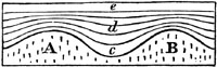
A good illustration of the principle here alluded to may be sometimes seen
in the neighbourhood of a volcano, when a section, whether natural or
artificial, has laid open to view a succession of various-coloured layers
of sand and ashes, which have fallen in showers upon uneven ground. Thus
let A B (fig. 1.) be two ridges, with an intervening valley. These original
inequalities of the surface have been gradually effaced by beds of sand and
ashes c, d, e, the surface at e being quite level. It will be seen
that although the materials of the first layers have accommodated
themselves in a great degree to the shape of the ground A B, yet each bed
is thickest at the bottom. At first a great many particles would be carried
by their own gravity down the steep sides of A and B, and others would
afterwards be blown by the wind as they fell off the ridges, and would
settle in the hollow, which would thus become more and more effaced as the
strata accumulated from c to e. This levelling operation may perhaps be
rendered more clear to the student by supposing a number of parallel
trenches to be dug in a plain of moving sand, like the African desert, in
which case the wind would soon cause all signs of these trenches to
disappear, and the surface would be as uniform as before. Now, water in
[p.16]motion can exert this levelling power on similar materials more
easily than air, for almost all stones lose in water more than a third of
the weight which they have in air, the specific gravity of rocks being in
general as 21/2 when compared to that of water, which is estimated at 1.
But the buoyancy of sand or mud would be still greater in the sea, as the
density of salt water exceeds that of fresh.
Yet, however uniform and horizontal may be the surface of new deposits in
general, there are still many disturbing causes, such as eddies in the
water, and currents moving first in one and then in another direction,
which frequently cause irregularities. We may sometimes follow a bed of
limestone, shale, or sandstone, for a distance of many hundred yards
continuously; but we generally find at length that each individual stratum
thins out, and allows the beds which were previously above and below it to
meet. If the materials are coarse, as in grits and conglomerates, the same
beds can rarely be traced many yards without varying in size, and often
coming to an end abruptly. (See fig. 2.)
Fig. 2.

Section of strata of sandstone, grit, and
conglomerate.
Fig. 3.
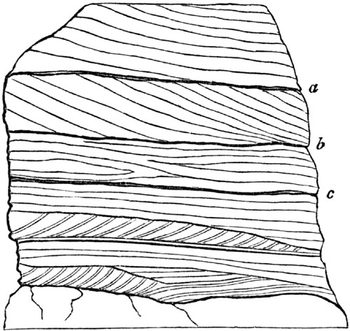
Section of sand at Sandy Hill, near Biggleswade,
Bedfordshire. Height 20 feet. (Greensand formation.)
Diagonal or Cross Stratification.—There is also another phenomenon of
frequent occurrence. We find a series of larger strata, each of which is
composed of a number of minor layers placed obliquely to the general planes
of stratification. To this diagonal arrangement the name of "false or cross
stratification" has been given. Thus in the annexed section (fig. 3.) we
see seven or eight [p.17]large beds of loose sand, yellow and brown, and
the lines a, b, c, mark some of the principal planes of
stratification, which are nearly horizontal. But the greater part of the
subordinate laminæ do not conform to these planes, but have often a steep
slope, the inclination being sometimes towards opposite points of the
compass. When the sand is loose and incoherent, as in the case here
represented, the deviation from parallelism of the slanting laminæ cannot
possibly be accounted for by any re-arrangement of the particles acquired
during the consolidation of the rock. In what manner then can such
irregularities be due to original deposition? We must suppose that at the
bottom of the sea, as well as in the beds of rivers, the motions of waves,
currents, and eddies often cause mud, sand, and gravel to be thrown down in
heaps on particular spots, instead of being spread out uniformly over a
wide area. Sometimes, when banks are thus formed, currents may cut passages
through them, just as a river forms its bed. Suppose the bank A (fig. 4.)
to be thus formed with a steep sloping side, and the water being in a
tranquil state, the layer of sediment No. 1. is thrown down upon it,
conforming nearly to its surface. Afterwards the other layers, 2, 3, 4, may
be deposited in succession, so that the bank B C D is formed. If the
current then increases in velocity, it may cut away the upper portion of
this mass down to the dotted line e (fig. 4.), and deposit the materials
thus removed farther on, so as to form the layers 5, 6, 7, 8. We have now
the bank B C D E (fig. 5.), of which the surface is almost level, and on
which the nearly horizontal layers, 9, 10, 11, may then accumulate. It was
shown in fig. 3. that the diagonal layers of successive strata may
sometimes have an opposite slope. This is well seen in some cliffs of loose
sand on the Suffolk coast. A portion of one of these is represented in fig.
6., where the layers, of which there are about six in the thickness of an
inch, are composed of quartzose grains. This arrangement may have been due
to the altered direction of the tides and currents in the same place.
Fig. 4.
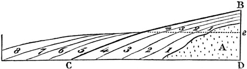
Fig. 5.
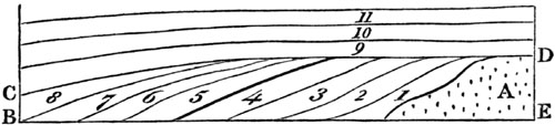
Fig. 6.
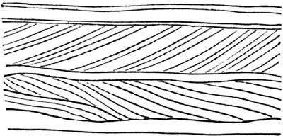
Cliff between Mismer and Dunwich.
[p.18]
Fig. 7.

Section from Monte Calvo to the sea by the
valley of Magnan, near Nice.
- A. Dolomite and sandstone. (Greensand formation?)
- a, b, d. Beds of gravel and sand.
- c. Fine marl and sand of St. Madeleine, with marine shells.
The description above given of the slanting position of the minor layers
constituting a single stratum is in certain cases applicable on a much
grander scale to masses several hundred feet thick, and many miles in
extent. A fine example may be seen at the base of the Maritime Alps near
Nice. The mountains here terminate abruptly in the sea, so that a depth of
many hundred fathoms is often found within a stone's throw of the beach,
and sometimes a depth of 3000 feet within half a mile. But at certain
points, strata of sand, marl, or conglomerate, intervene between the shore
and the mountains, as in the annexed fig. 7., where a vast succession of
slanting beds of gravel and sand may be traced from the sea to Monte Calvo,
a distance of no less than 9 miles in a straight line. The dip of these
beds is remarkably uniform, being always southward or towards the
Mediterranean, at an angle of about 25°. They are exposed to view in nearly
vertical precipices, varying from 200 to 600 feet in height, which bound
the valley through which the river Magnan flows. Although in a general
view, the strata appear to be parallel and uniform, they are nevertheless
found, when examined closely, to be wedge-shaped, and to thin out when
followed for a few hundred feet or yards, so that we may suppose them to
have been thrown down originally upon the side of a steep bank, where a
river or alpine torrent discharged itself into a deep and tranquil sea, and
formed a delta, which advanced gradually from the base of Monte Calvo to a
distance of 9 miles from the original shore. If subsequently this part of
the Alps and bed of the sea were raised 700 feet, the coast would acquire
its present configuration, the delta would emerge, and a deep channel might
then be cut through it by a river.
It is well known that the torrents and streams, which now descend from the
alpine declivities to the shore, bring down annually, when the snow melts,
vast quantities of shingle and sand, and then, as they subside, fine mud,
while in summer they are nearly or entirely dry; so that it may be safely
assumed, that deposits like those of the valley of the Magnan, consisting
of coarse gravel alternating with fine sediment, are still in progress at
many points, as, for instance, at the mouth of the Var. They must advance
upon the Mediterranean in the form of great shoals terminating in a steep
talus; such being the [p.19]original mode of accumulation of all coarse
materials conveyed into deep water, especially where they are composed in
great part of pebbles, which cannot be transported to indefinite distances
by currents of moderate velocity. By inattention to facts and inferences of
this kind, a very exaggerated estimate has sometimes been made of the
supposed depth of the ancient ocean. There can be no doubt, for example,
that the strata a, fig. 7., or those nearest to Monte Calvo, are older
than those indicated by b, and these again were formed before c; but
the vertical depth of gravel and sand in any one place cannot be proved to
amount even to 1000 feet, although it may perhaps be much greater, yet
probably never exceeding at any point 3000 or 4000 feet. But were we to
assume that all the strata were once horizontal, and that their present dip
or inclination was due to subsequent movements, we should then be forced to
conclude, that a sea 9 miles deep had been filled up with alternate layers
of mud and pebbles thrown down one upon another.
In the locality now under consideration, situated a few miles to the west
of Nice, there are many geological data, the details of which cannot be
given in this place, all leading to the opinion, that when the deposit of
the Magnan was formed, the shape and outline of the alpine declivities and
the shore greatly resembled what we now behold at many points in the
neighbourhood. That the beds, a, b, c, d, are of comparatively modern date
is proved by this fact, that in seams of loamy marl intervening between the
pebbly beds are fossil shells, half of which belong to species now living
in the Mediterranean.
Fig. 8.

Slab of ripple-marked (new red) sandstone from
Cheshire.
Ripple mark.—The ripple mark, so common on the surface of sandstones of
all ages (see fig. 8.), and which is so often seen on the [p.20]
sea-shore at low tide, seems to originate in the drifting of materials
along the bottom of the water, in a manner very similar to that which may
explain the inclined layers above described. This ripple is not entirely
confined to the beach between high and low water mark, but is also produced
on sands which are constantly covered by water. Similar undulating ridges
and furrows may also be sometimes seen on the surface of drift snow and
blown sand. The following is the manner in which I once observed the motion
of the air to produce this effect on a large extent of level beach, exposed
at low tide near Calais. Clouds of fine white sand were blown from the
neighbouring dunes, so as to cover the shore, and whiten a dark level
surface of sandy mud, and this fresh covering of sand was beautifully
rippled. On levelling all the small ridges and furrows of this ripple over
an area of several yards square, I saw them perfectly restored in about ten
minutes, the general direction of the ridges being always at right angles
to that of the wind. The restoration began by the appearance here and there
of small detached heaps of sand, which soon lengthened and joined together,
so as to form long sinuous ridges with intervening furrows. Each ridge had
one side slightly inclined, and the other steep; the lee-side being always
steep, as b, c,—d, e; the windward-side a gentle slope, as a, b,—c,
d, fig. 9. When a gust of wind blew with sufficient force to drive along a
cloud of sand, all the ridges were seen to be in motion at once, each
encroaching on the furrow before it, and, in the course of a few minutes,
filling the place which the furrows had occupied. The mode of advance was
by the continual drifting of grains of sand up the slopes a b and c d,
many of which grains, when they arrived at b and d, fell over the
scarps b c and d e, and were under shelter from the wind; so that they
remained stationary, resting, according to their shape and momentum, on
different parts of the descent, and a few only rolling to the bottom. In
this manner each ridge was distinctly seen to move slowly on as often as
the force of the wind augmented. Occasionally part of a ridge, advancing
more rapidly than the rest, overtook the ridge immediately before it, and
became confounded with it, thus causing those bifurcations and branches
which are so common, and two of which are seen in the slab, fig. 8. We may
observe this configuration in sandstones of all ages, and in them also, as
now on the sea-coast, we may often detect two systems of ripples
interfering with each other; one more ancient and half effaced, and a newer
one, in which the grooves and ridges are more distinct, and in a different
direction. This crossing of two sets of ripples arises from a change of
wind, and the new direction in which the waves are thrown on the shore.
Fig. 9.

The ripple mark is usually an indication of a sea-beach, or of water from 6
to 10 feet deep, for the agitation caused by waves even [p.21]during
storms extends to a very slight depth. To this rule, however, there are
some exceptions, and recent ripple marks have been observed at the depth of
60 or 70 feet. It has also been ascertained that currents or large bodies
of water in motion may disturb mud and sand at the depth of 300 or even 450
feet.[21-A]
CHAPTER III.
ARRANGEMENT OF FOSSILS IN STRATA—FRESHWATER AND MARINE.
Successive deposition indicated by fossils — Limestones formed of
corals and shells Proofs of gradual increase of strata derived from
fossils — Serpula attached to spatangus — Wood bored by
Teredina — Tripoli and semi-opal formed of infusoria — Chalk derived
principally from organic bodies — Distinction of freshwater from marine
formations — Genera of freshwater and land shells — Rules for
recognizing marine testacea — Gyrogonite and chara — Freshwater
fishes — Alternation of marine and freshwater deposits — Lym-Fiord.
Having in the last chapter considered the forms of stratification so far as
they are determined by the arrangement of inorganic matter, we may now turn
our attention to the manner in which organic remains are distributed
through stratified deposits. We should often be unable to detect any signs
of stratification or of successive deposition, if particular kinds of
fossils did not occur here and there at certain depths in the mass. At one
level, for example, univalve shells of some one or more species
predominate; at another, bivalve shells; and at a third, corals; while in
some formations we find layers of vegetable matter, commonly derived from
land plants, separating strata.
It may appear inconceivable to a beginner how mountains, several thousand
feet thick, can have become filled with fossils from top to bottom; but the
difficulty is removed, when he reflects on the origin of stratification, as
explained in the last chapter, and allows sufficient time for the
accumulation of sediment. He must never lose sight of the fact that, during
the process of deposition, each separate layer was once the uppermost, and
covered immediately by the water in which aquatic animals lived. Each
stratum in fact, however far it may now lie beneath the surface, was once
in the state of shingle, or loose sand or soft mud at the bottom of the
sea, in which shells and other bodies easily became enveloped.
By attending to the nature of these remains, we are often enabled to
determine whether the deposition was slow or rapid, whether it took place
in a deep or shallow sea, near the shore or far from land, and whether the
water was salt, brackish, or fresh. Some limestones [p.22]consist almost
exclusively of corals, and in many cases it is evident that the present
position of each fossil zoophyte has been determined by the manner in which
it grew originally. The axis of the coral, for example, if its natural
growth is erect, still remains at right angles to the plane of
stratification. If the stratum be now horizontal, the round spherical heads
of certain species continue uppermost, and their points of attachment are
directed downwards. This arrangement is sometimes repeated throughout a
great succession of strata. From what we know of the growth of similar
zoophytes in modern reefs, we infer that the rate of increase was extremely
slow, and some of the fossils must have flourished for ages like forest
trees, before they attained so large a size. During these ages, the water
remained clear and transparent, for such corals cannot live in turbid
water.
Fig. 10.

Fossil Gryphæa, covered both on the outside and
inside with fossil serpulæ.
In like manner, when we see thousands of full-grown shells dispersed every
where throughout a long series of strata, we cannot doubt that time was
required for the multiplication of successive generations; and the evidence
of slow accumulation is rendered more striking from the proofs, so often
discovered, of fossil bodies having lain for a time on the floor of the
ocean after death before they were imbedded in sediment. Nothing, for
example, is more common than to see fossil oysters in clay, with serpulæ,
or barnacles (acorn-shells), or corals, and other creatures, attached to
the inside of the valves, so that the mollusk was certainly not buried in
argillaceous mud the moment it died. There must have been an interval
during which it was still surrounded with clear water, when the testacea,
now adhering to it, grew from an embryo state to full maturity. Attached
shells which are merely external, like some of the serpulæ (a) in the
annexed figure (fig. 10.), may often have grown upon an oyster or other
shell while the animal within was still living; but if they are found on
the inside, it could only happen after the death of the inhabitant of the
shell which affords the support. Thus, in fig. 10., it will be seen that
two serpulæ have grown on the interior, one of them exactly on the place
where the adductor muscle of the Gryphæa (a kind of oyster) was fixed.
Some fossil shells, even if simply attached to the outside of others,
bear full testimony to the conclusion above alluded to, namely, that an
interval elapsed between the death of the creature to whose shell they
adhere, and the burial of the same in mud or sand. The sea-urchins or
Echini, so abundant in white chalk, afford a good illustration. [p.23]
It is well known that these animals, when living, are invariably covered
with numerous spines, which serve as organs of motion, and are supported by
rows of tubercles, which last are only seen after the death of the
sea-urchin, when the spines have dropped off. In fig. 12. a living species
of Spatangus, common on our coast, is represented with one half of its
shell stripped of the spines. In fig. 11. a fossil of the same genus from
the white chalk of England shows the naked surface which the individuals of
this family exhibit when denuded of their bristles. The full-grown
Serpula, therefore, which now adheres externally, could not have begun to
grow till the Spatangus had died, and the spines were detached.
Fig. 11.

Serpula attached to a fossil Spatangus from the
chalk.
Fig. 12.

Recent Spatangus with the spines removed from one
side.
- b. Spine and tubercles, nat. size.
- a. The same magnified.
Now the series of events here attested by a single fossil may be carried a
step farther. Thus, for example, we often meet with a sea-urchin in the
chalk (see fig. 13.), which has fixed to it the lower valve of a Crania,
a genus of bivalve mollusca. The upper valve (b, fig. 13.) is almost
invariably wanting, though occasionally found in a perfect state of
preservation in white chalk at some distance. In this case, we see clearly
that the sea-urchin first lived from youth to age, then died and lost its
spines, which were carried away. Then the young Crania adhered to the
bared shell, grew and perished in its turn; after which the upper valve was
separated from the lower before the Echinus became enveloped in chalky
mud.
Fig. 13.

- a. Echinus from the chalk, with lower valve of the Crania attached.
- b. Upper valve of the Crania detached.
It may be well to mention one more illustration of the manner in which
single fossils may sometimes throw light on a former state of things, both
in the bed of the ocean and on some adjoining land. We meet with many
fragments of wood bored by ship-worms at various depths in the clay on
which London is built. Entire branches and stems of trees, several feet in
length, are sometimes dug out, drilled all over by the holes of these
borers, the tubes and shells of the mollusk still remaining in the
cylindrical hollows. In fig. 15. e, a representation is given of a piece
of recent wood pierced by the Teredo navalis, or common ship-worm, which
destroys wooden piles and ships. When the cylindrical tube d has been
extracted from the wood, a shell is seen at the larger extremity, composed
of two pieces, as shown at c. In like manner, a piece of fossil wood
(a, fig. 14.) [p.24]has been perforated by an animal of a kindred but
extinct genus, called Teredina by Lamarck. The calcareous tube of this
mollusk was united and as it were soldered on to the valves of the shell
(b), which therefore cannot be detached from the tube, like the valves of
the recent Teredo. The wood in this fossil specimen is now converted into
a stony mass, a mixture of clay and lime; but it must once have been
buoyant and floating in the sea, when the Teredinæ lived upon it,
perforating it in all directions. Again, before the infant colony settled
upon the drift wood, the branch of a tree must have been floated down to
the sea by a river, uprooted, perhaps, by a flood, or torn off and cast
into the waves by the wind: and thus our thoughts are carried back to a
prior period, when the tree grew for years on dry land, enjoying a fit soil
and climate.
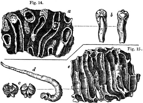
Fossil and recent wood drilled by perforating Mollusca.
- Fig. 14. a. Fossil wood from London clay, bored by Teredina.
- b. Shell and tube of Teredina personata, the right-hand figure the ventral,
the left the dorsal view.
- Fig. 15. e. Recent wood bored by Teredo.
- d. Shell and tube of Teredo navalis, from the same.
- c. Anterior and posterior view of the valves of same detached from the tube.
It has been already remarked that there are rocks in the interior of
continents, at various depths in the earth, and at great heights above the
sea, almost entirely made up of the remains of zoophytes and testacea. Such
masses may be compared to modern oyster-beds and coral reefs; and, like
them, the rate of increase must have been extremely gradual. But there are
a variety of stony deposits in the earth's crust, now proved to have been
derived from plants and animals, of which the organic origin was not
suspected until of late years, even by naturalists. Great surprise was
therefore created by the recent discovery of Professor Ehrenberg of Berlin,
that a certain kind of siliceous stone, called tripoli, was entirely
composed of millions of the remains of organic beings, which the Prussian
naturalist refers to microscopic Infusoria, but which most others now
believe to be plants. They abound in freshwater lakes and ponds in England
and other countries, and are termed Diatomaceæ by those naturalists who
believe in their vegetable origin. The substance alluded to has [p.25]
long been well known in the arts, being used in the form of powder for
polishing stones and metals. It has been procured, among other places, from
Bilin, in Bohemia, where a single stratum, extending over a wide area, is
no less than 14 feet thick. This stone, when examined with a powerful
microscope, is found to consist of the siliceous plates or frustules of the
above-mentioned Diatomaceæ, united together without any visible cement. It
is difficult to convey an idea of their extreme minuteness; but Ehrenberg
estimates that in the Bilin tripoli there are 41,000 millions of
individuals of the Gaillonella distans (see fig. 17.) in every cubic
inch, which weighs about 220 grains, or about 187 millions in a single
grain. At every stroke, therefore, that we make with this polishing powder,
several millions, perhaps tens of millions, of perfect fossils are crushed
to atoms.
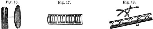
Fig. 16. Bacillaria vulgaris?
Fig. 17. Gaillonella distans.
Fig. 18. Gaillonella ferruginea.
These figures are magnified nearly 300 times, except the
lower figure of G. ferruginea (fig. 18. a), which is magnified 2000
times.

Fragment of semi-opal from the great bed of Tripoli,
Bilin.
Fig. 19. Natural size.
Fig. 20. The same magnified, showing circular articulations of a species of
Gaillonella, and spiculæ of Spongilla.
The remains of these Diatomaceæ are of pure silex, and their forms are
various, but very marked and constant in particular genera and species.
Thus, in the family Bacillaria (see fig. 16.), the fossils preserved in
tripoli are seen to exhibit the same divisions and transverse lines which
characterize the living species of kindred form. With these, also, the
siliceous spiculæ or internal supports of the freshwater sponge, or
Spongilla of Lamarck, are sometimes intermingled (see the needle-shaped
bodies in fig. 20.). These flinty cases and spiculæ, although hard, are
very fragile, breaking like glass, and are therefore admirably adapted,
when rubbed, for wearing down into a fine powder fit for polishing the
surface of metals.
Besides the tripoli, formed exclusively of the fossils [p.26]above
described, there occurs in the upper part of the great stratum at Bilin
another heavier and more compact stone, a kind of semi-opal, in which
innumerable parts of Diatomaceæ and spiculæ of the Spongilla are filled
with, and cemented together by, siliceous matter. It is supposed that the
siliceous remains of the most delicate Diatomaceæ have been dissolved by
water, and have thus given rise to this opal in which the more durable
fossils are preserved like insects in amber. This opinion is confirmed by
the fact that the organic bodies decrease in number and sharpness of
outline in proportion as the opaline cement increases in quantity.
In the Bohemian tripoli above described, as in that of Planitz in Saxony,
the species of Diatomaceæ (or Infusoria, as termed by Ehrenberg) are
freshwater; but in other countries, as in the tripoli of the Isle of
France, they are of marine species, and they all belong to formations of
the tertiary period, which will be spoken of hereafter.
A well-known substance, called bog-iron ore, often met with in peat-mosses,
has also been shown by Ehrenberg to consist of innumerable articulated
threads, of a yellow ochre colour, composed partly of flint and partly of
oxide of iron. These threads are the cases of a minute microscopic body,
called Gaillonella ferruginea (fig. 18.).
Cytheridæ and Foraminifera from the chalk.

Fig. 21. Cythere, Müll. Cytherina, Lam.
Fig. 22. Portion of Nodosaria.
Fig. 23. Cristellaria rotulata.
Fig. 24. Rosalina.
It is clear that much time must have been required for the accumulation of
strata to which countless generations of Diatomaceæ have contributed their
remains; and these discoveries lead us naturally to suspect that other
deposits, of which the materials have usually been supposed to be
inorganic, may in reality have been derived from microscopic organic
bodies. That this is the case with the white chalk, has often been
imagined, this rock having been observed to abound in a variety of marine
fossils, such as shells, echini, corals, sponges, crustacea, and fishes.
Mr. Lonsdale, on examining, in Oct. 1835, in the museum of the Geological
Society of London, portions of white chalk from different parts of England,
found, on carefully pulverizing them in water, that what appear to the eye
simply as white grains were, in fact, well preserved fossils. He obtained
above a thousand of these from each pound weight of chalk, some being
fragments of minute corallines, others entire Foraminifera and Cytheridæ.
The annexed drawings will give an idea of the beautiful forms of many of
these bodies. The figures a a represent their natural size, but, minute
as they seem, the smallest of them, such as a, fig. 24., are gigantic in
comparison with the cases of Diatomaceæ before mentioned. It has, moreover,
been lately discovered that the [p.27]chambers into which these
Foraminifera are divided are actually often filled with thousands of
well-preserved organic bodies, which abound in every minute grain of chalk,
and are especially apparent in the white coating of flints, often
accompanied by innumerable needle-shaped spiculæ of sponges. After
reflecting on these discoveries, we are naturally led on to conjecture
that, as the formless cement in the semi-opal of Bilin has been derived
from the decomposition of animal and vegetable remains, so also even those
parts of chalk flints in which no organic structure can be recognized may
nevertheless have constituted a part of microscopic animalcules.
"The dust we tread upon was once alive!"—Byron.
How faint an idea does this exclamation of the poet convey of the real
wonders of nature! for here we discover proofs that the calcareous and
siliceous dust of which hills are composed has not only been once alive,
but almost every particle, albeit invisible to the naked eye, still retains
the organic structure which, at periods of time incalculably remote, was
impressed upon it by the powers of life.
Freshwater and marine fossils.—Strata, whether deposited in salt or
fresh water, have the same forms; but the imbedded fossils are very
different in the two cases, because the aquatic animals which frequent
lakes and rivers are distinct from those inhabiting the sea. In the
northern part of the Isle of Wight a formation of marl and limestone, more
than 50 feet thick, occurs, in which the shells are principally, if not
all, of extinct species. Yet we recognize their freshwater origin, because
they are of the same genera as those now abounding in ponds and lakes,
either in our own country or in warmer latitudes.
In many parts of France, as in Auvergne, for example, strata of limestone,
marl, and sandstone are found, hundreds of feet thick, which contain
exclusively freshwater and land shells, together with the remains of
terrestrial quadrupeds. The number of land shells scattered through some of
these freshwater deposits is exceedingly great; and there are districts in
Germany where the rocks scarcely contain any other fossils except
snail-shells (helices); as, for instance, the limestone on the left bank
of the Rhine, between Mayence and Worms, at Oppenheim, Findheim, Budenheim,
and other places. In order to account for this phenomenon, the geologist
has only to examine the small deltas of torrents which enter the Swiss
lakes when the waters are low, such as the newly-formed plain where the
Kander enters the Lake of Thun. He there sees sand and mud strewed over
with innumerable dead land shells, which have been brought down from
valleys in the Alps in the preceding spring, during the melting of the
snows. Again, if we search the sands on the borders of the Rhine, in the
lower part of its course, we find countless land shells mixed with others
of species belonging to lakes, stagnant pools, and marshes. These
individuals have been washed [p.28]away from the alluvial plains of the
great river and its tributaries, some from mountainous regions, others from
the low country.
Although freshwater formations are often of great thickness, yet they are
usually very limited in area when compared to marine deposits, just as
lakes and estuaries are of small dimensions in comparison with seas.
We may distinguish a freshwater formation, first, by the absence of many
fossils almost invariably met with in marine strata. For example, there are
no sea-urchins, no corals, and scarcely any zoophytes; no chambered shells,
such as the nautilus, nor microscopic Foraminifera. But it is chiefly by
attending to the forms of the mollusca that we are guided in determining
the point in question. In a freshwater deposit, the number of individual
shells is often as great, if not greater, than in a marine stratum; but
there is a smaller variety of species and genera. This might be anticipated
from the fact that the genera and species of recent freshwater and land
shells are few when contrasted with the marine. Thus, the genera of true
mollusca according to Blainville's system, excluding those of extinct
species and those without shells, amount to about 200 in number, of which
the terrestrial and freshwater genera scarcely form more than a
sixth.[28-A]
Fig. 25.
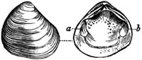
Cyclas obovata; fossil. Hants.
Fig. 26.

Cyrena consobrina; fossil. Grays, Essex.
Fig. 27.
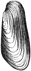
Anodonta Cordierii; fossil. Paris.
Fig. 28.
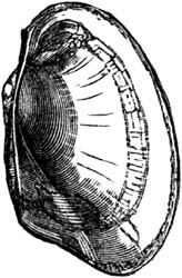
Anodonta latimarginatus; recent. Bahia.
Fig. 29.
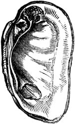
Unio littoralis; recent. Auvergne.
Almost all bivalve shells, or those of acephalous mollusca, are marine,
about ten only out of ninety genera being freshwater. Among these last, the
four most common forms, both recent and fossil, are Cyclas, Cyrena,
Unio, and Anodonta (see figures); the two first and two last of which
are so nearly allied as to pass into each other.
[p.29]
Fig. 30.
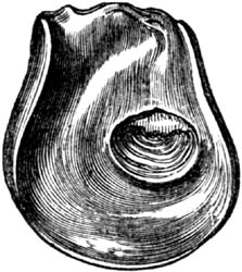
Gryphæa incurva, Sow. (G. arcuata,
Lam.) upper valve. Lias.
Lamarck divided the bivalve mollusca into the Dimyary, or those having
two large muscular impressions in each valve, as a b in the Cyclas, fig.
25., and the Monomyary, such as the oyster and scallop, in which there is
only one of these impressions, as is seen in fig. 30. Now, as none of these
last, or the unimuscular bivalves, are freshwater, we may at once presume a
deposit in which we find any of them to be marine.
Fig. 31.
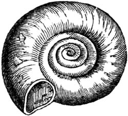
Planorbis euomphalus; fossil. Isle of Wight.
Fig. 32.

Lymnea longiscata; fossil. Hants.
Fig. 33.

Paludina lenta; fossil. Hants.
The univalve shells most characteristic of freshwater deposits are,
Planorbis, Lymnea, and Paludina. (See figures.) But to these are
occasionally added Physa, Succinea, Ancylus, Valvata, Melanopsis,
Melania, and Neritina. (See figures.)
Fig. 34.

Succinea amphibia; fossil. Loess, Rhine.
Fig. 35.

Ancylus elegans; fossil. Hants.
Fig. 36.

Valvata; fossil. Grays, Essex.
Fig. 37.
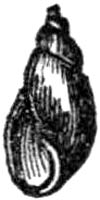
Physa hypnorum; recent.
Fig. 38.
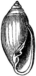
Auricula; recent. Ava.
Fig. 39.
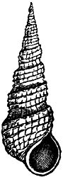
Melania inquinata. Paris Basin.
Fig. 40.
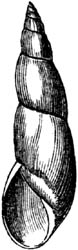
Physa columnaris. Paris Basin.
Fig. 41.

Melanopsis buccinoidea; recent. Asia.
In regard to one of these, the Ancylus (fig. 35.), Mr. Gray observes that
it sometimes differs in no respect from the marine Siphonaria, except in
the animal. The shell, however, of the Ancylus is usually thinner.[29-A]
[p.30]
Fig. 42.

Neritina globulus. Paris basin.
Fig. 43.
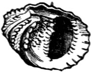
Nerita granulosa. Paris basin.
Some naturalists include Neritina (fig. 42.) and the marine Nerita
(fig. 43.) in the same genus, it being scarcely possible to distinguish the
two by good generic characters. But, as a general rule, the fluviatile
species are smaller, smoother, and more globular than the marine; and they
have never, like the Neritæ, the inner margin of the outer lip toothed or
crenulated. (See fig. 43.)
Fig. 44.
Cerithium cinctum. Paris basin.
A few genera, among which Cerithium (fig. 44.) is the most abundant, are
common both to rivers and the sea, having species peculiar to each. Other
genera, like Auricula (fig. 38.), are amphibious, frequenting marshes,
especially near the sea.
Fig. 45.
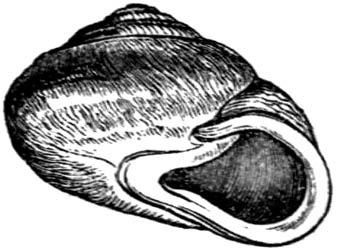
Helix Turonensis. Faluns, Touraine.
Fig. 46.

Cyclostoma elegans. Loess.
Fig. 47.

Pupa tridens. Loess.
Fig. 48.

Clausilia bidens. Loess.
Fig. 49.

Bulimus lubricus. Loess, Rhine.
The terrestrial shells are all univalves. The most abundant genera among
these, both in a recent and fossil state, are Helix (fig. 45.),
Cyclostoma (fig. 46.), Pupa (fig. 47.), Clausilia (fig. 48.),
Bulimus (fig. 49.), and Achatina; which two last are nearly allied and
pass into each other.
Fig. 50.
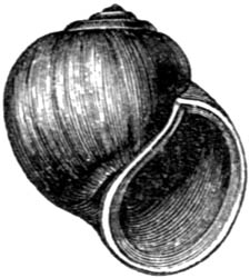
Ampullaria glauca, from the Jumna.
The Ampullaria (fig. 50.) is another genus of shells, inhabiting rivers
and ponds in hot countries. Many fossil species have been referred to this
genus, but they have been found chiefly in marine formations, and are
suspected by some conchologists to belong to Natica and other marine
genera.
All univalve shells of land and freshwater species, with the exception of
Melanopsis (fig. 41.), and Achatina, which has a slight indentation,
have entire mouths; and this circumstance may often serve as a convenient
rule for distinguishing freshwater from marine strata; since, if any
univalves occur of which the mouths are not entire, we may presume that the
formation is marine. The aperture is said to be entire in such shells as
the Ampullaria and the land shells (figs. 45-49.), when its outline is
not interrupted by an indentation or notch, such as that seen at b in
Ancillaria [p.31](fig. 52.); or is not prolonged into a canal, as that
seen at a in Pleurotoma (fig. 51.).
Fig. 51.
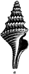
Pleurotoma rotata. Subap. hills, Italy.
Fig. 52.
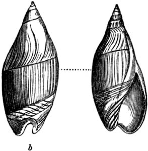
Ancillaria subulata. London clay.
The mouths of a large proportion of the marine univalves have these notches
or canals, and almost all such species are carnivorous; whereas nearly all
testacea having entire mouths, are plant-eaters; whether the species be
marine, freshwater, or terrestrial.
There is, however, one genus which affords an occasional exception to one
of the above rules. The Cerithium (fig. 44.), although provided with a
short canal, comprises some species which inhabit salt, others brackish,
and others fresh water, and they are said to be all plant-eaters.
Among the fossils very common in freshwater deposits are the shells of
Cypris, a minute crustaceous animal, having a shell much resembling that
of the bivalve mollusca.[31-A] Many minute living species of this genus
swarm in lakes and stagnant pools in Great Britain; but their shells are
not, if considered separately, conclusive as to the freshwater origin of a
deposit, because the majority of species in another kindred genus of the
same order, the Cytherina of Lamarck (see above, fig. 21. p. 26.),
inhabit salt water; and, although the animal differs slightly, the shell is
scarcely distinguishable from that of the Cypris.
The seed-vessels and stems of Chara, a genus of aquatic plants, are very
frequent in freshwater strata. These seed-vessels were called, before their
true nature was known, gyrogonites, and were supposed to be foraminiferous
shells. (See fig. 53. a.)
The Charæ inhabit the bottom of lakes and ponds, and flourish mostly
where the water is charged with carbonate of lime. Their seed-vessels are
covered with a very tough integument, capable of resisting decomposition;
to which circumstance we may attribute their abundance in a fossil state.
The annexed figure (fig. 54.) represents a branch of one of many new
species found by Professor Amici in the lakes of northern Italy. The
seed-vessel in this plant is more globular than in the British Charæ, and
therefore more nearly resembles in form the extinct fossil species found in
England, [p.32]France, and other countries. The stems, as well as the
seed-vessels, of these plants occur both in modern shell marl and in
ancient freshwater formations. They are generally composed of a large tube
surrounded by smaller tubes; the whole stem being divided at certain
intervals by transverse partitions or joints. (See b, fig. 53.)
Fig. 53.

Chara medicaginula; fossil. Isle of Wight.
- a. Seed-vessel. magnified 20 diameters.
- b. Stem, magnified.
Fig. 54.

Chara elastica; recent. Italy.
- a. Sessile seed vessel between the division of
the leaves of the female plant.
- b. Transverse section of a branch, with five
seed-vessels magnified, seen from below
upwards.
It is not uncommon to meet with layers of vegetable matter, impressions of
leaves, and branches of trees, in strata containing freshwater shells; and
we also find occasionally the teeth and bones of land quadrupeds, of
species now unknown. The manner in which such remains are occasionally
carried by rivers into lakes, especially during floods, has been fully
treated of in the "Principles of Geology."[32-A]
The remains of fish are occasionally useful in determining the freshwater
origin of strata. Certain genera, such as carp, perch, pike, and loach
(Cyprinus, Perca, Esox, and Cobitis), as also Lebias, being
peculiar to freshwater. Other genera contain some freshwater and some
marine species, as Cottus, Mugil, and Anguilla, or eel. The rest are
either common to rivers and the sea, as the salmon; or are exclusively
characteristic of salt water. The above observations respecting fossil
fishes are applicable only to the more modern or tertiary deposits; for in
the more ancient rocks the forms depart so widely from those of existing
fishes, that it is very difficult, at least in the present state of
science, to derive any positive information from ichthyolites respecting
the element in which strata were deposited.
The alternation of marine and freshwater formations, both on a small and
large scale, are facts well ascertained in geology. When it occurs on a
small scale, it may have arisen from the alternate occupation of certain
spaces by river water and the sea; for in the flood season the river forces
back the ocean and freshens it over a large area, depositing at the same
time its sediment; after which the salt water again returns, and, on
resuming its former place, brings with it sand, mud, and marine shells.
[p.33]There are also lagoons at the mouths of many rivers, as the Nile
and Mississippi, which are divided off by bars of sand from the sea, and
which are filled with salt and fresh water by turns. They often communicate
exclusively with the river for months, years, or even centuries; and then a
breach being made in the bar of sand, they are for long periods filled with
salt water.
The Lym-Fiord in Jutland offers an excellent illustration of analogous
changes; for, in the course of the last thousand years, the western
extremity of this long frith, which is 120 miles in length, including its
windings, has been four times fresh and four times salt, a bar of sand
between it and the ocean having been as often formed and removed. The last
irruption of salt water happened in 1824, when the North Sea entered,
killing all the freshwater shells, fish, and plants; and from that time to
the present, the sea-weed Fucus vesiculosus, together with oysters and
other marine mollusca, have succeeded the Cyclas, Lymnea, Paludina,
and Charæ.[33-A]
But changes like these in the Lym-Fiord, and those before mentioned as
occurring at the mouths of great rivers, will only account for some cases
of marine deposits of partial extent resting on freshwater strata. When we
find, as in the south-east of England, a great series of freshwater beds,
1000 feet in thickness, resting upon marine formations and again covered by
other rocks, such as the cretaceous, more than 1000 feet thick, and of
deep-sea origin, we shall find it necessary to seek for a different
explanation of the phenomena.[33-B]
CHAPTER IV.
CONSOLIDATION OF STRATA AND PETRIFACTION OF FOSSILS.
Chemical and mechanical deposits — Cementing together of
particles — Hardening by exposure to air — Concretionary
nodules — Consolidating effects of pressure — Mineralization of organic
remains — Impressions and casts how formed — Fossil wood — Göppert's
experiments — Precipitation of stony matter most rapid where
putrefaction is going on — Source of lime in solution — Silex derived
from decomposition of felspar — Proofs of the lapidification of some
fossils soon after burial, of others when much decayed.
Having spoken in the preceding chapters of the characters of sedimentary
formations, both as dependent on the deposition of inorganic matter and the
distribution of fossils, I may next treat of the consolidation of
stratified rocks, and the petrifaction of imbedded organic remains.
Chemical and mechanical deposits.—A distinction has been made [p.34]
by geologists between deposits of a chemical, and those of a mechanical,
origin. By the latter name are designated beds of mud, sand, or pebbles
produced by the action of running water, also accumulations of stones and
scoriæ thrown out by a volcano, which have fallen into their present place
by the force of gravitation. But the matter which forms a chemical deposit
has not been mechanically suspended in water, but in a state of solution
until separated by chemical action. In this manner carbonate of lime is
often precipitated upon the bottom of lakes and seas in a solid form, as
may be well seen in many parts of Italy, where mineral springs abound, and
where the calcareous stone, called travertin, is deposited. In these
springs the lime is usually held in solution by an excess of carbonic acid,
or by heat if it be a hot spring, until the water, on issuing from the
earth, cools or loses part of its acid. The calcareous matter then falls
down in a solid state, encrusting shells, fragments of wood and leaves, and
binding them together.[34-A]
In coral reefs, large masses of limestone are formed by the stony skeletons
of zoophytes; and these, together with shells, become cemented together by
carbonate of lime, part of which is probably furnished to the sea-water by
the decomposition of dead corals. Even shells of which the animals are
still living, on these reefs, are very commonly found to be encrusted over
with a hard coating of limestone.[34-B]
If sand and pebbles are carried by a river into the sea, and these are
bound together immediately by carbonate of lime, the deposit may be
described as of a mixed origin, partly chemical, and partly mechanical.
Now, the remarks already made in Chapter II. on the original horizontality
of strata are strictly applicable to mechanical deposits, and only
partially to those of a mixed nature. Such as are purely chemical may be
formed on a very steep slope, or may even encrust the vertical walls of a
fissure, and be of equal thickness throughout; but such deposits are of
small extent, and for the most part confined to veinstones.
Cementing of particles.—It is chiefly in the case of calcareous rocks
that solidification takes place at the time of deposition. But there are
many deposits in which a cementing process comes into operation long
afterwards. We may sometimes observe, where the water of ferruginous or
calcareous springs has flowed through a bed of sand or gravel, that iron or
carbonate of lime has been deposited in the interstices between the grains
or pebbles, so that in certain places the whole has been bound together
into a stone, the same set of strata remaining in other parts loose and
incoherent.
Proofs of a similar cementing action are seen in a rock at Kelloway in
Wiltshire. A peculiar band of sandy strata, belonging to the group called
Oolite by geologists, may be traced through several [p.35]counties, the
sand being for the most part loose and unconsolidated, but becoming stony
near Kelloway. In this district there are numerous fossil shells which have
decomposed, having for the most part left only their casts. The calcareous
matter hence derived has evidently served, at some former period, as a
cement to the siliceous grains of sand, and thus a solid sandstone has been
produced. If we take fragments of many other argillaceous grits, retaining
the casts of shells, and plunge them into dilute muriatic or other acid, we
see them immediately changed into common sand and mud; the cement of lime,
derived from the shells, having been dissolved by the acid.
Traces of impressions and casts are often extremely faint. In some loose
sands of recent date we meet with shells in so advanced a stage of
decomposition as to crumble into powder when touched. It is clear that
water percolating such strata may soon remove the calcareous matter of the
shell; and, unless circumstances cause the carbonate of lime to be again
deposited, the grains of sand will not be cemented together; in which case
no memorial of the fossil will remain. The absence of organic remains from
many aqueous rocks may be thus explained; but we may presume that in many
of them no fossils were ever imbedded, as there are extensive tracts on the
bottoms of existing seas even of moderate depth on which no fragment of
shell, coral, or other living creature can be detected by dredging. On the
other hand, there are depths where the zero of animal life has been
approached; as, for example, in the Mediterranean, at the depth of about
230 fathoms, according to the researches of Prof. E. Forbes. In the Ægean
Sea a deposit of yellowish mud of a very uniform character, and closely
resembling chalk, is going on in regions below 230 fathoms, and this
formation must be wholly devoid of organic remains.[35-A]
In what manner silex and carbonate of lime may become widely diffused in
small quantities through the waters which permeate the earth's crust will
be spoken of presently, when the petrifaction of fossil bodies is
considered; but I may remark here that such waters are always passing in
the case of thermal springs from hotter to colder parts of the interior of
the earth; and as often as the temperature of the solvent is lowered,
mineral matter has a tendency to separate from it and solidify. Thus a
stony cement is often supplied to any sand, pebbles, or fragmentary
mixture. In some conglomerates, like the pudding-stone of Hertfordshire,
pebbles of flint and grains of sand are united by a siliceous cement so
firmly, that if a block be fractured the rent passes as readily through the
pebbles as through the cement.
It is probable that many strata became solid at the time when they emerged
from the waters in which they were deposited, and when they first formed a
part of the dry land. A well-known fact seems to confirm this idea: by far
the greater number of the stones used for building and road-making are much
softer when first taken from [p.36]the quarry than after they have been
long exposed to the air; and these, when once dried, may afterwards be
immersed for any length of time in water without becoming soft again. Hence
it is found desirable to shape the stones which are to be used in
architecture while they are yet soft and wet, and while they contain their
"quarry-water," as it is called; also to break up stone intended for roads
when soft, and then leave it to dry in the air for months that it may
harden. Such induration may perhaps be accounted for by supposing the
water, which penetrates the minutest pores of rocks, to deposit, on
evaporation, carbonate of lime, iron, silex, and other minerals previously
held in solution, and thereby to fill up the pores partially. These
particles, on crystallizing, would not only be themselves deprived of
freedom of motion, but would also bind together other portions of the rock
which before were loosely aggregated. On the same principle wet sand and
mud become as hard as stone when frozen; because one ingredient of the
mass, namely, the water, has crystallized, so as to hold firmly together
all the separate particles of which the loose mud and sand were composed.
Dr. MacCulloch mentions a sandstone in Skye, which may be moulded like
dough when first found; and some simple minerals, which are rigid and as
hard as glass in our cabinets, are often flexible and soft in their native
beds; this is the case with asbestos, sahlite, tremolite, and chalcedony,
and it is reported also to happen in the case of the beryl.[36-A]
The marl recently deposited at the bottom of Lake Superior, in North
America, is soft, and often filled with freshwater shells; but if a piece
be taken up and dried, it becomes so hard that it can only be broken by a
smart blow of the hammer. If the lake therefore was drained, such a deposit
would be found to consist of strata of marlstone, like that observed in
many ancient European formations, and like them containing freshwater
shells.[36-B]
It is probable that some of the heterogeneous materials which rivers
transport to the sea may at once set under water, like the artificial
mixture called pozzolana, which consists of fine volcanic sand charged with
about 20 per cent. of oxide of iron, and the addition of a small quantity
of lime. This substance hardens, and becomes a solid stone in water, and
was used by the Romans in constructing the foundations of buildings in the
sea.
Consolidation in these cases is brought about by the action of chemical
affinity on finely comminuted matter previously suspended in water. After
deposition similar particles seem to exert a mutual attraction on each
other, and congregate together in particular spots, forming lumps, nodules,
and concretions. Thus in many argillaceous deposits there are calcareous
balls, or spherical concretions, ranged in layers parallel to the general
stratification; an arrangement which took place after the shale or marl had
been thrown down in successive [p.37]laminæ; for these laminæ are often
traced in the concretions, remaining parallel to those of the surrounding
unconsolidated rock. (See fig. 55.) Such nodules of limestone have often a
shell or other foreign body in the centre.[37-A]
Fig. 55.

Calcareous nodules in Lias.
Among the most remarkable examples of concretionary structure are those
described by Professor Sedgwick as abounding in the magnesian limestone of
the north of England. The spherical balls are of various sizes, from that
of a pea to a diameter of several feet, and they have both a concentric and
radiated structure, while at the same time the laminæ of original
deposition pass uninterruptedly through them. In some cliffs this limestone
resembles a great irregular pile of cannon balls. Some of the globular
masses have their centre in one stratum, while a portion of their exterior
passes through to the stratum above or below. Thus the larger spheroid in
the annexed section (fig. 56.) passes from the stratum b upwards into
a. In this instance we must suppose the deposition of a series of minor
layers, first forming the stratum b, and afterwards the incumbent stratum
a; then a movement of the particles took place, and the carbonates of
lime and magnesia separated from the more impure and mixed matter forming
the still unconsolidated parts of the stratum. Crystallization, beginning
at the centre, must have gone on forming concentric coats, around the
original nucleus without interfering with the laminated structure of the
rock.
Fig. 56.
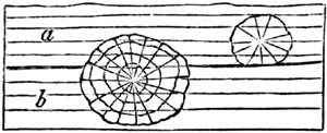
Spheroidal concretions in magnesian limestone.
When the particles of rocks have been thus re-arranged by chemical forces,
it is sometimes difficult or impossible to ascertain whether certain lines
of division are due to original deposition or to the subsequent aggregation
of similar particles. Thus suppose three strata of grit, A, B, C, are
charged unequally with calcareous matter, and that B is the most
calcareous. If consolidation takes place in B, the concretionary action may
spread upwards into a part of A, where the carbonate of lime is more
abundant than in the rest; so that a mass, d, e, f, forming a portion
of the superior stratum, becomes united with B into one solid mass of
stone. The original line of division d, e, being thus effaced, the line
d, f, would generally be considered as the surface of the bed B, though
not strictly a true plane of stratification.
Fig. 57.
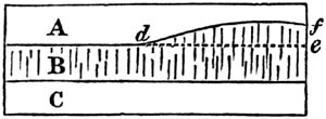
Pressure and heat.—When sand and mud sink to the bottom of a deep sea,
the particles are not pressed down by the enormous weight of the incumbent
ocean; for the water, which becomes mingled with the sand and mud, resists
pressure with a force equal to that of the [p.38]column of fluid above.
The same happens in regard to organic remains which are filled with water
under great pressure as they sink, otherwise they would be immediately
crushed to pieces and flattened. Nevertheless, if the materials of a
stratum remain in a yielding state, and do not set or solidify, they will
be gradually squeezed down by the weight of other materials successively
heaped upon them, just as soft clay or loose sand on which a house is built
may give way. By such downward pressure particles of clay, sand, and marl,
may become packed into a smaller space, and be made to cohere together
permanently.
Analogous effects of condensation may arise when the solid parts of the
earth's crust are forced in various directions by those mechanical
movements afterwards to be described, by which strata have been bent,
broken, and raised above the level of the sea. Rocks of more yielding
materials must often have been forced against others previously
consolidated, and, thus compressed, may have acquired a new structure. A
recent discovery may help us to comprehend how fine sediment derived from
the detritus of rocks may be solidified by mere pressure. The graphite or
"black lead" of commerce having become very scarce, Mr. Brockedon contrived
a method by which the dust of the purer portions of the mineral found in
Borrowdale might be recomposed into a mass as dense and compact as native
graphite. The powder of graphite is first carefully prepared and freed from
air, and placed under a powerful press on a strong steel die, with
air-tight fittings. It is then struck several blows, each of a power of
1000 tons; after which operation the powder is so perfectly solidified that
it can be cut for pencils, and exhibits when broken the same texture as
native graphite.
But the action of heat at various depths in the earth is probably the most
powerful of all causes in hardening sedimentary strata. To this subject I
shall refer again when treating of the metamorphic rocks, and of the slaty
and jointed structure.
Mineralization of organic remains.—The changes which fossil organic
bodies have undergone since they were first imbedded in rocks, throw much
light on the consolidation of strata. Fossil shells in some modern deposits
have been scarcely altered in the course of centuries, having simply lost a
part of their animal matter. But in other cases the shell has disappeared,
and left an impression only of its exterior, or a cast of its interior
form, or thirdly, a cast of the shell itself, the original matter of which
has been removed. These different forms of fossilization may easily be
understood if we examine the mud recently thrown out from a pond or canal
in which there are shells. If the mud be argillaceous, it acquires
consistency on drying, and on breaking open a portion of it we find that
each shell has left impressions of its external form. If we then remove the
shell itself, we find within a solid nucleus of clay, having the form of
the interior of the shell. This form is often very different from that of
the outer shell. Thus a cast such as a, fig. 58., commonly called a
fossil screw, would never be suspected by an inexperienced conchologist to
be [p.39]the internal shape of the fossil univalve, b, fig. 58. Nor
should we have imagined at first sight that the shell a and the cast b,
fig. 59., were different parts of the same fossil. The reader will observe,
in the last-mentioned figure (b, fig. 59.), that an empty space shaded
dark, which the shell itself once occupied, now intervenes between the
enveloping stone and the cast of the smooth interior of the whorls. In such
cases the shell has been dissolved and the component particles removed by
water percolating the rock. If the nucleus were taken out a hollow mould
would remain, on which the external form of the shell with its tubercles
and striæ, as seen in a, fig. 59., would be seen embossed. Now if the
space alluded to between the nucleus and the impression, instead of being
left empty, has been filled up with calcareous spar, flint, pyrites, or
other mineral, we then obtain from the mould an exact cast both of the
external and internal form of the original shell. In this manner silicified
casts of shells have been formed; and if the mud or sand of the nucleus
happen to be incoherent, or soluble in acid, we can then procure in flint
an empty shell, which in shape is the exact counterpart of the original.
This cast may be compared to a bronze statue, representing merely the
superficial form, and not the internal organization; but there is another
description of petrifaction by no means uncommon, and of a much more
wonderful kind, which may be compared to certain anatomical models in wax,
where not only the outward forms and features, but the nerves,
blood-vessels, and other internal organs are also shown. Thus we find
corals, originally calcareous, in which not only the general shape, but
also the minute and complicated internal organization are retained in
flint.
Fig. 58.
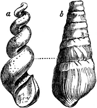
Phasianella Heddingtonensis, and cast of the
same. Coral Rag.
Fig. 59.

Trochus Anglicus and cast. Lias.
Such a process of petrifaction is still more remarkably exhibited in fossil
wood, in which we often perceive not only the rings of annual growth, but
all the minute vessels and medullary rays. Many of the minute pores and
fibres of plants, and even those spiral vessels which in the living
vegetable can only be discovered by the microscope, are preserved. Among
many instances, I may mention a fossil tree, 72 feet in length, found at
Gosforth near Newcastle, in sandstone strata associated with coal. By
cutting a transverse slice [p.40]so thin as to transmit light, and
magnifying it about fifty-five times, the texture seen in fig. 60. is
exhibited. A texture equally minute and complicated has been observed in
the wood of large trunks of fossil trees found in the Craigleith quarry
near Edinburgh, where the stone was not in the slightest degree siliceous,
but consisted chiefly of carbonate of lime, with oxide of iron, alumina,
and carbon. The parallel rows of vessels here seen are the rings of annual
growth, but in one part they are imperfectly preserved, the wood having
probably decayed before the mineralizing matter had penetrated to that
portion of the tree.
Fig. 60.
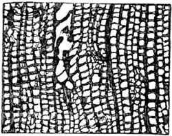
Texture of a tree from the coal strata, magnified.
(Witham.) Transverse section.
In attempting to explain the process of petrifaction in such cases, we may
first assume that strata are very generally permeated by water charged with
minute portions of calcareous, siliceous, and other earths in solution. In
what manner they become so impregnated will be afterwards considered. If an
organic substance is exposed in the open air to the action of the sun and
rain, it will in time putrefy, or be dissolved into its component elements,
which consist chiefly of oxygen, hydrogen, and carbon. These will readily
be absorbed by the atmosphere or be washed away by rain, so that all
vestiges of the dead animal or plant disappear. But if the same substances
be submerged in water, they decompose more gradually; and if buried in
earth, still more slowly, as in the familiar example of wooden piles or
other buried timber. Now, if as fast as each particle is set free by
putrefaction in a fluid or gaseous state, a particle equally minute of
carbonate of lime, flint, or other mineral, is at hand and ready to be
precipitated, we may imagine this inorganic matter to take the place just
before left unoccupied by the organic molecule. In this manner a cast of
the interior of certain vessels may first be taken, and afterwards the more
solid walls of the same may decay and suffer a like transmutation. Yet when
the whole is lapidified, it may not form one homogeneous mass of stone or
metal. Some of the original ligneous, osseous, or other organic elements
may remain mingled in certain parts, or the lapidifying substance itself
may be differently coloured at different times, or so crystallized as to
reflect light differently, and thus the texture of the original body may be
faithfully exhibited.
The student may perhaps ask whether, on chemical principles, we have any
ground to expect that mineral matter will be thrown down precisely in those
spots where organic decomposition is in progress? The following curious
experiments may serve to illustrate this point. Professor Göppert of
Breslau attempted recently to imitate the natural process of petrifaction.
For this purpose he steeped a variety of animal and vegetable substances in
waters, some holding siliceous, others calcareous, others metallic matter
in solution. He found that in the period of a few weeks, or even days, the
organic bodies thus immersed were mineralized to a certain extent. Thus,
for example, [p.41]thin vertical slices of deal, taken from the Scotch
fir (Pinus sylvestris), were immersed in a moderately strong solution of
sulphate of iron. When they had been thoroughly soaked in the liquid for
several days they were dried and exposed to a red-heat until the vegetable
matter was burnt up and nothing remained but an oxide of iron, which was
found to have taken the form of the deal so exactly that casts even of the
dotted vessels peculiar to this family of plants were distinctly visible
under the microscope.
Another accidental experiment has been recorded by Mr. Pepys in the
Geological Transactions.[41-A] An earthen pitcher containing several quarts
of sulphate of iron had remained undisturbed and unnoticed for about a
twelvemonth in the laboratory. At the end of this time when the liquor was
examined an oily appearance was observed on the surface, and a yellowish
powder, which proved to be sulphur, together with a quantity of small
hairs. At the bottom were discovered the bones of several mice in a
sediment consisting of small grains of pyrites, others of sulphur, others
of crystallized green sulphate of iron, and a black muddy oxide of iron. It
was evident that some mice had accidentally been drowned in the fluid, and
by the mutual action of the animal matter and the sulphate of iron on each
other, the metallic sulphate had been deprived of its oxygen; hence the
pyrites and the other compounds were thrown down. Although the mice were
not mineralized, or turned into pyrites, the phenomenon shows how mineral
waters, charged with sulphate of iron, may be deoxydated on coming in
contact with animal matter undergoing putrefaction, so that atom after atom
of pyrites may be precipitated, and ready, under favourable circumstances,
to replace the oxygen, hydrogen, and carbon into which the original body
would be resolved.
The late Dr. Turner observes, that when mineral matter is in a "nascent
state," that is to say, just liberated from a previous state of chemical
combination, it is most ready to unite with other matter, and form a new
chemical compound. Probably the particles or atoms just set free are of
extreme minuteness, and therefore move more freely, and are more ready to
obey any impulse of chemical affinity. Whatever be the cause, it clearly
follows, as before stated, that where organic matter newly imbedded in
sediment is decomposing, there will chemical changes take place most
actively.
An analysis was lately made of the water which was flowing off from the
rich mud deposited by the Hooghly river in the Delta of the Ganges after
the annual inundation. This water was found to be highly charged with
carbonic acid gas holding lime in solution.[41-B] Now if newly-deposited
mud is thus proved to be permeated by mineral matter in a state of
solution, it is not difficult to perceive that decomposing organic bodies,
naturally imbedded in sediment, may as readily become petrified as the
substances artificially immersed by Professor Göppert in various fluid
mixtures.
[p.42]It is well known that the water of springs, or that which is
continually percolating the earth's crust, is rarely free from a slight
admixture either of iron, carbonate of lime, sulphur, silica, potash, or
some other earthy, alkaline, or metallic ingredient. Hot springs in
particular are copiously charged with one or more of these elements; and it
is only in their waters that silex is found in abundance. In certain cases,
therefore, especially in volcanic regions, we may imagine the flint of
silicified wood and corals to have been supplied by the waters of thermal
springs. In other instances, as in tripoli and chalk-flint, it may have
been derived in great part, if not wholly, from the decomposition of
infusoria or diatomaceæ, sponges, and other bodies. But even if this be
granted, we have still to inquire whence a lake or the ocean can be
constantly replenished with the calcareous and siliceous matter so
abundantly withdrawn from it by the secretions of these zoophytes.
In regard to carbonate of lime there is no difficulty, because not only are
calcareous springs very numerous, but even rain-water has the power of
dissolving a minute portion of the calcareous rocks over which it flows.
Hence marine corals and mollusca may be provided by rivers with the
materials of their shells and solid supports. But pure silex, even when
reduced to the finest powder and boiled, is insoluble in water, except at
very high temperatures. Nevertheless Dr. Turner has well explained, in an
essay on the chemistry of geology[42-A], how the decomposition of felspar
may be a source of silex in solution. He has remarked that the siliceous
earth, which constitutes more than half the bulk of felspar, is intimately
combined with alumine, potash, and some other elements. The alkaline matter
of the felspar has a chemical affinity for water, as also for the carbonic
acid which is more or less contained in the waters of most springs. The
water therefore carries away alkaline matter, and leaves behind a clay
consisting of alumine and silica. But this residue of the decomposed
mineral, which in its purest state is called porcelain clay, is found to
contain a part only of the silica which existed in the original felspar.
The other part, therefore, must have been dissolved and removed; and this
can be accounted for in two ways; first, because silica when combined with
an alkali is soluble in water; secondly, because silica in what is
technically called its nascent state is also soluble in water. Hence an
endless supply of silica is afforded to rivers and the waters of the sea.
For the felspathic rocks are universally distributed, constituting, as they
do, so large a proportion of the volcanic, plutonic, and metamorphic
formations. Even where they chance to be absent in mass, they rarely fail
to occur in the superficial gravel or alluvial deposits of the basin of
every large river.
The disintegration of mica also, another mineral which enters largely into
the composition of granite and various sandstones, may [p.43]yield
silica which may be dissolved in water, for nearly half of this mineral
consists of silica, combined with alumine, potash, and about a tenth part
of iron. The oxidation of this iron in the air is the principal cause of
the waste of mica.
We have still, however, much to learn before the conversion of fossil
bodies into stone is fully understood. Some phenomena seem to imply that
the mineralization must proceed with considerable rapidity, for stems of a
soft and succulent character, and of a most perishable nature, are
preserved in flint; and there are instances of the complete silicification
of the young leaves of a palm-tree when just about to shoot forth, and in
that state which in the West Indies is called the cabbage of the
palm.[43-A] It may, however, be questioned whether in such cases there may
not have been some antiseptic quality in the water which retarded
putrefaction, so that the soft parts of the buried substance may have
remained for a long time without disintegration, like the flesh of bodies
imbedded in peat.
Mr. Stokes has pointed out examples of petrifactions in which the more
perishable, and others where the more durable portions of wood are
preserved. These variations, he suggests, must doubtless have depended on
the time when the lapidifying mineral was introduced. Thus, in certain
silicified stems of palm-trees, the cellular tissue, that most destructible
part, is in good condition, while all signs of the hard woody fibre have
disappeared, the spaces once occupied by it being hollow or filled with
agate. Here, petrifaction must have commenced soon after the wood was
exposed to the action of moisture, and the supply of mineral matter must
then have failed, or the water must have become too much diluted before the
woody fibre decayed. But when this fibre is alone discoverable, we must
suppose that an interval of time elapsed before the commencement of
lapidification, during which the cellular tissue was obliterated. When both
structures, namely, the cellular and the woody fibre, are preserved, the
process must have commenced at an early period, and continued without
interruption till it was completed throughout.[43-B]
[p.44]CHAPTER V.
ELEVATION OF STRATA ABOVE THE SEA—HORIZONTAL AND INCLINED STRATIFICATION.
Why the position of marine strata, above the level of the sea, should
be referred to the rising up of the land, not to the going down of the
sea — Upheaval of extensive masses of horizontal strata — Inclined and
vertical stratification — Anticlinal and synclinal lines — Bent strata
in east of Scotland — Theory of folding by lateral
movement — Creeps — Dip and strike — Structure of the Jura — Various forms
of outcrop — Rocks broken by flexure — Inverted position of disturbed
strata — Unconformable stratification — Hutton and Playfair on the
same — Fractures of strata — Polished surfaces — Faults — Appearance of
repeated alternations produced by them — Origin of great faults.
Land has been raised, not the sea lowered.—It has been already stated
that the aqueous rocks containing marine fossils extend over wide
continental tracts, and are seen in mountain chains rising to great heights
above the level of the sea. Hence it follows, that what is now dry land was
once under water. But if we admit this conclusion, we must imagine, either
that there has been a general lowering of the waters of the ocean, or that
the solid rocks, once covered by water, have been raised up bodily out of
the sea, and have thus become dry land. The earlier geologists, finding
themselves reduced to this alternative, embraced the former opinion,
assuming that the ocean was originally universal, and had gradually sunk
down to its actual level, so that the present islands and continents were
left dry. It seemed to them far easier to conceive that the water had gone
down, than that solid land had risen upwards into its present position. It
was, however, impossible to invent any satisfactory hypothesis to explain
the disappearance of so enormous a body of water throughout the globe, it
being necessary to infer that the ocean had once stood at whatever height
marine shells might be detected. It moreover appeared clear, as the science
of Geology advanced, that certain spaces on the globe had been alternately
sea, then land, then estuary, then sea again, and, lastly, once more
habitable land, having remained in each of these states for considerable
periods. In order to account for such phenomena, without admitting any
movement of the land itself, we are required to imagine several retreats
and returns of the ocean; and even then our theory applies merely to cases
where the marine strata composing the dry land are horizontal, leaving
unexplained those more common instances where strata are inclined, curved,
or placed on their edges, and evidently not in the position in which they
were first deposited.
Geologists, therefore, were at last compelled to have recourse to the other
alternative, namely, the doctrine that the solid land has been repeatedly
moved upwards or downwards, so as permanently to change its position
relatively to the sea. There are several distinct [p.45]grounds for
preferring this conclusion. First, it will account equally for the position
of those elevated masses of marine origin in which the stratification
remains horizontal, and for those in which the strata are disturbed,
broken, inclined, or vertical. Secondly, it is consistent with human
experience that land should rise gradually in some places and be depressed
in others. Such changes have actually occurred in our own days, and are now
in progress, having been accompanied in some cases by violent convulsions,
while in others they have proceeded so insensibly, as to have been
ascertainable only by the most careful scientific observations, made at
considerable intervals of time. On the other hand, there is no evidence
from human experience of a lowering of the sea's level in any region, and
the ocean cannot sink in one place without its level being depressed all
over the globe.
These preliminary remarks will prepare the reader to understand the great
theoretical interest attached to all facts connected with the position of
strata, whether horizontal or inclined, curved or vertical.
Now the first and most simple appearance is where strata of marine origin
occur above the level of the sea in horizontal position. Such are the
strata which we meet with in the south of Sicily, filled with shells for
the most part of the same species as those now living in the Mediterranean.
Some of these rocks rise to the height of more than 2000 feet above the
sea. Other mountain masses might be mentioned, composed of horizontal
strata of high antiquity, which contain fossil remains of animals wholly
dissimilar from any now known to exist. In the south of Sweden, for
example, near Lake Wener, the beds of one of the oldest of the
fossiliferous deposits, namely that formerly called Transition, and now
Silurian, by geologists, occur in as level a position as if they had
recently formed part of the delta of a great river, and been left dry on
the retiring of the annual floods. Aqueous rocks of about the same age
extend for hundreds of miles over the lake-district of North America, and
exhibit in like manner a stratification nearly undisturbed. The Table
Mountain at the Cape of Good Hope is another example of highly elevated yet
perfectly horizontal strata, no less than 3500 feet in thickness, and
consisting of sandstone of very ancient date.
Instead of imagining that such fossiliferous rocks were always at their
present level, and that the sea was once high enough to cover them, we
suppose them to have constituted the ancient bed of the ocean, and that
they were gradually uplifted to their present height. This idea, however
startling it may at first appear, is quite in accordance, as before stated,
with the analogy of changes now going on in certain regions of the globe.
Thus, in parts of Sweden, and the shores and islands of the Gulf of
Bothnia, proofs have been obtained that the land is experiencing, and has
experienced for centuries, a slow upheaving movement. Playfair argued in
favour of this opinion in 1802; and in 1807, Von Buch, after his travels in
Scandinavia, announced his conviction that a rising of the land was in
progress. Celsius and other Swedish writers had, a century before, declared
their belief that a gradual change had, for ages, [p.46]been taking
place in the relative level of land and sea. They attributed the change to
a fall of the waters both of the ocean and the Baltic. This theory,
however, has now been refuted by abundant evidence; for the alteration of
relative level has neither been universal nor every where uniform in
quantity, but has amounted, in some regions, to several feet in a century,
in others to a few inches; while in the southernmost part of Sweden, or the
province of Scania, there has been actually a loss instead of a gain of
land, buildings having gradually sunk below the level of the sea.[46-A]
It appears, from the observations of Mr. Darwin and others, that very
extensive regions of the continent of South America have been undergoing
slow and gradual upheaval, by which the level plains of Patagonia, covered
with recent marine shells, and the Pampas of Buenos Ayres, have been raised
above the level of the sea.[46-B] On the other hand, the gradual sinking of
the west coast of Greenland, for the space of more than 600 miles from
north to south, during the last four centuries, has been established by the
observations of a Danish naturalist, Dr. Pingel. And while these proofs of
continental elevation and subsidence, by slow and insensible movements,
have been recently brought to light, the evidence has been daily
strengthened of continued changes of level effected by violent convulsions
in countries where earthquakes are frequent. There the rocks are rent from
time to time, and heaved up or thrown down several feet at once, and
disturbed in such a manner, that the original position of strata may, in
the course of centuries, be modified to any amount.
It has also been shown by Mr. Darwin, that, in those seas where circular
coral islands and barrier reefs abound, there is a slow and continued
sinking of the submarine mountains on which the masses of coral are based;
while there are other areas of the South Sea, where the land is on the
rise, and where coral has been upheaved far above the sea-level.
It would require a volume to explain to the reader the various facts which
establish the reality of these movements of land, whether of elevation or
depression, whether accompanied by earthquakes or accomplished slowly and
without local disturbance. Having treated fully of these subjects in the
Principles of Geology[46-C], I shall assume, in the present work, that such
changes are part of the actual course of nature; and when admitted, they
will be found to afford a key to the interpretation of a variety of
geological appearances, such as the elevation of horizontal, inclined, or
disturbed marine strata, and the superposition of freshwater to marine
deposits, afterwards to be described. It will also appear, in the sequel,
how much light the [p.47]doctrine of a continued subsidence of land may
throw on the manner in which a series of strata, formed in shallow water,
may have accumulated to a great thickness. The excavation of valleys also,
and other effects of denudation, of which I shall presently treat, can
alone be understood when we duly appreciate the proofs, now on record, of
the prolonged rising and sinking of land, throughout wide areas.
To conclude this subject, I may remind the reader, that were we to embrace
the doctrine which ascribes the elevated position of marine formations, and
the depression of certain freshwater strata, to oscillations in the level
of the waters instead of the land, we should be compelled to admit that the
ocean has been sometimes every where much shallower than at present, and at
others more than three miles deeper.
Fig. 61.

Vertical conglomerate and sandstone.
Inclined stratification.—The most unequivocal evidence of a change in
the original position of strata is afforded by their standing up
perpendicularly on their edges, which is by no means a rare phenomenon,
especially in mountainous countries. Thus we find in Scotland, on the
southern skirts of the Grampians, beds of pudding-stone alternating with
thin layers of fine sand, all placed vertically to the horizon. When
Saussure first observed certain conglomerates in a similar position in the
Swiss Alps, he remarked that the pebbles, being for the most part of an
oval shape, had their longer axes parallel to the planes of stratification
(See fig. 61.). From this he inferred, that such strata must, at first,
have been horizontal, each oval pebble having originally settled at the
bottom of the water, with its flatter side parallel to the horizon, for the
same reason that an egg will not stand on either end if unsupported. Some
few, indeed, of the rounded stones in a conglomerate occasionally afford an
exception to the above rule, for the same reason that we see on a shingle
beach some oval or flat-sided pebbles resting on their ends or edges; these
having been forced along the bottom and against each other by a wave or
current so as to settle in this position.
Vertical strata, when they can be traced continuously upwards or downwards
for some depth, are almost invariably seen to be parts of great curves,
which may have a diameter of a few yards, or of several miles. I shall
first describe two curves of considerable regularity, which occur in
Forfarshire, extending over a country twenty miles in breadth, from the
foot of the Grampians to the sea near Arbroath.
The mass of strata here shown may be nearly 2000 feet in thickness,
consisting of red and white sandstone, and various coloured shales, the
beds being distinguishable into four principal groups, namely, No. 1. red
marl or shale; No. 2. red sandstone, used for building; No. 3.
conglomerate; and No. 4. grey paving-stone, and tile-stone, with green and
reddish shale, containing peculiar organic remains. A glance at the section
will show that each of the formations [p.48]2, 3, 4, are repeated thrice
at the surface, twice with a southerly, and once with a northerly
inclination or dip, and the beds in No. 1., which are nearly horizontal,
are still brought up twice by a slight curvature to the surface, once on
each side of A. Beginning at the north-west extremity, the tile-stones and
conglomerates No. 4. and No. 3. are vertical, and they generally form a
ridge parallel to the southern skirts of the Grampians. The superior strata
Nos. 2. and 1. become less and less inclined on descending to the valley of
Strathmore, where the strata, having a concave bend, are said by geologists
to lie in a "trough" or "basin." Through the centre of this valley runs an
imaginary line A, called technically a "synclinal line," where the beds,
which are tilted in opposite directions, may be supposed to meet. It is
most important for the observer to mark such lines, for he will perceive by
the diagram, that in travelling from the north to the centre of the basin,
he is always passing from older to newer beds; whereas, after crossing the
line A, and pursuing his course in the same southerly direction, he is
continually leaving the newer, and advancing upon older strata. All the
deposits which he had before examined begin then to recur in reversed
order, until he arrives at the central axis of the Sidlaw hills, where the
strata are seen to form an arch or saddle, having an anticlinal line B,
in the centre. On passing this line, and continuing towards the S.E., the
formations 4, 3, and 2, are again repeated, in the same relative order of
superposition, but with a northerly dip. At Whiteness (see diagram) it will
be seen that the inclined strata are covered by a newer deposit, a, in
horizontal beds. These are composed of red conglomerate and sand, and are
newer than any of the groups, 1, 2, 3, 4, before described, and rest
unconformably upon strata of the sandstone group, No. 2.
Fig. 62.

Section of Forfarshire, from N.W. to S.E., from
foot of the Grampians to the sea at Arbroath (volcanic or trap rocks
omitted). Length of section twenty miles.
An example of curved strata, in which the bends or convolutions of the rock
are sharper and far more numerous within an equal space, has been well
described by Sir James Hall.[48-A] It occurs near St. [p.49]Abb's Head,
on the east coast of Scotland, where the rocks consist principally of a
bluish slate, having frequently a ripple-marked surface. The undulations of
the beds reach from the top to the bottom of cliffs from 200 to 300 feet in
height, and there are sixteen distinct bendings in the course of about six
miles, the curvatures being alternately concave and convex upwards.
Fig. 63.

Curved strata of slate near St. Abb's Head,
Berwickshire. (Sir J. Hall.)
Fig. 64.

An experiment was made by Sir James Hall, with a view of illustrating the
manner in which such strata, assuming them to have been originally
horizontal, may have been forced into their present position. A set of
layers of clay were placed under a weight, and their opposite ends pressed
towards each other with such force as to cause them to approach more nearly
together. On the removal of the weight, the layers of clay were found to be
curved and folded, so as to bear a miniature resemblance to the strata in
the cliffs. We must, however, bear in mind, that in the natural section or
sea-cliff we only see the foldings imperfectly, one part being invisible
beneath the sea, and the other, or upper portion, being supposed to have
been carried away by denudation, or that action of water which will be
explained in the next chapter. The dark lines in the accompanying plan
(fig. 64.) represent what is actually seen of the strata in part of the
line of cliff alluded to; the fainter lines, that portion which is [p.50]
concealed beneath the sea level, as also that which is supposed to have
once existed above the present surface.
Fig. 65.
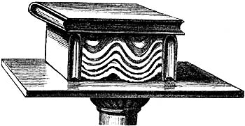
We may still more easily illustrate the effects which a lateral thrust
might produce on flexible strata, by placing several pieces of differently
coloured cloths upon a table, and when they are spread out horizontally,
cover them with a book. Then apply other books to each end, and force them
towards each other. The folding of the cloths will exactly imitate those of
the bent strata. (See fig. 65.)
Whether the analogous flexures in stratified rocks have really been due to
similar sideway movements is a question of considerable difficulty. It will
appear when the volcanic and granitic rocks are described, that some of
them have, when melted, been injected forcibly into fissures, while others,
already in a solid state, have been protruded upwards through the incumbent
crust of the earth, by which a great displacement of flexible strata must
have been caused.
But we also know by the study of regions liable to earthquakes, that there
are causes at work in the interior of the earth capable of producing a
sinking in of the ground, sometimes very local, but sometimes extending
over a wide area. The frequent repetition, or continuance throughout long
periods, of such downward movements seems to imply the formation and
renewal of cavities at a certain depth below the surface, whether by the
removal of matter by volcanos and hot springs, or by the contraction of
argillaceous rocks by heat and pressure, or any other combination of
circumstances. Whatever conjectures we may indulge respecting the causes,
it is certain that pliable beds may, in consequence of unequal degrees of
subsidence, become folded to any amount, and have all the appearance of
having been compressed suddenly by a lateral thrust.
The "Creeps," as they are called in coal-mines, afford an excellent
illustration of this fact.—First, it may be stated generally, that the
excavation of coal at a considerable depth causes the mass of overlying
strata to sink down bodily, even when props are left to support the roof of
the mine. "In Yorkshire," says Mr. Buddle, "three distinct subsidences were
perceptible at the surface, after the clearing out of three seams of coal
below, and innumerable vertical cracks were caused in the incumbent mass of
sandstone and shale, which thus settled down."[50-A] The exact amount of
depression in these cases [p.51]can only be accurately measured where
water accumulates on the surface, or a railway traverses a coal-field.
Fig. 66.
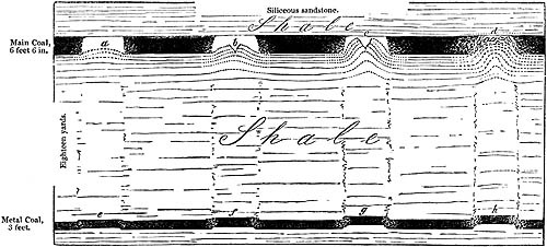
Section of carboniferous strata, at Wallsend,
Newcastle, showing "Creeps." (J. Buddle, Esq.) Horizontal length of section
174 feet. The upper seam, or main coal, here worked out, was 630 feet below
the surface.
When a bed of coal is worked out, pillars or rectangular masses of coal are
left at intervals as props to support the roof, and protect the colliers.
Thus in fig. 66., representing a section at Wallsend, Newcastle, the
galleries which have been excavated are represented by the white spaces a
b, while the adjoining dark portions are parts of the original coal-seam
left as props, beds of sandy clay or shale constituting the floor of the
mine. When the props have been reduced [p.52]in size, they are pressed
down by the weight of overlying rocks (no less than 630 feet thick) upon
the shale below, which is thereby squeezed and forced up into the open
spaces.
Now it might have been expected, that instead of the floor rising up, the
ceiling would sink down, and this effect, called a "Thrust," does, in fact,
take place where the pavement is more solid than the roof. But it usually
happens, in coal-mines, that the roof is composed of hard shale, or
occasionally of sandstone, more unyielding than the foundation, which often
consists of clay. Even where the argillaceous substrata are hard at first,
they soon become softened and reduced to a plastic state when exposed to
the contact of air and water in the floor of a mine.
The first symptom of a "creep," says Mr. Buddle, is a slight curvature at
the bottom of each gallery, as at a, fig. 66.: then the pavement
continuing to rise, begins to open with a longitudinal crack, as at b:
then the points of the fractured ridge reach the roof, as at c; and,
lastly, the upraised beds close up the whole gallery, and the broken
portions of the ridge are re-united and flattened at the top, exhibiting
the flexure seen at d. Meanwhile the coal in the props has become crushed
and cracked by pressure. It is also found, that below the creeps a, b,
c, d, an inferior stratum, called the "metal coal," which is 3 feet
thick, has been fractured at the points e, f, g, h, and has risen,
so as to prove that the upward movement, caused by the working out of the
"main coal," has been propagated through a thickness of 54 feet of
argillaceous beds, which intervene between the two coal seams. This same
displacement has also been traced downwards more than 150 feet below the
metal coal, but it grows continually less and less until it becomes
imperceptible.
No part of the process above described is more deserving of our notice than
the slowness with which the change in the arrangement of the beds is
brought about. Days, months, or even years, will sometimes elapse between
the first bending of the pavement and the time of its reaching the roof.
Where the movement has been most rapid, the curvature of the beds is most
regular, and the reunion of the fractured ends most complete; whereas the
signs of displacement or violence are greatest in those creeps which have
required months or years for their entire accomplishment. Hence we may
conclude that similar changes may have been wrought on a larger scale in
the earth's crust by partial and gradual subsidences, especially where the
ground has been undermined throughout long periods of time; and we must be
on our guard against inferring sudden violence, simply because the
distortion of the beds is excessive.
Between the layers of shale, accompanying coal, we sometimes see the leaves
of fossil ferns spread out as regularly as dried plants between sheets of
paper in the herbarium of a botanist. These fern-leaves, or fronds, must
have rested horizontally on soft mud, when first deposited. If, therefore,
they and the layers of shale are now inclined, or standing on end, it is
obviously the effect of subsequent derangement. The proof becomes, if
possible, still more striking [p.53]when these strata, including
vegetable remains, are curved again and again, and even folded into the
form of the letter Z, so that the same continuous layer of coal is cut
through several times in the same perpendicular shaft. Thus, in the
coal-field near Mons, in Belgium, these zigzag bendings are repeated four
or five times, in the manner represented in fig. 67., the black lines
representing seams of coal.[53-A]
Fig. 67.

Zigzag flexures of coal near Mons.
Dip and Strike.—In the above remarks, several technical terms have been
used, such as dip, the unconformable position of strata, and the
anticlinal and synclinal lines, which, as well as the strike of the
beds, I shall now explain. If a stratum or bed of rock, instead of being
quite level, be inclined to one side, it is said to dip; the point of the
compass to which it is inclined is called the point of dip, and the
degree of deviation from a level or horizontal line is called the amount
of dip, or the angle of dip. Thus, in the annexed diagram (fig. 68.), a
series of strata are inclined, and they dip to the north at an angle of
forty-five degrees. The strike, or line of bearing, is the prolongation
or extension of the strata in a direction at right angles to the dip; and
hence it is sometimes called the direction of the strata. Thus, in the
above instance of strata dipping to the north, their strike must
necessarily be east and west. We have borrowed the word from the German
geologists, streichen signifying to extend, to have a certain direction.
Dip and strike may be aptly illustrated by a row of houses running east and
west, the long ridge of the roof representing the strike of the stratum of
slates, which dip on one side to the north, and on the other to the south.
Fig. 68.

A stratum which is horizontal, or quite level in
all directions, has neither dip nor strike.
It is always important for the geologist, who is endeavouring to comprehend
the structure of a country, to learn how the beds dip in every part of the
district; but it requires some practice to avoid being occasionally
deceived, both as to the point of dip and the amount of it.
[p.54]
Fig. 69.
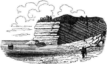
Apparent horizontality of inclined strata.
If the upper surface of a hard stony stratum be uncovered, whether
artificially in a quarry, or by the waves at the foot of a cliff, it is
easy to determine towards what point of the compass the slope is steepest,
or in what direction water would flow, if poured upon it. This is the true
dip. But the edges of highly inclined strata may give rise to perfectly
horizontal lines in the face of a vertical cliff, if the observer see the
strata in the line of their strike, the dip being inwards from the face of
the cliff. If, however, we come to a break in the cliff, which exhibits a
section exactly at right angles to the line of the strike, we are then able
to ascertain the true dip. In the annexed drawing (fig. 69.), we may
suppose a headland, one side of which faces to the north, where the beds
would appear perfectly horizontal to a person in the boat; while in the
other side facing the west, the true dip would be seen by the person on
shore to be at an angle of 40°. If, therefore, our observations are
confined to a vertical precipice facing in one direction, we must endeavour
to find a ledge or portion of the plane of one of the beds projecting
beyond the others, in order to ascertain the true dip.
Fig. 70.
It is rarely important to determine the angle of inclination with such
minuteness as to require the aid of the instrument called a clinometer. We
may measure the angle within a few degrees by standing exactly opposite to
a cliff where the true dip is exhibited, holding the hands immediately
before the eyes, and placing the fingers of one in a perpendicular, and of
the other in a horizontal position, as in fig. 70. It is thus easy to
discover whether the lines of the inclined beds bisect the angle of 90°,
formed by the meeting of the hands, so as to give an angle of 45°, or
whether it would divide the space into two equal or unequal portions. The
upper dotted line may express a stratum dipping to the north; but should
the beds dip precisely to the opposite point of [p.55]the compass as in
the lower dotted line, it will be seen that the amount of inclination may
still be measured by the hands with equal facility.
Fig. 71.
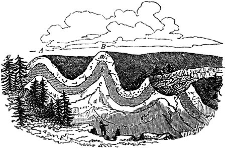
Section illustrating the structure of the Swiss
Jura.
Fig. 72.

Ground plan of the denuded ridge, fig. 71.
Fig. 73.

Transverse section.
It has been already seen, in describing the curved strata on the east coast
of Scotland, in Forfarshire and Berwickshire, that a series of concave and
convex bendings are occasionally repeated several times. These usually form
part of a series of parallel waves of strata, which are prolonged in the
same direction throughout a considerable extent of country. Thus, for
example, in the Swiss Jura, that lofty chain of mountains has been proved
to consist of many parallel ridges, with intervening longitudinal valleys,
as in fig. 71., the ridges being formed by curved fossiliferous strata, of
which the nature and dip are occasionally displayed in deep transverse
gorges, called "cluses," caused by fractures at right angles to the
direction of the chain.[55-A] Now let us suppose these ridges and parallel
valleys to run north and south, we should then say that the strike of the
beds is north and south, and the dip east and west. Lines drawn along the
summits of the ridges, A, B, would be anticlinal lines, and one following
the bottom of the adjoining valleys a synclinal line. It will be observed
that some of these ridges, A, B, are unbroken on the summit, whereas one of
them, C, has been fractured along the line of strike, and a portion of it
carried away by denudation, so that the ridges of the beds in the
formations a, b, c, come out to the day, or, as the miners say, crop
out, on the sides of a valley. The ground plan of such a denuded ridge as
C, as given in a geological map, may be expressed by the diagram fig. 72.,
and the cross section of the same by fig. 73. The line D E, fig. 72., is
the anticlinal line, on each side [p.56]of which the dip is in opposite
directions, as expressed by the arrows. The emergence of strata at the
surface is called by miners their outcrop or basset.
If, instead of being folded into parallel ridges, the beds form a boss or
dome-shaped protuberance, and if we suppose the summit of the dome carried
off, the ground plan would exhibit the edges of the strata forming a
succession of circles, or ellipses, round a common centre. These circles
are the lines of strike, and the dip being always at right angles is
inclined in the course of the circuit to every point of the compass,
constituting what is termed a qua-quaversal dip—that is, turning each way.
There are endless variations in the figures described by the basset-edges
of the strata, according to the different inclination of the beds, and the
mode in which they happen to have been denuded. One of the simplest rules
with which every geologist should be acquainted, relates to the V-like form
of the beds as they crop out in an ordinary valley. First, if the strata be
horizontal, the V-like form will be also on a level, and the newest strata
will appear at the greatest heights.
Secondly, if the beds be inclined and intersected by a valley sloping in
the same direction, and the dip of the beds be less steep than the slope of
the valley, then the V's, as they are often termed by miners, will point
upwards (see fig. 74.), those formed by the newer beds appearing in a
superior position, and extending highest up the valley, as A is seen
above B.
Fig. 74.

Slope of valley 40°, dip of strata 20°.
Thirdly, if the dip of the beds be steeper than the slope of the valley,
then the V's will point downwards (see fig. 75.), and those formed of the
older beds will now appear uppermost, as B appears above A.
Fig. 75.
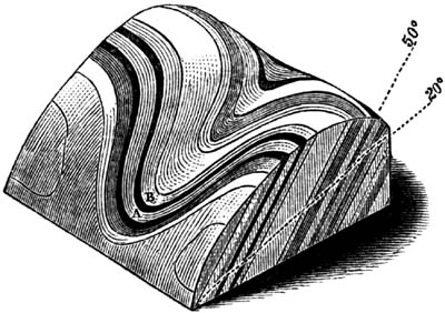
Slope of valley 20°, dip of strata 50°.
Fourthly, in every case where the strata dip in a contrary direction to the
slope of the valley, whatever be the angle of inclination, the newer beds
will appear the highest, as in the first and second cases. This is shown by
the drawing (fig. 76.), which exhibits strata rising at an angle of 20°,
[p.57]and crossed by a valley, which declines in an opposite direction
at 20°.[57-A]
Fig. 76.

Slope of valley 20°, dip of strata 20°, in opposite
directions.
These rules may often be of great practical utility; for the different
degrees of dip occurring in the two cases represented in figures 74 and 75.
may occasionally be encountered in following the same line of flexure at
points a few miles distant from each other. A miner unacquainted with the
rule, who had first explored the valley (fig. 74.), may have sunk a
vertical shaft below the coal seam A, until he reached the inferior bed B.
He might then pass to the valley fig. 75., and discovering there also the
outcrop of two coal seams, might begin his workings in the uppermost in the
expectation of coming down to the other bed A, which would be observed
cropping out lower down the valley. But a glance at the section will
demonstrate the futility of such hopes.
In the majority of cases, an anticlinal axis forms a ridge, and a synclinal
axis a valley, as in A, B, fig. 62. p. 48.; but there are exceptions to
this rule, the beds sometimes sloping inwards from either side of a
mountain, as in fig. 77.
Fig. 77.

On following one of the anticlinal ridges of the Jura, before mentioned, A,
B, C, fig. 71., we often discover longitudinal cracks and sometimes large
fissures along the line where the flexure was greatest. Some of these, as
above stated, have been enlarged by denudation into valleys of considerable
width, as at C, fig. 71., which follow the line of strike, and which we may
suppose to have been hollowed out at the time when these rocks were still
beneath the level of the sea, or perhaps at the period of their gradual
emergence from beneath the waters. The existence of such cracks at the
point of the sharpest bending of solid strata of limestone is precisely
what we should have expected; but the occasional want of all similar signs
of fracture, even where the strain has been greatest, as at a, fig. 71.,
is not always easy to explain. We must imagine that many strata of
limestone, chert, and other rocks which are now brittle, were pliant when
bent into their present position. [p.58]They may have owed their
flexibility in part to the fluid matter which they contained in their
minute pores, as before described (p. 35.), and in part to the permeation
of sea-water while they were yet submerged.
Fig. 78.

Strata of chert, grit, and marl, near St. Jean de
Luz.
At the western extremity of the Pyrenees, great curvatures of the strata
are seen in the sea cliffs, where the rocks consist of marl, grit, and
chert. At certain points, as at a, fig. 78., some of the bendings of the
flinty chert are so sharp, that specimens might be broken off, well fitted
to serve as ridge-tiles on the roof of a house. Although this chert could
not have been brittle as now, when first folded into this shape, it
presents, nevertheless, here and there at the points of greatest flexure
small cracks, which show that it was solid, and not wholly incapable of
breaking at the period of its displacement. The numerous rents alluded to
are not empty, but filled with calcedony and quartz.
Fig. 79.

Between San Caterina and Castrogiovanni, in Sicily, bent and undulating
gypseous marls occur, with here and there thin beds of solid gypsum
interstratified. Sometimes these solid layers have been broken into
detached fragments, still preserving their sharp edges (g g, fig. 79.),
while the continuity of the more pliable and ductile marls, m m, has not
been interrupted.
Fig. 80.

I shall conclude my remarks on bent strata by stating, that, in mountainous
regions like the Alps, it is often difficult for an experienced geologist
to determine correctly the relative age of beds by superposition, so often
have the strata been folded back upon themselves, the upper parts of the
curve having been removed by denudation. Thus, if we met with the strata
seen in the section fig. 80., we should naturally suppose that there were
twelve distinct beds, or sets of beds, No. 1. being the newest, and No. 12.
the oldest of the series. But this section may, perhaps, exhibit merely six
beds, which have been folded in the manner seen in fig. 81., so that each
of them is twice repeated, the position of one half being reversed, and
part of No. 1., originally the uppermost, having now become the lowest of
the series. These phenomena are often observable on a magnificent scale in
certain regions in Switzerland in precipices from 2000 to 3000 feet in
perpendicular height. [p.59]In the Iselten Alp, in the valley of the
Lutschine, between Unterseen and Grindelwald, curves of calcareous shale
are seen from 1000 to 1500 feet in height, in which the beds sometimes
plunge down vertically for a depth of 1000 feet and more, before they bend
round again. There are many flexures not inferior in dimensions in the
Pyrenees, as those near Gavarnie, at the base of Mont Perdu.
Fig. 81.

Fig. 82.

Curved strata of the Iselten Alp.
Fig. 83.

Unconformable junction of old red sandstone and
Silurian schist at the Siccar Point, near St. Abb's Head, Berwickshire. See
also Frontispiece.
Unconformable stratification.—Strata are said to be unconformable, when
one series is so placed over another, that the planes of the superior
repose on the edges of the inferior (see fig. 83.). In this case it is
evident that a period had elapsed between the production of the two sets of
strata, and that, during this interval, the older [p.60]series had been
tilted and disturbed. Afterwards the upper series was thrown down in
horizontal strata upon it. If these superior beds, as d, d, fig. 83.,
are also inclined, it is plain that the lower strata, a, a, have been
twice displaced; first, before the deposition of the newer beds, d, d,
and a second time when these same strata were thrown out of the horizontal
position.
Playfair has remarked[60-A] that this kind of junction which we now call
unconformable had been described before the time of Hutton, but that he was
the first geologist who appreciated its importance, as illustrating the
high antiquity and great revolutions of the globe. He had observed that
where such contacts occur, the lowest beds of the newer series very
generally consist of a breccia or conglomerate consisting of angular and
rounded fragments, derived from the breaking up of the more ancient rocks.
On one occasion the Scotch geologist took his two distinguished pupils,
Playfair and Sir James Hall, to the cliffs on the east coast of Scotland,
near the village of Eyemouth, not far from St. Abb's Head, where the
schists of the Lammermuir range are undermined and dissected by the sea.
Here the curved and vertical strata, now known to be of Silurian age, and
which often exhibit a ripple-marked surface[60-B], are well exposed at the
headland called the Siccar Point, penetrating with their edges into the
incumbent beds of slightly inclined sandstone, in which large pieces of the
schist, some round and others angular, are united by an arenaceous cement.
"What clearer evidence," exclaims Playfair, "could we have had of the
different formation of these rocks, and of the long interval which
separated their formation, had we actually seen them emerging from the
bosom of the deep? We felt ourselves necessarily carried back to the time
when the schistus on which we stood was yet at the bottom of the sea, and
when the sandstone before us was only beginning to be deposited in the
shape of sand or mud, from the waters of a superincumbent ocean. An epoch
still more remote presented itself, when even the most ancient of these
rocks, instead of standing upright in vertical beds, lay in horizontal
planes at the bottom of the sea, and was not yet disturbed by that
immeasurable force which has burst asunder the solid pavement of the globe.
Revolutions still more remote appeared in the distance of this
extraordinary perspective. The mind seemed to grow giddy by looking so far
into the abyss of time; and while we listened with earnestness and
admiration to the philosopher who was now unfolding to us the order and
series of these wonderful events, we became sensible how much farther
reason may sometimes go than imagination can venture to follow."[60-C]
In the frontispiece of this volume the reader will see a view of this
classical spot, reduced from a large picture, faithfully sketched and
coloured from nature by the youngest son of the late Sir James Hall. It was
impossible, however, to do justice to the original sketch, in an [p.61]
engraving, as the contrast of the red sandstone and the light fawn-coloured
vertical schists could not be expressed. From the point of view here
selected, the underlying beds of the perpendicular schist, a, are visible
at b through a small opening in the fractured beds of the covering of red
sandstone, d d, while on the vertical face of the old schist at a' a" a
conspicuous ripple-mark is displayed.
Fig. 84.

Junction of unconformable strata near Mons, in
Belgium.
It often happens that in the interval between the deposition of two sets of
unconformable strata, the inferior rock has not only been denuded, but
drilled by perforating shells. Thus, for example, at Autreppe and Gusigny,
near Mons, beds of an ancient (paleozoic) limestone, highly inclined, and
often bent, are covered with horizontal strata of greenish and whitish
marls of the Cretaceous formation. The lowest and therefore the oldest bed
of the horizontal series is usually the sand and conglomerate, a, in
which are rounded fragments of stone, from an inch to two feet in diameter.
These fragments have often adhering shells attached to them, and have been
bored by perforating mollusca. The solid surface of the inferior limestone
has also been bored, so as to exhibit cylindrical and pear-shaped cavities,
as at c, the work of saxicavous mollusca; and many rents, as at b,
which descend several feet or yards into the limestone, have been filled
with sand and shells, similar to those in the stratum a.
Fractures of the strata and faults.—Numerous rents may often be seen in
rocks which appear to have been simply broken, the separated parts
remaining in the same places; but we often find a fissure, several inches
or yards wide, intervening between the disunited portions. These fissures
are usually filled with fine earth and sand, or with angular fragments of
stone, evidently derived from the fracture of the contiguous rocks.
The face of each wall of the fissure is often beautifully polished, as if
glazed, and not unfrequently striated or scored with parallel furrows and
ridges, such as would be produced by the continued rubbing together of
surfaces of unequal hardness. These polished surfaces are called by miners
"slickensides." It is supposed that the lines of the striæ indicate the
direction in which the rocks were moved. During one of the minor
earthquakes in Chili, which happened about the year 1840, and was described
to me by an eye-witness, the brick walls of a building were rent vertically
in several places, and made to vibrate for several minutes during each
shock, after which they remained uninjured, and without any opening,
although the line of each crack was still visible. When all movement had
ceased, there [p.62]were seen on the floor of the house, at the bottom
of each rent, small heaps of fine brickdust, evidently produced by
trituration.
Fig. 85.

Faults. A B perpendicular, C D oblique to the
horizon.
It is not uncommon to find the mass of rock, on one side of a fissure,
thrown up above or down below the mass with which it was once in contact on
the other side. This mode of displacement is called a shift, slip, or
fault. "The miner," says Playfair, describing a fault, "is often perplexed,
in his subterraneous journey, by a derangement in the strata, which changes
at once all those lines and bearings which had hitherto directed his
course. When his mine reaches a certain plane, which is sometimes
perpendicular, as in A B, fig. 85., sometimes oblique to the horizon (as in
C D, ibid.), he finds the beds of rock broken asunder, those on the one
side of the plane having changed their place, by sliding in a particular
direction along the face of the others. In this motion they have sometimes
preserved their parallelism, as in fig. 85., so that the strata on each
side of the faults A B, C D, continue parallel to one another; in other
cases, the strata on each side are inclined, as in a, b, c, d (fig.
86.), though their identity is still to be recognized by their possessing
the same thickness, and the same internal characters."[62-A]
Fig. 86.
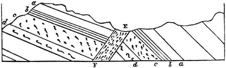
E F, fault or fissure filled with rubbish, on each
side of which the shifted strata are not parallel.
In Coalbrook Dale, says Mr. Prestwich[62-B], deposits of sandstone, shale,
and coal, several thousand feet thick, and occupying an area of many miles,
have been shivered into fragments, and the broken remnants have been placed
in very discordant positions, often at levels differing several hundred
feet from each other. The sides of the faults, when perpendicular, are
commonly separated several yards, but are sometimes as much as 50 yards
asunder, the interval being filled with broken débris of the strata. In
following the course of [p.63]the same fault it is sometimes found to
produce in different places very unequal changes of level, the amount of
shift being in one place 300, and in another 700 feet, which arises, in
some cases, from the union of two or more faults. In other words, the
disjointed strata have in certain districts been subjected to renewed
movements, which they have not suffered elsewhere.
We may occasionally see exact counterparts of these slips, on a small
scale, in pits of fine loose sand and gravel, many of which have doubtless
been caused by the drying and shrinking of argillaceous and other beds,
slight subsidences having taken place from failure of support. Sometimes,
however, even these small slips may have been produced during earthquakes;
for land has been moved, and its level, relatively to the sea, considerably
altered, within the period when much of the alluvial sand and gravel now
covering the surface of continents was deposited.
I have already stated that a geologist must be on his guard, in a region of
disturbed strata, against inferring repeated alternations of rocks, when,
in fact, the same strata, once continuous, have been bent round so as to
recur in the same section, and with the same dip. A similar mistake has
often been occasioned by a series of faults.
Fig. 87.

Apparent alternations of strata caused by vertical
faults.
If, for example, the dark line A H (fig. 87.) represent the surface of a
country on which the strata a b c frequently crop out, an observer, who
is proceeding from H to A, might at first imagine that at every step he was
approaching new strata, whereas the repetition of the same beds has been
caused by vertical faults, or downthrows. Thus, suppose the original mass,
A, B, C, D, to have been a set of uniformly inclined strata, and that the
different masses under E F, F G, and G D, sank down successively, so as to
leave vacant the spaces marked in the diagram by dotted lines, and to
occupy those marked by the continuous lines, then let denudation take place
along the line A H, so that the protruding masses indicated by the fainter
lines are swept away,—a miner, who has not discovered the faults, finding
the mass a, which we will suppose to be a bed of coal four times
repeated, might hope to find four beds, workable to an indefinite depth,
but first on arriving at the fault G he is stopped suddenly in his
workings, [p.64]upon reaching the strata of sandstone c, or on
arriving at the line of fault F he comes partly upon the shale b, and
partly on the sandstone c, and on reaching E he is again stopped by a
wall composed of the rock d.
Fig. 88.
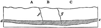
The very different levels at which the separated parts of the same strata
are found on the different sides of the fissure, in some faults, is truly
astonishing. One of the most celebrated in England is that called the
"ninety-fathom dike," in the coal-field of Newcastle. This name has been
given to it, because the same beds are ninety fathoms lower on the northern
than they are on the southern side. The fissure has been filled by a body
of sand, which is now in the state of sandstone, and is called the dike,
which is sometimes very narrow, but in other places more than twenty yards
wide.[64-A] The walls of the fissure are scored by grooves, such as would
have been produced if the broken ends of the rock had been rubbed along the
plane of the fault.[64-B] In the Tynedale and Craven faults, in the north
of England, the vertical displacement is still greater, and has extended in
a horizontal direction for a distance of thirty miles or more. Some
geologists consider it necessary to imagine that the upward or downward
movement in these cases was accomplished at a single stroke, and not by a
series of sudden but interrupted movements. This idea appears to have been
derived from a notion that the grooved walls have merely been rubbed in one
direction. But this is so far from being a constant phenomenon in faults,
that it has often been objected to the received theory respecting those
polished surfaces called "slickensides" (see above, p. 61.), that the striæ
are not always parallel, but often curved and irregular. It has, moreover,
been remarked, that not only the walls of the fissure or fault, but its
earthy contents, sometimes present the same polished and striated faces.
Now these facts seem to indicate partial changes in the direction of the
movement, and some slidings subsequent to the first filling up of the
fissure. Suppose the mass of rock A, B, C, to overlie an extensive chasm d
e, formed at the depth of several miles, whether by the gradual
contraction in bulk of a melted mass passing into a solid or crystalline
state, or the shrinking of argillaceous strata, baked by a moderate heat,
or by the subtraction of matter by volcanic action, or any other cause.
Now, if this region be convulsed by earthquakes, the fissures f g, and
others at right angles to them, may sever the mass B from A and from C, so
that it may move freely, and begin to sink into the chasm. A fracture may
be conceived so clean and [p.65]perfect as to allow it to subside at
once to the bottom of the subterranean cavity; but it is far more probable
that the sinking will be effected at successive periods during different
earthquakes, the mass always continuing to slide in the same direction
along the planes of the fissures f g, and the edges of the falling mass
being continually more broken and triturated at each convulsion. If, as is
not improbable, the circumstances which have caused the failure of support
continue in operation, it may happen that when the mass B has filled the
cavity first formed, its foundations will again give way under it, so that
it will fall again in the same direction. But, if the direction should
change, the fact could not be discovered by observing the slickensides,
because the last scoring would efface the lines of previous friction. In
the present state of our ignorance of the causes of subsidence, an
hypothesis which can explain the great amount of displacement in some
faults, on sound mechanical principles, by a succession of movements, is
far preferable to any theory which assumes each fault to have been
accomplished by a single upcast or downthrow of several thousand feet. For
we know that there are operations now in progress, at great depths in the
interior of the earth, by which both large and small tracts of ground are
made to rise above and sink below their former level, some slowly and
insensibly, others suddenly and by starts, a few feet or yards at a time;
whereas there are no grounds for believing that, during the last 3000 years
at least, any regions have been either upheaved or depressed, at a single
stroke, to the amount of several hundred, much less several thousand feet.
When some of the ancient marine formations are described in the sequel, it
will appear that their structure and organic contents point to the
conclusion, that the floor of the ocean was slowly sinking at the time of
their origin. The downward movement was very gradual, and in Wales and the
contiguous parts of England a maximum thickness of 32,000 feet (more than
six miles) of Carboniferous, Devonian, and Silurian rock was formed, whilst
the bed of the sea was all the time continuously and tranquilly
subsiding.[65-A] Whatever may have been the changes which the solid
foundation underwent, whether accompanied by the melting, consolidation,
crystallization, or desiccation of subjacent mineral matter, it is clear
from the fact of the sea having remained shallow all the while that the
bottom never sank down suddenly to the depth of many hundred feet at once.
It is by assuming such reiterated variations of level, each separately of
small vertical amount, but multiplied by time till they acquire importance
in the aggregate, that we are able to explain the phenomena of denudation,
which will be treated of in the next chapter. By such movements every
portion of the surface of the land becomes in its turn a line of coast, and
is exposed to the action of the waves and tides. A country which is
undergoing such movement is never [p.66]allowed to settle into a state
of equilibrium, therefore the force of rivers and torrents to remove or
excavate soil and rocky masses is sustained in undiminished energy.
DENUDATION.
Denudation defined — Its amount equal to the entire mass of stratified
deposits in the earth's crust — Horizontal sandstone denuded in
Ross-shire — Levelled surface of countries in which great faults
occur — Coalbrook Dale — Denuding power of the ocean during the
emergence of land — Origin of Valleys — Obliteration of
sea-cliffs — Inland sea-cliffs and terraces in the Morea and
Sicily — Limestone pillars at St. Mihiel, in France — in Canada — in the
Bermudas.
Denudation, which has been occasionally spoken of in the preceding
chapters, is the removal of solid matter by water in motion, whether of
rivers or of the waves and currents of the sea, and the consequent laying
bare of some inferior rock. Geologists have perhaps been seldom in the
habit of reflecting that this operation has exerted an influence on the
structure of the earth's crust as universal and important as sedimentary
deposition itself; for denudation is the inseparable accompaniment of the
production of all new strata of mechanical origin. The formation of every
new deposit by the transport of sediment and pebbles necessarily implies
that there has been, somewhere else, a grinding down of rock into rounded
fragments, sand, or mud, equal in quantity to the new strata. All
deposition, therefore, except in the case of a shower of volcanic ashes, is
the sign of superficial waste going on contemporaneously, and to an equal
amount elsewhere. The gain at one point is no more than sufficient to
balance the loss at some other. Here a lake has grown shallower, there a
ravine has been deepened. The bed of the sea has in one region been raised
by the accumulation of new matter, in another its depth has been augmented
by the abstraction of an equal quantity.
When we see a stone building, we know that somewhere, far or near, a quarry
has been opened. The courses of stone in the building may be compared to
successive strata, the quarry to a ravine or valley which has suffered
denudation. As the strata, like the courses of hewn stone, have been laid
one upon another gradually, so the excavation both of the valley and quarry
have been gradual. To pursue the comparison still farther, the superficial
heaps of mud, sand, and gravel, usually called alluvium, may be likened to
the rubbish of a quarry which has been rejected as useless by the workmen,
or has fallen upon the road between the quarry and the building, so as to
lie scattered at random over the ground.
If, then, the entire mass of stratified deposits in the earth's crust is at
once the monument and measure of the denudation which has [p.67]taken
place, on how stupendous a scale ought we to find the signs of this removal
of transported materials in past ages! Accordingly, there are different
classes of phenomena, which attest in a most striking manner the vast
spaces left vacant by the erosive power of water. I may allude, first, to
those valleys on both sides of which the same strata are seen following
each other in the same order, and having the same mineral composition and
fossil contents. We may observe, for example, several formations, as Nos.
1, 2, 3, 4, in the accompanying diagram (fig. 89.); No. 1. conglomerate,
No. 2. clay, No. 3. grit, and No. 4. limestone, each repeated in a series
of hills separated by valleys varying in depth. When we examine the
subordinate parts of these four formations, we find, in like manner,
distinct beds in each, corresponding, on the opposite sides of the valleys,
both in composition and order of position. No one can doubt that the strata
were originally continuous, and that some cause has swept away the portions
which once connected the whole series. A torrent on the side of a mountain
produces similar interruptions; and when we make artificial cuts in
lowering roads, we expose, in like manner, corresponding beds on either
side. But in nature, these appearances occur in mountains several thousand
feet high, and separated by intervals of many miles or leagues in extent,
of which a grand exemplification is described by Dr. MacCulloch, on the
north-western coast of Ross-shire, in Scotland.[67-A] The fundamental rock
of that country is gneiss, in disturbed strata, on which beds of nearly
horizontal red sandstone rest unconformably. The latter are often very
thin, forming mere flags, with their surfaces, distinctly ripple-marked.
They end abruptly on the declivities of many insulated mountains, which
rise up at once to the height of about 2000 feet above the gneiss of the
surrounding plain or table land, and to an average elevation of about 3000
feet above the sea, which all their summits generally attain. The base of
gneiss varies in height, so that the lower portions of the sandstone occupy
different levels, and the thickness of the mass is various, sometimes
exceeding 3000 feet. It is impossible to compare these scattered and
detached portions without imagining that the whole country has once been
covered with a great body of sandstone, and that masses from 1000 to more
than 3000 feet in thickness have been removed.
Fig. 89.

Valleys of denudation. a. alluvium.
Fig. 90.

Denudation of red sandstone on north-west coast of
Ross-shire. (MacCulloch.)
In the "Survey of Great Britain" (vol. i.), Professor Ramsay [p.68]has
shown that the missing beds, removed from the summit of the Mendips, must
have been nearly a mile in thickness; and he has pointed out considerable
areas in South Wales and some of the adjacent counties of England, where a
series of palæozoic strata, not less than 11,000 feet in thickness, have
been stripped off. All these materials have of course been transported to
new regions, and have entered into the composition of more modern
formations. On the other hand, it is shown by observations in the same
"Survey," that the palæozoic strata are from 20,000 to 30,000 feet thick.
It is clear that such rocks, formed of mud and sand, now for the most part
consolidated, are the monuments of denuding operations, which took place on
a grand scale at a very remote period in the earth's history. For, whatever
has been given to one area must always have been borrowed from another; a
truth which, obvious as it may seem when thus stated, must be repeatedly
impressed on the student's mind, because in many geological speculations it
is taken for granted that the external crust of the earth has been always
growing thicker, in consequence of the accumulation, period after period,
of sedimentary matter, as if the new strata were not always produced at the
expense of pre-existing rocks, stratified or unstratified. By duly
reflecting on the fact, that all deposits of mechanical origin imply the
transportation from some other region, whether contiguous or remote, of an
equal amount of solid matter, we perceive that the stony exterior of the
planet must always have grown thinner in one place whenever, by accessions
of new strata, it was acquiring density in another. No doubt the vacant
space left by the missing rocks, after extensive denudation, is less
imposing to the imagination than a vast thickness of conglomerate or
sandstone, or the bodily presence as it were of a mountain-chain, with all
its inclined and curved strata. But the denuded tracts speak a clear and
emphatic language to our reason, and, like repeated layers of fossil
nummulites, corals or shells, or like numerous seams of coal, each based on
its under clay full of the roots of trees, still remaining in their natural
position, demand an indefinite lapse of time for their elaboration.
No one will maintain that the fossils entombed in these rocks did not
belong to many successive generations of plants and animals. In like
manner, each sedimentary deposit attests a slow and gradual action, and the
strata not only serve as a measure of the amount of denudation
simultaneously effected elsewhere, but are also a correct indication of the
rate at which the denuding operation was carried on.
Perhaps the most convincing evidence of denudation on a magnificent scale
is derived from the levelled surfaces of districts where large faults
occur. I have shown, in fig. 87. p. 63., and in fig. 91., how angular and
protruding masses of rock might naturally have been looked for on the
surface immediately above great faults, although in fact they rarely exist.
This phenomenon may be well studied in those districts where coal has been
extensively worked, for there the former relation of the beds which have
shifted their position [p.69]may be determined with great accuracy. Thus
in the coal field of Ashby de la Zouch, in Leicestershire (see fig. 91.), a
fault occurs, on one side of which the coal beds a b c d rise to the
height of 500 feet above the corresponding beds on the other side. But the
uplifted strata do not stand up 500 feet above the general surface; on the
contrary, the outline of the country, as expressed by the line z z, is
uniform and unbroken, and the mass indicated by the dotted outline must
have been washed away.[69-A] There are proofs of this kind in some level
countries, where dense masses of strata have been cleared away from areas
several hundred square miles in extent.
Fig. 91.
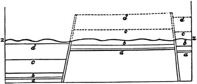
Faults and denuded coal strata, Ashby de la Zouch.
(Mammat.)
In the Newcastle coal district it is ascertained that faults occur in which
the upward or downward movement could not have been less than 140 fathoms,
which, had they affected equally the configuration of the surface to that
amount, would produce mountains with precipitous escarpments nearly 1000
feet high, or chasms of the like depth; yet is the actual level of the
country absolutely uniform—affording no trace whatever of subterranean
movements.[69-B]
The ground from which these materials have been removed is usually
overspread with heaps of sand and gravel, formed out of the ruins of the
very rocks which have disappeared. Thus, in the districts above referred
to, they consist of rounded and angular fragments of hard sandstone,
limestone, and ironstone, with a small quantity of the more destructible
shale, and even rounded pieces of coal.
Allusion has been already made to the shattered state and discordant
position of the carboniferous strata in Coalbrook Dale (p. 62.). The
collier cannot proceed three or four yards without meeting with small
slips, and from time to time he encounters faults of considerable
magnitude, which have thrown the rocks up or down several hundred feet. Yet
the superficial inequalities to which these dislocated masses originally
gave rise are no longer discernible, and the comparative flatness of the
existing surface can only be explained, as Mr. Prestwich has observed, by
supposing the fractured portions to have been removed by water. It is also
clear that strata of red sandstone, more than 1000 feet thick, which once
covered the coal, in the same region, have been carried away from [p.70]
large areas. That water has, in this case, been the denuding agent, we may
infer from the fact that the rocks have yielded according to their
different degrees of hardness; the hard trap of the Wrekin, for example,
and other hills, having resisted more than the softer shale and sandstone,
so as now to stand out in bold relief.[70-A]
Origin of valleys.—Many of the earlier geologists, and Dr. Hutton among
them, taught that "rivers have in general hollowed out their valleys." This
is true only of rivulets and torrents which are the feeders of the larger
streams, and which, descending over rapid slopes, are most subject to
temporary increase and diminution in the volume of their waters. The
quantity of mud, sand, and pebbles constituting many a modern delta proves
indisputably that no small part of the inequalities now existing on the
earth's surface are due to fluviatile action; but the principal valleys in
almost every great hydrographical basin in the world, are of a shape and
magnitude which imply that they have been due to other causes besides the
mere excavating power of rivers.
Some geologists have imagined that a deluge, or succession of deluges, may
have been the chief denuding agency, and they have speculated on a series
of enormous waves raised by the instantaneous upthrow of continents or
mountain chains out of the sea. But even were we disposed to grant such
sudden upheavals of the floor of the ocean, and to assume that great waves
would be the consequence of each convulsion, it is not easy to explain the
observed phenomena by the aid of so gratuitous an hypothesis.
On the other hand, a machinery of a totally different kind seems capable of
giving rise to effects of the required magnitude. It has now been
ascertained that the rising and sinking of extensive portions of the
earth's crust, whether insensibly or by a repetition of sudden shocks, is
part of the actual course of nature, and we may easily comprehend how the
land may have been exposed during these movements to abrasion by the waves
of the sea. In the same manner as a mountain mass may, in the course of
ages, be formed by sedimentary deposition, layer after layer, so masses
equally voluminous may in time waste away by inches; as, for example, if
beds of incoherent materials are raised slowly in an open sea where a
strong current prevails. It is well known that some of these oceanic
currents have a breadth of 200 miles, and that they sometimes run for a
thousand miles or more in one direction, retaining a considerable velocity
even at the depth of several hundred feet. Under these circumstances, the
flowing waters may have power to clear away each stratum of incoherent
materials as it rises and approaches the surface, where the waves exert the
greatest force; and in this manner a voluminous deposit may be entirely
swept away, so that, in the absence of faults, no evidence may remain of
the denuding operation. It may indeed be affirmed that the signs of waste
will usually be least obvious where the destruction has been [p.71]most
complete; for the annihilation may have proceeded so far, that no ruins are
left of the dilapidated rocks.
Although denudation has had a levelling influence on some countries of
shattered and disturbed strata (see fig. 87. p. 63. and fig. 91. p. 69.),
it has more commonly been the cause of superficial inequalities, especially
in regions of horizontal stratification. The general outline of these
regions is that of flat and level platforms, interrupted by valleys often
of considerable depth, and ramifying in various directions. These hollows
may once have formed bays and channels between islands, and the steepest
slope on the sides of each valley may have been a sea-cliff, which was
undermined for ages, as the land emerged gradually from the deep. We may
suppose the position and course of each valley to have been originally
determined by differences in the hardness of the rocks, and by rents and
joints which usually occur even in horizontal strata. In mountain chains,
such as the Jura before described (see fig. 71. p. 55.), we perceive at
once that the principal valleys have not been due to aqueous excavation,
but to those mechanical movements which have bent the rocks into their
present form. Yet even in the Jura there are many valleys, such as C (fig.
71.), which have been hollowed out by water; and it may be stated that in
every part of the globe the unevenness of the surface of the land has been
due to the combined influence of subterranean movements and denudation.
I may now recapitulate a few of the conclusions to which we have arrived:
first, all the mechanical strata have been accumulated gradually, and the
concomitant denudation has been no less gradual: secondly, the dry land
consists in great part of strata formed originally at the bottom of the
sea, and has been made to emerge and attain its present height by a force
acting from beneath: thirdly, no combination of causes has yet been
conceived so capable of producing extensive and gradual denudation, as the
action of the waves and currents of the ocean upon land slowly rising out
of the deep.
Now, if we adopt these conclusions, we shall naturally be led to look
everywhere for marks of the former residence of the sea upon the land,
especially near the coasts from which the last retreat of the waters took
place, and it will be found that such signs are not wanting.
I shall have occasion to speak of ancient sea-cliffs, now far inland, in
the south-east of England, when treating in Chapter XIX. of the denudation
of the chalk in Surrey, Kent, and Sussex. Lines of upraised sea-beaches of
more modern date are traced, at various levels from 20 to 100 feet and
upwards above the present sea-level, for great distances on the east and
west coasts of Scotland, as well as in Devonshire, and other counties in
England. These ancient beach-lines often form terraces of sand and gravel,
including littoral shells, some broken, others entire, and corresponding
with species now living on the adjoining coast. But it would be
unreasonable to expect to meet everywhere with the signs of ancient shores,
since no geologist can have failed to observe how soon all recent marks of
the [p.72]kind above alluded to are obscured or entirely effaced,
wherever, in consequence of the altered state of the tides and currents,
the sea has receded for a few centuries. We see the cliffs crumble down in
a few years if composed of sand or clay, and soon reduced to a gentle
slope. If there were shells on the beach they decompose, and their
materials are washed away, after which the sand and shingle may resemble
any other alluviums scattered over the interior.
Fig. 92.

Section of inland cliff at Abesse, near Dax.
- a. Sand of the Landes.
- b. Limestone.
- c. Clay.
The features of an ancient shore may sometimes be concealed by the growth
of trees and shrubs, or by a covering of blown sand, a good example of
which occurs a few miles west from Dax, near Bordeaux, in the south of
France. About twelve miles inland, a steep bank may be traced running in a
direction nearly north-east and south-west, or parallel to the contiguous
coast. This sudden fall of about 50 feet conducts us from the higher
platform of the Landes to a lower plain which extends to the sea. The
outline of the ground suggested to me, as it would do to every geologist,
the opinion that the bank in question was once a sea-cliff, when the whole
country stood at a lower level. But this is no longer matter of conjecture,
for, in making excavations in 1830 for the foundation of a building at
Abesse, a quantity of loose sand, which formed the slope d e, was
removed; and a perpendicular cliff, about 50 feet in height, which had
hitherto been protected from the agency of the elements, was exposed. At
the bottom appeared the limestone b, containing tertiary shells and
corals, immediately below it the clay c, and above it the usual tertiary
sand a, of the department of the Landes. At the base of the precipice
were seen large partially rounded masses of rock, evidently detached from
the stratum b. The face of the limestone was hollowed out and weathered
into such forms as are seen in the calcareous cliffs of the adjoining
coast, especially at Biaritz, near Bayonne. It is evident that, when the
country was at a somewhat lower level, the sea advanced along the surface
of the argillaceous stratum c, which, from its yielding nature, favoured
the waste by allowing the more solid superincumbent stone b to be readily
undermined. Afterwards, when the country had been elevated, part of the
sand, a, fell down, or was drifted by the winds, so as to form the talus,
d e, which masked the inland cliff until it was artificially laid open to
view.
When we are considering the various causes which, in the course of ages,
may efface the characters of an ancient sea-coast, earthquakes must not be
forgotten. During violent shocks, steep and overhanging cliffs are often
thrown down and become a heap of [p.73]ruins. Sometimes unequal
movements of upheaval or depression entirely destroy that horizontality of
the base-line which constitutes the chief peculiarity of an ancient
sea-cliff.
It is, however, in countries where hard limestone rocks abound, that inland
cliffs retain faithfully the characters which they acquired when they
constituted the boundary of land and sea. Thus, in the Morea, no less than
three, or even four, ranges of what were once sea-cliffs are well
preserved. These have been described, by MM. Boblaye and Virlet, as rising
one above the other at different distances from the actual shore, the
summit of the highest and oldest occasionally exceeding 1000 feet in
elevation. At the base of each there is usually a terrace, which is in some
places a few yards, in others above 300 yards wide, so that we are
conducted from the high land of the interior to the sea by a succession of
great steps. These inland cliffs are most perfect, and most exactly
resemble those now washed by the waves of the Mediterranean, where they are
formed of calcareous rock, especially if the rock be a hard crystalline
marble. The following are the points of correspondence observed between the
ancient coast lines and the borders of the present sea:—1. A range of
vertical precipices, with a terrace at their base. 2. A weathered state of
the surface of the naked rock, such as the spray of the sea produces. 3. A
line of littoral caverns at the foot of the cliffs. 4. A consolidated beach
or breccia with occasional marine shells, found at the base of the cliffs,
or in the caves. 5. Lithodomous perforations.
In regard to the first of these, it would be superfluous to dwell on the
evidence afforded of the undermining power of waves and currents by
perpendicular precipices. The littoral caves, also, will be familiar to
those who have had opportunities of observing the manner in which the waves
of the sea, when they beat against rocks, have power to scoop out caverns.
As to the breccia, it is composed of pieces of limestone and rolled
fragments of thick solid shell, such as Strombus and Spondylus, all
bound together by a crystalline calcareous cement. Similar aggregations are
now forming on the modern beaches of Greece, and in caverns on the
sea-side; and they are only distinguishable in character from those of more
ancient date, by including many pieces of pottery. In regard to the
lithodomi above alluded to, these bivalve mollusks are well known to have
the power of excavating holes in the hardest limestones, the size of the
cavity keeping pace with the growth of the shell. When living they require
to be always covered by salt water, but similar pear-shaped hollows,
containing the dead shells of these creatures, are found at different
heights on the face of the inland cliffs above mentioned. Thus, for
example, they have been observed near Modon and Navarino on cliffs in the
interior 125 feet high above the Mediterranean. As to the weathered surface
of the calcareous rocks, all limestones are known to suffer chemical
decomposition when moistened by the spray of the salt water, and are
corroded still more deeply at points lower down where they are just reached
by the breakers. By this action the stone acquires a wrinkled and furrowed
outline, and [p.74]very near the sea it becomes rough and branching, as
if covered with corals. Such effects are traced not only on the present
shore, but at the base of the ancient cliffs far in the interior. Lastly,
it remains only to speak of the terraces, which extend with a gentle slope
from the base of almost all the inland cliffs, and are for the most part
narrow where the rock is hard, but sometimes half a mile or more in breadth
where it is soft. They are the effects of the encroachment of the ancient
sea upon the shore at those levels at which the land remained for a long
time stationary. The justness of this view is apparent on examining the
shape of the modern shore wherever the sea is advancing upon the land, and
removing annually small portions of undermined rock. By this agency a
submarine platform is produced on which we may walk for some distance from
the beach in shallow water, the increase of depth being very gradual, until
we reach a point where the bottom plunges down suddenly. This platform is
widened with more or less rapidity according to the hardness of the rocks,
and when upraised it constitutes an inland terrace.
But the four principal lines of cliff observed in the Morea do not imply,
as some have imagined, four great eras of sudden upheaval; they simply
indicate the intermittence of the upheaving force. Had the rise of the land
been continuous and uninterrupted, there would have been no one prominent
line of cliff; for every portion of the surface having been, in its turn,
and for an equal period of time, a sea-shore, would have presented a nearly
similar aspect. But if pauses occur in the process of upheaval, the waves
and currents have time to sap, throw down, and clear away considerable
masses of rock, and to shape out at certain levels lofty ranges of cliffs
with broad terraces at their base.
There are some levelled spaces, however, both ancient and modern, in the
Morea, which are not due to denudation, although resembling in outline the
terraces above described. They may be called Terraces of Deposition, since
they have resulted from the gain of land upon the sea where rivers and
torrents have produced deltas. If the sedimentary matter has filled up a
bay or gulf surrounded by steep mountains, a flat plain is formed skirting
the inland precipices; and if these deposits are upraised, they form a
feature in the landscape very similar to the areas of denudation before
described.
In the island of Sicily I have examined many inland cliffs like those of
the Morea; as, for example, near Palermo, where a precipice is seen
consisting of limestone at the base of which are numerous caves. One of
these called San Ciro, about 2 miles distant from Palermo, is about 20 feet
high, 10 wide, and 180 above the sea. Within it is found an ancient beach
(b, fig. 93.), formed of pebbles of various rocks, many of which must
have come from places far remote. Broken pieces of coral and shell,
especially of oysters and pectens, are seen intermingled with the pebbles.
Immediately above the level of this beach, serpulæ are still found
adhering to the face of the rock, and the limestone is perforated by
lithodomi. Within the grotto, also, at the same level, similar
perforations occur; and so [p.75]numerous are the holes, that the rock
is compared by Hoffmann to a target pierced by musket balls. But in order
to expose to view these marks of boring-shells in the interior of the cave,
it was necessary first to remove a mass of breccia, which consisted of
numerous fragments of rock and an immense quantity of bones of the mammoth,
hippopotamus, and other quadrupeds, imbedded in a dark brown calcareous
marl. Many of the bones were rolled as if partially subjected to the action
of the waves. Below this breccia, which is about 20 feet thick, was found a
bed of sand filled with sea-shells of recent species; and underneath the
sand, again, is the secondary limestone of Monte Grifone. The state of the
surface of the limestone in the cave above the level of the marine sand is
very different from that below it. Above, the rock is jagged and uneven,
as is usual in the roofs and sides of limestone caverns; below, the
surface is smooth and polished, as if by the attrition of the waves.
Fig. 93.

- a. Monte Grifone.
- b. Cave of San Ciro.[75-A]
- c. Plain of Palermo, in which are Newer Pliocene strata of
limestone and sand.
- d. Bay of Palermo.
The platform indicated at c, fig. 93., is formed by a tertiary deposit
containing marine shells almost all of living species, and it affords an
illustration of the terrace of deposition, or the last of the two kinds
before mentioned (p. 74.).
There are also numerous instances in Sicily of terraces of denudation. One
of these occurs on the east coast to the north of Syracuse, and the same is
resumed to the south beyond the town of Noto, where it may be traced
forming a continuous and lofty precipice, a b, fig. 94., facing towards
the sea, and constituting the abrupt termination of a calcareous formation,
which extends in horizontal strata far inland. This precipice varies in
height from 500 to 700 feet, and between its base and the sea is an
inferior platform, c b, consisting of similar white limestone. All the
beds dip towards the sea, but are usually inclined at a very slight angle:
they are seen to extend uninterruptedly from the base of the escarpment
into the platform, showing distinctly that the lofty cliff was not produced
by a fault or vertical shift of the beds, but by the removal of a
considerable mass of rock. Hence we may conclude that the sea, which is now
undermining the cliffs of [p.76]the Sicilian coast, reached at some
former period the base of the precipice a b, at which time the surface of
the terrace c b must have been covered by the Mediterranean. There was a
pause, therefore, in the upward movement, when the waves of the sea had
time to carve out the platform c b; but there may have been many other
stationary periods of minor duration. Suppose, for example, that a series
of escarpments e, f, g, h, once existed, and that the sea, during a
long interval free from subterranean movements, advances along the line c
b, all preceding cliffs must have been swept away one after the other, and
reduced to the single precipice a b.
Fig. 94.

Fig. 95.

Valley called Gozzo degli Martiri, below Melilli,
Val di Noto.
That such a series of smaller cliffs, as those represented at e, f,
g, h, fig. 94., did really once exist at intermediate heights in place
of the single precipice a b, is rendered highly probable by the fact,
that in certain bays and inland valleys opening towards the east coast of
Sicily, and not far from the section given in fig. 94., the solid limestone
is shaped out into a great succession of ledges, separated from each other
by small vertical cliffs. These are sometimes so numerous, one above the
other, that where there is a bend at the head of a valley, they produce an
effect singularly resembling the seats of a [p.77]Roman amphitheatre. A
good example of this configuration occurs near the town of Melilli, as seen
in the annexed view (fig. 95.). In the south of the island, near
Spaccaforno, Scicli, and Modica, precipitous rocks of white limestone,
ascending to the height of 500 feet, have been carved out into similar
forms.
Fig. 96.

This appearance of a range of marble seats circling round the head of a
valley, or of great flights of steps descending from the top to the bottom,
on the opposite sides of a gorge, may be accounted for, as already hinted,
by supposing the sea to have stood successively at many different levels,
as at a a, b b, c c, in the accompanying fig. 96. But the causes of
the gradual contraction of the valley from above downwards may still be
matter of speculation. Such contraction may be due to the greater force
exerted by the waves when the land at its first emergence was smaller in
quantity, and more exposed to denudation in an open sea; whereas the wear
and tear of the rocks might diminish in proportion as this action became
confined within bays or channels closed in on two or three sides. Or,
secondly, the separate movements of elevation may have followed each other
more rapidly as the land continued to rise, so that the times of those
pauses, during which the greatest denudation was accomplished at certain
levels, were always growing shorter. It should be remarked, that the cliffs
and small terraces are rarely found on the opposite sides of the Sicilian
valleys at heights so precisely answering to each other as those given in
fig. 96., and this might have been expected, to whichever of the two
hypotheses above explained we incline; for, according to the direction of
the prevailing winds and currents, the waves may beat with unequal force on
different parts of the shore, so that while no impression is made on one
side of a bay, the sea may encroach so far on the other as to unite several
smaller cliffs into one.
Before quitting the subject of ancient sea-cliffs, carved out of limestone,
I shall mention the range of precipitous rocks, composed of a white marble
of the Oolitic period, which I have seen near the northern gate of St.
Mihiel in France. They are situated on the right bank of the Meuse, at a
distance of 200 miles from the nearest sea, and they present on the
precipice facing the river three or four horizontal grooves, one above the
other, precisely resembling those which are scooped out by the undermining
waves. The summits of several of these masses are detached from the
adjoining hill, in which case the grooves pass all round them, facing
towards all points [p.78]of the compass, as if they had once formed
rocky islets near the shore.[78-A]
Captain Bayfield, in his survey of the Gulf of St. Lawrence, discovered in
several places, especially in the Mingan islands, a counterpart of the
inland cliffs of St. Mihiel, and traced a succession of shingle beaches,
one above the other, which agreed in their level with some of the principal
grooves scooped out of the limestone pillars. These beaches consisted of
calcareous shingle, with shells of recent species, the farthest from the
shore being 60 feet above the level of the highest tides. In addition to
the drawings of the pillars called the flower-pots, which he has
published[78-B], I have been favoured with other views of rocks on the same
coast, drawn by Lieut. A. Bowen, R. N. (See fig. 97.)
Fig. 97.
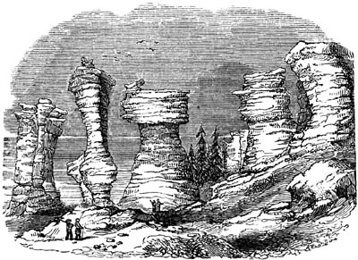
Limestone columns in Niapisca Island, in the Gulf
of St. Lawrence. Height of the second column on the left, 60 feet.
In the North-American beaches above mentioned rounded fragments of
limestone have been found perforated by lithodomi; and holes drilled by
the same mollusks have been detected in the columnar rocks or
"flower-pots," showing that there has been no great amount of atmospheric
decomposition on the surface, or the cavities alluded to would have
disappeared.
Fig. 98
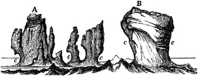
The North Rocks, Bermuda, lying outside the great
coral reef. A. 16 feet high, and B. 12 feet. c. c. Hollows worn by the
sea.
We have an opportunity of seeing in the Bermuda islands the [p.79]manner
in which the waves of the Atlantic have worn, and are now wearing out, deep
smooth hollows on every side of projecting masses of hard limestone. In the
annexed drawing, communicated to me by Lieut. Nelson, the excavations c,
c, c, have been scooped out by the waves in a stone of very modern
date, which, although extremely hard, is full of recent corals and shells,
some of which retain their colour.
When the forms of these horizontal grooves, of which the surface is
sometimes smooth and almost polished, and the roofs of which often overhang
to the extent of 5 feet or more, have been carefully studied by geologists,
they will serve to testify the former action of the waves at innumerable
points far in the interior of the continents. But we must learn to
distinguish the indentations due to the original action of the sea, and
those caused by subsequent chemical decomposition of calcareous rocks, to
which they are liable in the atmosphere.
Notwithstanding the enduring nature of the marks left by littoral action on
calcareous rocks, we can by no means detect sea-beaches and inland cliffs
everywhere, even in Sicily and the Morea. On the contrary, they are, upon
the whole, extremely partial, and are often entirely wanting in districts
composed of argillaceous and sandy formations, which must, nevertheless,
have been upheaved at the same time, and by the same intermittent
movements, as the adjoining calcareous rocks.
CHAPTER VII.
ALLUVIUM.
Alluvium described — Due to complicated causes — Of various ages, as
shown in Auvergne — How distinguished from rocks in
situ — River-terraces — Parallel roads of Glen Roy — Various theories
respecting their origin.
Between the superficial covering of vegetable mould and the subjacent rock
there usually intervenes in every district a deposit of loose gravel, sand,
and mud, to which the name of alluvium has been applied. The term is
derived from alluvio, an inundation, or alluo, to wash, because the
pebbles and sand commonly resemble those of a river's bed or the mud and
gravel spread over low lands by a flood.
A partial covering of such alluvium is found alike in all climates, from
the equatorial to the polar regions; but in the higher latitudes of Europe
and North America it assumes a distinct character, being very frequently
devoid of stratification, and containing huge fragments of rock, some
angular and others rounded, which have been transported to great distances
from their parent mountains. When [p.80]it presents itself in this form,
it has been called "diluvium," "drift," or the "boulder formation;" and its
probable connexion with the agency of floating ice and glaciers will be
treated of more particularly in the eleventh and twelfth chapters.
Fig. 99.

Lavas of Auvergne resting on alluviums of different
ages.
The student will be prepared, by what I have said in the last chapter on
denudation, to hear that loose gravel and sand are often met with, not only
on the low grounds bordering rivers, but also at various points on the
sides or even summits of mountains. For, in the course of those changes in
physical geography which may take place during the gradual emergence of the
bottom of the sea and its conversion into dry land, any spot may either
have been a sunken reef, or a bay, or estuary, or sea-shore, or the bed of
a river. For this reason it would be unreasonable to hope that we should
ever be able to account for all the alluvial phenomena of each particular
country, seeing that the causes of their origin are so complicated.
Moreover, the last operations of water have a tendency to disturb and
confound together all pre-existing alluviums. Hence we are always in danger
of regarding as the work of a single era, and the effect of one cause, what
has in reality been the result of a variety of distinct agents, during a
long succession of geological epochs. Much useful instruction may therefore
be gained from the exploration of a country like Auvergne, where the
superficial gravel of very different eras happens to have been preserved by
sheets of lava, which were poured out one after the other at periods when
the denudation, and probably the upheaval, of rocks were in progress. That
region had already acquired in some degree its present configuration before
any volcanos were in activity, and before any igneous matter was
superimposed upon the granitic and fossiliferous formations. The pebbles
therefore in the older gravels are exclusively constituted of granite and
other aboriginal rocks; and afterwards, when volcanic vents burst forth
into eruption, those earlier alluviums were covered by streams of lava,
which protected them from intermixture with gravel of subsequent date. In
the course of ages, a new system of valleys was excavated, so that the
rivers ran at lower levels than those at which the first alluviums and
sheets of lava were formed. When, therefore, fresh eruptions gave rise to
new lava, the melted matter was poured out over lower grounds; and the
gravel of these plains [p.81]differed from the first or upland alluvium,
by containing in it rounded fragments of various volcanic rocks, and often
bones belonging to distinct groups of land animals which flourished in the
country in succession.
The annexed drawing will explain the different heights at which beds of
lava and gravel, each distinct from the other in composition and age, are
observed, some on the flat tops of hills, 700 or 800 feet high, others on
the slope of the same hills, and the newest of all in the channel of the
existing river where there is usually gravel alone, but in some cases a
narrow stripe of solid lava sharing the bottom of the valley with the
river. In all these accumulations of transported matter of different ages
the bones of extinct quadrupeds have been found belonging to assemblages of
land mammalia which flourished in the country in succession, and which vary
specifically, the one from the other, in a greater or less degree, in
proportion as the time which separated their entombment has been more or
less protracted. The streams in the same district are still undermining
their banks and grinding down into pebbles or sand, columns of basalt and
fragments of granite and gneiss; but the older alluviums, with the fossil
remains belonging to them, are prevented from being mingled with the gravel
of recent date by the cappings of lava before mentioned. But for the
accidental interference, therefore, of this peculiar cause, all the
alluviums might have passed so insensibly the one into the other, that
those formed at the remotest era might have appeared of the same date as
the newest, and the whole formation might have been regarded by some
geologists as the result of one sudden and violent catastrophe.
In almost every country, the alluvium consists in its upper part of
transported materials, but it often passes downwards into a mass of broken
and angular fragments derived from the subjacent rock. To this mass the
provincial name of "rubble," or "brash," is given in many parts of England.
It may be referred to the weathering or disintegration of stone on the
spot, the effects of air and water, sun and frost, and chemical
decomposition.
Fig. 100.
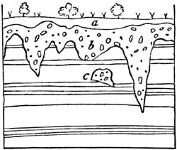
- a. Vegetable soil.
- b. Alluvium.
- c. Mass of same, apparently detached.
The inferior surface of alluvial deposits is often very irregular,
conforming to all the inequalities of the fundamental rocks (fig. 100.).
Occasionally, a small mass, as at c, appears detached, and as if included
in the subjacent formation. Such isolated portions are usually sections of
winding subterranean hollows filled up with alluvium. They may have been
the courses of springs or subterranean streamlets, which have flowed
through and enlarged natural rents; or, when on a small scale and in soft
strata, they may be spaces which the roots of large trees have once
occupied, gravel and sand having been introduced after their decay.
[p.82]
Fig. 101.
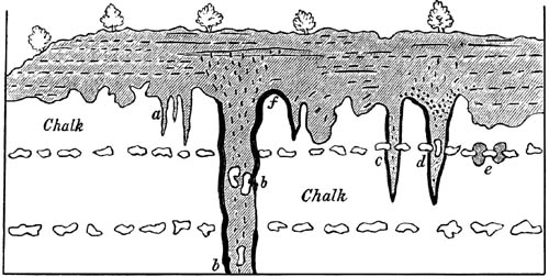
Sand-pipes in the chalk at Eaton, near
Norwich.
But there are other deep hollows of a cylindrical form found in England,
France, and elsewhere, penetrating the white chalk, and filled with sand
and gravel, which are not so readily explained. They are sometimes called
"sand-pipes," or "sand-galls," and "puits naturels," in France. Those
represented in the annexed cut were observed by me in 1839, laid open in a
large chalk-pit near Norwich. They were of very symmetrical form, the
largest more than 12 feet in diameter, and some of them had been traced, by
boring, to the depth of more than 60 feet. The smaller ones varied from a
few inches to a foot in diameter, and seldom descended more than 12 feet
below the surface. Even where three of them occurred, as at a, fig. 101.,
very close together, the parting walls of soft white chalk were not broken
through. They all taper downwards and end in a point. As a general rule,
sand and pebbles occupy the central parts of each pipe, while the sides and
bottom are lined with clay.
Mr. Trimmer, in speaking of appearances of the same kind in the Kentish
chalk, attributes the origin of such "sand-galls" to the action of the sea
on a beach or shoal, where the waves, charged with shingle and sand, not
only wear out longitudinal furrows, such as may be observed on the surface
of the chalk near Norwich when the incumbent gravel is removed, but also
drill deep circular hollows by the rotatory motion imparted to sand and
pebbles. Such furrows, as well as vertical cavities, are now formed, he
observes, on the coast where the shores are composed of chalk.[82-A]
That the commencement of many of the tubular cavities now under
consideration has been due to the cause here assigned, I have little doubt.
But such mechanical action could not have hollowed out the whole of the
sand-pipes c and d, fig. 101., because several large chalk-flints seen
protruding from the walls of the pipes have not been eroded, while sand and
gravel have penetrated many feet below them. In other cases, as at b b,
similar unrounded nodules of flint, still preserving their irregular form
and white coating, are found at [p.83]various depths in the midst of the
loose materials filling the pipe. These have evidently been detached from
regular layers of flints occurring above. It is also to be remarked that
the course of the same sand-pipe, b b, is traceable above the level of
the chalk for some distance upwards, through the incumbent gravel and sand,
by the obliteration of all signs of stratification. Occasionally, also, as
in the pipe d, the overlying beds of gravel bend downwards into the mouth
of the pipe, so as to become in part vertical, as would happen if
horizontal layers had sunk gradually in consequence of a failure of
support. All these phenomena may be accounted for by attributing the
enlargement and deepening of the sand-pipes to the chemical action of water
charged with carbonic acid, derived from the vegetable soil and the
decaying roots of trees. Such acid might corrode the chalk, and deepen
indefinitely any previously existing hollow, but could not dissolve the
flints. The water, after it had become saturated with carbonate of lime,
might freely percolate the surrounding porous walls of chalk, and escape
through them and from the bottom of the tube, so as to carry away in the
course of time large masses of dissolved calcareous rock[83-A], and leave
behind it on the edges of each tubular hollow a coating of fine clay, which
the white chalk contains.
I have seen tubes precisely similar and from 1 to 5 feet in diameter
traversing vertically the upper half of the soft calcareous building stone,
or chalk without flints, constituting St. Peter's Mount, Maestricht. These
hollows are filled with pebbles and clay, derived from overlying beds of
gravel, and all terminate downwards like those of Norfolk. I was informed
that, 6 miles from Maestricht, one of these pipes, 2 feet in diameter, was
traced downwards to a bed of flattened flints, forming an almost continuous
layer in the chalk. Here it terminated abruptly, but a few small root-like
prolongations of it were detected immediately below, probably where the
dissolving substance had penetrated at some points through openings in the
siliceous mass.
It is not so easy as may at first appear to draw a clear line of
distinction between the fixed rocks, or regular strata (rocks in situ
or in place), and alluvium. If the bed of a torrent or river be dried
up, we call the gravel, sand, and mud left in their channels, or whatever,
during floods, they may have scattered over the neighbouring plains,
alluvium. The very same materials carried into a lake, where they become
sorted by water and arranged in more distinct layers, especially if they
inclose the remains of plants, shells, or other fossils, are termed regular
strata.
In like manner we may sometimes compare the gravel, sand, and broken
shells, strewed along the path of a rapid marine current, with a deposit
formed contemporaneously by the discharge of similar materials, year after
year, into a deeper and more tranquil part of the sea. In such cases, when
we detect marine shells or other organic remains entombed in the strata,
which enable us to determine their [p.84]age and mode of origin, we
regard them as part of the regular series of fossiliferous formations,
whereas, if there are no fossils, we have frequently no power of separating
them from the general mass of superficial alluvium.
The usual rarity of organic remains in beds of loose gravel and sand is
partly owing to the rapid and turbid water in which they were formed having
been in a condition unfavourable to the habitation of aquatic beings, and
partly to their porous nature, which, by allowing the free percolation of
rain-water, has promoted the decomposition and removal of organic matter.
It has long been a matter of common observation that most rivers are now
cutting their channels through alluvial deposits of greater depth and
extent than could ever have been formed by the present streams. From this
fact a rash inference has sometimes been drawn, that rivers in general have
grown smaller, or become less liable to be flooded than formerly. But such
phenomena would be a natural result of any considerable oscillations in the
level of the land experienced since the existing valleys originated.
Suppose part of a continent, comprising within it a large hydrographical
basin like that of the Mississippi, to subside several inches or feet in a
century, as the west coast of Greenland, extending 600 miles north and
south, has been sinking for three or four centuries, between the latitudes
60° and 69° N.[84-A] There might be no encroachment of the sea at the
river's mouth in consequence of this change of level, but the fall of the
waters flowing from the interior being lessened, the main river and its
tributaries would have less power to carry down to its delta, and to
discharge into the ocean, the sedimentary matter with which they are
annually loaded. They would all begin to raise their channels and alluvial
plains by depositing in them the heavier sand and pebbles washed down from
the upland country, and this operation would take place most effectively if
the amount of subsidence in the interior was unequal, and especially if, on
the whole, it exceeded that of the region near the sea. If then the same
area of land be again upheaved to its former height, the fall, and
consequently the velocity, of every river would begin to augment. Each of
them would be less given to overflow its alluvial plain; and their power of
carrying earthy matter seaward, and of scouring out and deepening their
channels, would continue till, after a lapse of many thousand years, each
of them would have eroded a new channel or valley through a fluviatile
formation of modern date. The surface of what was once the river-plain at
the period of greatest depression, would remain fringing the valley sides
in the form of a terrace apparently flat, but in reality sloping down with
the general inclination of the river. Everywhere this terrace would present
cliffs of gravel and sand, facing the river. That such a series of
movements has actually taken place in the main valley of the Mississippi
and in its tributary valleys during oscillations of level, [p.85]I have
endeavoured to show in my description of that country[85-A]; and the
freshwater shells of existing species and bones of land quadrupeds, partly
of extinct races preserved in the terraces of fluviatile origin, attest the
exclusion of the sea during the whole process of filling up and partial
re-excavation.
In many cases, the alluvium in which rivers are now cutting their channels,
originated when the land first rose out of the sea. If, for example, the
emergence was caused by a gradual and uniform motion, every bay and
estuary, or the straits between islands, would dry up slowly, and during
their conversion into valleys, every part of the upheaved area would in its
turn be a sea-shore, and might be strewed over with littoral sand and
pebbles, or each spot might be the point where a delta accumulated during
the retreat and exclusion of the sea. Materials so accumulated would
conform to the general slope of a valley from its head to the sea-coast.
River terraces.—We often observe at a short distance from the present
bed of a river a steep cliff a few feet or yards high, and on a level with
the top of it a flat terrace corresponding in appearance to the alluvial
plain which immediately borders the river. This terrace is again bounded by
another cliff, above which a second terrace sometimes occurs: and in this
manner two or three ranges of cliffs and terraces are occasionally seen on
one or both sides of the stream, the number varying, but those on the
opposite sides often corresponding in height.
Fig. 102.

River Terraces and Parallel Roads.
These terraces are seldom continuous for great distances, and their surface
slopes downwards, with an inclination similar to that of the river. They
are readily explained if we adopt the hypothesis before suggested, of a
gradual rise of the land; especially if, while rivers are shaping out their
beds, the upheaving movement be intermittent, so that long pauses shall
occur, during which the stream will have time to encroach upon one of its
banks, so as to clear away and flatten a large space. This operation being
afterwards repeated at lower levels, there will be several successive
cliffs and terraces.
[p.86]Parallel roads.—The parallel shelves, or roads, as they have
been called, of Lochaber or Glen Roy and other contiguous valleys in
Scotland, are distinct both in character and origin from the terraces above
described; for they have no slope towards the sea like the channel of a
river, nor are they the effect of denudation. Glen Roy is situated in the
western Highlands, about ten miles north of Fort William, near the western
end of the great glen of Scotland, or Caledonian Canal, and near the foot
of the highest of the Grampians, Ben Nevis. Throughout its whole length, a
distance of more than ten miles, two, and in its lower part three, parallel
roads or shelves are traced along the steep sides of the mountains, as
represented in the annexed figure, fig. 102., each maintaining a perfect
horizontality, and continuing at exactly the same level on the opposite
sides of the glen. Seen at a distance, they appear like ledges or roads,
cut artificially out of the sides of the hills; but when we are upon them
we can scarcely recognize their existence, so uneven is their surface, and
so covered with boulders. They are from 10 to 60 feet broad, and merely
differ from the side of the mountain by being somewhat less steep.
On closer inspection, we find that these terraces are stratified in the
ordinary manner of alluvial or littoral deposits, as may be seen at those
points where ravines have been excavated by torrents. The parallel shelves,
therefore, have not been caused by denudation, but by the deposition of
detritus, precisely similar to that which is dispersed in smaller
quantities over the declivities of the hills above. These hills consist of
clay-slate, mica-schist, and granite, which rocks have been worn away and
laid bare at a few points only, in a line just above the parallel roads.
The highest of these roads is about 1250 feet above the level of the sea,
the next about 200 feet lower than the uppermost, and the third still lower
by about 50 feet. It is only this last, or the lowest of the three, which
is continued throughout Glen Spean, a large valley with which Glen Roy
unites. As the shelves are always at the same height above the sea, they
become continually more elevated above the river in proportion as we
descend each valley; and they at length terminate very abruptly, without
any obvious cause, either in the shape of the ground, or any change in the
composition or hardness of the rocks. I should exceed the limits of this
work, were I to attempt to give a full description of all the geographical
circumstances attending these singular terraces, or to discuss the
ingenious theories which have been severally proposed to account for them
by Dr. MacCulloch, Sir T. D. Lauder, and Messrs. Darwin, Agassiz, Milne,
and Chambers. There is one point, however, on which all are agreed, namely,
that these shelves are ancient beaches, or littoral formations accumulated
round the edges of one or more sheets of water which once stood at the
level, first of the highest shelf, and successively at the height of the
two others. It is well known, that wherever a lake or marine fiord exists
surrounded by steep mountains subject to disintegration by frost or the
action of torrents, some loose matter is washed down annually, especially
[p.87]during the melting of snow, and a check is given to the descent of
this detritus at the point where it reaches the waters of the lake. The
waves then spread out the materials along the shore, and throw some of them
upon the beach; their dispersing power being aided by the ice, which often
adheres to pebbles during the winter months, and gives buoyancy to them.
The annexed diagram illustrates the manner in which Dr. MacCulloch and Mr.
Darwin suppose "the roads" to constitute mere indentations in a superficial
alluvial coating which rests upon the hillside, and consists chiefly of
clay and sharp unrounded stones.
Fig. 103.
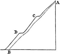
A B. Supposed original surface of rock.
C D. Roads or shelves in the outer alluvial covering of the hill.
Among other proofs that the parallel roads have really been formed along
the margin of a sheet of water, it may be mentioned, that wherever an
isolated hill rises in the middle of the glen above the level of any
particular shelf, a corresponding shelf is seen at the same level passing
round the hill, as would have happened if it had once formed an island in a
lake or fiord. Another very remarkable peculiarity in these terraces is
this; each of them comes in some portion of its course to a col, or
passage between the heads of glens, the explanation of which will be
considered in the sequel.
Those writers who first advocated the doctrine that the roads were the
ancient beaches of freshwater lakes, were unable to offer any probable
hypothesis respecting the formation and subsequent removal of barriers of
sufficient height and solidity to dam up the water. To introduce any
violent convulsion for their removal was inconsistent with the
uninterrupted horizontality of the roads, and with the undisturbed aspect
of those parts of the glens where the shelves come suddenly to an end. Mr.
Agassiz and Dr. Buckland, desirous, like the defenders of the lake theory,
to account for the limitation of the shelves to certain glens, and their
absence in contiguous glens, where the rocks are of the same composition,
and the slope and inclination of the ground very similar, started the
conjecture that these valleys were once blocked up by enormous glaciers
descending from Ben Nevis, giving rise to what are called in Switzerland
and in the Tyrol, glacier-lakes. After a time the icy barrier was broken
down, or melted, first, to the level of the second, and afterwards to that
of the third road or shelf.
In corroboration of this view, they contended that the alluvium of Glen
Roy, as well as of other parts of Scotland, agrees in character with the
moraines of glaciers seen in the Alpine valleys of Switzerland. Allusion
will be made in the eleventh chapter to the former existence of glaciers in
the Grampians: in the mean time it will readily be conceded that this
hypothesis is preferable to any previous lacustrine theory, by accounting
more easily for the temporary existence and entire disappearance of lofty
transverse barriers, although [p.88]the height required for the
imaginary dams of ice may be startling.
Before the idea last alluded to had been entertained, Mr. Darwin examined
Glen Roy, and came to the opinion that the shelves were formed when the
glens were still arms of the sea, and, consequently, that there never were
any barriers. According to him, the land emerged during a slow and uniform
upward movement, like that now experienced throughout a large part of
Sweden and Finland; but there were certain pauses in the upheaving process,
at which times the waters of the sea remained stationary for so many
centuries as to allow of the accumulation of an extraordinary quantity of
detrital matter, and the excavation, at points immediately above, of many
deep notches and bare cliffs in the hard and solid rock.
The phenomena which are most difficult to reconcile with this theory are,
first, the abrupt cessation of the roads at certain points in the different
glens; secondly, their unequal number in different valleys connecting with
each other, there being three, for example, in Glen Roy and only one in
Glen Spean; thirdly, the precise horizontality of level maintained by the
same shelf over a space many leagues in length requiring us to assume, that
during a rise of 1250 feet no one portion of the land was raised even a few
yards above another; fourthly, the coincidence of level already alluded to
of each shelf with a col, or the point forming the head of two glens,
from which the rain-waters flow in opposite directions. This last-mentioned
feature in the physical geography of Lochaber seems to have been explained
in a satisfactory manner by Mr. Darwin. He calls these cols
"landstraits," and regards them as having been anciently sounds or channels
between islands. He points out that there is a tendency in such sounds to
be silted up, and always the more so in proportion to their narrowness. In
a chart of the Falkland Islands by Capt. Sullivan, R. N., it appears that
there are several examples there of straits where the soundings diminish
regularly towards the narrowest part. One is so nearly dry that it can be
walked over at low water, and another, no longer covered by the sea, is
supposed to have recently dried up in consequence of a small shift in the
relative level of sea and land. "Similar straits," observes Mr. Chambers,
"hovering, in character, between sea and land, and which may be called
fords, are met with in the Hebrides. Such, for example, is the passage
dividing the islands of Lewis and Harris, and that between North Uist and
Benbecula, both of which would undoubtedly appear as cols, coinciding
with a terrace or raised beach, all round the islands, if the sea were to
subside."[88-A]
The precise horizontality of level maintained by the roads or shelves of
Lochaber over an area many leagues in length and breadth, is a difficulty
common in some degree to all the rival hypotheses, whether of lakes, or
glaciers, or of the simple upheaval of the land above the sea. For we
cannot suppose the roads to be more ancient than the glacial period, or the
era of the boulder formation of [p.89]Scotland, of which I shall speak
in the eleventh and twelfth chapters. Strata of that era of marine origin
containing northern shells of existing species have been found at various
heights in Scotland, some on the east, and others on the west coast, from
20 to 400 feet high; and in one region in Lanarkshire not less than 524
feet above high-water mark. It seems, therefore, in the highest degree
improbable that Glen Roy should have escaped entirely the upward movement
experienced in so many surrounding regions,—a movement implied by the
position of these marine deposits, in which the shells are almost all of
known recent species. But if the motion has really extended to Glen Roy and
the contiguous glens, it must have uplifted them bodily, without in the
slightest degree affecting their horizontality; and this being admitted,
the principal objection to the theory of marine beaches, founded on the
uniformity of upheaval, is removed, or is at least common to every theory
hitherto proposed.
To assume that the ocean has gone down from the level of the uppermost
shelf, or 1250 feet, simultaneously all over the globe, while the land
remained unmoved, is a view which will find favour with very few
geologists, for the reasons explained in the fifth chapter.
The student will perceive, from the above sketch of the controversy
respecting the formation of these curious shelves, that this problem, like
many others in geology, is as yet only solved in part; and that a larger
number of facts must be collected and reasoned upon before the question can
be finally settled.
CHAPTER VIII.
CHRONOLOGICAL CLASSIFICATION OF ROCKS.
Aqueous, plutonic, volcanic, and metamorphic rocks, considered
chronologically — Lehman's division into primitive and
secondary — Werner's addition of a transition class — Neptunian
theory — Hutton on igneous origin of granite — How the name of primary
was still retained for granite — The term "transition," why faulty — The
adherence to the old chronological nomenclature retarded the progress
of geology — New hypothesis invented to reconcile the igneous origin of
granite to the notion of its high antiquity — Explanation of the
chronological nomenclature adopted in this work, so far as regards
primary, secondary, and tertiary periods.
In the first chapter it was stated that the four great classes of rocks,
the aqueous, the volcanic, the plutonic, and the metamorphic, would each be
considered not only in reference to their mineral characters, and mode of
origin, but also to their relative age. The preservation of the shelves may
have required, says Darwin, the quick growth of green turf on a good soil;
their abrupt cessation may mark the place where the soil was barren, and
when a green sward formed slowly. In regard to the aqueous rocks, we have
already seen that they are stratified, that some are calcareous, others
argillaceous or siliceous, some made up of sand, others of pebbles; that
some contain freshwater, [p.90]others marine fossils, and so forth; but
the student has still to learn which rocks, exhibiting some or all of these
characters, have originated at one period of the earth's history, and which
at another.
To determine this point in reference to the fossiliferous formations is
more easy than in any other class, and it is therefore the most convenient
and natural method to begin by establishing a chronology for these
fossiliferous strata, and then to endeavour to refer to the same divisions,
the several groups of plutonic, volcanic, and metamorphic rocks. This
system of classification is not only recommended by its greater clearness
and facility of application, but is also best fitted to strike the
imagination by bringing into one view the past changes of the inorganic
world, and the contemporaneous revolutions of the organic creation. For the
sedimentary formations of successive periods are most readily distinguished
by the different species of fossil animals and plants which they inclose,
and of which one race after another has flourished and then disappeared
from the earth.
But before entering specially on the subdivisions of the aqueous rocks
arranged according to the order of time, it will be desirable to say a few
words on the chronology of rocks in general, although in doing so we shall
be unavoidably led to allude to some classes of phenomena which the
beginner must not yet expect fully to comprehend.
It was for many years a received opinion, that the formation of entire
families of rocks, such as the plutonic and those crystalline schists
spoken of in the first chapter as metamorphic, began and ended before any
members of the aqueous and volcanic orders were produced; and although this
idea has long been modified, and is nearly exploded, it will be necessary
to give some account of the ancient doctrine, in order that beginners may
understand whence many prevailing opinions, and some part of the
nomenclature of geology, still partially in use, was derived.
About the middle of the last century, Lehman, a German miner, proposed to
divide rocks into three classes, the first and oldest to be called
primitive, comprising the hypogene, or plutonic and metamorphic rocks; the
next to be termed secondary, comprehending the aqueous or fossiliferous
strata; and the remainder, or third class, corresponding to our alluvium,
ancient and modern, which he referred to "local floods, and the deluge of
Noah." In the primitive class, he said, such as granite and gneiss, there
are no organic remains, nor any signs of materials derived from the ruins
of pre-existing rocks. Their origin, therefore, may have been purely
chemical, antecedent to the creation of living beings, and probably coeval
with the birth of the world itself. The secondary formations, on the
contrary, which often contain sand, pebbles, and organic remains, must have
been mechanical deposits, produced after the planet had become the
habitation of animals and plants. This bold generalization, although
anticipated in some measure by Steno, a century before, in Italy, formed at
the time an important step in the progress of geology, and sketched out
correctly some of the leading divisions into which rocks may be separated.
About half a century later, Werner, so justly [p.91]celebrated for his
improved methods of discriminating the mineralogical characters of rocks,
attempted to improve Lehman's classification, and with this view
intercalated a class, called by him "the transition formations," between
the primitive and secondary. Between these last he had discovered, in
northern Germany, a series of strata, which in their mineral peculiarities
were of an intermediate character, partaking in some degree of the
crystalline nature of micaceous schist and clay-slate, and yet exhibiting
here and there signs of a mechanical origin and organic remains. For this
group, therefore, forming a passage between Lehman's primitive and
secondary rocks, the name of übergang or transition was proposed. They
consisted principally of clay-slate and an argillaceous sandstone, called
grauwacke, and partly of calcareous beds. It happened in the district which
Werner first investigated, that both the primitive and transition strata
were highly inclined, while the beds of the newer fossiliferous rocks, the
secondary of Lehman, were horizontal. To these latter, therefore, he gave
the name flötz, or "a level floor;" and every deposit more modern than
the chalk, which was classed as the uppermost of the flötz series, was
designated "the overflowed land," an expression which may be regarded as
equivalent to alluvium, although under this appellation were confounded all
the strata afterwards called tertiary, of which Werner had scarcely any
knowledge. As the followers of Werner soon discovered that the inclined
position of the "transition beds," and the horizontality of the flötz, or
newer fossiliferous strata, were mere local accidents, they soon abandoned
the term flötz; and the four divisions of the Wernerian school were then
named primitive, transition, secondary, and alluvial.
As to the trappean rocks, although their igneous origin had been already
demonstrated by Arduino, Fortis, Faujas, and others, and especially by
Desmarest, they were all regarded by Werner as aqueous, and as mere
subordinate members of the secondary series.[91-A]
This theory of Werner's was called the "Neptunian," and for many years
enjoyed much popularity. It assumed that the globe had been at first
invested by an universal chaotic ocean, holding the materials of all rocks
in solution. From the waters of this ocean, granite, gneiss, and other
crystalline formations, were first precipitated; and afterwards, when the
waters were purged of these ingredients, and more nearly resembled those of
our actual seas, the transition strata were deposited. These were of a
mixed character, not purely chemical, because the waves and currents had
already begun to wear down solid land, and to give rise to pebbles, sand,
and mud; nor entirely without fossils, because a few of the first marine
animals had begun to exist. After this period, the secondary formations
were accumulated in waters resembling those of the present ocean, except at
certain intervals, when, from causes wholly unexplained, a partial
recurrence of the "chaotic fluid" took place, during which various trap
rocks, some highly crystalline, were formed. This arbitrary hypothesis
rejected all intervention of igneous agency, volcanos being [p.92]
regarded as modern, partial, and superficial accidents, of trifling account
among the great causes which have modified the external structure of the
globe.
Meanwhile Hutton, a contemporary of Werner, began to teach, in Scotland,
that granite as well as trap was of igneous origin, and had at various
periods intruded itself in a fluid state into different parts of the
earth's crust. He recognized and faithfully described many of the phenomena
of granitic veins, and the alterations produced by them on the invaded
strata, which will be treated of in the thirty-second chapter. He,
moreover, advanced the opinion, that the crystalline strata called
primitive had not been precipitated from a primæval ocean, but were
sedimentary strata altered by heat. In his writings, therefore, and in
those of his illustrator, Playfair, we find the germ of that metamorphic
theory which has been already hinted at in the first chapter, and which
will be more fully expounded in the thirty-fourth and thirty-fifth
chapters.
At length, after much controversy, the doctrine of the igneous origin of
trap and granite made its way into general favour; but although it was, in
consequence, admitted that both granite and trap had been produced at many
successive periods, the term primitive or primary still continued to be
applied to the crystalline formations in general, whether stratified, like
gneiss, or unstratified, like granite. The pupil was told that granite was
a primary rock, but that some granites were newer than certain secondary
formations; and in conformity with the spirit of the ancient language, to
which the teacher was still determined to adhere, a desire was naturally
engendered of extenuating the importance of those more modern granites, the
true dates of which new observations were continually bringing to light.
A no less decided inclination was shown to persist in the use of the term
"transition," after it had been proved to be almost as faulty in its
original application as that of flötz. The name of transition, as already
stated, was first given by Werner, to designate a mineral character,
intermediate between the highly crystalline or metamorphic state and that
of an ordinary fossiliferous rock. But the term acquired also from the
first a chronological import, because it had been appropriated to
sedimentary formations, which, in the Hartz and other parts of Germany,
were more ancient than the oldest of the secondary series, and were
characterized by peculiar fossil zoophytes and shells. When, therefore,
geologists found in other districts stratified rocks occupying the same
position, and inclosing similar fossils, they gave to them also the name of
transition, according to rules which will be explained in the next
chapter; yet, in many cases, such rocks were found not to exhibit the same
mineral texture which Werner had called transition. On the contrary, many
of them were not more crystalline than different members of the secondary
class; while, on the other hand, these last were sometimes found to assume
a semi-crystalline and almost metamorphic aspect, and thus, on lithological
grounds, to deserve equally the name of transition. So remarkably was this
the case in [p.93]the Swiss Alps, that certain rocks, which had for
years been regarded by some of the most skilful disciples of Werner to be
transition, were at last acknowledged, when their relative position and
fossils were better understood, to belong to the newest of the secondary
groups; nay, some of them have actually been discovered to be members of
the lower tertiary series! If, under such circumstances, the name of
transition was retained, it is clear that it ought to have been applied
without reference to the age of strata, and simply as expressive of a
mineral peculiarity. The continued appropriation of the term to formations
of a given date, induced geologists to go on believing that the ancient
strata so designated bore a less resemblance to the secondary than is
really the case, and to imagine that these last never pass, as they
frequently do, into metamorphic rocks.
The poet Waller, when lamenting over the antiquated style of Chaucer,
complains that—
We write in sand, our language grows,
And, like the tide, our work o'erflows.
But the reverse is true in geology; for here it is our work which
continually outgrows the language. The tide of observation advances with
such speed that improvements in theory outrun the changes of nomenclature;
and the attempt to inculcate new truths by words invented to express a
different or opposite opinion, tends constantly, by the force of
association, to perpetuate error; so that dogmas renounced by the reason
still retain a strong hold upon the imagination.
In order to reconcile the old chronological views with the new doctrine of
the igneous origin of granite, the following hypothesis was substituted for
that of the Neptunists. Instead of beginning with an aqueous menstruum or
chaotic fluid, the materials of the present crust of the earth were
supposed to have been at first in a state of igneous fusion, until part of
the heat having been diffused into surrounding space, the surface of the
fluid consolidated, and formed a crust of granite. This covering of
crystalline stone, which afterwards grew thicker and thicker as it cooled,
was so hot, at first, that no water could exist upon it; but as the
refrigeration proceeded, the aqueous vapour in the atmosphere was
condensed, and, falling in rain, gave rise to the first thermal ocean. So
high was the temperature of this boiling sea, that no aquatic beings could
inhabit its waters, and its deposits were not only devoid of fossils, but,
like those of some hot springs, were highly crystalline. Hence the origin
of the primary or crystalline strata,—gneiss, mica-schist, and the rest.
Afterwards, when the granitic crust had been partially broken up, land and
mountains began to rise above the waters, and rains and torrents ground
down rock, so that sediment was spread over the bottom of the seas. Yet the
heat still remaining in the solid supporting substances was sufficient to
increase the chemical action [p.94]exerted by the water, although not so
intense as to prevent the introduction and increase of some living beings.
During this state of things some of the residuary mineral ingredients of
the primæval ocean were precipitated, and formed deposits (the transition
strata of Werner), half chemical and half mechanical, and containing a few
fossils.
By this new theory, which was in part a revival of the doctrine of
Leibnitz, published in 1680, on the igneous origin of the planet, the old
ideas respecting the priority of all crystalline rocks to the creation of
organic beings, were still preserved; and the mistaken notion that all the
semi-crystalline and partially fossiliferous rocks belonged to one period,
while all the earthy and uncrystalline formations originated at a
subsequent epoch, was also perpetuated.
It may or may not be true, as the great Leibnitz imagined, that the whole
planet was once in a state of liquefaction by heat; but there are certainly
no geological proofs that the granite which constitutes the foundation of
so much of the earth's crust was ever at once in a state of universal
fusion. On the contrary, all our evidence tends to show that the formation
of granite, like the deposition of the stratified rocks, has been
successive, and that different portions of granite have been in a melted
state at distinct and often distant periods. One mass was solid, and had
been fractured, before another body of granitic matter was injected into
it, or through it, in the form of veins. Some granites are more ancient
than any known fossiliferous rocks; others are of secondary; and some, such
as that of Mont Blanc and part of the central axis of the Alps, of tertiary
origin. In short, the universal fluidity of the crystalline foundations of
the earth's crust, can only be understood in the same sense as the
universality of the ancient ocean. All the land has been under water, but
not all at one time; so all the subterranean unstratified rocks to which
man can obtain access have been melted, but not simultaneously.
In the present work the four great classes of rocks, the aqueous, plutonic,
volcanic, and metamorphic, will form four parallel, or nearly parallel,
columns in one chronological table. They will be considered as four sets of
monuments relating to four contemporaneous, or nearly contemporaneous,
series of events. I shall endeavour, in a subsequent chapter on the
plutonic rocks, to explain the manner in which certain masses belonging to
each of the four classes of rocks may have originated simultaneously at
every geological period, and how the earth's crust may have been
continually remodelled, above and below, by aqueous and igneous causes,
from times indefinitely remote. In the same manner as aqueous and
fossiliferous strata are now formed in certain seas or lakes, while in
other places volcanic rocks break out at the surface, and are connected
with reservoirs of melted matter at vast depths in the bowels of the
earth,—so, at every era of the past, fossiliferous deposits and
superficial igneous rocks were in progress contemporaneously with others of
subterranean and plutonic origin, and some sedimentary [p.95]strata were
exposed to heat and made to assume a crystalline or metamorphic structure.
It can by no means be taken for granted, that during all these changes the
solid crust of the earth has been increasing in thickness. It has been
shown, that so far as aqueous action is concerned, the gain by fresh
deposits, and the loss by denudation, must at each period have been equal
(see above, p. 68.); and in like manner, in the inferior portion of the
earth's crust, the acquisition of new crystalline rocks, at each successive
era, may merely have counter-balanced the loss sustained by the melting of
materials previously consolidated. As to the relative antiquity of the
crystalline foundations of the earth's crust, when compared to the
fossiliferous and volcanic rocks which they support, I have already stated,
in the first chapter, that to pronounce an opinion on this matter is as
difficult as at once to decide which of the two, whether the foundations or
superstructure of an ancient city built on wooden piles, may be the oldest.
We have seen that, to answer this question, we must first be prepared to
say whether the work of decay and restoration had gone on most rapidly
above or below, whether the average duration of the piles has exceeded that
of the stone buildings, or the contrary. So also in regard to the relative
age of the superior and inferior portions of the earth's crust; we cannot
hazard even a conjecture on this point, until we know whether, upon an
average, the power of water above, or that of heat below, is most
efficacious in giving new forms to solid matter.
After the observations which have now been made, the reader will perceive
that the term primary must either be entirely renounced, or, if retained,
must be differently defined, and not made to designate a set of crystalline
rocks, some of which are already ascertained to be newer than all the
secondary formations. In this work I shall follow most nearly the method
proposed by Mr. Boué, who has called all fossiliferous rocks older than
the secondary by the name of primary. To prevent confusion, however, I
shall always speak of these, when they are of the aqueous class, as the
primary fossiliferous formations, because the word primary has hitherto
been almost inseparably connected with the idea of a non-fossiliferous
rock.
If we can prove any plutonic, volcanic, or metamorphic rocks to be older
than the secondary formations, such rocks will also be primary, according
to this system. Mr. Boué having with great propriety excluded the
metamorphic rocks, as a class, from the primary formations, proposed to
call them all "crystalline schists."
As there are secondary fossiliferous strata, so we shall find that there
are plutonic, volcanic, and metamorphic rocks of contemporaneous origin,
which I shall also term secondary.
In the next chapter it will be shown that the strata above the chalk have
been called tertiary. If, therefore, we discover any volcanic, plutonic, or
metamorphic rocks, which have originated since the deposition of the chalk,
these also will rank as tertiary formations.
[p.96]It may perhaps be suggested that some metamorphic strata, and some
granites, may be anterior in date to the oldest of the primary
fossiliferous rocks. This opinion is doubtless true, and will be discussed
in future chapters; but I may here observe, that when we arrange the four
classes of rocks in four parallel columns in one table of chronology, it is
by no means assumed that these columns are all of equal length; one may
begin at an earlier period than the rest, and another may come down to a
later point of time. In the small part of the globe hitherto examined, it
is hardly to be expected that we should have discovered either the oldest
or the newest members of each of the four classes of rocks. Thus, if there
be primary, secondary, and tertiary rocks of the aqueous or fossiliferous
class, and in like manner primary, secondary, and tertiary hypogene
formations, we may not be yet acquainted with the most ancient of the
primary fossiliferous beds, or with the newest of the hypogene.
CHAPTER IX.
ON THE DIFFERENT AGES OF THE AQUEOUS ROCKS.
On the three principal tests of relative age — superposition, mineral
character, and fossils — Change of mineral character and fossils in the
same continuous formation — Proofs that distinct species of animals and
plants have lived at successive periods — Distinct provinces of
indigenous species — Great extent of single provinces — Similar laws
prevailed at successive geological periods — Relative importance of
mineral and palæontological characters — Test of age by included
fragments — Frequent absence of strata of intervening
periods — Principal groups of strata in western Europe.
In the last chapter I spoke generally of the chronological relations of the
four great classes of rocks, and I shall now treat of the aqueous rocks in
particular, or of the successive periods at which the different
fossiliferous formations have been deposited.
There are three principal tests by which we determine the age of a given
set of strata; first, superposition; secondly, mineral character; and,
thirdly, organic remains. Some aid can occasionally be derived from a
fourth kind of proof, namely, the fact of one deposit including in it
fragments of a pre-existing rock, by which the relative ages of the two
may, even in the absence of all other evidence, be determined.
Superposition.—The first and principal test of the age of one aqueous
deposit, as compared to another, is relative position. It has been already
stated, that where strata are horizontal, the bed which lies uppermost is
the newest of the whole, and that which lies at the bottom the most
ancient. So, of a series of sedimentary formations, they are like volumes
of history, in which each writer has recorded [p.97]the annals of his
own times, and then laid down the book, with the last written page
uppermost, upon the volume in which the events of the era immediately
preceding were commemorated. In this manner a lofty pile of chronicles is
at length accumulated; and they are so arranged as to indicate, by their
position alone, the order in which the events recorded in them have
occurred.
In regard to the crust of the earth, however, there are some regions where,
as the student has already been informed, the beds have been disturbed, and
sometimes extensively thrown over and turned upside down. (See pp. 58, 59.)
But an experienced geologist can rarely be deceived by these exceptional
cases. When he finds that the strata are fractured, curved, inclined, or
vertical, he knows that the original order of superposition must be
doubtful, and he then endeavours to find sections in some neighbouring
district where the strata are horizontal, or only slightly inclined. Here
the true order of sequence of the entire series of deposits being
ascertained, a key is furnished for settling the chronology of those strata
where the displacement is extreme.
Mineral character.—The same rocks may often be observed to retain for
miles, or even hundreds of miles, the same mineral peculiarities, if we
follow the planes of stratification, or trace the beds, if they be
undisturbed, in a horizontal direction. But if we pursue them vertically,
or in any direction transverse to the planes of stratification, this
uniformity ceases almost immediately. In that case we can scarcely ever
penetrate a stratified mass for a few hundred yards without beholding a
succession of extremely dissimilar, calcareous, argillaceous, and siliceous
rocks. These phenomena lead to the conclusion, that rivers and currents
have dispersed the same sediment over wide areas at one period, but at
successive periods have been charged, in the same region, with very
different kinds of matter. The first observers were so astonished at the
vast spaces over which they were able to follow the same homogeneous rocks
in a horizontal direction, that they came hastily to the opinion, that the
whole globe had been environed by a succession of distinct aqueous
formations, disposed round the nucleus of the planet, like the concentric
coats of an onion. But although, in fact, some formations may be continuous
over districts as large as half of Europe, or even more, yet most of them
either terminate wholly within narrower limits, or soon change their
lithological character. Sometimes they thin out gradually, as if the supply
of sediment had failed in that direction, or they come abruptly to an end,
as if we had arrived at the borders of the ancient sea or lake which served
as their receptacle. It no less frequently happens that they vary in
mineral aspect and composition, as we pursue them horizontally. For
example, we trace a limestone for a hundred miles, until it becomes more
arenaceous, and finally passes into sand, or sandstone. We may then follow
this sandstone, already proved by its continuity to be of the same age,
throughout another district a hundred miles or more in length.
Organic remains.—This character must be used as a criterion of [p.98]
the age of a formation, or of the contemporaneous origin of two deposits in
distant places, under very much the same restrictions as the test of
mineral composition.
First, the same fossils may be traced over wide regions, if we examine
strata in the direction of their planes, although by no means for
indefinite distances.
Secondly, while the same fossils prevail in a particular set of strata for
hundreds of miles in a horizontal direction, we seldom meet with the same
remains for many fathoms, and very rarely for several hundred yards, in a
vertical line, or a line transverse to the strata. This fact has now been
verified in almost all parts of the globe, and has led to a conviction,
that at successive periods of the past, the same area of land and water has
been inhabited by species of animals and plants even more distinct than
those which now people the antipodes, or which now co-exist in the arctic,
temperate, and tropical zones. It appears, that from the remotest periods
there has been ever a coming in of new organic forms, and an extinction of
those which pre-existed on the earth; some species having endured for a
longer, others for a shorter, time; while none have ever reappeared after
once dying out. The law which has governed the creation and extinction of
species seems to be expressed in the verse of the poet,—
Natura il fece, e poi ruppe la stampa. Ariosto.
Nature made him, and then broke the die.
And this circumstance it is, which confers on fossils their highest value
as chronological tests, giving to each of them, in the eyes of the
geologist, that authority which belongs to contemporary medals in history.
The same cannot be said of each peculiar variety of rock; for some of
these, as red marl and red sandstone, for example, may occur at once at the
top, bottom, and middle of the entire sedimentary series; exhibiting in
each position so perfect an identity of mineral aspect as to be
undistinguishable. Such exact repetitions, however, of the same mixtures of
sediment have not often been produced, at distant periods, in precisely the
same parts of the globe; and even where this has happened, we are seldom in
any danger of confounding together the monuments of remote eras, when we
have studied their imbedded fossils and relative position.
It was remarked that the same species of organic remains cannot be traced
horizontally, or in the direction of the planes of stratification for
indefinite distances. This might have been expected from analogy; for when
we inquire into the present distribution of living beings, we find that the
habitable surface of the sea and land may be divided into a considerable
number of distinct provinces, each peopled by a peculiar assemblage of
animals and plants. In the Principles of Geology, I have endeavoured to
point out the extent and probable origin of these separate divisions; and
it was shown that climate is only one of many causes on which they depend,
and [p.99]that difference of longitude as well as latitude is generally
accompanied by a dissimilarity of indigenous species.
As different seas, therefore, and lakes are inhabited at the same period,
by different aquatic animals and plants, and as the lands adjoining these
may be peopled by distinct terrestrial species, it follows that distinct
fossils will be imbedded in contemporaneous deposits. If it were
otherwise—if the same species abounded in every climate, or in every part
of the globe where, so far as we can discover, a corresponding temperature
and other conditions favourable to their existence are found—the
identification of mineral masses of the same age, by means of their
included organic contents, would be a matter of still greater certainty.
Nevertheless, the extent of some single zoological provinces, especially
those of marine animals, is very great; and our geological researches have
proved that the same laws prevailed at remote periods; for the fossils are
often identical throughout wide spaces, and in a great number of detached
deposits, in which the mineral nature of the rocks is variable.
The doctrine here laid down will be more readily understood, if we reflect
on what is now going on in the Mediterranean. That entire sea may be
considered as one zoological province; for, although certain species of
testacea and zoophytes may be very local, and each region has probably some
species peculiar to it, still a considerable number are common to the whole
Mediterranean. If, therefore, at some future period, the bed of this inland
sea should be converted into land, the geologist might be enabled, by
reference to organic remains, to prove the contemporaneous origin of
various mineral masses scattered over a space equal in area to the half of
Europe.
Deposits, for example, are well known to be now in progress in this sea in
the deltas of the Po, Rhone, Nile, and other rivers, which differ as
greatly from each other in the nature of their sediment as does the
composition of the mountains which they drain. There are also other
quarters of the Mediterranean, as off the coast of Campania, or near the
base of Etna, in Sicily, or in the Grecian Archipelago, where another class
of rocks is now forming; where showers of volcanic ashes occasionally fall
into the sea, and streams of lava overflow its bottom; and where, in the
intervals between volcanic eruptions, beds of sand and clay are frequently
derived from the waste of cliffs, or the turbid waters of rivers.
Limestones, moreover, such as the Italian travertins, are here and there
precipitated from the waters of mineral springs, some of which rise up from
the bottom of the sea. In all these detached formations, so diversified in
their lithological characters, the remains of the same shells, corals,
crustacea, and fish are becoming inclosed; or, at least, a sufficient
number must be common to the different localities to enable the zoologist
to refer them all to one contemporaneous assemblage of species.
There are, however, certain combinations of geographical circumstances
which cause distinct provinces of animals and plants to be [p.100]
separated from each other by very narrow limits; and hence it must happen,
that strata will be sometimes formed in contiguous regions, differing
widely both in mineral contents and organic remains. Thus, for example, the
testacea, zoophytes, and fish of the Red Sea are, as a group, extremely
distinct from those inhabiting the adjoining parts of the Mediterranean,
although the two seas are separated only by the narrow isthmus of Suez. Of
the bivalve shells, according to Philippi, not more than a fifth are common
to the Red Sea and the sea around Sicily, while the proportion of univalves
(or Gasteropoda) is still smaller, not exceeding eighteen in a hundred.
Calcareous formations have accumulated on a great scale in the Red Sea in
modern times, and fossil shells of existing species are well preserved
therein; and we know that at the mouth of the Nile large deposits of mud
are amassed, including the remains of Mediterranean species. It follows,
therefore, that if at some future period the bed of the Red Sea should be
laid dry, the geologist might experience great difficulties in endeavouring
to ascertain the relative age of these formations, which, although
dissimilar both in organic and mineral characters, were of synchronous
origin.
But, on the other hand, we must not forget that the north-western shores of
the Arabian Gulf, the plains of Egypt, and the isthmus of Suez, are all
parts of one province of terrestrial species. Small streams, therefore,
occasional land-floods, and those winds which drift clouds of sand along
the deserts, might carry down into the Red Sea the same shells of
fluviatile and land testacea which the Nile is sweeping into its delta,
together with some remains of terrestrial plants and the bones of
quadrupeds, whereby the groups of strata, before alluded to, might,
notwithstanding the discrepancy of their mineral composition and marine
organic fossils, be shown to have belonged to the same epoch.
Yet while rivers may thus carry down the same fluviatile and terrestrial
spoils into two or more seas inhabited by different marine species, it will
much more frequently happen, that the co-existence of terrestrial species
of distinct zoological and botanical provinces will be proved by the
identity of the marine beings which inhabited the intervening space. Thus,
for example, the land quadrupeds and shells of the south of Europe, north
of Africa, and north-west of Asia, are different, yet their remains are all
washed down by rivers flowing from these three countries into the
Mediterranean.
In some parts of the globe, at the present period, the line of demarcation
between distinct provinces of animals and plants is not very strongly
marked, especially where the change is determined by temperature, as in
seas extending from the temperate to the tropical zone, or from the
temperate to the arctic regions. Here a gradual passage takes place from
one set of species to another. In like manner the geologist, in studying
particular formations of remote periods, has sometimes been able to trace
the gradation from one ancient province to another, by observing carefully
the fossils of all the intermediate places. His success in thus acquiring a
knowledge [p.101]of the zoological or botanical geography of very
distant eras has been mainly owing to this circumstance, that the mineral
character has no tendency to be affected by climate. A large river may
convey yellow or red mud into some part of the ocean, where it may be
dispersed by a current over an area several hundred leagues in length, so
as to pass from the tropics into the temperate zone. If the bottom of the
sea be afterwards upraised, the organic remains imbedded in such yellow or
red strata may indicate the different animals or plants which once
inhabited at the same time the temperate and equatorial regions.
It may be true, as a general rule, that groups of the same species of
animals and plants may extend over wider areas than deposits of homogeneous
composition; and if so, palæontological characters will be of more
importance in geological classification than mineral composition; but it is
idle to discuss the relative value of these tests, as the aid of both is
indispensable, and it fortunately happens, that where the one criterion
fails, we can often avail ourselves of the other.
Test by included fragments of older rocks.—It was stated, that
independent proof may sometimes be obtained of the relative date of two
formations, by fragments of an older rock being included in a newer one.
This evidence may sometimes be of great use, where a geologist is at a loss
to determine the relative age of two formations from want of clear sections
exhibiting their true order of position, or because the strata of each
group are vertical. In such cases we sometimes discover that the more
modern rock has been in part derived from the degradation of the older.
Thus, for example, we may find in one part of a country chalk with flints;
and, in another, a distinct formation, consisting of alternations of clay,
sand, and pebbles. If some of these pebbles consist of similar flint and
fossil shells, sponges, and foraminiferæ, of the same species as those in
the chalk, we may confidently infer that the chalk is the oldest of the two
formations.
Chronological groups.—The number of groups into which the fossiliferous
strata may be separated are more or less numerous, according to the views
of classification which different geologists entertain; but when we have
adopted a certain system of arrangement, we immediately find that a few
only of the entire series of groups occur one upon the other in any single
section or district.
Fig. 104.

The thinning out of individual strata was before described (p. 16.). But
let the annexed diagram represent seven fossiliferous groups, instead of as
many strata. It will then be seen that in the middle [p.102]all the
superimposed formations are present; but in consequence of some of them
thinning out, No. 2. and No. 5. are absent at one extremity of the section,
and No. 4. at the other.
Fig. 105.
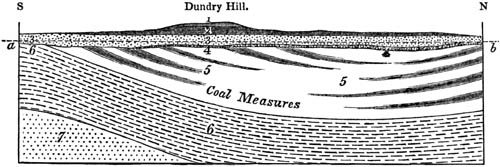
Section South of Bristol. A. C. Ramsay.
Length of section 4 miles. a, b. Level of the sea.
- 1. Inferior oolite.
- 2. Lias.
- 3. New red sandstone.
- 4. Magnesian conglomerate.
- 5. Coal measure.
- 6. Carboniferous limestone.
- 7. Old red sandstone.
In the annexed diagram, fig. 105., a real section of the geological
formations in the neighbourhood of Bristol and the Mendip Hills, is
presented to the reader as laid down on a true scale by Professor Ramsay,
where the newer groups 1, 2, 3, 4. rest unconformably on the formations 5
and 6. Here at the southern end of the line of section we meet with the
beds No. 3. (the New Red Sandstone) resting immediately on No. 6., while
farther north, as at Dundry Hill, we behold six groups superimposed one
upon the other, comprising all the strata from the inferior oolite to the
coal and carboniferous limestone. The limited extension of the groups 1 and
2. is owing to denudation, as these formations end abruptly, and have left
outlying patches to attest the fact of their having originally covered a
much wider area.
In many instances, however, the entire absence of one or more formations of
intervening periods between two groups, such as 3. and 5. in the same
section, arises, not from the destruction of what once existed, but because
no strata of an intermediate age were ever deposited on the inferior rock.
They were not formed at that place, either because the region was dry land
during the interval, or because it was part of a sea or lake to which no
sediment was carried.
In order, therefore, to establish a chronological succession of
fossiliferous groups, a geologist must begin with a single section, in
which several sets of strata lie one upon the other. He must then trace
these formations, by attention to their mineral character and fossils,
continuously, as far as possible, from the starting point. As often as he
meets with new groups, he must ascertain by superposition their age
relatively to those first examined, and thus learn how to intercalate them
in a tabular arrangement of the whole.
By this means the German, French, and English geologists have determined
the succession of strata throughout a great part of [p.103]Europe, and
have adopted pretty generally the following groups, almost all of which
have their representatives in the British Islands.
Groups of Fossiliferous Strata observed in Western Europe, arranged in
what is termed a descending Series, or beginning with the newest. (See a
more detailed Tabular view, pp. 360. 365.)
| 1. Post-Pliocene, including those of the
Recent, or human period. |
|
|
|
| |
} |
|
| 2. Newer Pliocene, or Pleistocene. |
Tertiary, Supracretaceous[103-A],
or Cainozoic.[103-B] |
| 3. Older Pliocene. |
| 4. Miocene. |
| 5. Eocene. |
| |
} |
|
| 6. Chalk. |
Secondary, or Mesozoic.[103-C] |
| 7. Greensand. |
| 8. Wealden. |
| 9. Upper Oolite. |
| 10. Middle Oolite. |
| 11. Lower Oolite. |
| 12. Lias. |
| 13. Trias. |
| |
} |
|
| 14. Permian. |
Primary fossiliferous,
or paleozoic.[103-D] |
| 15. Coal. |
| 16. Old Red sandstone, or Devonian. |
| 17. Upper Silurian. |
| 18. Lower Silurian. |
| 19. Cambrian and older fossiliferous strata. |
It is not pretended that the three principal sections in the above table,
called primary, secondary, and tertiary, are of equivalent importance, or
that the eighteen subordinate groups comprise monuments relating to equal
portions of past time, or of the earth's history. But we can assert that
they each relate to successive periods, during which certain animals and
plants, for the most part peculiar to their respective eras, have
flourished, and during which different kinds of sediment were deposited in
the space now occupied by Europe.
If we were disposed, on palæontological grounds[103-5], to divide the
entire fossiliferous series into a few groups less numerous than those in
the above table, and more nearly co-ordinate in value than the sections
called primary, secondary, and tertiary, we might, perhaps, adopt the six
groups or periods given in the next table (p. 104.).
At the same time, I may observe, that, in the present state of the science,
when we have not yet compared the evidence derivable from all classes of
fossils, not even those most generally distributed, such as shells, corals,
and fish, such generalizations are premature, and can only be regarded as
conjectural or provisional schemes for the founding of large natural
groups.
[p.104]Fossiliferous Strata of Western Europe divided into Six Groups.
| 1. Post Pliocene and
Tertiary |
} |
from the Post-Pliocene to the Eocene inclusive. |
| 2. Cretaceous |
{ |
from the Maestricht Chalk to the Lower Greensand
inclusive. |
| 3. Oolitic |
} |
from the Wealden to the Lias inclusive. |
| 4. Triassic |
{ |
including the Keuper, Muschelkalk, and Bunter
Sandstein of the Germans. |
| 5. Permian, Carboniferous,
and Devonian |
} |
including Magnesian Limestone (Zechstein), Coal,
Mountain Limestone, and Old Red sandstone. |
| 6. Silurian and Cambrian |
{ |
from the Upper Silurian to the oldest fossiliferous
rocks inclusive. |
CHAPTER X.
CLASSIFICATION OF TERTIARY FORMATIONS.—POST-PLIOCENE GROUP.
General principles of classification of tertiary strata — Detached
formations scattered over Europe — Strata of Paris and
London — More modern groups — Peculiar difficulties in determining
the chronology of tertiary formations — Increasing proportion of living
species of shells in strata of newer origin — Terms Eocene, Miocene,
and Pliocene — Post-Pliocene strata — Recent or human
period — Older Post-Pliocene formations of Naples, Uddevalla, and
Norway — Ancient upraised delta of the Mississippi — Loess of the
Rhine.
Before describing the most modern of the sets of strata enumerated in the
tables given at the end of the last chapter, it will be necessary to say
something generally of the mode of classifying the formations called
tertiary.
The name of tertiary has been given to them, because they are all posterior
in date to the rocks termed "secondary," of which the chalk constitutes the
newest group. These tertiary strata were at first confounded, as before
stated, p. 91., with the superficial alluviums of Europe; and it was long
before their real extent and thickness, and the various ages to which they
belong, were fully recognized. They were observed to occur in patches, some
of freshwater, others of marine origin, their geographical area being
usually small as compared to the secondary formations, and their position
often suggesting the idea of their having been deposited in different bays,
lakes, estuaries, or inland seas, after a large portion of the space now
occupied by Europe had already been converted into dry land.
The first deposits of this class, of which the characters were accurately
determined, were those occurring in the neighbourhood of Paris, described
in 1810 by MM. Cuvier and Brongniart. They were ascertained to consist of
successive sets of strata, some of marine, others of freshwater origin,
lying one upon the other. The fossil shells and corals were perceived to be
almost all of unknown [p.105]species, and to have in general a near
affinity to those now inhabiting warmer seas. The bones and skeletons of
land animals, some of them of large size, and belonging to more than forty
distinct species, were examined by Cuvier, and declared by him not to agree
specifically and for the most part not even generically, with any hitherto
observed in the living creation.
Strata were soon afterwards brought to light in the vicinity of London, and
in Hampshire, which, although dissimilar in mineral composition, were
justly inferred by Mr. T. Webster to be of the same age as those of Paris,
because the greater number of the fossil shells were specifically
identical. For the same reason rocks found on the Gironde, in the South of
France, and at certain points in the North of Italy, were suspected to be
of contemporaneous origin.
A variety of deposits were afterwards found in other parts of Europe, all
reposing immediately on rocks as old or older than the chalk, and which
exhibited certain general characters of resemblance in their organic
remains to those previously observed near Paris and London. An attempt was
therefore made at first to refer the whole to one period; and when at
length this seemed impracticable, it was contended that as in the Parisian
series there were many subordinate formations of considerable thickness
which must have accumulated one after the other, during a great lapse of
time, so the various patches of tertiary strata scattered over Europe might
correspond in age, some of them to the older, and others to the newer,
subdivisions of the Parisian series.
This error, although most unavoidable on the part of those who made the
first generalizations in this branch of geology, retarded seriously for
some years the progress of classification. A more scrupulous attention to
specific distinctions, aided by a careful regard to the relative position
of the strata containing them, led at length to the conviction that there
were formations both marine and freshwater of various ages, and all newer
than the strata of the neighbourhood of Paris and London.
One of the first steps in this chronological reform was made in 1811, by an
English naturalist, Mr. Parkinson, who pointed out the fact that certain
shelly strata, provincially termed "Crag" in Suffolk, lay decidedly over a
deposit which was the continuation of the blue clay of London. At the same
time he remarked that the fossil testacea in these newer beds were distinct
from those of the blue clay, and that while some of them were of unknown
species, others were identical with species now inhabiting the British
seas.
Another important discovery was soon afterwards made by Brocchi in Italy,
who investigated the argillaceous and sandy deposits replete with shells
which form a low range of hills, flanking the Apennines on both sides, from
the plains of the Po to Calabria. These lower hills were called by him the
Subapennines, and were formed of strata of different ages, all newer than
those of Paris and London.
Another tertiary group occurring in the neighbourhood of Bordeaux and Dax,
in the south of France, was examined by M. de Basterot in [p.106]1825,
who described and figured several hundred species of shells, which differed
for the most part both from the Parisian series and those of the
Subapennine hills. It was soon, therefore, suspected that this fauna might
belong to a period intermediate between that of the Parisian and
Subapennine strata, and it was not long before the evidence of
superposition was brought to bear in support of this opinion; for other
strata, contemporaneous with those of Bordeaux, were observed in one
district (the Valley of the Loire), to overlie the Parisian formation, and
in another (in Piedmont) to underlie the Subapennine beds. The first
example of these was pointed out in 1829 by M. Desnoyers, who ascertained
that the sand and marl of marine origin called Faluns, near Tours, in the
basin of the Loire, full of sea-shells and corals, rested upon a lacustrine
formation, which constitutes the uppermost subdivision of the Parisian
group, extending continuously throughout a great table-land intervening
between the basin of the Seine and that of the Loire. The other example
occurs in Italy, where strata, containing many fossils similar to those of
Bordeaux, were observed by Bonelli and others in the environs of Turin,
subjacent to strata belonging to the Subapennine group of Brocchi.
Without pretending to give a complete sketch of the progress of discovery,
I may refer to the facts above enumerated, as illustrating the course
usually pursued by geologists when they attempt to found new chronological
divisions. The method bears some analogy to that pursued by the naturalist
in the construction of genera, when he selects a typical species, and then
classes as congeners all other species of animals and plants which agree
with this standard within certain limits. The genera A. and C. having been
founded on these principles, a new species is afterwards met with,
departing widely both from A. and C., but in many respects of an
intermediate character. For this new type it becomes necessary to institute
the new genus B., in which are included all species afterwards brought to
light, which agree more nearly with B. than with the types of A. or C. In
like manner a new formation is met with in geology, and the characters of
its fossil fauna and flora investigated. From that moment it is considered
as a record of a certain period of the earth's history, and a standard to
which other deposits may be compared. If any are found containing the same
or nearly the same organic remains, and occupying the same relative
position, they are regarded in the light of contemporary annals. All such
monuments are said to relate to one period, during which certain events
occurred, such as the formation of particular rocks by aqueous or volcanic
agency, or the continued existence and fossilization of certain tribes of
animals and plants. When several of these periods have had their true
places assigned to them in a chronological series, others are discovered
which it becomes necessary to intercalate between those first known; and
the difficulty of assigning clear lines of separation must unavoidably
increase in proportion as chasms in the past history of the globe are
filled up.
Every zoologist and botanist is aware that it is a comparatively easy task
to establish genera in departments which have been enriched [p.107]with
only a small number of species, and where there is as yet no tendency in
one set of characters to pass almost insensibly, by a multitude of
connecting links, into another. They also know that the difficulty of
classification augments, and that the artificial nature of their divisions
becomes more apparent, in proportion to the increased number of objects
brought to light. But in separating families and genera, they have no other
alternative than to avail themselves of such breaks as still remain, or of
every hiatus in the chain of animated beings which is not yet filled up. So
in geology, we may be eventually compelled to resort to sections of time as
arbitrary, and as purely conventional, as those which divide the history of
human events into centuries. But in the present state of our knowledge, it
is more convenient to use the interruptions which still occur in the
regular sequence of geological monuments, as boundary lines between our
principal groups or periods, even though the groups thus established are of
very unequal value.
The isolated position of distinct tertiary deposits in different parts of
Europe has been already alluded to. In addition to the difficulty presented
by this want of continuity when we endeavour to settle the chronological
relations of these deposits, another arises from the frequent dissimilarity
in mineral character of strata of contemporaneous date, such, for example,
as those of London and Paris before mentioned. The identity or non-identity
of species is also a criterion which often fails us. For this we might have
been prepared, for we have already seen, that the Mediterranean and Red
Sea, although within 70 miles of each other, on each side of the Isthmus of
Suez, have each their peculiar fauna; and a marked difference is found in
the four groups of testacea now living in the Baltic, English Channel,
Black Sea, and Mediterranean, although all these seas have many species in
common. In like manner a considerable diversity in the fossils of different
tertiary formations, which have been thrown down in distinct seas,
estuaries, bays, and lakes, does not always imply a distinctness in the
times when they were produced, but may have arisen from climate and
conditions of physical geography wholly independent of time. On the other
hand, it is now abundantly clear, as the result of geological
investigation, that different sets of tertiary strata, immediately
superimposed upon each other, contain distinct imbedded species of fossils,
in consequence of fluctuations which have been going on in the animate
creation, and by which in the course of ages one state of things in the
organic world has been substituted for another wholly dissimilar. It has
also been shown that in proportion as the age of a tertiary deposit is more
modern, so is its fauna more analogous to that now in being in the
neighbouring seas. It is this law of a nearer agreement of the fossil
testacea with the species now living, which may often furnish us with a
clue for the chronological arrangement of scattered deposits, where we
cannot avail ourselves of any one of the three ordinary chronological
tests; namely, superposition, mineral character, and the specific identity
of the fossils.
[p.108]Thus, for example, on the African border of the Red Sea, at the
height of 40 feet, and sometimes more, above its level, a white calcareous
formation has been observed, containing several hundred species of shells
differing from those found in the clay and volcanic tuff of the country
round Naples, and of the contiguous island of Ischia. Another deposit has
been found at Uddevalla, in Sweden, in which the shells do not agree with
those found near Naples. But although in these three cases there may be
scarcely a single shell common to the three different deposits, we do not
hesitate to refer them all to one period (the Post-Pliocene), because of
the very close agreement of the fossil species in every instance with those
now living in the contiguous seas.
To take another example, where the fossil fauna recedes a few steps farther
back from our own times. We may compare, first, the beds of loam and clay
bordering the Clyde in Scotland (called glacial by some geologists),
secondly, others of fluvio-marine origin near Norwich, and, lastly, a third
set often rising to considerable heights in Sicily, and we discover that in
every case more than three-fourths of the shells agree with species still
living, while the remainder are extinct. Hence we may conclude that all
these, greatly diversified as are their organic remains, belong to one and
the same era, or to a period immediately antecedent to the Post-Pliocene,
because there has been time in each of the areas alluded to for an equal or
nearly equal amount of change in the marine testaceous fauna.
Contemporaneousness of origin is inferred in these cases, in spite of the
most marked differences of mineral character or organic contents, from a
similar degree of divergence in the shells from those now living in the
adjoining seas. The advantage of such a test consists in supplying us with
a common point of departure in all countries, however remote.
But the farther we recede from the present times, and the smaller the
relative number of recent as compared with extinct species in the tertiary
deposits, the less confidence can we place in the exact value of such a
test, especially when comparing the strata of very distant regions; for we
cannot presume that the rate of former alterations in the animate world, or
the continual going out and coming in of species, has been every where
exactly equal in equal quantities of time. The form of the land and sea,
and the climate, may have changed more in one region than in another; and
consequently there may have been a more rapid destruction and renovation of
species in one part of the globe than elsewhere. Considerations of this
kind should undoubtedly put us on our guard against relying too implicitly
on the accuracy of this test; yet it can never fail to throw great light on
the chronological relations of tertiary groups with each other, and with
the Post-Pliocene period.
We may derive a conviction of this truth not only from a study of
geological monuments of all ages, but also by reflecting on the tendency
which prevails in the present state of nature to a uniform rate of
simultaneous fluctuation in the flora and fauna of the whole globe. The
grounds of such a doctrine cannot be discussed here, and I [p.109]have
explained them at some length in the third Book of the Principles of
Geology, where the causes of the successive extinction of species are
considered. It will be there seen that each local change in climate and
physical geography is attended with the immediate increase of certain
species, and the limitation of the range of others. A revolution thus
effected is rarely, if ever, confined to a limited space, or to one
geographical province of animals or plants, but affects several other
surrounding and contiguous provinces. In each of these, moreover, analogous
alterations of the stations and habitations of species are simultaneously
in progress, reacting in the manner already alluded to on the first
province. Hence, long before the geography of any particular district can
be essentially altered, the flora and fauna throughout the world will have
been materially modified by countless disturbances in the mutual relation
of the various members of the organic creation to each other. To assume
that in one large area inhabited exclusively by a single assemblage of
species any important revolution in physical geography can be brought
about, while other areas remain stationary in regard to the position of
land and sea, the height of mountains, and so forth, is a most improbable
hypothesis, wholly opposed to what we know of the laws now governing the
aqueous and igneous causes. On the other hand, even were this conceivable,
the communication of heat and cold between different parts of the
atmosphere and ocean is so free and rapid, that the temperature of certain
zones cannot be materially raised or lowered without others being
immediately affected; and the elevation or diminution in height of an
important chain of mountains or the submergence of a wide tract of land
would modify the climate even of the antipodes.
It will be observed that in the foregoing allusions to organic remains, the
testacea or the shell-bearing mollusca are selected as the most useful and
convenient class for the purposes of general classification. In the first
place, they are more universally distributed through strata of every age
than any other organic bodies. Those families of fossils which are of rare
and casual occurrence are absolutely of no avail in establishing a
chronological arrangement. If we have plants alone in one group of strata
and the bones of mammalia in another, we can draw no conclusion respecting
the affinity or discordance of the organic beings of the two epochs
compared; and the same may be said if we have plants and vertebrated
animals in one series and only shells in another. Although corals are more
abundant, in a fossil state, than plants, reptiles, or fish, they are still
rare when contrasted with shells, especially in the European tertiary
formations. The utility of the testacea is, moreover, enhanced by the
circumstance that some forms are proper to the sea, others to the land, and
others to freshwater. Rivers scarcely ever fail to carry down into their
deltas some land shells, together with species which are at once fluviatile
and lacustrine. By this means we learn what terrestrial, freshwater, and
marine species co-existed at particular eras of the past; and having thus
identified strata formed in seas with others which originated
contemporaneously in inland lakes, we [p.110]are then enabled to advance
a step farther, and show that certain quadrupeds or aquatic plants, found
fossil in lacustrine formations, inhabited the globe at the same period
when certain fish, reptiles, and zoophytes lived in the ocean.
Among other characters of the molluscous animals, which render them
extremely valuable in settling chronological questions in geology, may be
mentioned, first, the wide geographical range of many species; and,
secondly, what is probably a consequence of the former, the great duration
of species in this class, for they appear to have surpassed in longevity
the greater number of the mammalia and fish. Had each species inhabited a
very limited space, it could never, when imbedded in strata, have enabled
the geologist to identify deposits at distant points; or had they each
lasted but for a brief period, they could have thrown no light on the
connection of rocks placed far from each other in the chronological, or, as
it is often termed, vertical series.
Many authors have divided the European tertiary strata into three
groups—lower, middle, and upper; the lower comprising the oldest
formations of Paris and London before-mentioned; the middle those of
Bordeaux and Touraine; and the upper all those newer than the middle group.
When engaged in 1828 in preparing my work on the Principles of Geology, I
conceived the idea of classing the whole series of tertiary strata in four
groups, and endeavouring to find characters for each, expressive of their
different degrees of affinity to the living fauna. With this view, I
obtained information respecting the specific identity of many tertiary and
recent shells from several Italian naturalists, and among others from
Professors Bonelli, Guidotti, and Costa. Having in 1829 become acquainted
with M. Deshayes, of Paris, already well known by his conchological works,
I learnt from him that he had arrived, by independent researches, and by
the study of a large collection of fossil and recent shells, at very
similar views respecting the arrangement of tertiary formations. At my
request he drew up, in a tabular form, lists of all the shells known to him
to occur both in some tertiary formation and in a living state, for the
express purpose of ascertaining the proportional number of fossil species
identical with the recent which characterized successive groups; and this
table, planned by us in common, was published by me in 1833.[110-A] The
number of tertiary fossil shells examined by M. Deshayes was about 3000;
and the recent species with which they had been compared about 5000. The
result then arrived at was, that in the lower tertiary strata, or those of
London and Paris, there were about 31/2 per cent. of species identical
with recent; in the middle tertiary of the Loire and Gironde about 17 per
cent.; and in the upper tertiary or Subapennine beds, from 35 to 50 per
cent. In formations still more modern, some of which I had particularly
studied in Sicily, where they attain a vast thickness and elevation above
the sea, the number of species identical with those now living was believed
to be from [p.111]90 to 95 per cent. For the sake of clearness and
brevity, I proposed to give short technical names to these four groups, or
the periods to which they respectively belonged. I called the first or
oldest of them Eocene, the second Miocene, the third Older Pliocene, and
the last or fourth Newer Pliocene. The first of the above terms, Eocene, is
derived from ηως, eos, dawn, and καινος, cainos,
recent, because the fossil shells of this period contain an extremely
small proportion of living species, which may be looked upon as indicating
the dawn of the existing state of the testaceous fauna, no recent species
having been detected in the older or secondary rocks.
The term Miocene (from μειον, meion, less, and καινος,
cainos, recent) is intended to express a minor proportion of recent
species (of testacea), the term Pliocene (from πλειον, pleion,
more, and καινος, cainos, recent) a comparative plurality of
the same. It may assist the memory of students to remind them, that the
Miocene contain a minor proportion, and Pliocene a comparative
plurality of recent species; and that the greater number of recent
species always implies the more modern origin of the strata.
It has sometimes been objected to this nomenclature that certain species of
infusoria found in the chalk are still existing, and, on the other hand,
the Miocene and Older Pliocene deposits often contain the remains of
mammalia, reptiles, and fish, exclusively of extinct species. But the
reader must bear in mind that the terms Eocene, Miocene, and Pliocene were
originally invented with reference purely to conchological data, and in
that sense have always been and are still used by me.
The distribution of the fossil species from which the results before
mentioned were obtained in 1830 by M. Deshayes was as follows:—
| In the formations of the Pliocene periods, older and newer |
|
777 |
|
|
| In the Miocene |
1021 |
| In the Eocene |
1238 |
| |
——— |
| 3036 |
| ——— |
Since the year 1830 the progress of conchological science has been most
rapid, and the number of living species obtained from different parts of
the globe has been raised from about 5000 to more than 10,000. New fossil
species have also been added to our collections in great abundance; and at
the same time a more copious supply of individuals both of fossil and
recent species, some of which were previously very rare, have been
procured, affording more ample data for determining the specific character.
Besides the reforms introduced in consequence of these new zoological
facilities, other errors of a geological nature have been in many instances
removed.
Post-Pliocene Formations.
I have adopted the term Post-Pliocene for those strata which are sometimes
called post-tertiary or modern, and which are characterized [p.112]by
having all the imbedded fossil shells identical with species now living,
whereas even the Newer Pliocene, or newest of the tertiary deposits above
alluded to, contain always some small proportion of shells of extinct
species.
These modern formations, thus defined, comprehend not only those strata
which can be shown to have originated since the earth was inhabited by man,
but also deposits of far greater extent and thickness, in which no signs of
man or his works can be detected. In some of these, of a date long anterior
to the times of history and tradition, the bones of extinct quadrupeds have
been met with of species which probably never co-existed with the human
race, as, for example, the mammoth, mastodon, megatherium, and others, and
yet the shells are the same as those now living.
That portion of the post-pliocene group which belongs to the human epoch,
and which is sometimes called Recent, forms a very unimportant feature in
the geological structure of the earth's crust. I have shown, however, in
"The Principles," where the recent changes of the earth illustrative of
geology are described at length, that the deposits accumulated at the
bottom of lakes and seas within the last 4000 or 5000 years can neither be
insignificant in volume or extent. They lie hidden, for the most part, from
our sight; but we have opportunities of examining them at certain points
where newly-gained land in the deltas of rivers has been cut through during
floods, or where coral reefs are growing rapidly, or where the bed of a sea
or lake has been heaved up by subterranean movements and laid dry. Their
age may be recognized either by our finding in them the bones of man in a
fossil state, that is to say, imbedded in them by natural causes, or by
their containing articles fabricated by the hands of man.
Thus at Puzzuoli, near Naples, marine strata are seen containing fragments
of sculpture, pottery, and the remains of buildings, together with
innumerable shells retaining in part their colour, and of the same species
as those now inhabiting the Bay of Baiæ. The uppermost of these beds is
about 20 feet above the level of the sea. Their emergence can be proved to
have taken place since the beginning of the sixteenth century.[112-A] Now
here, as in almost every instance where any alterations of level have been
going on in historical periods, it is found that rocks containing shells,
all, or nearly all, of which still inhabit the neighbouring sea, may be
traced for some distance into the interior, and often to a considerable
elevation above the level of the sea. Thus, in the country round Naples,
the post-pliocene strata, consisting of clay and horizontal beds of
volcanic tuff, rise at certain points to the height of 1500 feet. Although
the marine shells are exclusively of living species, they are not
accompanied like those on the coast at Puzzuoli by any traces of man or his
works. Had any such been discovered, it would have afforded to the
antiquary and geologist matter of great surprise, [p.113]since it would
have shown that man was an inhabitant of that part of the globe, while the
materials composing the present hills and plains of Campania were still in
the progress of deposition at the bottom of the sea; whereas we know that
for nearly 3000 years, or from the times of the earliest Greek colonists,
no material revolution in the physical geography of that part of Italy has
occurred.
In Ischia, a small island near Naples, composed in like manner of marine
and volcanic formations, Dr. Philippi collected in the stratified tuff and
clay ninety-two species of shells of existing species. In the centre of
Ischia, the lofty hill called Epomeo, or San Nicola, is composed of
greenish indurated tuff, of a prodigious thickness, interstratified in some
parts with marl, and here and there with great beds of solid lava. Visconti
ascertained by trigonometrical measurement that this mountain was 2605 feet
above the level of the sea. Not far from its summit, at the height of about
2000 feet, as also near Moropano, a village only 100 feet lower, on the
southern declivity of the mountain, I collected, in 1828, many shells of
species now inhabiting the neighbouring gulf. It is clear, therefore, that
the great mass of Epomeo was not only raised to its present height, but was
also formed beneath the waters, within the post-pliocene period.
It is a fact, however, of no small interest, that the fossil shells from
these modern tuffs of the volcanic region surrounding the Bay of Baiæ,
although none of them extinct, indicate a slight want of correspondence
between the ancient fauna and that now inhabiting the Mediterranean.
Philippi informs us that when he and M. Scacchi had collected ninety-nine
species of them, he found that only one, Pecten medius, now living in the
Red Sea, was absent from the Mediterranean. Notwithstanding this, he adds,
"the condition of the sea when the tufaceous beds were deposited must have
been considerably different from its present state; for Tellina striata
was then common, and is now rare; Lucina spinosa was both more abundant
and grew to a larger size; Lucina fragilis, now rare, and hardly
measuring 6 lines, then attained the enormous dimensions of 14 lines, and
was extremely abundant; and Ostrea lamellosa, Broc., no longer met with
near Naples, existed at that time, and attained a size so large that one
lower valve has been known to measure 5 inches 9 lines in length, 4 inches
in breadth, 11/2 inch in thickness, and weighed 261/2 ounces."[113-A]
There are other parts of Europe where no volcanic action manifests itself
at the surface, as at Naples, whether by the eruption of lava or by
earthquakes, and yet where the land and bed of the adjoining sea are
undergoing upheaval. The motion is so gradual as to be insensible to the
inhabitants, being only ascertainable by careful scientific measurements
compared after long intervals. Such an upward movement has been proved to
be in progress in Norway and Sweden throughout an area about 1000 miles N.
and S., and for an unknown distance E. and W., the amount of elevation
always increasing as we [p.114]proceed towards the North Cape, where it
may equal 5 feet in a century. If we could assume that there had been an
average rise of 21/2 feet in each hundred years for the last fifty
centuries, this would give an elevation of 125 feet in that period. In
other words, it would follow that the shores, and a considerable area of
the former bed of the Baltic and North Sea, had been uplifted vertically to
that amount, and converted into land in the course of the last 5000 years.
Accordingly, we find near Stockholm, in Sweden, horizontal beds of sand,
loam, and marl containing the same peculiar assemblage of testacea which
now live in the brackish waters of the Baltic. Mingled with these, at
different depths, have been detected various works of art implying a rude
state of civilization, and some vessels built before the introduction of
iron, the whole marine formation having been upraised, so that the upper
beds are now 60 feet higher than the surface of the Baltic. In the
neighbourhood of these recent strata, both to the north-west and south of
Stockholm, other deposits similar in mineral composition occur, which
ascend to greater heights, in which precisely the same assemblage of fossil
shells is met with, but without any intermixture of human bones or
fabricated articles.
On the opposite or western coast of Sweden, at Uddevalla, post-pliocene
strata, containing recent shells, not of that brackish water character
peculiar to the Baltic, but such as now live in the northern ocean, ascend
to the height of 200 feet; and beds of clay and sand of the same age attain
elevations of 300 and even 700 feet in Norway, where they have been usually
described as "raised beaches." They are, however, thick deposits of
submarine origin, spreading far and wide, and filling valleys in the
granite and gneiss, just as the tertiary formations, in different parts of
Europe, cover or fill depressions in the older rocks.
It is worthy of remark, that although the fossil fauna characterizing these
upraised sands and clays consists exclusively of existing northern species
of testacea, yet, according to Lovén (an able living naturalist of Norway),
the species do not constitute such an assemblage as now inhabits
corresponding latitudes in the German Ocean. On the contrary, they
decidedly represent a more arctic fauna.[114-A] In order to find the same
species flourishing in equal abundance, or in many cases to find them at
all, we must go northwards to higher latitudes than Uddevalla in Sweden, or
even nearer the pole than Central Norway.
Judging by the uniformity of climate now prevailing from century to
century, and the insensible rate of variation in the organic world in our
own times, we may presume that an extremely lengthened period was required
even for so slight a modification of the molluscous fauna, as that of which
the evidence is here brought to light. On the other hand, we have every
reason for inferring on independent grounds (namely, the rate of upheaval
of land in modern times) that the antiquity of the deposits in question
must be very great. For if [p.115]we assume, as before suggested, that
the mean rate of continuous vertical elevation has amounted to 21/2 feet
in a century (and this is probably a high average), it would require 27,500
years for the sea-coast to attain the height of 700 feet, without making
allowance for any pauses such as are now experienced in a large part of
Norway, or for any oscillations of level.
In England, buried ships have been found in the ancient and now deserted
channels of the Rother in Sussex, of the Mersey in Kent, and the Thames
near London. Canoes and stone hatchets have been dug up, in almost all
parts of the kingdom, from peat and shell-marl; but there is no evidence,
as in Sweden, Italy, and many other parts of the world, of the bed of the
sea, and the adjoining coast, having been uplifted bodily to considerable
heights within the human period. Recent strata have been traced along the
coasts of Peru and Chili, inclosing shells in abundance, all agreeing
specifically with those now swarming in the Pacific. In one bed of this
kind, in the island of San Lorenzo, near Lima, Mr. Darwin found, at the
altitude of 85 feet above the sea, pieces of cotton-thread, plaited rush,
and the head of a stalk of Indian corn, the whole of which had evidently
been imbedded with the shells. At the same height on the neighbouring
mainland, he found other signs corroborating the opinion that the ancient
bed of the sea had there also been uplifted 85 feet, since the region was
first peopled by the Peruvian race.[115-A] But similar shelly masses are
also met with at much higher elevations, at innumerable points between the
Chilian and Peruvian Andes and the sea-coast, in which no human remains
were ever, or in all probability ever will be, discovered.
In the West Indies, also, in the island of Guadaloupe, a solid limestone
occurs, at the level of the sea-beach, enveloping human skeletons. The
stone is extremely hard, and chiefly composed of comminuted shell and
coral, with here and there some entire corals and shells, of species now
living in the adjacent ocean. With them are included arrow-heads, fragments
of pottery, and other articles of human workmanship. A limestone with
similar contents has been formed, and is still forming, in St. Domingo. But
there are also more ancient rocks in the West Indian Archipelago, as in
Cuba, near the Havanna, and in other islands, in which are shells identical
with those now living in corresponding latitudes; some well-preserved,
others in the state of casts, all referable to the post-pliocene period.
I have already described in the seventh chapter, p. 84., what would be the
effects of oscillations and changes of level in any region drained by a
great river and its tributaries, supposing the area to be first depressed
several hundred feet, and then re-elevated. I believe that such changes in
the relative level of land and sea have actually occurred in the
post-pliocene era in the hydrographical basin of the Mississippi and in
that of the Rhine. The accumulation of fluviatile matter in a delta during
a slow subsidence may raise the newly [p.116]gained land superficially
at the same rate at which its foundations sink, so that these may go down
hundreds or thousands of feet perpendicularly, and yet the sea bordering
the delta may always be excluded, the whole deposit continuing to be
terrestrial or freshwater in character. This appears to have happened in
the deltas both of the Po and Ganges, for recent artesian borings,
penetrating to the depth of 400 feet, have there shown that fluviatile
strata, with shells of recent species, together with ancient surfaces of
land supporting turf and forests, are depressed hundreds of feet below the
sea level.[116-A] Should these countries be once more slowly upraised, the
rivers would carve out valleys through the horizontal and unconsolidated
strata as they rose, sweeping away the greater portion of them, and leaving
mere fragments in the shape of terraces skirting newly-formed alluvial
plains, as monuments of the former levels at which the rivers ran. Of this
nature are "the bluffs," or river cliffs, now bounding the valley of the
Mississippi throughout a large portion of its course. Thus let a b, fig.
106., represent the alluvial plain of the Mississippi, a plain which, at
the point alluded to, is more than 30 miles broad, and is truly a
prolongation of the modern delta of that river. It is bounded by bluffs,
the upper portions of which consist, both on the east and west side, of
shelly loam, No. 2. rising from 100 to 200 feet above the level of the
plain, and containing land and freshwater shells of the genera Helix,
Pupa, Succinea, and Lymnea, of the same species as those now
inhabiting the neighbouring forests and swamps. In the same loam also, No.
2., are found the bones of the Mastodon, Elephant, Megalonyx, and other
extinct quadrupeds.
Fig. 106.

Valley of the Mississippi.
- 1. Alluvium.
- 2. Loess.
- 3. f. Eocene.
- 4. Cretaceous.
I have endeavoured to show that the deposits forming the delta and alluvial
plain of the Mississippi consist of sedimentary matter, extending over an
area of 30,000 square miles, and known in some parts to be several hundred
feet deep. Although we cannot estimate correctly how many years it may have
required for the river to bring down from the upper country so large a
quantity of earthy matter—the data for such a computation being as yet
incomplete—we may still approximate to a minimum of the time which such an
operation must have taken, by ascertaining experimentally the annual
discharge of water by the Mississippi, and the mean annual amount of solid
matter contained in its waters. The lowest estimate of the time required
would lead us to assign a high antiquity, amounting to many tens of
[p.117]thousands of years to the existing delta, the origin of which is
nevertheless an event of yesterday when contrasted with those terraces,
c, and d e, fig. 106., formed of the loam No. 2. above mentioned. These
materials of the bluffs a and d were produced, the reader will observe,
during the first part of that great oscillation of level which depressed to
a depth of 200 feet a larger area than the modern delta and plain of the
Mississippi, and then restored the region to its former position.[117-A]
Loess of the Valley of the Rhine.—A similar succession of geographical
changes, attended by the production of a fluviatile formation, singularly
resembling that which bounds the great plain of the Mississippi, seems to
have occurred in the hydrographical basin of the Rhine, since the time when
that basin had already acquired its present outline of hill and valley. I
allude to the deposit provincially termed loess in part of Germany, or
lehm in Alsace, filled with land and freshwater shells of existing
species. It is a finely comminuted sand or pulverulent loam of a yellowish
grey colour, consisting chiefly of argillaceous matter combined with a
sixth part of carbonate of lime, and a sixth of quartzose and micaceous
sand. It often contains calcareous sandy concretions or nodules, rarely
exceeding the size of a man's head. Its entire thickness amounts, in some
places, to between 200 and 300 feet; yet there are often no signs of
stratification in the mass, except here and there at the bottom, where
there is occasionally a slight intermixture of drifted materials derived
from subjacent rocks. Unsolidified as it is, and of so perishable a nature,
that every streamlet flowing over it cuts out for itself a deep gully, it
usually terminates in a vertical cliff, from the surface of which land
shells are seen here and there to project in relief. In all these features
it presents a precise counterpart to the loess of the Mississippi. It is so
homogeneous as generally to exhibit no signs of stratification, owing,
probably, to its materials having been derived from a common source, and
having been accumulated by a uniform action. Yet it displays in some few
places decided marks of successive deposition, where coarser and finer
materials alternate, especially near the bottom. Calcareous concretions,
also enclosing land-shells, are sometimes arranged in horizontal layers. It
is a remarkable deposit, from its position, wide extent, and thickness, its
homogeneous mineral composition, and freshwater origin. Its distribution
clearly shows that after the great valley of the Rhine, from Schaffhausen
to Bonn, had acquired its present form, having its bottom strewed over with
coarse gravel, a period arrived when it became filled up from side to side
with fine mud, which was also thrown down in the valleys of the principal
tributaries of the Rhine.
Thus, for example, it may be traced far into Würtemberg, up the valley of
the Neckar, and from Frankfort, up the valley of the Main, to above
Dettelbach. I have also seen it spreading over the country of Mayence,
Eppelsheim, and Worms, on the left bank of the Rhine, and on the opposite
side on the table-land above the Bergstrasse, between [p.118]Wiesloch
and Bruchsal, where it attains a thickness of 200 feet. Near Strasburg,
large masses of it appear at the foot of the Vosges on the left bank, and
at the base of the mountains of the Black Forest on the right bank. The
Kaiserstuhl, a volcanic mountain which stands in the middle of the plain of
the Rhine near Freiburg, has been covered almost everywhere with this loam,
as have the extinct volcanos between Coblentz and Bonn. Near Andernach, in
the Kirchweg, the loess containing the usual shells alternates with
volcanic matter; and over the whole are strewed layers of pumice, lapilli,
and volcanic sand, from 10 to 15 feet thick, very much resembling the
ejections under which Pompeii lies buried. There is no passage at this
upper junction from the loess into the pumiceous superstratum; and this
last follows the slope of the hill, just as it would have done had it
fallen in showers from the air on a declivity partly formed of loess.
But, in general, the loess overlies all the volcanic products, even those
between Neuwied and Bonn, which have the most modern aspect; and it has
filled up in part the crater of the Roderberg, an extinct volcano near
Bonn. In 1833 a well was sunk at the bottom of this crater, through 70 feet
of loess, in part of which were the usual calcareous concretions.
The interstratification above alluded to, of loess with layers of pumice
and volcanic ashes, has led to the opinion that both during and since its
deposition some of the last volcanic eruptions of the Lower Eifel have
taken place. Should such a conclusion be adopted, we should be called upon
to assign a very modern date to these eruptions. This curious point,
therefore, deserves to be reconsidered; since it may possibly have happened
that the waters of the Rhine, swollen by the melting of snow and ice, and
flowing at a great height through a valley choked up with loess, may have
swept away the loose superficial scoriæ and pumice of the Eifel volcanos,
and spread them out occasionally over the yellow loam. Sometimes, also, the
melting of snow on the slope of small volcanic cones may have given rise to
local floods, capable of sweeping down light pumice into the adjacent low
grounds.
The first idea which has occurred to most geologists, after examining the
loess between Mayence and Basle, is to imagine that a great lake once
extended throughout the valley of the Rhine between those two places. Such
a lake may have sent off large branches up the course of the Main, Neckar,
and other tributary valleys, in all of which large patches of loess are now
seen. The barrier of the lake might be placed somewhere in the narrow and
picturesque gorge of the Rhine between Bingen and Bonn. But this theory
fails altogether to explain the phenomena; when we discover that that gorge
itself has once been filled with loess, which must have been tranquilly
deposited in it, as also in the lateral valley of the Lahn, communicating
with the gorge. The loess has also overspread the high adjoining platform
near the village of Plaidt above Andernach. Nay, on proceeding farther down
to the north, we discover that the [p.119]hills which skirt the great
valley between Bonn and Cologne have loess on their flanks, which also
covers here and there the gravel of the plain as far as Cologne, and the
nearest rising grounds.
Besides these objections to the lake theory, the loess is met with near
Basle, capping hills more than 1200 feet above the sea; so that a barrier
of land capable of separating the supposed lake from the ocean would
require to be, at least, as high as the mountains called the Siebengebirge,
near Bonn, the loftiest summit of which, the Oehlberg, is 1209 feet above
the Rhine and 1369 feet above the sea. It would be necessary, moreover, to
place this lofty barrier somewhere below Cologne, or precisely where the
level of the land is now lowest.
Instead, therefore, of supposing one continuous lake of sufficient extent
and depth to allow of the simultaneous accumulation of the loess, at
various heights, throughout the whole area where it now occurs, I formerly
suggested that, subsequently to the period when the countries now drained
by the Rhine and its tributaries had nearly acquired their actual form and
geographical features, they were again depressed gradually by a movement
like that now in progress on the west coast of Greenland.[119-A] In
proportion as the whole district was lowered, the general fall of the
waters between the Alps and the ocean was lessened; and both the main and
lateral valleys, becoming more subject to river inundations, were partially
filled up with fluviatile silt, containing land and freshwater shells. When
a thickness of many hundred feet of loess had been thrown down slowly by
this operation, the whole region was once more upheaved gradually. During
this upward movement most of the fine loam would be carried off by the
denuding power of rains and rivers; and thus the original valleys might
have been re-excavated, and the country almost restored to its pristine
state, with the exception of some masses and patches of loess such as still
remain, and which, by their frequency and remarkable homogeneousness of
composition and fossils, attest the ancient continuity and common origin of
the whole. By imagining these oscillations of level, we dispense with the
necessity of erecting and afterwards removing a mountain barrier
sufficiently high to exclude the ocean from the valley of the Rhine during
the period of the accumulation of the loess.
The proportion of land shells of the genera Helix, Pupa, and Bulimus,
is very large in the loess; but in many places aquatic species of the
genera Lymnea, Paludina, and Planorbis are also found. These may have
been carried away during floods from shallow pools and marshes bordering
the river; and the great extent of marshy ground caused by the wide
overflowings of rivers above supposed would favour the multiplication of
amphibious mollusks, such as the Succinea (fig. 107.), which is almost
everywhere characteristic of this formation, and is sometimes accompanied,
as near Bonn, by another species, S. amphibia (fig. 34. p. 29.). Among
other abundant [p.120]fossils are Helix plebeium and Pupa muscorum.
(See Figures.) Both the terrestrial and aquatic shells preserved in the
loess are of most fragile and delicate structure, and yet they are almost
invariably perfect and uninjured. They must have been broken to pieces had
they been swept along by a violent inundation. Even the colour of some of
the land shells, as that of Helix nemoralis, is occasionally preserved.
Fig. 107.
Succinea elongata.
Fig. 108.
Pupa muscorum.
Fig. 109.

Helix plebeium.
Bones of vertebrated animals are rare in the loess, but those of the
mammoth, horse, and some other quadrupeds have been met with. At the
village of Binningen, and the hills called Bruderholz, near Basle, I found
the vertebræ of fish, together with the usual shells. These vertebræ,
according to M. Agassiz, belong decidedly to the Shark family, perhaps to
the genus Lamna. In explanation of their occurrence among land and
freshwater shells, it may be stated that certain fish of this family ascend
the Senegal, Amazon, and other great rivers, to the distance of several
hundred miles from the ocean.[120-A]
At Cannstadt, near Stuttgart, in a valley also belonging to the
hydrographical basin of the Rhine, I have seen the loess pass downwards
into beds of calcareous tuff and travertin. Several valleys in northern
Germany, as that of the Ilm at Weimar, and that of the Tonna, north of
Gotha, exhibit similar masses of modern limestone filled with recent shells
of the genera Planorbis, Lymnea, Paludina, &c., from 50 to 80 feet
thick, with a bed of loess much resembling that of the Rhine, occasionally
incumbent on them. In these modern limestones used for building, the bones
of Elephas primigenius, Rhinoceros tichorinus, Ursus spelæus, Hyæna
spelæa, with the horse, ox, deer, and other quadrupeds, occur; and in 1850
Mr. H. Credner and I obtained in a quarry at Tonna, at the depth of 15
feet, inclosed in the calcareous rock and surrounded with dicotyledonous
leaves and petrified leaves, four eggs of a snake of the size of the
largest European Coluber, which, with three others, had been found lying in
a series, or string.
They are, I believe, the first reptilian remains which have been met with
in strata of this age.
The agreement of the shells in these cases with recent European species
enables us to refer to a very modern period the filling up and
re-excavation of the valleys; an operation which doubtless consumed a long
period of time, since which the mammiferous fauna has undergone a
considerable change.
[p.121]CHAPTER XI.
NEWER PLIOCENE PERIOD.—BOULDER FORMATION.
Drift of Scandinavia, northern Germany, and Russia — Its northern
origin — Not all of the same age — Fundamental rocks polished,
grooved, and scratched — Action of glaciers and icebergs — Fossil
shells of glacial period — Drift of eastern Norfolk — Associated
freshwater deposit — Bent and folded strata lying on undisturbed
beds — Shells on Moel Tryfane — Ancient glaciers of North
Wales — Irish drift.
Among the different kinds of alluvium described in the seventh chapter,
mention was made of the boulder formation in the north of Europe, the
peculiar characters of which may now be considered, as it belongs in part
to the post-pliocene, and partly to the newer pliocene, period. I shall
first allude briefly to that portion of it which extends from Finland and
the Scandinavian mountains to the north of Russia, and the low countries
bordering the Baltic, and which has been traced southwards as far as the
eastern coast of England. This formation consists of mud, sand, and clay,
sometimes stratified, but often wholly devoid of stratification, for a
depth of more than a hundred feet. To this unstratified form of the
deposit, the name of till has been applied in Scotland. It generally
contains numerous fragments of rocks, some angular and others rounded,
which have been derived from formations of all ages, both fossiliferous,
volcanic, and hypogene, and which have often been brought from great
distances. Some of the travelled blocks are of enormous size, several feet
or yards in diameter; their average dimensions increasing as we advance
northwards. The till is almost everywhere devoid of organic remains, unless
where these have been washed into it from older formations; so that it is
chiefly from relative position that we must hope to derive a knowledge of
its age.
Although a large proportion of the boulder deposit, or "northern drift," as
it has sometimes been called, is made up of fragments brought from a
distance, and which have sometimes travelled many hundred miles, the bulk
of the mass in each locality consists of the ruins of subjacent or
neighbouring rocks; so that it is red in a region of red sandstone, white
in a chalk country, and grey or black in a district of coal and coal-shale.
The fundamental rock on which the boulder formation reposes, if it consist
of granite, gneiss, marble, or other hard stone capable of permanently
retaining any superficial markings which may have been imprinted upon it,
is smoothed or polished, and usually exhibits parallel striæ and furrows
having a determinate direction. This direction, both in Europe and North
America, is evidently connected with the course taken by the erratic blocks
in the same district being north or south, or 20 or 30 degrees to the east
or west of north, according as the large angular and rounded stones have
travelled. [p.122]These stones themselves also are often furrowed and
scratched on more than one side.
Fig. 110.

Limestone polished, furrowed, and scratched by the
glacier of Rosenlaui, in Switzerland. (Agassiz.)
- a a. White streaks or scratches, caused by small grains of flint frozen into the ice.
- b b. Furrows.
In explanation of such phenomena I may refer the student to what was said
of the action of glaciers and icebergs in the Principles of Geology.[122-A]
It is ascertained that hard stones, frozen into a moving mass of ice, and
pushed along under the pressure of that mass, scoop out long rectilinear
furrows or grooves parallel to each other on the subjacent solid rock. (See
fig. 110.) Smaller scratches and striæ are made on the polished surface by
crystals or projecting edges of the hardest minerals, just as a diamond
cuts glass. The recent polishing and striation of limestone by coast-ice
carrying boulders even as far south as the coast of Denmark, has been
observed by Dr. Forchhammer, and helps us to conceive how large icebergs,
running aground on the bed of the sea, may produce similar furrows on a
grander scale. An account was given so long ago as the year 1822, by
Scoresby, of icebergs seen by him drifting along in latitudes 69° and 70°
N., which rose above the surface from 100 to 200 feet, and measured from a
few yards to a mile in circumference. Many of them were loaded with beds of
earth and rock, of such thickness that the weight was conjectured to be
from 50,000 to 100,000 tons.[122-B] A similar transportation of rocks is
known to be in progress in the southern hemisphere, where boulders included
in ice are far more frequent than in the north. One of these icebergs was
encountered in 1839, in mid-ocean, in the antarctic regions, many hundred
miles from any known land, sailing northwards, with a large erratic block
[p.123]firmly frozen into it. In order to understand in what manner long
and straight grooves may be cut by such agency, we must remember that these
floating islands of ice have a singular steadiness of motion, in
consequence of the larger portion of their bulk being sunk deep under
water, so that they are not perceptibly moved by the winds and waves even
in the strongest gales. Many had supposed that the magnitude commonly
attributed to icebergs by unscientific navigators was exaggerated, but now
it appears that the popular estimate of their dimensions has rather fallen
within than beyond the truth. Many of them, carefully measured by the
officers of the French exploring expedition of the Astrolabe, were between
100 and 225 feet high above water, and from 2 to 5 miles in length. Captain
d'Urville ascertained one of them which he saw floating in the Southern
Ocean to be 13 miles long and 100 feet high, with walls perfectly vertical.
The submerged portions of such islands must, according to the weight of ice
relatively to sea-water, be from six to eight times more considerable than
the part which is visible, so that the mechanical power they might exert
when fairly set in motion must be prodigious.[123-A]
Glaciers formed in mountainous regions become laden with mud and stones,
and if they melt away at their lower extremity before they reach the sea,
they leave wherever they terminate a confused heap of unstratified rubbish,
called "a moraine," composed of mud and pieces of all the rocks with which
they were loaded. We may expect, therefore, to find a formation of the same
kind, resulting from the liquefaction of icebergs, in tranquil water. But,
should the action of a current intervene at certain points or at certain
seasons, then the materials will be sorted as they fall, and arranged in
layers according to their relative weight and size. Hence there will be
passages from till, as it is called in Scotland, to stratified clay,
gravel, and sand, and intercalations of one in the other.
I have yet to mention another appearance connected with the boulder
formation, which has justly attracted much attention in Norway and other
parts of Europe. Abrupt pinnacles and outstanding ridges of rock are often
observed to be polished and furrowed on the north, or "strike" side as it
is called, or on the side facing the region from which the erratics have
come; while, on the other side, which is usually steeper and often
perpendicular, called the "lee-side," such superficial markings are
wanting. There is usually a collection on this lee-side of boulders and
gravel, or of large angular fragments. In explanation we may suppose that
the north side was exposed, when still submerged, to the action of
icebergs, and afterwards, when the land was upheaved, of coast-ice, which
ran aground upon shoals, or was packed on the beach; so that there would
be great wear and tear on the seaward slope, while, on the other, gravel
and boulders might be heaped up in a sheltered position.
Northern origin of erratics.—That the erratics of northern Europe
[p.124]have been carried southward cannot be doubted; those of granite,
for example, scattered over large districts of Russia and Poland, agree
precisely in character with rocks of the mountains of Lapland and Finland;
while the masses of gneiss, syenite, porphyry, and trap, strewed over the
low sandy countries of Pomerania, Holstein, and Denmark, are identical in
mineral characters with the mountains of Norway and Sweden.
It is found to be a general rule in Russia, that the smaller blocks are
carried to greater distances from their point of departure than the larger;
the distance being sometimes 800 and even 1000 miles from the nearest rocks
from which they were broken off; the direction having been from N.W. to
S.E., or from the Scandinavian mountains over the seas and low lands to the
south-east. That its accumulation throughout this area took place in part
during the post-pliocene period is proved by its superposition at several
points to strata containing recent shells. Thus, for example, in European
Russia, MM. Murchison and De Verneuil found in 1840, that the flat country
between St. Petersburg and Archangel, for a distance of 600 miles,
consisted of horizontal strata, full of shells similar to those now
inhabiting the arctic sea, on which rested the boulder formation,
containing large erratics.
In Sweden, in the immediate neighbourhood of Upsala, I observed, in 1834, a
ridge of stratified sand and gravel, in the midst of which is a layer of
marl, evidently formed originally at the bottom of the Baltic, by the slow
growth of the mussel, cockle, and other marine shells, intermixed with some
of freshwater species. The marine shells are all of dwarfish size, like
those now inhabiting the brackish waters of the Baltic; and the marl, in
which myriads of them are imbedded, is now raised more than 100 feet above
the level of the Gulf of Bothnia. Upon the top of this ridge repose several
huge erratics, consisting of gneiss for the most part unrounded, from 9 to
16 feet in diameter, and which must have been brought into their present
position since the time when the neighbouring gulf was already
characterized by its peculiar fauna.[124-A] Here, therefore, we have proof
that the transport of erratics continued to take place, not merely when the
sea was inhabited by the existing testacea, but when the north of Europe
had already assumed that remarkable feature of its physical geography,
which separates the Baltic from the North Sea, and causes the Gulf of
Bothnia to have only one fourth of the saltness belonging to the ocean. In
Denmark, also, recent shells have been found in stratified beds, closely
associated with the boulder clay.
It was stated that in Russia the erratics diminished generally in size in
proportion as they are traced farther from their source. The same
observation holds true in regard to the average bulk of the Scandinavian
boulders, when we pursue them southwards, from the south of Norway and
Sweden through Denmark and Westphalia. [p.125]This phenomenon is in
perfect harmony with the theory of ice-islands floating in a sea of
variable depth; for the heavier erratics require icebergs of a larger size
to buoy them up; and, even when there are no stones frozen in, more than
seven eighths, and often nine tenths, of a mass of drift ice is under
water. The greater, therefore, the volume of the iceberg, the sooner would
it impinge on some shallower part of the sea; while the smaller and lighter
floes, laden with finer mud and gravel, may pass freely over the same
banks, and be carried to much greater distances. In those places, also,
where in the course of centuries blocks have been carried southwards by
coast-ice, having been often stranded and again set afloat in the direction
of a prevailing current, the blocks will be worn and diminish in size the
farther they travel from their point of departure.
The "northern drift" of the most southern latitudes is usually of the
highest antiquity. In Scotland it rests immediately on the older rocks, and
is covered by stratified sand and clay, usually devoid of fossils, but in
which, at certain points near the east and west coast, as, for example, in
the estuaries of the Tay and Clyde, marine shells have been discovered. The
same shells have also been met with in the north, at Wick in Caithness, and
on the shores of the Moray Frith. The principal deposit on the Clyde occurs
at the height of about 70 feet, but a few shells have been traced in it as
high as 554 feet above the sea. Although a proportion of between 85 or 90
in 100 of the imbedded shells are of recent species, the remainder are
unknown; and even many which are recent now inhabit more northern seas,
where we may, perhaps, hereafter find living representatives of some of the
unknown fossils. The distance to which erratic blocks have been carried
southwards in Scotland, and the course they have taken, which is often
wholly independent of the present position of hill and valley, favours the
idea that ice-rafts rather than glaciers were in general the transporting
agents. The Grampians in Forfarshire and in Perthshire are from 3000 to
4000 feet high. To the southward lies the broad and deep valley of
Strathmore, and to the south of this again rise the Sidlaw Hills[125-A] to
the height of 1500 feet and upwards. On the highest summits of this chain,
formed of sandstone and shale, and at various elevations, are found huge
angular fragments of mica schist, some 3 and others 15 feet in diameter,
which have been conveyed for a distance of at least 15 miles from the
nearest Grampian rocks from which they could have been detached. Others
have been left strewed over the bottom of the large intervening vale of
Strathmore.
Still farther south on the Pentland Hills, at the height of 1100 feet above
the sea, Mr. Maclaren has observed a fragment of mica-schist weighing from
8 to 10 tons, the nearest mountain composed of this formation being 50
miles distant.[125-B]
The testaceous fauna of the boulder period, in Scotland, England, and
Ireland, has been shown by Prof. E. Forbes to contain a much [p.126]
smaller number of species than that now belonging to the British seas, and
to have been also much less rich in species than the Older Pliocene fauna
of the crag which preceded it. Yet the species are nearly all of them now
living either in the British or more northern seas, the shells of more
arctic latitudes being the most abundant and the most wide spread
throughout the entire area of the drift from north to south.
This extensive range of the fossils can by no means be explained by
imagining the mollusca of the drift to have been inhabitants of a deep sea,
where a more uniform temperature prevailed. On the contrary, many species
were littoral, and others belonged to a shallow sea, not above 100 feet
deep, and very few of them lived, according to Prof. E. Forbes, at greater
depths than 300 feet.
From what was before stated it will appear that the boulder formation
displays almost everywhere, in its mineral ingredients, a strange
heterogeneous mixture of the ruins of adjacent lands, with stones both
angular and rounded, which have come from points often very remote. Thus we
find it in our eastern counties, as in Norfolk, Suffolk, Cambridge,
Huntingdon, Bedford, Hertford, Essex, and Middlesex, containing stones from
the Silurian and Carboniferous strata, and from the lias, oolite, and
chalk, all with their peculiar fossils, together with trap, syenite,
mica-schist, granite, and other crystalline rocks. A fine example of this
singular mixture extends to the very suburbs of London, being seen on the
summit of Muswell Hill, Highgate. But south of London the northern drift is
wanting, as, for example, in the Wealds of Surrey, Kent, and Sussex.
Norfolk drift.—The drift can nowhere be studied more advantageously in
England than in the cliffs of the Norfolk coast between Happisburgh and
Cromer. Vertical sections, having an ordinary height of from 50 to 70 feet,
are there exposed to view for a distance of about 20 miles. The name of
diluvium was formerly given to it by those who supposed it to have been
produced by the violent action of a sudden and transient deluge, but the
term drift has been substituted by those who reject this hypothesis. Here,
as elsewhere, it consists for the most part of clay, loam, and sand, in
part stratified, in part devoid of stratification. Pebbles, together with
some large boulders of granite, porphyry, greenstone, lias, chalk, and
other transported rocks, are interspersed, especially through the till.
That some of the granitic and other fragments came from Scandinavia I have
no doubt, after having myself traced the course of the continuous stream of
blocks from Norway and Sweden to Denmark, and across the Elbe, through
Westphalia, to the borders of Holland. We need not be surprised to find
them reappear on our eastern coast, between the Tweed and the Thames,
regions not half so remote from parts of Norway as are many Russian
erratics from the sources whence they came.
White chalk rubble, unmixed with foreign matter, and even huge fragments of
solid chalk, also occur in many localities in these Norfolk cliffs. No
fossils have been detected in this drift, which can positively [p.127]be
referred to the era of its accumulation; but at some points it overlies a
freshwater formation containing recent shells, and at others it is blended
with the same in such a manner as to force us to conclude that both were
contemporaneously deposited.
Fig. 111.
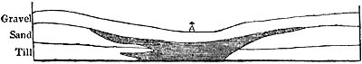
The shaded portion consists of Freshwater beds.
Intercalation of freshwater beds and of boulder clay and sand at
Mundesley.
This interstratification is expressed in the annexed figure, the dark mass
indicating the position of the freshwater beds, which contain much
vegetable matter, and are divided into thin layers. The imbedded shells
belong to the genera Planorbis, Lymnea, Paludina, Unio, Cyclas,
and others, all of British species, except a minute Paludina now
inhabiting France. (See fig. 112.)
Fig. 112.

Paludina marginata, Michaud. (P. minuta,
Strickland.) The middle figure is of the natural size.
The Cyclas (fig. 113.) is merely a remarkable variety of the common
English species. The scales and teeth of fish of the genera Pike, Perch,
Roach, and others, accompany these shells; but the species are not
considered by M. Agassiz to be identical with known British or European
kinds.
Fig. 113.

Cyclas (Pisidium) amnica, var.? The two
middle figures are of the natural size.
The series of formations in the cliffs of eastern Norfolk, now under
consideration, beginning with the lowest, is as follows:—First, chalk;
secondly, patches of a marine tertiary formation, called the Norwich Crag,
hereafter to be described; thirdly, the freshwater beds already mentioned;
and lastly, the drift. Immediately above the chalk, or crag, when that is
present, is found here and there a buried forest, or a stratum in which the
stools and roots of trees stand [p.128]in their natural position, the
trunks having been broken short off and imbedded with their branches and
leaves. It is very remarkable that the strata of the overlying boulder
formation have often undergone great derangement at points where the
subjacent forest bed and chalk remain undisturbed. There are also cases
where the upper portion of the boulder deposit has been greatly deranged,
while the lower beds of the same have continued horizontal. Thus the
annexed section (fig. 114.) represents a cliff about 50 feet high, at the
bottom of which is till, or unstratified clay, containing boulders,
having an even horizontal surface, on which repose conformably beds of
laminated clay and sand about 5 feet thick, which, in their turn, are
succeeded by vertical, bent, and contorted layers of sand and loam 20 feet
thick, the whole being covered by flint gravel. Now the curves of the
variously coloured beds of loose sand, loam, and pebbles are so complicated
that not only may we sometimes find portions of them which maintain their
verticality to a height of 10 or 15 feet, but they have also been folded
upon themselves in such a manner that continuous layers might be thrice
pierced in one perpendicular boring.
Fig. 114.
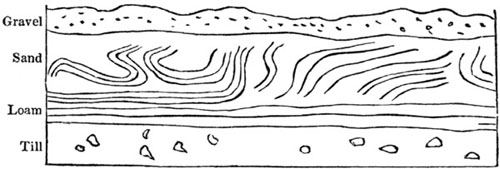
Cliff 50 feet high between Bacton Gap and Mundesley.
Fig. 115.

Folding of the strata between East and West Runton.
Fig. 116.

Section of concentric beds west of Cromer.
- 1. Blue clay.
- 2. White sand.
- 3. Yellow Sand.
- 4. Striped loam and clay.
- 5. Laminated blue clay.
At some points there is an apparent folding of the beds round a central
nucleus, as at a, fig. 115., where the strata seem bent round a small
mass of chalk; or, as in fig. 116., where the blue clay, No. 1., is in the
centre; and where the other strata, 2, 3, 4, 5, are coiled [p.129]round
it; the entire mass being 20 feet in perpendicular height. This appearance
of concentric arrangement around a nucleus is, nevertheless, delusive,
being produced by the intersection of beds bent into a convex shape; and
that which seems the nucleus being, in fact, the innermost bed of the
series, which has become partially visible by the removal of the
protuberant portions of the outer layers.
To the north of Cromer are other fine illustrations of contorted drift
reposing on a floor of chalk horizontally stratified and having a level
surface. These phenomena, in themselves sufficiently difficult of
explanation, are rendered still more anomalous by the occasional inclosure
in the drift of huge fragments of chalk many yards in diameter. One
striking instance occurs west of Sherringham, where an enormous pinnacle of
chalk, between 70 and 80 feet in height, is flanked on both sides by
vertical layers of loam, clay, and gravel. (Fig. 117.)
Fig. 117.

Included pinnacle of chalk at Old Hythe point,
west of Sherringham.
- d. Chalk with regular layers of chalk flints.
- c. Layer called "the pan," of loose chalk, flints, and marine shells of recent
species, cemented by oxide of iron.
This chalky fragment is only one of many detached masses which have been
included in the drift, and forced along with it into their present
position. The level surface of the chalk in situ (d) may be traced for
miles along the coast, where it has escaped the violent movements to which
the incumbent drift has been exposed.[129-A]
We are called upon, then, to explain how any force can have been exerted
against the upper masses, so as to produce movements in which the subjacent
strata have not participated. It may be answered that, if we conceive the
till and its boulders to have been drifted to their present place by ice,
the lateral pressure may have been supplied by the stranding of
ice-islands. We learn, from the observations of Messrs. Dease and Simpson
in the polar regions, that such islands, when they run aground, push before
them large mounds of shingle and sand. It is therefore probable that they
often cause great alterations in the arrangement of pliant and incoherent
strata forming [p.130]the upper part of shoals or submerged banks, the
inferior portions of the same remaining unmoved. Or many of the complicated
curvatures of these layers of loose sand and gravel may have been due to
another cause, the melting on the spot of icebergs and coast ice in which
successive deposits of pebbles, sand, ice, snow, and mud, together with
huge masses of rock fallen from cliffs, may have become interstratified.
Ice-islands so constituted often capsize when afloat, and gravel once
horizontal may have assumed, before the associated ice was melted, an
inclined or vertical position. The packing of ice forced up on a coast may
lead to similar derangement in a frozen conglomerate of sand or shingle,
and, as Mr. Trimmer has suggested[130-A], alternate layers of earthy matter
may have sunk down slowly during the liquefaction of the intercalated ice,
so as to assume the most fantastic and anomalous positions, while the
aqueous strata below, and those afterwards thrown down above, may be
perfectly horizontal.
A buried forest has been adverted to as underlying the drift on the coast
of Norfolk. At the time when the trees grew there must have been dry land
over a large area, which was afterwards submerged, so as to allow a mass of
stratified and unstratified drift, 200 feet and more in thickness, to be
superimposed. The undermining of the cliffs by the sea in modern times has
enabled us to demonstrate, beyond all doubt, the fact of this
superposition, and that the forest was not formed along the present
coast-line. Its situation implies a subsidence of several hundred feet
since the commencement of the drift period, after which there must have
been an upheaval of the same ground; for the forest bed of Norfolk is now
again so high as to be exposed to view at many points at low water; and
this same upward movement may explain why the till, which is conceived to
have been of submarine origin, is now met with far inland, and on the
summit of hills.
The boulder formation of the west of England, observed in Lancashire,
Cheshire, Shropshire, Staffordshire, and Worcestershire, contains in some
places marine shells of recent species, rising to various heights, from 100
to 350 feet above the sea. The erratics have come partly from the mountains
of Cumberland, and partly from those of Scotland.
But it is on the mountains of North Wales that the "Northern drift," with
its characteristic marine fossils, reaches its greatest altitude. On Moel
Tryfane, near the Menai Straits, Mr. Trimmer met with shells of the species
commonly found in the drift at the height of 1392 feet above the level of
the sea.
It is remarkable that in the same neighbourhood where there is evidence of
so great a submergence of the land during part of the glacial period, we
have also the most decisive proofs yet discovered in the British Isles of
subaerial glaciers. Dr. Buckland published in 1842 his reasons for
believing that the Snowdonian mountains in Caernarvonshire were formerly
covered with glaciers, which radiated from the central heights through the
seven principal valleys [p.131]of that chain, where striæ and flutings
are seen on the polished rocks directed towards as many different points of
the compass. He also described the "moraines" of the ancient glaciers, and
the rounded "bosses" or small flattened domes of polished rock, such as the
action of moving glaciers is known to produce in Switzerland, when gravel,
sand, and boulders, underlying the ice, are forced along over a foundation
of hard stone. Mr. Darwin, and subsequently Prof. Ramsay, have confirmed
Dr. Buckland's views in regard to these Welsh glaciers. Nor indeed was it
to be expected that geologists should discover proofs of icebergs having
abounded in the area now occupied by the British Isles in the Pleistocene
period without sometimes meeting with the signs of contemporaneous glaciers
which covered hills even of moderate elevation between the 50th and 60th
degrees of latitude.
In Ireland the "drift" exhibits the same general characters and fossil
remains as in Scotland and England; but in the southern part of that
island, Prof. E. Forbes and Capt. James found in it some shells which show
that the glacial sea communicated with one inhabited by a more southern
fauna. Among other species in the south, they mention at Wexford and
elsewhere the occurrence of Nucula Cobboldiæ (see fig. 120. p. 149.) and
Turritella incrassata (a crag fossil); also a southern form of Fusus,
and a Mitra allied to a Spanish species.[131-A]
CHAPTER XII.
BOULDER FORMATION—continued.
Difficulty of interpreting the phenomena of drift before the glacial
hypothesis was adopted — Effects of intense cold in augmenting the
quantity of alluvium — Analogy of erratics and scored rocks in North
America and Europe — Bayfield on shells in drift of Canada — Great
subsidence and re-elevation of land from the sea, required to account for
glacial appearances — Why organic remains so rare in northern
drift — Mastodon giganteus in United States — Many shells and some
quadrupeds survived the glacial cold — Alps an independent centre of
dispersion of erratics — Alpine blocks on the Jura — Whether
transported by glaciers or floating ice — Recent transportation of
erratics from the Andes to Chiloe — Meteorite in Asiatic drift.
It will appear from what was said in the last chapter of the marine shells
characterizing the boulder formation, that nine-tenths or more of them
belong to species still living. The superficial position of "the drift" is
in perfect accordance with its imbedded organic remains, leading us to
refer its origin to a modern period. If, then, we encounter so much
difficulty in the interpretation of monuments relating to times so near our
own—if in spite of their recent date they are involved in so much
obscurity—the student may ask, not without reasonable alarm, how we can
hope to decipher the records of remote ages.
[p.132]To remove from the mind as far as possible this natural feeling of
discouragement, I shall endeavour in this chapter to prove that what seems
most strikingly anomalous, in the "erratic formation," as some call it, is
really the result of that glacial action which has already been alluded to.
If so, it was to be expected that so long as the true origin of so singular
a deposit remained undiscovered, erroneous theories and terms would be
invented in the effort to solve the problem. These inventions would
inevitably retard the reception of more correct views which a wider field
of observation might afterwards suggest.
The term "diluvium" was for a time the popular name of the boulder
formation, because it was referred by some geologists to the deluge. Others
retained the name as expressive of their opinion that a series of diluvial
waves raised by hurricanes and storms, or by earthquakes, or by the sudden
upheaval of land from the bed of the sea, had swept over the continents,
carrying with them vast masses of mud and heavy stones, and forcing these
stones over rocky surfaces so as to polish and imprint upon them long
furrows and striæ.
But no explanation was offered why such agency should have been developed
more energetically in modern times than at former periods of the earth's
history, or why it should be displayed in its fullest intensity in northern
latitudes; for it is important to insist on the fact, that the boulder
formation is a northern phenomenon. Even the southern extension of the
drift, or the large erratics found in the Alps and the surrounding lands,
especially their occurrence round the highest parts of the chain, offers
such an exception to the general rule as confirms the glacial hypothesis;
for it shows that the transportation of stony fragments to great distances,
and the striation, polishing, and grooving of solid floors of rock, are
here again intimately connected with accumulations of perennial snow and
ice.
That there is some intimate connection between a cold or northern climate
and the various geological appearances now commonly called glacial, cannot
be doubted by any one who has compared the countries bordering the Baltic
with those surrounding the Mediterranean. The smoothing and striation of
rocks, and the erratics, are traced from the sea-shore to the height of
3000 feet above the level of the Baltic, whereas such phenomena are wholly
wanting in countries bordering the Mediterranean; and their absence is
still more marked in the equatorial parts of Asia, Africa, and America; but
when we cross the southern tropic, and reach Chili and Patagonia, we again
encounter the boulder formation, between the latitude 41° S. and Cape Horn,
with precisely the same characters which it assumes in Europe. The evidence
as to climate derived from the organic remains of the drift is, as we have
seen, in perfect harmony with the conclusions above alluded to, the former
habits of the species of mollusca being accurately ascertainable, inasmuch
as they belong to species still living, and known to have at present a wide
range in northern seas.
But if we are correct in assuming that the northern hemisphere was
considerably colder than now during the period under consideration,
[p.133]owing probably to the greater area and height of arctic lands,
and to the quantity of icebergs which such a geographical state of things
would generate, it may be well to reflect before we proceed farther on the
entire modification which extreme cold would produce in the operation of
those causes spoken of in the sixth chapter as most active in the formation
of alluvium. A large part of the materials derived from the detritus of
rocks, which in warm climates would go to form deltas, or would be
regularly stratified by marine currents, would, under arctic influences,
assume a superficial and alluvial character. Instead of mud being carried
farther from a coast than sand, and sand farther out than pebbles,—instead
of dense stratified masses being heaped up in limited areas,—nearly the
whole materials, whether coarse or fine, would be conveyed by ice to equal
distances, and huge fragments, which water alone could never move, would be
borne for hundreds of miles without having their edges worn or fractured;
and the earthy and stony masses, when melted out of the frozen rafts, would
be scattered at random over the submarine bottom, whether on mountain tops
or in low plains, with scarcely any relation to the inequalities of the
ground, settling on the crests or ridges of hills in tranquil water as
readily as in valleys and ravines. Occasionally, in those deep and
uninhabited parts of the ocean, never reached by any but the finest
sediment in a normal state of things, the bottom would become densely
overspread by gravel, mud, and boulders.
In the Western Hemisphere, both in Canada and as far south as the 40th and
even 38th parallel of latitude in the United States, we meet with a
repetition of all the peculiarities which distinguish the European boulder
formation. Fragments of rock have travelled for great distances from north
to south; the surface of the subjacent rock is smoothed, striated, and
fluted; unstratified mud or till containing boulders is associated with
strata of loam, sand, and clay, usually devoid of fossils. Where shells are
present, they are of species still living in northern seas, and half of
them identical with those already enumerated as belonging to European drift
10 degrees of latitude farther north. The fauna also of the glacial epoch
in North America is less rich in species than that now inhabiting the
adjacent sea, whether in the Gulf of St. Lawrence, or off the shores of
Maine, or in the Bay of Massachusetts. At the southern extremity of its
course, moreover, it presents an analogy with the drift of the south of
Ireland, by blending with a more southern fauna, as for example at Brooklyn
near New York, in lat. 41° N., where, according to MM. Redfield and Desor,
Venus mercenaria and other southern species of shells begin to occur as
fossils in the drift.
The extension on the American continent of the range of erratics during the
Pleistocene period to lower latitudes than they reached in Europe, agrees
well with the present southward deflection of the isothermal lines, or
rather the lines of equal winter temperature. Formerly, as now, a more
extreme climate and a more abundant supply of floating ice prevailed on the
western side of the Atlantic.
[p.134]Another resemblance between the distribution of the drift fossils
in Europe and North America has yet to be pointed out. In Norway, Sweden,
and Scotland, as in Canada and the United States, the marine shells are
confined to very moderate elevations above the sea (between 100 and 700
feet), while the erratic blocks and the grooved and polished surfaces of
rock extend to elevations of several thousand feet.
Fig. 118.
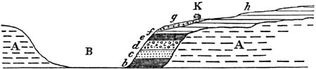
- K. Mr. Ryland's house.
- h. Clay and sand of higher grounds, with
Saxicava, &c.
- g. Gravel with boulders.
- f. Mass of Saxicava rugosa, 12 feet thick.
- e. Sand and loam with Mya truncata, Scalaria
Grœnlandica, &c.
- d. Drift, with boulders of syenite, &c.
- c. Yellow sand.
- b. Laminated clay, 25 feet thick.
- A. Horizontal lower Silurian strata.
- B. Valley re-excavated.
I described in 1839 the fossil shells collected by Captain Bayfield from
strata of drift at Beauport near Quebec, in lat. 47°, and drew from them
the inference that they indicated a more northern climate, the shells
agreeing in great part with those of Uddevalla in Sweden.[134-A] The shelly
beds attain at Beauport and the neighbourhood a height of 200, 300, and
sometimes 400 feet above the sea, and dispersed through some of them are
large boulders of granite, which could not have been propelled by a violent
current, because the accompanying fragile shells are almost all entire.
They seem, therefore, said Captain Bayfield, writing in 1838, to have been
dropped down from melting ice, like similar stones which are now annually
deposited in the St. Lawrence.[134-B] I visited this locality in 1842, and
made the annexed section, fig. 118., which will give an idea of the general
position of the drift in Canada and the United States. I imagine that the
whole of the valley B was once filled up with the beds b, c, d, e,
f, which were deposited during a period of subsidence, and that
subsequently the higher country (h) was submerged and overspread with
drift. The partial re-excavation of B took place when this region was again
uplifted above the sea to its present height. Among the twenty-three
species of fossil shells collected by me from these beds at Beauport, all
were of recent northern species, except one, which is unknown as living,
and may be extinct (see fig. 119.). I also examined the same formation
farther up the valley of the St. Lawrence, in the suburbs of Montreal,
where some of the beds of loam are filled with great numbers of the
Mytilus edulis, or our common European mussel, retaining both its valves
and purple colour. This shelly deposit, containing Saxicava rugosa and
other characteristic marine shells, [p.135]also occurs at an elevated
point on the mountain of Montreal, 450 feet above the level of the
sea.[135-A]
Fig. 119.
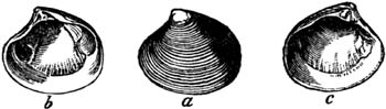
Astarte Laurentiana.
- a. Outside.
- b. Inside of right valve.
- c. Inside of left valve.
In my account of Canada and the United States, published in 1845, I
announced the conclusion to which I had then arrived, that to explain the
position of the erratics and the polished surfaces of rocks, and their
striæ and flutings, we must assume first a gradual submergence of the land
in North America, after it had acquired its present outline of hill and
valley, cliff and ravine, and then its re-emergence from the ocean. When
the land was slowly sinking, the sea which bordered it was covered with
islands of floating ice coming from the north, which, as they grounded on
the coast and on shoals, pushed along such loose materials of sand and
pebbles as lay strewed over the bottom. By this force all angular and
projecting points were broken off, and fragments of hard stone, frozen into
the lower surface of the ice, had power to scoop out grooves in the
subjacent solid rock. The sloping beach, as well as the floor of the ocean,
might be polished and scored by this machinery; but no flood of water,
however violent, or however great the quantity of detritus or size of the
rocky fragments swept along by it, could produce such long, perfectly
straight and parallel furrows, as are everywhere visible in the Niagara
district, and generally in the region north of the 40th parallel of
latitude.[135-B]
By the hypothesis of such a slow and gradual subsidence of the land we may
account for the fact that almost everywhere in N. America and Northern
Europe the boulder formation rests on a polished and furrowed surface of
rock,—a fact by no means obliging us to imagine, as some think, that the
polishing and grooving action was, as a whole, anterior in date to the
transportation of the erratics. During the successive depression of high
land, varying originally in height from 1000 to 3000 feet above the
sea-level, every portion of the surface would be brought down by turns to
the level of the ocean, so as to be converted first into a coast-line, and
then into a shoal; and at length, after being well scored by the stranding
upon it of thousands of icebergs, might be sunk to a depth of several
hundred fathoms. By the constant depression of land, the coast would recede
farther and farther from the successively formed zones of polished and
striated rock, each outer zone becoming in its turn so deep under water as
to be no longer grated upon by the heaviest icebergs. Such sunken areas
would then simply serve as receptacles of mud, sand, and boulders dropped
from melting ice, perhaps to a depth scarcely, if at [p.136]all,
inhabited by testacea and zoophytes. Meanwhile, during the formation of the
unstratified and unfossiliferous mass in deeper water, the smoothing and
furrowing of shoals and beaches is still going on elsewhere upon and near
the coast in full activity. If at length the subsidence should cease, and
the direction of the movement of the earth's crust be reversed, the sunken
area covered with drift would be slowly reconverted into land. The boulder
deposit, before emerging, would then for a time be brought within the
action of the waves, tides, and currents, so that its upper portion, being
partially disturbed, would have its materials re-arranged and stratified.
Streams also flowing from the land would in some places throw down layers
of sediment upon the till. In that case, the order of superposition will
be, first and uppermost, sand, loam, and gravel occasionally fossiliferous;
secondly, an unstratified and unfossiliferous mass, for the most part of
much older date than the preceding, with angular erratics, or with boulders
interspersed; and, thirdly, beneath the whole, a surface of polished and
furrowed rock. Such a succession of events seems to have prevailed very
widely on both sides of the Atlantic, the travelled blocks having been
carried in general from the North Pole southwards, but mountain chains
having in some cases served as independent centres of dispersion, of which
the Alps present the most conspicuous example.
It is by no means rare to meet with boulders imbedded in drift which are
worn flat on one or more of their sides, the surface being at the same time
polished, furrowed, and striated. They may have been so shaped in a glacier
before they reached the sea, or when they were fixed in the bottom of an
iceberg as it ran aground. We learn from Mr. Charles Martins that the
glaciers of Spitzbergen project from the coast into a sea between 100 and
400 feet deep; and that numbers of striated pebbles or blocks are there
seen to disengage themselves from the overhanging masses of ice as they
melt, so as to fall at once into deep water.[136-A]
That they should retain such markings when again upraised above the sea
ought not to surprise us, when we remember that rippled sands, and the
cracks in clay dried between high and low water, and the foot-tracks of
animals and rain-drops impressed on mud, and other superficial markings,
are all found fossil in rocks of various ages.
On the other hand, it is not difficult to account for the absence in many
districts of striated and scored pebbles and boulders in glacial deposits,
for they may have been exposed to the action of the waves on a coast while
it was sinking beneath or rising above the sea. No shingle on an ordinary
sea-beach exhibits such striæ, and at a very short distance from the
termination of a glacier every stone in the bed of the torrent which gushes
out from the melting ice is found to have lost its glacial markings by
being rolled for a distance even of a few hundred yards.
The usual dearth of fossil shells in glacial clays well fitted to preserve
[p.137]organic remains may, perhaps, be owing, as already hinted, to the
absence of testacea in the deep sea, where the undisturbed accumulation of
boulders melted out of very large bergs may take place. In the Ægean and
other parts of the Mediterranean, the zero of animal life, according to
Prof. E. Forbes, is approached at a depth of about 300 fathoms. In tropical
seas it would descend farther down, just as vegetation ascends higher on
the mountains of hot countries. Near the pole, on the other hand, the same
zero would be reached much sooner both on the hills and in the sea. If the
ocean was filled with floating bergs, and a low temperature prevailed in
the northern hemisphere during the glacial period, even the shallow part of
the sea might have been uninhabitable, or very thinly peopled with living
beings. It may also be remarked that the melting of ice in some fiords in
Norway freshens the water so as to destroy marine life, and famines have
been caused in Iceland by the stranding of icebergs drifted from the
Greenland coast, which have required several years to melt, and have not
only injured the hay harvest by cooling the atmosphere, but have driven
away the fish from the shore by chilling and freshening the sea.
If the cold of the glacial epoch came on slowly, if it was long before it
reached its greatest intensity, and again if it abated gradually, we may
expect to find the earliest and latest formed drift less barren of organic
remains than that deposited during the coldest period. We may also expect
that along the southern limits of the drift during the whole glacial epoch,
there would be an intimate association of transported matter of northern
origin with fossil-bearing sediment, whether marine or freshwater,
belonging to more southern seas, rivers, and continents.
That in the United States, the Mastodon giganteus was very abundant after
the drift period is evident from the fact that entire skeletons of this
animal are met with in bogs and lacustrine deposits occupying hollows in
the drift. They sometimes occur in the bottom even of small ponds recently
drained by the agriculturist for the sake of the shell marl. I examined one
of these spots at Geneseo in the state of New York, from which the bones,
skull, and tusk of a Mastodon had been procured in the marl below a layer
of black peaty earth, and ascertained that all the associated freshwater
and land shells were of a species now common in the same district. They
consisted of several species of Lymnea, of Planorbis bicarinatus,
Physa heterostropha, &c.
In 1845 no less than six skeletons of the same species of Mastodon were
found in Warren County, New Jersey, 6 feet below the surface, by a farmer
who was digging out the rich mud from a small pond which he had drained.
Five of these skeletons were lying together, and a large part of the bones
crumbled to pieces as soon as they were exposed to the air. But nearly the
whole of the other skeleton, which lay about 10 feet apart from the rest,
was preserved entire, and proved the correctness of Cuvier's conjecture
respecting this extinct animal, namely, that it had twenty ribs like the
living elephant. [p.138]From the clay in the interior within the ribs,
just where the contents of the stomach might naturally have been looked
for, seven bushels of vegetable matter were extracted. I submitted some of
this matter to Mr. A. Henfrey of London for microscopic examination, and he
informs me that it consists of pieces of small twigs of a coniferous tree
of the Cypress family, probably the young shoots of the white cedar, Thuja
occidentalis, still a native of North America, on which therefore we may
conclude that this extinct Mastodon once fed.
Another specimen of the same quadruped, the most complete and probably the
largest ever found, was exhumed in 1845 in the town of Newburg, New York,
the length of the skeleton being 25 feet, and its height 12 feet. The
anchylosing of the last two ribs on the right side afforded Dr. John C.
Warren a true gauge for the space occupied by the intervertebrate
substance, so as to enable him to form a correct estimate of the entire
length. The tusks when discovered were 10 feet long, but a part only could
be preserved. The large proportion of animal matter in the tusk, teeth, and
bones of some of these fossil mammalia is truly astonishing. It amounts in
some cases, as Dr. C. T. Jackson has ascertained by analysis, to 27 per
cent., so that when all the earthy ingredients are removed by acids, the
form of the bone remains as perfect, and the mass of animal matter is
almost as firm, as in a recent bone subjected to similar treatment.
It would be rash, however, to infer from such data that these quadrupeds
were mired in modern times, unless we use that term strictly in a
geological sense. I have shown that there is a fluviatile deposit in the
valley of the Niagara, containing shells of the genera Melania, Lymnea,
Planorbis, Valvata, Cyclas, Unio, and Helix, &c., all of recent
species, from which the bones of the great Mastodon have been taken in a
very perfect state. Yet the whole excavation of the ravine, for many miles
below the Falls, has been slowly effected since that fluviatile deposit was
thrown down.
Whether or not, in assigning a period of more than 30,000 years for the
recession of the Falls from Queenstown to their present site, I have over
or under estimated the time required for that operation, no one can doubt
that a vast number of centuries must have elapsed before so great a series
of geographical changes were brought about as have occurred since the
entombment of this elephantine quadruped. The freshwater gravel which
incloses it is decidedly of much more modern origin than the drift or
boulder clay of the same region.[138-A]
Other extinct animals accompany the Mastodon giganteus in the
post-glacial deposits of the United States, among which the Castoroides
ohioensis, Foster and Wyman, a huge rodent allied to the beaver, and the
Capybara may be mentioned. But whether the "loess," and other freshwater
and marine strata of the Southern States, in which skeletons of the same
Mastodon are mingled with the bones of the Megatherium, Mylodon, and
Megalonyx, were contemporaneous with the drift, or were of subsequent date,
is a chronological question still [p.139]open to discussion. It appears
clear, however, from what we know of the tertiary fossils of Europe—and I
believe the same will hold true in North America—that many species of
testacea and some mammalia, which existed prior to the glacial epoch,
survived that era. As European examples among the warm-blooded quadrupeds,
the Elephas primigenius and Rhinoceros tichorinus may be mentioned. As
to the shells, whether fresh water, terrestrial, or marine, they need not
be enumerated here, as allusion will be made to them in the sequel, when
the pliocene tertiary fossils of Suffolk are described. The fact is
important, as refuting the hypothesis that the cold of the glacial period
was so intense and universal as to annihilate all living creatures
throughout the globe.
That the cold was greater for a time than it is now in certain parts of
Siberia, Europe, and North America, will not be disputed; but, before we
can infer the universality of a colder climate, we must ascertain what was
the condition of other parts of the northern, and of the whole southern,
hemisphere at the time when the Scandinavian, British, and Alpine erratics
were transported into their present position. It must not be forgotten that
a great deposit of drift and erratic blocks is now in full progress of
formation in the southern hemisphere, in a zone corresponding in latitude
to the Baltic, and to Northern Italy, Switzerland, France, and England.
Should the uneven bed of the southern ocean be hereafter converted by
upheaval into land, the hills and valleys will be strewed over with
transported fragments, some derived from the antarctic continent, others
from islands covered with glaciers, like South Georgia, which must now be
centres of the dispersion of drift, although situated in a latitude,
agreeing with that of the Cumberland mountains in England.
Not only are these operations going on between the 45th and 60th parallels
of latitude south of the line, while the corresponding zone of Europe is
free from ice; but, what is still more worthy of remark, we find in the
southern hemisphere itself, only 900 miles distant from South Georgia,
where the perpetual snow reaches to the sea-beach, lands covered with
forests, as in Terra del Fuego. There is here no difference of latitude to
account for the luxuriance of vegetation in one spot, and the absolute want
of it in the other; but among other refrigerating causes in South Georgia
may be enumerated the countless icebergs which float from the antarctic
zone, and which chill, as they melt, the waters of the ocean, and the
surrounding air, which they fill with dense fogs.
I have endeavoured in the "Principles of Geology," chapters 7. and 8., to
point out the intimate connexion of climate and the physical geography of
the globe, and the dependence of the mean annual temperature, not only on
the height of the dry land, but on its distribution in high or low
latitudes at particular epochs. If, for example, at certain periods of the
past, the antarctic land was less elevated and less extensive than now,
while that at the north pole was higher and more continuous, the conditions
of the northern and southern hemispheres might have been the reverse of
what we [p.140]now witness in regard to climate, although the mountains
of Scandinavia, Scotland, and Switzerland, may have been less elevated than
at present. But if in both of the polar regions a considerable area of
elevated dry land existed, such a concurrence of refrigerating conditions
in both hemispheres might have created for a time an intensity of cold
never experienced since; and such probably was the state of things during
that period of submergence to which I have alluded in this chapter.
Alpine erratics.—Although the arctic regions constitute the great centre
from which erratics have travelled southwards in all directions in Europe
and North America, yet there are some mountains, as I have already stated,
like those of North Wales and the Alps, which have served as separate and
independent centres for the dispersion of blocks. In illustration of this
fact, the Alps deserve particular attention, not only from their magnitude,
but because they lie beyond the ordinary limits of the "northern drift" of
Europe, being situated between the 44th and 47th degrees of north latitude.
On the flanks of these mountains, and on the Subalpine ranges of hills or
plains adjoining them, those appearances which have been so often alluded
to, as distinguishing or accompanying the drift, between the 50th and 70th
parallels of north latitude, suddenly reappear, to assume in a more
southern country their most exaggerated form. Where the Alps are highest,
the largest erratic blocks have been sent forth, as, for example, from the
regions of Mont Blanc and Monte Rosa, into the adjoining parts of France,
Switzerland, Austria, and Italy, while in districts where the great chain
sinks in altitude, as in Carinthia, Carniola, and elsewhere, no such rocky
fragments, or a few only and of smaller bulk, have been detached and
transported to a distance.
In the year 1821, M. Venetz first announced his opinion that the Alpine
glaciers must formerly have extended far beyond their present limits, and
the proofs appealed to by him in confirmation of this doctrine were
afterwards acknowledged by M. Charpentier, who strengthened them by new
observations and arguments, and declared, in 1836, his conviction that the
glaciers of the Alps must once have reached as far as the Jura, and have
carried thither their moraines across the great valley of Switzerland. M.
Agassiz, after several excursions in the Alps with M. Charpentier, and
after devoting himself some years to the study of glaciers, published, in
1840, an admirable description of them, and of the marks which attest the
former action of great masses of ice over the entire surface of the Alps
and the surrounding country.[140-A] He pointed out that the surface of
every large glacier is strewed over with gravel and stones detached from
the surrounding precipices by frost, rain, lightning, or avalanches. And he
described more carefully than preceding writers the long lines of these
stones, which settle on the sides of the glacier, and are called the
lateral moraines; those found at the lower end of the ice being called
terminal moraines. Such heaps of earth and boulders every [p.141]glacier
pushes before it when advancing, and leaves behind it when retreating. When
the Alpine glacier reaches a lower and warmer situation, about 3000 or 4000
feet above the sea, it melts so rapidly that, in spite of the downward
movement of the mass, it can advance no farther. Its precise limits are
variable from year to year, and still more so from century to century; one
example being on record of a recession of half a mile in a single year. We
also learn from M. Venetz, that whereas, between the eleventh and fifteenth
centuries, all the Alpine glaciers were less advanced than now, they began
in the seventeenth and eighteenth centuries to push forward so as to cover
roads formerly open, and to overwhelm forests of ancient growth.
These oscillations enable the geologist to note the marks which they leave
behind them as they retrograde, and among these the most prominent, as
before stated, are the terminal moraines, or mounds of unstratified earth
and stones, often divided by subsequent floods into hillocks, which cross
the valley like ancient earth-works, or embankments made to dam up the
river. Some of these transverse barriers were formerly pointed out by
Saussure below the glacier of the Rhone, as proving how far it had once
transgressed its present boundaries. On these moraines we see many large
angular fragments, which, having been carried along on the surface of the
ice, have not had their edges worn off by friction; but the greater number
of the boulders, even those of large size, have been well rounded, not by
the power of water, but by the mechanical force of the ice, which has
pushed them against each other, or against the rocks flanking the valley.
Others have fallen down the numerous fissures which intersect the glacier,
where, being subject to the pressure of the whole mass of ice, they have
been forced along, and either well rounded or ground down into sand, or
even the finest mud, of which the moraine is largely constituted.
As the terminal moraines are the most prominent of all the monuments left
by a receding glacier, so are they the most liable to obliteration; for
violent floods or debacles are often occasioned in the Alps by the sudden
bursting of what are called glacier-lakes. These temporary sheets of water
are caused by the damming up of a river by a glacier which has increased
during a succession of cold seasons, and, descending from a tributary into
the main valley, has crossed it from side to side. On the failure of this
icy barrier, the accumulated waters are let loose, which sweep away and
level all transverse mounds of gravel and loose boulder below, and spread
their materials in confused and irregular beds over the river-plain.
Another mark of the former action of glaciers, in situations where they
exist no longer, is the polished, striated, and grooved surfaces of rocks
already alluded to. Stones which lie underneath the glacier and are pushed
along by it, sometimes adhere to the ice, and as the mass glides slowly
along at the rate of a few inches, or at the utmost two or three feet, per
day, abrade, groove, and polish the rock, and the larger blocks are
reciprocally grooved and polished by the rock on their lower sides. As the
forces both of pressure and propulsion [p.142]are enormous, the sand,
acting like emery, polishes the surface; the pebbles, like coarse gravers,
scratch and furrow it; and the large stones scoop out grooves in it.
Another effect also of this action, not yet adverted to, is called "roches
moutonnées." Projecting eminences of rock are smoothed and worn into the
shape of flattened domes, where the glaciers have passed over them.
Although the surface of almost every kind of rock, when exposed in the open
air, wastes away by decomposition, yet some retain for ages their polished
and furrowed exterior; and, if they are well protected by a covering of
clay or turf, these marks of abrasion seem capable of enduring for ever.
They have been traced in the Alps to great heights above the present
glaciers, and to great horizontal distances beyond them.
There are also found, on the sides of the Swiss valleys, round and deep
holes, with polished sides, such holes as waterfalls make in the solid
rock, but in places remote from running waters, and where the form of the
surface will not permit us to suppose that any cascade could ever have
existed. Similar cavities are common in hard rocks, such as gneiss, in
Sweden, where they are called giant caldrons, and are sometimes 10 feet
and more in depth; but in the Alps and Jura they often pass into
spoon-shaped excavations and prolonged gutters. We learn from M. Agassiz
that hollows of this form are now cut out by streams of water, which flow
along the surface of glaciers, and then fall into fissures which are open
to the bottom. Here, forming a cascade, the stream cuts a round cavity in
the rock with the gravel and sand, which it either finds there or carries
down with it, and causes to rotate; and, as it usually happens that the
glacier is advancing, a locomotive cascade is produced, which converts the
first circular hole into a deep groove.
Another effect of a glacier is to lodge a ring of stones round the summit
of a conical peak which may happen to project through the ice. If the
glacier is lowered greatly by melting, these circles of large angular
fragments, which are called "perched blocks," are left in a singular
situation near the top of a steep hill or pinnacle, the lower parts of
which may be destitute of boulders.
Alpine blocks on the Jura.—Now some or all the marks above
enumerated,—the moraines, erratics, polished surfaces, domes, striæ,
caldrons, and perched rocks, are observed in the Alps at great heights
above the present glaciers, and far below their actual extremities; also in
the great valley of Switzerland, 50 miles broad; and almost everywhere on
the Jura, a chain which lies to the north of this valley. The average
height of the Jura is about one third that of the Alps, and is now entirely
destitute of glaciers, yet it presents almost everywhere similar moraines,
and the same polished and grooved surfaces, and water-worn cavities. The
erratics, moreover, which cover it, present a phenomenon which has
astonished and perplexed the geologist for more than half a century. No
conclusion can be more incontestible than that these angular blocks of
granite, gneiss, and other crystalline formations, came from the Alps, and
that [p.143]they have been brought for a distance of 50 miles and
upwards across one of the widest and deepest valleys of the world, so that
they are now lodged on the hills and valleys of a chain composed of
limestone and other formations, altogether distinct from those of the Alps.
Their great size and angularity, after a journey of so many leagues, has
justly excited wonder; for hundreds of them are as large as cottages; and
one in particular, celebrated under the name of Pierre à Bot, rests on the
side of a hill about 900 feet above the lake of Neufchatel, and is no less
than 40 feet in diameter.
It will be remarked that these blocks on the Jura offer an exception to the
rule before laid down, as applicable in general to erratics, since they
have gone from south to north. Some of the largest masses of granite and
gneiss have been found to contain 50,000 and 60,000 cubic feet of stone,
and one limestone block near Devens, which has travelled 30 miles, contains
161,000 cubic feet, its angles being sharp and unworn.[143-A]
Von Buch, Escher, and Studer have shown, from an examination of the mineral
composition of the boulders, that those on the western Jura, near
Neufchatel, have come from the region of Mont Blanc and the Valais; those
on the middle parts of the Jura from the Bernese Oberland; and those on the
eastern Jura from the Alps of the small cantons, Glaris, Schwytz, Uri, and
Zug. The blocks, therefore, of these three great districts have been
derived from parts of the Alps nearest to the localities in the Jura where
we now find them, as if they had crossed the great valley in a direction at
right angles to its length: the most western stream having followed the
course of the Rhone; the central, that of the Aar; and the eastern, that of
the two great rivers, Reuss and Limmat. The non-intermixture of these
groups of travelled fragments, except near their confines, was always
regarded as most enigmatical by those who adopted the opinion of Saussure,
that they were all whirled along by a rapid current of muddy water rushing
from the Alps.
M. Charpentier first suggested, as before mentioned, that the Swiss
glaciers once reached continuously to the Jura, and conveyed to them these
erratics; but at the same time he conceived that the Alps were formerly
higher than now. M. Agassiz, on the other hand, instead of introducing
distinct and separate glaciers, imagines that the whole valley of
Switzerland was filled with ice, and that one great sheet of it extended
from the Alps to the Jura, when the two chains were of the same height as
now relatively to each other. Such an hypothesis labours under this
difficulty, that the difference of altitude, when distributed over a space
of 50 miles, gives an inclination of no more than two degrees, or far less
than that of any known glaciers. It has, however, since received the able
support of Professor James Forbes, in his excellent work on the Alps,
published in 1843.
In the theory which I formerly advanced, jointly with Mr. Darwin[143-B],
[p.144]it was suggested that the erratics may have been transferred by
floating ice to the Jura, at the time when the greater part of that chain,
and the whole of the Swiss valley to the south, was under the sea. At that
period the Alps may have attained only half their present altitude, and may
yet have constituted a chain as lofty as the Chilian Andes, which, in a
latitude corresponding to Switzerland, now send down glaciers to the head
of every sound, from which icebergs, covered with blocks of granite, are
floated seaward.[144-A] Opposite that part of Chili where the glaciers
abound is situated the island of Chiloe, 100 miles in length, with a
breadth of 30 miles, running parallel to the continent. The channel which
separates it from the main land is of considerable depth, and 25 miles
broad. Parts of its surface, like the adjacent coast of Chili, are
overspread with recent marine shells, showing an upheaval of the land
during a very modern period; and beneath these shells is a boulder deposit,
in which Mr. Darwin found large travelled blocks. One group of fragments
were of granite, which had evidently come from the Andes, while in another
place angular blocks of syenite were met with. Their arrangement may have
been due to successive crops of icebergs issuing from different sounds, to
the heads of which glaciers descend from the Andes. These icebergs, taking
their departure year after year from distinct points, may have been
stranded repeatedly, in equally distinct groups, in bays or creeks of
Chiloe, and on islets off the coast, so as afterwards to appear, some on
hills and others in valleys, when that country and the bed of the adjacent
sea had been upheaved. A continuance in future of the elevatory movement,
in the region of the Andes and of Chiloe, might cause the former chain to
rival the Alps in altitude, and give to Chiloe a height equal to that of
the Jura. The same rise might dry up the channel between Chiloe and the
main land, so that it would then represent the great valley of Switzerland.
In the course of these changes, all parts of Chiloe and the intervening
strait, having in their turn been a sea-shore, may have been polished and
scratched by coast-ice, and by innumerable icebergs running aground and
grating on the bottom.
If we apply this hypothesis to Switzerland and the Jura, we are by no means
precluded from the supposition that, in proportion as the land acquired
additional height, and the bed of the sea emerged, the Jura itself may have
had its glaciers; and those existing in the Alps, which had at first
extended to the sea, may, during some part of the period of upheaval, have
been prolonged much farther into the valleys than now. At a later period,
when the climate grew milder, these glaciers may have entirely disappeared
from the Jura, and may have receded in the Alps to their present limits,
leaving behind them in both districts those moraines which now attest the
former extension of the ice.[144-B]
[p.145]Meteorites in drift.—Before concluding my remarks on the
northern drift of the Old World, I shall refer to a fact recently
announced, the discovery of a meteoric stone at a great depth in the
alluvium of Northern Asia.
Erman, in his Archives of Russia for 1841 (p. 314.), cites a very
circumstantial account drawn up by a Russian miner of the finding of a mass
of meteoric iron in the auriferous alluvium of the Altai. Some small
fragments of native iron were first met with in the gold-washings of
Petropawlowsker in the Mrassker Circle; but though they attracted
attention, it was supposed that they must have been broken off from the
tools of the workmen. At length, at the depth of 31 feet 5 inches from the
surface, they dug out a piece of iron weighing 171/2 pounds, of a
steel-grey colour, somewhat harder than ordinary iron, and, on analysing
it, found it to consist of native iron, with a small proportion of nickel,
as usual in meteoric stones. It was buried in the bottom of the deposit
where the gravel rested on a flaggy limestone. Much brown iron ore, as well
as gold, occurs in the same gravel, which appears to be part of that
extensive auriferous formation in which the bones of the mammoth, the
Rhinoceros tichorhinus, and other extinct quadrupeds abound. No
sufficient data are supplied to enable us to determine whether it be of
Post-Pliocene or Newer Pliocene date.
We ought not, I think, to feel surprise that we have not hitherto succeeded
in detecting the signs of such aërolites in older rocks, for, besides their
rarity in our own days, those which fell into the sea (and it is with
marine strata that geologists have usually to deal), being chiefly composed
of native iron, would rapidly enter into new chemical combinations, the
water and mud being charged with chloride of sodium and other salts. We
find that anchors, cannon, and other cast-iron implements which have been
buried for a few hundred years off our English coast have decomposed in
part or entirely, turning the sand and gravel which enclosed them into a
conglomerate, cemented together by oxide of iron. In like manner meteoric
iron, although its rusting would be somewhat checked by the alloy of
nickel, could scarcely ever fail to decompose in the course of thousands of
years, becoming oxide, sulphuret or carbonate of iron, and its origin being
then no longer distinguishable. The greater the antiquity of rocks,—the
oftener they have been heated and cooled, permeated by gases or by the
waters of the sea, the atmosphere or mineral springs,—the smaller must be
the chance of meeting with a mass of native iron unaltered; but the
preservation of the ancient meteorite of the Altai, and the presence of
nickel in these curious bodies, renders the recognition of them in deposits
of remote periods less hopeless than we might have anticipated.
[p.146]CHAPTER XIII.
NEWER PLIOCENE STRATA AND CAVERN DEPOSITS.
Chronological classification of Pleistocene formations, why
difficult — Freshwater deposits in valley of Thames — In Norfolk
cliffs — In Patagonia — Comparative longevity of species in the
mammalia and testacea — Fluvio-marine crag of Norwich — Newer
Pliocene strata of Sicily — Limestone of great thickness and
elevation — Alternation of marine and volcanic formations — Proofs
of slow accumulation—Great geographical changes in Sicily since the
living fauna and flora began to exist — Osseous breccias and cavern
deposits — Sicily — Kirkdale — Origin of
stalactite — Australian cave-breccias — Geographical relationship
of the provinces of living vertebrata and those of the fossil species of
the Pliocene periods — Extinct struthious birds of New
Zealand — Teeth of fossil quadrupeds.
Having in the last chapter treated of the boulder formation and its
associated freshwater and marine strata as belonging chiefly to the close
of the Newer Pliocene period, we may now proceed to other deposits of the
same or nearly the same age. It should, however, be stated that it is
difficult to draw the line of separation between these modern formations,
especially when we are called upon to compare deposits of marine and
freshwater origin, or these again with the ossiferous contents of caverns.
If as often as the carcasses of quadrupeds were buried in alluvium during
floods, or mired in swamps, or imbedded in lacustrine strata, a stream of
lava had descended and preserved the alluvial or freshwater deposits, as
frequently happened in Auvergne (see above, p. 80.), keeping them free from
intermixture with strata subsequently formed, then indeed the task of
arranging chronologically the whole series of mammaliferous formations
might have been easy, even though many species were common to several
successive groups. But when there have been oscillations in the levels of
the land, accompanied by the widening and deepening of valleys at more than
one period,—when the same surface has sometimes been submerged beneath the
sea, after supporting forests and land quadrupeds, and then raised again,
and subject during each change of level to sedimentary deposition and
partial denudation,—and when the drifting of ice by marine currents or by
rivers, during an epoch of intense cold, has for a season interfered with
the ordinary mode of transport, or with the geographical range of species,
we cannot hope speedily to extricate ourselves from the confusion in which
the classification of these Pleistocene formations is involved.
At several points in the valley of the Thames, remnants of ancient
fluviatile deposits occur, which may differ considerably in age, although
the imbedded land and freshwater shells in each are of recent species. At
Brentford, for example, the bones of the Siberian Mammoth, [p.147]or
Elephas primigenius, and the Rhinoceros tichorhinus, both of them
quadrupeds of which the flesh and hair have been found preserved in the
frozen soil of Siberia, occur abundantly, with the bones of an
hippopotamus, aurochs, short-horned ox, red deer, rein-deer, and great
cave-tiger or lion.[147-A] A similar group has been found fossil at
Maidstone, in Kent, and other places, agreeing in general specifically with
the fossil bones detected in the caverns of England. When we see the
existing rein-deer and an extinct hippopotamus in the same fluviatile loam,
we are tempted to indulge our imaginations in speculating on the climatal
conditions which could have enabled these genera to co-exist in the same
region. Wherever there is a continuity of land from polar to temperate and
equatorial regions, there will always be points where the southern limit of
an arctic species meets the northern range of a southern species; and if
one or both have migratory habits, like the Bengal tiger, the American
bison, the musk ox, and others, they may each penetrate mutually far into
the respective provinces of the other. There may also have been several
oscillations of temperature during the periods which immediately preceded
and followed the more intense cold of the glacial epoch.
The strata bordering the left bank of the Thames at Grays Thurrock, in
Essex, are probably of older date than those of Brentford, although the
associated land and freshwater shells are nearly all, if not all, identical
with species now living. Three of the shells, however, are no longer
inhabitants of Great Britain; namely, Paludina marginata (fig. 112. p.
127.), now living in France; Unio littoralis (fig. 29. p. 28.), now
inhabiting the Loire; and Cyrena consobrina (fig. 26. p. 28.). The
last-mentioned fossil (a recent Egyptian shell of the Nile) is very
abundant at Grays, and deserves notice, because the genus Cyrena is now
no longer European.
The rhinoceros occurring in the same beds (R. leptorhinus, see fig. 131.
p. 160.) is of a different species from that of Brentford above mentioned,
and the accompanying elephant belongs to the variety called Elephas
meridionalis, which, according to MM. Owen and H. von Meyer, two high
authorities, is the same species as the Siberian mammoth, although some
naturalists regard it as distinct. With the above mammalia is also found
the Hippopotamus major, and what is most remarkable in so modern and
northern a deposit, a monkey, called by Owen, Macacus pliocenus.
The submerged forest already alluded to (p. 130.) as underlying the drift
at the base of the cliffs of Norfolk is associated with a bed of lignite
and loam, in which a great number of fossil bones occur, apparently of the
same group as that of Grays, just mentioned. It has sometimes been called
"the Elephant bed." One portion of it, which stretches out under the sea at
Happisburgh, was overgrown in 1820 by a bank of recent oysters, and there
the fishermen dredged up, according to Woodward, in the course of thirteen
years, together with the oysters, above 2000 mammoths' grinders.[147-B]
Another portion [p.148]of the same continuous stratum has yielded at
Bacton, Cromer, and other places on the coast, the bones of a gigantic
beaver (Trogontherium Cuvierii, Fischer), as well as the ox, horse, and
deer, and both species of rhinoceros, R. tichorhinus and R.
leptorhinus.
In studying these and various other similar assemblages of fossils, we have
a good exemplification of the more rapid rate at which the mammiferous
fauna, as compared to the testaceous, diverges when traced backwards in
time from the recent type. I have before hinted, that the longevity of
species in the class of warm-blooded quadrupeds is less great than in that
of the mollusca, the latter having probably more capacity for enduring
those changes of climate and other external circumstances which take place
in the course of ages on the earth's surface. This phenomenon is by no
means confined to Europe, for Mr. Darwin found at Bahia Blanca, in South
America, lat. 39° S., near the northern confines of Patagonia, fossil
remains of the extinct mammiferous genera Megatherium, Megalonyx, Toxodon,
and others, associated with shells, almost all of species already
ascertained to be still living in the contiguous sea[148-A]; the marine
mollusca, as well as those of rivers, lakes, or the land, having died out
more slowly than the terrestrial mammalia.
I alluded before (p. 125.) to certain marine strata overlying till near
Glasgow, and at other points on the Clyde, in which the shells are for the
most part British, with an intermixture of some arctic species; while
others, about a tenth of the whole, are supposed to be extinct. This
formation may also be called Newer Pliocene.
Fluvio-marine crag of Norwich.—At several places within five miles of
Norwich, on both banks of the Yare, beds of sand, loam, and gravel,
provincially termed "crag," occur, in which there is a mixture of marine,
land, and freshwater shells, with ichthyolites and bones of mammalia. It is
clear that these beds have been accumulated at the bottom of the sea near
the mouth of a river. They form patches of variable thickness, resting on
white chalk, and are covered by a dense mass of stratified flint gravel.
The surface of the chalk is often perforated to the depth of several inches
by the Pholas crispata, each fossil shell still remaining at the bottom
of its cylindrical cavity, now filled up with loose sand which has fallen
from the incumbent crag. This species of Pholas still exists and drills the
rocks between high and low water on the British coast. The most common
shells of these strata, such as Fusus striatus, Turritella terebra,
Cardium edule, and Cyprina islandica, are now abundant in the British
seas; but with them are some extinct species, such as Nucula Cobboldiæ
(fig. 120.) and Tellina obliqua (fig. 121.). Natica helicoides (fig.
122.) is an example of a species formerly known only as fossil, but which
has now been found living in our seas.
Among the accompanying bones of mammalia is the Mastodon [p.149]
angustidens[149-A] (see fig. 130.), a portion of the upper jawbone with a
tooth having been found by Mr. Wigham at Postwick, near Norwich. As this
species has also been found in the Red Crag, both at Sutton and at
Felixstow, and had hitherto been regarded as characteristic of formations
older than the Pleistocene, it may possibly have been washed out of the Red
into the Norwich Crag.
Fig. 120.

Nucula Cobboldiæ.
Fig. 121.

Tellina obliqua.
Fig. 122.
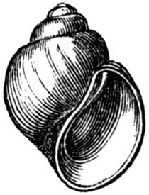
Natica helicoides, Johnston.
Among the bones, however, respecting the authenticity of which there seems
no doubt, may be mentioned those of the elephant, horse, pig, deer, and the
jaws and teeth of field mice (fig. 141.). I have seen the tusk of an
elephant from Bramerton near Norwich, to which, many serpulæ were attached,
showing that it had lain for some time at the bottom of the sea of the
Norwich Crag.
At Thorpe, near Aldborough, and at Southwold, in Suffolk, this
fluvio-marine formation is well exposed in the sea-cliffs, consisting of
sand, shingle, loam, and laminated clay. Some of the strata there bear the
marks of tranquil deposition, and in one section a thickness of 40 feet is
sometimes exposed to view. Some of the lamellibranchiate shells have both
valves united, although mixed with land and freshwater testacea, and with
the bones and teeth of elephant, rhinoceros, horse, and deer. Captain
Alexander, with whom I examined these strata in 1835, showed me a bed rich
in marine shells, in which he had found a large specimen of the Fusus
striatus, filled with sand, and in the interior of which was the tooth of
a horse.
Among the freshwater shells I obtained the Cyrena consobrina (fig. 26. p.
28.), before mentioned, supposed to agree with a species now living in the
Nile.
I formerly classed the Norwich Crag as older Pliocene, conceiving that more
than a third of the fossil testacea were extinct; but there now seems good
reason for believing that several of the rarer shells obtained from these
strata do not really belong to a contemporary fauna, but have been washed
out of the older beds of the "Red Crag;" while other species, once supposed
to have died out, have lately been met with living in the British seas.
According to Mr. Searles Wood, the total number of marine species does not
exceed seventy-six, of which one tenth only are extinct. Of the fourteen
associated freshwater shells, all the species appear to be living. Strata
containing the same shells as those near Norwich have been found by Mr.
Bean, at Bridlington, in Yorkshire.
Newer Pliocene strata of Sicily.—In no part of Europe are the [p.150]
Newer Pliocene formations seen to enter so largely into the structure of
the earth's crust, or to rise to such heights above the level of the sea,
as in Sicily. They cover nearly half the island, and near its centre, at
Castrogiovanni, they reach an elevation of 3000 feet. They consist
principally of two divisions, the upper calcareous, the lower argillaceous,
both of which may be seen at Syracuse, Girgenti, and Castrogiovanni.
According to Philippi, to whom we are indebted for the best account of the
tertiary shells of this island, thirty-five species out of one hundred and
twenty-four obtained from the beds in central Sicily are extinct. Of the
remainder, which still live, five species are no longer inhabitants of the
Mediterranean. When I visited Sicily in 1828 I estimated the proportion of
living species as somewhat greater, partly because I confounded with the
tertiary formation of central Sicily the strata at the base of Etna, and
some other localities, where the fossils are now proved to agree entirely
with the present Mediterranean fauna.
Philippi came to the conclusion, that in Sicily there is a gradual passage
from beds containing 70 per cent. of recent shells, to those in which the
whole of the fossils are identical with recent species; but his tables
appear scarcely to bear out so important a generalization, several of the
places cited by him in confirmation having as yet furnished no more than
twenty or thirty species of testacea. The Sicilian beds in question
probably belong to about the same period as the Norwich Crag, although a
geologist, accustomed to see nearly all the Pleistocene formations in the
north of Europe occupying low grounds and very incoherent in texture, is
naturally surprised to behold formations of the same age so solid and
stony, of such thickness, and attaining so great an elevation above the
level of the sea.
The upper or calcareous member of this group in Sicily consists in some
places of a yellowish-white stone, like the calcaire grossier of Paris, in
others, of a rock nearly as compact as marble. Its aggregate thickness
amounts sometimes to 700 or 800 feet. It usually occurs in regular
horizontal beds, and is occasionally intersected by deep valleys, such as
those of Sortino and Pentalica, in which are numerous caverns. The fossils
are in every stage of preservation, from shells retaining portions of their
animal matter and colour, to others which are mere casts.
The limestone passes downwards into a sandstone and conglomerate, below
which is clay and blue marl, like that of the Subapennine hills, from which
perfect shells and corals may be disengaged. The clay sometimes alternates
with yellow sand.
South of the plain of Catania is a region in which the tertiary beds are
intermixed with volcanic matter, which has been for the most part the
product of submarine eruptions. It appears that, while the clay, sand, and
yellow limestone before mentioned were in course of deposition at the
bottom of the sea, volcanos burst out beneath the waters, like that of
Graham Island, in 1831, and these explosions recurred again and again at
distant intervals of time. Volcanic ashes and sand were showered down and
spread by the waves and currents [p.151]so as to form strata of tuff,
which are found intercalated between beds of limestone and clay containing
marine shells, the thickness of the whole mass exceeding 2000 feet. The
fissures through which the lava rose may be seen in many places forming
what are called dikes.
In part of the region above alluded to, as, for example, near Lentini, a
conglomerate occurs in which I observed many pebbles of volcanic rocks
covered by full grown serpulæ. We may explain the origin of these by
supposing that there were some small volcanic islands which may have been
destroyed from time to time by the waves, as Graham Island has been swept
away since 1831. The rounded blocks and pebbles of solid volcanic matter,
after being rolled for a time on the beach of such temporary islands, were
carried at length into some tranquil part of the sea, where they lay for
years, while the marine serpulæ adhered to them, their shells growing and
covering their surface, as they are seen adhering to the shell figured in
p. 22. Finally, the bed of pebbles was itself covered with strata of shelly
limestone. At Vizzini, a town not many miles distant to the S.W., I
remarked another striking proof of the gradual manner in which these modern
rocks were formed, and the long intervals of time which elapsed between the
pouring out of distinct sheets of lava. A bed of oysters no less than 20
feet in thickness rests upon a current of basaltic lava. The oysters are
perfectly identifiable with our common eatable species. Upon the oyster
bed, again, is superimposed a second mass of lava, together with tuff or
peperino. In the midst of the same alternating igneous and aqueous
formations is seen near Galieri, not far from Vizzini, a horizontal bed,
about a foot and a half in thickness, composed entirely of a common
Mediterranean coral (Caryophyllia cæspitosa, Lam.). These corals stand
erect as they grew; and, after being traced for hundreds of yards, are
again found at a corresponding height on the opposite side of the valley.
Fig. 123.
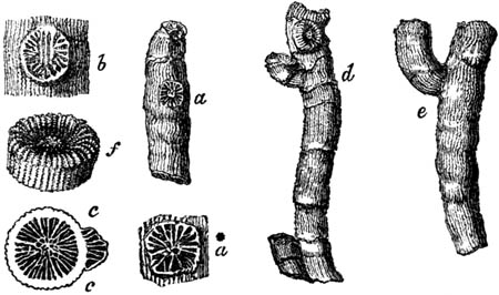
Caryophyllia cæspitosa, Lam. (Cladocora
cæspitosa, Ehr.)
- a. Stem with young stem growing from its side.
- a*. Young stem of same twice magnified.
- b. Portion of branch, twice magnified, with the base of a lateral branch; the exterior
ridges of the main branch appearing through the lamellæ of the lateral one.
- c. Transverse section of same, proving, by the integrity of the main branch, that the
lateral one did not originate in a subdivision of the animal.
- d. A branch, having at its base another laterally united to it, and two young corals at
its upper part.
- e. A main branch, with a full grown lateral one.
- f. A perfect terminal star.
[p.152]The corals are usually branched, but not by the division of the
animals as some have supposed, but by the attachment of young individuals
to the sides of the older ones; and we must understand this mode of
increase, in order to appreciate the time which was required for the
building up of the whole bed of coral during the growth of many successive
generations.[152-A]
Among the other fossil shells met with in these Sicilian strata, which
still continue to abound in the Mediterranean, no shell is more
conspicuous, from its size and frequent occurrence, than the great scallop,
Pecten jacobæus (see fig. 124.), now so common in the neighbouring seas.
We see this shell in the calcareous beds at Palermo in great numbers, in
the limestone at Girgenti, and in that which alternates with volcanic rocks
in the country between Syracuse and Vizzini, often at great heights above
the sea.
Fig. 124.
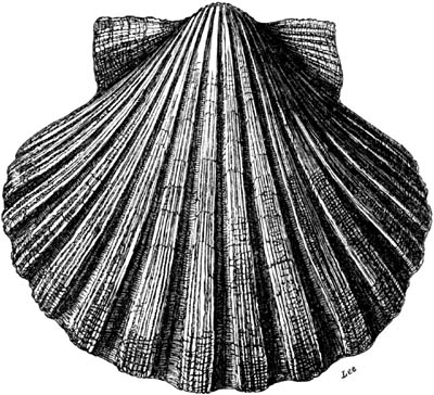
Pecten jacobæus; half natural size.
The more we reflect on the preponderating number of these recent shells,
the more we are surprised at the great thickness, solidity, and height
above the sea of the rocky masses in which they are entombed, and the vast
amount of geographical change which has taken place since their origin. It
must be remembered that, before they began to emerge, the uppermost strata
of the whole must have been deposited under water. In order, therefore, to
form a just conception of their antiquity, we must first examine singly the
innumerable minute parts of which the whole is made up, the successive beds
of shells, corals, volcanic ashes, conglomerates, and sheets of lava; and
we must afterwards contemplate the time required for the gradual upheaval
of the rocks, and the excavation of the valleys. The historical period
seems scarcely to form an appreciable unit in this computation, [p.153]
for we find ancient Greek temples, like those of Girgenti (Agrigentum),
built of the modern limestone of which we are speaking, and resting on a
hill composed of the same; the site having remained to all appearance
unaltered since the Greeks first colonised the island.
The modern geological date of the rocks in this region leads to another
singular and unexpected conclusion, namely, that the fauna and flora of a
large part of Sicily are of higher antiquity than the country itself,
having not only flourished before the lands were raised from the deep, but
even before their materials were brought together beneath the waters. The
chain of reasoning which conducts us to this opinion may be stated in a few
words. The larger part of the island has been converted from sea into land
since the Mediterranean was peopled with nearly all the living species of
testacea and zoophytes. We may therefore presume that, before this region
emerged, the same land and river shells, and almost all the same animals
and plants, were in existence which now people Sicily; for the terrestrial
fauna and flora of this island are precisely the same as that of other
lands surrounding the Mediterranean. There appear to be no peculiar or
indigenous species, and those which are now established there must be
supposed to have migrated from pre-existing lands, just as the plants and
animals of the Neapolitan territory have colonised Monte Nuovo, since that
volcanic cone was thrown up in the sixteenth century.
Such conclusions throw a new light on the adaptation of the attributes and
migratory habits of animals and plants to the changes which are unceasingly
in progress in the physical geography of the globe. It is clear that the
duration of species is so great, that they are destined to outlive many
important revolutions in the configuration of the earth's surface; and
hence those innumerable contrivances for enabling the subjects of the
animal and vegetable creation to extend their range; the inhabitants of the
land being often carried across the ocean, and the aquatic tribes over
great continental spaces. It is obviously expedient that the terrestrial
and fluviatile species should not only be fitted for the rivers, valleys,
plains, and mountains which exist at the era of their creation, but for
others that are destined to be formed before the species shall become
extinct; and, in like manner, the marine species are not only made for the
deep and shallow regions of the ocean existing at the time when they are
called into being, but for tracts that may be submerged or variously
altered in depth during the time that is allotted for their continuance on
the globe.
OSSEOUS BRECCIAS AND DEPOSITS IN CAVES OF THE PLIOCENE PERIOD.
Sicily.—Caverns filled with marine breccias, at the base of ancient
sea-cliffs, have been already mentioned in the sixth chapter; and it was
noticed, respecting the cave of San Ciro, near Palermo (p. 75.), that upon
a bed of sand filled with sea-shells, almost all of recent species,
[p.154]rests a breccia (b, fig. 93.), composed of fragments of
calcareous rock, and the bones of animals. In the sand at the bottom of
that cave, Dr. Philippi found about forty-five marine shells, all clearly
identical with recent species, except two or three. The bones in the
incumbent breccia are chiefly those of the mammoth (E. primigenius), with
some belonging to an hippopotamus, distinct from the recent species, and
smaller than that usually found fossil. (See fig. 132.) Several species of
deer also, and, according to some accounts, the remains of a bear, were
discovered. These mammalia are probably referable to the Post-Pliocene
period.
The Newer Pliocene tertiary limestone of the south of Sicily, already
described, is sometimes full of caverns; and the student will at once
perceive that all the quadrupeds of which the remains are found in the
stalactite of these caverns, being of later origin than the rocks, must be
referable to the close of the tertiary epoch, if not of still later date.
The situation of one of these caves, in the valley of Sortino, is
represented in the annexed section.
Fig. 125.
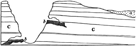
| a. Alluvium, |
} |
|
containing the remains of quadrupeds for the most part extinct. |
| b, b. Deposits in caves, |
| C. Limestone, containing the remains of shells, of which between 70 and 80 per cent. are recent. |
England.—In a cave at Kirkdale, about twenty-five miles N.N.E. of York,
the remains of about 300 hyænas, belonging to individuals of every age,
have been detected. The species (Hyæna spelæa) is extinct, and was larger
than the fierce Hyæna crocuta of South Africa, which it most resembled.
Dr. Buckland, after carefully examining the spot, proved that the Hyænas
must have lived there; a fact attested by the quantity of their dung,
which, as in the case of the living hyæna, is of nearly the same
composition as bone, and almost as durable. In the cave were found the
remains of the ox, young elephant, hippopotamus, rhinoceros, horse, bear,
wolf, hare, water-rat, and several birds. All the bones have the appearance
of having been broken and gnawed by the teeth of the hyænas; and they occur
confusedly mixed in loam or mud, or dispersed through a crust of stalagmite
which covers it. In these and many other cases it is supposed that portions
of herbivorous quadrupeds have been dragged into caverns by beasts of prey,
and have served as their food, an opinion quite consistent with the known
habits of the living hyæna.
No less than thirty-seven species of mammalia are enumerated by Professor
Owen as having been discovered in the caves of the British islands, of
which eighteen appear to be extinct, while the others still [p.155]
survive in Europe. They were not washed to the spots where the fossils now
occur by a great flood; but lived and died, one generation after another,
in the places where they lie buried. Among other arguments in favour of
this conclusion may be mentioned the great numbers of the shed antlers of
deer discovered in caves and in freshwater strata throughout
England.[155-A]
Examples also occur of fissures into which animals have fallen from time to
time, or have been washed in from above, together with alluvial matter and
fragments of rock detached by frost, forming a mass which may be united
into a bony breccia by stalagmitic infiltrations. Frequently we discover a
long suite of caverns connected by narrow and irregular galleries, which
hold a tortuous course through the interior of mountains, and seem to have
served as the subterranean channels of springs and engulphed rivers. Many
streams in the Morea are now carrying bones, pebbles, and mud into
underground passages of this kind.[155-B] If, at some future period, the
form of that country should be wholly altered by subterranean movements and
new valleys shaped out by denudation, many portions of the former channels
of these engulphed streams may communicate with the surface, and become the
dens of wild beasts, or the recesses to which quadrupeds retreat to die.
Certain caves of France, Germany, and Belgium, may have passed successively
through these different conditions, and in their last state may have
remained open to the day for several tertiary periods. It is nevertheless
remarkable, that on the continent of Europe, as in England, the fossil
remains of mammalia belong almost exclusively to those of the Newer
Pliocene and Post-Pliocene periods, and not to the Miocene or Eocene
epochs, and when they are accompanied by land or river shells, these agree
in great part, or entirely, with recent species.
As the preservation of the fossil bones is due to a slow and constant
supply of stalactite, brought into the caverns by water dropping from the
roof, the source and origin of this deposit has been a subject of curious
inquiry. The following explanation of the phenomenon has been recently
suggested by the eminent chemist Liebig. On the surface of Franconia, where
the limestone abounds in caverns, is a fertile soil, in which vegetable
matter is continually decaying. This mould or humus, being acted on by
moisture and air, evolves carbonic acid which is dissolved by rain. The
rain water, thus impregnated, permeates the porous limestone, dissolves a
portion of it, and afterwards, when the excess of carbonic acid evaporates
in the caverns, parts with the calcareous matter, and forms stalactite.
Australian cave-breccias.—Ossiferous breccias are not confined to
Europe, but occur in all parts of the globe; and those lately discovered in
fissures and caverns in Australia correspond closely in character with what
has been called the bony breccia of the Mediterranean, in which the
fragments of bone and rock are firmly bound together by a red ochreous
cement.
[p.156]Some of these caves have been examined by Sir T. Mitchell in the
Wellington Valley, about 210 miles west of Sidney, on the river Bell, one
of the principal sources of the Macquarie, and on the Macquarie itself. The
caverns often branch off in different directions through the rock, widening
and contracting their dimensions, and the roofs and floors are covered with
stalactite. The bones are often broken, but do not seem to be water-worn.
In some places they lie imbedded in loose earth, but they are usually
included in a breccia.
The remains found most abundantly are those of the kangaroo, of which there
are four species, besides which the genera Hypsiprymnus, Phalangista,
Phascolomys, and Dasyurus, occur. There are also bones, formerly
conjectured by some osteologists to belong to the hippopotamus, and by
others to the dugong, but which are now referred by Mr. Owen to a marsupial
genus, allied to the Wombat.
Fig. 126.

Macropus atlas, Owen.
a. permanent false molar, in the alveolus.
Fig. 127.
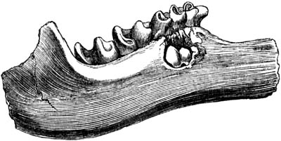
Lowest jaw of largest living species of kangaroo.
(Macropus major.)
In the fossils above enumerated, several species are larger than the
largest living ones of the same genera now known in Australia. The annexed
figure of the right side of a lower jaw of a kangaroo (Macropus atlas,
Owen) will at once be seen to exceed in magnitude the corresponding part of
the largest living kangaroo, which is represented in fig. 127. In both
these specimens part of the substance of the jaw has been broken open, so
as to show the [p.157]permanent false molar (a. fig. 126.) concealed
in the socket. From the fact of this molar not having been cut, we learn
that the individual was young, and had not shed its first teeth. In fig.
128. a front tooth of the same species of kangaroo is represented.
Fig. 128.

Incisor of Macropus.
Whether the breccias, above alluded to, of the Wellington Valley, appertain
strictly to the Pliocene period cannot be affirmed with certainty, until we
are more thoroughly acquainted with the recent quadrupeds of the same
district, and until we learn what species of fossil land shells, if any,
are buried in the deposits of the same caves.
The reader will observe that all these extinct quadrupeds of Australia
belong to the marsupial family, or, in other words, that they are referable
to the same peculiar type of organization which now distinguishes the
Australian mammalia from those of other parts of the globe. This fact is
one of many pointing to a general law deducible from the fossil vertebrate
and invertebrate animals of the eras immediately antecedent to the human,
namely, that the present geographical distribution of organic forms dates
back to a period anterior to the creation of existing species; in other
words, the limitation of particular genera or families of quadrupeds,
mollusca, &c., to certain existing provinces of land and sea, began before
the species now contemporary with man had been introduced into the earth.
Mr. Owen, in his excellent "History of British Fossil Mammals," has called
attention to this law, remarking that the fossil quadrupeds of Europe and
Asia differ from those of Australia or South America. We do not find, for
example, in the Europæo-Asiatic province fossil kangaroos or armadillos,
but the elephant, rhinoceros, horse, bear, hyæna, beaver, hare, mole, and
others, which still characterize the same continent.
In like manner in the Pampas of South America the skeletons of Megatherium,
Megalonyx, Glyptodon, Mylodon, Toxodon, Macrauchenia, and other extinct
forms, are analogous to the living sloth, armadillo, cavy, capybara, and
llama. The fossil quadrumana, also associated with some of these forms in
the Brazilian caves, belong to the Platyrrhine family of monkeys, now
peculiar to South America. That the extinct fauna of Buenos Ayres and
Brazil was very modern has been shown by its relation to deposits of marine
shells, agreeing with those now inhabiting the Atlantic; and when in
Georgia in 1845, I ascertained that the Megatherium, Mylodon, Harlanus
americanus (Owen), Equus curvidens, and other quadrupeds allied to the
Pampean type were posterior in date to beds containing marine shells
belonging to forty-five recent species of the neighbouring sea.
There are indeed some cosmopolite genera, such as the Mastodon (a genus of
the elephant family), and the horse, which were simultaneously represented
by different fossil species in Europe, North [p.158]America, and South
America; but these few exceptions can by no means invalidate the rule which
has been thus expressed by Professor Owen, "that in the highest organized
class of animals the same forms were restricted to the same great provinces
at the Pliocene periods as they are at the present day."
However modern, in a geological point of view, we may consider the
Pleistocene epoch, it is evident that causes more general and powerful than
the intervention of man have occasioned the disappearance of the ancient
fauna from so many extensive regions. Not a few of the species had a wide
range; the same Megatherium, for instance, extended from Patagonia and the
river Plata in South America, between latitudes 31° and 39° south, to
corresponding latitudes in North America, the same animal being also an
inhabitant of the intermediate country of Brazil, where its fossil remains
have been met with in caves. The extinct elephant, likewise, of Georgia
(Elephas primigenius) has been traced in a fossil state northward from
the river Alatamaha, in lat. 33° 50' N. to the polar regions, and then
again in the eastern hemisphere from Siberia to the south of Europe. If it
be objected that, notwithstanding the adaptation of such quadrupeds to a
variety of climates and geographical conditions, their great size exposed
them to extermination by the first hunter tribes, we may observe that the
investigations of Lund and Clausen in the ossiferous limestone caves of
Brazil have demonstrated that these large mammalia were associated with a
great many smaller quadrupeds, some of them as diminutive as field mice,
which have all died out together, while the land shells formerly their
contemporaries still continue to exist in the same countries. As we may
feel assured that these minute quadrupeds could never have been extirpated
by man, so we may conclude that all the species, small and great, have been
annihilated one after the other, in the course of indefinite ages, by those
changes of circumstances in the organic and inorganic world which are
always in progress, and are capable in the course of time of greatly
modifying the physical geography, climate, and all other conditions on
which the continuance upon the earth of any living being must
depend.[158-A]
The law of geographical relationship above alluded to, between the living
vertebrata of every great zoological province and the fossils of the period
immediately antecedent, even where the fossil species are extinct, is by no
means confined to the mammalia. New Zealand, when first examined by
Europeans, was found to contain no indigenous land quadrupeds, no
kangaroos, or opossums, like Australia; but a wingless bird abounded there,
the smallest living representative of the ostrich family, called the Xivi,
by the natives (Apteryx). In the fossils of the Post-Pliocene and
Pleistocene period in this same island, there is the like absence of
kangaroos, opossums, wombats, and the rest; but in their place a prodigious
number of well preserved specimens of gigantic birds of the struthious
order, called by Owen [p.159]Dinornis and Palapteryx, which are entombed
in superficial deposits. These genera comprehended many species, some of
which were 4, some 7, others 9, and others 11 feet in height! It seems
doubtful whether any contemporary mammalia shared the land with this
population of gigantic feathered bipeds.
To those who have never studied comparative anatomy it may seem scarcely
credible, that a single bone taken from any part of the skeleton may enable
a skilful osteologist to distinguish, in many cases, the genus, and
sometimes the species, of quadruped to which it belonged. Although few
geologists can aspire to such knowledge, which must be the result of long
practice and study, they will nevertheless derive great advantage from
learning what is comparatively an easy task, to distinguish the principal
divisions of the mammalia by the forms and characters of their teeth. The
annexed figures, all taken from original specimens, may be useful in
assisting the student to recognize the teeth of many genera most frequently
found fossil in Europe:—
Fig. 129.
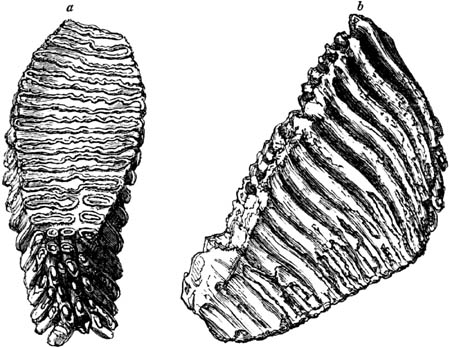
Elephas primigenius (or Mammoth); molar of upper
jaw, right side; one third of nat. size.
- a. grinding surface.
- b. side view.
Fig. 130.
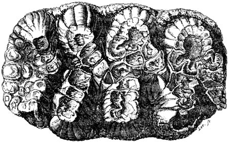
Mastodon angustidens (Norwich Crag, Postwick,
also found in Red Crag, see p. 149.); second true molar, left side, upper
jaw; grinding surface, nat. size. (See p. 149.)
[p.160]
Fig. 131.
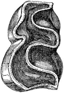
Rhinoceros.
Rhinoceros leptorhinus; fossil from freshwater beds of Grays, Essex (see
p. 147.); penultimate molar, lower jaw, left side; two-thirds of nat.
size.
Fig. 132.

Hippopotamus.
Hippopotamus; from cave near Palermo (see p. 154.); molar tooth; two-thirds
of nat. size.
Fig. 133.

Pig.
Sus scrofa, Lin. (common pig); from shell-marl, Forfarshire; posterior
molar, lower jaw, nat. size.
Fig. 134.
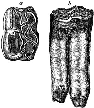
Horse.
Equus caballus, Lin. (common horse); from the shell marl, Forfarshire;
second molar, lower jaw.
- a. grinding surface, two-thirds nat. size.
- b. side view of same, half nat. size.
Fig. 135.

Tapir.
Tapirus Americanus; recent; third molar, upper jaw; nat. size
Fig. 136.

a. b. Deer.
Elk (Cervus alces, Lin.); recent; molar of upper jaw.
- a. grinding surface.
- b. side view; two-thirds of nat. size.
Fig. 137.

c. d. Ox.
Ox, common, from shell marl, Forfarshire; true molar upper jaw; two-thirds
nat. size.
- c. grinding surface.
- d. side view.
[p.161]
Fig. 138.
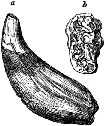
Bear.
- a. canine tooth or tusk of bear (Ursus
spelæus); from cave near Liege.
- b. molar of left side, upper jaw; one
third of nat. size.
Fig. 139.
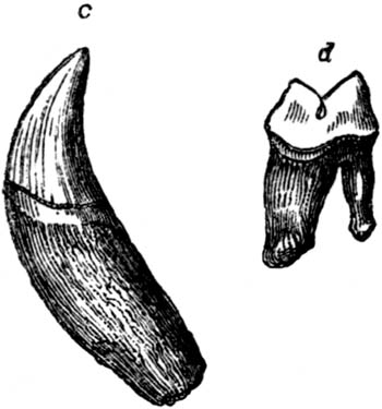
Tiger.
- c. canine tooth of tiger (Felis tigris); recent.
- d. outside view of posterior molar, lower
jaw; one-third of nat. size.
Fig. 140.
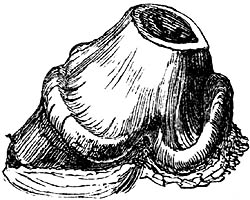
Hyæna spelæa; second molar, left side, lower
jaw; nat. size. Cave of Kirkdale. (See p. 154.)
Fig. 141.
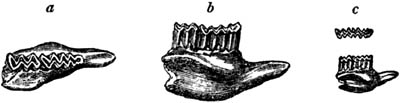
Teeth of a new species of Arvicola
(field-mouse); from the Norwich Crag. (See p. 149.)
- a. grinding surface.
- b. side view of same.
- c. nat. size of a and b.
CHAPTER XIV.
OLDER PLIOCENE AND MIOCENE FORMATIONS.
Strata of Suffolk termed Red and Coralline crag — Fossils, and
proportion of recent species — Depth of sea and climate — Reference
of Suffolk crag to the older Pliocene period — Migration of many
species of shells southwards during the glacial period — Fossil
whales — Subapennine beds — Asti, Sienna, Rome — Miocene
formations — Faluns of Touraine — Depth of sea and littoral
character of fauna — Tropical climate implied by the
testacea — Proportion of recent species of shells — Faluns more
ancient than the Suffolk crag — Miocene strata of Bordeaux and
Piedmont — Molasse of Switzerland — Tertiary strata of
Lisbon — Older Pliocene and Miocene formations in the United
States — Sewâlik Hills in India.
The older Pliocene strata, which next claim our attention, are chiefly
confined, in Great Britain, to the eastern part of the county of Suffolk,
where, like the Norwich beds already described, they are called "Crag," a
provincial name given particularly to those masses of shelly sand which
have been used from very ancient times in agriculture, to fertilize soils
deficient in calcareous matter. The relative position of the "red crag" in
Essex to the London clay, may be understood by reference to the
accompanying diagram (fig. 142.).
[p.162]
Fig. 142.

These deposits, judging by the shells which they contain, appear, according
to Professor Edward Forbes, to have been formed in a sea of moderate depth,
generally from 15 to 25 fathoms deep, although in some few spots perhaps
deeper. But they may, nevertheless, have been accumulated at the distance
of 40 or 50 miles from land.
The Suffolk crag is divisible into two masses, the upper of which has been
termed the Red, and the lower the Coralline Crag.[162-A] The upper deposit
consists chiefly of quartzose sand, with an occasional intermixture of
shells, for the most part rolled, and sometimes comminuted. The lower or
Coralline crag is of very limited extent, ranging over an area about 20
miles in length, and 3 or 4 in breadth, between the rivers Alde and Stour.
It is generally calcareous and marly—a mass of shells and small corals,
passing occasionally into a soft building stone. At Sudbourn, near Orford,
where it assumes this character, are large quarries, in which the bottom of
it has not been reached at the depth of 50 feet. At some places in the
neighbourhood, the softer mass is divided by thin flags of hard limestone,
and corals placed in the upright position in which they grew.
The Red crag is distinguished by the deep ferruginous or ochreous colour of
its sands and fossils, the Coralline by its white colour. Both formations
are of moderate thickness; the red crag rarely exceeding 40, and the
coralline seldom amounting to 20, feet. But their importance is not to be
estimated by the density of the mass of strata or its geographical extent,
but by the extraordinary richness of its organic remains, belonging to a
very peculiar type, which seems to characterize the state of the living
creation in the north of Europe during the older Pliocene era.
For a large collection of the fish, echinoderms, shells, and corals of the
deposits in Suffolk, we are indebted to the labours of Mr. Searles Wood. Of
testacea alone he has obtained from 230 species from the Red, and 345 from
the Coralline crag, about 150 being common to each. The proportion of
recent species in the new group is considered by Mr. Wood to be about
70[162-B] per cent., and that in the older or coralline about 60. When I
examined these shells of Suffolk in 1835, with the assistance of Dr. Beck,
Mr. George Sowerby, Mr. Searles Wood, and other eminent conchologists, I
came to the opinion that the extinct species predominated very decidedly in
number over the living. Recent investigations, however, have thrown much
new light on the conchology of the Arctic, Scandinavian, British, and
Mediterranean Seas. Many of the species formerly known only as fossils of
the Crag, and supposed to have died out, have been dredged up in a living
state [p.163]from depths not previously explored. Other recent species,
before regarded as distinct from the nearest allied Crag fossils, have been
observed, when numerous individuals were procured, to be liable to much
greater variation, both in size and form, than had been suspected, and thus
have been identified. Consequently, the Crag fauna has been found to
approach much more nearly to the recent fauna of the Northern, British, and
Mediterranean Seas than had been imagined. The analogy of the whole group
of testacea to the European type is very marked, whether we refer to the
large development of certain genera in number of species or to their size,
or to the suppression or feeble representation of others. The indication
also afforded by the entire fauna of a climate not much warmer than that
now prevailing in corresponding latitudes, prepares us to believe that they
are not of higher antiquity than the Older Pliocene era.[163-A]
Fig. 143.

Section near Ipswich, in Suffolk.
- a. Red crag.
- b. Coralline crag.
- c. London clay.
The position of the red crag in Essex to the subjacent London clay and
chalk has been already pointed out (fig. 142.). Whenever the two divisions
are met with in the same district, the red crag lies uppermost; and, in
some cases, as in the section represented in fig. 143., it is observed that
the older or coralline mass b had suffered denudation before the newer
formation a was thrown down upon it. At D there is not only a distinct
cliff, 8 or 10 feet high, of coralline crag, running in a direction N.E.
and S.W., against which the red crag abuts with its horizontal layers; but
this cliff occasionally overhangs. The rock composing it is drilled
everywhere by Pholades, the holes which they perforated having been
afterwards filled with sand and covered over when the newer beds were
thrown down. As the older formation is shown by its fossils to have
accumulated in a deeper sea (15, and sometimes 25, fathoms deep or more),
there must no doubt have been an upheaval of the sea-bottom before the
cliff here alluded to was shaped out. We may also conclude that so great an
amount of denudation could scarcely take place, in such incoherent
materials, without many of the fossils of the inferior beds becoming mixed
up with the overlying crag, so that considerable difficulty must be
occasionally experienced by the palæontologist in deciding which species
belong severally to each group. The red crag being formed in a shallower
sea, often resembles in structure a shifting sand bank, its layers being
inclined diagonally, and the planes of stratification being sometimes
directed in the same quarry to the four [p.164]cardinal points of the
compass, as at Butley. That in this and many other localities, such a
structure is not deceptive or due to any subsequent concretionary
re-arrangement of particles, or to mere lines of colour, is proved by each
bed being made up of flat pieces of shell which lie parallel to the planes
of the smaller strata.
Some fossils, which are very abundant in the red crag, have never been
found in the white or coralline division; as, for example, the Fusus
contrarius (fig. 144.), and several species of Buccinum (or Nassa) and
Murex (see figs. 145, 146.), which two genera seem wanting in the lower
crag.
Fossils characteristic of the Red Crag.
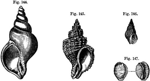
Fig. 144. Fusus contrarius.
Fig. 145. Murex alveolatus.
Fig. 146. Nassa granulata.
Fig. 147. Cypræa coccinelloides.
Fig. 144. half nat. size; the others nat. size.
Among the bones and teeth of fishes are those of large sharks
(Carcharias), and a gigantic skate of the extinct genus Myliobates, and
many other forms, some common to our seas, and many foreign to them.
The distinctness of the fossils of the coralline crag arises in part from
higher antiquity, and, in some degree, from a difference in the
geographical conditions of the submarine bottom. The prolific growth of
corals, echini, and a prodigious variety of testacea, implies a region of
deeper and more tranquil water; whereas, the red crag may have formed
afterwards on the same spot, when the water was shallower. In the mean time
the climate may have become somewhat cooler, and some of the zoophytes
which flourished in the first period may have disappeared, so that the
fauna of the red crag acquired a character somewhat more nearly resembling
that of our northern seas, as is implied by the large development of
certain sections of the genera Fusus, Buccinum, Purpura, and
Trochus, proper to higher latitudes, and which are wanting or feebly
represented in the inferior crag.
Some of the corals of the lower crag of Suffolk belong to genera unknown in
the living creation, and of a very peculiar structure; as, for example,
that represented in the annexed fig. (148.), which is one of several
species having a globular form. The great number and variety of these
zoophytes probably indicate an equable climate, free [p.165]from intense
cold in winter. On the other hand, that the heat was never excessive is
confirmed by the prevalence of northern forms among the testacea, such as
the Glycimeris, Cyprina, and Astarte. Of the genus last mentioned
(see fig. 149.) there are about fourteen species, many of them being rich
in individuals; and there is an absence of genera peculiar to hot climates,
such as Conus, Oliva, Mitra, Fasciolaria, Crassatella, and
others. The cowries (Cypræa, fig. 147.), also, are small, and belong to a
section (Trivia) now inhabiting the colder regions. A large volute,
called Voluta Lamberti (fig. 150.), may seem an exception; but it differs
in form from the volutes of the torrid zone, and may, like the living
Voluta Magellanica, have been fitted for an extra-tropical climate.
Fig. 148.

Fascicularia aurantium, Milne Edwards. Family,
Tubuliporidæ, of same author.
Coral of extinct genus, from the inferior or coralline crag, Suffolk.
- a. exterior.
- b. vertical section of interior.
- c. portion of exterior magnified.
- d. portion of interior magnified, showing that it is made up of long, thin, straight tubes, united
in conical bundles.
Fig. 149.

Astarte (Crassina, Lam.); species common to
upper and lower crag.
Astarte Omalii, Lajonkaire; Syn. A. bipartita, Sow. Min. Con. T. 521.
f. 3.; a very variable species most characteristic of the coralline crag,
Suffolk.
Fig. 150.
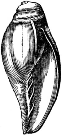
Voluta Lamberti, young individ.
The occurrence of a species of Lingula at Sutton is worthy of remark, as
these Brachiopoda seem now confined to more equatorial latitudes, and the
same may be said still more decidedly of a species of Pyrula, allied to
P. reticulata. Whether, therefore, we may incline to the belief that the
mean [p.166]annual temperature was higher or lower than now, we may at
least infer that the climate and geographical conditions were by no means
the same at the period of the Suffolk crag as those now prevailing in the
same region.
Of the echinoderms of the coralline crag about eleven species are known,
but some of these are in too fragmentary a condition to admit of exact
comparison. Of six which are the most perfect, Prof. E. Forbes has been
able to identify three with recent species: one of which, of the genus
Echinus, is British; a second, Echinocyamus, British and Mediterranean;
and a third, Echinus monilis, a Mediterranean species, also found fossil
in the faluns of Touraine.
One of the most interesting conclusions deduced from a careful comparison
of the shells of these British Older Pliocene strata and those now
inhabiting our seas, has been pointed out by Prof. E. Forbes. It appears
that, during the glacial period, a period intermediate, as we have seen,
between that of the crag and our own times, many shells, previously
established in the temperate zone, retreated southwards to avoid an
uncongenial climate. The Professor has given a list of fifty shells which
inhabited the British seas while the coralline and red crag were forming,
and which are wanting in the Pleistocene or glacial deposits. They must,
therefore, after their migration to the south, have made their way
northwards again. In corroboration of these views, it is stated that all
these fifty species occur fossil in the Newer Pliocene strata of Sicily,
Southern Italy, and the Grecian Archipelago, where they may have enjoyed,
during the era of floating icebergs, a climate resembling that now
prevailing in higher European latitudes.[166-A]
In the red crag at Felixstow, in Suffolk, Professor Henslow has found the
ear-bones of no less than four species of cetacea, which, according to Mr.
Owen, are the remains of true whales of the family Balænidæ. Mr. Wood is
of opinion that these cetacea may be of the age of the red crag, or if not
that they may be derived from the destruction of beds of coralline crag. I
agree with him that the supposition of their having been washed out of the
London clay, in which no Balænidæ have yet been met with, is improbable.
Strata containing fossil shells, like those of the Suffolk crag, above
described, have been found at Antwerp, and on the banks of the Scheldt
below that city. In 1840 I observed a small patch of them near Valognes, in
Normandy; and there is also a deposit containing similar fossils at St.
George Bohon, and several places a few leagues to the S. of Carentan, in
Normandy; but they have never been traced farther southwards.
Subapennine strata.—The Apennines, it is well known, are composed
chiefly of secondary rocks, forming a chain which branches off from the
Ligurian Alps and passes down the middle of the Italian peninsula. At the
foot of these mountains, on the side both of the [p.167]Adriatic and the
Mediterranean, are found a series of tertiary strata, which form, for the
most part, a line of low hills occupying the space between the older chain
and the sea. Brocchi, as we have seen (p. 105.), was the first Italian
geologist who described this newer group in detail, giving it the name of
the Subapennines; and he classed all the tertiary strata of Italy, from
Piedmont to Calabria, as parts of the same system. Certain mineral
characters, he observed, were common to the whole; for the strata consist
generally of light brown or blue marl, covered by yellow calcareous sand
and gravel. There are also, he added, some species of fossil shells which
are found in these deposits throughout the whole of Italy.
We have now, however, satisfactory evidence that the Subapennine beds of
Brocchi belong, at least, to three periods. To the Miocene we can refer a
portion of the strata of Piedmont, those of the hill of the Superga, for
example; to the Older Pliocene, part of the strata of northern Italy, of
Tuscany, and of Rome; while the tufaceous formations of Naples, of Ischia,
and the calcareous strata of Otranto, are referable to the Newer Pliocene,
and in great part to the Post-Pliocene period.
That there is a considerable correspondence in the mineral composition of
these different Italian groups is undeniable; but not that exact
resemblance which should lead us to assume a precise identity of age,
unless the fossil remains agreed very closely. It is now indispensable that
a new scrutiny should be made in each particular district, of the fossils
derived from the upper and lower beds—especially such localities as Asti
and Parma, where the formation attains a great thickness; and at Sienna,
where the shells of the incumbent yellow sand are generally believed to
approach much more nearly, as a whole, to the recent fauna of the
Mediterranean than those in the subjacent blue marl.
The greyish brown or blue marl of the Subapennine formation is very
aluminous, and usually contains much calcareous matter and scales of mica.
Near Parma it attains a thickness of 2000 feet, and is charged throughout
with marine shells, some of which lived in deep, others in shallow water,
while a few belong to freshwater genera, and must have been washed in by
rivers. Among these last I have seen the common Limnea palustris in the
blue marl, filled with small marine shells. The wood and leaves, which
occasionally form beds of lignite in the same deposit, may have been
carried into the sea by similar causes. The shells, in general, are soft
when first taken from the marl, but they become hard when dried. The
superficial enamel is often well preserved, and many shells retain their
pearly lustre, part of their external colour, and even the ligament which
unites the valves. No shells are more usually perfect than the microscopic
foraminifera, which abound near Sienna, where more than a thousand
full-grown individuals may be sometimes poured out of the interior of a
single univalve of moderate dimensions.
The other member of the Subapennine group, the yellow sand and [p.168]
conglomerate, constitutes, in most places, a border formation near the
junction of the tertiary and secondary rocks. In some cases, as near the
town of Sienna, we see sand and calcareous gravel resting immediately on
the Apennine limestone, without the intervention of any blue marl.
Alternations are there seen of beds containing fluviatile shells, with
others filled exclusively with marine species; and I observed oysters
attached to many limestone pebbles. This appears to have been a point where
a river, flowing from the Apennines, entered the sea when the tertiary
strata were formed.
The sand passes in some districts into a calcareous sandstone, as at San
Vignone. Its general superposition to the marl, even in parts of Italy and
Sicily where the date of its origin is very distinct, may be explained if
we consider that it may represent the deltas of rivers and torrents, which
gained upon the bed of the sea where blue marl had previously been
deposited. The latter, being composed of the finer and more transportable
mud, would be conveyed to a distance, and first occupy the bottom, over
which sand and pebbles would afterwards be spread, in proportion as rivers
pushed their deltas farther outwards. In some large tracts of yellow sand
it is impossible to detect a single fossil, while in other places they
occur in profusion. Occasionally the shells are silicified, as at San
Vitale, near Parma, from whence I saw two individuals of recent species,
one freshwater and the other marine (Limnea palustris, and Cytherea
concentrica, Lam.), both perfectly converted into flint.
Rome.—The seven hills of Rome are composed partly of marine tertiary
strata, those of Monte Mario, for example, of the Older Pliocene period,
and partly of superimposed volcanic tuff, on the top of which are usually
cappings of a fluviatile and lacustrine deposit. Thus, on Mount Aventine,
the Vatican, and the Capitol, we find beds of calcareous tufa with
incrusted reeds, and recent terrestrial shells, at the height of about 200
feet above the alluvial plain of the Tiber. The tusk of the mammoth has
been procured from this formation, but the shells appear to be all of
living species, and must have been embedded when the summit of the Capitol
was a marsh, and constituted one of the lowest hollows of the country as it
then existed. It is not without interest that we thus discover the
extremely recent date of a geological event which preceded an historical
era so remote as the building of Rome.
MIOCENE FORMATIONS.
Faluns of Touraine.—The Miocene strata, corresponding with those named
by many geologists "Middle Tertiary," will next claim our attention. Near
the towns of Dinan and Rennes, in Brittany, and again in the provinces
bordering the Loire, a tertiary formation, containing another assemblage of
fossils, is met with, to which the name of Faluns has been long given by
the French agriculturists, who spread the shelly sand and marl over the
land, in the same [p.169]manner as the crag was formerly much used in
Suffolk. Isolated masses of these faluns occur from near the mouth of the
Loire, near Nantes, as far as a district south of Tours. They are also
found at Pontlevoy, on the Cher, about 70 miles above the junction of that
river with the Loire, and 30 miles S.E. of Tours. I have visited all the
localities above mentioned, and found the beds to consist principally of
sand and marl, in which are shells and corals, some entire, some rolled,
and others in minute fragments. In certain districts, as at Doué, in the
department of Maine and Loire, 10 miles S.W. of Saumur, they form a soft
building-stone, chiefly composed of an aggregate of broken shells, corals,
and echinoderms, united by a calcareous cement; the whole mass being very
like the coralline crag near Aldborough and Sudbourn in Suffolk. The
scattered patches of faluns are of slight thickness, rarely exceeding 50
feet; and between the district called Sologne and the sea they repose on a
great variety of older rocks; being seen to rest successively upon gneiss,
clay-slate, and various secondary formations, including the chalk; and,
lastly, upon the upper freshwater limestone of the Parisian tertiary
series, which, as before mentioned (p. 106.), stretches continuously from
the basin of the Seine to that of the Loire.
At some points, as at Louans, south of Tours, the shells are stained of a
ferruginous colour, not unlike that of the red crag of Suffolk. The species
are, for the most part, marine, but a few of them belong to land and
fluviatile genera. Among the former, Helix turonensis (fig. 45. p. 30.)
is the most abundant. Remains of terrestrial quadrupeds are here and there
intermixed, belonging to the genera Deinotherium, Mastodon, Rhinoceros,
Hippopotamus, Chæropotamus, Dichobune, Deer, and others, and these are
accompanied by cetacea, such as the Lamantine, Morse, Sea-calf, and
Dolphin, all of extinct species.
Professor E. Forbes, after studying the fossil testacea which I obtained
from these beds; informs me that he has no doubt they were formed partly on
the shore itself at the level of low water, and partly at very moderate
depths, not exceeding 10 fathoms below that level. The molluscous fauna of
the "faluns" is on the whole much more littoral than that of the red and
coralline crag of Suffolk, and implies a shallower sea. It is, moreover,
contrasted with the Suffolk crag by the indications it affords of an
extra-European climate. Thus it contains seven species of Cypræa, some
larger than any existing cowry of the Mediterranean, several species of
Oliva, Ancillaria, Mitra, Terebra, Pyrula, Fasciolaria, and
Conus. Of the cones there are no less than eight species, some very
large, whereas the only European cone is of diminutive size. The genus
Nerita, and many others, are also represented by individuals of a type
now characteristic of equatorial seas, and wholly unlike any Mediterranean
forms. These proofs of a more elevated temperature seem to imply the higher
antiquity of the faluns as compared with the Suffolk crag, and are in
perfect accordance with the fact of the smaller proportion of testacea of
recent species found in the faluns.
[p.170]Out of 290 species of shells, collected by myself, in 1840, at
Pontlevoy, Louans, Bossée, and other villages 20 miles south of Tours; and
at Savigné, about 15 miles north-west of that place; 72 only could be
identified with recent species, which is in the proportion of 25 per cent.
A large number of the 290 species are common to all the localities, those
peculiar to each not being more numerous than we might expect to find in
different bays of the same sea.
The total number of mollusca from the faluns, in my possession, is 302, of
which 45 only were found by Mr. Wood to be common to the Suffolk crag. The
number of corals obtained by me at Doué, and other localities before
adverted to, amounts to 43, as determined by Mr. Lonsdale, of which 7 agree
specifically with those of the Suffolk crag. Only one has, as yet, been
identified with a living species. But it is difficult, if not impossible,
to institute at present a satisfactory comparison between fossil and recent
Polyparia, from the deficiency of our knowledge of the living species.
Some of the genera occurring fossil in Touraine, as the Astrea,
Lunulites, and Dendrophyllia, have not been found in European seas
north of the Mediterranean; nevertheless the Polyparia of the faluns do
not seem to indicate on the whole so warm a climate as would be inferred
from the shells.
It was stated that, on comparing about 300 species of Touraine shells with
about 450 from the Suffolk crag, 45 only were found to be common to both,
which is in the proportion of only 15 per cent. The same small amount of
agreement is found in the corals also. I formerly endeavoured to reconcile
this marked difference in species with the supposed co-existence of the two
faunas, by imagining them to have severally belonged to distinct zoological
provinces or two seas, the one opening to the north, and the other to the
south, with a barrier of land between them, like the Isthmus of Suez,
separating the Red Sea and the Mediterranean. But I now abandon that idea
for several reasons; among others, because I succeeded in 1841 in tracing
the Crag fauna southwards in Normandy to within 70 miles of the Falunian
type, near Dinan, yet found that both assemblages of fossils retained their
distinctive characters, showing no signs of any blending of species or
transition of climate.
On a comparison of 280 Mediterranean shells with 600 British species, made
for me by an experienced conchologist in 1841, 160 were found to be common
to both collections, which is in the proportion of 57 per cent., a fourfold
greater specific resemblance than between the seas of the crag and the
faluns, notwithstanding the greater geographical distance between England
and the Mediterranean than between Suffolk and the Loire. The principal
grounds, however, for referring the English crag to the older Pliocene and
the French faluns to the Miocene epochs, consist in the predominance of
fossil shells in the British strata identifiable with species, not only
still living, but which are now inhabitants of neighbouring seas, while the
accompanying extinct species are of genera such as characterize Europe. In
the faluns, on the contrary, the recent species are in a [p.171]decided
minority, and many of them, like the associated extinct testacea, are much
less European in character, and point to the prevalence of a warmer
climate,—in other words, to a state of things receding farther from the
present condition of Europe, geographically and climatologically, and
doubtless, therefore, receding farther in time.
Bordeaux.—A great extent of country between the Pyrenees and the Gironde
is overspread by tertiary deposits, which have been more particularly
studied in the environs of Bordeaux and Dax, from whence about 700 species
of shells have been obtained. A large proportion of these shells belong to
the same zoological type as those of Touraine; but many are peculiar, and
the whole may possibly constitute a somewhat older division of the Miocene
period than the faluns of the Loire. We must wait, however, for farther
investigations, in order to decide this question with accuracy.
Piedmont.—Many of the shells peculiar to the hill of the Superga, near
Turin, agree with those found at Bordeaux and Dax; but the proportion of
recent species is much less. The strata of the Superga consist of a bright
green sand and marl, and a conglomerate with pebbles, chiefly of green
serpentine, and are inclined at an angle of more than 70°. This formation,
which attains a great thickness in the valley of the Bormida, is probably
one of the oldest Miocene groups hitherto discovered.
Molasse of Switzerland.—If we cross the Alps, and pass from Piedmont to
Savoy, we find there, at the northern base of the great chain, and
throughout the lower country of Switzerland, a soft green sandstone much
resembling some of the beds of the basin of the Bormida, above described,
and associated in a similar manner with marls and conglomerate. This
formation is called in Switzerland "molasse," said to be derived from
"mol," "soft" because the stone is easily cut in the quarry. It is of
vast thickness, and probably divisible into several formations. How large a
portion of these belong to the Miocene period cannot yet be determined, as
fossil shells are often entirely wanting. In some places a decided
agreement of the fossil fishes of the molasse and faluns has been observed.
Among those common to both, M. Agassiz pointed out to me Lamna
contortidens, Myliobates Studeri, Spherodus cinctus, Notidanus
primigenius, and others.
Lisbon.—Marine tertiary strata near Lisbon contain shells which agree
very closely with those of Bordeaux, and are therefore referred to the
Miocene era. Thus, out of 112 species collected by Mr. Smith of Jordanhill,
between 60 and 70 were found to be common to the strata of Bordeaux and
Dax, the recent species being in the proportion of 21 per cent.
Older Pliocene and Miocene formations in the United States.—Between the
Alleghany mountains, formed of older rocks, and the Atlantic, there
intervenes, in the United States, a low region occupied principally by beds
of marl, clay, and sand, consisting of the cretaceous and tertiary
formations, and chiefly of the latter. The general elevation [p.172]of
this plain bordering the Atlantic does not exceed 100 feet, although it is
sometimes several hundred feet high. Its width in the middle and southern
states is very commonly from 100 to 150 miles. It consists, in the South,
as in Georgia, Alabama, and South Carolina, almost exclusively of Eocene
deposits; but in North Carolina, Maryland, Virginia, and Delaware, more
modern strata predominate, which I have assimilated in age to the English
crag and Faluns of Touraine.[172-A] If, chronologically speaking, they can
be truly said to be the representatives of these two European formations,
they may range in age from the Older Pliocene to the Miocene epoch,
according to the classification of European strata adopted in this chapter.
The proportion of fossil shells agreeing with recent, out of 147 species
collected by me, amounted to about 17 per cent., or one-sixth of the whole;
but as the fossils so assimilated were almost always the same as species
now living in the neighbouring Atlantic, the number may hereafter be
augmented, when the recent fauna of that ocean is better known. In
different localities, also, the proportion of recent species varied
considerably.
Fig. 151.

Fulgur canaliculatus. Maryland.
Fig. 152.

Fusus quadricostatus, Say. Maryland.
On the banks of the James River, in Virginia, about 20 miles below
Richmond, in a cliff about 30 feet high, I observed yellow and white sands
overlying an Eocene marl, just as the yellow sands of the crag lie on the
blue London clay in Suffolk and Essex in England. In the Virginian sands,
we find a profusion of an Astarte (A. undulata, Conrad), which resembles
closely, and may possibly be a variety of, one of the commonest fossils of
the Suffolk crag (A. bipartita); the other shells also, of the genera
Natica, Fissurella, Artemis, Lucina, Chama, Pectunculus, and
Pecten, are analogous to shells both of the English crag and French
faluns, although the species are almost all distinct. Out of 147 of these
American fossils I could only find 13 species common to Europe, and these
occur partly in the Suffolk crag, and partly in the faluns of Touraine; but
it is an important characteristic of the American group, that it not only
contains many peculiar extinct forms, such as Fusus quadricostatus, Say
(see fig. 152.), and Venus tridacnoides, [p.173]abundant in these same
formations, but also some shells which, like Fulgur carica of Say, and
F. canaliculatus (see fig. 151.), Calyptræa costata, Venus
mercenaria, Lam., Modiola glandula, Totten, and Pecten magellanicus,
Lam., are recent species, yet of forms now confined to the western side of
the Atlantic, a fact implying that the beginning of the present
geographical distribution of mollusca dates back to a period as remote as
that of the Miocene strata.
Of ten species of zoophytes which I procured on the banks of the James
River, two were identical with species of the Faluns of Touraine. With
respect to climate, Mr. Lonsdale regards these corals as indicating a
temperature exceeding that of the Mediterranean, and the shells would lead
to similar conclusions. Those occurring on the James River are in the 37th
degree of N. latitude, while the French faluns are in the 47th; yet the
forms of the American fossils would scarcely imply so warm a climate as
must have prevailed in France, when the Miocene strata of Touraine
originated.
Among the remains of fish in these Post-Eocene strata of the United States
are several large teeth of the shark family, not distinguishable
specifically from fossils of the faluns of Touraine, and the Maltese
tertiaries.
India.—The freshwater deposits of the Sub-Himalayan or Sewâlik Hills,
described by Dr. Falconer and Captain Cautley, may perhaps be regarded as
Miocene. Like the faluns of Touraine, they contain the Deinotherium and
Mastodon. Whether any of the associated freshwater and land shells are of
recent species is not yet determined. The occurrence in them of a fossil
giraffe and hippopotamus, genera now only living in Africa, as well as of a
camel, implies a geographical state of things very different from that now
established in the same parts of India. The huge Sivatherium of the same
era appears to have been a ruminating quadruped bigger than the rhinoceros,
and provided with a large upper lip, or probably a short proboscis, and
having two pair of horns, resembling those of antelopes. Several species of
monkey belonged to the same fauna; and among the reptiles, several
crocodiles, larger than any now living, and an enormous tortoise, Testudo
Atlas, the curved shell of which measured 20 feet across.
[p.174]CHAPTER XV.
UPPER EOCENE FORMATIONS.
Eocene areas in England and France — Tabular view of French Eocene
strata — Upper Eocene group of the Paris basin — Same beds in
Belgium and at Berlin — Mayence tertiary strata — Freshwater upper
Eocene of Central France — Series of geographical changes since the
land emerged in Auvergne — Mineral character an uncertain test of
age — Marls containing Cypris — Oolite of Eocene
period — Indusial limestone and its origin — Fossil mammalia of the
upper Eocene strata in Auvergne — Freshwater strata of the Cantal,
calcareous and siliceous — Its resemblance to chalk — Proofs of
gradual deposition of strata.
Fig. 153. Map of the principal tertiary basins of the Eocene
period.
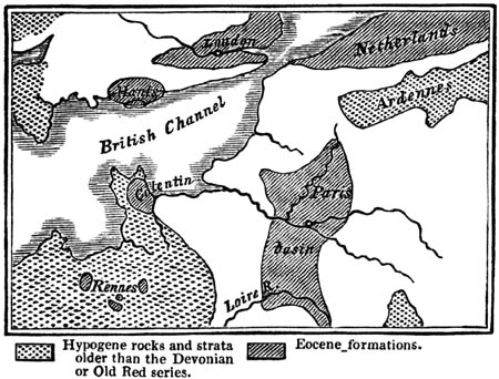
N. B. The space left blank is occupied by secondary formations from the
Devonian or old red sandstone to the chalk inclusive.
The tertiary strata described in the preceding chapters are all of them
characterized by fossil shells, of which a considerable proportion are
specifically identical with the living mollusca; and the greater the
number, the more nearly does the entire fauna approach in species and
genera to that now inhabiting the adjoining seas. But in the Eocene
formations next to be considered, the proportion of recent species is very
small, and sometimes scarcely appreciable, and those agreeing with the
fossil testacea often belong to remote parts of the globe, and to various
zoological provinces. This difference in conchological character implies a
considerable interval of time between the Eocene and Miocene periods,
during which the whole fauna and flora underwent other changes as great,
and often greater, than those exhibited by the mollusca. In the
accompanying map, the position of several Eocene areas is pointed out, such
as the basin of the Thames, [p.175]part of Hampshire, part of the
Netherlands, and the country round Paris. The deposits, however, occupying
these spaces comprise a great succession of marine and freshwater
formations, which, although they may all be termed Eocene, as being newer
than the chalk, and older than the faluns, are nevertheless divisible into
separate groups, of high geological importance.
The newest of these, like the Faluns of the Loire, have no true
representatives, or exact chronological equivalents, in the British Isles.
Their place in the series will best be understood by referring to the order
of superposition of the successive deposits found in the neighbourhood of
Paris. The area which has been called the Paris basin is about 180 miles in
its greatest length from north-east to south-west, and about 90 miles from
east to west. This space may be described as a depression in the chalk,
which has been filled up by alternating groups of marine and freshwater
strata. MM. Cuvier and Brongniart attempted, in 1810, to distinguish five
different formations, comprising three freshwater and two marine, which
alternated with each other. It was imagined that the waters of the ocean
had been by turns admitted and excluded from the same region; but the
subsequent investigations of several geologists, especially of M. Constant
Prevost,[175-A] have led to great modifications in these theoretical views;
and now that the true order of succession is better understood, it appears
that several of the deposits, which were supposed to have originated one
after the other, were, in fact, in progress at the same time by the joint
action of the sea and rivers.
The whole series of strata may be divided into three groups, as expressed
in the following table:—
| 1. Upper Eocene |
{ |
|
a. Upper freshwater limestone, marls, and siliceous millstone. |
| b. Upper marine sands, or Fontainebleau sandstone and sand. |
| 2. Middle Eocene |
{ |
a. Lower freshwater limestone and marl, or gypseous series. |
| b. Sandstone and sands with marine shells (Sables moyens,
or grès de Beauchamp). |
| c. Calcaire grossier, limestone with marine shells. |
| d. Calcaire siliceux, hard siliceous freshwater limestone,
for the most part contemporaneous with c. |
| 3. Lower Eocene |
{ |
a. Lower sands with marine shelly beds (Sables inférieurs
et lits coquilliers). |
| b. Lower sands, with lignite and plastic clay (Sables
inférieurs et argiles plastiques). |
Postponing to the next chapter the consideration of the Middle and Lower
Eocene groups, I shall now speak of the Upper Eocene of Paris, and its
foreign equivalents.
The upper freshwater marls and limestone (1. a) seem to have been formed
in a great number of marshes and shallow lakes, such as frequently
overspread the newest parts of great deltas. It appears that many layers of
marl, tufaceous limestone, and travertin, with [p.176]beds of flint,
continuous or in nodules, accumulated in these lakes. Charæ, aquatic
plants, already alluded to (see p. 32.) left their stems and seed-vessels
imbedded both in the marl and flint, together with freshwater and land
shells. Some of the siliceous rocks of this formation are used extensively
for millstones. The flat summits or platforms of the hills round Paris,
large areas in the forest of Fontainebleau, and the Plateau de la Beauce,
between the Seine and the Loire, are chiefly composed of these upper
freshwater strata.
The upper marine sands (1. b), consist chiefly of micaceous and quartzose
sands, 80 feet thick. As they succeed throughout an extensive area deposit
of a purely freshwater origin (2 a.), they appear to mark a subsidence of
the subjacent soil, whether it had formed the bottom of an estuary or a
lake. The sea, which afterwards took possession of the same space, was
inhabited by testacea, almost all of them differing from those found in the
lower formations (2. b and 2. c) and equally or still more distinct
from the Miocene Faluns of subsequent date. One of these upper Eocene
strata in the neighbourhood of Paris has been called the oyster bed,
"couche à Ostrea cyathula, Lamk.," which is spread over a remarkably wide
area. From the manner in which the oysters lie, it is inferred that they
did not grow on the spot, but that some current swept them away from a bed
of oysters formed in some other part of the bay. The strata of sand which
immediately repose on the oyster-bed are quite destitute of organic
remains; and nothing is more common in the Paris basin, and in other
formations, than alternations of shelly beds with others entirely devoid of
them. The temporary extinction and renewal of animal life at successive
periods have been rashly inferred from such phenomena, which may
nevertheless be explained, as M. Prevost justly remarks, without appealing
to any such extraordinary revolutions in the state of the animate creation.
A current one day scoops out a channel in a bed of shelly sand and mud, and
the next day, by a slight alteration of its course, ceases to prey upon the
same bank. It may then become charged with sand unmixed with shells,
derived from some dune, or brought down by a river. In the course of ages
an indefinite number of transitions from shelly strata to those without
shells may thus be caused.
Besides these oysters, M. Deshayes has described 29 species of shells, in
his work (Coquilles fossiles de Paris), as belonging to this formation, all
save one regarded by him as differing from fossils of the calcaire
grossier. Since that time the railway cuttings near Etampes have enabled M.
Hébert to raise the number to 90. I have myself collected fossils in that
district, where the shells are very entire, and detachable from the yellow
sandy matrix. M. Hébert first pointed out that most of them agree
specifically with those of Kleyn Spauwen, Boom, and other localities of
Limburg in Flanders, where they have been studied by MM. Nyst and De
Koninck.[176-A]
The position in Belgium of this formation above the older Eocene [p.177]
group is well seen in the small hill of Pellenberg, rising abruptly from
the great plain, half a mile south-east of the city of Louvain, where I
examined it in company with M. Nyst in 1850. At the top of the hill, a thin
bed of dark greyish green tile-clay is seen 11/2 foot thick, with casts of
Nucula Deshaysiana. This clay rests on 12 feet of yellow sand, separated,
by a band of flint and quartz pebbles, from a mass of subjacent white sand
15 feet thick, in which casts of the Kleyn Spauwen fossils have been met
with. Under this is a bed of yellow sand 12 feet thick, and, at a lower
level, the railway cuttings have passed through calcareous sands like those
of Brussels, in which the Nautilus Burtini, and various shells common to
the older Eocene strata of the neighbourhood of London, have been obtained.
Every new fact which throws light on the true paleontological relations of
the strata now under consideration, (the Upper Marine or Fontainebleau beds
of the Paris basin, 1. b, p. 175.), deserves more particular attention,
because geologists of high authority differ in opinion as to whether they
should be classed as Eocene or Miocene.
Professor Beyrich has lately described a formation of the same age,
occurring within 7 miles of the gates of Berlin, near the village of
Hermsdorf, where, in the midst of the sands of which that country chiefly
consists, a mass of tile-clay, more than 40 feet thick, and of a dark
blueish grey colour, is found, full of shells, among which the genera
Fusus and Pleurotoma predominate, and among the bivalves, Nucula
Deshaysiana, Nyst, an extremely common shell in the Belgian beds
above-mentioned. M. Beyrich has identified eighteen out of forty-five
species of the Hermsdorf fossils with the Belgian species; and I believe
that a much larger proportion agree with the Upper Eocene of Belgium,
France, and the Rhine. On the other hand, eight of the forty-five species
are supposed by him to agree with English Eocene shells. Messrs. Morris,
Edwards, and S. Wood have compared a small collection, which I obtained of
these Berlin shells, with the Eocene fossils of their museums, and
confirmed the result of M. Beyrich, the species common to the English
fossils belonging not simply to the uppermost of our marine beds, or those
of Barton, but some of them to lower parts of the series, such as
Bracklesham and Highgate. On the other hand, while these testacea, like
those of Kleyn Spauwen and Etampes, present many analogies to the Middle
and Lower Eocene group, they differ widely from the Falun shells,—a fact
the more important in reference to Etampes, as that locality approaches
within 70 miles of Pontlevoy, near Blois, and within 100 miles of Savigné,
near Tours, where Falun shells are found. It is evident that the
discordance of species cannot be attributed to distance or geographical
causes, but must be referred to time, or the different epoch at which the
upper marine beds of the Paris basin and the Faluns of the Loire
originated.
Mayence.—The true chronological relation of many tertiary strata on the
banks of the Rhine has always presented a problem of considerable
difficulty. They occupy a tract from 5 to 12 miles in breadth, extending
along the left bank of the Rhine from Mayence [p.178]to the
neighbourhood of Manheim, and are again found to the east, north, and
south-west of Frankfort. In some places they have the appearance of a
freshwater formation; but in others, as at Alzey, the shells are for the
most part marine. Cerithia are in great profusion, which indicates that
the sea where the deposit was formed was fed by rivers; and the great
quantity of fossil land shells, chiefly of the genus Helix, confirm the
same opinion. The variety in the species of shells is small, while the
individuals are exceedingly numerous; a fact which accords perfectly with
the idea that the formation may have originated in a gulf or sea which,
like the Baltic, was brackish in some parts, and almost fresh in others. A
species of Paludina (fig. 154.), very nearly resembling the recent
Littorina ulva, is found throughout this basin. These shells are like
grains of rice in size, and are often in such quantity as to form entire
beds of marl and limestone. They are as thick as grains of sand, in
stratified masses from 15 to 30 feet in thickness.
Fig. 154.

Paludina. Mayence.
That these Rhenish tertiary formations agree more nearly with the Upper
Eocene deposits above enumerated, than with any others, I have no doubt,
since I had the advantage of comparing (August, 1850), with the assistance
of M. De Koninck of Liége, the fossils from Kleyn Spauwen, Boom, and other
Limburg localities, with those from Mayence, Alzey, Weinheim, and other
Rhenish strata. Among the common Belgian and Rhenish shells which are
identical, I may mention Cassidaria depressa, Tritonium flandricum De
Koninck, Cerithium tricinctum Nyst, Tornatella simulata, Rostellaria
Sowerbyi, Nucula Deshaysiana, Corbula pisum, and Pectunculus
terebratularis.
From these Upper Eocene deposits of the Rhine M. H. von Meyer has obtained
a great number of characteristic fossil mammalia, such as Palæomæryx
medius, Hyotherium Meissneri, Tapirus Helveticus, Anthracotherium
Alsaticum, and others. The three first of these are species common to some
of the lignite, or brown coal beds in Switzerland, commonly classed with
the molasse, but of which the true age has not yet been distinctly made
out.
The fossils of the sandy beds of Eppelsheim, comprising bones of the
Deinotherium, Mastodon, and other quadrupeds, are regarded by H. von Meyer
as belonging to a mammiferous fauna quite distinct from that of the Mayence
basin, and they are probably referable to the Miocene period.
The upper freshwater strata (1. a, p. 175.), of the neighbourhood of
Paris, stretch southwards from the valley of the Seine to that of the
Loire, and in the last-mentioned region are seen to be older than the
marine faluns, so that the perforating shells of the Miocene sea have
sometimes bored the hard compact freshwater limestones; and fragments of
the Upper Eocene rocks are found at Pontlevoy and elsewhere, which have
been rolled in the bed of the Miocene sea.
Fig. 155.

Central France.—Lacustrine strata belonging, for the most part, to the
same Upper Eocene series, are again met with in Auvergne, Cantal, and
Velay, the sites of which may be seen in the annexed [p.179]map. They
appear to be the monuments of ancient lakes, which, like some of those now
existing in Switzerland, once occupied the depressions in a mountainous
region, and have been each fed by one or more rivers and torrents. The
country where they occur is almost [p.180]entirely composed of granite
and different varieties of granitic schist, with here and there a few
patches of secondary strata, much dislocated, and which have probably
suffered great denudation. There are also some vast piles of volcanic
matter (see the map), the greater part of which is newer than the
freshwater strata, and is sometimes seen to rest upon them, while a small
part has evidently been of contemporaneous origin. Of these igneous rocks I
shall treat more particularly in another part of this work.
Before entering upon any details, I may observe, that the study of these
regions possesses a peculiar interest, very distinct in kind from that
derivable from the investigation either of the Parisian or English tertiary
strata. For we are presented in Auvergne with the evidence of a series of
events of astonishing magnitude and grandeur, by which the original form
and features of the country have been greatly changed, yet never so far
obliterated but that they may still, in part at least, be restored in
imagination. Great lakes have disappeared,—lofty mountains have been
formed, by the reiterated emission of lava, preceded and followed by
showers of sand and scoriæ,—deep valleys have been subsequently furrowed
out through masses of lacustrine and volcanic origin,—at a still later
date, new cones have been thrown up in these valleys,—new lakes have been
formed by the damming up of rivers,—and more than one creation of
quadrupeds, birds, and plants, Eocene, Miocene, and Pliocene, have followed
in succession; yet the region has preserved from first to last its
geographical identity; and we can still recall to our thoughts its external
condition and physical structure before these wonderful vicissitudes began,
or while a part only of the whole had been completed. There was first a
period when the spacious lakes, of which we still may trace the boundaries,
lay at the foot of mountains of moderate elevation, unbroken by the bold
peaks and precipices of Mont Dor, and unadorned by the picturesque outline
of the Puy de Dome, or of the volcanic cones and craters now covering the
granitic platform. During this earlier scene of repose deltas were slowly
formed; beds of marl and sand, several hundred feet thick, deposited;
siliceous and calcareous rocks precipitated from the waters of mineral
springs; shells and insects imbedded, together with the remains of the
crocodile and tortoise, the eggs and bones of water birds, and the
skeletons of quadrupeds, some of them belonging to the same genera as those
entombed in the Eocene gypsum of Paris. To this tranquil condition of the
surface succeeded the era of volcanic eruptions, when the lakes were
drained, and when the fertility of the mountainous district was probably
enhanced by the igneous matter ejected from below, and poured down upon the
more sterile granite. During these eruptions, which appear to have taken
place after the disappearance of the Eocene fauna, and in the Miocene
epoch, the mastodon, rhinoceros, elephant, tapir, hippopotamus, together
with the ox, various kinds of deer, the bear, hyæna, and many beasts of
prey, ranged the forest, or pastured on the plain, and were occasionally
overtaken by a fall of burning cinders, or buried in flows of mud, such as
accompany [p.181]volcanic eruptions. Lastly, these quadrupeds became
extinct, and gave place to Pliocene mammalia, and these, in their turn, to
species now existing. There are no signs, during the whole time required
for this series of events, of the sea having intervened, nor of any
denudation which may not have been accomplished by currents in the
different lakes, or by rivers and floods accompanying repeated earthquakes,
during which the levels of the district have in some places been materially
modified, and perhaps the whole upraised relatively to the surrounding
parts of France.
Auvergne.—The most northern of the freshwater groups is situated in the
valley-plain of the Allier, which lies within the department of the Puy de
Dome, being the tract which went formerly by the name of the Limagne
d'Auvergne. It is inclosed by two parallel mountain ranges,—that of the
Forèz, which divides the waters of the Loire and Allier, on the east; and
that of the Monts Domes, which separates the Allier from the Sioule, on the
west.[181-A] The average breadth of this tract is about 20 miles; and it is
for the most part composed of nearly horizontal strata of sand, sandstone,
calcareous marl, clay, and limestone, none of which observe a fixed and
invariable order of superposition. The ancient borders of the lake, wherein
the freshwater strata were accumulated, may generally be traced with
precision, the granite and other ancient rocks rising up boldly from the
level country. The actual junction, however, of the lacustrine and granitic
beds is rarely seen, as a small valley usually intervenes between them. The
freshwater strata may sometimes be seen to retain their horizontality
within a very slight distance of the border-rocks, while in some places
they are inclined, and in few instances vertical. The principal divisions
into which the lacustrine series may be separated are the following:—1st,
Sandstone, grit, and conglomerate, including red marl and red sandstone.
2dly, Green and white foliated marls. 3dly, Limestone or travertin, often
oolitic. 4thly, Gypseous marls.
1. a. Sandstone and conglomerate.—Strata of sand and gravel, sometimes
bound together into a solid rock, are found in great abundance around the
confines of the lacustrine basin, containing, in different places, pebbles
of all the ancient rocks of the adjoining elevated country; namely,
granite, gneiss, mica-schist, clay-slate, porphyry, and others. But these
strata do not form one continuous band around the margin of the basin,
being rather disposed like the independent deltas which grow at the mouths
of torrents along the borders of existing lakes.
At Chamalieres, near Clermont, we have an example of one of these deltas,
or littoral deposits, of local extent, where the pebbly beds slope away
from the granite, as if they had formed a talus beneath the waters of the
lake near the steep shore. A section of about 50 feet in vertical height
has been laid open by a torrent, and the pebbles are seen to consist
throughout of rounded and [p.182]angular fragments of granite, quartz,
primary slate, and red sandstone; but without any intermixture of those
volcanic rocks which now abound in the neighbourhood, and which could not
have been there when the conglomerate was formed. Partial layers of lignite
and pieces of wood are found in these beds.
At some localities on the margin of the basin quartzose grits are found;
and, where these rest on granite, they are sometimes formed of separate
crystals of quartz, mica, and felspar, derived from the disintegrated
granite, the crystals having been subsequently bound together by a
siliceous cement. In these cases the granite seems regenerated in a new and
more solid form; and so gradual a passage takes place between the rock of
crystalline and that of mechanical origin, that we can scarcely distinguish
where one ends and the other begins.
In the hills called the Puy de Jussat and La Roche, we have the advantage
of seeing a section continuously exposed for about 700 feet in thickness.
At the bottom are foliated marls, white and green, about 400 feet thick;
and above, resting on the marls, are the quartzose grits, cemented by
calcareous matter, which is sometimes so abundant as to form imbedded
nodules. These sometimes constitute spheroidal concretions 6 feet in
diameter, and pass into beds of solid limestone, resembling the Italian
travertins, or the deposits of mineral springs. This section is close to
the confines of the basin; so that the lake must here have been filled up
near the shore with fine mud, before the coarse superincumbent sand was
introduced. There are other cases where sand is seen below the marl.
1. b. Red marl and sandstone.—But the most remarkable of the
arenaceous groups is one of red sandstone and red marl, which are identical
in all their mineral characters with the secondary New Red sandstone and
marl of England. In these secondary rocks the red ground is sometimes
variegated with light greenish spots, and the same may be seen in the
tertiary formation of freshwater origin at Coudes, on the Allier. The marls
are sometimes of a purplish-red colour, as at Champheix, and are
accompanied by a reddish limestone, like the well-known "cornstone," which
is associated with the Old Red sandstone of English geologists. The red
sandstone and marl of Auvergne have evidently been derived from the
degradation of gneiss and mica-schist, which are seen in situ on the
adjoining hills, decomposing into a soil very similar to the tertiary red
sand and marl. We also find pebbles of gneiss, mica-schist, and quartz in
the coarser sandstones of this group, clearly pointing to the parent rocks
from which the sand and marl are derived. The red beds, although destitute
themselves of organic remains, pass upwards into strata containing Eocene
fossils, and are certainly an integral part of the lacustrine formation.
From this example the student will learn how small is the value of mineral
character alone, as a test of the relative age of rocks.
2. Green and white foliated marls.—The same primary rocks of Auvergne,
which, by the partial degradation of their harder parts, [p.183]gave
rise to the quartzose grits and conglomerates before mentioned, would, by
the reduction of the same materials into powder, and by the decomposition
of their felspar, mica, and hornblende, produce aluminous clay, and, if a
sufficient quantity of carbonate of lime was present, calcareous marl. This
fine sediment would naturally be carried out to a greater distance from the
shore, as are the various finer marls now deposited in Lake Superior. And,
as in the American lake, shingle and sand are annually amassed near the
northern shores, so in Auvergne the grits and conglomerates before
mentioned were evidently formed near the borders.
Fig. 156.
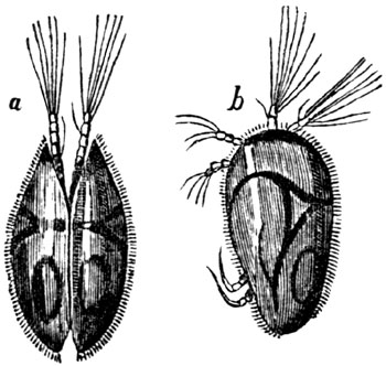
Cypris unifasciata, a living species, greatly magnified.
- a. Upper part.
- b. Side view of the same.
Fig. 157.

Cypris vidua, a living species, greatly
magnified.[183-A]
The entire thickness of these marls is unknown; but it certainly exceeds,
in some places, 700 feet. They are, for the most part, either light-green
or white, and usually calcareous. They are thinly foliated,—a character
which frequently arises from the innumerable thin shells, or
carapace-valves, of that small animal called Cypris; a genus which
comprises several species, of which some are recent, and may be seen
swimming swiftly through the waters of our stagnant pools and ditches. The
antennæ, at the end of which are fine pencils of hair, are the principal
organs of motion, and are seen to vibrate with great rapidity. This animal
resides within two small valves, not unlike those of a bivalve shell, and
moults its integuments periodically, which the conchiferous mollusks do
not. This circumstance may partly explain the countless myriads of the
shells of Cypris which were shed in the ancient lakes of Auvergne, so as
to give rise to divisions in the marl as thin as paper, and that, too, in
stratified masses several hundred feet thick. A more convincing proof of
the tranquillity and clearness of the waters, and of the slow and gradual
process by which the lake was filled up with fine mud, cannot be desired.
But we may easily suppose that, while this fine sediment was thrown down in
the deep and central parts of the basin, gravel, sand, and rocky fragments
were hurried into the lake, and deposited near the shore, forming the group
described in the preceding section.
[p.184]Not far from Clermont, the green marls, containing the Cypris in
abundance, approach to within a few yards of the granite which forms the
borders of the basin. The occurrence of these marls so near the ancient
margin may be explained by considering that, at the bottom of the ancient
lake, no coarse ingredients were deposited in spaces intermediate between
the points where rivers and torrents entered, but finer mud only was
drifted there by currents. The verticality of some of the beds in the
above section bears testimony to considerable local disturbance subsequent
to the deposition of the marls; but such inclined and vertical strata are
very rare.
Fig. 158.

Vertical strata of marl, at Champradelle, near Clermont.
- A. Granite.
- B. Space of 60 feet, in which no section is seen.
- C. Green marl, vertical and inclined.
- D. White marl.
3. Limestone, travertin, oolite.—Both the preceding members of the
lacustrine deposit, the marls and grits, pass occasionally into limestone.
Sometimes only concretionary nodules abound in them; but these, where there
is an increase in the quantity of calcareous matter, unite into regular
beds.
On each side of the basin of the Limagne, both on the west at Gannat, and
on the east at Vichy, a white oolitic limestone is quarried. At Vichy, the
oolite resembles our Bath stone in appearance and beauty; and, like it, is
soft when first taken from the quarry, but soon hardens on exposure to the
air. At Gannat, the stone contains land-shells and bones of quadrupeds,
resembling those of the Paris gypsum. At Chadrat, in the hill of La Serre,
the limestone is pisolitic, the small spheroids combining both the radiated
and concentric structure.
Indusial limestone.—There is another remarkable form of freshwater
limestone in Auvergne, called "indusial," from the cases, or indusiæ, of
caddis-worms (the larvæ of Phryganea); great heaps of which have been
incrusted, as they lay, by carbonate of lime, and formed into a hard
travertin. The rock is sometimes purely calcareous, but there is
occasionally an intermixture of siliceous matter. Several beds of it are
frequently seen, either in continuous masses, or in concretionary nodules,
one upon another, with layers of marl interposed. The annexed drawing (fig.
159.) will show the manner in which one of these indusial beds (a) is
laid open at the surface, between the marls (b b), near the base of the
hill of Gergovia; and affords, at the same time, an example of the extent
to which the lacustrine strata, which must once have filled a hollow, have
been denuded, and shaped out into hills and valleys, on the site of the
ancient lakes.
[p.185]
Fig. 159.
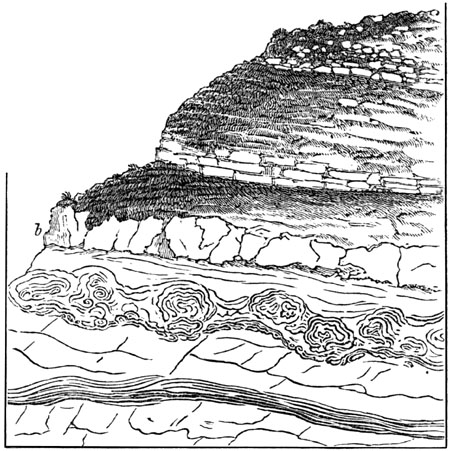
Bed of indusial limestone, interstratified with freshwater marl, near
Clermont (Kleinschrod.)
Fig. 160.
Larva of recent Phryganea.[185-A]
Fig. 161.

- a. Indusial limestone of Auvergne.
- b. Fossil Paludina magnified.
We may often observe in our ponds the Phryganea (or Caddis-fly), in its
caterpillar state, covered with small freshwater shells, which they have
the power of fixing to the outside of their tubular cases, in order,
probably, to give them weight and strength. The individual figured in the
annexed cut, which belongs to a species very abundant in England, has
covered its case with shells of a small Planorbis. In the same manner a
large species of caddis-worm, which swarmed in the Eocene lakes of
Auvergne, was accustomed to attach to its dwelling the shells of a small
spiral univalve of the genus Paludina. A hundred of these minute shells
are sometimes seen arranged around one tube, part of the central cavity of
which is often empty, the rest being filled up with thin concentric layers
of travertin. The cases have been thrown together confusedly, and often
lie, as in fig. 161., [p.186]at right angles one to the other. When we
consider that ten or twelve tubes are packed within the compass of a cubic
inch, and that some single strata of this limestone are 6 feet thick, and
may be traced over a considerable area, we may form some idea of the
countless number of insects and mollusca which contributed their
integuments and shells to compose this singularly constructed rock. It is
unnecessary to suppose that the Phryganeæ lived on the spots where their
cases are now found; they may have multiplied in the shallows near the
margin of the lake, or in the streams by which it was fed, and their cases
may have been drifted by a current far into the deep water.
In the summer of 1837, when examining, in company with Dr. Beck, a small
lake near Copenhagen, I had an opportunity of witnessing a beautiful
exemplification of the manner in which the tubular cases of Auvergne were
probably accumulated. This lake, called the Fuure-Soe, occurring in the
interior of Seeland, is about twenty English miles in circumference, and in
some parts 200 feet in depth. Round the shallow borders an abundant crop of
reeds and rushes may be observed, covered with the indusiæ of the
Phryganea grandis and other species, to which shells are attached. The
plants which support them are the bullrush, Scirpus lacustris, and common
reed, Arundo phragmitis, but chiefly the former. In summer, especially in
the month of June, a violent gust of wind sometimes causes a current by
which these plants are torn up by the roots, washed away, and floated off
in long bands, more than a mile in length, into deep water. The Cypris
swarms in the same lake; and calcareous springs alone are wanting to form
extensive beds of indusial limestone, like those of Auvergne.
4. Gypseous marls.—More than 50 feet of thinly laminated gypseous marls,
exactly resembling those in the hill of Montmartre, at Paris, are worked
for gypsum at St. Romain, on the right bank of the Allier. They rest on a
series of green cypriferous marls which alternate with grit, the united
thickness of this inferior group being seen, in a vertical section on the
banks of the river, to exceed 250 feet.
General arrangement, origin, and age of the freshwater formations of
Auvergne.—The relations of the different groups above described cannot be
learnt by the study of any one section; and the geologist who sets out with
the expectation of finding a fixed order of succession may perhaps complain
that the different parts of the basin give contradictory results. The
arenaceous division, the marls, and the limestone, may all be seen in some
places to alternate with each other; yet it can, by no means, be affirmed
that there is no order of arrangement. The sands, sandstone, and
conglomerate, constitute in general a littoral group; the foliated white
and green marls, a contemporaneous central deposit; and the limestone is
for the most part subordinate to the newer portions of both. The uppermost
marls and sands are more calcareous than the lower; and we never meet with
calcareous rocks covered by a considerable thickness of quartzose sand or
green marl. From the resemblance of the limestones to the [p.187]Italian
travertins, we may conclude that they were derived from the waters of
mineral springs,—such springs as even now exist in Auvergne, and which may
be seen rising up through the granite, and precipitating travertin. They
are sometimes thermal, but this character is by no means constant.
It seems that, when the ancient lake of the Limagne first began to be
filled with sediment, no volcanic action had yet produced lava and scoriæ
on any part of the surface of Auvergne. No pebbles, therefore, of lava were
transported into the lake,—no fragments of volcanic rocks embedded in the
conglomerate. But at a later period, when a considerable thickness of
sandstone and marl had accumulated, eruptions broke out, and lava and tuff
were deposited, at some spots, alternately with the lacustrine strata. It
is not improbable that cold and thermal springs, holding different mineral
ingredients in solution, became more numerous during the successive
convulsions attending this development of volcanic agency, and thus
deposits of carbonate and sulphate of lime, silex, and other minerals were
produced. Hence these minerals predominate in the uppermost strata. The
subterranean movements may then have continued until they altered the
relative levels of the country, and caused the waters of the lakes to be
drained off, and the farther accumulation of regular freshwater strata to
cease.
We may easily conceive a similar series of events to give rise to analogous
results in any modern basin, such as that of Lake Superior, for example,
where numerous rivers and torrents are carrying down the detritus of a
chain of mountains into the lake. The transported materials must be
arranged according to their size and weight, the coarser near the shore,
the finer at a greater distance from land; but in the gravelly and sandy
beds of Lake Superior no pebbles of modern volcanic rocks can be included,
since there are none of these at present in the district. If igneous action
should break out in that country, and produce lava, scoriæ, and thermal
springs, the deposition of gravel, sand, and marl might still continue as
before; but, in addition, there would then be an intermixture of volcanic
gravel and tuff, and of rocks precipitated from the waters of mineral
springs.
Although the freshwater strata of the Limagne approach generally to a
horizontal position, the proofs of local disturbance are sufficiently
numerous and violent to allow us to suppose great changes of level since
the lacustrine period. We are unable to assign a northern barrier to the
ancient lake, although we can still trace its limits to the east, west, and
south, where they were formed of bold granite eminences. Nor need we be
surprised at our inability to restore entirely the physical geography of
the country after so great a series of volcanic eruptions; for it is by no
means improbable that one part of it, the southern, for example, may have
been moved upwards bodily, while others remained at rest, or even suffered
a movement of depression.
Whether all the freshwater formations of the Limagne d'Auvergne belong to
one period, I cannot pretend to decide, as large masses both of the
arenaceous and marly groups are often devoid of fossils. [p.188]Much
light has been thrown on the mammiferous fauna by the labours of MM.
Bravard and Croizet, and by those of M. Pomel. The last-mentioned
naturalist has pointed out the specific distinction of all, or nearly all,
the species of mammalia, from those of the gypseous series near Paris.
Nevertheless, many of the forms are analogous to those of Eocene
quadrupeds. The Cainotherium, for example, is not far removed from the
Anoplotherium, and is, according to Waterhouse, the same as the genus
Microtherium of the Germans. There are two species of marsupial animals
allied to Didelphys, a genus also found in the Paris gypsum. The
Amphitragulus elegans of Pomel, has been identified with a Rhenish
species from Weissenau near Mayence, called by Kaup Dorcatherium nanum;
and other Auvergne fossils, e.g., Microtherium Reuggeri, and a small
rodent, Titanomys, are specifically the same with mammalia of the Mayence
basin.
Cantal.—A freshwater formation, very analogous to that of Auvergne, is
situated in the department of Haute Loire, near the town of Le Puy, in
Velay, and another occurs near Aurillac, in Cantal. The leading feature of
the formation last mentioned, as distinguished from those of Auvergne and
Velay, is the immense abundance of silex associated with calcareous marls
and limestone.
The whole series may be separated into two divisions; the lower, composed
of gravel, sand, and clay, such as might have been derived from the wearing
down and decomposition of the granitic schists of the surrounding country;
the upper system, consisting of siliceous and calcareous marls, contains
subordinately gypsum, silex, and limestone.
The resemblance of the freshwater limestone of the Cantal, and its
accompanying flint, to the upper chalk of England, is very instructive, and
well calculated to put the student upon his guard against relying too
implicitly on mineral character alone as a safe criterion of relative age.
When we approach Aurillac from the west, we pass over great heathy plains,
where the sterile mica-schist is barely covered with vegetation. Near
Ytrac, and between La Capelle and Viscamp, the surface is strewed over with
loose broken flints, some of them black in the interior, but with a white
external coating; others stained with tints of yellow and red, and in
appearance precisely like the flint gravel of our chalk districts. When
heaps of this gravel have thus announced our approach to a new formation,
we arrive at length at the escarpment of the lacustrine beds. At the bottom
of the hill which rises before us, we see strata of clay and sand, resting
on mica-schist; and above, in the quarries of Belbet, Leybros, and Bruel, a
white limestone, in horizontal strata, the surface of which has been
hollowed out into irregular furrows, since filled up with broken flint,
marl, and dark vegetable mound. In these cavities we recognize an exact
counterpart to those which are so numerous on the furrowed surface of our
own white chalk. Advancing from these quarries along a road made of the
white limestone, which reflects as glaring a light in the sun, as do our
roads composed of chalk, we reach, at [p.189]length, in the
neighbourhood of Aurillac, hills of limestone and calcareous marl, in
horizontal strata, separated in some places by regular layers of flint in
nodules, the coating of each nodule being of an opaque white colour, like
the exterior of the flinty nodules of our chalk.
It will be remembered that the siliceous stone of Bilin, called tripoli,
is a freshwater deposit, and has been shown, by Ehrenberg, to be of
infusorial origin (see p. 24.). What is true of the Bohemian flint and
opal, where the beds attain a thickness of 14 feet, may also, perhaps, be
found to hold good respecting the silex of Aurillac, which may also have
been immediately derived from the minute cases of microscopic animalcules.
But even if this conclusion be established, the abundant supply both of
siliceous, calcareous, and gypseous matter, which the ancient lakes of
France received, may have been connected with the subterranean volcanic
agency of which those regions were so long the theatre, and which may have
impregnated the springs with mineral matter, even before the great outbreak
of lava. It is well known that the hot springs of Iceland, and many other
countries, contain silex in solution; and it has been lately affirmed, that
steam at a high temperature is capable of dissolving quartzose rocks
without the aid of any alkaline or other flux.[189-A]
Travellers not unfrequently mention, in their accounts of India, Australia,
and other distant lands, that they have seen chalk with flints, which they
have assumed to be of the same age as the Cretaceous system of Europe. A
hasty observation of the white limestone and flint of Aurillac might convey
the same idea; but when we turn from the mineral aspect and composition to
the organic remains, we find in the flints of the Cantal the seed-vessels
of the freshwater Chara, instead of the marine zoophytes so abundantly
imbedded in chalk flints; and in the limestone we meet with shells of
Limnea, Planorbis, and other lacustrine genera, instead of the oyster,
terebratula, and echinus of the Cretaceous period.
Proofs of gradual deposition.—Some sections of the foliated marls in the
valley of the Cer, near Aurillac, attest, in the most unequivocal manner,
the extreme slowness with which the materials of the lacustrine series were
amassed. In the hill of Barrat, for example, we find an assemblage of
calcareous and siliceous marls; in which, for a depth of at least 60 feet,
the layers are so thin, that thirty are sometimes contained in the
thickness of an inch; and when they are separated, we see preserved in
every one of them the flattened stems of Charæ, or other plants, or
sometimes myriads of small Paludinæ and other freshwater shells. These
minute foliations of the marl resemble precisely some of the recent
laminated beds of the Scotch marl lakes, and may be compared to the pages
of a book, each containing a history of a certain period of the past. The
different layers may be grouped together in beds from a foot to a foot and
a half in thickness, which are distinguished by differences of composition
and colour, the tints being white, green, and brown. Occasionally there
[p.190]is a parting layer of pure flint, or of black carbonaceous
vegetable matter, about an inch thick, or of white pulverulent marl. We
find several hills in the neighbourhood of Aurillac composed of such
materials, for the height of more than 200 feet from their base, the whole
sometimes covered by rocky currents of trachytic or basaltic lava.[190-A]
Thus wonderfully minute are the separate parts of which some of the most
massive geological monuments are made up! When we desire to classify, it is
necessary to contemplate entire groups of strata in the aggregate; but if
we wish to understand the mode of their formation, and to explain their
origin, we must think only of the minute subdivisions of which each mass is
composed. We must bear in mind how many thin leaf-like seams of matter,
each containing the remains of myriads of testacea and plants, frequently
enter into the composition of a single stratum, and how vast a succession
of these strata unite to form a single group! We must remember, also, that
piles of volcanic matter, like the Plomb du Cantal, which rises in the
immediate neighbourhood of Aurillac, are themselves equally the result of
successive accumulation, consisting of reiterated sheets of lava, showers
of scoriæ, and ejected fragments of rock.—Lastly, we must not forget that
continents and mountain-chains, colossal as are their dimensions, are
nothing more than an assemblage of many such igneous and aqueous groups,
formed in succession during an indefinite lapse of ages, and superimposed
upon each other.
CHAPTER XVI.
EOCENE FORMATIONS—continued.
Subdivisions of the Eocene group in the Paris basin — Gypseous
series — Extinct quadrupeds — Impulse given to geology by Cuvier's
osteological discoveries — Shelly sands called sables
moyens — Calcaire grossier — Miliolites — Calcaire
siliceux — Lower Eocene in France — Lits coquilliers — Sands
and plastic clay — English Eocene strata — Freshwater and
fluvio-marine beds — Barton beds — Bagshot and Bracklesham
division — Large ophidians and saurians — Lower Eocene and London
Clay proper — Fossil plants and shells — Strata of Kyson in
Suffolk — Fossil monkey and opossum — Mottled clays and sands below
London Clay — Nummulitic formation of Alps and Pyrenees — Its wide
geographical extent — Eocene strata in the United States — Section
at Claiborne, Alabama — Colossal cetacean — Orbitoid
limestone — Burr stone.
From what was said in the two preceding chapters, it has already appeared
that we have in England no true chronological representative of the Miocene
faluns of the Loire, and none of the Upper Eocene group [p.191]described
in the last chapter. But, when we descend to the middle and inferior
divisions of the Eocene system of France, we find that they have their
equivalents in Great Britain.
MIDDLE EOCENE.—FRANCE.
Gypseous series (2. a, Table, p. 175.).—Next below the upper marine
sands of the neighbourhood of Paris, we find a series of white and green
marls, with subordinate beds of gypsum. These are most largely developed in
the central parts of the Paris basin, and, among other places, in the Hill
of Montmartre, where its fossils were first studied by M. Cuvier.
The gypsum quarried there for the manufacture of plaster of Paris occurs as
a granular crystalline rock, and, together with the associated marls,
contains land and fluviatile shells, together with the bones and skeletons
of birds and quadrupeds. Several land plants are also met with, among which
are fine specimens of the fan palm or palmetto tribe (Flabellaria). The
remains also of freshwater fish and of crocodiles and other reptiles, occur
in the gypsum. The skeletons of mammalia are usually isolated, often
entire, the most delicate extremities being preserved; as if the carcasses,
clothed with their flesh and skin, had been floated down soon after death,
and while they were still swoln by the gases generated by their first
decomposition. The few accompanying shells are of those light kinds which
frequently float on the surface of rivers, together with wood.
M. Prevost has therefore suggested that a river may have swept away the
bodies of animals, and the plants which lived on its borders, or in the
lakes which it traversed, and may have carried them down into the centre of
the gulf into which flowed the waters impregnated with sulphate of lime. We
know that the Fiume Salso in Sicily enters the sea so charged with various
salts that the thirsty cattle refuse to drink of it. A stream of
sulphureous water, as white as milk, descends into the sea from the
volcanic mountain of Idienne on the east of Java; and a great body of hot
water, charged with sulphuric acid, rushed down from the same volcano on
one occasion, and inundated a large tract of country, destroying, by its
noxious properties, all the vegetation.[191-A] In like manner the
Pusanibio, or "Vinegar River," of Colombia, which rises at the foot of
Puracé, an extinct volcano, 7,500 feet above the level of the sea, is
strongly impregnated with sulphuric and muriatic acids and with oxide of
iron. We may easily suppose the waters of such streams to have properties
noxious to marine animals, and in this manner the entire absence of marine
remains in the ossiferous gypsum may be explained.[191-B] There are no
pebbles or coarse sand in the gypsum; a circumstance which agrees well with
the hypothesis that these beds were precipitated from water holding
sulphate of lime in solution, and floating the remains of different
animals.
[p.192]In this formation the relics of about fifty species of quadrupeds,
including the genera Paleotherium, Anoplotherium, and others, have been
found, all extinct, and nearly four-fifths of them belonging to a division
of the order Pachydermata, which is now represented by only four living
species; namely three tapirs and the daman of the Cape. With them a few
carnivorous animals are associated, among which are a species of fox and
gennet. Of the Rodentia, a dormouse and a squirrel; of the Insectivora,
a bat; and of the Marsupialia (an order now confined to America,
Australia, and some contiguous islands), an opossum, have been discovered.
Of birds, about ten species have been ascertained, the skeletons of some of
which are entire. None of them are referable to existing species.[192-A]
The same remark applies to the fish, according to MM. Cuvier, and Agassiz,
as also to the reptiles. Among the last are crocodiles and tortoises of the
genera Emys and Trionyx.
The tribe of land quadrupeds most abundant in this formation is such as now
inhabits alluvial plains and marshes, and the banks of rivers and lakes, a
class most exposed to suffer by river inundations. Whether the
disproportion of carnivorous animals can be ascribed to this cause, or
whether they were comparatively small in number and dimensions, as in the
indigenous fauna of Australia, when first known to Europeans, is a point on
which it would be rash, perhaps, to offer an opinion in the present state
of our knowledge.
Fig. 162.
Paleotherium magnum.
The Paleothere, above alluded to, resembled the living tapir in the form of
the head, and in having a short proboscis, but its molar teeth were more
like those of the rhinoceros (see fig. 163.). Paleotherium magnum was of
the size of a horse, 3 or 4 feet high. The annexed woodcut, fig. 162., is
one of the restorations which Cuvier attempted of the outline of the living
animal, derived from the study of the entire skeleton. When the French
osteologist declared in the early part of the present century, that all the
fossil quadrupeds of the gypsum of Paris were extinct, the announcement of
so startling a [p.193]fact, on such high authority, created a powerful
sensation, and from that time a new impulse was given throughout Europe to
the progress of geological investigation. Eminent naturalists, it is true,
had long before maintained that the shells and zoophytes, met with in many
ancient European rocks, had ceased to be inhabitants of the earth, but the
majority even of the educated classes continued to believe that the species
of animals and plants now contemporary with man, were the same as those
which had been called into being when the planet itself was created. It was
easy to throw discredit upon the new doctrine by asking whether corals,
shells, and other creatures previously unknown, were not annually
discovered? and whether living forms corresponding with the fossils might
not yet be dredged up from seas hitherto unexamined? But from the era of
the publication of Cuvier's Ossements Fossiles, and still more his popular
Treatise called "A Theory of the Earth," sounder views began to prevail. It
was clearly demonstrated that most of the mammalia found in the gypsum of
Montmartre differed even generically from any now existing, and the extreme
improbability that any of them, especially the larger ones, would ever be
found surviving in continents yet unexplored, was made manifest. Moreover,
the non-admixture of a single living species in the midst of so rich a
fossil fauna was a striking proof that there had existed a state of the
earth's surface zoologically unconnected with the present order of things.
Fig. 163.

Upper molar tooth of Paleotherium magnum from
Isle of Wight. (Owen's Brit. Foss. p. 317.)
Reduced one-third.
Grès de Beauchamp (2. b, Table, p. 175.).—In some parts of the Paris
basin, sands and marls, called the Grès de Beauchamp, or Sables Moyens,
divide the gypseous beds from the underlying Calcaire grossier. These sands
contain more than 300 species of marine shells, many of them peculiar, but
others common to the underlying marine deposit (No. 2. c.).
Calcaire grossier (2. c, Table, p. 175.).—The formation called
Calcaire grossier consists of a coarse limestone, often passing into sand.
It contains the greater number of the fossil shells which characterize the
Paris basin. No less than 400 distinct species have been procured from a
single spot near Grignon, where they are embedded in a calcareous sand,
chiefly formed of comminuted shells, in which, nevertheless, individuals in
a perfect state of preservation, both of marine, terrestrial, and
freshwater species, are mingled together. Some of the marine shells may
have lived on the spot; but the Cyclostoma and Limnea must have been
brought thither by rivers and currents, and the quantity of triturated
shells implies considerable movement in the waters.
Nothing is more striking in this assemblage of fossil testacea than the
great proportion of species referable to the genus Cerithium (see fig.
164.). There occur no less than 137 species of this genus [p.194]in the
Paris basin, and almost all of them in the calcaire grossier. Now the
living Cerithia inhabit the sea near the mouths of rivers, where the
waters are brackish; so that their abundance in the marine strata now under
consideration is in harmony with the hypothesis, that the Paris basin
formed a gulf into which several rivers flowed, the sediment of some of
which gave rise to the beds of clay and lignite before mentioned; while a
distinct freshwater limestone, called calcaire siliceux, which will
presently be described, was precipitated from the waters of others situated
farther to the south.
Fig. 164.

Cerithium cinctum.[194-A]
EOCENE FORAMINIFERA.

Fig. 165. Calcarina rarispina, Desh.
- b. natural size.
- a, c. same magnified.
Fig. 166. Spirolina stenostoma, Desh.
- B. natural size.
- A, C, D. same magnified.
Fig. 167. Triloculina inflata, Desh.
- b. natural size.
- a, c, d, same magnified.
Fig. 168. Clavulina corrugata, Desh.
- a. natural size.
- b, c. same magnified.
In some parts of the calcaire grossier round Paris, certain beds occur of a
stone used in building, and called by the French geologists "Miliolite
limestone." It is almost entirely made up of millions of microscopic
shells, of the size of minute grains of sand, which all belong to the class
Foraminifera. Figures of some of these are given in the annexed woodcut. As
this miliolitic stone never occurs in the Faluns, or Miocene strata of
[p.195]Brittany and Touraine, it often furnishes the geologist with a
useful criterion for distinguishing the detached Eocene and Miocene
formations, scattered over those and other adjoining provinces. The
discovery of the remains of Paleotherium and other mammalia in some of the
upper beds of the calcaire grossier shows that these land animals began to
exist before the deposition of the overlying gypseous series had commenced.
Calcaire siliceux.—This compact siliceous limestone extends over a wide
area. It resembles a precipitate from the waters of mineral springs, and is
often traversed by small empty sinuous cavities. It is, for the most part,
devoid of organic remains, but in some places contains freshwater and land
species, and never any marine fossils. The siliceous limestone and the
calcaire grossier occupy distinct parts of the Paris basin, the one
attaining its fullest development in those places where the other is of
slight thickness. They also alternate with each other towards the centre of
the basin, as at Sergy and Osny; and there are even points where the two
rocks are so blended together that portions of each may be seen in hand
specimens. Thus, in the same bed, at Triel, we have the compact freshwater
limestone, characterized by its Limneæ, mingled with the coarse marine
limestone, with its small multilocular shells, or "miliolites," dispersed
through it in countless numbers. These microscopic testacea are also
accompanied by Cerithia and other shells of the calcaire grossier. It is
very extraordinary that in this instance both kinds of sediment must have
been thrown down together on the same spot, yet each retains its own
peculiar organic remains.
From these facts we may conclude, that while to the north, where the bay
was probably open to the sea, a marine limestone was formed, another
deposit of freshwater origin was introduced to the southward, or at the
head of the bay; for it appears that during the Eocene period, as now, the
ocean was to the north, and the continent, where the great lakes existed,
to the south. From that southern region we may suppose a body of fresh
water to have descended, charged with carbonate of lime and silica, the
water being perhaps in sufficient volume to freshen the upper end of the
bay. The gypseous series (2. a, Table, p. 175.), before described, was
once supposed to be entirely subsequent in origin to the two groups, called
calcaire grossier and calcaire siliceux. But M. Prevost has pointed out
that in some localities they alternate repeatedly with both.
The gypsum, with its associated marl and limestone, is in greatest force
towards the centre of the basin, where the calcaire grossier and calcaire
siliceux are less fully developed. Hence M. Prevost infers, that while
those two principal deposits were gradually in progress, the one towards
the north, and the other towards the south, a river descending from the
east may have brought down the gypseous and marly sediment.
It must be admitted, as highly probable, that a bay or narrow sea, 180
miles in length, would receive, at more points than one, the waters of the
adjoining continent. At the same time, we must be [p.196]prepared to
find that the simultaneous deposition of two or more sets of strata in one
basin, some freshwater and others marine, must have produced very complex
results. But, in proportion as it is more difficult in these cases to
discover any fixed order of superposition in the associated mineral masses,
so also is it more easy to explain the manner of their origin, and to
reconcile their relations to the agency of known causes. Instead of the
successive irruptions and retreats of the sea, and changes in the chemical
nature of the fluid, and other speculations of the earlier geologists, we
are now simply called upon to imagine a gulf, into one extremity of which
the sea entered, and at the other a large river, while other streams may
have flowed in at different points, whereby an indefinite number of
alternations of marine and freshwater beds would be occasioned.
LOWER EOCENE, FRANCE.
Lits coquilliers (3. a, Table, p. 175.).—Below the calcaire grossier
are extensive deposits of sand, in the upper parts of which some marine
beds, called "lits coquilliers," occur, in which M. d'Archiac has
discovered 200 species of shells. Many of these are peculiar, but the
larger portion appear to agree with species of the calcaire grossier, so
that the line of demarcation usually adopted between the French Lower and
Middle Eocene formations, seems not to be very strongly drawn. Sands and
plastic clay (3. b, Table, p. 175.)—At the base of the tertiary system
in France are extensive deposits of sands, with occasional beds of clay
used for pottery, and called "argile plastique." Fossil oysters (Ostrea
bellovacina) abound in some places, and in others there is a mixture of
fluviatile shells, such as Cyrena cuneiformis (fig. 187. p. 204.),
Melania inquinata (fig. 188.), and others, frequently met with in beds
occupying the same position in the valley of the Thames. Layers of lignite
also accompany the inferior clays and sands.
Immediately upon the chalk at the bottom of all the tertiary strata there
is often a conglomerate or breccia of rolled and angular chalk flints,
cemented by siliceous sand. These beds appear to be of littoral origin, and
imply the previous emergence of some portions of the chalk, and its waste
by denudation.
Fig. 169.

Cardium porulosum. Paris and London basins.
The lower sandy beds of the Paris basin are often called the sands of the
Soissonais, from a district so named 50 miles N.E. of Paris. One of the
shells of the formation is adduced by M. Deshayes as an example of the
changes which certain species underwent in the successive [p.197]stages
of their existence. It seems that different varieties of the Cardium
porulosum are characteristic of different formations. In the Lower Eocene
of the Soissonais this shell acquires but a small volume, and has many
peculiarities, which disappear in the lowest beds of the calcaire grossier.
In these the shell attains its full size, and many distinctive characters,
which are again modified in the uppermost beds of the calcaire grossier;
and these last modifications of form are preserved throughout the whole of
the "upper marine" (or Upper Eocene) series.[197-A]
ENGLISH EOCENE FORMATIONS.
The Eocene areas of Hampshire and London are delineated in the map (fig.
153. p. 174.).
The following table will show the succession of the principal deposits
found in our island. The true place of the Bagshot sands, in this series,
was never accurately ascertained till Mr. Prestwich published, in 1847, his
classification of the English Eocene strata, dividing them into three
principal formations, in which the Bagshot sands occupied the central
place.[197-B]
| |
Localities. |
| 1. Upper Eocene. |
|
Wanting in Great Britain. |
|
| 2. Middle Eocene |
{ |
|
a. Freshwater and fluvio-marine beds. |
Headon Hill, Isle of Wight; and
Hordwell Cliff, Hants. |
| b. Barton beds. |
Barton Cliff, Hants. |
| c. Bagshot and Bracklesham sands and clays. |
Bagshot Heath, Surrey; Bracklesham Bay, Sussex. |
| 3. Lower Eocene |
{ |
a. London Clay Proper, and Bognor beds. |
Highgate Hill, Middlesex; I. of Sheppey; Bognor, Sussex. |
| b. Mottled and Plastic clays and sands. |
Newhaven, Sussex; Reading, Berks; Woolwich, Kent. |
Fig. 170.
Lymnea longiscata.
Freshwater Eocene strata, Isle of Wight.
Freshwater beds (2. a, Table, p. 175.).—In the northern part of the
Isle of Wight, beds of marl, clay, and sand, and a friable limestone,
containing freshwater shells, are seen, containing shells of the genera
Lymnea (see fig. 170.), Planorbis, Melanopsis, Cyrena, &c., several
of them of the same species as those occurring in the Eocene beds of the
Paris basin. Gyrogonites, also, or seed-vessels of Chara, exhibiting a
similar specific identity, occur. At Headon Hill, on the western side of
the island, where these beds are seen in the sea-cliffs, some of the strata
contain a few marine and estuary shells, such as Cytheræa, Corbula,
&c., showing a temporary occupation of the area by brackish or salt water,
after which the river or a lake seems again to have prevailed. A [p.198]
species of fan-palm, Flabellaria Lamanonis, Brong., like one which
characterizes the Parisian Eocene beds, has been recently detected by Dr.
Mantell in this formation, in Whitecliff Bay, at the eastern end of the
island.
Several of the species of extinct quadrupeds already alluded to as
characterizing the gypsum of Montmartre have been discovered by Messrs.
Pratt and Fox, in the Isle of Wight, chiefly at Binstead, near Ryde, as
Palæotherium magnum, P. medium, P. minus, P. minimum, P. curtum,
P. crassum, also Anoplotherium commune, A. secundarium, Dichobune
cervinum, and Chæropotamus Cuvieri. In Hordwell cliff, also on the
Hampshire coast, several of these species, with other quadrupeds of new
genera, such as Paloplotherium, Owen, have been met with; and remains of
a remarkable carnivorous genus, Hyænodon. These fossils are accompanied
by the bones of Trionyx, and other tortoises, and by two land snakes of
the genus Paleryx, Owen, from 3 to 4 feet long, also a species of
crocodile, and an alligator. Among other fossils collected by Lady
Hastings, Sir Philip Egerton has recognized the well-known gar or bony pike
of the American rivers, a ganoid fish of the genus Lepidotus, with its
hard shining scales. The shells of Hordwell are similar to those of the
freshwater beds of the Isle of Wight, and among them are a few specifically
undistinguishable from recent testacea, as Paludina lenta and Helix
labyrinthica, the latter discovered by Mr. S. Wood, and identified with an
existing N. American helix.
The white and green marls of this freshwater series in Hampshire, and some
of the accompanying limestones, often resemble those of France in mineral
character and colour in so striking a manner, as to suggest the idea that
the sediment was derived from the same region, or produced
contemporaneously under very similar geographical circumstances.
Barton beds.—Both in the cliffs of Headon Hill and Hordwell, already
mentioned, the freshwater series rests on a mass of pure white sand without
fossils, and this is seen in Barton Cliff to overlie a marine deposit, in
which 209 species of testacea have been found. More than half of these are
peculiar; and, according to Mr. Prestwich, only 11 of them common to the
London Clay proper, being in the proportion of only 5 per cent. On the
other hand, 70 of them agree with the calcaire grossier shells. As this
is the newest purely marine bed of the Eocene series known in England, we
might have expected that some of its peculiar fossils would be found to
agree with the upper Eocene strata described in the last chapter, and
accordingly some identifications have been cited with testacea, both of the
Berlin and Belgian strata. It is nearly a century since Brander published,
in 1766, an account of the organic remains collected from these cliffs, and
his excellent figures of the shells then deposited in the British Museum
are justly admired by conchologists for their accuracy.
Bagshot Sands (2. c, Table, p. 197.).—These beds, consisting chiefly
[p.199]of siliceous sand, occupy extensive tracts round Bagshot, in
Surrey, and in the New Forest, Hampshire. They succeed next in
chronological order, and may be separated into three divisions, the upper
and lower consisting of light yellow sands, and the central of dark green
sands and brown clays, the whole reposing on the London clay proper.[199-A]
Although the Bagshot beds are usually devoid of fossils, they contain
marine shells in some places, among which Venericardia planicosta (see
fig. 171.) is abundant, with Turritella sulcifera and Nummulites
lævigatus. (See fig. 174. p. 200.)
Fig. 171.
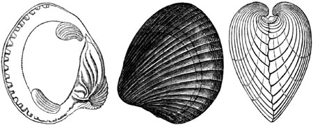
Venericardia planicosta, Lamck.
Cardita planicosta, Deshayes.
At Bracklesham Bay, near Chichester, in Sussex, the characteristic shells
of this member of the Eocene series are best seen; among others, the huge
Cerithium giganteum, so conspicuous in the calcaire grossier of Paris,
where it is sometimes 2 feet in length. The volutes and cowries of this
formation, as well as the lunulites and other corals, seem to favour the
idea of a warm climate having prevailed, which is borne out by the
discovery of a serpent Palæophis typhæus, exceeding, according to Mr.
Owen, 20 feet in length, and allied to the Boa, Python, Coluber, and
Hydrus. The compressed form and diminutive size of certain caudal vertebræ
indicate so much analogy with Hydrus as to induce the Hunterian professor
to pronounce the extinct ophidian to have been marine.[199-B] He had
previously combated with so much success the evidence advanced, to prove
the existence in the Northern Ocean of sea-serpents in our own times, that
he will not be suspected of any undue bias in contending for their former
existence in the British Eocene seas. The climate, however, of the Middle
Eocene period was evidently far more genial; and amongst the companions of
the sea-serpent of Bracklesham was an extinct Gavial (Gavialis Dixoni,
Owen), and numerous fish, such as now frequent the seas of warm latitudes,
as the sword-fish (see fig. 172. p. 200.) and gigantic rays of the genus
Miliobates. (See fig. 173.)
[p.200]Out of 193 species of testacea procured from the Bagshot and
Bracklesham beds in England, 126 occur in the French calcaire grossier. It
was clearly, therefore, coeval with that part of the Parisian series more
nearly than with any other. The Nummulites lævigatus (see fig. 174.), a
fossil characteristic of the lower beds of the calcaire grossier, is
abundant at Bracklesham.
Fig. 172.

Prolonged premaxillary bone or "sword" of a fossil sword-fish
(Cælorhynchus). Bracklesham. Dixon's
Fossils of Sussex, pl. 8.
Fig. 173.

Dental plates of Myliobates Edwardsi.
Bracklesham Bay. Ibid. pl. 8.
Fig. 174.
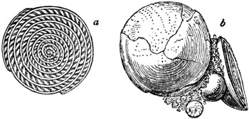
Nummulites (Nummularia) lævigatus.
Bracklesham. Ibid. pl. 8.
- a. section of the nummulite.
- b. group, with an individual showing the exterior of the shell.
London clay proper (3. a, Table, p. 197.).—This formation underlies
the preceding, and consists of tenacious brown and blueish grey clay, with
layers of concretions called septaria, which abound chiefly in the brown
clay, and are obtained in sufficient numbers from the cliffs near Harwich,
and from shoals of the Essex coast, to be used for making Roman cement. The
principal localities of fossils in the London clay are Highgate Hill, near
London, the island of Sheppey, and Bognor in Hampshire. Out of 133 fossil
shells, Mr. Prestwich found only 20 to be common to the calcaire grossier
(from which 600 species have been obtained), while 33 are common to the
lits coquilliers (p. 196.), in which only 200 species are known in France.
We may presume, therefore, that the London clay proper is older than the
calcaire grossier. This may perhaps remove a difficulty which M. Adolphe
Brongniart has experienced when comparing the Eocene Flora of the
neighbourhoods of London and Paris. The fossil species of the island of
Sheppey, he observes, indicate a much more tropical climate than the Eocene
Flora of France, which has been derived principally from the "gypseous
series." The latter resembles the vegetation of the borders of the
Mediterranean rather than that of an equatorial region.
Mr. Bowerbank, in a valuable publication on the fossil fruits and seeds of
the island of Sheppey, near London, has described no less than thirteen
fruits of palms of the recent type Nipa, now only [p.201]found in the
Molucca and Philippine islands. (See fig. 175.) These plants are allied to
the cocoa-nut tribe on the one side, and on the other to the Pandanus, or
screw-pine. Species of cocoa-nuts are also met with, and other kinds of
palms; also three species of Anona, or custard-apple; cucurbitaceous
fruits, also (the gourd and melon family), are in considerable abundance.
Fruits of various species of Acacia are in profusion; and, although less
decidedly tropical, imply a warm climate.
Fig. 175.

Nipadites ellipticus. Bow. Fossil palm of
Sheppey.
The contiguity of land may be inferred not only from these vegetable
productions, but also from the teeth and bones of crocodiles and turtles,
since these creatures, as Mr. Conybeare has remarked, must have resorted to
some shore to lay their eggs. Of turtles there were numerous species
referred to extinct genera, and, for the most part, not equal in size to
the largest living tropical turtles. A snake, which must have been 13 feet
long, of the genus Palæophis before mentioned, has also been described by
Mr. Owen from Sheppey, of a different species from that of Bracklesham. A
true crocodile, also, Crocodilus toliapicus, and another Saurian more
nearly allied to the gravial, accompany the above fossils. A bird allied to
the vultures, and a quadruped of the new genus Hyracotherium, allied to
the Hyrax, Hog, and Chæropotamus, are also among the additions made of late
years to the palæontology of this division.
FOSSIL SHELLS OF THE LONDON CLAY.

Fig. 176. Mitra scabra.
Fig. 177. Rostellaria macroptera, Sow. One-third of nat. size.
Fig. 178. Crassatella sulcata.
The marine shells of the London clay confirm the inference derivable from
the plants and reptiles of a high temperature. Thus, many species of
Conus, Mitra, and Voluta occur, a large Cypræa, a [p.202]very
large Rostellaria, and shells of the genera Terebellum, Cancellaria,
Crassatella, and others, with four or more species of Nautilus (see
fig. 182.) and other cephalopoda of extinct genera, one of the most
remarkable of which is the Belosepia.[202-A] (See fig. 183.)
Fig. 179.

Nautilus centralis.
Fig. 180.

Voluta athleta.
Fig. 181.

Terebellum fusiforme.
Fig. 182.

Aturia zigzag. Bronn. Syn. Nautilus zigzag.
Sow. London clay. Sheppey.
Fig. 183.
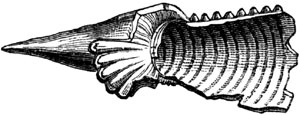
Belosepia sepiodea, De Blainv. London clay.
Sheppey.
The above shells are accompanied by a sword-fish (Tetrapterus priscus,
Agassiz), about 8 feet long, and a saw-fish (Pristis bisulcatus, Ag.),
about 10 feet in length; genera now foreign to the British seas. On the
whole, no less than 50 species of fish have been described by M. Agassiz
from these beds in Sheppey, and they indicate, in his opinion, a warm
climate.
Fig. 184.

Molar of monkey (Macacus).
Strata of Kyson in Suffolk.—At Kyson, a few miles east of Woodbridge, a
bed of Eocene clay, 12 feet thick, underlies the red crag. Beneath it is a
deposit of yellow and white sand, of considerable interest, in consequence
of many peculiar fossils contained in it. Its geological position is
probably the lowest part of the London clay proper. In this sand has been
found the first example of a fossil quadrumanous animal discovered in Great
Britain, namely, the teeth and part of a jaw, shown by Mr. Owen to belong
to a monkey of the genus Macacus (see fig. 184.). The mammiferous
fossils, first met with in the same bed, were those of an opossum
(Didelphys) (see fig. 185.), and an insectivorous bat (fig. 186.),
together with many teeth of fishes of the shark family. [p.203]Mr.
Colchester in 1840 obtained other mammalian relics from Kyson, among which
Mr. Owen has recognized several teeth of the genus Hyracotherium, and the
vertebræ of a large serpent, probably a Palæophis. As the remains both of
the Hyracotherium and Palæophis were afterwards met with in the London
clay, as before remarked, these fossils confirmed the opinion previously
entertained, that the Kyson sand belongs to the Eocene period. The
Macacus, therefore, constitutes the first example of any quadrumanous
animal found in strata as old as the Eocene, or so far from the equator as
lat. 52° N. It was not until after the year 1836 that the existence of any
fossil quadrumana was brought to light. Since that period they have been
found in France, India, and Brazil.
Fig. 185.
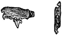
Molar tooth and part of jaw of opossum. From
Kyson.[203-A]
Fig. 186.
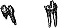
Molars of insectivorous bats, twice nat. size. From Kyson, Suffolk.
Mottled or Plastic Clays, &c. (3. b, Table, p. 197.).—No formations
can be more dissimilar on the whole in mineral character than the Eocene
deposits of England and Paris; those of our own island being almost
exclusively of mechanical origin,—accumulations of mud, sand, and pebbles;
while in the neighbourhood of Paris we find a great succession of strata
composed of a coarse white limestone, and compact siliceous limestone with
beds of crystalline gypsum and siliceous sandstone, and sometimes pure
flint used for millstones. Hence it is by no means an easy task to
institute an exact comparison between the various members of the English
and French series, and to settle their respective ages. It is clear that a
continual change was going on in the fauna and flora by the coming in of
new species and the dying out of others; and contemporaneous changes of
geographical conditions were also in progress in consequence of the rising
and sinking of the land and bottom of the sea. A particular subdivision,
therefore, of time was occasionally represented in one area by land, in
another by an estuary, in a third by the sea, and even where the conditions
were in both areas of a marine character, there was often shallow water in
one, and deep sea in another, producing a want of agreement in the state of
animal life.
At the commencement, however, of the Eocene formations in France and
England, we find an exception to this rule, for a marked similarity of
mineral character reigns in the lowest division, whether in the basins of
Paris, Hampshire, or London. This uniformity of aspect must be seen in
order to be fully appreciated, since the beds consist simply of sand,
mottled clays, and well-rolled flint pebbles, derived from the chalk, and
varying in size from that of a pea to an egg. These strata may be seen at
Reading, at Blackheath, near [p.204]London, and at Woolwich. In some of
the lowest of them, banks of oysters are observed, consisting of Ostrea
bellovicina, so common in France in the same relative position, and
Ostrea edulina, scarcely distinguishable from the living eatable species.
In this formation at Bromley, Dr. Buckland found one large pebble to which
five full-grown oysters were affixed, in such a manner as to show that they
had commenced their first growth upon it, and remained attached to it
through life.
In several places, as at Woolwich on the Thames, at Newhaven in Sussex, and
elsewhere, a mixture of marine and freshwater testacea distinguishes this
member of the series. Among the latter, Melania inquinata (see fig. 188.)
and Cyrena cuneiformis are very common. They probably indicate points
where rivers entered the Eocene sea.
Fig. 187.

Cyrena cuneiformis, Min. Con. Natural size.
Fig. 188.

Melania inquinata, Des. Nat. size.
Syn. Cerithium melanoides, Min. Con.
With us as in France, clay of this formation is used in some places, as
near Poole in Dorsetshire, for pottery; and hence the name of plastic clay
was adopted for the group by Mr. T. Webster. Lignite also is associated
with it in some spots, as in the Paris basin.
Before the minds of geologists had become familiar with the theory of the
gradual sinking of the land, and its conversion into sea at different
periods, and the consequent change from shallow to deep water, the
freshwater and littoral character of this inferior group appeared strange
and anomalous. After passing through many hundred feet of London clay,
proved by its fossils to have been deposited in salt water of considerable
depth, we arrive at beds of fluviatile origin. Thick masses, also, of
shingle indicate the proximity of land, where the flints of the chalk were
rolled into sand and pebbles, and spread continuously over wide spaces, as
in the Isle of [p.205]Wight, in the south of Hampshire, and near London,
always appearing at the bottom of the Eocene series. It may be asked why
they did not constitute simply a narrow littoral zone, such as we might
look for in strata formed at a moderate distance from the shore. In answer
to this inquiry, the student must be reminded, that wherever a
gently-sloping land is gradually sinking and becoming submerged, shingle
may be heaped up successively over a wide area, although marine currents
have no power of dispersing it simultaneously over a large space. In such
cases it is not the shingle which recedes from the coast, but the coast
which recedes from the shingle, which is formed one mass after another as
often as successive portions of the land are converted into sea and others
into a sea beach.
The London area appears to have been upraised before that of Hampshire, so
that it never became the receptacle of the Barton clays, nor of the
overlying fluvio-marine and freshwater beds of Hordwell and the north part
of the Isle of Wight. On the other hand, the Hampshire Eocene area seems to
have emerged before that of Paris, so that no marine beds of the Upper
Eocene era were ever thrown down in Hampshire.
Nummulitic formation of the Alps and Pyrenees.—It has long been matter
of controversy, whether the nummulitic rocks of the Alps and Pyrenees
should be regarded as Eocene or Cretaceous; but the number of geologists of
high authority who regard this important group as belonging to the lowest
tertiary system of Europe has for many years been steadily increasing. The
late M. Alex. Brongniart first declared the specific identity of many of
the shells of this formation with those of the marine strata near Paris,
although he obtained them from the summit of the Diablerets, one of the
loftiest of the Swiss Alps, which rises more than 10,000 feet above the
level of the sea.
Deposits of the same age, found on the flanks of the Pyrenees, contain also
a great number of shells common to the Paris and London areas, and three or
four species only which are common to the cretaceous formation.
The calcareous division consists often of a compact crystalline marble,
full of nummulites (see fig. 189.), shells of the class Foraminifera.
Fig. 189.
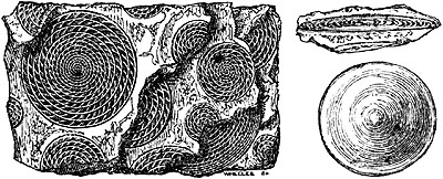
Nummulites. Peyrehorade, Pyrenees.
- a. external surface of one of the nummulites, of which longitudinal sections are seen
in the limestone.
- b. transverse section of same.
[p.206]The nummulitic limestone of the Alps is often of great thickness,
and is immediately covered by another series of strata of dark-coloured
slates, marls, and fucoidal sandstones, to the whole of which the
provincial name of "flysch" has been given in parts of Switzerland. The
researches of Sir Roderick Murchison in the Alps in 1847 enable us to refer
the whole of these beds to the Eocene period, and it seems probable that
they most nearly coincide in age with the Lower Eocene. They enter into the
disturbed and loftiest portions of the Alpine chain, to the elevation of
which they enable us therefore to assign a comparatively modern date.
The nummulitic formation, with its characteristic fossils, plays a far more
conspicuous part than any other tertiary group in the solid framework of
the earth's crust, whether in Europe, Asia, or Africa. It often attains a
thickness of many thousand feet, and extends from the Alps to the
Apennines. It is found in the Carpathians, and in full force in the north
of Africa, as, for example, in Algeria and Morocco. It has also been traced
from Egypt into Asia Minor, and across Persia by Bagdad to the mouths of
the Indus. It occurs not only in Cutch, but in the mountain ranges which
separate Scinde from Persia, and which form the passes leading to Caboul;
and it has been followed still farther eastward into India.
Some members of this lower tertiary formation in the central Alps,
including even the superior strata called flysch, have been converted
into crystalline rocks, and changed into saccharoid marble, quartz, rock,
and mica-schist.[206-A]
EOCENE STRATA IN THE UNITED STATES.
In North America the Eocene formations occupy a large area bordering the
Atlantic, which increases in breadth and importance as it is traced
southwards from Delaware and Maryland to Georgia and Alabama. They also
occur in Louisiana and other states both east and west of the valley of the
Mississippi. At Claiborne in Alabama no less than four hundred species of
marine shells, with many echinoderms and teeth of fish, characterize one
member of this system. Among the shells the Cardita planicosta, before
mentioned (fig. 171. p. 199.), is in abundance; and this fossil, and some
others identical with European species, or very nearly allied to them, make
it highly probable that the Claiborne beds agree in age with the central or
Bracklesham group of England, and the calcaire grossier of Paris.[206-B]
Higher in the series is a remarkable calcareous rock, formerly called "the
nummulite limestone," from the great number of discoid bodies resembling
nummulites which it contains, fossils now referred by A. d'Orbigny to the
genus Orbitoides, which has been demonstrated by Dr. Carpenter to belong
to the Foraminifera.[206-C] The following section will enable the reader to
understand the position of the three subdivisions [p.207]of the series,
Nos. 1, 2, and 3., the relations of which I ascertained in Clarke County,
between the rivers Alabama and Tombeckbee.
Fig. 190.
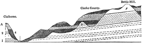
| 1. Sand, marl, &c., with numerous fossils. |
|
} |
|
Eocene. |
| 2. White or rotten limestone, with Zeuglodon. |
| 3. Orbitoidal, or so called nummulitic limestone. |
4. Overlying formation of sand and clay without fossils. |
|
Age unknown. |
The lowest set of strata, No. 1., having a thickness of more than 100 feet,
comprise marly beds, in which the Ostrea sellæformis occurs, a shell
ranging from Alabama to Virginia, and being a representative form of the
Ostrea flabellula of the Eocene group of Europe. In others beds of No.
1., two European shells, Cardita planicosta, before mentioned, and
Solarium canaliculatum are found, with a great many other species
peculiar to America. Numerous corals, also, and the remains of placoid fish
and of rays occur, and the "swords," as they are called, of sword fishes,
all bearing a great generic likeness to those of the Eocene strata of
England and France.
No. 2. (fig. 190.) is a white limestone, sometimes soft and argillaceous,
but in parts very compact and calcareous. It contains several peculiar
corals, and a large Nautilus allied to N. zigzag, also in its upper bed a
gigantic cetacean, called Zeuglodon by Owen.[207-A]

Zeuglodon cetoides, Owen.
Basilosaurus, Harlan.
Fig. 191. Molar tooth, natural size.
Fig. 192. Vertebra, reduced.
The colossal bones of this cetacean are so plentiful in the interior of
Clarke County as to be characteristic of the formation. The vertebral
column of one skeleton found by Dr. Buckley at a spot visited [p.208]by
me, extended to the length of nearly 70 feet, and not far off part of
another backbone nearly 50 feet long was dug up. I obtained evidence,
during a short excursion, of so many localities of this fossil animal
within a distance of 10 miles, as to lead me to conclude that they must
have belonged to at least forty distinct individuals.
Mr. Owen first pointed out that the huge animal was not reptilian, since
each tooth was furnished with double roots (see fig. 191.), implanted in
corresponding double sockets; and his opinion of the cetacean nature of the
fossil was afterwards confirmed by Dr. Wyman and Professor R. W. Gibbes.
That it was an extinct species of the whale tribe has since been placed
beyond all doubt by the discovery of the entire skull of another fossil of
the same family, found to have the double occipital condyles only met with
in mammals, and the convoluted tympanic bones which are characteristic of
cetaceans.
Near the junction of No. 2. and the incumbent limestone, No. 3., next to be
mentioned, are strata characterized by the following shells: Spondylus
dumosus (Plagiostoma dumosum, Morton), Pecten Poulsoni, Pecten
perplanus, and Ostrea cretacea.
No. 3. (fig. 190.) is a white limestone, for the most part made up of the
Orbitoides of d'Orbigny before mentioned (p. 206.), formerly supposed to
be a nummulite, and called N. Mantelli, mixed with a few lunulites and
small corals and shells.[208-A] The origin of this cream-coloured soft
stone, like that of our white chalk, which it much resembles, is, I
believe, due to the decomposition of the orbitoides. The surface of the
country where it prevails is sometimes marked by the absence of wood, like
our chalk downs, or is covered exclusively by the Juniperus Virginiana,
as certain chalk districts in England by yew trees and juniper.
Some of the shells of this limestone are common to the Claiborne beds, but
many of them are peculiar.
It will be seen in the section (fig. 190. p. 155.) that the strata, Nos. 1,
2, 3., are, for the most part, overlaid by a dense formation of sand or
clay without fossils. In some points of the bluff or cliff of the Alabama
river, at Claiborne, the beds Nos. 1, 2., are exposed nearly from top to
bottom, whereas at other points the newer formation, No. 4., occupies the
face of nearly the whole cliff. The age of this overlying mass has not yet
been determined, as it has hitherto proved destitute of organic remains.
The burr-stone strata of the Southern States contain so many fossils
agreeing with those of Claiborne, that it doubtless belongs to the same
part of the Eocene group, though I was not fortunate enough to see the
relations of the two deposits in a continuous section. Mr. Tuomey considers
it as the lower portion of the series. It may, perhaps, be a form of the
Claiborne beds in places where lime was wanting, and where silex, derived
from the decomposition of felspar, predominated. It consists chiefly of
slaty clays, quartzose sands, and loam, of a brick red colour, with layers
of chert or burr-stone, used in some places for millstones.
[p.209]CHAPTER XVII.
CRETACEOUS GROUP.
Divisions of the cretaceous series in North-Western Europe — Upper
cretaceous strata — Maestricht beds — Chalk of Faxoe — White
chalk — Characteristic fossils — Extinct cephalopoda — Sponges
and corals of the chalk — Signs of open and deep sea — Wide area of
white chalk — Its origin from corals and shells — Single pebbles in
chalk — Siliceous sandstone in Germany contemporaneous with white
chalk — Upper greensand and gault — Lower cretaceous
strata — Atherfield section, Isle of Wight — Chalk of South of
Europe — Hippurite limestone — Cretaceous Flora — Chalk of
United States.
Having treated in the preceding chapters of the tertiary strata, we have
next to speak of the uppermost of the secondary groups, called the Chalk or
Cretaceous (No. 6. Table, p. 103.), because in those parts of Europe where
it was first studied its upper members are formed of that remarkable white
earthy limestone, termed chalk (creta). The inferior division consists,
for the most part, of clays and sands, called Greensand, because some of
the sands derive a bright green colour from intermixed grains of chloritic
matter. The cretaceous strata in the north-west of Europe may be thus
divided[209-A]:
| Upper Cretaceous. |
|
| |
1. Maestricht beds and Faxoe limestone. |
| 2. Upper white chalk, with flints. |
| 3. Lower white chalk, without flints, passing downwards into chalk marl,
which is slightly argillaceous. |
| 4. Upper greensand. |
| 5. Gault. |
| |
| Lower Cretaceous. |
| |
6. Lower greensand—Ironsand, clay, and occasional beds of limestone
(Kentish rag). |
Maestricht Beds.—On the banks of the Meuse, at Maestricht, reposing on
ordinary white chalk with flints, we find an upper calcareous formation
about 100 feet thick, the fossils of which are, on the whole, very
peculiar, and all distinct from tertiary species. Some [p.210]few are of
species common to the inferior white chalk, among which may be mentioned
Belemnites mucronatus (see fig. 197.) and Pecten quadricostatus.
Besides the Belemnite there are other genera, such as Ammonite, Baculite,
and Hamite, never found in strata newer than the cretaceous, but frequently
met with in these Maestricht beds. On the other hand, Volutes and other
genera of univalve shells, usually met with only in tertiary strata, occur.
The upper part of the rock, about 20 feet thick, as seen in St. Peter's
Mount, in the suburbs of Maestricht, abounds in corals, often detachable
from the matrix; and these beds are succeeded by a soft yellowish limestone
50 feet thick, extensively quarried from time immemorial for building. The
stone below is whiter, and contains occasional nodules of grey chert or
chalcedony.
M. Bosquet, with whom I lately examined this formation (August, 1850),
pointed out to me a layer of chalk from 2 to 4 inches thick, containing
green earth and numerous encrinital stems, which forms the line of
demarcation between the strata containing the fossils peculiar to
Maestricht and the white chalk below. The latter is distinguished by
regular layers of black flint in nodules, and by several shells, such as
Terebratula carnea (see fig. 201.), wholly wanting in beds higher than
the green band. Some of the organic remains, however, for which St. Peter's
Mount is celebrated, occur both above and below that parting layer, and,
among others, the great marine reptile, called Mosasaurus, a saurian
supposed to have been 24 feet in length, of which the entire skull and a
great part of the skeleton have been found. Such remains are chiefly met
with in the soft freestone, the principal member of the Maestricht beds.
Chalk of Faxoe.—In the island of Seeland, in Denmark, the newest member
of the chalk series, seen in the sea-cliffs at Stevens Klint resting on
white chalk with flints, is a yellow limestone, a portion of which, at
Faxoe, where it is used as a building-stone, is composed of corals, even
more conspicuously than is usually observed in recent coral reefs. It has
been quarried to the depth of more than 40 feet, but its thickness is
unknown. The imbedded shells are chiefly casts, many of them of univalve
mollusca, which, as they strictly belong to the Cretaceous era, are worthy
of notice, since such forms, whether spiral or patelliform, are wanting in
the white chalk of Europe generally. Thus, there are two species of
Cypræa, one of Oliva, two of Mitra, four of the genus Cerithium,
six of Fusus, two of Trochus, one Patella, one Emarginula, &c., on
the whole, more than thirty univalves, spiral or patelliform, not one of
which is common to the white chalk. At the same time, a large proportion of
the accompanying bivalve shells, echinoderms, and zoophytes, are
specifically identical with fossils of older parts of the Cretaceous
series. Among the cephalopoda of Faxoe, may be mentioned Baculites
Faujasii and Belemnites mucronatus, shells of the white chalk.
The claws and entire shell of a small crab, Brachyurus rugosus
(Schlotheim), are scattered through the Faxoe stone, reminding us [p.211]
of similar crustaceans enclosed in the rocks of many modern coral
reefs.[211-A] Some small portions of this coralline formation consist of
white earthy chalk; it is, therefore, clear that this substance must have
been produced simultaneously, a fact of some importance, as bearing on the
theory of the origin of white chalk; for the decomposition of such corals
as we see at Faxoe is capable, we know, of forming white mud,
undistinguishable from chalk, and which we may suppose to have been
dispersed far and wide through the ocean, in which such reefs as that of
Faxoe grew.
Fig. 193.

Section from Hertfordshire, in England, to Sena, in France.
White Chalk (2. and 3. Tab. p. 209.).—The highest beds of chalk in
England and France consist of a pure, white, calcareous mass, usually too
soft for a building stone, but sometimes passing into a more solid state.
It consists, almost purely, of carbonate of lime; the stratification is
often obscure, except where rendered distinct by interstratified layers of
flint, a few inches thick, occasionally in continuous beds, but oftener in
nodules, and recurring at intervals from 2 to 4 feet distant from each
other.
This upper chalk is usually succeeded, in the descending order, by a great
mass of white chalk without flints, below which comes the chalk marl, in
which there is a slight admixture of argillaceous matter. The united
thickness of the three divisions in the south of England equals, in some
places, 1000 feet.[211-B]
The annexed section, fig. 193., will show the manner in which the white
chalk extends from England into France, covered by the tertiary strata
described in former chapters, and reposing on lower cretaceous beds.
Among the conspicuous forms of mollusca wholly foreign to the tertiary and
recent periods, and which we meet with in the white chalk, are the
Belemnite, Ammonite, Baculite, and Turrilite, all genera of Cephalopoda,
a family to which the living cuttle-fish and nautilus belong.
Fig. 194.

Portion of Baculites Faujasii. Maestricht and
Faxoe beds and white chalk.
Fig. 195.

Portion of Baculites anceps. Maestricht and
Faxoe beds and white chalk.
[p.212]
Fig. 196.

- a. Turrilites costatus. Chalk marl.
- b. Same, showing the indented border of the partition of the chambers.
Fig. 197.

- a. Belemnites mucronatus.
- b. Same, showing internal structure.
Maestricht, Faxoe, and white chalk.
Among the brachiopoda in the white chalk, the Terebratulæ are very
abundant. These shells are known to live at the bottom of the sea, where
the water is tranquil and of some depth (see figs. 198, 199, 200, 201.).
With these are associated some forms of oyster (see figs. 202. and 204.),
and other bivalves (figs. 203, 205, 206, 207, 208.).
Fig. 198.
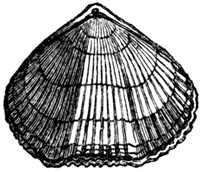
Terebratula plicatilis, dorsal view. Upper white
chalk.
Fig. 199.
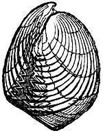
Terebratula plicatilis, side view.
Fig. 200.
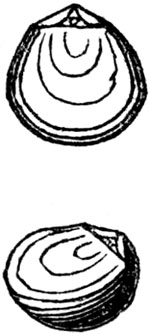
Terebratula pumilus. (Magas pumilus, Sow.)
Upper white chalk.
Fig. 201.
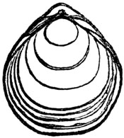
Terebratula carnea. Upper white chalk.
Fig. 202.

Ostrea vesicularis. Gryphæa globosa, Min. Con.
Upper chalk and upper greensand.
Fig. 203.

Pecten 5-costatus. White chalk, upper and lower
greensands.
Fig. 204.

Ostrea carinata. Chalk marl, upper and lower
greensands.
[p.213]
Fig. 205.

Crania Parisiensis, inferior or
attached valve. Upper white chalk.
Fig. 206.

Plagiostoma Hoperi, Sow. Syn. Lima Hoperi.
White chalk and upper greensand.
Fig. 207.
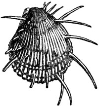
Plagiostoma spinosum, Sow. Syn. Spondylus
spinosus. Upper white chalk.
Among the rest, no form marks the cretaceous era in Europe, America, and
India, in a more striking manner than the extinct genus Inoceramus
(Catillus of Lamk.), the shells of which are distinguished by a fibrous
texture, and are often met with in fragments, having, probably, been
extremely friable.
Fig. 208.

Inoceramus Lamarckii.
Syn. Catillus Lamarckii.
White Chalk (Dixon's Geol. Sussex, Tab. 28. fig. 29.)
Fig. 209.
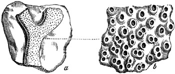
Eschara disticha.
- a. Natural size.
- b. Portion magnified.
White chalk.
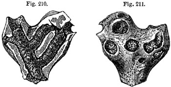
A branching sponge in a flint, from the white chalk. From the
collection of Mr. Bowerbank.
With these mollusca are many corals (figs. 209, 210, 211.) and sea urchins
(fig. 212.), which are alike marine, and, for the most part, indicative of
a deep sea. They are dispersed indifferently through the soft chalk, and
hard flint, and some of the flinty nodules owe their irregular forms to
inclosed [p.214]zoophytes, as in the specimen represented in fig. 211.,
where the hollows in the exterior are caused by the branches of a sponge
seen on breaking open the flint, fig. 210.
Fig. 212.

Ananchytes ovata. White chalk, upper and lower.
- a. Side view.
- b. Bottom of the shell on which both the oral and anal apertures are placed;
the anal being more round, and at the smaller end.
Of the singular family called Rudistes, by Lamarck, hereafter to be
mentioned, as extremely characteristic of the chalk of Southern Europe, a
single representative only (fig. 213.) has been discovered in the white
chalk of England.

Hippurites Mortoni, Mantell. Houghton, Sussex. White
chalk. Diameter one seventh of nat. size.
- Fig. 213. Two individuals deprived of their opercula, adhering together.
- 214. Same seen from above.
- 215. Transverse section of part of the wall of the shell, magnified to show the structure.
- 216. Vertical section of the same.
On the side where the shell is thinnest, there is one external furrow and
corresponding internal ridge, a, b. figs. 213, 214.; but they are usually
less prominent than in these figures. This species has been referred to
Hippurites, but does not, I believe, fully agree in character with that
genus. I have never seen the opercular piece, or valve, as it is called
by those conchologists who regard the Rudistes as bivalve mollusca. The
specimen above figured was discovered by the late Mr. Dixon.
The remains of fishes of the Upper Cretaceous formations consist chiefly of
teeth of the shark family of genera, in part common to the tertiary, and
partly distinct. But we meet with no bones of land animals, nor any
terrestrial or fluviatile shells, nor any plants, except sea weeds, and
here and there a piece of drift wood. All the appearances concur in leading
us to conclude that the white chalk was the product of an open sea of
considerable depth.
The existence of turtles and oviparous saurians, and of a Pterodactyl or
winged-lizard, found in the white chalk of Maidstone, implies, [p.215]no
doubt, some neighbouring land; but a few small islets in mid-ocean, like
Ascension, so much frequented by migratory droves of turtles, might perhaps
have afforded the required retreat where these creatures might lay their
eggs in the sand, or from which the flying species may have been blown out
to sea. Of the vegetation of such islands we have scarcely any indication,
but it consisted partly of cycadeous plants; for a fragment of one of these
was found by Capt. Ibbetson in the chalk marl of the Isle of Wight, and is
referred by A. Brongniart to Clathraria Lyellii, Mantell, a species
common to the antecedent Wealden period.
Geographical extent and origin of the While Chalk.—The area over which
the white chalk preserves a nearly homogeneous aspect is so vast, that the
earlier geologists despaired of discovering any analogous deposits of
recent date. Pure chalk, of nearly uniform aspect and composition, is met
with in a north-west and south-east direction, from the north of Ireland to
the Crimea, a distance of about 1140 geographical miles; and in an opposite
direction it extends from the south of Sweden to the south of Bordeaux, a
distance of about 840 geographical miles. In Southern Russia, according to
Sir R. Murchison, it is sometimes 600 feet thick, and retains the same
mineral character as in France and England, with the same fossils,
including Inoceramus Cuvieri, Belemnites mucronatus, and Ostrea
vesicularis.
But it would be an error to imagine, that the chalk was ever spread out
continuously over the whole of the space comprised within these limits,
although it prevailed in greater or less thickness over large portions of
that area. On turning to those regions of the Pacific where coral reefs
abound, we find some archipelagoes of lagoon islands, such as that of the
Dangerous Archipelago, for instance, and that of Radack, with several
adjoining groups, which are from 1100 to 1200 miles in length, and 300 or
400 miles broad; and the space to which Flinders proposed to give the name
of the Corralline Sea is still larger; for it is bounded on the east by the
Australian barrier—all formed of coral rock,—on the west by New
Caledonia, and on the north by the reefs of Louisiade. Although the islands
in these areas may be thinly sown, the mud of the decomposing zoophytes may
be scattered far and wide by oceanic currents. That this mud would resemble
chalk I have already hinted when speaking of the Faxoe limestone, p. 211.;
and it was also remarked in an early part of this volume, that some even of
that chalk which appears to an ordinary observer quite destitute of organic
remains, is nevertheless, when seen under the microscope, full of fragments
of corals and sponges; together with the valves of entomostraca, the shells
of foraminifera, and still more minute infusoria.[215-A] (See p. 26.)
Now it had been often suspected, before these discoveries, that white chalk
might be of animal origin, even where every trace of organic structure has
vanished. This bold idea was partly founded [p.216]on the fact, that the
chalk consisted of pure carbonate of lime, such as would result from the
decomposition of testacea, echini, and corals; and partly on the passage
observable between these fossils when half decomposed and chalk. But this
conjecture seemed to many naturalists quite vague and visionary, until its
probability was strengthened by new evidence brought to light by modern
geologists.
We learn from Lieutenant Nelson, that, in the Bermuda Islands, there are
several basins or lagoons almost surrounded and enclosed by reefs of coral.
At the bottom of these lagoons a soft white calcareous mud is formed by the
decomposition of Eschara, Flustra, Cellepora, and other corallines.
This mud, when dried, is undistinguishable from common white earthy chalk;
and some portions of it, presented to the Museum of the Geological Society
of London, might, after full examination, be mistaken for ancient chalk,
but for the labels attached to them. About the same time Mr. C. Darwin
observed similar facts in the coral islands of the Pacific; and came also
to the opinion, that much of the soft white mud found at the bottom of the
sea near coral reefs has passed through the bodies of worms, by which the
stony masses of coral are everywhere bored; and other portions through the
intestines of fishes; for certain gregarious fishes of the genus Sparus
are visible through the clear water, browsing quietly, in great numbers, on
living corals, like grazing herds of graminivorous quadrupeds. On opening
their bodies, Mr. Darwin found their intestines filled with impure chalk.
This circumstance is the more in point, when we recollect how the fossilist
was formerly puzzled by meeting, in chalk, with certain bodies, called
cones of the larch, which were afterwards recognized by Dr. Buckland to be
the excrement of fish.[216-A] These spiral coprolites (see figures), like
the scales and bones of fossil fish in the chalk, are composed chiefly of
phosphate of lime.

Coprolites of fish called Iulo-eido-copri, from the chalk.
Mr. Dana, when describing the elevated coral reef of Oahu, in the Sandwich
Islands, says, that some varieties of the rock consist of aggregated
shells, imbedded in a compact calcareous base as firm in texture as any
secondary limestone; while others are like chalk, having its colour, its
earthy fracture, its soft homogeneous texture, and being an equally good
writing material. The same author describes, in many growing coral reefs, a
similar formation of modern chalk, undistinguishable from the
ancient.[216-B] The extension over a wide submarine area of the calcareous
matrix of the chalk, as well as of the imbedded fossils, would take place
the more readily, in consequence of the low specific gravity of the shells
of mollusca and zoophytes, when compared with ordinary sand and mineral
matter. The mud also derived from their decomposition would be much lighter
[p.217]than argillaceous and other inorganic mud, and very easily
transported by currents, especially in salt water.
Single pebbles in chalk.—The general absence of sand and pebbles in the
white chalk has been already mentioned; but the occurrence here and there,
in the south-east of England, of a few isolated pebbles of quartz and green
schist, some of them 2 or 3 inches in diameter, has justly excited much
wonder. If these had been carried to the spots where we now find them by
waves or currents from the lands once bordering the cretaceous sea, how
happened it that no sand or mud were transported thither at the same time?
We cannot conceive such rounded stones to have been drifted like erratic
blocks by ice[217-A], for that would imply a cold climate in the Cretaceous
period; a supposition inconsistent with the luxuriant growth of large
chambered univalves, numerous corals, and many fish, and other fossils of
tropical forms.
Now in Keeling Island, one of those detached masses of coral which rise up
in the wide Pacific, Captain Ross found a single fragment of greenstone,
where every other particle of matter was calcareous; and Mr. Darwin
concludes that it must have come there entangled in the roots of a large
tree. He reminds us that Chamisso, the distinguished naturalist who
accompanied Kotzebue, affirms, that the inhabitants of the Radack
archipelago, a group of lagoon islands, in the midst of the Pacific,
obtained stones for sharpening their instruments by searching the roots of
trees which are cast up on the beach.[217-B]
It may perhaps be objected, that a similar mode of transport cannot have
happened in the cretaceous sea, because fossil wood is very rare in the
chalk. Nevertheless wood is sometimes met with, and in the same parts of
the chalk where the pebbles are found, both in soft stone and in a
silicified state in flints. In these cases it has often every appearance of
having been floated from a distance, being usually perforated by
boring-shells, such as the Teredo and Fistulana.[217-C]
The only other mode of transport which suggests itself is sea-weed. Dr.
Beck informs me, that in the Lym-Fiord, in Jutland, the Fucus
vesiculosus, often called kelp, sometimes grows to the height of 10 feet,
and the branches rising from a single root form a cluster several feet in
diameter. When the bladders are distended, the plant becomes so buoyant as
to float up loose stones several inches in diameter, and these are often
thrown by the waves high up on the beach. The Fucus giganteus of
Solander, so common in Terra del Fuego, is said by Captain Cook to attain
the length of 360 feet, although the stem is not much thicker than a man's
thumb. It is often met with floating at sea, with shells attached, several
hundred miles from the spots where it grew. Some of these plants, says Mr.
Darwin, were found adhering to large loose stones in the inland channels of
Terra del Fuego, during the voyage of the Beagle in [p.218]1834; and
that so firmly, that the stones were drawn up from the bottom into the
boat, although so heavy that they could scarcely be lifted in by one
person. Some fossil sea-weeds have been found in the Cretaceous formation,
but none, as yet, of large size.
But we must not imagine that because pebbles are so rare in the white chalk
of England and France there are no proofs of sand, shingle, and clay having
been accumulated contemporaneously even in the European seas. The siliceous
sandstone, called "upper quader" by the Germans, overlies white
argillaceous chalk, or "pläner-kalk," a deposit resembling in composition
and organic remains the chalk marl of the English series. This sandstone
contains as many fossil shells common to our white chalk as could be
expected in a sea-bottom formed of such different materials. It sometimes
attains a thickness of 600 feet, and by its jointed structure and vertical
precipices, plays a conspicuous part in the picturesque scenery of Saxon
Switzerland, near Dresden.
Upper greensand (4. Tab. p. 209.).—The lower chalk without flints passes
gradually downwards, in the south of England, into an argillaceous
limestone, "the chalk marl," already alluded to, in which ammonites and
other cephalopoda, so rare in the higher parts of the series, appear. This
marly deposit passes in its turn into beds containing green particles of a
chloritic mineral, called the upper greensand. In parts of Surrey
calcareous matter is largely intermixed, forming a stone called
firestone. In the cliffs of the southern coast of the Isle of Wight, this
upper greensand is 100 feet thick, and contains bands of siliceous
limestone and calcareous sandstone with nodules of chert.
Fossils of the Upper Greensand.
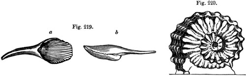
Fig. 219.
| a. Terebratula lyra. |
} |
Upper greensand. |
| b. Same, seen in profile. |
France. |
Fig. 220. Ammonites Rhotomagensis.
Upper greensand.
Fig. 221.
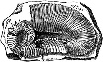
Hamites spiniger (Fitton); near Folkstone. Gault.
Gault.—The lowest member of the upper Cretaceous group, usually about
100 feet thick in the S.E. of England, is provincially termed [p.219]
Gault. It consists of a dark blue marl, sometimes intermixed with
greensand. Many peculiar forms of cephalopoda, such as the Hamite (fig.
221.) and Scaphite, with other fossils, characterize this formation,
which, small as is its thickness, can be traced by its organic remains to
distant parts of Europe, as, for example, to the Alps.
The phosphate of lime, found lately near Farnham, in Surrey, in such
abundance as to be used largely by the agriculturist for fertilizing soils,
occurs exclusively, according to Mr. R. A. C. Austen, in the upper
greensand and gault. It is doubtless of animal origin, and partly
coprolitic, probably derived from the excrement of fish.
LOWER CRETACEOUS DIVISION. (No. 6. Tab. p. 209.)
That part of the Cretaceous series which is older than the Gault has been
commonly called the Lower Greensand. The greater number of its fossils are
specifically distinct from those of the upper cretaceous system. Dr.
Fitton, to whom we are indebted for an excellent monograph on this
formation as developed in England, gives the following as the succession of
rocks seen in parts of Kent.
| No. |
1. Sand, white, yellowish, or ferruginous, with concretions
of limestone and chert |
70 feet. |
| |
2. Sand with green matter |
70 to 100 feet. |
| 3. Calcareous stone, called Kentish rag |
60 to 80 feet. |
In his detailed description of the fine section displayed at Atherfield, in
the south of the Isle of Wight, we find the limestone wholly wanting; in
fact, the variations in the mineral composition of this group, even in
contiguous districts, is very great; and on comparing the Atherfield beds
with corresponding strata at Hythe in Kent, distant 95 miles, the whole
series has lost half its thickness, and presents a very dissimilar
aspect.[219-A]
On the other hand, Professor E. Forbes has shown that when the sixty-three
strata at Atherfield are severally examined, the total thickness of which
he gives as 843 feet, there are some fossils which range through the whole
series, others which are peculiar to particular divisions. As a proof that
all belong chronologically to one system, he states that whenever similar
conditions are repeated in overlying strata the same species reappear.
Changes of depth, or of the mineral nature of the bottom, the presence or
absence of lime or of peroxide of iron, the occurrence of a muddy, or a
sandy, or a gravelly bottom, are marked by the banishment of certain
species and the predominance of others. But these differences of conditions
being mineral, chemical, and local in their nature, have nothing to do with
the extinction, throughout a large area, of certain animals or plants. The
rule laid down by this eminent naturalist for enabling us to test the
arrival of a new state of things in the animate world, is the
representation by new and different species of corresponding [p.220]
genera of mollusca or other beings. When the forms proper to loose sand or
soft clay, or a stony or calcareous bottom, or a moderate or a great depth
of water, recur with all the same species, the interval of time has been,
geologically speaking, small, however dense the mass of matter accumulated.
But if, the genera remaining the same, the species are changed, we have
entered upon a new period; and no similarity of climate, or of geographical
and local conditions, can then recall the old species which a long series
of destructive causes in the animate and inanimate world has gradually
annihilated. On passing from the lower greensand to the gault, we suddenly
reach one of these new epochs, scarcely any of the fossil species being
common to the lower and upper cretaceous systems, a break in the chain
implying no doubt many missing links in the series of geological monuments
which we may some day be able to supply.
One of the largest and most abundant shells in the lowest strata of the
lower greensand, as displayed in the Atherfield section, is the large
Perna mulleti of which a reduced figure is here given (fig. 222.).
Fig. 222.

Perna mulleti. Desh. in Leym.
- a. Exterior.
- b. Hinge of upper valve.
In the south of England, during the accumulation of the lower greensand
above described, the bed of the sea appears to have been continually
sinking, from the commencement of the period, when the freshwater Wealden
beds were submerged, to the deposition of those strata on which the gault
immediately reposes.
Pebbles of quartzose sandstone, jasper, and flinty slate, together with
grains of chlorite and mica, speak plainly of the nature of the
pre-existing rocks, from the wearing down of which the greensand beds were
derived. The land, consisting of such rocks, was doubtless submerged before
the origin of the white chalk, as corals can only [p.221]multiply in the
clear waters of the sea in spaces to which no mud or sand are conveyed by
currents.
HIPPURITE LIMESTONE.
Difference between the chalk of the north and south of Europe.—By the
aid of the three tests of relative age, namely, superposition, mineral
character, and fossils, the geologist has been enabled to refer to the same
Cretaceous period certain rocks in the north and south of Europe, which
differ greatly, both in their fossil contents and in their mineral
composition and structure.
If we attempt to trace the cretaceous deposits from England and France to
the countries bordering the Mediterranean, we perceive, in the first place,
that the chalk and Greensand in the neighbourhood of London and Paris form
one great continuous mass, the Straits of Dover being a trifling
interruption, a mere valley with chalk cliffs on both sides. We then
observe that the main body of the chalk which surrounds Paris stretches
from Tours to near Poitiers (see the annexed map, fig. 223., in which the
shaded part represents chalk).
Fig. 223.
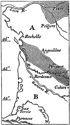
Between Poitiers and La Rochelle, the space marked A on the map separates
two regions of chalk. This space is occupied by the Oolite and certain
other formations older than the Chalk, and has been supposed by M. E. de
Beaumont to have formed an island in the cretaceous sea. South of this
space we again meet with a formation which we at once recognize by its
mineral character to be chalk, although there are some places where the
rock becomes oolitic. The fossils are, upon the whole, very similar;
especially certain species of the genera Spatangus, Ananchytes,
Cidarites, Nucula, Ostrea, Gryphæa (Exogyra), Pecten,
Plagiostoma (Lima), Trigonia, Catillus, (Inoceramus), and
Terebratula.[221-A] But Ammonites, as M. d'Archiac observes, of which
so many species are met with in the chalk of the north of France, are
scarcely ever found in the southern region; while the genera Hamite,
Turrilite, and Scaphite, and perhaps Belemnite, are entirely wanting.
On the other hand, certain forms are common in the south which are rare or
wholly unknown in the north of France. Among these may be mentioned many
Hippurites, Sphærulites, and other members [p.222]of that great
family of mollusca called Rudistes by Lamarck, to which nothing analogous
has been discovered in the living creation, but which is quite
characteristic of rocks of the Cretaceous era in the south of France,
Spain, Sicily, Greece, and other countries bordering the Mediterranean.
Fig. 224.

- a. Radiolites radiosus, D'Orb. (Hippurites, Lamk.)
- b. Opercular valve of same.
White chalk of France.
Fig. 225.

Radiolites foliaceus, D'Orb. Syn. Sphærulites
agariciformis, Blainv. White chalk of France.
Fig. 226.

Hippurites organisans, Desmoulins. Upper
chalk:—chalk marl of Pyrenees?[222-A]
- a. Young individual; when full grown they occur in groups adhering
laterally to each other.
- b. Upper side of the opercular valve, showing a reticulated structure in
those parts, b, where the external coating is worn off.
- c. Upper side of the lower and cylindrical valve.
- d. Cast of the interior of the lower conical valve.
The species called Hippurites organisans (fig. 226.) is more abundant
than any other in the south of Europe; and the geologist should make
himself well acquainted with the cast d, which is far more common in many
compact marbles of the upper cretaceous period than the shell itself, which
has often wholly disappeared. The flutings, or smooth, rounded,
longitudinal ribs, representing the form [p.223]of the interior, are
wholly unlike the hippurite itself, and in some individuals, which attain a
great size and length, are very conspicuous.
Between the region of chalk last mentioned in which Perigueux is situated,
and the Pyrenees, the space B intervenes. (See Map, p. 221.) Here the
tertiary strata cover, and for the most part conceal, the cretaceous rocks,
except in some spots where they have been laid open by the denudation of
newer formations. In these places they are seen still preserving the form
of a white chalky rock, which is charged in part with grains of green sand.
Even as far south as Tercis, on the Adour, near Dax, where I examined them
in 1828, the cretaceous rocks retain this character. In that region M.
Grateloup has found in them Ananchytes ovata (fig. 212.), and other
fossils of the English chalk, together with Hippurites.
FLORA OF THE CRETACEOUS PERIOD.
Although the fossil plants of the Cretaceous era at present known are few
in number, the rocks being principally marine, they suffice, according to
M. Ad. Brongniart, to show a transition character between the vegetation of
the secondary and that of the tertiary formations. The tertiary strata,
when compared to the older rocks, are marked by the predominance of
Exogens, which now constitute three-fourths of the living plants of the
globe.[223-A]
These exogens are wanting in the secondary strata generally, but in the
Cretaceous period they equal in number the Gymnogens (Coniferæ and
Cycadeæ) which abounded so much in the preceding Oolitic period, and
disappeared before the Eocene rocks were formed.[223-B] The discovery of a
tree-fern in the ferruginous sands of the Lower Cretaceous group of the
department of Ardennes in France is one of many signs of the contrast of
the flora, and doubtless of the climate, of this era with that of the
Pliocene and Modern periods.
[p.224]CRETACEOUS ROCKS IN THE UNITED STATES.
If we pass to the American continent, we find in the state of New Jersey a
series of sandy and argillaceous beds wholly unlike our Upper Cretaceous
system; which we can, nevertheless, recognize as referable,
paleontologically, to the same division.
That they were about the same age generally as the European chalk and
greensand, was the conclusion to which Dr. Morton and Mr. Conrad came after
their investigation of the fossils in 1834. The strata consist chiefly of
greensand and green marl, with an overlying coralline limestone of a pale
yellow colour, and the fossils, on the whole, agree most nearly with those
of the upper European series, from the Maestricht beds to the gault
inclusive. I collected sixty shells from the New Jersey deposits in 1841;
five of which were identical with European species—Ostrea larva, O.
vesicularis, Gryphæa costata, Pecten quinque-costatus, Belemnites
mucronatus. As some of these have the greatest vertical range in Europe,
they might be expected more than any others to recur in distant parts of
the globe. Even where the species are different, the generic forms, such as
the Baculite and certain sections of Ammonites, as also the Inoceramus (see
above, fig. 208.) and other bivalves, have a decidedly cretaceous aspect.
Fifteen out of the sixty shells above alluded to, were regarded by
Professor Forbes as good geographical representatives of well-known
cretaceous fossils of Europe. The correspondence, therefore, is not small,
when we reflect that the part of the United States where these strata occur
is between 3000 and 4000 miles distant from the chalk of Central and
Northern Europe, and that there is a difference of ten degrees in the
latitude of the places compared on opposite sides of the Atlantic.[224-A]
Fish of the genera Lamna, Galeus, and Carcharias are common to New
Jersey and the European cretaceous rocks. So also is the genus Mosasaurus
among reptiles, and Pliosaurus (Owen), another saurian likewise obtained
from the English chalk. From New Jersey the cretaceous formation extends
southwards to North Carolina, Georgia, and Alabama, cropping out at
intervals from beneath the tertiary strata, between the Appalachian
Mountains and the Atlantic. They then sweep round the southern extremity of
that chain, and stretch northwards again to Tennessee and Kentucky. They
have also been traced far up the valley of the Missouri 275 English miles
above its mouth, to the neighbourhood of Fort Leavenworth; and southwards
to Texas, according to the observations of Ferdinand Römer; so that already
the area which they are ascertained to occupy in North America may perhaps
equal their extent in Europe. So little do they resemble mineralogically
the European white chalk, that limestone in North America is, upon the
whole, an exception to the rule; and, even in Alabama, where I saw a
calcareous member of this group, the marlstones are much more like the
[p.225]English and French Lias than any other secondary deposit of the
Old World.
At the base of the system in Alabama I found dense masses of shingle,
perfectly loose and unconsolidated, derived from the waste of paleozoic (or
carboniferous) rocks, a mass in no way distinguishable, except by its
position, from ordinary alluvium, but covered with marls abounding in
Inocerami.
In Texas, according to F. Römer, the chalk assumes a new lithological type,
a large portion of it consisting of hard siliceous limestone, but the
organic remains leaving no doubt in regard to its age.
In South America the cretaceous strata have been discovered in Columbia, as
at Bogota and elsewhere, containing Ammonites, Hamites, Inocerami, and
other characteristic shells.[225-A]
In the South of India, also, at Pondicherry, Verdachellum, and
Trinconopoly, Messrs. Kaye and Egerton have collected fossils belonging to
the cretaceous system. Taken in connection with those from the United
States they prove, says Prof. E. Forbes, that those powerful causes which
stamped a peculiar character on the forms of marine animal life at this
period, exerted their full intensity through the Indian, European, and
American seas.[225-B] Here, as in North and South America, the cretaceous
character can be recognized even where there is no specific identity in the
fossils; and the same may be said of the organic type of those rocks in
Europe and India which succeed next in the ascending and descending order,
the Eocene and the Oolitic.
CHAPTER XVIII.
WEALDEN GROUP.
The Wealden divisible into Weald Clay, Hastings Sand, and Purbeck
Beds — Intercalated between two marine formations — Weald clay and
Cypris-bearing strata — Iguanodon — Hastings sands — Fossil
fish — Strata formed in shallow water — Brackish
water-beds — Upper, middle, and lower Purbeck — Alternations of
brackish water, freshwater, and land — Dirt-bed, or ancient
soil — Distinct species of fossils in each subdivision of the
Wealden — Lapse of time implied — Plants and insects of
Wealden — Geographical extent of Wealden — Its relation to the
cretaceous and oolitic periods — Movements in the earth's crust to
which it owed its origin and submergence.
Beneath the cretaceous rocks in the S.E. of England, a freshwater formation
is found, called the Wealden (see Nos. 5. and 6. Map, p. 242.), which,
although it occupies a small horizontal area in Europe, as compared to the
chalk, is nevertheless of great geological interest, not only from its
position, as being interpolated between [p.226]two great marine
formations (Nos. 7. and 9. Table, p. 103.), but also because the imbedded
fossils indicate a grand succession of changes in organic life, effected
during its accumulation. It is composed of three minor divisions, the Weald
Clay, the Hastings, and the Purbeck Beds, of which the aggregate thickness
in some districts may be 700 or 800 feet; but which would be much more
considerable (perhaps 2000 feet), were we to add together the extreme
thickness acquired by each of them in their fullest development.
The common name of Wealden was given to the whole, because it was first
studied in parts of Kent, Surrey, and Sussex, called the Weald, (see Map,
p. 242.), and we are indebted to Dr. Mantell for having shown in 1822, in
his Geology of Sussex, that the whole group was of fluviatile origin. In
proof of this he called attention to the entire absence of Ammonites,
Belemnites, Terebratulæ, Echinites, Corals, and other marine fossils, so
characteristic of the cretaceous rocks above, and of the Oolitic strata
below, and to the presence of Paludinæ, Melaniæ, and various fluviatile
shells, as well as the bones of terrestrial reptiles and the trunks and
leaves of land plants.
Fig. 227.

Position of the Wealden between two marine formations.
The evidence of so unexpected a fact as the infra-position of a dense mass
of purely freshwater origin to a deep-sea deposit (a phenomenon with which
we have since become familiar, in other chapters of the earth's
autobiography), was received, at first, with no small doubt and
incredulity. But the relative position of the beds is unequivocal; the
Weald Clay being distinctly seen to pass beneath the Greensand in various
parts of Surrey, Kent, and Sussex; and if we proceed from Sussex westward
to the Vale of Wardour, we there again observe the same formation, or, at
least, the lower division of it, the Purbeck, occupying the same relative
position, and resting on the Oolite (see fig. 228.). Or if we pass from the
base of the South Downs in Sussex, and cross to the Isle of Wight, we there
again meet with the Wealden series reappearing beneath the Greensand, and
cannot doubt that the beds are prolonged subterraneously, as indicated by
the dotted lines in fig. 229.
Fig. 228.

- O, Oolite.
- G S, Greensand, or Lower Cretaceous.
[p.227]
Fig. 229.

The minor groups into which the Wealden has been commonly divided in
England are, as before stated, three, and they succeed each other in the
following descending order[227-A]:—
| |
Thickness. |
| 1st. |
Weald Clay, sometimes including thin beds of sand and
shelly limestone |
140 to 280 ft. |
| 2d. |
Hastings Sand, in which occur some clays and calcareous grits |
400 to 500 ft. |
| 3d. |
Purbeck Beds, consisting of various kinds of limestones and marls |
150 to 200 ft. |
Weald Clay.
The first division, or Weald Clay, is of purely freshwater origin. The
uppermost beds are not only conformable, as Dr. Fitton observes, to the
inferior strata of the Lower Greensand, but of similar mineral composition.
To explain this, we may suppose, that as the delta of a great river was
tranquilly subsiding, so as to allow the sea to encroach upon the space
previously occupied by freshwater, the river still continued to carry down
the same sediment into the sea. In confirmation of this view it may be
stated, that the remains of the Iguanodon Mantelli, a gigantic
terrestrial reptile, very characteristic of the Wealden, has been
discovered near Maidstone, in the overlying Kentish rag, or marine
limestone of the Lower Greensand. Hence we may infer that some of the
saurians which inhabited the country of the great river continued to live
when part of the country had become submerged beneath the sea. Thus, in our
own times, we may suppose the bones of large alligators to be frequently
entombed in recent freshwater strata in the delta of the Ganges. But if
part of that delta should sink down so as to be covered by the sea, marine
formations might begin to accumulate in the same space where freshwater
beds had previously been formed; and yet the Ganges might still pour down
its turbid waters in the same direction, and carry seaward the carcasses of
the same species of alligator, in which case their bones might be included
in marine as well as in subjacent freshwater strata.
The Iguanodon, first discovered by Dr. Mantell, has left more of its
remains in the Wealden strata of the south-eastern counties, and Isle of
Wight, than any other genus of associated saurians. It was an herbivorous
reptile, and regarded by Cuvier as more extraordinary than any with which
he was acquainted; for the teeth, though bearing a great analogy to the
modern Iguanas which now frequent the tropical woods of America and the
West Indies, exhibit many striking and important differences (see fig.
230.). It appears that they have [p.228]been worn by mastication;
whereas the existing herbivorous reptiles clip and gnaw off the vegetable
productions on which they feed, but do not chew them. Their teeth, when
worn, present an appearance of having been chipped off, and never, like the
fossil teeth of the Iguanodon, have a flat ground surface (see fig. 231.),
resembling the grinders of herbivorous mammalia. Dr. Mantell computes that
the teeth and bones of this animal which have passed under his examination
during the last twenty years, must have belonged to no less than
seventy-one distinct individuals; varying in age and magnitude from the
reptile just burst from the egg, to one of which the femur measured 24
inches in circumference. Yet notwithstanding that the teeth were more
numerous than any other bones, it is remarkable that it was not till the
relics of all these individuals had been found, that a solitary example of
part of a jaw-bone was obtained. More recently remains both of the upper
and lower jaw have been met with in the Hastings Beds in Tilgate Forest.
Their size was somewhat greater than had been anticipated, and even
allowing that the tail was short, which Professor Owen infers from the
short bodies of the caudal vertebræ, Dr. Mantell estimates the probable
length of some of these saurians at between 30 and 40 feet. The largest
femur yet found measures 4 feet 8 inches in length, the circumference of
the shaft being 25 inches, and round the condyles 42 inches.
Teeth of Iguanodon.

Fig. 230. Partially worn tooth of a young animal. (Mantell.)
Fig. 231. Crown of tooth in adult, worn down. (Mantell.)
Occasionally bands of limestone, called Sussex Marble, occur in the Weald
Clay, almost entirely composed of a species of Paludina, closely
resembling the common P. vivipara of English rivers.
Fig. 232.

Cypris spinigera, Fitton.
Fig. 233.

Cypris Valdensis, Fitton. (C. faba, Min. Con. 485.)
Fig. 234.

Cypris tuberculata, Fitton.
Fig. 235.
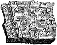
Shells of the Cypris, an animal belonging to the Crustacea, and before
mentioned (p. 31.) as abounding in lakes and ponds, are also plentifully
scattered through the clays of the Wealden, sometimes producing, like the
plates of mica, a thin lamination (see fig. 235.). Similar cypriferous
marls are found in the lacustrine tertiary beds of Auvergne (see above, p.
183.).
[p.229]Hastings Sands.
This middle division of the Wealden consists of sand, calciferous grit,
clay, and shale; the argillaceous strata, notwithstanding the name, being
nearly in the same proportion as the arenaceous. The calcareous sandstone
and grit of Tilgate Forest, near Cuckfield, in which the remains of the
Iguanodon and Hyleosaurus were first found, constitute an upper member of
this formation. The white "sand-rock" of the Hastings cliffs, about 100
feet thick, is one of the lower members of the same. The reptiles, which
are very abundant in it, consist partly of saurians, already referred by
Owen and Mantell to eight genera, among which, besides those already
enumerated, we find the Megalosaurus and Plesiosaurus. The Pterodactyl,
also a flying reptile, is met with in the same strata, and many remains of
Testudinata of the genera Trionyx and Emys, now confined to tropical
regions.
Fig. 236.

Lepidotus Mantelli, Agass. Wealden.
- a. palate and teeth.
- b. side view of teeth.
- c. scale.
The fishes of the Wealden belong partly to the genera Pycnodus and
Hybodus (see figure of genus in Chap. XXI.), forms common to the Wealden
and Oolite; but the teeth and scales of a species of Lepidotus are most
widely diffused (see fig. 236.). The general form of these fish was that of
the carp tribe, although perfectly distinct in anatomical character, and
more allied to the pike. The whole body was covered with large rhomboidal
scales, very thick, and having the exposed part covered with enamel. Most
of the species of this genus are supposed to have been either river fish,
or inhabitants of the coasts, having not sufficient powers of swimming to
advance into the deep sea.
Fig. 237.

Corbula alata, Fitton. Magnified.
The shells of the Hastings beds belong to the genera Melanopsis,
Melania, Paludina, Cyrena, Cyclas, Unio, and others, which
inhabit rivers or lakes; but one band has been found in Dorsetshire
indicating a brackish state of the water, and, in some places, even a
saltness, like that of the sea, where the genera Corbula (see fig. 237.),
Mytilus, and Ostrea occur. At different heights in the Hastings Sand,
in the middle of the Wealden, we find again and again slabs of sandstone
with a strong [p.230]ripple-mark, and between these slabs beds of clay
many yards thick. In some places, as at Stammerham, near Horsham, there are
indications of this clay having been exposed so as to dry and crack before
the next layer was thrown down upon it. The open cracks in the clay have
served as moulds, of which casts have been taken in relief, and which are,
therefore, seen on the lower surface of the sandstone (see fig. 238.).
Fig. 238.

Underside of slab of sandstone about one yard in diameter.
Stammerham, Sussex.
Near the same place a reddish sandstone occurs in which are innumerable
traces of a fossil vegetable, apparently Sphenopteris, the stems and
branches of which are disposed as if the plants were standing erect on the
spot where they originally grew, the sand having been gently deposited upon
and around them; and similar appearances have been remarked in other places
in this formation.[230-A] In the same division also of the Wealden, at
Cuckfield, is a bed of gravel or conglomerate, consisting of water-worn
pebbles of quartz and jasper, with rolled bones of reptiles. These must
have been drifted by a current, probably in water of no great depth.
Fig. 239.

Sphenopteris gracilis (Fitton), from near Tunbridge Wells.
a. portion of the same magnified.
From such facts we may infer that, notwithstanding the great thickness of
this division of the Wealden (and the same observation applies to the Weald
Clay and Purbeck Beds), the whole of it was a deposit in water of a
moderate depth, and often extremely shallow. This idea may seem startling
at first, yet such would be the natural consequence of a gradual and
continuous sinking of the ground in an estuary or bay, into which a great
river discharged its turbid waters. By each foot of subsidence, the
fundamental rock, such as the Portland Oolite, would be depressed one foot
farther from the [p.231]surface; but the bay would not be deepened, if
newly deposited mud and sand should raise the bottom one foot. On the
contrary, such new strata of sand and mud might be frequently laid dry at
low water, or overgrown for a season by a vegetation proper to marshes.
Purbeck Beds.
Immediately below the Hastings Sands we find a series of calcareous slates,
marls, and limestones, called the Purbeck Beds, because well exposed to
view in the sea-cliffs of the Peninsula of Purbeck, especially in
Durlestone Bay, near Swanage. They may also be advantageously studied at
Lulworth Cove and the neighbouring bays between Weymouth and Dorchester. At
Meup's Bay in particular, Prof. E. Forbes has recently examined minutely
the organic remains of the three members of the Purbeck group, displayed
there in a vertical section 155 feet thick. To the information previously
supplied in the works of Messrs. Webster, Fitton, De la Beche, Buckland,
and Mantell, he has made most ample and important additions, so that it
will be desirable to give them at some length, it appearing that the Upper,
Middle, and Lower Purbecks are each marked by peculiar species of organic
remains, these again being different, so far as a comparison has yet been
instituted, from the fossils of the overlying Hastings Sands and Weald
Clay. This result cannot fail to excite much wonder, and it leads us to
suspect that the Wealden period, which many geologists have scarcely
deigned to notice in their classification, may comprehend the history of a
lapse of time as great as that of the Oolitic or Cretaceous eras
respectively.[231-A]
Upper Purbeck.—The highest of the three divisions is purely freshwater,
the strata, about 50 feet in thickness, containing shells of the genera
Paludina, Physa, Lymnea, Planorbis, Valvata, Cyclas, and
Unio, with cyprides, and fish.
Middle Purbeck.—To these succeed the Middle Purbeck, about 30 feet
thick, the uppermost part of which consists of freshwater limestone, with
cyprides, turtles, and fish of different species from those in the
preceding strata. Below the limestone are brackish-water beds full of
Cyrena, and traversed by bands abounding in Corvulæ and Melaniæ.
These are based on a purely marine deposit, with Pecten, Modiola,
Avicula, and Thracia, all undescribed shells. Below this, again, come
limestones and shales, partly of brackish and partly of freshwater origin,
in which many fish, especially species of Lepidotus and Microdon
radiatus, are found, and a reptile named Macrorhyncus. Among the
mollusks, a remarkable ribbed Melania, of the section Chilira, occurs.
Immediately below is the great and conspicuous stratum, 12 feet thick, long
familiar to geologists under the local name of "Cinder-bed," formed of a
vast accumulation of shells of Ostrea distorta [p.232](fig. 240.). In
the uppermost part of this bed Mr. Forbes discovered the first echinoderm
as yet known in the Purbeck series, a species of Hemicidaris, a genus
characteristic of the Oolitic period. It was accompanied by a species of
Perna. Below the Cinder-bed freshwater strata are again seen, filled in
many places with species of Cypris, Valvata, Paludina, Planorbis,
Lymnea, Physa, and Cyclas, all different from any we had previously
seen above. Thick siliceous beds of chert, filled with these fossils, occur
in a beautiful state of preservation, often converted into chalcedony.
Among these Mr. Forbes met with gyrogonites (the spore vesicles of
Charæ), plants never before discovered in rocks older than the Eocene.
Again, beneath these freshwater strata, a very thin band of greenish
shales, with marine shells and impressions of leaves, like those of a large
Zostera, succeeds, forming the base of the Middle Purbeck.
Fig. 240.

Ostrea distorta. Cinder-bed.
Lower Purbeck.—Beneath the thin marine band last mentioned, purely
freshwater marls occur, containing species of Cypris, Valvata, and
Lymnea, different from those of the Middle Purbeck. This is the beginning
of the Inferior division, which is about 80 feet thick. Below the marls are
seen more than 30 feet of brackish-water beds, at Meup's Bay, abounding in
a species of Serpula, allied to, if not identical with, Serpula
coacervites, found in the Wealden of Hanover. There are also shells of the
genus Rissoa (of the subgenus Hydrobia), and a little Cardium of the
subgenus Protocardium, in the same beds, together with Cypris. Some of
the cypris-bearing shales are strangely contorted and broken up, at the
west end of the Isle of Purbeck. The great dirt-bed or vegetable soil
containing the roots and stools of Cycadeæ, which I shall presently
describe, underlies these marls, resting upon the lowest freshwater
limestone, a rock about 8 feet thick, containing Cyclades, Valvata, and
Lymnea, of the same species as those of the uppermost part of the Lower
Purbeck. This rock rests upon the top beds of the Portland stone, which is
purely marine, and between which and the Purbecks there is no passage.
The most remarkable of all the varied successions of beds enumerated in the
above list, is that called by the quarrymen "the dirt," or "black dirt,"
which was evidently an ancient vegetable soil. It is from 12 to 18 inches
thick, is of a dark brown or black colour, and contains a large proportion
of earthy lignite. Through it are dispersed rounded fragments of stone,
from 3 to 9 inches in diameter, in such numbers that it almost deserves the
name of gravel. Many silicified trunks of coniferous trees, and the remains
of plants allied to Zamia and Cycas, are buried in this dirt-bed (see
figure of living Zamia, fig. 241.).
These plants must have become fossil on the spots where they grew. The
stumps of the trees stand erect for a height of from 1 to 3 feet, and even
in one instance to 6 feet, with their roots attached to the soil at about
the same distances from one another as the trees in a [p.233]modern
forest.[233-A] The carbonaceous matter is most abundant immediately around
the stumps, and round the remains of fossil Cycadeæ.[233-B]
Fig. 241.

Zamia spiralis; Southern Australia.[233-C]
Besides the upright stumps above mentioned, the dirt-bed contains the stems
of silicified trees laid prostrate. These are partly sunk into the black
earth, and partly enveloped by a calcareous slate which covers the
dirt-bed. The fragments of the prostrate trees are rarely more than 3 or 4
feet in length; but by joining many of them together, trunks have been
restored, having a length from the root to the branches of from 20 to 23
feet, the stems being undivided for 17 or 20 feet, and then forked. The
diameter of these near the roots is about 1 foot.[233-D] Root-shaped
cavities were observed by Professor Henslow to descend from the bottom of
the dirt-bed into the subjacent freshwater stone, which, though now solid,
must have been in a soft and penetrable state when the trees grew.[233-E]
Fig. 242.

Section in Isle of Portland, Dorset. (Buckland and
De la Beche.)
The thin layers of calcareous slate (fig. 242.) were evidently deposited
tranquilly, and would have been horizontal but for the protrusion of the
stumps of the trees, around the top of each of which they form
hemispherical concretions.
[p.234]The dirt-bed is by no means confined to the island of Portland,
where it has been most carefully studied, but is seen in the same relative
position in the cliffs east of Lulworth Cove, in Dorsetshire, where, as the
strata have been disturbed, and are now inclined at an angle of 45°, the
stumps of the trees are also inclined at the same angle in an opposite
direction—a beautiful illustration of a change in the position of beds
originally horizontal (see fig. 243.). Traces of the dirt-bed have also
been observed by Dr. Buckland, about two miles north of Thame, in
Oxfordshire; and by Dr. Fitton, in the cliffs of the Boulonnois, on the
French coast; but, as might be expected, this freshwater deposit is of
limited extent when compared to most marine formations.
Fig. 243.

Section in cliff east of Lulworth Cove. (Buckland
and De la Beche.)
From the facts above described, we may infer, first, that the superior beds
of the Oolite, called "the Portland," which are full of marine shells, were
overspread with fluviatile mud, which became dry land, and covered by a
forest, throughout a portion of the space now occupied by the south of
England, the climate being such as to admit the growth of the Zamia and
Cycas. 2dly. This land at length sank down and was submerged with its
forests beneath a body of fresh water, from which sediment was thrown down
enveloping fluviatile shells. 3dly. The regular and uniform preservation of
this thin bed of black earth over a distance of many miles, shows that the
change from dry land to the state of a freshwater lake or estuary, was not
accompanied by any violent denudation, or rush of water, since the loose
black earth, together with the trees which lay prostrate on its surface,
must inevitably have been swept away had any such violent catastrophe then
taken place.
The dirt-bed has been described above in its most simple form, but in some
sections the appearances are more complicated. The forest of the dirt-bed
was not everywhere the first vegetation which grew in this region. Two
other beds of carbonaceous clay, one of them containing Cycadeæ, in an
upright position, have been found below it, and one above it[234-A], which
implies other oscillations in the level of the same ground, and its
alternate occupation by land and water more than once.
[p.235]Table showing the changes of medium in which the strata were
formed, from the Lower Greensand to the Portland Stone inclusive, in the
south-east of England.
| 1. |
Marine |
|
Lower greensand. |
| 2. |
Freshwater |
Weald clay. |
| 3. |
Freshwater
Brackish
Freshwater |
} |
|
Hastings sand. |
| 4. |
Freshwater |
|
Upper Purbeck. |
| 5. |
Freshwater
Brackis
Marine
Brackish
Marine
Freshwater
Marine |
} |
Middle Purbeck. |
| 6. |
Freshwater
Brackish
Land
Freshwater
Land (dirt-bed)
Freshwater
Land
Freshwater
Land
Freshwater |
} |
Lower Purbeck. |
| 7. |
Marine |
|
Portland stone. |
The annexed tabular view will enable the reader to take in at a glance the
successive changes from sea to river, and from river to sea, or from these
again to a state of land, which have occurred in this part of England
between the Cretaceous and Oolitic periods. That there have been at least
four changes in the species of testacea during the deposition of the
Wealden, seems to follow from the observations recently made by Professor
E. Forbes, so that, should we hereafter find the signs of many more
alternate occupations of the same area by different elements, it is no more
than we might expect. Even during a small part of a zoological period, not
sufficient to allow time for many species to die out, we find that the same
area has been laid dry, and then submerged, and then again laid dry, as in
the deltas of the Po and Ganges, the history of which has been brought to
light by Artesian borings.[235-A] We also know that similar revolutions
have occurred within the present century (1819) in the delta of the Indus
in Cutch[235-B], where land has been laid permanently under the waters both
of the river and sea, without its soil or shrubs having been swept away.
Even, independently of any vertical movements of the ground, we see in the
principal deltas, such as that of the Mississippi, that the sea extends its
salt waters annually for many months over considerable spaces, which, at
other seasons, are occupied by the river during its inundations.
It will be observed that the division of the Purbecks into upper, middle,
and lower, has been made by Professor E. Forbes, strictly on the principle
of the entire distinctness of the species of organic remains which they
include. The lines of demarcation are not lines of disturbance, nor
indicated by any striking physical characters or mineral changes. The
features which attract the eye in the Purbecks, such as the dirt-beds, the
dislocated strata at Lulworth, and the Cinder-bed, do not indicate any
breaks in the distribution of organized beings. "The causes which led to a
complete change of life three times during the deposition of the freshwater
and brackish strata must," says this naturalist, "be sought for, not simply
in either a [p.236]rapid or a sudden change of their area into land or
sea, but in the great lapse of time which intervened between the epochs of
deposition at certain periods during their formation."
Each dirt-bed may, no doubt, be the memorial of many thousand years or
centuries, because we find that 2 or 3 feet of vegetable soil is the only
monument which many a tropical forest has left of its existence ever since
the ground on which it now stands was first covered with its shade. Yet,
even if we imagined the fossil soils of the Lower Purbeck to represent as
many ages, we need not expect on that account to find them constituting the
lines of separation between successive strata characterized by different
zoological types. The preservation of a layer of vegetable soil, when in
the act of being submerged, must be regarded as a rare exception to a
general rule. It is of so perishable a nature, that it must usually be
carried away by the denuding waves or currents of the sea or by a river;
and many dirt-beds were probably formed in succession, and annihilated in
the Wealden, besides those few which now remain.
Fig. 244.

Cone from the Isle of Purbeck, resembling the
Dammara of the Moluccas. (Fitton.)
The plants of the Wealden, so far as our knowledge extends at present,
consist chiefly of Ferns, Coniferæ (see fig. 244.), and Cycadeæ, without
any exogens; the whole more allied to the Oolitic than to the Cretaceous
vegetation, although some of the species seem to be common to the chalk.
But the vertebrate and invertebrate animals indicate, in like manner, a
relationship to both these periods, though a nearer affinity to the
Oolitic. Mr. Brodie has found the remains of beetles and several insects of
the homopterous and trichopterous orders, some of which now live on plants,
like those of the Wealden, while others hover over the surface of our
present rivers. But no bones of mammalia have been met with among those of
land-reptiles. Yet, as the reader will learn, in Chapter XX., that the
relics of marsupial quadrupeds have been detected in still older beds, and,
as it was so long before a single portion of the jaw of an iguanodon was
met with in the Tilgate quarries (see p. 228.), we need by no means despair
of discovering hereafter some evidence of the existence of warm-blooded
quadrupeds at this era. It is, at least, too soon to infer, on mere
negative evidence, that the mammalia were foreign to this fauna.
In regard to the geographical extent of the Wealden, it cannot be
accurately laid down; because so much of it is concealed beneath the newer
marine formations. It has been traced about 200 English miles from west to
east, from Lulworth Cove to near Boulogne, in France; and about 220 miles
from north-west to south-east, from Whitchurch, in Buckinghamshire, to
Beauvais, in France. If the formation be continuous throughout this space,
which is very doubtful, it does not follow that the whole was
contemporaneous; because, in all likelihood, the physical geography of the
region underwent frequent change throughout the whole period, and the
estuary may [p.237]have altered its form, and even shifted its place.
Dr. Dunker, of Cassel, and H. Von Meyer, in an excellent monograph on the
Wealdens of Hanover and Westphalia, have shown that they correspond so
closely, not only in their fossils, but also in their mineral characters,
with the English series, that we can scarcely hesitate to refer the whole
to one great delta. Even then, the magnitude of the deposit may not exceed
that of many modern rivers. Thus, the delta of the Quorra or Niger, in
Africa, stretches into the interior for more than 170 miles, and occupies,
it is supposed, a space of more than 300 miles along the coast, thus
forming a surface of more than 25,000 square miles, or equal to about one
half of England.[237-A] Besides, we know not, in such cases, how far the
fluviatile sediment and organic remains of the river and the land may be
carried out from the coast, and spread over the bed of the sea. I have
shown, when treating of the Mississippi, that a more ancient delta,
including species of shells, such as now inhabit Louisiana, has been
upraised, and made to occupy a wide geographical area, while a newer delta
is forming[237-B]; and the possibility of such movements, and their
effects, must not be lost sight of when we speculate on the origin of the
Wealden.
If it be asked where the continent was placed from the ruins of which the
Wealden strata were derived, and by the drainage of which a great river was
fed, we are half tempted to speculate on the former existence of the
Atlantis of Plato. The story of the submergence of an ancient continent,
however fabulous in history, must have been true again and again as a
geological event.
The real difficulty consists in the persistence of a large hydrographical
basin, from whence a great body of fresh water was poured into the sea,
precisely at a period when the neighbouring area of the Wealden was
gradually going downwards 1000 feet or more perpendicularly. If the
adjoining land participated in the movement, how could it escape being
submerged, or how could it retain its size and altitude so as to continue
to be the source of such an inexhaustible supply of fresh water and
sediment? In answer to this question, we are fairly entitled to suggest
that the neighbouring land may have been stationary, or may even have
undergone a contemporaneous slow upheaval. There may have been an ascending
movement in one region, and a descending one in a contiguous parallel zone
of country; just as the northern part of Scandinavia is now rising, while
the middle portion (that south of Stockholm) is unmoved, and the southern
extremity in Scania is sinking, or at least has sunk within the historical
period.[237-C] We must, nevertheless, conclude, if we adopt the above
hypothesis, that the depression of the land became general throughout a
large part of Europe at the close of the Wealden period, a subsidence which
brought in the cretaceous ocean.
[p.238]CHAPTER XIX.
DENUDATION OF THE CHALK AND WEALDEN.
Physical geography of certain districts composed of Cretaceous and Wealden
strata — Lines of inland chalk-cliffs on the Seine in
Normandy — Outstanding pillars and needles of chalk — Denudation of
the chalk and Wealden in Surrey, Kent, and Sussex — Chalk once
continuous from the North to the South Downs — Anticlinal axis and
parallel ridges — Longitudinal and transverse valleys — Chalk
escarpments — Rise and denudation of the strata gradual — Ridges
formed by harder, valleys by softer beds — Why no alluvium, or wreck of
the chalk, in the central district of the Weald — At what periods the
Weald valley was denuded — Land has most prevailed where denudation has
been greatest — Elephant bed, Brighton.
All the fossiliferous formations may be studied by the geologist in two
distinct points of view: first, in reference to their position in the
series, their mineral character and fossils; and, secondly, in regard to
their physical geography, or the manner in which they now enter, as mineral
masses, into the external structure of the earth; forming the bed of lakes
and seas, or the surface and foundation of hills and valleys, plains and
table-lands. Some account has already been given on the first head of the
Tertiary, the Cretaceous, and Wealden strata; and we may now proceed to
consider certain features in the physical geography of these groups as they
occur in parts of England and France.
The hills composed of white chalk in the S.E. of England have a smooth
rounded outline, and being usually in the state of sheep pastures, are free
from trees or hedgerows; so that we have an opportunity of observing how
the valleys by which they are drained ramify in all directions, and become
wider and deeper as they descend. Although these valleys are now for the
most part dry, except during heavy rains and the melting of snow, they may
have been due to aqueous denudation, as explained in the sixth chapter;
having been excavated when the chalk emerged gradually from the sea. This
opinion is confirmed by the occasional occurrence of long lines of inland
cliffs, in which the strata are cut off abruptly in steep and often
vertical precipices. The true nature of such escarpments is nowhere more
obvious than in parts of Normandy, where the river Seine and its
tributaries flow through deep winding valleys, hollowed out of chalk
horizontally stratified. Thus, for example, if we follow the Seine for a
distance of about 30 miles from Andelys to Elbœuf, we find the valley
flanked on both sides by a deep slope of chalk, with numerous beds of
flint, the formation being laid open for a thickness of about 250 and 300
feet. Above the chalk is an overlying mass of sand, gravel, and clay, from
30 to 100 feet thick. The two opposite slopes of the hills a and b,
where the chalk appears at [p.239]the surface, are from 2 to 4 miles
apart, and they are often perfectly smooth and even, like the steepest of
our downs in England; but at many points they are broken by one, two, or
more ranges of vertical and even overhanging cliffs of bare white chalk
with flints. At some points detached needles and pinnacles stand in the
line of the cliffs, or in front of them, as at c, fig. 245. On the right
bank of the Seine, at Andelys, one range, about 2 miles long, is seen
varying from 50 to 100 feet in perpendicular height, and having its
continuity broken by a number of dry valleys or coombs, in one of which
occurs a detached rock or needle, called the Tête d'Homme (see figs. 246,
247.). The top of this rock presents a precipitous face towards every point
of the compass; its vertical height being more than 20 feet on the side of
the downs, and 40 towards the Seine, the average diameter of the pillar
being 36 feet. Its composition is the same as that of the larger cliffs in
its neighbourhood, namely, white chalk, having occasionally a crystalline
texture like marble, with layers of flint in nodules and tabular masses.
The flinty beds often project in relief 4 or 5 feet beyond the white chalk,
which is generally in a state of slow decomposition, either exfoliating or
being covered with white powder, like the chalk cliffs on the English
coast; and, as in them, this superficial powder contains in some places
common salt.
Fig. 245.
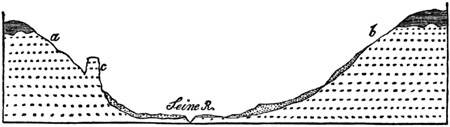
Section across Valley of Seine.
Fig. 246.

View of the Tête d'Homme, Andelys, seen from above.
Other cliffs are situated on the right bank of the Seine, opposite
Tournedos, between Andelys and Pont de l'Arche, where the precipices are
from 50 to 80 feet high: several of their summits terminate [p.240]in
pinnacles; and one of them, in particular, is so completely detached as to
present a perpendicular face 50 feet high towards the sloping down. On
these cliffs several ledges are seen, which mark so many levels at which
the waves of the sea may be supposed to have encroached for a long period.
At a still greater height, immediately above the top of this range, are
three much smaller cliffs, each about 4 feet high, with as many intervening
terraces, which are continued so as to sweep in a semicircular form round
an adjoining coomb, like those in Sicily before described (p. 76.).
Fig. 247.

Side view of the Tête d'Homme. White chalk with
flints.
Fig. 248.
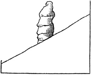
Chalk pinnacle at Senneville.
Fig. 249.
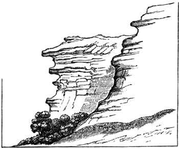
Roches d'Orival, Elbœuf.
If we then descend the river from Vatteville to a place called Senneville,
we meet with a singular needle about 50 feet high, perfectly isolated on
the escarpment of chalk on the right bank of the Seine (see fig. 248.).
Another conspicuous range of inland cliffs is situated about 12 miles below
on the left bank of the Seine, beginning at Elbœuf, and comprehending
the Roches d'Orival (see fig. 249.). Like those before described, it has an
irregular surface, often overhanging, [p.241]and with beds of flint
projecting several feet. Like them, also, it exhibits a white powdery
surface, and consists entirely of horizontal chalk with flints. It is 40
miles inland, its height, in some parts, exceeding 200 feet, and its base
only a few feet above the level of the Seine. It is broken, in one place,
by a pyramidal mass or needle, 200 feet high, called the Roche de Pignon,
which stands out about 25 feet in front of the upper portion of the main
cliffs, with which it is united by a narrow ridge about 40 feet lower than
its summit (see fig. 250.). Like the detached rocks before mentioned at
Senneville, Vatteville, and Andelys, it may be compared to those needles of
chalk which occur on the coast of Normandy, as well as in the Isle of Wight
and in Purbeck[241-A] (see fig. 251.).
Fig. 250.
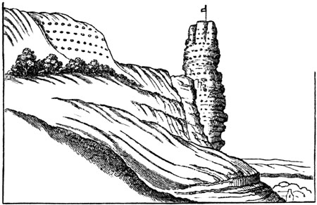
View of the Roche de Pignon, seen from the south.
Fig. 251.

Needle and Arch of Etretat, in the chalk cliffs of
Normandy. Height of Arch 100 feet. (Passy.)[241-B]
The foregoing description and drawings will show, that the evidence of
certain escarpments of the chalk having been originally sea-cliffs, is far
more full and satisfactory in France than in England. If it be asked why,
in the interior of our own country, we meet with no ranges of precipices
equally vertical and overhanging, and no isolated pillars or needles, we
may reply that the greater hardness of the chalk in Normandy may, no doubt,
be the chief cause of this difference. [p.242]But the frequent absence
of all signs of littoral denudation in the valley of the Seine itself is a
negative fact of a far more striking and perplexing character. The cliffs,
after being almost continuous for miles, are then wholly wanting for much
greater distances, being replaced by a green sloping down, although the
beds remain of the same composition, and are equally horizontal; and
although we may feel assured that the manner of the upheaval of the land,
whether intermittent or not, must have been the same at those intermediate
points where no cliffs exist, as at others where they are so fully
developed. But, in order to explain such apparent anomalies, the reader
must refer again to the theory of denudation, as expounded in the 6th
chapter; where it was shown, first, that the undermining force of the waves
and marine currents varies greatly at different parts of every coast;
secondly, that precipitous rocks have often decomposed and crumbled down;
and thirdly, that many terraces and small cliffs may now lie concealed
beneath a talus of detrital matter.
Denudation of the Weald Valley.—No district is better fitted to
illustrate the manner in which a great series of strata may have been
upheaved and gradually denuded than the country intervening between the
North and South Downs. This region, of which a ground plan is given in the
accompanying map (fig. 252.), comprises within it the whole of Sussex, and
parts of the counties of Kent, Surrey, and Hampshire. The space in which
the formations older than the White Chalk, or those from the Gault to the
Hastings sand inclusive, crop out, is bounded everywhere by a great
escarpment of chalk, which is continued on the opposite side of the channel
in the Bas Boulonnais in France, where it forms the semicircular boundary
of a tract in which older strata also appear at the surface. The whole of
this district may therefore be considered geologically as one and the same.
Fig. 252.
Geological Map of the south-east of England and part of France,
exhibiting the denudation of the Weald.
[p.243]
Fig. 253.

Section from the London to the Hampshire basin across the valley
of the Weald.
- 1. Tertiary strata.
- 2. Chalk and firestone.
- 3. Gault.
- 4. Lower greensand.
- 5. Weald clay.
- 6. Hastings sands.
Fig. 254.
Highest point of North Downs, 880 feet.[243-A]
Section of the country from the confines of the basin of London to that of
Hants, with the principal heights above the level of the sea on a true
scale.[243-B]
The space here inclosed within the escarpment of the chalk affords an
example of what has been sometimes called a "valley of elevation" (more
properly "of denudation"); where the strata, partially removed by aqueous
excavation, dip away on all sides from a central [p.244]axis. Thus, it
is supposed that the area now occupied by the Hastings sand (No. 6.) was
once covered by the Weald clay (No. 5.), and this again by the Greensand
(No. 4.), and this by the Gault (No. 3.); and, lastly, that the Chalk (No.
2.) extended originally over the whole space between the North and the
South Downs. This theory will be better understood by consulting the
annexed diagram (fig. 253.), where the dark lines represent what now
remains, and the fainter ones those portions of rock which are believed to
have been carried away.
At each end of the diagram the tertiary strata (No. 1.) are exhibited
reposing on the chalk. In the middle are seen the Hastings sands (No. 6.)
forming an anticlinal axis, on each side of which the other formations are
arranged with an opposite dip. It has been necessary, however, in order to
give a clear view of the different formations, to exaggerate the
proportional height of each in comparison to its horizontal extent; and a
true scale is therefore subjoined in another diagram (fig. 254.), in order
to correct the erroneous impression which might otherwise be made on the
reader's mind. In this section the distance between the North and South
Downs is represented to exceed forty miles; for the Valley of the Weald is
here intersected in its longest diameter, in the direction of a line
between Lewes and Maidstone.
Through the central portion, then, of the district supposed to be denuded
runs a great anticlinal line, having a direction nearly east and west, on
both sides of which the beds 5, 4, 3, and 2, crop out in succession. But,
although, for the sake of rendering the physical structure of this region
more intelligible, the central line of elevation has alone been introduced,
as in the diagrams of Smith, Mantell, Conybeare, and others, geologists
have always been well aware that numerous minor lines of dislocation and
flexure run parallel to the great central axis.
In the central area of the Hastings sand the strata have undergone the
greatest displacement; one fault being known, where the vertical shift of a
bed of calcareous grit is no less than 60 fathoms.[244-A] Much of the
picturesque scenery of this district arises from the depth of the narrow
valleys and ridges to which the sharp bends and fractures of the strata
have given rise; but it is also in part to be attributed to the excavating
power exerted by water, especially on the interstratified argillaceous
beds.
Besides the series of longitudinal valleys and ridges in the Weald, there
are valleys which run in a transverse direction, passing through the chalk
to the basin of the Thames on the one side, and to the English Channel on
the other. In this manner the chain of the North Downs is broken by the
rivers Wey, Mole, Darent, Medway, and Stour; the South Downs by the Arun,
Adur, Ouse, and Cuckmere.[244-B] If these transverse hollows could be
filled up, all the rivers, observes Mr. Conybeare, would be forced to take
an easterly course, and to [p.245]empty themselves into the sea by
Romney Marsh and Pevensey Levels.[245-A]
Mr. Martin has suggested that the great cross fractures of the chalk, which
have become river channels, have a remarkable correspondence on each side
of the valley of the Weald; in several instances the gorges in the North
and South Downs appearing to be directly opposed to each other. Thus, for
example, the defiles of the Wey in the North Downs, and of the Arun in the
South, seemed to coincide in direction; and, in like manner, the Ouse
corresponds to the Darent, and the Cuckmere to the Medway.[245-B]
Fig. 255.
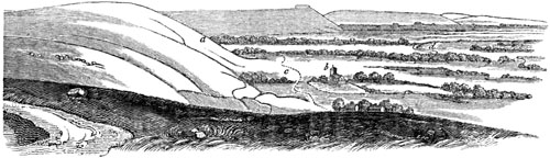
View of the chalk escarpment of the South Downs.
Taken from the Devil's Dike, looking towards the west and south-west.
- a. The town of Steyning is hidden by this point.
- b. Edburton church.
- c. Road.
- d. River Adur.
Although these coincidences may, perhaps, be accidental, it is by no means
improbable, as hinted by the author above mentioned, that great amount of
elevation towards the centre of the Weald district gave rise to transverse
fissures. And as the longitudinal valleys were connected with that linear
movement which caused the anticlinal lines running east and west, so the
cross fissures might have been occasioned by the intensity of the upheaving
force towards the centre of the line.
But before treating of the manner in which the upheaving movement may have
acted, I shall endeavour to make the reader more intimately acquainted with
the leading geographical features of the district, so far as they are of
geological interest.
In whatever direction we travel from the tertiary strata of the basins of
London and Hampshire towards the valley of the Weald, we first ascend a
slope of white chalk, with flints, and then find ourselves on the summit of
a declivity [p.246]consisting, for the most part, of different members
of the chalk formation; below which the upper greensand, and sometimes,
also, the gault, crop out. This steep declivity is the great escarpment of
the chalk before mentioned, which overhangs a valley excavated chiefly out
of the argillaceous or marly bed, termed Gault (No. 3.). The escarpment is
continuous along the southern termination of the North Downs, and may be
traced from the sea, at Folkestone, westward to Guildford and the
neighbourhood of Petersfield, and from thence to the termination of the
South Downs at Beachy Head. In this precipice or steep slope the strata are
cut off abruptly, and it is evident that they must originally have extended
farther. In the woodcut (fig. 255. p. 245.), part of the escarpment of the
South Downs is faithfully represented, where the denudation at the base of
the declivity has been somewhat more extensive than usual, in consequence
of the upper and lower greensand being formed of very incoherent materials,
the upper, indeed, being extremely thin and almost wanting.
Fig. 256.

Chalk escarpment, as seen from the hill above Steyning, Sussex.
The castle and village of Bramber in the foreground.
The geologist cannot fail to recognize in this view the exact likeness of a
sea cliff; and if he turns and looks in an opposite direction, or eastward,
towards Beachy Head (see fig. 256.), he will see the same line of heights
prolonged. Even those who are not accustomed to speculate on the former
changes which the surface has undergone may fancy the broad and level plain
to resemble the flat sands which were laid dry by the receding tide, and
the different projecting masses of chalk to be the headlands of a coast
which separated the different bays from each other.
In regard to the transverse valleys before mentioned, as intersecting the
chalk hills, some idea of them may be derived from the subjoined sketch
(fig. 257.), of the gorge of the river Adur, taken from the summit of the
chalk downs, at a point in the bridle-way leading from the towns of Bramber
and Steyning to Shoreham. If the reader will refer again to the view given
in a former woodcut (fig. 255. p. 245.), he will there see the exact point
where the gorge of which I am now speaking interrupts the chalk escarpment.
A projecting hill, at the point a, hides the town of Steyning, near which
the valley commences where the Adur passes directly to the sea at Old
Shoreham. The river flows through a nearly level plain, [p.247]as do
most of the others which intersect the hills of Surrey, Kent, and Sussex;
and it is evident that these openings, so far at least as they are due to
aqueous erosion, have not been produced by the rivers, many of which, like
the Ouse near Lewes, have filled up arms of the sea, instead of deepening
the hollows which they traverse.
Fig. 257.

Transverse Valley of the Adur in the South Downs.
- a. Town of Steyning.
- b. River Adur.
- c. Old Shoreham.
Now, in order to account for the manner in which the five groups of strata,
2, 3, 4, 5, 6, represented in the map, fig. 252. and in the section fig.
253., may have been brought into their present position, the following
hypothesis has been very generally adopted:—Suppose the five formations to
lie in horizontal stratification at the bottom of the sea; then let a
movement from below press them upwards into the form of a flattened dome,
and let the crown of this dome be afterwards cut off, so that the incision
should penetrate to the lowest of the five groups. The different beds would
then be exposed on the surface, in the manner exhibited in the map, fig.
252.[247-A]
The quantity of denudation or removal by water of stratified masses assumed
to have once reached continuously from the North to the South Downs is so
enormous, that the reader may at first be startled by the boldness of the
hypothesis. But the difficulty vanishes when once sufficient time is
allowed for the gradual and successive rise of the strata, during which the
waves and currents of the ocean might slowly accomplish an operation, which
no sudden diluvial rush of waters could possibly have effected.
Among other proofs of the action of water, it may be stated that the great
longitudinal valleys follow the outcrop of the softer and [p.248]more
incoherent beds, while ridges or lines of cliff usually occur at those
points where the strata are composed of harder stone. Thus, for example,
the chalk with flints, together with the subjacent upper greensand, which
is often used for building, under the provincial name of "firestone," has
been cut into a steep cliff on that side on which the sea encroached. This
escarpment bounds a deep valley, excavated chiefly out of the soft
argillaceous or marly bed, termed gault (No. 3.). In some places the upper
greensand is in a loose and incoherent state, and there it has been as much
denuded as the gault; as, for example, near Beachy Head; but farther to the
westward it is of great thickness, and contains hard beds of blue chert and
calcareous sandstone or firestone. Here, accordingly, we find that it
produces a corresponding influence on the scenery of the country; for it
runs out like a step beyond the foot of the chalk-hills, and constitutes a
lower terrace, varying in breadth from a quarter of a mile to three miles,
and following the sinuosities of the chalk escarpment.[248-A]
Fig. 258.

- a. Chalk with flints.
- b. Chalk without flints.
- c. Upper greensand, or firestone.
- d. Gault.
It is impossible to desire a more satisfactory proof that the escarpment is
due to the excavating power of water during the rise of the strata; for I
have shown, in my account of the coast of Sicily, in what manner the
encroachments of the sea tend to efface that succession of terraces which
must otherwise result from the intermittent upheaval of a coast preyed upon
by the waves.[248-B] During the interval between two elevatory movements,
the lower terrace will usually be destroyed, wherever it is composed of
incoherent materials; whereas the sea will not have time entirely to sweep
away another part of the same terrace, or lower platform, which happens to
be composed of rocks of a harder texture, and capable of offering a firmer
resistance to the erosive action of water. As the yielding clay termed
gault would be readily washed away, we find its outcrop marked everywhere
by a valley which skirts the base of the chalk hills, and which is usually
bounded on the opposite side by the lower greensand; but as the upper beds
of this last formation are most commonly loose and incoherent, they also
have usually disappeared and increased the breadth of the valley. But in
those districts where chert, limestone, and other solid materials enter
largely into the composition of this formation (No. 4.), they give rise to
a range of hills parallel to the chalk, which sometimes rival the
escarpment of the chalk itself in height, or even surpass it, as in Leith
Hill, near Dorking. This ridge often presents a steep escarpment towards
the soft argillaceous deposit called the [p.249]Weald clay (No. 5.; see
the strong lines in fig. 253. p. 243.), which usually forms a broad valley,
separating the lower greensand from the Hastings sands or Forest ridge; but
where subordinate beds of sandstone of a firmer texture occur, the
uniformity of the plain of No. 5. is broken by waving irregularities and
hillocks.
It will be easy to show how closely the superficial inequalities agree with
those which we might naturally expect to originate during the gradual rise
of the Wealden district. Suppose the line of the most energetic movement to
have coincided with what is now the central ridge of the Weald valley; in
that case the first land which emerged must have been situated where the
Forest ridge is now placed. Here many shoals and reefs may first have
existed, and islands of chalk devoured in the course of ages by the ocean
(see fig. 253.); so that the top of the shattered dome which first appeared
above water may have been utterly destroyed, and the masses represented by
the fainter lines (fig. 253.) removed.
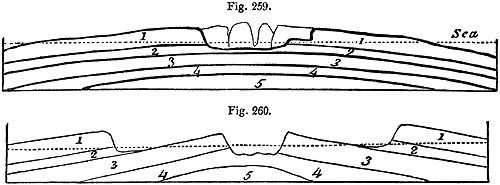
The dotted lines represent the sea-level.
The upper greensand is represented (fig. 259.) as forming on the left hand
a single precipice with the chalk; while on the right there are two cliffs,
with an intervening terrace, as before described in fig. 258. Two strips of
land would then remain on each side of a channel, presenting ranges of
white cliffs facing each other. A powerful current might then scoop out a
channel in the gault (No. 2.). This softer bed would yield with ease in
proportion as parts of it were brought up from time to time and exposed to
the fury of the waves, so that large spaces occupied by the harder
formation or greensand (No. 3.) would be laid bare. This last rock,
opposing a more effectual resistance, would next emerge; while the chalk
cliffs, at the base of which the gault is rapidly undermined, would recede
farther from each other, after which four parallel strips of land, or rows
of islands, would be caused, which are represented by the masses which in
fig. 260. rise above the dotted line indicating the sea-level. In this
diagram, however, the inclination of the upper surface of the formations
(Nos. 1. and 3.), is exaggerated. Originally this surface must have been
level, like the submarine terraces produced by denudation, and described
before (p. 74. and 77.); but they were afterwards more and more tilted by
that general movement to which the region of the Weald owes its structure.
At length, by the farther elevation of the dome-shaped mass, the clay (No.
4.) would be brought [p.250]within reach of the waves, which would
probably gain the more easy access to the subjacent deposit by the rents
which would be caused in No. 3., and in the central part of the ridge where
the uplifting force had been exerted with the greatest energy. The opposite
cliffs, in which the greensand (No. 3.) terminates, would now begin to
recede from each other, having at their base a yielding stratum of clay
(No. 4.). Lastly, the sea would penetrate to the sand (No. 5.), and then
the state of things indicated in the dark lines of the upper section (fig.
253.), would be consummated.
Fig. 261.

The Coomb, near Lewes.
It was stated that there are many lines of flexure and dislocation, running
east and west, or parallel to the central axis of the Wealden. They are
numerous in the district of the Hastings sand, and sometimes occur in the
chalk itself. One of the latter kind has given rise to the ravine called
the Coomb, near Lewes, and was first traced out by Dr. Mantell, in whose
company I examined it. This coomb is seen on the eastern side of the valley
of the Ouse, in the suburbs of the town of Lewes. The steep declivities on
each side are covered with green turf, as is the bottom, which is perfectly
dry. No outward signs of disturbance are visible; and the connection of the
hollow with subterranean movements would not have been suspected by the
geologist, had not the evidence of great convulsions been clearly exposed
in the escarpment of the valley of the Ouse, and the numerous chalk pits
worked at the termination of the Coomb. By the aid of these we discover
that the ravine coincides precisely with a line of fault, on one side of
which the chalk with flints (a, fig. 262.), appears at the summit of the
hill, while it is thrown down to the bottom on the other.
Mr. Martin, in his work on the geology of Western Sussex, published in
1828, threw much light on the structure of the Wealden by tracing out
continuously for miles the direction of many anticlinal [p.251]lines and
cross fractures; and the same course of investigation has since been
followed out in greater detail by Mr. Hopkins. The mathematician
last-mentioned has shown that the observed direction of the lines of
flexure and dislocation in the Weald district coincide with those which
might have been anticipated theoretically on mechanical principles, if we
assume certain simple conditions under which the strata were lifted up by
an expansive subterranean force. He finds by calculation that if this force
was applied so as to act uniformly upwards within an elliptic area, the
longitudinal fissures thereby produced would nearly coincide with the
outlines of the ellipse, forming cracks, which are portions of smaller
concentric ellipses, parallel to the margin of the larger one. These
longitudinal fissures would also be intercepted by others running at right
angles to them, and both lines of fracture may have been produced at the
same time.[251-A] In this illustration it is supposed that the expansive
force acted simultaneously and with equal intensity at every point within
the upheaved area, and not with greater energy along the central axis or
region of principal elevation.
Fig. 262.

Fault in the cliff hills near Lewes. Mantell.
- a. Chalk with flints.
- b. Lower chalk.[251-B]
The geologist cannot fail to derive great advantage in his speculations
from the mathematical investigation of a problem of this kind, where
results free from all uncertainty are obtained on the assumption of certain
simple conditions. Such results, when once ascertained by mathematical
methods, may serve as standard cases, to which others occurring in nature
of a more complicated kind may be referred. In order that a uniform force
should cause the strata to attain in the centre of the ellipse a height so
far exceeding that which they have reached round the margin, it is
necessary to assume that the mass of upheaved strata offered originally a
very unequal degree of resistance to the subterranean force. This may have
happened either from their being more fractured in one place than in
another, or from being pressed down by a less weight of incumbent strata;
as if we suppose, what is far from improbable, that great denudation had
taken place in the middle of the Wealden before the final and principal
upheaval occurred. It is suggested that the beds may have been acted upon
somewhat in the manner of a carpet spread out loosely on a floor, and
nailed down round the edges, which would swell into the shape of a dome if
pressed up equally at every point by air admitted from beneath. But when we
are reasoning on the particular phenomena of the Weald, we have no
geological data for determining whether it be more probable that originally
the resistance to be overcome was [p.252]so extremely unequal in
different places, or whether the subterranean force, instead of being
everywhere uniform, was not applied with very different degrees of
intensity beneath distinct portions of the upraised area.
The opinion that both the longitudinal and transverse lines of fracture may
have been produced simultaneously, accords well with that expressed by M.
Thurmann, in his work on the anticlinal ridges and valleys of elevation of
the Bernese Jura.[252-A] For the accuracy of his map and sections I can
vouch, from personal examination, in 1835, of part of the region surveyed
by him. Among other results, at which this author arrived, it appears that
the breadth of all the numerous anticlinal ridges and dome-shaped masses in
the Jura is invariably great in proportion to the number of the formations
exposed to view; or, in other words, to the depth to which the superimposed
groups of secondary strata have been laid open. (See fig. 71. p. 55. for
structure of Jura.) He also remarks, that the anticlinal lines are
occasionally oblique and cross each other, in which case the greatest
dislocation of the beds takes place. Some of the cross fractures are
imagined by him to have been contemporaneous, others subsequent to the
longitudinal ones.
I have assumed, in the former part of this chapter, that the rise of the
Weald was gradual, whereas many geologists have attributed its elevation to
a single effort of subterranean violence. There appears to them such a
unity of effect in this and other lines of deranged strata in the
south-east of England, such as that of the Isle of Wight, as is
inconsistent with the supposition of a great number of separate movements
recurring after long intervals of time. But we know that earthquakes are
repeated throughout a long series of ages in the same spots, like volcanic
eruptions. The oldest lavas of Etna were poured out many thousands, perhaps
myriads of years before the newest, and yet they, and the movements
accompanying their emission, have produced a symmetrical mountain; and if
rivers of melted matter thus continue to flow in the same direction, and
towards the same point, for an indefinite lapse of ages, what difficulty is
there in conceiving that the subterranean volcanic force, occasioning the
rise or fall of certain parts of the earth's crust, may, by reiterated
movements, produce the most perfect unity of result?
Alluvium of the Weald.—Our next inquiry may be directed to the alluvium
strewed over the surface of the supposed area of denudation. Has any wreck
been left behind of the strata removed? To this we may answer, that the
chalk downs even on their summits are covered every where with gravel
composed of unrounded and partially rounded chalk flints, such as might
remain after masses of white chalk had been softened and removed by water.
This superficial accumulation of the hard or siliceous materials of the
disintegrated strata may be due in some degree to pluvial action; for
during extraordinary rains a rush of water charged with calcareous matter,
of a milk-white colour, may be seen to descend even gently sloping hills of
chalk. If a layer no thicker than the tenth of an inch be removed once in a
century, [p.253]a considerable mass may in the course of indefinite ages
melt away, leaving nothing save a layer of flinty nodules to attest its
former existence. These unrolled flints may remain mixed with others more
or less rounded, which the waves left originally on the surface of the
chalk, when it first emerged from the sea. A stratum of fine clay sometimes
covers the surface of slight depressions and the bottom of valleys in the
white chalk, which may represent the aluminous residue of the rock, after
the pure carbonate of lime has been dissolved by rain water, charged with
excess of carbonic acid derived from decayed vegetable matter.[253-A]
Although flint gravel is so abundant on the chalk itself, it is usually
wanting in the deep longitudinal valleys at the foot of the chalk
escarpment, although, in some few instances, the detritus of the chalk has
been traced in patches over the gault, and even the lower greensand, for a
distance of several miles from the escarpment of the North and South Downs.
But no vestige of the chalk and its flints has been seen on the central
ridge of the Weald or the Hastings sands, but merely gravel derived from
the rocks immediately subjacent. This distribution of alluvium, and
especially the absence of chalk detritus in the central district, agrees
well with the theory of denudation before set forth; for to return to fig.
259., if the chalk (No. 1.) were once continuous and covered every where
with flint gravel, this superficial covering would be the first to be
carried away from the highest part of the dome long before any of the gault
(No. 2.) was laid bare. Now if some ruins of the chalk remain at first on
the gault, these would be, in a great degree, cleared away before any part
of the lower greensand (No. 3.) is denuded. Thus in proportion to the
number and thickness of the groups removed in succession, is the
probability lessened of our finding any remnants of the highest group
strewed over the bared surface of the lowest.
As an exception to the general rule of the small distance to which any
wreck of the chalk can be traced from the escarpments of the North and
South Downs, I may mention a thick bed of chalk flints which occurs near
Barcombe, about three miles to the north of Lewes (see fig. 263.), a place
which I visited with Dr. Mantell, to whom I am indebted for the
accompanying section. Even here it will be seen that the gravel reaches no
farther than the Weald Clay. The same section shows one of the minor east
and west anticlinal lines before alluded to (p. 244.).
Fig. 263.
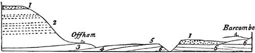
Section from the north escarpment of the South Downs to Barcombe.
- 1. Gravel composed of partially rounded chalk flints.
- 2. Chalk with and without flints.
- 3. Lowest chalk or chalk marl (upper greensand wanting).
- 4. Gault.
- 5. Lower greensand.
- 6. Weald clay.
[p.254]At what period the Weald Valley was denuded.—If we inquire at
what geological period the denudation of the Weald was effected, we shall
immediately perceive that the question is limited to this point, whether it
took place during or subsequent to the deposition of the Eocene strata of
the south of England. For in the basins of London and Hampshire the Eocene
strata are conformable to the chalk, being horizontal where the beds of
chalk are horizontal, and vertical where they are vertical, so that both
series of rocks appear to have participated in nearly the same movements.
At the eastern extremity of the Isle of Wight, some beds even of the
freshwater series have been thrown on their edges, like those of the London
clay. Nevertheless we can by no means infer that all the tertiary deposits
of the London and Hampshire basins once extended like the chalk over the
entire valley of the Weald, because the denudation of the chalk and
greensand may have been going on in the centre of that area, while
contiguous parts of the sea were sufficiently deep to receive and retain
the matter derived from that waste. Thus while the waves and currents were
excavating the longitudinal valleys D and C (fig. 264.), the deposits a
may have been thrown down to the bottom of the contiguous deep water E, the
sediment being drifted through transverse fissures, as before explained. In
this case, the rise of the formations Nos. 1, 2, 3, 4, 5, may have been
going on contemporaneously with the excavation of the valleys C and D, and
with the accumulation of the tertiary strata a.
Fig. 264.
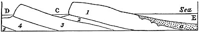
This idea receives some countenance from the fact of the tertiary strata,
near their junction with the chalk of the London and Hampshire basins,
often consisting of dense beds of sand and shingle, as at Blackheath and in
the Addington Hills near Croydon. They also contain occasionally freshwater
shells and the remains of land animals and plants, which indicate the
former presence of land at no great distance, some part of which may have
occupied the centre of the Weald.
Such masses of well-rolled pebbles occurring in the lowest Eocene strata,
or those called "the plastic clay and sands" before described (No. 3. b,
Tab. p. 197.), imply the neighbourhood of an ancient shore. They also
indicate the destruction of pre-existing chalk with flints. At the same
time fossil shells of the genera Melania, Cyclas, and Unio, appearing
here and there in beds of the same age, together with plants and the bones
of land animals, bear testimony to contiguous land, which probably
constituted islands scattered over the space now occupied by the tertiary
basins of the Seine and Thames. The stage of denudation represented in fig.
259., p. 249., may explain the state of things prevailing at points where
such islands existed. By the alternate rising and sinking of the white
chalk and older beds, a large area may have become overspread with gravelly
sandy, and [p.255]clayey beds of fluvio-marine and shallow-water origin,
before any of the London clay proper (or Calcaire grossier in France) were
superimposed. This may account for the fact that patches of "plastic clay
and sand" (No. 3. b, Tab. p. 197.), are scattered over the surface of the
chalk, reaching in some places to great heights, and approaching even the
edges of the escarpments. We must suppose that subsequently a gradual
subsidence took place in certain areas, which allowed the London clay
proper to accumulate over the Lower Eocene sands and clays, in a deep sea.
During this sinking down (the vertical amount of which equalled 800, and in
parts of the Isle of Wight, according to Mr. Prestwich, 1800 feet), the
work of denudation would be unceasing, being always however confined to
those areas where land or islands existed. At length, when the Bagshot sand
had been in its turn thrown down on the London clay, the space covered by
these two formations was again upraised from the sea to about the height
which it has since retained. During this upheaval, the waves would again
exert their power, not only on the white chalk and lower cretaceous and
Wealden strata, but also on the Eocene formations of the London basin,
excavating valleys and undermining cliffs as the strata emerged from the
deep.
There are grounds, as before stated (p. 205.), for presuming that the
tertiary area of London was converted into land before that of Hampshire,
and for this reason it contains no marine Eocene deposits so modern as
those of Barton Cliff, or the still newer freshwater and fluvio-marine beds
of Hordwell and the Isle of Wight. These last seem unequivocally to
demonstrate the local inequality of the upheaving and depressing movements
of the period alluded to; for we find, in spite of the evidence afforded in
Alum and White Cliff Bays, of continued depression to the extent of 1800 or
2000 feet, that at the close of the Eocene period a dense formation of
freshwater strata was produced. The fossils of these strata bear testimony
to rivers draining adjacent lands, and the existence of numerous quadrupeds
on those lands. Instead of such phenomena, the signs of an open sea might
naturally have been expected as the consequence of so much subsidence, had
not the depression been accompanied or followed by upheaval in a region
immediately adjoining.
When we attempt to speculate on the geographical changes which took place
in the earlier part of the Eocene epoch, and to restore in imagination the
former state of the physical geography of the south-east of England, we
shall do well to bear in mind that wherever there are proofs of great
denudation, there also the greatest area of land has probably existed. In
the same space, moreover, the oscillations of level, and the alternate
submergence and emergence of coasts, may be presumed to have been most
frequent; for these fluctuations facilitate the wasting and removing power
of waves, currents, and rivers.
We should also remember that there is always a tendency in the last
denuding operations, to efface all signs of preceding denudation, or at
least all those marks of waste from which alone a geologist can ascertain
the date of the removal of the missing strata within the denuded area. It
may often be difficult to settle the chronology even [p.256]of the last
of a series of such acts of removal, but it must be, in the nature of
things, almost always impossible to assign a date to each of the antecedent
denudations. If we wish to determine the times of the destruction of rocks,
we must look any where rather than to the spaces once occupied by the
missing rocks. We must inquire to what regions the ruins of the white
chalk, greensand, Wealden, and other strata which have disappeared were
transported. We are then led at once to the examination of all the deposits
newer than the chalk, and first to the oldest of these, the Lower Eocene,
and its sand, shingle, and clay. In them, so largely developed in the
immediate neighbourhood of the denuded area, we discover the wreck we are
in search of, regularly stratified, and inclosing, in some of its layers,
organic remains of a littoral, and sometimes fluviatile character. What
more can we desire? The shores must have consisted of chalk, greensand, and
Wealden, since these were the only superficial rocks in the south-east of
England, at the commencement of the Eocene epoch. The waves of the sea,
therefore, and the rivers were grinding down chalk-flints and chert from
the greensand into shingle and sand, or were washing away calcareous and
argillaceous matter from the cretaceous and Wealden beds, during the whole
of the Eocene period. Thus we obtain the date of a great part at least of
that enormous amount of denudation of which we have such striking monuments
in the space intervening between the North and South Downs.
Fig. 265.

- A. Chalk with layers of flint dipping slightly to the south.
- b. Ancient beach, consisting of fine sand, from one to four feet thick, covered by shingle from five
to eight feet thick of pebbles of chalk-flint, granite, and other rocks, with broken shells of recent
marine species, and bones of cetacea.
- c. Elephant bed, about fifty feet thick, consisting of layers of white chalk rubble, with broken chalk-flints,
in which deposit are found bones of ox, deer, horse, and mammoth.
- d. Sand and shingle of modern beach.
There have been some movements of land on a smaller scale since the Eocene
period in the south-east of England. One of the latest of these happened in
the Pleistocene, or even perhaps as late as the Post-Pliocene period. The
formation called by Dr. Mantell the Elephant [p.257]Bed, at the foot of
the chalk cliffs at Brighton, is not merely a talus of calcareous rubble
collected at the base of an inland cliff, but exhibits every appearance of
having been spread out in successive horizontal layers by water in motion.
The deposit alluded to skirts the shores between Brighton and Rottingdean,
and another mass apparently of the same age occurs at Dover. The phenomena
appear to me to suggest the following conclusions:—First, the
south-eastern part of England had acquired its actual configuration when
the ancient chalk cliff A a was formed, the beach of sand and shingle b
having then been thrown up at the base of the cliff. Afterwards the whole
coast, or at least that part of it where the elephant bed now extends,
subsided to the depth of 50 or 60 feet; and during the period of
submergence successive layers of white calcareous rubble c were
accumulated, so as to cover the ancient beach b. Subsequently, the coast
was again raised, so that the ancient shore was elevated to a level
somewhat higher than its original position.[257-A]
CHAPTER XX.
OOLITE AND LIAS.
Subdivisions of the Oolitic or Jurassic group — Physical geography of
the Oolite in England and France — Upper Oolite — Portland stone
and fossils — Lithographic stone of Solenhofen — Middle Oolite,
coral rag — Zoophytes — Nerinæan limestone — Diceras
limestone — Oxford clay, Ammonites and Belemnites — Lower Oolite,
Crinoideans — Great Oolite and Bradford clay — Stonesfield
slate — Fossil mammalia, placental and marsupial — Resemblance to
an Australian fauna — Doctrine of progressive
development — Collyweston slates — Yorkshire Oolitic
coal-field — Brora coal — Inferior Oolite and fossils.
Oolitic or Jurassic Group.—Below the freshwater group called the
Wealden, or, where this is wanting, immediately beneath the Cretaceous
formation, a great series of marine strata, commonly called "the Oolite,"
occurs in England and many other parts of Europe. This group has been so
named, because, in the countries where it was first examined, the
limestones belonging to it had an oolitic structure (see p. 12.). These
rocks occupy in England a zone which is nearly 30 miles in average breadth,
and extends across the island, from Yorkshire in the north-east, to
Dorsetshire in the south-west. Their mineral characters are not uniform
throughout this [p.258]region; but the following are the names of the
principal subdivisions observed in the central and south-eastern parts of
England:—
| OOLITE. |
| Upper |
{ |
|
a. Portland stone and sand.
b. Kimmeridge clay. |
| Middle |
{ |
c. Coral rag.
d. Oxford clay. |
| Lower |
{ |
e. Cornbrash and Forest marble.
f. Great Oolite and Stonesfield slate.
g. Fuller's earth.
h. Inferior Oolite. |
| The Lias then succeeds to the Inferior Oolite. |
The Upper oolitic system of the above table has usually the Kimmeridge clay
for its base; the Middle oolitic system, the Oxford clay. The Lower system
reposes on the Lias, an argillo-calcareous formation, which some include in
the Lower Oolite, but which will be treated of separately in the next
chapter. Many of these subdivisions are distinguished by peculiar organic
remains; and though varying in thickness, may be traced in certain
directions for great distances, especially if we compare the part of
England to which the above-mentioned type refers with the north-east of
France, and the Jura mountains adjoining. In that country, distant above
400 geographical miles, the analogy to the English type, notwithstanding
the thinness, or occasional absence of the clays, is more perfect than in
Yorkshire or Normandy.
Physical geography.—The alternation, on a grand scale, of distinct
formations of clay and limestone, has caused the oolitic and liassic series
to give rise to some marked features in the physical outline of parts of
England and France. Wide valleys can usually be traced throughout the long
bounds of country where the argillaceous strata crop out; and between these
valleys the limestones are observed, composing ranges of hills, or more
elevated grounds. These ranges terminate abruptly on the side on which the
several clays rise up from beneath the calcareous strata.
Fig. 266.

The annexed diagram will give the reader an idea of the configuration of
the surface now alluded to, such as may be seen in passing from London to
Cheltenham, or in other parallel lines, from east to west, in the southern
part of England. It has been necessary, however, in this drawing, greatly
to exaggerate the inclination of the beds, and the height of the several
formations, as compared to their horizontal extent. It will be remarked,
that the lines of cliff, or escarpment, face towards the west in the great
calcareous eminences formed by the Chalk and the Upper, Middle, and Lower
Oolites; and at the base of which we have respectively the Gault,
Kimmeridge clay, Oxford clay, and Lias. This last forms, generally, a broad
vale [p.259]at the foot of the escarpment of inferior oolite, but where
it acquires considerable thickness, and contains solid beds of marlstone,
it occupies the lower part of the escarpment.
The external outline of the country which the geologist observes in
travelling eastward from Paris to Metz is precisely analogous, and is
caused by a similar succession of rocks intervening between the tertiary
strata and the Lias; with this difference, however, that the escarpments of
Chalk, Upper, Middle, and Lower Oolites, face towards the east instead of
the west.
The Chalk crops out from beneath the tertiary sands and clays of the Paris
basin, near Epernay, and the Gault from beneath the Chalk and Upper
Greensand at Clermont-en-Argonne; and passing from this place by Verdun and
Etain to Metz, we find two limestone ranges, with intervening vales of
clay, precisely resembling those of southern and central England, until we
reach the great plain of Lias at the base of the Inferior Oolite at Metz.
It is evident, therefore, that the denuding causes have acted similarly
over an area several hundred miles in diameter, sweeping away the softer
clays more extensively than the limestones, and undermining these last so
as to cause them to form steep cliffs wherever the harder calcareous rock
was based upon a more yielding and destructible clay. This denudation
probably occurred while the land was slowly rising out of the sea.[259-A]
Upper Oolite.
The Portland stone has already been mentioned as forming in Dorsetshire the
foundation on which the freshwater limestone of the Lower Purbeck reposes
(see p. 232.). It supplies the well-known building stone of which St.
Paul's and so many of the principal edifices of London are constructed.
This upper member, characterized by peculiar marine fossils, rests on a
dense bed of sand, called the Portland sand, below which is the Kimmeridge
clay. In England these Upper Oolite formations are almost wholly confined
to the southern counties. Corals are rare in them, although one species is
found plentifully at Tisbury, in Wiltshire, in the Portland sand converted
into flint and chert, the original calcareous matter being replaced by
silex (fig. 267.).
Fig. 267.

Columnaria oblonga, Blainv.
As seen on a polished slab of chert from the sand of the Upper Oolite,
Tisbury.
Among the characteristic fossils of the Upper Oolite, may be mentioned the
Ostrea deltoidea (fig. 269.), found in the Kimmeridge clay throughout
England and the north of France, and also in Scotland, near Brora. The
Gryphæa virgula (fig. 268.), also met with in the same clay near Oxford,
is so abundant in the Upper Oolite of parts of France as to have caused the
deposit to be termed "marnes à gryphées virgules." Near [p.260]Clermont,
in Argonne, a few leagues from St. Menehould, where these indurated marls
crop out from beneath the gault, I have seen them, on decomposing, leave
the surface of every ploughed field literally strewed over with this fossil
oyster.
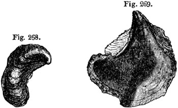
Upper Oolite: Kimmeridge clay. 1/4 nat. size.
Fig. 268. Gryphæa virgula.
Fig. 269. Ostrea deltoidea.
Fig. 270.

Trigonia gibbosa. 1/2 nat. size. a. the hinge.
Portland Oolite, Tisbury.
The Kimmeridge clay consists, in great part, of a bituminous shale,
sometimes forming an impure coal several hundred feet in thickness. In some
places in Wiltshire it much resembles peat; and the bituminous matter may
have been, in part at least, derived from the decomposition of vegetables.
But as impressions of plants are rare in these shales, which contain
ammonites, oysters, and other marine shells, the bitumen may perhaps be of
animal origin.
The celebrated lithographic stone of Solenhofen, in Bavaria, belongs to one
of the upper divisions of the oolite, and affords a remarkable example of
the variety of fossils which may be preserved under favourable
circumstances, and what delicate impressions of the tender parts of certain
animals and plants may be retained where the sediment is of extreme
fineness. Although the number of testacea in this slate is small, and the
plants few, and those all marine, Count Munster had determined no less than
237 species of fossils when I saw his collection in 1833; and among them no
less than seven species of flying lizards, or pterodactyls, six saurians,
three tortoises, sixty species of fish, forty-six of crustacea, and
twenty-six of insects. These insects, among which is a libellula, or
dragon-fly, must have been blown out to sea, probably from the same land to
which the flying lizards, and other contemporaneous reptiles, resorted.
Middle Oolite.
Coral Rag.—One of the limestones of the Middle Oolite has been called
the "Coral Rag," because it consists, in part, of continuous beds of
petrified corals, for the most part retaining the position in which they
grew at the bottom of the sea. They belong chiefly to the genera
Caryophyllia (fig. 271.), Agaricia, and Astrea, and sometimes form
masses of coral 15 feet thick. In the annexed figure of an Astrea, from
this formation, it will be seen that the cup-shaped cavities are deepest on
the right-hand side, and that they grow more and more shallow, till those
on the left side are nearly filled up. The last-named stars are supposed to
be Polyparia of advanced age. [p.261]These coralline strata extend
through the calcareous hills of the N.W. of Berkshire, and north of Wilts,
and again recur in Yorkshire, near Scarborough.
Fig. 271.

Caryophyllia annularis, Parkin. Coral rag,
Steeple Ashton.
Fig 272.
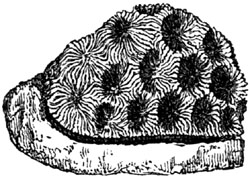
Astrea. Coral rag.
One of the limestones of the Jura, referred to the age of the English coral
rag, has been called "Nerinæan limestone" (Calcaire à Nérinées) by M.
Thirria; Nerinæa being an extinct genus of univalve shells, much
resembling the Cerithium in external form. The annexed section (fig.
273.) shows the curious form of the hollow part of each whorl, and also the
perforation which passes up the middle of the columella. N. Goodhallii
(fig. 274.) is another English species of the same genus, from a formation
which seems to form a passage from the Kimmeridge clay to the coral
rag.[261-A]
Fig. 273.
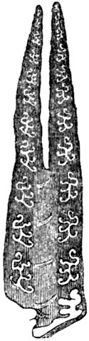
Nerinæa hieroglyphica. Coral rag.
Fig. 274.
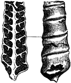
Nerinæa Goodhallii, Fitton. Coral rag, Weymouth.
1/4 nat. size.
A division of the oolite in the Alps, regarded by most geologists as coeval
with the English coral rag, has been often named "Calcaire à Dicerates," or
"Diceras limestone," from its containing abundantly a bivalve shell (see
fig. 275.) of a genus allied to the Chama.
[p.262]
Fig. 275.

Cast of Diceras arietina. Coral rag, France.
Fig. 276.
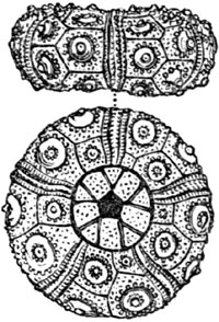
Cidaris coronata. Coral rag.
Oxford Clay.—The coralline limestone, or "coral rag," above described,
and the accompanying sandy beds, called "calcareous grits" of the Middle
Oolite, rests on a thick bed of clay, called the Oxford clay, sometimes not
less than 500 feet thick. In this there are no corals, but great abundance
of cephalopoda of the genera Ammonite and Belemnite. (See fig. 277.) In
some of the clay of very fine texture ammonites are very perfect, although
somewhat compressed, and are seen to be furnished on each side of the
aperture with a single horn-like projection (see fig. 278.). These were
discovered in the cuttings of the Great Western Railway, near Chippenham,
in 1841, and have been described by Mr. Pratt.[262-A]
Fig. 277.

Belemnites hastatus. Oxford Clay.
Fig. 278.

Ammonites Jason, Reinecke. Syn. A. Elizabethæ,
Pratt. Oxford clay, Christian Malford, Wiltshire.
[p.263]
Fig. 279.
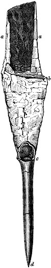
Belemnites Puzosianus, D'Orb. Oxford Clay, Christian Malford.
- a, a. projecting processes of the shell or phragmocone.
- b, c. broken exterior of a conical shell called the phragmocone,
which is chambered within, or composed of a series of shallow concave
cells pierced by a siphuncle.
- c, d. The guard or osselet, which is commonly called
the belemnite.
Similar elongated processes have been also observed to extend from the
shells of some belemnites discovered by Dr. Mantell in the same clay (see
fig. 279.), who, by the aid of this and other specimens, has been able to
throw much light on the structure of this singular extinct form of
cuttle-fish.[263-A]
Lower Oolite.
The upper division of this series, which is more extensive than the
preceding or Middle Oolite, is called in England the Cornbrash. It consists
of clays and calcareous sandstones, which pass downwards into the Forest
marble, an argillaceous limestone, abounding in marine fossils. In some
places, as at Bradford, this limestone is replaced by a mass of clay. The
sandstones of the Forest Marble of Wiltshire are often ripple-marked and
filled with fragments of broken shells and pieces of drift-wood, having
evidently been formed on a coast. Rippled slabs of fissile oolite are used
for roofing, and have been traced over a broad band of country from
Bradford, in Wilts, to Tetbury, in Gloucestershire. These calcareous
tile-stones are separated from each other by thin seams of clay, which have
been deposited upon them, and have taken their form, preserving the
undulating ridges and furrows of the sand in such complete integrity, that
the impressions of small footsteps, apparently of crabs, which walked over
the soft wet sands, are still visible. In the same stone the claws of
crabs, fragments of echini, and other signs of a neighbouring beach are
observed.[263-B]
Great Oolite.—Although the name of coral-rag has been appropriated, as
we have seen, to a member of the Upper Oolite before described, some
portions of the Lower Oolite are equally intitled in many places to be
called coralline limestones. Thus the Great Oolite near Bath contains
various corals, among which the Eunomia radiata [p.264](fig. 280.) is
very conspicuous, single individuals forming masses several feet in
diameter; and having probably required, like the large existing brain-coral
(Meandrina) of the tropics, many centuries before their growth was
completed.
Fig. 280.

Eunomia radiata, Lamouroux.
- a. section transverse to the tubes.
- b. vertical section, showing the radiation of the tubes.
- c. portion of interior of tubes magnified, showing striated surface.
Fig. 281.

Apiocrinites rotundus, or Pear Encrinite;
Miller. Fossil at Bradford, Wilts.
- a. Stem of Apiocrinites, and one of the articulations, natural size.
- b. Section at Bradford of great oolite and overlying clay, containing
the fossil encrinites. See text.
- c. Three perfect individuals of Apiocrinites, represented as they
grew on the surface of the Great Oolite.
- d. Body of the Apiocrinites rotundus.
Different species of Crinoideans, or stone-lilies, are also common in the
same rocks with corals; and, like them, must have enjoyed a firm bottom,
where their root, or base of attachment, remained undisturbed for years
(c, fig. 281.). Such fossils, therefore, are almost confined to the
limestones; but an exception occurs at Bradford, near Bath, where they are
enveloped in clay. In this case, however, it appears that the solid upper
surface of the "Great Oolite" had supported, for a time, a thick submarine
forest of these beautiful zoophytes, until the clear and still water was
invaded by a current charged with mud, which threw down the stone-lilies,
and broke most of their stems short off near the point of attachment. The
stumps still remain in their original position; but the numerous
articulations once composing the stem, arms, and body of the zoophyte, were
scattered at random through the argillaceous deposit [p.265]in which
some now lie prostrate. These appearances are represented in the section
b, fig. 281., where the darker strata represent the Bradford clay, which
some geologists class with the Forest marble, others with the Great Oolite.
The upper surface of the calcareous stone below is completely incrusted
over with a continuous pavement, formed by the stony roots or attachments
of the Crinoidea; and besides this evidence of the length of time they had
lived on the spot, we find great numbers of single joints, or circular
plates of the stem and body of the encrinite, covered over with serpulæ.
Now these serpulæ could only have begun to grow after the death of some
of the stone-lilies, parts of whose skeletons had been strewed over the
floor of the ocean before the irruption of argillaceous mud. In some
instances we find that, after the parasitic serpulæ were full grown, they
had become incrusted over with a coral, called Berenicea diluviana; and
many generations of these polyps had succeeded each other in the pure water
before they became fossil.
Fig. 282.

- a. Single plate or articulation of an Encrinite overgrown with serpulæ and corals. Natural size
Bradford clay.
- b. Portion of the same magnified, showing the coral Berenicea diluviana
covering one of the serpulæ.
We may, therefore, perceive distinctly that, as the pines and cycadeous
plants of the ancient "dirt bed," or fossil forest, of the Lower Purbeck
were killed by submergence under fresh water, and soon buried beneath muddy
sediment, so an invasion of argillaceous matter put a sudden stop to the
growth of the Bradford Encrinites, and led to their preservation in marine
strata.[265-A]
Such differences in the fossils as distinguish the calcareous and
argillaceous deposits from each other, would be described by naturalists as
arising out of a difference in the stations of species; but besides
these, there are variations in the fossils of the higher, middle, and lower
part of the oolitic series, which must be ascribed to that great law of
change in organic life by which distinct assemblages of species have been
adapted, at successive geological periods, to the varying conditions of the
habitable surface. In a single district it is difficult to decide how far
the limitation of species to certain minor [p.266]formations has been
due to the local influence of stations, or how far it has been caused by
time or the creative and destroying law above alluded to. But we recognize
the reality of the last-mentioned influence, when we contrast the whole
oolitic series of England with that of parts of the Jura, Alps, and other
distant regions, where there is scarcely any lithological resemblance; and
yet some of the same fossils remain peculiar in each country to the Upper,
Middle, and Lower Oolite formations respectively. Mr. Thurmann has shown
how remarkably this fact holds true in the Bernese Jura, although the
argillaceous divisions, so conspicuous in England, are feebly represented
there, and some entirely wanting.
Fig. 283.

Terebratula digona. Bradford clay. Nat. size.
The Bradford clay above alluded to is sometimes 60 feet thick, but, in many
places, it is wanting; and, in others, where there are no limestones, it
cannot easily be separated from the clays of the overlying "forest marble"
and underlying "fuller's earth."
The calcareous portion of the Great Oolite consists of several shelly
limestones, one of which, called the Bath Oolite, is much celebrated as a
building stone. In parts of Gloucestershire, especially near
Minchinhampton, the Great Oolite, says Mr. Lycett, "must have been
deposited in a shallow sea, where strong currents prevailed, for there are
frequent changes in the mineral character of the deposit, and some beds
exhibit false stratification. In others, heaps of broken shells are mingled
with pebbles of rocks foreign to the neighbourhood, and with fragments of
abraded madrepores, dicotyledonous wood, and crabs' claws. The shelly
strata, also, have occasionally suffered denudation, and the removed
portions have been replaced by clay."[266-A] In such shallow-water beds
cephalopoda are rare, and, instead of ammonites and belemnites, numerous
genera of carnivorous trachelipods appear. Out of one hundred and forty-two
species of univalves obtained from the Minchinhampton beds, Mr. Lycett
found no less than forty-one to be carnivorous. They belong principally to
the genera Buccinum, Pleurotoma, Rostellaria, Murex, and Fusus,
and exhibit a proportion of zoophagous species not very different from that
which obtains in warm seas of the recent period. These conchological
results are curious and unexpected, since it was imagined that we might
look in vain for the carnivorous trachelipods in rocks of such high
antiquity as the Great Oolite, and it was a received doctrine that they did
not begin to appear in considerable numbers till the Eocene period when
those two great families of cephalopoda, the ammonites and belemnites, had
become extinct.
Stonesfield slate.—The slate of Stonesfield has been shown by Mr.
Lonsdale to lie at the base of the Great Oolite.[266-B] It is a slightly
[p.267]oolitic shelly limestone, forming large spheroidal masses
imbedded in sand, only 6 feet thick, but very rich in organic remains. It
contains some pebbles of a rock very similar to itself, and which may be
portions of the deposit, broken up on a shore at low water or during
storms, and redeposited. The remains of belemnites, trigoniæ, and other
marine shells, with fragments of wood, are common, and impressions of
ferns, cycadeæ, and other plants. Several insects, also, and, among the
rest, the wing-covers of beetles, are perfectly preserved (see fig. 284.),
some of them approaching nearly to the genus Buprestis.[267-A] The
remains, also, of many genera of reptiles, such as Plesiosaur,
Crocodile, and Pterodactyl, have been discovered in the same limestone.
Fig. 284.
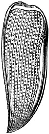
Elytron of Buprestis? Stonesfield.
Fig. 285.
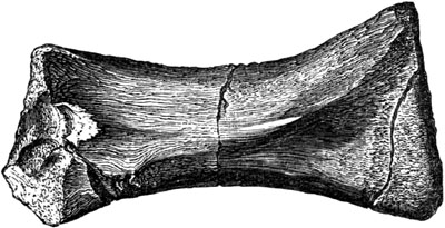
Bone of a reptile, formerly supposed to be the
ulna of a Cetacean; from the Great Oolite of Enstone, near Woodstock.
But the remarkable fossils for which the Stonesfield slate is most
celebrated, are those referred to the mammiferous class. The student should
be reminded that in all the rocks described in the preceding chapters as
older than the Eocene, no bones of any land quadruped, or of any cetacean,
have been discovered. Yet we have seen that terrestrial plants were not
rare in the lower cretaceous formation, and that in the Wealden there was
evidence of freshwater sediment on a large scale, containing various
plants, and even ancient vegetable soils with the roots and erect stumps of
trees. We had also in the same Wealden many land-reptiles and
winged-insects, which renders the absence of terrestrial quadrupeds the
more striking. The want, however, of any bones of whales, seals, dolphins,
and other aquatic mammalia, whether in the chalk or in the upper or middle
oolite, is certainly still more remarkable. Formerly, indeed, a bone from
the great oolite of Enstone, near Woodstock, in Oxfordshire, was cited, on
the authority of Cuvier, as referable to this class. Dr. Buckland, who
stated this in his Bridgewater Treatise[267-B], had the kindness to send me
the supposed ulna of a whale, that Mr. Owen might examine into its claims
to be considered as cetaceous. It is [p.268]the opinion of that eminent
comparative anatomist that it cannot have belonged to the cetacea, because
the fore-arm in these marine mammalia is invariably much flatter, and
devoid of all muscular depressions and ridges, one of which is so prominent
in the middle of this bone, represented in the above cut (fig. 285.). In
saurians, on the contrary, such ridges exist for the attachment of muscles;
and to some animal of that class the bone is probably referable.
Fig. 286.

Amphitherium Prevostii. Stonesfield Slate.
- a. coronoid process.
- b. condyle.
- c. angle of jaw.
- d. double-fanged molars.
These observations are made to prepare the reader to appreciate more justly
the interest felt by every geologist in the discovery in the Stonesfield
slate of no less than seven specimens of lower jaws of mammiferous
quadrupeds, belonging to three different species and to two distinct
genera, for which the names of Amphitherium and Phascolotherium have
been adopted. When Cuvier was first shown one of these fossils in 1818, he
pronounced it to belong to a small ferine mammal, with a jaw much
resembling that of an opossum, but differing from all known ferine genera,
in the great number of the molar teeth, of which it had at least ten in a
row. Since that period, a much more perfect specimen of the same fossil,
obtained by Dr. Buckland (see fig. 286.), has been examined by Mr. Owen,
who finds that the jaw contained on the whole twelve molar teeth, with the
socket of a small canine, and three small incisors, which are in situ,
altogether amounting to sixteen teeth on each side of the lower jaw.
Fig. 287.

Amphitherium Broderipii. Natural size.
Stonesfield Slate.
The only question which could be raised respecting the nature of these
fossils was, whether they belonged to a mammifer, a reptile, or a fish. Now
on this head the osteologist observes that each of the seven half jaws is
composed of but one single piece, and not of two or more separate bones, as
in fishes and most reptiles, or of two bones, united by a suture, as in
some few species belonging to those classes. The condyle, moreover (b,
fig. 286.), or articular surface, by which the lower jaw unites with the
upper, is convex in the Stonesfield specimens, and not concave as in fishes
and reptiles. The coronoid process (a, fig. 286.) is well developed,
whereas it is wanting or very small, in the inferior classes of vertebrata.
Lastly, the molar teeth in the Amphitherium and Phascolotherium
[p.269]have complicated crowns, and two roots (see d, fig. 286.),
instead of being simple and with single fangs.[269-A]
Fig. 288.

Tupaia Tana. Right ramus of lower jaw, natural
size. A recent insectivorous mammal from Sumatra.

Part of lower jaw of Tupaia Tana; twice natural size.
Fig. 289. End view seen from behind, showing the very slight inflection
of the angle at c.
Fig. 290. Side view of same.
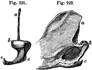
Part of lower jaw of Didelphis Azaræ; recent, Brazil.
Natural size.
Fig. 291. End view seen from behind, showing the inflection of the angle
of the jaw, c. d.
Fig. 292. Side view of same.
The only question, therefore, which could fairly admit of controversy was
limited to this point, whether the fossil mammalia found in the lower
oolite of Oxfordshire ought to be referred to the marsupial quadrupeds, or
to the ordinary placental series. Cuvier had long ago pointed out a
peculiarity in the form of the angular process (c, figs. 291. and 292.)
of the lower jaw, as a character of the genus Didelphys; and Mr. Owen has
since established its generality in the entire marsupial series. In all
these pouched quadrupeds, this process is turned inwards, as at c d, fig.
291. in the Brazilian opossum, whereas in the placental series, as at c,
figs. 290. and 289. there is an almost entire absence of such inflection.
The Tupaia Tana of Sumatra has been selected by my friend Mr. Waterhouse,
for this illustration, because that small insectivorous quadruped bears a
great resemblance to those of the Stonesfield Amphitherium. By clearing
away the matrix from the specimen of Amphitherium Prevostii above
represented (fig. 286.), Mr. Owen ascertained that the angular process
(c) bent inwards in a slighter degree than in any of the known
marsupialia; in short, the inflection does not exceed that of the mole or
hedgehog. This fact turns the scale in favour of its affinities to the
placental insectivora. Nevertheless, the Amphitherium offers some points
of approximation in its osteology to the marsupials, especially to the
Myrmecobius, a small insectivorous quadruped of Australia, which has nine
molars on each side of the lower jaw, besides a canine and three
incisors.[269-B]
[p.270]Another species of Amphitherium has been found at Stonesfield
(fig. 287. p. 268.), which differs from the former (fig. 286.) principally
in being larger.
Fig. 293.
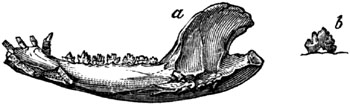
Phascolotherium Bucklandi, Owen.
- a. natural size.
- b. molar of same magnified.
The second mammiferous genus discovered in the same slates was named
originally by Mr. Broderip Didelphys Bucklandi (see fig. 293.), and has
since been called Phascolotherium by Owen. It manifests a much stronger
likeness to the marsupials in the general form of the jaw, and in the
extent and position of its inflected angle, while the agreement with the
living genus Didelphys in the number of the premolar and molar teeth, is
complete.[270-A]
On reviewing, therefore, the whole of the osteological evidence, it will be
seen that we have every reason to presume that the Amphitherium and
Phascolotherium of Stonesfield represent both the placental and marsupial
classes of mammalia; and if so, they warn us in a most emphatic manner, not
to found rash generalizations respecting the non-existence of certain
classes of animals at particular periods of the past, on mere negative
evidence. The singular accident of our having as yet found nothing but the
lower jaws of seven individuals, and no other bones of their skeletons, is
alone sufficient to demonstrate the fragmentary manner in which the
memorials of an ancient terrestrial fauna are handed down to us. We can
scarcely avoid suspecting that the two genera above described, may have
borne a like insignificant proportion to the entire assemblage of
warm-blooded quadrupeds which flourished in the islands of the oolitic sea.
Mr. Owen has remarked that as the marsupial genera, to which the
Phascolotherium is most nearly allied, are now confined to New South
Wales and Van Diemen's Land, so also is it in the Australian seas, that we
find the Cestracion, a cartilaginous fish which has a bony palate, allied
to those called Acrodus and Psammodus (see figs. 307, 308. p. 275.), so
common in the oolite and lias. In the same Australian seas, also, near the
shore, we find the living Trigonia, a genus of mollusca so frequently met
with in the Stonesfield slate. So, also, the Araucarian pines are now
abundant, together with ferns, in Australia and its islands, as they were
in Europe in the oolitic period. Many botanists incline to the opinion,
that the Thuja, Pine, Cycas, Zamia, in short, all the gymnogens,
belong to a less highly developed type of flowering plants than do the
exogens; but even if this be admitted, no naturalist can ascribe a low
standard of organization to the oolitic flora, since we meet with endogens
of the most perfect structure [p.271]in oolitic rocks, both above and
below the Stonesfield slate, as, for example, the Podocarya of Buckland,
a fruit allied to the Pandanus, found in the Inferior Oolite (see fig.
294.), and the Carpolithes conica of the Coral rag. The doctrine,
therefore, of a regular series of progressive development at successive
eras in the animal and vegetable kingdoms, from beings of a more simple to
those of a more complex organization, receives a check, if not a
refutation, from the facts revealed to us by the study of the Lower
Oolites.
Fig. 294.

Portion of a fossil fruit of Podocarya magnified. (Buckland's
Bridgew. Treat. Pl. 63.) Inferior Oolite, Charmouth, Dorset.
The Stonesfield slate, in its range from Oxfordshire to the north-east, is
represented by flaggy and fissile sandstones, as at Collyweston in
Northamptonshire, where, according to the researches of Messrs. Ibbetson
and Morris, it contains many shells, such as Trigonia angulata, also
found at Stonesfield. But the Northamptonshire strata of this age assume a
more marine character, or appear at least to have been formed farther from
land. They inclose, however, some fossil ferns, such as Pecopteris
polypodioides, of species common to the oolites of the Yorkshire
coast[271-A], where rocks of this age put on all the aspect of a true
coal-field; thin seams of coal having actually been worked in them for more
than a century.
Fig. 295.
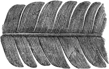
Pterophyllum comptum. (Syn. Cycadites
comptus.) Upper sandstone and shale, Gristhorpe, near Scarborough.
In the north-west of Yorkshire, the formation alluded to consists of an
upper and a lower carbonaceous shale, abounding in impressions of plants,
divided by a limestone considered by many geologists as the representative
of the Great Oolite; but the scarcity of marine fossils makes all
comparisons with the subdivisions adopted in the south extremely difficult.
A rich harvest of fossil ferns has been obtained from the upper
carbonaceous shales and sandstones at Gristhorpe, near Scarborough (see
figs. 295, 296.). The lower shales are well exposed in the sea-cliffs at
Whitby, and are chiefly characterized [p.272]by ferns and cycadeæ. They
contain, also, a species of calamite, and a fossil called Equisetum
columnare, which maintains an upright position in sandstone strata over a
wide area. Shells of the genus Cypris and Unio, collected by Mr. Bean
from these Yorkshire coal-bearing beds, point to the estuary or fluviatile
origin of the deposit.
Fig. 296.
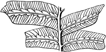
Hemitelites Brownii, Goepp. Syn. Phlebopteris contigua,
Lind. & Hutt. Upper carbonaceous strata, Lower Oolite,
Gristhorpe, Yorkshire.
At Brora, in Sutherlandshire, a coal formation, probably coeval with the
above, or belonging to some of the lower divisions of the Oolitic period,
has been mined extensively for a century or more. It affords the thickest
stratum of pure vegetable matter hitherto detected in any secondary rock in
England. One seam of coal of good quality has been worked 31/2 feet thick,
and there are several feet more of pyritous coal resting upon it.
Inferior Oolite.—Between the Great and Inferior Oolite, near Bath, an
argillaceous deposit called "the fuller's earth," occurs, but is wanting in
the north of England. The Inferior Oolite is a calcareous freestone,
usually of small thickness, which sometimes rests upon, or is replaced by,
yellow sands, called the sands of the Inferior Oolite. These last, in their
turn, repose upon the lias in the south and west of England.
Among the characteristic shells of the Inferior Oolite, I may instance
Terebratula spinosa (fig. 297.), and Pholadomya fidicula (fig. 298.).
The extinct genus Pleurotomaria is also a form very common in this
division as well as in the Oolitic system generally. It resembles the
Trochus in form, but is marked by a singular cleft (a, fig. 299.) on
the right side of the mouth.
Fig. 297.

Terebratula spinosa. Inferior Oolite.
Fig. 298.

- a. Pholadomya fidicula, 1/3 nat. size. Inf. Ool.
- b. Heart-shaped anterior termination of the same.
Fig. 299.

Pleurotomaria ornata. Ferruginous Oolite,
Normandy. Inferior Oolite, England.
As illustrations of shells having a great vertical range, I may [p.273]
allude to Trigonia clavellata, found in the Upper and Inferior Oolite,
and T. costata, common to the Upper, Middle, and Lower Oolite; also
Ostrea Marshii (fig. 300.), common to the Cornbrash of Wilts and the
Inferior Oolite of Yorkshire; and Ammonites striatulus (fig. 301.) common
to the Inferior Oolite and Lias.
Fig. 300.
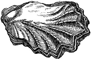
Ostrea Marshii. 1/2 nat. size. Middle and
Lower Oolite.
Fig. 301.

Ammonites striatulus, Sow. 1/3 nat. size.
Inferior Oolite and Lias.
Such facts by no means invalidate the general rule, that certain fossils
are good chronological tests of geological periods; but they serve to
caution us against attaching too much importance to single species, some of
which may have a wider, others a more confined vertical range. We have
before seen that, in the successive tertiary formations, there are species
common to older and newer groups, yet these groups are distinguishable from
one another by a comparison of the whole assemblage of fossil shells proper
to each.
OOLITE AND LIAS—continued.
Mineral character of Lias — Name of Gryphite limestone — Fossil
shells and fish — Ichthyodorulites — Reptiles of the
Lias — Ichthyosaur and Plesiosaur — Marine Reptile of the Galapagos
Islands — Sudden destruction and burial of fossil animals in
Lias — Fluvio-marine beds in Gloucestershire and insect
limestone — Origin of the Oolite and Lias, and of alternating
calcareous and argillaceous formations — Oolitic coal-field of
Virginia, in the United States.
Lias.—The English provincial name of Lias has been very generally
adopted for a formation of argillaceous limestone, marl, and clay, which
forms the base of the Oolite, and is classed by many geologists as part of
that group. They pass, indeed, into each other in some places, as near
Bath, a sandy marl called the marlstone of the Lias being interposed, and
partaking of the mineral characters of the upper lias and inferior oolite.
These last-mentioned divisions have also some fossils in common, such as
the Avicula inæquivalvis (fig. 302.). Nevertheless the Lias may be traced
throughout a great part of Europe as a separate and independent group, of
considerable [p.274]thickness, varying from 500 to 1000 feet, containing
many peculiar fossils, and having a very uniform lithological aspect.
Although usually conformable to the oolite, it is sometimes, as in the
Jura, unconformable. In the environs of Lons-le-Saulnier, for instance, in
the department of Jura, the strata of lias are inclined at an angle of
about 45°, while the incumbent oolitic marls are horizontal.
Fig. 302.
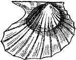
Avicula inæquivalvis, Sow.
The peculiar aspect which is most characteristic of the Lias in England,
France, and Germany, is an alternation of thin beds of blue or grey
limestone with a surface becoming light-brown when weathered, these beds
being separated by dark-coloured narrow argillaceous partings, so that the
quarries of this rock, at a distance, assume a striped and riband-like
appearance.[274-A]
Although the prevailing colour of the limestone of this formation is blue,
yet some beds of the lower lias are of a yellowish white colour, and have
been called white lias. In some parts of France, near the Vosges mountains,
and in Luxembourg, M. E. de Beaumont has shown that the lias containing
Gryphæa arcuata, Plagiostoma giganteum (see fig. 303.), and other
characteristic fossils, becomes arenaceous; and around the Hartz, in
Westphalia and Bavaria, the inferior parts of the lias are sandy, and
sometimes afford a building stone.
Fig. 303.
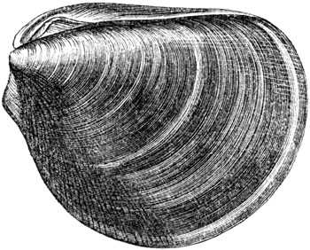
Plagiostoma giganteum. Lias.
Fig. 304.

Gryphæa incurva, Sow. (G. arcuata, Lam.)
Fig. 305.

Nautilus truncatus. Lias.
The name of Gryphite limestone has sometimes been applied to the lias, in
consequence of the great number of shells which it contains of a species of
oyster, or Gryphæa (fig. 304., see also fig. 30. p. 29.). Many
cephalopoda, also, such as Ammonite, Belemnite, and Nautilus (fig.
305.), prove the marine origin of the formation.
[p.275]
Fig. 306.
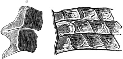
Scales of Lepidotus gigas, Agas.
a. two of the scales detached.
The fossil fish resemble generically those of the oolite, belonging all,
according to M. Agassiz, to extinct genera, and differing remarkably from
the ichthyolites of the Cretaceous period. Among them is a species of
Lepidotus (L. gigas, Agas.) (fig. 306.), which is found in the lias of
England, France, and Germany.[275-A] This genus was before mentioned (p.
229.) as occurring in the Wealden, and is supposed to have frequented both
rivers and coasts. The teeth of a species of Acrodus, also, are very
abundant in the lias (fig. 307.).
Fig. 307.

Acrodus nobilis, Agas. (tooth); commonly called fossil leach.
Lias, Lyme Regis, and Germany.
Fig. 308.

Hybodus reticulatus, Agas. Lias, Lyme Regis.
- a. Part of fin, commonly called Ichthyodorulite.
- b. Tooth.
But the remains of fish which have excited more attention than any others,
are those large bony spines called ichthyodorulites (a, fig. 308.),
which were once supposed by some naturalists to be jaws, and by others
weapons, resembling those of the living Balistes and Silurus; but which
M. Agassiz has shown to be neither the one nor the other. The spines, in
the genera last mentioned, articulate with the backbone, whereas there are
no signs of any such articulation [p.276]in the ichthyodorulites. These
last appear to have been bony spines which formed the anterior part of the
dorsal fin, like that of the living genera Cestracion and Chimæra (see
a, fig. 309.). In both of these genera, the posterior concave face is
armed with small spines like that of the fossil Hybodus (fig. 308.), one
of the shark family found fossil at Lyme Regis. Such spines are simply
imbedded in the flesh, and attached to strong muscles. "They serve," says
Dr. Buckland, "as in the Chimæra (fig. 309.), to raise and depress the
fin, their action resembling that of a moveable mast, raising and lowering
backwards the sail of a barge."[276-A]
Fig. 309.
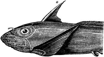
Chimæra monstrosa.[276-B]
a. Spine forming anterior part of the dorsal fin.
Reptiles of the Lias.—It is not, however, the fossil fish which form the
most striking feature in the organic remains of the Lias; but the reptiles,
which are extraordinary for their number, size, and structure. Among the
most singular of these are several species of Ichthyosaurus and
Plesiosaurus. The genus Ichthyosaurus, or fish-lizard, is not confined
to this formation, but has been found in strata as high as the chalk-marl
and gault of England, and as low as the muschelkalk of Germany, a formation
which immediately succeeds the lias in the descending order.[276-C] It is
evident from their fish-like vertebræ, their paddles, resembling those of a
porpoise or whale, the length of their tail, and other parts of their
structure, that the habits of the Ichthyosaurs were aquatic. Their jaws and
teeth show that they were carnivorous; and the half-digested remains of
fishes and reptiles, found within their skeletons, indicate the precise
nature of their food.[276-D]
A specimen of the hinder fin or paddle of Ichthyosaurus communis was
discovered in 1840 at Barrow-on-Soar, by Sir P. Egerton, which distinctly
exhibits on its posterior margin the remains of cartilaginous rays that
bifurcate as they approach the edge, like those in the fin of a fish (see
a, fig. 312.). It had previously been supposed, says Mr. Owen, that the
locomotive organs of the Ichthyosaurus were enveloped, while living, in a
smooth integument, like that of the turtle and porpoise, which has no other
support than is afforded by the bones and ligaments within; but it now
appears that the fin was [p.277]much larger, expanding far beyond its
osseous framework, and deviating widely in its fish-like rays from the
ordinary reptilian type. In fig. 312. the posterior bones, or digital
ossicles of the paddle, are seen near b; and beyond these is the dark
carbonized integument of the terminal half of the fin, the outline of which
is beautifully defined.[277-A] Mr. Owen believes that, besides the
fore-paddles, these short-and stiff-necked saurians were furnished with a
tail-fin without bones and purely tegumentary, expanding in a vertical
direction; an organ of motion which enabled them to turn their heads
rapidly.[277-B]
Fig. 310.
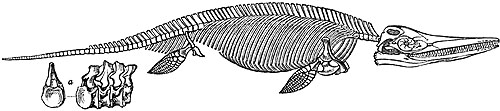
Ichthyosaurus communis, restored by Conybeare and Cuvier.
a. costal vertebræ.
Fig. 311.
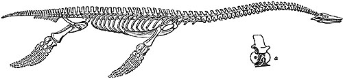
Plesiosaurus dolichodeirus, restored by Rev. W. D. Conybeare.
a. cervical vertebra.
[p.278]
Fig. 312.

Posterior part of hind fin or paddle of Ichthyosaurus communis.
Mr. Conybeare was enabled, in 1824, after examining many skeletons nearly
perfect, to give an ideal restoration of the osteology of this genus, and
of that of the Plesiosaurus.[278-A] (See figs. 310, 311.) The latter
animal had an extremely long neck and small head, with teeth like those of
the crocodile, and paddles analogous to those of the Ichthyosaurus, but
larger. It is supposed to have lived in shallow seas and estuaries, and to
have breathed air like the Ichthyosaur, and our modern cetacea.[278-B] Some
of the reptiles above mentioned were of formidable dimensions. One specimen
of Ichthyosaurus platyodon, from the lias at Lyme, now in the British
Museum, must have belonged to an animal more than 24 feet in length; and
another of the Plesiosaurus, in the same collection, is 11 feet long. The
form of the Ichthyosaurus may have fitted it to cut through the waves
like the porpoise; but it is supposed that the Plesiosaurus, at least the
long-necked species (fig. 311.), was better suited to fish in shallow
creeks and bays defended from heavy breakers.
In many specimens both of Ichthyosaur and Plesiosaur the bones of the head,
neck, and tail, are in their natural position, while those of the rest of
the skeleton are detached and in confusion. Mr. Stutchburg has suggested
that their bodies after death became inflated with gases, and, while the
abdominal viscera were decomposing, the bones, though disunited, were
retained within the tough dermal covering as in a bag, until the whole,
becoming water-logged, sank to the bottom.[278-C] As they belonged to
individuals of all ages they are supposed, by Dr. Buckland, to have
experienced a violent death; and the same conclusion might also be drawn
from their having escaped the attacks of their own predaceous race, or of
fishes, found fossil in the same beds.
Fig 313.

Amblyrhynchus cristatus, Bell. Length varying
from 3 to 4 feet. The only existing marine lizard now known.
a. Tooth, natural size and magnified.
For the last twenty years, anatomists have agreed that these extinct
saurians must have inhabited the sea; and it was argued that, as there are
now chelonians, like the tortoise, living in fresh water, [p.279]and
others, as the turtle, frequenting the ocean, so there may have been
formerly some saurians proper to salt, others to fresh water. The common
crocodile of the Ganges is well known to frequent equally that river and
the brackish and salt water near its mouth; and crocodiles are said in like
manner to be abundant both in the rivers of the Isla de Pinos (or Isle of
Pines), south of Cuba, and in the open sea round the coast. More recently a
saurian has been discovered of aquatic habits and exclusively marine. This
creature was found in the Galapagos Islands, during the visit of H. M. S.
Beagle to that archipelago, in 1835, and its habits were then observed by
Mr. Darwin. The islands alluded to are situated under the equator, nearly
600 miles to the westward of the coast of South America. They are volcanic,
some of them being 3000 or 4000 feet high; and one of them, Albemarle
Island, 75 miles long. The climate is mild; very little rain falls; and, in
the whole archipelago, there is only one rill of fresh water that reaches
the coast. The soil is for the most part dry and harsh, and the vegetation
scanty. The birds, reptiles, plants, and insects are, with very few
exceptions, of species found no where else in the world, although all
partake, in their general form, of a South American type. Of the mammalia,
says Mr. Darwin, one species alone appears to be indigenous, namely, a
large and peculiar kind of mouse; but the number of lizards, tortoises, and
snakes is so great, that it may be called a land of reptiles. The variety,
indeed, of species is small; but the individuals of each are in wonderful
abundance. There is a turtle, a large tortoise (Testudo Indicus), four
lizards, and about the same number of snakes, but no frogs or toads. Two of
the lizards belong to the family Iguanidæ of Bell, and to a peculiar
genus (Amblyrhynchus) established by that naturalist, and so named from
their obtusely truncated head and short snout.[279-A] Of these lizards one
is terrestrial in its habits, and burrows in the ground, swarming
everywhere on the land, having a round tail, and a mouth somewhat
resembling in form that of the tortoise. The other is aquatic, and has its
tail flattened laterally for swimming (see fig. 313.). "This marine
saurian," says [p.280]Mr. Darwin, "is extremely common on all the
islands throughout the archipelago. It lives exclusively on the rocky
sea-beaches, and I never saw one even ten yards inshore. The usual length
is about a yard, but there are some even 4 feet long. It is of a dirty
black colour, sluggish in its movements on the land; but, when in the
water, it swims with perfect ease and quickness by a serpentine movement of
its body and flattened tail, the legs during this time being motionless,
and closely collapsed on its sides. Their limbs and strong claws are
admirably adapted for crawling over the rugged and fissured masses of lava
which everywhere form the coast. In such situations, a group of six or
seven of these hideous reptiles may oftentimes be seen on the black rocks,
a few feet above the surf, basking in the sun with outstretched legs. Their
stomachs, on being opened, were found to be largely distended with minced
sea-weed, of a kind which grows at the bottom of the sea at some little
distance from the coast. To obtain this, the lizards go out to sea in
shoals. One of these animals was sunk in salt water, from the ship, with a
heavy weight attached to it, and on being drawn up again after an hour it
was quite active and unharmed. It is not yet known by the inhabitants where
this animal lays its eggs; a singular fact, considering its abundance, and
that the natives are well acquainted with the eggs of the terrestrial
Amblyrhynchus, which is also herbivorous."[280-A]
In those deposits now forming by the sediment washed away from the wasting
shores of the Galapagos Islands the remains of saurians, both of the land
and sea, as well as of chelonians and fish, may be mingled with marine
shells, without any bones of land quadrupeds or batrachian reptiles; yet
even here we should expect the remains of marine mammalia to be imbedded in
the new strata, for there are seals, besides several kinds of cetacea, on
the Galapagian shores; and, in this respect, the parallel between the
modern fauna, above described, and the ancient one of the lias, would not
hold good.
Sudden destruction of saurians.—It has been remarked, and truly, that
many of the fish and saurians, found fossil in the lias, must have met with
sudden death and immediate burial; and that the destructive operation,
whatever may have been its nature, was often repeated.
"Sometimes," says Dr. Buckland, "scarcely a single bone or scale has been
removed from the place it occupied during life; which could not have
happened had the uncovered bodies of these saurians been left, even for a
few hours, exposed to putrefaction, and to the attacks of fishes, and other
smaller animals at the bottom of the sea."[280-B] Not only are the
skeletons of the Ichthyosaurs entire, but sometimes the contents of their
stomachs still remain between their ribs, as before remarked, so that we
can discover the particular species of fish on which they lived, and the
form of their excrements. Not unfrequently there are layers of these
coprolites, at different depths in the [p.281]lias, at a distance from
any entire skeletons of the marine lizards from which they were derived;
"as if," says Sir H. De la Beche, "the muddy bottom of the sea received
small sudden accessions of matter from time to time, covering up the
coprolites and other exuviæ which had accumulated during the
intervals."[281-A] It is farther stated that, at Lyme Regis, those surfaces
only of the coprolites which lay uppermost at the bottom of the sea have
suffered partial decay, from the action of water before they were covered
and protected by the muddy sediment that has afterwards permanently
enveloped them.[281-B]
Numerous specimens of the pen-and-ink fish (Sepia loligo, Lin.; Loligo
vulgaris, Lam.) have also been met with in the lias at Lyme, with the
ink-bags still distended, containing the ink in a dried state, chiefly
composed of carbon, and but slightly impregnated with carbonate of lime.
These cephalopoda, therefore, must, like the saurians, have been soon
buried in sediment; for, if long exposed after death, the membrane
containing the ink would have decayed.[281-C]
As we know that river fish are sometimes stifled, even in their own
element, by muddy water during floods, it cannot be doubted that the
periodical discharge of large bodies of turbid fresh water into the sea may
be still more fatal to marine tribes. In the Principles of Geology I have
shown that large quantities of mud and drowned animals have been swept down
into the sea by rivers during earthquakes, as in Java, in 1699; and that
undescribable multitudes of dead fishes have been seen floating on the sea
after a discharge of noxious vapours during similar convulsions.[281-D]
But, in the intervals between such catastrophes, strata may have
accumulated slowly in the sea of the lias, some being formed chiefly of one
description of shell, such as ammonites, others of gryphites.
From the above remarks the reader will infer that the lias is for the most
part a marine deposit. Some members, however, of the series, especially in
the lowest part of it, have an estuary character, and must have been formed
within the influence of rivers. In Gloucestershire, where there is a good
type of the lias of the West of England, it may be divided into an upper
mass of shale with a base of marlstone, and a lower series of shales with
underlying limestones and shales. We learn from the researches of the Rev.
P. B. Brodie[281-E], that in the superior of these two divisions numerous
remains of insects and plants have been detected in several places, mingled
with marine shells; but in the inferior division similar fossils are still
more plentiful. One band, rarely exceeding a foot in thickness, has been
named the "insect limestone." It passes upwards into a shale containing
Cypris and Estheria, and is charged with the wing-cases of several
genera of coleoptera, and with some nearly entire beetles, of which the
eyes are preserved. The nervures of the wings of neuropterous [p.282]
insects (fig. 314.) are beautifully perfect in this bed. Ferns, with leaves
of monocotyledonous plants, and freshwater shells, such as Cyclas and
Unio, accompany the insects in some places, while in others marine shells
predominate, the fossils varying apparently as we examine the bed nearer or
farther from the ancient land, or the source whence the fresh water was
derived. There are two, or even three, bands of "insect limestone" in
several sections, and they have been ascertained by Mr. Brodie to retain
the same lithological and zoological characters when traced from the centre
of Warwickshire to the borders of the southern part of Wales. After
studying 300 specimens of these insects from the lias, Mr. Westwood
declares that they comprise both wood-eating and herb-devouring beetles of
the Linnean genera Elater, Carabus, &c., besides grasshoppers
(Gryllus), and detached wings of dragon-flies and may-flies, or insects
referable to the Linnean genera Libellula, Ephemera, Hemerobius, and
Panorpa, in all belonging to no less than twenty-four families. The size
of the species is usually small, and such as taken alone would imply a
temperate climate; but many of the associated organic remains of other
classes must lead to a different conclusion.
Fig. 314.

Wing of a neuropterous insect, from the Lower Lias,
Gloucestershire. (Rev. B. Brodie.)
Fossil plants.—Among the vegetable remains of the Lias, several species
of Zamia have been found at Lyme Regis, and the remains of coniferous
plants at Whitby. Fragments of wood are common, and often converted into
limestone. That some of this wood, though now petrified, was soft when it
first lay at the bottom of the sea, is shown by a specimen now in the
museum of the Geological Society (see fig. 315.), which has the form of an
ammonite indented on its surface.
Fig. 315.
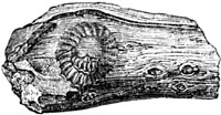
M. Ad. Brongniart enumerates forty-seven liassic acrogens, most of them
ferns; and fifty gymnogens, of which thirty-nine are cycads, and eleven
conifers. Among the cycads the predominance of Zamites and Nilsonia,
and among the ferns the numerous genera with leaves having reticulated
veins (as in fig. 296. p. 272.), are mentioned as botanical characteristics
of this era.[282-A]
Origin of the Oolite and Lias.—If we now endeavour to restore, in
imagination, the ancient condition of the European area at the period of
the Oolite and Lias, we must conceive a sea in which the growth of coral
reefs and shelly limestones, after proceeding without interruption for
ages, was liable to be stopped suddenly by the deposition of clayey
sediment. Then, again, the argillaceous matter, devoid of corals, was
deposited for ages, and attained a thickness of hundreds of feet, until
another period arrived when the same space [p.283]was again occupied by
calcareous sand, or solid rocks of shell and coral, to be again succeeded
by the recurrence of another period of argillaceous deposition. Mr.
Conybeare has remarked of the entire group of Oolite and Lias, that it
consists of repeated alternations of clay, sandstone, and limestone,
following each other in the same order. Thus the clays of the lias are
followed by the sands of the inferior oolite, and these again by shelly and
coralline limestone (Bath oolite, &c.); so, in the middle oolite, the
Oxford clay is followed by calcareous grit and "coral rag;" lastly, in the
upper oolite, the Kimmeridge clay is followed by the Portland sand and
limestone.[283-A] The clay beds, however, as Sir H. De la Beche remarks,
can be followed over larger areas than the sands or sandstones.[283-B] It
should also be remembered that while the oolitic system becomes arenaceous,
and resembles a coal-field in Yorkshire, it assumes, in the Alps, an almost
purely calcareous form, the sands and clays being omitted; and even in the
intervening tracts, it is more complicated and variable than appears in
ordinary descriptions. Nevertheless, some of the clays and intervening
limestones do, in reality, retain a pretty uniform character, for distances
of from 400 to 600 miles from east to west and north to south.
According to M. Thirria, the entire oolitic group in the department of the
Haute-Saône, in France, may be equal in thickness to that of England; but
the importance of the argillaceous divisions is in the inverse ratio to
that which they exhibit in England, where they are about equal to twice the
thickness of the limestones, whereas, in the part of France alluded to,
they reach only about a third of that thickness.[283-C] In the Jura the
clays are still thinner; and in the Alps they thin out and almost vanish.
In order to account for such a succession of events, we may imagine, first,
the bed of the ocean to be the receptacle for ages of fine argillaceous
sediment, brought by oceanic currents, which may have communicated with
rivers, or with part of the sea near a wasting coast. This mud ceases, at
length, to be conveyed to the same region, either because the land which
had previously suffered denudation is depressed and submerged, or because
the current is deflected in another direction by the altered shape of the
bed of the ocean and neighbouring dry land. By such changes the water
becomes once more clear and fit for the growth of stony zoophytes.
Calcareous sand is then formed from comminuted shell and coral, or, in some
cases, arenaceous matter replaces the clay; because it commonly happens
that the finer sediment, being first drifted farthest from coasts, is
subsequently overspread by coarse sand, after the sea has grown shallower,
or when the land, increasing in extent, whether by upheaval or by sediment
filling up parts of the sea, has approached nearer to the spots first
occupied by fine mud.
In order to account for another great formation, like the Oxford [p.284]
clay, again covering one of coral limestone, we must suppose a sinking down
like that which is now taking place in some existing regions of coral
between Australia and South America. The occurrence of subsidences, on so
vast a scale, may have caused the bed of the ocean and the adjoining land,
throughout great parts of the European area, to assume a shape favourable
to the deposition of another set of clayey strata; and this change may have
been succeeded by a series of events analogous to that already explained,
and these again by a third series in similar order. Both the ascending and
descending movements may have been extremely slow, like those now going on
in the Pacific; and the growth of every stratum of coral, a few feet of
thickness, may have required centuries for its completion, during which
certain species of organic beings disappeared from the earth, and others
were introduced in their place; so that, in each set of strata, from the
Upper Oolite to the Lias, some peculiar and characteristic fossils were
embedded.
Oolite and Lias of the United States.
Fig. 316.
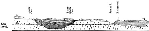
Section showing the geological position of the James River, or East
Virginian Coal-field.
- A. Granite, gneiss, &c.
- B. Coal-measures.
- C. Tertiary strata.
- D. Drift or ancient alluvium.
There are large tracts on the globe, as in Russia and the United States,
where all the members of the oolitic series are unrepresented. In the state
of Virginia, however, at the distance of about 13 miles eastward of
Richmond, the capital of that State, there is a regular coal-field
occurring in a depression of the granite rocks (see section, fig. 316.),
which Professor W. B. Rogers first correctly referred to the age of the
lower part of the Jurassic group. This opinion I was enabled to confirm
after collecting a large number of fossil plants, fish, and shells, and
examining the coal-field throughout its whole area. It extends 26 miles
from north to south, and from 4 to 12, from east to west. The plants
consist chiefly of zamites, calamites, and equisetums, and these last are
very commonly met with in a vertical position more or less compressed
perpendicularly. It is clear that they grew in the places where they now
lie buried in strata of hardened sand and mud. I found them maintaining
their erect attitude, at points many miles distant from others, in beds
both above and between the seams of coal. In order to explain this fact we
must suppose such shales and sandstones to have been gradually accumulated
during the slow and repeated subsidence of the whole region.
It is worthy of remark that the Equisetum columnare of these Virginian
rocks appears to be undistinguishable from the species [p.285]found in
the oolitic sandstones near Whitby in Yorkshire, where it also is met with
in an upright position. One of the American ferns, Pecopteris
Whitbyensis, is also a species common to the Yorkshire oolites.[285-A]
These Virginian coal-measures are composed of grits, sandstones, and
shales, exactly resembling those of older or primary date in America and
Europe, and they rival or even surpass the latter in the richness and
thickness of the seams. One of these, the main seam, is in some places from
30 to 40 feet thick, composed of pure bituminous coal. On descending a
shaft 800 feet deep, in the Blackheath mines in Chesterfield county, I
found myself in a chamber more than 40 feet high, caused by the removal of
this coal. Timber props of great strength supported the roof, but they were
seen to bend under the incumbent weight. The coal is like the finest kinds
shipped at Newcastle, and when analysed yields the same proportions of
carbon and hydrogen, a fact worthy of notice when we consider that this
fuel has been derived from an assemblage of plants very distinct
specifically, and in part generically, from those which have contributed to
the formation of the ancient or paleozoic coal.
The fossil fish of these Richmond strata belong to the liassic genus
Tetragonolepis, and to a new genus which I have called Dictyopyge.
Shells are very rare, as usually in all coal-bearing deposits, but a
species of Posidonomya is in such profusion in some shaley beds as to
divide them like the plates of mica in micaceous shales (see fig. 317.).
Fig. 317.

- a. Posidonomya.
- b. young of same.
Oolitic coal-shale, Richmond, Virginia.
In India, especially in Cutch, a formation occurs clearly referable to the
oolitic and liassic type, as shown by the shells, corals, and plants; and
there also coal has been procured from one member of the group.
[p.286]CHAPTER XXII.
TRIAS OR NEW RED SANDSTONE GROUP.
Distinction between New and Old Red Sandstone — Between Upper and Lower
New Red — The Trias and its three divisions — Most largely
developed in Germany — Keuper and its
fossils — Muschelkalk — Fossil plants of Bunter — Triassic
group in England — Bone-bed of Axmouth and Aust — Red Sandstone of
Warwickshire and Cheshire — Footsteps of Chirotherium in England and
Germany — Osteology of the Labyrinthodon — Identification of this
Batrachian with the Chirotherium — Origin of Red Sandstone and
Rock-salt — Hypothesis of saline volcanic exhalations — Theory of
the precipitation of salt from inland lakes or lagoons — Saltness of
the Red Sea — New Red Sandstone in the United States — Fossil
footprints of birds and reptiles in the Valley of the
Connecticut — Antiquity of the Red Sandstone containing them.
Between the Lias and the Coal, or Carboniferous group, there is interposed,
in the midland and western counties of England, a great series of red
loams, shales, and sandstones, to which the name of the New Red Sandstone
formation was first given, to distinguish it from other shales and
sandstones called the "Old Red" (c, fig. 318.), often identical in
mineral character, which lie immediately beneath the coal (b).
Fig. 318.

- a. New red sandstone.
- b. Coal.
- c. Old red.
The name of "Red Marl" has been incorrectly applied to the red clays of
this formation, as before explained (p. 13.), for they are remarkably free
from calcareous matter. The absence, indeed, of carbonate of lime, as well
as the scarcity of organic remains, together with the bright red colour of
most of the rocks of this group, causes a strong contrast between it and
the Jurassic formations before described.
Before the distinctness of the fossil remains characterizing the upper and
lower part of the English New Red had been clearly recognized, it was found
convenient to have a common name for all the strata intermediate in
position between the Lias and Coal; and the term "Poikilitic" was proposed
by Messrs. Conybeare and Buckland[286-A], from ποικιλος, poikilos,
variegated, some of the most characteristic strata of this group having
been called variegated by Werner, from their exhibiting spots and streaks
of light-blue, green, and buff colour, in a red base.
[p.287]A single term, thus comprehending both Upper and Lower New Red, or
the Triassic and Permian groups of modern classifications, may still be
useful in describing districts where we have to speak of masses of red
sandstone and shale, referable, in part, to both these eras, but which, in
the absence of fossils, it is impossible to divide.
Trias or Upper New Red Sandstone Group.
The accompanying table will explain the subdivisions generally adopted for
the uppermost of the two systems above alluded to, and the names given to
them in England and on the Continent.
| |
Synonyms. |
| |
German. |
|
French. |
| Trias or Upper New Red Sandstone |
|
|
|
a. Saliferous and gypseous shales and sandstone |
|
|
|
Keuper |
|
|
|
Marnes irisées. |
| |
|
|
|
|
| b. (wanting in England) |
|
Muschelkalk |
|
|
Muschelkalk, ou calcaire coquillier. |
| |
|
|
|
|
| c. Sandstone and quartzose conglomerate |
|
Bunter-sandstein |
|
|
Grès bigarré. |
I shall first describe this group as it occurs in South Western and North
Western Germany, for it is far more fully developed there than in England
or France. It has been called the Trias by German writers, or the Triple
Group, because it is separable into three distinct formations, called the
"Keuper," the "Muschelkalk," and the "Bunter-sandstein."
Fig. 319.

Equisetites columnaris. (Syn. Equisetum
columnare.) Fragment of stem, and small portion of same magnified.
Keuper.
The Keuper, the first or newest of these, is 1000 feet thick in
Würtemberg, and is divided by Alberti into sandstone, gypsum, and
carbonaceous slate-clay.[287-A] Remains of Reptiles, called Nothosaurus
and Phytosaurus, have been found in it with Labyrinthodon; the detached
teeth, also, of placoid fish and of rays, and of the genera Saurichthys
and Gyrolepis (figs. 325, 326, p. 289.). The plants of the Keuper are
generically very analogous to those of the lias and oolite, consisting of
ferns, equisetaceous plants, cycads, and conifers, with a few doubtful
monocotyledons. A few species, such as Equisetites columnaris, are common
to this group, and the oolite.
The Muschelkalk consists chiefly of a compact, greyish limestone, but
includes beds of dolomite in many places, together with gypsum and
rock-salt. This limestone, a rock wholly unrepresented in England, abounds
in fossil shells, as the name implies. Among the cephalopoda there are no
belemnites, and no ammonites with foliated sutures, as in the incumbent
lias and oolite, but a genus allied to the Ammonite, called Ceratite by
De Haan, in which the descending lobes (see a, b, c, fig. 320.)
terminate in a few small denticulations [p.288]pointing inwards. Among
the bivalve shells, the Posidonia minuta, Goldf. (Posidonomya minuta,
Bronn) (see fig. 321.), is abundant, ranging through the Keuper,
Muschelkalk, and Bunter-sandstein; and Avicula socialis, fig. 322.,
having a similar range, is very characteristic of the Muschelkalk in
Germany, France, and Poland.
Fig. 320.

Ceratites nodosus. Muschelkalk.
- a. Side view.
- b. Front view.
- c. Partially denticulated outline of the septa dividing the chambers.
Fig. 321.

Posidonia minuta, Goldf. (Posidonomya minuta, Bronn.)
Fig. 322.

- a. Avicula socialis.
- b. Side view of same.
Characteristic of the Muschelkalk.
The abundance of the heads and stems of lily encrinites, Encrinus
liliiformis (or Encrinites moniliformis), show the slow manner in which
some beds of this limestone have been formed in clear sea-water.
Fig. 323.
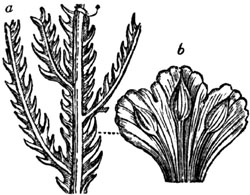
- a. Voltzia heterophylla. (Syn. Voltzia brevifolia.)
- b. portion of same magnified to show fructification. Sulzbad.
Bunter-sandstein.
The Bunter-sandstein consists of various coloured sandstones, dolomites,
and red-clays, with some beds, especially in the Hartz, of calcareous
pisolite or roe-stone, the whole sometimes attaining a thickness of more
than 1000 feet. The sandstone of the Vosges, according to Von Meyer, is
proved, by the presence of Labyrinthodon, to belong to this lowest member
of the Triassic group. At Sulzbad (or Soultz-les-bains), near Strasburg, on
the flanks of the Vosges, many plants have been obtained from the "bunter,"
especially conifers of the extinct genus Voltzia, peculiar to this
period, in which even the fructification has been preserved. (See fig.
323.)
Out of thirty species of ferns, cycads, conifers, and other plants,
enumerated by M. Ad. Brongniart, in 1849, as coming from the "grès
bigarré," or Bunter, not one is common to the Keuper.[288-A]
[p.289]The footprints of a reptile (Labyrinthodon) have been observed
on the clays of this member of the Trias, near Hildburghausen, in Saxony,
impressed on the upper surface of the beds, and standing out as casts in
relief from the under sides of incumbent slabs of sandstone. To these I
shall again allude in the sequel; they attest, as well as the accompanying
ripple-marks, and the cracks which traverse the clays, the gradual
formation in shallow water, and sometimes between high and low water, of
the beds of this formation.
Triassic group in England.
In England the Lias is succeeded by conformable strata of red and green
marl, or clay. There intervenes, however, both in the neighbourhood of
Axmouth, in Devonshire, and in the cliffs of Westbury and Aust, in
Gloucestershire, on the banks of the Severn, a dark-coloured stratum, well
known by the name of the "bone-bed." It abounds in the remains of saurians
and fish, and was formerly classed as the lowest bed of the Lias; but Sir
P. Egerton has shown that it should be referred to the Upper New Red
Sandstone, for it contains an assemblage of fossil fish which are either
peculiar to this stratum, or belong to species well known in the
Muschelkalk of Germany. These fish belong to the genera Acrodus,
Hybodus, Gyrolepis, and Saurichthys.
Among those common to the English bone-bed and the Muschelkalk of Germany
are Hybodus plicatilis (fig. 324.), Saurichthys apicalis (fig. 325.),
Gyrolepis tenuistriatus (fig. 326.), and G. Albertii. Remains of
saurians have also been found in the bone-bed, and plates of an Encrinus.
Fig. 324.
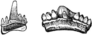
Hybodus plicatilis. Teeth. Bone-bed,
Aust and Axmouth.
Fig. 325.

Saurichthys apicalis. Tooth; nat. size, and
magnified. Axmouth.
Fig. 326.

Gyrolepis tenuistriatus. Scale; nat. size, and
magnified. Axmouth.
The strata of red and green marl, which follow the bone-bed in the
descending order at Axmouth and Aust, are destitute of organic remains; as
is the case, for the most part, in the corresponding beds in almost every
part of England. But fossils have lately been found at a few localities in
sandstones of this formation, in Worcestershire and Warwickshire, and among
them the bivalve shell called Posidonia minuta, Goldf., before mentioned
(fig. 321. p. 288.).
The upper member of the English "New Red" containing this [p.290]shell,
in those parts of England, is, according to Messrs. Murchison and
Strickland, 600 feet thick, and consists chiefly of red marl or slate, with
a band of sandstone. Spines of Hybodus, called ichthyodorulites, teeth
of fishes, and footprints of reptiles, with remains of a saurian called
Rhyncosaurus, were observed by the same geologists in these
strata.[290-A]
In Cheshire and Lancashire the gypseous and saliferous red shales and loams
of the Trias are between 1000 and 1500 feet thick. In some places
lenticular masses of rock-salt are interpolated between the argillaceous
beds, the origin of which will be spoken of in the sequel.
Fig. 327.
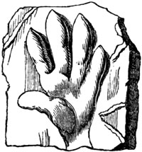
Single footstep of Chirotherium. Bunter
Sandstein, Saxony; one eighth of nat. size.
Fig. 328.

Line of footsteps on slab of sandstone.
Hildburghausen, in Saxony.
The lower division or English representative of the "Bunter" attains a
thickness of 600 feet in the counties last mentioned. Besides red and green
shales and red sandstones, it comprises much soft white quartzose
sandstone, in which the trunks of silicified trees have been met with at
Allesley Hill, near Coventry. Several of them were a foot and a half in
diameter, and some yards in length, decidedly of coniferous wood, and
showing rings of annual growth.[290-B] Impressions, also, of the footsteps
of animals have been detected in Lancashire and Cheshire in this formation.
Some of the most remarkable occur a few miles from Liverpool, in the
whitish quartzose sandstone of Storton Hill, on the west side of the
Mersey. They bear a close resemblance to tracks first observed in a member
of the Upper New Red Sandstone, at the village of Hesseberg, near
Hildburghausen, in Saxony, to which I have already alluded. For many years
these footprints have been referred to a large unknown quadruped,
provisionally named Chirotherium by Professor Kaup, because the marks
both of the fore and hind feet resembled impressions made by a human hand.
(See fig. 327.) The footmarks at Hesseberg are partly concave and partly in
relief; the former, or the depressions, are seen upon the upper surface of
the sandstone slabs, but those in relief are only upon the lower surfaces,
being in fact natural casts, formed in the subjacent footprints as in
moulds. The larger impressions, which seem to be those of the hind foot,
are generally 8 inches in length, and 5 in width, and one was 12 inches
long. Near each large footstep, and at a regular distance (about an inch
[p.291]and a half), before it, a smaller print of a fore foot, 4 inches
long and 3 inches wide, occurs. The footsteps follow each other in pairs,
each pair in the same line, at intervals of 14 inches from pair to pair.
The large as well as the small steps show the great toes alternately on the
right and left side; each step makes the print of five toes, the first or
great toe being bent inwards like a thumb. Though the fore and hind foot
differ so much in size, they are nearly similar in form.
The similar footmarks afterwards observed in a rock of corresponding age at
Storton Hill, were imprinted on five thin beds of clay, superimposed one
upon the other in the same quarry, and separated by beds of sandstone. On
the lower surface of the sandstone strata, the solid casts of each
impression are salient, in high relief, and afford models of the feet,
toes, and claws of the animals which trod on the clay.
As neither in Germany nor in England any bones or teeth had been met with
in the same identical strata as the footsteps, anatomists indulged, for
several years, in various conjectures respecting the mysterious animals
from which they might have been derived. Professor Kaup suggested that the
unknown quadruped might have been allied to the Marsupialia; for in the
kangaroo the first toe of the fore foot is in a similar manner set
obliquely to the others, like a thumb, and the disproportion between the
fore and hind feet is also very great. But M. Link conceived that some of
the four species of animals of which the tracks had been found in Saxony
might have been gigantic Batrachians; and Dr. Buckland designated some of
the footsteps as those of a small web-footed animal, probably crocodilean.
In the course of these discussions several naturalists of Liverpool, in
their report on the Storton quarries, declared their opinion that each of
the thin seams of clay in which the sandstone casts were moulded had formed
successively a surface above water, over which the Chirotherium and other
animals walked, leaving impressions of their footsteps, and that each layer
had been afterwards submerged by a sinking down of the surface, so that a
new beach was formed at low water above the former, on which other tracks
were then made. The repeated occurrence of ripple-marks at various heights
and depths in the red sandstone of Cheshire had been explained in the same
manner. It was also remarked that impressions of such depth and clearness
could only have been made by animals walking on the land, as their weight
would have been insufficient to make them sink so deeply in yielding clay
under water. They must therefore have been air-breathers.
When the inquiry had been brought to this point, the reptilian remains
discovered in the Trias, both of Germany and England, were carefully
examined by Mr. Owen. He found, after a microscopic investigation of the
teeth from the German sandstone called Keuper, and from the sandstone of
Warwick and Leamington, that [p.292]neither of them could be referred to
true saurians, although they had been named Mastodonsaurus and
Phytosaurus by Jäger (fig. 329.). It appeared that they were of the
Batrachian order, and attested the former existence of frogs of gigantic
dimensions in comparison with any now living. Both the Continental and
English fossil teeth exhibited a most complicated texture, differing from
that previously observed in any reptile, whether recent or extinct, but
most nearly analogous to the Ichthyosaurus. A section of one of these
teeth exhibits a series of irregular folds, resembling the labyrinthic
windings of the surface of the brain; and from this character Mr. Owen has
proposed the name Labyrinthodon for the new genus. By his permission, the
annexed representation (fig. 330.) of part of one is given from his
"Odontography," plate 64. A. The entire length of this tooth is supposed to
have been about three inches and a half, and the breadth at the base one
inch and a half.
Fig. 329.

Tooth of Labyrinthodon; nat. size. Warwick
sandstone.
Fig. 330.

Transverse section of tooth of Labyrinthodon Jaegeri, Owen
(Mastodonsaurus Jaegeri, Meyer); nat. size, and a segment magnified.
a. Pulp cavity, from which the processes of pulp and dentine radiate.
When Mr. Owen had satisfied himself, from an inspection of the cranium,
jaws, and teeth, that a gigantic Batrachian had existed at the period of
the Trias or Upper New Red Sandstone, he soon found, from the examination
of various bones derived from the same formation, that he could define
three species of Labyrinthodon, and that in this genus the hind
extremities were much larger than the anterior ones. This circumstance,
coupled with the fact of the Labyrinthodon having existed at the period
when the Chirotherian footsteps were made, was the first step towards the
identification of those tracks with the newly discovered Batrachian. It
was at the same time observed that the footmarks of Chirotherium were
more like those [p.293]of toads than of any other living animal; and,
lastly, that the size of the three species of Labyrinthodon corresponded
with the size of three different kinds of footprints which had already been
supposed to belong to three distinct Chirotheria. It was moreover
inferred, with confidence, that the Labyrinthodon was an air-breathing
reptile from the structure of the nasal cavity, in which the posterior
outlets were at the back part of the mouth, instead of being directly under
the anterior or external nostrils. It must have respired air after the
manner of saurians, and may therefore have imprinted on the shore those
footsteps, which, as we have seen, could not have originated from an animal
walking under water.
It is true that the structure of the foot is still wanting, and that a more
connected and complete skeleton is required for demonstration; but the
circumstantial evidence above stated is strong enough to produce the
conviction that the Chirotherium and Labyrinthodon are one and the
same.
In order to show the manner in which one of these formidable Batrachians
may have impressed the mark of its feet upon the shore, Mr. Owen has
attempted a restoration, of which a reduced copy is annexed.
Fig. 331.

Labyrinthodon pachygnathus, Owen.
The only bones of this species at present known are those of the head, the
pelvis, and part of the scapula, which are shown by stronger lines in the
above figure. There is reason for believing that the head was not smooth
externally, but protected by bony scutella.
Origin of Red Sandstone and Rock Salt.
We have seen that, in various parts of the world, red and mottled clays,
and sandstones, of several distinct geological epochs, are found associated
with salt, gypsum, magnesian limestone, or with one or all of these
substances. There is, therefore, in all likelihood, a general cause for
such a coincidence. Nevertheless, we must not forget that there are dense
masses of red and variegated sandstones and clays, thousands of feet in
thickness, and of vast horizontal extent, wholly devoid of saliferous or
gypseous matter. There are also deposits of gypsum and of muriate of soda,
as in the blue clay formation of Sicily, without any accompanying red
sandstone or red clay.
To account for deposits of red mud and red sand, we have simply [p.294]
to suppose the disintegration of ordinary crystalline or metamorphic
schists. Thus, in the eastern Grampians of Scotland, as, for example, in
the north of Forfarshire, the mountains of gneiss, mica-schist, and
clay-slate, are overspread with alluvium, derived from the disintegration
of those rocks; and the mass of detritus is stained by oxide of iron, of
precisely the same colour as the Old Red Sandstone of the adjoining
Lowlands. Now this alluvium merely requires to be swept down to the sea, or
into a lake, to form strata of red sandstone and red marl, precisely like
the mass of the "Old Red" or New Red systems of England, or those tertiary
deposits of Auvergne (see p. 182.), before described, which are in
lithological characters quite undistinguishable. The pebbles of gneiss in
the Eocene red sandstone of Auvergne point clearly to the rocks from which
it has been derived. The red colouring matter may, as in the Grampians,
have been furnished by the decomposition of hornblende, or mica, which
contain oxide of iron in large quantity.
It is a general fact, and one not yet accounted for, that scarcely any
fossil remains are preserved in stratified rocks in which this oxide of
iron abounds; and when we find fossils in the New or Old Red Sandstone in
England, it is in the grey, and usually calcareous beds, that they occur.
The gypsum and saline matter, occasionally interstratified with such red
clays and sandstones of various ages, primary, secondary, and tertiary,
have been thought by some geologists to be of volcanic origin. Submarine
and subaerial exhalations often occur in regions of earthquakes and
volcanos far from points of actual eruption, and charged with sulphur,
sulphuric salts, and with common salt or muriate of soda. In a word, they
are vents by which all the products which issue in a state of sublimation
from the craters of active volcanos, obtain a passage from the interior of
the earth to the surface. That such gaseous emanations and mineral springs,
impregnated with the ingredients before enumerated, and often intensely
heated, continue to flow out unaltered in composition and temperature for
ages, is well known. But before we can decide on their real instrumentality
in producing in the course of ages beds of gypsum, salt, and dolomite, we
require to know what are the chemical changes actually in progress in seas
where this volcanic agency is at work.
Yet the origin of rock-salt is a problem of so much interest in theoretical
geology as to demand a full discussion of another hypothesis advanced on
the subject; namely, that which attributes the precipitation of the salt to
evaporation, whether of inland lakes or of lagoons communicating with the
ocean.
At Northwich, in Cheshire, two beds of salt, in great part unmixed with
earthy matter, attain the extraordinary thickness of 90 and even 100 feet.
The upper surface of the highest bed is very uneven, forming cones and
irregular figures. Between the two masses there intervenes a bed of
indurated clay, traversed with veins of salt. The highest bed thins off
towards the south-west, losing 15 feet in [p.295]thickness in the course
of a mile.[295-A] The horizontal extent of these particular masses in
Cheshire and Lancashire is not exactly known; but the area, containing
saliferous clays and sandstones, is supposed to exceed 150 miles in
diameter, while the total thickness of the trias in the same region is
estimated by Mr. Ormerod at more than 1700 feet. Ripple-marked sandstones,
and the footprints of animals, before described, are observed at so many
levels that we may safely assume the whole area to have undergone a slow
and gradual depression during the formation of the Red Sandstone. The
evidence of such a movement, wholly independent of the presence of salt
itself, is very important in reference to the theory under consideration.
In the "Principles of Geology" (chap. 28.), I published a map, furnished to
me by the late Sir Alexander Burnes, of that singular flat region called
the Runn of Cutch, near the delta of the Indus, which is 7000 square miles
in area, or equal in extent to about one-fourth of Ireland. It is neither
land nor sea, but is dry during a part of every year, and again covered by
salt water during the monsoons. Some parts of it are liable, after long
intervals, to be overflowed by river-water. Its surface supports no grass,
but is encrusted over, here and there, by a layer of salt, about an inch in
depth, caused by the evaporation of sea-water. Certain tracts have been
converted into dry land by upheaval during earthquakes since the
commencement of the present century, and, in other directions, the
boundaries of the Runn have been enlarged by subsidence. That successive
layers of salt might be thrown down, one upon the other, over thousands of
square miles, in such a region, is undeniable. The supply of brine from the
ocean would be as inexhaustible as the supply of heat from the sun to cause
evaporation. The only assumption required to enable us to explain a great
thickness of salt in such as area is, the continuance, for an indefinite
period, of a subsiding movement, the country preserving all the time a
general approach to horizontality. Pure salt could only be formed in the
central parts of basins, where no sand could be drifted by the wind, or
sediment be brought by currents. Should the sinking of the ground be
accelerated, so as to let in the sea freely, and deepen the water, a
temporary suspension of the precipitation of salt would be the only result.
On the other hand, if the area should dry up, ripple-marked sands and the
footprints of animals might be formed, where salt had previously
accumulated. According to this view the thickness of the salt, as well as
of the accompanying beds of mud and sand, becomes a mere question of time,
or requires simply a repetition of similar operations.
Mr. Hugh Miller, in an able discussion of this question, refers to Dr.
Frederick Parrot's account, in his journey to Ararat (1836), of the salt
lakes of Asia. In several of these lakes west of the river Manech, "the
water, during the hottest season of the year, is covered on its surface
with a crust of salt nearly an inch thick, which is collected [p.296]
with shovels into boats. The crystallization of the salt is effected by
rapid evaporation from the sun's heat and the supersaturation of the water
with muriate of soda; the lake being so shallow that the little boats trail
on the bottom and leave a furrow behind them, so that the lake must be
regarded as a wide pan of enormous superficial extent, in which the brine
can easily reach the degree of concentration required."
Another traveller, Major Harris, in his "Highlands of Ethiopia," describes
a salt lake, called the Bahr Assal, near the Abyssinian frontier, which
once formed the prolongation of the Gulf of Tadjara, but was afterwards cut
off from the gulf by a broad bar of lava or of land upraised by an
earthquake. "Fed by no rivers, and exposed in a burning climate to the
unmitigated rays of the sun, it has shrunk into an elliptical basin, seven
miles in its transverse axis, half filled with smooth water of the deepest
cærulian hue, and half with a solid sheet of glittering snow-white salt,
the offspring of evaporation." "If," says Mr. Hugh Miller, "we suppose,
instead of a barrier of lava, that sand-bars were raised by the surf on a
flat arenaceous coast during a slow and equable sinking of the surface, the
waters of the outer gulf might occasionally topple over the bar, and supply
fresh brine when the first stock had been exhausted by evaporation.[296-A]
We may add that the permanent impregnation of the waters of a large shallow
basin with salt, beyond the proportion which is usual in the ocean, would
cause it to be uninhabitable by mollusca or fish, as is the case in the
Dead Sea, and the muriate of soda might remain in excess, even though it
were occasionally replenished by irruptions of the sea. Should the saline
deposit be eventually submerged, it might, as we have seen from the example
of the Runn of Cutch, be covered by a freshwater formation containing
fluviatile organic remains; and in this way the apparent anomaly of beds of
sea-salt and clays devoid of marine fossils, alternating with others of
freshwater origin, may be explained.
Dr. G. Buist, in a recent communication to the Bombay Geographical Society
(vol. ix.), has asked how it happens that the Red Sea should not exceed the
open ocean in saltness, by more than 1/10th per cent. The Red Sea receives
no supply of water from any quarter save through the Straits of
Babelmandeb; and there is not a single river or rivulet flowing into it
from a circuit of 4000 miles of shore. The countries around are all
excessively sterile and arid, and composed, for the most part, of burning
deserts. From the ascertained evaporation in the sea itself, Dr. Buist
computes that nearly 8 feet of pure water must be carried off from the
whole of its surface annually, this being probably equivalent to 1/100th
part of its whole volume. The Red Sea, therefore, ought to have 1 per cent.
added annually to its saline contents; and as these constitute 4 per cent.
by weight, or 21/2 per cent. in volume of its entire mass, it ought,
assuming the average depth to be 800 feet, which is supposed to be far
beyond the truth, to have [p.297]been converted into one solid salt
formation in less than 3000 years.[297-A] Does the Red Sea receive a supply
of water from the ocean, through the narrow Straits of Babelmandeb,
sufficient to balance the loss by evaporation? And is there an undercurrent
of heavier saline water annually flowing outwards? If not, in what manner
is the excess of salt disposed of? An investigation of this subject by our
nautical surveyors may perhaps aid the geologist in framing a true theory
of the origin of rock-salt.
On the New Red Sandstone of the valley of the Connecticut River in the
United States.
In a depression of the granitic or hypogene rocks in the States of
Massachusetts and Connecticut, strata of red sandstone, shale, and
conglomerate are found occupying an area more than 150 miles in length from
north to south, and about 5 to 10 miles in breadth, the beds dipping to the
eastward at angles varying from 5 to 50 degrees. The extreme inclination of
50 degrees is rare, and only observed in the neighbourhood of masses of
trap which have been intruded into the red sandstone while it was forming,
or before the newer parts of the deposit had been completed. Having
examined this series of rocks in many places, I feel satisfied that they
were formed in shallow water, and for the most part near the shore, and
that some of the beds were from time to time raised above the level of the
water, and laid dry, while a newer series, composed of similar sediment,
was forming. The red flags of thin-bedded sandstone are often
ripple-marked, and exhibit on their under sides casts of cracks formed in
the underlying red and green shales. These last must have shrunk by drying
before the sand was spread over them. On some shales of the finest texture
impressions of rain drops may be seen, and casts of them in the incumbent
argillaceous sandstones. Having observed similar markings produced by
showers, of which the precise date was known, on the recent red mud of the
Bay of Fundy, and casts in relief of the same, on layers of dried mud
thrown down by subsequent tides, I feel no doubt in regard to the origin of
some of the ancient Connecticut impressions. I have also seen on the
mud-flats of the Bay of Fundy the footmarks of birds (Tringa minuta),
which daily run along the borders of that estuary at low water, and which I
have described in my Travels.[297-B] Similar layers of red mud, now
hardened and compressed into shale, are laid open on the banks of the
Connecticut, and retain faithfully the impressions and casts of the feet of
numerous birds and reptiles which walked over them at the time when they
were deposited, probably in the Triassic Period.
According to Professor Hitchcock, the footprints of no less than thirty-two
species of bipeds, and twelve of quadrupeds, have been already detected in
these rocks. Thirty of these are believed to be those of birds, four of
lizards, two of chelonians, and six of batrachians. [p.298]The tracks
have been found in more than twenty places, scattered through an extent of
nearly 80 miles from north to south, and they are repeated through a
succession of beds attaining at some points a thickness of more than 1000
feet, which may have been thousands of years in forming.[298-A]
Fig. 332.
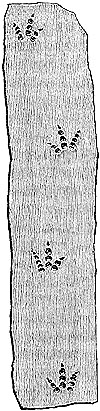
Footprints of a bird. Turner's Falls, Valley of the
Connecticut. (See Dr. Deane, Mem. of Amer. Acad. vol. iv. 1849.)
As considerable scepticism is naturally entertained in regard to the nature
of the evidence derived from footprints, it may be well to enumerate some
facts respecting them on which the faith of the geologist may rest. When I
visited the United States in 1842, more than 2000 impressions had been
observed by Professor Hitchcock, in the district alluded to, and all of
them were indented on the upper surface of the layers, while the
corresponding casts, standing out in relief, were always on the lower
surfaces or planes of the strata. If we follow a single line of marks we
find them uniform in size, and nearly uniform in distance from each other,
the toes of two successive footprints, turning alternately right and left
(see fig. 332.). Such single lines indicate a biped; and there is generally
such a deviation from a straight line, in any three successive prints, as
we remark in the tracks left by birds. There is also a striking relation
between the distance separating two footprints in one series and the size
of the impressions; in other words, an obvious proportion between the
length of the stride and the dimension of the creature which walked over
the mud. If the marks are small, they may be half an inch asunder; if
gigantic, as, for example, where the toes are 20 inches long, they are
occasionally 4 feet and a half apart. The bipedal impressions are for the
most part trifid, and show the same number of joints as exist in the feet
of living tridactylous birds. Now such birds have three phalangeal bones
for the inner toe, four for the middle and five for the outer one (see fig.
332.); but the impression of the terminal joint is that of the nail only.
The fossil footprints exhibit regularly, where the joints are seen, the
same number; and we see in each continuous line of tracks the three-jointed
and five-jointed toes placed alternately outwards, first on the one side
and then on the other. It is not often that the matrix has been fine enough
to retain impressions of the integument or skin of the foot; but in one
fine specimen found at Turner's Falls on the Connecticut, by Dr. Deane,
these markings are well preserved, and have been recognized by Mr. Owen as
resembling the skin of the ostrich, and not that of reptiles.[298-B] Much
care is required to ascertain [p.299]the precise layer of a laminated
rock on which an animal has walked, because the impression usually extends
downwards through several laminæ; and if the upper layer originally trodden
upon is wanting, one or more joints, or even in some cases an entire toe,
which sank less deep into the soft ground, may disappear, and yet the
remainder of the footprint be well defined.
The size of several of the fossil impressions of the Connecticut red
sandstone so far exceeds that of any living ostrich, that naturalists at
first were extremely adverse to the opinion of their having been made by
birds, until the bones and almost entire skeleton of the Dinornis and of
other feathered giants of New Zealand were discovered. Their dimensions
have at least destroyed the force of this particular objection. The
magnitude of the impressions of the feet of a heavy animal, which has
walked on soft mud, increases for some distance below the surface
originally trodden upon. In order, therefore, to guard against
exaggeration, the casts rather than the mould are relied on. These casts
show that some of the fossil birds had feet four times as large as the
ostrich, but not perhaps larger than the Dinornis.
Some of the quadrupedal footprints which accompany those of birds are
analogous to European Chirotheria, and with a similar disproportion
between the hind and fore feet. Others resemble that remarkable reptile,
the Rhyncosaurus of the English Trias, a creature having some relation in
its osteology both to chelonians and birds. Other imprints, again, are like
those of turtles.
Among the supposed bipedal tracks, a single distinct example only has been
observed of feet in which there are four toes directed forwards. In this
case a series of four footprints is seen, each 22 inches long and 12 wide,
with joints much resembling those in the toes of birds. Professor Agassiz
has suggested that it might have belonged to a gigantic bipedal batrachian;
but the evidence on this subject is too defective to warrant such a bold
conjecture, and if we were to give the reins to our imagination, we might
as well conceive a bird having four toes projecting forwards as a huge
two-legged frog. Nor should we forget that some quadrupeds place the hind
foot so precisely on the spot just quitted by the fore foot, as to produce
a single line of imprints like a biped.
No bones have as yet been met with, whether of reptiles or birds, in the
rocks of the Connecticut, but there are numerous coprolites; and an
ingenious argument has been derived by Mr. Dana, from the analysis of these
bodies, and the proportion they contain of uric acid, phosphate of lime,
carbonate of lime, and organic matter, to show that, like guano, they are
the droppings of birds, rather than of reptiles.[299-A]
Mr. Darwin, in his "Journal of a Voyage in the Beagle," informs us that the
"South American ostriches, although they live on vegetable matter, such as
roots and grass, are repeatedly seen at Bahia Blanca [p.300](lat. 39°
S.), on the coast of Buenos Ayres, coming down at low water to the
extensive mud-banks which are then dry, for the sake, as the Gauchos say,
of feeding on small fish." They readily take to the water, and have been
seen at the bay of San Blas, and at Port Valdez, in Patagonia, swimming
from island to island.[300-A] It is therefore evident, that in our times a
South American mud-bank might be trodden simultaneously by ostriches,
alligators, tortoises, and frogs; and the impressions left, in the
nineteenth century, by the feet of these various tribes of animals, would
not differ from each other more entirely than do those attributed to birds,
saurians, chelonians, and batrachians, in the rocks of the Connecticut.
To determine the exact age of the red sandstone and shale containing these
ancient footprints in the United States, is not possible at present. No
fossil shells have yet been found in the deposit, nor plants in a
determinable state. The fossil fish are numerous and very perfect; but they
are of a peculiar type, which was originally referred to the genus
Palæoniscus, but has since, with propriety, been ascribed, by Sir Philip
Egerton, to a new genus. To this he has given the name of Ischypterus,
from the great size and strength of the fulcral rays of the dorsal fin
(from ισχὺς; strength, and πτερὸν, a fin). They differ
from Palæoniscus, as Mr. Redfield first pointed out, by having the
vertebral column prolonged to a more limited extent into the upper lobe of
the tail, or, in the language of M. Agassiz, they are less heterocercal.
The teeth also, according to Sir P. Egerton, who, in 1844, examined for me
a fine series of specimens which I procured at Durham, Connecticut, differ
from those of Palæoniscus in being strong and conical.
That the sandstones containing these fish are of older date than the strata
containing coal, before described (p. 284.) as occurring near Richmond in
Virginia, is highly probable. These were shown to be as old at least as the
oolite and lias. The higher antiquity of the Connecticut beds cannot be
proved by direct superposition, but may be presumed from the general
structure of the country. That structure proves them to be newer than the
movements to which the Appalachian or Alleghany chain owes its flexures,
and this chain includes the ancient coal formation among its contorted
rocks. The unconformable position of this New Red with ornithichnites on
the edges of the inclined primary or paleozoic rocks of the Appalachians is
seen at 4. of the section, fig. 379. p. 327. The absence of fish with
decidedly heterocercal tails may afford an argument against the Permian age
of the formation; and the opinion that the red sandstone is triassic,
seems, on the whole, the best that we can embrace in the present state of
our knowledge.
[p.301]CHAPTER XXIII.
PERMIAN OR MAGNESIAN LIMESTONE GROUP.
Fossils of Magnesian Limestone and Lower New Red distinct from the
Triassic — Term Permian — English and German
equivalents — Marine shells and corals of English Magnesian
limestone — Palæoniscus and other fish of the marl
slate — Thecodont Saurians of dolomitic conglomerate of
Bristol — Zechstein and Rothliegendes of Thuringia — Permian
Flora — Its generic affinity to the carboniferous — Psaronites or
tree-ferns.
When the use of the term "Poikilitic" was explained in the last chapter, I
stated, that in some parts of England it is scarcely possible to separate
the red marls and sandstones so called (originally named "the New Red"),
into two distinct geological systems. Nevertheless, the progress of
investigation, and a careful comparison of English rocks between the lias
and the coal with those occupying a similar geological position in Germany
and Russia, has enabled geologists to divide the Poikilitic formation; and
has even shown that the lowermost of the two divisions is more closely
connected, by its fossil remains, with the carboniferous group than with
the trias. If, therefore, we are to draw a line between the secondary and
primary fossiliferous strata, as between the tertiary and secondary, it
must run through the middle of what was once called the "New Red," or
Poikilitic group. The inferior half of this group will rank as Primary or
Paleozoic, while its upper member will form the base of the Secondary
series. For the lower, or Magnesian Limestone division of English
geologists, Sir R. Murchison has proposed the name of Permian, from Perm, a
Russian government where these strata are more extensively developed than
elsewhere, occupying an area twice the size of France, and containing an
abundant and varied suite of fossils.
Mr. King, in his valuable monograph, recently published, of the Permian
fossils of England, has given a table of the following six members of the
Permian system of the north of England, with what he conceives to be the
corresponding formations in Thuringia.[301-A]
| North of England. |
Thuringia. |
| 1. Crystalline or concretionary, and non-crystalline limestone. |
1. Stinkstein. |
| 2. Brecciated and pseudo-brecciated limestone. |
2. Rauchwacke. |
| 3. Fossiliferous limestone. |
3. Dolomit, or Upper Zechstein. |
| 4. Compact limestone. |
4. Zechstein, or Lower Zechstein. |
| 5. Marl-slate. |
5. Mergel-schiefer, or Kupferschiefer. |
| 6. Inferior sandstones of various colours. |
6. Rothliegendes. |
[p.302]I shall proceed, therefore, to treat briefly of these
subdivisions, beginning with the highest, and referring the reader, for a
fuller description of the lithological character of the whole group, as it
occurs in the north of England, to a valuable memoir by Professor Sedgwick,
published in 1835.[302-A]
Crystalline or concretionary limestone (No. 1.).—This formation is seen
upon the coast of Durham and Yorkshire, between the Wear and the Tees.
Among its characteristic fossils are Schizodus Schlotheimi (fig. 333.)
and Mytilus septifer (fig. 335.).
Fig. 333.

Schizodus Schlotheimi, Geinitz. Syn. Axinus
obscurus, Sow. Crystalline limestone, Permian.
Fig. 334.

Schizodus truncatus, King; to show hinge.
Permian.
Fig. 335.
Mytilus septifer, King. Syn. Modiola
acuminata, James Sow. Permian crystalline limestone.
These shells occur at Hartlepool and Sunderland, where the rock assumes an
oolitic and botryoidal character. Some of the beds in this division are
ripple-marked; and Mr. King imagines that the absence of corals and the
character of the shells indicate shallow water. In some parts of the coast
of Durham, where the rock is not crystalline, it contains as much as
forty-four per cent. of carbonate of magnesia, mixed with carbonate of
lime. In other places,—for it is extremely variable in structure,—it
consists chiefly of carbonate of lime, and has concreted into globular and
hemispherical masses, varying from the size of a marble to that of a
cannon-ball, and radiating from the centre. Occasionally earthy and
pulverulent beds pass into compact limestone or hard granular dolomite. The
stratification is very irregular, in some places well-defined, in others
obliterated by the concretionary action which has re-arranged the materials
of the rocks subsequently to their original deposition. Examples of this
are seen at Pontefract and Ripon in Yorkshire.
The brecciated limestone (No. 2.) contains no fragments of foreign rocks,
but seems composed of the breaking-up of the Permian limestone itself,
about the time of its consolidation. Some of the angular masses in
Tynemouth Cliff are 2 feet in diameter. This breccia is considered by
Professor Sedgwick as one of the forms of the preceding limestone, No. 1.,
rather than as regularly underlying it. The fragments are angular and never
water-worn, and appear to have been re-cemented on the spot where they were
formed. It is, therefore, suggested that they may have been due to those
internal movements of the mass which produced the concretionary structure;
but the subject is very obscure, and after studying the phenomenon in the
Marston Rocks, on the coast of Durham, I found it impossible [p.303]to
form any positive opinion on the subject. The well-known brecciated
limestones of the Pyrenees appeared to me to present the nearest analogy,
but on a much smaller scale.
The fossiliferous limestone (No. 3.) is regarded by Mr. King as a
deep-water formation, from the numerous delicate corals which it includes.
One of these, Fenestella retiformis (fig. 336.), is a very variable
species, and has received many different names. It sometimes attains a
large size, measuring 8 inches in width. The same zoophyte is also found
abundantly in the Permian of Germany.
Fig. 336.
- a. Fenestella retiformis, Schlot.
- Syn. Gorgonia infundibuliformis, Goldf.; Retepora flustracea, Phillips.
- b. Part of the same highly magnified.
Magnesian limestone, Humbleton Hill, near Sunderland.[303-A]
Shells of the genera Spirifer and Productus, which do not occur in
strata newer than the Permian, are abundant in this division of the series
in the ordinary yellow magnesian limestone. (See figs. 337, 338.)
Fig. 337.

Productus calvus, Sow. Min. Con. Syn. Productus
horridus, Bronn's Index, &c., King's Monogr., &c.; Leptæna, Dalman.
Magnesian Limestone.
Fig. 338.

Spirifer undulatus, Sow. Min. Con. Syn.
Triogonotreta undulata, King's Monogr.
Magnesian Limestone.
The compact limestone (No. 4.) also contains organic remains, especially
corallines, and is intimately connected with the preceding. Beneath it lies
the marl-slate (No. 5.), which consists of hard, calcareous shales,
marl-slate, and thin-bedded limestones. At East Thickley, in Durham, where
it is thirty feet thick, this slate has yielded many fine specimens of
fossil fish of the genera Palæoniscus, Pygopterus, Cœlacanthus,
and Platysomus, genera which are all found in the coal-measures of the
carboniferous epoch, and which therefore, says Mr. King, probably lived at
no great distance from [p.304]the shore. But the Permian species are
peculiar, and, for the most part, identical with those found in the
marl-slate or copper-slate of Thuringia.
Fig. 339.
Restored outline of a fish of the genus
Palæoniscus, Agass. Palæothrissum, Blainville.
The Palæoniscus above mentioned belongs to that division of fishes which
M. Agassiz has called "Heterocercal," which have their tails unequally
bilobate, like the recent shark and sturgeon, and the vertebral column
running along the upper caudal lobe. (See fig. 340.) The "Homocercal" fish,
which comprise almost all the 8000 species at present known in the living
creation, have the tail-fin either single or equally divided; and the
vertebral column stops short, and is not prolonged into either lobe. (See
fig. 341.)
Fig. 340.
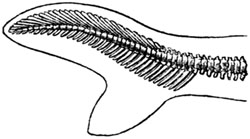
Shark.
Heterocercal.
Fig. 341.

Shad. (Clupea, Herring tribe.)
Homocercal.
Now it is a singular fact, first pointed out by Agassiz, that the
heterocercal form, which is confined to a small number of genera in the
existing creation, is universal in the Magnesian limestone, and all the
more ancient formations. It characterizes the earlier periods of the
earth's history, when the organization of fishes made a greater approach to
that of saurian reptiles than at later epochs. In all the strata above the
Magnesian limestone the homocercal tail predominates.
A full description has been given by Sir Philip Egerton of the species of
fish characteristic of the marl-slate in Mr. King's monograph before
referred to, where figures of the ichthyolites which are very entire and
well preserved, will be found. Even a single scale is usually so
characteristically marked as to indicate the genus, and sometimes even the
particular species. They are often scattered through the beds singly, and
maybe useful to a geologist in determining the age of the rock.
[p.305]
Fig. 342.

Palæoniscus comtus, Agassiz. Scale
magnified. Marl-slate.
Fig. 343.
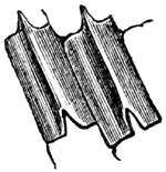
Palæoniscus elegans, Sedg. Under surface of
scale magnified. Marl-slate.
Fig. 344.

Palæoniscus glaphyrus, Ag. Under surface of
scale magnified. Marl-slate.
Fig. 345.
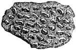
Cœlacanthus caudalis, Egerton. Scale showing
granulated surface magnified. Marl-slate.
Scales of fish. Magnesian limestone.
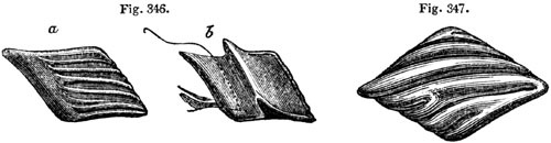
Fig. 346. Pygopterus mandibularis, Ag. Marl-slate.
- a. Outside of scale magnified.
- b. Under surface of same.
Fig. 347. Acrolepis Sedgwickii, Ag. Marl-slate.
The inferior sandstones (No. 6. Tab. p. 301.), which lie beneath the
marl-slate, consist of sandstone and sand, separating the magnesian
limestone from the coal, in Yorkshire and Durham. In some instances, red
marl and gypsum have been found associated with these beds. They have been
classed with the magnesian limestone by Professor Sedgwick, as being nearly
co-extensive with it in geographical range, though their relations are very
obscure. In some regions we find it stated that the imbedded plants are all
specifically identical with those of the carboniferous series; and, if so,
they probably belong to that epoch; for the true Permian flora appears,
from the researches of MM. Murchison and de Verneuil in Russia, and of
Colonel von Gutbier in Saxony, to be, with few exceptions, distinct from
that of the coal (see p. 307.).
Dolomitic conglomerate of Bristol.—Near Bristol, in Somersetshire, and
in other counties bordering the Severn, the unconformable beds of the Lower
New Red, resting immediately upon the Coal, consist of a conglomerate
called "dolomitic," because the pebbles of older rocks are cemented
together by a red or yellow base of dolomite or magnesian limestone. This
conglomerate or breccia, for the imbedded fragments are sometimes angular,
occurs in patches over the whole of the downs near Bristol, filling up the
hollows and irregularities in the mountain limestone, and being principally
composed at every spot of the debris of those rocks on which it immediately
rests. At one point we find pieces of coal shale, in another of mountain
limestone, recognizable by its peculiar shells and zoophytes. [p.306]
Fractured bones, also, and teeth of saurians, are dispersed through some
parts of the breccia.
These saurians (which until the discovery of the Archegosaurus in the
coal were the most ancient examples of fossil reptiles) are all
distinguished by having the teeth implanted deeply in the jaw-bone, and in
distinct sockets, instead of being soldered, as in frogs, to a simple
alveolar parapet. In the dolomitic conglomerate near Bristol the remains of
species of two distinct genera have been found, called Thecodontosaurus
and Palæosaurus by Dr. Riley and Mr. Stutchbury[306-A]; the teeth of
which are conical, compressed, and with finely serrated edges (figs. 348
and 349.).
Fig. 348.
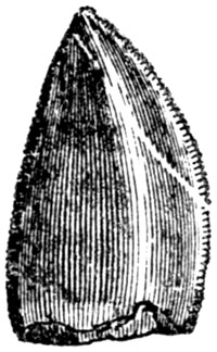
Tooth of Palæosaurus platyodon, nat. size.
Fig. 349.
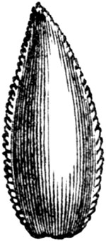
Tooth of Thecodontosaurus, 3 times magnified.
In Russia, also, Thecodont saurians occur, in beds of the Permian age, of
several genera, while others named Protorosaurus are met with in the
Zechstein of Thuringia. This family of reptiles is allied to the living
monitor, and its appearance in a primary or paleozoic formation, observes
Mr. Owen, is opposed to the doctrine of the progressive development of
reptiles from fish, or from simpler to more complex forms; for, if they
existed at the present day, these monitors would take rank at the head of
the Lacertian order.[306-B]
In Russia the Permian rocks are composed of white limestone, with gypsum
and white salt; and of red and green grits, with occasionally copper ore;
also magnesian limestones, marlstones, and conglomerates.
The country of Mansfeld, in Thuringia, may be called the classic ground of
the Lower New Red, or Magnesian Limestone, or Permian formation, on the
Continent. It consists there principally of, first, the Zechstein,
corresponding to the upper portion of our English series; and, secondly,
the marl-slate, with fish of species identical with those of the bed so
called in Durham. This slaty marlstone is richly impregnated with copper
pyrites, for which it is extensively worked. Magnesian limestone, gypsum,
and rock-salt, occur among the superior strata of this group. At its base
lies the Rothliegendes, supposed to correspond with the Inferior or Lower
New Red Sandstone [p.307]above mentioned, which occupies a similar place
in England between the marl-slate and coal. Its local name of
Rothliegendes, red-lyer, or "Roth-todt-liegendes," red-dead-lyer, was
given by the workmen in the German mines from its red colour, and because
the copper has died out when they reach this rock, which is not
metalliferous. It is, in fact, a great deposit of red sandstone and
conglomerate, with associated porphyry, basaltic trap, and amygdaloid.
Permian Flora.—We learn from the recent investigation of Colonel von
Gutbier, that in the Permian rocks of Saxony no less than sixty species of
fossil plants have been met with, forty of which have not yet been found
elsewhere. Two or three of these, as Calamites gigas, Sphenopteris
erosa, and S. lobata, are also met with in the government of Perm in
Russia. Seven others, and among them Neuropteris Loshii, Pecopteris
arborescens, and P. similis, with several species of Walchia
(Lycopodites), are common to the coal-measures.
Among the genera also enumerated by Colonel Gutbier are Asterophyllites
and Annularia, so characteristic of the carboniferous period; also
Lepidodendron, which is common to the Permian of Saxony, Thuringia, and
Russia, although not abundant. Noeggerathia (see fig. 350.), supposed by
A. Brongniart to be allied to Cycas, is another link between the Permian
and carboniferous vegetation. Coniferæ, of the Araucarian division, also
occur; but these are likewise met with both in older and newer rocks. The
plants called Sigillaria and Stigmaria, so marked a feature in the
carboniferous period, are as yet wanting.
Fig. 350.

Noeggerathia cuneifolia. Ad. Brongniart.[307-A]
Among the remarkable fossils of the rothliegendes, or lowest part of the
Permian in Saxony and Bohemia, are the silicified trunks of tree-ferns
called generically Psaronius. Their bark was surrounded by a dense mass
of air-roots, which often constituted a great addition to the original
stem, so as to double or quadruple its diameter. The same remark holds good
in regard to certain living extra-tropical arborescent ferns, particularly
those of New Zealand.
Psaronites are also found in the uppermost coal of Autun in France, and in
the upper coal-measures of the State of Ohio in the United States, but
specifically different from those of the rothliegendes. They serve to
connect the Permian flora with the more modern portion of the preceding or
carboniferous group. Upon the whole, it is [p.308]evident that the
Permian plants approach nearer to the carboniferous ones than to the
triassic; and the same may be said of the Permian fauna.
CHAPTER XXIV.
THE COAL, OR CARBONIFEROUS GROUP.
Carboniferous strata in the south-west of England — Superposition of
Coal-measures to Mountain limestone — Departure from this type in North
of England and Scotland — Section in South Wales — Underclays with
Stigmaria — Carboniferous Flora — Ferns, Lepidodendra, Calamites,
Asterophyllites, Sigillariæ,Stigmariæ — Coniferæ — Endogens
— Absence of Exogens — Coal, how formed — Erect fossil
trees — Parkfield Colliery — St. Etienne, Coal-field —
Oblique trees or snags — Fossil forests in Nova Scotia — Brackish
water and marine strata — Origin of Clay-iron-stone.
The next group which we meet with in the descending order is the
Carboniferous, commonly called "The Coal;" because it contains many beds of
that mineral, in a more or less pure state, interstratified with
sandstones, shales, and limestones. The coal itself, even in Great Britain
and Belgium, where it is most abundant, constitutes but an insignificant
portion of the whole mass. In the north of England, for example, the
thickness of the coal-bearing strata has been estimated at 3000 feet, while
the various coal-seams, 20 or 30 in number, do not in the aggregate exceed
60 feet.[308-A]
The carboniferous formation comprises two very distinct members: 1st, that
usually called the Coal-measures, of mixed freshwater, terrestrial, and
marine origin, often including seams of coal; 2dly, that named in England
the Mountain or Carboniferous limestone, of purely marine origin, and
containing corals, shells, and encrinites.
In the south-western part of our island, in Somersetshire and South Wales,
the three divisions usually spoken of by English geologists are:
| 1. Coal-measures |
{ |
|
Strata of shale, sandstone, and grit, with occasional seams
of coal, from 600 to 12,000 feet thick. |
| 2. Millstone grit |
{ |
A coarse quartzose sandstone passing into a conglomerate,
sometimes used for millstones, with beds of shale; usually
devoid of coal; occasionally above 600 feet thick. |
| 3. Mountain or Carboniferous limestone |
} |
A calcareous rock containing marine shells and corals;
devoid of coal; thickness variable, sometimes 900 feet. |
The millstone grit may be considered as one of the coal sandstones
[p.309]of coarser texture than usual, with some accompanying shales, in
which coal plants are occasionally found. In the north of England some
bands of limestone, with pectens, oysters, and other marine shells, occur
in this grit, just as in the regular coal-measures, and even a few seams of
coal. I shall treat, therefore, of the whole group, as consisting of two
divisions only, the Coal-measures and Mountain Limestone. The latter is
found in the southern British coal-fields, at the base of the system, or
immediately in contact with the subjacent Old Red Sandstone; but as we
proceed northwards to Yorkshire and Northumberland it begins to alternate
with true coal-measures, the two deposits forming together a series of
strata about 1000 feet in thickness. To this mixed formation succeeds the
great mass of genuine mountain limestone.[309-A] Farther north, in the
Fifeshire coal-field in Scotland, we observe a still wider departure from
the type of the south of England, or a more complete intercalation of dense
masses of marine limestones with sandstones, and shales containing coal.
COAL-MEASURES.
In South Wales the coal-measures have been ascertained by actual
measurement to attain the extraordinary thickness of 12,000 feet, the beds
throughout, with the exception of the coal itself, appearing to have been
formed in water of moderate depth, during a slow but perhaps intermittent
depression of the ground, in a region to which rivers were bringing a
never-failing supply of muddy sediment and sand. The same area was
sometimes covered with vast forests, such as we see in the deltas of great
rivers in warm climates, which are liable to be submerged beneath fresh or
salt water should the ground sink vertically a few feet.
In one section near Swansea, in South Wales, where the total thickness of
strata is 3246 feet, we learn from Sir H. De la Beche that there are ten
principal masses of sandstone. One of these is 500 feet thick, and the
whole of them make together a thickness of 2125 feet. They are separated by
masses of shale, varying in thickness from 10 to 50 feet. The intercalated
coal-beds, sixteen in number, are generally from 1 to 5 feet thick, one of
them, which has two or three layers of clay interposed, attaining 9
feet.[309-B] At other points in the same coal-field the shales predominate
over the sandstones. The horizontal extent of some seams of coal is much
greater than that of others, but they all present one characteristic
feature, in having, each of them, what is called its underclay. These
underclays, co-extensive with every layer of coal, consist of arenaceous
shale, sometimes called firestone, because it can be made into bricks which
stand the fire of [p.310]a furnace. They vary in thickness from 6 inches
to more than 10 feet; and Mr. Logan first announced to the scientific world
in 1841 that they were regarded by the colliers in South Wales as an
essential accompaniment of each of the one hundred seams of coal met with
in their coal-field. They are said to form the floor on which the coal
rests; and some of them have a slight admixture of carbonaceous matter,
while others are quite blackened by it.
All of them, as Mr. Logan pointed out, are characterized by inclosing a
peculiar species of fossil vegetable called Stigmaria, to the exclusion
of other plants. It was also observed that, while in the overlying shales
or "roof" of the coal, ferns and trunks of trees abound without any
Stigmariæ, and are flattened and compressed, those singular plants in the
underclays always retain their natural forms, branching freely, and sending
out their slender leaves, as they were formerly styled, through the mud in
all directions. Several species of Stigmaria had long been known to
botanists, and described by them, before their position under each seam of
coal was pointed out. It was conjectured that they might be aquatic,
perhaps floating plants, which sometimes extended their branches and leaves
freely in fluid mud, and which were finally enveloped in the same mud.
CARBONIFEROUS FLORA.
These statements will suffice to convince the reader that we cannot arrive
at a satisfactory theory of the origin of coal till we understand the true
nature of Stigmaria; and in order to explain what is now known of this
plant, and of others which have contributed by their decay to produce coal,
it will be necessary to offer a brief preliminary sketch of the whole
carboniferous flora, an assemblage of fossil plants, with which we are
better acquainted than with any other which flourished antecedently to the
tertiary epoch. It should also be remarked that Göppert has ascertained
that the remains of every family of plants scattered through the
coal-measures are sometimes met with in the pure coal itself, a fact which
adds greatly to the geological interest attached to this flora.
Ferns.—The number of species of carboniferous plants hitherto described
amounts, according to M. Ad. Brongniart, to about 500. These may perhaps be
a fragment only of the entire flora, but they are enough to show that the
state of the vegetable world was then extremely different from that now
established. We are struck at the first glance with the similarity of many
of the ferns to those now living, and the dissimilarity of almost all the
other fossils except the coniferæ. Among the ferns, as in the case of
Pecopteris for example (fig. 351.), it is not always easy to decide
whether they should be referred to different genera from those established
for the classification of living species; whereas, in regard to most of the
other contemporary tribes, with the exception of the coniferæ, it is often
difficult [p.311]to guess the family, or even the class, to which they
belong. The ferns of the carboniferous period are generally without organs
of fructification, but in some specimens these are well preserved. In the
general absence of such characters, they have been divided into genera,
distinguished chiefly by the branching of the fronds, and the way in which
the veins of the leaves are disposed. The larger portion are supposed to
have been of the size of ordinary European ferns, but some were decidedly
arborescent, especially the group called Caulopteris, by Lindley, and the
Psaronius of the upper or newest coal-measures, before alluded to (p.
307.).
Fig. 351.

Pecopteris lonchitica. (Foss. Flo. 153.)
Fig. 352.
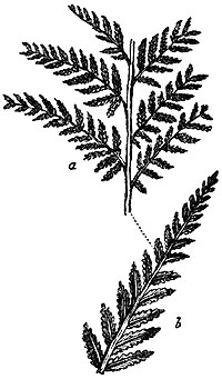
- a. Sphenopteris crenata.
- b. The same, magnified.
(Foss. Flo. 101.)
Fig. 353.

Caulopteris primæva, Lindley.
All the recent tree-ferns belong to one tribe (Polypodiaceæ), and to a
small number only of genera in that tribe, in which the surface of the
trunk is marked with scars, or cicatrices, left after the fall of the
fronds. These scars resemble those of Caulopteris (see fig. 353.). No
less than 250 ferns have already been obtained from the coal strata; and
even if we make some reduction on the ground of varieties which have been
mistaken, in the absence of their fructification, for species, still the
result is singular, because the whole of Europe affords at present no more
than 50 indigenous species.
[p.312]
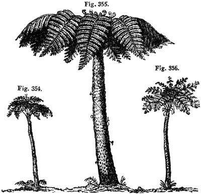
Living tree-ferns of different genera. (Ad. Brong.)
- Fig. 354. Tree-fern from Isle of Bourbon.
- Fig. 355. Cyathea glauca, Mauritius.
- Fig. 356. Tree fern from Brazil.
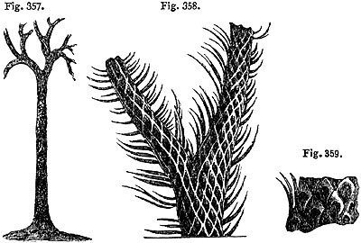
Lepidodendron Sternbergii. Coal-measures,
near Newcastle.
- Fig. 357. Branching trunk, 49 feet long, supposed to have belonged to
L. Sternbergii. (Foss. Flo. 203.)
- Fig. 358. Branching stem with bark and leaves of L. Sternbergii.
(Foss. Flo. 4.)
- Fig. 359. Portion of same nearer the root; natural size. (Ibid.)
Lepidodendra.—These fossils belong to the family of Lycopodiums, yet
most of them grew to the size of large trees. The annexed figures represent
a large fossil Lepidodendron, 49 feet long, found in Jarrow Colliery,
near Newcastle, lying in shale parallel to the planes of stratification.
Fragments of others, found in the same shale, indicate, by the size of the
rhomboidal scars which cover them, a still greater magnitude. The living
club-mosses, of which there are about 200 species, are abundant in tropical
climates, where one species is sometimes met with attaining a height of 3
feet. They usually creep on [p.313]the ground, but some stand erect, as
the L. densum, from New Zealand (fig. 360.).
Fig. 360.

- a. Lycopodium densum; banks of R. Thames, New Zealand.
- b. branch, natural size.
- c. part of same, magnified.
In the carboniferous strata of Coalbrook Dale, and in many other
coal-fields, elongated cylindrical bodies, called fossil cones, named by M.
Adolphe Brongniart Lepidostrobus, are met with. (See fig. 361.) They
often form the nucleus of concretionary balls of clay-iron-stone, and are
well preserved, exhibiting a conical axis, around which a great quantity of
scales were compactly imbricated. The opinion of M. Brongniart is now
generally adopted, that the Lepidostrobus is the fruit of
Lepidodendron.
Fig. 361.
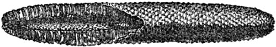
Lepidostrobus ornatus, Brong.; half nat. size.
Shropshire.
Fig. 362.

Calamites cannæformis, Schlot. (Foss. Flo. 79.)
Lower end with rootlets.
Fig. 363.
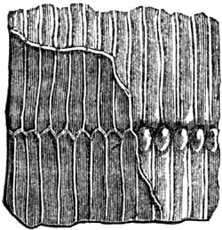
Calamites Suckowii, Brong.; natural size. Common
in coal throughout Europe.
Equisetaceæ.—To this family belong two species of the genus
Equisetites, allied to the living "horse-tail" which now grows in marshy
grounds. Other species, which have jointed stems, depart more widely from
Equisetum, but are yet of analogous organization. [p.314]They differed
from it principally in being furnished with a thin bark, which is
represented in the stem of C. Suckowii (fig. 363.), in which it will be
seen that the striped external pattern does not agree with that left on the
stone where the bark is stripped off; so that if the two impressions were
seen separately, they might be mistaken for two distinct species.
The tallest living "horse-tails" are only 2 or 3 feet high in Europe, and
even in tropical climates only attain, as in the case of Equisetum
giganteum, discovered by Humboldt and Bonpland, in South America, a height
of about 5 feet, the stem being an inch in diameter. Several of the
Calamites of the coal acquired the height and dimensions of small trees.
Fig. 364.
Asterophyllites foliosa. (Foss. Flo. 25.)
Coal-measures, Newcastle.
Asterophyllites.—In this family, M. Brongniart includes several genera,
and among them Calamodendron, Asterophyllites, and Annularia. The
graceful plant, represented in the annexed figure, is supposed to be the
branch of a shrub called Calamodendron, a new genus, divided off by
Brongniart from the Calamites of former authors. Its pith and medullary
rays seem to show that it was dicotyledonous, and it appears to have been
allied, by the nature of its tissue, to the gymnogens, or, still more, to
the Sigillaria, which will next be mentioned.
Sigillaria.—A large portion of the trees of the carboniferous period
belonged to this genus, of which about thirty-five species are known. The
structure, both internal and external, was very peculiar, and, with
reference to existing types, very anomalous. They were formerly referred,
by M. Ad. Brongniart, to ferns, which they resemble in the scalariform
texture of their vessels, and, in some degree, in the form of the
cicatrices left by the base of the leafstalks which have fallen off (see
fig. 365.). But with these points of analogy to cryptogamia, they combine
an internal organization much resembling that of cycads, and some of them
are ascertained to have had long linear leaves, quite unlike those of
ferns. They grew to a great height, from 30 to 60, or even 70 feet, with
regular cylindrical stems, and without branches, although some species were
[p.315]dichotomous towards the top. Their fluted trunks, from 1 to 5
feet in diameter, appear to have decayed rapidly in the interior, so as to
become hollow, when standing; when, therefore, they were thrown prostrate
on the mud, they were squeezed down and flattened. Hence, we find the bark
of the two opposite sides (now converted into bright shining coal) to
constitute two horizontal layers, one upon the other, half an inch, or an
inch, in thickness. These same trunks, when they are placed obliquely or
vertically to the planes of stratification, retain their original rounded
form, and are uncompressed, the cylinder of bark having been filled with
sand, which now affords a cast of the interior.
Fig. 365.

Sigillaria lævigata, Brong.
Stigmaria.—This fossil, the importance of which has already been pointed
out, was formerly conjectured to be an aquatic plant. It is now ascertained
to be the root of Sigillaria. The connection of the roots with the stem,
previously suspected, on botanical grounds, by Brongniart, was first
proved, by actual contact, in the Lancashire coal-field, by Mr. Binney. The
fact has lately been shown, even more distinctly, by Mr. Richard Brown, in
his description of the Stigmariæ occurring in the underclays of the
coal-seams of the Island of Cape Breton, in Nova Scotia.
Fig. 366.
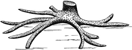
Stigmaria attached to a trunk of Sigillaria.[315-A]
In a specimen of one of these, represented in the annexed figure (fig.
366.), the spread of the roots was 16 feet, and some of them sent out
rootlets, in all directions, into the surrounding clay.
The manner of attachment of the fibres to the stem resembles that of a ball
and socket joint, the base of each rootlet being concave, and fitting on to
a tubercle (see figs. 367 and 368.). Rows of these tubercles are arranged
spirally round each root, which have always a medullary cavity and woody
texture, much resembling that [p.316]of Sigillaria, the structure of
the vessels being, like it, scalariform.
Fig. 367.

Surface of another individual of same species,
showing form of tubercles. (Foss. Flo. 34.)
Fig. 368.

Stigmaria ficoides, Brong. One fourth of nat.
size. (Foss. Flo. 32.)
Conifers.—The coniferous trees of this period are referred to five
genera; the woody structure of some of them showing that they were allied
to the Araucarian division of pines, more than to any of our common
European firs. Some of their trunks exceeded 44 feet in height.
Endogens.—Hitherto but few monocotyledonous plants have been discovered
in the coal-strata. Most of these consist of fruits referred by some
botanists to palms. The three-sided nuts, called Trigonocarpum, seven
species of which are known, appear to have the best claim to rank as palms,
although M. Ad. Brongniart entertains some doubt even as to their being
monocotyledons.
Exogens.
The entire absence, so far as our paleontological investigations have
hitherto gone, of ordinary dicotyledons or exogens in the coal measures, is
most remarkable. Hence, M. Adolphe Brongniart has called this period the
age of acrogens, in consequence of the vast preponderance of ferns and
Lepidodendra.[316-A] Nevertheless, a forest of the period, now under
consideration, may have borne a considerable resemblance to those woody
regions of New Zealand, in which ferns, arborescent and herbaceous, and
lycopodiums, with many coniferæ, abound.
The comparative proportion of living ferns and Araucariæ, in Norfolk
Island, to all the other plants, appears to be very similar to that
formerly borne by these tribes respectively in a forest of the coal-period.
I have already stated that Professor Göppert, after examining the fossil
vegetables of the coal-fields of Germany, has detected, in beds of pure
coal, remains of plants of every family hitherto known to occur fossil in
the coal. Many seams, he remarks, are rich in Sigillaria,
Lepidodendron, and Stigmaria, the latter in such abundance, as to
appear to form the bulk of the coal. In some places, almost all the plants
are calamites, in others ferns.[316-B]
[p.317]Coal, how formed—Erect trees.—I shall now consider the manner
in which the above-mentioned plants are imbedded in the strata, and how
they may have contributed to produce coal. "Some of the plants of our
coal," says Dr. Buckland, "grew on the identical banks of sand, silt, and
mud, which, being now indurated to stone and shale, form the strata that
accompany the coal; whilst other portions of these plants have been drifted
to various distances from the swamps, savannahs, and forests that gave them
birth, particularly those that are dispersed through the sandstones, or
mixed with fishes in the shale beds." "At Balgray, three miles north of
Glasgow," says the same author, "I saw in the year 1824, as there still may
be seen, an unequivocal example of the stumps of several stems of large
trees, standing close together in their native place, in a quarry of
sandstone of the coal formation."[317-A]
Between the years 1837 and 1840, six fossil trees were discovered in the
coal-field of Lancashire, where it is intersected by the Bolton railway.
They were all in a vertical position, with respect to the plane of the bed,
which dips about 15° to the south. The distance between the first and the
last was more than 100 feet, and the roots of all were imbedded in a soft
argillaceous shale. In the same plane with the roots is a bed of coal,
eight or ten inches thick, which has been ascertained to extend across the
railway, or to the distance of at least ten yards. Just above the covering
of the roots, yet beneath the coal seam, so large a quantity of the
Lepidostrobus variabilis was discovered inclosed in nodules of hard clay,
that more than a bushel was collected from the small openings around the
base of the trees (see figure of this genus, p. 313.). The exterior trunk
of each was marked by a coating of friable coal, varying from one quarter
to three quarters of an inch in thickness; but it crumbled away on removing
the matrix. The dimensions of one of the trees is 151/2 feet in
circumference at the base, 71/2 feet at the top, its height being 11 feet.
All the trees have large spreading roots, solid and strong, sometimes
branching, and traced to a distance of several feet, and presumed to extend
much farther. Mr. Hawkshaw, who has described these fossils, thinks that,
although they were hollow when submerged, they may have consisted
originally of hard wood throughout; for solid dicotyledonous trees, when
prostrated in tropical forests, as in Venezuela, on the shore of the
Caribbean Sea, were observed by him to be destroyed in the interior, so
that little more is left than an outer shell, consisting chiefly of the
bark. This decay, he says, goes on most rapidly in low and flat tracks, in
which there is a deep rich soil and excessive moisture, supporting tall
forest-trees and large palms, below which bamboos, canes, and minor palms
flourish luxuriantly. Such tracts, from their lowness, would be most easily
submerged, and their dense vegetation might then give rise to a seam of
coal.[317-B]
In a deep valley near Capel-Coelbren, branching from the higher part of the
Swansea valley, four stems of upright Sigillariæ were [p.318]seen, in
1838, piercing through the coal-measures of S. Wales; one of them was 2
feet in diameter, and one 13 feet and a half high, and they were all found
to terminate downwards in a bed of coal. "They appear," says Sir H. De la
Beche, "to have constituted a portion of a subterranean forest at the epoch
when the lower carboniferous strata were formed.[318-A]
In a colliery near Newcastle, say the authors of the Fossil Flora, a great
number of Sigillariæ were placed in the rock as if they had retained the
position in which they grew. Not less than thirty, some of them 4 or 5 feet
in diameter, were visible within an area of 50 yards square, the interior
being sandstone, and the bark having been converted into coal. The roots of
one individual were found imbedded in shale; and the trunk, after
maintaining a perpendicular course and circular form for the height of
about 10 feet, was then bent over so as to become horizontal. Here it was
distended laterally, and flattened so as to be only one inch thick, the
flutings being comparatively distinct.[318-B] Such vertical stems are
familiar to our miners, under the name of coal-pipes. One of them, 72 feet
in length, was discovered, in 1829, near Gosforth, about five miles from
Newcastle, in coal-grit, the strata of which it penetrated. The exterior of
the trunk was marked at intervals with knots, indicating the points at
which branches had shot off. The wood of the interior had been converted
into carbonate of lime; and its structure was beautifully shown by cutting
transverse slices, so thin as to be transparent. (See p. 40.)
These "coal-pipes" are much dreaded by our miners, for almost every year in
the Bristol, Newcastle, and other coal-fields, they are the cause of fatal
accidents. Each cylindrical cast of a tree, formed of solid sandstone, and
increasing gradually in size towards the base, and being without branches,
has its whole weight thrown downwards, and receives no support from the
coating of friable coal which has replaced the bark. As soon, therefore, as
the cohesion of this external layer is overcome, the heavy column falls
suddenly in a perpendicular or oblique direction from the roof of the
gallery whence coal has been extracted, wounding or killing the workman who
stands below. It is strange to reflect how many thousands of these trees
fell originally in their native forests in obedience to the law of gravity;
and how the few which continued to stand erect, obeying, after myriads of
ages, the same force, are cast down to immolate their human victims.
It has been remarked, that if, instead of working in the dark, the miner
was accustomed to remove the upper covering of rock from each seam of coal,
and to expose to the day the soils on which ancient forests grew, the
evidence of their former growth would be obvious. Thus in South
Staffordshire a seam of coal was laid bare in the year 1844, in what is
called an open work at Parkfield Colliery, near [p.319]Wolverhampton. In
the space of about a quarter of an acre the stumps of no less than 73 trees
with their roots attached appeared, as shown in the annexed plan (fig.
369.), some of them more than 8 feet in circumference. The trunks, broken
off close to the root, were lying prostrate in every direction, often
crossing each other. One of them measured 15, another 30 feet in length,
and others less. They were invariably flattened to the thickness of one or
two inches, and converted into coal. Their roots formed part of a stratum
of coal 10 inches thick, which rested on a layer of clay 2 inches thick,
below which was a second forest, resting on a 2-foot seam of coal. Five
feet below this again was a third forest with large stumps of
Lepidodendra, Calamites, and other trees.
Fig. 369.
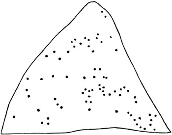
Ground-plan of a fossil forest, Parkfield Colliery, near Wolverhampton,
showing the position of 73 trees in a quarter of an acre.[319-A]
In the account given, in 1821, by M. Alex. Brongniart of the coal-mine of
Treuil, at St. Etienne, near Lyons, he states, that distinct horizontal
strata of micaceous sandstone are traversed by vertical trunks of
monocotyledonous vegetables, resembling bamboos or large Equiseta.[319-B]
Since the consolidation of the stone, there has been here and there a
sliding movement, which has broken the continuity of the stems, throwing
the upper parts of them on one side, so that they are often not continuous
with the lower.
From these appearances it was inferred that we have here the monuments of a
submerged forest. I formerly objected to this conclusion, suggesting that,
in that case, all the roots ought to have been found at one and the same
level, and not scattered irregularly through the mass. I also imagined that
the soil to which the roots were attached should have been different from
the sandstone in which the trunks are enclosed. Having, however, seen
calamites near Pictou, in Nova Scotia, buried at various heights in
sandstone and in similar erect attitudes, I have now little doubt that M.
Brongniart's view [p.320]was correct. These plants seem to have grown on
a sandy soil, liable to be flooded from time to time, and raised by new
accessions of sediment, as may happen in swamps near the banks of a large
river in its delta. Trees which delight in marshy grounds are not injured
by being buried several feet deep at their base; and other trees are
continually rising up from new soils, several feet above the level of the
original foundation of the morass. In the banks of the Mississippi, when
the water has fallen, I have seen sections of a similar deposit in which
portions of the stumps of trees with their roots in situ appeared at many
different heights.[320-A]
Fig. 370.

Section showing the erect position of fossil trees
in coal sandstone at St. Etienne. (Alex. Brongniart.)
When I visited, in 1843, the quarries of Treuil above-mentioned, the fossil
trees seen in fig. 370. were removed, but I obtained proofs of other
forests of erect trees in the same coal-field.
Fig. 371.

Inclined position of a fossil tree, cutting through horizontal beds
of sandstone, Craigleith quarry, Edinburgh. Angle
of inclination from a to b 27°.
Snags.—In 1830, a slanting trunk was exposed in Craigleith quarry, near
Edinburgh, the total length of which exceeded 60 feet. Its diameter at the
top was about 7 inches, and near the base it measured 5 feet in its
greater, and 2 feet in its lesser width. The bark was converted into a thin
coating of the purest and finest coal, forming a striking contrast in
colour with the white quartzose sandstone in which it lay. The annexed
figure represents a portion of this tree, about 15 feet long, which I saw
exposed in 1830, when [p.321]all the strata had been removed from one
side. The beds which remained were so unaltered and undisturbed at the
point of junction, as clearly to show that they had been tranquilly
deposited round the tree, and that the tree had not subsequently pierced
through them, while they were yet in a soft state. They were composed
chiefly of siliceous sandstone, for the most part white; and divided into
laminæ so thin, that from six to fourteen of them might be reckoned in the
thickness of an inch. Some of these thin layers were dark, and contained
coaly matter; but the lowest of the intersected beds were calcareous. The
tree could not have been hollow when imbedded, for the interior still
preserved the woody texture in a perfect state, the petrifying matter
being, for the most part, calcareous.[321-A] It is also clear, that the
lapidifying matter was not introduced laterally from the strata through
which the fossil passes, as most of these were not calcareous. It is well
known that, in the Mississippi and other great American rivers, where
thousands of trees float annually down the stream, some sink with their
roots downwards, and become fixed in the mud. Thus placed, they have been
compared to a lance in rest; and so often do they pierce through the bows
of vessels which run against them, that they render the navigation
extremely dangerous. Mr. Hugh Miller mentions four other huge trunks
exposed in quarries near Edinburgh, which lay diagonally across the strata
at an angle of about 30°, with their lower or heavier portions downwards,
the roots of all, save one, rubbed off by attrition. One of these was 60
and another 70 feet in length, and from 4 to 6 feet in diameter.
Fig. 372.

Section of the cliffs of the South Joggins, near Minudie, Nova Scotia.
The number of years for which the trunks of trees, when constantly
submerged, can resist decomposition, is very great; as we might suppose
from the durability of wood, in artificial piles, permanently covered by
water. Hence these fossil snags may not imply a rapid accumulation of beds
of sand, although the channel of a river or part of a lagoon is often
filled up in a very few years.
Nova Scotia.—One of the finest examples in the world of a succession of
fossil forests of the carboniferous period, laid open to view in a natural
section, is that seen in the lofty cliffs bordering the Chignecto Channel,
a branch of the Bay of Fundy, in Nova Scotia.[321-B]
[p.322]In the annexed section (fig. 372.), which I examined in July,
1842, the beds from c to i are seen all dipping the same way, their
average inclination being at an angle of 24° S.S.W. The vertical height of
the cliffs is from 150 to 200 feet; and between d and g, in which space
I observed seventeen trees in an upright position, or, to speak more
correctly, at right angles to the planes of stratification, I counted
nineteen seams of coal, varying in thickness from 2 inches to 4 feet. At
low tide a fine horizontal section of the same beds is exposed to view on
the beach. The thickness of the beds alluded to, between d and g, is
about 2,500 feet, the erect trees consisting chiefly of large Sigillariæ,
occurring at ten distinct levels, one above the other; but Mr. Logan, who
afterwards made a more detailed survey of the same line of cliffs, found
erect trees at seventeen levels, extending through a vertical thickness of
4,515 feet of strata; and he estimated the total thickness of the
carboniferous formation, with and without coal, at no less than 14,570
feet, every where devoid of marine organic remains.[322-A] The usual height
of the buried trees seen by me was from 6 to 8 feet; but one trunk was
about 25 feet high and 4 feet in diameter, with a considerable bulge at the
base. In no instance could I detect any trunk intersecting a layer of coal,
however thin; and most of the trees terminated downwards in seams of coal.
Some few only were based in clay and shale, none of them in sandstone. The
erect trees, therefore, appeared in general to have grown on beds of coal.
In some of the underclays I observed Stigmaria.
Fig. 373.

Fossil tree at right angles to planes of stratification.
Coal measures, Nova Scotia.
In regard to the plants, they belonged to the same genera, and most of them
to the same species, as those met with in the distant coal-fields of
Europe. In the sandstone, which filled their interiors, I frequently
observed fern leaves, and sometimes fragments of Stigmaria, which had
evidently entered together with sediment after the trunk had decayed and
become hollow, and while it was still standing under water. Thus the tree,
a b, fig. 373., the same which is represented at a, fig. 374., or in
the bed e in the larger section, fig. 372., is a hollow trunk 5 feet 8
inches in length, traversing various strata, and cut off at the top by a
layer of clay 2 feet thick [p.323]on which rests a seam of coal (b,
fig. 374.) 1 foot thick. On this coal again stood two large trees (c and
d), while at a greater height the trees f and g rest upon a thin seam
of coal (e), and above them is an underclay, supporting the 4-foot coal.
Fig. 374.
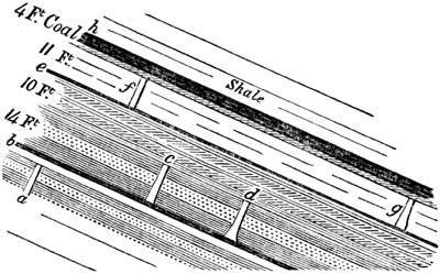
Erect fossil trees. Coal-measures, Nova Scotia.
If we now return to the tree first mentioned (fig. 373.), we find the
diameter (a b) 14 inches at the top and 16 inches at the bottom, the
length of the trunk 5 feet 8 inches. The strata in the interior consisted
of a series entirely different from those on the outside. The lowest of the
three outer beds which it traversed consisted of purplish and blue shale
(c, fig. 373.), 2 feet thick, above which was sandstone (d) 1 foot
thick, and, above this, clay (e) 2 feet 8 inches. But, in the interior,
were nine distinct layers of different composition: at the bottom, first,
shale 4 inches, then sandstone 1 foot, then shale 4 inches, then sandstone
4 inches, then shale 11 inches, then clay (f) with nodules of ironstone 2
inches, then pure clay 2 feet, then sandstone 3 inches, and, lastly, clay 4
inches. Owing to the outward slope of the face of the cliff, the section
(fig. 373.) was not exactly perpendicular to the axis of the tree; and
hence, probably, the apparent sudden termination at the base without a
stump and roots.
In this example the layers of matter in the inside of the tree are more
numerous than those without; but it is more common in the coal-measures of
all countries to find a cylinder of pure sandstone,—the cast of the
interior of a tree, intersecting a great many alternating beds of shale and
sandstone, which originally enveloped the trunk as it stood erect in the
water. Such a want of correspondence in the materials outside and inside,
is just what we might expect if we reflect on the difference of time at
which the deposition of sediment will take place in the two cases; the
imbedding of the tree having gone on for many years before its decay had
made much progress.
The high tides of the Bay of Fundy, rising more than 60 feet, are so
destructive as to undermine and sweep away continually the whole face of
the cliffs, and thus a new crop of erect trees is brought into view every
three or four years. They are known to extend over a space between two and
three miles from north to south, and more than twice that distance from
east to west, being seen in the banks of streams intersecting the
coal-field.
[p.324]In Cape Breton, Mr. Richard Brown has observed in the Sydney
coal-field a total thickness of coal-measures, without including the
underlying millstone grit, of 1843 feet, dipping at an angle of 8°. He has
published minute details of the whole series, showing at how many different
levels erect trees occur, consisting of Sigillaria, Lepidodendron,
Calamite, and other genera. In one place eight erect trunks, with roots
and rootlets attached to them, were seen at the same level, within a
horizontal space 80 feet in length. Beds of coal of various thickness are
interstratified. Some of the associated strata are ripple-marked, with
impressions of rain-drops. Taking into account forty-one clays filled with
roots of Stigmaria in their natural position, and eighteen layers of
upright trees at other levels, there is, on the whole, clear evidence of at
least fifty-nine fossil forests, ranged one above the other, in this
coal-field, in the above-mentioned thickness of strata.[324-A]
The fossil shells in Cape Breton and in the Nova Scotia section (fig.
372.), consisting of Cypris, Unio (?), Modiola, Microconchus
carbonarius (see fig. 375.), and Spirorbis, seem to indicate brackish
water; but we ought never to be surprised if, in pursuing the same stratum,
we come to a fresh or purely marine deposit; for this will depend upon our
taking a direction higher up or lower down the ancient river or delta
deposit. When the Purbeck beds of the Wealden were described in Chap.
XVIII., I endeavoured to explain the intimate connection of strata formed
at a river's mouth, or in the tranquil lagoons of the delta, or in the sea,
after a slight submergence of the land, with its dirt-beds.
In the English coal-fields the same association of fresh, or rather
brackish water with marine strata, in close connection with beds of coal of
terrestrial origin, has been frequently recognized. Thus, for example, a
deposit near Shrewsbury, probably formed in brackish water, has been
described by Sir R. Murchison as the youngest member of the carboniferous
series of that district, at the point where the coal-measures are in
contact with the Permian or "Lower New Red." It consists of shales and
sandstones about 150 feet thick, with coal and traces of plants; including
a bed of limestone, varying from 2 to 9 feet in thickness, which is
cellular, and resembles some lacustrine limestones of France and Germany.
It has been traced for 30 miles in a straight line, and can be recognized
at still more distant points. The characteristic fossils are a small
bivalve, having the form of a Cyclas, a small Cypris (fig. 376.), and
the microscopic shell of an annelid of an extinct genus called
Microconchus (fig. 375.), allied to Serpula or Spirorbis.
In the lower coal-measures of Coalbrook Dale, the strata, according to Mr.
Prestwich, often change completely within very short distances, beds of
sandstone passing horizontally into clay, and clay into sandstone. The
coal-seams often wedge out or disappear; and sections, at places nearly
contiguous, present marked lithological distinctions. In this single field,
in which the strata are from 700 to 800 feet [p.325]thick, between forty
and fifty species of terrestrial plants have been discovered, besides
several fishes and trilobites of forms distinct from those occurring in the
Silurian strata. Also upwards of forty species of mollusca, among which are
two or three referred to the freshwater genus Unio, and others of marine
forms, such as Nautilus, Orthoceras, Spirifer, and Productus. Mr.
Prestwich suggests that the intermixture of beds containing freshwater
shells with others full of marine remains, and the alternation of coarse
sandstone and conglomerate with beds of fine clay or shale containing the
remains of plants, may be explained by supposing the deposit of Coalbrook
Dale to have originated in a bay of the sea or estuary into which flowed a
considerable river subject to occasional freshes.[325-A]
Freshwater Fossils—Coal.

Fig. 375.
- a. Microconchus carbonarius.
- b. var. of same; nat. size, and magnified.
Fig. 376. Cypris inflata, natural size, and magnified. Murchison.[325-B]
In the Edinburgh coal-field, at Burdiehouse, fossil fishes, mollusca, and
cypris, very similar to those in Shropshire and Staffordshire, have been
found by Dr. Hibbert.[325-C] In the coal-field also of Yorkshire there are
freshwater strata, some of which contain shells referred to the genus
Unio; but in the midst of the series there is one thin but very widely
spread stratum, abounding in fishes and marine shells, such as Ammonites
Listeri (fig. 377.), Orthoceras, and Avicula papyracea, Goldf. (fig.
378.)[325-D]
Fig. 377.

Ammonites Listeri, Sow.
Fig. 378.
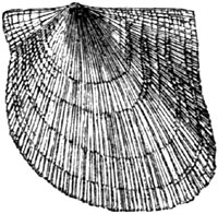
Avicula papyracea, Goldf. (Pecten papyraceus, Sow.)
No similarly intercalated layer of marine shells has been noticed in the
neighbouring coal-field of Newcastle, where, as in South [p.326]Wales
and Somersetshire, the marine deposits are entirely below those containing
terrestrial and freshwater remains.[326-A]
Clay-iron-stone.—Bands and nodules of clay-iron-stone are common in
coal-measures, and are formed, says Sir H. De la Beche, of carbonate of
iron, mingled mechanically with earthy matter, like that constituting the
shales. Mr. Hunt, of the Museum of Practical Geology, instituted a series
of experiments to illustrate the production of this substance, and found
that decomposing vegetable matter, such as would be distributed through all
coal strata, prevented the farther oxidation of the proto-salts of iron,
and converted the peroxide into protoxide by taking a portion of its oxygen
to form carbonic acid. Such carbonic acid, meeting with the protoxide of
iron in solution, would unite with it and form a carbonate of iron; and
this mingling with fine mud, when the excess of carbonic acid was removed,
might form beds or nodules of argillaceous iron-stone.[326-B]
CHAPTER XXV.
CARBONIFEROUS GROUP—continued.
Coal-fields of the United States — Section of the country between the
Atlantic and Mississippi — Position of land in the carboniferous period
eastward of the Alleghanies — Mechanically formed rocks thinning out
westward, and limestones thickening — Uniting of many coal-seams into
one thick one — Horizontal coal at Brownsville, Pennsylvania — Vast
extent and continuity of single seams of coal — Ancient river-channel
in Forest of Dean coal-field — Absence of earthy matter in
coal — Climate of carboniferous period — Insects in
coal — Rarity of air-breathing animals — Great number of fossil
fish — First discovery of the skeletons of fossil
reptiles — Footprints of reptilians — Mountain limestone — Its
corals and marine shells.
It was stated in the last chapter that a great uniformity prevails in the
fossil plants of the coal-measures of Europe and North America; and I may
add that four-fifths of those collected in Nova Scotia have been identified
with European species. Hence the former existence at the remote period
under consideration (the carboniferous) of a continent or chain of islands
where the Atlantic now rolls its waves seems a fair inference. Nor are
there wanting other and independent proofs of such an ancient land situated
to the eastward of the present Atlantic coast of North America; for the
geologist deduces the same conclusion from the mineral composition of the
carboniferous and some older groups of rocks as they are developed on the
eastern flanks of the Alleghanies, contrasted with their character in the
low country to the westward of those mountains.
The annexed diagram (fig. 379.) will assist the reader in understanding
[p.328]the phenomena now alluded to, although I must guard him against
supposing that it is a true section. A great number of details have of
necessity been omitted, and the scale of heights and horizontal distances
are unavoidably falsified.
Fig. 379.
Diagram explanatory of the geological structure of
a part of the United States between the Atlantic and the Mississippi.
Length from E. to W. 850 miles.

- A B. Atlantic plain.
- B C. Atlantic slope.
- C D. Alleghanies or Appalachian chain.
- D E. Appalachian coal-field west of the mountains.
- E F. Dome-shaped outcrop of strata on the Ohio, older than the coal.
- F G. Illinois coal-field.
- h. Falls and rapids of the rivers at the junction of the hypogene
and newer formations.
- i, k, l, m. Parallel folds of Appalachians becoming successively more
open, and flatter in going from E. to W.
References to the different Formations.
- 1. Miocene tertiary.
- 2. Eocene tertiary.
- 3. Cretaceous strata.
- 4. Red sandstone with ornithichnites (new red or trias?) usually much
invaded by trap.
- 5. Coal-measures (bituminous coal).
- 5' Anthracitic coal-measures.
- 5'' Carboniferous limestone of the Illinois coal-field, wanting
in the Appalachian.
- 6. Old red or Devonian, Olive slate, &c.
- 7. Primary fossiliferous or Silurian strata.
- 8. Hypogene strata, or gneiss, mica schist, &c., with granite veins.
Note. The dotted lines at i and k express portions of rock removed
by denudation, the amount of which may be estimated by supposing similar
lines prolonged from other points where different strata end abruptly
at the surface.
N.B. The lower section at ** joins on to the upper one at *.
Starting from the shores of the Atlantic, on the eastern side of the
Continent, we first come to a low region (A B), which was called the
alluvial plain by the first geographers. It is occupied by tertiary and
cretaceous strata, before described (pp. 171. 206. and 224.), which are
nearly horizontal. The next belt, from B to C, consists of granitic rocks
(hypogene), chiefly gneiss and mica-schist, covered occasionally with
unconformable red sandstone, No. 4. (New Red or Trias?), remarkable for its
ornithichnites (see p. 327.). Sometimes, also, this sandstone rests on the
edges of the disturbed paleozoic rocks (as seen in the section). The region
(B C), sometimes called the "Atlantic Slope," corresponds nearly in average
width with the low and flat plain (A, B), and is characterized by hills of
moderate height, contrasting strongly, in their rounded shape and altitude,
with the long, steep, and lofty parallel ridges of the Alleghany mountains.
The outcrop of the strata in these ridges, like the two belts of hypogene
and newer rocks (A B, and B C), above alluded to, when laid down on a
geological map, exhibit long stripes of different colours, running in a
N.E. and S.W. direction, in the same way as the lias, chalk, and other
secondary formations in the middle and eastern half of England.
The narrow and parallel zones of the Appalachians here mentioned, consist
of strata, folded into a succession of convex and concave flexures,
subsequently laid open by denudation. The component rocks are of great
thickness, all referable to the Silurian, Devonian, and Carboniferous
formations. There is no principal or central axis, as in the Pyrenees and
many other chains—no nucleus to which all the minor ridges conform; but
the chain consists of many nearly equal and parallel foldings, having what
is termed an anticlinal and synclinal arrangement (see above, p. 48.). This
system of hills extends, geologically considered, from Vermont to Alabama,
being more than 1000 miles long, from 50 to 150 miles broad, and varying in
height from 2000 to 6000 feet. Sometimes the whole assemblage of ridges
runs perfectly straight for a distance of more than 50 miles, after which
all of them wheel round together, and take a new direction, at an angle of
20 or 30 degrees to the first.
We are indebted to the state surveyors of Virginia and Pennsylvania, Prof.
W. B. Rogers and his brother Prof. H. D. Rogers, for the important
discovery of a clue to the general law of structure prevailing throughout
this range of mountains, which, however simple it may appear when once made
out and clearly explained, might long have been overlooked; amidst so great
a mass of complicated details. It appears that the bending and fracture of
the beds is greatest on the south-eastern or Atlantic side of the chain,
and the strata become less and less disturbed as we go westward, until at
length they regain their original or horizontal position. By reference to
the section (fig. 379.), it will be seen that on the eastern side, or in
the ridges [p.329]and troughs nearest the Atlantic, south-eastern dips
predominate, in consequence of the beds having been folded back upon
themselves, as in i, those on the north-western side of each arch having
been inverted. The next set of arches (such as k) are more open, each
having its western side steepest; the next (l) opens out still more
widely, the next (m) still more, and this continues until we arrive at
the low and level part of the Appalachian coal-field (D E).
In nature or in a true section, the number of bendings or parallel folds is
so much greater that they could not be expressed in a diagram without
confusion. It is also clear that large quantities of rock have been removed
by aqueous action or denudation, as will appear if we attempt to complete
all the curves in the manner indicated by the dotted lines at i and k.
The movements which imparted so uniform an order of arrangement to this
vast system of rocks must have been, if not contemporaneous, at least parts
of one and the same series, depending on some common cause. Their
geological date is well defined, at least within certain limits, for they
must have taken place after the deposition of the carboniferous strata (No.
5.), and before the formation of the red sandstone (No. 4.). The greatest
disturbing and denuding forces have evidently been exerted on the
south-eastern side of the chain; and it is here that igneous or plutonic
rocks are observed to have invaded the strata, forming dykes, some of which
run for miles in lines parallel to the main direction of the Appalachians,
or N.N.E. and S.S.W.
The thickness of the carboniferous rocks in the region C is very great, and
diminishes rapidly as we proceed to the westward. The surveys of
Pennsylvania and Virginia show that the south-east was the quarter whence
the coarser materials of these strata were derived, so that the ancient
land lay in that direction. The conglomerate which forms the general base
of the coal-measures is 1500 feet thick in the Sharp Mountain, where I saw
it (at C) near Pottsville; whereas it has only a thickness of 500 feet,
about thirty miles to the north-west, and dwindles gradually away when
followed still farther in the same direction, till its thickness is reduced
to 30 feet.[329-A] The limestones, on the other hand, of the coal-measures,
augment as we trace them westward. Similar observations have been made in
regard to the Silurian and Devonian formations in New York; the sandstones
and all the mechanically-formed rocks thinning out as they go westward, and
the limestones thickening, as it were, at their expense. It is, therefore,
clear that the ancient land was to the east, where the Atlantic now is; the
deep sea, with its banks of coral and shells to the west, or where the
hydrographical basin of the Mississippi is now situated.
In that region, near Pottsville, where the thickness of the coal-measures
is greatest, there are thirteen seams of anthracitic coal, several of them
more than 2 yards thick. Some of the lowest of these alternate with beds of
white grit and conglomerate of coarser grain [p.330]than I ever saw
elsewhere, associated with pure coal. The pebbles of quartz are often of
the size of a hen's egg. On following these pudding-stones and grits for
several miles from Pottsville, by Tamaqua, to the Lehigh Summit Mine, in
company with Mr. H. D. Rogers, in 1841, he pointed out to me that the
coarse-grained strata and their accompanying shales gradually thin out,
until seven seams of coal, at first widely separated, are brought nearer
and nearer together, until they successively unite; so that at last they
form one mass, between 40 and 50 feet thick. I saw this enormous bed of
anthracitic coal quarried in the open air at Mauch Chunk (or the Bear
Mountain), the overlying sandstone, 40 feet thick, having been removed
bodily from the top of the hill, which, to use the miner's expression, had
been "scalped." The accumulation of vegetable matter now constituting this
vast bed of anthracite, may perhaps, before it was condensed by pressure
and the discharge of its hydrogen, oxygen, and other volatile ingredients,
have been between 200 and 300 feet thick. The origin of such a vast
thickness of vegetable remains, so unmixed with earthy ingredients, can, I
think, be accounted for in no other way, than by the growth, during
thousands of years, of trees and ferns, in the manner of peat,—a theory
which the presence of the Stigmaria in situ under each of the seven
layers of anthracite, fully bears out. The rival hypothesis, of the
drifting of plants into a sea or estuary, leaves the absence of sediment,
or, in this case, of sand and pebbles, wholly unexplained.
Fig. 380.

Fig. 381.

But the student will naturally ask, what can have caused so many seams of
coal, after they had been persistent for miles, to come together and blend
into one single seam, and that one equal in the aggregate to the thickness
of the several separate seams? Often had the same question been put by
English miners before a satisfactory answer was given to it by the late Mr.
Bowman. The following is his solution of the problem. Let a a', fig.
380., be a mass of vegetable matter, capable, when condensed, of forming a
3-foot seam of coal. It rests on the underclay b b', filled with roots of
trees in situ, and it supports a growing forest (C D). Suppose that part
of the same forest D E had become submerged by the ground sinking down 25
feet, so that the trees have been partly thrown down and [p.331]partly
remain erect in water, slowly decaying, their stumps and the lower parts of
their trunks being enveloped in layers of sand and mud, which are gradually
filling up the lake D F. When this lake or lagoon has at length been
entirely silted up and converted into land, say, in the course of a
century, the forest C D will extend once more continuously over the whole
area C F, as in fig. 381., and another mass of vegetable matter
(g g'), forming 3 feet more of coal, may accumulate from C to F.
We then find in the region F, two seams of coal (a' and g')
each 3 feet thick, and separated by 25 feet of sandstone and shale, with
erect trees based upon the lower coal, while, between D and C,
we find these two seams united into a 2-yard coal. It may be objected that
the uninterrupted growth of plants during the interval of a century will
have caused the vegetable matter in the region C D to be thicker
than the two distinct seams a' and g' at F; and no doubt
there would actually be a slight excess representing one generation of
trees with the remains of other plants, forming half an inch or an inch of
coal; but this would not prevent the miner from affirming that the seam a g,
throughout the area C D, was equal to the two seams a' and g'
at F.
The reader has seen, by reference to the section (fig. 379. p. 327.), that
the strata of the Appalachian coal-field assume an horizontal position west
of the mountains. In that less elevated country, the coal-measures are
intersected by three great navigable rivers, and are capable of supplying
for ages, to the inhabitants of a densely peopled region, an inexhaustible
supply of fuel. These rivers are the Monongahela, the Alleghany, and the
Ohio, all of which lay open on their banks the level seams of coal. Looking
down the first of these at Brownsville, we have a fine view of the main
seam of bituminous coal 10 feet thick, commonly called the Pittsburg seam,
breaking out in the steep cliff at the water's edge; and I made the
accompanying sketch of its appearance from the bridge over the river (see
fig. 382.). Here the coal, 10 feet thick, is covered by carbonaceous shale
(b), and this again by micaceous sandstone (c). Horizontal galleries
may be driven everywhere at very slight expense, and so worked as to drain
themselves, while the cars, laden with coal and attached to each other,
glide down on a railway, so as to deliver their burden into barges moored
to the river's bank. The same seam is seen at a distance, on the right bank
(at a), and may be followed the whole way to Pittsburg, fifty miles
distant. As it is nearly horizontal, while the river descends it crops out
at a continually increasing, but never at an inconvenient, height above the
Monongahela. Below the great bed of coal at Brownsville is a fire-clay 18
inches thick, and below this, several beds of limestone, below which again
are other coal seams. I have also shown in my sketch another layer of
workable coal (at d d), which breaks out on the slope of the hills at a
greater height. Here almost every proprietor can open a coal-pit on his own
land, and the stratification being very regular, he may calculate with
precision the depth at which coal may be won.
The Appalachian coal-field, of which these strata form a part [p.332]
(from C to E, section, fig. 379., p. 327.), is remarkable for its vast
area; for, according to Professor H. D. Rogers, it stretches continuously
from N.E. to S.W., for a distance of 720 miles, its greatest width being
about 180 miles. On a moderate estimate, its superficial area amounts to
63,000 square miles.
Fig. 382.

View of the great Coal Seam on the Monongahela at Brownsville,
Pennsylvania, U. S.
- a. Ten-foot seam of coal.
- b. Black bituminous or carbonaceous shale, 10 feet thick.
- c. Micaceous sandstone.
- d d. Upper seam of coal, 6 feet thick.
This coal formation, before its original limits were reduced by [p.333]
denudation, must have measured 900 miles in length, and in some places more
than 200 miles in breadth. By again referring to the section (fig. 379., p.
327.), it will be seen that the strata of coal are horizontal to the
westward of the mountains in the region D E, and become more and more
inclined and folded as we proceed eastward. Now it is invariably found, as
Professor H. D. Rogers has shown by chemical analysis, that the coal is
most bituminous towards its western limit, where it remains level and
unbroken, and that it becomes progressively debituminized as we travel
south-eastward towards the more bent and distorted rocks. Thus, on the
Ohio, the proportion of hydrogen, oxygen, and other volatile matters,
ranges from forty to fifty per cent. Eastward of this line, on the
Monongahela, it still approaches forty per cent., where the strata begin to
experience some gentle flexures. On entering the Alleghany Mountains, where
the distinct anticlinal axes begin to show themselves, but before the
dislocations are considerable, the volatile matter is generally in the
proportion of eighteen or twenty per cent. At length, when we arrive at
some insulated coal-fields (5', fig. 379.) associated with the boldest
flexures of the Appalachian chain, where the strata have been actually
turned over, as near Pottsville, we find the coal to contain only from six
to twelve per cent. of bitumen, thus becoming a genuine anthracite.[333-A]
It appears from the researches of Liebig and other eminent chemists, that
when wood and vegetable matter are buried in the earth, exposed to
moisture, and partially or entirely excluded from the air, they decompose
slowly and evolve carbonic acid gas, thus parting with a portion of their
original oxygen. By this means, they become gradually converted into
lignite or wood-coal, which contains a larger proportion of hydrogen than
wood does. A continuance of decomposition changes this lignite into common
or bituminous coal, chiefly by the discharge of carburetted hydrogen, or
the gas by which we illuminate our streets and houses. According to
Bischoff, the inflammable gases which are always escaping from mineral
coal, and are so often the cause of fatal accidents in mines, always
contain carbonic acid, carburetted hydrogen, nitrogen, and olefiant gas.
The disengagement of all these gradually transforms ordinary or bituminous
coal into anthracite, to which the various names of splint coal, glance
coal, culm, and many others, have been given.
We have seen that, in the Appalachian coal-field, there is an intimate
connection between the extent to which the coal has parted with its gaseous
contents, and the amount of disturbance which the strata have undergone.
The coincidence of these phenomena may be attributed partly to the greater
facility afforded for the escape of volatile matter, where the fracturing
of the rocks had produced an infinite number of cracks and crevices, and
also to the heat of the gases and water penetrating these cracks, when the
great movements took place, which have rent and folded the Appalachian
strata. It [p.334]is well known that, at the present period, thermal
waters and hot vapours burst out from the earth during earthquakes, and
these would not fail to promote the disengagement of volatile matter from
the carboniferous rocks.
Continuity of seams of coal.—As single seams of coal are continuous over
very wide areas, it has been asked, how forests could have prevailed
uninterruptedly over such wide spaces, without being oftener flooded by
turbid rivers, or, when submerged, denuded by marine currents. It appears,
from the description of the Cape Breton coal-field, by Mr. Richard Brown,
that false stratification is common in the beds of sand, and some partial
denudation of these, at least, must often have taken place during the
accumulation of the carboniferous series.
In the Forest of Dean, ancient river-channels are found, which pass through
beds of coal, and in which rounded pebbles of coal occur. They are of older
date than the overlying and undisturbed coal-measures. The late Mr. Buddle,
who described them to me, told me he had seen similar phenomena in the
Newcastle coal-field. Nevertheless, instances of these channels are much
more rare than we might have anticipated, especially when we remember how
often the roots of trees (Stigmariæ) have been torn up, and drifted in
broken fragments into the grits and sandstones. The prevalence of a
downward movement is, no doubt, the principal cause which has saved so many
extensive seams of coal from destruction by fluviatile action.
The purity of the coal, or its non-intermixture with earthy matter,
presents another theoretical difficulty to many geologists, who are
inclined to believe that the trees and smaller plants of the carboniferous
period grew in extensive swamps, rather than on land not liable to be
inundated. It appears, however, that in the alluvial plain and delta of the
Mississippi, extensive "cypress swamps," as they are called, densely
covered with various trees, occur, into which no matter held in mechanical
suspension is ever introduced during the greatest inundations, inasmuch as
they are all surrounded by a dense marginal belt of reeds, canes, and
brushwood. Through this thick barrier the river-water must pass, so that it
is invariably well filtered before it can reach the interior of the
forest-covered area, within which, vegetable matter is continually
accumulating from the decay of trees and semi-aquatic plants. In proof of
this, I may observe, that whenever any part of a swamp is dried up, during
an unusually hot season, and the wood set on fire, pits are burnt into the
ground many feet deep, or as far down as the fire can descend without
meeting with water, and it is then found that scarcely any residuum or
earthy matter is left.[334-A] At the bottom of these "cypress swamps" of
the Mississippi, a bed of clay is found, with roots of the tall cypress
(Taxodium distichum), just as the underclays of the coal are filled with
Stigmaria.
[p.335]Climate of Coal Period.—So long as the botanist taught that a
tropical climate was implied by the carboniferous flora, geologists might
well be at a loss to reconcile the preservation of so much vegetable matter
with a high temperature; for heat hastens the decomposition of fallen
leaves and trunks of trees, whether in the atmosphere or in water.[335-A]
It is well known that peat, so abundant in the bogs of high latitudes,
ceases to grow in the swamps of warmer regions. It seems, however, to have
become a more and more received opinion, that the coal-plants do not, on
the whole, indicate a climate resembling that now enjoyed in the equatorial
zone. Tree-ferns range as far south as the southern part of New Zealand,
and Araucarian pines occur in Norfolk Island. A great predominance of ferns
and lycopodiums indicates warmth, moisture, equability of temperature, and
freedom from frost, rather than intense heat; and we know too little of the
sigillariæ, calamites, asterophyllites, and other peculiar forms of the
carboniferous period, to be able to speculate with confidence on the kind
of climate they may have required.
No doubt, we are entitled to presume, from the corals and cephalopoda of
the mountain limestone, that a warm temperature characterized the northern
seas in the carboniferous era; but the absence of cold may have given rise
(as at present in the seas of the Bermudas, under the influence of the gulf
stream) to a very wide geographical range of stone-building corals and
shell-bearing cuttle-fish, without its being necessary to call in the aid
of tropical heat.[335-B]
CARBONIFEROUS REPTILES.
Where we have evidence in a single coal-field, as in that of Nova Scotia,
or South Wales, of fifty or even a hundred ancient forests buried one above
the other, with the roots of trees still in their original position, and
with some of the trunks still remaining erect, we are apt to wonder that
until the year 1844 no remains of contemporaneous air-breathing creatures,
except a few insects, had been discovered. No vertebrated animals more
highly organized than fish, no mammalia or birds, no saurians, frogs,
tortoises, or snakes, were yet known in rocks of such high antiquity. In
the coal-field of Coalbrook Dale mention had been made of two species of
beetles of the family Curculionidæ, and of a neuropterous insect
resembling the genus Corydalis, with another related to the
Phasmidæ.[335-C] In other coal-measures in Europe we find notice of a
scorpion and of a moth allied to Tinea, also of one air-breathing
crustacean, or land-crab. Yet Agassiz had already described in his great
work on fossil fishes more than one hundred and fifty species of
ichthyolites from the coal strata, ninety-four belonging to the families of
shark and ray, and fifty-eight to the class of ganoids. Some of these fish
are very remote in their organization from any [p.336]now living,
especially those of the family called Sauroid by Agassiz; as
Megalichthys, Holoptychius, and others, which are often of great size,
and all predaceous. Their osteology, says M. Agassiz, reminds us in many
respects of the skeletons of saurian reptiles, both by the close sutures of
the bones of the skull, their large conical teeth striated longitudinally
(see fig. 383.), the articulations of the spinous processes with the
vertebræ, and other characters. Yet they do not form a family intermediate
between fish and reptiles, but are true fish, though doubtless more
highly organized than any living fish.[336-A]
Fig. 383.

Holoptychius Hibberti, Ag. Fifeshire coal-field; natural size.
The annexed figure represents a large tooth of the Megalichthys, found by
Mr. Horner in the Cannel coal of Fifeshire. It probably inhabited an
estuary, like many of its contemporaries, and frequented both rivers and
the sea.
Fig. 384.
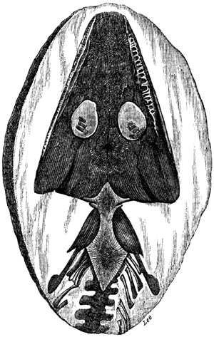
Archegosaurus minor, Goldfuss. Fossil reptile
from the coal-measures, Saarbrück.
At length, in 1844, the first skeleton of a true reptile was announced from
the coal of Münster-Appel in Rhenish Bavaria, by H. von Meyer, under the
name of Apateon pedestris, the animal being supposed to be nearly related
to the salamanders. Three years later, in 1847, Prof. von Dechen found in
the coal-field of Saarbrück, at the village of Lebach, between Strasburg
and Treves, the skeletons of no less than three distinct species of
air-breathing reptiles, which were described by the late Prof. Goldfuss
under the generic name of Archegosaurus. The ichthyolites and plants
found in the same strata, left no doubt that these remains belonged to the
true coal period. The skulls, teeth, and the greater portions of the
skeleton, nay, even a large part of the skin, of two of these reptiles have
been faithfully preserved in the centre [p.337]of spheroidal concretions
of clay-iron-stone. The largest of these lizards, Archegosaurus Decheni,
must have been 3 feet 6 inches long. The annexed drawing represents the
smallest of the three of the natural size. They were considered by Goldfuss
as saurians, but by Herman von Meyer as most nearly allied to the
Labyrinthodon, and therefore connected with the batrachians, as well as
the lizards. The remains of the extremities leave no doubt that they were
quadrupeds, "provided," says Von Meyer, "with hands and feet terminating in
distinct toes; but these limbs were weak, serving only for swimming or
creeping." The same anatomist has pointed out certain points of analogy
between their bones and those of the Proteus anguinus; and Mr. Owen has
observed to me that they make an approach to the Proteus in the shortness
of their ribs. Two of these ancient reptiles retain a large part of the
outer skin, which consisted of long, narrow, wedge-shaped, tile-like, and
horny scales, arranged in rows (see fig. 385.).
Fig. 385.

Imbricated covering of skin of Archegosaurus medius, Goldf.;
magnified.[337-A]
Cheirotherian footprints in coal measures, United States.—In 1844, the
very year when the Apateon or Salamander of the coal was first met with in
the country between the Moselle and the Rhine, Dr. King published an
account of the footprints of a large reptile discovered by him in North
America. These occur in the coal strata of Greensburg, in Westmoreland
County, Pennsylvania; and I had an opportunity of examining them in 1846. I
was at once convinced of their genuineness, and declared my conviction on
that point, on which doubts had been entertained both in Europe and the
United States. The footmarks were first observed standing out in relief
from the lower surface of slabs of sandstone, resting on thin layers of
fine unctuous clay. I brought away one of these masses, which is
represented in the accompanying drawing (fig. 386.). It displays, together
with footprints, the casts of cracks (a, a') of various sizes. The
origin of such cracks in clay, and casts of the same, has before been
explained, and referred to the drying and shrinking of mud, and the
subsequent pouring of sand into open crevices. It will be seen that some of
the cracks, as at b, c, traverse the footprints, and produce distortion
in them, as might have been expected, for the mud must have been soft when
the animal walked over it and left the impressions; whereas, when it
afterwards dried up and shrank, it would be too hard to receive such
indentations.
No less than twenty-three footsteps were observed by Dr. King in the same
quarry before it was abandoned, the greater part of them so arranged (see
fig. 387.) on the surface of one stratum as to imply that they were made
successively by the same animal. Everywhere there was a double row of
tracks, and in each row they occur in [p.338]pairs, each pair consisting
of a hind and fore foot, and each being at nearly equal distances from the
next pair. In each parallel row the toes turn the one set to the right, the
other to the left. In the European Cheirotherium, before mentioned (p.
290.), both the hind and fore feet have each five toes, and the size of the
hind foot is about five times as large as the fore foot. In the American
fossil the posterior footprint is not even twice as large as the anterior,
and the number of toes is unequal, being five in the hinder and four in the
anterior foot. In this, as in the European Cheirotherium, one toe stands
out like a thumb, and these thumb-like toes turn the one set to the right,
and the other to the left. The American Cheirotherium was evidently a
broader animal, and belonged to a distinct genus from that of the triassic
age in Europe.[338-A]
Fig. 386.

Scale one-sixth the original. Slab of sandstone from the
coal-measures of Pennsylvania, with footprints of air-breathing
reptile and casts of cracks.
We may assume that the reptile which left these prints on the [p.339]
ancient sands of the coal-measures was an air-breather, because its weight
would not have been sufficient under water to have made impressions so deep
and distinct. The same conclusion is also borne out by the casts of the
cracks above described, for they show that the clay had been exposed to the
air and sun, so as to have dried and shrunk.
Fig. 387.
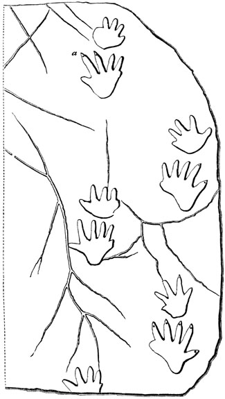
Series of reptilian footprints in the coal-strata
of Westmoreland County, Pennsylvania.
a. Mark of nail?
The geological position of the sandstone of Greensburg is perfectly clear,
being situated in the midst of the Appalachian coal-field, [p.340]having
the main bed of coal, called the Pittsburg seam, above mentioned (p. 331.),
3 yards thick, 100 feet above it, and worked in the neighbourhood, with
several other seams of coal at lower levels. The impressions of
Lepidodendron, Sigillaria, Stigmaria, and other characteristic
carboniferous plants, are found both above and below the level of the
reptilian footsteps.
Analogous footprints of a large reptile of still older date have since been
found (1849), by Mr. Isaac Lea, in the lowest beds of the coal formation at
Pottsville, near Philadelphia, so that we may now be said to have the
footmarks of two reptilians of the coal period, and the skeletons of
four.[340-A]
CARBONIFEROUS OR MOUNTAIN LIMESTONE.
We have already seen that this rock lies sometimes entirely beneath the
coal-measures, while, in other districts, it alternates with the shales and
sandstone of the coal. In both cases it is destitute of land plants, and
usually charged with corals, which are often of large size; and several
species belong to the lamelliferous class of Lamarck, which enter largely
into the structure of coral reefs now growing. There are also a great
number of Crinoidea (see fig. 388.), and a few Echinoderms, associated
with the zoophytes above mentioned. The Brachiopoda constitute a large
proportion of the Mollusca, many species being referable to two extinct
genera, Spirifer (or Spirifera) (fig. 389.), and Productus
(Leptæna) (fig. 390.).
Fig. 388.

Cyathocrinites planus, Miller. Mountain limestone.
Fig. 389.

Spirifer glaber, Sow. Mountain limestone.
Fig. 390.

Productus Martini, Sow. (P. semireticulatus,
Flem.) Mountain limestone.
Among the spiral univalve shells the extinct genus Euomphalus (see fig.
391.) is one of the commonest fossils of the Mountain limestone. In the
interior it is often divided into chambers (see fig. 391. d); the septa
or partitions not being perforated, as in foraminiferous shells, or in
those having siphuncles, like the Nautilus. The animal appears, like the
recent Bulimus decollatus, to have retreated at different periods of
[p.341]its growth, from the internal cavity previously formed, and to
have closed all communication with it by a septum. The number of chambers
is irregular, and they are generally wanting in the innermost whorl.
Fig. 391.

Euomphalus pentagulatus, Min. Con. Mountain
limestone.
a. Upper side; b. lower, or umbilical side; c. view showing mouth
which is less pentagonal in older individuals; d. view of polished
section, showing internal chambers.
Fig. 392.

Portion of Orthoceras laterale, Phillips.
Mountain limestone.
There are also many univalve and bivalve shells of existing genera in the
Mountain limestone, such as Turritella, Buccinum, Patella,
Isocardia, Nucula, and Pecten.[341-A] But the Cephalopoda depart,
in general, more widely from living forms, some being generically distinct
from all those found in strata newer than the coal. In this number may be
mentioned Orthoceras, a siphuncled and chambered shell, like a Nautilus
uncoiled and straightened. Some species of this genus are several feet long
(fig. 392.). The Goniatite is another genus, nearly allied to the
Ammonite, from which it differs in having the lobes of the septa free
from lateral denticulations, or crenatures; so that the outline of these is
continuous and uninterrupted (see a, fig. 393.). Their siphon is small,
and in the form of the striæ of growth they resemble Nautili. Another
extinct generic form of [p.342]Cephalopod, abounding in the Mountain
limestone, and not found in strata of later date, is the Bellerophon
(fig. 394.), of which the shell, like the living Argonaut, was without
chambers.
Fig. 393.
Goniatites evolutus, Phillips.[342-A] Mountain
limestone.
Fig. 394.

Bellerophon costatus, Sow.[342-B] Mountain
limestone.
CHAPTER XXVI.
OLD RED SANDSTONE, OR DEVONIAN GROUP.
Old Red Sandstone of Scotland, and borders of Wales — Fossils usually
rare — "Old Red" in Forfarshire — Ichthyolites of
Caithness — Distinct lithological type of Old Red in Devon and
Cornwall — Term "Devonian" — Organic remains of intermediate
character between those of the Carboniferous and Silurian
systems — Corals and shells — Devonian strata of Westphalia, the
Eifel, Russia, and the United States — Coral reef at Falls of the
Ohio — Devonian flora.
It was stated in Chap. XXII. that the Carboniferous formation is surmounted
by one called the "New Red," and underlaid by another called the "Old Red
Sandstone."[342-C] The British strata of the last mentioned series were
first recognized in Herefordshire and Scotland as of great thickness, and
immediately subjacent to the coal; but they were in general so barren of
organic remains, that it was difficult to find paleontological characters
of sufficient importance to distinguish them as an independent group. In
Scotland, and on the borders of Wales, the "Old Red" consists chiefly of
red sandstone, conglomerate, and shale, with few fossils; but limestones of
the same age, peculiarly rich in organic remains, were at length found in
Devonshire.
I shall first advert to the characters of the group as developed in
Herefordshire, Worcestershire, Shropshire, and South Wales. Its thickness
has been estimated at 8000 feet, and it has been subdivided into—
1st. A quartzose conglomerate passing downwards into chocolate-red and
green sandstone and marl.
2d. Cornstone and marl—red and green argillaceous spotted marls, with
irregular courses of impure concretionary limestone, provincially called
Cornstone.
[p.343]Here, as usual, fossils are extremely rare in the clays and
sandstones in which the red oxide of iron prevails; but remains of fishes
of the genera Cephalaspis and Onchus have been discovered in the
Cornstone.
The whole of the northern part of Scotland, from Cape Wrath to the southern
flank of the Grampians, has been well described by Mr. Miller as consisting
of a nucleus of granite, gneiss, and other hypogene rocks, which seem as if
set in a sandstone frame.[343-A] The beds of the Old Red Sandstone
constituting this frame, may once perhaps have extended continuously over
the entire Grampians before the upheaval of that mountain range; for one
band of the sandstone follows the course of the Moray Frith far into the
interior of the great Caledonian valley; and detached hills and island-like
patches occur in several parts of the interior, capping some of the higher
summits in Sutherlandshire, and appearing in Morayshire like oases among
the granite rocks of Strathspey. On the western coast of Ross-shire, the
Old Red forms those three immense insulated hills before described (p.
67.), where beds of horizontal sandstone, 3000 feet high, rest
unconformably on a base of gneiss, attesting the vast denudation which has
taken place.
But in order to observe the uppermost part of the Old Red, we must travel
south of the Grampians, and examine its junction with the bottom of the
Carboniferous series in Fifeshire. This upper member may be seen in Dura
Den, south of Cupar, to consist of a belt of yellow sandstone, in which Dr.
Fleming first discovered scales of Holoptychius, and in which species of
fish of the genera Pterichthys, Pamphractus, and others, have been met
with. (For genus Pterichthys, see fig. 400. p. 345.)
The beds next below the yellow sandstone are well seen in the large zone of
Old Red which skirts the southern flank of the Grampians from Stonehaven to
the Frith of Clyde. It there forms, together with trap, the Sidlaw Hills
and the strata of the valley of Strathmore. A section of this region has
been already given (p. 48.), extending from the foot of the Grampians in
Forfarshire to the sea at Arbroath, a distance of about 20 miles, where the
entire series of strata is several thousand feet thick, and may be divided
into three principal masses: 1st, and uppermost, red and mottled marls,
cornstone, and sandstone (Nos. 1. and 2. of the section); 2d, Conglomerate,
often of vast thickness (No. 3. ibid.); 3d, Roofing and paving stone,
highly micaceous, and containing a slight admixture of carbonate of lime
(No. 4. ibid.). In the first of these divisions, which may be considered as
succeeding the yellow sandstone of Fifeshire before mentioned, a gigantic
species of fish of the genus Holoptychius has been found at Clashbinnie
near Perth. Some scales (see fig. 395.) have been seen which measured 3
inches in length by 21/2 in breadth.
At the top of the next division, or immediately under the conglomerate
[p.344](No. 3. p. 48.), there have been found in Forfarshire some
remarkable crustaceans, with several fish of the genus named by Agassiz
Cephalaspis, or "buckler-headed," from the extraordinary shield which
covers the head (see fig. 396.), and which has often been mistaken for that
of a trilobite, of the division Asaphus.
Fig. 395.

Scale of Holoptychius nobilissimus, Agas. Clashbinnie. Nat. size.
Species of the same genus are considered in England as characteristic of
the second or Cornstone division (p. 343.).
Fig. 396.

Cephalaspis Lyellii, Agass. Length 63/4 inches.
From a specimen in my collection found at Glammiss, in Forfarshire. See
other figures, Agassiz, vol. ii. tab. 1. a. and 1. b.
- a. One of the peculiar scales with which the head is covered when perfect. These
scales are generally removed, as in the specimen above figured.
- b, c. Scales from different parts of the body and tail.
Fig. 397.

Eggs of gasteropodous mollusk? Lower beds of Old
Red, Ley's Mill, Forfarshire.
Fig. 398.

Fucoids and eggs of gasteropodous mollusk? Lower Old Red, Fife.
In the same grey paving-stones and coarse roofing-slates, in which the
Cephalaspis occurs, in Forfarshire and Kincardineshire, the remains of
marine plants or fucoids abound. They are frequently accompanied by groups
of hexagonal, or nearly hexagonal markings, which consist of small
flattened carbonaceous bodies, placed in a slight depression of the
sandstone or shale. (See figs. 397 and 398.) They much resemble in form the
spawn of the recent Natica (see [p.345]fig. 399.), in which the eggs are
arranged in a thin layer of sand, and seem to have acquired a polygonal
form by pressing against each other. The substance of the egg, if
fossilized, might give rise to small pellicles of carbonaceous matter.
Fig. 399.

Fragment of spawn of British species of Natica.
These fossils I have met with, both to the north of Strathmore, in the
vertical shale beneath the conglomerate, and in the same beds in the Sidlaw
hills, at all the points where fig. 4. is introduced in the section, p. 48.
Fig. 400.
Pterichthys, Agassiz; upper side, showing mouth;
as restored by H. Miller.[345-A]
Beds of red shale and red sandstone, sometimes associated with
pudding-stone (older than No. 3., fig. 62. p. 48.), and destitute of
organic remains, separate, in the region of Strathmore, the above-described
fossiliferous strata from the older crystalline rocks of the Grampians.
But, in the north of Scotland, we find, at the base of the Old Red, other
grey slaty sandstones, in the counties of Banff, Nairn, Moray, Cromarty,
Caithness, and in Orkney, rich in ichthyolites of peculiar forms, belonging
to the genera Pterichthys (fig. 400.), Coccosteus, Diplopterus,
Dipterus, Cheiracanthus, and others of Agassiz.
Five species of Pterichthys have been found in this lowest division of
the Old Red. The wing-like appendages, whence the genus is named, were
first supposed by Mr. Miller to be paddles, like those of the turtle; but
Agassiz regards them as weapons of defence, like the occipital spines of
the River Bull-head (Cottus gobio, Linn.); and considers the tail to have
been the only organ of motion. The genera Dipterus and Diplopterus are
so named, because their two dorsal fins are so placed as to front the anal
and ventral fins, so as to appear like two pairs of wings. They have bony
enamelled scales.
South Devon and Cornwall.—A great step was made in the classification of
the slaty and calciferous strata of South Devon and Cornwall in 1837, when
a large portion of the beds, previously referred to the "transition" or
most ancient fossiliferous series, were found to belong in reality to the
period of the Old Red Sandstone. For this reform we are indebted to the
labours of Professor Sedgwick and Sir R. Murchison, assisted by a
suggestion of Mr. Lonsdale, who, in 1837, after examining the South
Devonshire fossils, perceived that some of them agreed with those of the
Carboniferous group, others with those of the Silurian, while many could
not be assigned to either [p.346]system, the whole taken together
exhibiting a peculiar and intermediate character. But these paleontological
observations alone would not have enabled us to assign, with accuracy, the
true place in the geological series of these slate-rocks and limestones of
South Devon, had not Messrs. Sedgwick and Murchison, in 1836 and 1837,
discovered that the culmiferous or anthracitic shales of North Devon
belonged to the Coal, and not, as preceding observers had imagined, to the
transition period.
As the strata of South Devon here alluded to are far richer in organic
remains than the red sandstones of contemporaneous date in Herefordshire
and Scotland, the new name of the "Devonian system" was proposed as a
substitute for that of Old Red Sandstone.
The rocks of this group in South Devon consist, in great part, of green
chloritic slates, alternating with hard quartzose slates and sandstones.
Here and there calcareous slates are interstratified with blue crystalline
limestone, and in some divisions conglomerates, passing into red sandstone.
The link supplied by the whole assemblage of imbedded fossils, connecting
as it does the paleontology of the Silurian and Carboniferous groups, is
one of the highest interest, and equally striking, whether we regard the
genera of corals or of shells. The species are almost all distinct.
Among the more abundant corals, we find the genera Favosites and
Cyathophyllum, common on the one hand to the Mountain limestone, and on
the other to the Silurian system. Some few even of the species are common
to the Devonian and Silurian groups, as, for example, Favosites
polymorpha (fig. 401.), very abundant in South Devon.
Fig. 401.
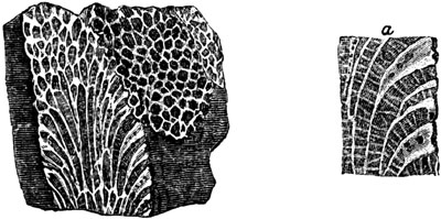
Favosites polymorpha, Goldf., S. Devon. From a
polished specimen.
a. portion of the same, magnified to show the pores.
The Cyathophyllum cæspitosum (fig. 402.) and Porites pyriformis (fig.
424. p. 356.) are more peculiarly characteristic of the Devonian rocks.
In regard to the shells, all the brachiopodous genera, such as
Terebratula, Orthis, Spirifer, Atrypa, and Productus, which are
found in the Mountain limestone, occur, together with those of the Silurian
system, except the Pentamerus. Some forms, however, seem exclusively
Devonian, as for example, Calceola sandalina (fig. 403.) and [p.347]
Strygocephalus Burtini (fig. 404.), which have been met with both in the
Eifel, in Germany, and in Devonshire, in the very lowest Devonian beds.
Fig. 402.

- a. Cyathophyllum cæspitosum, Goldf., Plymouth.
- b. a terminal star.
- c. vertical section exhibiting transverse plates, and part
of another branch.
Among the peculiar lamellibranchiate bivalves, also common to Devonshire
and the Eifel, we find Megalodon cucullatus (fig. 405.). Several spiral
univalves are abundant, among which are many species of Pleurotomaria and
Euomphalus. Among the Cephalopoda we find Bellerophon and Orthoceras,
as in the Silurian and Carboniferous groups, and Goniatite and
Cyrtoceras, as in the Carboniferous. In some of the upper Devonian beds,
a shell, resembling a flattened Goniatite, occurs, called Clymenia, by
Munster (Endosiphonites, Ansted.[347-A]).
Fig. 403.
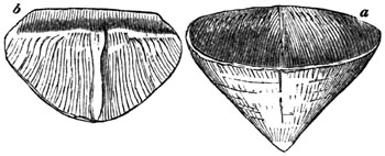
Calceola sandalina, Lam. Eifel;
also South Devon.
- a. both valves united.
- b. inner side of opercular valve.
Fig. 404.

Strygocephalus Burtini. (Terebratula porrecta,
Sow.) Eifel; also South Devon.
- a. valves united.
- b. side view of same.
- c. interior of larger valve, showing thick partition, and thinner
one continued from it.
Fig. 405.

Megalodon cucullatus, Sow. Eifel;
also Bradley, S. Devon.
- a. the valves united.
- b. interior of valve, showing the large cardinal tooth.
[p.348]
Fig. 406.
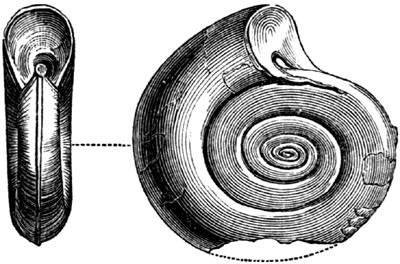
Clymenia linearis, Munster.
(Endosiphonites carinatus, Ansted.) Cornwall.
A peculiar species of trilobite, called Brontes flabellifer (fig. 407.),
is found in the Devonian strata of the Eifel and in South Devon. It should
be observed, however, that the head in the specimen here figured by
Goldfuss, the most perfect which could be obtained, is incomplete, and a
restoration has been attempted by Mr. Salter in fig. 408., from data
supplied by other species of the same genus occurring in older rocks.
Fig. 407.

Brontes flabellifer, Goldf. Eifel; also S. Devon.
Fig. 408.
Restored outline of head of Brontes flabellifer.
For determining the true equivalents of the Devonian group in the Rhenish
provinces and adjacent parts of Germany, we are indebted to the labours of
Messrs. Sedgwick and Murchison, in 1839, from which it appears that rocks
of that age emerge from beneath the coal-field of Westphalia, and are also
found in troughs among the Silurian rocks in Nassau. Many of the
limestones, particularly those on the river Lahn, are identical, both in
structure and in coralline remains, with the beautiful marbles of
Babbacombe, Torquay, and Plymouth.
The limestones of the Eifel, long ago celebrated for their fossils, and
which lie in a basin supported by Silurian rocks, are found to be referable
to the lower part of the Devonian system.
In Russia, also, Messrs. Murchison and De Verneuil have shown (1840) that
the "Old Red" group occupies a wide area south from St. Petersburg. It was
formerly supposed to be the New Red Sandstone, on account of its saliferous
and gypseous beds; but it is [p.349]now proved to be the Old Red by
containing ichthyolites of genera which characterize this group in the
British Isles, as, for example, Holoptychius, Coccosteus,
Diplopterus, &c.[349-A], associated with mollusca found in the Devonian
of Western Europe. Among the fish are also many species of sharks of the
Cestraciont division, a fact worthy of notice, because the squaloid fishes
of the present day offer the highest organization of the brain and of the
generative organs, and make, in these respects, the nearest approach to the
higher vertebrate classes.
Devonian Strata in the United States.
The position of this formation between the carboniferous rocks of
Pennsylvania and Ohio, is pointed out in the section, fig. 379. p. 327.,
and it is a remark of M. de Verneuil that in no European country is there
so complete and uninterrupted a development of the Devonian system as in
North America. At the falls of the Ohio, at Louisville, in Kentucky, there
is a grand display of one of the limestones of this period, resembling a
modern coral reef. A wide extent of surface is exposed in a series of
horizontal ledges, at all seasons, when the water is not high; and the
softer parts of the stone having decomposed and wasted away, the harder
calcareous corals stand out in relief, and many of them send out branches
from their erect stems precisely as if they were living. Among other
species I observed large masses, not less than 5 feet in diameter, of
Favosites gothlandica, with its beautiful honeycomb structure well
displayed, and, by the side of it, the Favistella, combining a similar
honeycombed form with the star of the Astrea. There was also the
cup-shaped Cyathophyllum, and the delicate network of the Fenestella,
and that elegant and well-known European species of fossil, called "the
chain coral," Catenipora escharoides, with a profusion of others (see
fig. 423. p. 355.). These coralline forms were mingled with the joints,
stems, and occasionally the heads, of lily encrinites. Although hundreds of
fine specimens have been detached from these rocks, to enrich the museums
of Europe and America, another crop is constantly working its way out,
under the action of the stream, and of the sun and rain, in the warm season
when the channel is laid dry. The waters of the Ohio, when I visited the
spot in April, 1846, were more than 40 feet below their highest level, and
20 feet above their lowest, so that large spaces of bare rock were exposed
to view.[349-B]
Devonian Flora.
With the exception of the fucoids above mentioned (p. 344.), but little is
known with certainty of the plants of the Devonian group. Those found in
the department of La Sarthe in France, and in various parts of Brittany,
formerly referred to the Devonian era, have been [p.350]shown (in 1850),
by M. de Verneuil, to belong to the carboniferous series. The same may be
said of the species of Lepidodendron, Knorria, Calamite, Sagenaria,
and other genera recently figured (1850), by Mr. F. A. Römer, from the
formation called "Greywacké à Posodonomyes" in the Hartz.[350-A] They are
accompanied by Goniatites reticulatus Phillips, G. intercostatus Phil.,
and other mountain limestone species, and had been previously assigned to
the oldest part of the carboniferous series by Messrs. Murchison and
Sedgwick.
If hereafter we should become well acquainted with the land plants of the
Devonian era, we may confidently expect that nearly all of them will agree
generically with those of the carboniferous period, but the species will be
as different as are the Devonian vertebrate and invertebrate animals from
the fossil species of the Coal.
CHAPTER XXVII.
SILURIAN GROUP.
Silurian strata formerly called transition — Term
grauwacké — Subdivisions of Upper and Lower Silurian — Ludlow
formation and fossils — Wenlock formation, corals and
shells — Caradoc and Llandeilo beds — Graptolites —
Lingula — Trilobites — Cystideæ — Vast
thickness of Silurian strata in North Wales — Unconformability of
Caradoc sandstone — Silurian strata of the United States — Amount
of specific agreement of fossils with those of Europe — Great number of
brachiopods — Deep-sea origin of Silurian strata — Absence of
fluviatile formations — Mineral character of the most ancient
fossiliferous rocks.
We come next in the descending order to the most ancient of the primary
fossiliferous rocks, that series which comprises the greater part of the
strata formerly called "transition" by Werner, for reasons explained in
Chap. VIII., pp. 91 and 92. Geologists have also applied to these older
strata the general name of "grauwacké," by which the German miners
designate a particular variety of sandstone, usually an aggregate of small
fragments of quartz, flinty slate (or Lydian stone), and clay-slate
cemented together by argillaceous matter. Far too much importance has been
attached to this kind of rock, as if it belonged to a certain epoch in the
earth's history, whereas a similar sandstone or grit is found sometimes in
the Old Red, and in the Millstone Grit of the Coal, and sometimes in
certain Cretaceous and even Eocene formations in the Alps.
The name of Silurian was first proposed by Sir Roderick Murchison, for a
series of fossiliferous strata lying below the Old Red Sandstone, and
occupying that part of Wales and some contiguous counties of England, which
once constituted the kingdom of the Silures, a tribe of ancient Britons.
The strata have been divided [p.351]into Upper and Lower Silurian, and
these again in the region alluded to admit of several well-marked
subdivisions, all of them explained in the following table.
| UPPER SILURIAN ROCKS. |
| |
Prevailing Lithological characters. |
|
Thickness in Feet. |
|
Organic Remains. |
| |
1. Ludlow
formation |
|
|
|
Tilestones. |
|
|
|
Finely laminated reddish and green sandstones and shales. |
|
|
|
800? |
|
|
|
Marine mollusca of almost every order, the Brachiopoda most
abundant. Serpula, Corals, Sauroid fish, Fuci. |
| |
|
|
|
|
| Upper Ludlow. |
|
Micaceous grey sandstone. |
|
2000 |
| |
|
|
|
|
| Aymestry limestone. |
|
Argillaceous limestone. |
| |
|
|
|
|
| Lower Ludlow. |
|
Shale, with concretions of limestone. |
| |
| 2. Wenlock formation. |
|
|
|
Wenlock limestone. |
|
|
|
Concretionary limestone. |
|
|
|
1800 |
|
|
|
Marine mollusca of various orders as before, Crustaceans
of the Trilobite family.
Oldest bones of fish yet known. |
| |
|
|
| Wenlock shale. |
|
Argillaceous shale. |
| LOWER SILURIAN ROCKS. |
| 3. Caradoc formation. |
|
|
|
Caradoc sandstones. |
|
|
|
Flags of shelly limestone and sandstone, thick bedded white freestone. |
|
|
|
2500 |
|
|
|
Crinoidea, Corals, Mollusca, chiefly Brachiopoda, Trilobites. |
| |
|
|
|
|
|
|
|
4. Llandeilo
formation. |
|
Llandeilo flags. |
|
|
|
Dark coloured calcareous flags. |
|
1200 |
|
Mollusca, Trilobites. |
UPPER SILURIAN ROCKS.
Ludlow formation.—This member of the Upper Silurian group, as will be
seen by the above table, is of great thickness, and subdivided into four
parts,—the Tilestone, the Upper and Lower Ludlow, and the intervening
Aymestry limestone. Each of these may be distinguished near the town of
Ludlow, and at other places in Shropshire and Herefordshire, by peculiar
organic remains.
1. Tilestones.—This uppermost division was originally classed by Sir R.
Murchison with the Old Red Sandstone, because they decompose into a red
soil throughout the Silurian region. At the same time he regarded the
tilestones as a transition group forming a passage from Silurian to Old
Red. It is now ascertained that the fossils agree in great part
specifically, and in general character entirely, with those of the
succeeding formation.
2. Upper Ludlow.—The next division, called the Upper Ludlow, consists of
grey calcareous sandstone, decomposing into soft mud, and contains, among
other shells, the Lingula cornea, which is common to it and the lowest,
or tilestone beds of the Old Red. But [p.352]the Orthis orbicularis is
peculiar to the Upper Ludlow, and very common; and the lowest or mudstone
beds, are loaded for a thickness of 30 feet with Terebratula navicula
(fig. 410.), in vast numbers. Among the cephalopodous mollusca occur the
genera Bellerophon and Orthoceras, and among the crustacea the
Homalonotus (fig. 418. p. 354.). A coral called Favosites polymorpha,
Goldf. (fig. 401. p. 346.) is found both in this subdivision and in the
Devonian system.
Fig. 409.

Orthis orbicularis, J. Sow. Delbury.
Upper Ludlow.
Fig. 410.
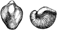
Terebratula navicula, J. Sow. Aymestry
limestone; also in Upper and Lower Ludlow.
Among the fossil shells are species of Leptæna, Orthis, Terebratula,
Avicula, Trochus, Orthoceras, Bellerophon, and others.[352-A]
Some of the Upper Ludlow sandstones are ripple-marked, thus affording
evidence of gradual deposition; and the same may be said of the
accompanying fine argillaceous shales which are of great thickness, and
have been provincially named "mudstones." In these shales many zoophytes
are found enveloped in an erect position, having evidently become fossil on
the spots where they grew at the bottom of the sea. The facility with which
these rocks, when exposed to the weather, are resolved into mud, proves
that, notwithstanding their antiquity, they are nearly in the state in
which they were first thrown down.
The scales, spines (ichthyodorulites), jaws, and teeth of fish of the
genera Onchus, Plectrodus, and others of the same family, have been met
with in the Upper Ludlow rocks.
Fig. 411.

Pentamerus Knightii, Sow. Aymestry.
- a. view of both valves united.
- b. longitudinal section through both valves, showing the central
plate or septum; half nat. size.
3. Aymestry limestone.—The next group is a subcrystalline and
argillaceous limestone, which is in some places 50 feet thick, and
distinguished around Aymestry by the abundance of Pentamerus Knightii,
Sow. (fig. 411.), also found in the Lower Ludlow. This [p.353]genus of
brachiopoda has only been found in the Silurian strata. The name was
derived from πεντε, pente, five, and μερος, meros, a
part, because both valves are divided by a central septum, making four
chambers, and in one valve the septum itself contains a small chamber,
making five; but neither the structure of this shell, nor the connection of
the animal with its several parts, are as yet understood. Messrs. Murchison
and De Verneuil discovered this species dispersed in myriads through a
white limestone of upper Silurian age, on the banks of the Is, on the
eastern flank of the Urals in Russia.
Fig. 412.

Lingula Lewisii, J. Sow. Abberley Hills.
Three other abundant shells in the Aymestry limestone are, 1st, Lingula
Lewisii (fig. 412.); 2d, Terebratula Wilsoni, Sow. (fig. 413.), which is
also common to the Lower Ludlow and Wenlock limestone; 3d, Atrypa
reticularis, Lin. (fig. 414.), which has a very wide range, being found in
every part of the Silurian system, except the Llandeilo flags.
Fig. 413.

Terebratula Wilsoni, Sow. Aymestry.
Fig. 414.

Atrypa reticularis. Linn. Syn. Terebratula
affinis, Min. Con. Aymestry.
- a. upper valve.
- b. lower.
- c. anterior margin of the valves.
4. Lower Ludlow shale.—A dark grey argillaceous deposit, containing,
among other fossils, the new genera of chambered shells, the Phragmoceras
of Broderip, and the Lituites of Breyn (see figs. 415, 416.). The latter
is partly straight and partly convoluted, nearly as in Spirula.
[p.354]
Fig. 415.

Phragmoceras ventricosum, J. Sow. (Orthoceras ventricosum,
Stein.) Aymestry; 1/4 nat. size.
Fig. 416.

Lituites giganteus, J. Sow. Near Ludlow; also in
the Aymestry and Wenlock limestones; 1/4 nat. size.
Fig. 417.
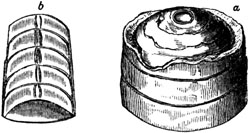
- a. Fragment of Orthoceras Ludense, J. Sow.
- b. Polished section, showing siphuncle. Ludlow.
The Orthoceras Ludense (fig. 417.), as well as the shell last mentioned,
is peculiar to this member of the series. The Homalonotus
delphinocephalus (fig. 418.) is common to this division and to the Wenlock
limestone. This crustacean belongs to a group of trilobites which has been
met with in the Silurian rocks only, and in which the tripartite character
of the dorsal crust is almost lost.
Fig. 418.

Homalonotus delphinocephalus, König.[354-A]
Dudley Castle; 1/2 nat. size.
A species of Graptolite, G. Ludensis, Murch. (fig. 419.), a form of
zoophyte which has not yet been met with in strata newer than the Silurian,
occurs in the Lower Ludlow.
Wenlock formation.—We next come to the Wenlock formation, which has been
divided (see Table, p. 351.) into
1. Wenlock limestone, formerly well known to collectors by the name of the
Dudley limestone, which forms a continuous ridge, ranging for about 20
miles from S.W. to N.E., about a mile distant from the nearly parallel
escarpment of the Aymestry limestone. The prominence of this rock in
Shropshire, like that of Aymestry, is due to its solidity, and to the
softness [p.355]of the shales above and below. It is divided into large
concretional masses of pure limestone, and abounds in trilobites, among
which the prevailing species are Phacops caudatus (fig. 422.) and
Calymene Blumenbachii, commonly called the Dudley trilobite. The latter
is often found coiled up like a wood-louse (see fig. 420.).
Fig. 419.

Fig. 419. Graptolithus Ludensis, Murchison. Lower Ludlow.
Fig. 420.
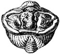
Calymene Blumenbachii, Brong. Wenlock, L. Ludlow, and Aym. limest.
Fig. 421.
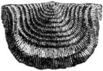
Leptæna depressa. Wenlock.
Fig. 422.

Phacops caudatus, Brong. Wenlock, Aym. limest., and L. Ludlow.
Leptæna depressa, Sow., is common in this rock, but also ranges through
the Lower Ludlow, Wenlock shale, and Caradoc Sandstone.
Fig. 423.

Catenipora escharoides.
Among the corals in which this formation is very rich, the Catenipora
escharoides, Lam. (fig. 423.), or chain coral, may be pointed out as one
very easily recognized, and widely spread in Europe, ranging through all
parts of the Silurian group, from the Aymestry limestone to the bottom of
the series.
Another coral, the Porites pyriformis, is also met with in profusion; a
species common to the Devonian rocks.
Cystiphyllum Siluriense (fig. 425.) is a species peculiar to the Wenlock
limestone. This new genus, the name of which is derived from κυστις,
a bladder, and φυλλον, a leaf, was instituted by Mr.
Lonsdale for corals of the Silurian and Devonian groups. It is composed of
small bladder-like cells (see fig. 425. b.).
2. The Wenlock Shale, which exceeds 700 feet in thickness, contains many
species of brachiopoda, such as a small variety of the [p.356]Lingula
Lewisii (fig. 412.), and the Atrypa reticularis (fig. 414.) before
mentioned, and it will be seen that several other fossils before enumerated
range into this shale.
Fig. 424.

Porites pyriformis, Ehren. Wenlock limest. and
shale. Also in Aymestry limestone, and L. Ludlow.
a. Vertical section, showing transverse lamellæ.
Fig. 425.

- a. Cystiphyllum Siluriense, Lonsd. Wenlock.
- b. Section of portion, showing cells.
LOWER SILURIAN ROCKS.
The Lower Silurian rocks have been subdivided into two portions.
1. The Caradoc sandstone, which abuts against the trappean chain called the
Caradoc Hills, in Shropshire. Its thickness is estimated at 2500 feet, and
the larger proportion of its fossils are specifically distinct from those
of the Upper Silurian rocks. Among them we find many trilobites and shells
of the genera Orthoceras, Nautilus, and Bellerophon; and among the
Brachiopoda the Pentamerus oblongus and P. lævis (fig. 426.), which are
very abundant and peculiar to this bed; also Orthis grandis (fig. 427.),
and a fossil of well-defined form, Tentaculites annulatus, Schlot. (fig.
428.), which Mr. Salter has shown to be referable to the Annelids and to
the same tribe as Serpula.
Fig. 426.

Pentamerus lævis, Sow. Caradoc Sandstone.
Perhaps the young of Pentamerus oblongus.
- a, b. Views of the shell itself, from figures in Murchison's Sil. Syst.
- c. Cast with portion of shell remaining, and with the hollow of the
central septum filled with spar.
- d. Internal cast of a valve, the space once occupied by the septum
being represented by a hollow in which is seen a cast of the chamber
within the septum.
[p.357]
Fig. 427.

Cast of Orthis grandis, J. Sow. Horderley; two-thirds of nat. size.
Fig. 428.

Tentaculites scalaris, Schlot. Eastnor Park; nat. size,
and magnified.
The most ancient bony remains of fish yet discovered in Great Britain are
those obtained from the Wenlock limestones; but coprolites referred to fish
occur still lower in the Silurian series in Wales.
Fig. 429.

Ogygia Buchii, Burmeister. Syn. Asaphus Buchii, Brong.
1/4 nat. size. Radnorshire.
2. The Llandeilo flags, so named from a town in Caermarthenshire, form
the base of the Silurian system, consisting of dark-coloured micaceous
grit, frequently calcareous, and distinguished by containing the large
trilobites Asaphus Buchii and A. tyrannus, Murch., both of which are
peculiar to these rocks. Several species of Graptolites (fig. 430.) occur
in these beds.
Fig. 430.
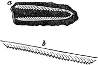
a, b. Graptolithus Murchisonii, Beck.
Llandeilo flags.
Fig. 431.
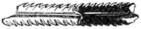
G. foliaceus, Murchison. Llandeilo flags.
In the fine shales of this formation Graptolites are very abundant. I
collected these same bodies in great numbers in Sweden and Norway in
1835-6, both in the higher and lower shales of the Silurian system; and was
informed by Dr. Beck of Copenhagen, that they were fossil zoophytes related
to the genera Pennatula and Virgularia, of which the living species now
inhabit mud and slimy sediment. The most eminent naturalists still hold to
this opinion.
A species of Lingula is met with in the lowest part of the Llandeilo
beds; and it is remarkable that this brachiopod is among the earliest, if
not the most ancient animal form detected in the lowest Silurian of North
America. These inhabitants of the seas, of so remote an epoch, belonged so
strictly to the living genus Lingula, as to demonstrate, like the
pteriform ferns of the coal, through what incalculable periods of time the
same plan and type of organization has sometimes prevailed.
Among the forms of trilobite extremely characteristic of the Lower Silurian
throughout Europe and North America, the Trinucleus may be mentioned.
This family of crustaceans appears to have swarmed in the Silurian seas,
just as crabs, shrimps, and other genera of [p.358]crustaceans abound in
our own. Burmeister, in his work on the organization of trilobites,
supposes them to have swum at the surface of the water in the open sea and
near coasts, feeding on smaller marine animals, and to have had the power
of rolling themselves into a ball as a defence against injury. They
underwent various transformations analogous to those of living crustaceans.
M. Barrande, author of a work on the Silurian rocks of Bohemia, has traced
the same species from the young state just after its escape from the egg to
the adult form, through various metamorphoses, each having the appearance
of a distinct species. Yet, notwithstanding the numerous species of
preceding naturalists which he has thus succeeded in uniting into one, he
announces a forthcoming work in which descriptions and figures of 250
species of Trilobite will be given.
Fig. 432.

Trinucleus ornatus, Burm.
Cystideæ.—Among the additions which recent research has made to the
paleontology of the oldest Silurian rocks, none are more remarkable than
the radiated animals called Cystideæ. Their structure and relations were
first elucidated in an essay published by Von Buch at Berlin in 1845. They
are usually met with as spheroidal bodies covered with polygonal plates,
with a mouth on the upper side, and a point of attachment for a stem b
(which is almost always broken off) on the lower. (See fig. 433.) They are
considered by Professor E. Forbes as intermediate between the crinoids and
echinoderms. The Sphæronites here represented (fig. 433.) occurs in the
Llandeilo beds in Wales.[358-A]
Fig. 433.

Sphæronites balticus, Eichwald. (Of the family
Cystideæ.)
- a. mouth.
- b. point of attachment of stem.
Lower Silurian, Shole's Hook and Bala.
Thickness and unconformability of Silurian strata.—According to the
observation of our government surveyors in North Wales, the Lower Silurian
strata of that region attain, in conjunction with the [p.359]
contemporaneous volcanic rocks, the extraordinary thickness of 27,000 feet.
One of the groups, called the trappean, consisting of slates and associated
volcanic ash and greenstone, is 15,000 feet thick. Another series, called
the Bala group, composed of slates and grits with an impure limestone rich
in organic remains, is 9,000 feet thick.[359-A]
Throughout North Wales the Wenlock shales rest unconformably upon the
Caradoc sandstones; and the Caradoc is in its turn unconformable to the
Llandeilo beds, showing a considerable interval of time between the
deposition of this group and that of the formations next above and below
it. The Caradoc sandstone in the neighbourhood of the Longmynd Hills in
Shropshire, appears to Professor E. Forbes to have been a deep-sea deposit
formed around the margin of high and steep land. That land consisted partly
of upraised Llandeilo flags and partly of rocks of still older date.[359-B]
Such evidence of the successive disturbance of strata during the Silurian
period in Great Britain is what we might look for when we have discovered
the signs of so grand a series of volcanic eruptions as the contemporaneous
greenstones and tuffs of the Welsh mountains afford.
Silurian Strata of the United States.
The position of some of these strata, where they are bent and highly
inclined in the Appalachian chain, or where they are nearly horizontal to
the west of that chain, is shown in the section, fig. 379. p. 327. But
these formations can be studied still more advantageously north of the same
line of section, in the states of New York, Ohio, and other regions north
and south of the great Canadian lakes. Here they are found, as in Russia,
in horizontal position, and are more rich in well-preserved fossils than in
almost any spot in Europe. The American strata may readily be divided into
Upper and Lower Silurian, corresponding in age and fossils to the European
divisions bearing the same names. The subordinate members of the New York
series, founded on lithological and geographical considerations, are most
useful in the United States, but even there are only of local importance.
Some few of them, however, tally very exactly with English divisions, as
for example the limestone, over which the Niagara is precipitated at the
great cataract, which, with its underlying shales, agrees paleontologically
with the Wenlock limestone and shale of Siluria. There is also a marked
general correspondence in the succession of fossil forms, and even species,
as we trace the organic remains downwards from the highest to the lowest
beds.
Mr. D. Sharpe, in his report on the mollusca collected by me from these
strata in North America[359-C], has concluded that the number of species
common to the Silurian rocks, on both sides of the Atlantic, [p.360]is
between 30 and 40 per cent.; a result which, although no doubt liable to
future modification, when a larger comparison shall have been made, proves,
nevertheless, that many of the species had a wide geographical range. It
seems that comparatively few of the gasteropods and lamellibranchiate
bivalves of North America can be identified specifically with European
fossils, while no less than two-fifths of the brachiopoda are the same. In
explanation of these facts, it is suggested, that most of the recent
brachiopoda (especially the orthidiform ones) are inhabitants of deep
water, and may have had a wider geographical range than shells living near
shore. The predominance of bivalve mollusca of this peculiar class has
caused the Silurian period to be sometimes styled the age of brachiopods.
Whether the Silurian rocks are of deep-water origin.—The grounds relied
upon by Professor E. Forbes, for inferring that the larger part of the
Silurian Fauna is indicative of a sea more than 70 fathoms deep, are the
following: first, the small size of the greater number of conchifera;
secondly, the paucity of pectinibranchiata (or spiral univalves); thirdly,
the great number of floaters, such as Bellerophon, Orthoceras, &c.;
fourthly, the abundance of orthidiform brachiopoda; fifthly, the absence or
great rarity of fossil fish.
It is doubtless true that some living Terebratulæ, on the coast of
Australia, inhabit shallow water; but all the known species, allied in form
to the extinct Orthis, inhabit the depths of the sea. It should also be
remarked that Mr. Forbes, in advocating these views, was well aware of the
existence of shores, bounding the Silurian sea in Shropshire, and of the
occurrence of littoral species of this early date in the northern
hemisphere. Such facts are not inconsistent with his theory; for he has
shown, in another work, how, on the coast of Lycia, deep-sea strata are at
present forming in the Mediterranean, in the vicinity of high and steep
land.
Had we discovered the ancient delta of some large Silurian river, we should
doubtless have known more of the shallow, and brackish water, and
fluviatile animals, and of the terrestrial flora of the period under
consideration. To assume that there were no such deltas in the Silurian
world, would be almost as gratuitous an hypothesis, as for the inhabitants
of the coral islands of the Pacific to indulge in a similar generalization
respecting the actual condition of the globe.[360-A]
Mineral Character of Silurian Strata.
In lithological character, the Silurian strata vary greatly when we trace
them through Europe and North America. The shales called mudstones are as
little altered from some deposits, found in recent submarine banks, as are
those of many tertiary formations. We meet with red sandstone and red marl,
with gypsum and salt, of Upper Silurian date, in the Niagara district,
which might be mistaken for trias. The whitish granular sandstone at the
base of the [p.361]Silurian series in Sweden resembles the tertiary
siliceous grit of Fontainebleau. The Calcareous Grit, oolite, and pisolite
of Upper Silurian age in Gothland, are described by Sir R. Murchison as
singularly like rocks of the oolitic period near Cheltenham; and, not to
cite more examples, the Wenlock or Dudley limestone often resembles a
modern coral-reef. If, therefore, uniformity of aspect has been thought
characteristic of rocks of this age, the idea must have arisen from the
similarity of feature acquired by strata subject to metamorphic action.
This influence, seeing that the causes of change are always shifting the
theatre of their principal development, must be multiplied throughout a
wider geographical area by time, and become more general in any given
system of rocks in proportion to their antiquity. We are now acquainted
with dense groups of Eocene slates in the Alps, which were once mistaken by
experienced geologists for Transition or Silurian formations. The error
arose from attaching too great importance to mineral character as a test of
age, for the tertiary slates in question having acquired that crystalline
texture which is in reality most prevalent in the most ancient sedimentary
formations.
CAMBRIAN GROUP.
Below the Silurian strata in North Wales, and in the region of the
Cumberland lakes, there are some slaty rocks, devoid of organic remains, or
in which a few obscure traces only of fossils have been detected (for which
the names of Cambrian and Cumbrian have been proposed). Whether these will
ever be entitled by the specific distinctness of their fossils to rank as
independent groups, we have not yet sufficient data to determine.
TABULAR VIEW OF FOSSILIFEROUS STRATA,
Showing the Order of Superposition or Chronological Succession of the
principal European Groups.
| I. POST-TERTIARY. |
| A. POST-PLIOCENE. |
| Periods and Groups. |
|
Examples. |
|
Observations. |
| 1. Recent. |
|
|
|
- Peat mosses and shell-marl, with bones of land animals,
human remains, and works of art.
- Newer parts of modern deltas and coral reefs.
|
|
|
|
All the imbedded shells, freshwater and marine, of living
species, with occasional human remains and works of art. |
| |
| 2. Post-Pliocene. |
|
|
|
- Clay, marl, and volcanic tuff of Ischia, p. 113.
- Loess of the Rhine, p. 117.
- Newer part of boulder formation, with erratics, p. 124.
|
|
|
|
All the shells of living species. No human remains or works
of art. Bones of quadrupeds, partly of extinct species. |
| [p.362]II. TERTIARY. |
| B. PLIOCENE. |
| 3. Newer Pliocene or Pleistocene. |
|
|
|
- Boulder formation or drift of northern Europe and North
America, chaps. 11. & 12.
- Cavern deposits and osseous breccias, p. 153.
- Fluvio-marine crag of Norwich, p. 148.
- Limestone of Girgenti, in Sicily, p. 152.
|
|
|
|
- Three-fourths of the fossil shells of existing species.
- A majority of the mammalia extinct; but the genera corresponding
with those now surviving in the same great geographical and zoological
province, p. 157.
- During part of this period icebergs frequent in the seas of
the northern hemisphere, and glaciers on hills of moderate height.
|
| |
| 4. Older Pliocene. |
|
|
|
|
|
|
|
- A third or more of the species of mollusca extinct.
- Nearly, if not all, the mammalia extinct.
|
| C. MIOCENE. |
| 5. Miocene. |
|
|
|
|
|
|
|
- About two-thirds of the species of shells extinct.
- The recent species of shells often not found in the adjoining
seas, but in warmer latitudes.
- All the mammalia extinct.
|
| D. EOCENE. |
| 6. Upper Eocene. |
|
|
|
- Upper marine of Paris basin, Fontainebleau sandstone, p. 175.
- Upper freshwater and millstone of same.
- Kleyn Spauwen beds, p. 176.
- Hermsdorf tile-clay, near Berlin.
- Mayence tertiary strata, p. 177.
- Freshwater beds of Limagne d'Auvergne, p. 181.
|
|
|
|
- Fossil shells of the Eocene period, with very few exceptions, extinct.
Those which are identified with living species rarely belong
to neighbouring regions
- All the mammalia of extinct species, and the greater part of them of
extinct genera.
- Plants of Upper Eocene, indicating a south European
or Mediterranean climate; those of Lower Eocene, a tropical climate.
|
| |
| 7. Middle Eocene. |
|
|
|
- Paris gypsum with Paleotherium, &c., p. 191.
- Freshwater and fluvio-marine beds of Headon Hill, Isle of Wight,
p. 197.
- Barton beds, Hants, p. 198.
- Calcaire Grossier, Paris, p. 193.
- Bagshot and Bracklesham beds, Surrey and Sussex, p. 198.
|
| |
| 8. Lower Eocene. |
|
|
|
- London clay proper of Highgate Hill and Sheppey,—Bognor
beds, Sussex, p. 200.
- Sables inférieurs, and lits coquilliers of Paris basin, p. 196.
- Mottled and plastic clays and sands of the Hampshire and
London basins, p. 203.
- Sables inférieurs and argiles plastiques of Paris basin, p. 196.
- Nummulitic formation of the Alps, p. 205.
|
| [p.363]III. SECONDARY. |
| E. CRETACEOUS. |
| § UPPER CRETACEOUS. |
| 9. Maestricht beds. |
|
|
|
- Yellowish white limestone of Maestricht, p. 209.
- Coralline limestone of Faxoe, Denmark, p. 210.
|
|
|
|
Ammonite, Baculite, and Belemnite, associated with Cypræa, Oliva, Mitra, Trochus,
&c. Large marine saurians. |
| |
| 10. Upper White Chalk. |
|
|
|
White chalk with flints of North and South Downs,—
Surrey and Sussex, p. 211. |
|
|
|
Marine limestone formed in part of decomposed corals. |
| |
| 11. Lower White Chalk. |
|
|
|
Chalk without flints, and chalk marl, ibid. |
|
|
|
| |
| 12. Upper Greensand. |
|
|
|
- Loose sand, with bright green particles, ibid.
- Firestone of Merstham, Kent, p. 218.
- Marly stone, with layers of chert, south of Isle of Wight.
|
|
|
|
| |
| 13. Gault. |
|
|
|
Dark blue marl at base of chalk escarpment,—Kent and
Sussex, p. 218. |
|
|
|
Numerous extinct genera of conchiferous cephalopoda, Hamite,
Scaphite, Ammonite, &c. |
| §§ LOWER CRETACEOUS. |
| 14. Lower Greensand. |
|
|
|
- Sand with green matter,—Weald of Kent and Sussex, p. 219.
- White, yellowish, and ferruginous sand, with concretions
of limestone and chert,—Atherfield, Isle of Wight.
- Limestone called Kentish Rag
|
|
|
|
Species of shells, &c., nearly all distinct from those of
Upper Cretaceous; most of the genera the same. |
| F. WEALDEN. |
| 15. Weald Clay. |
|
|
|
Clay with occasional bands of limestone,—Weald of Kent,
Surrey, and Sussex, p. 227. |
|
|
|
Of freshwater origin. Shells of pulmoniferous mollusca, and of
Cypris. Land reptiles. |
| |
| 16. Hastings Sand. |
|
|
|
Sand with calciferous grit and clay,—Hastings, Sussex,
Cuckfield, Kent, p. 229. |
|
|
|
Freshwater with intercalated bed of brackish and salt water
origin. Shells of fluviatile and lacustrine genera. Reptiles
of the genera Pterodactyle, Iguanodon, Megalosaurus,
Plesiosaurus, Trionyx, and Emys. |
| |
| 17. Purbeck Beds. |
|
|
|
Limestones, calcareous slates and marls, p. 231. |
|
|
|
Chiefly freshwater, and divisible into three groups, each
containing distinct species of freshwater mollusca and
of entomostraca. Alternations of deposits formed in fresh,
brackish, and marine water, and of ancient soils formed on
land and retaining roots of trees. Plants chiefly cycads and
conifers, p. 231. |
| [p.364]G. OOLITE. |
| 18. Upper Oolite. |
|
|
|
- a. Portland building stone, p. 259.
- b. Portland sand.
- c. Kimmeridge clay, Dorsetshire, p. 260.
|
|
|
|
- Ammonites and Belemnites numerous.
- Large saurians, as Pterodactyles, Plesiosaurs, Ichthyosaurs.
- No cetaceans yet known, but three species of terrestrial
mammalia, p. 267, 268. Preponderance of ganoid
fish. The plants chiefly cycads, conifers, and ferns, with a few palms.
|
| |
| 19. Middle Oolite. |
|
|
|
- a. Coral Rag, p. 260. Calcareous freestones, oolitic, }
often full of corals. Oxfordshire.
- b. Oxford clay—Dark blue clay,—Oxfordshire and
midland counties, p. 262.
|
| |
| 20. Lower Oolite. |
|
|
|
- a. Cornbrash and forest marble, Wiltshire, p. 263.
- b. Great oolite and Stonesfield slate,—Bath, Bradford,
Stonesfield near Woodstock, Oxfordshire, p. 266.
- c. Fuller's earth,—Clay containing fuller's earth near
Bath, p. 272.
- d. Inferior oolite, calcareous freestone, and yellow sands,—Cotteswold
Hills, Dundry Hill, near Bristol, p. 272.
|
| H. LIAS. |
| 21. Lias. |
|
|
|
Argillaceous limestone, marl and clay,—Lyme Regis,
Dorsetshire, p. 273. |
|
|
|
Mollusca, reptiles, and fish of genera analogous to the oolitic. |
| I. TRIAS. |
| 22. Upper Trias. |
|
|
|
Keuper of Germany, or variegated marls—Red, grey,
green, blue, and white marls and sandstones with gypsum—Würtemberg,
bone-bed of Axmouth, Dorset, p. 289. |
|
|
|
Batrachian reptiles, e.g. Labyrinthodon, Rhyncosaurus,
&c. Cephalopoda: Ceratites. No Belemnites. Plants:
Ferns, Cycads, Conifers. |
| |
| 23. Middle Trias or Muschelkalk. |
|
|
|
Compact greyish limestone with beds of dolomite and
gypsum,—North of Germany, p. 287.
Wanting in England. |
|
|
|
With Equisetites and Calamite. |
| |
| 24. Lower Trias. |
|
|
|
- Variegated or Bunter sandstone of Germans—Red
and white spotted sandstone with gypsum and rock-salt, p. 288.
- Part of New Red sandstone of Cheshire with rock-salt, p. 294.
|
|
|
|
Plants different for the most part from those of the Upper Trias. |
| IV. PRIMARY. |
| K. PERMIAN. |
| 25. Upper Permian. |
|
|
|
- Yellow magnesian limestone, Yorkshire and Durham, p. 301.
- Zechstein of Thuringia, Upper part of Permian beds, Russia.
|
|
|
|
Organic remains, both animal and vegetable, more allied
to primary than to secondary periods. |
| [p.365] |
| 26. Lower Permian. |
|
|
|
- a. Marl slate of Durham and Thuringia.
- b. Lower New Red sandstone of north of England
and Rothliegendes of Germany.
- a. and b. Lower part of Permian beds, Russia, p. 301.
|
|
|
|
Thecodont saurians. Heterocercal fish of genus Palæoniscus,
&c. |
| L. CARBONIFEROUS. |
| 27. Coal measures. |
|
|
|
- a. Strata of sandstone and shale, with beds of coal,—S.
Wales and Northumberland, p. 309.
- b. Millstone grit,—S. Wales, Bristol coal-field,
Yorkshire, p. 308.
|
|
|
|
- Great thickness of strata of fluvio-marine origin, with
beds of coal of vegetable origin, based on soils retaining
the roots of trees.
- Oldest of known reptiles or Archegosaurus. Sauroid fish.
|
| |
| 28. Mountain limestone. |
|
|
|
- Carboniferous or mountain limestone, with marine shells and corals.
- Mendip Hills, and many parts of Ireland, p. 340.
|
|
|
|
- Brachiopoda of genus Productus.
- Cephalopoda of genera Cyrtoceras, Goniatite, Orthoceras.
- Crustaceans of the genus Phillipsia.
- Crinoideans abundant.
|
| M. DEVONIAN. |
| 29. Upper Devonian. |
|
|
|
- a. Yellow sandstone of Dura Den, Fife.
- b. Red sandstone and marl with cornstone of Herefordshire
and Forfarshire.
- Paving and roofing-stone, Forfarshire.
- Upper part of Devonian beds of South Devon.
|
|
|
|
- Tribe of fish with hard coverings like chelonians, Pterichthys,
Pamphractus, &c.; also of genera Cephalaspis, Holoptichius, &c.
- No reptiles yet known.
|
| |
| 30. Lower Devonian. |
|
|
|
Grey sandstone with Ichthyolites,—Caithness, Cromarty,
and Orkney, Lower part of Devonian beds of South Devon,
and green chloritic slates of Cornwall, limestone of
Gerolstein, Eifel. |
|
|
|
Fish, partly of same genera, but of distinct species from
those in Upper Devonian; Glyptolepis, Dipterus, also
Osteolepis, Coccosteus, &c. |
| N. SILURIAN. |
| 31. Upper Silurian. |
|
|
|
- a. Tilestone of Brecon and Caermarthen.
- b. Limestone and shale, Ludlow, Shropshire.
- c. Wenlock or Dudley limestone.
|
|
|
|
- Oldest of fossil fish yet discovered.
- Trilobites and Graptolites abundant.
- Brachiopoda very numerous.
- Cephalopoda: Bellerophon, Orthoceras.
|
| |
| 32. Lower Silurian. |
|
|
|
- a. Caradoc sandstone, Caer Caradoc, Shropshire.
- b. Llandeilo flags, calcareous flags and schists,—Builth,
Radnorshire, Llandeilo, Caermarthenshire.
|
|
|
|
- Same genera of invertebrate animals as in Upper Silurian,
but species chiefly distinct. Trinucleus caractaci, Cystideæ, p. 358.
- No land plants yet known.
- Footprints of tortoise, see note, p. 360.
|
[p.366]CHAPTER XXVIII.
VOLCANIC ROCKS.
Trap rocks — Name, whence derived — Their igneous origin at first
doubted — Their general appearance and character — Volcanic cones
and craters, how formed — Mineral composition and texture of volcanic
rocks — Varieties of felspar — Hornblende and
augite — Isomorphism — Rocks, how to be studied — Basalt,
greenstone, trachyte, porphyry, scoria, amygdaloid, lava,
tuff — Alphabetical list, and explanation of names and synonyms, of
volcanic rocks — Table of the analyses of minerals most abundant in the
volcanic and hypogene rocks.
The aqueous or fossiliferous rocks having now been described, we have next
to examine those which may be called volcanic, in the most extended sense
of that term. Suppose a a in the annexed diagram, to represent the
crystalline formations, such as the granitic and metamorphic; b b the
fossiliferous strata; and c c the volcanic rocks. These last are
sometimes found, as was explained in the first chapter, breaking through
a and b, sometimes overlying both, and occasionally alternating with
the strata b b. They also are seen, in some instances, to pass insensibly
into the unstratified division of a, or the Plutonic rocks.
Fig. 434.

- a. Hypogene formations, stratified and unstratified.
- b. Aqueous formations.
- c. Volcanic rocks.
When geologists first began to examine attentively the structure of the
northern and western parts of Europe, they were almost entirely ignorant of
the phenomena of existing volcanos. They also found certain rocks, for the
most part without stratification, and of a peculiar mineral composition, to
which they gave different names, such as basalt, greenstone, porphyry, and
amygdaloid. All these, which were recognized as belonging to one family,
were called "trap" by Bergmann, from trappa, Swedish for a flight of
steps—a name since adopted very generally into the nomenclature of the
science; for it was observed that many rocks of this class occurred in
great tabular masses of unequal extent, so as to form a succession of
terraces or steps on the sides of hills. This configuration appears to be
derived from two causes. First, the abrupt original terminations of sheets
of melted matter, which have spread, whether on the land or bottom of the
sea, over a level surface. For we know, in the case of lava flowing from a
volcano, that a stream, when it has ceased to flow, and grown solid, very
commonly ends in a steep slope, as at a, fig. 435. But, secondly, the
step-like appearance arises more frequently [p.367]from the mode in
which horizontal masses of igneous rock, such as b c, intercalated
between aqueous strata, have, subsequently to their origin, been exposed,
at different heights, by denudation. Such an outline, it is true, is not
peculiar to trap rocks; great beds of limestone, and other hard kinds of
stone, often presenting similar terraces and precipices: but these are
usually on a smaller scale, or less numerous, than the volcanic steps, or
form less decided features in the landscape, as being less distinct in
structure and composition from the associated rocks.
Fig. 435.
Step-like appearance of trap.
Although the characters of trap rocks are greatly diversified, the beginner
will easily learn to distinguish them as a class from the aqueous
formations. Sometimes they present themselves, as already stated, in
tabular masses, which are not divided into strata: sometimes in shapeless
lumps and irregular cones, forming chains of small hills. Often they are
seen in dikes and wall-like masses, intersecting fossiliferous beds. The
rock is occasionally found divided into columns, often decomposing into
balls of various sizes, from a few inches to several feet in diameter. The
decomposing surface very commonly assumes a coating of a rusty iron colour,
from the oxidation of ferruginous matter, so abundant in the traps in which
augite or hornblende occur; or, in the felspathic varieties of trap, it
acquires a white opaque coating, from the bleaching of the mineral called
felspar. On examining any of these volcanic rocks, where they have not
suffered disintegration, we rarely fail to detect a crystalline arrangement
in one or more of the component minerals. Sometimes the texture of the mass
is cellular or porous, or we perceive that it has once been full of pores
and cells, which have afterwards become filled with carbonate of lime, or
other infiltrated mineral.
Most of the volcanic rocks produce a fertile soil by their disintegration.
It seems that their component ingredients, silica, alumina, lime, potash,
iron, and the rest, are in proportions well fitted for vegetation. As they
do not effervesce with acids, a deficiency of calcareous matter might at
first be suspected; but although the carbonate of lime is rare, except in
the nodules of amygdaloids, yet it will be seen that lime sometimes enters
largely into the composition of augite and hornblende. (See Table, p. 377.)
Cones and Craters.—In regions where the eruption of volcanic matter has
taken place in the open air, and where the surface has never since been
subjected to great aqueous denudation, cones and craters constitute the
most striking peculiarity of this class of formations. Many hundreds of
these cones are seen in central France, in the ancient provinces of
Auvergne, Velay, and Vivarais, where they observe, for the most part, a
linear arrangement, and form chains of hills. Although none of the
eruptions have happened within the historical era, the streams of lava may
still be traced distinctly descending from many of the craters, and
following the lowest [p.368]levels of the existing valleys. The origin
of the cone and crater-shaped hill is well understood, the growth of many
having been watched during volcanic eruptions. A chasm or fissure first
opens in the earth, from which great volumes of steam and other gases are
evolved. The explosions are so violent as to hurl up into the air fragments
of broken stone, parts of which are shivered into minute atoms. At the same
time melted stone or lava usually ascends through the chimney or vent by
which the gases make their escape. Although extremely heavy, this lava is
forced up by the expansive power of entangled gaseous fluids, chiefly steam
or aqueous vapour, exactly in the same manner as water is made to boil over
the edge of a vessel when steam has been generated at the bottom by heat.
Large quantities of the lava are also shot up into the air, where it
separates into fragments, and acquires a spongy texture by the sudden
enlargement of the included gases, and thus forms scoriæ, other portions
being reduced to an impalpable powder or dust. The showering down of the
various ejected materials round the orifice of eruption gives rise to a
conical mound, in which the successive envelopes of sand and scoriæ form
layers, dipping on all sides from a central axis. In the mean time a
hollow, called a crater, has been kept open in the middle of the mound by
the continued passage upwards of steam and other gaseous fluids. The lava
sometimes flows over the edge of the crater, and thus thickens and
strengthens the sides of the cone; but sometimes it breaks it down on one
side, and often it flows out from a fissure at the base of the hill (see
fig. 436.).[368-A]
Fig. 436.
Part of the chain of extinct volcanos called the Monts Dome,
Auvergne. (Scrope.)
Composition and nomenclature.—Before speaking of the connection between
the products of modern volcanos and the rocks usually styled trappean, and
before describing the external forms of both, and the manner and position
in which they occur in the earth's crust, it will be desirable to treat of
their mineral composition and names. The varieties most frequently spoken
of are basalt, greenstone, syenitic greenstone, clinkstone, claystone, and
trachyte; while those founded chiefly on peculiarities of texture, are
porphyry, amygdaloid, lava, tuff, scoriæ, and pumice. It may be stated
generally, that all these are mainly composed of two minerals, or families
of simple minerals, felspar and hornblende; some almost entirely of
hornblende, others of felspar.
These two minerals may be regarded as two groups, rather than [p.369]
species. Felspar, for example, may be, first, common felspar, that is to
say, potash-felspar, in which the alkali is potash (see table, p. 377.);
or, secondly, albite, that is to say, soda-felspar, where the alkali is
soda instead of potash; or, thirdly, Labrador-felspar (Labradorite), which
differs not only in its iridescent hues, but also in its angle of fracture
or cleavage, and its composition. We also read much of two other kinds,
called glassy felspar and compact felspar, which, however, cannot rank as
varieties of equal importance, for both the albitic and common felspar
appear sometimes in transparent or glassy crystals; and as to compact
felspar, it is a compound of a less definite nature, sometimes containing
both soda and potash; and which might be called a felspathic paste, being
the residuary matter after portions of the original matrix have
crystallized.
The other group, or hornblende, consists principally of two varieties;
first, hornblende, and, secondly, augite, which were once regarded as very
distinct, although now some eminent mineralogists are in doubt whether they
are not one and the same mineral, differing only as one crystalline form of
native sulphur differs from another.
The history of the changes of opinion on this point is curious and
instructive. Werner first distinguished augite from hornblende; and his
proposal to separate them obtained afterwards the sanction of Haüy, Mohs,
and other celebrated mineralogists. It was agreed that the form of the
crystals of the two species were different, and their structure, as shown
by cleavage, that is to say, by breaking or cleaving the mineral with a
chisel, or a blow of the hammer, in the direction in which it yields most
readily. It was also found by analysis that augite usually contained more
lime, less alumina, and no fluoric acid; which last, though not always
found in hornblende, often enters into its composition in minute quantity.
In addition to these characters, it was remarked as a geological fact, that
augite and hornblende are very rarely associated together in the same rock;
and that when this happened, as in some lavas of modern date, the
hornblende occurs in the mass of the rock, where crystallization may have
taken place more slowly, while the augite merely lines cavities where the
crystals may have been produced rapidly. It was also remarked, that in the
crystalline slags of furnaces, augitic forms were frequent, the hornblendic
entirely absent; hence it was conjectured that hornblende might be the
result of slow, and augite of rapid cooling. This view was confirmed by the
fact, that Mitscherlich and Berthier were able to make augite artificially,
but could never succeed in forming hornblende. Lastly, Gustavus Rose fused
a mass of hornblende in a porcelain furnace, and found that it did not, on
cooling, assume its previous shape, but invariably took that of augite. The
same mineralogist observed certain crystals in rocks from Siberia which
presented a hornblende cleavage, while they had the external form of
augite.
If, from these data, it is inferred that the same substance may assume the
crystalline forms of hornblende or augite indifferently, according to the
more or less rapid cooling of the melted mass, it is [p.370]nevertheless
certain that the variety commonly called augite, and recognized by a
peculiar crystalline form, has usually more lime in it, and less alumina,
than that called hornblende, although the quantities of these elements do
not seem to be always the same. Unquestionably the facts and experiments
above mentioned show the very near affinity of hornblende and augite; but
even the convertibility of one into the other by melting and
recrystallizing, does not perhaps demonstrate their absolute identity. For
there is often some portion of the materials in a crystal which are not in
perfect chemical combination with the rest. Carbonate of lime, for example,
sometimes carries with it a considerable quantity of silex into its own
form of crystal, the silex being mechanically mixed as sand, and yet not
preventing the carbonate of lime from assuming the form proper to it. This
is an extreme case, but in many others some one or more of the ingredients
in a crystal may be excluded from perfect chemical union; and, after
fusion, when the mass recrystallizes, the same elements may combine
perfectly or in new proportions, and thus a new mineral may be produced. Or
some one of the gaseous elements of the atmosphere, the oxygen for example,
may, when the melted matter reconsolidates, combine with some one of the
component elements.
The different quantity of the impurities or refuse above alluded to, which
may occur in all but the most transparent and perfect crystals, may partly
explain the discordant results at which experienced chemists have arrived
in their analysis of the same mineral. For the reader will find that a
mineral determined to be the same by its physical characters, crystalline
form, and optical properties, has often been declared by skilful analyzers
to be composed of distinct elements. (See the table at p. 377.) This
disagreement seemed at first subversive of the atomic theory, or the
doctrine that there is a fixed and constant relation between the
crystalline form and structure of a mineral, and its chemical composition.
The apparent anomaly, however, which threatened to throw the whole science
of mineralogy into confusion, was in a great degree reconciled to fixed
principles by the discoveries of Professor Mitscherlich at Berlin, who
ascertained that the composition of the minerals which had appeared so
variable, was governed by a general law, to which he gave the name of
isomorphism (from ισος, isos, equal, and μορφη,
morphe, form). According to this law, the ingredients of a given species
of mineral are not absolutely fixed as to their kind and quality; but one
ingredient may be replaced by an equivalent portion of some analogous
ingredient. Thus, in augite, the lime may be in part replaced by portions
of protoxide of iron, or of manganese, while the form of the crystal, and
the angle of its cleavage planes, remain the same. These vicarious
substitutions, however, of particular elements cannot exceed certain
defined limits.
Having been led into this digression on the recent progress of mineralogy,
I may here observe that the geological student must endeavour as soon as
possible to familiarize himself with the characters [p.371]of five at
least of the most abundant simple minerals of which rocks are composed.
These are, felspar, quartz, mica, hornblende, and carbonate of lime. This
knowledge cannot be acquired from books, but requires personal inspection,
and the aid of a teacher. It is well to accustom the eye to know the
appearance of rocks under the lens. To learn to distinguish felspar from
quartz is the most important step to be first aimed at. In general we may
know the felspar because it can be scratched with the point of a knife,
whereas the quartz, from its extreme hardness, receives no impression. But
when these two minerals occur in a granular and uncrystallized state, the
young geologist must not be discouraged if, after considerable practice, he
often fails to distinguish them by the eye alone. If the felspar is in
crystals, it is easily recognized by its cleavage: but when in grains the
blow-pipe must be used, for the edges of the grains can be rounded in the
flame, whereas those of quartz are infusible. If the geologist is
desirous of distinguishing the three varieties of felspar above enumerated,
or hornblende from augite, it will often be necessary to use the reflecting
goniometer as a test of the angle of cleavage, and shape of the crystal.
The use of this instrument will not be found difficult.
The external characters and composition of the felspars are extremely
different from those of augite or hornblende; so that the volcanic rocks in
which either of these minerals decidedly predominates, are easily
recognized. But there are mixtures of the two elements in every possible
proportion, the mass being sometimes exclusively composed of felspar, at
other times solely of augite, or, again, of both in equal quantities.
Occasionally, the two extremes, and all the intermediate gradations, may be
detected in one continuous mass. Nevertheless there are certain varieties
or compounds which prevail so largely in nature, and preserve so much
uniformity of aspect and composition, that it is useful in geology to
regard them as distinct rocks, and to assign names to them, such as basalt,
greenstone, trachyte, and others, already mentioned.
Basalt.—As an example of rocks in which augite greatly prevails, basalt
may first be mentioned. Although we are more familiar with this term than
with that of any other kind of trap, it is difficult to define it, the name
having been used so vaguely. It has been very generally applied to any trap
rock of a black, bluish, or leaden-grey colour, having a uniform and
compact texture. Most strictly, it consists of an intimate mixture of
augite, felspar, and iron, to which a mineral of an olive green colour,
called olivine, is often superadded, in distinct grains or nodular masses.
The iron is usually magnetic, and is often accompanied by another metal,
titanium. Augite is the predominant mineral, the felspar being in much
smaller proportions. There is no doubt that many of the fine-grained and
dark-coloured trap rocks, called basalt, contained hornblende in the place
of augite; but this will be deemed of small importance after the remarks
above made. Other minerals are occasionally found in basalt; and this rock
may pass insensibly into almost every variety of trap, especially [p.372]
into greenstone, clinkstone, and wacké, which will be presently described.
Greenstone, or Dolerite, is usually defined as a granular rock, the
constituent parts of which are hornblende and imperfectly crystallized
felspar; the felspar being more abundant than in basalt; and the grains or
crystals of the two minerals more distinct from each other. This name may
also be extended to those rocks in which augite is substituted for
hornblende (the dolorite of some authors), or to those in which albite
replaces common felspar, forming the rock sometimes called Andesite.
Syenitic greenstone.—The highly crystalline compounds of the same two
minerals, felspar and hornblende, having a granitiform texture, and with
occasionally some quartz accompanying, may be called Syenitic greenstone, a
rock which frequently passes into ordinary trap, and as frequently into
granite.
Trachyte.—A porphyritic rock of a whitish or greyish colour, composed
principally of glassy felspar, with crystals of the same, generally with
some hornblende and some titaniferous iron. In composition it is extremely
different from basalt, this being a felspathic, as the other is an augitic,
rock. It has a peculiar rough feel, whence the name τραχυς,
trachus, rough. Some varieties of trachyte contain crystals of quartz.
Fig. 437.

Porphyry.
White crystals of felspar in a dark base of hornblende and felspar.
Porphyry is merely a certain form of rock, very characteristic of the
volcanic formations. When distinct crystals of one or more minerals are
scattered through an earthy or compact base, the rock is termed a porphyry
(see fig. 437.). Thus trachyte is porphyritic; for in it, as in many modern
lavas, there are crystals of felspar; but in some porphyries the crystals
are of augite, olivine, or other minerals. If the base be greenstone,
basalt, or pitchstone, the rock may be denominated greenstone-porphyry,
pitchstone-porphyry, and so forth.
Amygdaloid.—This is also another form of igneous rock, admitting of
every variety of composition. It comprehends any rock in which round or
almond-shaped nodules of some mineral, such as agate, calcedony, calcareous
spar, or zeolite, are scattered through a base of wacké, basalt,
greenstone, or other kind of trap. It derives its name from the Greek word
amygdala, an almond. The origin of this structure cannot be doubted, for
we may trace the process of its formation in modern lavas. Small pores or
cells are caused by bubbles of steam and gas confined in the melted matter.
After or during consolidation, these empty spaces are gradually filled up
by matter separating from the mass, or infiltered by water permeating the
rock. As these bubbles have been sometimes lengthened by the flow of the
lava before it finally cooled, the contents of such cavities [p.373]have
the form of almonds. In some of the amygdaloidal traps of Scotland, where
the nodules have decomposed, the empty cells are seen to have a glazed or
vitreous coating, and in this respect exactly resemble scoriaceous lavas,
or the slags of furnaces.
Fig. 438.

Scoriaceous lava in part converted into an
amygdaloid.
Montagne de la Veille, Department of Puy de Dome, France.
The annexed figure represents a fragment of stone taken from the upper part
of a sheet of basaltic lava in Auvergne. One half is scoriaceous, the pores
being perfectly empty; the other part is amygdaloidal, the pores or cells
being mostly filled up with carbonate of lime, forming white kernels.
Scoriæ and Pumice may next be mentioned as porous rocks, produced by
the action of gases on materials melted by volcanic heat. Scoriæ are
usually of a reddish-brown and black colour, and are the cinders and slags
of basaltic or augitic lavas. Pumice is a light, spongy, fibrous
substance, produced by the action of gases on trachytic and other lavas;
the relation, however, of its origin to the composition of lava is not yet
well understood. Von Buch says that it never occurs where only
Labrador-felspar is present.
Lava.—This term has a somewhat vague signification, having been applied
to all melted matter observed to flow in streams from volcanic vents. When
this matter consolidates in the open air, the upper part is usually
scoriaceous, and the mass becomes more and more stony as we descend, or in
proportion as it has consolidated more slowly and under greater pressure.
At the bottom, however, of a stream of lava, a small portion of scoriaceous
rock very frequently occurs, formed by the first thin sheet of liquid
matter, which often precedes the main current, or in consequence of the
contact with water in or upon the damp soil.
The more compact lavas are often porphyritic, but even the scoriaceous part
sometimes contains imperfect crystals, which have been derived from some
older rocks, in which the crystals pre-existed, but were not melted, as
being more infusible in their nature.
Although melted matter rising in a crater, and even that which enters rents
on the side of a crater, is called lava, yet this term belongs more
properly to that which has flowed either in the open air or on the bed of a
lake or sea. If the same fluid has not reached the surface, but has been
merely injected into fissures below ground, it is called trap.
There is every variety of composition in lavas; some are trachytic, as in
the Peak of Teneriffe; a great number are basaltic, as in Vesuvius and
Auvergne; others are andesitic, as those of Chili; some [p.374]of the
most modern in Vesuvius consist of green augite, and many of those of Etna
of augite and Labrador-felspar.[374-A]
Trap tuff, volcanic tuff.—Small angular fragments of the scoriæ and
pumice, above mentioned, and the dust of the same, produced by volcanic
explosions, form the tuffs which abound in all regions of active volcanos,
where showers of these materials, together with small pieces of other rocks
ejected from the crater, fall down upon the land or into the sea. Here they
often become mingled with shells, and are stratified. Such tuffs are
sometimes bound together by a calcareous cement, and form a stone
susceptible of a beautiful polish. But even when little or no lime is
present, there is a great tendency in the materials of ordinary tuffs to
cohere together.
Besides the peculiarity of their composition, some tuffs, or volcanic
grits, as they have been termed, differ from ordinary sandstones by the
angularity of their grains. When the fragments are coarse, the rock is
styled a volcanic breccia. Tufaceous conglomerates result from the
intermixture of rolled fragments or pebbles of volcanic and other rocks
with tuff.
According to Mr. Scrope, the Italian geologists confine the term tuff, or
tufa, to felspathose mixtures, and those composed principally of pumice,
using the term peperino for the basaltic tuffs.[374-B] The peperinos thus
distinguished are usually brown, and the tuffs grey or white.
We meet occasionally with extremely compact beds of volcanic materials,
interstratified with fossiliferous rocks. These may sometimes be tuffs,
although their density or compactness is such as to cause them to resemble
many of those kinds of trap which are found in ordinary dikes. The
chocolate-coloured mud, which was poured for weeks out of the crater of
Graham's Island, in the Mediterranean, in 1831, must, when unmixed with
other materials, have constituted a stone heavier than granite. Each cubic
inch of the impalpable powder which has fallen for days through the
atmosphere, during some modern eruptions, has been found to weigh, without
being compressed, as much as ordinary trap rocks, and to be often identical
with these in mineral composition.
The fusibility of the igneous rocks generally exceeds that of other rocks,
for there is much alkaline matter and lime in their composition, which
serves as a flux to the large quantity of silica, which would be otherwise
so refractory an ingredient.
It is remarkable that, notwithstanding the abundance of this silica,
quartz, that is, crystalline silica, is usually wanting in the volcanic
rocks, or is present only as an occasional mineral, like mica. The elements
of mica, as of quartz, occur in lava and trap; but the circumstances under
which these rocks are formed are evidently unfavourable to the development
of mica and quartz, minerals so characteristic of the hypogene formations.
It would be tedious to enumerate all the varieties of trap and lava
[p.375]which have been regarded by different observers as sufficiently
abundant to deserve distinct names, especially as each investigator is too
apt to exaggerate the importance of local varieties which happen to prevail
in districts best known to him. It will be useful, however, to subjoin
here, in the form of a glossary, an alphabetical list of the names and
synonyms most commonly in use, with brief explanations, to which I have
added a table of the analysis of the simple minerals most abundant in the
volcanic and hypogene rocks.
Explanation of the names, synonyms, and mineral composition of the more
abundant volcanic rocks.
Amphibolite. See Hornblende rock, amphibole being Haüy's name for
hornblende.
Amygdaloid. A particular form of volcanic rock; see p. 372.
Augite rock. A kind of basalt or greenstone, composed wholly or principally
of granular augite. (Leonhard's Mineralreich, 2d edition, p. 85.)
Augitic-porphyry. Crystals of Labrador-felspar and of augite, in a green or
dark grey base. (Rose, Ann. des Mines, tom. 8. p. 22. 1835.)
Basalt. Chiefly augite—an intimate mixture of augite and felspar with
magnetic iron, olivine, &c. See p. 371. The yellowish green mineral
called olivine, can easily be distinguished from yellowish felspar by its
infusibility, and having no cleavage. The edges turn brown in the flame of
the blow-pipe.
Basanite. Name given by Alex. Brongniart to a rock, having a base of
basalt, with more or less distinct crystals of augite disseminated through
it.
Claystone and Claystone-porphyry. An earthy and compact stone, usually of a
purplish colour, like an indurated clay; passes into hornstone; generally
contains scattered crystals of felspar and sometimes of quartz.
Clinkstone. Syn. Phonolite, fissile Petrosilex; a greenish or greyish
rock, having a tendency to divide into slabs and columns; hard, with clean
fracture, ringing under the hammer; principally composed of compact
felspar, and, according to Gmelin, of felspar and mesotype. (Leonhard,
Mineralreich, p. 102.) A rock much resembling clinkstone, and called by
some Petrosilex, contains a considerable percentage of quartz and felspar.
As both trachyte and basalt pass into clinkstone, the rock so called must
be very various in composition.
Compact Felspar, which has also been called Petrosilex; the rock so called
includes the hornstone of some mineralogists, is allied to clinkstone, but
is harder, more compact, and translucent. It is a varying rock, of which
the chemical composition is not well defined, and is perhaps the same as
that of clay. (MacCulloch's Classification of Rocks, p. 481.) Dr.
MacCulloch says, that it contains both potash and soda.
Cornean. A variety of claystone allied to hornstone. A fine homogeneous
paste, supposed to consist of an aggregate of felspar, quartz, and
hornblende, with occasionally epidote, and perhaps chlorite; it passes into
compact felspar and hornstone. (De la Beche, Geol. Trans. second
series, vol. 2. p. 3.)
Diallage rock. Syn. Euphotide, Gabbro, and some Ophiolites. Compounded of
felspar and diallage, sometimes with the addition of serpentine, or mica,
or quartz. (MacCulloch. ibid. p. 648.)
Diorite. A kind of greenstone, which see. Components, felspar and
hornblende in grains. According to Rose, Ann. des Mines, tom. 8. p. 4.,
diorite consists of albite and hornblende.
[p.376]Dioritic-porphyry. A porphyritic greenstone, composed of crystals of
albite and hornblende, in a greenish or blackish base. (Rose, ibid. p.
10.)
Dolerite. Formerly defined as a synonym of greenstone, which see. But,
according to Rose (ibid. p. 32.), its composition is black augite and
Labrador-felspar; according to Leonhard (Mineralreich, &c. p. 77.),
augite, Labrador-felspar, and magnetic iron.
Domite. An earthy trachyte, found in the Puy de Dome, in Auvergne.
Euphotide. A mixture of grains of Labrador-felspar and diallage. (Rose,
ibid. p. 19.) According to some, this rock is defined to be a mixture of
augite or hornblende, and saussurite, a mineral allied to jade. (Allan's
Mineralogy, p. 158.) See Diallage rock.
Felspar-porphyry. Syn. Hornstone-porphyry; a base of felspar, with
crystals of felspar, and crystals and grains of quartz. See also
Hornstone.
Gabbro, see Diallage rock.
Greenstone. Syn. Dolerite and diorite; components, hornblende and
felspar, or augite and felspar in grains. See above, p. 372.
Greystone. (Graustein of Werner.) Lead grey and greenish rock, composed of
felspar and augite, the felspar being more than seventy-five per cent.
(Scrope, Journ. of Sci. No. 42. p. 221.) Greystone lavas are
intermediate in composition between basaltic and trachytic lavas.
Hornblende Rock. A greenstone, composed principally of granular hornblende,
or augite. (Leonhard, Mineralreich, &c., p. 85.)
Hornstone, Hornstone-porphyry. A kind of felspar porphyry (Leonhard,
ibid.), with a base of hornstone, a mineral approaching near to flint,
differing from compact felspar in being infusible.
Hypersthene Rock, a mixture of grains of Labrador-felspar and hypersthene
(Rose, Ann. des Mines, tom. 8. p. 13.), having the structure of syenite
or granite; abundant among the traps of Skye. Some geologists consider it a
greenstone, in which hypersthene replaces hornblende.
Laterite. A red jaspery rock, composed of silicate of alumina and oxide of
iron. Abundant in the Deccan, in India; and referred to the trap formation;
from Later, a brick or tile.
Melaphyre. A variety of black porphyry, the base being black augite with
crystals of felspar; from μελας, melas, black.
Obsidian. Vitreous lava like melted glass, nearly allied to pitchstone.
Ophiolite, sometimes same as Diallage rocks (Leonhard, p. 77.); sometimes
a kind of serpentine.
Ophite. A green porphyritic rock composed chiefly of hornblende, with
crystals of that mineral in a base of the same, mixed with some felspar. It
passes into serpentine by a mixture of talc. (Burat's d'Aubuisson, tom.
ii. p. 63.)
Pearlstone. A volcanic rock, having the lustre of mother of pearl; usually
having a nodular structure; intimately related to obsidian, but less
glassy.
Peperino. A form of volcanic tuff, composed of basaltic scoriæ. See p.
374.
Petrosilex. See Clinkstone and Compact Felspar.
Phonolite. Syn. of Clinkstone, which see.
Pitchstone. Vitreous lava, less glassy than obsidian; a blackish green rock
resembling glass, having a resinous lustre and appearance of pitch;
composition various, usually felspar and augite; passes into basalt; occurs
in veins, and in Arran forms a dike thirty feet wide, cutting through
sandstone; forms the outer walls of some basaltic dikes.
Porphyry. Any rock in which detached crystals of felspar, or of one or more
minerals, are diffused through a base. See p. 372.
Pozzolana. A kind of tuff. See p. 36.
[p.377]Pumice. A light, spongy, fibrous form of trachyte. See p. 373.
Pyroxenic-porphyry, same as augitic-porphyry, pyroxene being Haüy's name
for augite.
Scoriæ. Syn. volcanic cinders; reddish brown or black porous form of
lava. See p. 373.
Serpentine. A greenish rock, in which there is much magnesia; usually
contains diallage, which is nearly allied to the simple mineral called
serpentine. Occurs sometimes, though rarely, in dikes, altering the
contiguous strata; is indifferently a member of the trappean or hypogene
series.
Syenitic-greenstone; composition, crystals or grains of felspar and
hornblende. See p. 372.
Tephrine, synonymous with lava. Name proposed by Alex. Brongniart.
Toadstone. A local name in Derbyshire for a kind of wacké, which see.
Trachyte. Chiefly composed of glassy felspar, with crystals of glassy
felspar. See p. 372.
Trap tuff. See p. 374.
Trass. A kind of tuff or mud poured out by lake craters during eruptions;
common in the Eifel, in Germany.
Tufaceous Conglomerate. See p. 374.
Tuff. Syn. Trap-tuff, volcanic tuff. See p. 374.
Vitreous lava. See Pitchstone and Obsidian.
Volcanic Tuff. See p. 374.
Wacké. A soft and earthy variety of trap, having an argillaceous aspect. It
resembles indurated clay, and when scratched exhibits a shining streak.
Whinstone. A Scotch provincial term for greenstone and other hard trap
rocks.
ANALYSIS OF MINERALS MOST ABUNDANT IN THE VOLCANIC AND HYPOGENE ROCKS.
| |
Silica. |
Alumina. |
Magnesia. |
Lime. |
Potash. |
Soda. |
Iron Oxide. |
Manganese. |
Remainder. |
| Actinolite (Bergman) |
64· |
— |
22· |
— |
— |
— |
3· |
— |
— |
| Albite (Rose) |
68·84 |
20·53 |
— |
a trace |
— |
9·12 |
— |
— |
— |
| —— (mean of 4 analyses) |
69·45 |
19·44 |
0·13 |
0·22 |
— |
9·95 |
a trace |
a trace |
— |
| Augite (Rose) |
53·36 |
— |
4·99 |
22·19 |
— |
— |
17·38 |
0·09 |
— |
| —— (mean of 4 analyses) |
53·57 |
1· |
11·26 |
20·9 |
— |
— |
10·75 |
0·67 |
— |
| Carbonate of Lime (Biot) |
— |
— |
— |
56·33 |
— |
— |
— |
— |
43·05 C. |
| Chiastolite (Landgrabe) |
68·49 |
30·17 |
4·12 |
— |
— |
— |
2·7 |
— |
0·27 W. |
| Chlorite (Vauquelin) |
26· |
18·5 |
8· |
— |
— |
2· |
43· |
— |
— |
| —— (mean of 3 analyses) |
27·43 |
17·9 |
14·56 |
0·50 |
1·56 |
— |
30·63 |
— |
6·92 W. |
| Diallage (Klaproth) |
60· |
— |
27·5 |
— |
— |
— |
10·5 |
— |
— |
| —— (mean of 3 analyses) |
43·33 |
2·2 |
26·41 |
5·58 |
— |
— |
11·53 |
— |
8·54 W. |
| Epidote (Vauquelin) |
37· |
21· |
— |
15· |
— |
— |
24· |
1·5 |
— |
| Felspar, common (Vauq.) |
62·83 |
17·02 |
— |
3· |
13· |
— |
1· |
— |
— |
| —— (Rose) |
66·75 |
17·5 |
— |
1·25 |
12· |
— |
0·75 |
— |
— |
| —— (mean of 7 analyses) |
64·04 |
18·94 |
— |
0·76 |
13·66 |
— |
0·74 |
— |
— |
| Garnet (Klaproth) |
35·75 |
27·25 |
— |
— |
— |
— |
36· |
0·25 |
— |
| —— (Phillips) |
43· |
16· |
— |
20· |
— |
— |
16· |
— |
— |
| Hornblende (Klap.) |
42· |
12· |
2·25 |
11· |
a trace |
— |
30· |
0·25 |
— |
| —— (Bonsdorff.) |
45·69 |
12·18 |
18·79 |
13·85 |
— |
— |
7·32 |
0·22 |
1·5 F. |
| Hypersthene (Klaproth) |
54·25 |
2·25 |
14· |
1·5 |
— |
— |
24·5 |
a trace |
1· W. |
|
| Labrador-felspar (Klap.) |
55·75 |
26·5 |
— |
11· |
— |
4· |
1·25 |
— |
0·5 W. |
| Leucite (Klap.) |
53·75 |
24·62 |
— |
— |
21·35 |
— |
— |
— |
— |
| Mesotype (Gehlen) |
54·64 |
19·70 |
— |
1·61 |
— |
15·09 |
— |
— |
9·83 W. |
| Mica (Klaproth) |
42·5 |
11·5 |
9· |
— |
10· |
— |
22· |
2· |
— |
| —— (Vauquelin) |
50· |
35· |
— |
1·33 |
— |
— |
7· |
— |
— |
| —— (mean of 3 analyses) |
45·83 |
22·58 |
— |
— |
11·08 |
— |
14· |
1·45 |
— |
| Olivine (Klaproth) |
50· |
— |
38·5 |
— |
— |
— |
12· |
— |
— |
| Schorl or Tourmaline (Gmelin) |
35·48 |
34·75 |
4·68 |
— |
0·48 |
1·75 |
17·44 |
1·89 |
4·02 B. |
| —— (mean of 6 analyses) |
36·03 |
35·82 |
4·44 |
0·28 |
0·71 |
1·96 |
13·71 |
1·62 |
— |
| Serpentine (Hisinger) |
43·07 |
0·25 |
40·37 |
0·5 |
— |
— |
1·17 |
— |
12·45 W. |
| —— (mean of 5 analyses) |
37·29 |
4·97 |
36·8 |
2·89 |
— |
— |
3·14 |
— |
12·77 W. |
| Steatite (Vauquelin) |
64· |
— |
22· |
— |
— |
— |
3· |
— |
5· W. |
| —— (mean of 3 anal. by Klap.) |
48·3 |
6·18 |
26·65 |
— |
— |
— |
2· |
— |
9·5 W. |
| Talc. (Klaproth) |
61·75 |
— |
30·5 |
— |
2·75 |
— |
2·5 |
— |
— |
In the last column of the above Table, the letters B. C. F. W. represent
Boracic acid, Carbonic acid, Fluoric acid, and Water.
[p.378]CHAPTER XXIX.
VOLCANIC ROCKS—continued.
Trap dikes — sometimes project — sometimes leave fissures vacant by
decomposition — Branches and veins of trap — Dikes more crystalline
in the centre — Foreign fragments of rock imbedded — Strata altered
at or near the contact — Obliteration of organic
remains — Conversion of chalk into marble — and of coal into
coke — Inequality in the modifying influence of dikes — Trap
interposed between strata — Columnar and globular
structure — Relation of trappean rocks to the products of active
volcanos — Submarine lava and ejected matter corresponds generally to
ancient trap — Structure and physical features of Palma and some other
extinct volcanos.
Having in the last chapter spoken of the composition and mineral characters
of volcanic rocks, I shall next describe the manner and position in which
they occur in the earth's crust, and their external forms. Now the leading
varieties, such as basalt, greenstone, trachyte, porphyry, and the rest,
are found sometimes in dikes penetrating stratified and unstratified
formations, sometimes in shapeless masses protruding through or overlying
them, or in horizontal sheets intercalated between strata.
Volcanic dikes.—Fissures have already been spoken of as occurring in all
kinds of rocks, some a few feet, others many yards in width, and often
filled up with earth or angular pieces of stone, or with sand and pebbles.
Instead of such materials, suppose a quantity of melted stone to be driven
or injected into an open rent, and there consolidated, we have then a
tabular mass resembling a wall, and called a trap dike. It is not uncommon
to find such dikes passing through strata of soft materials, such as tuff
or shale, which, being more perishable than the trap, are often washed away
by the sea, rivers, or rain, in which case the dike stands prominently out
in the face of precipices, or on the level surface of a country. (See the
annexed figure.[378-A])
Fig. 439.
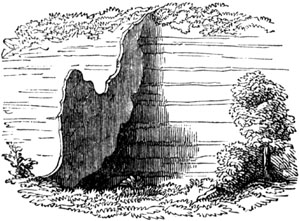
Dike in inland valley, near the Brazen Head, Madeira.
In the islands of Arran, Skye, and other parts of Scotland, where
sandstone, conglomerate, and other hard rocks are traversed by dikes of
trap, the converse of the above phenomenon is seen. The dike having
decomposed more rapidly than the containing rock, has once more left open
the original [p.379]fissure, often for a distance of many yards inland
from the sea-coast, as represented in the annexed view (fig. 440.). In
these instances, the greenstone of the dike is usually more tough and hard
than the sandstone; but chemical action, and chiefly the oxidation of the
iron, has given rise to the more rapid decay.
Fig. 440.

Fissures left vacant by decomposed trap. Strathaird,
Skye. (MacCulloch.)
There is yet another case, by no means uncommon in Arran and other parts of
Scotland, where the strata in contact with the dike, and for a certain
distance from it, have been hardened, so as to resist the action of the
weather more than the dike itself, or the surrounding rocks. When this
happens, two parallel walls of indurated strata are seen protruding above
the general level of the country, and following the course of the dike.
Fig. 441.

Trap veins in Airdnamurchan.
As fissures sometimes send off branches, or divide into two or more
fissures of equal size, so also we find trap dikes bifurcating and
ramifying, and sometimes they are so tortuous as to be called veins, though
this is more common in granite than in trap. The accompanying sketch (fig.
441.) by Dr. MacCulloch represents part of a sea-cliff in Argyleshire,
where an overlying mass of trap, b, sends out some veins which terminate
downwards. Another trap vein, a a, cuts through both the limestone, c,
and the trap, b.
In fig. 442., a ground plan is given of a ramifying dike of greenstone,
which I observed cutting through sandstone on the beach near Kildonan
Castle, in Arran. The larger branch varies from 5 to 7 feet in width, which
will afford a scale of measurement for the whole.
Fig. 442.
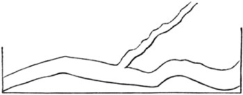
Ground plan of greenstone dike traversing sandstone. Arran.
In the Hebrides and other countries, the same masses of trap which occupy
the surface of the country far and wide, concealing the subjacent
stratified rocks, are seen also in the sea cliffs, prolonged downwards in
veins or dikes, which probably unite with other masses [p.380]of igneous
rock at a greater depth. The largest of the dikes represented in the
annexed diagram, and which are seen in part of the coast of Skye, is no
less than 100 feet in width.
Fig. 443.
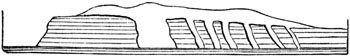
Trap dividing and covering sandstone near Suishnish in
Skye. (MacCulloch.)
Every variety of trap-rock is sometimes found in these dikes, as basalt,
greenstone, felspar-porphyry, and more rarely trachyte. The amygdaloidal
traps also occur, and even tuff and breccia, for the materials of these
last may be washed down into open fissures at the bottom of the sea, or
during eruptions on the land may be showered into them from the air.
Some dikes of trap may be followed for leagues uninterruptedly in nearly a
straight direction, as in the north of England, showing that the fissures
which they fill must have been of extraordinary length.
Dikes more crystalline in the centre.—In many cases trap at the edges or
sides of a dike is less crystalline or more earthy than in the centre, in
consequence of the melted matter having cooled more rapidly by coming in
contact with the cold sides of the fissure; whereas, in the centre, the
matter of the dike being kept long in a fluid or soft state, the crystals
are slowly formed. In the ancient part of Vesuvius, called Somma, a thin
band of half-vitreous lava is found at the edge of some dikes. At the
junction of greenstone dikes with limestone, a sahlband, or selvage, of
serpentine is occasionally observed.
Fig. 444.
Syenitic greenstone dike of Næsodden, Christiania.

b. imbedded fragment of crystalline schist surrounded by a band of
greenstone.
On the left shore of the fiord of Christiania, in Norway, I examined, in
company with Professor Keilhau, a remarkable dike of syenitic greenstone,
which is traced through Silurian strata, until at length, in the promontory
of Næsodden, it enters mica-schist. Fig. 444. represents a ground plan,
where the dike appears 8 paces in width. In the middle it is highly
crystalline and granitiform, of a purplish colour, and containing a few
crystals of mica, and strongly contrasted with the whitish mica-schist,
between which and the syenitic rock there is usually on each side a
distinct black band, 18 inches wide, of dark greenstone. When first seen,
these bands have the appearance of two accompanying dikes; yet they are, in
fact, only the different form which the syenitic materials have assumed
where near to or in contact with the [p.381]mica-schist. At one point,
a, one of the sahlbands terminates for a space; but near this there is a
large detached block, b, having a gneiss-like structure, consisting of
hornblende and felspar, which is included in the midst of the dike. Round
this a smaller encircling zone is seen, of dark basalt, or fine-grained
greenstone, nearly corresponding to the larger ones which border the dike,
but only 1 inch wide.
It seems, therefore, evident that the fragment, b, has acted on the
matter of the dike, probably by causing it to cool more rapidly, in the
same manner as the walls of the fissure have acted on a larger scale. The
facts, also, illustrate the facility with which a granitiform syenite may
pass into ordinary rocks of the volcanic family.
Fig. 445.

Greenstone dike, with fragments of gneiss. Sorgenfri, Christiania.
The fact above alluded to, of a foreign fragment, such as b, fig. 444.,
included in the midst of the trap, as if torn off from some subjacent rock
or the walls of a fissure, is by no means uncommon. A fine example is seen
in another dike of greenstone, 10 feet wide, in the northern suburbs of
Christiania, in Norway, of which the annexed figure is a ground plan. The
dike passes through shale, known by its fossils to belong to the Silurian
series. In the black base of greenstone are angular and roundish pieces of
gneiss, some white, others of a light flesh-colour, some without
lamination, like granite, others with laminæ, which, by their various and
often opposite directions, show that they have been scattered at random
through the matrix. These imbedded pieces of gneiss measure from 1 to about
8 inches in diameter.
Rocks altered by volcanic dikes.—After these remarks on the form and
composition of dikes themselves, I shall describe the alterations which
they sometimes produce in the rocks in contact with them. The changes are
usually such as the intense heat of melted matter and the entangled gases
might be expected to cause.
Plas-Newydd.—A striking example, near Plas-Newydd, in Anglesea, has been
described by Professor Henslow.[381-A] The dike is 134 feet wide, and
consists of a rock which is a compound of felspar and augite (dolerite of
some authors). Strata of shale and argillaceous limestone, through which it
cuts perpendicularly, are altered to a distance of 30, or even, in some
places, to 35 feet from the edge of the dike. The shale, as it approaches
the trap, becomes gradually more compact, and is most indurated where
nearest the junction. Here it loses part of its schistose structure, but
the separation into parallel layers is still discernible. In several places
the shale is converted into hard porcellanous jasper. In the most hardened
part of the mass the fossil shells, principally Producti, are nearly
obliterated; [p.382]yet even here their impressions may frequently be
traced. The argillaceous limestone undergoes analogous mutations, losing
its earthy texture as it approaches the dike, and becoming granular and
crystalline. But the most extraordinary phenomenon is the appearance in the
shale of numerous crystals of analcime and garnet, which are distinctly
confined to those portions of the rock affected by the dike.[382-A] Some
garnets contain as much as 20 per cent. of lime, which they may have
derived from the decomposition of the fossil shells or Producti. The same
mineral has been observed, under very analogous circumstances, in High
Teesdale, by Professor Sedgwick, where it also occurs in shale and
limestone, altered by basalt.[382-B]
Antrim.—In several parts of the county of Antrim, in the north of
Ireland, chalk with flints is traversed by basaltic dikes. The chalk is
there converted into granular marble near the basalt, the change sometimes
extending 8 or 10 feet from the wall of the dike, being greatest near the
point of contact, and thence gradually decreasing till it becomes
evanescent. "The extreme effect," says Dr. Berger, "presents a dark brown
crystalline limestone, the crystals running in flakes as large as those of
coarse primitive (metamorphic) limestone; the next state is saccharine,
then fine grained and arenaceous; a compact variety, having a porcellanous
aspect and a bluish-grey colour, succeeds: this, towards the outer edge,
becomes yellowish-white, and insensibly graduates into the unaltered chalk.
The flints in the altered chalk usually assume a grey yellowish
colour."[382-C] All traces of organic remains are effaced in that part of
the limestone which is most crystalline.
Fig. 446.
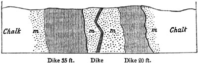
Basaltic dikes in chalk in island of Rathlin, Antrim. Ground plan,
as seen on the beach. (Conybeare and Buckland.
[382-D])
The annexed drawing (fig. 446.) represents three basaltic dikes traversing
the chalk, all within the distance of 90 feet. The chalk contiguous to the
two outer dikes is converted into a finely granular marble, m m, as are
the whole of the masses between the outer dikes and the central one. The
entire contrast in the composition and colour of the intrusive and invaded
rocks, in these cases, renders the phenomena peculiarly clear
and interesting.
Another of the dikes of the north-east of Ireland has converted a mass of
red sandstone into hornstone.[382-E] By another, the slate clay [p.383]
of the coal measures has been indurated, and has assumed the character of
flinty slate[383-A]; and in another place the slate clay of the lias has
been changed into flinty slate, which still retains numerous impressions of
ammonites.[383-B]
It might have been anticipated that beds of coal would, from their
combustible nature, be effected in an extraordinary degree by the contact
of melted rock. Accordingly, one of the greenstone dikes of Antrim, on
passing through a bed of coal, reduces it to a cinder for the space of 9
feet on each side.[383-C]
At Cockfield Fell, in the north of England, a similar change is observed.
Specimens taken at the distance of about 30 yards from the trap are not
distinguishable from ordinary pit coal; those nearer the dike are like
cinders, and have all the character of coke; while those close to it are
converted into a substance resembling soot.[383-D]
As examples might be multiplied without end, I shall merely select one or
two others, and then conclude. The rock of Stirling Castle is a calcareous
sandstone, fractured and forcibly displaced by a mass of greenstone which
has evidently invaded the strata in a melted state. The sandstone has been
indurated, and has assumed a texture approaching to hornstone near the
junction. In Arthur's Seat and Salisbury Craig, near Edinburgh, a sandstone
which comes in contact with greenstone is converted into a jaspideous
rock.[383-E]
The secondary sandstones in Skye are converted into solid quartz in several
places, where they come in contact with veins or masses of trap; and a bed
of quartz, says Dr. MacCulloch, found near a mass of trap, among the coal
strata of Fife, was in all probability a stratum of ordinary sandstone,
having been subsequently indurated and turned into quartzite by the action
of heat.[383-F]
But although strata in the neighbourhood of dikes are thus altered in a
variety of cases, shale being turned into flinty slate or jasper, limestone
into crystalline marble, sandstone into quartz, coal into coke, and the
fossil remains of all such strata wholly and in part obliterated, it is by
no means uncommon to meet with the same rocks, even in the same districts,
absolutely unchanged in the proximity of volcanic dikes.
This great inequality in the effects of the igneous rocks may often arise
from an original difference in their temperature, and in that of the
entangled gases, such as is ascertained to prevail in different lavas, or
in the same lava near its source and at a distance from it. The power also
of the invaded rocks to conduct heat may vary, according to their
composition, structure, and the fractures which they may have experienced,
and perhaps, also, according to the quantity of water (so capable of being
heated) which they contain. It must happen in some cases that the component
materials are mixed [p.384]in such proportions as prepare them readily
to enter into chemical union, and form new minerals; while in other cases
the mass may be more homogeneous, or the proportions less adapted for such
union.
We must also take into consideration, that one fissure may be simply filled
with lava, which may begin to cool from the first; whereas in other cases
the fissure may give passage to a current of melted matter, which may
ascend for days or months, feeding streams which are overflowing the
country above, or are ejected in the shape of scoriæ from some crater. If
the walls of a rent, moreover, are heated by hot vapour before the lava
rises, as we know may happen on the flanks of a volcano, the additional
caloric supplied by the dike and its gases will act more powerfully.
Fig. 447.

Trap interposed between displaced beds of limestone and shale, at White
Force, High Teesdale, Durham. (Sedgwick.[384-A])
Intrusion of trap between strata.—In proof of the mechanical force which
the fluid trap has sometimes exerted on the rocks into which it has
intruded itself, I may refer to the Whin-Sill, where a mass of basalt, from
60 to 80 feet in height, represented by a, fig. 447., is in part wedged
in between the rocks of limestone, b, and shale, c, which have been
separated from the great mass of limestone and shale, d, with which they
were united.
The shale in this place is indurated; and the limestone, which at a
distance from the trap is blue, and contains fossil corals, is here
converted into granular marble without fossils.
Masses of trap are not unfrequently met with intercalated between strata,
and maintaining their parallelism to the planes of stratification
throughout large areas. They must in some places have forced their way
laterally between the divisions of the strata, a direction in which there
would be the least resistance to an advancing fluid, if no vertical rents
communicated with the surface, and a powerful hydrostatic pressure was
caused by gases propelling the lava upwards.
Columnar and globular structure.—One of the characteristic forms of
volcanic rocks, especially of basalt, is the columnar, where large masses
are divided into regular prisms, sometimes easily separable, but in other
cases adhering firmly together. The columns vary in the number of angles,
from three to twelve; but they have most commonly from five to seven sides.
They are often divided transversely, at nearly equal distances, like the
joints in a vertebral column, as in the Giant's Causeway, in Ireland. They
vary exceedingly [p.385]in respect to length and diameter. Dr.
MacCulloch mentions some in Skye which are about 400 feet long; others, in
Morven, not exceeding an inch. In regard to diameter, those of Ailsa
measure 9 feet, and those of Morven an inch or less.[385-A] They are
usually straight, but sometimes curved; and examples of both these occur in
the island of Staffa. In a horizontal bed or sheet of trap the columns are
vertical; in a vertical dike they are horizontal. Among other examples of
the last-mentioned phenomenon is the mass of basalt, called the Chimney, in
St. Helena (see fig. 448.), a pile of hexagonal prisms, 64 feet high,
evidently the remainder of a narrow dike, the walls of rock which the dike
originally traversed having been removed down to the level of the sea. In
fig. 449. a small portion of this dike is represented on a less reduced
scale.[385-B]
Fig. 448.

Volcanic dike composed of horizontal prisms. St. Helena.
Fig. 449.

Small portion of the dyke in Fig. 448.
Fig. 450.

Lava of La Coupe d'Ayzac, near Antraigue, in the province of Ardèche.
It being assumed that columnar trap has consolidated from a fluid state,
the prisms are said to be always at right angles to the cooling surfaces.
If these surfaces, therefore, instead of being either perpendicular, or
horizontal, are curved, the columns ought to be inclined at every angle to
the horizon; and there is a beautiful exemplification of this phenomenon in
one of the valleys of the Vivarais, a mountainous district in the South of
France, where, in the midst of a region of gneiss, a geologist encounters
unexpectedly several volcanic cones of loose sand and scoriæ. From the
crater of one of [p.386]these cones called La Coupe d'Ayzac, a stream of
lava descends and occupies the bottom of a narrow valley, except at those
points where the river Volant, or the torrents which join it, have cut away
portions of the solid lava. The accompanying sketch (fig. 450.) represents
the remnant of the lava at one of the points where a lateral torrent joins
the main valley of the Volant. It is clear that the lava once filled the
whole valley up to the dotted line d a; but the river has gradually swept
away all below that line, while the tributary torrent has laid open a
transverse section; by which we perceive, in the first place, that the lava
is composed, as usual in this country, of three parts: the uppermost, at
a, being scoriaceous; the second, b, presenting irregular prisms; and
the third, c, with regular columns, which are vertical on the banks of
the Volant, where they rest on a horizontal base of gneiss, but which are
inclined at an angle of 45° at g, and then horizontal at f, their
position having been every where determined, according to the law before
mentioned, by the concave form of the original valley.
Fig 451.

Columnar basalt in the Vicentin. (Fortis.)
In the annexed figure (451.) a view is given of some of the inclined and
curved columns which present themselves on the sides of the valleys in the
hilly region north of Vicenza, in Italy, and at the foot of the higher
Alps.[386-A] Unlike those of the Vivarais, last mentioned, the basalt of
this country was evidently submarine, and the present valleys have since
been hollowed out by denudation.
The columnar structure is by no means peculiar to the trap rocks in which
hornblende or augite predominate; it is also observed in clinkstone,
trachyte, and other felspathic rocks of the igneous class, although in
these it is rarely exhibited in such regular polygonal forms.
Fig. 452.

Basaltic pillars of the Käsegrotte, Bertrich-Baden, half way between
Treves and Coblentz. Height of grotto, from 7 to 8 feet.
[p.387]It has been already stated that basaltic columns are often
divided by cross joints. Sometimes each segment, instead of an angular,
assumes a spheroidal form, so that a pillar is made up of a pile of balls,
usually flattened, as in the Cheese-grotto at Bertrich-Baden, in the Eifel,
near the Moselle (fig. 452.). The basalt, there, is part of a small stream
of lava, from 30 to 40 feet thick, which has proceeded from one of several
volcanic craters, still extant, on the neighbouring heights. The position
of the lava bordering the river in this valley might be represented by a
section like that already given at fig. 450. p. 385., if we merely supposed
inclined strata of slate and the argillaceous sandstone called greywacké to
be substituted for gneiss.
In some masses of decomposing greenstone, basalt, and other trap rocks, the
globular structure is so conspicuous that the rock has the appearance of a
heap of large cannon balls.
Fig. 453.

Globiform pitchstone. Chiaja di Luna, Isle of Ponza. (Scrope.)
A striking example of this structure occurs in a resinous trachyte or
pitchstone-porphyry in one of the Ponza islands, which rise from the
Mediterranean, off the coast of Terracina and Gaeta. The globes vary from a
few inches to three feet in diameter, and are of an ellipsoidal form (see
fig. 453.). The whole rock is in a state of decomposition, "and when the
balls," says Mr. Scrope, "have been exposed a short time to the weather,
they scale off at a touch into numerous concentric coats, like those of a
bulbous root, inclosing a compact nucleus. The laminæ of this nucleus have
not been so much loosened by decomposition; but the application of a ruder
blow will produce a still further exfoliation."[387-A]
A fissile texture is occasionally assumed by clinkstone and other trap
rocks, so that they have been used for roofing houses. Sometimes the
prismatic and slaty structure is found in the same mass. The causes which
give rise to such arrangements are very obscure, but are supposed to be
connected with changes of temperature during the cooling of the mass, as
will be pointed out in the sequel. (See Chaps. XXXV. and XXXVI.)
Relation of Trappean Rocks to the products of active Volcanos.
When we reflect on the changes above described in the strata near their
contact with trap dikes, and consider how great is the analogy in
composition and structure of the rocks called trappean and the lavas of
active volcanos, it seems difficult at first to understand how so much
doubt could have prevailed for half a century as to whether [p.388]trap
was of igneous or aqueous origin. To a certain extent, however, there was a
real distinction between the trappean formations and those to which the
term volcanic was almost exclusively confined. The trappean rocks first
studied in the north of Germany, and in Norway, France, Scotland, and other
countries, were either such as had been formed entirely under deep water,
or had been injected into fissures and intruded between strata, and which
had never flowed out in the air, or over the bottom of a shallow sea. When
these products, therefore, of submarine or subterranean igneous action were
contrasted with loose cones of scoriæ, tuff, and lava, or with narrow
streams of lava in great part scoriaceous and porous, such as were observed
to have proceeded from Vesuvius and Etna, the resemblance seemed remote and
equivocal. It was, in truth, like comparing the roots of a tree with its
leaves and branches, which, although they belong to the same plant, differ
in form, texture, colour, mode of growth, and position. The external cone,
with its loose ashes and porous lava, may be likened to the light foliage
and branches, and the rocks concealed far below, to the roots. But it is
not enough to say of the volcano,
"quantum vertice in auras
Ætherias, tantum radice in Tartara tendit,"
for its roots do literally reach downwards to Tartarus, or to the regions
of subterranean fire; and what is concealed far below, is probably always
more important in volume and extent than what is visible above ground.
Fig. 454.

Strata intersected by a trap dike, and covered with alluvium.
We have already stated how frequently dense masses of strata have been
removed by denudation from wide areas (see Chap. VI.); and this fact
prepares us to expect a similar destruction of whatever may once have
formed the uppermost part of ancient submarine or subaerial volcanos, more
especially as those superficial parts are always of the lightest and most
perishable materials. The abrupt manner in which dikes of trap usually
terminate at the surface (see fig. 454.), and the water-worn pebbles of
trap in the alluvium which covers the dike, prove incontestably that
whatever was uppermost in these formations has been swept away. It is easy,
therefore, to conceive that what is gone in regions of trap may have
corresponded to what is now visible in active volcanos.
It will be seen in the following chapters, that in the earth's crust there
are volcanic tuffs of all ages, containing marine shells, which bear
witness to eruptions at many successive geological periods. These tuffs,
and the associated trappean rocks, must not be compared to lava and scoriæ
which had cooled in the open air. Their counterparts must be sought in the
products of modern submarine volcanic eruptions. If it be objected that we
have no opportunity of studying [p.389]these last, it may be answered,
that subterranean movements have caused, almost everywhere in regions of
active volcanos, great changes in the relative level of land and sea, in
times comparatively modern, so as to expose to view the effects of volcanic
operations at the bottom of the sea.
Thus, for example, the recent examination of the igneous rocks of Sicily,
especially those of the Val di Noto, has proved that all the more ordinary
varieties of European trap have been there produced under the waters of the
sea, at a modern period; that is to say, since the Mediterranean has been
inhabited by a great proportion of the existing species of testacea.
These igneous rocks of the Val di Noto, and the more ancient trappean rocks
of Scotland and other countries, differ from subaerial volcanic formations
in being more compact and heavy, and in forming sometimes extensive sheets
of matter intercalated between marine strata, and sometimes stratified
conglomerates, of which the rounded pebbles are all trap. They differ also
in the absence of regular cones and craters, and in the want of conformity
of the lava to the lowest levels of existing valleys.
It is highly probable, however, that insular cones did exist in some parts
of the Val di Noto: and that they were removed by the waves, in the same
manner as the cone of Graham island, in the Mediterranean, was swept away
in 1831, and that of Nyöe, off Iceland, in 1783.[389-A] All that would
remain in such cases, after the bed of the sea has been upheaved and laid
dry, would be dikes and shapeless masses of igneous rock, cutting through
sheets of lava which may have spread over the level bottom of the sea, and
strata of tuff, formed of materials first scattered far and wide by the
winds and waves, and then deposited. Trap conglomerates also, to which the
action of the waves must give rise during the denudation of such volcanic
islands, will emerge from the deep whenever the bottom of the sea becomes
land.
The proportion of volcanic matter which is originally submarine must always
be very great, as those volcanic vents which are not entirely beneath the
sea, are almost all of them in islands, or, if on continents, near the
shore. This may explain why extended sheets of trap so often occur, instead
of narrow threads, like lava streams. For, a multitude of causes tend, near
the land, to reduce the bottom of the sea to a nearly uniform level,—the
sediment of rivers,—materials transported by the waves and currents of the
sea from wasting cliffs,—showers of sand and scoriæ ejected by volcanos,
and scattered by the wind and waves. When, therefore, lava is poured out on
such a surface, it will spread far and wide in every direction in a liquid
sheet, which may afterwards, when raised up, form the tabular capping of
the land.
As to the absence of porosity in the trappean formations, the appearances
are in a great degree deceptive, for all amygdaloids are, as [p.390]
already explained, porous rocks, into the cells of which mineral matter,
such as silex, carbonate of lime, and other ingredients, have been
subsequently introduced (see p. 373.); sometimes, perhaps, by secretion
during the cooling and consolidation of lavas.
In the Little Cumbray, one of the Western Islands, near Arran, the
amygdaloid sometimes contains elongated cavities filled with brown spar;
and when the nodules have been washed out, the interior of the cavities is
glazed with the vitreous varnish so characteristic of the pores of slaggy
lavas. Even in some parts of this rock which are excluded from air and
water, the cells are empty, and seem to have always remained in this state,
and are therefore undistinguishable from some modern lavas.[390-A]
Dr. MacCulloch, after examining with great attention these and the other
igneous rocks of Scotland, observes, "that it is a mere dispute about
terms, to refuse to the ancient eruptions of trap the name of submarine
volcanos; for they are such in every essential point, although they no
longer eject fire and smoke."[390-B] The same author also considers it not
improbable that some of the volcanic rocks of the same country may have
been poured out in the open air.[390-C]
Although the principal component minerals of subaerial lavas are the same
as those of intrusive trap, and both the columnar and globular structure
are common to both, there are, nevertheless, some volcanic rocks which
never occur as lava, such as greenstone, clinkstone, the more crystalline
porphyries, and those traps in which quartz and mica appear as constituent
parts. In short, the intrusive trap rocks, forming the intermediate step
between lava and the plutonic rocks, depart in their characters from lava
in proportion as they approximate to granite.
These views respecting the relations of the volcanic and trap rocks will be
better understood when the reader has studied, in the 33d chapter, what is
said of the plutonic formations.
FORM, STRUCTURE, AND ORIGIN OF VOLCANIC MOUNTAINS.
The origin of volcanic cones with crater-shaped summits has been alluded to
in the last chapter (p. 368.), and more fully explained in the "Principles
of Geology" (chaps. xxiv. to xxvii.), where Vesuvius, Etna, Santorin, and
Barren Island were described. The more ancient portions of those mountains
or islands, formed long before the times of history, exhibit the same
external features and internal structure which belong to most of the
extinct volcanos of still higher antiquity.
The island of Palma, for example, one of the Canaries, offers an excellent
illustration of what, in common with many others, I regard as the ruins of
a large dome-shaped mass formed by a series of eruptions proceeding from a
crater at the summit, this crater having [p.391]been since replaced by a
larger cavity, the origin of which has afforded geologists an ample field
for discussion and speculation.
Fig. 455.

View of the Isle of Palma, and of the entrance into the central
cavity or Caldera. From Von Buch's "Canary Islands."
Fig. 456.

Map of the Caldera of Palma and the great ravine, called "Barranco de
las Angustias." From Survey of Capt. Vidal, R.N., 1837.
Von Buch, in his excellent account of the Canaries, has given us a graphic
picture of this island, which consists chiefly of a single [p.392]
mountain (fig. 455.). This mountain has the general form of a great
truncated cone, with a huge and deep cavity in the middle, about six miles
in diameter, called by the inhabitants "the Caldera," or cauldron. The
range of precipices surrounding the Caldera are no less than 4000 feet in
their average height; at one point, where they are highest, they are 7730
feet above the level of the sea. The external flanks of the cone incline
gently in every direction towards the base of the island, and are in part
cultivated; but the walls and bottom of the Caldera present on all sides
rugged and uncultivated rocks, almost completely devoid of vegetation. So
steep are these walls, that there is no part by which they can be
descended, and the only entrance is by a great ravine, or Barranco, as it
is called (see b b', map, fig. 456.), which extends from the sea to the
interior of the great cavity, and by its jagged, broken, and precipitous
sides, exhibits to the geologist a transverse section of the rocks of which
the whole mountain is composed. By this means, we learn that the cone is
made up of a great number of sloping beds, which dip outwards in every
direction from the centre of the void space, or from the hollow axis of the
cone. The beds consist chiefly of sheets of basalt, alternating with
conglomerates; the materials of the latter being in part rounded, as if
rolled by water in motion. The inclination of all the beds corresponds to
that of the external slope of the island, being greatest towards the
Caldera, and least steep when they are nearest the sea. There are a great
number of tortuous veins, and many dikes of lava or trap, chiefly basaltic,
and most of them vertical, which cut through the sloping beds laid open to
view in the great gorge or Barranco. These dikes and veins are more and
more abundant as we approach the Caldera, being therefore most numerous
where the slope of the beds is greatest.
Assuming the cone to be a pile of volcanic materials ejected by a long
succession of eruptions (a point on which all geologists are agreed), we
have to account for the Caldera and the great Barranco. I conceive that the
cone itself may be explained, in accordance with what we know of the
ordinary growth of volcanos[392-A], by supposing most of the eruptions to
have taken place from one or more central vents, at or near the summit of
the cone, before it was truncated. From this culminating point, sheets of
lava flowed down one after the other, and showers of ashes or ejected
stones. The volcano may, in the earlier stages of its growth, have been in
great part submerged, like Stromboli, in the sea; and, therefore, some of
the fragments of rock cast out of its crater may not only have been rolled
by torrents sweeping down the mountain's side, but have also been rounded
by the waves of the sea, as we see happen on the beach near Catania, on
which the modern lavas of Etna are broken up. The increased number of
dykes, as we approach the axis of the cone, agrees well with the hypothesis
of the eruptions having been most frequent towards the centre.
There are three known causes or modes of operation, which may [p.393]
have conduced towards the vast size of the Caldera. First, the summit of a
conical mountain may have fallen in, as happened in the case of Capacurcu,
one of the Andes, according to tradition, in the year 1462, and of many
other volcanic mountains.[393-A] Sections seem wanting, to supply us with
all the data required for judging fairly of the tenability of this
hypothesis. It appears, however, from Captain Vidal's survey (see fig.
456.), that a hill of considerable height rises up from the bottom of the
Caldera, the structure of which, if it be any where laid open, might
doubtless throw much light on this subject. Secondly, an original crater
may have been enlarged by a vast gaseous explosion, never followed by any
subsequent eruption. A serious objection to this theory arises from our not
finding that the exterior of the cone supports a mass of ruins, such as
ought to cover it, had so enormous a volume of matter, partly made up of
the solid contents of the dikes, been blown out into the air. In that case,
an extensive bed of angular fragments of stone, and of fine dust, might be
looked for, enveloping the entire exterior of the mountain up to the very
rim of the Caldera, and ought nowhere to be intersected by a dike. The
absence of such a formation has induced Von Buch to suppose that the
missing portion of the cone was engulphed. It should, however, be
remembered, that in existing volcanos, large craters, two or three miles in
diameter, are sometimes formed by explosions, or by the discharge of great
volumes of steam.
There is yet another cause to which the extraordinary dimensions of the
Caldera may, in part at least, be owing; namely, aqueous denudation. Von
Buch has observed, that the existence of a single deep ravine, like the
Great Barranco, is a phenomenon common to many extinct volcanos, as well as
to some active ones. Now, it will be seen by Captain Vidal's map (fig. 456.
p. 391.), that the sea-cliff at Point Juan Graje, 780 feet high, now
constituting the coast at the entrance of the great ravine, is continuous
with an inland cliff which bounds the same ravine on its north-western
side. No one will dispute that the precipice, at the base of which the
waves are now beating, owes its origin to the undermining power of the sea.
It is natural, therefore, to attribute the extension of the same cliff to
the former action of the waves, exerted at a time when the relative level
of the island and the ocean were different from what they are now. But if
the waves and tides had power to remove the rocks once filling a great
gorge which is 7 miles long, and, in its upper part, 2000 feet deep, can we
doubt that the same power may have cleared out much of the solid mass now
missing in the Great Caldera?
The theory advanced to account for the configuration of Palma, commonly
called the "elevation crater theory," is this. All the alternating masses
of basalt and conglomerate, intersected in the Barranco, or abruptly cut
off in the escarpment or walls of the Caldera, were at first disposed in
horizontal masses on the level floor of the ocean, and traversed, when in
that position, by all the basaltic dikes which now cut through them. At
length they were suddenly [p.394]uplifted by the explosive force of
elastic vapours, which raised the mass bodily, so as to tilt the beds on
all sides away from the centre of elevation, causing at the same time an
opening at the culminating point. Besides many other objections which may
be urged against this hypothesis, it leaves unexplained the unbroken
continuity of the rim of the Caldera, which is uninterrupted in all places
save one[394-A], namely, that where the great gorge or Barranco occurs.
As a more natural way of explaining the phenomenon, the following series of
events may be imagined. The principal vent, from which a large part of the
materials of the cone were poured or thrown out, was left empty after the
last escape of vapour, when the volcano became extinct. We learn from Mr.
Dana's valuable work on the geology of the United States' Exploring
Expedition, published in 1849, that two of the principal volcanos of the
Sandwich Islands, Mounts Loa and Kea in Owyhee, are huge flattened volcanic
cones, 15,000 feet high (see fig. 457.), each equalling two and a half
Etnas in their dimensions.
Fig. 457.

Mount Loa, in the Sandwich Islands. (Dana)
- a. Crater at the summit.
- b. The lateral crater of Kilauea.
The dotted lines indicate a supposed column of solid rock caused
by the lava consolidating after eruptions.
From the summits of these lofty though featureless hills, and from vents
not far below their summits, successive streams of lava, often 2 miles or
more in width, and sometimes 26 miles long, have flowed. They have been
poured out one after the other, some of them in recent times, in every
direction from the apex of the cone, down slopes varying on an average from
4 degrees to 8 degrees; but at some places considerably steeper.[394-B]
Sometimes deep rents open on the sides of these cones, which are filled by
streams of lava passing over them, the liquid matter in such cases probably
uniting in the fissure with other lava melted in subterranean reservoirs
below, and thus explaining the origin of one great class of lateral dikes,
on Etna, Palma, and other cones.
If the flattened domes, such as those here alluded to in the Sandwich
Islands, instead of being inland, and above water, were situated in
mid-ocean, like the Island of St. Paul, and for the most part submerged
(see figs. 458, 459, 460.), and if a gradual upheaval of such a dome should
then take place, the denuding power of the sea could scarcely fail to play
an important part in modifying the form of the volcanic mountain as it
rose. The crater will almost invariably have one side much lower than all
the others, namely, that side towards which the prevailing winds never
blow, and to which, therefore, showers of dust and scoriæ are rarely
carried during eruptions. There will also be one point on this windward or
lowest side more depressed than all the rest, by which the sea may enter as
often as the tide rises, or as often [p.395]as the wind blows from that
quarter. For the same reason that the sea continues to keep open a single
entrance into the lagoon of an atoll or annular coral reef, it will not
allow this passage into the crater to be stopped up, but scour it out, at
low tide, or as often as the wind changes. The channel, therefore, will
always be deepened in proportion as the island rises above the level of the
sea, at the rate perhaps of a few feet or yards in a century.
Fig. 458.

Map of the Island of St. Paul, in the Indian Ocean, lat. 38° 44´ S.,
long. 77° 37´ E., surveyed by Capt. Blackwood, R. N., 1842.
Fig. 459.
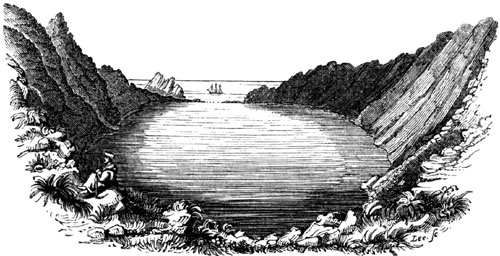
View of the Crater of the Island of St. Paul.
The island of St. Paul may perhaps be motionless; but if, like many
[p.396]other parts of the earth's crust, it should begin to undergo a
gradual upheaval, or if, as has happened to the shores of the Bay of Baiæ,
its level should oscillate, with a tendency upon the whole to increased
elevation, the same power which has cut away part of the cone, and caused
the cliffs now seen on the north-east side of the island, would have power
to undermine the walls of the crater, and enlarge its diameter, keeping
open the channel, by which it enters into it. This ravine might be
excavated to the depth of 180 feet (the present depth of the crater), and
its length might be extended to many miles according to the size of the
submerged part of the cone. The crater is only a mile in diameter, and the
surrounding cliffs, where loftiest, only 800 feet high, so that the size of
this cone and crater is insignificant when compared to those in the
Sandwich Islands, and I have merely selected it because it affords an
example of a class of insular volcanos, into the craters of which the sea
now enters by a single passage. The crater of Vesuvius in 1822 was 2000
feet deep; and if it were a half submerged cone, like St. Paul, the
excavating power of the ocean might in conjunction with gaseous explosions
and co-operating with a gradual upheaving force, give rise to a caldera on
as grand a scale as that exhibited by Palma.
Fig. 460.

Side view of the Island of St. Paul (N.E. side).
Nine-pin rocks two miles distant. (Captain Blackwood.)
If, after the geographical changes above supposed, the volcanic fires long
dormant should recover their energy, they might, as in the case of
Teneriffe, Vesuvius, Santorin, and Barren Island, discharge from the old
central vent, long sealed up at the bottom of the caldera, new floods of
lava and clouds of elastic vapours. Should this happen, a new cone will be
built up in the middle of the cavity or circular bay, formed, partly by
explosion, partly perhaps by engulphment, and partly by aqueous denudation.
In the island of Palma this last phase of volcanic activity has never
occurred; but the subterranean heat is still in full operation beneath the
Canary Islands, so that we know not what future changes it may be destined
to undergo.
[p.397]CHAPTER XXX.
ON THE DIFFERENT AGES OF THE VOLCANIC ROCKS.
Tests of relative age of volcanic rocks — Test by superposition and
intrusion — Dike of Quarrington Hill, Durham — Test by alteration
of rocks in contact — Test by organic remains — Test of age by
mineral character — Test by included fragments — Volcanic rocks of
the Post-Pliocene period — Basalt of Bay of Trezza in
Sicily — Post-Pliocene volcanic rocks near Naples — Dikes of
Somma — Igneous formations of the Newer Pliocene period — Val di
Noto in Sicily.
Having referred the sedimentary strata to a long succession of geological
periods, we have next to consider how far the volcanic formations can be
classed in a similar chronological order. The tests of relative age in this
class of rocks are four:—1st, superposition and intrusion, with or without
alteration of the rocks in contact; 2d, organic remains; 3d, mineral
character; 4th, included fragments of older rocks.
Fig. 461.

Tests by superposition, &c.—If a volcanic rock rests upon an aqueous
deposit, the former must be the newest of the two, but the like rule does
not hold good where the aqueous formation rests upon the volcanic, for
melted matter, rising from below, may penetrate a sedimentary mass without
reaching the surface, or may be forced in conformably between two strata,
as b at D in the annexed figure (fig. 461.), after which it may cool down
and consolidate. Superposition, therefore, is not of the same value as a
test of age in the unstratified volcanic rocks as in fossiliferous
formations. We can only rely implicitly on this test where the volcanic
rocks are contemporaneous, not where they are intrusive. Now they are said
to be contemporaneous if produced by volcanic action, which was going on
simultaneously with the deposition of the strata with which they are
associated. Thus in the section at D (fig. 461.), we may perhaps ascertain
that the trap b flowed over the fossiliferous bed c, and that, after
its consolidation, a was deposited upon it, a and c both belonging to
the same geological period. But if the stratum a be altered by b at the
point of contact, we must then conclude the trap to have been intrusive, or
if, in pursuing b for some distance, we find at length that it cuts
through the stratum a, and then overlies it as at E.
We may, however, be easily deceived in supposing a volcanic rock to be
intrusive, when in reality it is contemporaneous; for a sheet of lava, as
it spreads over the bottom of the sea, cannot rest everywhere [p.398]
upon the same stratum, either because these have been denuded, or because,
if newly thrown down, they thin out in certain places, thus allowing the
lava to cross their edges. Besides, the heavy igneous fluid will often, as
it moves along, cut a channel into beds of soft mud and sand. Suppose the
submarine lava F to have come in contact in this manner with the strata
a, b, c, and that after its consolidation, the strata d, e, are
thrown down in a nearly horizontal position, yet so as to lie unconformably
to F, the appearance of subsequent intrusion will here be complete,
although the trap is in fact contemporaneous. We must not, therefore,
hastily infer that the rock F is intrusive, unless we find the
strata d or e to have been altered at their junction, as if
by heat.
Fig. 462.

When trap dikes were described in the preceding chapter, they were shown to
be more modern than all the strata which they traverse. A basaltic dike at
Quarrington Hill, near Durham, passes through coal-measures, the strata of
which are inclined, and shifted so that those on the north side of the dike
are 24 feet above the level of the corresponding beds on the south side
(see section, fig. 463.). But the horizontal beds of overlying Red
Sandstone and Magnesian Limestone are not cut through by the dike. Now here
the coal-measures were not only deposited, but had subsequently been
disturbed, fissured, and shifted, before the fluid trap now forming the
dike was introduced into a rent. It is also clear that some of the upper
edges of the coal strata, together with the upper part of the dike, had
been subsequently removed by denudation before the lower New Red Sandstone
and Magnesian Limestone were superimposed. Even in this case, however,
although the date of the volcanic eruption is brought within narrow limits,
it cannot be defined with precision; it may have happened either at the
close of the Carboniferous period, or early in that of the Lower New Red
Sandstone, or between these two periods, when the state of the animate
creation and the physical geography of Europe were gradually changing from
the type of the Carboniferous era to that of the Permian.
Fig. 463.

Section at Quarrington Hill, east of Durham. (Sedgwick.)
- a. Magnesian Limestone (Permian).
- b. Lower New Red Sandstone.
- c. Coal strata.
[p.399]The test of age by superposition is strictly applicable to all
stratified volcanic tuffs, according to the rules already explained in the
case of other sedimentary deposits. (See p. 96.)
Test of age by organic remains.—We have seen how, in the vicinity of
active volcanos, scoriæ, pumice, fine sand, and fragments of rock are
thrown up into the air, and then showered down upon the land, or into
neighbouring lakes or seas. In the tuffs so formed shells, corals, or any
other durable organic bodies which may happen to be strewed over the bottom
of a lake or sea will be imbedded, and thus continue as permanent memorials
of the geological period when the volcanic eruption occurred. Tufaceous
strata thus formed in the neighbourhood of Vesuvius, Etna, Stromboli, and
other volcanos now active in islands or near the sea, may give information
of the relative age of these tuffs at some remote future period when the
fires of these mountains are extinguished. By such evidence we can
distinctly establish the coincidence in age of volcanic rocks, and the
different primary, secondary, and tertiary fossiliferous strata already
considered.
The tuffs now alluded to are not exclusively marine, but include, in some
places, freshwater shells; in others, the bones of terrestrial quadrupeds.
The diversity of organic remains in formations of this nature is perfectly
intelligible, if we reflect on the wide dispersion of ejected matter during
late eruptions, such as that of the volcano of Coseguina, in the province
of Nicaragua, January 19. 1835. Hot cinders and fine scoriæ were then cast
up to a vast height, and covered the ground as they fell to the depth of
more than 10 feet, and for a distance of 8 leagues from the crater in a
southerly direction. Birds, cattle, and wild animals were scorched to death
in great numbers, and buried in these ashes. Some volcanic dust fell at
Chiapa, upwards of 1200 miles to windward of the volcano, a striking proof
of a counter current in the upper region of the atmosphere; and some on
Jamaica, about 700 miles distant to the north-east. In the sea, also, at
the distance of 1100 miles from the point of eruption, Captain Eden of the
Conway sailed 40 miles through floating pumice, among which were some
pieces of considerable size.[399-A]
Test of age by mineral composition.—As sediment of homogeneous
composition, when discharged from the mouth of a large river, is often
deposited simultaneously over a wide space, so a particular kind of lava,
flowing from a crater during one eruption, may spread over an extensive
area; as in Iceland in 1783, when the melted matter, pouring from Skaptar
Jokul, flowed in streams in opposite directions, and caused a continuous
mass, the extreme points of which were 90 miles distant from each other.
This enormous current of lava varied in thickness from 100 feet to 600
feet, and in breadth from that of a narrow river gorge to 15 miles.[399-B]
Now, if such a mass should afterwards be divided into separate fragments by
[p.400]denudation, we might still perhaps identify the detached portions
by their similarity in mineral composition. Nevertheless, this test will
not always avail the geologist; for, although there is usually a prevailing
character in lava emitted during the same eruption, and even in the
successive currents flowing from the same volcano, still, in many cases,
the different parts even of one lava-stream, or, as before stated, of one
continuous mass of trap, vary so much in mineral composition and texture as
to render these characters of minor importance when compared to their value
in the chronology of the fossiliferous rocks.
It will, however, be seen in the description which follows, of the European
trap rocks of different ages, that they had often a peculiar lithological
character, resembling the differences before remarked as existing between
the modern lavas of Vesuvius, Etna, and Chili. (See p. 378.)
It has been remarked that in Auvergne, the Eifel, and other countries where
trachyte and basalt are both present, the trachytic rocks are for the most
part older than the basaltic. These rocks do, indeed, sometimes alternate
partially, as in the volcano of Mont Dor, in Auvergne; but the great mass
of trachyte occupies in general an inferior position, and is cut through
and overflowed by basalt. It can by no means be inferred that trachyte
predominated greatly at one period of the earth's history and basalt at
another, for we know that trachytic lavas have been formed at many
successive periods, and are still emitted from many active craters; but it
seems that in each region, where a long series of eruptions have occurred,
the more felspathic lavas have been first emitted, and the escape of the
more augitic kinds has followed. The hypothesis suggested by Mr. Scrope
may, perhaps, afford a solution of this problem. The minerals, he observes,
which abound in basalt are of greater specific gravity than those composing
the felspathic lavas; thus, for example, hornblende, augite, and olivine
are each more than three times the weight of water; whereas common felspar,
albite, and Labrador felspar, have each scarcely more than 21/2 times the
specific gravity of water; and the difference is increased in consequence
of there being much more iron in a metallic state in basalt and greenstone
than in trachyte and other felspathic lavas and traps. If, therefore, a
large quantity of rock be melted up in the bowels of the earth by volcanic
heat, the denser ingredients of the boiling fluid may sink to the bottom,
and the lighter remaining above would in that case be first propelled
upwards to the surface by the expansive power of gases. Those materials,
therefore, which occupied the lowest place in the subterranean reservoir
will always be emitted last, and take the uppermost place on the exterior
of the earth's crust.
Test by included fragments.—We may sometimes discover the relative age
of two trap rocks, or of an aqueous deposit and the trap on which it rests,
by finding fragments of one included in the other, in cases such as those
before alluded to, where the evidence of superposition alone would be
insufficient. It is also not uncommon to find [p.401]conglomerates
almost exclusively composed of rolled pebbles of trap, associated with
stratified rocks in the neighbourhood of masses of intrusive trap. If the
pebbles agree generally in mineral character with the latter, we are then
enabled to determine the age of the intrusive rock by knowing that of the
fossiliferous strata associated with the conglomerate. The origin of such
conglomerates is explained by observing the shingle beaches composed of
trap pebbles in modern volcanic islands, or at the base of Etna.
Post-Pliocene Period (including the Recent).—I shall now select examples
of contemporaneous volcanic rocks of successive geological periods, to show
that igneous causes have been in activity in all past ages of the world,
and that they have been ever shifting the places where they have broken out
at the earth's surface.
One portion of the lavas, tuffs, and trap dikes of Etna, Vesuvius, and the
Island of Ischia, has been produced within the historical era; another, and
a far more considerable part, originated at times immediately antecedent,
when the waters of the Mediterranean were already inhabited by the existing
species of testacea. The southern and eastern flanks of Etna are skirted by
a fringe of alternating sedimentary and volcanic deposits, of submarine
origin, as at Adernò, Trezza, and other places. Of sixty-five species of
fossil shells which I procured in 1828 from this formation, near Trezza, it
was impossible to distinguish any from species now living in the
neighbouring sea.
Fig. 464.

View of the Isle of Cyclops in the Bay of Trezza.[401-A]
The Cyclopian Islands, called by the Sicilians Dei Faraglioni, in the sea
cliffs of which these beds of clay, tuff, and associated lava are laid open
to view, are situated in the Bay of Trezza, and may be regarded as the
extremity of a promontory severed from the main land. Here numerous proofs
are seen of submarine eruptions, by which the argillaceous and sandy strata
were invaded and cut through, and tufaceous breccias formed. Inclosed in
these breccias are many angular [p.402]and hardened fragments of
laminated clay in different states of alteration by heat, and intermixed
with volcanic sands.
The loftiest of the Cyclopian islets, or rather rocks, is about 200 feet in
height, the summit being formed of a mass of stratified clay, the laminæ of
which are occasionally subdivided by thin arenaceous layers. These strata
dip to the N.W., and rest on a mass of columnar lava (see fig. 464.) in
which the tops of the pillars are weathered, and so rounded as to be often
hemispherical. In some places in the adjoining and largest islet of the
group, which lies to the north-eastward of that represented in the drawing
(fig. 464.), the overlying clay has been greatly altered, and hardened by
the igneous rock, and occasionally contorted in the most extraordinary
manner; yet the lamination has not been obliterated, but, on the contrary,
rendered much more conspicuous, by the indurating process.
Fig. 465.

Contortions of strata in the largest of the Cyclopian Islands.
In the annexed woodcut (fig. 465.) I have represented a portion of the
altered rock, a few feet square, where the alternating thin laminæ of sand
and clay have put on the appearance which we often observe in some of the
most contorted of the metamorphic schists.
A great fissure, running from east to west, nearly divides this larger
island into two parts, and lays open its internal structure. In the section
thus exhibited, a dike of lava is seen, first cutting through an older mass
of lava, and then penetrating the superincumbent tertiary strata. In one
place the lava ramifies and terminates in thin veins, from a few feet to a
few inches in thickness. (See fig. 466.)
The arenaceous laminæ are much hardened at the point of contact, and the
clays are converted into siliceous schist. In this island the altered rocks
assume a honeycombed structure on their weathered surface, singularly
contrasted with the smooth and even outline which the same beds present in
their usual soft and yielding state.
The pores of the lava are sometimes coated, or entirely filled, with
carbonate of lime, and with a zeolite resembling analcime, which has been
called cyclopite. The latter mineral has also been found in small fissures
traversing the altered marl, showing that the same cause [p.403]which
introduced the minerals into the cavities of the lava, whether we suppose
sublimation or aqueous infiltration, conveyed it also into the open rents
of the contiguous sedimentary strata.
Fig. 466.

Post-Pliocene strata invaded by lava, Isle of Cyclops
(horizontal section).
- a. Lava.
- b. Laminated clay and sand.
- c. The same altered.
Post-Pliocene formations near Naples.—I have traced in the "Principles
of Geology" the history of the changes which the volcanic region of
Campania is known to have undergone during the last 2000 years. The
aggregate effect of igneous operations during that period is far from
insignificant, comprising as it does the formation of the modern cone of
Vesuvius since the year 79, and the production of several minor cones in
Ischia, together with that of Monte Nuovo in the year 1538. Lava-currents
have also flowed upon the land and along the bottom of the sea—volcanic
sand, pumice, and scoriæ have been showered down so abundantly, that whole
cities were buried—tracts of the sea have been filled up or converted into
shoals—and tufaceous sediment has been transported by rivers and
land-floods to the sea. There are also proofs, during the same recent
period, of a permanent alteration of the relative levels of the land and
sea in several places, and of the same tract having, near Puzzuoli, been
alternately upheaved and depressed to the amount of more than 20 feet. In
connection with these convulsions, there are found, on the shores of the
Bay of Baiæ, recent tufaceous strata, filled with articles fabricated by
the hands of man, and mingled with marine shells.
It was also stated in this work (p. 113.), that when we examine this same
region, it is found to consist largely of tufaceous strata, of a date
anterior to human history or tradition, which are of such thickness as to
constitute hills from 500 to more than 2000 feet in height. These
post-pliocene strata, containing recent marine shells, alternate with
distinct currents and sheets of lava which were of contemporaneous origin;
and we find that in Vesuvius itself, the [p.404]ancient cone called
Somma is of far greater volume than the modern cone, and is intersected by
a far greater number of dikes. In contrasting this ancient part of the
mountain with that of modern date, one principal point of difference is
observed; namely, the greater frequency in the older cone of fragments of
altered sedimentary rocks ejected during eruptions. We may easily conceive
that the first explosions would act with the greatest violence, rending and
shattering whatever solid masses obstructed the escape of lava and the
accompanying gases, so that great heaps of ejected pieces of rock would
naturally occur in the tufaceous breccias formed by the earliest eruptions.
But when a passage had once been opened, and an habitual vent established,
the materials thrown out would consist of liquid lava, which would take the
form of sand and scoriæ, or of angular fragments of such solid lavas as may
have choked up the vent.
Among the fragments which abound in the tufaceous breccias of Somma, none
are more common than a saccharoid dolomite, supposed to have been derived
from an ordinary limestone altered by heat and volcanic vapours.
Carbonate of lime enters into the composition of so many of the simple
minerals found in Somma, that M. Mitscherlich, with much probability,
ascribes their great variety to the action of the volcanic heat on
subjacent masses of limestone.
Dikes of Somma.—The dikes seen in the great escarpment which Somma
presents towards the modern cone of Vesuvius are very numerous. They are
for the most part vertical, and traverse at right angles the beds of lava,
scoriæ, volcanic breccia, and sand, of which the ancient cone is composed.
They project in relief several inches, or sometimes feet, from the face of
the cliff, being extremely compact, and less destructible than the
intersected tuffs and porous lavas. In vertical extent they vary from a few
yards to 500 feet, and in breadth from 1 to 12 feet. Many of them cut all
the inclined beds in the escarpment of Somma from top to bottom, others
stop short before they ascend above half way, and a few terminate at both
ends, either in a point or abruptly. In mineral composition they scarcely
differ from the lavas of Somma, the rock consisting of a base of leucite
and augite, through which large crystals of augite and some of leucite are
scattered.[404-A] Examples are not rare of one dike cutting through
another, and in one instance a shift or fault is seen at the point of
intersection.
In some cases, however, the rents seem to have been filled laterally, when
the walls of the crater had been broken by star-shaped cracks, as seen in
the accompanying woodcut (fig. 467.). But the shape of these rents is an
exception to the general rule; for nothing is more remarkable than the
usual parallelism of the opposite sides of the dikes, which correspond
almost as regularly as the two opposite faces [p.405]of a wall of
masonry. This character appears at first the more inexplicable, when we
consider how jagged and uneven are the rents caused by earthquakes in
masses of heterogeneous composition, like those composing the cone of
Somma. In explanation of this phenomenon, M. Necker refers us to Sir W.
Hamilton's account of an eruption of Vesuvius in the year 1779, who records
the following facts:—"The lavas, when they either boiled over the crater,
or broke out from the conical parts of the volcano, constantly formed
channels as regular as if they had been cut by art down the steep part of
the mountain; and, whilst in a state of perfect fusion, continued their
course in those channels, which were sometimes full to the brim, and at
other times more or less so, according to the quantity of matter in motion.
Fig. 467.

Dikes or veins at the Punta del Nasone on Somma.
(Necker.[405-A])
"These channels, upon examination after an eruption, I have found to be in
general from two to five or six feet wide, and seven or eight feet deep.
They were often hid from the sight by a quantity of scoriæ that had formed
a crust over them; and the lava, having been conveyed in a covered way for
some yards, came out fresh again into an open channel. After an eruption, I
have walked in some of those subterraneous or covered galleries, which were
exceedingly curious, the sides, top, and bottom being worn perfectly
smooth and even in most parts, by the violence of the currents of the
red-hot lavas which they had conveyed for many weeks successively."[405-B]
Now, the walls of a vertical fissure, through which lava has ascended in
its way to a volcanic vent, must have been exposed to the same erosion as
the sides of the channels before adverted to. The prolonged and uniform
friction of the heavy fluid, as it is forced and made to flow upwards,
cannot fail to wear and smooth down the surfaces on which it rubs, and the
intense heat must melt all such masses as project and obstruct the passage
of the incandescent fluid.
[p.406]The texture of the Vesuvian dikes is different at the edges and in
the middle. Towards the centre, observes M. Necker, the rock is larger
grained, the component elements being in a far more crystalline state;
while at the edge the lava is sometimes vitreous, and always finer grained.
A thin parting band, approaching in its character to pitchstone,
occasionally intervenes, on the contact of the vertical dike and
intersected beds. M. Necker mentions one of these at the place called Primo
Monte, in the Atrio del Cavallo; and when on Somma, in 1828, I saw three or
four others in different parts of the great escarpment. These phenomena are
in perfect harmony with the results of the experiments of Sir James Hall
and Mr. Gregory Watt, which have shown that a glassy texture is the effect
of sudden cooling, and that, on the contrary, a crystalline grain is
produced where fused minerals are allowed to consolidate slowly and
tranquilly under high pressure.
It is evident that the central portion of the lava in a fissure would,
during consolidation, part with its heat more slowly than the sides,
although the contrast of circumstances would not be so great as when we
compare the lava at the bottom and at the surface of a current flowing in
the open air. In this case the uppermost part, where it has been in contact
with the atmosphere, and where refrigeration has been most rapid, is always
found to consist of scoriform, vitreous, and porous lava; while at a
greater depth the mass assumes a more lithoidal structure, and then becomes
more and more stony as we descend, until at length we are able to recognize
with a magnifying glass the simple minerals of which the rock is composed.
On penetrating still deeper, we can detect the constituent parts by the
naked eye, and in the Vesuvian currents distinct crystals of augite and
leucite become apparent.
The same phenomenon, observes M. Necker, may readily be exhibited on a
smaller scale, if we detach a piece of liquid lava from a moving current.
The fragment cools instantly, and we find the surface covered with a
vitreous coat; while the interior, although extremely fine-grained, has a
more stony appearance.
It must, however, be observed, that although the lateral portions of the
dikes are finer grained than the central, yet the vitreous parting layer
before alluded to is rare in Vesuvius. This may, perhaps, be accounted for,
as the above-mentioned author suggests, by the great heat which the walls
of a fissure may acquire before the fluid mass begins to consolidate, in
which case the lava, even at the sides, would cool very slowly. Some
fissures, also, may be filled from above, as frequently happens in the
volcanos of the Sandwich Islands, according to the observations of Mr.
Dana; and in this case the refrigeration at the sides would be more rapid
than when the melted matter flowed upwards from the volcanic foci, in an
intensely heated state. Mr. Darwin informs me that in St. Helena almost
every dike has a vitreous selvage.
The rock composing the dikes both in the modern and ancient part of
Vesuvius is far more compact than that of ordinary lava, for [p.407]the
pressure of a column of melted matter in a fissure greatly exceeds that in
an ordinary stream of lava; and pressure checks the expansion of those
gases which give rise to vesicles in lava.
There is a tendency in almost all the Vesuvian dikes to divide into
horizontal prisms, a phenomenon in accordance with the formation of
vertical columns in horizontal beds of lava; for in both cases the
divisions which give rise to the prismatic structure are at right angles to
the cooling surfaces.
Newer Pliocene Period—Val di Noto.—I have already alluded (see p. 150.)
to the igneous rocks which are associated with a great marine formation of
limestone, sand, and marl, in the southern part of Sicily, as at Vizzini
and other places. In this formation, which was shown to belong to the Newer
Pliocene period, large beds of oysters and corals repose upon lava, and are
unaltered at the point of contact. In other places we find dikes of igneous
rock intersecting the fossiliferous beds, and converting the clays into
siliceous schist, the laminæ being contorted and shivered into innumerable
fragments at the junction, as near the town of Vizzini.
The volcanic formations of the Val di Noto usually consist of the most
ordinary variety of basalt, with or without olivine. The rock is sometimes
compact, often very vesicular. The vesicles are occasionally empty, both in
dikes and currents, and are in some localities filled with calcareous spar,
arragonite, and zeolites. The structure is, in some places, spheroidal; in
others, though rarely, columnar. I found dikes of amygdaloid, wacké, and
prismatic basalt, intersecting the limestone at the bottom of the hollow
called Gozzo degli Martiri, below Melilli.
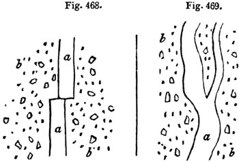
Fig. 468. Fig. 469. Ground-plan of dikes near Palagonia.
- a. Lava.
- b. Peperino, consisting of volcanic sand, mixed with
fragments of lava and limestone.
Dikes.—Dikes of vesicular and amygdaloidal lava are also seen traversing
marine tuff or peperino, west of Palagonia, some of the pores of the lava
being empty, while others are filled with carbonate of lime. In such cases,
we may suppose the peperino to have resulted from showers of volcanic sand
and scoriæ, together with fragments of limestone, thrown out by a submarine
explosion, similar to that which gave rise to Graham Island in 1831. When
the mass [p.408]was, to a certain degree, consolidated, it may have been
rent open, so that the lava ascended through fissures, the walls of which
were perfectly even and parallel. After the melted matter that filled the
rent in fig. 468. had cooled down, it must have been fractured and shifted
horizontally by a lateral movement.
In the second figure (fig. 469.), the lava has more the appearance of a
vein which forced its way through the peperino. It is highly probable that
similar appearances would be seen, if we could examine the floor of the sea
in that part of the Mediterranean where the waves have recently washed away
the new volcanic island; for when a superincumbent mass of ejected
fragments has been removed by denudation, we may expect to see sections of
dikes traversing tuff, or, in other words, sections of the channels of
communication by which the subterranean lavas reached the surface.
CHAPTER XXXI.
ON THE DIFFERENT AGES OF THE VOLCANIC ROCKS—continued.
Volcanic rocks of the Older Pliocene period — Tuscany — Rome
— Volcanic region of Olot in Catalonia — Cones and
lava-currents — Ravines and ancient gravel-beds — Jets of air
called Bufadors — Age of the Catalonian volcanos — Miocene
period — Brown-coal of the Eifel and contemporaneous trachytic
breccias — Age of the brown-coal — Peculiar characters of the
volcanos of the upper and lower Eifel — Lake craters — Trass
— Hungarian volcanos.
Older Pliocene period—Tuscany.—In Tuscany, as at Radicofani, Viterbo,
and Aquapendente, and in the Campagna di Roma, submarine volcanic tuffs are
interstratified with the Older Pliocene strata of the Subapennine hills, in
such a manner as to leave no doubt that they were the products of eruptions
which occurred when the shelly marls and sands of the Subapennine hills
were in the course of deposition.
Catalonia.—Geologists are far from being able, as yet, to assign to each
of the volcanic groups scattered over Europe a precise chronological place
in the tertiary series; but I shall describe here, as probably referable to
some part of the Pliocene period, a district of extinct volcanos near Olot,
in the north of Spain, which is little known, and which I visited in the
summer of 1830.
The whole extent of country occupied by volcanic products in Catalonia is
not more than fifteen geographical miles from north to south, and about six
from east to west. The vents of eruption range entirely within a narrow
band running north and south; and the branches, which are represented as
extending eastward in the map, are formed simply of two lava-streams—those
of Castell Follit and Cellent.
[p.409]
Fig. 470.

Volcanic district of Catalonia.
Dr. Maclure, the American geologist, was the first who made known the
existence of these volcanos[409-A]; and, according to his description, the
volcanic region extended over twenty square leagues, from Amer to Massanet.
I searched in vain in the environs of Massanet, in the Pyrenees, for traces
of a lava-current; and I can say, with confidence, that the adjoining map
gives a correct view of the true area of the volcanic action.
Geological structure of the district.—The eruptions have burst entirely
through fossiliferous rocks, composed in great part of grey and greenish
sandstone and conglomerate, with some thick beds of nummulitic limestone.
The conglomerate contains pebbles of quartz, limestone, and Lydian stone.
This system of rocks is very extensively spread throughout Catalonia; one
of its members being a red sandstone, to which the celebrated salt-rock of
Cardona, usually considered as of the cretaceous era, is subordinate.
Near Amer, in the Valley of the Ter, on the southern borders of the region
delineated in the map, primary rocks are seen, consisting of gneiss,
mica-schist, and clay-slate. They run in a line nearly parallel to the
Pyrenees, and throw off the fossiliferous strata from their flanks, causing
them to dip to the north and north-west. This [p.410]dip, which is
towards the Pyrenees, is connected with a distinct axis of elevation, and
prevails through the whole area described in the map, the inclination of
the beds being sometimes at an angle of between 40 and 50 degrees.
It is evident that the physical geography of the country has undergone no
material change since the commencement of the era of the volcanic
eruptions, except such as has resulted from the introduction of new hills
of scoriæ, and currents of lava upon the surface. If the lavas could be
remelted and poured out again from their respective craters, they would
descend the same valleys in which they are now seen, and re-occupy the
spaces which they at present fill. The only difference in the external
configuration of the fresh lavas would consist in this, that they would
nowhere be intersected by ravines, or exhibit marks of erosion by running
water.
Volcanic cones and lavas.—There are about fourteen distinct cones with
craters in this part of Spain, besides several points whence lavas may have
issued; all of them arranged along a narrow line running north and south,
as will be seen in the map. The greatest number of perfect cones are in the
immediate neighbourhood of Olot, some of which (Nos. 2, 3. and 5.) are
represented in the annexed woodcut; and the level plain on which that town
stands has clearly been produced by the flowing down of many lava-streams
from those hills into the bottom of a valley, probably once of considerable
depth, like those of the surrounding country.
Fig. 471.
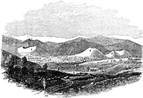
View of the Volcanos around Olot in Catalonia.
In this drawing an attempt is made to represent, by the shading of the
landscape, the different geological formations of which the country is
composed.[410-A] The white line of mountains (No. 1.) in the distance
[p.411]is the Pyrenees, which are to the north of the spectator, and
consist of hypogene and ancient fossiliferous rocks. In front of these are
the fossiliferous formations (No. 4.) which are in shade. The hills 2, 3.
5. are volcanic cones, and the rest of the ground on which the sunshine
falls is strewed over with volcanic ashes and lava.
The Fluvia, which flows near the town of Olot, has cut to the depth of only
40 feet through the lavas of the plain before mentioned. The bed of the
river is hard basalt; and at the bridge of Santa Madalena are seen two
distinct lava-currents, one above the other, separated by a horizontal bed
of scoriæ 8 feet thick.
In one place, to the south of Olot, the even surface of the plain is broken
by a mound of lava, called the "Bosque de Tosca," the upper part of which
is scoriaceous, and covered with enormous heaps of fragments of basalt,
more or less porous. Between the numerous hummocks thus formed are deep
cavities, having the appearance of small craters. The whole precisely
resembles some of the modern currents of Etna, or that of Côme, near
Clermont; the last of which, like the Bosque de Tosca, supports only a
scanty vegetation.
Most of the Catalonian volcanos are as entire as those in the neighbourhood
of Naples, or on the flanks of Etna. One of these, called Montsacopa (No.
3. fig. 471.), is of a very regular form, and has a circular depression or
crater at the summit. It is chiefly made up of red scoriæ,
undistinguishable from that of the minor cones of Etna. The neighbouring
hills of Olivet (No. 2.) and Garrinada (No. 5.) are of similar composition
and shape. The largest crater of the whole district occurs farther to the
east of Olot, and is called Santa Margarita. It is 455 feet deep, and about
a mile in circumference. Like Astroni, near Naples, it is richly covered
with wood, wherein game of various kinds abounds.
Fig. 472.

- a. Secondary conglomerate.
- b. Thin seams of volcanic sand and scoriæ.
Although the volcanos of Catalonia have broken out through sandstone,
shale, and limestone, as have those of the Eifel, in Germany, to be
described in the sequel, there is a remarkable difference in the nature of
the ejections composing the cones in these two regions. In the Eifel, the
quantity of pieces of sandstone and shale thrown out from the vents is
often so immense as far to exceed in volume the scoriæ, pumice, and lava;
but I sought in vain in the cones near Olot for a single fragment of any
extraneous rock; and Don Francisco Bolos, an eminent botanist of Olot,
informed me that he had never been able to detect any. Volcanic sand and
ashes are not confined to the cones, but have been sometimes scattered by
the wind over the country, and drifted into narrow valleys, as is seen
between Olot and Cellent, where the annexed section (fig. 472.) is exposed.
The light cindery volcanic matter rests in thin regular layers, just as it
alighted on the slope formed by the solid conglomerate. No flood could have
passed through [p.412]the valley since the scoriæ fell, or these would
have been for the most part removed.
Fig. 473.

Section above the bridge of Cellent.
- a. Scoriaceous lava.
- b. Schistose basalt.
- c. Columnar basalt.
- d. Scoria, vegetable soil, and alluvium.
- e. Nummulitic limestone.
- f. Micaceous grey sandstone.
The currents of lava in Catalonia, like those of Auvergne, the Vivarais,
Iceland, and all mountainous countries, are of considerable depth in narrow
defiles, but spread out into comparatively thin sheets in places where the
valleys widen. If a river has flowed on nearly level ground, as in the
great plain near Olot, the water has only excavated a channel of slight
depth; but where the declivity is great, the stream has cut a deep section,
sometimes by penetrating directly through the central part of a
lava-current, but more frequently by passing between the lava and the
secondary rock which bounds the valley. Thus, in the accompanying section,
at the bridge of Cellent, six miles east of Olot, we see the lava on one
side of the small stream; while the inclined stratified rocks constitute
the channel and opposite bank. The upper part of the lava at that place, as
is usual in the currents of Etna and Vesuvius, is scoriaceous; farther down
it becomes less porous, and assumes a spheroidal structure; still lower it
divides in horizontal plates, each about 2 inches in thickness, and is more
compact. Lastly, at the bottom is a mass of prismatic basalt about 5 feet
thick. The vertical columns often rest immediately on the subjacent
secondary rocks; but there is sometimes an intervention of such sand and
scoriæ as cover the country during volcanic eruptions, and which when
unprotected, as here, by superincumbent lava, is washed away from the
surface of the land. Sometimes, the bed d contains a few pebbles and
angular fragments of rock; in other places fine earth, which may have
constituted an ancient vegetable soil.
In several localities, beds of sand and ashes are interposed between the
lava and subjacent stratified rock, as may be seen if we follow the course
of the lava-current which descends from Las Planas towards Amer, and stops
two miles short of that town. The river there has often cut through the
lava, and through 18 feet of underlying [p.413]limestone. Occasionally
an alluvium, several feet thick, is interspersed between the igneous and
marine formation; and it is interesting to remark that in this, as in other
beds of pebbles occupying a similar position, there are no rounded
fragments of lava; whereas in the most modern gravel-beds of rivers of this
country, volcanic pebbles are abundant.
The deepest excavation made by a river through lava, which I observed in
this part of Spain, is that seen in the bottom of a valley near San Feliu
de Palleróls, opposite the Castell de Stolles. The lava there has filled up
the bottom of a valley, and a narrow ravine has been cut through it to the
depth of 100 feet. In the lower part the lava has a columnar structure. A
great number of ages were probably required for the erosion of so deep a
ravine; but we have no reason to infer that this current is of higher
antiquity than those of the plain near Olot. The fall of the ground, and
consequent velocity of the stream, being in this case greater, a more
considerable volume of rock may have been removed in the same time.
Fig. 474.

Section at Castell Follit.
- A. Church and town of Castell Follit, overlooking precipices of basalt.
- B. Small island, on each side of which branches of the river Teronel
flow to meet the Fluvia.
- c. Precipice of basaltic lava, chiefly columnar, about
130 feet in height.
- d. Ancient alluvium, underlying the lava-current.
- e. Inclined strata of secondary sandstone.
I shall describe one more section to elucidate the phenomena of this
district. A lava-stream, flowing from a ridge of hills on the east of Olot,
descends a considerable slope, until it reaches the valley of the river
Fluvia. Here, for the first time, it comes in contact with running water,
which has removed a portion, and laid open its internal structure in a
precipice about 130 feet in height, at the edge of which stands the town of
Castell Follit.
By the junction of the rivers Fluvia and Teronel, the mass of lava has been
cut away on two sides; and the insular rock B (fig. 474.) has been left,
which was probably never so high as the cliff A, as it may have constituted
the lower part of the sloping side of the original current.
From an examination of the vertical cliffs, it appears that the upper part
of the lava on which the town is built is scoriaceous, [p.414]passing
downwards into a spheroidal basalt; some of the huge spheroids being no
less than 6 feet in diameter. Below this is a more compact basalt, with
crystals of olivine. There are in all five distinct ranges of basalt, the
uppermost spheroidal, and the rest prismatic, separated by thinner beds not
columnar, and some of which are schistose. These were probably formed by
successive flows of lava, whether during the same eruption or at different
periods. The whole mass rests on alluvium, ten or twelve feet in thickness,
composed of pebbles of limestone and quartz, but without any intermixture
of igneous rocks; in which circumstance alone it appears to differ from the
modern gravel of the Fluvia.
Bufadors.—The volcanic rocks near Olot have often a cavernous structure,
like some of the lavas of Etna; and in many parts of the hill of Batet, in
the environs of the town, the sound returned by the earth, when struck, is
like that of an archway. At the base of the same hill are the mouths of
several subterranean caverns, about twelve in number, which are called in
the country "bufadors," from which a current of cold air issues during
summer, but which in winter is said to be scarcely perceptible. I visited
one of these bufadors in the beginning of August, 1830, when the heat of
the season was unusually intense, and found a cold wind blowing from it,
which may easily be explained; for as the external air, when rarefied by
heat, ascends, the pressure of the colder and heavier air of the caverns in
the interior of the mountain causes it to rush out to supply its place.
In regard to the age of these Spanish volcanos, attempts have been made to
prove, that in this country, as well as in Auvergne and the Eifel, the
earliest inhabitants were eye-witnesses to the volcanic action. In the year
1421, it is said, when Olot was destroyed by an earthquake, an eruption
broke out near Amer, and consumed the town. The researches of Don Francisco
Bolos have, I think, shown, in the most satisfactory manner, that there is
no good historical foundation for the latter part of this story; and any
geologist who has visited Amer must be convinced that there never was any
eruption on that spot. It is true that, in the year above mentioned, the
whole of Olot, with the exception of a single house, was cast down by an
earthquake; one of those shocks which, at distant intervals during the last
five centuries, have shaken the Pyrenees, and particularly the country
between Perpignan and Olot, where the movements, at the period alluded to,
were most violent.
The annihilation of the town may, perhaps, have been due to the cavernous
nature of the subjacent rocks; for Catalonia is beyond the line of those
European earthquakes which have, within the period of history, destroyed
towns throughout extensive areas.
As we have no historical records, then, to guide us in regard to the
extinct volcanos, we must appeal to geological monuments. The annexed
diagram will present to the reader, in a synoptical form, the results
obtained from numerous sections.
The more modern alluvium (d) is partial, and has been formed by [p.415]
the action of rivers and floods upon the lava; whereas the older gravel
(b) was strewed over the country before the volcanic eruptions. In
neither have any organic remains been discovered; so that we can merely
affirm, as yet, that the volcanos broke out after the elevation of some of
the newest rocks of the nummulitic (Eocene?) series of Catalonia, and
before the formation of an alluvium (d) of unknown date. The integrity of
the cones merely shows that the country has not been agitated by violent
earthquakes, or subjected to the action of any great transient flood since
their origin.
Fig. 475.

Superposition of rocks in the volcanic district of Catalonia.
- a. Sandstone and nummulitic limestone.
- b. Older alluvium without volcanic pebbles.
- c. Cones of scoriæ and lava.
- d. Newer alluvium.
East of Olot, on the Catalonian coast, marine tertiary strata occur, which,
near Barcelona, attain the height of about 500 feet. From the shells which
I collected, these strata appear to correspond in age with the Subapennine
beds; and it is not improbable that their upheaval from beneath the sea
took place during the period of volcanic eruption round Olot. In that case
these eruptions may have occurred at the close of the Older Pliocene era,
but perhaps subsequently, for their age is at present quite uncertain.
Miocene period—Volcanic rocks of the Eifel.—The chronological relations
of the volcanic rocks of the Lower Rhine and the Eifel are also involved in
a considerable degree of ambiguity; but we know that some portion of them
were coeval with the deposition of a tertiary formation, called
"Brown-Coal" by the Germans, which probably belongs to the Miocene, if not
referable to the Upper Eocene, epoch.
This Brown-Coal is seen on both sides of the Rhine, in the neighbourhood of
Bonn, resting unconformably on highly inclined and vertical strata of
Silurian and Devonian rocks. Its position, and the space occupied by the
volcanic rocks, both of the Westerwald and Eifel, will be seen by referring
to the map in the next page (fig. 476.), for which I am indebted to Mr.
Horner, whose residence in the country has enabled him to verify the maps
of MM. Noeggerath and Von Oeynhausen, from which that now given has been
principally compiled.
The Brown-Coal formation consists of beds of loose sand, sandstone, and
conglomerate, clay with nodules of clay-ironstone, and occasionally silex.
Layers of light brown, and sometimes black lignite, are interstratified
with the clays and sands, and often irregularly diffused through them. They
contain numerous impressions of [p.416]leaves and stems of trees, and
are extensively worked for fuel, whence the name of the formation.
Fig. 476. Map of the volcanic region of the Upper and Lower Eifel.

N.B. The country in that part of the map which is left blank is
composed of inclined Silurian and Devonian rocks.
In several places, layers of trachytic tuff are interstratified, and in
these tuffs are leaves of plants identical with those found in the
brown-coal, showing that, during the period of the accumulation of the
latter, some volcanic products were ejected.
The varieties of wood in the lignite are said to belong entirely to
dicotyledonous trees; but among the impressions of leaves, collected by Mr.
Horner, some were referred by Mr. Lindley to a palm, perhaps of the genus
Chamærops, and others resembled the Cinnamomum dulce, and Podocarpus
macrophylla, which would also indicate a warm climate.[416-A]
The other organic remains of the brown-coal are principally fishes; they
are found in a bituminous shale, called paper-coal, from being [p.417]
divisible into extremely thin leaves. The individuals are very numerous;
but they appear to belong to about five species, which M. Agassiz informs
me are all extinct, and hitherto peculiar to this brown-coal. They belong
to the freshwater genera Leuciscus, Aspius, and Perca. The remains of
frogs also, of an extinct species, have been discovered in the paper-coal;
and a complete series may be seen in the museum at Bonn, from the most
imperfect state of the tadpole to that of the full-grown animal. With these
a salamander, scarcely distinguishable from the recent species, has been
found, and several remains of insects.
The brown-coal was evidently a freshwater formation; but fossil shells have
been scarcely ever found in it; although near Marienforst, in the vicinity
of Bonn, large blocks have been met with of a white opaque chert,
containing numerous casts of freshwater shells, which appear to belong to
Planorbis rotundatus and Limnea longiscata, two species common both to
the Middle and Upper Eocene periods. It is very probable that the
brown-coal may be connected in age with those fluvio-marine formations
which are found in higher parts of the valley of the Rhine, as at Mayence
before mentioned (p. 177.).
A vast deposit of gravel, chiefly composed of pebbles of white quartz, but
containing also a few fragments of other rocks, lies over the brown-coal
formation, forming sometimes only a thin covering, at others attaining a
thickness of more than 100 feet. This gravel is very distinct in character
from that now forming the bed of the Rhine. It is called "Kiesel gerolle"
by the Germans, often reaches great elevations, and is covered in several
places with volcanic ejections. It is evident that the country has
undergone great changes in its physical geography since this gravel was
formed; for its position has scarcely any relation to the existing drainage
of the country, and all the more modern volcanic rocks of the same region
are posterior to it in date.
Some of the newest beds of volcanic sand, pumice, and scoriæ are
interstratified near Andernach and elsewhere with the loam called loess,
which was before described as being full of land and freshwater shells of
recent species, and referable to the Post-Pliocene period. I have before
hinted (see p. 118.) that this intercalation of volcanic matter between
beds of loess may possibly be explained without supposing the last
eruptions of the Lower Eifel to have taken place so recently as the era of
the deposition of the loess; but farther researches should be directed to
the investigation of this curious point.
The igneous rocks of the Westerwald, and of the mountains called the
Siebengebirge, consist partly of basaltic and partly of trachytic lavas,
the latter being in general the more ancient of the two. There are many
varieties of trachyte, some of which are highly crystalline, resembling a
coarse-grained granite, with large separate crystals of felspar. Trachytic
tuff is also very abundant. These formations, some of which were certainly
contemporaneous with the origin of the brown-coal, were the first of a long
series of eruptions, the [p.418]more recent of which happened when the
country had acquired nearly all its present geographical features.
Newer volcanos of the Eifel.—Lake-craters.—As I recognized in the more
modern volcanos of the Eifel characters distinct from any previously
observed by me in those of France, Italy, or Spain, I shall briefly
describe them. The fundamental rocks of the district are grey and red
sandstones and shales, with some associated limestones, replete with
fossils of the Devonian or Old Red Sandstone group. The volcanos broke out
in the midst of these inclined strata, and when the present systems of
hills and valleys had already been formed. The eruptions occurred sometimes
at the bottom of deep valleys, sometimes on the summit of hills, and
frequently on intervening platforms. In travelling through this district we
often fall upon them most unexpectedly, and may find ourselves on the very
edge of a crater before we had been led to suspect that we were approaching
the site of any igneous outburst. Thus, for example, on arriving at the
village of Gemund, immediately south of Daun, we leave the stream, which
flows at the bottom of a deep valley in which strata of sandstone and shale
crop out. We then climb a steep hill, on the surface of which we see the
edges of the same strata dipping inwards towards the mountain. When we have
ascended to a considerable height, we see fragments of scoriæ sparingly
scattered over the surface; till, at length, on reaching the summit, we
find ourselves suddenly on the edge of a tarn, or deep circular
lake-basin.
Fig. 477.

The Gemunder Maar.
Fig. 478.
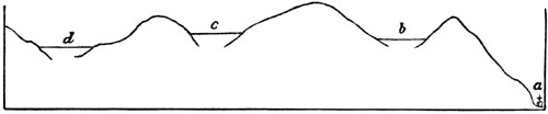
- a. Village of Gemund.
- b. Gemunder Maar.
- c. Weinfelder Maar.
- d. Schalkenmehren Maar.
This, which is called the Gemunder Maar, is the first of three lakes which
are in immediate contact, the same ridge forming the barrier of two
neighbouring cavities (see fig. 477.). On viewing the first of these, we
recognize the ordinary form of a crater, for which [p.419]we have been
prepared by the occurrence of scoriæ scattered over the surface of the
soil. But on examining the walls of the crater we find precipices of
sandstone and shale which exhibit no signs of the action of heat; and we
look in vain for those beds of lava and scoriæ, dipping in opposite
directions on every side, which we have been accustomed to consider as
characteristic of volcanic craters. As we proceed, however, to the opposite
side of the lake, and afterwards visit the craters c and d (fig. 478.),
we find a considerable quantity of scoriæ and some lava, and see the whole
surface of the soil sparkling with volcanic sand, and strewed with ejected
fragments of half-fused shale, which preserves its laminated texture in the
interior, while it has a vitrified or scoriform coating.
A few miles to the south of the lakes above mentioned occurs the Pulvermaar
of Gillenfeld, an oval lake of very regular form, and surrounded by an
unbroken ridge of fragmentary materials, consisting of ejected shale and
sandstone, and preserving a uniform height of about 150 feet above the
water. The side slope in the interior is at an angle of about 45 degrees;
on the exterior, of 35 degrees. Volcanic substances are intermixed very
sparingly with the ejections, which in this place entirely conceal from
view the stratified rocks of the country.[419-A]
Fig. 479.

Outline of Mosenberg, Upper Eifel.
The Meerfelder Maar is a cavity of far greater size and depth, hollowed out
of similar strata; the sides presenting some abrupt sections of inclined
secondary rocks, which in other places are buried under vast heaps of
pulverized shale. I could discover no scoriæ amongst the ejected materials,
but balls of olivine and other volcanic substances are mentioned as having
been found.[419-B] This cavity, which we must suppose to have discharged an
immense volume of gas, is nearly a mile in diameter, and is said to be more
than one hundred fathoms deep. In the neighbourhood is a mountain called
the Mosenberg, which consists of red sandstone and shale in its lower
parts, but supports on its summit a triple volcanic cone, while a distinct
current of lava is seen descending the flanks of the mountain. The edge of
the crater of the largest cone reminded me much of the form and characters
of that of Vesuvius; but I was much struck with the precipitous and almost
overhanging wall or parapet which the scoriæ presented towards the
exterior, as at a b (fig. 479.); which I can only explain by supposing
that fragments of red-hot lava, as they fell [p.420]round the vent, were
cemented together into one compact mass, in consequence of continuing to be
in a half-melted state.
If we pass from the Upper to the Lower Eifel, from A to B (see map, p.
416.), we find the celebrated lake-crater of Laach, which has a greater
resemblance than any of those before mentioned to the Lago di Bolsena, and
others in Italy—being surrounded by a ridge of gently sloping hills,
composed of loose tuffs, scoriæ, and blocks of a variety of lavas.
One of the most interesting volcanos on the left bank of the Rhine is
called the Roderberg. It forms a circular crater nearly a quarter of a mile
in diameter, and 100 feet deep, now covered with fields of corn. The highly
inclined strata of ancient sandstone and shale rise even to the rim of one
side of the crater; but they are overspread by quartzose gravel, and this
again is covered by volcanic scoriæ and tufaceous sand. The opposite wall
of the crater is composed of cinders and scorified rock, like that at the
summit of Vesuvius. It is quite evident that the eruption in this case
burst through the sandstone and alluvium which immediately overlies it; and
I observed some of the quartz pebbles mixed with scoriæ on the flanks of
the mountain, as if they had been cast up into the air, and had fallen
again with the volcanic ashes. I have already observed, that a large part
of this crater has been filled up with loess (p. 118.).
The most striking peculiarity of a great many of the craters above
described, is the absence of any signs of alteration or torrefaction in
their walls, when these are composed of regular strata of ancient sandstone
and shale. It is evident that the summits of hills formed of the
above-mentioned stratified rocks have, in some cases, been carried away by
gaseous explosions, while at the same time no lava, and often a very small
quantity only of scoriæ, has escaped from the newly formed cavity. There
is, indeed, no feature in the Eifel volcanos more worthy of note, than the
proofs they afford of very copious aëriform discharges, unaccompanied by
the pouring out of melted matter, except, here and there, in very
insignificant volume. I know of no other extinct volcanos where gaseous
explosions of such magnitude have been attended by the emission of so small
a quantity of lava. Yet I looked in vain in the Eifel for any appearances
which could lend support to the hypothesis, that the sudden rushing out of
such enormous volumes of gas had ever lifted up the stratified rocks
immediately around the vent, so as to form conical masses, having their
strata dipping outwards on all sides from a central axis, as is assumed in
the theory of elevation craters, alluded to at the end of Chap. XXIX.
Trass.—In the Lower Eifel, eruptions of trachytic lava preceded the
emission of currents of basalt, and immense quantities of pumice were
thrown out wherever trachyte issued. The tufaceous alluvium called trass,
which has covered large areas in this region and choked up some valleys now
partially re-excavated, is unstratified. Its base consists almost entirely
of pumice, in which are included fragments of basalt and other lavas,
pieces of burnt shale, slate, and sandstone, [p.421]and numerous trunks
and branches of trees. If this trass was formed during the period of
volcanic eruptions it may perhaps have originated in the manner of the moya
of the Andes.
We may easily conceive that a similar mass might now be produced, if a
copious evolution of gases should occur in one of the lake basins. The
water might remain for weeks in a state of violent ebullition, until it
became of the consistency of mud, just as the sea continued to be charged
with red mud round Graham's Island, in the Mediterranean, in the year 1831.
If a breach should then be made in the side of the cone, the flood would
sweep away great heaps of ejected fragments of shale and sandstone, which
would be borne down into the adjoining valleys. Forests might be torn up by
such a flood, and thus the occurrence of the numerous trunks of trees
dispersed irregularly through the trass, can be explained.
Hungary.—M. Beudant, in his elaborate work on Hungary, describes five
distinct groups of volcanic rocks, which although nowhere of great extent,
form striking features in the physical geography of that country, rising as
they do abruptly from extensive plains composed of tertiary strata. They
may have constituted islands in the ancient sea, as Santorin and Milo now
do in the Grecian Archipelago; and M. Beudant has remarked that the mineral
products of the last-mentioned islands resemble remarkably those of the
Hungarian extinct volcanos, where many of the same minerals as opal,
calcedony, resinous silex (silex resinite), pearlite, obsidian, and
pitchstone abound.
The Hungarian lavas are chiefly felspathic, consisting of different
varieties of trachyte; many are cellular, and used as millstones; some so
porous and even scoriform as to resemble those which have issued in the
open air. Pumice occurs in great quantity; and there are conglomerates, or
rather breccias, wherein fragments of trachyte are bound together by
pumiceous tuff, or sometimes by silex.
It is probable that these rocks were permeated by the waters of hot
springs, impregnated, like the Geysers, with silica; or in some instances,
perhaps, by aqueous vapours, which, like those of Lancerote, may have
precipitated hydrate of silica.
By the influence of such springs or vapours the trunks and branches of
trees washed down during floods, and buried in tuffs on the flanks of the
mountains, are supposed to have become silicified. It is scarcely possible,
says M. Beudant, to dig into any of the pumiceous deposits of these
mountains without meeting with opalized wood, and sometimes entire
silicified trunks of trees of great size and weight.
It appears from the species of shells collected principally by M. Boué, and
examined by M. Deshayes, that the fossil remains imbedded in the volcanic
tuffs, and in strata alternating with them in Hungary, are of the Miocene
type, and not identical, as was formerly supposed, with the fossils of the
Paris basin.
[p.422]CHAPTER XXXII.
ON THE DIFFERENT AGES OF THE VOLCANIC ROCKS—continued.
Volcanic rocks of the Pliocene and Miocene periods continued —
Auvergne — Mont Dor — Breccias and alluviums of Mont Perrier,
with bones of quadrupeds — River dammed up by lava-current —
Range of minor cones from Auvergne to the Vivarais — Monts Dome
— Puy de Côme — Puy de Pariou — Cones not denuded by
general flood — Velay — Bones of quadrupeds buried in scoriæ
— Cantal — Eocene volcanic rocks — Tuffs near Clermont
— Hill of Gergovia — Trap of Cretaceous period — Oolitic
period — New Red Sandstone period — Carboniferous period
— Old Red Sandstone period — "Rock and Spindle" near St.
Andrews — Silurian period — Cambrian volcanic rocks.
Tertiary Volcanic Rocks.—Auvergne.—The extinct volcanos of Auvergne and
Cantal in Central France seem to have commenced their eruptions in the
Upper Eocene period, but to have been most active during the Miocene and
Pliocene eras. I have already alluded to the grand succession of events, of
which there is evidence in Auvergne since the last retreat of the sea (see
p. 178.).
The earliest monuments of the tertiary period in that region are lacustrine
deposits of great thickness (2. fig. 480. p. 424.), in the lowest
conglomerates of which are rounded pebbles of quartz, mica-schist, granite,
and other non-volcanic rocks, without the slightest intermixture of igneous
products. To these conglomerates succeed argillaceous and calcareous marls
and limestones (3. fig. 480.) containing Upper Eocene shells and bones of
mammalia, the higher beds of which sometimes alternate with volcanic tuff
of contemporaneous origin. After the filling up or drainage of the ancient
lakes, huge piles of trachytic and basaltic rocks, with volcanic breccias,
accumulated to a thickness of several thousand feet, and were superimposed
upon granite, or the contiguous lacustrine strata. The greater portion of
these igneous rocks appear to have originated during the Miocene and
Pliocene periods; and extinct quadrupeds of those eras, belonging to the
genera Mastodon, Rhinoceros, and others, were buried in ashes and beds of
alluvial sand and gravel, which owe their preservation to overspreading
sheets of lava.
In Auvergne the most ancient and conspicuous of the volcanic masses is Mont
Dor, which rests immediately on the granitic rocks standing apart from the
freshwater strata.[422-A] This great mountain rises suddenly to the height
of several thousand feet above the surrounding platform, and retains the
shape of a flattened and somewhat irregular cone, all the sides sloping
more or less rapidly, until their inclination is gradually lost in the high
plain around. This cone is composed of layers of scoriæ, pumice-stones, and
their fine detritus, [p.423]with interposed beds of trachyte and basalt,
which descend often in uninterrupted sheets, till they reach and spread
themselves round the base of the mountain.[423-A] Conglomerates, also,
composed of angular and rounded fragments of igneous rocks, are observed to
alternate with the above; and the various masses are seen to dip off from
the central axis, and to lie parallel to the sloping flanks of the
mountain.
The summit of Mont Dor terminates in seven or eight rocky peaks, where no
regular crater can now be traced, but where we may easily imagine one to
have existed, which may have been shattered by earthquakes, and have
suffered degradation by aqueous agents. Originally, perhaps, like the
highest crater of Etna, it may have formed an insignificant feature in the
great pile, and may frequently have been destroyed and renovated.
According to some geologists, this mountain, as well as Vesuvius, Etna, and
all large volcanos, has derived its dome-like form not from the
preponderance of eruptions from one or more central points, but from the
upheaval of horizontal beds of lava and scoriæ. I have explained my reasons
for objecting to this view at the close of Chap. XXIX., when speaking of
Palma, and in the Principles of Geology.[423-B] The average inclination of
the dome-shaped mass of Mont Dor is 8° 6', whereas in Mounts Loa and Kea,
before mentioned, in the Sandwich Islands (see fig. 457. p. 394.), the
flanks of which have been raised by recent lavas, we find from Mr. Dana's
description that the one has a slope of 6° 30', the other of 7° 46'. We
may, therefore, reasonably question whether there is any absolute necessity
for supposing that the basaltic currents of the ancient French volcano were
at first more horizontal than they are now. Nevertheless it is highly
probable that during the long series of eruptions required to give rise to
so vast a pile of volcanic matter, which is thickest at the summit or
centre of the dome, some dislocation and upheaval took place; and during
the distension of the mass, beds of lava and scoriæ may, in some places,
have acquired a greater, in others a less inclination, than that which at
first belonged to them.
Respecting the age of the great mass of Mont Dor, we cannot come at present
to any positive decision, because no organic remains have yet been found in
the tuffs, except impressions of the leaves of trees of species not yet
determined. We may certainly conclude, that the earliest eruptions were
posterior in origin to those grits, and conglomerates of the freshwater
formation of the Limagne, which contain no pebbles of volcanic rocks;
while, on the other hand, some eruptions took place before the great lakes
were drained; and others occurred after the desiccation of those lakes, and
when deep valleys had already been excavated through freshwater strata.
In the annexed section, I have endeavoured to explain the geological
structure of a portion of Auvergne, which I re-examined in 1843.[423-C]
[p.424]It may convey some idea to the reader of the long and complicated
series of events, which have occurred in that country, since the first
lacustrine strata (No. 2.) were deposited on the granite (No. 1.). The
changes of which we have evidence are the more striking, because they imply
great denudation, without there being any proofs of the intervention of the
sea during the whole period. It will be seen that the upper freshwater beds
(No. 3.), once formed in a lake, must have suffered great destruction
before the excavation of the valleys of the Couze and Allier had begun. In
these freshwater beds, Upper Eocene fossils, as described in Chap. XV.,
have been found. The basaltic dike 4' is one of many examples of the
intrusion of volcanic matter through the Eocene freshwater beds, and may
have been of Upper Eocene or Miocene date, giving rise, when it reached the
surface and overflowed, to such platforms of basalt, as often cap the
tertiary hills in Auvergne, and one of which (4) is seen on Mont Perrier.
Fig. 480.

Section from the valley of the Couze at Nechers, through Mont Perrier
and Issoire to the Valley of the Allier, and the Tour de Boulade, Auvergne.
- 10. Lava-current of Tartaret near its termination at Nechers.
- 9. Bone-bed, red sandy clay under the lava of Tartaret.
- 8. Bone-bed of the Tour de Boulade.
- 7. Alluvium newer than No. 6.
- 6. Alluvium with bones of hippopotamus.
- 5 c. Trachytic breccia resembling 5 a.
- 5 b. Upper bone-bed of Perrier, gravel, &c.
- 5 a. Pumiceous breccia and conglomerate, angular
masses of trachyte, quartz, pebbles, &c.
- 5. Lower bone-bed of Perrier, ochreous sand and gravel.
- 4 a. Basaltic dyke.
- 4. Basaltic platform.
- 3. Upper freshwater beds, limestone, marl, gypsum, &c.
- 2. Lower freshwater formation, red clay, green sand, &c.
- 1. Granite.
It not unfrequently happens that beds of gravel containing bones of extinct
mammalia are detected under these very ancient sheets of basalt, as between
No. 4. and the freshwater strata, No. 3., at A, from which it is clear that
the surface of 3 formed at that period the lowest level at which the waters
then draining the country flowed. Next in age to this basaltic platform
comes a patch of ochreous sand and gravel (No. 5.), containing many bones
of quadrupeds. Upon this rests a pumiceous breccia and conglomerate, with
angular masses of trachyte, and some quartz pebbles. This deposit is
followed by 5 b, which is similar to 5, and 5 c similar to the
trachytic breccia 5 a. These two breccias are supposed, from their
similarity to others found on Mount Dor, to have descended from the flanks
of that mountain during eruptions; and the interstratified alluvial
deposits contain the remains of mastodon, rhinoceros, tapir, deer, beaver,
and quadrupeds of other genera referable to about forty species, all of
which are extinct. I formerly supposed them to belong to the same era as
the Miocene faluns of Touraine; but, whether they may not rather be
[p.425]ascribed to the older Pliocene epoch is a question which farther
inquiries and comparisons must determine.
Whatever be their date in the tertiary series, they are quadrupeds which
inhabited the country when the formations 5 and 5 c originated. Probably
they were drowned during floods, such as rush down the flanks of volcanos
during eruptions, when great bodies of steam are emitted from the crater,
or when, as we have seen, both on Etna and in Iceland in modern times,
large masses of snow are suddenly melted by lava, causing a deluge of water
to bear down fragments of igneous rocks mixed with mud, to the valleys and
plains below.
It will be seen that the valley of the Issoire, down which these ancient
inundations swept, was first excavated at the expense of the formations 2,
3, and 4, and then filled up by the masses 5 and 5 c, after which it was
re-excavated before the more modern alluviums (Nos. 6. and 7.) were formed.
In these again other fossil mammalia of distinct species have been detected
by M. Bravard, the bones of an hippopotamus having been found among the
rest.
At length, when the valley of the Allier was eroded at Issoire down to its
lowest level, a talus of angular fragments of basalt and freshwater
limestone (No. 8.) was formed, called the bone-bed of the Tour de Boulade,
from which a great many other mammalia have been collected by MM. Bravard
and Pomel. In this assemblage the Elephas primigenius, Rhinoceros
tichorinus, Deer (including rein-deer), Equus, Bos, Antelope,
Felis, and Canis, were included. Even this deposit seems hardly to be
the newest in the neighbourhood, for if we cross from the town of Issoire
(see fig. 480.) over Mont Perrier to the adjoining valley of the Couze, we
find another bone-bed (No. 9.), overlaid by a current of lava (No. 10.).
The history of this lava-current, which terminates a few hundred yards
below the point No. 10., in the suburbs of the village of Nechers, is
interesting. It forms a long narrow stripe more than 13 miles in length, at
the bottom of the valley of the Couze, which flows out of a lake at the
foot of Mont Dor. This lake is caused by a barrier thrown across the
ancient channel of the Couze, consisting partly of the volcanic cone called
the Puy de Tartaret, formed of loose scoriæ, from the base of which has
issued the lava-current before mentioned. The materials of the dam which
blocked up the river, and caused the Lac de Chambon, are also, in part,
derived from a land-slip which may have happened at the time of the great
eruption which formed the cone.
This cone of Tartaret affords an impressive monument of the very different
dates at which the igneous eruptions of Auvergne have happened; for it was
evidently thrown up at the bottom of the existing valley, which is bounded
by lofty precipices composed of sheets of ancient columnar trachyte and
basalt, which once flowed at very high levels from Mont Dor.[425-A]
[p.426]When we follow the course of the river Couze, from its source in
the lake of Chambon, to the termination of the lava-current at Nechers, a
distance of thirteen miles, we find that the torrent has in most places cut
a deep channel through the lava, the lower portion of which is columnar. In
some narrow gorges it has even had power to remove the entire mass of
basaltic rock, though the work of erosion must have been very slow, as the
basalt is tough and hard, and one column after another must have been
undermined and reduced to pebbles, and then to sand. During the time
required for this operation, the perishable cone of Tartaret, composed of
sand and ashes, has stood uninjured, proving that no great flood or deluge
can have passed over this region in the interval between the eruption of
Tartaret and our own times.
If we now return to the section (fig. 480.), I may observe that the
lava-current of Tartaret, which has diminished greatly in height and volume
near its termination, presents here a steep and perpendicular face 25 feet
in height towards the river. Beneath it is the alluvium No. 9., consisting
of a red sandy clay, which must have covered the bottom of the valley when
the current of melted rock flowed down. The bones found in this alluvium,
which I obtained myself, consisted of a species of field-mouse, Arvicola,
and the molar tooth of an extinct horse, Equus fossilis. The other
species, obtained from the same bed, are referable to the genera Sus,
Bos, Cervus, Felis, Canis, Martes, Talpa, Sorex, Lepus,
Sciurus, Mus, and Lagomys, in all no less than forty-three species,
all closely allied to recent animals, yet nearly all of them, according to
M. Bravard, showing some points of difference, like those which Mr. Owen
discovered in the case of the horse above alluded to. The bones, also, of a
frog, snake, and lizard, and of several birds, were associated with the
fossils before enumerated, and several recent land shells, such as
Cyclostoma elegans, Helix hortensis, H. nemoralis, H. lapicida, and
Clausilia rugosa. If the animals were drowned by floods, which
accompanied the eruptions of the Puy de Tartaret, they would give an
exceedingly modern geological date to that event, which must, in that case,
have belonged to the Newer-Pliocene, or, perhaps, the Post-Pliocene period.
That the current, which has issued from the Puy de Tartaret, may
nevertheless be very ancient in reference to the events of human history,
we may conclude, not only from the divergence of the mammiferous fauna from
that of our day, but from the fact that a Roman bridge of such form and
construction as continued in use down to the fifth century, but which may
be older, is now seen at a place about a mile and a half from St. Nectaire.
This ancient bridge spans the river Couze with two arches, each about 14
feet wide. These arches spring from the lava of Tartaret, on both banks,
showing that a ravine precisely like that now existing, had already been
excavated by the river through that lava thirteen or fourteen centuries
ago.
In Central France there are several hundred minor cones, like that of
Tartaret, a great number of which, like Monte Nuovo, near Naples, may have
been principally due to a single eruption. Most of these [p.427]cones
range in a linear direction from Auvergne to the Vivarais, and they were
faithfully described so early as the year 1802, by M. de Montlosier. They
have given rise chiefly to currents of basaltic lava. Those of Auvergne
called the Monts Dome, placed on a granitic platform, form an irregular
ridge (see fig. 436.), about 18 miles in length, and 2 in breadth. They are
usually truncated at the summit, where the crater is often preserved
entire, the lava having issued from the base of the hill. But frequently
the crater is broken down on one side, where the lava has flowed out. The
hills are composed of loose scoriæ, blocks of lava, lapilli, and
pozzuolana, with fragments of trachyte and granite.
Puy de Côme.—The Puy de Côme and its lava-current, near Clermont, may be
mentioned as one of these minor volcanos. This conical hill rises from the
granitic platform, at an angle of about 40°, to the height of more than 900
feet. Its summit presents two distinct craters, one of them with a vertical
depth of 250 feet. A stream of lava takes its rise at the western base of
the hill, instead of issuing from either crater, and descends the granitic
slope towards the present site of the town of Pont Gibaud. Thence it pours
in a broad sheet down a steep declivity into the valley of the Sioule,
filling the ancient river-channel for the distance of more than a mile. The
Sioule, thus dispossessed of its bed, has worked out a fresh one between
the lava and the granite of its western bank; and the excavation has
disclosed, in one spot, a wall of columnar basalt about 50 feet
high.[427-A]
The excavation of the ravine is still in progress, every winter some
columns of basalt being undermined and carried down the channel of the
river, and in the course of a few miles rolled to sand and pebbles.
Meanwhile the cone of Côme remains stationary, its loose materials being
protected by a dense vegetation, and the hill standing on a ridge not
commanded by any higher ground whence floods of rain-water may descend.
Puy Rouge.—At another point, farther down the course of the Sioule, we
find a second illustration of the same phenomenon in the Puy Rouge, a
conical hill to the north of the village of Pranal. The cone is composed
entirely of red and black scoriæ, tuff, and volcanic bombs. On its western
side there is a worn-down crater, whence a powerful stream of lava has
issued, and flowed into the valley of the Sioule. The river has since
excavated a ravine through the lava and subjacent gneiss, to the depth of
400 feet.
On the upper part of the precipice forming the left side of this ravine, we
see a great mass of black and red scoriaceous lava; below this a thin bed
of gravel, evidently an ancient river-bed, now at an elevation of 50 feet
above the channel of the Sioule. The gravel again rests upon gneiss, which
has been eroded to the depth of 50 feet. It is quite evident in this case,
that, while the basalt was gradually undermined and carried away by the
force of running water, the cone whence the lava issued escaped
destruction, because it stood [p.428]upon a platform of gneiss several
hundred feet above the level of the valley in which the force of running
water was exerted.
Puy de Pariou.—The brim of the crater of the Puy de Pariou, near
Clermont, is so sharp, and has been so little blunted by time, that it
scarcely affords room to stand upon. This and other cones in an equally
remarkable state of integrity have stood, I conceive uninjured, not in
spite of their loose porous nature, as might at first be naturally
supposed, but in consequence of it. No rills can collect where all the rain
is instantly absorbed by the sand and scoriæ, as is remarkably the case on
Etna; and nothing but a waterspout breaking directly upon the Puy de Pariou
could carry away a portion of the hill, so long as it is not rent or
engulphed by earthquakes.
Hence it is conceivable that even those cones which have the freshest
aspect, and most perfect shape, may lay claim to very high antiquity. Dr.
Daubeny has justly observed, that had any of these volcanos been in a state
of activity in the age of Julius Cæsar, that general, who encamped upon the
plains of Auvergne, and laid siege to its principal city (Gergovia, near
Clermont), could hardly have failed to notice them. Had there been any
record of their eruptions in the time of Pliny or Sidonius Apollinaris, the
one would scarcely have omitted to make mention of it in his Natural
History, nor the other to introduce some allusion to it among the
descriptions of this his native province. This poet's residence was on the
borders of the Lake Aidat, which owed its very existence to the damming up
of a river by one of the most modern lava-currents.[428-A]
Velay.—The observations of M. Bertrand de Doue have not yet established
that any of the most ancient volcanos of Velay were in action during the
Eocene period. There are beds of gravel in Velay, as in Auvergne, covered
by lava at different heights above the channels of the existing rivers. In
the highest and most ancient of these alluviums the pebbles are exclusively
of granitic rocks; but in the newer, which are found at lower levels, and
which originated when the valleys had been cut to a greater depth, an
intermixture of volcanic rocks has been observed.
At St. Privat d'Allier a bed of volcanic scoriæ and tuff was discovered by
Dr. Hibbert, inclosed between two sheets of basaltic lava; and in this tuff
were found the bones of several quadrupeds, some of them adhering to masses
of slaggy lava. Among other animals were Rhinoceros leptorhinus, Hyæna
spelæa, and a species allied to the spotted hyæna of the Cape, together
with four undetermined species of deer.[428-B] The manner of the occurrence
of these bones reminds us of the published accounts of an eruption of
Coseguina, 1835, in Central America (see p. 399.), during which hot cinders
and scoriæ fell and scorched to death great numbers of wild and domestic
animals and birds.
Plomb du Cantal.—In regard to the age of the igneous rocks of [p.429]
the Cantal, we can at present merely affirm, that they overlie the Eocene
lacustrine strata of that country (see Map, p. 179.). They form a great
dome-shaped mass, having an average slope of only 4°, which has evidently
been accumulated, like the cone of Etna, during a long series of eruptions.
It is composed of trachytic, phonolitic, and basaltic lavas, tuffs, and
conglomerates, or breccias, forming a mountain several thousand feet in
height. Dikes also of phonolite, trachyte, and basalt are numerous,
especially in the neighbourhood of the large cavity, probably once a
crater, around which the loftiest summits of the Cantal are ranged
circularly, few of them, except the Plomb du Cantal, rising far above the
border or ridge of this supposed crater. A pyramidal hill, called the Puy
Griou, occupies the middle of the cavity.[429-A] It is clear that the
volcano of the Cantal broke out precisely on the site of the lacustrine
deposit before described (p. 188.), which had accumulated in a depression
of a tract composed of micaceous schist. In the breccias, even to the very
summit of the mountain, we find ejected masses of the freshwater beds, and
sometimes fragments of flint, containing Eocene shells. Valleys radiate in
all directions from the central heights of the mountain, increasing in size
as they recede from those heights. Those of the Cer and Jourdanne, which
are more than 20 miles in length, are of great depth, and lay open the
geological structure of the mountain. No alternation of lavas with
undisturbed Eocene strata has been observed, nor any tuffs containing
freshwater shells, although some of these tuffs include fossil remains of
terrestrial plants, said to imply several distinct restorations of the
vegetation of the mountain in the intervals between great eruptions. On the
northern side of the Plomb du Cantal, at La Vissiere, near Murat, is a
spot, pointed out on the Map (p. 179.), where freshwater limestone and marl
are seen covered by a thickness of about 800 feet of volcanic rock. Shifts
are here seen in the strata of limestone and marl.[429-B]
Eocene period.—In treating of the lacustrine deposits of Central France,
in the fifteenth chapter, it was stated that, in the arenaceous and pebbly
group of the lacustrine basins of Auvergne, Cantal, and Velay, no volcanic
pebbles had ever been detected, although massive piles of igneous rocks are
now found in the immediate vicinity. As this observation has been confirmed
by minute research, we are warranted in inferring that the volcanic
eruptions had not commenced when the older subdivisions of the freshwater
groups originated.
In Cantal and Velay no decisive proofs have yet been brought to light that
any of the igneous outbursts happened during the deposition of the
freshwater strata; but there can be no doubt that in Auvergne some volcanic
explosions took place before the drainage of the lakes, and at a time when
the Upper Eocene species of animals and plants still flourished. Thus, for
example, at Pont du Chateau, near Clermont, a section is seen in a
precipice on the right bank of [p.430]the river Allier, in which beds of
volcanic tuff alternate with a freshwater limestone, which is in some
places pure, but in others spotted with fragments of volcanic matter, as if
it were deposited while showers of sand and scoriæ were projected from a
neighbouring vent.[430-A]
Another example occurs in the Puy de Marmont, near Veyres, where a
freshwater marl alternates with volcanic tuff containing Eocene shells. The
tuff or breccia in this locality is precisely such as is known to result
from volcanic ashes falling into water, and subsiding together with ejected
fragments of marl and other stratified rocks. These tuffs and marls are
highly inclined, and traversed by a thick vein of basalt, which, as it
rises in the hill, divides into two branches.
Gergovia.—The hill of Gergovia, near Clermont, affords a third example.
I agree with MM. Dufrénoy and Jobert that there is no alternation here of a
contemporaneous sheet of lava with freshwater strata, in the manner
supposed by some other observers[430-B]; but the position and contents of
some of the associated tuffs, prove them to have been derived from volcanic
eruptions which occurred during the deposition of the lacustrine strata.
Fig. 481.

Hill of Gergovia.
The bottom of the hill consists of slightly inclined beds of white and
greenish marls, more than 300 feet in thickness, intersected by a dike of
basalt, which may be studied in the ravine above the village of Merdogne.
The dike here cuts through the marly strata at a considerable angle,
producing, in general, great alteration and confusion in them for some
distance from the point of contact. Above the white and green marls, a
series of beds of limestone and marl, containing freshwater shells, are
seen to alternate with volcanic tuff. In the lowest part of this division,
beds of pure marl alternate with compact fissile tuff, resembling some of
the subaqueous tuffs of Italy and Sicily called peperinos. Occasionally
fragments of scoriæ are [p.431]visible in this rock. Still higher is
seen another group of some thickness, consisting exclusively of tuff, upon
which lie other marly strata intermixed with volcanic matter. Among the
species of fossil shells which I found in these strata were Melania
inquinata, a Unio, and a Melanopsis, but they were not sufficient to
enable me to determine with precision the age of the formation.
There are many points in Auvergne where igneous rocks have been forced by
subsequent injection through clays and marly limestones, in such a manner
that the whole has become blended in one confused and brecciated mass,
between which and the basalt there is sometimes no very distinct line of
demarcation. In the cavities of such mixed rocks we often find calcedony,
and crystals of mesotype, stilbite, and arragonite. To formations of this
class may belong some of the breccias immediately adjoining the dike in the
hill of Gergovia; but it cannot be contended that the volcanic sand and
scoriæ interstratified with the marls and limestones in the upper part of
that hill were introduced, like the dike, subsequently, by intrusion from
below. They must have been thrown down like sediment from water, and can
only have resulted from igneous action, which was going on
contemporaneously with the deposition of the lacustrine strata.
The reader will bear in mind that this conclusion agrees well with the
proofs, adverted to in the fifteenth chapter, of the abundance of silex,
travertin, and gypsum precipitated when the upper lacustrine strata were
formed; for these rocks are such as the waters of mineral and thermal
springs might generate.
Cretaceous period.—Although we have no proof of volcanic rocks erupted
in England during the deposition of the chalk and greensand, it would be an
error to suppose that no theatres of igneous action existed in the
cretaceous period. M. Virlet, in his account of the geology of the Morea,
p. 205., has clearly shown that certain traps in Greece, called by him
ophiolites, are of this date; as those, for example, which alternate
conformably with cretaceous limestone and greensand between Kastri and
Damala in the Morea. They consist in great part of diallage rocks and
serpentine, and of an amygdaloid with calcareous kernels, and a base of
serpentine.
In certain parts of the Morea, the age of these volcanic rocks is
established by the following proofs: first, the lithographic limestones of
the Cretaceous era are cut through by trap, and then a conglomerate occurs,
at Nauplia and other places, containing in its calcareous cement many
well-known fossils of the chalk and greensand, together with pebbles formed
of rolled pieces of the same ophiolite, which appear in the dikes above
alluded to.
Period of Oolite and Lias.—Although the green and serpentinous trap
rocks of the Morea belong chiefly to the Cretaceous era, as before
mentioned, yet it seems that some eruptions of similar rocks began during
the Oolitic period[431-A]; and it is probable, that a large part of
[p.432]the trappean masses, called ophiolites in the Apennines, and
associated with the limestone of that chain, are of corresponding age.
That part of the volcanic rocks of the Hebrides, in our own country,
originated contemporaneously with the Oolite which they traverse and
overlie, has been ascertained by Prof. E. Forbes, in 1850.
Trap of the New Red Sandstone period.—In the southern part of
Devonshire, trappean rocks are associated with New Red Sandstone, and,
according to Sir H. De la Beche, have not been intruded subsequently into
the sandstone, but were produced by contemporaneous volcanic action. Some
beds of grit, mingled with ordinary red marl, resemble sands ejected from a
crater; and in the stratified conglomerates occurring near Tiverton are
many angular fragments of trap porphyry, some of them one or two tons in
weight, intermingled with pebbles of other rocks. These angular fragments
were probably thrown out from volcanic vents, and fell upon sedimentary
matter then in the course of deposition.[432-A]
Carboniferous period.—Two classes of contemporaneous trap rocks have
been ascertained by Dr. Fleming to occur in the coal-field of the Forth in
Scotland. The newest of these, connected with the higher series of
coal-measures, is well exhibited along the shores of the Forth, in
Fifeshire, where they consist of basalt with olivine, amygdaloid,
greenstone, wacké, and tuff. They appear to have been erupted while the
sedimentary strata were in a horizontal position, and to have suffered the
same dislocations which those strata have subsequently undergone. In the
volcanic tuffs of this age are found not only fragments of limestone,
shale, flinty slate, and sandstone, but also pieces of coal.
The other or older class of carboniferous traps are traced along the south
margin of Stratheden, and constitute a ridge parallel with the Ochils, and
extending from Stirling to near St. Andrews. They consist almost
exclusively of greenstone, becoming, in a few instances, earthy and
amygdaloidal. They are regularly interstratified with the sandstone, shale,
and ironstone of the lower Coal-measures, and, on the East Lomond, with
Mountain Limestone.
I examined these trap rocks in 1838, in the cliffs south of St. Andrews,
where they consist in great part of stratified tuffs, which are curved,
vertical, and contorted, like the associated coal-measures. In the tuff I
found fragments of carboniferous shale and limestone, and intersecting
veins of greenstone. At one spot, about two miles from St. Andrews, the
encroachment of the sea on the cliffs has isolated several masses of trap,
one of which (fig. 482.) is aptly called the "rock and spindle,"[432-B] for
it consists of a pinnacle of tuff, which may be compared to a distaff, and
near the base is a mass of columnar greenstone, in which the pillars
radiate from a centre, and appear at a distance like the spokes of a wheel.
The largest diameter of this [p.433]wheel is about twelve feet, and the
polygonal terminations of the columns are seen round the circumference (or
tire, as it were, of the wheel), as in the accompanying figure. I conceive
this mass to be the extremity of a string or vein of greenstone, which
penetrated the tuff. The prisms point in every direction, because they were
surrounded on all sides by cooling surfaces, to which they always, arrange
themselves at right angles, as before explained (p. 385.).
Fig. 482.
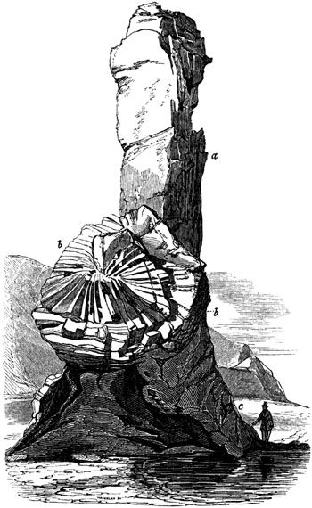
Rock and Spindle, St. Andrews.
- a. Unstratified tuff.
- b. Columnar greenstone.
- c. Stratified tuff.
Fig. 483.
Columns of Greenstone, seen endwise.
[p.434]A trap dike was pointed out to me by Dr. Fleming, in the parish of
Flisk, in the northern part of Fifeshire, which cuts through the grey
sandstone and shale, forming the lowest part of the Old Red Sandstone. It
may be traced for many miles, passing through the amygdaloidal and other
traps of the hill called Normans Law. In its course it affords a good
exemplification of the passage from the trappean into the plutonic, or
highly crystalline texture. Professor Gustavus Rose, to whom I submitted
specimens of this dike, finds the rock, which he calls dolerite, to consist
of greenish black augite and Labrador felspar, the latter being the most
abundant ingredient. A small quantity of magnetic iron, perhaps
titaniferous, is also present. The result of this analysis is interesting,
because both the ancient and modern lavas of Etna consist in like manner of
augite, Labradorite, and titaniferous iron.
Trap of the Old Red sandstone period.—By referring to the section
explanatory of the structure of Forfarshire, already given (p. 48.), the
reader will perceive that beds of conglomerate, No. 3., occur in the middle
of the Old Red sandstone system, 1, 2, 3, 4. The pebbles in these
conglomerates are sometimes composed of granitic and quartz rocks,
sometimes exclusively of different varieties of trap, which, although
purposely omitted in the above section, are often found either intruding
themselves in amorphous masses and dikes into the old fossiliferous
tilestones, No. 4., or alternating with them in conformable beds. All the
different divisions of the red sandstone, 1, 2, 3, 4, are occasionally
intersected by dikes, but they are very rare in Nos. 1. and 2., the upper
members of the group consisting of red shale and red sandstone. These
phenomena, which occur at the foot of the Grampians, are repeated in the
Sidlaw Hills; and it appears that in this part of Scotland, volcanic
eruptions were most frequent in the earlier part of the Old Red
sandstone period.
The trap rocks alluded to consist chiefly of felspathic porphyry and
amygdaloid, the kernels of the latter being sometimes calcareous, often
calcedonic, and forming beautiful agates. We meet also with claystone,
clinkstone, greenstone, compact felspar, and tuff. Some of these rocks
flowed as lavas over the bottom of the sea, and enveloped quartz pebbles
which were lying there, so as to form conglomerates with a base of
greenstone, as is seen in Lumley Den, in the Sidlaw Hills. On either side
of the axis of this chain of hills (see section, p. 48.), the beds of
massive trap, and the tuffs composed of volcanic sand and ashes, dip
regularly to the south-east or north-west, conformably with the shales and
sandstones.
Silurian period.—It appears from the investigations of Sir R. Murchison
in Shropshire, that when the lower Silurian strata of that county were
accumulating, there were frequent volcanic eruptions beneath the sea; and
the ashes and scoriæ then ejected gave rise to a peculiar kind of tufaceous
sandstone or grit, dissimilar to the other rocks of the Silurian series,
and only observable in places where syenitic and other trap rocks protrude.
These tuffs occur on the flanks of the Wrekin and Caer Caradoc, and contain
Silurian fossils, [p.435]such as casts of encrinites, trilobites, and
mollusca. Although fossiliferous, the stone resembles a sandy claystone of
the trap family.[435-A]
Thin layers of trap, only a few inches thick, alternate, in some parts of
Shropshire and Montgomeryshire, with sedimentary strata of the lower
Silurian system. This trap consists of slaty porphyry and granular felspar
rock, the beds being traversed by joints like those in the associated
sandstone, limestone, and shale, and having the same strike and dip.[435-B]
In Radnorshire there is an example of twelve bands of stratified trap,
alternating with Silurian schists and flagstones, in a thickness of 350
feet. The bedded traps consist of felspar-porphyry, clinkstone, and other
varieties; and the interposed Llandeilo flags are of sandstone and shale,
with trilobites and graptolites.[435-C]
The vast thickness of contemporaneous trappean rocks of lower Silurian date
in North Wales, explored by our government surveyors, has been already
alluded to.[435-D]
Cambrian volcanic rocks.—Professor Sedgwick, in his account of the
geology of Cumberland, has described various trap rocks which accompany the
green slates of the Cambrian system, beneath all the rocks containing
organic remains. Different felspathic and porphyritic rocks and greenstones
occur, not only in dikes, but in conformable beds; and there is
occasionally a passage from these igneous rocks to some of the green
quartzose slates. Professor Sedgwick supposes these porphyries to have
originated contemporaneously with the stratified chloritic slates, the
materials of the slates having been supplied, in part at least, by
submarine eruptions oftentimes repeated.[435-E]
[p.436]CHAPTER XXXIII.
PLUTONIC ROCKS—GRANITE.
General aspect of granite — Decomposing into spherical masses —
Rude columnar structure — Analogy and difference of volcanic and
plutonic formations — Minerals in granite, and their arrangement
— Graphic and porphyritic granite — Mutual penetration of
crystals of quartz and felspar — Occasional minerals — Syenite
— Syenitic, talcose, and schorly granites — Eurite —
Passage of granite into trap — Examples near Christiania and in
Aberdeenshire — Analogy in composition of trachyte and granite
— Granite veins in Glen Tilt, Cornwall, the Valorsine, and other
countries — Different composition of veins from main body of granite
— Metalliferous veins in strata near their junction with granite
— Apparent isolation of nodules of granite — Quartz veins
— Whether plutonic rocks are ever overlying — Their exposure at
the surface due to denudation.
The plutonic rocks may be treated of next in order, as they are most nearly
allied to the volcanic class already considered. I have described, in the
first chapter, these plutonic rocks as the unstratified division of the
crystalline or hypogene formations, and have stated that they differ from
the volcanic rocks, not only by their more crystalline texture, but also by
the absence of tuffs and breccias, which are the products of eruptions at
the earth's surface, or beneath seas of inconsiderable depth. They differ
also by the absence of pores or cellular cavities, to which the expansion
of the entangled gases gives rise in ordinary lava. From these and other
peculiarities it has been inferred, that the granites have been formed at
considerable depths in the earth, and have cooled and crystallized slowly
under great pressure, where the contained gases could not expand. The
volcanic rocks, on the contrary, although they also have risen up from
below, have cooled from a melted state more rapidly upon or near the
surface. From this hypothesis of the great depth at which the granites
originated, has been derived the name of "Plutonic rocks." The beginner
will easily conceive that the influence of subterranean heat may extend
downwards from the crater of every active volcano to a great depth below,
perhaps several miles or leagues, and the effects which are produced deep
in the bowels of the earth may, or rather must be, distinct; so that
volcanic and plutonic rocks, each different in texture, and sometimes even
in composition, may originate simultaneously, the one at the surface, the
other far beneath it.
By some writers, all the rocks now under consideration have been
comprehended under the name of granite, which is, then, understood to
embrace a large family of crystalline and compound rocks, usually found
underlying all other formations; whereas we have seen that trap very
commonly overlies strata of different ages. Granite often preserves a very
uniform character throughout a wide range of territory, forming hills of a
peculiar rounded form, usually clad with [p.437]a scanty vegetation. The
surface of the rock is for the most part in a crumbling state, and the
hills are often surmounted by piles of stones like the remains of a
stratified mass, as in the annexed figure, and sometimes like heaps of
boulders, for which they have been mistaken. The exterior of these stones,
originally quadrangular, acquires a rounded form by the action of air and
water, for the edges and angles waste away more rapidly than the sides. A
similar spherical structure has already been described as characteristic of
basalt and other volcanic formations, and it must be referred to analogous
causes, as yet but imperfectly understood.
Fig. 484.

Mass of granite near the Sharp Tor, Cornwall.
Although it is the general peculiarity of granite to assume no definite
shapes, it is nevertheless occasionally subdivided by fissures, so as to
assume a cuboidal, and even a columnar, structure. Examples of these
appearances may be seen near the Land's End, in Cornwall. (See figure.)
Fig. 485.

Granite having a cuboidal and rude columnar structure,
Land's End, Cornwall.
The plutonic formations also agree with the volcanic, in having veins or
ramifications proceeding from central masses into the adjoining [p.438]
rocks, and causing alterations in these last, which will be presently
described. They also resemble trap in containing no organic remains; but
they differ in being more uniform in texture, whole mountain masses of
indefinite extent appearing to have originated under conditions precisely
similar. They also differ in never being scoriaceous or amygdaloidal, and
never forming a porphyry with an uncrystalline base, or alternating with
tuffs. Nor do they form conglomerates, although there is sometimes an
insensible passage from a fine to a coarse-grained granite, and
occasionally patches of a fine texture are imbedded in a coarser variety.
Fig. 486.
Gneiss. (See description, p. 464.)
Felspar, quartz, and mica are usually considered as the minerals essential
to granite, the felspar being most abundant in quantity, and the proportion
of quartz exceeding that of mica. These minerals are united in what is
termed a confused crystallization; that is to say, there is no regular
arrangement of the crystals in granite, as in gneiss (see fig. 486.),
except in the variety termed graphic granite, which occurs mostly in
granitic veins. This variety is a compound of felspar and quartz, so
arranged as to produce an imperfect laminar structure. The crystals of
felspar appear to have been first formed, leaving between them the space
now occupied by the darker-coloured quartz. This mineral, when a section is
made at right angles to the alternate plates of felspar and quartz,
presents broken lines, which have been compared to Hebrew characters.
Graphic granite.
- Fig. 487. Section parallel to the laminæ.
- Fig. 488. Section transverse to the laminæ.
As a general rule, quartz, in a compact or amorphous state, forms a
vitreous mass, serving as the base in which felspar and mica have [p.439]
crystallized; for although these minerals are much more fusible than silex,
they have often imprinted their shapes upon the quartz. This fact,
apparently so paradoxical, has given rise to much ingenious speculation. We
should naturally have anticipated that, during the cooling of the mass, the
flinty portion would be the first to consolidate; and that the different
varieties of felspar, as well as garnets and tourmalines, being more easily
liquefied by heat, would be the last. Precisely the reverse has taken place
in the passage of most granitic aggregates from a fluid to a solid state,
crystals of the more fusible minerals being found enveloped in hard,
transparent, glassy quartz, which has often taken very faithful casts of
each, so as to preserve even the microscopically minute striations on the
surface of prisms of tourmaline. Various explanations of this phenomenon
have been proposed by MM. de Beaumont, Fournet, and Durocher. They refer to
M. Gaudin's experiments on the fusion of quartz, which show that silex, as
it cools, has the property of remaining in a viscous state, whereas alumina
never does. This "gelatinous flint" is supposed to retain a considerable
degree of plasticity long after the granitic mixture has acquired a low
temperature; and M. E. de Beaumont suggests, that electric action may
prolong the duration of the viscosity of silex. Occasionally, however, we
find the quartz and felspar mutually imprinting their forms on each other,
affording evidence of the simultaneous crystallization of both.[439-A]
Fig. 489.
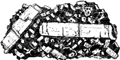
Porphyritic granite. Land's End, Cornwall.
Porphyritic granite.—This name has been sometimes given to that variety
in which large crystals of felspar, sometimes more than 3 inches in length,
are scattered through an ordinary base of granite. An example of this
texture may be seen in the granite of the Land's End, in Cornwall (fig.
489.). The two larger prismatic crystals in this drawing represent felspar,
smaller crystals of which are also seen, similar in form, scattered through
the base. In this base also appear black specks of mica, the crystals of
which have a more or less perfect hexagonal outline. The remainder of the
mass is quartz, the translucency of which is strongly contrasted to the
opaqueness of the white felspar and black mica. But neither the
transparency of the quartz, nor the silvery lustre of the mica, can be
expressed in the engraving.
[p.440]The uniform mineral character of large masses of granite seems to
indicate that large quantities of the component elements were thoroughly
mixed up together, and then crystallized under precisely similar
conditions. There are, however, many accidental, or "occasional," minerals,
as they are termed, which belong to granite. Among these black schorl or
tourmaline, actinolite, zircon, garnet, and fluor spar, are not uncommon;
but they are too sparingly dispersed to modify the general aspect of the
rock. They show, nevertheless, that the ingredients were not everywhere
exactly the same; and a still greater variation may be traced in the
ever-varying proportions of the felspar, quartz, and mica.
Syenite.—When hornblende is the substitute for mica, which is very
commonly the case, the rock becomes Syenite: so called from the celebrated
ancient quarries of Syene in Egypt. It has all the appearance of ordinary
granite, except when mineralogically examined in hand specimens, and is
fully entitled to rank as a geological member of the same plutonic family
as granite. Syenite, however, after maintaining the granitic character
throughout extensive regions, is not uncommonly found to lose its quartz,
and to pass insensibly into syenitic greenstone, a rock of the trap family.
Werner considered syenite as a binary compound of felspar and hornblende,
and regarded quartz as merely one of its occasional minerals.
Syenitic-granite.—The quadruple compound of quartz, felspar, mica, and
hornblende, may be so termed. This rock occurs in Scotland and in Guernsey.
Talcose granite, or Protogine of the French, is a mixture of felspar,
quartz, and talc. It abounds in the Alps, and in some parts of Cornwall,
producing by its decomposition the china clay, more than 12,000 tons of
which are annually exported from that country for the potteries.[440-A]
Schorl rock, and schorly granite.—The former of these is an aggregate of
schorl, or tourmaline, and quartz. When felspar and mica are also present,
it may be called schorly granite. This kind of granite is comparatively
rare.
Eurite.—A rock in which all the ingredients of granite are blended into
a finely granular mass. Crystals of quartz and mica are sometimes scattered
through the base of Eurite.
Pegmatite.—A name given by French writers to a variety of granite; a
granular mixture of quartz and felspar; frequent in granite veins; passes
into graphic granite.
All these granites pass into certain kinds of trap, a circumstance which
affords one of many arguments in favour of what is now the prevailing
opinion, that the granites are also of igneous origin. The contrast of the
most crystalline form of granite, to that of the most common and earthy
trap, is undoubtedly great; but each member of the volcanic class is
capable of becoming porphyritic, and the base of the porphyry may be more
and more crystalline, until the mass [p.441]passes to the kind of
granite most nearly allied in mineral composition.
The minerals which constitute alike the granitic and volcanic rocks
consist, almost exclusively, of seven elements, namely, silica, alumina,
magnesia, lime, soda, potash, and iron; and these may sometimes exist in
about the same proportions in a porous lava, a compact trap, or a
crystalline granite. It may perhaps be found, on farther examination—for
on this subject we have yet much to learn—that the presence of these
elements in certain proportions is more favourable than in others to their
assuming a crystalline or true granitic structure; but it is also
ascertained by experiment, that the same materials may, under different
circumstances, form very different rocks. The same lava, for example, may
be glassy, or scoriaceous, or stony, or porphyritic, according to the more
or less rapid rate at which it cools; and some trachytes and
syenitic-greenstones may doubtless form granite and syenite, if the
crystallization take place slowly.
It has also been suggested that the peculiar nature and structure of
granite may be due to its retaining in it that water which is seen to
escape from lavas when they cool slowly, and consolidate in the atmosphere.
Boutigny's experiments have shown that melted matter, at a white heat,
requires to have its temperature lowered before it can vapourize water; and
such discoveries, if they fail to explain the manner in which granites have
been formed, serve at least to remind us of the entire distinctness of the
conditions under which plutonic and volcanic rocks must be produced.[441-A]
It would be easy to multiply examples and authorities to prove the
gradation of the granitic into the trap rocks. On the western side of the
fiord of Christiania, in Norway, there is a large district of trap, chiefly
greenstone-porphyry, and syenitic-greenstone, resting on fossiliferous
strata. To this, on its southern limit, succeeds a region equally extensive
of syenite, the passage from the volcanic to the plutonic rock being so
gradual that it is impossible to draw a line of demarcation between them.
"The ordinary granite of Aberdeenshire," says Dr. MacCulloch, "is the usual
ternary compound of quartz, felspar, and mica; but sometimes hornblende is
substituted for the mica. But in many places a variety occurs which is
composed simply of felspar and hornblende; and in examining more minutely
this duplicate compound, it is observed in some places to assume a fine
grain, and at length to become undistinguishable from the greenstones of
the trap family. It also passes in the same uninterrupted manner into a
basalt, and at length into a soft claystone, with a schistose tendency on
exposure, in no respect differing from those of the trap islands of the
western coast."[441-B] The same author mentions, that in Shetland, a
granite composed of hornblende, mica, felspar, and quartz, graduates in an
equally perfect manner into basalt.[441-C]
[p.442]In Hungary there are varieties of trachyte, which, geologically
speaking, are of modern origin, in which crystals, not only of mica, but of
quartz, are common, together with felspar and hornblende. It is easy to
conceive how such volcanic masses may, at a certain depth from the surface,
pass downwards into granite.

Junction of granite and argillaceous schist in Glen Tilt.
(MacCulloch.)[442-A]
I have already hinted at the close analogy in the forms of certain granitic
and trappean veins; and it will be found that strata penetrated by plutonic
rocks have suffered changes very similar to those exhibited near the
contact of volcanic dikes. Thus, in Glen Tilt, in Scotland, alternating
strata of limestone and argillaceous schist come in contact with a mass of
granite. The contact does not take place as might have been looked for, if
the granite had been formed there before the strata were deposited, in
which case the section would have appeared as in fig. 490.; but the union
is as represented in fig. 491., the undulating outline of the granite
intersecting different strata, and occasionally intruding itself in
tortuous veins into the beds of clay-slate and limestone, from which it
differs so remarkably in composition. The limestone is sometimes changed in
character by the proximity of the granitic mass or its veins, and acquires
a more compact texture, like that of hornstone or chert, with a splintery
fracture, effervescing feebly with acids.
The annexed diagram (fig. 492.) represents another junction, in the same
district, where the granite sends forth so many veins as to reticulate the
limestone and schist, the veins diminishing towards their termination to
the thickness of a leaf of paper or a thread. In some places fragments of
granite appear entangled, as it were, in the limestone, and are not visibly
connected with any larger mass; while sometimes, on the other hand, a lump
of the limestone is found in the midst of the granite. The ordinary colour
of the limestone of Glen Tilt is lead blue, and its texture large-grained
and highly crystalline; but where it approximates to the granite,
particularly where it is penetrated by the smaller veins, the crystalline
texture disappears, and it assumes an appearance exactly resembling that of
hornstone. The associated argillaceous schist often passes into hornblende
slate, where it approaches very near to the granite.[442-B]
[p.443]
Fig. 492.

Junction of granite and limestone in Glen Tilt. (MacCulloch.)
- a. Granite.
- b. Limestone.
- c. Blue argillaceous schist.
The conversion of the limestone in these and many other instances into a
siliceous rock, effervescing slowly with acids, would be difficult of
explanation, were it not ascertained that such limestones are always
impure, containing grains of quartz, mica, or felspar disseminated through
them. The elements of these minerals, when the rock has been subjected to
great heat, may have been fused, and so spread more uniformly through the
whole mass.
Fig. 493.

Granite veins traversing clay slate. Table Mountain,
Cape of Good Hope.[443-A]
In the plutonic, as in the volcanic rocks, there is every gradation from a
tortuous vein to the most regular form of a dike, such as intersect the
tuffs and lavas of Vesuvius and Etna. Dikes of granite may be seen, among
other places, on the southern flank of Mount Battock, one of the Grampians,
the opposite walls sometimes preserving an exact parallelism for a
considerable distance.
As a general rule, however, granite veins in all quarters of the globe are
more sinuous in their course than those of trap. They present similar
shapes at the most northern point of Scotland, and the southernmost
extremity of Africa, as the annexed drawings will show.
[p.444]It is not uncommon for one set of granite veins to intersect
another; and sometimes there are three sets, as in the environs of
Heidelberg, where the granite on the banks of the river Necker is seen to
consist of three varieties, differing in colour, grain, and various
peculiarities of mineral composition. One of these, which is evidently the
second in age, is seen to cut through an older granite; and another, still
newer, traverses both the second and the first.
In Shetland there are two kinds of granite. One of them, composed of
hornblende, mica, felspar, and quartz, is of a dark colour, and is seen
underlying gneiss. The other is a red granite, which penetrates the dark
variety everywhere in veins.[444-A]
Fig. 494.

Granite veins traversing gneiss, Cape Wrath.
(MacCulloch.)[444-B]
Fig. 495.

Granite veins traversing gneiss at Cape Wrath, in
Scotland. (MacCulloch.)
The accompanying sketches will explain the manner in which granite veins
often ramify and cut each other (figs. 494. and 495.). They represent the
manner in which the gneiss at Cape Wrath, in Sutherlandshire, is
intersected by veins. Their light colour, strongly contrasted with that of
the hornblende-schist, here associated with the gneiss, renders them very
conspicuous.
Granite very generally assumes a finer grain, and undergoes a change in
mineral composition, in the veins which it sends into contiguous rocks.
Thus, according to Professor Sedgwick, the main body of the Cornish granite
is an aggregate of mica, quartz, and felspar; but the veins are sometimes
without mica, being a granular aggregate of quartz and felspar. In other
varieties quartz prevails to the almost entire exclusion both of felspar
and mica; in others, the mica and quartz both disappear, and the vein is
simply composed of white granular felspar.[444-C]
[p.445]Fig. 496. is a sketch of a group of granite veins in Cornwall,
given by Messrs. Von Oeynhausen and Von Dechen.[445-A] The main body of the
granite here is of a porphyritic appearance, with large crystals of
felspar; but in the veins it is fine-grained, and without these large
crystals. The general height of the veins is from 16 to 20 feet, but some
are much higher.
Fig. 496.

Granite veins passing through hornblende slate,
Carnsilver Cove, Cornwall.
In the Valorsine, a valley not far from Mont Blanc in Switzerland, an
ordinary granite, consisting of felspar, quartz, and mica, sends forth
veins into a talcose gneiss (or stratified protogine), and in some places
lateral ramifications are thrown off from the principal veins at right
angles (see fig. 497.), the veins, especially the minute ones, being finer
grained than the granite in mass.
Fig. 497.

Veins of granite in talcose gneiss. (L.
A. Necker.)
It is here remarked, that the schist and granite, as they approach, seem to
exercise a reciprocal influence on each other, for both undergo a
modification of mineral character. The granite, still remaining
unstratified, becomes charged with green particles; and the talcose gneiss
assumes a granitiform structure without losing its stratification.[445-B]
[p.446]Professor Keilhau drew my attention to several localities in the
country near Christiania, where the mineral character of gneiss appears to
have been affected by a granite of much newer origin, for some distance
from the point of contact. The gneiss, without losing its laminated
structure, seems to have become charged with a larger quantity of felspar,
and that of a redder colour, than the felspar usually belonging to the
gneiss of Norway.
Granite, syenite, and those porphyries which have a granitiform structure,
in short all plutonic rocks, are frequently observed to contain metals, at
or near their junction with stratified formations. On the other hand, the
veins which traverse stratified rocks are, as a general law, more
metalliferous near such junctions than in other positions. Hence it has
been inferred that these metals may have been spread in a gaseous form
through the fused mass, and that the contact of another rock, in a
different state of temperature, or sometimes the existence of rents in
other rocks in the vicinity, may have caused the sublimation of the
metals.[446-A]
There are many instances, as at Markerud, near Christiania, in Norway,
where the strike of the beds has not been deranged throughout a large area
by the intrusion of granite, both in large masses and in veins. This fact
is considered by some geologists to militate against the theory of the
forcible injection of granite in a fluid state. But it may be stated in
reply, that ramifying dikes of trap, which almost all now admit to have
been once fluid, pass through the same fossiliferous strata, near
Christiania, without deranging their strike or dip.[446-B]
Fig. 498.

General view of junction of granite and schist of the
Valorsine. (L. A. Necker.)
The real or apparent isolation of large or small masses of granite detached
from the main body, as at a b, fig. 498., and above, fig. 492., and a,
fig. 497., has been thought by some writers to be irreconcilable with the
doctrine usually taught respecting veins; but many of them may, in fact, be
sections of root-shaped prolongations of granite; while, in other cases,
they may in reality be detached portions of rock having the plutonic
structure. For there may have been spots in the midst of the invaded
strata, in which there was an assemblage of materials more fusible than the
rest, or more fitted to combine readily into some form of granite.
[p.447]Veins of pure quartz are often found in granite, as in many
stratified rocks, but they are not traceable, like veins of granite or
trap, to large bodies of rock of similar composition. They appear to have
been cracks, into which siliceous matter was infiltered. Such segregation,
as it is called, can sometimes be shown to have clearly taken place long
subsequently to the original consolidation of the containing rock. Thus,
for example, in the gneiss of Tronstad Strand, near Drammen, in Norway, the
annexed section is seen on the beach. It appears that the alternating
strata of whitish granitiform gneiss, and black hornblende-schist, were
first cut through by a greenstone dike, about 21/2 feet wide; then the
crack a b passed through all these rocks, and was filled up with quartz.
The opposite walls of the vein are in some parts incrusted with transparent
crystals of quartz, the middle of the vein being filled up with common
opaque white quartz.
Fig. 499.

a, b. Quartz vein passing through gneiss and
greenstone, Tronstad Strand, near Christiania.
Fig. 500.

Euritic porphyry alternating with primary
fossiliferous strata, near Christiania.
We have seen that the volcanic formations have been called overlying,
because they not only penetrate others, but spread over them. Mr. Necker
has proposed to call the granites the underlying igneous rocks, and the
distinction here indicated is highly characteristic. It was indeed supposed
by some of the earlier observers, that the granite of Christiania, in
Norway, was intercalated in mountain masses between the primary or
paleozoic strata of that country, so as to overlie fossiliferous shale and
limestone. But although the granite sends veins into these fossiliferous
rocks, and is decidedly posterior in origin, its actual superposition in
mass has been disproved by Professor Keilhau, whose observations on this
controverted point I had opportunities in 1837 of verifying. There are,
however, on a smaller scale, certain beds of euritic porphyry, some a few
feet, others many yards in thickness, which pass into granite, and deserve
perhaps to be classed as plutonic rather than trappean rocks, which may
truly be described as interposed conformably between fossiliferous strata,
as the porphyries (a c, fig. 500.), which divide the bituminous shales
and argillaceous limestones, f f. But some of these same porphyries are
partially unconformable, as b, and may lead us to suspect that the others
also, [p.448]notwithstanding their appearance of interstratification,
have been forcibly injected. Some of the porphyritic rocks above mentioned
are highly quartzose, others very felspathic. In proportion as the masses
are more voluminous, they become more granitic in their texture, less
conformable, and even begin to send forth veins into contiguous strata. In
a word, we have here a beautiful illustration of the intermediate
gradations between volcanic and plutonic rocks, not only in their
mineralogical composition and structure, but also in their relations of
position to associated formations. If the term overlying can in this
instance be applied to a plutonic rock, it is only in proportion as that
rock begins to acquire a trappean aspect.
It has been already hinted that the heat, which in every active volcano
extends downwards to indefinite depths, must produce simultaneously very
different effects near the surface, and far below it; and we cannot suppose
that rocks resulting from the crystallizing of fused matter under a
pressure of several thousand feet, much less miles, of the earth's crust
can resemble those formed at or near the surface. Hence the production at
great depths of a class of rocks analogous to the volcanic, and yet
differing in many particulars, might almost have been predicted, even had
we no plutonic formations to account for. How well these agree, both in
their positive and negative characters, with the theory of their deep
subterranean origin, the student will be able to judge by considering the
descriptions already given.
It has, however, been objected, that if the granitic and volcanic rocks
were simply different parts of one great series, we ought to find in
mountain chains volcanic dikes passing upwards into lava, and downwards
into granite. But we may answer, that our vertical sections are usually of
small extent; and if we find in certain places a transition from trap to
porous lava, and in others a passage from granite to trap, it is as much as
could be expected of this evidence.
The prodigious extent of denudation which has been already demonstrated to
have occurred at former periods, will reconcile the student to the belief
that crystalline rocks of high antiquity, although deep in the earth's
crust when originally formed, may have become uncovered and exposed at the
surface. Their actual elevation above the sea may be referred to the same
causes to which we have attributed the upheaval of marine strata, even to
the summits of some mountain chains. But to these and other topics, I shall
revert when speaking, in the next chapter, of the relative ages of
different masses of granite.
[p.449]CHAPTER XXXIV.
ON THE DIFFERENT AGES OF THE PLUTONIC ROCKS.
Difficulty in ascertaining the precise age of a plutonic rock — Test
of age by relative position — Test by intrusion and alteration
— Test by mineral composition — Test by included fragments
— Recent and Pliocene plutonic rocks, why invisible — Tertiary
plutonic rocks in the Andes — Granite altering Cretaceous rocks
— Granite altering Lias in the Alps and in Skye — Granite of
Dartmoor altering Carboniferous strata — Granite of the Old Red
Sandstone period — Syenite altering Silurian strata in Norway —
Blending of the same with gneiss — Most ancient plutonic rocks
— Granite protruded in a solid form — On the probable age of
the granites of Arran, in Scotland.
When we adopt the igneous theory of granite, as explained in the last
chapter, and believe that different plutonic rocks have originated at
successive periods beneath the surface of the planet, we must be prepared
to encounter greater difficulty in ascertaining the precise age of such
rocks, than in the case of volcanic and fossiliferous formations. We must
bear in mind, that the evidence of the age of each contemporaneous volcanic
rock was derived, either from lavas poured out upon the ancient surface,
whether in the sea or in the atmosphere, or from tuffs and conglomerates,
also deposited at the surface, and either containing organic remains
themselves, or intercalated between strata containing fossils. But all
these tests fail when we endeavour to fix the chronology of a rock which
has crystallized from a state of fusion in the bowels of the earth. In that
case, we are reduced to the following tests; 1st, relative position; 2dly,
intrusion, and alteration of the rocks in contact; 3dly, mineral
characters; 4thly, included fragments.
Test of age by relative position.—Unaltered fossiliferous strata of
every age are met with reposing immediately on plutonic rocks; as at
Christiania, in Norway, where the Newer Pliocene deposits rest on granite;
in Auvergne, where the freshwater Eocene strata, and at Heidelberg, on the
Rhine, where the New Red sandstone, occupy a similar place. In all these,
and similar instances, inferiority in position is connected with the
superior antiquity of granite. The crystalline rock was solid before the
sedimentary beds were superimposed, and the latter usually contain in them
rounded pebbles of the subjacent granite.
Test by intrusion and alteration.—But when plutonic rocks send veins
into strata, and alter them near the point of contact, in the manner before
described (p. 442.), it is clear that, like intrusive traps, they are newer
than the strata which they invade and alter. Examples of the application of
this test will be given in the sequel.
Test by mineral composition.—Notwithstanding a general uniformity in the
aspect of plutonic rocks, we have seen in the last [p.450]chapter that
there are many varieties, such as Syenite, Talcose granite, and others. One
of these varieties is sometimes found exclusively prevailing throughout an
extensive region, where it preserves a homogeneous character; so that
having ascertained its relative age in one place, we can easily recognize
its identity in others, and thus determine from a single section the
chronological relations of large mountain masses. Having observed, for
example, that the syenitic granite of Norway, in which the mineral called
zircon abounds, has altered the Silurian strata wherever it is in contact,
we do not hesitate to refer other masses of the same zircon-syenite in the
south of Norway to the same era.
Some have imagined that the age of different granites might, to a great
extent, be determined by their mineral characters alone; syenite, for
instance, or granite with hornblende, being more modern than common or
micaceous granite. But modern investigations have proved these
generalizations to have been premature. The syenitic granite of Norway
already alluded to may be of the same age as the Silurian strata, which it
traverses and alters, or may belong to the Old Red sandstone period;
whereas the granite of Dartmoor, although consisting of mica, quartz, and
felspar, is newer than the coal. (See p. 456.)
Test by included fragments.—This criterion can rarely be of much
importance, because the fragments involved in granite are usually so much
altered, that they cannot be referred with certainty to the rocks whence
they were derived. In the White Mountains, in North America, according to
Professor Hubbard, a granite vein traversing granite, contains fragments of
slate and trap, which must have fallen into the fissure when the fused
materials of the vein were injected from below[450-A], and thus the granite
is shown to be newer than certain superficial slaty and trappean
formations.
Recent and Pliocene plutonic rocks, why invisible.—The explanation
already given in the 29th and in the last chapter, of the probable relation
of the plutonic to the volcanic formations, will naturally lead the reader
to infer, that rocks of the one class can never be produced at or near the
surface without some members of the other being formed below
simultaneously, or soon afterwards. It is not uncommon for lava-streams to
require more than ten years to cool in the open air; and where they are of
great depth, a much longer period. The melted matter poured from Jorullo,
in Mexico, in the year 1759, which accumulated in some places to the height
of 550 feet, was found to retain a high temperature half a century after
the eruption.[450-B] We may conceive, therefore, that great masses of
subterranean lava may remain in a red-hot or incandescent state in the
volcanic foci for immense periods, and the process of refrigeration may be
extremely gradual. Sometimes, indeed, this process may be retarded for an
indefinite period, by the accession of fresh supplies of heat; for we find
that the lava in the crater of Stromboli, one of the [p.451]Lipari
Islands, has been in a state of constant ebullition for the last two
thousand years; and we may suppose this fluid mass to communicate with some
caldron or reservoir of fused matter below. In the Isle of Bourbon, also,
where there has been an emission of lava once in every two years for a long
period, the lava below can scarcely fail to have been permanently in a
state of liquefaction. If then it be a reasonable conjecture, that about
2000 volcanic eruptions occur in the course of every century, either above
the waters of the sea or beneath them[451-A], it will follow, that the
quantity of plutonic rock generated, or in progress during the Recent
epoch, must already have been considerable.
But as the plutonic rocks originate at some depth in the earth's crust,
they can only be rendered accessible to human observation, by subsequent
upheaval and denudation. Between the period when a plutonic rock
crystallizes in the subterranean regions, and the era of its protrusion at
any single point of the surface, one or two geological periods must usually
intervene. Hence, we must not expect to find the Recent or Newer Pliocene
granites laid open to view, unless we are prepared to assume that
sufficient time has elapsed since the commencement of the Newer Pliocene
period for great upheaval and denudation. A plutonic rock, therefore, must,
in general, be of considerable antiquity relatively to the fossiliferous
and volcanic formations, before it becomes extensively visible. As we know
that the upheaval of land has been sometimes accompanied in South America
by volcanic eruptions and the emission of lava, we may conceive the more
ancient plutonic rocks to be forced upwards to the surface by the newer
rocks of the same class formed successively below,—subterposition in the
plutonic, like superposition in the sedimentary rocks, being usually
characteristic of a newer origin.
In the accompanying diagram (fig. 501.), an attempt is made to show the
inverted order in which sedimentary and plutonic formations may occur in
the earth's crust.
The oldest plutonic rock, No. I., has been upheaved at successive periods
until it has become exposed to view in a mountain-chain. This protrusion of
No. I. has been caused by the igneous agency which produced the newer
plutonic rocks Nos. II. III. and IV. Part of the primary fossiliferous
strata, No. 1., have also been raised to the surface by the same gradual
process. It will be observed that the Recent strata No. 4., and the
Recent granite or plutonic rock No. IV., are the most remote from each
other in position, although of contemporaneous date. According to this
hypothesis, the convulsions of many periods will be required before
Recent granite will be upraised so as to form the highest ridges and
central axes of mountain-chains. During that time the Recent strata No.
4. might be covered by a great many newer sedimentary formations.
Fig. 501.
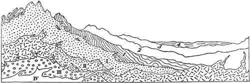
Diagram showing the relative position which the plutonic and
sedimentary formations of different ages may occupy.
| I. |
Primary plutonic. |
4. Recent strata. |
| II. |
Secondary plutonic. |
3. Tertiary strata. |
| III. |
Tertiary plutonic. |
2. Secondary strata. |
| IV. |
Recent plutonic. |
1. Primary fossiliferous strata. |
The metamorphic rocks are not indicated in this diagram; but the student
will infer, from what has been said in Chap. XXXII., that some portions of
the stratified formations Nos. 1. and 2. invaded by granite will have
become metamorphic.
Eocene granite and plutonic rocks.—In a former part of this volume (p.
205.), the great nummulitic formation of the Alps and [p.453]Pyrenees
was referred to the Eocene period, and it follows that those vast movements
which have raised fossiliferous rocks from the level of the sea to the
height of more than 10,000 feet above its level have taken place since the
commencement of the tertiary epoch. Here, therefore, if anywhere, we might
expect to find hypogene formations of Eocene date breaking out in the
central axis or most disturbed region of the loftiest chain in Europe.
Accordingly, in the Swiss Alps, even the flysch, or upper portion of the
nummulitic series, has been occasionally invaded by plutonic rocks, and
converted into crystalline schists of the hypogene class. There can be
little doubt that even the talcose granite of Mont Blanc itself has been in
a fused or pasty state since the flysch was deposited at the bottom of
the sea; and the question as to its age is not so much whether it be a
secondary or tertiary granite, as whether it should be assigned to the
Eocene or Miocene epoch.
Great upheaving movements have been experienced in the region of the Andes,
during the Post-Pliocene period. In some part, therefore, of this chain, we
may expect to discover tertiary plutonic rocks laid open to view. What we
already know of the structure of the Chilian Andes seems to realize this
expectation. In a transverse section, examined by Mr. Darwin, between
Valparaiso and Mendoza, the Cordillera was found to consist of two separate
and parallel chains, formed of sedimentary rocks of different ages, the
strata in both resting on plutonic rocks, by which they have been altered.
In the western or oldest range, called the Peuquenes, are black calcareous
clay-slates, rising to the height of nearly 14,000 feet above the sea, in
which are shells of the genera Gryphæa, Turritella, Terebratula, and
Ammonite. These rocks are supposed to be of the age of the central parts
of the secondary series of Europe. They are penetrated and altered by dikes
and mountain masses of a plutonic rock, which has the texture of ordinary
granite, but rarely contains quartz, being a compound of albite and
hornblende.
The second or eastern chain consists chiefly of sandstones and
conglomerates, of vast thickness, the materials of which are derived from
the ruins of the western chain. The pebbles of the conglomerates are, for
the most part, rounded fragments of the fossiliferous slates before
mentioned. The resemblance of the whole series to certain tertiary deposits
on the shores of the Pacific, not only in mineral character, but in the
imbedded lignite and silicified woods, leads to the conjecture that they
also are tertiary. Yet these strata are not only associated with trap rocks
and volcanic tuffs, but are also altered by a granite consisting of quartz,
felspar, and talc. They are traversed, moreover, by dikes of the same
granite, and by numerous veins of iron, copper, arsenic, silver, and gold;
all of which can be traced to the underlying granite.[453-A] We have,
therefore, strong ground to presume that the plutonic rock, here exposed on
a large scale in the Chilian Andes, is of later date than certain tertiary
formations.
[p.454]But the theory adopted in this work of the subterranean origin of
the hypogene formations would be untenable, if the supposed fact here
alluded to, of the appearance of tertiary granite at the surface was not a
rare exception to the general rule. A considerable lapse of time must
intervene between the formation in the nether regions of plutonic and
metamorphic rocks, and their emergence at the surface. For a long series of
subterranean movements must occur before such rocks can be uplifted into
the atmosphere or the ocean; and, before they can be rendered visible to
man, some strata which previously covered them must usually have been
stripped off by denudation.
We know that in the Bay of Baiæ, in 1538, in Cutch in 1819, and on several
occasions in Peru and Chili, since the commencement of the present century,
the permanent upheaval or subsidence of land has been accompanied by the
simultaneous emission of lava at one or more points in the same volcanic
region. From these and other examples it may be inferred that the rising or
sinking of the earth's crust, operations by which sea is converted into
land, and land into sea, are a part only of the consequences of
subterranean igneous action. It can scarcely be doubted that this action
consists, in a great degree, of the baking, and occasionally the
liquefaction, of rocks, causing them to assume, in some cases a larger, in
others a smaller volume than before the application of heat. It consists
also in the generation of gases, and their expansion by heat, and the
injection of liquid matter into rents formed in superincumbent rocks. The
prodigious scale on which these subterranean causes have operated in Sicily
since the deposition of the Newer Pliocene strata will be appreciated, when
we remember that throughout half the surface of that island such strata are
met with, raised to the height of from 50 to that of 2000 and even 3000
feet above the level of the sea. In the same island also the older rocks
which are contiguous to these marine tertiary strata must have undergone,
within the same period, a similar amount of upheaval.
The like observations may be extended to nearly the whole of Europe, for,
since the commencement of the Eocene period, the entire European area,
including some of the central and very lofty portions of the Alps
themselves, as I have elsewhere shown[454-A], has, with the exception of a
few districts, emerged from the deep to its present altitude; and even
those tracts, which were already dry land before the Eocene era, have
almost everywhere acquired additional height. A large amount of subsidence
has also occurred during the same period, so that the extent of the
subterranean spaces which have either become the receptacles of sunken
fragments of the earth's crust, or have been rendered capable of supporting
other fragments at a much greater height than before, must be so great that
they probably equal, if not exceed in volume, the entire continent of
Europe. We are entitled, therefore, to ask what amount of change of
equivalent importance [p.455]can be proved to have occurred in the
earth's crust within an equal quantity of time anterior to the Eocene
epoch. They who contend for the more intense energy of subterranean causes
in the remoter eras of the earth's history, may find it more difficult to
give an answer to this question than they anticipated.
The principal effect of volcanic action in the nether regions, during the
tertiary period, seems to have consisted in the upheaval to the surface of
hypogene formations of an age anterior to the carboniferous. The repetition
of another series of movements, of equal violence, might upraise the
plutonic and metamorphic rocks of many secondary periods; and if the same
force should still continue to act, the next convulsions might bring up to
the day the tertiary and recent hypogene rocks. In the course of such
changes many of the existing sedimentary strata would suffer greatly by
denudation, others might assume a metamorphic structure, or become melted
down into plutonic and volcanic rocks. Meanwhile the deposition of a vast
thickness of new strata would not fail to take place during the upheaval
and partial destruction of the older rocks. But I must refer the reader to
the last chapter but one of this volume for a fuller explanation of these
views.
Fig. 502.

Cretaceous period.—It will be shown in the next chapter that chalk, as
well as lias, has been altered by granite in the eastern Pyrenees. Whether
such granite be cretaceous or tertiary cannot easily be decided. Suppose
b, c, d, to be three members of the Cretaceous series, the lowest of
which, b, has been altered by the granite A, the modifying influence not
having extended so far as c, or having but slightly affected its lowest
beds. Now it can rarely be possible for the geologist to decide whether the
beds d existed at the time of the intrusion of A, and alteration of b and
c, or whether they were subsequently thrown down upon c.
As some Cretaceous rocks, however, have been raised to the height of more
than 9000 feet in the Pyrenees, we must not assume that plutonic formations
of the same age may not have been brought up and exposed by denudation, at
the height of 2000 or 3000 feet on the flanks of that chain.
Period of Oolite and Lias.—In the department of the Hautes Alpes, in
France, near Vizille, M. Elie de Beaumont traced a black argillaceous
limestone, charged with belemnites, to within a few yards of a mass of
granite. Here the limestone begins to put on a granular texture, but is
extremely fine-grained. When nearer the junction it becomes grey, and has a
saccharoid structure. In another locality, near Champoleon, a granite
composed of quartz, black mica, and rose-coloured felspar, is observed
partly to overlie the secondary rocks, producing an alteration which
extends for about 30 feet downwards, diminishing in the beds which lie
farthest from the [p.456]granite. (See fig. 503.) In the altered mass
the argillaceous beds are hardened, the limestone is saccharoid, the grits
quartzose, and in the midst of them is a thin layer of an imperfect
granite. It is also an important circumstance that near the point of
contact, both the granite and the secondary rocks become metalliferous, and
contain nests and small veins of blende, galena, iron, and copper pyrites.
The stratified rocks become harder and more crystalline, but the granite,
on the contrary, softer and less perfectly crystallized near the
junction.[456-A]
Fig. 503.

Junction of granite with Jurassic or Oolite strata in the Alps,
near Champoleon.
Although the granite is incumbent in the above section (fig. 503.), we
cannot assume that it overflowed the strata, for the disturbances of the
rocks are so great in this part of the Alps that they seldom retain the
position which they must originally have occupied.
A considerable mass of syenite, in the Isle of Skye, is described by Dr.
MacCulloch as intersecting limestone and shale, which are of the age of the
lias.[456-B] The limestone, which, at a greater distance from the granite,
contains shells, exhibits no traces of them near its junction, where it has
been converted into a pure crystalline marble.[456-C]
At Predazzo, in the Tyrol, secondary strata, some of which are limestones
of the Oolitic period, have been traversed and altered by plutonic rocks,
one portion of which is an augitic porphyry, which passes insensibly into
granite. The limestone is changed into granular marble, with a band of
serpentine at the junction.[456-D]
Carboniferous period.—The granite of Dartmoor, in Devonshire, was
formerly supposed to be one of the most ancient of the plutonic rocks, but
is now ascertained to be posterior in date to the culm-measures of that
county, which, from their position, and as containing true coal-plants, are
regarded by Professor Sedgwick and Sir R. Murchison as members of the true
carboniferous series. This granite, like the syenitic granite of
Christiania, has broken through the stratified formations without much
changing their strike. Hence, on the north-west side of Dartmoor, the
successive members of the culm-measures abut against the granite, and
become metamorphic as they [p.457]approach. These strata are also
penetrated by granite veins, and plutonic dikes, called "elvans."[457-A]
The granite of Cornwall is probably of the same date, and, therefore, as
modern as the Carboniferous strata, if not much newer.
Silurian period.—It has long been known that the granite near
Christiania, in Norway, is of newer origin than the Silurian strata of that
region. Von Buch first announced, in 1813, the discovery of its
posteriority in date to limestones containing orthocerata and trilobites.
The proofs consist in the penetration of granite veins into the shale and
limestone, and the alteration of the strata, for a considerable distance
from the point of contact, both of these veins and the central mass from
which they emanate. (See p. 447.) Von Buch supposed that the plutonic rock
alternated with the fossiliferous strata, and that large masses of granite
were sometimes incumbent upon the strata; but this idea was erroneous, and
arose from the fact that the beds of shale and limestone often dip towards
the granite up to the point of contact, appearing as if they would pass
under it in mass, as at a, fig. 504., and then again on the opposite side
of the same mountain, as at b, dip away from the same granite. When the
junctions, however, are carefully examined, it is found that the plutonic
rock intrudes itself in veins, and nowhere covers the fossiliferous strata
in large overlying masses, as is so commonly the case with trappean
formations.[457-B]
Fig. 504.

Now this granite, which is more modern than the Silurian strata of Norway,
also sends veins in the same country into an ancient formation of gneiss;
and the relations of the plutonic rock and the gneiss, at their junction,
are full of interest when we duly consider the wide difference of epoch
which must have separated their origin.
Fig. 505.
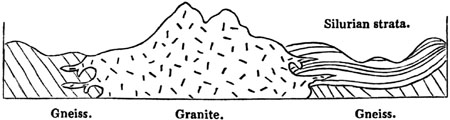
Granite sending veins into Silurian strata and
Gneiss,—Christiania, Norway.
The length of this interval of time is attested by the following
facts:—The fossiliferous, or Silurian beds, rest unconformably upon the
truncated edges of the gneiss, the inclined strata of which had been
disturbed and denuded before the sedimentary beds were superimposed (see
fig. 505.). The signs of denudation are twofold; [p.458]first, the
surface of the gneiss is seen occasionally, on the removal of the newer
beds, containing organic remains, to be worn and smoothed; secondly,
pebbles of gneiss have been found in some of the transition strata. Between
the origin, therefore, of the gneiss and the granite there intervened,
first, the period when the strata of gneiss were inclined; secondly, the
period when they were denuded; thirdly, the period of the deposition of the
transition deposits. Yet the granite produced, after this long interval, is
often so intimately blended with the ancient gneiss, at the point of
junction, that it is impossible to draw any other than an arbitrary line of
separation between them; and where this is not the case, tortuous veins of
granite pass freely through gneiss, ending sometimes in threads, as if the
older rock had offered no resistance to their passage. It seems necessary,
therefore, to conceive that the gneiss was softened and more or less melted
when penetrated by the granite. But had such junctions alone been visible,
and had we not learnt, from other sections, how long a period elapsed
between the consolidation of the gneiss and the injection of this granite,
we might have suspected that the gneiss was scarcely solidified, or had not
yet assumed its complete metamorphic character, when invaded by the
plutonic rock. From this example we may learn how impossible it is to
conjecture whether certain granites in Scotland, and other countries, which
send veins into gneiss and other metamorphic rocks, are primary, or whether
they may not belong to some secondary or tertiary period.
Oldest granites.—It is not half a century since the doctrine was very
general that all granitic rocks were primitive, that is to say, that they
originated before the deposition of the first sedimentary strata, and
before the creation of organic beings (see above, p. 9.). But so greatly
are our views now changed, that we find it no easy task to point out a
single mass of granite demonstrably more ancient than all the known
fossiliferous deposits. Could we discover some Lower Cambrian strata
resting immediately on granite, there being no alterations at the point of
contact, nor any intersecting granitic veins, we might then affirm the
plutonic rock to have originated before the oldest known fossiliferous
strata. Still it would be presumptuous to suppose that when a small part
only of the globe has been investigated, we are acquainted with the oldest
fossiliferous strata in the crust of our planet. Even when these are found,
we cannot assume that there never were any antecedent strata containing
organic remains, which may have become metamorphic. If we find pebbles of
granite in a conglomerate of the Lower Cambrian system, we may then feel
assured that the parent granite was formed before the Lower Cambrian
formation. But if the incumbent strata be merely Silurian or Upper
Cambrian, the fundamental granite, although of high antiquity, may be
posterior in date to known fossiliferous formations.
Protrusion of solid granite.—In part of Sutherlandshire, near Brora,
common granite, composed of felspar, quartz, and mica, is in immediate
contact with Oolitic strata, and has clearly been elevated [p.459]to the
surface at a period subsequent to the deposition of those strata.[459-A]
Professor Sedgwick and Sir R. Murchison conceive that this granite has been
upheaved in a solid form; and that in breaking through the submarine
deposits, with which it was not perhaps originally in contact, it has
fractured them so as to form a breccia along the line of junction. This
breccia consists of fragments of shale, sandstone, and limestone, with
fossils of the oolite, all united together by a calcareous cement. The
secondary strata, at some distance from the granite, are but slightly
disturbed, but in proportion to their proximity the amount of dislocation
becomes greater.
If we admit that solid hypogene rocks, whether stratified or unstratified,
have in such cases been driven upwards so as to pierce through yielding
sedimentary deposits, we shall be enabled to account for many geological
appearances otherwise inexplicable. Thus, for example, at Weinböhla and
Hohnstein, near Meissen, in Saxony, a mass of granite has been observed
covering strata of the Cretaceous and Oolitic periods for the space of
between 300 and 400 yards square. It appears clearly from a recent Memoir
of Dr. B. Cotta on this subject[459-B], that the granite was thrust into
its actual position when solid. There are no intersecting veins at the
junction—no alteration as if by heat, but evident signs of rubbing, and a
breccia in some places, in which pieces of granite are mingled with broken
fragments of the secondary rocks. As the granite overhangs both the lias
and chalk, so the lias is in some places bent over strata of the cretaceous
era.
Relative age of the granites of Arran.—In this island, the largest in
the Firth of Clyde, being twenty miles in length from north to south, the
four great classes of rocks, the fossiliferous, volcanic, plutonic, and
metamorphic, are all conspicuously displayed within a very small area, and
with their peculiar characters strongly contrasted. In the north of the
island the granite rises to the height of nearly 3000 feet above the sea,
terminating in mountainous peaks. (See section, fig. 506.) On the flanks of
the same mountains are chloritic-schists, blue roofing-slate, and other
rocks of the metamorphic order (No. 1.), into which the granite (No. 2.)
sends veins. This granite, therefore, is newer than the hypogene schists
(No. 1.), which it penetrates.
These schists are highly inclined. Upon them rest beds of conglomerate and
sandstone (No. 3.), which are referable to the Old Red formation, to which
succeed various shales and limestones (No. 4.) containing the fossils of
the Carboniferous period, upon which are other strata of sandstone and
conglomerate (upper part of No. 4.), in which no fossils have been met
with, which it is conjectured may belong to the New Red sandstone period.
All the preceding formations are cut through by the volcanic rocks (No.
5.), which consist of greenstone, basalt, pitchstone, claystone-porphyry,
and other varieties. These appear either in the form of dikes, or in
[p.460]dense masses from 50 to 700 feet in thickness, overlying the
strata (No. 4.). They sometimes pass into syenite of so crystalline a form,
that it may rank as a plutonic formation; and in one region, at
Ploverfield, in Glen Cloy, a fine-grained granite (6. a) is seen
associated with the trap formation, and sending veins into the sandstone or
into the upper strata of No. 4. This interesting discovery of granite in
the southern region of Arran, at a point where it is separated from the
northern mass of granite by a great thickness of secondary strata and
overlying trap, was made by Mr. L. A. Necker of Geneva, during his survey
of Arran in 1839. We also learn from the recent investigations of Prof. A.
C. Ramsay, that a similar fine-grained granite (No. 6. b) appears in the
interior of the northern granitic district, forming the nucleus of it, and
sending veins into the older coarse-grained granite (No. 2.). The trap
dikes which penetrate the older granite are cut off, according to Mr.
Ramsay, at the junction of the fine grained.
It is not improbable that the granite (No. 6. b) may be of the same age
as that of Ploverfield (No. 6. a), and this again may belong to the same
geological epoch as the trap formations (No. 5.). If there be any
difference of date, it would seem that the fine-grained granite must be
newer than the trappean rocks. But, on the other hand, the coarser granite
(No. 2.) may be the oldest rock in Arran, with the exception of the
hypogene slates (No. 1.), into which it sends veins.
Fig. 506. General Section of Arran from north to south.

- 1. Metamorphic or Hypogene schists, the oldest formations in Arran.
- 2. Coarse-grained granite sending veins into the schists, No. 1.
- 3. Old Red Sandstone and Conglomerate containing pebbles exclusively
derived from the rocks, No 1., without any intermixture of granitic
fragments.
- 4. Carboniferous strata and red sandstone (New Red?).
- 5. Trap, overlying and in dikes, passing occasionally into Syenites
of the Plutonic class.
- 6. a. Fine-grained granite, associated with the overlying
trap, No. 5.
- 6. b. Similar fine-grained granite, sending veins into the older
granite, No. 2., and cutting off the trappean dikes, c, d.[461-A]
An objection may perhaps at first be started to this conclusion, derived
from the curious and striking fact, the importance of which was first
emphatically pointed out by Dr. MacCulloch, that no pebbles of granite
occur in the conglomerates of the red sandstone in Arran, although these
conglomerates are several hundred feet in thickness, and lie at the foot of
lofty granite mountains, which tower above them. As a general rule, all
such aggregates of pebbles and sand are mainly composed of the wreck of
pre-existing rocks occurring in the immediate vicinity. The total absence
therefore of granitic pebbles has justly been a theme of wonder to those
geologists who have successively visited Arran, and they have carefully
searched there, as I have done myself, to find an exception, but in vain.
The rounded masses consist exclusively of quartz, chlorite-schist, and
other members of the metamorphic series; nor in the newer conglomerates of
No. 4. have any granitic fragments been discovered. Are we then entitled to
affirm that the coarse-grained granite (No. 2.), like the fine-grained
variety (No. 6. a), is more modern than all the other rocks of the
island? This we cannot assume at present, but we may confidently infer that
when the various beds of sandstone and conglomerate were formed, no granite
had reached the surface, or had been exposed to denudation in Arran. It is
clear that the crystalline schists were ground into sand and shingle when
the strata No. 3. were deposited, and at that time the waves had never
acted upon the granite, which now sends its veins into the schist. May we
then conclude, that the schists suffered denudation before they were
invaded [p.462]by granite? This opinion, although not inadmissible, is
by no means fully borne out by the evidence. For at the time when the Old
Red sandstone originated, the metamorphic strata may have formed islands in
the sea, as in fig. 507., over which the breakers rolled, or from which
torrents and rivers descended, carrying down gravel and sand. The plutonic
rock or granite (B) may even then have been previously injected at a
certain depth below, and yet may never have been exposed to denudation.
Fig. 507.
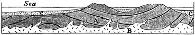
As to the time and manner of the subsequent protrusion of the
coarse-grained granite (No. 2.), this rock may have been thrust up bodily,
in a solid form, during that long series of igneous operations which
produced the trappean and plutonic formations (Nos. 5., 6. a, and 6.
b).
We have shown that these eruptions, whatever their date, were posterior to
the deposition of all the fossiliferous strata of Arran. We can also prove
that subsequently both the granitic and trappean rocks underwent great
aqueous denudation, which they probably suffered during their emergence
from the sea. The fact is demonstrated by the abrupt truncation of numerous
dikes, such as those at c, d, e, which are cut off on the surface of
the granite and trap. The overlying trap also ceases very abruptly on
approaching the boundary of the great hypogene region, and terminates in a
steep escarpment facing towards it as at f, fig. 506. When in its
original fluid state it could not have come thus suddenly to an end, but
must have filled up the hollow now separating it from the hypogene rocks,
had such a hollow then existed. This necessity of supposing that both the
trap and the conglomerate once extended farther, and that veins such as
c, d, fig. 506., were once prolonged farther upwards, prepares us to
believe that the whole of the northern granite may at one time have been
covered by newer formations, under the pressure of which, before its
protrusion, it assumed its highly crystalline texture.
The theory of the protrusion in a solid form of the northern nucleus of
granite is confirmed by the manner in which the hypogene slates (No. 1.)
and the beds of conglomerate (No. 3.) dip away from it on all sides. In
some places indeed the slates are inclined towards the granite, but this
exception might have been looked for, because these hypogene strata have
undergone disturbances at more than one geological epoch, and may at some
points, perhaps, have their original order of position inverted. The high
inclination, therefore, and the quâquâversal dip of the beds around the
borders of the granitic boss, and the comparative horizontality of the
fossiliferous strata in the southern part of the island, are facts which
all accord with the hypothesis of a great amount of movement at that point
where the granite [p.463]is supposed to have been thrust up bodily, and
where we may conceive it to have been distended laterally by the repeated
injection of fresh supplies of melted materials.[463-A]
METAMORPHIC ROCKS.
General character of metamorphic rocks — Gneiss —
Hornblende-schist — Mica-schist — Clay-slate — Quartzite
— Chlorite-schist — Metamorphic limestone — Alphabetical
list and explanation of other rocks of this family — Origin of the
metamorphic strata — Their stratification is real and distinct from
cleavage — Joints and slaty cleavage — Supposed causes of these
structures — How far connected with crystalline action.
We have now considered three distinct classes of rocks: first, the aqueous,
or fossiliferous; secondly, the volcanic; and, thirdly, the plutonic, or
granitic; and we have now, lastly, to examine those crystalline (or
hypogene) strata to which the name of metamorphic has been assigned. The
last-mentioned term expresses, as before explained, a theoretical opinion
that such strata, after having been deposited from water, acquired, by the
influence of heat and other causes, a highly crystalline texture. They who
still question this opinion may call the rocks under consideration the
stratified hypogene, or schistose hypogene formations.
These rocks, when in their most characteristic or normal state, are wholly
devoid of organic remains, and contain no distinct fragments of other
rocks, whether rounded or angular. They sometimes break out in the central
parts of narrow mountain chains, but in other cases extend over areas of
vast dimensions, occupying, for example, nearly the whole of Norway and
Sweden, where, as in Brazil, they appear alike in the lower and higher
grounds. In Great Britain, those members of the series which approach most
nearly to granite in their composition, as gneiss, mica-schist, and
hornblende-schist, are confined to the country north of the rivers Forth
and Clyde.
Many attempts have been made to trace a general order of succession or
superposition in the members of this family; gneiss, for example, having
been often supposed to hold invariably a lower geological position than
mica-schist. But although such an order may prevail throughout limited
districts, it is by no means universal, nor even general, throughout the
globe. To this subject, however, I [p.464]shall again revert, in the
last chapter of this volume, when the chronological relations of the
metamorphic rocks are pointed out.
The following may be enumerated as the principal members of the metamorphic
class:—gneiss, mica-schist, hornblende-schist, clay-slate,
chlorite-schist, hypogene or metamorphic limestone, and certain kinds of
quartz-rock or quartzite.
Fig. 508.

Fragment of gneiss, natural size; section at right
angles to planes of stratification.
Gneiss.—The first of these, gneiss, may be called stratified granite,
being formed of the same materials as granite, namely, felspar, quartz, and
mica. In the specimen here figured, the white layers consist almost
exclusively of granular felspar, with here and there a speck of mica and
grain of quartz. The dark layers are composed of grey quartz and black
mica, with occasionally a grain of felspar intermixed. The rock splits most
easily in the plane of these darker layers, and the surface thus exposed is
almost entirely covered with shining spangles of mica. The accompanying
quartz, however, greatly predominates in quantity, but the most ready
cleavage is determined by the abundance of mica in certain parts of the
dark layer.
Instead of these thin laminæ, gneiss is sometimes simply divided into thick
beds, in which the mica has only a slight degree of parallelism to the
planes of stratification.
The term "gneiss," however, in geology is commonly used in a wider sense,
to designate a formation in which the above-mentioned rock prevails, but
with which any one of the other metamorphic rocks, and more especially
hornblende-schist, may alternate. These other members of the metamorphic
series are, in this case, considered as subordinate to the true gneiss.
The different varieties of rock allied to gneiss, into which felspar enters
as an essential ingredient, will be understood by referring to what was
said of granite. Thus, for example, hornblende may be superadded to mica,
quartz, and felspar, forming a syenitic gneiss; or talc may be substituted
for mica, constituting talcose gneiss, a rock composed of felspar, quartz,
and talc, in distinct crystals or grains (stratified protogine of the
French).
Hornblende-schist is usually black, and composed principally of
hornblende, with a variable quantity of felspar, and sometimes grains of
quartz. When the hornblende and felspar are nearly in equal [p.465]
quantities, and the rock is not slaty, it corresponds in character with the
greenstones of the trap family, and has been called "primitive greenstone."
It may be termed hornblende rock. Some of these hornblendic masses may
really have been volcanic rocks, which have since assumed a more
crystalline or metamorphic texture.
Mica-schist, or Micaceous schist, is, next to gneiss, one of the most
abundant rocks of the metamorphic series. It is slaty, essentially composed
of mica and quartz, the mica sometimes appearing to constitute the whole
mass. Beds of pure quartz also occur in this formation. In some districts,
garnets in regular twelve-sided crystals form an integrant part of
mica-schist. This rock passes by insensible gradations into clay-slate.
Clay-slate, or Argillaceous schist.—This rock resembles an indurated
clay or shale, is for the most part extremely fissile, often affording good
roofing slate. It may consist of the ingredients of gneiss, or of an
extremely fine mixture of mica and quartz, or talc and quartz. Occasionally
it derives a shining and silky lustre from the minute particles of mica or
talc which it contains. It varies from greenish or bluish-grey to a lead
colour. It may be said of this, more than of any other schist, that it is
common to the metamorphic and fossiliferous series, for some clay-slates
taken from each division would not be distinguishable by mineralogical
characters.
Quartzite, or Quartz rock, is an aggregate of grains of quartz, which
are either in minute crystals, or in many cases slightly rounded, occurring
in regular strata, associated with gneiss or other metamorphic rocks.
Compact quartz, like that so frequently found in veins, is also found
together with granular quartzite. Both of these alternate with gneiss or
mica-schist, or pass into those rocks by the addition of mica, or of
felspar and mica.
Chlorite-schist is a green slaty rock, in which chlorite is abundant in
foliated plates, usually blended with minute grains of quartz, or sometimes
with felspar or mica. Often associated with, and graduating into, gneiss
and clay-slate.
Hypogene, or Metamorphic limestone.—This rock, commonly called
primary limestone, is sometimes a thick bedded white crystalline granular
marble used in sculpture; but more frequently it occurs in thin beds,
forming a foliated schist much resembling in colour and appearance certain
varieties of gneiss and mica-schist. It alternates with both these rocks,
and in like manner with argillaceous schist. It then usually contains some
crystals of mica, and occasionally quartz, felspar, hornblende, and talc.
This member of the metamorphic series enters sparingly into the structure
of the hypogene districts of Norway, Sweden, and Scotland, but is largely
developed in the Alps.
Before offering any farther observations on the probable origin of the
metamorphic rocks, I subjoin, in the form of a glossary, a brief
explanation of some of the principal varieties and their synonymies.
[p.466]Actinolite-schist. A slaty foliated rock, composed chiefly of
actinolite, (an emerald-green mineral, allied to hornblende,) with some
admixture of felspar, or quartz, or mica.
Ampelite. Aluminous slate (Brongniart); occurs both in the metamorphic and
fossiliferous series.
Amphibolite. Hornblende rock, which see.
Argillaceous-schist, or Clay-slate. See p. 465.
Arkose. Term used by Brongniart for granular Quartzite, which see.
Chiastolite-slate scarcely differs from clay-slate, but includes numerous
crystals of Chiastolite; in considerable thickness in Cumberland.
Chiastolite occurs in long slender rhomboidal crystals. For composition,
see Table, p. 377.
Chlorite-schist. A green slaty rock, in which chlorite, a green scaly
mineral, is abundant. See p. 465.
Clay-slate, or Argillaceous-schist. See p. 465.
Eurite and Euritic Porphyry. A base of compact felspar, with grains of
laminar felspar, and often mica and other minerals disseminated
(Brongniart). M. D'Aubuisson regards eurite as an extremely fine-grained
granite, in which felspar predominates, the whole forming an apparently
homogeneous rock. Eurite has been already mentioned as a plutonic rock, but
occurs also in beds subordinate to gneiss or mica-slate.
Gneiss. A stratified or laminated rock, same composition as granite. See
p. 464.
Hornblende Rock, or Amphibolite. Composed of hornblende and felspar. The
same composition as hornblende-schist, stratified, but not fissile. See
p. 376.
Hornblende-schist, or Slate. Composed chiefly of hornblende, with
occasionally some felspar. See p. 464.
Hornblendic or Syenitic-Gneiss. Composed of felspar, quartz, and
hornblende.
Hypogene Limestone. See p. 465.
Marble. See p. 465.
Mica-schist, or Micaceous-schist. A slaty rock, composed of mica and quartz
in variable proportions. See p. 465.
Mica-slate. See Mica-schist, p. 465.
Phyllade. D'Aubuisson's term for clay-slate, from
φυλλας, a heap of leaves.
Primary Limestone. See Hypogene Limestone, p. 465.
Protogine. See Talcose-gneiss, p. 464.; when unstratified it is
Talcose-granite.
Quartz Rock, or Quartzite. A stratified rock; an aggregate of grains of
quartz. See p. 465.
Serpentine occurs in both divisions of the hypogene series, as a stratified
or unstratified rock; contains much magnesia; is chiefly composed of the
mineral called serpentine, mixed with diallage, talc, and steatite. The
pure varieties of this rock, called noble serpentine, consist of a hydrated
silicate of magnesia, generally of a greenish colour: this base is commonly
mixed with oxide of iron.
Talcose-gneiss. Same composition as talcose-granite or protogine, but
either stratified or laminated. See p. 464.
Talcose-schist consists chiefly of talc, or of talc and quartz, or of talc
and felspar, and has a texture something like that of clay-slate.
Whitestone. Same as Eurite.
[p.467]Origin of the Metamorphic Strata.
Having said thus much of the mineral composition of the metamorphic rocks,
I may combine what remains to be said of their structure and history with
an account of the opinions entertained of their probable origin. At the
same time, it may be well to forewarn the reader that we are here entering
upon ground of controversy, and soon reach the limits where positive
induction ends, and beyond which we can only indulge in speculations. It
was once a favourite doctrine, and is still maintained by many, that these
rocks owe their crystalline texture, their want of all signs of a
mechanical origin, or of fossil contents, to a peculiar and nascent
condition of the planet at the period of their formation. The arguments in
refutation of this hypothesis will be more fully considered when I show, in
the last chapter of this volume, to how many different ages the metamorphic
formations are referable, and how gneiss, mica-schist, clay-slate, and
hypogene limestone (that of Carrara for example), have been formed, not
only since the first introduction of organic beings into this planet, but
even long after many distinct races of plants and animals had passed away
in succession.
The doctrine respecting the crystalline strata, implied in the name
metamorphic, may properly be treated of in this place; and we must first
inquire whether these rocks are really entitled to be called stratified in
the strict sense of having been originally deposited as sediment from
water. The general adoption by geologists of the term stratified, as
applied to these rocks, sufficiently attests their division into beds very
analogous, at least in form, to ordinary fossiliferous strata. This
resemblance is by no means confined to the existence in both of an
occasional slaty structure, but extends to every kind of arrangement which
is compatible with the absence of fossils, and of sand, pebbles,
ripple-mark, and other characters which the metamorphic theory supposes to
have been obliterated by plutonic action. Thus, for example, we behold
alike in the crystalline and fossiliferous formations an alternation of
beds varying greatly in composition, colour, and thickness. We observe, for
instance, gneiss alternating with layers of black hornblende-schist, or
with granular quartz, or limestone; and the interchange of these different
strata may be repeated for an indefinite number of times. In the like
manner, mica-schist alternates with chlorite-schist, and with granular
limestone in thin layers.
As in fossiliferous formations strata of pure siliceous sand alternate with
micaceous sand and with layers of clay, so in the crystalline or
metamorphic rocks we have beds of pure quartzite alternating with
mica-schist and clay-slate. As in the secondary and tertiary series we meet
with limestone alternating again and again with micaceous or argillaceous
sand, so we find in the hypogene, gneiss and mica-schist alternating with
pure and impure granular limestones.
[p.468]It has also been shown that the ripple-mark is very commonly
repeated throughout a considerable thickness of fossiliferous strata; so in
mica-schist and gneiss, there is sometimes an undulation of the laminæ on a
minute scale, which may, perhaps, be a modification of similar inequalities
in the original deposit.
In the crystalline formations also, as in many of the sedimentary before
described, single strata are sometimes made up of laminæ placed diagonally,
such laminæ not being regularly parallel to the planes of cleavage.
Fig. 509.

Lamination of clay-slate, Montagne de Seguinat,
near Gavarnie, in the Pyrenees.
This disposition of the layers is illustrated in the accompanying diagram,
in which I have represented carefully the stratification of a coarse
argillaceous schist, which I examined in the Pyrenees, part of which
approaches in character to a green and blue roofing slate, while part is
extremely quartzose, the whole mass passing downwards into micaceous
schist. The vertical section here exhibited is about 3 feet in height, and
the layers are sometimes so thin that fifty may be counted in the thickness
of an inch. Some of them consist of pure quartz.
The inference drawn from the phenomena above described in favour of the
aqueous origin of clay-slate and other crystalline strata, is greatly
strengthened by the fact that many of these metamorphic rocks occasionally
alternate with, and sometimes pass by intermediate gradations into, rocks
of a decidedly mechanical origin, and exhibiting traces of organic remains.
The fossiliferous formations, moreover, into which this passage is
effected, are by no means invariably of the same age nor of the highest
antiquity, as will be afterwards explained.
Stratification of the metamorphic rocks distinct from cleavage.—The beds
into which gneiss, mica-schist, and hypogene limestone divide, exhibit most
commonly, like ordinary strata, a want of perfect geometrical parallelism.
For this reason, therefore, in addition to the alternate recurrence of
layers of distinct materials, the stratified arrangement of the crystalline
rocks cannot be explained away by supposing it to be simply a divisional
structure like that to which we owe some of the slates used for writing and
roofing. Slaty cleavage, as it has been called, has in many cases been
produced by the regular deposition of thin plates of fine sediment one upon
another; but there are many instances where it is decidedly unconnected
with such a mode of origin, and where it is not even confined to the
aqueous formations. Some kinds of trap, for example, as clinkstone, split
into laminæ, and are used for roofing.
There are, says Professor Sedgwick, three distinct forms of structure
exhibited in certain rocks throughout large districts: viz.—First,
[p.469]stratification; secondly, joints; and thirdly, slaty cleavage;
the two last having no connection with true bedding, and having been
superinduced by causes absolutely independent of gravitation. All these
different structures must have different names, even though there be some
cases where it is impossible, after carefully studying the appearances, to
decide upon the class to which they belong.[469-A]
Joints.—Now, in regard to the second of these forms of structure or
joints, they are natural fissures which often traverse rocks in straight
and well-determined lines. They afford to the quarryman, as Sir R.
Murchison observes, when speaking of the phenomena, as exhibited in
Shropshire and the neighbouring counties, the greatest aid in the
extraction of blocks of stone; and, if a sufficient number cross each
other, the whole mass of rock is split into symmetrical blocks.[469-B] The
faces of the joints are for the most part smoother and more regular than
the surfaces of true strata. The joints are straight-cut chinks, often
slightly open, often passing, not only through layers of successive
deposition, but also through balls of limestone or other matter which have
been formed by concretionary action, since the original accumulation of the
strata. Such joints, therefore, must often have resulted from one of the
last changes superinduced upon sedimentary deposits.[469-C]
In the annexed diagram the flat surfaces of rock A, B, C, represent exposed
faces of joints, to which the walls of other joints, J J, are parallel. S S
are the lines of stratification; D D are lines of slaty cleavage, which
intersect the rock at a considerable angle to the planes of stratification.
Fig. 510.

Stratification, joints, and cleavage.
Joints, according to Professor Sedgwick, are distinguishable from lines of
slaty cleavage in this, that the rock intervening between two joints has no
tendency to cleave in a direction parallel to the planes of the joints,
whereas a rock is capable of indefinite subdivision in the direction of its
slaty cleavage. In some cases where the strata are curved, the planes of
cleavage are still perfectly parallel. This has been observed in the slate
rocks of part of Wales (see fig. 511.), [p.470]which consist of a hard
greenish slate. The true bedding is there indicated by a number of parallel
stripes, some of a lighter and some of a darker colour than the general
mass. Such stripes are found to be parallel to the true planes of
stratification, wherever these are manifested by ripple-mark, or by beds
containing peculiar organic remains. Some of the contorted strata are of a
coarse mechanical structure, alternating with fine-grained crystalline
chloritic slates, in which case the same slaty cleavage extends through the
coarser and finer beds, though it is brought out in greater perfection in
proportion as the materials of the rock are fine and homogeneous. It is
only when these are very coarse that the cleavage planes entirely vanish.
These planes are usually inclined at a very considerable angle to the
planes of the strata. In the Welsh chains, for example, the average angle
is as much as from 30° to 40°. Sometimes the cleavage planes dip towards
the same point of the compass as those of stratification, but more
frequently to opposite points. It may be stated as a general rule, that
when beds of coarser materials alternate with those composed of finer
particles, the slaty cleavage is either entirely confined to the
fine-grained rock, or is very imperfectly exhibited in that of coarser
texture. This rule holds, whether the cleavage is parallel to the planes of
stratification or not.
Fig. 511.

Parallel planes of cleavage intersecting curved strata. (Sedgwick.)
In the Swiss and Savoy Alps, as Mr. Bakewell has remarked, enormous masses
of limestone are cut through so regularly by nearly vertical partings, and
these are often so much more conspicuous than the seams of stratification,
that an inexperienced observer will almost inevitably confound them, and
suppose the strata to be perpendicular in places where in fact they are
almost horizontal.[470-A]
Now these joints are supposed to be analogous to those partings which have
been already observed to separate volcanic and plutonic rocks into cuboidal
and prismatic masses. On a small scale we see clay and starch when dry
split into similar shapes, which is often caused by simple contraction,
whether the shrinking be due to the evaporation of water, or to a change of
temperature. It is well known that many sandstones and other rocks expand
by the application of moderate degrees of heat, and then contract again on
cooling; and there can be no doubt that large portions of the earth's crust
have, in the course of past ages, been subjected again and again to very
different degrees of heat and cold. These alternations of temperature have
probably contributed largely to the production of joints in rocks.
In some countries, as in Saxony, where masses of basalt rest on [p.471]
sandstone, the aqueous rock has for the distance of several feet from the
point of junction assumed a columnar structure similar to that of the trap.
In like manner some hearthstones, after exposure to the heat of a furnace
without being melted, have become prismatic. Certain crystals also acquire
by the application of heat a new internal arrangement, so as to break in a
new direction, their external form remaining unaltered.
Sir R. Murchison observes, that in referring both joints and slaty cleavage
to crystalline action, we are borne out by a well-known analogy in which
crystallization has in like manner given rise to two distinct kinds of
structure in the same body. Thus, for example, in a six-sided prism of
quartz, the planes of cleavage are distinct from those of the prism. It is
impossible to cleave the crystals parallel to the plane of the prism, just
as slaty rocks cannot be cleaved parallel to the joints; but the quartz
crystal, like the older schists, may be cleaved ad infinitum in the
direction of the cleavage planes.[471-A]
It seems, therefore, that the fissures called joints may have been the
result of different causes, as of some modification of crystalline action,
or simple contraction during consolidation, or during a change of
temperature. And there are cases where joints may have been due to
mechanical violence, and the strain exerted on strata during their
upheaval, or when they have sunk down below their former level. Professor
Phillips has suggested that the previous existence of divisional planes may
often have determined, and must greatly have modified, the lines and points
of fracture caused in rocks by those forces to which they owe their
elevation or dislocations. These lines and points being those of least
resistance, cannot fail to have influenced the direction in which the solid
mass would give way on the application of external force.
Professor Phillips has also remarked that in some slaty rocks the form of
the outline of fossil shells and trilobites has been much changed by
distortion, which has taken place in a longitudinal, transverse, or oblique
direction. This change, he adds, seems to be the result of a "creeping
movement" of the particles of the rock along the planes of cleavage, its
direction being always uniform over the same tract of country, and its
amount in space being sometimes measurable, and being as much as a quarter
or even half an inch. The hard shells are not affected, but only those
which are thin.[471-B] Mr. D. Sharpe, following up the same line of
inquiry, came to the conclusion, that the present distorted forms of the
shells in certain British slate rocks may be accounted for by supposing
that the rocks in which they are imbedded have undergone compression in a
direction perpendicular to the planes of cleavage, and a corresponding
expansion in the direction of the dip of the cleavage.[471-C]
Mr. Darwin infers from his observations, that in South America the strike
of the cleavage planes is very uniform over wide regions, [p.472]and
that it corresponds with the strike of the planes of foliation in the
gneiss and mica-schists of the same parts of Chili, Tierra del Fuego, &c.
The explanation which he suggests, is based upon a combination of
mechanical and crystalline forces. The planes, he says, of cleavage, and
even the foliation of mica-schist and gneiss, may be intimately connected
with the planes of different tension to which the area was long subjected,
after the main fissures or axis of upheavement had been formed, but
before the final consolidation of the mass and the total cessation of all
molecular movement.[472-A]
I have already stated that some extremely fine slates are perfectly
parallel to the planes of stratification, as those of the Niesen, for
example, near the Lake of Thun, in Switzerland, which contain fucoids, and
are no doubt due to successive aqueous deposition. Even where the slates
are oblique to the general planes of the strata, it by no means follows as
a matter of course that they have been caused by crystalline action, for
they may be the result of that diagonal lamination which I have before
described (p. 17.). In this case, however, there is usually much
irregularity, whereas cleavage planes oblique to the true stratification,
which are referred to a crystalline action, are often perfectly
symmetrical, and observe a strict geometrical parallelism, even when the
strata are contorted, as already described (p. 470.).
Professor Sedgwick, speaking of the planes of slaty cleavage, where they
are decidedly distinct from those of sedimentary deposition, declares his
opinion that no retreat of parts, no contraction in the dimensions of rocks
in passing to a solid state, can account for the phenomenon. It must be
referred to crystalline or polar forces acting simultaneously, and somewhat
uniformly, in given directions, on large masses having a homogeneous
composition.
Sir John Herschel, in allusion to slaty cleavage, has suggested, "that if
rocks have been so heated as to allow a commencement of crystallization;
that is to say, if they have been heated to a point at which the particles
can begin to move amongst themselves, or at least on their own axes, some
general law must then determine the position in which these particles will
rest on cooling. Probably that position will have some relation to the
direction in which the heat escapes. Now, when all, or a majority of
particles of the same nature, have a general tendency to one position, that
must of course determine a cleavage plane. Thus we see the infinitesimal
crystals of fresh precipitated sulphate of barytes, and some other such
bodies, arrange themselves alike in the fluid in which they float; so as,
when stirred, all to glance with one light, and give the appearance of
silky filaments. Some sorts of soap, in which insoluble margarates[472-B]
exist, exhibit the same phenomenon when mixed with water; and what occurs
in our experiments on a minute scale may occur in nature on a great
one."[472-C]
METAMORPHIC ROCKS—continued.
Strata near some intrusive masses of granite converted into rocks identical
with different members of the metamorphic series — Arguments hence
derived as to the nature of plutonic action — Time may enable this
action to pervade denser masses — From what kinds of sedimentary rock
each variety of the metamorphic class may be derived — Certain
objections to the metamorphic theory considered — Lamination of
trachyte and obsidian due to motion — Whether some kinds of gneiss
have become schistose by a similar action.
It has been seen that geologists have been very generally led to infer,
from the phenomena of joints and slaty cleavage, that mountain masses, of
which the sedimentary origin is unquestionable, have been acted upon
simultaneously by vast crystalline forces. That the structure of
fossiliferous strata has often been modified by some general cause since
their original deposition, and even subsequently to their consolidation and
dislocation, is undeniable. These facts prepare us to believe that still
greater changes may have been worked out by a greater intensity, or more
prolonged development of the same agency, combined, perhaps, with other
causes. Now we have seen that, near the immediate contact of granitic veins
and volcanic dikes, very extraordinary alterations in rocks have taken
place, more especially in the neighbourhood of granite. It will be useful
here to add other illustrations, showing that a texture undistinguishable
from that which characterizes the more crystalline metamorphic formations,
has actually been superinduced in strata once fossiliferous.
In the southern extremity of Norway there is a large district, on the west
side of the fiord of Christiania, in which granite or syenite protrudes in
mountain masses through fossiliferous strata, and usually sends veins into
them at the point of contact. The stratified rocks, replete with shells and
zoophytes, consist chiefly of shale, limestone, and some sandstone, and all
these are invariably altered near the granite for a distance of from 50 to
400 yards. The aluminous shales are hardened and have become flinty.
Sometimes they resemble jasper. Ribboned jasper is produced by the
hardening of alternate layers of green and chocolate-coloured schist, each
stripe faithfully representing the original lines of stratification. Nearer
the granite the schist often contains crystals of hornblende, which are
even met with in some places for a distance of several hundred yards from
the junction; and this black hornblende is so abundant that eminent
geologists, when passing through the country, have confounded it with the
ancient hornblende-schist, subordinate to the great gneiss formation of
Norway. Frequently, between the granite and the hornblende slate, above
mentioned, grains of mica and crystalline [p.474]felspar appear in the
schist, so that rocks resembling gneiss and mica-schist are produced.
Fossils can rarely be detected in these schists, and they are more
completely effaced in proportion to the more crystalline texture of the
beds, and their vicinity to the granite. In some places the siliceous
matter of the schist becomes a granular quartz; and when hornblende and
mica are added, the altered rock loses its stratification, and passes into
a kind of granite. The limestone, which at points remote from the granite
is of an earthy texture, blue colour, and often abounds in corals, becomes
a white granular marble near the granite, sometimes siliceous, the granular
structure extending occasionally upwards of 400 yards from the junction;
and the corals being for the most part obliterated, though sometimes
preserved, even in the white marble. Both the altered limestone and
hardened slate contain garnets in many places, also ores of iron, lead, and
copper, with some silver. These alterations occur equally, whether the
granite invades the strata in a line parallel to the general strike of the
fossiliferous beds, or in a line at right angles to their strike, as will
be seen by the accompanying ground plan.[474-A]
Fig. 512.
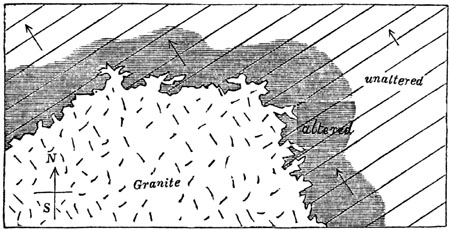
Altered zone of fossiliferous slate and limestone
near granite. Christiania.
The arrows indicate the dip, and the straight lines the strike,
of the beds.
The indurated and ribboned schists above mentioned bear a strong
resemblance to certain shales of the coal found at Russell's Hall, near
Dudley, where coal-mines have been on fire for ages. Beds of shale of
considerable thickness, lying over the burning coal, have been baked and
hardened so as to acquire a flinty fracture, the layers being alternately
green and brick-coloured.
The granite of Cornwall, in like manner, sends forth veins into a coarse
argillaceous-schist, provincially termed killas. This killas is converted
into hornblende-schist near the contact with the veins. These appearances
are well seen at the junction of the granite and killas, in St. Michael's
Mount, a small island nearly 300 feet high, situated in the bay, at a
distance of about three miles from Penzance.
The granite of Dartmoor, in Devonshire, says Sir H. De la Beche, [p.475]
has intruded itself into the slate and slaty sandstone called greywacké,
twisting and contorting the strata, and sending veins into them. Hence some
of the slate rocks have become "micaceous; others more indurated, and with
the characters of mica-slate and gneiss; while others again appear
converted into a hard-zoned rock strongly impregnated with felspar."[475-A]
We learn from the investigations of M. Dufrénoy, that in the eastern
Pyrenees there are mountain masses of granite posterior in date to the
formations called lias and chalk of that district, and that these
fossiliferous rocks are greatly altered in texture, and often charged with
iron-ore, in the neighbourhood of the granite. Thus in the environs of St.
Martin, near St. Paul de Fénouillet, the chalky limestone becomes more
crystalline and saccharoid as it approaches the granite, and loses all
trace of the fossils which it previously contained in abundance. At some
points, also, it becomes dolomitic, and filled with small veins of
carbonate of iron, and spots of red iron-ore. At Rancié the lias nearest
the granite is not only filled with iron-ore, but charged with pyrites,
tremolite, garnet, and a new mineral somewhat allied to felspar, called,
from the place in the Pyrenees where it occurs, "couzeranite."
Now the alterations above described as superinduced in rocks by volcanic
dikes and granite veins, prove incontestably that powers exist in nature
capable of transforming fossiliferous into crystalline strata—powers
capable of generating in them a new mineral character, similar, nay, often
absolutely identical, with that of gneiss, mica-schist, and other
stratified members of the hypogene series. The precise nature of these
altering causes, which may provisionally be termed plutonic, is in a great
degree obscure and doubtful; but their reality is no less clear, and we
must suppose the influence of heat to be in some way connected with the
transmutation, if, for reasons before explained, we concede the igneous
origin of granite.
The experiments of Gregory Watt, in fusing rocks in the laboratory, and
allowing them to consolidate by slow cooling, prove distinctly that a rock
need not be perfectly melted in order that a re-arrangement of its
component particles should take place, and a partial crystallization
ensue.[475-B] We may easily suppose, therefore, that all traces of shells
and other organic remains may be destroyed; and that new chemical
combinations may arise, without the mass being so fused as that the lines
of stratification should be wholly obliterated.
We must not, however, imagine that heat alone, such as may be applied to a
stone in the open air, can constitute all that is comprised in plutonic
action. We know that volcanos in eruption not only emit fluid lava, but
give off steam and other heated gases, which rush out in enormous volume,
for days, weeks, or years continuously, and are even disengaged from lava
during its consolidation. When the materials of granite, therefore, came in
contact with the fossiliferous stratum [p.476]in the bowels of the earth
under great pressure, the contained gases might be unable to escape; yet
when brought into contact with rocks, might pass through their pores with
greater facility than water is known to do (p. 35.). These aëriform fluids,
such as sulphuretted hydrogen, muriatic acid, and carbonic acid, issue in
many places from rents in rocks, which they have discoloured and corroded,
softening some and hardening others. If the rocks are charged with water,
they would pass through more readily; for, according to the experiments of
Henry, water, under an hydrostatic pressure of 96 feet, will absorb three
times as much carbonic acid gas as it can under the ordinary pressure of
the atmosphere. Although this increased power of absorption would be
diminished, in consequence of the higher temperature found to exist as we
descend in the earth, yet Professor Bischoff has shown that the heat by no
means augments in such a proportion as to counteract the effect of
augmented pressure.[476-A] There are other gases, as well as the carbonic
acid, which water absorbs, and more rapidly in proportion to the amount of
pressure. Now even the most compact rocks may be regarded, before they have
been exposed to the air and dried, in the light of sponges filled with
water; and it is conceivable that heated gases brought into contact with
them, at great depths, may be absorbed readily, and transfused through
their pores. Although the gaseous matter first observed would soon be
condensed, and part with its heat, yet the continual arrival of fresh
supplies from below might, in the course of ages, cause the temperature of
the water, and with it that of the containing rock, to be materially
raised.
M. Fournet, in his description of the metalliferous gneiss near Clermont,
in Auvergne, states that all the minute fissures of the rock are quite
saturated with free carbonic acid gas, which rises plentifully from the
soil there and in many parts of the surrounding country. The various
elements of the gneiss, with the exception of the quartz, are all softened;
and new combinations of the acid, with lime, iron, and manganese, are
continually in progress.[476-B]
Another illustration of the power of subterranean gases is afforded by the
stufas of St. Calogero, situated in the largest of the Lipari Islands.
Here, according to the description published by Hoffmann, horizontal strata
of tuff, extending for 4 miles along the coast, and forming cliffs more
than 200 feet high, have been discoloured in various places, and strangely
altered by the "all-penetrating vapours." Dark clays have become yellow, or
often snow-white; or have assumed a chequered or brecciated appearance,
being crossed with ferruginous red stripes. In some places the fumaroles
have been found by analysis to consist partly of sublimations of oxide of
iron; but it also appears that veins of chalcedony and opal, and others of
fibrous gypsum, have resulted from these volcanic exhalations.[476-C]
[p.477]The reader may also refer to M. Virlet's account of the corrosion
of hard, flinty, and jaspideous rocks near Corinth, by the prolonged agency
of subterranean gases[477-A]; and to Dr. Daubeny's description of the
decomposition of trachytic rocks in the Solfatara, near Naples, by
sulphuretted hydrogen and muriatic acid gases.[477-B]
Although in all these instances we can only study the phenomena as
exhibited at the surface, it is clear that the gaseous fluids must have
made their way through the whole thickness of porous or fissured rocks,
which intervene between the subterranean reservoirs of gas and the external
air. The extent, therefore, of the earth's crust, which the vapours have
permeated and are now permeating, may be thousands of fathoms in thickness,
and their heating and modifying influence may be spread throughout the
whole of this solid mass.
We learn from Professor Bischoff that the steam of a hot spring at
Aix-la-Chapelle, although its temperature is only from 133° to 167° F., has
converted the surface of some blocks of black marble into a doughy mass. He
conceives, therefore, that steam in the bowels of the earth having a
temperature equal or even greater than the melting point of lava, and
having an elasticity of which even Papin's digester can give but a faint
idea, may convert rocks into liquid matter.[477-C]
The above observations are calculated to meet some of the objections which
have been urged against the metamorphic theory on the ground of the small
power of rocks to conduct heat; for it is well known that rocks, when dry
and in the air, differ remarkably from metals in this respect. It has been
asked how the changes which extend merely for a few feet from the contact
of a dike could have penetrated through mountain masses of crystalline
strata several miles in thickness. Now it has been stated that the plutonic
influence of the syenite of Norway has sometimes altered fossiliferous
strata for a distance of a quarter of a mile, both in the direction of
their dip and of their strike. (See fig. 512. p. 474.) This is undoubtedly
an extreme case; but is it not far more philosophical to suppose that this
influence may, under favourable circumstances, affect denser masses, than
to invent an entirely new cause to account for effects merely differing in
quantity, and not in kind? The metamorphic theory does not require us to
affirm that some contiguous mass of granite has been the altering power;
but merely that an action, existing in the interior of the earth at an
unknown depth, whether thermal, electrical, or other, analogous to that
exerted near intruding masses of granite, has, in the course of vast and
indefinite periods, and when rising perhaps from a large heated surface,
reduced strata thousands of yards thick to a state of semi-fusion, so that
on cooling they have become crystalline, like gneiss. Granite may have been
another result of the same action in a higher state of intensity, by which
a thorough fusion has been produced; [p.478]and in this manner the
passage from granite into gneiss may be explained.
Some geologists are of opinion, that the alternate layers of mica and
quartz, or mica and felspar, or lime and felspar, are so much more
distinct, in certain metamorphic rocks, than the ingredients composing
alternate layers in many sedimentary deposits, that the similar particles
must be supposed to have exerted a molecular attraction for each other, and
to have thus congregated together in layers more distinct in mineral
composition than before they were crystallized.
In considering, then, the various data already enumerated, the forms of
stratification in metamorphic rocks, their passage on the one hand into the
fossiliferous, and on the other into the plutonic formations, and the
conversions which can be ascertained to have occurred in the vicinity of
granite, we may conclude that gneiss and mica-schist may be nothing more
than altered micaceous and argillaceous sandstones that granular quartz may
have been derived from siliceous sandstone, and compact quartz from the
same materials. Clay-slate may be altered shale, and granular marble may
have originated in the form of ordinary limestone, replete with shells and
corals, which have since been obliterated; and, lastly, calcareous sands
and marls may have been changed into impure crystalline limestones.
"Hornblende-schist," says Dr. MacCulloch, "may at first have been mere
clay; for clay or shale is found altered by trap into Lydian stone, a
substance differing from hornblende-schist almost solely in compactness and
uniformity of texture."[478-A] "In Shetland," remarks the same author,
"argillaceous-schist (or clay-slate), when in contact with granite, is
sometimes converted into hornblende-schist, the schist becoming first
siliceous, and ultimately, at the contact, hornblende-schist."[478-B]
The anthracite and plumbago associated with hypogene rocks may have been
coal; for not only is coal converted into anthracite in the vicinity of
some trap dikes, but we have seen that a like change has taken place
generally even far from the contact of igneous rocks, in the disturbed
region of the Appalachians.[478-C] At Worcester, in the state of
Massachusetts, 45 miles due west of Boston, a bed of plumbago and impure
anthracite occurs, interstratified with mica-schist. It is about 2 feet in
thickness, and has been made use of both as fuel, and in the manufacture of
lead pencils. At the distance of 30 miles from the plumbago, there occurs,
on the borders of Rhode Island, an impure anthracite in slates, containing
impressions of coal-plants of the genera Pecopteris, Neuropteris,
Calamites, &c. This anthracite is intermediate in character between that
of Pennsylvania and the plumbago of Worcester, in which last the gaseous or
volatile matter (hydrogen, oxygen, and nitrogen) is to the carbon only in
the proportion of 3 per cent. After traversing the country in various
[p.479]directions, I came to the conclusion that the carboniferous
shales or slates with anthracite and plants, which in Rhode Island often
pass into mica-schist, have at Worcester assumed a perfectly crystalline
and metamorphic texture; the anthracite having been nearly transmuted into
that state of pure carbon which is called plumbago or graphite.[479-A]
The total absence of any trace of fossils has inclined many geologists to
attribute the origin of crystalline strata to a period antecedent to the
existence of organic beings. Admitting, they say, the obliteration, in some
cases, of fossils by plutonic action, we might still expect that traces of
them would oftener occur in certain ancient systems of slate, in which, as
in Cumberland, some conglomerates occur. But in urging this argument, it
seems to have been forgotten that there are stratified formations of
enormous thickness, and of various ages, and some of them very modern, all
formed after the earth had become the abode of living creatures, which are,
nevertheless, in certain districts, entirely destitute of all vestiges of
organic bodies. In some, the traces of fossils may have been effaced by
water and acids, at many successive periods; and it is clear, that, the
older the stratum, the greater is the chance of its being
non-fossiliferous, even if it has escaped all metamorphic action.
It has been also objected to the metamorphic theory, that the chemical
composition of the secondary strata differs essentially from that of the
crystalline schists, into which they are supposed to be convertible.[479-B]
The "primary" schists, it is said, usually contain a considerable
proportion of potash or of soda, which the secondary clays, shales, and
slates do not, these last being the result of the decomposition of
felspathic rocks, from which the alkaline matter has been abstracted during
the process of decomposition. But this reasoning proceeds on insufficient
and apparently mistaken data; for a large portion of what is usually called
clay, marl, shale, and slate does actually contain a certain, and often a
considerable, proportion of alkali; so that it is difficult, in many
countries, to obtain clay or shale sufficiently free from alkaline
ingredients to allow of their being burnt into bricks or used for pottery.
Thus the argillaceous shales and slates of the Old Red sandstone, in
Forfarshire and other parts of Scotland, are so much charged with alkali,
derived from triturated felspar, that, instead of hardening when exposed to
fire, they sometimes melt into a glass. They contain no lime, but appear to
consist of extremely minute grains of the various ingredients of granite,
which are distinctly visible in the coarser-grained varieties, and in
almost all the interposed sandstones. These laminated clays and shales
might certainly, if crystallized, resemble in composition many of the
primary strata.
There is also potash in fossil vegetable remains, and soda in the salts by
which strata are sometimes so largely impregnated, as in Patagonia.
[p.480]Another objection has been derived from the alternation of highly
crystalline strata with others having a less crystalline texture. The heat,
it is said, in its ascent from below, must have traversed the less altered
schists before it reached a higher and more crystalline bed. In answer to
this, it may be observed, that if a number of strata differing greatly in
composition from each other be subjected to equal quantities of heat, there
is every probability that some will be more fusible than others. Some, for
example, will contain soda, potash, lime, or some other ingredient capable
of acting as a flux; while others may be destitute of the same elements,
and so refractory as to be very slightly affected by a degree of heat
capable of reducing others to semi-fusion. Nor should it be forgotten that,
as a general rule, the less crystalline rocks do really occur in the upper,
and the more crystalline in the lower part of each metamorphic series.
There are geologists, however, of high authority, who admit the metamorphic
origin of gneiss and mica-schist even on a grand scale in some
mountain-chains, and who nevertheless believe that gneiss has in some
instances been an eruptive rock, deriving its lamination from motion when
in a fluid or viscous state. Mr. Scrope, in his description of the Ponza
Islands, ascribes "the zoned structure of the Hungarian perlite (a
semi-vitreous trachyte) to its having subsided, in obedience to the impulse
of its own gravity, down a slightly inclined plane, while possessed of an
imperfect fluidity. In the islands of Ponza and Palmarola, the direction of
the zones is more frequently vertical than horizontal, because the mass was
impelled from below upwards."[480-A] In like manner, Mr. Darwin attributes
the lamination and fissile structure of volcanic rocks of the trachytic
series, including some obsidians in Ascension, Mexico, and elsewhere, to
their having moved when liquid in the direction of the laminæ. The zones
consist sometimes of layers of air-cells drawn out and lengthened in the
supposed direction of the moving mass. He compares this division into
parallel zones, thus caused by the stretching of a pasty mass as it flowed
slowly onwards, to the zoned or ribboned structure of ice, which Professor
James Forbes has so ably explained, showing that it is due to the fissuring
of a viscous body in motion.[480-B] Mr. Darwin also imagines the lamination
or foliation, as he terms it, of gneiss and mica-schist in South America
to be the extreme result of that process of which cleavage is the first
effect.[480-C]
M. Elie de Beaumont, while he regards the greater part of the gneiss and
mica-schist of the Alps as sedimentary strata altered by plutonic action,
still conceives that some of the Alpine gneiss may have been erupted, or,
in other words, may be granite drawn out into parallel laminæ in the manner
of trachyte as above alluded to.[480-D]
Opinions such as these, and others which might be cited, prove the
difficulty of arriving at clear theoretical views on this subject. I
[p.481]may also add another difficulty. In many extensive regions
experienced geologists have been at a loss to decide which of two sets of
divisional planes were referable to cleavage and which to stratification;
and that, too, where the rocks are of undisputed aqueous origin. After much
doubt, they have sometimes discovered that they had at first mistaken the
lines of cleavage for those of deposition, because the former were by far
the most marked of the two. Now if such slaty masses should become highly
crystalline, and be converted into gneiss, hornblende-schist, or any other
member of the hypogene class, the cleavage planes would be more likely to
remain visible than those of stratification.
But although the cause last-mentioned may, in some instances, be a "vera
causa," as applied to gneiss and mica-schist, I believe it to be an
exception to the general rule. Nor would it, I conceive, produce that kind
of irregular parallelism in the laminæ which belongs to so many of the
hypogene rocks of the Grampians, Pyrenees, and the White mountains of North
America, where I have chiefly studied them.
But it will be impossible for the reader duly to appreciate the propriety
of the term metamorphic, as applied to the strata formerly called
primitive, until I have shown, in the next chapter, at how many distinct
periods these crystalline strata have been formed.
CHAPTER XXXVII.
ON THE DIFFERENT AGES OF THE METAMORPHIC ROCKS.
Age of each set of metamorphic strata twofold — Test of age by
fossils and mineral character not available — Test by superposition
ambiguous — Conversion of dense masses of fossiliferous strata into
metamorphic rocks — Limestone and shale of Carrara —
Metamorphic strata of modern periods in the Alps of Switzerland and Savoy
— Why the visible crystalline strata are none of them very modern
— Order of succession in metamorphic rocks — Uniformity of
mineral character — Why the metamorphic strata are less calcareous
than the fossiliferous.
According to the theory adopted in the last chapter, the age of each set of
metamorphic strata is twofold—they have been deposited at one period, they
have become crystalline at another. We can rarely hope to define with
exactness the date of both these periods, the fossils having been destroyed
by plutonic action, and the mineral characters being the same, whatever the
age. Superposition itself is an ambiguous test, especially when we desire
to determine the period of crystallization. Suppose, for example, we are
convinced that certain metamorphic strata in the Alps, which are covered by
cretaceous beds, are altered lias; this lias may have assumed its
crystalline texture in the cretaceous or in some tertiary period, the
Eocene for example. If in the latter, it should be called Eocene when
regarded as a metamorphic rock, although it be liassic when considered in
reference to [p.482]the era of its deposition. According to this view,
the superposition of chalk does not prevent the subjacent metamorphic
rock from being Eocene. If, however, in the progress of science, we should
succeed in ascertaining the twofold chronological relations of the
metamorphic formations, it might be useful to adopt a twofold terminology.
We might call the strata above alluded to Liassic-Eocene, or
Liassic-Cretaceous strata of the Hypogene class; the first term referring
to the era of deposition, the second to that of crystallization.
When discussing the ages of the plutonic rocks, we have seen that examples
occur of various primary, secondary, and tertiary deposits converted into
metamorphic strata, near their contact with granite. There can be no doubt
in these cases that strata, once composed of mud, sand, and gravel, or of
clay, marl, and shelly limestone, have for the distance of several yards,
and in some instances several hundred feet, been turned into gneiss,
mica-schist, hornblende-schist, chlorite-schist, quartz rock, statuary
marble, and the rest. (See the two preceding Chapters.)
But when the metamorphic action has operated on a grander scale, it tends
entirely to destroy all monuments of the date of its development. It may be
easy to prove the identity of two different parts of the same stratum; one,
where the rock has been in contact with a volcanic or plutonic mass, and
has been changed into marble or hornblende-schist, and another not far
distant, where the same bed remains unaltered and fossiliferous; but when
we have to compare two portions of a mountain chain—the one metamorphic,
and the other unaltered—all the labour and skill of the most practised
observers are required. I shall mention one or two examples of alteration
on a grand scale, in order to explain to the student the kind of reasoning
by which we are led to infer that dense masses of fossiliferous strata have
been converted into crystalline rocks.
Northern Apennines—Carrara.—The celebrated marble of Carrara, used in
sculpture, was once regarded as a type of primitive limestone. It abounds
in the mountains of Massa Carrara, or the "Apuan Alps," as they have been
called, the highest peaks of which are nearly 6000 feet high. Its great
antiquity was inferred from its mineral texture, from the absence of
fossils, and its passage downwards into talc-schist and garnetiferous
mica-schist; these rocks again graduating downwards into gneiss, which is
penetrated, at Forno, by granite veins. Now the researches of MM. Savi,
Boué, Pareto, Guidoni, De la Beche, Hoffmann, and Pilla, have demonstrated
that this marble, once supposed to be formed before the existence of
organic beings, is, in fact, an altered limestone of the Oolitic period,
and the underlying crystalline schists are secondary sandstones and shales,
modified by plutonic action. In order to establish these conclusions it was
first pointed out, that the calcareous rocks bordering the Gulf of Spezia,
and abounding in Oolitic fossils, assume a texture like that of Carrara
marble, in proportion as they are more and more invaded by certain trappean
and plutonic rocks, such as diorite, euphotide, serpentine, and granite,
occurring in the same country.
It was then observed that, in places where the secondary formations
[p.483]are unaltered, the uppermost consist of common Apennine limestone
with nodules of flint, below which are shales, and at the base of all,
argillaceous and siliceous sandstones. In the limestone, fossils are
frequent, but very rare in the underlying shale and sandstone. Then a
gradation was traced laterally from these rocks into another and
corresponding series, which is completely metamorphic; for at the top of
this we find a white granular marble, wholly devoid of fossils, and almost
without stratification, in which there are no nodules of flint, but in its
place siliceous matter disseminated through the mass in the form of prisms
of quartz. Below this, and in place of the shales, are talc-schists,
jasper, and hornstone; and at the bottom, instead of the siliceous and
argillaceous sandstones, are quartzite and gneiss.[483-A] Had these
secondary strata of the Apennines undergone universally as great an amount
of transmutation, it would have been impossible to form a conjecture
respecting their true age; and then, according to the common method of
geological classification, they would have ranked as primary rocks. In that
case the date of their origin would have been thrown back to an era
antecedent to the deposition of the Lower Silurian or Cambrian strata,
although in reality they were formed in the Oolitic period, and altered at
some subsequent and perhaps much later epoch.
Alps of Switzerland.—In the Alps, analogous conclusions have been drawn
respecting the alteration of strata on a still more extended scale. In the
eastern part of that chain, some of the primary fossiliferous strata, as
well as the older secondary formations, together with the oolitic and
cretaceous rocks, are distinctly recognizable. Tertiary deposits also
appear in a less elevated position on the flanks of the Eastern Alps; but
in the Central or Swiss Alps, the primary fossiliferous and older secondary
formations disappear, and the Cretaceous, Oolitic, Liassic, and at some
points even the Eocene strata, graduate insensibly into metamorphic rocks,
consisting of granular limestone, talc-schist, talcose-gneiss, micaceous
schist, and other varieties. In regard to the age of this vast assemblage
of crystalline strata, we can merely affirm that some of the upper portions
are altered newer secondary, and some of them even Eocene deposits; but we
cannot avoid suspecting that the disappearance both of the older secondary
and primary fossiliferous rocks may be owing to their having been all
converted in this region into crystalline schist.
It is difficult to convey to those who have never visited the Alps a just
idea of the various proofs which concur to produce this conviction. In the
first place, there are certain regions where Oolitic, Cretaceous, and
Eocene strata have been turned into granular marble, gneiss, and other
metamorphic schists, near their contact with granite. This fact shows
undeniably that plutonic causes continued to be in operation in the Alps
down to a late period, even after the deposition of some of the nummulitic
or older Eocene formations. [p.484]Having established this point, we are
the more willing to believe that many inferior fossiliferous rocks,
probably exposed for longer periods to a similar action, may have become
metamorphic to a still greater extent.
We also discover in parts of the Swiss Alps dense masses of secondary and
even tertiary strata, which have assumed that semi-crystalline texture
which Werner called transition, and which naturally led his followers, who
attached great importance to mineral characters taken alone, to class them
as transition formations, or as groups older than the lowest secondary
rocks. (See p. 92.) Now, it is probable that these strata have been
affected, although in a less intense degree, by that same plutonic action
which has entirely altered and rendered metamorphic so many of the
subjacent formations; for in the Alps, this action has by no means been
confined to the immediate vicinity of granite. Granite, indeed, and other
plutonic rocks, rarely make their appearance at the surface,
notwithstanding the deep ravines which lay open to view the internal
structure of these mountains. That they exist below at no great depth we
cannot doubt, and we have already seen (p. 445.) that at some points, as in
the Valorsine, near Mont Blanc, granite and granitic veins are observable,
piercing through talcose gneiss, which passes insensibly upwards into
secondary strata.
It is certainly in the Alps of Switzerland and Savoy, more than in any
other district in Europe, that the geologist is prepared to meet with the
signs of an intense development of plutonic action; for here we find the
most stupendous monuments of mechanical violence, by which strata thousands
of feet thick have been bent, folded, and overturned. (See p. 58.) It is
here that marine secondary formations of a comparatively modern date, such
as the Oolitic and Cretaceous, have been upheaved to the height of 12,000,
and some Eocene strata to elevations of 10,000 feet above the level of the
sea; and even deposits of the Miocene era have been raised 4000 or 5000
feet, so as to rival in height the loftiest mountains in Great Britain.
If the reader will consult the works of many eminent geologists who have
explored the Alps, especially those of MM. De Beaumont, Studer, Necker,
Boué, and Murchison, he will learn that they all share, more or less fully,
in the opinions above expressed. It has, indeed, been stated by MM. Studer
and Hugi, that there are complete alternations on a large scale of
secondary strata, containing fossils, with gneiss and other rocks, of a
perfectly metamorphic structure. I have visited some of the most remarkable
localities referred to by these authors; but although agreeing with them
that there are passages from the fossiliferous to the metamorphic series
far from the contact of granite or other plutonic rocks, I was unable to
convince myself that the distinct alternations of highly crystalline, with
unaltered strata above alluded to, might not admit of a different
explanation. In one of the sections described by M. Studer in the highest
of the Bernese Alps, namely in the Roththal, a valley bordering the line of
perpetual snow on the northern side of the Jungfrau, there [p.485]occurs
a mass of gneiss 1000 feet thick, and 15,000 feet long, which I examined,
not only resting upon, but also again covered by strata containing oolitic
fossils. These anomalous appearances may partly be explained by supposing
great solid wedges of intrusive gneiss to have been forced in laterally
between strata to which I found them to be in many sections unconformable.
The superposition, also, of the gneiss to the oolite may, in some cases, be
due to a reversal of the original position of the beds in a region where
the convulsions have been on so stupendous a scale.
On the Sattel also, at the base of the Gestellihorn, above Enzen, in the
valley of Urbach, near Meyringen, some of the intercalations of gneiss
between fossiliferous strata may, I conceive, be ascribed to mechanical
derangement. Almost any hypothesis of repeated changes of position may be
resorted to in a region of such extraordinary confusion. The secondary
strata may first have been vertical, and then certain portions may have
become metamorphic (the plutonic influence ascending from below), while
intervening strata remained unchanged. The whole series of beds may then
again have been thrown into a nearly horizontal position, giving rise to
the superposition of crystalline upon fossiliferous formations.
It was remarked, in Chap. XXXIV., that as the hypogene rocks, both
stratified and unstratified, crystallize originally at a certain depth
beneath the surface, they must always, before they are upraised and exposed
at the surface, be of considerable antiquity, relatively to a large portion
of the fossiliferous and volcanic rocks. They may be forming at all
periods; but before any of them can become visible, they must be raised
above the level of the sea, and some of the rocks which previously
concealed them must have been removed by denudation.
Order of succession in metamorphic rocks.—There is no universal and
invariable order of superposition in metamorphic rocks, although a
particular arrangement may prevail throughout countries of great extent,
for the same reason that it is traceable in those sedimentary formations
from which crystalline strata are derived. Thus, for example, we have seen
that in the Apennines, near Carrara, the descending series, where it is
metamorphic, consists of, 1st, saccharine marble; 2dly, talcose-schist; and
3dly, of quartz-rock and gneiss; where unaltered, of, 1st, fossiliferous
limestone; 2dly, shale; and 3dly, sandstone.
But if we investigate different mountain chains, we find gneiss,
mica-schist, hornblende-schist, chlorite-schist, hypogene, limestone, and
other rocks, succeeding each other, and alternating with each other, in
every possible order. It is, indeed, more common to meet with some variety
of clay-slate forming the uppermost member of a metamorphic series than any
other rock; but this fact by no means implies, as some have imagined, that
all clay-slates were formed at the close of an imaginary period, when the
deposition of the crystalline strata gave way to that of ordinary
sedimentary deposits. Such clay-slates, in fact, are variable in
composition, and sometimes [p.486]alternate with fossiliferous strata,
so that they may be said to belong almost equally to the sedimentary and
metamorphic order of rocks. It is probable that had they been subjected to
more intense plutonic action, they would have been transformed into
hornblende-schist, foliated chlorite-schist, scaly talcose-schist,
mica-schist, or other more perfectly crystalline rocks, such as are usually
associated with gneiss.
Uniformity of mineral character in Hypogene rocks.—Humboldt has
emphatically remarked, that when we pass to another hemisphere, we see new
forms of animals and plants, and even new constellations in the heavens;
but in the rocks we still recognize our old acquaintances,—the same
granite, the same gneiss, the same micaceous schist, quartz-rock, and the
rest. It is certainly true that there is a great and striking general
resemblance in the principal kinds of hypogene rocks, although of very
different ages and countries; but it has been shown that each of these are,
in fact, geological families of rocks, and not definite mineral compounds.
They are much more uniform in aspect than sedimentary strata, because these
last are often composed of fragments varying greatly in form, size, and
colour, and contain fossils of different shapes and mineral composition,
and acquire a variety of tints from the mixture of various kinds of
sediment. The materials of such strata, if melted and made to crystallize,
would be subject to chemical laws, simple and uniform in their action, the
same in every climate, and wholly undisturbed by mechanical and organic
causes.
Nevertheless, it would be a great error to assume that the hypogene rocks,
considered as aggregates of simple minerals, are really more homogeneous in
their composition than the several members of the sedimentary series. In
the first place, different assemblages of hypogene rocks occur in different
countries; and, secondly, in any one district, the rocks which pass under
the same name are often extremely variable in their component ingredients,
or at least in the proportions in which each of these are present. Thus,
for example, gneiss and mica-schist, so abundant in the Grampians, are
wanting in Cumberland, Wales, and Cornwall; in parts of the Swiss and
Italian Alps, the gneiss and granite are talcose, and not micaceous, as in
Scotland; hornblende prevails in the granite of Scotland—schorl in that of
Cornwall—albite in the plutonic rocks of the Andes—common felspar in
those of Europe. In one part of Scotland, the mica-schist is full of
garnets; in another it is wholly devoid of them: while in South America,
according to Mr. Darwin, it is the gneiss, and not the mica-schist, which
is most commonly garnetiferous. And not only do the proportional quantities
of felspar, quartz, mica, hornblende, and other minerals, vary in hypogene
rocks bearing the same name; but what is still more important, the
ingredients, as we have seen, of the same simple mineral are not always
constant (p. 369., and table, p. 377.).
The Metamorphic strata, why less calcareous than the fossiliferous.—It
has been remarked, that the quantity of calcareous matter in metamorphic
strata, or, indeed, in the hypogene formations generally, [p.487]is far
less than in fossiliferous deposits. Thus the crystalline schists of the
Grampians in Scotland, consisting of gneiss, mica-schist,
hornblende-schist, and other rocks, many thousands of yards in thickness,
contain an exceedingly small proportion of interstratified calcareous beds,
although these have been the objects of careful search for economical
purposes. Yet limestone is not wanting in the Grampians, and it is
associated sometimes with gneiss, sometimes with mica-schist, and in other
places with other members of the metamorphic series. But where limestone
occurs abundantly, as at Carrara, and in parts of the Alps, in connection
with hypogene rocks, it usually forms one of the superior members of the
crystalline group.
The scarcity, then, of carbonate of lime in the plutonic and metamorphic
rocks generally, seems to be the result of some general cause. So long as
the hypogene rocks were believed to have originated antecedently to the
creation of organic beings, it was easy to impute the absence of lime to
the non-existence of those mollusca and zoophytes by which shells and
corals are secreted; but when we ascribe the crystalline formations to
plutonic action, it is natural to inquire whether this action itself may
not tend to expel carbonic acid and lime from the materials which it
reduces to fusion or semi-fusion. Although we cannot descend into the
subterranean regions where volcanic heat is developed, we can observe in
regions of spent volcanos, such as Auvergne and Tuscany, hundreds of
springs, both cold and thermal, flowing out from granite and other rocks,
and having their waters plentifully charged with carbonate of lime. The
quantity of calcareous matter which these springs transfer, in the course
of ages, from the lower parts of the earth's crust to the superior or newly
formed parts of the same, must be considerable.[487-A]
If the quantity of siliceous and aluminous ingredients brought up by such
springs were great, instead of being utterly insignificant, it might be
contended that the mineral matter thus expelled implies simply the
decomposition of ordinary subterranean rocks; but the prodigious excess of
carbonate of lime over every other element must, in the course of time,
cause the crust of the earth below to be almost entirely deprived of its
calcareous constituents, while we know that the same action imparts to
newer deposits, ever forming in seas and lakes, an excess of carbonate of
lime. Calcareous matter is poured into these lakes, and the ocean, by a
thousand springs and rivers; so that part of almost every new calcareous
rock chemically precipitated, and of many reefs of shelly and coralline
stone, must be derived from mineral matter subtracted by plutonic agency,
and driven up by gas and steam from fused and heated rocks in the bowels of
the earth.
Not only carbonate of lime, but also free carbonic acid gas is given off
plentifully from the soil and crevices of rocks in regions of active and
spent volcanos, as near Naples, and in Auvergne. By this process, fossil
shells or corals may often lose their carbonic acid, and the residual lime
may enter into the composition of augite, hornblende, garnet, [p.488]and
other hypogene minerals. That the removal of the calcareous matter of
fossil shells is of frequent occurrence, is proved by the fact of such
organic remains being often replaced by silex or other minerals, and
sometimes by the space once occupied by the fossil being left empty, or
only marked by a faint impression. We ought not indeed to marvel at the
general absence of organic remains from the crystalline strata, when we
bear in mind how often fossils are obliterated, wholly or in part, even in
tertiary formations—how often vast masses of sandstone and shale, of
different ages, and thousands of feet thick, are devoid of fossils—how
certain strata may first have been deprived of a portion of their fossils
when they became semi-crystalline, or assumed the transition state of
Werner—and how the remaining organic remains have been effaced when they
were rendered metamorphic. Some rocks of the last-mentioned class,
moreover, must have been exposed again and again to renewed plutonic
action.
CHAPTER XXXVIII.
MINERAL VEINS.
Werner's doctrine that mineral veins were fissures filled from above
— Veins of segregation — Ordinary metalliferous veins or lodes
— Their frequent coincidence with faults — Proofs that they
originated in fissures in solid rock — Veins shifting other veins
— Polishing of their walls — Shells and pebbles in lodes
— Evidence of the successive enlargement and re-opening of veins
— Fournet's observations in Auvergne — Dimensions of veins
— Why some alternately swell out and contract — Filling of
lodes by sublimation from below — Chemical and electrical action
— Relative age of the precious metals — Copper and lead veins
in Ireland older than Cornish tin — Lead vein in lias, Glamorganshire
— Gold in Russia — Connection of hot springs and mineral veins
— Concluding remarks.
The manner in which metallic substances are distributed through the earth's
crust, and more especially the phenomena of those nearly vertical and
tabular masses of ore called mineral veins, from which the larger part of
the precious metals used by man are obtained,—these are subjects of the
highest practical importance to the miner, and of no less theoretical
interest to the geologist.
The views entertained respecting metalliferous veins have been modified,
or, rather, have undergone an almost complete revolution, since the middle
of the last century, when Werner, as director of the School of Mines, at
Freiberg in Saxony, first attempted to generalize the facts then known. He
taught that mineral veins had originally been open fissures which were
gradually filled up with crystalline and metallic matter, and that many of
them, after being once filled, had been again enlarged or re-opened. He
also pointed out that veins thus formed are not all referable to one era,
but are of various geological dates.
[p.489]Such opinions, although slightly hinted at by earlier writers, had
never before been generally received, and their announcement by one of high
authority and great experience constituted an era in the science.
Nevertheless, I have shown, when tracing, in another work, the history and
progress of geology, that Werner was far behind some of his predecessors in
his theory of the volcanic rocks, and less enlightened than his
contemporary, Dr. Hutton, in his speculations as to the origin of
granite.[489-A] According to him, the plutonic formations, as well as the
crystalline schists, were substances precipitated from a chaotic fluid in
some primeval or nascent condition of the planet; and the metals,
therefore, being closely connected with them, had partaken, according to
him, of a like mysterious origin. He also held that the trap rocks were
aqueous deposits, and that dikes of porphyry, greenstone, and basalt, were
fissures filled with their several contents from above. Hence he naturally
inferred that mineral veins had derived their component materials from an
incumbent ocean, rather than from a subterranean source; that these
materials had been first dissolved in the waters above, instead of having
risen up by sublimation from lakes and seas of igneous matter below.
In proportion as the hypothesis of a primeval fluid, or "chaotic
menstruum," was abandoned, in reference to the plutonic formations, and
when all geologists had come to be of one mind as to the true relation of
the volcanic and trappean rocks, reasonable hopes began to be entertained
that the phenomena of mineral veins might be explained by known causes, or
by chemical, thermal, and electrical agency still at work in the interior
of the earth. The grounds of this conclusion will be better understood when
the geological facts brought to light by mining operations have been
described and explained.
On different kinds of mineral veins.—Every geologist is familiarly
acquainted with those veins of quartz which abound in hypogene strata,
forming lenticular masses of limited extent. They are sometimes observed,
also, in sandstones and shales. Veins of carbonate of lime are equally
common in fossiliferous rocks, especially in limestones. Such veins appear
to have once been chinks or small cavities, caused, like cracks in clay, by
the shrinking of the mass, which has consolidated from a fluid state, or
has simply contracted its dimensions in passing from a higher to a lower
temperature. Siliceous, calcareous, and occasionally metallic matters, have
sometimes found their way simultaneously into such empty spaces, by
infiltration from the surrounding rocks, or by segregation, as it is often
termed. Mixed with hot water and steam, metallic ores may have permeated a
pasty matrix until they reached those receptacles formed by shrinkage, and
thus gave rise to that irregular assemblage of veins, called by the Germans
a "stockwerk," in allusion to the different floors on which the mining
operations are in such cases carried on.
The more ordinary or regular veins are usually worked in vertical [p.490]
shafts, and have evidently been fissures produced by mechanical violence.
They traverse all kinds of rocks, both hypogene and fossiliferous, and
extend downwards to indefinite or unknown depths. We may assume that they
correspond with such rents as we see caused from time to time by the shock
of an earthquake. Metalliferous veins, referable to such agency, are
occasionally a few inches wide, but more commonly 3 or 4 feet. They hold
their course continuously in a certain prevailing direction for miles or
leagues, passing through rocks varying in mineral composition.
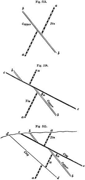
Vertical sections of the mine of Huel Peever, Redruth, Cornwall.
That metalliferous veins were fissures.—As some intelligent miners,
after an attentive study of metalliferous veins, have been unable to
reconcile many of their characteristics with the hypothesis of fissures, I
shall begin by stating the evidence in its favour. The most striking fact
perhaps which can be adduced in its support is, the coincidence of a
considerable proportion of mineral veins with faults, or those
dislocations of rocks which are indisputably due to mechanical force, as
above explained (p. 62.). There are even proofs in almost every mining
district of a succession of faults, by which the opposite walls of rents,
now the receptacles of metallic substances, have suffered displacement.
Thus, for example, suppose a a, fig. 513., to be a tin lode in Cornwall,
the term lode being applied to veins containing metallic ores. This lode,
running east and west, is a yard wide, and is shifted by a copper lode (b
b), of similar width.
The first fissure (a a) has been filled with various materials, partly of
chemical origin, such as quartz, fluor-spar, [p.491]peroxide of tin,
sulphuret of copper, arsenical pyrites, bismuth, and sulphuret of nickel,
and partly of mechanical origin, comprising clay and angular fragments or
detritus of the intersected rocks. The plates of quartz and the ores are,
in some places, parallel to the vertical sides or walls of the vein, being
divided from each other by alternating layers of clay, or other earthy
matter. Occasionally the metallic ores are disseminated in detached masses
among the veinstones.
It is clear that, after the gradual introduction of the tin and other
substances, the second rent (b b) was produced by another fracture
accompanied by a displacement of the rocks along the plane of b b. This
new opening was then filled with minerals, some of them resembling those in
a a, as fluor-spar (or fluate of lime) and quartz; others different, the
copper being plentiful and the tin wanting or very scarce.
We must next suppose the shock of a third earthquake to occur, breaking
asunder all the rocks along the line c c, fig. 514.; the fissure in this
instance, being only 6 inches wide, and simply filled with clay, derived,
probably, from the friction of the walls of the rent, or partly, perhaps,
washed in from above. This new movement has heaved the rock in such a
manner as to interrupt the continuity of the copper vein (b b), and, at
the same time, to shift or heave laterally in the same direction a portion
of the tin vein which had not previously been broken.
Again, in fig. 515. we see evidence of a fourth fissure (d d), also
filled with clay, which has cut through the tin vein (a a), and has
lifted it slightly upwards towards the south. The various changes here
represented are not ideal, but are exhibited in a section obtained in
working an old Cornish mine, long since abandoned, in the parish of
Redruth, called Huel Peever, and described both by Mr. Williams and Mr.
Carne.[491-A] The principal movement here referred to, or that of c c,
fig. 515., extends through a space of no less than 84 feet; but in this, as
in the case of the other three, it will be seen that the outline of the
country above, or the geographical features of Cornwall, are not affected
by any of the dislocations, a powerful denuding force having clearly been
exerted subsequently to all the faults. (See above, p. 69.) It is commonly
said in Cornwall, that there are eight distinct systems of veins which can
in like manner be referred to as many successive movements or fractures;
and the German miners of the Hartz Mountains speak also of eight systems of
veins, referable to as many periods.
Besides the proofs of mechanical action already explained, the opposite
walls of veins are frequently polished and striated, as if they had
undergone great friction, and this even in cases where there has been no
shift. We may attribute such rubbing to a vibratory motion known to
accompany earthquakes, and to produce trituration on the opposite walls of
rents. Similar movements have sometimes occurred [p.492]in mineral veins
which had been wholly or partially filled up; for included pieces of rock,
detached from the sides, are found to be rounded, polished, and striated.
That a great many veins communicated originally with the surface of the
country above, or with the bed of the sea, is proved by the occurrence in
them of well rounded pebbles, agreeing with those in superficial alluviums,
as in Auvergne and Saxony. In Bohemia, such pebbles have been met with at
the depth of 180 fathoms. In Cornwall, Mr. Carne mentions true pebbles of
quartz and slate in a tin lode of the Relistran Mine, at the depth of 600
feet below the surface. They were cemented by oxide of tin and bisulphuret
of copper, and were traced over a space more than 12 feet long and as many
wide.[492-A] Marine fossil shells, also, have been found at great depths,
having probably been engulphed during submarine earthquakes. Thus, a
gryphæa is stated by M. Virlet to have been met with in a lead-mine near
Sémur, in France, and a madrepore in a compact vein of cinnabar in
Hungary.[492-B]
When different sets or systems of veins occur in the same country, those
which are supposed to be of contemporaneous origin, and which are filled
with the same kind of metals, often maintain a general parallelism of
direction. Thus, for example, both the tin and copper veins in Cornwall run
nearly east and west, while the lead-veins run north and south; but there
is no general law of direction common to different mining districts. The
parallelism of the veins is another reason for regarding them as ordinary
fissures, for we observe that contemporaneous trap dikes, admitted by all
to be masses of melted matter which have filled rents, are often parallel.
Assuming, then, that veins are simply fissures in which chemical and
mechanical deposits have accumulated, we may next consider the proofs of
their having been filled gradually and often during successive
enlargements. I have already spoken of parallel layers of clay, quartz, and
ore. Werner himself observed, in a vein near Gersdorff, in Saxony, no less
than thirteen beds of different minerals, arranged with the utmost
regularity on each side of the central layer. This layer was formed of two
beds of calcareous spar, which had evidently lined the opposite walls of a
vertical cavity. The thirteen beds followed each other in corresponding
order, consisting of fluor-spar, heavy spar, galena, &c. In these cases,
the central mass has been last formed, and the two plates which coat the
outer walls of the rent on each side are the oldest of all. If they consist
of crystalline precipitates, they may be explained by supposing the fissure
to have remained unaltered in its dimensions, while a series of changes
occurred in the nature of the solutions which rose up from below; but such
a mode of deposition, in the case of many successive and parallel layers,
appears to be exceptional.
If a veinstone consist of crystalline matter, the points of the crystals
are always turned inwards, or towards the centre of the [p.493]vein; in
other words, they point in that direction where there was most space for
the development of the crystals. Thus each new layer receives the
impression of the crystals of the preceding layer, and imprints its
crystals on the one which follows, until at length the whole of the vein is
filled: the two layers which meet dovetail the points of their crystals the
one into the other. But in Cornwall, some lodes occur where the vertical
plates, or combs, as they are there called, exhibit crystals so
dovetailed as to prove that the same fissure has been often enlarged. Sir
H. De la Beche gives the following curious and instructive example (fig.
516.) from a copper-mine in granite, near Redruth.[493-A] Each of the
plates or combs (a, b, c, d, e, f) are double, having the
points of their crystals turned inwards along the axis of the comb. The
sides or walls (2, 3, 4, 5, and 6) are parted by a thin covering of
ochreous clay, so that each comb is readily separable from another by a
moderate blow of the hammer. The breadth of each represents the whole width
of the fissure at six successive periods, and the outer walls of the vein,
where the first narrow rent was formed, consisted of the granitic surfaces
1 and 7.
Fig. 516.

Copper lode, near Redruth, enlarged at six successive periods.
A somewhat analogous interpretation is applicable to numbers of other
cases, where clay, sand, or angular detritus, alternate with ores and
veinstones. Thus, we may imagine the sides of a fissure to be encrusted
with siliceous matter, as Von Buch observed, in Lancerote, the walls of a
volcanic crater formed in 1731 to be traversed by an open rent in which hot
vapours had deposited hydrate of silica, the incrustation nearly extending
to the middle.[493-B] Such a vein may then be filled with clay or sand, and
afterwards re-opened, the new rent dividing the argillaceous deposit, and
allowing a quantity of rubbish to fall down. Various metals and spars may
then be precipitated from aqueous solutions among the interstices of this
heterogeneous mass.
That such changes have repeatedly occurred, is demonstrated by occasional
cross-veins, implying the oblique fracture of previously formed chemical
and mechanical deposits. Thus, for example, M. Fournet, in his description
of some mines in Auvergne worked under his superintendence, observes, that
the granite of that country was first penetrated by veins of granite, and
then dislocated, [p.494]so that open rents crossed both the granite and
the granitic veins. Into such openings, quartz, accompanied by sulphurets
of iron and arsenical pyrites, was introduced. Another convulsion then
burst open the rocks along the old line of fracture, and the first set of
deposits were cracked and often shattered, so that the new rent was filled,
not only with angular fragments of the adjoining rocks, but with pieces of
the older veinstones. Polished and striated surfaces on the sides or in the
contents of the vein also attest the reality of these movements. A new
period of repose then ensued, during which various sulphurets were
introduced, together with hornstone quartz, by which angular fragments of
the older quartz before mentioned were cemented into a breccia. This period
was followed by other dilatations of the same veins, and other sets of
mineral deposits, until, at last, pebbles of the basaltic lavas of
Auvergne, derived from superficial alluviums, probably of Miocene or older
Pliocene date, were swept into the veins. I have not space to enumerate all
the changes minutely detailed by M. Fournet, but they are valuable, both to
the miner and geologist, as showing how the supposed signs of violent
catastrophes may be the monuments, not of one paroxysmal shock, but of
reiterated movements.
Such repeated enlargement and re-opening of veins might have been
anticipated, if we adopt the theory of fissures, and reflect how few of
them have ever been sealed up entirely, and that a country with fissures
only partially filled must naturally offer much feebler resistance along
the old lines of fracture than any where else. It is quite otherwise in the
case of dikes, where each opening has been the receptacle of one continuous
and homogeneous mass of melted matter, the consolidation of which has taken
place under considerable pressure. Trappean dikes can rarely fail to
strengthen the rocks at the points where before they were weakest; and if
the upheaving force is again exerted in the same direction, the crust of
the earth will give way anywhere rather than at the precise points where
the first rents were produced.
A large proportion of metalliferous veins have their opposite walls nearly
parallel, and sometimes over a wide extent of country. There is a fine
example of this in the celebrated vein of Andreasberg in the Hartz, which
has been worked for a depth of 500 yards perpendicularly, and 200
horizontally, retaining almost every where a width of 3 feet. But many
lodes in Cornwall and elsewhere are extremely variable in size, being 1 or
2 inches in one part, and then 8 or 10 feet in another, at the distance of
a few fathoms, and then again narrowing as before. Such alternate swelling
and contraction is so often characteristic as to require explanation. The
walls of fissures in general, observes Sir H. De la Beche, are rarely
perfect planes throughout their entire course, nor could we well expect
them to be so, since they commonly pass through rocks of unequal hardness
and different mineral composition. If, therefore, the opposite sides of
such irregular fissures slide upon each other, that is to say, if there be
a fault, as in the case of so many mineral [p.495]veins, the parallelism
of the opposite walls is at once entirely destroyed, as will be readily
seen by studying the annexed diagrams.
Fig. 517.

Fig. 518.

Fig. 519.

Let a b, fig. 517., be a line of fracture traversing a rock, and let a
b, fig. 518., represent the same line. Now, if we cut a piece of paper
representing this line, and then move the lower portion of this cut paper
sideways from a to a', taking care that the two pieces of paper still
touch each other at the points 1, 2, 3, 4, 5, we obtain an irregular
aperture at c, and isolated cavities at d d d, and when we compare such
figures with nature we find that, with certain modifications, they
represent the interior of faults and mineral veins. If, instead of sliding
the cut paper to the right hand, we move the lower part towards the left,
about the same distance that it was previously slid to the right, we obtain
considerable variation in the cavities so produced, two long irregular open
spaces, f f, fig. 519., being then formed. This will serve to show to
what slight circumstances considerable variations in the character of the
openings between unevenly fractured surfaces may be due, such surfaces
being moved upon each other, so as to have numerous points of contact.
Fig. 520.
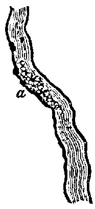
Most lodes are perpendicular to the horizon, or nearly so; but some of them
have a considerable inclination or "hade," as it is termed, the angles of
dip varying from 15° to 45°. The course of a vein is frequently very
straight; but if tortuous, it is found to be choked up with clay, stones,
and pebbles, at points where it departs most widely from verticality. Hence
at places, such as a, fig. 520., the miner complains that the ores are
"nipped," or greatly reduced in quantity, the space for their free
deposition having been interfered with in consequence of the pre-occupancy
of the lode by earthy materials. When lodes are many fathoms wide, they are
usually filled for the most part with earthy matter, and fragments of rock,
through which the ores are much disseminated. The metallic substances
frequently coat or encircle detached pieces of rock, which our miners call
"horses" or "riders." That we should find some mineral veins which split
into branches is also natural, for we observe the same in regard to open
fissures.
Chemical deposits in veins.—If we now turn from the mechanical to the
chemical agencies which have been instrumental in the production of mineral
veins, it may be remarked that those parts of [p.496]fissures which were
not choked up with the ruins of fractured rocks must always have been
filled with water; and almost every vein has probably been the channel by
which hot springs, so common in countries of volcanos and earthquakes, have
made their way to the surface. For we know that the rents in which ores
abound extend downwards to vast depths, where the temperature of the
interior of the earth is more elevated. We also know that mineral veins are
most metalliferous near the contact of plutonic and stratified formations,
especially where the former send veins into the latter, a circumstance
which indicates an original proximity of veins at their inferior extremity
to igneous and heated rocks. It is moreover acknowledged that even those
mineral and thermal springs which, in the present state of the globe, are
far from volcanos, are nevertheless observed to burst out along great lines
of upheaval and dislocation of rocks.[496-A] It is also ascertained that
all the substances with which hot springs are impregnated agree with those
discharged in a gaseous form from volcanos. Many of these bodies occur as
veinstones; such as silex, carbonate of lime, sulphur, fluor-spar, sulphate
of barytes, magnesia, oxide of iron, and others. I may add that, if veins
have been filled with gaseous emanations from masses of melted matter,
slowly cooling in the subterranean regions, the contraction of such masses
as they pass from a plastic to a solid state would, according to the
experiments of Deville on granite (a rock which may be taken as a
standard), produce a reduction in volume amounting to 10 per cent. The slow
crystallization, therefore, of such plutonic rocks supplies us with a force
not only capable of rending open the incumbent rocks by causing a failure
of support, but also of giving rise to faults whenever one portion of the
earth's crust subsides slowly while another contiguous to it happens to
rest on a different foundation, so as to remain unmoved.
Although we are led to infer, from the foregoing reasoning, that there has
often been an intimate connection between metalliferous veins and hot
springs holding mineral matter in solution, yet we must not on that account
expect that the contents of hot springs and mineral veins would be
identical. On the contrary, M. E. de Beaumont has judiciously observed that
we ought to find in veins those substances which, being least soluble, are
not discharged by hot springs,—or that class of simple and compound bodies
which the thermal waters ascending from below would first precipitate on
the walls of a fissure, as soon as their temperature began slightly to
diminish. The higher they mount towards the surface, the more will they
cool, till they acquire the average temperature of springs, being in that
case chiefly charged with the most soluble substances, such as the alkalis,
soda and potash. These are not met with in veins, although they enter so
largely into the composition of granitic rocks.[496-B]
To a certain extent, therefore, the arrangement and distribution of
metallic matter in veins may be referred to ordinary chemical [p.497]
action, or to those variations in temperature, which waters holding the
ores in solution must undergo, as they rise upwards from great depths in
the earth. But there are other phenomena which do not admit of the same
simple explanation. Thus, for example, in Derbyshire, veins containing ores
of lead, zinc, and copper, but chiefly lead, traverse alternate beds of
limestone and greenstone. The ore is plentiful where the walls of the rent
consist of limestone, but is reduced to a mere string when they are formed
of greenstone, or "toadstone," as it is called provincially. Not that the
original fissure is narrower where the greenstone occurs, but because more
of the space is there filled with veinstones, and the waters at such points
have not parted so freely with their metallic contents.
"Lodes in Cornwall," says Mr. Robert W. Fox, "are very much influenced in
their metallic riches by the nature of the rock which they traverse, and
they often change in this respect very suddenly, in passing from one rock
to another. Thus many lodes which yield abundance of ore in granite, are
unproductive in clay-slate, or killas, and vice versâ. The same
observation applies to killas and the granitic porphyry called elvan.
Sometimes, in the same continuous vein, the granite will contain copper,
and the killas tin, or vice versâ."[497-A] Mr. Fox, after ascertaining
the existence at present of electric currents in some of the metalliferous
veins in Cornwall, has speculated on the probability of the same cause
having acted originally on the sulphurets and muriates of copper, tin,
iron, and zinc, dissolved in the hot water of fissures, so as to determine
the peculiar mode of their distribution. After instituting experiments on
this subject, he even endeavoured to account for the prevalence of an east
and west direction in the principal Cornish lodes by their position at
right angles to the earth's magnetism; but Mr. Henwood and other
experienced miners have pointed out objections to the theory; and it must
be owned that the direction of veins in different mining districts varies
so entirely that it seems to depend on lines of fracture, rather than on
the laws of voltaic electricity. Nevertheless, as different kinds of rock
would be often in different electrical conditions, we may readily believe
that electricity must often govern the arrangement of metallic precipitates
in a rent.
"I have observed," says Mr. R. Fox, "that when the chloride of tin in
solution is placed in the voltaic circuit, part of the tin is deposited in
a metallic state at the negative pole, and part at the positive one, in the
state of a peroxide, such as it occurs in our Cornish mines. This
experiment may serve to explain why tin is found contiguous to, and
intermixed with, copper ore, and likewise separated from it, in other parts
of the same lode."[497-B]
Relative age of the different metals.—After duly reflecting on the facts
above described, we cannot doubt that mineral veins, like eruptions of
granite or trap, are referable to many distinct periods of [p.498]the
earth's history, although it may be more difficult to determine the precise
age of veins; because they have often remained open for ages, and because,
as we have seen, the same fissure, after having been once filled, has
frequently been re-opened or enlarged. But besides this diversity of age,
it has been supposed by some geologists that certain metals have been
produced exclusively in earlier, others in more modern times,—that tin,
for example, is of higher antiquity than copper, copper than lead or
silver, and all of them more ancient than gold. I shall first point out
that the facts once relied upon in support of some of these views are
contradicted by later experience, and then consider how far any
chronological order of arrangement can be recognized in the position of the
precious and other metals in the earth's crust. In the first place, it is
not true that veins in which tin abounds are the oldest lodes worked in
Great Britain. The government survey of Ireland has demonstrated, that in
Wexford veins of copper and lead (the latter as usual being argentiferous)
are much older than the tin of Cornwall. In each of the two countries a
very similar series of geological changes has occurred at two distinct
epochs,—in Wexford, before the Devonian strata were deposited; in
Cornwall, after the carboniferous epoch. To begin with the Irish mining
district: We have granite in Wexford, traversed by granite veins, which
veins also intrude themselves into the Silurian strata, the same Silurian
rocks as well as the veins having been denuded before the Devonian beds
were superimposed. Next we find, in the same county, that elvans, or
straight dikes of porphyritic granite, have cut through the granite and the
veins before mentioned, but have not penetrated the Devonian rocks.
Subsequently to these elvans, veins of copper and lead were produced, being
of a date certainly posterior to the Silurian, and anterior to the
Devonian; for they do not enter the latter, and, what is still more
decisive, streaks or layers of derivative copper have been found near
Wexford in the Devonian, not far from points where mines of copper are
worked in the Silurian strata.[498-A]
Although the precise age of such copper lodes cannot be defined, we may
safely affirm that they were either filled at the close of the Silurian or
commencement of the Devonian period. Besides copper, lead, and silver,
there is some gold in these ancient or primary metalliferous veins. A few
fragments also of tin found in Wicklow in the drift are supposed to have
been derived from veins of the same age.[498-B]
Next, if we turn to Cornwall, we find there also the monuments of a very
analogous sequence of events. First the granite was formed; then, about the
same period, veins of fine-grained granite, often tortuous (see fig. 496.,
p. 445.), penetrating both the outer crust of granite and the adjoining
fossiliferous or primary rocks, including [p.499]the coal-measures;
thirdly, elvans, holding their course straight through granite, granitic
veins, and fossiliferous slates; fourthly, veins of tin also containing
copper, the first of those eight systems of fissures of different ages
already alluded to, p. 491. Here, then, the tin lodes are newer than the
elvans. It has indeed been stated by some Cornish miners that the elvans
are in some few instances posterior to the oldest tin-bearing lodes, but
the observations of Sir H. De la Beche during the survey led him to an
opposite conclusion, and he has shown how the cases referred to in
corroboration can be otherwise interpreted.[499-A] We may, therefore,
assert that the most ancient Cornish lodes are younger than the
coal-measures of that part of England, and it follows that they are of a
much later date than the Irish copper and lead of Wexford and some
adjoining counties. How much later it is not so easy to declare, although
probably they are not newer than the beginning of the Permian period, as no
tin lodes have been discovered in any red sandstone of the Poikilitic
group, which overlies the coal in the south-west of England.
There are lead veins in the Mendip hills which extend through the mountain
limestone into the Permian or Dolomitic conglomerate, and others in
Glamorganshire which enter the lias. Those worked near Frome, in
Somersetshire, have been traced into the Inferior Oolite. In Bohemia, the
rich veins of silver of Joachimsthal cut through basalt containing olivine,
which overlies tertiary lignite, in which are leaves of dicotyledonous
trees. This silver, therefore, is decidedly a tertiary formation. In regard
to the age of the gold of the Ural Mountains, in Russia, which, like that
of California, is obtained chiefly from auriferous alluvium, we can merely
affirm that it occurs in veins of quartz in the schistose and granitic
rocks of that chain. Sir R. Murchison observes, that no gold has yet been
found in the Permian conglomerates which lie at the base of the Ural
Mountains, although large quantities of iron and copper detritus are mixed
with the rolled pebbles of these same Permian strata. Hence it seems that
the Uralian quartz veins, containing gold and platinum, were not exposed to
aqueous denudation during the Permian era. But we cannot feel sure, from
any data yet before us, that such auriferous veins of quartz may not be as
old as the tin lodes of Cornwall, in which, as well as the more ancient
copper lodes of Ireland, some gold has been detected. We are also unable at
present to assign to the gold veins of Brazil, Peru, or California, their
respective geological dates. But, although enough is known to show that
Ovid's line about the "Age of Gold," "Aurea prima sata est ætas," would, by
no means, be an apt motto for a treatise on mining, it would be equally
rash in the present state of our inquiries to affirm, as some have done,
that gold was the last-formed of metals.
It has been remarked by M. de Beaumont, that lead and some other metals are
found in dikes of basalt and greenstone, as well as [p.500]in mineral
veins connected with trap rocks, whereas tin is met with in granite and in
veins associated with the granitic series. If this rule hold true
generally, the geological position of tin in localities accessible to the
miners will belong, for the most part, to rocks older than those bearing
lead. The tin veins will be of higher relative antiquity for the same
reason that the "underlying" igneous formations or granites which are
visible to man are older, on the whole, than the overlying or trappean
formations.
If different sets of fissures, originating simultaneously at different
levels in the earth's crust, and communicating, some of them, with
volcanic, others with heated plutonic masses, be filled with different
metals, it will follow that those formed farthest from the surface will
usually require the longest time before they can be exposed superficially.
In order to bring them into view, or within reach of the miner, a greater
amount of upheaval and denudation must take place in proportion as they
have lain deeper when first formed. A considerable series of geological
revolutions must intervene before any part of the fissure, which has been
for ages in the proximity of the plutonic rocks, so as to receive the gases
discharged from it when it was cooling, can emerge into the atmosphere. But
I need not enlarge on this subject, as the reader will remember what was
said in the 30th, 34th, and 37th chapters, on the chronology of the
volcanic and hypogene formations.
Concluding Remarks.—The theory of the origin of the hypogene rocks, at a
variety of successive periods, as expounded in two of the chapters just
cited, and still more the doctrine that such rocks may be now in the daily
course of formation, has made and still makes its way, but slowly, into
favour. The disinclination to embrace it has arisen partly from an inherent
obscurity in the very nature of the evidence of plutonic action when
developed on a great scale, at particular periods. It has also sprung, in
some degree, from extrinsic considerations; many geologists having been
unwilling to believe the doctrine of the transmutation of fossiliferous
into crystalline rocks, because they were desirous of finding proofs of a
beginning, and of tracing back the history of our terraqueous system to
times anterior to the creation of organic beings. But if these expectations
have been disappointed, if we have found it impossible to assign a limit to
that time throughout which it has pleased an Omnipotent and Eternal Being
to manifest his creative power, we have at least succeeded beyond all hope
in carrying back our researches to times antecedent to the existence of
man. We can prove that man had a beginning, and that, all the species now
contemporary with man, and many others which preceded, had also a
beginning, and that, consequently, the present state of the organic world
has not gone on from all eternity, as some philosophers have maintained.
It can be shown that the earth's surface has been remodelled again and
again; mountain chains have been raised or sunk; valleys formed, [p.501]
filled up, and then re-excavated; sea and land have changed places; yet
throughout all these revolutions, and the consequent alterations of local
and general climate, animal and vegetable life has been sustained. This has
been accomplished without violation of the laws now governing the organic
creation, by which limits are assigned to the variability of species. The
succession of living beings appears to have been continued not by the
transmutation of species, but by the introduction into the earth from time
to time of new plants and animals, and each assemblage of new species must
have been admirably fitted for the new states of the globe as they arose,
or they would not have increased and multiplied and endured for indefinite
periods.[501-A]
Astronomy had been unable to establish the plurality of habitable worlds
throughout space, however favourite a subject of conjecture and
speculation; but geology, although it cannot prove that other planets are
peopled with appropriate races of living beings, has demonstrated the truth
of conclusions scarcely less wonderful,—the existence on our own planet of
so many habitable surfaces, or worlds as they have been called, each
distinct in time, and peopled with its peculiar races of aquatic and
terrestrial beings.
The proofs now accumulated of the close analogy between extinct and recent
species are such as to leave no doubt on the mind that the same harmony of
parts and beauty of contrivance which we admire in the living creation, has
equally characterized the organic world at remote periods. Thus as we
increase our knowledge of the inexhaustible variety displayed in living
nature, and admire the infinite wisdom and power which it displays, our
admiration is multiplied by the reflection, that it is only the last of a
great series of pre-existing creations, of which we cannot estimate the
number or limit in times past.[501-B]
[p.502]INDEX.
A.
- Ægean Sea, mud of, 35.
- animal life in depths of, 137.
- Agassiz, M., cited, 192. 276. 300. 335. 344. 345.
- on parallel roads, 87.
- on fossil fishes of molasse and faluns, 171.
- on fossil fish of Lias, 275.
- on fossil fish in Permian marl-slate, 304.
- on fish from Sheppey, 202.
- on foot-prints, 299.
- on fishes of brown coal, 417.
- on glaciers, 140. 143.
- Age of formation determined by fragments of older rock, 101.
- of metamorphic rocks, 482.
- test of, in plutonic rocks by relative position, 449.
- of Spanish volcanos, 414.
- of volcanic rocks, how tested, 397-400.
- Aix-la-Chapelle, hot spring at, 477.
- Alabaster defined, 13.
- Alabama, cretaceous shingle of, 225.
- Alberti on the Keuper, 287.
- Alexander, Capt., marine shells in crag, found by, 149.
- Alluvium, term explained, 79.
- in Auvergne, 80.
- of the Wealden, 252.
- Alps, nummulitic formation of, 205.
- curved strata of, 58.
- Swiss and Savoy, cleavage of, 470.
- of Switzerland, 483.
- Alpine blocks on the Jura, 142.
- erratics, 140.
- Altered rocks, 381. 456.
- by subterranean gases, 476.
- Alternations of rocks, 14.
- of marine and freshwater formations, 32.
- Alumine in rocks, 11.
- Amblyrhynchus cristatus, 279.
- America, North, lithodomi in beaches of, 78.
- South, cretaceous strata, 225.
- South, gradual rise of parts of, 46.
- South, fossils of, 157.
- Amygdaloid, 372.
- Amphitherium, 268.
- Andelys, chalk cliffs at, 239.
- Andernach, strata near, 417.
- Andes, plutonic rocks of, 453.
- rocks drifted from to Chiloe, 144.
- Anthracite in Rhode Island, 478.
- Anticlinal line, 48. 57.
- Antrim, rocks altered by dikes in, 382.
- Antwerp, strata like Suffolk crag near, 166.
- Apateon pedestris, a carboniferous reptile, 336.
- Appalachian coal-field, 329.
- Appalachians, altered rocks in, 478.
- Apennines, limestone in, 482.
- Apteryx in New Zealand, 158.
- Aqueous rocks defined, 2.
- rocks, mineral character of, 97.
- deposits, superposition of, 96.
- Arbroath, section from, to the Grampians, 48.
- Archegosaurus, figure of, 337.
- Archiac, M., cited, 143.
- on fossils in chalk, 221.
- on shells in French Lower Eocene, 196.
- Ardèche, lava in, 385.
- Arenaceous rocks described, 11.
- Argillaceous rocks, 11.
- schist, 465.
- Argile plastique, or Lower Eocene, 196.
- Argyleshire, trap-vein in cliff, 379.
- Arran, age of granite in, 459.
- section of, 461.
- dike of greenstone in, 379.
- Arthur's Seat, altered strata of, 383.
- Ashby-de-la-Zouch, fault in coal-field of, 69.
- Ascension, lamination of volcanic rocks in, 480.
- Asterophyllites, 314.
- Asti, formations at, 167.
- Atherfield, cretaceous strata of, 219.
- Augite, 369.
- Aurillac, freshwater strata of, 188.
- Austen, Mr., R. A. C., on phosphate of lime, 219.
- Australian cave-breccias, 155.
- Auvergne freshwater formations, 186.
- succession of changes in, 180.
- lacustrine strata, 181.
- mineral veins of, 493.
- indusial limestone, 184.
- extinct volcanos of, 422.
- alluvium in, 80.
- Aymestry limestone, 352.
B.
- Bagshot sands, 199.
- Bacillaria, fossil in tripoli, 25.
- Baiæ, Bay of, strata in, 403.
- Bakewell, Mr., on cleavages of Alps, 470.
- Balgray, near Glasgow, stumps of trees in coal, 317.
- Bahia Blanca, fossil remains at, 148.
- Baltic, brackish water strata on coast of, 114.
- Barcombe, chalk flints near, 253.
- Barton Cliff, 198.
- Barrande, M., on trilobites, 358.
- Basterot, M. de, on tertiaries of south of France, 105.
- Basalt, 371.
- columnar in the Eifel, 387.
- columnar, near Vicenza, 386.
- columnar, structure of, 384.
- Basset, term explained, 56.
- Batrachian, eggs of, in Old Red, Scotland, Postscript, x.
- Bayfield, Capt., on fossil shells in Canada, 134.
- on inland cliffs in Gulf of St. Lawrence, 78.
- Bean, Mr., shells similar to those in Norwich crag found in Yorkshire by, 149.
- Bean, Mr., on fossil shells from oolite, 272.
- Beachy Head, chalk cliffs near, 246.
- Beaumont, M. E. de, on rocks of Hautes Alpes, 455.
- on lamination of volcanic rocks, 480.
- [p.503]on Swiss Alps, 484.
- on quartz, 439.
- on oolite formation in France, 221.
- Beck, Dr., on kelp, 217.
- on graptolites, 357.
- cited, 162. 186.
- Belemnite in Oxford clay, 262.
- Berger, Dr., on rocks altered by dikes, 382.
- Bergmann on trap, 366.
- Berlin, tertiary strata near, 177.
- Bermuda Islands, lagoons in, 216.
- rocks of, 78.
- Bernese Alps, gneiss in, 484.
- Berthier, on augite and hornblende, 369.
- Beudant, M., on Hungary, 421.
- Beyrich, Prof., on tertiary strata near Berlin, 177.
- Biaritz, calcareous cliffs of, 72.
- Bilin, tripoli, composed of infusoria, 25.
- Binney, Mr., on stigmaria and sigillaria, 315.
- Birds, footprints of, 298.
- fossil, scarcity of, Postscript, xix.
- Bischoff, Prof., experiments on heat, 476.
- on steam at a high temperature, 477.
- Blainville, on number of genera of mollusca, 28.
- Boase, Dr., cited, 479.
- Boblaye, M., on inland cliffs, 73.
- cited, 431.
- Bog-iron ore, 26.
- Borrowdale, black-lead of, 38.
- Bordeaux, tertiary deposits of, 171.
- Bosquet, M., on Maestricht beds, 210.
- Bothnia, Gulf of, land upheaved, 45.
- Boué, M., on arrangement of rocks, 95.
- on fossil shells in Hungary, 421.
- on Carrara marble, 482.
- on Swiss Alps, 484.
- Bonelli, on strata in Italy, 106.
- Boulder formation in Canada, 133.
- period, fauna of, 126.
- formation, mineral ingredients of, 126.
- formation in England, 130.
- Boulders, 123.
- striated, 136.
- Boutigny, M., cited, 441.
- Bowen, Lieut. A., R.N., drawings of rocks in Gulf of St. Lawrence, 78.
- Bowerbank, Mr., on fossil flora of Sheppey, 200.
- Bowman, Mr., on coal-seams, 330.
- Bracklesham Bay, characteristic shells of, 199.
- Brash, term, explained, 81.
- Bravard, M., on Auvergne mammalia, 188. 425.
- Breccia on ancient coast lines, 73.
- Brickenden, Captain, on Elgin fossils, Postscript, ix.
- Brighton, elephant bed of, 256.
- Bristol, dolomitic conglomerate near, 305.
- section of strata near, 102.
- Brocchi, on Subapennines, 105. 167.
- Brockedon, Mr., on black-lead, 38.
- Broderip, Mr., cited, 270.
- Brodie, Rev. P.B., on fossil insects, 281.
- cited, 207.
- Bromley, oyster-bed near, 204.
- Brongniart, M. Adolphe, on Eocene flora, 200.
- on flora of cretaceous period, 223.
- on fossil plants in lias, 282.
- on plants of Bunter sandstein, 288.
- on fossil fir-cones, 313.
- on Permian flora, 307.
- on sigillaria, 314.
- on asterophyllites, 314.
- on stigmaria, 315.
- age of acrogens, 316.
- on endogens, 316.
- Brongniart, M. Alex., on Paris tertiaries, 104.
- on Eocene formation, 175.
- on shells of nummulitic formation, 205.
- on coal mine near Lyons, 319.
- Brora, coal formation, 272.
- Brora, granite near, 458.
- Brown, Mr. Richard, on stigmariæ, 315.
- on coal formation, 415.
- on Cape Breton coal-field, 324. 334.
- on carboniferous rain-prints, Postscript, xii.
- Buckland, Dr., on cave at Kirkdale, 154.
- on coal plants, 317.
- on coprolites in chalk, 216.
- on fish of Lias, 276.
- on footprints, 291.
- on mountains of Caernarvonshire, 130.
- on oyster bed near Bromley, 204.
- on parallel roads, 87.
- on term Poikilitic, 286.
- on saurians of Lias, 278.
- on sudden destruction of saurians, 280.
- cited, 155. 231. 233. 267. 268.
- Buddle, Mr., on creeps in coal mines, 50.
- on ancient river-channels of coal period, 334.
- Buist, Dr. G., on saltness of Red Sea, 296.
- Bunbury, Mr. C. J. F., on plants of coal-field, 285.
- Bunter sandstein, 288.
- Burmeister on trilobites, 358.
- Burnes, Sir A., cited, 295.
C.
- Caernarvonshire, ancient glaciers of, 130.
- Calamites, figures of, 313.
- near Pictou, 319.
- Calcaire grossier, 193.
- siliceux, 195.
- Calcareous rocks, 12.
- rocks of Gulf of Spezia, 482.
- cliffs of Biaritz, 72.
- Caldcleugh, Mr., cited, 399.
- Caldera of Palma, 392.
- Cambrian group, 361.
- volcanic rocks, 435.
- Campagna di Roma, tuffs of, 408.
- Canada, shells in drift of, 134.
- Cantal, freshwater formation of, 188.
- igneous rocks of, 429.
- freshwater beds of, 429.
- Cape Breton, coal measures of, 324.
- Wrath, granite veins in, 444.
- Caradoc sandstone, 356.
- Carbonaceous shale, 271.
- Carbonate of lime scarce in metamorphic rocks, 487.
- Carbonate of lime in rocks, how tested, 12.
- Carboniferous group, 308.
- flora, 310.
- period, plutonic rocks of, 456.
- period, volcanic rocks of, 432.
- reptiles, 335.
- Carne, Mr., on Cornish lodes, 491. 492.
- Carrara marble, 482.
- Caryophyllia cæspitosa, bed of, in Sicily, 151.
- Castrogiovanni, bent strata near, 58.
- Catalonia, volcanic region of, 408.
- Cautley, Captain, on Sewâlik hills, 173.
- Caves in Europe, 155.
- at Kirkdale, 154.
- in Sicily, 153.
- in Australia, 156.
- Central France, Upper Eocene of, 178.
- Cetacea, fossil, rarity of, Postscript, xxi.
- Chalk, pinnacle of, near Sherringham, 129.
- of Faxoe, 210. and Postscript, xv.
- white, fossils of, 26.
- white, section of, 211.
- white, extent and origin of, 215.
- white, animal origin of, 216.
- pebbles in, 217.
- difference of, in north and south of Europe, 221.
- [p.504]Chalk cliffs, inland, on Seine, 238.
- needles of, in Normandy, 241.
- flints, bed of, near Barcombe, 253.
- Chambers, Mr., cited, 88.
- Chamisso, cited, 217.
- Chara, in freshwater strata, 31.
- in flints of Cantal, 189.
- in Eocene strata of France, 176.
- in Purbeck beds, 232.
- Charlesworth, Mr. E., cited, on Crag, 162.
- Charpentier, M., on Alpine glaciers, 140.
- on Swiss glaciers, 143.
- Cheirotherium, footprints of, 290. 337.
- Chemical and mechanical deposits, 33.
- Chili, earthquake in, 61.
- gold mines in, 472.
- Chiloe, rocks drifted from Andes to, 144.
- Chlorite schist, 465.
- Christiania, dike near, 380.
- trap rocks, passage of granite into, at, 441.
- granite near, 457.
- gneiss near, 446.
- intrusion of granite into beds near, 446.
- Chronological groups, 101.
- Cinder-bed, Purbeck, 231.
- Claiborne, marine shells of, 206.
- Clausen, Mr., cited, 158.
- Clay, defined, 11.
- Clay-slate, 465. 468.
- Clay-ironstone, 326.
- Clays, plastic, 203.
- Cleavage of rocks, 468.
- Climate of drift period, 139.
- of coal period, 335.
- Coal, zigzag flexures of, near Mons
- group, 308.
- measures, 308. 309.
- how formed, 317.
- pipes, danger of, 318.
- mine, near Lyons, 319.
- seam at Brownsville, Pennsylvania, view of, 332.
- conversion of into lignite, 333.
- formation at Brora, 272.
- seams, continuity of, 334.
- period, climate of, 335.
- strata, footprints of reptiles in, 337.
- Coal-field at Burdiehouse, 325.
- of Ashby-de-la-Zouch, 69.
- United States, diagram of, 327.
- of Yorkshire, fossils of, 325.
- Coalbrook Dale, beetles in coal of, 335.
- fossil cones in, 313.
- coal measures of, 324.
- faults in, 62.
- Cockfield Fell, rocks altered by dikes, 383.
- Columbia, vinegar river of, 191.
- Colchester, Mr., on mammalian remains at Kyson, 203.
- Côme, ravine in lava of, 427.
- Cones in Val di Noto, 389.
- and craters, absence of, in England, 6.
- and craters, 367.
- Conifers, fossil trees, 316.
- Concretionary structure, 37.
- Conglomerate, or pudding-stone, 11.
- dolomitic, 305.
- vertical in Scotland, &c., 47.
- Connecticut, valley of the, 297.
- beds, antiquity of, 300.
- Conrad, Mr., on cretaceous rocks, 224.
- Conybeare, Mr., cited, 64. 69. 244. 274.
- on Plesiosaurus, 278.
- on oolite and lias, 283.
- on term Poikilitic, 286.
- on crocodiles, 201.
- Cook, Capt., on Fucus giganteus, 217.
- Coprolites in chalk, 216.
- Coralline crag, fossils in, 164.
- Coral islands and reefs, 34. 46.
- rag of Oolite, 260.
- Corals, figures of, in crag, 165.
- of Devonian system, 346.
- of Devonian strata in United States, 349.
- in Wenlock formation, 355.
- Corinth, corrosion of rocks by gases near, 477.
- Cornbrash, 263.
- Cornwall, granite veins in, 445. 474.
- mineral veins in, 490. 494.
- tin of, newer than Irish copper, 499.
- Cotta, Dr. B., on granite in Saxony, 459.
- Crag coralline, fossils in, 164.
- comparison of faluns and, 170.
- of Suffolk, red and coralline, 105. 162.
- fluvio-marine, Norwich, 148.
- Craigleith fossil trees, 40.
- quarry, slanting tree in, 320.
- Crater of Island of St. Paul, 395.
- Craven fault, 64.
- Creeps in coal-mines described, 52.
- Credneria in Quadersandstein, Postscript, xvi.
- Cretaceous rocks of Pyrenees, 455.
- group, 209. 219. and Postscript, xvi.
- strata in South America and India, 225.
- period, plutonic rocks of, 455.
- volcanic rocks, 431.
- rocks in United States, 224.
- Crocodiles near Cuba, 279.
- Croizet, M., on Auvergne fossil mammalia, 188.
- Cromer, contorted drift near, 129.
- "Crop out," term explained, 55.
- Crust of earth defined, 2.
- Crystalline limestone, 302.
- rocks, erroneously termed primitive, 9.
- schists defined, 7.
- Curved strata, 47.
- strata, experiments to illustrate, 49.
- Cutch, Runn of, 295.
- Cuvier, M., on Eocene formation, 175.
- on Amphitherium, 268.
- cited, 192.
- on tertiary strata near Paris, 104.
- on fossils of Montmartre, 191.
- Cyclopian Islands, 401.
- Cypris in Lias, 281.
- in Wealden, 228.
- in marl of Auvergne, 183.
- Cystideæ in Silurian rocks, 358.
D.
- Dana, Mr., on coprolites of birds, 299.
- on coral reef in Sandwich Islands, 216.
- on volcanos of Sandwich Islands, 394. 406. 423.
- Dartmoor, granite of, 456.
- Darwin, Mr., cited, 217.
- on boulders and glaciers in South America, 144.
- on cleavage in South America, 471.
- on coral islands of Pacific, 216.
- on dike in St. Helena, 406.
- on habits of ostrich, 299. and Postscript, xx.
- on fossils in South America, 148.
- on Fucus giganteus, 217.
- on gradual rise of part of S. America, 46.
- on lamination of volcanic rocks, 480.
- on parallel roads, 87.
- on plutonic rocks of Andes, 453.
- on recent strata near Lima, 115.
- on saurians in Galapagos Islands, 279.
- on sinking of coral reefs, 46.
- on Welsh glaciers, 131.
- Daubeny, Dr., on the Solfatara, 477.
- [p.505]on volcanos in Auvergne, 428.
- Dax, inland cliff at, 72.
- Deane, Dr., on footprints, 298.
- Dean, forest of, coal in, 334.
- Dechen, Prof. von, on reptiles in Saarbrück coal-field, 336.
- De Koninck, cited, 176. 178.
- De la Beche, Sir H., cited, 231. 233. 281.
- on Carrara marble, 482.
- on clay beds, 283.
- on clay-ironstone, 326.
- on coal-measures near Swansea, 309.
- on fossil trees, S. Wales, 318.
- on granite of Dartmoor, 474.
- on mineral veins, 493. 495. 498.
- on term supracretaceous, 103.
- on trap of New Red Sandstone period, 432.
- Deluge, 4.
- Denudation explained, 66.
- of the Weald Valley, 242.
- terraces of, in Sicily, 75.
- Derbyshire, lead veins of, 497.
- Deshayes, M., identification of shells, 176.
- on fossil shells in Hungary, 421.
- on Lower Eocene shells, 196.
- on tertiary classification, 110.
- Desmarest, cited, 183.
- on trappean rocks, 91.
- Desnoyers, M., on Faluns of Touraine, 106.
- Desor, M., on glacial fauna in N. America, 133.
- Devonian flora, 349.
- strata in United States, 349.
- system, term explained, 346.
- Diagonal, or cross stratification, 16.
- Dicotyledonous leaves in chalk, Postscript, xvi.
- Dike in St. Helena, 406.
- Dikes at Palagonia in Sicily, 407.
- trappean, crystalline in centre, 380.
- defined, 6.
- in Scotland, 378.
- of Somma, 404.
- Diluvium, popular explanation of term, 132.
- Dip, term explained, 53.
- Dolerite, or greenstone, 372.
- Dolomite defined, 13.
- Dolomitic conglomerate, 305.
- Doue, M. B. de, on volcanos of Velay, 428.
- Drift contorted, near Cromer, 129.
- in Ireland, 131.
- in Norfolk, 126.
- meteorites in, 145.
- northern, in Scotland, 125.
- northern, in North Wales, 130.
- of Scandinavia, North Germany, and Russia, 121.
- period, climate of, 139.
- period, subsidence in, 135.
- shells in Canada, 134.
- Dudley limestone, 354.
- shales of coal near, 474.
- Dufrénoy, M., on granite of Pyrenees, 475.
- Duff, Mr. P., on reptile of Old Red, Postscript, ix.
- on hill of Gergovia, 430.
- Dunker, Dr., on Wealden of Hanover, 237.
E.
- Echinoderms of coralline crag, 166.
- Echinus, figure of, 23.
- Egerton, Mr., on fossils of Southern India, 225.
- Egerton, Sir P., on fish of marl slate, 304.
- on fossil fish of Connecticut beds, 300.
- on fossils of Isle of Wight, 198.
- on saurians and fish in New Red Sandstone, 289.
- on Ichthyosaurus, 276.
- Eggs, fossil, of snake, 120.
- Ehrenberg, Prof., on bog-iron ore, 26.
- on infusoria, 24.
- Elephant bed, Brighton, 256.
- Elephas primigenius, jaw figured, 159.
- Elvans of Ireland and Cornwall, 498.
- term explained, 457.
- Encrinites, figure of, 264.
- Endogens, 316.
- Eocene, foraminifera, 194.
- formations, 174.
- formations in England, 197.
- granite, 451.
- lower, in France, 176-191.
- middle, in France, 191.
- strata, in United States, 206.
- upper, near Louvain, 177.
- term defined, 111.
- upper, of Central France, 178.
- volcanic rocks, 429.
- Equisetaceæ, 313.
- Equisetum of Virginian oolite, 284.
- Equisetum giganteum, 314.
- Erman on meteoric iron in Russia, 145.
- Erratics, Alpine, 140.
- northern origin of, 123.
- Escher, M., on boulders of Jura, 143.
- Etna, deposits of, 401.
- Eurite, 440.
- Euritic porphyry described, 447.
- Exogens, 316.
F.
- Faluns of Touraine, 106. 168.
- Faluns, comparison of, and crag, 170.
- Falconer, Dr., on Sewâlik Hills, 173.
- Falkland Islands, 88.
- Farnham, phosphate of lime near, 219.
- Fault, term explained, 62.
- Faults, origin of, 64.
- Faxoe, chalk of, 210. and Postscript, xv.
- Felixstow, remains of cetacea found near, 166.
- Felspar, 369.
- Ferns in coal-measures, 310.
- Fife, altered rock in, 383.
- Fifeshire, trap dike in, 434.
- Megalichthys found in Cannel coal in, 336.
- Fishes, fossil, of Upper Cretaceous, 214.
- of Old Red Sandstone, 343.
- of Wealden, 229.
- fossil, of brown coal, 416.
- Fissures filled with metallic matter, 490.
- See mineral veins.
- Fitton, Dr., on division of lower cretaceous formation, 219.
- cited, 227. 231. 233. 237. 244. 247.
- Fleming, Dr., on scales of fish in Old Red, 343.
- on trap-rocks in coal-field of Forth, 432.
- on trap dike in Fifeshire, 434.
- Flora, carboniferous, 310.
- cretaceous, 223.
- Devonian, 349.
- of London Clay, 200.
- permian, 305. 307.
- Flötz, term explained, 91.
- Flysch, explanation of term, 206.
- Footprints of birds, 297. and Postscript, xx.
- of reptilians, 337.
- fossil, 289. 290. 291. 297.
- Foraminifera in chalk, 26.
- Eocene, 194.
- Forbes, Prof. E., on Caradoc sandstone, 359.
- on Cystideæ, 358.
- on shells in crag deposits, 162.
- on cretaceous fossil shells, 224.
- on fossils of the faluns, 169.
- on fossils in drift in South Ireland, 131.
- on deep-sea origin of Silurian strata, 360.
- on echinoderms of coralline crag, 166.
- [p.506]on fauna of boulder period, 125.
- on migrations of mollusca in glacial period, 166.
- on fossils of Purbeck group, 231. 233.
- on strata at Atherfield, 219.
- on changes of Wealden testacea, 235.
- on volcanic rocks of Oolite period, 432.
- on depth of animal life in Ægean, 35. 137.
- cited, 225.
- Forbes, Prof. James, on zones in volcanic rocks, 480.
- on the Alps, 143.
- Forchhammer, on scratched limestone, 122.
- Forest, fossil, in Norfolk, 127. 130.
- Forfarshire, Old Red Sandstone in, 479.
- Formation, term defined, 3.
- Fossil, term defined, 4.
- Fossils of chalk and greensand, figures of, 212.
- in chalk at Faxoe, 210.
- of coralline crag, 164.
- of Devonian system, 346. and Postscript, x. xi.
- of Eocene strata in United States, 207.
- in faluns of Touraine, 169.
- freshwater and marine, 27.
- of Isle of Wight, 198.
- of Lias, 274.
- of Ludlow formation, 352.
- of mountain limestone, 340.
- of London Clay, 200.
- of Maestricht beds, 209.
- of Lower Greensand, 220.
- of New Red Sandstone, 287. and Postscript, xiii.
- of Oolite, 259. 266.
- of Red Crag, 164.
- of Silurian rocks, 353. and Postscript, vii.
- of Solenhofen, 260.
- of Upper Greensand, 218.
- of Wealden, 236.
- test of the age of formations, 98.
- Fossil fish of Permian limestone, 303.
- of Connecticut beds, 300.
- of Richmond, U. S., strata, 285.
- of Old Red Sandstone, 343.
- scales of Permian, figured, 305.
- footsteps, 289. 290. 291.
- ferns in carbonaceous shale, 271.
- forest in Nova Scotia, 321.
- forest near Wolverhampton, 319.
- forest in Isle of Portland, 233.
- plants in Wealden, 230.
- plants of Lias, 282.
- plants of Bunter sandstein, 288.
- trees erect, 317.
- wood, petrifaction of, 39.
- wood perforated by Teredina, 24.
- remains in caves, 154.
- shells from Etna, 401.
- shells near Grignon, 193.
- shells of Mayence strata, 178.
- shells in Virginia, 172.
- Fossiliferous strata, tabular view of, 361.
- Fournet, M., on mineral veins of Auvergne, 493.
- on disintegration of rocks, 476.
- on quartz, 439.
- Fox, Mr. R. W., 472.
- on Cornish lodes, 497.
- Fox, Rev. Mr., on extinct quadrupeds of Isle of Wight, 198.
- Freshwater beds of Isle of Wight, 197.
- deposits in valley of Thames, 146.
- land shells numerous in, 27.
- Freshwater formations of Auvergne, 186.
- Freshwater formation, how distinguished from marine, 27. 28. 30.
- remains of fish in, 32.
- associated with Norfolk drift, 127.
- Chara in, 31.
- Cypris in, 31.
- Freshwater shells in brown coal near Bonn, 417.
- Fucus giganteus, 217.
- vesiculosus, growth of, in Jutland, 217.
- vesiculosus in Lym-Fiord, 33.
- Fundy, Bay of, impressions in red mud of, 297.
G.
- Gaillonella fossil in Tripoli, 25.
- ferruginea in bog-iron ore, 26.
- Galapagos Islands, animals of, 279.
- Garnets in altered rock, 382.
- Gases, subterranean rocks altered by, 476.
- Gault, 218.
- Gavarnie, flexures of strata, 59.
- Geology defined, 1.
- Gergovia, hill of, 430.
- Giant's Causeway, columns at, 384.
- Gibbes, R. W., cited, 207.
- Glacial phenomena, northern, origin of, 132.
- Glaciers, Alpine, 140.
- Glaciers on Caernarvonshire mountains, 130.
- Glasgow, marine strata near, 148.
- Glen Roy, parallel roads of, 86.
- Glen Tilt, granite of, 442.
- Gneiss, altered by granite, 445.
- in Bernese Alps, 484.
- at Cape Wrath, 444.
- near Christiania, 446.
- described, 464.
- Gold, age of, in Ireland, 498.
- age of, in Ural Mountains, 499.
- Goldfuss, Prof., on reptiles in coal-field, 336.
- Göppert, Prof., on beds of coal, 316.
- on petrifaction, 40.
- Graham's Island, 389. 407.
- Grampians, old red conglomerates in, 47.
- Granite described, 7. 436. 438. 444.
- passage of into trap, 441.
- porphyritic, 439.
- and limestone, junction of in Glen Tilt, 442.
- syenitic, 440.
- talcose, 440.
- schorly, 440.
- of Cornwall and Dartmoor, 474.
- of Swiss Alps, 484.
- rocks in connection with mineral veins, 500.
- of Saxony, 459.
- Granites, oldest, 458.
- varieties of, 444.
- veins in Cornwall, 445.
- veins in Cape Wrath, 444.
- veins in Table Mountain, 443.
- vein in White Mountains, 450.
- of Arran, age of, 459.
- near Christiania, 457.
- dikes in Mount Battock, 443.
- Graphite, powder of, consolidated by pressure, 38.
- Graptolites, 357.
- Grateloup, M., on fossils in chalk, 223.
- Grauwacke, term explained, 350.
- Greenland, sinking of coast, 46.
- Greensand, upper, 218.
- fossils of, 212.
- Greensburg, Pennsylvania, footprints of reptile in coal strata at, 337.
- Greenstone or Dolerite, 372.
- dike of, in Arran, 379.
- Grès de Beauchamp, Paris Basin, 193.
- Grignon, fossil shells near, 193.
- Grit defined, 11.
- Guadaloupe, human skeleton of, 115.
- Guidoni on Carrara marble, 482.
- Gutbier, Col. von, on Permian flora, 305. 307.
- Gryphæa, fossil figure of, 22.
- Gypseous marls, 186.
- series, 191.
- Gypsum defined, 13.
[p.507]H.
- Hall, Sir Jas., experiments on fused minerals, 406.
- on curved strata, 48.
- Capt. B., cited, 378. 401. 443.
- Hamilton, Sir W., on eruption of Vesuvius, 405.
- Harris, Major, on salt lake in Ethiopia, 296.
- Hartz, Bunter sandstein of, 288.
- Hastings, Lady, fossils collected by, 198.
- Hastings sand, 229.
- bed, shells of, 229.
- Hautes Alpes, rocks of, 455.
- Haüy cited, 369.
- Hawkshaw, Mr., on fossil trees in coal, 317.
- Hayes, T. L., on icebergs, 123.
- Hébert, M., cited on Upper Eocene beds, 176.
- Hebrides, dikes of trap in, 379.
- Heidelberg, varieties of granite near, 444.
- Henfrey, Mr. A., on food of Mastodon, 138.
- Henslow, Prof., on fossil cetacea in Suffolk, 166.
- on fossil forests, 233.
- on dike and altered rock near Plas Newydd, 381.
- Henry, Mr., cited, 476.
- Herschel, Sir J., on slaty cleavage, 472.
- Hertfordshire pudding-stone, 35.
- Hibbert, Dr., on volcanic rocks, 428.
- on coal field at Burdiehouse, 325.
- cited, 419.
- High Teesdale, garnets in altered rock at, 382.
- Hildburghausen, footprints of reptile at, 289. 290.
- Hippurite limestone, 221.
- Hitchcock, Prof., on footprints, 297.
- Hoffmann, Mr., on Lipari Islands, cited, 476.
- on cave near Palermo, 74.
- on Carrara marble, 482.
- Hooghly river, analysis of water, 41.
- Hopkins, Mr., on fractures in Weald, 251.
- Horizontality of strata, 15.
- of roads of Lochaber, 88.
- Hornblende, 369.
- schist, 464. 478.
- Horner, Mr., on geology of Eifel, 415.
- on Megalichthys, 336.
- Hubbard, Prof., on granite vein in White Mountains, 450.
- Hugi, M., on Swiss Alps, 484.
- Humboldt, cited, 314.
- on uniform character of rocks, 486.
- Hungary, trachyte of, 442.
- volcanic rocks of, 421.
- Hunt, Mr., experiments on clay-ironstone, 326.
- Hutton, opinions of, 60.
- Huttonian theory, 92.
- Hypogene, term defined, 9.
- rocks, mineral character of, 485.
- or metamorphic limestone, 465.
I.
- Ibbetson, Capt., on chalk Isle of Wight, 215.
- Ice, rocks drifted by, 122.
- Icebergs, stranding of, 129. 137.
- Iceland, icebergs drifted to, 137.
- Ichthyolites of Old Red Sandstone, 349.
- Ichthyosaurus communis, figure of, 277.
- Igneous rocks, 6.
- of Siebengebirge and Westerwald, 417.
- rocks of Val di Noto, 389.
- Iguanodon Mantelli, 227. 229.
- India, cretaceous system in, 225.
- freshwater deposits of, 173.
- oolitic formation in, 285.
- Indusial limestone, Auvergne, 184.
- Infusoria in tripoli, 24.
- Inland sea-cliffs in South of England, 71.
- Insects in Lias, 281.
- Ireland, drift in, 131.
- Ischia, volcanic cones in, 403.
- Post-Pliocene strata of, 113.
- Isle of Wight, freshwater beds of, 197.
- Isomorphism, theory of, 370.
J.
- Jackson, Dr. C. T., analysis of fossil bones, 138.
- James, Capt., on fossils in drift South Ireland, 131.
- Java, stream of sulphureous water, 191.
- Jobert, M., on hill of Gergovia, 430.
- Joints, 469.
- Jorullo, lava stream of, 450.
- Jura, alpine blocks on, 142.
- limestone, 261.
- structure of, 55.
K.
- Kangaroo, fossil and recent, jaws figured, 156.
- Kaup, Prof., on footprints of Cheirotherium, 290.
- Kaye, Mr., on fossils of Southern India, 225.
- Keeling Island, fragment of greenstone in, 217.
- Keilhau, Prof., cited, 457. 474.
- on dike of greenstone, 380.
- on gneiss near Christiania, 446.
- on granite, 447.
- Kelloway rock, 34.
- Kentish chalk, sand-galls in, 82.
- Keuper, the, 287.
- Killas in granite of Cornwall, 474.
- Kimmeridge clay, 260. and Postscript, xxi.
- King, Dr., on footprints of reptile, 337.
- King, Mr., on Permian group and fossils, 301. 302.
- Kirkdale, cave at, 154.
- Kotzebue cited, 217.
- Kyson, in Suffolk, strata of, 202.
L.
- Labyrinthodon, 292. 288. 289.
- Lacustrine strata of Auvergne, 181.
- Lagoons at mouth of rivers, 33.
- of Bermuda Islands, 216.
- Lake craters of Eifel, 419.
- crater of Laach, 420.
- Lamarck on bivalve mollusca, 29.
- Land, rising and sinking, 45.
- Laterite, 376.
- Lava, 373.
- current, Auvergne, 425.
- relation to trap, 387.
- stream of Jorullo, 450.
- of Stromboli, 450.
- Lea, Mr., footprints of reptile discovered by, 340.
- Lead, veins of, in Permian rocks, 499.
- Lehman on classification of rocks, 90.
- Leibnitz, theory of, 94.
- Lepidodendra, 312.
- Lewes, coomb near, 250.
- Lias, 273.
- period, Volcanic rocks, 431.
- at Lyme Regis, 281.
- plutonic rocks of, 455.
- and oolite, origin of, 282.
- fossil plants of, 282.
- Liebig, Prof., on conversion of coal into lignite, 333.
- on preservation of fossil bones in caverns, 155.
- Lima, recent strata of, 115.
- Limagne d'Auvergne, freshwater formations of, 187.
- Lime, scarcity of, in metamorphic rocks, 487.
- Limestone, brecciated, 302.
- crystalline, 302.
- compact, 303.
- [p.508]fossiliferous, 303.
- hippurite, 221.
- indusial, Auvergne, 184.
- of Jura, 261.
- magnesian, 301.
- mountain fossils of, 340.
- primary or metamorphic, 465.
- in Germany, of Devonian system, 348.
- Lindley, Dr., cited, 223.
- on leaves in lignite, 416.
- Link, M., on footprints, 291.
- Lipari Islands, rocks altered by gases in, 476.
- Lisbon, marine tertiary strata near, 171.
- Lithodomi in beaches of N. America, 78.
- in inland cliffs, 73.
- Llandeilo flags, 357.
- Loam defined, 13.
- Lochaber, parallel roads of, 86.
- Lodes. See Mineral Veins, 490.
- Loess of valley of Rhine, 117.
- fossil land shells of, figured, 120.
- Logan, Mr., on coal measures of South Wales, 310.
- on fossil forest in Nova Scotia, 322.
- on reptilian foot-prints in lowest Silurian in Canada, Postscript, viii.
- London clay, 200.
- Lonsdale, Mr., cited, 152.; on corals, 173.
- on corals of Normandy, 170.
- on corals in Wenlock formation, 355.
- on fossils in white chalk, 26.
- on old red sandstone of S. Devon, 345.
- on Stonesfield slate, 266.
- Louvain, Eocene strata near, 177.
- Lovén on shells of Norway, 114.
- Ludlow formation, 351.
- Lund, cited, 158.
- Lycett, Mr., on shells of oolite, 266.
- Lyme Regis, lias at, 281.
- Lym-Fiord invaded by the sea, 33.
- kelp in, 217.
- Lyons, coal mine near, 319.
M.
- Macacus, in Eocene formation, 203.
- Maclaren, Mr., on erratic blocks in Pentlands, 125.
- Maclure, Dr., on volcanos in Catalonia, 409.
- MacCulloch, Dr., cited, 442.
- on altered rock in Fife, 383.
- on basaltic columns in Skye, 385.
- on denudation, 67.
- on granite of Aberdeenshire, 441.
- on igneous rocks of Scotland, 390.
- on Isle of Skye, 36. 456.
- on hornblende schist, 478.
- on overlying rocks, 8.
- on parallel roads, 87.
- on pebbles of granite, 460.
- on trap vein in Argyleshire, 379.
- Madeira, view of dike in inland valley in, 378.
- Maestricht beds, 209.
- Magnesian limestone, concretionary structure of, 37.
- defined, 13.
- groups, 301.
- Maidstone, fossils in white chalk of, 214.
- Mammalia, extinct, above drift in United States, 138.
- extinct, of basin of Mississippi, 116.
- fossil teeth of, figured, 160.
- Mammat's "Geological Facts" cited, 69.
- Mammifer in trias near Stuttgart, Postscript, xiii.
- Mansfield in Thuringia, Permian formation at, 306.
- Mantell, Dr., cited, 217. 229. 231. 251.
- on belemnite, 263.
- on chalk flints, 253.
- on Brighton elephant bed, 257.
- on freshwater beds of Isle of Wight, 198.
- on iguanodon, 227.
- on Wealden group, 226.
- on reptile in Old Red, Postscript, x.
- Marble defined, 12.
- Marl defined, 13.
- in Lake Superior, 36.
- red and green in England, 289.
- Marl-slate defined, 13.
- Martin, Mr., cited, 250.
- on cross fractures in chalk, 245.
- Martins, Mr. C., on glaciers of Spitzbergen, 136.
- Map to illustrate denudation of Weald, 242.
- Map of Eocene beds of central France, 179.
- Massachusetts, plumbago in, 478.
- Mastodon angustidens, jaw, figure of, 159.
- Mastodon giganteus, in United States, 137.
- Mayence tertiary strata, 177.
- Mediterranean and Red Sea, distinct species in, 100.
- deposits forming in, 99.
- Megalichthys in Cannel coal of Fifeshire, 336.
- Megatherium in South America, 158.
- Menai Straits, marine shells in drift, 130.
- Mendips, denudation in, 68.
- Metalliferous veins. See Mineral Veins.
- Metals, supposed relative ages of, 497.
- Metamorphic rocks, 463.
- defined, 8.
- why less calcareous than fossiliferous, 487.
- order of succession, 485.
- glossary of, 466.
- Metamorphic strata, origin of, 467.
- Metamorphic structure, origin of, 477.
- Meteorites in drift, 145.
- Mexico, lamination of volcanic rocks in, 480.
- Meyer, M. H. von, cited, 147.
- on fossil mammalia of Rhine, 178.
- on reptile in coal, 336. 337.
- on sandstone of Vosges, 288.
- on Wealden of Hanover and Westphalia, 237.
- Mica schist, 465.
- Micaceous sandstone, origin of, 14.
- Microlestes antiquus, triassic mammifer, Postscr., xiv.
- Miller, Mr. H., on origin of rock salt, 295.
- on old red sandstone, 343.
- on fossil trees of coal near Edinburgh, 321.
- Minchinhampton, fossil shells at, 266.
- Mineral character of aqueous rocks, 97.
- composition, test of age of volcanic rocks, 399.
- springs, connected with mineral veins, 496.
- veins and faults, 488. 490.
- of different ages, 490. 498. 499.
- veins, pebbles in, 492.
- subsequently enlarged and re-opened, 492.
- veins, various forms of, 489.
- veins near granite, 496.
- Mineralization of organic remains, 38.
- Miocene formations, 168.
- in United States, 171.
- period, volcanic rocks of, 415.
- term defined, 111.
- Mississippi, fluviatile strata and delta of, 115. 116.
- Mitchell, Sir T., on Australian caves, 156.
- Mitscherlich, Prof., on augite and hornblende, 369.
- on isomorphism, 370.
- on mineral composition of Somma, 404.
- Modon, lithodomi in cliff at, 73.
- Molasse of Switzerland, 171.
- Mons, flexures of coal at, 53.
- Mont Blanc, granite of, 453.
- Mont Dor, Auvergne, 422.
- Monte Calvo, section of, 18.
- Montlosier, M., on Auvergne volcanos, 427.
- Moraine, term explained, 123.
- Moraines of glaciers, 141.
- Morea, inland sea-cliffs of, 73.
- trap of, 431.
- Morris, Mr., cited, 177.
- on fossils at Brentford, 147.
- [p.509]Morton, Dr., on cretaceous rocks, 224.
- Morven, basaltic columns in, 385.
- Mosasaurus in St. Peter's Mount, 210.
- Mountain limestone, fossils of, 340.
- Munster, Count, on fossils of Solenhofen, 260.
- Murchison, Sir R., cited, 248. 324.
- on new red sandstone, 290.
- on age of Alps, 206.
- on age of gold in Russia, 499.
- on erratic blocks of Alps, 144.
- on granite, 456. 459.
- on primary strata in Russia, 124.
- on joints and cleavage, 469. 471.
- on old red sandstone of S. Devon, 345. 348.
- on pentamerus, 353.
- on Permian flora, 305.
- on Silurian strata of Shropshire, 434.
- on Swiss Alps, 484.
- on term Permian, 301.
- on term Silurian, 350.
- on tilestones, 351.
- Muschelkalk, 287.
N.
- Naples, post-pliocene formations near, 403.
- recent strata near, 112.
- Navarino, lithodomi found in cliff at, 73.
- Necker, M. L. A., cited, 445.
- on composition of cone of Somma, 404.
- on granite in Arran, 460.
- on granitic rocks, 447.
- on Swiss Alps, 484.
- terms granite underlying, 8.
- Nelson, Lieut., drawing of Bermuda, 79.
- on Bermuda Island, 216.
- Neptunian theory, 91.
- Newcastle coal field, great faults in, 64.
- Newcastle, fossil tree near, 312. 318.
- New Jersey, Mastodon giganteus in, 137.
- New red sandstone, distinction from old, 286.
- its subdivisions, 287.
- of United States, 297.
- trap of, 432.
- New Zealand, absence of quadrupeds, 158.
- Niagara, recent shells in valley of, 138.
- Noeggerath, M., cited, 415.
- Nomenclature, changes of, 93.
- Norfolk, buried forest, 127. 130. 147.
- drift, 126.
- Normandy chalk, cliffs, and needles, 241.
- Northwich, beds of salt at, 294.
- Norwich crag, fluvio-marine, 148.
- sand-pipes near, 82.
- Nova Scotia, coal seams of Cape Breton, 315.
- fossil forest of coal in, 321.
- Nummulites, figures of, 200. 205.
- Nummulitic formation, 205.
- Nyst, M., cited, 176.
O.
- Oeynhausen, M. von, on Cornish granite veins, 445.
- Olot, extinct volcanos near, 408.
- Old red sandstone, 342.
- in Forfarshire, 478.
- trap of, 434.
- Oolite, 257.
- and lias, origin of, 282.
- inferior, fossils of, 272.
- in France, 259.
- plutonic rocks of, 455.
- term defined, 12.
- volcanic rocks of, 431.
- Oolitic group in France, 283.
- Orbigny, M. d', cited, 222.
- on fossils of nummulitic limestone, 206.
- on subdivisions of cretaceous series, 209.
- Organic remains, criterion of age of formation, 98.
- test of age of volcanic rocks, 399.
- Ormerod, Mr., on trias of Cheshire, 295.
- Overlying, term applied to volcanic rocks, 8.
- Owen, Prof., cited, 155. 166. 229. 267. 268. 270. 291.
- on amphitherium, 269.
- on birds in New Zealand, 158.
- on caves in England, 154.
- on footprints, 298.
- on fossils in Australia, 156.
- on fossil monkey, 202.
- on fossil quadrupeds, 157.
- on ichthyosaurus, 276.
- on reptile in coal, 337.
- on serpent of Bracklesham, 199.
- on snake at Sheppey, 201.
- on thecodont saurians, 306.
- on zeuglodon, 207. 208.
- on reptile in Silurian rocks, Postscript, viii.
- Oxford clay, 262.
- Oyster beds, 204.
P.
- Pacific, coral reefs of, 215.
- Palæontology, term explained, 103.
- Palagonia, dikes at, 407.
- Paleotherium magnum, figure of, 192.
- tooth of, 193.
- Palermo, caves near, 74.
- Palma, Isle of, map and view of, 391.
- Parallel roads, 86.
- Pareto, M., on Carrara marble, 482.
- Paris basin, 93.
- Parkinson, Mr., on crag, 105.
- Parrot, Dr. F., on salt lakes of Asia, 295.
- Pebbles in chalk, 217.
- Pegmatite, 440.
- Pentamerus Knightii, 352.
- Pentland hills, Mr. Maclaren on, 125.
- Pepys, Mr., cited, 41.
- Permian flora, distinct from coal, 305.
- formation in Thuringia, 306.
- group, term explained, 301.
- Petrifaction of fossil wood, 39.
- Petrifaction, process of, 43.
- Philippi, Dr., on fossil shells near Naples, 113.
- on marine shells in caves of Sicily, 154.
- on tertiary shells of Sicily, 150.
- Phillips, Prof., cited, 274. 309.
- on cleavage, 471.
- on terminology, 103.
- Phillips, Mr. W., on kaolin of China, 11.
- Phosphate of lime, 219.
- Phryganea, figure of, 185.
- indusiæ of, 186.
- Pictou, Nova Scotia, calamites near, 319.
- Pilla, M., on age of Carrara marble, 482.
- Planitz, tripoli of, 26.
- Plas Newydd, rock altered by dike near, 381.
- Plastic clays, 203.
- Playfair, cited, 45. 92. 383.
- on faults, 62.
- on Huttonian theory of stratification, 60.
- Plesiosaurus, figure of, 277.
- Plieninger, Professor, on triassic mammifer, Postscript, xiii.
- Pliocene, newer period, 121.
- newer, strata, 146.
- strata in Sicily, 150.
- older, in United States, 171.
- strata, 161.
- period, volcanic rocks of, 407. 408.
- [p.510]term defined, 111.
- Plomb du Cantal, described, 429.
- Plumbago in Massachusetts, 478.
- Plutonic rocks, 7. 446.
- age of, 439.
- of carboniferous period, 456.
- of oolite and lias, 455.
- recent and pliocene, 450.
- of Silurian period, 457.
- age, how tested, 449.
- Plutonic and sedimentary rocks, diagram of, 452.
- Poggendorf, cited, 476.
- Poikilitic formation, 301.
- term explained, 286.
- Pomel, M., on mammalia of Auvergne, 188. 425.
- Ponza Islands, structure of, 387. 480.
- Porphyritic granite, 439.
- Porphyry, 372.
- Portland, Isle of, fossil forest in, 233.
- Portland stone, 259.
- Post-pliocene formations, 111.
- period, volcanic rocks, 401.
- Potsdam sandstone, reptilian, Postscript, vii. xviii.
- Pottsville, coal seams near, 329.
- footprints of reptile near, 340.
- Pozzolana, 36.
- Pratt, Mr., on ammonites, 262.
- on extinct quadrupeds of Isle of Wight, 198.
- Predazzo, altered rocks at, 456.
- Prestwich, Mr., cited, 69.
- on English Eocene strata, 197. 198. 200.
- on coal measures of Coalbrook Dale, 62. 324.
- Prevost, M. C., on Paris basin, 175. 176. 195.
- Progressive development, theory of, Postscript, xvi.
- Psaronites in Germany and France, 307.
- Pumice, 373.
- Purbeck beds, 231.
- Puy de Tartaret, 425.
- Puy de Pariou, 428.
- Puzzuoli, elevation and depression of land at, 403.
- Pyrenees, cretaceous rocks of, 455.
- curvatures of strata, 58.
- granite of, 475.
- nummulitic formation of, 205.
Q.
- Quadrumana fossil, Postscript, xvii.
- Quarrington Hill, basaltic dike near, 398.
- Quartz, 438.
- Quartzite, or quartz rock, 465.
R.
- Radnorshire, stratified trap of, 425.
- Rain-prints, fossil in coal shale, Postscript, xii.
- Ramsay, Prof. A. C., on denudation, 68.
- on granite in Arran, 460.
- on section near Bristol, 102.
- on Welsh glaciers, 131.
- Recent strata defined, 112.
- near Naples, 112.
- Redfield, Mr., on glacial fauna in America, 133.
- on fossil fish, 300.
- Red sandstone, origin of, 293.
- Red Sea and Mediterranean, distinct species in, 100.
- Red Sea, saltness of, 296.
- Reptiles, carboniferous, 335. 336.
- of lias, 276.
- fossil eggs of, 120.
- Reptile, in Lower Silurian, Postscript, vii.
- in Old Red Sandstone of Morayshire, Postscript, ix.
- Rhine, valley, loess of, 117.
- Ripple-mark, formation of, 19.
- River channels, ancient, 334.
- River, excavation through lava by, 413.
- terraces, 85.
- Rock, term defined, 2.
- Rocks, four classes of, contemporaneous, 9.
- classification of, 90.
- composed of fossil zoophytes and shells, 24.
- trappean, 91.
- Roderberg, extinct volcano of, 420.
- Rogers, Prof. H. D., on coal field, United States, 328.
- cited, 340.
- on reptilian footprints in coal, Postscript, xi.
- Rogers, Prof. W. B., on oolitic coal field, United States, 284. 328.
- Rome, formations at, 168.
- Römer, F., on chalk in Texas, 225.
- M. F. A., on flora of Hartz, 350.
- Rose, Prof. G., cited, 374. 434.
- on hornblende, 369.
- Rosenlaui, limestone scratched by glacier of, 122.
- Ross, Captain, on greenstone in Keeling Island, 217.
- Ross-shire, denudation in, 67.
- Rothliegendes, lower, or Permian, 306.
- Rozet, M., cited, 191.
- Rubble, term explained, 81.
- Russia, erratic blocks in, 124.
- fossil meteoric iron in, 145.
- Permian rocks in, 306.
S.
- Saarbrück coal field, reptile found in, 336.
- St. Abb's Head, curved strata near, 49.
- St. Andrews, trap rocks in cliffs near, 432. 433.
- St. Helena, basalt in, 385. 406.
- St. Lawrence, gulf of, inland beaches and cliffs, 78.
- St. Mihiel, inland cliffs near, 77.
- St. Paul, island of, 394.
- St. Peter's Mount, Maestricht, fossils in, 210.
- sand-pipes in, 83.
- Salisbury Crag, altered strata of, 383.
- Salt rock, origin of, 294.
- precipitation of, 294.
- at Northwich, 294.
- lakes of Asia, 296.
- Salter, Mr., on fossil of Caradoc sandstone, 356.
- Sand-pipes near Maestricht, 83.
- or sand-galls, term explained, 82.
- near Norwich, 82.
- Sandstone, siliceous, 218.
- with cracks in Wealden, 230.
- Sandwich Islands, coral reef in, 216.
- volcanos of, 394. 406. 423.
- Saurians of lias, 278.
- thecodont, 306.
- Saussure, M., on moraines, 141.
- on vertical conglomerates, 47.
- Savi, M., on Carrara marble, 482.
- Saxony, granite in, 459.
- Schist, hornblende, and mica, 464. 465.
- argillaceous, 465.
- chlorite, 465.
- Schorl rock and schorly granite, 440.
- Scoresby on icebergs, 122.
- Scoriæ, 373.
- Scotland, carboniferous traps of, 432.
- northern drift in, 125.
- old red sandstone of, 343.
- Scrope, Mr., cited, 181. 263. 419. 423. 425. 427. 430.
- on globular structure of traps, 387.
- on Ponza Islands, 480.
- on trachyte, basalt, and tuff, 374. 400.
- Sea cliffs, inland, 71.
- Section of Wealden, 243.
- Section of white chalk from England to France, 211.
- Section of volcanic rocks, Auvergne, 424.
- Sedgwick, Prof., cited, 309. 383.
- [p.511]on brecciated limestone, 302.
- on concretionary magnesian limestone, 37.
- on Devonian group, 348.
- on garnets in altered rock, 382.
- on granite, 456. 459.
- on Permian sandstones, 305.
- on joints and cleavage, 469. 471.
- on mineral composition of granite, 444.
- on old red of Devon and Cornwall, 345.
- on structure of rocks, 468.
- on trap rocks of Cumberland, 435.
- Segregation in mineral veins, 489.
- Semi-opal, infusoria in, 26.
- Serpulæ, on volcanic rocks, in Sicily, 151.
- Sewâlik Hills, freshwater deposits, 173.
- Shale, carbonaceous, 271.
- defined, 11.
- Shales of coal near Dudley, 474.
- Sharpe, Mr. D., on mollusca in Silurian strata, 359.
- on slaty cleavage, 471.
- Shells, fossil, in Purbeck, 231.
- fossil, useful in classification, 109.
- in Canada drift, 134.
- recent, in valley of Niagara, 138.
- species of, near Lisbon, 171.
- Sheppey, Isle of, fossil flora of, 200.
- Sherringham, mass of chalk in drift, 129.
- Shetland, granite of, 441. 444.
- hornblende schist of, 478.
- Shrewsbury, coal deposit near, 324.
- Sicily, Fiume Salso in, 191.
- inland cliffs in, 74.
- newer pliocene strata of, 150.
- terraces of denudation in, 75.
- Sidlaw Hills, trap of old red sandstone, 434.
- Siebengebirge, igneous rocks of, 417.
- Sienna, formations at, 167.
- Sigillaria, 314. 318.
- Siliceous limestone defined, 12.
- rocks defined, 11.
- Silliman, Prof., cited, 450.
- Silurian, name explained, 350.
- period, plutonic rocks of, 457.
- rocks, table of, 351.
- strata, mineral character of, 360.
- strata of United States, 359.
- strata, thickness of, 358.
- strata, reptile in, Postscript, vii.
- volcanic rocks, 434.
- Simpson, Mr., on ice islands, 129.
- Sivatherium described, 173.
- Skaptar Jokul, eruption of, 399.
- Skye, rocks of, 383. 456.
- basaltic columns in, 385.
- dikes in Isle of, 380.
- sandstone in, 36.
- Slaty cleavage, 468.
- Slickensides, term defined, 61.
- Smith, Mr., of Jordan Hill, on Pleistocene, 134.
- on shells near Lisbon, 171.
- Snags, fossil, 320.
- Snakes' eggs, fossil at Tonna near Gotha, 120.
- Solenhofen, lithographic stone of, 260.
- Solfatara, decomposition of rocks in the, 477.
- Somma, 404.
- lava at, 380.
- Sopwith, Mr. T., models by, 57.
- Sortino, cave in valley of, 154.
- South Devon and Cornwall, old red of, 315.
- South Downs, view of, 245.
- Sowerby, Mr. G., cited, 162.
- Spatangus, figure of, 23.
- Spezia, gulf of, calcareous rocks in, 482.
- Spitzbergen, glaciers of, 136.
- Sponges, figures of, in chalk, 213.
- Spongilla of Lamarck, in tripoli, 25.
- Springs, mineral. See Mineral Springs, 490.
- Staffa, basaltic columns in, 385.
- Steno on classification of rocks, 90.
- Stigmaria, 310. 315.
- in fossil forest, Nova Scotia, 322.
- Stirling Castle, rock of, altered by dike, 383.
- Stokes, Mr., on petrifaction, 43.
- Stonesfield slate, 266.
- Stonesfield, fossil mammalia, 268. and Postscript, xviii.
- Storton Hill, footprints at, 291.
- Strata, term defined, 2.
- arrangement of, determined by fossils, 21. 22.
- consolidation of, 34.
- curved and vertical, 47. 58.
- elevation of, above the sea, 44.
- fossiliferous, tabular view of, 361.
- horizontality of, 15. 45.
- metamorphic origin of, 467.
- mineral composition of, 10.
- outcrop of, 56.
- tertiary classification of, 134.
- Stratification, forms of, 13. 16. 47.
- unconformable, 59.
- Strickland, Mr., on new red sandstone, 290.
- Strike, term explained, 53.
- Stromboli, lava of, 450.
- Studer, M., on Swiss Alps, 484.
- on boulders of Jura, 143.
- Stutchbury, Mr., cited, 306.
- Subapennine strata, 105. 166.
- Subsidence in drift period, 135.
- Suffolk crag, 162.
- Sullivan, Capt., chart of Falkland Islands, 88.
- Superior, Lake, marl in, 36.
- Superposition of aqueous deposits, 96.
- of volcanic rocks, test of age, 327.
- Supracretaceous, term explained, 103.
- Sussex marble, 228.
- Swansea, coal measures near, 309.
- valley stems of Sigillaria, 317.
- Sydney coal field, Cape Breton, 324.
- Syenite, 440.
- Syenitic granite, 440.
- greenstone, 372.
- Synclinal line, term defined, 48.
T.
- Table Mountain, strata horizontal, 45.
- Mountain, granite veins in, 443.
- Talcose granite, 440.
- Tartaret, Puy de, cone of, 425.
- Teeth of fossil mammalia, figures of, 160.
- Teredina, fossil wood bored by, 24.
- Teredo navalis boring wood, 23.
- Terra del Fuego, 139.
- Fucus giganteus in, 217.
- Tertiary, term explained, 104.
- strata, tabular view of, 362.
- Touraine, faluns of, 168.
- Trachyte, 372.
- of Hungary, 442.
- Trachytic rocks, older than basalt, 400.
- Transition, term explained, 92.
- Trap, term explained, 366.
- dike in Fifeshire, 434.
- globular structure of, 387.
- intrusion of, between strata, 384.
- various ages of, 432. 434.
- passage of granite into, 441.
- in Radnorshire, 435.
- rocks, relation to lava, 387.
- rocks, lithological character of, 400.
- in Lower Eifel, 420.
- Trappean rocks, 91.
- Trap-tuff, 374.
- Tertiary deposits, 171. 177. 178.
- Texas, chalk in, 225.
- [p.512]Thames valley, freshwater deposits in, 146.
- Thecodont Saurians, 306.
- Saurians, age of, Postscript, xv.
- Thirria, M., on oolitic group in France, 283.
- Thurmann, M., cited, 55. 252. 266.
- Thuja occidentalis in stomach of mastodon, 138.
- Till, term explained, 121.
- origin of, 123.
- Tilestone, 351.
- Tilgate Forest, remains in, 229.
- Tin, veins of, in Cornwall, 490. 498.
- Tiverton trap, porphyry near, 432.
- Travertin, how deposited, 34.
- Tree ferns in Permian formation, 307.
- Trias, or new red sandstone, 286. 289. and Postsc., xiii.
- in Cheshire and Lancashire, 290. 295.
- Trilobite in Devonian strata, 348.
- Trilobites of Lower Silurian, 357.
- Trimmer, Mr., on sand-galls, 82.
- on shells in drift near Menai Straits, 130.
- Tripoli composed of infusoria, 24.
- Tuff, volcanic, and trap, 6. 374.
- Tuffs on Wrekin and Caer Caradoc, 434.
- Tuomey, Mr., cited, 208.
- Turner, Dr., cited, 41. 42.
- Tuscany, volcanic rocks of, 408.
- Tynedale fault, 64.
- Tynemouth Cliff, limestone at, 302.
U.
- Uddevalla, shells of, compared with those near Naples, 108.
- Underlying, term applied to granite, 8.
- United States, coal field of, 326.
- cretaceous formation in, 224.
- Devonian strata in, 349.
- Eocene strata in, 206.
- older Pliocene and Miocene formations in, 171.
- oolite and lias of, 284.
- Silurian strata of, 359.
- Upsala, strata containing Baltic shells near, 124.
V.
- Val di Noto, composition of, 407.
- igneous rocks of, 389.
- inland cliffs in, 76.
- Valleys, origin of, 70.
- transverse of Weald, 244.
- Valorsine granite, 445.
- Veins, mineral. See Mineral Veins, 488.
- Veinstones in parallel layers, 493.
- Velay, volcanos of, 428.
- Venetz, M., on Alpine glaciers, 140.
- Verneuil, M. de, on Devonian Flora, 350.
- on horizontal strata in Russia, 124.
- on the old red sandstone in Russia, 348.
- on Pentamerus Knightii, 353.
- on Permian flora, 305.
- Vesuvius, eruption of, 405.
- Vicenza, basaltic columns near, 386.
- Vidal, Capt., survey by, 393.
- Virginia, U. S., fossil shells in, 172.
- Virlet, M., on corrosion of rocks by gases, 477.
- on geology of Morea, 431.
- on inland cliffs, 73.
- Volcanic mountains, form of, 5. 390.
- dikes, 378.
- Volcanic rocks, age of, 397.
- described, 5. 385.
- analysis of minerals in, 377.
- Cambrian, 435.
- composition and nomenclature, 368.
- of Hungary, 421.
- post-pliocene period, 401.
- test of age of, 400.
- Silurian, 434.
- Volcanic tuff, 374.
- Volcanos of Auvergne, 422.
- extinct, 408. 420. 422.
- newer, of Eifel, 418.
- in Spain, age of, 414.
- round Olot in Catalonia, 410.
- Von Buch, Baron, cited, 373. 456. 457.
- on boulders of Jura, 143.
- on Canary Islands, 392.
- on Cystideæ, 358.
- on land rising, 45.
- Von Dechen, M., on granite veins in Cornwall, 445.
- Oeynhausen, M., cited, 415.
W.
- Waller quoted, 93.
- Warren, Dr. J. C., on skeleton of Mastodon giganteus, 138.
- Waterhouse, Mr., cited, 188. 269.
- on triassic mammifer, Postscript, xiv.
- Watt, Mr. G., experiments on fused rocks, 406. 475.
- Weald clay, 227.
- Weald valley, denuded at what period, 254.
- Wealden, term explained, 225. 226.
- the fracture and upheaval of, 251.
- extent of formation, 236.
- period, changes during, 235.
- Wealden, plants and animals of, 229. 236.
- Webster, Mr. T., cited, 105. 231. 233.
- Wellington Valley, caves in, 156.
- Wener Lake, horizontal Silurian strata of, 45.
- Wenlock formation, 354.
- Werner on classification of rocks, 90.
- on mineral veins, 488.
- on volcanic rocks, 369.
- Westerwald, igneous rocks of, 417.
- Westwood, Mr., on beetles in lias, 282.
- Whin-Sill, intrusion of trap between strata, 384.
- White chalk, 211.
- White mountains, granite vein in, 450.
- Wigham, Mr., on fossils near Norwich, 149.
- Wolverhampton, fossil forest near, 319.
- Wood, Mr. Searles, on fossils of crag, 162.
- on fossils of Isle of Wight, 198.
- on number of shells in crag, 149.
- on cetacea of crag, 166.
- cited, 170. 177.
- Woodward, Mr., on mammoth bones, Norfolk, 147.
- Wrekin, trap of, 70.
- Wyman, Dr., cited, 208.
Z.
- Zamia, at Lyme Regis, 282.
- Zamia spiralis, figure of, 233.
- Zechstein, 306.
- Zeuglodon cetoides, 207. and Postscript, xxi.
London:
Spottiswoodes and Shaw,
New-street-Square.
[p.A]Albemarle Street,
July 5, 1851.
MR. MURRAY'S
HISTORY OF THE ROMAN STATE;
FROM 1815-1850. BY LUGIA CARLO FARINI.
TRANSLATED FROM THE ITALIAN
BY THE RIGHT HON. W. E. GLADSTONE, M.P.
2 Vols. 8vo. 24s.
———♦———
THE EXPOSITION OF 1851;
OR, VIEWS OF THE INDUSTRY, THE SCIENCE, AND THE GOVERNMENT OF ENGLAND.
BY CHARLES BABBAGE, ESQ.,
Author of the "Economy of Manufactures and Machinery."
Second Edition, with an Appendix. 8vo. 6s. 6d.
———♦———
THE DOVECOTE AND THE AVIARY;
OR, THE NATURAL HISTORY OF PIGEONS AND OTHER DOMESTIC BIRDS, WITH HINTS
FOR THEIR MANAGEMENT.
BY THE REV. EDMUND SAUL DIXON, M.A.,
Author of "Ornamental and Domestic Poultry."
With Numerous Woodcuts. Fcap. 8vo. 7s. 6d.
———♦———
MEMOIR OF THE LIFE OF THE LATE BISHOP STANLEY.
PREFIXED TO A SELECTION FROM HIS ADDRESSES AND CHARGES.
BY THE REV. ARTHUR PENRHYN STANLEY, M.A.
8vo. 10s. 6d.
"The memoir is executed with feeling, and, as might be expected from the
biographer of Dr. Arnold, with great skill. Mr. Stanley brings out into
strong relief the more attractive parts of his father's character, and
suggests the best defence—namely, the consistent uprightness and perfect
sincerity of his motives—for the more questionable policy, on some
memorable occasions, of the bishop."
Morning Chronicle.
———♦———[p.B]
A PASTORAL LETTER ON THE STATE OF THE CHURCH,
BY HENRY LORD BISHOP OF EXETER.
Eighth Edition. 8vo. 4s.
———♦———
THE ACTS OF THE SYNOD OF EXETER.
HOLDEN IN THE CHAPTER HOUSE OF THE CATHEDRAL CHURCH OF EXETER.
On June 25, 26, and 27, 1851.
8vo.
⁂ The Sermon may be had separately, price 1s.
———♦———
THE EVANGELICAL AND TRACTARIAN MOVEMENTS.
BY ARCHDEACON WILBERFORCE.
(A Charge delivered to and published by Request of the Clergy.)
8vo. 1s.
———♦———
A HISTORY OF ERASTIANISM.
BY ARCHDEACON WILBERFORCE.
16mo. 3s.
———♦———
CATHOLIC SAFEGUARDS
AGAINST THE ERRORS, CORRUPTIONS, AND NOVELTIES OF THE CHURCH OF ROME.
BEING DISCOURSES AND TRACTS SELECTED FROM THE WORKS OF EMINENT DIVINES OF THE
CHURCH OF ENGLAND WHO LIVED DURING THE 17TH CENTURY; WITH
PREFACE, RECORDS, AND A CAREFULLY COMPILED INDEX.
BY REV. JAMES BROGDEN, M.A.
3 Vols. 8vo. 36s.
———♦———
RECORDS OF THE SUPREMACY OF THE CROWN,
AND THE CIVIL AND RELIGIOUS LIBERTIES OF THE PEOPLE OF ENGLAND.
BY REV. JAMES BROGDEN.
8vo. 4s.
———♦———[p.C]
HORÆ ÆGYPTIACÆ;
OR, THE CHRONOLOGY OF ANCIENT EGYPT.
DISCOVERED FROM ASTRONOMICAL AND HIEROGLYPHIC RECORDS UPON ITS MONUMENTS
INCLUDING MANY DATES FOUND IN COEVAL INSCRIPTIONS.
BY REGINALD STUART POOLE, ESQ.
With Plates. 8vo. 10s. 6d.
"The substance of Mr. Poole's valuable work appeared originally in a series
of papers in this journal. Since their publication the author has devoted
further time and attention to the subject; and it may safely be asserted
that in their present amended and enlarged form, they are among the most
important contributions that have yet been made to the study of Egyptian
Chronology and history. We are indebted for the publication of the present
valuable work to the liberality of the Duke of Northumberland, whose warm
and generous support of literature and art deserves our grateful
acknowledgments."
Literary Gazette.
———♦———
LAVENGRO;
THE SCHOLAR—THE GIPSY—AND THE PRIEST.
BY GEORGE BORROW, ESQ.
Author of "The Bible in Spain," "The Gipsies of Spain," &c. &c.
With a Portrait. 3 Vols. Post 8vo. 30s.
"We trust our extracts have exhibited enough of one at least of the many
aspects of 'Lavengro' to convince the reader that neither is it a work to
be read cursorily, nor to be handled easily, by any of the silver-fork
school of critics. These volumes are indeed replete with life, with earnest
sympathy for all genuine workers, with profound insight into the wants and
wishes of the poor and uneducated, and a lofty disdain of the conventional
'shams' and pretensions which fetter the spirits or impede the energies of
mankind. Nor is a feeling for the beautiful less conspicuous in its pages.
A quiet market-town, environed by green meadows or bosomed in tufted trees;
an old mercantile and ecclesiastical city, with a history stretching from
the times of the Cæsars to the times of George III.; the treeless plain,
the broad river, the holt, the dingle, the blacksmith's forge, are all in
their turn sketched freely and vividly by Mr. Borrow's pencil. In his
portraitures of ruder life he is unsurpassed; a dog-fight, a prize-fight,
an ale-house kitchen, Greenwich Fair, a savage group of wandering tinkers,
are delineated in words as Wilkie or Hogarth might have depicted them in
colours. We are embarrassed by the riches spread before us.
"We have not touched upon the gipsy scenes in 'Lavengro' because in any
work of Mr. Borrow's these will naturally be the first to draw the reader's
attention. Neither have we aimed at abridging or forestalling any portions
of a book which has a panoramic unity of its own, and of which scarcely a
page is without its proper interest. If we have succeeded in persuading our
readers to regard Mr. Borrow as partly an historian and partly as a poet,
as well as to look for more in his volumes than mere excitement or
amusement, our purpose is attained, and we may securely commend him to the
goodly company he will find therein. 'Lavengro,' however, is not concluded;
a fourth volume will explain and gather up much of what is now somewhat
obscure and fragmentary, and impart a more definite character to the
philological and physiological hints comprised in those now before us.
Enough, indeed, and more than enough, is written to prove that the author
possesses, in no ordinary measure, 'the vision and the faculty divine' for
discerning and discriminating what is noble in man and what is beautiful in
nature. We trust Mr. Borrow will speedily bring forth the remaining acts of
his 'dream of adventure,' and with good heart and hope pursue his way
rejoicing, regardless of the misconceptions or misrepresentations of
critics who judge through a mist of conventionalities, and who themselves,
whether travelled or untravelled, have not, like Lavengro, grappled with
the deeper thoughts and veracities of human life."—Tait's Magazine.
———♦———[p.D]
ENGLAND IN THE NINETEENTH CENTURY:
POLITICAL, SOCIAL, AND INDUSTRIAL.
BY WILLIAM JOHNSTON, ESQ.
2 Vols. Post 8vo. 18s.
"This book is a somewhat undigested mass of valuable matter, interspersed
occasionally with reflections of much interest and observations of
considerable originality. The author is unquestionably a man of talent; he
writes with vigour and smartness; he has taken pains in the collection of
most of his materials; and his statistics are arranged with great care and
managed with unusual skill. In this point he is much superior to his
prototype and apparent master, Mr. Alison."
"Mr. Johnston's work is readable and well-written, abounding with
information of many kinds."—Edinburgh Review.
———♦———
THE SAXON IN IRELAND:
BEING NOTES OF THE RAMBLES OF AN ENGLISHMAN IN THE WEST OF IRELAND
IN SEARCH OF A SETTLEMENT.
With Map. Post 8vo. 9s. 6d.
"A valuable testimony to the capabilities of Ireland."—Observer.
"Let the intending emigrant devote a few hours to the perusal of this
volume. The work possesses deeper interest than even could be claimed for
it from its fascinating descriptions."—Illustrated News.
———♦———
SLEEP AND DREAMS:
TWO LECTURES DELIVERED AT THE BRISTOL LITERARY AND PHILOSOPHICAL
INSTITUTION.
BY JOHN ADDINGTON SYMONDS, M.D.,
Consulting Physician to the Bristol General Hospital.
8vo. 2s. 6d.
———♦———
THE PALACES OF
NINEVEH AND PERSEPOLIS RESTORED.
AN ESSAY ON ANCIENT ASSYRIAN AND PERSIAN ARCHITECTURE.
BY JAMES FERGUSSON ESQ.,
With Woodcuts. 8vo. 16s.
"This book contains many things of general interest relating to one of the
most wonderful discoveries that has occurred in the history of the world.
Mr. Fergusson writes very dispassionately. What he has said deserves
serious consideration."—Gentleman's Magazine.
———♦———
SHALL WE KEEP THE CRYSTAL PALACE
AND HAVE RIDING AND WALKING IN ALL WEATHERS, AMONG FLOWERS, SCULPTURE,
AND FOUNTAINS?
BY DENARIUS.
8vo. 6d.
———♦———[p.E]
MEMOIRS OF ROBERT PLUMER WARD.
WITH HIS CORRESPONDENCE, DIARIES, AND LITERARY REMAINS.
BY THE HON. EDMUND PHIPPS.
With Portrait. 2 Vols. 8vo. 28s.
"The most valuable portions of Mr. Ward's diary are its illustrations of
the character of the Duke of Wellington. The great soldier, then in the
flush of his military triumph, was also in the prime of his power and
activity; and Mr. Ward gives us an insight into his business habits, his
method of arguing public questions, his ready resource and never-tiring
energy, which possesses occasionally a striking interest."—Examiner.
———♦———
THE MILITARY EVENTS IN ITALY, 1848-9.
TRANSLATED FROM THE GERMAN.
BY THE RIGHT HON. THE EARL OF ELLESMERE.
With a Map. Post 8vo. 9s.
"Military history is, as the Earl of Ellesmere declares, a rare article in
English literature; and, therefore, he thought that the most authentic
extant narrative of the operations implied in the title page of the present
book, written by an impartial Swiss, would not be an unwelcome addition to
the British library. His lordship has judged rightly; the work of which he
has presented a version is a worthy labour, and the events to which it
relates are of the last importance. It is written with judgment, and has
been translated with care."—Morning Chronicle.
———♦———
A TRANSPORT VOYAGE TO THE MAURITIUS,
BY WAY OF THE CAPE OF GOOD HOPE AND ST. HELENA.
BY THE AUTHOR OF "PADDIANA."
Post 8vo. 9s. 6d.
"This book reminds us of one of those pleasant fellows, whom one sometimes
meets with in company, who has an anecdote or a story ready à propos of
everything, whose fund of amusing tales is inexhaustible, and who rattling
on from one thing to another, will keep a whole table in a roar, or a whole
drawing-room in high glee. Even such is our author. He gossips on and on,
telling now of one adventure, and then of another; his volume is a perfect
chaos of racy reminiscences graphically told."—John Bull.
———♦———
ADMIRALTY MANUAL OF SCIENTIFIC ENQUIRY
FOR THE USE OF OFFICERS AND TRAVELLERS IN GENERAL.
BY PROFESSORS WHEWELL, AIRY, OWEN, SIR W. HOOKER, CAPT. BEECHEY,
J. R. HAMILTON, ESQ., SIR JOHN HERSCHEL, &c.
EDITED BY SIR JOHN F. HERSCHEL, BART.
Second Edition. Post 8vo. 10s. 6d.
⁂ Published by Authority of the Lords Commissioners of the Admiralty.
———♦———[p.F]
LIVES OF THE CHIEF JUSTICES OF ENGLAND.
FROM THE NORMAN CONQUEST TO THE DEATH OF LORD MANSFIELD.
BY LORD CHIEF JUSTICE CAMPBELL.
2 Vols. 8vo. 30s.
"There is, indeed, in Lord Campbell's works much instruction; his subjects
have been so happily selected, that it was scarcely possible that there
should not be. An eminent lawyer and statesman could not write the lives of
great statesmen and lawyers without interweaving curious information, and
suggesting valuable principles of judgment and useful practical maxims: but
it is not for these that his works will be read. Their principal merit is
their easy animated flow of interesting narrative. No one possesses better
than Lord Campbell the art of telling a story: of passing over what is
commonplace; of merely suggesting what may be inferred; of explaining what
is obscure; and of placing in strong light the details of what is
interesting."—Edinburgh Review.
———♦———
THE FORTY-FIVE.
BEING A NARRATIVE OF THE REBELLION IN SCOTLAND OF 1745;
BY LORD MAHON.
Post 8vo. 3s.
"This is a very comprehensive and lively sketch of the famous 'Rebellion'
so vividly remembered, even after the lapse of a century, by the people of
Scotland. The incidents of that unfortunate invasion from first to last,
from the landing of Charles (July 25th) in Borrodale, with the 'seven men
of Moidart,' to the fatal battle of Culloden (16th April, 1746), are
minutely and faithfully recorded; but we have no doubt the reader will be
most and mainly interested in the personal history and adventures of the
Pretender himself. The character of the Prince is admirably drawn, and
generously vindicated from the calumnies heaped upon him by his adversaries
after his fall. It will perhaps surprise some to learn, that he was so
illiterate as scarcely to be master of the most common elements of
education. 'His letters,' says Lord Mahon, 'which I have seen among the
Stuart papers, are written in a large, rude, rambling hand, like a
schoolboy's. In spelling they are still more deficient.' We recommend Lord
Mahon's narrative as a very agreeable sketch of a stirring and eventful
period."—Edinburgh Advertiser.
———♦———
A HISTORY OF GREECE.
FROM THE EARLIEST PERIOD TO THE END OF THE PELOPONNESIAN WAR.
BY GEORGE GROTE, ESQ.
Vols. I.-VIII. With Maps. 8vo. 16s. each.
The Work may be obtained in Portions, as it was published:—
- Vols. I.-II.
- Legendary Greece.
- Grecian History to the Reign of Peisistratus at Athens.
- Vols. III.-IV.
- History of Early Athens, and the Legislation of Solon.
- Grecian Colonies.
- View of the Contemporary Nations surrounding Greece.
- Grecian History down to the first Persian Invasion, and the Battle of
Marathon.
- Vols. V.-VI.
- Persian War and Invasion of Greece by Xerxes.
- Period between the Persian and the Peloponnesian Wars.
- Peloponnesian War down to the Expedition of the Athenians against Syracuse.
- Vols. VII.-VIII.
- The Peace of Nikias down to the Battle of Knidus [b.c. 421 to 394.]
- Socrates and the Sophists.
———♦———[p.G]
KUGLER'S HANDBOOK ILLUSTRATED.
THE SCHOOLS OF PAINTING IN ITALY.
FROM THE EARLIEST TIMES.
TRANSLATED FROM THE GERMAN BY A LADY, AND EDITED WITH NOTES
BY SIR CHARLES LOCK EASTLAKE,
President of the Royal Academy.
A New Edition. 2 Vols. Post 8vo. 24s.
"We cannot leave this subject (Christian Art, its present state and its
prospects), without reverting to Sir C. Eastlake's edition of Kugler's
Handbook of Painting, not for the sake of reviewing it,—for it is a work
now of established reputation,—but for the purpose of recommending it as
being upon the whole by far the best manual we are acquainted with, for
every one who, without the opportunity of foreign and particularly Italian
travel, desires to make a real study of art. Its method, its chronological
arrangement, and its generally judicious criticism, make it most
instructive to a learner. We may add that the present edition is enlarged
just where the former one needed enlargement, and the Handbook is now far
more satisfactory as to the early religious schools than it was before. The
edition is beautifully got up, and so profusely and judiciously illustrated
by one hundred woodcuts drawn by Scharf, that it would be next to
impossible to speak too highly in its praise, even were its matter less
valuable and important than it is."—The Ecclesiastic.
———♦———
CHRISTIANITY IN CEYLON:
ITS INTRODUCTION AND PROGRESS UNDER THE PORTUGUESE, DUTCH,
BRITISH, AND AMERICAN MISSIONS.
BY SIR JAMES EMERSON TENNENT, K.C.S., LL.D.
With Illustrations. 8vo. 14s.
"To those who take either a religious or a philosophical interest in the
subject, Sir Emerson Tennent's volume may be safely recommended, as a
clear, succinct, sensible, and flowing account. The work also possesses a
living animation arising from the author's knowledge of the country and the
people."—Spectator.
———♦———
THE LEXINGTON PAPERS.
THE COURTS OF LONDON AND VIENNA
IN THE 17TH CENTURY.
EXTRACTED FROM THE PRIVATE AND OFFICIAL CORRESPONDENCE OF LORD LEXINGTON,
WHILE BRITISH MINISTER AT VIENNA, 1694-98.
EDITED BY THE HON. H. MANNERS SUTTON.
8vo. 14s.
———♦———
THE LAW AND PRACTICE OF NAVAL COURTS-MARTIAL.
BY WILLIAM HICKMAN, R.N.,
Late Secretary to Commodore Sir Charles Hotham, K.C.B.
8vo. 10s. 6d.
———♦———[p.H]
A MANUAL OF ELEMENTARY GEOLOGY;
OR, THE ANCIENT CHANGES OF THE EARTH AND ITS INHABITANTS, AS ILLUSTRATED
BY ITS GEOLOGICAL MONUMENTS.
BY SIR CHARLES LYELL, F.R.S., P.G.S.
Third Edition, thoroughly revised, and illustrated with 520 Woodcuts. 8vo. 12s.
"The production of one of our most eminent geologists in an age of many.
Though styled a 'third edition,' it is in reality a new book. This could
not be otherwise if the task were well done; for the science of which Sir
Charles Lyell treats is assuming new aspects every year. It is continually
advancing and ever growing. As it advances, its steps become firmer and
surer; as it grows, its framework becomes more compact, and its
organization more perfect. They who take up the hammer to follow it must
toil with unflagging tread to keep pace with its onward progress. If they
lag behind, they can scarcely hope to overtake. None among its votaries has
marked each movement more minutely, or weighed its value and purpose more
judiciously, than the distinguished author of this Manual. He has indeed
done his task well, and both the beginner and the experienced investigator
will find his book an invaluable guide and companion."—Literary Gazette.
———♦———
COMMENTARIES ON
THE WAR IN RUSSIA AND GERMANY OF 1813-14.
BY COLONEL THE HON. GEORGE CATHCART,
Deputy-Lieutenant of the Tower of London.
With Plans. 8vo. 14s.
"As a Treatise on the Science of War, these Commentaries ought to find
their way into the hands of every soldier. In them is to be found an
accurate record of events of which no military man should be
ignorant."—Morning Chronicle.
———♦———
MODERN DOMESTIC COOKERY.
FOUNDED UPON PRINCIPLES OF ECONOMY AND PRACTICAL
KNOWLEDGE.
AND ADAPTED FOR THE USE OF PRIVATE FAMILIES.
With 100 Woodcuts. Post 8vo. 6s.
"The advanced state of cookery having rendered Mrs. Rundell's work
obsolete, the publisher has caused it to be remodelled and improved to such
an extent as to give it a claim to the title of an original production. The
receipts of the late Miss Emma Roberts have been revised and added to the
work; and it has had the advantage of being subjected besides to the
careful inspection of a 'professional gentleman'—Economy combined with
excellence—is the aim, end, and object which it cannot be doubted will be
obtained if its prescriptions are attended to. It is fuller than the former
Domestic Cookery, of which it is an improved and amended edition—it is
more simple and comprehensible in its language; it contains several
diagrams not to be found in its predecessor; and it possesses various minor
qualities, which increase its value in a tenfold degree, and make it, to
say the least, equal to any other book of the kind in the English
language."—Observer.
[p.I]Albemarle Street,
July 5, 1851.
MR. MURRAY'S
Selections from the Despatches of the Duke of
Wellington.
BY THE LATE COL. GURWOOD, C.B., K.C.T.S.
A New Edition. One Volume. 8vo.
History of England, from the Peace of Utrecht.
VOLS. 5 & 6—THE FIRST YEARS OF THE AMERICAN WAR: 1763—1780.
BY LORD MAHON, M.P.
2 Vols. 8vo.
Lives of the Friends and Contemporaries of Lord
Chancellor Clarendon.
ILLUSTRATIVE OF PORTRAITS IN HIS GALLERY; WITH AN ACCOUNT OF THE ORIGIN OF THE
COLLECTION; AND A DESCRIPTIVE CATALOGUE OF THE PICTURES.
BY LADY THERESA LEWIS.
With Portraits. 2 Vols. 8vo.
The Treasures of Art in Great Britain.
BEING AN ACCOUNT OF THE CHIEF COLLECTIONS OF PAINTINGS, SCULPTURE, MSS.
MINIATURES, &c., &c.,
OBTAINED FROM PERSONAL INSPECTION DURING VISITS IN 1836 AND 1850.
(BEING A REVISED AND GREATLY ENLARGED VERSION OF "ART AND ARTISTS IN ENGLAND.")
BY DR. WAAGEN,
Director of the Royal Gallery of Pictures at Berlin.
2 Vols. 8vo.
[p.J]The Grenville Papers;
BEING
THE PRIVATE CORRESPONDENCE OF RICHARD GRENVILLE, EARL TEMPLE, K.G.,
AND HIS BROTHER, THE RIGHT HONOURABLE GEORGE GRENVILLE,
THEIR FRIENDS AND CONTEMPORARIES,
FORMERLY PRESERVED AT STOWE—NOW FOR THE FIRST TIME MADE PUBLIC.
———♦———
Among the contents of this highly important accession to the History of Great Britain in the middle of the
Eighteenth Century, will be found Letters from
- H. M. KING GEORGE THE THIRD.
- H. R. H. WILLIAM DUKE OF CUMBERLAND.
- DUKES OF:—
- NEWCASTLE.
- DEVONSHIRE.
- GRAFTON.
- BEDFORD.
- MARQUESS:—
- GRANBY.
- EARLS:—
- BUTE.
- TEMPLE.
- SANDWICH.
- EGREMONT.
- HALIFAX.
- HARDWICKE.
- CHATHAM.
- MANSFIELD.
- NORTHINGTON.
- SUFFOLK.
- HILLSBOROUGH.
- HERTFORD.
- LORDS:—
- LYTTLETON.
- CAMDEN.
- HOLLAND.
- CLIVE.
- GEORGE SACKVILLE.
- ——
- MARSHAL CONWAY.
- HORACE WALPOLE (EARL OF ORFORD).
- EDMUND BURKE.
- GEORGE GRENVILLE.
- JOHN WILKES.
- WILLIAM GERARD HAMILTON.
- AUGUSTUS HERVEY.
- MR. JENKINSON (first EARL OF LIVERPOOL).
- MR. WHATELY.
- MR. WEDDERBURN (EARL OF ROSLYN).
- MR. CHARLES YORKE.
- MR. HANS STANLEY.
- MR. CHARLES TOWNSEND.
- MR. CALCRAFT.
- MR. RIGBY.
- MR. KNOX.
- MR. CHARLES LLOYD.
AND THE
AUTHOR OF THE LETTERS OF JUNIUS.
INCLUDING ALSO,
Mr. Grenville's Diary of Political Events;
PARTICULARLY DURING THE PERIOD OF HIS ADMINISTRATION AS FIRST LORD
OF THE TREASURY, FROM 1763 TO 1765.
EDITED BY WILLIAM JAMES SMITH, Esq.
8vo.
Personal Narrative of an Englishman Domesticated
in Abyssinia.
BY MANSFIELD PARKYNS, Esq.
With Illustrations. 8vo.
[p.K]Lives of the Three Devereux, Earls of Essex,
From 1540 to 1646.
1. THE EARL MARSHALL OF IRELAND.—2. THE FAVOURITE.—3. THE GENERAL OF
THE PARLIAMENT.
FOUNDED UPON LETTERS AND DOCUMENTS CHIEFLY UNPUBLISHED.
BY THE HON. CAPTAIN DEVEREUX, R.N.
2 Vols. 8vo.
The Present State of the Republic of the Rio de la
Plata (Buenos Ayres).
ITS GEOGRAPHY, RESOURCES, STATISTICS, COMMERCE, DEBT, ETC., DESCRIBED.
WITH THE HISTORY OF THE CONQUEST OF THE COUNTRY BY THE SPANIARDS.
BY SIR WOODBINE PARISH, F.R.S., K.C.H, F.G.S.,
Formerly Her Majesty's Consul General and Chargé d' Affaires at Buenos Ayres.
With New Map and Illustrations. 8vo.
Contrasts of Foreign and English Society;
OR, RECORDS AND RECOLLECTIONS OF A RESIDENCE IN VARIOUS PARTS
OF THE CONTINENT AND ENGLAND.
BY MRS. AUSTIN.
2 Vols. Post 8vo.
The Hand;
ITS MECHANISM AND ENDOWMENTS, AS EVINCING DESIGN.
BY THE LATE SIR CHARLES BELL.
A New Edition. Woodcuts. Post 8vo.
Naval and Military Technological Dictionary.
ENGLISH AND FRENCH.—FRENCH AND ENGLISH.
FOR THE USE OF SOLDIERS, SAILORS, AND ENGINEERS.
BY COLONEL BURN, Assistant Inspector of Artillery.
Small 8vo.
[p.L]The Life and Reminiscences of Thomas Stothard, R.A.
BY MRS. BRAY.
With numerous Illustrations from his Chief Works, drawn on Wood by G. Scharf, Jun., and printed
in a novel and beautiful style.
With a Portrait. Small 4to.
Life and Works of Alexander Pope.
EDITED WITH NOTES.
BY THE RIGHT HON. JOHN WILSON CROKER.
Portraits. 4 vols. 8vo.
Dictionary of Greek and Roman Geography.
BY WILLIAM SMITH, LL.D.
With an Historical Atlas. 8vo.
A Church Dictionary.
BY WALTER FARQUHAR HOOK, D.D., Vicar of Leeds.
Sixth Edition, revised and enlarged. One Volume. 8vo.
"In this edition, besides the addition of many new articles, all those
relating to important Doctrinal and Liturgical Subjects have been enlarged.
The authorities on which statements have been made, are given, with copious
extracts from the works of our Standard Divines. Special reference has been
made to the Romish Controversy. Attention has also been paid to the
subjects of Ecclesiastical and Civil Law, and to the Statute Law of England
in Church Matters."—Extract from the Preface.
History of Ancient Pottery;
EGYPTIAN, ASIATIC, GREEK, ROMAN, ETRUSCAN, AND CELTIC.
BY SAMUEL BIRCH, F.S.A.
Assistant Keeper of the Antiquities in the British Museum.
With Illustrations. 8vo.
Uniform with "MARRYAT'S MODERN POTTERY AND PORCELAIN."
A Sketch of Madeira in 1850.
BY EDWARD VERNON HARCOURT.
A HANDBOOK FOR THE USE OF TRAVELLERS OR INVALIDS VISITING THE ISLAND.
With a Map and Woodcuts. Post 8vo.
[p.M]The History of Herodotus.
A NEW ENGLISH VERSION. TRANSLATED FROM THE TEXT OF GAISFORD, AND EDITED
BY REV. GEORGE RAWLINSON, M.A., Exeter College, Oxford.
ASSISTED BY
COLONEL RAWLINSON, C.B., AND SIR J. G. WILKINSON, F.R.S.,
WITH COPIOUS NOTES AND APPENDICES, ILLUSTRATING THE HISTORY AND GEOGRAPHY OF
HERODOTUS, FROM THE MOST RECENT SOURCES OF INFORMATION,
EMBODYING THE CHIEF RESULTS, HISTORICAL AND ETHNOGRAPHICAL, WHICH HAVE BEEN ARRIVED AT
IN THE PROGRESS OF CUNEIFORM AND HIEROGLYPHICAL DISCOVERY.
4 Vols. 8vo.
The translation itself has been undertaken from a conviction of the entire
inadequacy of any existing version to the wants of the time. The gross
unfaithfulness of Beloe, and the extreme unpleasantness of his style,
render his translation completely insufficient in an age which dislikes
affectation and requires accuracy; while the only other complete English
versions which exist are at once too close to the original to be perused
with any pleasure by the general reader, and also defective in respect of
scholarship.
A Treatise on Naval Gunnery,
FOR THE USE OF OFFICERS AND FOR THE TRAINING OF SEAMEN GUNNERS.
WITH DESCRIPTIONS OF THE GUNS INTRODUCED SINCE THE LATE WAR.
BY LIEUT.-GEN. SIR HOWARD DOUGLAS, Bart., G.C.B.
Third Edition, revised. Plates. 8vo.
Considerations on Steam Warfare and Naval
Shell-Firing;
BY LIEUT.-GEN. SIR HOWARD DOUGLAS, BART.
8vo.
Letters and Journals of General Sir Hudson Lowe,
REVEALING THE TRUE HISTORY OF NAPOLEON AT ST. HELENA.
PARTLY COMPILED AND ARRANGED
BY THE LATE SIR NICHOLAS HARRIS NICOLAS.
With Portrait. 3 Vols. 8vo.
"From these papers the world will at last learn, as it ought long ago to
have learnt, the truth, and the whole truth, respecting the captivity
of Napoleon."—Quarterly Review.
[p.N]Home Sermons;
OR, SERMONS WRITTEN FOR SUNDAY READING IN FAMILIES.
BY REV. JOHN PENROSE, M.A.,
8vo.
History of Greece for Schools.
ON THE PLAN OF "MRS. MARKHAM'S HISTORIES."
With Woodcuts. Post 8vo.
State Papers of Henry the Eighth's Reign,
COMPRISING THE CORRESPONDENCE BETWEEN THE ENGLISH GOVERNMENT AND
THE CONTINENTAL POWERS,
FROM THE PERIOD OF THE ELECTION OF CHARLES V. TO THE DEATH OF HENRY VIII.
With Indexes. Vols. VI-XI. 4to.
The Official Handbook.
BEING A MANUAL OF HISTORICAL AND POLITICAL REFERENCE FOR ALL CLASSES.
One Volume. Fcap. 8vo.
The design of this Work is to show concisely the machinery by which the
Government of the country is carried on, giving such a succinct account of
the duties, emoluments, and authorities of the various Public Departments,
with their political relations, as will, it is hoped, render the volume a
useful manual of reference to all strangers and Foreigners desirous to make
themselves acquainted with British Institutions.
The British Museum;
HANDBOOK TO THE ANTIQUITIES AND SCULPTURE THERE.
BY W. S. W. VAUX, M.A., F.S.A.,
Assistant in the Department of Antiquities in the British Museum.
With Woodcuts. Post 8vo.
[p.O]Handbook of Chronology.
ALPHABETICALLY ARRANGED TO FACILITATE REFERENCE.
One Volume, 8vo.
This work will enable the student or general reader, or man of the world,
to put his finger at once upon the date of any particular event by means of
a careful alphabetical classified arrangement of the various elaborate
chronologies which have been given to the world. It has been prepared with
such care as will render it—it is hoped—a trustworthy book of reference.
It contains the dates of the events which mark the rise, progress, decline,
and fall of states; and the changes in the fortunes of nations. Alliances,
wars, battles, sieges, and treaties of peace; geographical discoveries, the
settlement of colonies, and their subsequent story;—with all occurrences
of general historic interest—are recorded in it. It further includes the
years of the leading incidents in the lives of men eminent for worth,
knowledge, rank, or fame; and of the writings, &c., &c., by which they are
chiefly known; discoveries in every department of science; and inventions
and improvements, mechanical, social, domestic, and economical.
Handbook for Syria and the Holy Land.
With Maps. Post 8vo.
Handbook for England and Wales;
Giving an account of the Places and Objects best worth visiting in England,
more especially those rendered interesting by Historical Associations, or
likely to attract the notice of intelligent strangers and passing
travellers; arranged in connexion with the most frequented Roads and
Railways in England. Showing, at the same time, the way of seeing them to
the best advantage, with the least expenditure of time and money.
This work will appear in portions, as follows:—
- Part I.—The Eastern Counties; including Essex, Suffolk, Norfolk,
Cambridge, and Lincoln. (Nearly Ready.)
- Part II.—Midland Counties; Herts, Bedford, Northampton, Leicester, Bucks,
Nottinghamshire.
- Part III.—Derbyshire and Yorkshire.
- Part IV.—Durham, Northumberland, Staffordshire, Cheshire, Lancashire,
Cumberland, the Lakes.
- Part V.—Berks, Bucks, Oxfordshire, Warwick, Gloucester, Worcester,
Hereford, Shropshire, Cheshire.
- Part VI.—North and South Wales.
- Part VII.—Devon and Cornwall. (Ready.)
- Part VIII.—Somerset, Wilts, Dorset.
- Part IX.—Hampshire, Isle of Wight, Sussex, Surrey, Kent.
ALSO,
A CONDENSED HANDBOOK OF ALL ENGLAND
IN ONE VOLUME.
With Map and Plans. Post 8vo.
[p.P]Handbook of Architecture.
BEING A CONCISE AND POPULAR ACCOUNT OF THE DIFFERENT STYLES PREVAILING
IN ALL AGES AND COUNTRIES OF THE WORLD.
WITH A DESCRIPTION OF THE MOST REMARKABLE BUILDINGS.
BY JAMES FERGUSSON, Esq.,
Author of "Indian Architecture," "Palaces of Nineveh and Persepolis Restored."
With very numerous Illustrations on Wood. 8vo.
Uniform with "Kugler's Handbook of Painting."
Handbook to the Cathedrals of England.
CONTAINING A SHORT DESCRIPTION OF EACH.
BY THE REV. G. A. POOLE, M.A., Vicar of Welford.
With Illustrative Woodcuts. Small 8vo.
Handbook for the Environs of London;
WITH HINTS FOR EXCURSIONS BY RAIL—RIVER—AND ROAD.
BY PETER CUNNINGHAM, F.S.A.
Post 8vo.
Handbook of Modern London;
OR, LONDON AS IT IS.
GIVING FULL DESCRIPTIONS OF ALL PLACES AND OBJECTS OF INTEREST IN THE
METROPOLIS AND ITS VICINITY.
With a Clue-Map of London, Plans, &c. 18mo.
A Popular Account of Nineveh and its Remains.
BY AUSTEN H. LAYARD, D.C.L.
ABRIDGED AND CONDENSED FROM HIS LARGER WORK.
With Numerous Woodcuts. Post 8vo.
BRADBURY AND EVANS, PRINTERS, WHITEFRIARS.
FOOTNOTES:
Transcriber's Notes:
Illustrations have been moved from the middle of a paragraph to the closest
paragraph break, the following illustrations have been moved to another page:
Missing page numbers correspond to moved illustrations and blank pages.
Not all illustrations show the original natural size mentioned in
the figure captions, they have been rescaled.
In the footnote 336-A lib. or liv. might be printed wrong.
On page 185 a footnote anchor was added to footnote fig. 160 185-A.
On page 215 an potential anchor for footnote 215-A was guessed and
added.
On page 245 an anchor for footnote 245-A was added.
On page 280 a footnote anchor 280-B was added.
Other than the corrections listed below, printer's inconsistencies in
spelling, punctuation, hyphenation, and ligature usage have been retained.
The use of capital letters in names, scientific classifications, locations,
and time periods/eras is not consistent in this book, they have been kept
as printed and only changed when an obvious error occurred.
The system of abbreviations and punctuation in citations and figure
captions can vary, the text has been kept as printed and only changed when
an obvious error occurred.
The punctuation in the index was inconsistent, all commas in listings for
page numbers have been changed into full stops, they are not specially
mentioned/marked in the list of changes. The alphabetic order in the
index is sometimes inconsistent but has been kept as printed.
Palæomæryx (page 178) is known in the literature by Paleomeryx
(http://www.paleodatabase.org) as well as Palaeomeryx.
Palæoniscus is known in the literature as Palaeoniscus.
Inoceramus Cuvieri is today known as Inoceramus cuvieri (ref: Cretaceous
Fossils of North America).
Different spelling of Ashby de la Zouch (text) and Ashby-de-la-Zouch
(index) was retained.
Older or unusual forms of spelling of some German and French towns and
locations have been retained (e.g. Bertrich-Baden—Bad Bertrich,
Roderberg—Rodderberg, Gemunder Maar—Gemünder Maar, Boulade—Boulaide,
Pont Gibaud—Pontgibaud, Saarbrück—Saarbrücken).
The following words have been retained in both versions:
- Agas. and Agass.
- brachiopod, brachiopods and brachiopoda (as well as with capital
letters or lower case)
- Bunter Sandstein and Bunter-Sandstein (as well as various combinations
with Bunter, bunter, sandstein, Sandstein)
- Cheirotherium and Chirotherium as cheirotherian and chirotherian
- Didelphis and Didelphys
- dike/s and dyke/s
- foot-print/s and footprint/s
- foot-marks and footmarks
- gault and Gault
- G/grauwacke and G/grauwacké and their English translations (greywacke)
- greensand and Greensand as well as their variations
- Holoptichius (e.g. Lyell) and Holoptychius (general usage)
- Ichthyolites and Icthyolites
- iron-stones and ironstones
- jaw-bone and jawbone
- Keuper and keuper
- Lias and lias
- Liége and Liege
- Muschelkalk and muschelkalk
- non-fossiliferous and nonfossiliferous
- Old Red Sandstone and old red sandstone with all variations
- P/palæo** and P/paleo** with all variations from paleontological to
paleozoic
- Pozzolana and Pozzuolana (recent form)
- primæval and primeval
- quâquâversal and qua-quaversal
- Rhinoceros tichorhinus and Rhinoceros tichorinus
- scoria and scoriæ
- Sénonien and Senonien
- tilestone/s and T/tile-stone/s
The following misprints have been corrected:
- changed "to recognise rocks" into "to recognize rocks" page vi
- changed "a fresh-water or" into "a freshwater or" page viii
- changed "belong to gasterodous" into "belong to gasteropodous" page x
- changed "Ova in a carbonised state." into "Ova in a carbonized state."
page xi (fig. 523a)
- changed "Würtembergisch. Naturwissen Jahreshefte" into "Würtembergisch.
Naturwissen. Jahreshefte" footnote xiii-A
- changed "by Herman von Meyer" into "by Herman von Meyer." page xiv
(fig. 530)
- changed "near Stuttgart, Wurtemberg." into "near Stuttgart,
Würtemberg." page xiv
- changed "is characterised by" into "is characterized by" page xvi
- changed "genus Sauricthys, Hybodus," into "genus Saurichthys, Hybodus,"
page xv
- changed "Sauricthys Mougeotii, is" into "Saurichthys Mougeotii, is"
page xv
- changed "in the Quader Sand-stein and" into "in the Quadersandstein
and" page xvi
- changed "of organisation in fossils" into "of organization in fossils"
page xix
- changed "or to Plerodactyles" into "or to Pterodactyles" page xix
- changed "class Aves have hither to" into "class Aves have hitherto"
page xix
- changed "bored by teredina" into "bored by Teredina" page xxiii
- changed "near St. Andrew's" into "near St. Andrews" page xxix
- changed "Sub-marine lava" and into "Submarine lava and" page xxix
- changed "Granite of Dartmore altering" into "Granite of Dartmoor
altering" page xxx
- changed "Concluding remarks 489" into "Concluding remarks 488" page xxxi
- changed "occasionally characterised" by into "occasionally
characterized" by page 3
- changed "are all characterised" into "are all characterized" page 5
- changed "Loire, and Ardêche," into "Loire, and Ardèche," page 5
- changed "Giants' Causeway, called" into "Giant's Causeway, called" page 6
- changed "cooled and crystallised," into "cooled and crystallized," page 7
- changed "by Dr. Mac Culloch" into "by Dr. MacCulloch" page 8
- changed "afterwards super-imposed, and" into "afterwards superimposed,
and" page 9
- changed "causes, while super-imposed" into "causes, while superimposed"
page 9
- changed "(Green-sand formation.)" into "(Greensand formation.)" page 16
- changed "annexed fig. (7.)," into "annexed fig. 7.," page 18
- changed "(Green-sand formation?)" into "(Greensand formation?)" page 18
- changed "bored by teredina" into "bored by Teredina" page 21
- changed "great bed of tripoli, Bilin." into "great bed of Tripoli,
Bilin." page 25 (figs. 19/20)
- changed figure number figure "34" into figure "33" page 29
- changed "information from icthyolites" into "information from
ichthyolites" page 32
- changed "confined to vein-stones." into "confined to veinstones." page 34
- changed "the drying and skrinking" into "the drying and shrinking"
page 63
- changed "conglomerate, N. 2. clay," into" conglomerate, No. 2. clay,"
page 67
- changed "described by Dr. Macculloch," into "described by Dr.
MacCulloch," page 67
- changed "of Ross-shire. (Macculloch.)" into "of Ross-shire.
(MacCulloch.)" page 67 (fig. 90)
- changed "Dax, near Bourdeaux" into "Dax, near Bordeaux" page 72
- changed "indicate the intermittance" into "indicate the intermittence"
page 74
- changed figure number "96" to figure "93" page 75
- changed "Modica, precipitious" into "Modica, precipitous" page 77
- changed "them by Dr. Macculloch," into "them by Dr. MacCulloch," page 86
- changed "Dr. Macculloch and" into "Dr. MacCulloch and" page 87
- changed "have ever re-appeared" into "have ever reappeared" page 98
- changed "fossilisation of certain" into "fossilization of certain"
page 106
- changed "hills called Bruder Holz" into "hills called Bruderholz"
page 120
- changed "near Stuttgardt, in" into "near Stuttgart, in" page 120
- changed "stones have travelled" into "stones have travelled." page 121
- changed "already characterised by" into "already characterized by"
page 124
- changed "neighbourhood of Upsal," into "neighbourhood of Upsala,"
page 124
- changed "Isles of sub-aerial glaciers." into "Isles of subaerial
glaciers." page 130
- added "BOULDER FORMATION—continued." to chapter heading page 131
- changed "its materials rearranged" into "its materials re-arranged"
page 136
- changed "chapters 7 and 8.," into "chapters 7. and 8.," page 139
- changed "to coexist in" into "to co-exist in" page 147
- changed "class of warm-blodded" into "class of warm-blooded" page 148
- changed "speces of deer" into "species of deer" page 154
- changed "skeletons of Magatherium," into "skeletons of Megatherium,"
page 157
- changed "student to recognise the" into "student to recognize the"
page 159
- changed "b. nat. size of a and b." into "c. nat. size of a and b."
page 161 (fig. 141)
- changed "overan are a" into "over an area" page 162
- changed "concretionary rearrangement of" into "concretionary
re-arrangement of" page 164
- changed "Faseicularia aurantium" into "Fascicularia aurantium" page 165
(fig. 148)
- changed "v. exterior." into "a. exterior." page 165 (fig. 148.)
- changed "climates, such a" into "climates, such as" page 165
- changed "clayslate, and various" into "clay-slate, and various" page 169
- changed "from the Appenines" into "from the Apennines" page 168
- changed "17 per cent," into "17 per cent.," page 172
- changed "beds (Sables inferieurs" into "beds (Sables inférieurs" page 175
- changed "inferieurs et argiles" into "inférieurs et argiles" page 175
- changed "Upper Marine or Fontainbleau" into "Upper Marine or
Fontainebleau" page 177
- changed "M. de Koninck of Liége" into "M. De Koninck of Liége" page 178
- changed "or Caddice-fly" into "or Caddis-fly" page 185
- changed "lake of the Lemagne" into "lake of the Limagne" page 187
- changed "Bagshot and Brocklesham division" into "Bagshot and
Bracklesham division" page 190
- changed "Nome of them" into "None of them" page 192
- changed "genera Emys and Trionix." into "genera Emys and Trionyx."
page 192
- changed "Sables Moyens. divide" into "Sables Moyens, divide" page 193
- changed "of the English Eocenestrata," into "of the English Eocene
strata," page 197
- changed "Headen Hill, on" into "Headon Hill, on" page 197
- changed "Egerton has recognised" into "Egerton has recognized" page 198
- changed "brown and blueish gray" into "brown and blueish grey" page 200
- changed "beds Nos. 1, 2. are" into "beds Nos. 1, 2., are" page 208
- changed "places for mill-stones." into "places for millstones." page 208
- changed "of D'Orbigny before" into "of d'Orbigny before" page 208
- changed "sea-cliffs at Stevensklint" into "sea-cliffs at Stevens Klint"
page 210
- changed "and Ostrea, vesicularis." into "and Ostrea vesicularis."
page 215
- changed "bivalves (figs. 203. 205," into "bivalves (figs. 203, 205,"
page 216
- changed "the Dammura of" into "the Dammara of" page 216
- changed "afterwards recognised by" into "afterwards recognized by"
page 216
- changed "of the Radack achipelago," into "of the Radack archipelago,"
page 217
- changed "observations of Ferdinand Roemer;" into "observations of
Ferdinand Römer;" page 224
- changed "the marl-stones are" into "the marlstones are" page 224
- changed "Wealden (see Nos. 5" into "Wealden (see Nos. 5." page 225
- changed "purely fresh-water origin." into "purely freshwater origin."
page 227
- changed "Auvergne (see above, p. 183.)" into "Auvergne (see above, p.
183.)." page 228
- changed "genera Trioynx and Emys," into "genera Trionyx and Emys,"
page 229
- changed "See Flinder's Voyage." into "See Flinders' Voyage."
footnote 233-A
- changed "Author's Annivers. Address," into "Author's Anniv. Address,"
footnote 237-C
- changed "those from the Gualt" into "those from the Gault" page 242
- changed "eological Map of" into "Geological Map of" page 242 (fig. 252)
- changed "(fig. 254.), where" into "(fig. 253.), where" page 244
- changed "in the north" into "in the North" page 245
- changed "In the wood-cut" into "In the woodcut" page 246
- changed "South Downs at Beachy head." into "South Downs at Beachy Head."
page 246
- changed "fail to recognise in" into "fail to recognize in" page 246
- changed "voll. ii. p. 98." into "vol. ii. p. 98." footnote 248-A
- changed "of clay aud limestone," into "of clay and limestone," page 258
- changed "Coral rag," into "Coral rag." page 261 (fig. 273)
- changed "in their orginal" into "in their original" page 264
- changed "says Mr Lycett," into "says Mr. Lycett," page 266
- changed "such as Pleiosaur," into "such as Plesiosaur," page 267
- changed "obtained by Dr Buckland" into "obtained by Dr. Buckland"
page 268
- changed "that the Thuia," into "that the Thuja," page 270
- changed "Buckland's Bridgw. Treat." into "Buckland's Bridgew. Treat."
page 271 (fig. 294)
- changed "lower shales are wel" into "lower shales are well" page 271
- changed "the Oolitic system generally" into "the Oolitic system
generally." page 272
- changed "1/3 nat size." into "1/3 nat. size." page 273 (fig. 301)
- changed "(G. arcuata, Lam)" into "(G. arcuata, Lam.)" page 274 (fig. 304)
- changed "their own predacious race" into "their own predaceous race"
page 278
- changed "both of Icthyosaur and Plesiosaur" into "both of Ichthyosaur
and Plesiosaur" page 278
- changed "for swimming (see fig. 313.)" into "for swimming (see fig.
313.)." page 279
- changed "Sir H. de la Beche," into "Sir H. De la Beche," page 281
- changed "of the Haute Saône," into "of the Haute-Saône," page 283
- changed "in Germany-Keupar" into "in Germany-Keuper" page 286
- changed "Buckland, Bridg. Treat.," into "Buckland, Bridgew. Treat.,"
footnote 286-A
- changed calcaire coquillier into "calcaire coquillier." page 287
- changed "Württemberg, and is" into "Würtemberg, and is" page 287
- changed "genera Sauricthys and Gyrolepis" into "genera Saurichthys and
Gyrolepis" page 287
- changed "near Strazburg, on" into "near Strasburg, on" page 288
- changed "the "gres bigarré," or" into "the "grès bigarré," or" page 288
- changed "vol. v. p. 347" into "vol. v. p. 347." footnote 290-B
- changed "in the gray, and" into "in the grey, and" page 294
- changed "with ornithicnites on" into "with ornithichnites on" page 300
- changed "and botroidal character." into "and botryoidal character."
page 302
- changed "the icthyolites which" into "the ichthyolites which" page 304
- changed "Pygopteris mandibularis" into "Pygopterus mandibularis" page 305
(fig. 346)
- changed "Gutbier are Asterophillites" into "Gutbier are Asterophyllites"
page 307
- changed "Lepidodendra, Calamites, Asterophillites," into "Lepidodendra,
Calamites, Asterophyllites," page 308
- changed "same bands of" into "some bands of" page 309
- changed "sometimes called fire-stone," into "sometimes called firestone,"
page 309
- changed "Geol. Soc Proceedings," into "Geol. Soc. Proceedings,"
footnote 317-B
- changed "f. 4. feet oal" into "f. 4. feet coal." page 321 (fig. 372)
- changed "at an angle of 8°," into "at an angle of 8°." page 324
- changed "genus called Michroconchus" into "genus called Microconchus"
page 324
- changed "of Sigillaria, Lepidodrendon," into "of Sigillaria,
Lepidodendron," page 324
- changed "frequently recognised. Thus," into "frequently recognized.
Thus," page 324
- changed "be recognised at still" into "be recognized at still" page 324
- changed "Clay iron-stone.—Bands and nodules of clay iron-stone" into
"Clay-iron-stone.—Bands and nodules of clay-iron-stone" page 326
- changed Dome-shaped out-crop of into Dome-shaped outcrop of page 327
- changed "ornithichnites (see p. 297.)." into "ornithichnites (see p.
327.)." page 328
- changed "The out-crop of" into "The outcrop of" page 328
- changed "olifiant gas. The" into "olefiant gas. The" page 333
- changed "American Journ. of Sci," into "American Journ. of Sci.,"
footnote 334-A
- changed "a neucleus of granite," into "a nucleus of granite," page 343
- changed "Scale of Holoptychus nobilissimus," into "Scale of
Holoptychius nobilissimus," page 344 (fig. 395)
- changed "peculiar lamelli-branchiate" into "peculiar lamellibranchiate"
page 347
- changed "south from St. Petersburgh." into "south from St. Petersburg."
page 348
- changed "of the Astræa." into "of the Astrea." page 349
- changed "lowest or mud-stone beds," into "lowest or mudstone beds,"
page 352
- changed "showing siphuncle. Ludlow" into "showing siphuncle. Ludlow."
page 354 (fig. 417)
- changed "the Welch mountains afford." into "the Welsh mountains afford."
page 359
- changed "Kleyn Spawen beds," into "Kleyn Spauwen beds," page 362
- changed "belong to neighboring" into "belong to neighbouring" page 362
- changed "with gypsum—Wirtemberg," into "with gypsum—Würtemberg,"
page 364
- changed "Crinoidians abundant" into "Crinoideans abundant" page 365
- changed "like chelonians, Ptericthys," into "like chelonians,
Pterichthys," page 365
- changed "were recognised as" into "were recognized as" page 366
- changed "Their igneons origin" into "Their igneous origin" page 366
- changed "recognised by a peculiar" into "recognized by a peculiar"
page 370
- changed "One half I scoriaceous," into "One half is scoriaceous,"
page 373
- changed "others are Andesitic," into "others are andesitic," page 373
- changed "tom. 8. p. 22. 1835." into "tom. 8. p. 22. 1835.)" page 375
- changed "A green porphyritic rocks" into "A green porphyritic rock"
page 376
- changed "Saussurite, a mineral" into "saussurite, a mineral" page 376
- changed "oxyde of iron." into "oxide of iron." page 376
- changed "of talc. Burat's" into "of talc. (Burat's" page 376
- changed "Sub-marine lava and" into "Submarine lava and" page 378
- changes "much as 20 per cent of" into "much as 20 per cent. of" page 382
- changed "of Hutt. Theory, s. 253." into "of Hutt. Theory, p. 253."
footnote 383-B
- changed "Giants' Causeway, in Ireland." into "Giant's Causeway, in
Ireland." page 384
- changed "bottom of a shallow sea" into "bottom of a shallow sea."
page 388
- changed "to larva and" into "to lava and" page 388
- changed "PORM, STRUCTURE, AND" into "FORM, STRUCTURE, AND" page 390
- changed "Baranco de las Angustias." into "Barranco de las Angustias."
page 391
- changed "lie uncomformably to" into "lie unconformably to" page 398
- changed "trap-dikes of Etna," into "trap dikes of Etna," page 401
- changed "the accompanying wood-cut" into "the accompanying woodcut"
page 404
- changed "in once instance" into "in one instance" page 404
- changed "Punto del Nasone on Somma" into "Punta del Nasone on Somma"
page 405 (fig. 467)
- changed "we recognise the ordinary" into "we recognize the ordinary"
page 418
- changed "near St. Andrew's" into "near St. Andrews" page 422
- changed "crystals of mesotyge" into "crystals of mesotype" page 431
- changed "H. de la Beche during" into "H. De la Beche during" page 432
- changed "Geol. Trans, 2d" into "Geol. Trans., 2d" footnote 435-E
- changed "silex, thay have" into "silex, they have" page 439
- changed "except when mineralogicaly" into "except when mineralogically"
page 440
- changed "Bontigny's experiments have" into "Boutigny's experiments have"
page 441
- changed "mineral camposition-Test" into "mineral composition-Test"
page 449
- changed "Granite of Dartmore altering" into "Granite of Dartmoor
altering" page 449
- changed "are many vareties" into "are many varieties" page 450
- changed "the gritz quartzose" into "the grits quartzose" page 456
- changed "ay at smome" into "may at some" page 462
- changed "and their synonymes." into "and their synonymies." page 465
- changed "These aeriform fluids," into "These aëriform fluids," page 476
- changed "fumeroles have been" into "fumaroles have been" page 476
- changed "its being nonfossiliferous," into "its being non-fossiliferous,"
page 479
- changed "have become matamorphic" into "have become metamorphic" page 484
- changed "MM. Studer, and Hugi," into "MM. Studer and Hugi," page 484
- changed "hornblende-schist, chlorine-schist," into "hornblende-schist,
chlorite-schist," page 485
- changed "enlarged or reopened." into "enlarged or re-opened." page 488
- changed "vein of Andreasburg" into "vein of Andreasberg" page 494
- changed "greenstone, or "toad-stone,"" into "greenstone, or "toadstone,""
page 497
- changed "can be recognised in" into "can be recognized in" page 498
- changed "H. de la Beche during" into "H. De la Beche during" page 499
- changed "Lithodomi in beaches" into "lithodomi in beaches," page 502
- changed "Barrarde, M., on trilobites, 358." into "Barrande, M., on
trilobites, 358." page 502
- changed "Argile plastiqne, or" into "Argile plastique, or" page 502
- changed "or inland" into "on inland" page 502
- changed "on cornish lodes," into "on Cornish lodes," page 503
- changed "on Sewalik hills," into "on Sewâlik hills," page 503
- changed "Caryophillia cespitosa, bed" into "Caryophyllia cæspitosa,
bed" page 503
- changed "Cystidiæ in Silurian rocks, 358." into "Cystideæ in Silurian
rocks, 358." page 504
- changed "Decken, Prof. von, on reptiles in Saarbrück coalfield, 336."
into "Dechen, Prof. von, on reptiles in Saarbrück coal-field, 336."
page 505
- changed "France, 176-196." into "France, 176-191." page 505
- changed "Doué, M. B. de, on" into "Doue, M. B. de, on" page 505
- changed "Desroyers, M., on" into "Desnoyers, M., on" page 505
- changed "on Icthyosaurus, 276." into "on Ichthyosaurus, 276." page 505
- changed "hill of Gergovla," into "hill of Gergovia," page 505
- changed "on Cystidiæ, 358." into "on Cystideæ, 358." page 505
- changed "Glenroy, parallel" into "Glen Roy, parallel" page 506
- changed "sienitic, 440." into "syenitic, 440." page 506
- changed "vesiculosus in Lym-fiord, 33." into "vesiculosus in Lym-Fiord,
33." page 506
- changed "Hamilton. Sir W.," into "Hamilton, Sir W.," page 507
- changed "Hooghley river, analysis" into "Hooghly river, analysis"
page 507
- changed "Icthyolites of Old" into "Ichthyolites of Old" page 507
- changed "Icthyosaurus communis, figure" into "Ichthyosaurus communis,
figure" page 507
- changed "period, Volcanic rocks," into "period. Volcanic rocks," page 507
- changed "Kentish chalk, sandgalls" into "Kentish chalk, sand-galls"
page 507
- changed "Limestone, fosslliferous," into "Limestone, fossiliferous,"
page 508
- changed "Lochabar, parallel roads" into "Lochaber, parallel roads"
page 508
- changed "in cannel coal" into "in Cannel coal" page 508
- changed "enlarged and reopened, 492." into "enlarged and re-opened,
492." page 508
- changed "teeth of. figured," into "teeth of, figured," page 508
- changed "Mammifer in trlas" into "Mammifer in trias" page 508
- changed "on Stonefield slate, 266." into "on Stonesfield slate, 266."
page 508
- changed "Mososaurus in St. Peter's" into "Mosasaurus in St. Peter's"
page 509
- changed "Oeynhansen, M. von, on" into "Oeynhausen, M. von, on" page 509
- changed "Saarbruck coal field," into "Saarbrück coal field," page 510
- changed "sandpipes near," into "sand-pipes near," page 509
- changed "St. Andrew's, trap" into "St. Andrews, trap" page 510
- changed "Plutonic rocks, 7-446." into "Plutonic rocks, 7. 446." page 510
- changed "Rose, Frof. G.," into "Rose, Prof. G.," page 510
- changed "of Colebrook Dale," into "of Coalbrook Dale," page 510
- changed "sandpipes in, 83." into "sand-pipes in, 83." page 510
- changed "Sandpipes near Maestricht" into "Sand-pipes near Maestricht"
page 510
- changed "or sandgalls, term" into "or sand-galls, term" page 510
- changed "Seacliffs, inland, 71." into "Sea cliffs, inland, 71." page 510
- changed "Sedgewick, Prof., cited," into "Sedgwick, Prof., cited,"
page 510
- changed "Sedgewick, Prof., on" into "Sedgwick, Prof., on" page 511
- changed "Sewalik Hills, freshwater" into "Sewâlik Hills, freshwater"
page 511
- changed "Skapter Jokul, eruption" into "Skaptar Jokul, eruption" page 511
- changed "Sub-Apennine strata, 105. 166." into "Subapennine strata, 105,
166." page 511
- changed "on sand galls, 82." into "on sand-galls, 82." page 512
- added Header "W." in index page 512
- changed "Wenlok formation, 354." into "Wenlock formation, 354." page 512
- changed "Whin-Sil, intrusion of" into "Whin-Sill, intrusion of" page 512
- changed "on Cystidæ, 358." into "on Cystideæ, 358." page 512
- changed "in 'Lavengro.' because" into "in 'Lavengro' because"
Advertisements
- changed "Vols. I-VIII. With" into "Vols. I.-VIII. With" Advertiesements
- changed "early religous schools" into "early religious schools"
Advertisements
- changed "its organisation more" into "its organization more"
Advertisements
- changed "with unfagging tread" into "with unflagging tread" Advertisements
- changed "of time and money" into "of time and money." Advertisements
- changed "A CONDENSED HAND-BOOK OF ALL ENGLAND" into "A CONDENSED
HANDBOOK OF ALL ENGLAND" Advertisements
- changed "Leicester, Bucks Nottinghamshire." into "Leicester, Bucks,
Nottinghamshire." Advertisements
- changed "Warwick, Glocester, Worcester," into "Warwick, Gloucester,
Worcester," Advertisements
End of Project Gutenberg's A Manual of Elementary Geology, by Charles Lyell

*** END OF THIS PROJECT GUTENBERG EBOOK A MANUAL OF ELEMENTARY GEOLOGY ***

***** This file should be named 34350-h.htm or 34350-h.zip *****
This and all associated files of various formats will be found in:
        http://www.gutenberg.org/3/4/3/5/34350/

Produced by Julia Miller, Iris Schröder-Gehring and the
Online Distributed Proofreading Team at http://www.pgdp.net
(This file was produced from images generously made
available by The Internet Archive/American Libraries.)


Updated editions will replace the previous one--the old editions
will be renamed.

Creating the works from public domain print editions means that no
one owns a United States copyright in these works, so the Foundation
(and you!) can copy and distribute it in the United States without
permission and without paying copyright royalties.  Special rules,
set forth in the General Terms of Use part of this license, apply to
copying and distributing Project Gutenberg-tm electronic works to
protect the PROJECT GUTENBERG-tm concept and trademark.  Project
Gutenberg is a registered trademark, and may not be used if you
charge for the eBooks, unless you receive specific permission.  If you
do not charge anything for copies of this eBook, complying with the
rules is very easy.  You may use this eBook for nearly any purpose
such as creation of derivative works, reports, performances and
research.  They may be modified and printed and given away--you may do
practically ANYTHING with public domain eBooks.  Redistribution is
subject to the trademark license, especially commercial
redistribution.


*** START: FULL LICENSE ***

THE FULL PROJECT GUTENBERG LICENSE
PLEASE READ THIS BEFORE YOU DISTRIBUTE OR USE THIS WORK

To protect the Project Gutenberg-tm mission of promoting the free
distribution of electronic works, by using or distributing this work
(or any other work associated in any way with the phrase "Project
Gutenberg"), you agree to comply with all the terms of the Full Project
Gutenberg-tm License (available with this file or online at
http://gutenberg.org/license).


Section 1.  General Terms of Use and Redistributing Project Gutenberg-tm
electronic works

1.A.  By reading or using any part of this Project Gutenberg-tm
electronic work, you indicate that you have read, understand, agree to
and accept all the terms of this license and intellectual property
(trademark/copyright) agreement.  If you do not agree to abide by all
the terms of this agreement, you must cease using and return or destroy
all copies of Project Gutenberg-tm electronic works in your possession.
If you paid a fee for obtaining a copy of or access to a Project
Gutenberg-tm electronic work and you do not agree to be bound by the
terms of this agreement, you may obtain a refund from the person or
entity to whom you paid the fee as set forth in paragraph 1.E.8.

1.B.  "Project Gutenberg" is a registered trademark.  It may only be
used on or associated in any way with an electronic work by people who
agree to be bound by the terms of this agreement.  There are a few
things that you can do with most Project Gutenberg-tm electronic works
even without complying with the full terms of this agreement.  See
paragraph 1.C below.  There are a lot of things you can do with Project
Gutenberg-tm electronic works if you follow the terms of this agreement
and help preserve free future access to Project Gutenberg-tm electronic
works.  See paragraph 1.E below.

1.C.  The Project Gutenberg Literary Archive Foundation ("the Foundation"
or PGLAF), owns a compilation copyright in the collection of Project
Gutenberg-tm electronic works.  Nearly all the individual works in the
collection are in the public domain in the United States.  If an
individual work is in the public domain in the United States and you are
located in the United States, we do not claim a right to prevent you from
copying, distributing, performing, displaying or creating derivative
works based on the work as long as all references to Project Gutenberg
are removed.  Of course, we hope that you will support the Project
Gutenberg-tm mission of promoting free access to electronic works by
freely sharing Project Gutenberg-tm works in compliance with the terms of
this agreement for keeping the Project Gutenberg-tm name associated with
the work.  You can easily comply with the terms of this agreement by
keeping this work in the same format with its attached full Project
Gutenberg-tm License when you share it without charge with others.

1.D.  The copyright laws of the place where you are located also govern
what you can do with this work.  Copyright laws in most countries are in
a constant state of change.  If you are outside the United States, check
the laws of your country in addition to the terms of this agreement
before downloading, copying, displaying, performing, distributing or
creating derivative works based on this work or any other Project
Gutenberg-tm work.  The Foundation makes no representations concerning
the copyright status of any work in any country outside the United
States.

1.E.  Unless you have removed all references to Project Gutenberg:

1.E.1.  The following sentence, with active links to, or other immediate
access to, the full Project Gutenberg-tm License must appear prominently
whenever any copy of a Project Gutenberg-tm work (any work on which the
phrase "Project Gutenberg" appears, or with which the phrase "Project
Gutenberg" is associated) is accessed, displayed, performed, viewed,
copied or distributed:

This eBook is for the use of anyone anywhere at no cost and with
almost no restrictions whatsoever.  You may copy it, give it away or
re-use it under the terms of the Project Gutenberg License included
with this eBook or online at www.gutenberg.org

1.E.2.  If an individual Project Gutenberg-tm electronic work is derived
from the public domain (does not contain a notice indicating that it is
posted with permission of the copyright holder), the work can be copied
and distributed to anyone in the United States without paying any fees
or charges.  If you are redistributing or providing access to a work
with the phrase "Project Gutenberg" associated with or appearing on the
work, you must comply either with the requirements of paragraphs 1.E.1
through 1.E.7 or obtain permission for the use of the work and the
Project Gutenberg-tm trademark as set forth in paragraphs 1.E.8 or
1.E.9.

1.E.3.  If an individual Project Gutenberg-tm electronic work is posted
with the permission of the copyright holder, your use and distribution
must comply with both paragraphs 1.E.1 through 1.E.7 and any additional
terms imposed by the copyright holder.  Additional terms will be linked
to the Project Gutenberg-tm License for all works posted with the
permission of the copyright holder found at the beginning of this work.

1.E.4.  Do not unlink or detach or remove the full Project Gutenberg-tm
License terms from this work, or any files containing a part of this
work or any other work associated with Project Gutenberg-tm.

1.E.5.  Do not copy, display, perform, distribute or redistribute this
electronic work, or any part of this electronic work, without
prominently displaying the sentence set forth in paragraph 1.E.1 with
active links or immediate access to the full terms of the Project
Gutenberg-tm License.

1.E.6.  You may convert to and distribute this work in any binary,
compressed, marked up, nonproprietary or proprietary form, including any
word processing or hypertext form.  However, if you provide access to or
distribute copies of a Project Gutenberg-tm work in a format other than
"Plain Vanilla ASCII" or other format used in the official version
posted on the official Project Gutenberg-tm web site (www.gutenberg.org),
you must, at no additional cost, fee or expense to the user, provide a
copy, a means of exporting a copy, or a means of obtaining a copy upon
request, of the work in its original "Plain Vanilla ASCII" or other
form.  Any alternate format must include the full Project Gutenberg-tm
License as specified in paragraph 1.E.1.

1.E.7.  Do not charge a fee for access to, viewing, displaying,
performing, copying or distributing any Project Gutenberg-tm works
unless you comply with paragraph 1.E.8 or 1.E.9.

1.E.8.  You may charge a reasonable fee for copies of or providing
access to or distributing Project Gutenberg-tm electronic works provided
that

- You pay a royalty fee of 20% of the gross profits you derive from
     the use of Project Gutenberg-tm works calculated using the method
     you already use to calculate your applicable taxes.  The fee is
     owed to the owner of the Project Gutenberg-tm trademark, but he
     has agreed to donate royalties under this paragraph to the
     Project Gutenberg Literary Archive Foundation.  Royalty payments
     must be paid within 60 days following each date on which you
     prepare (or are legally required to prepare) your periodic tax
     returns.  Royalty payments should be clearly marked as such and
     sent to the Project Gutenberg Literary Archive Foundation at the
     address specified in Section 4, "Information about donations to
     the Project Gutenberg Literary Archive Foundation."

- You provide a full refund of any money paid by a user who notifies
     you in writing (or by e-mail) within 30 days of receipt that s/he
     does not agree to the terms of the full Project Gutenberg-tm
     License.  You must require such a user to return or
     destroy all copies of the works possessed in a physical medium
     and discontinue all use of and all access to other copies of
     Project Gutenberg-tm works.

- You provide, in accordance with paragraph 1.F.3, a full refund of any
     money paid for a work or a replacement copy, if a defect in the
     electronic work is discovered and reported to you within 90 days
     of receipt of the work.

- You comply with all other terms of this agreement for free
     distribution of Project Gutenberg-tm works.

1.E.9.  If you wish to charge a fee or distribute a Project Gutenberg-tm
electronic work or group of works on different terms than are set
forth in this agreement, you must obtain permission in writing from
both the Project Gutenberg Literary Archive Foundation and Michael
Hart, the owner of the Project Gutenberg-tm trademark.  Contact the
Foundation as set forth in Section 3 below.

1.F.

1.F.1.  Project Gutenberg volunteers and employees expend considerable
effort to identify, do copyright research on, transcribe and proofread
public domain works in creating the Project Gutenberg-tm
collection.  Despite these efforts, Project Gutenberg-tm electronic
works, and the medium on which they may be stored, may contain
"Defects," such as, but not limited to, incomplete, inaccurate or
corrupt data, transcription errors, a copyright or other intellectual
property infringement, a defective or damaged disk or other medium, a
computer virus, or computer codes that damage or cannot be read by
your equipment.

1.F.2.  LIMITED WARRANTY, DISCLAIMER OF DAMAGES - Except for the "Right
of Replacement or Refund" described in paragraph 1.F.3, the Project
Gutenberg Literary Archive Foundation, the owner of the Project
Gutenberg-tm trademark, and any other party distributing a Project
Gutenberg-tm electronic work under this agreement, disclaim all
liability to you for damages, costs and expenses, including legal
fees.  YOU AGREE THAT YOU HAVE NO REMEDIES FOR NEGLIGENCE, STRICT
LIABILITY, BREACH OF WARRANTY OR BREACH OF CONTRACT EXCEPT THOSE
PROVIDED IN PARAGRAPH 1.F.3. YOU AGREE THAT THE FOUNDATION, THE
TRADEMARK OWNER, AND ANY DISTRIBUTOR UNDER THIS AGREEMENT WILL NOT BE
LIABLE TO YOU FOR ACTUAL, DIRECT, INDIRECT, CONSEQUENTIAL, PUNITIVE OR
INCIDENTAL DAMAGES EVEN IF YOU GIVE NOTICE OF THE POSSIBILITY OF SUCH
DAMAGE.

1.F.3.  LIMITED RIGHT OF REPLACEMENT OR REFUND - If you discover a
defect in this electronic work within 90 days of receiving it, you can
receive a refund of the money (if any) you paid for it by sending a
written explanation to the person you received the work from.  If you
received the work on a physical medium, you must return the medium with
your written explanation.  The person or entity that provided you with
the defective work may elect to provide a replacement copy in lieu of a
refund.  If you received the work electronically, the person or entity
providing it to you may choose to give you a second opportunity to
receive the work electronically in lieu of a refund.  If the second copy
is also defective, you may demand a refund in writing without further
opportunities to fix the problem.

1.F.4.  Except for the limited right of replacement or refund set forth
in paragraph 1.F.3, this work is provided to you 'AS-IS' WITH NO OTHER
WARRANTIES OF ANY KIND, EXPRESS OR IMPLIED, INCLUDING BUT NOT LIMITED TO
WARRANTIES OF MERCHANTIBILITY OR FITNESS FOR ANY PURPOSE.

1.F.5.  Some states do not allow disclaimers of certain implied
warranties or the exclusion or limitation of certain types of damages.
If any disclaimer or limitation set forth in this agreement violates the
law of the state applicable to this agreement, the agreement shall be
interpreted to make the maximum disclaimer or limitation permitted by
the applicable state law.  The invalidity or unenforceability of any
provision of this agreement shall not void the remaining provisions.

1.F.6.  INDEMNITY - You agree to indemnify and hold the Foundation, the
trademark owner, any agent or employee of the Foundation, anyone
providing copies of Project Gutenberg-tm electronic works in accordance
with this agreement, and any volunteers associated with the production,
promotion and distribution of Project Gutenberg-tm electronic works,
harmless from all liability, costs and expenses, including legal fees,
that arise directly or indirectly from any of the following which you do
or cause to occur: (a) distribution of this or any Project Gutenberg-tm
work, (b) alteration, modification, or additions or deletions to any
Project Gutenberg-tm work, and (c) any Defect you cause.


Section  2.  Information about the Mission of Project Gutenberg-tm

Project Gutenberg-tm is synonymous with the free distribution of
electronic works in formats readable by the widest variety of computers
including obsolete, old, middle-aged and new computers.  It exists
because of the efforts of hundreds of volunteers and donations from
people in all walks of life.

Volunteers and financial support to provide volunteers with the
assistance they need, are critical to reaching Project Gutenberg-tm's
goals and ensuring that the Project Gutenberg-tm collection will
remain freely available for generations to come.  In 2001, the Project
Gutenberg Literary Archive Foundation was created to provide a secure
and permanent future for Project Gutenberg-tm and future generations.
To learn more about the Project Gutenberg Literary Archive Foundation
and how your efforts and donations can help, see Sections 3 and 4
and the Foundation web page at http://www.pglaf.org.


Section 3.  Information about the Project Gutenberg Literary Archive
Foundation

The Project Gutenberg Literary Archive Foundation is a non profit
501(c)(3) educational corporation organized under the laws of the
state of Mississippi and granted tax exempt status by the Internal
Revenue Service.  The Foundation's EIN or federal tax identification
number is 64-6221541.  Its 501(c)(3) letter is posted at
http://pglaf.org/fundraising.  Contributions to the Project Gutenberg
Literary Archive Foundation are tax deductible to the full extent
permitted by U.S. federal laws and your state's laws.

The Foundation's principal office is located at 4557 Melan Dr. S.
Fairbanks, AK, 99712., but its volunteers and employees are scattered
throughout numerous locations.  Its business office is located at
809 North 1500 West, Salt Lake City, UT 84116, (801) 596-1887, email
business@pglaf.org.  Email contact links and up to date contact
information can be found at the Foundation's web site and official
page at http://pglaf.org

For additional contact information:
     Dr. Gregory B. Newby
     Chief Executive and Director
     gbnewby@pglaf.org


Section 4.  Information about Donations to the Project Gutenberg
Literary Archive Foundation

Project Gutenberg-tm depends upon and cannot survive without wide
spread public support and donations to carry out its mission of
increasing the number of public domain and licensed works that can be
freely distributed in machine readable form accessible by the widest
array of equipment including outdated equipment.  Many small donations
($1 to $5,000) are particularly important to maintaining tax exempt
status with the IRS.

The Foundation is committed to complying with the laws regulating
charities and charitable donations in all 50 states of the United
States.  Compliance requirements are not uniform and it takes a
considerable effort, much paperwork and many fees to meet and keep up
with these requirements.  We do not solicit donations in locations
where we have not received written confirmation of compliance.  To
SEND DONATIONS or determine the status of compliance for any
particular state visit http://pglaf.org

While we cannot and do not solicit contributions from states where we
have not met the solicitation requirements, we know of no prohibition
against accepting unsolicited donations from donors in such states who
approach us with offers to donate.

International donations are gratefully accepted, but we cannot make
any statements concerning tax treatment of donations received from
outside the United States.  U.S. laws alone swamp our small staff.

Please check the Project Gutenberg Web pages for current donation
methods and addresses.  Donations are accepted in a number of other
ways including checks, online payments and credit card donations.
To donate, please visit: http://pglaf.org/donate


Section 5.  General Information About Project Gutenberg-tm electronic
works.

Professor Michael S. Hart is the originator of the Project Gutenberg-tm
concept of a library of electronic works that could be freely shared
with anyone.  For thirty years, he produced and distributed Project
Gutenberg-tm eBooks with only a loose network of volunteer support.


Project Gutenberg-tm eBooks are often created from several printed
editions, all of which are confirmed as Public Domain in the U.S.
unless a copyright notice is included.  Thus, we do not necessarily
keep eBooks in compliance with any particular paper edition.


Most people start at our Web site which has the main PG search facility:

     http://www.gutenberg.org

This Web site includes information about Project Gutenberg-tm,
including how to make donations to the Project Gutenberg Literary
Archive Foundation, how to help produce our new eBooks, and how to
subscribe to our email newsletter to hear about new eBooks.