The Project Gutenberg EBook of Narrative of a Second Expedition to the
Shores of the Polar Sea, by John Franklin and John Richardson

This eBook is for the use of anyone anywhere at no cost and with
almost no restrictions whatsoever.  You may copy it, give it away or
re-use it under the terms of the Project Gutenberg License included
with this eBook or online at www.gutenberg.org


Title: Narrative of a Second Expedition to the Shores of the Polar Sea

Author: John Franklin
        John Richardson

Release Date: August 19, 2010 [EBook #33467]

Language: English

Character set encoding: ISO-8859-1

*** START OF THIS PROJECT GUTENBERG EBOOK NARRATIVE: THE POLAR SEA ***


Produced by Carlo Traverso, Adam Styles and the Online
Distributed Proofreading Team at http://www.pgdp.net (This
file was produced from images generously made available
by the Bibliothèque nationale de France (BnF/Gallica) at
http://gallica.bnf.fr)
[Pg i]
N A R R A T I V E
OF A SECOND
EXPEDITION
TO THE SHORES OF
T H E
P O L A R S E A,
IN THE YEARS
1825, 1826, AND 1827,
BY JOHN FRANKLIN,
CAPT. R.N., F.R.S., &C. AND COMMANDER OF THE
EXPEDITION.
INCLUDING AN ACCOUNT OF THE PROGRESS OF A
DETACHMENT TO THE EASTWARD,
BY JOHN RICHARDSON, M.D., F.R.S., F.L.S., &c.
SURGEON AND NATURALIST
TO THE EXPEDITION.
PUBLISHED BY AUTHORITY OF THE RIGHT HONOURABLE THE
SECRETARY OF STATE
FOR COLONIAL AFFAIRS.
Philadelphia:
CAREY, LEA, AND CAREY—CHESNUT STREET.
SOLD IN NEW YORK BY G. AND C. CARVILL—IN BOSTON BY MUNROE
AND
FRANCIS.
1828.
[Pg ii]
W. PILKINGTON & CO. PRINTERS.
[Pg iii]
TO
THE RIGHT HONOURABLE
THE EARL BATHURST, K.G.,
LORD PRESIDENT OF HIS
MAJESTY'S COUNCIL,
&c. &c. &c.
THE FOLLOWING
NARRATIVE OF A SECOND JOURNEY OF DISCOVERY ALONG
THE NORTHERN COAST OF
AMERICA,
UNDERTAKEN BY ORDER AND UNDER THE AUSPICES
OF HIS LORDSHIP,
IS, BY
PERMISSION, INSCRIBED
WITH GREAT RESPECT AND GRATITUDE,
BY
THE AUTHOR.
[Pg iv]
[Pg v]
CONTENTS.
| Page |
| Introductory Chapter | ix |
| Official Instructions | xix |
| Join the Boats in the Methye River—Cross the Long
Portage—Arrival at Fort Chipewyan—Departure from thence with
the whole party for Mackenzie River—Arrangements at Fort
Norman—Descent to the Sea—Return to the Winter Quarters at
Great Bear Lake | 23 |
| Transactions at Fort Franklin, 1825-6 | 61 |
| Voyage to the Sea—Part from the Eastern Detachment
at Point Separation—Reach the Mouth of the
Mackenzie—Interview and Contest with the Esquimaux—Detained
by Ice—Meet friendly Esquimaux—Point Sabine | 87 |
| Babbage River—Meet Natives at Herschel
Island—Their Trade with the Russians, through the Western
Esquimaux—Ascend Mount Conybeare—Boundary of the British
Dominions on this Coast—Delayed at Icy Reef—Barter
Island—Detention at Foggy Island—Return Reef—Limit of
outward Voyage | 114 |
[Pg vi]
| Commence Return to the Mackenzie—Delayed again at
Foggy Island—Ice packed on the Reefs near Beaufort Bay, and on the
Coast about Clarence River—Pass the Channels near Herschel Island
in a Gale and Fog—A sudden Gale—Escape an Attack which the
Mountain Indians meditated—Enter the Mackenzie—Peel
River—Arrival at Fort Franklin | 141 |
| Dr. Richardson's Narrative of the Proceedings of the Eastern
Detachment of the Expedition. |
| Leave Point Separation, and descend the Eastern Channel of
the Mackenzie—Arrive at Sacred Island—Esquimaux
Graves—Interview with the Natives; their thievish
disposition—Attempt to gain possession of the Union—Heavy
Gale—Find shelter in Refuge Cove—Low
Coast—Mirage—Stopped by Ice at Point Toker—Reach the
Sea | 162 |
| Detention by wind—Visited by the
Esquimaux—Cross a large Stream of Fresh Water—Winter Houses
on Atkinson Island—Gale of Wind and Fog—Run into Browell
Cove—Double Cape Dalhousie—Liverpool Bay and Esquimaux
Lake—Icy Cliffs—Meet another party of Esquimaux—Cape
Bathurst | 180 |
| Double Cape Bathurst—Whales—Bituminous-shale
Cliffs on Fire—Enter Franklin Bay—Heavy Gale—Peninsula
of Cape Parry—Perforated Rock—Detention at Cape Lyon by
Wind—Force of an Esquimaux Arrow—Meet with heavy
Ice—Pass Union and Dolphin Straits—Double Cape Krusenstern,
and enter George the Fourth's Coronation Gulph—Reach the
Coppermine River—Remarks—Meteorological Table | 193 |
| Ascend the Coppermine River—Abandon the Boats and
Stores—Commence the Land Journey—Cross the Copper Mountains
and Height of Land—Meet Indians who bring Provisions—Arrive
at Great Bear Lake—Detained by want of a Boat—Send out
Hunters—Arrival of Beaulieu—Collect the Party, and proceed
to Fort Franklin—Conclusion | 222 |
[Pg vii]
| Captain Franklin's Narrative resumed. |
| Brief Notices of the Second Winter at Bear
Lake—Traditions of the Dog-Ribs—Leave Fort
Franklin—Winter Journey to Fort Chipewyan—Remarks on the
progress of improvement in the Fur Countries—Set out in Canoes on
the Voyage Homeward—Join Dr. Richardson at Cumberland
House—Mr. Drummond's Narrative—Arrival in Canada, at New
York, and London | 238 |
APPENDIX.
| Topographical and Geological Notices, by Dr. Richardson, R.N. |
263 |
An account of the objects of Natural History, collected on our journey
being too voluminous to be inserted in the Appendix, has been reserved
for a separate work which will be published as soon as possible, by Dr.
Richardson and Professor Hooker, under the sanction, and by the
assistance, of His Majesty's Government.
[Pg viii]
[Pg ix]
INTRODUCTORY CHAPTER.
His Majesty's Government having, towards the close of the year 1823,
determined upon another attempt to effect a northern passage by sea
between the Atlantic and Pacific Oceans, and Captain Parry, the highly
distinguished Commander of the two preceding Expeditions, having been
again entrusted with its execution, success, as far as ability,
enterprise, and experience could ensure it, appeared likely to be the
result. Yet, as the object was one for which Great Britain had thought
proper to contend for upwards of three centuries, it seemed to me that
it might be desirable to pursue it by more ways than one; I therefore
ventured to lay before His Majesty's Government a plan for an Expedition
overland to the mouth of the Mackenzie River, and thence, by sea, to the
northwestern extremity of America, with the combined object, also, of
surveying the coast between the Mackenzie and Coppermine Rivers.
I was well aware of the sympathy excited in the British public by the
sufferings of those engaged in the former overland Expedition to the
mouth of the Coppermine River, and of the humane repugnance of His
Majesty's Government to expose others to a like fate; but I was enabled
to show satisfactorily that, in the proposed course, similar dangers
were not to be apprehended, while the objects to be attained were
important at once to the naval character, scientific reputation, and
commercial interests of Great Britain; and I received directions from
the Right Honourable Earl Bathurst to make the necessary preparations
for the equipment of the Expedition, to the command of which I had the
honour to be nominated.
My much valued friend, Dr. Richardson, offered his services [Pg x]as Naturalist and Surgeon, and also
volunteered to undertake the survey of the coast between the Mackenzie
and Coppermine Rivers, while I should be occupied in endeavouring to
reach Icy Cape.
Lieutenant Bushnan, who had served under Captains Ross and Parry on
their voyages of discovery, was also appointed to accompany me; but,
long before the party was to leave England, I had to lament the
premature death of that excellent young officer, who was eminently
qualified for the situation, by his skill in astronomical observations,
surveying, and drawing. Many naval officers, distinguished for their
talent and ability, were desirous of filling the vacancy; but my friend
and former companion, Lieutenant Back, having returned from the West
Indies, the appointment was offered to him, and accepted with his wonted
zeal.
Mr. E.N. Kendall, Admiralty Mate, and recently assistant Surveyor with
Captain Lyon, was appointed to accompany Dr. Richardson in his voyage to
the eastward, and to do the duty of an Assistant-Surveyor to the
Expedition at large, whilst it continued united. Lastly, Mr. Thomas
Drummond, of Forfar, was appointed Assistant Naturalist, on the
recommendation of Professor Hooker, and other eminent scientific men.
A residence in the northern parts of America, where the party must
necessarily depend for subsistence on the daily supply of fish, or on
the still more precarious success of Indian hunters, involves many
duties which require the superintendence of a person of long experience
in the management of the fisheries, and in the arrangement of the
Canadian voyagers and Indians: we had many opportunities, during the
former voyage, of being acquainted with the qualifications of Mr. Peter
Warren Dease, Chief Trader of the Hudson's Bay Company, for these
services, and I therefore procured the sanction of His Majesty's
Government for his being employed on the Expedition.
As soon as I had authority from Earl Bathurst, I entered into a
correspondence with the Governor and Directors of the Hudson's Bay
Company; and these gentlemen, taking the most lively interest in the
objects of the Expedition, promised their utmost support to it, and
forthwith sent injunctions to their officers in the Fur Countries to
provide the necessary depôts of provision at the places which I
pointed out, and to give every other aid in their power. I also wrote to
the different Chief Factors and Chief Traders of the Company, who
resided on the route of the Expedition, explaining its objects, and
requesting their co-operation.
[Pg xi]
Pemmican, the principal article of provision used in
travelling, being made during the winter and spring, the orders for
providing the extra quantity required for the Expedition, though sent
out from England by the earliest conveyance, so as to reach the
provision posts in the summer of 1824, could not be put into effect
sooner than the spring of 1825; hence, it was not proper that the main
body of the Expedition should reach the Fur Countries before the latter
period. Some stores were forwarded from England, by way of New York, in
March 1824, under charge of Mr. Robert M'Vicar, Chief Trader, for the
purpose of relieving the Expedition as much as possible from the
incumbrance of heavy baggage, and thus enabling it, by marching quickly,
to reach its intended winter-quarters at Great Bear Lake, as well as to
provide for its more comfortable reception at that place. These stores,
with the addition of other articles obtained in Canada, sufficed to load
three north canoes, manned by eighteen voyagers; and they were delivered
by Mr. M'Vicar, before the winter set in, to Mr. Dease, at the Athabasca
Lake. Mr. Dease was instructed to support his party by fishing at Great
Slave Lake, during the winter of 1824-25; and, early in the spring of
1825, to proceed to Great Bear Lake, and commence the necessary
buildings for the reception of the Expedition. I may here cursorily
remark that, in selecting Great Bear Lake as our winter residence, I was
influenced by the information I had obtained of its being the place
nearest to the mouth of the Mackenzie, known to the traders, where a
sufficient supply of fish could be procured for the support of so large
a party.
Three light boats, which I shall soon more particularly describe, were
also sent out to York Factory, in June 1824, in the annual Hudson's Bay
ship, together with a further supply of stores, two carpenters, and a
party of men, with a view of their reaching Cumberland House, on the
Saskatchawan River, the same season; and starting from thence as soon as
the navigation opened in the following spring, that they might be as far
as possible advanced on their way to Bear Lake before they were
overtaken by the Officers of the Expedition. The latter proceeding by
way of New York and Canada, would have the advantage of an earlier
spring in travelling through the more southern districts; and, further
to expedite their progress, I directed two large canoes (canôts
de maître,) with the necessary equipments and stores, to be
deposited at Penetanguishene, the naval depôt of Lake Huron, in
the autumn of 1824, to await our arrival in the following spring; having
been inform[Pg xii]ed that, in ordinary seasons, we should, by
commencing our voyage at that place, arrive in the north-west country
ten days earlier than by the usual way of proceeding up the Utawas River
from Montreal.
The return of the Hudson's Bay ship towards the close of the year 1824,
brought me satisfactory intelligence of the progress of the
above-mentioned parties, together with the most pleasing assurances from
the Gentlemen of the Company to whom I had written, of their zeal in our
cause; and here I must express the deep sense I have of the kindness of
the late Honourable William M'Gillivray, of Montreal, whose experience
enabled him to give me many valuable suggestions relating to the
clothing and subsistence of the party, and to the supplies proper for
the Indians.
In connexion with the above sketch of the preparatory steps taken in the
course of the year 1824, it may be proper to give, in this place, a
short account of the general equipments of the Expedition.
And first, with regard to the vessels intended for the navigation of the
Arctic Sea: birch-bark canoes, uniting lightness and facility of repair
with speed, are certainly well adapted for navigating the rivers of
America, but they are much too slight to bear the concussion of waves in
a rough sea, and they are still less fitted, from the tenderness of the
bark, for coming in contact with ice. I therefore requested of the Lords
Commissioners of the Admiralty that three boats might be constructed
under my superintendence; and they were immediately ordered and promptly
finished under the directions of the Commissioners of the Navy. To fit
them for the ascent and descent of the many rapids between York Factory
and Mackenzie River; and to render their transport over the numerous
portages more easy, it was necessary to have them as small, and of as
light a construction as possible; and, in fact, as much like a north
canoe as was consistent with the stability and capacity required for
their voyage at sea. They were built of mahogany, with timbers of ash,
both ends exactly alike, and fitted to be steered either with a
sweep-oar or a rudder. The largest, twenty-six feet long, and five feet
four inches broad, was adapted for six rowers, a steersman, and an
officer; it could be borne on the shoulders of six men, and was found,
on trial, to be capable of carrying three tons weight in addition to the
crew. The two others were each twenty-four feet long, four feet ten
inches broad, and were capable of receiving a crew of five men, a
steersman, and an officer, with an additional [Pg xiii]weight of two and
a half tons. The greatest care was paid to their construction by Mr.
Cow, boat-builder of Woolwich Yard; and, as I could not often be
present, my friend Captain Buchan, R.N., kindly undertook to report
their progress; and I am further indebted to him for many valuable
suggestions which were acted upon.
When the boats were finished, they were tried at Woolwich, in the
presence of many naval and military officers, as to their qualities of
sailing, rowing, and paddling, and found to answer fully the
expectations that had been formed of them. At the same time we tried
another little vessel belonging to the Expedition, named the
Walnut-Shell, the invention and construction of which I owe to my friend
Lieutenant-Colonel Pasley, of the Royal Engineers. Its length was nine
feet, its breadth four feet four inches, and it was framed of
well-seasoned ash, fastened with thongs, covered with Mr. Mackintosh's
prepared canvas, and shaped like one valve of a walnut-shell, whence its
appellation. It weighed only eighty-five pounds, could, when taken to
pieces, be made up in five or six parcels, and was capable of being put
together in less than twenty minutes. So secure was this little vessel,
that several ladies, who had honoured the trial of the boats with their
presence, fearlessly embarked in it, and were paddled across the Thames
in a fresh breeze. It was intended to provide against a similar
detention in crossing rivers to that which proved so fatal to our party
on the former journey; and it was also thought, that this little bark
would be found useful in procuring water-fowl on the small lakes, to
which the boats could not be conveyed.
In the choice of astronomical instruments I was necessarily guided by
their portability. Our stock consisted of two small sextants, two
artificial horizons, two altitude instruments, a repeating circle for
lunar observations, and a small transit telescope for ascertaining the
rates of the chronometers. We had a dipping needle mounted on Meyer's
plan, a plain needle very delicately fitted for observing the diurnal
variation; two of Kater's azimuth compasses, and a pocket compass for
each officer. The atmospherical instruments were two electrometers, two
of Daniel's hygrometers, Leslie's photometer and hygrometer, besides a
good supply of mercurial and spirit thermometers of different sizes. The
magnetic instruments were examined in concert with my friend Captain
Sabine, previous to my departure from London; and the observations that
were obtained for dip and intensity, served as points of comparison for
our future results.
[Pg xiv]
The stores consisted of bedding and clothing, including two
suits of waterproof dresses for each person, prepared by Mr. Mackintosh,
of Glasgow; our guns had the same bore with the fowling-pieces, supplied
by the Hudson's Bay Company to the Indian hunters, that is, twenty-eight
balls to the pound; their locks were tempered to withstand the cold of
the winter; and a broad Indian dagger, which could also be used as a
knife, was fitted to them, like a bayonet. Ammunition of the best
quality was provided by the Ordnance, the powder being secured in small
field or boat magazines. A quantity of wheaten-flour, arrow-root,
macaroni, portable-soup, chocolate, essence of coffee, sugar, and tea,
calculated to last two years, was also supplied, made up into packages
of eighty-five pounds, and covered with three layers of prepared
waterproof canvas, of which material coverings for the cargo of each
boat were also made.
There was likewise an ample stock of tobacco, a small quantity of wine
and spirits, marquees and tents for the men and officers, some books,
writing and drawing paper, a considerable quantity of cartridge-paper,
to be used in preserving specimens of plants; nets, twine, fishing-lines
and hooks, together with many articles to be used at winter-quarters,
for the service of the post, and for the supply of our Indian hunters,
such as cloth, blankets, shirts, coloured belts, chiefs' dresses, combs,
looking-glasses, beads, tapes, gartering, knives, guns and daggers,
hatchets, awls, gun-worms, flints, fire-steels, files, whip and
hand-saws, ice-chisels and trenching-irons, the latter to break open the
beaver lodges.
As the mode of travelling through the Hudson's Bay territories, with all
its difficulties and hazards, is now well known to the public, I think
it better to give in this Introductory Chapter a slight outline of our
route through the United States, Upper Canada, and Southern part of the
Fur Countries, and to commence the detailed Narrative of the proceedings
of the Expedition with its arrival in Methye River, where the officers
joined the boats that had been sent out from England in the preceding
year.
On the 16th of February, 1825, I embarked with Lieutenant Back, Dr.
Richardson, Mr. Kendall, Mr. Drummond, and four marines, at Liverpool,
on board the American packet-ship, Columbia, Captain Lee; and, on
quitting the pier, we were honoured by a salute of three animating
cheers, from a crowd of the principal inhabitants, who had assembled to
witness our departure. The passage across the Atlantic was favourable
and pleasant, and our reception at New York kind in the extreme. [Pg xv]We landed at that city on the 15th of
March, and our baggage and stores were instantly passed through the
Custom-House without inspection. Cards of admission to the Public
Scientific Institutions were forwarded to us the same evening, and
during our stay every other mark of attention was shown by the civil and
naval authorities, as well as by private individuals, indicating the
lively interest which they took in our enterprise.
James Buchanan, Esq., the British Consul, in addition to many other
attentions, kindly undertook to accommodate a journey he had to make to
Upper Canada, so as to accompany us through the State of New York. After
a stay of eight days in the city, for the purpose of obtaining the rates
of the chronometers, and for making some other observations with Meyer's
dipping needle, we embarked under the Consul's guidance, in the
steam-boat Olive Branch, and ascended the Hudson River, to Albany, where
we experienced similar civilities to those we had received at New York.
Every body seemed to desire our success, and a fervent prayer for our
preservation and welfare was offered up by the Reverend Dr. Christie,
the minister of the church that we attended. The Honourable De Witt
Clinton, the Governor of the State, assured me, that had we not been
accompanied by a gentleman so conversant in the different routes and
modes of travelling as Mr. Buchanan, he would have sent his son with us,
or would himself have conducted us to the confines of the State.
From Albany, we travelled through Utica, Rochester, and Geneva, to
Leweston, in coaches, with more or less rapidity, according to the
condition of the roads; and, crossing the river Niagara, entered Canada,
and visited the Falls so justly celebrated as the first in the world for
grandeur. We next crossed Lake Ontario in a sailing boat, and came to
York the capital of Upper Canada, where we were kindly received by the
Lieutenant-Governor Sir Peregrine Maitland, and by Colonel Cockburn and
the Commissioners then employed on an inquiry respecting the value of
the Crown Lands. From York we passed on to Lake Simcoe, in carts and
other conveyances, halting for a night at the hospitable house of Mr.
Robinson of Newmarket. We crossed Lake Simcoe in canoes and boats, and
landed near the upper part of Kempenfeldt Bay, but not without being
obliged to break our way through the ice for a short distance. A journey
of nine miles, performed on foot, brought us to the River Nattawassaga,
which we descended in a boat; and passing through a part of Lake Huron,
arrived at Penetanguishene. At this place, we were hospitably
entertained by Lieu[Pg xvi]tenant, now Captain Douglass, during eight
days that we waited for the arrival of our Canadian voyagers from
Montreal.
We left Penetanguishene on St. George's day (23d April) in the two large
canoes, which had been deposited at that place in the preceding autumn,
our party, by the accession of the voyagers, now amounted to
thirty-three; and after a few days detention by ice, and bad weather, we
reached Sault de St. Marie on the 1st of May, being ten days or a
fortnight earlier than the oldest resident remembered a canoe from
Canada to have arrived. From the Sault de St. Marie, we coasted the
northern shore of Lake Superior to Fort William, formerly the great
depôt of the N.W. Company, where we arrived on the 10th of May. We
now exchanged our two canôts de maître for four small
north canoes, in one of which, more lightly laden, Dr. Richardson and I
embarked, with the view of proceeding as rapidly as possible to arrange
supplies of provision at the different posts, while Lieutenant Back was
left to bring up the three remaining and more deeply laden canoes.
We proceeded by the route delineated in the maps through Rainy Lake, the
Lake of the Woods, Lake Winipeg, and the Saskatchawan River to
Cumberland House, where we arrived on the 15th of June, and learned that
our boats had left that place on the 2d of the same month. We found also
with deep regret, that Thomas Mathews, the principal carpenter who had
accompanied the boats from England, had had the misfortune to break his
leg the evening before their departure. But, fortunately, an officer of
the Hudson's Bay Company then present, had sufficient skill to set it,
and Dr. Richardson now pronounced that in two months he would be able to
come on in one of the Company's canoes, and join us at Bear Lake, which
he was very desirous of doing. I therefore made arrangements to this
effect, and also concerning supplies for Mr. Drummond the Assistant
Naturalist, who was to be employed, during our stay in the north, in
making collections in the vicinity of the Rocky Mountains.
Having remained one night at Cumberland House, we resumed our voyage,
and passing through Pine Island Lake, Beaver Lake, crossing the Frog
Portage, and ascending the English River, with its dilatations, named
Bear Island, Sandfly, Serpent, Primeau, and Isle à la Crosse
Lakes, we came to the post situated on, and named from the latter sheet
of water, at four p.m. on the 25th June. In the course of this voyage,
we met the Gentlemen of the Hudson's Bay Company proceeding from the
interior with various brigades of canoes, carrying [Pg xvii]the returns
of trade for the year to York Factory, and I had not only the
satisfaction of hearing frequent news of the progress of our boats, but
that the deposits of provisions I had requested, and the other
arrangements I had made, were all punctually carried into effect. Mr.
Spencer, the gentleman in charge at Isle à la Crosse, informed
us, that the boats had gone off a few hours previous to our arrival,
with the addition of a bateau laden with pemmican, under the charge of
Mr. Fraser, a clerk of the Hudson's Bay Company.
I waited at this establishment one night to obtain astronomical
observations, and to bespeak an additional quantity of provisions,
&c., which being satisfactorily done, we resumed our voyage on the
27th, and, passing through Deep River, Clear and Buffalo Lakes, overtook
the boats in Methye River, at sunrise on the 29th of June.
Having brought this preliminary sketch up to the date at which the
ensuing Narrative of the proceedings of the Expedition commences, I turn
to the pleasing duty of rendering my best thanks to the many gentlemen
who have assisted me in forwarding its progress. To the Right Honourable
Earl Bathurst, I am greatly indebted for the readiness with which he
attended to every suggestion I had to make regarding the equipment of
the Expedition, and to the Right Honourable Wilmot Horton, the Under
Colonial Secretary, for his kindness and promptitude in facilitating all
my views. Nor can I feel less grateful to Lord Viscount Melville, and to
the Lords Commissioners of the Admiralty for their patronage and
support, as well as to Sir Byam Martin, the Comptroller, and to the
Commissioners of the Navy and Victualling offices, for the arrangements
depending on their boards. Mr. Pelly, the Governor of the Hudson's Bay
Company, and Mr. Garry, the Deputy-Governor, as well as every Member of
its Committee, claim my most sincere thanks for their unremitting
endeavours to promote the welfare of the Expedition through its whole
progress; and I feel truly obliged to Mr. Simpson, the Governor in the
Fur Countries; to Mr. M'Tavish, Mr. Haldane, Mr. M'Donald, Mr. Leith,
Mr. Stuart, and Messrs. James and George Keith, Chief Factors, who,
acting in the spirit of their instructions, were very assiduous in
collecting provisions and stores for the use of my party, and in
forwarding all our supplies. There were other gentlemen resident in the
more northern parts of the country, to whom I am no less obliged for
advice and assistance; but the brevity requisite in this place
necessarily compels me to refer to the [Pg xviii]Narrative, where their
names, and the services they rendered, are mentioned.
I cannot, however, close this introductory Chapter, without expressing
the deepest obligation to those kind friends and excellent officers with
whom I had the happiness of being associated, who constantly aided me by
their most cordial co-operation, and whose best efforts were devotedly
applied to every pursuit which could be interesting to science. Nor can
I omit to mention the gratitude I owe to each of the seamen, marines,
British and Canadian voyagers who composed our party at the
winter-quarters, for their steady obedience and truly good conduct,
whether in the days of relaxation during the winter, or in the more
arduous exertions of our summer occupations.
[Pg xix]
OFFICIAL INSTRUCTIONS.
Downing-street, 31st Jan. 1825.
Sir,
His Majesty's Government having decided that an Expedition should be set
forth, for the purpose of exploring the Northern Coast of America,
between the Mouth of Mackenzie's River, and the Strait of Behring; and
confiding in your zeal and experience for the due execution of this
service, I have recommended you as a proper person to be charged with
the same. You are, therefore, to proceed with your party (a list of whom
is annexed) by the Packet from Liverpool to New York, and from thence
make the best of your way to Lake Huron, where the stores necessary for
your journey have already been sent. Embarking in Canoes, you are from
thence to follow the water communication to the western side of the
Great Bear Lake, where you are to establish your winter-quarters; and
having so done, your first care should be to endeavour to open a
friendly communication with the Esquimaux.
Early in the Spring of 1826, you are to proceed down the Mackenzie River
with all the necessary stores and provisions, in order to be prepared to
take advantage of the first opening of the ice on the Polar Sea, so as
to enable you to prosecute your voyage along the coast to Icy Cape,
round which you are to proceed to Kotzebue's Inlet, where you may expect
to find His Majesty's Ship Blossom, which the Lords Commissioners of the
Admiralty will order to proceed to that rendezvous, in the Summer of
1826. But if, on your arrival at Icy Cape, or the northern point of
Behring's Strait, you should be of opinion that you could, with safety,
return the same season to the established winter-quarters, you are at
liberty to do so, instead of proceeding to join the Blossom. You will,
therefore, with[Pg xx]out loss of time, settle with Captain Beechey, her
commander, such a plan as may appear to you, both, best adapted for
ensuring your meeting together, and establish a code of signals, or
devise such other means as may tend to give you information, if
possible, previous to your reaching the longitude of Icy Cape.
On your arrival at the mouth of Mackenzie River, you are to despatch Dr.
Richardson with Mr. Kendall and five or six men, in one of the boats, to
examine the intermediate coast between the Mackenzie and Coppermine
Rivers; but if you should find that the stores and provisions you have
been able to accumulate are not sufficient for your own and Dr.
Richardson's party, you are, in that case, to direct Dr. Richardson to
employ himself and party on shore, in examining the country contiguous
to the Mackenzie River, the Rocky Mountains, the shores of the Great
Bear Lake, the Copper Mountains, and as far round as he can with safety,
collecting specimens of the animals, plants, and minerals, and also
laying in a stock of provisions sufficient for both parties, if, by any
unforeseen accident, you should find yourself compelled to return
without reaching the Blossom.
If, in proceeding westerly towards Icy Cape, you should make but slow
progress, and find yourself impeded by ice or land jutting out to the
northward farther than is calculated upon, or from accidents to the
boats, or any other unforeseen circumstance, so that it remains doubtful
whether you will be able to reach the neighbourhood of Kotzebue's Inlet
the same season, you are not to consider yourself authorized to risk
yourself and party to the chance of being obliged to winter on the
coast, but commence your return about the 15th or 20th of August to the
established winter-quarters on Bear Lake, unless you should be satisfied
that yourself and party could pass the winter with safety among the
Esquimaux, and that there was afforded a certainty of your reaching
Behring's Strait the following Season, when the Blossom will again
proceed to the appointed rendezvous.
In the event of your reaching Kotzebue's Inlet, the first season,
Captain Beechey will be instructed to convey you and your party in the
Blossom to the Sandwich Islands or Canton, as may seem most advisable to
you, from whence you will be able to take a passage to England in one of
the Company's Ships or Private Traders; and you will leave such
instructions with Dr. Richardson for his guidance, in the event of your
being able to accomplish this point, as you may deem fit and proper for
his return to England.
[Pg xxi]
In the event of your death, or any accident which may prevent
your proceeding, the command of the Expedition must necessarily devolve
on Lieutenant Back, who is to follow these Instructions; but he is not
to alter any arrangement with regard to Dr. Richardson's proceedings
which you may have settled for him to pursue, the principal object of
Dr. Richardson's accompanying you, being that of completing, as far as
can be done, our knowledge of the Natural History of North America.
Lieutenant Back will, therefore, in the event above-mentioned, act in
concert with Dr. Richardson, but not direct him and his party from any
plan of operations which he and you may previously have settled.
You will take care to inform me from time to time, as opportunities may
occur, of your proceedings, and the progress made in the Expedition,
with the direction of which you are hereby entrusted.
I have the honour to be,
Sir,
Your most obedient Servant,
BATHURST.
To Captain Franklin, R.N.,
&c. &c. &c.
[Pg xxii]
[Pg 23]
SECOND JOURNEY TO THE SHORES
OF
THE POLAR SEA.
CHAPTER I.
Join the boats in the Methye River—Cross the Long
Portage—Arrival to Fort Chipewyan—Departure from thence with
the whole party for Mackenzie River—Arrangements at Fort
Norman—Descent to the Sea—Return to the Winter Quarters at
Great Bear Lake.
The boats of the Expedition had advanced from Hudson's Bay into the
interior, twelve hundred miles, before they were joined by the officers;
whilst the latter, from taking a more circuitous route by New York and
Canada, as shown in the introductory chapter, travelled two thousand and
eight hundred miles, to reach the same point.
June 29.This junction took place early in the morning of the 29th of
June, 1825, in the Methye River, latitude 56° 10' N., longitude
108° 55' W., which is almost at the head of the waters that flow
from the north into Hudson's Bay.
In no part of the journey was the presence of the officers more
requisite to animate and encourage the crews, because the river itself,
beside being obstructed by three impassable rapids, is usually so
shallow, through its whole course of forty miles, as scarcely to admit
of a flat-bottomed bateau floating with half its cargo, much less our
boats, which drew, when loaded, from eighteen to twenty inches. This
river and its impediments being surmounted, the Methye Portage, ten
miles and three quarters long, was at no great distance, which is always
held up to the inexperienced voyager as the most laborious part of the
journey. But whatever ap[Pg 24]prehensions the men might have
entertained on this subject, seemed to vanish on our landing amongst
them; and Dr. Richardson and myself were received by all with cheerful,
delighted countenances, and by none more warmly than by our excellent
friend and former interpreter Augustus the Esquimaux, and Ooligbuck,
whom he had brought from Churchill, as his companion. A breakfast was
quickly prepared by Mr. Fraser, a clerk of the Hudson's Bay Company,
under whose charge the boats had been, since their departure from
Cumberland House; and I then inspected the boats and stores, which I was
rejoiced to find were in good order. We had brought letters from the
relatives of several of the party, and another hour was allowed to read
them.
At ten a.m. we began to ascend the stream, but very soon found that it
was necessary for the whole party to walk in the water, and drag the
boats through the mud. Nor could we long advance even by this mode, but
were compelled either to carry some of the cargo along the shore, where
walking was at all practicable, or else to take half the lading in a
boat to a part where the river was deeper, and then return for the
remainder. From thus travelling the distance twice over, it was the
fifth day before we reached the lake from whence its waters flow.
Thursday, 30.On the evening of the 30th of June, we witnessed one of
those violent but momentary gusts of wind which occur not unfrequently
in the spring and autumn, and which prove so destructive to the forests
in this country. It was preceded by calm and very sultry weather, with
loud thunder and vivid lightning. In an instant the tents were
overthrown, and even very large trees were bent by its force into a
horizontal position; indeed, for a few seconds, the scene around us
appeared one of almost entire devastation. When the violence of the
squall was past, we had great reason to be pleased at its occurrence,
for the strong steady breeze and heavy rain that succeeded, carried away
the myriads of musquitoes by which we had been tormented the whole day.
Monday, 4.Having crossed the Methye Lake, we arrived at the portage of
that name. Here it was necessary to make an equal division of the
cargoes, and to devise means for the conveyance of the boats. The
packages amounted to one hundred and sixteen, weighing from seventy to
ninety pounds each, exclusive of the three boats and the men's personal
luggage; and there were nineteen men of the boats' [Pg 25]crews, two
Canadians, and two boys, to carry these burdens. At first the packages
were equally distributed among this party; but several of the men, who
had been reduced by their previous exertions, became lame: among these
were the Esquimaux, and we were, therefore, compelled to make other
arrangements, and ultimately to employ the crew of my canoe, though the
great fatigue they had suffered in our rapid journey from
Penetanguishene, made me desirous of sparing them for the present.
The boats were the heaviest and most difficult articles to transport.
One of the small boats was carried on the shoulders of eight men, of
whom Mr. Fraser undertook to be one, as an example to the rest. Another
of the same size was dragged by another eight men; and the largest was
conveyed on a truck made for the purpose on the spot, to which service
the lame were attached.
Each day's journey, and also the intermediate stages, were determined by
the places where water could be procured, and our mode of travelling was
as follows:—Rising at three a.m., the men carried a part of their
burden to the first stage, and continued to go backwards and forwards
till the whole was deposited. They then slept for a few hours, and in
the cool of the evening the boats were brought up. Monday, 11th.By these
means every thing was ready at the western end of the portage early on
Monday, the 11th of July. The slight injuries which the boats had
received, principally from exposure to the sun, were soon repaired; they
were put into the water to tighten, and the whole party were allowed to
rest.
With reference to the Methye Portage I may remark, that, except the
steep hill at its western extremity, the road is good and tolerably
level, and it appeared to us that much fatigue and suffering might have
been spared by using trucks. Accordingly two were made by our carpenters
at Fort Chipewyan, in 1827, for the return of the Expedition, and they
answered extremely well. I mention this circumstance, in the hope that
some such expedient will be adopted by the Traders for the relief of
their voyagers, who have twice in every year to pass over this ridge of
hills.
Tuesday 12th.Being now in a fair way to reach the Athabasca Lake, Dr.
Richardson and I embarked, on the 12th, in the canoe, to proceed to Fort
Chipewyan, for the purpose of preparing the gentleman in charge for the
reception of the party.[Pg 26]
By noon we got over the four Portages on Clear-Water river, and
descended, with some trouble, the series of rapids that follow them.
Once below these, the passage to the lake is generally considered as
free from fatigue; but we did not find it so, for, owing to the
shallowness of the water, the men had to get out and drag the canoe in
several places. The difference between the depth of water now and in
other years at the same period, was attributed to the snow having fallen
in the preceding autumn before the frost was sufficiently intense to
harden the ground, and, consequently, much of the moisture had
penetrated the earth, which, under other circumstances, would have
remained in a frozen state, for the supply of the river at the spring
thaw.
In the course of the night we were under much alarm for one of our men,
who having incautiously lain down to sleep under a wet sail, while the
rain was pouring heavily, was seized with a cramp in the stomach, and
violent pain in the head. Having been brought into the tent and covered
with blankets, he became better before morning, but not sufficiently
strong to allow of our setting off at the usual hour. Wednesday,
13th.We entered the Elk, or Athabasca River, at three p.m., on the 13th,
and were carried swiftly down by its current to the Hudson's Bay Company's
post named Berens House, where we stayed the night. Here we received a
supply of dried meat. Friday, 15th.We safely arrived in the Athabasca
Lake on the 15th, by the channel of the "Rivière des Eaux
remuées;" but in the subsequent traverse between Bustard Island
and Fort Chipewyan the canoe was in danger of foundering in a sudden
gale. Two large waves broke with full force into it, and obliged us to
bear away and steer for the nearest shore; but the men having soon
rested, and being now sheltered by islands, we pushed on to Fort
Chipewyan. Our arrival there caused great surprise to its inmates, when
they learned that we had come from England to that advanced post so
early in the season, being only two days later than the time at which
Dr. Richardson and Mr. Hood had arrived in 1819, though they passed the
winter at Cumberland House.
The stores at Fort Chipewyan being well furnished with warm clothing,
and other articles, which we required for the use of the men and Indians
at winter-quarters, I availed myself of the permission which the chief
factor of this department, Mr. James Keith, had given me to complete our
stock of cloth, blankets, nets, and twine, to a quantity sufficient for
two years' [Pg 27]consumption. A supply of twine was indispensable,
because, by a letter from Mr. Dease, I had learned that the meshes of
the nets made in England, of the size generally required for fishing
throughout this country, were too large for the smaller fish that
frequent that part of Bear Lake where our house was to be constructed.
Mr. Campbell, the clerk in charge, cheerfully gave me the benefit of his
experience in making out lists of such things as we were likely to want,
and in assorting and packing them.
Monday, 18th.The boats rejoined on the 18th, and the crews were allowed
the following day to recruit themselves. A party of Indians came very
opportunely with fresh meat, which is always an agreeable change to the
voyager, who has generally to live on dried provision. The Indians, as
well as the women and children of the fort, spent the greater part of
the day by the side of our boats, admiring their whole equipment, but
more especially the gay figures painted on them. Many of these were
different from any animals or representations they had seen, and,
judging from the bursts of laughter, some curious remarks were made on
them.
Wednesday, 20th.It being necessary that I should await the arrival of
Lieutenant Back's canoes, Dr. Richardson undertook to proceed with the
boats towards Slave Lake. Their lading was now increased by the bales
already mentioned, as well as by several bags of pemmican, which Mr.
Keith had stored up for our use. The crews, however, were reduced by the
discharge of three Englishmen, at their own desire, who thought
themselves unequal to the fatigue of the service.
Saturday, 23d.I had the happiness, on the 23rd, of welcoming my friends,
Lieutenant Back and Mr. Kendall, on their arrival with three canoes.
Their journey from Fort William had been expeditious, notwithstanding
the detention of eighteen days, by bad weather, on the road. A serious
misfortune had happened at the very outset of the journey, through the
unskilfulness of one of the bowmen, in allowing his canoe to turn round
and get before the current, while attempting to ascend the Barrier
Rapid, by which it was driven against a stone with such force, as to be
overset and broken. The stores were fortunately saved, though completely
drenched; but many of the delicate atmospherical instruments were
broken. Mr. Kendall was despatched to Fort William for another canoe
while the things were drying.
On a subsequent occasion, in the Winipeg River, the same [Pg 28]man placed his canoe in such a
situation, as to endanger its being hurried down a steep fall, and had
it not been for the coolness of a man, named Lavallé, who jumped
into the water and held the canoe, while the rest of the crew arranged
themselves so as to drag it into a place of safety, every life must have
been sacrificed. The success, indeed the safety of this kind of river
navigation, among currents and rapids, depend on the skill of the
bowman; and after these proofs of his incapacity, Lieutenant Back very
properly engaged a substitute at the first fort to which he came.
At another time, in the Sturgeon-weir River, the canoe in which Mr.
Kendall was embarked, having been accidentally driven before the
current, she was only saved from destruction by his own powerful
exertion and activity.
These short details will convey an idea of the anxiety and trouble these
officers experienced in their journey to Chipewyan.
The party and the stores having now passed the more difficult part of
the road, I discharged as many of the Canadians as could be spared, and
furnished them with a canoe to take them home. Some went to Montreal;
and they were the first persons who had every gone from that place to
Chipewyan, and returned in the same season.
Monday, 25th.The greater part of the 25th was employed in obtaining
astronomical observations, the results of which, we were delighted to
find, placed Fort Chipewyan within a few seconds of longitude of the
position in which it had been laid down on the former Expedition. Our
present azimuth compasses showed an increase in variation, since 1820,
of 2° 16' E. The dip was observed 81° 26' 47".
Fort Chipewyan was this summer visited, for the first time, by a large
flight of swallows, resembling the house-martins of England. They came
in a body on the 25th of June, and immediately began to construct their
earthy nests under the ledge of the south-front of the house. Some barn
or forked-tail swallows also arrived on the 15th of June, and took
possession of the store-houses and garrets, as they had in former years
done. Some of the young of the last-mentioned birds were sporting on the
tops of the houses as early as the 17th of July.
At sunset we embarked in four canoes, one having been procured here. The
descent to Slave Lake occupied four days, and was unattended with any
circumstance deserving mention, except that two of the canoes were
broken in consequence of [Pg 29]the guide mistaking the proper channel
in a rapid; fortunately, these bark vessels are soon repaired, and we
had only to regret the delay the accident occasioned.
We halted at the Salt River to take in salt, as we found, by a note left
here, Dr. Richardson had done. The geese were moulting at this time, and
unable to fly; they afforded us much sport in their chase, and an
excellent supper every night.
A body of Indians were waiting near the entrance of the lake to welcome
our arrival; they were so numerous, that we were forced to omit our
general custom of giving a small present to each native, and thus
incurred the charge of stinginess, which the loud vociferations they
raised on our setting sail, were probably meant to convey.
Friday, 29th.At six, on the evening of the 29th, we reached Fort
Resolution, the only establishment now at Slave Lake, and we felt happy
in being once more under the roof of our hospitable friend, Mr. Robert
M'Vicar, to whom I am much indebted for the excellent order in which he
had brought up our supplies from Canada in the preceding year. Dr.
Richardson, after a halt of two days, had gone forward with the boats.
All the portages on the road to Bear Lake being now passed, the
Canadians made a request, that we would allow them to commemorate the
event by a dance. It met with a ready compliance; and though they had
been paddling for thirty-six out of the thirty-nine preceding hours,
they kept up their favourite amusement until daylight, to the music of
bagpipes, relieved occasionally by the Jews' harp.
We rejoiced to find at this post our worthy old Copper-Indian friends,
Keskarrah and Humpy, the brother of Akaitcho, who had been waiting two
months for the express purpose of seeing us. These excellent men showed
that their gratification equalled ours, by repeatedly seizing our hands
and pressing them against their hearts, and exclaiming, "How much we
regret that we cannot tell what we feel for you here!" Akaitcho had left
the fort about two months on a hunting excursion, hoping to return, with
plenty of provision for our use, by the middle of August, which was as
early as he thought we should arrive. Keskarrah confirmed the melancholy
report we had heard in the more southern districts, that most of the
hunters who had been in our service at Fort Enterprise, had been
treacherously murdered, with many others of the tribe, by the Dog-Ribs,
with which nation we also learned the Copper-Indians had been at war,
since the year of our depar[Pg 30]ture from them, till the last spring.
The peace had been effected through the mediation of Messrs. Dease and
M'Vicar, and we were gratified to find that Akaitcho and his tribe had
been principally induced to make this reconciliation, by a desire that
no impediment might be placed in the way of our present expedition. "We
have too much esteem," said Akaitcho, "for our father, and for the
service in which he is about to be again engaged, to impede its success
by our wars, and, therefore, they shall cease;" and on being asked by
Mr. Dease whether he and some of his young men would go to hunt for the
party at our winter quarters, he replied, "Our hearts will be with them,
but we will not go to those parts where the bones of our murdered
brethren lie, for fear our bad passions should be aroused at the sight
of their graves, and that we should be tempted to renew the war by the
recollection of the manner of their death. Let the Dog-Ribs who live in
the neighbourhood of Bear Lake furnish them with meat, though they are
our enemies." Such sentiments would do honour to any state of
civilization, and show that the most refined feelings may animate the
most untutored people. Happily we were now so circumstanced as to be
able to reward the friendship of these good men by allotting from our
stores a liberal present to the principal persons. On the delivery of
the articles to Keskarrah and Humpy, I desired them to communicate to
Akaitcho, and the whole tribe, the necessity of their strictly adhering
to the terms of peace, and assured them that I should not fail to urge
the same obligations on the Dog-Ribs. A silver royal medal, such as is
given to the Indian chiefs in Upper Canada, was likewise left with Mr.
M'Vicar, to be presented to Akaitcho, as a further mark of our regard
for his former services and present good wishes.
Sunday, 31st.The party was detained at Fort Resolution until this
morning by a strong south-west gale; and even when we embarked, the wind
and waves were still high, but time was too precious to allow of our
waiting when there was a prospect of making any advance. As our future
course inclined to the westward, we now quitted the track of the former
journey to Fort Enterprise, along which we had been travelling from Lake
Winipeg. We first steered for the Buffalo River, and then along the
south shore of Slave Lake, obtained the latitude 61° 1' N. at noon,
and afterwards the longitude 114° 18½' W. at the Isle of the
Dead. The islands and shores of this part of the lake are composed of
horizontal beds of limestone, containing pitch and shells.[Pg 31]
A small party of Chipewyan Indians, with their principal chief, joined
us at the encampment, from whom we learned that they had supplied Dr.
Richardson with dried meat the preceding noon, at Hay River. The Chief
was very importunate for rum, but I steadily adhered to the
determination I had formed this time, on my entering the Fur Country, of
not giving spirits to any Indian. A share of our supper and tea, and
some tobacco, were offered to him, and accepted, though with a bad
grace. The Fur Company ceased the following season to bring any rum to
this quarter, and I learned that this man was one of the few natives who
were highly displeased at this judicious change.
Monday, 1st.We coasted this day along the low shore of the lake,
steering from point to point to avoid the sinuosities of several deep
bays, and passed the mouth of the Sandy and Hay Rivers, whose positions
we settled by astronomical observations.
Tuesday, 2nd.On the 2nd we came to the narrow part between the Big
Island of Mackenzie, and the main shore, and perceived that a gentle
current was setting towards the Mackenzie river. The water in this
strait is very shallow, and also in many places near the south shore,
though we know, from trial, on the former Expedition, that the depth of
the east end of the lake, at a distance from the land, exceeds sixty and
seventy fathoms. The beach, both of the north and south shores of the
strait, is strewed with drift timber. In clear weather the north shore
is visible from the point of the south shore nearest Big Island.
Below this detroit the shores recede so as to form a small shallow
lake, about twenty-four miles long, by from four to twelve miles broad,
near the north-west end of which we encamped, in latitude 61° 15'
N., longitude 117° 6' W. This spot may be considered as the
commencement of Mackenzie River. The ground is very swampy, and
nourishes willows only; but inland, at a short distance from the beach,
grow plenty of the spruce-fir, poplar, aspen, and birch trees; and among
the underwood, numerous shrubs and berry-bearing plants.
Wednesday, 3rd.On the 3rd we travelled to another contraction of the
river about one mile broad, through which the current sets between high
banks with such force as to form strong eddies. There are likewise in
this part many sandy islands, and through the channels between them
the[Pg 32] current rushed with no less rapidity than in that we
descended. For distinction's sake, these islands have been named the
"Isles of the Rapid:" below them occurs another expansion, which is
called by the voyagers "The Little Lake;" and Sandy Point at its
north-west end, is considered by them as the commencement of the
Mackenzie River.
When abreast of this point, a favouring breeze enabled us to use the
sail as well as the paddles, and with the assistance of the current
great progress was made. We had occasional glimpses of the Horn and
Rein-Deer Mountains as we passed along; but, until we were some way
below the rapids, our view was very limited, owing to the woods being on
fire in almost every direction. This I should have mentioned to have
been the case in many parts between Isle à la Crosse and the
Mackenzie. The cause of these extensive conflagrations I could not
learn; some attributed them to voluntary acts of the Indians, and others
to their negligence in leaving their fires burning.
We put up at sunset on a beach of gravel under a well-wooded bank of
moderate height, and the party regaled themselves with raspberries and
other indigenous fruits.
Thursday, 4th.At half past two a.m., on the 4th, the canoes were again
on the water, and being driven by sail and current, made good way. We
stopped at the Trout River, which flows in from the southward, and
ascertained its longitude 119° 47' W. The breadth of the Mackenzie
is here about two miles, and its banks are composed of a muddy clay: the
stones on the beach mostly limestone, with some boulders of primitive
rocks. The trees are of the kinds we had seen north of the Athabasca
Lake: they are here of a smaller size. Five miles below this part, the
Mackenzie is divided into several channels by islands, and the current
runs with increased swiftness, and strong eddies.
The latitude 61° 26' 30" N. was obtained at noon; it was the same as
on the preceding day; so that our course, in the interval, had been due
west.
The banks now were higher, and for the next forty miles the breadth of
the stream did not exceed one mile, nor was less than half a mile; its
course inclined more to the north. We passed the site of the first
establishment that the North-West Company had made in these parts, which
was erected by Mr. Livingstone, one of the partners, who, with the whole
of the crew of his canoe, except one individual, were massacred [Pg 33]by the Esquimaux on the first attempt
to open a trade with them.
At three p.m. a picturesque view opened upon us of a distant range of
mountains running east and west, and nearly at right angles to the
course of the river. The current being considerably increased by the
contribution of some streams near this place, we descended very swiftly.
Six miles below Pine Island, there is a strong but not a dangerous
rapid; and about fifteen miles farther is Fort Simpson, the principal
depôt of the Hudson Bay Company for this department, at which we
arrived by eight p.m., and thus escaped a very wet, comfortless night.
Dr. Richardson had departed for Fort Norman the preceding day.
This establishment, three hundred and thirty-eight miles from Fort
Resolution on Slave Lake, is situated at the confluence of the River of
the Mountains and the Mackenzie. The former is the channel of
communication with a fur post not far distant from the Rocky Mountain
Range, from whence the residents here procure much of their provision,
including a tolerable supply of potatoes, which have been recently
introduced from the southern parts. Mr. Smith, the chief factor of the
district, was fortunately at Fort Simpson, so that I had the opportunity
of arranging with him as to supplies of provision or stores that my
party might require during its residence at Bear Lake. He cheerfully
acceded to every suggestion that was made, and likewise furnished me
with a letter of instruction to the same effect, addressed to the
gentleman in charge of the lower posts.
I learned from Mr. Smith that, as yet, a few only of the Indians who
live nearest the mouth of the river, and none of the Esquimaux, had been
apprized of our intended visit, the traders at the lower posts having
considered that it would be better to defer this communication until we
should arrive in the river, for fear of disappointing these people,
which might have been attended with unpleasant results.
There were two Canadians here belonging to the Expedition, whom Mr.
Dease had sent to serve as guides to Bear Lake. By letters which they
brought, I was informed that Indian hunters were engaged, and the
necessary buildings in course of preparation for our reception. As Fort
Simpson had been short of ammunition during the summer from some
accidental cause, I was glad to find that Mr. Dease had been enabled to
lend from our stores a barrel of powder, and a bag of balls and I now
increased the loan, so as to meet the probable [Pg 34]demands of the
Indians, until the Company's supplies should arrive, when they would
return to Fort Norman the whole of what we had lent. Cloudy weather
limited our astronomical observations at this place to the dip of the
needle, which was observed 81° 54'.
Friday, 5th.We quitted the fort on the 5th, soon after noon, whence the
river preserving nearly a straight course for fifteen miles, gradually
extends itself to nearly two miles in breadth; in its channel there are
three islands. At two p.m. we obtained the first glimpse of the Rocky
Mountains, and kept them in view until we encamped, which was early, as
the canoes required gumming. The outline of the mountains was very
peaked, and at their easternmost part was a cone-shaped hill, higher
than the rest, whose summit was veiled by clouds. The general appearance
of the range somewhat reminded me of the east end of Jamaica.
Saturday, 6th.The morning of the 6th was beautifully fine: we embarked
at 2h 30m a.m., and by seven came within six or seven miles of the
mountain range, where the river suddenly changes its course from W.b.N.
to north, in longitude 123° 31' W.
A distinct stratification was perceptible on the face of the nearest
mountain: on one side of a nearly perpendicular ravine the strata dip to
the southward at an angle of 25°; whilst on the other they are
nearly horizontal. There was a large accumulation of debris at its base:
every part of the hill was destitute of vegetation. Its altitude was
guessed at one thousand two hundred feet.
At noon, in latitude 62° 49' N., we saw a chain of mountains, on the
eastern side of the river, similar in their outline and general
character to those hitherto seen only on the opposite bank. Between
these ranges the river flowed in a channel two miles broad; but as we
advanced we receded from those on the western side, their direction
being W.N.W. In the brilliancy of the sunshine, the surfaces of some of
the eastern hills, which were entirely bare, appeared white as marble,
and for some time we fancied them to be covered with snow. By four p.m.
we reached the Rocky Island mentioned by Mackenzie, where, from the
river being contracted, the current flowed with great rapidity, and soon
brought us opposite to the remarkable hill close by the river side,
which that persevering traveller ascended in July, 1789. His account
renders a description of it unnecessary. It is composed of limestone,
and is about four hundred feet high.
[Pg 35]
We continued a N.b.W. course for eight miles, and encamped at
sunset, having travelled this day one hundred and twenty miles. A small
supply of fresh deer's meat was obtained from some Dog-Rib Indians.
Their canoes were made of the bark of the pine-tree, sewn at the ends
and top with the fibrous parts of the root of that tree, leaving only a
space sufficient for the legs of the sitter.
Sunday, 7th.We pursued our course at dawn of day, and at the end of a
few miles came to a more winding part of the river, where the stream is
interrupted by numerous sand banks and shoals which we had some trouble
to get round. Mr. Kendall, in his Journal, remarks of this part, "That
bubbles of air continually rose to the surface with a hissing noise
resembling the effervescence produced by pouring water on quick lime."
We arrived at Fort Norman at ten, a.m., distant two hundred and
thirty-six miles from Fort Simpson, and five hundred and seventy-four
from Fort Resolution.
Being now only four days' journey from Bear Lake, and there remaining
yet five or six weeks of open season, I resolved on following up a plan
of a voyage to the sea, which I had cherished ever since leaving
England, without imparting it to my companions, until our departure from
Fort Chipewyan, because I was apprehensive that some unforeseen accident
might occur in the course of the very intricate and dangerous river
navigation between Fort William and the Athabasca Lake, which might
delay our arrival here to too late a period of the year. It was
arranged, first, that I should go down to the sea, accompanied by Mr.
Kendall, and collect whatever information could be obtained, either from
actual observation, or from the intelligence of the Loucheux Indians,
or the Esquimaux, respecting the general state of the ice in the summer
and autumn; the direction of the coast, east and west of the Mackenzie;
and whether we might calculate upon any supply of provision. Secondly,
Dr. Richardson, on his own suggestion was to proceed in a boat along the
northern shore of Bear Lake, to the part where it approached nearest to
the Coppermine River, and there fix upon a spot to which he might bring
the party the following year, on its return from the mouth of that
river. And, thirdly, that these undertakings might not interfere with
the important operations necessary for the comfortable residence and
subsistence of the Expedition during the following winter, Lieutenant
Back was to superintend them during my [Pg 36]absence, with the
assistance of Mr. Dease, chief trader of the Hudson Bay Company, whose
suggestions, relative to the proper distribution of the Indian hunters,
and the station of the fishermen, he was to follow. Accordingly, Dr.
Richardson, on his quitting this place two days previous to our arrival,
had left the largest of the boats, the Lion, for my use and a
well-selected crew of six Englishmen, and Augustus the Esquimaux.
Lieutenant Back was directed to take the canoes forward to Bear Lake,
laden with such supplies as would be required for the winter, and was
further instructed to furnish Dr. Richardson with one of the boats, and
a good crew. The services of the Canadians who had brought the canoes
from Penetanguishene, being no longer required, I desired Lieutenant
Back to discharge them, and also all the voyagers of Mr. Dease's party
who could be spared. They were sent in canoes to Slave Lake, where I had
arranged with Mr. M'Vicar for their being supplied with the means of
gaining subsistence by fishing, during the winter; and the following
spring, they were to be forwarded to Canada, at the expense of
Government, according to the terms of their agreement.
Fort Norman being situated in our way to the sea, the pemmican and other
stores, intended for the voyage along the coast next season, were
deposited here, by permission of Mr. Smith, under the care of Mr.
Brisbois, the clerk in charge. Our observations place this establishment
in latitude 64° 40' 30" N., and longitude 124° 53' 22" W.
Monday, 8th.The above matters being satisfactorily settled, and a few
articles packed up as presents to the Indians and Esquimaux, Mr. Kendall
and I embarked on the 8th, at noon, taking, in addition to our crew, a
voyager, who was reported to be able to guide us through the proper
channels to Fort Good Hope, of which, however, we found him altogether
ignorant. We were accompanied by Lieutenant Back, with the three
canoes, each manned by five men. The crews of the canoes imagining they
could easily pass our English boat, were much surprised, on putting it
to the proof, to find the boat take and maintain the lead, both under
sail and with oars.
A few miles above the Bear Lake River, and near its mouth, the banks of
the Mackenzie contain much wood coal, which was on fire at the time we
passed, as it had been observed to be by Mackenzie in his voyage to the
sea. Its smell was very disagreeable. On a subsequent trial of this coal
at our winter quarters, we found that it emitted little heat, and was
unfit for [Pg 37]the blacksmith's use. The banks likewise contain layers
of a kind of unctuous mud, similar, perhaps, to that found on the
borders of the Orinoco, which the Indians, in this neighbourhood, use
occasionally as food during seasons of famine, and even, at other times,
chew as an amusement. It has a milky taste, and the flavour is not
disagreeable. We used it for whitening the walls of our dwellings; for
which purpose it is well adapted.
The entrance of the Bear Lake River is distinguished by a very
remarkable mountain, whose summit displays a variety of insulated peaks,
crowded in the most irregular manner. It is composed of limestone; and
from the lower cliffs, which front the river, a dark, bituminous liquid
oozes and discolours the rock. There are likewise two streams of
sulphureous water that flow from its base into the Mackenzie. At this
place we parted from our friend, Lieutenant Back, who entered the clear
and beautiful stream that flows from Bear Lake, of whose pure waters we
had also the benefit, till they were overpowered by the muddy current of
the Mackenzie. The day was fine, the wind fair, the current swift, and
every circumstance concurred to put the party in high glee. There was
little in the scenery to attract our attention, now that we had become
familiar with the general appearance of the Mackenzie, and we passed
island after island, of the same alluvial mud, without further regard
than the delineation of them in the survey book. At length, however, a
most picturesque view of the Rocky Mountain range opened before us, and
excited general admiration, and we had also some portions of the
mountain range on the eastern side of the river, in view for the
remainder of the day's journey. The outline of these mountains is very
irregular, the highest parts being peaked hills. The general direction
of the ranges is between N.W. and N.W.b.W.
Being unwilling to lose the advantage of the wind, we only put ashore to
sup, and after two hours' delay, resumed our voyage under easy sail.
When the sun rose, the oars were used; and then, as the current set at
the rate of two miles and a half per hour, the boat travelled swiftly
down the stream. The eastern bank of the river, along which we were
passing, is about one hundred and twenty feet high, almost
perpendicular, and is composed of thin strata of bituminous shale.
Amongst the fragments of shale which strewed the beach, we found many
pieces of brown wood-coal. A reach, eighteen Tuesday, 9th.[Pg 38]miles in length, followed. It is
bounded on both sides by high cliffs of sand-stone. We landed to
breakfast, and to obtain the longitude, 128° 23' W.
From the reach here described, are seen two hills, named by me the East
and West Mountains of the rapid, which seem to present a barrier to the
further progress of the stream; but the river, bending suddenly between
them to the north, dilates into a kind of basin, and, by so doing, opens
by far the most interesting view of the Rocky Mountains which the
Mackenzie affords. The river, too, makes its nearest approach to those
mountains at this spot, and probably, the easiest communication with
them would be by ascending a small stream that flows in here on the
western side. Here too are found the first rapids mentioned by
Mackenzie, which continue in succession for two miles, when the water is
low. The centre of the basin is occupied by low sandy islands; and the
channel on the western side is the deepest. The beauty of this scene
furnished employment for the able pencil of Lieutenant Back, on a
subsequent occasion. As the Mackenzie, in its further descent, continues
to hold a northerly course, and the range of mountains runs N.W.b.N., we
did not obtain any other view of them till we approached the sea.
At one p.m. we saw a party of Indians encamped on the beach of a small
stream, whom we invited to come off to us. They hesitated at first,
being doubtful who we were, from our boat being different in shape from
any they had seen, and carrying two sails; but after some time they
launched their canoes, and brought us a good supply of fresh deer's
meat. The sight of our boats seemed to delight them as much as the
ammunition and tobacco which they received. These were Hare Indians, the
tribe that follows next to the Dog-Ribs, in the line of country below
Bear Lake; and, like them, they speak a dialect of the Chipewyan
language. We admired the shape and appearance of their canoes, which
were larger than those used by the Chipewyans, and had the fore part
covered with bark, to fit them for the navigation of this broad river,
where the waves are often high.
The river varied from two to four miles in breadth, and its course was
interrupted by several small islands and sand-banks. At six p.m. we came
to an open space, bounded by lofty walls of sandstone. In this expansion
are found the second rapids of Mackenzie: at the first appearance they
seem dangerous, but are not so. The river becomes again contract[Pg 39]ed, and rushes with great force for
the space of seven miles through a kind of defile, varying in breadth
from four hundred to eight hundred yards, which has been appropriately
named "The Ramparts," by the traders. The walls of this defile are from
eighty to one hundred and fifty feet high, and are composed of
limestone, containing numerous shells: for a part of the way the stone
is very white, and in the rest it is blue. Several streams of water were
running over the summits of the cliffs, which had worn the stone in some
places, into a turreted shape; while the heaps, overthrown by its action
at their base, resemble mounds for defence. To these appearances were
occasionally added cavernous openings, and other hollow parts, not
unlike the arched windows or gateways of a castellated building. I could
not help fancying what delight a visit to this spot would afford to any
person of a romantic turn, especially at the time we first saw it, when
the broad shadows of a declining sun gave effect to the picture. This is
a place of resort for the Hare Indians to fish, and we were visited by a
large party of men and women of that tribe, who brought fish, berries,
and meat. They were all neatly clothed in new leathern dresses, highly
ornamented with beads and porcupine quills. The paintings of animals on
the sides of our boats were very attractive to them; they scanned every
figure over and over, bursting into laughter whenever they recognised
any of the animals. We encamped near a small river below the ramparts,
one hundred and ninety-three miles from Fort Norman. Two young Indians
followed us in their canoes, bringing some musk-rat skins, and fish for
sale. We purchased the fish, but declined taking the furs. They were so
pleased with their reception, that they passed the night by our fire.
Wednesday, 10th.At daylight we again embarked, and descended the river
pleasantly and swiftly under sail, having the benefit of a strong
current, especially where it was narrowed by islands or sand-banks. The
sides of the river are generally high cliffs of limestone or sandstone,
and its breadth from two to three miles. The intervals between these
cliffs are mostly occupied by hills of sand, from eighty to one hundred
feet high, whose intermediate valleys are well wooded; and whenever
these occur, the channel of the river is much interrupted by banks, on
which, as well as on the beach, there are vast collections of drift
timber, piled, in some places, twenty feet high, by the spring floods.
At eleven p.m. we arrived at Fort Good Hope, the lowest [Pg 40]of the Company's establishments; it
is distant from Fort Norman three hundred and twelve miles, and is in
latitude 67° 28' 21" N., and longitude 130° 51' 38" W.: the
variation of the compass being 47° 28' 41" E. Our arrival at this
period of the year, at least two months earlier than that of the
Company's boats from York Factory, caused great astonishment to the few
inmates of this dreary dwelling, and particularly to its master, Mr.
Charles Dease, who scarcely recovered from his surprise until we had
been seated some time in his room. But this over, he quickly put every
one in motion to prepare a meal for us, of which we stood in much need,
as it was then verging on midnight, and we had breakfasted at eight in
the morning. This post had been but recently established for the
convenience of the tribe of Indians whom Mackenzie calls the
Quarrellers, but whom the traders throughout the fur country name
Loucheux. As this name is now in general use, I shall adopt it, though
it is but justice to the people to say, that they have bright sparkling
eyes, without the least tendency to that obliquity which might be
inferred from the term. The fact is, that Loucheux, or Squinter, was
intended to convey the sense of the Indian name of the
tribe—Deguthée Dennee, which means "the people who avoid
the arrows of their enemies, by keeping a look out on both sides." None
of the tribe was at this time at the fort; but from Mr. Dease we learned
the interesting fact, that the Loucheux and Esquimaux, who are generally
at war, had met amicably the preceding spring, and that they were now at
peace. We procured from the store an assortment of beads, and such
things as were most in request with the Loucheux, and made up a small
package of clothing to be presented to each chief of that tribe, whose
favour it was thought advisable by this means to propitiate, as they
were the next neighbours to the Esquimaux.
Thursday, 11th.After the latitude had been observed, we embarked, and
were accompanied by Mr. Dease as far as Trading River, where he
expected there might still be a party of Indians, which did not prove
the case. This river being the usual limit of the trader's travels
towards the sea, the voyager who had come with us from Fort Norman
declined going any farther, and by permission of Mr. Dease he was
exchanged for a young half-breed named Baptiste, the interpreter of the
fort, who went under the promise of being left with the chief of the
Loucheux, to whom he was to introduce the party.[Pg 41]
The reach below Trading River is remarkable, from the banks on the
eastern side consisting of hills of a light yellow marl-slate, nearly
uniform in shape, and strongly resembling piles of cannon shot. The name
of Cannon-Shot Reach was, therefore, bestowed on it. The channel of the
river is very intricate, winding amongst numerous sand-banks, and some
low alluvial islands, on which willows only grow. Its breadth is about
two miles, and the depth of water, in the autumn, from six to twelve
feet. In passing through Cannon-Shot Reach, we were hailed by an Indian
from the shore, and landed immediately, to inform him of the purport of
our visit. As soon as Baptiste had explained these matters to him, the
man, deeming it of importance that we should be properly introduced to
his relatives, offered to accompany us to the next party, providing we
would undertake to carry his baggage. This we consented to do, little
expecting, from the appearance of poverty in himself and his family, and
still less from that of his tent, a mere covering of bark and pine
branches, supported on three poles, that load upon load of unsavoury
fish would be tossed into the boat. However, we were unwilling to
retract our promise, and suffered our vessel to be completely lumbered.
We then pushed off, leaving the family to follow in the canoe, but in a
short time our ears were assailed by the loud cries of the man demanding
that we should stop. On his coming up, we found he was apprehensive of
the canoe sinking, it being very leaky and overloaded, and of his losing
his wife and infant child. The water being thrown out, the man proposed
going forward and keeping by our side. There was nothing now to fear,
yet the lamentations of the woman became louder and louder, and at last
the poor creature threw off her only covering, raised the most piteous
cries, and appeared a perfect object of despair. We learned from
Baptiste that she was mourning the loss of two near relatives who had
recently died near the spot we were passing. In this manner do these
simple people show their sorrow for the death of their connexions. As we
drew near the tents of the party on shore, the husband proclaimed with
a stentorian voice who we were; this produced a long reply, of which
Baptiste could only collect enough to inform us that many persons were
lying sick in the lodges, and that two had died the preceding day. Not
choosing to expose ourselves to the hazard of contagion, we put the
baggage of our friend on shore at some distance below the lodges. All
those who were able to manage a canoe, came off to receive presents, and
to see [Pg 42]Augustus, the principal object of attraction. Each person
crowded to the side on which he sat to shake him by the hand; and two of
the party, who had been occasionally with the Esquimaux, contrived to
make him understand that, being accompanied by him, we need apprehend no
violence from them, though they were a treacherous people. At the end of
five miles farther we put on shore to sup, and afterwards slept in the
boat; but Augustus spread his blankets on the beach before the fire, and
allowed four of the Loucheux, who had followed us from the tents, to
share them with him.
Friday, 12th.At daylight we loosened from the beach, and continued with
the descent of the river; winding, in our course, as numerous sand-banks
rendered necessary. In a few hours we descried another collection of
Indian lodges. One of the party happened to be examining his nets nearer
to us than the tents; on espying the boat, he immediately desisted, and
paddled towards his friends with the utmost speed, bawling the whole way
for them to arm. The women and children were seen hurrying up the bank
to hide themselves; and by the time we had got abreast of the lodges,
the whole party were in a state of defence. They stood on the beach
gazing at us evidently with much distrust; and for some time no one
would accept our invitations to approach. At length an adventurous
youth, distinguishable among the rest by the gaiety of his dress, and
the quantity of beads that were suspended around his neck, launched his
canoe and paddled gently towards the boat, till he discovered Augustus,
whom he knew by his countenance to be an Esquimaux; then rising from his
seat, he threw up his hands for joy, and desired every one of the party
to embark at once. The summons was instantly obeyed, and a friendly
intercourse followed; each person that had a gun discharging its
contents, and taking the iron heads and barbs from the arrows, to show
their entire confidence. On landing to breakfast, we found that the
dialect of this party was different from that of the men we had seen
yesterday, and that Baptiste did not understand their language;
consequently our communications were carried on by signs, except when
they attempted to speak Esquimaux, which Augustus, with difficulty, made
out. He was still the centre of attraction, notwithstanding Mr. Kendall
and myself were dressed in uniform, and were distributing presents to
them. They caressed Augustus, danced and played around him, to testify
their joy at his appearance among them, and we could not help admiring
the demeanour of our excellent little companion[Pg 43] under such
unusual and extravagant marks of attention. He received every burst of
applause, every shake of the hand, with modesty and affability, but
would not allow them to interrupt him in the preparation of our
breakfast, a task which he always delighted to perform. As soon as we
had finished our meal, he made his friends sit down, and distributed to
each person a portion of his own, but without any affectation of
superiority. When we were on the point of embarking, the oldest Indian
of the party intimated his desire that we should stop until some one
whom he had sent for should come. This proved to be his son, in a very
sickly state. Though the day was warm, the lad was shivering with cold,
and it was evident he was suffering from fever, which the father had no
doubt we could cure. The only remedy we could apply was some warm tea,
with a little brandy in it, which we afterwards learned had the desired
effect of restoring the invalid. Again we were preparing to set off,
when the same old man begged us to stop until the women should come;
these were no less pleased with Augustus, and with the presents they
received, than the men had been.
This good-natured tribe is distinguished by the traders as the Lower
Loucheux, but the literal meaning of their Indian name is the Sharp
Eyes. They are decidedly a well-looking people: in manner, and general
appearance, they resemble the Esquimaux near the mouth of the Mackenzie,
though not in their eyes, which are prominent and full. Their canoes,
too, are shaped like those of the Esquimaux, and made of birch bark,
which, by some process, is striped from the gunwale perpendicularly
downwards, for the purpose of ornament. Their summer dress, like that of
the Upper Loucheux and Esquimaux, is a jacket of leather, prolonged to a
point before and behind: the leggings, of the same material, are sewn to
the shoes, and tied by a string round the waist. The outer edges of
their dress are cut into fringes, coloured with red and yellow earth,
and generally decorated with beads. Beads are so much coveted by them,
that, for some years, they were the principal article of trade exchanged
for their furs; and even now the successful hunter, or the favourite
son, may be known by the quantity of strings of different coloured beads
which he has about his neck. These Indians are the only natives of
America, except the Esquimaux, whom I have seen with the septum of the
nose perforated, through which, like the Esquimaux, they thrust pieces
of bone, or small strings of shells, which they purchase from that
people. Few of them have [Pg 44]guns, but each man is armed with a bow
and arrows. The bows are constructed of three pieces of wood, the middle
one straight, and those at each end crooked, and bound with sinews, of
which the string is also made. The dress of the women only differs from
that of the men by the hood being made sufficiently wide to admit of
their carrying a child on their back.
At ten a.m. we resumed our journey, followed by the young man who had
first spoken to us, and his brother, in their canoes, and in the course
of two hours came abreast of a remarkable round-backed hill, on which we
were informed Mr. Livingstone and his party had encamped in 1795, the
night before they were massacred. This hill marks the commencement of
another contraction of the river, which is here pent in between very
steep cliffs of blue limestone, which I have denominated the Narrows.
The Red River contributes its waters to the Mackenzie at the lower part
of the Narrows, in latitude 67° 27' N., longitude 133° 31' W.;
and, though of inconsiderable size, is remarkable as being the boundary
between the lands claimed by the Loucheux Indians and those of the
Esquimaux, and likewise as the spot where the amicable meeting between
these tribes had been held in the preceding spring. We did not find the
chief of the Loucheux here, as had been expected, and therefore passed
on. The banks of the river, now entirely composed of sand and sandstone,
became gradually lower, and more bare of trees. At the end of eight
miles we arrived at a very spacious opening, in which were numerous
well-wooded islands, and various channels. The rocky mountains on the
west once more appeared in view, extending from S.W. to N.W. and
preserving a N.W.½W. direction; and of this range a very lofty
peak, and a table mountain, which I have named after the late Mr.
Gifford, form the most conspicuous features. We steered into the eastern
channel, as being that through which the current seemed to run swiftest;
and as soon as we came to a high bank we landed, for the purpose of
taking a survey of the surrounding scene. But even from its summit our
view was very limited, and all we could discover was, that we were
certainly in that expansion of the river that Mackenzie delineates in
his chart, and, therefore, in the fair way to the sea, whatever channel
we took. This might have been inferred, from the sudden departure of our
two Indian companions, who dropped behind and turned their canoes round,
without further ceremony, as soon as they saw our intention of entering
the eastern chan[Pg 45]nel. Baptiste, who was asleep at the time,
expressed surprise at their having gone back, but consoled himself with
the idea of meeting the Indian chief the next morning, at a place he
called the Forks. We were amused at conjecturing how great his surprise
would be should he next be disturbed by the hallowing of a party of
Esquimaux, whom he greatly dreaded. At the end of twenty-three miles
descent in the middle channel, having passed one that branched off to
the eastward, we put up at an early hour, and caused the guns to be
cleaned, and two sentinels appointed to watch, lest the Esquimaux
should come upon us unawares. The banks of the river, as well as the
islands, are entirely alluvial, and support willows at the lower parts,
and the spruce-fir trees at the summits. The beach on which we were
encamped was much intersected with the recent tracts of the moose and
rein-deer.
Saturday, 13th.We embarked at three a.m. on the 13th; and as we were in
momentary expectation of meeting the Esquimaux with whom I wished to
have an interview, the masts were struck, lest they should discover the
boat at a distance, and run off. We soon passed two of their huts, which
did not seem to have been recently inhabited. The longitude 134° 20'
30" W., and variation 51° 4' 20" E., were observed at the time we
halted to breakfast, and the latitude 68° 15' 50" N., at noon. The
Rein-deer mountains on the eastern side, came in view before noon. The
range on the west was also occasionally visible: we were descending
between the M'Gillivray and Simpson islands, in a channel that did not
exceed half a mile in breadth. A fine breeze sprung up after noon, of
which we took advantage by setting the sails, not having seen any recent
traces of the Esquimaux. At the extremity of Simpson island there is a
broad channel, which pours its waters into the one in which we were, at
a place where the stream is contracted by a small island, and a strong
rapid is the consequence of this junction. Here we found many huts, and
other indications of its being a place of resort for fishing; here,
too, it is supposed Mr. Livingstone and his crew fell a sacrifice to the
first party of Esquimaux whom they met. Several other openings branched
off to the eastward; but we continued to follow the largest channel, in
which the current was very strong, and kept nearly parallel to, and
about ten miles from, the Rein-deer mountains. Their outline, viewed
from this distance, appeared very regular, the only remarkable parts
being some eminences that were tinged with a deep pink colour. Sailing
by one of the huts at a [Pg 46]quick rate, every one's attention was
arrested at hearing a shrill sound, which was supposed to be a human
voice; but on landing to ascertain the fact, we could find no person,
nor any footsteps. We, therefore, continued our journey. As we
proceeded, the river became more devious in its course, the huts on the
Esquimaux were now more frequent; none of them, however, seemed to have
been recently inhabited. The islands were of the same alluvial kind as
those seen yesterday, and the wood on them equally plentiful and large.
We stopped to sup at nine, extinguished the fire as soon as we had
finished, and then retired to sleep in the boat, keeping two men on
guard.
Sunday, 14th.We set off aided by a fresh breeze this morning, and at the
end of seven miles came to the last of the fir trees, in latitude
68° 40' N., the only wood beyond this being stunted willows, which
became still more dwarfish at thirty miles from the mouth of the river.
There was plenty of drift-wood on the borders of the islands, and some
even on the higher parts, at a distance from the water; from which it
would appear that at certain seasons they are inundated. At length the
main stream took a turn to the S.S.W., which we followed, though there
was a branch northwards, but it seemed to be much impeded by
mud-banks.[1] At the end of eight miles the river again inclined to the
north of west, round the southern extremity of Halkett island, and there
were openings to the north and south, which we did not stop to examine.
A fog-bank hung over the northern horizon, which gave us no little
uneasiness, from its strong resemblance to a continuous line of
ice-blink; and the clouds, from the sun-beams falling on them, had the
exact appearance of icebergs. However, the sun became sufficiently
powerful in the afternoon to dissipate the cause of this illusion, and
relieve us from anxiety on that score. A body of water, nearly equal to
that we were descending, poured in between the Colville and Halkett
islands with such force as to cause a very strong ripple at the point of
junction, which we avoided by keeping close to the shore of Langley
island. The channel, after the union of these streams, increased to a
breadth of two miles, preserving a N.N.W. course. We stood twelve miles
in this direction, and two to the westward, when we were gratified by
the delightful prospect of the shore suddenly diverging, and a wide
space of open water to the northward,[Pg 47] which we doubted not would
prove to be the sea. Just at this time a seal made its appearance, and
sported about the boat as if in confirmation of this opinion. We
attempted to coast along the shore of Ellice island, but found the water
too shallow, and that the boat grounded whenever we got out of the
channel of the river, which was near the western side. The wind and
waves were too high for us to make any progress in the middle of the
stream, and as the clouds threatened more boisterous weather, we went to
Pitt island to encamp. The haze which had hidden all distant objects
since five p.m. passed off as the sun set, and we gained a very
magnificent view of that portion of the rocky mountain which I have
called after my companion Dr. Richardson, and of which the remarkable
conical peak, named in honour of my friend Dr. Fitton, President of the
Geological Society, and the Cupola mountain, are the most conspicuous
objects. These were subsequently found to be near sixty miles distant.
The water was entirely fresh, and there was no perceptible rise of tide.
Our drowsy companion Baptiste, when he looked upon the vast expanse of
water, for the first time, expressed some apprehension that we had
passed the Forks, and that there was a doubt of our seeing the Indian
chief; but he was by no means convinced of the fact until the following
day, when he tasted salt water, and lost sight of the main shore. After
our Sunday evening's supper, the party assembled in the tent to read
prayers, and return thanks to the Almighty, for having thus far crowned
our labours with success.
Monday, 15th.In the morning of the fifteenth the wind blew a gale, as it
had done through the night, and every object was obscured by a thick
fog. About six a.m. we took advantage of a temporary abatement of the
wind to cross over to some higher land on the eastern side, which we had
seen the preceding evening, appearing like islands. Owing to the
thickness of the fog, we were guided in our course at starting solely by
the compass. When we reached the channel of the river, the gale returned
with increased violence, and its direction being opposite to the
current, such high waves were raised, that the boat took in a good deal
of water. The fog now cleared away, and the three eminences mistaken for
islands were ascertained to be conical hummocks, rising above the low
eastern shore. We pushed for the nearest, and landed a short distance
from its base at eight a.m. On going to the summit of this eminence, in
the expectation of obtaining the bearings of several distant points, we
were a little disappointed to find that only [Pg 48]the low shores of
Pitt Island were visible, extending from S.E. to W.N.W., though we were
repaid for our visit by observing two moose deer quietly browsing on the
tops of the willows, a short distance from us. Mr. Kendall hastened down
to despatch Baptiste in pursuit of them, who returned an hour afterwards
to inform us that he had wounded one, which he had been prevented from
following by the loss of his powder-horn. As there was no possibility of
our getting forward until the gale abated, Baptiste and Augustus were
sent out to hunt, there being numerous tracks of moose and rein-deer in
the neighbourhood of the tent. I also despatched Mr. Kendall, with two
seamen, to walk some distance into the interior, and endeavour to clear
up the doubt whether we were upon the main shore, or upon an island. The
astronomical observations obtained at the encampment place it in
latitude 69° 3' 45" N., longitude 135° 44' 57" W. A tide-pole
was put up immediately on our landing, and we perceived the water to
rise about three inches in the course of the forenoon, and to fall the
same quantity in the evening. The temperature of the air did not exceed
forty-eight degrees all this day: when in the river, it used to vary
from 55° to 70°. Mr. Kendall came back in the evening, bringing
the agreeable intelligence that he had assisted in killing a female
moose and her calf, and that Augustus had shot a rein-deer. Some men
were sent to carry the meat to the borders of a river which Mr. Kendall
had discovered, while the boat went round to its entrance about one mile
from the encampment. They returned at sunset. Many geese and ducks were
seen by our hunters. Throughout the whole of Mr. Kendall's walk, of
twelve or fourteen miles, he saw only the same kind of flat land,
covered with the dwarf willow and the moose-berry plant, as was
discovered from the tent, except one small lake, and the river that has
been mentioned, issuing from it.
Tuesday, 16th.The atmosphere was so thick on the morning of the 16th as
to confine our view to a few yards; we therefore remained at the
encampment till the sun had sufficient power to remove the fog:
temperature of the air 39°. Embarking at eleven a.m., we continued
our course along the shore of Ellice Island, until we found its coast
trending southward of east. There we landed, and were rejoiced at the
sea-like appearance to the northward. This point is in latitude 69°
14' N., longitude 135° 57' W., and forms the north-eastern entrance
to the main channel of the Mackenzie River, which, from Slave Lake to
this point, is one thousand and forty-five [Pg 49]miles according to our
survey. An island was now discovered to the N.E., looking blue from its
distance, towards which the boat was immediately directed. The water,
which for the last eight miles had been very shallow, became gradually
deeper, and of a more green colour, though still fresh, even when we had
entirely lost sight of the eastern land. In the middle of the traverse,
we were caught by a strong contrary wind, against which our crews
cheerfully contended for five hours, though drenched by the spray, and
even by the waves, which came into the boat. Unwilling to return without
attaining the object of our search, when the strength of the rowers was
nearly exhausted, as a last resource, the sails were set double-reefed,
and our excellent boat mounted over the waves in the most buoyant
manner. An opportune alteration of the wind enabled us, in the course of
another hour, to fetch into smoother water, under the shelter of the
island. We then pulled across a line of strong ripple which marked the
termination of the fresh water, that on the seaward side being brackish;
and in the further progress of three miles to the island, we had the
indescribable pleasure of finding the water decidedly salt.
The sun was setting as the boat touched the beach, and we hastened to
the most elevated part of the island, about two hundred and fifty feet
high, to look around; and never was a prospect more gratifying than that
which lay open to us. The Rocky Mountains were seen from S.W. to
W.½N.; and from the latter point, round by the north, the sea
appeared in all its majesty, entirely free from ice, and without any
visible obstruction to its navigation. Many seals, and black and white
whales were sporting on its waves; and the whole scene was calculated to
excite in our minds the most flattering expectations as to our own
success, and that of our friends in the Hecla and the Fury. There were
two groups of islands at no great distance; to the one bearing
south-east I had the pleasure of affixing the name of my excellent
friend and companion Mr. Kendall, and to that bearing north-east the
name of Pelly was given, as a tribute justly due to the Governor of the
Hudson Bay Company, for his earnest endeavours to promote the progress
and welfare of the Expedition. A similar feeling towards my much
esteemed friend Mr. Garry, the Deputy Governor of the Company, prompted
me to appropriate his name to the island on which we stood,—a
poor, indeed, but heartfelt expression of gratitude, for all his active
kindness and indefatigable attention to the comfort of myself and my
companions.
During our absence the men had pitched the tent on the beach, and I
caused the silk union-flag to be hoisted, which [Pg 50]my
deeply-lamented wife had made and presented to me, as a parting gift,
under the express injunction that it was not to be unfurled before the
Expedition reached the sea. I will not attempt to describe my emotions
as it expanded to the breeze—however natural, and, for the moment,
irresistible, I felt that it was my duty to suppress them, and that I
had no right, by an indulgence of my own sorrows, to cloud the animated
countenances of my companions. Joining, therefore, with the best grace
that I could command, in the general excitement, I endeavoured to return
with corresponding cheerfulness, their warm congratulations on having
thus planted the British flag on this remote island of the Polar Sea.
Some spirits, which had been saved for the occasion, were issued to the
men; and with three fervent cheers they drank to the health of our
beloved monarch, and to the continued success of our enterprize. Mr.
Kendall and I had also reserved a little of our brandy, in order to
celebrate this interesting event; but Baptiste, in his delight of
beholding the sea, had set before us some salt water, which having been
mixed with the brandy before the mistake was discovered, we were
reluctantly obliged to forego the intended draught, and to use it in the
more classical form of a libation poured on the ground.
Baptiste, on discovering that he had actually reached the ocean, stuck
his feathers in his hat, and exultingly exclaimed, "Now that I am one of
the Gens de la mer, you shall see how active I will be, and how I will
crow over the Gens du nord," the name by which the Athabasca voyagers
are designated. No fresh water was found on Garry Island until Augustus
discovered a small lake, the streams that poured down from the cliffs
being as salt as the sea. The temperature of the sea water was 51°;
the fresh water we had left at five miles from the island 55°; and
that of the air 52°.
Garry Island is about five miles long, by two broad, and seems to be a
mass of frozen mud, which, in the parts exposed to the air and sun, has
a black earthy appearance. It is terminated to the north-west by a
steep cliff, through which protrude, in a highly inclined position,
several layers of wood-coal, similar to that found in the Mackenzie.
There was likewise observed a bituminous liquid trickling down in many
parts, but particularly near the south-west point of the cliff where the
bank had been broken away, and a hollow cavity was formed. The ravines
and gullies were still filled with ice, though none was seen on the
level ground. There were no stones above the sea level; those on the
beach consisted of granite, greenstone, quartz, and lydian-stone, of a
small size and completely rounded.[Pg 51] The vegetable productions
were grasses, a few mosses, and some shrubs, the latter in flower. Four
foxes were the only land animals we saw; and a small hawk, some gulls,
dotterels, and phaleropes, composed the list of birds. A large medusa
was found on the beach.
Wednesday, 17th.The sky was cloudless on the morning of the 17th, which
enabled us to ascertain the position of our encampment to be in latitude
69° 29' N., longitude 135° 41' W., and the variation of the
magnetic needle to be 51° 42' E. We likewise found that it was high
water that day at one p.m. with a rise and fall of eight inches, but the
direction of the flood could not be ascertained. I wrote for Captain
Parry an account of our progress, with such information as he might
require, in case he wished to communicate either with the Company's Post
at Fort Good Hope, or our party, and deposited my letter, with many
others that I had in charge for himself and the officers of the ships,
under a pole erected for the purpose, on which we left a blue and red
flag flying, to attract his attention. Another statement of our
proceedings was encased in a waterproof box, and committed to the sea, a
mile to the northward of the island. The wind blew strong off the land
at the time, and there was a gale from the north-west the next day, so
that there is every chance of the letter having made good way to the
eastward.
Having completed the observations, we embarked at two p.m., and pulled
along the western shore of the island three miles to the sandy spit at
its south-west end, on which there was a vast quantity of drift-wood
piled by the action of the waves. From this point we launched forth to
cross towards the Mackenzie under double-reefed sails, as the wind was
blowing strong, and the waves high in the offing; but finding the boat
very stiff and buoyant, the sail was increased, and reaching the eastern
point of Ellice Island by seven p.m. we encamped at the foot of the
outermost of the three hummocks mentioned on the 15th of August. As we
passed along the shore of the island, we disturbed some moose and
rein-deer, and several geese, cranes, and swans, that were quietly
feeding near the water. At this period of the year, therefore, there
would be no lack of food, in this country, for the skilful hunter. In
the course of the evening I found that a piece of the wood-coal from
Garry's Island, which I had placed in my pocket, had ignited
spontaneously, and scorched the metal powder-horn by its side.
Our enterprising precursor, Sir Alexander Mackenzie, has been blamed for
asserting that he had reached the sea, without [Pg 52]having ascertained
that the water was salt. He, in fact, clearly states that he never did
reach the salt water. The danger to which his canoe was exposed in
venturing two or three miles beyond Whale Island, (which lies to the
eastward of our route,) at a time when the sea was covered with ice to
the north, is a sufficient reason for his turning back; and we can
abundantly testify that those frail vessels are totally unfitted to
contend against such winds and seas as we experienced in advancing
beyond the volume of fresh water poured out by the Mackenzie. It is
probable, therefore, that even had the sea been free from ice at the
time of his visit, he could not have gone far enough to prove its
saltness, though the boundless horizon, the occurrence of a tide, and
the sight of porpoises and whales, naturally induced him to say that he
had arrived at the ocean. The survey of the Mackenzie made on this
Expedition, differs very little in its outline from that of its
discoverer, whose general correctness we had often occasion to admire.
We had, indeed, to alter the latitude and longitude of some of its
points, which he most probably laid down from magnetic bearings only;
and it is proper to remark, that in comparing our magnetic bearings with
his, throughout the whole course of the river, they were found to be
about fifteen degrees more easterly; which may, therefore, be considered
as the amount of increase in variation since 1789. In justice to the
memory of Mackenzie, I hope the custom of calling this the Great River,
which is in general use among the traders and voyagers, will be
discontinued, and that the name of its eminent discoverer may be
universally adopted.
Thursday, 18th.The excursions to Garry Island having made us acquainted
with the state of the sea to the northward, and having shown that, the
bank at the mouth of the river being passed, there was no visible
impediment to a boat's proceeding eastward, I was desirous of making
further examination in aid of the future operations of the Expedition,
by going over to the western shore, and of reaching, if possible, the
foot of the Rocky Mountains. With these intentions we embarked at nine
a.m., but before we could get half way to the nearest part of Pitt
Island, a gale of wind came on from N.W., followed by violent squalls,
which, from the threatening appearance of the clouds, and the rapid
descent of the thermometer from 68° to 51°, seemed likely to be
of some continuance. The design was, therefore, abandoned, and the
boat's head directed towards the entrance of the river. It proved,
however, no easy task to get into the proper channel; and to effect this
object the officers and crew had to drag the [Pg 53]boat half a mile
over a bar, while the waves were beating into it with such force as to
make us apprehensive of its being swamped. As soon as we were in deep
water, all the sail was set that the boat could bear, and at two p.m. we
arrived at the narrow part. Here, likewise, the waves were high and
breaking, and for the purpose of avoiding these and the strength of the
current, we kept as close to the shore as possible, going through the
water at seven miles an hour, and about four over the current. The wild
fowl, warned by the sudden change of the weather, took advantage of this
fair wind, and hastened away in large flights to the southward. At ten
p.m., the boat having twice grounded, from our not being able to see our
way clearly, we halted to sup, and laid down to sleep before a good
fire. Temperature at 45°.
Friday, 19th.When daylight permitted us to distinguish the channels, we
embarked again, and scudded under the foresail before the gale, which
this day blew with increased violence. We halted to breakfast near some
winter habitations of the Esquimaux, which we supposed, from the
freshness of the wood-shavings, and the implements of fishing that were
scattered about them, had been abandoned only in the preceding spring;
and as it was probable they would revisit this spot, we fixed to the
pole of a tent a present of a kettle, knife, hatchet, file, ice-chisel,
some beads, and pieces of red and blue cloth. These huts were
constructed of drift wood, in a similar manner to those which will be
described in a subsequent part of the narrative. A second present was
deposited at some other huts, and a third at those below the rapids. We
imagined that some, if not all, of these would be found by the
Esquimaux, and would make them acquainted with our visit. By noon we had
advanced as far as the rapid, which we ascended under sail; and at a few
miles above this point, owing to the fogginess of the atmosphere, we
took a more western channel than that by which we descended. This proved
circuitous, though it ultimately brought us to the former route. It was
quite dark before we could find a secure place for the boat, and a
sheltered spot for the tent. The gale continued without abatement, the
weather was raw and cold, and it was with difficulty we collected some
sticks to kindle a fire. Temperature 40°.
Saturday, 20th.On the 20th the wind was moderate. We resumed our journey
at four a.m.; past our sleeping-place of the 12th by noon, and at sunset
encamped at the narrow part of the river where the numerous channels
commence. Large flights of geese and swans were observed [Pg 54]passing to the southward all this
day. The musquitoes again made their appearance, though the temperature
was at 45°: scarcely any of them had been seen on the descent to the
sea.
Sunday, 21st.Temperature at day light, on the 21st, 37°. We
commenced our labour under oars, but a strong gale from the southward
soon rendered this mode of ascending the river ineffectual. The men
were, therefore, divided into two parties, who towed the boat by line,
relieving each other at intervals of an hour and a half. At fifty
minutes past one p.m. we were abreast of the Red River, and there met a
large party of the lower Loucheux Indians, who had assembled to wait our
arrival. They welcomed our return with every demonstration of joy, more
particularly that of Augustus and Baptiste, and at first cheerfully
assisted the men in towing, but, like Indians in general, they soon
became tired of this labour, and rather impeded than forwarded our
progress. So we distributed to each a present; made known as well as
well as we could by signs, that at our next visit we would purchase
whatever fish or meat they might collect, and took our leave of them.
Owing to the detention these men and another party occasioned, we were
caught by a heavy gale from N.W. before we could reach our encampment at
the head of the Narrows, and had to pitch the tent in pelting rain.
Temperature 43°.
Monday, 22nd.On the 22nd, we started at four in a thick wet fog, which
gave place to snow and sleet, and sailed the whole day before a strong
N.W. wind, much to the annoyance of several Indians who tried to keep
pace with the boat, by running along the shore: each of them had a
present of tobacco thrown to him. We encamped near the bottom of
Cannon-Shot Reach; the weather was extremely cold, and, during the
night, ice was formed in the kettle. Tuesday, 23rd.On the next day the
wind came contrary from S.E., which obliged us to have recourse to the
tow-line. The frequent recurrence of sand-banks, to avoid which we had
either to pull round or cross the river, made this day's operations very
tedious. In turning round one of the points, we came suddenly upon a
party of Indians, who had not seen us on our way down. Our appearance,
therefore, created great alarm; the women and children were instantly
despatched to the woods, and the men came down to the beach with their
guns and arrows prepared, and knives drawn; but the explanation that
Baptiste gave, soon allayed their fears. They were, indeed, objects of
pity; all their property had been destroyed to testify their grief at
the death of some of their relations, and the bodies of several were
still sore from the deep gashes they [Pg 55]had inflicted on themselves
in their demonstrations of sorrow. We distributed such useful articles
among them as we had remaining, but the supply was not at all equal to
their necessities. Several of them attempted to follow us in their
canoes by poling, which they dexterously perform by pushing at the same
time with a pole or paddle in each hand; the boat however, was towed
faster than they could ascend the stream, and they were soon far behind.
We arrived at six p.m. at the Trading River, and there met another party
of the Loucheux, among whom was the woman whose tears had excited our
sympathy on the 11th, now in high glee, and one of the most importunate
for beads. The boy was likewise there to whom the tea had been given as
a remedy for his fever, completely recovered, which was, no doubt,
ascribed to the efficacy of the medicine. Not choosing to encamp near
these people, we crossed the river, and towed four hours longer, when we
reached Fort Good Hope. Mr. Dease, and all his fort, were overjoyed on
seeing us again, because the Indians had begun to surmise, and in fact
had brought a report that we had all been massacred by the Esquimaux;
and had we been detained another week, this statement would have gained
entire credence, and, in all probability, spread throughout the country.
The Indian whose fish we carried on our way down, happened to be at the
fort, and he cheerfully communicated, through the interpreter, a female,
all the information that he or his tribe possessed respecting the mouth
of the river, the sea-coast, and the Esquimaux, all topics highly
interesting to us, but we subsequently found that his knowledge of these
matters was very imperfect. We made known to him our wish that the
Esquimaux should be informed of our arrival as soon as possible, and
signified that a very substantial present would be given to any person
that would carry the intelligence to them in the course of the following
winter. Mr. Dease pressed this point strongly on his consideration. This
gentleman, indeed, was anxious to promote our desires in every respect,
and promised that his utmost exertions should be used to procure a good
supply of provision for our next summer's voyage, though he represented
the hunters in this vicinity as unskilful and inactive, and begged of me
not to rely too much on his collection. We left in his charge five bags
of pemmican, and the superfluous stores, to lighten the boats. We
quitted the fort in the afternoon with a contrary wind, and towed twenty
miles up the stream before we encamped, though the beach was composed of
sharp stones, which rendered walking very unpleasant.
[Pg 56]
The wind being contrary during the four following days, we could
only ascend the river by using the tracking line. Our crew cheerfully
performed this tedious service, though three of them had been much
reduced by dysentery, brought on by previous fatigue, exposure to wet,
and by their having lived for some time on dried provision. These men,
however, had gradually been gaining strength since the fresh meat was
procured on Ellice Island.
On the 25th we came to the aspen, poplar, and larch, in latitude 67°
10' N., and were not a little surprised to observe the change in their
foliage within the last fortnight. Their leaves had assumed the autumnal
tint, and were now fast falling. The wild fowl were hastening in large
flocks to the south, and every appearance warned us that the fine season
drew near its close.
28th.In the passage through the rampart defile, several families of the
Hare Indians were observed encamped on the heights, for the purpose of
gathering berries which were at this time ripe, and in the best flavour.
At the first sight of the boat the women and children scampered down
wherever descent was practicable, to get at their canoes, that they
might cross over to us, but we travelled so fast that only a few could
overtake the boat. The Indians who reside near this river, from their
want of skill in hunting, principally subsist, from spring to autumn, on
the produce of their fishing nets, and on wild berries. At the influx of
small streams, or wherever there is any eddy, a net is set. In shallow
water it is suspended upon sticks planted in a semicircle, so as to
enclose the mouth of the river, or the sweep of the eddy; but where the
water is deep, and the shore bold or rocky, two stout poles are firmly
secured at a short distance from the water's edge, the breadth of a net
apart, to the ends of which pliable rods are fastened, of a length
sufficient to hang over the water, and to these the net is attached. In
the winter these Indians snare hares, which are very abundant in this
quarter.
29th.On the 29th we arrived at the upper rapids, which were scarcely
discernible at the time of our descent; but from the falling of the
water since that time, there was a dry sand-bank of considerable extent
in the centre, and the waters on each side of it were broken and covered
with foam. Augustus being tired with tracking, had wandered from us to
the extremity of this bank, from whence he could not be extricated
without great hazard, unless by making him return to the bottom of the
rapid. As this, however, would have compelled the poor fellow to pass
the night upon the sand-bank,[Pg 57] Mr. Kendall undertook to bring him
off, by running with the current to the point at the commencement of the
rapids, which he effected in a masterly manner, although the boat struck
twice, and was in considerable danger from the violence of the eddies.
We found, at the place of our encampment, a solitary old woman, sitting
by a small fire, who seemed somewhat alarmed at her visitors, until she
was joined, after dark, by her husband and son. As soon as the man
understood from our signs that we were desirous of having some fish for
supper, he instantly embarked to examine his nets; but as they proved to
be empty, the woman generously dragged a pike out of a bundle on which
she was sitting, and presented it to us, though it was evidently
reserved for their own meal. In return we furnished them with a more
substantial supper, and made them some useful presents. The weather was
extremely sultry throughout this day; at two p.m. the thermometer stood
in the shade at 66°, and at 76° when exposed to the sun. The
refraction of the atmosphere, which we had often remarked to be
unusually great since we had entered the Mackenzie, was this day
particularly powerful. The mountains were distorted into the most
extraordinary shapes, and the banks of the river, which we knew to be
only from thirty to sixty feet high, appeared to have such an elevation,
that it would have been impossible for us to recognise the land. The air
became cooler in the evening, and the atmosphere less refractive. Soon
after sunset the objects appeared in their proper form, and we enjoyed
the prospect of the delightful mountain scenery that distinguishes this
rapid.
Tuesday, 30th.Favoured by a N.W. gale, we made great progress on the
30th. The temperature of the air varied in the course of the day from
62° to 41°. The brulôts and sand-flies were very teazing
wherever we landed; but these, unlike the musquitoes, disappear with the
sun.
The upper parts of the Rocky Mountains on the western side of the river
were, at this time, covered with snow, but not those of the eastern
side, which are, probably, less elevated than the former. We had no
opportunity of ascertaining their height, though we conjectured that the
loftiest did not exceed two thousand feet, as it was free from snow in
the early part of August.
September, 1st.At sunset this evening we quitted the muddy waters of the
Mackenzie, and entered the clear stream that flows from the Great Bear
Lake; but owing to the shallowness of the water near its mouth, and the
beach [Pg 58]being a mere collection of stones, we had to grope our way
long after dark in search of a place for an encampment, stumbling and
falling at every step. At length we espied a light about a mile further
up the river on the opposite shore; we, therefore, crossed over, at the
expense of some heavy blows to the boat, and tracked along the base of a
steep bank, until we reached the fire. There we found a Canadian and two
Indian boys who had been sent from Bear Lake three days before in a
canoe, to procure some white mud from the banks of the MacKenzie to
decorate our house. This man was the bearer of a letter from Lieutenant
Back to me, which detailed the proceedings at the Fort.
Friday, 2nd.We embarked at daylight, having the canoe in company. The
weather was cold and raw throughout the day; the temperature from
34° to 45°; but the party were kept in constant exercise, either
in tracking or walking; the steersman and bowman only being required in
the boat. Except where the river was bounded by steep cliffs, the path
was pretty good. Its general breadth varied from three hundred to five
hundred yards, and its banks were tolerably well wooded, but the trees
were small.
Saturday, 3rd.This morning the ground was firmly frozen, and the
thermometer stood at 28°, when we commenced our operations. Early in
the afternoon we arrived at the lower part of the mountain, and which we
had kept in view this day, and the greater part of the preceding. As we
had now to ascend a succession of rapids for fifteen miles, and two of
our crew were lame, I directed the canoe to be laid up on the shore, and
took the Canadian and the boys to assist at the tow-line. We had not
advanced more than two miles before we met with an accident that was
likely to have been attended with serious consequences: in the act of
hauling round a projecting point, and in the strength of the current,
the tow-line broke, and the boat was driven with great force against a
large stone at some distance from the shore, having deep water on every
side. There it lay with the broadside exposed to the whole pressure of
the current, beating violently against the stone; and from this
situation it could not have been extricated, had not Gustavus Aird, the
strongest man of the party, ventured to wade into the river at the
imminent risque of being swept off his feet, until he could catch the
rope that was thrown to him from the boat. As soon as it was dragged to
the shore, we found that part of the keel was gone, and the remainder
much twisted, and all the fastenings of the lowest plank were loosened.
The [Pg 59]carpenter set to work to repair this mischief in the best
manner he could with the materials he had, and before night the boat was
again launched. The leaks, however, could not be quite stopped, and in
our further progress one of the men was constantly employed baling out
the water.
Sunday, 4th.The next day's operations were tedious and hazardous as long
as the rapids continued. The men had to walk with the tow-line along a
narrow ledge that jutted out from the base of a steep rocky cliff, which
was very slippery from the rain that had fallen in the night: a false
step might have proved fatal; and we rejoiced when, having passed the
rapids, we found earthy banks and a better path. The services of
Augustus and the Indian lads being no longer required, I despatched them
to the Fort, to apprize the party there of our approach.
We had a severe frost this night: at daylight in the morning the
thermometer was down to 20°, and a raw fog contributed to make the
weather very cold and comfortless. The sun shone forth about eleven, and
soon dispersed the fog, and then the temperature gradually rose to
54°.
Monday, 5th.At four p.m. we arrived at the foot of the upper rapid, and
in two hours afterwards entered the Great Bear Lake, and reached the
house at seven. Dr. Richardson having returned from his voyage to the
northern part of the lake, the members of the Expedition were now, for
the first time, all assembled. We heartily congratulated each other on
this circumstance, and also on the prospect of being snugly settled in
our winter-quarters before the severe weather. Dr. Richardson had
surveyed the Bear Lake to the influx of Dease's River, near its N.E.
termination, at which point it is nearest to the Coppermine River. He
fixed upon the first rapid in Dease River as the best point to which the
eastern detachment of the Expedition could direct its steps, on its
return from the mouth of the Coppermine River the following season. The
rapid was, by observation, in latitude 66° 53' N., and longitude
118° 35' W., and the variation of the magnetic needle there, was
47° 29' E.
[Pg 60]
THE FOLLOWING TABLE CONTAINS THE DISTANCES TRAVELLED
BY THE
EXPEDITION DURING THE SUMMER OF 1825.
| Principal Places. | Statute
Miles. |
From New York to Penetanguishene, by the
route we travelled
Lake Huron
Lake Superior
From
Fort William to Cumberland House
Cumberland House to Fort
Chipewyan
Chipewyan to Fort Resolution, Slave Lake
Fort Resolution to the commencement of the Mackenzie
Head of the Mackenzie to Fort Simpson
Fort
Simpson to Bear Lake River
Bear Lake River to, and the
return from, Garry Island
Length of the Bear Lake River to the Fort
Dr.
Richardson's excursion to the north-east termination of Bear Lake
Distance travelled
Number of Miles surveyed | 760
250
406
1018
840
240
135
103
271
1206
91
483 |
| 5803 |
| 2593 |
[Pg 61]
CHAPTER II.
TRANSACTIONS AT FORT FRANKLIN, 1825-26.
Mr. Dease having passed the winter of 1824-25 at the Big Island of
Mackenzie, arrived here with fifteen Canadian voyagers, Beaulieu, the
interpreter, and four Chipewyan hunters, on the twenty-seventh of July,
1825; which, on account of the drifting of the ice, was as soon as he
could, with safety, ascend the Bear Lake River. Several of the Dog-Rib
Indians were on the spot, which enabled him to take immediate steps
towards procuring a supply of dried meat for our winter use, as well as
of fresh meat for present consumption. It having been ascertained that
the Rein-deer are most abundant in the north-east quarter of the lake,
during the months of August and September, a select party of Indians was
despatched to hunt thereabout, under the direction of the interpreter,
who took a large canoe for the purpose of bringing home the produce of
their hunt. Other men were sent to inform the Hare Indians of our wish
to purchase any meat they might bring to the establishment. Our
principal subsistence, however, was, to be derived from the water, and
Mr. Dease was determined in the selection of the spot on which our
residence was to be erected, by its proximity to that part of the lake
where the fish had usually been abundant. The place decided upon was the
site of an old fort belonging to the North-West Company, which had been
abandoned many years; our buildings being required of a much larger
size, we derived very little benefit from its materials. The wood in the
immediate vicinity having been all cut down for fuel by the former
residents, the party was obliged to convey the requisite timber in rafts
from a considerable distance, which, of course, occasioned trouble and
delay. We found, however, on our arrival, all the buildings in a
habitable state, but wanting many internal arrangements to fit them for
a comfortable winter residence. They were disposed so as to form three
sides of a square, the officers' house being in the centre, those for
the men on the right, with a house for the interpreter's family, and the
store on the left. A blacksmith's shop and meat store were added, and
the whole was inclosed by the stockading of the original fort, which we
found highly [Pg 62]serviceable in screening us from the snow-drift and
wintry blasts. The officers' dwelling measured forty-four feet by
twenty-four, and contained a hall and four apartments, beside a kitchen.
That of the men was thirty-six feet by twenty-three, and was divided
into three rooms. These buildings were placed on a dry sandy bank, about
eighty yards from the lake, and twenty-five feet above it; at the
distance of a half a mile in our rear, the ground rose to the height of
one hundred and fifty feet, and continued in an even ridge, on which,
though the timber had been felled, we found plenty of small trees for
fuel. This ridge bounded our view to the north; and to the west, though
confined to less than two miles, the prospect was pretty, from its
embracing a small lake, and the mouth of a narrow stream that flowed in
at its head. Our southern view commanded the south-west arm of Bear
Lake, which is here four miles wide, and not deeper than from three to
five fathoms, except in the channel of the river, which conveys its
waters to the Mackenzie. We had also, in front, the Clark-hill, a
mountain about thirty-six miles distant, which was always visible in
clear weather. When the refraction was great, we saw the tops of some
other hills, belonging to the range that extends from Clark-hill to the
rapid in Bear Lake River.
Immediately under the sandy soil on which the house stood, there is a
bed of tenacious bluish clay, of unknown thickness, which, even in the
months of August and September, was firmly frozen at the depth of
twenty-one inches from the surface. No rocks were exposed in any part,
and wherever the surface had been torn up, a clayey soil appeared. Many
boulder stones of granite, limestone, sandstone and trap rocks, were
scattered about the lake, not far from the shore.
The trees at some distance from our fort consisted of black and white
spruce, and larch, generally small, though a few of the better grown
measured from four to five feet in girth, and were from fifty to
fifty-five feet high. Dr. Richardson ascertained, by counting the annual
rings, that some of them, in a sound state, were upwards of one hundred
and thirty years old; while others, which were not much greater in size,
had two hundred and fifty rings, but these were decayed at the heart.
The officers had done me the honour, previous to my arrival, of giving
the name of Franklin to the fort, which I felt a grateful pleasure in
retaining at their desire, though I had intended naming it Fort
Reliance. The number of persons belonging to the establishment amounted
to fifty: consisting of five officers, including Mr. Dease; nineteen
British seamen, marines, and voyagers; nine Canadians; two Esquimaux;
Beaulieu, and [Pg 63]four Chipewyan hunters; three women, six children,
and one Indian lad; besides a few infirm Indians, who required temporary
support. This party was far too large to gain subsistence by fishing at
one station only; two houses were, therefore, constructed at four and
seven miles distance, from the fort, to which parties were sent,
provided with the necessary fishing implements; and not more than thirty
persons were left to reside at the principal establishment. From fifteen
to twenty nets were kept in use, under the superintendence of Pascal
Coté, an experienced fisherman, who had two assistants. These
were placed opposite the house, and towards the end of summer, and in
autumn, they yielded daily from three to eight hundred fish, of the kind
called "the Herring Salmon of Bear Lake," and occasionally some trout,
tittameg, and carp. Four Dog-Rib Indians, who were engaged to hunt the
Rein-deer in the neighbourhood of the fort, from want of skill,
contributed very little fresh meat to our store. Augustus and Ooligbuck
employed themselves in the same service, but from not being accustomed
to hunt in a woody country, they were not more successful.
The consideration of next importance to furnishing the party with food,
was to provide regular occupation for the men, who had not the resources
to employ their time which the officers possessed. Accordingly, some
were appointed to attend exclusively to the fishing nets, others to
bring home the meat whenever the hunters killed any deer; some were
stationed to fell wood for fuel, others to convey it to the house, and a
third set to split it for use. Two of the most expert travellers on
snow-shoes were kept in nearly constant employment conveying letters to
and from the posts in the Mackenzie and Slave Lake. As the days
shortened, it was necessary to find employment during the long evenings,
for those resident at the house, and a school was, therefore,
established on three nights of the week, from seven o'clock to nine, for
their instruction, in reading, writing, and arithmetic; and it was
attended by most of the British party. They were divided in equal
portions amongst the officers, whose labour was amply repaid by the
advancement their pupils made: some of those who began with the
alphabet, learned to read and write with tolerable correctness. Sunday
was a day of rest; and, with the exception of two or three of the
Canadians, the whole party uniformly attended Divine service, morning
and evening. If, on the other evenings for which no particular
occupation was appointed, the men felt the time tedious, or if they
expressed [Pg 64]a wish to vary their employments, the hall was at their
service, to play any game they might choose; and on these occasions they
were invariably joined by the officers. By thus participating in their
amusements, the men became more attached to us, at the same time that we
contributed to their health and cheerfulness. The hearts and feelings of
the whole party were united into one common desire to make the time pass
as agreeably as possible to each other, until the return of spring
should enable them to resume the great object of the Expedition.
The officers found employment in making and registering the
thermometrical, magnetical, and atmospherical observations, which were
hourly noted from eight a.m. to midnight; and, in addition to the duties
which they had in common, each had a peculiar department allotted to
him.
Lieutenant Back had the superintendence of the men; and the accurate
drawings which he finished during the winter, from sketches taken on the
voyage, afford ample proof of his diligence and skill. Dr. Richardson,
besides the duties of medical officer, which, from the numerous
applications made by the natives, were not inconsiderable, devoted his
attention to natural history, as well as to a series of observations on
the force of the sun's radiation. Mr. Kendall constructed all the charts
after the data had been recalculated by myself; he also made several
drawings; and he undertook an interesting series of observations on the
velocity of sound. To Mr. Dease the charge was committed of whatever
related to the procuring and issuing of provision, and the entire
management of the Canadian voyagers and Indians.
Previous to the officers leaving London, Dr. Fitton, President of the
Geological Society, had the kindness to devote much of his time to their
instruction in geology; and having furnished them with a portable
collection for the purpose of reference on the voyage, Dr. Richardson,
when he had leisure, explained these specimens, weekly, to the party,
and assisted them in reading on this science, which proved a most
agreeable and useful recreation to us all.
Some of the preceding remarks refer to a period of our residence later
than that which I am about to enter upon; but I thought it best to
insert them here, that the mention of them might not interrupt the
narrative of occurrences which I shall now resume.
Thursday, 8th.On September 8th, two men were sent off to Slave Lake, in
a canoe, with a despatch, containing an account of our proceedings,
addressed to His Majesty's [Pg 65]Secretary of State for the Colonies;
and as we expected letters from England, by the way of Hudson's Bay,
they directed to await their arrival at Slave Lake. There was almost
constant rain from the 11th to the 14th, which much retarded the work
going on out of doors, and particularly the construction of an
observatory, which we were desirous of completing as soon as possible,
that the magnetical observations might be commenced. We found
employment, however, in whitewashing and fitting up the interior of the
different houses. The 15th proving fine, we established a meridian line,
and ascertained the variation by each of the compasses.
Tuesday, 20th.Beaulieu returned with his family, the Chipewyan hunters,
and some Dog-Ribs, bringing a supply of dried meat, rein-deer tongues,
and fat, sufficient for a month's consumption, which was reserved for
use when the fishing should become unproductive. These men reported,
that at the time they quitted the northern shores of the lake, the deer
were retiring towards this quarter; which intelligence accounted for the
Indians having killed four within a day's march from the house.
Friday, 23rd.The chimney of the last of the buildings being completed
this morning, the flag-staff erected, and all the men assembled, we
commemorated these events by the festivities usual on the opening of a
new establishment in this country. The first part of the ceremony was to
salute the flag; the men having drawn themselves up in line, and the
women and children, and all the Indians resident at the fort, being
disposed in groups by their side, a deputation came to solicit the
presence of the officers. When we appeared, we found our guns ornamented
with blue ribbons, and we were requested to advance and fire at a piece
of money which was fastened to the flag-staff. The men then fired two
volleys and gave three hearty cheers, after which Wilson the piper
struck up a lively tune, and placing himself at the head of his
companions, marched with them round to the entrance of the hall, where
they drank to His Majesty's health, and to the success of the
Expedition. In the evening the hall was opened for a dance, which was
attended by the whole party, dressed in their gayest attire. The dancing
was kept up with spirit to the music of the violin and bagpipes, until
daylight.
Monday, 26th.These entertainments over, Beaulieu and the hunters were
despatched to the chase, and they soon added two moose-deer to our
store.
Tuesday, 27th.There had been much rain in the course of the preceding
week, and the temperature was generally [Pg 66]mild, but a fall of snow
took place on the 27th. Some Dog-Ribs came to the fort on that day with
the produce of their autumnal hunt, which was very inconsiderable, but
they rendered good service to us by taking away with them several of
their relations, who had been subsisting on our bounty for some time.
After their departure there only remained one man of the tribe, who,
being afflicted with rheumatic fever, was retained under the care of Dr.
Richardson. Warm clothing was provided for him, and a comfortable
leathern lodge was erected for himself and family.
October, 1st.The month of October commenced with frost and snow, and the
party were now furnished with fur caps, leathern mittens and trowsers,
and the rest of their warm winter-clothing. This day we completed the
erection of the observatory, and adjusted an instrument to the magnetic
meridian, for the purpose of observing the variations of the needle.
Tuesday, 11th.Much snow fell on the night of the 7th, and on the 11th
the small lake was firmly frozen over, and the ground in the same state.
All the migratory birds being now gone, except a few ducks, which still
lingered in the open water of Bear Lake, we considered this day to be
the first of the winter. It was remarkably clear and fine, and we hailed
the commencement of this season with a degree of pleasure, from its
contrast with the wet unsettled weather which marks the close of summer.
A few clouds passing over the sun's disk, produced an instantaneous
depression of ten degrees of the mercury in a thermometer exposed to the
sun's rays. The atmospherical refraction was remarkably strong at this
time. We had repeated opportunities, in the course of the winter, of
observing it to be greatest in similar states of the atmosphere.
The boats were now secured for the winter in a sheltered place, and
screened as much as possible from the effects of the wind and snow
drift, by a strong fence made of boughs and branches.
Friday, 14th.We were surprised on the 14th by the arrival of two
Canadians from Fort Norman, with letters from Governor Simpson, and
other gentlemen in the southern districts, containing satisfactory
answers to the requisitions for stores that I had made in my passage
through the country. We were also pleased to learn that Thomas Matthews,
the carpenter, whom we had left at Cumberland House, on account of his
leg being broken, had reached Fort Norman, in the Company's canoe; and I
felt much indebted to Mr. James [Pg 67]Keith, and Mr. Smith, Chief
Factors, for the care and tenderness with which they had conveyed him
through the country.
The season at which the ice begins to form, is the most favourable for
fishing in the lakes of this country, and we then procured from four to
five hundred daily. Those not required for immediate consumption, were
hung on a stage to freeze, in which state they keep until the following
spring. But we could not derive the full advantage from the season,
because the drift ice, making it unsafe to keep the nets set in Bear
Lake, they were taken up on the 18th. Near a month elapsed before they
could be set with safety under the ice; our first attempts resulting in
the loss of three nets. We procured, however, a few fish from the small
lake, during this interval, and the rest of our food was supplied from
the store of dried meat.
Thursday, 20th.We were visited on the 20th by a storm of snow, which
continued, without intermission, for thirty-six hours. Although it put
an end to the skating, and the games on the ice, which had been our
evenings' amusement for the preceding week, yet the change made every
one glad, because the snow was now deep enough for winter travelling. We
had learned, some days before, that the hunters had stored fifteen
rein-deer in the woods, and on the 22nd four men were despatched with
sledges to bring them to the fort.
The first throw off of the dog-sledges for the season never fails to
attract general attention; accordingly the whole party was collected to
witness it on this occasion. They set off at full speed, and were soon
out of sight. From this time dog-sledges were used to drag the fuel,
which had been hitherto done by the men. We sent a party to cut down
timber, and saw it into planks, fit for the construction of another
boat.
Wednesday, 26th.On the 26th the thermometer first fell below zero, but
the month closed with a very calm, mild day. Mr. Kendall and I were
employed in measuring a geographical mile on the small lake, preparatory
to a series of observations on the velocity of sound. The only ferine
companions we now had were a few hardy quadrupeds and birds, capable of
enduring the winter. The variety of the former was confined to wolves,
foxes, martens, hares, mice, and a few rein-deer. Of the feathered
tribe, there were the raven and Canadian crow, some snow-birds,
wood-peckers, red-caps, crossbeaks, Canada, rock, and willow partridges,
and a few hawks and owls.
Having received information that the Hudson's Bay Company[Pg 68] intended sending their annual
despatch from the Mackenzie River to York Factory, by the close of this
month, November, 9th.and the ice on Bear Lake and the Mackenzie River
being, on the 9th, sufficiently strong, we forwarded a packet of letters
to Fort Norman, and a dog-sledge to convey Thomas Matthews to this
place. On the 15th the nets were reset under the ice, and we were
relieved from the necessity of putting the party on short allowance. We
had the additional pleasure of learning that the hunters had killed ten
rein-deer. The men returned from Fort Norman on the 18th, accompanied by
Thomas Matthews, whose leg was yet too weak for him to walk more than a
short distance.
During the middle, and towards the close of November, parheliæ
were frequent; the most brilliant appeared on the 27th; it continued as
long as the sun was above the horizon. The atmosphere was cloudless, and
apparently free from haze, except just about the sun, which seemed to
gleam through a fog. The surrounding circle was nearly complete, and
displayed the prismatic colours vividly; from the centre of the sun's
disk a beam of bright light extended upwards several degrees beyond the
circle. The inner radius of the circle measured 21° 34', and the
outer 22° 50'. The wind blew fresh all the day from E.N.E., and the
temperature was 10°. In the evening the moon was encircled by two
distinct halos; temperature 7°.
Tuesday, 29th.This morning the principal leader of the Dog-Ribs, and a
large party of his tribe, came to the Fort. It is usual for Indians, on
the first visit to an establishment, to make their approach in line,
with much formality; but on this occasion our visitors showed an unusual
degree of caution. Their distrust had originated in a very trifling
occurrence at the close of our house-warming festivities on the 23rd of
September. Some of the Canadians having asked Mr. Dease if our
Highlandmen did not come from the same country with the rest of the
English party, were told that they were natives of the mountainous
lands, or Montagnards. This name unfortunately being used by the
voyagers to designate the Dog-Ribs, was considered by the Highlanders to
be a term of reproach when applied to themselves, and a scuffle ensued.
Harmony was soon restored by the officers sending the most noisy to bed,
and next morning the true meaning of the word Montagnard was explained
to the Highlandmen, and the party set about their usual occupations with
their wonted good feeling towards each other. Not so with an unlucky
Dog-Rib, who had been [Pg 69]attracted to the scene by hearing the name
applied by the voyagers to his countrymen bandied about from one to the
other, and thrusting his head into the crowd had received a blow. This
at once confirmed all his fears, and he fled to spread a report amongst
his countrymen that the white people intended to destroy the Indians.
Although his report was not fully believed, yet it produced the feeling
of distrust which the Indians manifested on their approach to the house.
It was entirely removed by the explanation we gave. These Indians having
brought a quantity of furs for the Hudson's Bay Company, as well as
dried meat for ourselves, and I having understood from Mr. Dease that it
would be an accommodation to them if they were permitted to deposit
their furs at this place, instead of carrying them to Fort Norman, I
acceded to this suggestion, and directed Mr. Dease to advance from our
stores the goods required for the purchase of the furs, which were to be
returned when we should visit that fort in the spring.
An old man belonging to the Company's establishment at Fort Norman
arrived this day with his wife, to stay some time with us, because the
supply of provision had failed at that post. We felt much pleasure in
sharing our means with this aged couple, who were much reduced by their
late scanty fare.
The close of November was marked by a succession of strong east winds,
and a mildness of temperature, rare at this season. On the 30th the
thermometer rose from +18° to 29° above zero, on the occurrence
of a gale from the north.
December, 1st.The first of December being a cloudless day, we
endeavoured to observe the latitude at noon, but failed, owing to the
extraordinary atmospherical refraction. Friday, 2nd.midnight, on the
2nd, there was a shower of hail, so small that we could hardly
distinguish it from rain. Dr. Richardson thought he perceived lightning.
Temperature +22°, calm. On the night of the 4th another instance of
a sudden increase of temperature from +7° to 26° was observed,
on a north wind succeeding a calm.
The fishery having gradually declined for some days, our nets were
removed nearer to the entrance of Bear Lake River, where the current
continued to keep the water open for a considerable space. We then
procured a daily supply of fish sufficient for the rations of the
household, as well as the dogs, though our number was now increased by
the party from the more distant fishery, which had proved unproductive.
The allowance was seven of the herring salmon to a man per day, and two
to each dog.
The shortness of the days now precluding the Indians from [Pg 70]hunting, many came, according to
their custom, to spear fish at the head of Bear Lake River, and their
numbers gradually increased. They were not, however, successful, nor
diligent, preferring to beg what they could from us, and sending their
women and children to subsist on the offal of the fish used at the fort.
To encourage them to greater exertion, I provided them with nets, and
other fishing materials, but their indolence led them to make a very
ungrateful return; for on several occasions they emptied our nets in the
night, and thus not only robbed us of what they took away, but, by
deranging the nets, deprived us of the whole of that day's supply. We
never could ascertain the perpetrators of these thefts. The blame was
invariably thrown on some aged and infirm men, who denied it.
Notwithstanding the straits to which they became reduced, they could not
be persuaded to go off to a more productive fishery, until we were
compelled to withhold all supplies, from fear of starving our own party.
These Indians showed more indolence, and less regard for truth and
honesty, than any other tribes with which we had dealings. Their
sufferings are often extreme, and some of them perish every year from
famine; although, from the abundance of fish in this country, but slight
exertion would be required to lay up, at the proper seasons, a stock for
the whole year.
The difficulty of procuring nourishment frequently induces the women of
this tribe to destroy their female children. Two pregnant women of the
party then at the fort, made known their intention of acting on this
inhuman custom, though Mr. Dease threatened them with our heaviest
displeasure if they put it into execution: we learned that, after they
left us, one actually did destroy her child; the infant of the other
woman proved to be a boy. Infanticide is mentioned by Hearne as a common
crime amongst the northern Indians, but this was the first instance that
came under our notice, and I understand it is now very rare amongst the
Chipewyan tribes;—an improvement in their moral character which
may be fairly attributed to the influence of the traders resident among
them.
Sunday, 18th.On the 18th a party of sixteen Hare Indians, two Copper
Indians, and a Loucheux, arrived with sledges of dried rein-deer meat
and furs. While the house was in confusion from the unpacking of their
lading, a melancholy scene took place, which excited the warmest
sympathy. The wife of one of our Dog-Rib hunters brought her only child,
a female, for medical advice. As she entered the room it was evident
that the hand of death was upon it. In the absence of Dr. Richardson,
who happened to be out, all the [Pg 71]remedies were applied that were
judged likely to be of service; and as soon as he returned, there being
yet a faint pulsation, other means were tried, but in vain. So gentle
was its last sigh, that the mother was not at first aware of its death,
and continued to press the child against her bosom. As soon, however, as
she perceived that life had fled, she cast herself on the floor in
agony, heightened by the consciousness of having delayed to seek relief
till too late, and by apprehension of the anger of her husband, who was
doatingly attached to the child. The Indians evinced their participation
in her affliction by silence, and a strong expression of pity in their
countenances. At the dawn of day the poor creature, though almost
exhausted by her ceaseless lamentation, carried the body across the lake
for interment.
Tuesday, 20th.The 20th being a very stormy day, we were surprised at the
arrival of two voyagers from Fort Good Hope, bearers of letters from Mr.
C. Dease, conveying the gratifying intelligence that the Loucheux had
seen the Esquimaux since the autumn, and that the latter had found the
presents which had been left at their huts, and would be delighted to
welcome the return of the white people to the Esquimaux lands next
spring.
Thursday, 22d.Our constant occupations had made the time pass so
swiftly, that the shortest day came almost unexpectedly upon us. The sun
rose this morning, (the 22d,) at 10h 24m, thirteen minutes earlier than
its appearance was expected from calculation, owing to the great
refraction. Mr. Kendall and I measured its meridional altitude from the
lake with two instruments, the one bringing its upper limb to the top of
the land four miles distant, the elevation of which had been ascertained
to be eight minutes, and the other to its base, the depression of which
was two minutes. The mean of both these observations, corrected for
refraction by the tables in the Nautical Almanack, gave a result of
65° 11' 56" N., which latitude exactly corresponds with the best
observations made in the preceding autumn. At 8h 30m p.m. a halo was
observed, whose radius measured 28° 40' from the moon; and at an
equal altitude with the latter body there were two paraselenæ,
which, as well as the moon, were intersected by a luminous circle,
having the zenith for its centre, and a diameter of 94° 15'. The
length of our shortest day did not exceed five hours, but the long
nights were enlivened by most brilliant moon-light, and we had frequent
and very fine appearances of the Aurora Borealis. The latter phenomenon
made some of its grandest displays on the 26th of October, the 2d of
November,[Pg 72] and the 7th of December. On all these occasions the
disturbed motions of the magnetic needle were very remarkable, and a
most careful series of observations convinced the party that they had a
close connexion with the direction of the beams of light of which the
aurora was composed. My observations also led me to conclude that the
deviations of the needle were, in a certain degree, connected with
changes in the weather; for, previous to a gale or a snow-storm, the
deviations were always considerable; but during the continuance of the
gale, the needle almost invariably remained stationary.
Preparations were made for the celebration of Christmas. The house was
replastered with mud, all the rooms whitewashed and repainted, and
Matthews displayed his taste by ornamenting a chandelier with cut paper,
and trinkets. On the evening of the 24th the Indian hunters' women and
children were invited to share in a game of snap-dragon, to them an
entire novelty. It would be as difficult to describe the delight which
the sport afforded them after they recovered their first surprise, as to
convey the full effect of the scene. When the candles were extinguished,
the blue flame of the burning spirits shone on the rude features of our
native companions, in whose countenances were pourtrayed the eager desire
of possessing the fruit, and the fear of the penalty. Christmas Day
falling on a Sunday, the party were regaled with the best fare our
stores could supply; and on the following evening a dance was given, at
which were present sixty persons, including the Indians, who sat as
spectators of the merry scene. Seldom, perhaps, in such a confined space
as our hall, or in the same number of persons, was there greater variety
of character, or greater confusion of tongues. The party consisted of
Englishmen, Highlanders, (who mostly conversed with each other in
Gaelic,) Canadians, Esquimaux, Chipewyans, Dog-Ribs, Hare Indians, Cree
women and children, mingled together in perfect harmony. The amusements
were varied by English, Gaelic, and French songs. After these holidays
were over, the Dog-Ribs at length yielded to the repeated solicitations
of Mr. Dease, and removed in a body to a distant part of the lake, where
they now confessed the fishery was more abundant. As the hunters were
drawing rations from our store, he despatched them in quest of deer,
furnishing them also with nets. After which there remained at the
establishment, only one infirm Indian and his wife.
January, 1st.January 1st, 1826. This morning the men called in the hall
to offer the congratulations of the season to the officers, and we
afterwards assembled to read [Pg 73]divine service. On the evening of
the 2nd, similar festivities were held to those at Christmas, to welcome
the new year. The temperature was at -49° on the 1st, which was its
lowest state during this winter. This severe weather was of short
continuance, for on the 3rd there was a storm of snow, and the
thermometer rose to -9°.
4th.Accompanied by Mr. Dease, and Fuller, the carpenter, I walked
several miles in search of birch-trees fit for the keel and timbers of
the new boat. We found some that would answer for the latter purpose,
but none for the keel; we, therefore, substituted pine. The general
depth of snow in the woody and sheltered parts was two feet. Monday,
16th.On the 16th, by the return of the two men who had been sent to
Slave Lake, we had the happiness of receiving a packet of letters, which
left England in the preceding June. Beside the more interesting private
communications, our friends had been kind enough to forward piles of
newspapers, and several periodical publications. The 'Quarterly Review,'
the 'Edinburgh Philosophical Journal,' and a series of the 'Literary
Gazette,' and the 'Mechanics' Magazine,' were spread upon the table, and
afforded us the most agreeable amusement, as well as never-failing
topics for conversation. Could any of our friends have dropped in upon
us, in the evening, they would have found us discussing the events of
the by-gone year, with all the earnestness and interest which we could
have shown had they been the occurrences of the day, and depended upon
our decision. This valuable packet had nigh been lost on its way through
the interior, owing to the treachery of an Indian. The fellow had
undertaken to guide the Canadian servants of the Hudson Bay Company, who
had it in charge, from York Factory to Cumberland House; but supposing,
from its being unusual to forward packets at that season, that it must
contain something of value, he seized an opportunity, when the two men
had gone a little way from the river side, to steal the canoe, with its
contents, and cross the river. There were no means of pursuit, and the
poor men, destitute of food, without a gun, or even the means of making
a fire, were obliged to march to the nearest establishment, through a
very rugged and thickly-wooded country. They reached it after many days
travelling, and much suffering, and as soon as they arrived, Mr.
Mackintosh, the chief of the department, immediately sent off different
parties in search of the culprit. They did not find him, though they got
possession of the packet, which was torn open, and the letters scattered
upon the ground. I need hardly mention that I afterwards remunerated the
Canadians[Pg 74] for their sufferings and good conduct on this occasion.
Sunday, 22nd.On the morning of the 22nd we perceived a gray wolf
crossing the lake, and Augustus and Ooligbuck went in pursuit. The speed
of the animal, however, so much outstripped theirs, that it cooly halted
to snap up an unfortunate fox which happened to cross its path, and bore
it off in triumph. The visits of this animal were repeated for three
successive days, and it at last became so bold as to steal fish, on two
occasions, from a sledge which the dogs were accustomed to draw home
from the nets, without a driver. The dogs were not touched, but this was
accounted for when the wolf was killed, and found to be a female, as Mr.
Dease informed us that at this season of the year the female wolves
never attack the dog.
February.The month of February was a very anxious period of our winter's
residence. The produce of the nets and fishing lines had been gradually
diminishing during January, until the supply did not afford more than
three or four of the small herrings per man; and none could be furnished
to the dogs. The stock of dried meat was expended, and serious
apprehensions were entertained of the party's suffering from want of
food. The fish too, from being out of season, afforded very little
nourishment, and frequent indisposition was the consequence with us all.
Three of the stoutest men with whom this diet particularly disagreed,
suffered very much from diarrhoea. It became, therefore, necessary to
draw upon the stores of provision which had been set apart for the
voyage along the sea-coast, and, on the 6th, we despatched three sledges
to Fort Norman, for some pemmican, arrow root, and portable soup: they
were likewise to bring any iron that could be procured from that
establishment fit for being converted into nails or fastenings for the
intended boat. This being the last opportunity of the season for
forwarding letters to the southern department, I wrote to Governor
Simpson and the council at York Factory, requesting that supplies of
provisions might be stored for the Expedition, on the route to Canada
and York Factory, and that the necessary means of conveyance might be
provided for its return in 1827. All these arrangements requiring to be
made a year in advance, I included the whole party in the estimate of
the numbers to be provided for, that there might be no want of
provision, if the western part of the Expedition should, from any cause,
be obliged to retrace its steps. By the same conveyance I sent an
account of our proceedings, with maps and drawings, to be forwarded to
the Colonial Office.
[Pg 75]
Saturday, 4th.On the 4th of this month, when all were heartily
tired of short allowance, a report was brought of the traces of a moose
deer having been seen about twelve miles from the fort. Had the days
been longer, and a crust formed upon the snow, the hunters would have
found no great difficulty in running down the animal, but our principal
hope lay in their getting within shot without "raising it,"—the
expression used when a deer is scared. Beaulieu being the most expert
moose-hunter, went out on this occasion, accompanied by two others,
Landré a Chipewyan lad, and a Dog-Rib hunter. When they arrived
on the deer's track, they found that it had been raised, probably by the
Indians who first discovered it; but anxious to procure meat for the
fort, they commenced the pursuit. From their knowledge of the habits of
the animal, and of the winding course it takes, they were enabled to
shorten the distance; but after running four successive days without
coming in sight, Beaulieu had the misfortune to fall over the stump of a
tree, and sprain his ankle; the other two hunters being previously tired
out. When this accident happened, they knew they were near the deer, and
that it would soon give in, because its footsteps were stained with
blood. Beaulieu, however, on account of his lameness, returned to the
house, and his companions came with him. During the chase they
bivouacked on the snow, and subsisted on a few ptarmigan which they
killed. Landré after a night's rest, again set out, and was
successful after two more day's running; not, however, without having
nearly lost his life, for the moose, on receiving a shot, made a rush at
him, striking furiously with his fore feet. He had just time to shelter
himself behind a tree, upon which the animal spent its efforts, until
his gun was again ready.
Landré's arrival with the joyful intelligence of his success, was
hailed as the commencement of a season of plenty. When the moose meat
was brought in, we had not an ounce of provision in store, and it was,
therefore, most acceptable; although, from the manner in which it was
hunted down, it proved exceedingly tough. Friday, 10th.In the evening,
to increase our satisfaction, an Indian arrived with the information
that the fish were plentiful at the station to which the Dog-Ribs had
removed, and likewise that the hunters belonging to the fort had killed
some rein-deer near their lodges. We immediately equipped four men with
nets and lines, and sent them back with the Indian, giving them
directions to report whether more persons could gain subsistence there.
Their report, a few days afterwards, being favourable, four more [Pg 76]men were despatched thither. They
sent us some tittameg, weighing from six to eight pounds, which were the
more acceptable, because none of that kind had been taken in our nets
since the lake had been frozen over. By the time the moose was finished,
the men came back from Fort Norman, with three bags of pemmican, which
enabled us to continue the daily issue of rations, though the fare was
still scanty.
Saturday, 25thOn the 25th, Beaulieu, accompanied by two men, went off in
one direction, and the Dog-Rib hunters in another, in search of deer.
Both parties were successful. From the former we received a summons,
after four days' absence, to send sledges for meat, but not so from the
Dog-Ribs, for they, to compensate for their long abstinence, consumed
almost all the meat, and gorged themselves to such a degree, that they
were unable to move, and became quite ill. From this period we had a
sufficient supply of provision, because the fisheries improved, and we
received deer from time to time. The men who had been indisposed gained
strength, from the increased quantity, and amended quality, of their
food; and we had also the gratification of seeing the dogs daily fatten,
amidst the general plenty. The conduct of the men during the season of
scarcity was beyond all praise; and the following anecdote is worthy of
record, as displaying the excellent feeling of a British seaman, and as
speaking the sentiments of the whole party. Talking with Robert Spinks
as to the difference of his present food, from that to which he had been
accustomed on board ship, I said I was glad the necessity was over of
keeping them on short allowance. "Why, sir," said he, "we never minded
about the short allowance, but were fearful of having to use the
pemmican intended for next summer; we only care about the next voyage,
and shall all be glad when the spring comes, that we may set off;
besides, at the worst time, we could always spare a fish for each of our
dogs." During the period of short allowance, the three dogs under the
charge of this man were kept in better condition than any of the others.
We now called the men home from the nearest fishery, and set their nets
near the Bear Lake River, but the men at the distant station with the
Indians were kept there, and occasionally supplied the fort with fine
tittameg and trout. The otters did considerable mischief to our nets at
this time; six of these animals were seen in one day.
Many parheliæ were observed this month. On the 14th, at forty-five
minutes after nine a.m., the arched form of the clouds, and the
appearance of a collection of rays projected from the [Pg 77]sun's disk
in the shape of a fan, strongly resembled the coruscations of the
aurora. The atmosphere was misty; temperature in the shade +8° 5';
and when the thermometer with a blackened bulb was exposed to the sun's
rays, it rose to +43°. The magnetic needle, at nine a.m., was
perceived to have made a greater deviation to the westward than usual at
that hour, and I imagine that the cause of this increase probably arose
from the atmosphere being then in a state of electricity, similar to
that in which it is when the aurora appears in hazy weather; on which
occasions we have observed that its coruscations have the strongest
effect in causing aberrations of the needle. A violent gale from the
north-west commenced on the 26th, and lasted, without intermission, for
thirty-six hours.
March, 1st.The early part of this month was marked by a succession of
gales from the N.W., with a few intervals of moderate weather, in which
the wind came from the east, and was attended by a clearer atmosphere
than usually accompanies easterly winds in the colder months. We
observed, with pleasure, on the 7th, that the sun had sufficient power
to soften the snow in exposed places, and to form icicles from the roofs
which had a southern aspect, but the return of strong winds from the
W.N.W. brought back severe weather. Saturday, 11th.On the 11th there
was a violent gust of wind, which, in its passage over the lake,
gathered up the snow in a column, similar to that of a waterspout. Dr.
Richardson made an excursion for the purpose of examining the rocks to
the north of the establishment. He returned after two days, the snow
being too deep for him to obtain specimens. The description he gave of a
view from an eminence nine miles behind the fort, induced Lieutenant
Back and me to visit the spot, and we were amply repaid for the walk.
The view embraced the mountains on the borders of the Mackenzie to the
west, a considerable portion of Bear Lake River, with the mountains near
its rapids, Clark's Hill to the south, and the range of elevated land
stretching to the east till they were lost in the distance. To the N.E.
there appeared several small lakes, and the view was terminated by a
portion of Bear Lake.
Tuesday, 21st.The Chipewyan hunters who had been absent since Christmas,
returned to us with their families, and brought with them a Dog-Rib
girl, about twelve years old, who had been deserted by her tribe. When
they found her, she was in the last stage of weakness, from famine,
sitting by the expiring embers of a fire, and but for their timely
appearance, death must soon have ended her sufferings. They [Pg 78]fed and clothed her, and waited until
she gained strength to accompany them. The wretches who had abandoned
the poor creature, were on their way to a fishing station, which they
knew to be very productive, and not above a day's march distant. She was
unable to keep the pace at which they chose to proceed, and having no
near relation but an aged aunt, who could not assist her, they left her
at an encampment without any food. The hunters met this party of Indians
about a month afterwards, when they were living in abundance. The girl,
by that time, had perfectly recovered her strength, and they desired
that she should be restored to them, but the hunters firmly resisted
their importunity, and one of them adopted her as his own child. It is
singular that she was the only female of the tribe that could be called
good-looking. Her Indian name was Aton-larree, which the interpreter
translated, Burnt-weed. Lieutenant Back made a sketch of her, in the
dress which the hunter's wife gave to her on their first meeting. When
the Indians came to the fort, I took the first opportunity of their
being assembled in the hall, to send for the hunters and their wives,
and to reward them by a substantial present of clothing and ammunition.
I also gave to them some neat steel instruments, consisting of gimblets,
and other useful articles, which they were desired to preserve, and show
to other Indians, as a testimony of our approbation of their humanity. A
present was also bestowed upon the girl, and then the Dog-Ribs were
addressed as to their unfeeling conduct towards her. They listened
quietly, and merely stated her weakness as the cause. There is little
doubt but that the transactions of this day were canvassed afterwards,
and it is to be hoped that the knowledge of our sentiments gaining
circulation, may induce a discontinuance of their inhuman practices.
Wednesday, 22nd.By the men who had conveyed our last packet to Fort
Simpson, we received intelligence that some Chipewyans had brought
information to the Athabasca and Slave Lakes, of their having seen many
indications of a party of white people on the sea coast eastward of the
Coppermine River. The report stated, that they had found, in the
preceding autumn, on the borders of a river near the sea-coast, a
sawpit, some saws, and axes, and a store of deer's meat. There was snow
on the ground, and the footsteps of the party appeared recent. We
concluded from these statements, that Captain Parry had laid up his
ships in the vicinity of Bathurst's Inlet, and sent hunting-parties up
the river to augment his stock of provision. I therefore despatched two
men with letters to Mr. M'Vicar, at Slave Lake, containing[Pg 79] a series of questions, that the
matter might be thoroughly investigated, and requested him to transmit
the answers to the Admiralty. I likewise begged of him immediately to
procure a party of Indians to go to the spot, and convey a letter from
me to Captain Parry, in order that they might either be employed as
hunters for the ships, or carry their letters to the nearest
establishment for conveyance to England. Had the information reached us
sooner, so that a party could have gone from Bear Lake to the point at
which the ships were, and returned before the men were wanted, I should
have sent to ascertain the fact. The idea of the ships being on the
northern coast, the prospect of their success, and the expectation of
the eastern detatchment meeting them in the summer, afforded enlivening
topics of conversation for several days, and on the day the intelligence
came, we celebrated its arrival with a bowl of punch. The health of
Captain Parry, and his party, as well as that of Captain Beechey, was
drank with enthusiasm.
Thursday, 23rd.We obtained observations for the time, from which it
appeared that the chronometer, No. 1733, generously lent to the
Expedition by my friend the late Mr. Moore, had only varied its rate two
hundredths of a second, since the 3rd of November. I had worn it next my
skin, suspended round my neck, the whole time; and, consequently, it was
not exposed to much variation of temperature.
After the middle of this month the N.W. winds gave place to a succession
of easterly breezes; whenever these prevailed, we observed the
terrestrial refraction was much increased; double refraction of the land
was not unfrequent, and twice the mist arising from the open water,
appeared like a wall of ice. When the moon shone, halos, and
occasionally paraselenæ, were visible; and towards the close of
the month the coruscations of the aurora were often very brilliant.
During this month I noticed that on several occasions the magnetic
needle oscillated when I approached it in a dress of waterproof cloth,
although it remained stationary when others of the party examined it in
their ordinary garments. The waterproof dress probably acted by
exciting electricity in the body, although this opinion is rather
contradicted by the fact of a fur cap, which had been rubbed by the hand
until it affected the gold leaf electrometer, producing no change in the
needle, and my approach to the electrometer not causing the gold-leaf to
expand.
Having failed in an attempt to make charcoal for the blacksmith's use at
this place, we despatched William Duncan, and [Pg 80]the blacksmith, to
make some at Fort Norman, where birch April, 6th.trees are plentiful;
and on the 6th of April we were glad to see them return with the first
load. The carpenters had already prepared the timbers and the keel for
the new boat, and we were waiting for the coals to get the iron-work
forward.
Monday, 10th.On the 10th Dr. Richardson and Mr. Kendall left the fort on
snow-shoes, accompanied by an Indian guide, and a man driving a
dog-sledge with provisions, for the purpose of completing the survey of
Great Bear Lake, which Dr. Richardson had commenced the preceding
autumn. The day was remarkably warm; the blackened thermometer, exposed
to the sun, rose to +90; and we hailed with delight a complete thaw.
Cheered by the prospect, a spot was cleared of snow, the keel of the
boat laid down, and that there might be no delay, all the sledges we
could spare were despatched to fetch the remainder of the charcoal from
Fort Norman. Tuesday, 11th.On the following day water was dripping from
the roofs, and the flies were active within the rooms. The continuance
of mild weather for six days caused a rapid decay of the snow, but no
spots of land became visible. The men returned with the charcoal, and
from them we learned that the season was more backward here than in the
vicinity of Fort Norman. In the evening of the 17th, a telescope was put
up in the meridian for finding the rates of the chronometers by the
transit of Arcturus. Wednesday, 19th.On the 19th, thirty Hare-Indians
arrived with sledges, bringing their winter's collection of furs for the
Hudson Bay Company, and a large supply of dried meat for us, which, with
the stock already in store, put us quite at ease respecting food until
the season for our departure. The party consisted mostly of young lads,
who, very good-naturedly, sang and danced for our amusement all the
evening. They also gave us specimens of the dances in use among the
Loucheux, which were more graceful than their own. The tune they sung to
the Medicine-dance of the Loucheux, struck me as being soft and pretty.
The ludicrous attitudes and grotesque figures of the dancers, as they
wheeled in a circle, shaking the knives and feathers which they had
between their fingers were happily sketched by Lieutenant Back.
As the fish had withdrawn from the open water at the commencement of the
fine weather, the nets were brought nearer to the house; but we did not
obtain more than thirty fish daily. This diminution, however, gave us no
concern, as we had [Pg 81]plenty of meat. Shortly afterwards the trout
began again to take bait, and we caught several of large size. Easterly
winds prevailed this month, and they blew uninterruptedly from the 21st
to the last day. A storm, on the 28th and 29th, delayed the carpenters
working at the boat: the patches of ground which had for the last few
days been visible, were again covered with snow, and the general aspect
was bleak and wintry.
Dr. Richardson and Mr. Kendall returned on the 1st of May, and we were
furnished with the following particulars of their journey. Their course,
on leaving us, was first directed to the fishery in Mac Vicar's Bay,
which they reached on the fourth day, and from whence, taking with them
another sledge-load of provisions and an additional attendant, they
continued their journey to the bottom of Mac Tavish Bay, the most
easterly part of the Lake. The reduction in their stock of provisions
now caused them to commence their return, and they reached the fort
after an absence of three weeks, during which, in very unfavourable
weather, they travelled about three hundred and eighty miles. Dr.
Richardson had sailed four hundred and eighty miles through the lake in
the autumn, and in the two excursions, five hundred miles of its shores
were delineated, and the positions of many points established by
astronomical observations. About twenty miles of the north shore of Mac
Tavish Bay are the only parts of the Bear Lake remaining unsurveyed.
May, 1st.The following brief description of Bear Lake is extracted from
Dr. Richardson's Journal:—
"Great Bear Lake is formed by the union of five arms or bays, which were
named after Messrs. Keith, Smith, Dease, Mac Tavish, and Mac Vicar, of
the Hudson's Bay Company. The principal feeding-stream, named Dease
River, rises in the Copper Mountains, and falls into the upper end of
Dease Bay, which is the most northern part of the lake, and Bear Lake
River, which conveys the waters of the lake to the Mackenzie, issues
from Keith Bay, the most southerly arm. Mac Tavish Bay is the most
easterly portion of the lake, and Smith Bay, which lies opposite to it,
runs to the westward. Mac Vicar Bay has a southerly direction nearly
parallel to Keith Bay. The length of the lake, from Dease River to Bear
Lake River, is about one hundred and seventy-five miles; and its
breadth, from the bottom of Smith Bay to the bottom of Mac Tavish Bay,
is one hundred and fifty miles. A range of granite hills skirts the
bottom of Mac Tavish Bay. The Great Bear Mountain, at whose base some
bituminous shale cliffs are exposed, is about nine hundred feet high,
and separates Mac Vicar and Keith Bays; a similar mountain lies [Pg 82]betwixt Keith and Smith Bays. In
Dease Bay, limestone and sandstone are the prevailing rocks. The waters
of the lake are very clear, and of unknown depth; forty-fathoms of line
were let down near the shore, in Mac Tavish Bay, without reaching the
bottom. There is a considerable quantity of good wood, principally white
spruce, in the vicinity of the lake; but there is reason to believe
that, before many years elapse, it will become scarce, for it is very
slow of growth, and the natives every year set fire to it in various
quarters, and thus destroy it for many miles. The finest timber was
observed on the west side of Great Bear Lake Mountain. There are good
fisheries in Dease Bay, and in various other quarters of the lake; but
the fish taken in Mac Vicar Bay are remarkably fine and abundant at all
seasons of the year. The principal advantage of the site chosen for Fort
Franklin, is its vicinity to the Bear Lake River, and the great quantity
of fish that can be procured at certain seasons, although they are small
and of inferior quality."
On the 5th of this month, the men being called in from the fishery in
Mac Vicar Bay, the whole party was once more assembled at the house,
anxiously looking forward to the arrival of spring. We hailed the
appearance of swans, on the following day, as a sure sign of its
approach. A goose was seen on the 7th, two ducks on the 8th, and on the
9th several gulls were observed in the open water near the Bear Lake
River. The snow, at this time, was rapidly diminishing from the surface
of the lake, and there were many spots of ground visible. We, therefore,
commenced the preparations for the summer's voyage. The seamen were
employed in repairing the coverings and sails of the boats, as well as
in refitting their rigging, and occupation was allotted to every person
in the establishment. These operations requiring the constant
superintendence of the officers, the observations of the magnetic-needle
were discontinued. After the middle of the month, we were visited by
occasional showers of rain, which removed the snow, and produced a
perceptible decay of the ice.
On the 23d, the ice broke away from the shore of the small lake, and
also of Bear Lake, in front of the house. Swans and geese were now daily
passing to the northward; many shots were fired at them, both by the
Indians and our own party, but only a few were killed. The geese were
principally of the kind known to naturalists by the name of Canada
geese, and denominated bustards by the voyagers. Numbers of white geese
also passed; we saw only two flocks of laughing-geese. The first swallow
came on the 16th, and, on the following day, [Pg 83]many others arrived.
A variety of ducks, gulls, and many of the small aquatic birds, now
frequented the marshy borders of the little lake, which afforded
constant amusement to the sportsmen, and full occupation to Dr.
Richardson in preparing the skins for specimens.
Wednesday, 24th.On the 24th, the musquitoes appeared, feeble at first,
but, after a few days, they became vigorous and tormenting. The first
flower, a tussilago, was gathered on the 27th. Before the close of the
month, several others were in bloom, of which the most abundant was the
white anemone (anemone tenella.) The leaf-buds had not yet burst,
though just ready to open.
The carpenters had now finished the new boat, which received the name of
the Reliance. It was constructed of fir, with birch timbers, after the
model of our largest boat, the Lion, but with a more full bow, and a
finer run abaft. Its length was about twenty-six feet, and breadth five
feet eight inches. It was fastened in the same manner as the other
boats, but with iron instead of copper, and to procure sufficient nails
we were obliged to cut up all the spare axes, trenches[2], and ice-chisels. Being
without tar, we substituted strips of waterproof canvas, soaked in some
caoutchouc varnish, which we had brought out, to lay between the seams
of the planks; and for paint, we made use of resin, procured from the
pine-trees, boiled and mixed with grease. The other boats were
afterwards put in complete repair. The Lion required the most, in
consequence of the accident in Bear Lake River. The defects in the other
two principally arose from their having been repaired at Cumberland
House with the elm that grows in its vicinity, and is very spongy. We
now substituted white spruce fir, which, when grown in these high
latitudes, is an excellent wood for boat-building. We were surprised to
find, that, notwithstanding the many heavy blows these boats had
received in their passage to this place, there was not a timber that
required to be changed.
In our bustle, we would gladly have dispensed with the presence of the
Dog-Ribs, who now visited us in great numbers, without bringing any
supplies. They continued hanging about the fort, and their daily
drumming and singing over the sick, the squalling of the children, and
bawling of the men and women, proved no small annoyance. We were
pleased, however, at perceiving that the ammunition we had given to them
in return for meat, had enabled them to provide themselves with [Pg 84]leathern tents. Their only shelter
from the wind, snow, or rain, before this season, had been a rude
barricade of pine branches. Fortunately, for our comfort, they were
obliged to remove before the expiration of the month to a distant
fishery to procure provision.
June, 1st.The preparations for the voyage along the coast being now in a
state of forwardness, my attention was directed to the providing for the
return of Dr. Richardson's party to this establishment in the following
autumn, and to the securing means of support for all the members of the
Expedition at this place, in the event of the western party being
likewise compelled to return to it. Respecting the first point, it was
arranged that Beaulieu the interpreter, and four Canadians, should quit
Fort Franklin on the 6th of August, and proceed direct to Dease River
with a bateau, and wait there until the 20th of September, when, if Dr.
Richardson did not appear, they were to come back to the fort in canoes,
and to leave the boat, with provision and other necessaries, for the use
of the eastern detachment. All these points were explained to Beaulieu,
and he not only understood every part of the arrangement, but seemed
very desirous to perform the important duty entrusted to him. I next
drew up written instructions for the guidance of Mr. Dease, during the
absence of the Expedition, directing his attention first to the
equipment and despatch of Beaulieu on the 6th of August, and then to the
keeping the establishment well stored with provision. He was aware of
the probability that the western party would meet his Majesty's ship
Blossom, and go to Canton in her. But as unforeseen circumstances might
compel us to winter on the coast, I considered it necessary to warn him
against inferring, from our not returning in the following autumn, that
we had reached the Blossom. He was, therefore, directed to keep Fort
Franklin complete, as to provision, until the spring of 1828. Dr.
Richardson was likewise instructed, before he left the fort in 1827, on
his return to England, to see that Mr. Dease fully understood my motives
for giving these orders, and that he was provided with the means of
purchasing the necessary provision from the Indians.
Wednesday, 7th.The long reign of the east wind was at length terminated
by a fresh N.W. breeze, and the ice yet remaining on the small lake soon
disappeared, under the softening effects of this wind. This lake had
been frozen eight months, wanting three days. A narrow channel being
opened along the western border of Bear Lake, on the 14th Dr. Richardson
took advantage of it, and went in a small [Pg 85]canoe with two men to
examine the mountains on the borders of Bear Lake River, and to collect
specimens of the plants that were now in flower, intending to rejoin the
party at Fort Norman. On the same day, in 1821, the former Expedition
left Fort Enterprize for the sea.
Thursday, 15th.The equipments of the boats being now complete, they were
launched on the small lake, and tried under oars and sails. In the
afternoon the men were appointed to their respective stations, and
furnished with the sky-blue waterproof uniforms, and feathers, as well
as with the warm clothing which had been provided for the voyage. I
acquainted them fully with the object of the Expedition, and pointed out
their various duties. They received these communications with
satisfaction, were delighted with the prospect of the voyage, and
expressed their readiness to commence it immediately. Fourteen men,
including Augustus, were appointed to accompany myself and Lieutenant
Back, in the Lion and Reliance, the two larger boats; and ten, including
Ooligbuck, to go with Dr. Richardson and Mr. Kendall, in the Dolphin and
Union. In order to make up the complement of fourteen for the western
party, I proposed to receive two volunteers from the Canadian voyagers;
and to the credit of Canadian enterprise, every man came forward. I
chose François Felix and Alexis Vivier, because they were the
first who offered their services, and this too without any stipulation
as to increase of wages.
Spare blankets, and every thing that could be useful for the voyage, or
as presents to the Esquimaux, which our stores could furnish, were
divided between the eastern and western parties, and put up into bales
of a size convenient for stowage. This interesting day was closed by the
consumption of a small quantity of rum, reserved for the occasion,
followed by a merry dance, in which all joined with great glee, in their
working dresses. On the following Sunday the officers and men assembled
at Divine service, dressed in their new uniforms; and in addition to the
ordinary service of the day, the special protection of Providence was
implored on the enterprise we were about to commence. The guns were
cleaned the next day, and stowed in the arm chests, which had been made
to fit the boats. Tuesday and Wednesday were set apart for the officers
and men to pack their own things. A strong western breeze occurred on
the 21st, which removed the ice from the front of the house and opened a
passage to the Bear Lake River. The men were sent with the boats and
stores to the river in the evening, and were heartily cheered on
quitting the beach. [Pg 86]The officers remained to pack up the charts,
drawings, and other documents, which were to be left at the fort; and,
in the event of none of the officers returning, Mr. Dease was directed
to forward them to England. We quitted the house at half past ten, on
Thursday morning, leaving Coté, the fisherman, in charge, until
Mr. Dease should return from Fort Norman. This worthy old man, sharing
the enthusiasm that animated the whole party, would not allow us to
depart without giving his hearty, though solitary cheer, which we
returned in full chorus.
The position of Fort Franklin was determined to be in latitude 65°
11' 56" N., longitude 123° 12' 44" W.; variation of the compass
39° 9' E.; dip of the needle 82° 58' 15".
[Pg 87]
CHAPTER III.
Voyage to the Sea—Part from the Eastern Detachment at Point
Separation—Reach the Mouth of the Mackenzie—Interview and
Contest with the Esquimaux—Detained by Ice—Meet friendly
Esquimaux—Point Sabine.
Thursday, 22nd.On our arrival at the Bear Lake River, we were mortified
to find the ice drifting down in large masses, with such rapidity as to
render embarkation unsafe. The same cause detained us the whole of the
following day; and as we had brought no more provision from the house
than sufficient for an uninterrupted passage to Fort Norman, we sent for
a supply of fish. This was a very sultry day, the thermometer in the
shade being 71° at noon, and 74° at three p.m.
The descent of the ice having ceased at eight in the morning of the
24th, we embarked. The heavy stores were put into a bateau, manned by
Canadians, who were experienced in the passage through rapids, and the
rest of the boats were ordered to follow in its wake, keeping at such a
distance from each other as to allow of any evolution that might be
necessary to avoid the stones. The boats struck several times, but
received no injury. At the foot of the rapid we met a canoe, manned by
four of our Canadian voyagers, whom Dr. Richardson had sent with some
letters that had arrived at Fort Norman from the Athabasca Lake; and as
the services of the men were wanted, they were embarked in the boats,
and the canoe was left. Shortly afterwards we overtook Beaulieu, who had
just killed a young moose deer, which afforded the party two substantial
meals. At this spot, and generally along the river, we found abundance
of wild onions.
We entered the Mackenzie River at eight in the evening, and the current
being too strong for us to advance against the stream with oars, we had
recourse to the tracking line, and travelled all night. It was
fatiguing, owing to large portions of the banks having been overthrown
by the disruption of the ice, and from the ground being so soft that the
men dragging the rope sank up to the knees at every step; but these
impediments were less regarded than the ceaseless torment of the
musquitoes. We halted to sup at the spot where Sir A. Mackenzie saw the
flame rising from the bank in 1789. The pre[Pg 88]cipice was still on
fire, the smoke issuing through several apertures. Specimens of the coal
were procured.
Sunday, 25th.We reached Fort Norman at noon on the 25th. On the
following morning the provision and stores which had been left at this
place were examined, and found to be in excellent order, except the
powder in one of the magazines, which had become caked from damp. I had
ordered a supply of iron-work, knives, and beads, for the sea voyage
from Fort Simpson; they had arrived some days before us, and with our
stock thus augmented, we were well furnished with presents for the
natives. The packages being finished on the 27th, the boats received
their respective ladings, and we were rejoiced to find that each stowed
her cargo well, and with her crew embarked floated as buoyantly as our
most sanguine wishes had anticipated. The heavy stores, however, were
afterwards removed into a bateau that was to be taken to the mouth of
the river, to prevent the smaller boats from receiving injury in passing
over the shoals.
We waited one day to make some pounded meat we had brought into
pemmican. In the mean time the seamen enlarged the foresail of the
Reliance.
The letters which I received from the Athabasca department informed me
that the things I had required from the Company in February last, would
be duly forwarded; they likewise contained a very different version of
the story which had led us to suppose that Captain Parry was passing the
winter on the northern coast. We now learned that the Indians had only
seen some pieces of wood recently cut, and a deer that had been killed
by an arrow; these things we concluded were done by the Esquimaux. Three
men from Slave Lake, whom I had sent for to supply the place of our
Chipewyan hunters, who were very inactive last winter, joined us at this
place. They were to accompany Mr. Dease and the Canadians to Fort
Franklin; and that they, as well as the Indians, might have every
encouragement to exert themselves in procuring provisions during the
summer, I directed a supply of the goods they were likely to require,
to be sent from Fort Simpson, as soon as possible. The longitude of Fort
Norman was observed to be 124° 44' 47" W., its latitude 64° 40'
38" N.; variation 39° 57' 52" E.
Wednesday, 28th.Early this morning the boats were laden and decorated
with their ensigns and pendants, and after breakfast we quitted the
fort, amidst the hearty cheers of our friends Mr. Dease, Mr. Brisbois,
and the Canadians, and I am sure carried their best wishes for our
success. [Pg 89]We halted at noon to obtain the latitude, which placed
the entrance of Bear Lake River in 64° 55' 37" N.; and Dr.
Richardson took advantage of this delay to visit the mountain at that
point, but his stay was short, in consequence of a favourable breeze
springing up. We perceived that the four boats sailed at nearly an equal
rate in light breezes, but that in strong winds the two larger ones had
the advantage. When we landed to sup the musquitoes beset us so
furiously that we hastily despatched the meal and re-embarked, to drive
under easy sail before the current. They continued, however, to pursue
us, and deprived us of all rest. On our arrival, next morning, at the
place of the first rapids, there was scarcely any appearance of broken
water, and the sand-bank on which Augustus had been so perilously
situated in the preceding autumn, was entirely covered. This was, of
course, to be ascribed to the spring floods; the increase of water to
produce such a change, must have exceeded six feet. In the afternoon we
were overtaken by a violent thunder-storm, with heavy rain, which made
us apprehensive for the pemmican, that spoils on being wet. It
unfortunately Friday, 30th.happened that a convenient place for
spreading out the bags that were injured could not be found, until we
reached the Hare-Skin River, below the Rampart Defile, which was at nine
o'clock. They were spread out the next morning, with the other
perishable parts of the cargo, and we remained until they were dry. We
embarked at ten, and, aided by a favourable breeze, made good progress
until six p.m., when the threatening appearance of the clouds induced us
to put on shore, and we had but just covered the baggage before heavy
rain fell, that continued throughout the night. Four Hare Indians came
to the encampment, to whom dried meat and ammunition were given, as they
were in want of food from being unable to set their nets in the present
high state of the water. These were the only natives seen since our
departure from Fort Norman; they informed us, that, in consequence of
not being able to procure a sufficiency of fish in the Mackenzie at this
season, their companions had withdrawn to gain their subsistence from
the small lakes in the interior.
July, 1st.We embarked at half past one on the morning of the 1st of
July. The sultry weather of the preceding day made us now feel more
keenly the chill of a strong western breeze, and the mist which it
brought on, about four hours after our departure. This wind being
contrary to the current, soon raised such high waves that the boats took
in a great deal of water; and as we made but little progress, and [Pg 90]were very cold, we landed to kindle a
fire, and prepare breakfast; after which we continued the voyage to Fort
Good Hope, without any of the interruptions from sand-banks that we had
experienced in the autumn.
On our arrival we were saluted with a discharge of musketry by a large
party of Loucheux, who had been some time waiting at the fort, with
their wives and families, for the purpose of seeing us. After a short
conference with Mr. Bell, the master of the post, we were informed that
these Indians had lately met a numerous party of Esquimaux at the Red
River, by appointment, to purchase their furs; and that in consequence
of a misunderstanding respecting some bargain, a quarrel had ensued
between them, which fortunately terminated without bloodshed. We could
not, however, gain any satisfactory account of the movements of the
Esquimaux. The only answers to our repeated questions on these points
were, that the Esquimaux came in sixty canoes to Red River, and that
they supposed them to have gone down the eastern channel, for the
purpose of fishing near its mouth. The chief, however, informed us that
he had mentioned our coming to their lands this spring, and that they
had received the intelligence without comment; but from his not having
alluded to this communication until the question was pressed upon him,
and from the manner of his answering our inquiries, I thought it
doubtful whether such a communication had really been made.
We had been led to expect much information from the Loucheux respecting
the channels of the river, and the coast on the east and west side near
its mouth, but we were greatly disappointed. They were ignorant of the
channel we ought to follow in order to arrive at the western mouth of
the river; and the only intelligence they gave us respecting the coast
on that side was, that the Esquimaux represented it to be almost
constantly beset by ice. They said also that they were unacquainted with
the tribes who reside to the westward. Several of the party had been
down the eastern channel, of which they made a rude sketch; and their
account of the coast on that side was, that, as far as they were
acquainted with it, it was free from ice during the summer.
Mr. C. Dease, the former master of Fort Good Hope, had retained two of
the Loucheux to accompany the Expedition until we should meet the
Esquimaux: they spoke a few words of the language, which they had
learned during an occasional residence with the tribe that resides on
the eastern border of the river. But the knowledge of the recent
transactions at Red River had convinced us that their presence would be
more [Pg 91]likely to irritate than pacify the Esquimaux. We also
discovered that their sole motive for accompanying us was the desire of
trading with that people; and further, that they expected we should take
their families and baggage in the boats. Their services were therefore
declined; and a compensation was offered to them for their loss of time
in waiting for us; but having fixed their minds on the gain to be
derived from us and from the trade with the Esquimaux, they expressed
great disappointment, and were very intemperate in their language. As I
was anxious, for the sake of the trade at the post, to leave them no
room to complain either of us, or of Mr. Dease who had acted for us, I
spent several hours in debate with them to very little purpose, and at
last discovered that the whole scene was got up for the purpose of
obtaining a few more goods. My compliance with their wish rendered them
quite contented. I afterwards added a present to the principal chief of
the party, who still expressed a wish to accompany us, but he frankly
said that if he went, all his young men must go also. They came in the
evening in great good humour to exhibit their dances in front of our
tent, a compliment we could well have dispensed with, as we were busy.
Having ascertained that the Esquimaux were likely to be seen in greater
numbers than had been at first imagined, I increased the stock of
presents from the store at this place, and exchanged two of our guns,
which were defective, that the party might have entire confidence in
their arms. And to provide against the casualty of either or both
branches of the Expedition having to return this way, I requested Mr.
Bell to store up as much meat as he could during the summer. We learned
from this gentleman that the supply of meat at this post was very
precarious, and that had we not left the five bags of pemmican in the
autumn, the residents would have been reduced to great distress for food
during the winter. These bags were now replaced. The arrangements being
concluded, we spent the greater part, of the night in writing to
England. I addressed to the Colonial Secretary an account of our
proceedings up to this time, and I felt happy to be able to state that
we were equipped with every requisite for the Expedition.
Sunday, 2nd.We quitted Fort Good Hope at five on the 2nd. In the passage
down the river we were visited by several Loucheux, who, the instant we
appeared, launched their canoes, and came off to welcome us. We landed,
at their request, to purchase fish; yet, after the bargain had been
completed, an old woman stepped forward, and would only [Pg 92]allow of our receiving two fish: she
maintained her point, and carried off the rest in spite of all
remonstrance. The natives were all clothed in new leathern dresses, and
looked much neater, and in better health, than last autumn. Being
anxious to reach the Red River, we continued rowing against the wind
until after midnight. On reaching that place, the ground proved too wet
for us to encamp; we, therefore, proceeded a short distance lower down,
and put up under some sandstone cliffs, where there was but just room
for the tents. As we were now on the borders of the Esquimaux territory,
we devoted the following morning to cleaning the arms; and a gun,
dagger, and ammunition, were issued to each person. We had no reason,
indeed, to apprehend hostility from the Esquimaux, after the messages
they had sent to Fort Franklin, but vigilance and precaution are never
to be omitted in intercourse with strange tribes.
Monday, 3rd.Embarking at two in the afternoon of the 3rd, we soon
entered the expansion of the river whence the different channels branch
off, and steering along the western shore, we came to the head of a
branch that flowed towards the Rocky Mountain range. Being anxious not
to take the eastern detachment out of their course, I immediately
encamped to make the necessary arrangements for the separation of the
parties. The warm clothing, shoes, and articles for presents, had been
previously put up in separate packages, but the provisions remained to
be divided, which was done in due proportion. Twenty-six bags of
pemmican, and two of grease, were set apart for the Dolphin and Union,
with a supply of arrow-root, macaroni, flour, and portable soup, making
in all eighty days' provision, with an allowance for waste. The Lion and
Reliance received thirty-two bags of pemmican, and two of grease, with
sufficient arrow-root, &c., to make their supply proportionate to
that of the eastern party. Provided no accident occurred, neither party
could be in absolute want for the whole summer, because at two-thirds
allowance the pemmican could be made to last one hundred days; and we
had reason to expect to meet with deer occasionally.
In the evening I delivered my instructions to Dr. Richardson; they were
in substance as follows:—He was to take under his charge Mr. E.N.
Kendall, and ten men, and proceed in the Dolphin and Union to survey
the coast between the Mackenzie and Copper-Mine Rivers. On reaching the
latter river, he was to travel by land to the north-east arm of Great
Bear Lake, where Beaulieu was under orders to meet him [Pg 93]with a
boat for the conveyance of his party to Fort Franklin. But if he should
be so much delayed on the coast as to have no prospect of reaching the
Copper-Mine River by the close of August, or the Bear Lake Portage by
the 20th of September, he was not to expose himself or his party to risk
by persevering beyond the 15th or 20th of August, but was to return to
Fort Franklin by way of the Mackenzie, or by any other route he might
discover. The only cause of regret I had respecting the equipment of the
eastern party was my being unable to provide Dr. Richardson with a
chronometer, the main-springs of two out of the three chronometers
furnished to us having been broken. I borrowed, however, from Mr. Dease,
a watch, made by Barraud, to enable Mr. Kendall to obtain the longitude
by lunar distances. They were likewise provided with that excellent
instrument Massey's Log; and knowing Mr. Kendall's intimate acquaintance
with marine surveying, I had no doubt of his being able to make a
correct survey of the coast. The spot where the above arrangements were
made, bears the name of Point Separation, and lies in latitude 67°
38' N., longitude 133° 53' W.
As the parties entertained for each other sentiments of true friendship
and regard, it will easily be imagined that the evening preceding our
separation was spent in the most cordial and cheerful manner. We felt
that we were only separating to be employed on services of equal
interest; and we looked forward with delight to our next meeting, when,
after a successful termination, we might recount the incidents of our
respective voyages. The best supper our means afforded was provided, and
a bowl of punch crowned the parting feast.
We were joined by an elderly Loucheux, who gave us a better account of
the eastern and western channels than we had hitherto obtained. "The
west branch," he said, "would take us to the sea, and flowed the whole
way at no great distance from the mountains." "The eastern was a good
channel, and passed close to the hills on that side." He further
informed us that the Esquimaux were generally to be found on an island
in the eastern channel, but were seldom seen in the western branch. He
was, however, unacquainted with the coast, and we found afterwards that
he knew little about the movements of the Esquimaux.
Tuesday, 4th.By six in the morning of the 4th the boats were all laden,
and ready for departure. It was impossible not to be struck with the
difference between our present complete state of equipment and that on
which we had embarked on our former disastrous voyage. Instead of a
[Pg 94]frail bark canoe, and a scanty supply of food, we were now about
to commence the sea voyage in excellent boats, stored with three months'
provision. At Dr. Richardson's desire the western party embarked first.
He and his companions saluted us with three hearty cheers, which were
warmly returned; and as we were passing round the point that was to hide
them from our view, we perceived them also embarking. Augustus was
rather melancholy, as might have been expected, on his parting from
Ooligbuck, to proceed he knew not whither; but he recovered his wonted
flow of spirits by the evening.
The western party were distributed as follows:—
| LION. | | RELIANCE. |
John Franklin, Captain R.N.
William Duncan,
Cockswain.
Thomas Matthews, Carpenter.
Gustavus Aird, Bowman.
George Wilson, Marine.
Archibald Stewart, Soldier.
Neil Mac Donald,
Voyager.
Augustus, Esquimaux. |
|
George Back,
Lieutenant R.N.
Robert Spinks, Cockswain.
Robert Hallom, Corpl. of
Marines.
Charles Mackenzie, Bowman.
Alexander Currie, Middle
Man.
Robert Spence, Ditto.
Alexis Vivier, Canadian.
François Felix, Ditto.
|
Our course was directly towards the Rocky Mountain range, till we came
near the low land that skirts its base; where, following the deepest
channel, we turned to the northward. I was desirous of coasting the main
shore, but finding some of the westernmost branches too shallow, we kept
on the outside of three islands for about twelve miles, when we entered
the channel that washes the west side of Simpson's Island. It was
winding, and its breadth seldom exceeded a quarter of a mile. During our
progress we occasionally caught a glimpse of the Rocky Mountains, which
was an agreeable relief to the very dull picture that the muddy islands
in our neighbourhood afforded. We halted to breakfast just before noon,
and observed the latitude 67° 51' N.
In the afternoon one deer was seen, and many swans and geese; we did not
fire at them, for fear of alarming any Esquimaux that might be near.
Encamped at eight p.m., opposite Simpson's Island, in latitude 68°
13' N., longitude 134° 27' W. The boats were secured without
discharging the cargoes, and two men were placed on guard, to be
relieved every two hours.
Wednesday, 5th.We set forward at four a.m., with a favourable breeze,
and made good progress, though the river was very winding. At eight we
entered a branch that turned to the westward round the point of Halkett
Island [Pg 95]into the channel washing the main shore. We soon
afterwards arrived at a spot where a large body of Esquimaux had been
encamped in the spring, and supposing that they might revisit this
place, a present of an ice-chisel, kettle, and knife, was hung up in a
conspicuous situation. Soon after we had entered the channel that flows
by the main shore, we first perceived lop-sticks, or pine trees,
divested of their lower branches, for the purpose of land-marks, and
therefore concluded it was much frequented by the Esquimaux. Our course
was then altered to N.W., and we soon passed the last of the well-wooded
islands. The spruce fir-trees terminated in latitude 68° 36' N.; and
dwarf willows only grew below this part. A very picturesque view was
obtained of the Rocky Mountains, and we saw the entire outline of their
peaked hills, table-land, and quoin shaped terminations. Two lofty
ranges were fronted by a lower line of round-backed hills, in which we
perceived the strata to be horizontal, and the stone of a yellow colour.
A few miles lower down we found hills of sand close to the west border
of the river. We passed several deserted huts, and in one spot saw many
chips and pieces of split drift-wood, that appeared to have been
recently cut. The channel varied in breadth from a half to
three-quarters of a mile, but, except in the stream of the current, the
water was so shallow as scarcely to float the boats, and its greatest
depth did not exceed five feet. We landed at eight p.m., on Halkett
Island, intending to encamp, but owing to the swampiness of the ground
the tent could not be pitched. Having made a fire and cooked our supper,
we retired to sleep under the coverings of the boats, which afforded us
good shelter from a gale and heavy rain that came on before midnight.
Latitude 68° 39' N., longitude 135° 35' W.
Thursday, 6th.The continuance of stormy weather detained us until two
p.m. of the 9th, when the rain ceasing, we embarked. After passing
through the expansion of the river near the west extreme of Halkett
Island, we turned into the narrower and more winding channel, between
Colvill Island and the main. A fog coming on at eight p.m. we encamped,
in latitude 68° 48' N., longitude 136° 4' W.; temperature of the
air 42°, that of the water being 47° in the middle of the
stream. Several of the glaucous gulls were seen, and this circumstance,
as well as a line of bright cloud to the N.W. resembling the ice-blink,
convinced us that the sea was not far off. A rein-deer appearing near
the encampment, two men were sent after it, who returned unsuccessful.
Augustus obtained a goose for supper. Many geese, swans, and ducks,
[Pg 96]had been seen on the marshy shores of the island in the course of
the day.
Friday, 7th.The night was cold, and at daylight on the 7th the
thermometer indicated 36°. Embarking at four a.m. we sailed down the
river for two hours, when our progress was arrested by the shallowness
of the water. Having endeavoured, without effect, to drag the boats over
the flat, we remounted the stream to examine an opening to the westward,
which we had passed. On reaching the opening we found the current
setting through it into the Mackenzie, by which we knew that it could
not afford a passage to the sea, but we pulled up it a little way, in
the hope of obtaining a view over the surrounding low grounds from the
top of an Esquimaux house which we saw before us. A low fog, which had
prevailed all the morning, cleared away, and we discovered that the
stream we had now ascended issued from a chain of lakes lying betwixt us
and the western hills, which were about six miles distant, the whole
intervening country between the hills and the Mackenzie being flat.
After obtaining an observation for longitude in 136° 19' W., and
taking the bearing of several remarkable points of the Rocky Mountain
range, we returned to the Mackenzie, and passing the shallows which had
before impeded us, by taking one half the boats' cargoes over at a time,
we came in sight of the mouth of the river. Whilst the crews were
stowing the boats, I obtained an observation for latitude in 68° 53'
N., and having walked towards the mouth of the river, discovered on an
island, which formed the east side of the bay into which the river
opened, a crowd of tents, with many Esquimaux strolling amongst them. I
instantly hastened to the boats, to make preparations for opening a
communication with them, agreeably to my instructions. A selection of
articles for presents and trade being made, the rest of the lading was
closely covered up; the arms were inspected, and every man was directed
to keep his gun ready for immediate use. I had previously informed
Lieutenant Back of my intention of opening the communication with the
Esquimaux by landing amongst them, accompanied only by Augustus; and I
now instructed him to keep the boats afloat, and the crews with their
arms ready to support us in the event of the natives proving hostile;
but on no account to fire until he was convinced that our safety could
be secured in no other way. Having received an impression from the
narratives of different navigators that the sacrifices of life which had
occurred in their interviews with savages, had been generally occasioned
by the crews mistaking noise and [Pg 97]violent gestures for decided
hostility, I thought it necessary to explain my sentiments on this point
to all the men, and peremptorily forbade their firing till I set the
example, or till they were ordered to do so by Lieutenant Back. They
were also forbidden to trade with the natives on any pretence, and were
ordered to leave every thing of that kind to the officers.
On quitting the channel of the river we entered into the bay, which was
about six miles wide, with an unbounded prospect to seaward, and steered
towards the tents under easy sail, with the ensigns flying. The water
became shallow as we drew towards the island, and the boats touched the
ground when about a mile from the beach; we shouted, and made signs to
the Esquimaux to come off, and then pulled a short way back to await
their arrival in deeper water. Three canoes instantly put off from the
shore, and before they could reach us others were launched in such quick
succession, that the whole space between the island and the boats was
covered by them. The Esquimaux canoes contain only one person, and are
named kaiyacks; but they have a kind of open boat capable of holding
six or eight people, which is named oomiak. The men alone use the
kaiyacks, and the oomiaks are allotted to the women and children. We
endeavoured to count their numbers as they approached, and had proceeded
as far as seventy-three canoes, and five oomiaks, when the sea became so
crowded by fresh arrivals, that we could advance no farther in our
reckoning. The three headmost canoes were paddled by elderly men, who,
most probably, had been selected to open the communication. They
advanced towards us with much caution, halting when just within speaking
distance, until they had been assured of our friendship, and repeatedly
invited by Augustus to approach and receive the present which I offered
to them. Augustus next explained to them in detail the purport of our
visit, and told them that if we succeeded in finding a navigable channel
for large ships, a trade highly beneficial to them would be opened. They
were delighted with this intelligence, and repeated it to their
countrymen, who testified their joy by tossing their hands aloft, and
raising the most deafening shout of applause I ever heard.
After the first present, I resolved to bestow no more gratuitously, but
always to exact something, however small, in return; the three elderly
men readily offered the ornaments they wore in their cheeks, their arms,
and knives, in exchange for the articles I gave them. Up to this time
the first three were the only kaiyacks that had ventured near the boats,
but the natives around us had now increased to two hundred and [Pg 98]fifty or three hundred persons, and
they all became anxious to share in the lucrative trade which they saw
established, and pressed eagerly upon us, offering for sale their bows,
arrows, and spears, which they had hitherto kept concealed within their
canoes. I endeavoured in vain, amidst the clamour and bustle of trade,
to obtain some information respecting the coast, but finding the natives
becoming more and more importunate and troublesome, I determined to
leave them, and, therefore, directed the boats' heads to be put to
seaward. Notwithstanding the forwardness of the Esquimaux, which we
attributed solely to the desire of a rude people to obtain the novel
articles they saw in our possession, they had hitherto shown no
unfriendly disposition; and when we told them of our intention of going
to sea, they expressed no desire to detain us, but, on the contrary,
when the Lion grounded in the act of turning, they assisted us in the
kindest manner by dragging her round. This manoeuvre was not of much
advantage to us, for, from the rapid ebbing of the tide, both boats lay
aground; and the Esquimaux told us, through the medium of Augustus, that
the whole bay was alike flat, which we afterwards found to be correct.
An accident happened at this time, which was productive of unforeseen
and very annoying consequences. A kaiyack being overset by one of the
Lion's oars, its owner was plunged into the water with his head in the
mud, and apparently in danger of being drowned. We instantly extricated
him from his unpleasant situation, and took him into the boat until the
water could be thrown out of his kaiyack, and Augustus, seeing him
shivering with cold, wrapped him up in his own great coat. At first he
was exceedingly angry, but soon became reconciled to his situation, and
looking about, discovered that we had many bales, and other articles, in
the boat, which had been concealed from the people in the kaiyacks, by
the coverings being carefully spread over all. He soon began to ask for
every thing he saw, and expressed much displeasure on our refusing to
comply with his demands; he also, as we afterwards learned, excited the
cupidity of others by his account of the inexhaustible riches in the
Lion, and several of the younger men endeavoured to get into both our
boats, but we resisted all their attempts. Though we had not hitherto
observed any of them stealing, yet they showed so much desire to obtain
my flag, that I had it furled and put out of sight, as well as every
thing else that I thought could prove a temptation to them. They
continued, however, to press upon us so closely, and made so many
efforts to get into the boats, that I [Pg 99]accepted the offer of two
chiefs, who said that if they were allowed to come in, they would keep
the others out. For a time they kept their word, and the crews took
advantage of the respite thus afforded, to endeavour to force the boats
towards the river into deeper water. The Reliance floated, but the Lion
was immoveable, and Lieutenant Back dropping astern again made his boat
fast to the Lion by a rope. At this time one of the Lion's crew
perceived that the man whose kaiyack had been upset had a pistol under
his shirt, and was about to take it from him, but I ordered him to
desist, as I thought it might have been purchased from the Loucheux. It
had been, in fact, stolen from Lieutenant Back, and the thief,
perceiving our attention directed to it, leaped out of the boat, and
joined his countrymen, carrying with him the great coat which Augustus
had lent him.
The water had now ebbed so far, that it was not knee deep at the boats,
and the younger men wading in crowds around us, tried to steal every
thing within their reach; slyly, however, and with so much dexterity, as
almost to escape detection. The moment this disposition was manifested,
I directed the crews not to suffer any one to come alongside, and
desired Augustus to tell the two chiefs, who still remained seated in
the Lion, that the noise and confusion occasioned by the crowd around
the boats greatly impeded our exertions; and that if they would go on
shore and leave us for the present, we would hereafter return from the
ship which we expected to meet near this part of the coast, with a more
abundant supply of goods. They received this communication with much
apparent satisfaction, and jumping out of the boats repeated the speech
aloud to their companions. From the general exclamation of "teyma,"
which followed, and from perceiving many of the elderly men retire to a
distance, I conceived that they acquiesced in the propriety of the
suggestion, and that they were going away, but I was much deceived. They
only retired to concert a plan of attack, and returned in a short time
shouting some words which Augustus could not make out. We soon, however,
discovered their purport, by two of the three chiefs who were on board
the Reliance, jumping out, and, with the others who hurried to their
assistance, dragging her towards the south shore of the river.
Lieutenant Back desired the chief who remained with him to tell them to
desist, but he replied by pointing to the beach, and repeating the word
teyma, teyma, with a good-natured smile. He said, however, something
to those who were seated in the canoes that were alongside, on which
they threw their long knives and [Pg 100]arrows into the boat, taking
care, in so doing, that the handles and feathered ends were turned
towards the crew, as an indication of pacific intentions.
As soon as I perceived the Reliance moving under the efforts of the
natives, I directed the Lion's crew to endeavour to follow her, but our
boat remained fast until the Esquimaux lent their aid and dragged her
after the Reliance. Two of the most powerful men, jumping on board at
the same time, seized me by the wrists and forced me to sit between
them; and as I shook them loose two or three times, a third Esquimaux
took his station in front to catch my arm whenever I attempted to lift
my gun, or the broad dagger which hung by my side. The whole way to the
shore they kept repeating the word "teyma," beating gently on my left
breast with their hands, and pressing mine against their breasts. As we
neared the beach, two oomiaks, full of women, arrived, and the
"teymas" and vociferation were redoubled. The Reliance was first
brought to the shore, and the Lion close to her a few seconds
afterwards. The three men who held me now leaped ashore, and those who
had remained in their canoes taking them out of the water, carried them
to a little distance. A numerous party then drawing their knives, and
stripping themselves to the waist, ran to the Reliance, and having first
hauled her as far up as they could, began a regular pillage, handing the
articles to the women, who, ranged in a row behind, quickly conveyed
them out of sight. Lieutenant Back and his crew strenuously, but
good-humouredly, resisted the attack, and rescued many things from their
grasp, but they were overpowered by numbers, and had even some
difficulty in preserving their arms. One fellow had the audacity to
snatch Vivier's knife from his breast, and to cut the buttons from his
coat, whilst three stout Esquimaux surrounded Lieutenant Back with
uplifted daggers, and were incessant in their demands for whatever
attracted their attention, especially for the anchor buttons which he
wore on his waistcoat. In this juncture a young chief coming to his aid,
drove the assailants away. In their retreat they carried off a writing
desk and cloak, which the chief rescued, and then seating himself on
Lieutenant Back's knee, he endeavoured to persuade his countrymen to
desist by vociferating "teyma teyma," and was, indeed, very active in
saving whatever he could from their depredations. The Lion had hitherto
been beset by smaller numbers, and her crew, by firmly keeping their
seats on the cover spread over the cargo, and by beating the natives off
with the butt-ends of their muskets, had been able to prevent any
article of importance from being carried [Pg 101]away. But as soon as I
perceived that the work of plunder was going on so actively in the
Reliance, I went with Augustus to assist in repressing the tumult; and
our bold and active little interpreter rushed among the crowd on shore,
and harangued them on their treacherous conduct, until he was actually
hoarse. In a short time, however, I was summoned back by Duncan, who
called out to me that the Esquimaux had now commenced in earnest to
plunder the Lion, and on my return, I found the sides of the boat lined
with men as thick as they could stand, brandishing their knives in the
most furious manner, and attempting to seize every thing that was moveable;
whilst another party was ranged on the outside ready to bear away the
stolen goods. The Lion's crew still kept their seats, but as it was
impossible for so small a number to keep off such a formidable and
determined body, several articles were carried off. Our principal object
was to prevent the loss of the arms, oars, or masts, or any thing on
which the continuance of the voyage, or our personal safety, depended.
Many attempts were made to purloin the box containing the astronomical
instruments, and Duncan, after thrice rescuing it from their hands, made
it fast to his leg with a cord, determined that they should drag him
away also if they took it.
In the whole of this unequal contest, the self-possession of our men was
not more conspicuous than the coolness with which the Esquimaux received
the heavy blows dealt to them with the butts of the muskets. But at
length, irritated at being so often foiled in their attempts, several of
them jumped on board and forcibly endeavoured to take the daggers and
shot-belts that were about the men's persons; and I myself was engaged
with three of them who were trying to disarm me. Lieutenant Back
perceiving our situation, and fully appreciating my motives in not
coming to extremities, had the kindness to send to my assistance the
young chief who had protected him, and who, on his arrival, drove my
antagonists out of the boat. I then saw that my crew were nearly
overpowered in the fore part of the boat, and hastening to their aid, I
fortunately arrived in time to prevent George Wilson from discharging
the contents of his musket into the body of an Esquimaux. He had
received a provocation of which I was ignorant until the next day, for
the fellow had struck at him with a knife, and cut through his coat and
waistcoat; and it was only after the affray was over that I learned that
Gustavus Aird, the bowman of the Lion, and three of the Reliance's crew,
had also narrowly escaped from being wounded, their clothes being cut by
the blows made at them with knives. No sooner was the bow clear of one
set [Pg 102]of marauders, than another party commenced their operations
at the stern. My gun was now the object of the struggle, which was
beginning to assume a more serious complexion, when the whole of the
Esquimaux suddenly fled, and hid themselves behind the drift timber and
canoes on the beach. It appears that by the exertions of the crew, the
Reliance was again afloat, and Lieutenant Back wisely judging that this
was the proper moment for more active interference, directed his men to
level their muskets, which had produced that sudden panic. The Lion
happily floated soon after, and both were retiring from the beach, when
the Esquimaux having recovered from their consternation, put their
kaiyacks in the water, and were preparing to follow us; but I desired
Augustus to say that I would shoot the first man who came within range
of our muskets, which prevented them.
It was now about eight o'clock in the evening, and we had been engaged
in this harrassing contest for several hours, yet the only things of
importance which they had carried off were the mess canteen and kettles,
a tent, a bale containing blankets and shoes, one of the men's bags, and
the jib-sails. The other articles they took could well be spared, and
they would, in fact, have been distributed amongst them, had they
remained quiet. The place to which the boats were dragged is designated
by the name of Pillage Point. I cannot sufficiently praise the fortitude
and obedience of both the boats' crews in abstaining from the use of
their arms. In the first instance I had been influenced by the desire of
preventing unnecessary bloodshed, and afterwards, when the critical
situation of my party might have well warranted me in employing more
decided means for their defence, I still endeavoured to temporize, being
convinced that as long as the boats lay aground, and we were beset by
such numbers, armed with long knives, bows, arrows, and spears, we could
not use fire-arms to advantage. The howling of the women, and the
clamour of the men, proved the high excitement to which they had wrought
themselves; and I am still of opinion that, mingled as we were with
them, the first blood we had shed would have been instantly revenged by
the sacrifice of all our lives.
The preceding narrative shows that, bad as the general conduct of the
Esquimaux was, we had some active friends amongst them; and I was
particularly desirous of cultivating a good understanding with them, for
we were as yet ignorant of the state of the ice at sea, and did not know
how long we should have to remain in their neighbourhood. I was
determined, however, now to keep them at bay, and to convince them, if
[Pg 103]they made any further attempts to annoy us, that our forbearance
had proceeded from good-will, and not from the want of power to punish
them. We had not gone above a quarter of a mile from Pillage Point
before the boats again took the ground at the distance of one hundred
and fifty yards from the shore; and having ascertained by the men wading
in every direction, that there was no deeper water, we made the boats
fast side by side, and remained in that situation five hours.
Shortly after the boats had been secured, seven or eight of the natives
walked along the beach, and carrying on a conversation with Augustus,
invited him to a conference on shore. I was at first very unwilling to
permit him to go, but the brave little fellow entreated so earnestly
that I would suffer him to land and reprove the Esquimaux for their
conduct, that I at length consented, and the more readily, on seeing
that the young chief who had acted in so friendly a manner was amongst
the number on the beach. By the time that Augustus reached the shore,
the number of Esquimaux amounted to forty, and we watched with great
anxiety the animated conversation he carried on with them. On his return
he told us that its purport was as follows:—"Your conduct," said
he, "has been very bad, and unlike that of all other Esquimaux. Some of
you even stole from me, your countryman, but that I do not mind; I only
regret that you should have treated in this violent manner the white
people who came solely to do you kindness. My tribe were in the same
unhappy state in which you now are, before the white people came to
Churchill, but at present they are supplied with every thing they need,
and you see that I am well clothed; I get all that I want, and am very
comfortable. You cannot expect, after the transactions of this day, that
these people will ever bring goods to your country again, unless you
show your contrition by returning the stolen goods. The white people
love the Esquimaux, and wish to show them the same kindness that they
bestow upon the Indians: do not deceive yourselves, and suppose that
they are afraid of you; I tell you they are not, and that it is entirely
owing to their humanity that many of you were not killed to-day; for
they have all guns, with which they can destroy you either when near or
at a distance. I also have a gun, and can assure you that if a white man
had fallen, I would have been the first to have revenged his death."
The veracity of Augustus was beyond all question with us; such a speech
delivered in a circle of forty armed men, was a remarkable instance of
personal courage. We could perceive, by the shouts of applause with
which they filled the pauses in [Pg 104]his harangue, that they assented
to his arguments, and he told us that they had expressed great sorrow
for having given us so much cause of offence, and pleaded, in mitigation
of their conduct, that they had never seen white people before, that
every thing in our possession was so new to them, and so desirable, that
they could not resist the temptation of stealing, and begged him to
assure us that they never would do the like again, for they were anxious
to be on terms of friendship with us, that they might partake of the
benefits which his tribe derived from their intercourse with the white
people. I told Augustus to put their sincerity to the test by desiring
them to bring back a large kettle and the tent, which they did, together
with some shoes, having sent for them to the island whither they had
been conveyed. After this act of restitution, Augustus requested to be
permitted to join a dance to which they had invited him, and he was, for
upwards of an hour, engaged in dancing and singing with all his might in
the midst of a company who were all armed with knives, or bows and
arrows. He afterwards told us that he was much delighted on finding that
the words of the song, and the different attitudes of the dances, were
precisely similar to those used in his own country when a friendly
meeting took place with strangers. Augustus now learned from them that
there was a regular ebb and flow of the tide in this bay, and that when
the sun came round to a particular point there would be water enough to
float the boats, if we kept along the western shore. This communication
relieved me from much anxiety, for the water was perfectly fresh, and
from the flood-tide having passed unperceived whilst we were engaged
with the Esquimaux, it appeared to us to have been subsiding for the
preceding twelve hours, which naturally excited doubts of our being able
to effect a passage to the sea in this direction.
The Esquimaux gradually retired as the night advanced; and when there
were only a few remaining, two of our men were sent to a fire which they
had made, to prepare chocolate for the refreshment of the party. Up to
this period we remained seated in the boats, with our muskets in our
hands, and keeping a vigilant look out on Augustus, and the natives
around him. Saturday, 8th.As they had foretold, the water began to flow
about midnight, and by half past one in the morning of the 8th it was
sufficiently deep to allow of our dragging the boats forward to a part
where they floated. We pulled along the western shore about six miles,
till the appearance of the sky bespoke the immediate approach of a gale;
and we had scarcely landed before it came on with [Pg 105]violence, and
attended with so much swell as to compel us to unload the boats and drag
them up on the beach.
The whole party having been exhausted by the labour and anxiety of the
preceding twenty-four hours, two men were appointed to keep watch, and
the rest slept until eleven o'clock in the morning, when we began to
repair the damage which the sails and rigging had sustained from the
attempts made by the Esquimaux to cut away the copper thimbles. We were
thus employed when Lieutenant Back espied, through the haze, the whole
body of the Esquimaux paddling towards us. Uncertain of the purport of
their visit, and not choosing to open a conference with so large a body
in a situation so disadvantageous as our present one, we hastened to
launch the boats through the surf, and load them with our utmost speed;
conceiving that when once fairly afloat, we could keep any number at
bay. We had scarcely pulled into deep water before some of the kaiyacks
had arrived within speaking distance, and the man in the headmost one,
holding out a kettle, called aloud that he wished to return it, and that
the oomiak which was some distance behind, contained the things that had
been stolen from us, which they were desirous of restoring, and
receiving in return any present that we might be disposed to give. I did
not deem it prudent, however, for the sake of the few things in their
possession which we required, to hazard their whole party collecting
around us, and, therefore, desired Augustus to tell them to go back; but
they continued to advance until I fired a ball ahead of the leading
canoe, which had the desired effect—the whole party veering round,
except four, who followed us for a little way, and then went back to
join their companions.
I have been minute in my details of our proceedings with these
Esquimaux, for the purpose of elucidating the character of the people we
had to deal with; and I feel that the account would be incomplete
without the mention, in this place, of some communications made to us in
the month of August following, which fully explained the motives of
their conduct. We learned that up to the time that the kaiyack was
upset, the Esquimaux were actuated by the most friendly feelings
towards us, but that the fellow whom we had treated so kindly after the
accident, discovering what the boats contained, proposed to the younger
men to pillage them. This suggestion was buzzed about, and led to the
conference which the old men held together when I desired them to go
away, in which the robbery was decided upon, and a pretty general wish
was expressed that it should be attended with the total massacre of
[Pg 106]our party. Providentially a few suggested the impropriety of
including Augustus; and for a reason which could scarcely have been
imagined. "If we kill him," said they, "no more white people will visit
our lands, and we shall lose the opportunity of getting a supply of
their valuable goods; but if we spare him, he can be sent back with a
story which we shall invent to induce another party of white people to
come among us." This argument prevailed at the time; but after the
interviews with Augustus at the dance, they retired to their island,
where they were so much inflamed by the sight of the valuable articles
which they had obtained, that they all, without exception, regretted
that they had allowed us to escape. While in this frame of mind the
smoke of our fire being discovered, a consultation was immediately held,
and a very artful plan laid for the destruction of the party, including
Augustus, whom they conceived to be so firmly attached to us that it was
in vain to attempt to win him to their cause. They expected to find us
on shore; but to provide against the boats getting away if we should
have embarked, they caused some kettles to be fastened conspicuously to
the leading kaiyack, in order to induce us to stop. The kaiyacks were
then to be placed in such a position as to hamper the boats, and their
owners were to keep us in play until the whole party had come up, when
the attack was to commence. Through the blessing of Providence, their
scheme was frustrated.
But to resume the narrative of the voyage. The breeze became moderate
and fair; the sails were set, and we passed along the coast in a W.N.W.
direction, until eleven in the evening, when we halted on a low island,
covered with drift wood, to repair the sails, and to put the boats in
proper order for a sea voyage. Sunday, 9th.The continuance and increase
of the favourable wind urged us to make all possible despatch, and at
three in the morning of the 9th again embarking, we kept in three
fathoms water at the distance of two miles from the land. After sailing
twelve miles, our progress was completely stopped by the ice adhering to
the shore, and stretching beyond the limits of our view to seaward. We
could not effect a landing until we had gone back some miles, as we had
passed a sheet of ice which was fast to the shore; but at length a
convenient spot being found, the boats were hauled up on the beach. We
quickly ascended to the top of the bank to look around, and from thence
had the mortification to perceive that we had just arrived in time to
witness the first rupture of the ice. The only lane of water in the
direction of our course was that from which we had been forced to
retreat: [Pg 107]in every other part the sea appeared as firmly frozen
as in winter; and even close to our encampment the masses of ice were
piled up to the height of thirty feet. Discouraging as was this
prospect, we had the consolation to know that our store of provision was
sufficiently ample to allow of a few days' detention.
The coast in this part consists of black earth, unmixed with stones of
any kind, and its general elevation is from sixty to eighty feet, though
in some places it swells into hills of two hundred and fifty feet. A
level plain, abounding in small lakes, extends from the top of these
banks to the base of a line of hills which lie in front of the Rocky
Mountains. The plain was clothed with grass and plants, then in flower,
specimens of which were collected. We recognised in the nearest range of
the Rocky Mountains, which I have named after my much-esteemed companion
Dr. Richardson, the Fitton and the Cupola Mountains, which we had seen
from Garry Island at the distance of sixty miles. Few patches of snow
were visible on any part of the range.
Having obtained observations for longitude and variation, we retired to
bed about eight a.m., but had only just fallen asleep when we were
roused by the men on guard calling out that a party of Esquimaux were
close to the tents; and, on going out, we found the whole of our party
under arms. Three Esquimaux had come upon us unawares, and, in terror at
seeing so many strangers, they were on the point of discharging their
arrows, when Augustus's voice arrested them, and by explaining the
purpose of our arrival, soon calmed their fears. Lieutenant Back and I
having made each of them a present, and received in return some arrows,
a very amicable conference followed, which was managed by Augustus with
equal tact and judgment. It was gratifying to observe our visitors
jumping for joy as he pointed out the advantages to be derived from an
intercourse with the white people, to whom they were now introduced for
the first time. We found that they belonged to a party whose tents were
pitched about two miles from us; and as they were very desirous that
their friends might also enjoy the gratification of seeing us, they
begged that Augustus would return with them to convey the invitation;
which request was granted at his desire.
Before their departure, marks being set up on the beach one hundred and
fifty yards in front of the tent, and twice that distance from the
boats, they were informed that this was the nearest approach which any
of their party would be permitted to make; and that at this boundary
only would gifts be made, [Pg 108]and barter carried on. Augustus was
likewise desired to explain to them the destructive power of our guns,
and to assure them that every person would be shot who should pass the
prescribed limit. This plan was adopted in all succeeding interviews
with the Esquimaux. After five hours' absence Augustus returned,
accompanied by twenty men and two elderly women, who halted at the
boundary. They had come without bows or arrows, by the desire of
Augustus, and, following his instruction, each gave Lieutenant Back and
myself a hearty shake of the hand. We made presents to every one, of
beads, fish-hooks, awls, and trinkets; and that they might have entire
confidence in the whole party, our men were furnished with beads to
present to them. The men were directed to advance singly, and in such a
manner as to prevent the Esquimaux from counting our number, unless they
paid the greatest attention, which they were not likely to do while
their minds were occupied by a succession of novelties.
Our visitors were soon quite at ease, and we were preparing to question
them respecting the coast, and the time of removal of the ice, when
Augustus begged that he might put on his gayest dress, and his medals,
before the conference began. This was the work of a few seconds; but
when he returned, surprise and delight at his altered appearance and
numerous ornaments so engaged their minds, that their attention could
not be drawn to any other subject for the next half hour. "Ah," said an
old man, taking up his medals, "these must have been made by such people
as you have been describing, for none that we have seen could do any
thing like it;" then taking hold of his coat, he asked "what kind of
animal do these skins which you and the chiefs wear belong to? we have
none such in our country." The anchor buttons also excited their
admiration. At length we managed to gain their attention, and were
informed that, as soon as the wind should blow strong from the land, the
ice might be expected to remove from the shore, so as to open a passage
for boats, and that it would remain in the offing until the reappearance
of the stars. "Further to the westward," they continued, "the ice often
adheres to the land throughout the summer; and when it does break away,
it is carried but a short distance to seaward, and is brought back
whenever a strong wind blows on the coast. If there be any channels in
these parts, they are unsafe for boats, as the ice is continually
tossing about." "We wonder, therefore," they said, "that you are not
provided with sledges and dogs, as our men are, to travel along the
land, when these interruptions occur." They concluded by warning us not
to [Pg 109]stay to the westward after the stars could be seen, because
the winds would then blow strong from the sea, and pack the ice on the
shore. On further inquiry we learned that this party is usually
employed, during the summer, in catching whales and seals, in the
vicinity of the Mackenzie, and that they seldom travel to the westward
beyond a few days' journey. We were, therefore, not much distressed by
intelligence which we supposed might have originated in exaggerated
accounts received from others. In the evening Augustus returned with
them to their tents, and two of the men undertook to fetch a specimen of
the rock from Mount Fitton, which was distant about twenty miles. The
following observations were obtained:—Latitude 69° 1' 24" N.;
longitude 137° 35' W.; variation 46° 41' E.; dip 82° 22'.
The party assembled at divine service in the evening. The wind blew in
violent squalls during the night, which brought such a heavy swell upon
the ice, that the larger masses near the encampment were broken before
the morning of the 10th, but there was no change in the main body.
Monday, 10th.The Esquimaux revisited us in the morning, with their women
and children; the party consisted of forty-eight persons. They seated
themselves as before, in a semicircle, the men being in front, and the
women behind. Presents were made to those who had not before received
any; and we afterwards purchased several pairs of seal-skin boots, a few
pieces of dressed seal-skin, and some deer-skin cut and twisted, to be
used as cords. Beads, pins, needles, and ornamental articles, were most
in request by the women, to whom the goods principally belonged, but the
men were eager to get any thing that was made of iron. They were
supplied with hatchets, files, ice chisels, fire-steels, Indian awls,
and fish-hooks. They were very anxious to procure knives, but as each
was in possession of one, I reserved the few which we had for another
occasion. The quarter from whence these knives were obtained, will
appear in a subsequent part of the narrative. It was amusing to see the
purposes to which they applied the different articles given to them;
some of the men danced about with a large cod-fish hook dangling from
the nose, others stuck an awl through the same part, and the women
immediately decorated their dresses with the ear-rings, thimbles, or
whatever trinkets they received. There was in the party a great
proportion of elderly persons, who appeared in excellent health, and
were very active. The men were stout and robust, and taller than
Augustus, or than those seen on the east coast by Captain Parry. Their
cheek-bones [Pg 110]were less projecting than the representations given
of the Esquimaux on the eastern coast, but they had the small eye, and
broad nose, which ever distinguish that people. Except the young
persons, the whole party were afflicted with sore eyes, arising from
exposure to the glare of ice and snow, and two of the old men were
nearly blind. They wore the hair on the upper lip and chin; the latter,
as well as that on their head, being permitted to grow long, though in
some cases a circular spot on the crown of the head was cut bare, like
the tonsure of the Roman catholic clergy. Every man had pieces of bone
or shells thrust through the septum of his nose; and holes were pierced
on each side of the under lip, in which were placed circular pieces of
ivory, with a large blue bead in the centre, similar to those
represented in the drawings of the natives on the N.W. coast of America,
in Kotzebue's Voyage. These ornaments were so much valued, that they
declined selling them; and when not rich enough to procure beads or
ivory, stones and pieces of bone were substituted. These perforations
are made at the age of puberty; and one of the party, who appeared to be
about fourteen years old, was pointed out, with delight, by his parents,
as having to undergo the operation in the following year. He was a
good-looking boy, and we could not fancy his countenance would be much
improved by the insertion of the bones or stones, which have the effect
of depressing the under lip, and keeping the mouth open.
Their dress consisted of a jacket of rein-deer skin, with a skirt behind
and before, and a small hood; breeches of the same material, and boots
of seal-skin. Their weapons for the chase were bows and arrows, very
neatly made; the latter being headed with bone or iron; and for fishing,
spears tipped with bone. They also catch fish with nets and lines. All
were armed with knives, which they either keep in their hand, or thrust
up the sleeve of their shirt. They had received from the Loucheux
Indians some account of the destructive effects of guns. The dress of
the women differed from that of the men only in their wearing wide
trowsers, and in the size of their hoods, which do not fit close to the
head, but are made large, for the purpose of receiving their children.
These are ornamented with stripes of different coloured skins, and round
the top is fastened a band of wolf's hair, made to stand erect. Their
own black hair is very tastefully turned up from behind to the top of
the head, and tied by strings of white and blue beads, or cords of white
deer-skin. It is divided in front, so as to form on each side a thick
tail, to which are appended strings of beads that reach to the waist.
The women were [Pg 111]from four feet and a half to four and three
quarters high, and generally fat. Some of the younger females, and the
children, were pretty.
It would appear that the walrus does not visit this part of the coast,
as none of these people recognised a sketch of one, which Lieutenant
Back drew; but they at once knew the seal and rein-deer. We learned that
the polar bear is seldom seen, and only in the autumn; and likewise that
there are very few of the brown bears, which we frequently saw on the
coast eastward of the Coppermine River. We had already seen a few white
whales, and we understood that they would resort to this part of the
coast in greater numbers with the following moon.
The habits of these people were similar, in every respect, to those of
the tribes described by Captain Parry, and their dialect differed so
little from that used by Augustus, that he had no difficulty in
understanding them. He was, therefore, able to give them full
particulars relative to the attack made by the other party, and they
expressed themselves much hurt at their treacherous conduct. "Those are
bad men," they said, "and never fail either to quarrel with us, or steal
from us, when we meet. They come, every spring, from the eastern side of
the Mackenzie, to fish at the place where you saw them, and return as
soon as the ice opens. They are distinguished from us, who live to the
westward of the river, by the men being tattoed across the face. Among
our tribes the women only are tattoed;" having five or six blue lines
drawn perpendicular from the under lip to the chin. The speaker added,
"If you are obliged to return by this way, before these people remove,
we, with a reinforcement of young men, will be in the vicinity, and will
willingly accompany you to assist in repelling any attack." Augustus
returned with the Esquimaux to their tents, as there was not the least
prospect of our getting forward, though the ice was somewhat broken.
A strong breeze from the westward during the night, contributed, with
the swell, to the further reduction of the ice, in front of the
encampment; Tuesday, 11th.and on the morning of the 11th, the wind
changed to the eastward, and removed the pieces a little way off shore,
though they were tossing too violently for the boats to proceed. The
swell having subsided in the afternoon, we embarked; but at the end of a
mile and a half were forced to land again, from the ice being fixed to
the shore; and as the wind had now become strong, and was driving the
loose pieces on the land, the boats were unloaded and landed on the
beach. From the summit of an [Pg 112]adjoining hill we perceived an
unbroken field of ice to the west, and, consequently, a barrier to our
progress.
We encamped on the spot which our Esquimaux friends had left in the
morning, to remove in their oomiaks and kaiyacks towards the Mackenzie,
where they could set their fishing nets, and catch whales and seals. One
of them showed his honesty, by returning some arrows, and a piece of a
pemmican bag, that we had left at our last resting-place. The men also
joined us here with specimens of rock from Mount Fitton.
The Esquimaux winter residences at this spot were constructed of drift
timber, with the roots of the trees upwards, and contained from one to
three small apartments, beside a cellar for their stores. There were
generally two entrances, north and south, so low as to make it necessary
to crawl through them. The only aperture was a hole at the top for the
smoke, which, as well as the doorways, could be filled up with a block
of snow at pleasure. When covered with snow, and with lamps of fire
burning within, these habitations must be extremely warm, though to our
ideas rather comfortless. Lofty stages were erected near them for the
purpose of receiving their canoes, and bulky articles. A north-east gale
came on in the evening, and rolled such a heavy surf on the beach, that
twice, during the night, we were obliged to drag the boats and cargoes
higher up.
Wednesday, 12th.About three the next morning a heavy rain commenced, and
continued, without intermission, through the day; at which we were
delighted, however comfortless it made our situation, because we saw the
ice gradually loosening from the land under its effects. We found the
keeping a tide-pole fixed in the loose gravel beach impracticable here,
as well as at the last resting-place, on account of the swell. It
appeared to be high water this morning at half past one a.m., and that
the rise of tide was about two feet. I need hardly observe that we had
the sun constantly above the horizon, were it not for the purpose of
mentioning the amusing mistakes which the men made as to the hour. In
fact, when not employed, a question as to the time of day never failed
to puzzle them, except about midnight, when the sun was near the
northern horizon.
Lieutenant Back missing the protractor which he used for laying down his
bearings on the map, Augustus set off in the rain early this forenoon to
recover it from an Esquimaux woman, whom he had seen pick it up. The
rain ceased in the afternoon, the wind gradually abated, and by eight in
the evening it was calm. A south wind followed, which opened a pas[Pg 113]sage for the boat, but Augustus
was not in sight. At midnight we became greatly alarmed for his safety,
having now found that he had taken his gun, which we supposed the
natives might have endeavoured to wrest from him, and we were on the
point of despatching a party in search of him, Thursday, 13th.when he
arrived at four in the morning of the 13th, much fatigued, accompanied
by three of the natives. His journey had been lengthened by the
Esquimaux having gone farther to the eastward than he had expected, but
he had recovered the protractor which had been kept in their ignorance
of its utility to us. His companions brought five white fish, and some
specimens of crystal, with other stones, from the mountains, which we
purchased, and further rewarded them for their kindness in not allowing
Augustus to return alone.
The boats were immediately launched, and having pulled a short distance
from the land, we set the sails, our course being directed to the outer
point in view, to avoid the sinuosities of the coast. We passed a wide,
though not deep bay, whose points were named after my friends Captains
Sabine and P.P. King; and we were drawing near the next projection, when
a compact body of ice was discovered, which was joined to the land
ahead. At the same time a dense fog came on, that confined our view to a
few yards; it was accompanied by a gale from the land, and heavy rain.
We had still hopes of getting round the point, and approached the shore
in that expectation, but found the ice so closely packed that we could
neither advance nor effect a landing. We, therefore, pulled to seaward,
and turned the boat's head to the eastward, to trace the outer border of
the ice. In this situation we were exposed to great danger from the
sudden change of wind to S.E., which raised a heavy swell, and brought
down upon us masses of ice of a size that, tossed as they were by the
waves, would have injured a ship. We could only catch occasional
glimpses of the land through the fog, and were kept in the most anxious
suspense, pulling in and out between the floating masses of ice, for
five hours, before we could get near the shore. We landed a little to
the west of Point Sabine, and only found sufficient space for the boats
and tents between the bank and the water. The rain ceased for a short
time in the evening, and during this interval, we perceived, from the
top of the bank, that the whole space between us and the distant point,
as well as the channel by which we had advanced to the westward, were
now completely blocked; so that we had good reason to congratulate
ourselves on having reached the shore in safety.
[Pg 114]
CHAPTER IV.
Babbage River—Meet Natives at Herschel Island—Their Trade
with the Russians, through the Western Esquimaux—Ascend Mount
Conybeare—Boundary of the British Dominions on this
Coast—Delayed at Icy Reef—Barter Island—Detention at
Foggy Island—Return Reef—Limit of outward Voyage.
Although it rained heavily during the night, and the wind blew strong
off the land for some hours, there was no other change in the state of
the ice Friday, 14th.on the morning of the 14th, than that the smaller
pieces were driven a short way from the beach. The day was foggy and
rainy, but the evening fine. The bank under which we were encamped is of
the same earthy kind as that described on the 9th, but rather higher and
steeper. It contains much wood coal, similar to that found in the
Mackenzie River, and at Garry's Island. The beach and the beds of the
rivulets that flow through the ravines, consist of coarse gravel.
Specimens of its stones, of the coal, and of the plants in flower, were
added to the collection. We saw two marmots, and two rein-deer, which
were too wary to allow of our getting within shot of them. Between noon
and ten p.m. the loose ice was driving in front of the encampment from
the N.W. to S.E., and at the latter hour it stopped. We could not detect
any difference in the height of the water, and there was a calm the
whole time. A light breeze from S.E. after midnight, brought the masses
close to the beach. Saturday, 15th.On the morning of the 15th, having
perceived that the ice was loosened from the land near the outer point,
to which I have given the name of Kay, after some much esteemed
relatives, we embarked, and in the course of a few hours succeeded in
reaching it, by passing between the grounded masses of ice. On landing
at Point Kay, we observed that our progress must again be stopped by a
compact body of ice that was fast to the shore of a deep bay, and
extended to our utmost view seaward; and that we could not advance
farther than the mouth of a river which discharged its waters just round
the point. The boats were, therefore, pulled to its entrance, and we
encamped. Former checks had taught us to be patient, and we, therefore,
commenced such employments as would best serve to beguile the time,
consoling ourselves with the hope that a strong breeze would [Pg 115]soon spring up from the land and
open a passage. Astronomical observations were obtained, the map carried
on, and Lieutenant Back sketched the beautiful scenery afforded by a
view of the Rocky Mountains, while I was employed in collecting
specimens of the plants in flower. The men amused themselves in various
ways, and Augustus went to visit an Esquimaux family that were on an
island contiguous to our encampment.
We now discovered that the Rocky Mountains do not form a continuous
chain, but that they run in detached ranges at unequal distances from
the coast. The Richardson chain commencing opposite the mouth of the
Mackenzie, terminates within view of our present situation. Another
range, which I have named in honour of Professor Buckland, begins on the
western side of Phillips Bay, and extending to the boundary of our view,
is terminated by the Conybeare Mountain.
It gave me great pleasure to affix the name of my friend Mr. Babbage to
the river we had discovered, and that of Mr. Phillips, Professor of
Painting at the Royal Academy, to the bay into which its waters are
emptied. We learned from the Esquimaux that this river, which they call
Cook-Keaktok, or Rocky River, descends from a very distant part of the
interior, though they are unacquainted with its course beyond the
mountains. It appeared to us to flow between the Cupola and Barn
mountains of the Richardson chain. There are many banks of gravel near
its mouth, but above these obstructions the channel appeared deep, and
to be about two miles broad. There were no rocks in sitû, or
large stones, near the encampment; the rolled pebbles on the beach were
sandstone of red and light brown colours, greenstone, and slaty
limestone. We gathered a fine specimen of tertiary pitch-coal.
Augustus returned in the evening with a young Esquimaux and his wife,
the only residents at the house he had visited. They had now quite
recovered the panic into which they had been thrown on our first
appearance, which was heightened by their being unable to escape from us
owing to the want of a canoe. We made them happy by purchasing the fish
they brought, and giving them a few presents; they continued to skip and
laugh as long as they staid. The man informed us that judging from the
rapid decay of the ice in the few preceding days, we might soon expect
it to break from the land, so as to allow of our reaching Herschel
Island, which was in view; but he represented the coast to the westward
of the island as being low, and so generally beset with ice, that he was
of opinion we should have great difficulty in getting along. This [Pg 116]couple had been left here to
collect fish for the use of their companions, who were to rejoin them
for the purpose of killing whales, as soon as the ice should break up;
and they told us the black whales would soon come after its rupture took
place. It would be interesting to ascertain where the whales retire in
the winter, as they require to inhale the air frequently. Those of the
white kind make their appearance when there are but small spaces of open
water; and we afterwards saw two black whales in a similar situation.
One might almost infer from these circumstances that they do not remove
very far. Is it probable that they go, at the close of the autumn, to a
warmer climate? or can the sea be less closely covered with ice in the
high northern latitudes? The situation of our encampment was observed to
be, latitude 69° 19' N.; longitude 138° 10½' W.;
variation 46 ° 16' E.; and a rise and fall of nine inches in the
water. The wind blew from the west during the night, and drove much ice
near the boats; but as the masses took ground a little way from the
shore, we were spared the trouble of removing the boats higher up the
beach.
Sunday, 16th.We were favoured in the forenoon of the 16th by a strong
breeze from the land, which, in the course of a few hours, drove away
many of these pieces towards Point Kay, and opened a passage for the
boats. We immediately embarked to sail over to the western side of
Phillips Bay, concluding, from the motion of the ice, that it must now
be detached from that shore. On reaching it, we had the pleasure of
finding an open channel close to the beach, although the entrance was
barred by a stream of ice lying aground on a reef. The boats being
forced by poles over this obstruction, we stood under sail along the
coast to about five miles beyond Point Stokes; but there we were again
compelled by the closeness of the ice to stop, and from the top of a
sand-hill we could not discover any water in the direction of our
course. The tents were therefore pitched, and the boats unloaded, and
hauled on the beach. Heavy rain came on in the evening, by which we
indulged the hope that the ice might be loosened. We were encamped on a
low bank of gravel which runs along the base of a chain of sand-hills
about one hundred and fifty feet high, and forms the coast line. The
bank was covered with drift timber, and is the site of a deserted
Esquimaux village. The snow still remaining in the ravines was tinged
with light red spots. Monday, 17th.The night was calm, and the ice
remained in the same fixed state until six in the morning of the 17th,
when, perceiving the pieces in the offing to be in motion we launched
the boats, and by breaking our way at [Pg 117]first with hatchets, and
then forcing with the poles through other streams of ice, we contrived
to reach some lanes of water, along which we navigated for four hours. A
strong breeze springing up from seaward, caused the ice to close so fast
upon the boat, that we were obliged to put again to the shore, and land
on a low bank, similar to that on which we had rested the night before.
It was intersected, however, by many pools and channels of water, which
cut off our communication with the land. As we could not obtain, from
our present station, any satisfactory view of the state of the ice to
the westward, I despatched Duncan and Augustus to take a survey of it
from Point Catton, while Lieutenant Back and I made some astronomical
observations. They returned after an absence of two hours, and reported
that there was water near Herschel Island, and a channel in the offing
that appeared to lead to it. We, therefore, embarked; and by pushing the
boats between the masses that lay aground, for some distance, we
succeeded in reaching open water at the entrance of the strait which
lies between the island and the main, and through which the loose pieces
of ice were driving fast to the westward. Having now the benefit of a
strong favourable breeze, we were enabled to keep clear of them, and
made good progress. Arriving opposite the S.E. end of Herschel Island,
we perceived a large herd of rein-deer just taking the water, and on
approaching the shore to get within shot, discovered three Esquimaux in
pursuit. These men stood gazing at the boats for some minutes, and after
a short consultation, we observed them to change the heads of their
arrows, and prepare their bows. They then walked along the south shore,
parallel to our course, for the purpose, as we soon found, of rejoining
their wives. We reached the place at which the ladies were before them,
and though invited to land, we were not able, on account of the surf.
Augustus was desired to assure them of our friendship, and of our
intention to stop at the first sheltered spot, to which they and their
husbands might come to receive a present. More than this our little
friend could not be prevailed upon to communicate, because they were
"old wives;" and it was evident that he considered any further
conversation with women to be beneath his dignity. On passing round the
point we discovered that the ice was closely packed to leeward, and such
a heavy swell setting upon it, that it was unsafe to proceed. We,
therefore, encamped, and Augustus set off immediately to introduce
himself to the Esquimaux. The tents were scarcely pitched, and the
sentinels placed, before he returned, accompanied by twelve men and
women, each bringing a piece of dried meat, or fish, to present to us.
We learned [Pg 118]from them that the boats, when at a distance, had
been taken for pieces of ice; but when we drew near enough for them to
distinguish the crews, and they perceived them clothed differently from
any men they had seen, they became alarmed, and made ready their arrows,
as we had observed. On receiving some presents, they raised a loud
halloo, which brought five or six others from an adjoining island, and
in the evening there was a further addition to the party of some young
men, who had been hunting, and who afterwards sent their wives to bring
us a part of the spoils of their chase. They remained near the tents the
greater part of the night, and testified their delight by dancing and
singing. An old woman, whose hair was silvered by age, made a prominent
figure in these exhibitions.
The information we obtained from them confirmed that which we had
received from the last party, namely, that they procure the iron,
knives, and beads, through two channels, but principally from a party of
Esquimaux who reside a great distance to the westward, and to meet whom
they send their young men every spring with furs, seal-skins, and oil,
to exchange for those articles; and also from the Indians, who come
every year from the interior to trade with them by a river that was
directly opposite our encampment; which I have, therefore, named the
Mountain Indian River. These Indians leave their families and canoes at
two days' march from the mouth of the river, and the men come alone,
bringing no more goods than they intend to barter. They were represented
to be tall stout men, clothed in deer-skins, and speaking a language
very dissimilar to their own. They also said that the Esquimaux to the
westward, speak a dialect so different from theirs, that at the first
opening of the communication, which was so recent as to be within the
memory of two of our present companions, they had great difficulty in
understanding them. Several quarrels took place at their first meetings,
in consequence of the western party attempting to steal; but latterly
there has been a good understanding between them, and the exchanges have
been fairly made.
Our visitors did not know from what people either the Indians or the
Esquimaux obtained the goods, but they supposed from some "Kabloonacht,"
(white people,) who reside far to the west. As the articles we saw were
not of British manufacture, and were very unlike those sold by the
Hudson's Bay Company to the Indians, it cannot be doubted that they are
furnished by the Russian Fur Traders, who receive in return for them all
the furs collected on this northern coast. Part of the Russian iron-work
is conveyed to the Esquimaux dwelling on the coast east of the
Mackenzie. The western Esquimaux use [Pg 119]tobacco, and some of our
visitors had smoked it, but thought the flavour very disagreeable. Until
I was aware of their being acquainted with the use of it, I prohibited
my men from smoking in their presence, and afterwards from offering
their pipes to the Esquimaux at any time. At the conclusion of this
conference, our visitors assured us, that having now become acquainted
with white people, and being conscious that the trade with them would be
beneficial, they would gladly encourage a further intercourse, and do
all in their power to prevent future visitors from having such a
reception as we had on our arrival in these seas. We learned that this
island, which has been distinguished by the name of Herschel, is much
frequented by the natives at this season of the year, as it abounds with
deer, and its surrounding waters afford plenty of fish. It is composed
of black earth, rises, in its highest point, to about one hundred feet,
and at the time of our visit was covered with verdure. The strait
between it and the main shore, is the only place that we had seen, since
quitting the Mackenzie, in which a ship could find shelter; but even
this channel is much interrupted by shoals. Latitude 69° 33½'
N.; longitude 139° 3' W.; were observed at the encampment.
Tuesday, 18th.On the morning of the 18th the fog was so thick that we
could not see beyond the beach. It dispersed about noon, and we
discovered that there was a channel of open water near the main shore,
though in the centre of the strait the ice was heavy, and driving
rapidly to the north-west. We embarked at once, in the expectation of
being able to penetrate between the drift ice and the land, but the
attempt was frustrated by the shallowness of the water; and the fog
again spreading as thick as before, we landed on a sand-bank. We were
soon visited by another party of the Esquimaux, who brought deer's meat
for sale; and although the whole quantity did not amount to a deer, we
had to purchase it in small pieces. This practice of dividing the meat
among the party, we found to prevail throughout the voyage; and they
avowed as their reason for it, the desire that every one might obtain a
share of the good things we distributed. One of the men drew on the sand
a sketch of the coast to the westward, as far as he was acquainted with
it; from which it appeared that there was a line of reefs in front of
the coast the whole way; the water being deep on the outside of them,
but on the inside too shallow even for their oomiaks to float. We
subsequently found that his knowledge of the coast did not extend beyond
a few days' march.
The atmosphere becoming more clear about two p.m., we [Pg 120]again
embarked, and endeavoured to get to seaward. The boats, however, soon
grounded; and finding all our attempts to push through any of the
channels between the reefs ineffectual, we pulled back close to Herschel
Island. Following, then, the course of the drift ice, we passed near to
its south-west point, which was found to be the only deep passage
through the strait. We afterwards entered into a fine sheet of open
water, the main body of the ice being about half a mile to seaward, and
only a few bergs lying aground in the direction of our course. The outer
parts of the island appeared closely beset with it. At the end of five
miles we discerned another large party of Esquimaux, encamped on a reef;
they waved their jackets as signals for us to land, which we declined
doing, as we perceived the water to be shallow between us and them. They
ran along the beach as far as the end of the reef, tempting us by
holding up meat. Only two of the party were provided with canoes, and
they followed us to a bluff point of the main shore, on which we landed.
These proved to be persons whom we had seen at Herschel Island, and who
had visited the Esquimaux in this quarter on purpose to make them
acquainted with our arrival. We were happy to learn from them that we
should not see any more of their countrymen for some time, because,
while surrounded by them, the necessity of closely watching their
motions, prevented us from paying due attention to other objects.
Resuming our voyage, we pulled along the outer border of a gravel reef,
about two hundred yards broad, that runs parallel to, and about half a
mile from, the coast, having a line of drift ice on the outside of us.
The wind being contrary, and the evening cold, temperature 40°, we
encamped on the reef at eight p.m., where we found plenty of drift
timber; the water was brackish. The distance travelled this day was
eight miles and a half. The main shore opposite the encampment was low
to a great distance from the coast; it then appeared to ascend gradually
to the base of the Buckland chain of mountains.
Wednesday, 19th.The following morning being calm, and very fine, the
boats were launched at three a.m., and we set off in high spirits; but
after pulling three miles, we perceived the channel of open water
becoming narrow, and the pieces of ice heavier than any we had before
seen, some of them being aground in three fathoms water. At six a.m.,
after having gone five miles and a half, we were stopped by the ice
which adhered to the reef, and was unbroken to seaward. Imagining we saw
water at some distance beyond this barrier, we were induced to drag the
boats across the reef, [Pg 121]and launch them into the channel on the
inside, in the hope of reaching it. This proved to be a bay, at the head
of which we arrived in a short time. It was then discovered that a fog
hanging over the ice had been mistaken for water. The boats were,
therefore, reconveyed across the reef, the tents pitched, and we had to
draw largely on our nearly exhausted stock of patience, as we
contemplated the dreary view of this compact icy field. A herd of
rein-deer appeared very opportunely to afford some employment, and most
of the men were despatched on the chase, but only one was successful.
The following observations were obtained:—Latitude 69° 36' N.;
longitude 139° 42' W.; variation 46° 13' E. Being now abreast of
Mount Conybeare, Lieutenant Back and I were on the point of setting out
to visit its summit, when we were stopped by a very dense fog that
accompanied a fresh breeze from the N.W., followed by heavy rain. Thursday, 20th.The weather continued bad, until ten the
following morning; the ice near the beach was broken into smaller
pieces, but as yet too closely packed for our proceeding. The water
being brackish in front of the reef, we despatched two men to bring some
from the pools at a distance inland, which was found to have the same
taste; from this circumstance, as well as from the piles of drift wood,
thrown up far from the coast, one may infer that the sea occasionally
washes over this low shore. The ice broken off from large masses, and
permitted to drain before it was melted, did not furnish us with better
water. A couple of pin-tailed ducks were shot, the only pair seen; the
black kind were more numerous, but were not fired at, as they are
fishing ducks, and, therefore, not good to eat. We also saw a few geese
and swans.
The atmosphere was calm, and perfectly clear, on the morning of the
21st; Friday, 21st.and as there was not any change in the position of
the ice, I visited Mount Conybeare, accompanied by Duncan and Stewart.
Though its distance was not more than twelve miles from the coast, the
journey proved to be very fatiguing, owing to the swampiness of the
ground between the mountain and the sea. We had also the discomfort of
being tormented the whole way by myriads of musquitoes. The plain was
intersected by a winding river, about forty yards broad, which we
forded, and on its western side found a thicket of willows, none of
which were above seven inches in circumference, and only five or six
feet high. At the foot of the mountain were three parallel platforms, or
terraces, whose heights we estimated at fifty, eighty, and one hundred
and thirty feet; composed of transition slate, [Pg 122]the stone of the
lowest being of the closest texture. We found the task of climbing above
the upper terraces difficult, in consequence of the looseness of the
stones, which did not afford a firm footing, but after an hour's labour,
we succeeded in reaching the top. The mountain is also composed of
slate, but so much weathered near the summit, as to appear a mere
collection of stones. Its height above the sea we estimated at eight
hundred feet. Two or three hardy plants were in flower, at the highest
elevation, which we gathered, though they were of the same kind that had
been collected in the lower lands; and during the whole march we did not
meet with any plant different from the specimens we had already
obtained. On arriving at the top of the mountain, we were refreshed by a
strong south wind, which we fondly hoped might reach to the coast, and
be of service, by driving the ice from the land. This hope, however,
lasted only a few minutes; for, on casting our eyes to seaward, there
appeared no open water into which it could be moved, except near
Herschel Island. The view into the interior possessed the charm of
novelty, and attracted particular regard. We commanded a prospect over
three ranges of mountains, lying parallel to the Buckland chain, but of
less altitude. The view was bounded by a fourth range of high-peaked
mountains, for the most part covered with snow. This distant range was
afterwards distinguished by the name of the British Chain; and the
mountains at its extremities were named in honour of the then Chancellor
of the Exchequer, and President of the Board of Trade—the Right
Honourable Mr. Robinson, now Lord Goderich, and Mr. Huskisson. When seen
from the coast, the mountains of the Buckland chain appeared to form a
continuous line, extending from N.W. by N., to S.E. by S.; but from our
present situation we discovered that they were separated from each other
by a deep valley, and a rivulet, and that their longest direction was
N.N.E. and S.S.W. The same order prevailed in the three ranges behind
the Buckland chain; and the highest of their mountains, like Mount
Conybeare, were round and naked at the top; the vallies between them
were grassy. We erected a pile of stones of sufficient height to be seen
from the sea, and deposited underneath it a note, containing the
latitude, longitude, and some particulars relative to the Expedition.
Saturday, 22nd.The 22nd was a calm sultry day, the temperature varying
between 58° and 63°, and we were tormented by musquitoes. The
ice remained very close to the beach. Impatient of our long detention,
we gladly [Pg 123]Sunday, 23rd.availed ourselves, at three in the
morning of the 23rd, of a small opening in the ice, to launch the boats,
and push them forward as far as we could get them. We thus succeeded in
reaching a lane of water, through which we made tolerable progress,
though after two hours and a half of exertion, we were gradually hemmed
in, and forced again to encamp at the mouth of a small stream westward
of Sir Pulteney Malcolm River. We had, however, the satisfaction of
finding, by the observations, that we had gained ten miles. Latitude
69° 36' N.; longitude 140° 12' W.; variation 45° 6' E. The
temperature of the water at the surface a quarter of a mile from the
shore was 40°, that of the air being 49°. The water was two
fathoms deep, ten yards from the beach.
The coast here was about fifteen feet high; and from the top of the bank
a level plain extended to the base of the mountains, which, though very
swampy, was covered with verdure. At this place we first found boulder
stones, which were deeply seated in the gravel of the beach. They
consisted of greenstone, sandstone, and limestone; the first mentioned
being the largest, and the last the most numerous. Having seen several
fish leaping in the river, a net was set across its mouth, though
without success, owing to the meshes being too large. Two men were
despatched to examine the state of the ice; and on their return from a
walk of several miles, they reported that, with the exception of a small
spot close to the beach, it was quite compact. They had observed, about
two miles from the encampment, stumps of drift wood fixed in the ground
at certain distances, extending from the coast across the plain towards
the Rocky Mountains, in the direction of two piles of stones, which were
erected on the top of the latter. We were at a loss to conjecture what
motive the Esquimaux could have had for taking so much trouble, unless
these posts were intended to serve as decoys for the rein-deer. The
party assembled at divine service in the evening, as had been our
practice every Sunday.
Monday, 24th.On the morning of the 24th we were able to make a further
advance of two miles and three quarters, by forcing the boats between
the masses of ice, as far as the debouche of another rivulet, in
latitude 69° 36½' N., and longitude 140° 19½' W.
Under any other circumstance than that of being beset by ice, the
beautifully calm and clear weather we then had would have been
delightful; but as our hope of being released rested solely on a strong
wind, we never ceased to long for its occurrence. A breeze would have
been, [Pg 124]at any rate, beneficial in driving away the musquitoes,
which were so numerous as to prevent any enjoyment of the open air, and
to keep us confined to a tent filled with smoke, the only remedy against
their annoyance.
Tuesday, 25th.We were still detained the two following days, and the
only things we saw were a grey wolf, some seals, and some ducks. More
tedious hours than those passed by us in the present situation, cannot
well be imagined. After the astronomical observations had been obtained
and worked, the survey brought up, a sketch made of the encampment, and
specimens of the plants and stones in the vicinity collected, there was,
literally, nothing to do. The anxiety which was inseparable from such an
enterprize as ours, at such an advanced period of the season, left but
little disposition to read, even if there had been a greater choice of
books in our travelling library, and still less composure to invent
amusement. Even had the musquitoes been less tormenting, the swampiness
of the ground, in which we sank ankle deep at every step, deprived us of
the pleasure of walking. A visit to the Rocky Mountains was often talked
of, but they were now at a distance of two days' journey, and we dared
not to be absent from the boats so long, lest the ice, in its fickle
movements, should open for a short time. Notwithstanding the closeness
of the ice, we perceived a regular rise and fall of the water, though it
amounted only to seven inches, except on the night of the 24th, when the
rise was two feet; but the direction of the flood was not yet
ascertained. We found a greater proportion of birch-wood, mixed with the
drift timber to the westward of the Babbage than we had done before;
between the Mackenzie and that river it had been so scarce, that we had
to draw upon our store of bark to light the fires. Some lunar
observations were obtained in the afternoon of the 25th, and their
results assured us that the chronometers were going steadily. At
midnight we were visited by a strong S.W. breeze, accompanied by rain,
thunder, and lightning. This weather was succeeded by calm, and a fog
that continued throughout the next day, and confined our view to a few
yards. Temperature from 41° to 43°. Wednesday, 26th.On the
atmosphere becoming clear about nine in the evening of the 26th, we
discovered a lane of water, and immediately embarking, we pulled, for
an hour, without experiencing much interruption from the ice. A fresh
breeze then sprung up from the N.W., which brought with it a very dense
fog, and likewise caused the ice to close so fast upon us, that we were
compelled to hasten to the shore. We had just landed, when the [Pg 125]channel was completely closed. We
encamped on the western side of a river about two hundred yards broad,
which, at the request of Lieutenant Back, was named after Mr. Backhouse,
one of the under Secretaries of State for Foreign Affairs. It appeared
that the water that flowed from this channel had caused the opening by
which we had travelled from our last resting-place; for beyond it, the
ice was closely packed.
Thursday, 27th.Some heavy rain fell in the night, and the morning of the
27th was foggy; but the sun, about noon, having dispersed the fog, we
discovered an open channel about half a mile from the shore. No time was
lost in pushing the boats into it. By following its course to the end,
and breaking our way through some streams of ice, we were brought, at
the end of eight miles, to the mouth of a wide river that flows from the
British range of mountains. This being the most westerly river in the
British dominions on this coast, and near the line of demarcation
between Great Britain and Russia, I named it the Clarence, in honour of
His Royal Highness the Lord High Admiral. Under a pile of drift timber
which we erected on the most elevated point of the coast near its mouth,
was deposited a tin box, containing a royal silver medal, with an
account of the proceedings of the Expedition; and the union flag was
hoisted under three hearty cheers, the only salute that we could afford.
This ceremony did not detain us longer than half an hour; when we
launched into a larger space of open water than we had seen since the
9th of the month. This circumstance, together with the appearance of
several seals, and the water becoming more salt, created a hope that we
should soon enter upon a brisker navigation. But this too sanguine
expectation was dispelled in little more than an hour, by a close and
heavy field of ice, which obliged us to pull to the shore. The tent was
pitched under a steep bank of mud, in latitude 69° 38' N.; longitude
140° 46' W. The soundings this day varied from two to ten fathoms;
and the temperature of the air from 37° to 45°. Friday, 28th.The
ice having opened near the beach by noon of the 28th, so as to admit the
boats, we embarked, to try if we could not advance by thrusting the
masses aside with poles. After spending several hours in this labour,
and gaining only two miles, further exertion became ineffectual, owing
to the ice being closely packed, and many of the pieces from fifteen to
twenty feet high, lying aground. We had however, gained by the removal
the comforts of dry ground, and good water, which had been wanting at
the last encampment. Among the drift timber on the beach was a pine
tree, seven feet and a quarter [Pg 126]in girth, by thirty-six long. We
had previously seen several, little inferior in size. The temperature
this day varied from 39° to 48°. We had observed, for the
preceding fortnight, that the musquitoes assailed us as soon as the
temperature rose to 45°, and that they retired quickly on its
descending below that height.
Saturday, 29th.The morning of the 29th opened with heavy rain and fog;
the precursors of a strong gale from E.N.E., which brought back the ice
we had already passed, and closely packed it along the beach, but we
could not perceive that the wind had the slightest effect on the main
body at a distance from the shore. This was a very cold, comfortless
day, the temperature between 38° and 42°. Sunday, 30th.The
following morning a brilliant sun contributed with the gale to the
dispersion of the mist which had, for some days past, overhung the Rocky
Mountains, and we had the gratification of seeing, for the first time,
the whole length of the British Chain of Mountains, which are more
peaked and irregular in their outline, and more picturesque than those
of the Buckland Range. The following observations were obtained
here:—Latitude 69° 38' N.; longitude 140° 51' W.;
variation 45° 43' E.; dip 83' 27'. In exploring the bed of a rivulet
we found several pieces of quartz, containing pyrites of a very bright
colour, which so much attracted the attention of the crews, that they
spent several hours in examining every stone, expecting to have their
labour rewarded by the discovery of some precious metal.
The gale having abated in the evening, we quickly loaded the boats, and
pulled them into a lane of water that we had observed about half a mile
from the shore. This, however, extended only a short way to the west,
and at the end of a mile and a half inclined towards the beach, the ice
beyond it being closely packed. Before the boats could be brought to the
land, they received several heavy blows in passing through narrow
channels, and over tongues of grounded ice. I walked to the extreme
point that we had in view from the tent, and was rejoiced by the sight
of a large space of water in the direction of our course; but up to the
point the ice was still compact, and heavy. On my way I passed another
Esquimaux village, where there were marks of recent visitors.
We witnessed the setting of the sun at eleven p.m.; an unwelcome sight,
which the gloomy weather had, till then, spared us; for it forced upon
our minds the conviction that the favourable season for our operations
was fast passing away, [Pg 127]though we had, as yet, made so little
progress. This was not the only uncomfortable circumstance that attended
us this evening. Our friend Augustus was seized with a shivering fit, in
consequence of having imprudently rushed, when in full perspiration,
into a lake of cold water, to drag out a rein-deer which he had killed.
He was unable to walk on coming out of the water, and the consequence
would have been more serious had it not been for the kindness of his
companion, Wilson, who deprived himself of his flannels and waistcoat to
clothe him. On their arrival at the tent, Augustus was put between
blankets, and provided with warm chocolate, and the only inconvenience
that he felt next morning was pain in his limbs.
Monday, 31st.We had several showers of rain during the night, with a
steady S.W. breeze, and in the morning of the 31st were delighted by
perceiving the ice loosening and driving off the land. We were afloat in
a few minutes, and enjoyed the novelty of pulling through an
uninterrupted channel as far as Point Demarcation, which has been so
named from its being situated in longitude 141° W., the boundary
between the British and Russian dominions on the northern coast of
America. This point seems to be much resorted to by the Esquimaux, as we
found here many winter houses, and four large stages. On the latter were
deposited several bundles of seal and deer skins, and several pair of
snow-shoes. The snow-shoes were netted with cords of deer-skin, and were
shaped like those used by the Indians near the Mackenzie. A favourable
breeze now sprang up; and having ascertained, by mounting one of the
Esquimaux stages, that there was still a channel of open water between a
low island and the main shore, we set sail to follow its course. At the
end of three miles we found the water gradually to decrease from three
fathoms to as many feet, and shortly afterwards the boats repeatedly
took the ground. In this situation we were enveloped by a thick fog,
which limited our view to a few yards. We, therefore, dragged the boats
to the land, until we could see our way; this did not happen before ten
in the evening, when it was discovered from the summit of an eminence,
about two miles distant, that though the channel was of some extent, it
was very shallow, and seemed to be barred by ice to the westward. We
also ascertained that it was bounded to the seaward by a long reef. The
night proved very stormy, and we were but scantily supplied with drift
wood.
August 1st.Though the morning of the 1st of August commenced with a
heavy gale from E.N.E., and very foggy weather, we proceeded to the
reef, after much fatigue in [Pg 128]dragging the boats over the flats,
under the supposition that our best chance of getting forward would be
by passing on the outside of it. But there finding heavy ice lying
aground, and so closely packed as to preclude the possibility of putting
the boats into the water, it was determined to examine the channel by
walking along the shore of the reef. An outlet to the sea was
discovered, but the channel was so flat that gulls were, in most parts,
wading across; and there was, therefore, no other course than to await
the separation of the ice from the reef. On the dispersion of the fog in
the afternoon, we perceived that some of the masses of ice were from
twenty to thirty feet high; and we derived little comfort from
beholding, from the top of one of them, an unbroken surface of ice to
seaward.
Wednesday, 2nd.The gale blew without the least abatement throughout the
night, and until noon of the 2nd, when it terminated in a violent gust,
which overthrew the tents. The field of ice was broken in the offing,
and the pieces put in motion; and in the evening there appeared a large
space of open water, but we could not take advantage of these favourable
circumstances, in consequence of the ice still closely besetting the
reef. We remarked large heaps of gravel, fifteen feet above the surface
of the reef, on the largest iceberg, which must have been caused by the
pressure of the ice; and from the top of this berg we had the
satisfaction of discovering that a large herd of rein-deer were marching
in line towards the opposite side of the channel. Our party was
instantly on the alert, and the best hunters were sent in the Reliance
in chase of them. The boat grounded about midway across, and the eager
sportsmen jumped overboard and hastened to the shore; but such was their
want of skill, that only three fawns were killed, out of a herd of three
or four hundred. The supply, however, was sufficient for our present
use, and the circumstances of the chase afforded amusing conversation
for the evening. The astronomical observations place our encampment in
latitude 69° 43' N.; longitude 141° 30' W. The temperature this
day varied from 40° to 42°.
Thursday, 3rd.On the morning of the 3rd a strong breeze set in from the
east, which we were rejoiced to find caused a higher flood in the
channel than we had yet seen, and the hope of effecting a passage by its
course was revived; as the ice was still fast to the reef, and likely to
continue so, it was considered better to occupy ourselves in dragging
the boats through the mud, than to continue longer in this irksome [Pg 129]spot, where the wood was already
scarce, and the water indifferent. The boats, therefore, proceeded with
four men in each, while the rest of the crew walked along the shore, and
rendered assistance wherever it was necessary, to drag them over the
shallow parts. After four hours' labour, we reached the eastern part of
the bay, which I have had the pleasure of naming after my friend Captain
Beaufort, R.N., and which was then covered with ice. We had also the
happiness of finding a channel that led to seaward, which enabled us to
get on the outside of the reef; but as we pushed as close as we could to
the border of the packed ice, our situation, for the next four hours,
was attended with no little anxiety. The appearance of the clouds
bespoke the return of fog, and we were sailing with a strong breeze
through narrow channels, between heavy pieces of drift ice, on the
outside of a chain of reefs that stretched across Beaufort Bay, which we
knew could not be approached within a mile, owing to the shallowness of
the water.
Beyond Point Humphrys, the water being deep close to the coast, we
travelled in more security, though the ice was less open than before. We
halted to sup on a gravel reef that extends from the main shore to Point
Griffin, having run twenty-eight miles, the greatest distance we had
made on one day since our departure from the Mackenzie.
A black whale, and several seals, having been seen just before we
landed, the water now decidedly salt, and the ice driving with great
rapidity to the westward, were circumstances that we hailed with
heartfelt joy; as affording the prospect of getting speedily forward,
and in the evening we lost sight of Mount Conybeare, which had been
visible since the 9th of July. There were several huts on the reef, and
one large tent, capable of holding forty persons, which appeared to have
been lately occupied, besides eighteen sledges, that we supposed to have
been left by the men who had gone from Herschel Island, to exchange
their furs with the western Esquimaux. Among the baggage we found a
spoon, made out of the musk ox horn, like those used by the Canadian
voyagers. At six this evening we passed the termination of the British
Chain of Mountains, and had now arrived opposite the commencement of
another range, which I named after the late Count Romanzoff, Chancellor
of the Russian Empire, as a tribute of respect to the memory of that
distinguished patron and promoter of discovery and science.
Having taken the precaution of supplying ourselves with fresh water, we
quitted the reef, to proceed on our voyage un[Pg 130]der sail, but
shortly afterwards arrived at very heavy ice, apparently packed. We
found, however, a narrow passage, and by forcing the boats through it,
reached a more open channel, where the oars could be used. This extended
along a reef, so that we could pursue our course with safety, being
ready to land in the event of the ice drifting upon us. Friday, 4th.The
sun set this evening at half past ten p.m.; and the temperature of the
air during its disappearance was 38°. Between the reefs and the low
main land the water was entirely free from ice. After passing Point Sir
Henry Martin, we were tempted, by the appearance of a bay, to steer
within the reefs, as we could then use the sails, and make a more direct
course than by winding among the ice. The water proved so shallow that
the boats took the ground, at the distance of three miles from the
shore, which caused us to alter our plan, and follow the line of drift
ice near the border of the pack. The breeze died away; and in proceeding
under oars beyond Point Manning, we descried a collection of tents
planted on a low island, with many oomiaks, kaiyacks, and dogs around
them. The Esquimaux being fast asleep, Augustus was desired to hail
them, and after two or three loud calls, a female appeared in a state of
nudity; after a few seconds she called out to her husband, who awoke at
the first sound of her voice, and shouting out that strangers were close
at hand, the whole space between the tents and the water was, in a few
minutes, covered with armed, though naked, people. Their consternation
on being thus suddenly roused by strangers, of whose existence they had
never heard, can be better imagined than described. We drew near the
shore, to let Augustus inform them who we were, and of the purpose of
our visit, which produced a burst of acclamation, and an immediate
invitation to land. This we declined doing, having counted fifty-four
grown persons, and knowing that we had not the means of furnishing such
a number with the articles they might crave. Besides, it was evident,
from their hurried manner, that they were in a state of high excitement,
and might then, perhaps, have been disposed to seize upon everything
within their grasp. Four of the kaiyacks being launched, after we had
receded to a proper distance from the island, we allowed them to come
alongside; and presents were given to the men. We then learned that
these were the people who had conveyed the furs, &c., from Herschel
Island, and that the exchange with the Esquimaux had been made at the
place where they were encamped, only a few days before. They intended
to commence their return this day to Herschel Island, where the iron and
beads would [Pg 131]be distributed among their relations, according to
the furs, &c. they had supplied. The Esquimaux saluted us at parting
with many vociferations of teyma, and we continued our journey for
five miles; at the end of which, the wind setting in strongly against
us, we landed at the western part of Barter Island, to refresh the crew.
We then found that a rapid tide was running to the eastward, and at
eleven the water had risen one foot, from the time of our landing. The
tents were scarcely pitched before we saw two kaiyacks coming towards us
from the westward, and the man in the headmost accepted, without
hesitation, our invitation to land. His companion was asleep, and his
canoe was driving with the wind and tide; but when awaked by the voice
of Augustus, he also came. These were young men returning from hunting
to the tents that we had passed; and being much fatigued, they made but
a short stay. The only information collected from them was, that the
coast before us was similar to that along which we had been travelling,
and that the ice was broken from the shore. The latitude 70° 5' N.;
longitude 143° 55' W.; variation 45° 36' E.; were observed.
As soon as the latitude had been obtained, we embarked, favoured by wind
and tide, to cross the bay, which has been named in honour of the
Marquess Camden. The water was of a seagreen colour, perfectly salt, and
from three to five fathoms deep; the temperature 35° at the surface,
that of the air, 43°. The day was very clear, and exposed to our
view the outline of the Romanzoff chain of Mountains, whose lofty peaks
were covered with snow. At the end of ten miles we observed four tents
planted on a reef, and several women standing about them, who made many
signs for us to land, but the surf was rolling too heavily on the beach.
As we proceeded, their husbands were perceived on the main shore, in
pursuit of a large herd of rein-deer, which they seemed to be
surrounding so as to drive the deer into the water, where they would
probably spear them to more advantage.
Continuing along the shore beyond the reef at the distance of two miles
from the land, the boats touched the ground several times, which made us
conclude we were steering into a bay, though its outline could not be
seen. The wind changed at the time to the north, blew strong, and
raised a heavy swell, which induced us to haul out to seaward, and we
soon afterwards discovered an island, which we just reached under sail.
From its summit we perceived a chain of low reefs, extending from its
northern point for several miles to the westward, on which the wind was
then blowing, and bringing down the drift [Pg 132]ice. We were,
therefore, compelled to halt, and await more moderate weather. This
island, like the projecting points of the main shore, is a mere deposit
of earthly mud, covered with verdure, about twenty or twenty-five feet
high. There was another island adjoining, which seemed to be a
collection of boulder stones; from whence it was named.
The ice appeared closely packed to the seaward; nearer to the island
were icebergs aground, and within these, streams of loose pieces driving
towards the reefs. In the hurry of embarkation from Barter Island, one
of the crew of the Reliance left his gun and ammunition, which we
regretted the more, from being apprehensive that an accident might
happen to the natives. The circumstance was not known before the boats
were a great distance from the island, or we should have put back to
have recovered it.
A very thick fog came on in the evening. This weather, however, did not
prevent our receiving a visit from two of the natives about midnight,
who told Augustus that, having scented the smoke of a fire from the
opposite side of the bay, they had come to ascertain who had made it.
They were armed with bows and arrows, and advanced towards the tent
without any alarm. We found that they had been hunting, with several
other men, at the foot of the Romanzoff Mountains, and that they were
now going to rejoin their friends at Barter Island, with the fruits of a
successful chase. Their knowledge of the coast terminated at this place,
which is as far to the westward as any of the party from Herschel Island
travel.
The western Esquimaux had parted from them seven nights before, but they
supposed that they had not made much progress, as their oomiaks were
heavily laden. Those people had informed them that the coast to the
westward was low, and fronted by reefs, like that we had already passed;
the water also was very shallow; they therefore recommended that we
should keep on the outside of every reef. Our visitors had no sooner
received their presents than they raised a loud cry, which was intended
to bring their friends. On the dispersion of the fog at the time, we
discovered an oomiak, filled with people paddling, and some other men
wading towards us. Saturday, 5th.It being calm, and the swell having
abated, we did not wait for their arrival, but embarked at one in the
morning of the 5th, and pursued our course to the westward, keeping on
the outside of the reefs. The water, however, was very shallow, even at
the distance of two miles, and we were much teased by the boats
repeatedly touching the [Pg 133]ground. This was particularly the case
when we arrived opposite to the large river, which was named in honour
of the late Mr. Canning, where we found the water perfectly fresh, three
miles from the land. The ice being more loose abreast of this river, we
pulled out to seaward into deep water. The land was then hidden from our
view by the haze, though not more than four miles distant, and our
course was directed by the masses of ice lying aground; but at the end
of three miles, our further progress was stopped at six a.m., by the ice
being closely packed on the outer border of a reef, in latitude 70°
7' N.; longitude 145° 27' W.
We perceived, on landing, by the driving of the loose pieces of ice,
that the tide was running strongly to the eastward, through the channel
we had passed along, and that it continued to do so, until ten this
morning, during which time the water was falling. It changed at ten, and
the water rose one foot before one p.m. This observation would indicate
the flood to come from the eastward, though contrary to what was
remarked at Barter Island the day before; but in a sea so closely beset
with ice, no accurate observations as to the direction of the tide could
be obtained.
The Rocky Mountains either terminated abreast of our present situation,
or receded so far to the southward as to be imperceptible from the coast
a few miles beyond this reef. The ice being somewhat loosened by the
flood tide, we embarked at one p.m., to force the boats through the
narrow channels, and in the course of two hours reached Point Brownlow,
where we landed, for the purpose of ascertaining whether the ice could
be avoided by passing into the bay that then opened to our view,
trending to the south. We perceived that this bay was in every part
flat, and strewed with stones; and that the only prospect of getting
forward was by entering the ice again, and pushing to an island about
two miles further to the west, which we reached after receiving several
heavy blows in passing through the loose ice at the entrance of the
strait, between the central reef and the island, where the pieces were
much tossed by the tide.
The view from the south-east part of the island led us, at first, to
suppose that we might proceed by keeping close to its south shore; but
in making the attempt, the boats repeatedly took the ground, and we were
obliged to seek a passage by the north side of the island. At the end of
a mile in that direction we were stopped by the ice being unbroken from
the shore, and closely packed to seaward. Since the day after [Pg 134]our departure from the Mackenzie,
when we first came to the ice, we had not witnessed a more unfavourable
prospect than that before us. No water was to be seen, either from the
tents, or from the different points of the island which we visited, for
the purpose of examining into the state of the ice. We were now scantily
supplied with fuel; the drift timber being covered by the ice high up
the bank, except just where the boat had landed.
In the evening a gale came on from the east, and blew throughout the
following day: we vainly hoped this would produce some favourable
change; and the water froze in the kettle on the night of the 5th. The
position of the encampment was ascertained by observation to be, Sunday,
6th.latitude 70° 11' N.; longitude 145° 50' W.; variation
42° 56' E.; so that notwithstanding the obstructions we had met, an
advance of two degrees of longitude had been made in the two preceding
days.
This island received the name of Flaxman, in honour of the late eminent
sculptor. It is about four miles long and two broad, and rises, at its
highest elevation, about fifty feet. In one of the ravines, where a
portion of the bank had been carried away by the disruption of the ice,
we perceived that the stratum of loose earth was not more than eighteen
inches thick, the lower bed being frozen mud; yet this small quantity of
soil, though very swampy, nourished grasses, several of the arctic
plants, and some few willows, that were about three inches high. Several
boulder stones were scattered on its beach, and also in the channel that
separates it from the main shore.
Monday, 7th.An easterly wind gave place to a calm on the morning of the
7th: and as this change, though it produced no effect in loosening the
ice to the north, caused more water to flow into the channel between the
island and the main, we succeeded with little difficulty in crossing the
flats that had before impeded us. Beyond this bar the water gradually
deepened to three fathoms; and a favourable breeze springing up, we set
the sail, and steered for the outer point of land in sight. We continued
in smooth water until we reached Point Thompson, when, having lost the
shelter of the ice which was aground on a tongue of gravel projecting
from Flaxman Island, we became exposed to an unpleasant swell.
The Lion was very leaky, in consequence of the blows she had received
from the ice; but as we could keep her free by baling, we did not lose
the favourable moment by stopping to [Pg 135]repair her. Our course was
continued past Point Bullen, until we came to an island lying three
miles from the shore, which proved to be connected with the main land by
a reef. Dazzled by the glare of the sun in our eyes, the surf, which was
breaking on this reef, was mistaken for a ripple of the tide; and
although the sails were lowered, as a measure of precaution, we were so
near before the mistake was discovered, that the strength of the wind
drove the Lion aground, by which accident she took in much water. The
exertions of the crew soon got her afloat, and both boats were pulled to
windward of the island. The sails were then set, but as the wind had by
this time increased to a strong gale, they were close reefed. We stood
along the coast, looking for a favourable landing place, that we might
obtain shelter from an approaching storm which the appearance of the sky
indicated, and to repair the damage which the Lion had sustained. At
length, some posts that had been erected by the Esquimaux on a point,
denoted an approachable part of the coast, and we effected a landing
after lightening the boats, by carrying part of the cargo two hundred
yards through the water. The main shore to the westward of Flaxman
Island is so low that it is not visible at the distance of three miles,
with the exception of three small hummocks, which look like islands.
The carpenter had finished the repairs of the boat by midnight, and we
were prepared to go forward, but were prevented from moving by a very
thick fog, which continued throughout the night, and till Tuesday,
8th.eleven on the morning of the 8th. The storm continued violent
throughout the day, but the fog cleared away for the space of two hours,
and enabled us to perceive that the ice, which in the preceding evening
had been at a considerable distance from the land, was now tossing
about, in large masses, close to the border of the shallow water. We
were also enabled, during the interval of clear weather, to ascertain,
by astronomical observations, the latitude 70° 16' 27" N.; longitude
147° 38' W.; and variation 43° 15' E.
The hunters were sent out in pursuit of some deer that were seen, and
Augustus killed one. They ascertained, during the chase, that we were on
an island, separated from the main shore by a channel, fordable at low
water. At this encampment we remarked the first instance of regularity
in the tide. It was low water at half past nine on the evening of the
7th, and high water at half past two the following morning; the rise
being sixteen inches. An equally regular tide was observed [Pg 136]on the 8th, but we could not
ascertain the direction of the flood. Wednesday, 9th.After sunset the
squalls became extremely violent; and until three in the afternoon of
the 9th, the fog was so dense that every object more distant than forty
yards, was hidden. After that period, a partial clearness of the
atmosphere discovered to us the waves more high than the day before, and
beating heavily against the weather beach of the island. We rejoiced,
however, at seeing a large stream of ice to windward, supposing that its
presence there would cause the swell to go down, and that we should be
able to proceed as soon as the wind should fall. We employed ourselves
in observing the dip with Meyer's and the common needles, as well as the
magnetic force. The mean dip was 82° 26'. The temperature of the air
this day varied from 38° to 45°. High water took place at
fifteen minutes after three p.m., the rise being two feet. The water did
not fall so low as yesterday, owing to the wind blowing more across the
mouth of the bay.
Thursday, 10th.On the 10th, the continuance of the gale, and of the fog
more opaque, if possible, than before, and more wet, were not only
productive of irksome detention, but they prevented us from taking
exercise; our walks being confined to a space between the marks which
the Esquimaux had put up on two projecting points, whither we went at
every glimpse of clearness, to examine into the state of the waves. We
witnessed with regret, in these short rambles, the havoc which this
dreary weather made amongst the flowers. Many that had been blooming on
our arrival, were now lying prostrate and withered. These symptoms of
decay could not fail painfully to remind us that the term of our
operations was fast approaching; and often, at this time, did every one
express a wish that we had some decked vessel, in which the provision
could be secured from the injury of salt water, and the crew sheltered
when they required rest, that we might quit this shallow coast, and
steer at once towards Icy Cape. We designated this dreary place by the
name of Foggy Island. As an instance of the illusion occasioned by the
fog, I may mention that our hunters sallied forth, on more than one
occasion, to fire at what they supposed to be deer, on the bank about
one hundred yards from the tents, which, to their surprise, took wing,
and proved to be cranes and geese.
Friday, 11th.The wind changed from east to west in the course of the
night, and at eight in the morning of the 11th, the fog dispersed
sufficiently to allow of our seeing a [Pg 137]point bearing N.W. by W.,
about three miles and a half distant which we supposed to be an island.
We, therefore, hastened to embark; but before the boats could be dragged
so far from the shore that they would float, the fog returned. The wind,
however, being light, we resolved to proceed, and steer by compass, to
the land that had been seen. Soon after quitting the beach we met with
shoals, which forced us to alter the course more to the north; and
having made the distance at which we estimated the point to be, and
being ignorant which way the coast trended beyond it, we rested for some
time upon the oars, in the hope that the fog would clear away, even for
a short time, to enable us to shape our course anew; but in vain; all
our movements in the bay being impeded by the flats that surrounded us,
we were compelled to return to Foggy Island. Scarcely had the men made a
fire to dry their clothes, which were thoroughly wet from wading over
the flats, than the fog again dispersing, we pushed off once more. On
this occasion we arrived abreast of the point whilst the weather
continued clear, but found a reef, over which the waves washed,
stretching to the north-west, beyond the extent of our view. Just as we
began to proceed along the reef, the recurrence of the fog rendered it
necessary for us to seek for shelter on the shore; and as we were
heartily tired of our late encampment, we endeavoured to find another,
but the shoals prevented our reaching any landing-place. We, therefore,
retraced our course, though with much reluctance, to Foggy Island, which
the men declared to be an enchanted island. Though our wanderings this
day did not exceed seven miles, the crews were employed upwards of two
hours in dragging the boats through the mud, when the temperature of the
water was at 40°, and that of the air 41°. They endured this
fatigue with the greatest cheerfulness, though it was evident they
suffered very much from the cold; and in the evening we witnessed the
ill effects of this kind of labour by finding their legs much swelled
and inflamed. The fear of their becoming ill from a frequent repetition
of such operations made me resolve not to attempt the passage of these
flats again till the weather should be so clear that we might ascertain
their extent, and see in what way they might be passed with less risk.
Fog is, of all others, the most hazardous state of the atmosphere for
navigation in an icy sea, especially when it is accompanied by strong
breezes, but particularly so for boats where the shore is
unapproachable. If caught by a gale, a heavy swell, or drifting ice, the
result must be their wreck, or the throwing the provisions overboard to
lighten them, so as to proceed into [Pg 138]shoal water. Many large
pieces of ice were seen on the borders of the shallow water; and from
the lowness of the temperature, we concluded that the main body was at
no great distance. We had also passed through a stream of perfectly
fresh water, which we supposed was poured out from a large river in the
intermediate vicinity, but the fog prevented our seeing its outlet.
Saturday, 12th.The atmosphere was equally foggy throughout the night,
and all the 12th, although the wind had changed to the east, and blew a
strong breeze. Winds from this quarter had been extremely prevalent
since the preceding April: but on our former visit to the Polar Sea,
they had been of rare occurrence, and confined to the spring months,
which we passed at Fort Enterprize. The obstinate continuance of fog
forms another material difference between this season and the same
period of 1821. We were only detained three times in navigating along
the coast that year to the east of the Coppermine River; but on this
voyage hardly a day passed after our departure from the Mackenzie that
the atmosphere was not, at some time, so foggy as to hide every object
more distant than four or five miles. The day that I visited Mount
Conybeare, and that spent on Flaxman Island, form the only exceptions to
this remark. A question, therefore, suggests itself:—Whence arises
this difference? which, I presume, can be best answered by reference to
the greater accumulation of ice on this coast, and to the low and very
swampy nature of the land. There is a constant exhalation of moisture
from the ice and swamps during the summer months, which is, perhaps,
prevented from being carried off by the vicinity of the Rocky Mountains,
and, therefore, becomes condensed into a fog. The coast to the eastward
of the Coppermine River is high and dry, and far less encumbered with
ice.
Some deer appearing near the encampment, a party was despatched in
pursuit of them; but having been previously fired at by Augustus, they
proved too wary. The exertions of the men were, however, rewarded by the
capture of some geese and ducks. The whole of the vegetation had now
assumed the autumnal tint.
There was not the least abatement in the wind, or change in the murky
atmosphere, Sunday, 13th.throughout the 13th. The party assembled at
divine service, and afterwards amused themselves as they could in their
tents, which were now so saturated with wet as to be very comfortless
abodes; and in order to keep ourselves tolerably warm we were obliged to
cover the feet with blankets; our protracted [Pg 139]stay having caused
such a great expenditure of the drift-wood, that we found it necessary
to be frugal in its use, and only to light the fire when we wanted to
cook the meals. The nights, too, we regretted to find, were lengthening
very fast; so that from ten p.m. to two a.m., there was too little light
for proceeding in any unknown tract.
Monday, 14th.The wind this day was moderate, but the fog was more dense,
and very wet. Tired, however, of the confinement of the tent, most of
the party wandered out in search of amusement, though we could not see
one hundred yards; and some partridges, ducks, and geese, were shot.
Tuesday, 15th.The fog was dispersed at seven in the morning of the 15th,
by a north-east gale, which created too great a surf on the beach for us
to launch the boats, and the fog returned in the evening. The
temperature fell to 35 degrees, and in the course of the night ice was
formed on the small pools near the encampment. Augustus set off in the
afternoon to cross over to the main shore for the purpose of hunting,
and to see whether there were any traces of the western Esquimaux, but
he found none, and only saw three rein-deer.
Wednesday, 16th.The weather again became clear, after the sun rose, on
the 16th, and we embarked as soon as the flowing of the tide enabled us
to launch the boats, all in the highest spirits at the prospect of
escaping from this detestable island. We took advantage of the fair
wind, set the sails, and steered to the westward parallel to the coast.
We had never more than from three to six feet water, for the first seven
miles, until we had passed round the reef that projects from the point
we had so often attempted to reach, and which was named Point Anxiety.
Between Point Anxiety and Point Chandos, which is eight miles further to
the westward, the land was occasionally seen; but after rounding the
latter point we lost sight of it, and steered to the westward across the
mouth of Yarborough Inlet, the soundings varying from five feet to five
fathoms. The fog returned, and the wind freshening, soon created such a
swell upon the flats, that it became necessary to haul further from the
land; but the drift ice beginning to close around us, we could no longer
proceed with safety, and, therefore, endeavoured to find a
landing-place. An attempt was made at Point Herald, and another on the
western point of Prudhoe bay, but both were frustrated by the shoalness
of the water, and the height of the surf. The increasing violence of the
gale, however, and density of the fog, rendering it absolutely [Pg 140]necessary for us to obtain some
shelter, we stood out to seaward, with the view of making fast to a
large piece of ice. In our way we fell among gravelly reefs, and
arriving at the same time suddenly in smooth water, we effected a
landing on one of them. A temporary dispersion of the fog showed that we
were surrounded with banks nearly on a level with the water, and
protected to seaward by a large body of ice lying aground. The patch of
gravel on which we were encamped, was about five hundred yards in
circumference, destitute of water, and with no more drift wood than a
few willow branches, sufficient to make one fire.
[Pg 141]
CHAPTER V.
Commence Return to the Mackenzie—Delayed again at Foggy
Island—Ice packed on the Reefs near Beaufort Bay, and on the Coast
about Clarence River—Pass the Channels near Herschel Island in a
Gale and Fog—A sudden Gale—Escape an Attack which the
Mountain Indians meditated—Enter the Mackenzie—Peel
River—Arrival at Fort Franklin.
Wednesday, 16th.The period had now arrived when it was incumbent on me
to consider, whether the prospect of our attaining the object of the
voyage was sufficiently encouraging to warrant the exposure of the party
to daily increasing risk, by continuing on. We were now only half way
from the Mackenzie River to Icy Cape; and the chance of reaching the
latter, depended on the nature of the coast that was yet unexplored, and
the portion of the summer which yet remained for our operations.
I knew, from the descriptions of Cook and Burney, that the shore about
Icy Cape resembled that we had already passed, in being flat, and
difficult of approach; while the general trending of the coast from the
Mackenzie to the west-north-west, nearly in the direction of Icy Cape,
combined with the information we had collected from the Esquimaux, led
me to conclude that no material change would be found in the
intermediate portion.
The preceding narrative shows the difficulties of navigating such a
coast, even during the finest part of the summer; if, indeed, any
portion of a season which had been marked by a constant succession of
fogs and gales could be called fine. No opportunity of advancing had
been let slip, after the time of our arrival in the Arctic Sea; and the
unwearied zeal and exertion of the crews had been required, for an
entire month, to explore the ten degrees of longitude between Herschel
Island and our present situation, I had, therefore, no reason to suppose
that the ten remaining degrees could be navigated in much less time. The
ice, it is true, was more broken up, and the sea around our present
encampment was clear; but we had lately seen how readily the drift ice
was packed upon the shoals by every breeze of wind blowing towards the
land. The summer, bad as it had been, was now nearly at an end, and on
this point I had the experience of the former voyage for a guide. At
Point Turn-again, two degrees to the south of our [Pg 142]present
situation, the comparatively warm summer of 1821 was terminated on the
17th of August, by severe storms of wind and snow; and in the space of a
fortnight afterwards, winter set in with all its severity. Last year,
too, on the 18th and following days of the same month, we had a heavy
gale at the mouth of the Mackenzie; and appearances did not indicate
that the present season would prove more favourable. The mean
temperature of the atmosphere had decreased rapidly since the sun had
begun to sink below the horizon, and the thermometer had not lately
shown a higher temperature than 37°. Ice, of considerable thickness,
formed in the night, and the number of the flocks of geese which were
hourly seen pursuing their course to the westward, showed that their
autumnal flight had commenced.
While a hope remained of reaching Behring Straits, I looked upon the
hazard to which we had, on several occasions, been exposed, of shipwreck
on the flats, or on the ice, as inseparable from a voyage of the nature
of that which we had undertaken; and if such an accident had occurred, I
should have hoped, with a sufficient portion of the summer before me, to
conduct my party in safety back to the Mackenzie. But the loss of the
boats when we should have been far advanced, and at the end of the
season, would have been fatal. The deer hasten from the coast as soon as
the snow falls; no Esquimaux had been lately seen, nor any
winter-houses, to denote that this part of the coast was much
frequented; and if we did meet them under adverse circumstances, we
could not, with safety, trust to their assistance for a supply of
provision; nor do I believe that, if willing, even they would have been
able to support our party for any length of time.
Till our tedious detention at Foggy Island, we had had no doubt of
ultimate success; and it was with no ordinary pain that I could now
bring myself even to think of relinquishing the great object of my
ambition, and of disappointing the flattering confidence that had been
reposed in my exertions. But I had higher duties to perform than the
gratification of my own feelings; and a mature consideration of all the
above matters forced me to the conclusion, that we had reached that
point beyond which perseverance would be rashness, and our best efforts
must be fruitless. In order to put the reader completely in possession
of the motives which would have influenced me, had I been entirely a
free agent, I have mentioned them without allusion to the clause in my
instructions which directed me to commence my return on the 15th or 20th
of August, "if, in consequence of slow progress, or other unfore[Pg 143]seen accident, it should remain
doubtful whether we should be able to reach Kotzebue's Inlet the same
season."
In the evening I communicated my determination to the whole party; they
received it with the good feeling that had marked their conduct
throughout the voyage, and they assured me of their cheerful
acquiescence in any order I should give. The readiness with which they
would have prosecuted the voyage, had it been advisable to do so, was
the more creditable, because many of them had their legs swelled and
inflamed from continually wading in ice-cold water while launching the
boats, not only when we accidentally ran on shore, but every time that
it was requisite to embark, or to land upon this shallow coast. Nor were
these symptoms to be overlooked in coming to a determination; for though
no one who knows the resolute disposition of British sailors can be
surprised at their more than readiness to proceed, I felt that it was my
business to judge of their capability of so doing, and not to allow
myself to be seduced by their ardour, however honourable to them, and
cheering to me.
Compelled as I was to come to the determination of returning, it is a
great satisfaction to me to know, as I now do, that the reasons which
induced me to take this step were well-founded. This will appear by the
following extract from Captain Beechey's official account of his
proceedings in advancing eastward from Icy Cape, with which I have been
favoured.
"Mr. Elson, (the master,) after quitting the ship off Icy Cape, on the
18th August, had proceeded along the coast without interruption, until
the 22nd of the month, when he arrived off a very low sandy spit, beyond
which, to the eastward, the coast formed a bay, with a more easterly
trending than that on the west side; but it was so low that it could not
be traced far, and became blended with the ice before it reached the
horizon. It was found impossible to proceed round the spit, in
consequence of the ice being grounded upon it, and extending to the
horizon in every direction, except that by which the boat had advanced,
and was so compact that no openings were seen in any part of it. This
point, which is the most northern part of the continent yet known, lies
in latitude, by meridian altitude of the sun, 71° 23' 39" N.; and
longitude, by several sets of lunar distances, both observed on an
iceberg, 156° 21' W.; and is situated one hundred and twenty miles
beyond Icy Cape. Between these two stations, and, indeed, to the
southward of the latter, the coast is very flat, abounding in lakes and
rivers, which are too shallow to be entered by any[Pg 144]thing but a
baidar. The greater part of the coast is thickly inhabited by Esquimaux,
who have their winter-habitations close to the beach.
"The barge had not been off this point sufficiently long to complete the
necessary observations, when the same westerly wind, which had induced
me to proceed round Cape Lisburn, brought the ice down upon the coast,
and left the boat no retreat. It at the same time occasioned a current
along shore to the northward, at the rate of three and four miles per
hour. The body of ice took the ground in six and seven fathoms water,
but pieces of a lighter draft filled up the space between it and the
shore, and, hurried along by the impetuosity of the current, drove the
barge ashore, but fortunately without staving her. By the exertions of
her officers and crew she was extricated from this perilous situation,
and attempts were made to track her along the land wherever openings
occurred, in execution of which the greatest fatigue was endured by all
her crew. At length all efforts proving ineffectual, and the spaces
between the ice and the shore becoming frozen over, it was proposed to
abandon the boat, and the crew to make their way along the coast to
Kotzebue Sound, before the season should be too far advanced.
Preparations were accordingly made; and that the boat might not be
irrevocably lost to the ship, it was determined to get her into one of
the lakes, and there sink her, that the natives might not break her up,
and from which she might be extricated the following summer, should the
ship return. During this period of their difficulties they received much
assistance from the natives, who, for a little tobacco, put their hands
to the tow-rope. Their conduct had, in the first instance, been
suspicious; but in the time of their greatest distress, they were well
disposed, bringing venison, seal's flesh, oil, &c., and offered up a
prayer that the wind would blow off the shore, and liberate the boat
from her critical situation. Before the necessary arrangements were made
respecting the barge, appearances took a more favourable turn; the ice
began to move off shore, and after much tracking, &c., the boat was
got clear, and made the best of her way toward the sound; but off Cape
Lisburn she met with a gale of wind, which blew in eddies so violently,
that it is said the spray was carried up to the tops of the mountains;
and the boat, during this trial, behaved so well, that not a moment's
anxiety for her safety was entertained. I must not close the account
without expressing my warm approbation of the conduct of Mr. Elson."
The barge rejoined Captain Beechey on the 10th September, at Chamisso
Island, the Blossom having gone thither to [Pg 145]wood and water, and
being further forced to quit the coast to the northward, in consequence
of strong westerly winds.
Could I have known, or by possibility imagined, that a party from the
Blossom had been at the distance of only one hundred and sixty miles
from me, no difficulties, dangers, or discouraging circumstances, should
have prevailed on me to return; but taking into account the uncertainty
of all voyages in a sea obstructed by ice, I had no right to expect that
the Blossom had advanced beyond Kotzebue Inlet, or that any party from
her had doubled Icy Cape. It is useless now to speculate on the probable
result of a proceeding which did not take place; but I may observe,
that, had we gone forward as soon as the weather permitted, namely, on
the 18th, it is scarcely possible that any change of circumstances could
have enabled us to overtake the Blossom's barge.[3]
Thursday, 17th.The wind changed to N.E. after midnight, the squalls were
more violent, and in the morning of the 17th such a surf was beating on
the borders of the reef, that the boats could not be launched. The fog
disappeared before the gale about eleven, and during the afternoon we
enjoyed the clearest atmosphere that we had witnessed since our
departure from Mount Conybeare. This was the first opportunity there had
been, for the seven preceding days, of making astronomical observations,
and we gladly took advantage of it, to observe the latitude, 70° 26'
N.; longitude 148° 52' W.; and variation 41° 20' E. We had
likewise the gratification of being able to trace the land round Gwydyr
Bay, to its outer point, bearing S. 79 W. ten miles, which I have named
after my excellent companion Lieutenant Back, and of seeing a still more
westerly hummock, bearing S. 84 W., about fifteen miles, that has been
distinguished by the name of my friend Captain Beechey; at which point,
in latitude 70° 24' N., longitude 149° 37' W., our discoveries
terminated. The fog returned at sunset, and as the wind was piercingly
cold, and we had neither fire nor room for exercise, we crept between
the blankets, as the only means of keeping ourselves warm.
Friday, 18th.The gale having considerably abated, and the weather being
clear, we quitted Return Reef on [Pg 146]the morning of the 18th, and
began to retrace our way towards the Mackenzie. As the waves were still
very high to seaward, we attempted to proceed inside of the reefs, but
as the boats were constantly taking the ground, we availed ourselves of
the first channel that was sufficiently deep to pull on the outside of
them. The swell being too great there for the use of the oars, the sails
were set double reefed, and the boats beat to the eastward against the
wind, between the drift ice and the shallow water.
A gale rose after noon from N.E. by N., which enabled us to shape a
course for Foggy Island, where we arrived at three p.m., just at a time
when the violence of the squalls, and the increased height of the swell,
would have rendered further proceeding very hazardous. We now enjoyed
the comforts of a good fire and a warm meal, which we had not had since
the evening of the 16th. The men were afterwards employed in erecting a
square pile of drift timber, on the highest part of the island fronting
the sea, on which a red cornet flag was left flying, and underneath it
was deposited, in a tin case, a letter for Captain Parry, containing an
account of our proceedings; also a silver medal and a halfpenny: and in
order that government might have some chance of hearing of our
proceedings, should any accident subsequently befal the party, there was
also deposited an unsealed letter, wrapped in bark, addressed to the
Russian Fur Traders, in the expectation that the Esquimaux might
probably convey it to their Establishment. An ice-chisel, a knife, a
file, and a hatchet, were hung up on the pile, for the Esquimaux. On
digging to erect these posts, the ground was found frozen at the depth
of sixteen inches; and the thermometer, during the day, seldom rose
above 37°. This evening the temperature was 33°. Saturday,
19th.We were vexatiously detained the 19th, and following day, by the
continuance of the gale, and a thick fog; during which time many large
flocks of geese were observed passing away to the westward. The tides
were now much higher than during our first visit.
Monday, 21st.The breeze was moderate on the morning of the 21st, yet we
were prevented from embarking until ten o'clock, by the return of the
fog. We then hastened to escape from this ill-omened island. The boats
were pulled to seaward, so as to gain a sufficient offing for them to
pass on the outside of the shallow water; and by the aid of the oars and
sails we made good progress, and encamped within sight of Flaxman
Island. A black whale, a seal of the largest kind, and numerous flocks
of geese were seen in the course of [Pg 147]this day. Several stars were
visible after ten p.m. Tuesday, 22nd.Showers of snow fell during the
night, but the morning of the 22nd was calm and clear. We embarked at
daylight, and in the course of three hours arrived abreast of the east
end of Flaxman Island. The ice had broken from the northern shore during
our absence, and was now lying about a mile from the land, apparently
aground on reefs, as we had observed it to be along the outer border of
the one at the west end of the island. The water was much deeper between
Flaxman Island and the main than when we passed in the early part of
August. Eastward of Point Brownlow there was an open channel of three or
four miles wide. And by keeping close to the borders of the drift ice we
avoided the shallows at the mouth of the Canning River, and arrived at
Boulder Island about noon. Here we found an Esquimaux grave, containing
three bodies, covered with drift timber, and by their side there were
placed the canoes, arrows, and fishing implements of the deceased. Not
being able to procure fresh water here, we set forward to cross Camden
Bay, touched at one of the points to fill the water-casks, and reached
Barter Island after dark; the crews much fatigued, having been pulling
for nineteen hours. We regretted to find the Esquimaux had visited this
spot during our absence, and carried away the gun and ammunition which
had been left by mistake at the encampment on the 4th of August, because
we were not only apprehensive that some accident might have occurred in
the attempt to discharge the gun, but were desirous to prevent the
introduction of fire-arms among these people. Wednesday, 23rd.Being now
near the point of the coast at which we had seen a considerable number
of the natives, we remained at the encampment until ten o'clock on the
morning of the 23d, to clean the guns and issue a fresh supply of
ammunition to the party. The day was calm and cloudless; the whole range
of the Romanzoff Mountains was in sight, and they appeared to be more
covered with snow than when we passed to the westward. A few musquitoes
made their appearance, but they were very feeble. Having landed at Point
Manning to replenish the water-casks, we afterwards pulled throughout
the day close to the edge of the ice, which was still heavy, though
loose, and encamped near Point Griffin. Some large-sized medusæ,
and several of the gelatinous substances known to seamen by the name of
blubber, were found on the beach, which accounted for the number of
black ducks that had been seen in the course of the day, as they feed
on those substances. The temperature [Pg 148]varied this day from 35
degrees to 46 degrees; and the thermometer rose to 64 degrees at two
p.m., when exposed to the sun's rays.
Thursday, 24th.The morning of the 24th was calm; we set forward at
daylight, and having proceeded a few miles between heavy floating ice,
about half a mile from the shore we met with a large sheet of bay ice of
last night's formation, of sufficient thickness to impede though not to
stop the boats. Having arrived abreast of Point Humphrys, we steered
out to seaward, for the purpose of avoiding the shallows that extend
across Beaufort Bay, intending to direct our course in a line for Mount
Conybeare, which was in sight. We were then exposed to a long rolling
swell, and we soon afterwards perceived that it had driven the ice upon
the reefs at the eastern extremity of the bay, which would have
precluded our retreat to the shore in the event of the wind rising. It
therefore became necessary to penetrate into the pack, and keep by the
side of the reefs; but in doing so, the boats were exposed to no little
danger of being broken in passing through the narrow channels between
the masses of ice which were tossing with the swell, and from which
large pieces frequently fell. At six p.m. we passed our former
encampment on Icy Reef, and afterwards proceeded through an open space
to Demarcation Point, where we encamped, and hauled up the boats to
prevent them from being injured by the surf. We found here two families
of Esquimaux, which belonged to the party that had been to Barter
Island, waiting the return of a man from hunting, in order to follow
their companions to the eastward. They showed much joy at seeing us
again, and remained the greater part of the night talking with Augustus.
The most active young man of the party, not thinking himself
sufficiently smart for the occasion, retired to the oomiak to change his
dress and mouth ornaments, capering about on his return, evidently proud
of his gayer appearance.
Friday, 25th.The morning was foggy, but there being little wind, we
launched the boats, and pulled for an hour close to the shore, when we
came to a body of ice so closely packed as scarcely to afford a passage,
and it was with difficulty that we arrived at Clarence River. There we
perceived four tents; near which we had been warned by our visitors
last night not to land, as the party had recently lost their parents,
and it was feared that, in the state of mind in which they then were,
they might be disposed to do us some injury. We pulled near enough to
inquire about the gun, and learned that the person who had it was
farther to the eastward. The difficulties of forcing a passage were not
diminished beyond [Pg 149]this place, and we were further impeded in our
advance by new ice formed between the larger masses, which required
additional labour to break through. The fog cleared away at ten; we
halted to breakfast at Backhouse River, and remained whilst Augustus
went in pursuit of two rein-deer, one of which he killed.
Renewing our course, we passed on the outside of the ice until we were
nearly abreast of Mount Conybeare, when the wind came strong from the
eastward, and obliged us to have recourse again to its shelter. This
barrier, however, terminated at the end of five miles, and being then
exposed to the wind and swell, against which the men were unable to
pull, we encamped.
The experience we had now gained of the ice being packed upon this shore
by a wind from the sea, assured us of the correctness of the report
which the Esquimaux had given, and likewise afforded a reason for their
expression of surprise at our being unprovided with sledges, as it was
evident, unless a strong wind blew from the land, that the new ice would
soon unite the pack with the shore, and preclude the possibility of
making the passage in boats, unless by going outside of the ice, which
would be extremely hazardous, from the want of shelter in the event of a
gale springing up. The pieces of ice were generally from ten to fifteen
feet in height, many of them were from twenty to thirty feet: their
length was from twenty to one hundred yards. We saw several white whales
in the open water, and a flock of white geese at the encampment, which
were the first noticed on this coast. The rising of the wind from E.N.E.
this afternoon was accompanied by an increase of temperature from
43° to 53°, and we felt a comfortable sensation of warmth, to
which we had been strangers for the preceding month.
Saturday, 26th.We took advantage of a favourable breeze to embark before
daylight on the morning of the 26th; at sunrise it increased to a gale,
and raised a heavy sea. In two hours we ran to the commencement of the
intricate channels leading to Herschel Island, where the Esquimaux seen
at Barter Island were encamped on a reef, and apparently gazing in
astonishment at the speed of our boats. They made many signs for us to
land, which we were desirous of doing had it been practicable for the
surf. That the boats might be perfectly manageable, we took two reefs in
the sails, and shaped the course for Herschel Island; but scarcely were
the sails reset before a fog came on that hid every mark that could
guide us; a heavy swell was rolling at the time, and to arrive at the
island we had to pass through a channel only about two hundred yards
broad. To find this, surrounded as it was by shoals, in the midst [Pg 150]of a dense fog, was a task of
considerable anxiety and danger, and our situation was not rendered more
agreeable by being assailed the whole way with continued shouting from
persons to us invisible; our arrival having been communicated by the
Esquimaux who first descried us, to their companions on the neighbouring
reefs. We effected it, however, and landed in safety, though we did not
discover the island till we were within forty yards of its shore. We had
scarcely landed before the fog dispersed, and discovered to us a
solitary tent on an adjacent point. Three men soon paid us a visit, whom
we had not seen before, and they informed us that nearly the whole of
the tribe was now collected in the vicinity for the purpose of hunting
deer, and catching whales and seals for the winter's consumption. We
quitted the island at ten a.m., and steered directly for Point Kay, to
avoid the sinuosities of the coast, and the frequent interruption of the
Esquimaux, whose tents were observed to be scattered on the beach nearly
the whole way to Babbage River. Three men and some women came off to
bring us fish, and being liberally rewarded, they went away perfectly
happy, singing the praises of the white people. We passed round Point
Kay at four p.m., with a moderate breeze from W.N.W., and steered for
Point King, keeping about two miles from the land. As the afternoon wore
away, gloomy clouds gathered in the north-west; and at six a violent
squall came from that quarter, attended with snow and sleet. The gale
increased with rapidity: in less than ten minutes the sea was white with
foam, and such waves were raised as I had never before been exposed to
in a boat. The spray and sea broke over us incessantly, and it was with
difficulty that we could keep free by baling. Our little vessels went
through the water with great velocity under a close-reefed sail, hoisted
about three feet up the main-mast, and proved themselves to be very
buoyant. Their small size, however, and the nature of their
construction, necessarily adapted for the navigation of shallow rivers,
unfitting them for withstanding the sea then running, we were in
imminent danger of foundering. I therefore resolved on making for the
shore, as the only means of saving the party, although I was aware that,
in so doing, I incurred the hazard of staving the boats, there being few
places on this part of the coast where there was sufficient beach under
the broken cliffs. The wind blowing along the land we could not venture
on exposing the boat's side to the sea by hauling directly in, but,
edging away with the wind on the quarter, we most providentially took
the ground in a favourable spot. The boats were instantly filled with
the surf, but they were [Pg 151]unloaded and dragged up without having
sustained any material damage. Impressed with a sense of gratitude for
the signal deliverance we had experienced on this and other occasions,
we assembled in the evening to offer up praise and thanksgiving to the
Almighty.
Sunday, 27th.On the 27th the weather was calm; but as a heavy surf
prevented our embarkation, we took advantage of the delay to dry our
bedding, clothes, and pemmican. The guns were likewise cleaned, and
every thing put in order. There was an Esquimaux party at this spot,
which had witnessed the landing of the boats in the storm with
astonishment, having expected to see every man drowned. Augustus passed
the night at their tents; and having brought the whole party to our
encampment, the women, with much good nature, sewed soles of seal-skins
to the men's mocassins, in order to fit them better for the operation of
tracking, in which they were soon to be employed. These Esquimaux had
recently returned from a visit to the gang that had pillaged the boats
at the mouth of the Mackenzie; and we now learned the intention that had
been entertained of destroying our party, along with the other
particulars that have been already mentioned.
Monday, 28th.Our approach to the Mackenzie was marked by the quantity of
drift timber floating about. We passed several families of the natives,
without visiting them, until we perceived one party taking some fish
from their nets, which tempted us to land. The fish were large
tittameg and inconnû, and proved remarkably fine. We again
embarked, but having to pull head to the sea, we took in much water, and
were glad to seek shelter on a gravel reef, where three Esquimaux tents
were pitched. The whole party quickly mustered around us, and we were
not a little surprised to find so many inhabitants as twenty-seven,
including women and children, in three tents only; but on inquiry we
found that the number was not greater than usual. Two of the men were
very aged and feeble, the rest were young and active. They practise
jumping, as an amusement, from their youth; and we had an opportunity of
witnessing some of their feats, which displayed much agility. The women
cheerfully repaired our mocassins, and their industry, as well as the
good conduct of the men, were rewarded by some valuable presents. We
were astonished to learn that there had been fog only a day and a half
in this neighbourhood since we passed, but the wind had been generally
strong. Augustus gained some information respecting the western
Esquimaux, and the coast to [Pg 152]the westward, which he did not
communicate to me until some days afterwards, otherwise I should have
endeavoured to elicit more satisfactory details. It was to the following
purport:—The western Esquimaux having purchased the furs from
those men that dwell near the Mackenzie, at Barter Island, proceed to
the westward again without delay. A few days journey beyond a part of
the coast which Augustus understood from description to be Return Reef,
the sea is still more shallow than that which we had navigated, and the
water is still, except at certain periods of the year, when it is
agitated like a strong rapid, by the efflux of the waters of a deep
inlet, or strait. The land is visible on both sides from the middle of
this opening; the Esquimaux make for the west side, and on reaching it
relinquish their canoes, and drag their furs overland to the Russian
establishments, which are situated in the interior, where the land is
more elevated than on the coast. The Mountain Indians come down annually
in large parties to this inlet, and warm contests often arise between
them and the Esquimaux. The latter are frequently worsted, from their
inferior numbers, and lose their property, which the Indians bring by
land to the neighbourhood of Herschel Island, to dispose of to the
Esquimaux in that quarter. The direction of the inlet was supposed, by
Augustus, to be about south-west. I am inclined to think that it is the
estuary of a large river, flowing to the west of the Rocky Mountains,
obstructed by sand-banks, like the mouth of the Mackenzie. In the course
of the day three Esquimaux, who had seen our tent from a distance, came
to visit us. One of them was recognised to have been of the party which
attacked us at the mouth of the Mackenzie. He gave Augustus a detailed
account of their schemes on that occasion, which exactly corresponded
with that we had received on the preceding day. He further told us that
the party which had assailed us had certainly removed to the eastward;
but if any of them should have remained, to watch our motions, they
could be avoided by entering the river by a more westerly branch than
the one which we had descended, and offered to guide us thither. This
man was very intelligent, and having carefully examined the boats,
intimated that he would construct an oomiak after the same plan. We
embarked at four in the evening with our new friend for a guide, and in
a short time arrived at the main shore where his tent stood, and where
he asked the party to encamp, as he intended to go no farther. We were
not, however, so disposed; and having filled the casks with fresh water,
and made some presents to the women, we pushed off to take advantage of
the remaining daylight in [Pg 153]getting round a reef which projected
far seaward. We could not effect this, and at sunset, not being able to
land on the reef on account of the shallowness of the water, we put back
to within a mile and a half of the Esquimaux tents. Garry Island was
seen soon after sunset; and the aurora borealis appeared in the night
for the first time this season. The temperature of the air varied from
30° to 49°, and that of the sea water was 37° 2', a quarter
of a mile from the shore. Tuesday, 29th.A gale coming on in the night,
and continuing till the following evening, detained us on shore. During
our stay we were visited by a numerous party of Esquimaux, and found it
necessary to draw a line round the tents, which they were not permitted
to pass. These people told us that Dr. Richardson's party had been seen
clear of the Mackenzie, and had given kettles to men in three canoes,
after escaping an attempt made by the Esquimaux to drag the boats on
shore. This account, showing that the propensity to plunder was not
confined to the Esquimaux with whom we had met, excited painful
apprehensions for the safety of the eastern party, if they should find
it necessary to return by the Mackenzie, because we now learned that the
natives collect in numbers near its mouth at the close of summer. In
ordinary seasons the weather is mild, and the winds variable until the
ice breaks up, which is usually about the end of August, when north-west
winds, and stormy weather, are expected. In this season, however, the
winds had been so boisterous that the Esquimaux had seldom been able to
venture out to sea, and their whale fishery had consequently failed. Our
visitors left us about two p.m.; but, shortly afterwards, we heard loud
cries, and on looking round saw two young Esquimaux running in
breathless haste to announce that a large party of Indians had come down
from the mountains with the express purpose of attacking the boats and
killing every man of the party. They desired us to embark instantly, as
the only means of escape; for the Indians, they said, were already at
the tents within our view, and when they left them they were on the
point of spreading round us to commence the onset. They further said,
that the Indians, having been provoked by our trading with the
Esquimaux, had been along the coast in search of us, and that it was
only this afternoon they had espied our tents, which, by the fluttering
in the wind, they knew did not belong to the Esquimaux. On this
discovery they had come to the nearest party of Esquimaux to make known
their intention, and to request their aid. They were met by our two
young friends, who were out hunting, but who returned with them to their
tents, and after learning the [Pg 154]plans in agitation, had stolen off
to apprize us of our danger. As soon as Spinks returned, who had gone to
shoot, we shoved off; and never were men more delighted than our two
Esquimaux friends seemed to be at our escape; and especially at that of
Augustus, to save whom, they asserted more than once, was their
principal motive in coming to us. While Spinks was out of sight, they
climbed up to the top of an old house to look for him, with the greatest
apparent solicitude, and were the first to discover him returning. Up to
the time of his arrival they kept repeating every particular respecting
the Indians, and pointing out the mode of avoiding them. It was their
intention, they said, to pursue us to the Mackenzie, but that we should
get there before them, because there were two rivers in the way which
the Indians would have great difficulty in crossing, being unprovided
with canoes. They urged us to make all speed, and not to halt in the
night, nor to go to sleep; but, if the crew became tired, to put up on
an island out of gun-shot of the main shore, because the Indians were
armed with guns as well as bows. They instructed Augustus minutely as to
the course we were to steer round the reef, and directed us to keep
along the main shore until we should come to a large opening, which was
the western outlet of the Mackenzie, and had a deep channel. We rewarded
their friendly conduct by a considerable present of iron, which they
received with an indifference that showed them not to have been actuated
by interested motives in making the communications. Previous to the
arrival of these men we had perceived the smoke of a distant fire, which
we had little regarded, supposing it to have been made by some Esquimaux
who were hunting, but which, it seems, was the fire of the Indians.
Having pulled round the reef, and being aided by a westerly breeze, we
soon regained the main shore, and passed the mouth of the two rivers of
which the Esquimaux had spoken. The night beginning to close in we
pulled up to the head of an inlet; when heavy rain and squalls coming
on, we determined to halt. Wednesday, 30th.As soon as the day dawned,
which was about half-past two in the morning, we returned to Shoal Water
Bay; and, sailing along the coast for two or three miles to the
eastward, arrived at another opening, in which the water was fresh, and
we did not doubt but it would prove the deep channel by which we had
been instructed to ascend. There was plenty of water near its mouth, but
it gradually shoaled; and, at the distance of four miles, we ascertained
that this promising opening was likewise an inlet. I now relinquished
the search for a more westerly outlet than the one by which we had
descended, and, therefore, steered for Pillage Point, which soon [Pg 155]afterwards came in sight. After
dragging the boats for two hours, over the shoals, we rounded Pillage
Point at ten a.m., and reached the deep water most opportunely; for,
almost at the instant, a violent north-west gale came on, attended by
thunder, lightning, and torrents of rain. The wind, however, was fair,
and brought so much water into the channel of the river, that we passed,
without obstruction, the shallow parts above Pillage Point. A temporary
cessation of the rain at noon enabled us to land to breakfast; and we
afterwards continued to scud before the gale until sunset, when we
encamped. The temperature fell from 48° to 40° in the gale, and
we had several showers of snow.
During the above run Augustus entertained us with an account, which he
had learned from the two Esquimaux, respecting the Mountain Indians; the
substance was as follows:—Seven men of that tribe had been to
Herschel Island to trade with the Esquimaux, who showed them the
different articles they had received from us, and informed them of our
being still on the coast, and that our return by this route was not
improbable. This intelligence they set off at once to communicate to the
rest of their tribe, who, supposing that we should ruin their trade with
the Esquimaux, resolved on coming down in a body to destroy us; and that
they might travel with expedition, their wives and families were left
behind. They came to the sea coast by the Mountain Indian River,
opposite Herschel Island, and finding that we had not returned, but
supposing it possible that we might pass them there, as they had no
canoes to intercept us, they determined on travelling to the mouth of
the Mackenzie, where they could conveniently subsist by fishing and
hunting until our arrival. They had been informed of the manner in which
we had been robbed by the Esquimaux at that place, and they formed a
similar plan of operations. When our crews were wading and launching the
boats over the flats in Shoal Water Bay, a few of them were to have
offered their assistance, which they imagined would be readily accepted,
as we should probably take them for Indians belonging to the Loucheux
tribe, with whom we were acquainted. While pretending to aid us they
were to have watched an opportunity of staving the boats, so as to
prevent them from floating in the deeper channel, which runs close to
the land near Pillage Point. The rest of the party, on a signal being
given, were then to rush forth from their concealment, and join in the
assault. They were, in pursuance of this plan, travelling towards the
Mackenzie, when they discovered our tents; and it appeared that the two
young men who brought [Pg 156]us the intelligence, had been sent as an
act of gratitude by an old Esquimaux, to whom we had given a knife and
some other things, on the preceding day. After hearing the plans of the
Indians, he called the young men aside and said to them, "These white
people have been kind to us, and they are few in number, why should we
suffer them to be killed? You are active young men, run and tell them to
depart instantly." The messengers suggested that we had guns, and could
defend ourselves. "True," said he, "against a small force, but not
against so large a body of Indians as this, who are likewise armed with
guns, and who will crawl under cover of the drift timber, so as to
surround them before they are aware; run, therefore, and tell them not
to lose a moment in getting away, and to be careful to avoid the flats
at the mouth of the river by entering the western channel."
As the goods which the Mountain Indians exchange with the Esquimaux at
Herschel Island, are very unlike those issued from any of the Hudson's
Bay Company's posts, I conclude that they obtain them from the Russians;
but the traders of that nation being prohibited by their government from
supplying guns to any Indians, I am at a loss to account for these
people having them;—perhaps, the prohibition only applies to the
Esquimaux, or the people on the sea coast. That the Mountain Indians
have fire-arms we learned, not only on the present occasion, but in our
first interview with the Esquimaux, at Herschel Island.
The few general remarks which I have to offer, on the subject of a
North-West Passage, will appear in a subsequent part of the narrative;
and here I shall only state, that we traced the coast, westward from the
mouth of the Mackenzie, three hundred and seventy-four miles, without
having found one harbour in which a ship could find shelter.
Thursday, 31st.On the 31st, we continued the ascent of the river, and
encamped in the evening within the limit of the spruce fir trees.
September 1st.Favoured by a strong north-west gale, on the 1st of
September, we sailed the whole day along the western main shore, and,
generally, within view of the Rocky Mountains. One of the numerous
bends of the river took us within eight miles of part of the mountains,
which appeared to be composed of a yellow stone, and was from eight
hundred to a thousand feet in height. In the course of the day we came
to the most northerly poplars, where the foliage had now assumed the
yellow autumnal hue. Saturday, 2nd.The gale [Pg 157]continued with
strong squalls on the 2nd, and we advanced rapidly under double-reefed
sails, though the course of the river was very winding. The temperature
of the air varied from 41° to 35°. On the third we had calm
weather, and still keeping the western land aboard, we were led into a
river which we had not discovered in our descent. The course of this
river, was, for a time, parallel to our route, and we took it at first
for one of the channels of the Mackenzie; but, in the afternoon, we saw
a mountain to the eastward, and ascertained that we were to the
Southward of Point Separation. We,Sunday, 3rd. therefore, began to
descend the river again, and encamped shortly after sunset. Just after
it became dark, voices were heard on the opposite side of the river, to
which we replied, and soon afterwards, three Indians were observed
crossing towards us in canoes. They approached cautiously, but on being
invited to land, they did so, though one of them was so great a cripple
as to require being carried from the canoe to the fire-side. The alarm
these poor people had felt, was soon dissipated by kind treatment. They
were armed with bows and arrows only, and clothed in hare skins and
leather. Their trowsers were similar to those worn by the lower
Loucheux, to which tribe they, probably, belonged. We could communicate
with them only by signs, except by using a few words of Chipewyan, which
one of them appeared to understand. We collected from them that they
knew of Fort Good Hope, but none of them seemed to have visited it, as
they had not a single article of European manufacture about their
persons. They delineated on a stone the course of the Mackenzie, and of
the river we had newly discovered, which appears to flow from the Rocky
Mountains, and to break through the same ridge of hill that the
Mackenzie does at the Narrows. It is probable, that it was to this river
the Loucheux alluded, when they told Sir Alexander Mackenzie, opposite
the present site of Fort Good Hope, that there was a river which
conducted them to the sea in five days. I have distinguished this river
by the name of Peel, in honour of His Majesty's Secretary of State for
the Home Department. It is from a quarter to half a mile wide, and its
banks are clothed with spruce, birch, and poplar trees, like those of
the Mackenzie in the same parallel. Monday, 4th.We set forward at four
a.m. on the 4th, with a strong favourable breeze, and in an hour, passed
another river descending from the Rocky Mountains, and nearly as large
as the Peel, into which it flows. We regained the Mackenzie at noon,
and at five p.m. arrived at Point Separation,[Pg 158] where we encamped.
Here we found the boat, rope, and kettle, in the same state in which we
had deposited them. The kettle was a great acquisition to us, because we
had suffered much inconvenience in having only one for cooking, after
the Esquimaux had robbed us of the others. The temperature varied during
the day from 29° to 55°, and, in the evening, the sand flies
were troublesome. Tuesday, 5th.We quitted our encampment at day light on
the 5th, and crossed the river to look for a mark which Dr. Richardson
was to have erected, if he returned by the Mackenzie; but not finding
any, we deposited a letter and a bag of pemmican, in case he should come
at a later period, and that his party should be in want of provision. In
the vicinity of the Red River, we met Barbue, the Chief of the Loucheux,
and two or three families, who seemed in a sorry condition from want of
food, the water being too low for fishing. The chief appeared very
anxious to communicate some intelligence, which he evidently considered
important, but we could not understand him. We learned afterwards at the
fort, that it related to the death of a chief by violence on the sea
coast; this had given rise to a rumour of the death of myself, and
afterwards of Dr. Richardson, which occasioned us, for a time, much
anxiety. The weather, on this and several days, was remarkably fine;
berries of various kinds were very abundant on the banks, and quite
ripe. By the aid of the tracking line, with the occasional use of the
oars and sails, we proceeded up the river at a quick rate, and reached
Fort Good Hope, at half-past four on the 7th. Thursday, 7th.In
consequence of the above-mentioned rumour, I requested Mr. Bell, the
gentleman in charge of the fort, to despatch two of the Loucheux as
quickly as possible to the eastern mouth of the river, in order to gain
any information the Esquimaux could give regarding Dr. Richardson's
party; and, that the messengers might not be delayed by hunting on the
way, I left a bag of pemmican for their use. We were sorry to learn that
there was some apprehension of a serious quarrel arising between the
upper and lower Loucheux, in consequence of one of Barbue's sons having
killed his wife, a woman of the latter tribe.
Friday, 8th.We quitted Fort Good Hope at noon on the 8th, arrived at the
entrance of Bear Lake River on the 16th, and on the 21st reached Fort
Franklin, where we had the happiness of meeting our friends in safety.
Thursday, 21st.The eastern detachment had arrived on the 1st of
September, after a most successful voyage; and Dr. Richardson being
anxious to extend his geological researches,[Pg 159] as far as the
season would permit, had gone in a canoe to the Great Slave Lake, having
previously sent a report of his proceedings, to meet me at Fort Good
Hope, in case of our being obliged to return by the Mackenzie; but the
bearer of them passed us without being seen. Having read Mr. Kendall's
journal, I drew up a brief account of the proceedings of both parties
for the information of His Majesty's Government, and transmitted it by
canoe, to Slave Lake on the following morning.
The distance travelled in the three months of our absence from Fort
Franklin, amounted to two thousand and forty-eight statute miles, of
which six hundred and ten were through parts not previously discovered.
I cannot close this account of our sea voyage without expressing the
deep obligation I feel to Lieutenant Back for his cordial co-operation,
and for his zealous and unwearied assiduity during its progress. Beside
the daily delineation of the coast in the field book, the service is
indebted to him for numerous drawings of scenery, as well as of the
natives; and for an interesting collection of plants. My warmest thanks
are likewise due to the men of my party, who met every obstacle with an
ardent desire to surmount it, and cheerfully exerted themselves to the
utmost of their power. Their cool, steady conduct is the more
commendable, as the sea navigation was entirely novel to the whole,
except the seamen Duncan and Spinks, and Hallom, the corporal of
Marines. The Canadian voyagers, Felix and Vivier, first saw the ocean on
this occasion.
The following Chapters contain the narrative of the proceedings of Dr.
Richardson in his own words; and I embrace this opportunity of conveying
my sincere thanks to him, to Mr. Kendall, and to their respective crews.
I may be allowed to bear my testimony to the union of caution, talent,
and enterprise in the former, which enabled him to conduct, with
singular success, an arduous service of a kind so foreign from his
profession and ordinary pursuits; and to the science and skill, combined
with activity, of Mr. (now Lieutenant) Kendall, which must heighten the
character he has already obtained for general ability and energy in his
profession. I must not omit to state, that these officers describe the
conduct of their crews to have been excellent.
[Pg 160]ABSTRACT of the Mean Temperature for each Day during the Voyage
along the Sea Coast west of the Mackenzie, and on the return to Bear
Lake.
1826.
Date. | Daily Mean | Wind and Weather. | Situation. |
| July. | ° | | |
| 1 | 52.8 | NNW,
WNW, moderate, gloomy | Fort Good Hope. |
| 2 | 58.3 | West, fresh, clear | Mackenzie
River, betwn
lat. 67° 28', &
60° 53' N.,longi-
tude
130½° &
136½° W. |
| 3 | 50.3 | WNW, fresh, clear |
| 4 | 55.8 | West, SSW, N, light, gloomy |
| 5 | 53.7 | SW, NE. moderate,
gloomy, foggy |
| 6 | 45.1 | NNW, ENE. fresh, moderate, rain |
| 7 | 41.6 | SE, moderate,
clear |
| 8 | Not regist'd.
Thermom.
stolen by
Esquimaux. | ENE, strong, fog and
rain | Mouth of the
Mackenzie. |
| 9 | Between the
Mackenzie &
Herschel Isld.
lat. 68° 53' &
60° 34' N.,
long. 136° 19'
&
139°5' W. |
| 10 |
| 11 |
| 12 | 51.6 | EbyN. fresh, gloomy |
| 13 | 53.3 | Variable, fog and
rain |
| 14 | 50.5 | Calm, rain, ENE, moderate, clear |
| 15 | 48.6 | Calm, clear, NW,
moderate, foggy |
| 16 | 47.3 | SSE, moderate, snow, fog |
| 17 | 44.8 | NW, North,
moderate, hazy | Herschel Island. |
| 18 | 43.6 | NW, moderate, clear | Between
Icy
Reef
and Herschel
Island,
latitude
69° 34' &
69° 44' N.,
longitude
139° 5' and
141° 30' W. |
| 19 | 43.4 | NW, moderate, heavy rain
and fog |
| 20 | 39.3 | NW, fresh, fog |
| 21 | 51.3 | East, SE, clear |
| 22 | 58.5 | SE, light,
clear |
| 23 | 51.6 | West, calm, East, clear |
| 24 | 45.6 | Calm, variable, clear |
| 25 | 42.0 | West, light. calm, foggy |
| 26 | 44.3 | Calm, NW, fog |
| 27 | 41.4 | West, NW, moderate, fog |
| 28 | 43.2 | ENE, light, gloomy |
| 29 | 41.6 | ENE, strong, misty |
| 30 | 40.3 | ENE, fresh, moderate,
clear |
| 31 | 42.7 | NE, moderate, clear, fresh and foggy |
| Mean | 47.61 | | |
Aug. | | | |
| 1 | 42.0 | NE,
gale, foggy | Between Icy
Reef & Flaxman's
Island, lat.
69° 44' &
70° 11' N.,
long. 141° 30' &
145° 50' W. |
| 2 | 44.6 | ENE,
strong, moderate, clear |
| 3 | 44.1 | ENE, moderate, clear |
| 4 | 40.7 | East, moderate,
clear |
| 5 | 42.6 | Calm, WbyN, moderate |
| 6 | 43.2 | Calm, ESE, light, clear |
| 7 | 42.8 | ENE,
fresh, clear |
| 8 | 42.9 | ENE, strong, fog | Foggy Island,
lat. 70° 16' N.
longitude
147°30' W. |
| 9 | 41.6 | NE, strong, fog |
| 10 | 39.5 | ENE, strong, fog |
| 11 | 41.1 | NE, moderate, fog |
| 12 | 41.1 | East, moderate, very foggy |
| 13 | 41.6 | NE,
strong, foggy |
| 14 | 41.3 | ENE, NE, moderate, foggy |
| 15 | 38.1 | NE, fresh, hazy |
[Pg 161]
ABSTRACT the Mean Temperature for each Day during the Voyage
along the Sea Coast west of the Mackenzie, and on the return to Bear
Lake.
1826.
Date. | Daily Mean | Wind and Weather. | Situation. |
| Aug. | ° | | |
| 16 | 35.0 | ENE,
fresh, foggy | Return Reef,
lat. 70° 26' N.
lg. 148° 52' W. |
| 17 | 37.4 | NE,
gale, very foggy |
| 18 | 36.2 | NE, strong, clear |
| 19 | 36.4 | NE, strong, foggy | Foggy
Island. |
| 20 | 36.4 | NE, fresh, foggy |
| 21 | 35.7 | NNE, North, moderate, clear | Between Foggy
Island & the
Mouth of the
Mackenzie, lat.
70° 16' and
68° 53' N.
lon. 147° 38' and
136° 19' W. |
| 22 | 37.6 | North, NE, light, clear |
| 23 | 41.0 | Calm, clear |
| 24 | 39.4 | Calm, clear, foggy in the night |
| 25 | 41.2 | Calm, fog, NE,
light, ESE, strong |
| 26 | 39.6 | WNW, NW, heavy gale, snow, sleet |
| 27 | 39.8 | Calm,
ESE, light, clear |
| 28 | 43.0 | SW, strong, clear |
| 29 | 52.5 | SSW, heavy gale |
| 30 | 45.6 | NW, Heavy gale, rain | Mackenzie
River. |
| 31 | 42.4 | Calm, SW,
gloomy |
| Mean | 40.85 | | |
Sept. | | | |
| 1 | 38.3 | NW, gale, snow | Mackenzie
River. |
| 2 | 38.6 | NW,
strong, clear |
| 3 | 41.1 | Calm, moderate, SE, clear |
| 4 | 41.3 | SE, NW, moderate,
clear |
| 5 | 45.9 | SE, light, clear |
| 6 | 51.0 | Variable, light, clear |
| 7 | 44.8 | SE, light,
NW, strong |
| 8 | 41.0 | NW, strong, snow |
| 9 | 39.3 | East, moderate, clear |
| 10 | 45.8 | SE,
light, clear |
| 11 | 45.8 | NW, moderate rain |
| 12 | 37.3 | NW, moderate, gloomy |
| 13 | 37.2 | Calm, SE, light, clear |
| 14 | 37.9 | ESE, moderate, clear |
| 15 | 42.7 | Calm, moderate, fresh, gloomy |
| 16 | 44.5 | Variable, light, gloomy |
| 17 | 39.6 | Variable, moderate, rain |
| 18 | 29.4 | NW, fresh, gloomy |
| 19 | 24.6 | NW, moderate, gloomy |
| 20 | 29.2 | ESE, fresh, clear |
| 21 | 31.1 | ENE, fresh, clear | Fort Franklin. |
| Mean | 39.22 | | |
NOTE.—The thermometer used in this register, was compared with
those in use at Fort Franklin during ten days after our return, and
found to coincide with them.
[Pg 162]
DR.
RICHARDSON'S NARRATIVE
OF THE PROCEEDINGS OF THE EASTERN DETACHMENT
OF
THE EXPEDITION.
CHAPTER I.
Leave Point Separation and descend the Eastern Channel of the
Mackenzie—Arrive at Sacred Island—Esquimaux
Graves—Interview with the Natives; their thievish
disposition—Attempt to gain possession of the Union—Heavy
Gale—Find Shelter in Refuge Cove—Low
Coast—Mirage—Stopped by Ice at Point Toker—Reach the
Sea.
July 4th.The two parties of which the Expedition was composed, having
spent the evening of the 3rd of July in cheerful conversation about
their future prospects, prepared to separate on the morning of the 4th.
By six o'clock all the boats were stowed; and Captain Franklin,
Lieutenant Back, and their party, had committed themselves to the stream
in the Lion and Reliance; while the Eastern Detachment, drawn up on the
beach, cheered them on their departure with three hearty huzzas. The
voices of our friends were heard in reply until the current had carried
their boats round a projecting point of land, when we also embarked to
proceed on our voyage. Our detachment was composed of twelve
individuals, distributed in two boats, named the Dolphin and Union.
| IN THE DOLPHIN. | | IN THE UNION. |
Dr. Richardson.
Thomas Gillet,
Cockswain.
John M'Lellan, Bowman.
Shadrach Tysoe, Marine.
Thomas
Fuller, Carpenter.
Ooligbuck, Esquimaux. |
|
Mr. Kendall.
John
M'Leay, Cockswain.
George Munroe, Bowman.
Willian Money,
Marine.
John M'Duffey.
George Harkness. |
The instructions we received were, to trace the coast between the
Mackenzie and Coppermine Rivers, and to return [Pg 163]from the latter
overland to Great Bear Lake. Ice was the only impediment we dreaded as
likely to prove an obstacle to the execution of these orders. We knew
that the direct distance between the two rivers did not amount to five
hundred miles; and, having provisions for upwards of eighty days stowed
in the boats, we were determined not to abandon the enterprize on light
grounds, especially after we had seen the friends that had just parted
from us embark with so much cheerfulness in their more arduous
undertaking.
On leaving Point Separation we pulled, for two hours, against the
current, to regain the entrance of the "Middle Channel," which was first
explored by Mackenzie, on his way to the sea, in 1798, and more
perfectly surveyed by Captain Franklin, on his voyage to Garry's Island,
last autumn. It has a breadth of nearly a mile, and a depth of from
three to five fathoms; though in one place, where there was a ripple,
the sounding lead struck against a flat bed of stone in nine feet water.
Having proceeded about ten miles in this channel, we entered a branch
flowing to the eastward, with the view of tracing the course of the main
land. Mackenzie, on his return from the sea by this route, observed many
trees having their upper branches lopped off by the Esquimaux, and we
saw several such trees in the course of the day. The lands are low and
marshy, and inclose small lakes which are skirted by willows. The
summits of the banks are loaded with drift-timber, showing that they are
all inundated by the spring floods, except a few sandy ridges which
bound the principal channels, and which are clothed with well-grown
white spruce trees. Our voyage amongst these uninteresting flats was
greatly enlivened by the busy flight and cheerful twittering of the
sand-martins, which had scooped out thousands of nests in the banks of
the river, and we witnessed with pleasure their activity in thinning the
ranks of our most tormenting foes the musquitoes. When our precursor,
Sir Alexander Mackenzie, passed through these channels on the 10th of
July, 1789, they were bounded by walls of ice veined with black earth,
but the present season was so much milder, that the surface of the banks
was every where thawed.
An hour before noon we put ashore to cook our breakfast, near a clump of
spruce trees, where several fires had recently been made by a party
which had left many foot-prints on the sand; probably a horde of
Esquimaux, on their return from trading with the Indians at the Narrows.
A thunder storm that obscured the sky, prevented Mr. Kendall from
ascertaining the latitude at noon, which was the hour we chose for
[Pg 164]breakfast throughout the voyage, in order to economize time, as
it was necessary to land to obtain the meridian observation of the sun.
In the afternoon we continued to descend the same channel, which has a
smooth and moderately rapid current, and a general depth of two or three
fathoms. At four p.m. we obtained a view of a ridge of land to the
eastward, which we have since learned is named by the natives the
Rein-Deer Hills, and at seven encamped near two conical hills of
limestone, about two hundred feet high, and clothed with trees to their
tops. The length of the day's voyage was forty-two miles. We selected a
sandy bank, covered with willows sixteen feet high, for our encamping
place; and here again we found that a party of Esquimaux had lately
occupied the same spot, the ashes of their fires being still fresh, and
the leaves of the willow poles to which they had attached their nets,
unwithered. Before we retired to bed, the arms were examined, and a
watch was set; a practice which we kept up for the remainder of the
voyage. Much rain fell in the night.
Wednesday, 5th.On the 5th we embarked at four in the morning, and soon
afterwards, the channel conducting us to the base of the Rein-Deer
Hills, Mr. Kendall and I ascended an eminence, which was about four
hundred feet high. Its summit was thinly coated with gravel, and its
sides were formed of sand and clay, inclosing some beds of brownish-red
sandstone, and of gray-coloured slate-clay. Clumps of trees grew about
half way up, but the top produced only a thin wiry grass. At eleven
a.m. we landed to breakfast, and remained on shore until noon, in the
hope of obtaining an observation for latitude, but the sun was obscured
by clouds. In the afternoon I had an extensive view from the summit of a
hill of flat alluvial lands, divided into islands by inosculations of
the channels of the river, and bounded, at the distance of about forty
miles to the westward, by the Rocky Mountains. As we advanced to the
northward, we perceived the trees to diminish in size, becoming more
scattered, and ascend a shorter way up the sides of the hills, and they
altogether terminated in latitude 68° 40', in an even line running
across the islands; though one solitary spruce fir was seen in 68°
53'. Perhaps the lands to the northward of this abrupt line were too low
and wet for the growth of the white spruce, the tree which attains the
highest latitude on this continent.
We pitched our tents for the night on the site of another Esquimaux
encampment, where a small bit of moose deer's meat was still attached to
a piece of wood at the fire-place; and we saw, from the tracks of the
people and dogs in the [Pg 165]sand, that a party had left the river
here to cross the Rein-Deer Hills. From information obtained through the
Sharp-eyed, or Quarreller tribe of Indians, this appears to be one of
the Esquimaux routes to a large piece of brackish water named Esquimaux
Lake, and alluded to by Mackenzie in several parts of his narrative. The
length of our voyage this day was forty-four miles, and our encampment
was opposite to an island named by Captain Franklin after William
Williams, Esq., late governor of Prince Rupert's land. We observed here
an unusually large spruce tree, considering the high latitude in which
it grew; it measured seven feet in circumference, at the height of four
feet from the ground. A hole was dug at the foot of the hill, in sandy
soil, to the depth of three feet without reaching frozen ground.
Thursday, 6th.On the 6th, heavy and continued rain delayed our
embarkation until ten o'clock in the forenoon, and the weather, during
the rest of the day, was hazy, with occasional showers of small rain.
Before leaving the encampment, we lopped the branches from a tree, and
suspended to it a small kettle, a hatchet, an ice-chisel, and a few
strings of beads, together with a letter written in hieroglyphics, by
Mr. Kendall, denoting that a party of white people presented these
articles to the Esquimaux as a token of friendship.[4] As we advanced, we came to the
union of several ramifications of the middle channel with the eastern
branch of the river, and the breadth of the latter increased to two
miles; its depth of water being rarely less than three fathoms. In
latitude 69°, the eastern channel of the Mackenzie makes a turn
round the end of the Rein-deer-hills which terminate there, having
previously diminished in height to about two hundred feet. At the
commencement of this turn, there is a small island nearly equal to the
main land in height, and appearing when viewed from the southward, to be
a continuation of it. Its position pointing it out to be the one
described by Mackenzie as possessing "a sacred character," and being
still a burial place of the Esquimaux, I named it Sacred Island. We saw
here two recent, [Pg 166]and several more ancient graves. The bodies
were wrapped in skins closely covered with drift-wood, and laid with
their heads to the west; so that the rule mentioned by Captain Lyon in
his account of Melville peninsula, does not obtain on this part of the
coast; for there none but the bodies of infants are placed in that
direction. Various articles, such as canoes, sledges, and fishing nets,
were deposited near the graves.
Sacred Island is formed entirely of layers of fine sand of different
colours, covered by a little vegetable mould. One of its sides being
steeply escarped by the waves, showed its structure completely. Amongst
the vegetable productions of this spot, we noticed the perennial lupine,
the narrow-leaved epilobium, and some currant bushes in full flower, and
growing with great luxuriance. From its summit we had a view of the
river flowing in many channels, both to the eastward and westward. The
islands lying in sight to the westward are low, and apparently inundated
when the river is flooded; but to the eastward, there are many islands
having hummocks as high as Sacred Island, and judging from those that
were near, they are, like it, composed of sand. The channels surrounding
the island appear to be shallow.
After leaving that island, we steered along the main shore to a sandy
point about four miles distant, and encamped near a very recent resting
place of a large party of Esquimaux, not fewer than ten fires having
been made since the heavy rain of the morning. There was also vestiges
of five or six winter-houses on this point. Richards' Island, which was
named in honour of the Governor of the Bank of England, forms the
opposite bank of the channel here, and exhibits, like the neighbouring
islands, some sandy hummocks and cliffs. The length of the day's voyage
was twenty-five miles, and our encampment was situated in lat. 69°
4' N., long. 134° 10' W.
Friday, 7th.We embarked on the morning on the 7th at four o'clock, in
cold, hazy weather, and soon came to a point of Richards' Island, on
which there were four or five Esquimaux tents, with several skin canoes,
and boats lying on the beach. I had previously arranged that on our
first interview with the Esquimaux, I was to land with Ooligbuck, whilst
Mr. Kendall kept the boats afloat ready to lend us such aid as might be
required; conceiving that this was the best way of inspiring the natives
with confidence, should they be distrustful, or of securing freedom of
action to our crews should they prove unfriendly. The muskets were kept
in the arm-chest out of sight, but ready for instant use. As we drew
near the point, two women, who were walking along the shore, looked
[Pg 167]at us with amazement for some minutes, and then ran into the
tents and alarmed their inmates. Several men instantly rushed out,
nearly naked, with their bows and quivers in their hands, making furious
gestures and apparently much frightened. I desired Ooligbuck to speak to
them, and called to them myself in their own language that we were
friends; but their terror and confusion was so great, that they did not
appear to comprehend us. I then took a few beads, files, and knives, in
my hand, and landing with Ooligbuck, made some presents to the men, and
told them I was come to trade. The moment I mentioned the word "trade"
(noowœrlook), their fears subsided, and they sent away their
bows, but retained their long knives; those that were clothed thrusting
them into their pockets or up their sleeves. An old woman who seemed to
have greater self-possession than the rest, and to understand my meaning
more readily, ran and fetched some dried fish, for which I gave her
beads; and the others then began to manifest an eager desire of
exchanging their fish for any thing that I offered. More people coming
from the tents, a crowd was formed, who obtained all the trading
articles I had brought on shore. As their surprise subsided, their
boldness and clamour increased, and some few of them began again to use
threatening expressions and gestures, either from a dislike to strangers
coming into their country, or for the purpose of intimidation and
extortion. When the interview assumed this disagreeable character,
Ooligbuck said that they were very bad people, and entreating me to
embark, took me on his back and carried me on board. At the same time,
several of the natives ran into the water and attempted to drag the boat
ashore, but on my calling to them they desisted. One fellow, whose
countenance, naturally disagreeable, had been rendered hideous by the
insertion of a large brass thimble into a perforation in the under lip,
seized upon our tea-kettle, and endeavoured to conceal it under water,
but being seen from the Union, he was made to return it.
When we left the shore, all the males, twenty-one in number, embarked in
their small canoes or kaiyacks and accompanied us; and in less than a
quarter of an hour, the women had struck the tents and embarked them,
together with their children, dogs, and luggage, in their row boats or
oomiaks, and were in close pursuit. For a time we proceeded down the
river together in an amicable manner, bartering beads, steels, flints,
files, knives, hatchets, and kettles, for fish, adzes, spears, and
arrows. The natives seemed to have a correct idea of property, and
showed much tact in their commerce with us; circumstances which have
been held by an eminent [Pg 168]historian to be evidences of a
considerable progress towards civilization[5]. They were particularly
cautious not to glut the market by too great a display of their stock in
trade; producing only one article at a time, and not attempting to
out-bid each other; nor did I ever observe them endeavour to deprive one
another of any thing obtained in barter or as a present. As is usual
with other tribes of Esquimaux, they asked our names and told us theirs,
a practice diametrically opposite to that of the Indians, who conceive
it to be improper to mention a man's name in his presence, and will not,
on any account, designate their near relatives, except by some indirect
phrase. They showed much more curiosity respecting the construction of
our boats than any of the tribes of Indians we had seen, and expressed
great admiration of the rudder, soon comprehending its mode of action,
although it is a contrivance of which they were previously ignorant.
They were incessant in their inquiries as to the use of every thing they
saw in our possession, but were sometimes content with an answer too
brief to afford much explanation; as in the following instance.
Ooligbuck had lighted his pipe and was puffing the smoke from his mouth,
when they shouted "ookah, ookah," (fire, fire,) and demanded to be
told what he was doing. He replied with the greatest gravity,
"poo-yoo-al-letchee-rawmah" (I smoke); and this answer sufficed. On my
referring to an Esquimaux vocabulary, Ooligbuck, in answer to their
questions, told them that the book spoke to me, when they entreated me
to put it away. I afterwards detected the rogue with the brass thimble
endeavouring to steal this book, and placed it, as I thought, out of his
reach; it was missing in the evening, but I never ascertained whether it
had been purloined by the Esquimaux or had fallen overboard in moving
some of the stores. Seeing me use my pocket telescope, they speedily
comprehended its use, and called it "eetee-yawgah" (far eyes) the name
that they give to the wooden shade which is used to protect their eyes
from the glare of the snow; and which, from the smallness of its
aperture, enables them to see distant objects more clearly. Of our
trading articles, light copper kettles were in the greatest request, and
we were often asked for the long knives which are used for flinching
whales. It is creditable to the Esquimaux habits of cleanliness, that
combs were in great demand, and we saw wooden ones of their own
manufacture, not dissimilar to ours in form. I distributed
looking-glasses to some of the young men, but they were mostly returned
again, although I do not know on what account.[Pg 169]
This party of Esquimaux, being similar in features and dress to the
tribe seen by Captain Franklin, and not differing materially from the
Esquimaux inhabiting Melville peninsula which have been so fully
described by Captains Parry and Lyon, it is not necessary to enter into
any detail here on those points. Ooligbuck's dialect and theirs differed
a little, but they mutually understood one another. I observed that they
invariably sounded the letter m instead of g, when in the middle of
a word, calling Ooligbuck, Oolimbauk. Ooligbuck's attempts to pronounce
"Doctor" were sufficiently imperfect, but to our visitors, the word
seemed utterly unattainable, and they could designate me only by the
term Eheumattak or chief. They succeeded better with the names of some
of the men, readily naming Tysoe, and calling Gillet "Hillet." The
females, as they passed in their oomiaks, bestowed on us some glances
that could scarcely be misconstrued,—their manners, in this
respect, differed widely from those of the Indian women, who have a
modest and even shy demeanour. Some of the young girls had a
considerable share of beauty, and seemed to have spared no pains in
ornamenting their persons. Their hair was turned up in a neat knot, on
the crown of the head, and a lock or queue, tied by a fillet of beads,
hung down by the ears, on each side. Mr. Nuttall, in his account of the
Quapaws or Arkansas, mentions that the unmarried women wear their hair
braided into two parts, brought round to either ear in a cylindrical
form and ornamented with beads; and a similar attention to head-dress is
paid by some of the Indian women inhabiting the borders of the great
Canada lakes, and also by the Tawcullies or Carriers of New Caledonia;[6] but the females of all the
tribes of Indians that we saw in our route through the northern parts of
the fur countries, suffer their hair to hang loose about their ears,
and, in general, adorn their persons less than the men of the same
tribes. The Esquimaux women dressing better, and being required to
labour less, than the Indian females, may be considered as a proof that
the former nation has made the greater progress towards civilization;
and I am of opinion that the Esquimaux would adopt European habits and
customs much more readily than the Indians.
Though there are many circumstances which widely distinguish the
Esquimaux from their Indian neighbours, they might all, possibly, be
traced to the necessity of associating in numbers for the capture of the
whale, and of laying up large hoards [Pg 170]of blubber for winter
consumption. Thus have they been induced to build villages for their
common residence, and from thence have originated those social habits
which are incompatible with the wandering and precarious life of an
Indian hunter. It would lead, however, to too long a digression, were I
to enter into details on this subject, and I resume, therefore, the
narrative of the voyage.[7]
In the course of the morning we came to several other encampments, one
of them consisting of nine tents; and each party no sooner learnt who we
were, than they embarked bag and baggage and followed us. Some of the
new comers were shy, and kept aloof, but in general they were too
forward. Emboldened by their increase of numbers, they gradually became
more daring, and running their kaiyacks alongside, laid hold of the
boat's gunwale, and attempted to steal any thing within their reach. To
lessen their opportunities of annoying us, I was obliged to keep the
crews constantly rowing, for when we attempted to rest, three or four
fellows would instantly seize the opportunity of lifting the blades of
the oars and pushing their kaiyacks alongside, whilst others would cling
on by the bows and quarters, nor could they be dislodged without much
trouble. They manifested great cunning and dexterity in their pilfering
attempts, and frequently acted in concert. Thus, one fellow would lay
hold of the boat with both his hands; and while the coxswain and I were
disengaging them, his comrade on the other side would make the best use
of his time in transferring some of our property into his canoe, with
all the coolness of a practised thief. The smaller things being,
however, put as well out of the way as possible, and a strict look-out
kept, they were, in almost every instance, detected; and they restored,
with the most perfect good humour, every article they had taken, as soon
as it was demanded, often laughing heartily at their own want of
address. They succeeded only in purloining a bag of ball, and a
powder-horn, as [Pg 171]the theft was not perceived at the time. I was
unwilling to check this conduct by a display of arms, because I was
desirous of gaining the natives by kindness and forbearance, the more
especially, as our ignorance of the state of the ice rendered it
doubtful, whether we might not be under the necessity of encamping, for
some time, in their neighbourhood. Had we resented their pilfering
attempts too hastily, we should have appeared the aggressors, for they
expressed great good-will towards us, readily answered such questions as
we were able to put to them about the course of the river, pointed out
to us the deepest channels, invited us to go ashore to cook our
breakfast, and even offered to provide us with wives, if we would pass
the night at their tents. For very obvious reasons we declined all their
invitations; but our crews being fatigued with continual rowing, and
faint from want of food, we halted at one p.m., by the side of a steep
bank, and breakfasted in the boats, insisting on the Esquimaux keeping
aloof whilst we were so engaged.
In the afternoon we had to search for a passage amongst islands, there
being no longer water enough near the main shore to float our boats. The
Esquimaux undertook to guide us, but whether through accident or design,
they led us, on one occasion, into a shallow channel, where we grounded
on a sand-bank, over which there was a strong current setting; and we
had not only much difficulty in getting afloat, but had to pull, for an
hour, against the stream, to regain the passage we had left. Soon after
this, one of the natives made a forcible attempt to come into the
Dolphin, under the pretext of bartering two large knives which he held
in his hand; and the dexterity with which he leaped from his kaiyack was
remarkable. There were three other kaiyacks betwixt him and our boats,
which, on his giving the signal, were, by their owners laying their
broad paddles across, instantly converted into a platform, over which he
ran with velocity and sprang upon the stern seat of the Dolphin, but he
was immediately tumbled out again. Judging from the boldness of this
fellow's behaviour, and the general tenour of the conduct of the
natives, that sooner or later they might be tempted to make an attack
upon us, I adopted, as a measure of precaution, the plan of purchasing
their bows, which are their most powerful weapons. They were at first
unwilling to part with them; but finding that we would take nothing else
in exchange for the articles we had to dispose of, they ultimately let
us have a good number. The Esquimaux bows are formed of spruce-fir,
strengthened on the back by cords made of the sinews of the rein-deer,
and would [Pg 172]have been prized, even beyond their favourite yew, by
the archers of Sherwood. They are far superior to the bows of the
Indians, and are fully capable of burying "the goose-wing of a
cloth-yard shaft" in the heart of a deer.
Several of the young men tried the speed of their kaiyacks against our
boats, and seemed to delight in showing us how much their little vessels
excelled ours in velocity. Towards evening the women's oomiaks had all
gone ahead, and we were given to understand that they were about to
encamp for the night. Thinking that they would choose the best route, we
followed them into a channel, which proved too shallow; and when we put
about to try another, the natives became more urgent than ever that we
should land and encamp along with them. Just as we were about to enter a
passage which the Esquimaux, doubtless, knew was deep enough, and led by
the shortest route to the sea, the Union grounded upon a bank, about
half a bow-shot from the shore. Seven or eight of the natives instantly
jumped out of their kaiyacks, and laying hold of the boat's bow and
steering-sweep, attempted to drag her ashore. They were speedily joined
by others, who hurried from the beach with knives in their hands; and
Mr. Kendall seeing that he would almost immediately be surrounded by a
force too great to permit his men to act, called to me that he should be
obliged to fire. Fully aware of the necessity of prompt measures, I
answered that he was at liberty to fire if necessary. Upon which,
snatching up his fowling-piece, he presented it at three of the most
daring who had hold of the sweep-oar, and his crew who were now in the
water endeavouring to shove the boat off, and struggling with the
natives, jumped on board and seized their muskets. The crew of the
Dolphin likewise displayed their arms and stood ready, but I ordered
that no individual should fire until called upon by name. They were,
however, the instant that a shot was fired from the Union, to lay the
Dolphin aground alongside of her, that thus we might present only two
assailable sides to the enemy. Happily there was no occasion to fire at
all; the contests of the Esquimaux with the Indians had taught them to
dread fire-arms, and on the sudden sight of every man armed with a
musket, they fled to the shore. Until that moment we had kept our guns
carefully concealed in the arm-chest, to prevent any of the natives from
snatching them away and disarming us, and also that they might not deem
our intentions to be other than pacific.
I do not believe that the natives had matured a plan of attack, but the
stranding of a boat on their own shore was too [Pg 173]great a
temptation to be resisted. Some individuals had previously shown
unequivocal signs of good feeling towards us, such as bringing back the
Union's sweep-oar, which had slipped from the coxswain's hands; and also
in pointing out the channel we afterwards pursued to the sea, as
preferable to the one which the oomiaks had taken. Even the
better-disposed, however, would, doubtless, have joined the others, had
they began to plunder with success; for they told us in the forenoon
that there was no one of their horde acknowledged as a chief. It is
probable that the Esquimaux were doubtful as to the sex of some of our
party, until they saw them prepare for battle. None but women row in
their oomiaks, and they had asked Ooligbuck if all the white women had
beards.
The crews on this occasion behaved with a coolness and resolution worthy
of the utmost praise, executing without the slightest confusion the
orders they received. Mr. Kendall acted with his usual judgment; and his
prudence and humanity, in refraining from firing, merit the highest
encomiums. The Union being speedily set afloat by her crew, we pulled
together through a wide channel, three feet deep. The spot where this
transaction took place has been named Point Encounter, and is in
latitude 69° 16' N., and longitude 136° 20' W.
The Esquimaux seemed to hold a consultation on the beach after we left
them; but, as none attempted to follow us immediately, we enjoyed the
respite from their forwardness and clamour, which had become very
harrassing, particularly to Mr. Kendall and myself, who had other duties
to attend to. He had full occupation in surveying and delineating the
route; and as the Dolphin led the way through a shoal and intricate
navigation, it was requisite that I should keep the sounding-lead
constantly going, and be on the watch for any change in the appearance
of the current which might indicate shoal water, the smallness of our
crews preventing me from appointing any man to that service. In about an
hour after leaving Point Encounter, we observed ten kaiyacks coming
towards us from a cluster of islands; they soon overtook us, but kept at
a reasonable distance, and no longer gave us any trouble by coming
alongside. We wished to show that we had no desire to hurt them,
notwithstanding their past conduct, and, therefore, began again to trade
with them; yet we were naturally anxious that they should leave us
before we encamped, because, from the fleetness of their kaiyacks, they
could soon collect a great number of their countrymen, and give us much
annoyance in the night. Our wishes were seconded by a fresh breeze of
wind springing up and enabling us to set the sails, by which the crews
enjoyed[Pg 174] a rest, after fourteen hours' labour at the oars; and
the Esquimaux had greater difficulty in keeping up with the increased
velocity of our boats. Thinking that they would quit us as soon as they
lost the hope of getting more goods, I desired Ooligbuck to tell them I
would trade no more, and they accordingly, one by one, dropped behind
and left us. Three followed us longer than the others, and as they were
not of the party which attacked the Union, and had hitherto received
nothing from us, I made each of them a small present of beads and
fire-steels, when they also took leave, calling out "teymah,
peechaw-ooloo," "friendship is good."
We learned in the course of the day, from the natives, that they call
themselves Kitte-garrœ-oot, (inhabitants of the land near the
mountains,) and that they were now on their way to a place favourable
for the capture of white whales, as in the sea, which they said was many
days' march distant, there was too much ice to take the black whales at
this season. It also appeared that they annually ascend to the Narrows
of Mackenzie River, for the purpose of trading with the Quarrellers, and
were accustomed to spend their summers in a large lake of brackish
water, (Esquimaux Lake,) lying to the eastward, where they occasionally
meet parties of Loucheux. They informed us that the land to the eastward
of Encounter Point is a collection of islands, and that there were many
of their countrymen fishing in the rivers which separate them. They had
heard of the Esquimaux at the mouth of the Coppermine River, and knew
them by their name of Naggœ-ook-tor-mœ-oot, (or
Deer-horns,) but said they were very far off, and that they had no
intercourse with them; adding, that all the inhabitants of the coast to
the eastward were bad people. They knew white people by the name of
Kabloonacht, and Indians by that of Eitkallig, the same appellations
that are used by the Esquimaux of Hudson's Bay; but their name for the
black whale was different from that given to it by Ooligbuck; and they
also gave names to some of their utensils which he had never heard
before. Ooligbuck was not of much use as an interpreter, in our
intercourse with these people, for he spoke no English; but his presence
answered the important purpose of showing that the white people were on
terms of friendship with the distant tribes of Esquimaux. As a boatman
he was of the greatest service, being strongly attached to us,
possessing an excellent temper, and labouring cheerfully at his oar.
We could not ascertain the numbers of Esquimaux we saw in the course of
the day, because they were always coming and going, but we passed at
least thirty tents, and had reason to believe that on some of the
islands there were tents which [Pg 175]we did not see. Four grown people
is, perhaps the average number of the inhabitants of each tent. A short
time before the attack on the Union, I counted forty kaiyacks round the
two boats.
The wind freshened, and the night began to look stormy, as we stood
across a wide sound which was open from the N.W. to the N.E., and had a
depth of water varying from three to seven feet. White whales were seen;
and some of the crew thought the water tasted brackish. About nine p.m.
a drizzling rain came on, attended with very dark weather, which induced
us to make for a round islet, with a view of encamping, and securing the
boats for the night; it was skirted by shoals that prevented us from
landing, and we therefore anchored the boats by poles stuck in the mud,
raised the coverings of the cargo on masts and oars, so as to turn off
the rain; and after eating our supper and setting a watch, we
endeavoured to get some repose by lying down in our clothes, wet as they
were. We had scarcely laid down, however, before the wind changed and
began to blow with violence directly on the shore, so as to render it
necessary for us to shift our situation without delay. An attempt was
made to row the boats round to the other side of the islet, but they
drifted upon the shoals in spite of the exertions of the crew, and began
to strike violently. Saturday, 8th.In this perilous situation we
perceived some smooth water to leeward, upon which setting the
foresails, the boats were pushed over a sandy bar into two fathoms
water. We then stood towards the eastern shore, and keeping in deep
water, entered a small inlet, which received the name of Refuge Cove;
where having made fast the boats to the beach, pitched a tent on the
shore, and set a watch, we attempted a second time to obtain some rest.
We were not, however, destined to enjoy much repose that night, for we
had scarcely overcome the chilliness occasioned by lying down in wet
clothes, when the Union broke from her moorings in a violent gust of
wind, and began to drive across the inlet towards the lee-shore, on
which there was a considerable surf. Mr. Kendall and one of the crew,
who were sleeping on board, to be ready in case of accident, lowered the
covering with the utmost expedition, and taking the oars, kept her from
driving far, until the rest of the party arrived to their assistance in
the Dolphin. The boats were brought to the beach and secured, and we had
again retired to rest, when the tent-pegs, although loaded with drift
timber, were drawn up by the force of the wind, and the tent, drenched
with rain, fell [Pg 176]upon us. It was in vain to attempt to sleep
after this, benumbed as we were by the coldness of the weather; but the
rain ceasing about four in the morning of the 8th, we were enabled to
make a good fire, and dry our clothes. The cargo of the boats was then
landed, the wet packages spread out to dry, and the boats were drawn
upon the beach so as to form, with the baggage, a three-sided
breast-work, to which we could retreat, should the Esquimaux pay us a
hostile visit. These arrangements being made, the tent was removed to a
more sheltered spot, and we slept quietly until ten o'clock in the
morning. In the night an accident happened to Mr. Kendall, which might
have had fatal consequences, and alarmed us at the time exceedingly. The
point of a small two-edged knife which he wore in a sheath slung from
his neck, was, by his falling against one of the tent-poles, forced
through the sheath into his side, exactly in the region of the heart.
Through the mercy of Providence, its progress was arrested by one of the
ribs, and the wound healed in the course of a few days. At noon a
meridian observation was obtained, which placed the mouth of Refuge Cove
in latitude 69° 29' N.; and the sun's bearing showed the variation
of the magnetic needle to be 49½° easterly. The length of our
voyage the preceding day was fifty-seven miles. Refuge Cove has an
irregular form; its length is about two miles and a half, and its
greatest width one mile. It is upwards of two fathoms deep at the
entrance, and for some distance within; but a bar runs from Shoal Islet
to its north side. Its shores are flat and sandy, but here and there
hummocks rise abruptly to the height of one hundred feet, resembling the
downs on the Norfolk coast. The sandy hummocks are bound together by the
creeping fibrous roots of a species of grass, named Elymus mollis; and
many of them are covered by a coat of black vegetable mould. Ruins of
Esquimaux houses, that appeared to have been deserted for many years,
were scattered along the borders of the cove, and much drift-timber lay
on the low grounds. We saw some ducks and geese, and two of the crew
went to hunt round the harbour for deer, but they had no success.
The wind having moderated in the evening, we prepared to resume the
voyage, and had begun to load the boats, when I thought I saw a
kaiyack paddle across the mouth of the cove. It was followed by many
others, that were in succession lost behind the point, with the
exception of one which seemed to return and look into the inlet. I
concluded that the natives were in search of us; and, as it was
desirable to have all the cargo on board when they arrived, the utmost
despatch was [Pg 177]used in loading the boats. Before this operation
was completed, Mr. Kendall, on attentively examining one of the objects
with his telescope, suggested that it was not a kaiyack; and
accompanying me to a sandy eminence nearer the entrance of the cove, we
ascertained that the whole was an optical deception, caused by the haze
of an easterly wind magnifying the stumps of drift wood, over which the
surf was rolling. The imagination, no doubt, assisted in completing the
resemblance, but the deception, for a few minutes, was perfect.
We quitted Refuge Cove at nine o'clock in the evening, and rounding
Shoal Islet, steered to the northward along the coast. The circuit of
Shoal Islet was made because there was too little water to float our
boats over the bar, which we had crossed the preceding evening. The
temperature of the air on leaving the cove, was 36°, but it fell at
midnight to 32°; and the night proved fine. When resting on our
oars, the boats were drifted to the westward, by a current which we
ascertained, by subsequent observations, to be the flood tide.
Sunday, 9th.After pulling along the coast for some time, the ice-blink
appeared in the horizon, and about one o'clock in the morning on the
9th, we could perceive a stream of ice lying at the distance of eight or
nine miles from the shore, and inclosing several small icebergs. At four
o'clock, a northerly breeze springing up, brought a quantity of loose
ice down upon us, and we made for the shore. This part of the coast is
skirted to the distance of two miles by flat sands, on which there is
not more than a foot or eighteen inches of water. The depth of water
gradually increases to four fathoms, which it attains at the distance of
six or seven miles from the shore, and the heavy ice we saw outside,
showed that the depth there was considerable. Esquimaux winter-huts
occur frequently on the coast, and the rows of drift-trees planted in
the sand with the roots uppermost, in their vicinity, assume very
curious forms, when seen through a hazy atmosphere. They frequently
resembled a crowd of people, and sometimes we fancied they were not
unlike the spires of a town just appearing above the horizon. We learnt
by experience that the shore was more approachable at the points on
which the Esquimaux had built, and we effected a landing at one of those
places, when, having discharged the cargoes, we hauled the boats up, and
pitched the tents. The water at our landing-place was fresh, but too
hard to make tea; and at four or five miles from the shore, it was
disagreeable to drink. Out of respect to Captain Toker of the Royal
Navy, under whom I had once the honour to serve, his name was given to
this Point. [Pg 178]Mr. Kendall ascertained its latitude to be 69°
38' N.; its longitude by reckoning, 132° 18' W.; and the variation
of the magnetic needle 50½ degrees easterly. The distance rowed
from Refuge Cove was about twelve miles. A tide pole was erected, by
which it appeared that the ebb ran from four o'clock, the time at which
we landed, until ten in the morning, producing a fall of eighteen
inches; but the afternoon tide did not rise so high, and at 10h. 50
minutes p.m. it was low water again, the wind blowing fresh from the
northward all the time.
The vicinity of Point Toker, like the rest of the lands to the eastward
of Point Encounter, consists of level sands, inclosing pieces of water
which communicate with the estuary of the river, and interspersed with
detached conical hills rising from one to two hundred feet above the
general level. These hills are sometimes escarped by the action of the
water, and are then seen to consist of sand of various colours, in which
very large logs of drift-timber are imbedded. They are covered by a coat
of black vegetable earth, from six inches to a foot in thickness, which
shows that they cannot be of very recent formation, though at some
distant period they may have been formed by the drifting of moveable
sands. At present, the highest floods reach only to the foot of the
hills, where they deposit a thick layer of drift-timber. One straight
log of spruce fir, thirty feet long, was seven feet in circumference at
the small end, and twelve a short distance above the root. The branches
and bark are almost always rubbed off from the drift-timber which
reaches the sea, but a few of the main divisions of the root are
generally left. Various instruments tied up in bundles were suspended to
poles near some of the Esquimaux houses, such as spear-heads and ice
chisels made from the tooth of the narwhal, and spoons of musk-ox horn.
The marine animals that frequent this part of the coast, according to
the information we obtained from the Esquimaux, are, the white whale,
the narwhal, large and small seals, (oggœ-ook and
nat-chœ-ook,) and a species of black whale, named
aggee-wœrk. There are also many sea-fish, of which the capeline
(ang-mag-gœ-ook,) that abound on the shoals at this season, are
most easily caught. The natives are unacquainted with sea-horses. Swans,
Canada and white geese, and Arctic ducks, are numerous, and we killed
several. Ooligbuck likewise killed a rein-deer, which afforded us an
agreeable change of diet.
In the evening, having assembled in one of the tents, prayers were read,
a practice to which we adhered on every Sunday evening during the
voyage. At 10h. 45m. p.m., I lighted a piece of touchwood with a convex
lens, an inch in diameter, the altitude[Pg 179] of the sun being then
3° 6'. It is seldom that the sun in warmer climates affords so much
heat at so low an altitude.
The ice opening a little, we resumed the voyage at five o'clock in the
morning of the 10th, but had not rowed above five miles, when our
further progress was impeded by a ridge of grounded-ice, extending
apparently far out to sea. We landed to obtain a view from a height, and
took advantage of the opportunity to prepare breakfast. Whilst thus
engaged, we discovered, on the opposite side of a bay which we had just
crossed, Monday, 10th.two of the natives couched upon the sand, and
evidently watching us; but before we had concluded our meal, they went
off. On re-embarking, we went round the ice which was aground on
extensive sandy spits, and then pulled in for the shore; but a fresh
breeze of wind created such a swell, that we did not advance above three
miles in two hours. Deeming it unadvisable to fatigue the crews, while
the progress was so small, we pulled into a sandy bay, and made the
boats fast to one of many large pieces of ice which were stranded on the
beach, having gained since setting out in the morning, eight miles.
Just as we made for the shore, we observed three Esquimaux regarding us
from an eminence, and two others soon afterwards joined them: the latter
being, as we discovered from the direction of their path over the sands,
the two we had seen at breakfast-time. They retired as we drew near the
beach, and on reconnoitring the neighbourhood, we discovered three
skin-tents, whose owners were running off with their effects in great
alarm. As we had experienced how troublesome the natives were, when
relieved from their fears, we did not seek an interview at this time;
and to guard against accidents from parties of them way-laying our men,
I determined that, while we remained in this anchorage, the crews should
land only to cook their provisions and then be accompanied either by Mr.
Kendall or myself. The water at our anchorage was decidedly brackish,
the beach was strewed with sertulariæ and other marine
productions, and several white whales were seen in the offing; all which
circumstances being considered as decided evidences of our having
reached the mouth of the river, that event was celebrated by issuing to
each of the men a glass of grog, which had been reserved for the
occasion.
[Pg 180]
CONTINUATION
OF THE PROCEEDINGS OF THE EASTERN DETACHMENT.
CHAPTER II.
Detention by wind—Visited by Esquimaux—Cross a large Stream
of fresh Water—Winter Houses on Atkinson Island—Gale of
Wind, and Fog—Run into Browell Cove—Double Cape
Dalhousie—Liverpool Bay and Esquimaux Lake—Icy
Cliffs—Meet another Party of Esquimaux—Cape Bathurst.
Tuesday, 11th.The wind blew so strongly during the 11th, that we
remained in our mooring-place, landing occasionally to take a little
exercise on the beach; and as it continued to freshen from the
north-east in the evening, most of the ice in the offing had drifted out
of sight, while a great reduction took place at the same time in the
number and size of the pieces of stranded ice. One of them which had
grounded about a mile outside of us, and rose fifteen feet above the
water, fell over and floated away with the ebb tide. Mr. Kendall
obtained a meridian observation for latitude, and afterwards took
several sets of lunar distances, whose results placed our anchorage in
latitude 69° 42½' N., and longitude 131° 58' W. In the
afternoon two Esquimaux were seen walking fast over a hill, and often
stopping and looking anxiously around them. About midnight two black
foxes carried off the scraps of meat that had been left at our
cooking-place, and buried them carefully in the sand above high-water
mark. We observed that they dug separate hiding-places for each piece,
and that they were careful to carry the largest bits farthest from the
sea. The time spent inactively at the anchorage was so irksome, that
even the movements of these animals were a subject of much interest to
us, and we felt great regret when they were scared away by the talking
of the men in the boats.
Wednesday, 12th.No material alteration took place in the weather on the
12th. The temperature was 45°; but from the force of the wind, and
our confinement in the boats, we felt cold. In the evening two elderly
Esquimaux came to us in their kaiyacks, shouting as they approached the
boats, and paddling boldly alongside. They told us that they were the
same two whom we had seen in the morning of the 10th watching us while
at breakfast, though they had first discovered us on the 9th, and had
seen Ooligbuck kill the deer, which had alarmed them greatly; they had
since been to inquire[Pg 181] about us from the party at Point
Encounter, and having learnt that we were well-disposed, they had come
to open a communication. In allusion, I suppose, to the attempt on the
Union, they often said that the Esquimaux at the river's mouth were bad
people, but that they themselves were good-hearted men; and they struck
their breasts forcibly with their hands, to give energy to their
assurances. They told us that a large party of their countrymen, who
were at present fishing at the mouth of a river to the eastward, would
soon move in this direction to kill white whales. Eetkoo-yak, the
principal spokesman, invited us to go to his tents, where he said, the
women would be glad to receive us; and added, that next day he would
bring four of his countrymen to visit us. We made them a handsome
present of iron-work; and having paid, with beads, for some dried fish,
sent them away highly contented.
Thursday, 13th.At seven o'clock in the morning of the 13th, nine
Esquimaux came to us, amongst whom were our two acquaintances of
yesterday. Some of the young men inquired when we were going away, and
seemed to be anxious that we should depart; but our friend Eetkoo-yak
gave us a pressing invitation to his tents, and wished to embark in the
boats to conduct us thither. We declined his proposal, and the wind
having moderated, we unmoored the boats, and rowed along the coast. The
natives followed us, and soon afterwards four women and two boys came
off in an oomiak, and exchanged some boots, pieces of leather, deer's
meat, and fish for beads. The point on which their tents were pitched
was named Point Warren after my friend Captain Samuel Warren, R.N. As we
continued our course the oomiak returned to the shore, and the men also
left us soon afterwards, apparently pleased with our departure; for the
knowledge of the effect of our muskets seemed to have impressed them
with some dread. They were tattooed across the cheeks. The tribes to the
westward of the Mackenzie are described by Captain Franklin, (p. 111,)
as following a different fashion in the application of this ornament.
We coasted this day a flat shore, with dry sands running off to the
distance of two or three miles, and we passed within several shoals, on
which some heavy ice had grounded. Only a few small streams of ice were
seen, although the ice-blink was visible the whole day. Soon after
rounding Point Warren, we crossed the mouth of a large river, the water
being muddy and fresh for a breadth of three miles, and the sounding
lead was let down to the depth of five fathoms, without striking the
bottom. This river is, perhaps, a branch of the Mackenzie, and falls
into a bay, on which I have bestowed the name of my esteemed friend
Copland Hutchinson, Esq. Surgeon Extraor[Pg 182]dinary to His Royal
Highness the Duke of Clarence. On its east side there is an island,
which was named after Captain Charles Phillips, R.N. to whom the
nautical world is indebted for the double-capstan, and many other
important inventions.
At five o'clock in the afternoon, rainy weather setting in, we made for
a small island, and mooring the boats as near the beach as we could,
covered them up, and landed to prepare supper. The length of the day's
voyage was twenty-eight miles and a half. Mr. Kendall named the island
in honour of Mr. Atkinson, of Berry-House; it is situated in latitude
69° 55' N., longitude 130° 43' W., and is separated from a flat,
and occasionally inundated shore, by a narrow creek. It is bounded
towards the sea by a bulwark of sand-hills, drifted by the wind to the
height of 30 feet. Under their shelter 17 winter-houses have been
erected by the natives besides a large building which from its
structure, seemed to be intended for a place of assembly for the tribe.
Ooligbuck thought it was a general eating-room, but he was not certain,
as his tribe erect no such buildings.
I annex a section and ground plan of one of the largest of the
dwelling-houses. The centre (A) is a square of ten feet, having a level
flooring, with a post at each corner (D,D) to support the ridge-poles,[8] on which the roof rests. The
recesses (B) are intended for sleeping-places. Their floors have a
gentle inclination inwards, and are raised a foot above the central
flooring. Their back walls are a foot high, and incline outwards like
the back of a chair. The ridge-poles are six feet above the floor, the
roof being flat in the centre, and sloping over the recesses. The inside
of the building is lined with split-wood, and the outside is strongly
but roughly built of logs, the whole being covered with earth. An
inclined platform (C) forms the ascent to the door, which is in the
middle of one of the recesses, and is four feet high; and the threshold,
being on a level with the central flooring, is raised three feet above
the surrounding ground, to guard against inundations. There is a square
hole in the roof, near the door, intended for ventilation, or for an
occasional entrance. As we observed no fire-places in these dwellings,
it is probable that they are heated, and the cookery performed in the
winter, with lamps. Some of the houses were built front to front, with a
very narrow passage between them leading to the doors, which were
opposite to each other. This passage must form a snug porch in the
winter when it is covered with slabs of frozen snow, and one end stopped
up. Some of the larger houses which stood single, had log-porches to
shelter their doors; and near each house there was a square or oblong
pit, four feet [Pg 183]beneath the surface of the ground, lined and
covered with drift timber, which was evidently intended for a
store-house.
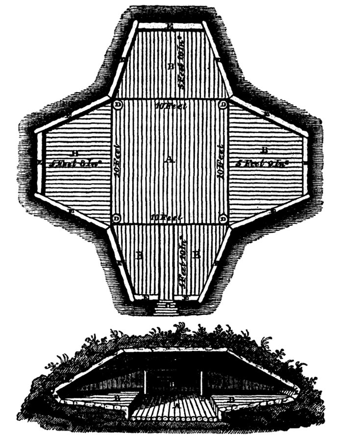
The large building for an assembly-room was, in the interior, a square
of 27 feet, having the log-roof supported on two strong ridge poles, two
feet apart, and resting on four upright posts. The floor in the centre,
formed of split logs, dressed and laid with great care, was surrounded
by a raised border about three feet wide, which was, no doubt, meant for
seats. The walls, three feet high, were inclined outwards, for the
convenience of leaning the back against them, and the ascent to the
door, which was on the south side was formed of logs. The outside,
covered with earth, had nearly a hemispherical form, and round [Pg 184]its base there were ranged the
skulls of 21 whales. There was a square hole in the roof, and the
central log of the floor had a basin-shaped cavity, one foot in
diameter, which was, perhaps, intended for a lamp. The general attention
to comfort in the construction of the village, and the erection of a
building of such magnitude, requiring a union of purpose in a
considerable number of people, are evidences of no small progress
towards civilization. Whale skulls were confined to the large building,
and to one of the dwelling-houses, which had 3 or 4 placed round it.
Many wooden trays, and hand-barrows for carrying whale blubber, were
lying on the ground, most of them in a state of decay.
Myriads of musquitoes, which reposed among the grass, rose in clouds
when disturbed, and gave us much annoyance. Many snow birds were
hatching on the Point, and we saw swans, Canada geese, eider, king,
arctic, and surf ducks; several glaucous, silvery, black-headed, and
ivory gulls, together with terns and northern divers. Some laughing
geese passed to the northward in the evening, which may be considered as
a sure indication of land in that direction. The sea-water at Atkinson
Island being quite salt, and the ponds on the shore brackish, we had
recourse to the ice that lay aground for a supply of fresh water. Strong
gales of wind, with heavy rain, continued all night.
Friday, 14th.The rain ceasing at four o'clock in the morning of the
14th, we embarked, and pulled along a sandy bar which projected five or
six miles from Atkinson Island, and was covered by masses of ice. We
had not left the beach above an hour, when a thick fog hid the land from
our view, and a noise of breakers being at the same time heard, we
deemed it prudent to moor the boats to a piece of grounded ice, and wait
for clear weather. After a time, the fog dispersing partially, we made
sail before a fresh breeze towards the most easterly point of land in
sight, but we had not advanced above five or six miles before the
looming of the shore on the larboard bow made it necessary to haul to
the wind; and the fog becoming as dense as ever, we ran aground on some
flats, where the surf nearly filled the boats. On lowering the sails,
deeper water was attained, but the wind began to blow hard directly upon
the shore, and we could not discover a landing-place, nor did we even
know our distance from the beach. In this dilemma we saw a long line of
floating sea-weed, and Ooligbuck suggesting that it came from the mouth
of a river, we followed its direction, and, with the aid of the sounding
lead, groped our way betwixt two shoals into a well sheltered inlet.
Here there was a good landing-place, and we deemed ourselves peculiarly
fortunate in reaching so snug a harbour, for the fog continued all day,
and the wind increased to a heavy gale.[Pg 185]
The inlet was named Browell Cove, in honour of the Lieutenant-Governor
of the Royal Hospital at Greenwich, and the bay to the westward of it,
M'Kinley Bay, out of respect to Captain George M'Kinley, of the Naval
Asylum. The latitude of the mouth of Browell Cove is 70° N., and the
longitude 130° 19' W. We did not ascertain its extent, but as its
water is brackish, it probably communicates with Esquimaux Lake, which,
according to Indian report, lies behind the islands that form this part
of the coast. Several large basins of salt water communicate with the
cove. Some herds of deer were seen, but too many hunters going in
pursuit of them they were frightened away. The temperature throughout
the day was 42°.
I observed forty species of plants in flower here, of which nearly
one-third were grasses and carices. The Thrift common on the sandy parts
of the British coast is a frequent ornament of Browell Cove; and seven
or eight of the other plants seen there, are natives of the Scottish
hills. Two dwarf species of willows were the only shrubs.
Saturday, 15th.The fog clearing away, and the wind moderating, we
embarked about three in the morning of the 15th; and steering along the
coast, came to a group of low sandy islands, that were separated by wide
but very shallow channels, and skirted, to the distance of five or six
miles, by sand-banks, which were nearly dry at low water. In rounding
these banks our soundings varied from two feet to two fathoms, and we
were occasionally led almost out of sight of the land. During the whole
day we saw much ice to seaward, and in some places it was so closely
packed as to render it doubtful whether a ship would have been able to
make way through it. The line of deep water was marked by large masses
of ice lying aground, and was about ten miles from the shore. As we
could not reach the beach, we disembarked upon a piece of ice at noon,
and cutting up a spare seat for fire-wood, proceeded to cook our
breakfast, and make observations for latitude and magnetic variation.
After rounding the shoals, we made a traverse of ten miles across an
inlet, where the water ran out with a strong current; and, though five
fathoms deep, it was nearly fresh. This I supposed to be another
communication betwixt Esquimaux Lake and the sea, and named it Russel
Inlet, after the distinguished Professor of Clinical Surgery in the
University of Edinburgh. The land on its western side was called Cape
Brown, out of respect to the eminent botanist, whose scientific
researches reflect so much credit on British talent; and that to [Pg 186]the eastward of the inlet received
the name of Dalhousie, in honour of His Excellency the Governor-in-Chief
of the Canadas. Cape Dalhousie consists of a number of high, sandy
islands, resembling those seen from Sacred Island, in the mouth of the
Mackenzie. We entered some deep inlets amongst them, in search of a
landing-place, but the beach was every where too flat. At length, after
dragging the boats through the mud for a considerable way, and carrying
the cargoes for a quarter of a mile over a flat sand, we reached the
shore, and pitched the tents. The island on which we encamped was
similar to the others, being from one hundred to one hundred and fifty
feet high above the water, and bounded on all sides by steep, sandy
cliffs, which were skirted by flat sands. From the summit of the island
we had the unpleasant view of a sea covered with floating ice, as far as
the eye could reach to the eastward. Temperature during the greater part
of the day 55°; at nine p.m. 52°. Wind easterly. The length of
this day's voyage was thirty miles and a half; the latitude of the
encampment 70° 12', and longitude 129° 21' W.
Sunday, 16th.On the 16th the boats were afloat, and loaded by seven in
the morning, when we pulled round Cape Dalhousie, and found the land
trending as we wished to the south-east. Since reaching the sea, the
coast had gradually inclined to the northward, which with the increased
quantity of ice seen on the two or three last days, led us to fear that
a cape might exist, extending so far to the northward, as to prevent us
from reaching the Coppermine River within the period to which our voyage
was limited. It was, therefore, with peculiar satisfaction, that, on
putting ashore to cook breakfast, we saw distant land to the S.E.,
apparently of greater height than that which we had recently coasted;
and we now flattered ourselves that we were about to leave behind us the
low coasts and shoals, which render the boat navigation across the
mouths of the Mackenzie and Esquimaux Lake so perplexing and hazardous.
Many deer were seen at our breakfasting-place, and the musquitoes
annoyed them so much that there would have been no difficulty in
approaching them, if we could have spared time to send out the hunters.
Having obtained an observation for latitude, we directed our course to a
projecting point across an inlet, with no land visible towards its
bottom. The soundings in the middle of the opening exceeded nine
fathoms; the water became less salt as we advanced, and at last could
only be termed brackish. The point proved to be an Island sixteen miles
distant from our breakfasting-place; and as we approached it, we had the
[Pg 187]mortification to perceive a coast seven or eight miles beyond
it, apparently continuous, and trending away to the north-north-west.
The island was named Nicholson Island, as a mark of my esteem for
William Nicholson, Esq., of Rochester. It is bounded by high cliffs of
sand and mud, and rises in the interior to the height of four hundred
feet above the sea. The cliffs were thawed to the depth of three feet,
but frozen underneath, and the water issuing from the thawing ground
caused the mud to boil out and flow down the banks. There were many
small lakes on the island, and a tolerably good vegetation. Amongst
other plants I gathered here a very beautiful American cowslip,
(dodecatheon,) which grew in the moist valleys. From the summit of the
island a piece of water, resembling a large river, and bearing south,
was seen winding through a country pleasantly varied by gently swelling
hills and dales, and differing so much in character from the alluvial
islands we had just left, that I thought myself justified in considering
it to be part of the main land. From S.W. to W.N.W. open water was seen,
broken only by a few islands, that were named after Major-General
Campbell, of the Royal Marines. This large sheet of water is undoubtedly
the Esquimaux Lake, which, according to the natives, not only
communicates with the eastern branch of the Mackenzie, but receives,
besides, two large rivers; and, consequently, the whole of the land
which we coasted from Point Encounter, is a collection of islands. The
temperature varied this day from 38° to 55°. The length of the
day's voyage was thirty-three miles, the latitude of our encampment
69° 57', and longitude 128° 18' W.
Monday, 17th.On the 17th a thick fog detained us until nine o'clock in
the morning, when it dispersed, and we left our encampment. About two
miles from Nicholson's Island the water was nine fathoms deep, and had a
brackish taste; but as we continued our course to the northward, it
became shoaler and salter. This added to the probability of the winding
channel, which bore south, being a large river; and that opinion was
further strengthened by our observing, when we landed to breakfast, the
shore to be strewed with tide-wrack, resembling that which is generally
found on the banks of rivers in this country, such as pieces of willows,
fragments of fresh-water plants, and lumps of peat earth. We were
delighted to find here a beach of sand and fine gravel, bold enough to
admit of our running the boats upon it. The fresh footsteps of a party
of Esquimaux were seen on the sand.
After obtaining an observation for latitude, we embarked, and continued
our course along the coast until we came to the [Pg 188]extremity of a
cape, which was formed by an island separated from the main by a shallow
channel. The cliffs of this island were about forty feet high, and the
snow which had accumulated under them in the winter, was not yet
dissolved, but, owing to the infiltration and freezing of water, now
formed an inclined bank of ice, nearly two-thirds of the height of the
cliff. This bank, or iceberg, being undermined by the action of the
waves, maintained its position only by its adhesion to the frozen cliffs
behind it. In some places large masses had broken off and floated away,
whilst in others the currents of melting snow floating from the flat
land above, had covered the ice with a thick coating of earth; so that
at first sight it appeared as if the bank had broken down; the real
structure of the iceberg being perceptible only where rents existed. In
a similar manner the frozen banks, or icebergs, covered with earth,
mentioned by Lieutenant Kotzebue, in his voyage to Behring Straits,
might have been formed. Had the whole mass of frozen snow broken off
from this bank, an iceberg would have been produced thirty feet wide at
its base, and covered on one side to the depth of a foot, or more, with
black earth. The island was composed of sand and slaty clay, into which
the thaw had not penetrated above a foot. The ravines were lined with
fragments of compact white limestone, and a few dwarf-birches and
willows grew on their sides. The sun's rays were very powerful this day,
and the heat was oppressive, even while sitting at rest in the boat; the
temperature of the air at noon being, in the shade, 62°, and that of
the surface water, where the soundings were three fathoms, 55°.
Immediately after rounding the cape, which was named after His
Excellency Sir Peregrine Maitland, Lieutenant-Governor of Upper Canada,
we entered a channel ten miles wide, running to the eastward, with an
open horizon in that direction; and a doubt arose as to whether it was a
strait, or merely a bay. Many large masses of ice were floating in it,
which proved to us that it had considerable depth; but the water being
only brackish, excited a suspicion that there was no passage through it.
While we were hesitating whether to hazard a loss of time by exploring
the opening, or to cross over at once to the northern land, several deer
were seen, and the hope of procuring a supply of fresh meat, induced us
to put ashore and encamp for the night, that the hunters might go in
chase. The beach here was strewed with fragments of dark-red sandstone,
white sandstone, white compact limestone, and a few pieces of syenite.
There were many large trunks of spruce-firs lying on the sand,
completely denuded of their bark and [Pg 189]branches; and numerous
exuviæ of a marine crustaceous animal (gammarus borealis) lay at
high water mark. Our hunters were successful, Ooligbuck and M'Leay each
killing a deer. Many of these animals had fled to the cool moist sands
on the coast, but even there the musquitoes tormented them so much as to
render them regardless of the approach of the hunters. The latitude of
our encampment was 70° 7', longitude 127° 45'; and the length of
the day's voyage twenty-three miles. The temperature varied from 52°
to 63°. By watching the motion of the tide for the greater part of
the night, I fully satisfied myself that the ebb set out of the opening,
and that the flood came round the land on the north side; hence I
concluded that there could be no passage to the eastward in this
direction, and that the opening led into a bay, to which the name of
Harrowby was given, in honour of the Right Honourable the Earl of
Harrowby.
Tuesday, 18th.Embarking on the 18th at three in the morning, we set the
sails to a favourable though light breeze, and using the oars at the
same time, crossed Harrowby Bay, at its mouth. During the traverse, land
was seen round the bottom of the bay. On nearing the shore we
distinguished twelve Esquimaux tents on an eminence; and a woman who was
walking on the beach gave the alarm, but not until we were near enough
to speak to her, her surprise having fixed her to the spot for a time.
The men then rushed out, brandishing their knives, and, using the most
threatening expressions, forbade us to land, and desired us to return by
the way we came. Ooligbuck endeavoured to calm their fears, by telling
them that we were friends, but they replied only by repeating their
threats, and by hideous grimaces and gestures, which displayed great
agility; frequently standing on one foot and throwing the other nearly
as high as the head. At length on my bawling "noowœrlawgo," (I
wish to barter,) they became quiet at once, and one of them running to
his kaiyack, and paddling off to us, was followed by many of the others,
even before they could witness the reception we gave him. They came
boldly alongside, and exchanged their spears, arrows, bows, and some
pieces of well-dressed seal-skin, for bits of old iron-hoop, files and
beads. They were not so well furnished with iron-work as the Esquimaux
we had seen further to the westward, and very eagerly received a supply
from us. In our intercourse with them we experienced much advantage from
a simple contrivance suggested by Mr. Kendall, and constructed during
our halt in Refuge Cove: it was a barricade formed by raising the masts
and spare oars eighteen inches [Pg 190]above the gunwale on two crutches
or davits, which not only prevented our Esquimaux visitors from stealing
out of the boats, but, in the event of a quarrel, could have been
rendered arrow proof by throwing the blankets or sails over it. On a
light breeze springing up we set the sails, and continuing to ply the
oars, advanced at the rate of four miles an hour, attended by eleven
kaiyacks. Three oomiaks with the women followed us, and we found that,
when rowed by two women, and steered by a third, they surpassed our
boats in speed.
The females, unlike those of the Indian tribes, had much handsomer
features than the men; and one young woman of the party would have been
deemed pretty even in Europe. Our presents seemed to render them
perfectly happy, and they danced with such ecstasy in their slender
boats as to incur, more than once, great hazard of being overset. A
bundle of strings of beads being thrown into an oomiak, it was caught by
an old woman, who hugged the treasure to her breast with the strongest
expression of rapture, while another elderly dame, who had stretched out
her arms in vain, became the very picture of despair. On my explaining,
however that the present was for the whole, an amicable division
instantly took place; and to show their gratitude, they sang a song to a
pleasing air, keeping time with their oars. They gave us many pressing
invitations to pass the night at their tents, in which they were joined
by the men; and to excite our liberality the mothers drew their children
out of their wide hoods, where they are accustomed to carry them naked,
and holding them up begged beads for them. Their entreaties were, for a
time, successful; but being desirous of getting clear of our visitors
before breakfast-time, we at length told them that our stock was
exhausted, and they took leave.
These Esquimaux were as inquisitive as the others we had seen respecting
our names, and were very desirous of teaching us the true pronunciation
of theirs. They informed us that they had seen Indians, and had heard of
white people, but had never seen any before. My giving a little deer's
meat to one of them in exchange for fish, led to an inquiry as to how we
killed the animal. On which Ooligbuck showed them his gun, and obtaining
permission, fired it off after cautioning them not to be alarmed. The
report astonished them much, and an echo from some neighbouring pieces
of ice made them think that the ball had struck the shore, then upwards
of a mile distant. The women had left us previously; several of the men
departed the instant they heard the report; and the rest, in a short
time, [Pg 191]followed their example. They applied to the gun the same
name they give to their harpoons for killing whales.
We learned from these people that the shore we were now coasting was
part of the main land, and that some land to the northward, which
appeared soon after we had passed their tents, consisted of two islands;
between which and the main shore, there was a passage leading to the
open sea. On landing to cook breakfast and obtain a meridian observation
for latitude, we observed the interior of the country to be similar to
that seen from Nicholson's Island. The soil was in some spots sandy,
but, generally, it consisted of a tenacious clay which cracks in the
sun. The air was perfumed by numerous tufts of a beautiful phlox, and of
a still handsomer and very fragrant cruciform flower, of a genus
hitherto undescribed.
On re-embarking we pulled about eight miles farther betwixt the islands
and the main, and found a narrow opening to the sea nearly barred up.
The bottom was so soft and muddy that the poles sunk deep into it, and
we could not carry the cargo ashore to lighten the boats. We succeeded,
however, in getting through, after much labour, and the moment we
crossed the bar, the water was greenish, and perfectly salt. The cape
forming the eastern point of this entrance lies in latitude 70° 36'
N., longitude 127° 35' W. and proved to be the most northerly part
of the main shore which we saw during the voyage. It is a few miles
farther north than Return Reef of Captain Franklin, and is most
probably, with the exception of the land near Icy Cape, since discovered
by Captain Beechey, in the Blossom, the most northern point of the
American Continent. It was called Cape Bathurst, in honour of the Right
Honourable the Earl of Bathurst, and the islands lying off it were named
after George Baillie, Esq., of the Colonial Office. I could not account
in any other way for the comparative freshness of the sheet of water we
had left, than by supposing that a sand-bank extended from Cape
Dalhousie to Baillie's Islands, impeding the communication with the sea,
and this notion was supported by a line of heavy ice which was seen both
from Cape Bathurst and Cape Dalhousie, in the direction of the supposed
bar, and apparently aground.
Taking for granted that the accounts we received from the natives were
(as our own observations led us to believe) correct, Esquimaux Lake is a
very extensive and curious piece of water. The Indians say that it
reaches to within four days' march of Fort Good Hope; and the Esquimaux
informed us that it extends from Point Encounter to Cape Bathurst, thus
ascribing to it an extent from north to south of more than one [Pg 192]hundred and forty miles, and from
east to west of one hundred and fifty. It is reported to be full of
islands, to be every where brackish; and, besides its communication with
the eastern branch of the Mackenzie, to receive two other large rivers.
If a conjecture may be hazarded about the original formation of a lake
which we had so few opportunities of examining, it seems probable that
the alluvial matters brought down by the Mackenzie, and other rivers,
have gradually formed a barrier of islands and shoals, which, by
preventing the free access of the tide, enables the fresh water to
maintain the predominance behind it. The action of the waves of the sea
has a tendency to increase the height of the barrier, while the currents
of the rivers and ebb-tide preserve the depth of the lake. A great
formation of wood-coal will, I doubt not, be ultimately formed by the
immense quantities of drift-timber annually deposited on the borders of
Esquimaux Lake.
[Pg 193]
CONTINUATION OF THE PROCEEDINGS OF THE EASTERN DETACHMENT.
CHAPTER III.
Double Cape Bathurst—Whales—Bituminous-shale Cliffs on
Fire—Enter Franklin Bay—Heavy Gale—Peninsula of Cape
Parry—Perforated Rock—Detention at Cape Lyon by
Wind—Force of an Esquimaux Arrow—Meet with heavy
Ice—Pass Union and Dolphin Straits—Double Cape Krusenstern,
and enter George the Fourth's Coronation Gulph—Reach the
Coppermine River—Remarks—Meteorological Table.
As soon as we entered the clear green water off Cape Bathurst, we
perceived a strong flood tide setting against us, and saw several white
whales, and some black ones of a large size, but of a species unknown to
Ooligbuck.[9] The natives term them aggeewœrk, which is the name
given, by the Esquimaux of Hudson's Bay, to the black whales that
frequent the Welcome. Many large masses of ice were floating about, but
they were no impediment to the boats. The beach, from the time we left
Esquimaux Lake, was bold, there being two or three fathoms water close
to the shore. We hailed this change of circumstances with pleasure, for
the shoals and islands skirting Esquimaux Lake had embarrassed us much,
and the brackishness of the water, combined with the trending of the
coast [Pg 194]to the northward, and even westward, had excited in our
minds an apprehension, that we might possibly be obliged to make a great
circuit in search of a passage, out of that extraordinary piece of
water, and that the opening, when found, might lie so far to the
northward as to be obstructed by an icy sea. Fortunately our fears were
groundless; and, to increase our joy, the coast-line from Cape Bathurst
appeared to run in a straight direction for Coppermine River. There were
many winter-houses built by the Esquimaux on Cape Bathurst. The cliffs
facing the sea were still frozen, but the water trickling down their
sides showed that they were thawing rapidly. We encamped on the beach in
latitude 70° 32½' N., longitude 127° 21' W., having
sailed that day thirty-seven miles. A plentiful supply of very fine
sorrel (oxyria reniformis) being obtained from the banks, proved an
agreeable addition to our supper.
Wednesday, 19th.Embarking at four o'clock in the morning of the 19th, we
rowed along the coast close to the beach, in from two to three fathoms
water. We landed at noon to observe the latitude; and at four p.m. a
thunder-storm coming on, induced us to encamp for the night. The day's
voyage was thirty-two miles, and our encampment was situated in latitude
70° 11' N., longitude 126° 15' W., on a point which was named
after Dr. Fitton, the distinguished President of the Geological Society.
No land was visible to seaward, nor were any fields of ice or large
floes seen, but we passed many smaller pieces and some masses, that,
having stranded on the beach, were dissolving with great rapidity. A
regular tide of six hours affecting the rate of our progress, an
allowance was made for it in the reckoning.
The coast consists of precipitous banks, similar in structure to the
bituminous-shale cliffs at Whitby, in Yorkshire. They gradually increase
in altitude from Cape Bathurst, and near our encampment their height
exceeded two hundred and fifty feet. The shale was in a state of
ignition in many places, and the hot sulphureous airs from the land were
strongly contrasted with cold sea-breezes with which, in the morning,
they alternated. The combustion had proceeded to a considerable extent
on the point where we landed at noon. Much alum had formed, and the
baked clays of yellow, brown, white, and red colours, caused the place
to resemble a brick-field or a pottery. This point, which was named
after Dr. Traill, of Liverpool, lies in latitude 70° 19' N. The
interior of the country, as seen from the top of the cliffs, appeared to
be nearly level, and to abound in small lakes. The soil was clayey,
[Pg 195]and from the recent thaw wet and soft. Tufts of the beautiful
phlox, before mentioned, were scattered over these, otherwise unsightly
wastes; and, notwithstanding the scanty vegetation, rein-deer were
numerous. Some of the young ones, to whom man was doubtless a novel
object, came trotting up to gratify their curiosity, and were suffered
to depart unmolested. The sea here abounds in molluscæ, and many
black whales were seen; also king-ducks, eiders, snow-birds, hawks, and
a large moth.
Thursday, 20th.We embarked at half-past two on the morning of the 20th,
and ran alongshore for two hours with a strong and favourable breeze,
when shoals lying off the mouth of a pretty large river, led us six or
seven miles from the coast. The breeze, which was off the land,
freshened considerably, and raised a short breaking sea, through which
we attempted to pull towards the shore, but the boats shipped much
water, and made little head-way. We, therefore, set the sails again,
and, fortunately fetched under a headland, and effected a landing. The
whole of the pemmican in the Union, and some of that in the Dolphin, was
wet on this occasion. In the morning we had passed two Esquimaux tents,
pitched on the beach, but the inmates seeming to be asleep, we did not
disturb them, being unwilling to lose the fair wind by any delay.
Soon after landing the weather became very foggy, and the wind increased
to a heavy gale. The cliffs at our encampment consisted of slate-clay,
and bituminous alum-slate, and were six hundred feet high. The river,
whose mouth we passed, ran close behind them, having a course parallel
to the coast for some miles before it makes its way to the sea. It was
named Wilmot Horton River, in honour of the Under Secretary of State for
the Colonial Department. Its breadth is about three hundred yards, and
it seems, from the quantity of drift-timber that was piled on the shoals
at its mouth, to flow through a wooded country. The length of this day's
voyage was twenty-four miles, and the position of our encampment was in
latitude 69° 50' N., longitude 125° 55' W. At high-water, which
took place at a quarter past four in the afternoon, the small slip of
beach on which we had encamped was almost covered, and we had to pile
the baggage on the shelving cliff. A very showy species of gromwell grew
near our encampment, in company with the common sea-gromwell,
(lithospermum maritimum.)
Friday, 21st.On the 21st strong winds and foggy weather, with a
considerable surf on the beach, detained us until after eight o'clock
in the morning, when many large [Pg 196]masses of ice coming in, took
the ground near the shore, and smoothed the water sufficiently to enable
us to embark. The fog was dense to seaward and over the land, but the
height of the cliffs left a space of about a mile from the beach, over
which it was carried by the violence of the wind.
About two miles from our late encampment, the bituminous shale was again
noticed to be on fire, giving out much smoke; and as we advanced, the
cliffs became less precipitous, appearing as if they had fallen down
from the consumption of the combustible strata. They gradually
terminated in a green and sloping bank, whose summit, about two miles
from the sea, rose to the height of about six hundred feet. For the
information of the general reader, I may mention that the shale takes
fire in consequence of its containing a considerable quantity of sulphur
in a state of such minute division, that it very readily attracts oxygen
from the atmosphere, and inflames. The combustion is rendered more
lively by the presence of bitumen; and the sulphuric acid, which is one
of its products, unites with the alumina of the shale to form, with the
addition of a small quantity of potass, the triple salt, well known by
the name of alum. The moistening of the strata by the sea-spray
accelerates the process. In some alum-works, where nature has not been
so favourable as in the cliffs of Cape Bathurst, a deficiency of the
bituminous matter requisite to keep up the proper intensity of
combustion, is supplied by brush-wood, which is strewed in alternate
layers with shale that has been previously much divided by long exposure
to the weather, and the whole is then moistened with salt-water. A
further account of these cliffs is given in page xl. of the Appendix.
In the forenoon we passed the mouths of two small rivers, which were
designated after Sir Henry Jardine, Bart., King's Remembrancer in the
Court of Exchequer for Scotland; and Dr. Burnett, Commissioner of the
Victualling Board. A meridian observation was obtained in latitude
69° 38' N.
In the afternoon the wind blowing more on the shore, caused a tumbling
sea. We sailed amongst much stranded ice, and, following the line of
coast, were gradually led into a deep bay, whose east side, having a
northerly direction, was formed by low land, and so much broken by
numerous and extensive inlets, as to look more like a collection of
islands than a part of the main land. We were now, reckoning by degrees
of longitude, fully half way from Point Separation to the Coppermine
River, and the coast from Cape Bathurst had been so exactly in the
proper direction, as to excite high hopes of a short and prosperous
voyage: it was, therefore, no pleasant [Pg 197]sight to us to behold
land running out at right angles to our course, and we were willing to
believe that a passage existed betwixt it and the main. This opinion was
supported by the direction of the high land, which had hitherto skirted
the shore, continuing to be south-easterly, until lost to the sight at
the distance of fifteen or twenty miles. We, therefore, endeavoured to
find a passage, but the first opening that we came to, led into a
circular basin of water, apparently land-locked, and about five miles in
diameter. We halted at its entrance to cook our supper, and, during our
stay, perceiving that the ebb-tide set out of it, we determined on
searching for a passage elsewhere. This inlet is six fathoms deep at its
entrance, and would prove an excellent harbour for a ship, only for the
sand-banks, which skirt this part of the coast, and which render the
passage into it too intricate for vessels having a greater draught of
water than our boats. It was named Langton Harbour, after the agent for
the Hudson's Bay Company at Liverpool.
Leaving this harbour, and steering to the northward, we passed several
inlets, into which the flood-tide set with a strong current. We could
not see land towards their bottoms, but their mouths were shoal, and we
felt convinced that there was no passage through them, because the
flood-tide entered them from the westward. Saturday, 22nd.We therefore,
proceeded on our voyage without wasting time in examining them; and at
two o'clock, on the morning of the 22nd, having come fifty-four miles,
we encamped on a beach composed of small fragments of limestone, and
strewed with sea-weed. This beach, which received the name of Point
Stivens, separates an extensive sheet of salt-water from the sea, and is
similar in character to the Chesil Beach, that connects the Isle of
Portland to the shore. It varies in breadth from one hundred yards to a
quarter of a mile, is several miles long, has a northern direction, and
seems to have been formed by the sweep of the tide round the bay,
meeting the ebb from the basins that intersects the peninsular
promontory with which it is connected. There are several narrow breaches
in it through which the tide flows. Anxious to discover the termination
of this promontory which was leading us so much out of the direct course
to the Coppermine, I went to the summit of a rising ground, about five
miles distant, but the view was closed by some small hills, two or three
miles off. The soil was clayey, and vegetation scanty.
In taking wood to make a fire, from a large pile of drift-timber which
had been collected by the Esquimaux, the nest of a snow-bird, containing
four young, was discovered. The [Pg 198]parent bird was at first scared
away, but affection for its offspring at length gave it courage to
approach them with food; and as it was not molested it soon became quite
fearless, and fed them with the larvæ of insects, whilst the party
were seated at breakfast close by the nest.
At nine o'clock, a.m., we embarked again, and running before a
favourable breeze, came to a point consisting of cliffs of limestone,
twenty feet high, with a small island of the same kind of rock at its
extremity. Many large boulders of greenstone were seen here. After
ascertaining the latitude by meridian observation to be 69° 42' N.,
we continued our voyage along a bold shore, consisting of precipices of
limestone, forty or fifty feet high, with three or four fathoms of water
at the base. In the evening, having reached a projection which appeared
to be the western pitch of the cape, we encamped in a bay near a
remarkable perforated rock, having come twenty-six miles since leaving
Point Stivens. In the course of the day's voyage we had to make our way
through some pretty extensive streams of ice, composed of pieces which
rose eight or ten feet above the water; and we saw a considerable
quantity of what is termed sailing ice to seaward, being such as a ship
could make her way through. I had now the gratification of naming the
extensive bay we had been coasting for three days, after my friend and
commanding officer; and to the several inlets on its eastern side I
assigned the names of Wright, Cracroft, and Sellwood, in honour of his
near relatives. A group of islands to the northward was named Booth
Islands on the same account.
In bestowing the name of Franklin on this remarkable bay, I paid an
appropriate compliment to the officer, under whose orders and by whose
arrangements the delineation of all that is known of the northern coast
of the American Continent has been effected; with the exception of the
parts in the vicinity of Icy Cape discovered by Captain Beechey. It
would not be proper, nor is it my intention, to descant on the
professional merits of my superior officer; but after having served
under Captain Franklin for nearly seven years, in two successive voyages
of discovery, I trust I may be allowed to say, that however high his
brother officers may rate his courage and talents, either in the
ordinary line of his professional duty, or in the field of discovery,
the hold he acquires upon the affections of those under his command, by
a continued series of the most conciliating attentions to their
feelings, and an uniform and unremitting regard to their best interests,
is not less conspicuous. I feel that the sentiments of my friends and
companions, [Pg 199]Captain Back and Lieutenant Kendall, are in unison
with my own, when I affirm, that gratitude and attachment to our late
commanding officer will animate our breasts to the latest period of our
lives. After this feeble but sincere tribute of respect and regard, in
which I hope I have not overstepped the proper bounds of a narrative, I
hasten to resume the details of the voyage.
The country in the neighbourhood of the encampment consisted entirely of
limestone, mostly of the variety named dolomite, and, as is usual where
that stone prevails, it was extremely barren. The cliffs and points of
land present many caverns and perforated rocks, which have very strong
resemblances to the windows and crypts of Gothic buildings. The common
kittiwake breeds in great numbers on the rocky ledges in this quarter,
and their young were already fledged. The temperature during the day was
nearly stationary at 46°, the wind south. The evening being very
fine, the pemmican was taken out of the bags, which were scraped and
dried; and our loss of provision, by the wetting it sustained in the
gale of the 20th, proved to be less than we had expected.
Sunday, 23rd.Embarking at four o'clock, a.m. of the 23d, we sailed with
a favourable breeze for nine miles, betwixt Booth Islands and a shore
presenting alternately projecting rocky shoals and narrow inlets. We
then landed, and ascended a hill, about seven hundred feet high, to
ascertain the direction of the coast, and had the satisfaction of
finding that we had now reached the northern extremity of this
remarkable promontory. It was named Cape Parry after the distinguished
navigator whose skill and perseverance have created an era in the
progress of northern discovery, and a letter addressed to him,
containing information of our proceedings and of Captain Franklin's as
far as was known to us, was deposited under a pile of stones which we
erected on the summit of the hill. From this elevated situation, land
was faintly seen bearing S.E. by S., about forty miles distant; and from
thence round to Booth Islands there appeared an open sea, merely studded
with a few streams of sailing ice, but no islands were seen in that
direction. There are many well sheltered coves in the vicinity of Cape
Parry and amongst Booth Islands, but the bottom is rocky, and numerous
reefs render the navigation unsafe for a ship. The eastern side of Cape
Parry exhibits a succession of limestone cliffs, similar to those which
form its western shores; and as we continued our voyage, we passed many
excavations ornamented by graceful slender pillars, and exhibiting so
perfect a similarity to the [Pg 200]pure Gothic arch, that had Nature
made many such displays in the Old world, there would be but one
opinion as to the origin of that style of architecture. A small island,
on which we landed to cook breakfast, was named after the late Daniel
Moore, Esq., of Lincoln's Inn. It was composed of a cellular limestone,
containing many crystals of quartz. The whole party went in pursuit of a
polar hare which was seen here, but, although it had no other shelter
than the rocks, it contrived to escape from us all.
In the evening we encamped on an island, which was named by Mr. Kendall
after the Reverend Dr. Burrow of Epping. It is situated in latitude
69° 49' N., longitude 123° 33' W. The length of the day's voyage
was thirty-one miles. Fine weather, and a temperature of 52°,
entailed upon us a visit from the musquitoes. The sea water here is of a
light blue colour and clear, the bottom being distinctly visible in five
fathoms. Pieces of ice still adhered to the cliffs.
Monday, 24th.We were detained in the morning of the 24th by a thick fog,
which cleared up about eight o'clock; but the moon being then in
distance, we remained until noon, that Mr. Kendall might take
observations for lunars and latitude. These necessary operations being
completed, a short voyage of nine miles brought us to an island on which
we encamped, and which obtained from us the name of Clapperton, in
honour of the undaunted explorer of central Africa. In our way we passed
through several streams of ice, composed of pieces of considerable size,
but all evidently in a state of rapid dissolution, under a bright sun;
the water flowing from their surfaces in rivulets. Many black whales,
and various kinds of seals, were seen this day. We saw no black whales
farther to the eastward.
From Clapperton Island we had a view of a ridge of hills, which, from
their direction, appeared to be a continuation of those on the west side
on Franklin Bay. The island itself, like the neighbouring coast, is
composed of limestone, and many detached rocks skirt it, rising from
water that is beautifully clear. When we landed there was a strong
current setting to the eastward, round the end of the island, but it
ceased at four p.m., the time of low water, and was probably produced by
the ebb setting out of some of the inlets of Cape Parry. In the evening
the ice made a noise so like the regular firing of half-minute guns, as
to excite, at first, an idea that we heard the guns of a ship. The
temperature at six o'clock in the evening was as high as 74° in the
shade.
Clapperton Island lies in latitude 69° 41½' N., and nearly in
[Pg 201]the longitude of Fort Franklin, from which it is distant three
hundred and thirteen miles in a straight line; but the distance between
the nearer part of the Great Bear Lake and the Arctic Sea here, does not
much exceed one hundred and ninety miles.
Tuesday, 25th.Taking advantage of a light breeze and very fine weather,
we embarked at midnight, and crossed over to the east side of the bay,
passing through some heavy streams of ice by rather intricate channels.
At half past five in the morning of the 25th, we landed on a point of
the main shore, and Mr. Kendall took observations for three sets of
lunars. On re-embarking we proceeded a few miles further, when a heavy
gale of wind suddenly springing up, we ran for shelter into a small
creek at the extremity of a cape, which I named after the distinguished
traveller Captain G.F. Lyon, R.N. The bay which lies betwixt it and Cape
Parry, was called Darnley, in honour of the Earl of Darnley. The
distance from Clapperton Island to Cape Lyon is fourteen miles.
The country in the neighbourhood of Cape Lyon presents a surface varied
by gently swelling eminences, covered with a grassy sward, and
intersected by several narrow ridges of naked trap rocks, rising about
one hundred and fifty feet above the general level. The trap ridges,
when they reach the coast, form high cliffs, and the clay-slate and
limestone lie in nearly horizontal strata beneath them. The view inland
was terminated by the range of hills which we had seen at the bottom of
Darnley Bay, to which the name of Melville Range was now given, in
honour of the Right Honourable the Lord Viscount Melville.
From the top of the highest trap-hill, near the extremity of the cape,
we saw some heavy ice to seaward, but with enough of open water for the
passage of a ship; and, occasionally, during our stay, there was an
appearance of land to the north-westward, occupying two points of the
compass; but we were uncertain whether it might not be a fog-bank
hanging over a field of ice. If it was land, it could not be less than
twenty-five or thirty miles distant, and must, from the portion of the
horizon it occupied, be a large island. Upon the summit of the hill we
erected a pile of stones, and deposited another letter for Captain
Parry, containing a short account of our proceedings.
A gale of wind detained us two days at Cape Lyon, during which Ooligbuck
supplied us with rein-deer meat, and Mr. Kendall obtained several sets
of lunars. The latitude of our encampment, by the mean of three
meridian observations, was 69° 46½' N.; and the longitude, by
lunar distances, 122° 51' W. [Pg 202]The temperature of the air,
during the gale, was about 45°, that of the water 35°. During
our stay at Cape Lyon the tides were regular, but the rise and fall were
short of twenty inches. At midnight on the 26th of July, the sun's lower
limb was observed to touch the horizon for the first time since our
arrival on the coast. Some old winter houses were seen in our walks, but
we perceived no indications of the Esquimaux having recently visited
this quarter.
Thursday, 27th.The gale moderated on the 27th, and at eight in the
evening it was sufficiently abated to permit us to proceed on our
voyage. After rowing about two miles, the horns of a deer were seen over
a rock at the summit of a cliff, on which M'Leay, the coxswain of the
Union, landed and killed it. This poor animal had been previously
wounded by an Esquimaux arrow, which had broken its shoulder bone. The
jagged bone-head of the arrow was buried in the flesh, and its copper
point bent up where it had struck the bone. The wound was open, and
seemed to have been inflicted at least a fortnight before, but the
animal was still fat. The extremity of Cape Lyon lies about three miles
north-east of the encampment we had left, and in its neighbourhood the
cliffs form bold headlands and several small rocky islands. Soon after
rounding it we came to a projecting point, consisting of cliffs of
limestone, in which there was a remarkable cave, opening to the sea by
an archway, fifty feet high and twenty wide. The walls of the cavern
were two hundred feet high, and a large circular aperture in the roof
gave free admission to the daylight. Mr. Kendall named this point after
Mr. Pearce, a particular friend of his.
The night was fine but cold, the temperature having fallen to 35°
soon after we started, and at midnight the sun sunk for nearly half an
hour beneath the horizon. We passed much heavy stream-ice, and towards
the morning a quantity of new, or, as the seamen term it, "bay ice,"
having formed on the surface on the sea, the boats were so much retarded
that we Friday, 28th.put ashore at four o'clock of the 28th, to wait
until the increasing heat of the day dissolved it. The point on which we
landed was named after Admiral Sir Richard Godwin Keats, G.C.B.,
Governor of Greenwich Hospital, and lies in latitude 69° 49' N. and
longitude 122° W., being about eighteen miles distant from our
encampment on Cape Lyon. The rocks at Point Keats consist of
flesh-coloured sandstone. The Melville range of hills approaches there
within eight or ten miles of the sea, and the intervening country is
traversed by ridges of greenstone. On the coast from Cape [Pg 203]Lyon to Point Keats there is a
line of large drift timber, evidently thrown up by the waves, about
twelve feet perpendicular height, above the ordinary spring tides: a
sufficient proof of the sea being nearly clear of ice at the time it was
thrown up; for the presence of any considerable quantity, even of
stream-ice, prevents the waves from rising high. After two hours halt,
the bay-ice having dissolved we re-embarked.
From Cape Lyon to Point Keats the coast runs nearly east; after quitting
the latter we found it trending a little to the southward, and from a
point, which was named in honour of John Deas Thompson, Esq.,
Commissioner of His Majesty's Navy, it has nearly a south-east
direction. We landed a little to the eastward of Point Deas Thompson, to
take a meridian observation for latitude, in a small bay, bounded by
cliffs of limestone, one hundred and forty feet high, in which the waves
had sculptured some beautiful Gothic arches. From the summit of the
cliffs we saw a dark appearance in the eastern horizon, but it was too
indistinct to permit us to decide whether it was land or merely a
fog-bank. To the eastward of these cliffs the coast decreased in height,
and, at the distance of five miles, we passed a small river, which was
named after Francis Palgrave, Esq. Near this river, on the summit of a
cliff, which was twenty-five feet high, we noticed several large logs of
drift timber, with some hummocks of gravel, that appeared to have been
thrown up by the waves. A portion of the Melville Range lies within
three miles of the shore there; and one of its most remarkable hills was
named after my esteemed friend, William Jackson Hooker, LL.D., Regius
Professor of Botany in the University of Glasgow; and another after
Colonel Colby, of the Royal Engineers, one of the Members of the Board
of Longitude. About four o'clock in the afternoon we came to a stream
flowing from a lake, and as it was an excellent boat harbour, we entered
it and encamped. It was named Roscoe, after the eloquent historian of
the Medici; and a conical hill of the Melville Range, visible from its
mouth, received the name of the venerable geographer Major Rennel.
We passed this day through heavier and more crowded streams of ice than
any we had previously seen on the voyage. The navigation amongst it was
tedious and difficult, and just before we put ashore much motion was
imparted to it by a fresh south-west wind. The temperature during the
day varied from 35° to 50°. The mouth of Roscoe River lies in
latitude 69° 41' N., longitude 121° 2' W., and is forty-eight
miles distant from Cape Lyon.
[Pg 204]Saturday, 29th.We embarked on the 29th, with a fair wind; but
the ice lay so close, that we could not venture to set more than a
reefed foresail, and were ultimately obliged to lower the sail entirely,
and to find a passage through ice with oars and poles. The pieces of ice
were of sufficient magnitude to deserve the name of floes, and were
sometimes several fathoms thick. They were all moving before the breeze,
which caused them to arrange themselves in the form of streams parallel
to the coast, and, consequently, left lanes of open water in the
direction of our course. These lanes, however, were continually changing
their form; and, on several occasions, when we had been tempted by the
favourable appearance of a piece of open water to venture from the
coast, we had great difficulty in extricating ourselves from the ice
which closed around us. The thickness of the ice led me to conclude that
the sea had not been long open in this quarter; and I observed that the
vegetation was later on this part of the coast than on the western side
of Cape Parry.
For the first twelve miles after leaving our encampment, the coast was
low and sandy; the Melville Range still forming the back-ground, at the
distance of four or five miles from the sea. The low beaches were
terminated by a rocky headland, which obtained from us the name of De
Witt Clinton, as a testimony of our sense of the urbanity and love of
science which had prompted his Excellency the Governor of the state of
New York[10] to show so much attention to the members of the Expedition,
in their passage through his government. Some miles beyond Point De Witt
Clinton we came to a steep cliff, where the ice was so closely packed
that we could not force a passage. The cargoes were, therefore, carried
along the foot of the cliff, and the boats launched for a few yards over
a piece of ice. In this operation, the shelving base of an iceberg,
which had formed under the cliff, and still adhered to it, but which was
undermined by the waves, gave way whilst several of the men were
standing upon it; but, fortunately, it did not overset, and they
received no injury, as it was large enough to support them in the water.
At nine o'clock, a.m., we were stopped by the closeness of the ice, and
put ashore until the tide or wind should produce some change.
The tides, since leaving the Mackenzie, had never been observed to have
a greater rise than eighteen inches: but in the neighbourhood of our
encampment, the sea-wrack and lines [Pg 205]of drift timber indicated a
washing of the sea to the perpendicular height of twenty feet. The
country in this vicinity consists of a bluish limestone, interstratified
with slate-clay: and naked and rugged ridges of trap rocks rise in
various places above the general level. The soil is composed of clay and
limestone gravel. The latitude of our encampment was ascertained, by
meridian observation, to be 69° 29' N.; its longitude was 120°
20' W.; and its distance from Roscoe River was twenty-five miles.
Sunday, 30th.A breeze of wind from the land having opened a passage two
miles wide, we embarked at two o'clock in the morning of the 30th, and
ran seven miles under sail; when, having overtaken the ice which had
passed in the night, we found it too closely packed to allow us to
proceed. In making for the beach, the Union narrowly escaped being
crushed by two large floes of ice, which came together with violence
just as she was about to run betwixt them. The Dolphin had sailed
through the same passage not two minutes before. From an eminence near
our encampment, we had the unpleasant view of a sea covered, as far as
the eye could reach, with ice, excepting a few lanes of open water far
to seaward. The tide fell here seven inches in the morning, and eleven
in the evening, although the north-west wind increased in the afternoon
to a pretty strong gale. The greater fall of the water with that wind,
showing that it found an exit to the eastward, relieved us from an
apprehension, which we had begun to entertain, that we were entering a
deep bay, which might be encumbered by the drift-ice for many days. Much
ice drove past us in the course of the day, before a west-north-west
wind, its progress being only slightly checked for a time by the flood
tide. Recent footsteps of a small party of Esquimaux were seen on the
beach. Our encampment was situated in latitude 69° 24' N., and
longitude 120° 03' W.
Monday, 31st.Embarking on the 31st, at two o'clock in the morning, we
succeeded in getting about six miles through the ice: when we were again
obliged to put ashore at the mouth of a small river, which was named
after James Buchanan, Esq., his Majesty's Consul at New York, whose
friendly attention to the officers of the Expedition well entitled him
to their gratitude. After waiting for a while the tide loosened the ice
a little, and we made some progress by debarking upon the floes, and
pushing them apart with poles, until a sufficient opening was made. This
operation was tedious, and not devoid of hazard to the boats, arising
from the rotatory motion frequently given to the floes, by the pressure
of the [Pg 206]body of the ice. At noon, an observation for latitude was
obtained on a projecting point, which was named after William Tinney,
Esq., of Lincoln's Inn. At three in the afternoon, our progress being
again arrested by the compactness of the ice, we hauled the boats upon
the beach, and M'Leay having killed a fat buck rein-deer, the party had
an excellent supper after the fatigues of the day. The length of the
day's voyage was twenty-two miles; the latitude of our encampment,
69° 17½' N., and its longitude 119° 27' W. The coast line
in this quarter is lower, few of the cliffs exceeding forty feet in
height, and there is a greater proportion of flat beach than occurs
nearer Cape Lyon. The ground is strewed with gravel, apparently arising
from a limestone conglomerate which exists there in considerable
quantity. The Melville Range is within four or five miles of the shore
at this place, and does not rise more than five hundred feet above the
sea. Many small rivulets flow from the rising grounds into the sea,
through wide gravelly beds, indicating that at times they swell into
large torrents.
August 1st.A light westerly wind having opened a narrow channel between
the ice and the shore, we embarked early in the morning of the 1st of
August, and, three miles from our encampment, came to a river, which
discharged itself by various shallow mouths, separated by sand banks.
Its westernmost and easternmost mouths were five miles apart; and the
latter, which was the largest, was one hundred and fifty yards wide.
Although the outlet of this river is so much barred up, it discharges a
considerable volume of water, and probably has its sources in the hills
which are visible from the northern shores of Great Bear Lake. It was
named after John Wilson Croker, Esq., Secretary to the Admiralty.
Further on we had a view of a high island, lying ten or twelve miles
from the shore, which received the appellation of Sir George Clerk's
Island. M'Leay, who was now acknowledged to be our best hunter, was sent
in pursuit of a deer, which we saw from the boats, and being successful,
we landed to cook our breakfast, after having rowed twenty miles in the
course of the morning. An observation for latitude was obtained a mile
further at a point which was named after Waller Clifton, Esq., Secretary
to the Victualling Board, The coast here makes a turn to the southward,
and about six miles further on, where it resumes its easterly direction,
a river about one hundred yards wide flows into the sea, betwixt two
sand hills. To this river Mr. Kendall gave the name of Inman, out of
respect to the Reverend and Learned Professor of the Royal Naval College
[Pg 207]at Portsmouth. A conical hill, about ten miles distant, in a
south-west direction, was named after the late President of the Royal
Society, the highly distinguished Sir Humphry Davy, Baronet. This was
the last part we saw of the Melville Chain. We encamped at half past
seven in the evening, under a high cliff of limestone, having advanced
during the day thirty-seven miles. The point on which we encamped,
received from Mr. Kendall, the name of Wise, after Captain M.F. Wise, of
the Royal Navy, under whose command he sailed in His Majesty's ship
Spartan. It is situated in latitude 69° 03½' N., longitude
118° W.
The coast from Cape Clifton to Point Wise consists of limestone in
horizontal layers, forming cliffs, which are separated from each other
by intervening shelving beaches, and it is skirted to the distance of a
quarter of a mile by rocky shoals, having sufficient water on them for
our boats, but not enough to admit the heavy ice. This was the cause of
our making greater progress than we had been led to expect from the
appearance of the ice in the morning. The cliffs at Point Wise are two
hundred feet high, and from their summits, the ice appeared closely
packed, as far as the eye could reach; no lanes of open water being
visible. It was, however, composed of pieces, and not a continuous
field, for we could distinctly perceive that several of the hummocks it
inclosed were in motion. This was the first time during the voyage that
we saw ice so closely packed, as to appear impenetrable to a ship when
impelled by a good breeze, but it is necessary to state that, even from
a considerable height, we could not tell with certainty the state of the
ice six miles off; scattered pieces at that distance assuming the
appearance of a close pack. The weather this day was fine, the
temperature varying from 43° to 50°.
Wednesday, 2d.Soon after setting out on the 2d, the temperature, which
had been about 40° throughout the night, fell to 34°, and a fog
came on. The wind also freshening and putting the ice in motion, the
boats received some heavy blows; but we continued to advance, though
slowly, and with much caution. About ten miles from our encampment, we
passed the mouth of a small river, which was named after Captain
Hoppner, of the Royal Navy, second in command to Captain Parry, on his
third voyage of discovery. Towards noon the fog cleared away, and a
meridian observation was obtained in latitude 68° 56' N. Three miles
further on we arrived at the mouth of a wide but shallow river, which
flowed over a rocky bottom, betwixt two sand hills, and joined the sea
by several mouths, separated by shoals. To this river Mr. Kendall gave
[Pg 208]the name of his friend, Lieutenant Harding, of the Royal Navy.
Five miles beyond this river, on the extremity of a rocky cape, the
Esquimaux had constructed several store-houses, of drift timber, which
were filled with dried deer-meat and seal-blubber; along with which,
cooking kettles, and lamps made of potstone, copper-headed spears, and
various other articles, were carefully laid up. The ashes of the
recently extinguished fires showed that the natives had quitted this
place only a few days, and we felt much pleasure in figuring to
ourselves the surprise and joy with which they would behold, on their
return, the iron utensils that we deposited in the store-houses for
their use. The cape received the name of "Young," after the learned
Secretary to the Board of Longitude.
From Cape Young we had a view of the sea thickly covered with ice, of a
greater thickness than any we had previously encountered; and we
perceived that there was a deeply indented bay lying in our route, and
so filled with ice, that our only method of passing it appeared to be by
keeping close to the shore, although under the disadvantage of trebling
the distance. The coast in this quarter is similar to that which we had
passed on the two or three preceding days, and is formed of high
limestone cliffs, with intervening shingly beaches; but the country is
still more barren, the quantity of limestone debris almost excluding any
soil. Flat limestone rocks, having only a few inches of water upon them,
skirt the beach, and terminate like a wall in four or five fathoms
water. The ice was closely packed against these rocks, and for five
miles after passing Cape Young, we made a way for the boats only by the
constant use of the hatchet and ice-chisel, and gladly encamped at six
o'clock in the evening, after a day's voyage of thirty-one miles. A herd
of twenty rein-deer were grazing on the beach, but our hunters were too
much fatigued to go in pursuit of them. The encampment was situated in
latitude 68° 53' N., and longitude 116° 50' W. The temperature
varied in the course of the day from 34° to 50°. We observed
that the ice continued to dissolve, but not so rapidly as in the month
of July, when the sun did not sink below the horizon.
Thursday, 3rd.We resumed our operations on the morning of the 3d at the
usual hour, and with great labour made a passage for the boats. At
eleven o'clock we landed to refresh ourselves on a projecting point at
the western entrance of a deep bay, having previously passed a river
which was about one hundred yards wide, but very shallow. After [Pg 209]breakfasting, and obtaining a
meridian observation in latitude 68° 53' N., we pushed off again,
and for some time made very slow progress. The shores of the bay
consisted of beds of limestone, which, shelving into the water, were
covered with masses of ice, forced up by the pressure of the pack
outside. We were, therefore, compelled to work our way in deeper water,
and there the boats, which led by turns, were occasionally exposed to
the hazard of being overset by pieces of buoyant ice, which frequently
broke off from the bases of the floes. In the language of the whalers,
the ice is said to calf, when masses are detached in this manner, and
they are sometimes of sufficient magnitude in the Greenland seas to
endanger large vessels. The Dolphin was, at one time, nearly crushed to
pieces by the closing of two floes; but, fortunately, she had reached a
small recess, just as they came in contact, and they recoiled
sufficiently to leave a passage for her exit, after she had sustained
the trifling damage of a few cracks in the upper planks. The rays of the
sun, and the waves acting on the surface of the floes, had, by thawing
them irregularly, formed lakes of fresh water of some extent upon their
surface. When these pieces of water were of sufficient depth, we availed
ourselves of them to make some progress in our voyage, and in this way
we frequently sailed over a considerable thickness of ice.
At four o'clock p.m. we had advanced five miles, when to our joy we
found a lane of open water, which permitted us to cross to the other
side of the bay, where we encamped in latitude 68° 51½' N.,
and longitude 116° 03' W., having sailed in the course of the day
eighteen miles and a half. The bay was named Stapylton in honour of
Major-General the Honourable G.A.C. Stapylton, Chairman of the
Victualling Board; and on ascending a rising ground we perceived that it
communicates with a long, narrow lake. A few miles from the coast the
land rises from three to five hundred feet above the sea, and presents
many precipitous limestone cliffs, and chains of small lakes. The
country is very barren, the only plant we gathered being the yellow
poppy, (papaver nudicaule.) By our reckoning we were now nearly in the
longitude of the mouth of the Coppermine River, but about seventy miles
to the northward of it, we, therefore, entertained an opinion that we
were coasting a narrow peninsula, and that we should soon have the
pleasure of perceiving the coast take a southerly direction. It was,
consequently, with some hopes of beholding the sea on the opposite side
of the peninsula that I walked seven or eight miles to the eastward in
the night, but [Pg 210]I was disappointed. In my way I had occasion to
wade through a small lake, when two birds, about the size of the
northern diver, and apparently of that genus, swam, with bold and
angry gestures, to within a few yards of me, evidently very impatient of
any intruder on their domain. Their necks were of a beautiful pale
yellow colour, their bodies black with white specks. I considered them
to belong to a species not yet described, and regretted that, having
left my gun at the tent, it was not in my power to procure one of them
for a specimen.
Friday, 4th.Embarking at three a.m. on the 4th, we found little
difficulty in reaching the eastern cape of Stapylton Bay, the wind
having formed a narrow channel between the ice and the shore in the
night. The temperature was low, and in the morning some new ice was
formed which we easily broke. We noticed several eider ducks breaking a
way through the thin ice for their young ones with their wings, and in
this operation they made greater progress than we did in the boats.
On reaching the cape[11] which was named after Vice-Admiral Sir William
Johnstone Hope, G.C.B., we descried another point about four or five
leagues distant, bearing east-north-east, the intervening bay being
filled with closely packed ice. We were now within twelve miles of Cape
Young, after a laborious navigation of four times that distance, and the
prospect of another bay, equally unpromising, was very vexatious; but
our apprehensions were increased by the view of a continuous line of
land, extending from north-north-west until it was hid behind the nearer
cape, which bore east-north-east, for we feared that it might prove to
be a continuation of the main shore. Our crews, though concerned at the
delay that so much ice was likely to occasion, set about overcoming the
obstacle with a hearty good will, and after an intricate and troublesome
navigation of ten or twelve miles amongst the ice, we found the bottom
of the bay more open, and were enabled to cross over to the eastern side
where we encamped. This bay received the name of the eminent astronomer
James South, Esq.
Mr. Kendall having gone to ascertain from the higher ground the trending
of the coast, returned in about two hours with the cheering intelligence
that the land to the northward was unconnected with the main shore, and
that he had seen the latter inclining to the south-east, with a much
more open sea than we had lately been accustomed to. As soon as sup[Pg 211]per was over, I also set out to
enjoy the gratifying prospect, and from the extremity of the cape on
which we were encamped, and which was named in honour of the Right
Honourable Lord Bexley, I beheld the northern land running from
north-north-west till it was lost in the horizon on a north 73° east
bearing. It seemed to be pretty high but not mountainous; and although
broken towards the east, the principal portion of it appeared to be
continuous. This island, by far the largest one that was seen, either in
the present voyage or on Captain Franklin's former Expedition, was named
after that most distinguished philosopher Dr. Hyde Wollaston. The main
shore had a direction nearly parallel to Wollaston Land, its most
distant point in sight, which I estimated to be fifteen miles off,
bearing S. 61° E. On the strait, separating the two shores, I
bestowed the names of our excellent little boats, the Dolphin and Union.
It varies in width from twelve to twenty miles, and to the eastward
seemed to contain merely detached streams of ice, not likely to obstruct
the progress of a vessel; but to the westward lay the closely packed
ice, filling South's Bay, and extending to seaward. The ice did not,
however, entirely close the strait, for I could discern lanes of open
water towards Wollaston Land. The packed ice which we had seen lining
the coast between Point Clifton and Cape Bexley, may be perhaps
considered as an illustration of the remark made by Captain Parry, that
the western sides of seas and inlets in those latitudes are more
encumbered with ice than the opposite sides; and it is very probable
that a ship might have found a passage by keeping along Wollaston Land,
an opinion which the appearance of the ice as seen from Cape Bexley,
tended to confirm. The latitude of our encampment was 68° 58' N.,
and its longitude 115° 47' W.; it was within ten miles of our
encampment of the preceding night, although we had travelled twenty-five
miles in the course of the day.
Saturday, 5th.The party embarked on the 5th, at the usual hour in the
morning, with their spirits pleasantly excited by the intelligence of
the favourable trending of the coast, communicated by Mr. Kendall, and
after doubling Cape Bexley, proceeded under sail, before a
west-north-west wind, with a rapidity to which they had lately been
unaccustomed. The point of land which Cape Bexley terminates, consists
entirely of horizontal beds of limestone, and is nowhere more than three
hundred feet above the sea. On the west side, the water is two or three
fathoms deep, close to the shore, and the land attains its greatest
elevation by a steep rise from the beach. On the east side there are
some precipitous cliffs, but [Pg 212]the coast in general is skirted by
shelving rocks. No soil was seen on the Cape, nor any appearance of
vegetation, the ground being every where covered, to the depth of a
foot, by fragments of limestone, which are detached by the frost from
the solid strata lying beneath. We were much puzzled at first with the
appearance of several parallel trenches, a foot deep, running for a
great distance amongst the fragments, but on examination they were
ascertained to originate in fissures of the subjacent strata. Much
quartz being intermixed with the limestone of Cape Bexley, the fragments
which covered the ground had, by the action of the weather, lost most of
the softer calcareous matter, and were converted into a kind of rasp,
very annoying to pedestrians, being capable of destroying a pair of
stout English shoes in a walk of a few hours.
At eleven o'clock we came to a pack of ice abutting against the shore,
but while we halted to cook breakfast, the wind opened a way for us. In
the course of the morning we passed many heavy streams of ice, separated
by lanes of open water, which would have afforded an easy passage for a
ship. Having obtained a meridian observation for latitude, we
re-embarked, and pulled for five miles through an open channel, to Point
Cockburn, on the opposite side of a bay, which appeared to be four or
five miles deep, and to be quite filled with drift-ice. Many deer were
seen grazing near this point, but we did not stop to send a hunter in
pursuit of them. We afterwards crossed several other indentations of the
coast, skirted by reefs of limestone and low islets, and encamped on
Chantry Island, lying close to the main shore, in latitude 68° 45'
N., longitude 114° 23' W., having sailed thirty-nine miles in the
course of the day. Two islands, lying opposite to our encampment,
received the appellations of Manners Sutton and Sir Robert Liston's
Islands. The degree of motion in the ice, which was drifting between
these islands and the shore, indicated a stronger current of both flood
and ebb than we had hitherto seen.
Sunday, 6th.On the 6th, we commenced the day's voyage at three in the
morning, but were compelled to put ashore soon afterwards by a stream of
ice barring our way. At six o'clock, however, the flowing tide opened it
sufficiently to enable us to push the boats along with poles, our
progress being occasionally facilitated by the rocky reefs, which kept
the heavier masses from pressing down upon us. Much of the ice lay
aground, in nine fathoms, but none of it rose more than five or six feet
above the surface of the water. We estimated the velocity of the flood
tide, off some of the rocky points, at [Pg 213]three miles an hour, and
at such places we had much trouble in endeavouring to keep the boats
clear of the drifting ice. The circular motion which the pieces
occasionally acquired was particularly difficult to guard against, and
had we not depended on the tongues of ice, which, lying deep under
water, prevented the upper parts of the floes to which they belonged
from coming in contact, we should scarcely have ventured amongst them.
We did not, however, entirely escape, for the Dolphin was caught between
a floe and a piece that lay aground, and fairly raised out of the water
by the pressure, which broke one of her timbers and several of her
planks. We put ashore on a small island to repair the damage, and during
our stay Mr. Kendall had a meridian observation in latitude 68°
36½' N. Another island, lying about two miles from the main land,
was distinguished by the name of Aylmer Bourke Lambert, Esq.,
Vice-President of the Linnean Society. The sea water there was
beautifully clear.
At half-past one, the Dolphin being again rendered sea-worthy, we
prosecuted our voyage until five p.m., when the flood-tide set with such
velocity round a rocky point, and brought so much ice with it, that we
considered it prudent to put ashore. The violent eddies in the currents
there, and the sudden approach and collision of the large masses of ice,
reminded us forcibly of the poet's description of Scylla and Charybdis.
The length of the day's voyage was twenty-one miles, and our encampment
was situated in latitude 68° 32' N., longitude 113° 53' W. The
temperature at nine p.m. was 60°.
Mr. Kendall and I took a walk of some miles along the shore, and were
happy to observe the coast inclining to the southward, although no doubt
now existed as to our accomplishing the voyage sufficiently early to
allow us to cross the barren grounds, to the eastward of Great Bear
Lake, before the cold weather set in. The flowering season for most of
the plants on the coast was already past, but our route for the
remainder of the distance to Bear Lake, inclining much to the southward,
would naturally have the effect of prolonging to us the duration of the
summer. A conspicuous hill, discovered in our walk, received the name of
Mount Barrow, in honour of John Barrow, Esq., Secretary to the
Admiralty; and two islands in the offing were named after Commanders
Bayfield and Douglas, of the Royal Navy, to both of whom the officers of
the Expedition were indebted for much assistance and personal kindness,
in their progress through Canada. The interior of the country was flat,
but the limestone formed cliffs on the shore two hundred feet high.
From the form of the islands, I [Pg 214]was led to believe that they
consisted of trap rocks. Wollaston Land, as seen from this encampment,
appeared to recede gradually from the main, and it sunk under the
horizon, on a north-east bearing. By estimation, the most easterly part
of it which we saw, is in latitude 68° 45' N., and longitude
113° 53' W. The navigation of the Dolphin and Union Straits would be
dangerous to ships, from the many sunken rocks which we observed near
the southern shore.
Monday, 7th.Embarking at two a.m. on the 7th, we crossed a deeply
indented bay, which was named after Lieutenant-Colonel Pasley, of the
Royal Engineers, to whose invention we owe the portable boat, named the
Walnut-shell, which we carried out with us. On the east side of Pasley
Cove there are some bold limestone cliffs, that form the extremity of a
promontory, to which we gave the name of Cape Krusenstern, in honour of
the distinguished Russian hydrographer. It lies in latitude 68° 23'
N., longitude 113° 45' W., and is the most eastern part of the main
land which we coasted. From a cliff, two hundred feet high, two miles to
the southward of Cape Krusenstern, we had a distinct view of the high
land about Inman's Harbour, on the western side of Cape Barrow, which
was the most easterly land seen on this voyage, and lies in longitude
111° 20' W. The space between Capes Barrow and Krusenstern is
crowded with islands.
By entering George the Fourth's Coronation Gulf at Cape Krusenstern, we
connected the discoveries of this voyage with those made by Captain
Franklin on his former expedition, and had the honour of completing a
portion of the north-west passage, for which the reward of five thousand
pounds was established by his Majesty's Order in Council, but as it was
not contemplated, in framing the Order, that the discovery should be
made from west to east, and in vessels so small as the Dolphin and
Union, we could not lay claim to the pecuniary reward.
While the party were at breakfast I visited Mount Barrow, which is a
steep hill about three hundred feet high, surrounded by a moat fifty or
sixty feet wide and twenty deep, and having a flat summit bounded by
precipices of limestone. Three banks, like causeways, afforded the means
of crossing the moat, and the hill altogether formed a remarkably
complete natural fortification. The Esquimaux had marked most of the
prominent points in this quarter, by erecting piles of stones similar to
the cairns built for land-marks by the shepherds in Scotland. These
erections were occasionally noticed, after doubling Cape Parry, but they
were more numerous here. The ice which [Pg 215]we saw this day was in
form of loose streams, and offered no material impediment. Several
wreaths of snow lay at the base of the cliffs that had a northern
exposure, being the remains of that which had accumulated in the winter.
The latitude 68° 13' N. was observed at noon on a low point which
projected from some higher lands. From this point, which was named after
Edward H. Locker, Esq., Secretary to the Royal Hospital at Greenwich, we
had a view of Cape Hearne, the form of which I thought I recognised from
my recollections of it on the former voyage. We reached Cape Hearne in
the evening, having in the afternoon skirted a low and indented coast; a
bay immediately to the north of it was named after Captain Basil Hall,
of the Royal Navy. Cape Hearne itself is a low point, not visible from
the mouth of the Coppermine; but the high land behind it, when seen from
a distance, appears like a steep promontory, and is that designated as
Cape Hearne in Captain Franklin's chart of his former voyage. The
latitude of this cape is 68° 11' N., and its longitude 114° 54'
W. The length of the day's voyage was forty miles. Many deer were seen
here, and Ooligbuck killed a very fine one in the evening. After
encamping I went a few miles into the interior, and found that the
country was composed of limestone, which rose by a succession of
terraces to the height of about three hundred feet above the sea. The
heat of the day was considerable, the thermometer, when exposed to the
rays of the sun, indicating 86°, without the bulb being blackened,
or any other means used to retain the heat.
Tuesday, 8th.Embarking early on the eighth, and passing through several
loose streams of ice, some pieces of which were twenty-four feet thick,
we landed at nine o'clock on a bold cape to prepare breakfast. It is
formed of columnar greenstone, reposing on slaty limestone, and rising
precipitously from the sea to the height of three hundred and fifty
feet. I named this well marked point Cape Kendall, after my highly
esteemed friend and companion, and had the pleasure of pointing out to
him, from its summit, the gap in the hills at Bloody Fall, through which
the Coppermine River flows. Mr. Kendall having taken the necessary
bearings and sketches for the completion of his chart, we descended the
hill to announce to the men, that a short traverse would bring us to the
mouth of the Coppermine River. As we were aware of the disappointment
which often springs from the premature excitement of hope, we had not
previously acquainted them with our near approach to the termination of
our voyage; fearing that an unfavourable trending of [Pg 216]coast, or
an intervening body of ice, might protract it some days longer than we
expected. The gratifying intelligence that we now conveyed to them, was,
therefore, totally unexpected, and the pleasure they experienced found
vent in heartfelt expressions of gratitude to the Divine Being, for his
protection on the voyage. At noon the latitude of Cape Kendall was
ascertained to be 67° 58' N., and its longitude by reckoning was
115° 18' W.
Re-embarking, we steered for the mouth of the Coppermine River with the
sails set to a fine breeze, plying the oars at the same time, and on
rounding Cape Kendall, we opened a magnificent inlet, or bay, rendered
very picturesque by the manner in which its lofty cliffs came
successively in sight as we crossed its mouth. We distinguished it by
the name of our mutual friend and companion Captain Back. One of
Couper's Islands, on which we landed, consists of greenstone, rising
from the water like steps of a stair; and from its summit we perceived
that a low piece of land, which, on the former voyage, had been mistaken
for an island, was, in fact, the extremity of Point Mackenzie, and that
Richardson River was merely a ravine, now dry.[12] Having reached the
mouth of the Coppermine River, we encamped within a hundred yards of the
position of the tents on Captain Franklin's former Expedition. Some
half-burnt wood, the remains of the fires then made, were still lying on
the spot; and I also recognised the Esquimaux stage, which we visited on
that occasion, but there were no skins nor utensils on it now.
The completion of our sea voyage so early in the season was a subject of
mutual congratulation to us all; and to Mr. Kendall and myself it was
highly gratifying to behold our men still fresh and vigorous, and ready
to commence the laborious march across the barren grounds, with the same
spirit that they had shown in overcoming the obstacles which presented
themselves to their progress by sea. We all felt that the comfort and
ease with which the voyage had been performed, were greatly owing to the
judicious and plentiful provision of stores and food which Captain
Franklin had made for us; and gratitude for his care mingling with the
pleasure excited by our success, and directing our thoughts more
strongly to his party, the most ardent wishes were expressed that they
might prove equally fortunate. The correctness of Mr. Kendall's
reckoning was another source of pleasure. Having been deprived[Pg 217] of the aid of chronometers, by
the breaking of the two intended for the eastern detachment of the
Expedition, during the intense winter cold, our only resource for
correcting the dead reckoning was lunar observations, made as
frequently as opportunities offered; yet when we approached the
Coppermine River, Mr. Kendall's reckoning differed from the position of
that place, ascertained on Captain Franklin's former Expedition, only
twenty seconds of time, or about two miles and a half of distance, which
is a very trifling difference when the length of the voyage and the
other circumstances are taken into consideration. The distance between
Point Separation and the mouth of the Coppermine River, by the route we
pursued, is nine hundred and two geographical miles.
In our progress along the coast no opportunity was omitted of noting the
times of high-water, and a tide-table drawn up by Mr. Kendall, is given
in pages 236, 237. We nowhere observed the rise of the tide to exceed
twenty-two inches, and in some places it was not more than eight or
nine; but the velocity of the flood and ebb was greater than could have
been expected from so small a rise. Off the Alluvial Islands, lying
between the outlets of the Mackenzie River and Esquimaux Lake, it was in
the strength of the flood about a mile an hour; at Cape Bathurst it
exceeded a mile and a half; and in the Dolphin and Union Straits it was
fully three miles. The stream of the flood set every where from the
eastward.
The variation of the magnetic needle, which was forty-six degrees
easterly at Point Separation, attained to 50° at Refuge Cove,
53° at Point Maitland, and 56° at Cape Parry; after which it
gradually decreased as we went to the south-east; and at the mouth of
the Coppermine, it was 48°.
We saw no ice that would have much impeded a ship, except between Sir
George Clerk's Island and Cape Bexley, where it was heavy and closely
packed. The appearance, however, of lanes of open water towards
Wollaston Land, opposite to Cape Bexley, induced us to think that there
might be a good passage for a ship on the outside of the ice, which
lined the south shore, and which seems to have been packed into the
indentations of the coast by the strong north-west winds that had
prevailed for some days. A ship would find shelter amongst the islands
of George the Fourth's Coronation Gulf, in Back's Inlet, in Darnley Bay,
and amongst Booth's Islands, lying off Cape Parry; but the bottom, at
the latter place, is rocky, and there are many sunken rocks along the
whole of that coast. To the westward of Cape Parry, we saw no ship
harbours, and the many sand-banks skirting the outlets [Pg 218]of Esquimaux Lake would render it
dangerous for a ship to approach the shore in that quarter. There is
such an abundance of drift-timber on almost every part of the coast,
that a sufficient supply of fuel for a ship might easily be collected,
and wherever we landed on the main shore we found streams or small lakes
of fresh water. Should the course of events ever introduce a
steam-vessel into those seas, it may be important to know that in
coasting the shores between Cape Bathurst and the Mackenzie, fire-wood
sufficient for her daily consumption may be gathered, and that near the
Babbage River, to the westward of the Mackenzie, a tertiary pitch-coal
exists of excellent quality, which Captain Franklin describes as forming
extensive beds.
The height to which the drift-timber is thrown up on the shores at the
western entrance of the Dolphin and Union Straits is, I think, an
indication of an occasional great rise in the sea, which, as the tides
are in comparison so insignificant, I can ascribe only to the north-west
winds driving the waters of an open sea towards the funnel-shaped
entrance of the straits. If this view is correct, Wollaston Land
probably extends far to the north, and closely adjoins to Banks' Land,
or is connected with it. Captain Parry found the strait between Melville
Island and Banks' Land obstructed by ice, and this will naturally be
generally the case, both there and in the Dolphin and Union Straits, if
they form the principal openings through a range of extensive islands,
which run north and south, and bound a large tract of sea, comparatively
free from land. The heat of the summer in that quarter seems to be
always or almost always sufficient to admit of the ice breaking up, but
not powerful enough to dissolve it entirely. Hence the loose ice driven
about by the winds, and carried to the lee-side of the wider expanses of
sea, is firmly packed in the narrow straits and winding passages amongst
the islands, from whence it can be dislodged only by a concurrence of
very favourable circumstances, and where the waste by the solar rays is
replaced by every breeze blowing from the open sea. The north-west winds
being the strongest and most prevalent in the latter part of the summer,
it is at the western end of a strait that the ice is most frequently and
closely packed. Captain Parry remarks that "there was something peculiar
about the south-west extremity of Melville Island, which made the icy
sea there extremely unfavourable to navigation, and which seemed to bid
defiance to all efforts to proceed farther to the westward in that
parallel of latitude." The Dolphin and Union Straits hold out greater
prospects of success for a similar at[Pg 219]tempt, not only from their
more southern position, but from the strong current of flood and ebb
which flows through them and keeps the ice in motion.
We noticed on the coast about one hundred and seventy
phænogamous, or flowering plants, being one-fifth of the number
of species which exist fifteen degrees of latitude farther to the
southward. The grasses, bents, and rushes, constitute only one-fifth of
the number of species on the coast, but the two former tribes actually
cover more ground than all the rest of the vegetation. The cruciferous,
or cress-like tribes afford one-seventh of the species, and the compound
flowers are nearly as numerous. The shrubby plants that reach the
sea-coast are the common juniper, two species of willow, the dwarf Birch
(betula glandulosa), the common alder, the hippophae, a gooseberry,
the red bearberry (arbutus uva ursi), the Labrador tea plant, (ledum
palustre,) the Lapland rose (rhododendron lapponicum,) the bog
whortleberry (vaccinium uliginosum,) and the crow-berry (empetrum
nigrum.) The kidney-leaved oxyria grows in great luxuriance there, and
occasionally furnished us with an agreeable addition to our meals, as it
resembles the garden sorrel in flavour, but is more juicy and tender. It
is eaten by the natives, and must, as well as many of the cress-like
plants, prove an excellent corrective of the gross, oily, rancid, and
frequently putrid meat, on which they subsist. The small bulbs of the
Alpine bistort (polygonum viviparum,) and the long, succulent, and
sweet roots of many of the astragaleæ, which grow on the sandy
shores, are eatable; but we did not learn that the Esquimaux were
acquainted with their use. A few clumps of white spruce-fir, with some
straggling black spruces and canoe birches, grow at the distance of
twenty or thirty miles from the sea, in sheltered situations, on the
banks of rivers.
[Pg 220]ABSTRACT of the Meteorological Register, kept by the Eastern
Detachment, in their Voyage between the Mouths of the Mackenzie and
Coppermine Rivers.
| Date. | Temperature in the Shade. | Direction of the Winds. | Weather and
Remarks. |
| Lowest. | Highest. | Mean. |
| July 9 | 32 | 38 | 35 | East; NEbE. | Fresh breezes.
Clear sky with fog over the ice. |
| 10 | 45 | 57 | 51 | ESE. | Strong breezes, clear
weather. |
| 11 | 42 | 51 | 43 | East. | Strong breezes, clear sky, and bright sun. |
| 12 | 45 | 50 | 47 | Do. | Ditto, ditto. |
| 13 | 46 | 57 | 52 | East; SE. | Moderate breezes. Clear sky; rain in the night. |
| 14 | 42 | 42 | 42 | West. | Heavy gales. Thick fog. |
| 15 | 53 | 57 | 55 | Nearly calm. | Very
fine weather. |
| 16 | 38 | 55 | 47 | South. | Moderate breezes. Cloudy a.m., clear p.m. |
| 17 | 50 | 62 | 54 | West; North. | Fog a.m. When wind veered to north cleared up.
Temperature of sea 55°. |
| 18 | 45 | 56 | 50 | South; East. | Light airs a.m.; fresh
breezes p.m.; calm in the night. |
| 19 | 44 | 54 | 49 | East; West. | Fresh breezes and
cloudy a.m. Four p.m. West wind and foggy weather. |
| 20 | 46 | 50 | 48 | NW.,
WNW. | Foggy; fresh breezes a.m. Increased to a strong gale p.m. |
| 21 | 42 | 48 | 46 | WNW.; NW. | Fresh breezes and foggy a.m. Fine and clear
p.m. |
| 22 | 45 | 47 | 46 | South. | Fresh breezes a.m. Fine weather p.m. |
| 23 | 46 | 58 | 52 | SW. | Moderate and cloudy. Many Musquitoes. |
[Pg 221]Meteorological Register, &c.—Concluded.
| Date. | Temperature in the Shade. | Direction of the Winds. | Weather and
Remarks. |
| Lowest. | Highest. | Mean. |
| July 24 | 50 | 76 | 66 | West. | Moderate breezes. Foggy
a.m. Occasionally hazy p.m. Myriads of Musquitoes. |
| 25 | 45 | 66 | 55 | South;
NE. | Fine a.m. Strong gales and partial fogs p.m. |
| 26 | 35 | 47 | 41 | NE. | Strong gales
and clear. Temperature of sea 35°. |
| 27 | 35 | 45 | 40 | ENE. | Moderate. |
| 28 | 35 | 50 | 42 | Calm; North. | Fine clear weather. |
| 29 | 37 | 41 | 38 | WNW. | Moderate
breezes; foggy. |
| 30 | 36 | 40 | 38 | WNW. | Fog hanging over the ice; clear inland;
moderate breezes. |
| 31 | 38 | 45 | 41 | NW. | Moderate breezes; occasionally hazy, fog
over the ice. |
| Aug. 1 | 43 | 50 | 48 | West. | Moderate breezes; hazy to seaward. |
| 2 | 34 | 50 | 41 | West; variable. | Hazy and occasionally foggy. |
| 3 | 38 | 43 | 40 | NE.; East. | Light breezes and clear. |
| 4 | 38 | 55 | 46 | NE.; ESE. | Fine
clear weather. |
| 5 | 39 | 56 | 47 | EbS.;
WSW. | Do. Moderate p.m. |
| 6 | 42 | 56 | 47 | South;
variable. | Do. |
| 7 | 36 | 68 | 52 | SSE. | Fine and very clear. Temperature in the sun
86°. |
| 8 | 44 | 60 | 52 | North. | Do. |
| 41.45 | 51.92 | 46.48 | | |
[Pg 222]
PROCEEDINGS OF THE EASTERN DETACHMENT CONCLUDED.
CHAPTER IV.
Ascend the Coppermine River—Abandon the Boats and
Stores—Commence the Land Journey—Cross the Copper Mountains
and Height of Land—Meet Indians who bring Provisions—Arrive
at Great Bear Lake—Detained by want of a Boat—Send out
Hunters—Arrival of Beaulieu—Collect the Party, and proceed
to Fort Franklin—Conclusion.
Wednesday, 9th.At four o'clock in the morning of the 9th of August, we
left our encampment at the mouth of the Coppermine River, and proceeded
in the boats to Bloody Fall, a distance of about eleven miles. The river
was very low, and, in many places, there was scarcely water enough for
our boats, which did not draw more than fourteen inches. On the
preceding evening an Esquimaux dog had come to our encampment: his
meagre aspect showed that he had fared badly, and hunger had rendered
him so tame that he readily ate from our hands. After following us a
considerable way up the river he left us; and we found, on our arrival
at Bloody Fall, that a party of Esquimaux had just quitted that place;
probably having discovered us from a distance.
The Coppermine River, for forty miles above Bloody Fall, flows over an
uneven stony bed, betwixt precipitous rocky walls, and is full of
rapids. It is totally impracticable to ascend it in boats having a
greater draught of water than a few inches; and even a small canoe must
be frequently carried over land for considerable distances, to avoid the
numerous obstacles which occur. It was necessary, therefore, that we
should leave at this place the Dolphin and Union, and every thing that
was not absolutely necessary for our journey. We determined, however, on
taking with us Colonel Pasley's canvass boat, the Walnut-shell, in the
hope of its occasionally relieving the men of their burdens for a short
time, should any part of [Pg 223]the river admit of its use. The
afternoon was employed in arranging the loads for crossing the barren
grounds. Twenty pounds of pemmican were allotted to each man, and the
packages of maccaroni, arrow-root, portable-soup, chocolate, sugar, and
tea, were equally distributed; together with the nautical almanack,
astronomical tables, charts, two fishing nets, the collection of plants,
specimens of rocks, and the portable boat, kettles, and hatchets; all of
which, with the blankets, spare shoes, guns, and ammunition, made a load
of about seventy-two pounds a man. Mr. Kendall undertook to carry the
sextant and azimuth-compass; and I took the artificial horizon and a
package of paper for drying plants, besides which we each carried a
blanket, gun, and ammunition. As I feared that some of the party would
over-rate their strength, and, through a desire of saving some favourite
article, load themselves too heavily at the outset, which could not fail
to prove very injurious to the regularity and speed of our march, I
informed them, that, as soon as we were at a convenient distance from
our present encampment, I should halt and examine all their bundles.
The boats were drawn up on shore, out of the reach of any flood, and the
remainder of the articles, that we had brought to give the Esquimaux,
were put into boxes and placed in the tents, that they might be readily
found by the first party of that nation that passed this way. They
consisted of fish-hooks, lines, hatchets, knives, files, fire-steels,
kettles, combs, awls, needles, thread, blue and red cloth, gartering,
and beads, sufficient to serve a considerable number of Esquimaux for
several years. The tents were securely pitched, and the Union Jack
hoisted, partly for the purpose of attracting the attention of the
natives, and partly to show them the mode of using the tents, which may
prove to be very useful in their summer journeys. That no accident might
occur from the natives finding any of our powder, all that we did not
require to take with us was thrown into the river.
Thursday, 10th.At six o'clock on the morning of the 10th, after the men
had been down to the beach to take a last look of our little boats, we
began our march to Bear Lake, intending to keep on the banks of the
Coppermine as far as its bend at the Copper Mountains, and to strike
from thence straight across the hills for the mouth of Dease's River,
which falls into the north-east arm of Bear Lake. We set off at a pretty
quick pace, and the first hill, after leaving our encampment, being
steep, tried the wind of most of the party, so that the few who had
loaded themselves with superfluous articles,[Pg 224] were glad to throw
them away during a short halt on its summit, and when I examined their
packages, at the next resting-place, I found little to reject. A path
beaten by the rein-deer and the Esquimaux conducted us down the southern
face of this range of hill to the plain beneath, when we halted to
prepare breakfast, and to make some further arrangements, as several of
the party, being unaccustomed to carry loads, advanced slowly. After
breakfast the portable boat was put together, and the baggage being
placed in it, we endeavoured to tow it up the river, but found this to
be impracticable, owing to the badness of the towing-path, the numerous
high cliffs which bound the stream, and the form of the boat, which
permitted the water in strong rapids to flow over its bows. This boat
was admirably adapted for the purpose for which it was constructed by
Colonel Pasley, that of crossing a river or lake, as we had ascertained
by previous trials; but we knew that no river, except such as we could
ford, could occur on our route to Bear Lake; and I, therefore,
determined on leaving it, together with half a bag of arrow-root, and
five muskets, by which the loads were reduced about fifteen pounds a
man. The march was then resumed with alacrity, and, notwithstanding that
the day was hot and sultry, we proceeded with greater speed and
satisfaction. Mr. Kendall walked at the head of the line at a steady
pace, halting for five minutes every half hour to rest the party, and
prevent straggling. At five we encamped, having marched about six miles
in a direct line. The route throughout the journey was regulated, from
time to time, by our taking the bearing of a distant hill, or other
conspicuous object, by the compass, and walking directly for it; and the
distance was estimated by noting the time and guessing the rate of our
march. Of this, which was in general a little more than two miles an
hour, previous practice had enabled us to judge so correctly, that the
estimate seldom erred more than a mile a day. The error, whatever it
was, was always corrected at noon, when the latitude was observed, and
the course and distance were then calculated anew.
During the day several small herds of rein-deer were seen, but I would
not permit any one to leave the line of march to go in pursuit of them;
after encamping, however, M'Leay killed a fine buck. A solitary stunted
spruce-fir grew near our encampment, and the most northerly clump on the
river was seen about two miles to the southward. When supper was over
and a watch set, we stretched ourselves on the ground, and soon sunk
into sound sleep. The temperature at sunset was 62°.[Pg 225]
Friday, 11th.Setting out on the 11th, at six in the morning, we halted
to breakfast at nine, and Mr. Kendall took an observation at noon, in
latitude 67° 33' N. We encamped at half past five p.m. amongst some
small pines. The day was fine, and a fresh easterly wind rendered it
agreeable for walking; but the men were much annoyed by their burdens,
and appeared jaded when we halted for the night. Their loads could not
have exceeded fifty-two pounds each, but the frequent ascent and descent
in crossing the small hills that lay in our way, and the occasional
sponginess of the ground, and insecurity of footing, rendered marching
much more laborious than it would have been on a hard English highway.
The direct distance travelled this day was about twelve miles. We saw
many gray Arctic marmots (Arctomys Parryi,) sporting near their
burrows, and a little terrier dog, which had been our fellow voyager
from England, showed much dexterity in cutting off their retreat, and
succeeded in catching several of them. The dog's long confinement in the
boat rendered the exercise he now took very fatiguing, and when we
halted for the night he was the most tired of the party. Many young
rein-deer were also seen, and after we encamped Ooligbuck killed one.
The temperature in the evening was 50°, but the night was cold.
Saturday, 12th.Our march on the 12th was rendered pleasant by a cool
northerly breeze, and the men being now familiar with their loads, which
had also suffered some diminution by the preceding evening's repast, we
made a more rapid progress. The length of the march was seventeen miles,
being, exclusive of the half hourly halts and the time occupied by
breakfast, at the rate of two miles and a half an hour. In the course of
the day we crossed several ridges of the Copper Mountains to avoid a
bend of the river. The Whisky-John (corvus Canadensis) visited our
encampment in the evening for the first time since we left the
Mackenzie.
Sunday, 13th.On the 13th, commencing the day's march at five a.m., we
walked along the banks of the river until nine, when we halted to
prepare breakfast, at the place where Captain Franklin encamped on the
11th of July 1821. After breakfast we forded the small stream, on the
banks of which several pieces of native copper and some copper ore were
found on the former Expedition. A quantity of ice formed by snow,
consolidated by the oozing of the stream, still remained in the bed of
this rivulet.
At noon the latitude was observed in 67° 13' N., and as we were now
on the spot where the Coppermine makes the near[Pg 226]est approach to
the north-east arm of Bear Lake, we decided on striking directly from
this place to the mouth of Dease's River, and the course and distance
were accordingly calculated. Our route lay over rocks of old red
sandstone, clay-slate, and greenstone disposed in ridges, which had a
direction from E.S.E. to W.N.W. The sides of many of the ridges were
precipitous, and their uneven and stony summits were two hundred or two
hundred and fifty feet high. The valleys were generally swampy and
abounded in small lakes. A few scattered and thin clumps of pines
existed in the more sheltered spots, but the country was, in general,
naked. Several burrows of wolves were seen in the mountains. We crossed
two small streams in the course of the day, flowing towards the
Coppermine, and encamped at four p.m. on the banks of a small lake.
Sand-flies, the first we had seen this season, were numerous and
troublesome in the evening, the temperature then being 53°.
Monday, 14th.Setting out at five a.m. on the 14th, we halted to
breakfast at nine, after a pretty brisk walk through a country entirely
destitute of wood. Some partridges, which were so tame as to be easily
killed with stones, furnished us with an agreeable variety of diet. A
meridional observation was obtained in latitude 67° 10' N. In
endeavouring to get round the south end of a small chain of lakes, which
lay in our route, we were stopped by a narrow stream about six feet
deep, flowing from them towards the Coppermine River; but, on sounding
the lake a little way from the head of the stream, we found that it was
fordable without difficulty. We marched to a late hour in search of fuel
to cook some deer's meat, which M'Leay had procured in the course of the
day, and were fortunate in at length finding a wooded valley on the
banks of a small stream, that fell into the chain of lakes which we had
crossed. It is probably this river, and chain of lakes, that the Indians
ascend from the Coppermine River in canoes to the height of land which
they cross on their route to Bear Lake.[13] The ridges of hill over
which we marched on this day consisted of spotted sandstone and
porphyry. The temperature in the evening was 47°, and the night was
frosty. Two white wolves took a survey of our bivouack, but did not
venture within gun-shot.
Tuesday, 15th.Starting on the 15th at five o'clock, we marched until
eight, when we halted to breakfast. The air felt very cold, although the
thermometer was [Pg 227]not below 39°. In the early part of the day
we crossed some ridges of sandstone, and towards noon we travelled over
granite, similar to that which abounds in the neighbourhood of Fort
Enterprize. Much wood was seen in a valley far to the westward, but the
hills over which our course lay were quite naked. The bog whortleberry
(vaccinium uliginosum,) however, grew abundantly on these hills, and
as its fruit was now in the highest perfection, the men at every
resting-place threw themselves down, and indulged freely, without
sustaining any injury.
In the afternoon our route was over nearly horizontal strata of spotted
sandstone and conglomerate. About three o'clock we had gained the summit
of the height of land separating the Coppermine River from Great Bear
Lake, and obtained from it an extensive view of a lower and well wooded
country; but all the grounds in our immediate neighbourhood consisted of
barren sandstone strata. After looking in vain for a comfortable
sleeping-place, as the night threatened to be stormy, and a moist and
cold fog was setting in, we were obliged to content ourselves with
building a rude shelter with blocks of sandstone; and to use for firing
a black lichen (cornicularia divergens,) which, fortunately, grew
plentifully in the crevices of the rock. The distance walked this day
was about fourteen miles. We had no meridional observations, because the
sky was obscured.
We had supped, and most of the men had retired to rest, when Mr.
Kendall, in sweeping the horizon with his telescope, saw three Indians
coming down a hill, and directing their steps towards us. More moss was
immediately thrown on the fire, and the St. George's ensign hoisted on
the end of a musquet, to point out to the comers who we were; but as
they hid the youngest of their number in a ravine, at the foot of the
hill, and the two seniors seemed to approach slowly and with suspicion,
Mr. Kendall and I went unarmed to meet them. They came up, one with his
bow and arrows in his hand, and the other with his gun cocked; but as
soon as they recognised our dress, which was the same that I had worn in
our voyage round Bear Lake, the preceding autumn, when I had seen most
of the Hare Indian tribe, they shouted in an ecstasy of joy, shook hands
most cordially with us, and called loudly for the young lad to come up.
The meeting was no less gratifying to us: these people had brought furs
and provisions to Fort Franklin in the winter, and they now seemed to be
friends come to rejoice with us on the termination of our voyage. We
learned from them, partly by signs, and partly from the little [Pg 228]we understood of their language,
that by the advice of It-chinnah, the Hare Indian Chief, they had been
hunting for some time in this neighbourhood, in the hopes of falling in
with us on our way from the sea; that they would give us all the
provision they had collected, accompany us to Bear Lake, and warn all
the Indians in the neighbourhood of our arrival. They appeared much
surprised, when, placing the compass on the ground, we showed them the
exact bearing of the mouth of Dease's River; and they were not able to
comprehend how we knew the way in a quarter through which we had never
travelled. They said, however, that they would conduct us in the morning
to the Indian portage road, where we would have better walking than by
keeping the direct route across the hills. We had reserved but little
that we could present to these kind people, though every one contrived
to muster some small article for them, which they gratefully received.
They were dressed, after the manner of their tribe, with fillets of
deer-skin round their heads and wrists, and carried in their hands a
pair of deer's horns and a few willow twigs, which are all serviceable
in enabling them to approach the rein-deer, in the way described by Mr.
Wentzel in the Narrative of Captain Franklin's former voyage.
Ooligbuck, who had gone out to hunt, returned in the night. He met an
Indian who had just killed a deer with an arrow, and had tried to
persuade him to come to us; but neither of them understood the other's
language, and the Indian, probably terrified by the sight of an
Esquimaux armed with a gun, presented him with a piece of the deer's
meat, and then made off in an opposite direction. Many of the Hare
Indians abstain from visiting the forts for several years, and it is
possible that this one had not heard of us, or at least had not received
a distinct account of our intention of returning his way, and of our
having an Esquimaux with us. Our Indian friends told us that they did
not know that any of their countrymen were hunting in the direction
which Ooligbuck pointed out.
Wednesday, 16th.On the 16th a thick fog prevented us from quitting our
bivouack until seven o'clock, when the Indians led us down the hill
about a mile to the portage road, and we resumed the precise line of
march that we had followed from the Coppermine River, (S. 63° W.)
Such of our Highlandmen as had been in the service of the Hudson's Bay
Company, and, consequently knew from experience the difficulty of
travelling through a country without guides, could not help expressing
their surprise at the justness of the course we had followed. We had not
concealed from them, that from [Pg 229]want of observations, or from the
difficulty of estimating the distance walked, we might err a mile or two
in our reckoning, so that they were prepared, on our reaching Bear Lake,
to turn a little to the right or left in search of the river; but they
had scarcely hoped to have reached that point without having to perform
a single mile of unnecessary walking.
The portage-road conducted us in a short time to the principal branch of
Dease's River, on the banks of which, at the distance of six miles from
our encampment, we halted to breakfast. The stream there receives
another branch, but it is fordable without difficulty, being nowhere
much above knee-deep. A little way further to the westward, however, it
is less rapid, and forms frequent lake-like expansions. Our march from
last night's encampment was over sandstone rocks, and down a pretty
rapid ascent. The ground was barren in the extreme, except at our
breakfasting place, where there was a convenient clump of wood and a
profusion of whortleberries. Having finished this meal, we resumed the
march, with the intention of halting a few miles further on, that our
Indian friends might rejoin us with their provision, which lay in store
to the southward of our route. We therefore encamped at half past two
o'clock in a pleasant pine clump, and immediately set fire to a tree to
apprize the Indians of our situation. They arrived at sunset, heavily
laden with tongues, fat, and half-dried meat; and M'Leay also killed two
deer after we encamped, so that we revelled in abundance. The length of
the day's journey was fourteen miles, and the estimated distance of the
mouth of Dease's River twenty miles.
Thursday, 17th.The provisions obtained from the Indians being
distributed amongst the men, we commenced the march at five o'clock in
the morning, and walked, until the usual breakfasting hour, over a piece
of fine level ground. A range of sandstone hills rose on our left, and the
river ran nearly parallel to our course on the right, but we walked at
the distance of one or two miles from it, to avoid its windings and the
swampy grounds on its borders. Pine-trees grow only in small detached
clumps on its south bank; but the uneven valley, which we saw spreading
for ten or twelve miles to the northward, was well wooded. The
Needagazza Hills, which lie on the north shore of the Bear Lake, closed
the view to the westward. Several columns of smoke were seen to the
westward, and one to the southward; the latter, the Indians informed us,
was made by It-chinnah. We breakfasted on the banks of a small stream,
where the whortleberry bushes were loaded with fruit of a finer flavour
than any we had previously [Pg 230]met with. At noon we crossed a hill,
on the summit of which Mr. Kendall had an observation, that placed it in
66° 58' of north latitude. Our route afterwards led us across
several deep ravines close to the river, which there runs by the base of
some lofty cliffs, of light red sandstone, and we pushed on in great
spirits, and at a rapid pace, with the intention of reaching Bear Lake
that evening; but the Indians complaining that they were unable to keep
up with us, we halted at three p.m. Several trees were then set on fire
to apprize It-chinnah and his party of our approach; and, after supper,
I went to the summit of a hill, and readily recognised the islands in
Dease's Bay of Bear Lake, from their peculiar form and disposition.
Friday, 18th.Setting out at three a.m. on the 18th, the Indians
conducted us over a rising ground, covered with white spruces, to a bay
of the Great Bear Lake, about a mile from Dease's River. After
breakfast, our stock of provisions being examined, it was found that we
had two days' allowance remaining. A party was next sent to Dease's
River to make a raft for setting the two nets, and they were also
directed to look for traces of Beaulieu and his party. He had been
ordered by Captain Franklin to leave the fort on the 6th of August, and
to make the best of his way to the rendezvous, where he was to remain to
the 20th of September. The length of his voyage, allowing for two or
three days detention by adverse winds, was not expected to exceed seven
or eight days, nor to be protracted, under any circumstances, beyond ten
or twelve. We had, therefore, reason to suppose that he might have
reached Dease's River by this time. He was fully aware of the
inconvenience that we might experience, should we reach the appointed
spot and find no provisions there; and to stimulate him to make as much
haste as possible, I had promised him a fowling-piece, on condition that
we found him waiting for us on our arrival. Huts were made to sleep in,
and several trees set on fire to point out our position to the Indians
in the neighbourhood.
Saturday, 19th.The mossy ground near our encampment caught fire in the
night, and the flames spread so rapidly that we were obliged on the
morning of the 19th, to move to the banks of the river, where we made
new huts. Owing to the loss of a hatchet in driving the stakes, only one
net had been set the preceding evening, and in it we took eight carp.
The raft being made of green wood was not sufficiently buoyant, and a
new one was, therefore, constructed this day of dried timber. The carp
afforded a breakfast for the party, and supper consumed all our deer's
meat, together [Pg 231]with a portion of the remainder of the pemmican.
The young Indian went off in the afternoon in quest of It-chinnah's
party. A strong easterly wind blowing all this day, was adverse to
Beaulieu's advance.
Sunday, 20th.On Sunday, the 20th, prayers were read, and thanks returned
to the Almighty for his gracious protection and the success which had
attended our voyage. The nets yielding seventeen pike, carp, and white
fish, provided an ample breakfast for the party, and before supper time
the young Indian returned with two of his countrymen, bringing meat
sufficient for three days consumption. Part of it was the flesh of the
musk-ox, which was fat and juicy, but had a high musky flavour. We had
seen none of these animals on our march from the Coppermine River,
although we frequently noticed their foot marks. Frequent squalls during
the day brought much rain, but the huts which we had made of pine
branches kept us dry. We could not but consider ourselves fortunate in
having had no rain in the journey overland, when there was not
sufficient wood to afford us the shelter we now experienced.
Monday, 21st.On the 21st the nets yielded sixteen fish, which were
enough for breakfast. Mr. Kendall crossed the river on a raft, and went
to the top of a hill to the westward to look for Beaulieu; and, by way
of keeping the men employed, I sent M'Leay and some of our best hunters
in quest of deer, and set the carpenter and the remainder of the party
to make oars. Our Indian friends left us to warn some more of their
countrymen, of our situation, and five others arrived in the evening,
bringing meat and large basketfuls of whortleberries. M'Leay and the
other hunters returned without having seen any deer.
To secure a stock of provision for our journey to the fort, in the event
of any accident preventing the arrival of the boat, I resolved to send
half the party on a distant excursion, and on the 22nd,Tuesday, 22nd.
Gillet, M'Leay, M'Duffie, M'Lellan, and Ooligbuck, were despatched to
hunt in the neighbourhood of Limestone Point, on the north shore of the
lake, with orders not to extend their excursions beyond Haldanes River,
which falls into the lake about sixty miles to the westward of Dease
River. If they went on to Haldanes River, they were to set up a mark on
Limestone Point, that I might know whether they had passed or not. They
took with them a small supply of provision, and an Indian guide. In the
evening two Indians came with more meat. They were desirous of being
paid with ammunition, which they much need[Pg 232]ed, but we had none to
give them, and they cheerfully took our notes of hand for payment, on
their arrival at the fort in the winter.
Wednesday, 23rd.The 23d day of August having passed away like the four
preceding ones, in anxious expectation of Beaulieu's arrival, I began to
apprehend that some serious accident had happened to his boat, and to
fear that we should be obliged to walk round the Lake to the Fort. The
distance exceeding three hundred miles, we could not expect to
accomplish it in less than three weeks, and not without much fatigue and
suffering, for the men's stock of shoes was nearly exhausted, their
clothing ill adapted for the frosty nights that occur in September, and
deer do not frequent, at this season, much of the country through which
our route lay. I naturally looked forward to such a march with
uneasiness, yet, as the season was drawing to a close, I determined not
to delay setting out beyond the 28th, when I intended to engage some
Indians as guides, and to take with us as much dried meat as we could
carry. The wind blew from the south-west this day, and we were much
tormented by sand-flies.
Thursday, 24th.On the evening of the 24th, as we were about to retire to
bed, having given up all hopes of Beaulieu's arrival that day, we heard
people talking in the direction of the mouth of the river, and soon
afterwards saw a boat and several canoes. A musket being fired to show
them our position, they steered for the encampment, and landed opposite
to the huts. They proved to be Beaulieu's party, consisting of four
Canadians, four Chipewyan hunters, and ten Dog-Ribs, which, with their
wives and children, amounted to about thirty in all. We learnt from
Beaulieu, that he had been sent off from the Fort by Mr. Dease, on the
6th, with strict injunctions to proceed to the rendezvous with his
utmost speed; but he pleaded the badness of the weather and the adverse
winds as the cause of his delay. He had not seen the five men I sent off
on the 22d, though he had noticed a fire in a bay near Limestone Point,
which I had no doubt was made by them; I therefore embarked directly to
rejoin them at that place, accompanied by Mr. Kendall and the remainder
of our party, two of the Canadians, and an Indian named the Babillard;
directing Beaulieu to stay at the huts until he heard from us again. We
rowed all night, and soon after day-break reached the spot where the
fire had been made, but found no marks to indicate which way our men had
gone: neither was there any mark at Limestone Point; I therefore caused
a large fire to be made at the latter place, and remained there the
whole day.[Pg 233]
Saturday, 26th.Our people not appearing on the 26th, I returned in the
boat to Dease River, leaving Mr. Kendall and the Babillard at Limestone
Point. Beaulieu had seen nothing of the absentees, and it was therefore
evident that they had gone on to Haldane River, whither I resolved to
proceed in search of them; but that they might not suffer from want of
food, if by any chance we missed them, I directed Beaulieu's party to
remain where they were, until I sent them permission to depart by two
Canadians, whom I took with me on purpose in a small canoe. Mr. Dease
had directed Beaulieu to go to M'Tavish Bay to hunt deer, and dry meat
for the fort, as soon as we arrived; and as the boat was well adapted
for carrying dried provision, I now exchanged it with his north canoe.
Sunday, 27th.We rejoined Mr. Kendall at Limestone Point at day-break on
the morning of the 27th, and afterwards paddled along the coast until
two p.m., when a strong head-wind obliged us to put ashore. As soon as
we landed, I set out with the Babillard for Haldane River, carrying a
small quantity of pemmican, lest the people should be in want of food;
and after a walk, or rather a run, of five miles, I had the happiness of
finding them all well, and with plenty of provisions, as they had killed
six deer. Their Indian guide had taken them a little inland, by which
they had missed Limestone Point; but they were very sorry it had so
happened, when they learned the anxiety they had occasioned to Mr.
Kendall and myself, by their not erecting the mark there as they had
been directed to do. The wind moderating after sunset, Mr. Kendall
joined us with the two canoes, so that the party was again happily
reunited. Monday, 28th.On Monday the 28th, I sent back the small canoe
with the Babillard and two Canadians, to join Beaulieu, and proceed with
the rest of the party in the larger canoe to Fort Franklin, where we
arrived on Friday, the 1st of September, and received a warm welcome
from Mr. Dease, after an absence of seventy-one days, during which
period we had travelled by land and water one thousand seven hundred and
nine geographical, or nineteen hundred and eighty statute miles.
Having now brought the Narrative of the proceedings of the Eastern
Detachment to a conclusion, the pleasing duty remains of expressing my
gratitude to the party for their cheerful and obedient conduct. Not a
murmur of discontent was heard throughout the voyage, but every
individual engaged with alacrity in the laborious tasks he was called
upon to per[Pg 234]form. Where all behaved with the greatest zeal, it
would be invidious to particularize any; and I am happy in having it in
my power to add, that since our return to England, Gillet, Fuller and
Tysoe, who were in His Majesty's service previous to their being
employed on the Expedition, have been rewarded by promotion. Our
good-natured and faithful Esquimaux friend Ooligbuck, carried with him
to his native lands the warmest wishes and esteem of the whole party.
His attachment to us was never doubtful, even when we were surrounded by
a tribe of his own nation.
The general abilities and professional skill of my companion, Lieutenant
Kendall, are duly appreciated in higher quarters, and can derive little
lustre from any eulogium from me; but I cannot deny myself the
gratification of recording my deep sense of the good fortune and
happiness I experienced in being associated with a gentleman of such
pleasing manners, and one upon whose friendly support and sound judgment
I could with confidence rely, on occasions of difficulty and doubt
inseparable from such a voyage.
End of Dr. Richardson's Narrative of the Proceedings of the Eastern
Detachment.
[Pg 235]TABLE of the distances travelled by both Branches of the
Expedition, and of the extent of their Discoveries in 1827.
| BY THE WESTERN PARTY. | Statute
Miles. |
| From Fort Franklin, by Fort
Norman, to Point Separation (river course) | 525 |
| Point Separation to
Pillage Point, at the Mouth of the Mackenzie | 129 |
| Pillage Point to Return
reef (sea-voyage out) | 374 |
| Return Reef, back to Fort Franklin, including
Peel River | 1020 |
| Distance travelled by the Western Party in July, August,
September, 1826. | 2048 |
| BY THE EASTERN PARTY. | |
| From Fort Franklin to Point Separation, along
with the western party | 525 |
| Point Separation to Point Encounter (river
course.) | 159 |
| Encounter to the Coppermine River (sea-voyage[14]) | 863 |
| The mouth of the
Coppermine, over land to Fort Franklin | 433 |
| Distance travelled by the
Eastern Party in July and August, 1826 | 1980 |
| EXTENT OF THE DISCOVERIES OF THE WESTERN PARTY IN 1826. | |
| From Point
Separation to the mouth of the Mackenzie, by a western branch, not
previously known | 129 |
| Pillage Point by the sea-coast to Point Beechey,
which was seen from Return Reef | 391 |
| Peel River and a branch of the
Mackenzie surveyed for the first time, on the return | 90 |
| 610 |
| EXTENT OF THE DISCOVERIES OF THE EASTERN PARTY IN 1826. | |
| From Sacred
Island to Point Encounter, being a portion of the river lying to the
eastward of Mackenzie's route | 37 |
| Point Encounter, along the coast to the
Coppermine River | 863 |
| The Copper Mountains, overland to Bear Lake | 115 |
| 1015 |
[Pg 236]
TABLE of Times of High Water, reduced to Full and Change, by E.N.
Kendall, Lieutenant, R.N.
| Date. | Names and Places of
Observations. | Geographic
Position. | Times of High
Water. | Winds. | General Remarks. |
| Lat. N. | Lon. W. | Observed. | Reduced
to full &
change. | Direction. | Force. |
| 1825. | | ° ' | ° ' | h. m. | h. m. | | | |
| Aug.
16 | Garry Island | 69 29 | 135 41 | 1 0 p.m. | 10 19 | N.E. | 6 | No ice visible. |
| 1826. | | | | | | | | |
| July
9 | Point Toker | 69 38 | 132 18 | 4 25 p.m. | 1 45 | N.E.b.E. | 5 | Loose ice covering the sea.
Rise of water 20 in. |
| 10 | Bay between
Points Toker
and Warren | 69 43 | 131 58 | 5 0 p.m. | 0 56 | East. | 8 | Heavy pieces of
ice. |
| 12 | 6 48 p.m. | 1 48 | - | 5 | Little ice visible. |
| 13 | Atkinson Island | 69 55 | 130
43 | 7 0 p.m. | 0 32 | S.E. | 1 | Rise and fall 18 inches. |
| 14 | Browell Cove | 70 00 | 130 20 | 7 0
p.m. | 1 12 | West. | 6 | Very little rise and fall. |
| 18 | Point Sir
P. Maitland | 70 08 | 127
45 | 3 15 a.m. | 3 47 | Calm. | - | In the mouth of Harrowby Bay, round which the tide
appeared to flow. Flood setting from the Eastward. Rise and fall
14½ inches. |
| 19 | Near Cape Bathurst | 70 33 | 127 21 | 1 30 a.m. | 1 28 | E.S.E. | 6 |
| 20 | Point Fitton | 70 11 | 126 14 | 4 00 a.m. | 3 18 | N.W. | 6 | Rise and fall 13 inches. |
[Pg 237]
TABLE of Times of High Water, &c.—Concluded.
| Date. | Names and Places of
Observations. | Geographic
Position. | Times of High
Water. | Winds. | General Remarks. |
| Lat. N. | Lon. W. | Observed. | Reduced
to full &
change. | Direction. | Force. |
| 1826. | | ° ' | ° ' | h. m. | h. m. | | | |
| July 20 | W.
Horton River | 69 50 | 125 55 | 4 15 p.m. | 3 15 | W.N.W. | 9 | |
| 21 | - | - - | - - | 5 0 a.m. | 3 49 | - | 7 | |
| 27 | Cape Lyon | 69 46 | 122 51 | 11 50 a.m. | 6 33 | E.N.E. | 8 | Stream of
flood from the Eastward. Rise and fall 14 inches. |
| 30 | Three miles from
Buchanan River | 69 24 | 120 03 | 5 0 p.m. | 8 20 | W.N.W. | 8 | Ice close and heavy, Rise
and fall 9 inches. |
| Aug. 1 | Point Wise | 69 03 | 119 00 | 8 30 p.m. | 7 04 | West. | 4 | Compact
ice. |
| 3 | Stapylton Bay | 68 52 | 116 03 | 9 0 p.m. | 8 22 | East. | 2 | In a bay filled with
ice. |
| 4 | Between C. Hope
and C. Bexley | 68 57 | 115 48 | 3 15 p.m. | 8 25 | E.S.E. | 4 | Ice to
seaward. |
| 5 | Chantry Island | 68 45 | 114 23 | 8 30 p.m. | 7 22 | W.S.W. | 3 | Loose masses of
ice. |
| 6 | Seven miles from
C. Krusenstern | 68 32 | 113 53 | 9 00 p.m. | 7 13 | Variable. | - | Flood from the S.E. Velocity 3 miles an hour. |
[Pg 238]
CAPTAIN FRANKLIN'S NARRATIVE RESUMED.
CHAPTER VI.
Brief Notices of the Second Winter at Bear Lake—Traditions of the
Dog-Ribs—Leave Fort Franklin—Winter Journey to Fort
Chipewyan—Remarks on the progress of improvement in the Fur
Countries—Set out in Canoes on the Voyage Homeward—Join Dr.
Richardson at Cumberland House—Mr. Drummond's
Narrative—Arrival in Canada, at New York, and London.
Thursday, 21stDuring our absence on the sea-coast, Mr. Dease had
employed the Canadians in making such repairs about the buildings as to
fit them for another winter's residence, but he had not been able to
complete his plans before the arrival of Dr. Richardson's party, through
whose assistance they were finished shortly after our return. The
inconvenience arising from the unfinished state of the houses was a
trifle, when compared to the disappointment we felt at the poverty of
our store, which contained neither meat nor dried fish, and the party
was living solely on the daily produce of the nets, which, at this time,
was barely sufficient for its support. Notwithstanding the repeated
promises which the Fort hunters and the Dog-Ribs in general had given
us, of exerting themselves to collect provisions during the summer, we
found that they had not supplied more than three deer since our
departure. The only reason they assigned to Mr. Dease, on his
remonstrating with them, was, that they had been withheld from hunting
at any great distance from the Fort, by the fear of meeting the Copper
Indians, who, they fancied, would be lying in wait to attack them. This
excuse, however, had been so often alleged without a cause, that it was
considered mere evasion, and we attributed their negligence to the
indolence and apathy which mark the character of this tribe.
I need not dilate upon the anxieties which we felt at the prospect of
commencing the winter with such a scanty supply [Pg 239]of food. We at
once sent off five men, provided with nets and lines, to the fishery in
M'Vicar's Bay, which had been so productive in the preceding year, in
the hope that, besides gaining their own subsistence, they might store
up some fish for us, which could be brought to the Fort when the lake
was frozen. Our anxiety was, in some measure, relieved on the 28th of
September, by the arrival of Beaulieu and some hunters, from the north
side of Bear Lake, with a supply of dried meat. The term of Beaulieu's
engagement being now expired, he was desirous of quitting our service;
and though he was our best hunter, Mr. Dease advised me to comply with
his request, as he had collected a number of useless followers, whom we
must have fed during the short days. He accordingly took his departure,
accompanied by seventeen persons, which was a very important relief to
our daily issue of provision. I furnished them with ammunition from the
store to enable them to hunt on their way to Marten Lake, where they
intended to fish until the return of spring.
October.Calculating that the stores, which had been ordered from York
Factory, must have arrived at Fort Norman, I despatched Mr. Kendall for
them; and he returned on the 8th of October, with as much of them as his
canoe would carry. The men were immediately furnished with warm
clothing, of which the eastern party were in great need, having left
every thing on quitting the sea-coast, except one suit each. We were
rejoiced at the receipt of a large packet of letters from England, dated
in the preceding February. They brought out the gratifying intelligence
that my friend Lieutenant Back had been promoted, in December, 1825, to
the rank of Commander. I likewise received a large packet of news papers
from his Excellency the Earl of Dalhousie, Governor-in-Chief of Canada,
to whom I take this opportunity of returning my best thanks for the warm
interest he took in the welfare of the Expedition.
I shall now briefly trace the advance of winter: the nights were frosty
and the weather was unsettled and gloomy, from the time of our arrival
to the close of September. Heavy rain fell on the 2nd of October, which
on the following day was succeeded by hard frost and much snow. The snow
which fell on the 8th remained on the ground for the rest of the season.
The small lake was frozen on the 12th, from which day we dated the
commencement of winter as we had done in the preceding year. There was a
succession of gales, and almost constant snow from that time to the
close of the month; and on the 30th the thermometer first descended
below zero. The [Pg 240]snow then was much deeper than at the close of
November in the former year. The last of the migratory birds, which were
a few hardy ducks, took their departure on the 18th of October.
November.Stormy weather kept the Bear Lake open until the 16th of
November, nine days later than the year before; and for some weeks we
received no assistance from the nets, which again reduced our stock of
meat to a small quantity. The same occupations, amusements, and
exercise, were followed by the officers and men as in the former
residence; and the occurrences were so similar, that particular mention
of them is unnecessary. On the 25th of November we despatched some men
with dogs and sledges to bring the remainder of the stores from Fort
Norman. As it was my intention, as soon as the maps and drawings could
be finished, to proceed on the ice to Fort Chipewyan, in order to secure
provisions for the out-going of the party, and to reach England by the
earliest conveyance, I requested of Mr. Brisbois to provide a cariole,
sledges, and snow-shoes, for my journey, the birch of which they are
made being plentiful in the neighbourhood of Fort Norman, and he having
a better workman than any at our establishment. On the 28th Mackenzie
arrived from M'Vicar's Bay, with an acceptable supply of fine
white-fish. We learned from him that our party, as well as the Indians,
were living in abundance; and that the latter had shown their wisdom
this season, not only in taking up their quarters at that place, instead
of remaining about the Fort, as they had done in the former year, but
also in building themselves houses like those of our men, and thus
having more comforts and better shelter than they had ever before
enjoyed. The fishery opposite the Fort was now sufficiently productive
for our wants, though the fish, from being out of season, disagreed so
much with several of the men as to cause great debility, which was the
more distressing to us, as we were unable to supply the invalids with
meat on more than two days in the week. Contrary to what had happened
last season, we did not receive meat this year from more than six or
seven persons of either the Hare Indians or Dog-Rib tribes, after the
ice set in; this happened, probably, from our being now unprovided with
goods to exchange for their furs; though they had been expressly told in
the spring, that we should have abundance of ammunition, tobacco, and
other supplies, to purchase all the meat they would bring.
By the return of our men from Fort Norman, we learned that one of our
Dog-Rib hunters had murdered a man of his [Pg 241]tribe, in the autumn,
near the mouth of the Bear Lake River. The culprit being at the house,
we inquired into the truth of the report, which was found correct; and
he was in consequence instantly discharged from our service. His victim
had been a man of notoriously loose habits, and in this instance had
carried off the hunter's wife and child, while he was in pursuit of
deer, at a great distance from the Fort. The husband pursued the guilty
pair the moment he discovered their flight, and, on overtaking them,
instantly shot the seducer; but the woman escaped a similar fate, by
having the presence of mind to turn aside the muzzle of the gun when in
the act of being discharged. She did not, however, escape punishment:
her husband struck her senseless to the ground with the stock of his
gun, and would have completed her destruction, but for the cries and
intreaties of their only child. This transaction adds another to the
melancholy list of about thirty murders which have been perpetrated on
the borders of this lake since 1799, when the first trading post was
established.
The Dog-Rib Indians, being derived from the same stock with the
Chipewyans, have many traditions and opinions in common with that
people. I requested Mr. Dease to obtain answers from the old men of the
tribe to a few queries which I drew up, and the following is the
substance of the information he procured, which may be compared with the
more extended statements by Hearne and Mackenzie, of the general belief
of the Chipewyans.
The first man, they said, was, according to the tradition of their
fathers, named Chapewee. He found the world well stocked with food, and
he created children, to whom he gave two kinds of fruit, the black and
the white, but forbade them to eat the black. Having thus issued his
commands for the guidance of his family, he took leave of them for a
time, and made a long excursion for the purpose of conducting the sun to
the world. During this, his first absence, his children were obedient,
and ate only the white fruit, but they consumed it all; the consequence
was, that when he a second time absented himself to bring the moon, and
they longed for fruit, they forgot the orders of their father, and ate
of the black, which was the only kind remaining. He was much displeased
on his return, and told them that in future the earth would produce bad
fruits, and that they would be tormented by sickness and
death—penalties which have attached to his descendants to the
present day. Chapewee himself lived so long that his throat was worn
out, and he could no longer enjoy life; but he [Pg 242]was unable to
die, until, at his own request, one of his people drove a beaver-tooth
into his head.
The same, or another Chapewee (for there is some uncertainty on this
head,) lived with his family on a strait between two seas. Having there
constructed a weir to catch fish, such a quantity were taken, that the
strait was choked up, and the water rose and overflowed the earth.
Chapewee embarked with his family in a canoe, taking with them all
manner of birds and beasts. The waters covered the earth for many days,
but, at length, Chapewee said, we cannot live always thus, we must find
land again, and he accordingly sent a beaver to search for it. The
beaver was drowned, and his carcase was seen floating on the water; on
which Chapewee despatched a musk-rat on the same errand. The second
messenger was long absent, and when he did return was near dying with
fatigue, but he had a little earth in his paws. The sight of the earth
rejoiced Chapewee, but his first care was about the safety of his
diligent servant, the rat, which he rubbed gently with his hands, and
cherished in his bosom, until it revived. He next took up the earth, and
mouldering it with his fingers, placed it on the water, where it
increased by degrees until it formed an island in the ocean. A wolf was
the first animal Chapewee placed on the infant earth, but the weight
proving too great, it began to sink on one side, and was in danger of
turning over. To prevent this accident the wolf was directed to move
round the island, which he did for a whole year, and in that time the
earth increased so much in size, that all on board the canoe were able
to disembark on it. Chapewee, on landing, stuck up a piece of wood,
which became a fir-tree, and grew with amazing rapidity, until its top
reached the skies. A squirrel ran up this tree, and was pursued by
Chapewee, who endeavoured to knock it down, but could not overtake it.
He continued the chase, however, until he reached the stars, where he
found a fine plain, and a beaten road. In this road he set a snare made
of his sister's hair, and then returned to the earth. The sun appeared
as usual in the heavens in the morning, but at noon it was caught by the
snare which Chapewee had set for the squirrel, and the sky was instantly
darkened. Chapewee's family on this said to him, you must have done
something wrong when you were aloft, for we no longer enjoy the light of
day; "I have," replied he, "but it was unintentionally." Chapewee then
endeavoured to repair the fault he had committed, and sent a number of
animals up the tree to release the sun, by cutting the snare, but the
intense heat of that luminary reduced them [Pg 243]all to ashes. The
efforts of the more active animals being thus frustrated, a ground mole,
though such a grovelling and awkward beast, succeeded by burrowing under
the road in the sky, until it reached and cut asunder the snare which
bound the sun. It lost its eyes, however, the instant it thrust its head
into the light, and its nose and teeth have ever since been brown, as if
burnt. Chapewee's island, during these transactions, increased to the
present size of the American Continent; and he traced the course of the
rivers, and scraped out the lakes by drawing his fingers through the
earth. He next allotted to the quadrupeds, birds, and fishes, their
different stations, and endowing them with certain capacities, he told
them that they were in future to provide for their own safety, because
man would destroy them whenever he found their tracks; but to console
them, he said, that when they died they should be like a seed of grass,
which, when thrown into the water, springs again into life. The animals
objected to this arrangement, and said, let us when we die be as a stone
which, when thrown into a lake, disappears forever from the sight of
man. Chapewee's family complained of the penalty of death entailed upon
them for eating the black fruit, on which he granted that such of them
as dreamed certain dreams should be men of medicine, capable of curing
diseases and of prolonging life. In order to preserve this virtue, they
were not to tell their dreams until a certain period had elapsed. To
acquire the power of foretelling events, they were to take an ant alive,
and insert it under the skin of the palm of the hand, without letting
any one know what they had done.
For a long time Chapewee's descendants were united as one family, but at
length some young men being accidentally killed in a game, a quarrel
ensued, and a general dispersion of mankind took place. One Indian fixed
his residence on the borders of the lake, taking with him a dog big with
young. The pups in due time were littered, and the Indian, when he went
out to fish, carefully tied them up to prevent their straying. Several
times as he approached his tent, he heard a noise of children talking
and playing; but on entering it he only perceived the pups tied up as
usual. His curiosity being excited by the noises he had heard, he
determined to watch, and one day pretending to go out and fish,
according to custom, he concealed himself in a convenient place. In a
short time he again heard voices, and rushing suddenly into the tent,
beheld some beautiful children sporting and laughing, with the dog-skins
lying by their side. He threw the skins into the fire, and the children,
retaining their proper forms, grew up, and were the ancestors of the
Dog-Rib nation.[Pg 244]
On Mr. Dease questioning some of the elderly men as to their knowledge
of a supreme Being, they replied—"We believe that there is a Great
Spirit, who created every thing, both us and the world for our use. We
suppose that he dwells in the lands from whence the white people come,
that he is kind to the inhabitants of those lands, and that there are
people there who never die: the winds that blow from that quarter
(south) are always warm. He does not know the wretched state of our
island, nor the pitiful condition in which we are."
To the question, whom do your medicine men address when they conjure?
They answered,—"We do not think that they speak to the master of
life, for if they did, we should fare better than we do, and should not
die. He does not inhabit our lands."
December.On the evening of the 1st of December a brilliant comet
appeared in the western quarter, which had been indistinctly seen the
two preceding nights. A line drawn through alpha and eta Ursæ
Majoris led to its position; it also formed a trapezium with alpha
Aquilæ and alpha Lyræ and alpha Coronæ Borealis. This was
the last night of its being visible. The temperature had been unusually
high for several days, about this time +18 above zero; and, with the
exception of the night of the 1st, the atmosphere gloomy; and we amused
ourselves with conjecturing, whether this extraordinary warmth, and the
density of the clouds, could in any way be ascribed to the comet.
At Christmas we were favoured by a visit from Mr. Brisbois, to whom we
felt much obliged for the care he had taken of our sea-stores, beside
many personal civilities. The visit of a stranger is always heartily
welcomed in such a desolate region, and to provide for the entertainment
of the party during Mr. Brisbois's stay, Captain Back and Mr. Kendall
displayed their ingenuity in cutting out several pasteboard figures, to
represent behind an illuminated screen the characters of a comic piece,
which Captain Back had written for the occasion. The exhibition was
entirely new to most of the party, and its execution afforded such
general amusement, that it was repeated on three nights at the request
of the men. January.The New Year was celebrated by a dance, which closed
our festivities; and on Mr. Brisbois quitting us the following day, we
resumed our ordinary occupations. Two Hare Indians arrived at the fort,
whom Mr. Kendall recognised as the persons who had brought provisions to
Dr. Richardson's party, as soon as they had heard of his having reached
the Bear Lake [Pg 245]Portage; and we had much pleasure in rewarding
their promptitude on that occasion, by a substantial present and a
silver medal. They were particularly pleased at the medals, and assured
us that they should be proud to show them to the rest of their tribe as
tokens of our approbation.
On the evening of the 4th of January, the temperature being -52.2°,
Mr. Kendall froze some mercury in the mould of a pistol bullet, and
fired it against a door at the distance of six paces. A small portion of
the mercury penetrated to the depth of one eighth of an inch, but the
remainder only just lodged in the wood. Much snow fell in the second
week of January; and on the 12th, we ascertained that its average depth
was two feet in the sheltered parts of the woods. The weather became
mild after the 20th; and on the 22nd, the sun's rays were so powerful as
to raise a spirit thermometer with a blackened bulb, to +30.5°, when
the temperature of the air was -3.5°. A very brilliant and clearly
defined parhelion was visible at the time, and there were only a few
light clouds. The wind was east, and as usual, with the wind from that
quarter when the sky is clear, the distant land appeared much distorted
by refraction.
The documents which had been preparing being now nearly finished, we
sent for the cariole, &c. from Fort Norman. When the men came back,
they brought the information, that, according to the report of the
Indians, the ice was so rough on the Mackenzie above Fort Norman, that
travelling would be extremely difficult. 18th.I therefore abandoned the
intention of proceeding by that way, and resolved on passing through the
woods to Fort Simpson, as soon as guides could be procured. The delay
afforded me the opportunity of registering the lowest temperature we had
witnessed in this country. At a quarter after eight in the morning of
the 7th of February, the February.thermometer descended to -58°; it
had been -57.5° degrees, and 57.3° thrice in the course of this
and the preceding day—between the 5th and 8th, its general state
was from -48° to -52°, though it occasionally rose to -43°.
At Fort Enterprise, during a similar degree of cold, the atmosphere had
been calm: but here we had a light wind, which sometimes approached to a
fresh breeze. The sky was cloudless the whole time. Some of our men, as
well as the Indians, were travelling on the lake during this cold
without experiencing any greater inconvenience than having their faces
frost bitten. The dogs, however, suffered severely, three being
completely lamed by the frost, and all of them becoming [Pg 246]much thinner.[15] These cold days were
followed by windy though mild weather, which brought the rein-deer
nearer to the Establishment; and our hunters killed seven within a day's
march. Their reappearance in our neighbourhood was very gratifying to
the whole party, as we were heartily tired of a fish-diet, and I felt an
especial pleasure at being able to quit the place without the least
apprehension of the party being in want of provision.
The following is a list of the amount of provision we obtained at Fort
Franklin, from the time of Mr. Dease's arrival to the close of January
1827; independent of the supplies of pemmican, &c. for the sea
voyage, which were procured from the Hudson's Bay Company.
Small Fish, Bear Lake Herring, 79,440.—Trout, 3,475.—Pounds
of fresh meat, 24,053.—Dried ribs of Rein Deer,
2,370.—Pounds of pounded deer's meat, 1,744.—Pounds of fat
or tallow, 2,929.—Rein-deer tongues, 1,849.—Beaver,
12.—Partridges, 386.—Hares, 52.
On the 16th of February, Augustus and two Dog-Ribs were sent forward to
be at the track in the line of my intended route. My departure being
fixed for the 20th, the charts, drawings, journals, and provisions were
distributed between the cariole and three sledges of which my train
consisted; and as the dogs were in too weak a condition for drawing
heavy burdens, two Indians were engaged, to accompany us four days, for
the purpose of carrying part of the pemmican. I afterwards delivered
written instructions to Captain Back, directing him to proceed to York
Factory as soon as the ice should break, and from thence, by the
Hudson's Bay ship, to England, taking with him the British party, but to
send the Canadians to Montreal. Augustus and Ooligbuck were to be
forwarded to Churchill, that they might rejoin their relatives.
Tuesday, 20th.At ten a.m., I quitted the Fort, accompanied by five of
our men and the two Indians, the latter dragging each sixty pounds of
pemmican on their sledges. Captain Back, the officers, and men assembled
to give us a farewell salute of three hearty cheers, which served to
renew my regret at leaving a society whose members had endeared
themselves to me by unremitting attention to their duties, and the
greatest personal kindness. We crossed the lake expeditiously, favoured
by a north-west gale, and then continued our [Pg 247]course to the
southward until sunset. The mode of bivouacking in the winter, as well
as the course of proceeding, having been so fully described in my former
Narrative, and by several other travellers in this country, I need not
repeat them. We usually set forward at the first appearance of light and
marched until sunset, halting an hour to breakfast. The rate of walking
depended on the depth of snow; where the track was good, we made about
two miles in the hour.
On the evening of the second day, we were deserted by our Indian
companions, who, as we afterwards learned, took advantage of the rest of
the party being some distance in advance of them, to turn back to the
nearest wood, and there deposit the pemmican on a stage which they
constructed by the road side. Supposing that they had only halted in
consequence of the gale that was then blowing, we did not send to look
after them before the following morning, when every trace of their path
was covered with the snow drift; and as I considered we might possibly
spend some time in a fruitless search, I thought the wisest course was
to put the party and dogs on a shorter allowance than usual, and proceed
on our journey. Their conduct affords another instance of the little
dependence that ought to be placed on the Indians of this country, when
more than ordinary exertion is required.
We travelled fifty miles through a swampy level country, thinly wooded,
with a few ridges of hills visible in the distance, east and west of our
course. The country was uneven and better wooded for the succeeding
thirty miles. We next crossed a steep range of hills elevated about
eight hundred feet above the surrounding land, and then passing over a
succession of lower hills and vallies, descended to the Mackenzie, and
following that river for thirty miles, came to Fort SimpsonMarch. on the
8th of March; the whole distance being two hundred and twenty miles, and
for the last one hundred and seventy miles, through a well wooded
country. We crossed several rivers which flow into the Mackenzie, and
some considerable lakes which are laid down in the map. But one solitary
family of Indians were seen on the journey, and these were stationed
within a day's march of Fort Simpson. They had inclosed large tracts of
ground with hedges, in which they set snares for hares, and, being very
successful, were living in abundance, and were well clothed, their dress
consisting principally of hare skins.
As soon as Mr. Smith, the chief Factor of the District, was informed of
our approach, and that we were short of provisions, in consequence of
the Indians having made off with the [Pg 248]pemmican, he kindly sent a
supply of fresh meat for our use; and on our arrival at the Fort, he
gave us the most friendly reception. Our Indian guide had never been
nearer to Fort Simpson by land, than the Lake of the Elevated Land, and
only once by the course of the Mackenzie, many years before the Fort was
built; and yet if he had not been led aside by falling upon the track
leading to the Indians above-mentioned, he would have come upon the
Mackenzie, directly opposite Fort Simpson. His course he told me was
governed by his recollection of a particular mountain, which he
remembered to have noticed from the Mackenzie, and which we now passed
within two miles, but on his former visit, he did not approach it nearer
than eighteen miles. Its outline must have appeared so different when
seen from these distances, that one can hardly imagine a less observant
eye than that of an Indian recognising any of its distinguishing points,
especially as it was not a detached mountain, but formed one of a line
of hills of considerable extent. Our dogs being completely tired, I
remained a week to recruit their strength. During this interval I had
the opportunity of examining all the accounts which the Hudson's Bay
Company had to present for supplies to the Expedition from this
department, and of making provision for the outward journey of Captain
Back and his party. Arrangements were also made, that the Hudson's Bay
Company should take, at a valuation, the spare stores of the Expedition
on its quitting Bear Lake. I accompanied Mr. Smith to a part of the
River of the Mountains, where a portion of the bank, several acres in
extent, had been torn off, and thrown a considerable distance into the
channel of the river. The disruption took place in the preceding
November, some days after the water had been frozen, and when there was
no apparent cause for its separation. When the water is flowing over the
banks, and the earth is in consequence loosened, the falling of the bank
is not unfrequent in the Mackenzie, though on a much smaller scale than
in this instance. I can only account for the separation of the mass
after the ground had been frozen, by the supposition, that there was
some spring of warm water in its rear, which loosened the soil, and that
the pressure of the ice contributed, with the weight of snow at the top,
to its overthrow.
At the time of my visit, an Indian woman committed suicide, by hanging
herself, in a fit of jealousy, at an encampment a short distance from
the Fort. I had thought that suicide was extremely rare among the
Northern Indians; but I subsequently learned that it was not so uncommon
as I had imagined, [Pg 249]and I was informed of two instances that
occurred in the year of 1826. The weather was remarkably mild; during my
stay icicles were formed on the southern front of the house, and there
were many other indications of an early spring.
Thursday, 15th.On the afternoon of the 15th of March I took leave of Mr.
Smith, who kindly furnished me with his best dog for my cariole, one of
mine having proved unfit for the journey to Slave Lake; we were also
indebted to him for the skin of a mountain goat and a lynx; and to Mr.
M'Pherson for the skins of several smaller animals and birds, from the
neighbourhood of the Rocky Mountains, which they added to our
collection. Having sent back one of my men with the Indian guides to
Bear Lake, we had now only two sledges; but as we were unable to carry
the whole of our lading, Mr. Smith had the goodness to send a sledge and
one of his men to convey a part of the provisions for four days. At the
distance of eight miles we met two men with a cariole and sledge, which
Mr. M'Vicar had sent for my use from Slave Lake; but being well provided
I did not require the services of this party, though we derived great
benefit from their track as we proceeded, and also from some deposits of
provision which they had made on the route.
Wednesday, 21st.Following the course of the Mackenzie, we arrived, on
the 21st, at the expansion of the river called the Little Lake, and
there had the pleasure of meeting two Canadians, on their way to Bear
Lake, with a packet of letters from England. We hastened towards the
shore and encamped; and though the night was piercingly cold, I spent
the greatest part of it most agreeably, scanning the contents of the box
by the unsteady light of a blazing fire. After breakfast next morning I
despatched the packet to its destination, under the charge of M'Leay,
who had accompanied me from Bear Lake, and retained one of the Canadians
in his stead. We arrived at Fort Resolution, on the Slave Lake to
breakfast, on the 26th, and I once more had the happiness of receiving
the friendly attentions of Mr. M'Vicar, to whom it will be remembered by
the readers of my last Narrative, that the members of that Expedition
were so greatly indebted for his tender care of them after their
sufferings. Dr. Richardson had quitted this place in the preceding
December, for the purpose of joining Mr. Drummond, the Assistant
Botanist in the Saskatchawan River, and that he might have the benefit
of an earlier spring than in this quarter to collect plants. The
prospect here being completely wintry, I made another halt of eight
days, being desirous of remaining as long as I could, [Pg 250]without
incurring the risk of exposure to the thaw on my way to Fort Chipewyan.
I was glad to find that the Chipewyans and Copper Indians were at length
employing dogs to drag their sledges. A superstitious belief that their
own origin was derived from those animals, had for several years past
thrown this laborious and degrading occupation on the poor women, who,
by the change, experienced a most happy relief. It was indeed, highly
gratifying to observe that these Indians no longer beat their wives in
the cruel manner to which they had been formerly accustomed; and that,
in the comparative tenderness with which they now treat the sex, they
have made the first and greatest step to all moral and general
improvement.
It will be recollected that on receiving, at Bear Lake, a report of the
traces of white people having been seen near the sea-coast, I had
requested that Mr. M'Vicar would collect a party of Indians, and send
them to the spot to convey a letter from me to Captain Parry. Mr.
M'Vicar now informed me that some Indians had left his Fort for the
purpose, under the charge of a Canadian, named Joseph St. Pierre, who
volunteered for the occasion, but the Indians continued with him only
for a short distance beyond the east end of Slave Lake, when they became
weary of their journey, and dropping off one by one, left him alone. St.
Pierre, however, having determined to deliver the letter to Captain
Parry, if possible, persevered for many days in a fruitless search for
the river on the banks of which the marks were reported to have been
seen; even after he had sustained the loss of all his clothes (except
those on his person,) by the grass catching fire when he was asleep; but
at length, being short of food, his shoes worn out, and almost without
covering for his feet, he was compelled to return to the Fort. He was
not at the house at the time of my visit, but I left an order with Mr.
M'Vicar, that he might be rewarded for his zeal and exertions, and
handsomely remunerated for his loss.
April.The subsequent journey to the Athabasca Lake occupied eight days;
we arrived at Fort Chipewyan in the afternoon of the 12th of April. I
found Mr. Stewart, the Chief Factor of the Department, surrounded by a
large body of Indians, who quitted the Fort as soon as they had
exchanged their furs, in order to seek their living by fishing and
hunting wild fowl, instead of passing four or five weeks in indolence
about the Establishment, as had been their custom at this season for
many preceding years. This beneficial change of conduct, on their part,
is owing to the Hudson's Bay Company [Pg 251]having ceased to bring
spirits into the northern department; and to some other judicious
regulations which the Directors have made respecting the trade with the
natives. The plans now adopted offer supplies of clothes, and of every
necessary, to those Indians who choose to be active in the collection of
furs; and it was pleasing to learn, that the natives in this quarter had
shown their acquiescence in these measures by increased exertion during
the preceding winter. Some other very wholesome regulations have been
introduced by the Company; amongst others, the Sabbath is ordered to be
properly observed, and Divine Service to be read at every post. They
have also directed, where the soil will allow, a portion of ground to be
cultivated for the growth of culinary vegetables at each of their
establishments, and I witnessed the good effects of this order, even at
this advanced post, where the ground is rocky; the tables of the
officers being supplied daily, and those of the men frequently, with
potatoes and barley. Such luxuries were very rarely found beyond
Cumberland House, on the route that we travelled during my former
journey.
Feeling a deep interest in the welfare of this country, in which I have
spent a large portion of the last seven years, I have much pleasure in
recording these improvements; and in stating my conviction, that the
benevolent wishes of the Directors, respecting the inhabitants of their
territories, will be followed up with corresponding energy by the
resident Governor, the chief factors, and the traders of the Company.
I mentioned in my former Narrative, that the Northern Indians had
cherished a belief for some years, that a great change was about to take
place in the natural order of things, and that among other advantages
arising from it, their own condition of life was to be materially
bettered. This story, I was now informed by Mr. Stewart, originated with
a woman, whose history appears to me deserving of a short notice. While
living at the N.W. Company's Post, on the Columbia River, as the wife of
one of the Canadian servants, she formed a sudden resolution of becoming
a warrior; and throwing aside her female dress, she clothed herself in a
suitable manner. Having procured a gun, a bow and arrows, and a horse,
she sallied forth to join a party of her countrymen then going to war;
and, in her first essay, displayed so much courage as to attract general
regard, which was so much heightened by her subsequent feats of bravery,
that many young men put themselves under her command. Their example was
soon generally followed, and, at length she became the principal leader
of the tribe, under [Pg 252]the designation of the "Manlike Woman."
Being young, and of a delicate frame, her followers attributed her
exploits to the possession of supernatural power, and, therefore,
received whatever she said with implicit faith. To maintain her
influence during peace, the lady thought proper to invent the
above-mentioned prediction, which was quickly spread through the whole
northern district. At a later period of her life, our heroine undertook
to convey a packet of importance from the Company's Post on the Columbia
to that in New Caledonia, through a tract of country which had not, at
that time, been passed by the traders, and which was known to be
infested by several hostile tribes. She chose for her companion another
woman, whom she passed off as her wife. They were attacked by a party of
Indians, and though the Manlike Woman received a wound in the breast,
she accomplished her object, and returned to the Columbia with answers
to the letters. When last seen by the traders, she had collected
volunteers for another war excursion, in which she received a mortal
wound. The faith of the Indians was shaken by her death, and soon
afterwards the whole of the story she had invented fell into discredit.
In the Athabasca department, which includes Slave Lake and Peace River,
as well as in the more southern districts, the autumn of 1826, and the
following winter, were unusually mild. Near the Saskatchawan River,
there was so little snow before the middle of January, that the sledges
could not be used; but at Bear Lake, and throughout the Mackenzie, the
weather was severe during the same periods, and the snow came early;
hence it would appear, that even in this climate the meteorological
register kept at any one place, affords no index from whence we can
judge of the season at another. In my journey from Slave Lake to the
Athabasca we had a snow-storm for three days, which we found did not
extend beyond sixty miles; and on our arrival at Fort Chipewyan, we
learned there had not been a single shower during these days. The only
coinciding circumstance, at the different stations this year, was the
prevalence of north-east winds.
[Pg 253]Sunday, 15th.We welcomed the appearance of two of the
large-sized swans on the 15th April, as the harbingers of spring; the
geese followed on the 20th; the robins came on the 7th May; the house
martins appeared on the 12th, and in the course of a week were busily
employed repairing their nests; and the barn or forked-tail swallows
arrived on the 20th; and on the same day, the small-sized swans were
seen, which the traders consider the latest of the migratory birds.
May, 20th.The only symptoms of reviving vegetation at this period, were
a few anemones in flower, and the bursting of some catkins of willows;
but we learned by an arrival of a boat from the Peace River that, even
so early as the 14th, the trees were in full foliage at not more than a
day's journey from the lake. The barley was sown at Fort Chipewyan on
the 15th May, potatoes on the 21st, and the garden seeds on the 22d,
which were expected to be ready for use by the close of the following
September. As an experiment, whether the barley would yield a better
crop by remaining in the ground through the winter, some had been sown
in the preceding autumn, but only a few of the plants appeared at the
close of this month, and the crop did not promise favourably.
Some canoes having arrived on the 26th of May with the furs from Slave
Lake, the last of the Company's brigade of boats was despatched to York
Factory. Augustus, who was desirous of seeing Dr. Richardson again
before his departure from the country, and two other men of the
Expedition, embarked in them. I embarked on the 31st May in the
Company's light canoe with Mr. Stewart and Mr. M'Vicar, having
previously made the necessary arrangements for the passage of Captain
Back and his party. We reached Cumberland House on the 18th June, where
I had the happiness of meeting Dr. Richardson after a separation of
eleven months. I learned from him that during our absence in the north,
Mr. Drummond the Assistant Botanist had been indefatigable in collecting
specimens of Natural History, having been sent for that purpose to the
Rocky Mountains at the head of the Athabasca River; in the course of
which service, he had been exposed to very great privations. To his
perseverance and industry, science is indebted for the knowledge of
several new and many rare quadrupeds, birds, and plants. That the reader
may form some notion of the labour he sustained, and the zeal he
displayed in making his very valuable and highly interesting
collections, and to point out to the naturalist, the districts from
whence they were brought, I subjoin his brief account of his journey in
his own words.
1825, June."I remained at Cumberland House about six weeks after the
departure of Captain Back and Mr. Kendall, in June, 1825, when the
Company's boats with the brigade of traders for the Columbia, arriving
from York Factory, I accompanied them up the Saskatchawan River two
hundred and sixty miles to Carlton House. The unsettled state of the
Indians in that neighbourhood rendering excursions[Pg 254] over the
plains very unsafe, I determined on proceeding with the brigade as far
as the Rocky Mountains. We left Carlton House on the 1st of September,
and reached Edmonton, which is about four hundred miles distant on the
20th of the same month. Sandy plains extend without material alteration
the whole way, and there is, consequently, little variety in the
vegetation; indeed, I did not find a single plant that I had not seen
within ten miles of Carlton House, although I had an opportunity of
examining the country carefully, having performed the greater part of
the journey on foot. After a halt of two days at Edmonton, we continued
our route one hundred miles farther to Fort Assinaboyn on the Red Deer
River, one of the branches of the Athapescow. This part of the journey
was performed with horses through a swampy and thickly wooded country,
and the path was so bad, that it was necessary to reduce the luggage as
much as possible. I therefore took with me only one bale of paper for
drying plants, a few shirts, and a blanket; Mr. M'Millan, one of the
Company's chief traders, who had charge of the brigade, kindly
undertaking to forward the rest of my baggage in the ensuing spring.
October, 2d.We left Fort Assinaboyn to proceed up the Red Deer River to
the Mountains, on the 2d of October; but the Canoe appointed for this
service being very much lumbered, it was necessary that some of the
party should travel by land, and of that number, I volunteered to be
one. A heavy fall of snow, on the third day after setting out, rendered
the march very fatiguing, and the country being thickly wooded and very
swampy, our horses were rendered useless before we had travelled half
the distance."
"We reached the mountains on the 14th, and I continued to accompany the
brigade, for fifty miles of the Portage-road, to the Columbia, when we
met a hunter whom Mr. M'Millan hired to supply me with food during the
winter. The same gentleman having furnished me with horses and a man to
take care of them, I set out with the hunter and his family towards the
Smoking River, one of the eastern branches of the Peace River, on which
we intended to winter. My guide, however, loitered so much on the way,
that the snow became too deep to admit of our proceeding to our
destination, and we were under the necessity of leaving the Mountains
altogether, and taking up our winter-quarters about the end of December.December, on the Baptiste, a stream which
falls into the Red Deer River. During the journey, I collected a few
specimens of the birds that pass the winter [Pg 255]in the country, and
which belong principally to the genera tetrao and strix. I also
obtained a few mosses, and on Christmas day, I had the pleasure of
finding a very minute gymnostomum, hitherto undescribed."
"In the winter, I felt the inconvenience of the want of my tent, the
only shelter I had from the inclemency of the weather being a hut built
of the branches of trees. Soon after reaching our wintering ground,
provisions became very scarce, and the hunter and his family went off in
quest of animals, taking with them the man who had charge of my horses
to bring me a supply as soon as they could procure it. I remained alone
for the rest of the winter, except when my man occasionally visited me
with meat; and I found the time hang very heavy, as I had no books, and
nothing could be done in the way of collecting specimens of Natural
History. I took however, a walk every day in the woods to give me some
practice in the use of snow shoes. The winter was very severe, and much
snow fell until the end of March, when it averaged six feet in depth; in
consequence of this, I lost one of my horses, and the two remaining ones
became exceedingly poor. The hunter was still more unfortunate, ten of
his young colts having died."
April 1826."In the beginning of April, 1826, setting out for the
Columbia Portage road, I reached it after a fatiguing march on the sixth
day, and two days afterwards, had the pleasure of meeting Mr. M'Millan,
who brought me letters from Dr. Richardson, informing me of the welfare
of the Expedition; and he also placed me in comparatively comfortable
circumstances by bringing my tent, a little tea and sugar, and some more
paper. I remained on the Portage May, 6th.preparing specimens of birds
until the 6th of May, when the brigade from the Columbia arrived. On
that day the Anemone cuneifolia, and Ludoviciana and Saxifraga
oppositifolia, began to flower in favourable situations. My hunter, who
had, in the mean time, returned to our late wintering ground, now sent
me word that he had changed his mind, and would not accompany me into
the Mountains, as he had engaged to do. His fickleness deranged my
plans, and I had no alternative but to remain with the man who had
charge of the horses used on the Columbia Portage, and botanize in that
neighbourhood."
August."On the 10th of August, I set out with another hunter, upon whom
I had prevailed to conduct me to the Smoking River, although, being
disappointed in a supply of ammunition, we were badly provided. We
travelled [Pg 256]for several days without meeting with any animals, and
I shared the little dried provision which I had with the hunter's
family. On the 15th we killed a Mountain sheep, which was quickly
devoured, there not being the smallest apprehension at the time that
famine would overtake us—day after day, however, passed away
without a single head of game of any description being seen, and the
children began to complain loudly; but the hunter's wife, a young
half-breed woman, bore the abstinence with indifference, although she
had two infant twins at the breast. On the 21st, we found two young
porcupines, which were shared amongst the party, and two or three days
afterwards, a few fine trout were caught. We arrived in the Smoking
River on the 5th of September, where the hunter killed two sheep, and a
period was put to our abstinence, for before the sheep were eaten, he
shot several buffaloes."
September."We proceeded along the Mountains until the 24th of September,
and had reached the head waters of the Peace River, when a heavy fall of
snow stopped my collecting plants for that season. I was, however, very
desirous of crossing the Mountains to obtain some knowledge of the
vegetation on the Columbia River, and, accordingly, I commenced drying
provisions to enable me to accompany the Columbia brigade, when it
arrived from Hudson's Bay. October.I reached the Portage on the 9th of
October, and on the 10th the brigade arrived, and I received letters
from Captain Franklin, instructing me to descend in the spring of 1827,
time enough to rejoin the Expedition on its way to York Factory. It was,
therefore, necessary that I should speedily commence my return, and
having gone with the brigade merely to the west-end of the Portage, I
came back again on the 1st of November. The snow covered the ground too
deeply to permit me to add much to my collections in this hasty trip
over the Mountains, but it was impossible to avoid remarking the great
superiority of climate on the western side of that lofty range. From the
instant the descent toward the Pacific commences, there is a visible
improvement in the growth of timber, and the variety of forest trees
greatly increases. The few mosses that I gleaned in the excursion were
so fine, that I could not but deeply regret that I was unable to pass a
season or two in that interesting region."
"Having packed up all my specimens, I embarked on the Red Deer River,
with Mr. M'Donald, one of the Company's officers, who was returning from
a long residence on the [Pg 257]Columbia with his family, and continued
to descend the stream until we were set fast by the frost. I then left
Mr. M'Donald in the charge of the baggage, and, proceeding on foot to
Fort Assinaboyn, for the purpose of procuring horses, I reached it on
the fifth day. It was several days before the horses could be obtained,
and they were several more in travelling from the Fort to Mr. M'Donald,
during which time that gentleman and his family were very short of
provisions. The relief, however, arrived opportunely, and they reached
the Fort in safety. After resting a few days, I set out for Edmonton,
where I remained for some months."
March."The winter express brought me a letter from Dr. Richardson,
requesting me to join him at Carlton House in April, and I accordingly
set out for that place on snow shoes, on the 17th of March, taking with
me single specimens of all the plants gathered on the Mountains, lest
any accident should happen to the duplicates which were to come by canoe
in the spring. Two men with a sledge drawn by dogs accompanied me, but
the Indian inhabitants of the plains being very hostile, we made a large
circuit to avoid them, and did not reach Carlton House before the 5th of
April. April.We suffered much from snow-blindness on the march, the
dogs failed from want of food, we had to carry the baggage on our backs,
and had nothing to eat for seven days. These sufferings were, however,
soon forgotten in the kind welcome I received from Dr. Richardson, and
Mr. Prudens, the Company's Chief Trader at Carlton, and the hospitable
entertainment and good fare of the latter gentleman's table enabled me
speedily to recruit my lost strength."
"My collections on the Mountains amounted to about fifteen hundred
species of plants, one hundred and fifty birds, fifty quadrupeds, and a
considerable number of insects."
June.There being yet two months in which Mr. Drummond might continue his
researches, before Captain Back could arrive at Cumberland House, Dr.
Richardson had left him on the Saskatchawan River.
18th.After remaining part of a day at Cumberland House, we proceeded on
our journey, Dr. Richardson following in one of the Company's boats. I
reached Norway House on the 24th of June, and Dr. Richardson on the
third day after. Mr. Simpson, the resident Governor of the Company, was
absent on urgent business at York Factory; but, previous to his
departure, he had provided a canoe, and some additional men, with every
other requisite for my journey. We found here Mr. Douglass, who had been
sent to the Columbia River [Pg 258]by the Horticultural Society, as a
Collector of Natural History, and who had recently crossed the Rocky
Mountains, for the purpose of proceeding to England from Hudson's Bay.
This gentleman being desirous of occupying himself previous to the
arrival of the ship, in making an addition to his collection from the
neighbourhood of the Red River Colony, I felt happy in being able to
give him a conveyance, in the canoe with Dr. Richardson and myself,
through Lake Winipeg, to Fort Alexander, where he met another canoe that
was going to the Colony.
On quitting Norway House we took leave of our worthy companion,
Augustus, who was to wait there until Captain Back should arrive. The
tears which he shed at our parting, so unusual in those uncultivated
tribes, showed the strength of his feelings, and I have no doubt, they
proceeded from a sincere affection; an affection which, I can venture to
say, was mutually felt by every individual. With great regret he learned
that there was no immediate prospect of our again meeting, and he
expressed a very strong desire to be informed, if another Expedition
should be sent to any of the northern parts of America, whether by sea
or land; and repeatedly assured me, that he and Ooligbuck would be ready
at any time to quit their families and their country, to accompany any
of their present officers, wherever the Expedition might be ordered.[16]
We reached Fort Alexander on the 8th of July, and Mr. Douglass having
left us, I was enabled to offer a passage, as far as Montreal, to
Monsieur Picard, one of the clergymen attached to the Roman Catholic
Mission at the Red River Colony. We arrived at Lachine, near Montreal,
on the 18th of August, and were hospitably entertained by Mr. James
Keith, Chief Factor, and Agent of the Hudson's Bay Company, with August.whom we remained five days, to settle the
accounts of the Expedition. After I had paid my respects to his
Excellency, the Earl of Dalhousie, Governor in Chief of Canada, we
proceeded to New York by the way of Lake Champlain. In our passage
through the United States, we received the same kind attentions we had
before experienced; our personal baggage, and the collections of Natural
History, were forwarded by the officers of the customs without
examination, and every assistance we required was promptly rendered.
September.Having embarked, in the packet ship, on the 1st of September,
we reached Liverpool on the 26th, [Pg 259]after an absence of two years,
seven months and a half. Captain Back, Lieutenant Kendall, and Mr.
Drummond, with the rest of the British party, arrived at Portsmouth on
the 10th of October. I then received the distressing intelligence of the
death of two excellent men, on their homeward passage from Bear Lake to
York Factory; Archibald Stewart, who died from consumption; and Gustavus
Aird, who was drowned in consequence of his jumping out of the boat, in
his exertions to save her, when she was hurrying down the Pelican Fall,
in Slave River. Until this account reached me, I had cherished the hope
that our Expedition would have terminated without my having to record a
single casualty. The loss of these men was the more deeply felt by me,
from their uniform, steady, obedient, and meritorious conduct, which I
had repeated opportunities of observing and admiring, while they were my
companions in the Lion, during the voyage along the coast.
I must be allowed to add, that in this long homeward journey, in which
there were no fresh discoveries to be made, nor any of those excitements
that relieve the monotony of constant labour, and in which they had to
contend with a succession of dangerous rapids, there was the same
masterly skill and exemplary conduct evinced by Captain Back and
Lieutenant Kendall; and the same patient and ready obedience by the
men[17], which had marked their whole conduct, while more immediately
under my own observation.
On my arrival in London, on the 29th of September, accompanied by Dr.
Richardson, I had the honour of laying the charts and drawings before
his Royal Highness the Lord High Admiral, and Mr. Secretary Huskisson;
and, from the latter, I received directions to publish an account of our
proceedings.
In concluding this Narrative, I feel it incumbent on me to offer a few
remarks on the subject of a North-West Passage, which, though it has
not been the immediate object of the enterprises in which I have been
engaged, is yet so intimately connected with them, as to have naturally
excited in my mind, a strong and permanent interest. It is scarcely
necessary to remark, that the opinion I ventured to express in my former
work, as to the practicability of the passage[18], has been considerably
strengthened by the information obtained during the [Pg 260]present
Expedition. The Northern Coast of America has now been actually surveyed
from the meridian of 109° to 149½° west; and again by the
exertions of Captain Beechey, in His Majesty's ship the Blossom, from
Icy Cape eastward to about 156° west, leaving not more than fifty
leagues of unsurveyed coast, between Point Turnagain and Icy Cape.
Further, the delineation of the west side of Melville Peninsula, in the
chart of Captain Parry's Second Voyage, conjoined with information which
we obtained from the Northern Indians, fairly warrants the conclusion,
that the coast preserves an easterly direction from Point Turnagain
towards Repulse Bay; and that, in all probability, there are no
insurmountable obstacles between this part of the Polar Sea and the
extensive openings into the Atlantic, through Prince Regent Inlet and
the Strait of the Fury and Hecla.
Whenever it may be considered desirable to complete the delineation of
the coast of the American Continent, I conceive that another attempt
should be made to connect Point Turnagain with the important discoveries
of Captain Parry, by renewing the Expedition which was undertaken by
Captain Lyon, and which, but for the boisterous weather that disabled
the Griper, must have long since repaid his well known zeal and
enterprize with discoveries of very great interest.
In considering the best means of effecting the North-West Passage in a
ship, it has hitherto been impossible not to assent to the opinion so
judiciously formed, and so convincingly stated, by Captain Parry, that
the attempt should be made from the Atlantic rather than by Behring's
Straits, because the enterprise is then commenced after a voyage of
short duration, subject to comparatively few vicissitudes of climate,
and with the equipments thoroughly effective. But important as these
advantages are, they may, perhaps, be more than balanced by some
circumstances which have been brought to light by our Expedition. The
prevalence of north-west winds during the season that the ice is in the
most favourable state for navigation, would greatly facilitate the
voyage of a ship to the eastward, whilst it would be equally adverse to
her progress in the opposite direction. It is also well known, that the
coast westward of the Mackenzie is almost unapproachable by ships, and
it would, therefore, be very desirable to get over that part of the
voyage in the first season. Though we did not observe any such easterly
current as was found by Captain Parry in the Fury and Hecla Strait, as
well as by Captain Kotzebue, on his voyage through Behring's Straits;
yet this may have arisen from our having been confined to the navigation
of the flats close to the shore; but if such a current does [Pg 261]exist throughout the Polar Sea, it
is evident that it would materially assist a ship commencing the
undertaking from the Pacific, and keeping in the deep water, which
would, no doubt, be found at a moderate distance from the shore.
The closeness and quantity of the ice in the Polar Seas vary much in
different years; but, should it be in the same state that we found it, I
would not recommend a ship's leaving Icy Cape earlier than the middle of
August, for after that period the ice was not only broken up within the
sphere of our vision, but a heavy swell rolling from the northward,
indicated a sea unsheltered by islands, and not much encumbered by ice.
By quitting Icy Cape at the time specified, I should confidently hope to
reach a secure wintering place to the eastward of Cape Bathurst, in the
direct route to the Dolphin and Union Straits, through which I should
proceed.[19] If either, or both, of the plans which I have suggested be
adopted, it would add to the confidence and safety of those who
undertake them, if one or two depôts of provisions were
established in places of ready access, through the medium of the
Hudson's Bay Company.
Arctic discovery has been fostered principally by Great Britain; and it
is a subject of just pride that it has been prosecuted by her from
motives as disinterested as they are enlightened; not from any prospect
of immediate benefit to herself, but from a steady view to the
acquirement of useful knowledge, and the extension of the bounds of
science. Each succeeding attempt has added a step towards the completion
of northern geography; and the contributions to natural history and
science have excited a general interest throughout the civilized world.
It is, moreover, pleasing to reflect that the loss of life which has
occurred in the prosecution of these discoveries does not exceed the
average number of deaths in the same population at home under
circumstances the most favourable. And it is sincerely to be hoped that
Great Britain will not relax her efforts until the question of a
north-west passage has been satisfactorily set at rest, or at least
until those portions of the northern shores of America, which are yet
unknown, be laid down in our maps; and which with the exception of a
small space on the Asiatic continent eastward of Shelatskoi Noss, are
the only intervals wanting to complete the outline of Europe, Asia, and
America.
END OF THE NARRATIVE.
[Pg 262]Summary of the Distances travelled by the Expedition, from
its
Landing in America, until its Embarkation.
| Statute
Miles. |
| Distance travelled in 1825, as given in page 60 | 5,803 |
| Dr. Richardson and Mr. Kendall's excursion on the ice to the eastern
parts of Bear Lake, in the Spring of 1826 | 359 |
| Distance travelled by the
Western Party in 1826 (given in p. 235.) | 2,048 |
| Distance travelled by the
Eastern Party in 1826, after its separation from the Western Party | 1,455 |
| Return from Fort Franklin to New York | 4,000 |
Captain Back and Lieutenant
Kendall's journey to York Factory, after quitting Captain Franklin's
route
|
520 |
Distance travelled by the Expedition in going and returning,
including the excursions of detached parties
|
14,185 |
| Number of miles
surveyed and laid down in the maps, but not all included under the head
of discoveries, because the routes have been traversed by Traders | 5,000 |
[Pg 263]
APPENDIX.
TOPOGRAPHICAL AND GEOLOGICAL NOTICES,
BY
JOHN RICHARDSON, M.D., F.R.S.,
&c.
SURGEON AND NATURALIST TO THE EXPEDITION.
[Read before the Geological Society.]
A very limited portion of my time could be allotted to geological
inquiries. For eight months in the year the ground in the northern parts
of America is covered with snow; and during the short summer, the
prosecution of the main object of the expedition rendered the slightest
delay in our journey unadvisable. The few hours that could be stolen
from the necessary halts, for rest and refreshment, were principally
occupied in the collection of objects for the illustration of botany
and zoology. It is evident, that an account of the rock formations,
drawn up under such circumstances, cannot be otherwise than very
imperfect; but I have been led to publish it from the belief that, in
the absence of more precise information, even the slightest notice of
the rocks of the extreme northern parts of the American continent would
be useful to those employed in developing the structure of the crust of
the earth; the more especially, as it is not probable that the same
tract of country will soon be trod by an expert geologist. The specimens
of rocks I obtained have been deposited in the Museum of the Geological
Society, and are referred to in the ensuing pages by the numbers affixed
to them. The notices are arranged nearly in the order of the route of
the expedition, commencing with Great Bear Lake, where our winter
quarters were situated.
GREAT BEAR LAKE.
Great Bear Lake is an extensive sheet of water, of a very irregular
shape, being formed by the union of five arms or bays in a common
centre. The greatest diameter of the lake, measuring about one hundred
and fifty geographical miles, runs [Pg 264]from the bottom of Dease Bay,
which receives the principal feeding stream, to the bottom of Keith Bay,
from whence the Bear Lake River issues, and has a direction from N.E. to
S.W. The transverse diameter has a direction from N.W. by W. to S.E. by
E., through Smith and M'Tavish Bays, and is upwards of one hundred and
twenty miles in length. M'Vicar Bay, the fifth arm of the lake, is
narrower than the others, and being a little curved at its mouth,
appears less connected with the main body of water. The light
bluish-coloured water of Great Bear Lake is every where transparent, and
is particularly clear near some primitive mountains, which exist in
M'Tavish Bay. A piece of white rag, let down there, did not disappear
until it descended fifteen fathoms. The depth of water, in the centre of
the lake was not ascertained; but it is known to be very considerable.
Near the shore, in M'Tavish Bay, forty-five fathoms of line did not
reach the bottom. Owing to the barometers supplied to the expedition
having been broken in an early period of its progress, the height of the
surface of Bear Lake above the Arctic Sea could not be ascertained; but
it is, probably, short of two hundred feet.[20] If this supposition
comes near the truth, the bottom of M'Tavish Bay is below the level of
the sea, and towards the centre of the basin of the lake the depression
is probably still greater. The great lakes, Huron, Michigan, and
Superior, which discharge their waters into the St. Lawrence, are
reported to sink three hundred feet below the level of the ocean; and
the Lake of the Mountains, or Chipewyan Lake and Great Slave Lake,[21] through which the
Mackenzie flows, have, it is highly probable, some portions of their
beds below the sea level.
In the autumn of 1825, I coasted the western and northern shores of the
Great Bear Lake; and in the spring of 1826, travelled on the ice along
its eastern and southern arms, leaving no part of its shores unexamined
on these two surveys, except the north side of M'Tavish Bay. I did not,
however, on these occasions, make excursions inland.
PRIMITIVE ROCKS.—GREAT BEAR LAKE.
At the south-east corner of M'Tavish Bay, primitive rocks form a hilly
range which, at the distance of a mile or two from [Pg 265]the shore,
attains an elevation of eight hundred or one thousand feet. The steep
face of the range forms the shore of the lake for fifteen miles, and
perhaps further, on a direction from N.W. by W. to S.E. by E., and is
prolonged on the latter bearing, at the back of the lower country lying
towards Point Leith. The general form of the hills is obtuse-conical, in
some instances approaching to dome-shaped. None of them rise much above
the others, and the vallies between them are seldom wide or deep. At a
distance, some of the masses of rock appear round-backed; and in certain
points of view, the crest of the ridge seems to consist of mammillary
peaks. On a nearer approach, the individual hills are found to be
composed of rounded eminences, having summits, generally, of an oblong
form, and consisting of smooth, naked rock. Small mural precipices are
frequent, and many detached blocks of stone lie beneath them. Between
the eminences, there are level spots destitute of vegetation, and
covered with small stones or gravel not much worn. A considerable
portion of the gravel is granite or quartz, the debris, perhaps, of the
rocks, of which the hills consist; it contains also some pieces of
slate, and not a few of quartzose sandstone, neither of which I observed
in situ. In the course of a walk of two miles over these hills, the
only rock I observed was granite, verging in a few places towards
gneiss, and generally whitish, with black mica. Sometimes the felspar is
brownish-red, and the rock not unfrequently contains disseminated
augite? The weathered surface of the stone was every where of a
brick-red colour. In many spots the rocks split into such thin slaty
looking tables that they have the appearance of being stratified. The
slaty masses are, generally, vertical; but in one hill they were
observed dipping 80° to the south-east. The direction of the tabular
masses is mostly across the oblong summits of the hills. The appearances
of stratification were not observed to extend through a whole hill, and
seemed, in fact, to be confined to the more decomposable granites; but
the naked rocks are every where traversed by smooth fissures. The
blocks, which lie under the cliffs, have sometimes a tabular form, but
more generally come nearer to a cube or rhomboid, and present one or two
very even faces. Few veins were noticed. In the more sheltered vallies,
some clumps of white or black spruce trees occur; but the hills are
barren.
The point of land which lies between M'Tavish and M'Vicar Bays has low
shores; but five or six miles inland, an even-[Pg 266]backed ridge rises
gradually to the height of three or four hundred feet, and abuts
obliquely against the primitive hills. I did not visit this ridge, and
the snow prevented me from seeing any flat beds of rocks, if such exist
on the shore. On one point, however, near the north end of Dease Bay,
many large angular blocks of whitish dolomite were piled up, and I have
little doubt of the rock existing in situ in that immediate
neighbourhood.
M'Tavish Bay is forty miles long, and twenty wide, and its depth of
water, near the eastern shore, exceeds forty-five fathoms. Some shoals
of boulders skirt the coast near Point Leith. M'Vicar Bay is about
seventy miles long, and from eight to twelve wide; and at the "fishery,"
in a narrow part, not far from its bottom, its depth of water, two miles
from the shore, is twelve fathoms. Dease Bay is equal to M'Tavish Bay in
extent, and opens to the S.W. into the body of the lake. The high lands
at the N.E. end, or bottom of this bay, have an even outline, and appear
to attain an elevation of eight or nine hundred feet, at the distance
of six or seven miles from the shore. Near its east side lie the lofty
islands of Narrakazzæ which rise seven hundred feet above the
lake. Dease River, the principal feeder of the lake, falls into the
bottom of Dease Bay. It is two hundred yards wide, and from one to three
fathoms deep near its mouth. A few miles up this river a formation of
soft red sandstone occurs, which will be noticed hereafter.
LIMESTONE.—GREAT BEAR LAKE.
At the mouth of Dease river there are hills five or six 228*hundred feet
high, composed principally, or entirely, of dolomite in horizontal
strata. Some of the beds consist of a thick-slaty, fine-grained
dolomite, containing dispersed scales of mica, which is most abundant on
the surfaces of the slates. 228Most of the beds, however, consist of a
thin-slaty, dull, purplish dolomite, traversed by veins of calc-spar.
The structure of this rock is compact, approaching to fine granular; and
some of the beds have what quarry-men term "clay-facings," that is, they
are encrusted with a thin film of indurated clay.
Greenstone slate? occurs in horizontal beds on the north shore, eight or
nine miles to the westward of Dease River: [Pg 267]and at Limestone
Point,[22] about twenty miles from the river, a small range of hills
terminates on the borders of the lake, in shelving, broken cliffs, about
two hundred feet high. These cliffs consist chiefly of nearly compact
light-coloured dolomite, interstratified with greenstone, and a
brownish-red limestone, such as occurs in the hills at the mouth of the
Dease River. In contact with the greenstone, there is a bed of talcose
limestone, having a curved, slaty structure; most of the beds of
dolomite are hard, and pass into chert.
ALUMINOUS SHALE.—GREAT BEAR LAKE.
The north shore of Bear Lake is low, and is skirted by many shoals,
formed by boulders of limestone. No rocks, in situ, are exposed
between Limestone Point and the Scented Grass Hill, a remarkable
promontory, which separates Smith and Keith bays. Its height above the
lake is betwixt eight and nine hundred feet, and in form and altitude it
corresponds with the Great Bear Mountain, which, lying opposite to it,
separates [Pg 268]M'Vicar and Keith bays. I did not ascend either of
these hills; but cliffs, corresponding in character to those of the
aluminous shale-banks at Whitby, flank their bases; and the same
formation probably extends along the north shore of Keith Bay, and some
way down Bear Lake River. The ground skirting the Scented Grass and
Great Bear Mountains is much broken, and consists of small, rounded and
steep eminences, separated by narrow vallies and small lakes. Several
shelving cliffs, about one hundred feet high, and some miles in extent
are washed by Bear Lake. 251
244
246
247
249
250
248
They consist of slate-clay
and shale, more or less bituminous, and the dip of the strata is in
several places to the N.W. by N. At the foot of the Scented Grass Hill a
rivulet has made a section to the depth of one hundred feet, and here
the shaly beds are interstratified with thin layers of blackish-brown,
earthy-looking swinestone, containing selenite and pyrites. Globular
concretions of the same stone, and of a poor clay iron-stone, also occur
in beds in the shale. The surfaces of the slates were covered with an
efflorescence of alum and sulphur. Many crystals of sulphate of iron lie
at the bottom of the cliff, and several layers of plumose alum, half an
inch thick, occur in the strata. At the base of Great Bear Mountain, the
bituminous shale is interstratified with slate-clay, and I found
imbedded in the former a single piece of brown coal, in which the
fibrous structure of wood is apparent. Sections of slate-clay banks, and
more rarely of bituminous shale, occur in several places on the north
shore of Keith Bay. In one place, about seven or eight miles from Bear
Lake River, a bed of plastic and bituminous clay occurs, and in another,
near Fort Franklin, there is a deposit of an earthy coal, which
possesses the characters of black chalk.
It is probable that a magnesian limestone underlies this formation of
bituminous shale. I have already mentioned the beds of dolomite, which
are exposed on the north side of Bear Lake, and similar beds occur to
the southward of the Great Bear Mountain, forming cliffs on the shores
of M'Vicar Bay. At Manito Point, on the west side of the isthmus that
connects Great Bear Mountain to the main shore, a low ridge of limestone
rocks terminates on the borders of the lake, forming some bold cliffs
and a remarkable cave. The stone has a gray colour and bituminous smell,
and contains much interspersed calc-spar. The strata dip to the
north-west.[Pg 269]
VICINITY OF FORT FRANKLIN, GREAT BEAR LAKE.
Fort Franklin stands on the northern shore of Keith Bay, about four
miles from Bear Lake River, upon a small terrace, which is elevated
twenty-five or thirty feet above the lake. The bay, contracting towards
the river, is about four miles wide opposite to the fort, and the depth
of water there does not exceed four fathoms. Farther from the river, the
east and west shores of Keith Bay recede to the distance of thirty miles
from each other, and the depth of water in the centre of the channel
greatly increases. The bottom of this bay, wherever it could be
distinguished, was observed to be sandy, and thickly strewed with round
boulders[23] of various primitive rocks of [Pg 270]large size, which
were particularly abundant near the river, and with large square blocks
of limestone, most plentiful near the cape formed by the Scented Grass
Hill. In the small bay between the fort and the river, shoals are formed
by accumulations of boulders, and the shores are thickly strewed with
them. 261 to 308Many of these travelled blocks consist of flesh-red
granite, having only a small quantity of black mica, exactly resembling
the primitive rocks seen in M'Tavish Bay, but noticed no where else near
the lake. Boulders of the same description occur in shoals at the mouth
of M'Tavish Bay, and on the shores which skirt the Scented Grass Hill
which faces that bay, to all which places they may have been brought
from the parent rock, by a current flowing from the east. On the
northern shore of Bear Lake the great majority of the boulders consists
of limestone. 266 282Two varieties of granite, which occur amongst the
boulders, were recognised as being abundant rocks at Fort Enterprise,
which is situated about one hundred and seventy miles south-east from
M'Tavish Bay. Some of the boulders were of a peculiar-looking porphyry
exactly resembling that which occurs in the height of land betwixt the
Coppermine River and Dease Bay; several of sandstone and conglomerate,
which probably came from the same quarter; of greenstone, perhaps, from
the Copper Mountains, and of limestone from the northern shores of the
lake, and from the isthmus of the Great Bear Mountain; all these places
lying to the eastward or north-east.
The soil in the immediate vicinity of Fort Franklin is sandy, or
gravelly, and covers, to the depth of one or two feet, a bed of clay of
unknown thickness. Gravel taken from a spot thirty feet above the
present high-water level of the lake, and out of the reach of any stream
or torrent, contained rounded pebbles of granite, of greenstone, of
quartz rock, of lydian stone, and of various sandstones, of which some
were spotted, and [Pg 271]others presented zones of different colours.
These sandstones form a considerable portion of the gravel.[24]
The clay which lies under the soil is of a bluish-gray colour, and is
plastic but not very tenacious. It is more or less mixed with gravel.
During the greater part of the year it is firmly frozen; the thaw in the
two seasons we remained there never penetrating more than twenty-one
inches from the surface of the earth. In spots where the sandy soil is
wanting, the clay is covered a foot deep, or more, by mosses, mostly
bryum palustre, and some marsh hypna and dicrana, in a living
state, for they seem to be converted very slowly into peat in this
climate.
The ground rises gradually behind the fort, until it attains, at the
distance of half a mile from the lake, the height of two hundred feet,
forming, when viewed from the southward, an even ridge, running nearly
east and west—which ridge is, in fact, the high bank of the lake,
as it corresponds in height with the summit level of the banks of Bear
Lake River, and of the southern shore of Keith Bay. The country
extending to the northward, from the top of the bank, is nearly level,
or has a very gentle ascent for about five miles, when a more abrupt
ridge rises to perhaps three hundred or four hundred feet above the
lake. The view from the summit of this second eminence is very
extensive, the whole country as far as the eye can reach appearing to be
a level, from which several [Pg 272]narrow precipitous ridges of
limestone arise. But, although the country around these ridges appears
from a distance to be level, or very slightly undulated, yet it abounds
in small eminences and steep-sided vallies of various shapes, some being
rounded and basin-shaped, others long and narrow. Lakes and swamps are
here so numerous, that the country, for at least sixty miles to the
northward, is impassable in summer, even to the natives. There are many
mounds of sand and gravel, and fragments of sandstone are frequent; but
having travelled in this direction only in winter, when the ground was
covered to the depth of upwards of three feet with snow, I had not an
opportunity of examining its geological structure. White spruces cover
the drier spots; larches, black spruces, and willows abound in moist
places; the sandy hillocks are clothed with aspens, and the sides of the
vallies support some canoe birches, with a thick undergrowth of dwarf
birches, alders, and rose-bushes. The eminence from whence the view just
described was obtained, appears like a ridge only in approaching it from
the lake, for it rises very little above the general level of the
country behind it. It has a direction from N.W. by N. to S.E. by S., and
terminates about eight miles to the eastward of the fort, in a small
bluff point on the shores of the lake and there the strata consist of
slate-clay slightly bituminous. The banks immediately behind the fort
also exhibit, in their ravines, a bluish slate-clay.
The land on the south side, or bottom, of Keith Bay, presents a nearly
similar aspect to that just described, rising, on the borders of the
lake, to the height of one hundred and fifty feet, and then running back
to a great distance nearly level. It may be characterized as full of
hollows, narrow vallies, ravines, and lakes; but it is not hilly,
although it is traversed by ridges of limestone, which rise like walls
through the flat country. The nearest of these ridges terminates on the
borders of the lake at the Manito Point, (noticed in page vii.) It may
be proper to remark here, that, in addition to the limestone ridges
visible from Fort Franklin, or from the heights behind it, the summit
of Clark Hill, bearing south, and forming part of a ridge about fifty
miles distant, was distinctly seen. This hill lies behind Old Fort
Norman on the Mackenzie, and has more the outline of a granitic rock,
although some of the peaks which skirt it have the serrated crests which
the limestone ridges in this quarter show. It was guessed to be 1500
feet high above the Mackenzie.
This sketch of the general features of the country about [Pg 273]Fort Franklin being premised, the
ensuing geological notices follow in the order of the route of the
Expedition.
BEAR LAKE RIVER—SANDSTONE, LIMESTONE.
Bear Lake River is about seventy miles long, from its origin in the lake
till it falls into the Mackenzie, and throughout its whole length, its
breadth is never less than one hundred and fifty yards, except at the
Rapid, a remarkable place, about the middle of its course. It is from
one to three fathoms deep, and very rapid, its velocity being estimated
at six miles in the hour. Its waters are clear as they issue from the
lake, but several branches of considerable size bring down muddy water,
particularly one which flows from the north, and falls in below the
rapid.
Above the rapid, the valley of the river is very narrow, the banks every
where sloping steeply from the level of the country. Their summit line,
which is nearly straight, is about one hundred and fifty feet above the
bed of the river. In some places they have an even face elevated at an
angle of about forty-five degrees, and they are not unfrequently cut by
ravines into pretty regular figures, resembling hay-ricks, or the
parapet of a fort, the ravines representing the embrasures. Sections
made by the river presented generally sand or clay; the sand probably
proceeding from the disintegration of a friable, gray sandstone, which
showed itself occasionally in a more solid form. The rapidity of our
voyage, however, afforded us little opportunity of searching for the
solid strata which are generally hid by the debris of the bank. About
twelve miles above the rapid, a small-grained, friable sandstone, of a
yellowish gray colour, and irregular earthy fracture, is associated with
beds of bluish-gray slate-clay. These beds consist of concretions of
various sizes and irregular shapes, but which may be said to approach in
general to a depressed orbicular form; their surfaces are coloured
purplish-brown by iron, and studded with crystals of sulphate of lime.
This slate-clay contains many small round grains of quartz, and is
exactly similar to that which occurs at the rapid, and which will be
afterwards noticed. In other places the banks are covered by the debris
of a slate-clay slightly bituminous, resembling wacke in its mode of
disintegrating.
[Pg 274]The Rapid is caused by the river struggling through a chasm
bounded by two perpendicular walls of sandstone, over an uneven bed of
the same material. On escaping from this narrow passage, it winds round
the end of a lofty cliff of limestone, which forms part of a ridge that
is continued through the country on both sides of the river.
Viewed from the summit of this ridge, which rises about eight hundred
feet above the river, the country towards Bear Lake appears level. The
view down the river presents also a plain country, bounded on the
Mackenzie by another limestone ridge, which, unless the eye was deceived
by the distance, gradually inclined to the one at the rapid, and
appeared, by joining it to the northward, to form a great basin. These
ridges are also prolonged to the southward. The plain is covered with
wood, intersected by chains of lakes, and seemed to lie rather below the
summit level of the banks of Bear Lake River. It is only comparatively,
that the country deserves the name of plain, for its surface is much
varied by depressions, ravines, and small eminences, that do not,
however, destroy the general level appearance when seen from a distance.
The view from the hill is terminated, to the westward, by the distant
chain of the Rocky Mountains, running nearly N.W. by N. A little below
the rapid, a small stream from the southward flows into the Bear Lake
River, near whose sources the Indians procure an excellent common salt,
which is deposited from the springs by spontaneous evaporation.
The walls of the rapid are about three miles long, and 120 feet high.
25They are composed of horizontal beds, the lower of which consist of an
earthy-looking stone, intermediate between slate-clay and sandstone,
having interiorly a dull yellowish-gray colour. Concretions, with smooth
surfaces, about the thickness of a swan's quill, pass perpendicularly
through the beds like pins, are prolonged beyond the partings, and bear
some resemblance to portions of the roots or branches of a tree. The
seam surfaces are very uneven. These beds are parted by thin, slaty
layers, of a stone similar in appearance, but rather harder, and
containing many 18
19
1827interspersed scales of mica, and also some
minute portions of carbonaceous matter in the form of lignite. The thin
layers contain impressions of ferns, and from the debris at the bottom
of the cliff I gathered impressions of the bark of a tree
(lepidodendron) and some am[Pg 275]monites in a brown iron-shot
sandstone.[25] 18, 20, 21,
22, 23, 24,
26, 27,
28The upper beds are
composed of a fine grained, quartzose, gray sandstone, having an earthy
basis, and occasionally interspersed carbonaceous matter. Some of the
beds are a foot and a half thick, and have sufficient tenacity to be
fitted for making grindstones; most of the sandstone is, however, rather
friable. Near the summit there is interposed a bed of fine-grained
dolomite, and a friable sandstone, which forms the crest of the cliff,
and exhibits in its weathering battlement-shaped projections and
pinnacles. Covering this sandstone, but not quite to the margin of the
cliff, there is a layer of slaty29 limestone, having a bluish or
blackish-gray colour, a dull fracture, and rather compact structure. In
the lower beds of the cliff there are some globular and disk-shaped
concretions, of an indurated iron-shot slate-clay, or poor
clay-iron-stone,30 containing pyrites. They vary in magnitude from six
inches to a foot and a half in diameter, and appear to be formed of
concentric layers, which are rendered apparent by the weathering of the
stone. The sandstones and shales of the rapid have a strong resemblance
in appearance to those of the coal measures; but pitch-coal was not
detected at this place. Several distinct concretions of indurated
slate-clay, assuming the appearance termed cone in cone, were picked up
among the boulders on the banks of Bear Lake River, some way below the
rapid, but they were not traced to their parent beds. They effervesce
with acids.
Between the walls of the rapid and the limestone ridge there is a piece
of meadow-ground, having a soft, clayey soil, in which, near the base of
the hill, a small rivulet flows to join the river. The bed of this
rivulet presents accumulations of boulders of large size, arranged so as
to form two terraces, the upper of which is considerably above the
highest level either of the rivulet, or of Bear Lake River. The boulders
consist of varieties of granite, gneiss, mica-slate with garnets,
greenstone and porphyry. 50One of the porphyries is a beautiful stone,
composed of hyacinth-red felspar, and irregular crystals of milky
quartz, with a few specks of a dark [Pg 276]green mineral, and very much
resembles a rock which is not uncommon in the gneiss districts about
Fort Enterprize. 45,
47,
50,
51,
49Many of the boulders consist of
conglomerates and sandstones that strongly resemble those of the old red
sandstone formation, which forms the height of land between Dease Bay
and Coppermine rivers. Also some flinty slates, mixed, in thin layers,
with compact, yellowish limestone, and some pebbles of jasper
interleaved with flinty slate.
The limestone ridge below the rapid stands on a narrow base, whose
transverse diameter does not exceed a quarter of a mile. Its summits are
generally conical, but very rugged and craggy; the highest peak I had an
opportunity of visiting is about a mile from Bear Lake River, and it has
been already stated to be estimated at eight hundred feet above that
stream, or nine hundred and fifty above the sea. The general direction
of the ridge is from S.E. by S. to N.W. by N., or nearly parallel to the
great Rocky Mountain chain, and to the smaller ridges betwixt it and
that chain. Its prolongation through the flat surrounding strata, to the
southward of Bear Lake River, can be traced for at least forty miles,
and it is visible at nearly an equal distance, as it runs through the
still more level country to the northward; but here, as has been already
said, it appears to incline towards the similar ridge which is cut by
the Mackenzie, at the mouth of the Bear Lake River, and is about
twenty-five miles to the W.S.W., in a direct line. That part of the
ridge which I had an opportunity of visiting, consisted entirely of
limestone, generally in thick beds. Its stratification was not very
evident, and in my very cursory examination the general dip was not
clearly ascertained. A precipitous cliff, four hundred feet high, facing
the S.E., and washed by the Bear Lake River, presents strata, inclined
to the S.W. at an angle of 45°, which may be perhaps considered as
the general dip; for the ridge on that side slopes down to the
surrounding country at an angle of about 30° or 40°, while on
the N.E. side it presents lofty precipices formed by the cropping out of
the strata. 39, 34
40Many of the beds in this hill consisted of a
blackish-gray fine grained limestone, intersected by veins of calc-spar;
but several layers of gray and dark coloured dolomites, and some of a
yellowish-gray rauchwacke, were interstratified with them, and the
upper parts of the precipitous cliff, 35, 36and also of the highest
peak, consisted of a calcareous breccia, containing rounded pieces of
brown limestone, and angular fragments[Pg 277]42, 43, 44 of chert; and
the faces of some cliffs, on the N.E. side of the hill, were incrusted
with a fine crystalline gypsum to the depth of from one to two feet.[26]
The banks of Bear Lake River below the rapid have a more gentle
declivity than those above it, and they occasionally recede from the
stream, so as to leave a grassy slope varying from a few yards to half a
mile in breadth. The sections of these banks by torrents present only
sand or clay; and the hollows of the ravines are lined with boulders
principally of primitive rocks. No stone was observed in situ from the
rapid until we came to the junction of the river with the Mackenzie.
The Bear Lake River flows into the Mackenzie at a right angle, and on
its north bank, at its mouth, there is a hill, which has been already
noticed as forming part of a ridge visible from the one at the rapid,
with which it probably unites to form a great basin. These two hills
seem to belong to the same formation. 61, 62,
60The body of the hill
consists of highly-inclined beds of blackish-gray limestone, with sparry
veins, and of brownish-gray dolomite, which cannot be distinguished in
hand specimens from that of the hill at the rapid. The superior beds are
formed of a calcareous [Pg 278]breccia.[27] 57,
58, 59,
63, 64,
65Associated with these strata, however, there are beds of limestone,
highly charged with bitumen; and at the base of the hill there are beds
of bituminous shale, some of which effervesce with acids, whilst others
approach in hardness, and other characters, to flinty slate. These shaly
beds were seen by Captain Franklin and Mr. Kendall in autumn 1825, and
they also saw, at that time, some sulphureous springs and streams of
mineral pitch issuing from the lower parts of the limestone strata: but
the whole of them were hid by the height of the waters of the Mackenzie
in the spring of 1826.[28] 69, 66,
67, 68The same cause prevented me from
seeing some beds of lignite and sandstone, at the same place, of which
Captain Franklin obtained specimens.
LIGNITE FORMATION.—MACKENZIE'S RIVER.
Having noticed the general features of this portion of the river, I have
next to state, that the formation constituting its banks may be
characterized as consisting of wood-coal in va[Pg 279]rious states,
alternating with beds of pipe-clay, potter's clay, which is sometimes
bituminous, slate-clay, gravel, sand, and friable sandstones, and
occasionally with porcelain earth. The strata are generally horizontal,
and as many as four beds of lignite are exposed in some parts, the upper
of which are above the level of the highest river-floods of the present
day.
The lignite, when recently detached from the beds, is pretty compact,
but soon splits into rhomboidal pieces, which again separate into slates
more or less fine. It burns with a very fetid smell, somewhat resembling
that of phosphorus, with little smoke or flame, leaving a brownish-red
ash, not one-tenth of the original bulk of the coal. The blacksmith
found it unfit for welding iron when used alone, but it answered when
mixed with charcoal, although the stench it created was a great
annoyance. Different beds, and even different parts of the same bed,
presented specimens of the fibrous brown-coal, earth-coal, conchoidal
brown-coal, and trapezoidal brown-coal of Jameson. Some of the pieces
have the external appearance of compact bitumen, but they generally
exhibit, in the cross fracture, the fibrous structure of wood in
concentric layers, apparently much compressed. Other specimens have a
strong external resemblance to charcoal in structure, colour, and 48lustre. A frequent form of the lignite is that of
slate, of a dull, brownish-black colour, but yielding a shining streak.
The slate is composed of fragments, resembling charred wood, united
together by a paste of more comminuted woody matter, mixed, perhaps,
with a small portion of clay. In the paste there are some transparent
crystals of sulphate of lime, and occasionally some minute portions of a
substance like resin. These shaly beds bear a strong resemblance to
peat, not only in structure but also in the mode of burning, and in the
light whitish ashes which are left. The external shape of stems or
branches of trees, is best preserved in some fragments impregnated with
slate-clay, and occasionally with siliceous matter, which occur imbedded
in the coal. The bark of these pieces has been converted into lignite.
Some of them exhibit knots, such as occur where a branch has decayed,
and others represent the twists and contortions of wood of stunted
growth. The lignite is generally penetrated by fibrous roots, probably
rhizomorpha, which insinuate their ramifications into every crevice.
The beds of lignite appear to take fire spontaneously when exposed to
the atmosphere. They were burning when Sir Alexander Mackenzie passed
down the river in 1789, and [Pg 280]have been on fire, in some part or
other of the formation, ever since. In consequence of the destruction of
the coal, large slips of the bank take place, and it is only where the
debris has been washed away by the river that good sections are visible.
The beds were on fire when we visited them, and the burnt clays,
vitrified sand, agglutinated gravel, &c. gave many spots the
appearance of an old brick-field.
81The gravel interstratified with the lignite, consists of smooth
pebbles of Lydian stone, of flinty slate, of white quartz, of quartzose
sandstone, and conglomerate, like the sandstones and conglomerates of
the old red sandstone formation, of claystone, and of slate-clay,
varying in size from a pea to that of an orange. The gravel is often
intermixed with a little clay, which gives the bed sufficient tenacity
to form cliffs, but does not prevent the pebbles from separating, in the
attempt to break off hand specimens. It is seamed by thin layers of fine
sand: beds of sandstone are of occasional occurrence.
Potter's clay occurs in thick beds, has generally a gray or brown
colour, and passes, in some places, into a highly bituminous thick-slaty
clay, penetrated by ramifications of carbonaceous matter resembling the
roots of vegetables.
The pipe-clay is deserving of particular notice. It is found in beds
from six inches to a foot thick, and mostly in contact with the lignite.
It has commonly a yellowish-white colour, but in some places its hue is
light lake-red. The natives use it as an article of food in times of
scarcity and it is said to have sustained life for a considerable time.
It is termed white mud by the traders, who whitewash their houses with
it. It occurs also in lignite deposits on the upper branches of the
Saskatchewan, and is associated with bituminous shale on the coast of
the Arctic Sea. Mr. Nuttall mentions a similar substance, under the name
of pink-clay, as being found in the lignite deposits on the Arkansa.[29]
The porcelain earth was observed only at one place where the beds were
highly inclined, and there it appeared to replace the sandstones of
other parts of the deposit. It has a whitish colour, and the appearance,
at first sight, of chalk; but some of its beds, from the quantity of
carbonaceous matter interspersed through them, having a grayish hue. Its
beds are from two to three yards thick.
[Pg 281]In a note[30] I have mentioned the most remarkable sections of
this formation which occur on the banks of the Mackenzie. [Pg 282]The depth of the formation was not
ascertained, but the sections will show the thickness of the beds which
were exposed. [Pg 283]The height above the sea of the summit of the
banks it forms on the Mackenzie, was estimated to be from two hundred
and fifty to three hundred feet.
NOTICES OF OTHER LIGNITE FORMATIONS.
Similar formations of lignite occur near the foot of the Rocky Mountain
range farther to the southward; but I have not, after many inquiries,
heard of any traces of them in the eastern parts of the Hudson's Bay
lands. Sir Alexander Mackenzie, after describing the general course of
the Rocky Mountains, says that "along their eastern edge, there occurs
a narrow strip of marshy, boggy, and uneven ground, which produces coal
and bitumen;" and that "he saw these on the banks of the Mackenzie in
lat. 66°, and, in his second journey, on the Peace River, in lat.
56° and 146° W. long.;" and further, that "the same was observed
by Mr. Fidler, on the south branch of the Saskatchewan, in lat. 52°
long. 112½° W." Mr. Alexander Stewart, an intelligent chief
factor of the Hudson's Bay Company, and well acquainted with those
countries, informs me that there are beds of coal on fire, on the
Smoking River, or east branch of the Peace River, and on the upper parts
of the Rivière la biche, or Elk River; and that coal, although
not on fire, occurs at Lesser Slave Lake, on a line with the other two
localities. Mr. Small, a clerk to the Hudson's Bay Company, likewise
acquaints me, that coal occurs at Edmonton, on the north branch of the
Saskatchewan, in beds, sometimes seven or eight feet thick. Most of the
coal is thin-slaty; but some beds yield shining, thick lumps, which
break, as he expresses it, like Spanish liquorice. It lies over beds of
bluish-gray sandstone, and is associated with a white clay, which froths
in water and adheres to the fingers.[Pg 284]
Mr. Drummond brought specimens from the spot which Mr. Small alludes to
and remarks, that the lignite occurs in beds from six inches to two feet
thick, separated by clay and sandstones. 1051, 1052, 1053His specimens
of the lignite are precisely similar to the slaty and conchoidal
varieties, which occur at the mouth of the Bear Lake River; 1055and
there is an equal resemblance betwixt the sandstones from the two
places. 1053The slaty beds of lignite, at Edmonton, pass into a thin,
slaty, friable sandstone, much impregnated by carbonaceous matter, and
containing pieces of fibrous lignite. 1056, 1062In the neighbourhood of
the lignite there are some beds of rather indurated, but highly
bituminous shale, and the clayey banks contain clay-iron stones, in form
of septaria. Mr. Drummond likewise found beds of a beautiful bituminous
coal, which Professor Buckland, from its peculiar fracture, considers to
be tertiary pitch-coal. The banks of the Saskatchewan, near the same
place, exhibit beds of a very compact stone, having a brown colour, and
inclosing many fragments of bituminous 1058, 1059, 1060limestone and
some organic remains; likewise beds of a somewhat similar stone, but
full of drusy cavities, and more resembling a recent calcareous tufa. I
could not learn how far these beds were connected with the lignite
deposit.
Captain Franklin[31] saw beds of lignite and tertiary pitch-coal at
Garry's Island, off the mouth of the Mackenzie, and there is an
extensive deposit of it near the Babbage River, on the coast of the
Arctic Sea, opposite to the termination of the Richardson chain of the
Rocky Mountains.
MACKENZIE RIVER FROM SLAVE LAKE TO THE BASE OF THE ROCKY MOUNTAINS.
Having now described the strata in Bear Lake River, together with the
exposed beds of the lignite at its mouth, as far as opportunities of
observation enable me, and also added a slight account of similar
formations which occupy a like situation at the foot of the Rocky
Mountain range, were I to adapt the order of my notices strictly to the
route of the expedition, I should next describe the banks of the
Mackenzie from the junction of the Bear Lake River downwards to the
Arctic Sea. It seems, however, more advisable to commence at the [Pg 285]origin of the Mackenzie, in Great
Slave Lake, and give as connected a view as I can of the principal
geological features of that great river.
The west end of Slave Lake is bounded by horizontal strata of a
limestone, whose characters shall be afterwards given in detail; and I
have merely to remark, at present, that it forms flat shores, which are
skirted by shoals of boulders of limestone, and of primitive rocks. Much
drift timber is accumulated in the small bays at this end of the lake,
which, in process of time, is converted into a substance like peat. A
chain of islands extends obliquely across the lake at the origin of the
river, or where the current is first felt; and the depth of the water
there is less than six feet. Below this, there is a dilatation termed
the first little lake, and the river afterwards contracts to less than
a mile in breadth; forming in one place, when the water is low, a strong
rapid. A second dilatation, about twenty-five miles below the first, is
termed the second little lake. The shores throughout this distance are
generally flat and covered with boulders of limestone, compact felspar,
granite, gneiss, and sienite, and there are many of these stones
imbedded in a tenacious clay, which forms the beach. A ridge, having an
even outline, and apparently of small elevation, commences behind Stony
Point, in Slave Lake, some distance inland, and, running nearly parallel
to the river, disappears about Fishing River, a stream which joins the
Mackenzie, below the Second Little Lake. The Horn Mountains, a ridge of
hills, of considerably greater elevation, and having a more varied
outline than that on the south shore, are first visible on the north
side of the Second Little Lake, and continue in sight nearly as far as
the junction of the "River of the Mountains," or "Forks, of the
Mackenzie," as the traders term the union of the two rivers. 120
121The
only rocks seen in situ between Slave Lake and the Forks, were a
bituminous shale of a brownish-black colour, in thin slates, and a
slate-clay of a pure yellowish-gray colour, which, as well as the
bituminous shale, forms steep banks.
ROCKY MOUNTAINS.
About twenty-five or thirty miles below the forks, the first view is
obtained of the Rocky Mountains, which there appear to consist of
short-conical peaks, scarcely rising two thousand feet above the river.
Some distance lower down, the river, changing its course from W.N.W. to
N.N.E., turns sharply round the mountains, which are there disposed in
ridges, hav[Pg 286]ing bases from one to two miles wide, and a direction
of S.S.W. or S.W. by S. being nearly at right angles to the general
course of the great range to which they belong. The eastern sides of the
ridges present a succession of wall-sided precipices, having beneath
them shelving acclivities formed by debris, and exhibiting on their
faces regular lines of stratification. The western sides of the ridges
are of more easy ascent. The vallies which separate these ridges and
open successively to the river, are narrow, with pretty level bottoms,
but very steep sides well clothed with trees. In the first ridge, the
strata seemed to dip to the northward at an angle of 35°. In some of
the others they were horizontal, or had a southerly dip. The third ridge
presents, when viewed from the westward, a magnificent precipice,
seemingly about one thousand two hundred feet high, and which extends
for at least fifteen miles. After passing this ridge, the river
inclines to the eastward, and the forms of the hills are less
distinctly seen.
As I could not visit the Rocky Mountains, I know nothing of their
structure except from report. An interpreter in the Hudson's Bay
Company's service, who had travelled over them, informed me that there
are fourteen or fifteen ridges, of which the three easternmost are the
most rugged, those that succeed being broader and more rounded. 122This
man gave me a specimen of a pearl-gray semi-opal, resembling obsidian,
brought from the third or fourth ridge. The natives, by means of fire,
cause this stone to break off in thin, flat, conchoidal fragments, with
which they form arrow-heads and knives. The thin pieces are nearly
transparent on the edges. 123He also gave me a specimen of plumbago,
from the same quarter, and some specular iron.
Mr. Macpherson, of the Hudson's Bay Company, in a letter respecting the
Rocky Mountains, near Fort au Liard, on the River of the Mountains, or
south branch of the Mackenzie, informs me, that "these mountains may be
traced into somewhat uniform ranges, extending north-westerly and
south-easterly, nearly parallel with the River of the Mountains, and are
in appearance confusedly scattered and broken, rising here and there
into high peaks." 124, 125This gentleman had the kindness to send me
specimens of a cherty rock, some of which, he states, were from the
third range westward from the river, and others from a spur which
projects in a southern direction from the fourth range, and rises about
six hundred feet above the adjacent valley. These specimens cannot be
distinguished from those of Limestone Point, on the north shore of Great
Bear Lake[32],[Pg 287] Mounts Fitton and Conybeare, two remarkable peaks
which terminate the Eastern range of the Rocky Mountains on the shores
of the Arctic sea, were found by Captain Franklin to consist of
transition rocks, of which an account is given in the subjoined note.[33]
[Pg 288]Sir Alexander Mackenzie, towards the conclusion of the
interesting narrative of his voyages, says, of the Rocky Mountain range,
"The last line of division is, the immense ridge, or succession of
ridges of the stony mountains, whose northern extremity dips in the
Arctic Sea in latitude 70° north, and longitude 135° west,
running nearly south-east, and begins to be parallel to the coast of the
Pacific ocean from Cook's inlet, and so onwards to the Columbia. From
thence it appears to quit the coast, but still continuing with less
elevation to divide the waters of the Atlantic from those of the
Pacific. In these [Pg 289]snow-clad mountains rises the Mississippi, if
we admit the Missouri to be its source, which flows into the Gulph of
Mexico; the river Nelson which is lost in Hudson's Bay; Mackenzie's
river that discharges itself into the North Sea, and the Columbia
emptying itself into the Pacific Ocean. The breadth of the mountains
from Cook's inlet to the Columbia is from four to eight degrees
easterly." I may add, that the great rivers mentioned by Mackenzie not
only take their origin from the same range of mountains, but almost from
the same hill; the head waters of the Columbia and Mackenzie being only
about two hundred yards apart in latitude 54½°. Mr. Drummond,
who crossed the mountains at that place, informs me, that the Eastern
side of the range consists of conglomerate and sandstone, to which
succeed limestone hills exceedingly barren, and afterwards clay-slate
and granite.
James, the intelligent naturalist, who accompanied Major Long on his
first expedition, says of the Rocky Mountains to the southward of the
Missouri, "They rise abruptly out of the plains which lie extended at
their base on the east side, towering into peaks of great height, which
renders them visible at the distance of more than one hundred miles from
their base. They consist of ridges, knobs, and peaks, variously
disposed, among which are interspersed many broad and fertile valleys.
James's peak, one of the more elevated, was ascertained by
trigonometrical measurement to rise 8500 feet above the common level.
The rocky formations are uniformly of a primitive character, but a deep
crust of secondary rocks appears to recline on the east side of the
mountains, extending upwards from their base many hundred feet." In
another place, he says, "The woodless plain is terminated by a range of
naked and almost perpendicular rocks, visible at the distance of several
miles, and resembling a vast wall parallel to the base of the mountain.
These rocks are sandstone, and rise abruptly to an elevation of one
hundred and fifty or two hundred feet." The sandstone walls seem to
present an appearance not very dissimilar to some of the cliffs seen
from the Mackenzie.
Having thus mentioned as briefly as I could the extent of the
information I was able to collect, respecting the Rocky Mountain range,
I may remark, that a formation of primitive rocks, but little elevated
above the general level of the country, appears to run from near the
west end of Lake Superior, gradually and slightly converging towards the
Rocky Mountains, until it attains the east side of Great Bear Lake. In
lat. 50°, the two ranges are nearly seven hundred miles apart, and
[Pg 290]there, and as far as lat. 60°, the space between them is
principally occupied by horizontal strata of limestone. There is also
much limestone in the narrower interval north of 60°, but the strata
are more inclined, and form abrupt hills and ridges, particularly about
lat. 66°, where the primitive rocks on the east of Bear Lake are
within two hundred miles of the Rocky Mountains. Sir Alexander Mackenzie
has noticed that a chain of great lakes skirts this eastern range of
primitive rocks, where they are approached by the flat limestone strata
which lie to west of them. Thus the primitive rocks bound Great Slave
Lake to the eastward of Slave River, and the flat limestone strata
occupy the country westward of that lake, as has been already mentioned.
After this digression, which seemed necessary for the purpose of giving
a general idea of the structure of the country, I return to the
description of the banks of the Mackenzie.
MACKENZIE RIVER FROM THE FIRST SIGHT OF THE ROCKY MOUNTAINS TO BEAR LAKE
RIVER.
At the sharp turn of the river round the Rocky Mountains, its east bank
swells gently into a hill several feet high. Below this the banks are
broken into conical masses by ravines, and present a finely variegated
outline. A pretty high ridge, looking like a continuation of the Horn
Mountains, is visible on the east side some distance inland. Opposite to
the Big Island there is a green hill three or four hundred feet high,
which, as we descended the river, showed itself to be part of a range
that had a direction apparently to the N.N.W., and towards its northern
end became more rugged and craggy, exhibiting cliffs and rude
embrasures, at the same time increasing in height to eight hundred or
one thousand feet. The boulders on the beach change their character
considerably about this place. Farther up, the yellowish-white limestone
which occurs in Slave Lake formed a great portion of them; but here a
greenish-gray, and rather dark-coloured, compact limestone, with a flat
conchoidal fracture, replaces it. Variegated-sandstone, and some
purplish, felspathose-sandstone, or compact felspar, also occur pretty
frequently, together with slaty limestone, bituminous-shale,
lydian-stone, pitchstone-porphyry, and various sienites, granites, and
greenstones, almost all porphyritic.
[Pg 291]The Rock by the river's side presents the first solid strata
that occur on the immediate banks of the river after passing the Forks.
It is a round bluff hill about five hundred feet high, with a short
obtuse-conical summit. A precipice three hundred feet high, washed by
the river, is composed of strata of limestone, dipping N.W. by W. at an
angle of 70°; but the strata in other parts of the hill have in
appearance the saddle-formed arrangement. 127The limestone is of a
blackish-gray colour, slightly crystalline structure, and much resembles
the stone of the principal beds in the hills at the rapid and mouth of
Bear Lake River. Its beds are from one to two feet thick, and much
intersected by small veins of calc-spar. There are also some larger
veins a foot and a half thick, which traverse the strata obliquely,
having their sides lined with calc-spar, and their centres filled with
transparent gypsum. 128
127
131
132I observed a small imbedded pebble of
white sandstone in the gypsum. Some of the beds of limestone consist of
angular distinct concretions. A small island lying off this rock, having
its strata dipping south at an angle of 20°, presents a bed a foot
thick, entirely composed of these angular concretions, covered by a
thin-slaty limestone, and reposing on thicker beds, all of which are
dark-coloured. No organic remains were observed.
A few miles below the "Rock by the river side," a very rugged ridge
appears on the eastern bank. It has sharp craggy summits, and is about
five or six hundred feet high. For nearly sixty miles below this place
the river continues about eight hundred yards wide, bounded by banks
chiefly of clay; but in some places of a clayey shale having a bluish
colour. The banks are in many places one hundred and fifty feet high,
with a beach beneath covered with boulders. A little above the site of
the Old Fort Norman the river dilates, and is full of islands; and a
short way inland, on the east side, stands Clark's Hill, which is
visible from Fort Franklin, and is supposed to be near 1500 feet high.
It is shaped somewhat like the amphibolic-granite mountain of Criffel in
Galloway, and in its immediate neighbourhood there are some less lofty,
but very rugged and precipitous hills, resembling in outline the ridges
of limestone on Bear Lake River. From this place to the commencement of
the lignite formation, already described, the banks of the Mackenzie are
high and clayey.
[Pg 292]
MACKENZIE RIVER FROM BEAR LAKE RIVER TO THE NARROWS.
Below Bear Lake River the general course of the Mackenzie for eighty
miles is about N.W. by W., when a remarkable rapid is produced by ledges
of stone which cross its channel. The width of the river varies in this
distance from one to three miles, but the water-course is narrowed by
numerous islands, and the current continues strong. The Rocky Mountains
are visible, running in a direction from S.E. to N.W. Judging merely by
the eye, we did not estimate their altitude above four thousand feet,
and I may remark, that the snow disappears from their summits early in
the summer. A back view of the hill at the mouth of Bear Lake River is
also obtained for upwards of twenty miles, but the ridge of which it
forms a part curves inland, probably uniting, as was formerly remarked,
with the one which crosses Bear Lake River near the middle of its
course. The banks of the Mackenzie are in general from one hundred and
twenty to one hundred and fifty feet high in this part, and there are
occasional sections of them, but we had little leisure to examine their
structure. In the voyage of 1826 we drifted down the stream night and
day, landing only when necessary to cook our provisions; and in the
following geological notices, as far as the passage of the river named
the Narrows, I have done little more than describe the specimens
collected by Captain Franklin, when he ascended the river by the
tow-line in 1825. The few notes that the rapidity of our voyage
permitted me to make, as to the direction of the strata, &c., were
inserted in the book that was purloined by the Esquimaux at the mouth of
the river.
About fifty miles below Bear Lake River there is an almost precipitous
cliff of bituminous-shale, one hundred and twenty feet high, strongly
resembling the cliffs which occur near the bases of the hill of
Scented-Grass and Great Bear Mountain in Bear Lake already described[34], and at the mouth of the
Clear Water River in lat. 56½°. In the two former localities
the shale is in the neighbourhood of horizontal strata of limestone; and
in the latter it actually reposes on the limestone, which extends in
horizontal strata as far as Great Slave Lake, is connected with many
salt springs, and possesses many of the [Pg 293]characters ascribed to
the zechstein formation. 133Captain Franklin observed the beach under
the shale cliffs of the Mackenzie to be strewed not only with fragments
of the shale, but also with much lignite, similar to that which occurs
at the mouth of the Bear Lake River. Twelve or fourteen miles below
these cliffs there is a reach seventeen or eighteen miles long, bounded
by walls of sandstone in horizontal beds. 134
135 Specimens obtained by
Captain Franklin at the upper end of the reach consist of fine-grained
quartzose sandstone[35] of a gray colour, and having a clayey basis,
resembling those which occur in the middle of Bear Lake River. At the
commencement of the "Great Rapid of the Mackenzie" there is a hill on
each side of the river, named by Captain Franklin the eastern[36] and Western mountains of
the Rapid. The Rocky Mountains appear at no great distance from this
place, running about N.W. by W., until lost to the sight; and as the
Mackenzie for forty or fifty miles below, winds away to the northward,
and, in some reaches, a little to the eastward, they are not again
visible, until the river has made a bend to the westward, and emerges
from the defile termed "the Narrows."
The "Eastern mountain of the rapid" seems to have a similar structure,
with the "Hill by the River's side," the hill at the mouth of Bear Lake
River, and the other limestone ridges which traverse this part of the
country. 136From some highly inclined beds near its base I broke off
specimens of a limestone, having an imperfectly crystalline structure,
and a brown colour, which deepens into dull black on the surfaces of its
natural seams. A piece of dark-gray, compact limestone, having the
peculiar structure137
138 to which the name of "cone in cone" has been
given, was found on the beach; also several pieces of chert, and some
fragments [Pg 294]139
141of a trap-rock, consisting of pieces of
greenstone, more or less iron-shot, cemented by calc-spar.
Immediately below the rapid there are horizontal layers of sandstone
which form cliffs, and also the bed of the river. Captain Franklin
obtained specimens of this stone, which do not differ from the
sandstones above the rapid. 142
143
140 And amongst the debris of the
cliff he found other specimens of the "cone in cone," such as it
occurs in the clayey beds of the coal measures, and also some pieces of
crystallized pyrites.
About forty miles below the rapid, the river flows through a narrow
defile formed by the approach of two 144
144a
145
146
147
144blofty banks of
limestone in highly-inclined strata, above which there is a dilatation
of the river, bounded by the walls of sandstone, which have weathered,
in many places, into pillars, castellated forms, caves, &c. The
sandstone strata are horizontal, have slate-clay partings, and seams of
a poor clay-iron stone, but do not differ in general appearance from the
sandstone beds at the rapid, except that a marly stone containing
corallines, and having the general colour and aspect of the sandstone
beds, is associated with them at this place.
The very remarkable defile, below these sandstone beds, is designated
"the second rapid" by Sir Alexander Mackenzie, and "the ramparts" by
the traders, a name adopted by Captain Franklin. Mackenzie states it to
be three hundred yards wide, three miles long, and to have fifty fathoms
depth of water. If he is correct in his soundings, its bed is probably
two hundred and fifty feet below the level of the sea. The walls of the
defile rise from eighty to one hundred and fifty feet above the river,
and the strata are inclined to the W.N.W., at an angle of seventy or
eighty degrees. It is worthy of remark, [Pg 295]that the course of the
river through this chasm is E.N.E., and that just above the eastern
mountain of the rapid it runs about W.S.W. through the sandstone strata,
as if it had found natural rents by which to make its escape through the
ridge of hills which cross its course here. Similar elbows occur in
various parts of the River, and they may be almost always traced to some
peculiarity in the disposition of the hills which traverse the country.
Captain Franklin gathered many specimens of the limestone strata of the
Ramparts, which are specified in a note.[37] 148, 149Some of the beds at
the upper part of the Ramparts consist of a granular foliated limestone,
which was not noticed elsewhere on the banks of the river, but the
greater part are of limestone, strongly resembling that which has been
already described, as forming the ridges in this quarter. Most of the
beds are impregnated wholly, or in [Pg 296]patches, with bitumen. Some
of these specimens contain corallines and terebratulæ; and at the
lower end of the defile there are horizontal strata of limestone,
covered by a thin layer of flinty slate.
Below the ramparts the river expands to the width of two miles, and
for a reach or two its banks are less elevated. In lat. 66¾°,
about thirty miles from the ramparts, there are cliffs which Captain
Franklin in his notes, remarks, "run on an E. by S. course for four
miles, are almost perpendicular, about one hundred and sixty feet high,
and present the same castellated appearances that are exhibited by the
sandstone above the defile of the "ramparts." 159, 160,
161, 162
163,
164,
165, 166
167, 168,
169, 170The cliffs[38] are, in fact, composed of
sandstones similar, in general appearance, to those which occur higher
up the river; but some of the beds contain the quartz in coarser grains,
with little or no cement. The beds are horizontal, and repose on
horizontal limestone,[39] from which Captain Franklin broke many
specimens in 1825. We landed at this place in 1826 to see the junction
of the two rocks, but the limestone was concealed by the high waters of
the river. [Pg 297]Captain Franklin's specimens are full of shells, many
of which are identical with those of the flat limestone strata of the
Athabasca River. 171 One bed appears to be almost entirely composed of a
fine large species of terebratula, not yet described, but of which Mr.
Sowerby has a specimen from the carboniferous limestone of Neho, in
Norway. Some of the beds contain the shells in fragments; in others, the
shells are very entire.
About forty miles below these sandstone walls the banks of the river are
composed of marl-slate, which weathers so readily, that it forms
shelving acclivities. 172In one reach the soft strata are cut by ravines
into very regular forms, resembling piles of cannon shot in an arsenal,
whence it was named Shot-reach.
The river makes a short turn to the north below Shot Reach, and a more
considerable one to the westward, in passing the present site of Fort
Good Hope. The banks in that neighbourhood are mostly of clay, but beds
of sandstone occasionally show themselves. The Indians travel from Fort
Good Hope nearly due north, reach the summit of a ridge of land on the
first night, and from thence following the course of a small stream they
are conducted to the river Inconnu, and on the evening of the 4th day
they reach the shores of Esquimaux Lake. Its water is brackish, the tide
flowing into it. The neck of land which the Indians cross from Fort Good
Hope is termed "isthmus" on Arrowsmith's map, from Mackenzie's
information; and its breadth, from the known rate at which the Indians
are accustomed to travel, cannot exceed sixty miles. The ridge is named
the Carreboeuf, or Rein-deer Hills, and runs to lat. 69°, forming a
peninsula between the eastern channel of the Mackenzie and Esquimaux
Lake.
A small stream flows into the Mackenzie some way below Fort Good Hope,
on the banks of which, according to Sir Alexander Mackenzie, the Indians
and Esquimaux collect flints. He describes these banks as composed of "a
high, steep, and soft rock, variegated with red, green, and yellow hues;
and that, from the continual dripping of the water, parts of it
frequently fall, and break into small, stony flakes, like slate, but not
so hard. Amongst these are found pieces of petroleum, which bears a
resemblance to yellow wax, but is more pliable." The flint he speaks of
is most probably flinty-slate; but I do not know what the yellow
petroleum is, unless it be the variety of alum, named rock-butter, which
was observed in other situations, forming thin layers in bituminous
shale.
[Pg 298]About twenty miles below Fort Good Hope there are some sandstone
cliffs,[40] which Captain Franklin examined in 1825. 173, 174The
sandstones are similar to those occurring higher up the river, but some
of the beds contain small pieces of bituminous shale; and they are
interstratified with thin layers of flinty-slate, and of flinty-state
passing into bituminous shale. 175, 176The flinty-slate contains iron
pyrites, and its layers are covered with a sulphureous efflorescence.
Some of the beds pass into a slate-clay, which contains vegetable
impressions, and some veins of clay-iron stone also appear in the cliff.
Sixty miles below Fort Good Hope the river turns to the northward, and
makes a sharp elbow betwixt walls of sandstone eighty or ninety feet
high, which continue for fifteen or178
179
180
181, 182
183 twenty miles.
Captain Franklin named this passage of the river "The Narrows."[41] The sandstones of the
Narrows lie in horizontal beds, and have generally a dark gray colour.
They are parted by thin slaty beds of sandstone, containing small pieces
apparently of bituminous coal, and some casts of vegetables. Most of the
beds contain scales of mica, and some of them have nodules of indurated
iron-shot clay which exhibit obscure impressions of shells. A bed of
imperfectly crystalline limestone was seen by Captain Franklin
underlying the sandstones.
[Pg 299]
MACKENZIE RIVER BELOW "THE NARROWS."
The Mackenzie, on emerging from the Narrows, separates into many
branches, which flow to the sea through alluvial or diluvial deltas and
islands. The Rocky Mountains are seen on the western bank of the river,
forming the boundary of those low lands; and the lower, but decided
ridge, of the Rein-deer Hills holds nearly a parallel course on the east
bank. The estuary lying between these two ranges, opens to the N.W. by
N. into the Arctic Sea. I have already mentioned the specimens of rocks
obtained at the few points of the Rocky Mountains that were visited,[42] and therefore shall now
speak only of the Rein-deer Hills. We did not approach them until we had
passed for thirty miles down a branch of the river which winds through
alluvial lands. At this place there are several conical hills about two
hundred feet high, which appeared to consist of limestone. Specimens
taken from some slightly-inclined beds near their bases, consisted of a
fine-grained, dark, bluish-gray limestone. After passing these limestone
rocks, the Rein-deer Hills were pretty uniform in appearance, having a
steep acclivity with rounded summits. Their height, on the borders of
the river, is about four hundred feet, but a mile or two inland they
attain an elevation of perhaps two hundred feet more. Their sides are
deeply covered with sand and clay, arising most probably from the
disintegration of the subjacent rocks. 184, 185A section made by a
torrent, showed the summit of one of the hills to be formed of gray
slate-clay, its middle of friable gray sandstone much iron-shot, and its
base of dark bluish-gray slaty clay. The sandstone predominates in some
parts of the range, forming small cliffs, underneath which there are
steep acclivities of sand. It contains nearly an equal quantity of black
flinty slate, or lydian stone, and white quartz in its composition, and
greatly resembles the friable sandstones of the lignite formation at
the mouth of Bear Lake River. 186In some parts the soil has a red colour
from the disintegration of a reddish-brown slate-clay. 187The summits of
the hills that were visited were thinly coated with loose gravel,
composed of smooth pebbles of lydian-stone, intermixed with some pieces
of green felspar, white quartz, limestone, and chert. In some places
almost [Pg 300]all the pebbles were as large as a goose-egg, in others
none of them exceeded the size of a hazel nut. The Rein-deer Mountains
terminate in lat. 69°, having previously diminished in altitude to
two hundred feet, and the eastern branch of the river turns round their
northern extremity. White spruce trees grow at the base of these hills
as far as lat. 68½°; north of which they become very stunted
and straggling, and very soon disappear, none reaching to lat. 69°.
Sir Alexander Mackenzie, who, on his return from the sea, walked over
these hills, says, "Though the country is so elevated, it is one
continued morass, except on the summits of some barren hills. As I
carried my hanger in my hand, I frequently examined if any part of the
ground was in a state of thaw, but could never force the blade into it
beyond the depth of six or eight inches. The face of the high land
towards the river is, in some places, rocky, and in others a mixture of
sand and stone, veined with a kind of red earth, with which the natives
bedaub themselves." It was on the 14th of July that he made these
observations. On the 5th of the same month, in a milder year, we found
that the thaw had penetrated nearly a foot into the beds of clay at the
base of the hills.
ALLUVIAL ISLANDS AT THE MOUTH OF THE MACKENZIE.
The space between the Rocky Mountains and Rein-deer Hills, ninety miles
in length from lat. 67° 40' to 69° 10', and from fifteen to
forty miles in width, is occupied by flat alluvial islands, which
separate the various branches of the river. Most of these islands are
partially or entirely flooded in the spring, and have their centres
depressed and marshy, or occupied by a lake; whilst their borders are
higher and well clothed by white spruce trees. The spring floods find
their way, through openings in these higher banks, into the hollow
centres of the islands, carrying with them a vast quantity of drift
timber, which, being left there, becomes water-soaked, and, finally,
firmly impacted in the mud. The young willows, which spring up rapidly,
contribute much towards raising the borders of the stream, by
intercepting the drift sand which the wind sweeps from the margin of the
shallow ponds as they dry up in summer. The banks, being firmly frozen
in spring, are enabled to resist the weight of the temporary floods
which occur in that season, and before they are thawed the river has
[Pg 301]resumed its low summer level. The trees which grow on the
islands terminate suddenly, in lat. 68° 40'.
I have already mentioned, that a large sheet of brackish water, named
Esquimaux Lake, lies to the eastward of the Rein-deer Mountains, running
to the southward, and approaching within sixty miles of the bend of
Mackenzie's River at Fort Good Hope. This lake has a large outlet into
Liverpool Bay, to the westward of Cape Bathurst, and there are many
smaller openings betwixt that bay and Point Encounter, near the north
end of the Rein-deer Hills, which are also supposed to form
communications betwixt the lake and the sea. The whole coast-line from
Cape Bathurst to the mouth of the Mackenzie, and the islands skirting
it, as far as Garry and Sacred Islands, present a great similarity in
outline and structure. They consist of extensive sandy flats, from which
there arise, abruptly, hills of an obtuse conical form, from one to two
hundred feet above the general level. Sandy shoals skirt the coast, and
numerous inlets and basins of water divide the flat lands, and
frequently produce escarpments of the hills, which show them to be
composed of strata of sand of various colours, sometimes inclosing very
large logs of drift timber. There is a coating of black vegetable earth,
from six inches to a foot in thickness, covering these sandy hummocks,
and some of the escarped sides appeared black, which was probably caused
by soil washed from the summit.
It is possible that the whole of these eminences may, at some distant
period, have been formed by the drifting of moveable sands. At present
the highest floods reach only to their bases, their height being marked
by a thick layer of drift timber. When the timber has been thrown up
beyond the reach of ordinary floods, it is covered with sand, and, in
process of time, with vegetable mould. The Elymus mollis, and some
similar grasses with long fibrous roots, serve to prevent the sand-hills
from drifting away again. Some of the islands, however, consist of mud
or clay. Captain Franklin describes Garry's Island as presenting cliffs,
two hundred feet high, of black mud, in which there were inclined beds
of lignite. 188Specimens of this lignite have the same appearance with
the fibrous wood-coal occurring in the formation at the mouth of Bear
Lake River, and, like it, contain resin.189
190 Imbedded in the same
bank, there were large masses of a dark-brown calc-tuff, full of
cavities containing some greenish earthy substance. Some boulders of
lydian stone strew the beach. The cliffs of Ni[Pg 302]cholson's Island
also consisted of sand and mud, which, at the time of our visit, (July
16th,) had thawed to the depth of three feet. This island rises four
hundred feet above the level of the sea, and is covered with a thin
sward of grasses and bents.
SEA-COAST.—BITUMINOUS ALUM SHALE.
The main land to the east of Nicholson's Island, as far as Cape
Bathurst, presents gently swelling hills, which attain the height of two
hundred feet at the distance of two miles from the beach, and the ground
is covered with a sward of moss and grasses. At Point Sir Peregrine
Maitland there are cliffs forty-feet high of sand and slaty clay, and
the ravines are lined with fragments of whitish compact limestone,
exactly resembling that which occurs in Lakes Huron and Winipeg, and
which was afterwards seen forming the promontory of Cape Parry, bearing
E.N.E. from this place. The beach, on the south side of Harrowby Bay,
not far from Point Maitland, was thickly strewed with fragments of dark
red and of white sandstone, together with some blocks of the
above-mentioned limestone, and a few boulders of sienite.
From Cape Bathurst the coast line has a S.E. direction, and is formed by
precipitous cliffs, which gradually rise in height from thirty feet to
six hundred. The beds composing these cliffs appear to be analogous to
those of the alum-shale banks at Whitby, and similar to those which
skirt the Scented-grass Hill and Great Bear Mountain, in Great Bear
Lake. The Scented-grass Hill is distant from Cape Bathurst about three
hundred miles, on a S.E. bearing, which corresponds, within a point,
with the direction of the principal mountain chains in the country.
191There is evidently a striking similarity in the form of the ground
plan of these two promontories. At the extremity of Cape Bathurst the
cliffs consist of slaty-clay, which, when dry, has a light bluish-gray
colour, a slightly greasy feel, and falls down in flakes. The rain-water
had penetrated the cliff to the depth of three yards from the summit;
and this portion was frozen, on the 17th July, into an icy wall, which
crumbled down as it thawed. On proceeding a little further along the
coast, some beds were observed that possessed, when newly exposed to the
air, tenacity enough to be denominated stone, but which, under the
action of water, speedily softened into a tenacious bluish-clay.
[Pg 303]At Point Traill we were attracted by the variegated colours of
the cliff, and on landing found that they proceeded from192
193
197
198
199
clays baked by the heat of a bed of bituminous-alum-shale which had been
on fire. Some parts of the earth were still warm. The shale is of a
brown colour and thin slaty structure, with an earthy fracture. It
contains many interspersed crystals of selenite; between its lamina
there is much powdery alum, mixed with sulphur, and it is traversed by
veins of brown selenite, in slender prismatic crystals. The bed was much
broken down, and hid by the debris of the bank, but parts in it was200
194
195
196 several yards thick, and contained layers of the
wax-coloured variety of alum, named Rock-butter. The shale is covered by
a bed of stone, chiefly composed of oval distinct concretions of a poor
calcareous clay-iron stone. These concretions have a straight cleavage
in the direction of their short axis, and are often coated by fibrous
calc-sinter and calcedony. The upper part of the cliff is clay and sand
passing into a loosely cohering sandstone. The strata are horizontal,
except in the neighbourhood of ravines, or of consumed shale, when they
are often highly inclined, apparently from partial subsidence. The
debris of the cliff form declivities, having an inclination of from
fifty to eighty degrees, and the burnt clays variously coloured, yellow,
white, and deep red, give it much the appearance of the rubbish of a
brick-field. The view of the interior, from the summit of the cliff,
presents a surface slightly varied by eminences, which swell gently to
the height of fifty or sixty feet above the general level. The soil is
clayey, with a very scanty vegetation, and there are many small lakes in
the country.
Ten miles further on, the alum-shale forms a cliff two hundred feet
high, and presents layers of the Rock-butter about two inches thick,
with many crystals of selenite on the201 surfaces of the slates. The
summit of the cliff consists of a bed of marly gravel two yards thick,
which is composed of pebbles of granite, sienite, quartz, lydian-stone,
and compact limestone, all coated by a white powdery marl. The dip of
the strata at this place is slightly to the northward.
A few miles to the south-east of Wilmot Horton River the cliffs are six
hundred feet high, and present acclivities having an inclination of from
thirty to sixty degrees, formed of weathered slate-clay. Some beds of
alum-shale are visible at the foot of these cliffs, containing much
sulphate of alumina and masses of baked clay.
[Pg 304]Two miles further along the coast the shaly strata were on fire,
giving out smoke, and beyond this the cliffs become much broken but less
precipitous, having fallen down in consequence of the consumption of the
combustible strata. These ruined cliffs gradually terminated in green
and sloping banks, whose summit was from one to two miles inland, and
about six hundred feet above the sea level. Considerable tracts of level
ground occurred occasionally betwixt these banks and the beach. Wherever
the ground was cut by ravines, beds of slate-clay were exposed. On
reaching the bottom of Franklin Bay, we observed the higher grounds
keeping an E.S.E. direction until lost to the view, becoming, however,
somewhat peaked in the outline.
SEA COAST.—LIMESTONE.
Parry's Peninsula, where it joins the mainland, is very low, consisting
mostly of gravel and sand, and is there greatly indented by shallow
bays, but it gradually increases in height towards Cape Parry. The bays
and inlets are separated from the sea by beaches composed of rolled
pieces of compact limestone; and which, although they are in places only
a few yards across, are several miles in length. The northern part of
Parry's Peninsula belongs entirely to a formation which appears from the
mineralogical characters of the stone composing the great mass of the
strata, and the organic remains observed in it, to be identical with the
limestone formations of Lakes Winipeg and Huron.
202
204On the north side of Sellwood Bay, in lat. 69° 42', cliffs
about twenty feet high are composed of a fine-grained[43] brownish dolomite, in
angular distinct concretions, and containing corallines and veins of
calc-spar. 203In the same neighbourhood there is a bed of grayish-black
compact luculite with drusses of calc-spar, very similar to the
limestone which occurs in [Pg 305]highly inclined strata at the "Rock by
the River Side," on the Mackenzie, and in horizontal strata in an island
near that rock, where it forms angular concretions.
After passing Sellwood Bay, the north and east shores of Cape Parry, and
the islands skirting them, present magnificent cliffs of limestone,
which, from the weathering action of the waves of the sea, assume
curious architectural forms. Many of the insulated rocks are perforated.
Between the bold projecting cliffs of limestone there are narrow
shelving beaches, formed of its debris, that afford access to the
interior. The strata have generally a slight dip to the northward, and
the most common Rock is a yellowish-gray dolomite which has a very
compact structure, but presents some shining facets of disseminated
calc-spar. This stone, which is not to be distinguished by its
mineralogical characters from the prevailing limestone of Lake Winipeg,
and at the passage of La cloche in Lake Huron, forms beds six or eight
feet thick, and is frequently interstratified with a cellular limestone,
approaching to chert in hardness, and exhibiting the characters of
rauchwacke. In some parts, the rauchwacke is the predominating rock, and
has its cells beautifully powdered with crystals of quartz or of
calc-spar, and contains layers of chert of a milky colour. The chert has
sometimes the appearance of calcedony, and is finely striped.
208, 209The extremity of Cape Parry is a hill about seven hundred feet
high, in which beds of brownish dolomite, impregnated with silica, are
interstratified with a thin-slaty, gray limestone, having a compact
structure.[44] The vegetation is very scanty, and there are some spots
covered with fragments of dolomite, on which there is not the vestige
even of a lichen. Many large boulders of greenstone were thrown upon the
N.W. point of Cape Parry. The islands in Darnley Bay, between Capes
Parry and Lyon, are composed of limestone.[Pg 306]
SEA-COAST.—FORMATION OF SLATE-CLAY, SANDSTONE, AND LIMESTONE, WITH
TRAP-ROCKS.
From Cape Lyon to Point Tinney, the rocks forming the coast-line are
slate-clay, limestone, greenstone, sandstone, and calcareous
puddingstone.
214Near the extremity of Cape Lyon the slate-clay predominates,
occurring in straight, thin, bluish-gray layers, which are interspersed
with detached scales of mica. 215It sometimes forms thicker slates, that
are impregnated with iron, and occurs alone, or interstratified in thin
beds with a reddish, small-grained limestone. The strata, in general,
dip slightly to the N.E., and form gently-swelling grounds, which at the
distance of about fifteen miles to the southward terminate in hills,
named the Melville Range. These hills are apparently connected with
those which skirt the coast to the westward of Parry's Peninsula, have
rather a soft outline, and do not appear to attain an altitude of more
than seven or eight hundred feet above the sea. Ridges of naked
trap-rocks, which traverse the lower country betwixt the Melville hills
and the extremity of the Cape, rise abruptly to the height of one
hundred or one hundred and fifty feet, and have, in general, an E.N.E.
direction. When these trap ridges reach the coast, they form precipices
which frequently have a columnar structure, and the nearly horizontal
strata of slate-clay are generally seen underlying the precipices. In
many places the softer clay strata are worn considerably away, and the
columns of greenstone hang over the beach. Columns of this description
occur at the north-eastern extremity of the Cape, and the slate-clay is
not altered at its point of contact with the greenstone. The soil in
this neighbourhood is clayey, and some small streams have pretty lofty
and steep clayey banks; the shaly strata appearing only at their base. A
better sward of grasses and carices exists at Cape Lyon, than is usual
on those shores. Many boulders of greenstone and large fragments of red
sandstone strew the beach.
At Point Pearce, four or five miles to the eastward of Cape Lyon, a
reddish, small-grained limestone forms perpendicular cliffs two hundred
feet high, in which a remarkable cavern occurs. Near these cliffs the
slate-clay and reddish limestone are interstratified, and form a bold
rocky point, in which the strata dip to the N.E. at an angle of 20°.
The coast line be[Pg 307]comes lower to the eastward, and at Point Keats
a fine-grained, flesh-coloured sandstone occurs. This sandstone is
quartzose, does not possess much tenacity, and is without any apparent
basis.
At Point Deas Thompson the limestone re-appears, having reddish-brown
and flesh-red colours, and a splintery fracture. There are some
beautiful Gothic arches formed in the cliffs there by the weathering of
the strata.
Five miles farther along the coast, near Roscoe River, the same kind of
limestone forms cliffs twenty-five feet high, and is covered by thin
layers of soft slate-clay. On the top of these cliffs we observed a
considerable quantity of drift-timber and some hummocks of gravel. The
spring tides do not rise above two feet. The Melville Range approaches
within three miles of the coast there, and presents a few short conical
summits, although the hills composing it are mostly round-backed.
At Point De Witt Clinton, a compact blackish-blue limestone, traversed
by veins of calc-spar, forms a bed thirty feet thick,217
218
219 which
reposes on thin layers of a soft, compact, light, bluish-gray limestone
or marl. The cliffs at this place are altogether about seventy feet
high, but their bases were concealed by accumulations of ice. Veins
filled with compact and fibrous gypsum traverse the upper limestone.
Naked and barren ridges of greenstone, much iron-shot, cross the country
here, in the same manner as at Cape Lyon. The soil consists of gravel
and clay; the former mostly composed of whitish magnesian limestone; and
the vegetation is very scanty.
At Point Tinney, in lat. 69° 20', cliffs of a calcareous
puddingstone, about forty feet high, extend for a mile along the coast.
The basis, in most of the beds, is calc-spar; but in some small layers
it is calcareous sand. The imbedded pebbles are smooth, vary in
magnitude, from the size of a pea to that of a man's hand, and are
mostly or entirely of chert, which approaches to calcedony, and, when
striped, to agate in its characters. Perhaps, much of the gravel which
covers the country is derived from the destruction of this conglomerate
rock.
SEA COAST.—LIMESTONE.
From Point Clifton to Cape Hearne, the whole coast consists of a
formation of limestone precisely similar to that which occurs on Lake
Winipeg and Parry's Peninsula.
[Pg 308]Dolomite, the prevailing rock in this formation, is generally in
thin layers, and has a light smoke-gray colour, varying occasionally to
yellowish gray, and buff. Its structure is compact, with little lustre,
except from facets of disseminated calc-spar. It sometimes passes into
milk-white chert, which forms beds. In some places the dolomite
alternates with cellular limestone, which is generally much impregnated
with quartz, and has its cavities powdered with crystals of that
mineral. No organic remains were observed in the strata, but fragments,
evidently derived from some beds of the formation, contained
orthoceratites, like those of Lake Huron. The strata, though nearly
horizontal, appear to crop out towards the north and east, forming
precipices about ten feet high, facing in that direction, and running
like a wall across the country. In many places, however, and
particularly at Cape Krusenstern, the strata terminate in magnificent
cliffs upwards of two hundred feet high, the country in the interior
remaining level. Mount Barrow is a small hill of limestone, of a
remarkable form, being a natural fortification surrounded by a moat. The
coast line is indented by shallow bays, and skirted by rocks and
islands.
In the whole country occupied by this formation, the ground is covered
with slaty fragments, sometimes to the depth of three feet or more.
These slates appear to have been detached from the strata they cover, by
the freezing of the water, which insinuates itself betwixt their layers.
At Cape Bexley, the fragments of dolomite cover the ground to the
exclusion of all other soil; and in a walk of several miles, I did not
see the vestige of a vegetable, except a small green scum upon some
stones that formed the lining of a pond which had dried up. In this
neighbourhood there are a number of straight furrows a foot deep, as if
a plough had been drawn through the loose fragments. After many
conjectures as to the cause of this phenomenon, I ascertained that the
furrows had their origin in fissures of the strata lying underneath.
At the commencement of this formation between Point Tinney and Point
Clifton, the coast is low, and a stream of considerable magnitude, named
Croker River, together with many rivulets, flow into the sea. Its
termination to the southward of Cape Hearne is also marked by a low
coast line, which is bounded by the bold rocky hills of Cape Kendall.
[Pg 309]
FORMATION SIMILAR TO THAT AT CAPE LYON.
The beach between Cape Hearne and Cape Kendall is in some places
composed of slate-clay, and of a clay resembling wacke. Many large
boulders of greenstone occur there. Cape Kendall is a projecting rocky
point, about five or six hundred feet high, and nearly precipitous on
three sides, which are washed by the sea. On the north, its rocks
consist entirely of greenstone, but on the south side of the Cape the
greenstone in lofty columns reposes on thin-slaty beds of fine-grained,
bluish-gray limestone. Back's Inlet presents on each side a succession
of lofty precipitous headlands, which have the shape termed, by seamen,
"the gunner's quoin." Most of the islands and points near the mouth of
the Coppermine have this form, and are composed of trap rocks. 220One of
Cowper's islands on which we landed consists of beds of greenstone
cropping out like the steps of a stair.
A low ridge of greenstone exists at the mouth of the Coppermine river,
and from thence to Bloody-fall, a distance of ten miles, the country is
nearly level, with the exception of some low ridges of trap which run
through it. The channel of the river is sunk about one hundred and fifty
feet below the surrounding country, and is bounded by cliffs of
yellowish white sand, and sometimes of clay, from beneath which, beds of
greenstone occasionally crop out.
At Bloody-fall, a round-backed ridge of land, seven or eight hundred
feet high, crosses the country. It has a gentle ascent on the north, but
is steep towards the south. The river at the fall makes its way through
a narrow gap, whose nearly precipitous sides consist of tenacious clay,
the bed and immediate borders of the stream being formed of
greenstone.[45] From thence to the Copper Mountains, gently undulated
plains occur, intersected in various parts by precipitous ridges of trap
rocks, and the river flows in a narrow chasm, sunk about one hundred
feet below their level. A few miles above Bloody-fall, strata of light
gray clay-slate, dipping to the north-east, at an angle of 20°,
support some greenstone cliffs on the banks [Pg 310]of the river. 222
223
224From this place to the Copper Mountains the rocks observed in
the ravines were a dark reddish-brown, felspathose sandstone, and gray
slate-clay, in horizontal strata, with greenstone rising in ridges. The
soil is sandy, and in many places clayey, with a pretty close grassy
sward. Straggling spruce trees begin to skirt the banks of the river
about eighteen or twenty miles from the sea.
COPPER MOUNTAINS.
The Copper Mountains rise perhaps eight or nine hundred feet above the
bed of the river, and at a distance, present a somewhat soft outline,
but on a nearer view they appear to be composed of ridges which have a
direction from W.N.W. to E.S.E. Many of the ridges have precipitous
sides, and their summits, which are uneven and stony, do not rise more
than two hundred, or two hundred and fifty feet above the vallies, which
are generally swampy and full of small lakes. The only rocks noticed
when we crossed these hills on the late journey, were clay-slate,
greenstone, and dark red sandstone, sometimes containing white
calcareous concretions, resembling an amygdaloidal rock. On our first
journey down the Coppermine River, we visited a valley where the Indians
had been accustomed to look for native copper, and we found there many
loose fragments of a trap rock, containing native copper, green
malachite, copper glance, and iron-shot copper green; also trap
containing greenish-gray prehnite with disseminated native copper,
which, in some specimens was crystallized in rhomboidal dodecahedrons.
Tabular fragments of prehnite, associated with calc-spar and native
copper, were also picked up, evidently portions of a vein, but we did
not discover the vein in its original repository. The trap-rock, whose
fragments strewed the valley, consists of felspar, deeply coloured by
hornblende. A few clumps of white spruce trees occur in the vallies of
the Copper Mountains, but the country is in general naked. The
Coppermine River makes a remarkable bend round the end of these hills.
After quitting the Copper Mountains, and passing a valley occupied by a
chain of small lakes in lat. 67° 10', long. 116° 45', we
travelled over a formation whose prevailing rocks are spotted sandstone
and conglomerate, and which forms the height of land betwixt Bear Lake
and the Coppermine River. The [Pg 311]ascent to this height from the
eastward is gradual, but the descent towards Bear Lake is more rapid.
The country is broken and hilly, though the height of the hills above
the sea is perhaps inferior to that of the Copper Mountains. The vallies
through which the small streams that water the country flow, are narrow
and deep, resembling ravines, and their sides are clayey. The ground is
strewed with gravel.
The sandstone has very generally a purplish colour, with gray spots of
various magnitudes. It is fine grained, hard, has a somewhat vitreous
lustre and contains little or no disseminated mica.
The conglomerate consists of oval pebbles of white quartz, sometimes
of very considerable magnitude, imbedded in an iron-shot cement. Many of
the pebbles appear as if they had been broken and firmly re-united
again. The conglomerate passes into a coarse sandstone.
Porphyry and granite form hills amongst the sandstone strata.
The porphyry has a compact basis, like hornstone, of a dull brown
colour, which contains imbedded crystals of felspar and quartz, and
occasionally of augite. It forms some dome-shaped and short conical
hills.
The granite is disposed in oblong ridges, with small mural precipices.
It has, generally, a flesh-red colour, and contains some specks of
augite, but little or no mica. The granite and porphyry were observed
only on the east side of the height of land, the brow of which, and its
whole western declivity, is formed of sandstone. Boulders of granite and
porphyry, precisely similar to the varieties which occur in situ on
the height of land, are common on the beach at Fort Franklin, and on the
banks of the Mackenzie above Bear Lake.
To the westward of the height of land, the country on the banks of Dease
River is more level, and few rocks in situ were seen, until within
five or six miles of Bear Lake, where the stream flows through a chasm,
whose sides are composed of a soft, fine-grained red sandstone, like
that which occurs in the vale of Dumfries, in Scotland. Several ravines
here have their sides composed of fine sand, inclosing fragments of soft
sandstone.
About three miles from the mouth of Dease River we came to a limestone
formation, which has been already noticed in the account of the
geological structure of the shores of Great Bear Lake.
[Pg 312]
EASTERN CHAIN OF PRIMITIVE ROCKS.
The preceding part of the paper describing the rock formations which
were noticed on the route of the expedition from Great Slave Lake down
the Mackenzie along the shores of the Arctic Sea, the Coppermine, Great
Bear Lake, and Great Bear River, being a distance of three thousand
miles, I shall, by way of supplement, mention very briefly some of the
more southern deposits.
The first I have to speak of is the chain of primitive rocks to which I
have alluded in page 289, as extending for a very great distance in a
north-west direction, and inclining in the northern parts slightly
towards the Rocky Mountain Chain. Dr. Bigsby, in his account of the
geology of Lake Huron says, that "The primitive rocks on the northern
shores of that lake are part of a vast chain, of which the southern
portion, extending probably uninterruptedly from the north and east of
Lake Winipeg, passes thence along the northern shores of Lakes Superior,
Huron, and Simcoe, and after forming the granitic barrier of the
Thousand Isles, at the outlet of Lake Ontario, spreads itself largely
throughout the state of New York, and there joins with the Alleghanies,
and their southern continuations." It is not my intention to say any
thing further of the rocks in the districts of which Dr. Bigsby speaks,
although in travelling from the United States to Lake Winipeg the
expedition passed over them. That zealous geologist has already given,
in various publications, many interesting and accurate details of the
formations on the borders of the great lakes; an account of those which
lie some degrees farther to the north is inserted in the second volume
of the Geological Transactions,—and there are some notices of them
in the Appendix to the narrative of Captain Franklin's First Journey. My
object at present is, merely to trace the western boundary of the
primitive rocks in their course through the more northerly parts of the
American continent.
I have already quoted Sir Alexander Mackenzie's original and important
remark, of the principal lakes in those quarters being interposed
betwixt the primitive rocks and the secondary strata, lying to the
westward of them—Lake Winipeg is an instance in point. It is a
long, narrow lake, and is bounded throughout on its east side by
primitive rocks, mostly granitic, whilst its more indented western shore
is formed of hori[Pg 313]zontal limestone strata. The western boundary
of the primitive rocks, extending on this lake about two hundred and
eighty miles, has nearly a north-north-west direction. From Norway
Point, at the north end of the lake, to Isle à la Crosse, a
distance of four hundred and twenty miles in a straight line, the
boundary has a west-north-west direction. For two hundred and forty
miles from Isle à la Crosse to Athabasca Lake, the course of the
primitive rocks is unknown to me; but from Athabasca Lake to M'Tavish's
Bay, in Great Bear Lake, a distance of five hundred miles, their western
edge runs about north-west-by-west, and is marked by the Slave River, a
deep inlet on the north side of Great Slave Lake, and a chain of rivers
and lakes, (including great Marten Lake,) which discharge themselves
into that inlet.
Captain Franklin on his voyage crossed this primitive chain nearly at
right angles to its line of direction, in proceeding from Hudson's Bay
to Lake Winipeg—it was there two hundred and twenty miles wide.
The hills composing the chain are of small elevation, none of them
rising much above the surrounding country. They have mostly rounded
summits, and they do not form continuous ridges; but are detached from
each other, by vallies of various breadth, though generally narrow, and
very seldom level. The sides of the hills are steep, often precipitous.
When the vallies are of considerable extent, they are almost invariably
occupied by a lake, the proportion of water in this primitive district
being very great; from the top of the highest hill on the Hill River,
which has not a greater altitude than six hundred feet, thirty-six lakes
are said to be visible. The small elevation of the chain may be inferred
from an examination of the map, which shows that it is crossed by
several rivers, that rise in the Rocky Mountains, the most considerable
of which are the Churchill and the Saskatchewan, or Nelson River. These
great streams have, for many hundred miles from their origin, the
ordinary appearance of rivers, in being bounded by continuous parallel
banks; but on entering the primitive district, they present chains of
lake-like dilatations, which are full of islands, and have a very
irregular outline. Many of the numerous arms of these expansions wind
for miles through the neighbouring country, and the whole district bears
a striking resemblance, in the manner in which it is intersected by
water, to the coast of Norway and the adjoining part of Sweden. The
successive dilatations of the rivers have scarcely any current, but are
connected to each other by one or more [Pg 314]straits, in which the
water-course is more or less obstructed by rocks, and the stream is very
turbulent and rapid. The most prevalent rock in the chain is gneiss; but
there is also granite and mica-slate, together with numerous beds of
amphibolic rocks.
LIMESTONE OF LAKE WINIPEG.
To the westward of the chain of primitive rocks, through a great part,
if not through the whole of its course, lies an extensive horizontal
deposit of limestone.
Dr. Bigsby, in the Geological Transactions, has described, in detail,
the limestone of Lake Huron, and is disposed to refer "the cavernous and
brecciated limestone of Michilimackinac to the magnesian breccia, which
is in England connected with the red marl;" whilst the limestones of St.
Joseph, and the northern isles, he considers as more resembling the
well-known formation of Dudley, in Staffordshire. The limestone of
Thessalon Isle, in which there occurs the remarkable species of
orthoceratite which he has figured, he describes as decidedly magnesian.
I observed this orthoceratite in the limestone strata of one of the
isles forming the passage of La Cloche in Lake Huron. The limestone
deposits of Lake Winipeg and Cape Parry exactly resemble that of La
Cloche in mineralogical characters, and in containing the same
orthoceratite which was also found by Captains Parry and Lyon at
Igloolik.
The colour of the limestone of Lake Winipeg is very generally
yellowish-white, passing into buff, on the one hand, and into ash-gray
on the other. A reddish tinge is also occasionally observed. Much of it
has a flat fracture, with little or no lustre, and a fine-grained
arenacious structure. A great portion of it, however, is compact, and
has a flat conchoidal and slightly splintery fracture. This variety
passes into a beautiful china-like chert. 1001, 1014Many of the beds are
full of long, narrow vesicular cavities, which are lined sometimes with
calc-spar, but more frequently with minute crystals of quartz. The beds
of this formation seldom exceed a foot in thickness, and are often very
thin and slaty. The arenacious and cherty varieties frequently occur in
the same bed; sometimes they form distinct beds. The softer kinds
weather readily into a white marl, which is used by the residents to
whitewash their houses. Wherever exten[Pg 315]sive surfaces of the
strata were exposed, as in the channels of rivers, they were observed to
be traversed by rents crossing each other at various angles. The larger
rents, which were sometimes two yards or more in width, were however,
generally parallel to each other for a considerable distance.
Professor Jameson enumerates terebratulæ, orthoceratites,
encrinites, caryophyllitæ, and lingulæ, as the organic
remains in the specimens brought home by Captain Franklin on his first
expedition. Mr. Stokes and Mr. James De Carle Sowerby have examined
those which we procured on the last expedition, and found amongst them
terebratulites, spirifers, maclurites, and corallines. The
maclurites belonging to the same species, with specimens from Lakes Erie
and Huron, and also from Igloolik, are perhaps referrible to the
Maclurea magna of Le Sueur. 1015
1019 Sowerby determined a shell,
occurring in great abundance in the strata at Cumberland-house, about
one hundred and twenty miles to the westward of Lake Winipeg, to be the
Pentamerus Aylesfordii.
The extent to the westward of the limestone deposit of Lake Winipeg is
not well known to me; but I have traced it as far up the Saskatchewan as
Carlton House, and its breadth there is at least two hundred and eighty
miles. For about one hundred miles below Carlton House, the river
Saskatchewan flows betwixt banks from one to two hundred feet in height,
consisting of clay or sand, and the beds of limestone are exposed in
very few places. The plains in the neighbourhood of Carlton abound in
small lakes, some of which are salt. The country which the Saskatchewan
waters for one hundred and ninety miles before it enters Lake Winipeg,
is of a different kind. It is still more flat than that about Carlton,
and is so little raised above the level of the river, that in the
spring-floods the whole is inundated, and in several places the river
sends off branches which reunite with it after a course of many miles.
In this quarter the soil is generally thin, and the limestone strata are
almost every where extensively exposed. To the southward of Cumberland
House, the Basquiau Hill has considerable elevation. I had not an
opportunity of visiting it; but in the flat limestone strata, near its
foot, there are salt springs, from which the Indians sometimes procure a
considerable quantity of salt by boiling; and there are several
sulphureous springs within the formation.
I observed no beds of conglomerate in it, and no sandstone associated
with it; but the extensive plains which lie betwixt [Pg 316]Carlton
House and the Rocky Mountains are sandy, and beds of sandstone are said
to be visible in some of the ravines.
The line of contact of the limestone with the primitive rocks of Lake
Winipeg, is covered with water; but at the Dog's-Head, and near the
north end of Beaver Lake, they are exposed within less than a mile of
each other. To the southward of the Dog's-Head in Lake Winipeg, and in a
few other quarters, some schistose rocks, belonging to the transition
series, are interposed between the two formations.
Before quitting the formations of Lake Winipeg, I may remark, that the
height of that lake above the sea is perhaps equal to that of Lake
Superior, which is eight hundred feet.
LIMESTONE OF THE ELK AND SLAVE RIVERS.
The next formation I have to mention is one which appears to possess
most of the characters ascribed by German geologists to the zechstein.
It extends from the north side of the Methy carrying-place down the
Clearwater, Elk, and Slave Rivers, and along the south shore of Great
Slave Lake to the efflux of the Mackenzie. The line I have traced was
the route of the expedition, and is also very nearly that of the eastern
boundary of the limestone. Primitive rocks occur in Lake Mammawee,
Athabasca Lake, and on the Stony River; and on several parts of the
Slave River they are separated from the limestone only by the breadth of
the stream. On Great Slave Lake, the Stony Island, on the north-east
side of the mouth of Slave River, is composed of granite, whilst the
limestone strata are exposed at Fort Resolution on the south-west side.
The limestone in this extensive tract is commonly in thin and nearly
horizontal beds, and much of it exactly resembles in mineralogical
characters the dolomite and chert of Lake1027, 1028 Winipeg. It is
interstratified with thin beds of soft white marl; and in a few places
with a marly sandstone. Extensive beds of stinkstone also occur, and
many beds of limestone containing fluid bitumen in cavities. The bitumen
is in such quantity, in some quarters, as to flow in streams from
fissures in the rock; and in an extensive district, around Pierre au
Calumet on the Elk River, slaggy mineral pitch fills the crevices in the
soil, and may be collected in large quantities by digging a well.
[Pg 317]A calcareous breccia also exists in various places, particularly
on the Slave River. Springs depositing from their waters sulphur, and
sulphate of lime, slightly mixed with sulphate of magnesia, muriate of
soda, and iron, are common and copious. A few miles to the westward of
the Slave River, there is a ridge of hills several miles long, and about
two hundred feet high, having several beds of compact, grayish gypsum
exposed on its sides. From the base of this hill there issue seven or
eight very copious, and many smaller springs, whose waters deposit a
great quantity of very fine muriate of soda by spontaneous evaporation.
The collected rivulets from these springs form a stream which is, at its
junction with the Slave River, sixty yards wide and eight or ten feet
deep.
1020 to 1026The organic remains, in this deposit, according a list
kindly furnished by Mr. Sowerby, consist of spirifers, 1029 to 1032one
of which is the spirifer acuta; several new terebratulæ, of
which one resembles the T. resupinata, a cirrus, some crinoidal
remains, and corals.
At the union of Clearwater and Elk Rivers, the limestone beds are
covered to the depth of one hundred and fifty feet with bituminous
shale.
I have stated, that on Slave River this limestone formation succeeds
immediately to primitive rocks, but I am not acquainted with the rocks
that lie to the eastward of it on the Elk River. The traders report that
there are extensive deposits of sandstone on the eastern arm of the
Athabasca Lake, and, perhaps, these sandstones extend nearly to
Clearwater River. Sand covers the limestone on that river to the depth
of eight or nine hundred feet, and the fragments of sandstone in it are
large, numerous, and not worn.
The quantity of gypsum in immediate connection with extremely copious
and rich salt springs, and the great abundance of petroleum in this
formation, together with the arenacious, soft, marly, and brecciated
beds interstratified with the dolomite, and above all, the circumstance
of the latter being by far the most common and extensive rock in the
deposit, led me to think that the limestone of the Elk and Slave Rivers
was equivalent to the zechstein of the continental geologists. My
opinion, however, on this subject is, from a total want of practical
acquaintance with the European rock formations, of little weight; and
several eminent geologists are, after an examination of the organic
remains and mineralogical characters of the specimens brought home,
inclined to consider the formation [Pg 318]as analogous to the
carboniferous or mountain-limestone of England.
As to the limestone formation of Lake Winipeg, I have no doubt of its
identity with that occurring in the islands at the passage of La Cloche,
in Lake Huron, and also with that at Cape Parry and at Cape Krusenstern,
on the coast of the Arctic Sea. It is probable, also, that these four
deposits belong to the same epoch with the limestone of Elk and Slave
Rivers, although they differ in containing little or no petroleum. It is
proper to mention, however adverse it may be to the opinion I have
ventured to hint at above, of these extensive horizontal deposits of
limestone being referable to the zechstein, that the limestone of Lake
Huron is generally considered as belonging to the mountain-limestone;
and Professor Jameson, from a review of the organic remains occurring in
the Lake Winipeg deposit, considered that it also belonged to that
formation. The formation of Cape Lyon may be, with less danger of a
mistake, referred to the transition or mountain-limestone.
THE END.
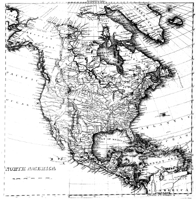
TRANSCRIBER'S NOTES:
Sidenotes have been placed as closely as possible to where they appeared in the original.
Old spellings are retained, e.g. musquitoes, felspar, Esquimaux,
kaiyacks, imbedded, incloses, inclosing, inquiry, inquiries, moveable,
incrusted, trowsers, bivouack, referrible, teazing. Both vallies and
valleys are used interchangably and this has not altered. Names with
suffixes "Mc" or "Mac" written as "M'" throughout text; this
convention is retained.
"a.m." and "p.m." are shown without an internal space—spaces have
been removed where they were present. Usage was inconsistent, perhaps to
improve justification of text. Internal spaces have also been removed
from initials such as R.N., F.R.S., K.G., &c. to improve rewrap
behaviour. Decimal points were occasionally denoted by commas. This
convention is replaced by standard point notation throughout.
Lengthy quotations were denoted by a leading quotation mark in the first
column of each line. They are replaced with standard opening and closing
quotation marks for each quoted passage.
"Dog-Rib" Indians were sometimes referred to as "Dog-rib". Usage is now
"Dog-Rib" throughout.
Specific corrections made to text are listed below. Note that examples
are given after a colon and are the corrected text. All other printer's errors
remain.
| Page | Comment |
| 14,51,79 | "water-proof" changed to "waterproof". |
| 16 | "depot" changed to "depôt". |
| 17 | "Hudsons's Bay Company" corrected to "Hudson's Bay Company".
"bat-/teau" corrected to "bateau" to be consistent with rest of text. Typo was across end of line hyphen. |
| 24 | "Hudson's Bay-Company" corrected to "Hudson's Bay Company". |
| 25 | "was dragged by other eight men" corrected to "was dragged by another eight men". |
| 26 | "Riviere" corrected to "Rivière".
"Hudson" corrected to "Hudson's" |
| 27 | "or" corrected to "on": "live on dried provision". |
| 28 | "depend" corrected to "depends". |
| 29 | "chace" corrected to "chase". Whilst both forms are acceptable for the time, both were used in the book. The change makes everything consistent. See also page 65.
"of" inserted: "under the roof of our hospitable friend". |
| 30 | "Winnipeg" corrected to "Winipeg" to be consistent with rest of manuscript. |
| 32,51 | "northwest" corrected to "north-west" for consistency. |
| 34 | "eastermost" corrected to "easternmost". |
| 39,53,65,96,202 | "day-light" changed to daylight". |
| 42 | "sandbanks" changed to "sand-banks" for consistency with rest of manuscript. |
| 45 | "least" changed to "lest": "lest the Esquimaux should come". |
| 48,51 | "rein deer" corrected to "rein-deer" twice on this page to be consistent with rest of manuscript. |
| 52,299 | "lydianstone" corrected to "lydian-stone". |
| 49 | "Rocky mountains" capitalised to "Rocky Mountains". |
| 52 | "occurence" corrected to "occurrence". |
| 53 | "chissel" changed to "chisel": "ice-chisel".
Inserted comma after "ice-chisel" to correct list punctuation. |
| 54 | "Cannon-shot" changed to "Cannon-Shot" for consistency in place name "Cannon-Shot Reach". |
| 56 | "where-ever" across end of line changed to "wherever" twice on this page. |
| 62 | "skreening" amended to "screening": "screening us from the snow". |
| 65 | "bag-pipes" to "bagpipes".
"chace" corrected to "chase". |
| 70 | "Chepewyan" corrected to "Chipewyan".
"invariable" corrected to "invariably": "the needle almost invariably remained stationary". |
| 77 | "temperature in the shade +8° 5'": odd use of minutes noted. It is not immediately obvious what is intended. |
| 80 | "dimunition" corrected to "diminution". |
| 83 | "canvass" corrected to "canvas": "waterproof canvas". |
| 88 | "aud" corrected to "and": "iron-work, knives, and beads". |
| 92 | "northeast" changed to "north-east". |
| 94 | "Francois" changed to "François". "westermost" changed to "westernmost". |
| 95 | "36' N" changed to "36' N.". |
| 101 | "mall" corrected to "small": "so small a number". |
| 109 | "mases" to "masses": "the larger masses". |
| 111 | "Copper-mine" to "Coppermine": "the Coppermine River".
"tatoed" to "tattoed": "men being tattoed". |
112,119,130,132,
172,173,190 | "oomiacks" changed to "oomiaks". |
| 117 | "liittle" to "little": "our little friend". |
| 122 | "seperated" corrected to "separated". |
| 124 | "ancle" amended to "ankle". |
| 126 | "Dip" made lower-case "dip" since mid-sentence. |
| 129 | "British chain" changed to "British Chain" for consistency. |
| 132 | "visiters" corrected to "visitors". |
| 132,148,152,190 | "oomiack" corrected to "oomiak". |
| 146 | "ice chissel" changed to "ice-chisel". |
| 147 | "and the main, that when" changed to "and the main than when" to correct typos. |
| 148 | "Humphreys" changed to "Humphrys" to be consistent. |
| 156 | "Capitalised start of sentence: "be killed? You are active".
Added closing quotation marks after "depart instantly". |
| 157 | "hair skins" changed to "hare skins" since "their dress consisting principally of hare skins" is noted on page 247. |
| 160 | Degree symbol used instead of minute symbol. Correct form: "latitude 69° 34' & 69° 44' N." |
| 163 | Comma changed to full-stop since it occurs at end of sentence: "white spruce trees. Our voyage amongst these". |
| 166 | "Richard's" changed to "Richards'" since the governor was John Baker Richards.
"island" changed to "Island": "Richards' Island". |
| 167 | Comma changed to full-stop since it occurs at end of sentence: "intimidation and extortion. When the interview".
"kaiyaks" changed to "kaiyacks". |
| 173 | "harassing" changed to "harrassing". |
| 174 | It is unclear whether these Eskimo words were meant to have oe or ae. The printer seems to have used the oe ligature
indifferently for ae, as sometimes happened at this period. Cf. sertulariæ p. 179 etc. And the only such word in non-italic has ae: Narrakazzæ p. 266. At any rate, later
writers certainly seem to have read them all as oe.
"peechaw-ooloo" has a macron (overscore) diacritical mark on its final letter; this has been omitted. |
| 177 | "ice-bergs" changed to "icebergs". |
| 180 | "Wednesday 12th" changed to "Wednesday, 12th" to be consistent with other sidenotes. |
| 184 | "grounded-ice" amended to "grounded ice". |
| 185 | "K'Kinley" corrected to "M'Kinley": "Captain George M'Kinley". |
| 189 | "sine" changed to "side". |
| 190 | "ecstacy" changed to "ecstasy".
"their wide boots" changed to "their wide hoods", cf. pp. 44, 110. |
| 195 | "head-land" changed to "headland". |
| 199 | "preservance" corrected to "perseverance".
"from" changed to "form": "those which form its western shores". |
| 200 | "short-voyage" changed to "short voyage".
Comma changed to full-stop since it occurs at end of sentence: "south-east direction. We landed a little to the eastward". |
| 202 | "head-lands" changed to "headlands". |
| 204 | "closenes" corrected to "closeness". |
| 207 | "lime-stone" corrected to "limestone". |
| 208 | "deers-meat" corrected to "deer-meat". |
| 211 | "semed" corrected to "seemed": "seemed to contain". |
| 214 | "lime-stone" corrected to "limestone". |
| 225 | "several of of them" changed to "several of them". Word was repeated across end of line.
"dimunition" corrected to "diminution": "suffered some diminution". |
| 226 | Comma changed to full-stop since it occurs at end of sentence: "on their route to Bear Lake. The ridges of hill". |
| 227 | "ecstacy" corrected to "ecstasy". |
| 230 | "68" changed to "66": 3 days ago they were at 67° 10', heading SW; the northernmost point of Great Bear Lake is at about 67°. |
| 232 | "Thursday 24th" changed to "Thursday, 24th" to be consistent with other sidenotes.
"I I therefore embarked" changed to "I therefore embarked"; repeat was across line break. |
| 237 | "Krusensten" changed to "Krusenstern" since the latter is used in the rest of the text. |
| 240 | "indvalids" corrected to "invalids". |
| 244 | "extrordinary" corrected to "extraordinary"
"Corona" corrected to "Coronæ". |
| 245 | "+30.5 degrees." changed to "+30.5 degrees,". |
| 246 | "re-appearance" corrected to "reappearance". |
| 257 | "house" changed to "House". |
| 261 | "depots" changed to "depôts". |
| 268 | "sulphat" corrected to "sulphate": "crystals of sulphate of iron". |
| 271 | "moses" corrected to "mosses": "is covered a foot deep, or more, by mosses". |
| 274 | "off" corrected to "of": "at the bottom of the cliff". |
| 278 | "sandsone" corrected to "sandstone". |
| 279 | "sand-stones" corrected to "sandstones".
"oscasionally" corrected to "occasionally". |
| 280 | "clay-stone" to "claystone". |
| 283 | "long;" changed to "long.;". |
| 284 | "formation" corrected to "formations": "similar formations which occupy". |
| 285 | "limetone" corrected to "limestone". |
| 290 | "swells gently into a hill several feet high"; should this be "several hundred feet high"?
"Horn Mountain" changed to "Horn Mountains".
"sienities" changed to "sienites". |
| 293 | "in some, reaches" changed to "in some reaches,".
Footnote 36: "very-fine grained" changed to "very fine-grained". |
| 295 | "specifind" corrected to "specified".
"sphoeroidalis" corrected to "sphæroidalis".
"corbrash" corrected to "cornbrash". |
| 296 | Removed spurious opening quotation mark before "ramparts", thereby balancing quotation marks. |
| 297 | "terrebratula" corrected to "terebratula". |
| 303 | "coasted" changed to "coated". |
| 308 | "othoceratites" changed to "orthoceratites". |
| 318 | "Sowbery" changed to "Sowerby". |
End of the Project Gutenberg EBook of Narrative of a Second Expedition to
the Shores of the Polar Sea, by John Franklin and John Richardson

*** END OF THIS PROJECT GUTENBERG EBOOK NARRATIVE: THE POLAR SEA ***

***** This file should be named 33467-h.htm or 33467-h.zip *****
This and all associated files of various formats will be found in:
        http://www.gutenberg.org/3/3/4/6/33467/

Produced by Carlo Traverso, Adam Styles and the Online
Distributed Proofreading Team at http://www.pgdp.net (This
file was produced from images generously made available
by the Bibliothèque nationale de France (BnF/Gallica) at
http://gallica.bnf.fr)


Updated editions will replace the previous one--the old editions
will be renamed.

Creating the works from public domain print editions means that no
one owns a United States copyright in these works, so the Foundation
(and you!) can copy and distribute it in the United States without
permission and without paying copyright royalties.  Special rules,
set forth in the General Terms of Use part of this license, apply to
copying and distributing Project Gutenberg-tm electronic works to
protect the PROJECT GUTENBERG-tm concept and trademark.  Project
Gutenberg is a registered trademark, and may not be used if you
charge for the eBooks, unless you receive specific permission.  If you
do not charge anything for copies of this eBook, complying with the
rules is very easy.  You may use this eBook for nearly any purpose
such as creation of derivative works, reports, performances and
research.  They may be modified and printed and given away--you may do
practically ANYTHING with public domain eBooks.  Redistribution is
subject to the trademark license, especially commercial
redistribution.


*** START: FULL LICENSE ***

THE FULL PROJECT GUTENBERG LICENSE
PLEASE READ THIS BEFORE YOU DISTRIBUTE OR USE THIS WORK

To protect the Project Gutenberg-tm mission of promoting the free
distribution of electronic works, by using or distributing this work
(or any other work associated in any way with the phrase "Project
Gutenberg"), you agree to comply with all the terms of the Full Project
Gutenberg-tm License (available with this file or online at
http://gutenberg.org/license).


Section 1.  General Terms of Use and Redistributing Project Gutenberg-tm
electronic works

1.A.  By reading or using any part of this Project Gutenberg-tm
electronic work, you indicate that you have read, understand, agree to
and accept all the terms of this license and intellectual property
(trademark/copyright) agreement.  If you do not agree to abide by all
the terms of this agreement, you must cease using and return or destroy
all copies of Project Gutenberg-tm electronic works in your possession.
If you paid a fee for obtaining a copy of or access to a Project
Gutenberg-tm electronic work and you do not agree to be bound by the
terms of this agreement, you may obtain a refund from the person or
entity to whom you paid the fee as set forth in paragraph 1.E.8.

1.B.  "Project Gutenberg" is a registered trademark.  It may only be
used on or associated in any way with an electronic work by people who
agree to be bound by the terms of this agreement.  There are a few
things that you can do with most Project Gutenberg-tm electronic works
even without complying with the full terms of this agreement.  See
paragraph 1.C below.  There are a lot of things you can do with Project
Gutenberg-tm electronic works if you follow the terms of this agreement
and help preserve free future access to Project Gutenberg-tm electronic
works.  See paragraph 1.E below.

1.C.  The Project Gutenberg Literary Archive Foundation ("the Foundation"
or PGLAF), owns a compilation copyright in the collection of Project
Gutenberg-tm electronic works.  Nearly all the individual works in the
collection are in the public domain in the United States.  If an
individual work is in the public domain in the United States and you are
located in the United States, we do not claim a right to prevent you from
copying, distributing, performing, displaying or creating derivative
works based on the work as long as all references to Project Gutenberg
are removed.  Of course, we hope that you will support the Project
Gutenberg-tm mission of promoting free access to electronic works by
freely sharing Project Gutenberg-tm works in compliance with the terms of
this agreement for keeping the Project Gutenberg-tm name associated with
the work.  You can easily comply with the terms of this agreement by
keeping this work in the same format with its attached full Project
Gutenberg-tm License when you share it without charge with others.

1.D.  The copyright laws of the place where you are located also govern
what you can do with this work.  Copyright laws in most countries are in
a constant state of change.  If you are outside the United States, check
the laws of your country in addition to the terms of this agreement
before downloading, copying, displaying, performing, distributing or
creating derivative works based on this work or any other Project
Gutenberg-tm work.  The Foundation makes no representations concerning
the copyright status of any work in any country outside the United
States.

1.E.  Unless you have removed all references to Project Gutenberg:

1.E.1.  The following sentence, with active links to, or other immediate
access to, the full Project Gutenberg-tm License must appear prominently
whenever any copy of a Project Gutenberg-tm work (any work on which the
phrase "Project Gutenberg" appears, or with which the phrase "Project
Gutenberg" is associated) is accessed, displayed, performed, viewed,
copied or distributed:

This eBook is for the use of anyone anywhere at no cost and with
almost no restrictions whatsoever.  You may copy it, give it away or
re-use it under the terms of the Project Gutenberg License included
with this eBook or online at www.gutenberg.org

1.E.2.  If an individual Project Gutenberg-tm electronic work is derived
from the public domain (does not contain a notice indicating that it is
posted with permission of the copyright holder), the work can be copied
and distributed to anyone in the United States without paying any fees
or charges.  If you are redistributing or providing access to a work
with the phrase "Project Gutenberg" associated with or appearing on the
work, you must comply either with the requirements of paragraphs 1.E.1
through 1.E.7 or obtain permission for the use of the work and the
Project Gutenberg-tm trademark as set forth in paragraphs 1.E.8 or
1.E.9.

1.E.3.  If an individual Project Gutenberg-tm electronic work is posted
with the permission of the copyright holder, your use and distribution
must comply with both paragraphs 1.E.1 through 1.E.7 and any additional
terms imposed by the copyright holder.  Additional terms will be linked
to the Project Gutenberg-tm License for all works posted with the
permission of the copyright holder found at the beginning of this work.

1.E.4.  Do not unlink or detach or remove the full Project Gutenberg-tm
License terms from this work, or any files containing a part of this
work or any other work associated with Project Gutenberg-tm.

1.E.5.  Do not copy, display, perform, distribute or redistribute this
electronic work, or any part of this electronic work, without
prominently displaying the sentence set forth in paragraph 1.E.1 with
active links or immediate access to the full terms of the Project
Gutenberg-tm License.

1.E.6.  You may convert to and distribute this work in any binary,
compressed, marked up, nonproprietary or proprietary form, including any
word processing or hypertext form.  However, if you provide access to or
distribute copies of a Project Gutenberg-tm work in a format other than
"Plain Vanilla ASCII" or other format used in the official version
posted on the official Project Gutenberg-tm web site (www.gutenberg.org),
you must, at no additional cost, fee or expense to the user, provide a
copy, a means of exporting a copy, or a means of obtaining a copy upon
request, of the work in its original "Plain Vanilla ASCII" or other
form.  Any alternate format must include the full Project Gutenberg-tm
License as specified in paragraph 1.E.1.

1.E.7.  Do not charge a fee for access to, viewing, displaying,
performing, copying or distributing any Project Gutenberg-tm works
unless you comply with paragraph 1.E.8 or 1.E.9.

1.E.8.  You may charge a reasonable fee for copies of or providing
access to or distributing Project Gutenberg-tm electronic works provided
that

- You pay a royalty fee of 20% of the gross profits you derive from
     the use of Project Gutenberg-tm works calculated using the method
     you already use to calculate your applicable taxes.  The fee is
     owed to the owner of the Project Gutenberg-tm trademark, but he
     has agreed to donate royalties under this paragraph to the
     Project Gutenberg Literary Archive Foundation.  Royalty payments
     must be paid within 60 days following each date on which you
     prepare (or are legally required to prepare) your periodic tax
     returns.  Royalty payments should be clearly marked as such and
     sent to the Project Gutenberg Literary Archive Foundation at the
     address specified in Section 4, "Information about donations to
     the Project Gutenberg Literary Archive Foundation."

- You provide a full refund of any money paid by a user who notifies
     you in writing (or by e-mail) within 30 days of receipt that s/he
     does not agree to the terms of the full Project Gutenberg-tm
     License.  You must require such a user to return or
     destroy all copies of the works possessed in a physical medium
     and discontinue all use of and all access to other copies of
     Project Gutenberg-tm works.

- You provide, in accordance with paragraph 1.F.3, a full refund of any
     money paid for a work or a replacement copy, if a defect in the
     electronic work is discovered and reported to you within 90 days
     of receipt of the work.

- You comply with all other terms of this agreement for free
     distribution of Project Gutenberg-tm works.

1.E.9.  If you wish to charge a fee or distribute a Project Gutenberg-tm
electronic work or group of works on different terms than are set
forth in this agreement, you must obtain permission in writing from
both the Project Gutenberg Literary Archive Foundation and Michael
Hart, the owner of the Project Gutenberg-tm trademark.  Contact the
Foundation as set forth in Section 3 below.

1.F.

1.F.1.  Project Gutenberg volunteers and employees expend considerable
effort to identify, do copyright research on, transcribe and proofread
public domain works in creating the Project Gutenberg-tm
collection.  Despite these efforts, Project Gutenberg-tm electronic
works, and the medium on which they may be stored, may contain
"Defects," such as, but not limited to, incomplete, inaccurate or
corrupt data, transcription errors, a copyright or other intellectual
property infringement, a defective or damaged disk or other medium, a
computer virus, or computer codes that damage or cannot be read by
your equipment.

1.F.2.  LIMITED WARRANTY, DISCLAIMER OF DAMAGES - Except for the "Right
of Replacement or Refund" described in paragraph 1.F.3, the Project
Gutenberg Literary Archive Foundation, the owner of the Project
Gutenberg-tm trademark, and any other party distributing a Project
Gutenberg-tm electronic work under this agreement, disclaim all
liability to you for damages, costs and expenses, including legal
fees.  YOU AGREE THAT YOU HAVE NO REMEDIES FOR NEGLIGENCE, STRICT
LIABILITY, BREACH OF WARRANTY OR BREACH OF CONTRACT EXCEPT THOSE
PROVIDED IN PARAGRAPH 1.F.3.  YOU AGREE THAT THE FOUNDATION, THE
TRADEMARK OWNER, AND ANY DISTRIBUTOR UNDER THIS AGREEMENT WILL NOT BE
LIABLE TO YOU FOR ACTUAL, DIRECT, INDIRECT, CONSEQUENTIAL, PUNITIVE OR
INCIDENTAL DAMAGES EVEN IF YOU GIVE NOTICE OF THE POSSIBILITY OF SUCH
DAMAGE.

1.F.3.  LIMITED RIGHT OF REPLACEMENT OR REFUND - If you discover a
defect in this electronic work within 90 days of receiving it, you can
receive a refund of the money (if any) you paid for it by sending a
written explanation to the person you received the work from.  If you
received the work on a physical medium, you must return the medium with
your written explanation.  The person or entity that provided you with
the defective work may elect to provide a replacement copy in lieu of a
refund.  If you received the work electronically, the person or entity
providing it to you may choose to give you a second opportunity to
receive the work electronically in lieu of a refund.  If the second copy
is also defective, you may demand a refund in writing without further
opportunities to fix the problem.

1.F.4.  Except for the limited right of replacement or refund set forth
in paragraph 1.F.3, this work is provided to you 'AS-IS' WITH NO OTHER
WARRANTIES OF ANY KIND, EXPRESS OR IMPLIED, INCLUDING BUT NOT LIMITED TO
WARRANTIES OF MERCHANTIBILITY OR FITNESS FOR ANY PURPOSE.

1.F.5.  Some states do not allow disclaimers of certain implied
warranties or the exclusion or limitation of certain types of damages.
If any disclaimer or limitation set forth in this agreement violates the
law of the state applicable to this agreement, the agreement shall be
interpreted to make the maximum disclaimer or limitation permitted by
the applicable state law.  The invalidity or unenforceability of any
provision of this agreement shall not void the remaining provisions.

1.F.6.  INDEMNITY - You agree to indemnify and hold the Foundation, the
trademark owner, any agent or employee of the Foundation, anyone
providing copies of Project Gutenberg-tm electronic works in accordance
with this agreement, and any volunteers associated with the production,
promotion and distribution of Project Gutenberg-tm electronic works,
harmless from all liability, costs and expenses, including legal fees,
that arise directly or indirectly from any of the following which you do
or cause to occur: (a) distribution of this or any Project Gutenberg-tm
work, (b) alteration, modification, or additions or deletions to any
Project Gutenberg-tm work, and (c) any Defect you cause.


Section  2.  Information about the Mission of Project Gutenberg-tm

Project Gutenberg-tm is synonymous with the free distribution of
electronic works in formats readable by the widest variety of computers
including obsolete, old, middle-aged and new computers.  It exists
because of the efforts of hundreds of volunteers and donations from
people in all walks of life.

Volunteers and financial support to provide volunteers with the
assistance they need, are critical to reaching Project Gutenberg-tm's
goals and ensuring that the Project Gutenberg-tm collection will
remain freely available for generations to come.  In 2001, the Project
Gutenberg Literary Archive Foundation was created to provide a secure
and permanent future for Project Gutenberg-tm and future generations.
To learn more about the Project Gutenberg Literary Archive Foundation
and how your efforts and donations can help, see Sections 3 and 4
and the Foundation web page at http://www.pglaf.org.


Section 3.  Information about the Project Gutenberg Literary Archive
Foundation

The Project Gutenberg Literary Archive Foundation is a non profit
501(c)(3) educational corporation organized under the laws of the
state of Mississippi and granted tax exempt status by the Internal
Revenue Service.  The Foundation's EIN or federal tax identification
number is 64-6221541.  Its 501(c)(3) letter is posted at
http://pglaf.org/fundraising.  Contributions to the Project Gutenberg
Literary Archive Foundation are tax deductible to the full extent
permitted by U.S. federal laws and your state's laws.

The Foundation's principal office is located at 4557 Melan Dr. S.
Fairbanks, AK, 99712., but its volunteers and employees are scattered
throughout numerous locations.  Its business office is located at
809 North 1500 West, Salt Lake City, UT 84116, (801) 596-1887, email
business@pglaf.org.  Email contact links and up to date contact
information can be found at the Foundation's web site and official
page at http://pglaf.org

For additional contact information:
     Dr. Gregory B. Newby
     Chief Executive and Director
     gbnewby@pglaf.org


Section 4.  Information about Donations to the Project Gutenberg
Literary Archive Foundation

Project Gutenberg-tm depends upon and cannot survive without wide
spread public support and donations to carry out its mission of
increasing the number of public domain and licensed works that can be
freely distributed in machine readable form accessible by the widest
array of equipment including outdated equipment.  Many small donations
($1 to $5,000) are particularly important to maintaining tax exempt
status with the IRS.

The Foundation is committed to complying with the laws regulating
charities and charitable donations in all 50 states of the United
States.  Compliance requirements are not uniform and it takes a
considerable effort, much paperwork and many fees to meet and keep up
with these requirements.  We do not solicit donations in locations
where we have not received written confirmation of compliance.  To
SEND DONATIONS or determine the status of compliance for any
particular state visit http://pglaf.org

While we cannot and do not solicit contributions from states where we
have not met the solicitation requirements, we know of no prohibition
against accepting unsolicited donations from donors in such states who
approach us with offers to donate.

International donations are gratefully accepted, but we cannot make
any statements concerning tax treatment of donations received from
outside the United States.  U.S. laws alone swamp our small staff.

Please check the Project Gutenberg Web pages for current donation
methods and addresses.  Donations are accepted in a number of other
ways including checks, online payments and credit card donations.
To donate, please visit: http://pglaf.org/donate


Section 5.  General Information About Project Gutenberg-tm electronic
works.

Professor Michael S. Hart is the originator of the Project Gutenberg-tm
concept of a library of electronic works that could be freely shared
with anyone.  For thirty years, he produced and distributed Project
Gutenberg-tm eBooks with only a loose network of volunteer support.


Project Gutenberg-tm eBooks are often created from several printed
editions, all of which are confirmed as Public Domain in the U.S.
unless a copyright notice is included.  Thus, we do not necessarily
keep eBooks in compliance with any particular paper edition.


Most people start at our Web site which has the main PG search facility:

     http://www.gutenberg.org

This Web site includes information about Project Gutenberg-tm,
including how to make donations to the Project Gutenberg Literary
Archive Foundation, how to help produce our new eBooks, and how to
subscribe to our email newsletter to hear about new eBooks.