THE BEAUTIES
OF THE
STATE OF WASHINGTON
by HARRY F. GILES—Deputy Commissioner
STATE BUREAU STATISTICS & IMMIGRATION
I.M. HOWELL—Secretary of State-Ex-Officio Commissioner.
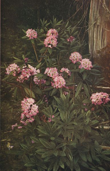 THE RHODODENDRON, WASHINGTON'S STATE FLOWER
| Page | |
| List of Full Page Illustrations | 3 |
| The Evergreen State | 5 |
| Our Mountains | 9 |
| Washington Forests | 15 |
| The Climate | 19 |
| Puget Sound | 25-38 |
| Ideal for Yachting and Cruising | 29 |
| Hood Canal | 29 |
| Other Trips | 31 |
| Commerce | 32 |
| The East Shores | 32 |
| The Islands | 33 |
| San Juan Group | 33 |
| Whidby Island | 36 |
| Other Islands | 36 |
| Olympic Peninsula | 38 |
| The Harbor Country | 40-48 |
| Grays Harbor | 43 |
| Willapa Bay | 46 |
| Mount Rainier National Park | 49 |
| The Columbia River | 54 |
| The Inland Empire | 63-80 |
| Chief Features | 64 |
| How to Reach Them | 64 |
| The Yakima Valley | 65 |
| The Wenatchee Valley | 67 |
| Lake Chelan | 68 |
| The Okanogan Highlands | 70 |
| The Spokane Country | 75 |
| The Wheat Plateau | 79 |
| The Walla Walla Country | 80 |
| The Columbia River | 80 |
| Our Scenic Highways | 81-89 |
| The Pacific Highway | 81 |
| Sunset Highway | 84 |
| Inland Empire Highway | 86 |
| Olympic, National Park, and Other Highways | 89 |
| A Sportsman's Paradise | 91 |
| Cities and Suggested Trips | 95 |
| Alaska—Our Ally | 112 |
| Map Showing Principal Highways |
| Cover Design (a water color) | Miss Zola F. Gruhlke | |
| Engravings | By Western Engraving & Colortype Co., Seattle | |
THREE-COLOR HALFTONES. | ||
| Title. | Photographer. | Page |
| The Rhododendron (C.) | Asahel Curtis | Frontispiece |
| Lake Chelan (C.) | Kiser Photo Co. | 8 |
| A Forest Stream | Curtis & Miller | 16 |
| A Puget Sound Sunset | Webster & Stevens | 32 |
| Mount Rainier and Mirror Lake (C.) | Curtis & Miller | 49 |
| Sunnyside Canal (C.) | Asahel Curtis | 64 |
| Priest Rapids | 80 | |
| Columbia River from White Salmon (C.) | Kiser Photo Co. | 96 |
ONE-COLOR HALFTONES. | ||
| Deep Lake | Curtis & Miller | 4 |
| Snoqualmie Falls (C.) | Romans Photo Co. | 6 |
| Mount Baker (Gr.) | 10 | |
| Looking Across the Cascades (C.) | Kiser Photo Co. | 12 |
| Principal Trees in Washington | C. H. Ziddell | 14 |
| Lumber Industry (Gr.) | 18 | |
| Sunset Falls and Mount Index (C.) | Asahel Curtis | 21 |
| Yachting on Puget Sound (Gr.) | 23 | |
| Bremerton Scenes (Gr.) | 24 | |
| Tacoma and The Mountain | Avery & Potter | 27 |
| Eastern Shores of Puget Sound (Gr.) | 28 | |
| Seattle and The Olympics | Curtis & Miller | 30 |
| San Juan Islands (Gr.) | J. A. McCormick | 34 |
| Olympic Mountain Scenes (Gr.) | 37 | |
| Lake Crescent | Curtis & Miller | 39 |
| The Chehalis River (C.) | Asahel Curtis | 41 |
| Southwest Washington Views (Gr.) | 44 | |
| Surf on Washington Coast (C.) | Asahel Curtis | 47 |
| Mount Rainier National Park (Gr.) | 51 | |
| Mount Rainier and Lake Washington (C.) | W. P. Romans | 53 |
| Along the Columbia River (Gr.) | 56 | |
| Salmon Fishing Industry (Gr.) | 58 | |
| Snake River Country | Asahel Curtis | 60 |
| Rock Lake | Curtis & Miller | 62 |
| The Yakima Valley | Curtis & Miller | 66 |
| The Wenatchee Valley | Curtis & Miller | 69 |
| The Okanogan and Methow (Gr.) | 71 | |
| Irrigation Scenes (Gr.) | 73 | |
| City of Spokane | Frank Palmer | 74 |
| Wheat Fields (Gr.) | 76 | |
| Walla Walla Scenes (Gr.) | 78 | |
| Along the Scenic Highways (Gr.) | 82 | |
| Olympia, Our Capital City (Gr.) | B. C. Collier | 85 |
| Spokane Falls and Bridge | Frank Palmer | 87 |
| Wild Elk in The Olympics (C.) | Grant Humes | 90 |
| The Angler's Reward | B. C. Collier | 92 |
| Spokane Scenes (Gr.) | 94 | |
| Our Leading Educational Institutions (Gr.) | 99 | |
| Our Earliest Pioneers (Gr.) | 102 | |
| Seattle's Boulevards (Gr.) | 105 | |
| Tacoma's Parks (Gr.) | 108 | |
| Alaska, Land of the North (Gr.) | 111 | |
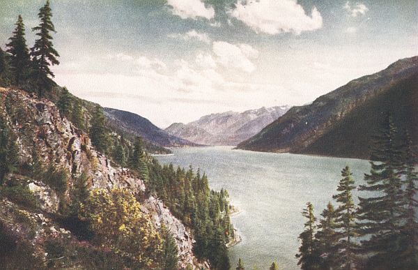
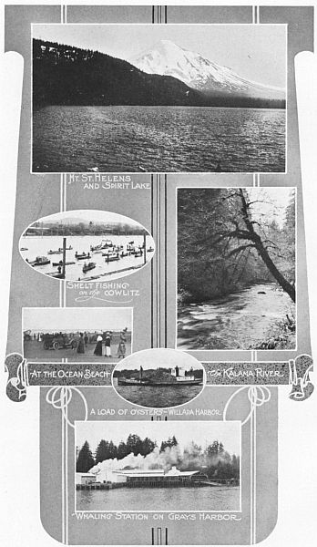
 DEEP LAKE—A TYPICAL SCENE IN THE CASCADE MOUNTAINS.
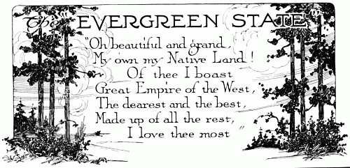
The state of Washington, most northwesterly state in the Union, named for the "Father of His Country" and popularly called the "Evergreen State," brings greetings.
For all who would behold, at close range, Nature in her most beautiful expression when all component elements have been harmoniously combined, these words of welcome are written. You are invited to come and share the joy that emanates from the satisfaction of living in a country as nearly perfect as any that earth has to offer.
In the creation of this region nothing was overlooked that might appeal to the most fastidious. An empire within itself, it is provided with all things for ministering both to man's physical needs and to his innermost longings. All forces have contributed towards its glory. More careful preparation was never made for the coming of man in any clime. Mountains that reach to heaven and echo the music of celestial choirs in their innumerable streams and waterfalls; valleys and plateaus that spring into life when pricked by the harrow of the husbandman; forests of big trees, perpetually green, to adorn and protect; the greatest of oceans to temper with its breezes; inland seas and azure lakes to embellish and attract—such are a few of the elements that make the State of Washington and provide beauteous homes for its people.
Have you yet discovered that cozy retreat imagined in your youthful impressionable days, where true happiness is bound to reign? You can find it here—a place where wonderful pictures, real and far grander than the famous paintings of your favorite[7] artist, are constantly visible from your kitchen window or from your work shop—and they need no expensive frames to enhance their loveliness and no dusting to prevent their obscurity.
What are your favorite pastimes? Are you one of the brave mountaineers who must yearly draw near the Almighty, and dare the elements by treading dangerous yet entrancing trails to heights where the world appears at your feet? Do you love to cruise in a little yacht built to accommodate yourself and a few well chosen friends, or motor over scenic highways to places of interest both near and far? Do you regard yourself a mighty hunter and desire so to convince your friends? Or would you be content to angle for the finny denizens of the deep with a certainty that you will not in turn be tantalized?
The state of Washington affords unusual opportunity for all these. Its mountains, glaciers and waterfalls are not excelled by the most boasted scenes of Switzerland.
Almost the year round the waters of Puget Sound and the harbors of the southwest invite the small craft. Nearly 50,000 miles of scenic highway, passable for twelve months in succession, are ready for your automobiles. Game, both large and small, feathered and hoofed, will lure you through many a jungle of delicate fern and sweet scented bramble; while countless streams and lakes teem with fish of many species.
Picturesque parks, dazzling sunsets, roaring ocean surf, cozy camping sites, beach parties and clam bakes, college regattas,[8] midwinter fairs, roses at Christmas, golf the year round on turf that's always green—these are a few of the charms that are as common in the state of Washington as sands in the Sahara, or ice at the Poles.
If you are drawn by none of these, but desire only to satisfy that exalted yet mysterious feeling which lurks in everyone's breast, becoming manifest when the greatest works of the firmament are beheld, then by all means visit this the "Evergreen State" and drink in the glories which no book, howe'er so well written, and no picture, whoe'er the artist, can portray with any degree of fullness or accuracy.
Washington is a region of variety and strong contrasts. At one moment you may be jostled along the streets of some metropolitan center among people of many nationalities and within a mere hour or so be wafted to a sequestered spot of transcendent beauty, where no voice but your own is echoed by the hills and where the existence of any other human being to share this planet can be completely forgotten.
It is a state of large accomplishments. Big projects are planned: mammoth irrigation schemes are carried out; lands are reclaimed from the deep; orchards fill its valleys; wheat plateaus extend for miles; salmon traps line the shores; its lumber supplies the world; its ships sail all the seas; monstrous bridges cross the waterways; buildings vie with the highest anywhere constructed; its schools rank first in the Union; its men contribute to the world's greatness; its women vote and rear capable families; the people make their own laws. Loyalty, originality, enterprise, independence and liberality, all attributes of the western spirit, are evident throughout the state.
Its population has grown in twenty odd years from 343,000 to over 1,400,000. In the meantime, wildernesses have been converted into gardens, villages have developed into towns, while towns have grown into cities, taking their places among the leading marts of the world. From a frontier state it has come to be one of the greatest and most important in the Union, adding to the galaxy of stars one of the brightest that has yet appeared on the horizon.
 LAKE CHELAN, ONE OF THE MOST WONDERFUL LAKE RESORTS IN THE WEST
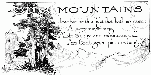
Perhaps the most prominent feature which attracts the eye of a visitor upon his arrival in the Pacific Northwest consists of the mountain ranges with their towering snowcapped peaks, forming, as it were, ladders reaching from the green vales of earth to the blue vaults of heaven. Silhouetted against the sky in the hazy distance, they are noted by the westward bound traveler as soon as he reaches the highest point in the divide of the Rockies, while to the mariner groping his way eastward upon the Pacific Ocean they offer the first evidence of the nearness of the welcome land.
These mountains mean much to the state of Washington, both for their scenic grandeur and for the favorable influence they exert on the climate and on the lives of the people who build their homes in the valleys below. Their supremacy is reflected by the thermometer, the barometer, and the aerometer; for they help regulate the temperature, the rainfall, and the wind's velocity. They form great repositories for the waters that feed the streams and keep full the cities' aqueducts. Within their immeasurable depths lie buried huge deposits of precious and useful metals, besides vast fields of bituminous coal. Their lower zones provide fertile and safe localities for the growth of Washington's big timber, while the alpine meadows above secure for the timid deer and ptarmigan asylums of temporary freedom from too frequent disturbance by prowling huntsmen. Still higher are the rugged bare prominences, reserved for the wild goat or mountain sheep, and the snow fields traversed by the more venturesome seeking to gain the summits. Everywhere the true sportsman finds ample opportunity for proving his[11] prowess, while trailing the beast to its lair, and the sight-seeking mountaineer is fully rewarded for all the struggle required to reach some dizzy height.
Within the immense bosoms of these mountains nestle innumerable lakes, beauteous beyond compare, near whose shady shores is many a sequestered spot, most tempting to the camper who loves the mountain region; and many a brook goes trickling over its stony course to join the rivers below, pausing here and there in some shady dell to create a deep pool for luring the fisherman, or hurling itself over some lofty precipice as a waterfall of wonderful magnitude and magnificence.
The mountains are a link connecting us with the past. They remind us perhaps of the period when volcanoes belched forth their fiery refuse, or of the era when the sea covered most of what is now land. Indestructible they stand and their rocky heights are in places insurmountable. The works of man trespass everywhere else, but these huge pillars of the ages rise in their majestic splendor and with sublime dignity seem to say: "Thus far and no further! We will preserve and guard your water and fuel supply. We will protect you from the furies of the elements and produce materials for building your palaces. We will create charming nooks where you may camp under the clear sky, and shady forests where you may pursue the chase. We will fill the brooks with swift darting fish; carpet the meadows with myriads of flowers, ferns, and shrubs; and paint you pictures undreamt of by men who have scorned our acquaintance. You are permitted to build roads whereby your Pullmans and your automobiles may cross to the other side, but not one of our number shall be moved nor its form be changed in the least, except by that same invisible power at whose mighty will we were brought into existence."
Each mountain range possesses its own distinct characteristics. Of least importance, but none the less beautiful, are the Blue Mountains in the southeastern corner of the state, providing pleasant summer retreats for the people in that vicinity. The Olympic range practically envelopes the Olympic Peninsula and all but encroaches upon the agricultural lands lying between the foothills and the salt waters on three sides.[13] In this range are the most rugged mountains in Washington, presenting some of the wildest and most inspiring scenery anywhere to be found.
Most prominent and of greatest importance in the geography of the state are the Cascades, having an average altitude of from 5,000 to 8,000 feet and named for the many hurrying streams that have cut their deep courses upon the shady slopes. They extend from the British Columbia line slightly southwest until divided by the Columbia river, whence they continue through Oregon and become the Sierra Nevadas of California. By them the state of Washington is separated into two quite distinct parts, known as Eastern and Western Washington, the former comprising a portion of the great Inland Empire. Forming a sort of spur on their east side, north of the Columbia, and extending to the mountains of Idaho are the beautiful rolling hills known as the Okanogan Highlands from 5,000 to 6,000 feet in altitude without sharp abrupt prominences and bearing on their higher surfaces forests of pine.
Throughout the Cascade range several prominent peaks tower above the others like giants among dwarfs. The loftiest by far is Mount Rainier (or Mount Tacoma), second highest mountain in the United States proper, 14,408 feet in altitude and the chief mountain resort out of Seattle and Tacoma; Mount Adams, 12,307 feet, on the boundary line of Skamania and Yakima counties; Mount St. Helens, 9,697 feet high, at the western edge of Skamania county, reached from Castle Rock or Vancouver; Mount Baker, 10,730 feet, forty miles from Bellingham and one of its main attractions; Mount Stuart, 9,470 feet, in Chelan county; and Glacier Peak, 10,436 feet, in Snohomish county. In this latitude 7,500 feet is the snow-line, but Washington has many peaks above that elevation. Fifty-seven have already been named and measured.
All these peaks are accessible and, together with Mount Olympus in the Olympics, constitute the main goals of the mountain loving clubs of the northwest. Mountain phenomena are displayed in all with a maximum degree of grandeur, insuring ample reward to those venturing to explore their many fastnesses.[14]
 A FIR, A CEDAR, AND A HEMLOCK—PRINCIPAL TREES IN WASHINGTON.
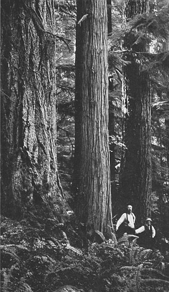
Dense forests of evergreen trees almost envelop the hills and mountains of the state of Washington. Scarcely any portions were originally left bare, excepting the higher peaks, which in a spirit of independence seem to have pushed their bald heads up and above this beautiful covering protecting the regions below. Into the fertile valleys and along the river banks clear to the sea the stately ranks of these forests once advanced, but such localities are now, for the most part, given over to the cities and the husbandmen or else in a state of semi-transformation are awaiting the day when they too will be devoted to the peaceful pursuits of agriculture; for the broad Columbia plain was the only part of the state dedicated from the first to the sole task of producing food supplies rather than fuel and building material.
About ten million acres of these forests have been locked up in eleven national reserves, and set aside for our future needs, or to insure permanent haunts where Nature may always be seen in her full pristine glory—Conservation! Nearly six million acres more are under private ownership. Investigation reveals evidences that their birth occurred very many years ago, possibly five hundred or even six hundred years; for that many rings have been counted on some of the largest trees. The foliage appears every month in the year just as beautiful as when it first mingled with the landscape—hence the name "Evergreen State."
The effect produced by this verdant growth upon the scenery of the state of Washington can be best realized by climbing[16] to one of the heights overlooking the timber line. From here one can readily see how perfectly it hides every blemish of the irregular contour, blending beautifully with the blue waters in the distance and the pale clouds floating above. Thousands of greenish tints are distinguishable, shading from a light yellowish tinge to a deep prismatic blue, while occasionally a streak of bright red or a touch of pure white lends a striking contrast.
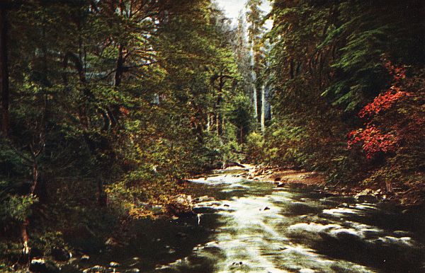
Leaving the point of vantage, however, to delve into its midst, breathing in the aromatic odors from the balsams and cedars, it is easy to note hundreds of interesting distinctions in size, form, color, and variety, for
These sturdy monarchs have all been honored with names and thoroughly worthy of their names they are, without a blemish to mar their fame in spite of the ages through which they have lived. Most prominent is the Douglas Fir, or Douglas Spruce (Pseudotsuga taxifolia), the giant of the forest, growing erect as a plumb-line until it ends in a pyramidal crown two hundred feet or more above the ground. This is the most important tree of the state, for its product houses the people, and for the past ten years has insured Washington first place in lumber production in the United States. Some of the largest trees reach the enormous proportions of eight, ten, and even twelve feet in diameter, a single one producing material sufficient to build a palace of huge dimensions.
Of great importance also is the "Red Cedar," reaching sometimes a height of 200 feet and having a diameter in rare cases of over 20 feet; yielding for the state of Washington two-thirds of all the shingles produced in the United States. Similar to the Cypress, its sweet soporific scent is everywhere conspicuous and always pleasing. Other trees which provide lumber and add grace to the Washington woods are the hemlocks, spruces,[17] larches, and white firs, in the western part of the state; and the pines and tamaracs in a number of the eastern counties.
Many other species, of minor commercial value, are sprinkled throughout the forest in sufficient plentifulness to complete the artistic design. There are the wide-leafed maples; the red barked madronas; the pale barked quivering cottonwoods and their allies, the bitter tasting willows; the white flowered dogwood, prominent throughout the forests until late in the spring, and occasionally found blooming in the fall; the gray barked alder protecting the springs and mountain streams; the sturdy oaks, skirting the gravelly prairies; the long lived juniper; and the hardy Scotch broom; besides various other trees and shrubs. Many of these are so beautiful that landscape gardeners find nothing more suitable for decorating lawns or lining the city parks and boulevards.
Here and there are many trees, shrubs and vines that seem to have been destined especially to yield food for the natural wanderers of the forests; for it is intended that nothing shall be wanted in the state of Washington. There is probably no other section of the world where wild berries grow in greater profusion. Very prominent is the wild cherry, the wild apple, the salmon berry, the thimble berry, the huckleberry, the salal berry, the Oregon grape, the blackberry, the strawberry, the wild currant, and the raspberry.
Hiding within the shade of these, playing hide and seek with nature lovers who enjoy threading the romantic trails for which this section of the world is noted, is many a modest flower which in some sections blooms nearly the whole year round, so soft is the climate; while the pink petaled rhododendron, of bolder nature, Washington's state flower, is prominent in June tossing its beautiful head among the dry logs and lining the course of many a pretty driveway.
Penetrating everywhere and saturating the atmosphere with its sweetness, may be heard the music of some rippling stream winding its happy way down the mountain side and playing, as it were, an accompaniment to the duets of soul mated song birds unable to restrain their songs of joy. If this is a wilderness then a wilderness is a paradise on earth.[18]
People considering a change of residence or a vacation trip are always interested in the climate of the locality attracting their attention, for they know that absolute contentment in any clime, even for a brief period, is impossible without a friendly attitude on the part of the elements. So many regions seem to have been permanently blighted by conditions opposed to human happiness, or at least to have been forgotten in certain important essentials when Nature was passing round her favors.
The state of Washington, however, received a full share of climatic blessings as well as scenic beauties. Without extremes either of heat or cold its climate is as temperate as that of southern England—a most remarkable fact when one realizes that its latitude is higher than that of the state of Maine and its northern boundary line corresponds to that of North Dakota and Minnesota. Such equability is caused chiefly by the protecting mountains and their dense forests together with the breezes blowing direct from the ocean and warmed by the mysterious Japan Current.
So uniform is the general temperature, excepting in the mountainous regions, that the same weight of clothing is by many found sufficient the year round. In every section there is a long growing season and only a short mild winter, known on the west side as the "rainy season." There is never danger from blizzards or intense "cold waves," for these are deflected to the country east of the Rockies. Trees retain their green foliage the year round; in most parts there is usually some pasture available every month; and in certain sections many varieties of[20] flowers will be found blooming outdoors in January. Cattle may be turned loose almost any day in the year and the farmer is saved the necessity of spending all his summer's profits in order that his livestock will not starve during a long cold period. The lowest monthly normal temperature, as deduced from a period of years, is for Seattle, 39°; Spokane, 27°; and Walla Walla, 33°. Contrast these with the normal temperatures of the following cities for the same month: Duluth, 10°; St. Paul, 12°; Des Moines, 20°; and Chicago, 24°.
The summers may be considered ideal. A breeze is generally stirring. There are no sunstrokes, for even in the warmest parts the dryness of the atmosphere favors evaporation. The nights are everywhere cool. When millions in other climes are rolling about in their torturous beds, struggling for the relief that sleep alone can impart, the Washingtonian doffs his clothes, tucks himself comfortably between his cozy quilts, and is soon wafted into the land of nod from which he awakes in the morning refreshed and ready for life's battle.
| June | July | Aug. | Sep. | Sum'r | |
| Puget Sound District | 57 | 62 | 61 | 57 | 59 |
| Seattle | 60 | 64 | 63 | 58 | 61 |
| Tacoma | 58 | 63 | 63 | 57 | 60 |
| Spokane | 63 | 69 | 68 | 59 | 65 |
| Chicago | 66 | 72 | 71 | 64 | 68 |
| New York City | 69 | 74 | 73 | 66 | 70 |
| Boston | 66 | 72 | 70 | 63 | 68 |
| Washington, D. C. | 73 | 77 | 75 | 68 | 73 |
| Philadelphia | 72 | 76 | 74 | 68 | 72 |
The summers, too, are particularly free from excessive rainfall, such as discomforts the people in eastern cities during those months and causes so many disappointments; for 80 per cent of our precipitation occurs between October 15th and May 15th, and 75 per cent between sunset and sunrise, so that the pleasures of the day are seldom marred.
The heaviest fall of moisture occurs on the mountain slopes while the valleys, where the people make their homes, have no more than enough to produce a vigorous plant growth. The[21] average for the year on Puget Sound is about the same as in Chicago and only three-fourths as much as in New York or[22] Boston. The Cascade Mountains prevent as high a precipitation in the eastern counties where it corresponds more to that of California.
The normal annual precipitation during a 36 year period, according to the government statistics, was for Seattle, 36.6 inches; Spokane, 18.8 inches; Walla Walla, 17.7 inches; Chicago, 33.3 inches; New York, 44.6 inches; Jacksonville, 53.2 inches; Kansas City, 37.4 inches; Boston, 43.3 inches; Los Angeles, 15.6 inches; and San Francisco, 22.3 inches.
| June | July | Aug. | Sep. | Sum'r | |
| Puget Sound District | 1.59 | 0.67 | 0.74 | 2.01 | 5.01 |
| Seattle | 1.41 | 0.61 | 0.46 | 1.98 | 4.46 |
| Tacoma | 1.97 | 0.69 | 0.66 | 2.79 | 5.91 |
| Spokane | 1.61 | 0.67 | 0.48 | 1.01 | 3.8 |
| Walla Walla | 1.2 | 0.4 | 0.4 | 0.9 | 2.9 |
| Chicago | 3.52 | 3.62 | 3.02 | 3.06 | 13.22 |
| New York City | 3.41 | 4.08 | 4.38 | 3.44 | 15.31 |
| Boston | 3.14 | 3.51 | 4.15 | 3.44 | 14.24 |
| Washington, D. C. | 3.74 | 4.34 | 4.98 | 3.25 | 16.31 |
| Philadelphia | 3.27 | 4.14 | 4.69 | 3.36 | 17.46 |
The same forces that affect the temperature and precipitation also offer protection against the extraordinary meteorological occurrences that so often terrorize the people in more exposed regions. "The Weather Bureau has no authentic record of a real tornado anywhere in the state of Washington" says G. N. Salisbury, Washington Section Director of the U. S. Weather Bureau. Violent thunderstorms are in most parts unknown. Loss of life never occurs from any of these causes. The atmosphere is always pure and salubrious and the death rate is lowest of all states in the Union, while its two largest cities have the lowest death rate of all cities in the United States, having a population of 100,000 or over.
After all has been said it were best to come and see. Spend a season where no dreary winters will engender melancholy while waiting for a lingering spring, and where no sizzling heat will threaten prostration. Come to a state that is as free as possible from the ills of unfriendly phenomena, and where one beautiful day passes into the next as a pleasant dream shades into the sweetest realities of life.[23]
One glorious expanse of calm picturesque water is the great inland sea known as Puget Sound, extending from the Strait of Juan de Fuca far into the interior of the state of Washington. If the Strait mentioned, together with Hood Canal and a portion of the Strait of Georgia are included, and they will be in this article, nearly 2,000 square miles of mirror like surface are encompassed within the green wooded shore lines of as many lineal miles. With sinuous arms, these waters reach in every direction, reflecting in their depths sometimes the lofty mountains, at other times gardens and farms of unusual attractiveness, and again the modern cities located upon the shores.
Almost everywhere have been sprinkled pretty emerald isles beckoning with all the lure of nature, while tree bedecked peninsulas shelter hundreds of cuddling coves. Near the dividing shore line the "tide lands" reach out from the sunny beaches and supply a sort of neutral ground, enjoyed now by the clam diggers or oyster culturists and again claimed by the enveloping waters.
Rising gently from the water's edge broad areas of fertile lands, which have been released from their forest burdens, are now devoted to the pursuits of husbandry and yield liberally to feed the multitudes dwelling in the neighboring large cities. Here and there patches of virgin growth in primeval splendor may still be seen, but usually, excepting in the Hood Canal region, the forests have been forced back to the foot hills, leaving in their wake the so-called logged-off areas which are in turn rapidly giving away to meadows and orchards. Further back[26] to the east and west the mountains stand guard, while innumerable streams with incalculable water power pierce their sides, transect the lower levels, and pour the sweets of the mountainous regions out into the salts of the deep.
Occasionally rocky bluffs or promontories stand boldly out of the water, and command the view for miles in every direction. Pictures are everywhere presented which reproduced on canvass would insure the immortality of any artist. Altogether the region presents the likeness of one vast kingly garden where every plant that will grow is nurtured and all wonders combine to enchant the visitor.
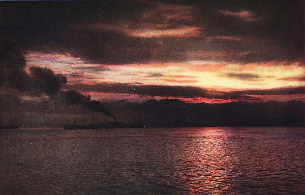
 SUMMER TIME PLEASURES.
This beauteous sea is not locked away behind impenetrable bulwarks of mountain walls, like many of nature's wonders, but is at the very door of the people and enjoyed by them while going about their daily tasks. Nearly a million human beings look out upon its placid waters and rejoice at their good fortune in being permitted to play, as it were, upon its banks, and to feel the tender caresses of the soft whispering breezes that make the region such a pleasure ground in summer, and a haven in winter—and there is room for ten times as many to make their homes where these same joys may be experienced.
Not in the lifetime of an individual, nor even in the period required for the most extravagant display of human skill, was this great pleasure resort created. Ages elapsed, say geologists, between the rising of the waters that "drowned" the rivers once flowing where now the Sound reposes and the advent of the glaciers which deposited the fertile sediment to nourish the luxuriant growth appearing on every hand.[27]
 TACOMA, THE CITY WITH A SNOW-CAPPED MOUNTAIN IN ITS DOOR YARD.
One can pass the entire summer on Puget Sound without seeing a bit of rough weather. The largest ocean liners ride here safe from the storms that pound sometimes against the outer coast line; for its waters compose one great harbor, protected by the forests and mountains. One may see "Uncle Sam's" powerful fighting machines almost any day steaming toward Bremerton, one of the U. S. Naval Stations, where the largest dry dock owned by the U. S. Government is located.
But this peaceful body of water is not for the big vessels alone. It could not have been improved if created especially for the yacht, the motor launch, the row boat and even the venturesome canoe. Upon its surface is held many a local speed contest, and the annual power boat race is run from Ketchikan, Alaska, to Seattle. Conditions here are ideal for the college regatta and for the difficult feats of the hydroplane. During festive days many important events are pulled off, while the happy spectators, dressed in holiday attire, are crowded along the water's edge or perched on the ridges and house tops above.
For cruising, no waters in the world offer such advantages—never threatened by tempests and always within reach of some of nature's most glorious beauty spots. Landing places suitable for camps are easily found, from which short inland excursions may be made through alpine meadows by winding trails to the summit of some mountain or to the shores of some peaceful lake.
Those who are not fortunate enough to have their own craft are not necessarily deprived of enjoying these waters; for regular passenger steamers, of ample capacity and stately appearance make regular trips throughout the year from every city on its shores to nearly every other part of the Sound; while special summer time excursions are made from the metropolitan centers to all the principal points of interest on Puget Sound and to the cities of British Columbia and Alaska.
The waters that put one in closest touch with the mountains are in the narrow channel, or fiord, known as Hood Canal, extending southwesterly and bending back into the heart of the[31] Kitsap Peninsula. Tourists riding over these waters for the first time are elated with the splendors, and the frequent visitor never tires of the inspiring scenes that everywhere greet the eye. The eastern shores reveal the neat farms and settlements in Kitsap and Mason counties, while the western edge is at the very foot of the Olympic range, whose white serrated ridges are continually visible from the deck of a passing steamer. Easily distinguishable also are the deep canyons cut by the several main streams working their way towards the canal, plunging over rocky cliffs and creating falls of exquisite beauty. The Little and Big Quilcene, the Dusewallips, the Duckabush, the Hamma Hamma, and the Lilliwago, are some of the mountain streams whose canyons with rugged trails are familiar to those making frequent pilgrimages thither.
 A BUSINESS SECTION IN SEATTLE—ELLIOTT BAY AND THE OLYMPIC MOUNTAINS BEYOND.
Other attractive places are Lake Cushman, a mountain summer resort reached from Hoodsport, and the rich Skokomish valley containing the Indian reservation of the same name. At Union City one may take the stage over a well traveled road through groves and vales to Shelton, county seat of Mason county, where regular steamers connect with all Puget Sound points—thus encircling the Kitsap Peninsula.
Equally delightful are the little voyages over the main traveled waters of the Sound from Seattle or Tacoma to Olympia and Shelton, to Bremerton, Everett, Bellingham, Anacortes, Port Townsend, and Port Angeles; also out to the ocean or through the San Juan Islands to Victoria and Vancouver in British Columbia. The mountains are always in sight although not so close as on the Canal trip, and there passes a continual procession of groves, hills, pebbly beaches, rocky palisades, gardens, orchards, green meadows, and summer homes.
Entrancing is the view at the sun's rising or setting when a myriad shades of reddish and bluish tints are painted on the hovering clouds, which assume various grotesque shapes above the shimmering waters; and even at night time when threading the channel marked by the twinkling beacon lights, or entering[32] the harbor of a city resplendent with thousands of glittering incandescents.
Besides scenes that appeal chiefly to the esthetic are many that suggest the state's commercial importance, for these waters produce many million dollars worth of fish each year, and the neighboring shores have the largest saw mills in the world, supplying a big share of the 4,000,000,000 feet of lumber which is Washington's annual contribution and insures her first place in the Union. Out from Bellingham and Anacortes may be observed the rare spectacle of huge fish traps being raised, with sometimes 50,000 Puget Sound salmon wiggling within their meshes, soon to be preserved in the largest canneries of the world and shipped to all corners of the globe. Big ocean liners heavily laden are seen in the harbors or met upon the waters, carrying away cargoes of manufactured products which for the entire state approaches the stupendous sum of $300,000,000 yearly.
The loudest buzz of commercialism is to be heard on the east shores, where fertile valleys and sightly plateaus checkered with farms and gardens stretch away to the foot hills of the Cascade Mountains, comprising five of the most densely populated counties in the state. Here, too, are four of Washington's five largest cities, Seattle, Tacoma, Everett and Bellingham, each the center of a rich territory supporting numerous smaller cities. At the southern limit is Olympia, the state capital.
Without irrigation the region yields liberally of fruits, berries, vegetables, hay, oats, dairy and poultry products, which go to support those engaged in the lumbering, fishing, ship building, mining, and other manufacturing industries, and the diversified business pursuits.
Eight transcontinental railroads operate trains, an almost unbroken string of electric railways render good local service, while excellent roads, including the Pacific Highway, crisscross the section and unite the people with indestructible bonds of friendship and mutual interests.
A number of lakes beautify this region, as well as the other parts of the Puget Sound country. The largest is Lake Washington, one of the grandest in the west, twenty miles in length, forming the eastern boundary to Seattle, providing sites for country homes and parks, and embellishing its boulevard system. Near Bellingham is Lake Whatcom, of similar importance to that city. Lake Stevens is handy to Everett, and a number of smaller ones are tributary to Tacoma.
Puget Sound would not be nearly so interesting without the many enchanting isles dotting its surface from Olympia to Blaine and within easy reach of the cities located upon its shores. Some are hidden within partially concealed bays and others appear like portions of the mainland until circumnavigation has proved their seclusion. Although a few have sufficient area and commercial importance to form entire counties, the larger number are of rather small compass, and a few are tiny gems suitable only for private resorts away from the busy cities. Nearly all are clothed in evergreen trees, bespangled with flowers and ferns, and girdled with gravelly beaches suggesting the real charms of camp life.
Travelers agree that no islands anywhere are more beautiful than the San Juan group, blocking the entrance to the Straits of Georgia, rivaling as they do the Thousand Isles of the St. Lawrence or the classical Grecian Archipelago. There are 172 of them, including 122 with names suggesting their own peculiarities and others known chiefly by their location and shown only on the mariner's chart. The largest are San Juan, Orcas and Lopez. Apart from them but closer to the mainland are Lummi, Guemes, and Cypress, similar in formation and of like attractiveness. They are approachable with almost any kind of craft, no great distances separate them, and often there is just[34] passage for a steamer. They offer rare opportunity for playing hide and seek on the water, a game which in days gone by men[35] played in earnest; for the smuggler stealing away from the international boundary line found within their shady inlets havens of safety from the unfriendly eye of "Uncle Sam's" revenue cutter.
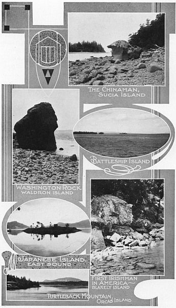 AMONG THE SAN JUAN ISLANDS.
And only to think, these islands were nearly lost to us! Had it not been for the wise decision of William I. of Germany in 1871, the Union Jack instead of the beloved Stars and Stripes might today be floating over them. The two distinct camps on San Juan Island where the British "Red Coats" and the American "Blues" waited and watched from 1860 to 1872, are still protected as points of interest; the former near Roche Harbor, and the latter near Friday Harbor, the county seat.
The usual way to reach them is by steamer from Seattle, Bellingham or Anacortes. The boat stops at all the main towns including Friday Harbor, where the University Marine Station and two large salmon canneries are located; Roche Harbor, where one of the largest lime kilns is prospering; and Deer Harbor, West Sound, East Sound, Rosario, Olga, and Doebay, attractive as summer resorts.
Many people spend their summers among these isles. The tourist with limited time should, besides visiting the historic sites on San Juan, make a trip to Mount Constitution on Orcas Island. Two good wagon roads lead all the way to the top, the one from East Sound and the other from Olga. A pleasant day's outing is enjoyed by going up one way and returning by the other. Its altitude, 2,408 feet, is nothing compared with the peaks in the Cascades. Nevertheless, few places offer more comprehensive outlooks. On the descent it will be difficult for the "wise" to resist the temptation to pass through Rosario, the beautiful country estate belonging to Robert Moran, a retired Seattle ship builder, who has harnessed the water power from the lakes lying a few hundred feet above and equipped a modern mansion with all that man can desire or money and art can supply. Who would guess that a great pipe organ might be heard in this seemingly remote spot in the universe, bursting out in unexcelled magnificence, rendering the masterpieces of the great composers.[36]
Extending about fifty miles in front of Skagit and Snohomish counties, midway in the Sound where the views of the Cascades and the Olympics are unobstructed, is Whidby Island, the second largest island in the United States proper and sometimes called "The Long Island of Puget Sound." With Camano Island on the east and two other very small ones it constitutes an independent county. Having much water front and its western shore facing the straits where direct breezes from the ocean are felt, it draws many campers from the cities. There are no mountains to climb, although a number of eminences offer views of the distant landscape.
The largest improvement has been near the southern extremity and between Coupeville and the northern limits, where the world's record for wheat production per acre was made. A beautiful road decorated with rhododendrons leads from Fort Casey to Deception Pass separating it from Fidalgo Island on the north, which is connected with the mainland by a first class highway. Near Coupeville is Still Park, where summer Chautauquas are held and many campers congregate.
A few minutes' ride out of Seattle is Bainbridge Island, having forty miles of water front lined with summer homes or suitable for camping sites. Tributary to both Seattle and Tacoma are Vashon and Maury Islands, practically one, comprising some twenty-three thousand acres, which yield for these cities berries, fruits, vegetables, and flowers, and offer some of the most delightful sites for homes along their fifty miles of attractive shore line.
Fox, Anderson, and McNeils Islands are integral parts of the Bay Island country, a rich district tributary to Tacoma and offering unlimited opportunities for campers who are always welcomed by the hospitable ranchers. Hartstine Island maintains one of the largest vineyards in the west, yielding delicious grapes which find their way to distant eastern markets. Numerous smaller islands are scattered about the Sound and insure pleasant retreats for all that love the simple life.[37]
Lying between Hood Canal and the Pacific Ocean and extending from the Strait of Juan de Fuca southward toward the Chehalis river valley is the vast Olympic Peninsula, whose resources and wonders are probably less known than almost any other section of the world. The central portion constitutes one great forest reserve within which is the Olympic National Monument set apart by the government for the enjoyment of nature lovers. The population is distributed among the cities and towns situated on the level lands skirting the waterfront. This Monument contains the most rugged mountains, the deepest canyons, the most turbulent rivers and the thickest forests in the state.
The Peninsula is now reached both by steamer and automobile. Highways lead well up into the foothills from the cities of Port Angeles, Sequim, Port Townsend, Quilcene, Shelton, Aberdeen, Hoquiam, and Hood Canal points, and passable trails thread their way to the summits beyond. It is easy to surprise both deer and elk, confident of safety from the approach of man. Numerous flowering parks display seas of gorgeous colors which make the region famous for its beauty.
It also serves as a huge treasure chest. Billions of feet of choicest timber remain uncut; valuable ore veins and a vast lake of petroleum are buried within its depths; land well suited for agriculture girdles the entire peninsula; and the neighboring waters yield liberal quantities of fish.
Certain beauty spots in the mountains have been supplemented with the conveniences and luxuries of modern invention. Among these are Sol Duc Springs, at the headwaters of the Sol Duc river, where a little palace has been lifted into the mountains, Government Hot Springs, and Lake Crescent, all reached from Port Angeles; Lake Cushman, approached from Hoodsport; and Lake Quiniault, north of Grays Harbor. A visit to any of these resorts or any part of the peninsula will satisfy the most extravagant expectations of tourist and mountaineer.[39]
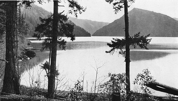 LAKE CRESCENT, A POPULAR LAKE RESORT NEAR PORT ANGELES.
Everybody in the state of Washington knows about the "Harbor Country," the only part of the state where almost simultaneously one may enjoy the rare combination of the unobstructed ocean, an inland sea, and trout streams lined with giant firs and cedars, which all but encroach upon the dominions of the waters. Here the oyster, the clam and the crab seemingly try to outdo one another and the mighty forest, in yielding splendid profits to the people, who lend every encouragement to the remarkable competition.
Thousands from the larger cities hie themselves to this section, at least once during the summer, to feast their eyes upon another variety of scenery, to enjoy its peculiar attractions, and experience again the pleasure of riding through a valley that appeals alike to the Pullman passenger and to the automobilist; for it is human nature to love a change, even if one's home environment approaches perfection itself.
There are two important salt water harbors in southwest Washington, the more northerly one in Chehalis county, and named Grays Harbor after the great explorer who discovered it in 1792, and the southern one in Pacific county bearing an Indian name, Willapa Bay. They are separated by only a few miles of territory, which is served by no railroad other than a short logging road. Regular traffic is usually around by Centralia, excepting that during the summer months auto stages traverse the beach from Cohasset to Tokeland; for the beach here is level and broad, and the sands packed so firm, when the tide has receded, that it is used as a highway, and even as a race track for automobiles and motorcycles. This is true not only[42] of the portion lying between the two harbors but also of the twenty-five miles known as "North Beach" extending from Willapa Bay to the mouth of the Columbia.
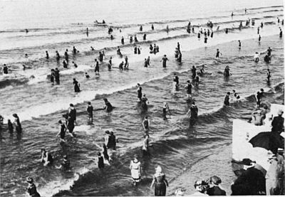
The entire region is fraught with charms that can be duplicated nowhere else. Pacific, Moclips and Cohasset beaches are patronized especially by people from the Sound cities and from southwest Washington. North Beach to the south of Willapa Bay attracts as well crowds from Portland and other Oregon cities. On Sundays or at week ends special excursions are numerous, when great crowds avail themselves of the opportunity of visiting the seashore.
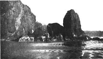 POINT GRENVILLE.
The modes of amusement are numerous. Wading and bathing in the surf or burrowing in the warm sands; hunting for shells, agates, and Indian relics; rowing, and trolling for salmon; or searching for the rare floral specimens abounding in the neighboring woods occupy the time of many. Others enjoy visiting the canneries, observing the motor races, or watching the sailing vessels, with canvas inflated, gliding quietly into the harbor or, heavily laden, being dragged out across the bar by some fretful yet powerful tug boat. Then there are the clam bakes and, at the end of the day, the big bonfires, the beach parties and the story telling, after which one is lulled into sweet slumber by the unceasing roar of the ocean surf.
So fascinating is this region that its extensive ocean beach will undoubtedly in time be ornate with one continuous array of summer resorts reaching from Ilwaco on Baker's Bay, at the mouth of the Columbia, to Neah Bay at the entrance to the Straits, and interrupted only by the narrow gaps marking the entrances to the two harbors. Every manner of dwelling is provided for those who wish to stay several weeks. Cottages[43] may be rented, camping sites engaged, or board obtained at one of the homelike hotels looking out upon the sea.
To reach Grays Harbor, unless approaching from the ocean, means a trip through the wide fertile valley of the Chehalis river, either by auto or over one of the three transcontinental railroads that serve it. The entire journey presents a panorama of pretty landscapes. The stream itself is conspicuous, tracing the valley's boundary on one side and again on the other, as if choosing the most convenient course to the sea. Sometimes it disappears from view, but its presence is still marked by clumps of willows and cottonwoods protecting its banks, and again by some rustic bridge where the highway crosses.
 SCENE ON LOWER GRAYS HARBOR.
More generously the beauties unfold as the valley widens and the harbor is neared. Quaint towns are seen, including Oakville, noted for large shipments of cascara bark; Elma, an industrial center; and Montesano, the county seat and head of river navigation. Green meadows, wooded slopes, and cultivated farms on both sides of the river absorb the attention until Cosmopolis, Aberdeen, and Hoquiam, close by the harbor, are reached. These cities have experienced a remarkable growth within the past fourteen years. Aberdeen and Hoquiam have now a combined population of 29,000 in place of 6,355, the census returns of 1900. Thoroughly cosmopolitan, they contain the homes of some of the wealthiest men in the state.[44]
 SOUTHWEST WASHINGTON VIEWS.
Such development has been due largely to the importance of the lumber industry which in this section of the state has assumed large proportions. The ravenous mills, the capacious yards, and the huge vessels loading for foreign ports are common sights within the cities. Farther away in the logging camps the agility of the lumberjack is exhibited as he lays low the giants of the forest and trims the logs ready for the mills.
The harbor may be most thoroughly appreciated by taking a ride upon its waters. Regular steamers make the round trip each day, stopping at many points of interest, both in the north and the south bay, including the North Jetty under construction by the United States government, Westport, where the life saving station and the wireless telegraph station are located, and Bay City, one of the largest whaling stations in the northwest. On the same trip the clam and crab fisheries may be seen. At the week end it is pleasant to get off at Westport and visit Cohasset Beach, there to enjoy the modern social pastimes that engage the evenings of the summer dwellers.
Pacific Beach, Moclips, and a number of other ocean resorts near the terminus of the Northern Pacific, also deserve visits; while those desiring more strenuous exercise can make profitable excursions into the wild Olympic region, exploring the forested hills, visiting the oil prospects, or hunting and fishing.
Splendid highways lead in different directions. In Chehalis county alone are 325 miles of gravel roads, every part of which passes near interesting scenes. One road extends to the south of the harbor and another to the beach resorts at the north. The Olympic Highway, one of the state primary highways, leads east to the Sound country, and northward up the Humptulips Valley, through the big timber to Lake Quiniault, located in the midst of grand solitude on the edge of the Quiniault Indian Reservation, making this lake a handy resort for the people living near Grays Harbor. Those who take the trip should plan their return so as to include a ride down the Quiniault River in Indian canoes. The Mountaineers who returned this way from Mount Olympus in 1913, pronounced it the best part of the entire outing:[46]
"The trip down the Quiniault river with its manifold beauties and experiences beggars description—the swift current, the whirling eddies, the deep, dark-green water, trout leaping into the air to catch the flying insects, the banks clothed with magnificent forests, log jams through which or under which we passed, animated branches marking the rhythmic motion of the current, the floating canoes gliding into the deeper, darker water to seek the current that hurried them on and ever on to the ocean. The Indians skillfully guided the little craft through the dangerous places, then settled back to rest until the next test of skill or strength was necessary, in the meantime relating bits of history or legends which explained names or some natural phenomenon. The boom of the surf announced the end of the journey. As the Mountaineers left the canoes on the beach at Taholah, it was agreed that the trip down the Quiniault marked the red-letter day of the 1913 outing."
The water area of this bay is 100 square miles, composed of two sections, one extending southward and separated from the ocean by a long narrow peninsula, nowhere more than two miles in width, and the other reaching eastward to South Bend and Raymond. Into it flows Willapa river, besides other short but swift mountain streams teeming with trout and other game fish. The bar is about a mile wide and the waters covering it 28-1/2 feet deep at low tide, thus enabling sea-going vessels to cross without the aid of tugs—a great advantage to ocean liners and big lumber schooners, which may be seen almost any day either lying at the docks or loaded to the gunwale passing out to sea.[47]
The southern arm approaches within three miles of the Columbia River. People in Pacific County say that Uncle Sam[48] plans to dig a canal through this narrow strip so that vessels may enter the river by way of Willapa Bay and avoid the Columbia bar, kept open by jetties built at enormous expense.
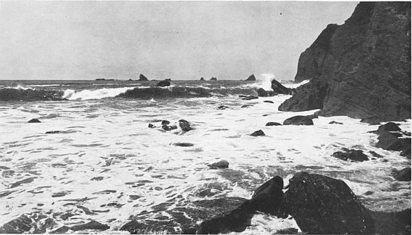 SURF ON WASHINGTON COAST
The cities of Raymond and South Bend are other examples of what lumbering and fishing have done for Washington municipalities. Where a few years ago was nothing but a wilderness, known only to the Indians or an occasional fisherman, are now busy marts with extensive waterfront factory sites. Pretty roads start from these cities and wind along the harbor front or penetrate the interior. Excursions by water may be made to Bay Center and Tokeland, summer resorts and fishing stations. Crab and clam fisheries and the oyster beds may be seen here to advantage, Tokeland being the place where eastern oysters were first transplanted for mercantile purposes.
South Bend and Raymond are also starting points for the North Beach ocean resorts. On this trip one gets a full view of the bay, and the ocean surf tumbling over the bar. At Nahcotta, a pretty oyster village, all passengers are transferred to the O.-W. R. & N. train bound for Ilwaco and Megler, whence regular steamers cross to Astoria. This train makes frequent stops, permitting close scrutiny of the attractive summer cottages that face the boundless ocean constantly visible on the right.
Located at almost the southern extremity of the peninsula is the quaint town of Ilwaco, overlooking the Columbia bar. Near by are the most extensive cranberry marshes in the state. Another attraction is "North Head," most southwesterly point in the state of Washington, where an unobstructed view of the ocean is obtained. From this point may be seen the waters of the Columbia mixing with the ocean, "Tillamook Head" in Oregon, the light house, the life-saving station, Fort Canby, the wireless station, and the "Seal Rocks," where hundreds of sea lions are usually sunning themselves.
Instead of returning by the same route, the Columbia River may be chosen to Kalama, whence the Sound Country may be quickly reached by the Pacific Highway or by rail. Every tourist should make at least one visit to the Harbor Country and see the ocean from the southwest corner of the state.
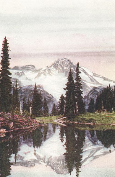 MOUNT RAINIER REFLECTED IN MIRROR LAKE
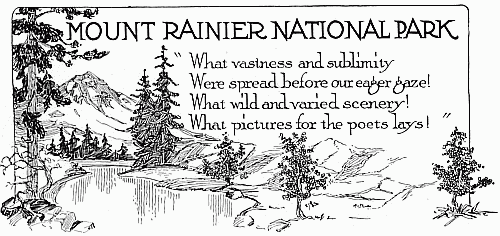
One day, late in summer, I was sitting upon a commanding promontory nearly 7,000 feet in altitude, entranced by a panoramic view most wonderful to behold. The sky was clear, the sun's warm rays were unobstructed, and the air I breathed pure as the nectar of heaven. Only five hours before I had left the city of Tacoma and a little earlier Seattle—two great cities throbbing with the activities of nearly a half million people engaged in manufacturing and mercantile pursuits.
Just beyond the foothills visible towards the west were the green valleys in which these metropolitan centers lay—the nearest only forty miles distant by an air line, close to the waters of Puget Sound. Yet here, almost in sight of them, I was enjoying a quietude known only to the haunts of nature. More than seven thousand feet above me towered the majestic dome of the second highest pinnacle in the United States, reserving observation to the north until its summit should be reached, while far toward the east and the south extended range upon range of mountain peaks, like an army of giants gathered around their chief. Here and there among them appeared the sub-chiefs, Adams and St. Helens in Washington; and Hood, Jefferson, and the Three Sisters, far beyond, in Oregon. Between their serrated ranks darker shadows marked the deep canyons where grows some of the choicest timber in the state.
Near by crawled the huge glacial bodies gnawing their way down the mountain side and splitting its surface into rugged ridges. Between them and below were spread the meadowed alpine parks or abandoned cirques—veritable fairylands—which had been carved out by these superhuman agencies eons before.[50] Barely distinguishable was the road by which I had made the circuitous ascent, bending back and forth across the face of an apparently perpendicular wall, while the glacial streams glittering in the sunshine, resembled huge serpents lying in the profound hollows formed by the extending hills.
The hours spent in reaching this favored point were of themselves worth the effort. Either rail or automobile may be chosen to Ashford where each train is met by an auto stage. Leaving Tacoma, the highway threads a picturesque gravelly prairie for thirty miles, ascends the beautiful canyon road, crosses the Ohop Valley, leads to the brink of the Nisqually Canyon a thousand feet deep, plunges through dense virgin forests, reaches Longmire, and zigzags to the snout of the Nisqually Glacier, whence the ascent to the Camp of the Clouds may be continued afoot, on horseback, or by horse stage.
This region was only recently set aside as a National Park. Perhaps no other area in the world brings so many and such varied natural wonders to the very doors of two great cities. It contains a total of 207,360 acres, or 324 square miles, of which 100 square miles is occupied by Mount Rainier (or Mt. Tacoma), king of mountains, rising apparently directly from sea level, and visible from almost every point in the state.
No grander expression of Nature's sculptural art exists than this mighty pinnacle, 14,408 feet in altitude, whose glacial area, no less than 45 square miles in extent, exceeds that of any other peak in the United States. One of the most interesting glaciers is Carbon on the north slope, reaching down to a lower elevation than any other; the most readily reached is the Nisqually, five miles in length; and the largest is the White or Emmon's. Other primary glaciers are the Cowlitz, Ingraham, Winthrop, North and South Mowich, Puyallup, North and South Tahoma, and the Kautz. The most important secondary glaciers are Van Trump, Frying-Pan, Stevens, Paradise, and Interglacier.
The summit may be reached by five different routes. These are the Paradise Valley, Indian Henry's, the Kautz Glacier, Ptarmigan Ridge, and Emmon's or the White Glacier route.[52] The Paradise Valley (known also as the "Gibraltar") route, on the south side, is by far the most popular, for it is well provided with hotel accommodations, and both the government road and Paradise trail lead right up to the Camp of the Clouds, at the mountain's foot. It is usual to leave this tented village at midnight, arriving at Muir Camp (10,062 feet elevation) at about 5 a. m., and Columbia Crest, the highest point on the mountain, at about 11 a. m. From this celestial height one may see more than a hundred miles in every direction, far away to the ocean on the west and into the great Inland Empire on the east. The snow-capped peaks already noted are seen toward the south, Mount Olympus to the northwest, and Baker, Shuksan, Stuart, and Glacier Peak to the north; while the Mother, the Sluiskin, the Sourdough Mountains, and the Tatoosh Range near by seem like mere foothills, between eight and nine thousand feet below. No grander or more inspiring view may be observed anywhere in the world.
Scaling the peak, however, is a feat undertaken by only a few, and always with the aid of an experienced guide. The largest measure of real joy is found in the alpine "parks." The best known and most frequented is along the Paradise River. Tributary to it and reached from Longmire, are Indian Henry's, Van Trump, Cowlitz and Magnetic Parks. Others requiring more time to visit are Summerland, one of the largest and most beautiful, Elysian Fields, and Morain, Saint Andrews and Grand Parks.
Surrounded by rugged peaks and snow fields these natural amphitheaters present a pleasing contrast. Scarcely any underbrush exists in them but many beautiful flowers, shrubs, and trees abound; three hundred distinct plants are said to exist; pretty lakelets gem their surface; and all are drained by trickling streamlets or cut by raging rivers producing waterfalls of rare beauty as they go tumbling from the melting glaciers to the sea. Excellent trails, built by the government, lead to every point of interest and extend clear around the mountain. Camping places are plentiful or accommodations may be obtained at comfortable hotels.[53]
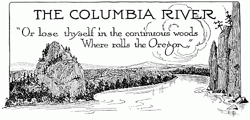
This wonderful and majestic river whose history is enhanced with legend, offers the exploring tourist or curious sight-seer unusual opportunities to indulge his unbounded imagination and to satisfy his desire for the spectacular in nature. Upon its banks were enacted events of greatest importance in northwest history, while interwoven with the incontrovertible happenings is many a fascinating Indian story and song. Overlooking its waters were the first settlements of the Pacific northwest, upon whose sites are now built, within easy hearing of its persistent dashings, some of the proudest and most prosperous cities of the country.
One of the largest rivers on the American continent, with many important tributaries, it drains a territory equal to five times the area of the state of Washington. By a series of cataracts, falls, cascades, and bold turns, it flows nearly 1,400 miles with a total drop of 2,500 feet, before finally delivering the waters gathered from many sources to the great Pacific ocean.
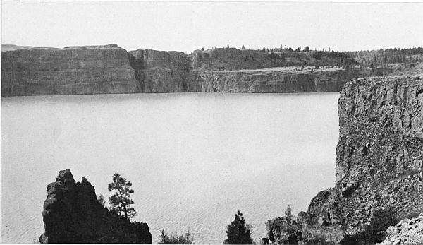
Like other great rivers, some portions have needed vast expenditures to increase its value as a navigable stream. Near Stevenson the government has built locks at a cost of several million dollars, enabling large vessels to reach The Dalles, at present the head of navigation. At Celilo, two hundred miles from its mouth, where, in twelve miles distance, the river falls eighty-one feet at low tide, other locks are being constructed. When these are completed, merchant vessels can go direct from[55] the sea as far as Priest Rapids, a distance of over four hundred miles. As many miles additional are navigable, but broken in places by rapids and falls.
Important as this river is from a commercial and geographic standpoint, the greatest interest by far centers in the phenomena that are of its own creation, visible every mile from its mouth to its source. A journey upon its surface rivals one along the historic Rhine, the picturesque Hudson, or the beautiful St. Lawrence. The panorama includes besides the wilder grandeurs, economic scenes suggesting the fecundity of the earth and the industry of the husbandman. To enumerate and describe these ever so briefly would require an entire volume. This short chapter is a suggestion only that "By reason of scenic grandeur, absorbing interest of physical features, the majesty and mystery of its flow through some of the wildest as well as some of the most beautiful regions of the globe, and at the last by the peculiar grandeur of its entrance into the greatest of the oceans, this 'Achilles of Rivers' attracts alike historian, scientist, poet, statesman, and lover of nature."
In many places the natural appearances are the same now as when Gray, Lewis and Clarke, the Astorians and the Northwest and Hudson's Bay Company men first viewed its banks, with the exception that the shores have in places been denuded of their largest timber and either a younger growth has inherited the dominion or portions have been claimed for the agriculturist.
Here and there may be seen the little fisherman craft, "chugging" away from their moorings in the early dawn and returning at the setting of the sun heavily laden with the famous Columbia river salmon that feed thousands throughout the[57] world. On sandbars or sand islands, of which there are many in the lower part of the river, the "purse seiners" are conspicuous and the horses dragging the nets strangled with the products of the deep. In the deeper waters close to the shore, but far from the sea, are the fish wheels whirling by the force of the same waters that conceal the treasures being sought.
Cities appear at frequent intervals, both on the Washington side and in Oregon. Before the entrance to the Snake River is reached, one will have passed Ilwaco, Cathlamet, Kalama, Vancouver, Camas, Washougal, Stevenson, White Salmon, and Wallula on the Washington side, besides many important cities on the Oregon shores: namely, Astoria, the site of the first settlement on the Columbia; Portland, the largest city in Oregon, near the mouth of the Willamette; and The Dalles, for many years the head of navigation. Kennewick and Pasco are located just beyond the mouth of the Snake River, ready to derive full benefit from the improved navigation conditions of the future. Between these larger towns is many a tiny hamlet, while isolated farms and orchards surrounding pretty dwellings slope gently towards the river and tend to make the traveler dissatisfied with his own home.
At times is visible a beautiful waterfall, a palisade of wonderful basalt, and occasionally some island draped with verdure of many tints. Further away a murmuring brook or crystal streamlet may be heard hurrying down a rocky hillside or winding between towering cliffs, adding its share to the tuneful sound of the powerful orchestra that seems everywhere to be heard. Constantly shifting color and shade attract the eye and tones of varying quality please the ear.
When the mouth of the Cowlitz is neared there appear, stretching toward the north, broad areas where man has mingled his skill with Nature's works. Green fields, sometimes fringed with willows, near the waterfront, and dotted with orchards, farm houses, and dairies, are visible as far as the eye can see. These evidences of man's encroachments are noted all the[58] way to Vancouver (and beyond), at which city, the oldest in the state, a tourist should linger long enough to appreciate the[59] region which arrested the attention of our earliest settlers and inspired the beginning of the first city in Washington. A bridge, costing nearly two million dollars, will soon connect it with the beautiful city of Portland.
Cultivated lands are seen on either side as the river is ascended, until the mountainous region is reached and the roar of the cascades is distinctly heard. These cascades, according to Indian lore, were created by the falling of the "Bridge of the Gods," which once extended from shore to shore and formed the great highway connecting the mountains on the north and their extension to the south, while beneath a mighty river peacefully pursued its course to the sea. The perpendicular buttresses on either hand, the forest areas that apparently fell from above, trees growing out of the water, petrified logs up in the reddish cliffs within the vicinity of Stevenson, and many other freaks of nature all seem to strengthen the evidence on which this story is based.
Throughout the mountainous region are wonderful examples of Nature's diverse skill. Among the most striking are Castle Rock, or Wehatpolitan's gravestone, a great basaltic rock 900 feet high; St. Peter's Dome, a sublime elevation of 2,000 feet, considered one of the wonders of the American continent; Oneonta Gorge, almost concealed behind towering rocks; Multnomah Falls, a matchless waterfall with a sheer drop of 800 feet; Cape Horn, a long palisade of basalt; Rooster Rock, unsurpassed for beauty of form and variety of color; and Cape Eternity, a massive precipice 1,000 feet in height.
Thorough appreciation of the surrounding charms necessitates climbing some of the neighboring hills, or traveling over the wooded river banks and visiting the rustic towns that lie at the foot of the mountains and guard the gateway to the alluring valleys. Near Stevenson, county seat of Skamania county, overlooking the cascade locks, and Carson, are several hot springs where accommodations for the most particular are available. From these towns one may follow the Wind River Valley to its[60] source beyond the headquarters of the rangers where the U. S. forest nurseries are maintained. A few miles further are the[61] Government Hot Springs, near which many low peaks, easy for climbing, offer expansive views of the surrounding country.
 THE SNAKE RIVER COUNTRY AROUND CLARKSTON.
A twenty-five mile drive up the famous White Salmon Valley takes one to Trout Lake, not far from the ice and lava caves in the foothills of Mount Adams, and near Huckleberry Mountain, a pow-wow place for the Indians. On the way, hundreds of scientifically developed orchards, and oat fields yielding over 100 bushels to the acre, are passed; also the Northwest Electric Company's power plant, which, generating 20,000 horse power, supplies power to cities seventy-five miles away. From the massive bluffs of White Salmon a panorama of perfectly blending color may be seen, formed by the unusual combination of the Columbia River and the mountains to the east and the west, while the entire Hood River Valley, with Mount Hood beyond, is visible on the Oregon side.
The trip from Lyle to Goldendale along the Klickitat River is a journey of surprises. The railroad follows the winding canyon past pretty waterfalls, crosses hurrying brooks, and emerges finally into a wide, fertile plain overlooking the Columbia basin. Fields of waving grain and other products exhibit the richness of the Klickitat valley. Those desiring can motor from Goldendale into the Yakima valley or return to the Columbia via Maryhill, where Hon. Samuel Hill has built a $100,000 road across his 6,000-acre farm.
Nor do all the wonders belong to the lower Columbia. Before being joined by the Snake River, it has drained a region noted for agricultural superiority and contributed liberally to the needs of irrigation. The "Big Bend" on the left, and the valleys watered by its tributaries from the right, are described under the chapter entitled "The Inland Empire."
Following its channel still farther towards the source, wilder scenes are met with, the gorges are deeper, the cascades noisier, native trees more plentiful, waterfalls higher, and the course of the stream more winding. Startling phenomena appear in rapid succession, and scenes unimagined will astonish the tourist who spends a little time in re-exploring this great river, for ages a prize eagerly sought by the searchers for the unknown.[62]
 ROCK LAKE, 25 MILES SOUTHWEST OF SPOKANE.
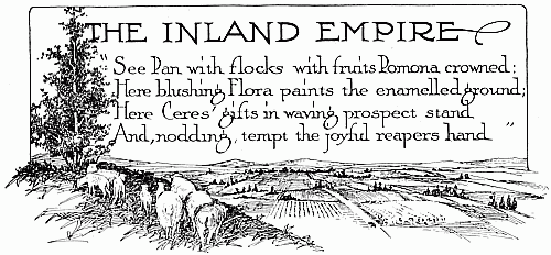
Thousands of years ago, scientists tell us, there existed between the Rocky Mountains and the Cascade range a vast inland sea—the waters left imprisoned when the ocean had receded. After many ages these pent up waters burst the restraining barriers and forced their way to the ocean, creating the deep canyon of the Columbia, but leaving behind a broad plain, now known as the Inland Empire.
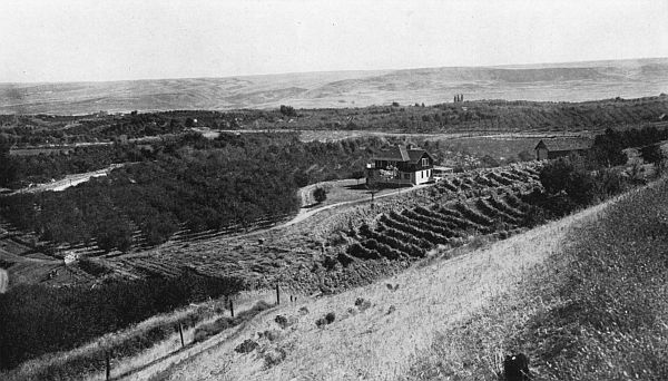
What was once a desolate waste, however, has been transformed into a "Land of Canaan." Its plateaus unite to form one of the bountiful "bread baskets of the world" while its valleys yield generously of nearly all the products of husbandry. Near its borders the mountains, with their retinue of trees, flowers and grassy meadows, reach as far as the invisible power permits and then dispatch their emissaries, the rivers, to wind through and through and distribute the welcome waters that enkindle the irrigated districts with life and activity.
Far beyond the boundaries of our own state spreads this wonderful plain, but the brief description contemplated in these few pages must be confined chiefly to Washington. The curious sight-seer or the serious homeseeker can well afford to spend many days exploring this region, marveling at both the mighty forces of creation and the embellishments of man. Under far more pleasant circumstances can it be traversed now than when the early pioneers first fought their way over the mountains. Lewis and Clarke, the Hudson's Bay Company men, and Marcus Whitman, supplemented their sturdy limbs and indomitable courage with the trusty saddle horse, the slow prairie schooner or the rude river raft. Today the palatial cars of four trans[64]continental lines make daily trips across the state; branch lines accommodate the territory north and south; and parts not reached by rail are served by well constructed thorofares.
In addition to the Columbia river basin, the most important features are the Yakima and Wenatchee valleys; the Lake Chelan region; the Okanogan Highlands with the valleys of the Methow, Okanogan, San Poil, Colville and Pend Oreille; the Spokane Country; the Walla Walla valley; the Snake River; the Big Bend and Palouse wheat sections with their "coulees"; and the Blue Mountains. There are also a few low bare ridges of a semi-mountainous character which relieve the prairie effect and permit cycloramic views of the surrounding territory. Among these are the Saddle Mountains, the Simcoe Hills, and the Horse Heaven Plateau; while a number of spurs from the Cascades, including the Wenatchee Mountains, help form the fertile valleys to the west of the plain.
These different sections may be easily reached from almost any city in the state. Visitors coming by way of Spokane can make a quick yet comprehensive survey of eastern Washington in two ways. After seeing the immediate Spokane vicinity and visiting the Pend Oreille Valley to the north, either automobiles or Great Northern trains will convey them up the Colville Valley to the junction of the Kettle and Columbia rivers, whence the trip may be continued to Republic by train, and down the San Poil by auto. At Republic trains connect for Oroville, whence the journey may be continued to Wenatchee down the Okanogan Valley, both by auto and rail. Side trips may be taken up the Methow Valley and the Lake Chelan canyon, as well as to numerous other places of interest. From Wenatchee the Great Northern railway or the Sunset Highway insures an interesting ride back to Spokane through the wheat fields of the Big Bend. The southern half of the region will be seen by making a tour through the Palouse to the Snake River and Walla Walla country. Transportation leads from there direct[65] to the Columbia River, and the Yakima and Kittitas valleys. The Horse Heaven may be reached from Kennewick and Pasco, or from Prosser.
The other plan reverses the order. After visiting the Palouse, Snake River, Walla Walla, Yakima, and Kittitas valleys, from Ellensburg a scenic overland route may be taken direct for Wenatchee, whence a loop may be made to include Lake Chelan and the Okanogan Highlands, the Big Bend and the Spokane Country.
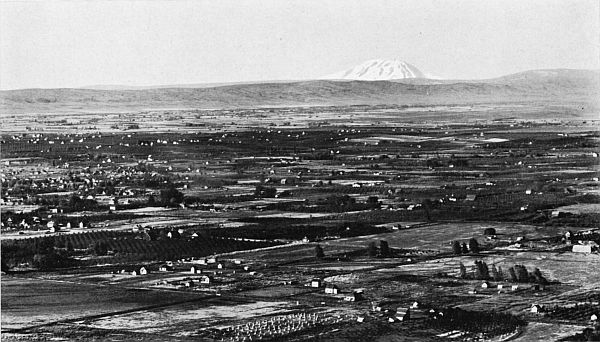
Broadly speaking, the Yakima Valley includes all the rich territory tributary to the Yakima River, reaching from Lakes Keechelus and Kachees, its sources in the Cascades, to the Columbia—a total distance of nearly 175 miles with a range of altitude, at the water's edge, varying from 2,250 down to 340 feet. It embraces, besides the Yakima Valley proper, the Kittitas and a number of minor valleys, including the Naches, the Ahtanum, the Cowiche, the Selah, the Wenas, the Satus and the Toppenish. These last two belong to the rich country just south of "Union Gap," where Sunnyside and Toppenish are located, two enterprising cities, vieing for supremacy over the rich south half of Yakima county. Further south is Prosser, county seat of Benton county. Above the Gap is North Yakima with a population of 18,000, the metropolis of the region and home of the State Fair; while Ellensburg, with 6,500 people, is Queen of the Kittitas Valley. The south half of Yakima county constitutes the Indian Reservation where the Yakima Tribes dwell peaceably by the side of the whites, tilling the soil and occasionally entertaining the people with many a "Round Up," or Wild West Show. At Fort Simcoe is their school, deserving of a visit from anyone interested.
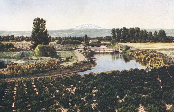
 THE YAKIMA VALLEY—MOUNT ADAMS IN THE DISTANCE.
[66]In this valley, where once was nothing but sage brush and bunch grass, is irrigable land enough to support a population of a million people; for the total water capacity as surveyed by the United States Government is estimated at 927,000 acre feet, sufficient to water 600,000 acres. Less than a third of this[67] is at present cultivated and watered from small canals, built by private capital, and from the two largest ones in the state, constructed by the U. S. Reclamation Service. These latter are the Tieton, with water sufficient for 34,500 acres, and the Sunnyside, capable of irrigating 100,000 acres.
 A HOME NEAR ELLENSBURG.
A journey along the banks of these canals or the Yakima river unfolds a panorama of unusual breadth and interest. Instead of the heavy forests of the west side, the sage brush struggles for existence just above the main ditches; but the country below is checkered with orchards, farms, and gardens; and cotton woods protect the banks of the streams. Impressive is the sight in springtime when fruit trees are all in bloom and the Blossom Festival, participated in by a hundred-thousand people, is ushering in the full tide of spring; or in autumn when deeper touches of color mark an immense crop ready for the harvester.
From the hills on either side, the picture assumes its most perfect form. Cities, meadows, orchards, vineyards, hop fields, vegetable gardens, alfalfa farms, corn fields, and prairies, bisected and crisscrossed by railroads, highways, canals, and rivers, protected by the brown hills near by and watched over by the mountains in the distance, supply composition for pictures that in detail and variety must discourage all competition.
Equally beautiful but of smaller dimensions is the Wenatchee Valley, reaching from the Columbia well up into the foot hills of the Cascades. This, too, was a desolate brown slope[68] until the effects of irrigation were felt on its rich volcanic ash soil. After that only ten years were necessary to convert it into a garden of dazzling splendor. Instead of the forlorn looking sagebrush, a maze of orchards, extending up the valley and ascending the hills, presents in springtime a solid mass of blossoms, varying from purest white to daintiest shades of pink. Serpentining along the hill sides, as if protecting the gardens below, are the great viaducts, conducting the precious waters that irrigate the land; while dodging from one side of the vale to the other, or paralleling the Great Northern Railroad, the Wenatchee river hastens onward towards the Columbia.
The north, south, and west are guarded by forest-covered hills, spurs of the Cascades, over which many trails lead to charming mountain lakes and streams, where summer homes are maintained, and game awaits the hunter. The east opens up toward the wheat fields of the Big Bend, while the Columbia River Valley to the north and south is tributary and joins in all the enterprises of the district. Every tiny tributary stream in the vicinity marks the location of a peaceful home supported in affluence by successful fruit culture or gardening.
Within this valley are several prosperous cities, including Wenatchee, the metropolis of north central Washington, with a population of about 5,000, at the junction of the Wenatchee and Columbia rivers; Leavenworth near the head of the valley; and Cashmere, midway between the two. The pervading spirit is one of optimism and liberality, for the Wenatchee red apple is famous the world o'er and nets its producers $5,000,000 annually.
Chelan, "Beautiful Water," is the name of one of the grandest sheets of fresh water reposing upon the bosom of the American continent. It is one of a number of beautiful lakes found throughout the highlands in the vicinity of the upper Columbia, but on account of its thrilling beauty and easy approach has become one of the favorite resorts for the entire northwest.[69]
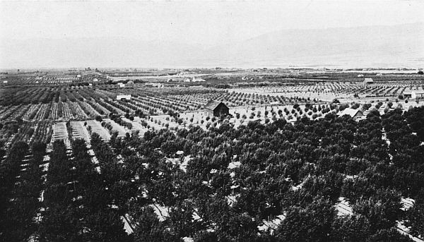 THE WENATCHEE VALLEY—NEAR THE CITY OF WENATCHEE.
It is reached usually via the city of Wenatchee, but sometimes from the Columbia and Okanogan valleys on the north. [70]River boats, automobile stages, or Great Northern trains allow three principal modes of transportation, each of which reveals different scenes of interest. During summer months the overland trip is undoubtedly the most pleasant and presents the fullest opportunity for appreciating the scenery. The return might be by river boat or train, necessitating a ride down the Chelan gorge, where the river drops 400 feet in its brief course of four miles, and furnishes at low water 125,000 horsepower.
Surpassing the canyons of the Yosemite, the Yellowstone, the Columbia, and the Colorado, the total depth of the Chelan canyon reaches in places nearly 8,000 feet, while its waters occasionally cover a bottom 1,700 feet below the surface. Throughout the 55 mile ride from Chelan to Stehekin, views are observed that for immensity, sublimity and color blending are unexcelled. Right into the heart of the Cascades the traveler is drawn, while the solemnity and general impressiveness of the whole increases, as he is gradually brought in closer intimacy with divine nature. Among features of striking scenic importance are Railroad Creek, descending 6,000 feet in 20 miles, the Stehekin River, and Rainbow Falls.
This region consists of low picturesque mountains, alternating with fertile valleys and studded with lakes protected by open forests of spruce, pine, and tamarac. Opportunities for the homeseeker, pleasure for the sportsman, and continuous scenes of interest for the tourist are suggested. Here one can yet feel the presence of the true western spirit of frontiership, for this part of the state was the last to be thrown open to settlers; and the Indians are still in full possession of the Colville Indian reservation, comprising some 1,300,000 acres in the south central part of the section, extending from the Okanogan river to the eastern boundary of Ferry county. Under irrigation the valleys yield liberally of fruits, vegetables and dairy products, and the higher lands are devoted to grain and stock raising. Lumbering plays its part and mining for precious metals assumes greater importance than elsewhere in the state.[71]
The valleys of the Pend Oreille, the Colville, the Kettle, and the Okanogan rivers, are now served by rail; but the San Poil and the Methow are dependent on highway conveyances. Of extreme interest is the ride from Spokane up the Colville and Kettle River valleys to Oroville, with a short side trip to Republic, the leading gold producing city in the state. The railroad crosses the boundary line several times, enforcing the unique experience of being at one moment under the dominion of King George of England and the next back under the Stars and Stripes. Cultivated valleys, broad wheat fields, and picturesque canyons are invaded before arriving at the heights from which Oroville appears far below—requiring an hour for the train to descend by a series of remarkable switchbacks.
Most of the towns in the Okanogan Highlands are still in their infancy, for its development has been so recent; but therein lies much of its charm. In the Pend Oreille Valley the leading city is Newport, the county seat, prettily located on both sides of the river, half in Idaho and half in Washington. In Stevens county are Chewelah, a mining town, and Colville, the largest city in the region, with a population of over 1,500 people. A place that attracts tourists for miles is St. Mary's Indian Mission on the Colville Indian Reservation near Omak. Other interesting towns are scattered throughout the four counties.[73]
 THE CITY OF SPOKANE FROM CLIFF PARK—MOUNT SPOKANE IN THE DISTANCE.
From the city of Spokane all corners of the Inland Empire are easily reached. Five transcontinental lines enter the city and two others operate trains; while a network of electric lines serves the immediate vicinity, penetrating the territory as far south as Colfax, Palouse, and Moscow; southwest to Medical Lake and Cheney; and eastward to Hayden Lake and Coeur d'Alene. Highways have been built through the most scenic sections along the river valleys and up into the mountains. Each mode of transportation unfolds a different panorama. The hills nearest Spokane are covered with a dense growth of pine. Farther away are forests of pine, fir, cedar, and tamarac, concealing many lakes teeming with trout and black bass. Within a radius of a hundred miles are fifty mountain lakes, thirty-eight of which are ideally located and supplied with all necessary equipment for camping. They include Pend Oreille, the second largest fresh water lake in the United States, fifty miles east; Hayden Lake, forty miles east in the heart of the Idaho National Forest Reserve; Chatcolet Lake, thirty-two miles distant; Liberty Lake, seventeen miles; Priest Lake, seventy-eight miles; Spirit Lake, forty-three miles; Coeur d'Alene, thirty-two miles; and Twin Lakes, thirty-three miles.
The mountains are visible either to the north or the east. They are neither as lofty nor as rugged as the Cascades and Olympics, but they are nevertheless beautiful. The highest peak in eastern Washington is Mount Spokane, 5,808 feet, twenty miles northeast of the city. From its summit one may look out into the three northwestern states of Oregon, Idaho and Washington, and into the province of British Columbia; and count seventeen different lakes and rivers.
Towards the north are the Okanogan Highlands with the valleys of the Pend Oreille and Colville, while the Bitter Root mountains are approached on the east. The roads westward and southward lead past well cultivated gardens, green meadows and groves, until finally is spread before one a sea of grain—continuous wheat fields—the Big Bend to the west and the Palouse to the south.[76]
Towards the east the "Apple Way," one of the most remarkable roads in America on account of the high class material of which it is constructed, enters the Spokane Valley, crosses the state of Idaho and connects with roads leading to the National Parks in Montana. This valley more than thirty miles in length, with an average width of eight miles, comprises a level irrigated country cut up into intensive garden and orchard tracts. Thousands are supported in affluence by raising apples, pears, cherries, small fruits, garden truck, poultry, and live stock. The advantages of abundant water power, proximity to a great city, rapid transit facilities, and a healthful climate, are quickly transforming the region into one of attractive suburban homes.
The Spokane River drops 1,280 feet in a distance of 100 miles, and 130 feet within the city limits, falling precipitously 70 feet in the heart of the business section, over a dam 200 feet wide. On both sides is built the city sloping towards its waters and overlooking the country beyond. Extensive economic developments are taking place, there being seven distinct projects under way which involve expenditures of nearly[78] $35,000,000. These include railroad construction, power plants, manufacturing and business blocks, and hotels for tourists. Historical events are associated with Fort George Wright, named for a famous Indian fighter; Indian Canyon,[79] tribal home of Spokane Indians; Mount Spokane, a pow-wow place for Indian tribes; Fort Spokane, one of the first government Indian posts; Old Block House, a protection for the early fur traders; and Steptoe Butte, the scene of a famous battle.
The wheat belt includes principally the area within the big bend of the Columbia river, the "Big Bend Country," which stretches eastward until it blends with the rolling Palouse, one of the richest farm regions in the northwest, and southeast across the Snake River to the Blue Mountains; although considerable wheat is raised in the country lying between the Columbia and the Cascades, as well as in the four counties to the north. The green carpet is visible, in spring, and the waving heads of yellow grain, in summer, extending away to the horizon. The combined harvester, drawn by thirty-six horses, is a familiar example of the immensity of the machinery needed when gathering the mammoth crop, which for the entire state is in the neighborhood of 50,000,000 bushels annually.
The Big Bend is broken in places by "coulees" or old river courses, sometimes 500 to 600 feet in depth, where irrigation is practiced and where strings of small alkali lakes have been scattered. Two of the most important are Moses Coulee in Douglas county, and Grand Coulee forming the boundary line between Douglas and Grant counties, said to be the old bed of the Columbia. Almost surrounded by the wheat belt lies the Quincy Valley, containing 435,000 acres of level fertile land to be some day irrigated by water conducted under the Columbia river from Wenatchee Lake in Chelan county.
The best known lakes include Soap Lake, a health resort, Moses Lake, near which irrigation from wells is successfully carried on, and Rock Lake, a rock bound sheet of water in the Palouse. The most important river is the Palouse which creates the Palouse Falls just before joining the Snake River. Near this stream are several prosperous cities, including Colfax, Palouse, and Pullman, the home of the State College and Experiment Station.[80]
The Snake river, largest tributary of the Columbia, with a canyon of 1,500 feet, cuts this plateau in two, and forms a natural dividing line between Whitman and Franklin counties on the north, and Walla Walla, Columbia, Garfield, and Asotin on the south. Its warm canyon is famous for early fruits and berries which are shipped in carloads to eastern and western points.
Fields of wheat, barley or rye extend southward in all four counties to the Blue Mountains, interrupted occasionally by orchards which assume their greatest proportions in the beautiful Touchet and Walla Walla valleys. Over this rich country the fair city of Walla Walla reigns supreme, her authority being limited only by the Columbia and Snake rivers, or the Blue Mountains; although Waitsburg, Dayton, Pomeroy and Clarkston are important centers in their own districts.
Steeped in historical associations is this valley, from Wallula, the site of the first Hudson's Bay fort, to the city of Walla Walla. When once seen, no words are needed to tell why these lovely plains, all ready for the planting and moistened with sufficient rainfall annually, were so attractive to the early settlers, and inspired the first serious efforts at colonization.
All waters of eastern Washington reach the ocean through the Columbia river, uniting the entire region in one spirit of fraternity. The grandest and most reaching scenic feature of the region, it supplies unlimited water for successful irrigation and power purposes, and in places still provides the principal mode of transportation. Between Kettle Falls and the Snake river are a number of important rapids, chief of which is Priest Rapids, just below Saddle Gap, ten miles long with a descent of seventy feet and a possible horse power of half a million.
Just above the mouth of the Snake river are the cities of Kennewick and Pasco, ready to profit by direct navigation to the sea as soon as the Celilo locks are completed. At the lowest elevation in the Inland Empire and surrounded by a large area of irrigable land, they are served by three transcontinental railroads, permitting rapid transit to any part of the northwest.
The state of Washington is rapidly developing a system of roads which, finally consummated, will rival in skillful engineering and commercial importance the French highways, and in scenic grandeur the mountain passes of Switzerland. Easy approaches are being constructed to every town and hamlet and into every farming community. So vigorously has the work been pushed that Washington now outranks every other state, except Colorado, in the facility and directness with which its mountain recesses may be reached. Upwards of 50,000 miles have been already completed, presenting altogether a labyrinth of broad thorofares, boulevards, and country highways. The most important highways built and maintained at state expense are the Pacific, the Sunset, the Inland Empire, the Olympic and the National Park.
The Pacific Highway extends from the southern limit of the state of California to Vancouver, British Columbia, twenty-seven miles north of Washington's boundary line, a total distance of about two thousand miles. Three hundred and fifty miles is within the state of Washington, connecting Vancouver on the Columbia with Blaine at the international line. It traverses nine counties of Washington, containing forty-eight per cent of the wealth and fifty-five per cent of the population, and passes through nine county seats, including Olympia, the state capital, Vancouver, Kalama. Chehalis, Tacoma, Seattle, Everett, Mount Vernon and Bellingham.[82]
From Vancouver, Washington, this highway starts northward through the prune and plum orchards of Clarke county, where more of these trees grow than in all other parts of the state combined. Along the banks of the historic Columbia and through the fertile valley of the Cowlitz, it winds toward Kelso, famous for smelt fisheries; and Castle Rock, the gateway to Mount St. Helens. Deviating to the right at Vader, the north fork of the picturesque Chehalis is soon reached, which fertile valley is followed to the cities of Chehalis and Centralia, two rapidly growing railroad centers having a combined population of 15,500 people. Groves, orchards, gardens and prairies line the smooth gravelly road from here to Olympia, where the first view of Puget Sound is obtained. The desire to swerve off toward Grays Harbor or the Olympic Peninsula by the newly completed Olympic Highway, or to try the steamer on the peaceful Sound, is with difficulty overcome; but the Pacific Highway finally wins and draws one on toward Tacoma, thirty-two miles northeast. Rising above the famous Nisqually flats, and descending again to cross the oak moor lands marking the beginning of Tacoma's playgrounds and reminding one of southern England, the road soon enters Tacoma, third city in population in the state.
Along the Puyallup and White river valleys, the course leads, touching at Puyallup and Sumner, famous for berry culture; at Auburn and Kent, centers of a rich dairy section; and at Renton, bristling with manufacturing importance near the southern end of beautiful Lake Washington. A dozen miles more and you are on the streets of Seattle, metropolis of the northwest and third city in size west of the Rocky Mountains.
Northward the course continues. A broad paved road winds along by Lake Washington to Bothel, passing several pretty lakes, entering green woods, intersecting meadows, crossing streamlets, rising to sightly plateaus and descending again to peaceful valleys before it reaches Everett, a city of 32,000, located on an eminence overlooking the waters of the Sound.
The next town reached is Marysville, whence the highway skirts the Tulalip Indian reservation, crosses the Stillaguamish river in the Sylvan Flats and enters Stanwood where a scenic[84] road branches off to Camano Island. At Mount Vernon and Burlington, where it intersects the Skagit county road leading from Anacortes eastward to the mountains, one may appreciate the famous Skagit Valley, the "Holland of the Northwest," where 173 bushels of oats to the acre have been yielded on land protected from the sea and river by immense dykes.
Within ten miles of Bellingham the Water Front Road is reached, said to be the most picturesque on the entire route: for the Sound is plainly seen from the shaded highway which clings to the side of Chuckanut Mountain, while the electric interurban and the Great Northern railway traverse the waterfront below. Bellingham, a city of 30,000, has innumerable attractions to hold the tourist, who still has twenty miles' journey if he would follow the Pacific Highway to the Washington limit at Blaine, the most northwesterly municipality in the United States. Near by is the Whatcom County Government Farm, the only one in the northwest; where bulb growing rivals the same industry in Holland.
The Sunset Highway is the only route at present permitting through automobile traffic across the Cascade mountains and connecting the western with the eastern counties. Throughout its full four hundred miles from Seattle to Spokane it introduces the tourist to scenes which for diversity and pleasant surprises, varying from rugged mountains and roaring waterfalls to peaceful irrigated valleys or broad wheat plains, can nowhere be duplicated. With the exception of a few miles the grades are never more than five per cent.
Branching off from the Pacific Highway at Renton, it rises northeastward to the headwaters of the Snoqualmie River. Just below the town of Snoqualmie appear the wonderful falls of the same name, the "Niagara of the West." This immense stream of water falling 268 feet, is now harnessed to supply power and light to the cities and towns of Puget Sound. Following the banks of this river the highway penetrates entrancing forests and exposes many a remarkable panorama. Both road and river are at times clearly visible from the Chicago-Milwaukee trains puffing towards the summit.[85]
Descending, the road leads southeast along the headwaters of the Yakima, and skirts the eastern banks of beautiful Lake Keechelus, where the government is building a huge dam for storing water to irrigate the Kittitas and Yakima valleys. Passing the southern extremity of Lake Kachees, another deep mountain lake, it soon passes Cle Elum, a coal shipping center, enters the broad Kittitas valley and reaches the cultured city of Ellensburg, mistress of the section and home of one of the state normals.
The route is now northeastward over Table Mountain by a 5,200-foot pass, permitting an excellent view of Mounts Rainier and Hood. The banks of the Columbia are followed to Wenatchee, the metropolis of north central Washington and the famous red apple district. Crossing the Columbia it proceeds along its east bank to Orondo, whence, plunging through a winding canyon, it rises rapidly to the great wheat plateau of the Big Bend, which bursts suddenly upon the view. Leaving Waterville, the county seat of Douglas county, it turns abruptly eastward to continue in an almost unbroken line through expansive wheat fields towards Spokane, the metropolitan city of the Inland Empire, over a hundred miles away.
At Coulee City, forty miles from Waterville, it would be worth while to linger long enough to explore the Grand Coulee, said to be the old bed of the Columbia. Full of strange features, it has attracted attention from geographers of international reputation. Wilbur, Davenport, the county seat of Lincoln county, and Reardan, besides many smaller settlements, almost lost in the midst of the great wheat fields, appear before the thin woods shading the approach into Spokane are reached.
At Ellensburg the Sunset Highway connects with the Inland Empire Road, a southern route to Spokane via Walla Walla. Following the Wenas Valley to North Yakima, it continues southeast through the Union Gap and along the Sunnyside[87] Canal, the largest irrigation ditch in the state, where a splendid view of the valley, with Mount Hood in the distance appears. From Prosser, county seat of Benton county and entrance[88] to the Horse Heaven country, the road drops toward the Columbia river and soon reaches Kennewick, the home of early strawberries, and Pasco, county seat of Franklin county.
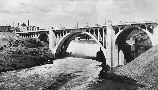 LOWER SPOKANE FALLS, AND BRIDGE WITH SECOND LARGEST CONCRETE ARCH IN THE WORLD.
From here the Central Washington Highway threads the extensive wheat fields toward the northeast, passing through Connell, Lind, Ritzville, and Sprague, all important wheat shipping centers; and Cheney, the site of another state normal, fifteen miles southwest from the city of Spokane.
The Inland Empire Highway leads on to the beautiful city of Walla Walla; but at Dayton, the quaint county seat of Columbia county, it divides, uniting again near Rosalia, twenty-five miles south of Spokane. The shorter route trends northeast, crosses the Snake at Pataha and passes through Colfax, county seat of Whitman county, in the rich Palouse Valley. The other branch penetrates extensive barley and wheat fields, enters Pomeroy, county seat of Garfield county, and Clarkston, on the eastern boundary line, named for the great explorer. Bending northward it transects irrigated lands and wheat fields; enters Pullman, home of the State College, Palouse, Garfield and Oakesdale; joins the other branch at the county boundary line and soon reaches the southern outskirts of Spokane.
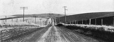 INLAND EMPIRE HIGHWAY, TEN MILES EAST OF WALLA WALLA.
From Spokane this road presses northward through the Colville Valley to the Columbia, and thence to the international boundary line, having previously passed at Deer Park the Arcadia orchard, largest commercial apple orchard in the world; Loon Lake, a summer resort; Chewelah, a mining town surrounded[89] by a dairying country; and Colville, county seat of Stevens county and largest city in this section. A pleasant contrast is this northern extension, regaining the mountains and evergreen forests, the swiftly flowing rivers with glorious waterfalls, and the chains of lakes adorning irrigated vales and green meadows.
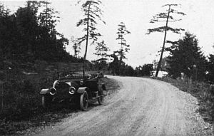 ANACORTES ROAD.
The Olympic Highway, when the few miles from Bogachiel to Lake Quiniault, overlooking the Pacific Ocean, are completed, will form a complete loop around the Olympic Peninsula, from which it derives its name. Winding along at the foot of the mountains, it connects the leading cities of the district and exposes some of the most scenic features of the Sound country, including Hood Canal, the Strait of Juan de Fuca, Grays Harbor, and occasionally the Pacific Ocean. The principal cities touched at are Shelton, Port Townsend, Port Angeles, Hoquiam, Aberdeen, Elma and Olympia.
The National Park Highway extends from Tacoma to Rainier National Park, whence it bears southward to the headwaters of the Cowlitz, crosses to the Chehalis Valley and, after connecting with Chehalis and Centralia, leads southwest, over the low coast range to Raymond and South Bend on Willapa Bay, and from there continues to the mouth of the Columbia.
Other scenic routes are planned to cross the Cascade mountains. Two are nearly completed, viz., the McClellan Pass Highway, paralleling the Sunset as far as North Yakima, and one along the north bank of the Columbia. A third will sometime cross and connect the Skagit Valley with the Methow.[90]
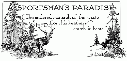
This book cannot expect to win the largest measure of approval from the followers of Nimrod unless a few paragraphs are devoted to the opportunities for the chase and the plentifulness of game fish and birds. Of course, the real sportsman would rather discover the prey for himself. To tell minutely where every prize is to be found would be like disclosing the end of an interesting story before the beginning had been read. But even if it were well to do so, every page in this publication would be needed just to mention each stream and lake containing fish, every coppice concealing fowl, and every wood protecting the quarry.
That the common species of game are plentiful is superfluous to say. On holidays and at week ends, during the open season, it is a familiar sight to witness the khaki-suited brave looking sportsmen, with guns or fish baskets and rods, clambering onto the trains or hiking to the nearest point where the welcome woods and the realm of habitation meet. It is equally common to behold this same army of hunters trailing along at the close of the holiday, burdened with fish of many species, vari-colored fowl, or the hides of various game animals.
Game birds are very prolific. Among the most prominent are the Chinese pheasant, bob white and California quail, Hungarian partridge, and native prairie chickens; all are found along the streams or in the clearings and fields of nearly every[92] part of the state. Blue grouse are quite plentiful in western Washington and in the wooded sections of eastern Washington.[93] Ruffled grouse are plentiful in the Okanogan Highlands and in several of the western counties. All species of ducks are to be found on Puget Sound and along the rivers and lakes tributary thereto, also along many streams and lakes of the Inland Empire; while geese infest the Columbia and Snake river regions in eastern Washington.
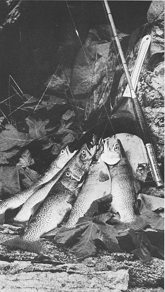 THE ANGLER'S REWARD.
Perhaps no state in the Union has as many varieties of real fighting trout as Washington; including especially the mountain, rainbow, cut throat, beardsley, crawford, lake, steel head, and eastern brook, in all lakes and mountain streams. Black bass and perch are very plentiful in the land-locked lakes; and certain sections produce also many varieties of white fish, sun fish, croppies and cat fish. The waters of Puget Sound, the harbors and the Columbia River contain many species of salmon.
The commonest and most hunted large game is the deer, found chiefly in the hills and mountains, although in some localities it invades the domains of domestic animals. The leading varieties noted are the mule and black tail, there being also a few white tail. In the Olympic region are large herds of elk and a few in the southwest and northeastern counties. These, however, are temporarily protected by law. Mountain goat and sheep are found in the rocky peaks of the Cascades; while the black and brown bear are found in the wooded hills and mountains; also occasionally cougars, wild cats, and wolves. These latter, however, keep themselves far removed from the main traveled roads; only by much care are they located, so that the timid need have no fear of wandering in the woods alone.
In order to insure plenty of game at the right season of the year, five trout hatcheries are supported by the state and a number by separate counties. The state hatcheries alone planted 4,399,050 trout in 1913. The common birds are propagated and set free at both public and private expense.
With nature's already liberal supply, and the state and counties blending their united efforts to supplement and conserve, the true sportsman will never regret casting his lot with the state of Washington, where his outdoor propensities may be encouraged to the fullest degree.[94]
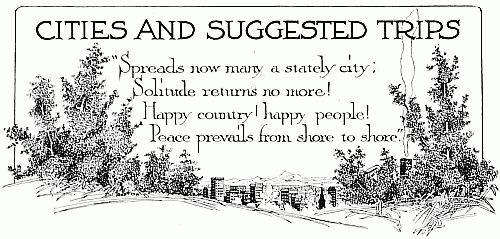
The cities of Washington are all beautiful in their natural setting, and reflect the originality, the energy and love for artistic design of the people who dwell within them. In western Washington they are usually protected by verdure covered hills, and built to overlook the Sound, the harbors, or the rivers. The smaller towns nestle close to pretty streams which supply power and water. Snow capped mountains are always visible.
The east side cities are usually near the larger streams and adorned with trees, both native and cultivated. Forests are lacking in the Columbia River Plain, and the brown hills are continually in sight. In the northern counties, however, the native trees and mountains again become more prominent.
All cities are well provided with spacious and comfortable hotels. Theaters, business blocks, school houses, churches, and other public buildings are of modern structure; the streets are generally paved; practically all have electric lights and pure running water. The homes are planned both for beauty and comfort, and are often surrounded by green lawns or gardens where hundreds of species of beautiful flowers reach perfection.
The following pages are devoted to brief descriptions of the larger centers, and the more important trips from each. They are arranged to represent a tour about the state and in the order in which one might visit all, or certain ones only, with the least expenditure of time. The cities given have commercial organizations prepared to give further information regarding their respective localities.
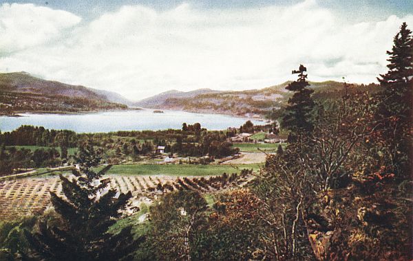 THE COLUMBIA RIVER, FROM WHITE SALMON
SPOKANE: Metropolis of the Inland Empire, and second largest city in the state. Population about 136,000. Its growth was over 500[96] per cent in twenty years. Situated on both sides of the Spokane River with wonderful waterfalls in heart of city. One of the leading railroad centers in the west, it has five transcontinental lines operating on their own tracks and two others over joint tracks. Its hotels, theaters, public buildings, and homes, are among the most costly in the northwest. Its fifty-two parks, comprising 1,933 acres valued at more than $2,000,000, give the largest per capita park area of any city in the United States. Splendid boulevards within the city connect with broad highways leading to distant points in the Inland Empire. There is a boating course two miles long above the city, a municipal bathing pool a mile from the business center, and a zoo at Manito Park. One may see large manufacturing establishments, irrigation, wheat fields, and many big development projects within a limited area. It is the home of the North Pacific Fruit Distributors, which markets 60 per cent of the apples of Washington, Oregon, Idaho and Montana.
A few of the more important trips should include the following:
WALLA WALLA: (Many Waters.) The "Garden City," at one time said to "have more bicycles, more pianos, more flowers, and more pretty girls than any other city in the Northwest." Population 23,275. One of the richest farm regions in the world is adjacent. Next to Vancouver, oldest city in the state, and home of first white woman in the Northwest. Picturesque hills, with gentle slopes, usually covered with waving grain, surround it; while many a little stream, protected by cottonwoods and birches, winds towards the larger rivers. The N. P. and O. W. R. & N. railways, and Inland Empire Highway pass through. Trees line the well paved streets and produce a particularly artistic effect. Here is located Whitman College, on the site where Stevens made his famous treaty with the Indians; the State Penitentiary; the Blalock Fruit Company's 1,600-acre fruit farm; old Fort Walla Walla, and the oldest bank in state.
Trips should include:
 A SHADY BOULEVARD IN WALLA WALLA.
NORTH YAKIMA: Metropolis of the Yakima Valley, where the largest body of irrigated land in the state lies. Population about 19,000. All points in the lower Yakima and in South Central Washington are easily reached. Business and public buildings are of artistic design. City is symmetrically laid out with very wide streets, well shaded. It grew from a village to the metropolis in a few years, keeping pace with the rapid development evident all up and down the valley. A blossom festival is held annually in the springtime, and the State Fair in September. A sight-seeing electric car will take one forty miles through alfalfa fields and orchards where the results of irrigation are displayed. Good automobile roads extend in every direction.
Trips should include:
ELLENSBURG: Metropolis of Kittitas Valley, of which 60,000 acres are irrigated, while the High Line, proposed, will water 84,000 acres more. A level country checkered with orchards, oat fields and dairy farms gradually rises to the foot hills of the Cascades, where grand mountain scenery is revealed. Estimated population about 6,000. One of the three State Normals is here. Splendid highways.
Suggested trips:
WENATCHEE: The metropolis of North Central Washington, and gateway to the Wenatchee, Columbia, Entiat, Okanogan, Methow and Lake Chelan regions. Situated at the confluence of Columbia and Wenatchee rivers, with the foot hills of the Cascades a few miles away. One continuous orchard is seen up and down both valleys. Auto roads lead in all directions to innumerable points of interest, and the navigable Columbia provides transportation for many miles. A labyrinth of lakes and beautiful farms are within easy reach. The mountain scenery is impressive. For a commanding view one should climb Saddle Rock. Mounts Rainier, Hood and Baker, also the smoke of Walla Walla are visible from some points. Population 5,000.
Suggested trips:
SNOHOMISH: "Garden City," second in importance and oldest in Snohomish county. Located in the midst of the rich dairy country just east of Everett, with which city it is connected by interurban and river boats, as well as by steam trains. See "Everett" for trips.
EVERETT: "City of Smokestacks." Population about 32,000. Located on a sightly peninsula formed by Puget Sound and the Snohomish River. Views on every side are superb. The Cascades and Olympics are clearly visible, especially Mounts Baker, Rainier and many lesser peaks, including Pilchuck, always conspicuous, near by. Parks, boulevards and playgrounds, and beautiful homes give artistic completeness. The only arsenic plant in the United States is here. It is an important manufacturing city, especially in lumber, shingles, machinery and paper. Beginning at the city limits a rich dairy country extends to the Cascades. A yearly festival called the "Kla How Ya" is held in July. The G. N., N. P., C, M. & St. P. railways and three interurbans center here, while automobile roads, including the Pacific Highway, lead to the mountains and to lake resorts.
Suggested trips:
SKAGIT VALLEY CITIES: Mount Vernon, county seat, Burlington, Sedro Woolley and La Conner are important centers in the Skagit Valley, famous both for its beauty and because it has some of the richest farm land in the world, extending for miles and level as a table. Dykes are built to protect the country from being overflowed. Oat yields have been known as high as 175 bushels to the acre; while dairying is nowhere in the state more important, two condenseries being supported[101] in Mount Vernon. Two main railroad lines with branches, besides an interurban, serve the section. The Pacific Highway and Skagit County Highway cross at Burlington. Auto trips are made direct to Bellingham, Anacortes, Everett and east into the mountains, visible from almost every point. Many beautiful lakes in region.
ANACORTES: A seaport town on Fidalgo Island at western extremity of Skagit county. Population about 6,000. G. N. railway and Sound steamers supply transportation. The Skagit County Highway starts here. Salmon canneries, lumber and shingle manufacturing and ship building may be seen to advantage.
Suggested trips:
BELLINGHAM: Population about 30,000. Metropolis of Northwestern Washington and fifth in size in state. In vicinity are the largest salmon cannery in world and one of largest lumber and saw mills on coast. The Olympics, Selkirks and Cascades crowned by Mount Maker are visible from its streets. Sehome Hill, where one of the state normal schools is located, permits a view of Bellingham Bay where the ships of the world anchor. In front of city lie San Juan Islands; fishing craft may be seen. 150 acres of parking area have been provided. Pretty roads lead through big timber in various directions. At its door stands Mount Baker, one of main tourist objectives of the northwest, and one of the most interesting mountains on the continent. The annual Marathon races, participated in by the athletes of the world, are made to its summit and back to Bellingham.
Suggested tours:
PORT ANGELES: Northern gateway to Olympic Peninsula and nearer the ocean than any other city in the Puget Sound country. Harbor is one of the best. Railroads are just building in. Extensive improvements are taking place. It has one of the largest saw and shingle mills in the world. No prettier scenery anywhere.[102]
Suggested trips:
PORT TOWNSEND: "Key city" to Puget Sound. Situated on Quimper Peninsula with Port Townsend Bay and Admiralty Inlet, Discovery Bay, and Straits of Juan de Fuca on three sides. From Mountain View Park a broad outlook is obtained, which includes, besides the waters mentioned, the Olympic and the Cascade Mountains and hundreds of minor details. Other beautiful parks are Chetzemoka and Lucinda Hastings. Less rain falls than elsewhere in Western Washington. Pretty driveways decorated with rhododendrons, unusual boating possibilities and easy approach to the Olympics, make the region ideal for summer outings. Adjoining the city is Fort Worden, headquarters for the Puget Sound system of defenses, where the 6th Artillery Band, one of the best in the service, renders daily programs. Several of the fastest passenger steamers on the Sound stop daily.
Suggested trips:
SEATTLE: Metropolis of the Northwest, with an estimated population of 325,000. It is a city of hills, occupying the sightly eminences, valleys and plateaus lying between Lake Washington and Puget Sound, but sloping gradually to the water's edge in either direction. Its entire area is 94.47 square miles, which includes two large fresh water lakes, Lake Union and Green Lake, and nearly encompasses the Harbor known as Elliott Bay. It is gridironed with 237 miles of street car lines while an elaborate boulevard system of more than thirty miles connects its thirty-eight parks, which have a total area of 1,428 acres. There are also a number of children's playgrounds. From nearly all points there is visible either the Sound with the snow capped Olympics or Lake Washington and the Cascades.
Seattle is a city marvelous both for its enterprise and for its beauty. Hills have given way to business blocks and thorofares, and at the same time have increased the area of the city by supplying[104] material for filling in the tide flats, now occupied by the most valuable factory sites. The forty-two story Smith Building is the highest in the world outside of New York. At Salmon Bay the Government is constructing its second largest locks in a canal to connect the Sound with Lake Washington. Six transcontinental lines have their terminals in this city which is also the gateway to Alaska and the home port of the Great Circle Route.
Within the city one should visit:
Outside trips should include:
PUYALLUP: A famous berry center in the rich Puyallup Valley. Over a quarter million dollars worth of berries are shipped annually. All Western Washington railroads serve it, while electric interurbans and auto cars over the Pacific Highway provide several trips per hour to Tacoma. The Western Washington Experiment Station is here and the Western Washington Fair is held yearly. It is the transfer point for Orting, the site of the State Soldiers' Home, and Fairfax, northern entrance to Mt. Rainier National Park. For trips, see "Tacoma."
TACOMA: Population 105,000. Third city in size and importance in the state. Picturesquely located on Commencement Bay, one of the great harbors of Puget Sound. The Olympics complete the view toward the west while the Cascades on the east are overshadowed by Mt. Rainier (or Mt. Tacoma), which seems to rise from within city limits. A complete system of parks, play grounds and boulevards add to the natural beauty. The residence portion of the city overlooks an extensive manufacturing section which claims the largest meat packing establishment in the west, the largest grain warehouse in the world, and the largest smelter west of Butte City, with one of the tallest cement smokestacks in the world. Tacoma is also the largest flour milling center west of Minneapolis and the fifth city in exports and imports on the coast. Miles of unsurpassed highway lead south through a vast natural park consisting of broad prairies dotted with lakes and covered with groves of oak trees; or southeast into the famous Puyallup Valley fruit and berry district. Its improved parks comprise 1,120 acres, 640 of which constitute Point Defiance park at northern extremity of peninsula, and 30 acres, Wright Park in center of city, having 3,000 trees and shrubs in 350 different varieties.[107]
Other remarkable features are a natural amphitheater or stadium, seating 38,000 people; the highest lift bridge in the world and the only one on a grade; the Northern Pacific shops and a Union passenger depot, model of its kind; and a speedway of 2-1/10 miles where the motor races of the northwest are run. A rose carnival is held annually.
Suggested trips outside of city:
OLYMPIA: "The Pearl of Puget Sound," the "Salem of the Northwest," and seat of state government. Three railroads and four state highways converge here. The waters of Puget Sound reflect the low verdure covered hills protecting the city and extending out along the shores. The mountains are seen on every side. At the edge of city, on the north, is Priest Point Park, of 160 acres. The end of the Oregon trail is marked by a monument in Capitol Park in the heart of the city. Tumwater, a mile away, is the site of the first settlement on Puget Sound. In Olympia the first store was opened for business in the state. The Old New England Inn, formerly the scene of all territorial functions, is marked forever by a brass plate embedded in the sidewalk, and the homes of the first Territorial Governor, Isaac I. Stevens, and General R. H. Milroy are still to be seen.
Trips should include:
ABERDEEN AND HOQUIAM: Two cities on Grays Harbor, connected by electric interurban. The gateway to the Olympics by the southern route. Combined population about 29,000 (over 18,000 in Aberdeen),[108] Near by are some of the largest trees in the state. Splendid highways, an increase of nearly 400 per cent in 14 years, due chiefly to lumbering and fishing industries, but farming and dairying are gaining.[109] including the Olympic, lead in various directions, while the broad, firm ocean beaches a short distance away offer miles of excellent motor race tracks. Three transcontinental trains serve the district.
Suggested trips:
 HARBOR COUNTRY BEAUTIES.
SOUTH BEND AND RAYMOND: Two progressive cities in southwestern Washington on Willapa Bay, one of the best harbors on Coast. Lumbering, farming, shell and salmon fisheries, and cranberry culture are sustaining industries. Read also "The Harbor Country."
CENTRALIA AND CHEHALIS: Important railroad centers four miles apart, connected by trolley and half way between Tacoma and Portland. Combined population about 15,500 (10,000 in Centralia). A rich dairy and farm country surrounds them, formed by the Chehalis, the Newaukum and Skookumchuck rivers. About 44 trains leave Centralia daily. Coal mines, farms and lumber are important. Between cities are Southwest Washington Fair Grounds. At Chehalis, county seat, is a large condensery. The Pacific Highway and the Rainier National Park Highway cross near by.
Suggested trips:
VANCOUVER: Oldest city in state; settled in 1824 by the Hudson Bay Company. It slopes gently towards the Columbia river, visible from all points. To the north are the prune orchards for which Clarke county is noted, and the English walnut seems to have found its ideal habitat. Adjoining city are the Vancouver Barracks, occupying 640 acres of land, 300 of which constitute a natural park with many winding roads. State schools for the deaf and the blind are located near. What is said to be the oldest apple tree in the Northwest still thrives. Electric lines extend to the outlying districts, also to Portland, Oregon, while auto drives may be made along the river, nowhere more picturesque, or through the surrounding prosperous farming districts.
Suggested trips:
 A FIG TREE AT VANCOUVER.
GOLDENDALE: County seat of Klickitat county; reached via S. P. & S. railway. Surrounding country is one immense beauty spot with valleys, mountains, prairie, and timber. Mounts Hood, Adams, and St. Helens, are always visible. Many beautiful trips may be taken. Historical sights are numerous.[111]

When you have seen Washington, the vast territory of Alaska awaits you. Alaska, the last of the undeveloped free empires! This region is so extensive that even the state of Washington would be lost in its midst, for its area is equal to that of the original thirteen colonies, with Maine, Vermont, Ohio, Indiana, Tennessee, Kentucky and Michigan thrown in, or one-fifth of the entire United States. It has a range of latitude of 1,100 miles, while its extreme longitude would reach from the Atlantic to the Pacific.
In proportion to its vastness, so are its wonders. Stupendous mountains reach to three and nearly four miles in height, loftier than any others in the United States or its possessions. The Yukon River is 2,300 miles in length and its nearest rival, 1,000 miles. The biggest glaciers in North America are here, which make those of Europe look like mere pygmies, and volcanoes still in eruption may be viewed from a safe point. The scenery produced by the green rock-bound fiords with the snowy peaks beyond is truly magnificent.
It is also a great treasure house. By the end of 1914 there had been produced, $540,000,000, or about 75 times the price paid for its purchase, representing over $15,000.00 for each white person now inhabiting it. Almost half was from gold mining and within the last twenty years. The rest was from fisheries, seals, furs, copper and silver—permanent resources of region.
Alaska is not cold and bleak like Labrador, although its latitude is similar. The Japan current acts as it does on Washington and as the Gulf Stream affects England. Both plant and animal life flourish and about 100,000 square miles of land are available for agricultural purposes.
To partially realize its glories take the inside passage trip from Seattle—a thousand miles of calm sea.[113]
Obvious punctuation errors repaired.
The remaining corrections made are indicated by dotted lines under the corrections. Scroll the mouse over the word and the original text will appear.
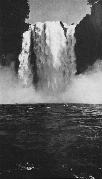
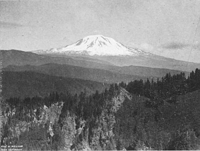
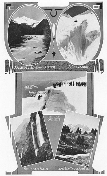
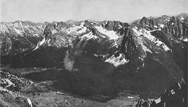
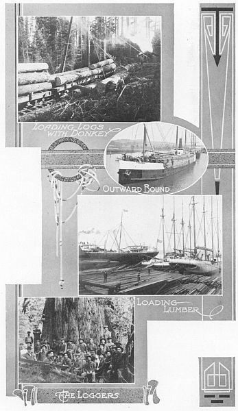
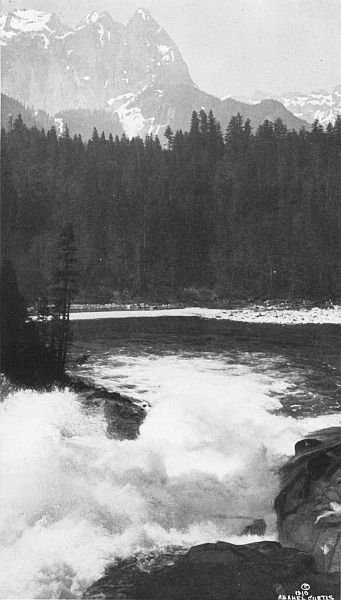
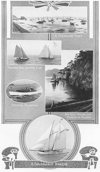
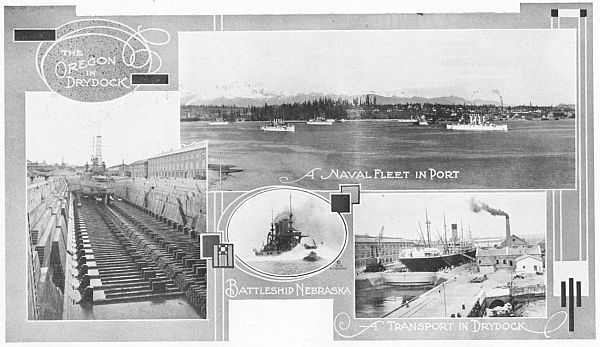
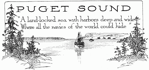
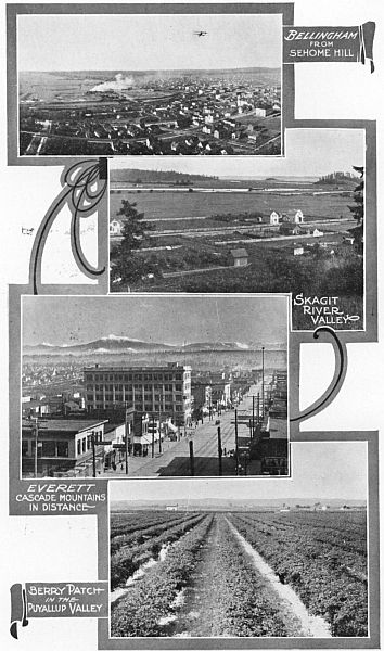
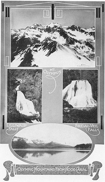
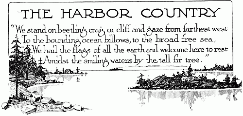
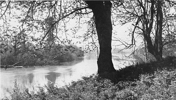
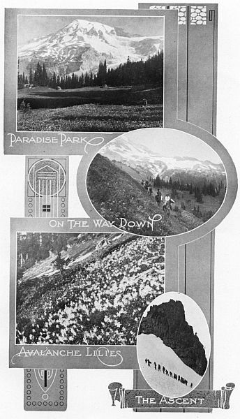
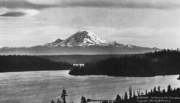
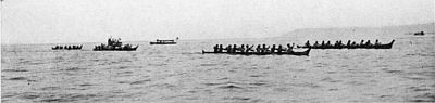
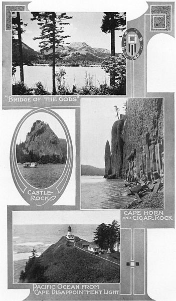
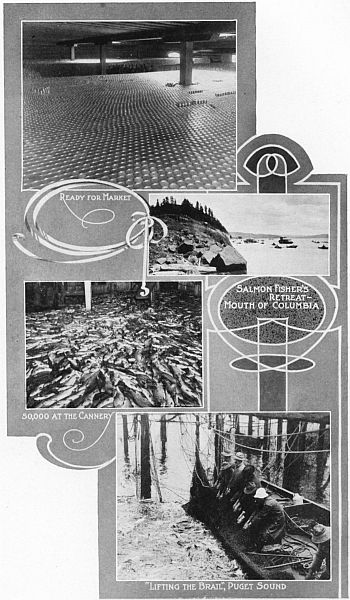
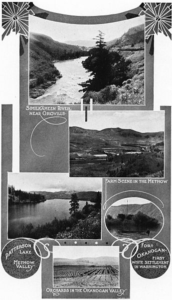
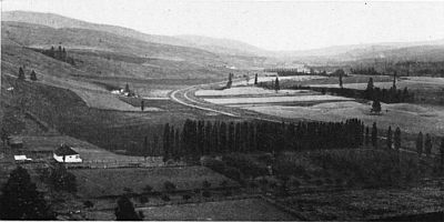
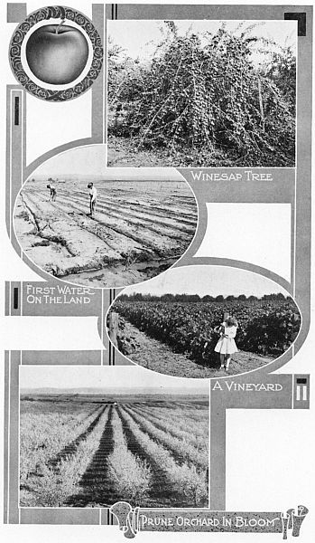
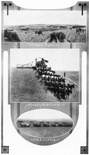
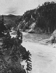
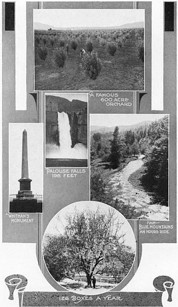
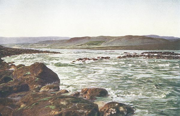
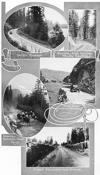
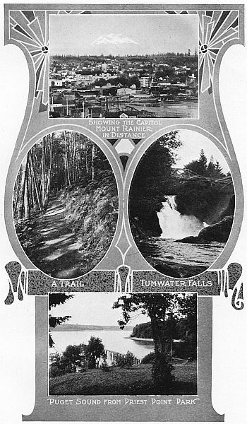
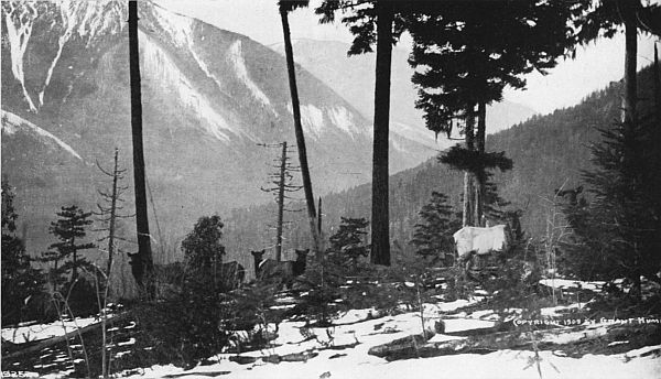
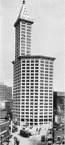
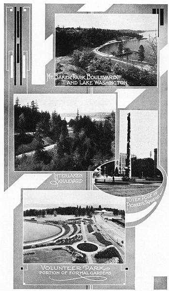
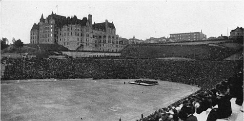
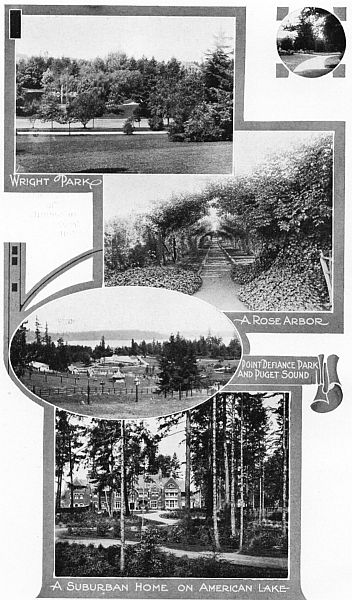
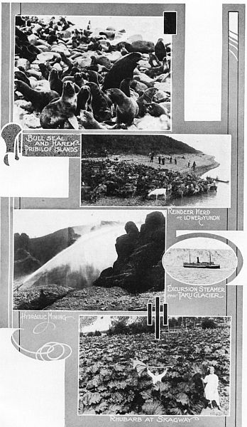
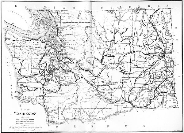
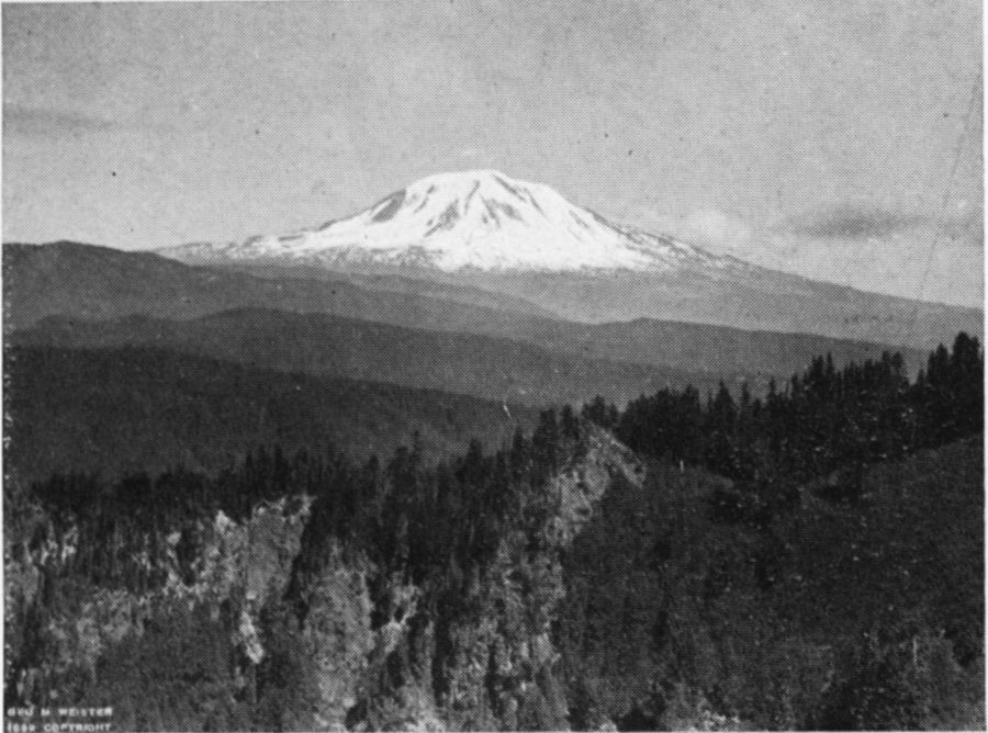
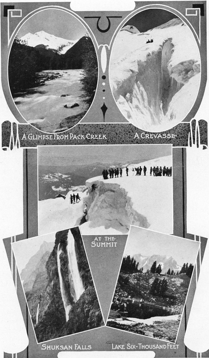
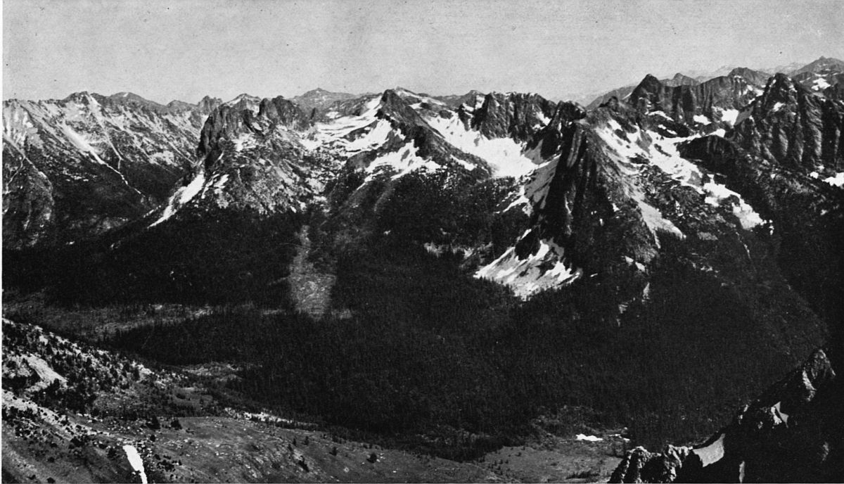
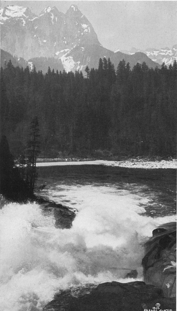
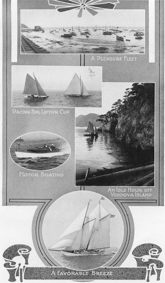
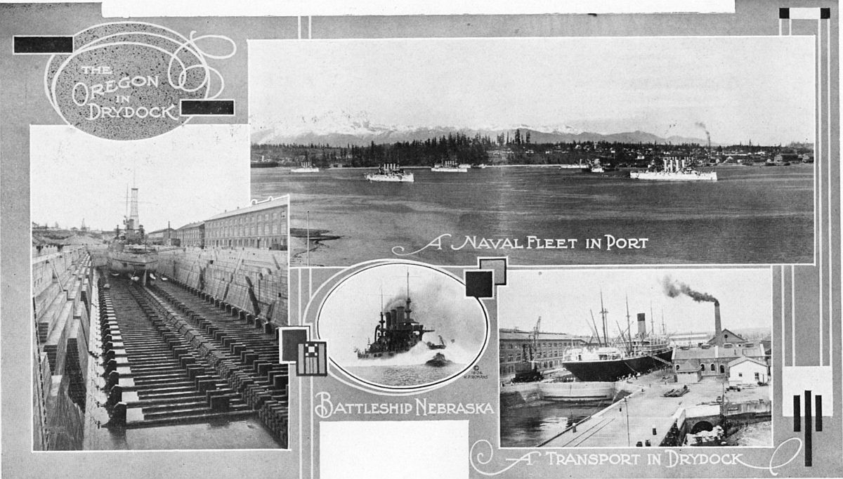
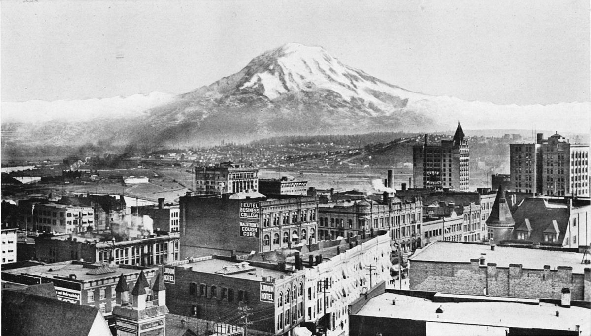
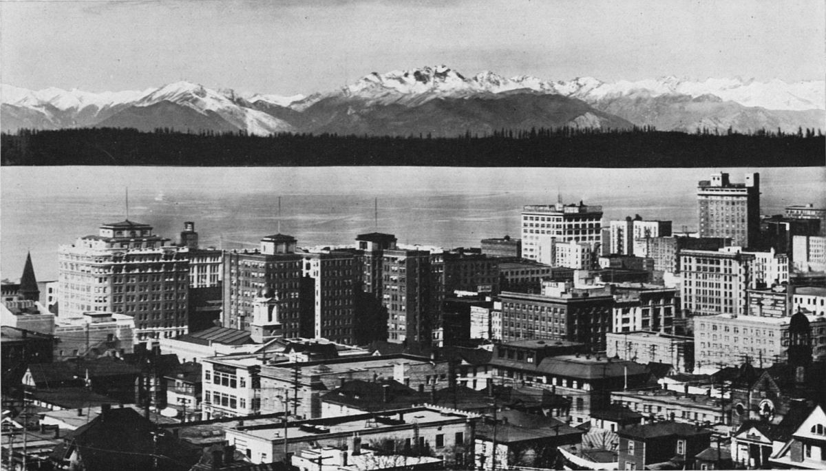
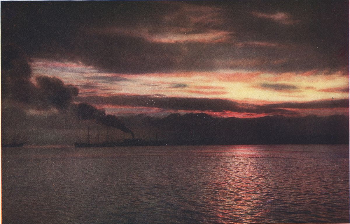
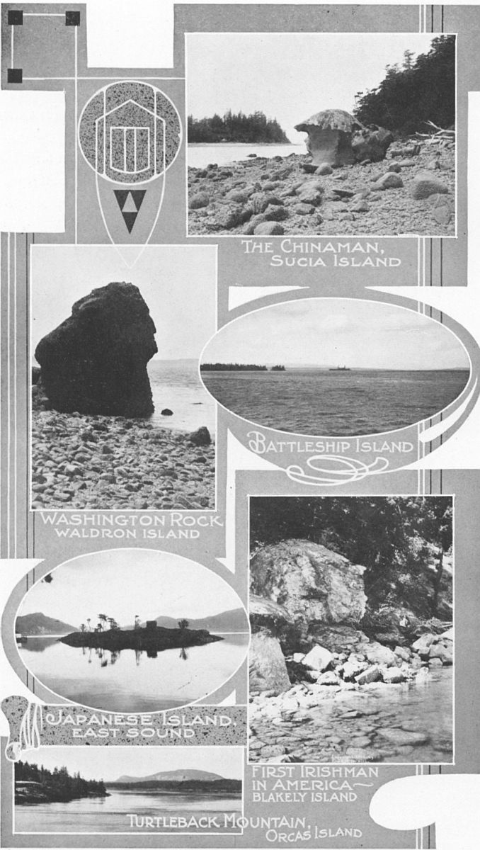
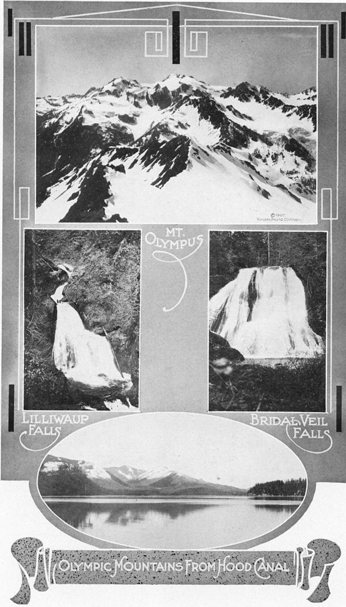
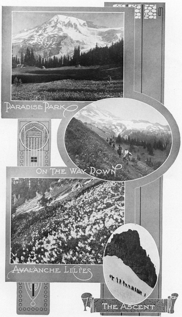
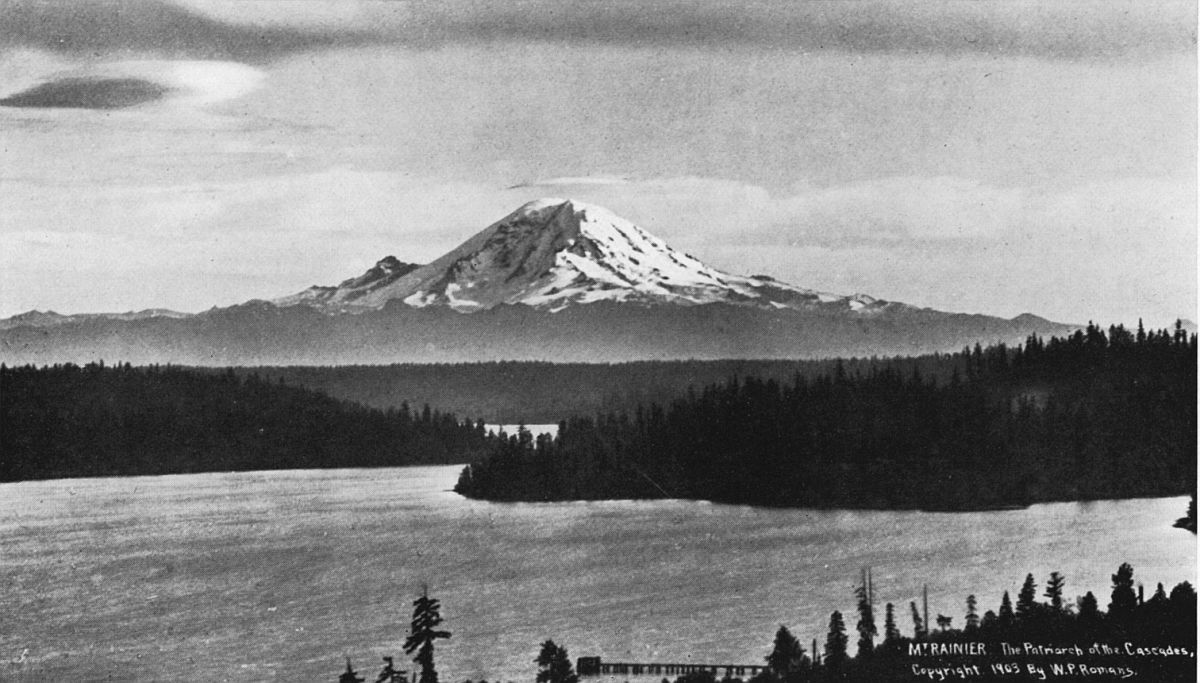
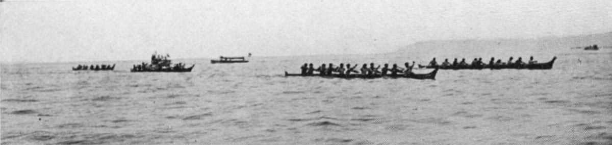
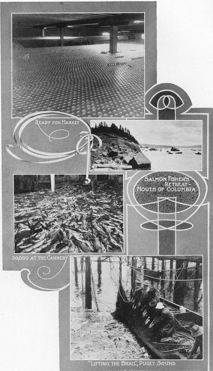
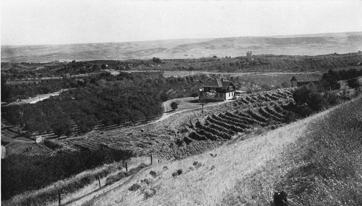
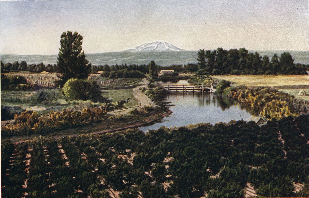
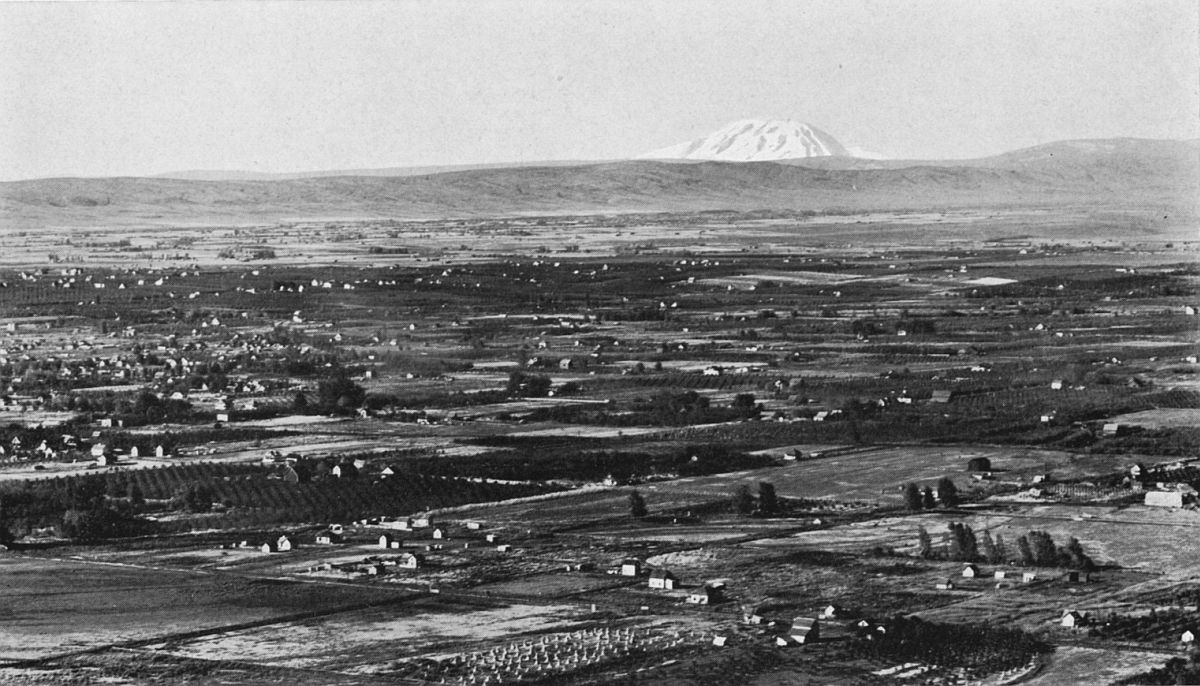
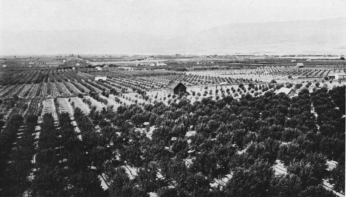
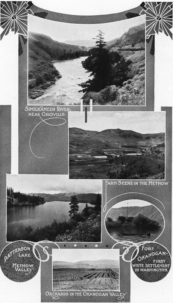
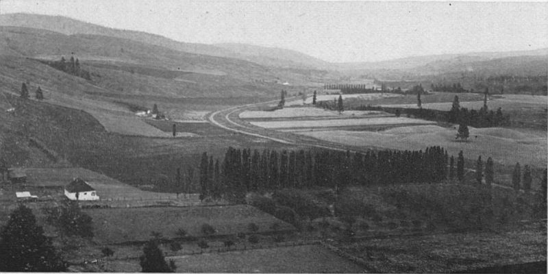
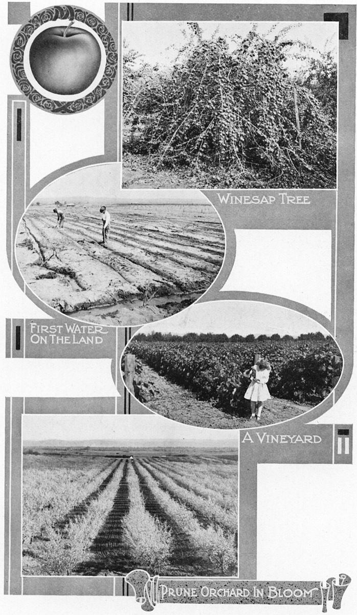
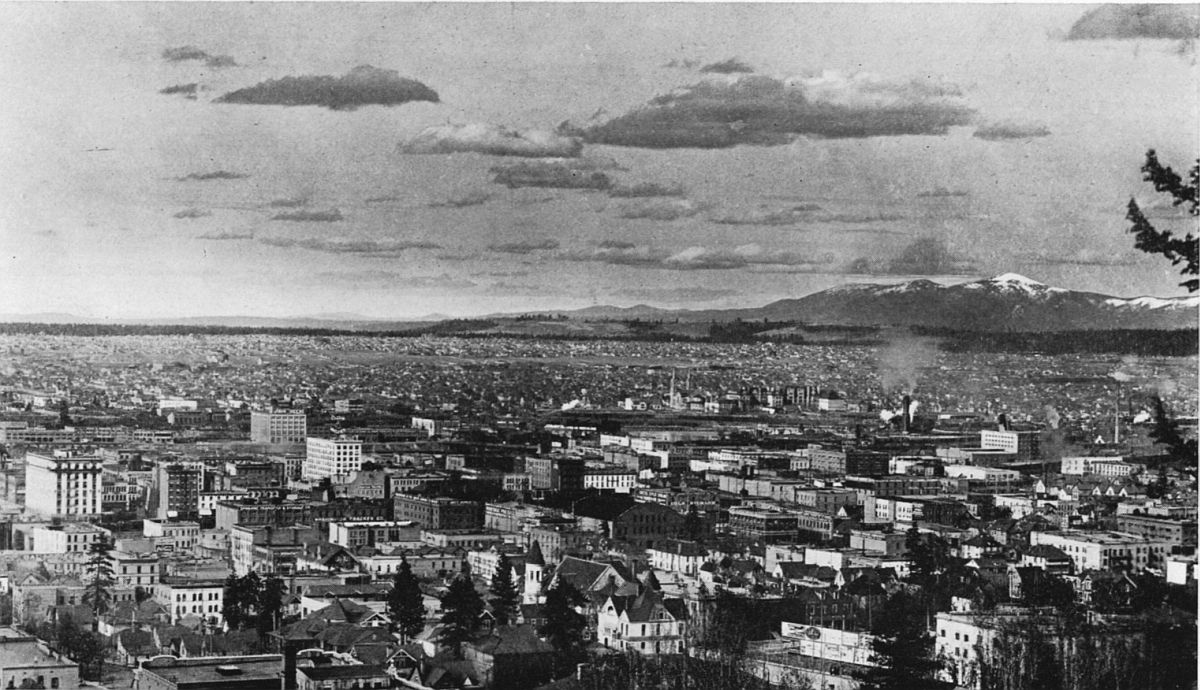
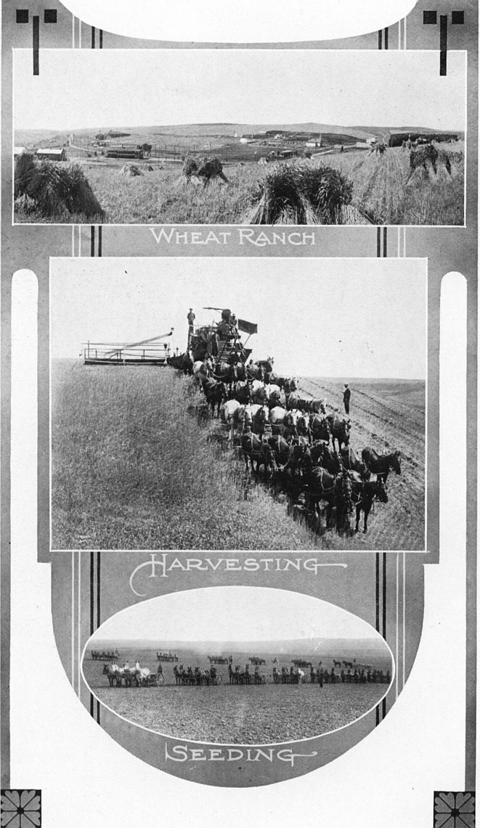
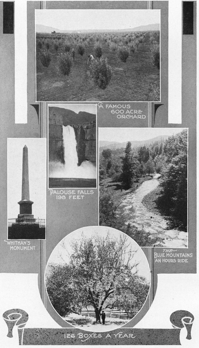
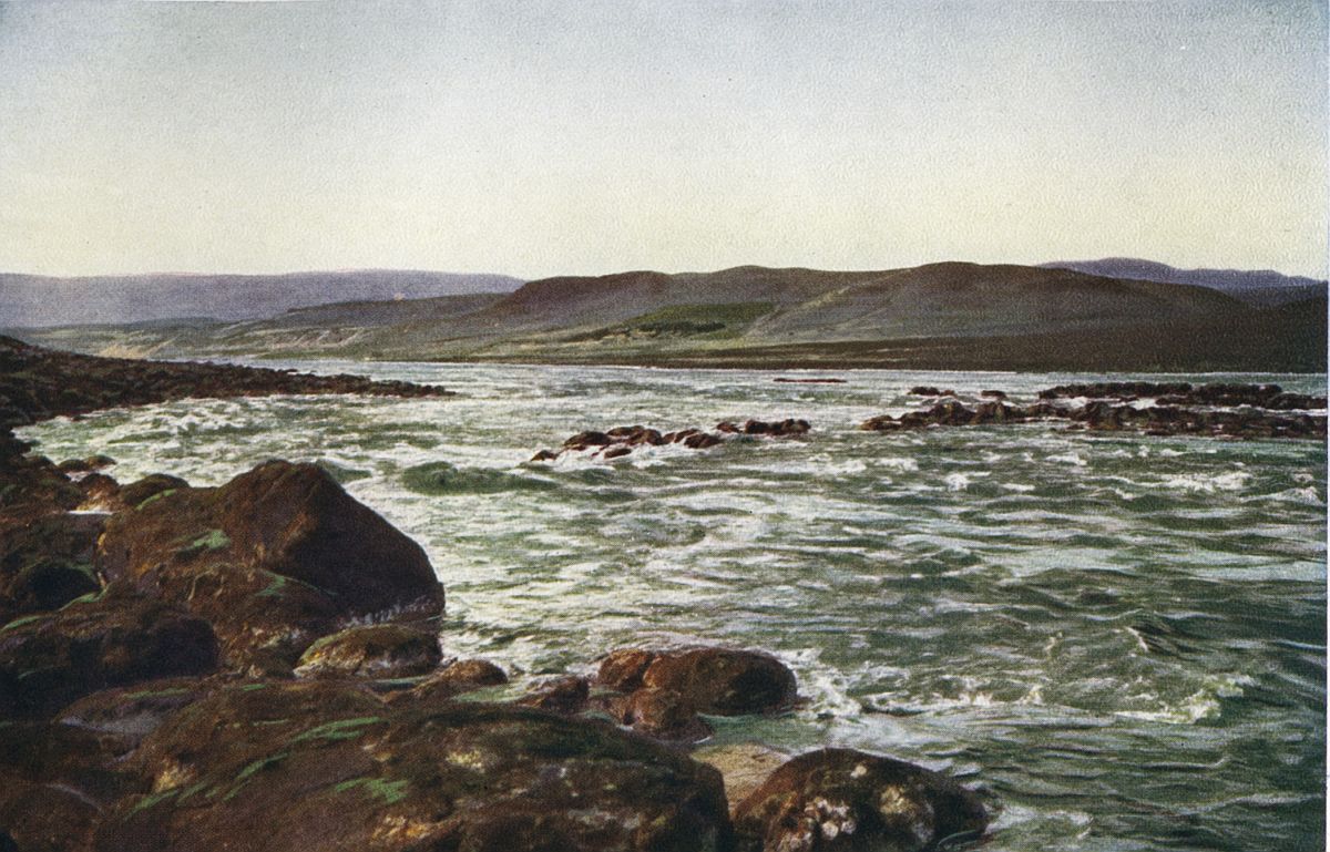
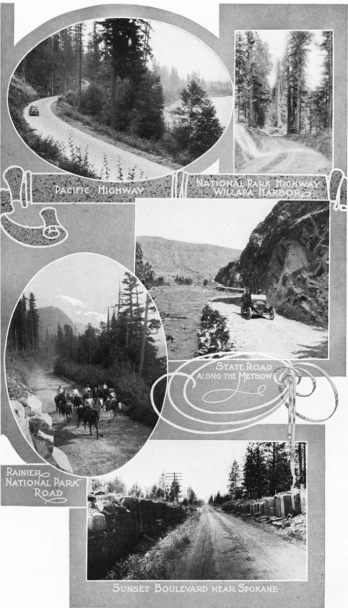
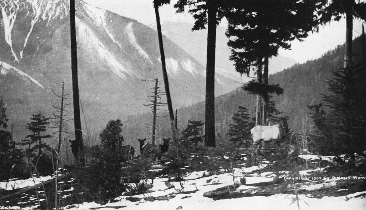
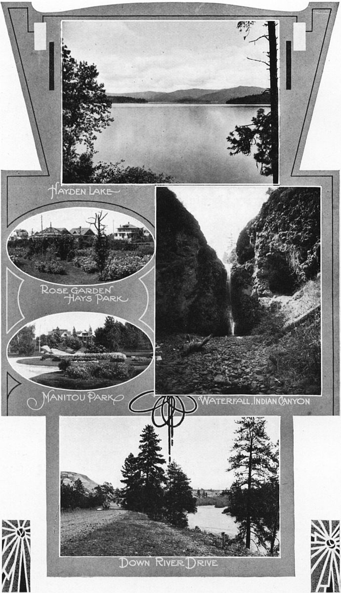
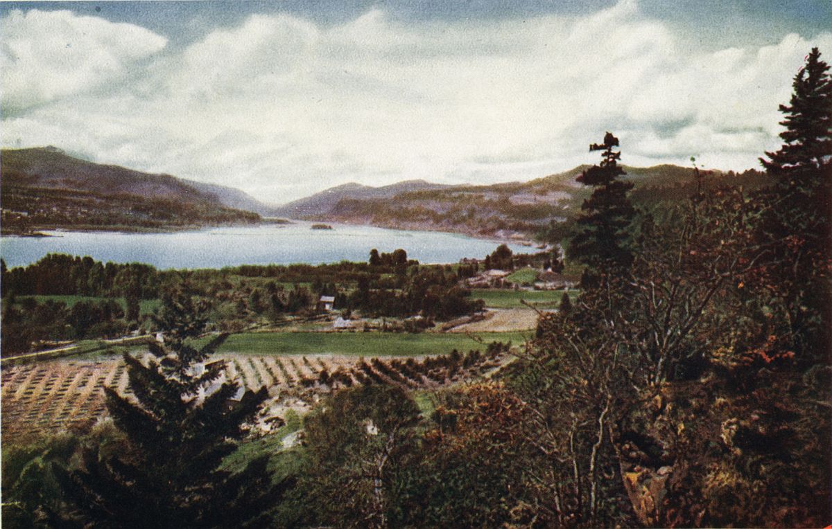
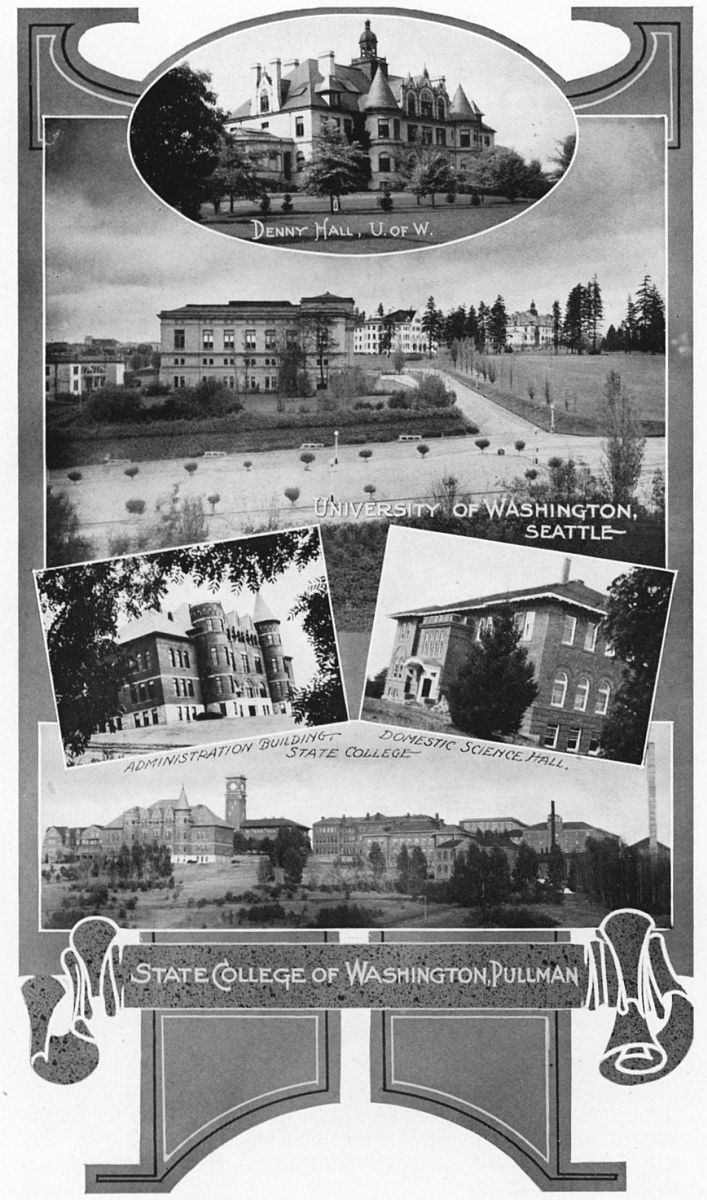
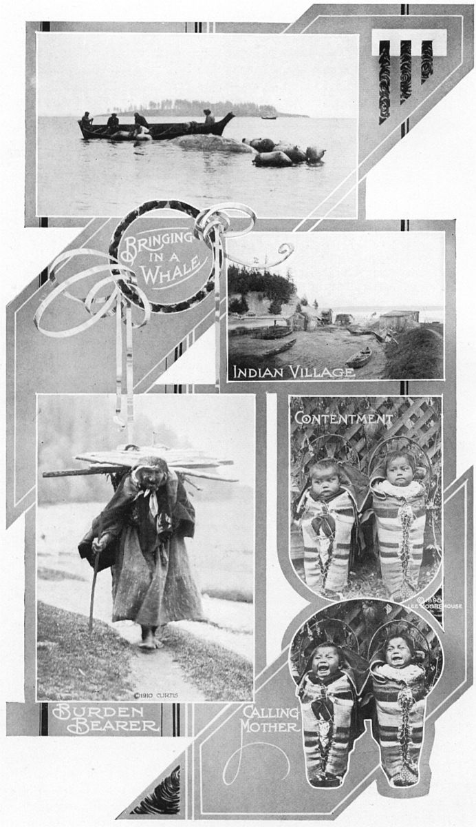
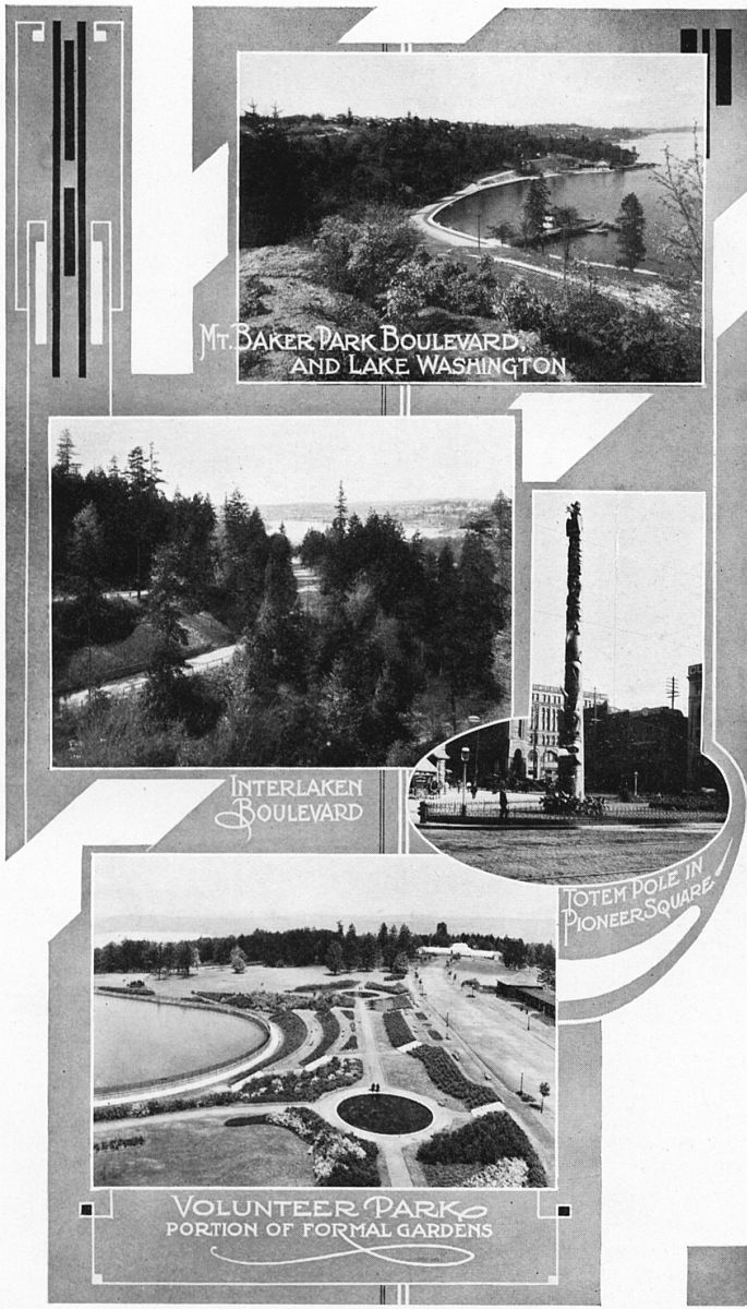
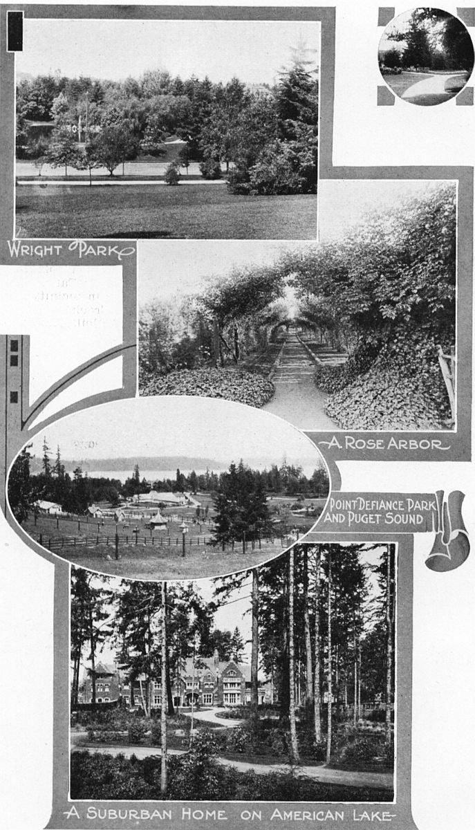
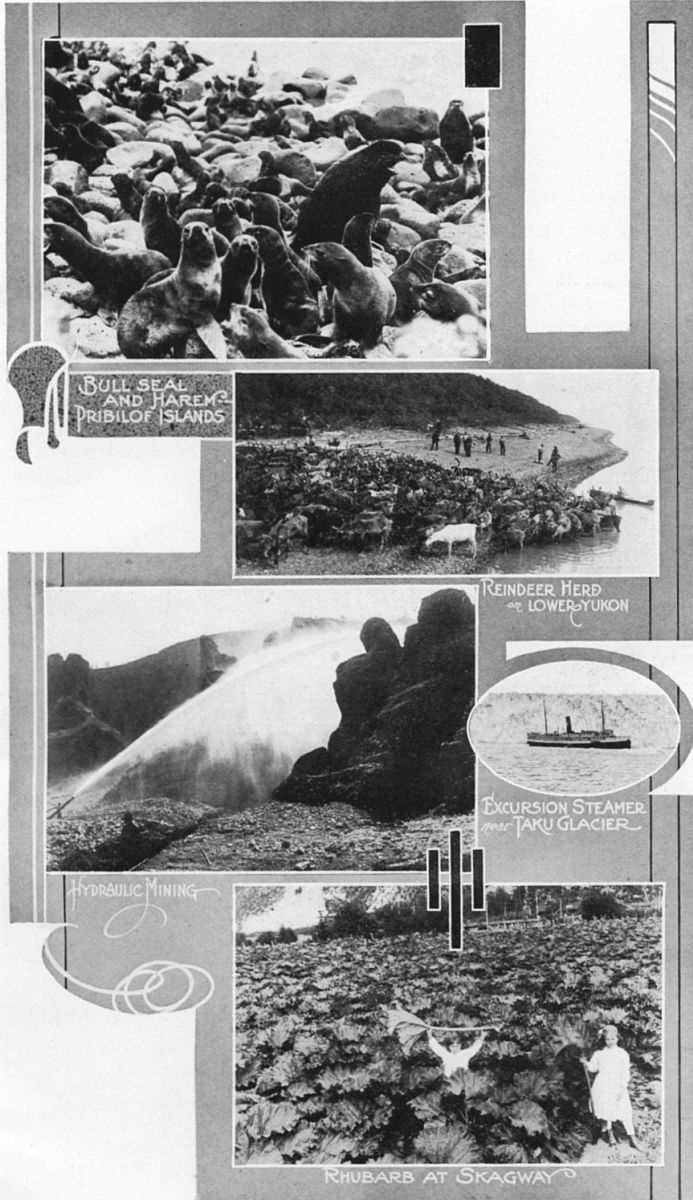
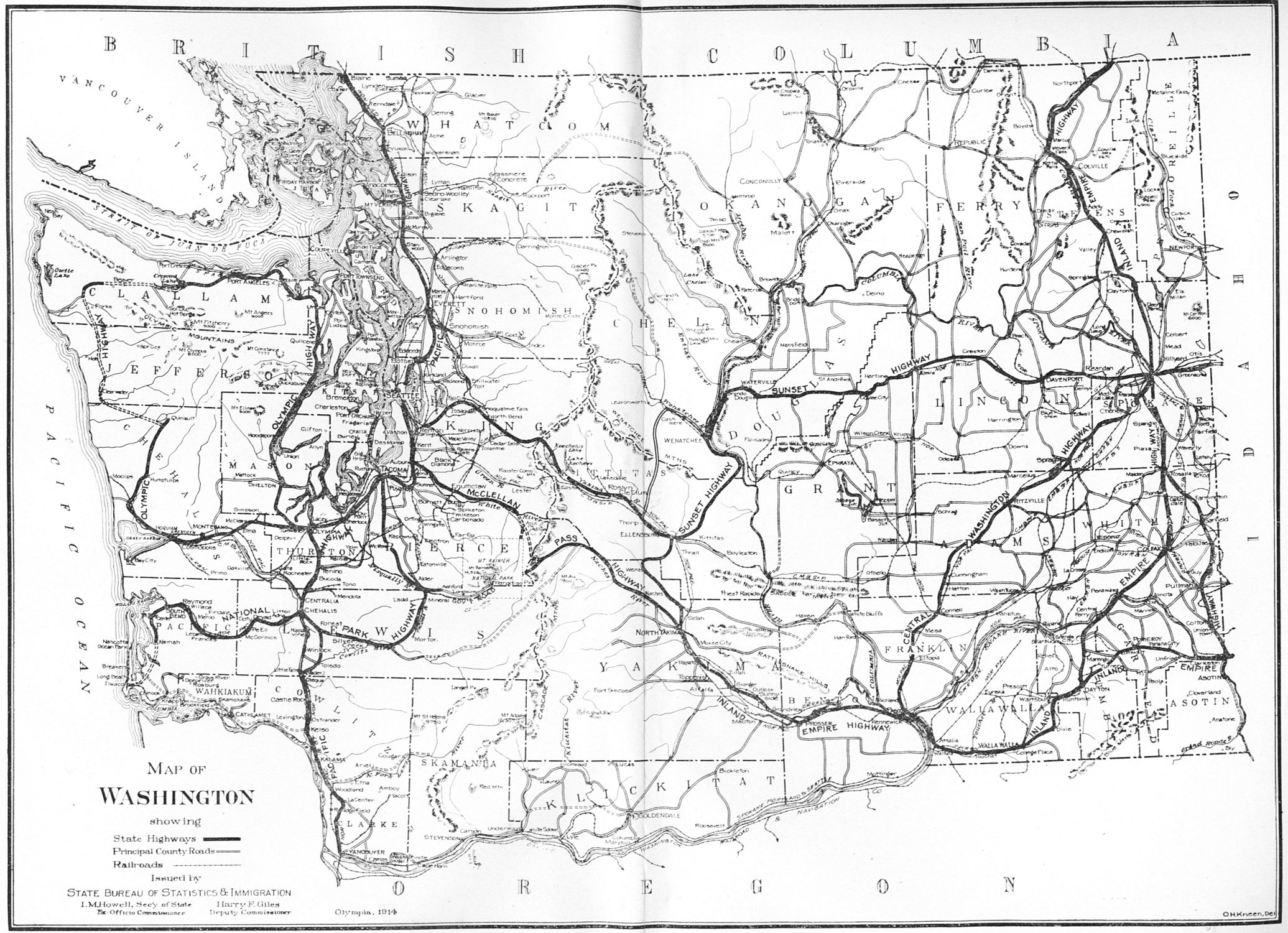