 PRINCIPAL TRANSPORTATION LINES AND REGIONS OF LARGEST COMMERCE
This eBook is for the use of anyone anywhere at no cost and with
almost no restrictions whatsoever.  You may copy it, give it away or
re-use it under the terms of the Project Gutenberg License included
with this eBook or online at www.gutenberg.org
Title: Commercial Geography
A Book for High Schools, Commercial Courses, and Business Colleges
Author: Jacques W. Redway
Release Date: March 20, 2008 [eBook #24884]
Language: English
Character set encoding: ISO-8859-1
***START OF THE PROJECT GUTENBERG EBOOK COMMERCIAL GEOGRAPHY***
A Book for High Schools
Commercial Courses, and
Business Colleges
BY
Author of "A Series of Geographies," "An Elementary
Physical Geography," "The New Basis of Geography"
CHARLES SCRIBNER'S SONS
NEW YORK :::::::::::::::::: 1907
Copyright, 1903, by
JACQUES W. REDWAY
The quiet industrial struggle through which the United States passed during the last decade of the nineteenth century cannot fail to impress the student of political economy with the fact that commercial revolution is a normal result of industrial evolution. Within a period of twenty-five years the transportation of commodities has grown to be not only a science, but a power in the betterment of civil and political life as well; and the world, which in the time of M. Jules Verne was eighty days wide, is now scarcely forty.
The invention of the Bessemer process for making steel was intended primarily to give the railway-operator a track that should be free from the defects of the soft, wrought-iron rail; in fact, however, it created new industrial centres all over the world and brought Asia and Africa under commercial conquest. The possibilities of increased trade between the Atlantic seaboard and the Pacific Coast States led to the building of the Northern Pacific and Great Northern Railways. But when these were thoroughly organized, there unexpectedly resulted a new trade-route that already is drawing traffic away from the Suez Canal and landing it at Asian shores by way of the ports of Puget Sound. It is a repetition of the adjustment that occurred when the opening of the Cape route to India transferred the trade that had gathered about Venice and Genoa to the shores of the North and Baltic Seas.
In other words, a new order of things has come about, and the world and the people therein are readjusting themselves to the requirements made upon them by commerce. And so at the beginning of a new century, civilized man is drawing upon all the rest of the world to satisfy his wants, and giving to all the world in return; he is civilized because of this interchange and not in spite of it.
The necessity for instruction in a subject that pertains so closely to the welfare of a people is apparent, and an apology for presenting this manual is needless. Moreover, it should not interfere in any way with the regular course in geography; indeed, more comprehensive work in the latter is becoming imperative, and it should be enriched rather than curtailed.
In the preparation of the work, I wish to express my appreciation of the great assistance of Principal Myron T. Pritchard, Edward Everett School, Boston, Mass. I am also much indebted to the map-engraving department of Messrs. The Matthews-Northrup Company, Buffalo, N.Y.
J.W.R.
| CHAPTER | PAGE | |
| I. | General Principles | 1 |
| II. | How Commerce Civilized Mankind | 7 |
| III. | Topographic Control of Commerce | 17 |
| IV. | Climatic Control of Commerce | 29 |
| V. | Transportation—Ocean and Inland Navigation | 39 |
| VI. | Transportation—Railways and Railway Organization; Public Highways | 62 |
| VII. | Factors in the Location of Cities and Towns | 81 |
| VIII. | The Cereals and Grasses | 88 |
| IX. | Textile Fibres | 105 |
| X. | Plant Products of Economic Use—Beverages and Medicinal Substances | 127 |
| XI. | Gums and Resins Used in the Arts | 141 |
| XII. | Coal and Petroleum | 147 |
| XIII. | Metals of the Arts and Sciences | 159 |
| XIV. | Sugar and its Commerce | 185 |
| XV. | Forests and Forest Products | 193 |
| XVI. | Sea Products and Furs | 203 |
| XVII. | The United States—The Seaports and the Atlantic Coast-Plain | 211 |
| XVIII. | The United States—The New England Plateau and the Appalachian Region | 219 |
| XIX. | The United States—The Basin of the Great Lakes and the Mississippi Valley | 227 |
| XX. | The United States—The Western Highlands and Territorial Possessions | 247 |
| XXI. | Canada and Newfoundland | 261 |
| XXII. | Mexico—Central America—West Indies | 267 |
| XXIII. | South America—The Andean States | 275 |
| XXIV. | South America—The Lowland States | 285 |
| XXV. | Europe—Great Britain and Germany | 295 |
| XXVI. | Europe—The Baltic and North Sea States | 310 |
| XXVII. | Europe—The Mediterranean States and Switzerland | 320 |
| XXVIII. | Europe—The Danube and Balkan States | 335 |
| XXIX. | Europe-Asia—The Russian Empire | 343 |
| XXX. | The Iran Plateau and Arabia | 349 |
| XXXI. | British India and the East Indies | 358 |
| XXXII. | China and Japan | 367 |
| XXXIII. | Africa | 381 |
| XXXIV. | Oceania | 391 |
| APPENDIX | 398 | |
| INDEX | 399 |
| PAGE | |
| Principal Transportation Lines and Regions of Largest Commerce | x, xi |
| Mean Annual Rainfall | 28 |
| City of New York and Vicinity, with Harbor Approaches | 49 |
| Distribution of Vegetation | 80 |
| North America | 210 |
| Puget Sound | 253 |
| Mexico | 268 |
| South America | 274 |
| British Isles | 299 |
| Germany and Scandinavian Countries | 304 |
| Holland and Belgium | 314 |
| France | 321 |
| Italy | 326 |
| Spain and Portugal | 329 |
| Turkey and Greece | 338 |
| Russian Empire | 342 |
| The Iran Plateau and Arabia | 349 |
| Eastern China | 369 |
| Japan and Korea | 375 |
| Africa | 382 |
| The Commerce of the Pacific | 393 |
PRINCIPAL TRANSPORTATION LINES AND REGIONS OF LARGEST COMMERCETo the Teacher:—The contents of this book are so topicalized and arranged that, if the time for the study is limited, a short course may be selected. Under no circumstances, however, should Chapters V, VI, VIII, IX, XII, and XIII be omitted. A casual inspection of the questions at the end of each chapter will serve to show that they cannot be answered from the pages of the book, and they have been selected with this idea in view. They are intended first of all to stimulate individual thought, and secondly to encourage the pupil to investigate the topics by consulting original sources. The practice of corresponding with pupils in other parts of the world cannot be too highly commended.
The following list represents a minimum rather than a maximum reference library. It may be enlarged at the judgment of the teacher. A good atlas and a cyclopædia are also necessary.
Industrial Evolution of the United States. Wright. Charles Scribner's Sons.
History of Commerce in Europe. Gibbins. The Macmillan Company.
Discovery of America. Fiske. Houghton, Mifflin & Co.
The New Empire. Adams. The Macmillan Company.
Statesman's Year-Book. Keltie. The Macmillan Company.
Outlines of Political Science. Gunton and Robbins. D. Appleton & Co.
The Wheat Problem. Crookes. G.P. Putnam's Sons.
South America. Carpenter. American Book Company.
From the Bureau of Statistics, Department of Commerce, Washington, D.C., the following monographs may be procured:[1]
Commercial China. American Commerce. Commercial Australia. Commercial Japan. Commercial Africa. Commercial India. Statistical Abstract. Great Canals of the World. World's Sugar Production and Consumption.
The following from the Department of Agriculture is necessary:
Check List of Forest Trees of the United States.
Lantern slides illustrating the subjects treated in this book may be procured from T.H. McAllister, 49 Nassau Street, New York. Stereoscopic views may be obtained from Underwood & Underwood, Fifth Avenue and Nineteenth Street, New York.
Commerce and modern civilization go hand in hand, and the history of the one is the history of the other; and whatever may be the basis of civilization, commerce has been the chief agent by which it has been spread throughout the world. Peoples who receive nothing from their fellow-men, and who give nothing in return, are usually but little above a savage state. Civilized man draws upon all the rest of the world for what he requires, and gives to the rest of the world in return. He is civilized because of this fact and not in spite of it.
There is scarcely a country in the world that does not yield something or other to civilized peoples. There is scarcely a household whose furnishings and contents do not represent an aggregate journey of several times around the earth. A family in New York at breakfast occupy chairs from Grand Rapids, Mich.; they partake of bread made of wheat from Minnesota, and meat from Texas prepared in a range made in St. Louis; coffee grown in Sumatra or Java, or tea from China is served in cups made in Japan, sweetened with sugar from Cuba, stirred with spoons of silver from Nevada. Spices from Africa, South America, and Asia season the food, which is served on a table of New Hampshire oak, covered with[Pg 2] a linen spread made from flax grown in Ireland or in Russia. Rugs from Bokhara, or from Baluchistan, cover the floors; portières made in Constantinople hang at the doors; and the room is heated with coal from Pennsylvania that burns in a furnace made in Rhode Island.
Now all these things may be, and usually are, found in the great majority of families in the United States or Europe, and most of them will be found in nearly all households. Certain it is that peoples do exist who, from the immediate vicinity in which they live, procure all the things they use or consume. In the main, however, such peoples are savages.
A moment's thought will make it clear that before an ordinary meal can be served there must be railways, steamships, great manufacturing establishments, iron quarries, and coal mines, aggregating many thousand millions of dollars, and employing many million people. A casual inspection, too, reveals the fact that all of the substances and things required by mankind come from the earth, and, a very few excepted, every one requires a certain amount of manufacture or preliminary treatment before it is usable. The grains and nearly all the other food-stuffs require various processes of preparation before they are ready for consumption by civilized peoples. Iron and the various other ores used in the arts must undergo elaborate processes of manufacture; coal must be mined, broken, cleaned, and transported; the soil in which food-stuffs are grown must be fertilized and mechanically prepared; and even the water required for domestic purposes in many instances must be transported long distances.
 AGRICULTURE AND MANUFACTURE SUPPLEMENT EACH OTHER
A little thought will suffice to show that not only are all food-stuffs derived from the earth, but that also every usable resource which constitutes wealth is also drawn from the same source. The same is also pretty nearly true of the various forms of energy, for although the sun is the real source of light and heat, and probably of electricity, these agents are usable only when they have been transformed into earth energies. Thus, the physical energy generated by falling water is merely a transformed portion of solar heat; so also the coal-beds contain both the chemical and physical energy of solar heat and light converted into potential energy—that is, into force that can be used at the will of intelligence. Indeed, the physical being of mankind is an organism born of the earth, and adapted to the earth; and when that physical form dies, it merely is transformed again to ordinary earth substances.
The chief activities of living beings are those relating to the maintenance of life. In other words, animals must feed, and they must also protect themselves against extermination. In the case of all other animals this is a very simple matter, they simply live in immediate contact with their food, migrating or perishing if the supply gives out. In the case of mankind the conditions are different and vastly more elaborate. Savage peoples excepted, man does not live within close touch of the things he requires; indeed, he cannot, for he depends upon all the world for what he uses. In a less enlightened state many of these commodities were luxuries; in a civilized state they have become necessities. Moreover, nearly everything civilized man employs has been prepared by processes in which heat is employed.
Therefore one may specify several classes of human activities and employments:
(a) The production of food-stuffs and other commodities by the cultivation of the soil—Agriculture.
(b) The preparation of food-stuffs and things used for shelter, protection, or ornament—Manufacture.
[Pg 5](c) The production of minerals for the generation of power, such as coal, or those such as iron, copper, stone, etc., required in the arts and sciences—Mining.
(d) The exchange of food stuffs and commodities—Commerce.
(e) The transfer of commodities—Transportation.
It is evident that the prosperity and happiness of a people depend very largely on the condition of their surroundings—that is, their environment. If a country or an inhabited area produces all the food-stuffs and commodities required by its people, the conditions are very fortunate. A very few nations, notably China and the United States, have such diverse conditions of climate, topography, and mineral resources, that they can, if necessary, produce within their national borders everything needed by their peoples.
The prosecution of such a policy, however, is rarely economical; in the history of the past it has always resulted in weakness and disintegration. China is to-day helpless because of a policy of self-seclusion; and the marvellous growth of Japan began when her trade was thrown open to the world.
For the greater part the environment of a people is deficient—that is, the locality of a people does not yield all that is required for the necessities of life. For instance, the New England plateau requires an enormous amount of fuel for its manufacturing enterprises; but practically no coal is found within its borders; hence the manufacturers must either command the coal to be shipped from other regions or give up their employment. The people of Canada require a certain amount of cotton cloth; but the cotton plant will not grow in a cold climate, so they must either exchange some of their own commodities[Pg 6] for cotton, or else go without it. The inhabitants of Great Britain produce only a small part of the food-stuffs they consume; therefore they are constantly exchanging their manufactured products for the food-stuffs that of necessity must be produced in other parts of the world.
The dwellers of the New England plateau might grow the bread-stuffs they require, and in times past they did so. At that time, however, a barrel of flour was worth twelve dollars. But the wheat of the prairie regions can be grown, manufactured into flour, transported a thousand miles, and sold at a profit for less than five dollars a barrel. Therefore it is evidently more economical to buy flour in Minnesota than to grow the wheat and make it into flour in Massachusetts.
All these problems, and they exist without number, show that man may overcome most of the obstacles that surround him. So we find civilized man living in almost every part of the world. Tropical regions are not too scorching, nor are arctic fastnesses too cold for him. In other words, because of commerce and transportation, he can and usually does master the conditions of his environment; his intelligence enables him to do so, and his ability to do so is the result of the intelligent use of experience and education.
The history of western civilization is so closely connected with the development of the great routes of travel and the growth of commerce that one cannot possibly separate them. Commerce cannot exist without the intercourse of peoples, and peoples cannot be in mutual communication unless each learns from the other.
Feudalism.—When the Roman Empire fell civilization in western Europe was not on a high plane; indeed, the feudalism that followed was not much above barbarism. The people were living in a manner that was not very much unlike the communal system under which the serfs of Russia lived only a few years ago. Each centre of population was a sort of military camp governed by a feudal lord. The followers and retainers were scarcely better off than slaves; indeed, many of them were slaves. There was no ownership of the land except by the feudal lords, and the latter were responsible for their acts to the king only.
But very few people cared to be absolutely free, because they had but little chance to protect themselves; so it was the common custom to attach one's self to a feudal lord in order to have his protection; even a sort of peonage or slavery under him was better than no protection at all. A few of the people were engaged in trade and manufacture of some kind or other, and they were the only ones through whom the feudal lord could supply himself with[Pg 8] the commodities needed for his retainers and the luxuries necessary to himself.
Each feudal estate, therefore, became a sort of industrial centre by itself, producing its own food-stuffs and much of the coarser manufactures. It was not a very high condition of enlightenment, but it was much better than the one which preceded it, for at least it offered protection. It encouraged a certain amount of trade and commerce, because the feudal lord had many wants, and he was usually willing to protect the merchant who supplied them.
The Crusades and Commerce.—The Crusades, or wars by which the Christians sought to recover the Holy Land from the Turk, resulted in a trade between Europe and India that grew to wonderful proportions. Silk fabrics, cotton cloth, precious stones, ostrich plumes, ivory, spices, and drugs—all of which were practically unknown in Europe—were eagerly sought by the nobility and their dependencies. In return, linen and woollen fabrics, leather goods, glassware, blacklead, and steel implements were carried to the far East.
Milan, Florence, Venice and Genoa, Constantinople and a number of less important towns along the Mediterranean basin became important trade centres, but Venice and Genoa grew to be world powers in commerce. Not only were they great receiving and distributing depots of trade, but they were great manufacturing centres as well.
The routes over which this enormous commerce was carried were few in number. For the greater part, the Venetian trade went to Alexandria, and thence by the Red Sea to India. Genoese merchants sent their goods to Constantinople and Trebizond, thence down the Tigris River to the Persian Gulf and to India. There was also another route that had been used by the Phœnicians. It extended[Pg 9] from Tyre through Damascus and Palmyra[2] to the head of the Persian Gulf; this gradually fell into disuse after the founding of Alexandria.
The general effects of this trade were very far-reaching. To the greater number of the people of Europe, the countries of India, China, and Japan were mythical. According to tradition they were infested with dragons and gryphons, and peopled by dog-headed folk or by one-eyed Arimaspians. About the first real information of them to be spread over Europe was brought by Marco Polo, whose father and uncle had travelled all through these countries during the latter part of the thirteenth century.[3] Marco Polo's writings were very widely read, and influenced a great many people who could not be reached through the ordinary channels of commerce. So between the wars of the Crusades on the one hand, and the growth of commerce on the other, a new and a better civilization began to spread over Europe.
The Turkish Invasions.—But the magnificent trade that had thus grown up was checked for a time by an unforeseen factor. The half-savage Turkomans living southeast of Russia had become converted to the religion of Islam, and in their zeal for the new belief, determined to destroy the commerce which seemed to be connected with Christianity. So they moved in upon the borderland between Europe and Asia, and one after another the trade routes were tightly closed. Then they captured Constantinople, and the routes between Genoa and the Orient were hermetically sealed. Moslem power also spread over Syria and Egypt, and so, little by little, the trade of Venice was throttled.
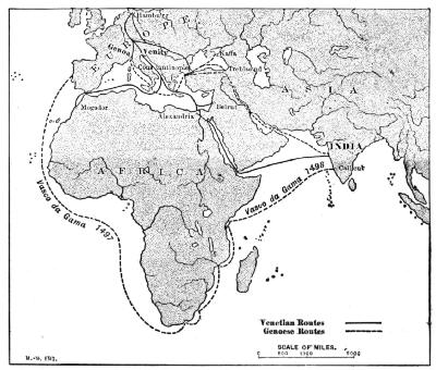 ROUTES TO INDIA—THE TURK CHANGES THE COMMERCE OF THE WORLD
Now a commerce that involved not only many millions of dollars, but the employment of thousands of people as well, is not likely to be given up without a struggle. So the energy that had been devoted to this great trade was turned in a new direction, and there began a search for a new route to India—one that the Turks could not blockade.
The Search for an All-Water Route to India.—Overland routes were out of the question; there were none that could be made available, and so the search was[Pg 11] made for a sea-route. Rather singularly the Venetians and Genoese, who had hitherto controlled this trade, took no part in the search; it was conducted by the Spanish and the Portuguese.
The Spanish monarchs, Ferdinand and Isabella of Castile, fitted out an expedition under Christopher Columbus, a master-mariner and cartographer, the funds being provided by Isabella, who pledged her private property as security for the cost of the expedition. This expedition resulted in the discovery, October 10–21, 1492, of the West India Islands. In a subsequent voyage, Columbus discovered the mainland of South America.
Even before the voyage of Columbus, the Portuguese had been trying to find a way around Africa to India, and Pope Eugenius IV. had conferred on Portugal "all heathen lands from Cape Bojador eastward even to the Indies." Little by little, therefore, Portuguese navigators were pushing southward until, in 1487, Bartholomew Dias sighted the Cape of Good Hope, and got about as far as Algoa Bay. Then he unwillingly turned back because of the threats of his crew. It was a most remarkable voyage, and one of the shipmates of Dias was Bartholomew Columbus, a brother of the discoverer of the New World.
Ten years later, or five years after the voyage of Columbus, Vasco da Gama sailed from Lisbon for the Cape of Good Hope. As he passed the Cape he was terribly storm-tossed, but the storms carried him in a fortunate direction. And when at last he got his reckonings, he was off the coast of India; he therefore kept along the coast until in sight of a port. The port was the well-known city of Calicut. Two years later he returned to Europe by the same route, his ships laden with spices, precious stones, beautiful tapestries and brocades, ivory and bronzes. The long-sought sea-route to India had been discovered.
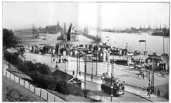 A HANSE CITY—HAMBURG, ALONG THE WATER-FRONT
Commerce in Western Europe.—After the discovery of the new route, Venice and Genoa were scarcely heard of in relation to commerce; they lost everything and gained nothing. The great commerce with the Orient was to have a new western terminus, and the latter was to be on the shores of the North and Baltic Seas.
The commerce between Europe and India stimulated trade in western Europe as well. As early as the twelfth century the manufacture of linen and woollen cloth had grown to be a very important industry that had resulted in the rapid growth of population. The older cities grew rapidly, and new ones sprang up wherever the commodities of trade were gathered, manufactured, or distributed.
These centres of trade had two hostile elements against them. The feudal lords used to pillage them legally by extorting heavy taxes and forced loans whenever their treasuries were empty. The portionless brothers and relatives of the feudal lords, to whom no employments save war, adventure, and piracy were open, pillaged them illegally. Along the coasts especially, piracy was considered not only a legitimate, but a genteel, profession. So in order to protect themselves, the cities began to join themselves into leagues.
The Hanse League.—About the beginning of the thirteenth century[4] Hamburg and Lübeck formed an alliance afterward called a hansa; at the beginning of the fourteenth century it embraced seventy cities, having the capital at Lübeck. At the time of its greatest power the League embraced all the principal cities of western Europe nearly as far south as the Danube. Large agencies, called "factories," were established in London, Bruges, Novgorod, Bergen, and Wisby. The influence of the League practically controlled western Europe.
The Hanse League performed a wonderful work. It stopped piracy on the seas and robbery on the land. Industrially, it encouraged self-government and obedience to constitutional authority. Shipbuilding and navigation so greatly improved that the ocean traffic resulting from the discovery of the cape route to India quickly fell into the hands of Hanse sailors and master-mariners. The League not only encouraged and protected all sorts of manufactures, but its schools trained thousands of operatives. The mines were worked and the idle land cultivated. It was the greatest industrial movement that ever occurred.
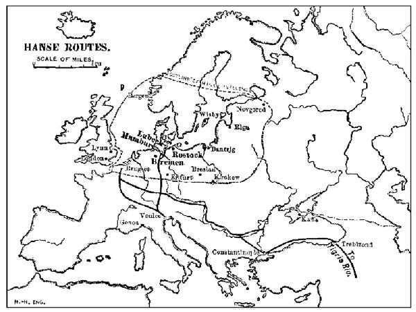 HANSE ROUTES—THE HANSE LEAGUE REORGANIZES THE TRADE OF
THE WORLD
HANSE ROUTES—THE HANSE LEAGUE REORGANIZES THE TRADE OF
THE WORLDSocially, the Hanse League brought the wealth that gave those comforts and conveniences before unknown. The standards of social life, education, art, and science were[Pg 15] raised from a condition scarcely better than barbarism to a high plane of civilization. Indeed, the civilization of western Europe was the most important result of it.
It forced the rights of individual freedom, as well as municipal independence, from more than one monarch, and punished severely the kings who sought to betray it. It crushed the power of those who opposed it,[5] and rewarded those who were faithful to it. Its most important mission, however, was the overthrow of feudalism and the gradual substitution of popular government in its place.
Having accomplished the regeneration of Europe, the Hanse League died partly by its own hand, because of its arrogance, but mainly from the fact that, having educated western Europe to self-government and commercial independence, there was no longer need for its existence. Independent cities grew rapidly into importance, and these got along very well without the protection of the League. The great industrial progress was at times temporarily checked by wars, but it never took a backward step. Indeed the progress of commerce has always been a contest between brains and brute force, and in such a struggle there is never any doubt about the final outcome.
QUESTIONS FOR DISCUSSION
What were some of the effects of Cæsar's invasion of Germanic Europe so far as commerce is concerned?
What were some of the effects on commerce of the breaking up of the Roman Empire?
How did the invasion of England by William of Normandy affect the commerce of the English people?
Who was Henry the Navigator, and what did he accomplish?
How did the blockade of the routes between Europe and India bring about the discovery of America?
What was the result of the great voyage of the Cabots?
Was the overthrow of feudalism in Europe a gain or a loss to commerce?
Why are not commercial leagues, such as the Hanse, necessary at the present time?
Why did Spain's commerce decline as Portugal's thrived?
COLLATERAL READING[6]
Gibbins's History of Commerce—Chapters IV-V.
Fiske's Discovery of America, Vol. 1—Chapters IV-V.
The great industry of commerce, which includes both the trade in the commodities of life and the transportation of them, is governed very largely by the character of the earth's surface. But very few food-stuffs can be grown economically in mountain-regions. Steep mountain-slopes are apt to be destitute of soil; moreover, even the mountain-valleys are apt to be difficult of access, and in such cases the cost of moving the crops may be greater than the market value of the products. Mountainous countries, therefore, are apt to be sparsely peopled regions.
But although the great mountain-systems are unhabitable, or at least sparsely peopled, they have a very definite place in the economics of life. Thus, the great western highland of the United States diverts the flow of moisture from the Gulf of Mexico northward into the central plain, and gives to the region most of its food-growing power. In a similar manner, moisture intercepted by the Alps and the Himalayas has not only created the plains of the Po and the Ganges from the rock-waste carried from the slopes, but has also made them exceedingly fertile.
Mountain-ranges are also valuable for their contents. The broken condition of the rock-folds and the rapid weathering to which they are subjected have exposed the minerals and metals so useful in the arts of commerce and civilization. Thus, the weathering of the Appalachian folds has made accessible about the only available anthracite coal measures yet worked; and the worn folds about Lake[Pg 18] Superior have yielded the ores that have made the United States the foremost copper and steel manufacturing country of the world. Gold, silver, tin, lead, zinc, platinum, granite, slate, and marble occur mainly in mountain-folds.
Mountains and Valleys.—Mountain-ranges are great obstacles to commerce and intercommunication. The Greek peoples found it much easier to scatter along the Mediterranean coast than to cross the Balkan Mountains. For twenty years after the settlement of California, it was easier and less expensive to send traffic by way of Cape Horn than to carry it across the Rocky Mountains.
The deep cañons of mountainous regions are quite as difficult to overcome as the high ranges. In modern methods of transportation a range that cannot be surmounted may be tunnelled, and a tunnel five or six miles in length is no uncommon feat of engineering. A cañon, however, cannot be tunnelled, and if too wide for cantilever or suspension bridges, a detour of many miles is necessary. In crossing a deep chasm the route of transportation may aggregate ten or fifteen times the distance spanned by a straight line.
Excepting the mining regions, the population of mountainous countries is apt to be found mainly in the intermontane valleys. A reason for this is not hard to find; the valleys are usually filled with rich soil brought from the higher slopes and levelled by the water. The population, therefore, is concentrated in the valley because of the food-producing power of the land. For this reason the Sound, Willamette, and San Joaquin-Sacramento Valleys contain the chief part of the Pacific coast population. The Shenandoah and the Great Valley of Virginia are similar instances.
What is true of the larger intermontane valleys is true also of the narrow stream valleys of mountain and plateau[Pg 19] regions. Thus, in the New England plateau the chief growth during the past forty years has been in the valley lands. In that time if the uplands have not suffered actual loss, they certainly have made no material gains. Upland farming has not proved a remunerative venture, and many of the farms have either been abandoned or converted to other uses.
Passes.—Transverse valleys form very important topographic features of mountain-regions. Inasmuch as the ranges themselves are obstacles to communication, it follows that the latter must be concentrated at such cross valleys or gaps as may be traversed. Khaibar Pass, a narrow defile in the Hindu Kush Mountains, between Peshawur and Jelalabad, for many years was the chief gateway between Europe and India. Even now the cost of holding it is an enormous tax upon England.
Brenner, St. Gotthard, and the Mont Cenis Passes are about the only land channels of commerce between Italy and transalpine Europe, and most of the communication between northern Italy and the rest of Europe is carried on by means of these passes. Every transcontinental railway of the American continent crosses the various highlands by means of gaps and passes, and some of them would never have been built were it not for the existence of the passes. Fremont, South, and Marshall Passes have been of historic importance for half a century.
The Hudson and Champlain Valley played an important part in the history of the colonies a century before the existence of the United States, and its importance as a gateway to eastern Canada is not likely to be lessened. The Mohawk gap was the first practical route to be maintained between the Atlantic seaboard and the food-producing region of the Great Central Plain. It is to-day the most important one. It is so nearly level that the total lift of freight going from Buffalo to tide-water is less than five hundred feet.
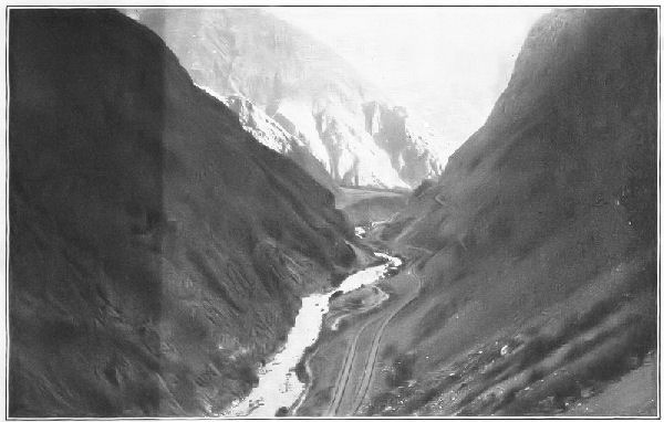 A PASS—THE ROUTE OF A RAILWAY
Rivers.—River-valleys are closely connected with the economic development of a country. Navigable rivers are free and open highways of communication. In newly settled countries the river is always the least expensive means of carriage, and often it is the only one available for the transportation of heavy goods.
In late years, since the railway has become the chief means for the transportation of commodities, river transportation has greatly declined. The river-valley, however, has lost none of its importance; in most instances it is a naturally levelled and graded route, highly suitable for the tracks of the railway. As a result, outside of the level lands of the Great Central Plain, not far from eighty per cent. of the railway mileage of the United States is constructed along river-valleys.
Plateaus.—Plateaus are usually characterized by broken and more or less rugged surface features. As a rule they are deficient in the amount of rainfall necessary to produce an abundance of the grains and similar food-stuffs, although this is by no means the case with all.
Most plateaus produce an abundance of grass, and cattle-growing is therefore an important industry in such regions. Thus, the plateaus of the Rocky Mountains are famous for cattle, and the same is true of the Mexican and the South American plateaus. The Iberian plateau, including Spain and Portugal, is noted for the merino sheep, which furnish the finest wool known. The plateau of Iran is also noted for its wool, and the rugs from this region cannot be imitated elsewhere in the world.
Plains.—Plains are of the highest importance to life and its activities. Not only do they present fewer obstacles to intercommunication than any other topographic features,[Pg 22] but almost always they are deeply covered with the fine rock-waste that forms the chief components of soil. Plains, therefore, contain the elements of nutrition, and are capable of supporting life to a greater extent than either mountains or plateaus. About ninety per cent. of the world's population dwell in the lowland plains.
The Great Central Plain of North America produces more than one-quarter of the world's wheat, and about four-fifths of the corn. The southern part of the great Arctic plain, and its extension, the plains of the Baltic also yield immense quantities of grain and cattle products. The coast-plains of the Atlantic Ocean, on both the American and the European side, are highly productive.
River flood-plains are almost always densely peopled because of their productivity. The bottom-lands of the Mississippi and the Yangtze Rivers are among the chief food-producing regions of the world. Lacustrine plains, the beds of former lakes, are also highly productive regions. The valley of the Red River of the North is an example, and its wheat is of a very high quality.
Fertile coast-plains and lowlands that are adjacent to good harbors, as a rule are the most thickly peopled regions of the world. In many such regions the density of population exceeds two hundred or more per square mile. The reason is obvious. Life seeks that environment which yields the greatest amount of nutrition with the least expenditure of energy.
The study of a good relief map shows that, as a rule, the Pacific Ocean is bordered by a rugged highland, which has a more or less abrupt slope, and a narrow coast-plain. Indeed, the latter is absent for the greater part. The slopes of the Atlantic, on the other hand, are long and gentle—being a thousand miles or more in width throughout the greater part of their extent. The area of productive land is correspondingly great, and the character of the surface features is such that intercommunication is easy.
 A RIVER FLOOD-PLAIN—A REGION ADAPTED TO CULTIVATION
The result of these conditions is evident. The Atlantic slopes, though not everywhere the most densely peopled areas, contain the great centres of the world's activities and economies. In the past 400 years they have not only overtaken the Pacific coast races, but have far surpassed them. They are now entering upon a commercial invasion of the Pacific nations that is resulting in a reorganization of the entire industrial world.
Topography and Trade Routes.—As the settlement and commerce of a country grow, roads succeed trails, and trails are apt to follow the paths of migrating animals. Until the time of the Civil War in the United States, most of the great highways of the country were the direct descendants of "buffalo roads," as they were formerly called.
In the crossing of divides from one river-valley to another, the mountain-sections of the railways for the greater part follow the trails of the bison. This is especially marked in the Pennsylvania, the Baltimore and Ohio, and the Chesapeake and Ohio railways; in some instances the tunnels through ranges have been constructed directly under the trails. The reason is obvious; the instinct of the bison led him along routes having the minimum of grade.
Throughout the Mississippi Valley and the great plains the Indian trails usually avoided the bottom-lands of the river-valleys, following the divides and portages instead. This selection of routes was probably due to the fact that the lowlands were swampy and subject to overflow; the portages and divides offered no steep grades, and were therefore more easily traversed.
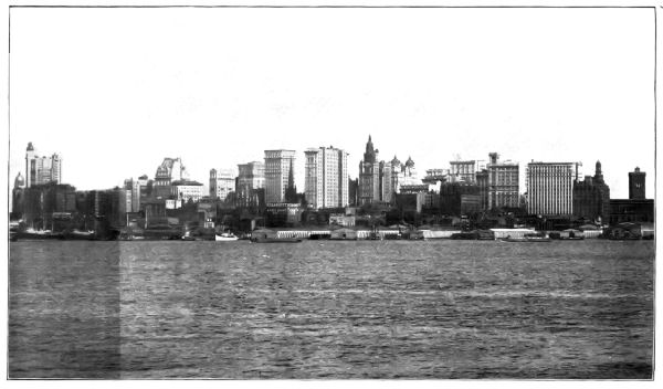 WHERE COMMODITIES ARE EXCHANGED—NEW YORK CITY
WATER-FRONT
WHERE COMMODITIES ARE EXCHANGED—NEW YORK CITY
WATER-FRONT
Harbors.—Coast outlines have much to do with the commercial possibilities of a region. The "drowned valleys" and similar inlets along the North Atlantic coast, both of Europe and America, form harbors in which vessels ride at anchor in safety, no matter what the existing conditions outside may be. As a result, the two greatest centres of commerce in the world are found at these harbors—one on the American, the other on the European coast.
From New York Bay southward along the Atlantic seaboard there are but few harbors, and this accounts for the enormous development of commerce in the stretch of coast between Portland and Baltimore. San Francisco Bay and the harbors of Puget Sound monopolize most of the commerce of the Pacific coast of the United States. South America has several good harbors on the Atlantic seaboard, and in consequence a large city has grown at the site of each. On the Pacific coast the good harbors are very few in number, and they are not situated near productive regions.
Asiatic peoples, as a rule, are not promoters of foreign commerce, and, those of Japan excepted, the only good harbors are those that have been improved by European governments. These are confined mainly to India and China. The many possible harbors make certain a tremendous commerce in the future. Africa has but very few good harbors. There are excellent harbors in the islands of the Pacific, and many of them are of great strategic value as coaling stations and bases of supply to the various maritime powers.
QUESTIONS FOR DISCUSSION
The Pennsylvania Railroad has found it more economical to tunnel the mountain-range under Horseshoe Curve, near Altoona, than to haul the trains over the mountains; discuss the details in which there will be a saving.
Why are rugged and mountainous regions apt to be sparsely peopled?
The first valuable discovery in the Rocky Mountains was gold; what were the chief effects that resulted?
Would the industries of the Pacific coast of the United States be benefited or impaired by the existence of a coast-plain?
Which are more conducive to commerce—the large mediterraneans, such as the Gulf of Mexico, or the small estuaries, such as New York Bay? Discuss the merits or demerits of each.
What are the chief products of mountains, of plateaus, of lowland plains?
COLLATERAL READING AND REFERENCE
Adams's New Empire—Chapter I.
Redway's Physical Geography—Chapter IV.
A topographic map of the United States.
 MEAN ANNUAL RAINFALL
In its effect upon life and the various industries of peoples, climate is a factor even more important than topography. Of the 53,000,000 square miles of the land surface of the earth, scarcely more than one-half is capable of producing any great amount of food-stuffs, and only a very small area can support a population of more than one hundred people to each square mile.
Climate and Habitability.—In the main, regions that are inhabited by human beings produce either food-stuffs or something of value that may be exchanged for food-stuffs; and inasmuch as food and shelter are the chief objects of human activity, regions that will not furnish them are not habitable.
The growth and production of food-stuffs is governed even more by conditions of climate than by those of topography. Thus the great Russian plain is too cold to produce any great amount of food-stuffs, and it is, therefore, sparsely peopled. The northern part of Africa and the closed basins of North America and Asia lack the rainfall necessary to insure productivity, and these regions are also unhabitable. The basin of the Amazon has a rainfall too great for cereals and grasses, and the larger part of it is unfit for habitation.
All the food-stuffs are exceedingly sensitive to climate. Rice will not grow where swampy conditions do not prevail at least during part of the year. Turf-grass will not live where there are repeated droughts of more than three[Pg 30] months' duration, and corn will not ripen in regions having cool nights. Wheat does not produce a kernel fit for flour anywhere except in the temperate zone; and the banana will not grow outside the torrid zone.
The two chief factors of climate are temperature and moisture. No forms of life can withstand a temperature constantly below the freezing-point of water, and but few, if any, can endure a constant heat of one hundred and twenty-five degrees, although most species can exist at temperatures beyond these limits for a short time.
Zones of Climate.—The belt of earth upon which the sun's rays are nearly or quite vertical is comparatively narrow. But the inclination of the earth's axis and the fact that it is parallel to itself at all times of the year create zones of climate. These differ materially in the character of the life, forms, and the activities of the people who dwell in them.
In the torrid zone the temperature varies but little. During the season of rains it rarely falls to 70° F., and in the dry season it is seldom higher than 95° F. As a result, all sorts of plants that are sensitive to low temperatures thrive in the torrid zone. It is not a climate suitable for heat-producing food-plants, and they are not required.
The constant heat and excessive moisture of the atmosphere in the torrid zone is apt to produce a feeling of lassitude among the dwellers in such regions, moreover, and great bodily activity is out of question. These conditions seriously affect the lives of the people, and, with few exceptions, tropical peoples are rarely noted for energy or enterprise. Great commercial enterprises are the exception rather than the rule, and they are usually carried on by foreigners who must live a part of the time in cooler localities.
 THE EFFECTS OF HIGH LATITUDE—TOO COLD TO PRODUCE
BREAD-STUFFS
THE EFFECTS OF HIGH LATITUDE—TOO COLD TO PRODUCE
BREAD-STUFFS
Polar regions are deficient both in the heat and light necessary for food-stuffs. Neither the grasses nor the grains fructify. As a result, but few herbivora can live there, and these are practically restricted to the musk-ox and the reindeer, which subsist on mosses and lichens. The native people are stunted in growth; their food consists mainly of raw blubber, and they are scarcely above savagery.
The temperate zones are the regions of the great industries and activities of human life. The larger part of the land surface of the earth is situated in these zones; moreover, the people who dominate the world also live in them, and their supremacy is due largely to conditions of climate. The alternation of summer and winter causes a struggle for existence that develops the intellectual faculties and results in industrial supremacy.
Effects of Altitude.—There is a decrease of temperature of 1° F. for about every three hundred feet of ascent. But few people live at an altitude of more than six thousand feet above sea-level, and in many cases they depend on other localities for the greater part of their food-stuffs, because very few of such regions produce food-stuffs abundantly.
The chief exceptions to this rule are found in tropical regions. The highlands of Mexico, the plateau-regions of Bolivia and Ecuador, and the highlands of southern Asia are habitable, but they are not densely peopled. Because of their altitude they are relieved of the enervating effects of tropical climate at the sea-level.
Altitude likewise affects the amount of rainfall. Most plateaus are arid. As a rule, they are arid because of their altitude; and because of their aridity they are deficient in their power to produce food-stuffs. They are therefore sparsely peopled.
Effects of Rainfall.—Regions having considerably more than one hundred inches of rain annually are very[Pg 33] apt to be forest-covered, and therefore to be deficient in food-producing plants. Such localities have usually a sparse population, in spite of the profusion of vegetation. In some parts of India, lands that have been left idle for a few seasons produce such a dense jungle of wild vegetation that to reclaim them for cultivation is wellnigh impossible.
A deficiency of rainfall is even a greater factor in restricting the density of population than too much rain. With less than fifteen or twenty inches a year few regions produce good crops of grains and grasses, and as a result they are sparsely peopled. Some of the exceptions, however, are important. If the rainfall is not quite enough to produce a normal overflow to the sea, the soil may be very rich, because the nutrition is not leached out and carried away.
Many small areas of this character produce enormous crops when artificially watered, and many of them, such as Persia, parts of Asia Minor, northern Utah, and large areas of Australia and Chile have become regions of considerable commercial importance. The products of such regions are apt to be unique in character and of unusual value. Thus, the wool of Persia and Australia and the fruit of the Iberian peninsula are important articles of commerce.
In Egypt one may see the results of irrigated lands. The area of geographical Egypt is somewhat less than half a million square miles; the habitable part of the country is confined to a narrow strip, which, one or two places excepted, varies from three to six miles in width. In other words, almost the whole population of the country is massed in the flood-plain and delta of the Nile; the remaining part is a desert producing practically nothing.
The water that makes these lands productive falls, not[Pg 34] in Egypt, but in the highlands of Abyssinia, 2,000 miles away. The September overflow of the flood-plain is the chief factor in the irrigation of these lands, but the area has been greatly increased by the construction of barrages and dams at Assiut and Assuan.
In the western highland region of the United States considerable areas already have been made productive by irrigation, and it is estimated that about two million acres of barren land can be reclaimed by impounding the waters of the various streams now running to waste.
The distribution of rain with respect to the season in which it falls is quite as important as its distribution with respect to quantity. In tropical regions the ocean winds, and therefore the rainfall, come from the east. The eastern slopes of such regions, therefore, have a season in which rains may be expected daily, and another in which no rain falls for several months. In the temperate zones seasonal rains for a similar reason are on the western coasts.
Thus on the Pacific coast of the United States the rainfall varies from about one hundred inches in southern Alaska to about twelve in San Diego, Cal. Practically all the rain falls between October and the following May; very little or none falls in the interval between May and October. As a result, ordinary turf-grass, which will not withstand long droughts, grows in only a few localities of the Pacific slope. It is replaced by hardier grasses whose roots, instead of forming turf, grow very deep in the soil.
Common clover will not grow in this region unless irrigated; it is replaced by burr-clover, a variety of the plant that will not thrive in moist regions. Now the quality of the merino wool clip of California depends in no slight degree upon the burr-clover and other food-products that thrive in regions of seasonal rains; that is, a great commercial industry exists because of this feature of rainfall, and it could not long survive in spite of it.
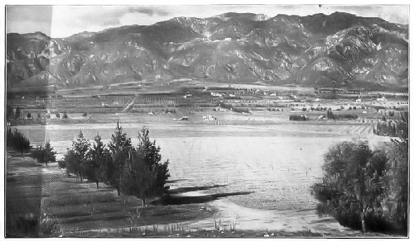 CLIMATICALLY ADAPTED TO CULTIVATION—THE LOWLANDS
PRODUCE BREAD-STUFFS AND FRUIT; THE MOUNTAIN-SLOPES ARE GRAZING REGIONS
CLIMATICALLY ADAPTED TO CULTIVATION—THE LOWLANDS
PRODUCE BREAD-STUFFS AND FRUIT; THE MOUNTAIN-SLOPES ARE GRAZING REGIONS
The seasonal rainfall also affects other agricultural industries. The sacked wheat-crop may be left in the field without cover or protection until the time is convenient for shipping it. The absence of summer rains makes possible in California what would be out of question in the Mississippi Valley, where a rainstorm may be expected every few days.
The quality of certain fruits depends largely on the season during which the rainfall occurs. Apples, pears, and grapes grown in regions having dry summers have usually a very superior flavor. The raisin-making industry of California also depends on the same condition, because, in order to insure a good quality of the product, the bunches of grapes, after picking, must be dried on the ground. To a certain extent this is also true of other fruits, such as dates, figs, and prunes, which frequently are sun-dried.
The presence of large bodies of water, which both absorb and give out their heat very slowly, tempers the climate of the nearby land and to that extent modifies the commerce of such districts. The grape-growing industry of central New York is a great one and its product is famous. Its existence depends almost wholly upon the lake-tempered climate. Elsewhere in the State the industry is on a precarious basis, and the product is inferior.
Effects of Inclination of the Earth's Axis.—The inclination and self-parallelism of the earth's axis is undoubtedly a very important factor in climate. Practically it more than doubles the width of the belts of ordinary food-stuffs by lengthening the summer day in the temperate zone. Beyond the tropics the obliquity of the sun's[Pg 37] rays are more than balanced by the increased length of time in which they fall.
Thus, in the latitude of St. Paul, the longest day is about fifteen and one-half hours long; at Liverpool it is nearly seventeen hours long; a greater number of heat units therefore are received in these latitudes during summer than are received in equatorial regions during the twelve-hour day. Moreover, the summer temperature is higher in these latitudes than in the torrid zone, because the sun is shining upon them for a greater length of time.
The result of these various influences is far-reaching. Because of the long summer days and short nights, wheat can be cultivated to the sixtieth parallel. Corn, which gets scarcely enough warmth and light in the torrid zone to become a prolific crop, attains its greatest yield in the latitude of fourteen-hour days.
These factors, it is evident, carry the grain and meat industries into regions that otherwise would not be habitable. Because the long summer days produce these great food-crops, commerce and its allied industries have reached their maximum development in these regions. Human activities are greatest in the zones bounded by the thirty-fifth and fifty-fifth parallels, the zone that includes the greater parts of the United States, Europe, China, Japan. They are greatest, moreover, because of their geographical position.
QUESTIONS FOR DISCUSSION
What would be the probable effect on the food-crops of the United States were the main body of the country moved twenty degrees north in latitude? Which would then be the wheat-growing States, the cotton-producing States?
Illustrate the connection between occupation and altitude above sea-level.
What difference would it make to the corn-crop were the days and nights always twelve hours long?
What would be requisite to make Canada a centre of silk production?
Why is not cod-fishing an industry off the east coast of Florida?
Why is the greater part of the Russian Empire destined to be sparsely peopled?
FOR COLLATERAL REFERENCE
A rain chart of the world.
A chart of isothermal lines.
Of all the adjustments which come into the lives of a people none has been so far-reaching as the gradual localization of industries each in the region best adapted to it. For instance, manufacturing industries require power, but not fertile soil; therefore the manufacturing industries seek nearness to fuel or to water-power, and a position available for quick transportation.
Farming does not require any great amount of natural power; on the contrary, level land having a great depth of fertile soil is the essential feature. The farmer must therefore look first of all to conditions of topography and climate, and secondly to the means of transporting his crop.
Mining cannot be an industry in regions destitute of minerals; the miner must therefore go where the mineral wealth is found, without regard to climate, soil, centres of population, or topography. But two things are required—the mineral products and the means of getting them to the people—that is, ready means of transportation.
A century or more ago, each centre of population in the United States was practically self-sustaining. Each grew its own food-stuffs, and manufactured the articles used in the household. But very little was required in the way of transportation. The means of carriage were mainly ox-carts, pack-horses, and rafts. There was a mutual independence among the various centres, it is true, but the independence was at the expense of civilization and the comforts of life.
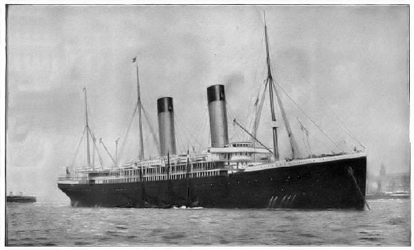 OCEAN TRANSPORTATION—ROYAL MAIL STEAMSHIP OCEANIC,
WHITE STAR LINE
OCEAN TRANSPORTATION—ROYAL MAIL STEAMSHIP OCEANIC,
WHITE STAR LINE
Beyond an independence that is more apparent than real, such a plan of social and industrial organization has but little in it to commend. Intercommunication increases knowledge, and under the conditions that formerly prevailed, there was a lack of the breadth of knowledge that comes with the mutual contact of peoples.
The utilization of national resources, such as the productiveness of the land, the existence of iron ore, coal, copper, and other economic minerals, finally brought about the policy of a territorial division of industries. This, in turn, made the prompt transportation and exchange of commodities essential; indeed, without such a plan, industrial centres could not long exist.
The man whose sole business is manufacture must look to others for his supply of food-stuffs and raw materials, and these are produced more economically at a distance from the centre of manufacture. Thus England must look to the United States for wheat and cotton, to the Australian Commonwealth for wool, and to New Zealand and the United States for meat. Her chief wealth is in her coal and iron, and these make the nation a great manufacturing centre. So, also, the manufacturer of New York must go to Pittsburg for steel, to Minneapolis for flour, and to Chicago for beef.
The application of this principle is very broad; it is the foundation of all commerce, and it underlies modern civilization. For this reason the question of transportation is just as important to a community as the industries of agriculture, mining, and manufacture. Food-stuffs are of no use unless they can be transported to the people who want them; nor can peoples remain in unproductive regions unless the food-stuffs are brought to them.
The gross tonnage of goods is transported mainly in one or another or all of three ways—namely, by animal[Pg 42] power, by railway, or by water. Thus, the cotton-crop of the United States is usually transported by wagon from the plantation to the nearest station or boat-landing; by rail or by barge to the nearest seaport; and by ocean steamship to the foreign seaport.
Water transportation is more economical than land carriage, for the reason that less power is required to move a given tonnage through the water than on the most perfectly graded railway. Steamship freights, as a rule, are lower than those of sailing-vessels, because a steamship has more than twice the speed, and, being larger, can carry a greater tonnage. Freight rates on the Great Lakes are higher per ton-mile than on the ocean, because the vessels are necessarily smaller than those built for ocean traffic. For a similar reason, river and canal freights are higher than lake freights. Railway transportation is economical, partly because a single locomotive will draw an enormous weight of goods, and partly because of the high speed at which the goods move from point to point. Animal transportation is more expensive than any other means ordinarily employed.
Ocean Transportation.—In many respects, water-routes form the most available and economical methods of transportation. Intercontinental commerce must be carried on by means of deep-water vessels. Therefore an extraordinary development of ocean carriers has taken place in the past century.
One important period of development began with the rise of American commerce. Just after the close of the War for Independence, it was found that deep-water ships could be built of New England timber for thirty-five dollars per ton, rated tonnage, while a vessel of the same burden built in Europe cost about forty-five dollars per unit of tonnage. Two types of vessels came into use—one, the clipper ship with square sails, was used for long ocean voyages; the other, the schooner, with fore-and-aft rigging, was employed mainly in the coast-trade.
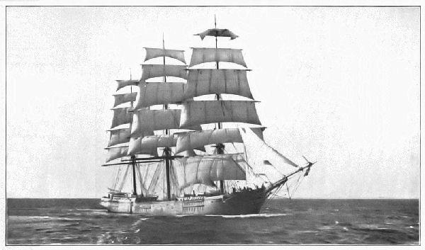 A SQUARE-RIGGED SHIP—A TYPE NOW BEING REPLACED BY
FORE-AND-AFT RIGGED SCHOONERS
A SQUARE-RIGGED SHIP—A TYPE NOW BEING REPLACED BY
FORE-AND-AFT RIGGED SCHOONERS
In speed and ease of management these vessels surpassed anything that had ever sailed. In time they became the standards for the sailing-vessels of all the great commercial nations. The types of the vessels are still standards.
 THE DEVELOPMENT OF THE MODERN STEAMSHIP
The Development of the Steamship.—Another important era in ocean commerce began when steam was used as a motive power for vessels. The first deep-water vessel thus to be propelled was the Savannah. Her steam-power was merely incidental, however, and her paddle-wheels were unshipped and taken aboard when there was[Pg 45] enough wind for sailing. Up to 1860 almost all the ocean steamships were side-wheelers, propelled by low-pressure beam-engines.
The next most important improvement was the screw-blade propeller, placed astern. This means of propulsion called for higher speed of the engines, and in a very short time compactly built high-pressure engines took the place of the low-pressure engine with its heavy walking-beam. The latter carried steam at a pressure varying from twenty to thirty-two pounds; the modern boiler has steam at 260 pounds per square inch.
Ocean steamships have gradually evolved into two types. The freighter, broad in beam and capacious, is built to carry an enormous amount of freight at a moderate speed. The White Star liner Celtic is a vessel of this class; her schedule time between New York and Liverpool is about nine days. The Philadelphia of the American line, though not the fastest steamship, makes the same trip in an average time of five and one-half days.[7]
Twin-screws, instead of a single propeller, are employed on nearly all the large liners. The gain in speed is not greatly increased, but the vessel is far more manageable with two screws than with one; moreover, if one engine breaks down, the vessel can make excellent time with the other.
Triple-expansion engines are almost universally used on modern steamships, and a pound of coal now makes about three times as much steam available as in the engines formerly used. As a result a bushel of wheat is now carried from Fargo, N. Dak., to Liverpool for about twenty-one cents—less than one-half the freight tariff of 1876.
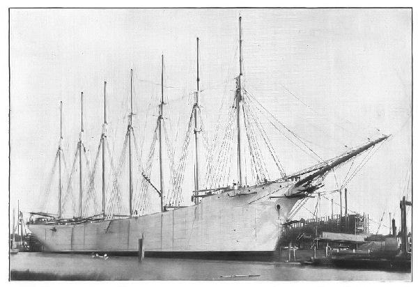 THE SCHOONER THOMAS A. LAWSON. THE FIRST SEVEN-MASTED
SAILING-VESSEL
THE SCHOONER THOMAS A. LAWSON. THE FIRST SEVEN-MASTED
SAILING-VESSEL
The fastest liners consume from three hundred and fifty to more than four hundred tons of coal a day, and for each additional knot of speed the amount of coal burned must be greatly increased. Freighters like the Celtic consume scarcely more than half as much as those of the Kaiser Wilhelm II. type.
Sailing-Craft.—In spite of the growth and development of steam-navigation, a large amount of freight is still carried by sailing-craft; moreover, it is not unlikely that the relative proportion of ocean freight carried by sailing-vessels will increase rather than decrease, especially in the case of imperishable freight.
The square-rigged ship, or bark, has been very largely replaced by the fore-and-aft, or schooner-rigged vessel. A large full-rigged ship requires a crew of thirty to thirty-six men; a schooner-rigged vessel needs from sixteen to twenty. These vessels are commonly built with three and four masts; some of the largest have six or seven. They carry as many as five thousand tons of freight at a speed of about ten knots—only a trifle less than that of an ordinary tramp freighter. Some of the larger vessels are provided with auxiliary engines and propelling apparatus, which enables them to enter or to leave port without the assistance of a tug. Donkey-engines hoist and lower the sails, and perform the work of loading and unloading. They are admirable colliers and grain-carriers.
At the beginning of the twentieth century, about ninety thousand sailing-craft and thirty-five thousand steam-vessels were required to carry the world's commerce. Of this number, Great Britain and her colonies register nearly thirty-five thousand, and the United States over twenty thousand.
Harbor Safeguards.—Excepting the open anchorages formed by angles [Pg 48]in coast-lines, the greater number of harbors consist of small coves and river-mouths. In these, although there may be a considerable area of water, there is not apt to be much sailing room; it is therefore necessary to mark off the navigable channels. For this purpose buoys of different shapes and colors are used by day; by night fixed and flashing lights are employed.
The buoys of permanent channels are usually hollow metal cylinders or cones about two feet in diameter, anchored so that the end of the cylinder projects about three feet above the water. On entering a channel from the seaward, red buoys are on the starboard, or right hand; white buoys are kept on the port, or left side. Buoys at the end of a channel are usually surmounted each by some device or other fastened at the upper end of a perch. Thus, at the outer entrance of Gedney Channel in New York Harbor, a ball surmounts the perch; at the inner entrance the buoy carries a double square. Sharp angles in a channel are similarly marked. In many instances the buoy carries, as a warning signal, a bell that rings as the buoy is rocked by the waves; in others, a whistle that sounds by the air which the rocking motion compresses within the cylinder; still others carry electric or gas lights.
The color of a buoy is an index of its character. Thus, one with black and red stripes indicates danger; one with black and white vertical stripes is a channel-marker. Temporary channels are frequently marked by pieces of spar floating upright. In some cases it is customary to set untrimmed tree-tops on the port, and trimmed sticks on the starboard.
Light-houses are built at all exposed points of navigated coast-waters, and beacons are set at all necessary points within a harbor for use at night. All lights are kept burning from sunset until sunrise. The color, the duration, and the intervals of flashing indicate the position of the beacon. In revolving lights the beams, concentrated by powerful lenses, sweep the horizon as the lantern about the light revolves. Flashing lights are produced when the light is obscured at given intervals. Fixed lights burn with a steady flame. In some instances a sector of colored glass is set so as to cover a given part of a channel. Range lights, set so that one shows directly above the other, are used as channel-markers.
 CITY OF NEW YORK AND VICINITY, WITH HARBOR
APPROACHES
CITY OF NEW YORK AND VICINITY, WITH HARBOR
APPROACHES
[Pg 50]The use of lights may be seen as a vessel enters New York Lower Bay. A steamship drawing not more than eighteen feet of water may enter through Swash Channel (follow the course on the chart). In this case the pilot makes for Scotland lightship, and merely keeps New Dorp and Elmtree beacons in range, giving Dry Romer a wide berth to starboard, until Chapel Hill and Conover beacons come into range on his port side. The vessel is then held on a course between Coney Island and Fort Tompkins lights until Robbins Reef light shows ahead.
For the liners that draw more than eighteen feet the task is more difficult, inasmuch as the channel is tortuous. At Sandy Hook lightship a course lying nearly west takes the vessel to the outer entrance of Gedney Channel, marked by two buoy-lights. In passing between the lights the vessel enters the channel, which is also covered by the red sector of Hook beacon. The pilot continues between the buoy-lights until Waacaack and Point Comfort beacons are in range, and steers to this range until South Beacon and Sandy Hook light are in range astern. The helm is then turned, keeping these lights in range astern until Chapel Hill and Conover beacons are in range on the port bow. Turning northward nearly eight points, the pilot holds the bow of the vessel between Fort Tompkins and Coney Island lights, keeping sharply to his range astern, until Robbins Reef light comes into view through the narrows. From this point on, the shore lights are the pilot's chief guide.
So difficult are harbor entrances, that in most cases the underwriters will not insure a vessel unless the latter is taken from the outer harbor to the dock by a licensed pilot, and the latter must spend nearly half a lifetime as an apprentice before he receives a license. The charges for pilotage are usually regulated by the number of feet the vessel draws. The charges differ in various ports, but the devices for marking and lighting the channels are much the same in every part of the world. In the United States all navigable channels are under the control of the general Government.
Inland Waters.—Lakes, rivers, and canals furnish a very important means of transportation. In Europe and Canada an enormous amount of slow freight is transported by their use; in China they are the most important means of internal traffic.
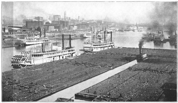 THE COMMERCE OF THE OHIO—TOWING COAL TO THE STEEL
MILLS, PITTSBURG
THE COMMERCE OF THE OHIO—TOWING COAL TO THE STEEL
MILLS, PITTSBURG
In the United States the Great Lakes with the Erie Canal and Hudson River form the most important internal water-way, and by them the continent is penetrated as far west as Duluth, a distance of more than one thousand three hundred miles. The traffic passing out of Lake Superior alone is about one-third greater than that passing out of the Mediterranean Sea at the Suez Canal. Much of this traffic goes across the continent, and the route in question is one of the great commercial highways of the world.
The Mississippi River and its branches afford not far from ten thousand miles of navigable waters. Canals connect tributaries of this river with the Great Lakes at Chicago and at several points in Ohio. The development of the navigation of this great water-way was checked by the Civil War, and after the close of the war the great advance in railway building kept its improvement in the background. The general government, nevertheless, has done much to encourage the use of the Mississippi as a commercial highway, and many millions of dollars have been spent in widening and deepening its channel.[8] On the upper river grain and lumber form the chief traffic; on the lower part a large part of the world's cotton-crop starts on its journey to the various markets.
On account of the soft-coal fields and the steel manufacture in western Pennsylvania, the commerce of the Ohio River is very heavy, aggregating not far from fifteen million tons yearly. Much of this traffic extends to ports on the Mississippi.
The navigable parts of the Hudson and Delaware Rivers are estuaries of the sea or "drowned valleys." In each case navigation extends about to the limits of high tide. Both rivers carry a heavy freight commerce; the Hudson[Pg 53] has a passenger traffic of several million fares each year. Nearly every river of the Atlantic coast is navigable to the limit of high tide or a little beyond. Navigation extends to the point where the coast-plain joins the foot-hills. Above this limit, called the "Fall Line," the streams are swift and shallow; below it they are deep and sluggish. As a result, a chain of important river ports extends along the Fall Line from Maine to Florida.
River-navigation in Europe in the main is inseparably connected with the great canal systems. As a rule, the lower parts of the rivers are navigable for steamboats of light draught. Some of the smaller streams are made navigable by means of a long steel chain, which is laid along the bed of the stream; the boat engages the chain by means of heavy sprocket wheels driven by steam, and thus wind the boat up and down the river.
Ocean steamers penetrate the Amazon Valley to a distance of one thousand miles from its mouth; boats of light draught ascend the main stream and some of its tributaries a thousand miles farther. The Orinoco is navigable within one hundred miles of Bogota. Light-draught boats ascend the tributaries of La Plata River a distance of fifteen hundred miles.
The Asian rivers that are important highways of commerce are few in number. The Amur, Yangtze, Indus, and Cambodia have each considerable local commerce. The Hugli, a channel in the delta of the Ganges, has a channel deep enough for ocean steamships. The tributaries of the Lena, Yenisei, and Ob have been of the greatest service in the commercial development of northern Asia from the fact that their valleys are both level and fertile.
Because of a high interior and abrupt slopes, the rivers of Africa are not suitable for navigation to any considerable extent; the channels are uncertain and the rivers are [Pg 54]interrupted by rapids. The Nile has an occasional steamboat service as far as the "First Cataract," but in high water the service is sometimes extended farther. The Kongo has a long stretch of navigable water, but is interrupted by rapids below Stanley Pool. Similar conditions obtain in the Zambezi. The lower part of the Senegal affords good navigation. The Niger has in many respects greater commercial possibilities than other rivers of Africa. It is navigable to a distance of three hundred miles.
Canals.—Canals easily rank among the most important means of traffic, as a rule, supplementing other navigable waters. Thus, by means of an elaborate system of canals, goods are transferred by water, from one river-basin to another, so that practically all the navigable streams of western Europe are connected. Canals are extensively used to avoid the falls or rapids that separate the various reaches of rivers. The water itself by means of locks lifts the boat to a higher level or transfers it to a lower reach, thus saving the expense of unloading, transferring, and reloading a cargo.
The manner in which canals supplement the obstructed navigation of a river is seen in the case of the St. Lawrence. This river is obstructed in several places by rapids, but by means of canals steamship service connects the Great Lakes, not only with Quebec, but with ports of the Mediterranean Sea as well; indeed, it is possible to send a cargo from Duluth, at the head of Lake Superior, to Odessa or Batum, on the shores of the Black Sea.
The internal water-ways of Canada have been splendidly developed. The Canadian St. Marys Canal furnishes an outlet to Lake Superior for vessels drawing twenty-one feet. The Welland Canal connects Lakes Erie and Ontario. The Rideau Canal and River connect Kingston and Lake Ontario with the Ottawa, and the latter with its [Pg 55]canals is navigable to the St. Lawrence. With a population of less than six millions the Dominion Government has spent nearly one hundred million dollars in the improvement of internal water-ways.
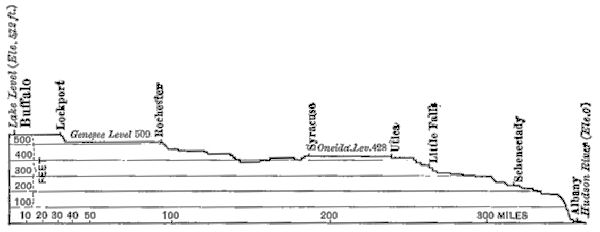 PROFILE OF ERIE CANAL
In the United States the possible development of canals has been neglected and, to a certain extent, stifled by railway building. The Erie Canal, built before the advent of the railway, connects Lake Erie with tide-water at Albany, a distance of 387 miles. For many years it was the chief means of traffic between the Mississippi Valley and the Atlantic seaboard, and although paralleled by the six tracks of a great railway system, it is still an important factor in the carriage of grain and certain classes of slow freight.[9] The level way that made the canal possible is largely responsible for the decline of its importance, for the absence of steep grades enables a powerful locomotive to[Pg 56] haul so many cars that the quick transit more than overbalances a very low ton rate by the canal.
The Chesapeake and Ohio Canal, designed to connect the Mississippi Valley with the Atlantic seaboard, fared much worse than the Erie Canal. Less than two hundred miles have been completed, and practically no work except that of repair has been done since 1850; the heavy grades between Cumberland and Pittsburg render its completion improbable.
An excellent system of canals, the Ohio and Erie and the Miami and Erie, connect the Ohio River with Lake Erie. These canals are in the State of Ohio and aggregate about six hundred miles in length. They are important as coal and ore carriers. Several hundred miles of canals were built along the river-valleys of eastern Pennsylvania before 1840 for carrying coal to tide-water. Most of them have been abandoned; one, the Delaware & Hudson Canal Co., survives as a railway. Inasmuch as the coal went on a down grade from the mines to the markets, it could be carried more economically by railway than by canal.
Of far greater importance are the St. Marys Canal on the Canadian side, and the St. Marys Falls Canal on the American side, of St. Marys River. These canals obviate the falls in St. Marys River and form the commercial outlet of Lake Superior. The tonnage of goods, mainly iron ore and coal, is about one-half greater than that of the Suez Canal. About twenty-five thousand vessels pass through these canals yearly.
The Chicago Ship and Sanitary Canal,[10] from Lake Michigan to Lockport, on the Illinois River, was designed[Pg 57] mainly to carry the sewage of Chicago which, prior to the construction of the canal, was poured into the lake through the Chicago River. The completion of the canal turned the course of the river and caused the water to flow out of the lake, carrying the city's sewage. It is intended to complete a navigable water-way from Chicago to St. Louis deep enough for vessels drawing fourteen feet. Its value is therefore strategic as well as industrial, for by means of it gun-boats may readily pass from the Gulf of Mexico to the Great Lakes.
Oceanic canals are designed both for naval strategic purposes and for industrial uses. Thus, the Kaiser Wilhelm Canal, from the mouth of the Elbe to Kiel Bay, across the base of Jutland, saves two days between Hamburg and the Baltic ports. It also enables German war-vessels to concentrate quickly in either the North or the Baltic Sea. The Manchester Ship Canal makes Manchester a seaport and saves the cost of trans-shipping freights by rail from Liverpool. The Corinth Canal across the isthmus that joins the Peloponnesus to the mainland of Greece affords a much shorter route between Italian ports and Odessa. The North Holland Ship Canal makes Amsterdam practically a seaport.
Probably no other highway of commerce since the discovery of the Cape route around Africa has caused such a great change and readjustment of trade between Europe and Asia as the Suez Canal. Sailing-vessels still take the Cape route, because the heavy towage tolls through the canal more than offset the gain in time. Steamships have their own power and generally take the canal route, thereby saving about ten days in time and fuel, and about four thousand eight hundred miles in distance. In spite of the heavy tolls the saving is considerable. About three thousand five hundred vessels pass through the canal yearly.
The Suez Canal, constructed by Ferdinand de Lesseps, for some time was under the control of French capitalists. Subsequently, by the purchase of stock partly in open market and partly from the Khedive of Egypt, the control of the canal passed into the hands of the English. The restrictions placed upon the passage of war-ships is such that the canal would be of little use to nations at war.
 THE ROUTE OF THE PANAMA CANAL
The necessity of an interoceanic canal across the American continent has become more imperative year by year for fifty years. The discovery of gold in California caused an emigration from the Atlantic to the Pacific coast which resulted in a permanent settlement of the latter region. A railway across the Isthmus of Panama and another across the Isthmus of Tehuantepec have afforded very poor means of communication between oceans.
In 1881 work on a tide-level canal across the Isthmus of[Pg 59] Panama was begun, but the plan was afterward changed to a high-level canal. The change was thought necessary partly on account of the great cost of the former, and partly because of the difficulties of constructing so deep a cut—about three hundred and forty feet—at the summit of the Culebra ridge. The construction company, after spending the entire capital—about one hundred and twenty million dollars—in accomplishing one-tenth of the work, became bankrupt. The United States subsequently purchased the franchise.
A canal by way of Lake Nicaragua has also been projected, and two treaties with Great Britain, whereby the United States agreed to build no fortifications to guard it, have been made. No work beyond the surveys has yet been undertaken, however. The cost of each canal is estimated between one hundred and fifty million and two hundred million dollars. The Panama route will require about twelve hours for the passage of a vessel; the Nicaragua route about sixty hours.[11] (See map, p. 270.)
The completion of a canal by either route will cause a readjustment of the world's commerce far greater than that which followed the construction of the Suez Canal. By such a route San Francisco is brought nearer to London than Calcutta now is, and the all-water route between the Atlantic ports of the United States and those of China and Japan will be shortened by upward of eight thousand miles. The importance of the Hawaiian Islands, already a great ocean depot, will be greatly increased, and the latter is becoming one of the great commercial stations of the world.
QUESTIONS FOR DISCUSSION
What were some of the effects which resulted from the various embargo and non-intercourse acts that preceded the war of 1812?
What is the effect upon an industry when all means of getting the products to market are cut off?
In the early history of the country rivers were the most important highways of commerce; obtain an account of some instance of this in detail.
Certain commodities have been carried about four-fifths of the distance between Moscow and Vladivostok by water, across Siberia. Illustrate this, using the map of the Russian Empire, plate, p. 342.
What has been the effect of cheap steel on ocean navigation?
Discuss the difference between a screw-steamship and a side-wheeler; a ship and a schooner. How are vessels steered?
How does a triple-expansion engine differ from an ordinary steam-engine?
Cargoes are carried by water across Europe from Havre to Marseilles, and from The Hague to the mouth of the Danube; illustrate the route on a map of Europe.
The following instruction occasionally is found in the pilothouse of a vessel—what is its meaning?
"Green to green and red to red—
Perfect safety; go ahead."
From the chart on p. 49 show how a pilot uses the range lights in entering New York Harbor.
The new freighter Minnesota is designed to carry a load of 30,000 tons; how many trains of fifty cars, each car holding 30,000 pounds, are required to furnish her cargo?
From the map on pp. x-xi describe the new ocean routes that will be created by an interoceanic canal across the American continent.
FOR COLLATERAL REFERENCE
Photographs or illustrations of various steam and sailing craft.
An Atlantic Coast Pilot Chart—any month.
A map showing the canals of the United States.
A map showing the canals of Europe.
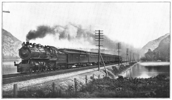 A MODERN LOCOMOTIVE—THE TWENTIETH CENTURY LIMITED AT A
SPEED EXCEEDING NINETY MILES AN HOUR
A MODERN LOCOMOTIVE—THE TWENTIETH CENTURY LIMITED AT A
SPEED EXCEEDING NINETY MILES AN HOUR
In the United States and western Europe, in spite of the low cost of water transportation, the railways have almost wholly monopolized the transportation of commodities. This is due in part to the saving of time in transit—for under the demands of modern business, the only economy is economy of time—and in part to prompt delivery at the specified time.
Into a large centre of population like New York, London, or Berlin, many millions of pounds of perishable food-stuffs must be brought daily for consumption. Now these food-stuffs must be delivered with promptness, and no delay can be tolerated. A shipper having half a million pounds of meat or a hundred thousand pounds of flour or a car-load of fruit to deliver can take no risks; he sends it by rail, not only because it is the quickest way, but because experience has shown it to be the most prompt way; as a rule, it is delivered on the exact minute of schedule time.
Cargoes of silks and teas from China and Japan might be sent all the way to London by water, but experience has shown a more profitable way. The consignments are sent by swift steamships to Seattle; thence by fast express trains to New York; there they are transferred to swift liners that take them across the Atlantic to European ports. And although this method of shipment is enormously [Pg 63]expensive as compared with the all-water route, the saving of time and certainty of prompt delivery more than offset the extra cost of delivery.
In the last half of the nineteenth century the cost of haulage in the United States by rail decreased so materially that in a few instances only—notably the Great Lakes and the Hudson River—do inland waters compete with the railways.[12] This is due in part to better organization of the railways, but mainly to the substitution of Bessemer steel for iron rails and the great improvements in locomotives and rolling stock.
The use of a steam-driven locomotive became possible for the first time when Stephenson used the tubular boiler and the forced draught,[13] thereby making steam rapidly enough for a short, quick stroke. In 1865 a good freight locomotive weighing thirty tons could haul about forty box-cars, each loaded with ten tons. This was the maximum load for a level track; the average load for a single locomotive was about twenty-five or thirty cars. Heavier locomotives could not well be used because the iron rails went to pieces under them.
The invention of Bessemer steel produced a rail that was safe under the pounding of a locomotive three or four times as heavy as those formerly employed; it produced boilers that would carry steam at 250 instead of 60 pounds pressure per square inch. As a result, with only a moderate increase in the fuel burned, a single locomotive on a[Pg 64] level track will haul eighty or ninety box-cars, each carrying nearly seventy thousand pounds.[14]
The application of the double and the triple expansion principle has been quite as successful with locomotive as with marine engines in saving fuel and gaining power—that is, it has decreased the cost per ton-mile of hauling freight and likewise the cost of transporting passengers. Enlarged "fire-boxes," or furnaces,[15] enable steam to be made more rapidly and to give higher speed.[16] Only a few years ago forty-eight hours was the scheduled time between New York and Chicago; now there are about forty trains a day between these two cities, several of which make the trip in twenty-four hours or less.
Railway Development.—The railway as a common carrier, having its right by virtue of a government charter, dates from 1801, when a tramway was built between Croydon and Wandsworth, two suburbs of London. The rails were iron straps, nailed to wooden stringers. The charter was carefully drawn in order to prevent the road from competing with omnibus lines and public cabs.
When the steam locomotive succeeded horse-power, however, there followed an era of railway development that in a few years revolutionized the carrying trade in the thickly settled parts of the United States and Europe. Short, independent lines were constructed without any reference whatever to the natural movement of traffic. There seemed but one idea, namely, to connect two cities or towns. Indeed, the absence of a definite plan was much similar to that of the interurban electric roads a century later; local traffic was the only consideration.
At first an opinion prevailed that the road-bed of the railway ought to be a public highway upon which any individual or company might run its own conveyances, on the payment of a fixed toll; indeed, in both Europe and the United States, public opinion could see no difference between the railway and the canal. The employment of a steam-driven locomotive engine, however, made such a plan impossible, and demonstrated that the roads must be thoroughly organized.
At the close of 1850 there were nearly four hundred different railway companies in England; in the United States about a dozen companies were required to make the connection of New York City and Buffalo. A few of these paid dividends; a large majority barely met their operating expenses, defaulting the interest on their bonds; a great many were hopelessly bankrupt.
Consolidation of Connecting Lines.—Between 1850 and 1865 a new feature entered into railway management, namely, the union of connecting lines. This was a positive advantage, for the operating expenses of the sixteen lines, now a part of the New York Central, between New York and Buffalo were scarcely greater than the expenses of one-third that number. The service was much quicker, better, and cheaper. In England the several hundred[Pg 66] companies were reduced to twelve; in France the thirty-five or more companies were reduced to six in number.
The consolidation of connecting lines brought about another desirable feature—the extension of the existing lines.[17] The lines of continental Europe were extended eastward to the Russian frontier, and to Constantinople; then the Alps were surmounted. In the United States railway extension was equally great. The Union and Central Pacific railways were opened in 1869, giving the first all-rail route to the Pacific coast. Other routes to the Pacific followed within a few years, one of which, the Canadian Pacific, was built from Quebec to Vancouver.
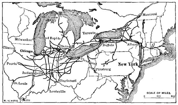 A TRUNK SYSTEM—THE VARIOUS BRANCHES EXTEND INTO COAL,
GRAIN, IRON, CATTLE, TIMBER, AND TOBACCO REGIONS
A TRUNK SYSTEM—THE VARIOUS BRANCHES EXTEND INTO COAL,
GRAIN, IRON, CATTLE, TIMBER, AND TOBACCO REGIONS
The period from 1864 was one of extensive railway building both in the United States and Europe. Some of the roads, such as the transalpine railways of Europe and the Pacific roads of the United States, were greatly needed. Others that created new fields of industry by opening to communication productive lands were also wise and necessary; the lands would have been valueless without them. Not a few lines that were to be needed in time were built so far ahead of time that they did not even pay their operating expenses for many years.
Another class of roads was intended for speculative purposes. Thus, there were instances in which a line occupying a given territory had antagonized its patrons by poor service, and extortionate charges. Thereupon another company would obtain a charter—which was then easily done—and build a competing line in the same territory, the former most likely having scarcely enough business for one road.[18] The results were almost always the same; a war of rate-cutting followed; the stockholders of both roads lost heavily; and one or both went into the hands of receivers.
Competition and Pools.—In many instances the consolidation of roads, while cutting off disastrous competition in the territory jointly occupied by the two roads, brought the consolidated road into fierce competition with another adjacent system. If the roads had practically the same territory but different terminals the competition was confined mainly to local traffic. On the other hand, they might have the same terminals but cover different local territories; in this case the roads must compete for[Pg 68] through traffic. Thus the Chicago, Burlington & Quincy is brought into competition with the Union Pacific in Nebraska, but inasmuch as the roads have different and widely distant terminals, their local traffic is easily adjusted. The Chicago, Burlington & Quincy and the Northwestern have common terminals at Chicago, St. Paul, Denver, Omaha, and Kansas City. They must therefore compete with each other, and with half-a-dozen other roads for their through traffic.
Competition between railways differs greatly from that between two firms. If one of two firms cannot afford to compete, the manager may discharge his help, and close doors; he then does not suffer actual loss. But a railway, being a common carrier, cannot do this; the road must keep its trains moving or lose its charter. If it cannot carry goods at a profit it must carry them at cost or at a loss. Even the latter is better than not carrying them at all, for the operating expenses of the road must go on.
So between 1870 and 1880 most of the railway managements were busy devising ways to stop a rate-cutting and competition that was ruinous. In many instances great trunk lines would have consolidated had not State laws prevented. They could not maintain rates because one or another of the weaker roads would be compelled to lower their rates in order to meet their operating expenses. Therefore they were compelled to do one of three things, namely, to divide the territory, to divide traffic, or to divide earnings. Either of the two latter plans is called a pool.
Of these two forms of pooling the division of the traffic is the easier, but it is often unsatisfactory to the patrons of the road. The second plan, the division of the earnings, is a more difficult matter to adjust because each road is usually dissatisfied with its proportion. As a matter of[Pg 69] fact, however, the first plan of pooling is very apt to grow into the second.
In several instances pools have been declared illegal by the courts, but, in general, railway service has been more satisfactory under the pool system than under any other. They have always aroused popular suspicion, however, from the fact that they increase power of the railway itself. In various instances important trunk lines have formed a general company, each having its separate organization, because they could accomplish under a combined organization what they could not as independent companies. The restrictions against pooling have therefore encouraged combination of competing lines.
Because the railway is an absolute necessity, and because it has power given neither to individuals nor to other corporations, it is a settled policy that both the State and general Government should have the power to regulate its rates, and should in every way prevent unjust discrimination. Both problems are very difficult, however, and the unintelligent adjustment of rates has frequently resulted in injustice both to the roads and their patrons.
A rate per ton-mile for each class of freight is out of question, because a large part of the cost to the company consists in loading, handling, and storing the goods. Once aboard the car, it costs but little more to carry a ton of freight one hundred miles than to move it one mile. The rates per mile, therefore, are necessarily greater for short distances than for long runs. A mile-rate based on a ten-mile haul would be prohibitive to the shipper if applied to a run between Chicago and New York. On the other hand, were the charges based on the long run, the local rates would be far less than the cost of the service.[19]
As a result freight rates are based very largely on the cost of the service, and this is particularly true of local freights. This practice is also modified by charging what the traffic will bear, and, on the whole, a combination of the two ideas gives the most reasonable and the fairest method of basing charges. Thus, a car filled with fine, crated furniture, which is light and bulky, can afford a higher rate than one filled with scrap-iron. Cars filled with grain, lumber, coal, or ore are made up in train-loads, and form a part of the daily haul; they can afford to be taken at a lower rate than the stuffs of which only an occasional car-load is hauled. In order to adjust this problem it is customary to divide freights into six general classes.
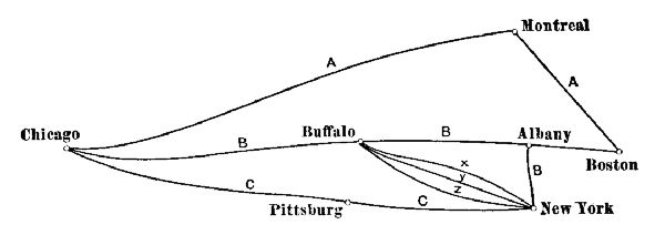 THE PROBLEM OF FREIGHT RATES
In handling through freights the problems are many, and, if two or more roads have the same terminal points, a great deal of friction of necessity results. The longest roads must either make their through rates lower than local rates between distant points, or lose much of their through business. They cannot afford to do the latter and the statutory laws may forbid the former. As a result the laws most likely are evaded, or else openly disobeyed.[20]
The difficulties in adjusting the matter of the long and the short haul, as has been shown, have caused the formation of pools and various other traffic associations, the object of which has been to prevent rate-wars. To this extent they resulted in positive good, for a rate-war in the end is apt to be as hurtful to the community as to the railway company. The attempt to settle such questions has also resulted in a great deal of legislation. Some of this has been wise and good; but not a little has been hurtful both to the railroads and to the community. The general result is seen in the great combination of competing lines and, more recently, of competing systems.
[Pg 72]Passenger Service.—Passenger traffic is more easily managed than the movement of freight. For the greater part the rates are fixed by law. On a few eastern roads local rates are two cents per mile; in the main, however, a three-cent rate prevails, except that in sparsely peopled regions the rates are four and five cents per mile. On many roads 1,000-mile books are sold at the rate of twenty dollars; on some the rate is twenty-five dollars per book.
Long-distance rates involving passage over several roads are somewhat less than the local rates. These rates are determined by joint passenger-tariff associations. Each individual road fixes its own excursion and commutation rates; one or another of the joint passenger associations determines the rates where several roads divide the traffic. The latter are usually one, or one and one-third fares for the round trip.
Except on a few local roads in densely peopled regions the passenger service is much less remunerative than freight business, and not a few railways would abolish passenger trains altogether were they permitted to do so. Rate-cutting between competing roads has not been common since the existence of joint passenger associations. It is sometimes done secretly, however, through the use of ticket-brokers, or "scalpers," who are employed to sell tickets at less than the usual rate; it is also done by the illicit use of tickets authorized for given purposes, such as[Pg 73] "editors'," "clergymen's," and "advertising" transportation.
In many instances, where several roads have the same terminal points, it is customary for the road or roads having the quickest service to allow a lower rate to the others. Thus, of the seven or eight roads between New York and Chicago, the two best equipped roads charge a fare of twenty dollars on their ordinary, and a higher rate on their limited, trains. Because of slower time the other roads charge a sum less by two or three dollars for the same service. This cut in the rate is called a "differential."
Railway Mileage.—The railways of the world in 1900 had an aggregate of nearly four hundred and eighty thousand miles distributed as follows:
| North America | 216,000 |
| Europe | 173,000 |
| Asia | 36,000 |
| South America and West Indies | 28,000 |
| Australasia | 15,000 |
| Africa | 12,000 |
In western Europe and the eastern United States there is an average of one mile of railway to each six or eight square miles of area. In these countries railway construction has reached probably its highest development, and the proportion seems to represent the mileage necessary for the commercial interests of the people.
The railways of the United States aggregate 193,000 miles—nearly one-half the total mileage of the world. Over this enormous trackage 38,000 locomotives and 1,400,000 coaches and cars carry yearly 600,000,000 passengers and 1,000,000,000 tons of freight. They represent an outlay of about $5,000,000,000. Owing to the absence of the international problems that have greatly interfered with the organization of European railways, the roads of[Pg 74] the United States have developed "trunk-system" features to a higher degree than is found elsewhere.
In the United States and Canada the farms of the great central plain, together with the coal-mines, are the great centres of production, while the seaports of the two coasts form great centres of distribution. Most of the trunk lines, therefore, extend east and west; of the north and south lines only two are important. The reason for the east-west direction of the great trunk lines is obvious; the great markets of North America, Europe, and Asia lie respectively to the east and the west.
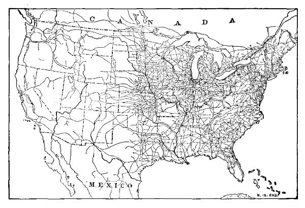 THE DISTRIBUTION OF THE RAILWAYS OF THE UNITED STATES
THEIR POSITION DEPENDS ON THE PRODUCTION OF THE LAND
THE DISTRIBUTION OF THE RAILWAYS OF THE UNITED STATES
THEIR POSITION DEPENDS ON THE PRODUCTION OF THE LAND
Railway Ownership.—The ownership of railways is vested either in national governments or else in corporate companies; in only a few instances are roads held individually by private owners, and these are mainly lumber or plantation roads. Thus, the railways of Prussia are[Pg 75] owned by the state; most of those of the smaller German states are owned either by the state or by the empire; still others are owned by corporate companies and managed by the imperial government. In their management military use is considered as first in importance.
In France governmental ownership and management have been less successful. Plans for an elaborate system of state railways failed, and the state now owns and operates only 1,700 miles, mainly, in the southwest. Belgium controls and operates all her lines, but as the latter are short and the area of the state small, there are no difficulties in the way of excellent management. In Great Britain all the railways are owned and controlled by corporate companies. The great transcontinental line of the Russian Empire was built by the government, but the latter does not own it.
In the United States the railways are now owned by corporate companies. Some of the western roads were built by Government subsidies;[21] other roads were built by the aid of States, counties, or cities, which afterward sold them to corporate companies. The first transcontinental railways required Government assistance, and could not have been built without it; nowadays, however, corporate companies find no difficulty in providing the capital for any railway that is needed.
Inasmuch as the railway is a positive necessity, upon whose existence depends the transportation of the food[Pg 76] daily required in the great centres of population, the charter of the railway gives the company extraordinary powers. Most steam railway companies are permitted by the State to exercise the power of eminent domain—that is, they may seize and hold the land on which to locate their tracks and buildings, if it cannot be acquired by the consent of the owners; they may also seize coal and other materials consigned to them for shipment if such materials are necessary to operate their lines.
Therefore, in consideration of the unusual powers possessed by the companies, the various States reserve the right to regulate the freight and passenger tariffs. They may also compel the companies to afford equal facilities to all patrons, and take the measures necessary to prevent discrimination.
The control of the railways by the government may be absolute, as in the German state of Prussia; or it may consist of a general supervision, as in the case of the Canadian railways. In almost every European state there is a director or else a commission to act as a representative between the railways and the people. In the United States the various States have each a railway commission, while the general Government is represented by the Interstate Commerce Commission.
Electric Railways.—The use of electricity as a motive power has not only revolutionized suburban traffic but it has become a great factor in rural transportation as well. The speed of the horse-car rarely exceeded five or six miles per hour, while that of the electric car is about ten miles per hour in city streets and about twice as great over rural roads. As a result, the suburban limits of the large centres of population have greatly extended, and the population of the outlying districts has been increased from four to ten fold.
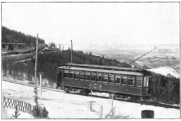 ELECTRIC RAILWAY--ROCKY MOUNTAINS
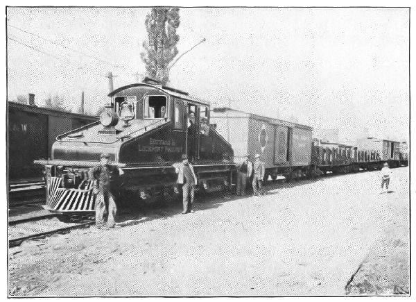 ELECTRIC FREIGHT LOCOMOTIVE—ERIE RAILROAD
From some of the larger cities the electric roads reach out to distances of one hundred miles or more and have become the carriers of perishable freight, such as fruit and dairy products. These are not only delivered just as promptly as though they were sent over the steam roads, but the delivery is more frequent. Indeed, the marvellous success of the electric interurban railway is due mainly to the frequency of its service.
Public Roads and Highways.—Carriages propelled by steam, electric, and gasoline motors have become an important factor in the delivery of goods in nearly every city of Europe and America. They are not only speedier than the horse and wagon, but their keeping costs less. They are economical only on good roads. The bicycle, no longer a plaything, exerted a very decided effect on transportation when the "pneumatic" or inflated rubber tire came into use. Through the bicycle came the demand for good roads; and several thousand miles of the best surfaced roads are built in the United States each year.
The ordinary highways or roads, the paved streets of the large cities excepted, are popularly known either as "dirt" roads or "macadamized" roads, the latter name being applied to about every sort of graded highway that has been surfaced with broken rock. Most of the roads of western Europe are of this character. They are laid out with easy grades, and a thick foundation of heavy stone is covered with smaller pieces of broken rock, the whole being finished off with a top-dressing of fine material. Once built, the expense of keeping them in good order is less than that of keeping a dirt road in bad order.
Most of the country highways of the United States are dirt roads that are deep with dust in dry weather and almost impassable at the breaking of winter. Roads of this character are such a detriment that grain farming[Pg 79] will not pay when the farm is distant twenty miles or more from the nearest railway. Many a farmer pays more to haul his grain to the nearest railway station than from the railway station to London.
Since it has become apparent that the commercial development of many agricultural regions depends quite as much on good wagon roads as upon railways and expensive farming machinery, there has been a disposition to grade and rock-surface all roads that are important highways. Intercommunication becomes vastly easier; the cost of transportation is lessened by more than one-half; and the wear and destruction of vehicles is reduced to a minimum. In every case the improvement of the road is designed to increase traffic by making a given power do more work in less time.
QUESTIONS FOR DISCUSSION
What have been the effects of Bessemer steel on the carrying power of railways?—on cheapening freight rates?
What would be some of the effects first apparent were a large city like London or New York suddenly cut off from railway communication?
What is meant by a tubular boiler?—by a forced draught?—by a switch?—by an automatic coupler?
Ascertain from a railway official the various danger-signals as indicated by lights, flags, and whistle-blasts.
Why should not crated furniture and coal have the same freight rate?
What is meant by a pool?—by long haul and short haul?—by rebate?
If the rate on a given weight of merchandise is one dollar and fifty cents for five miles, should it be three hundred dollars for one thousand miles?
FOR COLLATERAL READING AND REFERENCE
Hartley's Railroad Transportation.
American Railways.
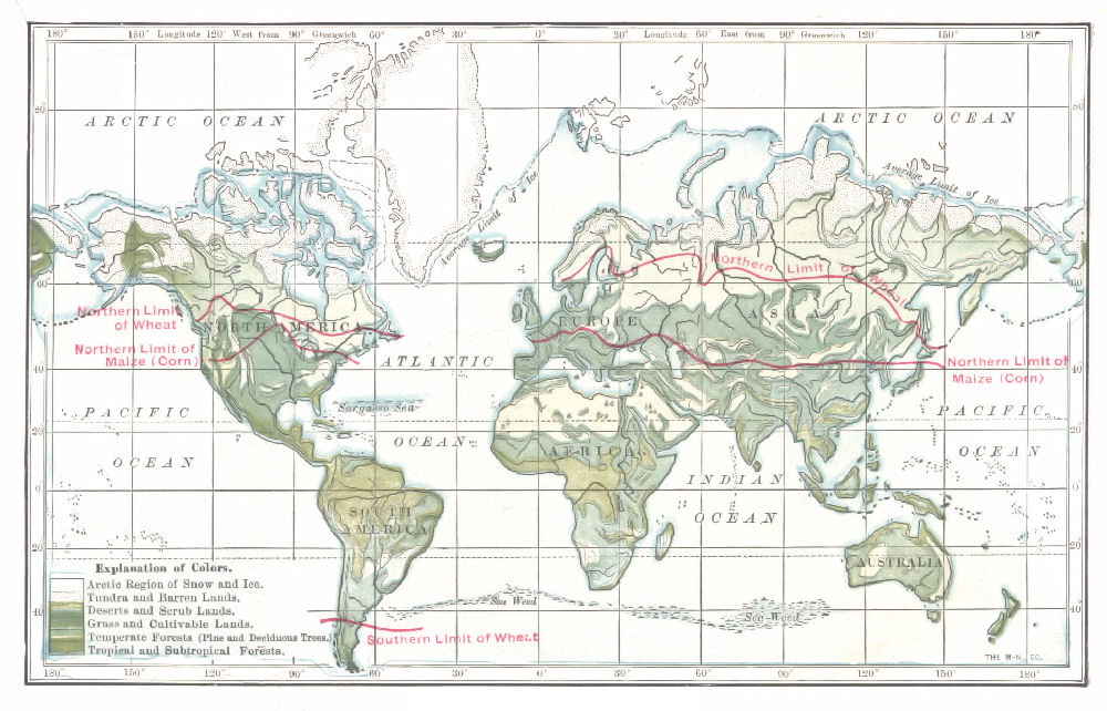 DISTRIBUTION OF VEGETATION
The population of the world is very unevenly distributed. Not far from nine-tenths live in lowland plains, below an altitude of 1,200 feet, in regions where food-stuffs grow. The remainder live mainly in the grass-producing regions of the great plateaus, the mining regions or the flood-plains and grassy slopes of the higher montane regions.
Communal Life.—In each of these regions, also, there is a very unequal massing of population. In part, the various families live isolated from one another; in part, they gather into cities and villages. In other words the population of a habitable region may be classed as rural and urban. In the United States and western Europe, agricultural pursuits encourage rural life, each family living on its own estate. In Russia, the agricultural population usually cluster in villages.
The farmer or freeholder who owns or controls his estate, exemplifies the most advanced condition of personal and political liberty. Only a few centuries have elapsed since not only the land but also the life of a subject was the property of the king or the feudal lord, and in those days about the only people living in isolation were outlaws. In most cases the communal system, best exemplified in Russia, marks an intermediate stage between a low and a high state of civilization; in other instances it is necessary in order to insure safety. German farmers in Siberia usually adopt the village plan for this reason.
For the greater part, the non-agricultural population of[Pg 82] the civilized world is massed in villages and cities for reasons that have nothing to do with either civilization or self-defence. The causes that bring about the massing of urban population are many and their operation is complex. In general, however, it is to facilitate one or more of several things, namely—the receiving, distribution, and transportation of commodities, the manufacture of products, the existence of good harbors, and the existence of minerals and metals necessary in the various industries.
The Beginnings of Towns and Cities.—The "country town" of agricultural regions in many ways is the best type of the centre of population engaged in receiving and disbursing commodities. The farmers living in their vicinity send their crops to it for transportation or final disposition. The country store is a sort of clearing-house, exchanging household and other commodities, such as sugar, tea, coffee, spices, drugs, silks, woollens, cotton goods, farming machinery, and furniture for farm products. A railway station, grain elevator, and one or more banks form the rest of its business equipment.
Usually the town has resulted from a position of easy access. It may be the crossing of two highways, a good landing-place on a river, the existence of a fording-place, a bridge, a ferry, a toll gate, or a point that formed a convenient resting-place for a day's journey. The towns and villages along the "buffalo" roads are examples almost without number.
The "siding" or track where freight cars may be held for unloading, has formed the beginning of many a town. The siding was located at the convenience of the railway company; the village resulting could have grown equally well almost anywhere else along the line.
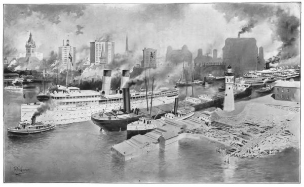 THE EFFECT OF POSITION—BUFFALO IS AT THE FOOT OF LAKE
ERIE AND THE HEAD OF ERIE CANAL; AN EXCELLENT HARBOR FACILITATES ITS
COMMERCE
THE EFFECT OF POSITION—BUFFALO IS AT THE FOOT OF LAKE
ERIE AND THE HEAD OF ERIE CANAL; AN EXCELLENT HARBOR FACILITATES ITS
COMMERCE
In the early history of nearly every country, military posts formed the beginnings of many centres that have grown to be large cities. Thus, Rome, Paris, London, the various "chesters"[22] of England, Milan, Turin, Paris, Chicago, Pittsburg, and Albany were established first as military outposts. The trading post was most conveniently established under the protection of the military camp, and the subsequent growth depended partly on an accessible position, and partly on the intelligence of the men who controlled the trade of the surrounding regions.
Harbors as Factors in the Growth of Cities.—A good harbor draws trade from a great distance. Thus, with a rate of 14½ cents on a bushel of wheat from Chicago, New York City draws a trade from a region having a radius of more than one thousand miles. In its trade with Chinese ports, Seattle, the chief port of Puget Sound, reaches as far eastward as London and Hamburg.
Water-Power as a Factor.—The presence of water-power has brought about the establishment of many centres that have grown into populous cities. The water-power of the New England plateau had much to do with the rapid growth of the New England States. At the time of the various embargo and non-intercourse acts preceding the war of 1812, a great amount of capital was thrown into idleness. The water-power was made available because, during this time, the people were compelled to manufacture for themselves the commodities that before had been imported.
The manufacturing industry at first was prosecuted in the southern Appalachians as well as in the New England plateau. It survived in the latter, partly because of the capital available, and partly owing to the business experience of the people. In the meantime villages sprang up in pretty nearly every locality in which there was available water-power.
Since the use of coal and the advent of cheap railway transportation, steam has largely supplanted water-power, unless the latter is unlimited in supply. As a result, there is a marked growth of the smaller centres of population along the various water-fronts. In such cases the advantages of a water-front offset the loss of water-power.
The Effects of Metals on the Growth of Cities.—The character of the industry of a region has much to do with the character of its manufactures. Thus, coal is absolutely essential to the manufacture of iron and steel; and, inasmuch as from two to eight tons of the former are necessary to manufacture a ton of steel, it is cheaper to ship the ore to a place to which coal can be cheaply brought.
The coal-fields are responsible for the greater part of Pittsburg's population, and almost wholly for that of Scranton, Wilkesbarre, and many other Pennsylvania towns. Iron and coal are responsible, also, for many cities and towns in the vicinity of the Great Lakes. Birmingham, Salford, and Cardiff in Great Britain, Dortmund and Essen in Germany, and St. Étienne in France have resulted from the presence of coal and iron.
In many instances man is a great factor in the establishment of a centre of population. Chicago would have been quite as well off in two or three other locations; its present location is the result of man's energy and is not likely to be changed. St. Louis might have been built at a dozen different places and would have fared just as well; the same is true of St. Paul, or of Indianapolis.
Leavenworth at one time was a more promising city than Kansas City, but the building of an iron bridge over the Missouri River at the latter place gave it a start, and wide-awake men kept it in the lead. It has grown at the expense of Leavenworth and St. Joseph, neither one of which has become a commercial centre. Cairo, at the[Pg 86] junction of the Mississippi and Ohio Rivers, has the geographical position for a great city; it waits for the man who can concentrate the commerce there.
Adjustment to Environment.—San Francisco was wisely located at first, but its grain trade was more economically carried on at Karquinez Strait, while its oriental trade is gradually concentrating at Seattle. Philadelphia lost its commercial supremacy when the completion of the Erie Canal gave return cargoes to foreign vessels discharging at New York City. Oswego, N.Y., had the advantage of both harbor facilities and water-power, but Syracuse, with practically no advantages except those of leadership, has far outstripped it.
Such instances of the readjustment of centres of population have been common in the past; they will also occur in the future. In nearly every case the readjustment results from economic causes, the opening of new lines of transportation, the lowering of the cost of the production of a commodity, the discovery of new economic processes—all these cause a disturbance of population, and the latter must readjust itself to new and changed conditions.
Not all peoples have the necessary intelligence and training at first to adapt themselves to their environment. For the greater part, the American Indians were unable to take advantage of the wonderful resources of the continent in which they lived. The Boers occupied about the richest part of Africa, but made no use of the natural wealth of the country beyond the grazing industry; in fact, their nomadic life reduced them to a plane of civilization materially lower than that of their ancestors.
People of the highest state of civilization do not always adjust themselves to their environment readily. The people of the New England plateau were nearly a century in learning that they possessed nearly all the best harbors of[Pg 87] the Atlantic coast of North America. When, however, the great commerce of the country had been wiped out of existence, it did not take them long to readjust themselves to the industry of manufacture, the water-power being the natural resource that made the industry profitable.
QUESTIONS FOR DISCUSSION
Were the middle Atlantic coast of the United States to undergo an elevation of 100 feet, what would be the effect on New York City?
Find the factors that led to the settlement of the city or town in which or near which you live. What caused the settlement of the three or four largest towns in the same county?—of the following places: Minneapolis, Fall River, New Haven, New Bedford, Cairo (Ill.), Cairo (Egypt), Marseille, Aix-la-Chapelle, Alexandria (Egypt), Washington (D.C.), Columbus (O.), Johannesburg (Africa), Kimberley (Africa), Albany (N.Y.), Punta Arenas (S.A.), Scranton (Pa.), Vancouver (B.C.), San Francisco, Cape Nome?
What circumstances connected with commerce led to the passing of the following-named places: Palmyra, Carthage, Babylon, Genoa, Venice, Ancient Rome, Jerusalem?
COLLATERAL REFERENCE
Any good cyclopædia.
Of all the plants connected with the economies of mankind the grasses hold easily the first place. Not only are the seeds of certain species the chief food of nearly all peoples, but the plants themselves are the food of most animals whose flesh is used as meat. Wheat, maize, and rice are used by all except a very few peoples; and about all the animals used for food, fish and mollusks excepted, are grain eaters, or grass eaters, or both.
The grasses of the Plains in Texas, the Veldt in South Africa, and the hills of New Zealand by nature's processes are converted into meat that feeds the great cities of western Europe and the eastern United States. The corn of the Mississippi valley becomes the pork which, yielded from the carcasses of more than forty million swine, is exported to half the countries of the world. Even the two and one-half billion pounds of wool consumed yearly is converted grass.
Wheat.—The wheat of commerce is the seed of several species of cereal grass, one of which, Triticum sativum, is the ordinary cultivated plant. Wild species are found in the highlands of Kurdistan, in Greece, and in Mesopotamia, that are identical with species cultivated to-day. It is thought that the cultivation of the grain began in Mesopotamia, but it is also certain that it was grown by the Swiss lake-dwellers far back in prehistoric times. It is the "corn" Joseph's brothers sought to buy when they went to Egypt, and the records of its harvesting are scattered all over the pages of written history.
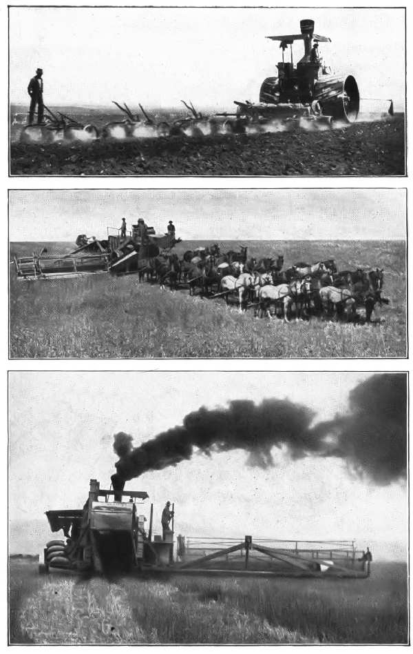 THE GRAIN CROP—MODERN METHODS OF CULTIVATION AND
HARVESTING
THE GRAIN CROP—MODERN METHODS OF CULTIVATION AND
HARVESTING
Of the one and one-half billion people that constitute the world's population, more than one-third, or about eight times the population of the United States, are consumers of wheat-bread; and this number is yearly increasing by twelve million. Moreover, each individual of this aggregate consumes yearly very nearly one barrel of flour, or about four and one-half bushels of wheat. In other words, it requires somewhat more than two billion three hundred million bushels of wheat each year to supply the world's demand.[23] As a matter of fact the world's crop is yearly consumed so nearly to the danger-line that very often the "visible supply," or the amount known to be in the market, is reduced to a few million bushels.
Wheat will grow under very wide ranges of climate, but it thrives best between the parallels of 25° and 55°. In a soil very rich in vegetable mould it is apt to "run to stalk." A rather poor clay-loam produces the best seed,[24] and a hard seed, rather than a heavy stalk, is required.
In the latitude of Kansas the seeds planted in the fall will retain their vitality through the winter; in the latitude of Dakota they are "winter-killed," as a rule. Because of this feature two broad classes or divisions of the crop are recognized in commerce—the winter and the spring varieties. In general, the spring wheats are regarded as the[Pg 91] better, and this is nearly always the case in localities too cold for winter wheat. There are exceptions to this rule, however. In the main, winter wheat ripens first, and is therefore first in the market.[25]
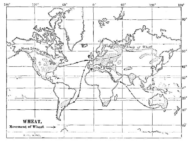 WHEAT
WHEAT
In Europe the plain that faces the North and Baltic Seas, and that part which extends through southern Russia,[Pg 92] yield the chief part of the crop, although the plains of the Po, the Danube, and Bohemia furnish heavy crops. Russia, France, Austria-Hungary, Germany, and Italy are all wheat states.
In a normal year all Europe produces a little more than one-half (fifty-five per cent.) of the world's crop. Russia and France excepted, scarcely another state produces as much as is consumed. Great Britain consumes her entire crop in three months; Germany in about six months. France sends a part of her crop to Great Britain and buys of Russia to fill the deficiency. Russia consumes but very little of her wheat-crop; it is nearly all sold to the states of western Europe. All Europe consumes about one billion seven hundred and ten million bushels, but produces about one billion two hundred and fifty million; the remainder is supplied by the United States, India, Argentina, Africa, and Australia.
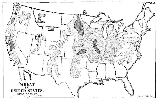 WHEAT IN UNITED STATES
In the United States the great bulk of the crop comes from the upper Mississippi valley and Pacific coast States.[Pg 93] About one-third is consumed where it is grown; more than one-third is required for the populous centres of the east; a little less than one-third is exported, of which about ninety per cent. goes to Europe.
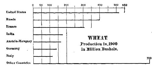 WHEAT PRODUCTION
Much of this, especially the Pacific coast product, is sold unground, but each year an increasing amount is made into flour. The flour manufacture of the United States aggregates somewhat more than 160,000,000 barrels yearly—the output of 16,000 flour-mills; the Pillsbury mills of Minneapolis alone have a capacity of 60,000 barrels a week. In Europe the Hungarian mills and their output of Bohemian flour are the chief competitors of the United States.
 WHEAT
WHEAT
The wheat-crop of the Pacific coast has usually been a factor by itself. On account of the absence of summer rains, the kernel is both plump and hard. After the threshing process it is sacked and stored in the fields in which it has grown.[26] Heretofore much of the sacked wheat has[Pg 94] been shipped to European markets by the Cape Horn route, but in late years a yearly increasing amount is made into flour and sold in China, Japan, and Siberia. In 1900 nearly two million barrels were thus sent.
East of the Rocky Mountains, after the grain is harvested much of it is sold to dealers whose storage elevators[27] are scattered all over the wheat-growing region, and at all great points of shipment, such as Duluth, Minneapolis, Buffalo, and the eastern seaports. Before the grain is transferred to the elevators it is inspected and graded, and the cars which contain it are sealed. This wheat constitutes the "visible supply." All the business concerning it is transacted by means of "warehouse receipts," that have almost the currency of ready money. Banks loan money on them almost to their market value.
Under normal conditions, the cost of growing and harvesting a bushel of wheat—including interest on the land and deterioration of the machinery, etc.—is between fifty and fifty-five cents. The market price, when not affected by "corners" and other gambling transactions, usually varies between sixty-two and eighty-five cents. The difference between these figures is divided between the farmer and the "middlemen," the share of the latter being in the form of commissions and elevator charges.
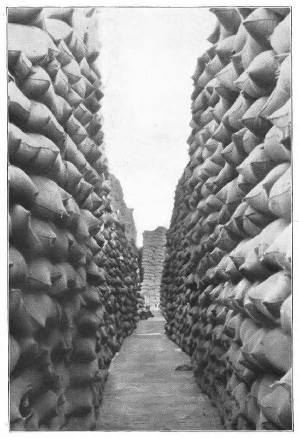 STORING PACIFIC COAST WHEAT
In addition to bread-making wheat, certain varieties of grain known as macaroni wheat have a certain importance in the market. Several varieties are so hardy that they easily resist extremely cold winters; they will also grow in regions too dry for ordinary varieties. In this respect they are well adapted to the plains at the eastern base of the Rocky Mountains. The only detriment is the lack of a steady market. Macaroni wheat has a very hard kernel and is rich in gluten. It is used mainly in the manufacture of macaroni paste, but in Europe, when mixed with three times its weight of ordinary soft wheat, it is much used in making flour. The small amount now grown in the United States is shipped mainly to France.
The yield of wheat varies partly with the rainfall, but the difference is due mainly to skill in cultivation. In western Europe it is from two to three times as great as in the United States; in Russia and India it is much less.[28]
The yearly consumption of wheat is increasing very rapidly both in the United States and in Europe; moreover, China is becoming a wheat-consuming country. In the United States the consumption is increasing so rapidly that unless either the acreage of the crop, or else the yield per acre, is materially increased, there will be no surplus for export after the year 1931.
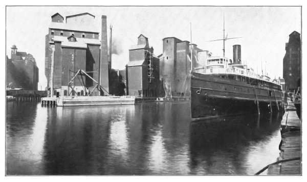 THE WHEAT INDUSTRY—GRAIN ELEVATORS AT BUFFALO, NEW
YORK
THE WHEAT INDUSTRY—GRAIN ELEVATORS AT BUFFALO, NEW
YORK
In the United States the acreage may be somewhat increased by the irrigation of arid lands now uncultivated, and by the reclamation of overflowed and swamp lands. There are far greater possibilities, however, in the employment of methods of cultivation which will double the rate of present yield. It is doubtful if there can be much increase of acreage in the States of the Mississippi Valley, where the acreage will of necessity be lessened rather than increased.
In western Europe there can be no material increase of the acreage or the rate of yield; in Russia both are possible. The plains of Argentina now yield a notable quantity—about one hundred million bushels—and the amount may be increased. Moreover, a large product may be obtained from both Uruguay and Paraguay, and southern Brazil, neither one of which produces a considerable quantity. At the present rate of the increase in consumption, all of the available land, yielding its maximum, will not produce a sufficient crop at the end of the twentieth century.
Corn.—Maize or Indian corn is the seed of a plant, Zea mays, a member of the grass family. It is not known to exist in a wild state. The species now cultivated are undoubtedly derived from the American continent, but evidence is not wanting to show that it was known in China and the islands of Asia before the discovery of America.[29] The commercial history of corn begins with the discovery of America. Next to meat it was the chief food of the native American; next to wheat it is the chief food-stuff in the American continent to-day.
Corn requires a rich soil and is not so hardy as wheat. It thrives best in regions having long summers and warm[Pg 99] nights. The growing crop is easily injured by too much rain. It is an abundant crop in the central Mississippi Valley, but not near the coast; it is very prolific in Nebraska, but not in Dakota; it thrives in Italy, Austria, and the Balkan Peninsula, but not in the British Isles and Germany. It is a very important crop in Australia, and is the staple grain of Mexico. It is the crop of fourteen-hour days and warm nights.
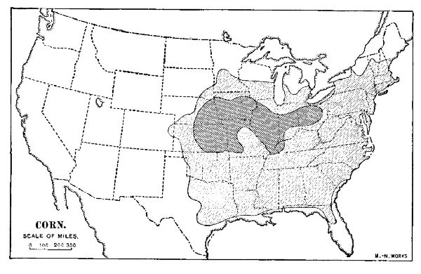 CORN
CORN
The United States is the chief producer of corn, and from an area of 80,000,000 acres—about that of Ohio, Indiana, and Illinois combined—more than two billion bushels, or four-fifths of the world's crop, are produced. In the past few years the area planted with corn has not materially increased, and it is likely to be lessened rather than increased in the future. From the same acreage, however, the annual yield, now about twenty-five or thirty bushels per acre, can be more than doubled by the use of more skilful methods of cultivation.
Corn contains more fatty substance, or natural oil, than[Pg 100] wheat, and therefore has a greater heating power. For this reason it is better than wheat for out-of-door workers, and it is almost the only cereal food-stuff consumed in Spanish America. It is also a staple food-stuff in Egypt. Corn has been used as a bread-stuff in the United States, Italy, and Rumania[30] for a long time. In recent years, however, its use has become very popular in Europe.
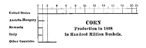 CORN PRODUCTION
In the United States by far the greater part of the crop is consumed where it is grown, being used to fatten swine and cattle. The market value of a pound of corn is about one-third of a cent; converted into pork or beef, however, it is worth five or six times as much. By feeding the corn to stock, therefore, a farmer may turn an unmarketable product into one for which there is a steady demand.
 CORN
CORN
Although corn is not so essential a staple as wheat, it has a much wider range of usefulness. The starch made from it is considered a delicacy and is used very largely in America and Europe as an article of food. Glucose, a cheap but wholesome substitute for sugar, is made from it; from the oil a substitute for rubber is prepared; smokeless powder and other explosives are made from the pith of[Pg 101] the stalk; while a very large part of the product is used in the manufacture of liquor.
Rye.—Rye is the seed of a cereal grass, Secale cereale, a plant closely resembling wheat in external appearance. Rye will grow in soils that are too poor for wheat; its northern limit is in latitudes somewhat greater than that of wheat, also. It is an ideal crop for the sandy plain stretching from the Netherlands into central Russia, and this locality produces almost the whole yield. The world's crop is about one and a half billion bushels, of which Russia produces nearly two-thirds. Germany, Austria-Hungary, and Japan grow nearly all the rest. It is consumed where it is grown. In the United States the yearly product is about twenty-five million bushels, about one-tenth of which is exported to Europe. Rye-bread is almost always sour, and this fact is its chief disadvantage.
Barley.—Barley is the seed of several species of cereal grass, mainly Hordeum distichum and Hordeum vulgare. It is one of the oldest-used of bread-stuffs. It can be cultivated farther north than wheat, and about as far within the tropics as corn; it has, therefore, very wide limits. Formerly it was much used in northwestern Europe as a bread-stuff, but in recent years it has been in part supplanted by wheat and corn. Barley is a most excellent food for horses, and in California is grown mainly for this purpose. Its chief use is for the manufacture of the malt used in brewing.
The world's crop of barley is not far from one billion bushels, of which the United States produces about sixty million bushels. Most of the crop is grown in the Germanic states of Europe, and in Russia.
Oats.—The oat is the seed of a cereal grass, Avena sativa being the species almost always cultivated. It is not known where the cultivated species originated, but the[Pg 102] earliest known locality is central Europe, where it was certainly a domestic plant during the Bronze Age. It seems probable that the species now cultivated in Scotland at one time grew wild in western Europe; certain it is that wild species are found in North America.
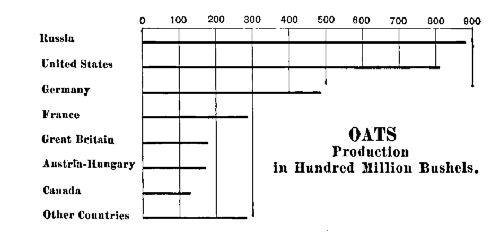 OATS PRODUCTION
The oat grows within rather wider limits of latitude, and thrives in a greater variety of soils than does wheat. Grown in a moist climate, however, the grain is at its best. The oat-crop of the world aggregates more than three billion bushels, surpassing that of wheat or corn in measurement, but not in weight. A small portion of this is used as a bread-stuff, but the greater part is used as horse-food, for which it is remarkably adapted.
 OATS
OATS
In Europe, Russia is the greatest producer, and its yearly oat harvest is about one-quarter of the world's crop. The states of northwestern Europe yield about half the entire crop; the wheat-growing area of the United States produces the remaining one-fourth. Russia and the United States are both exporters, the grain going to western Europe. By far the greater part of the grain is consumed where it is grown.
Rice.—Rice is the seed of a cereal grass, Oryza sativa. It is claimed to be native to India, but it is known to have[Pg 103] been cultivated in China for more than five thousand years. It grows wild in Australia and Malaysia.
Rice requires plenty of warmth and moisture. It is cultivated in the warmer parts of the temperate zone, but it thrives best in the tropical regions. In China a considerable upland rice is grown, but for the greater part it is grown in level lowlands that may be flooded with water. The preparation of the fields is a matter of great expense, for they may require flooding and draining at a moment's notice. The crop matures in from three to six months. After threshing, the seed is still covered with a husk, and in this form it is known as "paddy."
QUESTIONS FOR DISCUSSION
Why is not wheat-growing a profitable industry in the New England States?—in the plains at the eastern base of the Rocky Mountains?—in the southern part of the United States?
What are meant by the following terms: No. 1 spring, a corner, a disk harrow, a cradle, a flail, a separator, futures, warehouse certificates?
In 1855 the price of a barrel of flour in New York or Boston was about twelve dollars; at the close of the century it was less than five. Explain how the lessened price came about.
From a census or other report make a list of the ten leading wheat-producing States; the ten that produce the most corn.
Why are the foreign shipments of oats less than those of wheat?
What are the prices current of wheat, corn, oats, and barley to-day?
FOR STUDY AND REFERENCE
Obtain samples of the different kinds of wheat, oats, barley, corn, millet, and rice. Put the grain in small, closely stoppered vials; attach the heads of the small grains to sheets of cardboard of the proper size.
Read "The Wheat Problem"—Chapter I.
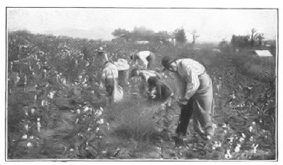 PICKING COTTON, ALABAMA
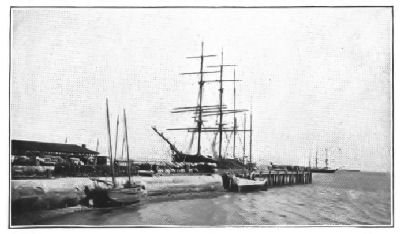 TRANSPORTING COTTON FROM WHARF, CHARLESTON, S.C.
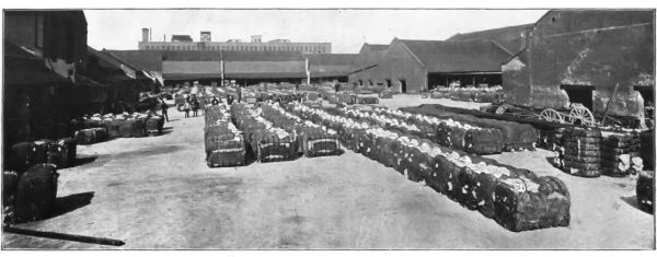 COTTON PRESS YARD, NEW ORLEANS, LA.
Under the term "textile" are included the fibrous substances that can be spun into threads, and woven or felted into cloth. Some of these, like the covering of the sheep, goat, and llama, or the cocoon of the silk-worm, are of animal origin; others, like cotton furze, the husk of the cocoanut, and the bast of the flax-plant are vegetable products. Their use in the manufacture of cloth antedates the period at which written history begins; it probably begins with the time when primitive man gradually ceased to have the hairy covering necessary to protect him from the conditions of climate and weather.
As body coverings all these substances are dependent on a single principle, namely—they are poor conductors of heat; that is, they do not permit the natural heat of the body to pass away quickly, nor do they allow sudden changes of the temperature to reach the body quickly. In other words, because of the artificial covering which mankind alone requires, bodily heat is not dissipated more rapidly than it is created; if it were, the covering would be worthless. A suit of clothes made of steel wire, for instance, because it conducts heat so rapidly, might chill, or perhaps heat the body more quickly than the open air.
With respect to warming qualities wool surpasses all other textiles. It is employed for clothing in every part of the world and by nearly all peoples. Cotton is used mainly also for body coverings, but it is inferior to wool for protection against cold. It is used by practically all peoples,[Pg 106] savage and civilized, outside of the frigid zones. Linen is inferior both to cotton and wool for clothing; its use is also restricted by its great cost. Silk is used mainly for ornamental cloths. Hemp is used mainly for cordage, and the use of ramie, jute, and sisal hemp is confined mainly to the manufacture of very coarse cloths and rugs.
Cotton.—The cotton fibre of commerce is the lint surrounding the seeds of several species of Gossypium, plants belonging to the same natural order as the marshmallow and the hollyhock. The cultivated species have been carried from India to different parts of the world, but cotton-bearing plants are also native to the American. A native tree-cotton, known as Barbados cotton, occurs in the West Indies; a herbaceous cotton-plant is known to have been cultivated in Peru long before the discovery of Columbus.
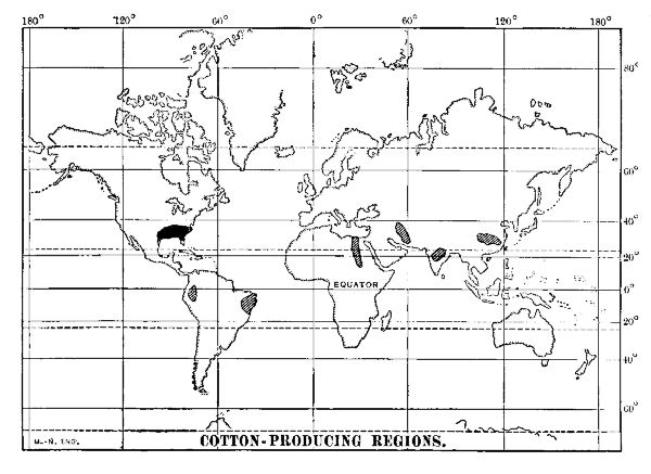 COTTON-PRODUCING REGIONS
More than four hundred years before the Christian era Herodotus describes it and mentions a gin for separating[Pg 107] the lint from the seed. Nearchus, an admiral serving under Alexander the Great, brought to Europe specimens of cotton cloth, and in the course of time it became an article of commerce among Greek and Roman merchants.
The cotton-plant requires warmth, moisture, and a long season. It also thrives best near the sea. It grows better, on the whole, in subtropical rather than in tropical regions, and the difference is due probably to the longer days and higher temperature of the subtropical latitudes. In the United States the northern limit is approximately the thirty-eighth parallel. The seeds are planted, as a rule, during the first three weeks of April and the first two of May. The plants bloom about the middle of June; the boll or pod matures during July, and bursts about the first of August. The picking begins in August.
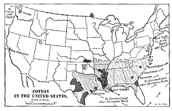 COTTON IN THE UNITED STATES
The yield and the quality of the textile depend not only on conditions of the soil, but on locality. In the river flood-plains of the southern United States the yield is about two bales per acre; on the bluff lands it is but little[Pg 108] more than one, unless unusual care is taken in the preparation of the land. The islands off the Carolina coast produce a very fine long-staple variety, commercially known as sea island cotton. A district in China produces a good fibre of brownish color known as nankeen, named for the city of Nanking, whence formerly it was exported. The valley of Piura River, Peru, produces varieties of long-staple cotton that in quality closely resemble silk.
The fibre of ordinary American cotton is about seven-eighths of an inch long; it is made into the fabrics commercially known as "domestics" and "prints," or calico. If the fibre averages a little longer than the common grades it is reserved for canvas. Ordinary Peruvian cotton has a fibre nearly two inches long; it is used in the manufacture of hosiery and balbriggan underwear, and also to adulterate wool. The long-staple cotton of the Piura Valley is bought by British manufacturers at a high price, and used in the webbing of rubber tires and hose. Egyptian cotton is very fine and is used mainly in the manufacture of thread and the finer grades of balbriggan underwear. Sea island fibre is nearly two inches long and is used almost wholly in the making of thread and lace.
The introduction of cotton cultivation resulted in very far-reaching consequences both from a political as well as an economic stand-point. The invention of the steam-engine by Watt gave England an enormous mechanical power. To utilize this the cotton industry was wrested from Hindustan; the mills were concentrated in Manchester and Lancashire; the cotton-fields were transferred to the United States.
As a result, the plains of Hindustan were strewn with the bodies of starved weavers and spinners, but a great industry grew into existence in England. The invention of spinning machinery by Arkwright, Crompton, and[Pg 109] Hargreaves, and the gradual improvement of the power-loom, greatly reduced the cost of making the cloth and, at the same time, enormously increased the demand for it.
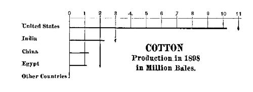 COTTON PRODUCTION
In the United States the consequences were far more serious. The invention of the engine or "gin" for separating the lint from the seed made cotton cultivation highly profitable.[31] The negro slaves, who had been scattered throughout the colonies and the States that succeeded them, were soon drawn to the cotton-growing States to supply the needed field-labor; and, indeed, white workmen could not stand the hot, moist climate of the cotton-fields.
The cotton-mills grew up in the Northern manufacturing States. The Northern manufacturer needed a tariff on imported goods to protect him from European competition; the Southern cotton-planter who purchased much of his supplies abroad was hurt by the tariff. After about sixty years of strained relations between the two sections there occurred the Civil War which wiped out nearly one million lives, and rolled up a debt, direct and indirect, of nearly six billions of dollars.
The world's cotton-crop aggregates from twelve million[Pg 110] to fifteen million bales yearly, of which the United States produces, as a rule, a little more than three-fourths. Egypt is rapidly taking an important place among cotton-producing countries, and, with the completion of the various irrigating canals, will very soon rank next to the United States. India ranks about third; China and Korea produce about the same quantity. There are a few cotton-cloth mills in these states, but in Japan the manufacture is increasing, the mills being equipped with the best of modern machinery. Brazil has a small product, and Russia in Asia needs transportation facilities only to increase largely its growing output.
 COTTON
The cotton-crop of the United States is quite evenly distributed; one-third is manufactured at home; one-third is purchased by Great Britain; and the remaining third goes mainly to western Europe. In the past few years China has become a constantly increasing purchaser of American cotton. New Orleans, Galveston, Savannah, and New York are the chief ports of shipment. The imported Egyptian and Peruvian cotton is landed mainly at New York. Most of the cotton manufacture is carried on in the New England States, but there is a very rapid extension of cotton manufacture in the South.
Wool.—The wool of commerce is a term applied to the fleece of the common sheep, to that of certain species of goat, and to that of the camel and its kind. There is no hard-and-fast distinction between hair and wool,[32] but, in general, wool fibres have rough edges, much resembling overlapping scales which interlock with one another; hair, as a rule, has a hard, smooth surface. If a mass of loose[Pg 111] wool be spread out and beaten, or if it be pressed between rollers, the fibres interlock so closely that there results a thick, strong cloth which has been made without either spinning or weaving.
This property, known as "felting," gives to wool a great part of its value, and is its chief distinction from hair. Some kinds of hair, however, have a slight felting property, and if sufficiently fine may be spun and woven. The hair of the common goat is worthless for this purpose, but that of the Cashmere and Angora species have the properties of wool. The hair of the Bactrian camel, and also that of the llama, alpaca, and vicuña is soft and fine, possessing felting qualities that make it very superior as a textile.
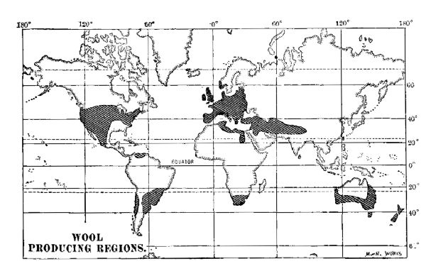 WOOL PRODUCING REGIONS
The quality of wool varies greatly according to the conditions of soil, climate, and the character of the food of the animal. In commerce, however, the fleeces are commonly graded as "long-staple," "short-staple," "merino," and "coarse."
In long-staple wools the fibres are from four to eight[Pg 112] inches long; they are more easily separated by a process much like combing, and are therefore called "combing" wools. The cotswold, cheviot, and most of the wools of the British Isles are of this kind; indeed, in fairly moist lowland regions such as Canada and the United States, there is a tendency toward the development of a long-staple product. The English long-staple wools are largely made into worsted cloth, the Scotch cheviot into tweeds, and the French into the best dress cloth.
If the fibres are materially less than four inches in length, the product is classed as a short-staple or "carding" wool. By far the greater part of the wool of the United States, Canada, and Europe is of this class. It is disposed of according to its fineness or fitness for special purposes, the greater part being made into cloths for the medium grades of men's clothing.
The finest and softest wool as a rule is grown in arid, plateau regions, and of this kind of staple the merino is an example. The fibres are fine as silk, and the goods made from them are softer. The Mission wool of California is the product of merino sheep, and, indeed, the conditions of climate in southern California and Australia are such as to produce the best merino wool. The famous Electoral wool of Saxony is a merino, the sheep having been introduced into that country from Spain about three hundred years ago. The merino wools, as a rule, are used in the most highly finished dress and fancy goods.
The coarse-staple wools are very largely used for American carpets, coarse blankets, and certain kinds of heavy outer clothing. The Russian Donskoi wool, some of the Argentine fleeces, such as the Cordoban, and many of those grown in wet lowlands are very coarse and harsh. The quality is due more to climatic conditions and food than to the species of sheep; indeed, sheep that in other regions produce a fine wool, when introduced to this locality, after a few generations produce coarse wool.
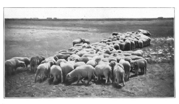 SHEEP FEEDING ON ALFALFA
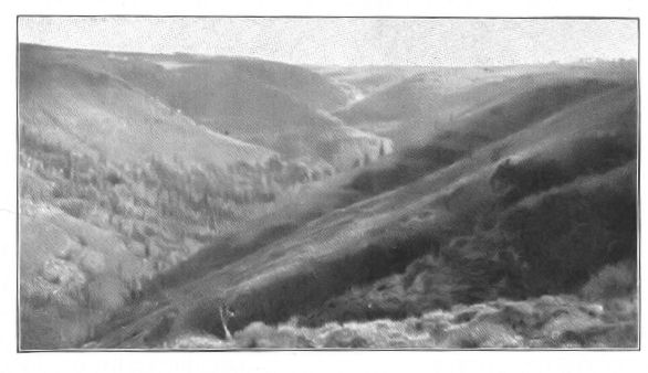 SHEEP RANCH, UTAH
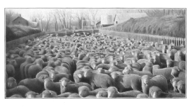 SHEEP IN THE FEEDING YARD
The rug wools grown in Persia, Turkestan, Turkey in Asia, and the Caucasus Mountains are also characteristic. They vary in fineness, and because they do not readily felt they are the best in the world for rug stock. The "pile" or surface of the rug remains elastic and stands upright even after a hundred years of wear. This quality is due mainly to conditions of climate and soil.
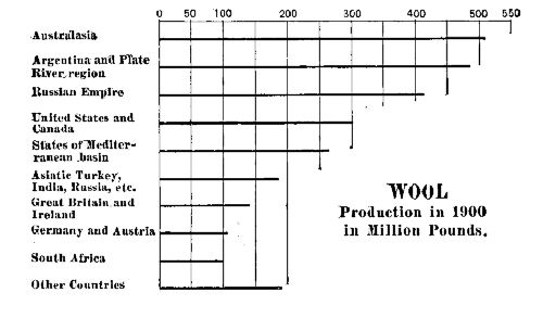 WOOL PRODUCTION
In some instances the wool is obtained by a daily combing of the half-grown lambs. This process, however, is employed in the rug-making districts only; in general, the fleeces are clipped either with shears or machine clippers. In the United States the latter are generally employed, and but little attempt is made either to sort the fleeces or to separate the various qualities of wool in the same fleece.
The raw wool always contains foreign matter such as burs and dirt; it is also saturated with a natural oil which prevents felting. The oil, commonly called "grease," or "yolk," is an important article of commerce; under the name of "lanolin" (adeps lanæ) it is used in medicine and pharmacy as a basis for ointments.[Pg 115]
The world's yearly clip is a little more than two and one-half billion pounds, of which the United States produces about one-eighth. In Europe and the United States, owing to the increasing value of the land, the area of production is decreasing; in Australia, South Africa, and Argentina, where land is cheap, it is increasing. From these three regions wool is exported; most European countries and the United States buy it. In the latter country the consumption is about six pounds for each person.
 WOOL
WOOL
The wools of the Mediterranean countries—France, Spain, Italy, Algiers, Egypt, etc.—are the best for fine cloths; those of central Asia for rugs and shawls; the others are used mainly in medium and low grade textiles.
Other Wools.—The Angora goat, originally grown in Anatolia (Asia Minor), and the Iran States (Persia, Afghanistan, and Baluchistan), furnishes a beautiful white wool, commercially known as "mohair." Smyrna is an important market for it, and England is the chief buyer. The Angora goat has been introduced into South Africa and California, where it is successfully grown. From the former country there is a large export of mohair.
Cashmere wool is a fine, downy undercovering, obtained by combing the fleece of a goat native to the Kashmir Valley in India. A single animal yields scarcely more than an ounce or two, and the best product is worth about its weight in gold. It is used in the manufacture of the famous Cashmere shawls, which are sold at prices varying from five hundred to five thousand dollars. They are made in Persia and India.
Llama and alpaca wool are fine textile obtained from animals of the camel kind native to South America. The wool is either black or brown in color. A considerable[Pg 116] part is used for native-made articles, such as saddle-blankets, etc., but much of it is exported to England.
Most of the "camel's hair" of commerce was originally worn by goats, being called by its commercial name because of a similarity in texture to that of the camel's hair. The camel of Turkestan, however, furnishes a silky textile that is much used. The brown wool often found in Hamadan rugs is natural camel's hair, and a considerable amount mixed with sheep's wool is used in certain textiles. The camel's hair of China is made into artists' brushes.
Silk.—The silk of commerce is the fibre spun by the larvæ or caterpillars of a moth, Bombyx mori, as they enter the chrysalis stage of existence. The silk-growing industry includes the care and feeding of the insect in all its stages. The leaves of the white mulberry-tree (morus alba) are the natural food of the insect, and silk-growing cannot be carried on in regions where this tree does not thrive. Not all areas that produce the mulberry-tree, however, will also grow the silk-worm; the latter cannot exist in regions having very cold winters, and therefore the industry is restricted by climate.
The moth, shortly after emerging from the chrysalis stage, lays from two or three hundred to seven hundred eggs. These are "hardy"—that is, they will remain fertile for a long time if kept in a cool, dry place; moisture will cause them to putrify, and heat to germinate. If well protected, they may be transported for distances.
In rearing the silk-worm, as soon as the latter is hatched, it is placed on mulberry-leaves, and for five weeks it does nothing but eat, in that time consuming many times its weight of food.[33] Then it begins to spin the material that forms its chrysalis case or cocoon. The outer part of the case consists of a tough envelope not unlike coarse tissue-paper; the inner part is a fine thread about one thousand feet long that has been wound around the body of the worm. This thread or filament is the basis of the silk textile industry.
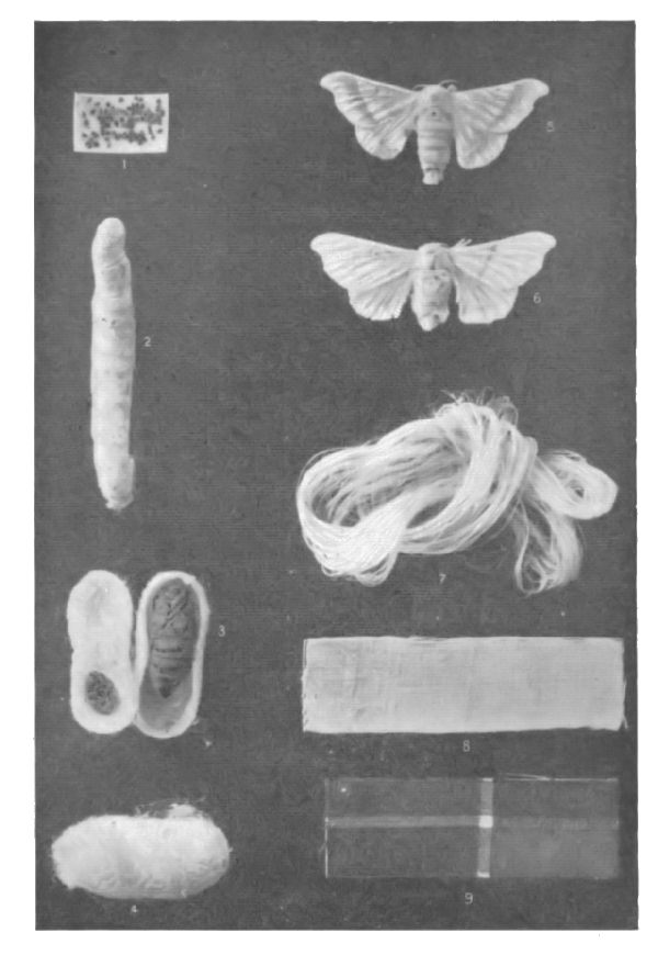 Copyright, 1898, by Nature Study Pub. Co.
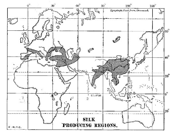 SILK PRODUCING REGIONS
At the proper time the cocoons are gathered and, if immediately to be used, are plunged into hot water. This not only kills the chrysalids but softens the cocoons as well, so that the outer cases may be removed. The cases removed, the rest of the cocoon is soaked in warm water until the gummy matter is softened and the fibres are free enough to be reeled. In the latter process the ends of a number of cocoons, varying from five to twenty, are caught and loosely twisted into a single strand. The silk thus prepared forms the "raw silk" of commerce. Sometimes a number of strands of raw silk are twisted into a coarse thread, thereby forming "thrown silk." For convenience[Pg 119] in handling, both raw and thrown silk are made into large skeins called hanks, and most of the silk product is exported in this form.
A given quantity of cocoons yields scarcely more than one-tenth its weight in good raw silk. The remaining part, consisting of broken fibres and cases, is shredded and spun into silk thread of inferior quality. This material, commonly called "husks" or "knubs," forms an important item in silk manufacture, and much of it is exported to Europe and America.
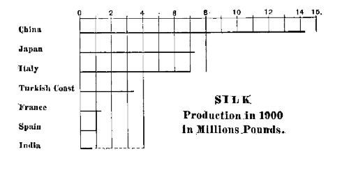 SILK PRODUCTION
According to traditions, not wholly trustworthy, eggs of the silk-worm were smuggled to India in the head-dress of a Chinese princess. Thence sericulture slowly made its way westward to Persia, Asia Minor, and the Mediterranean countries. Wild silk, a coarse but strong product, is grown in many of these countries, but mainly in China, where it forms an important export. The Chinese product is commercially known as "tussar" silk. Of the product of raw silk, about thirty-five million pounds, China yields about two-fifths, Japan and Italy each one-fifth. The remainder is grown in the Levant, Spain, and France.
Most of the raw silk of China is exported from Shanghai and Canton; that of Japan is shipped mainly from Yokohama. Among European countries Italy is the first producer of raw silk, and France the chief manufacturer.[Pg 120] By the operation of a heavy tariff a considerable manufacture of silk textiles has grown up in the United States. New York City and Paterson, N.J., are the chief centres of the industry.
The southern part of the United States offers an ideal locality for sericulture. Various attempts at silk-worm breeding have failed from lack of training, but not on account of geographic conditions.
Flax.—The flax of commerce, the basis of linen cloth, is the bast or inner bark-fibre of an annual plant (Linum usitalissimum, i.e., most useful fibre), native probably to the Mediterranean basin. It ranks among the oldest known textiles. Bundles of unwrought fibre have been found in the lake dwellings of Switzerland, and linen cloth constituted a part of the sepulture wrappings of the ancient Egyptian dead.
Flax has a very wide range, thriving in the colder parts of Europe as well as in tropical Asia; it does equally well in the dry summers of California or the moist regions of the Mississippi Valley. The chief requisite is a firm soil that contains plenty of nutrition.
After the stalks have passed maturity they are pulled up by hand; "rippled," or deprived of their seeds and leaves; "retted," or moistened in soft water until the bast separates; "broken" and "scutched" by a machine which gets rid of the woody fibres; and finally the loosened bast fibre is "hetcheled" or combed in order to separate the long, or "line," threads from the "tow" or refuse.
Russia produces more than one-half the world's crop, but the finest and choicest is that known as Courtrai fibre, which is grown in Belgium. This is thought to be due to the quality of the water in the Lys River. A considerable amount of flax grown elsewhere in Europe is sent to this part of Belgium to be retted. Ireland and [Pg 121]Germany produce considerable amounts, and a small quantity is grown in the United States.
The prepared flax is used in the manufacture of linen cloth, and the latter is almost exclusively used for table-cloths, napkins, shirt-bosoms, collars, cuffs, and handkerchiefs. France is noted for the manufacture of linen lawns and cambrics, and Belfast, Ireland, for table-cloths and napkins. Nearly the whole linen product is consumed in the United States, Canada, and western Europe; indeed, linen is a mark of western civilization. Great Britain handles the greater part of the linen textiles.
Hemp.—The true hemp of commerce is the bast or inner bark of a plant, Cannabis sativa, belonging to the nettle order. It is an annual plant having a very wide range; it occurs in pretty nearly every country of North America, Europe, and Asia. In Europe the chief countries producing it for commercial uses are Russia, France, Italy, and Hungary; in the United States it is grown in California and the central Mississippi Valley. Russia produces the largest crop; Italy the finest quality of fibre, the best coming from the vicinity of Bologna.
The stalks grow three feet or more in height. When cultivated for the fibre they are pulled from the ground, stripped of their leaves and soaked until the fibre is free. They are then "retted," or beaten, and the fibre is removed. After preparation the fibre is used mainly for the manufacture of wrapping-twine, cordage, and a coarse canvas. Great Britain is the chief purchaser and manufacturer.
Manila Hemp.—Manila hemp is the name given to a fibre obtained from the leaves of a plant, Musa textilis, belonging to the banana family. The best fibres are from six to nine feet in length, of light amber color, and very strong. The leaves, torn into narrow strips by hand, are afterward scraped by hand until the fibre is free of pulp.[Pg 122] The long and coarser fibres are made into rope; the shorter fibres are beaten and hetcheled in the same manner as flax, until fine enough to weave into mats, carpets, and fine cloth. The fibres that have served their usefulness as rope are pulped and manufactured into manila paper.
Practically all the manila fibre of commerce—which is not hemp at all—is grown in the Philippine Islands, and since peace has prevailed, the growth and production is increasing. The crude fibre is prepared by hand, by Filipino or by Chinese labor. The manufacture of cordage and paper is done mainly in the United States and Great Britain. Fine hand-made textiles are made by a few Filipino natives, but most of the goods of this character are manufactured in France. Very fine fibre is sometimes used as an adulterant of silk. Great Britain and the United States are the chief purchasers.
Sisal Hemp.—Sisal hemp, or henequen, is a stout, stringy fibre obtained from the thick leaves of several species of agave, to which the maguey and century-plant belong. The cultivated species, from which most of the commercial product is obtained, is the Agave sisalina, which much resembles the ordinary century-plant.
The essential feature in the economic production of sisal hemp is machinery for separating the fibre from the pulp of the leaf. The fibre is whiter, cleaner, and lighter than jute; moreover, in strength it ranks next to the best quality of manila hemp. It is used mainly in the manufacture of grain-sacks, and the twine used on self-binding harvesters. Nearly all the fibre of commerce is grown in the Mexican state of Yucatan and consumed in the United States. The cultivation of this material has made Yucatan one of the most prosperous states of Mexico.
Jute.—Jute is a fibre obtained from the inner bark of a tropical plant, Corchorus olitorius, belonging to the same[Pg 123] order as the linden-tree. The plant is an annual, growing in various moist, tropical countries, but is extensively cultivated in India and parts of China for commercial purposes. The fibre is prepared for manufacture in much the same manner as hemp and flax. In India it is used mainly for the manufacture of a coarse textile known as gunny cloth, used as bale-wrappers, and sacks for coffee and rice. On the Pacific coast states it is used for wheat-sacks. Calcutta is the chief centre of manufacture, but jute-sacks are extensively manufactured by the Chinese in California and China.
Ramie.—This fibre, also known as China grass, is the best of two or more species of nettles, prepared in the same manner as hemp fibre. It is finer and stronger than jute, and will take dye-stuffs in a superior manner. With the introduction of machinery for separating and handling the fibre, the cultivation of the ramie-plant has spread from China to India, Japan, and the United States. Fine textiles are now manufactured from it, the most important being carpets, mattings, and American "Smyrna" rugs. The last are generally sold as jute-rugs, and they are nearly as durable as woollen floor-covers.
Other Economic Fibres.—The fibre of cocoanut husk is largely employed in the manufacture of coarse matting. A part of this is obtained from tropical America, but it is a regular export of British India, where it is known as coir.
The mid-rib of the screw pine growing in the forests of tropical America furnishes the material of which "Panama" hats are made. The hats are made in various parts of Ecuador, Venezuela, and Colombia, and were formerly marketed in Panama. Hats made of a score of grasses and fibres are also sold as Panamas.
A plant (Phormium tenax) having leaves somewhat like those of the iris or common flag furnishes the material of[Pg 124] which New Zealand flax is prepared. It is used mainly in the manufacture of cordage.
Plaiting straw, used in the manufacture of hats and bonnets, is grown extensively in northern Italy and in Belgium. For this product spring wheat is very thickly sown in a soil rich in lime. The thick sowing produces a long, slender stalk; the lime gives it whiteness and strength. Plaiting straw is also exported from China and Japan. British merchants handle most of the product.
Cuba bast, a fibre readily bleached to whiteness, is exported to the various establishments in which women's hats are made.
Esparto grass, also called alfa, grows in Spain and the northern part of Africa. It was formerly much used in the manufacture of the cheaper grades of paper, but it has been largely supplanted by wood-pulp for this purpose. The decline of the esparto grass industry led to no little unrest among some of the native tribes of northern Africa.
QUESTIONS FOR DISCUSSION
What fibres were used in cloth-making in Europe before cotton was employed?
What textiles are of necessity made of cotton?
What is a spinning jenny?—a Jacquard loom?
What are the specific differences between cotswold and merino wool?
Why were most of the cloth-making mills of the United States built at first in the New England States?
How is the silk-making industry encouraged in the United States?
What are the chief linen manufacturing countries?
FOR STUDY AND REFERENCE
Obtain specimens of the cotton seed, boll, raw cotton (sea island, Peruvian, and ordinary), cotton thread, calico, gingham,[Pg 125] domestic, canvas, and some of the fancy textiles such as organdie, lawn, etc.
Obtain specimens of the cocoons of the silk-worm, raw silk gros-grain cloth, pongee, and tussar silk cloth.
Obtain also specimens of merino cloth, cashmere, cheviot, and other similar goods; compare them and note the difference.
Examine the fibres of cotton, silk, and wool under a microscope and note the difference.
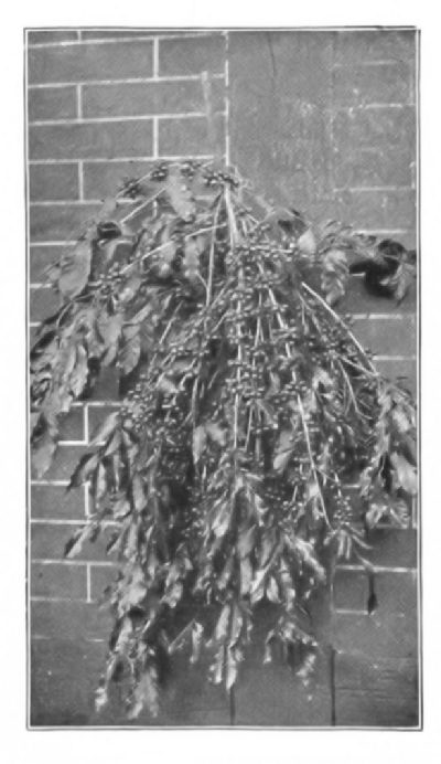 BRANCH OF COFFEE TREE,
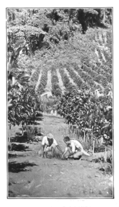 COFFEE PLANTATION NEAR JOLO,
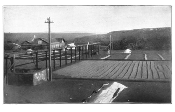 COFFEE DRYING FIELD, BRAZIL
It may be assumed that practically all beverages derived from plants owe their popularity to the stimulant effects they produce. In coffee, tea, cocoa, and maté, the stimulant principle is identical with cafein, the active principle of coffee; in liquors it is a powerful narcotic alcohol; non-potable substances, tobacco, opium, etc., owe their popularity also to narcotic poisons.
Coffee.—The coffee "beans" of commerce are the seeds of a tree (Coffea arabica) probably native to Abyssinia, but now cultivated in various parts of the world. It was introduced into Aden from Africa late in the fifteenth century, and from there its use spread to other cities. Rather singularly its popularity resulted from the strong efforts made to forbid its use.
It was regarded as a stimulant and therefore it was forbidden to followers of Islam.[34] But its power to prevent drowsiness and sleep during the intolerably long religious exercises was a winning feature, and so its use became general in spite of the fulminations against it.
Coffee culture was confined to Arabia until the close of the seventeenth century; it was then introduced into the Dutch East Indies, and for many years the island of Java[Pg 128] became the main supply of the world. At the present time, Java is second only to Brazil in coffee production. In the Old World it is now also cultivated along the Guinea coast of Africa, in Madagascar, India, and Ceylon. In the New World the chief areas are Brazil, Venezuela, the Central American States, and the West Indies.
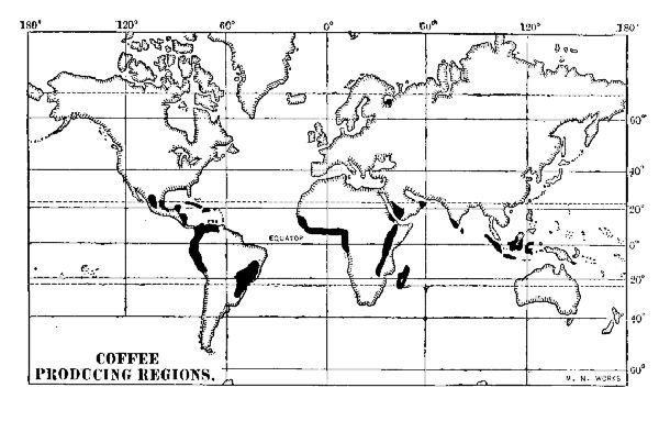 COFFEE PRODUCING REGIONS
The coffee-tree may be cultivated in almost any soil that is fertile; it thrives best, however, in red soil. Old, decomposed red lavas produce the choicest beans. Coffee grows in any moist climate in which the temperature does not range higher than 80° F. nor lower than 55° F. An occasional frost injures but does not necessarily kill the trees, which grow better in the shade than in the sunlight. For convenience in gathering the crop, the trees are pruned until they are not higher than bushes.
The fruit of the coffee-tree is a deep-red berry not quite so large as a cherry. A juicy pulp encloses a double membrane, or endocarp, and within the latter are the seeds which constitute the coffee of commerce. Normally there are two seeds, but in some varieties there is a tendency for[Pg 129] one seed to mature, leaving the other undeveloped; this is the "peaberry" coffee of commerce. The so-called Mocha coffee is a peaberry.
In their preparation the berries are picked when ripe and deprived of their pulp. After pulping they are cured in the sun for about a week and then hulled, or divested of the endocarp, a process requiring expensive machinery. The coffee is then cleaned, and sacked.
The value of the product depends on two factors, age and the care with which it is sorted. Formerly, in the Dutch East Indies, coffee-growing, for the greater part, was a government privilege, and the crop was kept for several years in storage before it was permitted to be sold—therefore the term "Old Government" Java. Other coffee was designated as "Private Plantations." The quality of coffee is greatly improved with age. Brazilian and other American coffee-beans are rarely seasoned by storage.
American coffees are almost wholly sorted by machinery. This process, however, merely collects beans of the same size; it still leaves the good and the bad beans together, though it is to be said that among the largest beans there are fewer poor ones. In the coffees handled by the Arab dealers all the sorting is done by hand, the very choice grade selling in the large cities of Europe for the equivalent of nearly three dollars per pound. All machine-sorted coffee is greatly improved by a subsequent hand-sorting to remove the imperfect beans.
The naming of the different kinds of coffee is somewhat arbitrary. Thus, Brazilian coffees are commercially known as Rio because they are shipped from the port of Rio de Janeiro; the same name is applied to the product shipped from Santos. Nearly all Venezuela coffees are called Maracaibo although they differ much in kind and quality; most Central American coffee is sold as Costa Rica; most[Pg 130] peaberry varieties are known as Mocha; and most of the East India product is popularly called Java, no matter whence it comes.
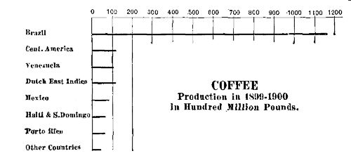 COFFEE PRODUCTION
Of the American coffees Rio constitutes about half the world's product. After sorting, the larger beans are often marketed as Java coffee, and when the beans have been roasted it is exceedingly difficult to tell the difference. The best Maracaibo is regarded as choice coffee, but its flavor is not liked by all coffee-drinkers. The best Honduras and Puerto Rico coffees take a high rank and command very high prices, retailing in some instances at sixty cents per pound. A very choice peaberry is grown in the volcanic soils of Mexico to which the name of Oaxaca is given; most of it is sold in the United States as a choice Mocha.
Mocha is the commercial name of a coffee at one time marketed in the Arabian city of that name. Since the completion of the Suez Canal, Hodeida has been the chief centre of the Arabian coffee-trade. Formerly most of this coffee was grown in the Province of Yemen, but now it is brought to Hodeida, from Egypt, Ceylon, and India.
About all the product is hand-sorted. The choicest is sold in Constantinople, Cairo, and other cities near by, in some instances bringing five dollars per pound. Very little, and only that of the most inferior quality, ever finds its[Pg 131] way into western Europe or the United States. Even the best Mocha is not superior to fine Oaxaca coffee.
Java coffee is renowned the world over for its fine flavor. The best quality was formerly that which had been held in storage to season for a few years. The government coffee was generally the better, but some of the private plantations crop is now equally good. Some of the Sumatra coffees are equal to the best Java beans.
The Liberia coffees have never been favorites in the United States on account of their flavor. In Europe they are used for blending with other varieties.
Of the entire coffee-crop of the world, the United States consumes more than three-quarters of a billion pounds—a yearly average of very nearly eleven pounds for each inhabitant. This is nearly three times as much per inhabitant as is consumed in Germany, and almost fifteen times the average used in Great Britain. Nearly all the world's crop is consumed in the United States and western Europe.
Chicory, parched grain, pease, and burnt parsnip are sometimes added as adulterants to ground coffee. Of those, chicory most nearly resembles coffee in flavor and taste. It is harmless and usually improves the flavor of inferior coffee. A tariff recently placed upon chicory has somewhat lessened the use of it.
Tea.—The tea of commerce consists of the dried and prepared leaves of an evergreen shrub (Thea chinensis) belonging most probably to the camellia family. Tea has been a commercial product of China for more than fourteen hundred years, but seems to have been carried thither from India about five hundred years before the Christian era; for its virtues were praised by (the probably mythical) Chinung, an emperor of that period.
The cultivated plants are scarcely higher than bushes, but the wild plant found in India is a tree fifteen or[Pg 132] twenty feet in height. The cultivated plant is quite hardy; severe winters kill it but ordinary freezing weather merely retards its growth. It thrives best in red, mouldy soils; the choicest varieties are grown in new soils. The leaves are not picked until the plants are three or four years old.
Two general classes of tea are known in commerce—the green and the black. Formerly these were grown on different varieties of the plant, but in the newer plantations no distinction is made in the matter of variety; the color is due wholly to the manner of preparation.
The plants are watched carefully during the seasons of picking, of which there are three or four each year. The April picking yields the choicest crop of leaves, and only the youngest leaves and buds are taken.[35] A single plant rarely yields more than four or five ounces of tea yearly. Each acre of a tea-garden yields about three hundred and fifty pounds.
After picking, the leaves are partly crushed and allowed to wilt until they begin to turn brown in color. They are then rolled between the hands and either dried very slowly in the sun, or else rapidly in pans over a charcoal fire—a process known as "firing." The former method produces black, the latter green, tea. The color of the latter is sometimes heightened by the use of a mixture of powdered gypsum and Prussian blue. In the black teas the green coloring matter of the leaf is destroyed by fermentation; in the green teas it remains unchanged.
The greater part of the Chinese tea designed for export is packed rather loosely in wooden chests lined with sheet-lead, the folds and joints of which are soldered in order to make the cover both air-tight and moisture-tight. A full chest contains seventy-five pounds of tea. The Japan[Pg 133] product is also packed in moisture-tight wrappers, the original parcels being usually ten-pound, five-pound, and pound packages. Similar devices are used in preparing the India and Formosa teas for ocean shipment.
The chief tea-producing countries are India (including Ceylon) China, Japan (including Formosa), and Java. A successful tea-garden is in operation near Charleston, S.C. A small amount is grown in the Fiji and Samoan Islands. The Ceylon and Formosa teas take a very high rank.
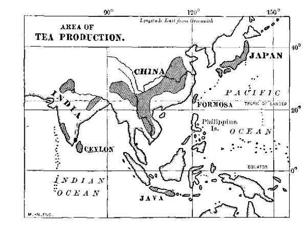 AREA OF TEA PRODUCTION
Great Britain and her colonies consume the bulk of the tea-crop. The average yearly consumption per person is eight pounds in Australia, six in Great Britain and Cape of Good Hope, and more than four in Canada. In the United States and Russia it is less than one pound per person.
Before the opening of the Suez Canal, in 1869, most of the crop for the English market was despatched by way of Cape of Good Hope. So important was it to get the consignments to London without loss of time, that fast clipper ships were built especially for carrying tea. Since the open[Pg 134]ing of the canal the crop has been shipped mainly by the Suez route.
A part of the tea required for the United States reaches New York by way of the Suez Canal, but the movement is gradually changing since the building of the fast liners that now ply between Asian and American ports. These steamships carry it to Seattle, or to Vancouver, whence it is distributed by rail. The increased cost of shipment by this route is more than offset by a gain of from five to seven days in time.
In some respects the Russian "caravan route" is the most important channel of the tea-trade. The tea is collected mainly at Tientsin, and sent by camel caravans through Manchuria to the most convenient point on the Siberian railway. Not only the shipments of brick tea[36] for the Russian market, but the choicest products for western Europe also are sent by this route. It is probably an economical way of shipping the brick tea, but a more expensive method of shipment for the latter could not be found easily; it is preferred from the fact that, no matter how carefully sealed, the flavor of tea is materially injured by an ocean voyage.
It is evident, therefore, that for the tea product alone the Siberian railway will soon become an important factor in the commerce of Europe. Shipments of tea are also sent from Canton to Odessa, Russia, but this route is not less expensive in the long run than the Cape route, and the tea suffers as much deterioration from the shorter as from the longer voyage.
Cacao.—Cacao, the "cocoa" of commerce, consists of the prepared seeds of several species of Theobroma, the greater part being obtained from the Theobroma cacao.[Pg 135] The name is unfortunately confused with that of the cocoa-palm, but there is no relation whatever between the two.
The seeds of the cacao were used in ancient America long before its discovery by Columbus, and the latter carried the first knowledge of it to Europe. By the middle of the seventeenth century it was much used in Spain, and less than a hundred years later it had become the fashionable drink of western Europe.
The cacao-tree, originally native to Mexico, is now cultivated throughout tropical America and the West Indies. It is not cultivated to any extent in the Eastern continent. The fruit consists of large, fleshy pods, which are cut from the trees usually in June and December. The seeds are then piled in heaps, or else packed in pits, and allowed to undergo a rapid fermentation for a period of several days, to which process their flavor is mainly due. The roasted and broken seeds are the cocoa-nibs of commerce. The husks are known as cocoa-shells.
A very large part of the cacao product comes from Ecuador, Guayaquil being perhaps the chief market of the world. The Venezuelan and Brazilian products, however, are the choicest; these are known in commerce respectively as Caracas and Trinidad cacao. Spain, Portugal, and France are the chief purchasers, and in the first-named country the consumption per person is five or six times as great as in other countries.
Cacao is not only a stimulant beverage, but a food as well; about one-half its weight is fat, and about one-third consists of starch and flesh-making substances. The stimulant principle is the same as that occurring in tea and coffee, but the proportion is considerably less. In preparing the cocoa for the market, much of the fat is intentionally withdrawn. The fat, commercially known as "cocoa-butter," and "oil of theobroma," does not turn rancid.
Chocolate consists of cocoa ground to a paste with sugar and flavoring matter, and then cast in moulds to harden. It is used mainly in the manufacture of confectionery. Most of the chocolate is made in France, Spain, and the United States. More than forty million pounds of cocoa are yearly consumed in the United States.
Maté.—Maté, yerba maté, or Paraguay tea, is the leaf of a shrub, a species of holly, growing profusely in the forests of Brazil, Paraguay, Argentina, and Uruguay. In many instances, the shrub is cultivated. The leaves are prepared in much the same manner as tea-leaves are, but instead of being rolled, they are broken by beating.
The maté of commerce has a stimulant principle identical with that of tea and coffee, which is the only reason for its use. The consumption, about fifteen thousand tons a year, is confined almost wholly to the countries named.
Tobacco.—The tobacco of commerce is the prepared and manufactured leaf of several species of plant, belonging to the nightshade family. Most of the product is derived from the species known as Virginia tobacco (Nicotiana tabacum) and the Brazilian species (Nicotiana rustica). The former is cultivated in the United States, West Indies, the Philippine Islands, and Turkey; the latter has been transplanted to central Europe and the East Indies.
The use of tobacco was prevalent in the New World at the time of Columbus's first voyage, and was quickly introduced into Europe. The prepared leaf contains a substance, nicotine, which is one of the most deadly of poisons when swallowed, and an intense narcotic stimulant when inhaled. On account of the evil effects arising from its introduction, its use was forbidden by the Church and also by sovereigns of several European states. The latter, however, finding that its use was becoming general, made it a[Pg 137] Crown monopoly. In Great Britain its cultivation was forbidden in order to encourage its cultivation in Virginia.
Tobacco does not thrive best in a poor soil, but the latter produces a thin, half-developed leaf, which in other plants would be called "sickly." It grows in almost any kind of soil, but requires warm summer nights. In many instances the tobacco of temperate latitudes yields a more salable leaf when grown under cover. The flavor is due partly to soil and climate, and partly to skill in curing. The choicest product is obtained in only a few localities of limited area. It sometimes happens that the products of two plantations almost side by side, and similarly situated, are very unlike in character and quality.
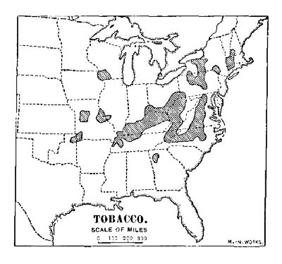 TOBACCO
The choicest cigar-tobacco is grown on the Vuelta Abajo district in the province of Pinar del Rio, Cuba; another very choice Cuban leaf is known as Partidos. Cuban-made cigars of fine quality are commercially "Havana" cigars, although tobacco from Manila and Porto Rico is apt to be largely used in their manufacture. In order to avoid the very heavy duty on cigars, which is not far from six dollars per pound, a great deal of the Havana tobacco is exported to points along the Florida coast, mainly Key West and Tampa. The unmanufactured tobacco pays a comparatively small duty, and the cigars made from it are commercially known as "Key West."
In some parts of Mexico a fine-flavored tobacco is grown, but as the cigars are not uniform in quality they are not popular. Some of the Brazilian tobacco is a high-class product, but not much is exported. Porto Rican leaf has a fine flavor, but is not popular because of its dark color. The demand for it in the United States is growing, however. Of the leaf grown in the East, that from Sumatra and the Philippine Islands is by far the best, and the exports are heavy. Cuban manufacturers purchase the Manila leaf; the Sumatra wrappers are purchased in the United States.
The choicest cigarette-tobacco is grown in Asiatic Turkey, Transcaucasia, and Egypt. It is selected with great care, and is "long-cut." The common grades are made of chopped Virginia tobacco, or of chopped cigar-trimmings. The cheapest grades consist of refuse leaf mixed with half-smoked cigar-stumps. The United States leads in the manufacture of cigarettes, and a large part of the product is sold in China, India, and Japan. Most of the world's product of snuff is made in the United States, and nearly all of it is sold abroad.
The United States produces yearly about seven hundred million pounds. A large part of this is sold to European countries. Great Britain purchases about four-fifths of the tobacco there consumed from the United States. The latter country purchases from Europe (mainly the Netherlands) about half as much as it sells to Europe. Louisville, Ky., is probably the largest tobacco-market in the world. New York, Baltimore, Richmond, Manila, and Havana are the chief shipping-ports.
In almost every civilized country tobacco is heavily taxed. In the United States there is not only a heavy import duty, but an internal revenue in addition. In Austria, France, Italy, Japan, and Spain the manufacture and[Pg 139] sale is in the hands of the government. The consumption of tobacco varies greatly. In the Netherlands it averages about seven pounds a year to each individual; in the United States it is more than four pounds; in central Europe, three pounds; in Spain, Sweden, Great Britain, and Italy, it is less than two pounds.
Opium.—The opium of commerce is the hardened juice obtained from the seed capsules of several species of the poppy-plant. A variety having a large capsule (Papaver somniferum) is most commonly cultivated for the commercial production of the substance. Half-a-dozen times during the season the capsules are scratched or cut; the juice exuding when hard is picked or scraped off and pressed into cakes.
Opium is not only a narcotic poison, but it has the property of lessening the pain of disease, and this is its chief use in medicine. In Mohammedan countries where the use of alcoholic liquors is forbidden as a religious custom, opium is used as a substitute. In Turkey, Persia, Arabia, and Egypt the production of opium is an important industry connected with social and religious life. In British India it is a political factor, being extensively cultivated as a government monopoly to be sold to the Chinese, who are probably the chief consumers of it. The Indian Government derives a revenue sometimes reaching twenty million dollars from this source.
The best quality of opium is marketed at Smyrna, and most of this is purchased by the United States. A considerable amount of Chinese opium is imported for the use of the Chinese, and a larger amount is probably smuggled over the Canadian and Mexican borders. Laudanum is an alcoholic tincture, and morphine an extractive of opium; both are used as medicine.
QUESTIONS FOR DISCUSSION
Consult a good physiology and learn the effects of coffee, tea, tobacco, and opium.
Where and what are the following: Mocha, Java, Maracaibo, Yokohama, Amoy, Canton, Oaxaca, Hodeida, Rio Janeiro, Santos, Havana; how is each connected commercially with this chapter?
From the map, Fig. 1, trace the route of a cargo of tea overland from China to Great Britain.
Consult an English history or a cyclopædia and learn about the opium war.
FOR STUDY AND REFERENCE
Obtain samples of the following, preserving them for study and inspection in closely stoppered vials: Mocha, Java, Rio, and Sumatra coffees; green, black, and gunpowder tea. Soak a tea-leaf a few minutes in warm water; unroll the leaf and attach it to a white card, for study.
Obtain samples of gum opium, laudanum, and morphine; note the odor of the first two and the taste of the last. Remember that they are poisonous.
Unroll a cheap cigarette and note the character of the tobacco in it, using a magnifying glass.
Most vegetable juices exposed to the air harden into firm substances, commonly called gum. Some of these dissolve, or at least soften, in water; these technically are known as "gums," and usually are so designated in commerce. Others are insoluble in water, but dissolve readily in alcohol, in naphtha, in turpentine, or in other essential oils; these are designated as "gum-resins." Still others yield oils or pitchy substances on distillation; these are known as "oleo-resins." There are many other dried vegetable juices, however, that in commerce are not classified among the gums and resins, and of these the most important is the substance commonly known as india-rubber.
Rubber and Rubber Products.—"Caoutchouc" is approximately the name given by Indians of the Amazon forests to a substance that had also been found in India. Some of it was brought to Europe from the Amazon region as early as 1736, and for nearly one hundred years no general purpose was discovered for which it could be used, except to erase lead-pencil marks—hence the name india-rubber, which has held ever since.
Common rubber is the prepared juice of a dozen or more shrubs and trees, all of which grow in tropical regions.[37] The belt of rubber-producing plants extends around[Pg 142] the world and includes such well-known species as the fig, the manihot (or manioc), and the oleander; indeed, it is a condition of sap rather than a definite species of plant that produces rubber, and the latter is a manufactured rather than a natural product. The process of preparing the juice is practically the same in every part of the world.
The rubber-gatherer of the Amazon, who is practically a slave, wades into the swamp, makes several incisions in the bark of the tree, fashions a rough trough of clay under it, and waits till the sap fills the clay vessel. When the sap has been gathered he makes a fire of the nuts of the urucuri palm and places an inverted funnel over it to concentrate the smoke. He first dips the end of a wooden spindle into the juice and then holds it in the smoke until the juice coagulates; this process is repeated until there has formed a ball of rubber weighing from five to ten pounds. The smoke of the palm-nuts is a chemical agent that converts the juice into the crude rubber of commerce.
Crude gum, however, is lacking both in strength and elasticity. The process that makes it a finished product is known as vulcanization. The crude rubber, having been exported to the manufacturer in the United States or Europe, is shredded, washed, and cleansed, and partly fused with varying proportions of sulphur. For a very soft product, such as the inner surface of tires, only a small proportion is used; where the wear is considerable, a larger proportion is employed.[38] White clay is sometimes added to give body to the product; coloring matter is also sometimes added.
By far the greater part of the crude rubber comes from[Pg 143] the Amazon forests. Brazil produces about one-half, but a considerable quantity is obtained in Acré, the territory formed where the borders of Brazil, Bolivia, and Peru meet, and now ceded to Brazil. Nearly all this product, that of the Ceará region excepted, is marketed at Pará and is known as Pará rubber. It is the best produced. The African product, mainly from the forests of the Kongo, and Madagascar, and nearly all the East Indian product is sent to Europe.
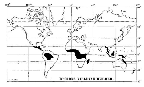 REGIONS YIELDING RUBBER
The world's product is about one hundred and thirty-three million pounds of crude rubber. Of this product the United States takes nearly one-half. The greater part is used in the manufacture of pneumatic tires, hose, and overshoes. A large part is used for making water-proof cloth,[39] and considerable is made into the small elastic bands for which there is a growing use.
Gutta-Percha.—Gutta-percha is obtained from the juices of several plants (chiefly Dichopsis gutta and Supota mülleri) both of which abound in the Malay peninsula and the East Indies. It is prepared in a manner somewhat similar to that employed in making crude rubber; it is also easily vulcanized by heating with sulphur. It is used to a limited extent in the manufacture of golf-balls, but mainly as the insulating cover of copper wires used in ocean telegraph cables. For this purpose it has no known substitute, and its essential merit is the fact that it is not altered by salt water. Nearly all the product is shipped from Singapore to England.
Pine-Tree Products.—The various members of the pine and cone-bearing trees yield valuable essential oils and oleo-resins that are very important in the arts and sciences. These, in nearly every instance, are prepared from the sap of the tree.
Oil of turpentine is known as an "essential oil," and in chemical structure and properties it does not differ from the various essential oils, such as lemon, orange, peppermint, etc. Commercial turpentine is generally made from the sap of the long-leafed pine of the Atlantic coast-plain.
The bark of the tree is cut near the foot, and the sap that oozes from the scar quickly hardens into a gum. The gum, generally known as "crude turpentine," is distilled and yields about one-fourth its weight of oil or "spirit" of turpentine. It is a staple article of manufacture in Europe, India, and the United States, and is used chiefly to dilute the oil paints and varnishes used in indoor work. The United States supplies about two-thirds of the world's product, a large part of which is shipped from Savannah and Brunswick, Ga., to Great Britain.[40]
Resin is the substance remaining after the crude turpentine has been distilled. It is used in the manufacture of varnish, sealing-wax, and soap. Finely powdered resin is also mixed with wood-pulp in the manufacture of wrapping-paper. It gives the latter a glazed surface and renders it almost water-proof. Most of the world's product of resin comes from the turpentine district of the United States, and about four-fifths of it is exported to Europe.
When resin is subjected to distillation at a still higher temperature, resin oil, a very heavy turpentine, is given off, and a viscous substance known as pitch remains. A considerable amount of this is still made in the United States, but the greater part comes from the pine-forests of Russia and Scandinavia. When pine-wood is distilled, tar is the chief product. In Russia tar is generally made by burning green logs covered with turf, over a pit. Creosote, or wood preservative, is made from tar. The various pine-tree products, creosote excepted, are commonly known as "naval stores," the tar being used in water-proofing the rigging of vessels, the pitch in calking the seams in between planks, in the decks and hulls.
Other Resins and Gums Used in the Arts.—Most of the gums and resins used in the arts and sciences are the hardened sap of plants—in some cases exuding by natural means from the bark, in others resulting from the puncture of the bark.
The lac of commerce is due to the puncture of the young branches of a tree, frequently a fig (Ficus religiosa) growing in the tropical forests of India. The hardened sap incrusts twigs forming stick-lac; when crushed, washed, and freed from the woody matter it is seed-lac; when melted and cooled in flakes it is shell-lac, the form best known in commerce. It is the chief ingredient in sealing-wax,[Pg 146] and is extensively used as a varnish. It is also used in fireworks on account of its inflammability.
Dammar is the product of a tree growing in the East Indies; it is the basis of a very fine white varnish. Copal is a term applied to oleo-resins soluble in turpentine, and used almost universally as varnishes. They come from the tropical regions of South America, Africa, and from the East Indies. Kauri is the fossil gum of a cone-bearing tree dug from the ground in northern New Zealand. Amber is the fossil gum of extinct cone-bearing trees found mainly along the Baltic coast of Prussia. It is used chiefly for the mouth-pieces of tobacco-pipes and cigar-holders; the inferior product is made into varnish. It is sold wherever tobacco is used. Sandarach, found on the north African coast, is used principally in Europe, being employed as a varnish. The United States and Great Britain consume most of the foregoing products.
QUESTIONS FOR DISCUSSION
Name any elastic substance you know about that is in every way a substitute for rubber.
What has been the relation between rubber and good roads?
Describe the structure of a bicycle tire.
Why are tar, pitch, and turpentine called naval stores?—and what determines the locality in which they are made?
What is varnish, and for what purposes is it used?
FOR STUDY AND REFERENCE
Obtain specimens of crude rubber, vulcanized rubber, and hard rubber; note carefully the characteristics of each.
Burn a very small piece of cheap white rubber-tubing in an iron spoon or a fire-shovel; note the character of the residue.
Obtain specimens of gutta-percha, resin, pitch, turpentine, shellac, copal, dammar, and creosote for study and inspection.
The economic history of nearly every country that has achieved eminence in modern times dates from its use of coal and iron; and indeed the presence of these substances in workable deposits means almost unlimited power. The present era is sometimes called the Age of Steel, but the possibilities of producing steel in enormous quantities, at less than one-fifth its price at the beginning of the nineteenth century, depended mainly upon the use of mineral coal instead of charcoal in its manufacture.
Coal consists of accumulations of vegetable matter that were formed in prior geological ages. Under the action of heat and moisture, and also the tremendous pressure of the rock layers that afterward covered them, the vegetable matter was converted to mineral coal.
The aggregate coal-fields of the United States are not far from two hundred thousand square miles in extent, but of this area not much more than one-half is workable. In Europe there are estimated to be about one hundred thousand square miles of coal-lands, of which about half are productive at the present time. Of this Great Britain has 12,000 square miles, Spain 4,000, France 2,000, Germany 1,800, and Belgium 500. In Canada there are about 20,000 square miles of coal-land; a part of this is included in the Nanaimo field on the Pacific coast, but the most important are the Nova Scotia beds, which form about the only supply for the British naval stations of America. China has extensive coal-fields.
In character coal is broadly divided into two classes—anthracite or hard, and bituminous or soft, coal. Anthracite coal occurs in folded and metamorphic rocks. It is hard and glassy, and does not split into thin layers or leaves. The beds have been subjected to intense heat and pressure, and the coal has but a very small amount—rarely more than five per cent.—of volatile matter; it burns, therefore, with little or no smoke and soot, and on this account is very desirable as a fuel in cities. Two areas in Colorado and New Mexico produce small quantities of pure anthracite; practically all the commercial anthracite comes from three small basins in Pennsylvania. In quality it is known as "red ash" and "white ash," the former being the superior.
The yearly output of the anthracite mines is upward of fifty-five million long tons a year, or somewhat less than five million tons per month. In winter the rate of consumption is somewhat greater than that of production. A shortage in the summer production is therefore apt to be keenly felt in the winter. Before shipment to the market the coal is crushed at the breakers, sorted in different sizes, and washed.
Most of the anthracite coal-mines are owned by the railway companies centring at New York and Philadelphia, or else are operated by companies controlled by the railways. About one-fourth of the output is produced by independent operators who, as a rule, sell their coal to the railway companies. The Reading, Pennsylvania, Central of New Jersey, Lackawanna, Lehigh Valley, Ontario & Western, Erie, and Delaware & Hudson are popularly known as "coalers" because the larger part of their eastern business consists in carrying anthracite coal.
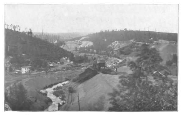 A VIEW OF THREE COLLIERIES IN THE ANTHRACITE COAL BASIN
NEAR MAHANOY CITY, PA.
A VIEW OF THREE COLLIERIES IN THE ANTHRACITE COAL BASIN
NEAR MAHANOY CITY, PA.
Formerly much of the coal was shipped by canals, but the latter were not able to compete with the railways, and most of the coal-canals have been abandoned. The price of anthracite at tide-water (New York) varies from $3.20 to $4.50 per long ton. At Philadelphia the price is about one-fourth less. Buffalo is the chief lake-port for anthracite. Steam sizes are about two-thirds the price of house fuel.
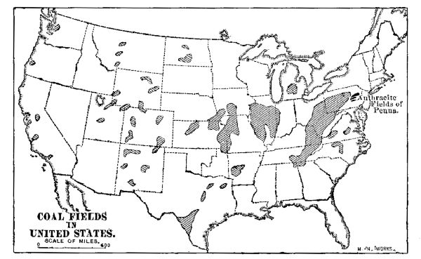 COAL FIELDS IN UNITED STATES
Bituminous, or soft coal furnishes the larger part of the house fuel in the United States, and nearly all the house coal used in other parts of the world. It contains from fifteen to more than forty per cent. of volatile matter, burning with a long and smoky flame. The coal which contains twenty per cent. or less of volatile matter is a free-burning coal that may develop heat enough to partly fuse the ash, forming "clinkers"; it is therefore called "caking" coal, and is not only well adapted for use as fuel and steam-making, but it is also a good smelting coal.
Coal which contains more than thirty per cent. of volatile matter is known as "fat" coal and is generally used in the manufacture of coke and illuminating gas. Western Pennsylvania produces the largest amount of fat coal, but[Pg 151] it is found here and there in nearly all soft-coal regions. A so-called smokeless bituminous coal occurs in various localities; its low percentage of volatile matter makes it an excellent house fuel.
Bituminous coal is mined in twenty-five States of the Union, Pennsylvania, Illinois, West Virginia, and Ohio heading the list. In about half the mines the coal is cut from the seam by means of machinery and is known as machine-mined coal. A very large part of the product is consumed within a short distance of the mines, and this is especially true of the region about the upper Ohio River.
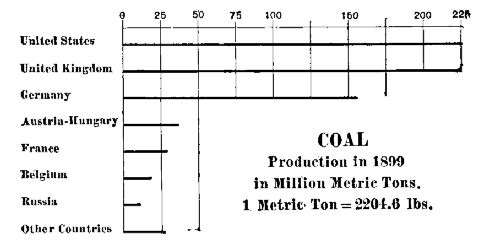 COAL PRODUCTION
Most of the product is shipped to the large manufacturing cities of the middle west, where it is used for steam as well as fuel; a very large amount also is sent down the Ohio in barges to the lower Mississippi River. The spot value of bituminous coal varies from $0.80 to $1.60 per ton; the product of the Pacific coast mines, however, is from $3 to $5.
The output of the mines of the United States aggregates about two hundred and forty million long tons yearly, and this is about one-third of the world's product. For many years there has been an export trade to Canada, the West Indies, Central and South America, amounting in 1900 to 8,000,000 tons. Within a few years, however, the decreased cost of mining due to machinery, and the low rates[Pg 152] of transportation to the seaboard has developed an export trade to Russia, Germany, and France.
 COAL
COAL
A small amount of coal is imported into the United States. A superior quality of Australian coal finds a ready market in Pacific coast points as far north as San Francisco, and large quantities of Nanaimo, B.C., coal are sold in Oregon, Washington, and California. A small quantity of the "slack" or waste of the Nova Scotia mines is imported to Boston to be made into coke. The Canadian fields supply a considerable part of the coal used in Montana.
Coke and Coal-Tar Products.—In the manufacture of iron and steel a fuel having a high percentage of carbon free from volatile matter is essential. The great cost of wood charcoal forbids its use, and so a charcoal made from soft coal is used. Fat coal is heated in closed chambers until the volatile matter is driven off. The product is "coke"; the closed chamber is an "oven." The ovens are built of stone or fire-brick, in a long row. They are usually on an abrupt slope, so that the coal can be dumped into the top, while the coke can be withdrawn from the bottom, to be loaded into cars.
About three thousand one hundred and forty pounds of coal are required to make a short ton of coke; from three thousand to five thousand cubic feet of illuminating gas, together with varying amounts of coal-tar and ammonia, are driven off and generally wasted. In a few instances "scientific" ovens are in use for the purpose of saving these products; but in the coal-mining regions such devices are the exception and not the rule. The great waste of energy-products in the manufacture of coke is partly offset by the employment of refuse and slack, which could not be otherwise used.
There are more than five hundred and eighteen thousand coke-ovens in the United States, of which eighty per cent. are in use. Most of them are in the region about the upper Ohio River, and nearly half the total number is in the vicinity of Connellsville. The region around Birmingham, Ala., ranks next in number. The coke product of the United States is more than twenty million short tons a year. This is considerably less than the product of Great Britain, which is upward of twenty-five million tons.
Most of the "scientific" ovens are near or in large cities where the gas, after purification, is used for illuminating purposes. In some instances the coke, and not the gas, is a by-product. The coal-tar is used in part for fuel, but a portion of it goes to the chemical laboratory, where it is made to yield ammonia, benzine, carbolic acid, and aniline dyes to the value of nearly seven million dollars.
Graphite.—Graphite, plumbago, or "black lead," as it is popularly named, is found in many parts of the United States, but only a few localities produce a good commercial article; these are Ticonderoga, N. Y., which yields from six hundred to two thousand tons a year, and Chester County, Pa., which yields a small but increasing amount; a good quality is mined near Ottawa, Canada. It is extensively mined in Ceylon, and this island produces the chief bulk of the world's ordinary product. The finest grade comes from the Alibert mine in Siberia. A good article is manufactured artificially at Niagara Falls.
Graphite is used as a stove polish and for crucibles; in the main, however, it is employed in the manufacture of lead[41] pencils; for this purpose only a very soft mineral,[Pg 154] absolutely free from grit, is employed, and the Siberian output is used almost wholly. One German firm and two American firms supply most of the pencils used.
Petroleum.—Petroleum is the name given to a natural liquid mineral from which the well-known illuminating oil "kerosene" is derived, and to obtain which it is mined. Petroleum is a mixture of various compounds known as hydrocarbons. Some of these compounds are gaseous, some are liquid, and some are solid; all of them are articles of commercial value. The petroleum from different localities differs greatly in appearance and composition.
The pitch that coated Noah's ark, the slime of the builders of the Tower of Babel, and the slime-pits of the Vale of Siddim all refer to mineral products associated with petroleum. Under the name of "naphtha" it has been known in Persia for thirty centuries, and for more than half as long a flowing oil spring has existed in the Ionian Islands. The Seneca Indians knew of a petroleum spring near the village of Cuba, N.Y., and used it as a medicine long before the advent of the white man.
As early as 1850 illuminating oil, known as "coal" oil, was made in the United States by distilling cannel coal, but this product was supplanted within a few years by the natural petroleum discovered in Pennsylvania. In 1859 Colonel Drake completed a well bored in solid rock near Titusville, Pa. The venture proved successful, and in a few years petroleum mining became one of the great industries of the United States.
Petroleum is known to exist in a great many parts of the world; the United States and Russia, however, produce practically all the commercial product; a very small amount is obtained from a horizon on the south slope of the Carpathian Mountains, situated in Rumania and Galicia,[Pg 155] Austria-Hungary. There are also a few producing wells in Peru, Germany, Italy, Burma, Argentina, and Sumatra.
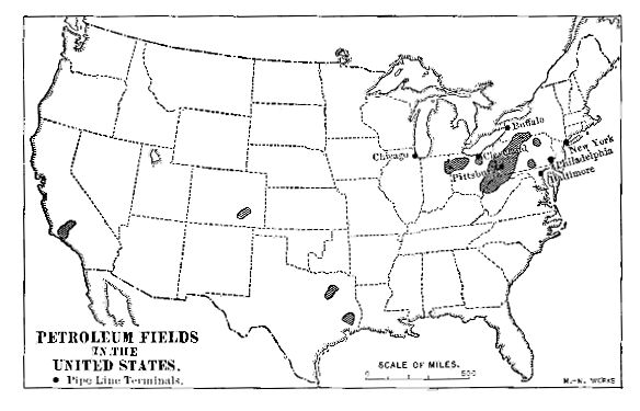 PETROLEUM FIELDS IN THE UNITED STATES
In the United States the largest horizon is that of the Appalachian region. Since 1859 it has produced more than forty million gallons of crude oil. The Lima, Ind., horizon produces about twenty million barrels. The California and Texas horizons have become very important factors. The crude petroleum is transported partly in tank cars, but mainly by means of long lines of pipe, flowing from one pumping station to another by gravity. There are pipe-line terminals on the Great Lakes and at Pittsburg, but the principal are at the refining and exporting stations in New York, Philadelphia, and on the Delaware River.
A considerable amount is exported to European countries to be there refined, but in the main the crude oil is refined before exporting it. Some of the refined oil is exported in barrels, and some in tin cases; the greater part, however, goes in tank steamers, and from these it is pumped[Pg 156] into tank cars to be distributed. Most of the product is controlled by the Standard Oil Company, and it reaches nearly every country in the world. It is carried into Arctic regions on sledges, and over the African deserts by caravans. Great Britain, Germany, and the Netherlands are the chief purchasers and distributors. The value of the entire product is about one hundred and eighty-five million dollars.
The Russian oil-producing region is on and near the Apsheron peninsula, a small area of Trans-Caucasia, that extends into the Caspian Sea; the region is commonly known as the Baku field, and in 1900 the production of crude oil surpassed that of the United States. The petroleum is conveyed by pipe lines to the refineries at Baku. From this port it is shipped in tank cars by rail to Batum, whence it is conveyed to the various European markets. A considerable part of the product is sent by tank steamers to Astrakhan, and thence up the Volga to Russian markets. Great Britain takes about one-third; about the same amount is shipped to Port Saïd for China, India, and other Asian markets; the rest is consumed in central Europe.
Petroleum Products.—The various constituents of crude petroleum differ greatly in character, some being much more volatile than others. They are separated by distillation at different temperatures. By this process naphtha, rhigoline, gasoline, benzine, and other highly inflammable products are obtained in separate receivers. By a similar process the illuminating or refined oil and the lubricating oils are also separated. The residuum consists of a gummy mass from which paraffine and petroleum jelly are extracted.
Naphtha usually contains several volatile compounds, including benzine and gasoline. It is used as a solvent of grease and also of crude india-rubber, but chiefly the manufacture of illuminating gas.
Kerosene is the name commonly given to the refined oil. A good quality should have a fire test of not less than one hundred and fifty degrees; that is, when heated to that temperature, it should not give off any inflammable gas. This test is now mandatory in most States.
Lubricating oil is used almost wholly for the lubrication of heavy machinery. It varies greatly in composition and quality.
Paraffine or petroleum wax has largely superseded beeswax; it is used mainly in the manufacture of candles and as an insulator for electric wires. A native mineral paraffine, known as ozocerite, is mined in Utah and Galicia; it is used as an insulating material.
"Vaseline," "cosmoline," or petroleum "jelly" is very largely used in pharmacy as the basis of ointments and also as a lubricant for heavy machinery.
Asphalt is produced by the distillation of petroleum, but the greater part of the world's product comes from two "pitch lakes"—one in Bermudez, Venezuela, the other in the island of Trinidad, off the Venezuelan coast. The former is the larger and produces a superior quality. Small deposits occur near Los Angeles, Cal., and in Utah. The output of the Venezuelan asphalt is used almost wholly for street pavement.
Probably no other mineral has had a wider influence on both social and economic life, and the industrial arts, than petroleum and its compounds. The kerosene lamp, the aniline dye, the insulation of electric wires, the lubrication of machinery, the cosmetic, the india-rubber solution, and the physician's sedative dose represent only a few of the devices that are derived from petroleum.
Natural Gas.—A natural inflammable gas occurs in or near several of the petroleum horizons. One important belt extends through western Pennsylvania and New York,[Pg 158] and another through northwestern Ohio and northeastern Indiana. It is conveyed through pipe-lines and used both as fuel and for lighting. Natural gas occurs in a great many localities, but is used commercially only in the regions noted. It is better adapted for making glass than any other fuel, and on this account extensive glass-making establishments have concentrated in the natural-gas belt of western Pennsylvania.
QUESTIONS FOR DISCUSSION
The statement is sometimes made to the effect that coal is "condensed sunlight"; is it true, or untrue; and why?
Why are the coal areas of Europe and America also areas of various manufactures?
A recent cartoon had for its title—"John Bull and his coal piles (i.e., coaling stations) rule the world"; show why this statement contains a great deal of truth.
What are some of the advantages of steam-vessels over sailing-vessels?
Whale oil, crude turpentine, kerosene, and gas have been used each in turn for illuminants; what is the advantage of each over the preceding?
Describe the structure of an ordinary kerosene lamp-burner, an argand burner, a Welsbach burner.
For what are aniline, paraffine, naphtha, and carbolic acid used?
FOR STUDY AND REFERENCE
Obtain specimens of anthracite, bituminous, and cannel coal, and coke for comparison and study.
Obtain specimens of crude petroleum, naphtha, refined oil, aniline dye, paraffine, and carbolic acid; note the properties of each. Throw away the naphtha after using.
Read Mineral Resources of the United States on the foregoing subjects.
The development of modern civilization is directly connected with the mining and manufacture of the useful metals. Their effect on the affairs of mankind can be rightly understood only when they are studied in their relations to one another, as well as to the people who used them. Next to the discovery of the use of fire, an appreciation of the use of metals has been the chief thing to develop the intellect of mankind. When human beings discarded natural caves for artificially constructed dwellings—when they began to cook their food and clothe their bodies, they required tools. These, in the main, consisted of the spears and arrow-heads used as weapons of the chase, and the axes and knives used as constructive tools.
Rough stone gave place to flint because the latter would take a better edge. For the same reason the people of central Europe sent to the deserts of central Asia for jade wherewith to make axes and knives. Again, for the same reason, jade was discarded, because an alloy of copper and tin produced a bronze that would not only take a sharper edge than stone, but it was hard enough to cut and dress the latter. Egypt rose to a commanding position because of her control of the copper mines in the Sinaitic peninsula, and subsequently of the gold products coming from the upper Nile.
A meridian drawn through Cairo, Egypt, practically divides the world into two kinds of civilization. East of this meridian the population is almost wholly agricultural and,[Pg 160] excepting Japan and India, the character of the civilization has changed but little in the past 2,000 years. West of the line the population is essentially characterized as metal-workers. It controls the world—not especially by virtue of a high degree of intellectual development, but because it has availed itself of the properties and characteristics of metals and their applications to commerce.
The four metals that have had the greatest influence on western civilization are gold, silver, iron, and copper. The discovery of gold and silver has always resulted in a rapid settlement of the regions in which the discoveries were made, and usually in the building of great industrial centres. Thus, the discovery of gold in California was the first step in making the United States a world power. The acquisition of so large an amount of gold caused an industrial expansion that hurried the Civil War, and led to the manufacture of iron and steel both for agricultural machinery and railroad transportation. This, in turn, brought the country so closely in touch with the affairs of China and Japan, that European and American diplomacy in eastern Asia are a common concern. The commercial position of Great Britain is very largely due to her iron mines.
The production of Bessemer steel at a price far less than that of iron at the beginning of the nineteenth century lowered the cost of transporting commodities to the extent that large areas, once of necessity very moderately productive of food-stuffs, are now densely peopled because food-stuffs can be transported to these regions more economically than they can be grown there. Thus, owing to the improvements in iron and steel manufacture, the farmer of Minnesota, the planter of Louisiana, the miner of Colorado, and the factory operative of Massachusetts have each the same comforts of living that are enjoyed by all the others, and have them at scarcely more than half the cost of fifty years ago.
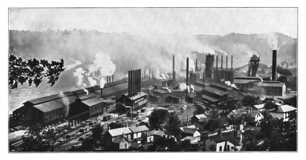 STEEL MANUFACTURE—THE NATIONAL STEEL COMPANY'S SMELTERY
AND ROLLING-MILLS, MINGO JUNCTION, OHIO
STEEL MANUFACTURE—THE NATIONAL STEEL COMPANY'S SMELTERY
AND ROLLING-MILLS, MINGO JUNCTION, OHIO
The gradual decrease in the production of the silver mines near the present site of Ergasteria proved a beginning of the fall of Athens; and when gold was discovered in the Perim Mountains of Macedonia, the seat of Greek power moved thither. Philip of Macedon hoarded the treasure from the mines of Pangæus, and with the capital thus acquired his son, Alexander the Great, conquered the East, implanted Hellenic business methods there, and drew the various trade routes between Europe and Asia under one control.
In the fifteenth century copper from the mines near Budapest and silver from the Schwarz Mountains of Germany were the resources that made Germanic Europe pre-eminent. The wresting of the trade in these two metals from Venice caused the rise of Antwerp and brought immense gains to Lübeck, London, Brussels, Augsburg, and Nuremberg. In the latter part of the nineteenth century copper again reached a high position of importance from the fact that upon it largely depends electric motive power and transportation.
Iron.—Iron is one of the most widely diffused of metals. It is abundant in the sun; meteorites contain from more than ten to eighty or ninety per cent. of it; all earths and rocks contain at least traces of it; and in various places the deposits of ore in nearly pure form aggregate cubic miles in extent.
In only a few localities is iron ore found in a metallic or "native" form. Many meteorites consist of metallic iron mixed with nickel and manganese, and in Greenland a volcanic dyke or ledge of metallic iron is known to exist. The iron of commerce is derived from "ores," or chemical compounds of iron and oxygen, or iron and carbon. The cheapness of the product depends upon the ease with[Pg 163] which the ore may be quarried, transported to coal, and smelted. The following are the ores commonly employed in the production of iron:
Red hematite has a reddish metallic lustre and when pure contains seventy per cent. of iron.[42] It is the most abundant of the workable ores, and certainly the best for the manufacture of Bessemer steel. The ores of the Lake Superior region are mainly red hematite, and the latter constitutes more than four-fifths of the output of the United States.
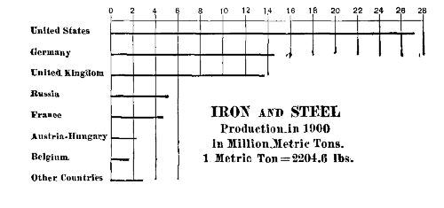 THE COMPARATIVE PRODUCTION OF IRON AND STEEL
Brown hematite, or limonite, has a chestnut brown color and contains very nearly sixty per cent. of iron[43]; it includes the "bog" ores, and is very abundant. Not far from one-quarter of the Appalachian ores are brown hematite; it constitutes about one-eighth of the output of the United States.
Magnetic iron ore, or magnetite, of which loadstone, a natural magnet, is an example, has a metallic, steel lustre and contains 72.4 per cent. of iron.[44] Most of the ores obtained in Pennsylvania and New York are magnetite. The magnetites furnish about one-sixteenth of the output of the United States.
Carbonate of Iron, or siderite, occurs in a few localities, the ore produced in Ohio being almost wholly of this kind.[Pg 164] It contains when pure about forty-eight per cent. of iron.[45] It constitutes less than one per cent. of the output of the United States.
Iron pyrites, or sulphide of iron, sometimes called "fools' gold," is a very common mineral. It is used in the manufacture of sulphuric acid, but is worthless for the production of iron; indeed, the presence of a very small percentage of sulphur in iron renders the latter worthless for many purposes.
Extensive deposits of iron are known to exist in very nearly every country in the world, but those which can be advantageously worked are few in number. In order to be available, the deposits must be within easy transporting distance of the people who use it, and likewise within a short distance of the coal used to manufacture it.
For these reasons most of the workable deposits of ore are in or near the great centres of population in western Europe and the eastern part of the United States; as a matter of fact, practically all the iron and steel of the latter country is produced in the populous centres of the Atlantic slopes. In most great steel-making districts it is essential to mix the native ores with special ores brought from a distance, the latter being used to give strength and hardness to the resulting metal. Ores from Sweden, and from Juragua, Cuba, are employed for this purpose in the steel-making establishments of the United States.
In the past few years the United States has jumped from an insignificant position in the production of iron and steel to the first rank among the iron-producing countries. This great advance is due to the fortunate geographic position of the iron ore and the coal, and also to the discovery of the Bessemer process of making steel.
In general it is more economical to ship the ore to the coal than vice versa. The position of the steel-making plant is largely determined by the cost of moving the coke and ore, together with that of getting the steel to the place of use. Formerly, iron manufacture in the United States was not profitable unless the coal, ore, and limestone[46] were very near to one another.
These conditions still obtain in the southern Appalachian mineral fields; the ore and the coal are at no great distance apart, and a great iron-making industry, in which Birmingham and Bessemer form the principal centre, has grown into existence. For the greater part the coal is coked; and in this form less than a ton[47] is sufficient to make a ton of pig-iron. The smelteries and rolling-mills are built at places where the materials are most conveniently hauled.
In the past few years the iron and steel industry which formerly centred about the navigable waters at the head of the Ohio River, has undergone a readjustment. Rolling-mills and smelteries exist at Pittsburg and vicinity, and at Youngstown, New Castle, and other nearby localities, but greater steel-making plants have been built along the south shores of Lakes Michigan and Erie, all of which have come about because of reasons that are purely geographic.
Immense deposits of excellent hematite ore in the old mountain-ranges near Lake Superior have recently become available. For the greater part the ore is very easily quarried. In many instances it is taken out of the quarry or pit by steam-shovels which dump it into self-discharging[Pg 166] hopper-cars. Thence the ore is carried on a down grade to the nearest shipping-port on the lake. There it is dumped into huge bunkers built at the docks, and from these it slides down chutes into the holds of the steam-barges. A 6,000-ton barge is loaded in less than two hours; a car is unloaded in a few seconds.
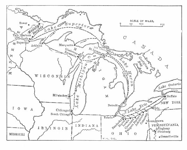 MOVEMENT OF IRON ORE
Water transportation is very cheap compared with railway transportation, even when the road is built and equipped as an ore-hauling road. The ore is therefore carried a distance varying from one thousand to one thousand five hundred miles for less than it could be loaded, on cars hauled one-tenth that distance by rail, and unloaded.
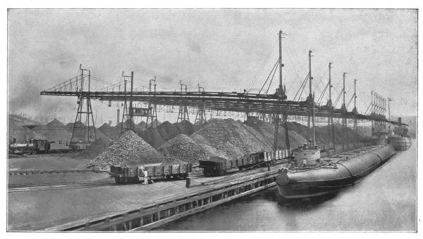 STEEL MANUFACTURE—ORE DOCKS
At the south shore of Lake Erie, the ore meets the coke from western Pennsylvania and coal from the Ohio coal-fields, and as a result new centres of iron and steel manufacture have grown up along this line of "least resistance." The ore is unloaded at the docks by means of mechanical scoops and shovels. So cheaply and quickly is it mined and transported that it is delivered to the smelteries at a cost varying from $1.75 to $3.25 per ton.
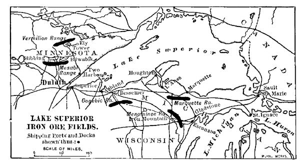 LAKE SUPERIOR IRON ORE FIELDS
There are three forms in which iron is used—cast iron, wrought iron, and steel. Cast iron is crystalline and brittle. The product as it comes from the blast furnace is called pig-iron. In making such commodities as stoves, and articles that do not require great strength, the pig-iron is again melted and cast into moulds which give them the required shape. Cast iron contains from one to five per cent. of carbon.
Wrought iron is malleable, ductile, and very flexible; when pure it is also very soft. It is prepared by melting pig-iron in furnaces having such a shape that the molten metal can be stirred or "puddled" in contact with the air. By this means the carbon is burnt out, and while still at a white heat the pasty iron is kneaded or "wrought," in order to expel other impurities.
Steel is a form of iron which is thought to contain a[Pg 169] chemical compound of iron with carbon. It is stronger than iron and finer in grain. Formerly, steel was made by packing bars of pure iron in charcoal powder, the whole being enclosed in clay retorts that were heated to whiteness for about three days. The product obtained by this method is known as cementation steel. It is still used in the manufacture of cutlery, tools, and fine machinery; it is likewise very expensive. In smelting certain ores it is easy to burn out the carbon in open furnaces, and "open-hearth" steel is an important factor.
Just about the beginning of the Civil War, when the railways of the United States were taxed beyond their capacity to carry the produce of the country, it became apparent that something more durable than iron must be used for rails. The locomotives, then weighing from twenty-five to thirty-five tons each, were too light to haul the freight offered the roads; they were also too heavy for the rails, which split at the ends and frayed at the edges.
 IRON AND STEEL
The Bessemer process of making steel was the result of the demand for a better and a cheaper method. By this process, the iron is put into a "converter" along with certain Swedish or Cuban ores to give the product hardness. A hot blast is then forced into the converter which not only melts the mass but burns out the excess of carbon as well. The color of the flame indicates the moment when the conversion to steel is accomplished.
In 1860, before the establishment of the Bessemer process, steel commanded a price of about one hundred and twenty-five dollars per ton; at the beginning of the twentieth century steel billets were about eighteen dollars per ton. In western Europe and the United States there are used about three hundred pounds of iron and steel per[Pg 170] capita; in South America the rate of consumption is about fifteen pounds; in Asia (Japan excepted) it is probably less than three pounds.
The economic results of low-priced steel are very far-reaching. Steam boilers of steel carry a pressure of more than two hundred and fifty pounds to each square inch of surface—about four times as great as in the iron boilers formerly used. Locomotives of eighty tons draw the fast passenger trains at a speed of sixty miles an hour. Ponderous compounding engines weighing one hundred and twenty tons haul ninety or more steel freight cars that carry each a load of 100,000 pounds. The iron rails formerly in use weighed about forty pounds per yard; now steel rails of one hundred pounds per yard are employed on most trunk lines.
In the large commercial buildings steel girders have entirely supplanted timber, while in nearly all modern buildings of more than six stories in height, the frame is constructed of Bessemer steel. Indeed, a steel-framed building of twenty-five stories has greater stability than a brick or stone building of six. Such a structure as the "Flatiron Building" in New York or the Masonic Temple in Chicago would have been impossible without Bessemer steel.
In ocean commerce cheap steel has worked even a greater revolution. In 1860, a vessel of 4,000 tons displacement was thought to be almost up to the limit. The Oceanic of the White Star Line has a displacement of about twenty-eight thousand five hundred tons. This is nearly equalled by the measurement of half a dozen other liners, and is exceeded by the freighters built by Mr. J.J. Hill for the China trade.
 From a copyrighted photograph by C.L. Ritzmann, N.Y.
| HISTORICAL | |
| 1619.—Iron works established on Falling Creek, Va. | |
| 1643.—First foundry in Massachusetts, at Lynn. | |
| 1658.—Blast furnace and forge at New Haven, Conn. | |
| 1679.—Father Hennepin discovers coal in Illinois. | |
| 1703.—Mordecai Lincoln, ancestor of Abraham Lincoln, establishes iron works at Scituate, Mass. | |
| 1717.—First bar iron exported from American Colonies to West Indies. | |
| 1728.—Steel made, Hebron, Ct. | |
| 1732.—Father of George Washington establishes furnace in Virginia. | |
| 1740.—First iron works in New York, near Hudson. | |
| 1750.—Bituminous coal mined in Virginia. | |
| 1766.—Anthracite coal discovered in Pennsylvania. | |
| 1770.—First rolling-mill in Colonies, Boonton, N.J. | |
| 1801–1803.—Lake Champlain iron district, New York, developed. | |
| 1812.—First rolling-mill at Pittsburg. | |
| 1828.—Baltimore & Ohio Railroad, first steam railway in the United States, begun. | |
| 1829.—"Stourbridge Lion," first locomotive in America, used in Delaware & Hudson Railway. | |
| 1830.—The T rail invented by Robert L. Stevens. | |
| 1830.—First American locomotive, "Tom Thumb," built by Peter Cooper at Baltimore. | |
| 1830.—Twenty-three miles of railway in the United States. | |
| 1844.—Lake Superior iron ores discovered by William Burt. | |
| 1850.—First shipment of Lake Superior ore, ten tons. | |
| 1857.—Iron industry founded in Chicago. | |
| 1862.—Phoenix wrought iron column, or girder, first made. | |
| 1864.—Bessemer steel first made in the United States. | |
| 1865.—First Bessemer steel rails in the United States rolled at Chicago. | |
| 1890.—First armor-plate made in the United States rolled at Bethlehem, Pa. | |
| 1890.—The United States surpasses Great Britain in production of pig-iron. | |
| 1900.—The United States leads in the production of open-hearth steel. | |
Gold.—Gold is one of the metals earliest to be mined. It is mentioned by the ancient profane as well as by sacred writers. Pictorial representations of fusing and working the metal are sculptured on early Egyptian tombs, and beautiful gold ornaments have been found that were made by the prehistoric peoples who once occupied ancient Etruria, in Italy. Columbus found gold ornaments in the possession of the aboriginal Americans. The Incas of Peru and the Aztecs of Mexico possessed large quantities of gold.
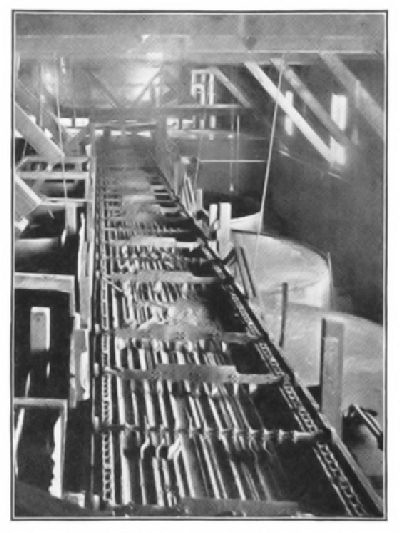 LEACHING (CYANIDE) TANKS DISSOLVING THE GOLD FROM THE
ROASTED ORE
LEACHING (CYANIDE) TANKS DISSOLVING THE GOLD FROM THE
ROASTED ORE
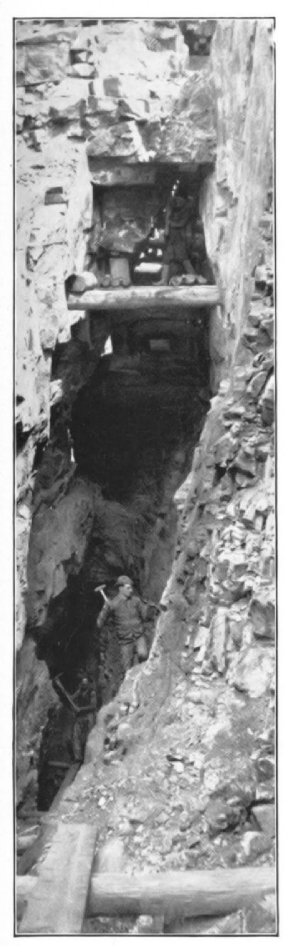 STOPING OUT A TUNNEL
 INTERIOR OF MILL
Gold is one of the most widely diffused of metals. Traces of it are found in practically all igneous and most sedimentary rocks. It occurs in sea-water, and quite frequently in beach-sands. Traces of it are also usually to be found in alluvial deposits and in the soils of most mountain-folds. In spite of its wide diffusion, however, all the gold that has been mined could be stored readily in the vaults of any large New York bank.
In all probability most of the gold now in use has been deposited by solution in quartz veins, the latter usually filling seams and crevices in granitic or volcanic rocks. Quartz veins seldom yield very great returns, but they furnish a steady supply of the metal. The rock must be mined, hoisted to the surface, and crushed. The gold is then dissolved by quicksilver (forming an amalgam from which the quicksilver is removed by heat), by potassium cyanide solution, or by chlorine solution.
In many instances the quartz veins have been broken and weathered by natural forces. In such cases the gold is usually carried off by swiftly running water and deposited in the channel lower down. In this way "placer" deposits of gold occur. Placer deposits are sometimes very rich, but they are quickly exhausted. The first gold discovered in California was placer gold.
Nearly all the gold mined in the United States has come from the western highlands. In 1900, Colorado, California, South Dakota (Black Hills), Montana, and[Pg 175] Alaska yielded about seven-eighths of the entire product. The placer mines of Alaska are confined mainly to the beach-sands and the tributaries of Yukon River. Since 1849 the average annual yield of gold in the United States is about forty-three million dollars.
The Guinea coast of Africa, Australia, California, the Transvaal of South Africa, and Venezuela have each stood at the front in the production of gold. The aggregate annual production of the world has increased from one hundred and sixty million dollars in 1853 to more than three hundred million dollars in 1900.
A considerable part of the gold product is used in gilding picture-frames, book-titles, sign-letters, porcelain, and ornamental brass work. Practically, all of this is lost, and in the United States alone the loss aggregates about fifteen million dollars yearly. The abrasion and unavoidable wear of gold coin is another great source of loss.
An enormous amount is used in the manufacture of jewelry, most of which is used over and over again. By far the greater part, however, is used as a commercial medium of exchange—that is, as coin. For this purpose its employment is wellnigh universal; and indeed this has been its chief use since the beginning of written history. Gold coin of the United States is 900 fine, that is, 900 parts of every thousand is pure gold; gold coin of Great Britain is 916-2/3 fine. In each case a small amount of silver, or silver and copper, is added to give the coin the requisite hardness. The coining of gold, and also other metals, is a government monopoly in every civilized country.
The fiat value of gold throughout the commercial world is the equivalent of $20.6718 per troy ounce of fine metal; an eagle weighs, therefore, 2580 grains. The real value, however, is reckoned by a different and a more accurate standard, namely, the labor of man, and this, the [Pg 176]sporadic finds of placer gold excepted, has not changed much in two thousand years or more. The increased production has scarcely equalled the demand for the metal; moreover, the longer a mine is worked the greater becomes the expense of its operation. Improved processes for the extraction of gold have not created any surplus of gold; indeed, the supply is not equal to the demand; and this fact keeps the metal practically at a fixed value.
Silver.—Silver is about as widely diffused as is gold, but it is more plentiful. It is found sparingly in most of the older rocks and also in sea-water. It was used by the Greeks for coinage more than eight hundred years before the Christian era, and was known to the Jewish people in very early times. According to the writer of the Book of Kings (1 Kings x. 21), "It was nothing accounted of in the days of Solomon," but Tacitus declares that in ancient Germany silver was even more valuable than gold. The mines of Laureion (Laurium) gave the Greek state of Attica its chief power, and the failure of the mines marked the beginning of Athenian decline.
Silver is rarely found in a metallic state. For the greater part it occurs combined with chlorine ("horn silver"), or with sulphur ("silver glance"), or in combination with antimony and sulphur ("ruby ore"). The ranges of the western highland region of the American continent yield most of the present supply. The mines of Colorado, Montana, Utah, and Idaho produce about six-sevenths of the yield in the United States, which in 1900 was 74,500,000 ounces. In Europe the Hartz Mountains have been famous for silver for several centuries.
About four-fifths of the silver bullion is used in the arts, most of it being manufactured into ornaments or into table-service called "plate." A considerable amount is used in photography, certain silver salts, especially the chloride[Pg 177] and the bromide, changing color by exposure to the light. The remaining part of the silver output is made into coin.
The ratio of silver and gold has fluctuated much in the history of civilization. In the United States the value of an ounce of fine silver is fixed at $1.2929, thereby making the ratio 16 to 1. The silver dollars, 900 fine, were coined on this basis, weighing 412.5 grains. With the tremendous output of the silver mines between 1870 and 1880 the price of silver fell to such an extent that, in time, most countries limited the amount of coinage or demonetized it altogether. In the United States the purchase of silver bullion for coinage has been practically suspended, and the silver purchased is bought at the bullion value—about fifty cents per troy ounce in 1900. In Japan the ratio has been officially fixed at 32 to 1.
Copper.—Copper is probably the oldest metal known that has been used in making tools. An alloy of copper and tin, hard enough to cut and dress stone, succeeded the use of flint and jade, and its employment became so general as to give the name "bronze" to the age following that characterized by the use of stone implements.
Copper is very widely distributed. It occurs in quantities that pay for mining in pretty nearly every country in the world. The rise of Egypt as a commercial power was due to the fact that the Egyptians controlled the world's trade in that metal, and it is highly probable that the conquests of Cyprus at various times were chiefly for the possession of the copper mines of Mount Olympus.
At the present time there are several great centres of production which yield most of the metal used. These are the Rocky Mountain region, including Mexico; the Lake Superior region of the United States; the Andean region, including Chile, Peru, Argentina, and Bolivia; the Iberian[Pg 178] region, consisting of Spain and Portugal; and the Hartz Mountain region of Germany. In 1900 they produced about four hundred and fifty thousand tons, of which two hundred and eighty thousand were mined in the United States.
Montana, the Lake Superior mines, and Arizona are the most productive regions of the United States, and the mines of these three localities yield more than half the world's product. Of these mines the Calumet and Hecla of the Lake Superior region is the most famous. It was discovered by Jesuit explorers about 1660, but was not worked until 1845. It is one of the most productive mines in the world, its yearly output averaging fifty million tons.
The export trade in copper is very important, amounting at the close of the past century to about one hundred and seventy thousand short tons. Of this amount, half goes to Germany (most of it through ports of the Netherlands), and one-fifth each to France and Great Britain. The market price to the consumer during the ten years closing the century averaged about sixteen cents per pound. Most of the product is exported from New York and Baltimore. The head-quarters of the great copper-mining companies of America are at Boston. The imports of raw ores and partly reduced ores called "regulus," come mainly from Mexico to New York and Baltimore, and from Mexico and Japan to Puget Sound ports. The most important American refineries are at New York and Baltimore.
A part of the copper is mixed with zinc to form brass, an alloy much used in light machinery. A considerable quantity is rolled into sheets to sheath building fronts and the iron hulls of vessels. By far the greater part, however, is drawn into wire for carrying electricity, and for this purpose it is surpassed by silver alone. The decrease in the price of copper in the past few years is due, not to a[Pg 179] falling off in the demand, but to methods of reducing the ores and transporting the product more economically.
Aluminium.—Aluminium is the base of clay, this mineral being its oxide. It occurs in the various feldspars and feldspathic rocks, and in mica. The expense of extracting the metal from these minerals has been so great as to prohibit its commercial use. In 1870 there were probably less than twenty pounds of the metal in existence, and it was to be found only as a curiosity in the chemical laboratories. The discovery that the metal could be extracted cheaply from cryolite, a mineral with an aluminium base, obtained from Ivigtut, Greenland, led to a sparing use of the metal in the economic arts.
The chief step in the production of the metal dates from the time that the mineral bauxite, a hydroxide of aluminium and iron, was decomposed in the electric furnace. The process has been repeatedly improved, and under the patents covered by the Hall process the crude metal is now produced at a market price of about eighteen cents per pound. The entire production of the United States is controlled by the Pittsburg Reduction Company, which also manufactures much of the commercial product of England. The competitor of the Pittsburg Reduction Company is an establishment in Germany, near Bremen.
Aluminium does not corrode; it is easily rolled, drawn, or cast; and, bulk for bulk, it is less than one-third as heavy as copper. Because of these properties it has a great and constantly growing economic value. Because of its greater size, a pound of aluminium wire will carry a greater electric current than a pound of copper wire of the same length. It therefore has an increasing use as a conductor of electricity.
Bauxite, the mineral from which the metal is now chiefly extracted, is obtained in two localities. One[Pg 180] extends through Georgia and Alabama; the other is in Arkansas.
Lead.—Lead is neither so abundant nor so widely diffused as iron, copper, and the precious metals, but the supply is fully equal to the demand. Lead ores, mainly galena or lead sulphide, occur abundantly in the Rocky Mountains, Colorado, Idaho, and Utah, producing more than half the total output of the United States. In these localities, in Mexico, and in the Andean states of South America it is used mainly in the smelting of silver ores.
Metallic lead is used largely in the manufacture of water-pipes, and for this purpose it must be very nearly pure. It is also rolled into sheets to be used as lining for water-tanks. The fact that the edges of sheet-lead and the ends of pipes may be readily joined with solder gives to lead a great part of its economic value. Alloyed with arsenic it is used in making shot; alloyed with antimony it forms type metal; alloyed with tin it forms pewter and solder.
The greater part, however, is manufactured into the carbonate or "white" lead that is used as a pigment, or paint. Red lead, an oxide, is a pigment; litharge, also an oxide, is used for glazing the cheaper kinds of pottery. About two hundred and thirty thousand tons of lead are produced in the United States and one-half as much is imported—mainly from Mexico and Canada. The linotype machines, now used in all large printing establishments, have increased the demand for lead.
Other Metals.—Most of the remaining economic metals occur in small quantities as compared with iron, copper, gold, and silver. Some of them, however, are highly important from the fact that in various industrial processes no substitutes for them are known.
Quicksilver, or mercury, is the only industrial metal that at ordinary temperatures is a liquid. It is the base of the[Pg 181] substance calomel, a chloride, and corrosive sublimate, a dichloride, both of which are employed as medicines. It is essential in the manufacture of thermometers and barometers, but is used chiefly, however, as a solvent of gold, which it separates from the finely powdered ore by solution or amalgamation. Quicksilver occurs in the mineral cinnabar, a sulphide.
Nearly one-half the world's product comes from California. The New Almaden mines of Santa Clara County produce over five thousand flasks (each seventy-six and one-half pounds net); those of Napa County nearly nine thousand flasks; the mines of the whole State yield about twenty-six thousand flasks, valued at $1,200,000. Almaden, Spain, and Idria, Austria, produce nearly all the rest of the output. An average of about fifteen thousand flasks are exported from San Francisco, mainly to the mines of Mexico, and Central and South America.
Tin is about the only metal of industrial value whose ores are not found in paying quantities in the United States. Small quantities occur in San Bernardino County, Cal., and in the vicinity of Bering Strait, Alaska, but it is doubtful if either will ever pay for development. About three-fifths of the world's product comes from the Straits Settlements on the Malay Peninsula; the nearby islands of Banca and Billiton also yield a considerable quantity.
The mines of Cornwall, England, have been worked for two thousand years and were probably the source of the tin that made the "bronze age." The United States imports yearly about twenty million dollars worth of tin, about half of which comes from the Straits Settlements. This is used almost wholly for the manufacture of tin plate[48]—that is, sheet-iron coated with tin. Much of the block tin imported from Great Britain is returned there in the form of[Pg 182] tin plate, being manufactured in the United States much more economically than in Europe.
Nickel occurs in New Caledonia, in Canada, and in the State of Missouri. It is used in the manufacture of small coins and for plating iron and steel. It is an essential in the metal known as "nickel steel" which is now generally used in armor-plate and propeller-shafts, about four per cent. of nickel being added to the steel. Most of the product used in the United States is imported from Canada.
Manganese, a metal resembling iron, occurs in Russia, Brazil, and Cuba, Russia producing about half the total output. It is used mainly to give hardness to steel. The propeller-blades of large steamships are usually made of manganese bronze. The building of war-ships in the United States during the past few years has led to the extensive use of manganese for armor-plate, and manganese ores to the amount of more than two hundred and fifty thousand tons were imported in 1900. More than one-half of this came from Russia; most of the remaining half from Brazil.
Zinc is abundant in nearly every part of the world. In the United States the best known mines are in the Galena-Joplin District, in Missouri and Kansas, which produce about two-thirds of the home product—mainly from the ore blende, a sulphide. There are also extensive zinc-mining operations in Illinois, New Jersey, and Pennsylvania. The lower Rhine District, Great Britain, and Silesia are the chief European sources. Sheet-zinc is found in nearly every dwelling in the United States, and zinc-coated or "galvanized" iron has become a domestic necessity. Zinc-white is extensively used as a pigment. About two hundred and fifty million pounds of crude zinc, or "spelter," are produced in the United States; forty-five million pounds were exported in 1900, mainly to Great Britain.
QUESTIONS FOR DISCUSSION
What are the qualities that make iron the most valuable of metals?
In what ways does commerce depend on iron and steel?
What substances are used for food, clothing, or domestic purposes that are not manufactured by the aid of iron?
Ingot or billet steel is rated at about one cent per pound; the hair-springs of watches are worth several thousand dollars per pound; what makes the difference in their value?
What are the qualities that give to gold its value?
Would all the gold mined in the United States pay the national debt at the end of the Civil War?
What causes have led to the increasing price of copper during the past few years?
What is the market price each of copper, silver, steel rails, and aluminium to-day?
FOR STUDY AND REFERENCE
Obtain specimens of the following iron ores: Hematite, brown hematite, magnetite, carbonate, and pyrites. Note the color and physical appearance of each; scratch the first four with a very hard steel point and note the color of the streak.
Obtain specimens of pig-iron, cast iron, wrought iron, and cast steel; note carefully the fracture or "break" of each; how does cast iron differ from wrought iron?
Obtain specimens of the following copper ores: Malachite, azurite, chalcopyrite, and red oxide; wet a very small fragment with an acid and note the color when it is held in the flame of an alcohol lamp or a Bunsen burner; dissolve a crystal of blue vitriol (copper sulphate) in water and note what occurs if the end of a bright iron wire be dipped in the solution.
Name the various uses to which nickel, tin, lead, and aluminium are put.
Consult the chapters on these subjects in any cyclopædia.
 TRANSPORTING SUGAR-CANE, CUBA
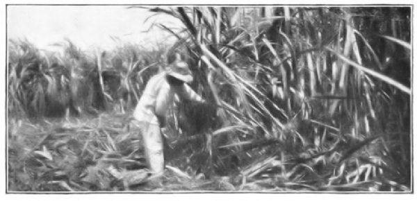 SUGAR-CANE GROWING IN CUBA
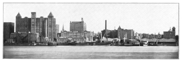 HAVEMEYER SUGAR-REFINERY, BROOKLYN, N.Y.
The term sugar is applied rather loosely to a large number of substances characterized by the quality of sweetness. In a few instances the name is given to certain mineral salts, such as sugar of lead, but in the main the sugars are plant products very similar in chemical structure to the starches. They are very closely connected with plant growth, and even in animal life, starchy substances are changed to sugar in the process of digestion. Although sugar does not sustain life, it is necessary as an adjunct to other food-stuffs, and it is probably consumed by a greater number of people than any other food-stuffs except starch and water.
Three kinds of sugar are found in commerce, namely—cane-sugar, grape-sugar, and milk-sugar. Cane-sugar occurs in the sap of the sugar-cane, sorghum-cane, certain of the palms, and the juice of the beet. Grape-sugar is the sweet principle of most fruits and of honey. Sugar of milk occurs in milk, and in several kinds of nuts.
Sugar-Cane Sugar.—Cane-sugar is so called because until recently it was derived almost wholly from the sap of the sugar-cane (Saccharum officinarum). The plant belongs to the grass family and much resembles maize before the latter has matured. It is thought to be native to Asia, but it is now cultivated in nearly all tropical countries in the world.
Practically every moist tropical region in the world, the basins of the Kongo and Amazon Rivers excepted, is a[Pg 186] cane-sugar-producing region. As a rule it is grown in the states under native rule for home consumption, and in European colonial possessions for commercial purposes. India and China are probably the foremost in the production of sugar-cane sugar, but the product is not exported. Cuba, Java, the Gulf coast of the United States, Mauritius, the Philippine and the Hawaiian Islands produce the most of the supply that enters into commerce.
Beet-Sugar.—During the last quarter of the nineteenth century the demands for sugar increased so greatly that it became necessary either to raise the price of the commodity, or else to utilize some plant other than the sugar-cane as a source. After a few years of experimental work it was found that sugar could be readily extracted from the juice of the common beet (Beta vulgaris). Several varieties of this plant have been improved and are now very largely cultivated for the purpose. Beet-sugar and cane-sugar are identical.
Almost all the beet-sugar of commerce comes from northwestern Europe; Germany leads with nearly one-third the world's product; France, Austria, and Russia follow, each producing about one-sixth. A small amount is produced in the United States—mainly in California and Michigan. The area of production, however, is increasing.
Other Cane-Sugars.—Maple-sugar is derived from the sap of several species of maple-trees occurring mainly in the northeastern United States and in Canada. The sap is obtained by tapping the trees in early spring, a single tree often yielding several gallons. The value of maple-sugar lies mainly in its pleasant flavor. It is used partly as a confection, but in the main as a sirup. A very large part of the maple-sirup and not a little of the sugar is artificial, consisting of ordinary sugar colored with[Pg 187] caramel and flavored with an extract prepared from the maple-tree.
Sorghum-sugar is obtained from a cane known as Chinese grass, or Chinese millet. It has been introduced into the United States from southeastern Asia and Japan. The sorghum-cane grows well in the temperate zone, and its cultivation in the Mississippi Valley States has been successful. The sugar is not easily crystallizable, however, and it is usually made into table-sirup.
Maguey-sugar is derived from the sap of the maguey-plant (Agave Americana). It is much used in Mexico and the Central American states. The method of manufacture is very crude and the product is not exported. Palm-sugar is obtained from the sap of several species of palm growing in India and Africa.
Sugar Manufacture.—Sugar manufacture includes three processes—expressing the sap, evaporating, and refining. The first two are carried on at or near the plantations; the last is an affair requiring an immense capital and a most elaborately organized plant. The refining is done mainly in the great centres of population at places most convenient for transportation. The raw sugar may travel five or ten thousand miles to reach the refinery; the refined product rarely travels more than a thousand miles.
After it has been cut and stripped of its leaves the sugar-cane is crushed between powerful rollers in order to express the juice. The sugar-beet is rasped or ground to a pulp and then subjected to great pressure. The expressed juice contains about ten or twelve per cent. of sugar. In some factories the beet, or the cane, is cut into thin slices and thrown into water, the juice being extracted by the solvent properties of the latter. This is known as the "diffusion" process.
The juice is first strained or filtered under pressure in order to remove all foreign matter and similar impurities. It is then clarified by adding slacked lime, at the same time heating the liquid nearly to the boiling point and skimming off the impurities that rise to the surface. The purified juice is then boiled rapidly in vacuum pans until it is greatly concentrated.
When the proper degree of concentration is reached, the liquid is quickly run off into shallow pans, in which most of it immediately crystallizes. The crystalline portion forms the raw sugar of commerce; the remaining part is molasses. The whole mass is then shovelled into a centrifugal machine which in a few minutes separates the two products.
In purchasing raw sugar, the refiner was formerly at a loss to know just how much pure sugar could be made from a given weight of the raw sugar. In order to aid in making a correct determination, the Dutch government formerly prepared sixteen samples put up in glass flasks and sealed. These samples varied in color according to the amount of pure sugar contained. The pure solution was known in commerce as No. 16 Dutch standard, and this was generally taken all over the world as the standard of pure sugar. Within recent years the polariscope, an optical instrument that determines the percentage of sugar by means of polarized light, has largely replaced the Dutch standard.
The refineries, as a rule, are built with reference to a minimum handling and transportation of the raw product. The cane-sugar refineries are mainly at the great seaports, where the raw sugar does not pay railway transportation. The beet-sugar refineries are in the midst of the beet-growing districts. So nearly perfect and economically managed are these processes, that raw sugar imported from[Pg 189] Europe or from the West Indies, at a cost of from two and a quarter to two and a half cents per pound, is refined and sold at retail at about five cents.
The margin of profit is so very close, however, that in the United States, as well as most European states, the sugar industry is protected by government enactments. In the United States imported raw sugar pays a tariff in order to protect the cane-sugar industry of the Gulf coast and the beet-sugar grower of the Western States. The duty at the close of the nineteenth century was about 1.66 cents per pound; or, if the sugar came from a foreign country paying a bounty on sugar exported, an additional countervailing duty equal to the bounty was also charged.
In the various states of western Europe the beet-sugar industry is governed by a cartel or agreement among the states, which makes the whole business a gigantic combination arrayed against the tropical sugar interests. In general, the government of each state pays a bounty on every pound of beet-sugar exported. The real effect of the export bounty is about the same as the imposition of a tax on the sugar purchased for consumption at home.
Two-thirds of the entire sugar product are made from the beet, at an average cost of about 2.5 cents a pound. In the tropical islands the yield of cane-sugar per acre is about double that of beet-sugar and it is produced for about five dollars less per ton. This difference is in part offset by the fact that the raw cane-sugar must pay transportation for a long distance to the place of consumption, and in part by the government bounties paid on the beet product.
Both the political and the economic effects of beet sugar-making have been far-reaching. In Germany the agricultural interests of the country have been completely reorganized. The uncertain profits of cereal food-stuffs have[Pg 190] given place to the sure profits of beet-sugar cultivation, with the result that the income of the Germans has been enormously increased. In the other lowland countries of western Europe the venture has been equally successful. Even the Netherlands has profited by it.
In the case of Spain, the result of beet-sugar cultivation was disastrous. The price of cane-sugar in Cuba and the Philippine Islands fell to such a low point that the islands could not pay the taxes imposed by the mother country. Instead of lowering the taxes and adjusting affairs to the changed conditions, the Spaniards drove the islands into rebellion, and the latter finally resulted in war with the United States, and the loss of the colonies. Great Britain wisely adjusted her colonial affairs to the changed conditions, but the British colonies suffered greatly from beet-sugar competition.
Production and Consumption.—The production and consumption of sugar increased about sevenfold during the latter half of the nineteenth century, the increase being due very largely to the decreased price. Thus, in 1850, white (loaf) sugar was a luxury, retailing at about twenty cents per pound; in 1870 the wholesale price of pure granulated sugar was fourteen cents; in 1902 it was not quite five cents.
Although the tropical countries are greatly handicapped by the political legislation of the European states, they cannot supply the amount of sugar required, unless the area of production be greatly extended. It is also certain that without governmental protection, sugar growing in the temperate zone cannot compete with that of the tropical countries.
Of the eight million tons of sugar yearly consumed, two-thirds are beet-sugar. The annual consumption per capita is about ninety pounds in Great Britain, seventy pounds[Pg 191] in the United States, and not far from thirty-five pounds in Germany and France. In Russia and the eastern European countries it is less than fifteen pounds.
Molasses.—The molasses of commerce is the uncrystallizable sugar that is left in the vacuum pans at the close of the process of evaporation. The molasses formerly known as "sugar house" is a filthy product that nowadays is scarcely used, except in the manufacture of rum. The color of molasses is due mainly to the presence of "caramel" or half-charred sugar; it cannot be wholly removed by any ordinary clarifying process.
Purified molasses is usually known as "sirup," and much of it is made by boiling a solution of raw sugar to the proper degree of concentration. A considerable part is made from the sap of the sorghum-cane, and probably a larger quantity consists of glucose solution colored with caramel. Maple-sirup, formerly a solution of maple-sugar, is now very largely made from raw cane-sugar clarified and artificially flavored.
Glucose.—Glucose, or grape-sugar, is the natural sugar of the grape and most small fruits. Honey is a nearly pure, concentrated solution of glucose. Grape-sugar has, roughly, about three-fifths the sweetening power of cane-sugar. Natural grape-sugar is too expensive for ordinary commercial use; the commercial product, on the other hand, is artificial, and is made mainly from cornstarch.
Glucose is employed in the cheaper kinds of confectionery in the United States; most of it, however, is exported to Great Britain, the annual product being worth about four million dollars. From the fact that it can be made more economically from corn than from any other grain, practically all the glucose is made in the United States.
QUESTIONS FOR DISCUSSION
It frequently happens that the prices of sugar and tin-plate rise and fall together; show how the fruit-crop may cause this fluctuation.
Which of the possessions of the United States are adaptable for cane-sugar?—for beet-sugar?
In what ways has the manufacture of sugar brought about international complications?
What is meant by "Dutch Standard" tests?—by polariscope tests?
FOR REFERENCE AND STUDY
Obtain specimens of rock candy, granulated sugar, raw sugar, and caramel; observe each carefully with a magnifying glass and note the difference.
World's Sugar Production.
Outside the food-stuffs, probably no other material is more generally used by human beings than the products of the forests. More people are sheltered by wooden dwellings than by those of brick or stone, and more people are warmed by wood fires than by coal. Even in steam-making a considerable power is still produced by the use of wood for fuel.
Neither stone nor metal can wholly take the place of wood as a building material; indeed, for interior fittings, finishings, and furniture, no artificial substitute has yet been found that is acceptable. For such purposes it is carried to the interior of continents and transported across the oceans; and although the cost has enormously increased, the demand has scarcely fallen off.
Forest Areas.—The great belts of forests girdle the land surface of the earth. A zone of tropical forest forms a broad belt on each side of the equator, but mainly north of it. This forest includes most of the ornamental woods, such as mahogany, ebony, rosewood, sandal-wood, etc. It also includes the most useful teak as well as the rubber-tree and the cinchona. Another forest belt in the north temperate zone is situated mainly between the thirty-fifth and fiftieth parallels. It traverses middle and northern Europe and the northern United States.
This forest contains the various species of pine, cedar, and other conifers, the oaks, maples, elms, birches, etc.[Pg 194] Most of the forests of western Europe have been greatly depleted, though those of Norway and Sweden are still productive. The forests of the United States, extending from Maine to Dakota, have been so wellnigh exhausted that by 1950 only a very little good lumber-making timber will be left.
The destruction of forests has been most wasteful. When a forest-covered region is settled, a large area is burnt off in order to clear the land for cultivation. In many instances the fires are never fully extinguished until the forest disappears. The timber of the United States has been depleted not only by frequent fires but in various other ways. The lumbermen take the best trees and these are cut into building-lumber. The railways follow the lumbermen, cutting out everything suitable for ties. The paper-makers vie with the tie-cutters, and what is left is the plunder of the charcoal-burner.
Forestry.—In most of Europe the care of the remaining forests is usually a government charge. Only a certain number of mature trees may be removed each year, and many are planted for each one removed—in the aggregate, several million each year. In the United States, where the value of the growing timber destroyed by fire each year nearly equals the national debt, not very much has been done to either check the ravage or to reforest the denuded areas. Many of the States, however, encourage tree-planting. In several, Arbor Day is a holiday provided by law.
The general Government has established timber preserves in several localities in the West. The State of New York has converted the whole Adirondack region into a great preserve. Forest wardens and guards are employed both to keep fires in check and to prevent the ravages of timber thieves; excepting the State preserves however, the means of prevention are inadequate for either purpose.
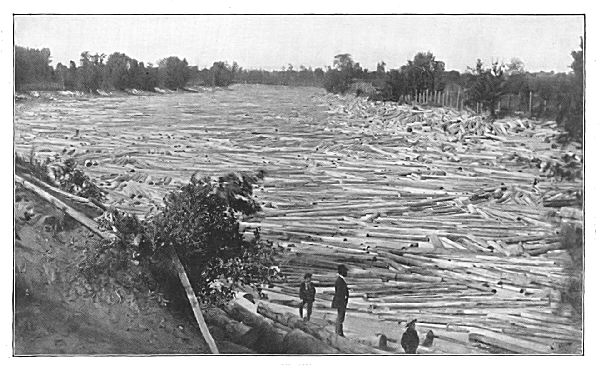 THE LUMBER INDUSTRY—A LOG JAM
To be valuable for lumber of the best quality, a forest tree must be "clear"; that is, it must be free from knots at least fifteen feet from the ground. In the case of pines and cedars, the clear part of the trunk must have a greater length. To produce such conditions, the trees must grow thickly together, in order that the lower branches may not mature.
The growth of trees thus set is very slow. Isolated pine-trees will reach the size large enough for cutting in about fifty years, but the lumber will be practically worthless because of the knots. On the other hand, pine forests with the trees so thickly set as to make a clear, merchantable lumber require at least a century for maturity.[49] Oak forests require a much greater period.
As a rule, the forest growths of the United States are found in the areas characterized by sandy and gravelly soils. Thus, the glaciated region of the United States and Canada for the greater part is forest-covered. The sand barrens along the Atlantic coast usually are forest areas. The older bottom-lands of most rivers are often forest-covered, especially when their soil is coarse and sandy.
There are large areas, however, in both the United States and Europe, that are treeless. In some instances this condition, without doubt, resulted from the fires that annually burnt the grass. With the cessation of the prairie fires, forest growths have steadily increased.
In other instances these areas are treeless because the seeds of trees have never been planted there. The high plains at the eastern base of the Rocky Mountains are an example. This region is deficient in the moisture [Pg 197]required to give young trees the vigorous start that will carry them to maturity. Moreover, the westerly winds and the streams of this region come from localities also deficient in forestry, and there are therefore no seeds to be carried.
As a rule, the distribution of forests is effected by the winds and by moving water. The prevailing westerly winds of the temperate zones have carried many species eastward and have extended the forest areas in that direction. Freshets, floods, and overflows have been even more active in carrying seeds, sprouts, and even trees into new territories. Waves and currents have likewise played a similar part. Wherever the soil of the region into which the species have been carried is moist and nutritious, the forest growth has usually extended.
The Pine Family.—The pine family includes the various species of pine, tamarack, spruce, hemlock, fir, juniper, larch, cypress, and cedar. A few members of the family thrive in the warmer parts of the temperate zone, but for the greater part they flourish between the fortieth and sixtieth parallels. Most of the species found in low latitudes are mountain-trees. They constitute the greater part of the American and Russian forests. The American pine forest is thought to be the largest in the world.
The white pine (Pinus strobus) is the most valuable member of the family. Its value is due in part to the fact that the wood is soft, clear, and easily worked, and in part to the accessibility of the forests. Not much inroad has yet been made upon the great Russian forest, owing to the fact that the timber is too far away from seaports and water transportation. Rough lumber becomes too expensive for use when transported by land, but it will stand the expense of shipment by water many miles.
The Georgia or long-leafed pine (Pinus palustris) is also commonly called pitch pine, turpentine pine, and southern pine; it grows chiefly along the south Atlantic coast and in the northern counties of Georgia. It is harder than white pine and makes excellent flooring.
The sugar pine (Pinus lambertiana) occurs mainly in Oregon and California. The grain is fine and soft and the trees reach a large girth.
The loblolly pine (Pinus tæda) has a considerably larger area than the Georgia pine, extending into Indian Territory. The short-leaf pine (Pinus echinata) occurs in small areas from New York to the Gulf of Mexico, and across to Missouri; it is the Chattahoochee pine of Florida. The pitch pine (Pinus rigida) occurs in various areas mainly north of the Ohio River and west of the prairies. The lumber cut annually from these pines aggregates about thirty billion feet.
The common white cedar (Chamæcyparis thyoides) occurs along the Atlantic and Gulf coasts nearly to the Mississippi. On account of its fine grain it is much used in cabinet work and as a finishing wood. Red cedar, probably a different species, occurs along the Atlantic coast. It is largely used in the manufacture of lead-pencils, and the forests are wellnigh exhausted.
The redwoods are confined to the California coast, mainly in the coast ranges, near the ocean. Ordinary redwood (Sequoia sempervirens) resembles red cedar, is soft, and very fine in grain, and shrinks but little in seasoning. It is a most valuable timber both for common and for ornamental use. It very frequently attains a diameter of five or six feet; the big tree sometimes exceeds sixteen feet in diameter and reaches a height of nearly four hundred feet.
Other Industrial Woods.—The oaks, like the pines,[Pg 199] form a nearly continuous belt across the northern continents, lying mainly south of the pines; they do not extend much south of the thirtieth parallel. The white oak of the New England plateau and Canada commands a high price on account of its strength; a considerable quantity is exported.
The "quartering" of the lumber used in ornamental work is produced by sawing the logs, which have been split in quarters, so that the silver-grain shows on the faces of the boards. The bark of the oak is rich in tannic acid and it is much used in tanning leather. Cork oak (Quercus suber) grows mainly in Spain and Algeria.
Black walnut (Juglans nigra) grows in the river-bottoms of the Mississippi Valley and in Texas. The merchantable supply is not great, and the wood is therefore growing more valuable each year. Hickory is used where great strength is required, and also for various tool-handles. Maple is largely employed in making furniture. Ash is a very common wood for tool-handles.
Shade-Trees and Ornamental Woods.—A large number of trees are yearly transplanted, or else grown from seed, to be used as ornamental shade-trees. For this purpose the elm, maple, acacia ("locust"), linden ("lime"), catalpa, ash, horse-chestnut ("buckeye"), poplar, and willow are most common in ordinary temperate latitudes, both in Europe and America. In warmer latitudes the Australian eucalyptus ("red gum" and "blue gum"), magnolia, palmetto, laurel, arbutus, and tulip are common. The local trade in ornamental trees is very heavy; the trade is local for the reason that the transportation of them is very expensive.
Tropical Woods and Tree Products.—Many of the tropical woods are in demand on account of their beautiful appearance, and in many species this quality is combined with strength and hardness. Mahogany is obtained from[Pg 200] Mexico and the Central American states, and also from the West Indies. The former is classed as "Honduras"; the latter is generally known as San Domingo mahogany and commands the highest price. Rosewood is obtained from Brazil, and is used almost exclusively in piano-cases. Both are cut into thin veneers, to be glued to a less expensive body.
Ebony is the heart of a species of persimmon obtained mainly in Ceylon and the East Indies. Very little of the so-called ebony is genuine, most of the ebony of commerce consisting of fine-grained hardwood, stained black. Jarrah, an Australian wood, is now very generally used for street-paving, and for this purpose it has no superior. Teak probably has no equal for strength and durability. It is not touched by the teredo and other marine worms.
Boxwood (Buxus balearica) is a high-growing tree, native to India, but growing best in the islands of the Mediterranean. The wood is very hard, of yellowish-brown color, and so fine in grain that it finds a ready market in nearly every part of the world. Probably the larger part is used by engravers. A large amount of the wood is also used in the manufacture of folding-rules, and in inlaying. Constantinople is the principal market, and nearly ten thousand tons of the selected wood are sold yearly.
Lignum vitæ, or guaiac wood (Guaiacum officinale), grows profusely in the West Indies and along the Spanish Main. It is used both in medicine and in the arts. Shavings of the wood steeped in water were once considered a cure-all, hence the name. The wood is very hard, heavy, and is split with the greatest difficulty. It is therefore much employed in making mallet-heads, tool-handles, nine-pin balls, and pulley-blocks. In tropical countries it is employed for railway ties. West India ports are the chief markets, and the United States is the chief consumer.
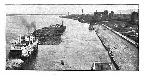 A LOG RAFT, WINONA, WIS.
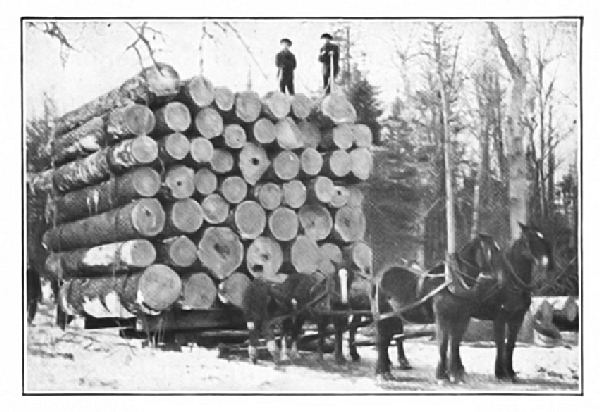 HAULING LOGS TO THE RIVER
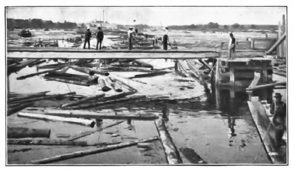 Copyright, 1898, Detroit Photographic Co.
Logwood is the wood of a tree (Hæmatoxylon campechianum) growing in Central America and the West Indies. The best quality comes from Campeche, and it is marketed mainly from Central American ports. It is almost universally used for dyeing the black of woollen and cotton textiles, and logwood blacks are the standard of color-prints.
QUESTIONS FOR DISCUSSION
In what structures has timber been supplanted by iron and steel?
In what manufactured article has timber supplanted the use of rags?
When a pine forest is cut away, what kinds of timber are apt to come up in place of the pines?
In what manner does the railway draw upon the forests?—the paper-maker?—the farmer?—the tanner?—the beaver?—the teredo, or ship-worm?
From what country or countries do the following come: boxwood, rosewood, sandal-wood, cinchona, bog oak, jarrah?
FOR STUDY AND REFERENCE
Make a list of the forestry growing in the State in which you live; so far as possible, obtain a specimen of each wood, prepared so as to show square, oblique, split, and polished sections; for what purpose, if any, is each used?
Consult "Check-list of Forestry of the United States" (U.S. Department of Agriculture).
The world's fish-catch amounts probably to more than one-quarter of a billion dollars in value and employs upward of a million people; in the United States 200,000 are employed. In some localities, such as the oceanic islands, far distant from the grazing lands of the continents, the flesh of fish is about the only fresh meat obtainable. Even on the continents fish is more available and cheaper than beef. The fish-producing areas pay no taxes; they require no cultivation; moreover, they do not require to be purchased. In general, fish supplements beef as an article of food; it is not a substitute for the latter.
The whale-catch excepted, fish are generally caught in the shallow waters of the continental coasts. The fish, in great schools, resort to such localities at certain seasons, and the seasons in which they school is the fisherman's opportunity. For the greater part, such shallows and banks are spawning-places. Most of the fish, however, are caught off the Atlantic coasts of Europe and North America, these localities being nearest to the great centres of population.
Whales.—The whale is sought mainly in cold waters, and at the present time the chief whaling-grounds are in the vicinity of Point Barrow. In the first half of the nineteenth century whale-fishing was an industry involving hundreds of vessels and a large aggregate capital. The industry centred about New England seaports.
The train-oil obtained from the blubber of the animal was used partly as a lubricant, but mainly for illuminating purposes. For this purpose, however, it has been superseded by coal-oil, gas, and electricity. It is still in demand as a lubricant, but the whale-oil of commerce is quite as apt to come from the blubber of the porpoise or the sea-cow as from the right whale. Whalebone is a horny substance taken from the animal's jaw, and is worth from three dollars to eight dollars per pound. It is used chiefly in the manufacture of whips. For other purposes, steel, hard rubber, and celluloid have taken its place.
The substance called spermaceti is derived from the sperm-whale, an inhabitant of warm ocean-waters. Spermaceti is identical in its physical properties with paraffine, and the latter is now almost universally its substitute.
Ambergris, thought to be a morbid secretion or disease of the sperm-whale, is found in the body cavity of the animal and also in masses floating in the sea. It is used chiefly to give intensity to the odor of perfumes, and the best quality brings as much as five dollars per ounce. Most of the ambergris of commerce is obtained from the neighborhood of the Bahama Islands.
Cod.—In the amount of the product the cod-fisheries are the most important. The meat of the fish is not strong in flavor, and it is cured with little expense. So valuable is the annual catch that the banks and shallows which the schools frequent are governed by international treaties.
The cod is a cold-water fish, and the fishing-grounds are confined to rather high latitudes. The coast-waters of the Scandinavian peninsula and the shores of the Canadian coast, especially the Banks of Newfoundland, are the chief areas. The fishing-grounds of the Canadian coast are closed to foreign vessels inside a three-mile limit; beyond the limit they are occupied mainly by Canadian,[Pg 205] French, and American fishermen. By the terms of treaties foreign vessels may enter the three-mile limit under restriction to purchase bait and food-supplies, and to cure their fish.
A large part of the cod-catch is exported. Tropical countries buy much of the product. In such countries it is more wholesome than meat; it is cheaper; moreover, the salted cod will keep for an indefinite length of time. A large part of the catch is sold to the Catholic states of Europe and America, where during certain times the eating of the flesh of animals is forbidden. Gloucester, Mass., London, England, and Trondhjem, Norway, are great markets for salted fish. The oil from the liver of the cod is much used in medicine.
Herring, Alewives, and Sardine.—The herring is a much smaller fish than the cod, and, commercially, is much less important. They school in about the same waters as the cod, but are caught at a different season, gill-nets being usually employed. Practically no distinction is made between full-grown herring and alewives of the same size. The fish are usually cured by smoking, pickling, or salting, and in this form are either exported or sold in interior markets.
The true sardine is found in latitudes a little farther south than the schooling-grounds of the cod. The most important fisheries are along the coasts of the Latin states of Europe. Sardine fishing is a great industry all along the New England coast of the United States, but the "sardines" marketed from this region are young herring. Indeed, nearly all sorts of small fry are sold in boxes bearing spurious French labels.
Salmon.—Most of the salmon are caught in the rivers flowing into the North Pacific Ocean. The fish are caught in traps and weirs at the time of the spring run, when they[Pg 206] ascend the river to spawn. The rivers are frequently so congested with the salmon that thousands of tons are caught in a single stream during the run.
The salmon canneries of the Columbia River are very extensive establishments, but in the past few years they have been surpassed by the Alaskan fisheries, which produce not far from fifty million pounds each year. The dressed fish is cooked by steam, canned, and exported to all parts of the world. The growth and development of the industry has also made an enormous demand on the tin mines of the world. Canned salmon is the largest fish export of the United States. There are extensive salmon-fisheries in Norway, Japan, and Russia.
Other Fish.—Mackerel and haddock are caught near the shores of the North Atlantic. Most of the mackerel-catch is pickled in brine and sold in small kegs known as "kits." The menhaden-catch of the North Atlantic is converted into fertilizer. The halibut is a large fish that is rarely preserved. The area in which it is caught is about the same as that of the cod. Shad are usually caught when ascending the rivers of the middle Atlantic coast. In the United States, Chesapeake, Delaware, and New York Bays yield the chief supply. The bluefish and barracuda are warm-water fish. The market for fresh fish has been greatly enlarged by the use of refrigerator-cars.
The sturgeon is captured mainly in the rivers and lakes of the temperate zone. Those of the Black Sea sometimes attain a weight of 2,000 pounds. The flesh is of less importance than the eggs, of which caviare is made. Russian caviare is sold all over Europe and America, and not a small part of the product is made in Maine. The caviare made from the roe of the Delaware River sturgeon is exported to Germany. The tunny is confined to Mediterranean waters.
The anchovy is caught on the coast of Europe; most of the product is preserved, or made into the well-known "anchovy sauce." The beche-de-mere, or "sea cucumber," is a product of Australasian and Malaysian waters. Almost the whole catch is purchased by the Chinese, and it is exported to all countries having a Chinese population.
Oysters and Lobsters.—The oyster is among the foremost sea products of the United States in value. The oyster thrives best in moderately warm and sheltered waters. The coves and estuaries along the middle Atlantic coast produce the best in the world. Chesapeake Bay and Long Island Sound yield the greater part of the output. In the latter waters elaborate methods of propagation are carried out, and the yearly crop is increasing both in quality and quantity. The output of the Chesapeake beds has decreased materially; that of the Long Island Sound beds has increased.
Oysters are plentiful along the Pacific coast of the United States and also in European coast-waters, but they are inferior in size and quality. The use of refrigerator-cars and vessels has extended the trade to the extent that fresh oysters are shipped to points 2,000 miles inland; they are also exported to Europe. Baltimore is the chief oyster-market.
The consumption of the lobster has been so great that the catch of the New England coast has decreased about one-half in the past fifty years, and the United States is now an importer. Most of the import, amounting to about one million dollars yearly, comes from Canada. The so-called lobsters of the Pacific coast of the United States are not lobsters, but crayfish.
Fish Hatcheries.—The demand for fish has grown so great in past years that in many countries the waters, especially the lakes and rivers, are restocked. The eggs are[Pg 208] hatched and the young fry are fed until they are large enough to take care of themselves. The chief hatchery and laboratory of the United States Fish Commission is at Woods Holl, Mass. As many as 860,000,000 eggs, small fry, and adult fish have been distributed in a single year. The State of New York has also a similar department for restocking its waters.
Sponge.—This substance is practically the skeleton of a low order of animal, growing at the bottom of the sea. The sponge is cut from the place of attachment, and the gelatinous matter is washed away after putrefaction. The chief sponge-fisheries are in the neighborhood of Florida and the Bahama Islands.
Seal.—The fur-seal is an amphibian, found only in cold waters. A few pelts are obtained along the Greenland coast, but the chief sealing-grounds of the world have been at the Pribilof Islands, in Bering Sea. The pelts of the young males only are taken. The rookeries of the Pribilof Islands have been so nearly exhausted, that the killing season has been suspended for a term of years. Much illicit seal-catching is still going on, however.
The skins are taken to London, via San Francisco, where the fur is dyed a rich brown color; London is the chief market for dyed pelts; San Francisco for raw pelts; and New York, Paris, and St. Petersburg for garments. The pelts of the sea-otter are obtained mainly in the North Pacific Ocean.
Other Furs.—The furs employed in the finest garments are in part the pelts of land animals living in polar regions. The sable, stone-marten, otter, beaver, and red fox are the most valuable. The Persian lamb, however, is not a polar animal. The Russian Empire and Canada are the chief sources of supply. The Hudson Bay Company, with head-quarters at Fort Garry, near Winnipeg, controls most of the[Pg 209] fur-trade of North America; the Russian furs are marketed mainly at Lower Novgorod. Leipzig, Germany, is also an important fur-market.
Enormous quantities of rabbit-skins from Australia and nutria from Argentina are imported into the United States and Europe for the manufacture of the felt of which hats are made. The amount of this substance may be realized when one considers that not far from two hundred million people in the two countries wear felt hats.
QUESTIONS FOR DISCUSSION
Note an instance in which the search for deep-sea fishing-grounds has resulted in the discovery of unknown lands.
Why are not whale products as essential now as a century ago?
What international complications have arisen between the United States and Great Britain concerning the cod-fisheries?—the seal-catch?
 NORTH AMERICA
The United States of America together with the possessions included within the domain of the Republic comprise an area somewhat greater than that of Europe.
With respect to latitude, the position of the main body of the United States is extremely fortunate. Practically all its area is situated in the warmer half of the temperate zone. Only a small part lies beyond the northern limit of the corn belt; wheat, oats, and barley are cultivated successfully throughout four-fifths of its extent in latitude; grass, and therefore cattle and sheep are grown in nearly every part. Coal, iron, copper, gold, and silver, the minerals and metals which give to a nation its greatest material power, exist in abundance, and the successful working of these deposits have placed the country upon a very high commercial plane.
Topographically the United States may be divided into the following regions:
The Atlantic Coast-Plain,
The Appalachian Ranges and the New England Plateau,
The Basin of the Great Lakes,
The Northern Mississippi Valley Region,
The Southern Mississippi Valley and Gulf Coast,
The Arid Plains,
The Plateau Region,
The Pacific Coast Lowlands.
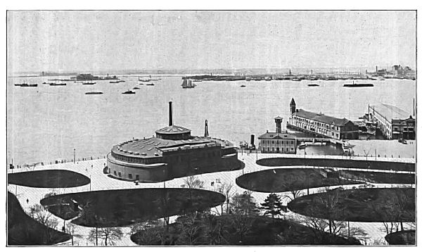 A HARBOR—NEW YORK BAY, AT THE BATTERY
The topographic and climatic features of these various regions have had a great influence not only on the political history of the country, but their effect has been even greater in determining its industrial development. They have resulted in the establishment of the various industries, each in the locality best adapted to it, instead of their diffusion without respect to the necessary conditions of environment.
The foregoing regions are also approximately areas of fundamental industries. Thus, the New England plateau supplies the rest of the United States with light manufactures, such as cotton textiles, woollen clothing, hats, shoes, cutlery, books, writing-paper, household metal wares, etc., but sells the excess abroad. The middle and southern Appalachians, with the coal which forms their chief resource, supply the rest of the country with structural steel, from ores obtained in the lake regions, and sell the excess to foreign countries.
The northern Mississippi Valley grows nearly one-fourth of the world's wheat-crop. The wheat of this region and the Pacific coast lowlands supplies the country with bread-stuffs, and exports the excess to western Europe. The Gulf states, which produce three-fourths of the world's cotton-crop, supply the whole country and about one-half the rest of the world besides with cotton textiles. The grazing regions produce an excess of meat for export; the western highlands furnish the gold and silver necessary to carry on the enormous commerce.
In the last twenty years the imports of merchandise per capita varied but little from $11.50; the exports per capita varied from about $12 to more than $18.
The Atlantic Coast-Plain and the Seaports.—Throughout most of its extent the Atlantic seaboard of the United States is bordered by a low coast-plain. Along the northeastern coast of the United States the coast-plain is[Pg 214] very narrow; south of New York Bay it has a width in some places of more than two hundred miles.
The existence of this plain has had a marked effect on the commercial development of the country. The sinking or "drowning" of the northern part of it has made an exceedingly indented coast. The drowned valleys, enclosed by ridges and headlands, form the best of harbors, and nearly all of them are northeast of New York Bay. South of New York Bay good harbors are comparatively few. For the greater part they occur only when old, buried river-channels permit approach to the shore.
The most important port of entry in these harbors is New York, and it derives its importance from two factors. It has a very capacious harbor, into which vessels drawing as much as thirty-five feet may enter; its situation at the lower end of a series of valleys and passes makes it almost a dead level route from the Mississippi to the Atlantic seaboard. The importance of New York as the commercial gateway between European ports and the food-producing region of the American continent began when the Erie Canal was opened between the Great Lakes and tide-water. The completion of the canal for the first time opened the rich farming lands of the interior to European markets. Probably a greater tonnage of freight is carried yearly over this route than over any other channel of trade in the world.
Not far from two-thirds of the foreign commerce of the country passes through the port of New York. The water-front of the city has an aggregate length of about three hundred miles, of which one-third is available for anchorage. The docks and piers, including those of Jersey City and Hoboken, aggregate about ninety miles in frontage.
About sixteen thousand sea-going craft enter and clear yearly, and an average of nearly twenty large passenger[Pg 215] and freight steamships arrive and clear daily, about one-half of them being foreign. The latter receive their cargoes from about three thousand freight-cars that are daily switched into the various freight-yards, a large part of which is through freight from the west.
The port of entry of New York is a centre of population of about four million, and although there are the industries usually found in great communities, the greater business enterprises practically reduce themselves to export, import, and exchange. For this reason New York City is the financial, as well as the commercial centre of the continent. Most of the great industrial corporations of the country have their head offices in the city. These are financed by more than one hundred banks, together with a clearing-house whose yearly business amounted in 1902 to considerably more than seventy billions of dollars.[50]
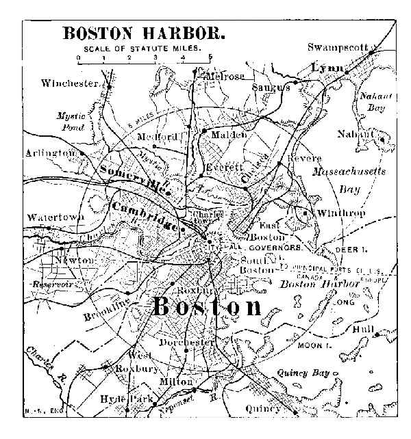 BOSTON HARBOR
Boston has been one of the leading ports of the United[Pg 216] States for considerably more than a century. It ranks second among the ports of the United States. Regular lines of transit connect it with the principal ports of Great Britain and Canada. The coast trade is also very heavy. Boston is the financial and commercial centre of New England; the cotton, woollen, and leather goods passing through the port find their way to nearly every inhabited part of the world. The city controls a considerable export trade of food-stuffs from the upper Mississippi Valley. The vessels entering and clearing at Boston indicate a movement of about four million five hundred thousand tons, about one-fourth that of New York. The clearing-house exchanges average about six billion dollars yearly.
Philadelphia, on account of its distance inland, is not fortunately situated for ocean commerce. Steamships of deep draught reach their docks at the lower end of the city under their own steam, but sailing-craft pay heavy towage fees. There are regular lines to Liverpool, Antwerp, West Indian ports, Baltimore, and Boston. Philadelphia is the centre of the anthracite coal trade, and this is the chief factor of its domestic trade. The imports of fruit from the West Indies, carpet-wool from Europe, and raw sugar from the West Indies, form the greater part of its foreign business. The manufactures are mainly carpets and rugs, locomotives and iron steamships, and refined sugar. The carpet-weaving and the ship-building plants are among the[Pg 217] largest in the world. The ocean movement of freight is more than three million five hundred thousand tons yearly. The business of the clearing-house in 1902 aggregated nearly six billion dollars.
Baltimore is likewise handicapped by its distance inland. Sailing-vessels, however, require only a short towage, the docks being scarcely a dozen miles from Chesapeake Bay. The harbor is deep and capacious. The Pennsylvania and Baltimore & Ohio railway systems have made Baltimore an important railway centre. The completion of the Gould railway system to the Atlantic seaboard has made the city second to New York only in the export of corn, wheat, flour, and tobacco. The most noteworthy local industry is the oyster product, which is the greatest in the world. Nearly ten thousand people are employed, and during the busy season—from September to the end of April—about thirty carloads of oysters a day are shipped.
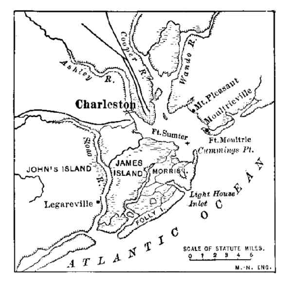 CHARLESTON HARBOR
The yearly movement of marine freight, entering and clearing, aggregates about three million tons. In 1902 the clearing-house exchanges aggregated about two and one-quarter billion dollars.
Portland, Me., has good harbor facilities, but is distant from the great lines of traffic. Steamship lines, which in summer make Montreal a terminal point, occasionally make Portland their winter harbor. Newport News, Savannah,[Pg 218] Charleston, and Brunswick are growing in importance as clearing ports for the cotton and produce from the region west of them. Norfolk obtains importance on account of the United States Navy-Yard; it is also the great peanut-market of the world.
QUESTIONS FOR DISCUSSION
What are the requisites of a good seaport?
What is meant by the draught of a vessel?
For what purposes are pilots?
How are navigable channels marked and designated?
From the Statistical Abstract find six or more of the leading exports from each of the following ports: New York, Boston, Baltimore, Philadelphia, and the port nearest which you live.
FOR COLLATERAL REFERENCE
Statistical Abstract of the United States.
Statesman's Year-Book.
Industrial Evolution of the United States—Chapter II.
The manufacturing regions of the United States, which connect the country with the rest of the world, include mainly the New England plateau and the Appalachian ranges.
The New England Plateau.—This region embraces the New England States and practically includes all the eastern part of New York and northern New Jersey. The abruptly sloping surface affords a great wealth of water-power, and the region is one of the most important centres of light manufacture in the world. This industry resulted very largely from the conditions imposed by the War of 1812 and its consequent non-intercourse acts.
The interruption of foreign commerce not only cut off the importation of manufactured commodities, but also made idle the capital employed. Manufacturing enterprises started in various parts of the United States, but they prospered in this region for three reasons—an abundance of power, plenty of capital, and business experience. Steam-power is largely supplanting water-power in the manufacturing enterprises, and in many instances the establishments have been moved to tide-water in order to get their coal at the lowest rates of transportation.
Chief among the manufactures are cotton textiles, the yearly output of which is about three hundred million dollars. About nine-tenths of the cotton goods made are consumed at home. Of the remainder, China purchases one-half. Great Britain and Canada take one-fourth, the South[Pg 220] American and Central American states purchase most of the remaining output. The great improvement of spinning and weaving machinery has enabled the cotton manufacturer to export his wares to about every country in the world.
Boots, shoes, and other leather goods are also important manufactures. The invention of improved machinery for making shoes has revolutionized the industry to the extent that a pair of stylish shoes may be purchased anywhere in the United States for about half the price charged in 1880. Another result is the enormous importation of hides from South American countries and Mexico.
The New England plateau is also the centre of a large number of manufactures that require a high degree of mechanical skill and intellectual training, such as small fire-arms, machinery, watches and clocks, jewelry, machine-tools, etc. The location of such industries depends but little upon climate, topography, or the cost of transportation; it is wholly a question of an educated and trained people. This region is likely to lose a considerable part of its manufactures of cotton textiles, inasmuch as the industry is gradually moving to the cotton-growing region. The manufactures requiring training and skill, however, are likely to remain in the region where they have grown up.
Lawrence, Lowell, Manchester, and Nashua—all on the Merrimac River; Lewiston, Waterville, Augusta, Woonsocket, and Adams—each situated at falls or rapids—are great centres of cotton manufacture. Fall River has an abundance of water-power, and at the same time is situated on tide-water. Having the advantage of good power and cheap transportation, it has probably the greatest output of cotton textiles of any city in the world. Textile establishments have also grown up in the cities and towns of the Mohawk Valley, being attracted by the excellent facilities for transportation and also by the available [Pg 221]water-power. Lynn, Brockton, Haverhill, Marlboro, and Worcester are centres of boot and shoe manufacture; they turn out about two-thirds of the product of the United States.
Bridgeport and New Haven have very large plants for the manufacture of fire-arms and fixed ammunition; Waterbury and Ansonia for watches, clocks, and brass goods; Meriden for silverware, and Waltham for watches. Worcester, Hartford, North Adams, Fitchburg, and Providence have each a great variety of manufactures. The foreign commerce of these manufacturing centres is carried on mainly through Boston. New Haven, New Bedford, Providence, Salem, Gloucester, and New London control each a very large local commerce.
South of New York Bay the Atlantic coast-plain attains an average width of nearly two hundred miles. The pine forests of this plain yield lumber, tar, pitch, and turpentine. The productive lands are valuable chiefly for their output of dairy stuffs, fruit, and "garden truck," which find a ready market in the larger cities. In order to encourage this industry, the railways make special rates for dairy products, fruit, and vegetables, and afford quick transit for such freight.
Manufacturing industries are rapidly taking shape in this part of the United States. Along the line where the coast-plain proper joins the foot-hills of the Appalachian ranges, the rivers reach the lower levels by rapids or falls. The estuaries into which they flow are usually navigable for river-craft. The manufacturer thus has the double advantage of water-power and low transportation. The opening of the southern Appalachian coal-mines has also greatly encouraged manufacture in this region. Richmond, Columbia, Milledgeville, Augusta, and Columbus are thus situated. Their manufactures are very largely connected with the cotton-crop.
The domestic commerce of the Atlantic seaboard of the United States is probably larger than that of any other similar region in the world. It is considerably larger than the "round-the-island" trade of Great Britain. Much of this trade is carried by steam-vessels, but the three-masted schooner is everywhere in evidence, and these craft carry a very large part of the coal that is moved by water. This trade is restricted to vessels flying the American flag.
The Appalachian Region.—The middle and southern Appalachian region has become the most important centre of iron and steel manufacture in the world. This great development has resulted from several causes, the chief being the existence of coal and unlimited quantities of iron ore on the one hand, and unusual facilities for cheap transportation on the other. There are practically three areas of steel manufacture—one along the Ohio River and its tributaries in western Pennsylvania; another is situated along the south shores of Lake Erie and Lake Michigan; the third includes the Birmingham district in the southern Appalachians.
The steel-making plants of the Ohio River are located with reference to the transportation of their products, and therefore are built usually alongside the river. The coal or coke is commonly shipped in barges of light draught; the manufactured products are carried by rail. The greater part of the ore is brought from the Lake Superior region. It is shipped at a very small cost from the ore quarries to the lake-shore, and by rail from the lake-shore to the manufacturing plant. In order to avoid heavy grades the ore railways are also built along the river-valleys.
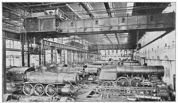 STEEL MANUFACTURE—ERECTING SHOP OF THE BALDWIN
LOCOMOTIVE WORKS, PHILADELPHIA
STEEL MANUFACTURE—ERECTING SHOP OF THE BALDWIN
LOCOMOTIVE WORKS, PHILADELPHIA
Some of the various steel-making plants are equipped for the manufacture of building or "structural" steel, others for rails and railway equipments, still others for tin-plate, or for wire, or for tool steel. In a few mills armor-plate and ordinary plate for steel vessels form the exclusive product. The diversity of the product has led to the organization of great corporations, each of which controls half-a-dozen or more plants, the transportation lines necessary to carry the product, the ore quarries, and the fuel-mines.
The wonderful development of the steel industry in the United States is due to the use of labor-saving machinery, and to the superb organization. The wages paid for labor are higher than those paid in European steel-making centres; the cost of living is not materially greater. The price of steel rails, which in 1880 was forty-eight dollars per ton, in 1900 was about twenty dollars per ton.
Pittsburg, together with Homestead, Carnegie, McKeesport, Duquesne, and Braddock, is the chief steel-making centre of the Ohio River Valley. There are also large plants at New Castle, Sharon, Scranton, Johnstown, Bellaire, Youngstown, Mingo Junction, and Wheeling. The steel-plant and rolling-mills at South Bethlehem are designed especially for the manufacture of the heavy ordnance used in the army and navy. Nearly all the cities and towns of Pennsylvania, West Virginia, and eastern Ohio carry on manufacturing enterprises that depend on coal mining and steel manufacture. The great and diversified manufactures of Philadelphia are due to its fortunate situation at tide-water, near the coal-mines. Cheap fuel and water transportation have made it one of the great industrial centres of the world.
The anthracite coal of this region is used wholly for fuel and steam-making; it is shipped partly by water from Philadelphia, but mainly in specially constructed cars to the various points of consumption. The soft coal is used also for fuel and steam-making, but a large part of the[Pg 225] product is converted into coke and used in the steel-plants.
The petroleum of this region is a leading export of the country, the states of western Europe being the chief purchasers. Of agricultural products, hay, dairy products, and tobacco are the only ones of importance. Natural gas is used both as a fuel and in manufactures.
The lake-shore centre of steel manufacture depends largely on the low cost of transporting the iron ore, which in part is offset by the increased cost of coal. The low cost of shipping the manufactured product over nearly level trunk lines is a very substantial gain. South Chicago, Toledo, Sandusky, Lorain, Cleveland, Ashtabula, Conneaut, Erie, and Buffalo are centres of steel manufacture or ore shipment, because they are situated on this great trade-route or line of least resistance.
The coal-mines and iron-making plants of the southern Appalachians have a considerable area. The chief manufacturing centres are Birmingham, Richmond, Roanoke, and Chattanooga. A considerable part of the Virginia ores find their way to the Ohio River steel-mills. Open-hearth steel is an important manufacture in Birmingham. A large part of the ores smelted in the southern Appalachian region are made into foundry iron.
QUESTIONS FOR DISCUSSION
What are the advantages and the disadvantages of manufacturing cotton textiles in the New England States?
Why have the mining of ore and the manufacture of steel become generally unprofitable in the New England States?
What causes have brought about the lowering of the prices of cotton textiles during the past fifty years?—of shoes?
What makes the manufacture of artificial ice a precarious business north of the latitude of Philadelphia?
What are the advantages and the disadvantages arising from the location of a manufacturing industry at a seaport?
What is the design of a protective tariff? What are its advantages and disadvantages?
Why are most of the great steel-making plants so remote from the mines of iron ore used in making steel?
FOR COLLATERAL READING
Industrial Evolution of the United States—Chapters III-V.
Mineral Resources of the United States.
Outlines of Political Science—Chapters VIII-X.
The principal agricultural region of the United States extends from the Appalachian ranges to the Rocky Mountains. A certain amount of bread-stuffs, meat, and dairy products are grown in nearly every part of the country for local use, but the grain, meat, and cotton of this region are designed for export, and are therefore factors in the world's commerce. The basin of the Great Lakes connects the Mississippi Valley with the Atlantic seaboard.
The Basin of the Great Lakes.—This region includes not only the Great Lakes and the area drained by the streams flowing into them, but also a considerable region surrounding that commercially is tributary to the traffic passing over the lakes. This basin itself is a part of a trade-route destined very shortly to become one of the greatest highways of traffic in the world.
The lakes afford a navigable water-way which, measured due east and west, aggregates nearly six hundred miles. This route is interrupted at Niagara Falls and at St. Mary's Falls, between Lake Superior and Lake Huron. On the Canadian side, Welland Canal, Lake Ontario, and the St. Lawrence connect Lake Erie with tide-water. In the United States the Erie Canal connects the lake with the Hudson River and New York Bay.
From the head of Lake Superior railway routes of minimum grades—the Great Northern and the Northern Pacific[51]—cross the continent to Puget Sound, the best harbor[Pg 228] approach to the Pacific coast of the American continent. The harbors of Puget Sound, moreover, are materially nearer the great Asian ports than any other port of the United States. The level margins of these lakes are roadbeds for many miles of railway track; in many instances the railways are built on the tops of terraces that once were shores of the lakes.
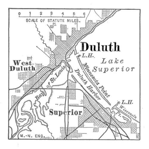 DULUTH
Duluth, at the head of Lake Superior, became commercially important when the St. Mary's Falls Canal was completed. Much of the tremendous tonnage of freight passing through the canal is assembled at this place. The freight shipped consists mainly of farm products collected from an area reaching as far west as the Rocky Mountains. There is also a considerable shipment of iron ores obtained near by. Buffalo, at the lower end of Lake Erie, owes its activity to the trade in lumber, grain, and other farm products that come from Western lake-ports. It is the eastern terminus of the lake-commerce and the western terminus of the Erie Canal.
Chicago, at the head of Lake Michigan, has a very heavy lake-trade. The mouth of Chicago River, the natural harbor of the city, has been improved by a system of basins and breakwaters. The river itself has been converted into a ship and drainage canal that is connected with the Illinois and Mississippi Rivers. It is now an outlet instead of a feeder to the lake, and the city built about old Fort Dearborn has become the greatest railway centre in the world.
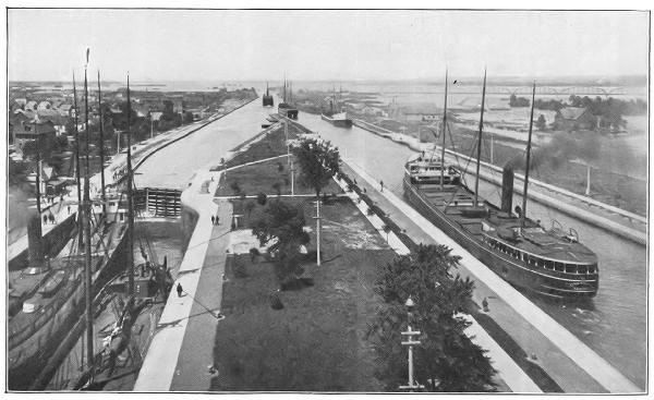 GENERAL VIEW OF LOCKS AND CANAL, SAULT STE. MARIE
Milwaukee has a situation in many ways resembling that of Chicago, its harbor being the mouth of Milwaukee River. Like Chicago, it owes its importance to its lake-trade. Detroit (with Windsor, Ont.) owes its growth partly to its strategic position on the strait connecting Lake Huron and Lake Erie, and partly for its position between the lakes. It is an important collecting and distributing point for lake-freights, and the chief centre of commerce with Canada. Several east-and-west trunk lines and local lines of railway have freight terminals in the city; it is also the centre of the most complete system of interurban electric railways in the world. Port Huron (with Sarnia, Ont.) has a geographic position similar to that of Detroit, and is also an important lake-port. The St. Clair River is tunnelled at this point. Cleveland, Toledo, Sandusky, and Erie contribute very largely to the lake-trade. Grand Rapids is the business centre of furniture manufacture of the United States.
The great iron-ore ranges about Lake Superior have had much to do with the growth of the local lake-trade. This has resulted in the establishment of a large number of shipping-ports near the head of the lakes, and also a number of receiving ports on the south shores of Lake Erie and Lake Michigan. Some of the latter have become also great manufacturing centres of structural iron and steel.
Various centres of industry at a considerable distance from the Great Lakes are contributors to their trade. Thus, on account of the low rate for grain between Chicago and New York City—about 5¼ cents per bushel—there are yearly very heavy shipments of the grain designed for Liverpool. St. Paul and Minneapolis are also collecting and distributing centres of lake-freights. A considerable part of the business of the lake-region is carried on by the Canadians, who have improved their resources for production and transportation to the utmost.
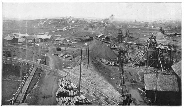 Copyright, Detroit Photographic Co.
The Northern Mississippi Valley Region.—This region extends from the Appalachian ranges to the western limit of wheat and cotton growing. On the south it is limited by the cotton-growing region. Its boundaries are therefore climatic and commercial.
The surface is level; there is a rich, deep soil and an abundant rainfall. It has therefore become one of the foremost regions of the world in the production of corn, wheat, pork, dairy-stuffs, and general farm produce. The evolution of farming machinery is the direct result of topographic conditions. A level, fertile region naturally invites grain-farming on a large scale. This, in turn, must depend very largely on the ability of the farmer to plant and harvest his crops with the minimum of expense and time.
Hand-work in harvesting and planting has almost wholly given way to machine-work. Farming carried on under such conditions requires not only a considerable capital, but close business management as well. Some of the results have been very far-reaching. The machinery and other equipments require capital, and this in late years has been borrowed from Eastern capitalists. The prompt business methods of the money-lender brought about no little friction, and it is only within recent years that each adjusted himself to the requirements of the other.
The system of machine-farming to a great extent has prevented the subdivision of farms. As a rule, quarter and half sections represent the size of most of the farms, but tracts varying from five thousand to ten thousand acres are by no means uncommon. The chief drawback to this method in the case of wheat-farming, however, is the low yield per acre. The average yield per acre for the United States, a little more than twelve bushels, is scarcely half the average yield in Europe. Although the farmer has done much to reorganize his business methods, he has done but little to maintain the productivity of his land.
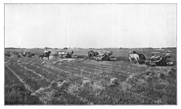 THE WHEAT INDUSTRY—HARVESTING WITH McCORMICK
SELF-BINDING REAPERS
THE WHEAT INDUSTRY—HARVESTING WITH McCORMICK
SELF-BINDING REAPERS
The cities and towns of this region are mainly receiving and collecting points for farm produce. Nearly every village is equipped with elevators and grain-handling machinery; the larger towns, as a rule, have stock-yards and the necessary facilities for cattle shipment; the large cities are usually centres of meat-packing. Most of the meat-packing is a necessity; for although cattle may be shipped alive and beef may be transported in refrigerator ships and cars, pork is not marketable unless pickled, salted, or smoked. The pork thus exported, aggregating about six hundred million pounds yearly, must be prepared, therefore, somewhere near the cornfields. Manufacturing enterprises are operated on a very large scale, but in the main their products are farm-machinery and the commodities required by a farming population.
Education in agriculture is provided for in nearly every State in the Union. The agricultural colleges in the States composing this group rank among the best in the world. In addition to the ordinary courses in such institutions, there are also many experiment stations for the study of economic plants, cattle diseases, and insect pests.
Chicago is the largest food-market in the world. The industries of the city are almost wholly connected with the commerce of grain, pork, meat, and other food-stuffs. For the transportation of these commodities about thirty great trunk lines enter the city and about twelve hundred passenger trains daily arrive and depart from its stations.
The freight terminals are connected by transfer and belt lines, which receive and distribute the cars passing between the eastern and the western roads. More than five hundred freight trains, aggregating about twenty thousand cars, arrive and depart daily.
St. Louis originally derived its importance as a river-port of the Mississippi, having been the connecting commercial link between the upper and the lower river. In recent years it has become the metropolis of the southern part of the food-producing region. In addition to the river-trade, still largely controlled at this point, it is the focus of more than twenty trunk lines of railway. Some of these, like the trunk lines of Chicago, handle freight exchanged between the East and West; but a large proportion are receiving and distributing roads for Southern freight.
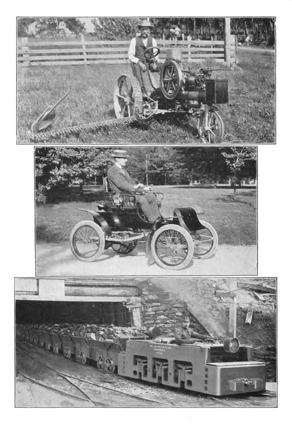 AUTOMOTIVE POWER IN THE INDUSTRIES OF THE MISSISSIPPI
VALLEY
AUTOMOTIVE POWER IN THE INDUSTRIES OF THE MISSISSIPPI
VALLEY
St. Paul and Minneapolis are the metropolis of the upper Mississippi. The former grew from a trading-post at the head of navigation; the latter gained its commercial prominence from the water-power at the falls of St. Anthony. The former has become the chief railway and distributing centre of the northern Mississippi Valley; the latter has the greatest flour-mills in the world, and an extensive lumber-trade. Both are situated on the trade-route between the United States and Asian ports, and distribute a part of the trade that comes from them.
The two Kansas Cities,[52] Omaha, South Omaha, and Sioux City are stock-markets and meat-packing centres. The first two named are collecting and distributing points not only for the Mississippi Valley, but also for a considerable share of the Pacific Coast trade. Kansas City is also a transfer station for the cotton destined for China. From this place it is sent by way of Billings to Seattle, and thence shipped to China.
Cincinnati is the metropolis of the Ohio Valley. Its situation on a bend of the river gives most excellent landing facilities; the easy grade from the bluff to the bottom-lands along the flood-plain of Mill Creek makes it accessible to the railways that enter the city. On account of low rates of transportation by river-barges, about three million tons of coal and one million tons of pig-iron and steel billets[Pg 237] are floated to the city to be manufactured into other steel products. Indianapolis is a great railway centre, where much of the freight passing between Chicago, Louisville, Cincinnati, and Pittsburg is exchanged. Columbus (O.) is similarly situated as a railway and farming centre.
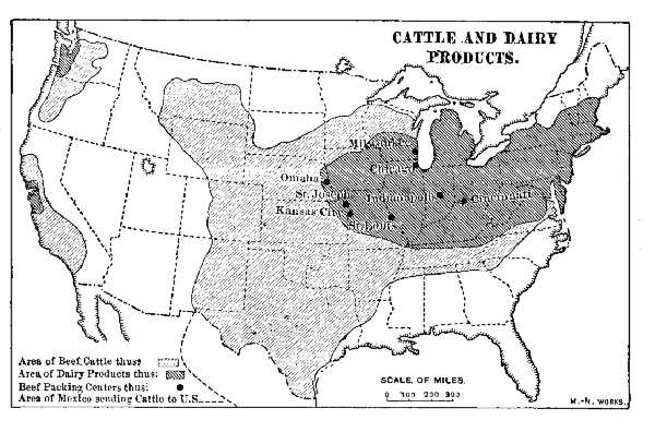 CATTLE AND DAIRY PRODUCTS
Louisville is a market of the tobacco region, and has probably a larger business in this industry than any other city in the world. Davenport, Rock Island, and Moline form a single commercial centre, the last-named having the largest establishment for the manufacture of ploughs in the world. Dubuque, Burlington, Quincy, and Muscatine are river-ports, all having a considerable trade in the lumber that is carried down the river.
The Southern Mississippi Valley and Gulf Coast.—This region receives a generous warmth and rainfall. Cotton is its staple product, and nearly all the industries are connected with the growth, shipment, and manufacture of the crop and its side products. The cotton, raw or manufactured, is sold in about every country in the world.
The commercial part of handling the cotton-crop begins within a very few weeks from the time of the first picking. The baled cotton is hauled by team from the plantation to the nearest market-town, an item sometimes greater than the entire freightage from the nearest seaport to Liverpool.
The season for export lasts from September until the middle of January, during which time brokers are visiting the smaller markets in order to buy it on commission. It is then shipped by rail or by river to the nearest general market, where it is sold to the foreign buyers and domestic manufacturers.
New Orleans, the metropolis of the South, has usually the heaviest export of cotton, amounting to about one billion pounds each year. Much of this is received by water from the various river-ports. The city is not only a river-port, but an important seaport as well, controlling a large part of the foreign commerce of the Gulf. Several trunk lines of railway enter the city, which is a receiving and distributing depot for both Atlantic and Pacific freights. A considerable part of the former are sent by ocean steamships from New York. An elaborate system of sewerage, well-paved streets, and a good water-supply—all recently put into operation—have made the city one of the most attractive in the United States.
Galveston is destined to become a leading port for cotton export. It has the advantage of a fine harbor on the seaboard, and the disadvantage of a location so low that very heavy south winds flood the streets with water from the Gulf. The growth of the export trade is due chiefly to the increasing crop of Texas. Shipments from Galveston begin in September, the Texas crop being the first to mature. Savannah and New York rank next in their exports. Pensacola and Brunswick are also important points of export. Memphis, Vicksburg, Shreveport, Houston, and[Pg 239] Montgomery are important collecting stations for the cotton.
About one-third of the crop is retained for manufacture in the United States; one-third is purchased by Great Britain, one-sixth by Germany, and most of the remainder by France, Italy, Spain, and Japan. Of the manufactured cotton goods, the Chinese are the heaviest buyers, taking about half the entire export. Most of the Chinese purchase is landed at Shanghai.
In the main, the manufactures of this region closely concern the cotton industry. The increase in the manufacture of textile goods has been very great, and a large part of the cotton now manufactured in the New England States and abroad, in time will be made in the cities and towns of this section. In addition to the textile goods, cottonseed-oil is an important product. A part of this is used in the mechanical arts, but the refined oil is used mainly for domestic purposes. A considerable part of the latter is used to adulterate olive-oil, and in some instances is substituted for it. The refuse of the seed is made into fertilizer.
Atlanta is one of the foremost cities in the South in the manufacture of cotton textiles and products. Commercially its situation resembles that of Indianapolis; it is a focal point of the chief trunk lines of railway in the South, and has the principal railway clearing-house. Like New Orleans, it is an educational centre and one of the foremost in the South. Macon, Dallas, Fort Worth, and San Antonio are growing commercial centres.
The manufacture of cane-sugar has been an industry of Louisiana for more than a century. Since the advent of beet-sugar, however, it has been a somewhat precarious venture, and has depended for existence very largely upon tariff protection and bounties paid to the American [Pg 240]sugar-makers. Tobacco manufacture centres at Tampa and Key West. Cuban leaf is there converted into cigars.
Fruit culture is a great industry. Millions of melons and great quantities of pineapples, oranges, and small fruit form the early crop that is shipped North. The orange groves are mainly in Florida. The crop is exhausted about the time that California oranges are shipped East. A great deal of tropical fruit is brought from Mexican, Central American, and South American ports. This trade is controlled mainly at Mobile, which is also a lumber-market.
The Arid Plains and the Grazing Region.—This region includes the high plains approximately west of the 2,000-foot contour of level, together with a part of the plateaus of the western highland region. It is essentially one of grazing. Formerly there was an attempt to make wheat-growing the chief industry, but on account of the limited rainfall not more than three crops out of five reached maturity.
The earlier cattle-growing was carried on in a somewhat primitive manner; the cattle herded on open lands, wandering from one range to another, wherever the grazing might be good. The ownership of the cattle was determined by the brand the animal bore,[53] and the herds were "rounded up" twice a year to be sorted; at the round-up the "mavericks," or unmarked calves and yearlings, were branded. In time the ranges became greatly overstocked; the winter losses by starvation were so heavy that a better system became imperative. "Rustling," or cattle-stealing, also became a factor in improving the methods of cattle-ranching. The cautious rustler would purchase a few head of cattle and add to the number by capturing stray mavericks.
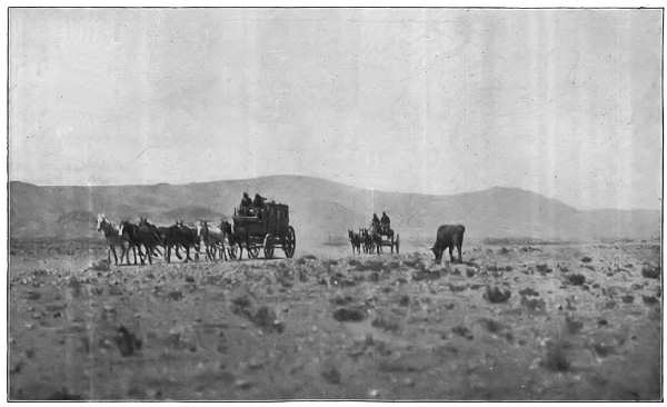 A DESERT REGION—TOO DRY FOR THE PRODUCTION OF
FOOD-STUFFS
A DESERT REGION—TOO DRY FOR THE PRODUCTION OF
FOOD-STUFFS
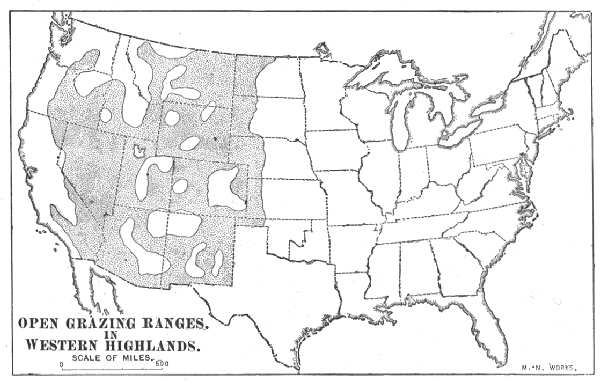 OPEN GRAZING RANGES, IN WESTERN HIGHLANDS
Both the legitimate graziers and the rustlers at first were bitterly opposed to fencing the land. In time, however, the grazier was compelled to do this, and also to grow alfalfa for winter foddering. The great open ranges have therefore been broken up and fenced wholly or in part. The fencing, moreover, has kept a dozen or more of the largest wire-mills in the world turning out a product that is at once shipped West. As a rule, the top wire is set on insulators and used for telephone connection.[54] This method of cattle-growing has improved the business in every way. The cattle are better kept; the loss by winter killing is very small; the "long-horn" cattle have given place to the best breeds of "meaters," which are heavier, and mature more quickly.
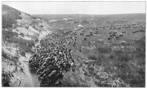 Copyright, 1901, by Detroit Photographic Co.
The success of stock-growing in this region is largely a question of climate. The sparse rainfall permits the growth of several species of grass that retain nutrition and vitality after turning brown under the fierce summer heat. Ordinary turf-grass will not live in this region, nor will it retain its nutrition after turning brown if rain falls upon it. The native grass is not materially affected by a shower or two; it is fairly good fodder even when buried under the winter's snow. The existence of this industry, therefore, turns on a very delicate climatic balance.
Of the beef grown in the United States the export product is derived mainly from this region. Nearly four hundred thousand animals are shipped alive; about three hundred million pounds of fresh beef are shipped to the Atlantic seaboard in refrigerator-cars and then transferred to refrigerator-steamships. Two-thirds of the cattle and fresh beef exported are shipped from New York and Boston.
Upward of one hundred and fifty million pounds of canned and pickled beef are also exported. All but a very small part of this product is consumed in Great Britain, France, and Germany. The cattle are collected for transportation at various stations and sidings along the railways that traverse this region. Cheyenne is one of the largest cattle-markets in the world.
Wool has become a very valuable product, and the sheep grown in this region number about one-half the total in the United States. The growing of macaroni-wheat is extending to lands that fail to produce crops of ordinary wheat.
QUESTIONS FOR DISCUSSION
In what ways does the basin of the Great Lakes facilitate the commerce of the United States?
How has the topography of the Mississippi Valley affected the evolution of farming-machinery?
Why are shippers willing in many cases to pay an all-rail rate on wheat sent to the Atlantic seaboard, nearly three times as great as the lake and canal rates?
The acre-product of wheat in the United States is about twelve bushels; in western Europe it varies from twenty-five to more than forty bushels; to what is the difference due?
What is meant by sea-island cotton?—for what reasons is cotton imported from Egypt and Peru into the United States?
In what manner is cotton used in the manufacture of pneumatic tires, and why is it thus used?
What are refrigerator-cars?—refrigerator-steamships? Name some of the regulations required in shipping cattle.
Why have American meats been debarred at times from European markets?
Find the value of cotton and meat exported to the following-named countries: Great Britain, France, Germany, Italy, China.
FOR COLLATERAL READING AND REFERENCE
The Wheat Problem—pp. 191 et seq.
Statistical Abstract.
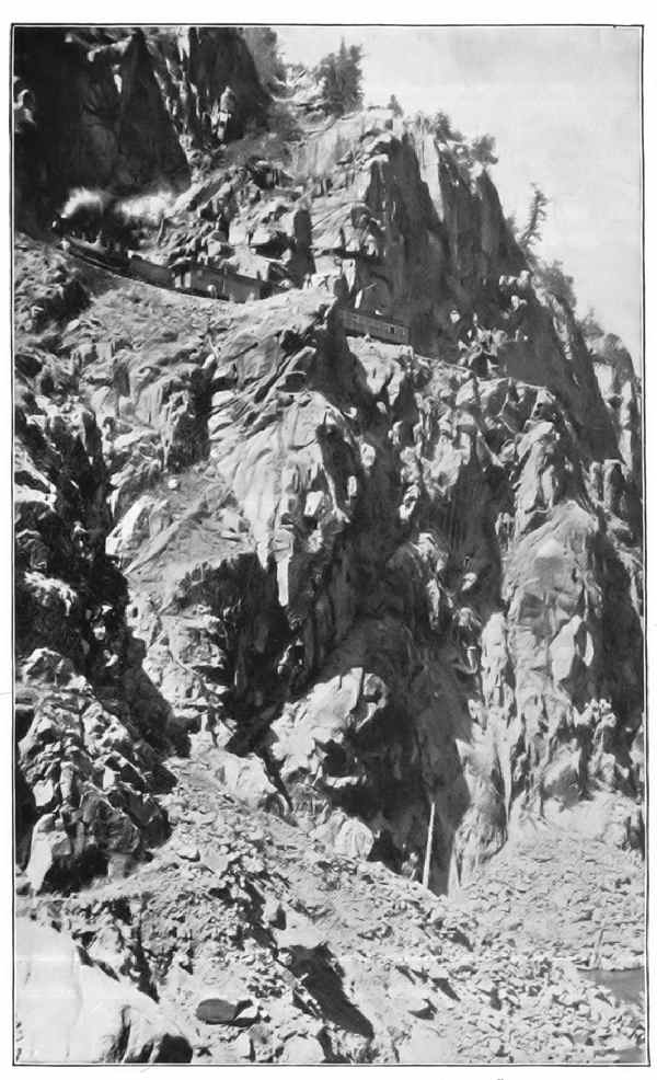 DIFFICULT RAILROADING—LAS ANIMAS CAÑON
The western part of the United States consists of a succession of high mountain-ranges extending nearly north and south. The two highest ranges, each about two miles high, enclose a basin-shaped plateau about one mile high. This basin is commonly called the "plateau region." The rim ranges are broken in a few places by passes that the transcontinental railways thread. West of the Sierra Nevada ranges are the fertile Pacific coast lowlands.
The Plateau Region.—This region is generally arid, but on the higher plateaus there is sufficient rainfall to produce a considerable forestry and grazing. The general conditions of rainfall and topography forbid any great development of agriculture. Farming is confined to the river-flood-plains, the parks, and the old lake beds and margins.
A considerable area, estimated at more than two million acres, may be made productive by irrigation, and the United States Government is undertaking the construction of an elaborate and extensive system of reservoirs for the impounding of stream and storm waters now running to waste. The irrigated lands of this region, when their products are accessible to markets, are very valuable. The river-bottom lands of New Mexico, and the old margins of Great Salt Lake in Utah are examples. They produce abundantly, and a single acre often yields as much as four or five acres in regions of plentiful rainfall.
Not much of the crop of this region, the fruit and wool excepted, leaves the vicinity in which it is grown, on account of the expense of transportation. In the matter of the transportation of their commodities, the dwellers of the western highland are doubly handicapped. The building of railways is enormously expensive, and in a region of sparse population there is comparatively little local freight to be hauled. The difficulties of developing such a region from a commercial stand-point, therefore, are very great.
Mining is the chief industry of this section, and silver, gold, and copper are its most important products. Since the discovery of precious metals in the United States, this region has produced gold and silver bullion to the value of about four billion dollars. This sum is about one-half the value of the railways of the country,[55] and from 1865 to 1880 a large part of the capital invested in railway building represents the gold and silver of these mines. In the last twenty years of the past century they produced an average of about one hundred and twenty-five million dollars per year, and this average is constantly increasing.
Coal-measures extend along the eastern escarpment of the Rocky Mountains, and these are destined at no remote day to create a centre of steel and other manufactures. Several of the railways operate coal-mines in Colorado and Wyoming for the fuel required. A limited supply of steel is also made, the industry being protected by the great distance from the Eastern smelteries.
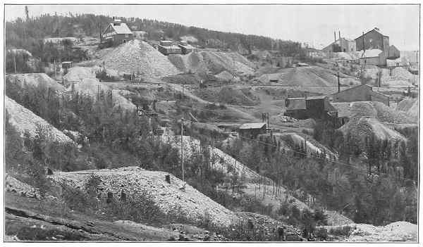 GOLD MINING—CRIPPLE CREEK, COLORADO
Denver is the chief active centre of finance of the mining industry in the western highlands, although many of the great enterprises derive the capital necessary to develop them from New York and San Francisco. Leadville, Cripple Creek, Butte, Helena, and Deadwood are regions of gold and silver production. Virginia City is the operating centre of the famous Comstock mines. At Anaconda is the chief copper-mine of this region. Salt Lake City and Ogden are the centre of the Mormon agricultural enterprises. Santa Fé, Las Vegas, and Albuquerque are centres of agricultural interests and stock-growing.
Spokane and Walla Walla are commercial centres of the plains of the Columbia River. The former is the focal point of a network of local roads that collect the wheat and other farm products of this region; the latter is the collecting point for much of the freight sent by steamboats down the Columbia River from Wallula. Railway transportation has largely superseded river-navigation for all except local freights, however. Boise City is the financial centre of considerable mining interests.
The Pacific Coast Lowlands.—Climatically this region differs from the rest of the United States in having a rainy and a dry season—that is, the rainfall is wholly seasonal. In the northern part the rainfall is sixty inches or more, and rain may be expected daily from the middle of October to May. In central California the precipitation is about half as much, the rainy season beginning later and ending earlier. In southern California there are occasional showers during the winter months, aggregating ten or twenty inches.
The level valley-lands have no superior for wheat-farming, and in but one or two places is the rainfall insufficient to insure a good crop. In the San Joaquin and southern valleys of California the harvest begins in May, in the Sacramento Valley in June, and in the Willamette and Sound Valleys of Oregon and Washington in July. The wheat goes mainly to Great Britain by way of Cape Horn. It cannot be safely shipped in bulk, and the manufacture of jute grain-sacks has become an important industry in[Pg 251] consequence. The yearly wheat product of this region is not far from eighty million bushels.
Fruit is a valuable product of the foot-hills of the Sierras, and in southern California oranges, lemons, and grapes are now the staple crop. In some cases the average yield per acre has reached a value of five hundred dollars. Some of the largest vineyards in the world are in this region. The Zinfandel claret wine and the raisins find a market as far east as London, and considerable quantities are sold in China and Japan. The navel orange, although not native to California, reaches its finest development in that State. A large part of the fruit-crop of California is handled at Minneapolis, Chicago, St. Louis, and New York. It is transported in special cars attached to fast trains.
Wool is an important crop. In the northern part the sheep thrive best in the foot-hills. The valley of Umpqua River, Ore., produces nearly seventeen million pounds of wool yearly, the staple being an ordinary variety. California produces nearly as much of the finest merino staple. A considerable part is manufactured in the mills of the Pacific coast. The Mission Mills blankets made in San Francisco are without an equal elsewhere.
The discovery of gold by John Marshall in 1848 resulted in a tremendous inflow of people to the gold-fields of California. It also was a factor in the acquisition of the territory composing the Pacific coast States. The first mining consisted merely in separating the metal deposited in the bed-rock of streams by washing away the lighter material. In time the quartz ledges which had produced the placer gold became the chief factor in gold mining. California is still one of the leading States in the production of gold. Quicksilver mining is an important feature of the mining interests of the Pacific coast, and the mines of the coast ranges produce about half the world's output.
Lumber manufacture is an important industry. Douglas spruce, commonly known as "Oregon pine," grows profusely on the western slopes of the high ranges, the belt extending nearly to the Mexican border. It makes a most excellent building-lumber, especially for bridge-timber and framework. Masts and spars of this material are used in almost every maritime country. Sugar-pine is less common, but is abundant. It is largely used for interior work. Several species of redwood occur in central California, confined to a limited area. The wood is fine-grained and makes a most beautiful interior finish.
San Francisco is the metropolis of the Pacific coast of the United States. It is the terminus of the Santa Fé and Union Pacific railways, and the centre of a network of local roads. Steamship lines connect the city with Panama, the Hawaiian Islands, Japan, and Australian ports; coast steamships reach to the various ports of Alaska, Oregon, and California. It is also the financial as well as the commercial centre of the Pacific coast. Los Angeles is the centre of the fruit-growing region; its port is San Pedro. Stockton, Port Costa, and Sacramento, all on navigable waters, are wheat-markets. Portland (Ore.) is the metropolis of the basin of the Columbia and Willamette Rivers. Navigation of the former is interrupted by falls or rapids at Dalles and Cascades, but boats ascend as far as Wallula. The lower Willamette is also made navigable by means of a canal and locks at Oregon Falls.
Puget Sound is a "drowned valley," with an abundance of deep water. The score or more of harbors are among the best in the world. Seattle and Tacoma, the leading ports, are terminals of great transcontinental railways, and also of the most important trade-route across the continent. Lines of steamships connect Seattle with Japan and China, and the commerce passing through this[Pg 253] gateway is drawn from a territory that extends more than half-way around the world. These ports are destined to become the chief American ports in the Asian trade.
Alaska.—The most productive industry of the insular part of the territory is the fisheries. For many years the Pribilof Islands produced practically all the seal-pelts used in the manufacture of seal-fur garments. So many seals were killed, however, that the species seemed likely to become extinct, and seal-catching has been forbidden for a term of years.
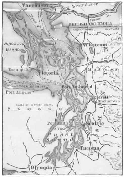 PUGET SOUND
The discovery of gold along the Klondike River and in the beach-sands of Cape Nome was followed by the development of surface mines that produced a large amount of gold. For the better transportation of products, a railway has been completed from Skagway across White Pass to White Horse, the head of navigation of the Yukon. About twenty steamboats are engaged in the commerce of the river. Skagway and Dyea are collecting points for the commerce of the Klondike mines. Juneau has probably the largest quartz-mill in the world.
Porto Rico.—Porto Rico, formerly a Spanish colony, is now a possession of the United States. The island is about the size of Connecticut and has a population [Pg 254]somewhat greater. The industries are almost wholly agricultural, and nearly the whole surface is under cultivation. Sugar, coffee, and tobacco are grown for export, and these constitute the chief source of income. The coffee-crop, about sixty million pounds yearly, is the most valuable product and commands a high price on account of its superior quality. It is sold very largely to European coffee-merchants, and is marketed as a "Mocha." Exports of fruit to the United States are increasing. In 1900 the exports to United States markets, mainly sugar and cattle products, were about six million dollars. The imports from the United States were chiefly of cotton-prints and rice, to the amount of nearly nine million dollars. The total export and import trade that year was about twenty million dollars.
The facilities for the transportation of products are not good. The railway lines have a total mileage of about one hundred and fifty miles. An excellent wagon-road, built by the Spanish Government from San Juan to Ponce, has been supplemented by several hundred miles of roads built under the direction of the military authorities. San Juan and Ponce are the leading seaports and centres of trade.
Hawaiian Islands.—These islands were discovered by a Spanish sailor, Gaetano, in 1549, and again visited by Captain Cook in 1778. Up to 1893 they formed a native kingdom. In 1893 foreign influence was sufficient to overthrow the native government, and in 1898 they were formally annexed to the United States and about the same time organized as a territory. From an early date the geographic position of the islands has made them a convenient mid-ocean post-station, and they have therefore become a most important commercial centre.
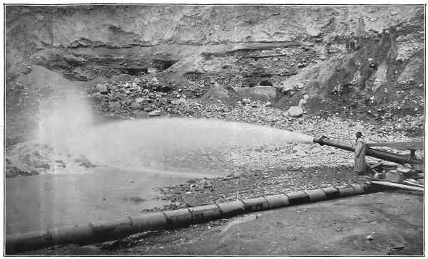 HYDRAULIC GOLD MINING—CALIFORNIA
Of the various islands composing the group, Hawaii, Maui, Oahu, Kaui, Molokai, Lanai, and Niihau are inhabited. About one-fifth of the population consists of native Hawaiians; a little more than one-fifth is white; the remainder is composed of Japanese, Chinese, and Porto Ricans. The native population is decreasing. About ninety-five per cent. of the property is owned by the white people—Americans, English, and Germans.
The volcanic soils are the very best sugar-lands, and a large amount of capital is invested in this industry. The sugar-plantations employ more than forty thousand laborers, all Japanese, Chinese, and Porto Ricans. The value of the sugar export is nearly twenty-five million dollars yearly; that of fruit, rice, and hides is about two hundred and fifty thousand dollars. Coffee is rapidly becoming a leading product. The bulk of the imports comes from the United States, and consists of clothing, cotton textiles, lumber, and machinery.
Honolulu, on the island of Oahu, is the capital and commercial centre, and foreign steamships and sailing-craft are scarcely ever absent from its harbor. Regular steamship service connects this port with San Francisco, Seattle, Vancouver, B.C., and the principal ports of China and Japan. It is connected with the other islands by a system of wireless telegraphy. The city has the best of schools, business organizations, hotels, and streets.
Pearl Harbor contains a large area of water, most of which is deep enough for the largest vessels afloat. It is intended to deepen the entrance and establish a United States naval station at this place. The village of Hilo is the chief port of the island of Hawaii.
The Philippine Islands are an archipelago of about two thousand islands, the two largest of which, Luzon and Mindanao, are each nearly the size of New York State. Luzon is by far the most important.
After their cession to the United States (December 10, 1898), they were held under military control, but this has[Pg 257] given place to local self-government as rapidly as the circumstances permitted. A general school system has been established and is extended wherever practicable. In a considerable number of the islands civil organization is still impossible.
The following are the principal islands and their mineral resources:
| Name | Chief Cities and Ports | Mineral Resources |
| Luzon | Manila, Lipa, Batangas | Coal, gold, copper |
| Mindanao | Zamboanga | Coal, gold, copper |
| Samar | Catbalogan | Coal, gold |
| Negros | Bacolor | Coal |
| Panay | Iloilo | Coal, gold, petroleum |
| Leyte | Tacloban | Coal, petroleum |
| Mindoro | Calapan | Coal, gold |
| Cebu | Cebu | Coal, petroleum, gold |
The native population is mainly of the Malay race, but there are also many Negritos. Of the native element the Tagals are the most advanced, and are the dominant people. The foreign population includes nearly one hundred thousand Chinese, who are the chief commercial factors of the islands, and the leading industries are controlled by them. There is a considerable population of Chinese and Tagal mixed blood, commonly known as "Chinese mestizos"; they inherit, in the main, the Chinese characteristics. The European and American population consists mainly of officials, troops, and merchant-agents for Philippine products.
The principal products for export are "Manila" hemp, sugar, and tobacco. The hemp is used in the manufacture of cordage and paper. On account of the great strength of the fibre it has no equal among cordage fibres. The[Pg 258] imports from the United States consist mainly of machinery and cotton textiles. The total trade of the islands amounted in 1901 to about fifty million dollars, most of which was shared by Great Britain and the United States.
Coal is mined in the island of Cebu and is abundant in most of the islands. Iron ore, copper, and sulphur occur, but they have not been made commercially available to any extent. Gold is mined in the island of Luzon. A stable government only is needed to make these great resources productive. An abundance of timber is found in most of the islands. Cedar, ebony, and sapan-wood are available for ornamental purposes; there is also a great variety of economic woods.
Manila is the commercial centre. Manila Bay is one of the finest harbors in the Pacific Ocean, but much work is necessary to give the water-front a navigable depth for large steamships. With an improved harbor the city is bound to be a great emporium of Oriental trade. Steamship lines connect the city with Hongkong, Australia, Japan, Singapore, and Liverpool. There is also a military transport service to Seattle. A railway to Dagupan extends through the most important agricultural region. The wagon-roads throughout the island are very poor.
Lipa, Batanzas, Bauan, and Cavité are cities of about forty thousand population, all more or less connected with the industries of Manila. Iloilo is the second port of importance of the islands, and is the centre of a considerable export trade in tobacco, hemp, sugar, and sapan-wood. Cebu is also a port having a considerable trade.
Tutuila, one of the Samoan Islands, was acquired by treaty for use as a coal-depot and naval station. Pago Pago is a port of call for steamships between San Francisco and Australia. Guam, one of the Ladrone Islands, is a naval station. These possessions are strategic[Pg 259] and are designed to secure the interests of the United States in the Pacific. An ocean telegraphic cable connects the Pacific Ocean possessions with the United States and Asia.
QUESTIONS FOR DISCUSSION
Why are mountain-regions apt to be sparsely peopled?
Why are arid regions sparsely peopled, as a rule?
Why are not gold-mining settlements so apt to be permanent as agricultural settlements?
From the Abstract of Statistics find the production of gold and silver of this region for each ten years ending the last half of the century.
What causes the difference between the wool clip of southern California and that of the Eastern States?
Follow the route of a grain-carrying ship from San Francisco to Liverpool.
What are the advantages to the United States of the accession of the Hawaiian Islands?—of the Philippine Islands?—of Alaska? What are the disadvantages?
FOR COLLATERAL READING AND REFERENCE
Mineral Resources of the United States.
Abstract of Statistics.
U.S. Coast Survey Chart of Alaska.
Map of Hawaiian Islands.
Map of Philippine Islands.
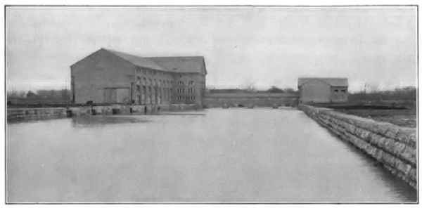 NIAGARA POWER-HOUSE (EXTERIOR)
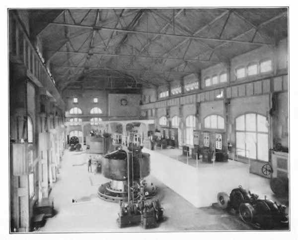 NIAGARA POWER-HOUSE (INTERIOR)
A very large part of Canada is so far north that the ordinary food-stuffs cannot be grown there; the river-valleys of British Columbia and the basin of the Saskatchewan excepted, there are but few marks of human industry beyond the fiftieth parallel. The general conditions of topography resemble those of the United States—a central plain between the high Rocky Mountain ranges in the west and the lower Laurentian ranges in the east.
Canada is an agricultural country, and because of the great skill with which its resources have been made commercially available, it is the most important colony of Great Britain. The basin of the Great Lakes and the St. Lawrence River is the most populous part of the country. This region is highly cultivated and produces dairy products, beef, and the ordinary farm-crops.
From Lake Winnipeg westward, nearly to the Rocky Mountains, the land is a succession of prairies admirably suited to wheat-growing.[56] The wheat is a hard, spring variety, and the average yield per acre is about one-fourth greater than the average yield in the United States.
The area of forestry includes the larger remaining part of the great pine belt, together with a very heavy reserve[Pg 262] of merchantable oak-timber. The part of the forest area in Canada aggregates one and one-quarter million square miles, and yields an annual product of about eighty million dollars; about one-third of the lumber is exported.
The northerly region of Canada produces furs and pelts. As long ago as 1670, Charles II. granted to Prince Rupert and a stock company the lands comprising a very large part of Canada around Hudson Bay, and secured to them the sole right to trap the fur-bearing animals of the region. In time the company, known as the Hudson Bay Company, transferred all its lands to Canada, and out of the domain thus annexed various provinces and unorganized districts have been created.
The company now exists as a corporation for the merchandise of furs. For the greater part, Indians are employed as hunters and trappers, and the pelts are collected at the various trading-posts, known as "houses" and "factories," to be sent to the head-quarters of the company near Winnipeg. Nearly every Arctic animal furnishes a merchantable pelt. The cheaper skins are made into garments in Canada and the United States; those commonly classed as furs are sold in London. Several other fur companies are also operating in Canada.
The fisheries of the coast-waters and the Great Lakes are among the most productive in the world. Everything within the three-mile limit of the shore is reserved for Canadian fishermen. The smaller bays and coves are reserved also within the three-mile limit. Beyond this limit the waters are open to all, and a fleet of swift gun-boats is necessary to prevent illicit fishing. Salmon, cod, lobsters, and herring form most of the catch, amounting in value to upward of twenty million dollars yearly.
The output of minerals varies from year to year; since 1900 it has averaged about sixty million dollars a[Pg 263] year. The gold product constitutes nearly one-half and the coal about one-sixth of the total amount. Nickel, petroleum, silver, and lead form the rest of the output. Iron ore is abundant, but it is not at present available for production on account of the distance from transportation.
Commerce is facilitated by about eighteen thousand miles of railway and nearly three thousand miles of canal and improved river-navigation. One ocean-to-ocean railway, the Canadian Pacific, is in operation; another, an extension of the Grand Trunk, is under way. The rapids and shoals of the St. Lawrence and Richelieu Rivers are surmounted by canals and locks. Welland Canal connects Lake Erie and Lake Ontario, and the Canadian lock at St. Mary's Falls joins Lake Superior to Lake Huron. By means of the lakes and canals vessels drawing fourteen feet may load at Canadian ports and discharge at Liverpool.
The harbors of the Atlantic coast have two great drawbacks—ice and high tides. Some of the steamship lines make Portland, Me., their winter terminus. The Pacific coast harbors are not obstructed by ice. An attempt has been made in the direction of using Hudson Bay and Strait as a grain-route, but the difficulties of navigation are very great and the route is open only two months of the year.
Practically all the foreign trade is carried on with Great Britain and the United States. The trade with each aggregates about one hundred and fifty million dollars yearly. The exports are lumber and wood-pulp, cheese and dairy products, wheat and flour, beef-cattle, hog products, fish, and gold-quartz. The chief imports are steel, wool, sugar, and cotton manufactures.
Politically, Canada consists of a number of provinces, each with the usual corps of elective officers. A governor-general appointed by the Crown of Great Britain is the chief executive officer.
Nova Scotia.—This province is prominent on account of its coal and iron, and also because of its geographic position. The iron and coal are utilized in steel smelteries and rolling-mills, glass-factories, sugar-refineries, and textile-mills. It is one of the few localities in the eastern part of the continent yielding gold. Halifax, the capital, has one of the best harbors of the Atlantic coast of North America; it is not often obstructed by ice, and is the chief winter port. Halifax is the principal British naval station of North America, and this fact adds much to its commercial activity.
Prince Edward Island.—The industries of this province are mainly connected with the coast-fisheries. During the summer the island is visited by thousands of fishing-vessels for the purpose of preparing the catch for market. Fertilizer manufactured from the refuse is an incidental product. Charlottetown is the capital.
New Brunswick.—Fisheries and forest products are both resources of this province. Coal is mined at Grand Lake, and an excellent lime for export to the United States is made at St. John. Lumber, wood-pulp, wooden sailing-vessels, cotton textiles, and structural steel for ship-building are manufactured. A ship railway, seventeen miles long, across the isthmus that connects this province to Nova Scotia, is under construction. St. John, the capital, is the chief seat of trade.
Quebec.—This province was once a possession of France, and in the greater part of it French customs are yet about as prevalent as they were a century ago; moreover, the French population is increasing rapidly. The English-speaking population lives mainly along the Vermont border. As a rule the English are the manufacturers and traders; the French people are the farmers.
Montreal is the head of navigation of the St. Lawrence for ocean steamships. It is also the chief centre of [Pg 265]manufactures. These are mainly sugar, rubber goods, textiles, light steel wares, and leather. The last-named goes almost wholly to Great Britain; the rest are consumed in Canada and the border American States. Quebec is the most strongly fortified city of the Dominion.
Ontario.—This province is a peninsula bordered by Lakes Huron, Erie, and Ontario. Farming is the chief employment, and barley is an important product. Most of it is used in the manufacture of malt, and "Canada malt" is regarded as the best. Several of the trunk railways whose terminals are in the United States traverse this peninsula. Toronto, the capital and commercial centre, is one of the most rapidly growing cities of North America. Hamilton owes its existence to its harbor and position at the head of Lake Ontario. Ottawa is the capital of the Dominion. At Sudbury are the nickel-mines that are among the most productive in the world.
Manitoba, Saskatchewan, and Alberta.—These provinces include the level prairie lands of the Saskatchewan and the Red River of the North. They comprise the great grain-field of Canada. A considerable part of the wheat-growing lands are yet unproductive owing to the lack of railways. Much of the product is carried to market by the Canadian Pacific and its feeders, but a considerable part finds its way to the Northern Pacific and Great Northern roads. The coal of Manitoba and Alberta is an important fuel supply not only to the provinces and states surrounding, but to the railways above named. A good quality of anthracite coal is also mined in Alberta. Winnipeg, the metropolis of the region, is one of the great railway centres of Canada.
British Columbia.—British Columbia, the Pacific coast province, has several resources of great value. The gold mines led to its settlement and commercial opening. The[Pg 266] salmon-fisheries are surpassed by those of the United States only. The beds of lignite coal have produced a very large part of the coal used in the Pacific coast States. The forests produce lumber for shipment both to the Atlantic coast of America and the Pacific coast of Asia.
Vancouver, the terminus of the Canadian Pacific Railway, is connected with various Asian ports by fast steamships. Nanaimo, Wellington, and Commox are the centres of the coal-mining industry. The copper-mines at Rossland produce most of the copper mined in Canada.
Newfoundland.—Although a Crown possession, Newfoundland is not a member of the Dominion of Canada. The extensive fisheries are its chief resource. The Labrador coast, which is used as a resort for curing and preserving the catch, is attached to Newfoundland for the purpose of government. St. Johns is the capital.
The islands of Miquelon and St. Pierre, south of Newfoundland, are a French possession. Fishing is the ostensible industry, but a great deal of smuggling is carried on.
QUESTIONS FOR DISCUSSION
What, if any, climatic or topographic boundaries separate Canada and the United States?
Which of the two countries is the more fortunately situated for the production of food-stuffs?
Which will support the larger population?—why?
The harbors of the Labrador coast and of Cape Breton Island are superior to those of the British Islands, situated in about the same latitude; why do the latter have a commerce far greater than that of the former?
Compare the industries of the eastern, middle, and western regions of Canada with the corresponding regions of the United States.
FOR COLLATERAL REFERENCE
Statesman's Year-Book.
Statistical Year-Book of Canada (official government publication, Ottawa).
Mexico and the Central American states occupy the narrow, southerly part of North America. Structurally they consist of a plateau about a mile high, bordered on each side by a low coast-plain. The table-land, or tierra templada, has about the same climate as southern California; the low coast-plains, or tierra caliente, are tropical.
Mexico.—The United States of Mexico is the most important part of this group. The people are of mixed Spanish and Indian blood, but there are many families of pure Castilian descent. The latter, in general, are the landed proprietors; the former constitute the tradesmen, herders, and peons. There is also a large unproductive class, mainly of Indians, who are living in a savage state. In general the manners and customs are those of Spain.
The agricultural pursuits are in a backward condition, partly for the want of good system and an educated people, but mainly for lack of the capital and engineering skill to construct the irrigating canals that are needed to make the land productive. Maize, rice, sugar (cane and panocha), and wheat are grown for home consumption.
The agricultural products which connect Mexico with the rest of the world are sisal-hemp (henequin), coffee, logwood, and fruit. Sisal-hemp is grown in the state of Yucatan, and has become one of its chief financial resources. Oaxaca coffee is usually sold as a "Mocha" berry. The logwood goes mainly to British textile makers;[Pg 268] and the fruit, chiefly oranges and bananas, finds a market in the large cities of the United States, to which large consignments of vanilla and tropical woods are also sent. Cattle are grown on more than twenty thousand ranches, and the greater part are sent alive to the markets of the United States. The native long-horn stock is giving place to improved breeds.
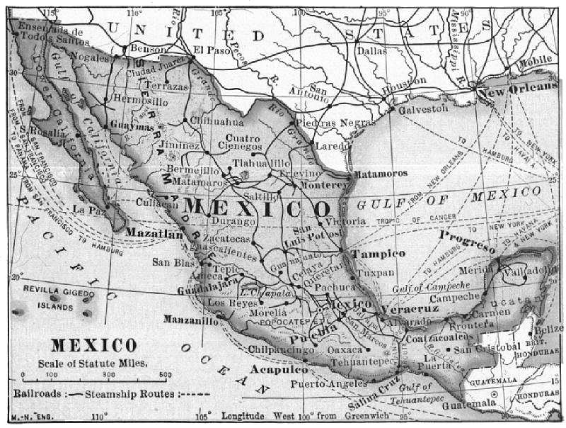 MEXICO
Gold and silver are the products that have made Mexico famous, and the mines have produced a total of more than three billion dollars' worth of precious metal. The native methods of mining have always been primitive, and low-grade ores have been neglected. In recent years American and European capital has been invested in low-grade mines, and the bullion production has been about doubled in value; it is now about one hundred million dollars yearly. Iron ore is abundant, and good coal exists.
The manufactures, at present of little importance, are growing rapidly. The cotton-mills consume the home product and fill their deficiency from the Texas crop. All the finer textiles, however, are imported. Most of the commodities are supplied by the United States, Great Britain, and Germany, the first-named having about half the trade. Most of the hardware and machinery is purchased in the United States.
Railway systems, with American terminal points at El Paso, San Antonio, and New Orleans, extend from the most productive parts of the country. One of the most important railways crosses the Isthmus of Tehuantepec, and, in order to encourage commerce, the harbors at Coatzacoalcos and Salina Cruz have been deepened and improved. This interoceanic route is destined to become a very important factor in commerce. It shortens the route between European ports and San Francisco by six thousand miles, and between New York and San Francisco by twelve hundred miles.[57]
Mexico, the capital, is the financial and commercial centre. Vera Cruz and Tampico are connected with the capital by railway, but both have very poor port facilities. Steamship lines connect the former with New York, New Orleans, Havana, and French ports. It is the chief port of the country. Matamoros on the American frontier has a considerable cattle-trade. The crop of sisal-hemp is shipped mainly from Progresso and Merida. Acapulco, Manzanillo, and Mazatlan for want of railway connections have but little trade. The first-named is one of the best harbors in the world. Guadalajara has important textile and pottery manufactures.
The Central American States.—The physical features and climate of these states resemble those of Mexico. The Spanish-speaking people live in the table-lands, where the climate is healthful. The coast-plain of the Atlantic is forest-covered and practically uninhabited save by Indians. Guatemala is the most important state. A railway from Puerto Barrios, its Atlantic port, through its capital, Guatemala, to its Pacific port, San José, is nearly completed. British Honduras is a British territory acquired mainly for the mahogany product, which is shipped from Belize. Honduras has great resources in mines, cultivable lands, and forests, but these are undeveloped. Salvador is the smallest but most progressive state.
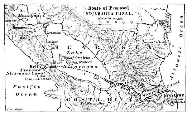 ROUTE OF PROPOSED NICARAGUA CANAL
Nicaragua is politically of importance on account of the possibilities of an interoceanic canal. A treaty for this canal, involving both Nicaragua and Great Britain, has already been signed by the powers interested. Many engineers regard the Nicaragua as preferable to that of the Panama canal. The shorter distance between New York and the Pacific ports of the United States, a saving of[Pg 271] about four hundred miles, is in its favor. The longer distance of transit and the dangers of navigating Lake Nicaragua are against it. Costa Rica is favorably situated for commerce, but its resources are not developed. A railway from Puerto Limon is nearly completed to Puenta Arenas, an excellent harbor on the Pacific side.
Coffee, hides, mahogany, and fruit are the only products of importance that connect these states with the rest of the world. About half the trade goes to the United States. The Germans and English supply a considerable part of the textiles and manufactured articles. The coffee of Costa Rica is a very superior product. Much of the mahogany and forest products goes to Great Britain. Fruit-steamers call at the Atlantic ports for bananas, which are sold in New Orleans and the Atlantic cities.
The West Indies.—The climate and productions of these islands are tropical in character. Sugar, fruit, coffee, tobacco, and cacao are the leading products. From the stand-point of the planter, the sugar industry has been a history of misfortunes. The abolition of slavery ruined the industry in many of the islands belonging to Great Britain. The competition of the beet-sugar made in Europe drove the Cubans into insurrection on account of the excessive taxes levied by the Spaniards, and ended in the Spanish-American War.
The fruit-crop—mainly pineapples, oranges, and grapefruit—is shipped to the United States. New York, Philadelphia, and the Gulf ports are the destination of the greater part of it.
Cuba, the largest island, is one of the most productive regions of the world. The famous "Havana" tobacco grows mainly in the western part, although practically all Cuban tobacco is classed under this name. According to popular opinion it is pre-eminently the best in flavor, and[Pg 272] the price is not affected by that of other tobaccos.[58] About two-thirds of the raw leaf and cigars are purchased by the tobacco manufacturers of the United States. Havana, Santiago, and Cienfuegos are the shipping-ports; most of the export is landed at New York, Key West, and Tampa.
From 1900 to 1903 the small fraction of the sugar industry that survived the war and the insurrection was crippled by the high tariff on sugar imported into the United States. The latter, which was designed to protect the home sugar industry, was so high that the Cubans could not afford to make sugar at the ruling prices in New York. Hides, honey, and Spanish cedar for cigar-boxes are also important exports.
The United States is the chief customer of Cuba, and in turn supplies the Cubans with flour, textile goods, hardware, and coal-oil. Smoked meat from Latin America and preserved fish from Canada and Newfoundland are the remaining imports. There are no manufactures of importance. The railways are mainly for the purpose of handling the sugar-crop.
Havana, the capital and financial centre, is connected with New York, New Orleans, and Key West by steamship lines. Santiago, Matanzas, and Cienfuegos are ports having a considerable trade.
The British possessions in the West Indies are commercially the most important of the European possessions. The Bahamas are low-lying coral islands, producing but little except sponges, fruit, and sisal-hemp. Nassau, the only town of importance, is a winter resort. Fruit, sugar, rum, coffee, and ginger are exported from Kingston, the port of Jamaica. St. Lucia has probably the strongest fortress in the Caribbean Sea.
Barbados produces more sugar than any other British possession in the West Indies. The raw sugar, muscovado, is shipped to the United States. Bermuda, an outlying island, furnishes the Atlantic states with onions, Easter lilies, and early potatoes. From Trinidad is obtained the asphaltum, or natural tar, that is used for street paving. Brea Lake, the source of the mineral, is leased to a New York company. Sugar and cacao are also exported from Port of Spain. The products of St. Vincent and Dominica are similar to those of the other islands.
The French own Martinique (Fort de France) and Guadeloupe (Basse Terre). St. Thomas (Charlotte Amalie), St. Croix, and St. John are Danish possessions. Various attempts to transfer the Danish islands to the United States have failed. They are admirably adapted for naval stations. The island of Haiti consists of two negro republics, Haiti and San Domingo. The only important product is coffee. Most of the product is shipped to the United States, which supplies coal oil and textiles in return.
QUESTIONS FOR DISCUSSION
What part of the United States was formerly a possession of Mexico, and how did it become a possession of the United States?
From a cyclopedia learn the character of the political organization of Mexico and the Central American states.
From the report listed below find what commercial routes gain, and what ones lose in distance by the Nicaragua, as compared with the Panama canal.
From a good atlas make a list of the islands of the West Indies; name the country to which each belongs, and its exports to the United States.
FOR COLLATERAL READING AND REFERENCE
The Statesman's Year-Book.
Great Canals of the World—pp. 4058–4059.
 SOUTH AMERICA
In its general surface features South America resembles North America—that is, a central plain is bordered by low ranges on the east and by a high mountain system on the west. In the southern part, midsummer is in January and midwinter in July. The mineral-producing states are traversed by the ranges of the Andes and all of them except Chile are situated on both slopes of the mountains.
Colombia.—This republic borders both the Caribbean Sea and the Pacific Ocean. One port excepted, however, most of its commerce is confined to the shores of the Caribbean Sea. The lowlands east of the Andes are admirably adapted for grazing, and such cattle products as hides, horns, and tallow are articles of export. This region, however, even with the present facilities for transportation, produces only a small fraction of the products possible.
The intermontane valleys between the Andean ranges have the climate of the temperate zone; wheat and sheep are produced. The chief industrial development, however, is confined to the lands near the Caribbean coast. Coffee, cacao, and tobacco are grown for export, the business of cultivation being largely controlled by Americans and Europeans. Rubber, copaiba, tolu, and vegetable ivory[59] are gathered by Indians from the forests.
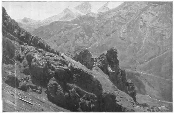 A PASS IN THE ANDES
The montane region has long been famous for its mines of gold and silver. The salt mines near Bogota are a government monopoly and yield a considerable revenue. Near the same city are the famous Muzo emerald mines.
The rivers are the chief channels of internal trade. During the rainy season steamboats ascend the Orinoco to Cabugaro, about two hundred miles from Bogota. About fifty steamboats are in commission on the Magdalena and its tributary, the Cauca. Mule trains traversing wretched trails require from one to two weeks to transport the goods from the river landings to the chief centres of population. Improvements now under way in clearing and canalizing these rivers will add about five hundred miles of additional water-way. The railways consist of short lines mainly used as portages around obstructions of the rivers.
An unstable government and an onerous system of export taxes hamper trade. Coffee, a leading product, goes mainly to Europe. Cattle products, and balsam of tolu are purchased mainly in the United States. Great Britain purchases the gold and silver ores. The chief imports—textiles, flour, and petroleum—are purchased in the United States. Bogota and Medellin are the largest cities. The isolation of the region in which they are situated shapes the indifferent foreign policy of the government. Barranquilla, Sabanilla, and Cartagena are the chief ports.
Panama.—This state, formerly a part of Colombia, includes the isthmus of Panama. Geographically it belongs to North America, and practically it can be approached from Colombia by water only. The secession of Panama was brought about by the complications of the isthmian canal. A treaty with the United States gives the latter sovereign control over the canal and the strip of land ten miles wide bordering it. Panama and Colon are the two ports of the canal. The United States exercises police and sanitary regulations in these cities, but it has no sovereignty over them.
Peru.—Peru has great resources, both agricultural and mineral. Cotton is one of the chief products. The ordinary fibre is excelled only by the sea-island cotton of the United States; the long-staple fibre of the Piura is the best grown. The former is generally employed for mixing with wool in the manufacture of underwear, and is sold in the United States and Europe; the latter, used in the manufacture of thread and the web of pneumatic tires, goes mainly to Great Britain.
Cane-sugar is a very large export crop, Great Britain, the United States, and Chile being the principal customers. The area of coffee production is growing rapidly. Coca-growing has become an important industry, and the plantations aggregate about three million trees;[60] a large part of the product is sent to the chemical laboratories of the United States. A small crop of rice for export is grown on the coast.
The Amazon forest products yield a considerable revenue. Rubber and vegetable ivory are the most valuable. Cinchona, or Peruvian bark, however, is the one for which the state is best known; and there is probably not a drug-shop in the civilized world that does not carry it in stock.[61]
Cattle are grown for their hides, and of these the United States is the chief purchaser. The wool of the llama, alpaca, and vicuña is used in manufacture of the cloth known as alpaca, and the value of the shipments to Great Britain usually exceeds one million dollars a year. In the mining regions the llama is used as a pack-animal, and a large part of the mine products reach the markets by this means of transportation. The mines yield silver and copper; in the main the ores are exported to Great Britain to be smelted.
The products already named are the chief exports; the imports are cotton textiles, machinery, steel wares, and coal-oil. Great Britain has about one-half the foreign trade; the United States controls about one-fourth. Callao, the port of Lima, is the market through which most of the foreign trade is carried on. Steamship lines connect it with San Francisco and with British ports. Mollendo is the outlet of Bolivian trade. The railways are short lines extending from the coast.
Ecuador.—This state has but little commercial importance. The only cultivated products for export are cacao, coffee, and sugar. The first-named constitutes three-fourths of the exports, and most of it goes to France. The land is held in large estates, and most of the laboring people are in a condition of practical slavery. The bread-stuffs consumed by the foreign population and the land proprietors are imported. Animals are grown for their hides and these are sold to the United States.
Another manufacture that connects Ecuador with the rest of the world is the so-called "Panama" hat. The material used is toquilla straw, the mid-rib of the screw-pine (Carlodovica palmata). The prepared straw can be plaited only when the atmosphere is very moist, and much of the work is done at night. The hats are made by Indians,[Pg 280] who are governed by their own ideas regarding style and shape. They bring from twenty-five to fifty dollars apiece in the American markets, where nearly all the product is sold.[62]
Mule-paths are the only means of inland communication. There is a considerable local traffic on the estuaries of the rivers, but this is confined to the rainy seasons. A railway built by an American company is in operation from Guayaquil, a short distance inland. This city is the chief market for foreign goods, and it is the only foreign port of the Pacific coast of South America in which the volume of trade of the United States approximates that of Germany and Great Britain.
Bolivia.—Bolivia lost much of its possible commercial possible future when, after a disastrous war, its Pacific coast frontage became a possession of Chile. The agricultural lands are unfortunately situated with reference to the mining population; as a result, a considerable amount of food-stuffs must be imported from Argentina. Coffee, cacao, and coca are the principal cultivated products. Rubber from the Amazon forest is the most valuable vegetable product, but a considerable amount of cinchona bark and ivory nuts are also exported.
The mines, however, are the chief wealth of the state and give it the only excuse for its political existence. They produce silver, tin, copper, gold, and borate of lime. Inasmuch as a large part of the ore and ore products must be transported by llamas and mules, only the richest mines can be profitably worked. With adequate means of transportation, the mines should make Bolivia one of the most powerful South American states.
Railways already connect Oruro with the sea-coast. A railway now under construction will connect La Paz (the pass) with the Pacific coast, and also Buenos Aires. Excellent roads to take the place of the pack-trains are under construction.
Practically all the imports, consisting of cotton and woollen textiles, machinery, and steel wares, are purchased in Great Britain. The exports are more than double the imports. Most of the goods pass through the Chilean port Antofagasto, or Mollendo, Peru. La Paz, Oruro, and Sucre are the chief cities.
The hypothetical state of Acré is situated in the angle where Bolivia, Peru, and Brazil join. The rubber forests, together with the absence of legal government, led to its existence. The government is wholly insurrectionary, but it at least uses its powers to encourage the rubber trade.
Chile.—This state comprises the narrow western slope of the Andes, extending from the tropic of Capricorn to Cape Horn, a distance of about three thousand miles. The resources of the state have been so skilfully handled, that with the drawback of a very small proportion of cultivable land, Chile is the foremost Andean state.
The cultivation of the ordinary crops is confined to the flood-plains of the short rivers. These, as a rule, are from twenty to fifty miles long and a mile or two in width. They are densely peopled and cultivated to the limit. Between the river-valleys are long stretches of unproductive land.
Within the valleys wheat, barley, fruit, and various food-stuffs are grown. Of these there are not only enough for home consumption, but considerable quantities are exported to Bolivia, Peru, and Ecuador. Much of the cultivable land[Pg 282] requires to be watered, and the system of irrigation has been developed with extraordinary skill. The grazing lands are extensive. In the northern part an excellent quality of merino wool is produced; the greater part of the clip, however, is an ordinary fibre. The cattle furnish a considerable amount of leather for export.
The conditions which have made the northern part a desert have also given to the state its greatest resource—nitre.[63] The nitrate occurs in the northern desert region. The crude salt is crushed and partly refined at the mines, and carried by rail to the nearest port. The working of the nitrate beds is largely carried on by foreign companies. Nearly all the product is used as a fertilizer in Germany, France, and Great Britain. Nitrate constitutes about two-thirds of the exports. Iodine and bromine are also obtained from the nitrates, and the Chilean product yields nearly all the world's supply.
Copper is extensively mined and, next to the nitrates, is the most valuable product. Great Britain is the customer for the greater part. Coal occurs in the southern part of the state, and is mined for export to the various states of the Pacific coast. It is not a good coal for iron smelting, however, and about three times as much is imported as is exported. A considerable part of the imported coal comes from Australia, and with it structural steel is made from pig-iron that is also imported.
Chile is well equipped with railways, a part of which has been built and are operated by the state. The most important line traverses the valley between the Andes and[Pg 283] the coast ranges, from Concepcion to Valparaiso. In this region are most of the manufacturing enterprises.
The imports are chiefly coal, machinery, textile goods, and sugar. The British control about two-thirds of the foreign trade; the Germans and the French have most of the remainder. The United States supplies the Chileans with a part of the textiles, a considerable quantity of Oregon pine, and practically all the coal-oil used.
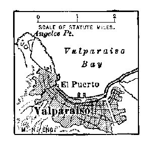 VALPARASIO
Valparaiso is the chief business centre of the Pacific coast of South America. Most of the forwarding business is carried on by British and German merchants. The transandine railway, now about completed, will make it one of the most important ports of the world. Santiago is the capital. Concepcion and Talca are important centres of trade. Chillan is the principal cattle-market of the Pacific coast of South America. Copiapo is the focal point of the mining interests. Iquique is the port from which about all the nitrates are shipped. Punta Arenas, one of the "end towns" of the world, is an ocean post-office for vessels passing through the Straits of Magellan. It is about as far south as Calgary, B.C., is north.
QUESTIONS FOR DISCUSSION
What will be the probable effect of an interoceanic canal on the commerce of these states?
From the Abstract of Statistics make a list of the exports from the United States to these countries.
From the statistics of trade in the Statesman's Year-Book compare the trade of the United States with that of other countries in these states.
How have race characteristics affected the commerce and development of these states?
What is meant by peonage?
What cities of the tropical part of these states are in the climate of the temperate zone?
FOR COLLATERAL READING AND REFERENCE
Carpenter's South America.
Vincent's Around and About South America.
Fiske's Discovery of America—Chapters IX-X.
Procure, if possible, specimens of the following: Cacao and its products, ivory nuts, cinchona bark, crude nitrate, Panama straw, iodine (in a sealed vial), llama wool, alpaca cloth, Peruvian cotton.
The eastern countries of South America are mainly lowland plains. The llanos of the Orinoco and the pampas of Plate (La Plata) River are grazing lands. The silvas of the Amazon are forest-covered. In tropical regions the coast-plain is usually very unhealthful; the seaports excepted, most of the cities and towns are therefore built on higher land beyond the coast-plain.
Venezuela.—The greater part of Venezuela is a region of llanos, or grassy plains, shut off from the harbors of the Caribbean Sea, by mountain-ranges. On account of their pleasant climate the mountain-valleys constitute the chief region of habitation. The plains are flooded in the rainy season and sun-scorched during the period of drought; they are therefore unfit for human habitation.
Coffee is cultivated in the montane region; and cacao in the lower coast lands. Almost every part of the coast lowlands is fit for sugar cultivation, and in order to encourage this industry, the importation of sugar is forbidden. As is usual in similar cases, the domestic sugar is poor in quality and high in price. Among the forest products rubber, fustic, divi-divi,[64] and tonka beans, the last used as a perfume, are the only ones of value. The cattle of the llanos, the native long-horns, furnish a poor quality of hide, and poorer beef. A few thousand head are shipped yearly down the Orinoco to be sent to Cuba and Porto Rico.
The placer gold-mines of the Yuruari country, a region also claimed by Great Britain, have been very productive. Coal, iron ore, and asphaltum are abundant. Concessions for mining the two last-named have been granted to American companies. The pearl-fisheries around Margarita Island, also leased to a foreign company, have become productive under the new management.
The means of intercommunication are as primitive as those of Colombia. Short railways extend from several seaports to the regions of production, and from these coffee and cacao are the only exports of importance. The Orinoco River is the natural outlet for the cattle-region, but the commerce of this region is small. The lagoon of Maracaibo is becoming the centre of a rapidly growing commercial region.
Caracas, the capital and largest city, receives the imports of textiles, domestic wares, flour, and petroleum from the United States and Great Britain. The railway to its port, La Guaira, is a remarkable work of engineering. Puerto Cabello, the most important port, receives the trade of Valencia. From Maracaibo, the port on the lagoon of the same name, is shipped the Venezuelan coffee. Ciudad Bolivar is the river-port of the Orinoco and an important rubber-market.
The Guianas.—The surface conditions and climate of the Guianas resemble those of Venezuela. The native products are also much the same, but good business organization has made the countries bearing the general name highly productive. For the greater part, the coast-plain is the region of cultivation. Sugar is still the most important crop; but on account of the fierce competition of beet-sugar, on many of the plantations cane-sugar cultivation is unprofitable and has been abandoned for that of rice, cacao, and tobacco. Great Britain, Holland, and France possess the country. The divisions are known respectively as British Guiana, Surinam, and Cayenne, and the trade of each accrues to the mother-country. British Guiana is noted quite as much for its gold-fields on the Venezuelan border (Cuyuni River) as for its vegetable products. Georgetown, better known by the name of the surrounding district, Demerara, is the focal point of business. New Amsterdam is also a port of considerable trade. The gold-mining interests centre at Bartica.
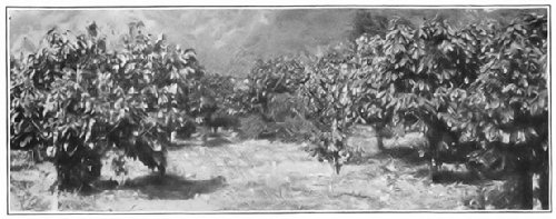 A CACAO PLANTATION
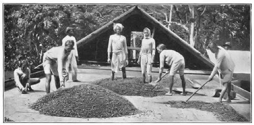 PREPARING THE BEANS FOR SHIPMENT
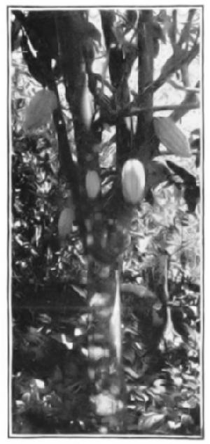 CACAO-TREE
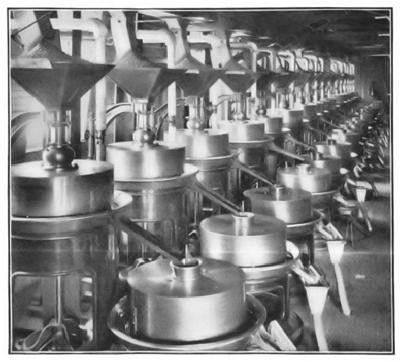 MAKING CHOCOLATE
Surinam, in addition to its export of vegetable products, contains rich gold-mines, and these contribute a considerable revenue. Paramaribo is the port and centre of trade. Phosphates and gold are among the important exports of Cayenne, whose port bears the same name.
Brazil.—This state, nearly the size of the United States, comprises about half the area of South America. Much of it, including the greater part of the Amazon River basin, is unfit for the growth of food-stuffs.
There are three regions of production. The Amazon forests yield the greater part of the world's rubber supply. The middle coast region has various agricultural products, of which cotton and cane-sugar are the most important. From the southern region comes two-thirds of the world's coffee-crop. There are productive gold-mines in the state of Minas Geraes, but this region is best known for the "old mine" diamonds, the finest produced.
The Amazon rubber-crop includes not only the crude gum obtained in Brazil, but a considerable part, if not the most, of the crop from the surrounding states. The bifurcating Cassiquiare, which flows both into Amazonian and Orinocan waters, drains a very large area of forest which yields the best rubber known. The yield of 1901 aggregated about one hundred and thirty million pounds, of[Pg 289] which about one-half was sold in the United States, one-third in Liverpool, and the rest mainly in Antwerp and Le Havre. The price of rubber is fixed in New York and London.
The cotton and cane-sugar are grown in the middle coast region. The cotton industry bids fair to add materially to the prosperity of the state. A considerable part of the raw cotton is exported, but the reserve is sufficient to keep ten thousand looms busy. About three hundred and fifty million pounds of the raw sugar is purchased by the refineries of the United States, and much of the remainder by British dealers.
The seeds of a species of myrtle (Bertholletia excelsa) furnish the Brazil nuts of commerce, large quantities of which are shipped to Europe and the United States.[65] Manganese ore is also an important export, and Great Britain purchases nearly all of it.
The coffee-crop of the southern states is the largest in the world; and about eight hundred million pounds are landed yearly at the ports of the United States. The coffee-crop, more than any other factor, has made the great prosperity of the state; for while the rubber yield employs comparatively few men and yields but little public revenue, the coffee-crop has brought into Brazil an average of about fifty million dollars a year for three-quarters of a century.
Cattle products also afford a considerable profit in the vicinity of the coffee-region. The hides and tallow are shipped to the United States. For want of refrigerating facilities, most of the beef is "jerked" (or sun-dried), and shipped in this form to Cuba.
The facilities for transportation, the rivers excepted, are poor. The Amazon is navigable for ocean steamships nearly to the junction of the Ucayale. The Paraguay [Pg 290]affords a navigable water-way to the mouth of Plate River. Rapids and falls obstruct most of the rivers at the junction of the Brazilian plateau and the low plains, but these streams afford several thousand miles of navigable waters both above and below the falls.
Nearly all the railways are plantation roads, extending from the various ports to regions of production a few miles inland. The most important railway development is that in the vicinity of Rio, where short local roads to the suburban settlements and the coffee-plantations converge at the harbor. About fourteen thousand miles of railway are completed and under actual construction. A considerable part of the mileage is owned and operated by the state, and it has become the policy of the latter to control its roads and to encourage immigration. One result of this policy is the increasing number of German and Italian colonies, that establish settlements in every district penetrated by a new road.
In 1900 the total foreign trade aggregated upward of two hundred and seventy-five million dollars. The imports consist of cotton and woollen manufactures, structural steel and machinery, preserved fish and meats, and coal-oil. Great Britain, Germany, the United States, and France have nearly all the trade. The United States sells to Brazil textiles and coal-oil to the amount of over eleven million dollars yearly, and buys of the country coffee and rubber to the amount of six times as much.
Rio de Janeiro, commonly called "Rio," is the capital and commercial centre. Its harbor is one of the best in South America. Formerly all the coffee was shipped from this port, but the greater part now goes from Santos. Porto Alegre, the port of the German colonies, has also a growing export trade.
Bahia, Pernambuco (or Recife), Maceio, Ceará are the[Pg 291] markets for cotton, sugar, and tobacco, much of which is shipped to other Brazilian ports for home consumption. Pará and Ceará monopolize nearly all the rubber trade. The position of Manaos, at the confluence of several rivers, makes it one of the most important markets of the Amazon basin, and most of the crude rubber is first collected there for shipment. Cuyaba is the commercial centre of the mining region; its outlet is the Paraguay River, and Buenos Aires profits by its trade.
Argentina and the Plate River Countries.—These states are situated in a latitude corresponding to that of the United States. The entire area from the coast to the slopes of the Andes is a vast prairie-region. As a result of position, climate, and surface the agricultural industries are the same as in the United States—grazing and wheat-growing.
Cattle-growing is the chief employment, and the cost per head of rearing stock is practically nothing. For want of better means of transportation the shipments of live beef are not very heavy; the quality of the beef is poor, and until recently there have been no adequate facilities for getting it to market.[66] A small amount of refrigerator beef and a large amount of jerked beef are exported, however. Near the markets, there are large plants in which the hides, horns, tallow, and meat are utilized—the last being converted to the famous "beef extract," which finds a market all over the world.
The sheep industry is on a much better business basis. Both the wool and the mutton have been improved by cross-breeding with good stock. As a result the trade in[Pg 292] mutton and wool has increased by leaps and bounds; and nearly three million sheep carcasses are landed at the other ports of Brazil, at Cuba, and at various European states. The wool is bought mainly by Germany and France, but the United States is a heavy purchaser. The quality of the fibre, formerly very poor, year by year is improving.
Wheat, the staple product, is grown mainly within a radius of four hundred miles around the mouth of Plate River. The area of cultivation is increasing as the facilities for transportation are extended and, little by little, is encroaching on the grazing lands. The wheat industry is carried on very largely by German and Italian colonists. Flax, grown for the seed, is a very large export crop. Maize, partly for export and partly for home consumption, is also grown.
The timber resources, chiefly in Paraguay and the Gran Chaco, are very great, but for want of means of transportation the timber-trade cannot successfully compete with that of Central America and Mexico. Workable gold and silver ores are abundant along the Andean cordillera; gold, silver, and copper are exported to Europe. A poor quality of lignite occurs in several provinces, but there are no available mines yielding coal suitable for making steam. There are petroleum wells near Mendoza.
Most of the manufactures pertain to the preparation of cattle products, although a considerable amount of coarse textiles are made in the larger cities from the native cotton and wool. Hats, paper (made from grass), and leather goods are also made. In general, all manufactures are hampered by the difficulties of getting good fuel at a low price.
Transportation is carried on along Plate River and the lower parts of its tributaries. The railway has become the chief factor in the carriage of commodities, however, and the railways of Argentina have been developed on the[Pg 293] plans of North American roads. About twelve thousand miles are in actual operation, one of which is a transcontinental line, about completed between Buenos Aires and Valparaiso. Electric railways have become very popular, and the mileage is rapidly increasing.
The import trade, consisting of textile goods, machinery, steel, and petroleum, is carried on with Great Britain, France, Germany, Belgium (mainly transit trade), the United States, and Italy. The competition between the European states for this trade is very strong, and not a little has been acquired at the expense of the United States, whose trade has not materially increased.
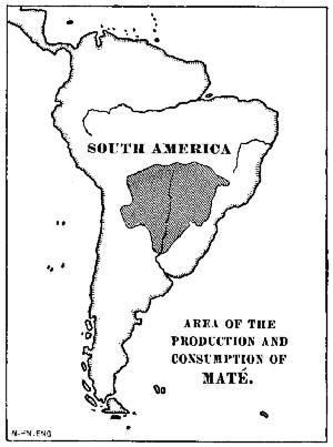 AREA OF THE PRODUCTION AND CONSUMPTION OF MATÉ
Buenos Aires is the financial centre of this part of South America. Among its industries is the largest meat-refrigerating plant in the world. The harbor at La Plata is excellent and has drawn a considerable part of the foreign trade from Buenos Aires. Rosario, Cordoba, Santa Fé, and Parana are the markets of extensive farming regions. Mendoza is the focal point of the mining interests.
Paraguay has a large forest area, but for want of means of transportation it is without value. Even the railway companies find it cheaper to buy their ties in the United States and Australia, rather than to procure them in Paraguay. In spite of the extent of good land, the[Pg 294] wheat and much of the bread-stuffs are purchased from Argentina. Tobacco and maté are the only export crops, and they have but little value. The Parana and Paraguay Rivers are the only commercial outlet of the state.
Uruguay.—Owing to its foreign population Uruguay is becoming a rich country. The native cattle have been improved by cross-breeding with European stock, and the state has become one of the foremost cattle and sheep ranges of the world. The value of animal products is not far from forty million dollars yearly. These go mainly to Europe, and so also does the wheat-crop.
France and Argentina purchase most of the exports and Great Britain supplies most of the textiles and machinery imported. The trade of the United States is about one-fourth that of Great Britain. Montevideo is the chief market and port. At Fray Bentos is one of the largest plants in the world for the manufacture of cattle products.
QUESTIONS FOR DISCUSSION
What kind of commerce has led to the establishment of the various ports along the Spanish Main?
What advantages has the American fruit-shipper, trading at South American ports, over his European competitor?
What is meant by "horse latitudes," and what was the origin of the name?
In what way may the opening of an interoceanic canal affect the coffee-trade of Brazil?—the nitrate trade of Chile?
FOR COLLATERAL READING AND REFERENCE
From the Abstract of Statistics find the exports of the United States to each of these countries.
From the Statesman's Year-Book compare the trade of the United States in each of these countries with that of Great Britain, France, Germany, and Italy.
If possible, obtain specimens of the following: Crude rubber, pampas grass, Brazil nuts (in pod), and raw coffee of several grades for comparison with Java and Mocha coffees.
Almost all the commercial activity of Europe is south of the parallel and west of the meridian of St. Petersburg. Most of the great industries are controlled by Germanic and Latin peoples, and among these Great Britain and Germany stand first.
Great Britain and Ireland.—The United Kingdom, or Great Britain and Ireland, are commonly known as the British Isles. The British Empire consists of the United Kingdom and its colonial possessions; it includes also a large number of islands occupied as coaling stations and for strategic purposes. All told, the empire embraces about one-seventh of the land area of the world and about one-fourth its population.
The wonderful power and great commercial development is due not only to conditions of geographic environment but also to the intelligence of a people who have adjusted themselves to those conditions. The insular position of the United Kingdom has given it natural protection, and for more than eight hundred years there has been no successful invasion by a foreign power. Its commercial position is both natural and artificial. It has utilized the markets to the east and south, and has founded great countries which it supplies with manufactured products.
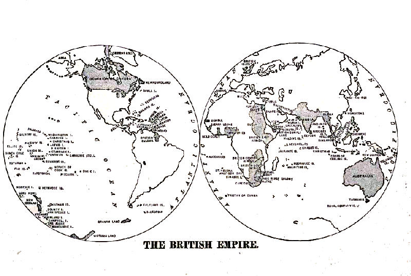 THE BRITISH EMPIRE
The position of the kingdom with respect to climate is fortunate. The movement of the Gulf Stream on the American coast carries a large volume of water into the latitude of the prevailing westerly winds, and these in turn carry warm water to every part of the coast of the islands. As a result, the harbors of the latter are never obstructed by ice; those of the Labrador coast, situated in the same latitude, are blocked nearly half the year.
The high latitude of the islands is an advantage so far as the production of food-stuffs is concerned. The summer days in the latitude of Liverpool are very nearly eighteen hours in length, and this fact together with the mild winters, adds very largely to the food-producing power of the islands.
The highlands afford considerable grazing. Great care is taken in improving the stock, both of cattle and sheep. In the north the cattle are bred mainly as meat producers; in the south for dairy products. Durham, Alderney, and Jersey stock are exported to both Americas for breeding purposes. The sheep of the highlands produce the heavy, coarse wool of which the well known "cheviot" and "frieze" textiles are made. Elsewhere they are bred for mutton, of which the "South Down" variety is an example.
The lowland regions yield grain abundantly where cultivated. The average yield per acre is about double that of the United States, and is surpassed by that of Denmark only. Both Ireland and England are famous for fine dairy products. These are becoming the chief resource of the former country, which is practically without the coal necessary for extensive manufacture. The fishing-grounds form an important food resource.
The cultivated lands do not supply the food needed for consumption. The grain-crop lasts scarcely three months; the meat-crop but little longer. Bread-stuffs from the United States and India, and meats from the United States, Australia, and New Zealand make up the shortage.[Pg 298] The annual import of food-stuffs amounts to more than fifty dollars per capita.
The growing of wool and flax for cloth-making became an industry of great importance just after the accession of Henry VII. With the advent of peace, it became possible to manufacture into cloth the fibres that before had been sent for that purpose to Flanders. The utilization of the coal and the iron ore years afterward brought about an economic revolution that was intensified by the invention of the steam-engine and the power-loom.
These quickly brought the country into the foremost rank as a manufacturing centre. Moreover, they also demanded the foreign markets that have made the country a maritime power as well—for an insular country must also have the ships with which to carry its merchandise to its markets.
The development of the manufactures, therefore, is inseparably connected with that of the mineral and metal industries. From very early times the metal deposits of the country have been a source of power. Copper and tin were used by the aboriginal Britons long before Cæsar's reconnaissance of the islands, and it is not unlikely that the Bronze Period was the natural development that resulted from the discovery of these metals.
Coal occurs in various fields that extend from the River Clyde to the River Severn. The annual output of these mines at the close of the century was about two hundred and twenty-five million tons. In the past century the inroads upon the visible supply were so great that the output in the near future will be considerably lessened. Not far from one-sixth of the output is sold to consumers in Russia and the Mediterranean countries, but a growing sentiment to forbid any sale of coal to foreign buyers is taking shape.
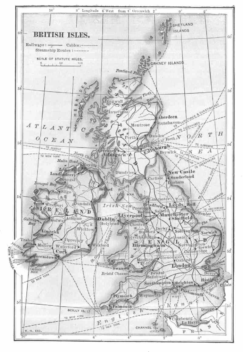 BRITISH ISLES
Iron ores are fairly abundant, but the hematite required for the best Bessemer steel is limited to the region about Manchester and Birmingham. The shortage of this ore has become so apparent within recent years that Great Britain has become a heavy purchaser of ores in foreign markets. The coal in the Clyde basin is employed mainly in the manufacture of railway iron, steamship material, and rolling stock. The manufacture of Bessemer steel is gradually moving to the vicinity of South Wales, at the ports of which foreign pig-iron can be most cheaply landed. In west-central England the several coal-fields form a single centre of manufacture, where are located some of the largest woollen and cotton mills in Europe. It also includes the plants for the manufacture of machinery, cutlery, and pottery.
The import trade of Great Britain consists mainly of food-stuffs and raw materials.[67] Of the latter, cotton is by far the most important. Most of it comes from the United States, but the Nile delta, Brazil, the Dekkan of India, the Iran plateau, and the Piura Valley of Peru send portions, each region having fibre of specific qualities designed for specific uses. The native wool clip forms only a small part of the amount used in manufacture. The remainder, more than three million pounds, comes from Australia, New Zealand, and South Africa.
The supply of flax is small, and 100,000 tons are imported to meet the wants of the mills. The greater part is purchased in Russia, but the finer quality is imported from Belgium. Jute is purchased from India and manufactured into burlap and rugs.
But little available standing timber remains, and lumber[Pg 301] must, therefore, be imported. The pine is purchased mainly in Sweden, Norway, Canada, and the United States. A considerable amount of wood-pulp is imported from Canada for paper-making. Mahogany for ornamental manufactures is obtained from Africa and British Honduras. Oak, and the woods for interior finish, are purchased largely from Canada and the United States.
The export trade of Great Britain consists almost wholly of the articles manufactured with British coal as the power. These are made from the raw materials purchased abroad, and the stamp of the British craftsman is a guarantee of excellence and honesty. Of the total export trade, amounting yearly to about one billion, two hundred million dollars, nearly one-third consists of cotton, woollen, linen, and jute textiles; one-fifth consists of iron and steel manufactured stuffs made from British ores. About one-third goes to the colonies of the mother-country, with whom she keeps in close touch; Germany, the United States, and the South American states are the chief foreign buyers.
For the handling and carriage of these goods there is an admirable system of railways reaching from every part of the interior to the numerous ports. The rolling stock and the locomotives are not nearly so heavy as those used in the United States; the railway beds and track equipment, on the whole, are probably the best in the world. Freight rates are considerably higher than on the corresponding classes of merchandise in the United States. The public highways are most excellent, but the means of street traffic in the cities are very poor.
The harbor facilities at the various ports are of the best. The docks and basins are usually arranged so that while the import goods are being landed the export stuffs are made ready to be loaded. The facilities for the rapid transfer of freights have been improved by the [Pg 302]reconstruction of the various river estuaries so as to make them ship-channels. The estuaries of the Clyde, Tyne, and Mersey have been thus improved, while Manchester has been made a seaport by an artificial canal. The British merchant marine is the largest in the world, and about ninety per cent. of the vessels are steamships.
London is the capital; it is also one of the first commercial and financial centres of the world. The Thames has not a sufficient depth of water for the largest liners, and these dock usually about twenty miles below the city. The colonial commerce at London is very heavy, especially the India traffic, and it is mainly for this trade that the British acquired the control of the Suez Canal.
Liverpool is one of the most important ports of Europe, and receives most of the American traffic. The White Star and Cunard Lines have their terminals at this port.
Southampton is also a port which receives a large share of American traffic. The American and several foreign steamship lines discharge at that place. Hull and Shields have a considerable part of the European traffic. Glasgow is one of the foremost centres of steel ship-building. Cardiff and Swansea are ports connected with the coal and iron trade. Queenstown is a calling point for transatlantic liners.
Manchester is both a cotton port and a great market for the cotton textiles made in the nearby towns of the Lancashire coal-field. Leeds and Bradford and the towns about them are the chief centres of woollen manufacture. Wilton and Kidderminster are famous for carpets. Birmingham is the centre of the steel manufactures. Sheffield has a world-wide reputation for cutlery. In and near the Staffordshire district are the potteries that have made the names of Worcester, Coalport, Doulton, Copeland, and Jackfield famous. Belfast is noted for its linen textiles,[Pg 303] and also for some of the largest steamships afloat that have been built in its yards. Dundee is the chief centre of jute manufacture.
The German Empire.—The German Empire consists of the kingdoms of Prussia, Bavaria, Saxony, and Würtemburg, together with a number of small states. The "free" cities of Hamburg, Bremen, and Lübeck, whose independence was purchased in feudal times, are also incorporated within the empire. The present empire was formed in 1871, at the close of the war between Germany and France. The merging of the states into the empire was designed as a political step, but it proved a great industrial revolution as well.
The plain of Europe which slopes to the north and the Baltic Sea, the flood-plains of the rivers excepted, is feebly productive of grain. It is a fine grazing region, however, and the dairy products are of the best quality. Among European states Russia alone surpasses Germany in the number of cattle grown. The province of Schleswig-Holstein is famous the world over for its fine cattle. Cavalry horses are a special feature of the lowland plain, and the government is the chief buyer. The wool product has hitherto been important, but the sheep ranges are being turned into crop lands, on account of the increase of population in the industrial regions.
The midland belt, however, between the coast-plain and the mountains, is the chief food-producing part of Germany. Rye and wheat are grown wherever possible, but the entire grain-crop is consumed in about eight months. The United States, Argentina, and Russia supply the wheat and flour; Russia supplies the rye.
 GERMANY AND SCANDINAVIAN COUNTRIES
The sugar-beet is by far the most important export crop, and Germany produces yearly about one million, eight hundred thousand tons, or nearly as much as Austria-Hungary and France combined. This industry is encouraged by a bounty paid on all sugar exported.[68] A considerable amount of raw beet-sugar is sold to the refineries of the United States; Great Britain also is a heavy buyer. The home consumption is relatively small, being about one-third per capita that of the United States. Silesia, the Rhine Valley, and the lowlands of the Hartz Mountains are the most important centres of the sugar industry.
Germany is rich in minerals.[69] Zinc occurs in abundance, and the mines of Silesia furnish the world's chief supply. Most of the lithographic stone in use is obtained in Bavaria. Copper and silver are mined in the Erz and Hartz Mountains. During the sixteenth century the mines of the latter region brought the states then forming Germany into commercial prominence and thereby diverted the trade between the North and Mediterranean Seas to the valleys of the Rhine and Elbe Rivers.
These two metal products made Germany a great financial power. The Franco-Prussian War added to Germany the food-producing lands of the Rhine and Moselle, and the provinces of Alsace and Lorraine. At the same time it gave the Germans organization by welding the various German states into an empire. As a result there has been an industrial development that has placed Germany in the class with the United States and Great Britain.
By unifying the various interstate systems of commerce and transportation, the iron and steel industry has greatly expanded. The chief centre of this industry is the valley of the Ruhr River. Coal-measures underlie an area somewhat larger than the basin of the river. To the industrial[Pg 306] centres of this valley iron ore is brought by the Rhine and Moselle barges from Alsace-Lorraine and Luxemburg, and also from the Hartz Mountains.
In the importance and extent of manufactures, Germany ranks next to Great Britain among European states, and because of the extent of their coal-fields the Germans seem destined in time to surpass their rivals. The manufacture of textiles is one of the leading industries, and, next to Great Britain, Germany is the heaviest purchaser of raw cotton from the United States. The Rhine district is the chief centre of cotton textile manufacture. Raw cotton is delivered to the mills by the Rhine boats, and these carry the manufactured product to the seaboard. Central and South America are the chief purchasers.
Woollen goods are also extensively manufactured, the industry being in the region that produces Saxony wool. In Silesia and the lower Rhine provinces there are also extensive woollen textile manufactures, but the goods are made mainly from imported wool. Argentina and the other Plate River countries are the chief buyers of these goods. There is a considerable linen manufacture from German-grown flax, and silk-making, mainly from raw silk imported from Italy.
The great expansion and financial success of the manufacturing enterprises is due very largely to the admirable organization of the lines of transportation. The rivers, with their connecting canals, supplement the railways instead of competing with them. They are utilized mainly for slow freights, while the railways carry the traffic that demands speed. The possibilities of both inland water-ways and railway transportation have been utilized by the Germans to the utmost, with the result of a very low rate both for coal and ore, and for structural iron and steel. The latter is carried from the various steel-making plants in the Ruhr Valley to the seaboard at a rate of eighty to ninety cents per ton.[70]
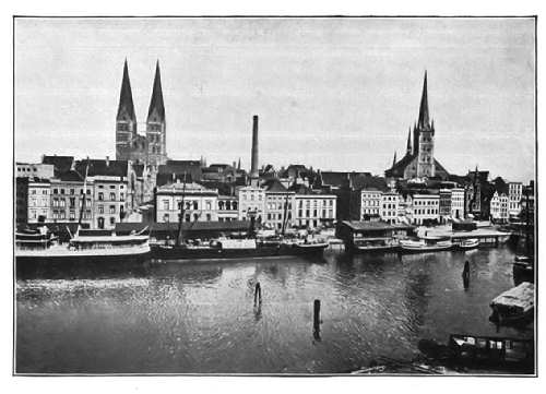 LÜBECK
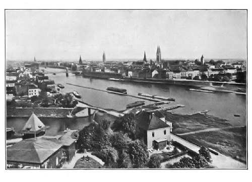 BREMEN
All this has resulted in a wonderful commercial expansion of the empire. In 1875 Germany was neither a maritime nor a naval power. At the close of the century it ranked about with the United States as a naval power, and far surpassed that country in the tonnage of merchant marine. The German steamship fleet includes the largest and fastest vessels afloat.
German trade may be summed up as an export of manufactured goods and an import of food-stuffs and raw materials. At the close of the century the annual movement of industrial products amounted to nearly two and one-half billion dollars. About one-half the trade of the empire is carried on with Great Britain, the United States, Austria-Hungary, and Russia. A large part of the foreign trade is carried on through the ports of Belgium and Holland.
Berlin, the capital, is one of the few cities having a population of more than one million. It is not only a great centre of trade, but it is one of the leading money-markets of Europe; it is also the chief railway centre. Hamburg and Bremen are important ports of German-American trade, the former being the largest seaport of continental Europe. Breslau is an important market, into which the raw materials of eastern Europe are received, and from which they are sent to the manufacturing districts. The art galleries of Dresden have had the effect of making that city a centre of art manufactures which are famous the world over. Lübeck is one of the free cities that was formerly in the Hanse League.
The twin cities, Barmen-Eberfeld, in the Ruhr coal-field, form one of the principal centres of cotton manufacture in[Pg 309] the world. Dortmund is a coal-market. At Essen are the steel-works founded by Herr Krupp. They are the largest and one of the most complete plants in the world. The output includes arms, heavy and light ordnance, and about every kind of structural iron and steel used. About forty thousand men are employed. Chemnitz is an important point, not only of cotton manufacture, but also of Saxony wools, underwear and shawls being its most noteworthy products. At Stettin, Danzig, and Kiel are built the steamships that have given to Germany its great commercial power.
QUESTIONS FOR DISCUSSION
In what ways are Great Britain and Germany commercial rivals?
What are the advantages of each with respect to position?—with respect to natural resources?
From the Statesman's Year-Book make a list of the leading exports of each;—the leading imports of each. What exports have they in common?
From the Abstract of Statistics find what commodities the United States sells to each.
FOR COLLATERAL READING AND REFERENCE
Adams's New Empire—Chapter III.
Gibbins's History of Commerce—Book III, Chapters III-V.
These states, like Great Britain and Germany, belong to Germanic Europe, and their situation around the North and Baltic Seas makes their commercial interests much the same. From the stand-point of commerce Holland might be regarded as an integral part of Germany, inasmuch as a large part of the foreign commerce of Germany must reach the sea by crossing that state.
Sweden and Norway.—Sweden and Norway occupy the region best known as the Scandinavian peninsula. The western side faces the warm, moist winds of the Atlantic, but the surface is too rugged to be productive. The lands suitable for farming, on the other hand, are on the east side, where, owing to the high latitude, the winters are extremely cold.
The plateau lands are in the latitude of the great pine-forest belt that extends across the two continents. The forests of the Scandinavian peninsula are near the most densely peopled part of Europe, and they are also readily accessible. Moreover, the rugged surface offers unlimited water-power. As a result Norway and Sweden practically control the lumber-market of Europe, and their lumber products form one of the most important exports of the kingdom. Norway pine competes with California redwood in Australia. The "naval stores," tar and pitch, compete with those of Georgia and the Carolinas. The wood-pulp from this region is the chief supply of the[Pg 311] paper-makers of Europe. Next to Russia, Sweden has the largest lumber-trade in Europe. The Mediterranean states are the chief buyers.
The mineral products are a considerable source of income. Building stone is shipped to the nearby lowland countries. The famous Swedish manganese-iron ores, essential in steel manufacture, are shipped to the United States and Europe. For this purpose they compete with the ores of Spain and Cuba. The mines of the Gellivare iron district are probably the only iron-mines of consequence within the frigid zone. The ore is sent to German and British smelteries.
The fisheries are the most important of Europe, and this fact has had a great influence on the history of the people. Centuries ago the people living about the vigs or fjords of the west coast were compelled to depend almost wholly on the fisheries for their food-supplies. As a result they became the most famous sailors of the world. They established settlements in Iceland and Greenland; they also planted a colony in North America 500 years before the voyage of Columbus. Herring, salmon, and cod are the principal catch of the fisheries, and about four-fifths of the product is cured and exported to the Catholic European states and to South America.
South of Kristiania farming is the principal industry. Much of the land is suitable for wheat-growing, but the productive area is so small that a considerable amount of bread-stuffs must be imported from the United States. On account of the high latitude the winters are too long and severe for any but the hardiest grains. Dairy products are commercially the most important output of the farms, and they find a ready market in the popular centres of Europe—London, Hamburg, Paris, and Berlin.
The lumber, furniture, matches, fish, ores, and dairy[Pg 312] products sold abroad do not pay for the bread-stuffs, coal, petroleum, clothing, and machinery. In part, this is made up by the carrying trade of Norwegian vessels; the rest of the deficit is more than met by the money which the throngs of tourists spend during the summer months.
The United States buys from these countries fish and ores to the amount of about three million dollars a year; it sells them cotton, petroleum, bread-stuffs, and machinery to the amount of about twelve million dollars.
Stockholm, the capital of Sweden, is the chief financial and distributing centre of the Scandinavian trade. Its railway system reaches about every area of production. Although having a good harbor of its own, it must depend on Trondhjem (Drontheim) for winter traffic, because the Baltic ports are closed by ice three or four months of the year. Kristiania, the capital of Norway, is the export market of the fish and lumber products.
Göteborg, owing to recently completed railway and canal connections, is becoming an important port of trade. It is convenient to other European ports, and it is rarely closed by ice. Bergen, Trondhjem, and Hammerfest derive a heavy income from their fisheries and likewise from the tourists who visit the coast during midsummer. The last-named port, although farther north than any town in the world, has an open harbor during the winter.
Denmark.—Denmark is essentially an agricultural state, and almost every square mile of available land is under cultivation. Even the sand-dunes have been reclaimed and converted into pasturage. The yield of wheat is greater per acre than in any other country, but as only a small area is sown, wheat and flour are imported.
About half the area of the state is used in growing fodder for horses and cattle. The dairy products, especially butter, are unrivalled elsewhere in Europe. The dairy[Pg 313] business is largely controlled by a cooperative association of dairymen and farmers. Pastures, fodder, cattle, sheds, creameries, and all the processes involved are subject to a most rigid sanitary inspection.
Copenhagen, the capital, is the financial centre of the kingdom. Commercially it is one of the most important ports of Europe. Various shipments consigned to Baltic ports are landed at this city; here the cargoes break bulk and are again trans-shipped to their destination. In order to facilitate this forwarding business, the Crown has made Copenhagen a free port. Steamship lines connect it with New York, British ports, and the East Indies.
A great deal of farming and dairy machinery is manufactured; coal, cotton goods, and structural machinery are imported from the United States. Little, however, is exported to that country, almost all the dairy products being sold to Great Britain and other populous centres of western Europe. Aalborg and Aarhuus are dairy-markets.
Greenland and Iceland are colonies of Denmark, and the fishing industry of the kingdom is carried on mainly along the shores of these islands. The furs, seal-skins, seal-oil, and eider-down of Greenland are a government monopoly. The mineral cryolite occurs at Ivigtut and is mined by soda-making establishments in the United States. Iceland produces sheep, cattle, and fish; these are shipped from Reikiavik. The Faroe Islands produce but little save wool, feathers, and birds' eggs.
Belgium.—Probably in no other country of Europe has nature done so little and man so much to make a great state as in Belgium. The lowland region has been made so fertile by artificial means that it yields more wheat per acre than any other country except Denmark. The Ardennes highland in the southeast is naturally unproductive, but it has become one of the great manufacturing[Pg 314] centres of Europe. Less than one-twelfth of the area of the state is unproductive.
The coast, more than twoscore miles in extent, has not a single harbor for large vessels, and the two navigable rivers, the Scheldt and Meuse, flow into another state before reaching the sea.
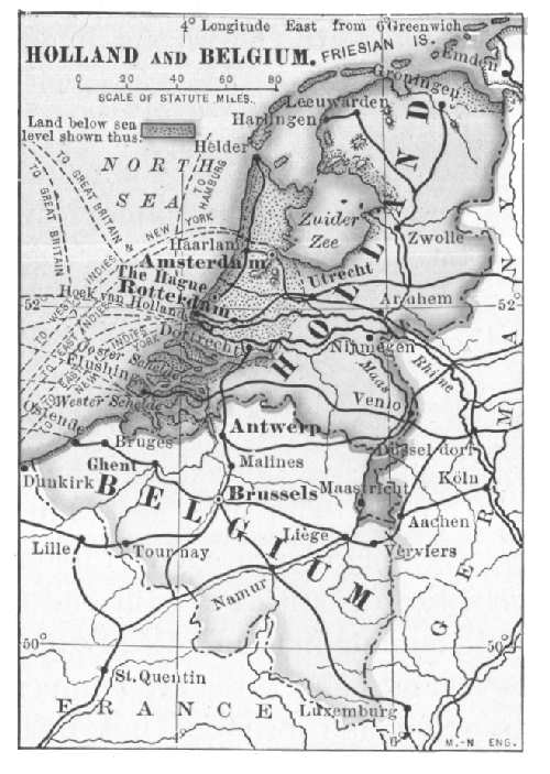 HOLLAND AND BELGIUM
The low sand-barrens next the coast have been reclaimed by means of a grass that holds in place the sand that formerly shifted with each movement of the wind. This region is now cultivated pasture-land that produces the finest of horses, cattle, and dairy products. The dairy products go mainly to London. The Flemish horses, like those of the sand-barrens of Germany and France, are purchased in the large cities, where heavy draught-horses are required. Many of them are sold to the express companies of the United States.
Bordering the sand-barrens is a belt of land that produces grain and the sugar-beet. Flax is an important product, and its cultivation has had much to do with both the history and the political organization of the state. Before the advent of the cotton industry, woollen and linen were practically the only fibres used in cloth-making. Belgium was then the chief flax-growing and cloth-making[Pg 315] country, and all western Europe depended upon the Flemish looms for cloth. This industry, therefore, gave the country not only commercial prominence, but was largely responsible for its political independence as well. Flax is still an important product, and the linen textiles made in the state are without a superior. Much of the flax is grown in the valley of the River Lys.
One of the most productive coal-fields of Europe stretches across Belgium, and a few miles south of it are the iron-ore deposits that extend also into Luxemburg and Germany. In addition to these, the zinc-mines about Moresnet are among the richest in the world. Belgium is, therefore, one of the great metal-working centres of Europe. A small portion of the coal is exported to France, but most of it is required in the manufactures.
Liège, Seraing, and Verviers are the great centres of the metal industry. They were built at the eastern extremity of the coal-field, within easy reach of the iron ores. Firearms, railroad steel, and tool-making machinery are the chief products of the region, and because of the favorable situation, these products easily compete with the manufactures of Germany and France.
Ghent is the chief focal point for the flax product, which is converted into the finest of linen cloth and art fabrics. Much of the weaving and spinning machinery employed in Europe is made in this city. Mechlin and the villages near by are famous the world over for hand-worked laces.
Expensive porcelains, art tiles, glassware, and cheap crockery are made in the line of kilns that reaches almost from one end of the coal-field to the other; these products, moreover, are extensively exported.
The railways are owned and operated by the state. They are managed so judiciously, moreover, that the rates of carriage are lower than in most European states. The[Pg 316] Scheldt is navigable for large ocean steamers to Antwerp, and this city is the great Belgian port for ocean traffic. The city owes its importance to its position. One branch of the Scheldt leads toward the Rhine; the other is connected by a canal with the rivers of France; the main stem of the river points toward London. It is therefore the meeting of three ways. It is the terminal of the steamships of American, and of various other lines. It is also the depot of the Kongo trade. Ship-canals deep enough for coasters and freighters connect Ghent, Bruges, and Brussels with tide-water. These are about to be converted to deep-water ship-canals.
The foreign commerce of Belgium is much like that of other European states. Wheat, meat, maize, cotton, and petroleum are imported mainly from the United States; iron ore is purchased from Luxemburg and Germany, and various raw materials are brought from France. In exchange there are exported fine machinery, linen fabrics, porcelains, fire-arms, glassware, and beet-sugar. From the Kongo state, at the head of which is the King of the Belgians, are obtained rubber and ivory. The rubber is sold mainly to the United States.
Brussels is the capital and financial centre. On account of the state control of the railways, it is also the directive centre of all the industries pertaining to commerce and transportation.
Holland.—The names Holland and Netherlands mean "lowland," and the state itself has a lower surface than any other country of Europe. Nearly half the area is at high-tide level or else below it. A large part, mainly the region about the Zuider[71] Sea, has been reclaimed from the sea.
In the reclamation of these lands stone dikes are built[Pg 317] to enclose a given area, and from the basin thus constructed the water is pumped. The reclaimed lands, or "polders," include not only the sea-bottom, but the coast marshes as well; even the rivers are bordered with levees in order to prevent overflows. Windmills are the machinery by which the water is pumped from the polders into the sea. In no other part of the world is wind-power so extensively used. Almost every acre of the polders is under cultivation, and these lands grow a very large part of the vegetables and flowers consumed in the great cities of England, France, and Belgium.
The coast sand-barrens have been converted into pasture-lands that produce draught-horses, beef cattle, and dairy cattle. The horses find a ready market in the United States and the large European cities; the dairy cattle not needed at home are exported, the United States being a heavy purchaser. The beef cattle are grown mainly for the markets of London. Dutch butter is used far beyond the boundaries of the state, and Edam cheese reaches nearly every large city of Europe and America.
The sugar-beet is extensively cultivated, in spite of the great trade resulting from the cane-sugar industry of the East Indies. It is more profitable to import wheat from the United States and rye from Russia in order to use the land for the sugar-beet.
Practically no timber suitable for lumber manufacture exists, and building material therefore must be imported. Pine is purchased from Russia, Scandinavia, and the United States. Stone is purchased wherever it may be obtained as return freight, or as ballast. The coast fisheries yield oysters, herrings, and "anchovies," which are not anchovies, but sprats.
For want of coal and iron there are few manufactures, and the garden and dairy products are about the only [Pg 318]export articles. There is an abundance of clay, and of this brick for road-making, tiles for building purposes, and porcelains are made. But little of the raw sugar is refined; most of it is sold to foreign refiners, and the United States is one of the chief customers.
Holland is a great commercial country, and for more than five hundred years the Dutch flag has been found in almost every large port of the world. Much of the commerce is derived from the tobacco, sugar, and coffee plantations of the Dutch East Indies.
A very large part of the commerce, however, is neither import or export trade, but a "transit" commerce. Thus, American coal-oil is transferred from the great ocean tank-steamers to smaller tank-boats, and is then carried across the state into Germany, France, and Belgium, through the numerous canals.
This trade applies also to many of the products of the German industries which will not bear a heavy freight tariff, such as coal, ores, etc. It reaches the Rhine and Rhone river-basins and extends even to the Danube. Both Switzerland and Austria-Hungary send much of their exports through Holland. All trade at the various ports and through the canals is free, it being the policy to encourage and not to obstruct commerce.
Amsterdam, the constitutional capital, is one of the great financial and banking centres of Europe. The completion of the Nord Holland canal makes the docks and basins accessible to the largest steamships. Diamond-cutting is one of the unique industries of the city. Since the discovery of the African mines its former trade in diamonds has been largely absorbed by London.
More than half the carrying trade of the state centres at Rotterdam. By the improvement of the river estuaries and canals this city has become one of the best ports of[Pg 319] Europe, and the tonnage of goods handled at the docks is enormously increasing. Vlissingen (Flushing) and the Hook are railway terminals that handle much of the local freights consigned to London. Delft is famous the world over for the beautiful porcelain made at its potteries.
QUESTIONS FOR DISCUSSION
How has the topography of each of these states affected its commerce?
How is their commerce affected by latitude and climate?
How has the cultivation of the sugar-beet affected the cane-sugar industry in the British West Indies?
From the Statesman's Year-Book make a list of the leading exports and imports of each country.
From the Abstract of Statistics find the trade of the United States with each of these countries.
FOR COLLATERAL READING AND REFERENCE
Adams's New Empire—pp. 153–159.
Gibbins's History of Commerce—Book III, Chapters I and VIII.
The Mediterranean states are peopled mainly by races whose social and economic development was moulded largely by the Roman occupation of the Mediterranean basin for a period of more than one thousand years. The occupations of the people have been shaped to a great extent by the slope of the land and by the mountain-ranges that long isolated them from the Germanic peoples north of the Alps.
France.—The position of France with respect to industrial development is fortunate. The North Sea coast faces the ports of Great Britain; the Atlantic ports are easily accessible to American centres of commerce; the Mediterranean ports command a very large part of the trade of that sea.
The easily travelled overland routes between the Mediterranean and North Seas in very early times gave the country a commercial prominence that ever since has been retained. Even before the time of Cæsar it was a famous trading-ground for Mediterranean merchants, and the conquest of the country was not so much for the spoils of war as for the extension of Roman commercial influence.
The greater part of France is an agricultural region, and nowhere is the soil cultivated with greater skill. Although the state is not quite as large as Texas, there are more farms than in all the United States, their small size making thorough cultivation a necessity. Much of the land is[Pg 321] too valuable for wheat-farming, and so the eastern manufacturing districts depend upon the Russian wheat-farms for their supply. Northwestern France, however, has a surplus of wheat, and this is sold to Great Britain.
 FRANCE
The sugar-beet is the most profitable crop, and its cultivation is aided indirectly by the government, which gives a bounty on all exported sugar. The area of sugar-beet cultivation will probably increase to its limit for this reason.
The French farmer is an artist in the cultivation of small fruits, and the latter form an important source of[Pg 322] revenue. Of the fruit-crop, the grape is by far the most important commercially. French wines, especially the champagnes, are exported to a greater extent than the wines of any other country.[72] Most of the wine is sold in Great Britain and the countries north of the grape belt; a considerable part is sold in the United States and the eastern countries. Champagne, Bordeaux, the Loire, and the Rhone Valleys are famous wine districts. Wine is also imported, to be refined or to be made into brandy.
Cattle-breeding, both for meat and for dairy purposes, is extensively carried on. The meat is consumed at home. Butter is an important export, especially in the northwest, where a large amount is made for London consumers. This region produces Camembert and Neufchatel cheese, both of which are largely exported; Brie cheese is made chiefly along the German border. The Roquefort product, made of ewe's milk, is fermented in limestone caves and cellars. All these varieties have a large sale, the United States and Great Britain being heavy purchasers.
The Percheron draught-horse is raised for export as well as for home use; mules are extensively raised for the army wagon-trains of Great Britain and Germany. Sheep are grown for the finer grades of wool, but so much of the sheep pasture has been given to the cultivation of the sugar-beet, that a considerable part of the woollen textiles are now made of wool imported from Argentina. A large part of the eggs and table poultry consumed in London are products of northwestern France.
The coal-fields of the north produce nearly two-thirds of the total amount consumed. Iron ores are found near the German border; they are sent to coal-fields in the neighborhood of St. Étienne and Le Creuzôt to be manufactured into steel. Both coal and iron ore are deficient. To meet the requirements of consumption, the former is imported from Great Britain, Germany, and Belgium; the latter, mainly from Germany and Spain.
The manufactures of France have a wide influence. From the coal and iron are derived the intricate machinery that has made the country famous, the railways, the powerful navy, and the merchant marine that has made the country a great commercial nation. Because of the great creative skill and taste of the people, French textiles are standards of good taste, and they find a ready market in all parts of the world. In textile manufactures more than one million people and upward of one hundred thousand looms are employed.
The United States is a heavy buyer of the woollen cloths and the finer qualities of dress goods. Inasmuch as these goods have not been successfully imitated elsewhere, the French trade does not suffer from competition. The best goods are made from the fleeces of French merino sheep, and are manufactured mainly in the northern towns. The Gobelin tapestries of Paris are famous the world over.
The cotton manufactures depend mainly on American cotton. About two-thirds of the cotton is purchased in the United States, a part of which returns in the form of fine goods that may be classed as muslins, tulles, and art textiles. The market for such goods is also general. In the manufacture of fine laces, such as the Point d'Alençon fabrics, the French have few equals and no superiors. The flax is imported mainly from Belgium.
Silk culture is aided by the government, and is carried[Pg 324] on mainly in the south. The amount grown, however, is insufficient to keep the factories busy, and more than four-fifths of the raw silk and cocoons are imported from Italy and other southern countries.
The chief imports to France are coal, raw textile fibres, wine, wheat, and lumber. The last two products excepted, they are again exported in the form of manufactured products. The great bulk of the imports comes from Great Britain, the United States, Germany, Belgium, Russia, and Argentina. In 1900 the import trade from these countries aggregated about five hundred million dollars. The total export trade during the same year was about eight hundred million dollars; it consisted mainly of high-priced articles of luxury.
The foreign trade is supported by a navy, which ranks second among the world's navies, and a merchant marine of more than fifteen thousand vessels. Aside from the subsidies given to mail steamships, government encouragement is given for the construction and equipment of home-built vessels. It is a settled policy that French vessels shall carry French traffic.
Of the 24,000 miles of railway, about 2,000 miles are owned by the state. The rivers are connected by canals, and these furnish about 7,000 miles of navigable waters. As in Germany, the water-routes supplement the railway lines. Practically all lines of transportation converge at Paris.
Paris, the capital, is a great centre of finance, art, science, and literature, whose influence in these features has been felt all over the world. The character of fine textiles, and also the fashions in the United States and Europe, are regulated largely in this city. Marseille is the chief seaport, and practically all the trade between France and the Mediterranean countries is landed at this port; it[Pg 325] is also the focal point of the trade between France and her African colonies, and a landing-place for the cotton brought from Egypt and Brazil.
Havre, the port receiving most of the trade from the United States, is the port of Paris. Rouen is the chief seat of cotton manufacture. Paris and Rheims are noted for shawls. Lille and Roubaix are centres of woollen manufacture. Lyons is the great seat of silk manufacture.
Italy.—Italy is a spur of the Alps extending into the Mediterranean Sea. From its earliest history it has been an agricultural state, and, excepting the periods when it has been rent by wars, it has been one of the most productive countries in the world.
Wheat is extensively grown, but the crop is insufficient for home consumption, and the deficit is imported from Russia and Hungary. A large part of the wheat-crop is grown in the valley of the Po River. Flax and hemp are grown for export in this region; and corn for home consumption is a general product. Cotton is a good crop in Sicily and the south, but the amount is insufficient for use and must be made up by imports from the United States and Egypt.
Silk, fruit, and vegetables are the staple products that connect Italy commercially with the rest of the world. About a million people are concerned in the silk industry, and Italy is one of the foremost countries in the world in the production of raw silk. Most of the crop is produced in northern Italy; western Europe and the United States are the chief buyers. The silk of the Piedmont region is the best in quality.
Fruit is the crop next in value to raw silk. Sicilian oranges and lemons, from about twenty millions of trees, find a ready market in Europe; the oranges come into competition with the California and Florida oranges of the[Pg 326] United States, in spite of the tariff imposed against them by the latter country. Olives are probably the most important fruit-crop. Both the preserved fruit and the oil are exported to nearly every civilized people. Much of the oil is consumed at home, very largely taking the place of meat and butter. Lucca-oil is regarded as the best.
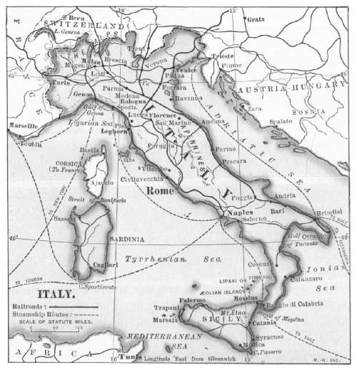 ITALY
ITALY
The grape-crop is enormous, and the fruit itself is exported. Some of the fruit sold as "Malaga" grapes throughout the United States during winter months comes from Italy. Chianti wine, from the vineyards around[Pg 327] Florence, has hitherto been regarded as an inferior product, but the foreign demand for it is steadily increasing. The Marsala wines of Sicily are largely exported.
Among mineral products the iron deposits in the island of Elba are undoubtedly the most valuable, but they are yet undeveloped to any great extent. The quarries at Carrara produce a fine marble that has made Italy famous in sculpture and architecture. Much of the boracic acid used in the arts comes from Tuscany, and the world's chief supply of sulphur comes from the neighborhood of Mount Etna in Sicily. Of this Americans buy about one-third.
On account of the lack of coal, the manufactures are restricted mainly to art wares, such as jewelry, silk textiles, and fine glassware. The Venetian glassware, the Florentine and mosaic jewelry, and the pink coral ornaments are famous the world over. Within recent years, however, imported coal, together with native lignite, have given steel manufacture an impetus. Steel ships and rails made at home are meeting the demands of commerce. Goods of American cotton are made for export to Turkey and South American countries.
Raw silk, wine, olive-oil, straw goods, sulphur, and art goods are exported. Cotton, wheat, tobacco, and farm machinery from the United States, and coal, woollen textiles, and steel goods from Great Britain are the chief imports. Most of the foreign trade is with the nearby states. The raw silk goes to France.
Since the unification of Italy the railways have been readjusted to the needs of commerce. Before that time the lines were wholly local in character; with the readjustment they were organized into trunk lines. They enter France through the Mont Cenis tunnel; they reach Switzerland and Germany by way of St. Gotthard Pass; they cross the Austrian border through Brenner Pass.
Rome, the capital, is a political rather than an industrial centre. Milan, the Chicago of the kingdom, is the chief market for the crops of northern Italy and a great railway centre. It is also the market for raw silk. Genoa, the principal port, is the one at which most of the trade of the United States is landed. Naples monopolizes most of the marine traffic between Italy and Great Britain. Leghorn is famous for its manufacture and trade in straw goods. A considerable part of the grain harvested in the Po Valley is stored for shipment at Venice—not in elevators, but in pits. Palermo is the trading centre of Sicily. Most of the sulphur is shipped from Catania. Brindisi and Ancona are shipping-points for the Suez Canal route.
Spain and Portugal.—The surface of these states is too rugged and the climate too arid for any great agricultural development. Less than half the area is under cultivation; nevertheless, they are famous for several agricultural products—merino wool, wine, and fruit. The merino wool of the Iberian peninsula has no equal for fine dress goods; it is imported into almost every other country having woollen manufactures. A considerable amount of ordinary wool is grown, but not enough for home needs.
The fruit industry is an important source of income. Oranges, limes, and lemons are extensively grown for exports; among these products is the bitter orange, from which the famous liqueur curaçao, a Dutch manufacture, is made. The heavy, sweet port wine, now famous the world over, was first made prominent in the vineyards of Spain and Portugal. Malaga raisins are sold in nearly every part of England and America. The olive is more extensively cultivated than in any other state, but both the fruit and the oil are mainly consumed at home—the latter taking the place of butter. Raw silk is grown for export to France.
Although a larger part of the peninsula must depend on[Pg 329] the American and Scandinavian forests for lumber, there is one tree product that is in demand wherever bottles are used—namely, cork. The cork is prepared from the bark of a tree (Quercus suber) commonly known as the cork oak,[73] which grows freely in the Iberian peninsula and northern Africa.
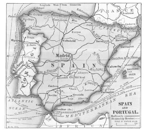 SPAIN AND PORTUGAL
Metals and minerals of economic use are abundant. Iron ore is sold to Great Britain, France, and Germany. Since the Spanish-American War, however, there have been extensive developments in utilizing the coal and the ore which before that time had been sold to other countries.
The undeveloped coal and iron resources are very great, and must figure in the payment of a national debt that is near the limit of bankruptcy. The state, however, is entering a period of industrial prosperity.
The most available metal resource is quicksilver. Of this metal the mines in Almaden produce about one-half the world's supply. The working of these mines is practically a government monopoly, and the income was mortgaged for many years ahead when Spain was at war with her rebellious colonies.
Both Spain and Portugal are poorly equipped with means for transportation. The railways lack organization, and freight rates are excessive. Not a little of the transportation still depends on the ox-cart and the pack-train. The merchant marine has scarcely more than a name; the foreign commerce is carried almost wholly in British or French bottoms. The imports are mainly cotton, coal, lumber, and food-stuffs—these in spite of the fact that every one save lumber might be produced at home.
Wine and fruit products, iron ore, and quicksilver are leading exports. Of these the United States purchases wine and raisins for home consumption and lace and filigree work for the trade with Mexico. Spain has a considerable trade in cotton goods with her colonies, the Canary Islands, and the African provinces of Rio de Oro and Adrar.
Portugal likewise supplies her foreign possessions—Goa (India), Macao (China), and the Cape Verde and Azores Islands—with home products. The chief Portuguese trade, however, is with Great Britain and Brazil.
Madrid is the capital of Spain. Barcelona is the chief commercial centre. Valencia, Alicante, Cartagena, and Malaga, are all ports of fruit and wine trade. Oporto has been made famous for the port wine that bears its name. Probably not one per cent. of the port now used, [Pg 331]however, comes from Oporto, and not many Malaga raisins come from Malaga.
Switzerland.—This state is situated in the heart of the highest Alps. The southeastern half is above the altitude in which food-stuffs can be produced, and probably no other inhabited country has a greater proportion of its area above the limits of perpetual snow. A considerable area of the mountain-slopes affords grazing. The valley-lands of the lake-region produce a limited amount of food-stuffs, but not enough for the sparse population.
Politically, Switzerland is a republic, having the position of a "buffer" state between Germany, Italy, France, and Austria-Hungary. Racially, the state is divided among Italians, French, and Germans; as a matter of fact, however, the old Helvetian spirit, which not even Cæsar could destroy, is still a great factor in dominating the people; this, with their montane environment, gives the Swiss a very positive nationality.
The agricultural interests of the state are developed to their utmost; two-thirds of the bread-stuffs, however, are purchased from the United States, the plains of Bohemia, and Russia. Cherries, apples, grapes, and other fruit are cultivated in every possible place, and as these can be delivered to any part of western and central Europe within a day, the fruit industry is a profitable one.
Cattle are bred for dairy purposes, but those for beef must be very largely imported, Austria-Hungary and Italy selling the needed supply. Goats are raised for their hides, and the latter are converted into Morocco leather. Of the dairy products, cheese is in many respects the most important; Gruyère cheese is exported to nearly every country. On account of the long distance from populous centres milk cannot be transported; much of it is, therefore, condensed, and in that form exported.
A peculiar feature of the dairy industry is the fact that it is constantly moving. The dairy herds begin to pasture in the lowlands as soon as the snow melts, and as fast as the snow line recedes up the mountains the cattle follow. The milk is converted into butter and cheese wherever the herds may be, and the second crop of grass below them is cut and cured for winter forage.
In spite of the fact that Switzerland has no available coal,[74] manufacture is pre-eminently the industry of the state. During the long winters the Alpine herdsman and his family whittle out wooden toys from the stock of rough lumber laid by for the purpose. Farther down in the valley-lands the exquisite brocades and muslins are made on hand-looms, or by the aid of the abundant water-power. Each industrial district has its special line of manufacture, so that there is scarcely an idle day in the year.
In the cities and towns of the lowland district, watches, clocks, music-boxes, and fine machinery are manufactured. For many years Swiss watches were about the only ones used in the United States, but on account of the competition of American watches this trade has fallen off. The mechanical music-player, operated by perforated paper, has also interfered with the trade in music-boxes.
Switzerland is provided with excellent facilities for transportation, and this has done about as much for the commercial welfare of the state as all other industrial enterprises. In proportion to its area, the railway mileage is greater than that of the surrounding states. The roads are well built and the rates of transportation are low.
In addition to the ordinary trip-tickets, monthly time-tickets are issued to travellers, allowing the holders to travel when and where they please within the limits of the state on all roads and lake-steamers. These are sold[Pg 333] to the traveller for about two-thirds the price of the 1,000-mile book of the American railway. The carriage roads have no superiors, and they penetrate about every part of the state below the snow line; they also cross the main passes of the Alps.
Through one or another of these passes most of the foreign traffic of the state must be carried. To Genoa and Milan it crosses the Alps via the St. Gotthard tunnel, or the Simplon Pass;[75] to Paris it goes by the Rhone Valley; between Vienna and Switzerland, by the Arlberg tunnel; and to Germany or to Amsterdam through the valley of the Main.
As a result of this most excellent system of transportation, Switzerland is thronged with visiting tourists at all times of the year; moreover, it has always been the policy of the Swiss Government not only to provide for them, but also to make the country attractive to them. The result has shown the wisdom of the policy. Indeed, the foreign tourist has become one of the chief sources of income of the Swiss people, and the latter profit by the transaction to the amount of about forty million dollars a year.
About all the raw material used in manufacture must be imported. The cotton is purchased mainly from the United States, and enters by way of Marseille. The raw silk is purchased from Italy, China, and Japan. Coal, sugar, food-stuffs, and steel are purchased from Germany, and this state supplies about half the imports. From the United States are purchased wheat, cotton, and coal-oil.
The manufactures are intended for export. The fine[Pg 334] cotton textiles sold to the United States are worth far more than the raw cotton purchased therefrom. Silk textiles, straw wares, toys, watches, jewelry, and dairy products are leading exports. The surrounding states are the chief buyers, and none of them competes with Switzerland to any extent in the character of the exports.
Geneva, situated at the head of the Rhone Valley, is the chief trade depot; it is noted especially for the manufacture of watches, of which many hundred thousand are made yearly. Zurich is the centre of manufactures of textiles and fine machinery. The silk-brocade industry is centred chiefly in this city and Basel.
QUESTIONS FOR DISCUSSION
Why did not France prosper commercially prior to the time of the revolution of 1793?
What are the chief natural advantages of the state in favor of commercial development?
In what ways have the natural disadvantages of Switzerland been overcome?
How has the loss of her colonies affected the industrial development of Spain?
Comparing Spain and Italy, which has the better situation with reference to the Suez Canal traffic?
From the Statesman's Year-Book find the amount of foreign trade of each state.
From the Abstract of Statistics find the trade of each one with the United States.
FOR COLLATERAL READING AND REFERENCE
Adams's New Empire, pp. 160–168.
Fiske's Discovery of America, Vol. II, Chapter XI.
Procure for inspection specimens of raw silk and also of the choice textile goods made in these states.
The Danube and Balkan states derive their commercial importance partly from the large area in which bread-stuffs may be produced, and also because the valley of the Danube has become an overland trade-route of growing importance between the Suez Canal and the North Sea.
Austria-Hungary.—This empire is composed of the two monarchies, Austria and Hungary, each practically self-governed, but united under a single general government. The greater part of the country is walled in by the ranges of the Alps and the Carpathian Mountains.
The region known as the Tyrol is topographically continuous with Switzerland, and the people have Swiss characteristics. Galicia, northeast of the Carpathian Mountains, the fragment of Poland that fell to Austria at the time of partition, is a part of the great Russian plain. Bohemia, which derives its name from the Keltic peoples, whom Cæsar called the Boii, comprises the upper part of the Elbe river-basin. Its natural commercial outlet is Germany, but the race-hatred which the Czechs have for the Germans, retards commercial progress. Hungary is a country of plains occupying the lower basin of the Danube. The Huns are of Asian origin. Austria proper occupies the upper valley of the Danube, adjoining Germany; the country and the people are Germanic.
To the student of history it is a surprise that a country of such diverse peoples, having but little in common save[Pg 336] mutual race-hatred, should hold together under the same general government. The explanation, however, is found in the topography of the region. The basin of the Danube is a great food-producing region, and the upper valley of the Elbe River forms the easiest passage from the Black to the Baltic Sea. The topography therefore gives the greater part of the country commercial unity.
The climate and surface of the low plains of Hungary are much the same as those of Wisconsin and Minnesota. Grain-growing and stock-raising are the chief employments. High freight rates, a long haul, and the competition of Russia and Roumania have retarded the development of these industries, however. Bohemia is likewise a grain-growing country, and the easy route into Germany through the Elbe Valley makes the industry a profitable one. Bohemia is also in the sugar-beet area.
There is an abundance of coal in Austria, but most of it is unfit for the manufacture of iron and steel. Steel manufacture, however, is carried on, the industry being protected by the distance from the German steel-making centres. The lead-mines about Bleiberg (or "Leadville") are very productive; at Idria are the only quicksilver-mines in Europe that compete with those of Almaden, Spain. The salt-mines near Krakow are in a mass of rock-salt twelve hundred feet thick.
Most of the manufactured products are for home consumption. American cotton and home-grown wool supply the greater part of the textiles. The flour-mills are equipped with the very best of machinery, and much of the product is for export to Germany and the countries to the south. The manufactures that have made the state famous, however, are gloves and glassware, both of which are widely exported. The sand, fluxes, and coloring minerals of Bohemian glassware are all peculiar to the region, and the[Pg 337] wares, therefore, cannot be imitated elsewhere. The gloves are made from the skins of Hungarian sheep and goats.
The railways are not well organized, and the mileage is insufficient for the needs of the country. Ludwig Canal (in Germany) connects the Danube with the Main, a navigable tributary of the Rhine; the Elbe is navigable from a point above Prague to the Baltic; the Moravian Gate opens a passage from Vienna northward; the Iron Gate, through which the Danube flows, is the route to the Black Sea; Semmering Pass and its tunnel is the gateway to the ports of the Adriatic. These great routes practically converge at Vienna, which also is the great railway centre of the empire.
The foreign trade consists mainly of the export of food-stuffs (of which sugar and eggs are heavy items), fine cabinet ware, woollen textiles (made from imported wool), barley and malt, and fine glassware. Much of the German and Italian wine is sent to market in casks made of Austrian stock; the coal goes mainly to Italy. The imports are raw cotton from the United States and Egypt, wool, silk, and tobacco. Coal is both exported and imported. The United States sells to Austria-Hungary cotton, pork, and corn—buying porcelain ware, glassware, and gloves, amounting to about one-fifth the value of the exports.
Vienna, the capital, is the financial centre and commercial clearing-house of central Europe; it has also extensive manufactures. Budapest is the great focal point of Hungarian railways and commerce. Prague controls the coal, textile, and glass trade of Bohemia. Lemberg is the metropolis of Galicia. The states of Liechtenstein, Bosnia, and Herzegovina are commercially under the control of Austria.
The Lower Danube States.—Roumania and Bulgaria, the plain of the lower Danube, are enclosed by the Carpathian and Balkan ranges. They constitute a great [Pg 338]wheat-field whose chief commercial outlets are the Iron Gate into Germanic Europe, and the Sulina mouth of the Danube into the Black Sea. The growing of maize for home consumption and wheat for export form the only noteworthy industries. Most of the grain is shipped up the Danube and sold in Great Britain and Germany.
From the Iron Gate to the Black Sea the Danube is held as an international highway, and the control of its navigation is directed by a commission of the various European powers, having its head-quarters at Galatz, Roumania.
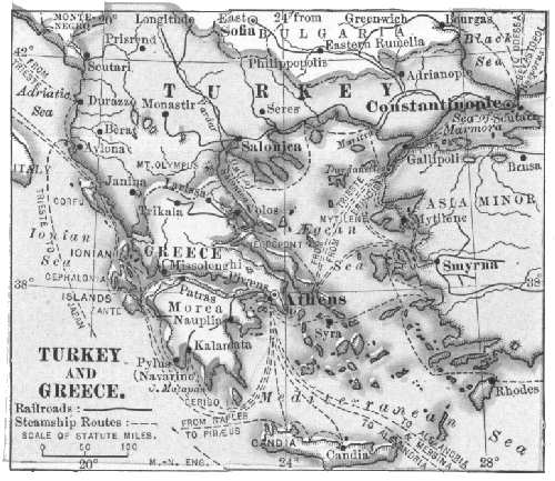 TURKEY AND GREECE
In the Balkan Mountains is the famous Vale of Roses which furnishes about half the world's supply of attar-of-roses. The petals of the damask rose are pressed between layers of cloth saturated with lard. The latter absorbs the essential oil, from which it is easily removed. About half a ton of roses are required to make a pound of the attar. Kazanlik, noted also for rugs, is the great market for attar. Galatz and Rustchuk are grain-markets and river-ports; from the latter a railway extends to Varna, the chief port of the Black Sea. From Sofia, near the Bulgarian frontier,[Pg 339] a trunk line of railway extends through Budapest to western Europe.
Turkey-in-Europe.—The European part of the Ottoman Empire has long been politically known as the "Sick Man" of Europe, and so far as the industries and commerce of the state are concerned, there is no excuse for its separate existence as a state. Its political existence, however, is regarded as a necessity, in order to prevent the Russians from obtaining military and naval control of the Mediterranean and Black Seas, and thereby becoming a menace to all western Europe. Less than one-half the people are Turks; the greater part of the population consists of Armenians, Jews, Magyars, and Latins.
Most of the country is rugged and unfit for grain-growing. The internal government is bad, the taxes are so ruinous that the agricultural resources are undeveloped, and every sort of farming is primitive. In many instances the taxes levied on the growing crops become practical confiscation when they are collected. Much of the cultivable land is idle because there are no means of getting the crops to market.
Grapes and wine, silk, opium, mohair and wool, valonia (acorn cups used in tanning leather), figs, hides, cigarettes, and carpets are the leading exports, and these about half pay for the American cotton textiles, woollen goods, coal-oil, sugar, and other food-stuffs imported. Choice Mocha coffee is imported for home use, and poorer grades are exported. Most of the foreign commerce is in the hands of English and French merchants. Armenians, Jews, and Greeks are the native middlemen and traders.
The native population is subject to the Sultan, whose rule is absolute; most foreign merchants and residents are permitted by treaties to remain subject to the regulations of the consuls.
Constantinople is the capital. Its situation on the Bosphorus is such that under any other European government it would command a tremendous foreign commerce. It is naturally the focal point of the trade between Europe and Asia. A trunk line of railway connects the city with Paris. Salonica is the port of western Turkey, and is likewise connected by rail with western Europe. A great deal of the foreign commerce of the state is now landed at this port.
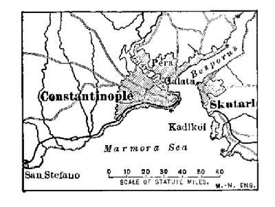 HARBOR OF CONSTANTINOPLE
The chief possessions of the Ottoman Empire are Asia Minor, Armenia, Mesopotamia, Syria, and Arabia.
Greece.—Greece is a rugged peninsula, no part of which is more than forty miles from the sea. The country is without resources in the way of coal, timber, or available capital. Its former commercial position, in ancient times, was due largely to the silver-mines near Ergasteria, and subsequently to the gold-mines of eastern Macedonia; these, however, are no longer productive.
There is but little land suitable for farming, and not far from one-half the bread-stuffs must be imported. Much of the timber has been destroyed, and this has resulted in a deterioration not only of the water-power, but of the cultivable lands as well. The railway lines are short and their business is local; there are practically no trunk line connections with the great centres of commerce.
The harbors and the natural position of the country are its best remaining resources. The Greeks are born sailors, and the country is in the pathway of European and Asian commerce. Most of the grain-trade between the Black and[Pg 341] Mediterranean Seas is controlled by Greek merchants, and the Greeks are everywhere in evidence in the carrying trade of the Mediterranean. The construction of the Corinthian canal has also given Greek commerce a material impetus.
The chief exports are Corinthian grapes—commonly known as "currants"—fruit, and iron ore from Ergasteria. Great Britain, France, and Belgium are the chief buyers of the fruit-crop. The exports scarcely pay for the American cotton, Russian wheat, and the timber products that are purchased abroad. There has been a material growth in the manufacture of cotton, woollens, and silk in the past few years, much of the work being done in households. Athens is the capital and largest city. The Piræus and Patras are the chief ports.
Servia and Montenegro are stock-growing countries. The former has suffered greatly from misgovernment and the waste of its resources. Wine-cask stock and cattle are sold to Austria, which has five-sixths of its trade. Belgrade is its metropolis. Tobacco and live-stock are exported from Montenegro to Austria.
QUESTIONS FOR DISCUSSION
On a good map of central Europe trace an all-water route from the mouth of the Danube to the ports of the lower Rhine and the North Sea; what connection have the cities of Ratisbon and Lemberg with this route?
How do the forests of these states affect the wine industry of Germany?
From the Statesman's Year-Book find the amount and movement of the exports and imports of these countries.
From the Abstract of Statistics find the volume of trade of these countries with the United States.
FOR COLLATERAL REFERENCE
Great Canals of the World—p. 4089.
A good map of central Europe.
 RUSSIAN EMPIRE
The great plain of Eurasia, which borders about half the circuit of the Arctic Ocean, is undivided by topographic barriers or boundaries. It is physically a unit.
Russia.—Russia comprises more than one-half the area of Europe; the Russian Empire embraces about one-half of Europe and Asia combined, and constitutes more than one-seventh of the land surface of the earth. East and west, from St. Petersburg to Vladivostok, the distance is about six thousand miles. It has a similar position with respect to southern Europe and China as has Canada to the United States.
In latitude the country is unfortunately situated. North of the latitude of St. Petersburg the climate is too cold to grow bread-stuffs; a large part of the country is, therefore, unproductive. The central belt is forest-covered; the southern part, or "black earth" belt, comprises the greater part of the productive lands, and this region is the chief granary of Europe.
Russia is an agricultural country. Maize and rye grown for home consumption, and wheat for export, are the chief products. Flax is a leading export product, and the Russian crop constitutes about four-fifths of the world's supply. Lands too remote from markets for grain-growing produce cattle and sheep, which are grown mainly for their hides and tallow. The wool of the Don is a very coarse textile that is much used in the manufacture of American carpets;[Pg 344] that of the arid plateaus of the southern country is a fine rug wool.
Agriculture in Russia is on a much lower plane than in western Europe. Most of the land is owned in large estates. Individual farming is rare, land tillage being usually a community affair. A village community rents or purchases a tract of land, and the latter is allotted to the families composing it, a part of the land being reserved for pasturage. The business is transacted by "elders," or trustees, who exercise a general management and supervision over the "mir," or community.
The methods of farming are not the best, and an acre of land produces scarcely one-third as much as the same area is made to yield in other states. The farming class, or peasantry, was in a condition of serfdom until within a few years. Poverty unfits them to compete with farmers of western Europe; moreover, the laws of land ownership and tenure also serve to discourage farming.
The metal and mineral resources are very great. Iron ore is abundant, and the yearly output of both is greatly increasing. There are extensive deposits in southern Russia, in the Ural Mountains, and in Poland. Coal of good quality is plentiful, and coal mining is encouraged by a heavy tariff on the foreign coal that enters regions where the home product is available. The most productive coal-fields are those of the lower Don River and of Poland.
Gold is obtained in various parts of Siberia and in the Ural Mountains, but scarcely enough is mined for the requirements of coinage. Copper is also mined in the Ural and Caucasus Mountains. More than nine-tenths of the world's supply of platinum is also obtained in the Ural Mountains. The petroleum fields of Transcaucasia have a yearly output a little greater than those of the United States.
The forest area is surpassed only by the timber belt of North America, both of which are in about the same latitudes. This area, within a very few years, is destined to be the chief lumber supply of all Europe. Moreover, the forests, the grain-growing lands, and the iron and coal constitute national resources which are surpassed in no other countries save the United States and China.
The Russian Government has done much to encourage manufactures. Steel-making in the Ural district, in Poland, and in the iron regions of the Don has progressed to the extent that home-made railway material and rolling stock are now generally used. Farming machinery is made in the cities of the grain-growing region. The manufacture of cotton, woollen, and linen fabrics has developed to the extent that the state is becoming an exporter rather than an importer of such goods.
Railway building has progressed under government aid, and about two-thirds of the 37,000 miles of track are owned by the state. The Transsiberian Railway connecting Vladivostok with the trunk lines of Europe was built by the state both for strategic and economic purposes. Large bodies of emigrants are carried into Siberia at nominal rates and are settled on lands that are practically free. The return cargoes consist of Chinese products—mainly silk textiles and tea—destined for western Europe.
A network of railways covers the grain-growing districts; trunk lines, mainly for strategic purposes, extend through Russian Turkestan to the Chinese border. For many years Russia has endeavored to acquire the territory that would afford commercial outlets to the Indian Ocean and into China. In this the state has been thwarted by two great powers—Great Britain and Japan. The construction of canals and the improvements of river-navigation are [Pg 346]under government management, and the internal water-ways aggregate about fifty thousand miles of navigation.
The foreign commerce is changing in character as manufactures develop. Wheat, flour, timber products, flax, and petroleum are the chief exports. Cotton, tea, wool, and coal are the leading imports, the first-named coming mainly from the United States. Germany, Great Britain, France, Holland, and the United States are the chief European countries utilizing Russian trade. The commerce between Russia and China is growing rapidly. The Transsiberian railway is its chief northern outlet, and a branch of this road, now under construction, extends through to the leading commercial centres of Manchuria, to Port Arthur. A considerable amount of manufactured goods is sent to Asia Minor and the Iran countries.
The most available ports opening into the Atlantic are on the Baltic Sea, but these are blocked by ice in winter; the best ports are on the Black Sea, but the Russians do not control the navigable waters that connect them with the Atlantic.
Much of the internal trade is carried on by means of annual fairs. The most important of these are held at Nijni, (lower) Novgorod, Kharkof, Kief, and other points. At the first-named fair goods to the amount of $80,000,000 have changed hands during a single season, and the annual fair is the recognized common ground on which the oriental traders meet the buyers of European and American firms.
Unlike the schemes of colonization of other European states, the various possessions of the Czar are practically in a single area, the dependencies being contiguous. The lines between them, with few exceptions, are political rather than natural boundaries.
St. Petersburg, the capital, is the centre of finance and trade. Riga is the port from which most of the lumber is[Pg 347] exported; it receives the coal purchased from Great Britain for the factories of the Baltic coast. The harbor of Riga is not greatly obstructed by ice. Archangel has an export trade of lumber and flax during the few months when the White Sea is free from ice. Odessa and Rostof are the grain-markets of the empire. Astrakhan is the centre of trade for the Iran countries, and Baku is the petroleum-market. Moscow is the chief focal point of the railways; and in consequence has become a great centre of manufacture and trade. Warsaw, next to Moscow, is the most important city.
Siberia.—This great territory resembles Russia in surface and climatic features. Like the former "west" of the United States, Siberia is the open "east" into which much of the surplus population of Russia, Germany, and the Scandinavian countries is moving, attracted by fine farming lands. The European emigrant becomes a producer when settled in Siberia, and, at the same time, a consumer of Russian manufactures. In five years more than one million people thus became occupants of the new country in Siberia. Russian trade is encouraged by a heavy tariff on foreign goods brought into Siberia.
Tobolsk, Tomsk, and Semipalatinsk are collecting stations for Siberian products, and each is built on navigable waters. Irkutsk receives the caravan trade that goes from Peking through Urga and Kiakhta, the frontier post of Chinese trade. Vladivostok is the great Pacific outlet and the terminus of the Transsiberian Railway. It is ice-bound in winter. Harbin, in Manchuria, China, is a Russian trading post of great commercial importance.
Bokhara and Khiva are Russian vassal states. The former was acquired chiefly as a trade-route. A railway from Krasnovodsk on the Caspian Sea extends through Merv, Bokhara, and Samarkand to Kashgar, where it meets[Pg 348] the caravan trade from central China. The building of this railway has caused a great development of cotton-growing in these countries, which furnish Europe and America with the choice Afghan, Khiva, and Bokhara rugs.
Transcaucasia, now joined to Russia, is a part of the plateau of Iran. A railway extends across the country from Batum to Baku, connecting the Black and Caspian Seas. Transcaucasia is the petroleum region of the East. It is also noted for the Shirvan, Kabistan, Daghestan, and Kazak rugs which are sold all over Europe and America. The so-called "Cashmere" rugs are not a product of Kashmir, but are made in the town of Shemaka. Kabistan rugs are made in Kuba. Kazak fabrics are usually the sleeping-blankets of the Kazak (Cossack) rough-riders.
QUESTIONS FOR DISCUSSION
How will the development of the coal, iron, and lumber resources most likely affect the industrial future of Russia?
Discuss the policy of Siberian immigration;—what are its advantages to German colonists?
From the map accompanying this chapter show how the tributary streams of the great rivers have served to extend Russian commerce through Siberia.
Note the situation of the cities and towns of Siberia with reference to the rivers.
What effect has the high latitude of Russia on its agricultural industries?
From the Statesman's Year-Book make a list of the leading exports and imports of Russia by articles, and also the volume of trade with other countries.
From the Abstract of Statistics find the statistics of trade between Russia and the United States.
FOR COLLATERAL READING AND REFERENCE
Commercial life in Russia—preferably from the article, "Russia," in the Encyclopædia Britannica.
For a rug of the Caucasus type, see illustration, p. 351; compare the Kabistan with the Persian piece—which has the floral and which the geometric figures?
The countries of the Iran plateau extend from the Mediterranean Sea to the valley of the Indus River. The Arabian Peninsula is not a part of it, but its climate and general character are similar. The Iran countries are exceedingly rugged, and a great part of their surface is more than a mile above sea-level. The climate is one of great extremes; the summer hot-waves and the winter hurricanes are probably unknown elsewhere in severity. The greater part of Arabia is an unhabitable desert.
 THE IRAN PLATEAU AND ARABIA
The rigorous conditions of surface and climate have placed their stamp upon the population of the region.[Pg 350] They are full of the intelligent cunning and ferocity that mark people living under such conditions of environment. In many parts the sterile soil and arid climate force the sparse population into nomadic habits of life and predatory pursuits. For the greater part, the land hardly yields enough food-stuffs for the population, and any great development of agriculture is out of the question. The flood-plain of the Tigris and Euphrates, and a few of the river-valleys are highly productive.
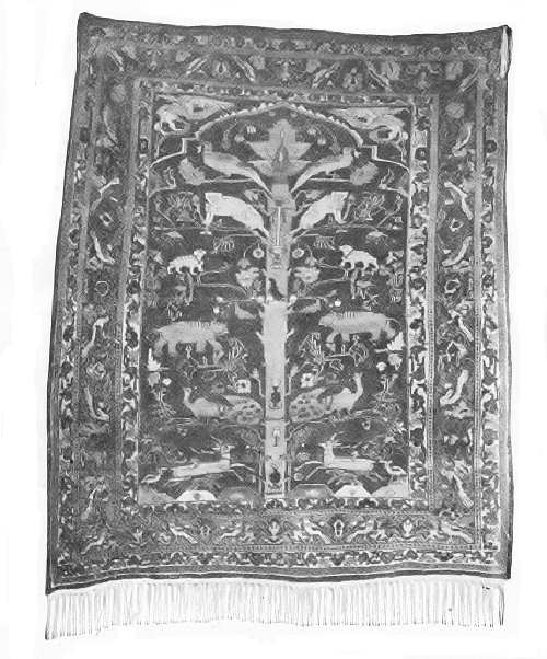 AN ANTIQUE TREE-OF-LIFE, KERMANSHAH (PERSIAN) RUG
Before the Christian era several trade-routes between Europe and the Orient lay across this region, and along[Pg 351] the caravan routes there were the usual industries pertaining to commercial peoples. The cities of Sinope, Trebizond, Astrabad, Phasis, Mashad, and Bactra (now Balkh) grew into existence along one of the northern routes. Tyre, Nineveh, Tarsus, Palmyra, Babylon, and Persepolis were founded along one or another of the southern routes. Of these, Trebizond only retains its importance, being a seaport with a considerable trade. The commerce that once passed over this route was crushed out of existence during the invasions by Jenghis Khan.
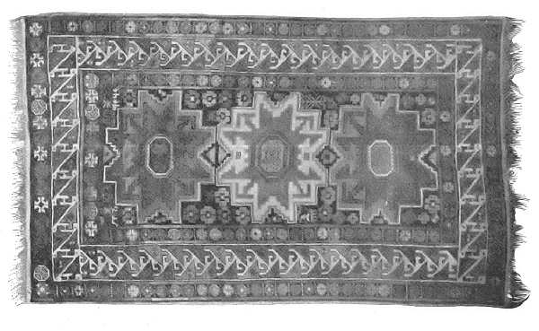 A KABISTAN RUG—CAUCASUS DISTRICT
Of the various industries of the Iran plateau, practically but one extends beyond its borders, namely, the manufacture of the textile fabrics known as Oriental rugs. These are unique; they are made of materials, colored with dyes, and are ornamented with designs that cannot be successfully imitated anywhere else in the world. The filling of the rugs consists of fine wool, selected not only from particular localities, but also from certain parts of the fleece. The dye-stuffs are common to other parts of the world, and[Pg 352] their names—indigo, saffron, coccus, madder, and orchil—are familiar. But both the wool and the dye-stuffs possess qualities imparted to them by soil and climate that are not found elsewhere.
The absence of floors, and of the furniture found in European dwellings, make the rugs essential household articles rather than luxuries. The hearth-rug, the bath-mat, the divan-cover, the sleeping-blanket, and the saddle-mat must be regarded as necessities. Religion also has its requirements, and the prayer rug, sometimes ornamented with the hands of the Prophet, is a part of every household equipment, whether of the nomadic Arab or the wealthy merchant. Each district and people have their own designs and methods of workmanship, and the rugs of each are easily distinguished.[76]
For the greater part these are gathered by caravans and conveyed to convenient shipping-points. Nearly all the cottage-made product is obtained in this manner. As a rule the rugs are named from the town or district in which they are made. Smyrna and Constantinople are the chief ports of shipment. Many of them find their way to European dealers, but New York is probably the largest rug-market in the world. The great majority are retailed[Pg 353] at from ten to fifty dollars each; choice fabrics, however, bring from three hundred to ten thousand dollars. Oriental rugs are hand-woven, and a weaver frequently spends several years on a single piece, earning perhaps less than ten cents a day. The factory-made rugs are inferior to the cottage-manufactured product.
Turkish Possessions.—Anatolia is the common name of the Turkish possession formerly known as Asia Minor. The name properly belongs, however, to only a small part of the region. The Asiatic possessions of the Ottoman Empire comprise Asia Minor, Armenia, Kurdistan, Syria, Mesopotamia, and Arabia. The Armenians are the commercial people of the greater part of this region, and although thousands have been massacred because of Turkish hatred of them, they practically wield the chief power because of their business enterprise.
During the Roman occupation many miles of roads were built from Constantinople and other coast-points to the interior. One of these extended to Mesopotamia, and became a much-travelled route of the trade which centred at Constantinople. Within recent years German capitalists have built railways along these roads, thereby creating a considerable export trade in fruit, rugs, and mohair cloth.
Angora and Konieh (Iconium) are important marts. Trebizond is the chief port of the Black Sea, but it lacks railway connections with the interior. Smyrna is the chief port of the Mediterranean, and from it are shipped to European and American markets the fruit and textile fabrics that have made its importance. In Syria, Damascus, one of the oldest cities in the world, is the centre of a considerable trade in textile manufactures. Rugs, dates, figs, and damask fabrics are exported to Europe through Beirut, its seaport, with which it is connected by rail. Much of the stuffs exported is gathered from Persia.[Pg 354] Yafa is the port of Jerusalem. Bagdad is the chief trade-centre of Mesopotamia.
Arabia.—Arabia is nominally a Turkish possession, but the coast-regions only are under the control of the Sultan. The interior is peopled by nomadic tribes, who do not acknowledge the sovereignty of Turkey. The province of Yemen, on the Red Sea, is about the only noteworthy part of the peninsula. Hides and Mocha coffee, gathered by Arab traders, are shipped from the port of Hodeida. Mecca is the yearly meeting-place of thousands of Mohammedan pilgrims, who go thither as a religious duty; it is also the centre from which Asiatic cholera radiates. Aden, the chief coaling-station of the British Empire in the Indian Ocean, is also a free port, having a considerable trade in American cotton and coal-oil.
Although Arabia itself is practically of no commercial importance, the same cannot be said of the Arabic people. They are keen, thrifty traders, and as brutal in their instincts as they are keen. The commerce which connects the western part of Asia with Europe is largely of their making. They collect and transport the goods from the interior, delivering them to Jewish and Armenian middlemen, who turn them over to European and American merchants. Arab traders also control the greater part of the commerce of northern Africa. The slave-trade, which is wholly in their hands, is very largely the key to the situation. A party of slave-dealers makes an attack upon a village and, after massacring all who are not able-bodied, load the rest with the goods to be transported to the coast.
Persia.—Persia is the modernized name of the province now called Fars, or Farsistan. Within its borders, however, the name Persia is almost unknown; the native people call the country Iran. In the times of Cyrus,[Pg 355] Xerxes, and Darius, Persia was one of the great powers of the world. The cultivable lands produced an abundance of food-stuffs. The mines of copper, lead, silver, and iron were worked to their utmost extent, and the chief trade-routes between Europe and the Orient crossed the country to the Indus River.
The conquest by Alexander the Great changed the course of trade and diverted it to other routes, thus depriving the country of much of its revenue; the invasions of the Arabs left the empire a hopeless wreck. Iran blood dominates the country at the present time, it is true, but the religion of Islam does not encourage any material development, and the industries are now purely local. There is no organization of trade, nor any system of transportation except by means of wretched wagon-roads with innumerable toll-gates. "Turkish" tobacco, opium, and small fruits are grown for export; silk and wool, however, are the most important crops. The former is manufactured into brocaded textiles; the latter into rugs and carpets. There are famous pearl-fisheries in the Persian Gulf.
Tabriz, situated in the midst of an agricultural region, has important manufactures of shawls and silk fabrics of world renown. The Tabriz rugs are regarded as among the finest of the rug-maker's art. Shiraz, the former capital, Kermanshah,[77] and Hamadan are noted for rug and carpet manufactures. Mashad is the centre of the trade with Russia. Bushire and Bender-Abbas are seaports, but have no great importance. Most of the trade with Russia passes through the port of Trebizond.
Afghanistan.—The nomadic tribes that inhabit [Pg 356]Afghanistan have but little in common with the British civilization that is slowly but surely closing in upon them, and driving them from routes of commerce. A considerable local traffic is carried on between Bokhara and Herat, and between Bokhara and Kabul through Balkh, all being fairly prosperous centres of population in regions made productive by irrigation.
By far the most important route lies between Kabul and Peshawur, at the head of the Indus River. A railway, the Sind-Pishin, extends along the valley of this river from Karachi, a port of British India, to Peshawur, also in British India near the Afghan border, and the route lies thence through Khaibar Pass to Jelalabad and Kabul. A branch of this road is completed through Bolan Pass nearly to Kandahar.
Kabul, the capital, is a military stronghold rather than a business centre, although it is a collection depot for the Khiva-Bokhara rugs and carpets that are marketed at Peshawur. Kandahar has a growing trade resulting from the railway of the Indus Valley. Herat is the market of the famous Herati rugs. There is no organized commercial system; a small amount of British manufactures—mainly stuffs for domestic use—are imported; rugs and dried fruit are the only exports to Europe and America. The imports enter mainly by way of Karachi, India; the exports are carried to Europe, for the greater part, by the Russian railway.
The importance of Afghanistan is due to its position as a buffer state between Russia and British India. The various strategic points for years, therefore, have been military strongholds. There is an old saying: "Whoso would be master of India must first make himself lord of Kabul." The meaning of this is seen in the history of Khaibar Pass, which for many years has been a scene of slaughter; indeed, it has been the chief gateway between[Pg 357] occidental and oriental civilizations for more than twenty centuries. Since the acquisition of India by Great Britain Afghanistan has been under British protectoracy.
Baluchistan.—The general features of Baluchistan resemble those of the other parts of the Iran plateau. The coast has no harbors in the proper sense, but the anchorage off Gwador has fair protection from storms and heavy winds. The few valleys produce enough food-stuffs for the half-savage population. There is but little organization to the government save that which is military in character. The state is a protectorate of Great Britain.
Rug-making is the only industry that connects Baluchistan with the rest of the world. Quetta, the largest town, is a military station controlling Bolan Pass. Its outlet is the Kandahar branch of the Sind-Pishin Railway.
QUESTIONS FOR DISCUSSION
What climatic factors prevent these countries from being regions of great production?
How do climate and soil affect the character of the wool clip?
How do Arabian horses compare with American thorough-bred stock with respect to usefulness?—how do they compare with the mustang stock?
Why is Khaibar Pass regarded as the key to India?
FOR COLLATERAL READING AND REFERENCE
From a cyclopædia (or from McCarthy's History of Our Own Times) read an account of the British disaster at Kabul.
Study, if possible, one or more rugs of the following kinds, noting the colors, designs, and warp of each: Bokhara (antique and modern), Anatolian, Kermanshah, and Baluchistan.
These countries are in tropical latitudes and in the main are regions of great productivity. A few native states that have resisted annexation and conquest excepted, almost the entire area is divided among Great Britain, Holland, and France.
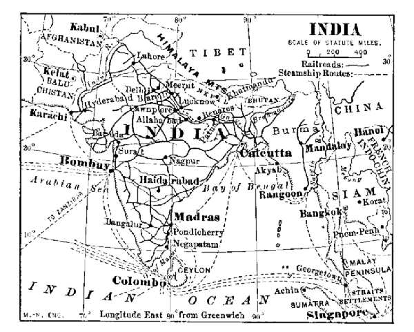 INDIA
INDIA
British India.—The Empire of India comprises an area half as large as the United States, situated on the southern slope of Asia. It covers the same latitude as the span between the Venezuelan coast and the Ohio River; from the Indus to the Siam frontier the distance is about two thousand miles. It includes also settlements in the Malay peninsula.
Excepting the plateau of the Dekkan, and the slopes of[Pg 359] the Himalayan ranges, most of the surface consists of plains and low, rolling land covered with a great depth of soil. Through these rich lands flow four large rivers—the Indus, Ganges, Brahmaputra, and Irawadi, which afford a great deal of internal communication. The Himalaya Mountains on the north and the Hindu Kush on the northwest practically shut off communication from the northward, so that all communication in this direction is concentrated at Khaibar and Bolan Passes, the most important gateways by land approach.
British India is one of the most populous regions of the world; the average population per square mile is about one hundred and eighty, a density considerably greater than that of New York State. The entire population is about three times that of the United States. Nearly all the food-stuffs grown are required for home consumption; indeed, dry years are apt to be followed by a shortage of food-stuffs. Years ago famines followed any considerable deficiency of crops, but since the completion of the admirable railway systems the necessary food-stuffs are quickly shipped to the district where the shortage occurs.
The Hindus constitute about three-fourths of the population. Along the northern border there are many peoples of Afghan and Turkic descent; in Burma there is a considerable admixture of Mongol blood. An elaborate system of social castes imposed by the teachings of Brahmanism has made the introduction of western methods of education and civilization somewhat difficult to carry out. The educational system of the dominating Brahmanic caste, although of a very high order, does not fit the people to cope with the commercialism of western civilization.
Five-sevenths of the population are engaged in agricultural labor. Rice, wheat, millet, meat, and sugar are the[Pg 360] chief food-crops. Of these, rice and wheat[78] only are exported; the others are required for home consumption.
The articles grown for export are jute, cotton, opium, oil-yielding seeds, tea, and opium. No meat is exported, but hides form a large item of foreign trade.
The jute is used in the manufacture of rugs and grain-sacks. It is cultivated mainly in the delta-lands of the Ganges-Brahmaputra. A considerable part of the product is now manufactured in India and in China; some is also shipped to California, to be made into wheat-sacks; perhaps the larger part is sent to Dundee, Scotland, where it is woven into textile fabrics. The choicest product is used to mix with silk fibre, or is employed in the manufacture of rugs and coverings.
Cotton cultivation is rapidly taking first rank among the industries of India, for which the conditions of soil, climate, and market are admirably adapted. India stands second in cotton-growing, and the area of production is gradually increasing. Most of the crop is exported to Europe for manufacture, although there is an increasing amount sold to Japan. Great Britain is the largest purchaser, and the cotton goods manufactured at Manchester are reshipped in large quantities to India.
Owing to the low wages paid for labor both in the fields and the mills, cotton manufacture is a rapidly growing industry in India. In many cases the yarn is manufactured in India and then sent to China to be made into coarse cloth. Some of the mills are equipped with machinery made in the United States.
Tea has become one of the most important crops of India. It is grown mainly in Ceylon and Assam, and is said to have grown wild in the latter state. The quality[Pg 361] of Indian tea is regarded as superior to the Chinese product, and Indian teas have therefore very largely supplanted those of China, in British consumption.
Silk cultivation and manufacture have been growing rapidly in the past few years; a considerable part of the product is "tussar," or wild silk. The silk rugs of India are not equalled anywhere else in the world. Wool is a product of the mountain-regions, but is almost wholly used in the manufacture of rugs and coverings.
The British occupation of India is commercial rather than political. India furnishes a most valuable market for British manufactures; it supplies the British people with a large amount of raw material for manufacture. The general government is administrative only so far as the construction of railways, irrigating canals, and harbors, and the organization of financial affairs are concerned.
There are about two hundred and fifty native states included within the territory of British India. In addition to the native ruler, a British governor or magistrate carries out the administrative features of the British Government. For administrative purposes most of the native states are grouped into eight provinces, or "presidencies."
Bengal.—The states of Bengal, mainly in the valley of the Ganges River, produce most of the rice and wheat. Calcutta, the capital of the empire, is a comparatively young city. The Hugli at this point is navigable both for ocean and river craft. The situation of the city is much like that of New York, and it is therefore finely adapted for commerce. Railways extending from the various food-producing districts and from other centres of commerce converge at Calcutta. The city is not only the centre of administration, but the chief focus of commerce and finance as well.
Bombay.—Bombay includes a number of states [Pg 362]bordering on the Arabian Sea. The city of Bombay is built on an island of the same name. Its situation on the west coast makes it the most convenient port for the European trade that passes through the Suez Canal. The opening of the route gave Bombay a tremendous growth, and it is destined to become a great commercial factor in Indian Ocean trade. It is also a great manufacturing centre for cotton textiles. Ahmedabad, an important military station, is also an important centre of cotton manufacture and wheat-trade.
Sind.—The native state Sind includes the greater part of the basin of the Indus. Its importance is military and strategic rather than commercial. The ability of Great Britain to hold India depends very largely on British control of the Indus Valley and the passes leading from it. The Sind-Pishin Railway traverses the Indus Valley from Karachi to Peshawur. Haidarabad, one of the largest cities of India, is the centre of an agricultural district. Karachi, the port near the mouth of the Indus, next to Khaibar Pass, is the most important strategic point of India, and one that the Russians for more than a century have been trying to possess.
Punjab.—The states of the Punjab are mainly at the upper part of the Indus. Amritsar is an important centre for the manufacture of silk rugs and carpets. A large number of these are sold in the United States at prices varying from two hundred to six thousand dollars. The designs for these textiles are often made in New York. Peshawur is important chiefly as a military station.
Burma.—British Burma includes the basin of the Irawadi River. The uplands are wheat-fields; the lowlands produce rice. Mandalay is a river-port and commercial centre. Rangoon is the seaport, with a considerable ship-building industry that results from the teak forests.[Pg 363] Although the Irawadi is navigable for light craft, railways along the valley have become a necessity; these centre at Rangoon.
The province of Madras is one of the most densely peopled parts of India. The chief commercial products are cotton and teak-wood. Madras, its commercial centre, has a very heavy foreign trade in hides, spices, and cotton. The cotton manufactures are extensive. A yarn-dyed cotton cloth, now imitated both in Europe and the United States, has made the name famous.
Kashmir.—The native state Kashmir, situated high on the slopes of the Karakorum Mountains, is known chiefly for the "Cashmere" shawls made there. The shawls are hand-woven and represent the highest style of the weaver's art. The best require many years each in the making; they command prices varying from five hundred to five thousand dollars. This industry centres at Srinagar.
Other British States.—The Straits Settlements are so called because they face the Straits of Malacca. They include several colonies, chief of which are Singapore, Penang, and Malacca. The Straits ports are free from export and import duties, a regulation designed to encourage the concentration of Malaysian products there—in other words, to encourage a transit trade.
The policy has proved a wise one, and the trade at the three ports—Singapore, Penang, and Malacca—aggregates about six hundred million dollars yearly. About two-thirds of this sum represents the business of Singapore. Tin constitutes about half the exports, a large share going to the United States. Spices, rubber, gutta-percha, tapioca, and rattan constitute the remaining trade. Rice, cotton cloth, and opium are the imports.
The Federated Malay States, situated in the Malay peninsula, and the northern part of Borneo are also British[Pg 364] possessions. Their trade and products are similar to the rest of the Malaysian possessions.
Dutch East India.—The Dutch possessions include nearly all the islands of the Malay Archipelago and the western part of New Guinea. Of these, Java and Sumatra are the most important. They are divided into "residencies," and the administering officers exercise control over the various plantations. In addition, there are numerous private plantations. The colonial administration is admirable.
Cane-sugar, coffee, rice, indigo, pepper, tobacco, and tea are the chief products. The sugar industry has been somewhat crippled by the beet-sugar product of Europe. Java and Sumatra coffees are in demand all over Europe and the United States. Sumatra wrappers for cigars find also a ready market wherever cigars are manufactured. The cultivation of cinchona, or Peruvian bark, has proved successful, and this substance is becoming an important export. The islands of Banka and Billiton (with Riouw) yield a very large part of the world's supply of tin, much of which goes finally to the United States. The mother-country profits by the trade of these islands in two ways: the Dutch merchants are practically middlemen who create and manage the commerce; the Dutch Government receives an import tax of six per cent., and a small export tax on nearly all articles except sugar. Batavia is the focal point of the commerce.
Siam.—This kingdom is chiefly important as a buffer state between French and British India, and little by little has been pared by these nations until practically nothing but the basin of the Menam River remains. The administration of the state is progressive, and much of the resources have been developed in the last few years.
Rice and teak are the leading products. The rice is[Pg 365] cultivated by native laborers—much of it by enforced labor—and is sold to Hongkong, British India, and the more northerly states. It is collected by Chinese middlemen, and by them sold to British and German exporters. The teak-wood business is managed by British firms. The logs are cut by natives, hauled to the Menam River, and floated to Bangkok; there they are squared and sent to European markets. Pepper and preserved fish are also exported. The Menam River is the chief trade-route, and Bangkok, at its mouth, is the focal point of trade.
French India.—The French control the region south of China, called French Indo-China, together with various areas in the peninsula of Hindustan; of these Pondicheri and Karical are the most important. Indo-China includes the basin of Mekong River, and rice is the staple product. The most productive rice-fields are the delta-lands of the Mekong, formerly known as Cochin-China.
From these lands more than half a million tons of rice are exported, the product being sold mainly at Hongkong and Singapore. Pepper is also an export of considerable value. France, China, and the Philippine Islands are the final destination of the rice export. The imports are mainly textiles, machinery, and coal-oil from the United States. The machinery pertains chiefly to the manufactures of cotton and silk textiles. On account of cheaply mined coal, there is a considerable growth of this industry. Saigon is the business centre and port at which the Chinese middlemen meet the European merchants and forwarders.
QUESTIONS FOR DISCUSSION
What have been the chief effects of the British occupation of these countries, so far as the natives are concerned?
What is the position of Khaibar Pass with respect to the commerce of India?
How has the building of the Sind-Pishin Railway strengthened British occupation of India?
Singapore and Batavia are the two great focal points of trade in the East India Islands. At the former all trade is absolutely free; at the latter there is both an import and an export tax. What are the advantages of each policy?
From the Abstract of Statistics find the trade of the United States with these countries.
FOR COLLATERAL READING AND REFERENCE
From a cyclopædia, preferably the Encyclopædia Britannica, read the
following topics:
Caste
Lord Clive
Rattan
Pepper
The relative position of China, Russia, and Japan is not unlike that of continental Europe and Great Britain, and the struggle for supremacy in the Japan and Yellow Seas is about the same as that which in times past took place in the North Sea. In the latter case France and Holland were the disturbing powers; in the former, it is Russia.
The Chinese Empire.—A comparison of the Chinese Empire with the United States shows that the two countries have about the same position and extent of latitude. There is also about the same proportion of highlands, arid lands, and fertile lowlands. The similarity of the two countries in geographic conditions is very marked.
The fertile lowland in the east and southeast is one of the most productive regions in the world, and forms the chief resource of the country; on account of its productivity it is densely peopled. The arid and mountain lands are peopled mainly by cattle-herders and nomadic tribes.
China is essentially an agricultural country, and the farms are held in much the same way as in the United States, but the holdings are so small that agricultural machinery is not required for their cultivation.
Wheat, millet, and pease are grown throughout the lowlands wherever they can be cultivated. The cultivation of rice is confined mainly to the coast lowlands. The amount of food-stuffs produced, however, is scarcely sufficient for home consumption; indeed, a considerable amount is [Pg 368]imported, and the imports year by year are increasing. This is due not so much to the density of population as to want of means of transportation of the soil products from inland regions. It is often much cheaper to import food-stuffs from abroad than to transport them, even from an adjoining province.
Tea is extensively cultivated, and China exports nearly one-half of the world's product; the total amount produced is considerably more than half. Most of this goes to Great Britain and Canada. Raw silk is an important product, and the mulberry-tree is extensively grown. Cotton is one of the most general crops in the southern part of the empire, especially along the lower Yangtze. It is a garden-crop, however, and nearly all of it is consumed.
The mineral wealth is very great, and with proper management will make China one of the most productive and powerful countries in the world. Coal is found in every one of the provinces, and the city of Peking is supplied with an excellent quality of anthracite from the Fang-shan mines, only a few miles distant. It is thought that the coal-fields are the most extensive in the world. Iron ore of excellent quality is abundant, and in several localities, notably in the province of Shansi, the two are near each other.
Foreign capitalists are seeking to develop these resources in several localities. The Germans have obtained mining concessions in Shantung peninsula, and these involve the iron ore and coal occurring there. The Peking syndicate, a London company, has also obtained a coal-mining concession in Shansi.
 EASTERN CHINA
For the greater part the manufactures are home industries.[79] Until recently most of the cotton cloth was made by means of cottage looms, and the beautiful silk brocades which are not surpassed anywhere else in the world are still made in this manner. Porcelain-making is one of the oldest industries, and to this day the wares sold in Europe and America are known as "china." Straw carpet, or matting, and fans for export are also important exports.
The mill system of manufacture is rapidly gaining ground, however, and foreign companies find it economical to carry the yarn made in India from American cotton into China to be made into cloth. In the vicinity of Shanghai alone there are nearly three hundred thousand spindles. This phase of the industry is due largely to the factor of cheap labor; the Chinese skilled laborer is intelligent; he does not object to a sixteen-hour working-day at wages varying from five to twenty cents.
There is no great localization of industrial centres, as in the United States and Europe. Each centre of population is practically self-supporting and independent from an economic stand-point. The introduction of western methods, however, is gradually changing this feature.
All industries of a general character are hampered for want of good means of transportation. The empire is traversed by a network of unpaved roads; but although these are always in a wretched condition, an enormous traffic is carried over them by means of wheel-barrows, pack-animals, and by equally primitive methods.
The numerous rivers form an important means of communication. The Yangtze is now available to commerce a distance of 2,000 miles, and the opening of the Si Kiang (West River) adds a large area that is commercially tributary to Canton and Hongkong. The most important water-way is the Grand Canal, extending from Hang Chow to Tientsin. This canal is by no means a good one as compared with American and European standards. It was built not so much for the necessities of traffic, as to avoid the numerous pirate vessels that infest the coasts. Junks, row-boats, house-boats, and foreign steam craft are all employed for traffic. The internal water-ways aggregate about fifteen thousand miles in length.
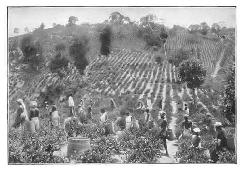 A TEA-PLANTATION—PICKING THE LEAVES
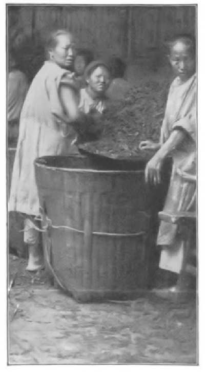 PREPARING THE LEAVES FOR ROASTING
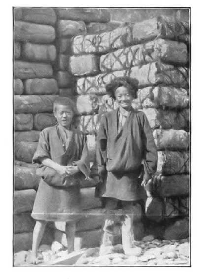 TEA-BALES FOR EXPORT THROUGH RUSSIA
Of railways there were less than three hundred and fifty miles at the close of the century, the most important being the line from Tientsin to Peking. About five thousand miles are projected and under construction by American and European companies. A branch of the Transsiberian railway is under construction to Port Arthur. Telegraph and telephone lines have become popular and have been extended to the interior a considerable distance. There are upward of twenty thousand miles of wire communication, the most important, in many respects, being a direct overland line between Peking and European cities. Inasmuch as there are no letters in the Chinese language, the difficulties in using the Morse code of telegraphy are very great. In some cases the messages are translated into a foreign language before they are transmitted; in others, a thousand or more words in colloquial and commercial use are numbered, and the number is telegraphed instead of the word.
Most of the business between the natives and foreigners is carried on by means of middlemen, or "compradors," and these include both the commission merchants and the native bankers. They are intelligent, thrifty, and trustworthy. They are the most capable merchants in Asia, and have few if any superiors among the merchants of western nations. A very large part of the retail trade of the Philippine Islands is carried on by Chinese merchants.
The Chinese Empire consists of China and the five dependencies, as shown in the following table:[Pg 373]
| State | Population | Capital or Chief Town |
| China proper | 380,000,000 | Peking |
| Manchuria | 7,500,000 | Kirin |
| Tibet | 6,000,000 | Lassa |
| Mongolia | 2,000,000 | Urga |
| Jungaria | 600,000 | Kur-kara-usu |
| Eastern Turkestan | 600,000 | Yarkand |
The five dependencies are mainly arid, unproductive, and sparsely peopled. Their chief importance consists in the fact that they are "buffer states" between China proper and European states. They produce little except meat, wool, and live-stock.
China proper is divided into provinces, each governed by a viceroy appointed by the throne. All business with foreign powers is transacted through a Foreign Office, the Wai-wu-pu (formerly the Tsung-li-Yamen). The government business is managed by a Grand Council whose members are advisers to the throne. The government is controlled mainly by Manchu officials.
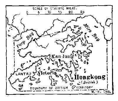 HONGKONG
Until within a few years China nominally allowed no foreign traders within her borders; recently, however, about forty cities, commonly known as "treaty ports," have been opened to the trade of foreign countries. Goods going inland any distance are required to pay a "liken" or internal tariff at the border of each province.
Several concessions of territory within recent years have been forced from China by foreign powers: thus, Great Britain has Hongkong Island (with the peninsula of [Pg 374]Kaulung) and Weihaiwei; Germany has Kiaochou on the bay of the same name; France has Kwang chau wan harbor. These concessions carry with them the control of the port and surrounding territory. The German concession includes the right to mine coal and iron, and to build railways within a territory of much larger extent. At the close of the war between Russia and Japan, the latter acquired Port Arthur, the gateway to Manchuria.
Whatever may be the political significance of the opening of the treaty ports and the granting of the various concessions, the effect has been to increase the trade of the United States with China about twenty-fold. The imports from the United States consist mainly of cotton and cotton cloth, coal-oil, and flour. The chief exports to all countries are tea, silk goods, and porcelain ware. Most of those sent to the United States are landed at Seattle or San Francisco. Great Britain, through the port of Hongkong, has a larger trade than any other nation. Japan and the United States have most of the remaining trade.
Peking, the capital, is politically, but not commercially, important. The part occupied by the foreign legations is modern and well kept. Tientsin, the port of Peking, is a larger city, with much more business. Canton, the largest city of the empire, and Hongkong, are the commercial centres of nearly all the British trade. Most of the American and Japanese trade centres at Shanghai. Niuchwang, on the Manchurian frontier, is important mainly as a strategic point. Macao, a Portuguese possession, is the open door of Portugal into China.
The inland divisions of the Chinese Empire have but little commercial importance. Musk, wool, and skins are obtained from Tibet, into whose capital, Lassa, scarcely half-a-dozen Europeans have penetrated. The closed condition is due to the opposition of the Lamas, an order[Pg 375] of Buddhist priests. Mongolia is a grazing region that supplies the Chinese border country with goats, sheep, and horses. It also supplies the camels required for the caravan tea-trade to the Russian frontiers. Eastern Turkestan is mainly a desert. Kashgar, the metropolis of the fertile portion, is the exchange market for Chinese and Russian products. Most of the mineral known as jade is obtained there. Manchuria is a grazing and wheat-growing country, exporting food stuffs and ginseng into China. Harbin, a Russian trading post, is connected with Peking and with European cities by railway.
 JAPAN AND KOREA
Korea, formerly a vassal of China, became an independent state after the war between China and Japan, this step being forced by Russia. The country is a natural market for Japanese manufactures, and in turn supplies[Pg 376] Japan with a considerable amount of food-stuffs. Chemulpo is the chief centre of its commerce.
Japan.—Japan is an insular empire, the commercial part of which has about the same latitude as the Atlantic coast of the United States; the empire extends from Formosa to Kamchatka. It is sometimes called the "Great Britain of the East," and the people are also called the "Yankees of the East." Structurally, the chain of islands consists of ranges of volcanic mountains. The abundant rains, however, have made many fertile river-valleys, and have fringed most of the islands with coast-plains.
Since the opening of Japan to foreigners the Japanese have so thoroughly adapted themselves to western commercial methods that they have become the dominating power in eastern Asia. Their influence has been greatly strengthened by a treaty for defensive purposes with Great Britain. A most excellent army and a modern navy make the alliance a strong one. The Japanese are better adapted to mould the commercial policy of China than any other people.
With a population of more than half that of the United States, occupying an area not larger than the State of California, every square foot of available land must be cultivated. Yet the Japanese not only grow most of the food-stuffs they consume, but are able to export rice. There is scant facility for growing beef cattle, but fish very largely takes the place of beef. The cattle grown are used as draught-animals in farm labor. Ordinary dairy products are but little used.
Rice, tea, and silk are the staple crops. Rice is grown on the coast lowlands, the west or rainy side[80] producing the larger crop. The Japanese crop is so superior that the larger part is exported, while an inferior Chinese grain is imported for home consumption. The quality of the Japanese rice is due to skilful cultivation.
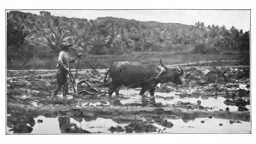 NATIVE PLOUGHING RICE-FIELDS
 IRRIGATING A RICE-FIELD
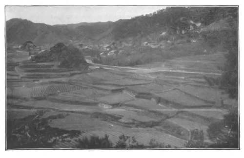 RICE-FIELDS
Tea has become the staple crop, and is cultivated from Formosa to the forty-fifth parallel. Tea-farms occupy nearly every acre of the cultivable hill-side areas in some of the islands, and the soil is enriched with a fertilizer made from fish and fish refuse, dried and broken. Most of the tea product is made into green tea, and on account of its quality it commands a high price. Formosa tea is considered the best in the market.
Silk culture is confined almost wholly to the island of Hondo. The raw silk is of superior quality, and the exported material is used mainly in the manufacture of ribbons and brocades. A limited amount of cotton is grown, but the staple is short, and its cultivation is not profitable except in a few localities.
Among the forestry there is comparatively little timber suitable for building purposes, and a considerable amount of timber is purchased from the mills of Puget Sound. Bamboo is largely employed for buildings. Camphor is the product of a tree (Camphora officinarum) allied to the cinnamon and the sassafras. It is cultivated in the island of Kiushiu. The best gum, however, is now obtained from Formosa, and this island now controls the world's supply. The camphor product is a government monopoly leased to a British company.
The lacquer-tree (Rhus vernicifera) grows mainly in the island of Hondo. The sap, after preparation, forms the most durable varnish known. Black lacquer is obtained by treating the sap with nutgalls. Lacquered wooden-ware is sold all over Europe and the United States. The lacquered surface is exceedingly hard and water-proof; it is not affected by climate.
Gold, porcelain clay, silver, copper, and petroleum are mined. The gold and silver are used both for coinage and in the arts; the clay has made Japanese porcelains famous. The copper comes from the most productive mines of Asia; a considerable amount is exported, but much is used in the manufacture of Japanese bronze goods. Coal is mined, and this has given a great impetus to manufacture; iron ore is deficient, and steel must be imported. The quantity of petroleum is increasing yearly, and is becoming an important factor in the world's product.
Manufacturing industries are giving shape to the industrial future of the country. The cotton-mills alone employ seventy thousand people and keep more than one million spindles busy. More than one million operatives are engaged in textile manufactures. Much of the cloth, both cotton and silk, is still woven on cottage looms. The cotton cloth is sold mainly in China and Korea; the surplus silk textiles find a ready market in the United States. The best straw matting used as a floor-covering is now made in Japan and constitutes a very important export.
Three thousand miles of railway aid the internal industries of the country; several steamship lines to Hongkong and Shanghai, and one or more each to Vladivostok, Bombay, San Francisco, Seattle, Honolulu, Australia, and Vancouver (B.C.) carry the tea, raw silk, and manufactured products to Europe and America. Much, if not most, of the steamship interests are owned by the Japanese, and the lines are encouraged by government subsidies. France and the United States buy most of the raw silk. The latter country purchases most of the tea, sending coal-oil, cotton, leather, and lumber in return. Great Britain and Germany sell to the Japanese a large part of the textiles and the machinery they use. The exports to the United[Pg 380] States are consigned mainly to San Francisco, New York and Seattle.
Tokio is the capital; Yokohama is the chief port for American traffic, and the market for most of the foreign trade. Most of the trade between China and Japan centres at Nagasaki, which is the Japanese naval station. Osaka and Kioto are the chief centres of cotton and textile manufactures.
QUESTIONS FOR DISCUSSION
How has the policy of seclusion affected the commercial development of China?
What has been its effect on the social life of the people?
How did the cultivation of opium in India become a factor in the opening of China to foreign trade?
What is meant by "treaty ports"? Make a list of those shown on the map of eastern China.
Name two Chinese statesmen who have been factors in the relations between China and the United States.
Compare the position of Japan with that of the British Isles with reference to commerce.
What advantages has Japan with reference to latitude?—what disadvantages with reference to cultivable lands?
From the Statesman's Year-Book find the leading exports and imports and the volume of trade of these states.
From the Abstract of Statistics find the leading articles of trade between these states and the United States.
FOR COLLATERAL READING AND REFERENCE
From a cyclopædia read the following topics: The opium war, Commodore Perry's expedition.
Africa is in a state of commercial transition. During the last quarter of the nineteenth century the partition of its area among European nations left but few of the names that formerly were familiar. At the beginning of the twentieth century the British, French, and Germans controlled the greater part of the continent, although the Portuguese, Belgians, Italians, and Spanish have various possessions.
The partition of Africa was designed for the expansion of European markets. The population of Africa is about one hundred and seventy million, and the continent is practically without manufacturing enterprises. The people, therefore, must be supplied with clothing and other commodities. In 1900 the total trade of Africa with the rest of the world was about one and one-third billion dollars, of which the United States had a little more than two per cent., mainly cotton cloth and coal-oil.
Egypt.—The Egypt of the maps is a region of indefinite extent so far as its western and southern boundaries are concerned; the Egypt of history is the flood plain of the Nile. From the Mediterranean Sea to Cairo the cultivable area is not far from one hundred miles in width; from Cairo to Khartum it varies from three to seven or eight miles wide.
 AFRICA
The food-producing power of Egypt depends on the Nile. In lower Egypt a considerable area is made productive at the ordinary stage of water by means of irrigating canals, but in upper Egypt the crops must depend upon the annual flood of the river, which occurs from June until September. During this period the river varies from twenty-five to forty feet above the low-water mark. In the irrigated regions three crops a year may be produced; in the flooded lands only one is grown.
In order to add to the cultivable area two great engineering works have been constructed. A barrage and lock control the flow of water at Assiut; a huge dam at Assuan impounds the surplus of the flood season. These structures, it is thought, will increase the productive power of the country about one-fourth. Rice, maize (an Egyptian variety), sugar, wheat, and beans are the staple crops.
Rice is the food of the native people, but the crop is insufficient, and the deficit must be imported. The wheat, maize, and beans are grown for export to Europe, the last named being extensively used for horse-fodder. The sugar-growing industry is protected by the heavy yield and the cheap fellahin labor. The raw sugar is sent to the refineries along the Mediterranean. Onions are exported to the United States.
The cotton-crop is an important factor, and in spite of its own crop the United States is a heavy purchaser of the long-staple Egyptian cotton, which is used in the manufacture of thread and hosiery. The cultivation of tobacco is forbidden by law, but Egyptian cigarettes are an item of considerable importance. They are made of imported Turkish tobacco by foreign workmen. There is a heavy export duty on native tobacco exported, and the ban on the inferior native-grown article is intended to prevent its admixture with the high-grade product from Turkey, and thereby to keep up the standard of the cigarettes.
Egypt is nominally a vassal of Turkey, paying to the[Pg 384] Sultan a yearly tribute of $3,600,000. Great Britain's is the real controlling hand, because the Suez Canal is Great Britain's gateway to India. By a purchase of the stock held by a former Khedive, Great Britain secured financial control of the canal, a necessary step from the fact that more than half the trade carried through the canal is British commerce.
The country is deficient in the resources that make most nations powerful. There is neither coal, iron, nor timber available, and these must be imported. Great Britain supplies the first, and Norway the last. Some traffic is carried on the Nile, but railways have been built through the crop-lands. One of these threads the Nile Valley and will become a part of the "Cape to Cairo" route.
Alexandria is the port at which most of the Egyptian commerce lands. Cairo, the largest city of Africa, derives its importance from its position at the head of the Nile delta. It is a favorite winter-resort. Port Saïd and Suez are the terminal ports of the Suez Canal; their commerce is mainly the transit trade of the canal.
Other Independent States.—Most of the independent states of Africa are in a condition of barbarism and have but little importance to the rest of the world. Abyssinia has the natural advantages of gold, iron, pasture-lands, and forestry, and the possibilities of cotton cultivation. Valuable mining concessions have been granted to foreign companies. Ivory, coffee, and gold are shipped to India in exchange for textiles. A railway from the coast is under construction, but all the traffic is carried by mule-trains, mainly to Harrar.
Morocco has an admirable strategic position at the entrance of the Strait of Gibraltar, and is most likely, in time, to become a possession of Spain. There are exported, mainly to Great Britain, beans, almonds, goat-skins, and[Pg 385] wool. The goat-skins are sumac-tanned and are still used in making the best book-binding leather. Only a small part of the so-called Morocco leather of commerce is genuine. There are no railways; caravan routes from the Sahara cross the country. Tangier and one or two other ports are open to foreign trade. Coal-oil is the only import from the United States.
The state of Liberia was established for the benefit of freed slaves from the United States. The products are those of tropical Africa, including caoutchouc. Coffee cultivation is extensively carried on, and coffee is the leading export. Monrovia is the chief centre of trade.
North African Possessions.—French influence is paramount in northern Africa. Algeria and Tunis are both French colonies, and the caravan trade of the Sahara is generally tributary to French trade. The region known as the Tell, a strip between the coast and the Atlas Mountains, is the chief agricultural region, and the products are similar to those on the other side of the Mediterranean Sea. The ordinary grains are grown for home consumption, but the macaroni wheat crop is manufactured into macaroni paste for export. The fruit-crop, especially the olive, date, and grape, and their products, is exported.
Esparto grass, for making paper, was formerly an important export, but the increasing use of wood-pulp for this purpose has had the effect of increasing the grazing area, and therefore the wool-crop. Date-palms grow in great profusion, and the excess forms an important export, going to nearly every part of Europe and the United States. A large part of the crop, however, is consumed by the Arabs. Sumac-tanned goat-skins, for book-binding leather, are also exported.
The colonies must import coal. Manufactures are therefore restricted to the preparation of the fruit and food[Pg 386] products. Sponges are an important product. Railways provide the necessary transportation for the crops. Algiers, the metropolis, is a finely built city and a favorite winter-resort. Oran is the shipping-port for grain and esparto grass. Biskra is the market for dates.
The caravan trade of northern Africa is considerable, and the greater part converges at Tripoli, to which not far from ten thousand camel-loads of merchandise are brought annually. This trade is carried on mainly by the Arabs, who cover the region from Timbuctu to Lake Chad. They bring ivory, ostrich feathers, gold, goat-skins, and slaves. In return they carry cloth, fire-arms, ammunition, and various commodities to the negro villages of the Sudan. The district is a possession of Turkey. Its chief exports are esparto grass, sponges, and dye-stuffs.
Central Africa.—Central Africa is divided among the chief European powers. Great Britain and Germany divide the lake-region and the Zanzibar coast. On the Guinea coast the French are an additional factor. The trade of these regions consists of an exchange of tropical products—palm-oil, rubber, ebony, camwood, ivory, and hides—for cloth, tobacco, fire-arms, beads and trinkets, and preserved foods. Most of this trade is carried on by companies holding royal charters.
The Kongo State is a semi-official corporation of this character, the King of the Belgians being its chief executive officer. The active administration is carried on by agents of the company. The chief of each tribe or village is required, under penalty, to furnish a certain quota of crude rubber and other products; and between the agent and the Arab slave-driver the natives have little to choose.
The Kongo River is the outlet of the state, and to facilitate the transportation of the products, railways have been built, or are under construction, around the rapids. This[Pg 387] region is about the only remaining source of elephant ivory, but most of the supply consists of the tusks of animals long since dead. A fleet of steamboats carries the commercial products to the coast. Stanley Pool, at the head of the rapids, is the chief depot for collection. Ocean steamships ascend the river to a point above Boma, the place of administration.
Nigeria and Ashanti are British possessions on the Guinea coast,[81] having a trading company organization. Sierra Leone is an organized colony, a product of which is the kola-nut. British East Africa is important for strategic purposes, inasmuch as it includes the upper Nile basin, a territory sometimes known as the Egyptian Sudan. Akra is the trading port of Nigeria, and Khartum of the upper Nile Valley. Zanzibar is the metropolis of the east coast.
The French possessions include a large territory at the mouth of the Kongo, the western part of the Sahara, and the islands of Madagascar and Reunion. In German East Africa the commercial development has been substantial, and large plantations for the cultivation of tropical products are in operation. A railway from the coast to the lake-district is under construction. Mombasa is its commercial outlet.
The Italians have nominal possession of a territory facing the Strait of Bab-el-Mandeb, and also of the peninsula of Guardafui. Their actual possession, however, is restricted to the island and trading-post of Massawa. Their attempts to conquer Abyssinia have been unsuccessful.
Cape of Good Hope and the South African Colonies.—Up to the time of the Suez Canal, Cape of Good Hope was a sort of half-way house between British ports and[Pg 388] India, and this position made it commercially important. Even at the present time more than fifteen hundred vessels, many of them in the Indian Ocean trade, call at the chief port of the colony every year.
Agriculture is the chief industry of these colonies, though not the one yielding the greatest returns. Enough wheat, maize (or "mealies"), and fruit are grown for home consumption, but the climate is too arid for any excess of bread-stuffs. The aridity is a resource, however, in the matter of wool, the superior quality of which is due largely to the deficient rainfall. As a matter of fact the whole country is a great grazing veldt; wool, a very fine quality of Angora mohair, hides, and cattle products are exports.
From December to March the fruits ripen, and these, especially the grapes, are carried in cold-storage vessels to British and other European ports. The wine is likewise of excellent quality and is becoming an export of great value. Both the fruit and the wine are similar to those of Australia and California.
The business of ostrich farming is in the hands of several large companies, and, next to the wool-crop, ostrich plumes are the leading product. There are about a quarter of a million birds, and each produces about one pound of feathers. The ordinary quality of plumes varies from five to ten dollars a pound; very choice plumes command as much as two hundred dollars a pound. London is the chief market for them, but most of them sooner or later find their way to the milliners of the great cities.
The diamond-mines of Griqualand West furnish practically the whole of the world's supply. The mines are operated on a most thorough business system, and the output of rough stones is carefully regulated to meet the demand. All wholesale dealers know the output from year to year, and no more stones are put upon the market[Pg 389] than the number required to meet the demand. All the Kimberley mines are now consolidated under one company. The yearly output does not vary much from twenty million dollars' worth of stones. The stones are marketed from Kimberley, but London dealers buy most of them.
The mines that for several years produced more gold than any others in existence are in the Transvaal.[82] Other undeveloped mines in the territory of Rhodesia are known to be extremely rich in precious metals; indeed, there is much evidence that the famous mines of Ophir were in this region. Copper ore is an important export.
The industries of Natal colony do not differ materially from those of Cape of Good Hope. The rainfall is sufficient for the growing of sugar-cane, and sugar is an important export to the mother-country. The colony has productive coal-mines, and these are destined to become an important resource.
The home government has encouraged railway building, and a trunk line through Rhodesia affords an outlet to the ports of the south coast. It is the policy of the mother-country to extend this road along the lake-region and the Nile Valley (known as the "Great Rift") to the Mediterranean Sea. This plan when carried out will give Great Britain a practical control of the trade of eastern Africa. The imports are mainly textiles, machinery, and steel wares.
Cape Town is the most important centre of trade in South Africa. A considerable trade, however, is carried on at Port Elizabeth and at Durban, the port of Natal.[Pg 390] Kimberley is the seat of the diamond-mining interests, and Johannesberg of the gold-mines.
Germany and Portugal divide the southwest coast. Walfisch Bay is the outlet of the former. Portuguese East Africa is an outlet for the trade of the Transvaal region, with which it is connected by rail. The port Lourenço Marquez has a fine harbor.
QUESTIONS FOR DISCUSSION
Has the partition of Africa been an advantage or a disadvantage to the native races of the continent?
What advantages will accrue to Great Britain from the Cape to Cairo railway?
Compare the basin of the Kongo with that of the Amazon with respect to climate, products, and civilization.
From Commercial Africa prepare a list of the exports and imports between the United States and the various African countries.
FOR COLLATERAL READING AND REFERENCE
Statesman's Year-Book.
Commercial Africa—pp. 3679 and following.
From a cyclopædia read the following topics: Ivory, Suez Canal, Gibraltar, Livingstone, Diamonds, Canary Islands.
Oceania, the island division of the world, includes Australasia and the great groups of islands in the Pacific Ocean. Some of the larger islands are regions of great productivity; others are important as coaling-stations; still others have positions of great strategic value.
When it is considered that more than half the people in the world live on the slopes of the Pacific Ocean, and that they depend on the metal-working and manufacturing people of the Atlantic slopes for clothing and commodities, it is apparent that the commerce of the Pacific Ocean must reach enormous proportions.
For this reason the various island groups of Oceania have been acquired by Europeans, and from the moment of their occupation their commercial development began. The great majority of these groups are within the limits of the sago-palm, bread-fruit, cocoanut, and banana, and these yield not only the food-stuffs of the native people, but the export products as well. Copra, or dried cocoanut meat, is the general export. It is marketed in Marseille, London, and San Francisco. Sago is prepared from the pith of a species of palm. Considerable quantities are also exported, and it is used as a table delicacy. The banana is the food-stuff upon which many millions of people must depend. In spite of their small aggregate area, the food-producing power of these islands is very great.[83]
On account of its central position, Honolulu, the capital and chief port of Hawaii, is the most important mid-ocean station of the Pacific. It is almost in the direct line of traffic between the Pacific ports of the United States and Canada on the one hand, and those of Australia, Japan and China on the other. It is also in the route of vessels that may hereafter use the American isthmian canal in going between European and Asian ports.
In the cultivation of export products native Malay labor is almost always employed, inasmuch as Europeans cannot bear out-of-door labor in the tropics. The natives are generally known as "Kanakas," and there is not a little illicit traffic in their labor. Chinese and Japanese coolies are also employed as laborers.
The Commonwealth of Australia.—The commonwealth of Australia consists of the various states of Australia together with Tasmania. Their position corresponds very closely to that of Mexico and Central America, and the climate and products are not unlike. A considerable part of Australia is a desert, and a large area is too arid for the production of bread-stuffs; the eastern coast, however, receives abundant rains.
Australia produces nearly one-third of the wool-clip of the world. On account of the climate, the quality of the wool, much of it merino, is excellent. More than half the clip comes from New South Wales. Two-thirds of the wool goes to Great Britain to be manufactured; nearly all the rest is purchased by France, Germany, and Belgium. Less than two per cent. is sold to the United States.
Since the introduction of cold-storage plants in steamships, Australia has become a heavy exporter of meat. Areas long unproductive are now cattle-ranges; mutton constitutes the heaviest shipment. Inasmuch as the transportation is almost wholly by water, the cost is very light, and the mutton can be sold to London dealers at less than four cents per pound.
 THE COMMERCE OF THE PACIFIC
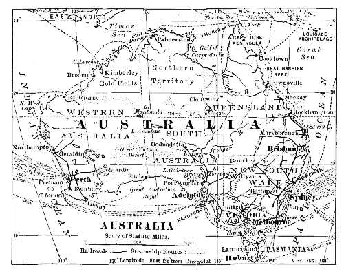 AUSTRALIA
Wheat is grown mainly for home consumption. Grapes for wine and for raisins are good-paying crops in Victoria and New South Wales. Both products find a ready market in Great Britain. Australian claret is a strong competitor of California claret for public favor, and the two are similar in character. Cane-sugar is grown in the moist regions of Queensland; it is the chief supply of the commonwealth and the neighboring islands. The forests produce an abundance of hard woods, but practically no building-timber. Jarrah wood paving-blocks are an important export. British Columbia, Washington, and Oregon supply much of the building-timber.
Gold has been the chief mineral product since the [Pg 395]settlement of the country. The mints convert the metal into coin. As a rule the value of the exports exceeds that of the imports, and the excess swells the amount of metal exported. The most productive mines are in the district of Ballarat. Coal is abundant on the east coast, and a considerable part is sold to California, and more to Asian ports. Tin is extensively mined in Tasmania.
More than fifteen thousand miles of railway have been built to carry the traffic of the country. Most of them were built by private corporations, but on account of financial difficulties and poor service they were acquired by the government. The policy proved a wise one.
Great Britain encourages the trade of her colonies, and gets about three-fourths of the traffic of the commonwealth, the imports being manufactured goods. Of the foreign trade the United States has about half, nearly all of which is landed at San Francisco and Puget Sound. Wool, cattle products, and coal are exported to the United States, and the latter sends to Australia structural steel—mainly rails—printing-paper, and coal-oil.
Melbourne is the largest city. Sydney is the port at which most of the ocean trade is landed. Brisbane, mainly a coal and a wool market, is connected with British Columbia by an ocean cable. Steamships by way of the Suez Canal generally call at Perth and Adelaide. Hobart and Launcestown are the markets of Tasmania.
New Zealand.—This colony is one of the most prosperous and best administered states in existence. The cultivable lands produce enough wheat for home use, and an excess for export. Cattle and sheep are the chief resource, however, and pretty nearly everything—meat, hides, wool, horn, and bones—is exported. Dairy products are not forgotten, and under the management of an association, these are of the best quality.
New Zealand flax (Phormium tenax), a kind of marsh hemp, yields a fibre used in making cordage. The kauri pine furnishes the chief supply of lumber. A fossil kauri gum is collected for export; it makes a varnish almost equal to Japanese lacquer. Gold is mined, and there being no mint, all the bullion is exported. The only manufactures are those which are connected with the meat export and the dairy industry. The exports noted more than pay for the manufactured goods. Most of the trade is carried on with Great Britain. Wellington, the capital, and Auckland are the centres of trade.
New Guinea.—This island, one of the largest in the world, is somewhat larger than the State of Texas, or about one-third larger than Germany or France. The gold-mines first led to the exploration and settlement of the island, but it was soon apparent that the agricultural resources were even more valuable, and it was divided among the British, Germans, and Dutch.
The western part of the island is distinctly Asian in character; the eastern and southern parts resemble Australia. Coffee, rice, and tobacco plantations have been established in the former; grazing is the chief industry in the latter. Ebony and bamboo are among the forest products.
British Possessions.—The Fiji Islands are among the most important British possessions. They number about eighty habitable and twice as many small islands. Sugar is the chief export product, and it goes mainly to Australia and New Zealand. Cocoanuts are also a large item of export trade. Suva is the chief trading-port.
The Tonga Islands are nominally independent, but are practically a British protectorate. Among other British possessions are Cook, Gilbert, and Ellice archipelagoes, and Pitcairn Island.
German Possessions.—The Samoa Islands are [Pg 397]perhaps the most important German possession, and German planters have made them highly productive. They were formerly held under a community-of-interest plan by Great Britain, Germany, and the United States. A joint commission awarded the greater part of the territory to Germany. In addition to the ordinary products, pineapples and limes are exported. Most of the trade is carried on by way of Australia. Apia is the trading-port.
Bismarck Archipelago, and the Solomon, Marshall, and Caroline groups have also been acquired by Germany. The last named was purchased from Spain at the close of the Spanish-American War.
French Possessions.—New Caledonia, together with Loyalty Islands, Fortuna, and the New Hebrides group, have great wealth in the matter of resources. New Caledonia, a penal colony, has productive mines of chrome iron ore and copper. It is the source of a considerable supply of nickel and cobalt. A railway to the coast has been built for the carriage of these products.
Tahiti is the principal island of the Society group, and under the missions long established there, the natives have become civilized. In addition to the usual trade, sugar and mother-of-pearl are important exports.
QUESTIONS FOR DISCUSSION
How will the commerce of the Pacific be changed by the construction of an isthmian canal?
What has been the effect of the Australian wool-clip on the cloth-making industry of England and Germany?
How will the acquisition of Hawaii and the Philippine Islands affect the commerce of the United States?
From Commercial Australia find the trade of the United States with the Commonwealth.
FOR COLLATERAL READING AND REFERENCE
From a cyclopædia read the history of Australia as a convict colony.
Commercial Australia.
| Country | Imports | Exports | Sells to U.S. | Buys from U.S. |
| Argentina | $110,000,000 | $161,850,000 | $10,000,000 | $11,000,000 |
| Australia | 201,000,000 | 224,000,000 | 5,263,000 | 28,164,000 |
| Austria-Hungary | 335,486,000 | 383,748,000 | 10,000,000 | 6,844,000 |
| Belgium | 428,651,000 | 352,850,000 | 14,920,000 | 51,444,000 |
| Bolivia | 5,845,000 | 15,618,000 | 22 | 120,000 |
| Brazil | 97,330,000 | 165,461,000 | 64,914,000 | 11,517,000 |
| Canada | 181,238,000 | 177,443,000 | 42,482,000 | 105,790,000 |
| Chile | 46,916,000 | 61,201,000 | 7,474,000 | 4,507,000 |
| China | 203,421,000 | 124,528,000 | 18,126,000 | 18,176,000 |
| Colombia | 10,695,000 | 18,487,000 | 4,811,000 | 2,924,000 |
| Cuba | 66,584,000 | 63,278,000 | 46,664,000 | 27,007,000 |
| Denmark | 111,542,000 | 75,549,000 | 797,000 | 15,500,000 |
| Ecuador | 6,541,000 | 7,509,000 | 1,578,000 | 1,590,000 |
| Egypt | 75,366,000 | 77,754,000 | 8,867,000 | 1,321,000 |
| France | 843,255,000 | 774,497,000 | 81,315,000 | 78,406,000 |
| Germany | 1,290,254,000 | 1,054,685,000 | 99,970,000 | 184,679,000 |
| Greece | 26,782,000 | 18,100,000 | 1,447,000 | 286,000 |
| India, British | 264,318,000 | 392,025,000 | 47,172,000 | 5,647,000 |
| India, Dutch | 67,755,000 | 100,632,000 | 32,309,000 | 1,653,000 |
| India, French | 36,576,000 | 30,513,000 | ... | 118,000 |
| Italy | 331,668,000 | 265,270,000 | 27,631,000 | 34,046,000 |
| Japan | 127,397,000 | 124,209,000 | 36,855,000 | 21,163,000 |
| Mexico | 64,036,000 | 77,583,000 | 17,273,000 | 83,722,000 |
| Netherlands | 815,442,000 | 695,763,000 | 17,273,000 | 83,722,000 |
| Norway | 83,255,000 | 43,616,000 | ... | ... |
| Peru | 11,276,000 | 21,890,000 | 2,911,000 | 2,312,000 |
| Phillippine Islands | 30,279,000 | 23,215,000 | 4,421,000 | 4,027,000 |
| Portugal | 62,497,000 | 30,546,000 | 3,642,000 | 4,454,000 |
| Roumania | 41,878,000 | 54,041,000 | 101,000 | 31,000 |
| Russia | 269,493,000 | 375,276,000 | 7,236,000 | 6,506,000 |
| Spain | 161,867,000 | 129,399,000 | 7,041,000 | 16,786,000 |
| Sweden | 143,363,000 | 104,878,000 | 4,370,000 | 11,521,000 |
| Switzerland | 202,651,000 | 161,458,000 | 16,035,000 | 233,000 |
| Turkey | 103,110,000 | 64,876,000 | 2,437,000 | 184,000 |
| United Kingdom | 2,540,265,000 | 1,362,729,000 | 155,292,000 | 598,767,000 |
| United States | 903,321,000 | 1,355,482,000 | ... | ... |
| Uruguay | 24,497,000 | 28,674,000 | 1,975,000 | 1,481,000 |
| Venezuela | 8,457,000 | 17,962,000 | 6,610,000 | 2,737,000 |
Acapulco, 269
Acré, 281
Activities classified, 4
Adams, 220
Aden, 354
Adjustment to environment, 86
Afghanistan, 355
Alaska, 254
Alberta, 265
Alexandria, 384
Alfa, 124
Algeria, 385
Altitude, effects of, 32
Aluminium, 179
Amazon River, 53
Amber, 146
Ambergris, 204
American Indians, 86
Amritsar, 362
Amsterdam, 318
Anaconda, 250
Anchovy, 207
Angora wool, 115
Anthracite coal, 224
Appalachian region, 222
Arabia, 354
Argentina, 291
Arid region of U.S., 240
Arkwright, 108
Asian Rivers, navigation of, 53
Asphalt, 157
Assiniboia, 265
Astrakhan, 347
Athens, 341
Atlanta, 239
Atlantic coast-plain, 213, 221
Attar-of-roses, 338
Australia, 392
Austria-Hungary, 335
Bagdad, 354
Baltimore, 217
Baluchistan, 357
Barbados, 273
Barley, 101
Barmen-Elberfeld, 308
Batavia, 364
Bauxite, 179
Beef, exports of U.S., 244
Beginnings of cities, 82
Belgium, 313
Belgrade, 341
Bengal, 361
Benzine, 156
Bergen, 312
Berlin, 308
Bermuda, 273
Bessemer-steel boilers, 63
Big tree, 198
Billiton, 364
Birmingham, Eng., 302
Bismarck Archipelago, 397
Black walnut, 199
Blende, 182
Bluefish, 206
Boers, 86
Bogota, 277
Bohemian glass, 336
Boise City, 250
Bokhara, 347
Bolivia, 280
Bombay, 362
Bosnia, 337
Boston, 215
Boxwood, 200
Brass, 178
Breakfast, travels of a, 1
Bremen, 308
Brenner Pass, 66
Brick tea, 134
Bridgeport, 221
British Columbia, 265
India, 358
Bronze Age, 181
Brussels, 316
Budapest, 337
Buenos Aires, 293
Buffalo, 225
Bulgaria, 338
Burlington, 237
Burma, British, 362
Burr clover, 34
Butte, 250
Cacao, 134
Cairo, 384
Calcutta, 123
California fruits, 251
Callao, 279
Camel's hair, 116
Camphor, 378
Canada, 261
Canadian Pacific Railway, 263
Canal, Chesapeake & Ohio, 56
Chicago ship, 56
Erie, 55
Grand, 370
Kaiser Wilhelm, 57
Ludwig, 337
Manchester, 57
Nicaragua, 59, 270
Nord Holland, 57, 318
Panama, 58
Rideau, 54
St. Mary's Falls, 228, 263
Suez, 57
Welland, 54, 263
Cañons, effects of, 18
Canton, 374
Caoutchouc, 141
Capacity of locomotives, 63, 64
Cape Nome, 254
Cape of Good Hope, 387
Cape Town, 389
Caravan tea, 134
Carpet wools, 112
Cashmere shawls, 363
Cattle-growing, 240
Cavité, 258
Cereals, 88
Charleston, 218
Cheviot, 112
Cheyenne, 244
Chicago River, 228
Chicory, 131
Chile, 281
Chinook winds, 261
Chocolate, 136
Cigars, manufacture of, 137
Cincinnati, 236
Cities, growth of, 83
Clearing-houses, 215
Climate, 29
Clipper ship, 44
Cloth, antiquity of, 105
Coal, 148, 257, 258, 264, 265, 268, 298, 323, 333, 344, 365, 368, 379
areas of the world, 147
prices of, in U.S., 149
tar products, 153
Coast commerce of U.S., 222
Coastplains, 22
Coca, 278
Cocoa, 134
Cocoon silk, 119
Cod fisheries, 204
Coke, 151
Colombia, 275
Columbus, voyages of, 11
Commerce in Western Europe, 13
Competition and pools, 67
Constantinople, 340
Copal, 146
Copenhagen, 313
Copper, 159, 162, 177, 248, 266, 279, 344, 379
Cordage, 122
Corn, oil of, 100
Cotton, 106, 238, 269, 289, 302, 306, 326
[Pg 401]Cotton, Egyptian, 109, 383
gin, 109
Indian, 360
Peruvian, 108, 278
sea island, 108
Cotton crop, distribution of, 239
Creosote, 145
Cripple Creek, 248
Crompton, 108
Crusades, wars of, 8
Currant grapes, 341
Da Gama, voyage of, 11
Dammar, 146
Davenport, 237
Deadwood, 250
Demerara, 286
Denmark, 312
Denver, 250
Detroit, 230
Diamonds, 388
Dias, voyage of, 11
Divi-divi, 285
Division of industries, 41
Dubuque, 237
Dutch East Indies, 364
standards, 188
Eastern Turkestan, 376
Ebony, 200
Economic regions of U.S., 213
Ecuador, 279
Egypt, 381
Electric railways, 76
Eminent domain, 76
Exchange of products, 5
Fairs, 346
Fall River, 220
Felt hats, 209
Fertility of irrigated regions, 33
Feudalism, 7
Fiji Islands, 396
Fisheries, 266
Fish hatcheries, 207
Flax, 120, 300, 314, 343
New Zealand, 124
Forced draught, 63
Forest areas, 193, 261, 288, 299, 310
Fort Dearborn, 228
France, 320
French India, 365
Galveston, 238
Gasoline, 156
Geneva, 334
German Empire, 303
Gold, 166, 172, 248, 264, 268, 286, 344, 379, 395
Grain elevators, 94
Grape industry in New York, 36
Graphite, 153
Grasses, 88
Great Britain, 295
Great Central Plain, 22
Great Lakes, 227
Great Salt Lake, 247
Greece, 340
Griqualand West, 388
Guam, 258
Guatemala, 270
Guayaquil, 280
Guiana, 286
Gulf coast, 237
Gums, 141
Gutta-percha, 144
Halibut, 256
Halifax, 264
Hamburg, 308
Hamilton, 265
Hanse League, 13
Hargreaves, 109
Hartford, 221
Hawaiian Islands, 255
Helena, 250
Hematite, 163
Henequen, 122
Herodotus quoted, 106
Herring fisheries, 205
Herzegovina, 337
Hickory, 199
Hilo, 256
Hodeida, 130
Holland, 316
Houston, 238
Hudson's Bay Company, 208, 262
Iloilo, 258
Inclination of axis, 36
Indianapolis, 237
Inland waters, 50
Intermontane valleys, 18
Interstate Commerce Commission, 76
Iodine, 282
Iquique, 283
Iran plateau, 349
Ireland, 265
Irkutsk, 347
Iron, 162, 236, 300, 323
galvanized, 182
ore, 163, 166, 300, 306, 311, 315, 323
Iron Gate, 338
Italy, 325
Jade, 159
Japan, 375
Java, 364
Joint tariff associations, 72
Kabue, 356
Kansas City, 236
Kashmir, 363
Key West cigars, 137
Khaibar Pass, 356
Khiva, 347
Kiakhta, 347
Kiel, 309
Klondike mines, 254
Kongo River, navigation of, 54
Kongo State, 386
Korea, 376
Lac, 145
Lacquer, 378
La Guaira, 286
Lanolin, 114
Lassa, 374
Las Vegas, 250
Laudanum, 139
Lawrence, 220
Lead, 180
Lead pencils, 153
Leadville, 250
Leather goods, 221
Liechtenstein, 337
Lignum vitæ, 200
Lithographic stone, 305
Liverpool, 302
Llama, 115
Lobster fisheries, 207
Locomotive, Central-Atlantic type, 64
Logwood, 201
London, 302
Louisville, 237
Lourenço Marquez, 390
Lowell, 220
Lynn, 221
Macao, 374
Mackerel, 206
Mackintosh, 143
Madagascar, 387
Madras, 363
Magnetite, 163
Maguey sugar, 187
Mahogany, 199
Malay States, Federated, 363
Manchester, Eng., 382
Manchester, N.H., 220
Manchuria, 376
Mandalay, 362
Manganese, 182
Manitoba, 265
Marco Polo, 9
Martinique, 273
Maté, 136
Maverick, 240
Melbourne, 395
Memphis, 238
Metals, influence of, in cities, 85
Milan, 328
Mileage books, 72
Millet, 359
Milwaukee, 230
Mingo Junction, 224
Mining, 248
Miquelon, 266
Mississippi River, 52
valley, 232
Mobile, 240
Mocha coffee, 130
Mohair, 115
Mohawk valley, 220
Molasses, 191
Moline, 237
Mongolia, 376
Mont Cenis tunnel, 66
Montenegro, 341
Montreal, 264
Morocco, 384
Mountains, contents of, 17
Moscow, 347
Mulberry, 116
Nagasaki, 380
Nankeen cotton, 108
Nashua, 220
Natural gas, 157
Naval stores, 145
Nearchus, 107
New Brunswick, 264
New Caledonia, 397
New England Plateau, 219
New Guinea, 396
New Haven, 221
New Orleans, 238
New York City, 84, 214, 215, 230, 238, 250
New Zealand, 395
Newfoundland, 266
Nicaragua, 270
Nickel, 182
Nieuwchwang, 374
Nigeria, 387
Nile River, barrage of, 383
floods of, 33
navigation of, 54
Nitrate, 282
Norfolk, 218
Northern Securities Company, 227
Norway, 310
Nova Scotia, 264
Novgorod, 209
Oak, 198
Oats, 101
Ocean steamships, 45
Ogden, 250
Ohio River, 52
Oil of theobroma, 135
Old Government Java, 129
Oleo-resins, 141
Omaha, 236
Ontario, 265
Oregon pine, 252
Ottawa, 265
Oyster fisheries, 207
Pacific Coast lowlands, 250
Paddy, 103
Pago Pago Harbor, 258
Pará, 291
Paraffine, 157
Paris, 324
Passes, 19
Pearl Harbor, 256
Peking, 374
Penang, 363
Pepper, 365
Persia, 354
Persian lamb, 208
Peru, 278
Petroleum, 154, 225, 344, 379
jelly, 157
Philadelphia, 216
Philippine Islands, 256
Pine, 197
Piræus, The, 341
Pitch, 145
Plains, 21
Plaiting straw, 124
Ponce, 255
Pools, 68
Population, distribution of, 81
Pork, 234
Port Arthur, 347
Port Huron, 230
Port Saïd, 384
Port wine, 330
Portland, Me., 217
Portland, Ore., 252
Porto Rico, 254
Portugal, 328
Prince Edward Island, 264
Providence, 221
Punjab, 362
Pyrites, 164
Quicksilver, 180
Rabbit skins, 209
Railway, Canadian Pacific, 263
Chesapeake & Ohio, 71
Chicago, Burlington & Quincy, 68
New York Central, 65, 67
Northern Pacific, 227
Sind-Pishin, 356
Southern, 71
Tehuantepec, 269
Transportation, 62
Transsiberian, 345, 372
Union Pacific, 66
Rainfall, effects of, 33
deficiency of, 33
Ramie, 123
Rangoon, 362
Raw silk, 118
Rebates, 71
Resins, 141
Rhodesia, 389
Richmond, 221
Riga, 347
Rio Janeiro, 290
River navigation in Europe, 53
valleys, 21
Roads, macadamized, 78
Rock Island, 237
Rome, 327
Rotterdam, 318
Roumania, 338
Rubber, 141, 275, 278, 281, 288
Rug wools, 114
Ruhr iron fields, 306
Russia, 343
Sacramento, 252
Sahara, 385
Saigon, 365
Sailing vessels, 47
St. Gotthard tunnel, 66
St. Louis, 234
St. Petersburg, 346
St. Pierre, 266
St. Thomas, 273
Salmon, 205
Salonica, 340
Samoa Islands, 396
San Antonio, 239
San Francisco, 252
San Joaquin valley, 250
San Juan, P.R., 255
San Pedro, 252
Sandarach, 146
Santa Fé, 250
Santiago, 283
Santos, 290
Saskatchewan, 265
Savannah, 238
Scranton, 224
Seal fisheries, 208
Seasonal rains, 34
Servia, 341
Shad, 256
Shanghai, 374
Sheep-growing, 242
Shell-lac, 145
Shoe manufacture, 221
Siam, 364
Siberia, 347
Silver, 162, 176, 248, 268, 278, 304, 340
Sind, 362
Sioux City, 236
Skagway, 254
Sorghum, 187
Sound Valley, 250
South Bethlehem, 224
South Chicago, 225
Southampton, 302
Spain, 328
Spermaceti, 204
Spokane, 250
Sponge, 208
Steel, Bessemer, 160, 169, 170, 222, 300, 304, 345
Stephenson, 63
Stockholm, 312
Stockton, 252
Sugar, 185, 289, 303, 314, 318, 364
Swash channel, 50
Sweden, 310
Switzerland, 331
Sydney, 395
Tacoma, 252
Tar, 145
Temperate zone, activities of, 32
Textiles, 105
Three-mile fishing limit, 262
Thrown silk, 118
Tobacco, 136, 237, 240, 364, 383
Tokio, 380
Toledo, 225
Topography and trade routes, 24
Toronto, 265
Torrid zone, temperature of, 30
Tortilla, Mexican, 100
Trade routes, ancient, 8
Transcaucasia, 348
Transvaal, 389
Treaty ports, 373
Trebizond, 351
Triple-expansion principle, 45
Tripoli, 386
Tunis, 385
Turf grass, 34
Turkey-in-Europe, 339
Turks invade Europe, 9
Turpentine, 144
Tussar silk, 119
Tutuila, 258
Tweed, 112
Uruguay, 294
Valparaiso, 283
Vancouver, 266
Vanderbilt locomotive fire-box, 64
Vanilla, 268
Vaseline, 157
Venezuela, 285
Vicksburg, 238
Vienna, 337
Virginia City, 250
Vladivostok, 347
Vuelta Abajo, 137
Vulcanized rubber, 142
Wai-wu-pu, 373
Walla Walla, 250
Warsaw, 347
Water-power, 84
Waterproof cloth, 143
Welland Canal, 263
Wellington, 396
Whale fisheries, 203
Wheat, 88, 96, 244, 344, 359, 367
White Pass, 253
Willamette Valley, 250
Winnipeg, 265
Wood-pulp, 124
Wool, 110,115, 117, 244, 251, 292, 297, 323
Yafa, 354
Yokohama, 380
Youngstown, 166
Yucatan, 267
Zinc, 182
Zinfandel, 251
Footnotes:
[1] If the edition for free distribution is exhausted, these may be purchased from the Superintendent of Documents, Public Printer, Washington, D.C.
[2] The greatness of Palmyra was due to the trade along this route, and its decay began when the route was abandoned. The present town of Tadmor is near the ruins of the former city.
[3] Cosmas Indicopleustes—in early life a merchant, in later years a monk—visited India and Ceylon during the first part of the sixth century. His writings contain much valuable knowledge, but in the main they are theological arguments intended to disprove the Geography written by Ptolemy.
[4] The date is variously given as 1169, 1200, and 1241.
[5] To Waldemar III. of Denmark it dictated terms that made its power in Scandinavia supreme.
[7] The record time on this route was made by the Lucania in five days, seven hours, and twenty-three minutes, from Daunts Rock, Queenstown, to Sandy Hook light. The fastest day's run yet recorded was made by the Deutschland—601 nautical miles, a speed of 24.19 knots.
[8] In Congress the River and Harbor Bill always receives a generous appropriation.
[9] In many instances goods designed for the spring trade in the Western States are started via the canal in October, reaching their destination at Chicago some time in April, the cargo having been frozen up in one or another of the canal basins during the winter. The rate paid for this slow transit is considerably less than the amount which otherwise would have been paid for storage; moreover, it is nearly all clear profit to the canal boatmen.
[10] The minimum depth of the canal is 22 feet; its width at the bottom is 160 feet. It was begun September, 1892, and completed January 2, 1902, at a cost of thirty-four million dollars. More than forty million cubic yards of earth and rock were excavated. All the bridges crossing it are movable.
[11] This is on the supposition that night travel will be too dangerous a risk. With a continuous travel the time would be about thirty-three hours.
[12] On one great trunk system the average ton-mile rate in 1870 was one and one-seventh cents; in 1900 it was just one-half that sum.
[13] The modern steam-making boiler has from thirty to one hundred or more tubes passing through it from end to end. The heat from the fire-box as a rule passes under the boiler and through the tubular flues; it thus increases the heating surface very greatly. The forced draught is made by allowing the exhaust steam to escape into the smokestack, thereby increasing the draught through the fire-box.
[14] A single locomotive of the New York Central has hauled 4,000 tons of freight at a speed of twenty-five miles an hour. A "camel-back" of the Philadelphia & Reading hauled 4,800 tons of coal from the mines to tide-water without a helper.
[15] The Vanderbilt boiler with cylindrical corrugated fire-box invented by Cornelius Vanderbilt, great-grandson of the founder of the New York Central, marks an important step in locomotive building. The cylindrical form largely obviates the necessity of an array of stay-bolts to prevent warping; the corrugated surface gives greater heating power.
[16] The Central-Atlantic type of locomotive illustrates a modern improvement. The driving-wheels are placed a little forward of their usual position, while the fire-box, formerly set between the wheels, now overhangs each side of a pair of low trailing-wheels. By this means the heating surface of the fire-box is increased nearly one-half. A lever controlled by the engineer enables the latter to transfer 5,000 pounds weight from the trucks to the driving-wheels when a grade is to be surmounted. The daily run of such a locomotive is greatly increased. (See cut, p. 61.)
[17] A line from Vienna to Triest was opened about 1854; Germany was joined to Italy across Brenner Pass in 1868; France was connected with Italy through a tunnel near Mont Cenis in 1871; in 1882 the traffic of Germany was opened to Mediterranean ports by a tunnel under St. Gotthard. In this manner trunk systems have gradually developed.
[18] The building of the West Shore Railroad is an illustration. After both roads had suffered tremendous losses the New York Central settled the matter by purchasing the West Shore. This was one of a great number of similar cases both in the United States and Europe.
[19] In Great Britain the ton-rate is about $2.30 per hundred miles; in Germany, $1.75; in Russia, $1.30; in the United States, $0.70. The difference is due as much to the length of distance hauled as to economical management.
[20] Thus, A, B, and C are roads whose chief terminal points are Chicago and New York City. The road C is the shortest of the three lines, but its grades are very heavy. B is, say, one hundred miles longer, but has no heavy grades. A is a very indirect route, and its New York traffic must be trans-shipped at Boston, or perhaps at New London, and sent a part of the way by water. If now an absolute ton-mile rate is fixed for either road, it is evident that neither of the others can carry through freight without altering rates. If C fixes a rate, then A and B must either charge higher rates between Chicago and Montreal, or Chicago and Albany, than between their terminals. And although this is illegal in most States, the laws are evaded by "rebate," or repayment of a certain sum to the shipper. Of the three roads B, on account of easy grades, is in the best position to fix rates. It therefore makes, not the lowest rate, but the one that will yield the best returns. C conforms to this, and A takes what it can get, hauling at a very small profit. But if A happens to be outside of the limits of the United States, it may openly cut rates, because pretty nearly all the through freight it gets is clear profit, and inasmuch as none of the laws of a State apply to the Canadian portion of the road, it may do what the others cannot. And while B is struggling with A, the three roads X, Y, and Z are perhaps endeavoring to have some of the freight sent from Buffalo eastward over their own lines. In instances similar to the foregoing it is customary for B and C to divide the through business and to allow a "differential" to A—that is, on account of its slower delivery of through freight, to carry it at a slightly lower rate. B then adjusts its traffic with X, Y, and Z in a similar manner; and on the whole this is the fairest way to all concerned.
The following, one of many instances, shows the difficulties in fixing rates that will not be unjust to either party: Danville and Lynchburg compete for a certain trade. The Southern Railway passes through both cities, but the Chesapeake & Ohio makes Lynchburg by another route; Danville, therefore, is not a competing point, while Lynchburg is. As a result, the Southern Railway charged $1.08 for a certain traffic from Chicago to Danville and only 72 cents to Lynchburg, some distance beyond, this being the rate over the other road. The matter finally reached the Court of Appeals, and the latter sustained the Southern Railway. The rate to Danville was shown to be not excessive, but if the railway were required to maintain a rate to Lynchburg higher than 72 cents, it would lose all its traffic to that point, amounting to $433,000 yearly. In a case of this kind there can be no help except by a consolidation of the two roads; by virtue of the consolidation all the Lynchburg freight will then go over the line having the easiest haul.
[21] That is, the Government pledged its credit for the money borrowed, and in addition gave the companies alternate sections of public land on both sides of the proposed line, the land-grants being designed partly to encourage immigration and partly to increase the building funds of the various companies. In several instances both the land-grants and the money subsidies were scandalously used. At least one road used its earnings to build a competing line and, after disposing of the land-grant and pocketing the proceeds, allowed the Government to foreclose the mortgage and sell the original road.
[22] From the Latin "castra," a camp.
[23] In 1897 the world's crop was 2,226,750,000 bushels, and as a result, the countries in which the crop was short suffered from high prices. Had it not been for the prompt carrying service of railways and steamships famine would have resulted.
[24] In order to yield a crop of twenty-five bushels per acre the soil must supply 110 lbs. of nitrogen, 45 lbs. of phosphoric acid, 30.5 lbs. of lime, 14.5 lbs. of magnesia, and 142 lbs. of potash; these are approximately the mineral elements taken out of the soil with each crop, and it is needless to say that they must be replaced or the grain will starve for want of nutrient substances.
[25] In the United States there are about seven wheat-districts, each characterized by particular varieties that grow best in the given locality. In the New England and most of the middle Atlantic division Early Genesee Giant, Jones Winter Fife, and Fultz are chiefly grown. In the Southern States Fultz, Fulcaster, Purple Straw, and May are foremost. In the north central group of States Early Red Clawson, Poole, Dawson's Golden Chaff, Buda Pest, and Fultz are common. In the Dakotas and Minnesota Scotch Fife and Velvet Blue Stem (both spring wheats) are generally planted. In Kansas and Texas and the adjacent locality the principal varieties are Turkey, Fulcaster, and Mediterranean (all winter wheats). In California and the southern plateau region Sonora, California Club, and Defiance are the principal kinds (all winter wheats). In Washington and Oregon Little Club, Red Chaff, and Blue Stem (which are either winter or spring) are the main varieties.
[26] Sometimes the owner sends it to the nearest elevator at tide-water where the grain is stored, not in bulk, but in the original packages, subject to his demand. In the course of a month or six weeks it absorbs so much moisture that the gain in weight more than pays the storage charges.
[27] The elevators are equipped with "legs" or long spouts, within which belts with metal scoops transfer the grain from car to vessel or vice versa. The elevators at Buffalo will fill a canal-boat in an hour's time, or load six grain-cars in five minutes. A large whaleback steamship may be relieved of its 200,000 bushels in about three hours. Most of the east-bound wheat of the Middle West is transferred to the seaboard by rail, but that of the northwest, which forms the chief part of the crop, is shipped from Duluth through the St. Marys Falls Canal to Buffalo, where it is transferred to cars or to canal-boats. New York is the leading export market, but Boston, New Orleans, Galveston, Baltimore, and Philadelphia are also important shipping ports.
[28] The following is approximately the yield of the chief wheat-growing countries in bushels per acre:
| Denmark | 42 |
| England | 29 |
| New Zealand | 26 |
| Germany | 23.2 |
| Holland & Belgium | 21.5 |
| Hungary | 18.5 |
| France | 19.5 |
| Austria | 16.3 |
| Canada | 15.5 |
| United States | 12.3 |
| Argentina | 12.2 |
| Italy | 12.1 |
| Australia | 10 |
| India | 9.2 |
| Russia | 8.6 |
| Algeria | 7.5 |
The low average in Australia, India, and Algeria is due mainly to lack of rainfall; in the United States and Russia, mainly to unskilful cultivation.
[29] It seems to have been introduced into Turkey from India about the latter part of the fifteenth century, after which it was occasionally heard of in Europe as "Turkey corn."
[30] The "tortilla," the national bread of the Mexican, consists of a thick corn-meal paste pressed into thin wafers between the hands, and baked on hot slabs of stone. The corn-meal "mush" of the American, the "polenta" of the Italian, and the "mamaliga" of the Rumanian are all practically corn-meal boiled to a thick paste in water.
[31] The gin, invented by Eli Whitney in 1793, enabled one man to do by machinery about the same amount of work as previously had required one hundred laborers. For want of the laws necessary to protect his invention, Whitney was defrauded of the profits arising from it. Neither Congress nor the courts gave him any relief from the numerous infringements, and he died a poor man.
[32] The commercial distinction is a sensible one: hair is hard, crisp, straight, and does not felt; wool is soft, curly, and felts readily.
[33] An ounce of eggs produces about forty thousand worms, and these, during the grub stage, require about fifteen hundred pounds of leaves, about one-half of which is actually consumed.
[34] Charles II. of England also forbade its use (1675) and attempted to close the coffee-houses that had sprung up in London, but in spite of the ban and the prohibitive tax laid upon it, the use of coffee became general. Similar efforts to close the coffee-houses in Constantinople failed.
[35] The full-grown leaf attains a length of from four to nine inches; those picked rarely exceed one-and-a-half inches in length.
[36] Brick tea consists of leaves moulded into bricks under heavy pressure. Refuse and stems are also thus prepared for the cheaper grades.
[37] The following are the chief rubber-producing trees: Siphonia elastica, or Hevea brasiliensis, Amazon forests, yields Pará rubber; Manihot Glaziovii, also a tapioca-producing shrub, Ceará province, Brazil, furnishes Ceará rubber; Castilloa elastica, Central American States, Nicaragua rubber; Ficus elastica, British India, and Urceola elastica, Borneo, Indian rubber. There are rubber-producing trees in Florida, but they have little commercial value at the present time. African rubber is taken from a variety of plants.
[38] The process of vulcanizing was made practicable during the ten years ending in 1850. It was invented and perfected by Goodyear in the United States and by Hancock in England; for ordinary purposes, where both strength and elasticity are required, about five per cent. of sulphur is added. The addition of about fifty per cent. changes the rubber to a hard black substance known as "ebonite," or "hard rubber."
[39] In 1823 a Scotchman, Mackintosh, applied the discovery, that rubber gum was soluble in benzine, to the water-proofing of the cloth that bears his name. This invention was about the first extensive commercial use to which rubber had been put.
[40] From the fact that most of the dwellings in the United States are built of wood, the United States is a very heavy consumer of turpentine.
[41] A slender strip of metallic lead was used instead of graphite in the first pencils made. The use of graphite did not become general until about 1850. The hardness of a pencil is regulated by mixing clay with the powdered graphite.
[42] These percentages are on the supposition that the ores are chemically pure; the percentage of metal actually obtained is somewhat less.
[43] These percentages are on the supposition that the ores are chemically pure; the percentage of metal actually obtained is somewhat less.
[44] These percentages are on the supposition that the ores are chemically pure; the percentage of metal actually obtained is somewhat less.
[45] These percentages are on the supposition that the ores are chemically pure; the percentage of metal actually obtained is somewhat less.
[46] The limestone has no essential part in the smelting of the ore except to produce an easily-flowing, liquid slag; hence it is called a flux. Some ores smelt and flow so easily that a flux is not required.
[47] Under ordinary circumstances about two tons of coal, or three-quarters of a ton of coke, are required to produce a ton of pig-iron.
[48] Terne plate is sheet-iron coated with an alloy of lead and tin.
[49] Heredity is likewise a factor. The seeds of knotty, scraggly trees are very apt to produce trees of their own kind and vice versa.
[50] This sum represents more than ten times the amount of gold coin now in existence. Less than five per cent. of the business of the great industrial centres is a cash business. Even if the money existed, the transfer of such immense sums would greatly retard commerce. In order to effect a speedy settlement of payments, clearing-houses are established. At the clearing-house the representatives of the various banks meet daily and liquidate the checks drawn against one another; and although the total yearly volume of payment aggregates the sum mentioned above, the balances for a year are but little more than two billion dollars. Even this does not always represent cash payment, for a bank that is a debtor to another at the close of one day may be a creditor for an equal sum on the next.
[51] These roads are financed by the Northern Securities Company and form a link in the Hill-Morgan lines. Their intercontinental traffic is large.
[52] Their dividing line is the centre of a street.
[53] The brand consisted of any specific device, such as an initial, a monogram, or a conventional form that might be easily recognized. The device was registered and imprinted with a red-hot iron on the flank of the animal. Ear-marks, such as notches or similar devices, also indicated ownership.
[54] In many cases Government land, not owned by the rancher, has been fenced in. No objection was made, however, until the sheep-grazier came. He demanded the removal of the fences, claiming that he had an equal right to graze his herds on public lands. But inasmuch as a range once grazed by sheep is ruined for cattle-growing, the quarrel between the grazier and the rustler has become one in which both the grazier and the rustler turned upon the sheep-owner.
[55] It is one-third of their capital stock plus the bonded indebtedness.
[56] The high latitude of the wheat-region, which in most cases is too cold for the growing of food-stuffs, in this region is tempered by occasional warm winds known as "Chinook winds." These winds are the saving feature of wheat-growing. They prevail also in British Columbia, Washington, and Oregon.
[57] Freight rates from Coatzacoalcos to San Francisco are already fixed at $6.50 per ton; by the transcontinental railways they vary from $12 to $15 per ton.
[58] The entire Cuban crop is comparatively small, being but little more than one-eighth that of the United States.
[59] Vegetable ivory is the seed or nut of a species of palm (Phytelephas macrocarpa). The kernel of the nut gradually acquires the hardness and appearance of the best ivory, for which it is employed as a substitute.
[60] The leaves of this shrub (Erythroxylon coca) contain a stimulant substance that in its effects is much like the active principle of coffee. They are much used by the native laborers to ward off the feeling of lassitude that comes with severe labor in a tropical climate. A native porter will carry a load of one hundred pounds a distance of sixty miles with no food or rest, but merely chewing a few coca-leaves. The plant yields the substance cocaine, now in demand all over the world as an anæsthetic in eye and throat surgery.
[61] More than a score of species of the tree from which this bark is obtained grow in the higher eastern slopes of the Andes, but a very large part is obtained from the tree, Cinchona calisaya. The medicinal substance, quinine, is extracted from the bark, and in the past half-century it has become the specific for malarial fevers. So great is the demand for it, that the cinchona-tree is now cultivated in India, Java, and Mexico.
[62] Only a very small proportion of the Panama hats in the market are genuine. Many of the imitations, selling at retail for ten dollars or more, are serviceable hats; most of them, however, have but little worth.
[63] Nitre, or "nitrate," is a native nitrate of potash, or nitrate of soda. The latter, commonly called cubic nitre or Chile saltpetre, is the kind occurring in Chile. Inasmuch as it is very soluble, a plentiful rainfall would soon leach it from the ground and carry it to the sea. The nitrate is thought to be of vegetable origin.
[64] The pod of a shrub (Cæsalpina coriaria); it contains a considerable proportion of tannin and is used for tanning leather.
[65] The pericarp or pod contains about twenty-four prismatic-shaped nuts.
[66] The cattle for Cuba and Brazil must be shipped in open pens in crossing the tropics. With the exports for Europe the case is different. If it is summer at the one port it is winter at the other, but it is always summer in the tropics, and cattle-ships fit for one zone are not fit for the other—hence the great difficulties in shipment of live animals to Europe.
[67] For this reason Great Britain is practically a free-trade country. A protective tariff on imported food-stuffs and materials to be manufactured would hurt rather than protect British industries.
[68] This is equivalent to the imposition of a tax on all the sugar consumed at home.
[69] Most of the lithographic stone is obtained at Solnhofen.
[70] This is a little greater than the average ton-mile rate on the New York Central Railroad between New York and Chicago.
[71] The name Zuider, or Zuyder, means "south"; it was so named to distinguish it from the North Sea.
[72] Some years ago many of the most valuable vineyards were destroyed by an insect pest known as the phylloxera, introduced from California. The trouble was overcome by replanting with American vines, the roots of which were immune to the pest. On these roots were grafted the choice French vines, the leaves and twigs of which were immune. In this manner the vineyards were restored with vines that are proof against attack, and the wine output has reached its normal amount.
[73] It is cultivated as an ornamental tree in the Southern States and in California.
[74] A small vein of coal occurs near Freiburg.
[75] The St. Gotthard tunnel is almost nine and one-half miles long; the Arlberg tunnel is six and one-half miles in length. The tunnel now nearing completion under the Simplon Pass is more than twelve miles long. Five railways cross the northern frontier into Germany, and German commerce profits most by them.
[76] Persian rugs are the finest. As a rule the designs are floral and many of them contain legendary history worked in fantastic but beautiful patterns. Among those of especial merit are the Kermanshah tree-of-life fabrics, now somewhat rare. The rugs of Tabriz and Shiraz are also of high value. In general, Persian fabrics are characterized by very fine weaving, a short pile, and elaborate designs. Turkoman rugs are usually a rich brown or maroon in color, and are apt to contain slightly elongated octagonal figures. The Bokhara and Khiva-Bokhara, or Afghan rugs, are the best examples. The Baluchistan rugs are usually very dark in color, with bright red designs and striped ends of cotton warp. Turkish rugs are made almost wholly in Asia Minor or Anatolia. Large carpets of American and European designs are made at Ushak and Smyrna. "Smyrna" rugs are made in Philadelphia.
[77] The most valuable Kermanshah rug, now no longer made there, is the tree-of-life prayer-rug, an illustration of which is shown on p. 350. The design is emblematic of the story of the Garden of Eden.
[78] In 1900 the aggregate value of the wheat exported to Great Britain was only £2,200.
[79] Since the treaty of 1901, which forbids the importation of fire-arms, a number of large plants for the manufacture of fire-arms, smokeless powder, and fixed ammunition have been established on the lower Yangtze.
[80] The islands are mainly in the belt of prevailing westerly winds. More rain, therefore, falls on the west than on the east coasts.
[81] This region is also known us the Gold Coast. Formerly it furnished the chief British supply of gold, and the gold coin known as the "guinea" received its name from this circumstance.
[82] This region was formerly comprised in the Boer republics, Orange Free State and South African Republic. In 1899 they declared war against Great Britain, with the result that they were defeated and annexed to that country—the former as Orange Colony, the latter as Transvaal Colony.
[83] It is estimated that twenty-two acres of land are necessary to sustain one adult on fresh meat. The same area of wheat would feed forty-two people; of oats about eighty-five people; of maize, potatoes, and rice, one hundred and seventy people. But twenty-two acres planted with bread-fruit or bananas will support about six thousand.
***END OF THE PROJECT GUTENBERG EBOOK COMMERCIAL GEOGRAPHY***
******* This file should be named 24884-h.txt or 24884-h.zip *******
This and all associated files of various formats will be found in:
http://www.gutenberg.org/2/4/8/8/24884
Updated editions will replace the previous one--the old editions will be renamed.
Creating the works from public domain print editions means that no one owns a United States copyright in these works, so the Foundation (and you!) can copy and distribute it in the United States without permission and without paying copyright royalties. Special rules, set forth in the General Terms of Use part of this license, apply to copying and distributing Project Gutenberg-tm electronic works to protect the PROJECT GUTENBERG-tm concept and trademark. Project Gutenberg is a registered trademark, and may not be used if you charge for the eBooks, unless you receive specific permission. If you do not charge anything for copies of this eBook, complying with the rules is very easy. You may use this eBook for nearly any purpose such as creation of derivative works, reports, performances and research. They may be modified and printed and given away--you may do practically ANYTHING with public domain eBooks. Redistribution is subject to the trademark license, especially commercial redistribution.
*** START: FULL LICENSE ***

THE FULL PROJECT GUTENBERG LICENSE
PLEASE READ THIS BEFORE YOU DISTRIBUTE OR USE THIS WORK

To protect the Project Gutenberg-tm mission of promoting the free
distribution of electronic works, by using or distributing this work
(or any other work associated in any way with the phrase "Project
Gutenberg"), you agree to comply with all the terms of the Full Project
Gutenberg-tm License (available with this file or online at
http://www.gutenberg.org/license).


Section 1.  General Terms of Use and Redistributing Project Gutenberg-tm
electronic works

1.A.  By reading or using any part of this Project Gutenberg-tm
electronic work, you indicate that you have read, understand, agree to
and accept all the terms of this license and intellectual property
(trademark/copyright) agreement.  If you do not agree to abide by all
the terms of this agreement, you must cease using and return or destroy
all copies of Project Gutenberg-tm electronic works in your possession.
If you paid a fee for obtaining a copy of or access to a Project
Gutenberg-tm electronic work and you do not agree to be bound by the
terms of this agreement, you may obtain a refund from the person or
entity to whom you paid the fee as set forth in paragraph 1.E.8.

1.B.  "Project Gutenberg" is a registered trademark.  It may only be
used on or associated in any way with an electronic work by people who
agree to be bound by the terms of this agreement.  There are a few
things that you can do with most Project Gutenberg-tm electronic works
even without complying with the full terms of this agreement.  See
paragraph 1.C below.  There are a lot of things you can do with Project
Gutenberg-tm electronic works if you follow the terms of this agreement
and help preserve free future access to Project Gutenberg-tm electronic
works.  See paragraph 1.E below.

1.C.  The Project Gutenberg Literary Archive Foundation ("the Foundation"
or PGLAF), owns a compilation copyright in the collection of Project
Gutenberg-tm electronic works.  Nearly all the individual works in the
collection are in the public domain in the United States.  If an
individual work is in the public domain in the United States and you are
located in the United States, we do not claim a right to prevent you from
copying, distributing, performing, displaying or creating derivative
works based on the work as long as all references to Project Gutenberg
are removed.  Of course, we hope that you will support the Project
Gutenberg-tm mission of promoting free access to electronic works by
freely sharing Project Gutenberg-tm works in compliance with the terms of
this agreement for keeping the Project Gutenberg-tm name associated with
the work.  You can easily comply with the terms of this agreement by
keeping this work in the same format with its attached full Project
Gutenberg-tm License when you share it without charge with others.

1.D.  The copyright laws of the place where you are located also govern
what you can do with this work.  Copyright laws in most countries are in
a constant state of change.  If you are outside the United States, check
the laws of your country in addition to the terms of this agreement
before downloading, copying, displaying, performing, distributing or
creating derivative works based on this work or any other Project
Gutenberg-tm work.  The Foundation makes no representations concerning
the copyright status of any work in any country outside the United
States.

1.E.  Unless you have removed all references to Project Gutenberg:

1.E.1.  The following sentence, with active links to, or other immediate
access to, the full Project Gutenberg-tm License must appear prominently
whenever any copy of a Project Gutenberg-tm work (any work on which the
phrase "Project Gutenberg" appears, or with which the phrase "Project
Gutenberg" is associated) is accessed, displayed, performed, viewed,
copied or distributed:

This eBook is for the use of anyone anywhere at no cost and with
almost no restrictions whatsoever.  You may copy it, give it away or
re-use it under the terms of the Project Gutenberg License included
with this eBook or online at www.gutenberg.org

1.E.2.  If an individual Project Gutenberg-tm electronic work is derived
from the public domain (does not contain a notice indicating that it is
posted with permission of the copyright holder), the work can be copied
and distributed to anyone in the United States without paying any fees
or charges.  If you are redistributing or providing access to a work
with the phrase "Project Gutenberg" associated with or appearing on the
work, you must comply either with the requirements of paragraphs 1.E.1
through 1.E.7 or obtain permission for the use of the work and the
Project Gutenberg-tm trademark as set forth in paragraphs 1.E.8 or
1.E.9.

1.E.3.  If an individual Project Gutenberg-tm electronic work is posted
with the permission of the copyright holder, your use and distribution
must comply with both paragraphs 1.E.1 through 1.E.7 and any additional
terms imposed by the copyright holder.  Additional terms will be linked
to the Project Gutenberg-tm License for all works posted with the
permission of the copyright holder found at the beginning of this work.

1.E.4.  Do not unlink or detach or remove the full Project Gutenberg-tm
License terms from this work, or any files containing a part of this
work or any other work associated with Project Gutenberg-tm.

1.E.5.  Do not copy, display, perform, distribute or redistribute this
electronic work, or any part of this electronic work, without
prominently displaying the sentence set forth in paragraph 1.E.1 with
active links or immediate access to the full terms of the Project
Gutenberg-tm License.

1.E.6.  You may convert to and distribute this work in any binary,
compressed, marked up, nonproprietary or proprietary form, including any
word processing or hypertext form.  However, if you provide access to or
distribute copies of a Project Gutenberg-tm work in a format other than
"Plain Vanilla ASCII" or other format used in the official version
posted on the official Project Gutenberg-tm web site (www.gutenberg.org),
you must, at no additional cost, fee or expense to the user, provide a
copy, a means of exporting a copy, or a means of obtaining a copy upon
request, of the work in its original "Plain Vanilla ASCII" or other
form.  Any alternate format must include the full Project Gutenberg-tm
License as specified in paragraph 1.E.1.

1.E.7.  Do not charge a fee for access to, viewing, displaying,
performing, copying or distributing any Project Gutenberg-tm works
unless you comply with paragraph 1.E.8 or 1.E.9.

1.E.8.  You may charge a reasonable fee for copies of or providing
access to or distributing Project Gutenberg-tm electronic works provided
that

- You pay a royalty fee of 20% of the gross profits you derive from
     the use of Project Gutenberg-tm works calculated using the method
     you already use to calculate your applicable taxes.  The fee is
     owed to the owner of the Project Gutenberg-tm trademark, but he
     has agreed to donate royalties under this paragraph to the
     Project Gutenberg Literary Archive Foundation.  Royalty payments
     must be paid within 60 days following each date on which you
     prepare (or are legally required to prepare) your periodic tax
     returns.  Royalty payments should be clearly marked as such and
     sent to the Project Gutenberg Literary Archive Foundation at the
     address specified in Section 4, "Information about donations to
     the Project Gutenberg Literary Archive Foundation."

- You provide a full refund of any money paid by a user who notifies
     you in writing (or by e-mail) within 30 days of receipt that s/he
     does not agree to the terms of the full Project Gutenberg-tm
     License.  You must require such a user to return or
     destroy all copies of the works possessed in a physical medium
     and discontinue all use of and all access to other copies of
     Project Gutenberg-tm works.

- You provide, in accordance with paragraph 1.F.3, a full refund of any
     money paid for a work or a replacement copy, if a defect in the
     electronic work is discovered and reported to you within 90 days
     of receipt of the work.

- You comply with all other terms of this agreement for free
     distribution of Project Gutenberg-tm works.

1.E.9.  If you wish to charge a fee or distribute a Project Gutenberg-tm
electronic work or group of works on different terms than are set
forth in this agreement, you must obtain permission in writing from
both the Project Gutenberg Literary Archive Foundation and Michael
Hart, the owner of the Project Gutenberg-tm trademark.  Contact the
Foundation as set forth in Section 3 below.

1.F.

1.F.1.  Project Gutenberg volunteers and employees expend considerable
effort to identify, do copyright research on, transcribe and proofread
public domain works in creating the Project Gutenberg-tm
collection.  Despite these efforts, Project Gutenberg-tm electronic
works, and the medium on which they may be stored, may contain
"Defects," such as, but not limited to, incomplete, inaccurate or
corrupt data, transcription errors, a copyright or other intellectual
property infringement, a defective or damaged disk or other medium, a
computer virus, or computer codes that damage or cannot be read by
your equipment.

1.F.2.  LIMITED WARRANTY, DISCLAIMER OF DAMAGES - Except for the "Right
of Replacement or Refund" described in paragraph 1.F.3, the Project
Gutenberg Literary Archive Foundation, the owner of the Project
Gutenberg-tm trademark, and any other party distributing a Project
Gutenberg-tm electronic work under this agreement, disclaim all
liability to you for damages, costs and expenses, including legal
fees.  YOU AGREE THAT YOU HAVE NO REMEDIES FOR NEGLIGENCE, STRICT
LIABILITY, BREACH OF WARRANTY OR BREACH OF CONTRACT EXCEPT THOSE
PROVIDED IN PARAGRAPH F3.  YOU AGREE THAT THE FOUNDATION, THE
TRADEMARK OWNER, AND ANY DISTRIBUTOR UNDER THIS AGREEMENT WILL NOT BE
LIABLE TO YOU FOR ACTUAL, DIRECT, INDIRECT, CONSEQUENTIAL, PUNITIVE OR
INCIDENTAL DAMAGES EVEN IF YOU GIVE NOTICE OF THE POSSIBILITY OF SUCH
DAMAGE.

1.F.3.  LIMITED RIGHT OF REPLACEMENT OR REFUND - If you discover a
defect in this electronic work within 90 days of receiving it, you can
receive a refund of the money (if any) you paid for it by sending a
written explanation to the person you received the work from.  If you
received the work on a physical medium, you must return the medium with
your written explanation.  The person or entity that provided you with
the defective work may elect to provide a replacement copy in lieu of a
refund.  If you received the work electronically, the person or entity
providing it to you may choose to give you a second opportunity to
receive the work electronically in lieu of a refund.  If the second copy
is also defective, you may demand a refund in writing without further
opportunities to fix the problem.

1.F.4.  Except for the limited right of replacement or refund set forth
in paragraph 1.F.3, this work is provided to you 'AS-IS,' WITH NO OTHER
WARRANTIES OF ANY KIND, EXPRESS OR IMPLIED, INCLUDING BUT NOT LIMITED TO
WARRANTIES OF MERCHANTIBILITY OR FITNESS FOR ANY PURPOSE.

1.F.5.  Some states do not allow disclaimers of certain implied
warranties or the exclusion or limitation of certain types of damages.
If any disclaimer or limitation set forth in this agreement violates the
law of the state applicable to this agreement, the agreement shall be
interpreted to make the maximum disclaimer or limitation permitted by
the applicable state law.  The invalidity or unenforceability of any
provision of this agreement shall not void the remaining provisions.

1.F.6.  INDEMNITY - You agree to indemnify and hold the Foundation, the
trademark owner, any agent or employee of the Foundation, anyone
providing copies of Project Gutenberg-tm electronic works in accordance
with this agreement, and any volunteers associated with the production,
promotion and distribution of Project Gutenberg-tm electronic works,
harmless from all liability, costs and expenses, including legal fees,
that arise directly or indirectly from any of the following which you do
or cause to occur: (a) distribution of this or any Project Gutenberg-tm
work, (b) alteration, modification, or additions or deletions to any
Project Gutenberg-tm work, and (c) any Defect you cause.


Section  2.  Information about the Mission of Project Gutenberg-tm

Project Gutenberg-tm is synonymous with the free distribution of
electronic works in formats readable by the widest variety of computers
including obsolete, old, middle-aged and new computers.  It exists
because of the efforts of hundreds of volunteers and donations from
people in all walks of life.

Volunteers and financial support to provide volunteers with the
assistance they need, is critical to reaching Project Gutenberg-tm's
goals and ensuring that the Project Gutenberg-tm collection will
remain freely available for generations to come.  In 2001, the Project
Gutenberg Literary Archive Foundation was created to provide a secure
and permanent future for Project Gutenberg-tm and future generations.
To learn more about the Project Gutenberg Literary Archive Foundation
and how your efforts and donations can help, see Sections 3 and 4
and the Foundation web page at http://www.gutenberg.org/fundraising/pglaf.


Section 3.  Information about the Project Gutenberg Literary Archive
Foundation

The Project Gutenberg Literary Archive Foundation is a non profit
501(c)(3) educational corporation organized under the laws of the
state of Mississippi and granted tax exempt status by the Internal
Revenue Service.  The Foundation's EIN or federal tax identification
number is 64-6221541.  Contributions to the Project Gutenberg
Literary Archive Foundation are tax deductible to the full extent
permitted by U.S. federal laws and your state's laws.

The Foundation's principal office is located at 4557 Melan Dr. S.
Fairbanks, AK, 99712., but its volunteers and employees are scattered
throughout numerous locations.  Its business office is located at
809 North 1500 West, Salt Lake City, UT 84116, (801) 596-1887, email
business@pglaf.org.  Email contact links and up to date contact
information can be found at the Foundation's web site and official
page at http://www.gutenberg.org/about/contact

For additional contact information:
     Dr. Gregory B. Newby
     Chief Executive and Director
     gbnewby@pglaf.org

Section 4.  Information about Donations to the Project Gutenberg
Literary Archive Foundation

Project Gutenberg-tm depends upon and cannot survive without wide
spread public support and donations to carry out its mission of
increasing the number of public domain and licensed works that can be
freely distributed in machine readable form accessible by the widest
array of equipment including outdated equipment.  Many small donations
($1 to $5,000) are particularly important to maintaining tax exempt
status with the IRS.

The Foundation is committed to complying with the laws regulating
charities and charitable donations in all 50 states of the United
States.  Compliance requirements are not uniform and it takes a
considerable effort, much paperwork and many fees to meet and keep up
with these requirements.  We do not solicit donations in locations
where we have not received written confirmation of compliance.  To
SEND DONATIONS or determine the status of compliance for any
particular state visit http://www.gutenberg.org/fundraising/pglaf

While we cannot and do not solicit contributions from states where we
have not met the solicitation requirements, we know of no prohibition
against accepting unsolicited donations from donors in such states who
approach us with offers to donate.

International donations are gratefully accepted, but we cannot make
any statements concerning tax treatment of donations received from
outside the United States.  U.S. laws alone swamp our small staff.

Please check the Project Gutenberg Web pages for current donation
methods and addresses.  Donations are accepted in a number of other
ways including checks, online payments and credit card donations.
To donate, please visit: http://www.gutenberg.org/fundraising/donate


Section 5.  General Information About Project Gutenberg-tm electronic
works.

Professor Michael S. Hart is the originator of the Project Gutenberg-tm
concept of a library of electronic works that could be freely shared
with anyone.  For thirty years, he produced and distributed Project
Gutenberg-tm eBooks with only a loose network of volunteer support.

Project Gutenberg-tm eBooks are often created from several printed
editions, all of which are confirmed as Public Domain in the U.S.
unless a copyright notice is included.  Thus, we do not necessarily
keep eBooks in compliance with any particular paper edition.

Each eBook is in a subdirectory of the same number as the eBook's
eBook number, often in several formats including plain vanilla ASCII,
compressed (zipped), HTML and others.

Corrected EDITIONS of our eBooks replace the old file and take over
the old filename and etext number.  The replaced older file is renamed.
VERSIONS based on separate sources are treated as new eBooks receiving
new filenames and etext numbers.

Most people start at our Web site which has the main PG search facility:

http://www.gutenberg.org

This Web site includes information about Project Gutenberg-tm,
including how to make donations to the Project Gutenberg Literary
Archive Foundation, how to help produce our new eBooks, and how to
subscribe to our email newsletter to hear about new eBooks.

EBooks posted prior to November 2003, with eBook numbers BELOW #10000,
are filed in directories based on their release date.  If you want to
download any of these eBooks directly, rather than using the regular
search system you may utilize the following addresses and just
download by the etext year.

http://www.gutenberg.org/dirs/etext06/

    (Or /etext 05, 04, 03, 02, 01, 00, 99,
     98, 97, 96, 95, 94, 93, 92, 92, 91 or 90)

EBooks posted since November 2003, with etext numbers OVER #10000, are
filed in a different way.  The year of a release date is no longer part
of the directory path.  The path is based on the etext number (which is
identical to the filename).  The path to the file is made up of single
digits corresponding to all but the last digit in the filename.  For
example an eBook of filename 10234 would be found at:

http://www.gutenberg.org/dirs/1/0/2/3/10234

or filename 24689 would be found at:
http://www.gutenberg.org/dirs/2/4/6/8/24689

An alternative method of locating eBooks:
http://www.gutenberg.org/dirs/GUTINDEX.ALL

*** END: FULL LICENSE ***