Project Gutenberg's The Mountain that was 'God', by John H. Williams

This eBook is for the use of anyone anywhere at no cost and with
almost no restrictions whatsoever.  You may copy it, give it away or
re-use it under the terms of the Project Gutenberg License included
with this eBook or online at www.gutenberg.org


Title: The Mountain that was 'God'
       Being a Little Book About the Great Peak Which the Indians
              Named 'Tacoma' but Which is Officially Called 'Rainier'

Author: John H. Williams

Release Date: July 12, 2007 [EBook #22056]

Language: English

Character set encoding: ISO-8859-1

*** START OF THIS PROJECT GUTENBERG EBOOK THE MOUNTAIN THAT WAS 'GOD' ***


Produced by Audrey Longhurst, Christine P. Travers and the
Online Distributed Proofreading Team at https://www.pgdp.net
Transcriber's note: Obvious printer's errors have been corrected, all other inconsistencies are as in the original. Author's spelling has been maintained.
BEING A LITTLE BOOK ABOUT THE GREAT
PEAK WHICH THE INDIANS NAMED "TACOMA"
BUT WHICH IS OFFICIALLY CALLED "RAINIER"
O, rarest miracle of mountain heights,
Thou hast the sky for thy imperial dome,
And dwell'st among the stars all days and nights,
In the far heavens familiarly at home.
—William Hillis Wynn: "Mt. Tacoma; an Apotheosis."
Second Edition revised and greatly enlarged, with 190 illustrations, including eight colored halftones.
TACOMA: JOHN H. WILLIAMS
NEW YORK: G. P. PUTNAM'S SONS: LONDON
1911
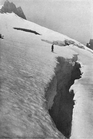
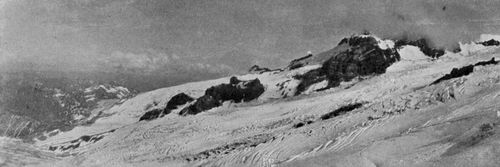
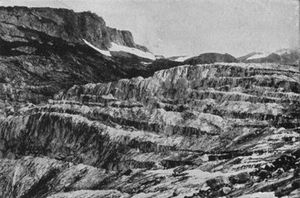
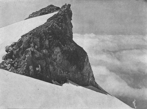
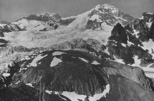
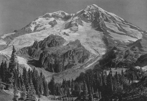
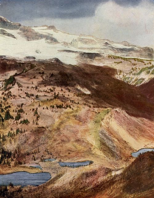
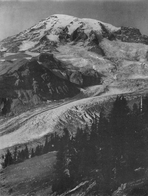
Great Crevasses in the upper part of Cowlitz Glacier.
Copyright, 1905, By Kiser Photo Co.
Copyright, 1910, 1911, by John H. Williams.
(p. 007)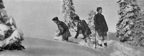
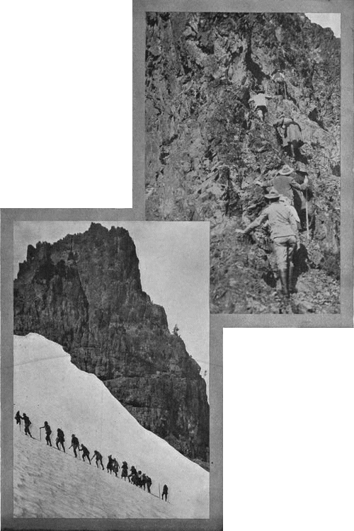
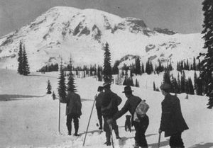
On the summit of Eagle Rock in winter.
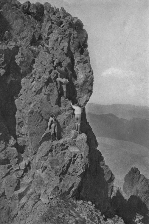
Boys looking over an 800-foot precipice.
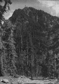
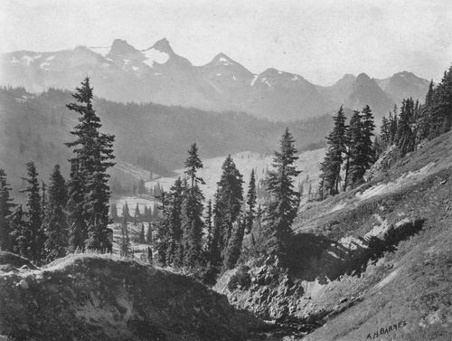
Every summer there is demand for illustrated literature describing the mountain variously called "Rainier" or "Tacoma." Hitherto, we have had only small collections of pictures, without text, and confined to the familiar south and southwest sides.
The little book which I now offer aims to show the grandest and most accessible of our extinct volcanoes from all points of view. Like the glacial rivers, its text will be found a narrow stream flowing swiftly amidst great mountain scenery. Its abundant illustrations cover not only the giants' fairyland south of the peak, but also the equally stupendous scenes that await the adventurer who penetrates the harder trails and climbs the greater glaciers of the north and east slopes. * * * *
The title adopted for the book has reference, of course, to the Indian nature worship, of which something is said in the opening chapter. Both the title and a small part of the matter are reprinted from an article which I contributed last year to the New York Evening Post. Attention is called to the tangle in the names of glaciers and the need of a definitive nomenclature. As to the name of the Mountain itself, that famous bone of contention between two cities, I greatly prefer "Tacoma," one of the several authentic forms of the Indian name used by different tribes; but I believe that "Tahoma," proposed by the Rotary Club of Seattle, would be a justifiable compromise, and satisfy nearly everybody. Its adoption would free our national map from one more of its meaningless names—the name, in this case, of an undistinguished foreign naval officer whose only connection with our history is the fact that he fought against us during the American Revolution. Incidentally, it would also free me from the need of an apology for using the hybrid "Rainier-Tacoma"! * * * Many of the illustrations show wide reaches of wonderful country, and their details may well be studied with a reading glass.
I am much indebted to the librarians and their courteous assistants at the Seattle and Tacoma public libraries; also to Prof. Flett for his interesting account of the flora of the National Park; to Mr. Eugene Ricksecker, of the United States Engineer Corps, for permission to reproduce his new map of the Park, now printed for the first time; and, most of all, to the photographers, both professional and amateur. In the table of illustrations, credit is given the maker of each photograph. The book is sent out in the hope of promoting a wider knowledge of our country's noblest landmark. May it lead many of its readers to delightful days of recreation and adventure.
Tacoma, June 1, 1910.J. H. W.
Second Edition.—The text has been carefully revised, much new matter added, and the information for tourists brought to date. The illustrations have been rearranged, and more (p. 008) than fifty new ones included. Views of the west and south sides, mainly, occupy the first half of the book, while the later pages carry the reader east and north from the Nisqually country.
Nearly five thousand negatives and photographs have now been examined in selecting copy for the engravers. In the table of illustrations I am glad to place the names of several expert photographers in Portland, San Francisco, Pasadena and Boston. Their pictures, with other new ones obtained from photographers already represented, make this edition much more complete. For the convenience of tourists, as well as of persons unable to visit the Mountain but wishing to know its features, I have numbered the landmarks on three of the larger views, giving a key in the underlines. If this somewhat mars the beauty of these pictures, it gives them added value as maps of the areas shown. In renewing my acknowledgments to the photographers, I must mention especially Mr. Asahel Curtis of Seattle. The help and counsel of this intrepid and public-spirited mountaineer have been invaluable. Mr. A. H. Barnes, our Tacoma artist with camera and brush, whose fine pictures fill many of the following pages, is about to publish a book of his mountain views, for which I bespeak liberal patronage.
My readers will join me in welcoming the beautiful verses written for this edition by a gracious and brilliant woman whose poems have delighted two generations of her countrymen.
Thanks are also due to Senator Wesley L. Jones, Superintendent E. S. Hall of the Rainier National Park and the Secretary of the Interior for official information; to Director George Otis Smith of the U. S. Geological Survey for such elevations as have thus far been established by the new survey of the Park; to A. C. McClurg & Co. of Chicago, for permission to quote from Miss Judson's "Myths and Legends of the Pacific Northwest"; to Mr. Wallace Rice, literary executor of the late Francis Brooks, for leave to use Mr. Brooks's fine poem on the Mountain; to the librarians at the Public Library, the John Crerar Library and the Newberry Library in Chicago, and to many others who have aided me in obtaining photographs or data for this edition.
Lovers of the mountains, in all parts of our country, will learn with regret that Congress, remains apparently indifferent to the conservation of the Rainier National Park and its complete opening to the public. At the last session, a small appropriation was asked for much-needed trails through the forests and to the high interglacial plateaus, now inaccessible save to the toughest mountaineer; it being the plan of the government engineers to build such trails on grades that would permit their ultimate widening into permanent roads. Even this was denied. The Idaho catastrophe last year again proved the necessity of trails to the protection of great forests. With the loggers pushing their operations closer to the Park, its danger calls for prompt action. Further, American tourists, it is said, annually spend $200,000,000 abroad, largely to view scenery surpassed in their own country. But Congress refuses the $50,000 asked, even refuses $25,000, toward making the grandest of our National Parks safe from forest fires and accessible to students and lovers of nature!
May 3, 1911.
Winthrop Glacier and St. Elmo Pass,
with Ruth Mountain
(the Wedge) on right and Sour-Dough Mountains on left.
White Glacier and Little Tahoma,
with eastern end of
the Tatoosh Range in distance.
The * indicates engravings made from copyrighted photographs. See notice under the illustration.
THREE-COLOR HALFTONES.
ONE-COLOR HALFTONES.
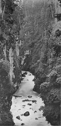
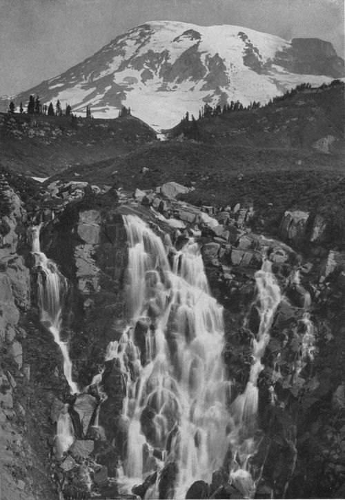
White River Canyon, from the terminal moraine of White Glacier. A fine example of glacial sculpture. The river seen in the distance is 2,000 feet below the plateau through which the glacier has carved this valley.
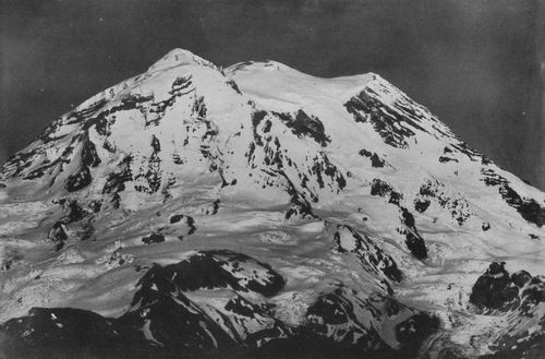
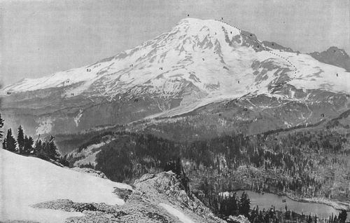
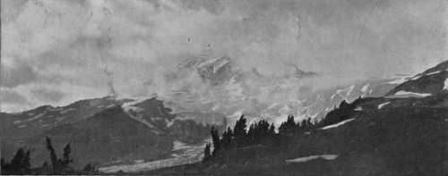
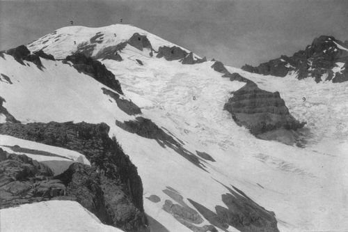
Telephoto view from near Electron, 20 miles, showing vast summit plateau left when the Mountain blew its head off. 1. Crater Peak, built by the two small, modern craters. 2. South Peak, or Peak Success. 3. North Peak, or Liberty Cap. 4. North Tahoma Glacier. 5. Puyallup Glacier. 6. South Mowich Glacier. 7. North Mowich Glacier. 8. Snow Cap above Carbon Glacier. The summit peaks (1, 2 and 3) form a triangle, each side of which is two miles or more in length.
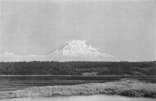
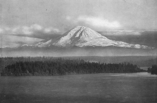
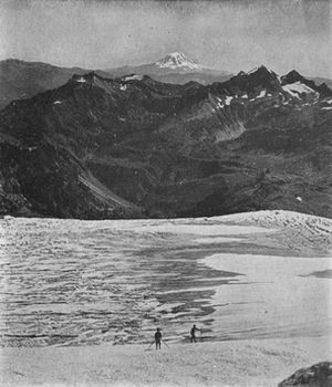
View of the Mountain from Fox Island, forty-two miles northwest, with part of Puget Sound in the foreground.
I am Tacoma, Monarch of the Coast!
Uncounted ages heaped my shining snows;
The sun by day, by night the starry host,
Crown me with splendor; every breeze that blows
Wafts incense to my altars; never wanes
The glory my adoring children boast,
For one with sun and sea Tacoma reigns.
Tacoma—the Great Snow Peak—mighty name
My dusky tribes revered when time was young!
Their god was I in avalanche and flame—
In grove and mead and songs my rivers sung,
As blithe they ran to make the valleys fair—
Their Shrine of Peace where no avenger came
To vex Tacoma, lord of earth and air.
Ah! when at morn above the mists I tower
And see my cities gleam by slope and strand,
What joy have I in this transcendent dower—
The strength and beauty of my sea-girt land
That holds the future royally in fee!
And lest some danger, undescried, should lower,
From my far height I watch o'er wave and lea.
And cloudless eves when calm in heaven I rest,
All rose-bloom with a glow of paradise,
And through my firs the balm-wind of the west,
Blown over ocean islands, softly sighs,
While placid lakes my radiant image frame—
And know my worshippers, in loving quest,
Will mark my brow and fond lips breathe my name:
Enraptured from my valleys to my snows,
I charm my glow to crimson—soothe to gray;
And when the encircling shadow deeper grows,
Poise, a lone cloud, beside the starry way.
Then, while my realm is hushed from steep to shore,
I yield my grandeur to divine repose,
And know Tacoma reigns forevermore!
South Framingham, Mass.
March, 1911. Edna Dean Proctor
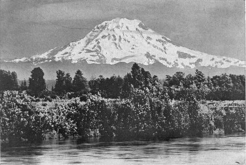
The most kingly of American mountains, seen from beautiful Lake
Washington, Seattle, distance sixty miles.
Copyright, 1906, By Romans Photographic Co.
(p. 017)

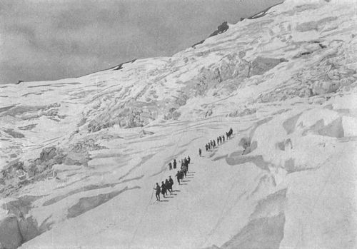
A party of climbers on Winthrop Glacier.
Long hours we toiled up through the solemn wood,
Beneath moss-banners stretched from tree to tree;
At last upon a barren hill we stood,
And, lo, above loomed Majesty.
—Herbert Bashford: "Mount Rainier."
The great Mountain fascinates us by its diversity. It is an inspiration and yet a riddle to all who are drawn to the mysterious or who love the sublime. Every view which the breaking clouds vouchsafe to us is a surprise. It never becomes commonplace, save to the commonplace.
Ice Terraces on South Tahoma Glacier. These vast steps are often seen where a glacier moves down a steep and irregular slope.
Old Virgil's gibe at mankind's better half—"varium et mutabile semper femina"—might have been written of this fickle shape of rock and ice and vapor. One tries vainly, year after year, to define it in his own mind. The daily, hourly change of distance, size and aspect, tricks which the Indian's mountain (p. 018) god plays with the puny creatures swarming more and more about his foot; his days of frank neighborliness, his swift transformations from smiles to anger, his fits of sullenness and withdrawal, all baffle study. Even though we live at its base, it is impossible to say we know the Mountain, so various are the spells the sun casts over this huge dome which it is slowly chiseling away with its tools of ice, and which, in coming centuries, it will level with the plain.
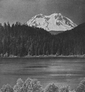
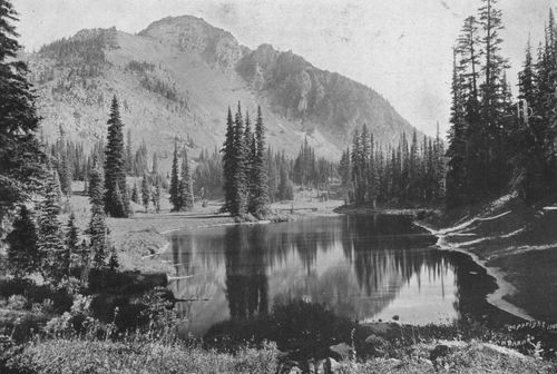
Mineral Lake and the Mountain. Distance, eighteen miles.
We are lovers of the water as well as the hills, out here in this northwestern corner of the Republic. We spend many days—and should spend more—in cruising among the hidden bays and park-like islands which make Puget Sound the most interesting body of water in America. We grow a bit boastful about the lakes that cluster around our cities. Nowhere better than from sea level, or from the lakes raised but little above it, does one realize the bulk, the dominance, and yet the grace, of this noble peak. Its impressiveness, indeed, arises in part from the fact that it is one of the few great volcanic mountains whose entire height may be seen from tide level. Many of us can recall views of it from Lake Washington at Seattle, or from American or Spanaway Lake at Tacoma, or from the Sound, which will always haunt the memory.
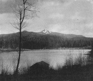
Storm King Peak and Mineral Lake, viewed from near Mineral Lake Inn.
Early one evening, last summer, I went with a friend to Point Defiance, Tacoma's fine park at the (p. 021) end of the promontory on which the city is built. We drank in refreshment from the picture there unrolled of broad channels and evergreen shores. As sunset approached, we watched the western clouds building range upon range of golden mountains above the black, Alp-like crags of the Olympics. Then, entering a small boat, we rowed far out northward into the Sound. Overhead, and about us, the scenes of the great panorama were swiftly shifted. The western sky became a conflagration. Twilight settled upon the bay. The lights of the distant town came out, one by one, and those of the big smelter, near by, grew brilliant. No Turner ever dreamed so glorious a composition of sunlight and shade. But we were held by one vision.
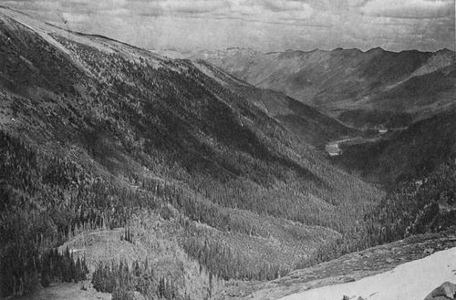
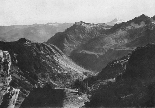
View from Electron, showing west side of the mountain, with a vast intervening country of forested ranges and deep canyons.
Nisqually Canyon.
... "Where the mountain wall
Is piled to heaven, and through the narrow rift
Of the vast rocks, against whose rugged feet
Beats the mad torrent with perpetual roar:
Where noonday is as twilight, and the wind
Comes burdened with the everlasting moan
Of forests and far-off waterfalls."—Whittier.
Yonder, in the southeast, towering above the lower shadows of harbor and hills, rose a vast pyramid of soft flame. The setting sun had thrown a mantle of rose pink over the ice of the glaciers and the great cleavers of rock which buttress the mighty dome. The rounded summit was warm with beautiful orange light. Soon the colors upon its slope changed to deeper reds, and then to amethyst, and (p. 023) violet, and pearl gray. The sun-forsaken ranges below fell away to dark neutral tints. But the fires upon the crest burned on, deepening from gold to burnished copper, a colossal beacon flaming high against the sunset purple of the eastern skies. Finally, even this great light paled to a ghostly white, as the supporting foundation of mountain ridges dropped into the darkness of the long northern twilight, until the snowy summit seemed no longer a part of earth, but a veil of uncanny mist, caught up by the winds from the Pacific and floating far above the black sky-line of the solid Cascades, that
* * * heaven-sustaining bulwark, reared
Between the East and West.
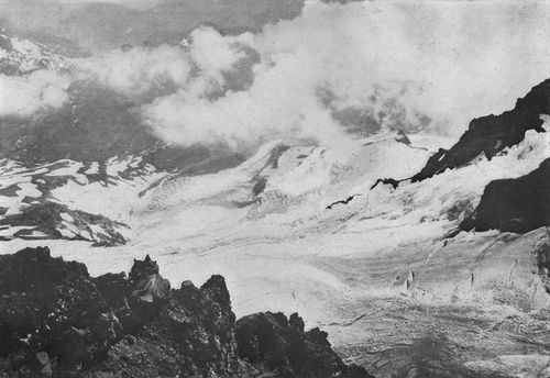
North Peak, or Liberty Cap, and South Mowich Glacier in storm, seen
from an altitude of 6,000 feet, on ridge between South Mowich and
Puyallup Glaciers. The glacier, 2,000 feet below, is nearly half a
mile wide. Note the tremendous wall of ice in which it ends.
Copyright, 1900, By A. H. Waite.
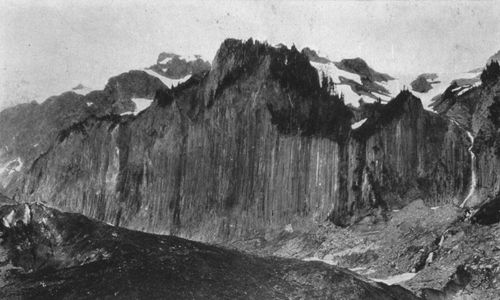
Basaltic Columns, part of the "Colonnade" on south side of South Mowich Glacier. These
curious six-sided columns of volcanic rock are similar to those
bordering the Cowlitz Glacier.
Copyright, 1900, By A. H. Waite.
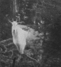
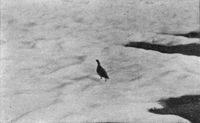
Mountain Goat, an accidental snap-shot of the fleet and wary Mazama; godfather of the famous Portland mountain club.
And when even that apparition had faded, and the Mountain appeared only as an uncertain bulk shadowed upon the night, then came the miracle. Gradually, the east, beyond the great hills, showed a faint silver glow. Silhouetted against this dim background, the profile of the peak grew definite. With no other warning, suddenly from its summit the full moon shot forth, huge, majestic and gracious, flooding the lower world with brightness. Clouds and mountain ranges alike shone with its glory. But the great peak loomed blacker and more sullen. Only, on its head, the wide crown of snow gleamed white under the cold rays of the moon.
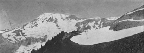
West Side of the summit, seen from Tahoma Fork of the Nisqually, on road to Longmire Springs. Note the whiteness of the glacial water. This stream is fed by the united Tahoma glaciers. See pp. 32 and 37.
Iron and Copper Mountains (right) in Indian Henry's. The top of Pyramid Peak shows in the saddle beyond with Peak Success towering far above.
No wonder that this mountain of changing moods, overtopping every other eminence in the Northwest, answered the idea of God to the simple, imaginative mind of the Indians who hunted in the forest on its slopes or fished in the waters of Whulge that ebbed and flowed at its base. Primitive peoples in every land have deified superlative manifestations of nature—the sun, the wind, great rivers, and waterfalls, the high mountains. By all the tribes within sight of its summit, this pre-eminent peak, variously called by them Tacoma (Tach-ho´ma), Tahoma or Tacob, as who should say "The Great Snow," was deemed a power to be feared and conciliated. Even when the missionaries taught them a better faith, they continued to hold the Mountain in superstitious reverence—an awe that still has power to silence their "civilized" and very unromantic descendants.
Cutting steps up Paradise Glacier.
The Puget Sound tribes, with the Yakimas, Klickitats and others living just beyond the Cascades, had substantially the same language and beliefs, though differing much in physical and mental type. (p. 026) East of the range, they lived by the chase. They were great horsemen and famous runners, a breed of lithe, upstanding, competent men, as keen of wit as they were stately in appearance. These were "the noble Red Men" of tradition. Fennimore Cooper might have found many a hero worthy of his pen among the savages inhabiting the fertile valley of the Columbia, which we now call the Inland Empire. But here on the Coast were the "Digger" tribes, who subsisted chiefly by spearing salmon and digging clams. Their stooped figures, flat faces, downcast eyes and low mentality reflected the life they led. Contrasting their heavy bodies with their feeble legs, which grew shorter with disuse, a Tacoma humorist last summer gravely proved to a party of English visitors that in a few generations more, had not the white man seized their fishing grounds, the squatting Siwashes would have had no legs at all!
Great Crag on the ridge separating the North and South Tahoma Glaciers, with Tahoma Fork of the Nisqually visible several miles below. This rock is seen right of center on page 27.
The Marmot, whose shrill whistle is often heard among the crags.
Stolid and uninspired as he seemed to the whites, the Indian of the Sound was not without his touch of poetry. He had that imaginative curiosity which marked the native (p. 028) American everywhere. He was ever peering into the causes of things, and seeing the supernatural in the world around him.[1]
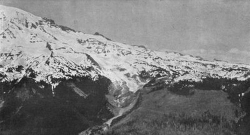
View from Beljica, showing the deeply indented west side of the Mountain. Beginning at extreme right, the glaciers are, successively: Kautz, South Tahoma, North Tahoma and Puyallup. In the left foreground is the canyon of Tahoma Fork of the Nisqually, which is fed by the Tahoma glaciers.
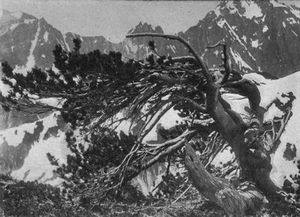
Mountain Pine, one of
the last outposts of the forest below the line of eternal snow.
Copyright, 1897, By E. S. Curtis.
To the great Snow Mountain the Indians made frequent pilgrimages, for they thought this king of the primeval wild a divinity to be reckoned with. They dreaded its anger, seen in the storms about its head, the thunder of its avalanches, and the volcanic flashes of which their traditions told. They courted its favor, symbolized in the wild flowers that bloomed on its slope, and the tall grass that fed the mowich, or deer.
Mount Wow, or Goat Mountain, above Mesler's.
Copyright, 1897, By E. S. Curtis.
As they ascended the vast ridges, the grandeur about them spoke of the mountain god. There were groves of trees he must have planted, so orderly were they set out. The lakes of the lofty valleys seemed calmer than those on the prairies below, the foliage brighter, the ferns taller and more graceful. The song of the waterfalls here was sweeter than the music of the tamahnawas men, their Indian sorcerers. The many small meadows close to the snow-line, carpeted in deepest green and spread with flowers, were the gardens of the divinity, tended by his superhuman agents. Strange as it may seem, the nature-worship of the silent Red Man had many points in common with that of the imaginative, volatile Greek, who (p. 030) peopled his mountains with immortals; and no wood in ancient Greece was ever thronged with hamadryads more real than the little gods whom the Indian saw in the forests watered by streams from Tacoma's glaciers.
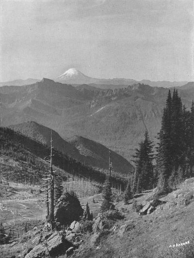
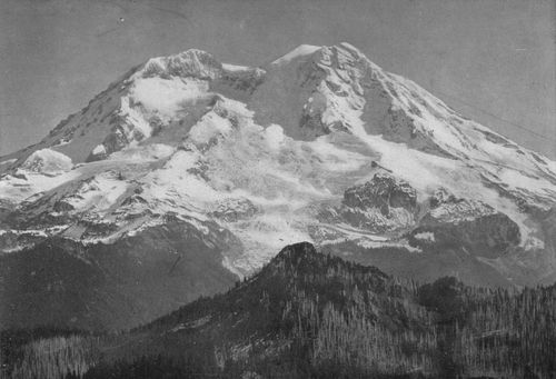
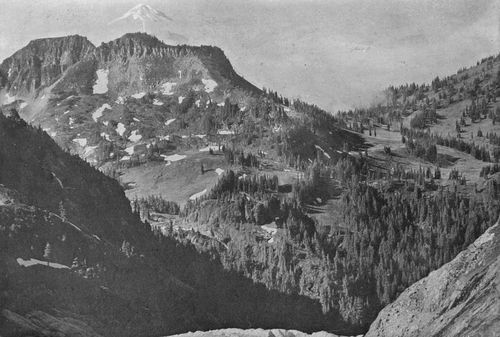
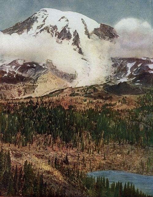
Rounded Cone of Mt. St. Helens, seen from Indian Henry's, forty-five miles away.
View northward in early summer from Eagle Peak, at
western end of the Tatoosh. Gibraltar Rock and Little Tahoma break the
eastern sky-line. On the extreme right lies Paradise Valley, still deep
in snow, with the canyon of Paradise River below it. Next is seen the
Nisqually Glacier, with Nisqually River issuing from its snout. Then
come Van Trump Glacier (an "interglacier"), and the big Kautz Glacier,
dropping into its own deep canyon. Beyond the Kautz, Pyramid Peak and
Iron and Copper Mountains rise on the Indian Henry plateau. The Tahoma
Glaciers close the view westward.
Copyright, 1907, By Pillsbury Picture Co.
Eagle Peak (Indian name, Simlayshe) at west end of the Tatoosh.
Altitude about 6,000 feet. A pony trail three miles long leads up from the Inn.
Copyright, 1909, By Linkletter Photo. Co.
Countless snows had fallen since the mountain god created and beautified this home of his, when one day he grew angry, and in his wrath showed terrible tongues of fire. Thus he ignited an immense fir forest on the south side of the peak. When his anger subsided, the flames passed, and the land they left bare became covered with blue grass and wild flowers—a great sunny country where, before, the dark forest had been. Borrowing a word from the French coureurs des bois who came with the Hudson's Bay Company, the later Indians sometimes called this region "the Big Brulé"; and to this day some Americans call it the same. But for the Big Brulé the Indians had, from ancient times, another name, connected with their ideas of religion. It was their Saghalie Illahe, the "Land of Peace," Heaven. Our name, "Paradise Valley," (p. 031) given to the beautiful open vale on the south slope of the Mountain, is an English equivalent.
Here was the same bar to violence which religion has erected in many lands. The Hebrews had their "Cities of Refuge." The pagan ancients made every altar an asylum. Mediæval Christianity constituted all its churches sanctuaries. Thus, in lawless ages, the hand of vengeance was stayed, and the weak were protected.
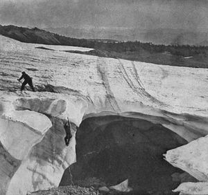
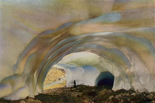
Exploring an Ice Cave, Paradise Glacier.
So, too, the Indian tradition ordained this home of rest and refuge. Indian custom was an eye for an eye, but on gaining this mountain haven the pursued was safe from his pursuer, the slayer might not be touched by his victim's kindred. When he crossed its border, the warrior laid down his arms. Criminals and cowards, too, were often sent here by the chiefs to do penance.
Junction of North and South Tahoma Glaciers, viewed from Indian Henry's. The main ice stream thus formed, seen in the foreground, feeds Tahoma Fork of the Nisqually River. The Northern part of North Tahoma Glacier, seen in the distance beyond the wedge of rocks, feeds a tributary of the Puyallup.
The mountain divinity, with his under-gods, figures in much of the Siwash (p. 032) folklore, and the "Land of Peace" is often heard of. It is through such typical Indian legends as that of Miser, the greedy hiaqua hunter, that we learn how large a place the great Mountain filled in the thought of the aborigines.
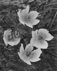
Anemones, a familiar mountain flower.
This myth also explains why no Red Man could ever be persuaded to an ascent beyond the snow line. As to the Greek, so to the Indian the great peaks were sacred. The flames of an eruption, the fall of an avalanche, told of the wrath of the mountain god. The clouds that wrapped the summit of Tacoma spelled mystery and peril. Even so shrewd and intelligent a Siwash as Sluiskin, with all his keenness for "Boston chikamin," the white man's money, refused to accompany Stevens and Van Trump in the first ascent, in 1870; indeed, he gave them up as doomed, and bewailed their certain fate when they defied the Mountain's wrath and started for the summit in spite of his warnings.
North Tahoma Glacier, flowing out of the huge cleft in the west side, between North
and South Peaks. A great rock wedge splits the glacier, turning part
of the ice stream northward into the Puyallup, while the other part,
on the right pours down to join South Tahoma Glacier. Note how the
promontory of rock in the foreground has been rounded and polished by
the ice. Compare this view with pages 32 and 37.
Copyright 1910, A. H. WAITE.
Snow Lake in Indian Henry's, surrounded by Alpine firs, which grow close to the snow line. Elevation about 6,000 feet.
The hero of the Hiaqua Myth is the Indian (p. 035) Rip Van Winkle.[2] He dwelt at the foot of Tacoma, and, like Irving's worthy, he was a mighty hunter and fisherman. He knew the secret pools where fish could always be found, and the dark places in the forest, where the elk hid when snows were deepest. But for these things Miser cared not. His lust was all for hiaqua, the Indian shell money.
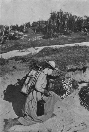
A fair Mountaineer at the timber line. Note her equipment, including shoe calks.
Now, Miser's totem was Moosmoos, the elk divinity. So Miser tried, even while hunting the elk, to talk with them, in order to learn where hiaqua might be found. One night Moosmoos persuaded him that on top of the Mountain he would find great store of it. Making him two elk-horn picks, and filling his ikta with dried salmon and kinnikinnick, he climbed in two nights and a day to the summit. Here he found three big rocks, one like a camas root, one like a salmon's head, the third like his friendly Moosmoos. Miser saw that Moosmoos had told him truly.
View of Indian Henry's Hunting Ground from a point on South Tahoma Glacier, looking across to Copper and Iron Mountains, with Mt. St. Helens above the clouds far beyond. This famous upland plateau or "park" gets its name from the fact that it was, years ago, the favorite haunt of a celebrated Indian hunter.
Southwest side of the Mountain as seen from Indian Henry's, showing North and South Tahoma Glaciers meeting in foreground, and Kautz Glacier on extreme right.
After long digging, Miser overturned the rock that was like the elk's head. Beneath lay a vast quantity of hiaqua. This he strung on elk's sinews—enough of it to make him the richest of men. Then he hurried to depart. But he left no thank-offering to the tanahnawas powers. Thereupon the whole earth shook with a mighty convulsion, and the mountain shot forth terrible fires, which melted the snows and poured floods down the slopes, where they were turned to ice again by the breath of the storm-god. And above the roar of torrents and the crash of thunder, (p. 038) Miser heard the voices of all the tamahnawas, hissing: "Hiaqua! Hiaqua! Ha, ha, Hiaqua!"
Climbing Pinnacle Peak, in the Tatoosh. Elevation 6,500 feet. The route leads up from Paradise Valley, over the steep snow field shown in the lower view, and thence by a difficult trail to the summit.
Panic-stricken at the results of his greed, Miser threw down his load of treasure to propitiate the angry tamahnawas. But the storm-god hurled him down the mountain side. Miser fell into a deep sleep. Many, many snows after, he awoke to find himself far from the summit, in a pleasant country of beautiful meadows carpeted with flowers, abounding in camas roots, and musical with the song of birds. He had grown very old, with white hair falling to his shoulders. His ikta was empty, save for a few dried leaves. Recognizing the scene about him as Saghalie Illahe, he sought his old tent. It was where he had left it. There, too, was his klootchman, or wife, grown old, like himself. Thirty snows, she said, she had awaited his return. Back they went to their (p. 039) home on the bank of the Cowlitz, where he became a famous tamahnawas man, and spent the rest of his days in honor, for his tribesmen recognized that the aged Indian's heart had been marvelously softened and his mind enriched by his experience upon the peak. He had lost his love for hiaqua.
A silhouette on Pinnacle Peak, with Paradise Valley and the Nisqually Glacier below.
Among the familiar myths of the Mountain was one of a great flood, not unlike that of Noah. I quote Miss Judson's version:
WHY THERE ARE NO SNAKES ON TAKHOMA.
A long, long time ago, Tyhce Sahale became angry with his people. Sahale ordered a medicine man to take his bow and arrow and shoot into the cloud which hung low over Takhoma. The medicine man shot the arrow, and it stuck fast in the cloud. Then he shot another into the lower end of the first. Then he shot another into the lower end of the second. He shot arrows until he had made a chain which reached from the cloud to the earth. The medicine man told his klootchman and his children to climb up the arrow trail. Then he told the good animals to climb up the arrow trail. Then the medicine man climbed up himself. Just as he was climbing into the cloud, he looked back. A long line of bad animals and snakes were also climbing up the arrow trail. Therefore the medicine man broke the chain of arrows. Thus the snakes and bad animals fell down on the mountain side. Then at once it began to rain. It rained until all the land was flooded. Water reached even to the snow line of Takhoma. When all the bad animals and snakes were drowned, it stopped raining. After a while the waters sank again. Then the medicine man and his klootchman and the children climbed out of the cloud and came down the mountain side. The good animals also climbed out of the cloud. Thus there are now no snakes or bad animals on Takhoma.
Rough Climbing, an
illustration of perils encountered in crossing the glaciers.
Copyright, 1897, by E. S. Curtis.
Ptarmigan, the Grouse of the ice-fields. Unlike its neighbor, the Mountain Goat, this bird is tame, and may sometimes be caught by hand. In winter its plumage turns from brown to white.
Childish and fantastic as they seem to our wise age, such legends show the Northwestern Indian struggling to interpret the world about him. Like savages everywhere, he peopled the unknown with spirits good and bad, and mingled his conception of a beneficent deity with his ideas of the evil one. Symbolism pervaded his crude but very positive mind. Ever by his side the old Siwash felt the Power that dwelt on Tacoma, protecting and aiding him, or leading him to destruction. Knowing (p. 040) nothing of true worship, his primitive intelligence could imagine God only in things either the most beautiful or the most terrifying; and the more we know the Mountain, the more easily we shall understand why he deemed the majestic peak a factor of his destiny—an infinite force that could, at will, bless or destroy. For to us, too, though we have no illusions as to its supernatural powers, the majestic peak may bring a message. Before me is a letter from an inspiring New England writer, who has well earned the right to appraise life's values. "I saw the great Mountain three years ago," she says; "would that it might ever be my lot to see it again! I love to dream of its glory, and its vast whiteness is a moral force in my life."
Perpetual
And snowy tabernacle of the land,
While purples at thy base this peaceful sea,
And all thy hither slopes in evening bathe,
I hear soft twilight voices calling down
From all thy summits unto prayer and love.
—Francis Brooks: "Mt. Rainier."
[Back to content]
The Mountain, seen from Puyallup River, near Tacoma.
Falls of the Little Mashell River, near Eatonville and the road to the Mountain.
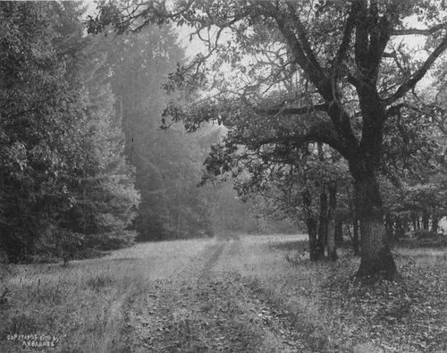
Old Stage Road to Longmire Springs and the National Park Inn, showing the tall, clear trunks of the giant firs.
(p. 043)
On Pierce County's splendid scenic road to the Mountain. Passing Ohop Valley.
There are plenty of higher mountains, but it is the decided isolation—the absolute standing alone in full majesty of its own mightiness—that forms the attraction of Rainier. * * * It is no squatting giant, perched on the shoulders of other mountains. From Puget Sound, it is a sight for the gods, and one feels in the presence of the gods.—Paul Fountain: "The Seven Eaglets of the West" (London, 1905).
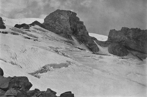
Cowlitz Chimneys, seen from basin below Frying-Pan Glacier.
The first explorers to climb the Mountain, forty years ago, were compelled to make their way from Puget Sound through the dense growths of one of the world's greatest forests, over lofty ridges and deep canyons, and across perilous glacial torrents. The hardships of a journey to the timber line were more formidable than the difficulties encountered above it.
Even from the East the first railroad to the Coast had just reached San Francisco. Thence the traveler came north to the Sound by boat. The now busy cities of Seattle and Tacoma were, one, an ambitious village of 1,107 inhabitants; the other, a sawmill, with seventy persons living around it. They were frontier settlements, outposts of (p. 044) civilization; but civilization paid little attention to them and their great Mountain, until the railways, some years later, began to connect them with the big world of people and markets beyond the Rockies.
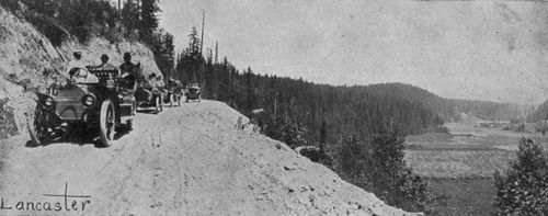
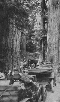
On the way out from Tacoma, over the partly wooded prairie, the automobilist sees many scenes like this old road near Spanaway Lake.
How different the case to-day! Six transcontinental railroads now deliver their trains in the Puget Sound cities. These are: The Northern Pacific, which was the first trunk line to reach the Sound; the Great Northern; the Chicago, Burlington & Quincy; the Chicago, Milwaukee & Puget Sound; the Oregon-Washington (Union Pacific), and the Canadian Pacific. A seventh, the North Coast, is planned.
View Northward from top of Pinnacle Peak in the Tatoosh range to Paradise Valley, Nisqually Glacier and Gibraltar Rock, eight miles away.
Looking Northeast from slope of Pinnacle Peak, across Paradise, Stevens, Cowlitz and Frying Pan Glaciers. These two views form virtually a panorama.
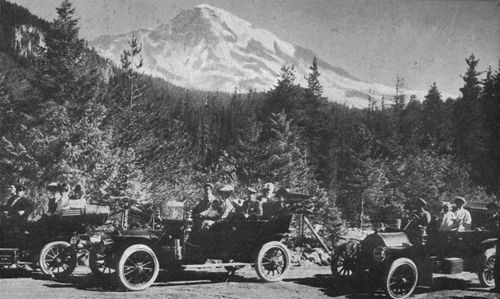
Arriving in Seattle or Tacoma, the traveler has his choice of quick and enjoyable routes to the Mountain. He may go by automobile, leaving either city in the morning. After traveling one of the best and most interesting roads in the country—the only one, in fact, to reach a glacier—he may take luncheon at noon six thousand feet higher, in Paradise Park, overlooking great glaciers and close to the line of eternal snow. Or he may go by the comfortable trains of the Tacoma Eastern (Milwaukee system) to Ashford, fifty-five miles from Tacoma, and then by automobile stages, over a picturesque portion of the fine highway just mentioned, to the National Park Inn at Longmire Springs (altitude 2,762 feet). Lunching there, he may then go on, by coach over the new government road, or on horseback over one of the most inviting mountain trails in America, or afoot, as many prefer. Thus he (p. 049) gains Paradise Park and its far-reaching observation point, Camp of the Clouds (elevation, 5,800 feet). From the Inn, too, another romantic bridle path leads to Indian Henry's famous Hunting Ground, equally convenient as a base of adventure.
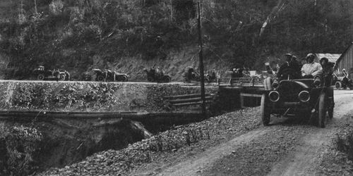
Automobile Party above Nisqually Canyon, Pierce County Road to the Mountain.
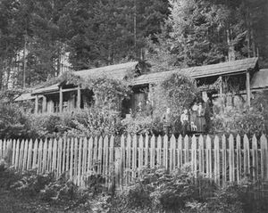
Prof. O. D. Allen's cottage, in the Forest Reserve, where the former Yale professor has for years studied the flora of the Mountain.
Whether the visitor goes to the Mountain by train or by automobile, his choice will be a happy one. For either route leads through a country of uncommon charm. Each of them, too, will carry the visitor up from the Sound to the great and beautiful region on the southern slopes which includes the Tahoma, Kautz, Nisqually, Paradise and Stevens canyons, with their glaciers and the wonderful upland plateaus or "parks" that lie between.
"Ghost Trees" in Indian Henry's. These white stalks tell of fires set by careless visitors.
Here let him stay a day or a month. Every moment of his time will be crowded with new experiences and packed with enjoyment. For here is sport to last for many months. He may content himself with a day spent in coasting down a steep snow-field in midsummer, snowballing his companions, and climbing Alta Vista to look down on the big Nisqually glacier in the deep bed which it has (p. 050) carved for itself, and up its steep slopes to its névé field on the summit. Or he may explore this whole region at his leisure. He may climb the hard mountain trails that radiate from Longmires and Paradise. He may work up over the lower glaciers, studying their crevasses, ice caves and flow. He will want to ascend some of the tempting crags of the ragged Tatoosh, for the panorama of ice-capped peaks and dark, forested ranges which is there unfolded. After a week or two of such "trying-out," to develop wind and harden muscle, he may even scale the great Mountain itself under the safe lead of experienced guides. He may wander at will over the vast platform left by a prehistoric explosion which truncated the cone, and perhaps spend a night of sensational novelty (and discomfort) in a big steam cave, under the snow, inside a dead crater.
The south side has the advantage of offering the wildest alpine sport in combination with a well-appointed hotel as a base of operations. Hence the majority of visitors know only that side. Everybody should know it, too, for there is not a nobler playground anywhere; but should also know that it is by no means the only side to see.
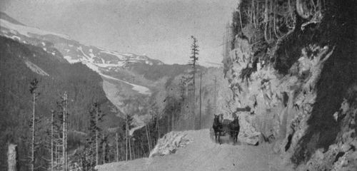
Government Road in the Forest Reserve.
One may, of course, work around from the Nisqually canyon and Paradise, east or west, to the other glaciers and "parks." It is quite practicable, if not easy, to make the trip eastward from Camp of the Clouds, crossing Paradise, Stevens and Cowlitz glaciers, and thus to reach the huge White glacier on the east side and Winthrop and Carbon glaciers on the north. Every summer sees more and more visitors making this wonderful journey.
But the usual way to reach the great north side, especially for parties which carry camp equipment, is by a Northern Pacific train over the Carbonado branch to Fairfax. This is on Carbon river, five miles from the northwest corner of the National Park. Thence the traveler will go by horse or afoot, over a safe mountain trail, to Spray Park, the fascinating region between Carbon and North Mowich (p. 051) glaciers. Standing here, on such an eminence as Fay Peak or Eagle Cliff, he may have views of the Mountain in its finest aspects that will a thousand times repay the labor of attainment.
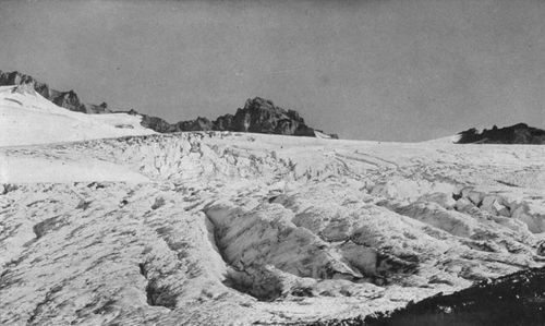
"Hanging Glacier," or ice fall, above Cowlitz Glacier.
A visit to this less known but no less interesting side involves the necessity of packing an outfit. But arrangements for horses and packers are easily made, and each year an increasing number of parties make Spray Park their headquarters, spending, if they are wise, at least a week in this wide region of flowering alpine valleys and commanding heights. From there they go south, over the west-side glaciers, or east, across the Carbon and through the great White river country. They camp on the south side of the Sluiskin mountains, in Moraine Park, and there have ready access to Carbon and Winthrop glaciers, with splendid views of the vast precipices that form the north face of the Mountain. Thence they climb east and south over the Winthrop and White glaciers. They visit the beautiful Grand Park and Summerland, and either make the ascent to the summit from "Steamboat Prow" on the "Wedge," over the long ice slope of the White glacier, or continue around to the Paradise country and Longmire Springs.
(p. 052)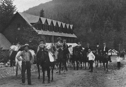
Leaving the National Park Inn at Longmire Springs for Paradise Park.
On the Summit,
showing Columbia's Crest, the great mound of snow that has, most
curiously, formed on this wide, wind-swept platform. This, the actual
top of the Mountain, is 14,363 feet above sea level.
Copyright, 1909, By Asahel Curtis.
The west side has been less visited than the others, but there is a trail from the North Mowich to the Nisqually, and from this adventurous explorers reach North and South Mowich and Puyallup glaciers. No one has yet climbed the Mountain over those glaciers, or from the north side. A view from any of the trails will explain why. The great rock spines are more precipitous than elsewhere, the glaciers more broken; and the summit is fronted on either side by a huge parapet of rock which hurls defiance at anything short of an airship. Doubtless, we shall some day travel to Crater Peak by aeroplanes, but until these vehicles are equipped with (p. 054) runners for landing and starting on the snow, we shall do best to plan our ascents from the south or east side.
Paradise Valley or "Park," and Tatoosh Mountains, from slope below Paradise Glacier. The highest of the peaks are about 7,000 feet above sea level and 1,700 feet above the floor of the valley.
On the Government Road a mile above Longmires, bound for the Nisqually Glacier.
Near "Gap Point," where the road turns from the Nisqually canyon into that of Paradise River.
I have thus briefly pointed out the favorite routes followed in exploring the National Park. The time is fast approaching when it will be a truly national recreation ground, well known to Americans in every State. The coming of new railways to Puget Sound and the development of new facilities for reaching the Mountain make this certain.[3]
Snout of Nisqually Glacier, with the river which it feeds. Though much shrunken since the epoch when it filled the whole canyon, the glacier is still a vast river of ice; and its front, seen several hundred yards above the bridge, rises sheer 500 feet. The new road to Narada Falls and Paradise Park crosses the Nisqually here. Automobiles are not permitted to go above this point.
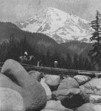
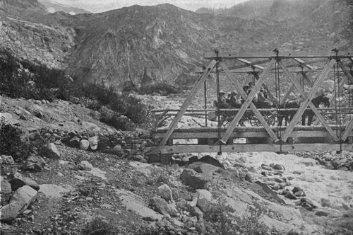
Pony bridge over the Nisqually, on trail to Paradise. Note the granite boulders which the stream has rounded in rolling them down from the glacier.
Every step taken for the conservation of the natural beauty of the Park and its opening to proper use and enjoyment is a public benefit. Outside the national reserves, our lumbermen are fast destroying the forests; but, if properly guarded against fire, the great Park forest will still teach future generations how lavishly Nature plants, just as the delightful glacial valleys and towering landmarks teach how powerful and artistic a sculptor she is. Experienced travelers and alpinists (p. 055) who have visited the Mountain unite in declaring its scenery, combining as it does great vistas of ice with vast stretches of noble forest, to be unequaled elsewhere in America, and unsurpassed anywhere. In the fascination of its glacial story, as well as in the grandeur of its features, it has few rivals among the great peaks of the world. The geologist, the botanist, the weary business man, the sportsman, all find it calling them to study, to rest, or to strenuous and profitable recreation. Here is a resource more lasting than our timber. When the loggers shall have left us only naked ranges, without the reserves, the Park may yield a crop more valuable.
The road a mile above the bridge, overlooking Nisqually Canyon and Glacier.
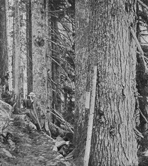
On the Pony Trail to Paradise. This trail winds through the dense forest above Longmires, crosses the Nisqually, and then follows Paradise River, with its miles of picturesque cascades. It is one of the most beautiful mountain paths in America.
Until recent years this was known only to the hardy few who delight in doing difficult things for great rewards. But that day of isolation has passed. The value of the Park to the whole American people is more (p. 056) and more appreciated by them, if not yet by their official representatives. While Congress has dealt less liberally with this than with the other great National Parks, what it has appropriated has been well spent in building an invaluable road, which opens one of the most important upland regions to public knowledge and use. This road is a continuation of the well-made highway maintained by Pierce County from Tacoma, which passes through an attractive country of partly wooded prairies and follows the picturesque Nisqually valley up the heavily forested slopes to the Forest Reserve and the southwestern corner of the Park. The public has been quick to seize the opportunity which the roads offered. The number of persons entering the Park, as shown by the annual reports of the Superintendent, has grown (p. 057) from 1,786 in 1906 to more than 8,000 in 1910. In the same period, the Yellowstone National Park, with its greater age, its wider advertising, its many hotels, its abundance of government money, increased its total of visitors from 17,182 to 19,575.
Sierra Club lunching on Nisqually Glacier. The huge ice wall in the distance is the west branch of the Nisqually, and is sometimes miscalled "Stevens Glacier." As seen here, it forms a "hanging glacier," which empties into the main glacier over the cliff.
For one thing, these roads have put it within the power of automobilists from all parts of the Coast to reach the grandest of American mountains and the largest glaciers of the United States south of Alaska. They connect at Tacoma, with excellent roads from Seattle and other cities on the Sound, as well as from Portland and points farther south. The travel from these cities has already justified the construction of the roads, and is increasing every year. Even from California many automobile parties visit the Mountain. The railway travel is also fast increasing, and the opening this year of its transcontinental service by the Milwaukee Railway, which owns the Tacoma Eastern line to Ashford, is likely soon to double the number of those who journey to the Mountain by rail.
A Mountain Celery.
The new government road to Paradise and the trails (p. 058) connecting with it have, however made only a fraction of the Park accessible. The most important work for the conservation of this great alpine area and its opening to the public still remains to be done. Congress is now asked to provide funds for the survey and gradual extension of the road to the other plateaus on all sides of the peak. Pending the construction of the road, it is highly important that, as soon as the surveys can be made, bridle trails be built on the easy grades thus established. Not only are these roads and trails much needed for the convenience of visitors to the Mountain, but, with the closer approach of logging operations, they are year by year becoming more necessary to the proper policing of the Park and its protection against forest fires. For want of them, great sections of forest within the Park are liable to be swept away at any time, before the rangers could find their way over the scant and broken trails now existing. The request for better access to the other sides of the Mountain has received the earnest indorsement of the Washington legislature, the commercial organizations of the entire Coast, and the several mountain clubs in different parts of the country. Only Congress remains blind to its importance.
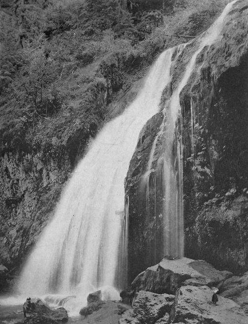
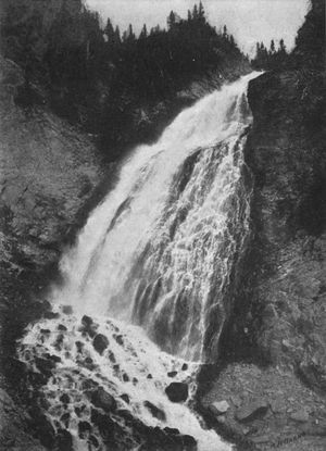
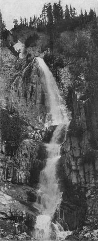
Narada Falls, 185 feet, on Paradise River (altitude, 4,572 feet). Both trail and road pass it. "Narada" is an East Indian word meaning "peace." The name was given many years ago by a party of Theosophists who visited the falls. Happily, the effort to change the name to "Cushman Falls" has failed.
Congressional action affecting this immediate area began in 1899. A tract eighteen miles square, 207,360 acres, to be known as "Ranier National Park,"[4] was (p. 059) withdrawn from the 2,146,600 acres of the Pacific Forest Reserve, previously created. The area thus set apart as "a public park for the benefit and enjoyment of the people" (Act of March 2, 1899) was already known to a few enthusiasts and explorers as one of the world's great wonderlands. In 1861 James Longmire, a prospector, had built a trail from Yelm over Mashell mountain and up the Nisqually river to Bear Prairie. This he extended in 1884 to the spot now known as Longmire Springs, and thence up the Nisqually and Paradise rivers to the region now called Paradise Park. Part of this trail was widened later into a wagon road, used for many years by persons seeking health at the remarkable mineral springs on the tract which the Longmires acquired from the government before the establishment of the Forest Reserve.
Washington Torrents, on Paradise River; a series of falls a mile in length, seen from the new road to Paradise and still better from the pony trail.
Portion of Paradise Park and the Tatoosh Range.
The Longmire road, rough as it was, long remained the best route; but in 1903 the Mountain found a tireless friend in the late Francis W. Cushman, representative from this State, who persuaded Congress to authorize the survey and construction of a better highway. Work was not begun, however, until 1906. The (p. 061) yearly appropriations have been small, and total only $240,000 for surveys, construction and maintenance, to the end of the last session.
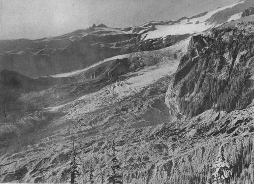
View from north side of the Tatoosh. 1. Crater Peak. 2. South Peak, or Peak Success. 3. Nisqually Glacier, with feeders. 4. Gibraltar Rock. 5. Camp Muir, on Cowlitz Cleaver. 6. Cathedral Rocks. 7. Little Tahoma. 8. Paradise Glacier. 9. Alta Vista. 10. Camp of the Clouds. 11. Reese's Camp. 12. Sluiskin Falls. 13. Paradise River and Valley. 14. Mazama Ridge. 15. Reflection Lake. 16. Van Trump Glacier. 17. Von Trump Park. 18. Kautz Glacier. 19. Pyramid Peak. 20. Tahoma Glaciers. 21. Indian Henry's. Dotted line shows South-side route to the summit.
Ice Bridge, Stevens Glacier.
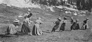
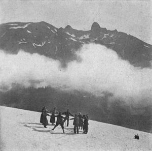
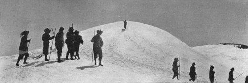
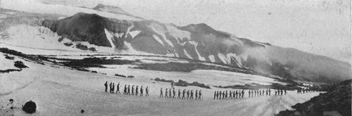
Mountain Sports. Tug of War between teams picked from the feminine contingent of the Mountaineers.
The road, as now open to Paradise valley, is a monument to the engineering skill of Mr. Eugene Ricksecker, United States Assistant Engineer, in local charge of the work. Over its even floor you go from the west boundary of the Forest Reserve up the north bank of the Nisqually river, as far as the foot of its glacier. Crossing on the bridge here, you climb up and up, around the face of a bluff known as Gap Point, where a step over the retaining wall would mean a sheer drop of a thousand feet into the river below. Thus you wind over to the Paradise river and famous Narada Falls, switch back up the side of the deep Paradise canyon to the beautiful valley of the same name above, and, still climbing, reach Camp of the Clouds and its picturesque tent hotel. The road has brought you a zigzag journey of twenty-five miles to cover an air-line distance of twelve and a gain in elevation of 3,600 feet. It is probably unique in its grades. It has no descents. Almost everywhere it is a gentle climb. (p. 062) Below Longmire Springs the maximum grade is 2.5 per cent., and the average, 1.6 per cent. Beyond, the grade is steeper, but nowhere more than 4 per cent.
Tatoosh Mountains and Paradise Park in Winter.
Copyright, 1911, By J. H. Weer.
The alignment and grades originally planned have been followed, but for want of funds only one stretch, a mile and a quarter, has yet been widened to the standard width of eighteen feet. Lacking money for a broader road, the engineers built the rest of it twelve feet wide. They wisely believed that early opening of the route for vehicles to Paradise, even though the road be less than standard width, would serve the public by making the Park better known, and thus arouse interest in making it still more accessible. It will require about $60,000 to complete the road to full width, and render it thoroughly secure.
Hiking through Paradise in Winter.
Copyright, 1911, By J. H. Weer.
Of still greater importance, however, to the safety of the Park and its opening to public use is the carrying out of Mr. Ricksecker's fine plan for a road around the Mountain. His new map of the Park, printed at the end of this volume, shows the route proposed. Leaving the present road near Christine Falls, below the Nisqually glacier, he would double back over the hills to Indian Henry's, thence dropping into the canyon of Tahoma (p. 064) Fork, climbing up to St. Andrew's Park, and so working round to the Mowich glaciers, Spray Falls, and the great "parks" on the north. The snout of each glacier would be reached in turn, and the high plateaus which the glaciers have left would be visited.
Waterfall from snowfields on ridge above Paradise Valley.
Copyright, 1910, By Asahel Curtis.
Looking from Stevens Glacier down into Stevens Canyon, and across the Tatoosh and Cascade ranges to Mt. Adams.
Crossing Spray Park, Moraine Park and Winthrop glacier's old bed, the road would ascend to Grand Park and the Sour-Dough country—a region unsurpassed anywhere on the Mountain for the breadth and grandeur of its views. More descents, climbs and detours would bring it to the foot of White glacier, and thence through Summerland and Cowlitz Park, and westward to a junction with the existing road in Paradise. Its elevation would range between four and seven thousand feet above the sea. The route, as indicated on the contour map, suggests very plainly the engineering feats involved in hanging roads on these steep and deeply-carved slopes.
Reese's Camp, a tent hotel on a ridge in Paradise Park, below Camp of the Clouds (Elevation, 5,557 feet). This is the usual starting point of parties to the summit over the South-side route, via Gibraltar. See p. 60.
Between eighty and a hundred miles of construction work would be required, costing approximately $10,000 a mile. Including the completion of the present (p. 067) road to standard width, Congress will thus have to provide a round million if it wishes to give reasonable protection to the Park and fully achieve the purpose of "benefit and enjoyment" for which it was created. Such a road would justify the Congress which authorizes it, immortalize the engineers who build it, and honor the nation that owns it.
Climbing the "horn" on the summit of Unicorn Peak, the highest crag in the Tatoosh (Elevation, about 7,000 feet). The man who first reached the top is dimly seen in the shadow on the left.
Stevens Canyon in October, with Mt. Adams over eastern end of Tatoosh range on right, and Cascade range on left. The snow summits on the Cascade sky-line are "Goat Peaks." Goat Lick Basin is in lower left corner of the picture.
Sluiskin Falls, 150 feet, just below Paradise Glacier, named after Sluiskin, the famous Indian who guided Van Trump and Stevens to the snow line in 1870.
Talking with President David Starr Jordan of Stanford University a few weeks ago, I found that famous climber of mountains greatly interested in the project for better roads and trails in the National Park. "How much will the whole thing cost?" he asked. I told him.
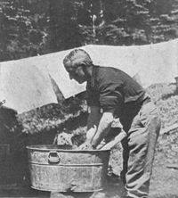
An eminent scientist practices the simple life in camp near the Timber Line.
"Why, a million dollars would pay for the upkeep of one of our battleships for a whole year!" exclaimed the great advocate of disarmament. Whether Congress can be induced to value scenery as highly as battleships remains to be seen. It has already done very well by the Yellowstone National Park, where $2,142,720 of government money had been spent on road building and administration up to July 1, 1910. No one who knows the glories of that park will deem the amount excessive. But with its still grander scenery, its important glaciers, its priceless forests, and the greater population within easy reach of its opportunities for study and recreation, the claims of the Rainier National Park are at least equal to those of the Yellowstone, and they should be as liberally met.
Nisqually Glacier, with its sources in the snow field of the summit. On the right is Gibraltar Rock and on the extreme left Kautz Glacier flows down from Peak Success. Note the medial moraines, resulting from junction of ice streams above. These apparently small lines of dirt are often great ridges of rocks, cut from the cliffs. The picture also illustrates how the marginal crevasses of a glacier point down stream from the center, though the center flows faster than the sides.
The Sierra Club on Nisqually Glacier. This active California organization sent a large party to the Mountain in 1905.
It is not desired that the whole sum named be appropriated at once. Indeed, the recommendation of the engineers has been far more modest. As far back as 1907, Maj. H. M. Chittenden of the United States Engineer Corps, in charge, wrote as follows in his report to the Secretary of War:
A bridle trail around the Mountain, just under the glacier line, is absolutely essential to the proper policing of the Park, and very necessary for the convenience of tourists, if they are really to have access to the attractions of the Park. The trail should be so located that in time it may be enlarged into a wagon road.
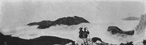
Lost to the World,
7,500 feet above sea level, with an ocean of cloud rising.
Copyright, 1909, Asahel Curtis.
This recommendation has been indorsed by Major Chittenden's successor, Maj. C. W. Kutz, and may be taken as expressing the conviction of the government (p. 070) engineers as to the minimum of work needed in the Park at once. For the necessary surveys and the building of the trails, Mr. Ricksecker informs me that $50,000 will probably be enough. This is so insignificant in comparison with the good sought and the value of the national property to be protected and made accessible that its immediate appropriation by Congress should be beyond question. Nevertheless, half that amount has twice been asked for in measures introduced by Senator S. H. Piles, but in neither case did the appropriation pass both houses. It is to be hoped that the present Congress will give the full amount of $50,000, which will enable the surveys to be completed over the entire route, and trails to be built on most, if not all, of that route. Their widening into permanent roads will follow in due time, when the wonders of glacier, canyon and forest which they make accessible are once known.
"Sunshine." View of the Mountain from above Sluiskin Falls at 3 p. m.
"Storm." View near the same point an hour later.
The road recently completed to Paradise Valley should be widened, by all means, and made safer by retaining walls at every danger point. But it is doubtful whether automobiles will ever be permitted above the bridge at the Nisqually glacier. Some automobile owners regard the Park as an automobile-club preserve, and insist that nothing more be done toward the opening of its (p. 072) scenery or the conservation of its forest until it is made safe for them to run their touring cars into Paradise. This is unfortunate, because it betrays ignorance of the purpose of Congress in creating the National Parks, namely, the education and enjoyment of all the people, not the pleasure of a class. Moreover, no matter how wide or well-guarded the road may be above the bridge, it can never be wide enough to prevent a reckless chauffeur from causing a terrible fatality. It is necessarily a very crooked road, hung upon the high ledges of precipitous cliffs. While the road is safe for coaches drawn by well-broken horses and driven by trustworthy drivers, it would be criminal folly to open it to the crowd of automobiles that would rush to Paradise Valley. If automobiles are permitted to go beyond the Nisqually glacier, it should be only when in charge of a park officer.
Looking down on Nisqually Glacier from top of Gibraltar Rock, with storm clouds veiling the Mountain.
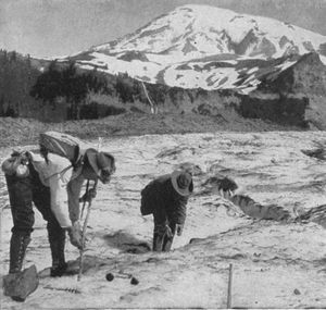
Measuring the Ice Flow in Nisqually Glacier. In 1905 Prof. J. N. Le Conte of Berkeley, Cal., established the fact that this glacier has an average flow, in summer, of 16.2 inches a day. The movement is greater at the center than on the sides, and greater on the convex side of a curve than on the concave side. It thus is a true river, though a slow one. The measurements are taken by running a line from one lateral moraine to the other with a transit, setting stakes across the glacier at short intervals, and ascertaining the advance they make from day to day.
Even from the older and wider roads of the Yellowstone automobiles have been excluded, although there are no large cities near by, as there are here, to send hundreds of cars into that park on any pleasant day. The automobilists will be wise to accept their privilege of access to the foot of the glacier, and use it with care, too. Several serious accidents have already occurred, and if greater care is not exercised, the Interior Department will apply the Yellowstone rule, at least to the extent of stopping all cars at Longmires.
Miss Fay Fuller exploring a crevasse.
Copyright, 1897, By E. S. Curtis.
Ice Cave, Paradise Glacier.
Copyright 1906, By A. H. Barnes.
Questions like this, involving conflict between the interests of a class and the vital needs of the Park as a public institution, (p. 075) give especial emphasis to the recommendation made by Secretary Ballinger on his last annual report. Owing to the great number and extent of the National Parks, and the inefficiency of the present "perfunctory policy" in their administration, Mr. Ballinger asked Congress to put the management of these institutions under a Bureau of National Parks, conducted by a competent commissioner, and organized for efficient field administration and careful inspection of all public work and of the conduct of concessionaries. Regarding the need of such a systematic and scientific organization for the development of the parks, he says:
A definite policy for their maintenance, supervision and improvement should be established, which would enable them to be gradually opened up for the convenience of tourists and campers and for the careful preservation of their natural features. Complete and comprehensive plans for roads, trails, telegraph and telephone lines, sewer and water systems, hotel accommodations, transportation, and other conveniences should be made before any large amount of money is expended. The treatment of our national parks, except as regards the Yellowstone, has not heretofore had the benefit of any well-considered or systematic plans. In all of them the road and trail problems for public travel and convenience to enable tourists to obtain the benefits of scenic beauties are primary, but sewage, water, and electric-power problems are after all of equal importance.
Fairy Falls in Goat Lick Basin, below Stevens Glacier.
In line with Secretary Ballinger's report, Senator Flint of California introduced a bill authorizing the creation of such a bureau in the Interior Department. The bill failed to get through at the last session, but I am informed by Senator Jones that it will be reintroduced. Its purpose is of great public importance, and the indorsement of the very intelligent directors of the Sierra Club in California argues well for its form. Every person interested in the development of our National Parks to fullest usefulness and the proper conservation of their natural beauty should work for the passage of the bill.[Back to content]
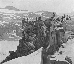
Gibraltar and
its Neighbors, showing a mile of the deeply crevassed ice-field inside
the angle of which the great crag is the apex. On the left are Cowlitz
Cleaver and the Bee-Hive; on the right, Cathedral Rocks.
Copyright, 1897, By E. S. Curtis.
(p. 077)
Crossing Carbon Glacier. On the ice slopes, it is customary to divide a large party into companies of ten, with an experienced alpinist at the head of each. Note the medial moraines on the glacier.
I asked myself, How was this colossal work performed? Who chiseled these mighty and picturesque masses out of a mere protuberance of earth? And the answer was at hand. Ever young, ever mighty, with the vigor of a thousand worlds still within him, the real sculptor was even then climbing up the eastern sky. It was he who planted the glaciers on the mountain slopes, thus giving gravity a plough to open out the valleys; and it is he who, acting through the ages, will finally lay low these mighty monuments, * * * so that the people of an older earth may see mould spread and corn wave over the hidden rocks which at this moment bear the weight of the Jungfrau.—John Tyndall: "Hours of Exercise in the Alps."
The life of a glacier is one eternal grind.—John Muir.
Our stately Mountain, in its youth, was as comely and symmetrical a cone as ever graced the galaxy of volcanic peaks. To-day, while still young as compared with the obelisk crags of the Alps, it has already taken on the venerable and deeply-scarred physiognomy of a veteran. It is no longer merely an overgrown boy among the hills, but, cut and torn by the ice of centuries, it is fast assuming the dignity and interest of a patriarch of the mountains.
Reflection Lake, below Pinnacle Peak and the Mountain.
Copyright, 1897, By E. S. Curtis.
To some, no doubt, the smooth, youthful contours of an active volcano seem more beautiful than the rugged grandeur of the Weisshorn. The perfect cone of Mt. St. Helens, until recently in eruption, pleases them more than the broad dome of Mt. Adams, rounded by an explosion in the unknown past. But for those who love nature and the story written upon its (p. 079) face, mountains have character as truly as men, and they show it in their features as clearly.
Looking up from Cowlitz Chimneys to Gibraltar and the summit. 1, Crater and Columbia's Crest. 2, Peak Success. 3, Upper snow fields of Nisqually Glacier. 4, Gibraltar Rock. 5, Cowlitz Cleaver. 6, Cathedral Rocks. 7, Little Tahoma. 8, Cowlitz Glacier. 9, Ingraham Glacier, emptying into the Cowlitz.
Divide of Paradise and Stevens Glaciers. Once probably separated by a chine of rock, they are now one save for a slight elevation in their bed, which turns them respectively toward Paradise Valley and Stevens Canyon.
Old Moraine of Stevens Glacier. Now comparatively small and harmless, this glacier did heavy work in its prime. Witness, Stevens Canyon (p. 66) and this huge pile of debris, showing that some time ago the glacier, finding a cliff in its way, cut it down and dumped it here.
Nowhere is this better exemplified than in the monarch of the Cascades. No longer the huge conical pimple which a volcano erected on the earth's crust, it bears upon it the history of its own explosion, which scattered its top far over the landscape, and of its losing battle with the sun, which, employing the heaviest of all (p. 080) tools, is steadily destroying it. It has already lost a tenth of its height and a third of its bulk. The ice is cutting deeper and deeper into its sides. Upon three of them, it has excavated great amphitheaters, which it is ceaselessly driving back toward the heart of the peak. As if to compensate for losses in size and shapeliness, the Mountain presents the most important phenomena of glacial action to be seen in the United States.
Climbers preparing for a night at Camp Muir (altitude 10,000 feet), in order to get an early start for the summit. This is on the Cowlitz Cleaver, below Gibraltar. John Muir, the famous mountain climber, selected this spot as a camp in 1888. A stout cabin should be built here to shelter climbers.
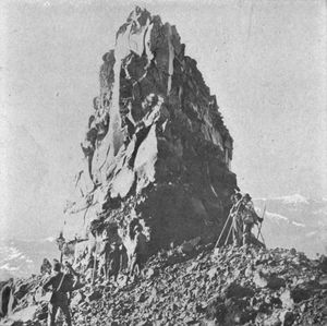
The Bee-Hive, a landmark on Cowlitz Cleaver, below Gibraltar.
In its dimensions, however, it is still one of the world's great peaks. The Rainier National Park, eighteen miles square—as large as many counties in the East—has an elevation along its western and lowest boundary averaging four thousand feet above sea level. Assuming a diameter for the peak of only twenty miles, the (p. 081) area occupied by this creature of a volcano exceeds three hundred square miles. Of its vast surface upwards of 32,500 acres, or about fifty-one square miles, are covered by glaciers or the fields of perpetual snow which feed them. A straight line drawn through from the end of North Tahoma glacier, on the west side, to the end of White glacier, on the east, would be thirteen miles long. The circumference of the crest on the 10,000-foot contour is nearly seven miles. Its glacial system is, and doubtless has long been, the most extensive on the continent, south of Alaska; it is said by scientists to outrank that of any mountain in Europe. The twelve primary glaciers vary in length from three to eight miles, and from half a mile to three miles in width. There are nearly as many "interglaciers," or smaller ice streams which gather their snow supply, not from the névé fields of the summit, but within the wedges of rock which the greater glaciers have left pointing upward on the higher slopes.
Mazama Club on Cowlitz Chimneys, looking across the ice-stream of the Cowlitz Glacier.
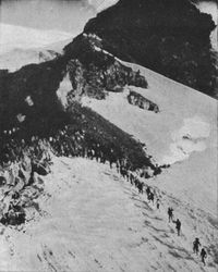
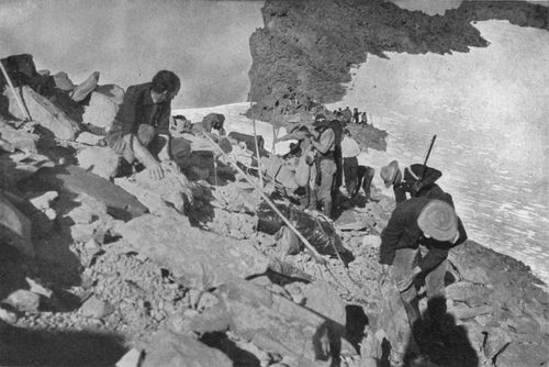
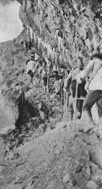
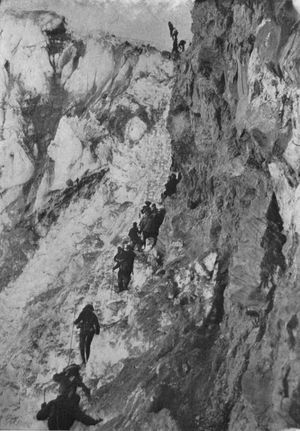
Climbing Cowlitz Cleaver to Gibraltar. This hacked and weather-worn spine left by the glaciers forms one wing of a great inverted V, with Gibraltar as its apex. On the other side of it is a drop of several thousand feet to Nisqually Glacier.
The geological story may be told in a few untechnical words. As those folds in the earth's crust which parallel the coast were slowly formed by the lateral pressure of sea upon land, fractures often occurred in the general incline thus (p. 082) created. Through the fissures that resulted the subterranean fires thrust molten rock. In many cases, the expulsion was of sufficient amount and duration to form clearly defined volcanic craters. The most active craters built up, by continued eruptions of lava and ashes, a great series of cones now seen on both sides of the Cordillera, that huge mountain system which borders the Pacific from Behring sea to the Straits of Magellan. Tacoma-Rainier is one of the more important units in this army of volcanic giants.
Mazamas rounding Gibraltar—a reminiscence of the ascent by the Portland club in 1905. The precipice rises more than 1000 feet above the trail which offers a precarious footing at the head of a steep slope of loose talus.
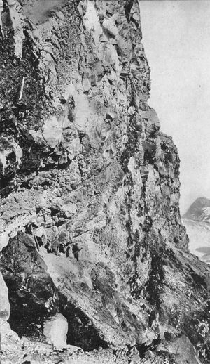
Unlike some of its companions, however, it owes its bulk less to lava flows than to the explosive eruptions which threw forth bombs and scoriae. It is a mass of agglomerates, with only occasional strata of solid volcanic rock. This becomes evident to one who inspects the exposed sides of any of the canyons, or of the great cliffs, Gibraltar Rock, Little Tahoma or Russell Peak. It is made clear in such pictures as are on this page and the next.
This looseness of structure accounts for the rapidity with which the glaciers are cutting into the peak, and carrying it away. Most of them carry an extraordinary amount of debris, to be deposited in lateral or terminal moraines, or dropped in streams which they feed. They are rivers of rock as well as of ice.
Under the walls of Gibraltar.
(p. 083) That the glaciers of this and every other mountain in the northern hemisphere are receding, and that they are now mere pygmies compared with their former selves, is well known. What their destructive power must have been when their volume was many times greater than now may be judged from the moraines along their former channels. Some of these ridges are hundreds of feet in height. As you go to the Mountain from Tacoma, either by the Tacoma Eastern railway or the Nisqually canyon road, you find them everywhere above the prairies. They are largest on the north side of the Mountain, because there the largest glaciers have been busy. Many of them, on all sides, are covered with forests that must be centuries old.
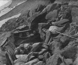
One of the bedrooms at Camp Muir.
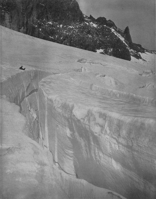
Even now, diminished as they are, the glaciers are fast transporting the Mountain toward the sea. Wherever a glacier skirts a cliff, it is cutting into its side, as it cuts into its own bed below. From the overhanging rocks, too, debris falls as a result of "weathering." The daily ebb and flow of frost and heat help greatly to tear down the cliffs. Thus marginal moraines built of the debris begin to form, on the ice, far up the side of the peak. As the glacier advances, driven by its weight and the resistless mass of snow above, it is often joined by another glacier, bringing its own marginal moraines. Where the two meet, a medial moraine results. (See illustrations, pp. 68 and 77.) Some medial moraines are many feet high. Trees are found growing on them. In Switzerland houses are built upon them. Often the debris which they transport, as the ice carries them forward, includes rocks as big as a ship.
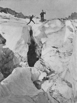
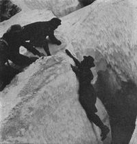
A perilous position on the edge of a great crevasse. Cowlitz Glacier, near end of Cathedral Rocks.
A glacier's flow varies from a hundred to a thousand feet or more a year, depending upon (p. 085) its volume, its width, and the slope of its bed. As the decades pass, its level is greatly lowered by the melting of the ice. More and more, earth and rocks accumulate upon the surface, as it travels onward, and are scattered over it by the rains and melting snow. At last, in its old age, when far down its canyon, the glacier is completely hidden, save where crevasses reveal the ice. Only at its snout, where it breaks off, as a rule, in a high wall of ice, do we realize how huge a volume and weight it must have, far above toward its sources, or why so many of the crevasses on the upper ice fields seem almost bottomless.
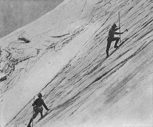
Climbing the "Chute," west side of Gibraltar. Here the guides cut steps in the ice.
These hints of the almost inconceivable mass of a glacier, with its millions of millions of tons, suggest how much of the Mountain has already been whittled and planed away. But here we may do better than speculate. The original surface of the peak is clearly indicated by the tops of the great rocks which have survived the glacial sculpturing. These rise from one to two thousand feet above the glaciers, which are themselves several thousand feet in depth. The best known of them is the point formed by Gibraltar and the ridges that stretch downward from it, Cowlitz Cleaver and Cathedral Rocks, making a great inverted V. Eastward of this, another V with its apex toward the summit, is called Little Tahoma; and beyond, still another, Steamboat Prow, forming the tip of "The Wedge."
Spines of rock like these are found on all sides of the peak. They help us to estimate its greater circumference and bulk, before the glaciers had chiseled so deep.
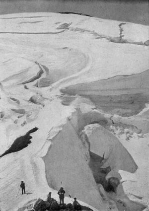
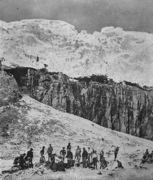
Looking from top of Gibraltar to the Summit. Elevation of camera, 12,300 feet. In distance is seen the rim of the crater. The route to this is a steady climb, with 2,000 feet of ascent in one mile of distance. Many detours have to be made to avoid crevasses. Note the big crevasse stretching away on right—a "Bergschrund," as the Swiss call a break where one side falls below the other. The stratification on its side shows in each layer a year's snow, packed into ice.
(p. 086) But they do even more. Wherever lava flows occurred in the building of the Mountain, strata formed; and such stratification is clearly seen at intervals on the sides of the great rocks just mentioned. Its incline, of course, is that of the former surface. The strata point upward—not toward the summit which we see, but far above it. For this reason the geologists who have examined the arêtes most closely are agreed that the peak has lost nearly two thousand feet of its height. It blew its own head off!
Such explosive eruptions are among the worst vices of volcanoes. Every visitor to Naples remembers how plainly the landscape north of Vesuvius tells of a prehistoric decapitation, which left only a low, broad platform, on the south rim of which the little Vesuvius that many of us have climbed was formed by later eruptions, while a part of the north rim is well defined in "Monte Somma." Similarly, here at home, Mt. Adams and Mt. Baker are truncated cones, while, on the other hand, St. Helens and Hood are still symmetrical.
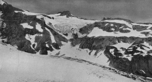
Like Vesuvius, too, Rainier-Tacoma has built upon the plateau left when it lost its head. Peak Success, overlooking Indian Henry's, and Liberty Cap, the northern elevation, seen from Seattle and Tacoma, are nearly three miles apart on the west side of the broad summit. These are parts of the rim of the old crater. East of the line uniting them, and about two miles from each, the volcano built up an elevation now known as Crater Peak, comprising two small adjacent craters. These burnt-out craters are now filled with snow, and where the rims touch, a big snow-hill rises—the strange creature of eddying winds that sweep up through the great flume cut by volcanic explosion and glacial action in the west side of the peak. (See pp. 14, 27, and 52.)
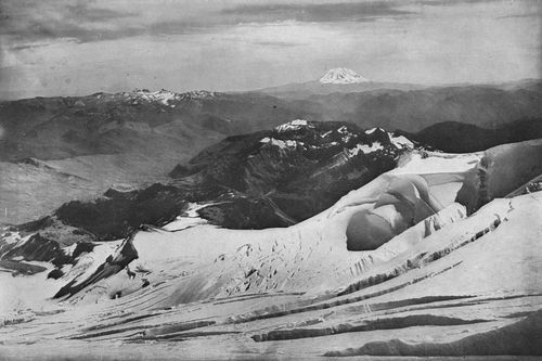
View South from Cowlitz Glacier: elevation, 8,000 feet. Seven miles away are the huge eastern peaks of the Tatoosh. The Cascades beyond break in Cispus Pass, and rise, on the left, to the glacier summits called Goat Peaks. The truncated cone of Mt. Adams, more than forty miles away, crowns the sky-line.
These views show the larger of the two comparatively modern and small craters on the broad platform left by the explosion which decapitated the Peak.
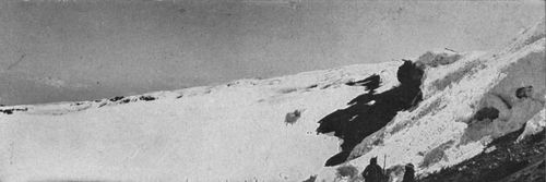
These views show the larger of the two comparatively modern and small craters on the broad platform left by the explosion which decapitated the Peak. Prof. Flett measured this crater, and found it 1,600 feet from north to south, and 1,450 feet from east to west. The other, much smaller, adjoins it so closely that their rims touch. Together they form an eminence of 1,000 feet (Crater Peak), at a distance of about two miles from North Peak (Liberty Cap) and South Peak (Peak Success). At the junction of their rims is the great snow hill (on right of view) called "Columbia's Crest." This is the actual summit. The volcano having long been inactive, the craters are filled with snow, but the residual heat causes steam and gases to escape in places along their rims.
This mound of snow is the present actual top. Believing it the highest point in the United States south of Alaska, a party of climbers, in 1894, named it "Columbia's Crest." This was long thought to be the Mountain's rightful distinction, for different computations by experts gave various elevations ranging as high as 14,529 feet, with none prior to 1902 giving less than 14,444 feet. Even upon a government map published as late as 1907 the height is stated as 14,526 feet. In view of this variety of expert opinion, the flattering name, not unnaturally, has stuck, in spite of the fact that the government geographers have now adopted, for the Dictionary of Altitudes, the height found by the United States Geological Survey in 1902, 14,363 feet. That decision leaves the honor of being the loftiest peak between Alaska and Mexico to Mt. Whitney in the California Sierra (14,502 feet).
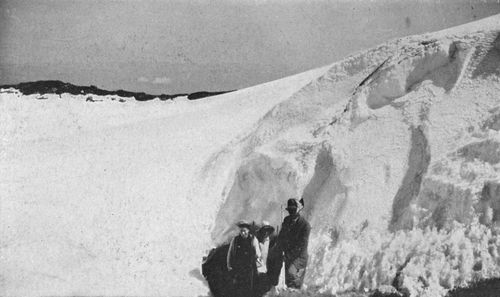
Steam Caves in one of the craters. The residual heat of the extinct volcano causes steam and gases to escape from vents in the rims of the two small craters. Alpinists often spend a night in the caves thus formed in the snow.
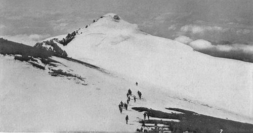
North Peak, named "Liberty Cap" because of its resemblance to the Bonnet Rouge of the French Revolutionists. Elevation, about 14,000 feet. View taken from the side of Crater Peak. Distance, nearly two miles.
The definitive map of the National Park which was begun last summer by the Geological Survey, with Mr. Francois E. Matthes in charge, will establish the elevations of all important landmarks in the Park. Among these will be the Mountain itself. Whether this will add much, if anything, to the current figure of the Dictionary is uncertain. In any case, the result will not lessen the pride of the Northwest in its great peak. A few feet of height signify nothing. No California mountain masked behind the Sierra can vie in majesty with this lonely pile that rises in stately grandeur from the shores of Puget Sound.
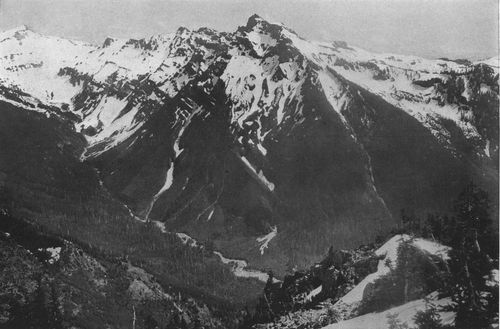
Goat Peaks, glacier summits in the Cascades, southeast of the Mountain. Elevation, about 8,000 feet, A branch of the Cowlitz is seen flowing down from the glaciers above.
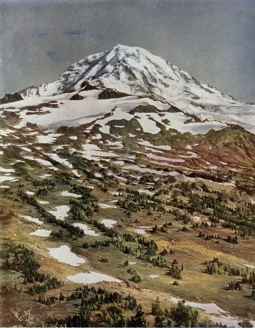
Spray Park,
from Fay Peak, showing the beautiful region between the Carbon and
North Mowich Glaciers.
Copyright 1907, By W. P. Romans.
Ice-bound Lake in Cowlitz Park, with top of Little Tahoma in distance.
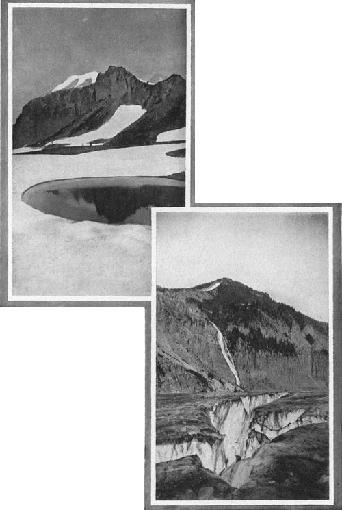
Crevasses in Cowlitz Glacier, with waterfall dropping from Cowlitz Park, over basaltic cliffs.
The wide area which the Mountain thrusts far up into the sky is a highly efficient condenser of moisture. Near to the Pacific as it is, its broad summit and upper slopes collect several hundred feet of snow each year from the warm Chinooks blowing in from the west. On all sides this vast mass presses down, hardened into solid granular névé, to feed the twelve primary glaciers. Starting eastward from Paradise Valley, these principal ice-streams are: Cowlitz and Ingraham glaciers; White or White River glacier, largest of all; Winthrop glacier, named in honor of Theodore Winthrop, in whose romance of travel, "The Canoe and the Saddle," the ancient Indian name "Tacoma" was first printed; Carbon, North and South Mowich, Puyallup, North and South Tahoma, Kautz and Nisqually glaciers. The most important secondary glaciers, or "interglaciers," rising within the great rock wedges which I have described, are called Interglacier, Frying-Pan, (p. 094) Stevens, Paradise and Van Trump. All of these are of the true Alpine type; that is, they are moving rivers of ice, as distinguished from "continental glaciers," the ice caps which cover vast regions in the Arctic and Antarctic.
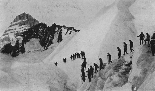
Crossing a precipitous slope on White Glacier. Little Tahoma in distance.
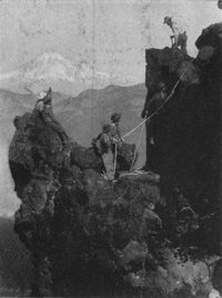
Climbing Goat Peaks,
in the Cascades, with the Mountain twenty miles away.
Copyright, 1910, By S. C. Smith.
In thus naming the glaciers, I have followed the time-honored local usage, giving the names applied by the earliest explorers and since used with little variation in the Northwest. There has been some confusion, however, chiefly owing to a recent government map. For instance, in that publication, White glacier, properly so called because it is the main feeder of the White river, was named Emmons glacier, after S. F. Emmons, a geologist who was one of the first to visit it. It is interesting to note that in his reports Mr. Emmons himself called this the White River glacier. On the other hand, the map mentioned, after displacing the name White from the larger glacier to which it logically belongs, gave it to the ice-stream feeding another branch of the White river, namely, the glacier always locally called the Winthrop, and so called by Prof. Russell in his report to the Geological Survey in 1897.
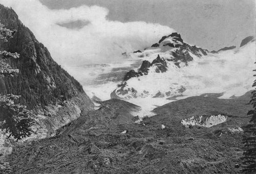
Looking up White Glacier (right), from a point on its lower end, showing vast amount of morainal debris carried down by this glacier. Little Tahoma in middle distance; Gibraltar and Cathedral Rocks on extreme right; "Goat Island" on left. Elevation of camera, about 4,500 feet. Note the "cloud banner" which the crag has flung to the breeze.
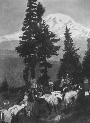
The Mountain seen from the top of Cascade range, with party starting west over the forest trails for Paradise.
Similarly, North and South Mowich, names of the streams to which they give birth, were miscalled Willis and Edmunds glaciers, after Bailey Willis, geologist, and George F. Edmunds, late United States senator, who visited the Mountain many years ago. The Mowich rivers were so named by the Indians from the fact that, in the great rocks on the northwest side of the peak, just below the summit, they saw the figure of the mowich, or deer. The deer of rock is there still—he may be seen in several pictures in this volume,—and so long as he keeps to his icy pasture it will be difficult to displace his name from the glaciers and rivers below. The southern branch of the great Tahoma glacier, locally called South Tahoma glacier, this map renamed Wilson glacier, for A. D. Wilson, Emmons's companion in exploration. Finally, the name of General Hazard Stevens, who, (p. 097) with Mr. Van Trump, made the first ascent of the peak in 1870, was misplaced, being given to the west branch of the Nisqually, whereas the general usage has fixed the name of that pioneer upon the well-defined interglacier east of the Paradise, and above Stevens canyon, which in its prime it carved on the side of the Mountain. General Stevens himself writes me from Boston that this is the correct usage.
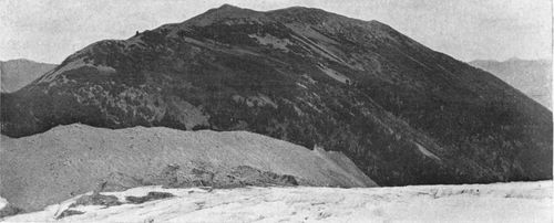
Great moraine built by Frying-Pan Glacier on side of "Goat Island."
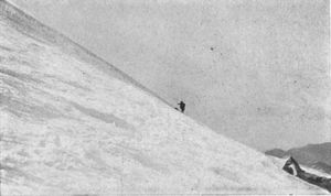
Coming around Frying-Pan Glacier, below Little Tahoma.
Such errors in an official document are the more inexcusable because their author ignored local names recognized in the earlier publications of the government and its agents. In such matters, too, the safe principle is to follow local custom where that is logical and established. The new map prepared by Mr. Ricksecker, and printed herewith, returns to the older and better usage. Unless good reason can be shown for departing from it, his careful compilation should be followed. Willis Wall, above Carbon Glacier, appropriately recalls the work of Bailey Willis. The explorations of Emmons and Wilson may well be commemorated by landmarks as yet unnamed, not by displacing fit names long current.
In connection with his survey of the Park, Mr. Matthes has been authorized to collect local testimony as to established names within that area, and to invite suggestions as to appropriate names for landmarks not yet definitely named. His report will doubtless go to the National Geographic Board for final decision on the names recommended. Thus, in time, we may hope to see this awkward and confusing tangle in mountain nomenclature straightened out.
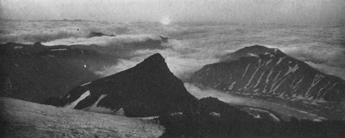
Sunrise above the clouds, seen from Camp Curtis, on the Wedge, (altitude 9,500 feet); White Glacier below. This camp was named by the Mountaineers in 1909, in honor of Asahel Curtis, the Seattle climber.
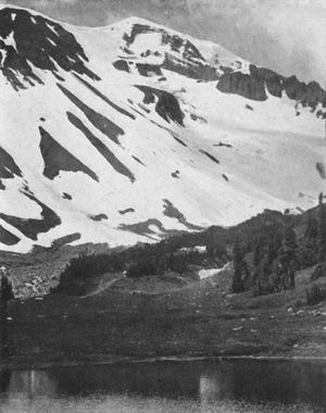
Looking up from "Snipe Lake," a small pond below Interglacier, to the head of Winthrop Glacier and Liberty Cap.
The written history of the Mountain begins with its discovery by Captain George Vancouver. Its first appearance upon a map occurs in Vancouver's well-known report, published in 1798, after his death: "Voyage of Discovery to the North Pacific Ocean and around the World, 1790-1795."
It was in the summer of 1792, shortly after Vancouver had entered the Sound, he tells us, that he first saw "a very remarkable high round mountain, covered with snow, apparently at the southern extremity of the distant snowy range." A few days later he again mentions "the round snowy mountain," "which, after my friend Rear-Admiral Rainier, I distinguished by the name of Mount Rainier." Nearly all of Captain Vancouver's friends were thus distinguished, at the cost of the Indian names, to which doubtless he gave no thought. Sonorous "Kulshan" and unique "Whulge" were lost, in order that we might celebrate "Mr. Baker" and "Mr. Puget," junior officers of Vancouver's expedition.
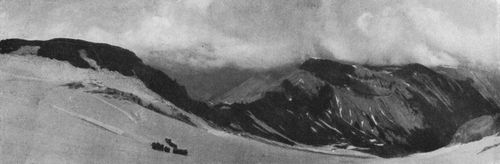
Passing a big crevasse on Interglacier. Sour-Dough Mountains on the right, with Grand Park beyond: St. Elmo Pass in center, Snipe Lake and Glacier Basin in depression.
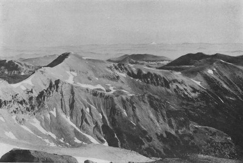
View north from Mt. Ruth (part of the Wedge), with Interglacier in foreground, the Snipe Lake country below, Sour-Dough Mountains on right, Grand Park in middle distance, and Mt. Baker, with the summits of the Selkirks, far away in Canada, on the horizon.
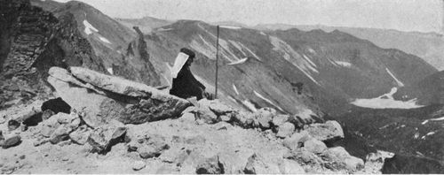
Camp on St. Elmo Pass, north side of the Wedge, between Winthrop Glacier and Interglacier. Elevation, 9,000 feet. Winthrop Glacier and the fork of White River which it feeds are seen in distance below. The man is Maj. E. S. Ingraham, a veteran explorer of the Mountain, after whom Ingraham Glacier is named.
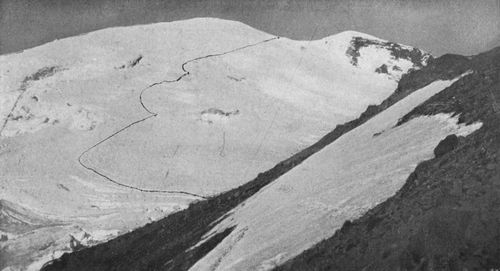
East face of the Mountain, from south side of the Wedge, showing route to the summit over White Glacier.
Happily, the fine Indian name "Tacoma" was not offered up a sacrifice to such obscurity. Forgotten as he is now, Peter Rainier was, in his time, something of a figure. After some ransacking of libraries, I have found a page that gives us a glimpse of a certain hard-fought though unequal combat, in the year 1778, between an American privateer and two British ships. It is of interest in connection with "Mount Rainier," the name recognized by the Geographic Board at Washington in 1889 as official.
On the 8th of July, the 14-gun ship Ostrich, Commander Peter Rainier, on the Jamaica station, in company with the 10-gun armed brig Lowestoffe's Prize, chased a large brig. After a long run, the Ostrich brought the brig, which was the American privateer Polly, to action, and, after an engagement of three hours' duration (by which time the Lowestoffe's Prize had arrived up and (p. 101) taken part in the contest), compelled her to surrender. * * * * Captain Rainier was wounded by a musket ball through the left breast; he could not, however, be prevailed upon to go below, but remained on deck till the close of the action. He was posted, and appointed to command the 64-gun ship Burford. (Allen: "Battles of the British Navy," Vol. I., London, 1872).
Admiral Peter Rainier, of the British Navy, in whose honor Captain George Vancouver, in 1792, named the great peak "Mt. Rainier."
Before quitting with Vancouver and eighteenth-century history of the Mountain, I note that our peak enjoyed a further honor. Captain Vancouver records an interesting event that took place on the anniversary of King George's birth;—"on which auspicious day," he says, "I had long since designed to take formal possession of all the countries we had lately been employed in exploring, in the name of, and for, His Britannic Majesty, his heirs and successors." And he did!
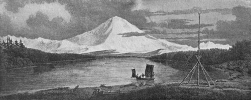
First picture of the Mountain, from Vancouver's "Voyage of Discovery," London, 1798.
After Vancouver's brief mention, and the caricature of our peak printed in his work, literature is practically silent about the Mountain for more than sixty years. Those years witnessed the failure of England's memorable struggle to make good Vancouver's "annexation." Oregon was at last a state. Out of its original area Washington Territory had just been carved. In that year of 1853 (p. 102) came Theodore Winthrop, of the old New England family, who was destined to a lasting and pathetic fame as an author of delightful books and a victim of the first battle of the Civil War. Sailing into what is now the harbor of the city of Tacoma, he there beheld the peak. We feel his enthusiasm as he tells of the appeal it made to him.
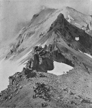
Climbers on St. Elmo Pass, seen from the upper side.
We had rounded a point, and opened Puyallop Bay, a breadth of sheltered calmness, when I was suddenly aware of a vast white shadow in the water. What cloud, piled massive on the horizon, could cast an image so sharp in outline, so full of vigorous detail of surface? No cloud, but a cloud compeller. It was a giant mountain dome of snow, swelling and seeming to fill the aerial spheres, as its image displaced the blue deeps of tranquil water. Only its splendid snows were visible, high in the unearthly regions of clear blue noonday sky.
Kingly and alone stood this majesty, without any visible consort, though far to the north and the south its brethren and sisters dominated their realms. Of all the peaks from California to (p. 103) Frazer's River, this one before me was royalest. Mount Regnier[5] Christians have dubbed it, in stupid nomenclature perpetuating the name of somebody or nobody. More melodiously the Siwashes call it Tacoma,—a generic term also applied to all snow peaks. Tacoma, under its ermine, is a crushed volcanic dome, or an ancient volcano fallen in, and perhaps not yet wholly lifeless. The domes of snow are stateliest. There may be more of feminine beauty in the cones, and more of masculine force and hardihood in the rough pyramids, but the great domes are calmer and more divine.
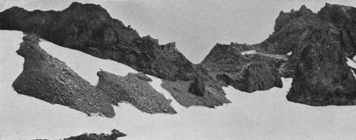
St. Elmo Pass from north side. The name was given by Maj. Ingraham in 1886 because of a remarkable exhibition of St. Elmo's fire seen here during a great storm. A cabin is needed at this important crossing.
No foot of man had ever trampled those pure snows. It was a virginal mountain, distant from human inquisitiveness as a marble goddess is from human loves. Yet there was nothing unsympathetic in its isolation, or despotic in its distant majesty. Only the thought of eternal peace arose from this heaven-upbearing monument like incense, and, overflowing, filled the world with deep and holy calm.

Avalanche Camp (11,000 feet), on the high, ragged chine between Carbon and Winthrop. Carbon Glacier, seen below, has cut through a great range, leaving Mother Mountains on the left and the Sluiskins, right.
Our lives demand visual images that can be symbols to us of the grandeur or the sweetness of repose. The noble works of nature, and mountains most of all,
"have power to make
Our noisy years seem moments in the being
Of the eternal silence."
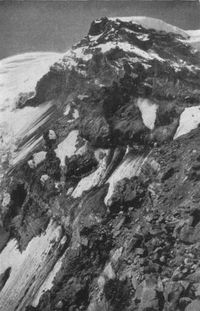
Russell Peak, from Avalanche Camp, 2,500 feet below. Named for Prof. Israel C. Russell, geologist.
And, studying the light and the majesty of Tacoma, there passed from it and entered into my being a thought and image of solemn beauty, which I could thenceforth evoke whenever in the world I must (p. 104) have peace or die. For such emotion years of pilgrimage were worthily spent. ("The Canoe and the Saddle," published posthumously in 1862).
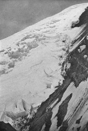
Looking up Winthrop Glacier from Avalanche Camp.
In the controversy over the Mountain's name, some persons have been misled into imaging Winthrop a fabricator of pseudo-Indian nomenclature. But his work bears scrutiny. He wrote before there was any dispute as to the name, or any rivalry between towns to confound partisanship with scholarship. He was in the Territory while Captain George B. McClellan, was surveying the Cascades to find a pass for a railroad. He was in close touch with McClellan's party, and doubtless knew well its able ethnologist, George Gibbs, the Harvard man whose works on the Indian languages of the Northwest are the foundation of all later books in that field. Although he first learned it from the Indians, in all likelihood he discussed the name "Tacoma" with Gibbs, who was already collecting material for his writings, published in the (p. 107) report of the Survey and in the "Contributions" of the Smithsonian Institution. Among these are the vocabularies of a score of Indian dialects, which must be mentioned here because they are conclusive as to the form, meaning and application of the name.
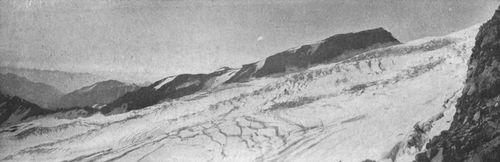
Looking across Winthrop Glacier from Avalanche Camp to Steamboat Prow (the Wedge) and St. Elmo Pass. Elevation of camera, 11,000 feet.
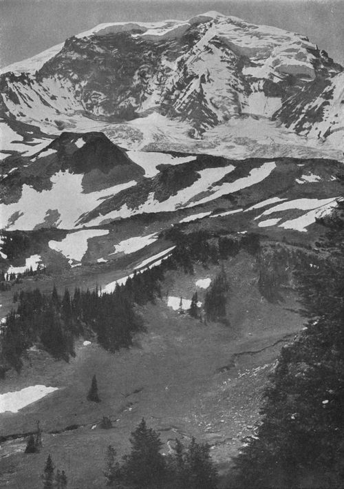
View south from the Sluiskin Mountains across Moraine Park to the head of Carbon Glacier. Elevation of camera, 6,500 feet. Moraine Park, below, was until recently the bed of an interglacier. On the extreme left, Avalanche Camp and Russell Peak are seen between Carbon and Winthrop Glaciers.
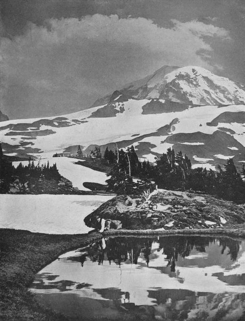
Portion of Spray Park, with north-side view of the Mountain, showing Observation Rock and timber line. Elevation of camera, 7,000 feet.
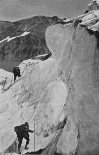
Climbing the séracs of Winthrop Glacier.
In his vocabulary of the Winatsha (Wenatchee) language, Gibbs entered: "T'koma, snow peak." In that of the Niswalli (Nisqually), he noted: "Takob, the name of Mt. Rainier." "T'kope," Chinook for white, is evidently closely allied. Gibbs himself tells us that the Northwestern dialects treated b and m as convertible. "Takob" is equivalent to "Takom" or "T'koma." Far, then, from coining the word, Winthrop did not even change its Indian form, as some have supposed, by modifying the mouth-filling "Tahoma" of the Yakimas into the simpler, stronger and more musical "Tacoma." This is as pure Indian as the other, and Winthrop's popularization of the word was a public service, as perpetuating one of the most significant of our Indian place-names.
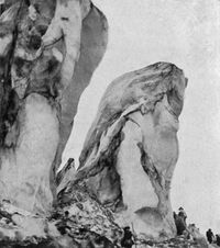
Ice pinnacles on the Carbon.
I have said thus much, not to revive a musty and, to me, very amusing quarrel, but because correspondents in different parts of the country have asked regarding facts that are naturally part of the history of the Mountain. Some would even have me stir the embers of that ancient controversy. For instance, here is the Bulletin of the Geographical Society of Philadelphia taking me to task:
This book would also do a great service if it would help popularize the name "Tacoma" in spite of the Mountain's official designation "Rainier"—a name to which it has no right when its old Indian name is at once so beautiful and appropriate. It is to be regretted that a more vigorous protest has not been made against the modern name, and also against such propositions as that of changing "Narada Falls" to "Cushman Falls."
The mistaken attempt to displace the name of Narada Falls was still-born from the start, and needed no help to kill it. There are many unnamed landmarks (p. 108) in the National Park ready to commemorate Mr. Cushman's ambition to make the Mountain a real possession of all the people. As to the other matter—the name of the peak itself,—that may safely be left to the American sense of humor. But what I have said is due in justice to Winthrop, one of the finest figures in our literary history. His work in making the peak known demands that his name, given by local gratitude to one of its important glaciers, shall not be removed.
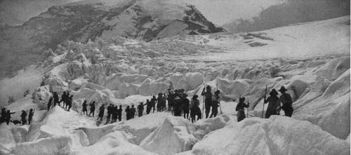
Among the ice bridges of the Carbon.
A word about the industrial value of the Mountain may not be without interest in this day of electricity. Within a radius of sixty miles of the head of Puget Sound, more water descends from high levels to the sea than in any other similar area in the United States. A great part of this is collected on the largest peak. Hydraulic engineers have estimated, on investigation, an average annual precipitation, for the summit and upper slopes, of at least 180 inches, or four times the rainfall in Tacoma or Seattle. The melting snows feed the White, Puyallup and Nisqually rivers, large streams flowing into the Sound, and the Cowlitz, an important tributary of the Columbia. The minimum flow of these streams is computed at more than 1200 second feet, while their average flow is nearly twice that total.
The utilization of this large water supply on the steep mountain slopes began in 1904 with the erection of the Electron plant of the Puget Sound Power Company. For this the water is diverted from the Puyallup river ten miles from the end of its glacier, and 1750 feet above sea level, and carried ten miles more in an open flume to a reservoir, from which four steel penstocks, each four feet in diameter, drop it to the power house 900 feet below. The plant generates 28,000 horse power, which is conveyed to Tacoma, twenty-five miles distant, at a pressure of 60,000 volts, and there is distributed for the operation of street railways, lights and factories in that city and Seattle.
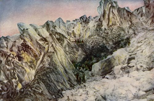
Mountain Climbers in Crevasse on Carbon Glacier.
A more important development is in progress on the larger White river near Buckley, where the Pacific Coast Power Company is diverting the water by a dam and eight-mile canal to Lake Tapps, elevation 540 feet above tide. From this (p. 111) great reservoir it will be taken through a tunnel and pipe line to the generating plant at Dieringer, elevation 65 feet. The 100,000 horse power ultimately to be produced here will be carried fifteen miles to Tacoma, for sale to manufacturers in the Puget Sound cities.
Building Tacoma's Electric Power Plant on the Nisqually Canyon.
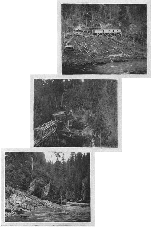
Upper view shows site of retention dam, above tunnel; middle view, end of tunnel, where pipeline crosses the canyon on a bridge; lower view, site of the generating plant (see p. 21).
Both these plants are enterprises of Stone & Webster, of Boston. A competitive plant is now nearing completion by the city of Tacoma, utilizing the third of the rivers emptying into the Sound. The Nisqually is dammed above its famous canyon, at an elevation of 970 feet, where its minimum flow is 300 second feet. The water will be carried through a 10,000-foot tunnel and over a bridge to a reservoir at La Grande, from which the penstocks will carry it down the side of the canyon (p. 112) to the 40,000 horse-power generating plant built on a narrow shelf a few feet above the river. The city expects to be able to produce power for its own use, with a considerable margin for sale, at a cost at least as low as can be attained anywhere in the United States.
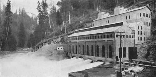
Hydro-electric plant at Electron, on the Puyallup River, producing 28,000 h. p.
The rocks of which the Mountain is composed are mainly andesites of different classes and basalt. But the peak rests upon a platform of granite, into which the glaciers have cut in their progress. Fine exposures of the older and harder rock are seen on the Nisqually, just below the present end of its glacier, as well as on the Carbon and in Moraine Park. This accounts for the fact that the river beds are full of granite bowlders, which are grinding the softer volcanic shingle into soil. Thus the glaciers are not only fast deforming the peak. They are "sowing the seeds of continents to be."[Back to content]
Cutting canal to divert White River into Lake Tapps.
(p. 113)
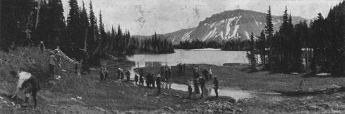
Mystic Lake in Moraine Park.
Climb the mountains, and get their good tidings. Nature's peace will flow into you as sunshine flows into trees. The winds will blow their own freshness into you, and the storms their energy, while cares will drop off like autumn leaves.—John Muir.
Upwards—towards the peaks, towards the stars, and towards the great silence!—Ibsen.
Given good muscles and wind, the other requisites for an ascent of the Mountain are a competent guide and grit. It offers few problems like those confronting the climber of the older and more crag-like Alps. There are no perpendicular cliffs to scale, no abysses to swing across on a rope. If you can stand the punishment of a long up-hill pull, over loose volcanic talus and the rough ice, you may safely join a party for Gibraltar Rock and the summit. But the ascent should not be attempted without first spending some time in "try-outs" on lower elevations, both to prepare one's muscles for climbing and descending steep slopes, and to accustom one's lungs to the rarer atmosphere of high altitudes. Such preparation will save much discomfort, including, perhaps, a visit of "mountain sickness."
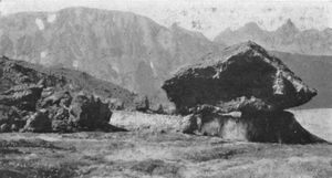
Glacier Table on Winthrop Glacier. This phenomenon is due to the melting of the glacier, save where sheltered by the rock. Under the sun's rays, these "tables" incline more and more to the south, until they slide off their pedestals.
Another warning must be given to the general tourist. Do not try to climb the Mountain without guides. The seasoned alpinist, of course, will trust to previous experience on other peaks, and may find his climb here comparatively safe and easy. But the fate of (p. 115) T. Y. Callaghan and Joseph W. Stevens, of Trenton, N. J., who perished on the glaciers in August, 1909, should serve as a warning against over-confidence. Unless one has intimate acquaintance with the ways of the great ice peaks, he should never attack such a wilderness of crevasses and shifting snow-slopes save in company of those who know its fickle trails.
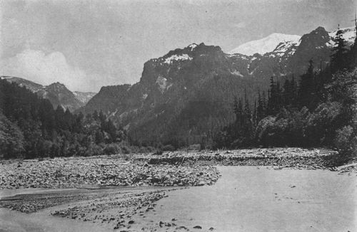
Carbon River below its Gorge, and Mother Mountains. This range was so named because of a rude resemblance to the up-turned face of a woman seen here in the sky-line, while the view of snowy Liberty Cap beyond and the milky whiteness of the stream gave rise to the pleasing fiction that the Indian name of the peak meant "nourishing breast." "Tacoma" meant simply the Snow Mountain.
Oldest and youngest
climbers, Gen. Hazard Stevens and Jesse McRae. General Stevens, with
P. B. Van Trump, in 1870, made the first ascent. In 1905, he came west
from Boston and joined the Mazamas in their climb. The picture shows
him before his tent in Paradise Park. He was then 63 years old.
Copyright, 1910, By C. E. Cutter.
Under the experienced guides, many climbers reach Crater Peak each summer, and no accidents of a serious nature have occurred. The successful climbers numbered one hundred and fifty-nine in 1910. Many more go only as far as Gibraltar, or even to McClure Rock (Elevation, 7,385 feet), and are well rewarded by the magnificent views which these points command of the south-side glaciers and arêtes, with the ranges lying below. The name "McClure Rock" is a memorial of the saddest tragedy of the Mountain. Over the slope below this landmark Prof. Edgar McClure of the University of Oregon fell to his death on the night of July 27, 1897. He had spent the day in severe scientific labor on the summit, and was hurrying down in the moonlight, much wearied, to Reese's Camp for the night. Going ahead of his companions, to find a safe path for them, he called back that the ice was too steep. Then there was silence. Either he slipped in trying to re-ascend the slope, or he fainted from exhaustion. His body was found on the rocks below by his comrades of the Mazama Club.
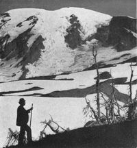
P. B. Van Trump, on
his old campground, above Sluiskin Falls, where he and Gen. Stevens
camped in 1870.
Copyright, 1897, By E. S. Curtis.
If one is going the popular route and is equal to so long and unbroken a climb, he may start with his guide from Reese's before dawn, and be on Columbia's Crest by 11 o'clock. But climbers frequently go up Cowlitz Cleaver in the evening, and spend the night at Camp Muir (see pp. 60 and 80). This ledge below Gibraltar gets its name from John Muir, the famous mountaineer, who, on his ascent in 1888, suggested it as a camping place because the presence of pumice indicated the (p. 116) absence of severe winds. It offers none of the conveniences of a camp save a wind-break, and even in that respect no one has ever suffered for want of fresh air. It is highly desirable that a cabin be erected here for the convenience of climbers. Such shelters as the Alpine clubs have built on the high shoulders of many peaks in Switzerland are much needed, not only at Muir, but also on the Wedge, as well as inside one of the craters, where, doubtless a way might be found to utilize the residuary heat of the volcano for the comfort of the climbers.
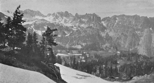
Lower Spray Park, with Mother Mountains beyond. One of the most beautiful alpine vales in the great Spray Park region.
John Muir, President of the Sierra Club and foremost of American mountaineers
"His daily teachers had been woods and rills,
The silence that is in the starry sky,
The sleep that is among the lonely hills."
Copyright, 1909, By J. Edward B. Greene.
Going to the summit by this route, the important thing is to pass Gibraltar early, before the sun starts the daily shower of icicles and rocks from the cliff over the narrow trail (see p. 83). This is the most dangerous point, but no lives have been lost here. Everywhere, of course, caution is needed, and strict obedience to the (p. 117) guide. Once up the steep flume caused by the melting of the ice where it borders the rock (p. 85), the climber threads his way among the crevasses and snow-mounds for nearly two miles, until the crater is reached (pp. 86, 88, 89).
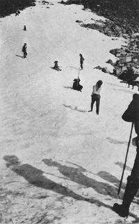
Coasting in Moraine Park in the August sunshine.
The east-side route (p. 100) involves less danger, perhaps, but it is a longer climb, with no resting places or wind-breaks. It has been used less, because it is farther from Paradise Valley. Starting from a night's encampment on the Wedge (p. 97), parties descend to White glacier, and, over its steep incline of dazzling ice, gain the summit in eight or nine hours.
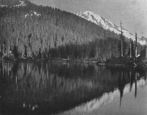
Sunset on Crater Lake, north of Spray Park, with the Mountain in distance.
The first attempt to scale the Mountain was made in 1857 by Lieutenant (later General) A. V. Kautz. There is no foundation for the claim sometimes heard that Dr. W. F. Tolmie, Hudson's Bay Company agent at Fort Nisqually, who made a botanizing trip to the lower slopes in 1833, attempted the peak. Lieutenant Kautz, with two companions from fort Steilacoom, climbed the arête between the glacier now named after him and the Nisqually glacier, but fearing a night on the summit, and knowing nothing of the steam caves in the crater, he turned back when probably at the crest of the south peak. Writing in the Overland Monthly for May, 1875, he says that, "although there were points higher yet, the (p. 120) Mountain spread out comparatively flat," having the form of "a ridge perhaps two miles in length, with an angle about half-way, and depressions between the angle and each end of the ridge, which gave the summit the appearance of three small peaks."
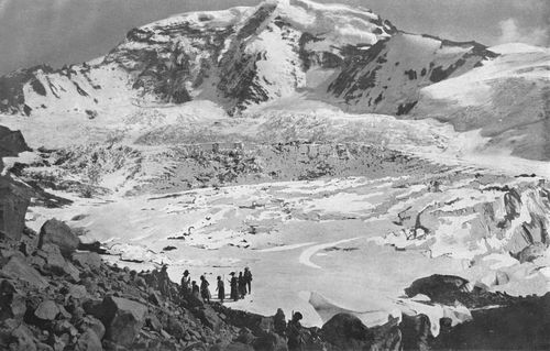
Amphitheatre
of Carbon Glacier, the most noteworthy example of glacial sculpture
upon the Mountain. It is nearly three miles wide. No other glacier has
cut so deeply into the side of the peak. The Carbon was once two
glaciers, separated by a ridge, of which a remnant is still seen in
the huge spine of rock extending down from Liberty Cap.
Copyright, 1909, By Asahel Curtis.
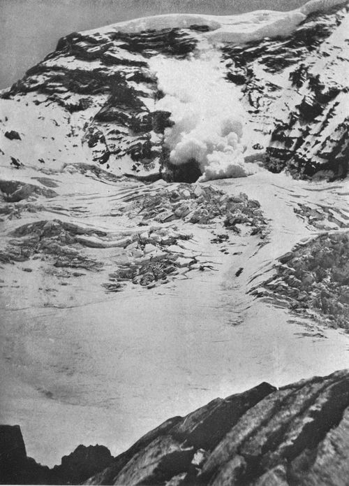
Avalanche falling on Willis Wall, at head of Carbon Glacier
amphitheatre. The cliff, up to the snow cap on the summit, is more
than 4,000 feet high and nearly perpendicular. Avalanches fall every
day, but this picture of a big one in action is probably unique.
Willis Wall was named for Bailey Willis, the geologist.
Photo By Lea Bronson. Copyright, 1909, By P. V.
Caesar.
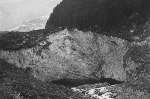
Birth of Carbon River, with part of Willis Wall visible in distance.
The great height of this ice front appears on nothing the man near the river.
Copyright, 1909, By A. H. WAITE.
It was not until August 17, 1870, thirteen years after Kautz's partial victory, that the Mountain was really conquered. This was by P. B. Van Trump of Yelm and Hazard Stevens, son of the first governor of Washington, who had distinguished himself in the Civil War, and was then living at Olympia as a Federal revenue officer. Each of these pioneers on the summit has published an interesting account of how they got there, General Stevens in the Atlantic Monthly for November, 1876, and Mr. Van Trump in the second volume of Mazama. In Stevens's article, "The Ascent of Takhoma," his acquaintance with the Indians of the early territorial period, gives weight to this note:
Tak-ho-ma or Ta-ho-ma among the Yakimas, Klickitats, Puyallups, Nisquallys and allied tribes is the generic term for mountain, used precisely as we use the word "Mount," as Takhoma Wynatchie, or Mount Wynatchie. But they all designate Rainier simply as Takhoma, or The Mountain, just as the mountain men used to call it "Old He."
Sluiskin, an Indian celebrity whom they employed as a guide, led the young men the longest and hardest way, taking them over the Tatoosh mountains instead of directly up the Nisqually and Paradise canyons. From the summit of that range, they at last looked across the Paradise valley, and beheld the great peak "directly in front, filling up the whole view with an indescribable aspect of magnitude (p. 121) and grandeur." Below them lay "long green ridges projected from the snow belt, with deep valleys between, each at its upper end forming the bed of a glacier."
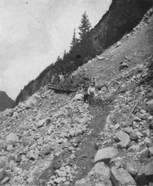
The Mountaineers building trail on the lateral moraine of Carbon Glacier. Without such trails, the "tenderfoot" would fare badly.
Descending from the Tatoosh, the explorers camped near a waterfall which they named Sluiskin Falls, in honor of their guide. Sluiskin now endeavored, in a long oration, to dissuade them from their folly. Avalanches and winds, he said, would sweep them from the peak, and even if they should reach the summit, the awful being dwelling there would surely punish their sacrilege. Finding his oratory vain, he chanted a dismal dirge till late in the night, and next morning took solemn leave of them.
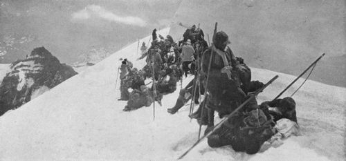
The Mountaineers lunching in a crevasse on White Glacier, 13,000 feet above the sea, on their ascent in 1909. Even Little Tahoma, on the left, is far below.
Stevens describes their ascent by the now familiar path, over Cowlitz Cleaver and past Gibraltar. From the top of that "vast, square rock embedded in the side of the Mountain," they turned west over the upper snow-fields, and thus first reached the southern peak, which they named "Peak Success," to commemorate their victory.
This is a long, exceedingly sharp, narrow ridge, springing out from the main dome for a mile into mid-air. On the right, the snow descended in a steep, unbroken sheet into the tremendous (p. 124) basin which lies between the southern and the northern peaks, and which is enclosed by them as by two mighty arms.[6] Sheltered behind a pinnacle of ice, we fastened our flags upon the Alpine staffs, and then, standing erect in the furious blast, waved them in triumph with three cheers.
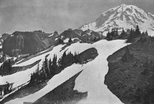
Looking southeast from Mt. Rose, above Eunice Lake, with Mother Mountains on left, and Spray Park in distance on right of center. Shows outposts of alpine firs and hemlocks on the timber line.
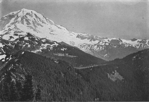
Looking south from Mt. Rose, across Crater Lake to North Mowich Glacier and Mowich Ridge. This was taken from near the same place as the preceding view, and eight miles from the Mountain. Eagle Cliff, a celebrated view point, is on the right, overlooking Mowich canyon.
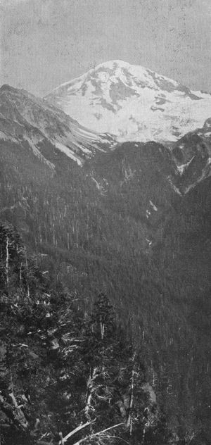
Looking up Mowich
Valley. One of the densely wooded regions in the National Park that
need trails as a means of protection against fires.
Copyright, 1909, By Asahel Curtis.
It was now five o'clock. They had spent eleven hours in the ascent, and knowing it would be impossible to descend before nightfall, they saw nothing to do but burrow in the loose rock and spend the night as best they could. The middle peak, however, was evidently higher, and they determined first to visit it. Climbing the long ridge and over the rim of the crater, they found jets of steam and smoke issuing from vents on the north side.
Never was a discovery more welcome! Hastening forward, we both exclaimed, as we warmed our benumbed extremities over one of Pluto's fires, that here we would pass the night, secure against freezing to death, at least.... A deep cavern extended under the ice. Forty feet within its mouth we built a wall of stones around a jet of steam. Inclosed within this shelter, we ate our lunch and warmed ourselves at our natural register. The heat at the orifice was too great to bear for more than an instant. The steam wet us, the smell of sulphur was nauseating, and the cold was so severe that our clothes froze stiff when turned away from the heated jet. We passed a miserable night, freezing on one side and in a hot steam-sulphur bath on the other.
In October of the same year, S. F. Emmons and A. D. Wilson, of the Geological Survey, reached the snow-line by way of the Cowlitz valley and glacier, and ascended the peak over the same route which Stevens and Van Trump had discovered and which has since been the popular path to Crater Peak. The Kautz route, by the cleaver between Kautz and Nisqually glaciers, has recently been found (p. 125) practicable, though extremely difficult. In 1891 and again the next summer, Mr. Van Trump made an ascent along the ridge dividing the Tahoma glaciers. In 1905, Raglan Glascock and Ernest Dudley, members of the Sierra Club party visiting the Mountain, climbed the Kautz glacier, and finding their way barred by ice cascades, reached the summit by a thrilling rock climb over the cliff above the South Tahoma glacier. This precipice (see p. 37) they found to be a series of rock terraces, often testing the strength and nerve of the climbers. In Sunset Magazine for November, 1895, Mr. Glascock has told the story of their struggle and reward.
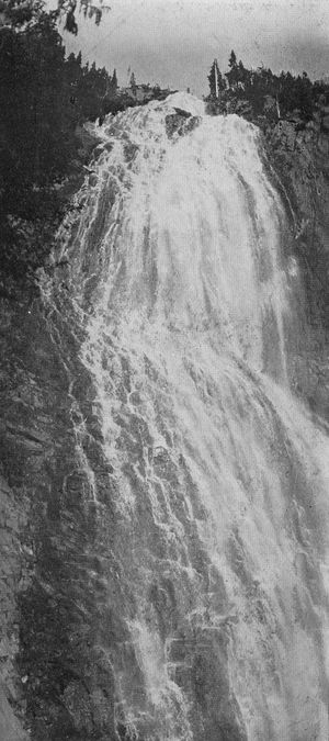
Spray Falls, a
splendid scenic feature of the north side, where it drops more than
five hundred feet from the Spray Park table-land into the canyon of
North Mowich Glacier.
Copyright, 1909, By Asahel Curtis.
Here the basalt terminated, and a red porous formation began, which crumbled in the hand. This part of the cliff lay a little out from the perpendicular, and there was apparently no way of surmounting it. I looked at my watch. It was 4:15. In a flash the whole situation came to me. It would be impossible to return and cross the crevasses before dark. We could not stay where we were. Already the icy wind cut to the bone.
"We must make it. There is no going back," I said to Dudley. I gave him the ice ax, and started to the ascent of the remaining cliff. I climbed six feet, and was helpless. I could not get back, nor go forward. One of my feet swung loose, and I felt my hands slipping. Then I noticed above me, about six or eight inches to my right a sharp, projecting rock. It was here or never. I gave a swing, and letting go my feet entirely, I reached the rock. It held, and I was swinging by my hands over a two-hundred-foot void. I literally glued myself to the face of the rock, searching frantically for knob or crevasse with my feet. By sheer luck, my toe found a small projection, and from here I gradually worked myself up until I came to a broken cleft in the cliff where it was possible to brace myself and lower the rope to Dudley. This last ascent had only been fifteen feet, and, in reality, had taken but three or four minutes, but to me it seemed hours.
At 7:45, we reached the summit of the south peak. Here we stopped to look down on Camp Sierra. Long shadows spread their mantle across the glaciers, and in the east lay the phantom (p. 126) mountain—the shadow of Rainier. A flash of light attracted our attention. We saw that our companions had been watching our progress.
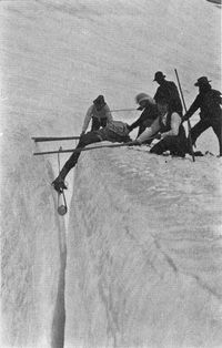
A rescue from a crevasse.
The White glacier route on the east side was first used in 1885 by a party from Snohomish. The same glacier was traversed by the Willis-Russell party in 1896. The first woman to make the ascent was Miss Fay Fuller, of Tacoma, in 1890, over the Gibraltar route.
The north and northwest sides, as I have said, are as yet unconquered. Some members of the Mountaineers have a theory that the summit can be reached from Avalanche Camp by climbing along the face of Russell Peak, and so around to the upper snowfield of Winthrop glacier. They have seen mountain goats making the trip, and propose to try it themselves. Whether they succeed or not, this trail will never be popular, owing to daily landslides in the loose rock of the cliff.
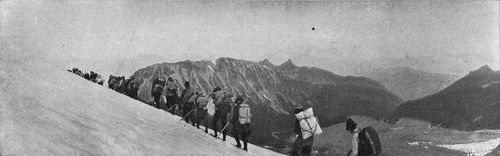
Returning from the summit. The Mountaineers ending a memorable outing in 1909. Winthrop Glacier in foreground, Sluiskin Mountains in distance.
In 1897 and 1905, the Mazama Club of Portland sent parties to the Mountain, each making the ascent over the Gibraltar route. The Sierra Club of California was also represented in the latter year by a delegation of climbers who took the same path to the summit. In 1909, the Mountaineers Club of Seattle spent several weeks on the Mountain, entering the National Park by the Carbon trail, camping in Moraine Park on the north side, exploring Spray Park and the Carbon glacier, crossing Winthrop glacier to the Wedge, and thence climbing White glacier to the summit. Many members of the Appalachian Club and American Alpine Clubs and of European organizations of similar purpose have climbed to Crater Peak, either in company with the Western clubs named, or in smaller parties. Noteworthy accounts of these ascents have been printed in the publications of the several clubs, as well as in magazines of wider circulation, and have done much to make the Mountain known to the public. The principal articles are cited in a bibliographical note at the end of this volume.[Back to content]
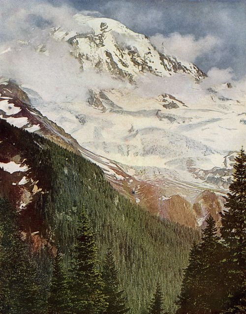
Looking down from Ptarmigan Ridge into the Canyon of the North Mowich Glacier and up to the cloud-wreathed Peak.
(p. 129)
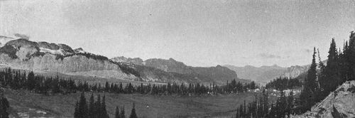
View looking west
across Moraine Park and Carbon Glacier to Mother Mountains.
Copyright, 1909, By Asahel Curtis.
Of all the fire-mountains which, like beacons, once blazed along the Pacific Coast, Mount Rainier is the noblest in form. Its massive white dome rises out of its forests, like a world by itself. Above the forests there is a zone of the loveliest flowers, fifty miles in circuit and nearly two miles wide, so closely planted and luxuriant that it seems as if Nature, glad to make an open space between woods so dense and ice so deep, were economizing the precious ground, and trying to see how many of her darlings she can get together in one mountain wreath—daisies, anemones, columbines, erythroniums, larkspurs, etc., among which we wade knee-deep and waist-deep, the bright corollas in myriads touching petal to petal. Altogether this is the richest subalpine garden I ever found, a perfect floral elysium.—John Muir: "Our National Parks."
No one can visit the Mountain without being impressed by its wild flowers. These are the more noticeable because of their high color—a common characteristic of flowers in alpine regions. As we visit the upland meadows at a season when the spring flowers of the lowlands have gone to seed, we find there another spring season with flowers in still greater number and more varied in color.
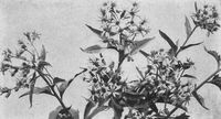
Senecio.
The base of the Mountain up to an altitude of about 4,000 feet is covered by a somber forest of evergreens composed of the white and black pines; Douglas, Lovely and Noble firs; the white cedar; spruce, and hemlock. There are found also several deciduous trees—large-leafed maple, (p. 130) white alder, cottonwood, quaking aspen, vine and smooth-leafed maples, and several species of willows. Thus the silva of the lower slopes is highly varied. The forest is often interrupted by the glacial canyons, and, at intervals, by fire-swept areas.
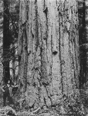
A 14-foot Fir, near Mineral Lake.
Among these foothills and valleys, lies the region of the virgin forest. This area is characterized by huge firs and cedars, all tall, straight and graceful, without a limb for 75 to 100 feet. This is probably the most valuable area of timber in the world, and it is one of the grandest parts of the Park. A death-like silence generally pervades this cool, dark region, where few kinds of animal life find a congenial abode. Occasionally the stillness is disturbed by the Douglas squirrel, busily gnawing off the fir cones for his winter's supply, or by the gentle flutter of the coy wren, darting to and fro among the old, fallen logs. The higher forms of vegetable life are also restricted to a few odd varieties. The most common of these are such saprophytes as pterospora andromedea, allotropa virgata, the so-called barber's pole, and the Indian pipe. This curious, waxy white plant is generally admired by all who see it, but it quickly disappoints those admirers who gather it by turning black.
The mosses, liverworts, and lichens take possession of the trees and cover them with a unique decoration. The licorice fern often gains a foothold on the trees thus decorated, and grows luxuriantly, embedded in the deep growth of these plants.
It is nearly impossible to get through this region without following a road or trail. For the safety of its priceless forest, there are far too few trails. In case of a forest fire it would be impossible to reach some areas in time to combat it with any success. Many beautiful regions in the lower parts of the Park are (p. 131) wholly inaccessible. These should be opened with proper roads and trails, not only for their own safety, but also for the benefit of visitors.
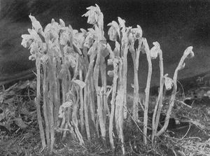
Indian Pipe.
The alpine meadows begin to appear at an altitude of about 5,000 feet. The real alpine trees, with their trim, straight trunks and drooping branches, are in strange contrast to their relatives of the lower altitude. The principal trees of the meadow area are the alpine fir, the alpine hemlock, and the Alaska cedar. These constitute the greater part of the silva of Paradise Valley. There are a few trees of the Lovely fir in the lower part of the valley, and a few white-barked pines overlooking the glaciers at timber line.
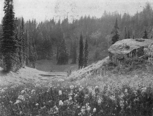
Floral Carpet in Indian Henry's Park, showing "Mountain Heliotrope," more properly Valerian, and other flowers growing near the snow line.
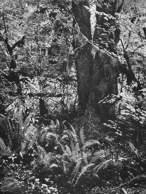
Mosses and Ferns, in the forest reserve, on way to Longmire Springs.
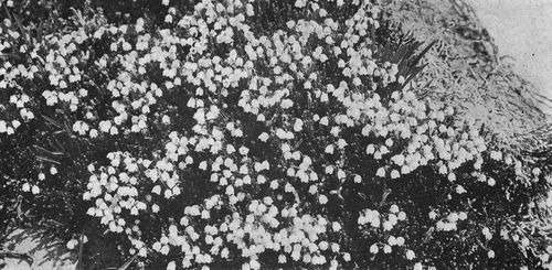
A bank of White Heather.
The trees of the park zone differ greatly on different slopes. On the northeast and east, the white-barked pine and the alpine spruce form no small part of the tree groups. The white-barked pine branches out like the scrub oak on the prairie. It is never seen at a low altitude. The alpine spruce bears numerous cones all over the tree, and has sharp leaves, though not so sharp as its relative, the tideland spruce.
Hellebore (Veratrum Viride).
Not only is there a difference in the trees on the different slopes of the Mountain, but there is a marked difference in the herbaceous plants as well. Hesperogenia Strictlandi is a small, yellow plant of the celery family. This is very abundant, both in Spray Park and also in the country east of the Carbon Glacier, but rare on the south side. Gilia Nuttallii, a large, phlox-like plant, is abundant only in the Indian Henry region. Two anemones, one buttercup, three willows and one senecio seem to be confined to the White River country. The moss campion has been found only on Mowich.
The most noticeable and abundant flower on all slopes is the avalanche lily (erythronium montanum). This plant comes up through several inches of the old snow crust, and forms beautiful beds of pure white flowers, to the exclusion of nearly all other plants. There are often from seven to nine blossoms on a stem. This has other popular names, such as deer-tongue and adder-tongue. There is also a yellow species, growing with the other, but less abundant. It seldom has more than one (p. 134) or two flowers on a stem. The yellow alpine buttercup generally grows with the erythroniums. It also tries to rush the season by coming up through the snow. The western anemone is a little more deliberate, but is found quite near the snow. It may be known by its lavender, or purple flowers; and later by its large plume-like heads, which are no less admired than the flowers themselves.
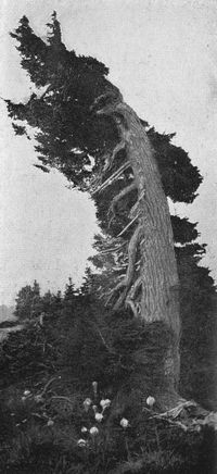
Alpine Hemlock and Mountain Lilies. In the struggle for existence at the timber line, flowers prosper, but trees fight for life against storm and snow.
The plants just mentioned are the harbingers of spring. Following them in rapid succession are many plants of various hues. The mountain dock, mountain dandelion, and potentilla seldom fail to appear later. The asters, often wrongly called daisies, are represented by several species, some of which blossom early, and are at their best along with the spring flowers. The great majority of the composite family bloom later, and thus prolong the gorgeous array. The lupines add much to the beauty of this meadow region, both at a low altitude, and also in the region above timber line. Their bright purple flowers, in long racemes, with palmate leaves, are very conspicuous on the grassy slopes. Between timber line and 8,500 feet, Lyall's lupine grows in dense silk mats, with dark purple flowers—the most beautiful plant in that zone.
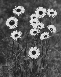
Mountain Asters.
Four different kinds of heather are found on the Mountain. The red heather is the largest and the most abundant. It grows at a lower altitude than the others, and is sometimes, erroneously, called Scotch heather. There are two kinds of white heather. One forms a prominent part of the (p. 135) flora, often growing with the red. The other is less conspicuous and grows about timber line. The yellow heather also grows at the same altitude, and is larger and more common than the others. It often forms beautiful areas where other vegetation is rare. The white rhododendron is a beautiful shrub of the lower meadows. Its creamy white blossoms remind one of the cultivated azalea. There are several huckleberries, some with large bushes growing in the lower forest area, others small and adapted to the grassy meadows.
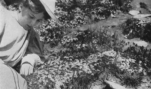
Studying the Phlox.
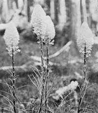
Squaw Grass, or Mountain Lily. (Xerophyllum tenax).
The figwort family has many and curious representatives. The rose-purple monkey-flower is very common and conspicuous in the lower meadows, along the streams. It is nearly always accompanied by the yellow fireweed. Higher up, large meadow areas are arrayed in bright yellow by the alpine monkey-flower. Above timber line, two pentstemons, with matted leaves and short stems with brilliant purple and red flowers, cover large rocky patches, mixed here and there with lavender beds of the alpine phlox; while the amber rays of the golden aster, scattered through these variegated beds, lend their (p. 136) charm to the rocky ridges. The Indian paint-brush, the speedwell, the elephant's trunk, and the pigeon bills are all well-known members of the large figwort family which does much to embellish the Mountain meadows. The valerian, often wrongly called "mountain heliotrope," is very common on the grassy slopes. Its odor can often be detected before it is seen. The rosy spiraea, the mountain ash, and the wild currant, are three common shrubs in this area. There are also numerous small herbaceous plants of the saxifrage family, some forming dense mats to the exclusion of other plants. The mertensias, polemoniums, and shooting stars add much to the purple and blue coloring.
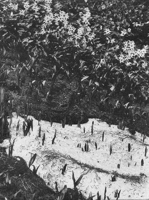
Avalanche Lilies (Erythronium montanum), sometimes called deer tongues, forcing their way through the lingering snow.
Two liliaceous plants of low altitude are always objects of marked interest. The Clintonia, popularly called alpine beauty, begins in the forest area, and continues up to the lower meadows. This may be known by its pure white blossoms and blue berries. Its leaves are oblong in tufts of from two to four. They spring up near the roots. The other is xerophyllum, mountain lily, sometimes called squaw grass, because it is used by the Indians in basket making. This has tall (p. 138) stems with small fragrant flowers and coarse grass-like leaves.
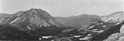
Moraine Park,
Sluiskin Mountains and Mystic Lake.
Copyright, 1909, By Asahel Curtis.
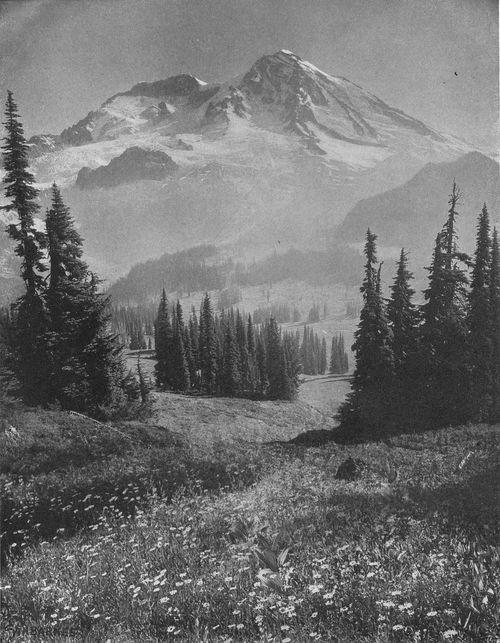
Sunrise in Indian Henry's Park, with view of the southwest slope and Peak Success, showing Purple Asters, with bunches of Hellebore in center of the flower field.
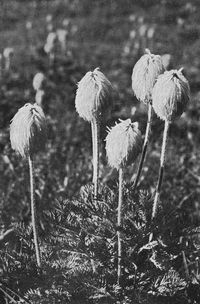
Anemone Seed Pods.
The orchid family has a few curious saprophytic representatives on the lower slopes. Mertin's coral-root is one of the most common. This generally grows in clusters in the mossy woods, along the trail or government road above Longmire Springs. It is very common all around the mountain at an altitude of 3,000 to 4,500 feet. With it, grow two tway-blades and the rattlesnake plantain. In bogs, two species of piperia, with long spikes of greenish flowers, are abundant. In drier situations, a small form of the ladies' tresses is easily recognized by its spiral spike of small white flowers, which are more or less fragrant. In some of the swamps at the base of the mountain grows Limnorchis leucostachys. This is one of our most fragrant flowers, as well as one of the most beautiful, with its long spike of pure white blossoms.
Of the ferns, the common brake is sometimes seen on the slopes near the terminal moraines of the glaciers. On the old moraines and cliffs is found the pea fern (cryptogramma acrostichoides), so called because the pinnules of its fruiting fronds resemble those of a pea pod. This dainty little fern with its two kinds of fronds is always admired by mountain visitors. It is strictly a mountain fern. The deer fern also has two kinds of fronds, but this grows all the way from sea level to the glaciers, being at its best in the dense forest area. The delicate oak fern grows in great abundance from Eatonville to the timber line, and probably does more to beautify the woods than any other fern. The sword fern grows in dense, radiate clusters, all through the mossy woods. The fronds are often five or six feet in length. The maidenhair fern is found along streams, waterfalls and moist cliffs, reaching its highest development in the deep canyons cut through the dense forest.
On the very top of Pinnacle Peak and similar elevations, grows the beautiful mountain lace fern (cheilanthes gracillima.) Nearly every tourist presses a souvenir of it in his notebook. Phegopteris alpesteris is abundant along the glacial valleys, where the tall grasses and the beautiful array of alpine plants delight the eye. These ferns and grasses give a rich green color to the varigated slopes where nature blends so many harmonious colors in matchless grandeur in this great fairyland of flowers.
(p. 139)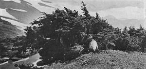
Wind Swept Trees on North Side, the last below the Snow line.
The writer has a list of about three hundred and sixty species from the Mountain. It includes only flowering plants and ferns. There are more than twenty type species named from the Mountain, not a few of which are found nowhere else. Its geographical position makes it the boundary between the arctic plants from the North and the plants of Oregon and California from the South. Its great altitude has a wonderful effect on plant life. This is seen in the trees at timber line, where snow rests upon them for months. Their prostrate trunks and gnarled branches give ample testimony to their extreme struggle for existence. Where the ordinary plants cease to exist the snowy protococcus holds undisputed sway on the extensive snow fields. This is a small one-celled microscopic plant having a blood red color in one stage of its existence. Even in the crater, on the warm rocks of the rim, will be found three or four mosses—I have noted one there which is not found anywhere else—several lichens, and at least one liverwort.
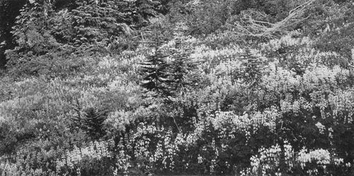
Lupines.
(p. 140)
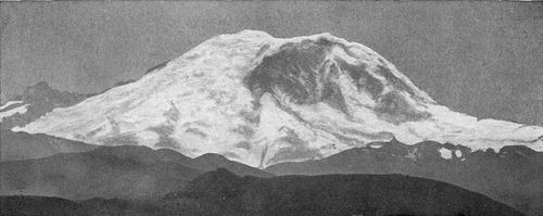
The Mountain, as seen
from a high ridge in the Cascades near Green River Hot Springs,
showing the north and east faces of the Peak, and Little Tahoma on the
left.
Copyright, 1910, by E. F. Cutter.
Rates, Trains, Hotel Accommodations.—The round-trip fare from Tacoma via the Tacoma Eastern is $6.00. This includes railway transportation to Ashford and automobile-stage ride from Ashford to Longmire Springs and return. Tickets are good for the season. To parties of ten or more traveling together a single ticket is issued at $5.00 per capita. A week-end ticket, Saturday to Monday, is sold at $5.00. The rates from Seattle to the Springs are $1.50 more, in each case, than the Tacoma rates. The train schedule for 1911 follows:
| SOUTHBOUND | NORTHBOUND | ||||||
| Leave Seattle | 7.45 a. m. and | 12.30 p. m. | Leave Inn | 7.15 a. m. and | 1.30 p. m. | ||
| Arrive Tacoma | 8.55 a. m. and | 1.40 p. m. | Arrive Ashford | 8.30 a. m. and | 2.45 p. m. | ||
| Leave Tacoma | 9.05 a. m. and | 1.50 p. m. | Leave Ashford | 8.40 a. m. and | 2.55 p. m. | ||
| Arrive Ashford | 11.20 a. m. and | 4.05 p. m. | Arrive Tacoma | 10.55 a. m. and | 5.10 p. m. | ||
| Leave Ashford | 11.30 a. m. and | 4.15 p. m. | Leave Tacoma | 11.05 a. m. and | 5.15 p. m. | ||
| Arrive at Inn | 12.45 p. m. and | 5.30 p. m. | Arrive Seattle | 12.15 p. m. and | 6.30 p. m. | ||
The National Park Inn, Longmire Springs, provides excellent rooms in the Inn, with a large number of well-furnished and comfortable tents near by. The rates range from $2.50 to $3.75 a day, including meals. The dining-room is under the Chicago, Milwaukee & Puget Sound dining-car management, which insures a satisfactory table.
At the older Longmire Hotel, the rate is $2.50 a day for room and board. This hotel is open all the year, and in winter is much frequented by persons seeking Winter sports, or making use of the mineral springs.
The springs are of great variety, and are highly recommended for their medicinal virtues. Within an area of several acres, there are a score of these springs, varying from the normal temperature of a mountain stream almost to blood heat. Well-appointed bathhouses are maintained. Fee, including attendance, $1.00.
At Reese's Camp, in Paradise Park, and at Mrs. Hall's similar tent hotel in Indian Henry's Park, the charge for meals, with a tent for sleeping, is $2.50 per day.
Stages, Horses, Guides.—The cost of getting from Longmire Springs to Paradise or Indian Henry's is moderate. Many prefer to make the trips on foot over the mountain trails. Parties are made up several times a day, under experienced guides, for each of these great "parks," and sure-footed horses are provided for those who wish to ride, at $1.50 for the round trip. Guides and horses for the new trail to Eagle Peak are at the same rate. Guides may be had at the (p. 141) National Park Inn or at either of the "camps" for many interesting trips over the mountain trails. Horses also are furnished. The charge varies with the number in a party.
Stages carry passengers from the Inn over the government road to Nisqually glacier, Narada Falls and Reese's Camp in Paradise Park. The charge for the trip to Narada and return is $2.00; to Paradise and return, $3.00.
For those who wish to make the ascent to the summit over the Gibraltar trail, trustworthy guides may be engaged at the Inn or at Reese's. Arrangements should be made several days in advance. The cost of such a trip depends upon the number in a party. The guides make a charge of $25 for the first member of the party, and $5 each for the others. They furnish alpenstocks, ropes, and calks for the shoes of climbers at a reasonable charge. Each person should carry with him a blanket or extra coat and a small amount of food, for use in the event of being on the summit over night. Still heavier clothing will be required if the night is to be spent at Camp Muir. A sleeping-bag, which can be easily made, or purchased at any outfitter's, will prove invaluable to campers. Ascents from other points than Reese's are usually made in special parties. All persons are warned not to attempt an ascent unless accompanied by experienced guides. Lives have been lost through neglect of this precaution.
For persons visiting the North Side, the Northern Pacific rate from Tacoma to Fairfax is $1.25, and from Seattle to Fairfax, with change of cars at Puyallup, $1.75. Guides and horses may be engaged at Fairfax for the Spray Park trail.
Automobiles and Motorcycles.—These vehicles are permitted to use the government road, as far as the Nisqually glacier, under the following regulations of the Interior Department:
No automobile or motorcycle will be permitted within the Park unless its owner secures a written permit from the Superintendent, Edward S. Hall, Ashford, Washington, or his representative. Applications must show: Names of owner and driver, number of machine, and inclusive dates for which permit is desired, not exceeding one year, and be accompanied by a fee of $5 for each automobile and $1 for each motorcycle. All permits will expire on December 31. Permits must be presented to the Superintendent or his authorized representatives at the park entrance on the government road.
Automobiles and motorcycles will be permitted on the government road west of Longmire Springs between the hours of 7 a. m. and 8.30 p. m., but no automobile or motorcycle shall enter the Park or leave Longmire Springs in the direction of the western boundary, later than 8 p. m., the use of automobiles and motorcycles to be permitted between Longmire Springs and Nisqually glacier between the hours of 9 a. m. and 9.30 p. m., but no automobile or motorcycle shall leave Longmire Springs in the direction of the glacier later than 7 p. m.
When teams, saddle horses, or pack trains approach, automobiles and motorcycles shall take position on the outer edge of the roadway, taking care that sufficient room is left on the inside for them to pass, and remaining at rest until they have passed, or until the drivers are satisfied regarding the safety of their horses. Horses have the right of way, and automobiles and motorcycles will be backed or otherwise handled to enable horses to pass with safety.
Speed shall be limited to 6 miles per hour, except on straight stretches where approaching teams, saddle horses, and pack trains will be visible, when, if none are in sight, this speed may be increased to the rate indicated on signboards along the road; in no event, however, shall it exceed 15 miles per hour. Signal with horn shall be given at or near every bend to announce to approaching drivers the proximity of a machine.
Violation of any of the foregoing rules, or the general regulations of the Park, will cause the revocation of permit, subject the owner of the automobile or motorcycle to any damages occasioned thereby and to ejectment from the reservation, and be cause for refusal to issue a new permit without prior sanction in writing from the Secretary of the Interior.
Literature of the Mountain.—Vancouver, Winthrop, Kautz, Stevens and Van Trump have been noted in the text. Other early accounts of, or references to, the Mountain may be found in Wilkes: Narrative U. S. exploring expedition. Phil. 1845, v. 4, 413, 415, 424; U. S. War Dep't: Explorations for railroad to Pacific, 1853-4, v. 1, 192; Gibbs: Journal Am. Geog. Soc., v. 4, 354-357. (p. 142) Gibbs's Indian vocabularies, published at different dates, were reprinted four years after his death in Contributions to Am. Ethnol., v. 1. Wash. 1877.
For Emmons's account of his exploration in 1870, see Bulletin Am. Geog. Soc. v. 9, 44-61. Am. Jour. of Science, v. 101, 157-167, and Nation v. 23, 313. Prof. Israel C. Russell's studies of the peak are in U. S. geol. survey, 5th an. rep. 335-339 and 18th an. rep., part 2, 349-415. See also his Glaciers of N. Am., Bost. 1901, 62-67, and Volcanoes of N. Am., Bost. 1895, 241-246. For other accessible studies consult Wright: Ice age in N. Am. N. Y. 1889, and Muir: Our national parks, Bost. 1901.
The long controversy over the name of the peak is impartially reviewed in Snowden: History of Washington. N. Y. 1909, v. 4, 249-254. Snowden calls especial attention to an able paper by the late Thaddeus Hanford of Olympia on the Indian names and recommending the name Tacoma for the Territory, which was printed in the Washington Standard in January, 1866. This article should be reprinted by the State Historical Society, as it represents a movement of considerable force at one time against the inept and confusing name adopted for the State. The Indian evidence for the native name of the Mountain was collected in Wickersham: Is it "Mt. Tacoma" or "Mt. Rainier?", pamphlet, Tacoma, 1893. The argument of an eminent traveler and author against "Mt. Rainier" may be found in Finck: Pacific coast scenic tour. N. Y. 1891, 209-213, 229-230; also in the same writer's more recent article, Scribner's Magazine, v. 47, 234-5. See also Lyman: The Columbia river. N. Y. 1909, p. 32, 352-370, and The Mountains of Washington, in The Mountaineer, v. 1, 7-10; and Charles F. Lummis's editorial articles in Out West, v. 23, 367 and 494. On the other hand, Prof. Davidson, in Sierra Club Bulletin, v. 6, 87-98, presents reasons on which that club accepted "Mt. Rainier."
Wheeler: Climbing Mt. Rainier, St. Paul, 1895, and Plummer: Illustrated guide book to Mt. Tacoma, Tacoma, n. d., are two pamphlets now out of print.
The ascents by the Mazama, Sierra and Mountaineers clubs have furnished material for a great variety of articles on the geology, botany and glacier action, as well as many accounts of climbing adventures. Mazama, v. 2, Sierra Club Bulletin, v. 6, and The Mountaineer, v. 1 and 2, are mainly devoted to this peak. For articles in periodicals of wider circulation, see Review of Reviews, v. 9, 163-171 (by Carl Snyder); Out West, v. 24, 365-395 (Willoughby Rodman); National geog. mag., v. 20, 530-538 (Milnor Roberts); Scribner's v. 22, 169-171 (I. C. Russell); Outing, v. 5, 323-332 (J. R. W. Hitchcock), and v. 38, 386-392 (Ada Woodruff Anderson); Overland, n. s., v. 2, 300-312 (W. D. Lyman), v. 8, 266-278 (George Bailey), v. 32, 114-123 (J. P. Montgomery), v. 46, 447-455 (Harry H. Brown), v. 55, 552-560 (A. W. McCully), and v. 56, 150-155 (A. W. McCully); Pacific monthly, v. 8, 196-202 (John Muir); The world today, v. 9, 1047-53 (Anne Shannon Monroe); Good words, v. 42, 101-114 (Arthur Inkersley); Appalachia, v. 7, 185-205 (Ernest C. Smith), and v. 11, 114-125 (W. A. Brooks); Country life in Am., v. 14, 170-171 (C. E. Cutter); The Northwest, v. 1, 2-10 (Bailey Willis); Outdoor life, v. 26, 15-24 (Edna Cadwallader). Special studies of the rocks of the peak may be found in U. S. geol. sur., 12th an. rep. pt. 1, 612 (J. P. Iddings), and in Neues Jahrbuch, v. 1, 222-226, Stuttgart, 1885 (K. Oebeke).
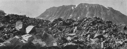
Glacial debris on lower part of Winthrop Glacier, with Sluiskin Mountains beyond.
Figures in light face type refer to the text, those in the heavier type to illustrations.
Adams, Mount,
77,
86,
64,
66.
Allen, Prof. O. D., cottage,
49.
Alta Vista,
49,
60.
American Alpine Club,
126.
Anemones,
32;
seed pods,
138.
Appalachian Club,
126.
Ascents, Kautz,
117;
Stevens and Van Trump,
120-4;
Emmons and Wilson,
124;
Glascock and Dudley,
125;
the mountain clubs,
126.
Automobiles,
57,
70-72,
141,
41,
49,
54.
Avalanche on Willis Wall,
119.
Avalanche Camp,
103,
104,
105.
Avalanche Lilies,
136.
Baker, Mount,
86,
98,
99.
Ballinger, Richard, H.
75.
Basaltic Columns,—South Mowich,
23;
on Cowlitz,
93.
Bashford, Herbert,—verse,
17.
Bee Hive,
76,
80.
Beljica, view from,
27.
Brooks, Francis,—verse,
40.
Cabins needed on the ridges,
116,
144.
Camp of the Clouds,
49,
61,
60.
Carbon river,
50,
103,
114.
Cascade Mountains,
66,
87,
90,
96.
Cathedral Rocks,
85,
76,
84,
78.
Chittenden, Maj. H. M., urges trail,
69.
Columbia's Crest,
86,
88,
52,
78.
Commencement Bay,
28.
Congress, action affecting the Park,
58,
59,
67,
70.
Cowlitz Chimneys,
43,
78,
81.
Cowlitz Cleaver,
85,
76,
78,
81.
Cowlitz Park,
64,
93.
Crater,
50,
88,
89.
Crater Lake,
117.
Crater Peak,
13,
86,
60,
89.
Curtis, Camp, on the Wedge,
97.
Cushman, Francis W.,
59,
108.
Dudley, Ernest, 125.
Eagle Cliff,
51.
Eagle Peak (Simlayshe),
30,
31;
new trail to,
141.
Eagle Rock in winter,
7.
East-side route to summit,
117,
126,
100.
Edmunds, George F.,
96.
Electric-power development,
108-112.
Electron, The Mountain from,
13,
19;
Power plant at,
108,
112.
Emmons, S. F., Geologist,
94-97.
Fairfax, trail from,
50.
Fair Mountaineer, A,
35.
Fairy Falls,
73.
Fay Peak,
51,
92.
Ferns,
132.
Fires, danger of forest,
8,
58,
130.
Flett, Prof., J. B.,
129, n.
Flint, Frank P., U. S. Senator,
75.
Flood, Indian legend of the,
39.
Fox Island, the Mountain from,
14.
Fountain, Paul, quoted,
43.
Fuller, Miss Fay,
126,
72.
Gap Point,
61,
54.
"Ghost Trees,"
50.
Gibbs, George, on name "Mt. Tacoma,"
104,
107,
142.
Gibraltar Rock,
82,
85,
116,
121,
60,
68,
71,
76,
78,
81,
82,
83,
85,
86.
Glaciers, their number and work,
79-83;
moraines,
83,
68,
77,
79,
96;
rate of flow,
83,
72;
names,
93-97;
rivers,
108;
—Carbon,
50,
51,
77,
103,
105,
107,
108,
118,
119,
120,
121,
129;
—Cowlitz,
50,
93,
6,
51,
78,
81,
84,
87;
—Frying-Pan,
93,
41,
96,
97;
—Ingraham,
93,
78;
—Interglacier,
93,
98,
99;
—Kautz,
93,
27,
30,
37,
60,
68;
—North Mowich,
50-52,
96,
13,
123,
124,
128;
—South Mowich,
52,
13,
22,
23;
—Nisqually,
49,
31,
55,
57,
60,
68,
69,
71,
72,
78,
81;
—Paradise,
50,
94,
97,
25,
31,
60,
79;
—Puyallup,
52,
13,
27,
33;
—Stevens,
50,
97,
61,
64,
79;
—North Tahoma,
93,
13,
26,
27,
32,
33,
37;
—South Tahoma,
93,
17,
27,
32,
36,
37,
60;
—Van Trump,
94,
31,
60;
—White,
50,
81,
93,
9,
12,
94,
95,
96,
100,
121;
—Winthrop,
50,
51,
93,
94,
8,
17,
130,
103,
104,
107,
113,
126,
142.
Glascock, Raglan,
125.
"Goat Island," moraine,
96.
Goat Mountain (Mt. Wow),
28.
Goat Peaks,
87,
90,
94.
Grand Park,
51,
64,
98,
99.
Green River, view of the Mountain from,
140.
Guides,
113,
141.
Hanging glaciers,
51,
57.
Heather,
133.
Hellebore,
133.
Hiaqua Hunter, Myth,
32-39.
Hood, Mt.,
86.
Hylebos, P. F. (Rev.),
28, n.
Ice caves,
31,
73.
Indian Henry's Hunting Ground,
49,
25,
29,
32,
34,
36,
37,
40,
50,
131,
137;
—Mrs. Hall's Camp,
141.
Indians, nature worship of the Mountain,
25-31,
39;
Puget Sound tribes,
25,
26;
fear of the snow-peaks,
32,
121.
Ingraham, Maj. E. S.,
100.
Interglaciers,
93.
Iron and Copper mountains,
25,
30.
Jones, Wesley L., U. S. Senator,
75.
Jordan, David Starr,
67.
Judson, Miss Katharine B.
35,
39.
Kautz, Gen., A. V.,
117.
Kulshan, Indian name for Mt. Baker,
98.
Kutz, Maj. C. W.,
69.
Liberty Cap (North Peak),
86,
22,
89,
114.
Little Tahoma,
82,
85,
9,
31,
60,
78,
79,
94,
121.
Longmire, James, trail and road,
59.
Longmire Hotel,
141.
Longmire Springs,
44,
51,
141,
52.
Lost to the World,
69.
Lupines,
139.
McClure, Prof. Edgar, death,
115.
Marmot,
26.
Matthes, Francois E., U. S. geologist,
89,
97.
Mazama (mountain goat),
23.
Mazama Club,
126,
81,
82.
Mazama Ridge,
60.
Mineral Lake,
18.
Moraine Park,
51,
126,
105,
113,
117,
129,
136.
Mosses and ferns,
132.
Mother Mountains,
103,
114,
116,
122,
129.
Mountaineers, The,
126,
61,
121,
126.
Mountain goat,
23.
Mountain Lily,
136,
135.
Mountain Pine,
28.
Muir John, quoted,
77,
113,
129;
Portrait,
116.
Muir, Camp,
115,
60,
80,
83.
Mystic Lake,
113.
Narada Falls,
61,
107,
58.
National Park, see Rainier Natl. Park.
National Parks, proposed Bureau of,
75.
National Park Inn,
44,
50,
52.
Nisqually Canyon,
21.
Nisqually Glacier (see Glaciers).
Nisqually river,
108,
111,
21,
24,
55.
North Peak (Liberty Cap),
13,
22,
89.
Ohop Valley, 43.
Pacific Forest Reserve,
59.
Paradise River,
59.
Paradise Valley, or Park,
30,
49-51,
61,
31,
39,
46,
53,
59,
60,
62.
Peak Success (South Peak),
86,
123-125,
13,
24,
25,
27,
33,
37,
60,
68,
78.
Phlox,
135.
Pierce County road,
43,
49.
Piles, S. H., U. S. Senator,
70.
Pinnacle Peak,
38,
39,
46,
47.
Point Defiance Park,
18.
Power-plants on the Mountain,
108-112,
111,
112.
Proctor, Miss Edna Dean, poem, "The Mountain Speaks,"
15.
Ptarmigan,
40.
Puget Sound
18,
25,
14;
named by Vancouver,
98.
Puyallup river,
108,
40.
Pyramid Peak,
25,
60.
Railways to Puget Sound,
44;
to the Mountain,
54,
57;
rates and time table,
140.
Rainier, Rear-Admiral Peter,
7,
98,
100,
103, n.,
101.
Reese's Camp,
61,
115,
141,
64.
Reflection Lake,
60,
77.
Rainier National Park,
54;
increasing use of,
56,
57;
its creation,
58-9;
see also Roads.
Ricksecker, Eugene, engineer,
61,
62,
70,
97.
Rivers fed by the Mountain,
108.
Rocks of the Mountain,
82,
112.
Roads and trails, Pierce County's to the Mountain,
44,
56,
42,
43,
44,
49;
government road in National Park,
57-62,
51,
54,
55,
56;
trails,
44,
45,
50-2,
55,
56,
121;
proposed road around the Mountain,
62-70;
need,
58,
130.
Rough climbing,
39.
Russell, Prof. Israel C.,
94.
Russell Peak,
82,
103,
105.
Saghalie Illahe, Indian land of peace,
30.
St. Elmo Pass,
8,
98,
100,
102,
104.
St. Helen's, Mt.,
77,
86,
29,
36.
Seattle,
18,
43,
44,
108.
Senecio,
129.
Sierra Club,
75,
126,
57,
69.
Simlayshe (Eagle Peak),
30.
Siwashes, origin of term,
28, n.
See also Indians.
Sluiskin, guides Stevens and Van Trump,
28,
32,
120-1.
Sluiskin Falls,
67.
Sluiskin Mountains,
51,
103,
105,
126,
136,
142.
Snipe Lake,
98.
Snow Lake,
34.
Sour-Dough Mountains, 8,
98,
99.
Spanaway Lake, 4.
South Peak, see Peak Success.
Spray Falls,
125.
Spray Park,
50,
51,
92,
106,
116,
122.
Steamboat Prow,
51,
85,
104.
Steam Caves in Crater,
88.
Stevens, Gen. Hazard,
28, n.,
32,
96,
97,
120-4,
115.
Stevens Canyon,
64,
66.
Storm King Peak,
18.
Summit, On the,
52;
South-side route to,
60;
East-side route,
100.
"Sunshine" and "Storm,"
70.
"Tacoma," Indian name for the Mountain,
25,
100-7.
Tacoma (City)
18,
43,
44,
111.
Tatoosh Mountains,
50,
53,
59,
60,
62,
64,
87.
Tolmie, Dr. W. F.,
117.
Trees in the National Park,
129-131,
139,
42,
130,
132.
Tyndall, Prof. John, quoted,
77.
Unicorn Peak,
65.
United States Geological Survey,
89.
Vancouver, Capt. George, discovers and names the Mountain,
98-101.
Van Trump, P. B.,
28, n.,
32,
120-5,
115.
Washington Lake, the Mountain from,
16.
Washington Torrents,
59.
Waterfall above Paradise Valley,
63.
Wedge, The,
51,
85,
8,
97,
99,
100.
White river,
110,
12,
112.
Whitney, Mt.,
90.
Willis, Bailey, geologist,
96,
97.
Wilson, A. D.,
96,
97.
Whulge, see Puget Sound.
Winthrop, Theodore,
93;
describes the Mountain,
102-4;
authority for his use of the Indian name,
104-7.
Wind-swept trees,
28,
139.
Wow, Mt. (Goat Mountain),
28.
(p. 144)
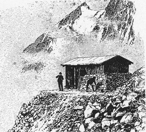
A climbers' cabin on one of the shoulders of Mt. Blanc.
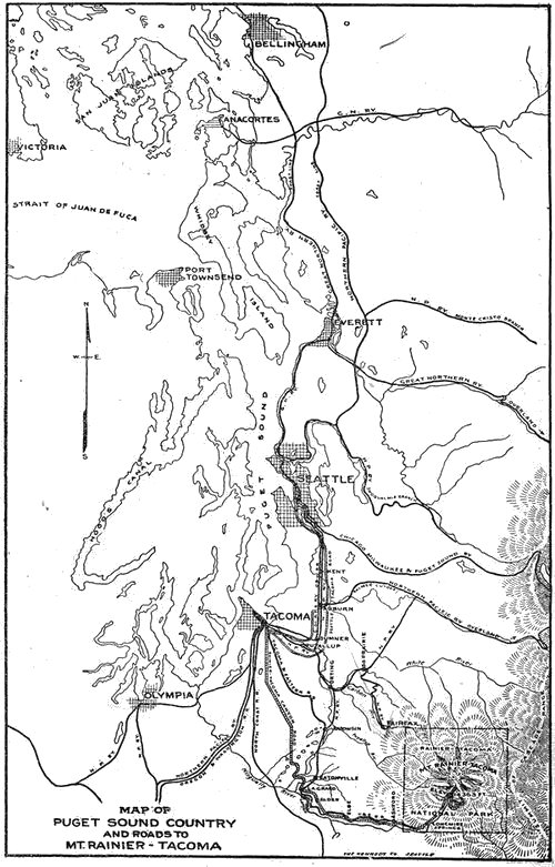
Map Of Puget Sound Country And Roads To Mt. Rainier-tacoma.
(p. 146)
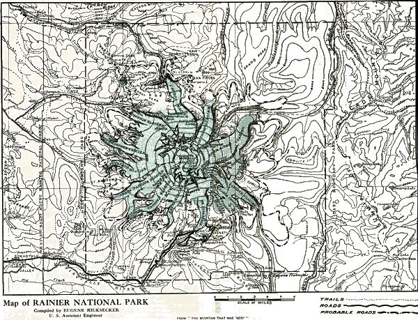
Map of RAINIER NATIONAL PARK Compiled by EUGENE RICKSECKER U. S. Assistant Engineer FROM "THE MOUNTAIN THAT WAS 'GOD'"
Footnote 1: Among those who have studied the Puget Sound Indians most sympathetically is the Rev. Mr. Hylebos of Tacoma. He came to the Northwest in 1870, when the census gave Tacoma a white population of seventy-three. In those days, says Father Hylebos, the Tacoma tideflats, now filled in for mills and railway terminals, were covered each autumn with the canoes of Indians spearing salmon. It was no uncommon thing to see at one time on Commencement Bay 1,800 fishermen. This veteran worker among the "Siwashes" (French "sauvages") first told me the myths that hallowed the Mountain for every native, and the true meaning of the beautiful Indian word "Tacoma." He knew well all the leaders of the generation before the railways: Sluiskin, the Klickitat chief who guided Stevens and Van Trump up to the snow-line in 1870; Stanup, chief of the Puyallups; Kiskax, head of the Cowlitz tribe; Angeline, the famous daughter of Chief Seattle, godfather of the city of that name, and many others.(Back)
Footnote 2: This legend is well told in "Myths and Legends of the Pacific Northwest," a delightful book by Katharine B. Judson of the Seattle Public Library (Chicago, A. C. McClurg & Co.). See also Prof. W. D. Lyman's papers in "Mazama" Vol. 2, and "The Mountaineer," Vol. 2; and Winthrop's "Canoe and Saddle."(Back)
Footnote 3: For details as to rates for transportation, accommodations and guides, with the rules governing the National Park, see the notes at end of the book.(Back)
Footnote 4: For some years, Congress and the Interior Department spelled it "Ranier"! A well-known Congressman from Seattle corrected their spelling of the name of the forgotten admiral, and it has since been officially "Rainier National Park."(Back)
Footnote 5: Winthrop's error was a common one at that time and has remained current till to-day. The admiral's grandfather, the Huguenot exile, was "Regnier," but his descendants anglicized the patronymic into "Rainier."(Back)
Footnote 6: See illustration, page 14.(Back)
Footnote 7: Prof. Flett knows the Mountain well. He has spent many summers in its "parks," has climbed to its summit four times, has visited all its glaciers, and has made a remarkable collection of its flowers. In addition to the chapter on the botany of the National Park, this book is indebted to him for several of its most valuable illustrations.(Back)
End of Project Gutenberg's The Mountain that was 'God', by John H. Williams

*** END OF THIS PROJECT GUTENBERG EBOOK THE MOUNTAIN THAT WAS 'GOD' ***

***** This file should be named 22056-h.htm or 22056-h.zip *****
This and all associated files of various formats will be found in:
        https://www.gutenberg.org/2/2/0/5/22056/

Produced by Audrey Longhurst, Christine P. Travers and the
Online Distributed Proofreading Team at https://www.pgdp.net


Updated editions will replace the previous one--the old editions
will be renamed.

Creating the works from public domain print editions means that no
one owns a United States copyright in these works, so the Foundation
(and you!) can copy and distribute it in the United States without
permission and without paying copyright royalties.  Special rules,
set forth in the General Terms of Use part of this license, apply to
copying and distributing Project Gutenberg-tm electronic works to
protect the PROJECT GUTENBERG-tm concept and trademark.  Project
Gutenberg is a registered trademark, and may not be used if you
charge for the eBooks, unless you receive specific permission.  If you
do not charge anything for copies of this eBook, complying with the
rules is very easy.  You may use this eBook for nearly any purpose
such as creation of derivative works, reports, performances and
research.  They may be modified and printed and given away--you may do
practically ANYTHING with public domain eBooks.  Redistribution is
subject to the trademark license, especially commercial
redistribution.


*** START: FULL LICENSE ***

THE FULL PROJECT GUTENBERG LICENSE
PLEASE READ THIS BEFORE YOU DISTRIBUTE OR USE THIS WORK

To protect the Project Gutenberg-tm mission of promoting the free
distribution of electronic works, by using or distributing this work
(or any other work associated in any way with the phrase "Project
Gutenberg"), you agree to comply with all the terms of the Full Project
Gutenberg-tm License (available with this file or online at
https://gutenberg.org/license).


Section 1.  General Terms of Use and Redistributing Project Gutenberg-tm
electronic works

1.A.  By reading or using any part of this Project Gutenberg-tm
electronic work, you indicate that you have read, understand, agree to
and accept all the terms of this license and intellectual property
(trademark/copyright) agreement.  If you do not agree to abide by all
the terms of this agreement, you must cease using and return or destroy
all copies of Project Gutenberg-tm electronic works in your possession.
If you paid a fee for obtaining a copy of or access to a Project
Gutenberg-tm electronic work and you do not agree to be bound by the
terms of this agreement, you may obtain a refund from the person or
entity to whom you paid the fee as set forth in paragraph 1.E.8.

1.B.  "Project Gutenberg" is a registered trademark.  It may only be
used on or associated in any way with an electronic work by people who
agree to be bound by the terms of this agreement.  There are a few
things that you can do with most Project Gutenberg-tm electronic works
even without complying with the full terms of this agreement.  See
paragraph 1.C below.  There are a lot of things you can do with Project
Gutenberg-tm electronic works if you follow the terms of this agreement
and help preserve free future access to Project Gutenberg-tm electronic
works.  See paragraph 1.E below.

1.C.  The Project Gutenberg Literary Archive Foundation ("the Foundation"
or PGLAF), owns a compilation copyright in the collection of Project
Gutenberg-tm electronic works.  Nearly all the individual works in the
collection are in the public domain in the United States.  If an
individual work is in the public domain in the United States and you are
located in the United States, we do not claim a right to prevent you from
copying, distributing, performing, displaying or creating derivative
works based on the work as long as all references to Project Gutenberg
are removed.  Of course, we hope that you will support the Project
Gutenberg-tm mission of promoting free access to electronic works by
freely sharing Project Gutenberg-tm works in compliance with the terms of
this agreement for keeping the Project Gutenberg-tm name associated with
the work.  You can easily comply with the terms of this agreement by
keeping this work in the same format with its attached full Project
Gutenberg-tm License when you share it without charge with others.

1.D.  The copyright laws of the place where you are located also govern
what you can do with this work.  Copyright laws in most countries are in
a constant state of change.  If you are outside the United States, check
the laws of your country in addition to the terms of this agreement
before downloading, copying, displaying, performing, distributing or
creating derivative works based on this work or any other Project
Gutenberg-tm work.  The Foundation makes no representations concerning
the copyright status of any work in any country outside the United
States.

1.E.  Unless you have removed all references to Project Gutenberg:

1.E.1.  The following sentence, with active links to, or other immediate
access to, the full Project Gutenberg-tm License must appear prominently
whenever any copy of a Project Gutenberg-tm work (any work on which the
phrase "Project Gutenberg" appears, or with which the phrase "Project
Gutenberg" is associated) is accessed, displayed, performed, viewed,
copied or distributed:

This eBook is for the use of anyone anywhere at no cost and with
almost no restrictions whatsoever.  You may copy it, give it away or
re-use it under the terms of the Project Gutenberg License included
with this eBook or online at www.gutenberg.org

1.E.2.  If an individual Project Gutenberg-tm electronic work is derived
from the public domain (does not contain a notice indicating that it is
posted with permission of the copyright holder), the work can be copied
and distributed to anyone in the United States without paying any fees
or charges.  If you are redistributing or providing access to a work
with the phrase "Project Gutenberg" associated with or appearing on the
work, you must comply either with the requirements of paragraphs 1.E.1
through 1.E.7 or obtain permission for the use of the work and the
Project Gutenberg-tm trademark as set forth in paragraphs 1.E.8 or
1.E.9.

1.E.3.  If an individual Project Gutenberg-tm electronic work is posted
with the permission of the copyright holder, your use and distribution
must comply with both paragraphs 1.E.1 through 1.E.7 and any additional
terms imposed by the copyright holder.  Additional terms will be linked
to the Project Gutenberg-tm License for all works posted with the
permission of the copyright holder found at the beginning of this work.

1.E.4.  Do not unlink or detach or remove the full Project Gutenberg-tm
License terms from this work, or any files containing a part of this
work or any other work associated with Project Gutenberg-tm.

1.E.5.  Do not copy, display, perform, distribute or redistribute this
electronic work, or any part of this electronic work, without
prominently displaying the sentence set forth in paragraph 1.E.1 with
active links or immediate access to the full terms of the Project
Gutenberg-tm License.

1.E.6.  You may convert to and distribute this work in any binary,
compressed, marked up, nonproprietary or proprietary form, including any
word processing or hypertext form.  However, if you provide access to or
distribute copies of a Project Gutenberg-tm work in a format other than
"Plain Vanilla ASCII" or other format used in the official version
posted on the official Project Gutenberg-tm web site (www.gutenberg.org),
you must, at no additional cost, fee or expense to the user, provide a
copy, a means of exporting a copy, or a means of obtaining a copy upon
request, of the work in its original "Plain Vanilla ASCII" or other
form.  Any alternate format must include the full Project Gutenberg-tm
License as specified in paragraph 1.E.1.

1.E.7.  Do not charge a fee for access to, viewing, displaying,
performing, copying or distributing any Project Gutenberg-tm works
unless you comply with paragraph 1.E.8 or 1.E.9.

1.E.8.  You may charge a reasonable fee for copies of or providing
access to or distributing Project Gutenberg-tm electronic works provided
that

- You pay a royalty fee of 20% of the gross profits you derive from
     the use of Project Gutenberg-tm works calculated using the method
     you already use to calculate your applicable taxes.  The fee is
     owed to the owner of the Project Gutenberg-tm trademark, but he
     has agreed to donate royalties under this paragraph to the
     Project Gutenberg Literary Archive Foundation.  Royalty payments
     must be paid within 60 days following each date on which you
     prepare (or are legally required to prepare) your periodic tax
     returns.  Royalty payments should be clearly marked as such and
     sent to the Project Gutenberg Literary Archive Foundation at the
     address specified in Section 4, "Information about donations to
     the Project Gutenberg Literary Archive Foundation."

- You provide a full refund of any money paid by a user who notifies
     you in writing (or by e-mail) within 30 days of receipt that s/he
     does not agree to the terms of the full Project Gutenberg-tm
     License.  You must require such a user to return or
     destroy all copies of the works possessed in a physical medium
     and discontinue all use of and all access to other copies of
     Project Gutenberg-tm works.

- You provide, in accordance with paragraph 1.F.3, a full refund of any
     money paid for a work or a replacement copy, if a defect in the
     electronic work is discovered and reported to you within 90 days
     of receipt of the work.

- You comply with all other terms of this agreement for free
     distribution of Project Gutenberg-tm works.

1.E.9.  If you wish to charge a fee or distribute a Project Gutenberg-tm
electronic work or group of works on different terms than are set
forth in this agreement, you must obtain permission in writing from
both the Project Gutenberg Literary Archive Foundation and Michael
Hart, the owner of the Project Gutenberg-tm trademark.  Contact the
Foundation as set forth in Section 3 below.

1.F.

1.F.1.  Project Gutenberg volunteers and employees expend considerable
effort to identify, do copyright research on, transcribe and proofread
public domain works in creating the Project Gutenberg-tm
collection.  Despite these efforts, Project Gutenberg-tm electronic
works, and the medium on which they may be stored, may contain
"Defects," such as, but not limited to, incomplete, inaccurate or
corrupt data, transcription errors, a copyright or other intellectual
property infringement, a defective or damaged disk or other medium, a
computer virus, or computer codes that damage or cannot be read by
your equipment.

1.F.2.  LIMITED WARRANTY, DISCLAIMER OF DAMAGES - Except for the "Right
of Replacement or Refund" described in paragraph 1.F.3, the Project
Gutenberg Literary Archive Foundation, the owner of the Project
Gutenberg-tm trademark, and any other party distributing a Project
Gutenberg-tm electronic work under this agreement, disclaim all
liability to you for damages, costs and expenses, including legal
fees.  YOU AGREE THAT YOU HAVE NO REMEDIES FOR NEGLIGENCE, STRICT
LIABILITY, BREACH OF WARRANTY OR BREACH OF CONTRACT EXCEPT THOSE
PROVIDED IN PARAGRAPH F3.  YOU AGREE THAT THE FOUNDATION, THE
TRADEMARK OWNER, AND ANY DISTRIBUTOR UNDER THIS AGREEMENT WILL NOT BE
LIABLE TO YOU FOR ACTUAL, DIRECT, INDIRECT, CONSEQUENTIAL, PUNITIVE OR
INCIDENTAL DAMAGES EVEN IF YOU GIVE NOTICE OF THE POSSIBILITY OF SUCH
DAMAGE.

1.F.3.  LIMITED RIGHT OF REPLACEMENT OR REFUND - If you discover a
defect in this electronic work within 90 days of receiving it, you can
receive a refund of the money (if any) you paid for it by sending a
written explanation to the person you received the work from.  If you
received the work on a physical medium, you must return the medium with
your written explanation.  The person or entity that provided you with
the defective work may elect to provide a replacement copy in lieu of a
refund.  If you received the work electronically, the person or entity
providing it to you may choose to give you a second opportunity to
receive the work electronically in lieu of a refund.  If the second copy
is also defective, you may demand a refund in writing without further
opportunities to fix the problem.

1.F.4.  Except for the limited right of replacement or refund set forth
in paragraph 1.F.3, this work is provided to you 'AS-IS' WITH NO OTHER
WARRANTIES OF ANY KIND, EXPRESS OR IMPLIED, INCLUDING BUT NOT LIMITED TO
WARRANTIES OF MERCHANTIBILITY OR FITNESS FOR ANY PURPOSE.

1.F.5.  Some states do not allow disclaimers of certain implied
warranties or the exclusion or limitation of certain types of damages.
If any disclaimer or limitation set forth in this agreement violates the
law of the state applicable to this agreement, the agreement shall be
interpreted to make the maximum disclaimer or limitation permitted by
the applicable state law.  The invalidity or unenforceability of any
provision of this agreement shall not void the remaining provisions.

1.F.6.  INDEMNITY - You agree to indemnify and hold the Foundation, the
trademark owner, any agent or employee of the Foundation, anyone
providing copies of Project Gutenberg-tm electronic works in accordance
with this agreement, and any volunteers associated with the production,
promotion and distribution of Project Gutenberg-tm electronic works,
harmless from all liability, costs and expenses, including legal fees,
that arise directly or indirectly from any of the following which you do
or cause to occur: (a) distribution of this or any Project Gutenberg-tm
work, (b) alteration, modification, or additions or deletions to any
Project Gutenberg-tm work, and (c) any Defect you cause.


Section  2.  Information about the Mission of Project Gutenberg-tm

Project Gutenberg-tm is synonymous with the free distribution of
electronic works in formats readable by the widest variety of computers
including obsolete, old, middle-aged and new computers.  It exists
because of the efforts of hundreds of volunteers and donations from
people in all walks of life.

Volunteers and financial support to provide volunteers with the
assistance they need, is critical to reaching Project Gutenberg-tm's
goals and ensuring that the Project Gutenberg-tm collection will
remain freely available for generations to come.  In 2001, the Project
Gutenberg Literary Archive Foundation was created to provide a secure
and permanent future for Project Gutenberg-tm and future generations.
To learn more about the Project Gutenberg Literary Archive Foundation
and how your efforts and donations can help, see Sections 3 and 4
and the Foundation web page at https://www.pglaf.org.


Section 3.  Information about the Project Gutenberg Literary Archive
Foundation

The Project Gutenberg Literary Archive Foundation is a non profit
501(c)(3) educational corporation organized under the laws of the
state of Mississippi and granted tax exempt status by the Internal
Revenue Service.  The Foundation's EIN or federal tax identification
number is 64-6221541.  Its 501(c)(3) letter is posted at
https://pglaf.org/fundraising.  Contributions to the Project Gutenberg
Literary Archive Foundation are tax deductible to the full extent
permitted by U.S. federal laws and your state's laws.

The Foundation's principal office is located at 4557 Melan Dr. S.
Fairbanks, AK, 99712., but its volunteers and employees are scattered
throughout numerous locations.  Its business office is located at
809 North 1500 West, Salt Lake City, UT 84116, (801) 596-1887, email
business@pglaf.org.  Email contact links and up to date contact
information can be found at the Foundation's web site and official
page at https://pglaf.org

For additional contact information:
     Dr. Gregory B. Newby
     Chief Executive and Director
     gbnewby@pglaf.org


Section 4.  Information about Donations to the Project Gutenberg
Literary Archive Foundation

Project Gutenberg-tm depends upon and cannot survive without wide
spread public support and donations to carry out its mission of
increasing the number of public domain and licensed works that can be
freely distributed in machine readable form accessible by the widest
array of equipment including outdated equipment.  Many small donations
($1 to $5,000) are particularly important to maintaining tax exempt
status with the IRS.

The Foundation is committed to complying with the laws regulating
charities and charitable donations in all 50 states of the United
States.  Compliance requirements are not uniform and it takes a
considerable effort, much paperwork and many fees to meet and keep up
with these requirements.  We do not solicit donations in locations
where we have not received written confirmation of compliance.  To
SEND DONATIONS or determine the status of compliance for any
particular state visit https://pglaf.org

While we cannot and do not solicit contributions from states where we
have not met the solicitation requirements, we know of no prohibition
against accepting unsolicited donations from donors in such states who
approach us with offers to donate.

International donations are gratefully accepted, but we cannot make
any statements concerning tax treatment of donations received from
outside the United States.  U.S. laws alone swamp our small staff.

Please check the Project Gutenberg Web pages for current donation
methods and addresses.  Donations are accepted in a number of other
ways including including checks, online payments and credit card
donations.  To donate, please visit: https://pglaf.org/donate


Section 5.  General Information About Project Gutenberg-tm electronic
works.

Professor Michael S. Hart was the originator of the Project Gutenberg-tm
concept of a library of electronic works that could be freely shared
with anyone.  For thirty years, he produced and distributed Project
Gutenberg-tm eBooks with only a loose network of volunteer support.


Project Gutenberg-tm eBooks are often created from several printed
editions, all of which are confirmed as Public Domain in the U.S.
unless a copyright notice is included.  Thus, we do not necessarily
keep eBooks in compliance with any particular paper edition.


Most people start at our Web site which has the main PG search facility:

     https://www.gutenberg.org

This Web site includes information about Project Gutenberg-tm,
including how to make donations to the Project Gutenberg Literary
Archive Foundation, how to help produce our new eBooks, and how to
subscribe to our email newsletter to hear about new eBooks.