The Project Gutenberg EBook of The Nation's River, by
United States Department of the Interior

This eBook is for the use of anyone anywhere at no cost and with
almost no restrictions whatsoever.  You may copy it, give it away or
re-use it under the terms of the Project Gutenberg License included
with this eBook or online at www.gutenberg.org


Title: The Nation's River
       The Department of the Interior Official Report on the Potomac

Author: United States Department of the Interior

Commentator: Stewart L. Udall, Kenneth Holum and James J. O'Donnell

Release Date: February 2, 2007 [EBook #20503]

Language: English

Character set encoding: ISO-8859-1

*** START OF THIS PROJECT GUTENBERG EBOOK THE NATION'S RIVER ***


Produced by Mark C. Orton, Janet Blenkinship and the Online
Distributed Proofreading Team at http://www.pgdp.net
A report on the Potomac from the U.S. Department of the Interior, with recommendations for action by the Federal Interdepartmental Task Force on the Potomac.


OFFICE OF THE SECRETARY—WASHINGTON, D.C. 20240
Dear Mr. President
The enclosed report, The Nation's River, is submitted in response to your February 8, 1965, request that we prepare a program for your consideration which would assure that the Potomac would serve as a model of scenic and recreation values for the entire country.
This is the final report of your Potomac planning team. In my opinion, the study contributes significantly to a more complete understanding of both the opportunities and the problems of this magnificent river. The proposed program of action, when implemented, will move the area a long step forward toward the challenging goals identified in your directive.
Your call for a broadly based conservation plan for the Potomac has stimulated a wide range of useful actions by citizens' groups and by the Federal, State and local governments during the course of our studies. While these are too numerous to recite, the participation and involvement of citizens in decisions affecting the future of the Basin are most promising and deserve recognition and encouragement.
Our recommendations for action cover three broad aspects:
... those related to present and future water resource problems in the Basin; ... those related to the protection and restoration of the Basin's scenic and natural assets; ... those to ensure that future planning and action will proceed in a wise and coordinated manner.
I call particular attention to the following recommendations:
... to protect the mainstem Potomac River and its banks from Washington to Cumberland, Maryland, and to make it accessible to the public, the report calls for prompt legislative authorization, funding and establishment of a Potomac National River consisting of Federal, State and local components. The proposed legislation to establish the Potomac National River which you sent to the Congress on March 6, 1968, and which was introduced as S. 3157, is based on the new and exciting concept that the urgent objectives of Potomac River conservation can and should be accomplished through cooperative action by all levels of government;
... to achieve the water-quality goals established as State standards, the report recommends coordination of Federal, State and local powers to achieve the waste treatment measures required, within five years, and effective action toward meeting similar requirements in handling wastes at all Federal establishments in the Basin. It calls, also, for immediate reconvening of the 1957 Enforcement Conference on the Potomac to focus attention on the timetables for controlling pollution in the estuary;
... to provide a measure of drought insurance, the report calls for early completion of Bloomington Dam and Reservoir;
... to meet growing needs for municipal and industrial water to achieve anticipated economic growth in upstream areas, the report identified six reservoirs which are consistent with other aspects of the report. The river management afforded by operation of the reservoirs could also meet the water supply needs of the Washington metropolitan area for at least 20 years. The report urges continuing research and study of alternative sources for the metropolitan area supply, including use of the upper estuary to meet critical short-term demands;
... to assure continuity of comprehensive planning and management, the [Pg 3]report recognizes the need to mobilize the skills and authorities of all levels of government and support therefore by alert and informed citizens and citizen groups. The Governors of the Basin States and the District of Columbia have proposed a Federal-Interstate Compact for the Potomac and arranged to have a draft prepared by the Potomac River Basin Advisory Committee. The Water Resources Council will continue to work with the States in this effort—anticipating that proposals will emerge which merit both State and Federal support.
Your assignment, Mr. President, has been exciting and challenging. We hope that our effort has contributed to achieving your dreams for this magnificent valley.
The President
The White House
Washington, D.C.
Enclosure
Dear Mr. Secretary:
Since early February 1965, when President Johnson asked you to develop a program which would make the Potomac "a model of scenic and recreation values", there has been a continuing joint effort to achieve this exciting objective.
The Interdepartmental Task Force, which you and your fellow Cabinet officers established, has coordinated the Federal effort. When the four Basin State Governors and the Commissioner of the District of Columbia acted to establish the Potomac River Basin Advisory Committee, we had a genuine opportunity to achieve useful and effective Federal-State cooperative relationships. As you know, our two groups have worked together in a cordial and productive way.
We have listened carefully to the views of individual citizens and citizen groups in a real effort to sense the needs and aspirations of the people who live in the valley and the millions who visit our Nation's Capital and the historic and beautiful Potomac valley. Publication of an Interim Report two years ago proved to be a useful means for obtaining citizen participation.
This report summarizes a series of studies made in response to the President's directive. Although it is our final report, we urge that it be looked upon as the next step in a continuing plan[Pg 4]ning process. It points to action to meet present and near-term needs and to the desirability of continued planning to provide sound bases for the further resource-use decisions which citizens of the Basin will be called upon to make as those decisions become more timely.
The body of the report is a Department of the Interior document, couched whenever possible in nontechnical language in the hope that it may find a wide lay readership. The program for action, which constitutes the final chapter, is concurred in by the Federal agencies on the Interdepartmental Task Force. Comments of the Potomac River Basin Advisory Committee are set forth in the attached letter from its Chairman, Mr. James J. O'Donnell. Responsibility for leadership in proceeding with the proposed actions is identified, as appropriate, to specific Federal agencies, States or local governmental entities.
Other reports have been or will be issued which form integral parts of this endeavor. These include the following:
Potomac Interim Report to the President—January 1966 ... The Creek and The City—Urban Pressures on a Natural Stream—Rock Creek Park and Metropolitan Washington—January 1967 ... The Potomac—The Report of the Potomac Planning Task Force—Assembled by the American Institute of Architects—September 1967 ... Report of the Chief of Engineers, United States Army Corps of Engineers, Potomac River Basin, Maryland, Virginia, West Virginia, Pennsylvania, and the District of Columbia (This report, now in the process of official review, will provide a basis for action on water supply and related matters.)
In addition to the published documents, each of the four Sub-Task Forces established by the Interdepartmental Task Force prepared reports which constituted invaluable working documents on several aspects of Potomac Basin planning. These include the following:
Report of the Water Supply and Flood Control Sub-Task Force ... Report of the Water Quality Sub-Task Force ... Report of the Sedimentation and Erosion Sub-Task Force ... Report of the Recreation and Landscape Sub-Task Force.
Copies of these working documents will be distributed to concerned local, State and Federal agencies and will be on file in those offices.
You will note particularly that the attached report emphasizes the urgent need for a continuing and broadly based planning effort. If we are to fully achieve the objective of making the Potomac a model, and we must, resource planning and management must mobilize the authorities and the skills of the Federal Government, the States, the local jurisdictions and the citizens. I am convinced that the Potomac Basin needs:
... an alert, active, basinwide citizen organization with the perspective to see the area's total needs and the determination to make certain that action is taken to meet those requirements;
... a formally established relationship between the various levels of government to continue comprehensive planning—and to make certain that action at all levels is consistent with the established objectives.
Honorable Stewart L. Udall, Secretary
Department of the Interior
Washington, D.C. 20240
Enclosure
[Pg 5]
MARYLAND
PENNSYLVANIA
VIRGINIA
WEST VIRGINIA
DISTRICT OF COLUMBIA
Dear Mr. Holum,
The Potomac River Basin Advisory Committee was pleased to have the opportunity to review the recommendations compiled by the Federal Interdepartmental Task Force for inclusion in the forthcoming Report to the President. These recommendations represent the culmination of intensive studies in the areas of water supply and flood control, water quality, sedimentation and erosion, and landscape and recreation. As such, they are of the utmost significance to the people of the Potomac River Basin.
We note in particular that the recommendations
(a) Highlight today's most pressing problems and propose feasible solutions;
(b) Recognize the interrelationship of the separate needs of the urban and rural areas of the Basin, and propose action by federal, state and local governments;
(c) Specifically consider the economic growth of the Basin in relation to water resources development; and
(d) Emphasize the need for an intergovernmental organization, along the lines of the proposed Potomac River Basin Compact, which would have continuing responsibilities for the planning and development of the Potomac River Basin.
During the past two years the Advisory Committee has focused attention on preparation of a draft of a proposed interstate-federal compact which has been submitted to the governments and the people within the Potomac River Basin for comment. We believe that an interstate-federal agency for the planning, development and management of the Potomac, envisaged by the Compact, offers by far the most promising opportunity for the people of the Basin to guide the water resources development of the Potomac, and for the implementation of many of the Report's recommendations.
The Advisory Committee wishes to commend the Federal Interdepartmental Task Force for the constructive and imaginative manner in which this difficult assignment has been carried out. The Committee wishes also to thank you for the opportunity of being associated with the work of the Task Force through our state observers.
As representatives of Maryland, Pennsylvania, Virginia, West Virginia and the District of Columbia, we shall recommend that our heads of government, the legislatures, and the state and local agencies accord the most careful consideration to this report.
Honorable Kenneth Holum
Assistant Secretary
Department of the Interior
Washington, D.C. 20240
[Pg 6]

| THE RIVER IN TIME | 8 | |
| I | THE WAY THINGS ARE | 15 |
| II | TOWARD A MORE USEFUL RIVER | 23 |
| III | THE CLEANSING OF THE WATERS | 39 |
| IV | A GOOD PLACE TO BE | 65 |
| V | COMPLEXITIES AND PRIORITIES | 93 |
| VI | THE NATION'S RIVER—AN ACTION PLAN | 105 |

Time, abetted by man and nature, has changed the face of the Nation's
River. Nature's rains, snows, ice and floods continually carve the
shores. Man, also, changes the Potomac through man-made fills, walls,
docks, bridges and piers. The arbitrary changes by man and nature have
reached the point where careful planning and consideration must be given
to the river's future in order to preserve its majestic beauty as The
Nation's River.
[Pg 9]

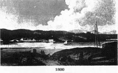
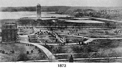

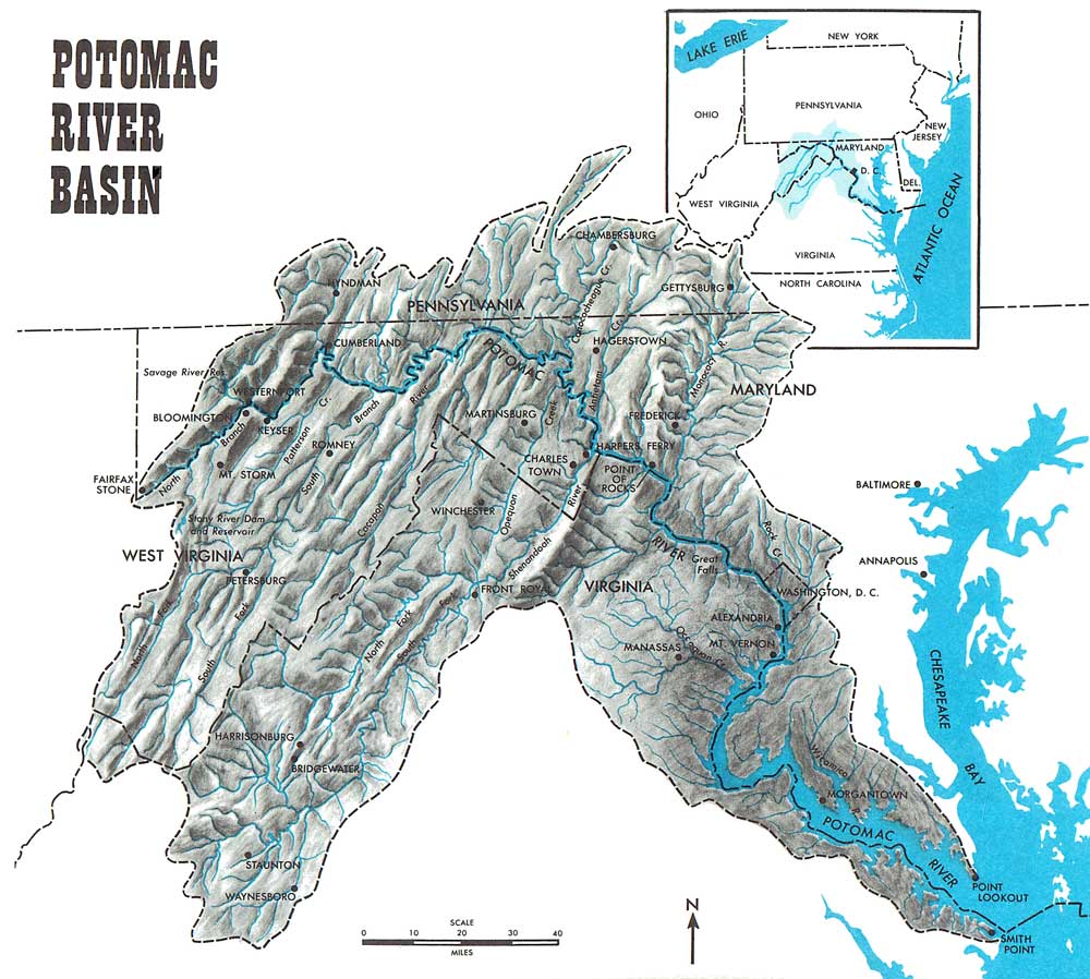

With good reason, people sometimes claim that the Potomac has been studied more often and more thoroughly than any other American stream. Its intimacy with the national capital at Washington and with great figures and events of our history have centered much American interest on it. In many ways it is a classic Eastern river, copious and scenic, that drains some 15,000 square miles of varied, historic, and often striking landscape, from the green mountains along the Allegheny Front to the sultry lowlands of the estuary's shores where the earliest plantations were established among the Indian tribes. It has tributaries large and small whose names echo with connotations for American ears—the Shenandoah, the Monocacy, the Saint Mary's, Antietam Creek, Bull Run....
And it has long been the subject for debate and discussion over how it may best be handled to serve man's ends, for in common with other rivers in civilized regions it has developed problems of pollution, of landscape destruction, of occasional floods, of impending shortages of water for its basin's increasing population. Out of the debates have emerged studies and plans, some fragmentary and some whole, some specialized and some general. This present report concerns the latest study, made under the leadership of Secretary of the Interior Stewart L. Udall according to a directive given him by President Johnson in 1965. The report is "final" only in that it sums up this study. It is by no means final in terms of the Potomac, for it points toward future action and continuing study and planning, and an important part of its function will be to show why a degree of inconclu[Pg 16a]siveness in such matters is necessary and desirable.
Within a remarkably few years after Captain John Smith sailed up the Potomac estuary in 1608 to assess its treasures and to make the acquaintance of the Algonquian tribesmen whose villages flourished on either shore, other vigorous white men came there to stay, on both the Maryland and Virginia sides. In the century that followed they raced and leapfrogged one another upriver, elbowing the Indians out, and with the aid of indentured labor and later of African slaves they helped to shape the Tidewater tobacco civilization that engendered so many future leaders of the American republic. Near the head of navigation, shipping centers grew up—among them Alexandria and Georgetown, forerunners of the metropolis that bestrides the river at the Fall Line today. Above there in the upper Piedmont, and then across the Blue Ridge in the Great Valley, the westering waves of migrant English met other waves of Scotch-Irish and the Germans coming down from Pennsylvania, and before the American Revolution the combined breeds of men had built up enough pressure to push Indians almost entirely out of the Potomac Basin and to occupy all the good farmland, even in the Basin's ridged western areas.
Since then their successors have used the land for farming and for other purposes. In using it they have changed it, and the changes have registered in the river system that drains it. For land, water, vegetation, wildlife, minerals, and men's habits are not separable from one another in the natural frame. So that if[Pg 16b] the early planters, using methods of hoe tillage scarcely less primitive than those of the Indians, mined the Tidewater soils for tobacco production in a way that required new fields every few years, one result was that those soils tired and thinned and finally stopped supporting the social magnificence that had grown up there, for production and prosperity moved inland and west. And another result was that the Potomac estuary itself grew shallower and different with the silt that washed down off the land, and many a tributary bay that once served as harbor for oceangoing ships is now a rich, reedy marsh with a single narrow gut of shoal water wandering down across it to the Potomac.
And if later generations of men cut down the forests on the mountains in the western Basin, and fire followed the cutting, thousands of years of soil washed down from those slopes too to change both mountains and river, and elk and panther vanished. And if along the Potomac's North Branch there was once a fine coal boom, there is now the boom's legacy in the form of gray dour towns and dark sad streams corrosive with mine acids.
And if old Alexandria and Georgetown and all the land around them have burgeoned into one of the nation's great cities, there has been a price to pay for that also. The stately upper estuary on which they front is often turbid with silt and sometimes emerald green with algae nourished on sewage and other septic riches, and the hills stretching back from the river are spiky with tall buildings linked by urban and suburban clutter, where life[Pg 16c] lacks the natural elbow room that the old Tidewater folk—planters and yeomen and bondsmen and slaves alike—were able to take for granted.
These are facets of an Age of Problems, of course. They and other related troubles have been growing apace lately as men have grown in numbers, in the demands they make on the natural environment that shaped and nourished their species, and in their technological power to enforce those demands. The troubles pose a threat to men of flavorlessness and grayness and the loss of essential meanings, a threat of diminished humanity. For dependence on that environment, intricate and deep-rooted, psychological as well as physical, has not grown less with the human advance toward power and sophistication.
Yet in the Potomac Basin as a whole the threat so far is mainly still a threat, not a reality. Where men's employment of the land has been reasonable, as it has in the Great Valley almost from the start, the land not only remains useful and pleasant but has a specific traditional beauty dependent on man's presence. Where new comprehension of the processes of destruction has been attained and shared, as in soil conservation and forestry and such fields, much damage done in the past has been repaired.
Most of the Potomac river system's flowing waters are unnaturally polluted to one degree or another, but only in spots does the pollution even approach the sort of poisonous hopelessness to be found along some more heavily populated and industrialized American rivers, and on the Potomac its spread is already be[Pg 18a][Pg 17]ing slowed. Water shortages loom, but have not yet seriously materialized. Floods threaten, but only at certain definable spots. Human beings boom outward from the Washington metropolis and the other centers of population in search of a fuller life, and the consumptive sprawl and sameness of the communities built to receive them often deny it to them. But in modern terms there are not really enormous numbers of them yet, and for their pleasure and fulfillment a great deal of varied and handsome and historic landscape has been more or less preserved, by design or happy accident.

| 1. Sixes Bridge |
| 2. Sideling Hill |
| 3. Town Creek |
| 4. Little Cacapon |
| 5. North Mountain |
| 6. Verona (Staunton) |
The Potomac Basin, in other words, is still generally a wholesome place two-thirds of the way through the 20th century. If it gets the protection it deserves, and is developed thoughtfully and decently to meet men's demands upon its resources, it can stay a wholesome place into the indefinite future.
Water pollution was the first Basinwide problem to make itself thoroughly evident, and the need to deal with it led to the first Basinwide activities besides studies. Soil conservation practices for sediment control were instituted in the 1930's, and in 1940 the Interstate Commission on the Potomac River Basin, often called INCOPOT, was formed by compact among the four Basin States and the District of Columbia, with the formal permission of Congress. INCOPOT's powers are only advisory in relation to State and community action against pollution, and it has never been generously financed. But during the[Pg 18b] quarter-century of its existence it has developed a wise combination of investigation, persuasion, and public education to fight this problem, with the result that on the Potomac conditions have in some ways actually improved during a period of wars and booms and haphazard urban expansion when many other rivers were headed straight down to stinking corruption.
In 1956 the U.S. Army Corps of Engineers was directed by Congress to undertake a Basinwide study to develop a plan for flood control and the conservation of water resources and related land resources. The emphasis in this assignment was upon a full long-term functional solution for the Basin's water problems in feasible economic and technological terms. In carrying it out, the Army enlisted the aid of other Federal agencies, and their Potomac River Basin Report, published in nine volumes in 1963, presented the study's results and a plan for Basin water development to meet needs to the year 2010. It is a monumental piece of work to which anyone concerned with the Basin henceforth will have to refer, because of the completeness with which it examines the Potomac water resource and the careful technical knowledge it brings to bear on Potomac problems.
However, the plan it presents—including recommendations for sixteen major multipurpose reservoirs on the Potomac and its tributaries—would bring about a massive and permanent revision of the free-flowing stream system and would inundate much valley land. It aroused articulate opposition at local, state, and Congressional levels, a good[Pg 18c] deal of which was focused on the key Seneca dam on the Potomac main stem just above Washington—an area where earlier single proposals for dams, first at Great Falls and then at River Bend, had provoked similar resistance.
Clearly enough, a powerful continuing body of opinion cares about something more than strictly functional values along the Potomac and in its Basin. It is a long-settled region, whose natives generally cherish what they have in the way of scenic and historic amenities. It is the part-time home of many influential lawmakers, who concern themselves about its beauty and well-being. And together with the national capital at the core of its metropolis, it is the vacation goal of millions of American tourists from elsewhere each year, who go home aware not only of monuments and marble halls of state but of crucial Civil War battlefields, dark mountain ridges overlooking classic river valleys, rolling Piedmont estates, and the wooded headlands of Virginia and Maryland that recede behind one another into haze as one looks down the estuary in summertime.
This national interest in the river was recognized publicly early in 1965 by President Johnson when, in connection with his noted "Message on Natural Beauty," he issued directives to Secretary Udall making him responsible for the preparation of a conservation plan for the Potomac. In addition to the tasks of cleaning up the river, assuring an adequate water supply for the decades ahead, and providing flood protection, the Secretary was instructed to protect the natural[Pg 19a] beauty of the river and its Basin and to plan for full recreational opportunities there for both natives and visitors. A stipulated aim, which seized the public imagination, was to make the Potomac a model of scenic and recreational values for the entire nation.
In response, the Secretary shaped a Federal Interdepartmental Task Force under Interior direction, in whose specialized sub-task forces were enlisted the skills available in the Corps of Engineers, the Department of Agriculture, the Department of Health, Education and Welfare (where the Federal Water Pollution Control Administration was then located), and the various concerned bureaus and services of the Interior Department itself. Shortly after this, Secretary Udall met with the governors of the four Basin States and the commissioners of the District of Columbia to ensure that State and local interests would have a hand in the planning process. Out of this came the Potomac River Basin Advisory Committee, composed of State and District representatives, which has conferred often with the Interdepartmental Task Force on overall questions and has assumed prime responsibility in studying the central problem of creating a planning and administrative body to handle Potomac water and related land problems hereafter.
In addition, a blue-ribbon panel of distinguished planners and specialists, assembled by the former president of the American Institute of Architects at Secretary Udall's request and subsequently known as the Potomac Planning Task Force, undertook a separate study of Potomac questions, both in[Pg 19b] general and with specific focus on the metropolis. Their independent report, The Potomac, was lately published. It makes a detailed, wise, and instructive plea for considering the river and its landscape as a whole and meaningful thing, for proceeding with their development and protection according to high esthetic and ecological principles, and for a distinctive form of management.
Existing private, public, and semipublic organizations with an interest in the Potomac or in the type of problems it presents have joined in the present effort by sponsoring public meetings and publishing discussions or otherwise doing their part to help. Among them may be mentioned INCOPOT, the Conservation Foundation, the Metropolitan Washington Council of Government, Resources for the Future, Inc., the League of Women Voters, the Potomac Basin Center, the National Parks Association, and a number of local planning or action bodies. Through these meetings and other media, public comment on the Federal Task Force's work has been voluminous and often helpful, particularly since the publication of its Interim Report in January of 1966, which made certain proposals for immediate action to begin providing for short-term metropolitan water needs, to protect specific scenic treasures, and to get moving on the long task of cleaning up the river.
With so many viewpoints somehow included in the planning process, opinions have often diverged as to how much of what ought to be done about the Potomac, and how soon, and in what order. Well they may diverge. In[Pg 19c] a time of economic expansion and population growth unparalleled in human history, predictions about the economy and the population of the distant future—necessary to full planning—verge perilously near to crystal gazing even when the best available yardsticks are applied. And this is only one uncertainty. Among the others which will be examined later in this report are the prospect of drastic technological change that may soon offer cheaper, more effective, and less disruptive ways of dealing with environmental problems including water; the doubtfulness of sufficient public money for large conservation projects in a time of international tensions and urban crisis; and the solid American political complexity of the boundary-laced Potomac Basin, which bristles with various forms of veto power and a multiplicity of assorted regional, professional, and philosophical viewpoints.
Such complexities and uncertainties have a powerful reality and relevance for planners. They impose a need for breadth of view, for leaving many future options open, and by the same token they present a danger of piecemeal action, excessive compromise and indecisiveness.
The body of this report is an Interior Department document, couched wherever possible in untechnical language in the hope that it may find a wide lay readership. Necessary technical supporting material mainly has been or will be made available in separate form. The report examines environmental problems in the Potomac Basin and possible solutions for them. Its underlying emphasis is ecologi[Pg 20a]cal, based in a conviction that man's own good is heavily dependent on the good of the earth in all its complexity. No one at this point in time, obviously, is going to be able to reconstitute the primeval Paleolithic world, nor would many people want to. The earth has changed with people in their long surge toward dominion over its ways and its creatures. But there is a difference between adaptive change and the degeneration that modern times are forcing on the earth men have always known. Growing millions of people are coming to consider that human beings' right to see and know woods and plains and mountains and streams and coasts in a cleanly and decent condition—whether primitive or adapted in one way or another to man's use—together with the communities of wild creatures that belong there, is quite as practical and urgent as their right to usable tap water or to a share in the Gross National Product. For upon the retention of these ancient realities future human sanity and wholeness may well depend.
We who are responsible for this report believe that this point of view is going to gain enough strength and political acceptance to become one of the motive forces of this century. Already it has much power. Even though many established attitudes, laws, and practices are still firmly rooted in the old exploitative, often heroic urge to seize upon all resources and put them to use at whatever ultimate cost, disgust over pollution and the destruction of beautiful places is getting to be a political factor to be reckoned with at all levels of government. So is concern over[Pg 20b] man's lemminglike multiplication in numbers and the way his technology and his expansionism are gobbling up things quiet and graceful and eternal—things he needs. It seems certain that political "muscle" and respectability for the legitimate conservationist viewpoint is shaping up fast enough that it will be able to dissipate the worst threats—the grabbing and the spoiling, the ignorance and the archaic attitudes, the onward shove of brute technology for technology's own sake rather than for man's—before they have forced mankind on into the gray sterility of life that would be their ultimate effect.
And upon the emerging potency of this sound and urgent concern with the way the natural world is being used up, we believe a flexible form of planning can be based that will do away with the dilemma posed by the complexities and uncertainties of the moment. With a minimum of compromise, such planning will be able to identify and propose solutions for immediate problems in places like the Potomac Basin, while moving toward longrun solutions for other problems as those problems' dimensions become clearer than at present, and as technology and politics make better solutions feasible.
Solutions for pressing and immediate problems have to be in terms of present possibilities—political, financial, and technological. Some such immediate problems—of water supply, pollution control, and scenic preservation—exist in the Potomac Basin and are analyzed in this report, and presently feasible action is recommended for their alleviation.[Pg 20c] A considerable part of the report is concerned with such problems, with the range of possible solutions for them and with our reasons for making specific recommendations.
These immediate solutions do not constitute what has been called a "quick fix"—piecemeal, one-shot action to patch up things until another crisis arises. As much as possible, they have been worked into the picture of longterm Basin needs insofar as those needs can be discerned, and it is intended that action against future problems shall be built upon them. Furthermore, we have sought to maintain an ample view in identifying long-term difficulties and indicating what should be aimed for when it is essential to act against them.
But we have not shaped a rigidly complete, prescriptive plan identifying exact measures for the cure of all present and future ills of the Potomac Basin. For a variety of reasons, we have concluded that such a rigid plan would not only be self-defeating in the long run, but that it is actually undesirable. We are aware that this conclusion is going to arouse criticism among those who during the past three years have consistently demanded that we provide a total answer, for the purpose either of unseating the governing principles of the 1963 plan or of reinforcing and amplifying those principles. Nevertheless we are certain that the conclusion is right.

It would be right even if the development of new technology were the only uncertainty confronting planners. Barring a complete breakdown in the present impetus of research and discovery, radical change in the[Pg 22][Pg 21] technology of water supply and water quality control appears to be extremely probable within the next few decades. Some of the best of the emerging tools, there is reason to hope, may permit men to deal with water problems in ways that are more harmonious with natural ways and less structurally imposing than present methods. Possibly the present, often essential reliance on large storage reservoirs, for instance, is going to be modified, though how much the ultimate way of doing things will have to combine old and new technologies is something that cannot be guessed.
If it cannot yet be guessed, it cannot be incorporated in a rigid plan, which has to deal in technological certainties—i.e. in present technology—and must therefore impose that present technology on the future, whether or not the future is going to need it. If we are right in believing that from this generation on, people are going to be increasingly jealous in the preservation of their natural heritage, future Americans will not be likely to thank this generation for having unnecessarily robbed them of choices as to how to handle the streamwaters of a superb river basin like the Potomac's. Any more than they would thank us for having done nothing at all and leaving them to scramble for water, and filthy water at that. Quite simply, no one has the right to do either of these things to them.
It is our belief that if genuinely conservationist values are established as the ruling principles in a flexible, properly paced, continuing planning process, there will be no need to fear that future generations are going to be either stuck with large mistakes on our part, or cursed with shortages, floods, and pollution. With this report we hope to initiate such a process for the Potomac.[Pg 23]


If the Potomac has been much studied, it has nevertheless been subjected to only meager "development" over the centuries of its service to civilized men. Most past attempts to alter it significantly for man's use have either failed or have not led to lasting results, though their changing purposes over the years summarize, to a degree, America's shifting attitudes toward the utility of flowing water. Early projects under George Washington and others to assure the navigability of the main river above the Fall Line, which they saw as an artery for eastward and westward currents of trade, left only some quaint ruined locks and flowing bypass canals around falls and rapids. The later C. & O. Canal, which ran alongside the river and was replenished by its water above occasional low dams, required over two decades of toil and death and heavy expense to complete upriver to Cumberland, Maryland, which it reached in 1850. There had been some public opposition to the project and it was never a great success even after completion, for the railroad era had begun and the Canal suffered periodic heavy damage from Potomac floods, being finally abandoned to picturesque decay after a mighty inundation in 1924.
Largely because of a stalemate between public and private power advocates, the early 20th century heyday of small-scale hydroelectric power development of rivers mainly missed the Potomac, though at one time a[Pg 24a] power company acquired land at Great Falls in anticipation of such development. Other modern water projects in the Basin have been relatively modest or have run afoul of strong opposition. Therefore, today a sprinkling of small channel power dams and water intake structures, some levees and improved creek channels, and a few unimposing reservoirs of various sizes and types high up on small tributaries are the sum total of the development to which the Potomac water resource has been lastingly subjected, if we disregard for the moment its waste disposal function and the maintenance of navigation in its estuary.
In general this is undoubtedly a fortunate thing, for the application of modern technology to rivers in the past half-century of our national growth has not always had happy results. "A river," Justice Holmes once wrote, "is more than an amenity, it is a treasure." His feeling is shared by thousands upon thousands upon thousands of people who live along the Potomac and its tributaries or who go there to float down them in bass time, to picnic and swim, to hunt, to dig into the region's history, or just to listen to the purl of green water against the rough stonework of a ruined bridge pier. Deteriorated though a few stretches may presently be, these rivers are still treasures.
The lack of development also presents planners with a fairly clean slate on which to write. In terms of water, few massive human mistakes confront them except the pollution of the upper estuary and certain other reaches like the afflicted North Branch. There[Pg 24b]fore they can begin more or less from scratch and can usually find various choices for action against the water problems of the Basin—against pollution, against flood damages, and against impending or existing shortages of water for municipal and industrial use.

Though for clarity in discussion we need to classify these various kinds of problems separately, in practice they do not so neatly divide from one another. Nor do they divide from the way the land in the Basin is used or from the pleasure and fulfillment people find in the outdoors. If a region's use of a stream's water is heavy in a dry August, for[Pg 24c] instance, whatever pollution the stream gets below towns and factories will be more concentrated and damaging than if the stream were flowing well. Pollution itself can affect the utility of water as well as people's enjoyment of it in a stream. A creek watershed that has been ignorantly farmed or roughly assaulted with bulldozers for urban development is an eyesore of erosive destruction, unproductive of crops, wildlife, or poetic appreciation, and can cause both heavier stream flooding in time of storm and lower flow in time of drought by the way its disruption alters the normal behavior of rainwater. The silt that storms wash off of it is not only a major ugly pollutant of flowing water below that point but can complicate flooding and bank-cutting and navigation and other things by settling out into bars and shoals in still stretches, including reservoirs.
All of these things, and others as well, have to be considered together as parts of a whole problem. And that problem is that men's hugely increasing numbers and their multiplying technological power over their environment have made it necessary to readjust the balances somewhat in great natural units like river basins—to restore, manage, and protect them in such a way as to be able to hand them over decent and whole and useful to the people who come after.
Wisely handled, the water that runs annually through the streams of the Potomac[Pg 25a] river system can be counted on to satisfy any demands that people there are likely to make on it in present times or during the foreseeable future. More than 2½ trillion gallons of fresh water normally flow down the Potomac in a year. It would be pleasant to believe that this means that the natural and unassisted river system is going to continue to serve human needs in the future as it has served them heretofore—that after cleaning up the network of streams and ensuring against their repollution and the desecration of their landscape, men will be able to leave them respectfully alone to run down toward the Chesapeake Bay as they have run during and before human memory.
However, it is not so. Whatever human population might be considered ecologically tolerable under natural conditions for the nine million or so acres of earth, rocks, vegetation, and water that make up the Basin, it has long since been exceeded by hundreds on hundreds of thousands. And if those who predict such things are right, it is going to be exceeded much further in the near and middle future. Today's approximately 3.5 million Basin inhabitants are expected to double by the turn of the century, with accompanying complex shifts in the ways they will be making their livings and in the numbers of them who will live in the country as compared with the cities and towns. Thereafter, further geometric increases are contemplated, calmly by some contemplators and less so by others.
As a result of past and present populations and their activities, conditions in the Basin—including the river system—are necessarily[Pg 25b] far from natural, for specific structural development is not the only form of change. The Potomac environment has been adapted to man's use, and in places where that use has been unreasonable it is already in trouble. Clearly it is going to have to be manipulated artificially to some extent to meet people's demands on it and to guard it against the worst effects of their numbers. In fact, very luckily, it already is being so manipulated in dozens of ways ranging from methods of farming and forest management to sewage treatment. It is possible to hope that present population forecasts may somehow find less than ample fulfillment, but it is not possible to count on it for planning purposes. Nor is it possible to wish out of existence situations already serious.
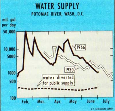
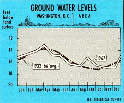
At times during the hot months of drouthy 1966, the climax of a dry cycle that had begun to develop five years earlier, the Washington metropolis was not too far from the bottom of its water barrel. The situation was not as bad as in some other Northeastern regions, nor as bad as some local analyses claimed, but it was bad enough. The highest daily withdrawal of the year was on June 26, when the metropolitan water intakes in the Potomac sucked out approximately 380 million gallons. Of this some 30 million gallons had to do with a pumping pattern pertinent to adjustments within the system, and the other 350 million went for the use and refreshment of a metropolis afflicted by summer's heat. The total figure represented less than half of the river's flow at that time.
For a couple of days in September, how[Pg 26a]ever, the Potomac's flow reached an all-time low of about 390 million gallons a day. Even if the demand on those days had risen as high as in June, which it did not, there would still have been an excess, but not a very safe one. Heavy storms shortly thereafter eased the situation, and rainfall since then has definitely broken the long drought pattern, returning stream and groundwater levels to normal.
The sober fact is that the Washington metropolis is nearing the point where its traditional main dependence on the Potomac's free and fluctuating flow for water supply—with supplementary quantities from Occoquan Creek, the Patuxent, and a few wells—is not going to work during prolonged dry periods. Total flow even in a drought year remains impressive, but dependable daily flow—which is what counts for supply—varies tremendously.
Other centers of population in the Basin are up against water supply problems or are going to come up against them shortly. The towns and industries along the North Branch, around Cumberland and upstream, are strongly aware of a water need complicated by the deep-seated pollution of their stream system and the scenic and economic disruption of their watershed lands. Chambersburg, Pennsylvania, a handsome town in a prosperous farming district of the northern Great Valley, is approaching a critical point in the relationship between the water available to it and its demands. Far south in the Valley, Augusta County, Virginia, which contains the thriving towns of Staunton and Waynesboro, is experiencing an upward surge of in[Pg 26b]dustrial development that seems certain to continue and is going to call for a great deal more water than can be counted on from present sources. Public awareness of this is shown by the fact that county citizens voted in a referendum in November of 1966 in favor of construction of a Federal reservoir at Verona near Staunton on the Middle River, which had been strongly opposed when it was presented as a part of the Army 1963 plan.
On the Monocacy in Maryland's Piedmont, the old agricultural center of Frederick has begun to come under the changeful, expansive influence of Megalopolis as a result of easier access from both Baltimore and Washington, and has been brought abruptly face to face with a looming water shortage. Recent studies by the Maryland Department of Water Resources indicate that the dependable flow of the Monocacy will not serve the town for more than another seven or eight years even if the flow needed to maintain adequate water quality is left out of account, and the summers of 1965 and 1966 made even those figures seem slightly optimistic. Both city and State have declared themselves in favor of an upstream major reservoir at Sixes Bridge, also a 1963 proposal. And elsewhere throughout the Basin, a good number of smaller places face similar dilemmas.
Except for acid mine drainage, most of the Basin's main problems are found at metropolitan Washington. Because they are primarily people problems and more people live[Pg 26c] there than anywhere else, the problems tend to be bigger, including that of water supply. A conceivable shortage of several tens of millions of gallons of water per day within the near future is not a small shortage, and small measures are not going to cope with it.
A number of possible measures have been considered and weighed. Some seem undesirable for one reason or another, even in terms of the distant future. Others are unusable now, but have promise for later, when more is known, or technological processes involved have been perfected, or cost have been brought within reason. Still others, undoubtedly, cannot even yet be discerned. And some will work now at prices that can be paid. Ultimately, it seems certain, the super-Metropolis of the future will depend on a mix of sources for its water, getting part of it by one means and part of it by another and so on, as technology makes new means possible, and as economy, safety, and other factors may dictate. Therefore, there is no single "right" answer for the long run, and an attempt to prescribe one inflexibly would compound confusion over the years and undoubtedly perpetrate an injustice on future citizens in ways already mentioned. We need to do them the favor of believing that they will be able to cope with their own immediate problems at least as well as we can do it for them, and probably in ways better suited to their tastes.
Nevertheless, it is imperative that the city be given a margin of drought insurance for two decades or more, and for this margin some source definitely feasible in present[Pg 27a] terms must be identified and guaranteed.
Going outside the Basin for any significant part of the metropolitan water supply does not appear to be justified. Some water is presently being drawn from impoundments on the Patuxent just north of the city, but no more of it can be counted on. Diversion from the voluminous Susquehanna much farther north is feasible from an engineering standpoint. But the cost of it would be relatively high, and there are also certain strong objections in principle, based on the facts that the Potomac does have plenty of water and there is no inherent moral advantage in transferring the question of development elsewhere, that the Susquehanna Basin may well need its own water at some future time, and that the ecological effects of such diversion on the immensely valuable fisheries of Chesapeake Bay, which are dependent in large part on a shifting balance of salinities maintained by the tributary rivers, are unclear.
"Planned scarcity" of water in a community, wherein administrators and public alike accept the certainty that during dry times lawns and parks and golf courses and sometimes human skins will have to do without the application of water for a spell, is a reality of life in some arid regions and is probably always going to be. Elsewhere it is, or should be, an element in the design planning of industries that use heavy quantities of water for cooling and such processes. All water supply planning must consider it, for to build against any conceivable shortage would be prohibitively expensive. Pricing of water so as to cut down on waste without curtailing[Pg 27b] ample legitimate use may well be a longrun tool, as has been suggested. But in terms of general municipal and industrial water, any great degree of calculated shortage hardly seems appropriate for a humid-zone city which has a fine river at its doorstep and happens also to be the national capital, so that a scarcity would be of national concern in a number of ways. Federally established and maintained parks and open spaces, for instance, with their carefully tended vegetation, would be one of the first things to suffer.
Desalting of sea water, another reality now in arid zones and one of immense importance, has a certain degree of planned scarcity built into it by way of its price, at least at present. Some people believe that in time this process will be refined to the point that it can furnish abundant cheap water to all the world's seacoast cities. Certainly as it develops it may well have a potential for marginal drought-proofing at Washington, an emergency source to be drawn upon if needed. But the day seems distant when it will be truly competitive in price with riverine sources in regions of adequate rainfall.
Inland arid regions and perhaps other places as well are undoubtedly going to find one answer to water shortages in the recirculation of their treated waste waters through municipal systems. In one form or another such recirculation is already working at certain places in the United States on an emergency basis, and its full potential for industrial use has yet to be explored. However, the indications are that towns' and cities' reliance on it during anything but temporary emer[Pg 27c]gency conditions is going to depend on expensive methods of refinement and "fail-safe" overdesign, plus dilution with new water, which means again that it will probably not be competitive in price with natural water where enough good natural water can be had. To this may be added the observation that the consuming public presently has a few definite lingering qualms about the idea involved, particularly if there is other water around.
The underground rocks and sands of the Basin hold huge reserves of water with a fundamental relationship to the whole river system, whose basic dependable sources lie in these aquifers' outflow to the surface. Around the metropolis, some ground water is being taken from wells even now to supplement the overall supply and to satisfy the whole demand of any number of outlying communities. Though locally available quantities are limited and pumping costs rather high, such wells will undoubtedly be highly useful for future extensions of the metropolis, especially into the Coastal Plain.
There is also much promise in studies of the Basin's aquifers being carried out by the U.S. Geological Survey to determine detailed patterns of their contribution of water to the stream system and to see if it can be regulated and made even more useful. Such a possibility has great implications in terms of augmenting river flows both for water quality control and water supply, and could mean much at Washington. So could certain techniques of deliberate drawdown of aquifers to induce recharge with excess surface wa[Pg 28a]ters or sometimes treated sewage effluent, also presently under study. Ground water as a source has some unique advantages—among them a minimum of evaporation loss, less need for surface structures, and protection against catastrophic contamination—and it deserves full exploration, though it cannot at present be counted on as a significant part of the answer for the metropolis.
Far out, though possibly not very far off in time, is the likelihood that future water planners will be able to count on some degree of control over a given region's rainfall and snow. Through experimentation, this subject is rapidly being excised from the mists of superstition that once surrounded it, and the Department of the Interior has an active program of research and study in the West, with tremendous implications. But, yet again, present planning cannot take it into account except in the sense that, along with some of the other technologies already mentioned and undoubtedly others that have not yet even emerged to view, it adds to the near certainty that future planners are going to have a much wider range of alternative methods at their disposal, to choose from and mix as may seem best. And this, in turn, reemphasizes the wisdom of flexibility in present planning and the need to keep big irreversible decisions to a minimum.
The upper Potomac estuary from Little Falls down to the vicinity of Marshall Hall and Mount Vernon or below contains a great deal of fresh water, an accumulation made up of inflows from the river above the Fall Line, local storm runoff and tributary flows, and[Pg 28b] treated sewage returned to the tidal river. The volume of this water that would be available for use without salinity has been variously estimated. At low tide, there would be 9 billion gallons of fresh water in the upper estuary from Chain Bridge to the mouth of the Anacostia River; In the 10 mile stretch from Chain Bridge to the District of Columbia's Blue Plains treatment plant, 15 billion gallons; and, from Chain Bridge to the saltwater front near Indian Head, Maryland, 100 billion gallons. Most of the time now it is afflicted with heavy pollution, as will be detailed in the next chapter of this report. But it does constitute a large natural reservoir of potentially usable municipal and industrial water, whose attractiveness for these purposes, as well as for all others, will grow steadily as the pollution is brought under better and better control. These facts have led some opponents of any and all major reservoirs in the Basin to conclude that the water in the upper estuary is a presently satisfactory reserve with which to face any foreseeable metropolitan shortage of supply from the upper Potomac.
The assumption has strong appeal, but it appears to be too risky to serve as a basis for adequate present planning to meet looming demands. That even now the water in the estuary's uppermost reaches, above the main metropolitan treatment-plant outfalls, would be usable for short emergencies by the installation of relatively simple pumping equipment below the falls, cannot be doubted. That in the long run the major part of the freshwater tidal river at and below Washington is likely to be a valuable source of metro[Pg 28c]politan water, maybe a principal source, is quite possible. Its use is and will be a strong consideration in longterm planning—another good reason, in fact, for flexibility. But the truth is that right now enough doubt and ignorance exist in regard to its exact potentiality that it should not be counted on to provide a safe margin of supply under all conceivable conditions during the next twenty years or so, for which planning provisions need to be more rigid and definite.
The doubts and unknown factors have to do mainly with the quality of this water, which comes under discussion later. In abridged summary of relevant facts at this point, it may be observed that unless all sewage and sewage effluents were collected and diverted to points well beyond the limits of the upper estuary, use of its water for periods beyond a few days of emergency would become essentially a form of recirculation of waste waters—with, at this time, the main drawbacks that we noted in regard to that process and certain others besides. For, under the low-flow conditions that would bring about its use, the effluents in the river below the mouth of the Anacostia would penetrate upstream as water was pulled out below the falls and would reach the pumps in fairly short order, probably moving in a tongue up the main channel.
With the radical improvement in the functioning of the metropolitan treatment plants that must be achieved, and other measures to relieve pollution in this part of the river, valid objections to such recirculation will of course weaken and ultimately disappear. But no one[Pg 29a] can reasonably expect that these things are not going to take a certain amount of time—quite conceivably enough time to run the city up against an emergency it could not handle without other, more standard sources of auxiliary water. Besides the matter of consolidating and improving treatment of collectible wastes, there are certain other diffuse and stubborn sources of pollution, as will be seen, for which good counter measures simply do not yet exist—among them are surface runoff during local storms and overflow from combined sewer systems.
If the collectible wastes were diverted out of the upper estuary and if it proved possible to cope quickly with other pollution or to ignore it, during prolonged use salt water penetration from downstream would take place as fresh water was withdrawn above and not replaced. Studies on a mathematical model of the estuary indicate that under conditions that could materialize, this would make the water at the intake too salty for use. A barrier dam across the entire estuary at one or another point in the freshwater section could prevent such penetration, but would be hugely expensive and undoubtedly more obtrusive on a much-used part of the riverscape than most upstream reservoirs could possibly be.
Furthermore, even if all these doubts and areas of ignorance were to be easily resolved, insistence that the upper estuary is the only logical answer to metropolitan Washington's water problem ignores the fact that major water demands are building fast in certain already-mentioned areas of the upper Basin, and that, since the Basin is a hydrological[Pg 29b] unit, measures to satisfy these demands can easily, economically, and quite logically be designed to furnish a good part of the metropolis' near-future safe margin of water supply as well.

A need for vigorous research specifically directed toward exploring all these alternative means of supply is evident. If it moves fast enough and the knowledge that comes out of it is made available to planners, it may very quickly make a great difference in the kinds of sources of water they can turn to for the solution of problems, just as studies since the early 1960's, when the Army work on the Potomac was completed, have altered prevalent ideas about pollution control through[Pg 29c] flow augmentation, and have therefore greatly diminished the overall amount of water considered necessary to meet the Basin's demands.
In the crucial meantime, the established certainty of storage in reservoirs is available. In river basins with reasonable annual amounts of precipitation but with human demands on streams that sometimes exceed the rate at which water flows down, such reservoirs are still usually the most dependable and efficient item in the present technology of water supply. And since they generally have other purposes to which proportionate shares of construction costs are assigned in individual cases—flood protection, water quality control, navigation, hydroelectric power, recreation, silt detention, etcetera—they tend often to be the most economic sources of big quantities of water. In one form or another they have been built from very ancient times, and they have been indispensable to the useful development of water resources in our expansive economy.
In parts of the United States far from sea-coasts or large natural lakes, reservoirs built for water supply and other purposes have become the focus of enormously popular forms of recreation that would otherwise be impossible in those regions—sailing and motorboating and water-skiing and the sort of fishing possible only on big water, and such things. Properly designed and located, they can be beautiful bodies of water, as the vacation homes that grow up around many of them testify.
Strong objections to them also frequently[Pg 30a] are voiced. They are one of the most massive manifestations of man's technological ability to adapt natural processes to his use, and they sometimes have profound effects on fish and wildlife and the whole ecology of a stream system region, to the dismay of many conservationists. Often too they flood out large areas of riverbottom farmland and other private property, arousing the ire of some rural folk and small townsmen who feel that their interests have been sacrificed to the water or flood-protection demands of downstream city dwellers. Opponents of major dams sometimes assert that many of them have been built not to meet real hydrological needs but to foster economic development which may or may not materialize and may or may not be worth the loss of natural or scenic or agricultural resources disrupted by the reservoirs. Other thinkers, not necessarily against reservoirs in general, express a doubt that the potential effects of specific structures are always thought out sufficiently beforehand. Among these are the authors of a recent publication of the National Academy of Sciences—National Research Council, Alternatives in Water Management:
"We create great reservoirs that stop the migration of fish and then provide costly fishways, hatcheries, and other devices to maintain the fishery, and with no certainty of success. We impound water without knowing the effects of that impoundment on its quality. We build an irrigation project and then find salinity increasing dangerously in the river downstream. We eliminate high-flood peaks by reservoir storage, but downstream from[Pg 30b] some reservoirs we see unpredicted erosion, sedimentation, bank-cutting, and other effects, even unto, as in California, the loss of beaches along the seacoast, starved of their supply of sand."
The list of objections could be extended—and often is by objectors—to a point of pettiness. Nevertheless, the main doubts are gaining much acceptance and are imperatively having to be taken into account more and more these days, as new elements of water technology and philosophy—some of them mentioned earlier in this chapter, others to emerge in subsequent discussions—come closer to full feasibility and become a part of general human knowledge. Delay in building reservoirs until it is certain they are needed is on the verge of becoming a respectable element in planning, and in the future dams may well become merely one of many ways to guarantee water and handle it. At least some water authorities, though certainly not all, have voiced the opinion that most present reservoirs will some day serve primarily for recreation, if emerging new principles of water supply, water quality improvement, flood protection, power generation, and such things attain general use.
That day, however, has not yet dawned, nor is the interim before its arrival calculable. It is necessary to face present reality with present tools, and the reality at the Washington metropolis and elsewhere in the Basin is that a good deal of water is going to be needed rather soon, and that no reasonably economic alternatives with any clear esthetic and ecological advantage over reser[Pg 30c]voirs are presently available to furnish it.
Nor, if planners and designers are aware of the whole set of problems, do reservoirs necessarily have to be weighty in their impact on the natural scene and the public interest. The quantities of stored water needed for the Basin's near future are relatively modest in comparison to potential supplies, and a multitude of good reservoir sites exist to be chosen from. There is no reason why, with present knowledge, a minimum of necessary reservoirs cannot be planned and designed for a maximum of beauty and pleasure. It is a notable fact that a very large number of Americans prefer boating and fishing and other aquatic sports on reservoirs to any other form of recreation, and another notable fact that in the upper Potomac Basin there are very few places where even small numbers of Americans can thus indulge themselves at present.
In terms of metropolitan Washington's water supply, considered apart from other Basin water problems, the best reservoir site by far in the whole Potomac drainage would be the old River Bend site or the one proposed in 1963 at Seneca, both just upstream from the Falls above the metropolis. In one package, either of them would impound enough water to take care of any likely municipal and industrial demands of the metropolitan region for more than a half-century, besides trapping most silt from upstream to keep it out of the estuary, and providing a good measure of protection for flood-susceptible metropolitan shores. Furthermore, the proximity of such a reservoir to the city would ensure a great deal of aquatic recreation for people[Pg 31a] there and would somewhat simplify water management problems.
Thus, it is natural that Seneca, the latter proposal of the two, has found strong champions among metropolitan administrators, water engineers, and planners whose thinking has to be primarily in terms of sure and efficient water supply and flood protection. It has found equally strong opponents, however, enough of them to have stalled it to date. It is not yet dead, for it emerges in each new discussion of the city's water situation. It will not be dead until the metropolitan water problem, short-term and long-term both, has found a full satisfactory solution in other terms.
Our feeling remains unchanged since the publication of our Interim Report: that when all factors are weighed and future uncertainties are taken into account, Seneca should not be built at this time. If the price in money would not be high in relation to immediate "market" advantages gained, the permanent price, in river and countryside and those other intangibles that are getting to have more and more weight in men's minds year by year, would be heavy.
The full main stem Potomac, carrying the water from the combined North and South Branches and the Shenandoah and the other upper tributaries down through the Blue Ridge water gap and across the rolling Piedmont and the Fall Line, is at its most typical in the 39 miles from Harpers Ferry to Great Falls. Seneca as originally proposed would inundate 35 miles of this stretch, together with islands and bottomlands, forests of big[Pg 31b] hardwoods, meadows and productive fields, and that much-used segment of the publicly owned C. & O. Canal, with the trail along its wooded towpath. Even reduced in size and designed as strictly a water supply structure, it would have many of the same effects. There is special and tranquil beauty in this piece of the river, which makes a fine float trip and is much fished, as well as a lot of historical significance dating back to the Senecas and the Piscataways and before. Here these things are not forgotten and removed from men's reach but are available to metropolitans who go to the trouble to seek them out, as many do. Nor is there anything else around to take their exact or even approximate place if they were gone.
It has been pointed out that if the metropolis grows according to predictions, a major part of that growth is going to be upriver, and the main stem of the Potomac will have the same relationship to the metropolis of the future that Rock Creek has to the Washington of today. Thus the decision that is made about the main stem in our generation is similar to the decision that planners had to make about Rock Creek three-quarters of a century or more ago. Those planners decided magnificently well, bequeathing to the future an urban stream and park unique in this country and perhaps the world, a treasure that the public is presently defending against other, newer, subtler threats than mere damming or encroachment.
A reservoir above Seneca clearly could not mean that sort of thing. It would be a useful lake, but devoid of the changeless tone of[Pg 31c] the Potomac as it flows there now. The reservoir's proper functioning would require fluctuations in its level, with occasional ugliness at the shoreline, and if it would permit a great deal of happy water-skiing and flat-water fishing, the same opportunities are going to be available to Washingtonians in the nearby estuary when it is suitably cleaned up, even though the section immediately adjacent to the metropolis may take a good while to bring up to swimming standards.
In terms of the overall good of the people of the metropolis and the Basin and the country, the water situation at Washington now and during the near future hardly bears a desperate enough aspect to warrant the sacrifice of much of the main flowing river to a reservoir which, like the freshwater estuary, could not be meshed with upstream needs but would serve only the urban areas at and below the Fall Line. Conceivably at some future time, if technology should renege on its promise to bring forth good new alternatives, and population pressures continue to grow, the city may badly need a reservoir there. It is a uniquely valuable site. For that reason, we repeat our Interim proposal that the reservoir site, minimally defined, be preserved against the mass encroachment with which it is imminently threatened, and be utilized principally as part of a major park complex protecting the river and its shores. To defer irreversible decisions and to leave them as much as possible to future generations whose conditions of life and desires we cannot predict with accuracy, can be a principal way of maintaining freedom of choice.[Pg 32a]
In the category of reservoirs, at the other end of the spectrum are the comparatively small headwater dams that the Soil Conservation Service has been designing and supervising for three decades in authorized watersheds throughout the country. These structures can serve several functions and can furnish for small watershed areas and small centers of population many of the benefits that the Corps of Engineers and Bureau of Reclamation dams furnish for large areas. On their own scale, they are vulnerable to some of the same objections that are aimed at large reservoirs. But the scale is smaller; they tend to be less imposing and pre-emptive of good land than big river dams, "catch the water where it falls" to hold it for local use and to alleviate local flooding, and are backed up by erosion control practices in a program that has proved to be one of the best available stimulants to good land use. For these reasons they have appeal for many rural people and conservationists.
However, the conclusion which some of their supporters have reached is that if only enough of the small dams could be built throughout the headwater areas of a river basin, they would eliminate the need for most other forms of water management, leveling out flood and drought flows and holding a great aggregate amount of water on tap for use anywhere down the line. At times in the past, the controversy between supporters of big dams and supporters of little dams achieved the proportions of a bloodless war, but after a good many years of testing and ob[Pg 32b]servation it is now generally agreed by hydrologists that both have their place and that the most appropriate focus for the small dams' functioning is local.
At any rate, they are not an answer for Washington's problems. Even if enough of them were installed specifically to provide the storage volume needed for metropolitan use, the question of operation—ensuring and coordinating releases from a large number of places at varying long distance upstream from the point of intended use, in such a way as to make the required volumes of water arrive at the right time, without waste—would be very difficult even with much more sophisticated and expensive design than these structures customarily have. Without it the problem would be insuperable.
Thus, for metropolitan Washington's water in the near reaches of the future, some reservoir storage is indicated with fewer ecological, recreational, and scenic drawbacks than a Potomac main stem dam, and more efficiency for massive supply than the small headwater structures. Since the Potomac river system is a unit, with the metropolis at the downstream end of its non-tidal part, water stored anywhere in the upper Basin can be released for use there. This gives much freedom of choice in the selection of sites for reservoirs and in the combination of releases from various places to make up an adequate total supply, though obviously good management will be needed to coordinate the releases and avoid the waste of water.[Pg 32c]
It also means, if good principles of river-basin management are followed, that reservoirs to supply water at Washington can be located and designed so as to satisfy major upstream demands at the same time, and that they can be fitted in with regional and Basin needs for water quality improvement, flat water recreation, and in some places flood protection. In such conjunctive planning, based in the Basin's physical unity, commencing now and continuing on into the future as new needs and new ways of satisfying them come to view, lies the main hope of developing the Potomac water resource in such a way as to avoid waste of money, waste of water itself, and waste of the landscape and the general environment. Without it, nothing can result but a piecemeal haggling to bits of the river system as local demands grow acute and local pressures force the adoption of one-shot measures. With it, towns and areas and industries can be guided toward sensible and thrifty action that fits in with the wellbeing of the whole Potomac region—toward buying a share in the water of a rightly designed, rightly placed reservoir large or small, toward development of ground water resources where these are adequate, toward the use of new technology that may be feasible and suitable.

The range of choices is certain to enlarge with time, and the ease with which right choices can be made. In this computer age, mathematical models of river systems, including the Potomac, are at work manipulating hydrological data and quickly indicating optimum coordinated solutions for given water[Pg 33a] problems that formerly would have taken many weeks to solve, if indeed men could have arrived at such exact solutions at all. Computers are no better than the material that is fed them, however, and the need for new water data—for facts—is acute, if computers and the men who run them and the policy makers to whom they report are to pick the best ways of doing things. So is the need for means of giving "intangible" values their right weight in the whole process. But the computers are the keystone of the new tech[Pg 33b]nology and they are going to make right coordination simpler.
With coordination also, as we shall see hereafter, there is the strongest possibility of getting the river system clean again and keeping it that way, and furthermore of vouchsafing some measure of protection to the landscape through which it flows. For the physical unity of a river basin has many implications, and not the least of them is that the people who live there can be guaranteed at least a physical chance to lead full and wholesome lives.
Water supply for upstream areas of the Basin, then, is not a separate thing from water supply for the downstream metropolis and should not be treated as separate. They are all drinking from the same fountain. Where an upstream demand is great enough or is going to be great enough in a short span of years to warrant major storage, that storage must be keyed in with all other demands that it might meet or help to meet, including that at Washington. Where an area of lesser need is shut off by its location from sharing in such major storage, groundwater development or headwater reservoirs may well be the answer, but these measures too should be made to serve as many purposes as may be required for the protection of the area's whole range of interests and the good of the entire Basin. The need for such interweaving—for coordination, for planning and action that are unified—is primary, and will emerge again and again.[Pg 33c]
The subject of floods is fraught with more drama than that of water shortages, for a flood can be not only a hardship but a catastrophe. For this reason, accounts of floods tend sometimes toward exaggeration, and appeals and proposals for protection against flood threats often take on the highpitched tones of impending disaster. The subject badly needs sober public understanding, despite the fact that for decades a good many knowledgeable scientists and engineers and planners have been laying out their conclusions for general perusal.
Rivers are supposed to run out of their banks occasionally. Topographically, stream flood plains—the expanses of flat bottomland that have been deposited over long periods of geological time by the streams they border—are similar to what legal terminology calls "attractive nuisances." Men have always known that they were dangerous and yet have always utilized them to some degree, because they contain the best farm land, are convenient to water, and are easier places in which to build houses and factories and roads than are the safer hills and uplands.
In times before engineering technology was able to erect such effective control structures as today, populations who had lived along "flashy" watercourses long enough to learn their habits tended to build their more valuable structures back away from the parts of the flood plain that got wet most often, leaving those parts for cropland and timber, or sometimes for shacktown, promenades,[Pg 34a] and parks. Thus long-settled countries and regions have often developed through trial and error a degree of what is now called "passive flood protection," which simply means recognizing that the flood plain is sometimes a rather perilous place, and treating it accordingly. It was valid in past ages, and it is still valid today.
The Potomac Basin has been inhabited by civilized men since long before modern engineering evolved. Possibly early town-builders' wariness of floods contributed to the fact that the problem of flood damages here, though quite real, is somewhat less severe than in certain other sections of the nation. At specific points of concentrated flood plain development—Petersburg, W. Va., on the South Branch; Cumberland, Md., and the areas upstream from it on the North Branch; and metropolitan Washington at the head of the estuary—figures show significant amounts of average annual destruction by rampaging stream waters. In headwater areas or small urban watersheds scattered throughout the Basin, there are a number of other places where some damage takes place, whether agricultural or structural. The total average annual damages for the Basin, as computed in the 1963 Army Report, amount to about $8.6 million.
Along small streams, whether urban or rural, the same principles apply as along large ones, and the proper protective measures are similar if smaller in scale. Leaving the worst parts of the flood plain in fields or parks is the usual and effective form of passive protection. Where existing development[Pg 34b] demands structural measures, it has been common practice to cover streams over as sewers or to confine them to straightened concrete channels that sluice rainwater and mud away as fast as they will flow—though often this is not fast enough, as is shown by occasional messy and costly overflows of Four Mile Run between Arlington and Alexandria. And the loss of pleasant brooks and creeks through such practices is a heavy price to pay.
More and more often lately in such cases, a combination of some passive protection with the small headwater dams that "catch the water where it falls" and soil conservation measures to protect the watershed lands above the reservoirs, has proved to be a better solution. This is what has been done in the Rock Creek watershed in the District of Columbia and Montgomery County, Md., and its value was shown during the heavy rains of September 1966. Here stream valley parks have given passive protection for a long tune, though the popularity and heavy use of the parks have caused a big investment in picnic areas, playgrounds, and other facilities, which themselves have often suffered expensive flood damages. As a result of long effort by a watershed association, two S. C. S. dams had been finished shortly before the September flood at the only useful sites on the creek's upper branches that rapidly spreading residential development had left available. They kept runoff from the big sudden rains entirely in hand in Maryland and reduced damage in the Federal park in the District to a point far below what it would have been without them.[Pg 34c]
Ideally, of course, such planning should be done before heavy development, and a pilot urban watershed program of this sort is being undertaken in the Pohick Creek basin on the metropolitan fringe in Fairfax County, Virginia. With freedom to locate necessary structures in the right places and to protect them against silt and ruinous runoff by requiring good land treatment and a sensible distribution of buildings, pavements, and wooded or grassy open space, planners there ought to get good flood protection while preserving a pretty valley and stream for the people who will be living in the neighborhood. From any number of standpoints, this is vastly preferable to the more usual traditional procedure of letting growth run wild and then trying to cope with trouble when it comes up.
The headwater dams are equally effective in reducing flood damages in small rural watersheds where losses warrant their installation. But even on a massive scale of installation they have little influence on downstream flooding along the main rivers. In such places—at Cumberland, Petersburg, and the Washington metropolis, and at certain other river towns where less damage occurs—other measures are going to have to be selected and applied in each individual case according to costs and benefits, physical possibilities, and the best interests of the region.
Cumberland and the lesser damage centers on the North Branch are scheduled for the classic engineering solution of big dams upstream. The existing Savage River reservoir, finished in 1950, has cut down flooding not[Pg 35a]ably in that area, and a dam at Bloomington above Westernport, already authorized by Congress, will relieve it still more, as well as fitting into the complex clean-up task along the North Branch and furnishing water for local and Washington use.
The 1963 plan proposed similar protection for metropolitan Washington and for Petersburg, West Virginia, in the form of major reservoirs at Seneca and Royal Glen. Physically and culturally, there is very little similarity between the two communities, but their flood situations and the potential effects of the proposed protective structures have a certain kinship.
At both places there has been development of the flood plain, with the result that damages occur when the communities' respective rivers get out of their banks. In relation to its size—around 2000 people—Petersburg is subject to much heavier trouble of this sort than the metropolis. It sits near the head of the lovely narrow farming valley through which the main downstream South Branch flows, a few miles below the point where two principal forks of the river join after rushing out of the mountains. In June of 1949, a flood there claimed five lives around Petersburg and three at Moorefield downriver, where still another main fork comes in, and wrought major destruction through the neighborhood.
The 1963 Army Report calculated Petersburg's average annual flood damages at over $200,000, and advocated construction of a $30 million, multipurpose reservoir at Royal Glen just upstream from Petersburg, to do away with most of the damage and to permit[Pg 35b] further industrial development of the flood plain, as well as to provide a great deal of water for downstream use and for regional recreation. People and groups in the area with interests standing to benefit from the reservoir were naturally in favor of it. Under present Federal policy—which will be mentioned again—its flood-protective function would cost them nothing, whereas levees or other locally effective approaches would demand a good deal of local effort and outlay, besides disrupting the town's aspect and its relationship to the river.

Opposition developed also. The very name of Royal Glen suggests the scenic qualities of the country roundabout. As at Seneca, a dam here would flood out some country with unique scenic and recreational values, including the famous Smoke Hole Gorge down which the clean South Branch runs between steep mountains dotted with caves and flavored with the quiet simplicity of the life that isolated hill folk lived there up into modern times. It is a section much appreciated by whitewater canoeists and hikers and horsemen and others from that region and elsewhere, who care about rugged and unspoiled places. Despite its remoteness, the proposal that it be inundated aroused more vigorously hostile comment among conservationists and nature lovers in general than perhaps any other item in the Army program except Seneca. The State of West Virginia declared itself opposed to the project, and to date has maintained that position.
Again like Seneca, the Royal Glen site does[Pg 36a] have certain unique advantages for use as a reservoir. But, as at Seneca also, its functional virtues do not appear to be nearly so unique as those of the scenery and natural values whose obliteration would be a heavy part of the reservoir's price. In 1965, the immense scenic value of a large part of the country it would wipe out was recognized by its inclusion in the big Spruce Knob-Seneca Rocks National Recreation Area. It is strongly to be hoped that that recognition is never withdrawn.
The issue of scenic destruction at both Royal Glen and Seneca tends to obscure another set of even more basically relevant considerations having to do with the whole question of flood plain occupancy and use, the extent to which those who benefit from it should share the cost of such protection as may be necessary, and possible ways of reversing a present trend toward inexorably larger national flood damages each year despite ever larger and more expensive structural protective measures at public expense.
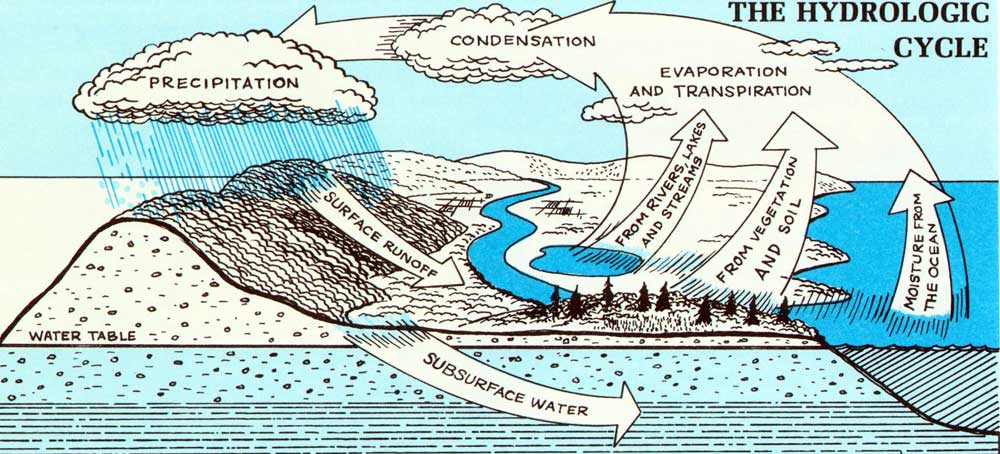
It is a complex subject that can only be summarized here. What it amounts to is that America has strayed too far from the ancient hard-won wisdom of treating flood plains with respect. It has been lulled by the achievements of engineering, encouraged by a general absence of inadequacy of State and local planning that takes such matters into account, and conditioned to a set of Federal laws and policies piece-built over a long period of time, with consequent inequities, imbalances, and loopholes that tend to emphasize structural protection at Federal expense for indiscriminate flood plain development. The re[Pg 36b]sult has been a neglect of the possibilities of flood plain management, which undoubtedly in the long run—as in the long past—will prove to be the most valuable tool for reducing these damages, for it will bring about a restriction on ill-advised and uneconomic encroachment in these streamside areas.
The reason most such encroachment is bad, with or without a dam upstream, with or without levees, is that it establishes the certainty of further and larger flood damages in the future, with the certainty of further and larger expenditures to combat them. It has been pointed out that no such thing really exists as flood control, but only a given degree of flood protection. Economics and technology dictate that reservoir capacities devoted to the storage of flood water, for example, be considerably smaller than the maximum runoff conceivably possible. This means that sooner or later there is going to be a great flood against which the reservoir or reservoirs will not suffice. If the reservoirs' presence, as is most often the case, has directly encouraged a lot of flood plain speculation and construction downstream, then the great flood is going to do more damage than was ever done before, and more reservoirs and other protective measures, most often Federally financed, are going to be demanded, at a price that rises sharply as less desirable sites and methods have to be employed, and with frequently catastrophic scenic effects. These considerations apply to small watersheds as well as large ones.
This costly cycle, which frequently makes the general public pay both in tax money and[Pg 37a] the sacrifice of amenities to protect the investment of a relatively few who profit from the wrong kind of flood plain use—in plain words, makes the public subsidize their ventures—has established itself widely. In some places, of course, certain kinds of development can take place only on the flood plain, and planning for its structural protection may be amply warranted, with equitable cost-sharing. But the difference between this sort of flood plain use and the much more common, thoughtless, quick-profit type needs to be more widely recognized and established in policies at all levels of government. The subject has been much studied. In August 1966 the findings of a distinguished Task Force on Federal Flood Control Policy, which made detailed recommendations for injecting some sense into the situation, were submitted to the attention of Congress by President Johnson. At the same time, he issued Executive Order 11296 on the subject, directing all Federal executive agencies with influence in such matters to do everything possible to discourage uneconomic and unwarranted use of the nation's flood plains. This, of course, includes the present Potomac planning effort.
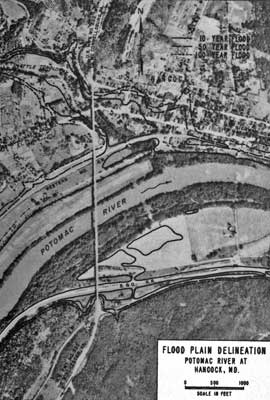
At Petersburg, there is little question that the wisest approach to present and future flooding problems would be one that would seek to give reasonable protection to the development already on the flood plain but at the same time deter further construction unless it is floodproofed or houses activities that find a flood plain location so advantageous as to be well worth the risk. In current[Pg 37b]ly available terms, this could be accomplished most feasibly and at the least net expenditure—though not, under present policy, as cheaply to the community itself as by the Royal Glen dam, and not without some notable changes in the town's landscape—by combining a levee system around present development with rigid zoning of the unoccupied part of the flood plain, or its acquisition as parkland.
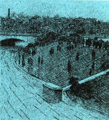
Another approach that may shortly be possible was suggested by the President's Task Force and is the subject of legislation proposed to Congress by the Department of Housing and Urban Development. Under this legislation, owners of existing flood plain residences and small businesses would be[Pg 38a] given a chance to buy Federally subsidized insurance against flood damages at reduced rates, while new construction in flood hazard areas would be subject to rates based on the full true risk involved. After 1970, under this proposed legislation, such insurance could be sold only in areas with enforceable codes and ordinances or other measures for sound flood plain management. Such a program could go a long way toward eliminating casual and expensive flood plain clutter, if it were backed up by adjustments in other phases of Federal flood control policy that would similarly place a share of any protective costs where they belong, and hence give an additional strong nudge to citizens and local and state governments to bring the situation into balance.
At Washington, because a high proportion of the flood plain on both shores is in Federal ownership and the use it is put to is determined by Federal agencies, Executive Order 11296 has special relevance in forestalling future increases in the amount of flood damage. Existing damages in the whole urban area are estimated to average $1.4 million each year. The most damaging flood in the metropolis' history occurred in March of 1936, and if a flood of the same dimensions were to strike today, it would cause estimated damages of about $21 million.
These are not small figures, though if they[Pg 38b] are considered in the light of the area's population and extent and the total value of construction there, they seem less formidable. Obviously the threat of damages of this magnitude must be dealt with, but just as obviously as at Petersburg, the manner chosen for dealing with them should not be allowed to stimulate unwise flood plain construction that would lead to still greater longterm damages.
The Seneca reservoir as proposed in 1963 provided floodwater storage calculated to reduce metropolitan damages by 46 percent. This is a significant though not startling amount of reduction, and it constitutes the most economical one-shot measure of protection that could be attained. However, if the construction of Seneca is precluded for the time being or for good, that measure is not available. Second-best, by Army calculations, would be a combination of several large multipurpose reservoirs on main tributaries farther upstream. But quite aside from other considerations of desirability, these could only be justified economically if a great part of their stored water were destined to furnish massive flow augmentation to ease pollution in the upper estuary. As will be noted in the following chapter, recent studies have raised doubt that such augmentation would be likely to help the estuary nearly as much as had been thought and it is no longer being considered a primary tool for that purpose.
This leaves passive devices and local protection works as the main available instruments for coping with floods at the metropolis. They will probably be most effective if applied in a carefully selected combination of means, with levees and other protective works installed where feasible and desirable, and backed up in other areas by zoning, flood warning systems, and good design including flood-proofing, elevated structures, and similar devices. Some of these principles of design are already being incorporated in new buildings and renewal projects, but the task of planning and locating such things as levees usefully on a flood plain containing a good part of "monumental Washington," the beauty of which is a national concern, is not going to be simple. A good program must be instituted soon, and the extent of the Federal interest in the lands involved should considerably ease the job of coordination.
Interestingly, certain floods to which Washington is susceptible can be partially guarded against only by such approaches as the ones mentioned above, and not at all by upstream dams. One of them occurred in August of 1933, when a hurricane pushed the water in the estuary upstream and raised it to flood stage at the capital.[Pg 39]


Streams have always had to carry and digest wastes that enter them through drainage from the land. It is one of their functions in the scheme of things, and so well have they performed it through the millennia that human beings have been able to take it for granted. Within limits that might be considered normal, the ability of running water to handle loads of waste is phenomenal, and in earlier times those normal limits were seldom exceeded, for even in populated areas the general lack of sanitary sewer systems kept the loads from being concentrated.
In civilized parts of the modern world, however, there are now so many people generating so many wastes of one kind and another, which often enter the streams at concentrated points, that the streams can no longer digest them without help. Too often, in the face of uncontrolled human increase and expansion, that help has either been denied them or has been weak and perfunctory. The result is plain enough now in the sorry mess of sick or dead or dying waters that we Americans have on our hands, the heritage of having kept on taking them for granted long after we had bred ourselves out of the right to do so.
As civilized rivers go, the Potomac is rather lucky. It is polluted, but many parts of it are not nearly as dirty as people are sometimes led into believing by a look at the summertime estuary at Washington. The fabled and scenic German Rhine, for instance, is much more degraded in its main flowing reaches than is the Potomac, and so are a majority of the other rivers in the northeastern United States and many elsewhere in the country. Industrialization on the Potomac and its tributaries has been spotty so far, and there are no really big clusters of population in the upper parts of the Basin. Furthermore, pollution here has already been given quite a lot of dedicated and expert attention and some rectification. Thus anyone who travels up and down the river and its tributaries finds many miles of pleasant flowing streams capable of sustaining fish and the other things that are supposed to live in and around water, and fit to soothe frayed nerves.
He will find a lot of grubby and unsoothing[Pg 40a] stretches too, extensive in places, and even in the pleasant streams troubles exist that are invisible to the eye. There is little to be complacent about, for threats are multiplying rather than fading, and some parts of the Potomac river system already need more than help; they need resurrection.
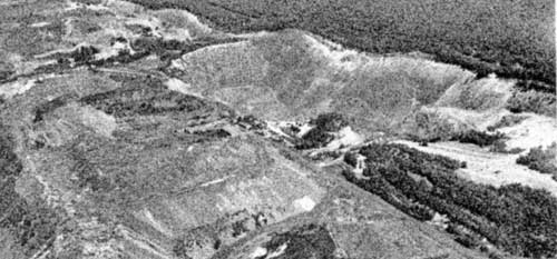
The Basin has several standard sorts of pollution, often found in one combination or another. Chemical contamination occurs along the North Branch, in areas where pesticides and other economic poisons get into the stream system, and in spots and stretches where specific industrial wastes create local problems. There is much and widespread pollution through organic wastes—often sewage solids, but not always—whose breakdown by natural processes may demand so much oxygen that a stream has little or none left over to maintain aquatic life and "stay alive."
Sometimes associated with organic wastes and sometimes entering the river system otherwise are dangerous bacteria, and also the so-called "nutrients"—dissolved fertilizing agents that can stimulate excessive growth of algae or weeds in the water to the detriment of other forms of life, often to such a degree that these plants' death and decay sets off a whole new cycle of oxygen demand. And there is sediment washed off the land, which clouds the water and settles out into a smothering cloak on the bottom, building up in quiet stretches into ugly and damaging mud banks and shoals.
Pollution of the Potomac begins at or near its traditional source, the tiny Appalachian[Pg 40b] spring at the head of the North Branch where in 1746 Thomas Lord Fairfax's surveyors set an inscribed stone to mark the northwestern corner of that possessive nobleman's vast holdings. Abandoned strip coal mines lie within sight of the spot, and it is doubtful that the infant river trickles more than a few yards before receiving its first injection of the acidic mixture of substances that springs and seeps and runoff water extract from bared coal strata and the mines' spoil heaps and carry down to the streamlet they feed.

Such additions are frequent for the next[Pg 41a] 45 miles or so downstream, as the North Branch in its narrow valley swells into a mountain river with the water of brooks and creeks flowing off ridges pocked with coal mines old and new. The river and such tributaries sustain no aquatic life at all among the discolored stones in their channels.
This mine-derived pollution has been much studied but is still not well understood. Sulphuric acid is its most damaging component, but may be accompanied by iron salts and other substances also leached from materials in and around the vast coal beds of Appalachia. Some acid entered the streams there naturally, before men ever touched the coal, but it has increased to deadly proportions with widespread mining. It issues from both surface strip mines and the old-fashioned underground sort, though the latter furnish by far the most—an estimated 75 to 90 percent. The overall magnitude of the problem is indicated by the fact that the more than 60,000 square miles of the Appalachian region underlain by coal, including the Potomac fraction, contributes five to ten million tons of sulphuric acid annually to streams and rivers, a rate of production that is expected to continue for at least a thousand years.
At Westernport the North Branch enters more populated realms, and receives one of its latter big doses of acid from Georges Creek, which drains a devastated, economically depressed valley mined since very early days. This creek may be the single most unfortunate stream in the Potomac Basin, for the accumulation of raw wastes it brings down from the valley's communities is pickled rath[Pg 41b]er than assimilated by its heavily acid water.
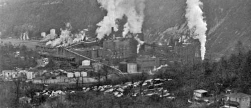
In the 40 or 50 miles below that point, the North Branch accumulates great quantities of more usual kinds of pollution as it runs down a broadening valley past towns and industries that have grown up because of the conjunction of coal, timber, water, and railways—and in the old days water transport, for flatboats used to shoot the river at high water, and later the C. & O. Canal operated upriver as far as Cumberland. Treatment of wastes in this reach is spotty and mainly inadequate. Some industries and towns sluice them raw into the dark, sad water, and others give only perfunctory primary treatment; the city of Cumberland releases the equivalent of about 18,000 persons' body wastes each day as effluent, besides extra raw wastes whenever storm runoff overloads its combined storm and sanitary sewer system and causes it to overflow. Where major efforts have been made, as at the Upper Potomac River Commission's Westernport plant below the big Luke, Maryland, pulp and paper mill, the wastes are so voluminous and complex that some of them still have to be dumped, and the effluent from even highly efficient treatment further degrades the river.
Fortunately, the North Branch, acid above, deprived of oxygen and overenriched and septic below, is not typical of the flowing parts of the Potomac river system, but it stands as a good grim example of what pollution can mean, and as a foretaste of what may be expected to happen elsewhere in the Basin if it is not stopped soon. Mine acid is not a significant problem in any streams outside of that region, but untreated or inadequately[Pg 42a] treated wastes are badly blighting many streams and rivers or stretches of them. Some smaller watercourses, like historic Antietam Creek below Hagerstown, Maryland, have deteriorated under the influence of discharges from single or limited sources, while larger ones suffer from a cumulative waste buildup in areas of concentrated population or industry. Some twenty miles of both industrial and municipal pollution in the South River Branch of the Shenandoah's South Fork below Waynesboro, Virginia, have done much damage to that legended river for a good distance downstream, a situation that is worsening with the area's growth. On the North Fork of the Shenandoah similar effects have been wrought by heavy organic loads from poultry processing and other things. The list could be extended: aside from a few happy exceptions like the prized Cacapon, draining rugged, forested, thinly peopled hill country, nearly all the Basin's flowing streams of any size receive damaging loads of waste from towns and industries.
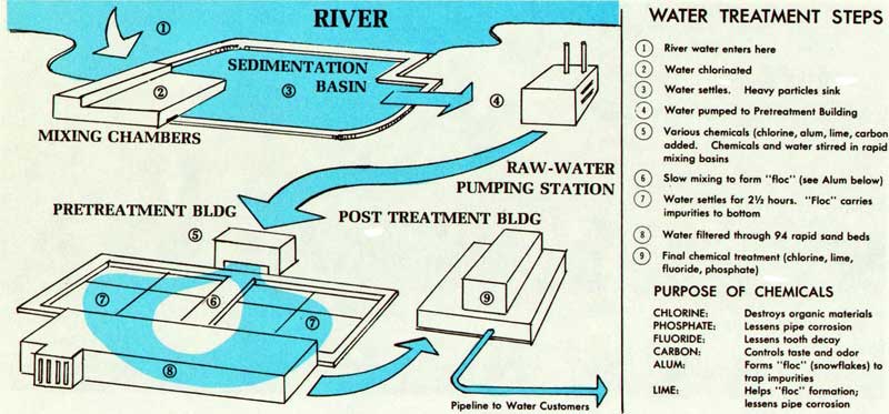
| (1) River water enters here |
| (2) Water chlorinated |
| (3) Water settles. Heavy particles sink |
| (4) Water pumped to Pretreatment Building |
| (5) Various chemicals (chlorine, alum, lime, carbon) added. Chemicals |
| and water stirred in rapid mixing basins |
| (6) Slow mixing to form "floc" (see Alum below) |
| (7) Water settles for 2½ hours. "Floc" carries impurities to bottom |
| (8) Water filtered through 94 rapid sand beds |
| (9) Final chemical treatment (chlorine, lime, fluoride, phosphate) |
| CHLORINE: | Destroys organic materials |
| PHOSPHATE: | Lessens pipe corrosion |
| FLUORIDE: | Lessens tooth decay |
| CARBON: | Controls taste and odor |
| ALUM: | Forms "floc" (snowflakes) to trap impurities |
| LIME: | Helps "floc" formation; lessens pipe corrosion |
The basic and usual damage comes from oxygen depletion. A stream has a natural capacity for hastening the decay of organic wastes, which is determined by such things as the volume of its flow, the pollution already in it, its velocity and depth, and its temperature. When that capacity is exceeded, as we have noted, too much of the stream's oxygen is used up by the process of decay and the stream, which is an intricately complex work of living things, begins to die. Under really bad conditions, the waste solids themselves cannot all be assimilated, and hence may build up in layers of stinking[Pg 42b] sludge at the bottom of the stream and continue to seize available oxygen for a long time thereafter.
Conventional waste treatment, in plants built by towns or by industries whose raw materials are animal or vegetable in origin, is aimed at removing the solids in the wastes and reducing the bio-chemical oxygen demand—called B.O.D. It is a speeded-up version of the same process of purification that goes on normally in any stream when loads are not too heavy. "Primary" treatment removes such solids as will readily settle out and passes the rest on back to the stream as part of the effluent. "Secondary" treatment plants, after settling out the gross solids, speed up decay by furnishing air to the bacteria that eat up dissolved and finely suspended materials; a good secondary plant, under much more skillful supervision than is usual, can get rid of 85 or 90 percent of the organic materials and the associated B.O.D. by the time it turns its effluent into a stream. How damaging that effluent will be depends on a number of things, chief among them being the size and condition of the receiving stream and the volume of organic materials that went into the treatment plant in the first place. A riverside town of 1000 with a secondary treatment plant operating at 75 percent efficiency is going to inflict on its river a daily load roughly equivalent to the raw sewage from 250 people.
Over the years a lot of hard effort, notably on the part of the Interstate Commission on the Potomac River Basin, has resulted in some degree of treatment for about 85 percent of all municipal wastes and 83 percent of those[Pg 43a] produced by industry along the Basin's flowing streams. Put in another way, by INCOPOT calculations the total waste load imposed on the Potomac is only about three-quarters of what it was in 1956, despite a population increase of nearly a fifth.
That it is still much too high in many parts of the upper Basin does not require elaborate instruments to detect, but only a nose and a pair of eyes. A very few industries and towns are still dumping raw wastes, and many of the others need better and bigger sewers and treatment plants or better operation of the plants they have. Sewage collection systems are sometimes of the old-fashioned combined type, like Cumberland's—and, as we shall see, like Washington's—which have to carry storm runoff as well as wastes, and overflow during rainy periods, releasing heavy pollution without treatment. But even separate sanitary sewers are often overloaded by having to serve greater populations than they were designed for, which means that their escape valves may leak raw sewage more or less continuously into surface watercourses and that the quality of treatment given the sewage that does reach the treatment plant signifies less than it ought to.
Antiquated or overloaded treatment plants cause much trouble. Old primary plants too small for present populations often remove only about a third or less of the organic material, but by their very existence they tend to lull communities into a false conviction that they are doing their part toward clean rivers. Tiny plants of the sort authorized locally for new leapfrog subdivisions and vacation col[Pg 43b]onies are usually doomed to restricted efficiency by their very size. These often are underdesigned even for initial loads, let alone for the growth that comes later, and most of them are poorly run.
This question of operation is crucial. A new, well-designed, expensive plant in slovenly or inexpert hands—a frequent paradox—can put out a much greater waste load than a well-operated old one. The plant at Romney, West Virginia, on the lower South Branch, the best example of responsible operation in the Basin, is old, but because it is well run it usually achieves about 92 percent elimination of B.O.D. in comparison with the 75 percent or even less that some newer and more imposing plants can claim.
The reasons for poor operation are various. One is a shortage of qualified operators, based on a need for better salaries, more training programs, and rigid mandatory State certification of operators' abilities. Another reason can be a pinchpenny attitude on the part of municipal authorities toward sewage treatment. It is one sizable expenditure whose results cannot easily be pointed out with pride to local taxpayers at election time, for its main effect is usually downstream from the municipality itself. Thus the big encompassing reason for bad plant operation—cutting corners, refusing to spend what needs to be spent, failing to supervise—has to be called philosophical. It comes from a failure on the part of local operators and authorities and much of the public to comprehend the immorality of deliberate avoidable pollution, and it may mean that municipal operation of[Pg 43c] treatment plants is itself often a major source of trouble.
A clear example of this philosophical deficiency is one large Basin treatment plant that was reported to have "handled"—i.e., properly disposed of—a third less sewage sludge in 1965 than it had in 1960, despite a large increase in the population it serves. The unhandled sludge, of course, went straight into the local river for reasons of convenience, economy, and callous indifference.
For the most part, large private industry demonstrates more responsibility in this respect than the Basin's municipalities or Federal installations. There are some miserable exceptions where individual industries dominate a locality's economy and take casual advantage of that fact. But responsible industry is concerned with public relations, and knows that a fish kill or a gray-blue stretch of blighted water downstream from its outfalls is the poorest kind of public relations to be had.
To be able to say precisely how much bad plant operation is adding to pollution in the Potomac will require exhaustive and continuous sampling and analysis of a kind that may be expected now that the Water Quality Act of 1965 is about to make itself felt through application of new State water quality standards. But experienced observers in INCOPOT and elsewhere feel strongly that bad operation does much more damage than do over-aged or outgrown facilities, though these play a big part too.
Bacterial pollution—the category of most interest from a public health standpoint—fluctuates a great deal in the Basin's flowing[Pg 44a] streams, but is heavy in most of them by current standards during times of normal flow. It may come from raw waste discharges, from treatment plants that skimp on chlorination of their effluent, or from storm runoff and natural drainage off the land and urban pavements. But before anyone can confidently say how dangerous it is to swimmers and others who make intimate use of rivers and creeks, water scientists are going to have to learn more about its measurement and classification than they presently know.
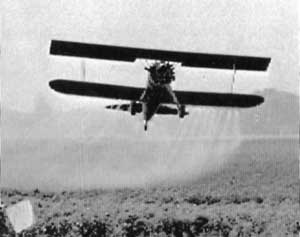
No easily applied method of testing can effectively establish the guaranteed absence of human disease germs. The traditional "Coliform Count" plays safe, as it must. It measures the concentration of certain easily spotted "indicator" organisms that do not themselves make people sick but are always voluminously present in the fecal discharges that can carry harmful germs, and it gauges the danger by the concentration of these indicators.[Pg 44b]
However, concentrations of coliform bacteria, originating in animal manure or elsewhere, may invade a stream through runoff from rural lands without having any meaningful relationship to human disease germs. Counting them under such circumstances is a little like measuring the depth of the proverbial well by the length of the pump handle. Furthermore, no one really knows how easy or how hard it may be to catch given diseases by swimming. In this country, outbreaks of leptospirosis, an illness common to man and certain animals, have been traced to swimming holes, and other links are obvious. On the other hand, some careful British investigations turned up a good many quite healthy people who habitually splashed about in sea water teeming with pathogenic organisms of one sort or another. Sea water and fresh water have vastly different qualities, but the subject is presently full of confusion, and it needs much research.
Land runoff in general furnishes a large amount of pollution of all classes, and in all parts of the upper Basin except the least-used forest sections. Besides bacteria, heavy loads of organic material may be washed into streams in regions with high densities of livestock or poultry, and some pollution of this sort is found practically everywhere. The wild and domestic animal population of the Basin above Washington has been estimated to produce wastes equivalent to those of about 3.5 million people. Much of this is dealt with by the "living filter" of the soil, but much also reaches the streams, associated with sediment from erosion producing rains. And the sources,[Pg 44c] particularly in areas such as those along the Shenandoah and the Monocacy and other streams with wide rich valleys, are numerous and diffuse.
Nitrogen and phosphorus nutrients, which foster weeds and slime in quiet stream stretches and contribute to the problems of the estuary downstream, are found in undesirable concentrations in most of the Basin's waters above the Fall Line. Not only are the growths encouraged by these fertilizing agents ugly, but they also upset the ecological balance of streams by favoring certain types of aquatic life over others, and they can cause tastes, odors, and clogging in water supply systems and sometimes, by rotting, a secondary sort of oxygen deficiency. Nitrogen and phosphorus occur in the effluent from waste treatment plants, for they are present in human wastes and in detergents, and in dissolved form are little affected by standard treatment processes. And in the upper Basin a large part of the nutrient load in streams appears to be associated with sediment from the same diffused land runoff mentioned above, for they occur abundantly in manure, in synthetic fertilizers, in certain natural soils, and in decaying organic substances of many kinds. The health and growth of living things is dependent on these elements, of course; it is their excessive release into waters that causes trouble.
From the same farming regions and even more from lawns and gardens and parks in more populated areas, pesticides and other economic poisons accompany sediment into the stream system or are blown into it as[Pg 45a] sprays and dusts. They seem not to be as great a problem in the Potomac as in some other rivers, but they are present in probably significant amounts; indicator tests hover near Public Health Service drinking-water limits in the river. Their use, here as elsewhere, increases year by year, for they are tremendously effective against many of man's ancient enemies. Being easily available, they are often used in uninformed and careless ways despite government efforts to determine and publicize safe levels of application. Knowledge about their side effects, both immediate and long-term, is still full of gaps. Badly misused, they are obviously dangerous. But information about the precise results of their ordinary use and their buildup in nature accumulates very slowly.
The persistent chlorinated hydrocarbons—DDT and its relatives—last for a long time after being released into the environment, concentrating at various points in the natural food chain and often in man himself. It is said that an average adult Californian's tissues today contain more DDT than is allowed in beef for interstate shipment. But no one is yet certain what this means in relation to that average Californian's physical wellbeing, and in terms of fish and wildlife, though the link between these materials and certain destructive changes can be seen, evidence in other cases—the declining fertility and numbers of bald eagles, for instance, which some investigators believe to derive from pesticide residues—only points toward such a link. Until all the facts are in and the impact of such poisons has been clearly restricted to the pest[Pg 45b] species at which they are aimed, they are going to continue to be a heavy concern for conservationists and others alarmed about environmental pollution, along the Potomac and elsewhere.

One of the principal Potomac pollutants,[Pg 45c] silt, not only comes from the land but is the land, most often good topsoil, washing away toward the sea. Even under pristine conditions streams are likely to run somewhat muddy after storms; it is a natural phenomenon, a by-effect of the way climate carves landscapes. On the evidence, however, the Potomac landscape since its colonization by white men has been undergoing a much more rapid carving than anyone could consider to be natural. Most of its streams, particularly in their lower reaches, are thickly opaque for long periods after rain, and gross erosion in the Basin—the amount of soil washed away from where it usefully belongs to somewhere else—averages about 50 million tons per year, a major depletion of the soil resource and a degrading influence on the landscape through erosion. The part of this silt that gets into streams cuts down on the usefulness of the water, creates ugly turbidity, chokes quiet pools and reservoirs, suffocates bottom-dwelling creatures and plants on which the streams' wholeness may depend, and rides down the current to add heavily to the problems of the estuary, into which some 2.5 million tons of it are annually discharged.

Sediment is dislodged from the land by the pounding action of raindrops and the flow of runoff, and sometimes is washed from streambanks during high flows—which may themselves be higher and more frequent because of silt-clogged channels. The bulk of it can be blamed on unsound land use. This may be rural, based in the old use-her-up-and-move-along pioneer outlook that has never died out among us despite wide understanding of[Pg 46a] better ways of doing things. People in places still overgraze pastures and clean-cut timber so that rain can get at the soil and eat it away, and they still farm land too steep to stay in place without its vegetative cover, or they plow even suitable rolling land in straight rows up and down hill so that water and soil sluice away together down the furrows when it rains. Despite a sharply effective three decades of work and public education by the Soil Conservation Service and other agencies, these old practices continue in some places and cause much erosion.

Also, increasingly, bad land use involves the ways in which great machines adapt the landscape to hundreds of sophisticated purposes. The massive eatings of powered blades and scoops to get at coal and other minerals on the steep slopes of the North Branch watershed and elsewhere, add heavily to sedimentation. So do broad rights-of-way gashed out of the countryside and left bare under[Pg 46b] storms in the months before highway construction is done, and secondary roads that even when finished may be left for years or forever with denuded clay shoulders and ditches and banks that wash with every rain. And so, most particularly, do the great polygons of rolling land around the Basin's town and cities that are stripped naked by bulldozers and left sitting in that condition for long periods, while they await the erection of buildings and blocks of homes. This is occurring throughout the Basin, but most notably around Washington, where the highest erosion rates of all are found. We will take a look at its details and the reasons for it a little further along in this chapter when we examine the estuary's situation.
Except for the acid parts of the North Branch, the upper Basin's waters in most places, most of the time, can still serve the "practical" purposes to which they are put—irrigation, industrial uses, municipal supply after purification, and even the absorption and digestion of effluents from adequate, well-run treatment plants. Most of the streams are usually good to look at, especially in conjunction with the superb rural landscapes against backgrounds of wooded mountains that are characteristic. They furnish much pleasure to fishermen, hunters, boatmen, swimmers, picnickers, and other folk, though in some places it is an open question, as we have seen, whether or not contact with the water is prudent. And almost everywhere, aging locals can recall a time when their stream was a happier amenity than now—when it held more fish, ran clearer over stones[Pg 46c] and gravel not coated with weeds and green slime, did not have the smell it presently emanates, was colder and more copious....
Their nostalgia probably does not play them false, even though conditions in many places are better now than in the intermediate past, after modern times had settled in, but before INCOPOT and the Soil Conservation Service and such influences had begun to push for reform of the casual, anciently human ways of doing things in which present human populations can no longer afford to indulge themselves. Some of the gains that have been made are being cancelled out by growth and new types of pollution, however, and in general the flowing Potomac river system is teetering at the brink of bad trouble. It needs help.
If the flowing upper Potomac had any lingering oxygen deficiency in its lower stretches—though it seems usually not to—it would tend to rectify the lack in its turbulent eighteen-miles descent across the Fall Line, a superb natural "treatment plant." Normally it arrives at Washington charged with oxygen, but does bring down with it the part of its nutrient load that has not fertilized upstream weeds and algae, periodic waves of bacterial concentration, and a great deal of debris and silt in season.
In the broadening, slowing upper estuary, its sluggish currents confused by the twice-daily surge and ebb of tides, these materials from above are stirred in with an array of specifically metropolitan pollutants—with more silt off of the outraged urban watershed, with junk and debris of a thousand sorts, with[Pg 47a] decaying substances and bacteria from many sources, and with vast new quantities of nitrogen and phosphorus. The consequence is a weighty and sometimes spectacular pollution problem directly adjacent to the proud national capital. It is at its vivid and aromatic worst in summer, when the most Americans come there fondly to view the city and the Potomac, and when locals who want to boat and fish and swim and do the other things one does on water would make most use of the river—indeed, do make use of it in spite of everything.
Like the meek, the upper estuary inherits the earth, or at least that part of the Basin's earth that is washed downriver as silt. There are enough fine suspended sediment particles in the water of the metropolitan river to make it drably opaque most of the time, even during relatively dry spells, when heavy sand and gravel dredging helps to keep it stirred up. As the current loses force and washes back and forth with the tides, the particles settle out slowly into smothering, continually renewed blankets on the bottom, and over two centuries have accreted into great mudbanks and shoals. Channel dredging to maintain navigation has been going on since the early 19th century, about 180,000 cubic yards being presently removed each year. The dumping of the dredged materials on the marshes and long low shores has built up wide, flat, new flood plain areas around the city over the years, including the sites of Washington National Airport, Anacostia and Bolling Air Fields, and East and West Potomac Parks.[Pg 47b]
Such channel dredging has little effect on the gradual shoaling of this whole part of the river in general. Miles of formerly navigable water downstream from Memorial Bridge are now only one to four feet deep and useless for either pleasure or commercial craft. It has been estimated that present rates of deposition will within fifty years fill in the upper estuary completely to a mile or so below Alexandria, except for a river channel. The same process is at work in the tributary creek-bays that give onto the estuary, some of which have silted so heavily since Colonial Days that formerly thriving ports—among them Bladensburg, Dumfries, and Port Tobacco—are now distant from the water.
The bulk of estuarial silt comes down the main river from the upper Basin. But a heavy increment is added in the metropolitan area. Modern mechanized development of the city's hilly environs on a huge scale, continuing year by year with few thoughtful rules to guide it heretofore, has brought about erosion that on individual patches of bared land may reach a temporary rate of 50,000 tons per square mile per year, and even average rates in this area are far in excess of anything else in the Basin.
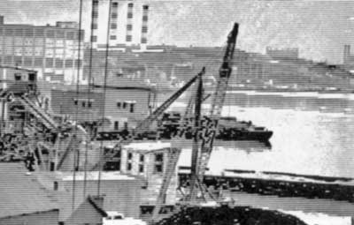
We had to examine the reasons for this rather closely last year in a study of Rock Creek's ailments, whose findings we published in a report called The Creek and the City. This much-admired metropolitan stream has been relatively well protected, with the parks along its wooded valley and an upper watershed that until quite recently remained essentially rural. But as development has pro[Pg 47c]ceeded in standard and careless ways—the wholesale stripping and scarification of big tracts of rolling, fine-textured land, the long naked wait for development—the creek has come to be muddy and ugly almost all the time and has been spewing an estimated 100,000 tons of sediment a year into the estuary, with frequent floods.
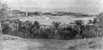
To help save the creek and its parks and to stimulate a better kind of development of the rest of its basin, citizens formed a watershed association under Soil Conservation Service auspices and brought about the construction of two small upstream reservoirs to control flooding—with results noted in the preceding[Pg 48a] chapter—and to collect silt. They sought to promote better land use as well, for the reservoirs' effectiveness is obviously dependent on their not filling up quickly with an excess of sediment. Better land use around a city depends on zoning and other legal devices to regulate the density and distribution of construction, and on controls over the way land is shaped, and a sharp conflict developed between the watershed's defenders and the Council of Montgomery County, Maryland, in office at that time, whose rezonings in favor of standard massive suburbanization and whose failure to enact sediment-control ordinances threatened the whole effort. Rock Creek has many friends, and their subsequent fight for its salvation has had good effect, though much remains to be done.
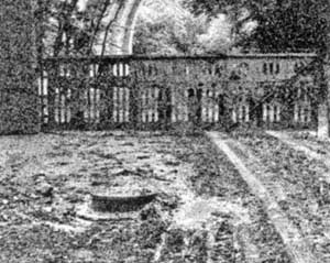
However, Rock Creek is only one of many metropolitan streams that need protection, both for their own sake and for that of the estuary. Some are getting it—in the preced[Pg 48b]ing chapter we noted the happy example of Pohick Creek in Virginia, where whole watershed planning is being accomplished almost from scratch, before development. But many more are being ruined by the steady advance of standard urban sprawl.
Thus the main cause of urban silt is faulty or nonexistent or powerless land planning, and the problem merges with the whole question of landscape preservation. The ecological principles involved in good practical land planning—the distribution of uses based on what land and water can take without being degraded and causing silt, flooding, and downstream pollution—are the same basic principles that lead to scenic beauty and a decent human environment. This is a subject we will explore in more detail when we arrive at considering the landscape as a whole, but for now it may be worthwhile to note that insofar as urban erosion and silt stem from decisions of political agencies inclined to subjugate well-known good land use principles to speculative pressures, expediency, and other things, their origin is political and economic.
Organic materials are pervasive enough in the upper estuary that during periods of even normal flow their decay pulls oxygen levels down. Under usual conditions this B.O.D. grows worse and worse downstream and reaches a peak in the neighborhood of Mount Vernon, though its effects continue to be felt below. Fish kills among the rugged resident species that predominate in these reaches of the river are not uncommon, the shoreline windrows of deceased carp and[Pg 48c] perch periodically adding their essence to what metropolitans have come to accept as the Potomac's normal summer smell. And along with the organic materials are heavy concentrations of bacteria.
The organic and bacterial load enters the estuary from many sources, most of them local, for only a little of this material comes down from the upper river. A significant amount of it issues from the network of small urban watercourses like Rock Creek. Many of these were covered over as storm sewers or troughed in concrete long ago, but they continue to serve their age-old function of draining the lands they traverse, even if through cast-iron gratings.
A good bit of the organic load in these tributaries consists of raw human waste, incongruous and particularly obnoxious around a modern city. The bulk of it is released in periodic surges when local rainstorms overload the old-fashioned combined sewer systems of the District of Columbia and Alexandria. In dry weather these systems send both collected sanitary wastes and street drainage down to the cities' respective treatment plants, but during storms when street drainage is heavy the sewers' capacity is exceeded and overflow gates gush mixed stormwater and sewage out into the streams, which carry it to the estuary.
In the suburbs, more modern separate storm and sanitary sewers are the rule, but they too have some problems of a kind we noted in relation to the upper river. Investigations on Rock Creek revealed steady dribbles of raw sewage entering the creek or its[Pg 49a] tributaries from a large number of storm-sewer outfalls and other places. Partly these flow from malfunctioning individual septic systems in outlying areas, surreptitious connections of house sanitary sewers to the storm system, breaks and leaks in sanitary sewers, and such things. Partly too they seem to come from the fact that some sanitary sewers are having to carry more sewage than they were designed to handle, so that their overflow valves leak more or less constantly into the storm sewer system. The capacity of sewage collection systems is related to planning. If a pipe is laid down to a fringe area where county zoning maps indicate only limited development is going to be permitted, its size is gauged to that kind of development. But if the zoning is changed later and three times as many houses are hooked up to the line as were originally envisioned, trouble results. Rock Creek is heavily affected by such sewage, and the chances are that the situation is much worse on many other urban drainways, for their longstanding degradation or sheer disappearance from view has lost them the alert defenders who watch over Rock Creek in its pleasant valley.
Out of the storm sewers whether combined or separate, off of the roads and streambanks and hillsides, down the urban tributaries or directly overland into the estuary, comes still another big jolt of organic and bacterial pollution every time there is a heavy rain. This is surface runoff, the washings of the street and parks and sidewalks and rooftops. Besides debris, it contains vast hordes of bacteria and many kinds of organic oxygen-[Pg 49b]demanding substances, of which animal droppings are only one easily definable example. Around a city the size of the Washington metropolis, this runoff would constitute a worrisome pollution problem even if the matter of sanitary wastes were thoroughly in control.
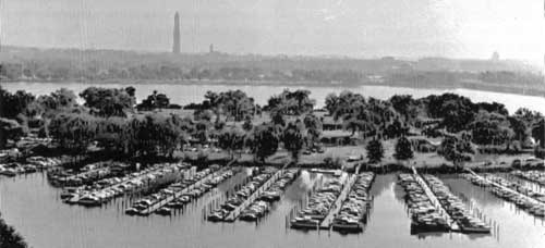
Ships and large boats in the estuary, in accordance with an unfortunately persistent nautical tradition, generally discharge toilet wastes and garbage directly into the water on which they float. Some of these are coastal or transoceanic vessels, both commercial and naval. Many more belong to the fleet of pleasure boats which have been increasing at Washington despite the water's unpleasant state to which they add their bit, degrading the element that is supposed to provide the enjoyment for which the boats were built. It is not a problem limited to the Potomac estuary, but widespread these days and the focus of much concern among public health and pollution control authorities, conservationists, and the boat and marina industries themselves.
Around the various marinas to be found along metropolitan shores—several of them Federally owned—sanitary facilities are generally skimpy, and no regulations govern the discharge of wastes from boats. Since individual marinas may berth as many as 600 or 700 craft, a great many of them in daily use during the recreation season and some inhabited as dwellings the year round, summer conditions that frequently prevail around these places are not to be described in polite terms.
Less visible at the point of origin though[Pg 50a] not in its ultimate effects is the huge organic load that comes to the estuary in the effluent of local sewage treatment plants, estimated at possibly 300 to 350 million gallons per day. There are many smaller plants strung out down both shores of the upper estuary, but four larger ones handle the bulk of metropolitan sewage. Of these, three—the main plant at Blue Plains in the District, the Alexandria plant, and the Fairfax County Westgate plant—furnish secondary treatment, and the fourth, the Arlington County plant on Four Mile Run, is on the verge of putting new secondary facilities into operation.
Yet the same problem of plant operation that exists in the upper Basin also rears its head here. A casual boat ride down the shoreline with a few excursions up tributary creek-mouths demonstrates that many of the smaller plants, including a number of Federal ones, are emitting a very low quality of effluent, and this is borne out by sanitary surveys. The proliferation of such small plants around cities and elsewhere is a headache to sanitary authorities, for their very size and numbers create a probability of trouble. Much effort is going into eliminating them and channeling the wastes they receive into the larger plants.
But the large plants themselves at this point are a much bigger part of the problem; on the basis of sheer volume, their contribution to estuarial pollution dwarfs all others. The Blue Plains plant is by far the largest of the four, handling wastes from about 1.4 million people in Washington and outlying areas on both sides of the river. By the terms of a conference convened in 1957 by the Public[Pg 50b] Health Service to investigate the sanitary state of the Potomac at Washington, the District committed itself to maintain 80% efficiency of treatment at this plant, which was then brand new. Last year, ten years afterward, the most generous recent calculation of the efficiency there was 62%, and some qualified observers expressed a conviction that Blue Plains had never consistently functioned at much over 50%—in other words, it had been returning to the estuary unassimilated organic materials equivalent to the raw discharges of a population of roughly 500,000 to 700,000 people each day. Nor do these figures include a great deal of sludge that has been flushed on into the river when digesters have failed to function properly, or the plant's frequently inadequate use of chlorination against bacterial pollution and odors. Since the same 1957 conference required of the other metropolitan jurisdictions only that they do equally as well as the main plant in quality of treatment, they have clearly not been obligated to superhuman effort.
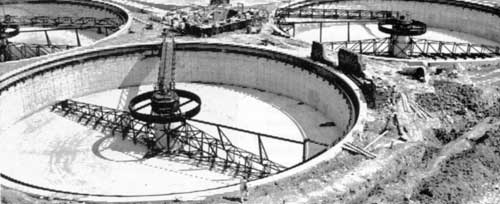
Criticism of Blue Plains is in part criticism of ourselves. Because of the distinctive relationship between the District and the Federal Government, the District's treatment plant is in a sense a Federal installation, funded through Congress and with more direct links to Federal water quality agencies than any other big municipal plant in the country. The number of people the plant serves has, of course, increased greatly in the past ten years. It may have been, as has been claimed, somewhat underdesigned to begin with, and it undoubtedly needs expansion now. Yet a rather substantial improvement in the quality of treatment there in quite recent months, mainly under the stimulus of this planning effort and the present surge of interest in the Potomac, indicates that had emphasis on low[Pg 51a] operating costs been subjugated to pride in results, the present plant could long ago have been made to function reasonably well and the estuary would have had to cope with a much lighter load of wastes.
The truly spectacular manifestation of pollution in the metropolitan Potomac is the periodic growth of algae there in summertime. When conditions are right—when sun, summer temperatures, low inflows from the river above, and a heavy concentration of nitrate and phosphate nutrients all combine to make of the upper estuary one vast inspired pool of fertility—the whole surface of the river may be covered with a thick bright emerald mat, and boats that pass at speed leave wakes of green instead of white. The infestation may extend downstream for thirty or forty miles, in various degrees of concentration, and even if the water were bacterially safe this "bloom," as it is called, would prohibit its recreational use by anyone without a strong stomach. It further disrupts aquatic life balances, and periodically dies and decays aromatically, setting off whole new cycles of oxygen depletion, fish kills, stink, and fertilization.
The problem is one of fertility, of course, and stems from the huge quantities of nitrogen and phosphorus perennially present in the water. Some of this comes down from the upper river—where, as we noted, much of it derives from land runoff—but by far the greatest part of it originates at the metropolis and enters the river through the effluent of waste treatment plants. Efficiency of operation has hardly anything to do with it, for even the best standard treatment has little effect on nutrients.[Pg 51b]
Eutrophication is the scientific name of this kind of overenrichment. It is occurring in many places, Lake Erie being the best-known single example in this country. Though its causes are mainly known, the process itself is still not fully understood, particularly in regard to the function of nitrogen and the way it works. But the other key element, phosphorus, has been more amenable to study and to possible action. It occurs in body wastes, in artificial fertilizers, as a by-product of natural decay, and very notably in detergents. Some eight tons of it are released into the estuary each day from the treatment plants in addition to the undetermined but much smaller amounts arriving from upriver, and the usual overall accumulation is enough to make the river's phosphorus content exceed that considered desirable all the way from Theodore Roosevelt Island to Quantico, Virginia, and below, which represents the general extent of the summertime "blooms."

Dilapidation begets disrespect, and the abused and often repellent waters of the upper estuary are undoubtedly subjected to much additional miscellaneous pollution by people who believe perhaps that a little more cannot possibly matter. Again, Federal or Federally connected institutions have not been setting the best possible example, and there are many of them around the capital city. Unwarranted waste discharges of one kind or another have been traced to most of the military installations fronting the river, to military hospitals, to government heating plants, to the National Zoo, to National Parks, and to similar Federal sources including the marinas already men[Pg 51c]tioned. In most cases, measures are now being taken to eliminate these discharges, but it is a commentary on the complexity and difficulty of the whole task of dealing with pollution that at the level of government where real concern with the problem has been acute for a decade or more, and furthermore at and around the very seat of that government, such practices should have persisted this long.
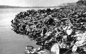
Junk and debris of all descriptions infest the metropolitan river, floating about, washing onto the shores, poking up stolidly here and there out of mudflats. Most items in a dreary inventory that might be compiled would turn[Pg 52a] out to be something that was discarded somewhere it didn't belong by someone who did not want to go to the trouble to put it where it did belong. Therefore, the main source is undoubtedly simple disregard for the sensibilities and rights of others, multiplied and complicated by the immense number of people in the metropolis and the wide territory they occupy. In our study of Rock Creek last year, some powerful subsidiary reasons for the prevalence of debris turned up also, ranging to streetcleaning methods and the inconvenient hours kept by some public dumps where citizens have to carry their larger trash. Metropolitan problems are seldom simple, and many of them in one way or another manage to inflict a part of their complexity on the river at the national capital, which is sad but possibly appropriate in a time like the present.
Downriver from the main effects of the metropolitan complexities, the widening brackish and salt portions of the Potomac estuary form a generally healthy body of water, though changes loom as the metropolis moves inexorably outward from its center and as hitherto remote Tidewater areas are brought more and more under the influence of modern ways of being. Localized problems of pollution point to general dangers that will certainly materialize unless safeguards are set up in time, for estuaries are delicate, immensely productive, and still somewhat mysterious aquatic environments that have been and still are too much taken for granted.

Rapid human intrusion on estuaries during[Pg 52b] the past twenty years has been making apparent their phenomenal value in a natural condition. Vulnerable, attractive to diverse interests that work their beds for sand and gravel and fill in their marshes for development and casually pollute them, they have recently been called America's most endangered natural habitat. They are almost unbelievably fertile places, with involved biological cycles that can convert the fertility into usable food at rates per acre far exceeding those of the finest farm land; in terms of money, one recent[Pg 52c] set of experiments indicates the possibility of attaining an annual shellfish production on tended beds worth over $26,000 an acre.
Furthermore, aside from the direct harvest of this wealth from estuaries each year by commercial and sport fishermen, these in-between waters make an indispensable contribution to the entire Atlantic coastal fishery, an industry worth a billion dollars a year. The reason for this is that at least 70 percent of coastal fishes spend some essential part of their life cycle within an estuary—spawning there, or passing through on their way to spawn in running fresh streams, or moving in as fry from the rivers or the open sea to find a "nursery" in one of the varied estuarine habitats—bays, marshes, sandy shorelines, mudflats, tidal creeks, or weed beds.
The oysters from the famous beds in the Saint Mary's River off of the lower Potomac are mainly condemned as unfit for consumption because of local sewage pollution, and these beds are not the only unfit ones, for towns and resorts in the region have been growing and sanitary facilities have not been keeping pace. Already some arms of the superb natural harbors formed by the tributary creeks are noxious with discharges from boats at big marinas, and gravel dredging is stirring up silt to smother bottom life, including shellfish. As Tidewater agriculture revives and modernizes, pesticides and artificial fertilizers are coming to be as much a part of the scene there as in other farming regions, and may be expected to influence the estuary—in fact, they undoubtedly already are doing so in subtle ways with effects not yet apparent.[Pg 53a]
Yet most of this part of the river is still beautiful and continues to yield good harvests of seafood. The Potomac River Fisheries Commission has been alert to obvious dangers and has moved against them where its powers have permitted, and natives of the area are increasingly alert in protecting the estuary. Many of them depend on it for a living, most are oriented toward it for their pleasures, and until lately a good many of them counted on it for transportation. In a number of different ways, it matters in their lives. And that fact offers some hope for the future, especially if it is fostered and strengthened by overall protective measures.
Two main general approaches to water quality improvement exist: treatment of pollution at its source or occasionally after it has entered a stream, and augmentation of the stream's flow to help it assimilate loads of waste beyond its natural capacity. A third possibility in certain situations is the diversion of wastes out of a stream's drainage entirely. In practice, these methods can be varied and combined in any number of ways to fit a need.
To take the last one first, diversion of whole wastes as received from their sources is a total and dramatic means of coping with a pollution problem stemming from collectable wastes, but it often has disadvantages. One of these, of course, is the possibility that the pollution problem may be simply transplanted elsewhere—that the water in which the wastes eventually end up will suffer. Another[Pg 53b] is loss of water from the stream system. If, as is usual, a town gets its water out of the local river or a tributary and does not give it back after use—preferably well cleaned up—other users downstream are not going to have as much water available to them, and the essential processes and ecology of the river itself may suffer.
The only place such wholesale diversion of wastes has been seriously considered in the Potomac Basin is at metropolitan Washington, whose sewage could feasibly be piped across Chesapeake Bay and the Delmarva peninsula and well out into the Atlantic—possibly, as has been suggested, in combination with sewage from Baltimore. It would be a permanent means of disposal, but very expensive in terms of both investment and operating costs. Furthermore, though in the estuary no downstream users would suffer a loss of water supply, the water content in metropolitan sewage has at times risen as high as 80 percent of the flow of the river above the upstream intakes. The effects of such a subtraction of fresh water on the estuary itself—changes in flow, and in the penetration of salt water upriver, with an inevitable alteration in valuable fisheries and the whole balance of aquatic life established through millennia—could easily turn out to be disastrous.
Standard treatment of pollution at its source consists of the primary and secondary processes we have glanced at, sometimes adjusted to specific industrial wastes. It has to be brought up to peak efficiency along the Potomac, for this is a "known factor" of great[Pg 53c] significance. Plants can and must be improved physically where necessary, and qualified operators provided for them. Collection systems have to be improved or enlarged in many places. Diminutive plants, doomed to inefficiency by their size and the financial impossibility of hiring expert workers for them, need to be eliminated in favor of regional waste collection and treatment facilities, which are quite feasible, particularly in the watershed units of the upper Basin.
Even so, it has emerged clearly to view in this Potomac study that standard treatment alone is no longer an answer in areas of concentrated or continuous population and industry, where the leftover wastes and the nutrients in the effluent from even well-run standard plants can often add up to a killing load for water.
Total diversion of treatment plant effluents is sometimes possible, but is subject to the same objections that apply to total diversion of untreated sewage—possible pollution of the receiving water (such as Chesapeake Bay or the lower Potomac estuary, both of which have been suggested and considered for Washington's effluent) and the alteration of hydrological and ecological conditions. Modified forms of effluent diversion, however, may offer more promise.
Effluents from maximum standard treatment processes, for instance, can be injected into underground strata as recharge water for aquifers—a process mentioned earlier as one alternative in the emerging package of water supply techniques—or may be spread over the surface of large areas of rural land[Pg 54a] where they serve as irrigation water and fertilizer combined, as well as soaking down into underlying aquifers. For large scale, sustained use, both of these practices still offer some technical difficulties—algae buildups that interfere with percolation, odor problems, limited aquifer capacities, the large amounts of land required for spreading, the effect of rain and freezing weather, and such things. And where the aquifers in question do not feed the original source stream system, a big subtraction is again involved. But for certain conditions in certain places these problems are undoubtedly going to be worked out.
A more modest but highly useful modification of effluent diversion is the spacing of treatment plant outfalls at intervals for a long distance downstream from a treatment plant. If nutrient and organic loads are not tremendously heavy in relation to the size of the receiving stream, this procedure can help to assure that no one stretch gets too strong a dose of them. It is likely to find good use in the Potomac and elsewhere, though only as an adjunct to the best available treatment.
"Advanced treatment" and "tertiary treatment" are becoming common terms nowadays. They refer to any of a considerable array of additional or intensified processes aimed at attaining levels of purification that would have cost an impossible price a few years ago. Most of them are still experimental and often still expensive, and they involve everything from filtration through powdered coal to flash distillation, with still others in prospect. Some bypass conventional treat[Pg 54b]ment and deal with whole raw wastes. More build on conventional treatment and are designed to remove nutrients and residual organic material from its effluents. Of these latter approaches, at least one, involving lime precipitation and other processes to remove nearly all phosphorus and most remaining organic material, is nearing a stage of development and economy that may warrant important use. It will be applied first at the new Piscataway treatment plant of the Washington Suburban Sanitary Commission in Prince Georges County, Maryland, which will also incorporate research and demonstration projects in nitrogen stripping and other things.
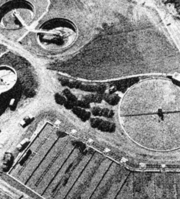
In the long run such advances offer the main hope of clean water for a superpopu[Pg 54c]lated future America, where volumes of wastes are going to be enormous and first-rate off-stream treatment is going to have to be the main way of handling them. Even where wastes can be collected easily for treatment, however, as in industry or in sewered populated areas, it may take a good many years to work out varied forms of advanced treatment adaptable to different sets of circumstances, at prices that communities can afford to pay—and a willingness to pay what can be paid is going to have to be a part of the long clean-up job ahead. Undoubtedly continuing research will work out such forms of treatment, but the research itself may be quite costly and no one can predict its pace.
Where waste sources are too diffuse to be channeled into collection systems—as along many agricultural streams heavily polluted through land runoff and drainage, and also in some urban situation—present tools are extremely limited. Soil conservation practices aimed at cutting down erosion—to be discussed within a few pages—tend to keep not only silt but nutrients and other substances on the land to some extent. Concentrated sources of animal manure such as dairies, poultry operations, and feed lots can be brought under some control by fencing stock off from streams and by techniques of lagooning and later field spreading, which need much wider use in the Potomac Basin. But even if these approaches were applied fully throughout the region within a shorter time than appears likely or even possible, land runoff would still be a heavy source of water degradation.[Pg 55a]
Hence it is probable that flow augmentation—sometimes called "flow dilution" or included in the broader term "flow regulation"—through the release of stored water, will be an important auxiliary tool in water quality management for a good while to come. This is not a form of flushing wastes downstream from their source and out of sight, as some opponents continue to insist, but a means of helping streams to oxygenate and decompose excess wastes by the same processes they have always used on natural and normal loads. On the other hand, neither is flow augmentation the end-all cure for pollution that enthusiasts of a few years ago claimed it to be. Its effect on slow masses of water is uncertain and probably minimal, and too much dependence on it even for flowing streams would obviously encourage neglect of the practical and moral need to keep filth and troublesome substances from getting into the streams in the first place. Furthermore, such dependence would lead rapidly to a point of diminishing returns, like the flood-plain development and protection cycle examined in the preceding chapter. Increases in populations and pollution would lead to a necessity to provide more and more augmentation of flows, with storage space in reservoirs becoming more and more expensive precisely as flood protection does. Flow augmentation is no substitute for good treatment, but a valuable adjunct.
In the record drought summer of 1966 the South Fork of the Shenandoah, heavily polluted with municipal and industrial wastes near Waynesboro, and with fertilizer, ma[Pg 55b]nure, and other substances in drainage from the rich and intensively utilized farm country through which it flows, ran very low for months. In many places it was slimy and unpleasant, and aquatic life suffered to some extent, but the picture was not nearly so dismal as it would have been if the river had not been helped out more or less by accident. The source of this help was some 2000 gallons of water per minute that the Merck plant at Elkton and the Dupont plant near Waynesboro were releasing after having pumped it out of deep aquifers and used it for cooling. If all sources of pollution had been receiving adequate treatment, this minimal dilution might not have been so badly needed to avoid the fish kills and algal stagnation and other results that would have ensured without it. But "all sources" include the problematic agricultural drainage, and for that matter the definition of "adequate treatment" is going to have to go up and up in our expansive future.
The sad situation of the smaller and much less industrialized Monocacy in the same summer underscores the point. The Monocacy flows through similar farming country and passes by a few towns. The largest of these is Frederick, Maryland, for whose approximately 40,000 people the little river furnishes water and a conduit to carry away the effluent from their average-to-good secondary plant. At times during that dry summer practically the entire flow of the river below Frederick consisted of effluent, with effects on stream life, esthetics, and the general surroundings that are not hard to imagine.[Pg 55c]
Another good example of a place where, under present conditions, augmentation could sometimes be used beneficially is at Great Falls and in the Potomac gorge below. Heavy public expenditure has protected the shore in much of this neighborhood and provided pleasant recreation areas whose main scenic focus is the violent magnificence of the river in its plunge. But the magnificence becomes a rather drab joke in dry summers when metropolitan withdrawals of water above that point shrink the river to a semblance of normal flow.
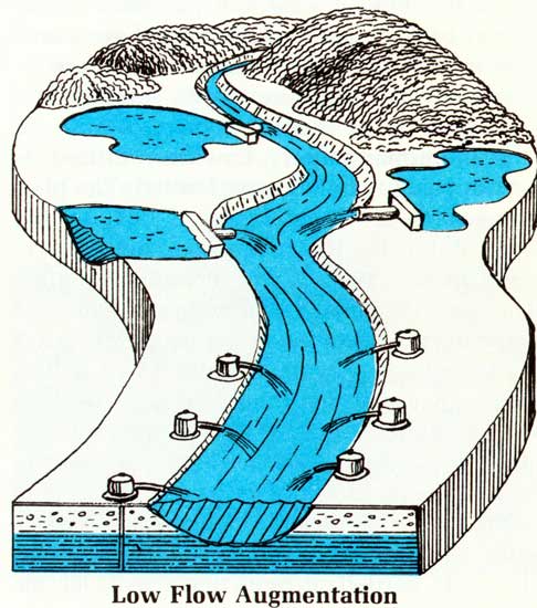
The North Branch and some smaller Basin streams also need this same kind of help and[Pg 56a] most will continue to need it even when the best economically feasible treatment of all collectable wastes entering them is ensured. It can be provided out of reservoirs, large or small, whose need for other purposes as well will keep the cost of dilution within reason. A future possibility, if research presently going on in the Basin verifies it and shows ways of putting it to use, is to employ ground water in the same way. There can be no doubt that if the flowing waters of the Basin are to be put back in good condition and kept that way under population pressures that are in prospect, flow augmentation in some places is going to be an important tool.
In the upper estuary, however, its usefulness appears to be far more limited. The plan proposed in the Army Report of 1963, in line with a Public Health Service approach emphasized in the 1961 Water Pollution Control Act, was designed to provide an eventual minimum flow into the upper estuary of 3100 cubic feet per second, or around two billion gallons per day, for the purpose of dealing with treatment-plant effluents and miscellaneous pollution. But more recent investigations have raised strong doubt as to whether such augmentation could do the job in the estuary with its huge volume of water, and its slow, tide-baffled currents that greatly lessen its assimilative capacity.
In terms of dissolved oxygen, dilution of such a body of water for quality improvement appears to decrease in unit effectiveness as the volume of dilution is stepped up, which means that past a certain minimal point of improvement it gets expensive and requires[Pg 56b] unreasonable amounts of storage. In terms of nutrients, one authority has calculated that about 20,000 cubic feet per second would be required to reduce the nutrient level in the upper estuary to a point where it would be only twice that of a normal and healthily "rich" section of the upper Chesapeake Bay. Some augmentation below the point of diminishing returns will undoubtedly be needed, not only for the estuary but to keep the river alive in its gorge above Washington during periods of low flow. But as a main tool for the metropolitan river, it will not substitute for achievement of the best possible standard treatment followed by advanced treatment and other techniques.
Obviously, just as in water supply, an ultimate cure for water quality ills is going to consist of a "mix" of solutions, different techniques being applied to the situations they are best suited to deal with, and combinations of them being worked out where combinations are what is indicated. Already the same kind of sophisticated mathematical models of given bodies of water—including the Potomac—that are being used to study solutions for water supply problems are being put to use on water quality as well, weighing the benefits and drawbacks of various combinations of means. And, just as in water supply, ultimate "hard" technology is undoubtedly going to make better solutions possible, while a strong and meaningful start is possible with the technology that is on hand.
Silt is a truly Basinwide problem. The individual tiny grains of soil that mass to sully[Pg 56c] and choke the estuary may have originated anywhere in the thousands of square miles of drainage above. They constitute an economic loss at their points of origin as well as a trouble all along their downstream course of migration.
The basic-physical ways of preventing silt are twofold and easily defined: first, the maintenance of proper land cover—vegetation or humus or mulch which blankets and anchors the soil particles and prevents falling or flowing water from dislodging them—and second, structural approaches that control the flow of water and can also serve to trap eroded material. These latter can be anything from good contour plowing practices to a major reservoir with a certain silt capacity built into it.

Such techniques are the basis of existing programs of the Soil Conservation Service and the Forest Service that have proved their effectiveness over many years of rural application. Watershed planning with small reservoirs, check dams, and terraces backed up[Pg 57a] by good land treatment and use, soil surveys, wise forestry practices, and such things are stimulated and bolstered in these programs by technical and financial assistance given to private landowners, States, and local organizations. They have already had important local effects in the Potomac States as throughout the country, but for maximum value in relieving sedimentation they are going to need much wider and more intensive application.
In modified form, they can be effective against newer and more concentrated sources of silt, while sometimes accomplishing other purposes as well. As we noted in discussing metropolitan pollution, urban land undergoing development can enormously benefit from good watershed planning. Preservation of critically erosive and flood-prone land in grass and forest, insistence on prompt re-vegetation of bared land and the use of such things as sediment detention basins by developers, the construction of small headwater reservoirs when they are needed to trap silt and reduce flooding—all these elements of watershed planning are effective not only against silt but against standard urban and suburban ugliness. The translation of rural techniques to city use cannot be literal, for both urban hydrology and urban land use are distinctive, and a good deal remains to be learned about making the techniques work better there. But their basic principles are obviously a main hope.
Other modifications of them, if put into wide practice, can cut down on the heavy production of silt by strip mines in the upper Basin; these involve both the reclamation of[Pg 57b] abandoned mines and the use of more care in scraping new ones. And application of the same principles—protective cover and detention of runoff—to new highway and road construction, as well as to the reclamation of banks and shoulders on old secondary roads, has to be achieved.
The silt already in the upper estuary, and likely to continue to be deposited there even after the best available controls may have been put into operation above, will need radical treatment. The tens of millions of tons already choking the metropolitan river, the stockpile of centuries, will have to be dredged out if the river is going to be as pleasant and useful at the capital as it ought to be, and so will the yearly additions that can inevitably be expected. This can be done if the money is available, though a considerable unsolved problem, under research at present, is where to put the silt after it has been taken out of the river, for appropriate fill sites are growing scarce.
Turbidity in the sluggish upper estuary will continue to be a problem too, for the fine particles of silt that cause it are the least affected by standard land treatment and sediment control measures. Polyelectrolytes—chemicals which when applied in quite small amounts can coagulate such suspended silt and settle it out—offer some promise as tools against turbidity and are being tried out experimentally above one of the reservoirs on upper Rock Creek, with good results thus far. Very possibly they may prove to be useful for clearing up the estuary after it has been roiled by storm runoff, and for achieving some[Pg 57c] control of murky waters around sand and gravel dredging operations. However, ironically, it has also been pointed out that until the excess of nutrients in the upper estuary is eliminated, such clearing of the water could very possibly cause a great increase in the already disastrous algae blooms, by allowing sunlight to penetrate to greater depths and foster more production of this undelightful greenery. Cleanup of pollution as complex as that evolved in the 20th century has to be across the board.
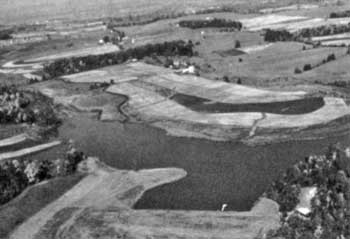
Barring a general philosophical revolution on the part of the American people, the problem of junk and debris in our waters is likely to continue and even to increase as people and their consumption of the products of the economy maintain their geometric growth. Clean rivers in themselves might deter a good many people from cluttering them thus, and so might public education, stiff fines, and the provision of better municipal pickup and dumping facilities. But mainly getting rid of such detritus is probably going to be a matter[Pg 58a] of fairly continuous gathering and disposal. On navigable waters like those of the upper Potomac estuary, ingenious collection craft under the command of Army Engineers are in prospect; elsewhere the job is likely to be more old-fashioned and laborious.
For certain remaining pollution problems, no definite full technological answers exist at present and the main hope must be to alleviate them as much as possible while pressing a search for long-run answers. Some are relatively restricted in their effects in the Potomac Basin so far, though they have some drastic local effects and some long-run implications. Certain industrial wastes not amenable to any presently known form of treatment, such as tannery discharges at Petersburg, West Virginia, and Williamsport, Maryland, are one example. So are the noxious exudations of raw sewage and garbage from ships and pleasure craft. Marinas themselves and the boats docked there can and must be connected to waste collection systems. Laws can and should prohibit discharges from watercraft in harbors and rivers. But until better means of on-board waste treatment or retention than exist at present are evolved and made mandatory, the multitudes of boats with standard toilet facilities are going to keep on causing trouble.
Other sources of trouble without clear-cut present solutions are big ones. Surface runoff from both cities and rural areas, as we have seen, causes much pollution. In the country, soil conservation measures can slow it somewhat and strain out some pollutants, and augmentation of streams' flow can en[Pg 58b]hance their capacity to oxidize the wastes. But neither of these seem likely to do much to ease the longrun buildup and diffusion of persistent pollutants like pesticides, or to avert the possibility of disastrous spills. Public education and wiser restrictive legislation may help, but the only real hope in terms of these poisons appears to be that more selective and less indestructible substitutes will be found, and all promising means of biological pest control explored. Continuing programs are focused on the problem, but it continues to be serious.
Pollutive runoff from urban areas merges with the whole question of urban sewer systems, for most of it gets to the river through storm sewers. We have seen that the old-style combined sewers of the District of Columbia and Alexandria cause gross pollution when storms force open their overflow gates, and we have seen too why the approach to this problem that formerly prevailed—the arduous, hugely expensive digging up of sewers and their replacement with dual pipes to carry storm runoff and sewage separately—is no longer considered satisfactory. For the more modern dual systems also contribute much trouble through the filthy rainwater that pours out into streams from the storm system and through the accidental or illegal channeling of sanitary wastes into storm sewers.
A wholly satisfactory answer would allow runoff water as well as all sanitary wastes to be held for full treatment at a standard plant. But when we consider that at the Washington metropolis the dirty local runoff[Pg 58c] from a single storm may amount to billions of gallons, the question of where to hold it grows a bit complex, and is leading toward experimentation with such ideas as vast subterranean networks of tunnels for storage. Partial answers might come from subjecting storm and mixed flows to different and lesser kinds of treatment by micro-screens at sewer outfalls, detention and settling tanks, and filtration beds. These possibilities and others need much investigation and testing.
Then there are the multitude of nasty mysterious dribbles that help to degrade Rock Creek and can undoubtedly be found in even more profusion along every other metropolitan watercourse. Such of them as issue from storm sewers will be eliminated when a solution turns up for the problem of runoff water. The others, and they are numerous, will not. Even if the bureaucratic and political tangles that help to perpetuate them—which will be mentioned again—are dealt with, the sheer mathematics of possibility in a great city, plus the frequent difficulty of fixing responsibility, make the overall problem of these miscellaneous leaks and dribbles a very tough one, not likely to be resolved with the wave of anyone's hand. Except in visible and well-defended watercourses like Rock Creek, they will probably persist for a long while, even though in reduced quantities, together with some storm runoff and some periodic discharge from combined sewers, not a major component in estuarial pollution but a stubborn one.
A final great contaminant against which weapons are meager is acid mine drainage.[Pg 59a] Its sources along the North Branch are numerous, as we have seen. They have been and are being minutely studied, but present technology does not furnish any clear and effective means of dealing with each source individually and returning the upper river and its branches to health, and such source rectification would be the only really adequate answer.
Surface strip mines are deservedly notorious for the destruction of the rugged green landscapes that are one of Appalachia's greatest resources. Because of the public disgust they arouse, they have had a lot of attention, and methods for conducting this sort of mining less brutally and for reclaiming old minesites have been worked out. These methods have notable effect on silt and acid production. Because State laws to regulate strip mining have been generally scarce and weak, however, and because the reclamation of old mines is very expensive, such action is mainly more honored in the breach than in the observance.
However, strip mines produce only a tenth to a quarter of acid mine pollution, and if they were all under control the problem would still be huge. The active or abandoned underground mines that give out the great bulk of the acid and other pollutive substances have so far almost totally resisted satisfactory management, despite tremendous efforts. Among techniques that have been tried are neutralization with limestone and other materials, air sealing to cut down on the oxidation that helps form the acid, sealing of mine openings to prevent outflow, mining methods designed[Pg 59b] to prevent exposure of sulfuritic materials, and chemical inhibition of acid generation. Regardless of the hope that some have aroused, none has worked well and economically, and the search is hindered by a continuing lack of data and scientific knowledge concerning the complex physical and chemical processes by which the pollutants are formed.
A number of agencies are researching this whole problem, among them the Federal Water Pollution Control Administration, the Geological Survey, the Bureau of Mines, the Soil Conservation Service, INCOPOT, and some State government bodies. Sooner or later an answer or a set of answers must come out of these efforts. But nothing presently conduces to a belief that the acid problem on the North Branch or anywhere else is going to find quick and dramatic alleviation at its sources.
Dilution of this acid pollution helps to minimize its effects, not actually neutralizing them but reducing their severity in periods of low river flow. It can be accomplished by impounding mine drainage for release only during periods of high flow, though where sources are many as on the North Branch this would be difficult. Or fresh water can be held in bulk storage for release during low flow. In helping acid conditions along the lower North Branch, therefore, the authorized Bloomington reservoir may play a part, though it will do nothing for the upper reaches of the river and the reservoir water itself will be acidic if nothing is done to neutralize it. Under INCOPOT auspices, a promising inquiry is being conducted into the possibility of instream acid removal above the reservoir,[Pg 59c] using an energy process possibly powered by electricity generated at the dam. If it works out as well as seems probable, the benefits can be huge.
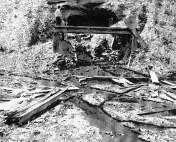
There is little point, of course, in getting the acid out of the lower North Branch unless the other pollution in that area is dealt with too. This compounded trouble, involving a considerable number of towns and industries with insufficient waste treatment or none at all, is made to order for a pilot application of the regional or sub-basin type of waste management authority mentioned earlier in this chapter. Not only is the problem on the North Branch bad enough to warrant special overall measures, but the area's topography is well suited to collection of wastes and their conveyance to first-rate centralized treatment plants. This approach too is being studied out by INCOPOT, not only for the North Branch but for other well-adapted problem watersheds such as Antietam Creek. Like similar[Pg 60a] systems in Germany that have long been admired, it would pool the resources of all sub-basin waste producers, get appropriate government funding, and subject all the pollution of a given drainage area to intensive and comprehensive correction.
Though its spread-out economic benefits are almost incalculably great, good waste management unfortunately is seldom a money-making affair for those who sponsor it. Therefore, it is not usually so much the concern of private enterprise as of citizens in general and the various levels of government that look after the citizens' desires and wellbeing. It depends on laws to back it up, and on institutions and programs established by law. These are the only machinery by which it can be adequately stimulated, unless we assume that all waste producers are altruistic to a point of self-sacrifice, an assumption which history does not encourage.
Thanks to thoroughly justified public anxiety over the state of American waters, there is presently on hand the best assortment of such legal machinery that has ever existed, much of it so new as to be mainly untested. The Key Federal item is the Water Quality Act of 1965, which established the Federal Water Pollution Control Administration and set into motion a national program to clean up interstate and tidal waters. In the program the States were allotted primary responsibility for setting standards of cleanliness and were given until June 30, 1967, to work them out and submit them to the Federal Water Pollution Control Administration for review.[Pg 60b] Later came the Clean Waters Restoration Act of 1966, which authorized funds for F.W.P.C.A. construction grants to help communities build waste treatment facilities. Programs under other government agencies are also aimed at helping towns and cities deal with wastes.
In May of 1966 the Federal Water Pollution Control Administration was transferred from the Department of Health, Education, and Welfare to the Department of the Interior, with a good many changes in personnel. A valuable move toward the longrun unity of Federal environmental study and action, this change has meant that the agency's shakedown period in its new surroundings has come during the latter part of our Potomac work, and that some large questions of policy and procedure are only now being answered. Furthermore, the fact that our study has coincided with the inevitably lengthy shaping of the State standards, and with their review and their coordination on specific interstate streams like the Potomac and its main tributaries, has somewhat blurred our view of this most significant legal machinery of all. For it is through these standards and their enforcement that the fundamental action toward a clean Potomac will be taken. The emphasis in formulating them and reviewing them has been on vast improvement, not on a rationalization of existing conditions, and behind them there is going to be legal muscle for enforcement.
Erosion and sedimentation, particularly from urban and industrial sources, will be of concern in these State programs, and in fact some Basin States already have powers for use against them that have never been brought[Pg 60c] fully to bear, but undoubtedly will be with the new impetus. At the Federal level, going programs of the Department of Agriculture—primarily under the Soil Conservation Service but also involving the Forest Service—are the best machinery we have. Their techniques of soil protection and runoff detention have been described earlier, and are often applied in a coordinated way to whole small watersheds. Mainly they are put into practice through the voluntary cooperation of landowners, watershed associations, and local or State governments, stimulated by Federal technical assistance and cost-sharing.
It was noted earlier that these techniques can also be effective against careless urban land shaping and other new concentrated sources of silt such as strip mines. But in terms of legal machinery, these areas present problems, chief among which is the matter of incentive on the part of those who must cooperate if the programs are to work. In an agricultural watershed, the effect of soil conservation practices and flood control measures on the health and productivity of the land is sharply evident to rural landowners and others in the neighborhood, who all benefit from it and usually are eager to cooperate. But strip mine operators and urban developers and road contractors and such folk seldom have to live personally with the erosion and mud and trouble that may result from the way they move earth and change the landscape. To them, sediment control and respect for the way watersheds work, even with cost-sharing, is likely to loom as simply an extra expense.
Under these circumstances, only stiff con[Pg 61a]trols are going to make watershed programs and other devices work right. Local sediment ordinances are acutely needed, but are generally lacking or inadequate or poorly enforced, perhaps mainly because silt, in common with other pollutants, has some of its worst effects at points far removed from where it originates and local governments prefer not to stir up local developers and mine operators. It is a facet of what we called earlier the philosophical source of pollution.
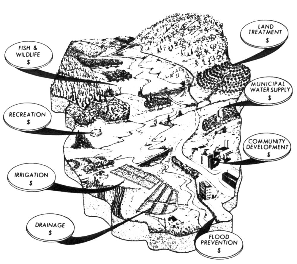
This being so, the good of the Basin and the Potomac as a whole is going to require the exercise of State and interstate and Federal power against silt as well as against other pollution, especially around populated areas, until such time as the populated areas have developed the political maturity to take firm hold of their responsibilities in such matters. Laws and ordinances of themselves solve nothing. For example, many of the pollutive dribbles along Rock Creek and other metropolitan watercourses are based in clearly illegal practices and hence slovenly inspection and enforcement of existing regulations. Others occur because of defects in the sewer system that could and should be found and repaired. A shortage of manpower is one reason for such trouble, but poor philosophy is a bigger one.
States, interstate bodies, and municipalities, however, can exert no control over an[Pg 61b]other and rather shameful set of pollution sources noted earlier in this chapter. These are the delinquent Federal installations in the Basin, generally but not always in the neighborhood of the capital, that are contributing to the river's problem. Recent publicity, much of it deriving from aspects of this present study, has been bringing about some improvement, as has President Johnson's Executive Order 11288, which directed that Federal facilities set the best example in the matter of pollution control. But the order has obviously not been obeyed with uniform enthusiasm in all quarters, defective philosophy and short waste-disposal budgets being no exclusive property of local governments. Sometimes this is because limited funds force agencies to put waste treatment far down on their list for spending, and little is left over for it. Whatever the reason in individual cases, a continuation of persuasion and enforcement by the F.W.P.C.A. within the Federal establishment is going to be essential, and Federal installations ought to be required at least to equal or excel the quality of treatment provided by other waste producers on the same streams or bodies of water. Furthermore, all the diverse pollutive activities dependent on Federal aid and cost-sharing—such as road construction, for instance—ought to be brought under similar controls.
Certain major changes in public policy are needed if different techniques of water quality improvement are to be combined in such a way as to give the most economical, appropriate, and effective protection to specific streams or river systems. The most important[Pg 62a] of these needed changes concerns the role of flow augmentation as a tool, for inclusion of water quality storage capacity in Federal reservoirs is a fairly new and uncertain practice, and some rather deep pitfalls are becoming evident.
One pitfall has to do with Federal Cost-sharing and the way it affects the freedom of choice of the States and localities on which the primary responsibility for eliminating pollution must rest. In building treatment plants to lessen the load of wastes discharged to streams, they can presently obtain Federal grants of up to 55% of the facilities' total cost. But if storage capacity for water quality—i.e., for flow augmentation—is provided in a Federal reservoir upstream, prevailing Federal policy based in a 1961 amendment to the Federal Water Pollution Control Act has been requiring them to pay nothing at all for it, though before such storage is authorized they must certify that an adequate standard of conventional treatment will be maintained downstream. Obviously, if this continues to be so, when the inevitable choice comes between improving on that adequate standard by investing in better treatment, either at the beginning or later, and seeking river dilution from a reservoir, they will be forced by sheer economics toward the latter, whether or not it is the right thing to do or in an overall sense the cheapest.
Like other aspects of flow augmentation already discussed, this situation is analogous to that of flood control, where communities have to pay a good part of the cost of local protection works or of controlling flood plain[Pg 62b] development, but can get reservoir protection free. In both cases, local authorities are stimulated toward choices that are not necessarily the right ones, taxpayers in general are forced to bear the weight of essentially local responsibilities, and the public may forever lose scenic or recreational amenities of great worth. The Department of the Interior, with a central interest in the problem, is taking the lead in an attempt to arrive at a better flow-augmentation policy that will permit right choices, put costs where they belong, and make certain that at the local level where pollution takes place there is sharp incentive to do something about it.
The other main difficulty has to do with the fact that river water has many uses, which augmentation may enhance or even stimulate. Water released from above during dry periods to increase and steady the river's flow and to help it handle wastes may also help navigation and hydroelectric power generation downstream, though neither of these is any longer a main factor in the flowing Potomac. Augmentation of flow can make the river prettier and more useful for recreation, and it can have stout beneficial effects on fish and wildlife. And under present conditions it constitutes a large increase in water of improved quality for free use by irrigators and industries and municipalities, which may so burgeon as a result that increased water consumption and waste production will cancel out the water quality effects of the reservoir releases in short order.
The need here, of course, is for some agency that can solidly guarantee that water re[Pg 62c]leased for quality control will be allowed to achieve that purpose and not be diverted to other uses that conflict with it. Where a river runs within a single State, and the State's constitution permits, the State may be able to adjust its powers of control and provide the guarantee. But where more than one State is involved, as on all the main rivers of the Potomac Basin, a good forceful river basin agency is clearly needed to coordinate water supply with water demand, and to ensure that benefits and cost responsibilities of any necessary reservoirs are meted out where they belong.
In terms of legal and institutional machinery, in fact, such a river basin agency is the most basic and urgent unfulfilled need along the Potomac, for the coordination and continuing supervision of water management in all its phases—assurance of supply, flood protection, quality improvement, recreation—in the vast physical unit of land drained by the river. And because land's condition is so often influential on the quality and utility of water, the agency's concern and authority must encompass some fundamental matters of land use as well.
No clearer illustration of the potential of such a body could be found than the achievements of the present Interstate Committee on the Potomac River Basin—INCOPOT—during the quarter century of its existence. Minimally financed and staffed, granted only advisory powers, toward the cure of a vast and growing sickness, it has managed in many ways to hold the line and even to improve things on the Potomac in a time when condi[Pg 64][Pg 63]tions on many American rivers were growing drastically worse and worse. Much credit accrues to some of the Basin States as well, but without the continuing focus and hard work of the INCOPOT people, dedicated to Basin thinking, it is doubtful that State efforts would have added up to much help for the Potomac as a whole. Our present strong hope of being able to clean up the river and its tributaries and to make them what they ought to be is perhaps mainly due to this organization's efforts.
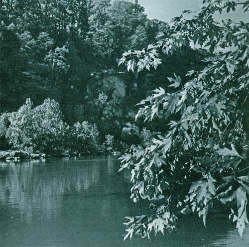
The scope of the job to be done is becoming clear. A far-reaching and well-financed Federal pollution control program is getting under way, even if some elements of policy and procedure need refinement and a great deal of research toward the best answers to certain technical problems remains to be done. The four Potomac Basin States and the District of Columbia are poised for action at the level where it will count the most, with new water quality standards to guide them and Federal money and technical assistance for fuel. At the local level, incentive to do things right has never been stronger than at present, and it ought to grow still stronger as the sticks and carrots of the Federal and State programs come into use and pressure from citizens disgusted with dirty water builds up.
Things are moving. The chances are that they will move quite fast during the next few years, as new technology and new understandings ease the way toward solution of stubborn pollution problems. They are going to have to move fast, for threats are proliferating fast as well. And if things are going to move not only fast but right in the Potomac Basin, they are going to need the guidance of a continuing and authoritative body that concerns itself with them specifically like INCOPOT, focused on Basin matters and dedicated to their study, but with a wider realm of interest and stronger powers of coordination and enforcement to make certain that the things that are done are the right things, in the right order and the right places for the whole good of the Basin and the river.[Pg 65]

Stream water comes from the surface of the land or out of its porous underlayers, then flows seaward through its creases and folds, affecting the land and the land's creatures along the way and being affected by them. Thus, as we have already noted in more than one way, the management of land and the management of water are closely intertwined, from the way human use of a flood plain may demand structural interference with a river's old habits, to the way erosive farming in some West Virginia valley may help to make it harder to navigate Swedish newsprint into Alexandria by ship.
In a like way, "practical" and "esthetic" considerations as to how both land and water are treated are not easily disentangled from each other. How much of the rising tide of public concern over American rivers and lakes, for instance, comes from an awareness of what dirtied water costs the economy, and how much is rooted in simple disgust over a monstrous ugliness that should not be? Gullied and abandoned land grown up to scrub and weeds is not only useless as it stands but also a sadness on the landscape, a reminder of how far from the naive, often sentimental, but lastingly powerful 18th century ideal of oneness with nature men have wandered in their progress. A belching factory in the wrong place can perform such multiple functions as blighting a countryside, polluting a stream, lowering subdivision property values, and increasing the local rate of emphysema.
Only lately has it begun to grow clear that in the traditional concern with market exploitation of resources, moderns have not even evolved a language or a scale to evaluate the loss to them inherent in a wrecked landscape, a spoiled stream, and such things, or the positive worth of an unspoiled section of countryside. But it is becoming obvious enough that objections to environmental destruction are not necessarily sentimental,[Pg 66a] naive, or impractical. A bit late, realization is growing that the world has a certain longstanding wholeness with which people interfere massively at their own peril. Landscape in the widest sense—the sense of the integrity of a place to look at, to be in, to use and to know and to know about—matters to human beings, and the terms in which it matters involve incentive, fulfillment, and sanity. And while human beings are soaking in this fact, the American landscape is being rapidly gutted by human activity.
A stately avenue rots to slums before everyone's eyes. A pastoral valley fills with houses gable on gable in six months' time; its stream runs red with mud, floods wildly out of banks with every heavy shower, shrinks to a foul dribble in time of drought, and finally is concreted over into a storm sewer to subdue it and get it out of sight. The stone cottage that a town's founder built with his own hands two hundred years ago gets in the path of a new highway and is pushed down, and its rubble used for fill beneath an exit ramp. What was once, when someone was fifteen, a secret clearing in the woods beyond a city's edge, may hold a hamburger stand or several dozen stacked car bodies when he comes back to seek it out at the age of twenty. A secluded section of estuarial shoreline, where eagles nest and Colonial patriarchs once brooded over the rights of man and a few families now make a living from oysters and crabs, is sold off to a development corporation headquartered in Chicago or Houston or somewhere, which, in accordance with certain current rights of man, divides it into 25-foot vacation[Pg 66b] lots with 250-gallon septic tanks, and within four years anyone who wades out of his boat there stirs up blue clouds of mellow sludge, and where did the oysters and the eagles go? We Americans are inevitably progress-minded, practically all of us, but we are beginning to wonder if progress needs to cost so much.
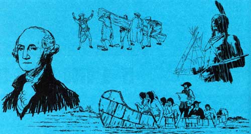
The Potomac landscape matters particularly, for certain reasons. One is that we hope to make a model of it, commencing here processes of preservation and restoration to show the rest of the country that modern ways of being need not eat up everything whole and green and old and meaningful and right. Another—not really separate, for it justifies that model status—is that the Basin's landscape, not only around the capital but far down the estuary and up along the flowing main river and its tributaries, is both physically and spiritually a national landscape, filled with national memories and meanings.
In the diverse kinds of country it holds and the ways of life they have fostered—Tidewater, Piedmont, Blue Ridge, Great Valley, and rugged Appalachia—it sums up much of the old Eastern, pre-Revolutionary America that people left behind when they shoved off toward the Ohio and the cotton South and the plains and the Rockies and the Pacific. A reasonably conscious Oregonian or Iowan or Texan seeing it for the first time knows that a part of what he is was sculptured there. Its map is textured with a richness of names[Pg 67a] that call up remembrance of what Americans used to be like and what they did, and how all of that led toward their becoming what they are today. Names of Indian tribes—Seneca, Piscataway, Dogue, Tuscarora, Anacostia—and Indian objects and activities by the hundreds. Names tied to men and events that carved history—old Saint Mary's where Calvert's Catholics came, Stratford of the Lees, Wakefield and Mount Vernon of the Washingtons, Braddock Heights, the Shenandoah, Harpers Ferry where John Brown lit a fuse, Manassas and Antietam and Gettysburg, and a multitude of others.
As time goes in the United States, the Potomac Basin has been populated by our restless people for a long while, and very little of it has not been affected as a result—the deep exhaustion of the Tidewater when the tobacco bonanza ran out, the lumbering off of the mountains, the grubby continuing reign of coal along the North Branch, and now the explosive growth of the Washington metropolis and the other centers of industry and people. But still the Basin in general is not like Long Island, swarmed upon by daily and weekly waves of millions, hard put to save even traces of the natural magnificence it once had. It is not like much of Southern California, packaged and delivered over whole to automobiles instead of to human beings. It is nine million acres or so of still mainly rural and agricultural, Eastern, temperate, humid North America with a resident population of only about 3.5 million people, some two-thirds of whom live in a relatively few square miles around Washington. It has had and still[Pg 67b] has many ardent protectors, ranging from small-town ladies' garden clubs to Presidents.
In consequence of these grateful facts, it has been able to recover from most of the damage done in the past, and much of what it has always been and always possessed still exists. There is enough natural harmony combined with diversity, enough forward human movement combined with a sense of what has gone before, to make the Basin's residents and those who visit glad to be alive in such a world, insofar as the times, their temperaments, their bank accounts, and their view of the human dilemma may permit. In general it is still a beautiful and satisfying piece of country, a good place to be.
But not all parts of it, and not for everyone, and most certainly not with any guarantee that it is going to stay a good place to be of its own accord, without any help. It is no privileged wonderland removed from the dissonance and change of a crowded technological age.
Of all the region's pleasant features, none exceeds the river system itself, for it ties the others together and shares and adds to their meanings. We have glanced at some of its "practical" aspects in preceding chapters, though even there intangibles came into consideration. It is the river's power to evoke human response and its relationship to the wholeness of the Basin landscape that most powerfully make it worth cleaning up, and also impose on planners a duty to make certain that their proposals for making it serve[Pg 67c] human ends are apt and needful ones.

A river system draining the basin it has carved out over geological eons of time is one of the more meaningful units in nature, but within it there may be great variety. The Potomac starts as a multitude of diverse trickles and oozes in the high green places of Appalachia, where spruce forests and berry meadows and bogs know the tread of bear and deer, beaver and bobcat, hunter and hiker and logger. The clear cold streamlets formed there join together in their downward rush and form strong whitewater creeks and[Pg 68a] rivers slicing down through canyons and out into the troughs of the strikingly corrugated Ridge and Valley Province, growing ever larger by the process of union and addition.
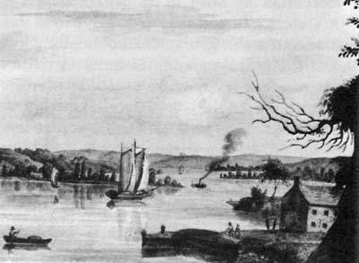
The two main rivers formed thus are the North Branch, which collects a plenitude of troubles in its progress as we have seen, and the South Branch, which is treated more gently by the farmers and small townsmen who live along it, has no developed coal resources, and is a delightful fishing stream in a fine rural valley. Coming together at Old Town where Thomas Cresap took over a Shawnee site and set up a fortified headquarters in the upper Basin's legendary days, these two form the main stem of the river, which works across the Ridge and Valley washboard by intricate slicings and loopings that shape great bends among the forested hills. Deer and turkey outnumber people in most places there, and always alongside the river or not far away lie the towpath and the[Pg 68b] dry channel and the occasional stone locks and aqueducts of the old C. & O. Canal. Despite railroad competition and floods and all the other troubles, its barge traffic in coal and flour and whiskey and iron and limestone and other things was the focus of a whole roistering way of life from Washington to Cumberland in the 19th and early 20th centuries.
Collecting the water of pristine mountain tributaries like the Cacapon and growing as it goes, cleansing itself of the North Branch's load of trouble, the river finds its way at last out of the washboard and meanders among silver maples and great sycamores across the productive populated expanse of the Great Valley that runs athwart the whole Basin from north to south. The Potomac is in thickly historic country now as it flows under the contemplative eyes of fishermen and past old villages and the relics of generations of human activity going back before written records, for here and there the funnel shapes of stone Indian fishing weirs can still be seen at shallow places and the durable fragments of their way of life can be scratched up along high shores. Of many Civil War clashes in the valley, Antietam was the most crucial; the Potomac shaped Lee's strategy there, and still ripples across fords by which his troops came to that violent place and afterward escaped it.
At Harpers Ferry on the Valley's eastern edge, the river is reinforced by the waters of its greatest tributary, the Shenandoah, rolling north out of the limestone country that fed the gray armies till Sheridan put a stop to that. Then it rams through the high wall of[Pg 68c] the Blue Ridge and out of the Valley into the Piedmont, and still gathering strength from tributaries like the Monocacy, dotted with big islands and frequented by waterfowl and good fish, moves powerfully downcountry past further mists and layers of history to Great Falls and the rushing, crashing descent through the gorge to tidewater at the capital.
From there down it is, as we have seen, a different thing, an arm of the sea and a sluggish extension of the river, shading from fresh to salt, called a river still but neither river nor sea in its ways, affected rhythmically and obscurely by both of them and subject to its own complex laws as well. In Indian and Colonial times this estuary was the part of the river that counted most for men, because of the bounty that came from its waters, the fitness of its shores for farming, and its navigability for boats and ships in a region where land travel was laborious and whose colonists depended on commerce with a European homeland. Its shores and those of the big tributary embayments—"drowned rivers," they have been called—are thickly sprinkled with traces and remembrances of three and a half centuries' people and events. Mount Vernon, old Fort Washington, Gunston Hall on Mason Neck where quiet George Mason lived and thought ... Aquia Creek where George Brent took his Piscataway bride to live apart from the Marylanders, Potomac Creek where John Smith found the river's namesakes living and another wily captain later tricked Pocahontas into captivity, Port Tobacco and Nanjemoy with memories of brokenlegged Booth, Chotank[Pg 69a] that gave its name to a whole forgotten way of life, Nomini of the Carters, the Machodocs and the Wicomico and the Saint Mary's and the historic rest.... Some of the big creeks are silted in now with mud washed down off the land in the old days, but in the flatter country toward the Bay most of the larger ones are still pretty and useful harbors for pleasure boats and for the fleets of varied commercial craft that go out to gather the estuary's crabs, oysters, clams, perch, striped bass, shad, and other edible creatures, including even eels for the European market. From hillsides, mellow mansions look down on the water that used to be their highway to the outside world, some crumbling, others proudly maintained.
Aquatic life in the upper freshwater stretches has been somewhat diminished and changed by pollution and silt, by dredging and filling, and by other activity. Runs of spawning shad and herring and perch still arrive there in spring, fortunately a season when heavy river flow keeps oxygen levels high. Along the whole estuary there is an abundance of air-breathing creatures, most noticeably birds, that reflect the wealth in its waters. They are strikingly numerous in the marshes that occur here and there next to the open river but more commonly up the tributaries, perhaps the richest biological areas in the whole river. Herons and egrets, ducks and geese, coots and grebes, hawks and ospreys and even a few bald eagles—a stirring sight so near to Megalopolis—are among the larger birds that congregate to live directly or indirectly off the[Pg 69b] life in the water, dependent on it.
Productive, healthy in its lower reaches even if under the shadow of change, its fishery intelligently and effectively regulated after the destructive and bitter "oyster wars" that persisted up into the 1950's, the Potomac estuary offers over 230,000 acres of water and some 750 miles of shoreline for human use and enjoyment and for the sustenance of a complex and valuable segment of the natural world. It is a fitting culmination of the river system that feeds down into it.
Of the Basin's remaining scenic and natural and historic wealth, nearly all of it associated to some degree with a part of the river system, much has stayed intact or has come back to good condition, accidentally or by someone's forethought. Well over a million acres are in public ownership of some kind, about a fifth of this being dedicated primarily to scenic preservation and public enjoyment as parks and recreation areas. These range from the great recently authorized Spruce Knob-Seneca Rocks National Recreation Area in the Basin's western highlands and the spectacular narrow Shenandoah National Park along the Blue Ridge, to local and county parks of smaller size and special function. In and around metropolitan Washington, good sense and good will on the part of many people in years past has resulted in a fine assortment of parks in an area where they are most needed and used, though with urban expansion more are needed all the time.
They are also harder to come by all the time. A recent and instructive example of this growing difficulty in creating public[Pg 69c] areas occurred at Mason Neck, a richly scenic and natural bootshaped peninsula projecting into the estuary not far below Mount Vernon, where George Mason's old home and a part of his estate are immaculately preserved by the National Society of the Colonial Dames of America and the Commonwealth of Virginia. The Neck has twelve miles of riverfront and 6500 acres of undeveloped land only eighteen miles from the center of Washington, and though the river here is part of the eutrophic upper estuary, often thick with algae in summer, the place is a wildlife paradise, with forests of mature and stately trees and a Great Marsh of around 1000 acres. Incredibly, bald eagles still roost and even nest there, a fact which provided the initial spark for heavy public opposition to recent proposals for residential development of the Neck.

Supported by the Potomac Task Force whenever possible, the defenders of the penin[Pg 70a]sula organized as the Conservation Committee for Mason Neck and fought its cause almost inch by inch, with many setbacks and much expense of time and energy and money, through referendum elections and political hanky-panky and high levels of government. They won; development was forestalled and the nearly certain prospect is for a large composite public holding for park and wildlife refuge use, made up of Federal, state, and regional acquisitions.

In many parts of the Basin, old human excesses that in their time were not at all beneficial or protective have contributed paradoxically to the present good condition of the landscape. After boom had lifted her skirts and moved on elsewhere from the weary Tidewater, for instance, the region's long subsequent drowse on the fringes of action and history meant that it escaped many modern troubles, at least until recently. Not very long ago, many parts of it were more easily reached by slow boat than by car or train.[Pg 70b] Partly as a result, big tracts of military land there acquired mainly when acreage was cheap—57,000 acres around the Marine Corps Schools at Quantico, Virginia, are one example—form a valuable public asset for potential future use. And throughout Tidewater here and there, old estates in private hands guard their woods and fields and shores against increasing development, though more and more each year crumple before pressure and the temptation of speculators' and developers' cash.
Similarly, after the mountains of the upper parts of the Basin were logged bare and in many places burned off in the late 19th and early 20th centuries—"Cut out and get out" was the slogan—their stripped and eroded state and their effect on the streams made it possible, and essential, for the Federal and state governments to buy up wide areas there as public forest land in the 1930's and to nurse them back to beauty and usefulness. The Shenandoah National Park dates from that same time, as do some state parks in the mountain regions. Some private owners of forest land in that area, though not enough, have taken their cue from the government agencies and seek a safe sustained yield of timber and pulpwood rather than a quick cash-in.
In many rural reaches of the Basin, for that matter, the kind of use private ownership gives the land is still an enhancement of the landscape rather than a smear on it. The beauty of farm land and pastures and old structures is as much a part of this country's heritage as is wilderness, for in its traditional[Pg 70c] forms farming has shaped a kind of wholeness and beauty all its own, blending with nature and working with it. The limestone soils in the huge trough of the Shenandoah Valley, for example, have been tilled and grazed during about two and a half centuries' occupation by white men. But for the most part agriculture there has been devoted to continuing productivity rather than to exploitation, and the rolling terrain, intersected by stream valleys and wooded ridges, has prevented much application of the massive techniques of fence-to-fence cultivation that prevail on the "factory farms" of the Midwest and West nowadays. The miles on miles of varied, carefully managed fields and pastures, with fat herds and handsome old stone houses and barns, nearly always against a backdrop of dark mountains and with a pleasant river or creek running at hand, among trees, have a potent storybook appeal that sticks in the memory of anyone who ever saw them.
The long narrow valley down which the South Branch flows is similar on its scale, as are many other arable strips and patches of the upper Basin that remember Shawnee days and Civil War guerillas. Near Washington, farms are waging a losing rearguard action against speculation and sprawl, but in the Piedmont to the north and west of the city lie some of the most pleasant rural landscapes in the United States. Up the drainages of the Catoctin and the Monocacy north of the Potomac, these are still functional landscapes, used mainly for dairy farming. In Virginia they tend to be less so, for this is the hunt[Pg 71a] country, where cosmopolitan gentry raise purebred stock on curried pastures, ride to hounds in red coats on frosty mornings and by great expenditure of money not garnered from crops or cattle have tastefully restored and maintained whole neighborhoods of venerable estates, as well as some superb old towns like Waterford, in traditional dignified beauty.
As these people have grasped—and others like them scattered throughout the Basin—most of the pull of farming landscapes and old houses and towns is nostalgic, rooted in a sense of the past and of the way the look and feel of a stone fence or a portico or a boxwood hedge can fill out understanding of people who were there long long before. This is what has been called "the scenery of association," and it is more deeply ingrained in the Potomac country than in newer parts of the nation, where "scenery" is most likely to denote the aspect of wild and natural places. With a history going back deep into the 1600's and long occupation by Indians before that, the Basin in many places has archaeological layers of such meaning. It tugs powerfully at the imagination of anyone with a sense of human continuity, and is woven in with the natural framework of things, as for instance the grove of chestnut oaks in the Bloody Angle at Gettysburg is inextricable from an awareness of the mighty rebellion that reached that far and no farther.
Most major historic sites and shrines in the Basin have received protection of one sort or another. The core portions of the great Civil War battlegrounds are owned and main[Pg 71b]tained by the National Park Service, as are Wakefield and Harpers Ferry and the C. & O. Canal and other such places. States, municipalities, organizations, and individuals have saved many others from destruction and decay and sometimes have built them back to what they were—Mount Vernon, Stratford, Gunston Hall, Fort Frederick and one or two of the smaller bastions that George Washington helped to set up against the Indians in the western Basin, and scores of other mansions and cabins and patches of historic soil.
There is still a wide sense of the past's weight among a population of whom many were born where they live and intend to die, and whose ancestors did so too. This sense is shared by many other people who move to the region, and in a few spots—mainly again in Virginia—it has led to a degree of protection for the appearance of whole towns or historic districts, as in Loudoun County with its admirable scenic regulations. Under the Historic Preservation Act of 1966, states are conducting surveys of such assets and studying means of encouraging their preservation. But funds are still short even for the Federal part of the program, and thus only individuals or accidents are still partially guarding some fine old places—Shepherdstown, West Virginia, for instance, or in Maryland the towns of Sharpsburg, Middletown, and Burkittsville—against adornment with chrome and neon and fake-stone veneer. Even in these places, some changes for the worse are taking place.
All these things, then, are a part of what[Pg 71c] the Potomac Basin has to offer in the way of environmental blessings. They form an endowment of national value and importance, and a detailed examination of them would take up more space than we can give them here, though some will come in for more discussion later in this report and others are examined in the corollary report of the Recreation and Landscape Sub-Task Force.
Some of them are in trouble now, and nearly all are faced with trouble as bad or worse if the forces of change are allowed to move as blindly and hoggishly forward as they have been moving during the decades behind us, ever faster and on ever wider fronts. The role of Jeremiah is not an agreeable one in a traditionally optimistic and forward-thrusting society, but those of us who care about the health of the world around us seem to be forced into it often in these times. Therefore let us look at somber matters.
We have catalogued the pollution of the river system and the ways in which it diminishes this most fundamental and valuable resource. We have seen how it varies through the Basin's streams according to the concentrations of people and the kinds of activities they engage in, and have noted that it is truly bad—deep-rooted, past a point of easy return—on the North Branch where coal and industry prevail, and in the upper estuary where the population is heaviest, with localized serious conditions on the Shenandoah, the Monocacy, and a number of smaller streams. And because land and water depend on each other and reflect each other's condi[Pg 72a]tion, these tend to be the places where the general environment is having the most trouble too.
Washington and its environs have always been a cynosure for American eyes, a place people have wanted to be proud of and have fought to keep "right." Many of its defenders have been powers in the land, and for a long time in the past the battle was generally a winning one. Even aside from the city's planned monumental Federal center with its government buildings, memorials, formal parks, malls and avenues—largely traceable to the ideas of Pierre L'Enfant and the sporadic respect paid them by the founding fathers—it has amenities undreamed of in and around most American cities: things like the Potomac Great Falls and gorge with the C. & O. Canal alongside, Arlington Cemetery, Mount Vernon, the Georgetown neighborhood where private taste and determination have brought a near-slum back to 18th-century grace and function, Roosevelt Island, several fine local and regional parks, the George Washington Memorial Parkway along the Potomac, and incredible Rock Creek winding down its natural valley through the Maryland suburbs and the District to the river.
Yet the rampaging growth to which the metropolis, in common with other American centers of population, has been subject dur[Pg 72b]ing the past two or three decades means not only that these pleasant places are being pressed upon by many more people than anyone thought they would ever have to serve, but also that some of them are in danger of destruction or irreparable damage, and the tone of the city as a whole has been changing for the worse. The once magnificent upper estuary, as we have seen, is afflicted with complex and ugly pollution that shuts it off from the pleasant use it might otherwise sustain, and makes it a detraction from the Federal splendor along its northern shore rather than the enhancement it used to be. In places like the Alexandria and Georgetown waterfronts, industrial dilapidation on the shorelines more appropriately matches that pollution in mood, and on the Virginia side here and there undistinguished, often jerrybuilt highrise clutter has taken the place of the calm and wooded hills toward which the capital city once could look.
Parks and open areas within the metropolis and out from it are often crowded, trampled, and belittered during most times when people can get away from making a living to visit them, and thus can furnish only a little of the quiet and elbow room that might be their main contribution to urban peace of mind. They are also subject to pressure and often damage from outside, stemming from the economics, the politics, the governing mood of restless growth. The blowtorch roar and black oily exhaust of jet airliners coming and going at National Airport, for instance, diminish and cheapen all the green space and monumental beauty so purposefully arranged[Pg 73a] along the Potomac shore. And only the bitterest kind of fight can occasionally save a park or a stream valley or the river itself from a projected addition to the spaghetti network of freeways and beltways and bridges and other high-use traffic channels along which flow swirling, never-ending currents of cars. Or from standard suburban development.
Rock Creek is a complex example of how the city threatens its own amenities. We have glanced at it already—polluted by casual spurts and dribbles of waste from hundreds of thousands of people, its basic hydrology and therefore its very existence as a stream dependent on the proper use of the rural upper third of its watershed. For it has already suffered the loss of many tributary runs and branches in the lower two-thirds during the process of solid development.
In 1966, the critical upper third of the Rock Creek basin was very nearly turned over to suburban developers as a playground for bulldozers by a lame-duck Montgomery County Council on a rezoning spree. When protests against these actions, as well as against the general degradation of the stream, culminated in the issuance of our report The Creek and the City and then in a public meeting under INCOPOT auspices, people who had long been fighting the Creek's battle became the nucleus of a revived public effort. It now appears that under a new Council the upper watershed may be developed in some accordance with the Maryland-National Capital Park and Planning Commission's protective plan for the area, so as to keep much of its surface covered with the grasses and[Pg 73b] humus through which rainwater percolates underground into aquifers that feed the creek through dry periods, and with some safeguards against the customary terrific siltation that careless development produces. And pressure has been generated to deal with the creek's other pollution, which is certain to be a long and laborious job.
Suburbanization itself is based in social forces, and this is not a sociological report. The knotted, often bitter, sometimes violent tone of contemporary American cities does not come within our province, but some consideration of it is inevitable. Not only must any planning for a decent environment—like planning for water use—take into account the needs and interest of the majority of the Basin's citizens who live in and around Washington, but it needs to be based in some understanding of the way they are. For in part the way they are is what determines the pattern of urban growth and much of the restless shifting and wandering that makes the city's people a strong influence to the limits of the Basin and beyond. In part also, however, the pattern of urban growth makes the people the way they are—it has been observed, for instance, that if suburban Americans were better satisfied with their manner of life, they probably would not spend so much of their time in automobiles getting away from it.
Within Washington itself, children may be born to erstwhile rural parents and may[Pg 75a][Pg 74] come to adult years with only a scant sense of the peace and beauty that can be found a few miles away, and often with little sense of anything else but the crumbling, teeming, stifling, noisy, sooty slums where they live—the other side of the monumental splendor along the Federal riverfront. Not all urban frustration is an outgrowth of the physical environment by any means, but much is. And this frustration, plus the pattern of exodus for some and sour jammed imprisonment for the rest, has within the past few years been killing off one by one all the special satisfactions and delights that cities from time immemorial have furnished their inhabitants.

This 26 square-mile section of the Rock Creek watershed, just above the District line in Maryland, was rural in 1913, with many small tributaries fed by springs and seeps. Ensuing development based on little knowledge of natural processes covered most of the old aquifer recharge areas with pavements and rooftops, so that more precipitation ran rapidly off the land instead of soaking in and flowing out gradually into streams. Flooding during storms and loss of flow at other times caused most of the tributaries to be covered over as storm sewers, so that out of 64 miles of natural flowing stream channels that existed in 1913 in this section, only 27 miles can be found above ground today.
Fleeing the dissonant center—or avoiding it from the start when they move to the metropolis from elsewhere—citizens who can afford it move into suburbs carved in the outlying countryside by gargantuan machinery, sometimes in compliance with a plan that preserves some trees and airy open space and a sense of the things that were, but more usually not. Here the fugitives place themselves one against the other in the hugeness of their numbers so that very quickly in many places the countryside hardly exists except in leapfrogged forlorn patches or farther out, where its ownership in speculatively held blocks—the old farm houses gone to pot, their fields in weeds or casually tilled or grazed to merit agricultural taxation—avouches the certainty of continuing sprawl. It is a much-documented process with two decades of history behind it now. It is cancerlike in its effect on the region, and disillusioning in its effect on many of those who[Pg 75b] participate, for often it forces them into the position of being mass destroyers of the very things they seek—air and wild greenery, quietness and the elbow room to be themselves.
A growing body of knowledge as to what kind of terrain can stand dense development, and what kind cannot, and how streams and woods and wildlife and even farms can be physically retained among urban populations, and why they ought to be, is becoming available. Its principles are more or less ecological, which simply means that they seek to maintain right uses of different elements of the landscape under urban conditions, in order that these elements may function with a reasonable degree of naturalness, remain compatible with one another and with human[Pg 76a] purposes, and be available for people's enjoyment. Flood plains make good hay fields or parks, for instance, but poor sites for homes or shopping centers. Porous areas that recharge aquifers ought to be kept as much as possible under vegetation rather than pavements or buildings, if people are to have streams later and not capricious drains that are better off covered over. Steep slopes, if carved severely, usually exact a later revenge. House clusters and townhouses and apartments rightly spaced and located can let the country function even while settling on it numbers of people equivalent to those who would be there if it were hacked into a solid expanse of tiny lots. And so on.
Much remains to be learned if the application of these principles is to be ideal. For example, urban hydrology—precisely what happens to the water cycle during various kinds of development, and how it might be adjusted—is a relatively new branch of study and still needs much research. But even with present knowledge, great improvement over present patterns is possible. In the hands of a few emerging experts, planning which pays attention to soils and topography and climate and special landscape features and values can be a subtle art, prescribing villages and farms and factories in the right places, making the most of native vegetation and views and places where George Washington slept and the breezes of July. Its form on a map tends toward curved lines rather than the orderly straight ones abhorred by nature.
Yet in one simple form, this kind of land use planning has been practiced for many[Pg 76b] years in rural America by millions of farmers, who have cooperated with one another to their own mutual benefit in soil conservation programs to reduce erosion and to slow down the wasteful and destructive runoff of precipitation. We noted earlier a pilot urban adaptation of such programs on Pohick Creek on the metropolitan fringe in Virginia, where an effort is being made to develop a whole stream basin in accord with soil conservation principles, not only to avoid future flood damages and sedimentation and pollution but to retain natural areas, living streams, and many of the other features the land had before the city engulfed it. Even with the gaps in present knowledge and the probability that developers and builders are not going to cooperate as fully and eagerly as farmers, it offers much hope. For it may well betide a time when urban planners in general will have the vision and authority, together with the reinforced knowledge, to subject all new development to its basic guiding precept—a respect for the way the landscape works. It is getting to be far more possible now than it was in the past to say, in relation to a given place: "This is how development ought to proceed."
In the ring of counties nearest Washington, all of them much lacerated by sprawl that has been gobbling up some 24,000 acres of peripheral countryside each year, respect for the way the vanishing landscape works has been growing by leaps and bounds. The authority to translate it into good practices, however, is much hampered by the complexities of metropolitan reality. Officially en[Pg 76c]dorsed plans exist for these counties, or for parts of them, which show quite a lot of regard for soils and topography and their appropriate use. But frequently these plans are of necessity a mass of compromises. They have had to be adjusted drastically to fit in with existing development, road networks, sewage lines, and such things, which seldom are located in accordance with an ecological ideal. They are encrusted with concepts from older plans not based in landscape principles. Differing views or interests on opposite sides of municipal or county boundary lines may gut them. Money to buy needed open space—the only way to ensure its protection—is usually short. And legal institutions that ought to be on the side of good planning sometimes get in its way.
Zoning, for example, is an indispensable tool for implementing planning, but too weak for some metropolitan situations and often too inflexible to meet certain needs. If essential open space has been protected only by zoning, astronomical increases in its speculative value may generate enough pressure on zoning boards to change the category, as happened last year on upper Rock Creek. This is particularly true in view of metropolitan plans' inevitably hodgepodge nature, which makes them somewhat arbitrary and vulnerable to attack. Bribery and personal-interest scandals often are rooted in zoning matters. Furthermore, residential zoning of the standard minimum-lot-size sort, not adapted to cluster housing and such sophistications, may actually encourage sprawl and rectilinear violation of the landscape by restricting[Pg 77a] the density of people in a place where the density of buildings and pavements is what really matters.
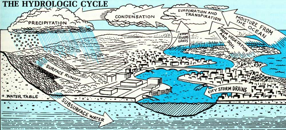
Tax systems can be troublesome in various ways—discouraging public purchase of needed parks or conservation areas because officials don't want the land to go off the tax rolls, preventing renewal of blighted areas by penalizing improvements, running farms out of business by taxing their fields as subdivision land, promoting leapfrogging and sprawl (in the case of Federal capital gains taxation) by rewarding speculative retention of tracts. And other government programs and policies at various levels work against good planning or have done so in the past, either by failing to encourage good types of land use or by actively promoting bad types. Traditional Federal mortgage insurance and home loan practices oriented toward standard suburban development are an example, and so are many highways and roads subsidized and routed by experts in higher realms of government.
With so much economic and legal muscle arrayed on the side of chaos and a whole army of enterprising folk dedicated to its perpetuation—some holding seats on planning and zoning bodies—the wonder is that the metropolitan counties have been making any headway at all with improving their planning process. And they have been, especially since they have begun to work together in such organizations as the Metropolitan Washington Council of Government. But, as elsewhere throughout America, the progress is somewhat dwarfed by the population pressures and untrammeled expansionism planning must deal with. Radical measures may be[Pg 77b] needed; there has been sober talk of counties' issuing bonds, condemning all vacant land within a wide radius of the city, and buying it up for gradual resale and development in an orderly and sensible way, thus eliminating at one stroke the speculative pressures and torsions that are the root cause of much of the trouble.
For under metropolitan conditions fee ownership, either of land or of its development rights, seems to give the only certainty of control over land's use. Obviously its potential employment by government is limited in a free economy, and such things as zoning and subdivision controls—strengthened and made rational—are going to have to continue as main tools, together with devices like scenic easements, which usually, however, again involve a form of purchase.
Fee ownership is the kind of control that is being exercised—by private interests rather than by government—in the promising "new towns," where certain individuals and groups are attempting to use industrial-type, long-term financing in the purchase and development of large tracts on which strong and careful planning, involving everything from industry to fish ponds, can be enforced from scratch. Perhaps the most famous single example of this kind of thing is Reston, Virginia, which is being built on over 7000 acres of pleasant Piedmont countryside in northwestern Fairfax County. It has aroused hope across the nation in people concerned with such things, for if private capital can go to work in this enlightened fashion and still come out with a profit, the implications for[Pg 78a] the future are enormous. Like any pioneering venture, it has run into some troubles, and it lately suffered a shift in management. But it is still being steered toward the same goal of environmental grace and decency and seems likely to arrive there.
The attractiveness of such places to people disillusioned with standard sprawl is attested by the fact that other developers, having incorporated some of the Reston techniques—some recreational water, some clustering of dwellings with communal open space between, some amenities like underground wiring—are tending to call their latest subdivisions "new towns" too. Many of them want to do things right, and if it can be proved that doing things right will pay off as well as doing them wrong, a certain amount of automatic improvement in the quality of suburbanization can be expected. However, it must be noted that the scale on which most developers can afford to operate, and the market scarcity of suitable large tracts of land even when major capital is available and the aims are noble ones, do not often give them control of adequate natural units of territory in which whole planning can mean what it should. Most such planning is going to have to continue to come from governmental bodies, and the main hope must be that it will keep improving, find stronger tools, and be reinforced and stimulated by laws and programs from higher up.
Throughout the Basin where centers of population and industry are on the jump, sprawl is also gnawing away at the country[Pg 78b]side. Given our present pace of change, many Basin towns will soon become Basin cities, and around each, if they are left to grow in the rudimentary traditional patterns, the devastation that has taken place around Washington will reproduce itself. In many places it already has a good start.
Some rural counties and small towns have developed a satellitic relationship to the larger centers of population, and even around others that are distant from urban uproar, sprawl is beginning to find a congenial form for itself in vacation colonies of "second homes" in scenic places whose remoteness, together with a smaller and more settled population of Americans, used to be their staunch protection. Under the stimulus of State and Federal encouragement, mainly quite recent and to some extent tied in with this Potomac effort, most counties in the Basin have arrived at some awareness of the need for land-use planning. In many farming communities, the seeds of this awareness were planted long since by the Soil Conservation Service. But rural folk often lack a sense of the urgency of the need, an understanding of dangers and aims under urban or semi-urban conditions, money with which to operate, and the detachment that is requisite for making right decisions.
Planning in most such places ought to be relatively simple and acceptable, for in the long run most people would be better off for it, economically and in terms of the surroundings. But it is still hard to sell to average rural and small-town populations, who have always been able to take trees, views, clean[Pg 78c] water, and elbow room for granted, and hence can maintain the staunchly individualistic view that anyone ought to be able to do whatever he likes with his land, that growth is good, and that anything that interferes with any manifestation of it is bad. Therefore, too often the planning, if any, that goes into effect before the bulldozers move in like hungry behemoths from another planet is likely to be meager and heavily weighted in favor of the easy, standard, massive sort of development that local governments close to the centers of trouble are beginning to comprehend and, in the face of immensely greater odds, to take measure against.
Though the ugliness and dreary crowded sameness with which standard sprawl replaces decent landscapes are reason enough for opposing it, other good reasons exist as well, perhaps especially in rural counties. It has been customary for local promoters of such development to celebrate the additional tax revenues that new inhabitants are going to pour into the community's coffers. But community services in such areas—things like sewage collection and disposal, water supply, trash collection, roads and streets, schools, libraries—are seldom extensive or elaborate, because they do not need to be in a rural stage of things. If a subdivider erects, however, some 1500 new homes on a patch of countryside, providing them with an inadequate supply of well water and with individual septic tanks, and then shoves along to other fields before things start breaking down and the protests start rising from the 1500 families who came there for lyrical but con[Pg 79a]venient country living, the ensuing results for the county's finances can be catastrophic.
In some parts of America already, around $17,000 worth of community services are said to be needed for every new family that moves in, a sum which from one viewpoint amounts to a subsidy furnished by taxpayers to land speculators and developers. Even assuming that those services provided by the developer are adequate, and that some aid in providing the rest can be obtained by the community through State and Federal programs—thereby passing on a part of the cost to other taxpayers—a rural county proud of its traditionally low tax valuations and of the Jeffersonian simplicity of its local government, as most are, flatly cannot dig up the remainder without a big revision of its old way of being.
In bad cases, the alternatives to digging it up may be water pollution, health hazards, siltation and perhaps floods, sour public discontent among new elements unsympathetic to Jeffersonian simplicity, and the rapid deterioration of the new suburbs into rural slums—a combination of factors that in itself may bring about drastic change in the community. Thus in one way or another contemporary rural individualism tends to bury itself, but often too late for the salvation of the woods and pastures and clear waters and human dignity it took for granted and placed so little value on.
Vacation colonies are a rather distinct consideration, for they are independent of ordinary and predictable population growth and they tend to spring up in places of special natural beauty and value. There is no reason[Pg 79b] why they should not be pleasant additions to a community or to a landscape, and a good many are—well planned in terms of both practical details and esthetic values, unobtrusive, and pretty. Unfortunately, though, this kind is not the rule, for in many spots in the Basin such colonies are a sort of haphazard mushroom growth with miserable side effects.
Local forms of this phenomenon have always been around, but have seldom been extensive enough to seem anything but picturesque. A farmer sells off a few riverside lots, for example, because he can't plow that part of his land anyhow, and is happy enough to make a little money and at the same time oblige some county-seat acquaintances who want a place to loaf and fish on weekends. So a few tarpaper shacks go up with privies for sanitation, and perhaps someone hauls in an old school bus and props it on concrete blocks for his own vacation home. Here a jolly time is had by all with full knowledge—since they are locals, aware of how things around them work—that sooner or later the river is going on a rampage and will carry away the whole little community, with small loss to anyone.
Exploitation changes the picture, however, as exploitation is wont to do. If a whole neighborhood of farmers seeks such profits, or if real estate men get into the act, or big development corporations that may be operating from almost anywhere in the country, the scale enlarges and purple prose may appear in the metropolitan newspapers to lure nostalgic suburbans out to examine an assort[Pg 79c]ment of lots sliced fine for maximum yield and priced most often according to their proximity to water. Water is usually involved, for it is the fundamental outdoor attraction, whether it is a mountain creek or a river or a made pond or a deep bay off the lower estuary. Its ultimate pollution is often involved as well, for sanitary arrangements tend to be rudimentary and inadequate for concentrations of people, especially when the "second homes" start turning into permanent homes with the retirement of their owners[Pg 80a] or their sale to younger locals. This latter process, too, sometimes leads to a future demand for schools and other services whose need was not foreseen by local governments when they permitted the development.
In some places along the estuary and the Potomac main stem and the Shenandoah, the creation of such communities has already led to wholesale, ugly, unsanitary clutter along considerable stretches of once beautiful shoreline. It is beginning to shape up even on remoter waterways like the Cacapon and the South Branch, and in some parts of the mountains. As new interstate highways and other avenue of access are opened from Baltimore, Washington, Pittsburgh, Richmond, and many other cities, the process may be expected to blight most shorelines throughout the Basin unless something is done to control it. And not only the county councils and boards of supervisors but the rest of us as well are going to inherit the problems associated with it, for these waters and shores are of more than local concern, in terms of the loss of amenity, in terms of pollution, and in terms of the quite frequent certainty of future flood damages, a demand for protection at general public expense, and possibly the loss of further amenities and resources at the site of a protective reservoir upstream.
From an abstract point far outside the boundaries of these rural counties, it is easy enough to condemn the frame of mind that lets such things take place. But the fact is that people in rural local governments and those who elect them often have even more respect and love for the landscape around[Pg 80b] them than the most esthetic of metropolitans. They may take it too much for granted, but they have grown up close to it and they can feel the loss acutely when it deteriorates. Some of the usual obstacles to their doing anything to prevent the deterioration were mentioned earlier—money is short, and so is planning know-how. Probably the greatest obstacle, however, is the matter of personal relationships. Not in terms of outright corruption, which is far more likely in the anonymous atmosphere of great cities, but in terms of the need of people in small communities to get along with one another, combined with traditional profit motives.
Suppose a local planning or zoning board is taking action to determine whether or not a big corporation from elsewhere can buy and subdivide some flood-plain land belonging to a well-liked fellow townsman, a hardware dealer whom all of them have known from childhood and with whom they will be doing business the rest of their lives. Despite the inappropriateness of the land for human occupation and the mess that is going to be established along their pretty river, is it to be reasonably expected that a voting majority of them are going to decree that a friend be deprived of a half-million dollars' profit? The dilemma is a serious one, perhaps the weakest point in the land-use control at this local level, and it may mean that higher levels of government will have to take over some of the responsibility and get local governments off the hook.
Another matter about which small com[Pg 80c]munities can seldom feel impartial is the prospect of attracting industry. With the growth of the great cities here and there, perhaps a majority of small towns are faced now with flagging agricultural prosperity, a lack of jobs, and the resultant departure—often reluctant—of most of their energetic young people for the new centers of action. The mere rumor that an industry is considering setting up a plant in such a place is likely to set off shock waves of delight and establish a general mood in which almost any concession will be offered to tempt the corporation—to the point that authorities, in some places, have issued bonds and built the requisite factory themselves.
In a good many cases, this particular cure for the community's ills has proved to be worse than the sickness, leading to total community dependence on a fallible and perhaps capricious enterprise, pollution of air and water, noise and flood-plain clutter, and frequently the destruction of the local riverside where industries tend to locate unless directed elsewhere. Little of this is necessary now, as a number of examples of responsible industry in the Basin demonstrate. But it continues, and will continue as long as communities keep looking on industry as a source of payrolls only, free of sin: "It smells like money," some residents of one Shenandoah town say of their factory's miasmal odor, though other natives phrase their description differently....
The full legacy of an older time when industry neither knew how to avoid pollution and other troubles nor saw any reason to try, and no community leaders saw any reason to[Pg 81a] bring the subject up, is found in prime fettle along the North Branch, whose pollution is a sympathetic reflection of the general state of that region's environment. Though certain industries there—most notably the huge but aging pulp and paper mill at Luke, Maryland—have managed at considerable expense to cut down on the wastes they discharge to the river, the prevalent philosophy elsewhere in the neighborhood would seem to be that both land and water are already so afflicted that no single community's or industrial plant's attempt at betterment could do much good.
This impression is illusory; people along the North Branch, as elsewhere, are aware of what has been lost. But restoration is going to be hard. In some of the deep valleys layered, stinging smog prevails through most of the year. Most of the waters are acid from far up toward their source, as we have seen, and downriver this acid is enriched with other things, a situation that has existed for so long that hardly anyone recalls when the streams were much different. Most of the villages along them have a gray and weary look, with a good deal of unemployment among the hardy people, and empty stores and houses that remember a less ramshackles time when the area's coal mines needed many workers and the air was alive with action, including old-fashioned vigorous labor strife.
High up above the towns and the dark streams, the strip-mine bulldozers and power shovels that have replaced most of the workers chew away at the green flanks of mountains named for Indian chiefs and pioneers and things that happened long ago. Where they[Pg 81b] have scraped out all they economically can and have moved on, huge gray scars and spoil heaps remain behind and ooze more acid to the streams below, as do hundreds of the old deep mines. It is a pitted and hard-used landscape, where occasional more or less ordinary farming valleys, and mountains and streams that have escaped change, stand out as strikingly beautiful in contrast.
Concentratedly typical of this landscape in general, perhaps, is the Georges Creek valley, a hundred square miles of drainage extending between two long scarred ridges from the neighborhood of Frostburg down to Westernport. Here coal has a venerable and even romantic history, for it has been mined in the valley since 1808, and the laid-out Scottish orderliness of depopulated old "Company towns"—Lonaconing is said to have been the first such in the nation—clashes with the grimy reality of what has happened in modern times.
This natal section of the river system cannot be walled away from the rest of the Basin, written off to coal and industry, and disregarded. It is integral with the rest; its troubles are Basin troubles. And if the ingrained landscape sickness compounded there by the old consumptive way of doing things, blight begetting blight, cannot be healed, scant hope glimmers through of healing the same sickness in other parts of the nation where it is even worse.
New roads and highways, regardless of what traffic they carry and where they carry it, are too often planned and constructed[Pg 81c] as gashes of destruction across the landscape and across the "scenery of association," and frequently fertilize subsidiary ugliness in the form of billboards and commercial clutter. Attempts to mitigate the worst aspects of this have had some effect, but have not been widespread or strong enough to keep up with the growing numbers of cars and the growing demand for facilities on which to operate them.

Much could be done at the local level to erase roadside ugliness—Loudoun County, Virginia, is again a shining and rare example of a place where the right thing has been done. But more of the trouble comes from higher up, for it involves the routing and design of the super-roads, and stubborn considerations of strict engineering efficiency have usually tended to prevail over esthetics and such things, despite growing objections. Regardless of their beauty as roads, the sheer quantity of strip concrete Americans require nowadays is a basic problem. It has been said that an extraplanetary observer at first glance might well conclude that this continent was[Pg 82a] populated primarily by large four-wheeled bugs with detachable brains. Certainly in many places nowadays the earth is beginning to look as if it were arranged for the bugs rather than for the brains, if that is what we humans are.
When the bugs die they go to junkyards. These many-colored necropolises occupy wide acres of land near every center of population in the region, occurring quite commonly along the main entrance highways to neat and historic towns. Their stark and extensive ugliness has made them the subject of much high-level investigation, most of which has sought to make their conversion into usable scrap metal a profitable process. Undoubtedly this will be achieved sooner or later, but in the meantime the old cars, together with a wealth of other discarded items in roadside fields and along fencelines and stream channels throughout the Basin, form a scabby legacy from the recent past, and a less esthetic "scenery of association."
Major electric powerlines and other utilities[Pg 82b] routed arrogantly with only straight-line distances in mind, up hill and down dale and with their cleared rights-of-way kept brownly dead with herbicides, can intrude starkly on the beauty and mood of historic or pleasantly natural landscapes. In the name of public service, private utility companies in all the Basin States have wide powers of condemnation as emerged to view recently when the Potomac Edison Company proposed to hack out a strip for a new line along a route that included country associated with the campaigning around Antietam Battlefield in the Civil War, without an adequate attempt to find alternative routes.
In this instance, public protest shaped up a fight against the line, in which the Interior Department has become involved because of the Federally owned battlefield and the nearby C. & O. Canal. But often elsewhere, the great skeletal towers linked by thick transmission cables march where they please, indifferent to local objections. What is certain is that modern America needs the electricity transported thus, and the gases and liquids that run through great pipelines. Hope for the long run is offered by research that may open the possibility of putting high-voltage transmission lines underground, but in the meantime what is needed is an awareness on the part of utilities planners that scenic and historic values have to be given full weight in their computations.
The kind of agriculture that has so much to do with the Basin's scenic appeal is not entirely healthy these days. We have mentioned the difficulty created near Washington—and[Pg 82c] around other Basin centers of population and in many places where vacation colonies are burgeoning—by skyrocketing speculation and a general absence of strongly based and well-defended plans of preservation. As the development value of land rises in such places, local systems of taxation based on that value rather than on actual use may drive farmers out of business whether they want to stay in or not. Since 1945 in Fairfax County, Virginia, for instance, the number of commercial farms has dropped from 1788 to about 200, and it is still going down.
Even where the tax trouble has been recognized, as in Maryland, and taxation adjusted to reality for people who want to go on farming, few tillers of the soil are devoted enough to their acres to hold onto them in the face of the kind of cash that is often dangled before their eyes, for the flat and fertile tracts that make the best farms are also the easiest to subdivide and build on in standard fashion. For that matter, the usual form of tax relief on agricultural land can be used as a tax loophole by speculators. Thus, whenever tract values rise and development impends, good productive land, which the country may well miss later as populations grow and food supplies for them thin out, goes permanently under pavements and construction. Even though it is just in such places that protected, scenic, connotative rural landscapes might have the most meaning for the most people in the long run, their preservation presents some tough questions. Patterns of growth that would spare them could easily be worked out and would fit in well with watershed pro[Pg 83a]tection and open space needs, but the economics of compensating farm owners for the loss of the big money they might have received for them is another thing.
In some other parts of the Basin, the implications of a modern unified economy are a threat to traditional farms and farming methods. Labor costs, the need for expensive machinery, superior methods of storage of foodstuffs and easy transport over long distances have put Potomac farmers into competition with other regions, even other countries, where the same products they supply can be raised on an industrial scale of investment and profit. Thus the worth of a field of tomatoes in the Northern Neck of Virginia is affected by massive irrigated production in the Central Valley of California, and thus a Shenandoah farmer may barely break even or suffer a loss on a rather good crop of wheat in the old "bread basket of the Confederacy."
Such influences, even though dulled a bit by protective State and Federal farm programs, are putting a premium on specialization, ever larger farms, and an "agribusiness" approach, with high capital and operating expenses. Their effect on many family farms in the Basin's mountain regions, places with limited acreage of marginally productive land, is severe. These may have supported the clans that own them reasonably well for a century or more, but they cannot compete with Ohio. Unless their owners are willing to keep on farming while holding down a job in town for supplementary cash, they often move away and the places go out of cultivation. Some are consolidated into grazing or forestry units or[Pg 83b] bigger farms, some stand abandoned, some go on the market as vacation retreats and "hobby farms" for wide-ranging metropolitans.
Richer regions share the troubles. In the classic valley of the Monocacy, some of whose dairy farmers have to import feed now from the Midwest because they cannot raise it cheaply enough themselves, the size of the optimum farm, one that can compete effectively in today's market, has swelled in the past few years from about 150 acres to about 600, according to a study by the State of Maryland. The problem is compounded by rising land prices influenced not by productive value but by the presence of Megalopolis just over toward the Bay. Sprawl throws a long shadow.
Eyeing this array of difficulties, many farmers' sons are prone to seek another livelihood, and the average age of the men who do the farming grows higher all the time. Tiring, many sell out, and thus the family farms that make up the greater part of the Potomac's much-loved rural landscape dwindle in number and change in use. It is not necessary to be mawkish to see this as a loss. In part it is inevitable, but in part too it may be rooted in policies that can be altered and adjusted to keep the farms productive.
Wildlife, along the Potomac as elsewhere, is dependent on whatever habitat it occupies—that is to say on the state of the landscape. If the rivers are cleaned up and kept flowing even during times of drought and heavy use of water, they will support better populations of fish and a greater variety of species. If the subtle interrelationships and[Pg 83c] the immense value of the estuary's varied nooks and crannies are recognized, studied out to full understanding, and protected—and in time—not only fish and shellfish but ducks and eagles and herons and all the other wild users of the shores and wetlands will benefit. Government refuges and other devices are badly needed for these purposes in that region, now that it is no longer remote and the kind of protection many private owners have traditionally furnished wildlife is diminishing.

Upland populations of deer, turkey, grouse, quail, raccoon, fox, and other sporting and non-sporting species thrive in parts of the Basin suited to their habits and still in good condition, and shrink elsewhere. Many stretches of private forest land could support much higher densities of game and other wildlife, if they were put in better shape by practices that are available and feasible. Of the more than three million acres of such land scattered throughout the Basin in small holdings, much is in poor condition. It is therefore[Pg 84a] but spottily productive of game or timber or anything else, and often causes high runoff and erosion in critical watersheds.
Many of the things we have called amenities here are subject to full-fledged economic uses necessary to the region's wellbeing and not usually in great conflict with scenic and ecological values if they are carried out right. Farming and commercial fishing and logging used to be generally exploitative and hard on[Pg 84b] the natural scheme of things in this country, for instance, but they no longer need to be and in most cases are not. Using the Potomac's water for towns and factories and power and navigation entails some interference with natural processes, but it does not have to be widely destructive of them. Discharge of treated wastes to streams is still necessary to a degree, and up to that degree not badly harmful, though as we have seen, it is far too often excessive.

Urban expansion is necessary also with present population pressures. It is an irreversible exploitation of the landscape, but if the type of land-use principles mentioned in this chapter were to get wider employment, urbanization would quite certainly not have to be as destructive of natural and human values as its present usual form is. The same thing is true of industry in its many manifestations, including mining, and of the woven network of roads and utilities. The public needs them, and the people responsible for them need to be aware of the great value of the natural framework within which all men must exist.

Average people's direct use of the natural world is most often of the kind summed up as "outdoor recreation," an umbrella phrase under which are lumped a diversity of satisfactions found by widely differing persons in many types of more or less natural places. Muscular hunters and elderly birdwatchers, water-skiers and bank-fishermen, Sunday drivers on crowded highways and lean backpackers on dim trails in the South Branch highlands, baseball players and people who[Pg 84c] take naps on the grass beside the C. & O. Canal, amateur archaeologists and stock-car racing fans—all these and many other kinds of folk depend somehow on the Potomac outdoors for their pleasure. They use it.
How much they use it and how much pleasure they get out of it are governed by the time on their hands, the availability of their chosen recreation, and whether it is good of its kind. A would-be hunter who cannot escape from the District of Columbia is out of luck unless his mobility improves. An Alexandria water-skier can divert himself on the metropolitan estuary during the summer months, but under ordinary conditions at present it is something less than what is known as a "quality experience," as is fishing there or any other water sport. A West Virginian has to have some time to spare if he wants to enjoy beaches and ocean breezes; so do Tidewater residents with a penchant for mountain trout fishing.
Nevertheless the Basin holds a great deal for almost all tastes, and most of what it holds is of excellent quality. The main recreational needs are fairly clear: to protect and restore the Potomac outdoors from the deterioration noted in this and earlier chapters, to spread the chance at different kinds of pleasure around as much as possible, to guard against clashes between different kinds of use and against the destruction of the quality of quiet and natural places that occurs when too many people are jammed together in them, to make the Basin's pleasant corners and shores and byways easier to get at, and—not[Pg 85a] least important—to encourage uses that contribute to appreciation and preservation, helping to make sure that in the long run outdoor recreation in this region will be possible.
People's need for outdoor activity in their spare time varies a good deal. An oysterman-crabber working out of the Yeocomico through the progression of seasons and weathers, a Shenandoah plowman turning earth his great-great-grandfather turned at the foot of the blue-green mountains, a timber cruiser in the high forests—such individuals are not as likely to need to go looking for added outdoor satisfactions as most other kinds of people, for whom ordinary life tends to be more separate from pleasure in the open air. Maybe if the cities can be brought back to health and their growth shaped to fit in better with human needs, this will change. But with more and more people coming on, more and more leisurely and affluent as technology cuts down on work, more and more urban, outdoor recreation as a specific goal is going to be an ever more important consideration in planning. It is already important—and already, as we are reminded with statistics, big business.
Recreation in and around the central city of Washington has to be a primary aim. The most people are in this area, many of them through poverty or habits of life not given to farflung pleasures but constrained to seek them where they live, or near at hand. The worst environmental threats are here as well, despite the foresight and pride that have[Pg 85b] saved much more open space and pleasant park land than most other American cities can show.
The metropolitan river has to be cleaned up and made attractive. It used to be the city's most supremely valuable amenity and potentially it still is. Measures within reach can realize much of the potential inside of a reasonably short time, so that productive and varied fishing and good boating and a beautiful wide body of water will be within strolling distance for people in the central parts of the metropolis on both sides of the Potomac, and the recreational value of the lands already preserved along its shores will be incalculably multiplied. Safe swimming and other water contact sports in the open metropolitan estuary, often mentioned as an aiming point for clean-up programs, may be a somewhat more distant future prospect. Our studies in the past three years have made it clear that pollution here is more complex and diffuse in origins than had ever been supposed, and that sources of dangerous bacteria are probably going to continue to exist for a good while despite all efforts against them. The goal of swimming is a worthy one and will probably be reached, but not quickly. In the meantime, more public pools in the City and easy transportation to public areas farther down the estuary may be required.
Some recreation areas within the city, like Rock Creek Park, presently get too much use for their own good and for people's full pleasure in them because they are superior to anything else accessible to many of the city's people. This is a local manifestation of[Pg 85c] a national problem, for even sections of the great national parks, like the one at Yosemite, are presently being battered by overuse by a generation of city-dwellers anxious to come in touch with natural and basic things. In such places, people's very numbers shut them off from those basic things and coarsen the quality of their experience. The only really satisfactory answer will be to put additional, equally attractive places within reach of the same people. In Washington this means developing other pleasant areas within the city and making it easier for the city's people to get to the other parks and natural places farther out. Improvement of the river, development of extensive new parklands along the Anacostia including the Kenilworth Dump site, more neighborhood playgrounds and swimming pools, and other such action will all help to relieve the situation, which is getting much official attention and is a specific subject in the report recently published by the Potomac Planning Task Force, the group formed under auspices of the American Institute of Architects.
The array of Federal, State, regional and county parks and other public areas ringing the metropolis will be more accessible as public transit improves. Another means to this end, and an especially organic and appropriate one, will be the urban stretches of the Basinwide network of hiking, bicycling, and horseback trails which will be discussed a little farther along.
If, as prophets reiterate, ever-increasing percentages of the American public in the future will be living in the great cities, a great[Pg 86a] deal of nature and conservation education is going to be needed if the mass of people are not to lose all understanding of natural things and all sympathy with their working and their preservation. It cannot be entirely a classroom sort of thing, no matter how many films and preserved or caged wildlife specimens may be provided. There is need now, and there will be more need hereafter, for rich nature preserves and study centers within reach of Washington and specifically dedicated to such use.
In general, suburbanites have more freedom of choice regarding the places they play in and the ways in which they play there than do people at the urban center. Many of them live fairly close to outlying parks and open areas, and if good planning gains in strength and effectiveness as the metropolis spreads, this neighborhood availability of outdoor pleasures will increase, with more Rock Creeks and Pohick Creeks to put stream-valley parks and pleasant small lakes and streams and such things within reach of everyone, and more green open space just outside people's doors. They are going to be needed, for public pressure on the available recreation areas around the metropolis is already heavy.
Suburbanites also, however, are more mobile than almost any non-nomadic civilian population in history. A great variety of things to do are within driving distance of their homes on an afternoon off, or a weekend, or a vacation. Therefore, the question of providing and improving outdoor recreation for them, as well as for more mobile[Pg 86b] residents of the central city, merges with the wider question of outdoor recreation on a Basinwide scale, for residents and visitors alike.
If the things are done that need to be done to reverse the environmental deterioration that has been the subject of so much of this report, the public's chance to enjoy widespread, high quality outdoor recreation in the Potomac Basin will be tremendously increased. Recreation and preservation are not separable subjects. If a river is cleaned up and its shoreline protected against clutter and ugliness, its use by fishermen and boatmen and others will be enhanced. If a park is established to protect a unique natural asset, people's enjoyment of that asset will be assured. Most preservation leads to more recreational opportunity; many things that are done to provide outdoor recreation afford some measure of protection for the environment as well, but the emphases are sometimes different.
Among specific recreational problems, access is a major one. For those who can afford cars, getting around the Basin grows easier all the time as roads proliferate, but getting at the agreeable things to do is hard in many places. Here and there important parts of the public lands in the National or State forests, for instance, are cut off from easy use by private inholdings. But the main amenity that is usually hard to reach is water, which happens also to be the major magnet for outdoor recreation of many kinds.[Pg 86c]
The estuary's 200,000 acres of superb recreational potential are a case in point. It has a few drawbacks that can and ought to be dealt with, like the thousands of old sunken pilings and stakes that make boating dangerous in many places, and some others that may be tougher to eliminate, like the great annual summertime incursions of stinging jellyfish in its lowest reaches, the milfoil weed that sometimes clogs its tributaries, and the erosion of its shores by winter storms. But even as it stands, it offers fishing and boating and hunting of the finest sort in its lower part, with excellent swimming higher up where salinity drops and the jellyfish cannot come—a zone whose useful length will increase upstream as metropolitan pollution diminishes. Yet along the estuary's shores, except at certain historic sites like Wakefield where types of use have to be limited, there are only two major public parks at present and very few other public areas of any size where people can launch boats, fish, camp, or merely get at the open water. Some of the great military bases there are closed to the public, while others permit limited use.
The main stem of the flowing Potomac is parallelled on the Maryland shore by the C. & O. Canal in Federal ownership, a unique resource. But the bulk of the land between the canal and the river—7200 acres out of 10,000—is privately owned. Along most of the 120 miles where the canal property touches the Potomac it is much too narrow to permit heavy use, so that public enjoyment of the river except at occasional spots is lim[Pg 87a]ited to hikers, cyclists, and boatmen. Maryland's Fort Frederick State Park, which joins the canal property and forms a much-frequented node of public use, is the only such park on any of the main rivers of the upper Basin.
Federal and state forests, extensive though they are, are mainly confined to the ridges, as is the Shenandoah National Park. On the two forks of the Shenandoah and its main stem below their junction, very little public land exists despite the big segment of National Forest in the Massanutten range between the forks, and on the Cacapon there is hardly any. Authorized additions to the Spruce Knob-Seneca Rocks National Recreation Area will bring parts of the fine, clean mountain forks of the South Branch into public ownership and use, but the main stem of that river farther down is shut off.
Fee-entrance places and State or local fishing access points are sparse, so that for the most part the Basin's main flowing streams remain a closed book for people who lack the time, youth, equipment, or inclination to come at them by canoeing or some other more or less arduous means. And, as was noted earlier, the shores of most of them urgently need some sort of reasonable protection against vacation clutter, so that a certain amount of public ownership or control would help save the rivers as well as provide recreation.
Imbalances in the kinds of recreation available in various parts of the Basin are another problem, sometimes rooted in the nature of things, sometimes remediable. The outstand[Pg 87b]ing one is the shortage in the upper Basin of what is called "flat water"—lakes and reservoirs suited for mass recreation of kinds for which a really major demand exists and is growing: swimming and motorboating and water-skiing, besides fishing of the type possible only in such water.
It has been said that recreation is potentially Appalachia's most profitable industry. If so, Potomac Appalachia badly needs more such water to fill out the resource and to attract the many people who are interested mainly in flat-water activities. Middle sections of the Basin want and can use it as well. A clear indication of the demand, as well as an additional good reason for trying to meet it, is seen on weekends along the occasional narrow stretches of slack water found in the Potomac and the Shenandoah and even the slim South Branch, where ski boats roar up and down among apprehensive swimmers and unhappy anglers, a classic instance of the kind of destruction of pleasure that occurs when incompatible recreational pursuits are forced together by a want of room for both.
The obvious answer is to locate and design the reservoirs needed to meet Basin water demands in such a way that they can not only fulfill that purpose but can provide needed recreation too. The major reservoirs called for to achieve near-future supply purposes are few, but they can be planned in places where they will get a maximum of these types of use and where drawdown and other unesthetic effects will be minimal. And the smaller headwater structures needed for water supply, flood control, and other purposes[Pg 87c] throughout the Basin can quite often be designed to function as first-rate recreational attractions too.
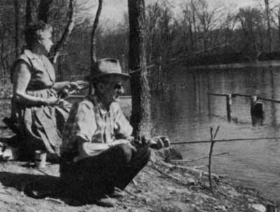
Anglers vary widely in their tastes. Some like the pursuit of bass and sunfish in reservoirs, and for them the upper estuary as well will be a good place to go when it is suitably cleaned up. Some want wide salt water and the lonely cry of gulls, and these the Basin can provide also. Others prefer trout in highland streams, or smallmouth and catfish in the big flowing rivers, and as the state of the waters grows better, so too will all these kinds of fishing. On certain rivers and streams particularly, the assured flow that is going to be needed to cope with diffuse pollution will have a strong good effect on aquatic life and sport fishing. The Monocacy and the South Fork of the Shenandoah are examples. And in the Potomac falls and gorge below the metropolitan water intakes, as was noted in Chapter III, assurance of a certain minimum flow would be justifiable on esthetic and recreational[Pg 88a] grounds alone, even aside from the need for it below in terms of water quality.
Hunters need more room outdoors than most people, because of their guns and because they move about in search of game. Fortunately, the fall and winter months when they function are times when relatively fewer other people are out roaming. The public forests of the upper Basin are a main resource for hunting now and in the future, and the kinds of public access that are established on the estuary and the main rivers will have to take hunters' interests into account. Even so, if they increase in numbers as much as has been predicted, the added demand for places to go will require more lease and day hunting on private land in the long run than exists at present, and improvement of that land's wildlife potential.
Certain other kinds of recreational facilities, constituting the bulk of profitable enterprises associated with America's outdoor pleasure, will have to depend mainly or solely on private development of them. Amusement parks, marinas, and ski lifts are examples, and so are most of the lodging places, restaurants, and other service facilities that thrive wherever increased public recreational activity takes place.
Most Americans do some driving for pleasure, and some of them do a great deal of it, using their four-wheeled bugs not just as a way of getting to pleasant places but as an indispensable adjunct to being in them and enjoying them. In certain respects, the Basin falls short of providing for their needs. The explosive demand in the past few years for[Pg 88b] auto campgrounds where people can stop with their cars, trailers, and pickup units has caused a shortage of adequately equipped facilities of this sort, especially within easy reach of Washington, which will have to be supplied by both public and private effort. Roads specifically designed for leisurely pleasure driving, in contrast to high-speed throughways, are another need. The Basin has two such motorways now—the George Washington Memorial Parkway at the metropolis, a much-used city road in its present form though still a main amenity, and the Skyline Drive along the Blue Ridge, with the Blue Ridge Parkway extending southward through it and out of the Potomac country. This magnificent low-speed mountain-top route looks out alternately over the Great Valley and the Piedmont, and the heavy use it receives, increasing year by year, shows what the right kind of scenic motor routes can mean to people.
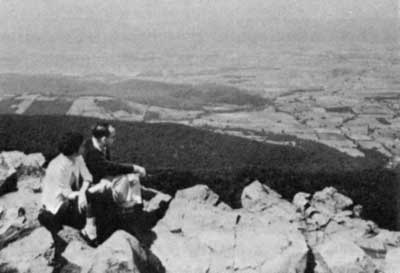
For a multitude of residents and visitors, nothing would contribute more to apprecia[Pg 88c]tion of what the Basin has to offer than a system of unobtrusive parkways and scenic wandering roads joining together the region's attractions—history and scenery and sports, rivers and valleys and mountains. A major element in such a system, being studied, would be a great loop parkway tying together the existing parkways by an extension along the river and turning southward into the country along the historic James, then back to the Blue Ridge. Scenic roads tributary to the system would utilize existing rural routes for the most part, enhanced and protected by State and local action.
For the many other people who seek a more active and less mechanized relationship with natural things, a connected regional network of trails for walking or riding or cycling is a main need and a main opportunity. Like the parkways or even more than them, it could be a framework for open space preservation and an intimate means of using that open space. Tied in with existing segments like the C. & O. towpath and the Appalachian Trail, linking the towns and cities with ridges and riversides and parks and historic places, it would provide the most fitting kind of access to the whole Potomac realm of things for anyone willing to take an afternoon's stroll or a week's hike.
More fundamentally still, it would be a powerful and continuing element in conservation education of the best kind, the participating kind. For generation after generation of the young people who would use it most, it would shape a feeling for rocks and water, creatures and trees, sun and wind and rain[Pg 89a] and hills and valleys, old houses and ruins and bloody fighting grounds, together with a sense of man's natural origins. And shaping the feeling, it would shape some comprehension.
The Potomac Basin is going to need that kind of comprehension; the whole country is. Recreation means fun, and it probably ought not be overweighed with solemnities. But outdoor fun is dependent on the wellbeing of the outdoors, and increasingly the outdoors depends on the understanding and sympathy of human beings who possess new great power of destruction and have been using it widely. So that if any form of outdoor recreation can furnish, however slightly, some comprehension of what the natural world is like and how it works, it amounts to quite a lot more than a bit of needed relaxation from the week's toil at one's job or in the kitchen and nursery, though it may be that as well. With the comprehension, it becomes an enlargement of one's grasp of things, and it adds a little substance to the hope that people will keep on caring about the integrity of the world around them and defending it as best they can. And no safeguard this present mortal generation can set up is more meaningful than that hope.
Most of the known basic techniques of landscape protection have already been discussed or touched on in this report: ways of cleaning up rivers and assuring their flow, ways of halting erosion and siltation, ways of planning land's use by concentrated human[Pg 89b] populations with as little loss as possible of amenities, ways of patching up old damage. Many of them are imperfect as yet and for some problems tools are still missing, nor are the existing techniques being applied in a completely coordinated manner anywhere on this continent except in a few experimental places of restricted size. But they do exist; they are available if human beings and human institutions can be persuaded to put them to use. And it is not possible to repeat too often that the need for their use is urgent.

A great deal of legal machinery at various levels is available to stimulate the use of such techniques and to enhance outdoor recreation. Some of it has already been put to work in the Potomac Basin; some of it needs reshaping for application to the conditions found there; and to cope with certain of the problems, specific legislative action tailored to the needs is going to be required.
Active Federal programs of public works, technical assistance, grants in aid, cost sharing, taxation, home loans, mortgage insurance,[Pg 89c] and such things—often with counterparts at state levels—penetrate every level of the economy and have profound effects on the landscape. Some of them have a direct concern with the landscape as such: among these are the Department of Agriculture's soil conservation and forestry programs, Interior activities ranging from water pollution control to trails, parks, and wildlife refuges, and Housing and Urban Development programs for the restoration, protection, and creation of urban amenities—all being applied in the Basin, though some need legislative adjustment or extension if they are to be fully effective there. Most also have associated recreational purposes.
Others among the going high-level programs have only a tangential interest in the landscape per se, though frequently much influence upon it. In the past, as we have observed earlier, many of them have been responsible for a good deal of landscape damage, encouraging sprawl and other forms of bad land use, instituting great public projects without enough thought to their effect on esthetics and ecology, and so on. Some are still being conducted in this manner, though less and less as a general awareness of the need to restore and to preserve, to think twice before making massive environmental changes, soaks out through the complex network of government and has its influence on attitudes. Increasingly, not only Federal but State agencies are making decent land use, recreation, and scenic preservation a partial condition and sometimes a whole reason for aid programs and public works.[Pg 90a]
Many programs can be adapted to such purposes. One interesting example in the Potomac Basin is a study being undertaken in the Georges Creek valley of western Maryland by Frostburg State College. Under an educational grant from the Department of Health, Education, and Welfare, members of the college's faculty have embarked on research aimed toward a demonstration project of economic, social, and landscape restoration in the whole Georges Creek watershed as a unit. Action resulting from the study will involve a number of their State and Federal programs.
Often, of course, the benefits of such practices are "intangible" in terms of the market values that have traditionally been used for justifying government projects, and adequate ways of giving them their true weight against other values that may be in conflict with them have not yet really been worked out. Nevertheless, the fact that they have strong and sometimes overriding benefits is being recognized.
Insofar as such programs encourage Basinwide landscape improvement and protection and major recreational opportunities, they are instruments for accomplishing overall Basin aims, usable as such now by Federal and State agencies and at the future disposal of any Basinwide coordinative organization that may evolve. Insofar as they permit and stimulate counties and municipalities to do better environmental planning and give them money and morale to implement and enforce planning, they are available at this indispensable level of action where—as we have[Pg 90b] seen—the obstacles to doing things right are often huge. The programs put within reach of local officials the principles of good planning and management, and help them to achieve its details, from wildlife refuges to neighborhood parks, from the maintenance of riverside beauty and the restoration of historic shrines to the construction of small reservoirs. As knowledge of their existence and their advantages gets around, they are beginning to have much effect, especially at larger centers of population.
Nevertheless, it is impossible at present to be sure that any given locality is going to take meaningful steps toward staving off blight and landscape destruction, and a great many of them in the Potomac Basin have not done so. Partly this is because the imperative need for planning is only now beginning to dawn upon many smaller communities. But even where it has dawned and planning has been undertaken by men of good will, the great obstacles still exist and often block their efforts—the lack of money to match Federal or State program funds, the inability to convince fellow citizens who have to approve actions, the fat profits in real estate, the pervasive influence of personal relationships.
Ideally, for a number of attractive reasons, it would be preferable to let local people solve local landscape and recreation problems in every case, with outside higher levels of government furnishing only advice and money on request. In regard to many types of problems, this is what is being done and will be done on into the future, for people living in a place are the ones who determine whether the[Pg 90c] place is going to be ugly or pretty, pleasant or grim. The trouble is, however, that as understanding of the interrelationships between land and water and the other elements of the landscape, even on a Basinwide scale, has grown, it has become more and more obvious that there are only a few strictly local landscape problems. Most local jurisdictions have within their boundaries critical watersheds, unique scenic assets, flood plains whose unwise use will require elaborate and costly structural protection later on, and other such features. This being so, the effects of mismanagement are certain to reverberate elsewhere, and it becomes the concern of people other than those who live in that neighborhood. It becomes other people's business, distasteful though this idea may be to communities with a tradition of self-sufficiency.
Regional planning organizations that can pool counties' and towns' resources, take a broad view, and pay for professional help can overcome some of the obstacles, if local governments can be persuaded to join them. Certain of the State and Federal programs mentioned above are being applied mainly through such bodies. But it seems to be an unavoidable conclusion that if local government continues to be the weakest link in the chain of planning, preservation of the environment is going to require not only stouter incentives to elicit cooperation from communities, but also more authority at higher levels of government to guard against at least the worst types of landscape abuse. In terms of water, this kind of authority will shortly be operative with the enforcement of the new[Pg 91] State water quality standards. In terms of the other elements of the landscape, it is equally justifiable.
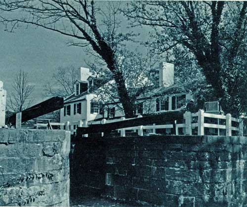
And, just as in water management in all its phases, central and continuing Basinwide coordination of practices to restore the landscape, to protect it, and to make possible its pleasant use by the public is going to be needed. If landscape problems could be divorced from water problems it might be a good deal easier, at this point in time, to identify a fairly full range of "right" measures that could be taken to achieve such restoration and protection for a long, long period into the future than it would be to do the same thing for water problems. Restoration and protection are not irreversible actions in the sense that some of the technological measures associated with water management are, and the main danger of rigid landscape planning would not be that it might go too far, but that it might not go far enough to save all that ought to be saved.
But, as we have observed time and again in these pages, no divorce is possible between land and water. They are interdependent, and whoever concerns himself with one must perforce concern himself with the other. Much of the action in regard to both is going to have to be long-term, continuing into the future. New threats are going to arise, some of them quite possibly based in a divergence of aims among various government programs with environmental effects. Thus, if a Basin-oriented agency is required—as we strongly believe—to oversee continuing action to clean up the Potomac river system and keep[Pg 92a] it clean, and to develop it for man's use in a wisely flexible and coordinated manner, that organization is going to have to take on a degree of responsibility for landscape matters as well, and is going to need some authority over them.
Many things can be identified that need doing now if irreplaceable assets in the Potomac environment are not to be lost, and if people are to be given a full chance to enjoy what is there. Some of these things that need doing have been named in this chapter or previously, and others are implicit in the report's discussions. We have worked out recommendations for action that can get them done, and the recommendations are presented with this report. They include some specific recreational proposals, and they urge prompt and authoritative protection of certain assets that are going to be destroyed if protection does not come soon, long-term programs to bring about detailed and overall restoration and protection and continued study and research into means of coping with threats not yet fully understood, like some of those along the estuary and the North Branch.
The main recommendation with a specific[Pg 92b] objective of preserving the landscape and providing recreation proposes the designation of the main river from Washington to Cumberland as the Potomac National River. Though it is to remain accessible for appropriate use by towns and industries, its banks and islands will be protected and public access assured by means of a sheath of park land, in Federal, State, and local ownership and with associated areas preserved by easements and similar devices, for the entire 195 miles. The proposal, refined since its initial mention in the Interim Report, is a major one—but so, as we have seen, is the need it is designed to meet. This main reach of the flowing river, the Basin's hydrologic and scenic lifeline, is greatly menaced by rapid and inappropriate development along its banks, and through most of its length it is hard for people to reach. It has unique majesty and beauty and both historic and symbolic associations that warrant a special degree of protection for it, and warrant also the assurance of the kind of public appreciation and enjoyment the park sheath would permit.
The recreation and landscape recommendations as a body are attuned to reality as well as to needs. They represent things that can be done, at prices that can be paid—minimum initial steps toward ultimate achievements that would be inferior to none that our changeful age might produce. This is an insistently momentous time, with boom, frenetic pleasure, sophisticated communications, space exploration, racial crisis, young rebellion, and all the other contemporary phenomena demanding attention and stirring up a dust that makes clear vision hard. There is nothing minor about any of them. But one thing seems clear enough. When the dust settles down and those who walk here afterward look around them for the eternal wholeness of earthly things, they are going to have a hard time finding it if matters keep going as they have been going lately. If we who are here now fail to hand over to them a physical world that relates them to old reality and serves them well and helps to make them glad to be alive, then whatever other things we hand over to them may seem very small potatoes.
The Potomac Basin is only a piece of what needs to be done. But it could be a beginning.[Pg 93]

A river basin is a good functional unit of topography, admirably suited for study and for certain types of resource planning. Because of this, there is a temptation for those who undertake such study and planning to assume that river basins have, or ought to have, human unity as well—unity in politics, economics, and culture—with a consequent "basin public" inclined to think in basin terms. Basin identity of this sort would facilitate conservation, development, and management. It would "make sense," and clearly enough a a great deal of sense needs to be made, and soon, if people are going to have any hope of balancing their use of resources against the inevitable continuing requirements of the long future.
Small watersheds often do have unity of this human sort, but very few major river basins. And usually the question of whether they ought ideally to have it or not becomes irrelevant in the face of the rock-hard reality of the forces working against it. In the Potomac Basin, the boundaries that ramble among the various political subdivisions—the District of Columbia and portions of four separate States, with all or part of some 39 counties and a number of independent cities—only accidentally and occasionally follow watershed ridges. More often they reflect the caprice of Stuart kings and Fairfax lords, the accidents of history, the fortunes of war, and the trampings of young George Washington and the Messrs. Mason and Dixon and hundreds of less renowned linemakers. These boundaries, some of them sanctified by centuries of existence, are one of the Basin's most fundamental sets of facts, creating genuine differences in the interests, activities, viewpoints, and even accents of the people. And they emphasize a healthy political diversity and complexity that in many ways is simply not amenable to change.
None of the capitals of the four Basin States lies within the Basin's limits. This means that[Pg 94a] some of the strongest political loyalties and energies of the region are directed outward toward Richmond and Annapolis and Charleston and Harrisburg, and that much action relating to the Potomac must be sought in those cities, or is decided on incidentally there by legislators, many of whose strongest interests may lie along the James or the Susquehanna or the Ohio or other streams.
The fact that the capital of the United States, together with its attendant metropolis, is located solidly within the Basin at the Fall Line is of immense if problematic significance. For one thing, it fosters a concentrated Federal interest in the Potomac and the Potomac region, in both esthetic and utilitarian terms and at both legislative and administrative levels, which have led to some special amenities in the way of parks and such things and to some Federal efforts to treat the river in "model" terms, however these terms may have been defined at various points. On the other hand, it has also led to a special concern with the river on the part of the almost innumerable interest groups that possess leverage in Washington, from wilderness conservationists to industrial lobbyists, who exercise pulls in a number of different directions.
And the presence of the capital has set up other special currents of influence and sympathy that bypass normal political channels. Many Basin towns and counties look more toward Washington for certain kinds of action than toward their State agencies and legislatures. Federal programs have long been active here close to the main-office sources of expertise and cash, building up respect[Pg 94b] and trust through local agents, and Basin Congressmen who hardly have to leave home to exercise their legislative function have further strengthened these ties.
The metropolitan jurisdictions, especially, in many ways find more common cause with one another and the Federal Government than with communities and governing bodies elsewhere in their own States. Politically, this sense of collective identity gets official expression in the Metropolitan Washington Council of Governments, a regional body which, like its counterparts in other urban conglomerations throughout the country, is geared to work directly with the Federal Government in dealing with its own regional problems rather than having to come at Federal programs and agencies along the more lengthy traditional route through the States. The implications of this new kind of alignment are still a matter for debate and conjecture.
Other forces at work along the Potomac similarly have less to do with boundary lines, drainage limits, or Basin thinking than with human ways of being. There are a number of kinds of country here, as we have seen, in various stages of development and with various sorts of people inhabiting them. Yeoman tillers of the Shenandoah's limestone soils may find scant occasion to identify their interests with those of the Washington slums, or even with those of the fox-hunting Piedmont gentry just across the Blue Ridge. Coalmining Potomac Appalachia has more common economic and cultural outlook with eastern Kentucky than with the Potomac Tidewater; southern Maryland and the Northern Neck[Pg 94c] and the Monocacy's dairy farmers all have their own ways of interpreting human existence and defending themselves against its pitfalls. Within the county governments and the Congressional and State-legislative districts, these local and regional viewpoints choose political leaders who joust for them in higher arenas, often aligning there with forces from outside the Basin. Hence a metropolitan Maryland Congressman may vote in the House with kindred souls from Long Island and Pasadena, and his Basin colleagues with agricultural constituencies may oppose him on some issues in alliance with representatives from Wyoming or Arkansas.
Despite the Basin's special ties to the Federal Government, many rural Basinites are suspicious of Washington and the metropolis, often out of a traditional distrust of "big government" and sometimes because they see the accumulation of city folk at the head of the estuary as a menace to rural modes of existence. Thus they may oppose water projects designed to help the metropolis, or recreational development that threatens to bring down on them large numbers of pleasure-bound outsiders, though local businessmen's hope for a boom sometimes offsets such opposition. The reapportionment of legislative districts now in progress, plus the growing political muscle of metropolitan areas, is probably going to cut down on the power of rural areas and rural viewpoints—though just how much and in what way no one is yet sure. Some prophets claim that these influences are going to erode rural influence utterly; others that they will merely shape an[Pg 95a] alliance between middle-class suburbs and rural areas against the beleaguered central cities with their slums and other huge specific problems.
Worth noting also is the fact that many erstwhile "rural areas" are getting less rural by the year. With population pressures and industry and pollution and looming water deficits, they have more and more in common with the Washington metropolis, and more need for "big government" programs. In the long run, an overwhelming majority of the Basin's future population will probably be city-dwellers, with a consequent effect on general attitudes toward Basin planning and projects—though exactly what effect is not at all certain.
One reason it is not certain is that the average person's set of attitudes toward the world around him is not totally determined by the circumstances of his life—by whether he is a city-dweller or a farmer or a small townsman, an engineer or a poet or a hardware salesman or a factory worker. Southern or Northern, black or white, poor or rich or pleasantly salaried. These things have great weight in coloring people's attitudes, but so do individual tastes and individual ways of interpreting the fact and ideas that flood in upon all of us these days. And so also do the vast and shifting currents of emotional and philosophical response that sway our society in one direction or another from year to year, from decade to decade.
In relation to the environment, certain differing philosophical currents of this kind have[Pg 95b] surfaced to view at various points in this report, if only briefly. They have influenced the fate of past proposals for dealing with the Potomac river system and landscape, and they are still here to continue exerting influence. In individual citizens' minds, they often mix and balance with one another in various ways, but they are discernible as separate forces.
Stout among them is the traditional American—and human—view that the natural world exists for the primary purpose of bettering the lot of such human beings or groups of human beings as may have the ingenuity and the vigor to extract its treasures or to adapt it to their use. Quite often the activities for which this view provides justification are exploitative—they use up natural resources or they bring about other irreversible changes in the world roundabout. Some conservationists think this makes them automatically evil, but things are not quite that simple. Such exploitative activities have led our species the full length of the road from the Stone Age to the sophisticated and powerful technological civilization of present times. The idea that we have a full right to engage in them is deeply ingrained, particularly in this country whose memories of the frontier—a hardy, exultant line of subjugation and exploitation moving across the virgin continent—are not remote but fresh.

Certainly in its crasser manifestations—this utilitarian philosophy has widely destructive effects nowadays. Strip mines gouged out without thought of restoration, wanton land speculation and development, the casual dumping of raw wastes into streams by towns or industries and a number of other harmful practices mentioned in this report are all clearly based in a conviction that what one does to the world around him is his own sweet business. That conviction has long[Pg 96a]standing sanctity among Americans and many who hold it are moral and upstanding folk. But in a world as heavily populated as this one, possessed of such augmented technological ability to assail and exploit the natural world, there is clearly something wrong with it.
Other exploitative human activity based in utilitarianism is not crass or all so obviously wrong, especially in today's context. Population growth poses a moral question but also a logistical one: uncontrolled growth may well be questionable, but it is a staggering reality. The additional millions of people thus invited to present and future feasts must be provided for. Many thinkers view the economic expansionism of our time, together with the vigorous technology which it fosters and is fostered by, as the only means toward this end. Some, indeed, view it as a happy and healthy state of things, indefinitely extensible as technology itself furnishes substitutes for exhausted natural substances, natural forces, and natural experiences.
Allied to this view is a sturdy and widely held American belief that "development" of natural resources is automatically a good thing regardless of the need—toning up the economy of a region or a state or a nation, keeping things moving. Most people give it some practical support, even those who in theory suspect its validity. For we are a moving people. We have known little stasis in the centuries of our presence on this continent, and each generation of us is imbued anew in childhood with certain axiomatic ideas; movement is forward, growth is up,[Pg 96b] construction is better than vacancy, not to make economic use of something is to waste it. These ideas linger in our reactions: "You can't," the saying goes, "stand in the way of progress."
Certain other philosophers, growing in numbers these days, say emphatically that you can and should. These are the history-minded people, the wilderness folk, the nature traditionalists, and the others whose main concern is that man and the pleasant world around him have lost all semblance of a balanced relationship with each other, and whose view of the sturdy plunderlust of our ancestors is that our inheritance of it, combined with the technology of bulldozers, is aiming us straight toward a world in which our own structures and destructions may be all there is to see, our own fumes and sewage all there is to smell, our own voices and machines all there is to hear. Some people of this stamp are quietly pessimistic; others actively commit themselves to fight. Some who[Pg 96c] fight see present human growth and the growth of human demands on resources as the stark unavoidable realities they are, and seek mainly to guide them and mitigate their effects. Others stiffen their necks against development to meet those demands, staunch enemies to all reservoirs and other forms of compromise, stubborn if highminded nay-sayers against the tide, consistent even when illogical.
Taken as a whole, however, these people with a sense of the imponderable human value of natural ways and natural things may constitute the most powerful support available for thoughtful planning and conservation. In a precipitate and voracious society plunging on into its future, they look back and seek to retain the best of what has always been, for conservationism at least in this sense is conservatism too. Upon their increase in numbers, in broad understanding and in political forcefulness, upon the arrival of their basic values at a point of publicly accepted respectability at least equal to that presently enjoyed by time-hallowed exploitation and the profit motive, hope for a decent future must heavily depend.
All of these ways of looking at man's problematical relationship with the crust of the planet he inhabits, plus a number of others, are at work within the minds of conscious people in this region and in the great cauldron of its politics. Here they mingle with State and regional and local loyalties and private self-interests into a fine American soup of eagerness and reluctance, faith and apprehension, awareness and befuddlement, chi[Pg 97a]canery and square dealing, altruism and frank greed, rage and reasonableness, that is as real as any mountain in the Basin and as inevitable a consideration for realistic planning as the river's own characteristics of flow. For any proposal or set of proposals for action in the Basin that does not take into account what the Basin's people are like, and how their idiosyncrasies and preferences and sympathies find political expression, is foredoomed to failure, be it ever so ideal in anyone's abstract terms.
Then there is money. Restoration and protection of the scheme of things and its adjustment to needful human use, on the scale we are considering in the Potomac Basin, is expensive, often involving many millions of dollars for action against only one phase of deterioration or threat or shortage. In accordance with the breadth of overall aims, much of this money must be Federal. Where benefits or responsibilities are clear, as in relation to sewage treatment plants and sources of water supply, states or communities or institutions usually pay a share. If Federal policies regarding flood protection and river flow augmentation for pollution control are made more logical in the ways sketched earlier in this report—as seems likely—such sharing will increase. Private investment or philanthropy may often play a part, as in the purchase of municipal bonds, the donation of scenic property for public use, or—a hopeful trend of recent date—a private organization's use of its money to facilitate[Pg 97b] high public purposes. The main example of this last service on the Potomac is the recent purchase and interim retention of important wildlife and park lands on Mason Neck by the Nature Conservancy, for later resale without profit to public agencies when needed authorizations and funds have been obtained.

Nevertheless, most such projects do have a public purpose with diffuse benefits, and sooner or later most of their cost has to be paid out of public dollars deriving from collected local, State and Federal taxes. Sometimes it is dispensed through Federal grant[Pg 97c] programs created by Congress to meet pressing needs, or from other special sources fitting the occasion. More often it must be sought in the standard established manner: concrete proposals for action shaped and presented, with a computation of the cost and the value of expected benefits, to Congress, State legislatures, or local governments for examination and authorization, and funds or bond issues later voted for carrying them out.
The cash available for both regular programs and special proposals from year-to-year will vary according to the state of the economy, the number and severity of other demands on government budgets, and their relative apparent urgency. This imposes on planners not only an obligation to make sure that what they propose has public value that fully justifies its price, but also a need to gear immediate priorities and projects realistically to the amount of money there is some hope of getting for them. It is an unhappy fact that there is often less than no point in presenting even fine proposals for legislative consideration at a financially inappropriate point in history. Once defeated, whatever the reason, they may forever languish in limbo.
At this particular point in history, this country has been for some time involved in a tough, costly conflict in Southeast Asia which inexorably absorbs much of the available Federal money. Americans are a rich people, riding a wave of prosperity, and much is left over for other things. But in this turbulent and questing era, they also have a good many other urgent and expensive problems and proj[Pg 98a]ects on their hands besides those dealing directly with natural resources and conservation. The problems are familiar words on the front pages of newspapers and in evening conversations: poverty, urban crisis, transportation, national defense, public health, world hunger and unrest, space exploration, schools, and the rest. All cost hugely. And, though individual conservation proposals of clearly critical importance most often receive fair and full consideration, one or two or more of these other realms for action usually loom larger to the eye of the public and the Congress than do environmental programs in general. Therefore they get first shot at the funds available for spending year by year.
Most people have a bias in favor of their own chosen field of interest. To some, the right use of the natural earthly framework of things matters supremely. They tend toward a conviction that sooner or later it will stand very high on any list of priorities for spending, as the magnitude of what is being lost and diminished is borne in on the consciousness of the general public. Yet, as of now, it faces heavy competition for limited funds, and this is another reality for consideration, as solid for the moment as the Basin's physical problems, as solid as the politics of which it is a facet.
These are not the only uncertainties and complexities that confront anyone who would act toward restoring and preserving the waters and landscapes of the Potomac and making them serve man, but some of the more specific and potent ones not dealt with ear[Pg 98b]lier in this report. Others have been discussed in former chapters or at least have received cursory mention. Among them are water technology's state of flux that offers a strong if hazily defined hope of being able to do things better and better as time passes; the need for more and better data; the problems for which workable solutions simply do not yet exist; the inequities or inconsistencies created by certain present Federal water policies; the dubiousness inherent in forecasts of future human pressures and problems; the frequently crossed purposes of high agencies regarding environmental action; the difficulty of feeding true esthetic and recreational values into cost-benefit computations; and the paralytic tangle of motives and loyalties in regard to planning at the local level. And a great many others could be found.
Taken all together and linked to the assumption—fundamental in this report—that the Potomac and its landscape deserve rescue and coordinated right use, these areas of doubt, changefulness, and difficulty add up to a strong body of argument for flexible continuing planning on a Basinwide scale and for a specific, authoritative Potomac Basin institution to guide it and put it into effect.
There are two main alternatives to such flexible planning and coordination and they both, under present and probably future conditions, point toward slightly modified chaos. The first would be to allow going or incipient Federal and State programs for water quality improvement and erosion control and such things to take their overall course, while water supply, landscape pro[Pg 98c]tection, and other problems are dealt with in the traditional, piecemeal, localized manner as conditions here and there become bad and force action, or as "fall-out" from non-Basin programs takes casual effect. This relinquishment of coordination would make the task of clean-up immensely harder and less effective in the long run, and it would turn over most of the Basin's unprotected scenic amenities to exploitation on the basis of their short-term utility and the profit they could be made to yield.
The second alternative would be to shape a rigid overall plan for the Basin prescribing definite solutions, feasible in terms of tried and true technology, for all its problems that exist today and are expected to materialize in the future, and then to seek authorization and funds to put the plan into effect. This procedure has disadvantages already noted in detail in this report. It makes large irreversible decisions that future generations, stuck with the results, may find less than totally attractive, especially since they very probably will have better ways of doing things. It pins itself to fallible assumptions about those future generations, and must be formed in terms of present laws and policies, which are not always ideal. Physically, a plan of this kind could be worked out that would function with reasonable efficiency, at least in water matters, for there is nothing primitive about today's technology. But esthetically it would leave much to be desired even by present standards, and politically, furthermore, its very wholeness and rigidity would mean that it would have to be sold as[Pg 99a] a complete package or else be doomed to fragmentation, which would lead to much the same sort of piecemeal expedient development as no plan at all. Quite aside from the budgetary difficulties of the moment, the Potomac Basin's political complexity makes whole acceptance and implementation of such a plan extremely doubtful.
If flexible coordinative planning's advantages for a place like the Potomac Basin are recognized, and it is accepted as the most reasonable and hopeful way to approach problems there, the question arises as to what kind of agency is best suited to carry it forward and to act on it. Besides certain unique agencies like the Tennessee Valley Authority several types of institutions are available that can be oriented toward a whole interstate river basin.
An interstate compact is a detailed agreement between two or more States to act toward a common specific goal. It needs the approval of Congress, but the Federal government usually takes no formal part in the compact commission's activities, nor are Federal activities in the basin subject to compact commission control. A Federal-interstate compact, on the other hand, does have Federal participation and provides for some limitation on Federal freedom to act on basin problems without compact commission consent. Compact commissions under either of these types of agreement can have wide or quite limited powers in regard to planning, construction, management, and such things, depending on the specific agreement itself.[Pg 99b]
Two kinds of Federally-directed bodies with primary emphasis on planning are in operation in various river basins. A Title II river basin commission, as defined in the Water Resources Planning Act of 1965, is formed by the President to carry out comprehensive basin planning, with a Federal chairman and members from Federal agencies, Basin States, and approved interstate or international agencies with jurisdiction in the Basin. A Basin inter-agency committee is created by agreement among Federal agencies for an assigned mission, usually the coordination of Federal and State planning through the exchange of information about programs and projects.
The main work of the Federal Interdepartmental Task Force on the Potomac has been done at the same time that the new Water Resources Council has been studying out its powers and putting them to use. Formed before the Water Resources Council, the Task Force was assembled as a unique entity rather than as one of the categories of Federal planning organizations mentioned above. But, having been shaped after a directive from the President and having worked in cooperation with the Basin States' Governors' Advisory Committee, the Task Force together with that Advisory Committee has been exercising some of the main functions of a Title II river basin commission. These commissions can plan flexibly, in stages, if this is desirable. They make recommendations for comprehensive development which can quite compatibly be implemented by a separate basin management authority, perhaps of a type recom[Pg 99c]mended by the commission.
In these terms, the water-related recommendations that accompany this Interior Department report, which have been concurred in by the other Federal agencies on the Task Force and by the Governors' Potomac River Basin Advisory Committee, can be considered a first stage in a new approach to comprehensive planning for the Potomac. Hence it is time not only to undertake these recommended initial actions toward the balanced development and preservation of the Basin, but also to consider an agency or agencies to take over such coordinative planning, management, and operation as may be necessary. From the start, it has been recognized that a long-term management agency was going to be desirable, and we have been inquiring toward its definition. From the start also, it has seemed obvious that some form of Federal-interstate compact offered the most promise, for various reasons.
The direct and special interest of the Federal government in the Basin is extensive, and clearly justifies continuing Federal participation in any planning and development. On the other hand, to invest all or most management authority for such a politically complex region in Federal hands would ignore certain powerful realities, and would throw away a chance to achieve the most meaningful kind of "creative Federalism." The Basin States have shown strong willingness to take on responsibility and authority in relation to the Basin's problems and to cooperate with one another and with the Federal government toward their solution. An organization based[Pg 100a] in such cooperation could cut through much of the Basin's tangle of jurisdictions involved and to each of them individually, and would be responsible to each and all. It could mesh the efforts of the numerous and diverse action agencies sponsored by each jurisdiction and aim them toward overall Basin goals, probably more effectively than any other arrangement could.
Early in this planning effort, primary responsibility for inquiring into the desirable characteristics of such an agency was allotted to the Governors' Advisory Committee. After over two years' hard work by a subcommittee, the Advisory Committee has lately made public the preliminary draft of a Potomac River Basin Compact. It proposes a compact commission with broad power and responsibilities to adopt and maintain comprehensive plans for water resources and amenities, and to acquire, construct and operate facilities related to water problems and use, watershed management, and recreation. It would be financed by government and private funds, could issue bonds, would absorb INCOPOT, and would consist of six members—one each from the four Basin States, the District of Columbia, and the Federal Government.
The draft compact is currently being discussed at public hearings scheduled in various parts of the Basin, and is under review by the Water Resources Council. Undoubtedly it will be altered somewhat during these processes, and it will very possibly undergo further alteration at the hands of the State legislatures and the Congress, which will have to review and approve it before the[Pg 100b] agency it proposes can be created. All of this will take a good deal of time. The detailed features of the institution that may emerge cannot be precisely known at this point, and a specific Federal recommendation for its establishment is not yet possible. Nonetheless, the compact draft's essential principles—adequate authority, accepted responsibility, and protection of the interests of the participant jurisdictions while moving toward coordinated Basinwide accomplishment—are sound and needful ones, and offer the best kind of hope of implementing and continuing the sort of flexible, coordinated planning and action that we have advocated in this report.
The members of the Potomac Planning Task Force, the A.I.A. group, in their recently published independent report, have made a strong recommendation for a new type of Federal institution, a Potomac Development Foundation, which would be headed by a Presidentially appointed administrator and would have a planning staff and a top-caliber professional advisory board. It would not engage in construction, operation, or management of projects, but would be liberally financed over a period of five years out of Federal funds and would emerge as a self-sustaining agency with power to assist in Basin planning, to acquire land, to make grants for various purposes, and to sponsor appropriate development of the Basin's resources with low-interest loans. With a strong orientation toward ecological values, scenic preservation, architectural amenity, and recreation, it would emphasize a long-range approach to coordinated Basin planning.[Pg 100c]
A Development Foundation of this kind would obviously harmonize with the main principles enunciated in this present report. It is also envisioned by the A.I.A. group as compatible with a compact commission or other management agency, though they have recognized that the relationship between the two would need to be studied out at length.
The proposal is a bold one and an appealing one, with much promise, particularly in its potential for giving full weight to ecology and the amenities in planning. We are hopeful that its basic idea will get serious consideration during the period of institutional study and review that is coming up.
In the period before permanent planning and management machinery for the Potomac materializes, the Basin will get much protection against major disruptive change through the continuing interest of Federal and State agencies made aware of its problems during this first-stage planning effort, through improvement and preservation programs already in movement or initiated by this report, and perhaps most of all through aroused and informed public interest. There is room for a broadly based citizens' watchdog organization to keep tabs on Basin affairs and to exert leverage in such critical fields as local planning. It might be formed as a new group or might be built around an existing organization such as the new Potomac Basin Center, whose function has been to comment impartially and intelligently on Basin planning and prospects.
In the different chapters of this report,[Pg 101a] various things stand out that need to be started quickly, either to satisfy looming demands for water development and water quality control, or to restore or protect scenic, ecological, and recreational assets which, if not attended to quite soon, are going to either disappear or suffer irreparable damage. A few recommendations for action on certain of these immediate problems were made in our Interim Report of two years ago, together with recommendation on one or two noncontroversial items clearly not in conflict with any conceivable ultimate Basin aims. In abbreviated essence, the main Interim recommendations, made with Interdepartmental Task Force and Interstate Advisory Committee approval, were as follows:
(1) That a decision on the construction of Seneca dam and reservoir on the Potomac main stem be indefinitely deferred, but that the site be preserved as much as possible against further encroachment, in case it is ever needed;
(2) That three relatively small reservoirs be built on tributary creeks in the Paw Paw Bends area of the upper Basin, in addition to the authorized Bloomington reservoir on the North Branch, to begin providing a safe margin of water for metropolitan Washington and to serve Basin recreational needs;
(3) That a permanent "green sheath" of protection for the Potomac main stem, together with major recreational opportunity, be assured by means of a new kind of composite park of varying width along both shores from Washington,[Pg 101b] D.C., to Cumberland, Maryland;
(4) That the Cacapon River and the West Virginia portion of the Shenandoah be given Wild River status by Congress to protect their shores against excessive and inappropriate encroachment;
(5) That water quality programs and research be accelerated toward certain minimum goals;
(6) That Soil Conservation Service and related Forest Service programs for erosion control, water management and development, and recreation benefits be accelerated;
(7) That the authorized boundaries of the George Washington National Forest be extended to provide public access to and protection of the two forks of the Shenandoah above their confluence;
(8) That Mason Neck on the upper estuary be preserved; and
(9) That the George Washington Memorial Parkway be extended from Mount Vernon to Yorktown as the beginning of a system of scenic roads and parkways in and around the Basin.
One of the recommendations has had to be deferred, though the need implicit in it remains acute—that the Cacapon and the West Virginia Shenandoah be included in the Wild Rivers Bill then pending before Congress. It had been thought that this Bill might be used to protect the Basin's threatened main tributary rivers, beginning with these two in West Virginia, but afterward doubt arose that the standards set up for Wild Rivers—the primary point of reference being Western[Pg 101c] streams flowing through sparsely peopled, often publicly owned country—would make sense or be feasible in a settled region.
Mason Neck has been preserved by great effort on the part of individuals, organizations, and different levels of government. More remains to be done in the way of consolidation of what is there and its adaptation to intended purposes, but the hardest part of the job is accomplished; a critically endangered asset has been protected. Funds have been voted by Congress for the acquisition of the Bloomington reservoir site in accordance with the Interim recommendation. Water quality improvement in the Basin is on the point of being significantly accelerated toward high goals, as the new State standards are reviewed and approved and start getting enforcement, though for specific trouble spots and categories of pollution special Federal or other action is going to be needed and is the subject of new recommendations accompanying this final report.
The rest of the Interim Report measures require Congressional action, which none has yet received. In some cases this is because technically detailed authorizing legislation has taken time to prepare, in others because budgetary or policy realities have brought delay or reconsideration, and in still others because of a feeling at higher levels that certain recommendations could be better evaluated in terms of a final report's whole set of proposals. In the present set of recommendations they are repeated, for they represent genuine needs. Some have been slightly altered in the light of evolving restrictive re[Pg 102a]ality, more recent knowledge, or flexibility, and the suggested or implied Interim scheduling for some has been changed. It is no longer envisioned, for instance, that the parkway extension below Mount Vernon will be authorized and constructed quickly.
The present recommendations, though much wider in overall scope than our earlier ones, represent only a first step in planning for the Basin, for reasons presented in full in this report. They are attuned to present economic and technological possibilities, as they must be. We believe that if they get full and calm appraisal they will prove to be acceptable politically, for all of them that call for major projects represent solutions for acute and imminent problems for which other satisfactory solutions do not presently exist, and to the greatest possible degree they have been made flexible to accommodate possible future change in aims or techniques.
In most cases, the reasons for specific recommendations have already been given in the body of this report. However, the primary public interest that focuses on the matter of major storage reservoirs may make it worthwhile at this point to review and enlarge upon the facts. Some reservoirs are going to have to be built if the Basin is to cope satisfactorily with water supply, water quality, and recreational demands. At the time of the Interim Report, we recognized that the three reservoirs in the Paw Paw Bends area, together with Bloomington, were very possibly not going to be enough to meet the need, but we made a recommendation for their authorization because it was clear that they[Pg 102b] would take the edge off the immediately looming water problem at Washington, would mesh well with any additional future storage in the Basin, and would have no major disruptive scenic effects but instead would provide a great deal of high-quality flat-water recreation in an area where there was significant demand for it.
These considerations still apply. However, the more complete picture of Basin water problems that has emerged in our studies since the Interim Report shows that at least two more reservoirs are very possibly going to be needed, and that the most useful scheduling of initial projects will combine an answer for upstream problems with the satisfaction of near-future needs at metropolitan Washington.
Besides the stretch of concentrated industry and population along the North Branch, where Bloomington Reservoir is going to be needed as soon as possible, three upper-Basin areas with major storage sites available near at hand are faced with large water shortages in the near or middle future, and have streams that would benefit greatly from flow augmentation. In the order of the critical importance of their problems, they are Frederick, Maryland, on the Monocacy; Chambersburg, Pennsylvania, on the Conococheague Creek; and the Staunton-Waynesboro area on the upper tributaries of the Shenandoah's South Fork, in Virginia.
Chambersburg lies in an area where opposition to any major reservoirs has been heavy. An interim solution to the local problem, though possibly not satisfactory in the long[Pg 102c] run, can be found in a system of small headwater reservoirs. The major Chambersburg reservoir site has received full consideration as an element in a water-storage package to begin dealing with Basin demands. But its immediate advantages are not so unique as to justify going against the area's apparent wishes, and it has not been included as a recommendation.
The reservoirs at Verona near Staunton and at Sixes Bridge on the Monocacy, fortunately, can be adequately coordinated with Bloomington and the three Paw Paw impoundments to provide roughly a twenty-year margin of safety in water supply at Washington, besides coping with foreseeable shortages in their immediate neighborhoods, furnishing desired flat-water recreation, and contributing greatly to water quality and recreation benefits downstream. They are also locally and State supported. For these reasons, they have been chosen to fill out the recommended system of major reservoirs to meet near-future Basin demands.
The construction schedule recommended is based on the rate at which upstream and metropolitan demands are expected to develop in relation to each other. And, in accordance with flexible principles of planning, there is provision that if more desirable alternative sources of water or any changes in expected aims or demands evolve, the schedule or the plan itself may be altered. Thus, if this first-stage plan is adopted, the reservoirs to which the region will be committed at any given time will be only those for which there[Pg 103] is actual immediate need, but coordination will not have been lost. This same kind of flexibility is built into the recommendations relating to flow augmentation for quality control.
Other proposals for major action are self-explanatory or are analyzed in detail in separate sub-task force material. Among these latter is the Potomac National River, as the park proposal is now designated, which represents the most hopeful approach to defending the main stem Potomac against destructive encroachment and enhancing its potential for recreation.
Some of the recommendations presented are relatively small in scope but nonetheless essential to cleaning up, preservation, or other desirable ends. Others aim not toward immediate action but toward research or legislation to clear the way for needed action—examples are those regarding acid mine drainage and the possible need for a new Federal category of "pastoral" or "scenic" rivers in populated regions. And still others are only suggestions that non-Federal jurisdictions act in regard to specific problems that fall within the realm of their responsibility.
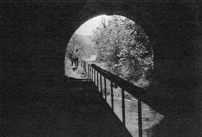
If this body of recommendations is significantly implemented as an initial program, it can lead to a good solid beginning on the things that need to be done in the Potomac Basin. Without treading heavily on the freedom of choice of future populations, it can satisfy the water demands of the Basin during a long enough span of years to give scientists time to examine the full range of evolving alternatives for water management, and plan[Pg 104]ners freedom to choose perhaps better ways of meeting future demands than are now available.
The program can clean up the main streams of the Basin and assure their healthy and copious flow even in time of drought, keep their banks beautiful, and make them more available than they presently are for the people's enjoyment. Even in the major trouble spots of the present time—stretches like the lower North Branch and the metropolitan estuary—dramatic improvement in the appearance of the water and its usefulness for boating and fishing and such things will be possible if the recommendations are followed out to where they lead, though full restoration in such spots, particularly in the estuary, is going to require an expansion of present knowledge and a long-continuing effort on the part of all agencies and jurisdictions.
The program will not assure general protection of the Basin's landscape, for only the Basin's people, generation on generation of them, can assure that. But it can preserve some of the major treasures in that landscape and mitigate some of the worst threats to it. And by fostering projects to illustrate how a respect for the landscape can be put to work, and bringing people into closer contact with the old realities of the Basin's natural world, it can stimulate understanding and feeling that will lead to wider restoration and protection, possibly that general protection that only the people can assure.
If the spirit of these recommendations prevails, we believe that they can lead reasonably soon to a Potomac Basin fit to serve as a model for the nation. And if they are followed by further stages of continuing, flexible, coordinated planning that will apply the best technology to new problems as they arise, keep Basin aims in mind, maintain a high sense of values, and leave open all possible options for the people who come after, the Basin will remain a model. And that has been the aiming point of our study and our planning.[Pg 105]

I. Action aimed at coping with present and future water resource problems in the Potomac Basin as well as contributing strongly to scenic, ecological, and recreational values:
A. An effective water pollution control program is the key to the public's use and enjoyment of the Basin's rivers and streams. Programs are currently under way which will result in continued progress toward enhancing the quality of these waters. The Secretary of the Interior has approved water quality standards for the interstate waters of the Potomac Basin submitted by the States of Maryland, Pennsylvania, West Virginia, and the District of Columbia which call for accelerated remedial programs. Standards submitted by Virginia are currently under review to assure that they will contain comparable requirements. Achievement of the goals established by these standards will require expanded support in the form of legislation, funding, technology, and public awareness to insure their effective implementation.
1. To control organic, chemical, and bacterial pollution of the Potomac River system and achieve compliance with the water quality standards, a program of both immediate and long-run action will be essential:
a. During the next five years a series of actions must be taken to control the Basin's most immediate pollution problems:
(1) Coordination of Federal, State and local powers, in cooperation with any Basin compact commission or other agency that may be established, to achieve waste treatment measures as required in appropriate standards and comparable levels for intrastate waters. This will call for removal of at least 85 percent of the organic load, or its equivalent, from all municipal and industrial wastes throughout the Basin, besides adequate chlorination of all treated wastes, except that in the Washington metropolitan area at least 90 percent removal will be required because of the volume of wastes involved and their effects upon the estuary. The means toward these goals will consist of new plant construction, additions[Pg 108] to existing plants, and control of combined sewer overflows. Regional or watershed approaches to the extension or improvement of these systems should be encouraged. Improved collection systems and treatment facilities also must be supported by effective training, certification and supervision of operators of the sewerage systems of all jurisdictions.
(2) Stimulation of effective action toward meeting similar requirements in handling wastes at all Federal establishments in the Basin, consistent with the nationwide program called for by the Water Pollution Control Executive Order. Where possible, wastes from Federal establishments should be channeled into municipal sewer systems. Adequate budgets for waste disposal at such establishments are a prime necessity, so that Federal agencies will be the pace setters that they must be.
(3) Immediate reconvening of the 1957 Enforcement Conference on the Potomac to focus attention on the timetables for controlling pollution in the estuary in the light of water quality standards and also to consider problems of agricultural pollution, sediment, nutrients, dredging and vessel wastes.
(4) Strengthening of the continuing surveillance program on all streams in the Basin to insure compliance with water quality standards and to help correct abuses from leaks, spills, and illegal or accidental polluting discharges. Active participation by local, State and interstate agencies with the Federal Government in contingency plans for spills of oil and other hazardous substances in the Basin also is required.
(5) Adoption and implementation of regulations and requirements by local and State authorities for control of pollution from boats and marinas. Legislation under consideration by the Congress would permit establishing national standards for control of pollution by vessels.
(6) Adoption and implementation by State and local authorities of a policy that will prevent significant quality deterioration in high quality waters.
b. Accomplishment of these measures will go far toward assuring a clean Potomac. However, to protect the Basin's waters over the long run, even more must be done.[Pg 109]
(1) First must come research and investigations to seek better methods of control where existing information and technology are inadequate. This includes:
(a) Continuation of current pilot plant demonstration studies of advanced waste treatment processes at Piscataway, Prince William County, Virginia, and District of Columbia waste treatment plants and completion of the chemical, biological, and physical studies of the estuary to establish a basis for upgrading water quality to the maximum feasible degree.
(b) Continuation of investigations and demonstration projects to evaluate costs and effectiveness of methods of treating and controlling combined and storm sewer discharges from urban areas, particularly Washington, D.C., to provide cheaper and more effective solutions as partial alternatives to present long-range programs of separation of sanitary from storm sewers in the metropolitan area.
(c) Initiation of an engineering study or demonstration project to investigate practicable and acceptable means of disposing of sludge from conventional and advanced waste treatment plants.
(d) More complete delineation of sources of nutrients to the free-flowing streams of the Basin and evaluation of methods of nutrient control or reduction. Continued research on nutrient-algal relationships to better define the principal chemical factors which result in nuisance algal growths, particularly in the Potomac estuary.
(e) Completion of a survey of agricultural waste sources in the Basin, both organic and chemical, and the application of measures to control them.
(f) Acceleration of research to find methods of treating industrial wastes for which suitable methods presently are not available.
(g) Evaluation of major point sources of mine drainage in the upstream watersheds of the North Branch of the Potomac River and development of mine drainage abatement measures and control programs which are technically and economically feasible.
(2) Concurrently—and at the earliest possible date—must come application of knowledge obtained through research, demonstration projects and field investi[Pg 111][Pg 110]gations performed within the Potomac Basin and elsewhere. As possible, water quality standards should be upgraded to reflect this new knowledge. Application of findings should include:
(a) The progressive practical application of advanced waste treatment and improved methods of treatment or control of combined and storm sewer discharges in metropolitan Washington and elsewhere.
(b) Application of additional measures necessary for controlling estuarial pollution still present after maximum feasible waste treatment, including advanced waste treatment, has been provided in the area.
(c) Continuing reassessment of the effect of reservoir releases on water quality in the flowing streams of the Basin, after the highest practicable degree of waste treatment has been provided. Such assessment will involve:
(1) Reevaluation of the opportunities for obtaining improved water quality objectives through management of reservoir releases and stream flows as individual reservoir projects are considered for construction, in the light of advanced waste treatment, means of coping with agricultural runoff and drainage, and other alternatives made available by that time.
(2) Development of the Federal water resources policies which will provide for the most effective application of the streamflow regulation provisions of the Federal Water Pollution Control Act, including equitable cost-sharing arrangements, to assure that streamflow regulation assumes its proper role in relation to other pollution control alternatives for the Basin.
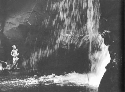
2. For the control of sedimentation and erosion and their effects, the following action will be needed:
a. Cooperative Federal-State-local efforts to accelerate land-use adjustment and land treatment in the Basin.
b. Adoption by State, county and municipal governments of good strong statutes and ordinances for the control of erosion from construction sites and other sources in urban areas.[Pg 113][Pg 112]
c. Completion of current experiments on Rock Creek in the reduction of storm water turbidity by means of coagulants, and extension of such research to the Potomac estuary.
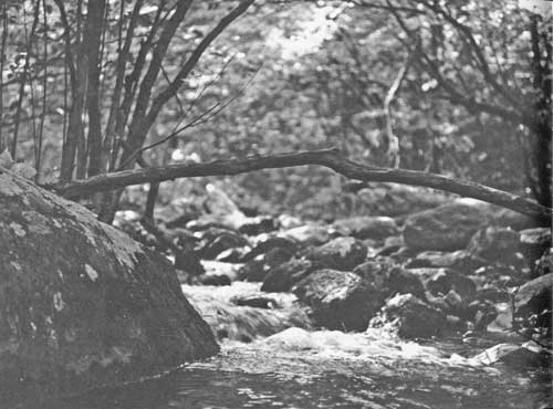
B. With primary reference to problems of water supply and flood damage in the Basin, steps must be taken to cope with present or looming municipal and industrial demands and to guard against future troubles:
1. Large-scale or general problems call for large or general actions:
a. We recommend that major Basin water supply problems, including the need for some storage to restore and protect the quality of the water in the flowing rivers and the needs for flat-water recreation, be dealt with as follows:
(1) By prompt funding and construction of the authorized Bloomington Reservoir on the Potomac North Branch, for benefits in that region and downstream, including the Washington metropolis.
(2) By completing action on the reports on the several additional major reservoirs which, together with Bloomington, will constitute a "package" of drought insurance against the Basin's most critical expected water demands during at least the next 20 years. Three of the additional reservoirs are those on Town Creek, Little Cacapon Creek, and Sideling Hill Creek, recommended in the Potomac Interim Report to the President of January 1966 and detailed in subsequent studies, for benefits in terms of downstream water supply and exceptional recreational opportunity. Another reservoir, North Mountain on Back Creek, was considered to be essential for meeting these needs by the Governor's Potomac Advisory Committee in its consideration of the 1966 Interim Report and was recommended in the Corps of Engineers Potomac River Basin Report of 1963. Additional reservoirs include the Sixes Bridge Reservoir on the Monocacy and the Verona Reservoir on the Middle River tributary of the South Fork of the Shenandoah, also recommended in the Corps of Engineers 1963 report and currently being restudied in detail to meet present projections of local and downstream needs.
According to present data, for maximum usefulness and safety, Bloomington[Pg 115][Pg 114] should be completed on an expeditious basis and the others at appropriate intervals thereafter in relation to growth of demand.
To make certain that desirable flexibility in planning will be maintained, the following conditions should be borne in mind by all Federal, State, or interstate agencies with present or future concern with Basin affairs, and by the United States Congress and the State legislatures, and should be taken into consideration in the shaping of authorizing legislation:
(a) Individual reservoirs should be susceptible to reevaluation and modification during design stage in light of new techniques of water supply—including demonstrated feasibility and acceptability of the upper estuary for this purpose—and of water quality control, or unforeseeable modifications of aims or expected demands, should such change be determined to be beneficial to the overall well-being of the Basin.
(b) Prior to construction of any reservoir with benefits for recreation and water quality downstream, responsible State and local agencies should be required to furnish assurances that the recreational and scenic qualities of the banks of the rivers so benefited will be amply protected.
(3) By the continuing assessment by the Corps of Engineers of the water supply needs of the Washington metropolitan area with the objective of meeting future demands as they develop.
(4) By research and investigation to ensure a sound scientific basis for future action in relation to the Basin's water resources and to provide maximum flexibility of choice to technicians, planners, and decision makers:
(a) A full-scale and continuing water data collection program to be conducted in the Basin by the U.S. Geological Survey, with the object of building and keeping up to date the facts relevant to the river system and related aquifers.
(b) Specific and continuing research by the Department of the Interior as well as other agencies into the nature and feasibility of a full range of possible alternative sources of water supply in the Basin, including new technological approaches.
(c) A special study should be made, based on extension and coordination of studies now authorized or under way to determine the feasibility and accepta[Pg 117][Pg 116]bility of using the upper estuary as a future source of domestic water to supplement the water supply for the metropolitan area. The States of Maryland and Virginia, the District of Columbia and the Metropolitan Council of Governments should also be associated with this study.
b. To begin to cope with major or general flooding problems in the Basin and to prevent future potential flood damages, the following actions should be taken:
(1) Assignment of high priority, by Federal, State, and local interests, to flood mapping and flood plain information studies which will provide complete coverage of the main stem of the Potomac River from Cumberland, Maryland, to below Alexandria, Virginia, including the Washington metropolitan area, with the purpose of defining flood hazards along the river for use by planners, investment agencies and Government agencies at all levels. Elsewhere in the Basin, priorities for such mapping and studies of all significant flood plains should be assigned and the program undertaken as soon as practicable, with primary attention to those areas where pressures for flood plain development and potential flood damage are greatest.
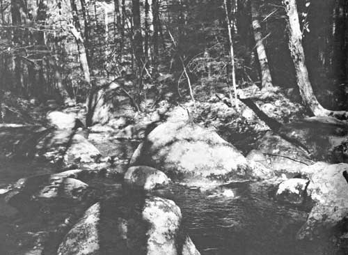
(2) Action by the Corps of Engineers to define a program of active and passive flood alleviation measures for the Washington metropolitan area, and all possible emphasis by other concerned Federal agencies on flood-proofing and other devices for averting flood damage at and around the capital city.
(3) Continuing study by all agencies of the problem of adjusting current policies so as to stimulate reasonable, fair, economic, and esthetically desirable action toward flood damage reduction not only in the Potomac Basin but elsewhere in the nation, in line with the principles enunciated in the 1966 report of the President's Task Force on the Federal Flood Control Policy.

2. Water supply or flooding problems in localized areas may often be solved with headwater reservoirs which may be included in watershed plans developed by local sponsoring organizations with assistance from the Soil Conservation Service of the Department of Agriculture. Such plans provide for the conservation and development of both the soil and water resources of the watershed. Preliminary studies indicate[Pg 119][Pg 118] that headwater reservoirs are needed and feasible in 61 small watersheds in the Basin. These small headwater reservoirs, designed primarily for local flood prevention, may include storage for sediment, water supply, water quality control or recreation.
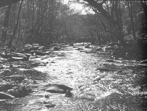
II. Action relating specifically to the protection and restoration of the Potomac Basin's scenic and natural assets, and to their enjoyment by the public:
A. At the critically important level of local planning, governments need to provide incentives toward wise and decent treatment of the environment in all possible ways, including:
1. Careful examination of all Federal and State programs and policies directly or indirectly influential on the landscape, to make certain that their effects are beneficial or their adverse effects are minimized and that they encourage rather than disrupt local efforts to avert blight even while achieving sound growth. Obvious connections exist between good local environments and such things as planning aid programs and grants for parks and recreation areas, but other grant programs, public works, road and utility routings, tax and mortgage practices, the proper or improper design of government facilities, and many other Federal or State activities have relevance in this respect.
2. Dissemination of knowledge about strong, effective planning tools and procedures, as such knowledge accumulates. Of particular Basinwide interest will be the results of the application of Soil Conservation Service watershed programs in controlling erosion in urbanizing stream basins in the Washington metropolitan area, and the lessons learned therefrom. The Geological Survey's investigations of the resources of the Basin are a continuing source of essential information for planning. For example, the studies of the effects of urban development on streams and sediment will be especially pertinent to land-use planning.
B. The lifelines of the Basin's landscape, its flowing rivers and streams, badly need protection against rapidly increasing encroachment along their banks, and should be made[Pg 120] more available for public use and enjoyment. For these purposes, the following measures are strongly recommended:
1. Prompt legislative authorization, funding, and establishment of a Potomac National River complex consisting of Federal, State, and local components to provide a "green sheath" of varying width for the main stem of the river from Washington to Cumberland, Maryland. The preservation of this portion of the river and its banks, and their accessibility, are clearly of importance and warrant such treatment. The National River, studied and refined in the light of much government and public comment received since its initial mention in the Potomac Interim Report, is detailed in the legislative proposal now being considered by Congress.
2. Completion of the long-deferred restoration and improvement of public facilities along the C. & O. Canal, a project which can be begun immediately and will mesh with the Potomac National River proposal, since the Canal will be a part of the proposed River. Certain of the old C. & O. feeder dams should be rehabilitated or rebuilt, sections of the Canal rewatered, and better public access provided.
3. Studies of the Cacapon, Shenandoah, and South Branch Potomac Rivers to determine the most feasible way to preserve all or portions of these scenic and important tributaries in a relatively unspoiled state. Possibilities here are protection under State legislation, or the establishment of a new Federal category of pastoral or scenic rivers as a protective measure for streams in settled regions such as would be authorized under legislation pending in the Congress.
4. Encouragement of local action to preserve the banks of smaller free-flowing streams by zoning, park acquisition, or other means.
5. Provision, under auspices of State fish and wildlife agencies or otherwise, or better facilities for public access to all main streams—including, where appropriate, roads, trails, parking areas, boat launching ramps, and public transportation.
C. The historic Potomac estuary, with nearly a quarter of a million acres of water surface and hundreds of miles of varied and scenic shoreline, is a rich recreational and wildlife asset as well as a fisheries resource of enormous value. Even after water quality programs rescue its upper reaches from the heavy pollution to which they are presently[Pg 121] subject, however, more knowledge will be needed than presently exists to make certain that its intricate processes continue to function productively; protection of its shores against growing inappropriate encroachment will be an urgent problem; and the possibility of its use by the public for recreation will need to be assured:
1. A cooperative study should be undertaken by Federal agencies, the States of Maryland and Virginia, the District of Columbia, and the Metropolitan Washington Council of Governments, coordinated through the Bureau of Outdoor Recreation, to identify recreational and other open space and specific resources along the tidal Potomac downstream from Chain Bridge that should be established as estuarine units of a Potomac National River, as State or county parks, or as units of a system of recreation areas for the District of Columbia and its metropolitan environs. The Department of the Interior is assisting the Department of Defense to determine how military establishments along the Potomac might contribute toward meeting regional recreational needs, including public access and use where feasible. These studies should be completed and the findings reported to the Congress and to State and local governments at the earliest possible time.
2. As an initial measure toward achieving protection of the concentrated productivity of the estuary's marshes and wetlands, Federal, State and local agencies, and the Potomac River Fisheries Commission, under the leadership of the Bureau of Sport Fisheries and Wildlife, should undertake a study, to be completed within three years, to identify key areas of this sort; where possible, acquisition of such areas should proceed under existing programs. In view of the recreation potential generally associated with marsh and wetland areas, this study should be coordinated closely with the study recommended under item 1 above. The Department of Defense should examine its land holdings along the estuary to determine if zones of conservation for fish and wildlife in the marshes and wetlands can be established immediately.
3. Action should be taken as quickly as possible to acquire the National Wildlife Refuge on Mason Neck in order to consolidate the protection of vital open space on that peninsula. Fiscal year 1969 appropriations for the Department of the Interior include funds to begin such action.[Pg 123][Pg 122]
4. It is urgently to be hoped that legislation aimed at protecting American estuaries and increasing human knowledge of their processes, currently before Congress, will be passed in the most meaningful possible form, to the benefit of the Potomac estuary as well as all others.
5. The U. S. Army Corps of Engineers should continue to regulate the development of structures built into the navigable waters and, in cooperation with local entities, study means of ridding the Potomac estuary of permanent and semipermanent debris and floating debris.
6. To guard against the loss of public assets of great worth along the estuary, the General Services Administration, in cooperation with the Department of the Interior, should give full consideration to recreation, fish and wildlife, scenic and other conservation values at the time any Federal installation becomes surplus to defense of other needs.
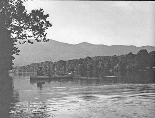
D. State fish and wildlife conservation agencies in the Basin need to strengthen their programs if hunting and fishing opportunities are to meet the growing demand and if the broad spectrum of wildlife essential to a healthy landscape is to be maintained:
1. High priority and ample funds should be assigned to the improvement and development of wildlife habitat throughout the Basin, and special attention paid to the stimulation of good hunting and fishing opportunity on private lands.
2. Research and management programs of the fish and wildlife agencies are vital, and need expansion based in broad public support and adequate funding.
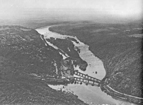
E. National Forest lands are the most massive scenic, ecological, and recreational asset in public ownership in the Basin, and Forest Service programs have beneficial effects far beyond the National Forests' limits. Action specifically relating to these lands and programs is vital to landscape protection and recreational development, and should involve the following:
1. To preserve the natural beauty of the North and South Forks of the Shenandoah River above their confluence, to assure public access, to provide for development[Pg 125][Pg 124] and public use of the recreational potential of the streams, mountains, and forests in this area and conservation of its watersheds and natural resources, a National Recreation Area should be established, to be administered by the Secretary of Agriculture and to be comprised of the existing Massanutten Unit of the George Washington National Forest and such adjacent areas as may be needed to accomplish the purposes enumerated above.
2. Development of the Spruce Knob-Seneca Rocks National Recreation Area, designated by Congress in 1965, should be accelerated.
3. Other National Forest lands in the Basin should also be adapted to a variety of compatible recreational uses, and their beauty and natural functioning protected by watershed management and the improvement of wildlife habitat, at an accelerated pace for early results.
4. In the interest of consolidation of this great resource, the Secretary of Agriculture should continue discussion with States, local governments, and private citizens, leading to extension of the National Forests on the upper reaches of the Potomac.
5. To enhance and increase the widely sought opportunity for water-related recreation in the National Forest lands as well as to contribute to the Forests' functional health, two measures are recommended:
a. Acceleration of work to improve the hydrologic characteristics of these lands, with the purpose of decreasing damage from rapid runoff and increasing the flow of clean natural water in the streams during critical low-flow periods.
b. Installation of that portion of the Department of Agriculture's upstream watershed improvement program consisting of some 40 small reservoirs within the National Forests, and recreational development of the sites in a manner compatible with State recreation planning.
6. To encourage and help non-Federal forest landowners in the Basin to maintain forest cover and develop their woodlands for fish and game production, natural beauty, and recreation, existing Forest Service, State, and private forestry programs should be accelerated.

F. The public's opportunity to appreciate and enjoy the rich variety of the Basin's landscape is hampered now by a shortage of suitable routes designed to furnish that opportunity. Two systems of such routes would link together the Basin's most fundamental attractions and connect it with the amenities of other regions:
1. Studies are already well advanced toward the definition of needs for recreation and scenic motoring tied in with the existing George Washington Memorial Parkway, Skyline Drive, and Blue Ridge Parkway. They should be completed and implemented when feasible in consultation with the Department of Transportation. A route that warrants equal consideration would be the extension of the George Washington Memorial Parkway from Mount Vernon to Yorktown as recommended in the Potomac Interim Report to the President.
2. A Basinwide system of trails for hiking, bicycling, and horseback travel has been studied and its details are presented in a separate report. This compatible and organic means of putting town and city people in touch with the natural environment and the countryside is an indispensable element of a full recreational program for the Basin, and it is strongly to be hoped that the establishment of the Potomac Heritage Trail along the river and the protection of the ridgeline Appalachian Trail—the two trunk elements of the system—will be promptly achieved under the legislation recently acted upon by the Congress.
G. Some of the most basic beauty of the Potomac Basin is found in its older towns and its inhabited countryside, where centuries of history are reflected in structures, historic sites, and types of land use. To protect this beauty and richness against unnecessary destruction and degradation, vigorous action is indicated:
1. The Basin States should consider the possibility of utilizing their State Historical Survey Commissions not only to designate and protect significant townscapes and rural landscapes as historical districts, but also to monitor encroachments and inappropriate construction affecting esthetic and associative values at or near historic sites. State legislation to restrict the exercise of eminent domain by utility companies for pipelines and transmission line routes in such areas is highly desirable.
2. If the Basin's traditional farms are to be preserved not only for their beauty and as[Pg 128] open space near towns and cities but as an element in the economic health of the region, action at all levels of government will be needed. Tax relief as a tool to encourage continued farming on land in danger of urban development needs to be utilized more widely by counties. Programs should be developed that will help preserve the contribution that farms make to the life and landscape of the Basin. Imaginative new approaches are mandatory if there is to be any hope of coping with this problem.
H. At all levels of government also, a concerted effort must be made to clean up junk, spoil, and debris inherited from misuses of the past and to prevent new accumulations. Over 10,000 acres of surface-mined lands need reclamation, thousands of junked cars mar the landscape, and trash and litter clutter the land and streams. Existing programs must be accelerated and new ones devised. Legislation now before the Congress would establish a cooperative Federal-State program to regulate surface mining operations and to assure the reclamation of areas mined in the future. In addition, it is imperative that Basin Federal and State installations promulgate regulations to prevent accumulations of junk and debris on their lands.
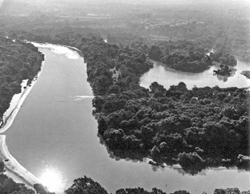
III. To help ensure that future planning and action in relation to the Potomac Basin's water resources, water-related land resources, and amenities shall proceed in a wise and coordinated manner, we recommend:
A. That citizens of the Basin interested in its overall well-being give serious thought of joining together in a broad-based organization to promote all aspects of that well-being by public education, discussion, monitoring abuses, pressing for good local planning and land use, and reviewing proposals for environmental action in the Basin.
B. That the Federal and State governments continue their efforts to define and establish appropriate institutional arrangements for the management and operation of this Potomac Basin program and the furtherance of its principles of protection, preservation, good water management and flexibility. The Potomac River Basin Compact, as proposed in draft form by the Potomac River Basin Advisory Committee, is receiving careful consideration by Federal agencies and citizens, anticipating consideration by State legislative bodies, and the Congress of the United States.


End of the Project Gutenberg EBook of The Nation's River, by
United States Department of the Interior

*** END OF THIS PROJECT GUTENBERG EBOOK THE NATION'S RIVER ***

***** This file should be named 20503-h.htm or 20503-h.zip *****
This and all associated files of various formats will be found in:
        http://www.gutenberg.org/2/0/5/0/20503/

Produced by Mark C. Orton, Janet Blenkinship and the Online
Distributed Proofreading Team at http://www.pgdp.net


Updated editions will replace the previous one--the old editions
will be renamed.

Creating the works from public domain print editions means that no
one owns a United States copyright in these works, so the Foundation
(and you!) can copy and distribute it in the United States without
permission and without paying copyright royalties.  Special rules,
set forth in the General Terms of Use part of this license, apply to
copying and distributing Project Gutenberg-tm electronic works to
protect the PROJECT GUTENBERG-tm concept and trademark.  Project
Gutenberg is a registered trademark, and may not be used if you
charge for the eBooks, unless you receive specific permission.  If you
do not charge anything for copies of this eBook, complying with the
rules is very easy.  You may use this eBook for nearly any purpose
such as creation of derivative works, reports, performances and
research.  They may be modified and printed and given away--you may do
practically ANYTHING with public domain eBooks.  Redistribution is
subject to the trademark license, especially commercial
redistribution.


*** START: FULL LICENSE ***

THE FULL PROJECT GUTENBERG LICENSE
PLEASE READ THIS BEFORE YOU DISTRIBUTE OR USE THIS WORK

To protect the Project Gutenberg-tm mission of promoting the free
distribution of electronic works, by using or distributing this work
(or any other work associated in any way with the phrase "Project
Gutenberg"), you agree to comply with all the terms of the Full Project
Gutenberg-tm License (available with this file or online at
http://gutenberg.org/license).


Section 1.  General Terms of Use and Redistributing Project Gutenberg-tm
electronic works

1.A.  By reading or using any part of this Project Gutenberg-tm
electronic work, you indicate that you have read, understand, agree to
and accept all the terms of this license and intellectual property
(trademark/copyright) agreement.  If you do not agree to abide by all
the terms of this agreement, you must cease using and return or destroy
all copies of Project Gutenberg-tm electronic works in your possession.
If you paid a fee for obtaining a copy of or access to a Project
Gutenberg-tm electronic work and you do not agree to be bound by the
terms of this agreement, you may obtain a refund from the person or
entity to whom you paid the fee as set forth in paragraph 1.E.8.

1.B.  "Project Gutenberg" is a registered trademark.  It may only be
used on or associated in any way with an electronic work by people who
agree to be bound by the terms of this agreement.  There are a few
things that you can do with most Project Gutenberg-tm electronic works
even without complying with the full terms of this agreement.  See
paragraph 1.C below.  There are a lot of things you can do with Project
Gutenberg-tm electronic works if you follow the terms of this agreement
and help preserve free future access to Project Gutenberg-tm electronic
works.  See paragraph 1.E below.

1.C.  The Project Gutenberg Literary Archive Foundation ("the Foundation"
or PGLAF), owns a compilation copyright in the collection of Project
Gutenberg-tm electronic works.  Nearly all the individual works in the
collection are in the public domain in the United States.  If an
individual work is in the public domain in the United States and you are
located in the United States, we do not claim a right to prevent you from
copying, distributing, performing, displaying or creating derivative
works based on the work as long as all references to Project Gutenberg
are removed.  Of course, we hope that you will support the Project
Gutenberg-tm mission of promoting free access to electronic works by
freely sharing Project Gutenberg-tm works in compliance with the terms of
this agreement for keeping the Project Gutenberg-tm name associated with
the work.  You can easily comply with the terms of this agreement by
keeping this work in the same format with its attached full Project
Gutenberg-tm License when you share it without charge with others.

1.D.  The copyright laws of the place where you are located also govern
what you can do with this work.  Copyright laws in most countries are in
a constant state of change.  If you are outside the United States, check
the laws of your country in addition to the terms of this agreement
before downloading, copying, displaying, performing, distributing or
creating derivative works based on this work or any other Project
Gutenberg-tm work.  The Foundation makes no representations concerning
the copyright status of any work in any country outside the United
States.

1.E.  Unless you have removed all references to Project Gutenberg:

1.E.1.  The following sentence, with active links to, or other immediate
access to, the full Project Gutenberg-tm License must appear prominently
whenever any copy of a Project Gutenberg-tm work (any work on which the
phrase "Project Gutenberg" appears, or with which the phrase "Project
Gutenberg" is associated) is accessed, displayed, performed, viewed,
copied or distributed:

This eBook is for the use of anyone anywhere at no cost and with
almost no restrictions whatsoever.  You may copy it, give it away or
re-use it under the terms of the Project Gutenberg License included
with this eBook or online at www.gutenberg.org

1.E.2.  If an individual Project Gutenberg-tm electronic work is derived
from the public domain (does not contain a notice indicating that it is
posted with permission of the copyright holder), the work can be copied
and distributed to anyone in the United States without paying any fees
or charges.  If you are redistributing or providing access to a work
with the phrase "Project Gutenberg" associated with or appearing on the
work, you must comply either with the requirements of paragraphs 1.E.1
through 1.E.7 or obtain permission for the use of the work and the
Project Gutenberg-tm trademark as set forth in paragraphs 1.E.8 or
1.E.9.

1.E.3.  If an individual Project Gutenberg-tm electronic work is posted
with the permission of the copyright holder, your use and distribution
must comply with both paragraphs 1.E.1 through 1.E.7 and any additional
terms imposed by the copyright holder.  Additional terms will be linked
to the Project Gutenberg-tm License for all works posted with the
permission of the copyright holder found at the beginning of this work.

1.E.4.  Do not unlink or detach or remove the full Project Gutenberg-tm
License terms from this work, or any files containing a part of this
work or any other work associated with Project Gutenberg-tm.

1.E.5.  Do not copy, display, perform, distribute or redistribute this
electronic work, or any part of this electronic work, without
prominently displaying the sentence set forth in paragraph 1.E.1 with
active links or immediate access to the full terms of the Project
Gutenberg-tm License.

1.E.6.  You may convert to and distribute this work in any binary,
compressed, marked up, nonproprietary or proprietary form, including any
word processing or hypertext form.  However, if you provide access to or
distribute copies of a Project Gutenberg-tm work in a format other than
"Plain Vanilla ASCII" or other format used in the official version
posted on the official Project Gutenberg-tm web site (www.gutenberg.org),
you must, at no additional cost, fee or expense to the user, provide a
copy, a means of exporting a copy, or a means of obtaining a copy upon
request, of the work in its original "Plain Vanilla ASCII" or other
form.  Any alternate format must include the full Project Gutenberg-tm
License as specified in paragraph 1.E.1.

1.E.7.  Do not charge a fee for access to, viewing, displaying,
performing, copying or distributing any Project Gutenberg-tm works
unless you comply with paragraph 1.E.8 or 1.E.9.

1.E.8.  You may charge a reasonable fee for copies of or providing
access to or distributing Project Gutenberg-tm electronic works provided
that

- You pay a royalty fee of 20% of the gross profits you derive from
     the use of Project Gutenberg-tm works calculated using the method
     you already use to calculate your applicable taxes.  The fee is
     owed to the owner of the Project Gutenberg-tm trademark, but he
     has agreed to donate royalties under this paragraph to the
     Project Gutenberg Literary Archive Foundation.  Royalty payments
     must be paid within 60 days following each date on which you
     prepare (or are legally required to prepare) your periodic tax
     returns.  Royalty payments should be clearly marked as such and
     sent to the Project Gutenberg Literary Archive Foundation at the
     address specified in Section 4, "Information about donations to
     the Project Gutenberg Literary Archive Foundation."

- You provide a full refund of any money paid by a user who notifies
     you in writing (or by e-mail) within 30 days of receipt that s/he
     does not agree to the terms of the full Project Gutenberg-tm
     License.  You must require such a user to return or
     destroy all copies of the works possessed in a physical medium
     and discontinue all use of and all access to other copies of
     Project Gutenberg-tm works.

- You provide, in accordance with paragraph 1.F.3, a full refund of any
     money paid for a work or a replacement copy, if a defect in the
     electronic work is discovered and reported to you within 90 days
     of receipt of the work.

- You comply with all other terms of this agreement for free
     distribution of Project Gutenberg-tm works.

1.E.9.  If you wish to charge a fee or distribute a Project Gutenberg-tm
electronic work or group of works on different terms than are set
forth in this agreement, you must obtain permission in writing from
both the Project Gutenberg Literary Archive Foundation and Michael
Hart, the owner of the Project Gutenberg-tm trademark.  Contact the
Foundation as set forth in Section 3 below.

1.F.

1.F.1.  Project Gutenberg volunteers and employees expend considerable
effort to identify, do copyright research on, transcribe and proofread
public domain works in creating the Project Gutenberg-tm
collection.  Despite these efforts, Project Gutenberg-tm electronic
works, and the medium on which they may be stored, may contain
"Defects," such as, but not limited to, incomplete, inaccurate or
corrupt data, transcription errors, a copyright or other intellectual
property infringement, a defective or damaged disk or other medium, a
computer virus, or computer codes that damage or cannot be read by
your equipment.

1.F.2.  LIMITED WARRANTY, DISCLAIMER OF DAMAGES - Except for the "Right
of Replacement or Refund" described in paragraph 1.F.3, the Project
Gutenberg Literary Archive Foundation, the owner of the Project
Gutenberg-tm trademark, and any other party distributing a Project
Gutenberg-tm electronic work under this agreement, disclaim all
liability to you for damages, costs and expenses, including legal
fees.  YOU AGREE THAT YOU HAVE NO REMEDIES FOR NEGLIGENCE, STRICT
LIABILITY, BREACH OF WARRANTY OR BREACH OF CONTRACT EXCEPT THOSE
PROVIDED IN PARAGRAPH F3.  YOU AGREE THAT THE FOUNDATION, THE
TRADEMARK OWNER, AND ANY DISTRIBUTOR UNDER THIS AGREEMENT WILL NOT BE
LIABLE TO YOU FOR ACTUAL, DIRECT, INDIRECT, CONSEQUENTIAL, PUNITIVE OR
INCIDENTAL DAMAGES EVEN IF YOU GIVE NOTICE OF THE POSSIBILITY OF SUCH
DAMAGE.

1.F.3.  LIMITED RIGHT OF REPLACEMENT OR REFUND - If you discover a
defect in this electronic work within 90 days of receiving it, you can
receive a refund of the money (if any) you paid for it by sending a
written explanation to the person you received the work from.  If you
received the work on a physical medium, you must return the medium with
your written explanation.  The person or entity that provided you with
the defective work may elect to provide a replacement copy in lieu of a
refund.  If you received the work electronically, the person or entity
providing it to you may choose to give you a second opportunity to
receive the work electronically in lieu of a refund.  If the second copy
is also defective, you may demand a refund in writing without further
opportunities to fix the problem.

1.F.4.  Except for the limited right of replacement or refund set forth
in paragraph 1.F.3, this work is provided to you 'AS-IS' WITH NO OTHER
WARRANTIES OF ANY KIND, EXPRESS OR IMPLIED, INCLUDING BUT NOT LIMITED TO
WARRANTIES OF MERCHANTIBILITY OR FITNESS FOR ANY PURPOSE.

1.F.5.  Some states do not allow disclaimers of certain implied
warranties or the exclusion or limitation of certain types of damages.
If any disclaimer or limitation set forth in this agreement violates the
law of the state applicable to this agreement, the agreement shall be
interpreted to make the maximum disclaimer or limitation permitted by
the applicable state law.  The invalidity or unenforceability of any
provision of this agreement shall not void the remaining provisions.

1.F.6.  INDEMNITY - You agree to indemnify and hold the Foundation, the
trademark owner, any agent or employee of the Foundation, anyone
providing copies of Project Gutenberg-tm electronic works in accordance
with this agreement, and any volunteers associated with the production,
promotion and distribution of Project Gutenberg-tm electronic works,
harmless from all liability, costs and expenses, including legal fees,
that arise directly or indirectly from any of the following which you do
or cause to occur: (a) distribution of this or any Project Gutenberg-tm
work, (b) alteration, modification, or additions or deletions to any
Project Gutenberg-tm work, and (c) any Defect you cause.


Section  2.  Information about the Mission of Project Gutenberg-tm

Project Gutenberg-tm is synonymous with the free distribution of
electronic works in formats readable by the widest variety of computers
including obsolete, old, middle-aged and new computers.  It exists
because of the efforts of hundreds of volunteers and donations from
people in all walks of life.

Volunteers and financial support to provide volunteers with the
assistance they need, is critical to reaching Project Gutenberg-tm's
goals and ensuring that the Project Gutenberg-tm collection will
remain freely available for generations to come.  In 2001, the Project
Gutenberg Literary Archive Foundation was created to provide a secure
and permanent future for Project Gutenberg-tm and future generations.
To learn more about the Project Gutenberg Literary Archive Foundation
and how your efforts and donations can help, see Sections 3 and 4
and the Foundation web page at http://www.pglaf.org.


Section 3.  Information about the Project Gutenberg Literary Archive
Foundation

The Project Gutenberg Literary Archive Foundation is a non profit
501(c)(3) educational corporation organized under the laws of the
state of Mississippi and granted tax exempt status by the Internal
Revenue Service.  The Foundation's EIN or federal tax identification
number is 64-6221541.  Its 501(c)(3) letter is posted at
http://pglaf.org/fundraising.  Contributions to the Project Gutenberg
Literary Archive Foundation are tax deductible to the full extent
permitted by U.S. federal laws and your state's laws.

The Foundation's principal office is located at 4557 Melan Dr. S.
Fairbanks, AK, 99712., but its volunteers and employees are scattered
throughout numerous locations.  Its business office is located at
809 North 1500 West, Salt Lake City, UT 84116, (801) 596-1887, email
business@pglaf.org.  Email contact links and up to date contact
information can be found at the Foundation's web site and official
page at http://pglaf.org

For additional contact information:
     Dr. Gregory B. Newby
     Chief Executive and Director
     gbnewby@pglaf.org


Section 4.  Information about Donations to the Project Gutenberg
Literary Archive Foundation

Project Gutenberg-tm depends upon and cannot survive without wide
spread public support and donations to carry out its mission of
increasing the number of public domain and licensed works that can be
freely distributed in machine readable form accessible by the widest
array of equipment including outdated equipment.  Many small donations
($1 to $5,000) are particularly important to maintaining tax exempt
status with the IRS.

The Foundation is committed to complying with the laws regulating
charities and charitable donations in all 50 states of the United
States.  Compliance requirements are not uniform and it takes a
considerable effort, much paperwork and many fees to meet and keep up
with these requirements.  We do not solicit donations in locations
where we have not received written confirmation of compliance.  To
SEND DONATIONS or determine the status of compliance for any
particular state visit http://pglaf.org

While we cannot and do not solicit contributions from states where we
have not met the solicitation requirements, we know of no prohibition
against accepting unsolicited donations from donors in such states who
approach us with offers to donate.

International donations are gratefully accepted, but we cannot make
any statements concerning tax treatment of donations received from
outside the United States.  U.S. laws alone swamp our small staff.

Please check the Project Gutenberg Web pages for current donation
methods and addresses.  Donations are accepted in a number of other
ways including checks, online payments and credit card donations.
To donate, please visit: http://pglaf.org/donate


Section 5.  General Information About Project Gutenberg-tm electronic
works.

Professor Michael S. Hart is the originator of the Project Gutenberg-tm
concept of a library of electronic works that could be freely shared
with anyone.  For thirty years, he produced and distributed Project
Gutenberg-tm eBooks with only a loose network of volunteer support.


Project Gutenberg-tm eBooks are often created from several printed
editions, all of which are confirmed as Public Domain in the U.S.
unless a copyright notice is included.  Thus, we do not necessarily
keep eBooks in compliance with any particular paper edition.


Most people start at our Web site which has the main PG search facility:

     http://www.gutenberg.org

This Web site includes information about Project Gutenberg-tm,
including how to make donations to the Project Gutenberg Literary
Archive Foundation, how to help produce our new eBooks, and how to
subscribe to our email newsletter to hear about new eBooks.