The Project Gutenberg EBook of The Hudson, by Wallace Bruce

This eBook is for the use of anyone anywhere at no cost and with
almost no restrictions whatsoever.  You may copy it, give it away or
re-use it under the terms of the Project Gutenberg License included
with this eBook or online at www.gutenberg.org


Title: The Hudson
       Three Centuries of History, Romance and Invention

Author: Wallace Bruce

Release Date: February 22, 2006 [EBook #17823]

Language: English

Character set encoding: ISO-8859-1

*** START OF THIS PROJECT GUTENBERG EBOOK THE HUDSON ***


Produced by Curtis Weyant, Lesley Halamek and the Online
Distributed Proofreading Team at http://www.pgdp.net (This
file was produced from images generously made available
by Cornell University Digital Collections)
| Desbrosses Street Pier to Forty-Second Street | 41-43 | |
| Historic River Front | 41 | |
| A Great Panorama | 41 | |
| Statue of Liberty—Stevens Castle | 42 | |
| Forty-Second to One Hundred and Twenty-Ninth | 43-48 | |
| Weehawken, Hamilton and Burr | 43 | |
| Riverside Drive and Park | 45 | |
| Columbia University | 46 | |
| General Grant's Tomb | 46 | |
| One Hundred and Twenty-Ninth St. to Yonkers | 49-50 | |
| Washington Heights | 49 | |
| The Palisades | 52 | |
| Island of Manhattan | 56 | |
| Spuyten Duyvel Creek | 57 | |
| Yonkers | 58 | |
| West Point to Newburgh | 97-103 | |
| Northern Gate of Highlands | 98 | |
| "Undercliff" | 99 | |
| Storm King | 100 | |
| Cornwall and "Idlewild" | 102 | |
| Poughkeepsie to Kingston | 129-146 | |
| Hyde Park | 130 | |
| Mount Hymettus | 130 | |
| Rhinecliff | 135 | |
| City of Kingston | 136 | |
| The Senate House | 138 | |
| The Southern Catskills | 142 | |
| Catskill to Hudson | 169-172 | |
| Hudson | 169 | |
| Columbia Springs | 170 | |
| Claverack and Hillsdale | 171 | |
| Hudson to Albany | 173-185 | |
| Athens | 173 | |
| The Ice Industry | 173 | |
| Anthony Van Corlear | 176 | |
| The Mahican Tribe | 177 | |
| The Mahicans, Delawares and Iroquois | 178 | |
| The Old Van Rensselaer House | 180 | |
| Albany | 181 | |
| Albany to Saratoga | 186-191 | |
| Saratoga | 187 | |
| Historic Saratoga | 189 | |
| Mount McGregor | 190 | |
| Saratoga to the Adirondacks | 191-201 | |
| Saratoga to Lake George | 192 | |
| Lake George to the Adirondacks | 197-201 | |
| Ticonderoga | 198 | |
| Bluff Point | 199 | |
| Plattsburgh and the Saranacs | 201 | |
| Source of the Hudson | 202-210 | |
| The Tahawas Club | 202 | |
| The Upper Ausable | 203 | |
| Haystack and Camp Colden | 204 | |
| The Deserted Village | 205 | |
| Indian Pass | 206 | |
| Tahawas | 210 | |
| Geology, Tides and Condensed Points | 211-224 | |
| Geological Formation | 211-215 | |
| The Hudson Tide | 215 | |
| Condensed Points—New York to Albany | 216-224 | |

ROBERT FULTON'S "CLERMONT" 1807
Hendrick Hudson and Robert Fulton are closely associated in the history of our river, and more particularly at this time, as the dates of their achievements unite the centennial of the first successful steamer in 1807, with the tri-centennial of the discovery of the river in 1609. In fact, these three centuries of navigation, with rapidly increasing development in later years, might be graphically condensed—
"Half Moon," 1609; "Clermont," 1807;
"Hendrick Hudson," 1906.
Singularly enough the discovery of Hendrick Hudson, and the invention of Robert Fulton are also similar in having many adverse claimants who forget the difference between attempt and accomplishment.
Everyone knows that Verrazano entered the Narrows and harbor of our river in 1524, and sailed far enough to see the outline of the Palisades; that Gomez visited its mouth in 1525; Cabot still earlier in 1498; and various Norsemen, named and nameless, for several centuries before them, coasted along the shore and indenture of the "River of the Manhattoes," but failed to acquire or transmit any knowledge of the river's real course or character, and it was left for Hendrick Hudson to be its first voyager and thereby to have and [page 8] to hold against all comers the glory of discovery.
A century vast of Hudson-fame
Which Irving's fancy seals;
Whose ripples murmur Morse's name
And flash to Fulton's wheels.
Wallace Bruce.
So Robert Fulton had several predecessors in the idea of applying steam to navigation—John Fitch in 1785, William Symington in 1788 and many others who likewise coasted along the shore and indenture of a great idea, marked by continual failure and final abandonment. It was reserved for Fulton to complete and stamp upon his labor the seal of service and success, and to stand, therefore, its accepted inventor.
In addition to the invention of Fulton who has contributed so much to the business and brotherhood of mankind, the telegraph of Morse occupies a prominent page of our Hudson history, and it is said that Morse left unfinished a novel, the incidents of which were associated with the Highlands, in order to work out his idea which gave the Hudson a grander chapter.
Fulton's and Morse's inventions are also happily associated in this, that the steamboat was necessary before the Atlantic cable, born of Morse's invention, could be laid, and, singularly enough, the laying of the cable, largely promoted by Hudson River genius and capital, by Field, Cooper, Morse and others on August 5, 1857, marks the very middle of the centennial which we are now observing.
A cycle grand with wonders fraught
That triumph over time and space;
In woven steel its dreams are wrought,
The nations whisper face to face.
Wallace Bruce.
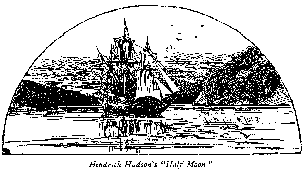
Hendrick Hudson's "Half Moon."
Among all the rivers of the world the Hudson is acknowledged queen, decked with romance, jewelled with poetry, clad with history, and crowned with beauty. More than this, the Hudson is a noble threshold to a great continent and New York Bay a fitting portal. The traveler who enters the Narrows for the first time is impressed with wonder, and the charm abides even with those who pass daily to and fro amid her beauties. No other river approaches the Hudson in varied grandeur and sublimity, and no other city has so grand and commodious a harbor as New York. It has been the privilege of the writer of this hand-book to see again and again most of the streams of the old world "renowned in song and story," to behold sunrise on the Bay of Naples and sunset at the Golden Gate of San Francisco, but the spell of the Hudson remains unbroken, and the bright bay at her mouth reflects the noontide without a rival. To pass a day in her company, rich[page 10] with the story and glory of three hundred years, is worth a trip across a continent, and it is no wonder that the European traveler says again and again: "to see the Hudson alone, is worth a voyage across the Atlantic."
A very good land to fall in with and a pleasant land to see!
Hendrick Hudson
How like a great volume of history romance and poetry seem her bright illumined pages with the broad river lying as a crystal book-mark between her open leaves! And how real this idea becomes to the Day Line tourist, with the record of Washington and Hamilton for its opening sentence, as he leaves the Up-Town landing, and catches messages from Fort Washington and Fort Lee. What Indian legends cluster about the brow of Indian Head blending with the love story of Mary Phillipse at the Manor House of Yonkers. How Irving's vision of Katrina and Sleepy Hollow become woven with the courage of Paulding and the capture of Andre at Tarrytown. How the Southern Portal of the Highlands stands sentineled by Stony Point, a humble crag converted by the courage of Anthony Wayne into a mountain peak of Liberty.
How North and South Beacon again summon the Hudson yeomen from harvest fields to the defense of country, while Fort Putnam, still eloquent in her ruins, looks down upon the best drilled boys in the world at West Point. Further on Newburgh, Poughkeepsie and Kingston shake fraternal hands in the abiding trinity of Washington, Hamilton and Clinton, while northward rise the Ontioras where Rip Van Winkle slept, and woke to wonder at the happenings of twenty years.
What stories of silent valleys told by murmuring streams from the Berkshire Hills and far away fields where Stark and Ethan Allen triumphed. What tales of Cooper, where the Mohawk entwines her fingers with those of the Susquehanna, and poems of Longfellow, Bryant and Holmes, of Dwight, of Halleck and of Drake; ay, and of Yankee Doodle too, written at the Old Van Rensselaer House almost within a pebble-throw of the[page 11] steamer as it approaches Albany. What a wonderful book of history and beauty, all to be read in one day's journey!
Roll on! Roll on!
Thou river of the North! Tell thou to all
The isles, tell thou to all the Continents
The grandeur of my land.
William Wallace.
The Hudson has often been styled "The Rhine of America." There is, however, little of similarity and much of contrast. The Rhine from Dusseldorf to Manheim is only twelve hundred to fifteen hundred feet in breadth. The Hudson from New York to Albany averages more than five thousand feet from bank to bank. At Tappan Zee the Hudson is ten times as wide as the Rhine at any point above Cologne. At Bonn the Rhine is barely one-third of a mile, whereas the Hudson at Haverstraw Bay is over four miles in width. The average breadth of the Hudson from New York to Poughkeepsie is almost eight thousand feet.
The mountains of the Rhine also lack the imposing character of the Highlands. The far-famed Drachenfels, the Landskron, and the Stenzleburg are only seven hundred and fifty feet above the river; the Alteberg eight hundred, the Rosenau nine hundred, and the great Oelberg thirteen hundred and sixty-two. According to the latest United States Geological Survey the entire group of mountains at the northern gate of the Highlands is from fourteen hundred to sixteen hundred and twenty-five feet in height, not to speak of the Catskills from three thousand to almost four thousand feet in altitude.
It is not the fault of the Rhine with its nine hundred miles of rapid flow that it looks tame compared with the Hudson. Even the Mississippi, draining a valley three thousand miles in extent, looks insignificant at St. Louis or New Orleans contrasted with the Hudson at Tarrytown. The Hudson is in fact a vast estuary of the sea; the tide rises two feet at Albany and six inches at Troy. A professor of the Berlin University says: "You lack our castles but the Hudson is infinitely grander." Thackeray, in "The Virginians," gives the Hudson the verdict of beauty; and George William Curtis,[page 12] comparing the Hudson with the rivers of the Old World, has gracefully said: "The Danube has in part glimpses of such grandeur, the Elbe has sometimes such delicately penciled effects, but no European river is so lordly in its bearing, none flows in such state to the sea."
I have been up and down the Hudson by water. The
entire river is pretty, but the glory of the Hudson is at
West Point.
Anthony Trollope.
Baedeker, a high and just authority, in his recent Guide to the United States says: "The Hudson has sometimes been called the American Rhine, but that title perhaps does injustice to both rivers. The Hudson, through a great part of its extent, is three or four times as wide as the Rhine, and its scenery is grander and more inspiring; while, though it lacks the ruined castles and ancient towns of the German river, it is by no means devoid of historical associations of a more recent character. The vine-clad slopes of the Rhine have, too, no ineffective substitute in the brilliant autumn coloring of the timbered hillsides of the Hudson."
A stately stream around which as around
The German Rhine hover mystic shapes
Richard Burton
What must have been the sensation of those early voyagers, coasting a new continent, as they halted at the noble gateway of the river and gazed northward along the green fringed Palisades; or of Hendrick Hudson, who first traversed its waters from Manhattan to the Mohawk, as he looked up from the chubby bow of his "Half Moon" at the massive columnar formation of the Palisades or at the great mountains of the Highlands; what dreams of success, apparently within reach, were his, when night came down in those deep forest solitudes under the shadowy base of Old Cro' Nest and Klinkerberg Mountain, where his little craft seemed a lone cradle of civilization; and then, when at last, with immediate purpose foiled, he turned his boat southward, having discovered, but without knowing it, something infinitely more valuable to future history than his long-sought "Northwestern Passage to China," how he must have gazed with blended wonder and awe at the distant Catskills as their sharp lines came out, as we have seen them many a September morning, bold and clear along the[page 13] horizon, and learned in gentle reveries the poetic meaning of the blue Ontioras or "Mountains of the Sky." How fondly he must have gazed on the picturesque hills above Apokeepsing and listened to the murmuring music of Winnikee Creek, when the air was clear as crystal and the banks seemed to be brought nearer, perfectly reflected in the glassy surface, while here and there his eye wandered over grassy uplands, and rested on hills of maize in shock, looking for all the world like mimic encampments of Indian wigwams! Then as October came with tints which no European eye had ever seen, and sprinkled the hill-tops with gold and russet, he must indeed have felt that he was living an enchanted life, or journeying in a fairy land!
How graphically the poet Willis has put the picture in musical prose: "Fancy the bold Englishman, as the Dutch called Hendrick Hudson, steering his little yacht the 'Haalve Maan,' for the first time through the Highlands. Imagine his anxiety for the channel forgotten, as he gazed up at the towering rocks, and round the green shores, and onward past point and opening bend, miles away into the heart of the country; yet with no lessening of the glorious stream before him and no decrease of promise in the bold and luxuriant shores. Picture him lying at anchor below Newburgh with the dark pass of the Wey-Gat frowning behind him, the lofty and blue Catskills beyond, and the hillsides around covered with lords of the soil exhibiting only less wonder than friendliness."
If Willis forgot the season of the year and left out the landscape glow which the voyager saw, Talmage completed the picture in a rainbow paragraph of color: "Along our river and up and down the sides of the great hills there was an indescribable mingling of gold, and orange and crimson and saffron, now sobering into drab and maroon, now flaring up into solferino and scarlet. Here and there the trees looked as if their tips had blossomed[page 14] into fire. In the morning light the forests seemed as if they had been transfigured and in the evening hours they looked as if the sunset had burst and dropped upon the leaves. It seemed as if the sea of divine glory had dashed its surf to the top of the crags and it had come dripping down to the lowest leaf and deepest cavern."
So fair yon haven clasped its isles, in such a sunset gleam,
When Hendrick and his sea-worn tars first sounded up the stream.
Robert C. Sands.
On such a day in 1883 it was the privilege of the writer to stand before 150,000 people at Newburgh on the occasion of the Centennial Celebration of the Disbanding of the Army under Washington, and, in his poem entitled "The Long Drama," to portray the great mountain background bounding the southern horizon with autumnal splendor:
October lifts with colors bright
Her mountain canvas to the sky,
The crimson trees aglow with light
Unto our banners wave reply.
Like Horeb's bush the leaves repeat
From lips of flame with glory crowned:—
"Put off thy shoes from off thy feet,
The place they trod is holy ground."
Such was the vision Hendrick Hudson must have had in those far-off September and October days, and such the picture which visitors still compass long distances to behold.
"It is a far cry to Loch Awe" says an old Scottish proverb, and it is a long step from the sleepy rail of the "Half Moon" to the roomy-decked floating palaces—the "Hendrick Hudson," the "New York" and the "Albany." Before beginning our journey let us, therefore, bridge the distance with a few intermediate facts, from 1609, relating to the discovery of the river, its early settlement, its old reaches and other points essential to the fullest enjoyment of our trip, which in sailor-parlance might be styled "a gang-plank of history," reaching as it does from the old-time yacht to the modern steamer, and spanning three hundred years.
The prow of the "Half-Moon" has left a broadening
wake whose ripples have written an indelible history,
not only along the Hudson's shores, but have left their
imprint on kingdoms over the sea.
William Wait.
Its Discovery.—In the year 1524, thirty-two years after the discovery of America, the navigator Verrazano, a French officer, anchored off the island of Manhattan and proceeded a short distance up the river. The following year, Gomez, a Portuguese in the employ of Spain, coasted along the continent and entered the Narrows. Several sea-rovers also visited our noble bay about 1598, but it was reserved for Hendrick Hudson, with a mixed crew of eighteen or twenty men in the "Half Moon," to explore the river from Sandy Hook to Albany, and carry back to Europe a description of its beauty. He had previously made two fruitless voyages for the Muscovy Company—an English corporation—in quest of a passage to China, via the North Pole and Nova Zembla.
In the autumn of 1608 he was called to Amsterdam, and sailed from Texel, April 5, 1609, in the service of the Dutch East India Company. Reaching Greenland he coasted southward, arriving at Cape Cod August 6th, Chesapeake Bay August 28th, and then sailed north to Sandy Hook. He entered the Bay of New York September the 3d, passed through the Narrows, and anchored in what is now called Newark Bay; on the 12th resumed his voyage, and, drifting with the tide, remained over night on the 13th about three miles above the northern end of Manhattan Island; on the 14th sailed through what is now known as Tappan Zee and Haverstraw Bay, entered the Highlands and anchored for the night near the present dock of West Point. On the morning of the 15th beheld Newburgh Bay, reached Catskill on the 16th, Athens on the 17th, Castleton and Albany on the 18th, and sent out an exploring boat as far as Waterford. He became thoroughly satisfied that this route did not lead to China—a conclusion in harmony with that of Champlain, who, the same summer, had been making his way south, through Lake Champlain and Lake George, in quest of the South Sea.
O mighty river of the North! Thy lips meet ocean
here, and in deep joy he lifts his great white brow, and
gives his stormy voice a milder tone.
William Wallace
There is something humorous in the idea of these old mariners attempting to sail through a continent 3,000 miles wide, seamed with mountain chains from 2,000 to 15,000 feet in height. Hudson's return voyage began September 23d. He anchored again in Newburgh Bay the 25th, arrived at Stony Point October 1st, reached Sandy Hook the 4th, and returned to Europe.
First Description of the Hudson.—The official record of the voyage was kept by Robert Juet, mate of the "Half Moon," and his journal abounds with graphic and pleasing incidents as to the people and their customs. At the Narrows the Indians visited the vessel, "clothed in mantles of feathers and robes of fur, the women clothed in hemp; red copper tobacco pipes, and other things of copper, they did wear about their necks." At Yonkers they came on board in great numbers. Two were detained and dressed in red coats, but they sprang overboard and swam away. At Catskill they found "a very loving people, and very old men. They brought to the ship Indian corn, pumpkins and tobaccos." Near Schodack the "Master's mate went on land with an old savage, governor of the country, who carried him to his house and made him good cheere." "I sailed to the shore," he writes, "in one of their canoes, with an old man, who was chief of a tribe, consisting of forty men and seventeen women. These I saw there in a house well constructed of oak bark, and circular in shape, so that it has the appearance of being built with an arched roof. It contained a large quantity of corn and beans of last year's growth, and there lay near the house, for the purpose of drying, enough to load three ships, besides what was growing in the fields. On our coming to the house two mats were spread out to sit upon, and some food was immediately served in well-made wooden bowls."
"Two men were also dispatched at once, with bows and arrows in quest of game, who soon brought in a pair of pigeons, which they had shot. They likewise[page 17] killed a fat dog, (probably a black bear), and skinned it in great haste, with shells which they had got out of the water."
Down whose waterways the wings of poetry and romance
like magic sails bear the awakened souls of men.
Richard Burton.
The well-known hospitality of the Hudson River valley has, therefore, "high antiquity" in this record of the garrulous writer. At Albany the Indians flocked to the vessel, and Hudson determined to try the chiefs to see "whether they had any treachery in them." "So they took them down into the cabin, and gave them so much wine and aqua vitae that they were all merry. In the end one of them was drunk, and they could not tell how to take it." The old chief, who took the aqua vitae, was so grateful when he awoke the next day, that he showed them all the country, and gave them venison.
Passing down through the Highlands the "Half Moon" was becalmed near Stony Point and the "people of the Mountains" came on board and marvelled at the ship and its equipment. One canoe kept hanging under the stern and an Indian pilfered a pillow and two shirts from the cabin windows. The mate shot him in the breast and killed him. A boat was lowered to recover the articles "when one of them in the water seized hold of it to overthrow it, but the cook seized a sword and cut off one of his hands and he was drowned." At the head of Manhattan Island the vessel was again attacked. Arrows were shot and two more Indians were killed, then the attack was renewed and two more were slain.
It might also be stated that soon after the arrival of Hendrick Hudson at the mouth of the river one of the English soldiers, John Coleman, was killed by an arrow shot in the throat. "He was buried," according to Ruttenber, "upon the adjacent beach, the first European victim of an Indian weapon on the Mahicanituk. Coleman's point is the monument to this occurrence."
The "Half Moon" never returned and it will be remembered that Hudson never again saw the river that he discovered. He was to leave his name however as a[page 18] monument to further adventure and hardihood in Hudson's Bay, where he was cruelly set adrift by a mutinous crew in a little boat to perish in the midsummer of 1611.
The sea just peering the headlands through
Where the sky is lost in deeper blue.
Charles Fenno Hoffman.
Names of the Hudson.—The Iroquois called the river the "Cohatatea." The Mahicans and Lenapes the "Mahicanituk," or "the ever-flowing waters." Verrazano in 1524 styled it Rio de Montaigne. Gomez in 1525 Rio San Antonio. Hudson styled it the "Manhattes" from the tribe at its mouth. The Dutch named it the "Mauritius," in 1611, in honor of Prince Maurice of Nassau, and afterwards "the Great River." It has also been referred to as the "Shatemuck" in verse. It was called "Hudson's River" not by the Dutch, as generally stated, but by the English, as Hudson was an Englishman, although he sailed from a Dutch port, with a Dutch crew, and a Dutch vessel. It was also called the "North River," to distinguish it from the Delaware, the South River. It is still frequently so styled, and the East River almost "boxes the compass" as applied to Long Island Sound.
Height of Hills and Mountains.—It is interesting to hear the opinions of different people journeying up and down the Hudson as to the height of mountains along the river. The Palisades are almost always under-estimated, probably on account of their distance from the steamer. It is only when we consider the size of a house at their base, or the mast of a sloop anchored near the shore, that we can fairly judge of their magnitude. Various guides, put together in a day or a month, by writers who have made a single journey, or by persons who have never consulted an authority, have gone on multiplying blunder upon blunder, but the United States Geological Survey furnishes reliable information. According to their maps the Palisades are from 300 to 500 feet in height, the Highlands from 785 to 1625, and the Catskills from 3000 to 3885 feet.
Beneath the cliffs the river steals
In darksome eddies to the shore,
But midway every sail reveals
Reflected on its crystal floor.
Henry T. Tuckerman.
| At Fort Lee | 300 feet. |
| Opposite Mt. St. Vincent | 400 " |
| Opposite Hastings | 500 " |
| Sugar Loaf | 785 feet. |
| Dunderberg | 865 " |
| Anthony's Nose | 900 " |
| Storm King | 1368 " |
| Old Cro' Nest | 1405 " |
| Bull Hill | 1425 " |
| South Beacon | 1625 " |
| North Mountain | 3000 feet. |
| Plaaterkill | 3135 " |
| Outlook | 3150 " |
| Stoppel Point | 3426 " |
| Round Top | 3470 " |
| High Peak | 3660 " |
| Sugar Loaf | 3782 " |
| Plateau | 3855 " |
Sources of the Hudson.—The Hudson rises in the Adirondacks, and is formed by two short branches. The northern branch (17 miles in length), has its source in Indian Pass, at the base of Mount McIntyre; the eastern branch, in a little lake poetically called the "Tear of the Clouds," 4,321 feet above the sea under the summit of Tahawus, the noblest mountain of the Adirondacks, 5,344 feet in height. About thirty miles below the junction it takes the waters of Boreas River, and in the southern part of Warren County, nine miles east of Lake George, the tribute of the Schroon. About fifteen miles north of Saratoga it receives the waters of the Sacandaga, then the streams of the Battenkill and the Walloomsac; and a short distance above Troy its largest tributary, the Mohawk. The tide rises six inches at Troy and two feet at Albany, and from Troy to New York, a distance of one hundred and fifty miles, the river is navigable by large steamboats.
Of grottoes in the far dim woods,
Of pools moss-rimmed and deep,
From whose embrace the little rills
In daring venture creep.
E.A. Lente.
The principal streams which flow into the Hudson between Albany and New York are the Norman's Kill, on west bank, two miles south of Albany; the Mourdener's Kill, at Castleton, eight miles below Albany, on the east bank; Coxsackie Creek, on west bank, seventeen miles below Albany; Kinderhook Creek, six miles north of Hudson; Catskill Creek, six miles south of Hudson; Roeliffe Jansen's Creek, on east bank, seven miles south of Hudson; the Esopus Creek, which empties at Saugerties; the Rondout Creek, at Rondout; the Wappingers, at New Hamburgh; the Fishkill, at Matteawan, opposite Newburgh; the Peekskill Creek, and Croton River. The course of the river is nearly north and south, and drains a comparatively narrow valley.
It is emphatically the "River of the Mountains," as it rises in the Adirondacks, flows seaward east of the Helderbergs, the Catskills, the Shawangunks, through twenty miles of the Highlands and along the base of the Palisades. More than any other river it preserves the character of its origin, and the following apostrophe from the writer's poem, "The Hudson," condenses its continuous "mountain-and-lake-like" quality:
O Hudson, mountain-born and free,
Thy youth a deep impression takes,
For, mountain-guarded to the sea,
Thy course is but a chain of lakes.
The First Settlement of the Hudson.—In 1610 a Dutch ship visited Manhattan to trade with the Indians and was soon followed by others on like enterprise. In 1613 Adrian Block came with a few comrades and remained the winter. In 1614 the merchants of North Holland organized a company and obtained from the States General a charter to trade in the New Netherlands, and soon after a colony built a few houses and a fort near the Battery. The entire island was purchased from the Indians in 1624 for the sum of sixty guilders or about[page 21] twenty-four dollars. A fort was built at Albany in 1623 and known as Fort Aurania or Fort Orange. From Wassenaer's "Historie van Europa," 1621-1632, as translated in the 3d volume of the Documentary History of New York, a castle—Fort Nassau—was built in 1624, on an island on the north side of the River Montagne, now called Mauritius. "But as the natives there were somewhat discontented, and not easily managed, the projectors abandoned it, intending now to plant a colony among the Maikans (Mahicans), a nation lying twenty-five miles (American measure seventy-five miles) on both sides of the river, upwards." In another document we learn that "The West India Company being chartered, a vessel of 130 lasts, called the 'New Netherland' (whereof Cornelius Jacobs, of Hoorn, was skipper), with thirty families, mostly Walloons, was equipped in the spring of 1623."
Where Manhattan reigned of old
Long before the age of gold
In the fair encircled isle
Formed for beauty's warmest smile.
William Crow
In the beginning of May they entered the Hudson, found a "Frenchman" lying in the mouth of the river, who would erect the arms of the King of France there, but the Hollanders would not permit him, opposing it by commission from the Lord's States General and the Directors of the West India Company, and "in order not to be frustrated therein, they convoyed the Frenchman out of the rivers." This having been done, they sailed up the Maikans, 140 miles, near which they built and completed a fort, named "Orange," with four bastions, on an island, by them called "Castle Island." This was probably the island below Castleton, now known as Baern Island, where the first white child was born on the Hudson.
In another volume we read that "a colony was planted in 1625 on the Manhetes Island, where a fort was staked out by Master Kryn Fredericke, an engineer. The counting-house is kept in a stone building thatched with reed; the other houses are of the bark of trees. There are thirty ordinary houses on the east side of the river, which runs nearly north and south." This is the description of New York City when Charles the First was King.
Behold the natural advantages of our State; the situation
of our principal seaport; the facility that the
Sound affords for an intercourse with the East, and the
noble Hudson which bears upon its bosom the wealth
of the remotest part of the State.
Robert R. Livingston.
Moreover, we should not forget that Communipaw outranks New York in antiquity, and, according to Knickerbocker, whose quiet humor is always read and re-read with pleasure, might justly be considered the Mother Colony. For lo! the sage Oloffe Van Kortlandt dreamed a dream, and the good St. Nicholas came riding over the tops of the trees, and descended upon the island of Manhattan and sat himself down and smoked, "and the smoke ascended in the sky, and formed a cloud overhead; and Oloffe bethought him, and he hastened and climbed up to the top of one of the tallest trees, and saw that the smoke spread over a great extent of country; and, as he considered it more attentively, he fancied that the great volume assumed a variety of marvelous forms, where, in dim obscurity, he saw shadowed out palaces and domes and lofty spires, all of which lasted but a moment, and then passed away." So New York, like Alba Longa and Rome, and other cities of antiquity, was[page 23] under the immediate care of its tutelar saint. Its destiny was foreshadowed, for now the palaces and domes and lofty spires are real and genuine, and something more than dreams are made of.
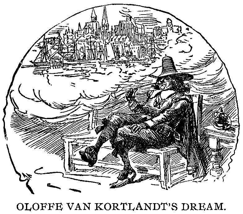
OLOFFE VAN KORTLANDT'S DREAM.
Below the cliffs Manhattan's spires
Glint back the sunset's latest beam;
The bay is flecked with twinkling fires;
Or is it but "Van Kortlandt's dream?"
Wallace Bruce
The Original Manors and Patents.—According to a map of the Province of New York, published in 1779, the Phillipsburg Patent embraced a large part of Westchester County. North of this was the Manor of Cortland, reaching from Tarrytown to Anthony's Nose. Above this was the Phillipse Patent, reaching to the mouth of Fishkill Creek, embracing Putnam County. Between Fishkill Creek and the Wappingers Creek was the Rombout Patent. The Schuyler Patent embraced a few square miles in the vicinity of Poughkeepsie. Above this was the purchase of Falconer & Company, and east of this tract what was known as the Great Nine Partners. Above the Falconer Purchase was the Henry Beekman Patent, reaching to Esopus Island, and east of this the Little Nine Partners. Above the Beekman Patent was the Schuyler Patent. Then the Manor of Livingston, reaching from Rhinebeck to Catskill Station, opposite Catskill. Above this Rensselaerwick, reaching north to a point opposite Coeymans. The Manor of Rensselaer extended on both sides of the river to a line running nearly east and west, just above Troy. North and west of this Manor was the County of Albany, since divided into Rensselaer, Saratoga, Washington, Schoharie, Greene and Albany. The Rensselaer Manor was the only one that reached across the river. The west bank of the Hudson, below the Rensselaer Manor, is simply indicated on this map of 1779 as Ulster and Orange Counties.
New Amsterdam.—For about fifty years after the Dutch Settlement the island of Manhattan was known as New Amsterdam. Washington Irving, in his Knickerbocker History, has surrounded it with a loving halo and thereby given to the early records of New York the most picturesque background of any State in the Union.
The city bright below, and far away
Sparkling in golden light his own romantic Bay.
Fitz-Greene Halleck.
Among other playful allusions to the Indian names he takes the word Manna-hatta of Robert Juet to mean "the island of manna," or in other words a land flowing with milk and honey. He refers humorously to the Yankees as "an ingenious people who out-bargain them in the market, out-speculate them on the exchange, out-top them in fortune, and run up mushroom palaces so high that the tallest Dutch family mansion has not wind enough left for its weather-cock."
What would the old burgomaster think now of the mounting palaces of trade, stately apartments, and the piled up stories of commercial buildings? In fact the highest structure Washington Irving ever saw in New York was a nine-story sugar refinery. With elevators running two hundred feet a minute, there seems no limit to these modern mammoths.
The Dutch and the English.—From the very beginning there was a quiet jealousy between the Dutch Settlement on the Hudson and the English Settlers in Massachusetts. To quote from an old English history, "it was the original purpose of the Pilgrims to locate near Nova Scotia, but, upon better consideration, they decided to seat themselves more to the southward on the bank of Hudson's River which falls into the sea at New York."
To this end "they contracted with some merchants who were willing to be adventurers with them in their intended settlement and were proprietors of the country, but the contract bore too heavy upon them, and made them the more easy in their disappointment. Their agents in England hired the Mayflower, and, after a stormy voyage, 'fell in with Cape Cod on the 9th of November. Here they refreshed themselves about half a day and then tacked about to the southward for Hudson's River.'
"Encountering a storm they became entangled in dangerous shoals and breakers and were driven back again to the Cape." Thus Plymouth became the first English settlement of New England. Another historian says that[page 25] it was their purpose "to settle on the Connecticut Coast near Fairfield County, lying between the Connecticut and Hudson's River."
Before his sight
Flowed the fair river free and bright,
The rising mist and Isles of Bay,
Before him in their glory lay.
Robert C. Sands.
From the very first the Dutch occupation was considered by the English as illegal. It was undoubtedly part of the country the coasts of which were first viewed by Sebastian Cabot, who sailed with five English ships from Bristol in May, 1498, and as such was afterwards included in the original province of Virginia. It was also within the limits of the country granted by King James to the Western Company, but, before it could be settled, the Dutch occupancy took place, and, in the interest of peace, a license was granted by King James.
The Dutch thus made their settlement before the Puritans were planted in New England, and from their first coming, "being seated in Islands and at the mouth of a good river their plantations were in a thriving condition, and they begun, in Holland, to promise themselves vast things from their new colony."
Sir Samuel Argal in 1617 or 1618, on his way from Virginia to New Scotland, insulted the Dutch and destroyed their plantations. "To guard against further molestations they secured a License from King James to build Cottages and to plant for traffic as well as subsistence, pretending it was only for the conveniency of their ships touching there for fresh water and fresh provisions in their voyage to Brazil; but they little by little extended their limits every way, built Towns, fortified them and became a flourishing colony."
"In an island called Manhattan, at the mouth of Hudson's River, they built a City which they called New Amsterdam, and the river was called by them the Great River. The bay to the east of it had the name of Nassau given to it. About one hundred and fifty miles up the River they built a Fort which they called Orange Fort and from thence drove a profitable trade with the Indians who came overland as far as from Quebec to deal with them.
[page 26]The Dutch Colonies were therefore in a very thriving condition when they were attacked by the English. The justice of this war has been freely criticised even by English writers, "because troops were sent to attack New Amsterdam before the Colony had any notice of the war."
On his view
Ocean, and earth, and heaven burst before him,
Clouds slumbering at his feet and the clear blue
Of summer's sky in beauty bending o'er him.
Fitz-Greene Halleck.
The "Encyclopædia Britannica" thus briefly puts the history of those far-off days when New York was a town of about 1500 inhabitants: "The English Government was hostile to any other occupation of the New World than its own. In 1621 James I. claimed sovereignty over New Netherland by right of 'occupancy.' In 1632 Charles I. reasserted the English title of 'first discovery, occupation and possession.' In 1654 Cromwell ordered an expedition for its conquest and the New England Colonies had engaged their support. The treaty with Holland arrested their operations and recognized the title of the Dutch. In 1664 Charles the Second resolved upon a conquest of New Netherland. The immediate excuse was the loss to the revenue of the English Colonies by the smuggling practices of their Dutch neighbors. A patent was granted to the Duke of York giving to him all the lands and rivers from the west side of the Connecticut River to the east side of Delaware Bay."
"On the 29th of August an English Squadron under the direction of Col. Richard Nicolls, the Duke's Deputy Governor, appeared off the Narrows, and on Sept. 8th New Amsterdam, defenseless against the force, was formally surrendered by Stuyvesant. In 1673 (August 7th) war being declared between England and Holland a Dutch squadron surprised New York, captured the City and restored the Dutch authority, and the names of New Netherland and New Amsterdam. But in July, 1674, a treaty of peace restored New York to English rule. A new patent was issued to the Duke of York, and Major Edmund Andros was appointed Governor."
New York.—On the 10th of November, 1674, the Province[page 27] of New Netherland was surrendered to Governor Major Edmund Andros on behalf of his Britannic Majesty. The letter sent by Governor Andros to the Dutch Governor is interesting in this connection: "Being arrived to this place with orders to receive from you in the behalf of his Majesty of Great Britain, pursuant to the late articles of peace with the States Generals of the United Netherlands, the New Netherlands and Dependencies, now under your command, I have herewith, by Capt. Philip Carterett and Ens. Cæsar Knafton, sent you the respective orders from the said States General, the States of Zealand and Admirality of Amsterdam to that effect, and desire you'll please to appoint some short time for it. Our soldiers having been long aboard, I pray you answer by these gentlemen, and I shall be ready to serve you in what may lay in my power. Being from aboard his Majesty's ship, 'The Diamond,' at anchor near. Your very humble servant. Staten Island this 22d Oct., 1674." After nineteen days' deliberation, which greatly annoyed Governor Andros, New Amsterdam was transferred from Dutch to English authority.
All white with sails thy keel-thronged waters flee
Through one rich lapse of plenty to the sea.
Knickerbocker Magazine.
"In 1683 Thomas Dongan succeeded Andros. A general Assembly, the first under the English rule, met in October, 1683, and adopted a Charter of Liberties, which was confirmed by the Duke. In August, 1684, a new covenant was made with the Iroquois, who formally acknowledged the jurisdiction of Great Britain, but not subjection. By the accession of the Duke of York to the English throne the Duchy of New York became a royal province. The Charters of the New England Colonies were revoked, and together with New York and New Jersey they were consolidated into the dominion of New England. Dongan was recalled and Sir Edmund Andros was commissioned Governor General. He assumed his vice regal authority August 11, 1688. The Assembly which James had abolished in 1686 was reestablished, and in May declared the rights and privileges of the people,[page 28] reaffirming the principles of the repealed Charter of Liberties of October 30, 1683."
"Queen of all lovely rivers, lustrous queen
Of flowing waters in our sweet new lands,
Rippling through sunlight to the ocean sands."
Anonymous.
From this time on to the Revolution of 1776 there is one continual struggle between the Royal Governors and the General Assembly. The Governor General had the power of dissolving the Assembly, but the Assembly had the power of granting money. British troops were quartered in New York which increased the irritation. The conquest of Canada left a heavy burden upon Great Britain, a part of which their Parliament attempted to shift to the shoulders of the Colonies.
A general Congress of the Colonies, held in New York in 1765, protested against the Stamp Act and other oppressive ordinances and they were in part repealed.
A Page of Patriotism.—During the long political agitation New York, the most English of the Colonies in her manners and feelings, was in close harmony with the Whig leaders of England. She firmly adhered to the principle of the sovereignty of the people which she had inscribed on her ancient "Charter of Liberties." Although largely dependent upon commerce she was the first to recommend a non-importation of English merchandise as a measure of retaliation against Britain, and she was the first also to invite a general congress of all the Colonies. On the breaking out of hostilities New York immediately joined the patriot cause. The English authority was overthrown and the government passed to a provincial congress.
The union of lakes—the union of lands—
The union of States none can sever—
The union of hearts—the union of hands—
And the Flag of our Union forever.
George P. Morris.
New York Sons of Liberty.—In 1767, in the eighth year of the reign of George III. there was issued a document in straightforward Saxon, and Sir Henry Moore, Governor-in-Chief over the Province of New York, offered fifty pounds to discover the author or authors. The paper read as follows: "Whereas, a glorious stand for Liberty did appear in the Resentment shown to a Set of Miscreants under the Name of Stamp Masters, in the year 1765, and it is now feared that a set of Gentry called[page 29] Commissioners (I do not mean those lately arrived at Boston), whose odious Business is of a similar nature, may soon make their appearance amongst us in order to execute their detestable office: It is therefore hoped that every votary of that celestial Goddess Liberty, will hold themselves in readiness to give them a proper welcome. Rouse, my Countrymen, Rouse! (Signed) Pro Patria."
In December, 1769, a stirring address "To the Betrayed Inhabitants of the City and County of New York," signed by a Son of Liberty, was also published, asking the people to do their duty in matters pending between them and Britain. "Imitate," the writer said, "the noble examples of the friends of Liberty in England; who, rather than be enslaved, contend for their rights with king, lords and commons; and will you suffer your liberties to be torn from you by your Representatives? tell it not in Boston; publish it not in the streets of Charles-town. You have means yet left to preserve a unanimity with the brave Bostonians and Carolinians; and to prevent the accomplishment of the designs of tyrants."
Another proclamation, offering a reward of fifty pounds, was published by the "Honorable Cadwalader Colden, Esquire, His Majesty's Lieutenant-Governor and Commander-in-Chief of the Province of New York and the territories depending thereon in America," with another "God Save the King" at the end of it. But the people who commenced to write Liberty with a capital letter and the word "king" in lower case type were not daunted. Captain Alexander McDougal was arrested as the supposed author. He was imprisoned eighty-one days. He was subsequently a member of the Provincial Convention, in 1775 was appointed Colonel of the first New York Regiment, and in 1777 rose to the rank of Major-General in the U. S. Army. New York City could well afford a monument to the Sons of Liberty. She has a right to emphasize this period of her history, for her citizens passed the first resolution to import nothing from[page 30] the mother country, burned ten boxes of stamps sent from England before any other colony or city had made even a show of resistance, and when the Declaration was read, pulled down the leaden statue of George III. from its pedestal in Bowling Green, and moulded it into Republican bullets.
And not a verdant glade or mountain hoary,
But treasures up within the glorious story.
Charles Fenno Hoffman.
In 1699 the population of New York was about 6,000. In 1800, it reached 60,000; and the growth since that date is almost incredible. It is amusing to hear elderly people speak of the "outskirts of the city" lying close to the City Hall, and of the drives in the country above Canal Street. In the Documentary History of New York, a map of a section of New York appears as it was in 1793, when the Gail, Work House, and Bridewell occupied the site of the City Hall, with two ponds to the north—East Collect Pond and Little Collect Pond,—sixty feet deep and about a quarter of a mile in diameter, the outlet of which crossed Broadway at Canal Street and found its way to the Hudson.
Greater New York.—In 1830, the population of Manhattan was 202,000; in 1850, 515,000; in 1860, 805,000; in 1870, 942,000; in 1880, 1,250,000; in 1892, 1,801,739; and is now rapidly approaching three million. Brooklyn, which in 1800 had a population of only 2,000, now contributes, as the "Borough of Brooklyn," almost two million. So that Greater New York is the centre of about six million of people within a radius of fifteen miles including her New Jersey suburbs with almost five millions under one municipality.
Brooklyn.—In June, 1636, was bought the first land on Long Island; and in 1667 the Ferry Town, opposite New York, was known by the name "Breuckelen," signifying "broken land," but the name was not generally accepted until after the Revolution. Columbia Heights, Prospect Park, Clinton Avenue, St. Mark's Place and Stuyvesant Heights are among the favored spots for residence.
Behind us lies the teeming town
With lust of gold grown frantic;
Before us glitters o'er the bay
The peaceable Atlantic.
Charles Mackay
Jersey City occupies the ground once known as Paulus Hook, the farm of William Kieft, Director General of the Dutch West India Company. Its water front, from opposite Bartholdi Statue to Hoboken, is conspicuously marked by Railroad Terminal Piers, Factories, Elevators, etc. Bergen is the oldest settlement in New Jersey. It was founded in 1616 by Dutch Colonists to the New Netherlands, and received its name from Bergen in Norway. Jersey City is practically a part of Greater New York, but state lines make municipal union impossible.
Hudson River Steamboats.—An accurate history of the growth and development of steam navigation on the Hudson, from the building of the "Clermont" by Robert Fulton to the building of the superb steamers of the Hudson River Day Line would form a very interesting book. The first six years produced six steamers:
| Clermont, built in 1807 | 160 tons |
| Car of Neptune, built in 1809 | 295 " |
| Hope, built in 1811 | 280 " |
| Perseverance, built in 1811 | 280 " |
| Paragon, built in 1811 | 331 " |
| Richmond, built in 1813 | 370 " |
It makes one smile to read the newspaper notices of those days. The time was rather long, and the fare rather high—thirty-six hours to Albany, fare seven dollars.
[page 32]"The North River Steamboat will leave Paulus Hook Ferry on Friday the 4th of September, at 9 in the morning, and arrive at Albany at 9 in the afternoon on Saturday. Provisions, good berths, and accommodation are provided. The charge to each passenger is as follows:
| To | Newburg | Dols. 3, | Time 14 hours. |
| Poughkeepsie | " 4, | " 17 " | |
| Esopus | " 5, | " 20 " | |
| Hudson | " 5 ½, | " 30 " | |
| Albany | " 7, | " 36 " |
For places apply to Wm. Vandervoort, No. 48 Courtland street, on the corner of Greenwich street, September 2d, 1807."
The wind blew over the land and the waves
With its salt sea-breath, and a spicy balm,
And it seemed to cool my throbbing brain,
And lend my spirit its gusty calm.
Richard Henry Stoddard.
Mr. Fulton's new-invented steamboat, which is fitted up in a neat style for passengers, and is intended to run from New York to Albany as a packet, left here this morning with ninety passengers, against a strong head wind. Notwithstanding which, it is judged that she moved through the waters at the rate of six miles an hour.
Friday, October 2d, 1807, the steamboat (Clermont) left New York at ten o'clock a.m., against a stormy tide, very rough water, and a violent gale from the north. She made a headway beyond the most sanguine expectations, and without being rocked by the waves.
Arrived at Albany, October 4th, at 10 o'clock p.m., being detained by being obliged to come to anchor, owing to a gale and having one of her paddle wheels torn away by running foul of a sloop.
But see! the broadening river deeper flows,
Its tribute floods intent to reach the sea.
Park Benjamin.
The following was recently recopied in the Poughkeepsie Eagle, as an old time reminiscence:
—The first steamboat on the Hudson River passed Poughkeepsie August 17th, 1807, and in June, 1808, the owners of the boat caused the following advertisement to be published in prominent papers along the river:
|
As the time at which the boat may arrive at the different places above mentioned may vary an hour, more or less, according to the advantage or disadvantage of wind and tide, those who wish to come on board will see the necessity of being on the spot an hour before the time. Persons wishing to come on board from any other landing than these here specified can calculate the time the boat will pass and be ready on her arrival. Innkeepers or boatmen who bring passengers on board or take them ashore from any part of the river will be allowed one shilling for each person.
| To West Point | $2 30 |
| To Newburgh | 3 00 |
| To Poughkeepsie | 3 50 |
| To Esopus | 4 00 |
| To Red Hook | 4 50 |
| To Hudson | 5 00 |
| To Albany | 7 00 |
| To Hudson | $2 00 |
| To Red Hook | 3 00 |
| To Esopus | 3 50 |
| To Poughkeepsie | 4 00 |
| To Newburgh and West Point | 4 50 |
| To New York | 7 00 |
All other passengers are to pay at the rate of one dollar for every twenty miles, and a half dollar for every meal they may eat.
Children from 1 to 5 years of age to pay one-third price and to sleep with persons under whose care they are.
Young persons from 5 to 15 years of age to pay half price, provided they sleep two in a berth, and the whole price for each one who requests to occupy a whole berth.
Servants who pay two-thirds price are entitled to a berth; they pay half price if they do not have a berth.
Every person paying full price is allowed sixty pounds of baggage; if less than full price forty pounds. They are to pay at the rate of three cents per pound for surplus baggage. Storekeepers who wish to carry light and valuable merchandise can be accommodated on paying three cents a pound.
By palace, village, cot, a sweet surprise
At every turn the vision looks upon;
Till to our wondering and uplifted eyes
The Highland rocks and hills in solemn grandeur rise.
Henry T. Tuckerman.
Day Line Steamers.—As the cradle of successful steam navigation was rocked on the Hudson, it is fitting that the Day Line Steamers should excel all others in beauty, grace and speed. There is no comparison between these river palaces and the steamboats on the Rhine or any river in Europe, as to equipment, comfort and rapidity. To make another reference to the great tourist route of Europe, the distance from Cologne to Coblenz is 60 miles, the same as from New York to Newburgh. It takes the Rhine steamers from seven to eight hours (as will be seen in Baedeker's Guide to that river) going up the stream, and from four and a half to five hours returning[page 35] with the current. The Hudson by Daylight steamers en route to Albany make the run from New York to Newburgh in three hours; to Poughkeepsie in four hours, making stops at Yonkers, West Point and Newburgh. Probably no train on the best equipped railroad in our country reaches its stations with greater regularity than these steamers make their various landing. It astonishes a Mississippi or Missouri traveler to see the captain standing like a train-conductor, with watch in hand, to let off the gang-plank and pull the bell, at the very moment of the advertised schedule.
Southward the river gleams—a snowy sail
Now gliding o'er the mirror—now a track
Tossing with foam displaying on its course
The graceful steamer with its flag of smoke.
Alfred B. Street.
One of the most humorous incidents of the writer's journeying up and down the Hudson, was the "John-Gilpin-experience" of a western man who got off at West Point a few years ago. It was at that time the first landing of the steamer after leaving New York.
As he was accustomed to the Mississippi style of waiting at the various towns he thought he would go up and take a look at the "hill." The boat was off and "so was he"; with wife and children shaking their hands and handkerchiefs in an excited manner from the gang-plank. Some one at the stern of the steamer shouted to him to cross the river and take the train to Poughkeepsie.
Every one was on the lookout for him at the Poughkeepsie landing, and, just as the steamer was leaving the dock, he came dashing down Main street from the railroad station, but too late. Then not only wife and children but the entire boat saluted him and the crowded deck blossomed with handkerchiefs. Some one shouted "catch us at Rhinebeck." After leaving Rhinebeck the train appeared, and on passing the steamer, a lone handkerchief waved from the rear of the platform. At Hudson an excited but slightly disorganized gentleman appeared to the great delight of his family, and every one else, for the passengers had all taken a lively interest in the chase. "Well," he says, "I declare, the way this[page 36] boat lands, and gets off again, beats anything I ever see, and I have lived on the Mississippi nigh on to a quarter of a century."
While drinking in the scene, my mind goes back upon
the tide of years, and lo, a vision! On its upward
path the "Half-Moon" glides.
Alfred B. Street.
The "Hendrick Hudson." In these centennial days of discovery and invention, a description of the steamers will be of interest, furnished by the Hudson River Day Line. The "Hendrick Hudson" was built at Newburgh by the Marvel Company, under contract with the W. & A. Fletcher Company of New York, who built her engines, and under designs from Frank E. Kirby. Her principal dimensions are: length, 400 feet; breadth over all, 82 feet; depth of hold, 14 feet 5 inches, and a draft of 7 feet 6 inches. Her propelling machinery is what is known as the 3-cylinder compound direct acting engine, and her power (6,500-horse) is applied through side wheels with feathering buckets, and steam is supplied from eight boilers.
Steel has been used in her construction to such an extent that her hull, her bulk-heads (7 in all), her engine and boiler enclosures, her kitchen and ventilators, her stanchions, girders, and deck beams, and in fact the whole essential frame work of the boat is like a great steel building. Where wood is used it is hard wood, and in finish probably has no equal in marine work.
Her scheme of decoration, ventilation and sanitation is as artistic and scientific as modern methods can produce, and at the same time her general lay out for practical and comfortable operation is the evolution of the long number of years in which the Day Line has been conducting the passenger business.
A detailed account of this steamer would be a long story, but some of the salient features are as follows: She carries the largest passenger license ever issued, namely: for 5,000 people; on her trial trip she made the fastest record through the water of any inland passenger ship in this country, namely: 23.1 miles per hour. Her shafts are under the main deck. Her mural paintings[page 37] represent prominent features of the Hudson, which may not be well seen from the steamer. Her equipment far exceeds the requirements of the Government Inspection Laws.
We hear the murmur of the sea,—
A monotone of sadness,
But not a whisper of the crowd,
Or echo of its madness.
Charles Mackay.
The "New York." The hull of the "New York" was built at Wilmington, Del., by the Harlan & Hollingsworth Co., in 1887, and is, with the exception of the deck-frame, made of iron throughout. During the winter of 1897 she was lengthened 30 feet, and now measures 341 feet in length, breadth over all 74 feet, with a tonnage of 1975 gross tons. The engine was built by the W. & A. Fletcher Co. of New York. It is a standard American beam engine, with a cylinder 75 inches in diameter and 12 feet stroke of piston, and develops 3,850 horse power. Steam steering gear is used. One of the most admirable features of this queen of river steamers is her "feathering" wheels, the use of which not only adds materially to her speed but does away with the jar or tremor common to boats having the ordinary paddle-wheels. The exterior of the "New York" is, as usual, of pine, painted white and relieved with tints and gold. The interior is finished in hard-wood cabinet work, ash being used forward of the shaft on the main deck, and mahogany aft and in the dining-room. Ash is also used in the grand saloons on the promenade deck. One feature of these saloons especially worthy of note, is the number and size of the windows, which are so numerous as to almost form one continuous window. Seated in one of these elegant saloons as in a floating palace of glass, the tourist who prefers to remain inside enjoys equally with those outside the unrivalled scenery through which the steamer is passing. The private parlors on the "New York" are provided with bay windows and are very luxuriantly furnished. In the saloons are paintings by Albert Bierstadt, J. F. Cropsey, Walter Satterlee and David Johnson. The dining-room on the "New York" is located on the main deck, aft; a feature that will commend itself to tourists,[page 38] since while enjoying their meals they will not be deprived from viewing the noble scenery through which the steamer is passing. While the carrying capacity of the "New York" is 4,500 passengers, license for 2,500 only is applied for, thus guaranteeing ample room for all and the absence from crowding which is so essential to comfort.
Thy fate and mine are not repose,
And ere another evening close
Thou to thy tides shall turn again
And I to seek the crowd of men.
William Cullen Byrant.
The "Albany" was built by the Harlan & Hollingsworth Co., of Wilmington, Del., in 1880. During the winter of 1892, she was lengthened thirty feet and furnished with modern feathering wheels in place of the old style radial ones. Her hull is of iron, 325 feet long, breadth of beam over all 75 feet, and her tonnage is 1,415 gross tons. Her engine was built by the W. & A. Fletcher Co., of New York, and develops 3,200 horse power. The stroke is 12 feet, and the diameter of the cylinder is 73 inches. On her trial trip she ran from New York to Poughkeepsie, a distance of 75 miles, in three hours and seven minutes. Steam steering gear is used on the "Albany," thus insuring ease and precision in handling her. The wood-work on the main deck and in the upper saloons is all hard wood; mahogany, ash and maple tastefully carved. Wide, easy staircases lead to the main saloon and upper decks. Rich Axminster carpets cover the floors, and mahogany tables and furniture of antique design and elegant finish make up the appointments of a handsomely furnished drawing room.
Lose not a memory of the glorious scenes,
Mountains and palisades, and leaning rocks.
William Wallace.
The Old Reaches.—Early navigators divided the Hudson into fourteen "reaches" or distances from point to point as seen by one sailing up or down the river. In the slow days of uncertain sailing vessels these divisions meant more than in our time of "propelling steam," but they are still of practical and historic interest.
The Great Chip Rock Reach extends from above Weehawken about eighteen miles to the boundary line of New York and New Jersey—(near Piermont). The Palisades were known by the old Dutch settlers as the "Great Chip," and so styled in the Bergen Deed of Purchase,[page 39] viz, the great chip above Weehawken. The Tappan Reach (on the east side of which dwelt the Manhattans, and on the west side the Saulrickans and the Tappans), extends about seven miles to Teller's Point. The third reach to a narrow point called Haverstroo; then comes the Seylmaker's Reach, then Crescent Reach; next Hoge's Reach, and then Vorsen Reach, which extends to Klinkersberg, or Storm King, the northern portal of the Highlands. This is succeeded by Fisher's Reach where, on the east side once dwelt a race of savages called Pachami. "This reach," in the language of De Laet, "extends to another narrow pass, where, on the west, is a point of land which juts out, covered with sand, opposite a bend in the river, on which another nation of savages—the Waoranecks—have their abode at a place called Esopus. Next, another reach, called Claverack; then Backerack; next Playsier Reach, and Vaste Reach, as far as Hinnenhock; then Hunter's Reach, as far as Kinderhook; and Fisher's Hook, near Shad Island, over which, on the east side, dwell the Mahicans." If these reaches seem valueless at present there are
Five Divisions of the Hudson—which possess interest for all, as they present an analysis easy to be remembered—divisions marked by something more substantial than sentiment or fancy, expressing five distinct characteristics:—
On the deck
Stands the bold Hudson, gazing at the sights
Opening successive—point and rock and hill,
Majestic mountain-top, and nestling vale.
Alfred B. Street.
From the Hurricane Deck of the Hudson River Day Line Steamers can be seen, on leaving or approaching the Metropolis, one of the most interesting panoramas in the world—the river life of Manhattan, the massive structures of Broadway, the great Transatlantic docks, Recreation Piers, and an ever-changing kaleidoscope of interest. The view is especially grand on the down trip between the hours of five and six in the afternoon, as the western sun brings the city in strong relief against the sky. If tourists wish to fully enjoy this beautiful view they should remain on the Hurricane Deck until the boat is well into her Desbrosses Street slip.
The Brooklyn Annex.—The Brooklyn tourist is especially happy in this delightful preface and addenda to the Hudson River trip. The effect of morning and evening light in bringing out or in subduing the sky-line of Manhattan is nowhere seen to greater advantage. In the morning the buildings from the East River side stand out bold and clear, when lo! almost instantaneously, on turning the Battery, they are lessened and subdued. On the return trip in the evening, the effect is reversed—a study worth the while of the traveler as he passes to and fro on the commodious "Annex" between Desbrosses Street Pier and Brooklyn. Surely no other city in the world rises so beautiful from harbor line or water front as "Greater New York," with lofty outlines of the boroughs of Manhattan and Brooklyn reminding one of Scott's tribute to Edinburgh:
"Piled deep and massy, close and high,
Mine own romantic town!"
Down at the end of the long, dark street,
Years, years ago,
I sat with my sweetheart on the pier,
Watching the river flow.
Richard Henry Stoddard.
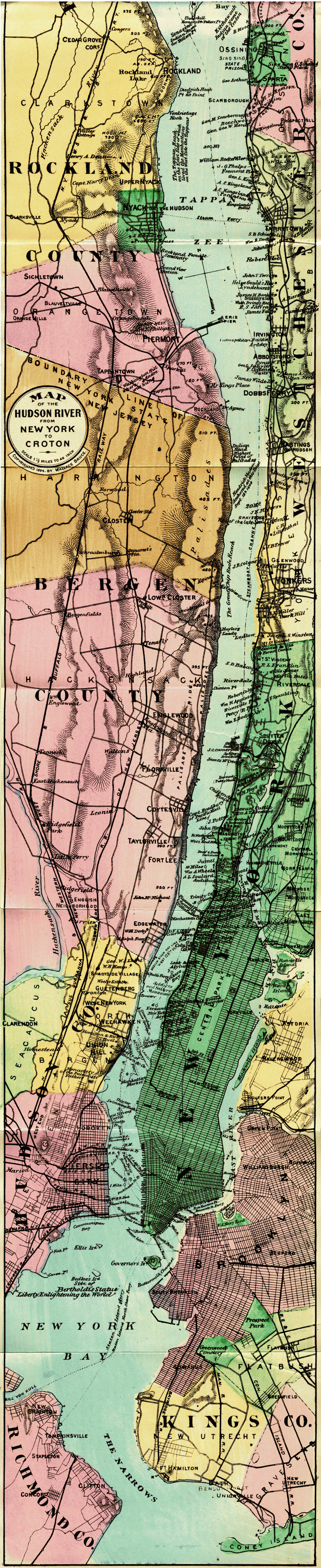
Map of the Hudson River from New York to Croton.
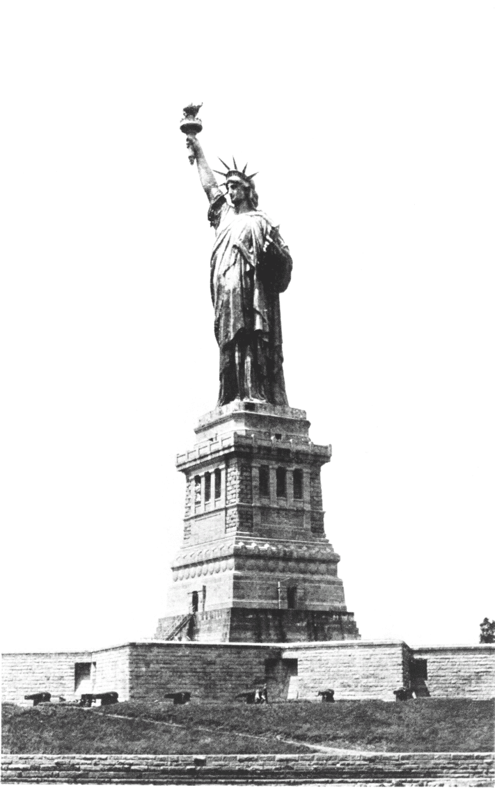
STATUE OF LIBERTY
Our historic journey fittingly begins at Desbrosses Street, for here, near the old River-front, extending from Desbrosses along Greenwich, stood the Revolutionary line of breastworks reaching south to the Grenadier Battery at Franklin Street. Below this were "Jersey," "McDougall" and "Oyster" batteries and intervening earthworks to Port George, on the Battery, which stood on the site of old Fort Amsterdam, carrying us back to Knickerbocker memories of Peter Stuyvesant and Wowter Van Twiller. The view from the after-deck, before the steamer leaves the pier, gives scope for the imagination to re-picture the far-away primitive and heroic days of early New York.
Desbrosses Street Pier.—On leaving the lower landing a charming view is obtained of New York Harbor, the Narrows, Staten Island, the Bartholdi Statue of Liberty, and, in clear weather, far away to the South, the Highlands of Nevisink, the first land to greet the eye of the ocean voyager. As the steamer swings out into the stream the tourist is at once face to face with a rapidly changing panorama. Steamers arriving, with happy faces on their decks, from southern ports or distant lands; others with waving handkerchiefs bidding good-bye to friends on crowded docks; swift-shuttled ferry-boats, with hurrying passengers, supplying their homespun woof to the great warp of foreign or coastwise commerce; noisy tug-boats, sombre as dray horses, drawing long lines of canal boats, or proud in the convoy of some Atlantic greyhound that has not yet slipped its leash; dignified[page 42] "Men of War" at anchor, flying the flags of many nations, happy excursion boats en route to sea-side resorts, scows, picturesque in their very clumsiness and uncouthness—all unite in a living kaleidescope of beauty.
Rise, stately symbol! Holding forth
Thy light and hope to all who sit
In chains and darkness! Belt the earth
With watch-fires from thy torch uplit!
John Greenleaf Whittier.
Across the river on the Jersey Shore are seen extensive docks of great railways, with elevators and stations that seem like "knotted ends" of vast railway lines, lest they might forsooth, untwist and become irrecoverably tangled in approaching the Metropolis. Prominent among these are the Pennsylvania Railroad for the South and West; the Erie Railway, the Delaware, Lackawanna and Western, and to the North above Hoboken the West Shore, serving also as starting point for the New York, Ontario and Western. Again the eye returns to the crowded wharves and warehouses of New York, reaching from Castle Garden beyond 30th Street, with forest-like masts and funnels of ocean steamships, and then to prominent buildings mounting higher and higher year by year along the city horizon, marking the course of Broadway from the Battery, literally fulfilling the humor of Knickerbocker in not leaving space for a breath of air for the top of old Trinity Church spire.
Stevens' Castle.—About midway between Desbrosses Street and 42d Street Pier will be seen on the Jersey Shore a wooded point with sightly building, known as Stevens' Castle, home of the late Commodore Stevens, founder of the Stevens Institute of Technology. Above this are the Elysian Fields, near the river bank, known in early days as a quiet resort but now greatly changed in the character of its visitors. On the left will also be seen the dome and tower of St. Michael's Monastery, and above this Union Hill.
The Trap Rock Ridge, which begins to show itself above the Elysian Fields, increases gradually in height to the brow of the Palisades. West of Bergen Heights and Union Hill flows the Hackensack River parallel to the Hudson, and at this point only about two miles distant.
How still with all her towers and domes
The city sleeps on yonder shore,—
How many thousand happy homes
Yon starless sky is bending o'er.
Park Benjamin.
The 42d Street Pier is now at hand, convenient of access to travelers, as the 42d Street car line crosses Manhattan intersecting every "up and down" surface, subway or elevated road in the City, as does also the Grand, Vestry and Desbrosses Street at the lower landing. While passengers are coming aboard we take pleasure in quoting the following from Baedeker's Guide to the United States: "The Photo-Panorama of the Hudson, published by the Bryant Union Publishing Co., New York City (price 50 cents), shows both sides of the river from New York to Albany, accurately represented from 800 consecutive photographs. This new and complete object-guide will be of service to the tourist, and can be had at the steamers' news stands, head of grand stairway, or it will be sent by publishers, postpaid, on receipt of price."
Weehawken with its sad story of the duel between Hamilton and Burr is soon seen upon the west bank. A monument once marked the spot, erected by the St. Andrews Society of New York City on the ledge of rock where Hamilton fell early in the morning of the eleventh of July, 1804. The quarrel between this great statesman and his malignant rival was, perhaps, more personal than political. It is said that Hamilton, in accordance with the old-time code of honor, accepted the challenge, but fired into the air, while Burr with fiendish cruelty took deliberate revenge. Burr was never forgiven by the citizens of New York and from that hour walked its streets shunned and despised. Among the many poetic tributes penned at the time to the memory of Hamilton, perhaps the best was by a poet whose name is now scarcely remembered, Mr. Robert C. Sands. A fine picture of Hamilton will be found in the New York Chamber of Commerce where the writer was recently shown the[page 44] following concise paragraph from Talleyrand: "The three greatest men of my time, in my opinion, were Napoleon Bonaparte, Charles James Fox and Alexander Hamilton and the greatest of the three was Hamilton."
Where round yon capes the banks ascend
Long shall the pilgrim's footsteps bend,
There, mirthful heart shall pause to sigh,
There tears shall dim the patriot's eye.
Robert C. Sands.
The plain marble slab which stood in the face of the monument is still preserved by a member of the King family. It is thirty-six inches long by twenty-six and a half inches wide and bears the following inscription: "As an expression of their affectionate regard to his Memory and their deep regret for his loss, the St. Andrew's Society of the State of New York have erected this Monument."
Quite a history attaches to this stone (graphically condensed by an old gardener of the King estate): "It stood in the face of the monument for sixteen years, and was read by thousands, but by 1820 the pillar had become an eyesore to the enlightened public sentiment of the age, and an agitation was begun in the public prints for its removal. It was not, however, organized effort, but the order of one man, that at length demolished the pillar. This man was Captain Deas, a peace-loving gentleman, strongly opposed to duelling and brawls, and on seeing a party approaching the grounds often interposed and sometimes succeeded in effecting a reconciliation. He became tired of seeing the pillar in his daily walks, and, in 1820, ordered his men to remove it and deposit the slab containing the inscription in one of the outbuildings of the estate. This was done. But a few months afterward the slab was stolen, and nothing more was heard of it until thirteen years later, when Mr. Hugh Maxwell, president of the St. Andrew's Society, discovered it in a junk shop in New York. He at once purchased it and presented it to Mr. James G. King, who about this time came into possession of the Deas property, where it has since been carefully preserved."
This mansion of Captain Deas afterward known as the "King House on the Cliff" was a stately residence where[page 45] Washington Irving used to come and dream of his fair Manhattan across the river. It was also the head-quarters of Lafayette, after the battle of Brandywine.
I was an admirer of General Hamilton, and I sicken
when I think of our political broils, slanders and enmities.
Washington Irving.
The gardener also said: "the river road beneath us is cut directly through the spot. Originally it was simply a narrow and grassy shelf close up under the cliffs, six feet wide and eleven paces long. A great cedar tree stood at one end, and this sandbowlder, which we have also preserved, was at the other. It was about twenty feet above the river and was reached by a steep rocky path leading up from the Hudson, and, as there was then no road or path even along the base of the cliffs, it could be reached only by boats." The first duel at Weehawken of which there is any record was in 1799, between Aaron Burr and John B. Church (Hamilton's brother-in-law). The parties met and exchanged shots; neither was wounded. The seconds then induced Church to offer an apology and the affair terminated. The last duel was fought there September 28, 1845, and ended in a farce, the pistols being loaded with cork—a fitting termination to a relic of barbarism.
Riverside Drive and Park. Riverside Drive, on the east bank starting at 72d Street, is pronounced the finest residential avenue in the world. Distinguished among many noble residences is the home of Charles M. Schwab at 73d Street, which cost two million dollars; built on the New York Orphan Asylum plot for which he paid $860,000.
The Soldiers and Sailors Monument, 89th Street, a memorial to the citizens of New York, who took part in the Civil War, a beautiful work of art, circular in form, with Corinthian columns, erected by the city at a cost of a quarter of million of dollars was dedicated May 30, 1902. The corner-stone was laid in 1900 by President Roosevelt, at that time Governor. The location was well selected, and it presents one of the most attractive features of the river front.
We celebrate our hundredth year
With thankful hearts and words of praise,
And learn a lasting lesson here
Of trust and hope for coming days.
Wallace Bruce.
Columbia University, on Morningside Heights, has a fine outlook, crowning a noble site worthy of the old college, whose sons have been to the fore since the days of the Revolution in promoting the glory of the state and the nation. President Low has happily styled "Morningside," which extends from 116th to 120th Streets, "The Acropolis of the new world." The Library Building which he erected to his father's memory, is of Greek architecture and cost $1,500,000. It contains 300,000 volumes and is open night and day to the public. It also marks the battle ground and American victory of Harlem Heights in 1776.
The Cathedral of St. John the Divine (Protestant Episcopal), now in process of erection, occupies three blocks from 110th Street to 113th between Morningside Park and Amsterdam Avenue. The corner stone was laid in 1892 to be completed about 1940 at a cost of $6,000,000. The crypt quarried out of the solid rock has been completed and services are held in it every Sunday. Near at hand will be seen the beautiful dome of St. Luke's Hospital.
Grant's Tomb, Riverside Drive and 123d Street, has the most commanding site of the Hudson River front of New York. The bluff rises 130 feet and still retains the name of Claremont. The apex of the memorial is 280 feet above the river. Ninety thousand people contributed to the "Grant Monument Association fund" which, with interest, aggregated $600,000. The corner stone was laid by President Harrison in 1892 and dedicated April 27, 1897, on the seventy-fifth anniversary of Grant's birth, with a great military, naval and civil parade. The occasion was marked by an address of President McKinley and an oration of Gen. Horace Porter, president of the Grant Monument Association.
An attempt to remove Grant's body to Washington was made in Congress but overwhelmingly defeated. The speech by Congressman Amos Cummings in the House[page 47] of Representatives, was a happy condensation of the facts. He fittingly said: "New York was General Grant's chosen home. He tried many other places but finally settled there. A house was given to him here in Washington, but he abandoned it in the most marked manner to buy one for himself in New York. He was a familiar form upon her streets. He presided at her public meetings and at all times took an active interest in her local affairs. He was perfectly at home there and was charmed with its associations. It was the spot on earth chosen by himself as the most agreeable to him; he meant to live and die there. It was his home when he died. He closed his career without ever once expressing a wish to leave it, but always to remain in it.
"Men are usually buried at their homes. Washington was buried there; Lincoln was buried there; Garibaldi was buried there; Gambetta was buried there, and Ericsson was buried, not at the Capital of Sweden, but at his own home. Those who say that New York is backward in giving for any commendable thing either do not know her or they belie her. Wherever in the civilized world there has been disaster by fire or flood, or from earthquake or pestilence, she has been among the foremost in the field of givers and has remained there when others have departed. It is a shame to speak of her as parsimonious or as failing in any benevolent duty. Those who charge her with being dilatory should remember that haste is not always speed. It took more than a quarter of a century to erect Bunker Hill Monument; the ladies of Boston completed it. It took nearly half a century to erect a monument to George Washington in the City founded by him, named for him, and by his act made the Capital of the Nation; the Government completed it. New York has already shown that she will do far better than this."
His glory as the centuries wide,
His honor bright as sunlit seas,
His lullaby the Hudson tide,
His requiem the whispering breeze.
Wallace Bruce.
The Thirteen Elm Trees, about ten or fifteen minutes' walk from General Grant's Tomb, were planted by Alexander[page 48] Hamilton in his door-yard, a century ago, to commemorate the thirteen original States. This property was purchased by the late Hon. Orlando Potter, of New York, with the following touch of patriotic sentiment: "These famous trees are located in the northeast corner of One Hundred and Forty-third street and Convent Avenue; or, on lots fourteen and fifteen," said the auctioneer to the crowd that gathered at the sale. "In order that the old property with the trees may be kept unbroken, should the purchaser desire, we will sell lots 8 to 21 inclusive in one batch! How much am I offered?" "One hundred thousand dollars," quietly responded Mr. Potter. A ripple of excitement ran through the crowd, and the bid was quickly run up to $120,000 by speculators. "One hundred and twenty-five thousand," said Mr. Potter. Then there were several thousand dollar bids, and the auctioneer said: "Do I hear one hundred and thirty?" Mr. Potter nodded. He nodded again at the "thirty-five" and "forty" and then some one raised him $250. "Five hundred," remarked Mr. Potter, and the bidding was done. "Sold for $140,500!" cried the auctioneer. Mr. Potter smiled and drew his check for the amount. "I can't say what I will do with the property," said Mr. Potter. "You can rest assured, however, that the trees will not be cut down."
Rest in peace by stately rivers martyred soldiers of the free,
Rest brave captain, at our threshold, where the Hudson meets the sea.
Wallace Bruce.
Edgewater, opposite Grant's Tomb on the west bank, lies between Undercliff on the north and Shadyside on the south. The latter place was made historic by Anthony Wayne's capture of supplies for the American army in the summer of 1780 which formed the basis of a satirical poem by Major Andre, entitled "The Cow Chase."
The steamer is now approaching 129th street, and we turn again with pride to the beautiful tomb of General Grant which fittingly marks one point of a great triangle of fame—the heroic struggle of the American soldiers in 1776, the home of Alexander Hamilton, and the burial place of the greatest soldier of the Civil War.
Woodman, spare that tree!
Touch not a single bough!
In youth it sheltered me,
And I will protect it now.
George P. Morris.
This upper landing of the Hudson River Day Line has a beautiful location and is a great convenience to the dwellers of northern Manhattan. On leaving the pier the steel-arched structure of Riverside Drive is seen on the right. The valley here spanned, in the neighborhood of 127th Street, was once known as "Marritje Davids' Fly," and the local name for this part of New York above Claremont Heights is still known as "Manhattanville." The Convent of the Sacred Heart is visible among the trees, and
Trinity Cemetery's Monuments soon gleam along the wooded bank. Among her distinguished dead is the grave of General John A. Dix whose words rang across the land sixty days before the attack on Fort Sumter: "If any man attempts to pull down the American flag shoot him on the spot." The John A. Dix Post of New York comes hither each Decoration Day and garlands with imposing ceremonies his grave and the graves of their comrades.
Near Carmansville was the home of Audubon, the ornithologist, and the residences above the cemetery are grouped together as Audubon Park. Near at hand is the New York Institute for the Deaf and Dumb, and pleasantly located near the shore the River House once known as West-End Hotel.
Washington Heights rise in a bold bluff above Jeffrey's Hook. After the withdrawal of the American army from Long Island, it became apparent to General Washington and Hamilton that New York would have to be abandoned. General Greene and Congress believed in maintaining the fort, but future developments showed that Washington was right. The American troops, so far as clothing or equipment was concerned, were in a pitiable condition, and the result of the struggle makes one of the darkest[page 50] pages of the war. On the 12th of November Washington started from Stony Point for Fort Lee and arrived the 13th, finding to his disappointment that General Greene, instead of having made arrangements for evacuating, was, on the contrary, reinforcing Fort Washington. The entire defense numbered only about 2000 men, mostly militia, with hardly a coat, to quote an English writer, "that was not out at the elbows." "On the night of the 14th thirty flat-bottomed boats stole quietly up the Hudson, passed the American forts undiscovered, and made their way through Spuyten Duyvil Creek into Harlem River. The means were thus provided for crossing that river, and landing before unprotected parts of the American works."
Faith's pioneers and Freedom's martyrs sleep
Beneath their shade: and under their old boughs
The wise and brave of generations past
Walked every Sabbath to the house of God.
Henry T. Tuckerman.
According to Irving, "On the 15th General Howe sent a summons to surrender, with a threat of extremities should he have to carry the place by assault." Magaw, in his reply, intimated a doubt that General Howe would execute a threat "so unworthy of himself and the British nation; but give me leave," added he, "to assure his Excellency, that, actuated by the most glorious cause that mankind ever fought in, I am determined to defend this post to the very last extremity."
"Apprised by the colonel of his peril, General Greene sent over reinforcements, with an exhortation to him to persist in his defense; and dispatched an express to General Washington, who was at Hackensack, where the troops from Peekskill were encamped. It was nightfall when Washington arrived at Fort Lee. Greene and Putnam were over at the besieged fortress. He threw himself into a boat, and had partly crossed the river, when he met those Generals returning. They informed him of the garrison having been reinforced, and assured him that it was in high spirits, and capable of making a good defense. It was with difficulty, however, they could prevail on him to return with them to the Jersey shore, for he was excessively excited."
Hark! Freedom's arms ring far and wide;
Again these forts with beacons gleam;
Loud cannon roar on every side—
I start, I wake; I did but dream.
Wallace Bruce.
"Early the next morning, Magaw made his dispositions for the expected attack. His forces, with the recent addition, amounted to nearly three thousand men. As the fort could not contain above a third of its defenders, most of them were stationed about the outworks."
About noon, a heavy cannonade thundered along the rocky hills, and sharp volleys of musketry, proclaimed that the action was commenced.
"Washington, surrounded by several of his officers, had been an anxious spectator of the battle from the opposite side of the Hudson. Much of it was hidden from him by intervening hills and forest; but the roar of cannonry from the valley of the Harlem River, the sharp and incessant reports of rifles, and the smoke rising above the tree-tops, told him of the spirit with which the assault was received at various points, and gave him for a time hope that the defense might be successful. The action about the lines to the south lay open to him, and could be distinctly seen through a telescope; and nothing encouraged him more than the gallant style in which Cadwalader with inferior force maintained his position. When he saw him however, assailed in flank, the line broken, and his troops, overpowered by numbers, retreating to the fort, he gave up the game as lost. The worst sight of all, was to behold his men cut down and bayoneted by the Hessians while begging quarter. It is said so completely to have overcome him, that he wept with the tenderness of a child."
"Seeing the flag go into the fort from Knyphausen's division, and surmising it to be a summons to surrender, he wrote a note to Magaw, telling him if he could hold out until evening and the place could not be maintained, he would endeavor to bring off the garrison in the night. Capt. Gooch, of Boston, a brave and daring man, offered to be the bearer of the note. He ran down to the river, jumped into a small boat, pushed over the river, landed under the bank, ran up to the fort and delivered the[page 52] message, came out, ran and jumped over the broken ground, dodging the Hessians, some of whom struck at him with their pieces and others attempted to thrust him with their bayonets; escaping through them, he got to his boat and returned to Fort Lee."
Up and down the valley of the Hudson the contending
armies surged like the ebbing and flowing of the tides.
William Wait.
Washington's message arrived too late. "The fort was so crowded by the garrison and the troops which had retreated into it, that it was difficult to move about. The enemy, too, were in possession of the little redoubts around, and could have poured in showers of shells and ricochet balls that would have made dreadful slaughter." It was no longer possible for Magaw to get his troops to man the lines; he was compelled, therefore, to yield himself and his garrison prisoners of war. The only terms granted them were, that the men should retain their baggage and the officers their swords.
Fort Lee, directly across the river, had a commanding position, but was entirely useless to the Revolutionary army after the fall of Fort Washington. It was therefore immediately abandoned to the British, as was also Fort Constitution, another redoubt near at hand.
It will be remembered that the American army after long continued disaster in and about New York, retreated southward from Fort Lee and Hackensack to the Delaware, where Washington with a strategic stroke brought dismay on his enemies and restored confidence to his friends and the Patriots' Cause.
The Palisades, or Great Chip Rock, as they were known by the old Dutch settlers, present the same bold front to the river that the Giant's Causeway does to the ocean. Their height at Fort Lee, where the bold cliffs first assert themselves, is three hundred feet, and they extend about seventeen or eighteen miles to the hills of Rockland County. A stroll along the summit reveals the fact that they are almost as broken and fantastic in form as the great rocks along the Elbe in Saxon-Switzerland.
The Palisades in sterner pride
Tower as the gloom steals o'er the tide,
For the great stream a bulwark meet
That laves its rock-encumbered feet.
Robert C. Sands.
As the basaltic trap-rock is one of the oldest geological[page 53] formations, we might still appropriately style the Palisades "a chip of the old block." They separate the valley of the Hudson from the valley of the Hackensack. The Hackensack rises in Rockland Lake opposite Sing Sing, within two or three hundred yards of the Hudson, and the rivers flow thirty miles side by side. Some geologists think that originally they were one river, but they are now separated from each other by a wall more substantial than even the 2,000 mile structure of the "Heathen Chinee."
It might also be interesting to note Prof. Newberry's idea that in pre-glacial times this part of the continent was several hundred feet higher than at present, and that the Hudson was a very rapid stream and much larger than now, draining as it did the Great Lakes: that the St. Lawrence found its way through the Hudson Channel following pretty nearly the line of the present Mohawk, and the great river emptied into the Atlantic some 80 miles south of Staten Island. This idea is confirmed by the soundings of the coast survey which discover the ancient page of the Hudson as here indicated on the floor of the sea far out where the ocean is 500 feet in depth. A speculation of what a voyager a few million years ago would have then seen might, however, as Hamlet observes, be "to consider somewhat too curiously" for ordinary up-to-date tourists. But even, granting all this to be true, the Palisades were already old, thrown up long ages before, between a rift in the earth's surface, where it cooled in columnar form. The rocky mould which held it, being of softer material, finally disintegrated and crumbled away, leaving the cliff with its peculiar perpendicular formation.
A recent writer has said: "The Palisades are among the wonders of the world. Only three other places equal them in importance, but each of the four is different from the others, and the Palisades are unique. The Giant's Causeway on the north coast of Ireland, and the[page 54] cliffs at Kawaddy in India, are thought by many to have been the result of the same upheaval of nature as the Palisades; but the Hudson rocks seem to have preserved their entirety—to have come up in a body, as it were—while the Giant's Causeway owes its celebrity to the ruined state in which the Titanic forces of nature have left it. The third wonder is at Staffa, in Scotland, where the rocks have been thrown into such a position as to justify the name of Fingal's Cave, which they bear, and which was bestowed on them in the olden times before Scottish history began to be written. It is singular how many of the names which dignify, or designate, favorite spots of the Giant's Causeway have been duplicated in the Palisades. Among the Hudson rocks are several 'Lady's Chairs,' 'Lover's Leaps,' 'Devil's Toothpicks,' 'Devil's Pulpits,' and, in many spots on the water's edge, especially those most openly exposed to the weather, we see exactly the same conformations which excite admiration and wonder in the Irish rocks."
Where the mighty cliffs look upward in their glory and their glow
I see a wondrous river in its beauty southward flow.
Thomas C. Harbaugh.
Under the base of these cliffs William Cullen Bryant one Sabbath morning wrote his beautiful lines:
"Cool shades and dews are round my way,
And silence of the early day;
Mid the dark rocks that watch his bed,
Glitters the mighty Hudson spread,
Unrippled, save by drops that fall
From shrubs that fringe his mountain wall;
And o'er the clear, still water swells
The music of the Sabbath bells.
All, save this little nook of land,
Circled with trees, on which I stand;
All, save that line of hills which lie
Suspended in the mimic sky—
Seems a blue void, above, below,
Through which the white clouds come and go;
And from the green world's farthest steep
I gaze into the airy deep."
A mellow sunset was settling upon the hills and
waters and a thousand flashes played over the distant
city as its spires and prominent objects caught its glow.
N. P. Willis.
There are many strange stories connected with the Palisades, and one narrator says: "remarkable disappearances have occurred in the vicinity that have never been explained. On a conical-shaped rock near Clinton Point a young man and a young woman were seen standing some half a century ago. Several of their friends, who were back some thirty feet from the face of the cliff, saw them distinctly, and called out to them not to approach too near the edge. The young couple laughingly sent some answer back, and a moment later vanished as by magic. Their friends rushed to the edge of the cliff but saw no trace of them. They noticed at once that the tide was out, and at the base three or four boatmen were sauntering about as though nothing had happened (forgetting even, as Bryant did, that a vertical line from the top of the cliff on account of the crumbling debris of ages makes it impossible for even the strongest arm to hurl a stone from the summit to the margin of the river). A diligent search was instituted. Friends and boatmen joined in the search, but from that day to this they have never been heard from, no trace of them has been found, and the mystery of their disappearance is as complete now as it was five minutes after they vanished—a more tragical termination than the story of the old pilot on a Lake George steamer, who, surrounded one morning by a group of tourist-questioners, pointed to Roger Slide Mountain, and said: "A couple went up there and never came back again." "What do you suppose, captain," said a fair-haired, anxious listener, "ever became of them?" "Can't tell," said the captain, "some folks said they went down on the other side."
The old Palisade Mountain House, a few miles above Fort Lee, had a commanding location, but was burned in 1884 and never rebuilt. Pleasant villas are here and there springing up along this rocky balcony of the lower Hudson, and probably the entire summit will some day abound in castles and luxuriant homes. It is in fact within the[page 56] limit of possibility that this may in the future present the finest residential street in the world, with a natural macadamized boulevard midway between the Hudson and the sky.
What love yon cliffs and steeps could tell
If vocal made by Fancy's spell!
Robert C. Sands.
It grieves one to see the gray rocks torn away for building material, but, as fast as man destroys, nature kindly heals the wound; or to keep the Palisade figure more complete, she recaptures the scarred and broken battlements, unfolding along the steep escarpment her waving standards of green. It sometimes seems as if one can almost see her selecting the easiest point of attack, marshalling her forces, running her parallels with Boadicea-like skill, and carrying her streaming banners, more real than Macbeth's "Birnam-Wood" to crowning rampart and lofty parapet.
The New York side from the Battery to Inwood, the northern end of Manhattan Island, is already "well peopled." Until recently the land about Fort Washington has been held in considerable tracts and the very names of these suburban points suggest altitude and outlook—Highbridgeville, Fordham Heights, Morris Heights, University Heights, Kingsbridge Heights, Mount Hope, &c. The growth of the city all the way to Jerome and Van Cortlandt's Park during the last few years has been marvelous. It has literally stepped over the Harlem to find room in the picturesque county of Westchester.
The Island of Manhattan.—As we approach the northern limit of Manhattan we feel that in the preservation of the beautiful name "Manhattan," distinctive of New York's chief borough, Irving's dream has been happily realized. The meaning of this Indian word has been the subject of much discussion. It is, however, simply the name of a tribe. As the old historian De Laet says, "On the east side, on the main land dwell the Manhattoes," and again from the "Documentary History of New York." "It is so called from the people which inhabited the main land on the east side of the river."
Pleasant it is to lie amid the grass,
Under these shady locusts half the day,
Watching the ships reflected in the Bay,
Topmast and shroud, as in a wizard's glass.
Thomas Bailey Aldrich.

INDIAN HEAD, PALISADES
The word Manhattan signifies also it is said: "The People of the Islands," and it was evidently used by the Indians as a generic term designating the inhabitants of the island itself, and also of Long Island and the Neversink. This is in accordance with the testimony of Van der Donck. With Irving we all recognize the music and poetry of the name and are proud that our river of beauty is so happily heralded.
Spuyten Duyvil Creek.—Above Washington Heights, on the east bank, the Spuyten Duyvil meets the Hudson. This stream is the northern boundary of New York Island, and a short distance east of the Hudson bears the name of Harlem River. Its course is south-east and joins the East River at Randall's Island, just above Hell Gate. It is a curious fact that this modest stream should be bounded by such suggestive appellations as Hell Gate and Spuyten Duyvil. This is the first point of special legendary interest to one journeying up the Hudson and it takes its name according to the veracious Knickerbocker, from the following incident: It seems that the famous Antony Van Corlear was despatched one evening with an important message up the Hudson. When he arrived at this creek the wind was high, the elements were in an uproar, and no boatman at hand. "For a short time," it is said, "he vapored like an impatient ghost upon the brink, and then, bethinking himself of the urgency of his errand, took a hearty embrace of his stone bottle, swore most valorously that he would swim across en spijt en Duyvil (in spite of the Devil), and daringly plunged into the stream. Scarce had he buffeted half way over when he was observed to struggle violently, as if battling with the spirit of the waters. Instinctively he put his trumpet to his mouth, and giving a vehement blast—sank forever to the bottom."
O legends full of life and health,
That live when records fail and die,
Ye are the Hudson's richest wealth,
The frondage of her history!
Wallace Bruce.
The main branch of the Hudson River Railroad, with its station at Forty-second Street and Fourth Avenue, crosses the Harlem River at Mott Haven, and, following[page 58] its northern bank, meets the Hudson at this point, where the 30th Street branch, following the river, joins the main line. The steamer now passes Riverdale, with its beautiful residences and the Convent of Mount St. Vincent, one of the prominent landmarks of the Hudson, located on grounds bought of Edwin Forrest, the tragedian, whose "Font Hill Castle" appears in the foreground, and we come to
Yonkers, on the east bank, seventeen miles from New York, at the mouth of the Nepperhan. West of the creek is a large rock, called A-mac-lea-sin, the great stone to which the Indians paid reverence as an evidence of the permanency and immutability of their deity. The Mahican Village at the mouth of the creek was called Nappechemak. European settlements were made as early as 1639, as shown by deeds of purchase. Here are many important manufacturing industries: carpet, silk, and hat factories; mowers and reapers, gutta percha, rubber and pencil companies. Its "Recreation Pavilion" on the pier was a noble thing for the city to build—costing $50,000. The structure is of steel and capable of accommodating 5,000 people.
It is said that Yonkers derived its name from Yonk-herr—the young heir, or young sir, of the Phillipse manor. Until after the middle of the seventeenth century the Phillipse family had their principal residence at Castle Phillipse, Sleepy Hollow, but having purchased "property to the southward" from Adrian Van der Donck and obtained from the English king a patent creating the manor of Phillipsburgh, they moved from their old castle to the new "Manor Hall," which at this time was probably the finest mansion on the Hudson. This property was confiscated by act of Legislature in 1779, as Frederick Phillipse, third lord of the manor, was thought to lean toward royalty, and sold by the "Commissioners of Forfeiture" in 1785. It was afterwards purchased by John Jacob Astor, then passed to the Government, was bought[page 59] by the village of Yonkers in 1868, and became the City Hall in 1872. The older portion of the house was built in 1682, the present front in 1745. The woodwork is very interesting, also the ceilings, the large hall and the wide fire-place. In the room still pointed out as Washington's, the fire-place retains the old tiles, "illustrating familiar passages in Bible history," fifty on each side, looking as clear as if they were made but yesterday.
Once more I walk in the dark old street
Wearily to and fro:—
But I sit no more on the desolate pier
Watching the river flow.
Richard Henry Stoddard.
Mary Phillipse, belle of the neighborhood, and known in tradition as Washington's first love, was born in the "Manor House" July 3, 1730. Washington first met her on a visit to New York in 1756, after his return from Braddock's campaign, as guest of Beverly Robinson, who had married her elder sister.
It has been claimed by some writers that he proposed and was rejected, but it is doubtful whether he ever was serious in his attentions. At least there is no evidence that he ever "told his love," and she finally married Col. Roger Morris, one of Washington's associates on Braddock's staff. The best part of residential Yonkers lies to the northward, beautifully embowered in trees as seen from the Hudson. A line of electric street cars run north along Warburton Avenue. The street known as Broadway, is a continuation of Broadway, New York. Many of the river towns still keep this name, probably prophetic as a part of the great Broadway which may extend some day from the Battery to Peekskill.
Almost opposite Yonkers a ravine or sort of step-ladder cleft, now known as Alpine Gorge, reaches up the precipitous sides of the Palisades. The landing here was formerly called Closter's, from which a road zigzags to the top of the cliff and thence to Closter Village. Here Lord Grey disembarked in October, 1778, and crossed to Hackensack Valley, "surprising and massacring Col. Bayler's patriots, despite their surrender and calls for mercy."
Indian Head (510 feet) about two miles north of Alpine Gorge, is the highest point of the Palisades.
Eve o'er our path is stealing fast;
Yon quivering splendors are the last;
His latest glories fringe the height
Behind us with their golden light.
Robert C. Sands.
Passing Glenwood, now a suburban station of Yonkers, conspicuous from the Colgate mansion near the river bank, built by a descendant of the English Colgates who were familiar friends of William Pitt, and leaders of the Liberal Club in Kent, England, and "Greystone," once the country residence of the late Samuel J. Tilden, Governor of New York, and presidential candidate in 1876, we come to
Hastings, where a party of Hessians during the Revolutionary struggle were surprised and cut to pieces by troops under Colonel Sheldon. It was here also that Lord Cornwallis embarked for Fort Lee after the capture of Fort Washington, and here in 1850 Garibaldi, the liberator of Italy, whose centennial was observed July 4, 1907, frequently came to spend the Sabbath and visit friends when he was living at Staten Island. Although there is apparently little to interest in the village, there are many beautiful residences in the immediate neighborhood, and the Old Post road for two miles to the northward furnishes a beautiful walk or driveway, well shaded by old locust trees. The tract of country from Spuyten Duyvil to Hastings was called by the Indians Kekesick and reached east as far as the Bronx River.
Dobbs Ferry is now at hand, named after an old Swedish ferryman. The village has not only a delightful location but it is also beautiful in itself. In 1781 it was Washington's headquarters, and the old house, still standing, is famous as the spot where General Washington and the Count de Rochambeau planned the campaign against Yorktown; where the evacuation of New York was arranged by General Clinton and Sir Guy Carleton the British commander, and where the first salute to the flag of the United States was fired by a British man-of-war. A deep glen, known as Paramus, opposite Dobbs Ferry, leads to Tappan and New Jersey. Cornwallis[page 61] landed here in 1776. It is now known as Snedden's Landing.
A lovely country for a summer encampment, breezy
hills commanding wide prospects, shady valleys watered
by bright pastoral streams, the Bronx, the Spraine and
the Neperan.
Washington Irving.
At Dobbs Ferry, June 14, 1894, the base-stone of a memorial shaft was laid with imposing ceremony by the New York State Society of the Sons of the American Revolution, which erected the monument. There were one thousand Grand Army veterans in line, and addresses by distinguished orators and visitors. The Society and its guests, including members of the cabinet, officers of the army and navy, and prominent men of various States, accompanied by full Marine Band of the navy yard, with a detachment of Naval Reserves, participated in the event.
Voyagers up the river that day saw the "Miantonomoh" and the "Lancaster," under the command of Rear-Admiral Gherardi, anchored mid-stream to take part in the exercises. During the Revolution this historic house was leased by a Dutch farmer holding under Frederick Phillipse as landlord. After the war it was purchased by Peter Livingston and known since as the Livingston House. Arnold and Andre were to have met here but providentially for the American cause, the meeting took place at Haverstraw.
The Indian name of Dobbs Ferry was Wecquaskeck, and it is said by Ruttenber that the outlines of the old Indian village can still be traced by numerous shell-beds. It was located at the mouth of Wicker's Creek which was called by the Indians Wysquaqua.
Tappan Zee.—The steamer is now entering Irving's rich domain, and Tappan Zee lapping the threshold of "Sunnyside," seems almost a part of his very dooryard. The river, which has averaged about a mile in breadth, begins to gradually widen at Hastings, and almost seems like a gentle, reposeful lake.
Piermont, whose "mile-long-pier," built many years ago by the Erie Railroad, hardly mars the landscape so great is the majesty of the river, is seen on the west bank with Tower Hill rising above it from which four[page 62] states are seen. The view includes Long Island, the Sound and the Orange Mountains on the south, with the Catskills to the north and Berkshires to the northeast. Louis Gaylord Clark, a friend of Irving, and an early literary associate had a cottage on Piermont Hills.
We have a charming position for our French encampment
along the Hudson among rocks and under magnificent
tulip trees.
Count Dumas.
Turning to the eastern shore, we see "Nuits," the Cottinet residence, Italian in style, built of Caen stone, "Nevis," home of the late Col. James Hamilton, son of Alexander Hamilton, the George L. Schuyler mansion, the late Cyrus W. Field's, and many pleasant places about Abbotsford, and come to
Irvington, on the east bank, 24 miles from New York, once known as Dearman's, but changed in compliment to the great writer and lover of the Hudson, who after a long sojourn in foreign lands, returned to live by the tranquil waters of Tappan Zee. In a letter to his brother he refers to Sleepy Hollow as the favorite resort of his boyhood, and says: "The Hudson is in a manner my first and last love, and after all my wanderings and seeming infidelities, I return to it with a heartfelt preference over all the rivers of the world." As at Stratford-on-Avon every flower is redolent of Shakespeare, and at Melrose every stone speaks of Walter Scott, so here on every breeze floats the spirit of Washington Irving. A short walk of half a mile north from the station brings us to his much-loved
"Sunnyside." Irving aptly describes it in one of his stories as "made up of gable-ends, and full of angles and corners as an old cocked hat. It is said, in fact, to have been modeled after the hat of Peter the Headstrong, as the Escurial of Spain was fashioned after the gridiron of the blessed St. Lawrence." Wolfert's Roost, as it was once styled (Roost signifying Rest), took its name from Wolfert Acker, a former owner. It consisted originally of ten acres when purchased by Irving in 1835, but eight acres were afterwards added. With great humor Irving put above the porch entrance "George Harvey,[page 63] Boum'r," Boumeister being an old Dutch word for architect. A storm-worn weather-cock, "which once battled with the wind on the top of the Stadt House of New Amsterdam in the time of Peter Stuyvesant, erects his crest on the gable, and a gilded horse in full gallop, once the weather-cock of the great Van der Heyden palace of Albany, glitters in the sunshine, veering with every breeze, on the peaked turret over the portal."
Irving chose his residence in the valley, not amid
the mountains; by the fields and meadows of the broad
Tappan Zee, rather than the Highlands; in a congenial
region suited to his temperament.
Dr. Bethune.
About fifty years ago a cutting of Walter Scott's favorite ivy at Melrose Abbey was transported across the Atlantic, and trained over the porch of "Sunnyside," by the hand of Mrs. Renwick, daughter of Rev. Andrew Jeffrey of Lochmaben, known in girlhood as the "Bonnie Jessie" of Annandale, or the "Blue-eyed Lassie" of Robert Burns:—a graceful tribute, from the shrine of Waverley to the nest of Knickerbocker:
A token of friendship immortal
With Washington Irving returns:—
Scott's ivy entwined o'er his portal
By the Blue-eyed Lassie of Burns.
Scott's cordial greeting at Abbotsford, and his persistence in getting Murray to reconsider the publication of the "Sketch Book," which he had previously declined, were never forgotten by Irving. It was during a critical period of his literary career, and the kindness of the Great Magician, in directing early attention to his genius, is still cherished by every reader of the "Sketch Book" from Manhattan to San Francisco. The hearty grasp of the Minstrel at the gateway of Abbotsford was in reality a warm handshake to a wider brotherhood beyond the sea.
In purple tints woven together
The Hudson shakes hands with the Tweed,
Commingling with Abbotsford's heather
The clover of Sunnyside's mead.
Wallace Bruce.
Washington Irving.—While he was building "Sunnyside," a letter came from Daniel Webster, then Secretary of State, appointing him minister to Spain. It was unexpected and unsolicited, and Webster remarked that day to a friend: "Washington Irving to-day will be the most surprised man in America." Irving had already[page 64] shown diplomatic ability in London in promoting the settlement of the "North Western Boundary," and his appointment was received with universal favor. Then as now Sunnyside was already a Mecca for travelers, and, among many well-known to fame, was a young man, afterwards Napoleon the Third. Referring to his visit, Irving wrote in 1853: "Napoleon and Eugenie, Emperor and Empress! The one I have had as a guest at my cottage, the other I have held as a pet child upon my knee in Granada. The last I saw of Eugenie Montijo, she was one of the reigning belles of Madrid; now, she is upon the throne, launched from a returnless shore, upon a dangerous sea, infamous for its tremendous shipwrecks. Am I to live to see the catastrophe of her career, and the end of this suddenly conjured up empire, which seems to be of such stuff as dreams are made of? I confess my personal acquaintance with the individuals in this historical romance gives me uncommon interest in it; but I consider it stamped with danger and instability, and as liable to extravagant vicissitudes as one of Dumas' novels." A wonderful prophecy completely fulfilled in the short space of seventeen years.
How many such men as Washington Irving are there
in America. God don't send many such spirits into this
world.
Lord Byron.
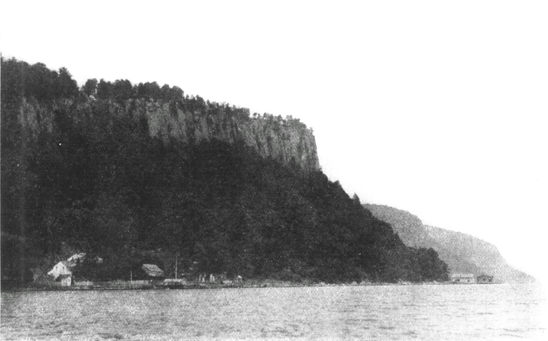
NORTHERN POINT OF PALISADES
The aggregate sale of Irving's works when he received his portfolio to Spain was already more than half a million copies, with an equal popularity achieved in Britain. No writer was ever more truly loved on both sides of the Atlantic, and his name is cherished to-day in England as fondly as it is in our own country. It has been the good fortune of the writer to spend many a delightful day in the very centre of Merrie England, in the quiet town of Stratford-on-Avon, and feel the gentle companionship of Irving. Of all writers who have brought to Stratford their heart homage Irving stands the acknowledged chief. The sitting-room in the "Red Horse Hotel," where he was disturbed in his midnight reverie, is still called Irving's room, and the walls are hung with portraits taken at different periods of his life. Mine[page 65] host said that visitors from every land were as much interested in this room as in Shakespeare's birth-place. The remark may have been intensified to flatter an American visitor, but there are few names dearer to the Anglo-Saxon race than that on the plain headstone in the burial-yard of Sleepy Hollow. Sunnyside is scarcely visible to the Day Line tourist. A little gleam of color here and there amid the trees, close to the river bank, near a small boat-house, merely indicates its location; and the traveler by train has only a hurried glimpse, as it is within one hundred feet of the New York Central Railroad. Tappan Zee, at this point, is a little more than two miles wide and over the beautiful expanse Irving has thrown a wondrous charm. There is, in fact, "magic in the web" of all his works. A few modern critics, lacking appreciation alike for humor and genius, may regard his essays as a thing of the past, but as long as the Mahicanituk, the ever-flowing Hudson, pours its waters to the sea, as long as Rip Van Winkle sleeps in the blue Catskills, or the "Headless Horseman" rides at midnight along the Old Post Road en route for Teller's Point, so long will the writings of Washington Irving be remembered and cherished. We somehow feel the reality of every legend he has given us. The spring bubbling up near his cottage was brought over, as he gravely tells us, in a churn from Holland by one of the old time settlers, and we are half inclined to believe it; and no one ever thinks of doubting that the "Flying Dutchman," Mynheer Van Dam, has been rowing for two hundred years and never made a port. It is in fact still said by the old inhabitants, that often in the soft twilight of summer evenings, when the sea is like glass and the opposite hills throw their shadows across it, that the low vigorous pull of oars is heard but no boat is seen.
Here was no castle in the air, but a realized day-dream.
Irving was there, as genial, humorous and imaginative
as if he had never wandered from the primal
haunts of his childhood and his fame.
Henry T. Tuckerman.
According to Irving "Sunnyside" was once the property of old Baltus Van Tassel, and here lived the fair Katrina, beloved by all the youths of the neighborhood, but more[page 66] especially by Ichabod Crane, the country school-master, and a reckless youth by the name of Van Brunt. Irving tells us that he thought out the story one morning on London Bridge, and went home and completed it in thirty-six hours. The character of Ichabod Crane was a sketch of a young man whom he met at Kinderhook when writing his Knickerbocker history. It will be remembered that Ichabod Crane went to a quilting-bee at the home of Mynheer Van Tassel, and, after the repast, was regaled with various ghost stories peculiar to the locality. When the "party" was over he lingered for a time with the fair Katrina, but sallied out soon after with an air quite desolate and chop-fallen. The night grew darker and darker. He had never before felt so lonesome and miserable. As he passed the fatal tree where Arnold was captured, there started up before him the identical "Headless Horseman" to whom he had been introduced by the story of Brom Bones. Nay, not entirely headless; for the head which "should have rested upon his shoulders was carried before him on the pommel of the saddle. His terror rose to desperation. He rode for death and life. The strange horseman sped beside him at an equal pace. He fell into a walk. The strange horseman did the same. He endeavored to sing a psalm-tune, but his tongue clove to the roof of his mouth. If he could but reach the bridge Ichabod thought he would be safe. Away then he flew in rapid flight. He reached the bridge, he thundered over the resounding planks. Then he saw the goblin rising in his stirrups, and in the very act of launching his head at him. It encountered his cranium with a tremendous crash. He was tumbled headlong into the dirt, and the black steed and the spectral rider passed by like a whirlwind. The next day tracks of horses deeply dented in the road were traced to the bridge, beyond which, on the bank of a broad part of the brook, where the water ran deep and black, was found the hat of the unfortunate Ichabod, and close beside it a shattered[page 67] pumpkin." All honor to him who fills this working-day world with humor, romance and beauty!
I beg you will have the kindness to let me know when
Mr. Irving takes pen in hand again; for assuredly I
shall expect a very great treat which I may chance never
to hear of but through your kindness.
Walter Scott.
I want to visit Washington Irving, I want to see your
stupendous scenery, I want to go to the grave of
Washington.
Lord Byron.
Lyndehurst, Helen M. Gould's residence. A short distance north of "Sunnyside" is the home of Helen M. Gould, whose modest and liberal use of wealth in noble charities has endeared her to every American heart. The place was first known as the Paulding Manor House, where William Paulding, early mayor of New York, and nephew of one of the captors of Andre had his country home. It is a beautiful specimen of old time English architecture, with a suggestion, as some writers have noted, of Newstead Abbey. This part of the Hudson is particularly rich in beautiful residences, rising tier upon tier from the river to the horizon. Albert Bierstadt, the artist, had here a beautiful home, unfortunately burned many years ago.
The Old Post Road from New York to Albany is in many particulars the richest and greatest highway of our country.
Tappan.—Almost opposite Irvington about two miles southwest of Piermont, is old Tappantown, where Major Andre was executed October 2, 1780. The removal of his body from Tappan to Westminster was by a special British ship, and a singular incident was connected with it. The roots of a cypress tree were found entwined about his skull and a scion from the tree was carried to England and planted in the garden adjoining Windsor Palace. It is a still more curious fact that the tree beneath which Andre was captured was struck by lightning on the day of Benedict Arnold's death in London. Further reference will be made to Andre in our description of Tarrytown, and also of Haverstraw, where Arnold and Andre met at the house of Joshua Hett Smith.
Tarrytown, 26 miles from New York. It was here on the Old Post Road, now called Broadway, a little north of the village, that Andre was captured and Arnold's treachery exposed. A monument erected on the spot by[page 68] the people of Westchester County, October 7, 1853, bears the inscription:
on this spot, the 23d day of september, 1780, the spy,
MAJOR JOHN ANDRE,
Adjutant-General of the British Army, was captured by
John Paulding, David Williams, and Isaac Van Wart.
all natives of this county.
History has told the rest.
The following quaint ballad-verses on the young hero give a realistic touch to one of the most providential occurrences in our history:
He with a scouting party
Went down to Tarrytown,
Where he met a British officer,
A man of high renown,
Who says unto these gentlemen,
"You're of the British cheer,
I trust that you can tell me
If there's any danger near?"
Then up stept this young hero,
John Paulding was his name,
"Sir, tell us where you're going
And also whence you came?"
"I bear the British flag, sir;
I've a pass to go this way,
I'm on an expedition,
And have no time to stay."
Young Paulding, however, thought that he had plenty of time to linger until he examined his boots, wherein he found the papers, and, when offered ten guineas by Andre, if he would allow him to pursue his journey, replied: "If it were ten thousand guineas you could not stir one step."
The centennial anniversary of the event was commemorated in 1880 by placing, through the generosity of John Anderson, on the original obelisk of 1853, a large statue representing John Paulding as a minute man.
That overruling Providence which has so often and so
remarkably interposed in our favor, never manifested
itself more conspicuously than in the timely discovery
of Arnold's treachery.
George Washington.
Tarrytown was the very heart of the debatable ground of the Revolution and many striking incidents mark its early history. In 1777 Vaughan's troops landed here on their way to attack Fort Montgomery, and here a party of Americans, under Major Hunt, surprised a number of British refugees while playing cards at the Van Tassel tavern. The major completely "turned the cards" upon them by rushing in with brandished stick, which he brought down with emphasis upon the table, remarking with genuine American brevity, "Gentlemen, clubs are trumps." Here, too, according to Irving, arose the two great orders of chivalry, the "Cow Boys" and "Skinners." The former fought, or rather marauded under the American, the latter under the British banner; the former were known as "Highlanders," the latter as the "Lower-Party." In the zeal of service both were apt to make blunders, and confound the property of friend and foe. "Neither of them, in the heat and hurry of a foray, had time to ascertain the politics of a horse or cow which they were driving off into captivity, nor when they wrung the neck of a rooster did they trouble their heads whether he crowed for Congress or King George."
It was also a genial, reposeful country for the faithful historian, Diedrich Knickerbocker; and here he picked up many of those legends which were given by him to the world. One of these was the legend connected with the old Dutch Church of Sleepy Hollow. "A drowsy, dreamy influence seems to hang over the land, and to pervade the very atmosphere. Some say the place was bewitched by a high German doctor during the early days of the settlement; others that an old Indian chief, the wizard of his tribe, held his pow-wows there before Hendrick Hudson's discovery of the river. The dominant spirit, however, that haunts this enchanted region, is the apparition of a figure on horse-back, without a head, said to be the ghost of a Hessian trooper, and was known[page 70] at all the country firesides as the 'Headless horseman' of Sleepy Hollow."
O waters of Pocantico!
Wild rivulet of wood and glen!
May thy glad laughter, sweet and low,
Long, long outlive the sighs of men.
S.H. Thayer.

SLEEPY HOLLOW CHURCH.
Sleepy Hollow.—The Old Dutch Church, the oldest on the Hudson, is about one-half mile north from Tarrytown.
It was built by "Frederick Filipse and his wife Katrina Van Cortland in 1690." The material is partly of stone and partly of brick brought from Holland. It stands as an appropriate sentinel near the entrance to the burial-yard where Irving sleeps. After entering the gate our way leads past the graves of the Ackers, the Van Tassels, and the Van Warts, with inscriptions and plump Dutch cherubs on every side that often delighted the heart of Diedrich Knickerbocker. How many worshippers since that November day in 1859, have come hither with reverent footsteps to read on the plain slab this simple inscription: "Washington Irving, born April 3, 1783. Died November 28, 1859," and recall Longfellow's beautiful lines:
[page 71]"Here lies the gentle humorist, who died
In the bright Indian Summer of his fame.
A simple stone, with but a date and name,
Marks his secluded resting place beside
The river that he loved and glorified.
Here in the Autumn of his days he came,
But the dry leaves of life were all aflame
With tints that brightened and were multiplied.
How sweet a life was his, how sweet a death;
Living to wing with mirth the weary hours,
Or with romantic tales the heart to cheer;
Dying to leave a memory like the breath
Of Summers full of sunshine and of showers,
A grief and gladness in the atmosphere."
If ever I should wish for a retreat whither I might
steal from the world and its distractions, and dream
quietly away the remnant of a troubled life, I know of
none more promising than this little valley.
Washington Irving.
Sleepy Hollow Church, like Sunnyside, is hidden away from the steamer tourist by summer foliage. Just before reaching Kingston Point light-house, a view, looking northeast up the little bay to the right, will sometimes give the outline of the building. Beyond this a tall granite shaft, erected by the Delavan family, is generally quite distinctly seen, and this is near the grave of Irving. A light-house, built in 1883, marks the point where the Pocantico or Sleepy Hollow Creek joins the Hudson:
Pocantico's hushed waters glide
Through Sleepy Hollow's haunted ground,
And whisper to the listening tide
The name carved o'er one lowly mound.
To one loving our early history and legends there is no spot more central or delightful than Tarrytown. Irving humorously says that Tarrytown took its name from husbands tarrying too late at the village tavern, but its real derivation is Tarwen-Dorp, or Wheat-town. The name of the old Indian village at this point was Alipconck (the place of elms). It has often occurred to the writer that, more than any other river, the Hudson has a distinct personality, and also that the four main divisions of human life are particularly marked in the Adirondacks, the Catskills, the Highlands and Tappan Bay:
[page 72]The Adirondacks, childhood's glee;
The Catskills, youth with dreams o'ercast;
The Highlands, manhood bold and free;
The Tappan Zee, age come at last.
This was the spot that Irving loved; we linger by his grave at Sleepy Hollow with devotion; we sit upon his porch at Sunnyside with reverence:
Thrice blest and happy Tappan Zee,
Whose banks along thy glistening tide
Have legend, truth, and poetry
Sweetly expressed in Sunnyside!
Whose golden fancy wove a spell
As lasting as the scene is fair
And made the mountain stream and dell
His own dream-life forever share.
Henry T. Tuckerman.
Nyack, on the west side, 27 miles from New York. The village, including Upper Nyack, West Nyack and South Nyack, has many fine suburban homes and lies in a semi-circle of hills which sweep back from Piermont, meeting the river again at the northern end of Tappan Zee. Tappan is derived from an Indian tribe of that name, which, being translated, is said to signify cold water. The bay is ten miles in length, with an average breadth of about two miles and a half.
Nyack grows steadily in favor as a place for summer residents. The hotels, boarding-houses and suburban homes would increase the census as given to nearly ten thousand people. The West Shore Railroad is two and a half miles from the Hudson, with (a) station at West Nyack. The Northern Railroad of New Jersey, leased by the New York, Lake Erie and Western (Chambers Street and 23d Street, New York), passes west of the Bergen Hills and the Palisades. The Ramapo Mountains, north of Nyack, were formerly known by ancient mariners as the Hook, or Point-no-Point. They come down to the river in little headlands, the points of which disappear as the steamer nears them. (The peak to the south, known as Hook Mountain, is 730 feet high.) Ball Mountain above this, and nearer the river, 650 feet. They were sometimes called by Dutch captains Verditege Hook.
The sails hung idly all night long,
I dreamed a dream of you and me;
'Twas sweeter than the sweetest song,—
The dream I dreamed on Tappan Zee.
Wallace Bruce.

STONY POINT
Perhaps it took so long to pass these illusive headlands, reaching as they do eight miles along the western bank, that it naturally seemed a very tedious point to the old skippers. Midway in this Ramapo Range, "set in a dimple of the hills," is—
Rockland Lake, source of the Hackensack River, one hundred and fifty feet above the Hudson. The "slide way," by which the ice is sent down to the boats to be loaded, can be seen from the steamer, and the blocks in motion, as seen by the traveler, resemble little white pigs running down an inclined plane. As we look at the great ice-houses to-day, which, like uncouth barns, stand here and there along the Hudson, it does not seem possible that only a few years ago ice was decidedly unpopular, and wheeled about New York in a hand-cart. Think of one hand-cart supplying New York with ice! It was considered unhealthy, and called forth many learned discussions.
Returning to the east bank, we see above Tarrytown many superb residences, notably "Rockwood," the home of William Rockefeller, of the Standard Oil Company. The estate of General James Watson Webb is also near at hand. Passing Scarborough Landing, with the Hook Mountain and Ball Mountains on the left, we see
Ossining, formerly known as Sing Sing, on east bank. The low buildings, near the river bank, are the State's Prison. They are constructed of marble, but are not considered palatial by the prisoners that occupy the cells. It was quarried near by, and the prisons were built by convicts imported from Auburn in 1826. Saddlery, furniture, shoes, etc., are manufactured within its walls. There was an Indian chieftancy here known as the Sintsinks. In a deed to Philip Phillipse in 1685 a stream is referred to as "Kitchewan called by the Indians Sink-Sink." The Indian Village was known as Ossining, from "ossin" a stone and "ing" a place, probably so called from the rocky and stony character of the river banks.
How many, at this hour, along thy course,
Slumber to thine eternal murmurings
That mingle with the utterance of their dreams.
William Cullen Bryant.
The heights above Tappan Zee at this point are crowned by fine residences, and the village is one of the pleasantest on the river. The drives among the hills are delightful and present a wide and charming outlook. Here also are several flourishing military boarding schools and a seminary for girls. The old silver and copper mines once worked here never yielded satisfactory returns for invested capital. Various industries give active life and prosperity to the town. Just above Sing Sing
Croton River, known by the Indians as Kitchawonk, joins the Hudson in a bay crossed by the New York Central Railroad Croton draw-bridge. East of this point is a water shed having an area of 350 square miles, which supplies New York with water. The Croton Reservoir is easily reached by a pleasant carriage drive from Sing Sing, and it is a singular fact that the pitcher and ice-cooler of New York, or in other words, Croton Dam and Rockland Lake, should be almost opposite. About fifty years ago the Croton first made its appearance in New York, brought in by an aqueduct of solid masonry which follows the course of the Hudson near the Old Post Road, or at an average distance of about a mile from the east bank. Here and there its course can be traced by "white stone ventilating towers" from Sing Sing to High Bridge, which conveys the aqueduct across the Harlem River. Its capacity is 100,000,000 gallons per day, which however began to be inadequate for the city and a new aqueduct was therefore begun in 1884 and completed in 1890, capable of carrying three times that amount, at a cost of $25,000,000. The water-shed is well supplied with streams and lakes. Lake Mahopac, one of its fountains, is one of the most beautiful sheets of water near the metropolis, and easily accessible by a pleasant drive from Peekskill, or by the Harlem Railroad from New York. The old Indian name was Ma-cook-pake, signifying a large inland lake, or perhaps an island near the shore. The same derivation is also seen in Copake Lake, Columbia[page 75] County. On an island of Mahopac the last great "convention" of the southern tribes of the Hudson was held. The lake is about 800 feet above tide, and it is pleasant to know that the bright waters of Mahopac and the clear streams of Putnam and Westchester are conveyed to New York even as the poetic waters of Loch Katrine to the city of Glasgow. The Catskill water supply, the ground of which was broken in 1907, is referred to in our description of Cold Spring and the Catskills.
Round the aqueducts of story
As the mists of Lethe throng
Croton's waves in all their glory
Troop in melody along.
George P. Morris.
Map of the Hudson River from Croton to Hyde Park.

Just above Croton Bay and the New York Central Railroad draw-bridge will be seen the old Van Cortlandt Manor, where Frederick Phillipse and Katrina Van Cortlandt were married, as seen by the inscription on the old Dutch Church of Sleepy Hollow.
Teller's Point (sometimes known as Croton or Underhill's Point), separates Tappan Zee from Haverstraw Bay. It was called by the Indians "Senasqua." Tradition says that ancient warriors still haunt the surrounding glens and woods, and the sachems of Teller's Point are household words in the neighborhood. It is also said that there was once a great Indian battle here, and perhaps the ghosts of the old warriors are attracted by the Underhill grapery and the 10,000 gallons of wine bottled every season.
It was here the British warship "The Vulture," came with Andre and put him ashore at the foot of Mount Tor below Haverstraw.
The river now opens into a beautiful bay, four miles in width,—a bed large enough to tuck up fifteen River Rhines side by side. This reach sometimes seems in the bright sunlight like a molten bay of silver, and the tourist finds relief in adjusting his smoked glasses to temper the dazzling light.
Beneath these gold and azure skies
The river winds through leafy glades,
Save where, like battlements, arise
The gray and tufted Palisades.
Henry T. Tuckerman.
Haverstraw, 37 miles from New York. Haverstraw Bay is sometimes said to be five miles wide. Its widest point, however, from Croton Landing to Haverstraw, is,[page 76] according to United States Geological Survey, a little over four miles. The principal industry of Haverstraw is brick-making, and its brick yards reaching north to Grassy Point, are of materal profit, if not picturesque. The place was called Haverstraw by the Dutch, perhaps as a place of rye straw, to distinguish it from Tarrytown, a place of wheat. The Indian name has been lost; but, if its original derivation is uncertain, it at least calls up the rhyme of old-time river captains, which Captain Anderson of the "Mary Powell" told the writer he used to hear frequently when a boy:
"West Point and Middletown,
Konnosook and Doodletown,
Kakiak and Mamapaw,
Stony Point and Haverstraw."
Quaint as these names now sound, they all are found on old maps of the Hudson.
High Torn is the name of the northern point of the Ramapo on the west bank, south of Haverstraw. According to the Coast Survey, it is 820 feet above tide-water, and the view from the summit is grand and extensive. The origin of the name is not clear, but it has lately occurred to the writer, from a re-reading of Scott's "Peveril of the Peak," that it might have been named from the Torn, a mountain in Derbyshire, either from its appearance, or by some patriotic settler from the central water-shed of England. Others say it is the Devonshire word Tor changed to Torn, evidently derived from the same source.
Emerging from these confused piles, the river as if
rejoicing at its release from its struggle, expanded into
a wide bay, which was ornamented by a few fertile and
low points that jutted humbly into its broad basin.
James Fenimore Cooper.
West Shore Railroad.—The tourist will see at this point, on the left bank of the river, the tunnel whereby the "West Shore" finds egress from the mountains. The traveler over this railway, on emerging from the quiet valley west of the Palisades, comes upon a sudden vision of beauty unrivaled in any land. The broad river seems like a great inland lake; and the height of the tunnel[page 77] above the silver bay gives to the panoramic landscape a wondrous charm. About a mile from the river, southwest of Grassy Point, on the farther side of the winding Minnissickuongo Creek, which finally after long meandering makes up its mind to glide into Stony Point Bay, will be seen Treason Hill marked by the Joshua Hett Smith stone house where Arnold and Andre met. The story of this meeting will be referred to at greater length in connection with its most dramatic incident at the old Beverley House in the Highlands. The Hudson here is about two miles in width and narrows rapidly as we pass Grassy Point on the west bank with its meadows and brick yards to
Stony Point, where it is scarcely more than half a mile to Verplank's Point on the eastern bank. This was, therefore, an important pass during the Revolution. The crossing near at hand was known as King's Ferry, at and before the days of '76, and was quite an avenue of travel between the Southern, Middle and Eastern States. The fort crowning a commanding headland, was captured by the British, June 1, 1779, but it was surprised and recaptured by Anthony Wayne, July 15 of the same year. A centennial was observed at the place July 15, 1879, when the battle was "refought" and the West Point Cadets showed how they would have done it if they had been on hand a century ago. Thackeray, in his "Virginians," gives perhaps the most graphic account of this midnight battle. The present light-house occupies the site of the old fort, and was built in part of stone taken from its walls. Upon its capture by the British, Washington, whose headquarters were at New Windsor, meditated a bold stroke and summoned Anthony Wayne, more generally known as "Mad Anthony," from his reckless daring, to undertake its recapture with a force of one thousand picked men. The lines were formed in two columns about 8 p.m. at "Springsteel's farm." Each soldier and officer put a piece of white paper in his hat[page 78] to distinguish him from the foe. No guns were to be loaded under penalty of death. General Wayne, at the head of the column, forded the marsh covered at the time with two feet of water. The other column led by Butler and Murfree crossed an apology for a bridge. During the advance both columns were discovered by the British sentinels and the rocky defense literally blazed with musketry. In stern silence, however, without faltering, the American columns moved forward, entered the abatis, until the advance guard under Anthony Wayne was within the enemy's works. A bullet at this moment struck Wayne in the forehead grazing his skull. Quickly recovering from the shock, he rose to his knees, shouted: "Forward, my brave fellows"; then turning to two of his followers, he asked them to help him into the fort that he might die, if it were to be so, "in possession of the spot." Both columns were now at hand and inspired by the brave general, came pouring in, crying "The fort's our own." The British troops completely overwhelmed, were fain to surrender and called for mercy. Wayne's characteristic message to Washington antedates modern telegraphic brevity:—"Stony Point, 2 o'clock a.m. The American flag waves here.—Mad Anthony." There were twenty killed and sixty wounded on each side. Some five hundred of the enemy were captured and about sixty escaped. "Money rewards and medals were given to Wayne and the leaders in the assault. The ordinance and stores captured were appraised at over $180,000 and there was universal rejoicing" throughout the land. "Stony Point State Park" was dedicated by appropriate ceremony July 16, 1902. At the close of Governor Odell's address the flag was raised by William Wayne, a lineal descendant of the hero, and the cruiser "Olympia" of Manila fame boomed forth her tribute. Verplank's Point, on the east bank (now full of brick-making establishments), was the site of Fort Lafayette. It was here that Baron Steuben drilled the soldiers of the American army. Back[page 79] from Green Cove above Verplanck's Point is "Knickerbocker Lake."
The star spangled banner, the flag of the brave,
And the cross of old England in amity wave,
But if ever the nations do battle again
God send us such soldiers as Anthony Wayne.
Minna Irving.
The echoes that so boldly rung
When cannon flashed from steep to steep,
And freedom's airy challenge flung,
In each romantic valley sleep.
Henry T. Tuckerman.
Tompkin's Cove.—North of Stony Point we see great quarries of limestone, the principal industry of the village of Tompkin's Cove. Gravel is also shipped from this place for Central Park roads and driveways in New York City. The tourist, looking north from the forward deck of the steamer, sees no opening in the mountains, and it is amusing to hear the various conjectures of the passengers; as usual, the "unexpected" happens. The steamer turns to the left and sweeps at once into the grand scenery of the Highlands. The straight forward course, which seems the more natural, would land the steamer against the Hudson River Railroad, crossing the Peekskill River. It is said that an old skipper, Jans Peek, ran up this stream, years before the railroad was built, and did not know that he had left the Hudson, or rather that the Hudson was "left" until he ran aground in the shoal water of the bay. The next morning he discovered that it was a goodly land, and the place bears his name unto this day.
The Highlands and the Palisades
Mirror their beauty in the tide,
The history of whose forest shades
A nation reads with conscious pride.
Wallace Bruce.
Peekskill, 40 miles from New York, is a pleasant city on the quiet bay which deeply indents the eastern bank. The property in this vicinity was known as Rycks Patent in 1665. In Revolutionary times Fort Independence stood on the point above, where its ruins are still seen. The Franciscan Convent Academy of "Our Lady of Angels," guards the point below. In 1797 Peekskill was the headquarters of old Israel Putnam, who rivaled "Mad Anthony" in brevity as well as courage. It will be remembered that Palmer was here captured as a spy. A British officer wrote a letter asking his reprieve, to which Putnam replied, "Nathan Palmer was taken as a spy, tried as a spy and will be hanged as a spy. P. S.—He is hanged." This was the birthplace of Paulding, one of Andre's captors, and he died here in 1818. He is buried in the old rural cemetery about two miles and a half[page 80] from the village, and a monument has been erected to his memory. Near at hand is the "Wayside Inn," where Andre once "tarried," also the Hillside Cemetery, where on June 19, 1898, the 123d anniversary of the battle of Bunker Hill, a monument was unveiled to General Pomeroy by the Society of the Sons of Revolution, New York. The church which Washington attended is in good preservation.
Near Peekskill is the old Van Cortlandt house, the residence of Washington for a short time during the Revolution. East of the village was the summer home of the great pulpit orator, Henry Ward Beecher. Peekskill was known by the Indians as Sackhoes in the territory of the Kitchawongo, which extended from Croton River to Anthony's Nose.
Turning Caldwell's Landing or Jones' Point, formerly known as Kidd's Point, almost at right angles, the steamer enters the southern gate of the Highlands. At the water edge will be seen some upright planks or caissons marking the spot where Kidd's ship was supposed to have been scuttled. As his history seems to be intimately associated with the Hudson, we will give it in brief:
The Story of Captain Kidd.—"My name was Captain Kidd as I sailed," are famous lines of an old ballad which was once familiar to our grandfathers. The hapless hero of the same was born about the middle of the seventeenth century, and it is thought, near Greenock, Scotland. He resided at one time in New York, near the corner of William and Cedar Streets, and was there married. In April, 1696, he sailed from England in command of the "Adventure Galley," with full armament and eighty men. He captured a French ship, and, on arrival at New York, put up articles for volunteers; remained in New York three or four months, increasing his crew to one hundred and fifty-five men, and sailed thence to Madras, thence to Bonavista and St. Jago, Madagascar, then to Calicut, then to Madagascar again, then sailed[page 81] and took the "Quedah Merchant." Kidd kept forty shares of the spoils, and divided the rest with his crew. He then burned the "Adventure Galley," went on board the "Quedah Merchant," and steered for the West Indies. Here he left the "Merchant," with part of his crew, under one Bolton, as commander. Then manned a sloop, and taking part of his spoils, went to Boston via Long Island Sound, and is said to have set goods on shore at different places. In the meantime, in August, 1698, the East Indian Company informed the Lords Justice that Kidd had committed several acts of piracy, particularly in seizing a Moor's ship called the "Quedah Merchant." When Kidd landed at Boston he was therefore arrested by the Earl of Bellamont, and sent to England for trial, 1699, where he was found guilty and executed. Now it is supposed that the crew of the "Quedah Merchant," which Kidd left at Hispaniola, sailed for their homes, as the crew was mostly gathered from the Highlands and above. It is said that they passed New York in the night, en route to the manor of Livingston; but encountering a gale in the Highlands, and thinking they were pursued, ran her near the shore, now known as Kidd's Point, and here scuttled her, the crew fleeing to the woods with such treasure as they could carry. Whether this circumstance was true or not, it was at least a current story in the neighborhood, and an enterprising individual, about fifty years ago, caused an old cannon to be "discovered" in the river, and perpetrated the first "Cardiff Giant Hoax." A New York Stock Company was organized to prosecute the work. It was said that the ship could be seen in clear days, with her masts still standing, many fathoms below the surface. One thing is certain—the company did not see it or the treasurer either, in whose hands were deposited about $30,000.
Beauty and majesty on either hand
Have shared thy waters with their common realm.
Knickerbocker Magazine.
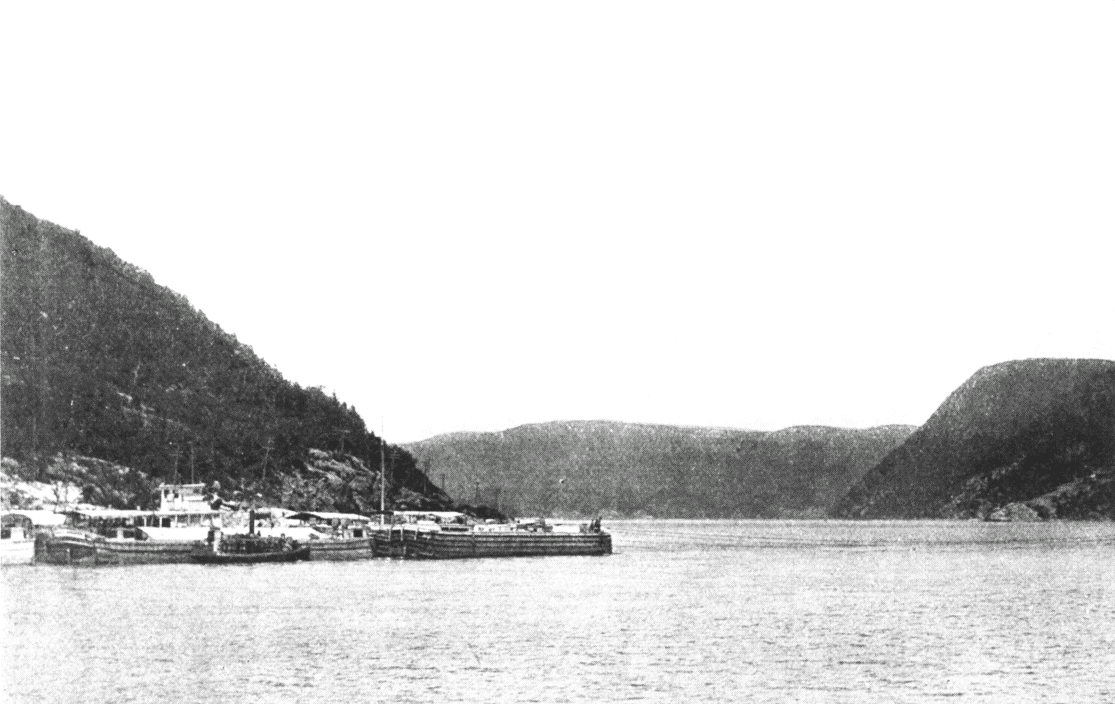
SOUTHERN GATE OF HIGHLANDS
Their summits are the first to meet
The morning's golden ray,
And last to catch the crimson fires
That warm the dying day.
Minna Irving.
On the west shore rise the rock-beaten crags of—
The Dunderberg, the dread of the Dutch mariners.[page 82] This hill, according to Irving, was peopled with a multitude of imps, too great for man to number, who wore sugar-loaf hats and short doublets, and had a picturesque way of "tumbling head over heels in the rack and mist." They were especially malignant toward all captains who failed to do them reverence, and brought down frightful squalls on such craft as failed to drop the peaks of their mainsails to the goblin who presided over this shadowy republic. It was the dread of the early navigators—in fact, the Olympus of Dutch mythology. Verditege Hook, the Dunderberg, and the Overslaugh, were names of terror to even the bravest skipper. The old burghers of New York never thought of making their week's voyage to Albany without arranging their wills, and it created as much commotion in New Amsterdam as a modern expedition to the north pole. Dunderberg, in most of the Hudson Guides and Maps, is put down as 1,098 feet, but its actual altitude by the latest United States Geological Survey is 865 feet.
The State National Guard Encampment crowns a bluff, formerly known as Roa Hook, on the east bank, north of Peekskill Bay, a happy location in the midst of history and beauty. Every regiment in the State rallies here in turn during the summer months for instruction in the military art, living in tents and enjoying life in true army style. Visitors are cordially greeted at proper hours, and the camp is easily reached by ferry from Peekskill. A ferry also runs from Peekskill to Dunderberg, affording a hillside outing and a delightful view. It is expected that a spiral railroad, fourteen miles in length, undertaken by a recently organized corporation, but abandoned for the present, will make the spot a great Hudson River resort. The plan also embraces a palatial hotel on the summit and pleasure grounds upon the point at its base. Passing Manito Mountain on our right the steamer approaches
Anthony's Nose, a prominent feature of the Hudson.
The waters were hemmed in by abrupt and dark
mountains, but the channel was still broad and smooth
enough for all the steamboats in the Republic to ride
in safety.
Harriet Martineau.

ANTHONY'S NOSE.
Strangely enough the altitude of the mountains at the southern portal of the Highlands has been greatly overrated. The formerly accepted height of Anthony's Nose has been reduced by the Geological Survey from 1,228 feet to 900. It has, however, an illustrious christening, and according to various historians several godfathers. One says it was named after St. Anthony the Great, the first institutor of monastic life, born A.D. 251, at Coma, in Heraclea, a town in Upper Egypt. Irving's humorous account is, however, quite as probable that it was derived from the nose of Antony Van Corlear, the illustrious trumpeter of Peter Stuyvesant. "Now thus it happened that bright and early in the morning the good Antony, having washed his burly visage, was leaning over the quarter-railing of the galley, contemplating it in the glassy waves below. Just at this moment the illustrious sun, breaking in all his splendor from behind a high bluff of the Highlands, did dart one of his most potent beams full upon the refulgent nose of the sounder of brass, the reflection of which shot straightway down hissing hot into the water, and killed a mighty sturgeon that was sporting beside the vessel. When this astonishing miracle was made known to the Governor, and he tasted of the unknown fish, he marveled exceedingly; and, as a monument thereof, he gave the name of Anthony's Nose to a stout promontory in the neighborhood, and it has continued to be called Anthony's Nose ever since." It was called by the Indians "Kittatenny," a Delaware term, signifying "endless hills." The stream flowing into the river south of Anthony's Nose is known as the Brocken Kill, broken into beautiful cascades from mountain source to mouth.
The beautiful and in some places highly singular
banks of the Hudson rendered a voyage both amusing
and interesting, while the primitive manners of the inhabitants
diverted the gay and idle and pleased the
thoughtful and speculative.
Mrs. Grant of Laggan.
Iona Island, formerly a pleasure resort and picnic ground. An old-time joke of the Hudson was frequently perpetrated on strangers while passing the island. Some one would innocently observe, "I own a island on the Hudson." When any one obligingly asked, "Where?" the[page 84] reply would be with pointed finger, "Why there." But the United States Government owns it now against all comers, and its quiet lanes and picnic abandon have been exchanged for busy machine shops and military discipline. It is near the west bank, opposite Anthony's Nose. A short distance from the island, on the main land, was the village or cross-roads of Doodletown. This reach of the river was formerly known as The Horse Race, from the rapid flow of the tide when at its height. The hills on the west bank now recede from the river, forming a picturesque amphitheatre, bounded on the west by Bear Mountain. An old road directly in the rear of Iona Island, better known to Anthony Wayne than to the modern tourist, passes through Doodletown, over Dunderberg, just west of Tompkin's Cove, to Haverstraw. Here amid these pleasant foothills Morse laid the scene of a historical romance, which he however happily abandoned for a wider invention. The world can get along without the novel, but it would be a trifle slow without the telegraph. On the west bank, directly opposite the railroad tunnel which puts a merry "ring" into the tip of Anthony's Nose, is what is now known as Highland Lake, called by the Indians "Sinnipink," and by the immediate descendants of our Revolutionary fathers "Hessian Lake" or "Bloody Pond," from the fact that an American company were mercilessly slaughtered here by the Hessians, and, after the surrender of Fort Montgomery, their bodies were thrown into the lake.
Behold again the wildwood shade,
The mountain steep, the checkered glade,
And hoary rocks and bubbling rills,
And pointed waves and distant hills.
Robert C. Sands.
The capture of Fort Clinton and Fort Montgomery was two years before Mad Anthony's successful assault on Stony Point. Early in the history of the Revolution, the British Government thought that it would be possible to cut off the eastern from the middle and southern Colonies by capturing and garrisoning commanding points along the Hudson and Lake Champlain. It was therefore decided in London, in the spring of 1777, to have Sir Henry Clinton approach from the south and Burgoyne[page 85] from the north. Reinforcements, however, arrived late from England and it was September before Clinton transported his troops, about 4,000 in number, in warships and flat-boats up the river. Governor George Clinton was in charge of Fort Montgomery, and his brother James of Fort Clinton, while General Putnam, with about 2,000 men, had his headquarters at Peekskill. In addition to these forts, a chain was stretched across the Hudson from Anthony's Nose to a point near the present railroad bridge, to obstruct the British fleet. General Putnam, however, became convinced that Sir Henry Clinton proposed to attack Fort Independence. Most of the troops were accordingly withdrawn from Forts Montgomery and Clinton, when Sir Henry Clinton, taking advantage of a morning fog, crossed with 2,000 men at King's Ferry. Guided by a sympathizer of the British cause, who knew the district, he crossed the Dunderberg Mountain by the road just indicated. One division of 900 moving on Fort Montgomery, and another of 1,100 on Fort Clinton. Governor Clinton in the meantime ordered 400 soldiers to Fort Montgomery, and his reconnoitering party, met by the Hessians, fell back upon the fort, fighting as it retreated. Governor Clinton sent to General Putnam for reinforcements, but it is said that the messenger deserted, so that Putnam literally sat waiting in camp, unconscious of the enemy's movements. A simultaneous attack was made at 5 o'clock in the afternoon on both forts. Lossing says: "The garrisons were composed mostly of untrained militia. They behaved nobly, and kept up the defense vigorously, against a greatly superior force of disciplined and veteran soldiers, until twilight, when they were overpowered, and sought safety in a scattered retreat to the neighboring mountains. Many escaped, but a considerable number were slain or made prisoners. The Governor fled across the river in a boat, and at midnight was with General Putnam at Continental Village, concerting measures for stopping the invasion. James, forcing[page 86] his way to the rear, across the highway bridge, received a bayonet wound in the thigh, but safely reached his home at New Windsor. A sloop of ten guns, the frigate "Montgomery"—twenty-four guns—and two row-galleys, stationed near the boom and chain for their protection, slipped their cables and attempted to escape, but there was no wind to fill their sails, and they were burned by the Americans to prevent their falling into the hands of the enemy. The frigate "Congress," twenty-eight guns, which had already gone up the river, shared the same fate on the flats near Fort Constitution, which was abandoned. By the light of the burning vessels the fugitive garrisons made their way over the rugged mountains, and a large portion of them joined General Clinton at New Windsor the next day. They had left many of their brave companions behind, who, to the number of 250, had been slain or taken prisoners. The British, too, had parted with many men and brave officers. Among the latter was Lieutenant-Colonel Campbell. Early in the morning of the 7th of October, the river obstructions between Fort Montgomery and Anthony's Nose, which cost the Americans $250,000, were destroyed, and a light flying squadron, commanded by Sir James Wallace, and bearing a large number of land troops under General Vaughan, sailed up the river on a marauding expedition, with instructions from Sir Henry to scatter desolation in their paths. It was hoped that such an expedition would draw troops from the Northern army for the protection of the country below, and thereby assist Burgoyne."
I love thy tempests when the broad-winged blast
Rouses thy billows with his battle call,
When gathering clouds, in phalanx black and vast
Like armed shadows gird thy rocky wall.
Knickerbocker Magazine.
Sir Henry Clinton, who had been advised by General Burgoyne that he must be relieved by October 12th, sent a messenger announcing his victory. Another of the many special providences of the American Revolution now occurs. The messenger blundered into the American camp, where some soldiers sat in British uniform, and found out too late that he was among enemies instead of friends. As Irving relates the incident in his "Life of Washington":
[page 87]—"On the 9th (October) two persons coming from Fort Montgomery were arrested by the guard, and brought for examination. One was much agitated, and was observed to put something hastily into his mouth and swallow it. An emetic was administered, and brought up a silver bullet. Before he could be prevented he swallowed it again. On his refusing a second emetic, the Governor threatened to have him hanged and his body opened. This threat was effectual and the bullet was again 'brought to light.' It was oval in form, and hollow, with a screw in the centre, and contained a note from Sir Henry Clinton to Burgoyne, written on a slip of thin paper, and dated October 8th, from Fort Montgomery: 'Nous y voici (here we are), and nothing between us and Gates. I sincerely hope this little success of ours will facilitate your operations.' Burgoyne never received it, and on October 13th, after the battles of Bennington and Saratoga, surrendered to General Gates. Sir Henry Clinton abandoned the forts on hearing of his defeat, and returned to New York 'a sadder and wiser man.'"
Columbia! Columbia! to glory arise,
The queen of the earth and the child of the skies.
Timothy Dwight.
Far up the Hudson's silver flood
I hear the Highlands call
With whispering of leafy boughs
And voice of waterfall.
Minna Irving.
Beverley House.—Passing Cohn's Hook, pronounced Connosook, where Hendrick Hudson anchored on his way up the river September 14, 1609, we see before us on the right bank a point coming down to the shore marked by a boat house. This is Beverley Dock, and directly up the river bank about an eighth of a mile stood the old Beverley House, where Benedict Arnold had his headquarters when in command of West Point. The old house, a good specimen of colonial times, was unfortunately burned in 1892, and with it went the most picturesque landmark of the most dramatic incident of the Revolution. It will be remembered that Arnold returned to the Beverley House after his midnight interview with Andre at Haverstraw, and immediately upon the capture of Andre the following day, that Colonel Jamison sent a letter to Arnold, advising him of the fact. It was the morning of September 4th. General Washington was on[page 88] his way to West Point, coming across the country from Connecticut. On arriving, however, at the river, just above the present station of Garrison, he became interested in examining some defenses, and sent Alexander Hamilton forward to the Beverley House, saying that he would come later, requesting the family to proceed with their breakfast and not to await his arrival. Alexander Hamilton and General Lafayette sat gayly chatting with Mrs. Arnold and her husband when the letter from Jamison was received. Arnold glanced at the contents, rose and excused himself from the table, beckoning to his wife to follow him, bade her good-bye, told her he was a ruined man and a traitor, kissed his little boy in the cradle, rode to Beverley Dock, and ordered his men to pull off and go down the river. The "Vulture," an English man-of-war, was near Teller's Point, and received a traitor, whose miserable treachery branded him with eternal infamy on both continents. It is said that he lived long enough to be hissed in the House of Commons, as he once took his seat in the gallery, and he died friendless and despised. It is also said, when Talleyrand arrived in Havre on foot from Paris, in the darkest hour of the French Revolution, pursued by the bloodhounds of the reign of terror, and was about to secure a passage to the United States, he asked the landlord of the hotel whether any Americans were staying at his house, as he was going across the water, and would like a letter to a person of influence in the New World. "There is a gentleman up-stairs from Britain or America," was the response. He pointed the way, and Talleyrand ascended the stairs. In a dimly lighted room sat a man of whom the great minister of France was to ask a favor. He advanced, and poured forth in elegant French and broken English, "I am a wanderer, and an exile. I am forced to fly to the New World without a friend or home. You are an American. Give me, then, I beseech you, a letter of yours, so that I may be able to earn my bread." The[page 89] strange gentleman rose. With a look that Talleyrand never forgot, he retreated toward the door of the next chamber. He spoke as he retreated, and his voice was full of suffering: "I am the only man of the New World who can raise his hand to God and say, 'I have not a friend, not one, in America!'" "Who are you?" he cried—"your name?" "My name is Benedict Arnold!"
Wayne, Putnam, Knox and Heath are there,
Steuben, proud Prussia's honored son;
Brave Lafayette from France the fair,
And chief of all our Washington.
Wallace Bruce.
Andre's fate on the other hand was widely lamented. He was universally beloved by his comrades and possessed a rich fund of humor which often bubbled over in verse. It is a strange coincidence that his best poetic attempt on one of Anthony Wayne's exploits near Fort Lee, entitled "The Cow Chase," closed with a graphically prophetic verse:
"And now I've closed my epic strain,
I tremble as I show it,
Lest this same Warrior-Drover Wayne
Should ever catch the poet."
By a singular coincidence he did: General Wayne was in command of the Tarrytown and Tappan country where Andre was captured and executed. It is also said that these lines were published by one of the Tory papers in New York the very day of Andre's capture. One of the old-time characters on the Hudson, known as Uncle Richard, has recently thrown new light on the capture of Andre by claiming, with a touch of genuine humor, that it was entirely due to the "effects" of cider which had been freely "dispensed" that day by a certain Mr. Horton, a farmer in the neighborhood.
In view of all he lost,—his youth, his love,
And possibilities that wait the brave,
Inward and outward bound dim visions move
Like passing sails upon the Hudson's wave.
Charlotte Fiske Bates.
It is impossible even in these later years, not to speak of twenty-five or fifty years ago, to travel along the shores of Haverstraw Bay or among the passes of the Highlands, without hearing some old-time stories about Arnold and Andre, and it would be strange indeed if a little romance had not here and there become blended with the real facts. Uncle Richard's account is undoubtedly[page 90] the best since the days of Knickerbocker. "Benedict Arnold, you know, had command of West Point, and he knew that the place was essential to the success of the Continental cause. He plotted, as everybody knows, to turn it over to the enemy, and in the correspondence which he carried on with General Clinton, young Andre, Clinton's aid, did all the writing. Things were coming to a focus, when a meeting took place between Arnold and Clinton's representative, Andre, at the house of Joshua Hett Smith, near Haverstraw. Andre came on the British ship "Vulture," which he left at Croton Point, in Haverstraw Bay. Well," so runs Uncle Richard's story, "it took a long time to get matters settled; they 'confabbed' till after daybreak. Then Arnold started back to the post which he had plotted to surrender. But daylight was no time for Andre to return to the "Vulture," so he hung round waiting for night.
"During that day, some men who were working for James Horton, a farmer on the ridge overlooking the river, who gave his men good rations of cider, drank a little too much of the hard stuff. They felt good, and thought it would be a fine joke to load and fire off an old disabled cannon which lay a mile or so away on the bank. They hauled it to the point now called Cockroft Point, propped it up, and then the spirit of fun—and hard cider—prompted them to train the old piece on the British ship "Vulture," lying at anchor in the Bay. The "Vulture's" people must have overestimated the source of the fire, for the ship dropped down the river, and Andre had to abandon the idea of returning by that means. He crossed the river at King's Ferry, and while on his way overland was captured at Tarrytown.
"Of course, the three brave men who refused to be bribed deserve all the glory they ever had; if it were not for them, who knows but the revolutionary war would have had a different ending. But they never would have had a chance to capture Andre if it had not been for[page 91] James Horton's men warming up on hard cider. Hard cider broke the plans of Arnold, it hung Andre, and it saved West Point." A boy misguided Grouchy en route to Waterloo. On what small hinges turn the destinies of nations!
A slanting ray lingered on the woody crests of the
precipices that overhung the river, giving greater depth
to the dark-gray and purple of the rocky sides.
Washington Irving.
All the way from Anthony's Nose to Beverley Dock, where we have been lingering over the story of Andre, we have been literally turning a kaleidoscope of blended history and beauty, with scarcely time to note the delightful homes on the west bank, just above Fort Montgomery. Among them J. Pierpont Morgan's and the Pells', John Bigelow's and "Benny Havens'," or on the east bank of Hamilton Fish, just above Beverley Dock, Samuel Sloan and the late William H. Osborn, just north of Sugar Loaf Mountain; the mountain being so named as it resembles, to one coming up the river, the old-fashioned conical-shaped sugar-loaf, which was formerly suspended by a string over the centre of the hospitable Dutch tables, and swung around to be occasionally nibbled at, which in good old Knickerbocker days, was thought to be the best and only orthodox way of sweetening tea.
Buttermilk Falls, so christened by Washington Irving, is a pretty little cascade on the west bank. Like sparkling wit, it is often dry, and the tourist is exceptionally fortunate who sees it in full-dress costume after a heavy shower, when it rushes over the rocks in floods of snow-white foam. Highland Falls is the name of a small village a short distance west of the river, on the bluff, but not seen from the deck of the steamer.
The large building above the rocky channel is Lady Cliff, the Academy of Our Lady of Angels, under the Franciscan Sisters at Peekskill, opened September, 1900. It was originally built for a hotel, and widely known as Cranston's Hotel and Landing. As the steamer is now approaching the west bank we see above us the Cullum Memorial Hall, completed in 1899, a bequest of the late George W. Cullum of the class of 1833. The still[page 92] newer structure to the south is the officers' messroom, crowning the crest above the landing.
Then, as you nearer draw, each wooded height
Puts off the azure hues by distance given!
And slowly breaks upon the enamored sight,
Ravine, crag, field and wood in colors true and bright.
Theodore S. Fay.
West Point, taken all in all, is the most beautiful tourist spot on the Hudson. Excursionists by the Day Boats from New York, returning by afternoon steamer, have three hours to visit the various places of history and beauty. To make an easy mathematical formula or picturesque "rule of three" statement, what Quebec is to the St. Lawrence, West Point is to the Hudson. If the citadel of Quebec is more imposing, the view of the Hudson at this place is grander than that of the St. Lawrence, and the ruins of Fort Putnam are almost as venerable as the Heights of Abraham. The sensation of the visitor is, moreover, somewhat the same in both places as to the environment of law and authority. To get the daily character and quality of West Point one should spend at least twenty-four hours within its borders, and a good hotel, the only one on the Government grounds, will be found central and convenient to everything of interest. The parade and drills at sunset hour can best be seen in this way.
The United States Military Academy.—Soon after the close of the War of the Revolution, Washington suggested West Point as the site of a military academy, and, in 1793, in his annual message, recommended it to Congress, which in 1794 organized a corps of artillerists to be here stationed with thirty-two cadets, enlarging the number in 1798 to fifty-six. In 1808 it was increased to one hundred and fifty-six, and in 1812 to two hundred and sixty.
Up to 1812 only 71 cadets had been graduated. The roll of graduates now numbers about 5,000.
Each Congressman has the appointment of one cadet, supplemented by ten appointed by the President of the United States. These cadets are members of the regular army, subject to its regulations for eight years, viz: during four years of study and four years after graduating. The candidates are examined in June, each year, and[page 93] must be physically sound as well as mentally qualified. The course is very thorough, especially in higher mathematics. The cadets go into camp in July and August, and this is the pleasantest time to visit the point.
Enchanted place, hemmed in by mountain walls,
By bristling guns and Hudson's restful shore.
Kenneth Bruce.
The plans furnished by the architects of the new building will entirely change the appearance of the river front. The proposed massive structure crowning the cliff will "out-castle" the most massive fortifications of the walled cities of Europe. $7,500,000 has been appropriated to the work by Congress and the next generation will behold a new West Point.
In the rebuilding of the Post the Cadet Chapel, the Riding Hall, the Administration Building and some of the Officers' Quarters will be removed. Most of the old important buildings, however, will not be disturbed, and the Chapel will be placed as it were "intact" on another site. The plan leaves untouched the Cadet Barracks, the Cadet Mess, the Memorial Hall, the Library and the Officers' Mess. The tower of the new Post Headquarters will rise high and massive several stories above the other structures and present in enduring symbol the republic standing four square and firm throughout the ages.
In the "West Point Souvenir," prepared by W. H. Tripp, which every visitor will prize, are many suggestions and descriptions of value. From many visits and many sources we condense the following brevities:
The Cadet Barracks was built in 1845-51 of native granite. In 1882 the western wing was extended adding two divisions.
The Academy Building is immediately opposite the Headquarters, of Massachusetts granite, erected in 1891-95, and cost about $500,000. It contains recitation and lecture rooms of all departments of instruction.
The Ordnance Museum contains an interesting and extensive exhibit of ancient and modern firearms, also many valuable trophies from the Revolutionary, Mexican, Civil and Spanish wars.
Among the fair and lovely Highlands of the Hudson,
shut in by deep green heights and ruined forts, hemmed
in all round with memories of Washington, there could
be no more appropriate ground for the military school
of America.
Charles Dickens.
The Cadet Chapel, immediately north of the Administration Building, was erected in 1834. The chapel contains many valuable trophies of the Revolutionary and Mexican wars, including three Hessian and two British flags that were once the property of Washington. The walls have many memorial tablets and a famous "blank" of Arnold. Here also are several cannon surrendered at Saratoga, October 17, 1777.
The Administration Building was completed in 1871.
The Library adjoins the Cadet Chapel on the east, built of native granite in 1841, costing about $15,000. In 1900 the building was entirely reconstructed of fire-proof material by appropriation of $80,000. The exterior walls of the original building entered into the remodeled structure. The Library, founded in 1812, has about 50,000 volumes.
The Gymnasium adjoins the Barracks on the west, erected of native granite, costing $90,000.
Memorial Hall, plainly seen from the Hudson, completed in 1899, is of Ionic architecture. The building cost $268,000, a legacy bequeathed by Gen. George W. Cullum, built of Milford granite for army trophies of busts, paintings and memorials. The bronze statute of Gen. John Sedgwick in the northwest angle of the plain was dedicated in 1868. The fine cenotaph of Italian marble was erected in 1885. It stands immediately in front of Memorial Hall.
Kosciusko's Monument was erected in 1828. It stands in the northeast angle of Fort Clinton.
The Chain-Battery walk runs from Kosciusko's Garden northward to Light House Point, near which was the battery that defended the chain across the river in the Revolution. The scene is of great beauty and has been known for many years by the name of "Flirtation Walk."
Where Kosciusko dreamed and proud scenes bring
To mind the stormy days when Liberty
Was cradled at West Point—the Highlands' key.
Kenneth Bruce.
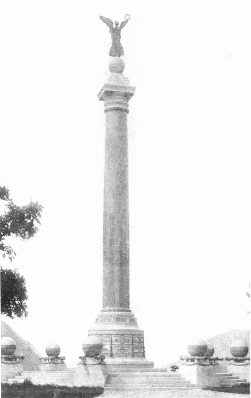
BATTLE MONUMENT, WEST POINT
The Battle Monument, on Trophy Point, is the most beautiful on the reservation—a column of victory in memory of 2,230 officers and soldiers of the regular army[page 95] of the United States who were killed or died of wounds received in the war of the Rebellion. It is a monolith of polished granite surmounted by a figure of Fame. The shaft is 46 feet in length, 5 feet in diameter, and said to be the largest piece of polished stone in the world. The cost of the work was $66,000. The site was dedicated June 15, 1864. The monument was dedicated in 1897. The address was by Justice Brewer.
Trophy Point, on the north side of the plain, overlooking the river and commanding a majestic view of the Hudson and the city of Newburgh, has been likened by European travelers to a view on Lake Geneva. Here are the "swivel clevies" and 16 links of the old chain that was stretched across the river at this point. The whole chain, 1,700 feet long, weighing 186 tons, was forged at the Sterling Iron Works, transported to New Windsor and there attached to log booms and floated down the river to this point.
Old Fort Putnam was erected in 1778 by the 5th Massachusetts Regiment under the direction of Col. Rufus Putnam. It was originally constructed of logs and trees with stone walls on two sides to defend Fort Clinton on the plain below. It was garrisoned by 450 men, and had 14 guns mounted. In 1787 it was dismantled, and the guns sold as old iron. Its brick arch casements overgrown with moss, vines, and shrubbery are crumbling away, but are well worth a visit. It is 495 feet above the Hudson. A winding picturesque carriage road leads up from the plain, and the pedestrian can reach the summit in 20 minutes. On clear days the Catskill Mountains are visible.
Fort Clinton, in the northeast angle of the plain, was built in 1778 under the direction of the Polish soldier, Kosciusko. Sea Coast Battery is located on the north waterfront, Siege Battery on the slope of the hill below the Battle Monument. Targets for the guns on both batteries are on the hillside about a mile distant. Battery[page 96] Knox, which overlooks the river, was rebuilt in 1874 on the site of an old revolutionary redoubt.
Bright are the moments link'd with thee,
Boast of a glory-hallowed land!
Hope of the valiant and the free,
Home of our youthful soldier band!
Anonymous.
While Fort Putnam was being built Washington was advised that Dubois's regiment was unfit to be ordered on duty, there being "not one blanket in the regiment. Very few have either a shoe or a shirt, and most of them have neither stockings, breeches, or overalls. Several companies of inlisted artificers are in the same situation, and unable to work in the field."
What privations were here endured to establish our priceless liberty! It makes better Americans of us all to turn and re-turn the pages of the real Hudson, the most picturesque volume of the world's history.
West Point during the Revolution was the Gibraltar of the Hudson and her forts were regarded almost impregnable. Fort Putnam will be rebuilt as an enduring monument to the bravery of American soldiers.
The best way to study West Point, however, is not in voluminous histories or in the condensed pages of a guide book, but to visit it and see its real life, to wander amid its old associations, and ask, when necessary, intelligent questions, which are everywhere courteously answered. The view north seen in a summer evening, is one long to be remembered. In such an hour the writer's idea of the Hudson as an open book with granite pages and crystal book-mark is most completely realized as indicated in the Highland section of his poem, "The Hudson":
On either side these mountain glens
Lie open like a massive book,
Whose words were graved with iron pens,
And lead into the eternal rock:
Which evermore shall here retain
The annals time cannot erase,
And while these granite leaves remain
This crystal ribbon marks the place.
Under Spring's delicate marshalling every hill of the
Highlands took its own place, and the soft swells of
ground stood back the one from the other in more and
more tender coloring.
Susan Warner.
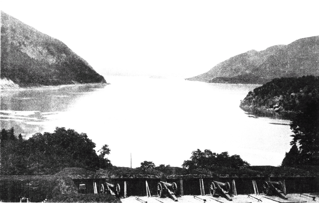
LOOKING NORTH FROM WEST POINT BATTERY
The steamer passes too near the west bank to give a view of the magnificent plateau with parade ground and Government buildings, but on rounding the point a picture of marvelous beauty breaks at once upon the vision. On the left the massive indented ridge of Old Cro' Nest and Storm King, and on the right Mount Taurus, or Bull Hill, and Break Neck, while still further beyond toward the east sweeps the Fishkill range, sentineled by South Beacon, 1,625 feet in height, from whose summit midnight gleams aroused the countryside for leagues and scores of miles during those seven long years when men toiled and prayed for freedom. Close at hand on the right will be seen Constitution Island, formerly the home of Miss Susan Warner, who died in 1885, author of "Queechy" and the "Wide, Wide World." Here the ruins of the old fort are seen. The place was once called Martalaer's Rock Island. A chain was stretched across the river at this point to intercept the passage of boats up the Hudson, but proved ineffectual, like the one at Anthony's Nose, as the impetus of the boats snapped them both like cords.
Some years ago, when the first delegation of Apache Indians was brought to Washington to sign a treaty of peace, the Indians were taken for an "outing" up the Hudson, by General O. O. Howard and Dr. Herman Bendell, Superintendent of Indian Affairs for Arizona. It is said that they noted with cold indifference the palaces along the river front: "the artistic terraces, the well-kept, sloping lawns, the clipped hedges and the ivy-grown walls made no impression on them, but when the magnificent picture of the Hudson above West Point revealed itself, painted by the rays of the sinking sun, these wild men stood erect, raised their hands high above their heads and uttered a monosyllabic expression of[page 98] delight, which was more expressive than volumes of words."
The queenly Hudson circling at thy feet
Lingers to sing a song of joy and love,
Pouring her heart in rippling wavelets sweet,
Which sun-kissed glance up to thy throne above.
Kenneth Bruce.
Sir Robert Temple also rises into rapture over the northern gate of the Highlands. "One of the fairest spectacles to be seen on the earth's surface; not on any other river or strait—not on Ganges or Indus, on the Dardanelles or the Bosphorus, on the Danube or the Rhine, on the Neva or the Nile—have I ever observed so fairy-like a scene as this on the Hudson. The only water-view to rival it is that of the Sea of Marmora, opposite Constantinople."
Most people who visit our river, naturally desire a brilliant sunlit day for their journey, and with reason, but there are effects, in fog and rain and driving mist, only surpassed amid the Kyles of Bute, in Scotland. The traveler is fortunate, who sees the Hudson in many phases, and under various atmospheric conditions. A midnight view is peculiarly impressive when the mountain spirits of Rodman Drake answer to the call of his "Culprit Fay."
"'Tis the middle watch of a summer night,
The earth is dark but the heavens are bright,
The moon looks down on Old Cro' Nest—
She mellows the shade on his shaggy breast,
And seems his huge gray form to throw
In a silver cone on the wave below."
It is said that the "Culprit Fay" was written by Drake in three days, and grew out of a discussion which took place during a stroll through this part of the Highlands between Irving, Halleck, Cooper and himself, as to the filling of a new country with old-time legends. Drake died in 1820. Halleck's lines to his memory are among the sweetest in our language. It is said that Halleck, on hearing Drake read his poem, "The American Flag," sprang to his feet, and in a semi-poetic transport, concluded the lines with burning words, which Drake afterwards appended:
[page 99]"Forever float that standard sheet,
Where breathes the foe but falls before us,
With Freedom's soil beneath our feet,
And Freedom's banner streaming o'er us."
It floweth deep and strong and wide
This river of romance
Along whose banks on moonlight nights
The Highland fairies dance.
E.A. Lente.
Just opposite Old Cro' Nest is the village of Cold Spring, on the east bank, which receives its name naturally from a cold spring in the vicinity; and it is interesting to remember that the famous Parrott guns were made at this place, and many implements of warfare during our civil strife. The foundry was started by Gouverneur Kemble in 1828, and brought into wide renown by the inventive genius of Major Parrott. Cold Spring has a further distinction in having the first ground broken, about three miles from the river, for the greatest engineering enterprise of the age—"The Water Supply of the Catskills," when Mayor McClellan, in June, 1907, began the work with his silver shovel. A short distance north of the village is
Undercliff (built by John C. Hamilton, son of Alexander Hamilton, but more particularly associated with the memory of the poet, Col. George P. Morris), lies, in fact, under the cliff and shadow of Mount Taurus, and has a fine outlook upon the river and surrounding mountains. Standing on the piazza, we see directly in front of us Old Cro' Nest, and it was here that the poet wrote:
"Where Hudson's wave o'er silvery sands
Winds through the hills afar,
Old Cro' Nest like a monarch stands
Crowned with a single star."
Few writers were better known in their own day than the poet of Undercliff, who wrote "My Mother's Bible," and "Woodman, Spare that Tree." On one occasion, when Mr. Russell was singing it at Boulogne, an old gentleman in the audience, moved by the simple and touching beauty of the lines,
"Forgive the foolish tear,
But let the old oak stand."
rose and said: "I beg your pardon, but was the tree really spared?" "It was," answered Mr. Russell, and the old gentleman resumed his seat, amid the plaudits of the whole assembly. Truly
"Its glory and renown
Are spread o'er land and sea."
When freedom from her mountain height
Unfurled her standard to the air,
She tore the azure robe of night
And set the stars of glory there.
Joseph Rodman Drake.
The first European name given to Storm King was Klinkersberg (so called by Hendrick Hudson, from its glistening and broken rock). It was styled by the Dutch "Butter Hill," from its shape, and, with Sugar Loaf on the eastern side below the point, helped to set out the tea-table for the Dunderberg goblins. It was christened by Willis, "Storm King," and may well be regarded the El Capitan of the Highlands. Breakneck is opposite, on the east side, where St. Anthony's Face was blasted away. In this mountain solitude there was a shade of reason in giving that solemn countenance of stone the name of St. Anthony, as a good representative of monastic life; and, by a quiet sarcasm, the full-length nose below was probably suggested.
The mountain opposite Cro' Nest is "Bull Hill," or more classically, "Mt. Taurus." It is said that there was formerly a wild bull in these mountains, which had failed to win the respect and confidence of the inhabitants, so the mountaineers organized a hunt and drove him over the hill, whose name stands a monument to his exit. The point at the foot of "Mount Taurus" is known as "Little Stony Point."
The Highlands now trend off to the northeast, and we see North Beacon, or Grand Sachem Mountain, and Old Beacon about half a mile to the north. The mountains were relit with beacon-fires in 1883, in honor of the centennials of Fishkill and Newburgh, and were plainly seen sixty miles distant.
This section was known by the Indians as "Wequehache," or, "the Hill Country," and the entire range was[page 101] called by the Indians "the endless hills," a name not inappropriate to this mountain bulwark reaching from New England to the Carolinas. As pictured in our "Long Drama," given at the Newburgh centennial of the disbanding of the American Army,
That ridge along our eastern coast,
From Carolina to the Sound,
Opposed its front to Britain's host,
And heroes at each pass were found:
A vast primeval palisade,
With bastions bold and wooded crest,
A bulwark strong by nature made
To guard the valley of the west.
Along its heights the beacons gleamed,
It formed the nation's battle-line,
Firm as the rocks and cliffs where dreamed
The soldier-seers of Palestine.
It was also believed by the Indians that, in ancient days, "before the Hudson poured its waters from the lakes, the Highlands formed one vast prison, within whose rocky bosom the omnipotent Manitou confined the rebellious spirits who repined at his control. Here, bound in adamantine chains, or jammed in rifted pines, or crushed by ponderous rocks, they groaned for many an age. At length the conquering Hudson, in its career toward the ocean, burst open their prison-house, rolling its tide triumphantly through the stupendous ruins."
The Highlands are here moulded in all manner of
heights and hollows; sometimes reaching up abruptly to
twelve or fifteen hundred feet, and again stretching
away in long gorges and gentle declivities.
Susan Warner.
Pollopel's Island, east of the steamer's route, was once regarded as a haunted spot, but its only witches are said to be snakes too lively to be enchanted. In old times, the "new hands" on the sloops were unceremoniously dipped at this place, so as to be proof-christened against the goblins of the Highlands. Here also another useless "impediment" was put across the Hudson in 1779, a chevaux-de-frise with iron-pointed spikes thirty feet long, hidden under water, strongly secured by cribs of stone. This, however, was not broken and would probably have done effective work if some traitor to the cause had not[page 102] guided the British captains through an unprotected passage. The State at one time contemplated the purchase of this island on which to erect a statue to Hendrick Hudson. For some reason Governor Flower vetoed the bill. It is now owned by Mr. Francis Bannerman, an energetic business man, who perhaps some day may see his way to promote a monument to Hudson on the splendid pedestal which nature has already completed.
What sights and sounds at which the world has wondered
Within these wild ravines have had their birth!
Young Freedom's cannon from these glens have thundered
And sent their startling echoes o'er the earth.
Charles Fenno Hoffman.
Cornwall-on-the-Hudson.—This locality N. P. Willis selected as the most picturesque point on the Hudson. The village lies in a lovely valley, which Mr. Beach has styled in his able description, as "an offshoot of the Ramapo, up which the storm-winds of the ocean drive, laden with the purest and freshest air."
Idlewild.—Where Willis spent the last years of his life is a charming spot and rich with poetic memories. E. P. Roe also chose Cornwall for his home. Lovers of the Hudson are indebted to Edward Bok for his realistic sketch of an afternoon visit. The "Idlewild" of to-day is still green to the memory of the poet. Since Willis' death the place has passed in turn into various hands, until now it belongs to a wealthy New York lawyer, who has spent thousands of dollars on the house and grounds. The old house still stands, and here and there in the grounds remains a suggestion of the time of Willis. The famous pine-drive leading to the mansion, along which the greatest literary lights of the Knickerbocker period passed during its palmy days, still remains intact, the dense growth of the trees only making the road the more picturesque. The brook, at which Willis often sat, still runs on through the grounds as of yore. In the house, everything is remodeled and remodernized. The room from whose windows Willis was wont to look over the Hudson, and where he did most of his charming writing, is now a bedchamber, modern in its every appointment, and suggesting its age only by the high ceiling and curious mantel. Only a few city blocks from "Idlewild"[page 103] is the house where lived E. P. Roe, the author of so many popular novels, as numerous, almost, in number as the several hundreds of thousands of circulation which they secured. There are twenty-three acres to it in all, and, save what was occupied by the house, every inch of ground was utilized by the novelist in his hobby for fine fruits and rare flowers. Now nothing remains of the beauty once so characteristic of the place. For four years the grounds have missed the care of their creator. Where once were the novelist's celebrated strawberry beds, are now only grass and weeds. Everything is grown over, only a few trees remaining as evidence that the grounds were ever known for their cultivated products. A large board sign announces the fact that the entire place is for sale.
The river narrows at their proud behest
And creeps more darkly as it deeper flows,
And fitful winds swirl through the long defile
Where the great Highlands keep their stern repose.
E.A. Lente.
Cornwall has been for many years a favorite resort of the Hudson Valley and her roofs shelter in the summer season many thousand people. The road completed in 1876, from Cornwall to West Point, gives one a pleasant acquaintance with the wooded Highlands. It passes over the plateau of Cro' Nest and winds down the Cornwall slope of Storm King. The tourist who sees Cro' Nest and Storm King only from the river, has but little idea of their extent. Cro' Nest plateau is about one thousand feet above the parade ground of West Point, and overlooks it as a rocky balcony. These mountains, with their wonderful lake system, are, in fact, the "Central Park" of the Hudson. Within a radius of ten miles are clustered over forty lakes, and we very much doubt if one person in a thousand ever heard of them. A convenient map giving the physical geography of this section would be of great service to the mountain visitor. The Cornwall pier, built by the New York, Ontario and Western Railroad in 1892 for coal and freight purposes, will be seen on our left near the Cornwall dock. This railroad leaves the West Shore at this point and forms a pleasant tourist route to the beautiful inland villages and resorts of the State.
A solitary gleam struck on the base of the Highland
peak, and moved gracefully up its side, until reaching
the summit, it stood for a minute forming a crown of
glory to the sombre pile.
James Fenimore Cooper.
Newburgh, 60 miles from New York. Approaching the city of Newburgh, we see a building of rough stone, one story high, with steep roof—known as Washington's Headquarters. For several years prior to, and during the Revolution, this was the home of Jonathan Hasbrouck, known far and wide for business integrity and loyalty to liberty. This house was built by him, apparently, in decades; the oldest part, the northeast corner, in 1750; the southeast corner, in 1760, and the remaining half in 1770. It fronted west on the king's highway, now known as Liberty Street, with a garden and family burial plot to the east, lying between the house and the river. It was restored as nearly as possible to its original character on its purchase by the State in 1849, and it is now the treasure-house of many memories, and of valuable historic relics. A descriptive catalogue, prepared for the trustees, under act of May 11, 1874, by a patient and careful historian, Dr. E. M. Ruttenber, will be of service to the visitor and can be obtained on the grounds. The following facts, condensed from his admirable historical sketch, are of practical interest:
"Washington's Headquarters, or the Hasbrouck house, is situated in the southeast part of the city, constructed of rough stone, one story high, fifty-six feet front by forty-six feet in depth, and located on what was originally Lot No. 2, of the German Patent, with title vested in Heman (Herman?) Schoneman, a native of the Palatinate of Germany, who sold, in 1721, to James Alexander, who subsequently sold to Alexander Colden and Burger Meynders, by whom it was conveyed to Jonathan Hasbrouck, the grandson of Abraham Hasbrouck, one of the Huguenot founders of New Paltz. He was a man of marked character; of fine physique, being six feet and four inches in height; was colonel of the militia of the district, and[page 105] in frequent service in guarding the passes of the Highlands. His occupation was that of a farmer, a miller, and a merchant. He died in 1780. The first town meeting for the Precinct of Newburgh was held here on the first Tuesday in April, 1763, when its owner was elected supervisor. Public meetings continued to be held here for several years. During the early part of the Revolution, the committee of safety, of the precinct, assembled here; here military companies were organized, and here the regiment which Colonel Hasbrouck commanded assembled, to move hence to the defence of the Highland forts."
Sacred in this mansion hoary,
'Neath its roof-tree long ago
Dwelt the father of our glory,
He whose name appalled the foe.
Mary E. Monell.
From this brief outline, it will be seen that the building is singularly associated with the history of the Old as well as of the New World: with the former through the original grantee of the land, recalling the wars which devastated the Palatinate and sent its inhabitants, fugitive and penniless, to other parts of Europe and to America; through his successor with the Huguenots of France, and, through the public meetings which assembled here, and especially through its occupation by Washington, with the struggle for American independence.
In the spring of 1782 Washington made this building his headquarters, and remained here until August 18, 1783, on the morning of which day he took his departure from Newburgh. At this place he passed through the most trying period of the Revolution: the year of inactivity on the part of Congress, of distress throughout the country, and of complaint and discontent in the army, the latter at one time bordering on revolt among the officers and soldiers.
It was at this place, on the 22d day of May, 1782, that Colonel Nicola, on behalf of himself and others, proposed that Washington should become king, for the "national advantage," a proposal that was received by Washington with "surprise and astonishment," "viewed with abhorrence," and "reprehended with severity." The temptation which was thus repelled by Washington, had[page 106] its origin with that portion of the officers of the army, who while giving their aid heartily to secure an independent government, nevertheless believed that that government should be a monarchy. The rejection of the proposition by Washington was not the only significant result. The rank and file of the army rose up against it, and around their camp-fires chanted their purpose in Billings' song, "No King but God!" From that hour a republic became the only possible form of government for the enfranchised Colonies.
With silvered locks and eyes grown dim,
As victory's sun proclaimed the morn,
He pushed aside the diadem
With stern rebuke and patriot scorn.
Wallace Bruce.
The inattention of Congress to the payment of the army, during the succeeding winter, gave rise to an equally important episode in the history of the war. On the 10th of March, 1783, the first of the famous "Newburgh Letters" was issued, in which, by implication at least, the army was advised to revolt. The letter was followed by an anonymous manuscript notice for a public meeting of officers on the succeeding Tuesday. Washington was equal to the emergency. He expressed his disapprobation of the whole proceeding, and with great wisdom, requested the field officers, with one commissioned officer from each company, to meet on the Saturday preceding the time appointed by the anonymous notice. He attended this meeting and delivered before it one of the most touching and effective addresses on record. When he closed his remarks, the officers unanimously resolved "to reject with disdain" the infamous proposition contained in the anonymous address.
The meeting of officers referred to was held at the New Building or "Temple" as it was called, in New Windsor, but Washington's address was written at his headquarters. The "Newburgh Letters," to which it was a reply, were written by Major John Armstrong, aid-de-camp to General Gates. The anonymously called meeting was not held. The motives of its projectors we will not discuss; but its probable effect, had it been successful, must be considered in connection with Washington's encomium of the[page 107] result of the meeting which he had addressed: "Had this day been wanting, the world had never known the height to which human greatness is capable of attaining."
Freemen pause! this ground is holy,
Noble spirits suffered here,
Tardy Justice, marching slowly,
Tried their faith from year to year.
Mary E. Monell.
Serene and calm in peril's hour,
An honest man without pretence,
He stands supreme to teach the power
And brilliancy of common-sense.
Wallace Bruce.
Notice of the cessation of hostilities was proclaimed to the army April 19, 1783. It was received with great rejoicings by the troops at Newburgh, and under Washington's order, was the occasion of an appropriate celebration. In the evening, signal beacon lights proclaimed the joyous news to the surrounding country. Thirteen cannon came pealing up from Fort Putnam, which were followed by a feu-de-joie rolling along the lines. The mountain sides resounded and echoed like tremendous peals of thunder, and the flashing from thousands of fire-arms, in the darkness of the evening, was like unto vivid flashes of lightning from the clouds. From this time furloughs were freely granted to soldiers who wished to return to their homes, and when the army was finally disbanded those absent were discharged from service without being required to return. That portion of the army, which remained at Newburgh on guard duty, after the removal of the main body to West Point in June, were participants here in the closing scenes of the disbandment, when, on the morning of November 3, 1783, "the proclamation of Congress and the farewell orders of Washington were read, and the last word of command given." From Monell's "Handbook of Washington's Headquarters" we also quote a general description of the house and its appearance when occupied by the commander-in-chief. "Washington's family consisted of himself, his wife, and his aid-de-camp, Major Tench Tilghman. The large room, which is entered from the piazza on the east, known as 'the room with seven doors and one window,' was used as the dining and sitting-room. The northeast room was Washington's bedroom and the one adjoining it on the left was occupied by him as a private office. The family room was that in the southeast; the kitchen was the southwest room; the parlor the northwest room. Between[page 108] the latter and the former was the hall and staircase and the storeroom, so called for having been used by Colonel Hasbrouck and subsequently by his widow as a store. The parlor was mainly reserved for Mrs. Washington and her guests. A Mrs. Hamilton, whose name frequently appears in Washington's account book, was his housekeeper, and in the early part of the war made a reputation for her zeal in his service, which Thacher makes note of and Washington acknowledges in his reference to an exchange of salt. There was little room for the accommodation of guests, but it is presumed that the chambers were reserved for that purpose. Washington's guests, however, were mainly connected with the army and had quarters elsewhere. Even Lafayette had rooms at DeGrove's Hotel when a visitor at headquarters.
"The building is now substantially in the condition it was during Washington's occupation of it. The same massive timbers span the ceiling; the old fire-place with its wide-open chimney is ready for the huge back-logs of yore; the seven doors are in their places; the rays of the morning sun still stream through the one window; no alteration in form has been made in the old piazza—the adornments on the walls, if such the ancient hostess had, have alone been changed for souvenirs of the heroes of the nation's independence. In presence of these surroundings, it requires but little effort of the imagination to restore the departed guests. Forgetting not that this was Washington's private residence, rather than a place for the transaction of public business, we may, in the old sitting-room respread the long oaken table, listen to the blessing invoked on the morning meal, hear the cracking of joints, and the mingled hum of conversation. The meal dispensed, Mrs. Washington retires to appear at her flower beds or in her parlor to receive her morning calls. Colfax, the captain of the life-guard, enters to receive the orders of the day—perhaps a horse and guard for Washington to visit New Windsor, or a barge for Fishkill[page 109] or West Point, is required; or it may be Washington remains at home and at his writing desk conducts his correspondence, or dictates orders for army movements. The old arm-chair, sitting in the corner yonder, is still ready for its former occupant.
"The dinner hour of five o'clock approaches; the guests of the day have already arrived. Steuben, the iron drill-master and German soldier of fortune, converses with Mrs. Washington. He had reduced the simple marksmen of Bunker Hill to the discipline of the armies of Europe and tested their efficiency in the din of battle. He has leisure now, and scarcely knows how to find employment for his active mind. He is telling his hostess, in broken German-English, of the whale (it proved to be an eel) he had caught in the river. Hear his hostess laugh! And that is the voice of Lafayette, relating perhaps his adventures in escaping from France, or his mishap in attempting to attend Mrs. Knox's last party. Wayne, of Stony Point; Gates, of Saratoga; Clinton, the Irish-blooded Governor of New York, and their compatriots—we may place them all at times beside our Pater Patriae in this old room, and hear amid the mingled hum his voice declare: 'Happy, thrice happy, shall they be pronounced hereafter, who have contributed anything, who have performed the meanest office in erecting this stupendous fabric of Freedom and Empire on the broad basis of independency; who have assisted in protecting the rights of human nature, and in establishing an asylum for the poor and oppressed of all nations and religions.'
"In France, some fifty years after the Revolution, Marbois reproduced, as an entertainment for Lafayette, then an old man, this old sitting-room and its table scene. From his elegant saloon he conducted his guests, among whom were several Americans, to the room which he had prepared. There was a large open fire-place, and plain oaken floors; the ceiling was supported with large beams and whitewashed; there were the seven small-sized doors[page 110] and one window with heavy sash and small panes of glass. The furniture was plain and unlike any then in use. Down the centre of the room was an oaken table covered with dishes of meat and vegetables, decanters and bottles of wine, and silver mugs and small wine glasses. The whole had something the appearance of a Dutch kitchen. While the guests were looking around in surprise at this strange procedure, the host, addressing himself to them said, 'Do you know where we now are?' Lafayette looked around, and, as if awakening from a dream, he exclaimed, 'Ah! the seven doors and one window, and the silver camp goblets such as the Marshals of France used in my youth. We are at Washington's Headquarters on the Hudson fifty years ago.'"
One window looking toward the east;
Seven doors wide-open every side;
That room revered proclaims at least
An invitation free and wide.
Wallace Bruce.
The goodness which characterizes Washington is felt
by all around him, but the confidence he inspires is
never familiar; it springs from a profound esteem for
his virtues and a great opinion of his talents.
Marquis de Chastellux.
From these headquarters Washington promulgated his
memorable order for the cessation of hostilities and
recalled the fact that its date, April 18th, was the anniversary
of the battles of Lexington and Concord.
Thomas F. Bayard.
The Hasbrouck family returned to their old home, made historic for all time, after the disbandment of the army and remained until it became the property of the State. On July 4, 1850, the place was formally dedicated by Major-General Winfield Scott, dedicatory address delivered by John J. Monell, an ode by Mary E. Monell, and an oration by Hon. John W. Edmunds. The centennial of the disbanding of the army was observed here October 18, 1883. After the noonday procession of 10,000 men in line, three miles in length, with governors and representative people from almost every State, 150,000 people, "ten acres" square, gathered in the historic grounds. Senator Bayard, of Delaware, was chairman of the day. Hon. William M. Evarts was the orator, and modestly speaking in the third person, Wallace Bruce, author of this handbook, was the poet. No one there gathered can ever forget that afternoon of glorious sunlight or the noble pageant. The great mountains, which had so frequently been the bulwark of liberty and a place of refuge for our fathers, were all aglow with beauty, as if, like Horeb's bush, they too would open their lips in praise and thanksgiving. One of the closing sentences of Senator Evarts' address is unsurpassed in modern or ancient[page 111] eloquence: "These rolling years have shown growth, forever growth, and strength, increasing strength, and wealth and numbers ever expanding, while intelligence, freedom, art, culture and religion have pervaded and ennobled all this material greatness. Wide, however, as is our land and vast our population to-day, these are not the limits to the name, the fame, the power of the life and character of Washington. If it could be imagined that this nation, rent by disastrous feuds, broken in its unity, should ever present the miserable spectacle of the undefiled garments of his fame parted among his countrymen, while for the seamless vesture of his virtue they cast lots—if this unutterable shame, if this immeasurable crime, should overtake this land and this people, be sure that no spot in the wide world is inhospitable to his glory, and no people in it but rejoices in the influence of his power and his virtue." In his lofty sentences the old heroes seemed to pass again in review before us, and the daily life of that heroic band, when Congress sat inactive and careless of its needs until the camp rose in mutiny, happily checked, however, by the great commander in a single sentence. It will be remembered that Washington began to read his manuscript without glasses, but was compelled to stop, and, as he adjusted them to his eyes, he said, "You see, gentlemen, that I have not only grown gray, but blind, in your service." It is needless to say that the "anonymously called" meeting was not held.
He quelled the half-paid mutineers,
And bound them closer to the cause;
His presence turned their wrath to tears,
Their muttered threats to loud applause.
The great Republic had its birth
That hour beneath the army's wing,
Whose leader taught by native worth
The man is grander than the king.
We hear the anthem once again,—
"No king but God!"—to guide our way,
Like that of old—"Good-will to men"—
Unto the shrine where freedom lay.
Wallace Bruce.
Near at hand, and also plainly seen from the river, is the new Tower of Victory, fifty-three feet high, costing[page 112] $67,000. It contains a life-size statue of Washington, in the act of sheathing his sword, with bronze figures representing the rifle, the artillery, the line officer and dragoon service of our country, with a bronze tablet on the east wall bearing the inscription: "This monument was erected under the authority of the Congress of the United States, and of the State of New York, in commemoration of the disbandment, under proclamation of the Continental Congress, of October 18, 1783, of the armies, by whose patriotic and military virtue, our national independence and sovereignty were established." The Belvidere, reached by a spiral staircase, is capable of holding one hundred persons, and the view therefrom takes in a wide extent of panoramic beauty. Newburgh has not only reason to be proud of her historical landmarks and her beautiful situation, but also of her commercial prosperity. In olden times, it was a great centre for all the western and southwestern district, farmers and lumbermen coming from long distances in the interior. Soon after the Revolution she was made a village, when there were only two others in the State. Before the days of the Erie canal, this was the shortest route to Lake Erie, and was made by stage via Ithaca. With increasing facilities of railway communication, she has also easily held her own against all commercial rivals. The West Shore Railroad, the Erie Railway, the New York Central and the New York and New England across the river, and several Hudson river steamers, make her peculiarly central. The city is favored with beautiful driveways, amid charming country seats. The New Paltz road passes the site where General Wayne had his headquarters, also, the "Balm of Gilead tree," which gave the name of Balmville to the suburban locality. Another road affords a glimpse of the "Vale of Avoca," named after the well-known glen in Ireland, of which Tom Moore so sweetly sung. Here, some say, a treacherous attempt was made on the life of Washington, but it is not generally [page 113] credited by critical historians. As the steamer leaves the dock, and we look back upon the factories and commercial houses along the water front, crowned by noble streets of residence, with adjoining plateau, sweeping back in a vast semi-circle as a beautiful framework to the wide bay, we do not wonder that Hendrick Hudson established a prophetic record by writing "a very pleasant place to build a town."
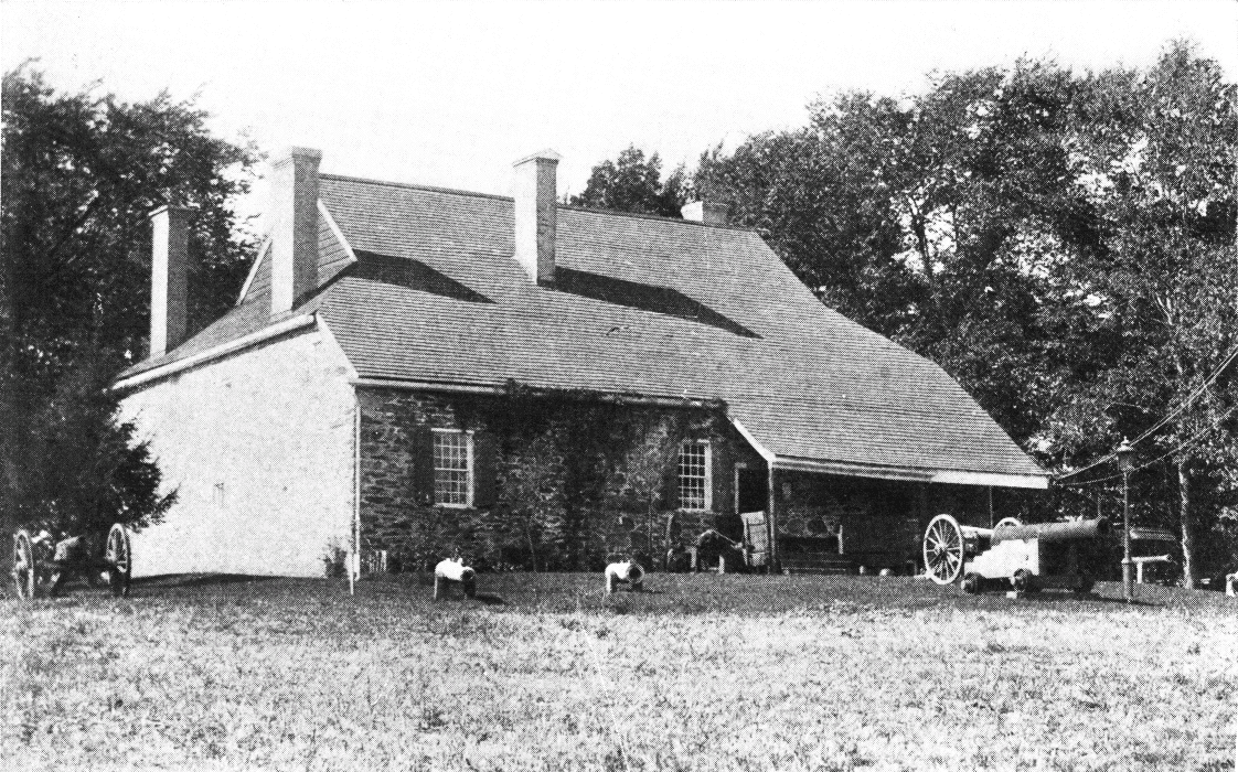
WASHINGTON'S HEADQUARTERS, NEWBURGH
Washington! Brave without temerity; laborious without
ambition; generous without prodigality; noble without
pride; virtuous without severity.
Marquis de Chastellux.
Fishkill-on-the-Hudson.—Directly opposite Newburgh, one mile north of Denning's Point (formerly the eastern dock of the Newburgh ferry), rises on a pleasant slope, the newer Fishkill of this region. A little more than a mile from the landing, is the manufacturing village of Matteawan, connected by an electric railroad. Old Fishkill, or Fishkill Village, is about four miles inland, charmingly located, under the slope of the Fishkill range. This was once the largest village in Dutchess county, and was chosen for its secure position above the Highlands, as the place to which "should be removed the treasury and archives of the State, also, as the spot for holding the subsequent sessions of the Provincial Conventions," after they were driven from New York. A historical sketch of the town, by T. Van Wyck Brinkerhoff, presents many things of interest. "Its history, anterior to 1682, belongs to the red men of the valley, and, more than any other spot, this was the home of their priests. Here they performed their incantations and administered at their altars." According to Broadhead, "It would seem that the neighboring Indians esteemed the peltries from Fishkill as charmed by the incantations of the aboriginal enchanters who lived along its banks, and the beautiful scenery in which those ancient priests of the Highlands dwelt, is thus invested with new poetic associations." Dunlap speaks of them as "occupying the Highlands, called by them Kittatenny Mountains. Their principal settlement, designated Wiccapee, was situated in the vicinity of Anthony's Nose. Here too, lived the Wappingers, a[page 114] war-like and brave tribe, extending themselves along the Matteawan, along the Wappingers Kill and tributaries, along the Hudson, and to the northward, across the river into Ulster County. These and other tribes to the south, west and north, were parts of and tributaries to the great Iroquois confederation—the marvel for all time to come of a system of government so wise and politic, and for men so eloquent and daring. The Wappingers took part in the Dutch and Indian wars of 1643 and 1663, led on by their war chiefs, Wapperonk and Aepjen. A few Indian names are still remaining, and a few traces of their history still left standing. The name Matteawan is Indian, signifying 'Good Beaver Grounds,' and the name Wappinger still speaks of those who once owned the soil along the Hudson. Their name for the stream was Mawanassigh, or Mawenawasigh. Wiccapee and Shenondoah are also Indian names of places in Fishkill Hook, and East Fishkill, and Apoquague, still surviving as the name of a country postoffice, was the Indian style of what is now called Silver Lake, signifying 'round pond.' In Fishkill Hook until quite recently, there were traces of their burial grounds, and many apple and pear trees are still left standing, set there by the hands of the red man before the country had been occupied by Europeans."
For here amid these hills he once kept court—
He who his country's eagle taught to soar
And fired those stars which shine o'er every shore.
Charles Fenno Hoffman.
To return to Brinkerhoff, "The first purchase of land in the county of Dutchess, was made in the town of Fishkill. On the 8th day of February, 1682, a license was given by Thomas Dongan, Commander-in-chief of the Province of New York, to Francis Rombout and Gulian Ver Planck, to purchase a tract of land from the Indians. Under this license, they bought, on the 8th day of August, 1683, of the Wappinger Indians, all their right, title and interest to a certain large tract of land, afterward known as the Rombout precinct. Gulian Ver Planck died before the English patent was issued by Governor Dongan; Stephanus Van Cortland was then joined in it with Rombout, and Jacobus Kipp substituted as the representative[page 115] of the children of Gulian Ver Planck. On the 17th day of October, 1685, letters patent, under the broad seal of the Province of New York, were granted by King James the Second, and the parties to whom these letters patent were granted, became from that time the undisputed proprietors of the soil. There were 76,000 acres of these lands lying in Fishkill, and other towns taken from the patent, and 9,000 acres lying in the limits of the town of Poughkeepsie. Besides paying the natives, as a further consideration for the privilege of their license, they were to pay the commander-in-chief, Thomas Dongan, six bushels of good and merchantable winter wheat every year." In the Book of Patents, at Albany, vol. 5, page 72, will be found the deed, of special interest to the historian and antiquarian.
It was a dainty day, and it grew more dainty towards
its close as the lights and shadows stretched athwart
our Highland landscape.
Susan Warner.
"After the evacuation of New York, in the fall of 1776, and the immediate loss of the seaboard, with Long Island and part of New Jersey, Fishkill was at once crowded with refugees, as they were then called, who sought, by banishing themselves from their homes on Long Island and New York, to escape imprisonment and find safety here. The interior army route to Boston passed through this place. Army stores, workshops, ammunition, etc., were established and deposited here." The Marquis De Chastellux, in his travels in North America, says: "This town, in which there are not more than fifty houses in the space of two miles, has been long the principal depot of the American army. It is there they have placed their magazines, their hospitals, their workshops, etc., but all of these form a town in themselves, composed of handsome large barracks, built in the woods at the foot of the mountains: for the American army, like the Romans in many respects, have hardly any other winter quarters than wooden towns, or barricaded camps, which may be compared to the 'hiemalia' of the Romans." These barracks were situated on the level plateau between the residence of Mr. Cotheal and the mountains. Portions of these[page 116] grounds were no doubt then covered with timber. Guarding the approach from the south, stockades and fortifications were erected on commanding positions, and regularly manned by detachments from the camp.
Unto him and them all owing
Peace as stable as our hills,
Plenty like yon river flowing
To the sea from thousand rills.
Mary E. Monell.
"Upon one of these hills, rising out of this mountain pass-way, very distinct lines of earthworks are yet apparent. Near the residence of Mr. Sidney E. Van Wyck, by the large black-walnut trees, and east of the road near the base of the mountain, was the soldiers' burial ground. Many a poor patriot soldier's bones lie mouldering there; and if we did but know how many, we would be startled at the number, for this almost unknown and unnoticed burial ground holds not a few, but hundreds of those who gave their lives for the cause of American independence. Some fifteen years ago, an old lady who had lived near the village until after she had grown to womanhood, told the writer that after the battle of White Plains she went with her father through the streets of Fishkill, and in places between the Dutch and Episcopal churches, the dead were piled up like cord-wood. Those who died from wounds in battle or from sickness in hospital were buried there. Many of these were State militiamen, and it seems no more than just that the State should make an appropriation to erect a suitable monument over this spot. Rather than thus remain for another century, if a rough granite boulder were rolled down from the mountain side and inscribed: 'To the unknown and unnumbered dead of the American Revolution,' that rough unhewn stone would tell to the stranger and the passer-by, more to the praise and fame of our native town than any of us shall be able to add to it by works of our own; for it is doubtful whether any spot in the State has as many of the buried dead of the Revolution as this quiet burial yard in our old town!" Here also on June 2, 1883, was observed "The Fishkill Centennial," and few of our centennials have been celebrated amid objects of greater revolutionary interest. Near at hand, to quote[page 117] from the official report of the proceedings, is "Denning's Point where Washington frequently, while waiting, tied his horses under those magnificent 'Washington oaks,' as he passed backward and forward from New Windsor and Newburgh to Fishkill. Near by is the Verplanck House, Baron Steuben's old headquarters. On Spy Hill and Continental Hill troops were quartered. At Matteawan Sackett lived, and there is the Teller House built by Madame Brett, where officers frequently resorted, and there Yates dwelt when he presided over the legislative body while it held its sessions in Fishkill, that had much to do with forming our first State Constitution. Baron Steuben was for a while in the old Scofield House at Glenham. In Fishkill are those renowned old churches where legislative sittings were held, which were also used as hospitals for the sick, and one of which is otherwise known as being the place where Enoch Crosby, the spy, was imprisoned, and from which he escaped. Near at hand the Wharton House (Van Wyck House), forever associated with him, and made famous by Cooper's 'Spy.' In the Brinckerhoff House above, Lafayette was dangerously ill with a fever, and there, at Swartwoutville, Washington was often a visitor. Whenever Washington was at Fishkill he made Colonel Brinckerhoff's his headquarters. He occupied the bedroom back of the parlor, which remains the same 'excepting a door that opens into the hall, which has been cut through.' It is an old-fashioned house built of stone, with the date 1738 on one of its gables." With the story of Fishkill we close the largest page relating to our revolutionary heroes, and leave behind us the Old Beacon Mountains which forever sentinel and proclaim their glory.
No prouder sentinel of glory than the old Beacon
Mountain whose watch-fire guarded the valley and spoke
its rallying message to the Catskills and Berkshires and
the very foothills of the Green Mountains.
Wallace Bruce.
The sun touched mountains in some places were of
a bright orange and the shadows between them deep
neutral tint or blue. And the river apparently had
stopped running to reflect.
Susan Warner.
Low Point, or Carthage, is a small village on the east bank, about four miles north of Fishkill. It was called by the early inhabitants Low Point, as New Hamburgh, two miles north, was called High Point. Opposite Carthage is Roseton, once known as Middlehope, and above this we[page 118] see the residence of Bancroft Davis and the Armstrong Mansion. We now behold on the west bank a large flat rock, covered with cedars, recently marked by a lighthouse, the—
Duyvel's Dans Kammer.—Here Hendrick Hudson, in his voyage up the river, witnessed an Indian pow-wow—the first recorded fireworks in a country which has since delighted in rockets and pyrotechnic displays. Here, too, in later years, tradition relates the sad fate of a wedding party. It seems that a Mr. Hans Hansen and a Miss Kathrina Van Voorman, with a few friends, were returning from Albany, and disregarding the old Indian prophecy, were all slain:—
"For none that visit the Indian's den
Return again to the haunts of men.
The knife is their doom! O sad is their lot!
Beware, beware of the blood-stained spot!"
Some years ago this spot was also searched for the buried treasures of Captain Kidd, and we know of one river pilot who still dreams semi-yearly of there finding countless chests of gold.
Two miles above, on the east side, we pass New Hamburgh, at the mouth of Wappingers Creek. The name Wappinger had its origin from Wabun, east, and Acki, land. This tribe, a sub-tribe of the Mahicans, held the east bank of the river, from Manhattan to Roeliffe Jansen's Creek, which empties into the Hudson near Livingston, a few miles south of Catskill Station on the Hudson River Railroad. Passing Hampton Point we see Marlborough, the head-centre of a large fruit industry, delightfully located in the sheltered pass of the Maunekill. On the east bank will be noticed several fine residences: "Uplands," "High Cliff," "Cedars," and "Netherwood." Milton is now at hand on the west bank, with its cosy landing and West Shore Railroad station. This pleasant village was one of the loved spots of J. G.[page 119] Holland, and the home of Mary Hallock Foote, until a modern "Hiawatha" took our Hudson "Minnehaha" to far away western mountains.
The tulip tree majestic stirs
Far down the water's marge beside,
And now awake the nearer firs,
And toss their ample branches wide.
Henry T. Tuckerman.
Springbrook, opposite Milton, a place of historic interest, near the river bank, was bought by Theophilus Anthony before the Revolution. Some of the links of the famous chain in the Highlands were forged here in 1777. When the British ships ascended the river the family fled to the woods, all but an old colored servant woman who wisely furnished the soldiers a good dinner and got thereby their good will to save the house. The old Flour Mill, however, was burned which stood on the same site as the present Springbrook Mill. Theophilus Anthony's only daughter married Thomas Gill after the Revolution, and from that time the property has been in the Gill family. Few places in the Hudson Valley have such ancient and continuous family history.
Locust Grove, with square central tower and open outlook, residence of the late Prof. S. F. B. Morse, inventor of the telegraph, is seen on the west bank; also the "Lookout," once known as Mine Hill, now a part of Poughkeepsie cemetery, with charming driveway to the wooded point where the visitor can see from his carriage one of the finest views of the Hudson. The completion of this drive is largely due to the enterprise of the late Mr. George Corlies, who did much to make Poughkeepsie beautiful. The view from this "Lookout" takes in the river for ten miles to the south, and reaches on the north to the Catskills. In a ramble with Mr. Corlies over Lookout Point, he told the writer that it was originally the purpose of Matthew Vassar to erect a monument on Pollopel's Island to Hendrick Hudson. Mr. Corlies suggested this point as the most commanding site. Mr. Vassar visited it, and concluded to place the monument here. He published an article in the Poughkeepsie papers to this effect, and, meeting Mr. Corlies one week afterwards, said, "Not one person in the city of Poughkeepsie[page 120] has referred to my monument. I have decided to build a college for women, where they can learn what is useful, practical and sensible." It is interesting to note the fountain-idea of the first woman's college in the world, as it took form and shape in the mind of its founder.

POUGHKEEPSIE BRIDGE
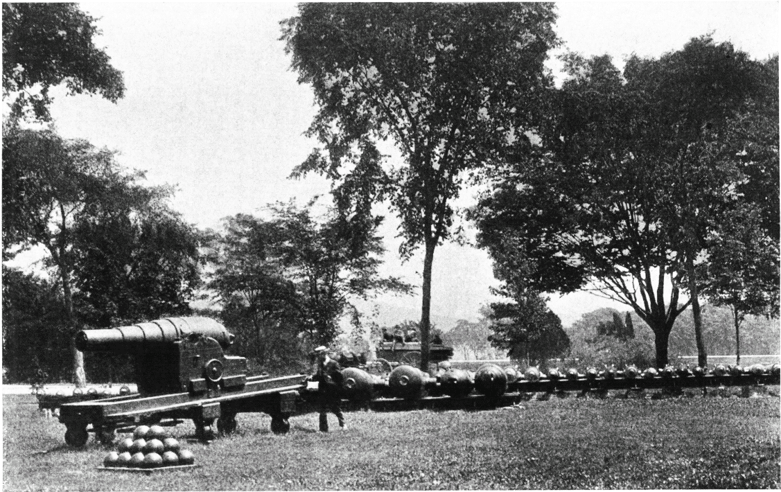
TROPHY POINT, WEST POINT
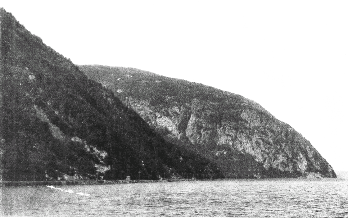
OLD CRO' NEST AND STORM KING
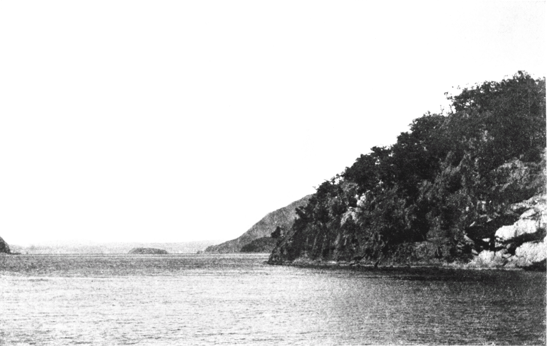
POLLIPEL'S ISLAND AND MOUNT TAURUS
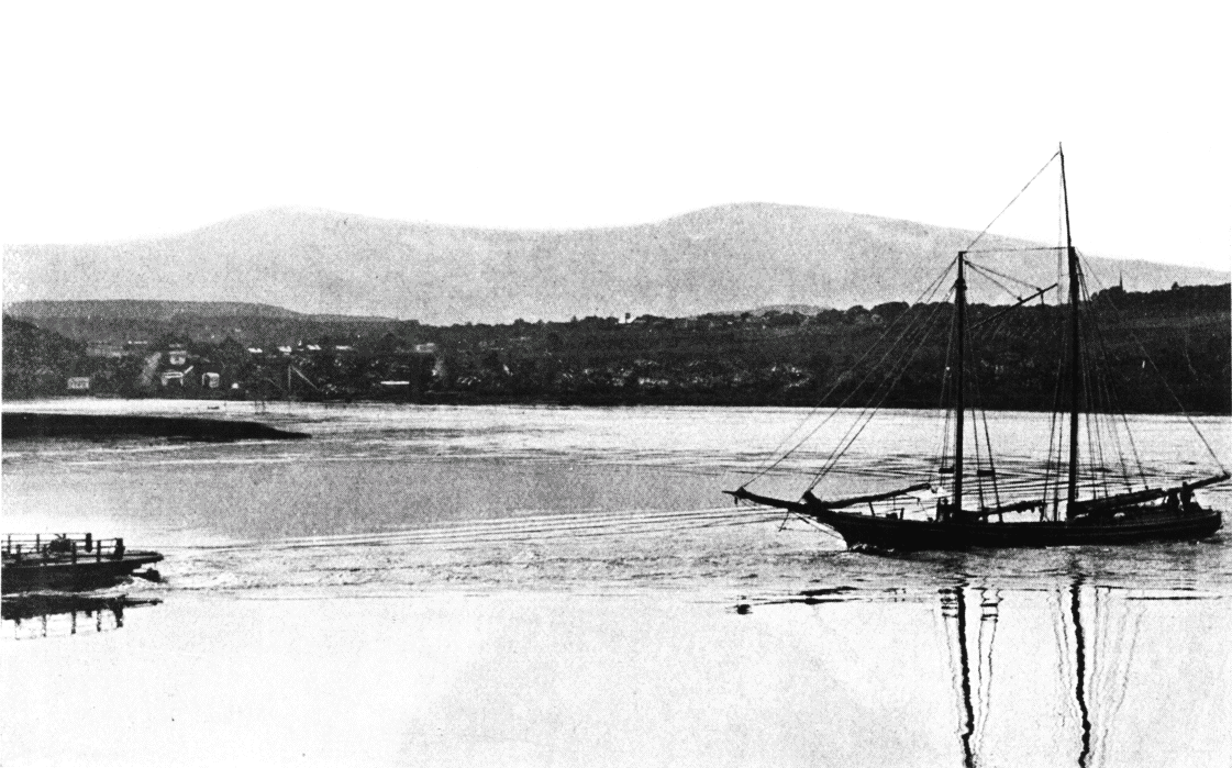
THE CATSKILLS FROM THE HUDSON
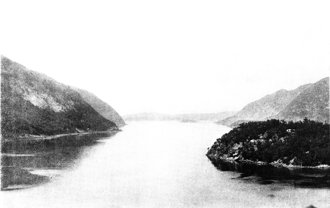
NORTHERN GATE OF HIGHLANDS
And from their leaguering legions thick and vast
The galling hail-shot in fierce volley falls,
While quick, from cloud to cloud, darts o'er the levin
The flash that fires the batteries of heaven!
Knickerbocker Magazine.
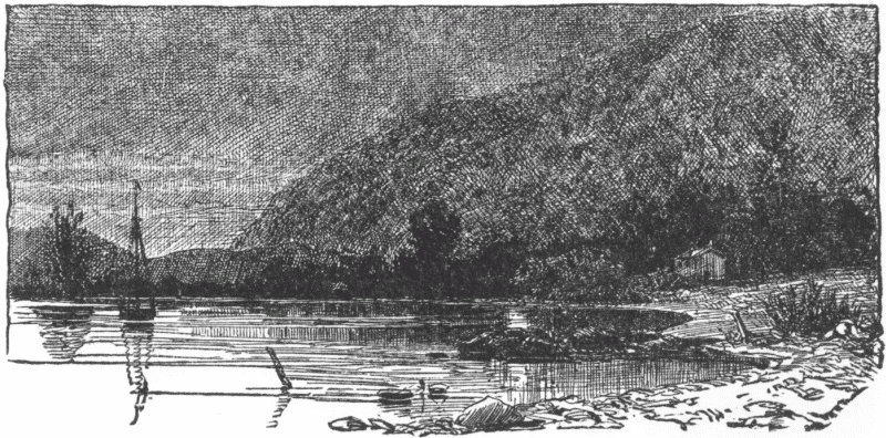
MORNING VIEW AT BLUE POINT.
We now see Blue Point, on the west bank; and, in every direction, enjoy the finest views. The scenery seems to stand, in character, between the sublimity of the Highlands and the tranquil, dreamy repose of the Tappan Zee. It is said that under the shadow of these hills was the favorite anchorage of—
The Storm Ship, one of our oldest and most reliable legends. The story runs somewhat as follows: Years ago, when New York was a village—a mere cluster of houses on the point now known as the Battery—when the Bowery was the farm of Peter Stuyvesant, and the Old Dutch Church on Nassau Street (which also long since disappeared), was considered the country—when communication with the old world was semi-yearly instead of semi-weekly or daily—say two hundred years ago—the whole town one evening was put into great commotion by the fact that a ship was coming up the bay.
See you beneath yon sky so dark
Fast gliding along a gloomy bark:—
By skeleton shapes her sails are furled,
And the hand that steers is not of this world.
Legend of the Storm Ship.
She approached the Battery within hailing distance, and then, sailing against both wind and tide, turned aside and passed up the Hudson. Week after week and month after month elapsed, but she never returned; and whenever a storm came down on Haverstraw Bay or Tappan Zee, it is said that she could be seen careening over the waste; and, in the midst of the turmoil, you could hear the captain giving orders, in good Low Dutch; but when the weather was pleasant, her favorite anchorage was among the shadows of the picturesque hills, on the eastern bank, a few miles above the Highlands. It was thought by some to be Hendrick Hudson and his crew of the "Half Moon," who, it was well known, had once run aground in the upper part of the river, seeking a northwest passage to China; and people who live in this vicinity still insist that under the calm harvest moon and the pleasant nights of September, they see her under the bluff of Blue Point, all in deep shadow, save her topsails glittering in the moonlight.
Poughkeepsie, 74 miles from New York, is now at hand, Queen City of the Hudson, with name, derived from the Indian word Apokeepsing, signifying "safe harbor." Near the landing a bold headland juts out into the river, known as Kaal Rock, and no doubt this sheltering rock was a safe harbor in days of birch canoes. It has been recently claimed that the word signifies "muddy pond," which is neither true, appropriate or poetic. Poughkeepsie does not propose to give up her old-time "harbor name," particularly as it has been recently discovered that the name "Kipsie" was also given by the Indians to a "safe harbor" near the Battery on Manhattan Island. It is said that there are over forty different ways of spelling Poughkeepsie, and every year the postoffice record gives a new one. The first house was built in 1702 by a Mr. Van Kleeck. The State legislature had a session here in 1777 or 1778, when New York was held by the British and after Kingston had been burned by Vaughan.
On the crest of the waves, a something that glides
Before the stiff breeze, and gracefully rides
On the inflowing tide majestic and free
A huge and mysterious bird of the sea.
Irving Bruce.
Ten years later, the State convention also met here for ratification of the Federal Constitution. The town has a beautiful location, and is justly regarded the finest residence city on the river. It is not only midway between New York and Albany, but also midway between the Highlands and the Catskills, commanding a view of the mountain portals on the south and the mountain overlook on the north—the Gibraltar of revolutionary fame and the dreamland of Rip Van Winkle.
The azure heaven is filled with smiles,
The water lisping at my feet
From weary thought my heart beguiles.
Henry Abbey.
The well known poet and litterateur, Joel Benton, who divides his residence between New York and Poughkeepsie, in a recent article, "The Midway City of the Hudson," written for the Poughkeepsie Sunday Courier, says:
"Poughkeepsie as a township was incorporated in 1788. The village bearing the name was formed in 1799 (incorporated as a city in 1854), and soon became the center of a large trade running in long lines east and west from the river. Dutchess County had at this time but a sparse population. There was a post-road from New York to Albany; but the building of the Dutchess Turnpike from Poughkeepsie to Sharon, Conn., connecting with one from that place to Litchfield, which took place in 1808, was a capital event in its history. This made a considerable strip of western Connecticut tributary to Poughkeepsie's trade.
"Over the turnpike went four-horse Concord stages, with berailed top and slanting boot in the rear for trunks and other baggage. Each one had the tin horn of the driver; and it was difficult to tell upon which the driver most prided himself—the power to fill that thrilling instrument, or his deft handling of the ponderous whip and multiplied reins. Travelers to Hartford and Boston went over this route; and an east and west through and way mail was a part of the burden. A sort of overland express and freight line, styled the Market Wagon, ran in and out of the town from several directions. One[page 123] or more of these conveyances started from as far east as the Housatonic River, and they frequently crowded passengers in amongst their motley wares.
"Speaking of the stage-driver's horn recalls the fact that when the steamboat arrived—which was so solitary an institution that for some time it was distinctly called 'The Steamboat'—the tin horn did duty also for it. When it was seen in the distance, either Albanyward or in the New York direction, a boy went through the village blowing a horn to arouse those who wished to embark on it. It is said the expectant passengers had ample time, after the horn was sounded, to make their toilets, run down to the river (or walk down) and take passage on it.
"In colonial days few were the people here; but they were a bright and stirring handful. It seems as if every man counted as ten. The De's and the Vans, the Livingstons, the Schuylers, the Montgomerys and ever so many more of the Hudson River Valley settlers are still making their impress upon the country. I suppose it need not now be counted strange that the strong mixture of Dutch and English settlers, with a few Huguenots, which finally made Dutchess county, were not a little divided between Tory and Whig inclinations. Around Poughkeepsie, and in its allied towns stretching between the Hudson River and the Connecticut line, there was much strife. Gov. George Clinton in his day ruled in the midst of much tumult and turbulence; but he held the reins with vigor, in spite of kidnappers or critics. When the British burned Kingston he prorogued the legislature to Poughkeepsie, which still served as a 'safe harbor.' As the resolution progressed the Tory faction was weakened, either by suppression or surrender.
"It was in the Poughkeepsie Court House that, by one vote, after a Homeric battle, the colony of New York consented to become a part of the American republic, which consent was practically necessary to its existence.[page 124] How large a part two small incidents played here towards the result of nationality. That single vote was one, and the news by express from Richmond, announcing Virginia's previous ratification—and added stimulus to the vote—was the other. Poughkeepsie honored in May, 1824, the arrival of Lafayette, and dined him, besides exchanging speeches with him, both at the Forbus House, on Market Street, very nearly where the Nelson House now stands, and at the Poughkeepsie Hotel. It was one of Poughkeepsie's great days when he came. Daniel Webster has spoken in her court house; and Henry Clay, in 1844, when a presidential candidate, stopped for a reception. And it is said that, by a mere accident, she just missed contributing a name to the list of presidents of the United States. The omitted candidate was Nathaniel P. Talmadge. He could have had the vice-presidential candidacy, the story goes, in 1840, but would not take it. If he had accepted it, he would have gone into history not merely as United States senator from New York and afterwards Governor of Wisconsin territory, but as president in John Tyler's place.
"In 1844, the New York State Fair was held here somewhere east of what is now Hooker Avenue. It was an occasion thought important enough then to be pictured and reported in the London Illustrated News. Two years after the telegraph wires were put up in this city, before they had yet reached the city of New York. Considering the fact that Prof. S. F. B. Morse, the telegraph inventor, had his residence here, this incident was not wholly inappropriate.
"The advent in 1849 of the Hudson River Railroad, which was an enterprise in its day of startling courage and magnitude, constituted a special epoch in the history of Poughkeepsie and the Hudson River towns. Men of middle age here well remember the hostility and ridicule the project occasioned when it was first broached. Some said no railroad ever could be built on the river's edge;[page 125] and, if you should build one, the enormous expense incurred would make it forever unprofitable. It seemed then the height of Quixotism to lay an expensive track where the river offered a free way to all. Property holders, whose property was to be greatly benefited, fought the railroad company with unusual spirit and persistence. But the railroad came, nevertheless, and needs no advocate or apologist to-day. There is no one now living here who would ask its removal, any more than he would ask the removal of the Hudson River itself."
And lo! the Catskills print the distant sky,
And o'er their airy tops the faint clouds driven,
So softly blending, that the cheated eye
Forgets or which is earth or which is heaven.
Theodore S. Fay.
Mountains on mountains in the distance rise,
Like clouds along the far horizon's verge;
Their misty summits mingling with the skies,
Till earth and heaven seem blended into one.
Bayard Taylor.
Poughkeepsie has been known for more than half a century as the City of Schools. The Parthenon-like structure which crowns College Hill was prophetic of a still grander and more widely known institution, the first in the world devoted to higher culture for women,—
Vassar College.—This institution, founded by Matthew Vassar, and situated two miles east of the city, maintains its prestige not only as the first woman's college in point of time, but also first in excellence and influence. The grounds are beautiful and graced by noble buildings which have been erected year by year to meet the continued demands of its patrons. The college is not seen from the river but is of easy access by trolley from the steamboat landing.
Eastman College is also one of the fixed and solid institutions of Poughkeepsie, located in the very heart of the city. It has accomplished good work in preparing young men for business, and has made Poughkeepsie a familiar word in every household throughout the land. It was fortunate for the city that the energetic founder of this college selected the central point of the Hudson as the place of all others most suited for his enterprise, and equally fortunate for the thousands of young men who yearly graduate from this institution, as the city is charmingly located and set like a picture amid picturesque scenery.
Among many successful public institutions of Poughkeepsie[page 126] are the Vassar Hospital, the Vassar Old Men's Home, the Old Ladies' Home, the State Hospital and the Vassar Institute of Arts and Sciences.
I went three times up the Hudson; and if I lived in
New York should be tempted to ascend it three times a
week during the summer.
Harriet Martineau.
The opera house is one of the pleasantest in the country and received a high comment, still remembered, from Joseph Jefferson, for its perfect acoustic quality. The armory, the Adriance Memorial Library to the memory of Mr. and Mrs. John P. Adriance, and the historic Clinton House on Main Street purchased in 1898 by the Daughters of the Revolution, also claim the attention of the visitor. Several factories are here located, the best known being that of Adriance, Platt & Co., whose Buckeye mowers and reapers have been awarded the highest honors in Germany, Holland, France, Belgium, Sweden, Norway, Italy, Russia, Switzerland, and the United States, and are sold in every part of the civilized globe. The Phœnix Horseshoe Co., the Knitting-Goods Establishment, and various shoe, shirt and silk thread factories contribute to the material prosperity of the town. The drives about Poughkeepsie are delightful. Perhaps the best known in the United States is the Hyde Park road, six miles in extent, with many palatial homes and charming pictures of park and river scenery. This is a part of the Old Post Road and reminds one by its perfect finish of the roadways of England. Returning one can take a road to the left leading by and up to
College Hill, 365 feet in height, commanding a wide and extensive prospect. The city lies below us, fully embowered as in a wooded park. To the east the vision extends to the mountain boundaries of Dutchess County, and to the north we have a view of the Catskills marshalled as we have seen them a thousand times in sunset beauty along the horizon. This property, once owned by Senator Morgan and his heirs, was happily purchased by William Smith of Poughkeepsie, and given to the city as a public park. There is great opportunity here to make this a thing of beauty and a joy forever, for there[page 127] are few views on the Hudson, and none from any hill of its height, that surpass it in extent and variety. The city reservoir lies to the north, about one hundred feet down the slope of College Hill.
My heart is on the hills. The shades
Of night are on my brow;
Ye pleasant haunts and quiet glades,
My soul is with you now!
Robert C. Sands.
The South Drive, a part of the Old Post Road, passes the gateway of the beautiful rural cemetery, Locust Grove and many delightful homes. Another interesting drive from Poughkeepsie is to Lake Mohonk and Minnewaska, well-known resorts across the Hudson, in the heart of the Shawangunk (pronounced Shongum) Mountains, also reached by railway or stages via New Paltz. There are also many extended drives to the interior of the county recommended to the traveler who makes Poughkeepsie for a time his central point; chief among these, Chestnut Ridge, formerly the home of the historian Benson J. Lossing, lying amid the hill country of eastern Dutchess. Its mean altitude is about 1,100 feet above tide water, a fragment of the Blue Ridge branch of the Appalachian chain of mountains, cleft by the Hudson at West Point, stretching away to the Berkshire Hills. It is also easy of access by the Harlem Railroad from New York to Dover Plains with three miles of carriage drive from that point. The outlook from the ridge is magnificent; a sweep of eighty miles from the Highlands to the Helderbergs, with the entire range of the Shawangunk and the Catskills. Mr. Lossing once said that his family of nine persons had required during sixteen years' residence on Chestnut Ridge, only ten dollars' worth of medical attendance. Previous to 1868 he had resided in Poughkeepsie, and throughout his life his form was a familiar one in her streets.
Thy waves are old companions, I shall see
A well-remembered form in each old tree
And hear a voice long-loved in thy wild minstrelsy.
Joseph Rodman Drake.
The Dover Stone Church, just west of Dover Plains Village, is also well worth a visit. Here a small stream has worn out a remarkable cavern in the rocks forming a gothic arch for entrance. It lies in a wooded gorge within easy walk from the village. Many years ago the writer of this handbook paid it an afternoon visit, and[page 128] the picture has remained impressed with wonderful vividness. The archway opens into a solid rock, and a stream of water issues from the threshold. On entering the visitor is confronted by a great boulder, resembling an old-fashioned New England pulpit, reaching half way to the ceiling. The walls are almost perfectly arched, and garnished here and there with green moss and white lichen. A rift in the rocks extends the whole length of the chapel, over which trees hang their green foliage, which, ever rustling and trembling, form a trellis-work with the blue sky, while the spray rising from behind the rock-worn altar seems like the sprinkling of holy incense. After all these years I still hear the voice of those dashing waters and dream again, as I did that day, of the brook of Cherith where ravens fed the prophet of old. It is said by Lossing, in his booklet on the Dover Stone Church, that Sacassas, the mighty sachem of the Pequoids and emperor over many tribes between the Thames and the Hudson River, was compelled after a disastrous battle which annihilated his warriors, to fly for safety, and, driven from point to point, he at last found refuge in this cave, where undiscovered he subsisted for a few days on berries, until at last he made his way through the territory of his enemies, the Mahicans, to the land of the Mohawks.
Tell me, where'er thy silver bark be steering,
Bright Dian floating by fair Persian lands,
Tell if thou visited, thou heavenly rover,
A lovelier stream than this the wide world over.
Charles Fenno Hoffman.
Leaving the Poughkeepsie dock the steamer approaches the Poughkeepsie Bridge which, from Blue Point and miles below, has seemed to the traveler like a delicate bit of lace-work athwart the landscape, or like an old-fashioned "valance" which used to hang from Dutch bedsteads in the Hudson River farm houses. This great cantilever structure was begun in 1873, but abandoned for several years. The work was resumed in 1886 just in time to save the charter, and was finished by the Union Bridge Company in less than three years. The bridge is 12,608 feet in length (or about two miles and a half), the track being 212 feet above the water with 165 feet clear above the tide in the centre span. The breadth of the river at this point is 3,094 feet. The bridge originally cost over three million dollars and much more has been annually spent in necessary improvements. It not only affords a delightful passenger route between Philadelphia and Boston, but also brings the coal centres of Pennsylvania to the very threshold of New England. Two railroads from the east centre here, and what was once considered an idle dream, although bringing personal loss to many stockholders, has been of material advantage to the city.
As the steamer passes under the bridge the traveler will see on the left Highland station (West Shore Railroad) and above this the old landing of New Paltz. A well traveled road winds from the ferry and the station, up a narrow defile by the side of a dashing stream, broken here and there in waterfalls, to Highland Village, New Paltz and Lake Mohonk. The Bridge and Trolley Line from Poughkeepsie make a most delightful excursion to New Paltz, on the Wallkill, seat of one of the State normal colleges.
My thoughts go back to thee, oh lovely lake,
Lake of the Sky Top! as thy beauties break
Upon the traveller of thy mountain road,
While sunset gilds thee, vision never fairer glowed!
Alfred B. Street.
Prominent among many pleasant residences above Poughkeepsie are: Mrs. F. J. Allen's of New York, Mrs.[page 130] John F. Winslow's, Mrs. Thomas Newbold's, J. Roosevelt's and Archie Rogers'. The large red buildings above the Poughkeepsie water works are the Hudson River State Hospital. Passing Crum Elbow Point on the left and the Sisters of the White Cross Orphan Asylum, we see
Hyde Park, 80 miles from New York, on the east bank, named some say, in honor of Lady Ann Hyde; according to others, after Sir Edward Hyde, one of the early British Governors of the colony. The first prominent place above Hyde Park, is Frederick W. Vanderbilt's, with Corinthian columns; and above this "Placentia," once the home of James K. Paulding.
Immediately opposite "Placentia," at West Park on the west bank, is the home of John Burroughs, our sweetest essayist, the nineteenth century's "White of Selborne." Judge Barnard of Poughkeepsie, once said to the author of this handbook, "The best writer America has produced after Hawthorne is John Burroughs; I wish I could see him." It so happened that there had been an important "bank" suit a day or two previous in Poughkeepsie which was tried before the judge in which Mr. Burroughs had appeared as an important witness. The judge was reminded of this fact when he remarked with a few emphatic words, the absence of which seems to materially weaken the sentence: "Was that Burroughs? Well, well, I wish I had known it."
How soothing is this solitude
With nature in her wildest mood,
Where Hudson deep, majestic, wide,
Pours to the sea his monarch tide.
William Wilson.
Map of the Hudson River from Hyde Park to Cocksackie.

Mount Hymettus, overlooking West Park, so named by "the author and naturalist," has indeed been to him a successful hunting-ground for bees and wild honey, and will be long remembered for sweeter stores of honey encombed and presented in enduring type. Washington Irving says of the early poets of Britain that "a spray could not tremble in the breeze, or a leaf rustle to the ground, that was not seen by these delicate observers and wrought up into some beautiful morality." So John Burroughs has studied the Hudson in all its moods, knowing[page 131] ing well that it is not to be wooed and won in a single day. How clear this is seen in his articles on "Our River":
"Rivers are as various in their forms as forest trees. The Mississippi is like an oak with enormous branches. What a branch is the Red River, the Arkansas, the Ohio, the Missouri! The Hudson is like the pine or poplar—mainly trunk. From New York to Albany there is only an inconsiderable limb or two, and but few gnarls and excrescences. Cut off the Rondout, the Esopus, the Catskill and two or three similar tributaries on the east side, and only some twigs remain. There are some crooked places, it is true, but, on the whole, the Hudson presents a fine, symmetrical shaft that would be hard to match in any river in the world. Among our own water-courses it stands preeminent. The Columbia—called by Major Winthrop the Achilles of rivers—is a more haughty and impetuous stream; the Mississippi is, of course, vastly larger and longer; the St. Lawrence would carry the Hudson as a trophy in his belt and hardly know the difference; yet our river is doubtless the most beautiful of them all. It pleases like a mountain lake. It has all the sweetness and placidity that go with such bodies of water, on the one hand, and all their bold and rugged scenery on the other. In summer, a passage up or down its course in one of the day steamers is as near an idyl of travel as can be had, perhaps, anywhere in the world. Then its permanent and uniform volume, its fullness and equipoise at all seasons, and its gently-flowing currents give it further the character of a lake, or of the sea itself. Of the Hudson it may be said that it is a very large river for its size,—that is for the quantity of water it discharges into the sea. Its watershed is comparatively small—less, I think, than that of the Connecticut. It is a huge trough with a very slight incline, through which the current moves very slowly, and which would fill from the sea were its supplies from the[page 132] mountains cut off. Its fall from Albany to the bay is only about five feet. Any object upon it, drifting with the current, progresses southward no more than eight miles in twenty-four hours. The ebb-tide will carry it about twelve miles and the flood set it back from seven to nine. A drop of water at Albany, therefore, will be nearly three weeks in reaching New York, though it will get pretty well pickled some days earlier. Some rivers by their volume and impetuosity penetrate the sea, but here the sea is the aggressor, and sometimes meets the mountain water nearly half way. This fact was illustrated a couple of years ago, when the basin of the Hudson was visited by one of the most severe droughts ever known in this part of the State. In the early winter after the river was frozen over above Poughkeepsie, it was discovered that immense numbers of fish were retreating up stream before the slow encroachment of salt water. There was a general exodus of the finny tribes from the whole lower part of the river; it was like the spring and fall migration of the birds, or the fleeing of the population of a district before some approaching danger: vast swarms of cat-fish, white and yellow perch and striped bass were en route for the fresh water farther north. When the people along shore made the discovery, they turned out as they do in the rural districts when the pigeons appear, and, with small gill-nets let down through holes in the ice, captured them in fabulous numbers. On the heels of the retreating perch and cat-fish came the denizens of the salt water, and codfish were taken ninety miles above New York. When the February thaw came and brought up the volume of fresh water again, the sea brine was beaten back, and the fish, what were left of them, resumed their old feeding-grounds.
Still on the Half-Moon glides: before her rise swarms
of quick water fowl, and from her prow the sturgeon
leaps, and falls with echoing splash.
Alfred B. Street.
Beneath—the river with its tranquil flood,
Around—the breezes of the morning, scented
With odors from the wood.
William Allen Butler.
It is this character of the Hudson, this encroachment of the sea upon it, on account of the subsidence of the Atlantic coast, that led Professor Newberry to speak of it as a drowned river. We have heard of drowned lands,[page 133] but here is a river overflowed and submerged in the same manner. It is quite certain, however, that this has not always been the character of the Hudson. Its great trough bears evidence of having been worn to its present dimensions by much swifter and stronger currents than those that course through it now. To this gradual subsidence in connection with the great changes wrought by the huge glacier that crept down from the north during what is called the ice period, is owing the character and aspects of the Hudson as we see and know them. The Mohawk Valley was filled up by the drift, the Great Lakes scooped out, and an opening for their pent-up waters found through what is now the St. Lawrence. The trough of the Hudson was also partially filled and has remained so to the present day. There is, perhaps, no point in the river where the mud and clay are not from two to three times as deep as the water. That ancient and grander Hudson lies back of us several hundred thousand years—perhaps more, for a million years are but as one tick of the time-piece of the Lord; yet even it was a juvenile compared with some of the rocks and mountains which the Hudson of to-day mirrors. The Highlands date from the earliest geological race—the primary; the river—the old river—from the latest, the tertiary; and what that difference means in terrestrial years hath not entered into the mind of man to conceive. Yet how the venerable mountains open their ranks for the stripling to pass through. Of course, the river did not force its way through this barrier, but has doubtless found an opening there of which it has availed itself, and which it has enlarged. In thinking of these things, one only has to allow time enough, and the most stupendous changes in the topography of the country are as easy and natural as the going out or the coming in of spring or summer. According to the authority above referred to, that part of our coast that flanks the mouth of the Hudson is still sinking at the rate of a few inches[page 134] per century, so that in the twinkling of a hundred thousand years or so, the sea will completely submerge the city of New York, the top of Trinity Church steeple alone standing above the flood. We who live so far inland, and sigh for the salt water, need only to have a little patience, and we shall wake up some fine morning and find the surf beating upon our door-steps."
A sloop, loitering in the distance, dropped slowly
down with the tide, her sail hanging loosely against the
mast; and as the reflection of the sky gleamed along
the still water, it seemed as if the vessel was suspended
in the air.
Washington Irving.
How strange it seems in these brief years since 1880 to read of "Trinity Church steeple standing alone above the flood" as the rising tide of New York skyscrapers has long since overtopped the old landmark and is sweeping higher and higher day by day.
The Frothingham residence and Frothingham dock are south of the Burroughs cottage. The late General Butterfield's house immediately to the north. The old Astor place (once known as Waldorf), is also near at hand. In our analysis of the Hudson we refer to the hills above and below Poughkeepsie as "The Picturesque." Any one walking or driving from Highland Village to West Park will feel that this is a proper distinction. The Palisades are distinguished for "grandeur" which might be defined as "horizontal sublimity." The Highlands for "sublimity" which might be termed "perpendicular grandeur;" the Catskills for "beauty," with their rounded form and ever changing hues, but the river scenery about Poughkeepsie abides in our memories as a series of bright and charming "pictures." North of Waldorf is Pelham, consisting of 1,200 acres, one of the largest fruit farms in the world. Passing Esopus Island, which seems like a great stranded and petrified whale, along whose sides often cluster Lilliputian-like canoeists, we see Brown's Dock on the west bank at the mouth of Black Creek, which rises eight miles from Newburgh on the eastern slope of the Plaaterkill Mountains. Flowing through Black Pond, known by the Dutch settlers as the "Grote Binnewater," it cascades its way along the southern slope of the Shaupeneak Mountains to Esopus Village, a cross-road[page 135] hamlet, and thence carries to the Hudson its waters dark-stained by companionship with trees of hemlock and cedar growth. The Pell property extends on the west bank to Pell's Dock, almost opposite the Staatsburgh ice houses. Mrs. Livingston's residence will now be seen on the east bank, and just above this the home of the late William B. Dinsmore on Dinsmore Point. Passing Vanderberg Cove, cut off from the river by the tracks of the New York Central Railroad, we see the residence of Jacob Ruppert, and above this the Frinck mansion known as "Windercliffe," formerly the property of E. R. Jones, and next beyond the house of Robert Suckly. Passing Ellerslie Dock we see "Ellerslie," the palatial summer home of ex-Vice-President Levi P. Morton, an estate of six hundred acres, formerly owned by the Hon. William Kelly. Along the western bank extend the Esopus meadows, a low flat, covered by water, the southern end of which is marked by the Esopus light-house. To the west rises Hussey's Mountain, about one thousand feet in height, from under whose eastern slope two little ponds, known as Binnewaters, send another stream to join Black Creek before it flows into the Hudson. Port Ewen on the west bank, with ice houses and brick yards, will be seen by steamer passengers below the mouth of Rondout Creek.
At dawn the river seems a shade,
A liquid shadow deep as space,
But when the sun the mist has laid
A diamond shower smites its face.
John Burroughs.
Rhinecliff, 90 miles from New York. The village of Rhinebeck, two miles east of the landing, is not seen from the river. It was named, as some contend, by combining two words—Beekman and Rhine. Others say that the word beck means cliff, and the town was so named from the resemblance of the cliffs to those of the Rhine. There are many delightful drives in and about Rhinebeck, "Ellerslie" being only about eight minutes by carriage from the landing.
The Philadelphia & Reading Rhinebeck Branch meets the Hudson at Rhinecliff, and makes a pleasant and convenient tourist or business route between the Hudson and the Connecticut. It passes through a delightful country[page 136] and thriving rural villages. Some of the views along the Roeliffe Jansen's Kill are unrivaled in quiet beauty. The railroad passes through Rhinebeck, Red Hook, Spring Lake, Ellerslie, Jackson Corners, Mount Ross, Gallatinville, Ancram, Copake, Boston Corners, and Mount Riga to State Line Junction, and gives a person a good idea of the counties of Dutchess and Columbia. At Boston Corners connection is made with the Harlem Railroad.
Upon thy tessellated surface lie
The wave-glassed splendors of the sunset sky!
Knickerbocker Magazine.
From State Line Junction it passes through Ore Hill, Lakeville with its beautiful lake (an evening view of which is still hung in our memory gallery of sunset sketches), Salisbury, Chapinville, and Twin Lakes to Canaan, where the line crosses the Housatonic Railroad. This route, therefore, is the easiest and pleasantest for Housatonic visitors en route to the Catskills. From Canaan the road rises by easy grade to the summit, at an elevation of 1,400 feet, passing through the village of Norfolk, with its picturesque New England church crowning the village hill, and thence to Simsbury and Hartford.
The City of Kingston.—Rondout and Kingston gradually grew together until the bans were performed in 1878, and a "bow-knot" tied at the top of the hill in the shape of a city hall, making them one corporation.
The name Rondout had its derivation from a redoubt that was built on the banks of the creek. The creek took the name of Redoubt Kill, afterward Rundoubt, and at last Rondout. Kingston was once called Esopus. (The Indian name for the spot where the city now stands was At-kar-karton, the great plot or meadow on which they raised corn or beans.)
Kingston and Rondout were both settled in 1614, and old Kingston, known by the Dutch as Wiltwyck, was thrice destroyed by the Indians before the Revolution. In 1777 the State legislature met here and formed a constitution. In the fall of the same year, after the capture of Fort Montgomery and Fort Clinton by the British, Vaughan landed at Rondout, marched to Kingston, and[page 137] burned the town. While Kingston was burning, the inhabitants fled to Hurley, where a small force of Americans hung a messenger who was caught carrying dispatches from Clinton to Burgoyne.
What ample bays and branching streams,
What curves abrupt for glad surprise,
And how supreme the artist is
Who paints it all for loving eyes.
Henry Abbey.
Rondout is the termination of the Delaware and Hudson Canal (whence canal boats of coal find their way from the Pennsylvania Mountains to tidewater), also of the Ulster and Delaware Railroad, by which people find their way from tidewater to the Catskill Mountains, which have greeted the eye of the tourist for many miles down the Hudson. Originally all of the country-side in this vicinity was known as Esopus, supposed to be derived, according to Ruttenber, from the Indian word "seepus," a river. A "sopus Indian" was a Lowlander, and the name is intimately connected with a long reach of territory from Esopus Village, near West Park, to the mouth of the Esopus at Saugerties. In 1675 the mouth of the Rondout Creek was chosen by the New Netherland Company as one of the three fortified trading ports on the Hudson; a stockade was built under the guidance of General Stuyvesant in 1661 inclosing the site of old Kingston; a charter was granted in 1658 under the name of Wiltwyck, but changed in 1679 to Kingston. Few cities are so well off for old-time houses that span the century, and there is no congregation probably in the United States that has worshipped so many consecutive years in the same spot as the Dutch Reformed people of Kingston. Five buildings have succeeded the log church of 240 years ago. Dr. Van Slyke, in a recent welcome, said: "This church, which opens her doors to you, claims a distinction which does not belong even to the Collegiate Dutch Churches of Manhattan Island, and, by a peculiar history, stands identified more closely with Holland than any other of the early churches of this country. When every other church of our communion had for a long time been associated with an American Synod, this church retained its relations to the Classis of Amsterdam, and, after a period[page 138] of independency and isolation, it finally allied itself with its American sisterhood as late as the year 1808. We still have three or four members whose life began before that date."
Yet there are those who lie beside thy bed
For whom thou once didst rear the bowers that screen
Thy margin, and didst water the green fields;
And now there is no night so still that they
Can hear thy lapse.
William Cullen Bryant.
Dominie Blom was the first preacher in Kingston. The church where he preached and the congregation that gathered to hear him have been tenderly referred to by the Rev. Dr. Belcher:
"They've journeyed on from touch and tone;
No more their ears shall hear
The war-whoop wild, or sad death moan,
Or words of fervid prayer;
But the deeds they did and plans they planned,
And paths of blood they trod,
Have blessed and brightened all this land
And hallowed it for God."
The Senate House, built in 1676 by Wessel Ten Broeck, who would seem by his name to have stepped bodily out of a chapter of Knickerbocker, was "burned" but not "down," for its walls stood firm. It was afterwards repaired, and sheltered many dwellers, among others, General Armstrong, secretary of war under President Madison. The Provincial Convention met in the court house at Kingston in 1777 and the Constitution was formally announced April 22d of that year. The first court was held here September 9th and the first legislature September 10th. Adjourning October 7th, they convened again August 18th, 1779, and in 1780, from April 22d to July 2d, also for two months beginning January 27, 1783.
It was in the yard in front of the court house that the Constitution of the State was proclaimed by Robert Berrian, the secretary of the Constitutional Convention, and it was there that George Clinton, the first Governor of the State, was inaugurated and took the oath of office. It was in the court house that John Jay, chief justice, delivered his memorable charge to the grand jury in[page 139] September, 1777, and at the opening said: "Gentlemen, it affords me very sensible pleasure to congratulate you on the dawn of that free, mild, and equal government which now begins to rise and break from amidst the clouds of anarchy, confusion and licentiousness, which the arbitrary and violent domination of the King of Great Britain has spread, in greater or less degree, throughout this and other American states. And it gives me particular satisfaction to remark that the first fruits of our excellent Constitution appear in a part of this State whose inhabitants have distinguished themselves by having unanimously endeavored to deserve them." The court house bell was originally imported from Holland.
Pinched by famine and menaced by foe
In the cruel winters of long ago,
They worked and prayed and for freedom wrought,
Freedom of speech and freedom of thought.
Frederica Davis Hatfield.
The burning of Kingston seemed unnecessarily cruel, and it is said that Vaughan was wide of the truth when, to justify the same, he claimed that he had been fired upon from dwellings in the village. General Sharpe in his address before the Holland Society says: "The history of this county begins to be interesting at the earliest stages of American history: Visited by Dutchmen in 1614, and again in 1620, it was in the very earliest Colonial history, one of the strong places of the Province of New York. The British museum contains the report of the Rev. John Miller, written in the year 1695, who, after 'having been nearly three years resident in the Province of New York, in America, as chaplain of His Majesty's forces there, and constantly attending the Governor, had opportunity of observing many things of considerable consequence in relation to the Christians and Indians, and had also taken the drafts of all the cities, towns, forts and churches of any note within the same.' These are his own words, and he adds that in the Province of New York 'the places of strength are chiefly three, the city of New York, the city of Albany, and the town of Kingstone, in Ulster.' The east, north and west fronts ran along elevations overlooking the lowlands and having a varying altitude of from twenty to thirty feet. The[page 140] enclosure comprehended about twenty-five acres of land. There were salients, or horn works at each end of the four angles, with a circular projection at the middle of the westerly side, where the elevation was less than upon the northerly and easterly sides. The church standing upon the ground where we now are, was enclosed with a separate stockade, to be used as the last resort in case of disaster, and, projecting from this separate fortification, a strong block-house commanded and enfiladed the approaches to the southerly side, which was a plain. The local history is of continued and dramatic interest. The Indian wars were signalized by a great uprising and attack here, which was known as the war of 1663, when a considerable number of the inhabitants were killed, a still larger number were taken prisoners, and about one-fourth of the houses were burned to the ground. Reinforcements were sent by the governor-general from New Amsterdam, followed by his personal presence, when the Indians were driven back to the mountains, and, after a tedious campaign, their fields destroyed and the prisoners recaptured. When the next great crisis in our history came Kingston bore a conspicuous part. It was the scene of the formation of the State Government. The Constitution was here discussed and adopted. George Clinton was called from the Highlands, where, as a brigadier-general of the Continental army, he was commanding all the forces upon the Hudson River, which were opposing the attempts of Sir Henry Clinton to reach the northern part of the State and relieve Burgoyne, hemmed in by Gates at Saratoga. He was the ideal war governor—unbuckling his sword in the court room, that he might take the oath of office, and returning, immediately after the simple form of his inauguration, to his command upon the Hudson River.
A paradise of beauty in the light
Poured by the sinking sun, the mountain glows
In the soft summer evening.
Alfred B. Street.
"The court house, standing opposite to us, and rebuilt upon its old foundations, and occupying, substantially, the same superficies of ground with its predecessors, recalls[page 141] the dramatic scene where, surrounded by the council of safety, and in a square formed by two companies of soldiers, he was proclaimed Governor by Egbert Dumond, the sheriff of the county, reading his proclamation from the top of a barrel, and closing it with the words 'God save the people,' for the first time taking the place of 'God save the King.' The only building in any way connected with the civil foundation of this great State is still standing, and presents the same appearance that it did at the time of its erection, prior to the year 1690. It was subsequently occupied by General Armstrong, who, while residing here for the better education of his children, in Kingston Academy, was appointed minister to France. Aaron Burr, then in attendance upon court, spent an evening with General Armstrong, at his house, and, having observed the merit of sundry sketches, made inquiry with regard to, and interested himself in the fate of John Vanderlyn, who afterwards painted the Landing of Columbus in the Capitol, and Marius upon the Ruins of Carthage—which attracted the attention of the elder Napoleon, and established Vanderlyn's fame. There are more than forty blue limestone houses of the general type found in Holland, still standing to-day, which were built before the revolutionary period, and many of them before the year 1700."
Are there no scenes to touch the poet's soul,
No deeds of arms to wake the lordly stream,
Shall Hudson's billows unregarded roll?
Joseph Rodman Drake.
River, oh river! upon thy tide
Gaily the freighted vessels glide.
Would that thou thus couldst bear away
The thoughts that burthen my weary day.
Charles Fenno Hoffman.
Coal, cement and blue-stone are the prominent industries of the city. The cement works yield several million dollars annually and employ about two thousand men. A million tons of coal enter the Hudson via the Port of Rondout from the Wyoming Valley of Pennsylvania every year. Blue-stone also meets tide-water at this point, brought in from quarries throughout the country by rail or by truck. The city of Kingston, the largest station on the West Shore between Weehawken and Albany, has admirable railroad facilities connecting with the Erie Railway at Goshen via the Wallkill Valley, and the Catskills via the Ulster & Delaware. All roads centre[page 142] at the Union Station and the Ulster & Delaware connects at Kingston Point with the Hudson River Day Line, also with the New York Central by ferry from Rhinebeck.
To the Catskills.—The two principal routes to the Catskills are via Kingston and the Ulster & Delaware Railroad, and via Catskill Landing, the Catskill Mountain Railway and Otis Elevating Railway to the summit of the mountains. It has occurred to the writer to divide the mountain section in two parts:
The Southern Catskills.—Kingston Point, where the steamer lands is indeed a picturesque portal to a picturesque journey. The beautiful park at the landing presents the most beautiful frontage of any pleasure ground along the river. Artistic pagodas located at effective points add greatly to the natural landscape effect, and excursionists via Day Line from Albany have a delightful spot for lunch and recreation while waiting for the return steamer. In the busy months of mountain travel it is interesting to note the rush and hurry between the landing of the steamer and the departure of the train. The "all aboard" is given, and as we stand on the rear platform a friend points north to a bluff near Kingston Point and says the Indian name is "Ponckhockie"—signifying a burial ground. The old redoubts of Kingston, on the left, were defenses used in early days against the Indians.
After leaving Kingston Union Depot, the most important station on the West Shore Railroad, and the terminus of the Wallkill Valley Railroad, we pass through Stony Hollow, eight miles from Rondout, where the traveler will note the stone tracks in the turnpike below, on the right side of the car, used by quarry wagons. Crossing the Stony Hollow ravine, we reach West Hurley, nine miles from Rondout and 540 feet above the sea.
The Overlook commands an extensive view,—with an area of 30,000 square miles, from the peaks of New Hampshire and the Green Mountains of Vermont to the hills of New Jersey and Pennsylvania. To the east the[page 143] valley reaches away with its towns and villages to the blue hills of Massachusetts and Connecticut, and, through this beautiful valley, the Hudson for a hundred miles is reduced to a mere ribbon of light. Woodstock, at the foot of the Overlook, is popular with summer visitors, and is a good starting point for the mountain outlook.
Let me forget the cares I leave behind,
And with an humble spirit bow before
The Maker of these everlasting hills.
Bayard Taylor.
Olive Branch is the pretty name of the station above West Hurley. Temple Pond, at the foot of Big Toinge Mountain, covers about one hundred acres, and affords boating and fishing to those visiting the foothills of the Southern Catskills.
Brown's Station is three miles beyond, and near at hand Winchell's Falls on the Esopus. The Esopus Creek comes in view near this station for the first time after leaving Kingston. The route now has pleasant companionship for twenty miles or more with the winding stream.
Brodhead's Bridge is delightfully located on its wooded banks near the base of High Point, and near at hand is a bright cascade known as Bridal Veil Falls.
Then climb the Ontioras to behold
The lordly Hudson marching to the main,
And say what bard in any land of old
Had such a river to inspire his strain.
Thomas William Parsons.
Shokan, 18 miles from Rondout. Here the road takes a northerly course and we are advised by Mr. Van Loan's guide to notice on the left "a group of five mountains forming a crescent; the peaks of these mountains are four miles distant;" the right-hand one is the "Wittenberg," and the next "Mount Cornell." Boiceville and Mount Pleasant, 700 feet above the Hudson, are next reached. We enter the beautiful Shandaken Valley, and three miles of charming mountain scenery bring us to—
Phœnicia, 29 miles from Rondout and 790 feet above the Hudson. This is one of the central points of the Catskills which the mountain streams (nature's engineers), indicated several thousand years ago. Readers of "Hiawatha" will remember that Gitche Manitou, the mighty, traced with his finger the way the streams and rivers should run. The tourist will be apt to think that he used his thumb in marking out the wild grandeur of Stony Clove. The Tremper House has a picturesque location[page 144] in a charming valley, which seems to have been cut to fit, like a beautiful carpet, and tacked down to the edge of these grand old mountains. A fifteen minutes' walk up Mount Tremper gives a wide view, from which the Lake Mohonk House is sometimes seen, forty miles away. Phœnicia is one of the most important stations on the line—the southern terminus of the Stony Clove and Catskill Mountain division of the Ulster & Delaware system. Keeping to the main line for the present we pass through Allaben, formerly known as Fox Hollow, and come to—
Shandaken, 35 miles from Rondout and 1,060 feet in altitude, an Indian name signifying "rapid water." Here are large hotels and many boarding houses and the town is a central point for many mountain spots and shady retreats in every direction—all of which are well described in one of the handsomest summer resort guides of the season, the handbook of the Ulster & Delaware Railroad. Three miles beyond Shandaken we come to a little station whose name reminds one of the plains: Big Indian, 1,209 feet above the river.
Along the ragged top
Smiles a rich stripe of gold that up still glides
Until it dwindles to a thread and then,
As breath glides from a mirror, melts away.
Alfred B. Street.
Big Indian.—It is said that about a century ago, a noble red man dwelt in these parts, who, early in life, turned his attention to agriculture instead of scalping, and won thereby the respect of the community. Tradition has it that he was about seven feet in height, but was overpowered by wolves, and was buried by his brethren not far from the station, where a "big Indian" was carved out of a tree near by for his monument. An old and reliable inhabitant stated that he remembered the rude statue well, and often thought that it ought to be saved for a relic, as the stream was washing away the roots; but it was finally carried down by a freshet, and probably found its way to some fire-place in the Esopus Valley. "So man passes away, as with a flood." There is another tale, one of love but less romantic, wherein he was killed by his rival and placed upright in a hollow[page 145] tree. Perhaps neither tradition is true, and quite possibly the Big Indian name grew out of some misunderstanding between the Indians and white settlers over a hundred years ago. As the train leaves the station it begins a grade of 150 feet per mile to—
Pine Hill, a station perched on the slope of Belle Ayr Mountain. This is the watershed between the Esopus and the Delaware, and 226 feet above us, around the arcs of a double horseshoe, is the railway summit, 1,886 feet above the tide.
Grand Hotel Station.—The New Grand, the second largest hotel in the Catskills, with a frontage of 700 feet, stands on a commanding terrace less than half a mile from the station. The main building faces southwest and overlooks the hamlet of Pine Hill, down the Shandaken Valley to Big Indian. The mountains, "grouped like giant kings" in the distance are Slide Mountain, Panther Mountain, Table and Balsam Mountains. Panther Mountain, directly over Big Indian Station, with Atlas-like shoulders, being nearer, seems higher, and is often mistaken for Slide Mountain. Table Mountain, to the right of the Slide, is the divide between the east branch of the Neversink and the Rondout.
Continuing our journey from the summit we pass through Fleischmann's to—
Arkville, railway station for Margaretville, one and a half miles distant, and Andes twelve miles—connected by stages. Furlough Lake, the mountain home of George Gould, is seven miles from Arkville. An artificial cave near Arkville, with hieroglyphics on the inner walls, attracts many visitors. Passing through Kelly's Corners and Halcottville, we come to—
Roxbury (altitude 1,497 feet), a quaint old village at the upper end of which is the Gould Memorial Church. Miss Helen Gould spends part of her summer here and has done much to make beautiful the village of her father's boyhood. Grand Gorge comes next 1,570 feet above the[page 146] tide, where stages are taken for Gilboa three miles, and Prattsville five miles distant, on the Schoharie Creek. Pratt's Rocks are visited by hundreds because of the carving in bas-relief of Colonel Pratt and figures emblematic of his career.
Softly the mist-mantled mountains arise
Dim in the dawning of opal-hued skies,
Nearer and clearer peaks burst on the view
Lightened by silvery flashes of dew.
James Kennedy.
Stamford is now at hand, seventy-six miles from the Hudson, about 1,800 feet above the sea, named by settlers from Stamford, Conn. Here are many large hotels, chief among them The Rexmere and Churchill Hall. Thirteen miles from Stamford we come to Hobart, four miles further to South Kortright, and then to—
Bloomville, eighty-nine miles from the Hudson, where a stage line of eight miles takes the traveler to Delhi. Passing through Kortright, ninety-two miles from the Hudson, 1,868 feet above the tide, East Meredith, Davenport, West Davenport (where passengers en route for Cooperstown and Richfield Springs are transferred to the Cooperstown and Charlotte Valley R. R.,) and four miles bring us to
Oneonta, on the Susquehanna division of the Hudson & Delaware R. R., Returning to Phœnicia we take train through "Stony Clove Notch," passing Chichester, Lanesville, Edgewood and Kaaterskill Junction to—
Hunter, terminus of the Stony Clove Road. Resuming the eastward journey at Kaaterskill Junction we come to—
Tannersville, near which are Elka Park, Onteora Park and Schoharie Manor.
Haines Corners is another busy station, at the head of Kaaterskill Clove. On the slope of Mt. Lincoln have also been established "Twilight," "Santa Cruz" and "Sunset" Parks.
Laurel House Station.—Here the voice of a waterfall invites the tourist to one of the most famous spots in the Catskill region and a mile beyond is
Kaaterskill Station, 2,145 feet above the sea, the highest point reached by any railroad in the State, and half a mile or so further we alight on a rocky balcony, known for its beautiful view all over the world.
From greens and shades where the Kaaterskill leaps,
From cliffs where the wood-flowers cling.
William Cullen Bryant.
Rhinecliff, with its historic Beekman stone house, is on the east bank of the river opposite Kingston. The old mansion, on the hillside, above the landing, was built before 1700 by William Beekman, first patroon of this section. It was used as a church and as a fort during the Indian struggles and still preserves the scar of a cannon ball from a British ship.
Ferncliff, a mile north of the Beekman House, is the home of John Jacob Astor, formerly the property of William Astor, and above this
Clifton Point, once known as the Garretson place, the noted Methodist preacher whose wife was sister of Chancellor Livingston, and above this Douglas Merritt's home known as "Leacote." Flatbush landing lies on the west bank opposite Ferncliff.
One might almost imagine from the names of places and individuals here grouped on both banks of the river, that this reach of the Hudson was a bit of old Scotland: Montgomery Place and Annandale with its Livingstons, Donaldsons and Kidds on the east side, and Glenerie, Glasgo and Lake Katrine on the west.
The Catskills to the northward rise
With massive swell and towering crest—
The old-time "mountains of the skies,"
The threshold of eternal rest.
Wallace Bruce.
Barrytown is just above "Daisy Island," on the east bank, 96 miles from New York. It is said when General Jackson was President, and this village wanted a postoffice, that he would not allow it under the name of Barrytown, from personal dislike to General Barry, and suggested another name; but the people were loyal to their old friend, and went without a postoffice until a new administration. The name of Barrytown, therefore, stands as a monument to pluck. The place was once known as Lower Red Hook Landing. Passing "Massena," the Aspinwall property, we see—
Montgomery Place, residence of Carleton Hunt and sisters, about one-half mile north of Barrytown, formerly[page 148] occupied by Mrs. Montgomery, wife of General Montgomery and sister of Chancellor Livingston. The following dramatic incident connected with Montgomery Place is recorded in Stone's "History of New York City": "In 1818 the legislature of New York—DeWitt Clinton, Governor—ordered the remains of General Montgomery to be removed from Canada to New York. This was in accordance with the wishes of the Continental Congress, which, in 1776, had voted the beautiful cenotaph to his memory that now stands in the wall of St. Paul's Church, fronting Broadway. When the funeral cortege reached Whitehall, N. Y., the fleet stationed there received them with appropriate honors; and on the 4th of July they arrived in Albany. After lying in state in that city over Sunday, the remains were taken to New York, and on Wednesday deposited, with military honors, in their final resting place, at St. Paul's. Governor Clinton had informed Mrs. Montgomery of the hour when the steamer 'Richmond,' conveying the body, would pass her home. At her own request, she stood alone on the portico. It was forty years since she had parted from her husband, to whom she had been wedded but two years when he fell on the heights of Quebec; yet she had remained faithful to the memory of her 'soldier,' as she always called him. The steamboat halted before the mansion; the band played the 'Dead March,' and a salute was fired; and the ashes of the venerated hero, and the departed husband, passed on. The attendants of the Spartan widow now appeared, but, overcome by the tender emotions of the moment, she had swooned and fallen to the floor."
The river that he loved so well
Like a full heart is awed to calm,
The winter air that wafts his knell
Is fragrant with autumnal balm.
Henry T. Tuckerman.
The Sawkill Creek flows through a beautiful ravine in Montgomery grounds and above this is the St. Stephen's College and Preparatory School of the Episcopal Church in the Diocese of New York. Beyond and above this are Mrs. E. Bartlett's home and Deveaux Park, afterwards Almonte, the property of Col. Charles Livingston. We are now approaching—
[page 149]Cruger's Island, with its indented South Bay reaching up toward the bluff crowned by Montgomery Place. There is an old Indian tradition that no person ever died on this island, which a resident recently said still held true. It is remarkable, moreover, in possessing many antique carved stones from a city of Central America built into the walls of a temple modeled after the building from which the graven stones were brought. The "ruin" at the south end of the island is barely visible from the steamer, hidden as it is by foliage, but it is distinctly seen by New York Central travelers in the winter season. Colonel Cruger has spared no expense in the adornment of his grounds, and a beautiful drive is afforded the visitor. The island is connected by a roadway across a tongue of land which separates the North from the South Bay. Above this island east of the steamer's channel across the railway of the New York Central, we see a historic bit of water known as—
The North Bay. It was here that Robert Fulton developed his steamboat invention, receiving pecuniary aid from Chancellor Livingston, and it is fitting to give at this place a concise account of
Steam Navigation, which after many attempts and failures on both sides of the Atlantic was at last crowned with success on the Hudson.
John Fitch first entertained his idea of a steamboat in 1785, and sent to the general assembly of the State of Pennsylvania a model in 1786. New Jersey and Delaware in 1787, gave him exclusive right to navigate their waters for fourteen years, which, however, was never undertaken. His steamboat "Perseverance," on the Delaware in 1787, was eighteen feet in length and six feet beam. The name, however, was a misnomer, as it was abandoned. These facts appear by papers on file in the State Library at Albany. After his experiment on the Delaware, he traveled through France and England, but not meeting with the encouragement that he expected,[page 150] became poor and returned home, working his passage as a common sailor. In 1797 he constructed a little boat which was propelled by steam in the old Collect Pond, New York, below Canal Street, between Broadway and the East River.
Exactly one hundred years separate the first paddle-boat
of Papin from the first steamboat of Fulton.
Victor Hugo.
According to records in the State Library, the steam was sufficiently high to propel the boat once, twice, or thrice around the pond. "When more water being introduced into the boiler or pot and steam was generated, she was again ready to start on another expedition." The boat was a yawl about eighteen feet in length and six feet beam. She was started at the buoy with a small oar when the propeller was used. The boiler was a ten or twelve gallon iron pot. This boat with a portion of the machinery was abandoned by Fitch, and left to decay on the muddy shore. Shortly after this he died in Kentucky in 1798. Had he lived, or, had the fortune like Fulton, to find such a patron as Livingston, his success might have been assured. His visit to Europe may have inspired Symington's experiment on Dalswinton Loch in 1788, which made five miles an hour, and another steamboat on the Forth of Clyde which made seven miles an hour in 1789, and the "Charlotte Dundas" in 1802, which drew a load of seventy tons over three miles against a strong gale. Something, however, was wanting and the idea of successful navigation was abandoned in Britain till after the invention of Robert Fulton which made steam navigation an assured fact.
"How necessary it is to succeed," said Kosciusko, at the grave of Washington, and this is also as true in the story of invention as in the struggle for freedom: "That they never fail who die in a great cause though years elapse, and others share as dark a doom. They but augment the deep and sweeping thoughts which overpower all others and conduct the world at last to fortune."
It was the writer's privilege in 1891, to deliver the unveiling address of a monument to Symington at his[page 151] birthplace, Lead Hills, Scotland. In the tribute then paid to the genius of the great Scotchman who had done so much for invention in many directions, he said the difference between Symington and Fulton was this: "Each worked diligently at the same idea, but it was the good fortune of Fulton, so far as the steamboat was considered, to make his 'invention' 'go.'"
I see the traditions of my fathers are true; I see far,
far away the big bird again floating upon the waters,
so far my warriors that you cannot see it, but ere two
autumns have scattered the leaves upon my grave, the
pale face will claim our hunting grounds.
Aepgin, King of the Mahicans.
To quote from a British writer, the "Comet" of Henry Bell on the Clyde in 1812, was the first example of a steamboat brought into serviceable use within European waters, and the writer incidentally added that steam navigation in Britain took practical form almost on the spot where James Watt, the illustrious improver of the steam engine was born. The word "improver" is well put. It has much to do with the story of many inventions. The labor of Fitch was far-reaching in many directions, and it detracts nothing from Fulton's fame that the experiments of Fitch and Symington preceded his final triumph.
Rumsey's claim to the idea of application of steam in 1785 does not seem to hold good. General Washington, to whom he referred as to a conversation in 1785, replied to a correspondent that the idea of Rumsey, as he remembered and understood it, was simply the propelling of a boat by a machine, the power of which was to be merely manual labor.
Robert Fulton was born in 1765, and at the time of Symington's experiment in Scotland, was twenty-three years of age. He was then an artist student of Benjamin West, in London, but, after several years of study, felt that he was better adapted for engineering, and soon thereafter wrote a work on canal navigation. In 1797 he went to Paris. He resided there seven years and built a small steamboat on the Seine, which worked well, but made very slow progress.
It is remarkable that the two most practical achievements of our century have been consummated by artists,—[page 152] the telegraph by Morse after a score of "invented" failures, and the successful application of steam to navigation by Fulton.
I was glad to think that among the last memorable
beauties which have glided past us were pictures traced
by no common hand, not easily to grow old or fade beneath
the dust of time—the Kaatskill Mountains, Sleepy
Hollow and the Tappan Zee.
Charles Dickens.
Soon after his return to New York he brought his idea to successful completion. His reputation was now assured, and his invention of "torpedoes" gave him additional fame. Congress not only purchased these instruments of warfare, but also set apart $320,000 for a steam frigate to be constructed under his supervision.
Through Livingston's influence the legislature passed an act granting to Fulton the exclusive privilege of navigating the waters of the State by means of steam power. The only conditions imposed were that he should, within a year, construct a boat of not less than "twenty tons burthen," which should navigate the Hudson at a speed not less than four miles an hour, and that one such boat should not fail of running regularly between New York and Albany for the space of one year.
"The Clermont," named after the ancestral home of the Livingstons, was built for "Livingston and Fulton," by Charles Brownne in New York. The machinery came from the works of Watt and Bolton, England. She left the wharf of Corlear's Hook and the newspapers published with pride that she made in speed from four to five miles an hour. She was 100 feet in length and boasted of "three elegant cabins, one for the ladies and two for the gentlemen, with kitchen, library, and every convenience." She averaged 100 passengers up or down the river. Every passenger paid $7, for which he had dinner, tea and bed, breakfast and dinner, with the liberty to carry 200 pounds of baggage.
The stars are on the running stream,
And fling, as its ripples gently flow,
A burnished length of wavy-beam
In an eel-like, spiral line below.
Joseph Rodman Drake.
An original letter from Robert Fulton to the minister of Bavaria at the court of France, written in 1809, upon the question of putting steamboats on the Danube, is of interest at the present day: "The distance from New York to Albany is 160 miles; the tide rises as far as Albany; its velocity is on an average 1 ½ miles an hour.
[page 153]We thus have the tide half the time in favor of the boat and half the time against her. The boat is 100 feet long, 16 feet wide and 7 feet deep; the steam engine is of the power of 20 horses; she runs 4 ½ miles an hour in still water. Consequently when the tide is 1 ½ miles an hour in her favor she runs 5 ¾ miles an hour. When the tide is against her she runs 2 ¾ miles an hour. Thus in theory her average velocity is 4 ¼ miles an hour, but in practice we take advantage of the currents. When they are against us we keep near shore in the eddies, where the current is weak or the eddy in our favor; when the tide is in our favor we take the centre of the stream and draw every advantage from it. In this way our average speed is 5 miles an hour, and we run to Albany, 160 miles, in about 32 hours." Previous to the invention of the steamboat there were two modes of conveyance. One was by the common sloops; they charged 42 francs, and were on the average four days in making the passage—they have sometimes been as long as eight days. The dread of such tedious voyages prevented great numbers of persons from going in sloops. The second mode of conveyance was the mail, or stage. They charged $8, or 44 francs, and the expenses on the road were about $5, or 30 francs, so that expenses amounted to $13. The time required was 48 hours. The steamboat has rendered the communication between New York and Albany so cheap and certain that the number of passengers are rapidly increasing. Persons who live 150 miles beyond Albany know the hour she will leave that city, and making their calculations to arrive at York, stay two days to transact business, return with the boat, and are with their families in one week. The facility has rendered the boat a great favorite with the public.
Through many a blooming wild and woodland green
The Hudson's sleeping waters winding stray.
Margaretta V. Faugeres.
A telegram from Exeter, N. H., in 1886, recorded the death of Dr. William Perry, the oldest person in Exeter and the oldest graduate of Harvard College, at the age of ninety-eight years. He was the sole survivor of the[page 154] passengers on Fulton's first steamboat on its first trip down the Hudson, and the connecting link of three generations of progress. He was born in 1788, was a member of 1811 in Harvard, and grandfather of Sarah Orne Jewett, the authoress.
The writer remembers his grandfather telling him of going to Hudson as a boy to see the "steamboat" make its first trip, and how it had been talked of for a long time as "Fulton's Folly." One thing is sure it was a small cradle wherein to rock the "baby-giant" of a great century. How Fulton would wonder if he could visit to-day the great steamships born of his invention—successors of the "Clermont" of "Twenty tons burthen." How he would marvel, standing on the deck of the "Hendrick Hudson," to see the water fall away from the prow cut by a rainbow scimitar of spray! at the great engines of polished steel, working almost noiselessly, and wonder at the way the pilot lands at the docks, even as a driver brings his buggy to a horse-block; for in his day, and long afterwards, passengers were "slued" ashore in little boats, as it was not regarded feasible to land a steamboat against a wharf. It would surely be an "experience" for us to see the passengers at West Point, Newburgh, or Poughkeepsie "slued ashore" to-day in little rowboats.
Tivoli, above North Bay took its name from a pre-revolutionary "Chateau," home of the late Colonel DePeyster. The "Callender Place" to the southeast, was formerly the property of Johnston Livingston. Two miles from the river is the home of Mr. J. N. Lewis, a morning view from whose veranda is still remembered, and it is to him that the writer is indebted for a pleasant trip to the ruins on Cruger's Island. The residence of the late J. Watts DePeyster stands on a commanding bluff north of the railway station and it was beside his open fireside many years ago that he told the writer how his house was saved from Vaughan's cannon. "Rose Hill," was[page 155] mistaken for "Clermont," but a well-stocked cellar mollified the British captain.
O! stream of the mountains if answer of thine
Could rise from thy waters to questions of mine,
Methinks through the din of thy thronged banks a moan
Of sorrow would come for the days that are gone.
Legends of the Hudson.
It grew like one of the old English family houses, with the increase of the family, until, in strange but picturesque outline—the prevailing style being Italian, somewhat in the shape of a cross—it is now 114 feet long by 87 feet deep. The tower in the rear, devoted to library purposes, rises to the height of about sixty feet. This library, first and last, has contained between twenty and thirty thousand volumes. Such indefinite language is used, because the owner donated over half this number to the New York Historical Society, the New York Society Library, and a number of other similar organizations in different parts of the United States. As a working library, replete with dictionaries and cyclopædias, in many tongues and on almost every subject, it is a marvel. It is likewise very valuable for its collections on military and several other special topics. From it was selected and given to the New York Historical Society, one of the finest possible collections on the History of Holland, from the earliest period down to the present time. "Rose Hill" was left in his will to the Leake and Watts Orphan Home.
A ferry from Tivoli to Saugerties affords communication between the two villages. Glasco Landing, on the west bank, lies between the residences of Henry Corse, on the south, and Mrs. Vanderpool (sister of the late President Martin Van Buren), on the north.
In locating the residences along the river and dealing so often in the words "north" and "south," we are reminded of a good story of Martin Van Buren. It is said that it was as difficult to get a direct answer from him as from Bismarck or Gladstone. Two friends were going up with him one day on a river boat and one made a wager with the other that a direct answer could not be secured on any question from the astute statesman. They approached the ex-president and one of them[page 156] said, "Mr. Van Buren, my friend and I have had a little discussion; will you tell us, does or does not the sun rise in the east?" The ex-president calmly drew up a chair, and said, "You must remember that the east and west are merely relative terms." "That settles it," said the questioner, "I'll pay the bet."
How grateful is the sudden change
From arid pavements to the grass,
From narrow streets that thousands range
To meadows where June zephyrs pass.
Henry T. Tuckerman.
It is a drop for the old Hudson, and a merry time it
has until it gets down off the mountains. I have thought
how long it would be before that very water which was
made for the wilderness will be under the bottom of a
vessel and tossing in the salt sea.
James Fenimore Cooper.
Saugerties, 101 miles from New York. From its location (being the nearest of the river towns to the Catskills), it naturally hoped to secure a large share of tourist travel, but Kingston and Catskill presented easier and better facilities of access and materially shortened the hours of arrival at the summit. Plaaterkill Clove, wilder and grander than Kaaterskill Clove, about nine miles west of the village, has Plaaterkill Mountain, Indian Head, Twin Mountains and Sugar Loaf on the south, and High Peak and Round Top on the north. Its eighteen waterfalls not only give great variety to a pedestrian trip, but also ample field for the artist's brush. The Esopus, meeting the Hudson at Saugerties, supplies unfailing waterpower for its manufacturing industries, prominent among which are the Sheffield Paper Company, the Barkley Fibre Company (wood pulp), the Martin Company (card board) and a white lead factory. There are also large shipments of blue stone, evidences of which are seen in many places near at hand along the western bank. Many attractive strolls near Saugerties invite the visitor, notably the walk to Barkley Heights south of the Esopus. An extensive view is obtained from the West Shore Railroad station west of the village and the drive thereto. North of Saugerties will be seen the docks and hamlets of Malden, Evesport and West Camp, also the residences of J. G. Myers to the northwest of the Rock islet, and of H. T. Coswell, near which the steamer passes to the west of Livingston Flats. The west shore at West Camp was settled by exiles from the Palatinate, about 1710, and one of the old churches still stands a short distance inland. We are now in the midst of—
[page 157]The Livingston Country, whose names and memories dot the landscape and adorn the history of the Hudson Valley. Dutchess and Columbia Counties meet on the east bank opposite that part of Saugerties where Sawyer's Creek flows into the Hudson. "Idele" was originally called the Chancellor Place. "Clermont" is about half a mile to the north, the home of Clermont Livingston, an early manor house built by Robert R. Livingston, who, next to Hamilton, was the greatest New York statesman during our revolutionary period. The manor church, not seen from the river, is at the old village of Clermont, about five miles due west from the mansion. The Livingstons are of Scotch ancestry and have an illustrious lineage. Mary Livingston, one of the "four Marys" who attended Mary Queen of Scots during her childhood and education in France, was of the same family. Robert Livingston, born in 1654, came to the Hudson Valley with his father, and in 1686 purchased from the Indians a tract of country reaching east twenty-two miles to the boundary of Massachusetts with a river frontage of twelve miles. This purchase was created, "the Lordship and Manor of Livingston," by Governor Thomas Dongan. In 1692 Robert built the manor house, but did not reside in it for twenty years. He was a friend of Captain Kidd and a powerful promoter of his enterprises. The manor consisted of 260,000 acres. The estate of 13,000 acres, given to his second son Robert, was called Clermont. Philip, his first son, inherited 247,000 acres, by old-time primogeniture succession. From each of these two families sprang a line of vigorous and resolute men. Robert R. Livingston, our revolutionary hero, descended from the smaller estate, owned "Clermont" at the time it was burned by the British. It was soon rebuilt and Lafayette was a guest at the mansion during his visit to the United States in 1824.
Let us not then neglect to improve the advantages we
possess; let us avail ourselves of the present moment to
fix lasting peace upon the broad basis of natural union;
let us while it is still in our power lay the foundation of
our long happiness and the happiness of our posterity.
Robert R. Livingston.
Above West Camp landing on the west side, is the boundary line between Ulster and Greene Counties; Ulster[page 158] having kept us company all the way from Hampton Point opposite New Hamburgh. Throughout this long stretch of the river one industry must not be overlooked, well described by John Burroughs:
The Shad Industry.—"When the chill of the ice is out of the river and the snow and frost out of the air, the fishermen along the shore are on the lookout for the first arrival of shad. A few days of warm south wind the latter part of April will soon blow them up; it is true also, that a cold north wind will as quickly blow them back. Preparations have been making for them all winter. In many a farm-house or other humble dwelling along the river, the ancient occupation of knitting of fish-nets has been plied through the long winter evenings, perhaps every grown member of the household, the mother and her daughters as well as the father and his sons, lending a hand. The ordinary gill or drift-net used for shad fishing in the Hudson is from a half to three-quarters of a mile long, and thirty feet wide, containing about fifty or sixty pounds of fine linen twine, and it is a labor of many months to knit one. Formerly the fish were taken mainly by immense seines, hauled by a large number of men; but now all the deeper part of the river is fished with the long, delicate gill-nets that drift to and fro with the tide, and are managed by two men in a boat. The net is of fine linen thread, and is practically invisible to the shad in the obscure river current: it hangs suspended perpendicularly in the water, kept in position by buoys at the top and by weights at the bottom; the buoys are attached by cords twelve or fifteen feet long, which allow the net to sink out of the reach of the keels of passing vessels. The net is thrown out on the ebb tide, stretching nearly across the river, and drifts down and then back on the flood, the fish being snared behind the gills in their efforts to pass through the meshes. I envy fishermen their intimate acquaintance with the river. They know it by night as well as by day, and learn all its[page 159] moods and phases. The net is a delicate instrument that reveals all the hidden currents and by-ways, as well as all the sunken snags and wrecks at the bottom. By day the fisherman notes the shape and position of his net by means of the line or buoys; by night he marks the far end of it with a lantern fastened upon a board or block. The night tides he finds differ from the day—the flood at night being much stronger than at other times, as if some pressure had been removed with the sun, and the freed currents found less hindrance. The fishermen have terms and phrases of their own. The wooden tray upon which the net is coiled, and which sits in the stern of the boat, is called a 'cuddy.' The net is divided into 'shots.' If a passing sloop or schooner catches it with her centre-board or her anchor, it gives way where two or three shoots meet, and thus the whole net is not torn. The top cord or line of the net is called a 'cimline.' One fisherman 'plugs' another when he puts out from the shore and casts in ahead of him, instead of going to the general starting place, and taking his turn. This always makes bad blood. The luck of the born fisherman is about as conspicuous with the gill-net as with the rod and line, some boats being noted for their great catches the season through. No doubt the secret is mainly through application to the business in hand, but that is about all that distinguishes the successful angler. The shad campaign is one that requires pluck and endurance; no regular sleep, no regular meals; wet and cold, heat and wind and tempest, and no great gains at last. But the sturgeon fishers, who come later and are seen the whole summer through, have an indolent, lazy time of it. They fish around the 'slack-water,' catching the last of the ebb and the first of the flow, and hence drift but little either way. To a casual observer they appear as if anchored and asleep. But they wake up when they have a 'strike,' which may be every day, or not once a week. The fishermen keep their eye on[page 160] the line of buoys, and when two or more of them are hauled under, he knows his game has run foul of the net, and he hastens to the point. The sturgeon is a pig, without the pig's obstinacy. He spends much of the time rooting and feeding in the mud at the bottom, and encounters the net, coarse and strong, when he goes abroad. He strikes, and is presently hopelessly entangled, when he comes to the top and is pulled into the boat, like a great sleepy sucker. For so dull and lubbery a fish, the sturgeon is capable of some very lively antics; as, for instance, his habit of leaping full length into the air and coming down with a great splash. He has thus been known to leap unwittingly into a passing boat, to his own great surprise, and to the alarm and consternation of the inmates."
The swelling river, into his green gulfs,
Unshadowed save by passing sails above,
Takes the redundant glory, and enjoys
The summer in his chilly bed.
William Cullen Bryant.
I heard the plaintiff note of the Whip-poor-will from
the mountain-side, or was startled now and then by the
sudden leap and heavy splash of the sturgeon.
Washington Irving.
Germantown.—Germantown Station is now seen on the east bank, and between this and Germantown Dock, three miles to the north, is obtained the best view of the "Man in the Mountain," readily traced by the following outline: The peak to the south is the knee, the next to the north is the breast, and two or three above this the chin, the nose and the forehead. How often from the slope of Hillsdale, forty miles away on the western trend of the Berkshires, when a boy, playing by the fountain-heads of the Kinderhook and the Roeliffe Jansen's Creek, have I looked out upon this mountain range aglow in the sunset, and at even-tide heard my grandfather tell of his far-off journeys to Towanda, Pennsylvania, when he drove through the great Cloves of the Catskills, where twice he met "a bear" which retreated at the sound of his old flint-lock, and then when I went to sleep at night how I pulled the coverlet closer about my head, all on account of those two bears that had been dead for more than forty years.

THE MAN IN THE MOUNTAIN.
And, sister, now my children come
To find the water just as cool,
To play about our grandsire's home,
To see our pictures in the pool.
Wallace Bruce.
Alps of the Hudson, whose bold summits rise
Into the upper ether of the skies,
Cleaving with calm content
The cloudless crystal of the firmament.
Joel Benton.
The Catskills were called by the Indians On-ti-o-ras, or mountains of the sky, as they sometimes seem like clouds along the horizon. This range of mountains was supposed by the Indians to have been originally a monster who[page 161] devoured all the children of the red men, until the great spirit touched him when he was going down to the salt lake to bathe, and here he remains. "Two little lakes upon the summit were regarded the eyes of the monster, and these are open all the summer; but in the winter they are covered with a thick crust or heavy film; but whether sleeping or waking tears always trickle down his cheeks. In these mountains, according to Indian belief, was kept the great treasury of storm and sunshine, presided over by an old squaw spirit who dwelt on the highest peak of the mountains. She kept day and night shut up in her wigwam, letting out only one at a time. She[page 162] manufactured new moons every month, cutting up the old ones into stars," and, like the old Æolus of mythology, shut the winds up in the caverns of the hills:—
Where Manitou once lived and reigned,
Great Spirit of a race gone by,
And Ontiora lies enchained
With face uplifted to the sky.
The Catskill Mountains are now something more than a realm of romance and poetry or a mountain range of beauty along our western horizon, for, from this time forth the old squaw spirit will be kept busy with her "Treasury of Tear Clouds," as the water supply of New York is to come from these mountain sources.
The Catskill Water Supply.—The cost of this great undertaking is estimated at $162,000,000. Four creeks: The Esopus, Rondout, Schoharie and Catskill will constitute the main source of supply. The total area of the entire watershed is over nine hundred square miles, and the supply will exceed 800,000,000 gallons daily. The work projected will bring to the city 500,000,000 gallons per day.
The Ashoken Reservoir, 12 miles long and two miles wide, will hold 120,000,000,000 gallons. The Catskill Aqueduct supply from Ashoken Reservoir will deliver the water without pumping to Hill View Reservoir in Yonkers high enough for gravity distribution. It will take from ten to fifteen years to complete the work, which is begun none too early, as the population of Greater New York will be over 5,000,000 in 1915, and its water consumption 1,000,000,000 gallons. In 1930 the population will be 7,000,000 and will call for a consumption of 100,000,000,000 gallons daily. We are indeed "ancients of the earth and in the morning of our times." From the far limits of the gathering grounds some of the water will flow 130 miles to reach the city hall, and 20 miles further to the southern extremity of Staten Island.
The majestic Hudson is on my left,
The Catskills rise in my dream;
The cataracts leap from the mountain cleft
And the brooks in the sunlight gleam.
Minot F. Savage.
Between Old Cro' Nest and Cold Spring the water will be syphoned under the Hudson through a concrete tube six hundred feet below the surface of the river.
The Croton Water Works, at a cost of about $14,000,000, completed in 1842, were regarded the greatest undertaking since the Roman Aqueduct. Many improvements to meet increased demand have been made since that time. Fifty years from now it is quite possible that the Catskill System will seem like the Croton of to-day, as a small matter, and our next step will be "An Adirondack System," making the successive steps of our water supply the Croton, the Catskills and the Adirondacks.
It is fortunate that our city destined to be the world's emporium, has everything at hand needed for comfort and safety.
John Bigelow, the literary and political link of the century, born at Malden-on-the-Hudson, in 1817, was present at the inauguration of the work at Cold Spring, June, 1907. It was the writer's privilege to meet him often on the Hudson River steamers in the decade of 1870, and to receive from him many graphic descriptions of the early life and customs of the Hudson. What memories must have thronged upon him as he contrasted the life of three generations!
The Clover Reach.—We are now in what is known as The Clover Reach of the Hudson which extends to the Backerack near Athens. One mile above Germantown Dock stood Nine Mile Tree, a landmark among old river pilots so named on account of its marking a point nine miles from Hudson. Above this the Roeliffe Jansen's Kill flows into the river, known by the Indians as Saupenak, rising in Hillsdale within a few feet of Greenriver Creek, immortal in Bryant's verse. The Greenriver flows east into the Housatonic, the Jansen south into Dutchess County, whence it takes a northerly course until it joins the Hudson. The Burden iron furnaces above the mouth of the stream form an ugly feature in the landscape.[page 164] This is the southern boundary of the Herman Livingston estate, whose house is one mile and a half further up the river, near Livingston Dock, beneath Oak Hill. Greenville station is now seen on the east bank, directly opposite Catskill Landing, which the steamer is now approaching.
The fields and waters seem to us this Sabbath morning
from the summit of the Catskills, no more truly
property than the skies that shine upon them.
Harriet Martineau.
Catskill, 111 miles from New York, was founded in 1678 by the purchase of several square miles from the Indians. The landing is immediately above the mouth of the Catskill or Kaaterskill Creek. It is said that the creek and mountains derive their name as follows: It is known that each tribe had a totemic emblem, or rude banner; the Mahicans had the wolf as their emblem, and some say that the word Mahican means an enchanted wolf. (The Lenni Lenapes, or Delawares, had the turkey as their totem.) Catskill was the southern boundary of the Mahicans on the west bank, and here they set up their emblem. It is said from this fact the stream took the name of Kaaters-kill. The large cat or wolf, similar in appearance, forms the mark of King Aepgin on his deed to Van Rensselaer. Perhaps, however, the mountains at one time abounded in these animals, and the name may be only a coincidence. The old village, with its main street, lies along the valley of the Catskill Creek, not quite a mile from the Catskill Landing, and preserves some of the features of the days when Knickerbocker was accustomed to pay it an annual visit. The location seems to have been chosen as a place of security—out of sight to one voyaging up the river. The northern slope now reveals fine residences, all of which command extensive views. Just out of the village proper, on a beautiful outlook, stands the charming Prospect Park Hotel. The drives and pedestrian routes in the vicinity of Catskill are well condensed by Walton Van Loan, a resident of the village, whose guide to the Catskills is the best on this region and will be of great service to all who would like to understand thoroughly the mountain district.
[page 165]The Northern Catskills.—The northern and southern divisions have been indicated not so much as mountain divisions, but in order to better emphasize the two routes, which converge from Kingston and Catskill toward each other, drawn by two principal points of attraction, the Catskill Mountain House and the Hotel Kaaterskill.
Ah! how often when I have been abroad on the mountains
has my heart risen in grateful praise to God that
it was not my destiny to waste and pine among those
noisome congregations of the city.
John James Audubon.
The Catskill Mountain House has been widely known for almost a century. The original proprietor had the choice of location in 1823, when the entire range was a vast mountain wilderness, and he made excellent selection for its site. It seems as if the rocky balcony was especially reared two thousand feet above the valley for a grand outlook and restful resort. "What can you see," exclaimed Natty Bumppo, one of Cooper's favorite characters. "Why, all the world;" and this is the feeling to-day of everyone looking down from this point upon the Hudson Valley.
The Mountain House Park has a valley frontage of over three miles in extent, and consists of 2,780 acres of magnificent forest and farming lands, traversed in all directions by many miles of carriage roads and paths, leading to various noted places of interest. The Crest, Newman's Ledge, Bear's Den, Prospect Rock on North Mountain, and Eagle Rock and Palenville Overlook on South Mountain, from which the grandest views of the region are obtained, are contained in the property. It also includes within its boundaries North and South Lakes, both plentifully stocked with various kind of fish and well supplied with boats and canoes. The atmosphere is delightful, invigorating and pure; the great elevation and surrounding forest render it free from malaria. The temperature is fifteen to twenty degrees lower than at Catskill Village, New York City or Philadelphia.
Cooper's "Leatherstocking" is the one melodious synopsis
of man and nature.
Thomas Carlyle.
The Otis Elevating Railway, made possible by the enterprise of the late Commodore Van Santvoord, extends from Otis Junction on the Catskill Mountain Railway to Otis Summit, a noble altitude of the Catskill Range. The[page 166] incline railway, 7,000 feet in length, ascends 1,600 feet and attains an elevation of 2,200 feet above the Hudson River. "In length, elevation, overcome and carrying capacity it exceeds any other incline railway in the world. It is operated by powerful stationary engines and huge steel wire cables, and the method employed is similar to that used by the Otis Elevator Company for elevators in buildings. Every safeguard has been provided, so that an accident of any kind is practically impossible. Should the machinery break, the cables snap or track spread, an ingenious automatic device would stop the cars at once. A passenger car and baggage car are attached to each end of double cables which pass around immense drums located at the top of the incline. While one train rises the other descends, passing each other midway. By this arrangement trains carrying from seventy-five to one hundred passengers can be run in each direction every fifteen minutes when necessary, the time required for a trip being only ten minutes. This is a vast improvement over the old way of making the ascent of the mountains by stage, as it reduces the time fully one and a half hours, besides adding greatly to the pleasure of the trip. The ride up the mountains on the incline railway is a novel and delightful experience, and is alone worth a visit to the Catskills. As the train ascends, the magnificent panorama of the valley of the Hudson, extending for miles and miles, is gradually unfolded; while the river itself, like a ribbon of silver glistening in the sun, and the Berkshire Hills in the distance seem to rise to the view of the passenger. At the summit of the incline passengers for the Laurel House, Haines Corners, Ontiora, Sunset, Twilight, Santa Cruz, Elka Park, and Tannersville, take the trains of the Kaaterskill Railroad, which connect with the Otis Elevating Railway."
The din of toil comes faintly swelling up
From green fields far below, and all around
The forest sea sends up its ceaseless roar
Like the ocean's everlasting chime.
Bayard Taylor.
Two miles from the summit landing are the Kaaterskill Falls. The upper fall 175 feet, lower fall 85 feet. The[page 167] amphitheatre behind the cascade is the scene of one of Bryant's finest poems:
"From greens and shades where the Kaaterskill leaps
From cliffs where the wood flowers cling;"
and we recall the lines which express so beautifully the well-nigh fatal dream
"Of that dreaming one
By the base of that icy steep,
When over his stiffening limbs begun
The deadly slumber of frost to creep."
About half-way up the old mountain carriage road, is the place said to be the dreamland of Rip Van Winkle—the greatest character of American mythology, more real than the heroes of Homer or the massive gods of Olympus. The railway, however, has rather dispensed with Rip Van Winkle's resting-place. The old stage drivers had so long pointed out the identical spot where he slept that they had come to believe in it, but his spirit still haunts the entire locality, and we can get along without his "open air bed chamber." It will not be necessary to quote from a recent guide-book that "no intelligent person probably believes that such a character ever really existed or had such an experience." The explanation is almost as humorous as the legend.
The Hotel Kaaterskill, whose name and fame went over a continent even before it was fairly completed, is located on the summit of the Kaaterskill Mountain, three miles by carriage or one by path from the Catskill Mountain House. It is the largest mountain hotel at this time in the world, accommodating 1,200 guests, and the Catskills have reason to feel proud of this distinction. They have for many years had the best-known legend—the wonderful and immortal Rip Van Winkle. They have always enjoyed the finest valley views of any mountain outlook, and they have a right to the best hotels.
There is a fall in the hills, where the water of two
little ponds runs over the rocks into the valley. The
first pitch is nigh two hundred feet and the water looks
like flakes of driven snow before it touches the bottom.
James Fenimore Cooper.
It may seem antiquated and old-fashioned in the midst of elevated railroads to speak of mountain driveways, but that to Palenville, as we last saw it, was a beautiful piece of engineering—as smooth as a floor and securely built. It looks as if it were intended to last for a century, the stone work is so thoroughly finished. The views from this road are superior to anything we have seen in the Catskills, and the great sweep of the mountain clove recalls a Sierra Nevada trip on the way to the Yosemite.
The writer will never forget another Catskill drive fully twenty years ago. Starting one morning with a pair of mustang ponies from Phœnicia, we called at the Kaaterskill, the Catskill Mountain House, and the Laurel House, took supper at Catskill Village, and reached New York that evening at eleven o'clock. It is unnecessary to say that we were on business—our book was on the press—and we went as if one of the printers' best-known companions was on our trail.
Irving's description of his first voyage up the river brings us more delicately and gracefully down from these mountains to the Hudson—the level highway to the sea. "Of all the scenery of the Hudson, the Kaatskill Mountains had the most witching effect on my boyish imagination. Never shall I forget the effect upon me of my first view of them, predominating over a wide extent of country—part wild, woody and rugged; part softened away into all the graces of cultivation. As we slowly floated along, I lay on the deck and watched them through a long summer's day, undergoing a thousand mutations under the magical effects of atmosphere; sometimes seeming to approach; at other times to recede; now almost melting into hazy distance, now burnished by the setting sun, until in the evening they printed themselves against the glowing sky in the deep purple of an Italian landscape."
Limned upon the fair horizon,
West from central Hudson's tide,
The fair form of Ontiora
Throughout ages shall abide.
Jared Barhete.
Leaving Catskill dock, the Prospect Park Hotel looks down upon us from a commanding point on the west bank, while north of this can be seen Cole's Grove, where Thomas Cole, the artist, lived, who painted the well-known series, the Voyage of Life. On the east side is Rodger's Island, where it is said the last battle was fought between the Mahicans and Mohawks; and it is narrated that "as the old king of the Mahicans was dying, after the conflict, he commanded his regalia to be taken off and his successor put into the kingship while his eyes were yet clear to behold him. Over forty years had he worn it, from the time he received it in London from Queen Anne. He asked him to kneel at his couch, and, putting his withered hand across his brow, placed the feathery crown upon his head, and gave him the silver-mounted tomahawk—symbols of power to rule and power to execute. Then, looking up to the heavens, he said, as if in despair for his race, 'The hills are our pillows, and the broad plains to the west our hunting-grounds; our brothers are called into the bright wigwam of the Everlasting, and our bones lie upon the fields of many battles; but the wisdom of the dead is given to the living.'"
On the east bank of the Hudson, above this historic island, is the residence of Frederick E. Church, whose glowing canvas has linked the Niagara with the Hudson. It commands a wide view of the Berkshire Hills to the eastward, and westward to the Catskills. The hill above Rodgers' Island, on the east bank, is known as Mount Merino, one of the first places to which Merino sheep were brought in this country.
Hudson, 115 miles from New York, was founded in the year 1784, by thirty persons from Providence, R. I., and incorporated as a city in 1785. The city is situated on[page 170] a sloping promontory, bounded by the North and South Bays. Its main streets, Warren, Union and Allen, run east and west a little more than a mile in length, crossed by Front Street, First, Second, Third, etc. Main Street reaches from Promenade Park to Prospect Hill. The park is on the bluff just above the steamboat landing; we believe this city is the only one on the Hudson that has a promenade ground overlooking the river. It commands a fine view of the Catskill Mountains, Mount Merino, and miles of the river scenery. The city has always enjoyed the reputation of hospitality. It is the western terminus of the Hudson and Chatham division of the Boston & Albany Railroad, and also of the Kinderhook & Hudson Railway.
White fleecy clouds move slowly by.
How cool their shadows fall to-day!
A moment on the hills they lie
And then like spirits glide away.
Henry T. Tuckerman.
From an old-time English history we read that Hudson grew more rapidly than any other town in America except Baltimore. Standing at the head of ship navigation it would naturally have become a great port had it not been for the railway and the steamboat which made New York the emporium not only of the Hudson, but also of the continent.
Hudson had also a good sprinkling of Nantucket blood, and visitors from that quaint old town recognize in portico, stoop and window a familiar architecture.
Columbia Springs, an old-time resort with pleasant grove and white sulphur water, is four miles northeast of Hudson. Its medicinal qualities are attested by scores of physicians, and by hundreds who have been benefited and cured. The drive is pleasant and the return can be made through—
Claverack, three and a half miles east of Hudson, a restful old-fashioned village situated at the crossing of the Old Post Road and the Columbia turnpike and county seat of Columbia in Knickerbocker days. The court house on its well-shaded street was for many years the home of the late Peter Hoffman. The Dutch Reformed Church, built of bricks brought from Holland, wears on its brow[page 171] wrinkles of antiquity, emphasized by the date 1767 on its walls. It is said that General Washington encamped here, but there is no historical data to confirm the tradition. Claverack Falls is well worth a visit, which can easily be made in an afternoon stroll. Copake Lake, to the southeast, can be reached by a drive of about twelve miles, a fine sheet of water ten miles in circumference, with a picturesque island connected to the main land by a causeway. Forty years ago a romantic ruin of a stone mansion still stood on this island, where the writer, when a boy, used to wander around the deserted rooms looking for ghosts, but the walls were torn down July 4, 1866, as the place was frequented every summer by a remnant of the old Stockbridge tribe. The neighbors thought the best way of getting rid of the "noble red men" was to burn up the hive. The mansion was built by a Miss Livingston, but she soon exchanged her island home for Florence and the classic associations of Italy. Bash-Bish, one mile from Copake Station on the Harlem Railroad, one of the most romantic glens in our country, has been visited and eulogized by Henry Ward Beecher, Bayard Taylor and many distinguished writers and travelers. Soon after leaving Copake Station a beautiful carriage road, but extremely narrow, strikes the left bank of this mountain stream, and for a long distance follows its rocky channel. On the right a thickly wooded hill rises abruptly more than a thousand feet—a perfect wall of foliage from base to summit. A mile brings one to the lower falls; the upper falls are about a quarter of a mile farther up the gorge. The height of the falls, with the rapids between, is about 300 feet above the little rustic bridge at the foot of the lower falls. The glen between is a place of wild beauty, with rocks and huge boulders "in random ruin piled."
I saw the green banks of the castle-crowned Rhine,
Where the grapes drink the moonlight and change into wine,
But my heart would still yearn for the sound of the waves
That sing as they flow by my forefather's graves.
Oliver Wendell Holmes.
Hillsdale Village has a beautiful location and affords a good central point for visiting Mount Everett, with its wide prospect (altitude 2,624 feet), Copake Lake six miles[page 172] to the west, Bash-Bish Falls six miles south, and Po-ka-no five miles to the northeast, sometimes known as White's Hill. The Po-ka-no, Columbia County's noblest outlook, 1,713 feet, commands the Hudson Valley for eighty miles; and the owner says that he saw the fireworks from there the night of the Newburgh centennial in 1883. From the summit can be seen "Monument Mountain" and the Green Mountains of Vermont. At its base glides the "Green River Creek," which flows into the Housatonic near Great Barrington. From this point the drive can be continued to North Egremont, South Egremont, Great Barrington and Monument Mountain. Before the days of railroads the Columbia turnpike was the great trade artery of the city of Hudson. It was interesting to hear William Cullen Bryant recount his experiences in driving from his home in Great Barrington over the well-known highway on his way to New York. The Housatonic and Harlem Railroads tapped its life and have left many a sleepy village along the route, once astir in staging days. The stone for Girard College was drawn from Massachusetts quarries over this route and shipped to Philadelphia from Hudson. The Lebanon Valley, in the northeastern part of the county, is considered one of the most beautiful in the State, and said by Sir Henry Vincent, the English orator, to resemble the far-famed valley of Llangollen, in Wales. The Wy-a-mon-ack Creek flows through the valley, joining its waters with the Kinderhook. Quechee Lake is near at hand, where Miss Warner was born, author of "Queechee" and the "Wide Wide World."
Welcome ye pleasant dales and hills,
Where dream-like passed my early days!
Ye cliffs and glens and laughing rills
That sing unconscious hymns of praise!
Wallace Bruce.
Lindenwald, a solid and substantial residence, home of President Martin Van Buren, where he died in 1862, is two miles from the pleasant village of Kinderhook. Columbia County just missed the proud distinction of rearing two presidents, as Samuel J. Tilden was born in the town of Lebanon. Elisha Williams, John Van Buren and many others have given lustre to her legal annals.
Ever fonder, ever dearer
Seems our youth that hastened by,
And we love to live in memory
our fond hopes fade and die.
Wallace Bruce.
Athens.—Directly opposite Hudson, and connected with it by ferry, is the classically named village of Athens. An old Mahican settlement known as Potick was located a little back from the river. We are now in the midst of the great
"Ice Industry," which reaches from below Staatsburgh to Castleton and Albany, well described by John Burroughs in his article on the Hudson: "No man sows, yet many men reap a harvest from the Hudson. Not the least important is the ice harvest, which is eagerly looked for, and counted upon by hundreds, yes, thousands of laboring men along its course. Ice or no ice sometimes means bread or no bread to scores of families, and it means added or diminished comforts to many more. It is a crop that takes two or three weeks of rugged winter weather to grow, and, if the water is very roily or brackish, even longer. It is seldom worked till it presents seven or eight inches of clear water ice. Men go out from time to time and examine it, as the farmer goes out and examines his grain or grass, to see when it will do to cut. If there comes a deep fall of snow the ice is 'pricked' so as to let the water up through and form snow ice. A band of fifteen or twenty men, about a yard apart, each armed with a chisel-bar, and marching in line, puncture the ice at each step, with a single sharp thrust. To and fro they go, leaving a belt behind them that presently becomes saturated with water. But ice, to be of first quality, must grow from beneath, not from above. It is a crop quite as uncertain as any other. A good yield every two or three years, as they say of wheat out west, is about all that can be counted upon. When there is an abundant harvest, after the ice houses are filled, they stack great quantities of it, as the farmer stacks his surplus hay. Such a fruitful winter was that of '74-5,[page 174] when the ice formed twenty inches thick. The stacks are given only a temporary covering of boards, and are the first ice removed in the season. The cutting and gathering of the ice enlivens these broad, white, desolate fields amazingly. My house happens to stand where I look down upon the busy scene, as from a hill-top upon a river meadow in haying time, only here figures stand out much more sharply than they do from a summer meadow. There is the broad, straight, blue-black canal emerging into view, and running nearly across the river; this is the highway that lays open the farm. On either side lie the fields, or ice meadows, each marked out by cedar or hemlock boughs. The farther one is cut first, and when cleared, shows a large, long, black parallelogram in the midst of the plain of snow. Then the next one is cut, leaving a strip or tongue of ice between the two for the horses to move and turn upon. Sometimes nearly two hundred men and boys, with numerous horses, are at work at once, marking, plowing, planing, scraping, sawing, hauling, chiseling; some floating down the pond on great square islands towed by a horse, or their fellow workmen; others distributed along the canal, bending to their ice-hooks; others upon the bridges separating the blocks with their chisel bars; others feeding the elevators; while knots and straggling lines of idlers here and there look on in cold discontent, unable to get a job. The best crop of ice is an early crop. Late in the season or after January, the ice is apt to get 'sun-struck,' when it becomes 'shaky,' like a piece of poor timber. The sun, when he sets about destroying the ice, does not simply melt it from the surface—that were a slow process; but he sends his shafts into it and separates it into spikes and needles—in short, makes kindling-wood of it, so as to consume it the quicker. One of the prettiest sights about the ice harvesting is the elevator in operation. When all works well, there is an unbroken procession of the great crystal blocks slowly ascending this incline.[page 175] They go up in couples, arm in arm, as it were, like friends up a stairway, glowing and changing in the sun, and recalling the precious stones that adorned the walls of the celestial city. When they reach the platform where they leave the elevator, they seem to step off like things of life and volition; they are still in pairs and separate only as they enter upon the 'runs.' But here they have an ordeal to pass through, for they are subjected to a rapid inspection and the black sheep are separated from the flock; every square with a trace of sediment or earth-stain in it, whose texture is not perfect and unclouded crystal, is rejected and sent hurling down into the abyss; a man with a sharp eye in his head and a sharp ice-hook in his hand picks out the impure and fragmentary ones as they come along and sends them quickly overboard. Those that pass the examination glide into the building along the gentle incline, and are switched off here and there upon branch runs, and distributed to all parts of the immense interior."
But when in the forest bare and old
The blast of December calls,
He builds in the starlight clear and cold
A palace of ice where his torrent falls.
William Cullen Bryant.
Where the frost trees shoot with leaf and spray
And frost gems scatter a silver ray.
William Cullen Bryant.
How fair the thronging pictures run,
What joy the vision fills—
The star-glow and the setting sun
Amid the northern hills.
Benjamin F. Leggett.
Passing west of the Hudson Flats we see North Bay, crossed by the New York Central Railroad. Kinderhook Creek meets the river about three miles north of Hudson, directly above which is Stockport Station for Columbiaville. Four Mile Light-house is now seen on the opposite bank. Nutten Hook, or Coxsackie Station, is four miles above Stockport. Opposite this point, and connected by a ferry, is the village of—
Coxsackie (name derived from Kaak-aki, or place of wild geese, "aki" in Indian signifies place and it is singular to find the Indian word "Kaak" so near to the English "cackle"). Two miles north Stuyvesant Landing is seen on the east bank, the nearest station on the New York Central & Hudson River Railroad, by carriage, to Valatie and Kinderhook. The name Kinderhook is said to have had its origin from a point on the Hudson prolific in children; as the children were always out of doors to see the passing craft, it was known as Kinderhook,[page 176] or "children's point." Passing Bronk's Island, due west of which empties Coxsackie Creek, we see Stuyvesant Light-house on our right, and approach New Baltimore, a pleasant village on the west bank, with sloop and barge industry. About a mile above the landing is the meeting point of four counties: Greene and Albany on the west, Columbia and Rensselaer on the east. Beeren Island, connected with Coeyman's Landing by small steamer, now a picnic resort, lies near the west bank, where it will be remembered the first white child was born on the Hudson. Here was the Castle of Rensselaertein, before which Antony Van Corlear read again and again the proclamation of Peter Stuyvesant, and from which he returned with a diplomatic reply, forming one of the most humorous chapters in Irving's "Knickerbocker." Threading our way through low-lying islands and river flats, and "slowing down" occasionally on meeting canal boats or other river craft, we pass Coeyman's on our left and Lower Schodack Island on our right, due east of which is the station of Schodack Landing. The writer of this handbook remembers distinctly a winter's evening walk from Schodack Landing, crossing the frozen Hudson and snow-covered island on an ill-defined trail. He was on his way to deliver his first lecture, February, 1868, and his subject was "The Legends and Poetry of the Hudson." Since that time he has written and re-written many guides to the river, so that the present handbook is not a thing of yesterday. The next morning, on his return to Schodack, he had for his companion a young man from twenty or thirty miles inland, who had never seen a train of cars except in the distance. On reaching the railway, one of the New York expresses swept by, and as he caught the motion of the bell cord he turned and said: "Do they drive it with that little string?" Lower Schodack Island, Mills Plaat (also an island) and Upper Schodack Island reach almost to—
Castleton, a pleasant village on the eastern bank, with[page 177] main street lying close to the river. The cliffs, a few miles to the north, were known to the Indians as Scoti-ack, or place of the ever-burning council-fire, which gave the name of Schodack to the township, where King Aepgin, on the 8th of April, 1680, sold to Van Rensselaer "all that tract of country on the west side of the Hudson, extending from Beeren Island up to Smack's Island, and in breadth two days' journey."
No spot in all the world where poetry and romance
are so closely blended with the heroic in history as
along the banks of our Hudson.
Wallace Bruce.
Map of Hudson River from Cocksackie to Laningsburgh.
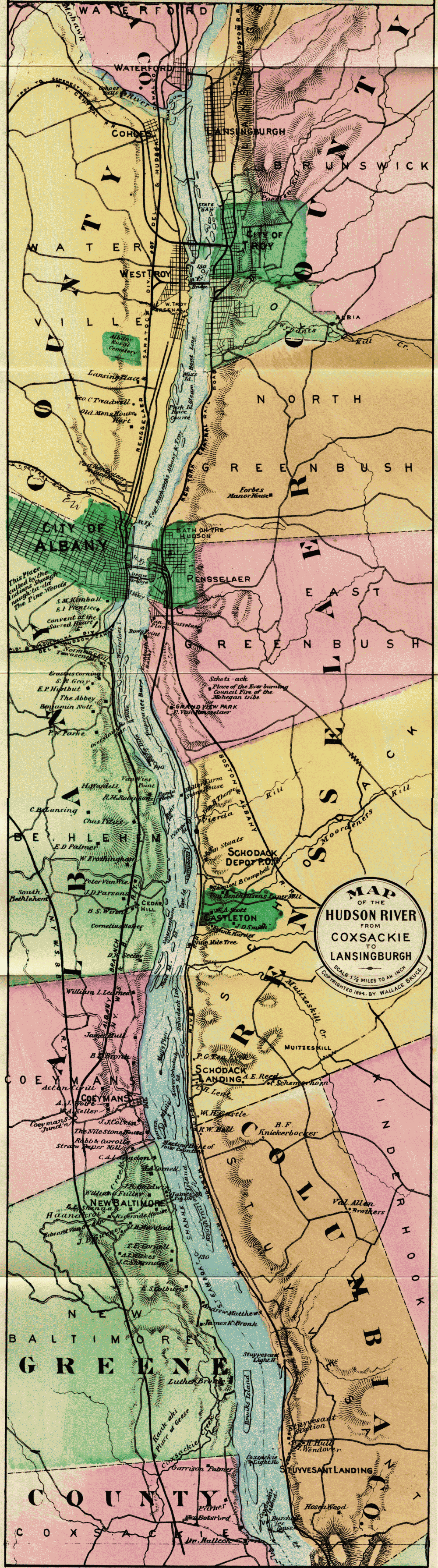
The Mahican Tribe originally occupied all the east bank of the Hudson north of Roeliffe Jansen's Kill, near Germantown, to the head waters of the Hudson; and on the west bank, from Cohoes to Catskill. The town of Schodack was central, and a signal displayed from the hills near Castleton could be seen for thirty miles in every direction. After the Mahicans left the Hudson, they went to Westenhook, or Housatonic, to the hills south of Stockbridge; and then, on invitation of the Oneidas, removed to Oneida County, in 1785, where they lived until 1821, when, with other Indians of New York, they purchased a tract of land near Fox River, Minnesota.
Domestic clans or families of the Mahicans lingered around their ancient seats for some years after the close of the Revolution, but of them, one after another, it is written, "They disappeared in the night." In the language of Tamerund at the death of Uncas, "The pale-faces are masters of the earth, and the time of the red men has not yet come again. My day has been too long. In the morning I saw the sons of Unami happy and strong; and yet before the night has come, have I lived to see the last warrior of the race of the Mahicans."
Autumn had given uniformity of coloring to the woods.
It varied now between copper and gold, and shone like
an infinitely rich golden embroidery on the Indian veil
of mist which rested upon the heights along the Hudson.
Harriet Martineau.
According to Ruttenber, the names and location of the Indian tribes were not ascertained with clearness by the early Dutch settlers, but through documents, treaties and information, subsequently obtained, it is now settled that the Mahicans held possession "under sub-tribal organizations" of the east bank of the river from an undefined point north of Albany to the sea, including Long[page 178] Island; that their dominion extended east to the Connecticut, where they joined kindred tribes; that on the west bank of the Hudson they ran down as far as Catskill, and west to Schenectady; that they were met on the west by the territory of the Mohawks, and on the south by tribes of the Lenni Lenapes or Delawares, whose territory extended thence to the sea, and west to and beyond the Delaware River. The Mahicans had a castle at Catskill and at Cohoes Falls. The western side of the Hudson, above Cohoes, belonged to the Mohawks, a branch of the Iroquois. Therefore, as early as 1630, three great nations were represented on the Hudson—
The Mahicans, the Delawares and the Iroquois. The early French missionaries refer to the "nine nations of Manhinyans, gathered between Manhattan and the environs of Quebec." These several nations have never been accurately designated, although certain general divisions appear under the titles of Mohegan, Wappinger, Sequins, etc. "The government of the Mahicans was a democracy. The office was hereditary by the lineage of the wife; that is, the selection of a successor on the death of the chief, was confined to the female branch of the family." According to Ruttenber, the precise relation between the Mahicans of the Hudson and the Mohegans under Uncas, the Pequot chief, is not known. In a foot-note to this statement, he says: "The identity of name between the Mahicans and Mohegans, induces the belief that all these tribes belonged to the same stock,—although they differed in dialect, in territory, and in their alliances." The two words, therefore, must not be confounded.
Round about the Indian village
Spread the meadows and the cornfields,
Stood the groves of singing pine trees,
And beyond them stood the forest,
Henry W. Longfellow.
It is also pleasant to remember that the Mahicans as a tribe were true and faithful to us during the war of the Revolution, and when the six nations met in council at Oswego, at the request of Guy Johnson and other officers of the British army, "to eat the flesh and drink[page 179] the blood of a Bostonian," Hendrick, the Mahican, made the pledge for his tribe at Albany, almost in the eloquent words of Ruth to Naomi, "Thy people shall be our people, and whither thou goest we will be at your side."
The Mourdener's Kill, with its sad story of a girl tied by Indians to a horse and dragged through the valley, flows into the Hudson above Castleton. Two miles above this near the steamer channel will be seen Staats Island on the east, with an old stone house, said to be next in antiquity to the old Van Rensselaer House, opposite Albany. It is also a fact that this property passed directly to the ancestors of the present family, the only property in this vicinity never owned by the lord of the manor. Opposite the old stone house, the point on the west bank is known as Parda Hook, where it is said a horse was once drowned in a horse-race on the ice, and hence the name Parda, for the old Hollanders along the Hudson seemed to have had a musical ear, and delighted in accumulating syllables. (The word pard is used in Spenser for spotted horse, and still survives in the word leopard.)
The Castleton Bar or "overslaugh," as it was known by the river pilots, impeded for years navigation in low water. Commodore Van Santvoord and other prominent citizens brought the subject before the State legislature, and work was commenced in 1863. In 1868 the United States Government very properly (as their jurisdiction extends over tide-water), assumed the completing of the dykes, which now stretch for miles along the banks and islands of the upper Hudson. Here and there along our route between Coxsackie and Albany will be seen great dredges deepening and widening the river channel. The plan provides for a system of longitudinal dykes to confine the current sufficiently to allow the ebb and flow of the tidal-current to keep the channel clear. These dykes are to be gradually brought nearer together from New Baltimore toward Troy, so as to assist the entrance of the flood-current and increase its height.
Where Hudson winds his silver way
And murmurs at the tardy stay,
Impatient at delay.
William Crow.
The engineers report that the greater part of the material carried in suspension in the Hudson river above Albany is believed to come from the Mohawk river, and its tributary the Schoharie river, while the sands and gravel that form the heavy and obstinate bars near Albany and chiefly between Albany and Troy, come from the upper Hudson.
The discharge of the Hudson between Troy and Albany at its lowest stage may be taken at about 3,000 cubic feet per second. The river supply, therefore, during that stage is inadequate in the upper part of the river for navigation, independent of tidal flow.
The greatest number of bars is between Albany and Troy, where the channel is narrow, and at least six obstructing bars, composed of fine and coarse gravel and coarse and fine sand, are in existence. In many places between Albany and Troy the navigable depth is reduced to 7½ feet by the presence of these bars.
From Albany to New Baltimore the depths are variable, the prevailing depth being 10 feet and over, with pools of greater depth separated by long cross-over bars, over which the greatest depth does not exceed 9 or 10 feet. Passing many delightful homes on the west bank and the mouth of the Norman's Kill (Indian name Ta-wa-sentha, place of many dead) and the Convent of the Sacred Heart, we see Dow's Point on the east and above this the—
Van Rensselaer Place, with its port holes on either side of the door facing the river, showing that it was built in troublesome times. It is the oldest of the Patroon manor houses, built in 1640 or thereabouts. It has been said that the adaptation of the old tune now known as "Yankee Doodle" was made near the well in the grounds of the Van Rensselaer Place by Dr. Richard Shuckberg, who was connected with the British army when the Colonial troops from New England marched into camp at Albany to join the British regulars on their way to[page 181] fight the French. The tune was known in New England before the Revolution as "Lydia Fisher's Jig," a name derived from a famous lady who lived in the reign of Charles II, and which has been perpetuated in the following rhyme:
Lucy Locket lost her pocket,
Lydia Fisher found it;
Not a bit of money in it,
Only binding 'round it.
The appearance of the troops called down the derision of the British officers, the hit of the doctor became known throughout the army, and the song was used as a method of showing contempt for the Colonials until after Lexington and Concord.
When life is old
And many a scene forgot the heart will hold
Its memory of this.
Fitz-Greene Halleck.
Rensselaer, on the east bank of the river, was incorporated in 1896 by the union of Greenbush and East Albany. The old name of Greenbush, which still survives in East Greenbush, four miles distant, was given to it by the old Dutch settlers, and it was probably a "green-bushed" place in early days. Now pleasant residences and villas look out upon the river from the near bank and distant hillsides. Two railroad bridges and a carriage bridge cross the Hudson at this point. During the French war in 1775, Greenbush was a military rendezvous, and in 1812 the United States Government established extensive barracks, whence troops were forwarded to Canada.
Albany, 144 miles from New York. (New York Central & Hudson River Railroad, Boston & Albany, West Shore, Delaware and Hudson, the Hudson River Day Line and People's Line.) Its site was called by the Indians Shaunaugh-ta-da (Schenectady), or the Pine Plains. It was next known by the early Dutch settlers as "Beverwyck," "William Stadt," and "New Orange." The seat of the State Government was transferred from New York to Albany in 1798. In 1714, when 100 years old, it had[page 182] a population of about 3,000, one-sixth of whom were slaves. In 1786 it increased to about 10,000. In 1676, the city comprised within the limits of Pearl, Beaver and Steuben streets, was surrounded by wooden walls with six gates. They were 13 feet high, made of timber a foot square. It is said that a portion of these walls were remaining in 1812. The first railroad in the State and the second in the United States was opened from Albany to Schenectady in 1831. The pictures of these old coaches are very amusing, and the rate of speed was only a slight improvement on a well-organized stage line. From an old book in the State Library we condense the following description, presenting quite a contrast to the city of to-day: "Albany lay stretched along the banks of the Hudson, on one very wide and long street, parallel to the Hudson. The space between the street and the river bank was occupied by gardens. A small but steep hill rose above the centre of the town, on which stood a fort. The wide street leading to the fort (now State street) had a Market-Place, Guard-House, Town Hall, and an English and Dutch Church, in the centre."
I wandered afar from the land of my birth,
I saw the old rivers renowned upon earth,
But fancy still painted that wide-flowing stream
With the many-hued pencil of infancy's dream.
Oliver Wendell Holmes.
Tourists and others will be amply repaid in visiting the new Capitol building, at the head of State Street. It is open from nine in the morning until six in the evening. It is said to be larger than the Capitol at Washington, and cost more than any other structure on the American continent. The staircases, the wide corridors, the Senate chamber, the Assembly chamber, and the Court of Appeals room, attest the wealth and greatness of the Empire State. The visitor up State Street will note the beautiful and commanding spire of "St. Paul." The Cathedral is also a grand structure. The population of Albany is now 100,000, and its growth is due to three causes: First, the Capitol was removed from New York to Albany in 1798. Then followed two great enterprises, ridiculed at the time by every one as the Fulton Folly and Clinton's Ditch—in other words, steam navigation, 1807, and the[page 183] Erie Canal, 1825. Its name was given in honor of the Duke of Albany, although it is still claimed by some of the oldest inhabitants that, in the golden age of those far-off times, when the good old burghers used to ask the welfare of their neighbors, the answer was "All bonnie," and hence the name of the hill-crowned city.
Canals, long winding, ope a watery flight,
And distant streams and seas and lakes unite;
From fair Albania toward the fading sun,
Back through the midland lengthening channels run.
Joel Barlow.
To condense from H. P. Phelps's careful handbook of "Albany and the Capitol:" in 1614 a stockaded trading-house was erected on an island below the city, well defended for trading with the Indians. In 1617 another was built on the hill, near Norman's Kill. The West Indian Company erected a fort in 1623 near the present landing of the Day Line. In 1664 the province fell into the hands of the English and the name was changed to Albany. In 1686 it was incorporated into a city. It was the meeting place of the Constitutional Congress 1754, the proposed Constitution of which, however, was never ratified. Washington visited it in 1783. The Erie Canal was opened in 1825, a railroad to Schenectady in 1832, the Hudson River in 1851, a consolidated road to Buffalo in 1853, and the Susquehanna Railroad to Binghamton in 1869. State Street at one time was said to be the widest city thoroughfare in the country, after Pennsylvania Avenue in Washington. The English and Dutch Churches and other public buildings, once in the midst of it, but long since removed, account for its extra width. The State Capitol has a commanding site. The old Capitol building was completed in 1808. The corner-stone of the present building was laid June 24, 1871, and it has been occupied since January 7, 1879. According to Phelps, "the size of the structure impresses the beholder at once. It is 300 feet north and south by 400 feet east and west, and with the porticoes will cover three acres and seven square feet. The walls are 108 feet high from the water-table, and all this worked out of solid granite brought, most of it, from Hallowell, Me.
The impression produced varies with various persons.[page 184] One accomplished writer finds it "not unlike that made by the photographs of those gigantic structures in the northern and eastern parts of India, which are seen in full series on the walls of the South Kensington, and by their barbaric profusion of ornamentation and true magnificence of design give the stay-at-home Briton some faint inkling of the empire which has invested his queen with another and more high-sounding title. Yet when close at hand the building does not bear out this connection with Indian architecture of the grand style; it might be mere chance that at a distance there is a similarity; or it may be that the smallness of size in the decorations as compared to the structure itself explains fully why there is a tendency to confuse the eye by the number of projections, arches, pillars, shallow recesses, and what-not, which variegate the different facades. The confusion is not entirely displeasing; it gives a sense of unstinted riches, and represents the spirit that has reared the pile."
Nor let the dear love of its children grow cold
Till the channel is dry where its waters have rolled.
Oliver Wendell Holmes.
The Governor's room, the golden corridor, the Senate staircase, the Senate chamber, the Assembly chamber, and the Court of Appeals room are interesting alike for their architectural stone work, decorations and general finish. The State Library, dating from 1818, contains about 150,000 volumes. The Clinton papers, including Andre's documents captured at Tarrytown, are the most interesting of many valuable manuscripts. Here also are a sword and pistol once belonging to General Washington. The Museum of Military Records and Relics contains over 800 battle flags of State regiments, with several ensigns captured from the enemy. Near the Capitol are the State Hall and City Hall, and on the right, descending State Street, the Geological Hall, well worthy an extended visit. The present St. Peter's Episcopal Church, third upon the site, is of Schenectady blue stone with brown trimmings. Its tower contains "a chime of eleven bells and another bell marked 1751, which is used only to ring in the new year." Washington Park, consisting[page 185] of eighty acres and procured at a cost of one million dollars, reached by a pleasant drive or by electric railway, is a delightful resort. It is noted for its grand trees, artistic walks and floral culture. Several fine statues are also worthy of mention, notably that of Robert Burns (Charles Calverley, sculptor), erected by money left for this purpose by Mrs. McPherson, under the careful and tasteful supervision of one of Albany's best-known citizens, Mr. Peter Kinnear. A view from Washington Park takes in the Catskills and the Helderberg Mountains.
No wonder that his countrymen today, led by the
Congress of this great Republic, celebrate the transaction
and the scene where Washington refused to accept
a crown.
William M. Evarts.
And now, while waiting to "throw out the plank," which puts a period to our Hudson River division, we feel like congratulating ourselves that the various goblins which once infested the river have become civilized, that the winds and tides have been conquered, and that the nine-day voyage of Hendrick Hudson and the "Half Moon" has been reduced to the nine-hour system of the Hudson River Day Line.
Those who have traveled over Europe will certainly appreciate the quiet luxury of an American steamer; and this first introduction to American scenery will always charm the tourist from other lands. No single day's journey in any land or on any stream can present such variety, interest, and beauty, as the trip of one hundred and forty-four miles from New York to Albany. The Hudson is indeed a goodly volume, with its broad covers of green lying open on either side; and it might in truth be called a condensed history, for there is no other place in our country where poetry and romance are so strangely blended with the heroic and the historic,—no river where the waves of different civilizations have left so many waifs upon the banks. It is classic ground, from the "wilderness to the sea," and will always be the poets' corner of our country: the home of Irving, Willis, and Morris,—of Fulton, Morse, and Field,—of Cole, Audubon, and Church,—and of scores besides, whose names are household words.
The Hudson's cable-tow of yore
Bound gallant sire and sturdy son
With hearty grasp from shore to shore
Robert Burns and Washington.
Wallace Bruce.
A pleasant tour awaits the traveler who continues his journey north from Albany, where the Delaware and Hudson train for Saratoga is ready at the landing on the arrival of the steamer. A half hour's run along the west bank gives us a glimpse of Troy across the river with the classical named hills Mount Ida and Mount Olympus. Two streams, the Poestenkill and the Wynant's Kill, approach the river on the east bank through narrow ravines, and furnish excellent water power. In the year 1786 it was called Ferryhook. In 1787, Rensselaerwyck. In the fall of 1787 the settlers began to use the name of Vanderheyden, after the family who owned a great part of the ground where the city now stands. January 9, 1789 the freeholders of the town met and gave it the name of Troy. The "Hudson," the "Erie," and the "Champlain" Canals have contributed to its growth. The city, with many busy towns, which have sprung up around it—Cohoes, Lansingburg, Waterford, etc., is central to a population of at least 100,000 people. The Rensselaer Polytechnic Institute, the oldest engineering school in America, has a national reputation.
Cohoes, where the Mohawk joins the Hudson, has one of the finest water powers in the country. Its name is of Indian origin and signifies "the island at the falls." This was the division line between the Mahicans and the Mohawks, and when the water is in full force it suggests in graceful curve and sweep a miniature Niagara. The[page 187] view from the double-truss iron bridge (960 feet in length), looking up or down the Mohawk, is impressive.
Oh, be my falls as bright as thine!
May heaven's relenting rainbow shine
Upon the mist that circles me,
As soft as now it hangs o'er thee!
Thomas Moore.
Passing through Waterford, and Mechanicville which lies partly in the township of Stillwater, with its historic records of Bemis Heights and burial place of Ellsworth, the first martyr of the Civil war, we come to—
Round Lake, nineteen miles north of Troy, and thirteen south of Saratoga, near a beautiful sheet of water, three miles in circumference, called by the Indians Ta-nen-da-ho-wa, which interpreted, signifies Round Lake. The camp-meeting and assembly grounds consist of 200 acres. The air is pure and invigorating and the grove and cottages inviting. The drives in the vicinity are delightful to Saratoga Lake, to the Hudson River, to the historic battlefields of Bemis Heights and Stillwater.
Ballston Spa, thirty-one miles from Albany, is the county seat of Saratoga. Here are several well-known mineral springs, with chemical properties similar to the springs of Saratoga. Over ninety years ago Benjamin Douglas, father of Hon. Stephen A. Douglas, built a log house, near the "Old Spring," for the accommodation of invalids and travelers, and at one time it looked as if Saratoga would have a vigorous rival at her very doors; but its hotel glory has departed and the old "Sans Souci" of the days of Washington Irving is a thing of the past.
A gallant army formed their last array
Upon that field, in silence and deep gloom,
And at their conqueror's feet,
Laid their war-weapons down.
Fitz-Greene Halleck.
Saratoga, thirty-eight miles north of Albany, one hundred and eighty-two miles from New York, is the greatest watering place of the continent. Its development has been wonderful, and puts, as it were, in large italics, the prosperity of our country. The first white man to visit the place was Sir William Johnson, who, in 1767, was conveyed there by his Mohawk friends, in the hope that the waters might afford relief from the serious effects of a gunshot wound in the thigh, received eight years before in the battle of Lake George, at which time his army defeated the French legions under Baron Dieskau. It was not until the year 1773, six years after[page 188] Sir William Johnson's initial visit, that the first clearing was made and the first cabin erected by Derick Scowten. Owing, however, to misunderstandings with his red neighbors, he shortly afterwards left. A year later, George Arnold, from Rhode Island, took possession of the vacated Scowten House, and conducted it with some degree of success for about two years. Arnold was in turn followed by Samuel Norton, who failed to make the venture successful, owing to the outbreak of the Revolution. Norton was succeeded in 1783 by his son, who sold out in 1787 to Gideon Morgan, who, in the same year, made the property over to Alexander Bryan. Bryan became the first permanent settler after the close of the war. The prosperity of the village began in 1789, with the advent of Gideon Putnam, but the wooden inns and hotels of 1830, which seemed palatial in those days, would get lost even in one of the parlors of the mammoth hotels which now line the main street of the village. Chief among these hotels, we mention the—
"United States," a grand and princely building of noble frontage with a bright and spacious interior court, completed in June, 1874. It constitutes one continuous line of buildings, six stories high, over fifteen hundred feet in length, containing nine hundred and seventeen rooms for guests, and is the largest hotel in the world.
The American-Adelphi near at hand, also fronting Broadway, always cheery and delightful under the management of its popular owner and proprietor, Mr. George A. Farnham, has one of the finest locations in Saratoga, combining comfort, good attention, a fine table, and every convenience of a first-class house. One thing is sure, those who go to the "American" return again and again.
The Speedway, the Race Track, and Driveways.—Saratoga can justly feel proud of her material growth and progress in many directions during the last decade, and prominent among her varied attractions are the[page 189] Speedway and Race Track. Mr. W. C. Whitney and many other prominent men have contributed liberally in this direction. The Electric Line to Saratoga Lake is also one of the features of the village, and furnishes a delightful forenoon or afternoon's outing.
And boyhood's love and fireside-listened tales
Are rushing on your memories, as ye breathe
That valley's storied name,—
Field of the Grounded Arms.
Fitz-Greene Halleck.
The Springs.—The most prominent springs in and about Saratoga are the Hathorn, the Patterson and the Congress. The popularity of the Hathorn is attested by the universal sale of its bottled waters throughout the United States. The Patterson has won a wide reputation which its excellence deserves.
Historic Saratoga.—But in the midst of this throbbing, gay and delightful Saratoga, we must not forget that it was here the fathers of the Republic achieved their most decisive victory. The battle was fought in the town of Stillwater, at Bemis Heights, two and a half miles from the Hudson. The defeat of St. Leger and the triumph of Stark at Bennington filled the American army with hope. Burgoyne's army advanced September 19, 1777. The battle was sharply contested. At night the Americans retired into their camp, and the British held the field. From September 20th to October 7th the armies looked each other in the face, each side satisfied from the first day's struggle that their opponents were worthy foemen. The Americans had retaken Ticonderoga and Lake George. Burgoyne had no place to retreat, and the lines were slowly but surely closing in around him. October 7th Burgoyne commenced the battle, but in half an hour his line was broken. He attempted to rally his troops in person, but they could not stand before the impetuous charge of the Americans. He was compelled to order a full retreat, and fell back on the heights above Schuylerville. The Americans surrounded him, and he surrendered. It was a decisive victory, and cheered the friends of freedom, not only in America, but in the English House of Commons.
The leaves were red with crimson
And then brave Gates did cry,
'Tis diamond now cut diamond,
We'll beat them boys or die.
Ballads of the Revolution.
Mount McGregor, where General Grant died, associates[page 190] the Saratoga of the Revolution with the story of our Civil War. Near the monument to the old heroes at Schuylerville, where Burgoyne surrendered, a monument to the Boys in Blue was dedicated in 1904. It was the privilege of the writer to be the poet of the occasion, and in his lines "The Flag They Bore," to bind the noble memorials of those who made and those who saved the Republic.
Two monuments in triumph stand
To catch with joy the morning sun,
One chorus joins them hand in hand—
Heroes of Grant and Washington.
And wider yet the chorus leaps!
Two famous hills the song unites,
As Mount MacGregor's anthem sweeps
Across the plains to Bemis Heights.
In Nathaniel Bartlett Sylvester's book, entitled "Historical Sketches of Northern New York and the Adirondack Wilderness," we learn that the earliest date in which the word Saratoga appears in history is 1684, and was then the name of an old hunting ground on both sides of the Hudson. Its interpretations have been various. Some say "The Hillside Country of the Great River;" others, the place of swift waters, while Morgan, in his "League of the Iroquois," says the signification of Saratoga is lost.
Whatever the origin of the name whether from the old High Rock spring or a "reach of the river," one thing is sure: Saratoga is the most attractive point in the country as a gathering place for conventions and large meetings, and, in response to the growing demand for adequate facilities, a splendid convention hall, with a seating capacity for five thousand people, has been erected by the town authorities. It is a striking architectural addition to Saratoga's attractions.
In 1907 over fifty thousand "Knights" gathered here and were hospitably entertained.
And such were Saratoga's victors—such
The yeoman-brave, whose deeds and death have given
A glory to her skies,
A music to her name.
Fitz-Greene Halleck.
The Adirondack Railway division of the Delaware and Hudson furnishes one of the pleasantest excursions to the north woods. The traveler passes along the romantic and picturesque valley of the upper Hudson—through King's, South Corinth, Jessup's Landing to Hadley (the railroad station for Luzerne, a charming village at the junction of the Hudson and the Sacandaga); then through Stony Creek, Thurman, thirty-six miles from Saratoga Springs, at the junction of the Schroon and the Hudson; the Glen, forty-four miles; Riverside, fifty miles (for Schroon Lake), pleasurable throughout, to North Creek, where "Concord coaches" and patent-covered spring buck-boards are in waiting for Blue Mountain Lake—distance about thirty miles, through a beautiful romantic country.
The water route from this point is as follows: Through Blue Mountain Lake and Utowana to the outlet, a distance of seven miles, where a "Railway Carry," something less than a mile, brings the traveler to a fairy-like steamer on Marion River. The river trip is twelve miles to Forked Lake.
Arriving at "Forked Lake Carry," one-half mile brings us to Forked Lake, where the traveler gets his first real mountain bill of fare. From this point we took a guide to Long Lake. There is a short cut from this point over to the Tupper Lakes, which we can commend in every particular, and the tourist can either return to Long Lake and continue his route to the Saranacs, or go to the Saranacs direct from Lake Tupper.
From this point we visit Keene Flats, a charming and healthful spot, only five miles from the "Lower Ausable Pond." These ponds, the "Lower" and "Upper," are unrivaled in beauty and grandeur. They lie at the foot of Mount Marcy, Haystack, the Gothics, and Mount Bartlett.
'Twas in the mellow autumn time
When I, an idler from the town,
With gun and rod was lured to climb
Those peaks where fresh the Hudson takes
His tribute from an hundred lakes.
Charles Fenno Hoffman.
The traveler will find trains and excursions to suit his convenience from Saratoga to our fairest lake. His route takes him through Gansevoort and Fort Edward to Glens Falls with the narrowing and bright-flowing Hudson for a companion. About one mile beyond Fort Edward Station, near the railway on the right, stood, until recently, the tree where Jane McCrea was murdered by Indians during the Revolution. From Glens Falls the tourist proceeds over the well-conducted Lake George division of the Delaware and Hudson, and soon finds himself in the midst of a historic and romantic region. About half way to the lake stands a monument to Col. Ephraim Williams, killed at the battle of Lake George in 1755, erected by the graduates of Williams College, which he founded. Bloody Pond, a little farther on, sleeps calm and blue in the sunlight in spite of its tragic name and associations, and soon Lake George, girt-round by mountains, greets our vision, stretching away in beauty to the north.
Near the railway station on the ninth of September, 1903, a monument was unveiled commemorating the battle of Lake George one hundred and forty-eight years before. The monument embodies the heroic figures of Sir William Johnson and King Hendrick the Indian chief. It represents the Indian chief demonstrating to General Johnson the futility of dividing his forces. Governor Odell of New York, Governor Guild of Massachusetts, Governor Chamberlain of Connecticut, and Governor McCulloch of Vermont and others delivered appropriate addresses.
The Trossachs of America.—Capt. Wm. R. Lord, author of "Reminiscences of a Sailor," in a recent article contributed to a Scottish paper, has happily called Lake George and its surroundings "The Trossachs of America."[page 193] In writing of the autumn season he says: "Its similarity to the Trossachs of Scotland impresses one most vividly as seen at this season; the mountains are clothed in a garb, the prevailing color of which is purple, reminding me of a previous visit through the Scottish Highlands when the heather was in full bloom. I at that time felt it to be impossible that any other place on the face of the globe could equal the magnificently imposing grandeur of the 'Trossachs.' I must, however, freely admit that in its power of changing beauty this region of America fully equals, if it does not surpass it. Deeds of 'derring-do,' enacted in these mountain fastnesses in days gone by, still add to make the comparison more close. Our path at times seemed to be literally strewn with roses, for the different colored leaves that carpeted our way conveyed that thought. The depth and variegated beauty of coloring that marks this season of decaying foliage, would enrapture the heart of an artist. In my vocation I have had occasion to visit the four quarters of the globe, but never have I seen tints so strikingly beautiful."
The early fragments of our Colonial poetry and Revolutionary
ballads are chanted in the midst of such profound
silence and loneliness that they sound spectrally
to our ears.
Bayard Taylor.
Lake George, called by the French "Lac St. Sacrament," was discovered by Father Jacques, who passed through it in 1646, on his way to the Iroquois, by whom he was afterward tortured and burned. It is thirty-six miles long by three miles broad. Its elevation is two hundred and forty-three feet above the sea. The waters are of remarkable transparency; romantic islands dot its surface, and elegant villas line its shores. Fort William Henry and Ticonderoga, situated at either end of the lake, were the salients respectively of the two most powerful nations upon the globe. France and England sent great armies, which crossed each other's track upon the ocean, the one entering the St. Lawrence, the other the harbor of New York. Their respective colonies sent their thousands to swell the number of trained troops, while tribes of red men from the south and the north were marshalled[page 194] by civilized genius to meet in hostile array upon these waters, around the walls of the forts, and at the base of the hills. In 1755, General Johnston reached Lake St. Sacrament, to which he gave the name of Lake George, "not only in honor of his Majesty, but to assert his undoubted dominion here."
The progress of that October month had been like
the stately march of an Orient army, with all the
splendor of blazing banners. It looked as though the
glories of the sunset had been distilled into it decked
with the glowing hues of crimson, scarlet and gold.
John Henry Brandow.
The village of Lake George is situated at the head of the lake. It contains two churches, a court house, and a number of pretty residences. Just behind the court house is the bay where Montcalm landed his cannon, and where his entrenchments began. It ran across the street to the rising ground beyond the Episcopal church.
Fort William Henry Hotel is the largest and best appointed hotel on Lake George. It has a most beautiful and commanding location, and the view from its great piazza is one long to be remembered. The piazza is twenty-four feet in width and supported by a row of Corinthian columns thirty feet high. The outlook from it at all times is enchanting, commanding as it does the level reaches of the lake for miles, with picturesque islands and promontories.
About twelve miles from the hotel is Fourteen-mile Island which, with a number of others, form "The Narrows." The lake here is 400 feet deep, much fishing is done, and in the right season hunting parties start out. Black Mountain, the monarch of the lake, rises over two thousand feet above its waters (being 2,661 feet above tide), and from the summit a magnificent view is obtained of Lake Champlain, the Green Mountains, the Adirondacks, and the distant course of the Hudson.
A carriage drive to Schroon Lake and conveyance from Schroon Village to Adirondack resorts can be made from Lake George.
Those who have only a day can make a delightful excursion from Saratoga to Caldwell by rail, then through the lake to Baldwin, and thence by rail to Saratoga, or via Baldwin and up the lake to Caldwell, and so to Saratoga.[page 15] But, to get the full beauty of this unrivaled lake, the trip should be made with less haste, for there is no more delightful place in the world to spend a week, a month, or an entire summer. Its immediate surroundings present much to interest the student of history and legend; and to lovers of the beautiful it acknowledges no rivals. The elevation and absolute purity of air make it a desirable place for the tourist. It is 346 feet above the level of the sea, 247 feet above Lake Champlain, and is now brought within six hours of New York City by the enterprise of the Delaware &Hudson Co. It is a great question, and we talk it over every time we see the genial Passenger Traffic Manager of this enterprising line, whether Lake George or Lake Luzerne, in Switzerland, is the more beautiful. We were just deciding last summer, on the steamer "Horicon," that Lake George was more beautiful, but not so wild, when, as if the spirit of the lake were roused, a great black squall suddenly came over the mountains, and, the "crystal lake" for a few minutes, was as wild as any one might desire. We all were glad to see her smile again as she did half an hour afterward in the bright sunlight.
Oh the mystical glory that crowns them
Reflected in river and lake,
Like a fire that burns through the firs and ferns
By the paths that the wild deer take.
Eben E. Rexford.
"At its widest point Lake George measures about four miles, but at other places it is less than one mile in width. It is dotted with islands; how many we do not know exactly—nobody does; but tradition, which passes among the people of the district for history and truth, says there is exactly one island for every day in the year, or 365 in all. Whatever their real number they all are beautiful, although some of them are barely large enough to support a flagstaff, and they all seem to fit into the scene so thoroughly that each one seems necessary to complete the charm. On either side are high hills, in some places rising gently from the shores, and in others beetling up from the surface of the water with a rugged cliff, or time-worn mass of rocks, which[page 196] reminds one of the wild bits of rocky scenery that make up the savage beauty of the Isle of Skye.
"Its clearness is something extraordinary. From a small boat, in many places, the bottom can be seen. Indeed, so mysteriously beautiful is the water that many visitors spend a day in a rowboat gazing into it at different points."
Each islet of green which the bright waters hold
Like emeralds fresh from their bosom rolled.
Charles Fenno Hoffman.
Charles Dudley Warner says: "Bolton, among a host of attractive spots on the lake, holds, in my opinion, a rank among the two or three most interesting points. There is no point of Lake George where the views are so varied or more satisfactory, excepting the one from Sabbath-day Point. At Bolton the islets which dot the surface of the lake whose waters are blue as the sea in the tropics, carry the eye to the rosy-tinted range which includes Pilot, Buck and Erebus Mountains, and culminates in the stateliness of Black Mountain. Or, looking northwest, the superb masses of verdure on Green Island are seen mirrored on the burnished surface of the lake. Behind rises the mighty dividing wall called Tongue Mountain, which seems to separate the lake in twain, for Ganouskie, or Northwest Bay, five miles long, is in effect a lake by itself, with its own peculiar features." The Champlain Transportation Company runs a regular line of steamboats the entire length of the lake, making three round trips daily, except Sunday. The "Horicon" is a fine side-wheel steamer, 203 feet long and 52 feet wide, and will accommodate, comfortably, 1,000 people.
At Fort Ti the tourist can continue his northern route via the Delaware &Hudson to Hotel Champlain, Plattsburgh, Rouse's Point, or Montreal, or through Lake Champlain by steamer. The ruins of Fort Ti, like old Fort Putnam at West Point, are picturesque, and will well repay a visit.
Far off the dreaming waters lie,
White cascades leap in snowy foam,
Lake Champlain mirrors cloud and sky,
The Hudson seeks his ocean home.
Benjamin F. Leggett.
The reader who does not visit Lake George may feel that he is switched off on a side-track at Fort Edward; so, coming to his rescue, we return and resume our northern journey via the main line, through Dunham's Basin, Smith's Basin, Fort Ann, and Comstock's Landing, to—
Whitehall, at the head of Lake Champlain. From this point north the Delaware &Hudson crosses all thresholds for the Adirondacks, and shortens the journey to the mountain districts. It passes through five mountain ranges, the most southerly, the Black Mountain range, terminating in Mt. Defiance, with scattering spurs coming down to the very shore of the lake. The second range is known as the Kayaderosseras, culminating in Bulwagga Mountain. The third range passes through the western part of Schroon, the northern part of Moriah and centre of Westport, ending in Split Rock Mountain. The fourth range, the Bouquet range, ends in high bluffs on Willsboro Bay. Here the famous Red-Hook Cut is located, and the longest tunnel on the line.
The fifth range, known as the Adirondack Range, as it includes the most lofty of the Adirondack Mountains, viz.: McIntyre, Colden and Tahawas, ends in a rocky promontory known as Tremblau Point, at Port Kent.
Afar the misty mountains piled,
The Adirondacks soaring free,
The dark green ranges lone and wild,
The Catskills looking toward the sea.
Benjamin F. Leggett.
No wonder, with these mountain ranges to get through, that the subject was agitated year after year, and it was only when the Delaware and Hudson Company placed their powerful shoulder to the wheel, that the work began to go forward. For these mountains meant tunnels, and rock cuts, and bridges, and cash. Leaving Whitehall, we enter a tunnel near the old steamboat landing, cross a marsh, which must have suggested the beginning of the Pilgrim's Progress, for it seemed almost bottomless, and pass along the narrow end of the lake, still marked[page 198] by light-houses, where steamers once struggled and panted "like fish out of water," fulfilling the Yankee's ambition of running a boat on a heavy dew. Then winding in and out along the shore, we proceed to—
Ticonderoga, 23 miles from Whitehall. Here terminates the first range of the Adirondacks, to which we have already referred, viz.: Mount Defiance. Steamers connect with the train at this point on Lake Champlain, also with a railroad for Lake George. Near the station we get a view of old Port Ticonderoga, where Ethan Allen breakfasted early one morning, and said grace in a brief and emphatic manner. The lake now widens into a noble sheet of water; we cross the Lake George outlet, enter a deep rock-cut, which extends a distance of about 500 feet, and reach Crown Point thirty-four miles north of Whitehall. Passing along the shore of Bulwagga Bay we come to—
Port Henry, 40 miles from Whitehall. A few miles further the railroad leaves the lake at Mullen Brook, the first departure since we left Whitehall, and we are greeted with cultivated fields and a charming landscape.
Westport, 51 miles from Whitehall, is the railroad station for—
Elizabethtown, the county seat of Essex. It is about eight miles from the station, nestled among the mountains. A county consisting mostly of mountain scenery could have no happier location for a head-centre. Elizabethtown forms a most delightful gateway to the Adirondacks either by stage route or pedestrian tour.
A health to Ethan Allen and our commander Gates;
To Lincoln and to Washington whom every Tory hates;
Likewise unto our Congress, God grant it long to reign,
Our country's right and justice forever to maintain.
Saratoga Revolutionary Ballad.
A short distance north of Westport we enter the well-cultivated Bouquet Valley, and after a pleasant run come to Wellsboro Falls, where we enter seven miles of rock cutting. The road is about 90 feet above the lake, and the cuts in many places from 90 to 100 feet high. After leaving Red-Rock cut, we pass through a tunnel 600 feet long. Crossing Higby's Gorge and rounding Tremblau Mountain, we reach—
[page 199]Port Kent, the connecting point for the progressive village of Keeseville.
Ausable Chasm, is only three miles from the station of Port Kent. It is many years since we visited the Chasm, but its pictures are still stamped upon our mind clearly and definitely—the ledge at Birmingham Falls, the Flume, the Devil's Pulpit, and the boat ride on the swift current. Indeed, the entire rock-rift, almost two miles in length, left an impression never to be effaced. The one thing especially peculiar, on account of the trend of the rock-layers was the illusion that we were floating up stream, and that the river compressed in these narrow limits, had "got tired" of finding its way out, until it thought that the easiest way was to run up hill and get out at the top.
Hear what the gray-haired woodmen tell
Of this wild stream and its rocky dell.
William Cullen Bryant.
Bluff Point.—On a commanding site 200 feet above the lake some three miles south of Plattsburgh, stands the superb "Hotel Champlain" commanding a view far-reaching and magnificent, from the Green Mountains on the east to the Adirondacks on the west. The hotel grounds comprise the same number of acres as the islands of Lake George, 365. The hotel is 400 feet long. We condense the following description from the "Delaware and Hudson Guide-book," which we can heartily endorse from many personal visits:
"Resolute has been the struggle here with nature, where rocks, tangled forest and matted roots crowned the chosen spot; but upon the broad, smooth plateau finally created the Hotel Champlain has been placed, and all the surrounding forest, its solitudes still untamed, has been converted into a superb park, threaded with drives and bridle paths. At the foot of the gradual western slope of the ridge the handsome station of Bluff Point has been located beside the main line of the Delaware & Hudson Railroad, the chief highway of pleasure and commercial travel between New York, Saratoga, Lake George, the Adirondacks and Canada.
[page 200]"From the station where the coaches of the hotel await expected guests, a winding pike, the very perfection of a road, leads up the hill. From the carriage, as it rises to the crest, a wondrous outlook to the westward is opened to view. Nearly a thousand square miles of valley, lake and mountain are within range of the eye or included in the area encircled by visible peaks. As the porch of the hotel is reached, the view, enhanced by the fine foreground, is indeed beautiful, but still finer is the grandeur of the scene from the arches of the tall central dome of the house.
"To the southward we see Whiteface, showing, late in spring and early in autumn, its coronet of almost perpetual snow; and in a grand circle still more southward we see in succession McIntyre, Marcy (both over 5,000 feet high), Haystack, Dix, the Gothic peaks, Hurricane and the Giant. This noble sisterhood of mountains rises from the very heart of the wilderness, and yet the guests at the Hotel Champlain may reach any portion of their environment within a few hours."
The fine equipment and frequent train service of the Delaware &Hudson between New York and Bluff Point without change, by daylight or at night, and the direct connection of the same line with the Hudson River steamboats, places this resort high upon the list of available summering points in the dry and healthful north for families from the metropolis. Travel from the west, coming down the St. Lawrence River, or through Canada via Montreal, will find Bluff Point easy to reach; while from the White Mountains and New England seashore resorts it is accessible by through trains via St. Albans or Burlington.
The western shore of Lake Champlain forms the margin of the most varied and altogether delightful wilderness to be found anywhere upon this continent east of the Rocky Mountains. The serried peaks to the westward are in plain view from its shores, their foot-hills ending [page 201] in lofty and often abrupt ridges where they meet the lake. Three impetuous rivers, the Saranac, the Salmon and the Ausable, flow down from the cool, clear lakes, hidden away in the wildwood, and, breaking through this barrier at and in the vicinity of Plattsburgh, contribute not only to the lucid waters of Lake Champlain but greatly to the picturesque variety of the region.
There lie broad acres laced with rills
And gemmed with lake and pond
Behind a wave of wooded hills
And mountain peaks beyond.
Benjamin F. Leggett.
Plattsburgh, 168 miles from Albany, at the mouth of the Saranac, is a delightful threshold to the Adirondacks. The northern part of Lake Champlain offers special attractions to camping parties. The shores and islands abound in excellent sites. Lake Champlain is also replete with interest to the historian. The ruins of Fort St. Anne are still seen on the north end of the Isle La Mott, built by the French in 1660. Valcour Strait, where one of the battles of '76 was fought; Valcour's Island, where lovers came from far and near, built air castles, wandered through these shady groves for a season or two, and then vanished from sight, bankrupt in everything but mutual affection; Cumberland Bay, with its victory, September, 1814, when the British were driven back to Canada; and many other points which can be visited by steamer or yacht.
It is thirty years since I made my first trip to the Saranacs and I remember well the long journey of those early days, but now we can step aboard a well equipped train at Plattsburgh and in five or six hours stand by the bright waters of the Lower Saranac, which might to-day be called the centre and starting point for all resorts and camping grounds in the eastern lake district of the Adirondacks. Floating about the Saranac Islands of a summer evening, roaming among forest trees, strolling over to the little village one mile distant, and absorbing the rich exhilaration of a life of untrammeled freedom, with a perfect hotel, and blazing fire-places if the weather happens to be unpleasant, form a grand combination, alike for tourists or seekers after rest.
Where rosy zephyr lingers
All the livelong day,
With health upon his pinions
And gladness on his way.
George P. Morris.
In our journey from Albany to Plattsburgh, we have indicated various routes to the Adirondacks: By way of Saratoga and North Creek to Blue Mountain Lake following the course of the Hudson which might therefor be called "The Hudson Gateway;" via Lake George, Westport, and Elizabethtown, suited for carriage and pedestrian trips, and via Plattsburgh, which might be termed "The Northern Portal." In addition to these it has been my lot to make several trips up the valley of the Sacandaga to Lake Pleasant and Indian Lake, and via Schroon Lake to Sanford and Lake Henderson—and four times to ascend the mountain trail of Tahawas to the tiny rills and fountains of the Hudson, but one trip abides in memory distinct and unrivalled, which may be of service to those who wish to visit in fact or fancy the head waters of the Hudson.
The Tahawas Club.—We took the cars one bright August morning from Plattsburgh to Ausable Forks, a distance of twenty miles, hired a team to Beede's, some thirty miles distant from the "Forks;" took dinner at Keene, and pursued our route up the beautiful valley of the Ausable.
From this point we visited Roaring-Brook Falls, some four hundred feet high, a very beautiful waterfall in the evening twilight. The next morning we started, bright and early, for the Ausable Ponds. Four miles brought us to the Lower Ausable. The historic guide, "old Phelps," rowed us across the lower lake, pointing out, from our slowly moving and heavily laden scow, "Indian Head" on the left, and the "Devil's Pulpit" on[page 203] the right, lifted about eight hundred feet above the level of the lake. "Phelps" remarked with quaint humor, that he was frequently likened to his Satanic Majesty, as he often took clergymen "up thar." The rocky walls of this lake rise from one thousand to fifteen hundred feet high, in many places almost perpendicular. A large eagle soared above the cliffs, and circled in the air above us, which we took as a good omen of our journey.
The rills
That feed thee rise among the storied rocks
Where Freedom built her battle-tower.
William Wallace.
After reaching the southern portion of the lake, a trail of a mile and a quarter leads to the Upper Ausable—the gem of the Adirondacks. This lake, over two thousand feet above the tide, is surrounded on all sides by lofty mountains. Our camp was on the eastern shore, and I can never forget the sunset view, as rosy tints lit up old Skylight, the Haystack and the Gothics; nor can I ever forget the evening songs from a camp-fire across the lake, or the "bear story" told by Phelps, a tale never really finished, but made classic and immortal by Stoddard, in his spicy and reliable handbook to the North Woods.
The next morning we rowed across the lake and took the Bartlett trail, ascending Haystack, some five thousand feet high, just to get an appetite for dinner; our guide encouraging us on the way by saying that there never had been more than twenty people before "on that air peak." In fact, there was no trail, and in some places it was so steep that we were compelled to go up on all fours; or as Scott puts it more elegantly in the "Lady of the Lake":
"The foot was fain
Assistance from the hand to gain."
The view from the summit well repaid the toil. We saw Slide Mountain, near by to the north, and Whiteface far beyond, perhaps twenty-five miles distant; northeast, the Gothics; east, Saw-teeth, Mt. Colvin, Mt. Dix, and the lakes of the Ausable. To the southeast, Skylight;[page 204] northwest, Tahawas, still foolishly styled on some of our maps, Mt. Marcy. The descent of Haystack was as easy as Virgil's famous "Descensus Averni." We went down in just twenty minutes. The one that reached the bottom first simply possessed better adaptation for rolling.
Eagles still claim the loftiest heights: from there
They scan with solemn eyes the scenes below—
The river and the hills which shall endure
While man's frail generations come and go.
E. A. Lente.
One mile from the foot of Haystack brought us to Panther Gorge Camp, appropriately named, one of the wildest spots in the Adirondacks. We remained there that night and slept soundly, although a dozen of us were packed so closely in one small camp that no individual could turn over without disarranging the whole mass. Caliban and Trinculo were not more neighborly, and Sebastian, even sober, would have been fully justified in taking us for "a rare monster" with twenty legs.
The next morning we ascended Tahawas, but saw nothing save whirling clouds on its summit. Twice since then we have had better fortune, and looked down from this mountain peak, five thousand three hundred and forty-four feet above the sea, upon the loveliest mountain landscape that the sun ever shone upon. We went down the western slope of Tahawas, through a driving rain, to Camp Colden, where, with clothes hung up to dry, we looked like a party of New Zealanders preparing dinner, hungry enough, too, to make an orthodox meal of each other. The next day the weather cleared up, and we made a trip of two miles over a rough mountain trail to Lake Avalanche, whose rocky and precipitous walls form a fit christening bowl, or baptistery-font for the infant Hudson.
Returning to Camp Colden and resuming our western march, two miles brought us to Calamity Pond, where a lone monument marks the spot of David Henderson's death, by the accidental discharge of a pistol. Five miles from this point brought us to the "Deserted Village," or the Upper Adirondack Iron Works, with houses and[page 205] furnaces abandoned, and rapidly falling into decay. Here we found a cheery fireside and cordial welcome.
All the sad story of forest and flower,
All the red glory of sunsetting hour,
Comes till I seem to lie lapped in bright dreams
Lulled by the lullaby murmur of streams.
James Kennedy.
Had I time to picture this level, grass-grown street, with ten or fifteen square box-looking houses, windowless, empty and desolate; a school-house with its long vacation of twenty-three years; a bank with heavy shutters and ponderous locks, whose floor, Time, the universal burglar, had undermined; two large furnaces with great rusty wheels, whose occupation was gone forever; a thousand tons of charcoal, untouched for a quarter of a century; thousands of bricks waiting for a builder; a real haunted house, whose flapping clap-boards contain more spirits than the Black Forests of Germany—a village so utterly desolate, that it has not even the vestige of a graveyard—if I could picture to you this village, as it appeared to me that weird midnight, lying so quiet,
"under the light of the solemn moon,"
you would realize as I did then, that truth is indeed stranger than fiction, and that Goldsmith in his "Deserted Village" had not overdrawn the description of desolate Auburn.
By special request, we were permitted to sleep that night in the Haunted House and no doubt listened to the first crackling that the old fire-place had known for years. Many bedsteads in the old building were still standing, so we only needed bedding from the hotel to make us comfortable. As we went to sleep we expressed a wish to be interviewed in the still hours of the night by any ghosts or spirits who might happen to like our company; but the spirits must have been absent on a visit that evening, for we slept undisturbed until the old bell, suspended in a tree, rang out the cheery notes of "trout and pickerel." We understand that the Haunted House from that night lost its old-time reputation, and is now frequently brought into requisition as an "Annex," whenever the hotel or "Club House," as it is now called,[page 206] happens to be full. The "Deserted Village" is rich in natural beauty. Lakes Henderson and Sanford are near at hand, and the lovely Preston Ponds are only five miles distant.
Stately and awful was the form of Tahawas, the old
scarred warrior king of the mountains, and yet it owns
pines that sing like the sea, brooks that warble like the
robin, and flowers that scent the air like the orange-blossoms
of Italy.
Alfred B. Street.
Resuming our march through Indian Pass, under old Wall-Face Mountain, we reached a comfortable farmhouse at sunset, near North Elba, known by the name of Scott's. The next morning we visited John Brown's house and grave by the old rock, and read the beautiful inscription, "Bury me by the Old Rock, where I used to sit and read the word of God."
From this point we went to Lake Placid, engaged a lad to row us across the lake—some of our party had gone on before—and strapped our knapsacks for another mountain climb. We were fortunate in having a lovely day, and from its sparkling glacier-worn summit we could look back on all the mountains of our pleasant journey, and far away across Lake Champlain to Mount Mansfield and Camel's Hump of the Green Mountains, and farther still to the faint outlines of Mount Washington. We reached Wilmington that night, drove the next morning to Ausable Forks, and took the cars for Plattsburgh. The ten days' trip was finished, and at this late hour I heartily thank the Tahawas Club of Plattsburgh for taking me under their generous care and guidance. We took Phelps, our guide, back with us to Plattsburgh. When he reached the "Forks," and saw the cars for the first time in his life, he stooped down and, examining the track, said, "What tarnal little wheels." I suppose he concluded that if the ordinary cart had two large wheels, that real car wheels would resemble the Rings of Saturn. He saw much to amuse and interest him during his short stay in Plattsburgh, but after all he thought it was rather lonesome, and gladly returned to his lakes and mountains, where he slept in peace, with the occasional intrusion of a "Bar" or a "Painter." He knew the region about Tahawas as an engineer knows[page 207] his engine, or as a Greek professor knows the pages of his lexicon. He had lived so closely with nature that he seemed to understand her gentlest whispers, and he had more genuine poetry in his soul than many a man who chains weak ideas in tangled metre.
Lake Avalanche with rocky wall
And Henderson's dark-wooded shore,
Your echoes linger still and call
Unto my soul forevermore.
Wallace Bruce.
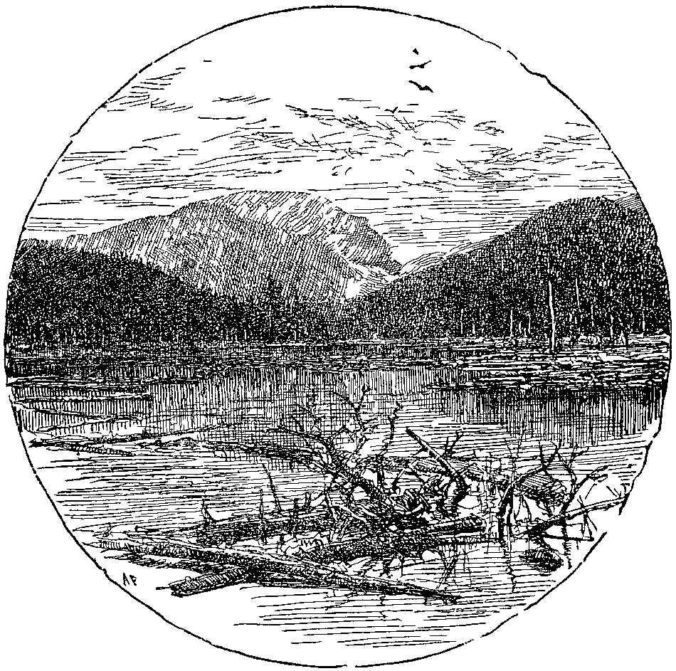
INDIAN HEAD.
Since that first delightful trip I have visited the Adirondacks many times, and I hope this summer to repeat the excursion. To me Tahawas is the grand centre. It remains unchanged. In fact, the route I have here traced is the same to-day as then. Even the rude camps are located in the same places, with the exception that the[page 208] trail has been shortened over Tahawas, and a camp established on Skylight. With good guides the route is not difficult for ladies in good health,—say sufficient health to endure half a day's shopping. Persons contemplating the mountain trip need blankets, a knapsack, and a rubber cloth or overcoat; food can be procured at the hotels or farm houses.
The old English ballads have all the sparkle, the
energy and the rhythm of our mountain streams, but
Chaucer, Spenser, Shakespeare and Bunyan are the
crystal lakes from which flow the river, ay, the Hudson
of our language.
Wallace Bruce.
In this hasty sketch I have had little space to indulge in picture-painting. I passed Bridal-Veil Fall without a reference. I was tempted to loiter on the banks of the Feld-spar and the bright Opalescent, but I passed by without even picking a pebble from the clear basins of its sparkling cascades. I passed the "tear of the clouds," four thousand feet above the tide—that fountain of the Hudson nearest to the sky, without being beguiled into poetry. I have not ventured upon a description of a sunrise view from the summit of Tahawas, of the magic effect of light above clouds that clothe the surrounding peaks in garments wrought, it seems, of softest wool, until mist and vapor dissolve in roseate colors, and the landscape lies before us like an open book, which many glad eyes have looked upon again and again. I have left it for your guides to tell you, by roaring camp-fires, long stories of adventure in trapping and hunting, of wondrous fishes that grow longer and heavier every season, although captured and broiled many and many a year ago—trout and pickerel literally pickled in fiction, served and re-served in the piquant sauce of mountain vocabulary. In brief, I have kept my imagination and enthusiasm under strict control. But, after all, the Adirondacks are a wonderland, and we, who dwell in the Hudson and Mohawk valleys, are happy in having this great park of Nature's making at our very doors.
It has charms alike for the hunter, the angler, the artist, the writer, and the scientist. Let us rejoice, therefore, that the State of New York is waking at last to the fact, that these northern mountains were[page 209] intended by nature to be something more than lumber ranches, to be despoiled by the axe, and finally revert to the State for "taxes" in the shape of bare and desolate wastes. Nor can the most practical legislator charge those, who wish to preserve the Adirondack woods, with idle sentiment; as it is now an established scientific fact that the rainfall of a country is largely dependent upon its forest land. If the water supply of the north were cut off, to any perceptible degree, the Hudson, during the months of July and August, would be a mere sluice of salt water from New York to Albany; and the northern canals, dependent on this supply, would become empty and useless ditches. Our age is intensely practical, but we are fortunate in this, that so far as the preservation of the Adirondacks is concerned, utility, common sense, and the appreciation of the beautiful are inseparably blended.
Wild umbrage far around me clings
To breezy knoll and hushed ravine,
And o'er each rocky headland flings
Its mantle of refreshing green.
Henry T. Tuckerman.
To those persons who do not desire long mountain jaunts, who simply need some quiet place for rest and recuperation, I would suggest this: Select some place near the base of these clustered mountains, like the tasty Adirondack Lodge at Clear Pond, only seven miles from the summit of Tahawas, or Beede's pleasant hotel, high and dry above Keene Flats, near to the Ausable Ponds, or some pleasant hotel or quiet farm-house in the more open country near Lake Placid and the Saranacs. But I prophesy that the spirit of adventure will come with increased strength, and men and women alike will be found wandering off on long excursions, sitting about great camp-fires, ay, listening like children to tales which have not gathered truth with age. If you have control of your time you will find no pleasanter months than July, August and September, and when you return to your firesides with new vigor to fight the battle of life, you will feel, I think, like thanking the writer for having advised you to go thither.
To shut up a glen or a waterfall for one man's exclusive
enjoying; to fence out a genial eye from any
corner of the earth which nature has lovingly touched;
to lock up trees and glades shady paths and haunts
along rivulets, would be an embezzlement by one man
of God's gifts to all.
N. P. Willis.
I have written in this article the Indian name, Tahawas,[page 210] in the place of Mt. Marcy, and for this reason: There is no justice in robbing the Indian of his keen, poetic appreciation, by changing a name, which has in itself a definite meaning, for one that means nothing in its association with this mountain. We have stolen enough from this unfortunate race, to leave, at least, those names in our woodland vocabulary that chance to have a musical sound to our imported Saxon ears. The name Tahawas is not only beautiful in itself, but also poetic in its interpretation—signifying "I cleave the clouds." Coleridge, in his glorious hymn, "Before sunrise in the vale of Chamouni," addresses Mount Blanc:
"Around thee and above
Deep is the air and dark, substantial, black—
An ebon mass. Methinks thou piercest it.
As with a wedge!"
The name or meaning of Tahawas was never made known to the great English poet, who died sixty years ago. Is it not remarkable that the untutored Indian, and the keenist poetic mind which England has produced for a century, should have the same idea in the uplifted mountains? There is also another reason why we, as a State, should cherish the name Tahawas. While the Sierra Nevadas and the Alps slumbered beneath the waves of the ocean, before the Himalayas or the Andes had asserted their supremacy, scientists say, that the high peaks of the Adirondacks stood alone above the waves, "the cradle of the world's life;" and, as the clouds then encircled the vast waste of water, Tahawas then rose—"Cleaver" alike of the waters and the clouds.
Tahawas, rising stern and grand,
"Cloud-sunderer" lift thy forehead high,
Guard well thy sun-kissed mountain land
Whose lakes seem borrowed from the sky.
Wallace Bruce.
In addition to various geological references scattered through these pages the following facts from an American Geological Railway Guide, by James Macfarlane, Ph.D., will be of interest.
"The State of New York is to the geologist what the Holy Land is to the Christian, and the works of her Palæontologist are the Old Testament Scriptures of the science. It is a Laurentian, Cambrian, Silurian and Devonian State, containing all the groups and all the formations of these long ages, beautifully developed in belts running nearly across the State in an east and west direction, lying undisturbed as originally laid down.
"The rock of New York Island is gneiss, except a portion of the north end, which is limestone. The south portion is covered with deep alluvial deposits, which in some places are more than 100 feet in depth. The natural outcroppings of the gneiss appeared on the surface about 16th Street, on the east side of the city, and run diagonally across to 31st Street on 10th Avenue. North of this, much of the surface was naked rock. It contains a large proportion of mica, a small proportion of quartz and still less feldspar, but generally an abundance of iron pyrites in very minute crystals, which, on exposure, are decomposed. In consequence of these ingredients it soon disintegrates on exposure, rendering it unfit for the purposes of building. The erection of a great city, for which this island furnishes a noble site, has very greatly changed its natural condition. The geological age of the New York gneiss is undoubtedly[page 212] very old, not the Laurentian or oldest, nor the Huronian, but it belongs to the third or White Mountain series, named by Dr. Hunt the Montalban. It is the same range which is the basis rock of nearly all the great cities of the Atlantic coast. It crosses New Jersey where it is turned to clay, until it appears under Trenton, and it extends to Philadelphia, Baltimore, Washington and Richmond, Va., and probably Boston, Massachusetts, is founded on this same formation.
Oh, river! darkling river! what a voice
Is that thou utterest while all else is still!
William Cullen Bryant.
"On the opposite side of the river may here be seen for many miles the Palisades, a long, rough mountain ridge close to the water's edge. Its upper half is a perpendicular precipice of bare rock of a columnar structure from 100 to 200 feet in height, the whole height of the mountain being generally from 400 to 600 feet, and the highest point in the range opposite Sing Sing 800 feet above the Hudson, and known as the High Torn. The width of the mountain is from a half mile to a mile and a half, the western slope being quite gentle. In length it extends from Bergen Point below Jersey City to Haverstraw, and then westward in all 48 miles, the middle portion being merely a low ridge. The lower half of the ridge on the river side is a sloping mound of detritus, of loose stones which has accumulated at the base of the cliff, from its weathered and wasted surface.
"Viewed from the railroad or from a steamboat on the river, this lofty mural precipice with its huge weathered masses of upright columns of bare rock, presenting a long, straight unbroken ridge overlooking the beautiful Hudson River, is certainly extremely picturesque. Thousands of travelers gaze at it daily without knowing what it is. This entire ridge consists of no other rock than trap traversing the Triassic formation in a huge vertical dike. The red sandstone formation of New Jersey is intersected by numerous dikes of this kind, but this is much the finest. The materials of this mountain have undoubtedly burst through a great rent or[page 213] fissure in the strata, overflowing while in a melted or plastic condition the red sand-stone, not with the violence of a volcano, for the adjoining strata are but little disturbed in position, although often greatly altered by the heat, but forced up very slowly and gradually, and probably under pressure. Subsequent denudation has laid bare the part of the mountain now exposed along the river. The rock is columnar basalt, sometimes called greenstone, and is solid, not stratified like water-formed rocks, but cracked in cooling and of a crystalline structure. Here is a remarkable but not uncommon instance of a great geological blank. On the east side of this river the formations belong to the first or oldest series of Primary or Crystalline rocks, while on the west side they are all Triassic, the intermediate Cambrian, Silurian, Devonian and Carboniferous formations being wanting. This state of things continues all along the Atlantic coast to Georgia, the Cretaceous or Jurassic taking the place of the Triassic farther south.
Like thine, O, be my course—nor turned aside,
While listening to the soundings of a land,
That like the ocean call invites me to its strand.
Mrs. Seba Smith.
"Montrose to Cornwall. This celebrated passage of the Hudson through the Highlands, is a gorge nearly 20 miles long from 3 miles south of Peekskill to Fishkill, and is worn out of the Laurentian rocks far below mean tide water. The hills on its sides rise in some instances as much as 1,800 feet, and in many places the walls are very precipitous. The rock is gneiss, of a kind that is not easily disintegrated or eroded, nor is there any evidence of any convulsive movement. It is clearly a case of erosion, but not by the present river, which has no fall, for tide water extends 100 miles up the river beyond the Highlands. This therefore was probably a work mainly performed in some past period when the continent was at a higher level. Most likely it is a valley of great antiquity.
"Opposite Fishkill is Newburgh, which is in the great valley of Lower Silurian or Cambrian limestone and slate. North of that, on the west side of the river, the[page 214] formations occur in their usual order, their outcrops running northeast and southwest. On the N. Y. C. & H. R. R. R., on the east side, the same valley crosses, and the slates from Fishkill to Rhinebeck are about the same place in the series; but being destitute of fossils and very much faulted, tilted and disturbed, their precise geology is uncertain. See the exposures in the cuts at Poughkeepsie. The high ground to the east is commonly called the Quebec group.
Amid thy forest solitudes one climbs
O'er crags, that proudly tower above the deep,
Along the verge of the cliff, and he can hear
The low dash of the wave with startled ear.
Fitz-Greene Halleck.
"A series of great dislocations with upthrows on the east side traverse eastern North America from Canada to Alabama. One of these great faults has been traced from near the mouth of the St. Lawrence River, keeping mostly under the water up to Quebec just north of the fortress, thence by a gently curving line to Lake Champlain or through western Vermont across Washington County, N. Y., to near Albany. It crosses the river near Rhinebeck 15 miles north of Poughkeepsie and continues on southward into New Jersey and runs into another series of faults probably of a later date, which extends as far as Alabama. It brings up the rocks of the so called Quebec group on the east side of the fracture to the level of the Hudson River and Trenton.
"Catskill Mountains. For many miles on this railroad are beautiful views of the Catskill Mountains, 3,800 feet high, several miles distant on the opposite or west side of the river, and which furnish the name for the Catskill formation. The wide valley between them and the river is composed of Chemung, Hamilton, Lower Helderberg and Hudson River. The geology on the east or railroad side is entirely different.
"Albany. The clay beds at Albany are more than 100 feet thick, and between that city and Schenectady they are underlaid by a bed of sand that is in some places more than 50 feet thick. There is an old glacial clay and boulder drift below the gravel at Albany, but Professor Hall says it is not the estuary stratified clay."
There has that little stream of water been playing
among the hills since He made the world, and none
know how often the hand of God is seen in a wilderness
but them that rove it for a man's life.
James Fenimore Cooper.
The tide in the Hudson River is the continuation of the tide-wave, which comes up from the ocean through New York Bay, and is carried by its own momentum one hundred and sixty miles, growing, of course, constantly smaller, until it is finally stopped by the dam at Troy. The crest of this wave, or top high water, is ten hours going from New York to Troy. A steamer employing the same time (ten hours) for the journey, and starting at high water in New York, would carry a flood tide and highest water all the way, and have an up-river current of about three miles an hour helping her. On the other hand, the same steamer starting six hours later, or at low tide, would have dead low water and an ebb tide current of about three miles against her the entire way. The average rise and fall of the tides in New York is five and one-half feet, and in Troy, about two feet.
Flood tide may carry salt water, under the most favorable circumstances, so that it can be detected at Poughkeepsie; ordinarily the water is fresh at Newburgh.
To those who have not studied the tides the following will also be of interest.
The tides are the semi-diurnal oscillations of the ocean, caused by the attraction of the moon and sun.
The influence of the moon's attraction is the preponderating one in the tide rising force, while that of the sun is about two-fifths as much as that of the moon. The tides therefore follow the motion of the moon, and the average interval between the times of high water is the half length of the lunar day, or about twelve hours and twenty-five minutes.
Nor lives there one whose boyhood's days
Of happiness were passed beneath that sun,
That in his manhood-prime can calmly gaze
Upon that Bay, or on that mountain stand,
Nor feel the prouder of his native land.
Fitz-Greene Halleck.
Desbrosses Street Pier. On leaving landing a charming view is obtained of New York Harbor with Bartholdi Statue to the south.
Stevens Castle. Above Jersey City docks on the west, crowning a commanding site.
St. Michael's Monastery, or Monastery of the Passionist Fathers, on west bank above Elysian Fields; distinguished by large dome and towers of the St. Paul (London) style of architecture. This dome is 300 feet high, and its summit is 515 feet above the Hudson.
42d Street Pier. Midway to the dwellers of Greater New York and convenient to all Elevated, Subway and Trolley Lines.
Weehawken, on the west bank, about opposite 50th Street. Near the river bank was the scene of the Hamilton and Burr duel, 1804.
Soldiers' and Sailors' Monument, 89th Street, New York. Dedicated May 30, 1902. Corner stone laid in 1900 by President Roosevelt when Governor.
Columbia University. Stately buildings on east bank.
St. Luke's Hospital. Beautiful dome in the distance southeast of college.
The Cathedral of St. John the Divine, now in construction, will be one of the finest structures in the world.
General Grant's Tomb at Riverside Drive and 123d Street.
129th Street Pier. Above this landing is the Steel Viaduct of the Boulevard Drive.
The land that from the rule of kings
In freeing us itself made free,
Our old world sister to us brings
Her sculptured dream of liberty.
John G. Whittier.
Carmansville (where Audubon, the ornithologist lived), a city suburb at 152d Street.
Trinity Cemetery, 152d Street, and above this Audubon Park.
Old Fort Washington once crowned the hills on the east bank. Fort Lee was almost opposite on the southern point of the Palisades.
Stewart Castle, east bank, formerly owned by A. T. Stewart.
University of City of New York with dome, in distance.
Inwood. Station on the Hudson River Railroad, above the heights. Place once known as Tubbie Hook.
Palisades, on west bank, extend fifteen miles from Fort Lee to Piermont, a sheer wall of trap rock from 300 to 500 feet high.
Spuyten Duyvil, on east bank northern boundary of Manhattan Island.
Site of Fort Independence, east bank, on height north of Spuyten Duyvil.
Riverdale Station. Station on the Hudson River Railroad above Spuyten Duyvil. Yonkers rising on the green slope to the north; and the Palisades blending in the far distance with green headlands of the Ramapo Range.
Convent of Mount St. Vincent. The gray, castle-like structure in front, was once the home of Edwin Forrest.
Yonkers, seventeen miles from Battery.
Greystone, on east bank, crowning hill, about one and a half miles north of Yonkers. Once property of Samuel J. Tilden.
Hastings, pleasant village on east bank.
Indian Head (510 feet), opposite Hastings, highest point of Palisades.
Dobb's Ferry, on east bank, named after an old Swedish ferryman.
Cottinet Place, on east bank, built of stone brought from France. Easily distinguished by light shade through trees.
George L. Schuyler's Residence, near east bank. The[page 218] late Col. James A. Hamilton's house almost east of Mr. Schuyler's. Stiner's place distinguished by its large dome.
From this brow of rock
That overlooks the Hudson's western marge,
I gaze upon the long array of groves,
The piles and gulfs of verdure drinking in the grateful heat.
William Cullen Bryant.
Ardsley, on east bank, just above Dobb's Ferry.
Ardsley Club and Golf Links.
Irvington, 24 miles from New York, named after Washington Irving.
Piermont, on west bank, with pier almost one mile in length extending into river.
Sunnyside, home of Washington Irving, east bank, one-half mile north of Irvington Station, close to river bank and scarcely seen through the trees.
Helen M. Gould's Residence, east bank, prominent Abbey-like structure, known as "Lyndehurst."
Tarrytown, east bank, 26 miles from New York.
Nyack, west bank, opposite Tarrytown.
J. D. Rockefeller's New Home on Kykuit or Kake-out Mt. back of Tarrytown.
Tappan Zee, reaching from Dobb's Ferry to Croton Point, is about three miles wide at Tarrytown.
Sleepy Hollow, east bank, north of Tarrytown; burial place of Washington Irving. The tall shaft visible from steamer, erected by the Delavan family, is near his grave.
Kingsland Point, east bank, above lighthouse.
Rockwood, home of William Rockefeller. One of the most imposing residences on the river.
Mrs. Elliot F. Shepard's Residence, on east bank.
Ramapo Mountains, on west side above Nyack, known as "Point No Point."
Ossining, on east bank, six miles north of Tarrytown. Prison buildings are near the river below the village.
Rockland Lake, opposite Sing Sing, between two hills; source of the Hackensack River.
Croton River, on east bank, meets the Hudson one mile above Sing Sing; crossed by drawbridge of the Hudson River Railroad.
Teller's Point. That part of Croton Point which juts[page 219] into the Hudson. This point separates Tappan Zee from Haverstraw Bay.
O Tappan Zee! with peaceful hills,
And slumbrous sky and drowsy air,
Thy calm and restful spirit stills
The heart weighed down with weary care.
Wallace Bruce.
Haverstraw Bay, widest part of the river; over four miles in width.
West Shore R. R. Tunnel under mountain.
West Shore Railroad, west bank, meets the Hudson south of Haverstraw.
Haverstraw, on west bank, with two miles of brickyards.
Treason Hill, where Arnold and Andre met at the house of Joshua Hett Smith, northwest of Haverstraw.
Stony Point, west bank. Lighthouse built on site and from the material of old fort captured from British by Anthony Wayne in 1778.
Verplank's Point, on east shore, full of brickyards. It was here Baron Steuben drilled the soldiers of '76.
Tompkin's Cove, on west bank. Lime kilns and quarries.
Peekskill, east bank, pleasantly located on Peekskill Bay.
New York State Encampment, on bluff north of Peekskill Creek.
Kidd's Point, on west bank, where steamer enters Highlands almost at a right angle.
Dunderberg Mountain, west bank, forming with Manito Mountain on the east southern portal of Highlands.
Iona Island, former pleasure resort for excursions, now converted to Government use.
The Race. The river channel is so termed by navigators, between Iona Island and the east bank.
Anthony's Nose, east bank, with railroad tunnel.
Montgomery Creek, on west side, empties into the Hudson about opposite the point of Anthony's Nose. Fort Clinton was on the south side of this creek, and Fort Montgomery on the north side.
J. Pierpont Morgan's Residence, on west bank.
Sugar-Loaf, east bank, resembling an old "sugar-loaf" to one looking north from Anthony's Nose.
From Stony Point to Bemis Height,
Saratoga to the sea,
We trace the lines, now dark, now bright,
From seventy-six to eighty-three.
Wallace Bruce.
Beverley Dock, at foot of Sugar-Loaf, from which point Arnold fled to the "Vulture."
Lady-Cliff Academy, (west side) on bluff.
Hamilton Fish's Residence, on hill, east side.
William H. Osborne's Residence, on east bank; house with pointed tower north of Sugar-Loaf.
Sam Sloan's lookout tower, east side, on top of mountain. Residence on hillside below.
Buttermilk Falls, on west bank.
West Point, 50 miles from New York, Academy Buildings and Parade Grounds.
Memorial Hall, building on bluff above landing.
Kosciusko's Garden with monument and spring below Memorial.
Garrison, opposite West Point on east bank.
Fort Putnam (596 feet), above the Hudson on west.
West Point Hotel, west bank, wide outlook to the north.
Battle Monument, surmounted by Statue of "Victory."
Constitution Island, on east bank; chain was thrown across the river at this point during the Revolution.
Old Cro' Nest, picturesque mountain north of West Point on west bank.
Cold Spring, on east bank, opposite Old Cro' Nest.
Undercliff, once the home of George P. Morris, on slope north of Cold Spring.
Break Neck Mountain, on east bank, from which point the Highlands trend away to the northeast, known as the Beacon Mountains or the Fishkill Range.
Storm King, on west bank, marking northern portal of the Highlands.
Cornwall, under the slope of Storm King.
Pollopel's Island, at northern portal of the Highlands.
Idlewild, above Cornwall, former home of N. P. Willis.
Washington's Headquarters, Newburgh, seen as the boat approaches the city. A flag-staff marks the point.
Newburgh, west bank, 59 miles from New York.
Fishkill Landing, on east bank, opposite Newburgh.
Let us toast our foster-father, the Republic as you know—
Who in the path of science taught us upward for to go—
And the maidens of our native land whose cheeks like roses glow,
They're oft remembered in our songs, at Benny Havens—oh!
Benny Havens, West Point.
Low Point or Carthage, 4 miles above Fishkill.
Devil's Dans Kammer, point on west bank covered with cedars.
New Hamburg, above Low Point, on the east side.
Hampton Point, opposite New Hamburgh. Here are the finest white cedars on the river.
Irving Grinnell's Residence, "Netherwood," east bank, just distinguished through the trees.
Shawangunk Mountains, on the west side, reach away in the distance toward the Catskills.
Marlborough and Milton, on west bank.
Locust Grove. Home of the late Prof. S. F. B. Morse on east bank, with square central tower.
The Lookout, a wooded hill owned by Poughkeepsie Cemetery.
Livingston Place, now occupied by a rolling mill.
Vassar Brothers Hospital, brick building on the hillside.
Poughkeepsie, 74 miles from New York.
Poughkeepsie Bridge, 12,608 feet in length. Track 212 feet above tide-water.
Mrs. John F. Winslow's Residence, seen through opening of trees on east bank.
Hudson River State Hospital. Large red buildings on east bank, two miles north of Poughkeepsie.
Hyde Park, on the east side.
Residence of Frederick W. Vanderbilt, with white marble Corinthian columns.
Manresa Institute, large building above Crum Elbow, on west side.
A. R. Frothingham. Grecian portico with columns.
John Burrough's brown stone cottage, north of Frothingham's.
The Novitiate of the Redemption Fathers, a large new building on west bank at Esopus.
Staatsburgh, on east side. Dock and ice houses in foreground.
While fashion seeks the islands
Encircled by the sea,
Taste finds the Hudson Highlands
More beautiful to see.
George P. Morris.
D. O. Mills' Mansion, palatial residence on the east bank above Staatsburgh.
Dinsmore's Residence, a large building charmingly located on Dinsmore Point, east bank.
Ellerslie, residence of Ex-Vice-President Levi P. Morton, below Rhinecliff.
Rhinecliff, on east bank.
City of Kingston, embraces Kingston and Rondout.
Kingston Point. Delightful park and picnic grounds near the landing.
Old Beekman Place, on east bank, a short distance above Rhinecliff. One of the old Revolutionary houses.
Ferncliff, Residence of John Jacob Astor. Fine villa with pointed tower.
Out-of-Door Sports. A large building on east bank, erected by Mr. Astor.
Garretson Place, north of Ferncliff, on east bank.
"Leacote," Douglas Merritt's Residence, north of Clifton Point.
Flatbush, on west bank opposite Clifton Point.
Rokeby, Residence of late William B. Astor, above Astor's Point.
Barrytown, on east side.
Aspinwall Place, north of Barrytown, formerly John R. Livingston's place.
Montgomery Place, east bank, among the trees.
"Annandale," name of John Bard's place. East of this is St. Stephen's College, a training school for the ministry.
Cruger's Residence, on Cruger's Island—once called Lower Red Hook Island.
Tivoli, on east side, 100 miles from New York.
Glasco, south of Tivoli on the west side.
Saugerties, on the west side.
Idele, property of Miss Clarkson, known as the old Chancellor Place, on east bank.
Hotel Kaaterskill is plainly seen from this point.
O would that she were here,
Sure Eden's garden-plot,
Did not embrace more varied charms
Than this romantic spot.
George P. Morris.
Malden, above Saugerties, on west side.
Clermont, above Tivoli. The original Livingston manor.
West Camp, on west side, above Malden.
Four County Island. The "meeting point" of Dutchess, Columbia, Greene and Ulster.
Germantown, on east side, 105 miles from New York.
Man in the Mountain. Between Germantown and Catskill we get a fine view of the reclining giant, traced by the following outline:—the peak to the south is the knee; the next to the north is the breast; and two or three above this, the chin, the nose, and the forehead.
Roeliff Jansen's Kill meets the Hudson on east bank above what is known by the pilots as Nine Mile Tree.
Herman Livingston's Residence, on point above.
Catskill Creek joins the Hudson south of Catskill.
Catskill, 110 miles from New York. Route from this point to Catskill Mountains, via Catskill Mountain Railroad.
Prospect Park Hotel, on west bank, north of Catskill.
Cole's Grove, north of Catskill. Here was the residence of Thomas Cole, the artist.
Frederick E. Church's Residence. One of the most commanding sites and finest residences, opposite Catskill.
Rodger's Island, on the east side, where the last battle was fought between the Mohawks and the Mahicans.
Mount Merino, two miles north of Roger's Island.
State Reformatory for Women, on bluff south of Hudson.
Hudson, 115 miles from New York. Promenade Hill just north of landing.
Athens, quiet village, on the west bank.
Stockport. On east side, four miles north of Hudson, near the mouth of Columbiaville Creek, formed by the union of the Kinderhook and Claverack Creeks.
Four-mile Point. On west side, about 125 feet high; four miles from Hudson and four from Coxsackie.
Coxsackie. On west side, 8 miles from Hudson.
For while the beautiful moon arose,
And drifted the boat in the yellow beams,
My soul went down the river of thought
That flows in the mystic land of dreams.
Richard Henry Stoddard.
Newtown Hook, opposite Coxsackie. The wooded point is called Prospect Grove.
Stuyvesant. On the east side. Once called Kinderhook Landing.
Schodack Island. On east side, about two miles above Stuyvesant. The island is about 3 miles long.
New Baltimore. About opposite the centre of Schodack Island; fifteen miles from Hudson and fifteen from Albany. The Government dykes begin opposite New Baltimore.
Berren Island. Site of the famous "Castle of Rensselaerstien."
Coeymans. Right above Berren Island. Above Coeymans is what is known as the Coeyman's Cross Over.
Shad Island. The first island to the westward above Coeymans; 3 miles long; old Indian fishing ground.
Castleton, on east bank, in the town of Schodack.
Mourdeners Kill, a small stream which empties into the Hudson above Castleton.
Sunnyside Island near east bank.
Cedar Hill, above, on west bank.
Staats Island, settled by the Staats family before the arrival of the Van Rensselaers.
The Overslaugh reaches from Van Wies' Point (the first point above Cedar Hill), on east bank, about two miles up the river.
Albany, 142 miles from New York, is now near at hand, and we see to the south the Convent of the Sacred Heart; to the north the Cathedral, the Capitol, the State House, the City Hall, etc.
Rensselaer, opposite. Connected with Albany by ferries two railroad bridges, and carriage bridge.
Old Van Rensselaer Place. One of the Van Rensselaer houses on the east bank, built before the Revolution. The tourist will note the port holes on either side of the door as defense against Indians.
In love to the deep-bosomed stream of the west
I fling this loose blossom to float on its breast.
Oliver Wendell Holmes.


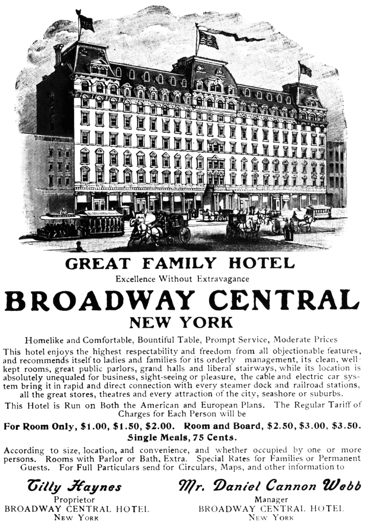


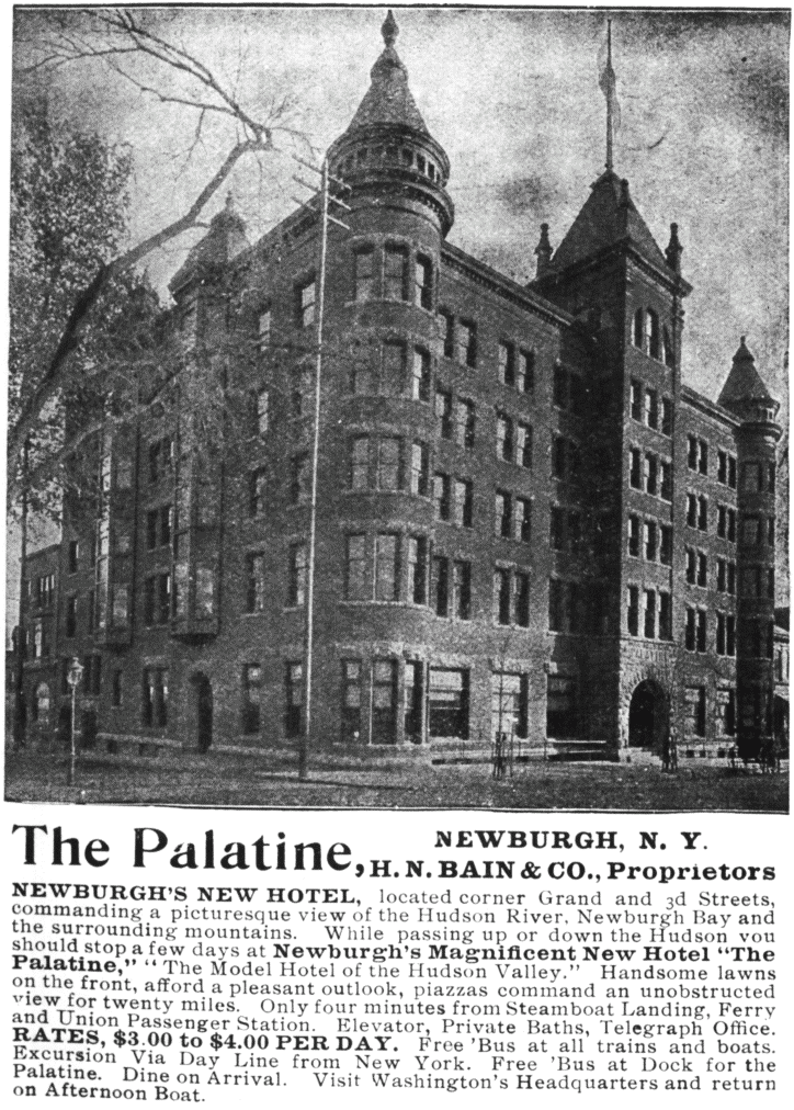


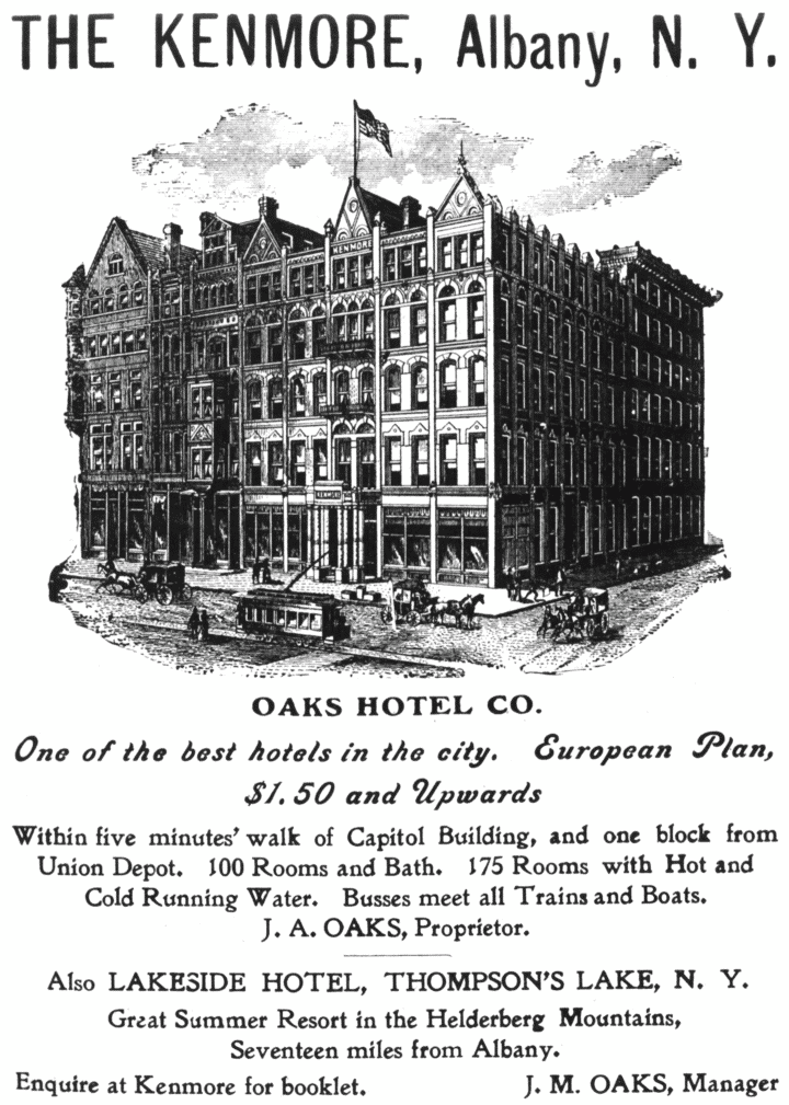

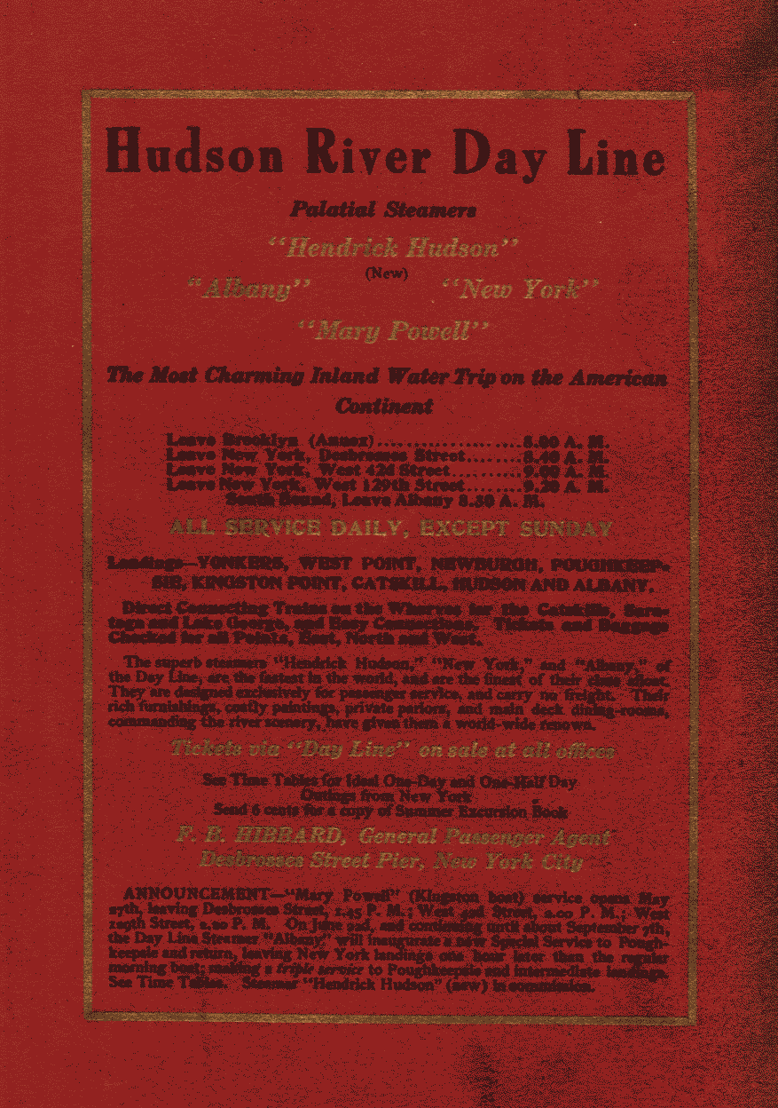
|
Transcriber's Note Each page of this book contained, as a footer, a stanza of poetry, or a prose quotation, which, although pertinent to the text, was not part of it. I have retained these footers, moving them to a suitable location between paragraphs, and enclosing them in short horizontal rules. Any poetry not enclosed within short horizontal rules is an integral part of the text. Maps The author used a long strip map, cut into four sections, with the end of the journey, being North, under the header. I have detached the header, reversed the order of the maps, and inserted the (clickable thumbnail) maps closer to the text they represent. The header (on page 32) now has beneath it links to the four maps. Note: All maps and illustrations link to enlargements. Errata (Old Typos) and Corrections
Also added: Periods and commas, various (in the poetry footnotes). The text appears worn; there is space for a period (and a couple of letters are missing), so I am assuming that the missing punctuation may have been rubbed off the page. I have also encountered a number of instances throughout the book where the author quoted from an external source and omitted either the opening or closing quotation mark, and it is not obvious from the text just where the quote began or ended. In a couple of instances I have hazarded a guess, but have otherwise left the single quotaton mark in place, as it appears in the original. |
End of the Project Gutenberg EBook of The Hudson, by Wallace Bruce

*** END OF THIS PROJECT GUTENBERG EBOOK THE HUDSON ***

***** This file should be named 17823-h.htm or 17823-h.zip *****
This and all associated files of various formats will be found in:
        http://www.gutenberg.org/1/7/8/2/17823/

Produced by Curtis Weyant, Lesley Halamek and the Online
Distributed Proofreading Team at http://www.pgdp.net (This
file was produced from images generously made available
by Cornell University Digital Collections)


Updated editions will replace the previous one--the old editions
will be renamed.

Creating the works from public domain print editions means that no
one owns a United States copyright in these works, so the Foundation
(and you!) can copy and distribute it in the United States without
permission and without paying copyright royalties.  Special rules,
set forth in the General Terms of Use part of this license, apply to
copying and distributing Project Gutenberg-tm electronic works to
protect the PROJECT GUTENBERG-tm concept and trademark.  Project
Gutenberg is a registered trademark, and may not be used if you
charge for the eBooks, unless you receive specific permission.  If you
do not charge anything for copies of this eBook, complying with the
rules is very easy.  You may use this eBook for nearly any purpose
such as creation of derivative works, reports, performances and
research.  They may be modified and printed and given away--you may do
practically ANYTHING with public domain eBooks.  Redistribution is
subject to the trademark license, especially commercial
redistribution.


*** START: FULL LICENSE ***

THE FULL PROJECT GUTENBERG LICENSE
PLEASE READ THIS BEFORE YOU DISTRIBUTE OR USE THIS WORK

To protect the Project Gutenberg-tm mission of promoting the free
distribution of electronic works, by using or distributing this work
(or any other work associated in any way with the phrase "Project
Gutenberg"), you agree to comply with all the terms of the Full Project
Gutenberg-tm License (available with this file or online at
http://gutenberg.org/license).


Section 1.  General Terms of Use and Redistributing Project Gutenberg-tm
electronic works

1.A.  By reading or using any part of this Project Gutenberg-tm
electronic work, you indicate that you have read, understand, agree to
and accept all the terms of this license and intellectual property
(trademark/copyright) agreement.  If you do not agree to abide by all
the terms of this agreement, you must cease using and return or destroy
all copies of Project Gutenberg-tm electronic works in your possession.
If you paid a fee for obtaining a copy of or access to a Project
Gutenberg-tm electronic work and you do not agree to be bound by the
terms of this agreement, you may obtain a refund from the person or
entity to whom you paid the fee as set forth in paragraph 1.E.8.

1.B.  "Project Gutenberg" is a registered trademark.  It may only be
used on or associated in any way with an electronic work by people who
agree to be bound by the terms of this agreement.  There are a few
things that you can do with most Project Gutenberg-tm electronic works
even without complying with the full terms of this agreement.  See
paragraph 1.C below.  There are a lot of things you can do with Project
Gutenberg-tm electronic works if you follow the terms of this agreement
and help preserve free future access to Project Gutenberg-tm electronic
works.  See paragraph 1.E below.

1.C.  The Project Gutenberg Literary Archive Foundation ("the Foundation"
or PGLAF), owns a compilation copyright in the collection of Project
Gutenberg-tm electronic works.  Nearly all the individual works in the
collection are in the public domain in the United States.  If an
individual work is in the public domain in the United States and you are
located in the United States, we do not claim a right to prevent you from
copying, distributing, performing, displaying or creating derivative
works based on the work as long as all references to Project Gutenberg
are removed.  Of course, we hope that you will support the Project
Gutenberg-tm mission of promoting free access to electronic works by
freely sharing Project Gutenberg-tm works in compliance with the terms of
this agreement for keeping the Project Gutenberg-tm name associated with
the work.  You can easily comply with the terms of this agreement by
keeping this work in the same format with its attached full Project
Gutenberg-tm License when you share it without charge with others.

1.D.  The copyright laws of the place where you are located also govern
what you can do with this work.  Copyright laws in most countries are in
a constant state of change.  If you are outside the United States, check
the laws of your country in addition to the terms of this agreement
before downloading, copying, displaying, performing, distributing or
creating derivative works based on this work or any other Project
Gutenberg-tm work.  The Foundation makes no representations concerning
the copyright status of any work in any country outside the United
States.

1.E.  Unless you have removed all references to Project Gutenberg:

1.E.1.  The following sentence, with active links to, or other immediate
access to, the full Project Gutenberg-tm License must appear prominently
whenever any copy of a Project Gutenberg-tm work (any work on which the
phrase "Project Gutenberg" appears, or with which the phrase "Project
Gutenberg" is associated) is accessed, displayed, performed, viewed,
copied or distributed:

This eBook is for the use of anyone anywhere at no cost and with
almost no restrictions whatsoever.  You may copy it, give it away or
re-use it under the terms of the Project Gutenberg License included
with this eBook or online at www.gutenberg.org

1.E.2.  If an individual Project Gutenberg-tm electronic work is derived
from the public domain (does not contain a notice indicating that it is
posted with permission of the copyright holder), the work can be copied
and distributed to anyone in the United States without paying any fees
or charges.  If you are redistributing or providing access to a work
with the phrase "Project Gutenberg" associated with or appearing on the
work, you must comply either with the requirements of paragraphs 1.E.1
through 1.E.7 or obtain permission for the use of the work and the
Project Gutenberg-tm trademark as set forth in paragraphs 1.E.8 or
1.E.9.

1.E.3.  If an individual Project Gutenberg-tm electronic work is posted
with the permission of the copyright holder, your use and distribution
must comply with both paragraphs 1.E.1 through 1.E.7 and any additional
terms imposed by the copyright holder.  Additional terms will be linked
to the Project Gutenberg-tm License for all works posted with the
permission of the copyright holder found at the beginning of this work.

1.E.4.  Do not unlink or detach or remove the full Project Gutenberg-tm
License terms from this work, or any files containing a part of this
work or any other work associated with Project Gutenberg-tm.

1.E.5.  Do not copy, display, perform, distribute or redistribute this
electronic work, or any part of this electronic work, without
prominently displaying the sentence set forth in paragraph 1.E.1 with
active links or immediate access to the full terms of the Project
Gutenberg-tm License.

1.E.6.  You may convert to and distribute this work in any binary,
compressed, marked up, nonproprietary or proprietary form, including any
word processing or hypertext form.  However, if you provide access to or
distribute copies of a Project Gutenberg-tm work in a format other than
"Plain Vanilla ASCII" or other format used in the official version
posted on the official Project Gutenberg-tm web site (www.gutenberg.org),
you must, at no additional cost, fee or expense to the user, provide a
copy, a means of exporting a copy, or a means of obtaining a copy upon
request, of the work in its original "Plain Vanilla ASCII" or other
form.  Any alternate format must include the full Project Gutenberg-tm
License as specified in paragraph 1.E.1.

1.E.7.  Do not charge a fee for access to, viewing, displaying,
performing, copying or distributing any Project Gutenberg-tm works
unless you comply with paragraph 1.E.8 or 1.E.9.

1.E.8.  You may charge a reasonable fee for copies of or providing
access to or distributing Project Gutenberg-tm electronic works provided
that

- You pay a royalty fee of 20% of the gross profits you derive from
     the use of Project Gutenberg-tm works calculated using the method
     you already use to calculate your applicable taxes.  The fee is
     owed to the owner of the Project Gutenberg-tm trademark, but he
     has agreed to donate royalties under this paragraph to the
     Project Gutenberg Literary Archive Foundation.  Royalty payments
     must be paid within 60 days following each date on which you
     prepare (or are legally required to prepare) your periodic tax
     returns.  Royalty payments should be clearly marked as such and
     sent to the Project Gutenberg Literary Archive Foundation at the
     address specified in Section 4, "Information about donations to
     the Project Gutenberg Literary Archive Foundation."

- You provide a full refund of any money paid by a user who notifies
     you in writing (or by e-mail) within 30 days of receipt that s/he
     does not agree to the terms of the full Project Gutenberg-tm
     License.  You must require such a user to return or
     destroy all copies of the works possessed in a physical medium
     and discontinue all use of and all access to other copies of
     Project Gutenberg-tm works.

- You provide, in accordance with paragraph 1.F.3, a full refund of any
     money paid for a work or a replacement copy, if a defect in the
     electronic work is discovered and reported to you within 90 days
     of receipt of the work.

- You comply with all other terms of this agreement for free
     distribution of Project Gutenberg-tm works.

1.E.9.  If you wish to charge a fee or distribute a Project Gutenberg-tm
electronic work or group of works on different terms than are set
forth in this agreement, you must obtain permission in writing from
both the Project Gutenberg Literary Archive Foundation and Michael
Hart, the owner of the Project Gutenberg-tm trademark.  Contact the
Foundation as set forth in Section 3 below.

1.F.

1.F.1.  Project Gutenberg volunteers and employees expend considerable
effort to identify, do copyright research on, transcribe and proofread
public domain works in creating the Project Gutenberg-tm
collection.  Despite these efforts, Project Gutenberg-tm electronic
works, and the medium on which they may be stored, may contain
"Defects," such as, but not limited to, incomplete, inaccurate or
corrupt data, transcription errors, a copyright or other intellectual
property infringement, a defective or damaged disk or other medium, a
computer virus, or computer codes that damage or cannot be read by
your equipment.

1.F.2.  LIMITED WARRANTY, DISCLAIMER OF DAMAGES - Except for the "Right
of Replacement or Refund" described in paragraph 1.F.3, the Project
Gutenberg Literary Archive Foundation, the owner of the Project
Gutenberg-tm trademark, and any other party distributing a Project
Gutenberg-tm electronic work under this agreement, disclaim all
liability to you for damages, costs and expenses, including legal
fees.  YOU AGREE THAT YOU HAVE NO REMEDIES FOR NEGLIGENCE, STRICT
LIABILITY, BREACH OF WARRANTY OR BREACH OF CONTRACT EXCEPT THOSE
PROVIDED IN PARAGRAPH F3.  YOU AGREE THAT THE FOUNDATION, THE
TRADEMARK OWNER, AND ANY DISTRIBUTOR UNDER THIS AGREEMENT WILL NOT BE
LIABLE TO YOU FOR ACTUAL, DIRECT, INDIRECT, CONSEQUENTIAL, PUNITIVE OR
INCIDENTAL DAMAGES EVEN IF YOU GIVE NOTICE OF THE POSSIBILITY OF SUCH
DAMAGE.

1.F.3.  LIMITED RIGHT OF REPLACEMENT OR REFUND - If you discover a
defect in this electronic work within 90 days of receiving it, you can
receive a refund of the money (if any) you paid for it by sending a
written explanation to the person you received the work from.  If you
received the work on a physical medium, you must return the medium with
your written explanation.  The person or entity that provided you with
the defective work may elect to provide a replacement copy in lieu of a
refund.  If you received the work electronically, the person or entity
providing it to you may choose to give you a second opportunity to
receive the work electronically in lieu of a refund.  If the second copy
is also defective, you may demand a refund in writing without further
opportunities to fix the problem.

1.F.4.  Except for the limited right of replacement or refund set forth
in paragraph 1.F.3, this work is provided to you 'AS-IS' WITH NO OTHER
WARRANTIES OF ANY KIND, EXPRESS OR IMPLIED, INCLUDING BUT NOT LIMITED TO
WARRANTIES OF MERCHANTIBILITY OR FITNESS FOR ANY PURPOSE.

1.F.5.  Some states do not allow disclaimers of certain implied
warranties or the exclusion or limitation of certain types of damages.
If any disclaimer or limitation set forth in this agreement violates the
law of the state applicable to this agreement, the agreement shall be
interpreted to make the maximum disclaimer or limitation permitted by
the applicable state law.  The invalidity or unenforceability of any
provision of this agreement shall not void the remaining provisions.

1.F.6.  INDEMNITY - You agree to indemnify and hold the Foundation, the
trademark owner, any agent or employee of the Foundation, anyone
providing copies of Project Gutenberg-tm electronic works in accordance
with this agreement, and any volunteers associated with the production,
promotion and distribution of Project Gutenberg-tm electronic works,
harmless from all liability, costs and expenses, including legal fees,
that arise directly or indirectly from any of the following which you do
or cause to occur: (a) distribution of this or any Project Gutenberg-tm
work, (b) alteration, modification, or additions or deletions to any
Project Gutenberg-tm work, and (c) any Defect you cause.


Section  2.  Information about the Mission of Project Gutenberg-tm

Project Gutenberg-tm is synonymous with the free distribution of
electronic works in formats readable by the widest variety of computers
including obsolete, old, middle-aged and new computers.  It exists
because of the efforts of hundreds of volunteers and donations from
people in all walks of life.

Volunteers and financial support to provide volunteers with the
assistance they need, is critical to reaching Project Gutenberg-tm's
goals and ensuring that the Project Gutenberg-tm collection will
remain freely available for generations to come.  In 2001, the Project
Gutenberg Literary Archive Foundation was created to provide a secure
and permanent future for Project Gutenberg-tm and future generations.
To learn more about the Project Gutenberg Literary Archive Foundation
and how your efforts and donations can help, see Sections 3 and 4
and the Foundation web page at http://www.pglaf.org.


Section 3.  Information about the Project Gutenberg Literary Archive
Foundation

The Project Gutenberg Literary Archive Foundation is a non profit
501(c)(3) educational corporation organized under the laws of the
state of Mississippi and granted tax exempt status by the Internal
Revenue Service.  The Foundation's EIN or federal tax identification
number is 64-6221541.  Its 501(c)(3) letter is posted at
http://pglaf.org/fundraising.  Contributions to the Project Gutenberg
Literary Archive Foundation are tax deductible to the full extent
permitted by U.S. federal laws and your state's laws.

The Foundation's principal office is located at 4557 Melan Dr. S.
Fairbanks, AK, 99712., but its volunteers and employees are scattered
throughout numerous locations.  Its business office is located at
809 North 1500 West, Salt Lake City, UT 84116, (801) 596-1887, email
business@pglaf.org.  Email contact links and up to date contact
information can be found at the Foundation's web site and official
page at http://pglaf.org

For additional contact information:
     Dr. Gregory B. Newby
     Chief Executive and Director
     gbnewby@pglaf.org


Section 4.  Information about Donations to the Project Gutenberg
Literary Archive Foundation

Project Gutenberg-tm depends upon and cannot survive without wide
spread public support and donations to carry out its mission of
increasing the number of public domain and licensed works that can be
freely distributed in machine readable form accessible by the widest
array of equipment including outdated equipment.  Many small donations
($1 to $5,000) are particularly important to maintaining tax exempt
status with the IRS.

The Foundation is committed to complying with the laws regulating
charities and charitable donations in all 50 states of the United
States.  Compliance requirements are not uniform and it takes a
considerable effort, much paperwork and many fees to meet and keep up
with these requirements.  We do not solicit donations in locations
where we have not received written confirmation of compliance.  To
SEND DONATIONS or determine the status of compliance for any
particular state visit http://pglaf.org

While we cannot and do not solicit contributions from states where we
have not met the solicitation requirements, we know of no prohibition
against accepting unsolicited donations from donors in such states who
approach us with offers to donate.

International donations are gratefully accepted, but we cannot make
any statements concerning tax treatment of donations received from
outside the United States.  U.S. laws alone swamp our small staff.

Please check the Project Gutenberg Web pages for current donation
methods and addresses.  Donations are accepted in a number of other
ways including checks, online payments and credit card donations.
To donate, please visit: http://pglaf.org/donate


Section 5.  General Information About Project Gutenberg-tm electronic
works.

Professor Michael S. Hart is the originator of the Project Gutenberg-tm
concept of a library of electronic works that could be freely shared
with anyone.  For thirty years, he produced and distributed Project
Gutenberg-tm eBooks with only a loose network of volunteer support.


Project Gutenberg-tm eBooks are often created from several printed
editions, all of which are confirmed as Public Domain in the U.S.
unless a copyright notice is included.  Thus, we do not necessarily
keep eBooks in compliance with any particular paper edition.


Most people start at our Web site which has the main PG search facility:

     http://www.gutenberg.org

This Web site includes information about Project Gutenberg-tm,
including how to make donations to the Project Gutenberg Literary
Archive Foundation, how to help produce our new eBooks, and how to
subscribe to our email newsletter to hear about new eBooks.