The Project Gutenberg EBook of History and Comprehensive Description of
Loudoun County, Virginia, by James W. Head

This eBook is for the use of anyone anywhere at no cost and with
almost no restrictions whatsoever.  You may copy it, give it away or
re-use it under the terms of the Project Gutenberg License included
with this eBook or online at www.gutenberg.org


Title: History and Comprehensive Description of Loudoun County, Virginia

Author: James W. Head

Release Date: January 9, 2006 [EBook #17485]

Language: English

Character set encoding: ISO-8859-1

*** START OF THIS PROJECT GUTENBERG EBOOK HISTORY AND COMPREHENSIVE ***


Produced by Mark C. Orton, Sankar Viswanathan, and the
Online Distributed Proofreading Team at http://www.pgdp.net
AND
OF
PARK VIEW PRESS
Copyright 1908
by JAMES W. HEAD
| Dedication. |
| TO MY MOTHER, |
| WHOSE LOVE FOR LOUDOUN IS NOT LESS ARDENT AND UNDYING THAN MY OWN, THIS VOLUME, THE SINGLE AMBITION AND FONDEST ACHIEVEMENT OF MY LIFE, IS AFFECTIONATELY DEDICATED. |

oudoun County exemplifies country life in about the purest and pleasantest form that I have yet found in the United States. Not that it is a rural Utopia by any means, but the chief ideals of the life there are practically identical with those that have made country life in the English counties world-famous. As a type, this is, in fact, the real thing. No sham, no artificiality, no suspicion of mushroom growth, no evidence of exotic forcing are to be found in Loudoun, but the culmination of a century's development."
"So much, then, to show briefly that Loudoun County life is a little out of the ordinary, here in America, and hence worth talking about. There are other communities in Virginia and elsewhere that are worthy of eulogy, but I know of none that surpasses Loudoun in the dignity, sincerity, naturalness, completeness and genuine success of its country life."—WALTER A. DYER, in Country Life in America.


know not when I first planned this work, so inextricably is the idea interwoven with a fading recollection of my earliest aims and ambitions. However, had I not been resolutely determined to conclude it at any cost—mental, physical, or pecuniary—the difficulties that I have experienced at every stage might have led to its early abandonment.
The greatest difficulty lay in procuring material which could not be supplied by individual research and investigation. For this and other valid reasons that will follow it may safely be said that more than one-half the contents of this volume are in the strictest sense original, the remarks and detail, for the most part, being the products of my own personal observation and reflection. Correspondence with individuals and the State and National authorities, though varied and extensive, elicited not a half dozen important facts. I would charge no one with discourtesy in this particular, and mention the circumstance only because it will serve to emphasize what I shall presently say anent the scarcity of available material.
Likewise, a painstaking perusal of more than two hundred [10]volumes yielded only meagre results, and in most of these illusory references I found not a single fact worth recording. This comparatively prodigious number included gazeteers, encyclopedias, geographies, military histories, general histories, State and National reports, journals of legislative proceedings, biographies, genealogies, reminiscences, travels, romances—in short, any and all books that I had thought calculated to shed even the faintest glimmer of light on the County's history, topographical features, etc.
But, contrary to my expectations, in many there appeared no manner of allusion to Loudoun County. By this it will be seen that much time that might have been more advantageously employed was necessarily given to this form of fruitless research.
That works of history and geography can be prepared in no other way, no person at all acquainted with the nature of such writings need be told. "As well might a traveler presume to claim the fee-simple of all the country which he has surveyed, as a historian and geographer expect to preclude those who come after him from making a proper use of his labors. If the former writers have seen accurately and related faithfully, the latter ought to have the resemblance of declaring the same facts, with that variety only which nature has enstamped upon the distinct elaborations of every individual mind.... As works of this sort become multiplied, voluminous, and detailed, it becomes a duty to literature to abstract, abridge, and give, in synoptical views, the information that is spread through numerous volumes."
Touching the matter gleaned from other books, I claim the sole merit of being a laborious and faithful compiler. In some instances, where the thoughts could not be better or more briefly expressed, the words of the original authors may have been used.
Where this has been done I have, whenever possible, made, in my footnotes or text, frank and ample avowal of the sources from which I have obtained the particular information presented. This has not always been possible for the reason [11]that I could not name, if disposed, all the sources from which I have sought and obtained information. Many of the references thus secured have undergone a process of sifting and, if I may coin the couplet, confirmatory handling which, at the last, rendered some unrecognizable and their origin untraceable.
The only publication of a strictly local color unearthed during my research was Taylor's Memoir of Loudoun, a small book, or more properly a pamphlet, of only 29 pages, dealing principally with the County's geology, geography, and climate. It was written to accompany the map of Loudoun County, drawn by Yardley Taylor, surveyor; and was published by Thomas Reynolds, of Leesburg, in 1853.
I wish to refer specially to the grateful acknowledgment that is due Arthur Keith's Geology of the Catoctin Belt and Carter's and Lyman's Soil Survey of the Leesburg Area, two Government publications, published respectively by the United States Geological Survey and Department of Agriculture, and containing a fund of useful information relating to the geology, soils, and geography of about two-thirds of the area of Loudoun. Of course these works have been the sources to which I have chiefly repaired for information relating to the two first-named subjects. Without them the cost of this publication would have been considerably augmented. As it is I have been spared the expense and labor that would have attended an enforced personal investigation of the County's soils and geology.
And now a tardy and, perhaps, needless word or two in revealment of the purpose of this volume.
To rescue a valuable miscellany of facts and occurrences from an impending oblivion; to gather and fix certain ephemeral incidents before they had passed out of remembrance; to render some account of the County's vast resources and capabilities; to trace its geography and analyze its soils and geology; to follow the tortuous windings of its numerous streams; to chronicle the multitudinous deeds of sacrifice and daring performed by her citizens and soldiery—such has been the purpose of this work, such its object and design.[12]
But the idea as originally evolved contemplated only a chronology of events from the establishment of the County to the present day. Not until the work was well under way was the matter appearing under the several descriptive heads supplemented.
From start to finish this self-appointed task has been prosecuted with conscientious zeal and persistency of purpose, although with frequent interruptions, and more often than not amid circumstances least favorable to literary composition. At the same time my hands have been filled with laborious avocations of another kind.
What the philosopher Johnson said of his great Dictionary and himself could as well be said of this humble volume and its author:
"In this work, when it shall be found that much is omitted, let it not be forgotten that much likewise is performed; and though no book was ever spared out of tenderness to the author, and the world is little solicitous to know whence proceeded the faults of that which it condemns; yet it may gratify curiosity to inform it, that the English Dictionary was written with little assistance of the learned, and without any patronage of the great; not in the soft obscurities of retirement, or under the shelter of academick bowers, but amidst inconvenience and distraction, in sickness and in sorrow."
If further digression be allowable I might say that in the preparation of this work I have observed few of the restrictive rules of literary sequence and have not infrequently gone beyond the prescribed limits of conventional diction. To these transgressions I make willing confession. I have striven to present these sketches in the most lucid and concise form compatible with readableness; to compress the greatest possible amount of useful information into the smallest compass. Indeed, had I been competent, I doubt that I would have attempted a more elaborate rendition, or drawn more freely upon the language and the coloring of poetry and the imagination. I have therefore to apprehend that the average reader [13]will find them too statistical and laconic, too much abbreviated and void of detail.
However, a disinterested historian I have not been, and should such a charge be preferred I shall look for speedy exculpation from the discerning mass of my readers.
In this connection and before proceeding further I desire to say that my right to prosecute this work can not fairly be questioned; that a familiar treatment of the subject I have regarded as my inalienable prerogative. I was born in Loudoun County, of parents who in turn could boast the same distinction, and, if not all, certainly the happiest days of my life were passed within those sacred precincts. I have viewed her housetops from every crowning eminence, her acres of unmatched grain, her Arcadian pastures and browsing herds, her sun-kissed hills and silvery, serpentine streams. I have known the broad, ample playgrounds of her stately old Academy, and shared in the wholesome, health-giving sports their breadth permitted. I have known certain of her astute schoolmasters and felt the full rigor of their discipline. Stern tutors they were, at times seemingly cruel, but what retrospective mind will not now accord them unstinted praise and gratitude? Something more than the mere awakening and development of slumbering intellects was their province: raw, untamed spirits were given into their hands for a brief spell—brief when measured in after years—and were then sent forth to combat Life's problems with clean hearts, healthy minds, robust bodies, and characters that might remain unsullied though beset with every hellish device known to a sordid world. God bless the dominies of our boyhood—the veteran schoolmasters of old Loudoun!
But to return to my theme. I have a distinct foresight of the views which some will entertain and express in reference to this work, though my least fears of criticism are from those whose experience and ability best qualify them to judge.
However, to the end that criticism may be disarmed even before pronouncement, the reader, before condemning any statements made in these sketches that do not agree with his [14]preconceived opinions, is requested to examine all the facts in connection therewith. In so doing it is thought he will find these statements correct in the main.
In such a variety of subjects there must of course be many omissions, but I shall be greatly disappointed if actual errors are discovered.
In substantiation of its accuracy and thoroughness I need only say that the compilation of this work cost me three years of nocturnal application—the three most ambitious and disquieting years of the average life. During this period the entire book has been at least three times rewritten.
In the best form of which I am capable the fruits of these protracted labors are now committed to the candid and, it is hoped, kindly judgment of the people of Loudoun County.
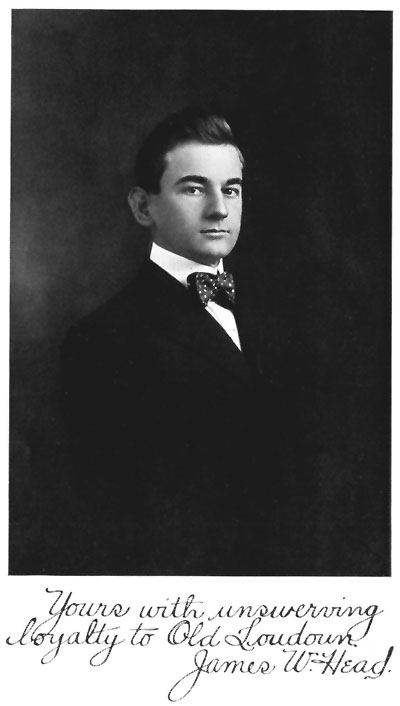
James W. Head.
"Arcadia,"
Barcroft, Va., Feb. 1, 1909.
SITUATION.
Loudoun County lies at the northern extremity of "Piedmont Virginia,"[1] forming the apex of one of the most picturesquely diversified regions on the American continent. Broad plains, numerous groups and ranges of hills and forest-clad mountains, deep river gorges, and valleys of practically every conceivable form are strewn to the point of prodigality over this vast undulatory area.
[1] "Piedmont" means "foot of the mountain." "Piedmont Virginia," with a length of 250 miles and an average width of about 25 miles, and varying in altitude from 300 to 1,200 feet, lies just east of the Blue Ridge Mountains, and comprises the counties of Loudoun, Fauquier, Culpeper, Rappahannock, Madison, Greene, Orange, Albemarle, Nelson, Amherst, Bedford, Franklin, Henry, and Patrick. It is a portion of the belt that begins in New England and stretches thence southward to Georgia and Alabama.
The particular geographic location of Loudoun has been most accurately reckoned by Yardley Taylor, who in 1853 made a governmental survey of the county. He placed it "between the latitudes of 38° 52-1/2" and 39° 21" north latitude, making 28-1/2" of latitude, or 33 statute miles, and between 20" and 53-1/2" of longitude west from Washington, being 33-1/2" of longitude, or very near 35 statute miles."
Loudoun was originally a part of the six million acres which, in 1661, were granted by Charles II, King of England, to Lord Hopton, Earl of St. Albans, Lord Culpeper, Lord Berkeley, Sir William Morton, Sir Dudley Wyatt, and Thomas Culpeper. All the territory lying between the Rappahannock and Potomac rivers to their sources was included in this grant, afterwards known as the "Fairfax Patent," and still later as the "Northern Neck of Virginia."
"The only conditions attached to the conveyance of this domain, the equivalent of a principality, were that one-fifth of all the gold and one-tenth of all the silver discovered within its limits should be reserved for the royal use, and that a nominal rent of a few pounds sterling should be paid into the treasury at Jamestown each year. In 1669 the letters patent were surrendered by the existing holders and in their stead new ones were issued.... The terms of these letters required that the whole area included in this magnificent gift should be planted and inhabited by the end of twenty-one years, but in 1688 this provision was revoked by the King as imposing an impracticable condition."[2]
[2] Bruce's Economic History of Virginia.
The patentees, some years afterward, sold the grant to the second Lord Culpeper, to whom it was confirmed by letters patent of King James II, in 1688. From Culpeper the rights and privileges conferred by the original grant descended through his daughter, Catherine, to her son, Lord Thomas Fairfax, Baron of Cameron—a princely heritage for a young man of 20 years.
The original boundaries of Loudoun County were changed by the following act of the General Assembly, passed January 3, 1798, and entitled "An Act for adding part of the county of Loudoun to the county of Fairfax, and altering the place of holding courts in Fairfax County."
1. Be it enacted by the General Assembly, That all that part of the county of Loudoun lying between the lower boundary thereof, and a line to be drawn from the mouth of Sugar Land run, to Carter's mill, on Bull run, shall be, and is hereby added to and made part of the county of Fairfax: Provided always, That it shall be lawful for the sheriff of the said county of Loudoun to collect and make distress for any public dues or officers fees, which shall remain unpaid by the inhabitants of that part of the said county hereby added to the county of Fairfax, and shall be accountable for the same in like manner as if this act had not been made.
2. And be it further enacted, That it shall be lawful for a majority of the acting justices of the peace for the said county of Fairfax, together with the justices of the county of Loudoun included within the part thus added to the said county of Fairfax, and they are hereby required at a court to be held in the month of April or May next, to fix on a place for holding courts therein at or as near the center thereof (having regard to that part of the county of Loudoun hereby added to the said county of Fairfax) as the situation and convenience will admit of; and thenceforth proceed to erect the necessary public buildings at such place, and until such buildings be completed, to appoint any place for holding courts as they shall think proper.
3. This act shall commence and be in force from and after the passing thereof.
As at present bounded, the old channel at the mouth of Sugar Land run, at Lowe's Island,[3] is "the commencement of the line that separates Loudoun from Fairfax County and runs directly across the country to a point on the Bull Run branch of Occoquan River, about three eighths of a mile above Sudley Springs, in Prince William County." The Bull Run then forms the boundary between Loudoun and Prince William to its highest spring head in the Bull Run mountain, just below the Cool Spring Gap. The line then extends to the summit of the mountain, where the counties of Fauquier and Prince William corner. From the summit of this mountain, a direct line to a point[4] on the Blue Ridge, at Ashby's Gap, marks the boundary between Loudoun and Fauquier counties. A devious line, which follows in part the crests of the Blue Ridge until reaching the Potomac below Harpers Ferry, separates Loudoun from Clarke County, Virginia, and Jefferson County, West Virginia, on her western border. The Potomac then becomes the dividing line between Loudoun County, and Frederick and Montgomery counties, Maryland; "and that State, claiming the whole of the river, exercises jurisdiction over the islands as well as the river."
[3] "What is called Lowe's Island, at the mouth of Sugarland Run, was formerly an island, and made so by that run separating and part of it passing into the river by the present channel, while a part of it entered the river by what is now called the old channel. This old channel is now partially filled up, and only receives the waters of Sugarland Run in times of freshets. Occasionally when there is high water in the river the waters pass up the present channel of the run to the old channel, and then follow that to the river again. This old channel enters the river immediately west of the primordial range of rocks, that impinge so closely upon the river from here to Georgetown, forming as they do that series of falls known as Seneca Falls, the Great, and the Little Falls, making altogether a fall of 188 feet in less than 20 miles."—Memoir of Loudoun.
[4] Designated in an old record as a "double-bodied poplar tree standing in or near the middle of the thoroughfare of Ashby's Gap on the top of the Blue Ridge." It succumbed to the ravages of time and fire while this work was in course of preparation.[18]
This completes an outline of 109 miles, viz: 19 miles in company with Fairfax, 10 with Prince William, 17 with Fauquier, 26 with Clarke and Jefferson, and 37 miles along the Potomac.
Loudoun County is preeminently a diversified region; its surface bearing many marked peculiarities, many grand distinctive features. The broken ranges of hills and mountains, abounding in Piedmont Virginia, here present themselves in softly rounded outline, gradually sinking down into the plains, giving great diversity and picturesqueness to the landscape. They are remarkable for their parallelism, regularity, rectilineal direction and evenness of outline, and constitute what is by far the most conspicuous feature in the topography of Loudoun. Neither snow-capped nor barren, they are clothed with vegetation from base to summit and afford fine range and pasturage for sheep and cattle.
The main valleys are longitudinal and those running transversely few and comparatively unimportant.
The far-famed Loudoun valley, reposing peacefully between the Blue Ridge and Catoctin mountains, presents all the many varied topographic aspects peculiar to a territory abounding in foothills.
The Blue Ridge, the southeasternmost range of the Alleghanies or Appalachian System presents here that uniformity and general appearance which characterizes it throughout the [19]State, having gaps or depressions every eight or ten miles, through which the public roads pass. The most important of these are the Potomac Gap at 500 feet and Snickers and Ashby's Gap, both at 1,100 feet. The altitude of this range in Loudoun varies from 1,000 to 1,600 feet above tide-water, and from 300 to 900 feet above the adjacent country. It falls from 1,100 to 1,000 feet in 4 miles south of the river, and then, rising sharply to 1,600 feet, continues at the higher series of elevations. The Blue Ridge borders the county on the west, its course being about south southwest, or nearly parallel with the Atlantic Coast-line, and divides Loudoun from Clarke County, Virginia, and Jefferson County, West Virginia, the line running along the summit.
Of nearly equal height and similar features are the Short Hills, another range commencing at the Potomac River about four miles below Harpers Ferry and extending parallel to the Blue Ridge, at a distance of nearly four miles from summit to summit, for about twelve miles into the County, where it is broken by a branch of Catoctin Creek. Beyond this stream it immediately rises again and extends about three miles further, at which point it abruptly terminates.
A third range, called "Catoctin Mountain," has its inception in Pennsylvania, traverses Maryland, is interrupted by the Potomac, reappears in Virginia at the river margin, opposite Point of Rocks, and extends through Loudoun County for a distance of twenty or more miles, when it is again interrupted.
Elevations on Catoctin Mountain progressively diminish southward from the Potomac River to Aldie, although the rocks remain the same, and the Tertiary drainage, which might be supposed to determine their elevations, becomes less effective in that direction.
Probably this mountain does not exceed an average of more than 300 feet above the surrounding country, though at some stages it may attain an altitude of 700 feet. Rising near the Potomac into one of its highest peaks, in the same range it becomes alternately depressed and elevated, until [20]reaching the point of its divergence in the neighborhood of Waterford. There it assumes the appearance of an elevated and hilly region, deeply indented by the myriad streams that rise in its bosom.
On reaching the Leesburg and Snicker's Gap Turnpike road, a distance of twelve miles, it expands to three miles in width and continues much the same until broken by Goose Creek and its tributary, the North Fork, when it gradually loses itself in the hills of Goose Creek and Little River, before reaching the Ashby's Gap Turnpike.
The Catoctin range throughout Loudoun pursues a course parallel to the Blue Ridge, the two forming an intermediate valley or baselevel plain, ranging in width from 8 to 12 miles, and in altitude from 350 to 730 feet above sea level. Allusion to the physiography of this valley—so called only by reason of its relation to the mountains on either side—has been made elsewhere in this department.
Immediately south of Aldie, on Little River, near the point of interruption of Catoctin Mountain, another range commences and extends into Fauquier County. It is known as "Bull Run Mountain," but might rightly be considered an indirect continuation of the elevation of the Catoctin, its course and some of its features corresponding very nearly with that mountain save only that it is higher than any of the ranges of the latter, excepting the western.
East of the Catoctin the tumultuous continuity of mountains subsides into gentle undulations, an almost unbroken succession of sloping elevations and depressions presenting an as yet unimpaired variety and charm of landscape. However, on the extreme eastern edge of this section, level stretches of considerable extent are a conspicuous feature of the topography.
Three or four detached hills, rising to an elevation of 150 or 200 feet above the adjacent country, are the only ones of consequence met with in this section.[21]
The hilly character of Loudoun is clearly shown by the following exhibit of the elevation of points and places above tide-water. The variations of altitude noted in this schedule are based upon conflicting estimates and distinct measurements made at two or more points within a given circumference and slightly removed one from the other.
| Feet. | ||||
| Sterling | 415 | |||
| Ashburn | 320 | |||
| Leesburg | 321 to 337 | |||
| Clarke's Gap | 578 to 634 | |||
| Hamilton | 454 to 521 | |||
| Purcellville | 546 to 553 | |||
| Round Hill | 558 | |||
| Bluemont | 680 to 730 | |||
| Snicker's Gap | 1,085 | |||
| Neersville | 626 | |||
| Hillsborough | 550 | |||
| Waterford | 360 | |||
| Mount Gilead | 600 | |||
| Oatlands | 270 | |||
| Little River, near Aldie | 299 | |||
| Middleburg | 480 | |||
| Potomac River, near Seneca Dam | 188 | |||
| Potomac River, at Point of Rocks | 200 | |||
| Potomac River, at Harper's Ferry | 246 |
The whole of the county east of the Catoctin Mountain varies from 200 to 350 feet. The eastern base of the Blue Ridge has an elevation of about 730 feet, and the highest peak of that range in Loudoun rises 1,600 feet above tide-water.
The Short Hills have an approximate altitude of 1,000 feet, while that of the Catoctin Mountain varies from 300 to 700 feet. The valley between the Blue Ridge and Catoctin Mountains varies from 350 to 730 feet in elevation.[22]
From many vantage points along the Blue Ridge may be obtained magnificent views of both the Loudoun and Shenandoah valleys. The eye travels entirely across the fertile expanse of the latter to where, in the far distance, the Alleghany and North Mountains rear their wooded crests. A few of the summits offer even more extensive prospects. From some nearly all of Loudoun, with a considerable area of Fairfax and Fauquier, is in full view. Other more distant areas within visionary range are portions of Prince William, Rappahannock, and Culpeper counties, in Virginia, Frederick and Montgomery counties, in Maryland, and even some of Prince George County, east of Washington City. Westward, the view embraces Shenandoah, Frederick, Clarke and Warren counties, in Virginia, Berkeley and Jefferson counties, in West Virginia, Washington County, in Maryland, and some of the mountain summits of Pennsylvania.
The drainage of Loudoun can be divided into two provinces. One is the Potomac province, which is drained by a system of small tributaries of that stream. Its elevations are quite uniform and are referable to that master stream, whose grade is largely determined by its great basin beyond the "Catoctin belt." The second province is the region drained by smaller streams, chief of which is Goose Creek. In this province the drainage lines head entirely within the "Catoctin belt," and the elevations are variable according to the constitution of the rocks in the belt itself.
The tributaries by which the drainage of the two provinces is effected are Catoctin Creek, North Fork Catoctin Creek, South Fork Catoctin Creek, Little River, North Fork Goose Creek, Beaver-dam Creek, Piney Run, Jeffries Branch, Cromwells Run, Hungry Run, Bull Run, Sycoline Creek, Tuscarora Creek, Horse Pen Run, Broad Run, Sugarland Run, Elk Lick, Limestone Branch, and as many lesser streams.[23]
The general slope of the county being to the northeast, the waters, for the most part, naturally follow the same course, as may be readily perceived by reference to maps of the section. The streams that rise in the Blue Ridge mostly flow to the eastward until they approach the Catoctin Mountain, where they are then deflected more toward either the north or south to pass that range by the Northwest Fork and Goose Creek, or by the Catoctin Creek which falls into the Potomac above Point of Rocks. East of Catoctin Mountain the streams pursue a more or less direct northern course.
Goose Creek, a right-hand branch of the Potomac River, is a considerable stream, pursuing a course of about fifty miles from its source in Fauquier County to its junction with the Potomac four miles northeast of Leesburg. It once bore the Indian name Gohongarestaw, meaning "River of Swans." Flowing northeastward across Loudoun, it receives many smaller streams until passing the first range of Catoctin Mountain, when it claims a larger tributary, the North Fork. Goose Creek represents subsequent drainage dependent on the syncline of the Blue Ridge and dating back at least as far as Cretaceous time. Its length in Loudoun is about thirty miles, and it has a fall of one hundred feet in the last twenty-two miles of its course. It drains nearly one-half the county and is about sixty yards wide at its mouth.
Catoctin Creek is very crooked; its basin does not exceed twelve miles as the crow flies, and includes the whole width of the valley between the mountains except a small portion in the northeastern angle of the County. Yet its entire course, measuring its meanders, would exceed thirty-five miles. It has a fall of one hundred and eighty feet in the last eighteen miles of its course, and is about twenty yards wide near its mouth.
The Northwest Fork rises in the Blue Ridge and flows southeastward, mingling its waters with the Beaver Dam, coming from the southwest, immediately above Catoctin Mountain, where their united waters pass through a narrow valley to Goose Creek.[24]
Little River, a small affluent of Goose Creek, rises in Fauquier County west of Bull Run mountain and enters Loudon a few miles southwestward of Aldie. It pursues a northern and northeastern course until it has passed that town, turning then more to the northward and falling into Goose Creek. Before the Civil War it was rendered navigable from its mouth to Aldie by means of dams.
Broad Run, the next stream of consequence east of Goose Creek, rises in Prince William County and pursues a northern course, with some meanderings through Loudoun. It flows into the Potomac about four miles below the mouth of Goose Creek.
Sugarland Run, a still smaller stream, rises partly in Loudoun, though its course is chiefly through Fairfax County, and empties into the Potomac at the northeastern angle of the County.
In its southeastern angle several streams rise and pursue a southern and southeastern course, and constitute some of the upper branches of Occoquan River.
Perhaps no county in the State is better watered for all purposes, except manufacturing in times of drought. Many of the farms might be divided into fields of ten acres each and, in ordinary seasons, would have water in each of them.
There are several mineral springs in the county of the class called chalybeate, some of which contain valuable medicinal properties, and other springs and wells that are affected with lime. Indeed, in almost every part of the County, there is an exhaustless supply of the purest spring water. This is due, in great part, to the porosity of the soil which allows the water to pass freely into the earth, and the slaty character of the rocks which favors its descent into the bowels of the hills, from whence it finds its way to the surface, at their base, in numberless small springs. The purity of these waters is borrowed from the silicious quality of the soil.
The largest spring of any class in the county is Big Spring, a comparatively broad expanse of water of unsurpassed quality, bordering the Leesburg and Point of Rocks turnpike, about two miles north of Leesburg.[25]
The springs, as has been stated, are generally small and very numerous, and many of them are unfailing, though liable to be affected by drought. In such cases, by absorption and evaporation, the small streams are frequently exhausted before uniting and often render the larger ones too light for manufacturing purposes. Nevertheless, water power is abundant; the county's diversified elevation giving considerable fall to its water courses, and many sites are occupied.
Because responsible statistical data is usually accorded unqualified credence, it is without undue hesitation that the following bit of astonishing information, gleaned from a reliable source, is here set down as positive proof of the excellence of Loudoun's climate: "It (Leesburg) is located in a section the healthiest in the world, as proven by statistics which place the death rate at 8-1/2 per 1,000, the very lowest in the table of mortality gathered from all parts of the habitable globe."
The climate of Loudoun, like that of most other localities, is governed mainly by the direction of the prevailing winds, and, to a limited extent, is influenced by the county's diversified physical features.
Though the rainfall is abundant, amounting annually to forty or fifty inches, ordinarily the air is dry and salubrious. This ample precipitation is usually well distributed throughout the growing season and is rarely insufficient or excessive. The summer rainfall comes largely in the form of local showers, scarcely ever attended by hail. Loudoun streams for the most part are pure and rapid, and there appears to be no local cause to generate malaria.
In common with the rest of Virginia the climate of Loudoun corresponds very nearly with that of Cashmere and the best parts of China. The mean annual temperature is 50° to 55°.
Loudoun winters are not of long duration and are seldom [26]marked by protracted severity. Snow does not cover the ground for any considerable period and the number of bright sunny days during these seasons is unusually large. In their extremes of cold they are less rigorous than the average winters of sections farther north or even of western localities of the same latitude. Consequently the growing season here is much more extended than in either of those sections. The prevailing winds in winter are from the north and west, and from these the mountains afford partial protection.
The seasons are somewhat earlier even than in the Shenandoah Valley, just over the western border of Loudoun, and the farmers here plant and harvest their crops from one week to ten days earlier than the farmers of that region.
Loudoun summers, as a rule, are long and agreeably cool, while occasional periods of extreme heat are not more oppressive than in many portions of the North. The mountains of Loudoun have a delightful summer climate coupled with inspiring scenery, and are well known as the resort of hundreds seeking rest, recreation, or the restoration of health. This region, owing to its low humidity, has little dew at night, and accordingly has been found especially beneficial for consumptives and those afflicted with pulmonary diseases. The genial southwest trade winds, blowing through the long parallel valleys, impart to them and the enclosing mountains moisture borne from the far away Gulf of Mexico.
The geology of more than half the area of Loudoun County has received thorough and intelligent treatment at the hands of Arthur Keith in his most excellent work entitled "Geology of the Catoctin Belt," authorized and published by the United States Geological Survey.[5]
[5] Credit for many important disclosures and much of the detail appearing in this department is unreservedly accorded Mr. Keith and his assistants.[27]
Mr. Keith's analysis covered the whole of Bull Run Mountain, the Catoctin in its course through Virginia and Maryland to its termination in southern Pennsylvania, the Blue Ridge and South Mountain for a corresponding distance, all intermediate ridges and valleys and contiguous territory lying outside this zone and paralleling the two flanking ranges.[6]
[6] The name "Catoctin Belt" is applied to this region because it is separated by Catoctin Mountain from the Piedmont plain as a geographic unit more distinctly than in any other area, and because its geological unity is completed by Catoctin more fully and compactly than elsewhere.
In this important work the Catoctin Belt is shown to be an epitome of the leading events of geologic history in the Appalachian region. It contains the earliest formations whose original character can be certified; it contains almost the latest known formations; and the record is unusually full, with the exception of the later Paleozoic rocks. Its structures embrace nearly every known type of deformation. It furnishes examples of every process of erosion, of topography derived from rocks of nearly every variety of composition, and of topography derived from all types of structure except the flat plateau type. In the recurrence of its main geographic features from pre-Cambrian time till the present day it furnishes a remarkable and unique example of the permanence of continental form.
With certain qualifications, a summary of the leading events that have left their impress on the region is as follows:
1. Surface eruption of diabase.
2. Injection of granite.
3. Erosion.
4. Surface eruption of quartz-porphyry, rhyolite, and andesite.
5. Surface eruption of diabase.
6. Erosion.
7. Submergence, deposition of Cambrian formations; slight oscillations during their deposition; reduction of land to baselevel.
8. Eastward tilting and deposition of Martinsburg shale; oscillations during later Paleozoic time.
9. Uplift, post-Carboniferous deformation and erosion.
10. Depression and Newark deposition; diabase intrusion.
11. Uplift, Newark deformation; and erosion to Catoctin baselevel.
12. Depression and deposition of Potomac, Magothy, and Severn.
13. Uplift southwestward and erosion to baselevel.
14. Uplift, warping and degradation to Tertiary baselevel; deposition of Pamunkey and Chesapeake.
15. Depression and deposition of Lafayette.
16. Uplift and erosion to lower Tertiary baselevel.
17. Uplift, warping and erosion to Pleistocene baselevel; deposition of high-level Columbia.
18. Uplift and erosion to lower Pleistocene baselevel; deposition of low-level Columbia.
19. Uplift and present erosion.
Along the Coastal plain reduction to baselevel was followed by depression and deposition of Lafayette gravels; elevation followed and erosion of minor baselevels; second depression followed and deposition of Columbia gravels; again comes elevation and excavation of narrow valleys; then depression and deposition of low-level Columbia; last, elevation and channeling, which is proceeding at present. Along the Catoctin Belt denudation to baselevel was followed by depression and deposition of gravels; elevation followed and erosion of minor baselevels among the softer rocks; second depression followed, with possible gravel deposits; elevation came next with excavation of broad bottoms; last, elevation and channeling, at present in progress.
The general structure of the Catoctin Belt is anticlinal. On its core appear the oldest rocks; on its borders, those of medium age; and in adjacent provinces the younger rocks. In the location of its system of faulting, also, it faithfully follows the Appalachian law that faults lie upon the steep side of anticlines.[29]
After the initial location of the folds along these lines, compression and deformation continued. Yielding took place in the different rocks according to their constitution.
Into this system of folds the drainage lines carved their way. On the anticlines were developed the chief streams, and the synclines were left till the last. The initial tendency to synclinal ridges was obviated in places by the weakness of the rocks situated in the synclines, but even then the tendency to retain elevation is apt to cause low ridges. The drainage of the belt as a whole is anticlinal to a marked degree, for the three main synclinal lines are lines of great elevation, and the anticlines are invariably valleys.
In order of solubility the rocks of the Catoctin Belt, within the limits of Loudoun County, to which section all subsequent geologic data will be confined, stand as follows:
1. Newark limestone conglomerate; calcareous.
2. Newark sandstone and shale; calcareous and feldspathic.
3. Newark diabase; feldspathic.
4. Granite; feldspathic.
5. Loudoun formation; feldspathic.
6. Granite and schist; feldspathic.
7. Catoctin schist; epidotic and feldspathic.
8. Weverton sandstone; siliceous.
All of these formations are in places reduced to baselevel. The first three invariably are, unless protected by a harder rock; the next three usually are; the Catoctin schist only in small parts of its area; the Weverton only along a small part of Catoctin Mountain.
The Catoctin Belt itself may be described as a broad area of igneous rocks bordered by two lines of Lower Cambrian sandstones and slates. Over the surface of the igneous rocks are scattered occasional outliers of the Lower Cambrian slate; but far the greater part of the surface of the belt is covered by the igneous rocks. The belt as a whole may be regarded as an anticline, the igneous rocks constituting the core, the [30]Lower Cambrian the flanks, and the Silurian and Newark the adjoining zones. The outcrops of the Lower Cambrian rocks are in synclines, as a rule, and are complicated by many faults. The igneous rocks have also been much folded and crumpled, but on account of their lack of distinctive beds the details of folds can not well be traced among them.
They are the oldest rocks in the Catoctin Belt and occupy most of its area. They are also prominent from their unusual character and rarity.
An important class of rocks occurring in the Catoctin Belt is the sedimentary series. It is all included in the Cambrian period and consists of limestone, shale, sandstone and conglomerate. The two border zones of the Catoctin Belt, however, contain also rocks of the Silurian and Juratrias periods. In general, the sediments are sandy and calcareous in the Juratrias area, and sandy in the Catoctin Belt. They have been the theme of considerable literature, owing to their great extent and prominence in the topography.
The granite in the southern portion of the County is very important in point of extent, almost as much so as the diabase in the same section.
The areas of granite are, as a rule, long narrow belts, and vary greatly in width.
The mineralogical composition of the granite is quite constant over large areas. Six varieties can be distinguished, however, each with a considerable areal extent. The essential constituents are quartz, orthoclase and plagioclase, and by the addition to these of biotite, garnet, epidote, blue quartz, and hornblende, five types are formed. All these types are holocrystalline, and range in texture from coarse granite with augen an inch long down to a fine epidote granite with scarcely visible crystals.
Among the various Cambrian formations of the Catoctin Belt there are wide differences in uniformity and composition. [31]In none is it more manifest than in the first or Loudoun formation. This was theoretically to be expected, for first deposits upon a crystalline foundation represent great changes and transition periods of adjustment among new currents and sources of supply. The Loudoun formation, indeed, runs the whole gamut of sedimentary possibilities, and that within very short geographical limits. Five miles northwest of Aldie the Loudoun formation comprises limestone, slate, sandy slate, sandstone, and conglomerate with pebbles as large as hickory nuts. These amount in thickness to fully 800 feet, while less than three miles to the east the entire formation is represented by eight or ten feet of black slate.
The name of the Loudoun formation is given on account of the frequent occurrence of all its variations in Loudoun County. Throughout the entire extent of the Catoctin Belt, and especially through its central portions, the Loudoun formation has frequent beds of sandstone, conglomerate, and limestone. The limestones occur as lenses along two lines; one immediately west of Catoctin Mountain, the other three or four miles east of the Blue Ridge. Along the western range the limestone lenses extend only to the Potomac. There they are shown on both sides of the river, and have been worked in either place for agricultural lime. Only the refuse of the limestone now remains, but the outcrops have been extant until recent years. Along the eastern line the limestone lenses extend across the Potomac and into Maryland for about one mile, and it is along this belt that they are the most persistent and valuable. As a rule they are altered from limestone into marble, and at one point they have been worked for commercial purposes. Nearly every outcrop has been opened, however, for agricultural lime. Where Goose Creek crosses this belt a quarry has been opened and good marble taken out, but want of transportation facilities has prevented any considerable development. The relation between marble and schist is very perfectly shown at an old quarry west of Leesburg. The marble occupies two beds in schist, and between the two rocks there is gradation of composition. In none of the western belts are the calcareous [32]beds recrystallized into marbles, but all retain their original character of blue and dove-colored limestone. None of them, however, is of great thickness and none of great linear extent.
The Loudoun formation, of course, followed a period of erosion of the Catoctin Belt, since it is the first subaqueous deposit. It is especially developed with respect to thickness and coarseness to the west of Catoctin Mountain. Elsewhere the outcrops are almost entirely black slate. This is true along the Blue Ridge, through almost its entire length, and also through the entire length of the Catoctin Mountain. On the latter range it is doubtful if this formation exceeds 200 feet in thickness at any point. Along the Blue Ridge it may, and probably does, in places, reach 500 feet in thickness.
The distribution of the coarse varieties coincides closely with the areas of greatest thickness and also with the synclines in which no Weverton sandstone appears. The conglomerates of the Loudoun formation are composed of epidotic schist, andesite, quartz, granite, epidote, and jasper pebbles embedded in a matrix of black slate and are very limited in extent.
The formation next succeeding the Loudoun formation is the Weverton sandstone. It is so named on account of its prominent outcrops in South Mountain, near Weverton, Maryland, and consists entirely of siliceous fragments, mainly quartz and feldspar. Its texture varies from a very fine, pure sandstone to a moderately coarse conglomerate, but, in general, it is a sandstone. As a whole, its color is white and varies but little; the coarse beds have a grayish color in most places. Frequent bands and streaks of bluish black and black are added to the white sandstones, especially along the southern portion of the Blue Ridge. The appearance of the rock is not modified by the amount of feldspar which it contains.
From the distribution of these various fragments, inconspicuous as they are, considerable can be deduced in regard to the environment of the Weverton sandstone.[33]
The submergence of the Catoctin Belt was practically complete, because the Weverton sandstone nowhere touches the crystalline rocks. Perhaps it were better stated that submergence was complete in the basins in which Weverton sandstone now appears. Beyond these basins, however, it is questionable if the submergence was complete, because in the Weverton sandstone itself are numerous fragments which could have been derived only from the granite masses. These fragments consist of blue quartz, white quartz, and feldspar. The blue quartz fragments are confined almost exclusively to the outcrops of the Weverton sandstone in the Blue Ridge south of the Potomac, and are rarely found on Catoctin.
The general grouping of the Loudoun formation into two classes of deposit (1), the fine slates associated with the Weverton sandstone, and (2), the course sandstones occurring in deep synclines with no Weverton, raises the question of the unity of that formation. The evidence on this point is manifold and apparently conclusive. The general composition of the two is the same—i. e., beds of feldspathic, siliceous material derived from crystalline rocks. They are similarly metamorphosed in different localities. The upper parts of the thicker series are slates identical in appearance with the slates under the Weverton, which presumably represent the upper Loudoun.
A marked change in the thickness of the Weverton sandstone occurs along Catoctin Mountain, the formation diminishing from 1,000 to 200 feet in a few miles. This plainly indicates shore conditions, and the nature of the accompanying change of constituent material locates the direction of the shore. This change is a decrease of the feldspar amounting to elimination at the Potomac. As the feldspar, which is granular at the shore, is soon reduced to fine clay and washed away, the direction of its disappearance is the direction of deep water. Thus the constitution and thickness of the Weverton sandstone unite in showing the existence of land not far northeast of Catoctin Mountain during Weverton deposition.[34]
Aside from this marked change in thickness, none of unusual extent appears in the Weverton sandstone over the remainder of the Catoctin Belt. While this is partly due to lack of complete sections, yet such as are complete show a substantial uniformity. The sections of the Blue Ridge outcrops range around 500 feet, and those of the Catoctin line are in the vicinity of 300. This permanent difference in thickness along the two lines can be attributed to an eastward thinning of the formation, thus, however, implying a shore to the west of the Blue Ridge line. It can also be attributed to the existence of a barrier between the two, and this agrees with the deductions from the constituent fragments.
An epoch of which a sedimentary record remains in the region of the Catoctin Belt is one of submergence and deposition, the Newark or Juratrias. The formation, though developed in the Piedmont plain, bears upon the history of the Catoctin Belt by throwing light on the periods of degradation, deposition, igneous injection, and deformation that have involved them both.
At the Potomac River it is about 4 miles in width, at the latitude of Leesburg about 10 miles in width, and thence it spreads towards the east until its maximum width is, perhaps, 15 miles. The area of the Newark formation is, of course, a feature of erosion, as far as its present form is concerned. In regard to its former extent little can be said, except what can be deduced from the materials of the formation itself. Three miles southeast of Aldie and the end of Bull Run Mountain a ridge of Newark sandstone rises to 500 feet. The same ridge at its northern end, near Goose Creek, attains 500 feet and carries a gravel cap. One mile south of the Potomac River a granite ridge rises from the soluble Newark rocks to the same elevation.
As a whole the formation is a large body of red calcareous and argillaceous sandstone and shale. Into this, along the [35]northern portion of the Catoctin Belt, are intercalated considerable wedges or lenses of limestone conglomerate. At many places also gray feldspathic sandstones and basal conglomerates appear.
The limestone conglomerate is best developed from the Potomac to Leesburg, and from that region southward rapidly diminishes until it is barely represented at the south end of Catoctin Mountain.
The conglomerate is made up of pebbles of limestone of varying sizes, reaching in some cases a foot in diameter, but, as a rule, averaging about 2 or 3 inches. The pebbles are usually well rounded, but sometimes show considerable angles. The pebbles of limestone range in color from gray to blue and dark blue, and occasionally pebbles of a fine white marble are seen; with rare exceptions also pebbles of Catoctin schist and quartz occur. They are embedded in a red calcareous matrix, sometimes with a slight admixture of sand. As a rule the entire mass is calcareous.
The conglomerate occurs, as has been said, in lenses or wedges in the sandstone ranging from 1 foot to 500 feet in thickness, or possibly even greater. They disappear through complete replacement by sandstone at the same horizon. The wedge may thin out to a feather edge or may be bodily replaced upon its strike by sandstone; one method is perhaps as common as the other. The arrangement of the wedges is very instructive indeed. The general strike of the Newark rocks is a little to the west of north, while the strike of the Catoctin Belt is a little to the east of north. The two series, therefore, if extended, would cross each other at an angle of 20 to 30 degrees. The conglomerate wedges are collected along the west side of the Newark Belt and in contact usually with the Weverton sandstone. The thick ends of the wedges along the line of contact usually touch each other. Going south by east the proportion of the sandstone increases with rapid extermination of the conglomerate. The thin ends of the wedges, therefore, resemble a series of spines projecting outward from the Catoctin Belt.[36]
The result of weathering upon the conglomerate is a very uneven and rugged series of outcrops projecting above the rolling surface of the soil.
The ledges show little definite stratification and very little dip. The topography of the conglomerate is inconspicuous and consists of a slightly rolling valley without particular features. It approaches nearer to the level of the present drainage than any other formation, and decay by solution has gone on to a very considerable extent. Where the draining streams have approached their baselevel, scarcely an outcrop of conglomerate is seen. Where the areas of conglomerate lie near faster falling streams, the irregular masses of unweathered rocks appear.
When but slightly weathered the conglomerate forms an effective decorative stone and has been extensively used as a marble with the name "Potomac marble," from the quarries on the Potomac east of Point of Rocks, Maryland. While it is in no sense a marble, yet the different reds and browns produced by unequal weathering of the limestone pebbles have a very beautiful effect.
The thickness of the Newark formation is most uncertain. The rocks dip at a light angle to the west with hardly an exception, and the sections all appear to be continuous. Even with liberal deductions for frequent faults, nothing less than 3,000 feet will account for the observed areas and dips.
Description of the lithified deposits would be far from complete without reference to the later diabase which is associated with the Newark rocks.
These diabases, as they will be called generically, are usually composed of plagioclase feldspar, and diallage or augite; additional and rarer minerals are quartz, olivine, hypersthene, magnetite, ilmenite, and hornblende. Their structure is ophitic in the finer varieties, and to some extent in the coarser kinds as well. They are holocrystalline in [37]form and true glassy bases are rare, rendering the term diabase more appropriate than basalt.
There is greater variety in texture, from fine aphanitic traps up to coarse grained dolerites with feldspars one-third of an inch long. The coarser varieties are easily quarried and are often used for building stone under the name of granite.
These forms are retained to the present day with no material change except that of immediate weathering, but to alterations of this kind they are an easy prey, and yield the most characteristic forms. The narrow dikes produce ridges between slight valleys of sandstone or shale, the wide bodies produce broad flat hills or uplands. The rock weathers into a fine gray and brown clay with numerous bowlders of unaltered rock of a marked concentric shape.
While the diabase dikes are most prominent in the Newark rocks, they are also found occasionally in the other terraces. In the Catoctin Belt they appear irregularly in the granite and schist. Rare cases also occur in the rocks of the Piedmont plain. The diabase of the Newark areas is almost exclusively confined to the red sandstone, and the dike at Leesburg cutting the limestone conglomerate is almost the only occurrence of that combination.
The diabase occurs only as an intrusive rock in the vicinity of the Catoctin Belt. Of this form of occurrence, however, there are two types, dikes and massive sheets or masses. The dikes are parallel to the strike of the inclosing sandstone as a rule, and appear to have their courses controlled by it on account of their small bulk. The large masses break at random across the sandstone in the most eccentric fashion. No dislocation can be detected in the sandstones, either in strike or dip, yet of course it must exist by at least the thickness of the intrusive mass. That this thickness is considerable is shown by the coarseness of the larger trap masses, which could occur only in bodies of considerable size, and also by the width of their outcrops in the westward dipping sandstones. The chief mass in point of size is three miles wide. This mass fast decreases in width as it goes north, without [38]losing much of its coarseness, and ends in Leesburg in a hooked curve. The outline of the diabase is suggestive of the flexed trap sheets of more northern regions, but this appearance is deceptive, since the diabase breaks directly across both red sandstone and limestone conglomerate, which have a constant north and south strike. An eastern branch of this mass crosses the Potomac as a small dike and passes north into Pennsylvania. The diabase dikes in the Catoctin Belt are always narrow, and, while many outcrops occur along a given line, it is probable that they are not continuous.
At Leesburg the limestone conglomerate next the diabase is indurated, its iron oxide is driven off, and the limestone partly crystallized into marble.
The Catoctin schist is geographically the most important of the volcanic rocks of Loudoun.
Throughout its entire area the schist is singularly uniform in appearance, so that only two divisions can be made with any certainty at all. These are dependent upon a secondary characteristic, viz, the presence of epidote in large or small quantities. The epidote occurs in the form of lenses arranged parallel to the planes of schistosity, reaching as high as five feet in thickness and grading from that down to the size of minute grains. Accompanying this lenticular epidote is a large development of quartz in lenses, which, however, do not attain quite such a size as those of epidote. Both the quartz and epidote are practically insoluble and lie scattered over the surface in blocks of all sizes. In places they form an almost complete carpet and protect the surface from removal. The resulting soil, where not too heavily encumbered with the epidote blocks, is rich and well adapted to farming, on account of the potash and calcium contained in the epidote and feldspar.
Except along the narrow canyons in the Tertiary baselevel the rock is rarely seen unless badly weathered. The light [39]bluish green color of the fresh rock changes on exposure to a dull gray or yellow, and the massive ledges and slabs split up into thin schistose layers. It is quite compact in appearance, and as a rule very few macroscopic crystals can be seen in it.
A general separation can be made into an epidotic division characterized by an abundance of macroscopic epidote and a non-epidotic division with microscopic epidote. These divisions are accented by the general finer texture of the epidotic schist.
The schists can be definitely called volcanic in many cases, from macroscopic characters, such as the component minerals and basaltic arrangement. In most cases, the services of the microscope are necessary to determine their nature. Many varieties have lost all of their original character in the secondary schistosity. None the less, its origin as diabase can definitely be asserted of the whole mass. In view of the fact, however, that most of the formation has a well defined schistosity destroying its diabasic characters, and now is not a diabase but a schist, it seems advisable to speak of it as a schist.
Sections of the finer schist in polarized light show many small areas of quartz and plagioclase and numerous crystals of epidote, magnetite, and chlorite, the whole having a marked parallel arrangement. Only in the coarser varieties is the real nature of the rock apparent. In these the ophitic arrangement of the coarse feldspars is well defined, and in spite of their subsequent alteration the fragments retain the crystal outlines and polarize together. Additional minerals found in the coarse schists are calcite, ilmenite, skeleton oblivine, biotite, and hematite.
The Piedmont plain, where it borders upon the Catoctin Belt, is composed in the main of the previously described Newark strata, red sandstone, and limestone conglomerate. East of the Newark areas lies a broad belt of old crystalline rocks, whose relations to the Catoctin Belt are unknown.[40]
The rocks, in a transverse line, beginning a little to the east of Dranesville, in Fairfax County, and extending to the Catoctin Mountain, near Leesburg, occur in the following order, viz: Red sandstone, red shale, greenstone, trap, reddish slate, and conglomerate limestone.
Heavy dykes of trap rock extend across the lower end of the County, from near the mouth of Goose Creek to the Prince William line. "These, being intrusive rocks, have in some places displaced the shale and risen above it, while in other places a thin coat of shale remains above the trappean matter, but much altered and changed in character."[7] A large mass of trap rock presents itself boldly above the shale at the eastern abutment of the Broad Run bridge, on the Leesburg and Alexandria turnpike. Not far to the east the shale is changed to a black or blackish brown color, while at the foot of the next hill still farther eastward the red shale appears unchanged. The summits of many of these dykes are "covered with a whitish or yellowish compact shale, highly indurated and changed into a rock very difficult to decompose."[8]
[7] Taylor's Memoir.
[8] Ibid.
A great class of variations due to rock character are those of surface form. The rocks have been exposed to the action of erosion during many epochs, and have yielded differently according to their natures. Different stages in the process of erosion can be distinguished and to some extent correlated with the time scale of the rocks in other regions. One such stage is particularly manifest in the Catoctin Belt and furnishes the datum by which to place other stages. It is also best adapted for study, because it is connected directly with the usual time scale by its associated deposits. This stage is the Tertiary baselevel, and the deposit is the Lafayette formation, a deposit of coarse gravel and sand lying horizontally upon the edges of the hard rocks. Over the Coastal [41]plain and the eastern part of the Piedmont plain it is conspicuously developed, and composes a large proportion of their surfaces. As the formation is followed westward it is more and more dissected by erosion and finally removed. Near the area of the Catoctin Belt it occurs in several places, all of them being small in area. One is three miles northeast of Aldie. Here, a Newark sandstone hill is capped with gravel. This gravel is much disturbed by recent erosion and consists rather of scattered fragments than of a bedded deposit.
The materials of the Lafayette gravel are chiefly pebbles and grains of quartz, with a considerable admixture of quartzite and sandstone. The large quartz pebbles were probably derived from the large lenses of quartz in the Catoctin schist, for no other formation above water at the time contained quartz in large enough masses to furnish such pebbles. On the hypothesis that they were of local origin and merely worked over during submergence, they might be connected with the quartz veins of the Piedmont plain. That theory, however, with difficulty accounts for their well-rounded condition, which shows either beach action or long carriage. The quartz sand may well have been derived from the granitic quartzes, but that is an uncertain matter. The sandstones and quartzites are usually massive and pure white, of the variety found along Catoctin and Bull Run mountains. Other varieties of sandstone—the blue-banded type, for instance—are derived from the Weverton sandstone on the Blue Ridge. The white sandstone pebbles in the terraces along Bull Run Mountain can be traced from the ledges to the deposits. In this region, therefore, an absolute shore can be seen. In other areas along Catoctin Mountain a shore can be inferred, because the mountain projects above the baselevel plane and contains no gravel deposits. In fact, only a few points at the stream gaps are cut down to the baselevel.
Dynamic metamorphism has produced great rearrangement of the minerals along the eastern side of the Catoctin Belt, [42]and results at times in complete obliteration of the characters of the granite. The first step in the change was the cracking of the quartz and feldspar crystals and development of muscovite and chlorite in the cracks. This was accompanied by a growth of muscovite and quartz in the unbroken feldspar. The aspect of the rock at this stage is that of a gneiss with rather indefinite banding. Further action reduced the rock to a collection of angular and rounded fragments of granite, quartz, and feldspar in a matrix of quartz and mica, the mica lapping around the fragments and rudely parallel to their surfaces. The last stage was complete pulverization of the fragments and elongation into lenses, the feldspathic material entirely recomposing into muscovite, chlorite, and quartz, and the whole mass receiving a strong schistosity, due to the arrangement of the mica plates parallel to the elongation. This final stage is macroscopically nothing more than a siliceous slate or schist, and is barely distinguishable from the end products of similar metamorphism in the more feldspathic schists and the Loudoun sandy slates. The different steps can readily be traced, however, both in the hand specimen and under the microscope.
The Weverton sandstone has suffered less from metamorphism than any of the sediments. In the Blue Ridge it has undergone no greater change than a slight elongation of its particles and development of a little mica. Along Catoctin Mountain, from the Potomac River south, however, increased alteration appears together with the diminution in thickness. What little feldspar there was is reduced to quartz and mica, and the quartz pebbles are drawn out into lenses. Deposition of secondary quartz becomes prominent, amounting in the latitude of Goose Creek to almost entire recrystallization of the mass. A marked schistosity accompanies this alteration, and most of the schistose planes are coated with silvery muscovite. Almost without exception these planes are parallel to the dip of the formation.
Metamorphism of the Loudoun formation is quite general. It commonly appears in the production of phyllites from the [43]argillaceous members of the formation, but all of the fragmental varieties show some elongation and production of secondary mica. The limestone beds are often metamorphosed to marble, but only in the eastern belt. The recrystallization is not very extensive, and none of the marbles are coarse grained.
The metamorphism of the igneous rocks is regional in nature and has the same increase from west to east as the sediments.
In the granite it consists of various stages of change in form, attended by some chemical rearrangement. The process consisted of progressive fracture and reduction of the crystals of quartz and feldspar, and was facilitated by the frequent cleavage cracks of the large feldspars. It produced effects varying from granite with a rude gneissoid appearance, through a banded fine gneiss, into a fine quartz schist or slate. These slaty and gneissoid planes are seen to be parallel to the direction and attitude of the sediments, wherever they are near enough for comparison.
Dynamic alteration of the Catoctin diabase is pronounced and wide-spread. Macroscopically it is evident in the strong schistosity, which is parallel to the structural planes of the sediments when the two are in contact. In most areas this alteration is mainly chemical and has not affected the original proportions of the rock to a marked extent. Its prevalence is due to the unstable composition of the original minerals of the rock, such as olivine, hypersthene, and pyroxene. Along Catoctin Mountain, however, both chemical and mechanical deformation have taken place, so that the original rock structure is completely merged into pronounced schistosity. This was materially assisted by the weak lath shapes of the feldspar and the mobility of the micas.
The average dip of the schistose planes is about 60°; from this they vary up to 90° and down to 20°. In all cases they are closely parallel to the planes on which the sediments moved in adjustment to folding, namely, the bedding planes. In regions where no sediments occur, the relation of the schistose planes to the folds can not be discovered.[44]
Parallel with the micas that cause the schistosity, the growth of the quartz and epidote lenses took place. These, too, have been deformed by crushing and stretching along Bull Run Mountain and the south part of Catoctin Mountain. From this fact, taken in connection with the folding of the schistose planes at Point of Rocks, it would appear that the deformation was not a single continuous effort.
The ratios of schistose deformation in the igneous rocks are as follows: diabase, with unstable mineral composition and small mechanical strength, has yielded to an extreme degree; granite, with stable composition and moderate mechanical strength, has yielded to the more pronounced compression.
In point of mineral wealth Loudoun ranks with the foremost counties of the State. Iron, copper, silver, soapstone, asbestos, hydraulic limestone, barytes, and marble are some of the deposits that have been developed and worked with a greater or lesser degree of success.
A large bed of compact red oxide of iron lies at the eastern base of the Catoctin Mountain, on the margin of the Potomac River. Long before the Civil War a furnace was erected here by Samuel Clapham, Sr., for the reduction of this ore, and considerable quantities of it were formerly transported moderate distances to supply other furnaces. The Clapham furnace continued in operation until all the fuel at hand was consumed and then went out of blast. Water power was supplied by the Catoctin Creek, which flows into the river immediately above the mountain. To obtain this a tunnel was cut through a spur of the mountain projecting into a bend of the creek. This tunnel, about five hundred feet long and sixty feet beneath the summit of the hill, was cut through almost a solid wall of rock, and, at that day, was considered a great work.
Magnetic iron ore has been found in certain places, and this or a similar substance has a disturbing effect upon the [45]needle of the surveyor's compass, rendering surveying extremely difficult where great accuracy is required. In some instances the needle has been drawn as much as seven degrees from its true course. This effect is more or less observable nearly throughout the Catoctin Mountain, and has been noted elsewhere in the County.
Chromate of iron was long ago discovered along Broad Run, and, about the same time, a bed of micaceous iron ore on Goose Creek below the Leesburg turnpike. Copper ore is associated with the last-named mineral.
In 1860, the output of pig iron in Loudoun was 2,250 tons, and its value $58,000. Rockbridge was the only Virginia County to exceed these figures.
In several localities small angular lumps of a yellowish substance, supposed to contain sulphur, have been found, embedded in rocks. When subjected to an intense heat, it gives forth a pungent sulphurous odor.
Small quantities of silver ore are discovered from time to time; but the leads have never been extensively worked and many of the richest veins are still untouched.
Deposits of copper in the schists have long excited interest and led to mining operations. The amount of ore, however, appears not to have justified any considerable work.
Near the base of the Catoctin Mountain, where it is first approached by Goose Creek, marble of an excellent quality is found but has been little worked. Among the varieties at the quarry are included pure white, white and pink, blue and white, white and green, serpentinized and chloritic serpentinized marble. These marbles are of great beauty and susceptible of a good polish. The calcareous bed here is about fifty feet thick and reaches southward for three miles with increasing thickness. At its southern end it is not entirely metamorphosed into marble, but retains its original character of fine blue limestone. Northward along this range the thickness of the marble constantly diminishes and rarely exceeds ten feet. Sometimes there are two beds, sometimes only one. At Taylorstown, just south of the Potomac, the bed is about three [46]feet thick; on the north side of the Potomac about four or five feet. Here, as elsewhere, the beds of marble are inclosed in a bluish green micaceous schist, which has been thoroughly transformed by mechanical pressure.
In the vicinity of Leesburg and north of that town, and between the Catoctin Mountain and the Potomac River, the conglomerate limestone or brecciated marble is found in abundance, associated with red shale. It is a calcareous rock, apparently formed in part of pebbles cemented together and, when burned, produces an inferior lime. It is commonly known as Potomac marble. Of this variegated marble were formed the beautiful columns in the old Representatives' chamber of the Capitol at Washington. The soil in which this rock occurs is extremely productive and valuable.
The exhibition at the World's Fair, at New Orleans, of the following specimens of Loudoun minerals claimed much interest from visiting mineraloguists:
1. Specular Iron Ore, from near Leesburg, said to be in quantity. From Professor Fontaine.
2. Chalcopyrite, from near Leesburg, said to be a promising vein. From Professor Fontaine.
The following were contributed by the "Eagle Mining Company," of Leesburg; F. A. Wise, general manager:
1. Carbonate of Copper, from vein 3' wide, developed to 25' deep. Assays by Oxford Copper Company of New York give 51 per cent of copper and 27 ounces of silver per ton.
2. Sulphuret of Copper, from vein 10" wide, developed to 50' deep. Assays by Oxford Copper Company of New York give 12-1/2 per cent of copper.
3. Iron Ore, from vein 4' wide and 50' deep. Yields 55 per cent metallic iron by assay of W. P. Lawver, of U. S. Mint.
4. Sulphuret of Copper, from vein developed 50'. Yields 11 per cent of copper and 1 ounce of silver per ton by assay of W. P. Lawver, U. S. Mint.
5. Carbonate of Copper, red oxide and glance, from vein 3' wide, developed to 25' deep. Yields 50 per cent metallic copper and 27 ounces silver per ton by assays.[47]
6. Iron Ore, from vein 2' to 4' wide, developed 50'. Yield 55 per cent metallic iron.
7. Oxide of Copper, from Carbonate vein, developed 60' on 4' wide vein; 25' deep.
8. Sulphuret of Copper, from vein 8" to 15" wide, developed 50'.
9. Iron Ore.
10. Barytes, heavy spar, vein undeveloped.
11. Iron Ore, from 50' level of Eagle Mining Company's shaft.
12. Marble, from quarry of "Virginia Marble Company," three miles east from Middleburg. The deposit has been demonstrated to be of great extent; the marble has been pronounced of a very superior quality. Contributed by Major B. P. Noland.
13. Marble, from same as above.
14. Marble, from same as above.
17. Copper Ore, James Pinkham, from Virginia Department of Agriculture.
In the "Handbook on the Minerals and Mineral Resources of Virginia" prepared by the Virginia Commission to the St. Louis Exposition, Loudoun is credited with the three comparatively rare minerals given below. The two first-named occur nowhere else in the State.
"Actinqlite: Calcium-magnesium-iron, Amphibole,
Ca (Mg Fe)3(Si O4)3.
Specific Gravity, 3-3.2. Hardness, 5-6. Streak, uncolored.... Fine radiated olive-green crystals are found ... at Taylorstown...."
"Tremolite: A variety of Amphibole. Calcium.
Magnesium Amphibole. Ca Mg2(Si O4)3.
Specific Gravity, 2.9-3.1. Hardness, 5.6. Long bladed crystals; also columnar and fibrous. Color, white and grayish. [48]Sometimes nearly transparent. Found in the greenish talcose rocks at Taylorstown."
Chromite, of which no occurrence of economic importance has yet been discovered in the County or elsewhere in Virginia.
"[9]On the eastern flank of the Catoctin rests a thin belt of mica slate. This rock is composed of quartz and mica in varying proportions, and this belt, on reaching the Bull Run Mountain, there expands itself, and forms the whole base of that mountain, and where the mica predominates, as it does there, it sometimes forms excellent flagging stones."
[9] Taylor's Memoir.
"Immediately at the western base of the Catoctin Mountain, a range of magnesian or talcose slates occur traversing its whole length.... In this range a vein of magnesian limestone is met with, and is exposed in several places. It however is narrow, in some places only a few feet in thickness, and being difficult to obtain is not much sought after for burning."
"Along the eastern side of the valley (Loudoun) gneiss is frequently met with on the surface, and where the larger streams have worn deep valleys, it is sometimes exposed in high and precipitous cliffs. This is more particularly the case along Goose Creek and Beaver Dam. Associated with it, however, is clay slate, not so much in rock as in soil, for it being more readily decomposed is seldom found on the surface, except as soil. These two varieties are often met with side by side in thin layers, and their combination at the surface forms a peculiarly favorable soil for agricultural purposes. The gneiss from the quartz it contains makes a sandy soil, while the clay slate gives it tenacity. This happy combination is a prevailing feature of this entire valley, and renders it one of the best farming sections in Virginia.
"Another rock that is a valuable acquisition is hornblende. This kind when first taken from the ground, is always covered as with a coat of rust. This is doubtless the fact, for the oxydasion of the iron it contains gives it that appearance, and colors the soil a reddish hue in its immediate vicinity. Wherever this rock abounds, the soil is durable and the crops are usually heavy. It is sometimes met with having a fine grain, and so very hard as to be almost brittle, though generally very difficult to break, and when broken strongly resembling cast-iron, and will sometimes ring, on being struck, almost as clearly. It was used very much formerly for making journals to run mill-gudgeons upon. When found on the surface, it is usually of a rounded form...."
However, much of the rock of the valley partakes of the nature of both hornblend and gneiss, and has been aptly termed a "hornblend gneiss rock."
Beds of magnesian or talcose slate, sometimes containing crystals of sulphuret of iron, are frequently met with in this section, and at the base of Black Oak Ridge, which is composed chiefly of chlorite slate and epidote, another bed of magnesian limestone is found. Containing about 40 per cent of magnesia, it makes an excellent cement for walls, but is of little or no value as a fertilizer.
SOILS.[10]
The soils of Loudoun vary greatly in both geological character and productiveness, every variety from a rich alluvial to an unproductive clay occurring within her boundaries. In general the soils are deep and rich and profitably cultivated.
The heavy clay soils of Loudoun are recognized as being the strongest wheat and grass soils. The more loamy soils are better for corn on account of the possibility of more thorough cultivation. However, the lands all have to be fertilized or limed to obtain the best results, and with this added [50]expense the profit in wheat growing is extremely uncertain on any but the clay soils. The loamy soils are especially adapted to corn, stock raising, and dairying, and they are largely used for these purposes. The mountain sandstone soils, which are rough and stony, are not adapted to any form of agriculture; but for some lines of horticulture—as, for instance, the production of grapes, peaches, apples and chestnuts—or forestry they seem to offer excellent opportunities. The schist soil of the mountains, although rough and stony, is productive, easily worked, and especially adapted to apples, peaches, and potatoes. The shale and mica soils, although thin and leachy, are especially adapted to grapes, vegetables, and berries, and other small fruits. These soils should be managed very carefully to obtain the best results. They are easily worked and very quickly respond to fertilization and thorough cultivation. It is very probable that market gardening and fruit raising on these types would prove profitable. It seems, however, that peach trees are short lived on these soils. The meadow lands are low and subject to overflow, although otherwise well drained. They are best adapted to the production of corn, grass, and vegetables.
[10] For the bulk of the information appearing under this caption the author is indebted to Carter's and Lyman's Soil Survey of the Leesburg Area, published in 1904 by the United States Department of Agriculture.
That part of the County lying east of a line drawn from the Potomac River near Leesburg, by Aldie to the Fauquier line, is much more unproductive than the western portion, partly on account of an inferior soil, and partly in consequence of an exhausting system of cultivation, once so common in eastern Virginia, i. e., cropping with corn and tobacco without attempting to improve the quality of the soil. When impoverished, the lands were thrown out to the commons.
Large tracts that formerly produced from thirty to forty bushels of corn to the acre, still remain out of cultivation, though many of the present proprietors are turning their attention to the improvement of these soils and are being richly rewarded.
In this section, particularly along Goose Creek, trap-rock [51]occurs, sometimes covering large surfaces, at other times partially covered with indurated shale, formed from the red shale of this region which has become hardened by the heat of the intruding trap. Where this rock occurs covering large surfaces, nearly level, "the soil is a dark brown colored clay, very retentive of moisture and better adapted to grass than grain.... A deficiency of lime probably occurs here, and there may be some obnoxious ingredient present. Minute grains of iron sand are generally interspersed through this rock, and as it is not acted upon by atmospheric influences, its combination may contain some acid prejudicial to vegetation. Where this rock is thrown into more irregular elevations, and is apparently more broken up, the soil is better."[11]
Near the Broad Run Bridge the soil is deplorably sterile. "In many places it is but a few inches in thickness, and the rock below, being compact, prevents the water from penetrating much below the surface, thus causing an excess of water in rainy weather, and a scarcity of it in fair weather. The red shale does not appear to decompose readily, as it is found a short distance beneath the surface, and the strata dipping at a low angle, prevents the water from freely descending into this kind of soil."[12]
[11] Taylor's Memoir.
[12] Ibid.
There is a huge belt of red land, known as "the red sandstone formation," extending from the Potomac through a part of each of the counties of Loudoun, Fairfax, Prince William, Fauquier, Culpeper, and Orange, which, with judicious cultivation, might be rendered liberally productive. Professor W. B. Rogers, in his report to the legislature of Virginia, in 1840, described it under the head of the "secondary formation in the northern district." "The general form of this area," he wrote, "is that of a prolonged triangle, extending in a direction from SSW. to NNE., having its apex at the southern extremity, and gradually expanding until it reaches the Potomac. Measured at a point on the Potomac between the mouths of Goose Creek and Broad Run, its length [52]is about 80 miles. Its greatest breadth, as measured near the Potomac, and parallel to the road leading from Leesburg to Dranesville, is about 15 miles. This, in round numbers, gives 600 square miles for the area of this region."
Bottom lands of inexhaustible fertility and rich upland loams are commonly met with north and south of Leesburg for a considerable distance on either side of the turnpike leading from Point of Rocks, Md., at one extremity of the County to Middleburg at the other.
Limestone occurs in vast quantities throughout this zone, and there are present all the propitious elements that will be enumerated in the treatment of the soils of other areas.
The land here is in a high state of cultivation and, according to its peculiarly varying and unalterable adaptability, produces enormous crops of all the staple grains of the County.
The soil in the vicinity of Oatlands, included in this zone, is stiff and stony, except such as is adjacent to water courses, or the base of hills, where it is enriched by liberal supplies of decayed matter, which render it loamy and inexhaustible. In the main, it is of a generous quality, so pertinaciously retaining fertilizers as to withstand the washing of the heaviest rains. Still it is an anomaly that some of the richest areas in this region will not produce wheat; while, in the cultivation of rye, oats, and corn, satisfactory results are almost invariably obtained. Likewise there are but a few parcels whereon white clover does not grow spontaneously and in the greatest abundance. Than these, better pasture lands are found nowhere east of the Blue Ridge. Limestone occurs here in vast quantities.
In the Valley of Loudoun, between the Catoctin and Blue Ridge mountains, the soil is formed from gneiss, clay-slate, hornblend, greenstone, and quartz. The happy combination of these materials produces a most excellent and durable soil, containing, in fair proportions, alumina, silex, potash, lime, and other fertilizing minerals. Certain fertilizers have been successfully employed in improving its natural fertility, and when it is partially exhausted by excessive tillage, rest alone will restore it.[53]
The Loudoun sandy loam consists of from 8 to 12 inches of a heavy brown or gray sandy loam, underlain by a heavy yellow or red loam or clay loam. Often the subsoil contains a considerable quantity of coarse sand, making the texture much the same as that of the soil. The sand of the soil and subsoil is composed of very coarse rounded and subangular quartz particles. The surface material is not a light sandy loam, but is more like a loam containing considerable quantities of very coarse quartz fragments. It is generally quite free from stones, but small areas are occasionally covered with from 5 to 20 per cent of angular quartz fragments several inches in diameter.
The Loudoun sandy loam occurs in irregular areas of considerable size in the intermediate valley between the Blue Ridge, Short Hill, and Catoctin mountains. The largest area of the type is found in the vicinity of Round Hill.
The topography of this soil in the valley varies from gently rolling to hilly, the slopes being long and gently undulating, while along the valley walls and in the uplands it is ridgy. Owing to the position which this type occupies, surface drainage is good. The light texture of the soil admits of the easy percolation of water through it, and, except where the subsoil contains considerable sand, the soil moisture is well retained. In dry weather, if the ground is cultivated, a mulch is formed, which prevents the evaporation of the soil moisture and greatly assists the crops to withstand drought.
Nearly the whole of this type is in cultivation. Where the forest still stands the growth consists chiefly of oak. The soil is easy to handle, and can be worked without regard to moisture content. It is considered a good corn land, but is too light-textured for wheat, although a considerable acreage is devoted to this crop. Corn yields at the rate of 40 or 50 bushels per acre, wheat from 12 to 15 bushels and occasionally more, and grass and clover at the rate of 1 or 2 tons per acre. The productiveness of the soil depends greatly on the sand content of the subsoil. If the quantity be large, the soil is [54]porous and requires considerable rain to produce good yields. If the clay content predominates, a moderate amount of rain suffices and good yields are obtained. Apples, pears, and small fruits do well on this soil.
The Penn clay consists of from 6 to 12 inches of a red or reddish-brown loam, resting upon a subsoil of heavy red clay. The soil and subsoil generally have the Indian-red color characteristic of the Triassic red sandstone from which the soil is in part derived. From 1 to 10 per cent of the soil mass is usually made up of small sandstone fragments, while throughout the greater part of the type numerous limestone conglomerate ledges, interbedded with Triassic red sandstone, come to the surface. In other areas of the type numerous limestone conglomerate bowlders, often of great size, cover from 10 to 25 per cent of the surface.
This latter phase occurs in the vicinity of the Potomac River near Point of Rocks, Md., and near the Potomac, 3 miles north of Leesburg, and in these places the heavier phase of the type occurs, the clay often being very near the surface. In other parts of the County, where the limestone conglomerate is not so preponderant, or where it lies deeper and is mostly unexposed, the surface soil is deeper, often consisting of 18 inches of loam. The land is locally termed "limestone land." Near Catoctin Mountain the rocks seem to have weathered to considerable depth, there being no exposures or outcrops. Here the soil has been washed away from some of the more elevated small areas, and the heavy red clay subsoil is exposed.
In a great many places along the base of the mountain the formation of this type is somewhat complicated by the wash from the mountain, which consists principally of subangular quartz fragments, from 1 to 4 inches in diameter. This rock sometimes forms as much as 30 or 40 per cent of the soil mass. This phase is called "gravelly land," and is hard to cultivate on account of its heavy texture and stony condition, although it is inherently productive.[55]
This type occurs in one irregular-shaped area, about 15 miles long, varying from less than 1 mile to 3 or 4 miles in width, being cut by the Potomac River just east of Point of Rocks, Md. It thus lies in the central part of the County, in the Piedmont Plateau, extending from immediately north of Leesburg, and skirting the eastern foot of Catoctin Mountain.
The general surface drainage is good, there being many small streams flowing through the type and emptying into the Potomac River. The stream beds are but little lower than the surface of the surrounding land, while the slopes are long and gentle. Excessive erosion scarcely ever occurs. The heavier phase of the type would undoubtedly be improved by tile draining, as it is usually lower lying than the lighter phase. The heavier phase bakes and cracks in dry weather much the same as the heavy limestone soils of the Shenandoah Valley, but with the lighter phases, where the soil covering is deeper, good tilth is easily maintained throughout the growing season.
Corn, wheat, clover, and grass are the crops grown, of which the yields are as follows: Corn, from 40 to 60 bushels per acre; wheat, from 15 to 25 bushels per acre, and clover and grass, from 1-1/2 to 2-1/2 tons of hay per acre.
The Penn clay is the most highly prized soil of the Piedmont region of Loudoun and brings the highest prices.
The Penn stony loam consists of from 8 to 12 inches of a red or grayish heavy loam, somewhat silty, underlain by a heavier red loam. From 10 to 60 per cent of gray and brown fragments of Triassic sandstone, ranging from 1 to 6 inches in thickness, cover the surface of the soil. The color is in general the dark Indian-red of the other soils derived from Triassic sandstone, being particularly marked in the subsoil.
This type occurs in the southeastern part of Loudoun, on the Piedmont Plateau. It occupies three small areas whose [56]total extent probably does not exceed two and one-half square miles. It is closely associated with the Penn loam and grades gradually into that type. The only great difference between the two is the presence of sandstone fragments in the Penn stony loam.
The topography varies from gently rolling to hilly and ridgy, with slopes that are sometimes rather steep. However, the surface is not so broken as to interfere with cultivation, and the slopes are usually gentle.
The type is well drained, the slopes allowing a rapid flow of water from the surface, while the soil water passes readily through the soil and subsoil. On the other hand, the texture is sufficiently heavy to prevent undue leaching and drought.
Little of the land is in cultivation, on account of its stony character, which makes cultivation difficult. Where unimproved it is covered with a heavy growth of chestnut, oak, and pine. The land is locally called "chestnut land." In a few small areas the larger stones have been removed and the land is cultivated, corn and wheat being the principal crops. The yield of corn ranges from 20 to 35 bushels and of wheat from 8 to 15 bushels per acre. Apples and small fruits and vegetables do well.
The soil of the Iredell clay loam consists of from 6 to 18 inches of light loam, usually brown or gray, although sometimes of a yellowish color, with an average depth of about twelve inches. The subsoil consists of a heavy yellow to yellowish-brown waxy clay. This clay is cold and sour, almost impervious to moisture and air, and protects the underlying rock from decay to a great extent. Often the clay grades into the rotten rock at from 24 to 36 inches. In the poorly drained areas a few iron concretions occur on the surface. Numerous rounded diabase bowlders, varying in size from a few inches to several feet in diameter, are also scattered over the surface of the soil. Occasional slopes of the type have had the soil covering entirely removed [57]by erosion, and here, where the clay appears on the surface, the soil is very poor. In other places, where the soil covering is quite deep, as from 12 to 18 inches, the type is fairly productive, and its productiveness is generally proportional to the depth of the soil.
The local name for the Iredell clay loam is "wax land," from the waxy nature of the subsoil, or "black-oak land," from the timber growth. A few small, isolated areas of this soil occur in the intermediate valley of the Catoctin Belt, and here the texture is much the same as that described above; but the soil usually consists of from 6 to 10 inches of a drab or brown loam, underlain by a heavy mottled yellow and drab silty clay. This phase has few stones on the surface or in the soil. The local names for this phase are "cold, sour land" and "white clay."
The greater part of the Iredell clay loam occurs in the southern or southeastern corner of the County and occupies one large, irregular-shaped but generally connected area, extending from Leesburg, in a southeasterly and southerly direction along Goose Creek to the southern boundary of the County, the most typical development of the soil being at Waxpool. The phase already described occurs in small, disconnected areas, usually quite far apart, the general relative direction of these areas being northeast and southwest. They all lie in the intermediate valley of the Catoctin Belt, and are usually near the foot of the Blue Ridge or Short Hills. The most typical development of this phase occurs just southeast of Bluemont.
Where rolling and sloping the surface drainage is good, the water passing rapidly from the surface into the numerous small streams flowing into Goose Creek, which is the main drainage way of this type. In the low, flat lands the water stands or flows very slowly from the surface. Owing to the impervious nature of the clay subsoil, underdrainage is very slow, and the land is often cold and sour.
Corn, wheat, and grass are the principal crops grown on [58]this soil type, the average yields per acre being as follows: Corn, from 20 to 40 bushels; wheat, from 8 to 15 bushels; and grass, from 1-1/2 to 2-1/2 tons. Apples do fairly well.
The greater part of the type is tilled, while the uncultivated areas are used for pasturage and wood lots, the forest growth being black oak. In dry seasons, where the soil covering is not deep, the land bakes and cracks, and in this condition it can not be cultivated. In wet seasons the soil becomes too wet and sticky to work.
The Penn loam consists of from 8 to 12 inches of a dark, Indian-red loam, underlain by a heavier loam of the same color. This peculiar red color is distinctive of the formation wherever found, and, consequently, the type is one easily recognized. The texture of the type is very uniform, with the exception of a few small areas where the subsoil is a clay loam. The soil is locally termed "red-rock land," on account of the numerous small red sandstone fragments which occur in the soil and subsoil in quantities varying from 5 to 20 per cent of the soil mass. The soil is free from large stones or other obstructions to cultivation.
This type occurs in several large, irregular areas on the Newark formation of the Piedmont Plateau in the eastern part of the County. The areas have a general northeast and southwest trend. A few small areas occur in close proximity to the larger ones. One of the larger areas is situated just south of Leesburg, while another occurs east of Lucketts.
The topography consists of a gently rolling to nearly level plain, and there are no steep slopes or rough areas. Drainage in this type is excellent, the easy slopes allowing a gradual flow of water from the surface without undue erosion, except with very heavy rains on the steeper slopes. The loamy subsoil allows a ready but not too rapid percolation of surplus soil moisture, and never gets soggy or in a cold, sour condition. Numerous small streams extend throughout the area of this type, allowing a rapid removal of all surplus water into the Potomac River, the chief drainageway of the County. [59]Along these streams, which in all cases have cut out beds some 10 to 30 feet below the surrounding plain, the slopes are gradual.
The original growth on the Penn loam was a forest of oak, hickory, and walnut, but at the present time nearly all of the type is cleared and farmed. The soil is not naturally very productive, but is prized on account of its great susceptibility to improvement, its quick responsiveness to fertilization, and its easy cultivation and management. The surface is smooth and regular, and the absence of stones, together with the loamy texture of the soil, makes it easy to maintain good tilth. Any addition of fertilizers or lime is immediately effective, and by judicious management the type may be kept in a high state of productiveness. Many fine farms with good buildings are to be seen on this type. The crops grown are corn, wheat, grass, clover, apples, and small fruits. Grazing, stock raising, and dairying are practiced to some extent. The land yields from 40 to 60 bushels of corn, from 10 to 15 or more bushels of wheat, and from 1 to 2 tons of hay per acre.
The soil of the Cecil loam consists of from 8 to 12 inches of a brown or yellow loam. The subsoil consists of a heavy yellow or red loam, or occasionally clay loam. The soil and subsoil are usually free from stones, but occasional areas have from 5 to 30 per cent of angular quartz or schist fragments on the surface. Often a mica-schist enters into the composition of the subsoil, giving it a soft and greasy feel.
The greater part of the intermediate valley or baselevel plain of the Catoctin Belt consists of the Cecil loam, and it occurs here as one large, connected area, inside of which are small areas of Cecil clay, Loudoun sandy loam, and Iredell clay loam. A considerable portion of the Catoctin Mountain also consists of the Cecil loam. In extent this is the most important soil type in Loudoun, covering about 33 per cent of the total area.[60]
The Cecil loam, owing to its rolling character, is well drained throughout. Many small streams traverse it, affording ample outlets for surface water. The gently rolling areas are not generally subject to excessive erosion, but the steeper slopes wash badly, deep gullies and ditches being formed on the hillsides. Especially subject to erosion are the areas in which the subsoil contains a relatively large proportion of mica fragments. The soil and subsoil, though quite loamy, retain enough moisture in seasons of moderate rainfall to supply all growing crops.
The Cecil loam is devoted entirely to general farming. The crops grown are corn, wheat, grass, clover, vegetables, apples, and pears. The agricultural interests are further diversified by the practice of dairying and stock raising. The land is one of the best corn soils of Loudoun, being loamy and easily cultivated throughout the growing season. The average yield per acre ranges from 40 to 60 bushels. Wheat does very well, producing from 12 to 20 bushels per acre, and more in favorable seasons. Grass and clover yield at the rate of from 1 to 2 tons of hay per acre and form good grazing during a considerable part of the year. Apples and pears are grown everywhere on the type, usually in small orchards, and good yields of these fruits are obtained. Oats were at one time grown, and can be produced at the rate of from 35 to 50 bushels per acre, but the present acreage is small, the farmers claiming that this crop rapidly reduces the productiveness of the soil.
Nearly all of the type is in cultivated crops or pasture. The original timber growth was oak, hickory, and walnut; but little of this stands now, except on occasional woodlots. The Cecil loam is a soil which with careful treatment makes a fine farming land; but carelessly managed it very quickly deteriorates.
The soil of the Cecil clay consists of a heavy loam, red or brown in color, and having an average depth of 8 inches. The subsoil generally consists of a red clay, although it is [61]sometimes a heavy clay loam. The surface is generally free from stones, though occasional small areas have a few quartz and granite or schist fragments. In the Piedmont areas small rounded diabase fragments occur on the surface. Occasionally on steep slopes or high knobs the soil covering has been washed away, leaving the heavy red clay exposed on the surface. These areas, however, are small.
The type occurs principally in the intermediate valley of the Catoctin Belt, between the Blue Ridge and the Catoctin Mountain, and on the west slopes of the Catoctin Mountain. In the valley it occupies several small, disconnected areas scattered throughout this region, while on the west slope of the mountain it is found in one of two long, broad areas, extending in a northeast and southwest direction. Three small areas occur near the southeastern corner of the County, and the type is here closely related to the Iredell clay loam.
The most typical areas of this soil occur in the Piedmont Plateau and on the gentle slopes at the foot of the Blue Ridge in the vicinity of Bluemont.
This soil type has excellent surface drainage and is well watered and drained throughout by small streams. Few of the slopes are so steep as to wash badly. The heavy clay subsoil retains ample moisture for plant growth and the soil is rarely so wet as to necessitate tile draining, although this would undoubtedly be very beneficial in the case of the heavier phases.
The whole of this soil is under cultivation and it is highly esteemed wherever found, being naturally a strong soil and susceptible of improvement. The original forest growth consisted of oak, hickory, and walnut. The land is easily improved, retentive of moisture and manure, and with careful management makes an excellent soil for general farming. Owing to its tendency to bake, crops are liable to suffer during drought.
The land produces wheat, corn, grass, clover, apples, and pears. It is a strong wheat soil, and yields from 15 to 25 bushels per acre and occasionally more. Grass and clover [62]hay yield at the rate of 1-1/2 to 2-1/2 tons per acre, while from 40 to 60 bushels of corn per acre are usually produced in good seasons.
All things considered, the Cecil clay is best adapted to the production of wheat and grass. The more loamy phases are adapted to corn, but the type as a whole is a much better wheat land than corn land. The soil is also well adapted to apples and pears. Bluegrass grows well and makes fine pasturage, and stock raising and dairy farming are other industries to which the Cecil clay is well suited. Care has to be used in the cultivation of this soil, for if worked when too wet it dries in large, hard clods that give trouble throughout the season and interfere with cultivation for a long time afterwards.
The surface soil of the Cecil silt loam consists of 12 inches of a light gray or white silt loam. This material is underlain by a subsoil of yellow silt loam slightly heavier than the soil. The type is locally termed "white land," and is closely related to the Penn loam and the Iredell clay loam, these types surrounding and grading gradually into it. In some areas the soil is quite free from stones, while in others from 10 to 30 per cent of the soil mass is composed of small rock fragments.
The type occupies several small areas in the Piedmont region, in the southeastern part of the County. The largest of these areas lies about 2 miles east of Leesburg, and a considerable part of the type is adjacent to the Potomac River. It occupies high, rolling, ridgy, or hilly lands, and has some rather steep slopes, though in general the surface is only gently sloping.
The drainage is good, but wherever the slopes are steep erosion proceeds rapidly, making gullies and washed-out places that hinder or entirely prevent cultivation. The type is well watered by small streams which flow the year round.
Probably one-half of this type is cultivated. The remainder [63]is covered with a growth of scrub oak, pine, and some cedar. The soil is thin and only fairly productive, and consequently is not greatly desired for agriculture. It is very easy to work, but has to be cultivated carefully to avoid washing. The crops raised are corn, wheat, grass, and some apples. Corn yields from 25 to 35 bushels, wheat from 12 to 15 bushels, and clover and timothy hay from 1 to 2 tons per acre. Small fruits and vegetables do well.
Although naturally a thin soil, the Cecil silt loam is fairly well adapted to the production of the crops just named. Of the small fruits, peaches, plums, and berries do best. On the whole the type is considered much better adapted to wheat than to corn. It is limed and fertilized to a considerable extent, and responds well to such applications.
The Cecil mica loam consists of 12 inches of a friable, micaceous yellow or yellowish red loam, underlain by a yellow or yellowish-red loam, whose mica content increases with the depth until at 24 to 30 inches the subsoil is little more than a mass of small mica flakes which gives it a loose texture. Occasionally the subsoil is a clay loam for several inches before grading into the unweathered mica particles.
On the surface there is from 5 to 40 per cent of angular quartz fragments, ranging from 1 to 6 inches in diameter, some being much larger.
The Cecil mica loam occurs as one long, narrow strip, occupying the lower, gentle eastern slopes of the Catoctin Mountain. The southern end of the strip begins a short distance north of Leesburg, and extends in a northeasterly direction to the Potomac River, opposite Point of Rocks, Md.
The topographic features of the Cecil mica loam consist of gentle and occasionally steep rolling slopes. The surface is well drained and on the steeper slopes the soil washes badly and deep gullies are formed. In a season of moderate rainfall the soil and subsoil retain considerable moisture, but in dry weather crops suffer from drought.[64]
No farms are found entirely on the Cecil mica loam, but those farms of the Piedmont, extending up the mountain slopes, generally include some of this soil. Such areas are often farmed, but more generally used as woodlots. Where cultivated the yields are scant, except where the soil is heavily fertilized. Corn yields from 10 to 30 bushels per acre and sometimes more, and wheat from 6 to 12 bushels per acre. The type is best adapted to forestry, chestnut orcharding, and grape growing.
The soil of the De Kalb stony loam consists of a yellow or gray sandy loam of coarse texture, having an average depth of 12 inches. The subsoil consists of a heavy yellow sandy loam to a depth of 24 inches or more, where it rests upon a mass of sandstone fragments. These sandstone fragments and bowlders occur in varying quantities throughout the soil and subsoil. Where the fewer stones are found the soil is not so sandy, but a light loam, yellow or brown in color, underlain by a deep yellow loam subsoil.
The De Kalb stony loam is a mountain soil, occurring in long, parallel bands of varying width, extending in a general northeast and southwest direction, and mainly occupies the crests and slopes of the Blue Ridge and Short Hill mountains. It also occurs in smaller areas on the crest and east slope of Catoctin Mountain.
On the Blue Ridge and Short Hills the De Kalb stony loam covers the whole of the mountains, and here the physiography consists of long, sharp, rock-crested ridges, with steep, rugged slopes and occasional cliffs and huge ledges. There are occasional benches on the mountain sides, and here there is an accumulation of two or three inches of a black mold, resting on the broken sandstone fragments, and covered with a growth of locust, oak, and berry vines.
Owing to the steep and rugged surface of this soil, together with its stony character, superficial drainage is rapid and thorough, the water rushing in torrents from the mountain [65]slopes, while as a result of the loose texture and the large number of stone fragments in the soil the water passes rapidly through it, and there is never an excess of moisture in the soil or subsoil.
On account of the steep and stony nature of the De Kalb stony loam little of the type can possibly be cultivated. The soil is naturally a very thin one, and is not capable of producing fair yields except in its less stony phases.
The principal growth on the type is chestnut, oak, and some pine. Probably 95 per cent of the type is uncultivated, and is valuable only for the timber growth it supports. Where cultivated the average yields per acre are as follows: Corn, from 10 to 20 bushels; wheat, from 6 to 10 bushels. Apples and especially peaches do fairly well on the mountain phase where not too stony.
The greater part of the De Kalb stony loam is not adapted to agricultural purposes at all, and it is not likely that the land will ever be valuable except for forestry. It is locally termed "mountain land," and is the poorest agricultural soil of the County.
The Porters clay consists of from 6 to 12 inches of a brown or reddish-brown loam, underlain by a heavy red loam or clay loam. The type consists of fairly rough mountain land, and is very stony, having from 15 to 60 percent of small and large schist fragments on the surface, some of which are several feet in diameter. The soil is light and easy to work wherever it is not so stony as to interfere with cultivation.
This soil is a strictly mountain type and not of great extent. It follows the crest and part of the east slope of the Blue Ridge Mountains for several miles, extending in a northeasterly direction and ending at the areas of sandstone formation.
The type is well drained throughout, while the texture of the subsoil is sufficiently heavy to retain considerable moisture through quite extended dry spells. The steeper slopes are uncultivated, and hence are not subject to erosion.[66]
A considerable proportion of this soil type is under cultivation, especially on the broad mountain top. Those areas not cultivated are covered with a heavy growth of oak, hickory, locust, and walnut. Corn and wheat can be grown on the type with fair yields, but little of the latter is grown on account of the stony nature of the land. Corn yields from 20 to 35 bushels, wheat from 8 to 15 bushels, and grass and clover from 1 to 2 tons per acre. Irish and sweet potatoes give good yields, and fine apples and peaches are produced. Peaches are liable to winterkill, and the crop is uncertain for this reason. This type is peculiarly adapted to fruit growing, and especially to the production of apples.
The Meadow of Loudoun is usually a brown silty or sandy loam, with a depth of several feet. The type occurs in narrow bands along the larger streams, forming a bottom or low terrace a few feet above the mean water level. The nature of the soil depends greatly on the surrounding soils, as it is formed from sediment of the wash from these types and partakes of their textural characteristics to some extent.
The type, while low and flat, is generally well enough drained for cultivation, although this is somewhat hindered by overflows; consequently the land is chiefly used for grazing. The soil is alluvial in origin, being built up by successive overflows of the streams. Little of the type is forested. Where cultivated it is generally used for corn, which yields from 50 to 75 bushels an acre. Little wheat is grown, although the soil is capable of producing fair yields of this crop. It also produces from 2 to 3 tons of hay per acre, and affords excellent pasturage. The crops are somewhat uncertain, however, on account of overflows which sometimes occur after the planting season, though in the case of the River the danger from flood is usually past before the time for corn planting. Where the areas are in grass the floods usually do little damage. Productiveness is in a great measure maintained by the addition of the sediments left by the overflow waters.[67]
Flora.—Records of the days of early settlement point to a scarcity and an inferiority of large timber in Loudoun (then Prince William) and contiguous counties. The responsibility for this condition has been traced to the hunters who frequented this region prior to its settlement and wantonly set fire to the forests in order to destroy underbrush, the better to secure their quarries. A comparatively dense and vigorous new growth followed the discontinuance of this pernicious practice.
At the present time, after the encroachment of field and pasture for nearly two centuries, a large portion of the county's area is still under forest cover. The stand, in the main, is somewhat above average size and quality.
The total value of forest products cut or produced on farms in 1899 was $51,351. This includes only the wood, lumber, railroad ties, etc., which the farmers cut in connection with their ordinary farming operations. The reports of persons making lumbering or wood cutting their principal business are not included.
The trees common to Loudoun are four varieties of the white oak, i. e., common, swamp, box, and chestnut-leaved, the latter, however, appearing only along the margin of the Potomac River; black, Spanish, and red oak, chestnut oak, peach or willow oak, pin oak; and in the eastern parts of the county, black jack, or barren oak, and dwarf oak, hickory, black and white walnut, white and yellow poplar, chestnut, locust, ash, sycamore, wild cherry, red flowering maple, gum, sassafras, persimmon, dogwood, red and slippery elm, black and white mulberry, aspin (rare), beech, birch, linn, honey-locust, sugar maple, sugar nut, yellow and white pine, hemlock, and red cedar.
Among the smaller trees and shrubs are the white thorn, maple-leaved or Virginia thorn (suitable for hedging), hawthorn, wild May cherry, or service berry, water beech, fringe tree, red bud, black alder, common alder, sumach, elder, laurel, witch-hazel, hazel-nut, papaw, chinkapin, burnish [68]bush, nine bark, button-bush, honeysuckle, several varieties of the whortleberry or huckleberry, and wild gooseberry.
A few of the brambles met with are the greenbrier, high blackberry, dewberry, or low blackberry, and raspberry.
A list of the vines and creepers would comprise the fox grape, three varieties; pigeon, or raccoon grape, chicken grape, a wild bitter grape, sarsaparilla, yellow parilla, poison-vine, or poison-oak, clematis, trumpet-flower, and wild potato vine.
The medicinal herbs found in Loudoun are the rattlesnake root, Seneca snakeroot (also called Virginia snakeroot), many varieties of mint, liverwort, red-root, May apple, butterfly-weed, milk weed, thorough-stem, trumpet-weed, Indian-physic, lobelia inflata, and lobelia cardinalis, golden-rod, skunk-cabbage, frost-weed, hoar-hound, and catnip.
The injurious plants with which the careful farmer must contend are the wild garlic, tribby weed, dog fennel, two varieties of the common daisy, oxeye daisy, St. John's wort, blue thistle, common thistle, pigeon-weed, burdock, broad and narrow-leaved dock, poke-weed, clot-bur, three-thorned bur, supposed to have been introduced from Spain by the Merino sheep, Jamestown or "jimson" weed, sorrel, and, in favorable seasons, a heavy growth of lambs quarter and rag-weed.
Of introduced grasses, Loudoun has red clover, timothy, herd's-grass, orchard-grass, and Lucerne to which last little attention is now given. Native grasses are the white clover, spear grass, blue grass, fox-tail and crab grass, the two last-named being summer or annual grasses. Several varieties of swamp or marsh grass flourish under certain conditions, but soon disappear with proper drainage and tillage.
Although some of the wild flowers of Loudoun merit the attention of the florist, as a whole they have no commercial value or significance and, for this reason, an enumeration of the many varieties has not been thought expedient.
Fauna.—Wild ducks, geese, and turkeys, pheasants (English and Mongolian), partridges and woodcock are among the game fowls of Loudoun, and eagles, crows, buzzards, owls, [69]and hawks among the predatory. The usual list of songbirds frequent this region in great numbers and receive some protection under the stringent fish and game laws in force here.
Red and gray foxes, raccoons, opossums, woodchucks, squirrels, hares and smaller animals are quite general.
In pioneer days the county abounded in the larger species of game common to the forests of North America. Among these were the beaver and otter, buffalo, deer, wolf, wild-cat, panther, bear, fox, and elk or wapiti (Cervus canadensis), noble herds of which ranged the mountain sides and valleys of this section.
TRANSPORTATION FACILITIES.[13]
Good roads, always of immeasurable importance to the farmer, were early made necessary by the tremendous crops of marketable products harvested from Loudoun lands. Though this need, in time, became imperative the roads were never hastily and imperfectly constructed; they were built with an eye single to permanence and with due allowance for generations of unintermittent and augmentative traffic.
These roads yielded their promoters modest dividends, but with the completion in 1832 of the Chesapeake and Ohio Canal, bordering the county just across the Potomac, transportation to and from Washington (Georgetown) and Alexandria was materially cheapened and the earnings of the turnpike companies suffered a corresponding decrease, the income, in many cases, being barely sufficient to defray the expense of maintenance. Tolls are now collected at only two points, in the County.
[13] No apology is offered for the omission of vital statistics that might and would have been included in this department had earnest appeals addressed to State officers and the State Corporation Commission met with more courteous and, I might add, dutiful consideration. Not the least assistance was vouchsafed by any of them.—The Author.
The turnpike craze spread to Loudoun not long after the War of Independence and culminated about forty years later. It wrought a revolution in public travel, relatively nearly as great as that brought about by the railway craze in more recent years. The corporate names of some of the roads constructed through Loudoun before its subsidence were, the Goose Creek and Little River Turnpike, Loudoun and Berlin (now Brunswick, Md.) Turnpike, Ashby's Gap Turnpike, Leesburg Turnpike, Leesburg and Snicker's Gap Turnpike, Little River Turnpike and Snicker's Gap Turnpike. Their combined authorized capital stock was $637,325, of which amount more than two-thirds was subscribed by individuals, the State assuming the balance.
The system did not originate solely in a local want or demand along the lines contemplated. Other causes were also at the bottom of the movement. The settlement of the County was necessarily by progressive though, at times, apparently simultaneous steps. First came the settlement and location of one or two towns, and the opening of communication between them; then the advent of the trapper, hunter, and scout into the unsettled portion; then came the land grants and the settlement in isolated localities; then the blazed trail to the parent towns and to the cabin of the pioneer or the outposts; then the drift-ways, cart-ways, and the local roads winding from cabin to cabin; then the town-ways and county roads, with here and there the "provincial" highways.
Today, the public roads and turnpikes of Loudoun are unquestionably better than those of most counties and, in obedience to a popular demand, are kept in a fair state of repair. One or two of the main-traveled thoroughfares would compare favorably with the best rural roads in the country.
Long before the Civil War, Little River was rendered navigable from its mouth to Aldie by means of a lock and dam system, this and more far-reaching improvements having been undertaken by the "Goose Creek and Little River Navigation Company" capitalized at $100,000. The dams were destroyed by Federal invaders and never reconstructed.
Loudoun is traversed by the Washington and Ohio Division of the Southern Railway, which penetrates the County [71]centrally from east to west and furnishes an outlet for her immense shipments of cattle, grain and miscellaneous products. No less than twelve stopping points are recognized within her limits, at all but three of which commodious stations have been erected.
The original purpose of the promoters was to extend this road to the coal-fields of Hampshire County, West Virginia (then in Virginia). The name under which it was incorporated was the "Alexandria, Loudoun and Hampshire Railroad." During the Civil War its bridges and tracks were destroyed by order of General Lee and for some years afterward Loudoun was without adequate railway communication with the outside world.
The cost of construction between Alexandria and Leesburg, the first division of the work, was $1,538,744. The line, many years afterward, was extended to Round Hill and still later to Bluemont, at present the Westernmost terminal. Stages, affording communication with Winchester and intermediate towns of the Shenandoah Valley, are operated from this point and between Leesburg and Middleburg and Point of Rocks. Liveries are conducted in all the important towns.
The northern edge of the County is in easy communication with the main line of the Baltimore and Ohio Railroad and the Chesapeake and Ohio canal just across the Potomac.
Large steel bridges, spanning the Potomac at Harpers Ferry, Brunswick and Point of Rocks, afford convenient ingress into West Virginia, Maryland and the not far-distant state of Pennsylvania.
Further communication with the north is made possible by a ferry (White's) in constant operation between Loudoun and the Maryland shore.
Leesburg.
Leesburg, a fine old town, the county-seat of Loudoun, lies at the eastern base of Catoctin Mountain, 2-1/2 miles from the Potomac River at Balls Bluff, and 3-7/8 miles west of Goose [72]Creek. It is in the northern part of the County, 40 miles northwest of Washington, 153 miles in a like direction from Richmond, the State capital, within a few miles of the picturesque Blue Ridge Mountains and the celebrated Valley of Virginia, 12 miles from Point of Rocks, Md., and about 22 miles from historic Harpers Ferry, W. Va. It occupies a high and healthy plain, the environs of which are waving and well cultivated and delightfully variegated by hill and dale.
The town derives its name from the Lees, who were among the early settlers of the County, and was established by act of the General Assembly, in September, 1758, in the thirty-second year of the reign of George II. Nicholas Minor, who owned sixty acres of land about the court-house, had subdivided this tract and some of the lots had been built upon prior to the passage of the act. This instrument constituted "the Hon. Philip Ludwell Lee, Esq., Thomas Mason, Esq., Francis Lightfoot Lee (father of 'Light Horse Harry' of subsequent Revolutionary fame), James Hamilton, Nicholas Minor, Josias Clapham, Æneas Campbell, John Hugh, Francis Hague, and William West, gentlemen," trustees for the newly established town. Prior to its establishment it had borne the name Georgetown, bestowed in honor of the then reigning English monarch.
[14]"In its birth and infancy the town was destined to win renown, for it was first founded as a fort or outpost of the then struggling colony of Virginia, as its narrow streets and close, little red brick houses still testify, and for many years was the most westerly post of the colony. At one time the entire town was enclosed by stockades...."
"Following its establishment the little fort became the principal outfitting post for the British and colonial forces in the French and Indian war. Tradition still fondly points to the stone house, famous as the headquarters of General Braddock, who, it is claimed, passed through the place on his last fatal march to the wilderness; but in the light of thorough investigation this claim is found to be unsubstantiated. [73]While a division of his army, under command of the eccentric old Sir Peter Halkett, did undoubtedly spend the night at the plantation of Nicholas Minor, the principal founder of the town, General Braddock is found to have gone in another direction."
[14] Mrs. A. H. Throckmorton in the Richmond Times.
Leesburg is governed by a mayor and common council and had at the time of the last government census (1900) a population of 1,513. An unusual percentage of its people are well educated, and all proverbially hospitable.
The houses, many of which are of brick and stone construction, are built in a compact and substantial manner. In the town and its environs are many of the most palatial residences to be seen in Virginia. There are several well-kept public roads leading from the town to the surrounding country seats and stock farms, nearly all of which are modernized reminders of the old plantation days.
With an elevation less than most points in the County, Leesburg, nevertheless, shares with them the distinction of being unsurpassed for healthfulness and picturesqueness of surroundings.
Crossing at right angles, its streets are regular and spacious and lighted by electricity. Many of its dwellings and business houses are also equipped with electric lighting facilities, power for which is generated at a plant located near Belmont, on Goose Creek, and controlled by Leesburg capitalists. In almost every quarter of the town are brick and granolithic sidewalks, fringed with the usual varieties of shade trees.
Some of the municipal advantages not already enumerated are a sewerage system, a fire department, a public library, police protection and a thoroughly modern system of water-works of a capacity sufficient to supply the entire corporation with absolutely pure water from a noted spring issuing near the base of Catoctin Mountain.
Some of the public buildings are a town hall, one of the largest brick edifices in Northern Virginia; a comparatively new court-house and a clerk's office,[15] both venerable structures [74]with imposing façades lending them an exquisite air of Colonialism, the two liberally disposed over a fenced area with sloping lawns and umbrageous shade; a brick jail (County) containing eight steel cells, commodious residential quarters for the jailer and his family and having, as an humanitarian feature, a sunny court with towering walls; a remodelled brick academy and a colored school, both comprising primary, intermediate, and high school divisions, and provided with ample educational facilities and extensive playgrounds.
[15] Prior to 1873, the Leesburg Academy.
The town has 7 churches representing all the leading denominations, a Young Men's Christian Association branch, 5 fraternal orders and a weekly newspaper. Eight trains arrive at and depart from Leesburg daily.
Among the local enterprises are two handsome banking houses (the "Loudoun National Bank" and "Peoples National Bank"), 2 large hotels affording accommodations for 130 guests, several boarding houses, stores handling every class and grade of merchandise, an artificial ice plant with a daily capacity of 5 tons, a large race course on the outskirts of the town where are held annually a horse show, races and other like events, a confectionery and bakery, an ice cream factory, a pop factory, two harness factories, a lumber and planing mill, 2 private schools, 3 cobblers' establishments, 2 livery stables, 3 blacksmith shops, 2 furniture houses, 2 undertaking establishments, 2 grain elevators, a lime quarry, 3 wheelwright shops, 2 tinning establishments, a concrete construction plant, monument works, wood and coal yard, Standard Oil Company's branch and packing house.
Leesburg probably has more than the usual number of resident physicians, lawyers, and mechanics to be found in towns of a corresponding size.
Round Hill, a thriving railway town in the western part of the County, lies 3 miles east of Bluemont, 3 miles west of Purcellville, and 53 miles from the city of Washington. It [75]is the second largest town in Loudoun, has an elevation of about 600 feet above mean tide and is in the midst of a rich farming region abounding with streams of pure water from mountain water-courses. The town's name is derived from a conical hill projecting from the base of the Blue Ridge Mountains, 2 miles away. It has a population of 450, 20 of which number are merchants and mechanics, and a newly established bank.
Waterford, a thriving Quaker settlement, is situated on Catoctin Creek in the northern part of the County, 6 miles south of Taylorstown, 7 miles northwest of Leesburg, 47 miles in a like direction from Washington and 159 miles north of Richmond. It was named after the town of Waterford, in Ireland, where some of its founders had formerly resided. The first house within the town limits was built by one Asa Moore, and remains standing at the present day. In common with the other towns and villages of the famous Loudoun Valley, Waterford is noted for its numerous and inexhaustible wells of the purest and best water, bracing air and low mortality rate. It has 383 inhabitants, 14 of whom are merchants and mechanics.
Hamilton, one of the prettiest towns in the County, is spread over a considerable area and occupies one of the highest points in the beautiful Loudoun Valley. It is about 46 miles by rail from Washington, 3 miles from Purcellville and only a few miles from both the Catoctin and Blue Ridge mountains, walling the valley to the east and west, and is the center of a group of seven towns and villages within a radius of 5 miles. It has 364 inhabitants, of which number 18 are merchants and mechanics.
Purcellville, in the western part of the County with an approximate elevation of 500 feet, is about 50 miles from [76]Washington, 3 miles from both Round Hill and Hamilton, and 2-1/2 miles from Lincoln. It is delightfully situated in the center of one of the finest agricultural districts in the Loudoun Valley and has a population of 300, 17 merchants and mechanics and a national bank.
Middleburg, situated on Goose Creek in the southwestern part of Loudoun, is 12 miles from the summit of the Blue Ridge at Ashby's Gap, 5 miles west of Aldie, 1/4 of a mile from the Fauquier line, and 16 miles by stage from Leesburg, the seat of government. It is a growing and prosperous community, elevated and airy and overlooking a broad expanse of rich territory. Fourteen of its 296 inhabitants are merchants and mechanics.
Ashburn, a railway town in lower Loudoun, formerly known as Farmwell, is 34 miles from Washington, 31 miles from Alexandria, 4 miles northwest of Sterling, and 6 miles from Leesburg. It is in the heart of one of the richest and most extensive dairying sections of the State, and has become somewhat famous as a resort for anglers, the bass fishing in Goose Creek, near by, being eminently satisfying and attracting many devotees of the sport from Washington and other more distant points.
Bluemont, formerly known as Snickersville, is an attractive village, snugly and advantageously situated at the southeastern base of the Blue Ridge Mountains, about 3 miles from Round Hill, 54 miles by rail from Washington, and 165 miles from Richmond. It is on the western edge of the most densely populated section of Loudoun, and boasts modern hotels and boarding houses, two liveries, a grain elevator, and many handsome dwellings. Two turnpikes, leading from Washington [77]and Alexandria to Winchester, intersect at this point. Bluemont is a popular summer resort, and lies within a very short distance of both the "Bears' Den" and "Raven Rocks," jutting points on the western slope of the Blue Ridge, from which magnificent views may be had of the Shenandoah valley and river and the Alleghany and North mountains. The town has a population of 200, 14 of which number are merchants and mechanics.
Other towns, post villages and settlements in the County are: Airmont, 2-1/2 miles from Bluemont, population 25; Aldie, on Little River, 5 miles from both Middleburg and Oatlands and 12 miles from Leesburg, the County seat, population 155, 7 merchants and mechanics; Arcola, 6 miles from Sterling and 12 miles from Leesburg, population 100, 4 merchants and mechanics; Belmont Park, a small railway station on the east bank of Goose Creek about 4 miles east of Leesburg, formerly a picturesque resort and popular excursion point managed by the old Richmond and Danville Railroad Company, attracting, during the few years of its operation, many thousands of visitors; Bloomfield, 7 miles from Round Hill, population 50; Britain, 8 miles from Purcellville, population 15; Clarkes Gap, one of the highest and healthiest points in the County and an important shipping point, draining a large extent of fertile country, 4 miles west of Leesburg, population 25; Conklin, 10 miles from Sterling, population 10; Daysville, 2 miles from Sterling, population 20; Elvan, 1 mile from Lovettsville, population 18; Evergreen Mills, 7 miles from Leesburg, population 10; Georges Mill, in the extreme northwestern part of the County; Hillsboro, 5 miles by stage from Purcellville, population 131, 9 merchants and mechanics; Hughesville, 7 miles from Leesburg, population 12; Irene, on the Southern Railway one mile from Hamilton and the railroad station for that town, population 20; Leithton, 8 miles from Purcellville and Round Hill, population 25; Lenah, 3 miles [78]west of Arcola, population 25; Levy, on Bull Run, 3 miles south of Aldie; Lincoln, 2-1/2 miles southeast of Purcellville, in the heart of the "Quaker Settlement," population 200, 3 merchants and mechanics; Lovettsville, 2-1/2 or 3 miles south of Brunswick, Md., and 7 miles from both Waterford and Harpers Ferry, W. Va., in an industrious and progressive German neighborhood, population 97, 16 merchants and mechanics; Luckets, 5 miles from Point of Rocks, Maryland, and 7 miles from Leesburg, population 50, 8 merchants and mechanics; Lunette, 4 miles south of Arcola, population 10; Mahala, 2 miles from Ashburn, population 15; Mechanicsville; Mountain Gap, 4-1/2 miles by stage from Leesburg, population 25; Mount Gilead, a centrally and charmingly situated village on Catoctin Mountain about 8 miles respectively from the towns of Leesburg, Middleburg and Aldie, population 50; Mountville, a small settlement in a neighborhood abounding with best quality lime and other minerals, 2-1/2 miles southeast of Philomont and about 1-1/2 miles from both the waters of Goose Creek and Beaver Dam, population 25; Morrisonville, 6 miles by stage from Brunswick, Maryland, and 4 miles from Lovettsville, population 20; Neersville, 5 miles by stage from Harpers Ferry, W. Va., population 25; North Fork, 6 miles from Purcellville, population 26; Oatlands, bordering on Catoctin Mountain 7 miles southwest of Leesburg and 5 miles north of Aldie, population 20; Pæonian Springs, 1 mile northwest of Clarke's Gap, population 112, 6 merchants and mechanics; Paxson, an exceptionally healthy community 2 miles east of Bluemont, population 15; Philomont, a Quaker settlement lying 3 miles southeast of Silcott Springs in a fertile and wealthy wheat-growing neighborhood, population 161; Royville, 2 miles north of Arcola; Ryan, 2 miles south of Ashburn, population 50; Silcott Springs, a one-time noted resort 3-1/2 miles southwest of Purcellville, population 25; Sycoline, between 4 and 5 miles south of Leesburg; Stumptown, 2 miles from Luckets, population 20; Taylorstown, 3 miles southwest of Point of Rocks, Md., population 50; Trapp, 5 miles from Bluemont, population 36; Unison, 6 miles from Bluemont and 9 [79]miles from Purcellville, population 100, 3 merchants and mechanics; Watson, 9 miles from Leesburg, population 10; Waxpool, 2-1/2 miles north of Royville and 8 miles from Leesburg, population 25; Welbourne, about 5 miles northeast of Upperville, in Fauquier county; Wheatland, 5 miles from both Hamilton and Purcellville, population 25; Willard, 5 miles southwest of Herndon, in Fairfax county, and Woodburn, 3 miles from Leesburg, population 15.


The area of Loudoun County is variously reckoned at 460, 468, 495, 504, 510, 519, 520, and 525 square miles. The approximate accuracy of any single estimate in this confused assortment can not easily be determined, none, so far as is known, having been officially confirmed. Yardley Taylor, who, in 1853, made a most careful survey of the County, fixed its area at 525 square miles. By far the most trustworthy authority in this and certain other connections, his findings have been adopted with little uncertainty or hesitation.
Of this number, 207 square miles lie east of Catoctin Mountain and are of the upper secondary formation, while the remaining 318 square miles to the westward are of primitive formation.
The longest line across the County is 35 miles, and extends from the lower end of Lowe's Island at the old mouth of Sugarland Run, to the summit of the Blue Ridge at Ashby's Gap; the second longest, 34 miles, extends from the corner of Jefferson County, West Virginia, at the margin of the Potomac River below Harpers Ferry, to the corner of Fairfax County on Bull Run, within half a mile of Sudley Springs in Prince William County.[82]
Within the limits of Loudoun are included 313,902[16] acres of the finest farm land to be found in any county of the State. The farms number 1,948, the average size being 162 acres. They are smallest in the northwestern portion of the county and of moderate size in the central portions, the largest occurring in the southern and eastern portions. In 1900, 1,754, or 90 per cent, were operated by white farmers, and 194, or 10 per cent, operated by colored farmers.
[16] It will be understood that the total land in farms by no means equals the total area of the County.
Table I.—Summary by Decades of the Improved and Unimproved Land in Farms, with per cent of Increase and Decrease.
| Census year | Acres of Land in Farms. | Per cent of Increase. | ||||
| Total | Improved | Unimproved | Total Land | Improved land | Unimproved Land | |
| 1900 | 313,902 | 251,874 | 62,028 | 6.4 | 6.9 | 4.8 |
| 1890 | 294,896 | 235,703 | 59,193 | [*]1.3 | 1.4 | [*]11.0 |
| 1880 | 298,869 | 232,391 | 66,478 | 8.2 | 15.1 | [*]10.7 |
| 1870 | 276,291 | 201,888 | 74,403 | [*]6.7 | [*]8.3 | [*] 1.9 |
| 1860 | 296,142 | 220,266 | 75,876 | .5 | 5.7 | [*] 1.2 |
| 1850 | 294,675 | 208,454 | 86,221 | |||
[*Decrease.]
The most striking fact to be noted concerning the reported farm areas is the comparatively great decrease in the decade 1860 to 1870. This was, of course, one of the disastrous effects of the Civil War, from which the South, in general, after more than forty-five years, has not yet fully recovered, as is shown by the fact that in some of the South Atlantic states the reported acreage of farm land in 1900 was less than it was in 1860.
A continuous increase is shown in the area of improved farm land except in the decade 1860-1870. The decrease in the amount under cultivation, reported in the census of [83]1870, was due to conditions growing out of the change in the system of labor which prevented a complete rehabilitation of agricultural industry.
Only three other of the 100 Virginia counties reported larger improved areas in 1900, viz: Fauquier, 291,734 acres; Pittsylvania, 280,456 and Augusta, 276,459.
Table II.—Number of Farms by Decades: Summary, 1850 to 1900.
| 1900 | 1,948 | |||||
| 1890 | 1,818 | |||||
| 1880 | 1,841 | |||||
| 1870 | 1,238 | |||||
| 1860 | 1,207 | |||||
| 1850 | 1,256 | |||||
Comparison of the number of farms reported in 1850 with the number at the last census shows an addition in fifty years of 692 farms.
The great increase between 1870 and 1880 is seen at a glance. During this period the large plantations were steadily undergoing partition, in consequence of the social and industrial changes in progress after the Civil War.
Table III.—Farms Classified by Area—1900.
| Under 3 acres | 22 | |||
| 3 and under 10 acres | 155 | |||
| 10 and under 20 acres | 171 | |||
| 20 and under 50 acres | 246 | |||
| 50 and under 100 acres | 264 | |||
| 100 and under 175 acres | 396 | |||
| 175 and under 260 acres | 324 | |||
| 260 and under 500 acres | 274 | |||
| 500 and under 1,000 acres | 88 | |||
| 1,000 acres and over | 8 |
Table IV.—Number of Farms of Specified Tenures, June 1, 1900.
| Owners | 1,116 | |||
| Part owners | 173 | |||
| Owners and tenants | 18 | |||
| Managers | 48 | |||
| Cash tenants | 232 | |||
| Share tenants | 361 | |||
| Total | 1,948 |
The persistent high price of Loudoun lands has discouraged increase of population by immigration. Indeed, in more than eighty-five years, except for the slight fluctuations of [84]certain decades, there has been no increase through any medium.
The last census (1900) fixed Loudoun's population at 21,948, of which number 16,079 were whites, 5,869 negroes, and the remaining 101 foreign born. This aggregate is even less than that shown by the census of 1820, which gave the county a population of 22,702, or 754 more than in 1900.
The succeeding schedules, giving complete statistics of population for Loudoun County by the latest and highest authority, were taken from United States Census reports, collected in 1900 and published in 1902.
Population, Dwellings, and Families:
| 1900. | Private Families. | ||
| Population | 21,948 | Number | 4,195 |
| Dwellings | 4,157 | Population | 21,690 |
| Families | 4,231 | Average size | 5.2 |
Private Families Occupying Owned and Hired and Free and Encumbered Homes, 1900.
Total private families 4,195
| Farm Homes Owned. | Other Homes Owned. | ||
| Free | 959 | Free | 622 |
| Encumbered | 257 | Encumbered | 147 |
| Unknown | 120 | Unknown | 81 |
| Hired | 648 | Hired | 1,169 |
| Unknown | 7 | Unknown | 185 |
| Total | 1,991 | Total | 2,204 |
Native and Foreign Born and White and Colored Population, Classified by Sex, 1900.
| Native born. | Native White—Foreign Parents. | |||||
| Male | 10,634 | Male | 114 | |||
| Female | 11,213 | Female | 121 | |||
| Foreign born. | Foreign White. | |||||
| Male | 59 | Male | 58 | |||
| Female | 42 | Female | 42 | |||
| Native White—Native Parents. | Total Colored | |||||
| Male | 7,583 | Male | 2,938 | |||
| Female | 8,161 | Female | 2,931 | |||
In 1860, one year before the outbreak of the Civil War, the County held within its boundaries 21,774 souls: 15,021 white, 5,501 slave, and 1,252 free colored. In number of slaves at this period Loudoun ranked thirty-sixth in the list of Virginia counties which then also included the counties now in West Virginia. This number was distributed amongst 670 slave-holders in the following proportions:
| 1 slave | 124 | |||
| 2 slaves | 84 | |||
| 3 slaves | 61 | |||
| 4 slaves | 83 | |||
| 5 slaves | 46 | |||
| 6 slaves | 39 | |||
| 7 slaves | 35 | |||
| 8 slaves | 27 | |||
| 9 slaves | 22 | |||
| 10 and under 15 slaves | 80 | |||
| 15 and under 20 slaves | 36 | |||
| 20 and under 30 slaves | 23 | |||
| 30 and under 40 slaves | 4 | |||
| 40 and under 50 slaves | 4 | |||
| 50 and under 70 slaves | 1 | |||
| 100 and under 200 slaves | 1 |
The following table gives the population of Loudoun County decennially, from and including the first official census of 1790:
| 1900 | 21,948 | |||
| 1890 | 23,274 | |||
| 1880 | 23,634 | |||
| 1870 | 20,929 | |||
| 1860 | 21,774 | |||
| 1850 | 22,079 | |||
| 1840 | 20,431 | |||
| 1830 | 21,939 | |||
| 1820 | 22,702 | |||
| 1810 | 21,338 | |||
| 1800 | 20,523 | |||
| 1790 | 18,952 |
The reports of population by magisterial districts given below, with a single exception, show an appreciable decrease between the years 1890 and 1900:
| 1900. | 1890. | |
| Broad Run district | 3,309 | 3,463 |
| Jefferson district | 3,106 | 3,307 |
| Leesburg district | 4,299 | 4,246 |
| Lovettsville district | 3,104 | 3,210 |
| Mercer district | 4,010 | 4,570 |
| Mt. Gilead district | 4,120 | 4,478 |
The following incorporated towns for the same period are charged with a corresponding decrease in the number of their inhabitants:
| 1900. | 1890. | |
| Hamilton | 364 | 407 |
| Hillsboro | 131 | 156 |
| Leesburg | 1,513 | 1,650 |
| Lovettsville | 97 | |
| Middleburg | 296 | 429 |
| Waterford | 383 | 385 |
These circumstances of fluctuation and actual decrease might appear singular if it could not be shown that practically the same conditions obtain elsewhere in the State and Union, or wherever agriculture is the dominant industry. Especially is this true of the counties of Clarke, Fauquier, Prince William, and Fairfax, in Virginia, and Jefferson, in West Virginia. All these farming communities adjoin Loudoun and exhibit what might be called corresponding fluctuations of population between the above-named periods.
A decrease then in the population of any of these districts is obviously due, in a large measure, to the partial or total failure of the crops which causes the migration of a portion of the population to large cities or other parts of the country. If the failure occurs immediately preceding a census, the decrease shown will, of course, be large.
As another contributing cause, it can be positively stated that the disfavor in which agriculture is held by the young men of Loudoun, who seek less arduous and more lucrative employment in the great cities of the East, is, in part, responsible, if not for the depletion, certainly for the stagnation of the county's population.[87]
The white population of Loudoun County in 1880, 1890, and 1900 was as follows:
| Census. | Population. |
| 1880 | 16,391 |
| 1890 | 16,696—305 increase. |
| 1900 | 16,079—617 decrease. |
The negro population of Loudoun County for the same periods was:
| Census. | Population. |
| 1880 | 7,243 |
| 1890 | 6,578—665 decrease. |
| 1900 | 5,869—709 decrease. |
The figures show that the negro population has steadily decreased, while the white population increased from 1880 to 1890, and decreased from 1890 to 1900. The proportion of decrease for the negroes was much greater than for the whites. As the occupations of the negroes are almost entirely farming and domestic services, crop failures necessarily cause migration to other localities, and as Washington and Baltimore are not far distant and offer higher wages and sometimes more attractive occupations, there can be no doubt that the decrease is principally due to the migration to those cities.
Agriculture, in many of its important branches, is by far Loudoun's leading industry, and is being annually benefited by the application of new methods in cultivation and harvesting. The farmers are thrifty and happy and many of them prosperous.
During the Civil War agriculture received a serious setback, as the County was devastated by the contending armies, but by hard work and intelligent management of the people the section has again been put upon a prosperous footing.
The agricultural methods in use throughout the County are very uniform, notwithstanding the fact that there are a comparatively large number of soil types in the area.[88]
A system of general farming, with few variations, is practiced, although some of the soils are much better adapted to the purpose than are other soils of the area. The system of rotation practiced consists of drilling in wheat and timothy seed together on the corn stubble in the fall, and sowing clover in the following spring. The wheat is harvested in the early summer, leaving the timothy and clover, which, after obtaining a good growth, is grazed or cut the next year for hay. This land is then plowed, and the following spring corn is planted, to be followed by wheat again the next fall, thus completing the rotation.
Loudoun's gently sweeping hills and broad valleys support great herds of cattle and flocks of sheep, and yield immense crops of corn, wheat, oats, and other cereals. More corn is produced and probably more live stock marketed by Loudoun than by any other of the 100 counties of Virginia.
The wheat is either sold for shipment or ground into flour by the many mills of the County, which mainly supply the home demand. The surplus is shipped chiefly to Washington and Baltimore. The major portion of the corn is used locally for feeding beef cattle, dairy stock, and work animals. Hay is shipped in large quantities and the rye, oats, and buckwheat are mostly consumed at home. Considerable pork is fattened in the County and many hundred head of cattle are annually grazed to supply the Washington and Baltimore markets.
A Government statistician was responsible for the following statement, based, no doubt, on the creditable showing made by Loudoun in the census of 1880: "Taken as a whole, probably the best farming in the State is now done in this (Loudoun) County." Of Virginia counties, it stood, at that time, first in the production of corn, butter, eggs, and wool, and in numbers of milch cows and sheep, and second only to Fauquier in the number of its stock cattle.
The breeding of superior stock and horses is an important branch of the County's agricultural activities. A contributor to Country Life in America, in an article entitled "Country [89]Life in Loudoun County," says of it: "And the raising of animals is here not the fad of men of wealth who would play at country life. It is a serious business, productive of actual profit and a deep-seated satisfaction as continuous and well grounded as I have ever seen taken by men in their vocation."
The wealthier class of citizens of course specialize, each according to his personal choice. One, with 1,500 acres, all told, does a large dairying business and raises registered Dorset horn sheep, large white Yorkshire swine, registered Guernsey cattle, and Percheron horses. Another, with a like acreage, specializes in hackneys. A third, on his 300 or more acres, raises thoroughbreds and Irish hunters. A fourth, with 1,000 acres, fattens cattle for market and breeds Percheron horses, thoroughbreds, hackneys, and cattle. A fifth, owning several thousand acres, fattens cattle for export. A half dozen others, on farms ranging from 200 to 1,000 acres, raise thoroughbreds or draft animals. These are the specialties; on all the farms mentioned the owners have their secondary interests.
Some of the farmers whose capital will not permit the purchasing of high-priced breeding stock, have long been engaged in the business of finishing cattle for the market, animals being shipped from Tennessee, West Virginia, and elsewhere to be fattened on the wonderful grasses of Loudoun County. These steers are pastured from several months to two years, or according to their condition and the rapidity with which they fatten.
Sheep are to be found on most every large farm and are kept for both wool and mutton. Buyers visit these farms early in the winter and contract to take the lambs at a certain time in the spring, paying a price based on their live weight. When far enough advanced they are collected and shipped to eastern markets.
The rapid growth of near-by cities and the development of transportation facilities have exerted a great influence in the progress of the dairy industry in Loudoun County, increasing the demand for dairy produce, making possible the delivery [90]of such produce in said cities at a profit to the farmer, and thereby inducing many to adopt dairy farming as a specialty instead of following it as incidental to general agriculture.
The dairy cows in Loudoun, June 1, 1900, numbered 8,563, of which 7,882, or 92 per cent were on farms, and 681, or 8 per cent, were in barns and enclosures elsewhere.
If the number of dairy cows, June 1, 1900, be taken as a basis, the five most important Virginia counties arranged in order of rank are as follows: Loudoun, 8,563; Augusta, 7,898; Rockingham, 7,312; Bedford, 6,951; and Washington, 6,792.
If prime consideration be given to the gallons of milk produced on farms only in 1899, the counties rank in the following order: Loudoun, 3,736,382; Fairfax, 3,310,990; Bedford, 3,244,800; Rockingham, 3,141,906; and Augusta, 2,993,928.
If greatest weight be given to the farm value of dairy produce, the order is as follows: Fairfax, $301,007; Henrico, $247,428; Loudoun, $242,221; Pittsylvania, $200,174, and Bedford, $194,560.
From every point of view but the last, Loudoun ranked as the leading dairy county of Virginia. The relative rank of other near competitors varied according to the basis of arrangement. The value of dairy produce is materially influenced by nearness to markets and also by the average production per farm, and these factors assisted in modifying the rank of Loudoun with reference to farm values of dairy produce.
The good prices obtained for apples during recent years have led some to plant this fruit on a larger scale than heretofore, and the result is so far quite gratifying. Apples do well on most of the soils of Loudoun. The best are sold to buyers who ship to large markets. The poorer qualities are kept for home consumption, used for cider and fed to hogs. Pears are grown in small quantities throughout the County. Peaches do well on most of the soils, but yield irregularly on account of frosts. All indigenous vegetables succeed well, but are mostly grown for home consumption, market gardens being conspicuously scarce.
Hosts of summer boarders give to Loudoun a large tran[91]sient population requiring for its accommodation numerous hotels and countless boarding houses. This trade brings considerable money into the County and is a factor in its prosperity not to be ignored.
Scattered over Loudoun may be found great numbers of small industries, many of them employing steam, water, or motor power. These comprise grist mills, grain elevators, quarries, canneries, packing houses, saw mills, an artificial ice plant, and miscellaneous enterprises. Though comparatively insignificant taken singly, viewed collectively they show an aggregate of energy and thrift wholly commendable.
Several of Loudoun's more important enterprises were launched subsequent to the last general census and this circumstance renders its reports of manufactures, at no time complete or entirely reliable, of uncertain value as a symposium of the County's manufacturing interests at the present time. However, they are the latest reports obtainable and constitute the only official statistical exhibit of this subordinate source of wealth. They afford at least a partial insight into the present status of the manufacturing interests of Loudoun and, to this end, are reprinted below:
Number of establishments 164
Number of proprietors and firm members 197
| Capital: | Expenses: | ||||
| Land | $25,957 | Fuel and rent of power | |||
| Buildings | 79,350 | and heat | $8,811 | ||
| Machinery, etc | 104,402 | Miscellaneous | 12,935 | ||
| Cash and sundries | 141,548 | Cost of materials used | 424,538 | ||
| Total | $351,257 | Total | $446,284 | ||
| Value of products | $638,136 | ||||
The tables appearing under this and the two succeeding kindred headings were constructed from the latest general census reports, and are a most complete and trustworthy statistical exhibit of the agricultural resources and products of Loudoun County.[92] Table I.—Value of all farm property, including implements and machinery and live stock, with increase and decrease, and per cent of increase and decrease, by decades: Summary 1850 to 1900.
| Census Year | Value of all farm property | Increase in decade. | Per cent of increase. | Average value per farm. |
| 1900 | $11,056,109 00 | $971,459 00 | 9.6 | $5,675 62 |
| 1890 | 10,084,650 00 | [#]729,731 00 | [#]6.7 | 5,547 11 |
| 1880 | 10,814,381 00 | [#]1,437,636 00 | [#]11.7 | 5,874 19 |
| 1870[##] | 12,252,017 00 | 323,187 00 | 2.7 | 9,896 62 |
| 1860 | 11,928,830 00 | 2,446,073 00 | 25.7 | 9,883 04 |
| 1850 | 9,482,757 00 | 7,549 97 |
[##: Values in gold.]
[#: Decrease.]
An especially great increase in the total value of farm property will be noted in the decade from 1850 to 1860. Then followed the Civil War with its great destruction of farm property, and from this disaster the County did not fully recover before 1890.
The average value per acre of all farm property in Loudoun increased from $32.18 in 1850 to $35.22 in 1890.
Table II.—Value of farms with improvements, including buildings, with increase and per cent of increase, by decades: Summary 1850 to 1900.
| Census year. | Value of Farms. | Increase by decade. | Per cent of increase. | Average value per farm. | Average value per acre. |
| 1900 | $9,138,560 00 | $518,830 | 6.0 | $4,691 25 | $29 11 |
| 1890 | 8,619,730 00 | [#]911,524 00 | [#]9.6 | 4,741 33 | 29 23 |
| 1880 | 9,531,254 00 | [#]1,345,752 00 | [#]12.4 | 5,177 22 | 31 89 |
| 1870[##] | 10,877,006 00 | 368,795 00 | 3.5 | 8,785 95 | 39 37 |
| 1860 | 10,508,211 00 | 2,158,840 00 | 25.9 | 8,706 06 | 35 48 |
| 1850 | 8,349,371 00 | 6,647 59 | 28 33 |
[##: Values in gold.]
[#: Decrease.]
In 1900 there were only two counties of Virginia with higher farm values than Loudoun. They were Rockingham, with $11,984,440, and Augusta, with $11,464,120.[93]
Table III.—Value of land and buildings, with the per cent of the total represented by the value of buildings, June 1, 1900.
| Land and improvements (except buildings) | $6,649,690 00 |
| Buildings | 2,488,870 00 |
| Total | $9,138,560 00 |
| Per cent in buildings | 37.4 |
Table IV.—Number of farms and number and per cent of those with buildings, June 1, 1900, with average values of land and buildings.
| Number of farms: | ||
| Total | 1,948 | |
| With buildings | 1,933 | |
| Per cent with buildings | 99.2 | |
| Average value of— | ||
| Land, per farm | $3,414 00 | |
| Land, per acre | 21 18 | |
| Buildings, per farm | 1,278 00 | |
| Buildings, per farm with buildings | 1,288 00 |
Table V.—Total and average value per farm of farm implements and machinery, with increase and decrease and per cent of increase and decrease in the total value, by decades: Summary 1850 to 1900.
| Census year | Value of farm implements and machinery | Increase by decade | Percent of increase | Average value per farm |
| 1900 | $295,910 00 | $103,000 00 | 53.4 | $151 90 |
| 1890 | 192,910 00 | 9,683 00 | 5.3 | 106 11 |
| 1880 | 183,227 00 | [#]23,473 00 | [#]11.4 | 99 53 |
| 1870[##] | 206,700 00 | [#]31,564 00 | [#]13.2 | 166 96 |
| 1860 | 238,264 00 | 42,470 00 | 21.7 | 197 40 |
| 1850 | 195,794 00 | 155 89 |
[##: Values in gold.]
[#: Decrease.]
The percentage of increase was least for the decade 1880 to 1890. After 1870 the farmers did not, until 1900, report as large investments in machinery as they did prior to the war.
Only two other Virginia counties reported higher values of farming implements and machinery in 1900. They were Augusta, with $439,090, and Rockingham, with $436,340.[94]
Values.
The total value of the live stock on farms only, June 1, 1900, was $1,621,639, or 14.7 per cent of $11,056,109, the reported value of all farm property. Of the live stock value, domestic animals, worth $1,556,935, constituted 96 per cent; poultry, worth $58,276, 3.6 per cent; and bees, worth $6,428, .4 per cent.
Table I.—Reported value of live stock on farms with increase and decrease and per cent of increase and decrease, by decades, and average values per farm and acre.
| Census year. | Value. | Increase of value. | Per cent of increase. | Average value per farm. | Average value per acre. |
| 1900 | $1,621,639 00 | $349,629 00 | 27.5 | $832 46 | $5 17 |
| 1890 | 1,272,010 00 | 172,110 00 | 15.6 | 699 68 | 4 31 |
| 1880 | 1,099,900 00 | [#]68,411 00 | [#] 5.9 | 597 45 | 3 68 |
| 1870[##] | 1,168,311 00 | [#]14,044 00 | [#] 1.2 | 943 71 | 4 23 |
| 1860 | 1,182,355 00 | 244,763 00 | 26.1 | 979 58 | 3 99 |
| 1850 | 937,592 00 | 746 49 | 3.18 |
[##: Values in gold.]
[#: Decrease.]
The census enumerators and special agents secured reports of the amounts received from the sale of live animals in 1899, and of the value of animals slaughtered on farms. With reference to reports of sales, they were instructed to deduct from the amount received from sales the amount paid for animals purchased.
Table II.—Receipts from sales of live animals and value of animals slaughtered on farms, in 1899, with averages and number of farms reporting.
| Farms reporting domestic animals | 1,911 |
| Amount of sales | $392,852 00 |
| Average amount of sales per farm | 205 57 |
| Value of animals slaughtered | 109,618 00 |
| Average value of animals slaughtered per farm | 57 36 |
The total number of neat cattle in Loudoun County reported June 1, 1900, was 30,277, of which 29,432 or 97.2 per cent were on farms, and 845 or 2.8 per cent in barns and inclosures elsewhere.
Fauquier, with 34,098, led all counties in the number of neat cattle, Loudoun ranking second, with 30,277. In the number of dairy cows, Loudoun headed the list of Virginia counties with 8,563, or 665 more than its nearest competitor, Augusta county.
Of calves, Augusta reported 5,476; Rockingham, 5,416; Washington, 4,177, and Loudoun, 4,090.
Table III.—Number of Heifers and Cows on Farms, June 1, 1900, with Percentages.
| Heifers 1 and under 2 years | 1,917 |
| Dairy cows 2 years and over | 7,882 |
| Other cows 2 years and over | 588 |
| Total | 10,387 |
| Per cent: | |
| Heifers | 18.5 |
| Dairy cows | 75.9 |
| Other cows | 5.6 |
Table IV.—Gallons of milk produced on farms in 1899, and gallons sold and estimated gallons consumed on the farm for specified purposes.
| Produced | 3,736,382 |
| Sold | 875,780 |
| Utilized in the production of— | |
| Butter | 2,198,542 |
| Cream sold | 181,566 |
| Consumed on farms: | |
| Total | 2,380,108 |
| Per farm reporting milk | 1,321 |
| Uses not reported | 480,494 |
The reported quantity of butter produced on farms in 1899 was 628,155 pounds, an average of 349 pounds per farm reporting, and an increase of 12.4 per cent over the production in 1889. 330,785 pounds were sold during the year 1899.[96]
The four counties of Virginia which produced the greatest quantity of butter on farms were, in the order named, Bedford, 727,680 pounds; Rockingham, 658,063; Augusta, 633,360, and Loudoun, 628,155.
Of the 26,187 neat cattle 1 year old and over in Loudoun June 1, 1900, 14,597, or 55.7 per cent, were steers. Of this number a few only were working oxen, as the great majority were kept exclusively for beef.
The number of horses reported on Loudoun farms in 1900 comprised 797 colts under 1 year old; 1,048 horses 1 and under 2 years, and 7,722 horses 2 years and over. The numbers not on farms were, for the three classes named, 22, 13, and 684, respectively. There was, therefore, a total for Loudoun County of 8,406 work horses, and 1,880 too young for work, making a grand total of 10,286 horses, of which 93 per cent were on farms and 7 per cent in barns and inclosures elsewhere.
Only two counties of Virginia, i. e., Augusta and Rockingham, reported more horses than Loudoun, and the last-named County led all in number of colts.
The total number of mules of all ages in the County in 1900 was 109.
There were reported in Loudoun June 1, 1900, 31,092 sheep, of which 15,319 were lambs under one year, 15,040 ewes one year and over, and 733 rams and wethers one year and over. All but 0.2 per cent of that number were on farms.
Loudoun headed the list of Virginia counties in number of lambs under one year and ranked second in number of ewes one year and over.
The total number of goats of all ages in Loudoun June 1, 1900, was 20.[97]
The total number of swine of all ages June 1, 1900, was 17,351, of which 15,554, or 89.6 per cent, were on farms and 1,797, or 10.4 per cent, in barns and inclosures elsewhere.
Tazewell headed the list of Virginia counties in 1900 in both number and weight of fleeces shorn, and was followed by Loudoun with a total of 15,893 fleeces, weighing, unwashed, 87,410 pounds. Almost double this amount in pounds was sheared in the fall of 1879 and spring of 1880.
The total value of all the poultry raised on Loudoun farms in 1899 was $114,313, an average value per farm of $58.68.
The number of chickens three months old and over, including guinea fowls, on farms in Loudoun County June 1, 1900, was 132,627; turkeys, 7,218; ducks, 2,171, and geese, 1,036.
The total value of all poultry on hand, including the value of all young chicks unreported, as well as that of the older fowls, was $58,276, an average of $29.92 per farm reporting.
Shenandoah was the banner county of Virginia in egg production, reporting 1,159,000 dozens; Rockingham ranked second, with 1,150,500 dozens, and Loudoun third, with 771,780 dozens, the fourth highest competitor, Augusta county, lacking 60,580 dozens of this last number.
Of Virginia counties at the last census Loudoun ranked third in the number of chickens on farms, third in number of turkeys, third in value of poultry products in 1899, and second in value of poultry on hand June 1, 1900.
There were in the County June 1, 1900, 2,225 swarms of bees, valued at $6,428. They produced the same year 24,970 pounds of honey and 1,110 pounds of wax.[98]
The total and average values of Loudoun's farm products of 1899, with percentages, are set forth in the following table:
| Value of products: | |
| Fed to live stock | $1,018,434 00 |
| Not fed to live stock | 1,817,414 00 |
| Total | $2,835,848 00 |
| Per cent not fed to value of farm property | 16.4 |
| Average value per farm: | |
| Fed to live stock | $523 00 |
| Not fed to live stock | 933 00 |
| Total | $1,456 00 |
| Average value per acre: | |
| Products fed | $3 24 |
| Products not fed | 5 79 |
| Average value per acre of improved land: | |
| Products fed | $4 04 |
| Products not fed | 7 22 |
Of the 100 counties in Virginia, Loudoun ranked third in corn acreage in 1899, reporting 46,248 acres, and, the same year, headed the list in the production of corn with 1,538,860 bushels, an excess of 350,830 bushels over its nearest competitor, Fauquier county, which had planted in corn 981 more acres.
Loudoun ranked third in wheat area in 1899, Augusta taking the lead in area as well as in production. The next three counties in the order of production were Rockingham, Shenandoah, and Loudoun, the product of the last-named being 447,660 bushels. The same order prevailed in 1890.
The area reported under oats in 1900 was 765 acres and the product 13,070 bushels. In 1890, 4,504 acres were planted in this crop and produced 69,380 bushels. No barley was reported in 1899.[99]
The reported area under rye in 1900 was 597 acres and the yield 5,560 bushels. The preceding census reported 1,830 acres and a product of 13,137 bushels.
Loudoun reported but two acres of buckwheat under cultivation in 1899, as against 232 acres in 1879. The yield at the last census was only 12 bushels, and in 1879, 2,338 bushels.
The total area in clover in 1899 was 1,555 acres and the yield 1,598 tons. Loudoun reported only 2 acres planted in alfalfa or Lucern and a corresponding number of tons. The total area sown in millet and Hungarian grasses was 70 acres and the product 86 tons. Twelve thousand four hundred and ninety-five acres were planted in other tame and cultivated grasses in 1899, and 11,364 tons cut therefrom. The principal grass included under this designation is timothy. In grains cut green for hay Loudoun reported 1,342 acres under cultivation in 1899 and a product of 1,503 tons.
The reported acreage in forage crops in 1899 was 867 and the product 2,473 tons. The principal crops included under this head are corn and sorghum cane cut green for forage. The production of Loudoun exceeded the tonnage of every other county in the State. The report of the tonnage of the cornstalks cut where the crop had been allowed to mature for the grain was 21,614 tons.
Four hundred and eighty-four acres planted in miscellaneous crops in 1900 produced 33,312 bushels.
Seven hundred and twenty-nine acres were devoted to miscellaneous vegetables (exclusive of Irish and sweet potatoes, and onions), and the product valued at $41,136.
From the 11 acres devoted to sorghum cane, 7 tons were sold and 789 gallons of syrup produced.
The number of square feet of land under glass used for agricultural purposes June 1, 1900, was 48,310.[100]
The reported value of the orchard products of 1899 was $51,363.
The following table shows the number of each class of orchard trees of bearing age, June 1, 1900, with products by bushels:
| Trees. | Number of trees. | Number of bushels grown. |
| Apple | 83,027 | 195,406 |
| Peach and Nectarine | 22,446 | 3,900 |
| Pear | 4,983 | 2,828 |
| Cherry | 4,179 | 3,930 |
| Plum | 1,589 | 534 |
| Apricot | 117 | 30 |
| Unclassified orchard fruits | 42 | 20 |
The farms of Loudoun produced in 1899 2,304 barrels of cider, 388 barrels of vinegar, and 13,530 pounds of dried and evaporated fruits.
The total value of small fruits was $3,574, the number of acres under cultivation 40, and the product 62,280 quarts.
There were in Loudoun June 1, 1900, 9,742 grapevines of bearing age. They produced in 1899, 171,921 pounds of grapes, from part of which yield were made 766 gallons of wine.
The number of pecan, Persian or English walnut and other nut trees of bearing age reported was 35.
Flowers, Ornamental Plants, Etc.
The total area devoted to flowers and ornamental plants for commercial purposes in 1899 was eight acres, the amount of sales therefrom $15,400, and the square feet of glass surface reported by florists' establishments 53,300. Of Virginia counties Loudoun ranked fourth in amount of sales and third in area of glass surface.
The total area devoted to nursery products in 1899 was 10-1/4 acres [101]and the amount of sales therefrom $2,225.
LABOR.
The scarcity of efficient labor is one of the most serious troubles with which the farmers of this County have to cope. In the northern portion the labor is principally white, while in the southern part there is a greater proportion of the negro race.
Some farmers employ men by the month, paying from $15 to $18 and board, but at a distance from centers of population this transient labor is hard to secure, and even fancy wages sometimes fail to attract a sufficient supply. In other cases a laborer and his family are allowed to live on the farm, and he is paid by the day for such work as is required of him, the usual wage being 75 cents or $1, with the opportunity of working throughout a considerable part of the year. The laborer usually pays a small rent for his cottage, but is allowed a piece of ground free for a garden. Where the farms are small the greater part of the work is done by the farmer and his family, and the situation is less difficult; but with the large farms it is often impossible to secure sufficient labor, especially during harvesting.
The total and average expenditures for labor on farms in 1899, including the value of the board furnished, was $292,150, an average of $149.97 per farm and 93 cents per acre.
Commercial fertilizers are used extensively throughout Loudoun. These consist chiefly of phosphatic fertilizers, although some nitrogenous mixtures are used. Barnyard and green manures are employed to a considerable extent. Lime is applied freely to many of the soils. It is brought into the area in cars, hauled from there to the farms by wagon, and thrown in small piles over the land, the usual application being twenty-five or thirty bushels to the acre. It is almost always put on the land in the fall, and after becoming thoroughly slaked by air and rain, is spread over the land as evenly as possible. Applications are made every fifth or sixth year. Where farms are [102] situated at considerable distances from the railroads but little lime is used on account of the difficulty of transportation.
The total amount expended for fertilizers in 1900 was $107,490, an average of $55.18 per farm and 34 cents per acre and amounted to 3.8 per cent of the total value of the products. In 1879, only one other county in the State, i. e., Norfolk, spent as much for the enrichment of its soils. The amount expended for fertilizers in that year was $133,349.
Education.
Few of the early settlers of Loudoun enjoyed any other advantages of education than a few months' attendance at primary schools as they existed in Virginia previous to the Revolution. But these advantages had been so well improved that nearly all of them were able to read and write a legible hand, and had acquired sufficient knowledge of arithmetic for the transaction of ordinary business. They were, in general, men of strong and penetrating minds and, clearly perceiving the numerous advantages which education confers, they early directed their attention to the establishment of schools. But for many years there were obstacles in addition to those incident to all new settlements, which prevented much being done for the cause of education. The controversies in which they were involved and the war of the Revolution employed nearly all their thoughts and all their energies previous to the State's admission into the Federal Union.
Of the real efficiency of the Colonial schools of Loudoun but little can be learned. Teachers, as a rule, were on a par with their surroundings. If they could read, write and cipher to the "single rule of three" their educational qualifications were deemed sufficient. They generally canvassed the neighborhood with a subscription paper, forming the schools themselves and furnishing the few necessary books. The rates were from $1 to $2.50 per scholar by the month, and lower [103] when the schoolmaster "boarded around." But he was most likely to succeed in forming a school who contracted to take his pay in produce.
Few schools were taught by women in Colonial times and female teachers were still rare until a comparatively recent period.
The salaries of regularly appointed tutors varied according to the nature of the schools and the ability of the district to meet the expense.
After the Revolution, with increasing prosperity, came a spirit of general improvement and a new interest in the cause of education.
The present condition of education in Loudoun is hopeful, public instruction being now popular with all classes. Intelligence is more generally diffused than at any previous period of the County's history, and happily, the progress of moral education has, on the whole, fully kept pace with intellectual culture. Our boys and girls are reared in a home atmosphere of purity, of active thought, and intelligent cultivation; all their powers are keenly stimulated by local and national prosperity and unrestricted freedom in all honest endeavor.
With the improvement in the school system has come a better style of school-houses. The "little red school-house on the hill" has given place to buildings of tasteful architecture, with modern improvements conducive to the comfort and health of the scholars, and the refining influences of neat surroundings is beginning to be understood. Separate schools are maintained for colored pupils and graded schools sustained at populous places.
With free schools, able teachers consecrated to their calling, and fair courses of instruction; with a people generous in expenditures for educational purposes, and a cooperation of parents and teachers; with the many educational periodicals, the pedagogical books, and teachers' institutes to broaden and stimulate the teacher, the friends of education in Loudoun may labor on, assured that the new century will give abundant fruitage to the work which has so marvelously prospered in the old.
Total Receipts of School Funds for the Year Ending July 31, 1908.
(From report of Division Superintendent of Schools.)
| From State funds | $13,968 92 |
| " County school tax | 12,355 38 |
| " District school tax | 14,640 82 |
| " All other sources | 322 30 |
| " Balance on hand August 1, 1907 | 6,644 60 |
| Total | $47,931 97 |
| Total expenditures | 42,788 58 |
| Balance on hand August 1, 1908 | $5,143 39 |
School population, Number of Schools, Enrollment and Attendance by Races and Districts, 1906-1907. (From report of State Superintendent of Schools.)
| Districts. | School Population. | No. of schools opened. | Whole number Enrolled. | Total | ||||
| White. | Colored. | White. | Colored. | White. | Colored. | |||
| Broad Run | 748 | 228 | 19 | 4 | 538 | 131 | 669 | |
| Jefferson | 619 | 216 | 15 | 4 | 446 | 196 | 642 | |
| Leesburg | 381 | 143 | 9 | 3 | 358 | 107 | 465 | |
| Lovettsville | 614 | 34 | 13 | 1 | 498 | 24 | 522 | |
| Mercer | 628 | 482 | 15 | 7 | 467 | 277 | 744 | |
| Mt. Gilead | 695 | 457 | 16 | 6 | 493 | 231 | 724 | |
| Town of Leesburg | 255 | 130 | 6 | 3 | 196 | 121 | 317 | |
| Total | 3,940 | 1,690 | 93 | 28 | 2,996 | 1,087 | 4,083 | |
The Church, with her faiths, her sacraments, and a part of her ministry, was an integral part of the colonization of the County from the beginning and continuously. Everywhere, with the spreading population, substantial edifices for public worship were erected and competent provision made for the maintenance of all the decencies and proprieties of Christian religion. The influence of these institutions, and of the faith which they embodied, was most benign and salutary. They gave to the age of the Revolution its noble character and its deep-seated principles, the force and momentum of which have come down, with gradually decreasing power, to our own day. But with these institutions and with their proper effect and influence was mingled the fatal leaven of secularity.
All the leading denominations are represented in Loudoun by churches and congregations to the extent shown by the following table of statistics, representing conditions as they existed at the close of the calendar year 1906, and based upon the returns of individual church organizations so far as received by the Census Office, through which Bureau they were obtained for initial publication in this work.
| Denomination. | Total number of organizations. | Communicants or members. |
| Total number reported. | ||
| All denominations | 97 | 7,606 |
| Baptist bodies: | ||
| Baptists— | ||
| Southern Baptist Convention | 11 | 1,199 |
| National Baptist Convention (colored) | 15 | 1,235 |
| Free Baptists | 2 | 55 |
| Primitive Baptists | 6 | 171 |
| Friends: | ||
| Society of Friends (Orthodox) | 2 | 122 |
| Religious Society of Friends (Hicksite) | 3 | 278 |
| Lutheran bodies: | ||
| General Synod of the Evangelical Lutheran Church in the United States of America | 4 | 645 |
| Methodist bodies:[17] | ||
| Methodist Episcopal Church | 19 | 1,179 |
| Methodist Episcopal Church (South) | 21 | 1,716 |
| Colored Methodist Episcopal Church | 1 | 45 |
| Presbyterian bodies: | ||
| Presbyterian Church in the United States (South) | 4 | 345 |
| Protestant Episcopal Church | 7 | 416 |
| Reformed bodies: | ||
| Reformed Church in the United States | 1 | 140 |
| Roman Catholic Church | 1 | 60 |
[17] Leesburg had, until a year or so ago when it was razed, one of the oldest Methodist churches in America. The building, a large stone structure, long abandoned, with galleries around three sides, stood in the midst of an old Methodist graveyard in which are tombstones more than a century old. It was built, according to report, in 1780.
Leesburg is the oldest Methodist territory in the bounds of the Baltimore Conference in Virginia, and it was here that the first Methodist Conference held in the State convened May 19, 1778.
FORMATION.
In 1742, Prince William County, a part of the stupendous Culpeper grant, was divided and the county of Fairfax created and named in honor of its titled proprietor. Commencing at the confluence of the Potomac and Occoquan rivers, the line of demarcation followed the latter stream and its tributary, Bull Run, to its ultimate source in the mountain of that name, from which point it was continued to the summit of said mountain, pursuing thereafter a direct course to the thoroughfare in the Blue Ridge, known as "Ashby's Gap."
In 1757, Fairfax was divided and the territory west of its altered boundary christened "Loudoun County." The new line followed the stream called Difficult Run, from its junction with the Potomac to its highest spring-head, and from that point was continued in a direct line to the northeast border of Prince William County. This boundary was afterwards changed and the present line between Loudoun and Fairfax substituted (see "Boundaries," page 17).
The following are excerpts from the proceedings of the Virginia House of Burgesses that led to the creation of Loudoun County in May, 1757. The act authorizing the division of Fairfax and establishment of Loudoun is given intact:
On April 20, 1757, a "petition of sundry Inhabitants of Fairfax County, praying a Division of the said County, was presented to the House and read, and referred to the Consideration of the next Session of Assembly."
On Friday, April 22, 1757, "Mr. Charles Carter, from the Committee on Propositions and Grievances, reported, that the Committee had had under their Consideration divers Propositions, from several Counties, to them referred, and had come to several Resolutions thereupon, which he read in in Place, and then delivered in at the Table, where the same were again twice read, and agreed to by the House, as follow:"
"Resolved, That the Petition of sundry Back-Inhabitants of the said County of Fairfax, praying the same may be divided into two distinct Counties, by a Line from the Mouth up the main Branch of Difficult-Run to the Head thereof, and thence by a streight Line to the Mouth of Rocky-Run, is reasonable."
The following Monday the bill was again presented to the House by Charles Carter, of the Committee of Propositions and Grievances, and Friday, April 29, 1757, was ordered engrossed and read a third time.
Monday, May 2, 1757, the engrossed Bill, entitled, "An Act for dividing the county of Fairfax," was read a third time, passed by the House, and sent to the Council for their "concurrence." It received the assent of the governor Wednesday, June 8, 1757.
An Act for Dividing the County of Fairfax. (Passed May 2, 1757.)
I. Whereas, Many inconveniences attend the upper inhabitants of the county of Fairfax, by reason of the large extent of the said county, and their remote situation from the court-house, and the said inhabitants have petitioned this present general assembly that the said county may be divided: Be it, therefore, enacted, by the Lieutenant-Governor, Council, and Burgesses of this present General Assembly, and it is hereby enacted, by the authority of the same, That from and after the 1st day of July next ensuing the said county of Fairfax be divided into two counties, that is to say: All that part thereof, lying above Difficult-run, which falls into Patowmack river, and by a line to be run from the head of the same run, a straight course, to the mouth of Rocky run, shall be one distinct county, and called and known by the name of Loudoun: And all that part thereof below the said run and course, shall be one other distinct county, and retain the name of Fairfax.
II. And for the due administration of justice in the said county of Loudoun, after the same shall take place: Be it further enacted by the authority aforesaid, That after the first day of July a court for the said county of Loudoun be constantly held by the justices thereof, upon the second Tuesday in every month, in such manner as by the laws of this colony is provided, and shall be by their commission directed.
III. Provided always, That nothing herein contained shall be constructed to hinder the sheriff or collector of the said county of Fairfax, as the same now stands entire and undivided, from collecting and making distress for any public dues, or officers fees, which shall remain unpaid by the inhabitants of the said county of Loudoun at the time of its taking place; but such sheriff or collector shall have the same power to collect or distrain for such dues and fees, and shall be answerable for them in the same manner as if this act had never been made, any law, usage, or custom to the contrary thereof in any wise notwithstanding.
IV. And be it further enacted, by the authority aforesaid, That the court of the said county of Fairfax shall have jurisdiction of all actions and suits, both in law and equity, which shall be depending before them at the time the said division shall take place; and shall and may try and determine all such actions and suits, and issue process and award execution in any such action or suit in the same manner as if this act had never been made, any law, usage, or custom to the contrary in any wise notwithstanding.
V. And be it further enacted, by the authority aforesaid, That out of every hundred pounds of tobacco, paid in discharge of quit rents, secretary's, clerk's, sheriff's, surveyor's, or other officers fees, and so proportionably for a greater or lesser quantity, there shall be made the following abatements or allowances to the payer, that is to say: For tobacco due in the county of Fairfax ten pounds of tobacco, and for tobacco due in the county of Loudoun twenty pounds of tobacco; and that so much of the act of the assembly, intituled, An Act for amending the Staple of Tobacco, and preventing frauds in his Majesty's customs, as relates to anything within the purview of this act, shall be, and is hereby repealed and made void.
Loudoun County was named in honor of Lord Loudoun, a representative peer of Scotland, who, the year before its establishment, and during the French and Indian war, had been appointed captain-general and governor-in-chief of the province of Virginia, and commander-in-chief of the British military forces in the Colonies.
His military avocations, however, prevented him from entering upon the duties of the gubernatorial office, and it is believed that he never visited the colony of Virginia. Dinwiddie continued in the control of its affairs, while Loudoun [110]turned his attention to military matters, in which his indolence, indecision, and general inefficiency were most conspicuous and disastrous. Franklin said of him: "He is like little St. George on the sign-boards; always on horseback, but never goes forward."
Until his early recall to England, contemporaneous writers and brother officers mercilessly criticised Loudoun "whom a child might outwit, or terrify with a pop-gun."
Hardesty's Historical and Geographical Encyclopedia contains the following succinct account of the public services rendered by this noted Scotchman:
"John Campbell, son of Hugh, Earl of Loudoun, was born in 1705, and succeeded his father in the title in November, 1731. In July, 1756, he arrived in New York with the appointment of governor-in-chief of Virginia, and also with the commission of commander-in-chief of the British forces in America, but, proving inefficient, returned to England in 1757. He was made Lieutenant-General in 1758, and General in 1770. He died April 27, 1782, and was succeeded by Norborne Berkeley, Baron de Botetourt, as governor of Virginia, in 1768."
The permanent settlement of Loudoun began between the years 1725 and 1730 while the County was yet a part of Prince William and the property of Lord Fairfax, the immigrants securing ninety-nine-year leases on the land at the rate of two shillings sterling per 100 acres. The above-noted interim saw a steady influx of the fine old English Cavalier[18] stock, the settlers occupying large tracts of land in the eastern and southern portions of the County or most of the territory extending from the Potomac River southward to Middleburg and from the Catoctin and Bull Run mountains eastward to the eastern border of the County. It is more to this noble and chivalric strain than to any other that Loudoun owes her present unrivalled social eminence.
[18] This stock was the first to introduce and foster slavery in the County.—Goodhart's History of the Loudoun Rangers.[111]
John Esten Cooke's faithful and eloquent delineation of Virginia character is peculiarly applicable to this Cavalier element of Loudoun society. Some conception of that author's grandiose style and intimate knowledge of his subject may be gained from the following passage:
"The Virginian of the present time has ingrained in his character the cordial instincts and spirit of courtesy and hospitality which marked his ancestors. He has the English preference for the life of the country to the life of the city; is more at home among green fields and rural scenes than in streets; loves horses and dogs, breeds of cattle, the sport of fox-hunting, wood-fires, Christmas festivities, the society of old neighbors, political discussions, traditions of this or that local celebrity, and to entertain everybody to the extent of, and even beyond, his limited means. Many of these proclivities have been laughed at, and the people have been criticised as provincial and narrow-minded; but after all it is good to love one's native soil, and to cherish the home traditions which give character to a race. Of the Virginians it may be said that they have objected in all times to being rubbed down to a uniformity with all the rest of the world, and that they have generally retained the traits which characterized their ancestors."
The northwestern part of the County, known as the "German Settlement," a section of about 125 square miles, extending from Catoctin Mountain westward to the Short Hill Mountains and from the Potomac River southward to near Wheatland, was originally settled by a sturdy and vigorous race of Germans,[19] principally from Pennsylvania, but a few from New York, in which two colonies they had settled on their arrival, only a few years before, from the Palatine states of Germany. They came to Loudoun between the years 1730 and 1735,[20] about the time of the Cavalier settlements.
These German settlers were a patient, God-fearing people, naturally rugged, and very tenacious in the preservation of their language, religion, customs and habits. Every stage in their development has been marked by a peaceable and orderly deportment—a perfect submission to the restraints of civil authority.
[19] The first sheep were brought to the County by these settlers.—History of the Loudoun Rangers.
[20] 1732 was most likely the year in which the earliest of these German settlers arrived in Loudoun.[112]
The earliest of these German arrivals, with native foresight and a proper appreciation of the dangers incident to border settlement in that day of bloody Indian atrocities, came to Loudoun in an organized body, embracing sixty or more families.
Many of the males were artisans of no mean ability, and plied their respective trades as conscientiously and assiduously as others, in the rude manner of the times, tilled their newly-acquired acres.
In this way, a congenial, stable, and self-sustaining colony, founded on considerations of common safety and economic expediency, was established amongst these storied hills of frontier Virginia.
Almost simultaneously with these settlements came other emigrants from Pennsylvania and the then neighboring colonies, among them many members of the Society of Friends or Quakers.[21] Not a few of this faith came direct from England and Ireland, attracted by the genial climate, fertile soils and bountiful harvests, accounts of which had early gained wide-spread circulation. They chose homes in the central portion of the County, southwest of Waterford and west of Lessburg, that section being generally known as the "Quaker Settlement."
Each summer brought them new accessions of prosperity and devout brethren to swell their numbers; and soon they had caused the wilderness to blossom as the rose. Here they found freedom of religious and moral thought, a temperate climate, and the wholesome society of earnest compatriots.
Then, as now, a plain, serious people, they have left the impress of their character—thrifty, industrious, and conspicuously honest—upon the whole of the surrounding district.
[21] The term Quaker, originally given in reproach, has been so often used, by friend as well as foe, that it is no longer a term of derision, but is the generally accepted designation of a member of the Society of Friends.—Loudoun Rangers.
No concerted violence, it is believed, was offered these settlers by the Indians who seem to have accredited them with the same qualities of honesty, virtue, and benevolence, by the exercise of which William Penn, the founder of the faith in Pennsylvania, had won their lasting confidence and esteem.
The Quaker is a type with which all the world is familiar and needs no particular portrayal in this work. The Quakers of Loudoun have at all times remained faithful adherents of the creed, their peculiar character, manners, and tenets differing to no considerable extent from those of other like colonies, wherever implanted.
It is doubtful if any race has done more to stimulate and direct real progress, and to develop the vast resources of Loudoun, than that portion of our earlier population known as the Scotch-Irish. Their remarkable energy, thrift, staidness, and fixed religious views made their settlements the centers of civilization and improvement in Colonial times; that their descendants proved sturdy props of the great cause that culminated in the independence of the United States is a matter of history.
EARLY HABITS, CUSTOMS, AND DRESS.
HABITS.
The earliest permanent settlements of Loudoun having been separately noted in the foregoing paragraphs a generalized description of the habits, customs, and dress of these settlers, as well as their unorganized pioneer predecessors and the steady promiscuous stream of home-seekers that poured into the County until long after the Revolution, will now be attempted.
The early settlers, with but one class exception, had no costly tastes to gratify, no expensive habits to indulge, and neither possessed nor cared for luxuries. Their subsistence, such as they required, cost but little of either time or labor. The corn from which they made their bread came forth from the prolific soil almost at the touch of their rude plows. Their [114]cattle and hogs found abundant sustenance in the broad pastures which, in the summer, yielded the richest grass, and in the woods where, in the fall, the ground was strewn with acorns and other like provender.
The pioneer lived roughly; the German from the Palatinate kept house like the true peasant that he was; the planter lived somewhat more sumptuously and luxuriously; but, in nearly every case, the table was liberally supplied. Hominy, milk, corn-bread, and smoked or jerked meats seem to have been most popular with the humbler classes.
Ice was not stored for summer use, fruits were few and not choice, and the vegetables limited; our ancestors, at that time, having no acquaintance with the tomato, cauliflower, egg-plant, red-pepper, okra, and certain other staple vegetables of today. The Indians had schooled them in the preparation of succotash with the beans grown among the corn, and they raised melons, squashes, and pumpkins in abundance.
Corn for bread was broken in a mortar and ground in a grater or hand-mill. Mills, in the early days, were few and far apart, some of the back-settlers being compelled to travel many miles for their grist. This condition gave origin to the adage "first come first served," and frequently carried the late arrivals over night and, at times, prolonged the trip to procure a few bushels of meal three or four days. "Band-mills," run by horses, and small water mills, where the situation permitted, came into use to supply the demand of larger ones. The building of a good mill, it must be confessed, was hailed with greater satisfaction than the erection of a church.
The more primitive of these peoples ate from wooden trenchers and platters; sat upon three-legged stools or wooden blocks; used bear's grease in lieu of lard and butter, and cut their foods with the same sheath-knives used in disembowelling and skinning the deer killed by their rifles. They had no money and their scant furniture was essentially crude, sometimes including a few pewter dishes and plates and spoons, but usually nothing beyond wooden bowls, trenchers, [115]and noggins, with gourds and squashes daintily cut. The horse trough served as a wash-basin, and water buckets were seldom seen. The family owning an iron pot and a kitchen table were esteemed rich and extravagant, and china and crockery ware were at once practically unknown and uncraved. Feather-beds and bedsteads were equally eschewed, these hardy men who had conquered the wilderness not disdaining, when night came, to sleep upon a dirt floor with a bear-skin for covering.
With muscles of iron and hearts of oak, they united a tenderness for the weak and a capability for self-sacrifice worthy of an ideal knight of chivalry; and their indomitable will, which recognized no obstacle as insuperable, was equalled only by their rugged integrity which regarded dishonesty as an offense as contemptible as cowardice. For many years they dwelt beyond the pale of governmental restraint, nor did they need the presence of either courts or constables. Crimes against person, property, or public order were of so infrequent occurrence as to be practically unheard of. In moral endowments—even if not in mental attainments—these sturdy pioneers of Loudoun were, it must be admitted, vastly superior to many of those who followed them when better facilities for transportation rendered the County more accessible.
Society before and for many years after the Revolution was easy, agreeable, and somewhat refined. Traveling was slow, difficult, and expensive. For society, the inhabitants were mainly dependent upon themselves; the ties of social life were closely drawn. Books, newspapers, and magazines were rare; men and women read less, but talked more, and wrote longer and more elaborate letters than now. "Cheap postage has spoiled letter writing." Much time was spent in social visits; tea parties, and supper parties were common. The gentlemen had their clubs and exclusive social gatherings, sometimes too convivial in their character, and occasionally a youth of promise fell a victim to the temptations of a mistaken hospitality. "Gaming was more common among respectable people than at the present day."[116]
Of leisure, all classes at all times had a superabundance, and it was cheerfully devoted to mutual assistance without thought of recompense, except in kind. If anyone fell behind through sickness or other misfortune, his neighbors would cheerfully proffer their services, often making of the occasion a frolic and mingling labor with amusement.
On days set apart for the pulling of flax and wheat-cutting, the neighbors and their children assembled in happy mood and as cheerfully applied themselves to their gratuitous tasks. While the men were pulling the flax or reaping and shocking the wheat, the women at the house were preparing the harvest-noon feast. The rough table, for which the side and bottom boards of a wagon were frequently used, was placed when practicable under the shade of a spreading tree in the yard. The visitors contributed from their meagre store such additional dishes, knives, forks, and spoons as were needed. Around the table, seated on benches, stools, or splint-bottom chairs, with such appetites as could only be gained from honest toil in the open field, the company partook of the bounties set before them. These consisted, in addition to the never-failing corn-bread and bacon, of bear and deer meat, turkey, or other game in season, and an abundance of vegetables which they called "roughness." The bread, styled "jonny-cake," was baked on journey or "jonny" boards, about two feet long and eight inches wide. The dough was spread over the boards which were then placed before the fire; after one side was browned, the cake was reversed and the unbaked side turned toward the flames.
However strictly it might be abstained from at other times, a harvest without whisky was like a dance without a fiddle. It was partaken of by all—each one, male and female, drinking from the bottle and passing it to his or her nearest neighbor. Drinking vessels were dispensed with as mere idle superfluities.
Dinner over, the company scattered, the elders withdrawing in a body and seating or stretching themselves upon the ground.[117]
After the filling and lighting of the inevitable pipe, conversation would become general. The news of the day—not always, as may be imagined, very recent—was commented upon, and then, as now, political questions were sagely and earnestly discussed. Stories, mainly of adventure, were told; hairbreadth escapes from Indian massacre recounted and the battles of late wars fought again beneath the spreading branches of the trees. Meanwhile, the boys and girls wandered off in separate and smaller groups, singing and playing and making love much in the manner of today.
Another amusement of those days, and one that did not fall into disfavor for many years thereafter, was what was known as "shucking bees." To these gatherings were invited both old and young. Stacks of corn in the husk were piled upon the ground near the crib where the golden ears were finally to be stored. Upon the assemblage of the guests, those with proud records as corn-huskers were appointed leaders, they in turn filling the ranks of their respective parties by selection from the company present, the choice going to each in rotation. The corn was divided into approximately equal piles, one of which was assigned to each party. The contest was then begun with much gusto and the party first shucking its allotment declared the winner. The lucky finder of a red ear was entitled to a kiss from the girls.
Supper always followed this exciting contest and after supper came the dance. Stripped of dishes, the tables were quickly drawn aside and the room swept by eager hands. Then came the struggle for partners and the strife to be "first on the floor." Usually the violin furnished the only music and the figures most in favor were the reel and the jig, in which all participated with a zest and abandon unknown to the modern ballroom. "They danced all night till broad daylight and went home with the girls in the morning," some on foot and some on horseback, practically the only means of getting there.
"Dreadful prodigality" does not too extravagantly describe the drinking habits of the people of Virginia in the latter half [118]of the eighteenth century. They consumed an enormous quantity of liquors in proportion to their numbers, and drank indiscriminately, at all hours of the day and night. West India rum was the favorite drink of the people, because the cheapest, and was bought by the puncheon. Most every cellar, especially in the Cavalier settlements, had its barrel of cider, Bordeaux and sherry and Madeira wines, French brandies, delicate Holland gins, cordials, syrups, and every sort of ale and beer. Drunkenness was so common as to excite no comment, and drinking after dinner and at parties was always hard, prolonged, and desperate, so that none but the most seasoned old topers—the judges, squires, and parsons of six-bottle capacity—ever escaped with their sea-legs in an insurable condition.
While a large proportion of the home-seekers that had settled in the County immediately after the Revolution had received a rudimentary education, and had lived among communities which may be said to have been comparatively cultured, most of them were hardy, rough, uncultivated back-woodsmen, accustomed only to the ways of the frontier and camp. Many of them had served in the war of the Revolution and all of them in the border wars with the Indians. Though brave, hospitable and generous, they were more at ease beneath the forest bivouac than in the "living-room" of the log-cabin, and to swing a woodman's axe among the lofty trees of the primeval forest was a pursuit far more congenial to their rough nature and active temperament than to mingle with society in settled communities. Their habits and manners were plain, simple, and unostentatious. Their clothing was generally made of the dressed skins of the deer, wolf, or fox, while those of the buffalo and elk supplied them with covering for their feet and heads. Their log-cabins were destitute of glass, nails, hinges, or locks.
Education during the early settlements received but little attention in Loudoun, and school-houses, always of logs, were scarcely to be seen. Schools were sometimes opened at private houses or at the residence of the teacher; but "book larnin" was considered too impracticable to be of much value.[119]
While the standard of morality, commercial as well as social, was of a high order, few of these settlers were members of any church. Many of them, however, had been reared in religious communities by Christian parents; had been taught to regard the Sabbath as a day of worship, and had been early impressed with a sense of the necessity of religious faith and practice. Some of the prominent citizens encouraged these views by occasionally holding meetings in their cabins, at which the scriptures and sometimes sermons were read and hymns sung, but no prayers were offered. The restraining and molding influence of these early Christian efforts upon the habits and morals of the people was in every respect wholesome and beneficial. The attention of the people was arrested and turned to the study and investigation of moral and religious questions, and direction was given to the contemplation of higher thoughts and the pursuit of a better life.
In the meantime, other elements were introduced which effected a radical change in the habits of the people for both good and evil. The first settlers lived in the country, in the woods and wilds, whose "clearings" were far apart. Not one in ten of them had dwelt in any town, or even visited one having as many as a thousand inhabitants. And now there came the merchant, the lawyer, the doctor, and the mechanic, who resided in the towns which began to grow and to take on new life. Most of these had enjoyed superior advantages, so far as related to education and that worldly wisdom which comes from experience in older communities. Some of them had come from across the ocean and others from the large American cities, bringing with them manners, customs, furniture, and wares, of which the like had never been seen by the oldest inhabitant.
And thus were gradually introduced the methods and appliances of a more advanced civilization. The pioneer and his wife, hearing of these things, would occasionally "go to town" to "see the sights," and would there discover that there were many useful and convenient articles for the farm and kitchen which might be procured in exchange for their corn, bacon, eggs, honey, and hides; and although the shrewd merchant [120]was careful to exact his cent per cent, the prices asked were little heeded by the purchaser who was as ignorant of the value of the commodities offered as he was delighted with their novelty and apparent usefulness.
The subject of dress is approached with reluctance and its description diffidently essayed. But the task has seemed mandatory as the manners of a people can not otherwise be fully understood. The stately, ceremonious intercourse of the sexes, the stiff and elaborate walk of Loudoun men and women of Colonial and post-Revolutionary times is traceable almost solely to the costuming of that period. How could ladies dance anything but the stately minuet, when their heads were veritable pyramids of pasted hair surmounted by turbans, when their jeweled stomachers and tight-laced stays held their bodies as tightly as would a vise, when their high-heeled shoes were as unyielding as if made of wood, and their trails of taffeta, often as much as fifteen yards long, and great feathered head-dresses compelled them to turn round as slowly as strutting peacocks? How could the men, with their buckram-stiffened coat-shirts, execute any other dance, when their elaborate powdered wigs compelled them to carry their hats under their arms, and their swords concurrently required dexterous management for the avoidance of tripping and mortifying falls?
Children were laced in stays and made to wear chin supports, gaps, and pads so as to give them the graceful carriage necessary to the wearing of all this weight of stiff and elaborate costume, which was all of a piece with the character of the assemblies and other evening entertainments, the games of cards—basset, loo, piquet, and whist—with the dancing, the ceremonious public life of nearly every class of society, with even the elaborate funeral ceremonies, and the sedulousness with which "persons of quality" thought it incumbent upon themselves to maintain the distinctions of rank as symbolized in costume.
The tie-wig, bob-wig, bag-wig, night-cap-wig, and riding-[121]wig were worn by the gentleman of quality as occasion required. At times he wore, also, a small three-cornered cocked hat, felt or beaver, elaborately laced with gold or silver galloon. If he walked, as to church or court, he carried, in addition to his sword, a gold or ivory-headed cane, at least five feet long, and wore square-toed, "low-quartered" shoes with paste or silver buckles. His stockings, no matter what the material, were tightly stretched over his calves and carefully gartered at the knee. If he rode, he wore boots instead of shoes and carried a stout riding whip. About his neck was a white cravat of great amplitude, with abundant hanging ends of lace. His waist-coat was made with great flaps extending nearly down to the knee and bound with gold or silver lace. His coat, of cloth or velvet, might be of any color, but was sure to be elaborately made, with flap-pockets, and great hanging cuffs, from beneath which appeared the gentleman's indispensable lace ruffles. His knee-breeches were of black satin, red plush, or blue cloth, according to his fancy. They were plainly made and fitted tightly, buckling at the knee. At home, a black velvet skull-cap sometimes usurped the place of the wig and a damask dressing-gown lined with silk supplanted the coat, the feet being made easy in fancy morocco slippers. Judges on the bench often wore robes of scarlet faced with black velvet in winter, and black silk gowns in summer.
The substantial planter and burgher dressed well but were not so particular about their wigs, of which they probably owned no more than one, kept for visiting and for Sabbath use. They usually yielded to the custom of shaving their heads, however, and wore white linen caps under their hats. During the Revolutionary War wigs were scare and costly, linen was almost unobtainable and the practice of shaving heads accordingly fell rapidly into desuetude. Sometimes the burgher's hat was of wool or felt, with a low crown and broad brim, turned up and cocked. About his neck he wore a white linen stock, fastening with a buckle at the back. His coat was of cloth, broad-backed, with flap-pockets, and his waist-coat, [122]of the same stuff, extended to his knees. He wore short breeches with brass or silver knee-buckles, red or blue garters, and rather stout, coarse leather shoes, strapped over the quarter. He wore no sword, but often carried a staff, and knew how to use it to advantage.
Mechanics, laborers and servants wore leather-breeches and aprons, sagathy coats, osnaburg shirts and hair-shag jackets, coarse shoes, and worsted or jean stockings, knit at home.
The dress of the women of these classes was shabbier still, their costumes, for the most part, comprising stamped cotton and white dimity gowns, coarse shift (osnaburg), country cloth, and black quilted petticoats. In the backwoods and the primitive German settlements the women all wore the short gowns and petticoats, also tight-fitting calico caps. In summer, when employed in the fields, they wore only a linen shift and a petticoat of home-made linsey. All their clothing, in fact, was home-made.
The ladies of quality, however, as has been intimated, dressed extravagantly, frizzed, rouged, wore trains, and acted as fashionable women have done from the immemorial beginning of things.
The pioneers dressed universally in the hunting shirt or blouse, sometimes fringed and decorated, and perhaps the most convenient frock ever conceived. It fit loosely, was open in front, reached almost to the knees, and had large sleeves, and a cape for the protection of the shoulders in bad weather. In the ample bosom of this shirt the hunter carried his bread and meat, the tow with which to wipe out the barrel of his rifle, and other small requisites. To his belt, tied or buckled behind, he suspended his mittens, bullet-pouch, tomahawk, and knife and sheath. His hunting-shirt was made of dressed deer-skin—very uncomfortable in wet weather—or of linsey, when it was to be had. The pioneer dressed his lower body in drawers and leathern cloth leggins, and his feet in moccasins; a coon-skin cap completing the attire.
His wife wore a linsey petticoat, home-spun and home-made, and a short gown of linsey or "callimanco," when that material could be obtained. She wore no covering for the feet [123]in ordinary weather, and moccasins, coarse, "country-made" shoes, or "shoe-packs" during more rigorous seasons. To complete the picture Kercheval, the historian of the Shenandoah Valley, is here quoted: "The coats and bed-gowns of the women, as well as the hunting-shirts of the men, were hung in full display on wooden pegs around the walls of their cabins, so that while they answered in some degree the purpose of paper-hangings or tapestry, they announced to the stranger as well as the neighbor the wealth or poverty of the family in the articles of clothing."
It is to be hoped that the desultory sketch furnished above will not be found uninteresting despite its imperfections. Many details have been omitted or neglected, but enough has been written to illustrate in a general way the qualities for which our ancestors were most distinguished, for which their characters have excited most comment and perhaps deserved most praise.
As a whole, they were a generous, large-hearted, liberal-minded people, and their faults were far fewer than their virtues. The yeomanry, in their own rude, rough-and-ready manner, reflected the same sort of personal independence of character and proud sense of individuality as the social aristocracy.
Little can be learned of Loudoun's participation in the last great French and Indian War (1754-1763). It had its beginning three years prior to her admission into the sisterhood of Virginia counties, and the services she must have rendered during that period are, of course, accredited to Fairfax, of which county she was then a part. The few existing or available records of the remaining six years of warfare, as of the entire period, are imperfect and unlocalized and would baffle the most experienced and persevering compiler.
The only deductions that have seemed at all noteworthy are here presented:
The General Assembly of Virginia, on April 14, 1757, [124]passed an act providing for the appointment of a committee to direct the pay of the officers and soldiers then in the pay of the Colony, of "the rangers formerly employed, and for the expense of building a fort in the Cherokee country," for the pay of the militia that had "been drawn out into actual service, and also for provisions for the said soldiers, rangers, and militia...."
In the following schedule are given the names of Loudoun payees and the amount received by each:
| £ | s. | d. | ||
| To | Captain Nicholas Minor | 1 | 00 | 00 |
| Æneas Campbell, lieutenant | 7 | 6 | ||
| Francis Wilks | 1 | 17 | ||
| James Willock | 1 | 15 | ||
| John Owsley and William Stephens, 15s. each | 1 | 10 | ||
| Robert Thomas | 10 | |||
| John Moss, Jr. | 4 | |||
| John Thomas, for provisions | 5 | |||
| John Moss, for provisions | 2 | 8 | ||
| William Ross, for provisions | 2 | |||
| 7 | 13 | 2 |
By a later act of the same body commissioners were empowered "to examine, state, and settle the accounts of such pay, provisions, arms, etc.," of the six counties from which they were appointed, "and all arrears whatsoever relating to the militia."
The following list of Loudoun beneficiaries, with the amounts opposite, is reproduced in the identical form in which it was then submitted:
| £ | s. | d. | |||
| "1757 | To | Robert Adams, assignee of Stephen Thatcher, for his pay, | 5 | 12 | 6 |
| Do. do of Thomas Bond, for do., | 4 | 10 | |||
| Thomas Gore, for a rifle gun impressed, | 4 | 10 | |||
| Stephen Emorie, for dressing guns for militia, | 13 | ||||
| James Clemons, for a gun impressed, | 4 | 10 | |||
| 1763. | Captain Moss, for 60 days' pay at 6s., | 18 | |||
| Lieutenant Gore, for do. at 3s., 6d., | 10 | 10" |
Colonial Assemblies.—General Assembly of 1758-'61, Francis Lightfoot Lee and James Hamilton; General Assembly of 1761-'65, Francis Lightfoot Lee and James Hamilton; General Assembly of October, 1765, Francis Lightfoot Lee and [125]James Hamilton; General Assembly of 1766-'68, Francis Lightfoot Lee and James Hamilton; General Assembly of May, 1769, Francis Peyton and James Hamilton; General Assembly of 1769-'71, Francis Peyton and James Hamilton (the latter vacated his seat during the session of May 21, 1770, to accept the office of coroner. He was succeeded by Josiah Clapham); General Assembly of 1772-'74, Thomas Mason and Francis Peyton; General Assembly of 1775-'76, Josiah Clapham and Francis Peyton.
Below will be found a compendium of Virginia conventions, with the names of the delegates returned by Loudoun County. Few, if any, counties of Virginia have had an abler or more influential representation in the various State conventions. From the meeting of the first to the adjournment of the last Loudoun has been represented by fifteen of her wisest and most prominent citizens.
Convention of 1774.—Met August 1, 1774. Adjourned August 6, 1774. Loudoun delegates: Francis Peyton and Thomas Mason.
Convention of March 20, 1775.—Met at Richmond, Monday, March 20, 1775. Adjourned March 27, 1775. Loudoun delegates: Francis Peyton and Josiah Clapham.
Convention of July 17, 1775.—Met at Richmond, July 17, 1775. Adjourned August 26, 1775. Loudoun delegates: Francis Peyton and Josiah Clapham.
Convention of December 1, 1775.—Met at Richmond, December 1, 1775. Adjourned January 20, 1776. Loudoun delegates: Francis Peyton and Josiah Clapham.
Convention of 1776.—This convention met in the city of Williamsburg, on Monday, May 6, 1776, and "framed the [126]first written constitution of a free State in the annals of the world." Adjourned July 5, 1776. Loudoun delegates: Francis Peyton and Josiah Clapham.
Previous conventions did not frame constitutions, but they directed the affairs of the colony, and, in a measure, controlled the destinies of her people. Like the convention of 1776, they were instead revolutionary bodies.
Convention of 1788.—This convention met in the State House in the city of Richmond, June 2, 1788, to ratify or reject the Constitution which had been recommended to the States by the Federal Convention on the 17th of September, 1787, at Philadelphia. Adjourned sine die June 27, 1788. Loudoun delegates: Stephen T. Mason and Levin Powell.
Convention of 1829-'30.—Assembled in Richmond on the 5th day of October, 1829. Tenth District (Loudoun and Fairfax) delegates: James Monroe, Charles Fenton Mercer, William H. Fitzhugh, and Richard H. Henderson.
Convention of 1850-51.—Met at the Capitol in the city of Richmond, on Monday, October 14, 1850. Adjourned sine die, August 1, 1851. District of Loudoun delegates: John Janney, John A. Carter, and Robert J.T. White.
Convention of 1861.—Met February 13, 1861. Adjourned sine die, December 6, 1861. Loudoun delegates: John Janney and John A. Carter. The former was elected President of the Convention. Both voted against the ordinance of secession, April 17, 1861. Mr. Janney's resignation as President of the Convention was tendered on November 14, 1861.
Convention of 1864.—(Restored Government of Virginia.) Met February 13, 1864. Adjourned sine die, April 11, 1864. Loudoun delegates: John J. Henshaw, James M. Downey, and E.R. Gover.
Convention of 1867-'68.—Met at Richmond, Tuesday, December 3, 1867. Adjourned April 17, 1868. Loudoun delegates: Norborne Berkeley and George E. Plaster.[127]
Convention of 1901-'02.—Met June 12, 1901. Adjourned sine die, June 26, 1902. Loudoun and Fauquier district delegates: Henry Fairfax and Albert Fletcher.
Loudoun's Loyalty.
The story of the Revolution and the causes which led to that great event are properly treated in a more general history than this purports to be. If, in the few succeeding pages, it can be shown that Loudoun County was most forward in resisting the arbitrary aggressions of the British government and that the valor and patriotism she evinced during the Revolution was equal to that of her sister counties, who had suffered with her under the yoke of British oppression, then the primary object of this sketch will be accomplished. Her blood and treasure were freely dedicated to the cause of liberty, and, having once entered the Revolution, she determined to persevere in the struggle until every resource was exhausted.
Armed with flint-lock muskets of small bore and with long-barreled rifles which they loaded from the muzzle by the use of the ramrod; equipped with powder horn, charges made of cane for loading, bullet molds and wadding, but bravely arrayed in home-spun of blue, and belted with cutlass and broadsword by the side, cockade on the hat and courage in the heart, her revolutionary soldiers marched to the music of fife and drum into battle for freedom against the power and might of the mother country.
Resolutions of Loudoun County.
In 1877, the following article appeared in a Leesburg newspaper under the caption "Loudoun County a Hundred Years Ago:"
"Major B. P. Nolan, grandson of Burr Powell, has just put us in possession of a verified copy of the proceedings of a public meeting held at [128]Leesburg, Loudoun County, on the 14th of June, 1774, nearly one hundred and five years ago. It is interesting, not merely for its antiquity, but as showing the spirit of independence that animated the breasts of our liberty-loving countrymen two years before the Declaration of American Independence in 1776. The original document was found among the papers of Col. Leven Powell, at one time member of Congress from this district, who died in 1810. His son, Burr Powell, forwarded a copy to R. H. Lee, Esq., who in 1826 was about to publish a second edition of his 'Memoirs of the Life of R. H. Lee,' of Revolutionary fame."
The proceedings or resolutions follow:
"Public Meeting in Loudoun in 1774."
"At a meeting of the Freeholders and other inhabitants of the County of Loudoun, in the Colony of Virginia, held at the Court-House in Leesburg the 14th of June, 1774, F. Peyton, Esq., in the Chair, to consider the most effectual method to preserve the rights and liberties of North America, and relieve our brethren of Boston, suffering under the most oppressive and tyrannical Act of the British Parliament, made in the 14th year of his present Majesty's reign, whereby their Harbor is blocked up, their commerce totally obstructed, their property rendered useless—
"Resolved, That we will always cheerfully submit to such prerogatives as his Majesty has a right, by law, to exercise, as Sovereign of the British Dominions, and to no others.
"Resolved, That it is beneath the dignity of freemen to submit to any tax not imposed on them in the usual manner, by representatives of their own choosing.
"Resolved, That the Act of the British Parliament, above mentioned, is utterly repugnant to the fundamental laws of justice, in punishing persons without even the form of a trial; but a despotic exertion of unconstitutional power designedly calculated to enslave a free and loyal people.
"Resolved, That the enforcing the execution of the said Act of Parliament by a military power, must have a necessary tendency to raise a civil war, and that we will, with our lives and fortunes, assist and support our suffering brethren, of Boston, and every part of North America that may fall under the immediate hand of oppression, until a redress of all our grievances shall be procured, and our common liberties established on a permanent foundation.
"Resolved, That the East India Company, by exporting their tea from England to America, whilst subject to a tax imposed thereon by the British Parliament, have evidently designed to fix on the Americans [129]those chains forged for them by a venal ministry, and have thereby rendered themselves odious and detestable throughout all America. It is, therefore, the unanimous opinion of this meeting not to purchase any tea or other East India commodity whatever, imported after the first of this Month.
"Resolved, That we will have no commercial intercourse with Great Britain until the above mentioned act of Parliament shall be totally repealed, and the right of regulating the internal policy of North America by a British Parliament shall be absolutely and positively given up.
"Resolved, That Thompson Mason and Francis Peyton, Esqs., be appointed to represent the County at a general meeting to be held at Williamsburg on the 1st day of August next, to take the sense of this Colony at large on the subject of the preceding resolves, and that they, together with Leven Powell, William Ellzey, John Thornton, George Johnston, and Samuel Levi, or any three of them, be a committee to correspond with the several committees appointed for this purpose.
"Signed by—
"John Morton,
Thomas Ray,
Thomas Drake,
William Booram,
Benj. Isaac Humphrey,
Samuel Mills,
Joshua Singleton,
Jonathan Drake,
Matthew Rust,
Barney Sims,
John Sims,
Samuel Butler,
Thomas Chinn,
Appollos Cooper,
Lina Hanconk,
John McVicker,
Simon Triplett,
John Wildey,
Joseph Bayley,
Isaac Sanders,
Thos. Williams,
John Williams,
William Finnekin,
Richard Hanson,
John Dunker,
Thomas Williams,
James Nolan,
Samuel Peugh,
William Nornail,
Thomas Luttrell,
James Brair,
Poins Awsley,
John Kendrick,
Edward O'Neal,
Francis Triplett,
Joseph Combs,
John Peyton Harrison,
Robert Combs,
Stephen Combs,
Samuel Henderson,
Benjamin Overfield,
Adam Sangster,
Bazzell Roads,
James Graydey,
Thomas Awsley,
John Reardon,
Henry Awsley,
Edward Miller,
Richard Hirst,
James Davis,
Jasper Grant."
The County Committee of Loudoun for 1774-'75 was composed of the following members:
Francis Peyton,
Josias Clapham,
Thomas Lewis,
Anthony Russell,
John Thomas,
George Johnston,
Thomas Shore,
Jacob Reed,
Leven Powell,
William Smith,
Robert Jamison,
Hardage Lane,
John Lewis,
James Lane,
George Johnston,
Clerk.
The appended findings of this as well as a later committee exemplify the work of these Revolutionary bodies.
"At a meeting of the Committee of Loudoun County, held at Leesburg on Friday, May 26, 1775....
"The Committee, taking into consideration the conduct of the Governour relative to the powder which was, by his express orders, taken secretly out of the publick Magazine belonging to this Colony, in the night of the twentieth ult., and carried on board the Magdaline schooner.
"Resolved, nemine contra dicente, That his Lordship, by this and other parts of his conduct which have lately transpired, has not only forfeited the confidence of the good people of this Colony, but that he may be justly esteemed an enemy to America; and that as well his excuse published in his Proclamation of the fourth instant, as his verbal answer to the address presented him on that occasion by the city of Williamsburgh, are unsatisfactory and evasive, and reflect, in our opinion, great dishonour on the General Assembly and inhabitants of this Colony, as from the latter a suspicion may be easily deduced, that the Representatives of the people are not competent judges of the place wherein arms and ammunition, intended for the defense of the Colony, may be safely lodged, and that the inhabitants (unlike other subjects) can not, in prudence, be trusted with the means necessary for their protection from insurrection, or even evasion; so in the former a very heavy charge is exhibited against the best men among us, of seducing their fellow-subjects from their duty and allegiance; a charge, we are confident, not founded in reality, and which, we believe, is construed out of the discharge of that duty which every good man is under, to point out to his weaker countrymen, in the day of publick trial, the part they should act, and explain, on constitutional principles, the nature of their allegiance, the ground of which we fervently pray may never be removed, whose force we desire may never with reason be relaxed, but yet may be subservient to considerations of superior regard.
"The Committee being informed by some of the officers who commanded the Troops of this County that marched on the above occasion, that the reason of their marching no farther than Fredericksburgh was, their having received repeated requests from the Honourable Peyton Randolph, Esq., to return home, assuring them that the peaceable citizens of Williamsburgh were under no apprehensions of danger, either in their persons or properties; that the publick treasury and records were perfectly safe, and that there was no necessity for their proceeding any further; three of the other Delegates appointed to the Continental Congress, the only civil power we know of in this great struggle for liberty, being of the same opinion.
"Resolved, nemine contra dicente, That under such circumstances we approve the conduct of the said Officers and Troops.
"Resolved, nemine contra dicente, That we cordially approve the conduct of our countrymen, Captain Patrick Henry, and the other volunteers of Hanover County, who marched under him, in making reprisals on the King's property for the trespass committed as aforesaid, and that we are determined to hazard all the blessings of this life rather than suffer the smallest injury offered to their persons or estates, on this account, to pass unrewarded with its equal punishment.
"Resolved, nemine contra dicente, That it be recommended to the Representatives of this County, as the opinion of this Committee, that they by no means agree to the reprisals, taken as aforesaid, being returned.
"Ordered, That the clerk transmit immediately a copy of the preceding resolves to the Printers of the Virginia and Pennsylvania gazettes, to be published.
"By order of the Committee.
"George Johnston, Clerk."
In session in Loudoun, May 14, 1776:
"Richard Morlan being summoned to appear before this Committee, for speaking words inimical to the liberties of America, and tending to discourage a Minute-man from returning to his duty; and also publickly declaring he would not muster, and if fined would oppose the collection of the fine with his gun: The charge being proved against him, and he heard in his defense, the Committee think proper to hold the said Morlan up to the publick as an enemy to their rights and liberties; and have ordered that this resolution be published in the Virginia Gazette.
"Christopher Greenup, Clerk."
Loudoun, at the time of the Revolution, was one of the most densely populated counties in the State. Her militia, according to the returns of 1780 and 1781, numbered 1,746, [132]which number was far in excess of that reported by any other Virginia county.
It is probable that a few Loudoun patriots served in Captain Daniel Morgan's celebrated "Company of Virgina Riflemen," thus described by a line officer of the Continental Army: "They are remarkably stout and hardy men; many of them exceeding six feet in height. They are dressed in white frocks, or rifle shirts, and round hats. These men are remarkable for the accuracy of their aim; striking a mark with great certainty at two hundred yards distance. At a review, a company of them, while on a quick advance, fired their balls into objects of seven inches diameter at the distance of two hundred and fifty yards. They are now stationed on our lines, and their shot have frequently proved fatal to British officers and soldiers, who expose themselves to view even at more than double the distance of common musket shot."
The Germans of Loudoun were intensely loyal to the cause of freedom, many serving in Armand's Legion, recruited by authority of Congress during the summer of 1777, and composed of men who could not speak English.
During the period preceding the Revolution, important offices had been bestowed on the Friends or Quakers of Loudoun and they exercised a decided influence in the government of the County. They, however, withdrew participation in public affairs on the approach of war; and, to the determination of the American patriots to throw off the yoke of British tyranny, they opposed their principles of non-resistance, not only refusing to perform military duty, but also to pay the taxes levied on them, as on all other citizens, for the prosecution of the War of Independence.
This non-conformity to the military laws of the State from conscientious motives, brought them into difficulty, as will be seen in the annexed extract from Kercheval's History of the Shenandoah Valley:
"At the beginning of the war, attempts were made to compel them to bear arms and serve in the militia; but it was soon found unavailing. [133]They would not perform any military duty required of them, not even the scourge would compel them to submit to discipline. The practice of coercion was therefore abandoned, and the legislature enacted a law to levy a tax upon their property, to hire substitutes to perform militia duty in their stead. This, with other taxes, bore peculiarly heavy upon them. Their personal property was sold under the hammer to raise the public demands; and before the war was over, many of them were reduced to great distress in their pecuniary circumstances.
"This selling of Quakers' property afforded great opportunity for designing individuals to make profitable speculations. They continued to refuse to pay taxes for several years after the war, holding it unlawful to contribute their money towards discharging the war debt. This being at length adjusted, no part of our citizens pay their public demands with more punctuality (except their muster fines, which they still refuse to pay)."
John Champe, the tall and saturnine sergeant-major of Lee's celebrated partisan legion, was a resident of Loudoun County. Readers of Lee's "Memoirs of the War" will recall the account of Champe's pretended desertion from the Continental armies. This perilous adventure was undertaken for the threefold purpose of capturing the traitor Arnold, saving the life of the unfortunate André, and establishing the innocence of General Gates, who had been charged with complicity in Arnold's nefarious intrigue. His investigations secured the complete vindication of Gates; but, failing in his other attempts, he drifted with the Red Coats to North Carolina, where he deserted their ranks and rejoined the American forces under General Greene.
That officer provided him with a good horse and money for his journey, and sent him to General Washington. The commander-in-chief "munificently anticipated every desire of the sergeant, and presented him with a discharge from further service, lest he might, in the vicissitudes of war, fall into the enemy's hands; when, if recognized, he was sure to die on a gibbet." His connection with the army thus abruptly, though honorably, severed, with no little regret we are to suppose, he straightway repaired to his home near Leesburg.
In after years, when General Washington was called by [134]President Adams to the command of the army organized to defend the country from French hostility, he inquired for Champe, with the avowed purpose of placing him at the head of a company of infantry. Lieutenant-Colonel Lee, through whom the inquiry had been made, dispatched a courier to Loudoun County in search of Champe. There he learned that the intrepid soldier and daring adventurer had removed to Kentucky, where he soon afterward died.
Some interesting anecdotes concerning Champe are related in a portion of Captain Cameron's private journal, published in the British United Service Journal. Champe was assigned to his company, a part of Arnold's British legion, upon his arrival in New York.
The following list of militia officers were "recommended by the gentlemen justices of the county Court for Loudoun County, Virginia, to the Governor for appointments from March, 1778, to December, 1782:"
[22]"March, 1778: James Whaley, Jr., second lieutenant; William Carnan, ensign; Daniel Lewis, second lieutenant; Josias Miles and Thomas King, lieutenants; Hugh Douglass, ensign; Isaac Vandevanter, lieutenant; John Dodd, ensign. May, 1778: George Summers and Charles G. Eskridge, colonels; William McClellan, Robert McClain and John Henry, captains; Samuel Cox, major; Frans Russell, James Beavers, Scarlet Burkley, Moses Thomas, Henry Farnsworth, John Russell, Gustavus Elgin, John Miller, Samuel Butcher, Joshua Botts, John Williams, George Tyler, Nathaniel Adams and George Mason, lieutenants; Isaac Grant, John Thatcher, William Elliott, Richard Shore and Peter Benham, ensigns. 1778, August: Thomas Marks, William Robison, Joseph Butler and John Linton, lieutenants; Joseph Wildman and George Asbury, ensigns. 1778, September: Francis Russell, lieutenant, and George Shrieve, ensign. 1779, May: Joseph Wildman, lieutenant, and Francis Elgin, Jr., ensign. 1779, June 14: George Kilgour, lieutenant, and Jacob Caton, ensign. 1779, July 12: John Debell, lieutenant, and William Hutchison, ensign. 1779, October 11: Francis Russell, captain. 1779, November 8: James Cleveland, captain; Thomas Millan, ensign. 1780, February 14: Thomas Williams, ensign. 1780, March: John Benham, ensign. 1780, June: Wethers Smith and William [135]Debell, second lieutenants; Francis Adams and Joel White, ensigns. 1780, August: Robert Russell, ensign. 1780, October: John Spitzfathem, first lieutenant; Thomas Thomas and Matthew Rust, second lieutenants; Nicholas Minor, Jr., David Hopkins, William McGeath and Samuel Oliphant, ensigns; Charles Bennett, captain. 1780, November: James Coleman, Esq., colonel; George West, lieutenant-colonel; James McLlhaney, major. 1781, February: Simon Triplett, colonel; John Alexander, lieutenant-colonel; Jacob Reed, major; John Linton, captain; William Debell and Joel White, lieutenants; Thomas Minor, ensign; Thomas Shores, captain; John Tayler and Thomas Beaty, lieutenants; John McClain, ensign. 1781, March: John McGeath, captain; Ignatius Burnes, captain; Hugh Douglass, first lieutenant; John Cornelison, second lieutenant; Joseph Butler and Conn Oneale, lieutenants; John Jones, Jr., ensign; William Taylor, major first battalion; James Coleman, colonel; George West, lieutenant-colonel; Josiah Maffett, captain; John Binns, first lieutenant; Charles Binns, Jr., second lieutenant, and Joseph Hough, ensign. 1781, April: Samson Trammell, captain; Spence Wiggington and Smith King, lieutenants. 1781, May: Thomas Respass, Esq., major; Hugh Douglass, Gent, captain; Thomas King, lieutenant; William T. Mason, ensign; Samuel Noland, captain; Abraham Dehaven and Enoch Thomas, lieutenants; Isaac Dehaven and Thomas Vince, ensigns; James McLlhaney, captain; Thomas Kennan, captain; John Bagley, first lieutenant. 1781, June: Enoch Furr and George Rust, lieutenants; Withers Berry and William Hutchison (son of Benjamin), ensign. 1781, September: Gustavus Elgin, captain; John Littleton, ensign. 1782, January: William McClellan, captain. February, 1782: William George, Timothy Hixon, and Joseph Butler, captains. 1782, March: James McLlhaney, captain; George West, colonel; Thomas Respass, lieutenant-colonel. 1782, July: Samuel Noland, major; James Lewin Gibbs, second lieutenant, and Giles Turley, ensign. 1782, August: Enoch Thomas, captain; Samuel Smith, lieutenant; Matthias Smitley, first lieutenant; Charles Tyler and David Beaty, ensigns. 1782, December: Thomas King, captain; William Mason, first lieutenant, and Silas Gilbert, ensign."
[22] Abstract from Court Order Book G., pages 517-522.
Court Orders and Reimbursements.
Needy families of the Revolutionary soldiers of Loudoun were supplied with the necessaries of life as per the following orders:
"1778, November 9th: John Alexander to furnish Elizabeth Welch, her husband being in the army.
"1778, Nov. 15th: George Emrey to furnish the child of Jacob [136]Rhodes, said Jacob being in the Continental army. William Douglass to furnish Mary Rhodes, her husband being in the army. George Summers to furnish William Gilmore, his son being in the army.
"1778, Dec. 14: Leven Powell to furnish Andrew Laswell.
"1779, Feb. 8th: Samuel Triplett to furnish the wife of Hugh Henderson. Josias Clapham to furnish Ann Philips.
"1779, March 8th: Farling Ball to furnish the widow of Joseph Collens and the wife of William Eaton. William Stanhope to furnish Ann Barton.
"1779, April: John Lewis, Gent, to furnish the wife of Shadrack Reeder. Hardage Lane to furnish Sarah Gilmore, wife of William, whose son is in the army. William Ellzey to furnish wife of Shadrack Reeder. Josias Clapham appointed to apply to the Treasurer for 500 pounds to be placed in the hands of John Lewis, Gent, to supply the necessaries of life for those who have husbands or children in the Continental army.
"1779, May: Farling Ball to furnish Edward McGinnis and William Means. John Alexander to furnish Ann Bartan. (William Stanhope to furnish Ann Barton, July 1779.)
"1779, August: Robert Jamison to furnish Conard Shanks, whose son is in the army. Jonathan Davis to furnish Mary Stoker. Pierce Bayly do. wife of Joel Coleman.
"1780, March: John Tyler do. Jemima Coleman.
"1780, July: Simon Triplett to furnish Jemima Coleman, wife of Joel, not exceeding two barrels of flour and 200 pounds of Pork.
"1780, September: John Alexander to furnish Ann Barton one barrel of corn and fifty pounds of Pork. Josias Clapham do. Catherine Henderson, widow of Adam Henderson. William Cavans to furnish Ann Richards, her husband being in the army, and Isabella Collens, widow of Joseph.
"1780, November: Wm. Bronough do. Sarah Russell, wife of Samuel.
"1781, April: William Owsley to supply Hannah Rice & two children, the family of James Rice, who died in the Continental army.
"1781, May: Adam Vincel to supply Mary Tritipoe, wife of Conrad, her husband being in the army.
"1781, Sept.: Joseph Thomas to supply the widow of David Hamilton (a soldier who was killed in the Continental army).
"1782, Jan.: John Tyler, Gent, to furnish the family of Cornelius Slacht (he being an 18 months' draft).
"1782, Feb.: John Lewis, Gent, to furnish Eleanor Wilcox (a soldier's wife).
"1782, March: William Douglass to furnish Eleanor Wilcox, agreeable to an order of the last Court directed to John [137]Lewis, Gent, the said Lewis declining."
"Treasurer to pay sundry persons for furnishing supplies as per their several accounts:
"1778, May 12: William Ellzey, Esq., £3 8s. 9d., on account of wife of John Stoker and £2 10s. ditto for wife of Shadrack Reeder. Wm. Douglass, £50 14s. 6d. as per acct.
"1778, June 9: Andrew Adam, £13 5d., for Margaret Hill (service).
"1778, Aug. 10: Farling Ball. £4 16s. 9d. John Alexander, £5.
"1778, Sept. 14: Leven Powell, Gent, £6 1s. William Douglass, Gent, £47 7s. John Tyler, £3 19s. 6d.
"1778, Sept. 15: Farling Ball, Gent, £1 17s. 6d.
"1778, Nov. 9: Andrew Adam, £16 15s.
"1778, Nov. 15: Daniel Losh, £24 6s. 9d. Geo. West, Gent, £3 10s. Farling Ball, ditto, £2.
"1778, Dec. 14: Joshua Daniel, Gent, £9 15s. John Orr, £7, 16s.
"1779, Feb. 9, Farling Ball, £18 13s. 9d. Wm. Douglass, £53 9s. 1d. Chas. Binns, £3 on acct. of widow of Hamilton.
"1779, April: John Alexander, £68 15s. Daniel Losh, £10 37s. William Douglass, Gent, £28 16s. Andrew Adam, £17 13s. Wm. Ellzey, £24 2s.
"1779, May: Geo. West, Gent, £42 14s.
"1779, June: Andrew Adam, £12 3s. 6d. John Orr, £43 16s. Wm. Douglass, £18 16s. Farling Ball, Gent, £175 5s.
"1779, July: John Alexander, £18.
"1779, August: Jacob Tracey, £20 for nursing and burying Sophia Harris, the wife of a continental soldier.
"1779, Oct: Pierce Bayly, Gent, £10. Simon Triplett, £43, 9s. 10d. Robert Jamison, £30. Jonathan Davis, £32 10s. Farling Ball, £61 10s. 6d. Wm. Douglass, Gent, £51 15s.
"1779, John Orr, Gent, £93 8s. 3d. Leven Powell, Gent, £69 10s. Wm. Stanhope, Gent, £4 4s.
"1780, Jan.: Jonathan Davis, Gent, £50. Wm. Stanhope, Gent, £4 4s.
"1780, February: Thomas George, £206. Israel Thompson, £119 2s. George Emrey, £46 19s.
"1780, March: Hardage Lane, Gent, £83 8s.
"1780, April: Thomas George, £15. Farling Ball, Gent, £99 6s. Wm. Douglass, Gent, £69 10s.
"1780, June: John Tyler, Gent, £40. Pierce Bayly, Gent, £20.
"1780, August: John Orr, Gent, £500. Wm. Douglass, Gent, £44.
"1780, November: Thomas George, £221. Farling Ball, £50. George Tyler, Gent, £8. George Emrey, Gent, £163 12s.
"1781, March: John Orr, Gent, £431 16s. Wm. Cavans, £120.
"1782, Feb.: John Orr, as per acct., for furnishing Mary Butler, a soldier's wife, with necessaries."
On the 25th of November, 1783, the British army evacuated New York. The independence of the United States had been acknowledged by the British Government and the war was ended. During the following month most of the Continental troops from Loudoun returned to their homes, many of them to spend the remainder of their days in hard-earned peace.
The Compelling Cause.
Following the Revolution, a number of new towns sprang into being, educational institutions multiplied, the population of the County steadily increased, and the people were industrious, enterprising, and happy.
A second difficulty, however, soon interrupted this tranquillity, and the quarrel between the two governments was referred to the arbitrament of the War of 1812, fought by the United States against England for maritime independence.
The honor of the new republic was assailed on the high seas by the insistence of Great Britain of a right to search American vessels for fugitive British subjects. A doctrine which America regarded as established by the Revolution, to wit, that a citizen of a foreign country could voluntarily surrender his native citizenship and swear allegiance to another government, was disputed by Great Britain, who held that "once an Englishman was to be an Englishman always." Upon this ground American vessels were held up on the ocean by English men-of-war and searched to such an extent that within the eight years of forbearance over 6,000 men were taken from the ships of the United States and forced into the British navy.
This audacious conduct thoroughly aroused the indignation of the American people, in which resentment it is supposed the people of Loudoun warmly concurred. Seeing that bloodshed was necessary in order to maintain the national honor, [139]and spurred by urgent petitions, President Madison recommended to Congress a declaration of war, which was accordingly promulgated June 18, 1812.
State Archives at Leesburg.[23]
When the British were on their way from Bladensburg to Washington, in August, 1814, James Monroe, then Secretary of State, had been for several days with General Winder, reconnoitering the enemy, and watching the movements of both armies. Knowing the weakness of the American forces, he believed Washington to be in great peril. He dispatched a letter to President Madison, advising the removal of the official records. Stephen Pleasanton, then a clerk in the State Department, made immediate preparation for the removal of the books and papers in that department. He had linen bags hastily made and placed in them the State archives, which were then loaded in wagons and hauled across the chain bridge, over the Potomac, to the grist mill of Edgar Patterson, two miles above Georgetown. Not feeling sure of their safety there, he had them reloaded on wagons and conveyed to Leesburg, where they were placed in an unoccupied building,[24] the key of which was given to a recently ordained clergyman, named Littlejohn. There they remained until the last hostile Briton had reached Baltimore, when they were carefully hauled back to Washington.[25] Thus we saved the precious documents of the revolutionary war, as well as our state archives, and thus does Leesburg boast, with abstract truthfulness, that for a little more than two weeks it was the Capital of the United States.
[23] Anonymous.
[24] Perhaps the most precious of these documents was the Declaration of Independence, which it has been asserted, was deposited here.
[25] Mrs. A.H. Throckmorton, in an interesting narrative to which allusion is made elsewhere in this volume, differs with the authority here quoted as to the disposition of these important papers. She says: "For one night they remained in the court-house here (Leesburg) and were then carried several miles out in the country to the estate of "Rockeby," now owned by Mr. H.B. Nalle,... and securely locked within the old vault and remained out of reach of the enemy for two weeks."[140]
The duel, February 6, 1819, between Armistead T. Mason and John M. McCarty, both residents of Loudoun County, was the second "affair of honor" to be settled on the now famous field of Bladensburg. They were cousins, who became enemies during Mason's brief term in the United States Senate. Mason, known as "The Chief of Selma," was a graduate of William and Mary College and the commander of a cavalry regiment[26] in the war of 1812. He later became brigadier general of the Virginia militia. He married and took up his residence at Selma plantation, four miles north of Leesburg. Wishing to make it possible for the Quakers of Loudoun to contribute their share toward the support of the army, Mason introduced in the Senate a bill to permit, in case of draft, the furnishing of substitutes on payment of $500 each. For this McCarty branded him a coward, and thence sprung a succession of bitter quarrels, the real basis of which was a difference of political opinions. The details of both sides of the feud were published weekly in the Leesburg "Genius of Liberty," and later were issued in pamphlet form as campaign material.
[26] Many of the Germans of Loudoun served in this regiment which participated in the Battle of Baltimore.
Mason's side was defeated. He earnestly wished to avoid a duel, but McCarty continued to provoke him, with the hope of compelling him to fight. This he finally decided to do. He left his home without revealing his intentions and on reaching Washington made his final preparations with great deliberation. "The Chief of Selma" fell February 6, 1819, his heart pierced by the ball of his antagonist. He was but 32 years of age. His body was borne to Leesburg, where it was buried in the Episcopal churchyard, with an imposing Masonic ritual. The grief of his slaves was painful to witness. His only child became an officer in the United States army, and was mortally wounded in the battle of Cerro Gordo.
"Oak Hill," the country seat of James Monroe, ex-President of the United States and author of the world-famed Monroe Doctrine, is situated near Aldie, in Loudoun County, on the turnpike running south from Leesburg to Aldie, about nine miles from the former and three from the latter place.
The main building, with an imposing Grecian façade, was planned by Monroe while in the presidential chair, and its construction superintended by William Benton, an Englishman, who served him in the triple capacity of steward, counselor, and friend. The dimensions are about 50 by 90 feet; it is built of brick in a most substantial manner, and handsomely finished; has three stories (including basement), a wide portico fronting south, with massive Doric columns thirty feet in height, and is surrounded by a grove of magnificent oaks, locusts, and poplars, covering several acres. It has been said that prior to his inauguration he occupied a wooden dwelling of humble pretensions standing within a stone's throw of its palatial progeny. Monroe's term of office expired March 4, 1825, and soon after the inauguration of his successor he retired to "Oak Hill," which immediately became, like Monticello and Montpelier, although to a lesser degree, a center of social and political pilgrimages.
The financial affairs of its owner were seriously embarrassed from the first, and he labored in vain to obtain justice from the country he had served so long and so well, at heavy pecuniary cost and loss. His old friend, Lafayette, now once more prosperous, sent an offer of assistance with a delicacy and generosity which did him honor. A little was done at last by Congress, but not enough, and the day came when "Oak Hill" was offered for sale.
While residing here, the post of regent of the University of Virginia, which was instituted in 1826, was accepted by Mr. Monroe as not inconsistent with his view of the entire retirement from public life becoming an ex-President. Associated with him in the discharge of his duties as regent, as in so [142]many long years of patriotic toil, were Jefferson and Madison.
When the State of Virginia called a convention for the revision of her constitution, Mr. Monroe consented to become a member. He took an active interest in the affairs of his own neighborhood, discharging the duties of a local magistrate.
Mrs. Monroe died at "Oak Hill" on September 23d, 1830, and after her departure the old man found his lonely farm life insupportable. He had previously visited much with his daughters, and he now went to live with Mrs. Gouverneur, in New York. He wrote to Mr. Madison, April 11, 1831:
"It is very distressing to me to sell my property in Loudoun, for besides parting with all I have in the State, I indulged a hope, if I could retain it, that I might be able occasionally to visit it, and meet my friends, or many of them, there. But ill health and advanced years prescribe a course which we must pursue...."
GENERAL LAFAYETTE'S VISIT.[27]
The greatest social event in the history of Leesburg was the visit of General Lafayette, August 9, 1825. The great Frenchman, accompanied by President John Quincy Adams, had visited ex-President Monroe at "Oak Hill," from which place the august procession, headed by two troops of cavalry, made the eleven mile journey to Leesburg. Lafayette, the President, the ex-President and the chairman of the Town Council, rode in the first carriage, drawn by four white horses. On reaching Leesburg, they were greeted by six companies of militia, among them a few old soldiers of the Revolution. At the firing of the national salute, Lafayette descended from his carriage and shook hands with those veterans and heroes.
[27] This account of General Lafayette's visit, save for a few minor alterations and one or two supplementary facts, is from the pen of Mrs. A. H. Throckmorton, of this County, having formed part of an historical sketch of Leesburg contributed by her to the old Richmond Times, July 19, 1902.[143]
Standing on his front porch, Dr. McCabe, the town's Mayor, delivered an address of welcome to which Lafayette responded. Across the street at Osborne's Hotel[28] a reception was tendered him, after which the distinguished visitor was driven through the principal streets of the town. On reaching the court-house square, then, as now, a large inclosure shaded by giant trees, Lafayette, on alighting from the coach, kissed a tiny maiden upheld in the arms of her negro nurse. The little girl was Mrs. Wildman, who after reaching a venerable age departed this life in the summer of 1901.
[28] A fine stone mansion, still standing, and the residence of the late Colonel John H. Alexander, during his lifetime one of the foremost lawyers of the State.
Lafayette passed up an avenue formed on the right by boys and girls and the young ladies of Leesburg Female Academy, and on the left by the youths of the Leesburg Institute. The former wore white, with blue sashes, and their heads were tastefully adorned with evergreens. They held sprigs of laurel with which they strewed the great guest's pathway. The lads wore red sashes and white and black cockades.
One of them pronounced an address of welcome, and was amply rewarded by a grasp of the hero's hand. As Lafayette ascended the portico of the court-house a little girl stepped forward, holding a wreath of laurel, and said:
She, too, was honored by a grasp of Lafayette's hand as well as a kiss. After an oration by Ludwell Lee, the distinguished party returned to the hotel where they were entertained by a delegation of the ladies of the village, while another delegation superintended the spreading of a banquet on court-house square. Two hundred persons participated in this banquet. The numerous toasts were remarkable for loftiness of thought and elegance of diction. President Adams launched the following sentiment:
"The living records of the war of Independence like the prophetic books of the Sibyl, increasing in value as they diminish in numbers."
Lafayette toasted General Bolivar, "who has felt true patriotism, and understood true glory." Another toast was "To the memory of Washington, fresh as the passing moment, lasting as eternity."
It is estimated that 10,000 persons witnessed the festivities. Lafayette, after a brief sojourn at the plantation of Ludwell Lee, departed for a visit to Madison at "Montpelier," and Jefferson, at "Monticello."
Scarcely a generation had passed, during which the whole country passed through several years of financial distress, when the United States became involved in a brief successful war with Mexico, caused chiefly by the resistance of that country to the "annexation of Texas." But it is not within the scope of this sketch to follow the history of that foreign struggle. It is sufficient to say that the people of Loudoun favored most heartily the annexation of Texas, and responded, indirectly of course, to the small quota of men and money required by the Government.
The entire United States force employed in the invasion of Mexico was composed of 26,690 regulars and 56,926 volunteers, not including those serving in the navy. The losses of men by death from disease and wounds were about 11,000, and the number killed in battle, about 1,500. The cost in money amounted to $150,000,000. The gain consisted of the cession of extensive territory stretching to the Pacific Ocean, several thousand miles of valuable sea coast and an immense bound of the United States into international power. In the accomplishment of this general result Loudoun sent many of her sturdiest sons, who served from the State in various bodies throughout the war.[145]
Loudoun County in the Secession Movement.
The election of Lincoln and attendant success of the Republican party revived the determination of the South to secede from the Union.
Just at this juncture the prosperity of Loudoun was unprecedented, and the threatened dissolution was a serious menace to her progress. General trade had recently been greatly stimulated, and the resources of the County were being daily multiplied.
Following the resolute lead of the other southern States, the legislature of Virginia, on January 14, 1861, authorized a State convention to consider the advisability of secession, and the members elected in pursuance thereof met in the capitol, at Richmond, at 12 o'clock a.m., on Wednesday, the 13th day of the February following. They constituted what was perhaps the ablest body of men that ever assembled in the State, and the friends and foes of secession were alike represented. The delegates from Loudoun were John Janney and John A. Carter, both of whom had represented her in the constitutional convention of 1850,51.
Roll call was followed by the election of a permanent chairman, Mr. Janney, of Loudoun, receiving a majority of the whole number of votes cast. Two of the members were then designated a committee to wait upon the president of the convention to inform him of his election and conduct him to his seat. Whereupon he addressed the convention as follows:[29]
[29] The unabridged publication in this work of Mr. Janney's speech of acceptance has seemed specially appropriate. It is the plea of a Loudoun man for conservative action boldly put forth at a time when men's passions were inflamed almost beyond human credulity, and while he himself was the presiding officer of a body which had met to decide the destiny of the Old Dominion and whose deliberations were to be watched with breathless interest by the people of both hemispheres.
"Gentlemen of the Convention: I tender you my sincere and cordial thanks for the honor you have bestowed upon me by calling me to preside over the deliberations of the most important convention that has assembled in this State since the year 1776.
"I am without experience in the performance of the duties to which you have assigned me, with but little knowledge of parliamentary law and the rules which are to govern our proceedings, and I have nothing to promise you but fidelity and impartiality. Errors I know I shall commit, but these will be excused by your kindness, and promptly corrected by your wisdom.
"Gentlemen, it is now almost seventy-three years since a convention of the people of Virginia was assembled in this hall to ratify the Constitution of the United States, one of the chief objects of which was to consolidate, not the Government, but the Union of the States.
"Causes which have passed, and are daily passing, into history, which will set its seal upon them, but which I do not mean to review, have brought the Constitution and the Union into imminent peril, and Virginia has come to the rescue. It is what the whole country expected of her. Her pride as well as her patriotism—her interest as well as her honor, called upon her with an emphasis which she could not disregard, to save the monuments of her own glory. Her honored son who sleeps at Mount Vernon, the political mecca of all future ages, presided over the body which framed the Constitution; and another of her honored sons, whose brow was adorned with a civic wreath which will never fade, and who now reposes in Orange county, was its principal architect, and one of its ablest expounders—and, in the administration of the government, five of her citizens have been elected to the chief magistracy of the Republic.
"It can not be that a Government thus founded and administered can fail, without the hazard of bringing reproach, either upon the wisdom of our fathers, or upon the intelligence, patriotism, and virtue of their descendants. It is not my purpose to indicate the course which this body will probably pursue, or the measures it may be proper to adopt. The opinions of today may all be changed to-morrow. Events are thronging upon us, and we must deal with them as they present themselves.
"Gentlemen, there is a flag which for nearly a century has been borne in triumph through the battle and the breeze, and which now floats over this capitol, on which there is a star representing this ancient Commonwealth, and my earnest prayer, in which I know every member of this body will cordially unite, is that it may remain there forever, provided always that its lustre is untarnished. We demand for our own citizens perfect equality of rights with those of the empire States of New York, Pennsylvania, and Ohio, but we ask for nothing that we will not cheerfully concede to those of Delaware and Rhode Island.
"The amount of responsibility which rests upon this body can not be exaggerated. When my constituents asked me if I would consent to serve them here if elected, I answered in the affirmative, but I did so with fear and trembling. The people of Virginia have, it is true, [147]reserved to themselves, in a certain contingency, the right to review our action, but still the measures which we adopt may be fraught with good or evil to the whole country.
"Is it too much to hope that we, and others who are engaged in the work of peace and conciliation, may so solve the problems which now perplex us, as to win back our sisters of the South, who, for what they deem sufficient cause, have wandered from their old orbits? May we not expect that our old sister, Massachusetts, will retrace her steps? Will she not follow the noble example of Rhode Island, the little State with a heart large enough for a whole continent? Will she not, when she remembers who it was who first drew his sword from the scabbard on her own soil at Cambridge, and never finally returned it, until her liberty and independence were achieved, and whence he came, repeal her obnoxious laws, which many of her wisest and best citizens regard as a stain upon her legislative records?
"Gentlemen, this is no party convention. It is our duty on an occasion like this to elevate ourselves into an atmosphere, in which party passion and prejudice can not exist—to conduct all our deliberations with calmness and wisdom, and to maintain, with inflexible firmness, whatever position we may find it necessary to assume."
The proceedings were dignified, solemn, and, at times, even sad. During the entire session good feelings prevailed to a remarkable degree. For these harmonious relations credit is principally due the secessionists. Very often their actions were regarded with suspicion by their opponents who, at such times, pursued a policy of obstruction when nothing was to be gained thereby. But they were given every privilege and shown every consideration.
On April 17, 1861, the convention, in secret session, passed the ordinance of secession by a vote of 88 to 55 on condition that it should be submitted to the people for their approval or rejection at an election to be held the 23d of May for that purpose. Loudoun's delegates voted solidly against the measure.
In the convention opinions varied as to whether peace or war would follow secession. The great majority of the members, as of the people, believed that peaceful relations would continue. All truly wished for peace. A number expressed themselves as fearing war, but this was when opposing secession. Yet in nearly all the speeches made in the convention [148]there seemed to be distinguishable a feeling of fear and dread lest war should follow. However, had war been a certainty secession would not have been delayed or defeated.
There was warm discussion on the question of submitting the ordinance to the people for ratification or rejection. Many, both before and after the passage of the ordinance, favored its reference to the people in the vain hope that the measure would in this way be frustrated. They declared that, in a matter of such vital importance, involving the lives and liberties of a whole people, the ordinance should be submitted to them for their discussion, and that secession should be attempted only after ratification by a direct vote of the people on that single issue.
Affecting and exciting scenes followed the passage of the ordinance. One by one the strong members of the minority arose and, for the sake of unity at home, surrendered the opinions of a lifetime and forgot the prejudices of years. This was done with no feeling of humiliation. To the last they were treated with distinguished consideration by their opponents.
Shortly after the convention began its deliberations a mass meeting was held in Leesburg, where the secession sentiment was practically unanimous, for the purpose of adopting resolutions to be sent to that important body recommending the immediate passage of the ordinance of secession. The citizens were addressed by Col. J.M. Kilgore and others.
The vote in Loudoun for the ratification or rejection of the ordinance of secession, while not close, was somewhat spirited and marked by slight disturbances at the polls. In practically every precinct outside the German and Quaker settlements a majority vote was cast in favor of secession.
No county in the State eclipsed Loudoun in devotion to the principles on which Virginia's withdrawal from the Union was based, and the courage displayed by her in maintaining these principles made her the acknowledged equal of any community in the Southland.[149]
Loudoun's Participation in the War.
A discussion in this volume of the great Civil War and its causes has at no time been contemplated, and vain appeals addressed to surviving Confederate soldiers and Government record keepers long ago demonstrated the impracticability of a thorough account of the part borne by Loudoun soldiers in that grand, uneven struggle of 1861-'65. Their exact numbers even can not be ascertained as the original enlistment records were either lost or destroyed and duplicates never completed.
It may with truth be said that the extent of the service rendered by Loudoun in this, as well as preceding wars, will never be fully known or adequately appreciated. However, certain it is that thousands of her sons espoused the cause of the Confederacy, hundreds died in its defense, and not a few, by their valor and devotion, won enduring fame and meritorious mention in the annals of their government.
At home or in the ranks, throughout this trying period of civil strife, her people, with no notable exceptions, remained liberal and brave and constant, albeit they probably suffered more real hardships and deprivations than any other community of like size in the Southland. There were few Confederate troops for its defense, and the Federals held each neighborhood responsible for all attacks made in its vicinity, often destroying private property as a punishment.
Both armies, prompted either by fancied military necessity or malice, burned or confiscated valuable forage crops and other stores, and nearly every locality, at one time or another, witnessed depredation, robbery, murder, arson, and rapine. Several towns were shelled, sacked, and burned, but the worst damage was done the country districts by raiding parties of Federals. Much of the destruction is now seen to have been unnecessary from a military point of view.
Whole armies were subsisted on the products of Loudoun's fruitful acres. Opposing forces, sometimes only detachments and roving bands, but quite as often battalions, regiments, brigades, and even whole divisions were never absent from [150]the County and the clash of swords and fire of musketry were an ever-present clamor and one to which Loudoun ears early became accustomed.
Also, there were times when the main bodies of one or the other of both armies were encamped wholly or in part within her limits, as in September, 1862, when the triumphant army of Lee, on the eve of the first Maryland campaign, was halted at Leesburg and stripped of all superfluous transportation, broken-down horses, and wagons and batteries not supplied with good horses being left behind;[30] again, in June, 1863, when Hooker was being held in bounds with his great army stretched from Manassas, near Bull Run, to Leesburg, near the Potomac; and yet again, in July, 1863, when Lee's army, falling back from Maryland after the battle of Gettysburg, was followed by the Federal forces under General Meade, who crossed the Potomac and advanced through Loudoun.
[30] On the 5th day of September, to the martial strains of "Maryland, My Maryland" from every band in the army, and with his men cheering and shouting with delight, Jackson forded the Potomac at Edwards' Ferry (Loudoun County), where the river was broad but shallow, near the scene of Evan's victory over the Federals in the previous October, and where Wayne had crossed his Pennsylvania brigade in marching to the field of Yorktown, in 1781.
General Early, after the short and bloody battle of Monocacy, and following his invasion of Maryland and demonstration against Washington, recrossed the Potomac at White's Ford, July 14, 1864, and, resting near Leesburg, on the 16th marched to the Shenandoah valley by way of Leesburg and Purcellville, through Snicker's Gap of the Blue Ridge, with Jackson's Cavalry in advance.
Pitched battles and lesser engagements were fought at Edwards' Ferry, Balls Bluff, Snickersville (now Bluemont), Leesburg, Middleburg, Aldie, Hamilton, Waterford, Union, Ashby's Gap, and other points in the County.
During Stonewall Jackson's investment of Harper's Ferry in September, 1862, guns were put in position on Loudoun Heights, supported by two regiments of infantry, and a portion of Jackson's own immediate command was placed with artillery on a bluffy shoulder of that mountain.
The following military organizations were recruited wholly or in part in Loudoun County and mustered into the Confederate service: 8th Virginia Regiment (a part of Pickett's famous fighting division), Loudoun Guard (Company C, 17th Virginia Regiment), Loudoun Cavalry ("Laurel Brigade"), and White's Battalion of Cavalry (the "Comanches," 25th Virginia Battalion). Mosby's command, the "Partisan Rangers," also attracted several score of her patriotic citizenry.
The sons of Loudoun, serving in these and other organizations, bore a distinguished part on every crimsoned field from Pennsylvania to the coast of Florida.
Garnett's Brigade, to which the 8th Virginia regiment was attached, was led into action during the memorable charge on the third day of the battle of Gettysburg. The brigade moved forward in the front line, and gained the enemy's strongest position, where the fighting became hand to hand and of the most desperate character. It went into action with 1,287 men and 140 officers, and after the struggle, of this number, only about 300 came back slowly and sadly from the scene of carnage. General Garnett, himself, was shot from his horse while near the center of the advancing brigade, within about twenty-five paces of the "stone fence," from behind which the Federals poured forth their murderous fire.
The Loudoun Rangers (Federal).
This volunteer organization consisted of two companies of disaffected Virginians, all of whom were recruited in the German settlements northwest of Leesburg. Company A, at the outset, was commanded by Captain Daniel M. Keyes, of Lovettsville, who later resigned on account of wounds received in action. He was succeeded by Captain Samuel C. Means, of Waterford. Company B's commander was Captain James W. Grubb. The total enlistment of each company was 120 and 67, respectively. All the officers and privates were of either German, Quaker, or Scotch-Irish lineage, the first-named class predominating.[152]
The command was mustered into the Federal service at Lovettsville, the 20th day of June, 1862. Its historian, Briscoe Goodhart, a member of Company A, in his History of the Loudoun (Virginia) Rangers, has said that it "was an independent command, organized in obedience to a special order of the Honorable Edwin M. Stanton, Secretary of War, and was at first subject to his orders only, but subsequently merged into the Eighth Corps, commanded at that time by the venerable Major General John Ellis Wool...."
The "Rangers," as the name implies, were scouts and, in this highly useful capacity, served the enemies of their State with shameless ardor. But, as a body, they fought few engagements and none of a decisive nature. Their first and, perhaps, sharpest encounter happened in and around the old Baptist Church at Waterford.
The following absolution or justification is offered in the preface to the above-quoted work:
"As the name of their organization indicates, they came from a State which was arrayed in arms against the authority of the National Government. No Governor, or Senator, or Member of Congress guarded their interests; nor was any State or local bounty held forth to them as an allurement. Their enlistment in the Union Army—their country's army—was the spontaneous outgrowth of a spirit of lofty patriotism.
"As they saw their duty they were not lacking in moral courage to perform that duty; and with no lapse of years shall we ever fail to insist that the principles for which the Rangers contended were eternally right, and that their opponents were eternally wrong."
Far from being a well-ordered command with a clearly defined modus operandi, the two companies were poorly drilled, imperfectly accoutred, only aimlessly and periodically active, and, moreover, were on the point of dissolution at the outset.
Operating, for the most part, independently and in detached parties the command offered no serious menace to citizens or soldiery, though the latter were sometimes harassed and annoyed by them.
Mosby, who had greatly desired and often essayed their capture, was finally given the opportunity for which he had eagerly waited. Learning that the Rangers were encamped [153]near Millville, W. Va. (Keyes' Switch, as it was then called), he dispatched Captain Baylor with a detachment of horse to that point.
Major Scott who, in 1867, wrote Partisan Life With Mosby, has this to say of the fight which followed: "He (Baylor) took the precaution to pass in between Halltown (where there was a brigade of infantry) and the camp. When within fifty yards of the Loudoun Rangers the order to charge was given. Two of them were killed, four wounded, and 65 taken prisoners, together with 81 horses with their equipments. The rest of the command sought refuge in the bushes. The only loss which Baylor sustained was Frank Helm, of Warrenton, who was wounded as he charged among the foremost into the camp."
The day of the capture General Stevenson, commanding at Harper's Ferry, and under whose orders the Rangers had been acting, sent the following message to General Hancock at Winchester:
Harper's Ferry, April 6, 1865.
Mosby surprised the camp of the Loudoun Rangers near Keyes' Ford and cleaned them out. He made the attack about 10 a.m....
John D. Stevenson,
Brigadier-General.
When Major-General Hancock, so distinguished in the Federal Army, heard of Baylor's exploit he laughed heartily and exclaimed: "Well, that is the last of the Loudoun Rangers."
As indeed it proved to be!
Mosby's Command in its Relationship to Loudoun County.
From January, 1863, until the close of the war Colonel Mosby's partisan operations were mostly confined to the counties of Loudoun and Fauquier, this rich, pastoral country affording subsistence for his command and the Blue Ridge a haven to which to retreat when hard pressed by the superior numbers that, from time to time, were sent against him. Here he planned and executed most of the daring coups that [154]were to win for him international fame.[31] Here also his men were dispersed and reassembled with marvelous facility—one of countless manifestations of his great original genius. "They would scatter for safety, and gather at my call like the Children of the Mist," was what he wrote in after years. Of all his methods this has been the least clearly understood. The explanation that he has offered in his War Reminiscences can be only partially complete; for he could not, with propriety, point to his personal magnetism and daring as the dominant influences, though he must have known that to an extraordinary extent they were responsible for this almost unparalleled devotion. "The true secret," he says, "was that it was a fascinating life, and its attractions far more than counterbalanced its hardships and dangers. They had no camp duty to do, which, however necessary, is disgusting to soldiers of high spirit. To put them to such routine work is pretty much like hitching a race horse to a plow."
[31] In alluding to the famous "greenback raid" (October 14, 1864), in which a party of Rangers entered a train of the Baltimore and Ohio Railroad, near Kearneysville, capturing, among other officers, Majors Moore and Ruggles, Federal paymasters, with their funds, Lieutenant Grogan, of the Rangers, has said that the command, the next day, "met at Bloomfield, in Loudoun County, and examined into the condition of our sub-U.S. Treasury, and finding there a net surplus of $168,000, the same was divided among our stockholders ($2,000 each) and circulated so freely in Loudoun that never afterwards was there a pie or blooded horse sold in that section for Confederate money."
Many of his followers were recruited in Loudoun County. A few before the advent of Mosby had pursued peaceable vocations; but the command consisted in the main of men who had seen active service in the cavalry and infantry regiments, but tiring of the routine and discipline of the camp had returned to their homes in Loudoun and adjoining counties. At times he had with him dauntless spirits who had been incapacitated for infantry duty by reason of wounds received in action, some of these carrying crutches along with them tied to their saddle bows. At another time he enrolled several experienced fighters who had been absent from their regiments without leave ever since the first battle of Bull Run—a period of nearly two years.
With this promiscuous following, which at no time exceeded one hundred men, he instituted a long unbroken series of successful strategems, surprises, and night attacks, harassing the communications of the Federal armies, confusing their plans by capturing dispatches, destroying supply trains, subjecting their outposts to the wear and tear of a perpetual skirmish, in short, inflicting all the mischief possible for a small body of cavalry moving rapidly from point to point on the communications of an army.
He believed that by incessant attacks he could compel the enemy either greatly to contract his lines or to reinforce them, both of which would have been of great advantage to the Southern cause. By assuming the aggressive, a rule from which he not once departed, he could force the enemy to guard a hundred points, leaving himself free to select any one of them for attack.
But the theories, purposes, and methods of this peer of partisan leaders is best explained by himself. Simply and unostentatiously, but withal convincingly, expressed, they give to the man and his deeds the unmistakable semblance of fairness and legitimacy. These, together with his masterly defense of partisan warfare, follow in modified and disconnected form:
"The military value of a partisan's work is not measured by the amount of property destroyed, or the number of men killed or captured, but by the number he keeps watching. Every soldier withdrawn from the front to guard the rear of an army is so much taken from its fighting strength.
"I endeavored, as far as I was able, to diminish this aggressive power of the army of the Potomac, by compelling it to keep a large force on the defensive. I assailed its rear, for there was its most vulnerable point. My men had no camps. If they had gone into camp, they would soon have all been captured.... A blow would be struck at a weak or unguarded point, and then a quick retreat. The alarm would spread through the sleeping camp, the long roll would be beaten or the [156]bugles would sound to horse, there would be mounting in hot haste and a rapid pursuit. But the partisans generally got off with their prey. Their pursuers were striking at an invisible foe. I often sent small squads at night to attack and run in the pickets along a line of several miles. Of course, these alarms were very annoying, for no human being knows how sweet sleep is but a soldier. I wanted to use and consume the Northern cavalry in hard work. I have often thought that their fierce hostility to me was more on account of the sleep I made them lose than the number we killed and captured."
"My purpose was to weaken the armies invading Virginia, by harassing their rear. As a line is only as strong as its weakest point, it was necessary for it to be stronger than I was at every point, in order to resist my attacks.... It is just as legitimate to fight an enemy in the rear as in front. The only difference is in the danger. Now, to prevent all these things from being done, heavy detachments must be made to guard against them."
"The line that connects an army with its base of supplies is the heel of Achilles—its most vital and vulnerable point. It is a great achievement in war to compel an enemy to make heavy detachments to guard it...."
"Having no fixed lines to guard or defined territory to hold, it was always my policy to elude the enemy when they came in search of me, and carry the war into their own camps."
"These operations were erratic simply in not being in accordance with the fixed rules taught by the academies; but in all that I did there was a unity of purpose, and a plan which my commanding general understood and approved."
" ... while I conducted war on the theory that the end of it is to secure peace by the destruction of the resources of the enemy, with as small a loss as possible to my own side, there is no authenticated act of mine which is not perfectly in accordance with approved military usage. Grant, Sherman, and Stonewall Jackson had about the same ideas that I had on the subject of war."
Though all his engagements were reported to Stuart till the death of that great cavalry leader, in May, 1864, and afterward to General Robert E. Lee, Mosby was allowed the free[157]dom of untrammeled action in the sense that the operations of his command were left to his individual discretion.
The following militant verses were published in a Southern magazine, soon after the war, and won immediate popularity:
By Madison Cawein.
Battle of Leesburg[32] ("Ball's Bluff"[33]).
"After the first battle of Manassas, Col. Eppa Hunton had been ordered to reoccupy Leesburg with his regiment, the Eighth Virginia. A little later Col. William Barksdale's Thirteenth Mississippi, Col. W.S. Featherstone's Seventeenth Mississippi, a battery, and four companies of cavalry under Col. W.H. Jenifer were sent to the same place, and these were organized into the Seventh Brigade of the Confederate Army of the Potomac, which, early in August, was put under command of Brig.-Gen. Nathan G. Evans, who had been promoted for his brave conduct July 21st. General Beauregard's object in locating this strong force at Leesburg was to guard his left flank from a Federal attack by way of several good roads that led from the fords of the upper Potomac, near that town, directly to his Bull Run encampment; to watch the large Federal force that McClellan had located on the opposite side of the Potomac; to keep up a connection with the Confederate force in the lower Shenandoah Valley by a good turnpike that led from Leesburg across the Blue Ridge, and to save for his army the abundant supplies of the fertile County of Loudoun.
"On the 15th of October (1861) General Banks' division of the Federal army was located at Darnestown, Md., about fifteen miles due east from Leesburg, with detachments at Point of Rocks, Sandy Hook, Williamsport, etc.; while the division of Brig.-Gen. C.P. Stone, composed of six companies of cavalry, three of artillery, and the infantry brigades of Gens. W.A. Gorman and F.W. Lander and Col. E.D. Baker, was located at Poolesville, eight miles north of east from Leesburg. The object in this disposition of so large a force was, not only to guard the right of the big Federal army that General McClellan was gathering at Washington, but especially to cover the important approaches from the northwest to Baltimore and the Federal city, particularly those from the lower Shenandoah Valley and northeastern Piedmont, Virginia.
[32] Virginia Military History, by Jedediah Hotchkiss.
"On October 19th, McCall's Federal division advanced to Dranesville, on the road to Leesburg and about 15 miles from that place, 'in order to cover the reconnoissance made in all directions the next day;' and later, Smith's Federal division advanced along a parallel road to the west, acting in concert with General McCall, and pushed forward strong parties in the same direction and for the same purpose. About 7 p.m. of the 19th, Stone's advance opened a heavy cannonade on the Confederate positions at Fort Evans, on the Leesburg pike, and at Edwards' Ferry, and at the same time General Evans heard heavy firing in the direction of Dranesville. At midnight General Evans ordered his whole brigade to the front, along the line of Goose Creek, 3 miles southeast of Leesburg, where he had a line of intrenchments, to there await an expected attack from General McCall, the next morning, Sunday, October 20th, as it had been reported that the Federal advance was moving in force from Dranesville toward Leesburg. Evans' scouts captured McCall's courier bearing dispatches to General Meade, directing him to examine the roads leading to Leesburg. The Federal batteries kept up a deliberate fire during the day, but no assault was made.
"On the morning of the 20th the Federal signal officer on Sugar Loaf Mountain, in Maryland, reported 'the enemy have moved away from Leesburg.' This Banks wired to McClellan, whereupon the latter wired to Stone, at Poolesville, that a heavy reconnoissance would be sent out that day, in all directions, from Dranesville, concluding: 'You will keep a good lookout upon Leesburg, to see if this movement has the effect to drive them away. Perhaps a slight demonstration on your part would have the effect to move them.' McClellan desired Stone to make demonstrations from his picket line along the Potomac, but did not intend that he should cross the river, in force, for the purpose of fighting. Late in the day Stone reported that he had made a feint of crossing, and at the same time had started a reconnoissance [160]from Harrison's Island toward Leesburg, when the enemy's pickets retired to intrenchments. That 'slight demonstration' brought on the battle of Ball's Bluff on Monday, October 21st. On the morning of the 21st, McCall retired from Evan's front to his camp at Prospect Hill, 4 miles up the river from the Chain bridge. From his point of observation, at the earthworks called 'Fort Evans,' to the eastward of Leesburg, overlooking the fords at Conrad's and Edwards' ferries and Ball's Bluff, Evans, at 6 a.m. on the 21st, found that the enemy of Stone's division had effected a crossing at Edwards' Ferry and at Ball's Bluff, 4 miles above. He promptly sent four companies from his Mississippi regiments and two companies of cavalry, under the command of Lieutenant-Colonel W.H. Jenifer to the assistance of Captain Duff, to hold the enemy in check until his plan of attack should be developed. Colonel Jenifer immediately engaged the Federal advance and drove it back toward Ball's Bluff.
"The force that had crossed at Harrison's Island, about midnight of the 20th, was part of the command of Colonel Baker, some 300 men under Col. Charles Devens, of the Fifteenth Massachusetts. Its object was to capture a Confederate camp that had been reported to be about a mile from the river. This force advanced to an open field surrounded by woods, where it halted until it could be joined by a company from the Twentieth Massachusetts, which had been left on the bluff, on the Virginia side, to protect the Federal return. Devens, at daybreak, pushed forward with a few men to reconnoiter, and, in person, went to within sight of Leesburg. Thinking he had not been discovered Devens determined to remain and sent back to his brigade commander, Colonel Baker, for reinforcements. The latter consulted his division commander, General Stone, and obtained permission to either withdraw Devens or to send over reinforcements to him. He promptly directed Devens to hold his position and said that he would support him in person with the rest of his brigade. The boats and flats that had been provided for crossing the Potomac from the Maryland shore to Harrison's Island and [161]from the latter to the Virginia shore were entirely inadequate, and it was nearly noon before Devens' regiment of 625 men was closed up on the Virginia shore.
"Convinced at about 10 a.m. that the main Federal attack would be at Ball's Bluff, four miles northeast of Leesburg, Evans ordered Colonel Hunton with the Eighth Virginia[34] to the support of Colonel Jenifer, directing him to form the line of battle immediately in the rear of Jenifer's command, and that the combined force should then drive the enemy to the river, while he, General Evans, supported the right of the movement with artillery. This movement was made soon after noon and the opposing forces at once became hotly engaged, the Confederates advancing on the Federals, who held a strong position in front of the woods. Learning, at about this time, that an opposing force was gathering on his left and that he would soon be vigorously attacked by a body of infantry that appeared in that direction and by a body of dismounted cavalry that had deployed in his front, and apprehensive of being flanked, Devens retired his regiment to an open space in the woods, in front of the bluff, and prepared to receive an attack. To ascertain about reinforcements Devens went back to the bluff about 2 p.m., where he found Colonel Baker, who directed him to form his regiment on the right of the position that he proposed to occupy, while Baker placed 300 of the Twentieth Massachusetts on the left and advanced in front of these his California regiment, with two guns, supported by two companies of the Fifteenth Massachusetts. At about the same hour General Stone ferried a strong force across the river at Edwards' Ferry to make a demonstration on Evans' right, leaving Colonel Baker in command at Ball's Bluff. Stone then telegraphed to McClellan: 'There has been a sharp firing on the right of our line, and our troops appear to be advancing there under Baker. The left, under Gorman, has advanced its skirmishers nearly one mile, and, if the movement continues successful, will turn the enemy's right.'
"At about 2.30 p.m., General Evans, having the advantage of a concealed, shorter, and inner line, seeing that the enemy was being constantly reinforced, ordered Colonel Burt, with the Eighteenth Mississippi, to attack the Federal left, while Hunton and Jenifer attacked his front, holding the attack at Edwards' Ferry in check by batteries from his intrenchments. As Colonel Burt reached his position, the enemy, concealed in a ravine, opened on him a furious fire, which compelled him to divide his regiment and stop the flank movement that had already begun. At about 3 p.m., Featherstone, with the Seventeenth Mississippi, was sent at a double-quick to support Burt's movement. Evans reports: 'He arrived in twenty minutes and the action became general along my whole line, and was very hot and brisk for more than two hours, the enemy keeping up a constant fire with his batteries on both sides of the river. At about 6 p.m. I saw that my command had driven the enemy to near the banks of the river. I ordered my entire force to charge and drive him into the river. The charge was immediately made by the whole command, and the forces of the enemy were completely routed, and cried out for quarter along his whole line. In this charge the enemy was driven back at the point of the bayonet, and many were killed and wounded by this formidable weapon. In the precipitate retreat of the enemy on the bluffs of the river, many of his troops rushed into the water and were drowned, while many others, in overloading the boats, sunk them and shared the same fate. The rout now, about 7 o'clock, became complete, and the enemy commenced throwing his arms into the river.... At 8 p.m. the enemy surrendered his forces at Ball's Bluff, and the prisoners were marched to Leesburg.'
"During this action, Colonel Barksdale, with nine companies of the Thirteenth Mississippi and six pieces of artillery, was held to oppose Stone's movement from Edwards' Ferry and also as a reserve. After the engagement, Evans withdrew all his brigade to Leesburg, except Barksdale's regiment, which he left in front of Edwards' Ferry.
"Each of the combatants had about 1,700 men engaged in this action. The Confederates had no artillery in the fight, [163]while the Federals had three light guns. Shortly after the action became general, Colonel Baker, passing in front of his command, was killed by a sharpshooter, which so demoralized the Federals that the surviving officers conferred and decided to retreat. This was opposed by Colonel Milton Cogswell, of the Forty-second New York, who had succeeded Colonel Baker in command. He said a retreat down the bluff and across the river was now impossible, and that they must cut their way through the Confederate right to Edwards' Ferry. He promptly gave orders to that effect, and moved to the front, followed by the remnants of his own two companies and a portion of the California regiment, but not by the others. He was quickly driven back and the whole Federal command was forced to the river bluff in great disorder. Just then two companies of the Forty-second New York landed on the Virginia shore. These Colonel Cogswell ordered up the bluff and deployed as skirmishers to cover the Federal retreat, while he advanced to the left with a small party, and was almost immediately captured. Colonel Devens escaped by swimming the river.
"On the morning of the 22nd, Colonel Barksdale informed General Evans that the enemy was still in force at Edwards' Ferry. He was ordered to carefully reconnoiter the Federal position, learn its strength and make attack. This he did, at about 2 p.m., and drove a superior force from an intrenched position to the bank of the river, killing and wounding quite a number of men. At about sundown, the Federals, having been reinforced and holding rifle-pits, Barksdale withdrew to Fort Evans, leaving two companies to watch his front. The enemy recrossed the Potomac during the night. Evans reported his loss, in the thirteen hours of fight, on the 21st, as 36 killed,[35] 117 wounded, and 2 missing, from a force of 1,709. Among the killed was the brave Colonel Burt. The Federal losses were returned at 49 killed, 158 wounded, and 694 missing. General Evans claimed the capture of 710 prisoners, 1,500 stands of arms, 3 cannon and 1 flag.
[35] The Confederate soldiers who fell in the battle of Ball's Bluff are buried in Union Cemetery, on the northern border of Leesburg. Their resting place is marked by an imposing marble shaft, in honor of the comrades of "the lost cause," "wherever they lie." Many of the Union soldiers who perished at Ball's Bluff lie buried where they fell. Their mournful little cemetery was recently acquired by the Federal government and its approaches and environs greatly improved. The battlefield is still one of the chief points of interest to visitors to central Loudoun.[164]
"Evans called on Longstreet for reinforcements when he reported his battle of the 21st, thinking that 20,000 Federals were in his front. Colonel Jenkins, with the Eighteenth South Carolina cavalry and artillery was dispatched from Centreville in the afternoon of the 22d, and marched toward Leesburg, through mud and a driving rain, until midnight, when the infantry went into bivouac; but Captain C.M. Blackford's cavalry and four guns of the Washington artillery hurried forward all night and came in sight of Leesburg about daylight of the 23d. That morning, finding his men much exhausted, General Evans ordered three of his regiments to fall back to Carter's mill, a strong position on Goose Creek, about 7 miles southwest from Leesburg, and join Jenkins, who had been halted at that place, leaving Barksdale with his regiment, two pieces of artillery and some cavalry, as a rear guard near Leesburg, and Hunton, with his Eighth Virginia and two pieces of artillery, on the south bank of Sycoline Creek, 3 miles from Leesburg, and sending his cavalry well to the front toward Alexandria."
Munford's Fight at Leesburg.[36]
"Having driven Pope's army to a secure position behind the defences of Washington, General Lee turned northward to the Potomac and began the first Maryland campaign.
"While this movement was in progress Stuart covered the front toward Washington. He had learned that an irregular body of cavalry under a certain Captain Means was harassing the citizens in the vicinity of Leesburg, and on the 2d of September (1862) he sent Colonel Munford, with the Second Virginia Cavalry, to that point. On approaching Leesburg, Munford learned that it was occupied by Means' company and [165]that he was supported by about two hundred men under Major Cole, of Maryland. Munford's regiment numbered only about one hundred and sixty men, but, approaching Leesburg by an unexpected direction, he effected a surprise, and after a heavy skirmish completely routed Means' party and pursued him to Waterford, a distance of seven miles. He captured forty-seven prisoners, and killed or wounded twenty."
[36] Life and Campaigns of Maj.-Gen. J. E. B. Stuart.
Battle at Aldie.[37]
"Early on the morning of the 17th of June, 1863, Colonel Munford, with the 2d and 3rd Virginia Cavalry, moved from Upperville through Middleburg, and having established his picket posts east of Aldie, crossed over to Snicker's Gap road and proceeded with these two regiments to procure corn at the house of Franklin Carter, about a mile distant. He expected to encamp that night in the vicinity of Aldie.
"Colonel Williams C. Wickham, with the 1st, 4th, and 5th Virginia Cavalry, the remaining regiments of the brigade, had moved from Piedmont through Middleburg, and was about to place his men in camp at Dover Mills, near Aldie.
"The 5th regiment, Col. Thomas L. Rosser, which arrived some little time after the 1st and 4th, was directed by Colonel Wickham to pass beyond Dover Mills, and select a camp nearer Aldie. In so doing Colonel Rosser encountered the enemy, who was rapidly driving back the pickets established by Colonel Munford.
"The force of the enemy making this attack was the 2d cavalry division, commanded by Gen. D.M. Gregg, and accompanied by Major-General Pleasonton. General Kilpatrick's brigade, consisting of the 2d New York, 1st Massachusetts, 6th Ohio, and 4th New York regiments, supported by the 1st Maine Cavalry from Col. J.J. Gregg's brigade, and by Randol's battery, appears to have done all the fighting. The two other brigades of General Gregg's division were closed up within supporting distance.
[37] Life and Campaigns of Maj.-Gen. J. E. B. Stuart.
"The arrival of Rosser's regiment was most opportune. By an immediate sabre charge he drove back the enemy's advance upon their main body in the town of Aldie. Having relieved the pressure on the pickets, Rosser stationed his sharpshooters, under Capt. R.B. Boston, on the right of the Snickersville road, where a number of haystacks afforded some protection, and held the remainder of his small regiment ready for their support. Colonel Munford, in the meantime, arrived in person and stationed Lieut. William Walton, of the 2d Virginia Cavalry, with the reserve picket, fifteen men, behind a stone wall on the left of the Snickersville road with orders to hold his position against any odds until the 2d and 3d regiments could come to his assistance. In the meantime, and while Colonel Wickham was stationing the 1st and 4th regiments and Breathed's battery to dispute any advance on the Middleburg road, Rosser, single-handed, had met and repulsed two charges which were made upon Captain Boston's squadron; and believing that he could be maintained there with advantage, had ordered Boston to hold his position at all hazards. The result proved that this disposition was unfortunate, for during the subsequent heavy fighting Boston was so far advanced as to be beyond the reach of support and he and his squadron were captured.
"During all this time there was no force on the left of the Snickersville road, except the picket posted by Munford behind the stone wall. Munford, therefore, moved Rosser's regiment and the 4th Virginia Cavalry, with one gun from Breathed's battery, so as to command this road, leaving Colonel Wickham with the rest of the guns and the 1st Virginia Cavalry on the Middleburg road.
"In the meantime the enemy pressed heavily on Lieutenant Walton. He had repulsed two mounted charges, but being outflanked by dismounted men, had been withdrawn about fifty yards behind a house and orchard, in which position he commanded the only opening through which the enemy could attack. Here three distinct charges were met and repulsed in counter-charges by the 5th Virginia Cavalry, by the 3d squad[167]ron of the 4th regiment, led by Lieut. A.D. Payne, and by the 2d and 5th squadrons of the same regiment, led by Capt. W.B. Newton. These were the only squadrons of this regiment present at this battle, the 1st and 4th squadrons having been detailed early in the day to accompany General Stuart. In each of these charges the enemy had suffered severely at the hands of Lieutenant Walton's sharpshooters, who poured volleys into their flanks as they passed him in advancing and retiring.
"As Walton's party was, however, evidently small, the enemy determined to dislodge him, and was preparing a considerable force for another attack, when the 2d and 3d Virginia Cavalry reached the field. Two squadrons of sharpshooters were at once dismounted and placed on the left of the road—the squadron from the 2d regiment under Captains Breckinridge and Graves, that from the 3d regiment under Capt. George D. White. Their line was advanced to the stone wall from which Lieutenant Walton had been withdrawn. Colonel Munford now felt that his position was secure against an attack of cavalry, and there was nothing he more desired than that the enemy should wear himself out against it. His flanks were secured by Little River and its tributaries. The enemy must necessarily attack his front. The road by which it was approached was worn, as it ascended the hill, into deep gullies, which compelled an attack in column of fours and prevented the enemy from spreading out his front. Munford's strong party of sharpshooters commanded the road. They were stationed in an enclosed field, with a stone wall in their front, a post and rail fence on their right, and another fence on their left. The fences to the rear were thrown down, so as to give the cavalry access to the field. Munford felt that unless his cavalry failed in their duty, his dismounted men were perfectly secure.
"The 2d Virginia Cavalry, led by Lieut.-Col. J.W. Watts, now charged the advancing enemy, who had penetrated beyond the position of the sharpshooters. The heads of the columns met in the narrow road in a hand-to-hand sabre fight. [168]While this was in progress, Capt. Jesse Irving threw down the fence on the right of the road, and, bringing his squadron to the front, opened fire on the enemy's left flank. Capt. W.W. Tebbs executed a similar movement on the left of the road, while the sharpshooters were all the time firing into the enemy's rear. Their attack was completely broken, and their leading squadron almost destroyed. Another support moved up during the confusion, but was met and repulsed by Colonel Rosser. In this fight Lieutenant-Colonel Watts was wounded and permanently disabled. The command of the 2d regiment devolved on Major Cary Breckinridge, who moved the regiment off to the right to reform, carrying with him Col. Louis P. De Cesnola and the colors of his regiment, the 4th New York Cavalry.
"During all this time Captain Boston, of the 5th Virginia Cavalry, had been holding the haystacks far in advance of his friends, where Colonel Rosser had placed him with such stringent orders. He was beyond the reach even of a recall, but had been doing his utmost to aid in the fight. He was now charged by the 6th Ohio Cavalry, under Lieutenant-Colonel William Stedman; and after losing three of his officers, including his junior captain, and a third of his men killed and wounded, he surrendered to the odds brought against him.
"The Federal cavalry were determined to carry the position if possible, and another charge was speedily organized. This was met by the 3d Virginia Cavalry, led by Col. T.H. Owens, who took the road, supported on his right by the 2d regiment and on his left by the 5th. The sabre was the weapon used, and the enemy was again driven back. Colonel Munford pronounced this the most spirited charge of the day. Colonel Owens, however, pressed his success too far. He drove the enemy almost to the village of Aldie, where he was charged by a fresh regiment and driven back, losing many of the prisoners he had taken and some of his own men. Major Henry Carrington, of the 3d regiment, was captured at this point. Colonel Munford says in his report:
"'Captain Newton, having rallied his small command and a [169]good many men from other commands, was again ready to relieve Colonel Owens as he fell back, and by a timely charge repelled another effort to flank him. As the enemy came up again the sharpshooters opened upon him with terrible effect from the stone wall, which they had regained, and checked him completely. I do not hesitate to say that I have never seen as many Yankees killed in the same space of ground in any fight I have ever seen or on any battlefield in Virginia that I have been over. We held our ground until ordered by the major-general commanding to retire, and the Yankees had been so severely punished that they did not follow. The sharpshooters of the 5th were mostly captured, this regiment suffering more than any other.'
"Colonel Munford reported the capture of 138 prisoners. The number of killed and wounded is unknown. His own total loss was 119, of which the 5th Virginia Cavalry lost 58, mostly from Captain Boston's squadron."
Duffie at Middleburg.[38]
"On this same afternoon (June 17, 1863) events of considerable importance occurred at Middleburg, where Stuart had established his headquarters for the day.
"Early in the morning Col. A.N. Duffie, with the 1st Rhode Island Cavalry, had crossed the Bull Run Mountain at Thoroughfare Gap. His orders directed him to encamp at Middleburg on the night of the 17th and to proceed the next day toward Noland's Ferry, extending his march to the west as far as Snickersville. These orders seem to have contemplated a somewhat extended scout by this regiment on the left flank of General Gregg's division—-a hazardous movement in the presence of an enterprising enemy. Colonel Duffie reached Thoroughfare Gap at 9.30 a.m. and was somewhat delayed in crossing the mountain by the picket from Chambliss' command. By 11 o'clock, however, he was fairly on his way to Middleburg. At 4 o'clock p.m. he struck the pickets [170]which Stuart had established for his own safety outside the town and drove them in so quickly that Stuart and his staff were compelled to make a retreat more rapid than was consistent with dignity and comfort. Having with him no force adequate to contest the ground with Duffie's regiment, Stuart retired toward Rector's Cross Roads. Munford was notified of his danger, and directed to withdraw from Aldie and Robertson and Chambliss were ordered to move immediately upon Middleburg.
[38] Life and Campaigns of Maj.-Gen. J. E. B. Stuart.
"The only hope for Duffie's regiment now lay in an immediate advance upon Aldie, where he might have created considerable commotion by attacking the rear of the 1st Virginia Cavalry on the Middleburg road. But he did not know this and his orders were positive, requiring him to encamp for the night at Middleburg. He therefore made the best of his situation by dismounting one-half of his regiment behind stone walls and barricades, hoping that he might be able to hold his position until reinforced from Aldie, whither he sent Capt. Frank Allen to make known his situation at brigade headquarters. Captain Allen reached Aldie, after encountering many difficulties, at 9 o'clock p.m. He says in his report:
"'General Kilpatrick informed me that his brigade was so worn out that he could not send any reinforcements to Middleburg, but that he would report the situation of our regiment to General Gregg. Returning, he said that General Gregg had gone to state the facts to General Pleasonton, and directed me to remain at Aldie until he heard from General Pleasonton. I remained, but received no further orders.'"
"Thus Colonel Duffie was left to meet his fate. At 7 o'clock in the evening he was attacked by Robertson's brigade. His men fought bravely and repelled more than one charge before they were driven from the town, retiring by the same road upon which they had advanced. Unfortunately for Duffie this road was now closed by Chambliss' brigade, which surrounded him during the night and captured, early the next morning, the greater part of those who had escaped from [171]Robertson on the previous evening. Colonel Duffie himself escaped capture and reached Centreville early in the afternoon with four of his officers and twenty-seven men. He reports the loss in his regiment at 20 officers and 248 men. This, however, was an exaggeration of the calamity, for other officers besides himself had taken to the woods and succeeded in making their way back to the Federal lines, on the 18th and 19th."
FEDERAL OPERATIONS AGAINST MOSBY IN LOUDOUN COUNTY.
Mosby's unrelenting aggressiveness caused the Northern generals much annoyance and perplexity. Consequently many ingenious traps were laid for him, but to no purpose. Into some he walked with unsuspecting boldness, though contriving to fight his way to safety again, and usually, in so doing, inflicting greater loss on the enemy than would be sustained by his own command.
These reiterated and, at times, disastrous failures having demonstrated the futility of all covert attempts, General Grant, and later, General Sheridan, felt driven to the adoption of measures that were destined to entail much suffering and loss on the guiltless and non-combatant element of Loudoun's population. Under date of August 16, 1864, Grant despatched the following arbitrary order to General Sheridan:
"If you can possibly spare a division of cavalry, send them through Loudoun County to destroy and carry off the crops, animals, negroes, and all men under fifty years of age capable of bearing arms. In this way you will get many of Mosby's men. All male citizens under fifty can fairly be held as prisoners of war, and not as citizen prisoners. If not already soldiers, they will be made so the moment the rebel army gets hold of them."
Sheridan straightway ordered all the cavalry of the Eighth Illinois, then the best regiment of its kind in the Army of the Potomac, to concentrate at Muddy Branch, preparatory to beginning operations against Mosby in Loudoun County. In his orders to General Auger he told that officer to exterminate as many as he could of "Mosby's gang."[172]
The command broke camp at Muddy Branch August 20, and crossed the Potomac with 650 men, the special object of the scout being, as stated in orders to Major Waite, "to break up and exterminate any bands or parties of Mosby's, White's, or other guerillas which may be met."
Viewed in the light of a communication from Sheridan to Halleck, dated November 26, 1864, this expedition seems not to have been even moderately successful. In it he said: "I will soon commence work on Mosby. Heretofore I have made no attempt to break him up, as I would have employed ten men to his one, and for the reason that I have made a scape-goat of him for the destruction of private rights. Now there is going to be an intense hatred of him in that portion of this Valley, which is nearly a desert. I will soon commence on Loudoun County, and let them know there is a God in Israel...."
In his determination to rid himself of his troublesome enemy, Sheridan, the next day, issued the following orders to Major-General Merritt, commanding the First Cavalry Division:
"You are hereby directed to proceed to-morrow morning at 7 o'clock with the two brigades of your division now in camp to the east side of the Blue Ridge via Ashby's Gap, and operate against the guerillas in the district of country bounded on the south by the line of the Manassas Gap Railroad as far east as White Plains, on the east by the Bull Run range, on the west by the Shenandoah River, and on the north by the Potomac. This section has been the hot-bed of lawless bands, who have, from time to time, depredated upon small parties on the line of army communications, on safeguards left at houses, and on all small parties of our troops. Their real object is plunder and highway robbery. To clear the country of these parties that are bringing destruction upon the innocent as well as their guilty supporters by their cowardly acts, you will consume and destroy all forage and subsistence, burn all barns and mills and their contents, and drive off all stock in the region the boundaries of which are above described. This order must be literally executed, bearing in mind, however, that no dwellings are to be burned and that no personal violence be offered to the citizens. The ultimate results of the guerilla system of warfare is the total destruction of all private rights in the country occupied by such parties. This destruction may as well commence at once, and the responsibility of it must [173]rest upon the authorities at Richmond, who have acknowledged the legitimacy of guerilla bands. The injury done this army by them is very slight. The injury they have indirectly inflicted upon the people and upon the rebel army may be counted by millions. The Reserve Brigade of your division will move to Snickersville on the 29th. Snickersville should be your point of concentration, and the point from which you should operate in destroying toward the Potomac. Four days' subsistence will be taken by the command. Forage can be gathered from the country through which you pass. You will return to your present camp, via Snicker's Gap, on the 5th day."
In addition to Merritt's three brigades, Colonel Stagg was ordered to send out four regiments.
[39]"The Federals separated into three parties, one of which went along the Bloomfield road and down Loudoun in the direction of the Potomac; another passed along the Piedmont pike to Rectortown, Salem, and around to Middleburg, while the main body kept along the turnpike to Aldie, where they struck the Snickersville pike. Thus they scoured the country completely from the Blue Ridge to the Bull Run Mountains.
"From Monday afternoon, November 28th, until Friday morning, December 2nd, they ranged through the beautiful Valley of Loudoun and a portion of Fauquier county, burning and laying waste. They robbed the people of everything they could destroy or carry off-—horses, cows, cattle, sheep, hogs, etc.; killing poultry, insulting women, pillaging houses, and in many cases robbing even the poor negroes.
"They burned all the mills and factories, as well as hay, wheat, corn, straw, and every description of forage. Barns and stables, whether full or empty, were burned.
"At Mrs. Fletcher's (a widow), where the hogs had been killed for her winter's supply of meat, the soldiers made a pile of rails upon which the hogs were placed and burned. They even went to the Poor House and burned and destroyed the supplies provided for the helpless and dependent paupers. On various previous occasions, however, the Alms House had been visited by raiding parties, so that at this time there was but little left, but of that little the larger portion was taken.
"Colonel Mosby did not call the command together, therefore there was no organized resistance, but Rangers managed to save a great deal of live stock for the farmers by driving it off to places of safety."
In Loudoun, as everywhere in every age, the seriousness of war was not fully realized until the volunteer soldiery, following a short season of feverish social gayety, interspersed with dress parades and exhibition drills, had departed for their respective posts. Immediately and with one accord those left behind settled themselves to watch and wait and work and pray for the absent ones and the cause they had so readily championed.
When few slaves were owned by a family the white boys, too young for service in the army, worked with them in the fields, while the girls busied themselves with household duties, though, at times, they, too, labored in the open. In families owning no slaves the old men, cripples, women, and children were forced to shoulder the arduous labors of the farm.
Stern necessity had leveled sexual and worldly distinctions, and manual labor was, at times, performed by all who were in the least physically fitted for it. All classes early became inured to makeshifts and privations, though they managed in some unselfish manner to send, from time to time, great quantities of clothing, meats, and other supplies to the soldiers in the field and their wounded comrades in the army hospitals.
The intense devotion of Loudoun women to the Confederate cause was most irritating to a certain class of Federal officers in the armies that invaded Northern Virginia. They seemed to think that through their military prowess they had conquered entrance into Southern society, but the women [175]repulsed them at every turn and quite effectually checked their presumptuous advances.
The women of all classes played and sang Confederate airs on every occasion, and, though ordered by the military authorities to desist, with consummate daring they usually persisted until a guard of soldiers had been detailed to enforce the order. The Federal officers who acted in a gentlemanly manner toward the non-combatants were accused by their rude fellows and by ruder newspaper correspondents of being "wound round the fingers of the rebel women," who, they were sure, had some cherished object in view.
The women, without question, had much the harder task. The men, in active service in the field, were reasonably sure that their families were safe at home and, in the feverish excitement of war, felt no concern for themselves, while, on the other hand, the women lived in hourly dread of direful news from the front, and, moreover, were burdened with labors and cares more irksome and harassing than had ever been borne by the absent males.
The music and songs that were popular just before and during the war attest the vacillating temper of the people. Joyous airs were at first heard, these growing contemptuous and defiant as the struggle approached, then stirring war songs and hymns of encouragement. But as sorrow followed sorrow until all were stricken; as wounds, sickness, imprisonment, and death of friends and relatives cast an ever-lengthening shadow over the spirits of the people; as hopes were dashed by defeat, and the consciousness came that, perhaps, after all the cause was losing, the iron entered into the souls of the people. The songs became sadder, while in the churches, where the doctrines of faith and good works were earnestly propounded, little else was heard than the soul-comforting hymns and the militant songs of the older churchmen. The promises were, perhaps, more emphasized and a deeply religious feeling prevailed among the home-workers for the cause.[176]
Pierpont's Pretentious Administration.
On December 7, 1863, the legislature of the "Restored Government of Virginia" held its first meeting in the chambers of the city council at Alexandria, which municipality became the seat of a Union administration in the Old Dominion, after Governor Pierpont's removal from Wheeling, W. Va., where, by unqualified political trickery, he and his unauthorized following had effected the establishment of a new Union commonwealth out of the ruins of Confederate Virginia. Six senators were present, representing the counties of Norfolk, Accomac, Fairfax, Alexandria, and Loudoun, and the city of Norfolk. Prince William, Northampton, Alexandria, Loudoun, and Norfolk counties were represented by seven delegates. J. Madison Downey, of Loudoun, was elected speaker of the house of delegates.
This tiny mouth-piece of Virginia Unionists had naturally few important, or even ordinary, questions of legislation to decide. The most important was a provision for the amendment of the State constitution with relation to its bearing on the slavery question. "Everybody," said Governor Pierpont in his message, "loyal or disloyal, concedes that slavery in the State is doomed. Then acting upon this concession, call a convention of loyal delegates, to alter the State constitution in this particular, and declare slavery and involuntary servitude, except for crime, to be forever abolished in the State."
A new constitution which should supercede that of 1851 and express the Union sentiments of the Potomac legislators, was accordingly drafted. Nominations of delegates to the constitutional convention were made in January, 1864. By the terms of the act relative thereto, any voter in the State who had not adhered by word or act to the Confederacy since September 1, 1861, might be chosen a member of the convention; all "loyal" citizens, who had not given aid or comfort to the Confederacy since January 1, 1863, possessed the right to vote.[177]
Elections were held January 22, 1864. Very little interest was manifested by the people, as was evidenced by the ridiculously small vote everywhere polled. Loudoun's nominees, Dr. J.J. Henshaw, J. Madison Downey, and E. R. Giver, were elected by a mere handful of voters.
The convention met at Alexandria February 13, 1864, with fifteen[40] delegates present from twelve counties. Le Roy G. Edwards, of Portsmouth, was elected president and W.J. Cowing, secretary. A number of radical changes in the old constitution, framed by legitimate authority in ante-bellum days, were consummated during the two months' session of this convention.
[40] It should be noted that Loudoun County furnished three of this number.
The Alexandria government held sway very nearly two years. The legislature met for its second session December 5, 1864, and re-elected J. Madison Downey, of Loudoun County, speaker of the house of delegates.
The Pierpont government was not in itself of great importance. Its influence extended to only a dozen counties and three cities and, "under the shadow of bayonets, it was the rule of a few aliens in the midst of a generally hostile population. Men at the time and since have laughed at its legitimist pretenses." It would have been summarily dismissed by the people but for the protection afforded it by the Federal armies. Thus it appears that the "Restored Government of Virginia" was not based upon the consent and approval of the governed. Yet, suited to a policy of expediency and aggression, it was, with quivering and unseemly eagerness, recognized as the legal government of the State by the Lincoln administration.
A significant event of the war was the issuance by President Lincoln of his celebrated emancipation proclamation. This highly important measure, promulgated on New Year's day, 1863, sounded the death-knell of slavery, an institution that, in the South, had seemed commercially indispensable.
The tidings spread rapidly through Loudoun producing, however, no change in the amicable relations existing between the white and colored races. In all sections of the South some apprehension was at first felt lest the negroes be tempted by Federal rewards to insurrection and the state militias be required to suppress outbreaks.
The people of Loudoun, of course, shared in these early misgivings, but here, as elsewhere, the negroes, as a whole, manifested no outward signs of disaffection. History must record to their credit and praise that while actual warfare was being waged on the soil of Loudoun they quietly awaited the final issue of the fiery struggle.
Entire communities of women and children were left in their charge, while all able-bodied white men were away on the battlefield, and the trust was faithfully kept. Instances of criminal acts were so rare that at this period none are recalled, and while this fidelity is proof of the peaceable character of the negro, it is also evidence for their owners that slavery had produced no personal hostilities between the two races in Loudoun County, and that the treatment of the negro by his owner under the law had been such as to maintain between them personal attachment and mutual confidence. Many negroes accompanied their owners to the seat of war, not to take part in battle, but to serve in semi-military duties without exposure to danger. Some of them marched in Maryland and Pennsylvania with the armies of Lee, voluntarily returning, although they might have remained in the free States without hindrance. They are still proud of the conduct of their race in those days of anxiety and peril.
The proclamation of President Lincoln was regarded in Virginia as a strictly political war measure, designed to place the cause of war distinctly upon the sole question of slavery for an effect to be produced upon foreign countries and with the purpose of making use of negroes as soldiers in the Federal army. The issue of negro freedom had not been distinctly made until this proclamation created it. Hitherto it had been understood that, at the furthest, the Federal authorities would [179]insist only on restriction of slavery to the limits where it already existed and a gradual emancipation upon payment of the value of slaves held at the beginning of the war. But now it was settled that the United States proposed to enforce by arms an instantaneous emancipation without compensation.
The half-clad and impoverished southern armies, after four years of valiant fighting, were no longer able to withstand the superior numbers that had confronted them with merciless regularity in every important conflict of the war, and, in April, 1865, the struggle ceased with the complete subjugation of the Southland.
All that the States-rights supporters had prophesied would be accomplished if unresisted; all that the Unionists had indignantly denied to be the objects of the war was accomplished: the South was conquered, State sovereignty repudiated, the slaves were freed, and the recognition of negro political equality forced upon the nation.
Neighborhood strifes and animosities had been engendered in every village and hamlet, and in nearly every household mothers wept for the lost darlings asleep in their unmarked graves. The women and children, hearing with a shock of the surrender, experienced a terrible dread of the incoming armies. The women had been enthusiastic for the Confederate cause; their sacrifices had been incalculable, and to many the disappointment and sorrow following defeat were more bitter than death. The soldier had the satisfaction of having fought in the field for his opinions and it was easier for him to abide by the decision of arms.
But the terms of peace had scarcely been signed when the great popular heart of the State swelled with generous and magnanimous rivalry in an effort to repair the past. The soldiers who had fought and striven under the successful banners of the Union came back with no bitterness in their hearts, with no taunts on their lips. The war-worn exiles of the Southern army, long before formal permission had been [180]given by either the State or Federal Government, were summoned home and received with open arms and affectionate greetings by both the Union and States-rights men. The people of the entire State seemed to remember with sorrowful pride the noble men who had died gallantly in the ranks of either army. Over their faults was thrown the mantle of the sweet and soothing charities of the soldier's grave; and, on all sides, there was manifested unstinted admiration for the valor with which they had borne the dangers and privations of the war.
After the Surrender.
If the era of Reconstruction which followed the tragic drama of civil war lacked the fierce element of bloodshed, it was none the less painful and protracted. It was a gloomy period through which the people of Loudoun, in common with other communities of the Southland, were compelled to pass, and there was no appeal and no alternative save submission.
The conditions in the South in this decade were radically different from those in the North. As a result of the war, the markets of the South were destroyed, investments in slaves were lost, and land improvements deteriorated. The close of the war found the planters bankrupt, their credit destroyed, and agriculture and all business paralyzed by lack of working capital. Vast areas of land went out of cultivation, the reported acreage of farm land in all the Southern States was less in 1870 than in 1860, and the total and average values of land everywhere decreased.
The paroled Confederate soldier had returned to his ruined farm and set to work to save his family from extreme want. For him the war had decided two questions—the abolition of slavery, and destruction of State sovereignty. Further than this he did not expect the political effects of the war to extend. He knew that some delay would necessarily attend [181]the restoration of former relations with the central government, but political proscription and humiliation were not anticipated.
No one thought of further opposition to Federal authority; the results of the war were accepted in good faith, and the people meant to abide by the decision of arms. Naturally, there were no profuse expressions of love for the triumphant North, but the people in general manifested an earnest desire to leave the past behind them and to take their places and do their duty as citizens of the new Union. Many persons were disposed to attribute their defeat to the will of the Almighty. Others believed that fate, destiny, or Providence had frowned upon the South, and this state of mind made them the more ready to accept as final the results of the war.
Such was the state of feeling in the first stage, before there was any general understanding of the nature of the questions to be solved or of the conflicting policies. News from the outside world filtered through slowly; while the whole County lay prostrate, breathless, exhausted, resting. Little interest was evinced in public questions; the long strain had been removed, and the future was a problem too bewildering even to be considered yet awhile. The people settled down into a lethargy, seemingly indifferent to the events that were crowding one upon another, and exhibiting little interest in government and politics.
There was a woeful lack of good money in the County and industry was paralyzed. The gold and silver that remained was carefully hoarded, and for months none was in circulation except in the towns. The people had no faith in paper money of any description and thought that greenbacks would become worthless in the same way as had Confederate currency. All sense of values had been lost, which fact may account for the fabulous and fictitious prices obtaining in the South for several years after the war, and the liberality of appropriations of the first legislatures following the surrender.
With many persons there was an almost maddening desire for the things to which they had once been accustomed, the [182]traders and speculators now placing them in tempting array in the long-empty store window.
People owning hundreds of acres of land often were as destitute as the poorest negro. The majority of those having money to invest had bought Confederate securities as a patriotic duty, and in this way much of the specie had been drawn from the County.
Nearly all the grist-mills and manufacturing establishments had been destroyed, mill-dams cut, ponds drained, and railroad depots, bridges, and trestles burned. All farm animals near the track of the armies had been carried away or killed by the soldiers, or seized after the occupation by the troops. Horses, mules, cows, and other domestic animals had almost disappeared except in the secluded districts. Many farmers had to plough with oxen. Farm buildings had been dismantled or burned, houses ruined, fences destroyed, corn, meat, and other food products taken.
In the larger towns, where something had been saved from the wreck of war, the looting by Federal soldiers was shameful. Pianos, curios, pictures, curtains, and other household effects were shipped North by the Federal officers during the early days of the occupation. Gold and silver plate and jewelry were confiscated by the "bummers" who were with every command. Abuses of this kind became so flagrant that the Northern papers condemned the conduct of the soldiers, and several ministers, among them Henry Ward Beecher, rebuked the practice from the pulpit.
The best soldiers of the Federal army had demanded their discharge as soon as fighting was over, and had immediately left for their homes. Those who remained in the service in the State were, with few exceptions, very disorderly and kept the people in terror by their robberies and outrages.
Land was almost worthless, many of the owners having no capital, farm animals, or implements. Labor was disorganized, and its scant product often stolen by roving negroes and other marauders. The planters often found themselves amid a wilderness of land without laborers.[183]
From this general gloom and despair the young people soon partially recovered, and among them there was much social gayety of a quiet sort. For four years the young men and young women had seen little of each other, and there had been comparatively few marriages. Now that they were together again, these nuptials soon became more common than conditions seem to have warranted.
This revival of spirits did not extend to the older people, who were long recovering from the shock of grief, and strain of war, much that had made life worth living being lost to them forever.
Nearly every slaveholder, returning home after the fall of the Confederacy, assembled his remaining negroes and formally notified them of their freedom, and talked with them concerning its entailed privileges, responsibilities, and limitations. The news had, of course, reached them through other channels, but they had loyally awaited the home-coming of their masters, to whom they looked for a confirmation of the reports. Steady employment at a fixed wage was offered most of them, and, except in the vicinity of the towns and army posts, where they were exposed to alien influences, the negroes usually chose to remain at their work.
Many were satisfied with the old slavery quarters while others, for the taste of freedom that was afforded, established homes of their own at near-by points. There were two things which the negroes of the South felt must be done before they could be entirely free: They must discard their masters' names and leave the old plantations if only for a few days or weeks.
Among the most contented and industrious there was much restlessness and neglect of work. Hunting and fishing and frolics were the order of the day. Nearly every man acquired, in some way, a dog and gun as badges of freedom. It was quite natural that the negroes should want a prolonged holiday for the enjoyment of their new-found freedom; and it is really [184]strange that any of them worked, for there obtained an almost universal impression—the result of the teachings of the negro soldiers and Freedmen's Bureau officials—that the Government would support them in idleness. But in the remote districts this impression was vague. The advice of the old plantation preachers held many to their work, and these did not suffer as did their brothers who flocked to the towns.
Neither master nor freedman knew exactly how to begin anew and it was some time before affairs emerged from the chaotic state into which the war had plunged them. The average planter had little or no faith in free negro labor, yet all who were now able were willing to give it a trial. The more optimistic land-owners believed that the free negro could in time be made an efficient laborer, in which case they were willing to admit that the change might prove beneficial to both races. At first, however, no one knew just how to work the free negro; innumerable plans were devised, many tried, and few adopted.
The new regime differed but little from the old until the fall of 1865, when the Freedmen's Bureau, aided by the negro soldiers and white emissaries, had filled the minds of the credulous ex-slaves with false impressions of the new and glorious condition that lay before them. Then, with the extension of the Bureau and spread of the army posts, many of the negroes became idle, neglected the crops planted in the spring, and moved from their old homes to the towns or wandered aimlessly from place to place.
Upon leaving their homes the blacks collected in gangs at the cross-roads, in the villages and towns, and especially near the military posts. To the negro these ordinary men in blue were beings from another sphere who had brought him freedom, a something he could not exactly comprehend, but which, he was assured, was a delightful state.
Upon the negro women often fell the burden of supporting the children, to which hardship were traceable the then common crimes of fœticide and child murder. The small number of children during the decade of Reconstruction was [185]generally remarked. Negro women began to flock to the towns; how they lived no one can tell; immorality was general among them. The conditions of Reconstruction were unfavorable to honesty and morality among the negroes, both male and female.
Their marriage relations were hardly satisfactory, judged by white standards. The legislatures in 1865-1866 had declared slave marriages binding. The reconstructionists denounced this as a great cruelty and repealed the laws. Marriages were then made to date from the passage of the Reconstruction Acts. As many negro men had had several wives before that date they were relieved from the various penalties of desertion, bigamy, adultery, etc. Some seized the opportunity to desert their wives and children and acquire new help-meets. While much suffering resulted from the desertion, as a rule, the negro mother alone supported the children better than did the father who stayed.
Negro women accepted freedom with even greater seriousness than did the men, and were not always, nor easily, induced to again take up the familiar drudgery of field labor and domestic service. To approximate the ease of their former mistresses, to wear fine clothes and go often to church were their chief ambitions. Negro women had never been as well-mannered, nor, on the whole, as good natured and cheerful as the negro men. Both sexes, during Reconstruction, lost much of their native cheerfulness; the men no longer went singing and shouting to their work in the fields; some of the blacks, especially the women, became impudent and insulting in their bearing toward the whites.
As a result of certain pernicious alien influences there soon developed a tendency to insolent conduct on the part of the younger negro men, who seemed convinced that civil behavior and freedom were incompatible. With some there was a disposition not to submit to the direction of their employers, and the negro's advisers warned him against the "efforts of the white man to enslave" him. Consequently, he very [186]often refused to enter into contracts that called for any assumption of responsibility on his part, and the few agreements to which he became a party had first to be ratified by the Bureau. As he had no knowledge of the obligation of contracts, he usually violated them at pleasure.
The negroes, massed in the towns, lived in deserted and ruined houses or in huts built by themselves of refuse lumber. They were very scantily clothed and their food, often insufficient and badly cooked, if cooked at all, was obtained by begging, stealing, or upon application to the Bureau. Taking from the whites was not considered stealing, but was "Spilin' de Gypshuns."
The health of the negroes was injured during the period 1865-1875. In the towns the standard of living was low, sanitary arrangements were bad, and disease killed large numbers and permanently injured the negro constitution.
Following the military occupation of the State the negroes, young and old, were seized with an overmastering desire for book learning. This seeming thirst for education was not rightly understood at the North; it was, in fact, more a desire to imitate the white master and obtain formerly forbidden privileges than any real yearning due to an understanding of the value of education. The negro hardly knew the significance of the bare word, but the northern people gave him credit for an appreciation not yet altogether true even of whites.
No occurrences of extreme historic value mark the career of Loudoun since the days of Reconstruction, and the seemingly abrupt conclusion to which the reader has now arrived is not thought incompatible with the plan of this work, which in no single instance has contemplated the inclusion of any but the most momentous events. Besides, existing conditions have received protracted mention in the preceding descriptive and statistical departments where appear evidences of the County's present vast wealth and resources, numberless charms and recent marvelous development.
End of the Project Gutenberg EBook of History and Comprehensive Description
of Loudoun County, Virginia, by James W. Head

*** END OF THIS PROJECT GUTENBERG EBOOK HISTORY AND COMPREHENSIVE ***

***** This file should be named 17485-h.htm or 17485-h.zip *****
This and all associated files of various formats will be found in:
        http://www.gutenberg.org/1/7/4/8/17485/

Produced by Mark C. Orton, Sankar Viswanathan, and the
Online Distributed Proofreading Team at http://www.pgdp.net


Updated editions will replace the previous one--the old editions
will be renamed.

Creating the works from public domain print editions means that no
one owns a United States copyright in these works, so the Foundation
(and you!) can copy and distribute it in the United States without
permission and without paying copyright royalties.  Special rules,
set forth in the General Terms of Use part of this license, apply to
copying and distributing Project Gutenberg-tm electronic works to
protect the PROJECT GUTENBERG-tm concept and trademark.  Project
Gutenberg is a registered trademark, and may not be used if you
charge for the eBooks, unless you receive specific permission.  If you
do not charge anything for copies of this eBook, complying with the
rules is very easy.  You may use this eBook for nearly any purpose
such as creation of derivative works, reports, performances and
research.  They may be modified and printed and given away--you may do
practically ANYTHING with public domain eBooks.  Redistribution is
subject to the trademark license, especially commercial
redistribution.


*** START: FULL LICENSE ***

THE FULL PROJECT GUTENBERG LICENSE
PLEASE READ THIS BEFORE YOU DISTRIBUTE OR USE THIS WORK

To protect the Project Gutenberg-tm mission of promoting the free
distribution of electronic works, by using or distributing this work
(or any other work associated in any way with the phrase "Project
Gutenberg"), you agree to comply with all the terms of the Full Project
Gutenberg-tm License (available with this file or online at
http://gutenberg.org/license).


Section 1.  General Terms of Use and Redistributing Project Gutenberg-tm
electronic works

1.A.  By reading or using any part of this Project Gutenberg-tm
electronic work, you indicate that you have read, understand, agree to
and accept all the terms of this license and intellectual property
(trademark/copyright) agreement.  If you do not agree to abide by all
the terms of this agreement, you must cease using and return or destroy
all copies of Project Gutenberg-tm electronic works in your possession.
If you paid a fee for obtaining a copy of or access to a Project
Gutenberg-tm electronic work and you do not agree to be bound by the
terms of this agreement, you may obtain a refund from the person or
entity to whom you paid the fee as set forth in paragraph 1.E.8.

1.B.  "Project Gutenberg" is a registered trademark.  It may only be
used on or associated in any way with an electronic work by people who
agree to be bound by the terms of this agreement.  There are a few
things that you can do with most Project Gutenberg-tm electronic works
even without complying with the full terms of this agreement.  See
paragraph 1.C below.  There are a lot of things you can do with Project
Gutenberg-tm electronic works if you follow the terms of this agreement
and help preserve free future access to Project Gutenberg-tm electronic
works.  See paragraph 1.E below.

1.C.  The Project Gutenberg Literary Archive Foundation ("the Foundation"
or PGLAF), owns a compilation copyright in the collection of Project
Gutenberg-tm electronic works.  Nearly all the individual works in the
collection are in the public domain in the United States.  If an
individual work is in the public domain in the United States and you are
located in the United States, we do not claim a right to prevent you from
copying, distributing, performing, displaying or creating derivative
works based on the work as long as all references to Project Gutenberg
are removed.  Of course, we hope that you will support the Project
Gutenberg-tm mission of promoting free access to electronic works by
freely sharing Project Gutenberg-tm works in compliance with the terms of
this agreement for keeping the Project Gutenberg-tm name associated with
the work.  You can easily comply with the terms of this agreement by
keeping this work in the same format with its attached full Project
Gutenberg-tm License when you share it without charge with others.

1.D.  The copyright laws of the place where you are located also govern
what you can do with this work.  Copyright laws in most countries are in
a constant state of change.  If you are outside the United States, check
the laws of your country in addition to the terms of this agreement
before downloading, copying, displaying, performing, distributing or
creating derivative works based on this work or any other Project
Gutenberg-tm work.  The Foundation makes no representations concerning
the copyright status of any work in any country outside the United
States.

1.E.  Unless you have removed all references to Project Gutenberg:

1.E.1.  The following sentence, with active links to, or other immediate
access to, the full Project Gutenberg-tm License must appear prominently
whenever any copy of a Project Gutenberg-tm work (any work on which the
phrase "Project Gutenberg" appears, or with which the phrase "Project
Gutenberg" is associated) is accessed, displayed, performed, viewed,
copied or distributed:

This eBook is for the use of anyone anywhere at no cost and with
almost no restrictions whatsoever.  You may copy it, give it away or
re-use it under the terms of the Project Gutenberg License included
with this eBook or online at www.gutenberg.org

1.E.2.  If an individual Project Gutenberg-tm electronic work is derived
from the public domain (does not contain a notice indicating that it is
posted with permission of the copyright holder), the work can be copied
and distributed to anyone in the United States without paying any fees
or charges.  If you are redistributing or providing access to a work
with the phrase "Project Gutenberg" associated with or appearing on the
work, you must comply either with the requirements of paragraphs 1.E.1
through 1.E.7 or obtain permission for the use of the work and the
Project Gutenberg-tm trademark as set forth in paragraphs 1.E.8 or
1.E.9.

1.E.3.  If an individual Project Gutenberg-tm electronic work is posted
with the permission of the copyright holder, your use and distribution
must comply with both paragraphs 1.E.1 through 1.E.7 and any additional
terms imposed by the copyright holder.  Additional terms will be linked
to the Project Gutenberg-tm License for all works posted with the
permission of the copyright holder found at the beginning of this work.

1.E.4.  Do not unlink or detach or remove the full Project Gutenberg-tm
License terms from this work, or any files containing a part of this
work or any other work associated with Project Gutenberg-tm.

1.E.5.  Do not copy, display, perform, distribute or redistribute this
electronic work, or any part of this electronic work, without
prominently displaying the sentence set forth in paragraph 1.E.1 with
active links or immediate access to the full terms of the Project
Gutenberg-tm License.

1.E.6.  You may convert to and distribute this work in any binary,
compressed, marked up, nonproprietary or proprietary form, including any
word processing or hypertext form.  However, if you provide access to or
distribute copies of a Project Gutenberg-tm work in a format other than
"Plain Vanilla ASCII" or other format used in the official version
posted on the official Project Gutenberg-tm web site (www.gutenberg.org),
you must, at no additional cost, fee or expense to the user, provide a
copy, a means of exporting a copy, or a means of obtaining a copy upon
request, of the work in its original "Plain Vanilla ASCII" or other
form.  Any alternate format must include the full Project Gutenberg-tm
License as specified in paragraph 1.E.1.

1.E.7.  Do not charge a fee for access to, viewing, displaying,
performing, copying or distributing any Project Gutenberg-tm works
unless you comply with paragraph 1.E.8 or 1.E.9.

1.E.8.  You may charge a reasonable fee for copies of or providing
access to or distributing Project Gutenberg-tm electronic works provided
that

- You pay a royalty fee of 20% of the gross profits you derive from
     the use of Project Gutenberg-tm works calculated using the method
     you already use to calculate your applicable taxes.  The fee is
     owed to the owner of the Project Gutenberg-tm trademark, but he
     has agreed to donate royalties under this paragraph to the
     Project Gutenberg Literary Archive Foundation.  Royalty payments
     must be paid within 60 days following each date on which you
     prepare (or are legally required to prepare) your periodic tax
     returns.  Royalty payments should be clearly marked as such and
     sent to the Project Gutenberg Literary Archive Foundation at the
     address specified in Section 4, "Information about donations to
     the Project Gutenberg Literary Archive Foundation."

- You provide a full refund of any money paid by a user who notifies
     you in writing (or by e-mail) within 30 days of receipt that s/he
     does not agree to the terms of the full Project Gutenberg-tm
     License.  You must require such a user to return or
     destroy all copies of the works possessed in a physical medium
     and discontinue all use of and all access to other copies of
     Project Gutenberg-tm works.

- You provide, in accordance with paragraph 1.F.3, a full refund of any
     money paid for a work or a replacement copy, if a defect in the
     electronic work is discovered and reported to you within 90 days
     of receipt of the work.

- You comply with all other terms of this agreement for free
     distribution of Project Gutenberg-tm works.

1.E.9.  If you wish to charge a fee or distribute a Project Gutenberg-tm
electronic work or group of works on different terms than are set
forth in this agreement, you must obtain permission in writing from
both the Project Gutenberg Literary Archive Foundation and Michael
Hart, the owner of the Project Gutenberg-tm trademark.  Contact the
Foundation as set forth in Section 3 below.

1.F.

1.F.1.  Project Gutenberg volunteers and employees expend considerable
effort to identify, do copyright research on, transcribe and proofread
public domain works in creating the Project Gutenberg-tm
collection.  Despite these efforts, Project Gutenberg-tm electronic
works, and the medium on which they may be stored, may contain
"Defects," such as, but not limited to, incomplete, inaccurate or
corrupt data, transcription errors, a copyright or other intellectual
property infringement, a defective or damaged disk or other medium, a
computer virus, or computer codes that damage or cannot be read by
your equipment.

1.F.2.  LIMITED WARRANTY, DISCLAIMER OF DAMAGES - Except for the "Right
of Replacement or Refund" described in paragraph 1.F.3, the Project
Gutenberg Literary Archive Foundation, the owner of the Project
Gutenberg-tm trademark, and any other party distributing a Project
Gutenberg-tm electronic work under this agreement, disclaim all
liability to you for damages, costs and expenses, including legal
fees.  YOU AGREE THAT YOU HAVE NO REMEDIES FOR NEGLIGENCE, STRICT
LIABILITY, BREACH OF WARRANTY OR BREACH OF CONTRACT EXCEPT THOSE
PROVIDED IN PARAGRAPH F3.  YOU AGREE THAT THE FOUNDATION, THE
TRADEMARK OWNER, AND ANY DISTRIBUTOR UNDER THIS AGREEMENT WILL NOT BE
LIABLE TO YOU FOR ACTUAL, DIRECT, INDIRECT, CONSEQUENTIAL, PUNITIVE OR
INCIDENTAL DAMAGES EVEN IF YOU GIVE NOTICE OF THE POSSIBILITY OF SUCH
DAMAGE.

1.F.3.  LIMITED RIGHT OF REPLACEMENT OR REFUND - If you discover a
defect in this electronic work within 90 days of receiving it, you can
receive a refund of the money (if any) you paid for it by sending a
written explanation to the person you received the work from.  If you
received the work on a physical medium, you must return the medium with
your written explanation.  The person or entity that provided you with
the defective work may elect to provide a replacement copy in lieu of a
refund.  If you received the work electronically, the person or entity
providing it to you may choose to give you a second opportunity to
receive the work electronically in lieu of a refund.  If the second copy
is also defective, you may demand a refund in writing without further
opportunities to fix the problem.

1.F.4.  Except for the limited right of replacement or refund set forth
in paragraph 1.F.3, this work is provided to you 'AS-IS', WITH NO OTHER
WARRANTIES OF ANY KIND, EXPRESS OR IMPLIED, INCLUDING BUT NOT LIMITED TO
WARRANTIES OF MERCHANTIBILITY OR FITNESS FOR ANY PURPOSE.

1.F.5.  Some states do not allow disclaimers of certain implied
warranties or the exclusion or limitation of certain types of damages.
If any disclaimer or limitation set forth in this agreement violates the
law of the state applicable to this agreement, the agreement shall be
interpreted to make the maximum disclaimer or limitation permitted by
the applicable state law.  The invalidity or unenforceability of any
provision of this agreement shall not void the remaining provisions.

1.F.6.  INDEMNITY - You agree to indemnify and hold the Foundation, the
trademark owner, any agent or employee of the Foundation, anyone
providing copies of Project Gutenberg-tm electronic works in accordance
with this agreement, and any volunteers associated with the production,
promotion and distribution of Project Gutenberg-tm electronic works,
harmless from all liability, costs and expenses, including legal fees,
that arise directly or indirectly from any of the following which you do
or cause to occur: (a) distribution of this or any Project Gutenberg-tm
work, (b) alteration, modification, or additions or deletions to any
Project Gutenberg-tm work, and (c) any Defect you cause.


Section  2.  Information about the Mission of Project Gutenberg-tm

Project Gutenberg-tm is synonymous with the free distribution of
electronic works in formats readable by the widest variety of computers
including obsolete, old, middle-aged and new computers.  It exists
because of the efforts of hundreds of volunteers and donations from
people in all walks of life.

Volunteers and financial support to provide volunteers with the
assistance they need, is critical to reaching Project Gutenberg-tm's
goals and ensuring that the Project Gutenberg-tm collection will
remain freely available for generations to come.  In 2001, the Project
Gutenberg Literary Archive Foundation was created to provide a secure
and permanent future for Project Gutenberg-tm and future generations.
To learn more about the Project Gutenberg Literary Archive Foundation
and how your efforts and donations can help, see Sections 3 and 4
and the Foundation web page at http://www.pglaf.org.


Section 3.  Information about the Project Gutenberg Literary Archive
Foundation

The Project Gutenberg Literary Archive Foundation is a non profit
501(c)(3) educational corporation organized under the laws of the
state of Mississippi and granted tax exempt status by the Internal
Revenue Service.  The Foundation's EIN or federal tax identification
number is 64-6221541.  Its 501(c)(3) letter is posted at
http://pglaf.org/fundraising.  Contributions to the Project Gutenberg
Literary Archive Foundation are tax deductible to the full extent
permitted by U.S. federal laws and your state's laws.

The Foundation's principal office is located at 4557 Melan Dr. S.
Fairbanks, AK, 99712., but its volunteers and employees are scattered
throughout numerous locations.  Its business office is located at
809 North 1500 West, Salt Lake City, UT 84116, (801) 596-1887, email
business@pglaf.org.  Email contact links and up to date contact
information can be found at the Foundation's web site and official
page at http://pglaf.org

For additional contact information:
     Dr. Gregory B. Newby
     Chief Executive and Director
     gbnewby@pglaf.org

Section 4.  Information about Donations to the Project Gutenberg
Literary Archive Foundation

Project Gutenberg-tm depends upon and cannot survive without wide
spread public support and donations to carry out its mission of
increasing the number of public domain and licensed works that can be
freely distributed in machine readable form accessible by the widest
array of equipment including outdated equipment.  Many small donations
($1 to $5,000) are particularly important to maintaining tax exempt
status with the IRS.

The Foundation is committed to complying with the laws regulating
charities and charitable donations in all 50 states of the United
States.  Compliance requirements are not uniform and it takes a
considerable effort, much paperwork and many fees to meet and keep up
with these requirements.  We do not solicit donations in locations
where we have not received written confirmation of compliance.  To
SEND DONATIONS or determine the status of compliance for any
particular state visit http://pglaf.org

While we cannot and do not solicit contributions from states where we
have not met the solicitation requirements, we know of no prohibition
against accepting unsolicited donations from donors in such states who
approach us with offers to donate.

International donations are gratefully accepted, but we cannot make
any statements concerning tax treatment of donations received from
outside the United States.  U.S. laws alone swamp our small staff.

Please check the Project Gutenberg Web pages for current donation
methods and addresses.  Donations are accepted in a number of other
ways including checks, online payments and credit card
donations.  To donate, please visit: http://pglaf.org/donate


Section 5.  General Information About Project Gutenberg-tm electronic
works.

Professor Michael S. Hart is the originator of the Project Gutenberg-tm
concept of a library of electronic works that could be freely shared
with anyone.  For thirty years, he produced and distributed Project
Gutenberg-tm eBooks with only a loose network of volunteer support.

Project Gutenberg-tm eBooks are often created from several printed
editions, all of which are confirmed as Public Domain in the U.S.
unless a copyright notice is included.  Thus, we do not necessarily
keep eBooks in compliance with any particular paper edition.

Most people start at our Web site which has the main PG search facility:

     http://www.gutenberg.org

This Web site includes information about Project Gutenberg-tm,
including how to make donations to the Project Gutenberg Literary
Archive Foundation, how to help produce our new eBooks, and how to
subscribe to our email newsletter to hear about new eBooks.

*** END: FULL LICENSE ***