Project Gutenberg's Discoveries in Australia, Volume 2, by John Lort Stokes

This eBook is for the use of anyone anywhere at no cost and with
almost no restrictions whatsoever.  You may copy it, give it away or
re-use it under the terms of the Project Gutenberg License included
with this eBook or online at www.gutenberg.org


Title: Discoveries in Australia, Volume 2
       Discoveries In Australia; With An Account Of The Coasts And Rivers
       Explored And Surveyed During The Voyage Of H.M.S. Beagle, In The
       Years 1837-38-39-40-41-42-43. By Command Of The Lords Commissioners
       Of The Admiralty. Also A Narrative Of Captain Owen Stanley's Visits
       To The Islands In The Arafura Sea


Author: John Lort Stokes

Release Date: April 25, 2004 [EBook #12146]

Language: English

Character set encoding: ISO-8859-1

*** START OF THIS PROJECT GUTENBERG EBOOK DISCOVERIES IN AUSTRALIA, VOLUME 2 ***


Produced by Sue Asscher
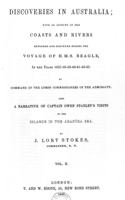
MESSRS. FITZMAURICE AND KEYS DANCING FOR THEIR LIVES.
L.R. Fitzmaurice, del.
London, Published by T. & W. Boone, 1846.
Leave Port Essington.
Clarence Strait.
Hope Inlet.
Shoal Bay.
Ian for Observations.
Explore a new Opening.
Talc Head.
Port Darwin.
Continue Exploration.
Mosquitoes and Sandflies.
Nature of the Country.
Its parched appearance.
Large ant's nest.
Return to Shoal Bay.
Visit from the Natives.
Remarks.
Their teeth perfect.
Rite of Circumcision.
Observations on the Migrations of the Natives.
Theory of an Inland Sea.
Central Desert.
Salt water drunk by Natives.
Modes of procuring water.
Survey the harbour.
Natives on a raft.
Anecdote.
Bynoe Harbour.
Well.
Brilliant Meteors.
Natives on Point Emery.
Their surprise at the well.
Importance of water.
Anecdote.
Languages of Australia.
Specimens.
Remarks.
Leave Port Darwin.
Tides.
Squall.
Visit Port Patterson.
Leave.
Examine opening to the south-west.
Table Hill.
McAdam Range.
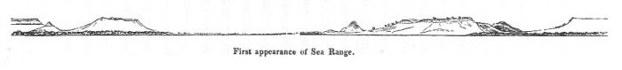
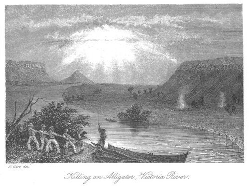
Adventure with an Alligator.
Exploring party.
Discovery of the Victoria.
Ascend the river.
Appearance of the Country.
Fitzmaurice River.
Indian Hill.
The Beagle taken up the river.
Exploration of the Victoria.
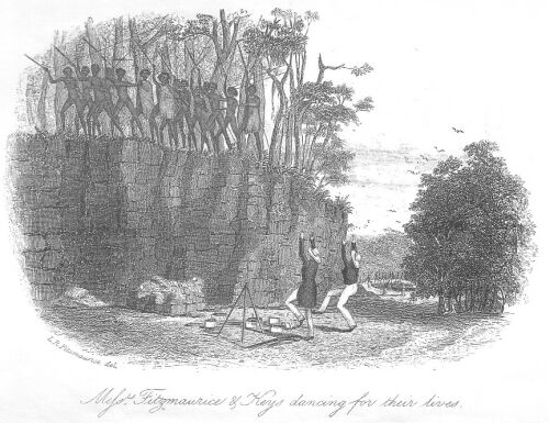
First appearance of Sea Range.
Curiosity Peak.
Appearance of Country from.
Whirlwind Plains.
Encounter with an Alligator.
His capture and description.
Cross Whirlwind Plains.
White and black ducks.
Kangaroos.
Enter hilly country.
Meet the boats.
Thunderstorm.
Carry boats over shoals.
New birds.
Reach Hopeless.
Progress of boats arrested.
Reconnoitre the river.
Prospect from View Hill.
Preparation for pedestrian excursion.
Leave Reach Hopeless to explore the upper part of the river.
Native village.
Squall.
Mussel Bend.
Meet Natives.
Successful fishing.
Party distressed.
Thirsty Flat.
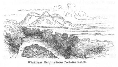
Tortoise Reach.
Singular appearance of the ranges.
Effect of the great heat.
One man knocked up.
Approach of natives.
Preparation for defence.
Appearance of the natives.
Move further up the river.
Emu Plains.
Select position for night quarters.
Upward course of the Victoria.
Commence return.
Kangaroo shot.
Wickham Heights.
New Tortoise.
Lucky Valley.
Race was with a native.
Meet his tribe.
They make off.
Hard day's work.
Quarters for the night.
Return to Reach Hopeless.
Proceed down the river from Reach Hopeless.
Meet watering party.
One of the men deserts.
Kangaroo shooting.
The writer left to complete survey of river.
Silk cotton-tree.
Fertility of Whirlwind Plains.
Attempt of one of the crew to jump overboard.
Reach the Ship.
Suffer from sore eyes.
Lieutenant Emery finds water.
Geological specimens.
Bird's Playhouse.
Tides.
Strange weather.
Range of Barometer.
Accounted for by proximity of Port Essington.
Hurricane.
Effects of the latter.
Dreary country behind Water Valley.
Fruitless attempt to weigh ship's anchors.
Obliged to slip from both of them.
Proceed down the river.
Complete survey of Main Channel.
Visit south Entrance Point of river.
Discover a number of dead turtles.
Cross over to Point Pearce.
Mr. Bynoe shoots a new finch.
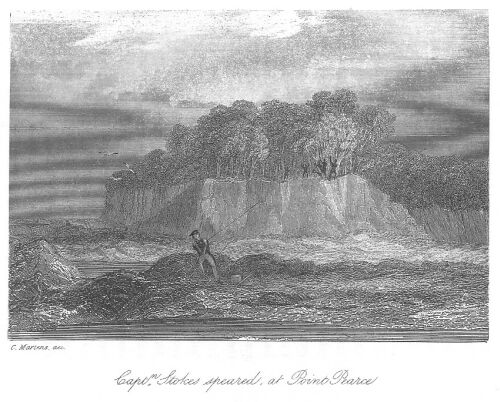
The Author speared.
Pursued by natives.
Escape.
Flight of natives.
Armed party pursue them.
Night of suffering.
General description of the Victoria.
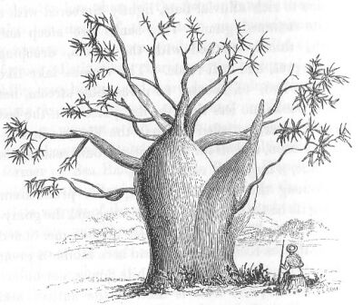
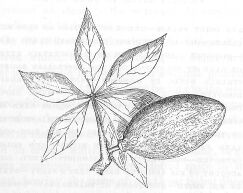
Gouty-stem tree and fruit.
Leave Point Pearce.
Error in position of Cape Rulhieres.
Obtain soundings on supposed Sahul Shoal.
Discover a shoal patch on it.
Ascertain extent of bank of soundings off the Australian shore.
Strange winds in Monsoon.
See Scott's Reef.
Discover error in its position.
Make Depuch Island.
Prevalence of westerly winds near it.
Sperm whales.
Tedious passage.
Death and burial of the ship's cook.
Anecdotes of his life.
Good landfall.
Arrival at Swan River.
Find Colony improved.
Hospitality of Colonists.
Lieutenant Roe's account of his rescuing Captain Grey's party.
Burial of Mr. Smith.
Hurricane at Shark's Bay.
Observations on dry appearance of Upper Swan.
Unsuccessful cruise of Champion.
Visit Rottnest.
Fix on a hill for the site of a Lighthouse.
Aboriginal convicts.
Protectors of natives.
American whalers.
Miago.
Trees of Western Australia.
On the safety of Gage Roads.
Sail from Swan River.
Search for the supposed Turtle-dove Shoal.
Approach to Houtman's Abrolhos.
Find an anchorage.
View of the Lagoon.
Guano.
Remnants of the wreck of the Batavia.
Pelsart Group.
Visit the Main.
Geelvink Channel.
Enter Champion Bay.
Appearance of the Country.
Striking resemblance of various portions of the coast of Australia.
Leave Champion Bay.
Coast to the northward.
Resume our examination of the Abrolhos.
Easter Group.
Good Friday Harbour.
Lizards on Rat Island.
Coral formation.
Snapper Bank.
Zeewyk Passage.
Discoveries on Gun Island.
The Mangrove Islets.
Singular Sunset.
Heavy gale.
Wallaby Islands.
Flag Hill.
Slaughter Point.
Observations of Mr. Bynoe on the Marsupiata.
General character of the reefs.
Tidal observations.
Visit North Island.
Leave Houtman's Abrolhos.
General observations.
Proceed to Depuch Island.
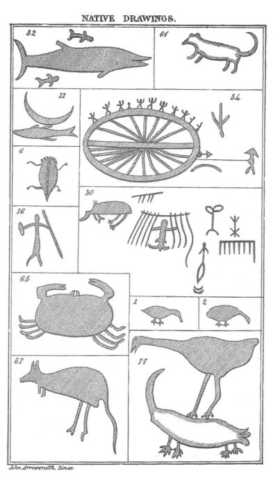
Drawings on the rocks.
Native youth.
New bird and kangaroo.
Effects of Mirage.
Examine coast to the Turtle Isles.
Geographe Shoals.
Number of turtles.
Bedout Island.
Scott's Reef.
Approach to Timor.
Pulo Douw.
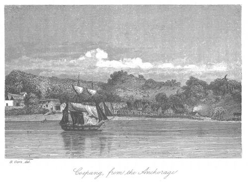
Scene on entering Coepang Bay.
Surprise of Swan River native.
Visit to the Resident.
His stories.
Fort Concordia.
Second visit to the Resident.
The Timorees.
Arrive at Pritie.
Description of the country.
Muster of the shooting party.
Success of the excursion.
The Javanese Commandant.
Character of the Timorees.
Dutch settlement in New Guinea.
Leave Coepang.
Island of Rottee.
Tykal Inlet.
Inhabitants of Polo Douw.
Sail from Rottee.
Search for shoal.
Dampier's Archipelago.
Examination of coast.
Strange weather.
Natives.
Passage between Delambre and Huiy Islands.
Proceed to Montebello Isles.
Description of them.
Barrow's Island.
Tryal Rocks.
New kangaroo.
Abundance of turtle.
New wallaby.
Sail for Swan River.
Find Ritchie's Reef.
Islands between Barrow's and North-West Cape.
Table of soundings.
Swan River Native.
Anchor under Rottnest.
Vocabulary.
Erect beacons.
Bad weather.
Habits of a native dog.
Geological observations.
Sail from Swan River.
Error in position of Cape Naturaliste.
King George's Sound.
Appearance of Bald Head.
Princess Royal Harbour.
Origin of settlement.
Town of Albany.
Salubrity of climate.
Excursion into interior.
Course a kangaroo.
Pitfalls.
Herds of kangaroos.
Rich country.
The Hay River.
Return to Albany.
Departure for South Australia.
Discover an Island.
Death of a seaman.
Position of Neptune Isles.
Kangaroo, Althorp and Quoin Islands.
Holdfast Road.
Adelaide.
Description of country.
Governor Gawler's policy.
Visit the Port.
Mr. Eyre's expedition.
Hardships of Overlanders.
Cannibalism.
Meet Captain Sturt.
Native schools.
System of education.
Sail for Sydney.
Squalls.
Error in coast.
Bass Strait.
Arrive at Sydney.
Land Sales.
Unsettled boundaries.
New Zealand.
Hunter River.
Midnight alarm.
Ludicrous scene.
Changes in Officers of ship.
Leave Sydney.
Port Stephens.
Corrobory.
Gale at Cape Upstart.
Magnetical Island.
Halifax Bay.
Astonish a Native.
Description of country.
Correct chart.
Restoration Island.
Picturesque arrival.
Interview with the Natives from Torres Strait.
Their weapons.
Shoal near Endeavour River.
Discover good passage through Endeavour Strait.
Booby Island.
New birds.
The Painted Quail.
Leave Booby Island.
Eastern shore of Gulf.
Van Diemen's Inlet.
Exploration of.
Party of Natives.
Level country.
Tides.
Visit Bountiful Islands.
Description of them.
Sail for Sweers Island.
Investigator Road.
Natives.
Locusts.
Record of the Investigator's visit.
Dig a well.
Boats explore island and coast to the westward.
Sweers and Bentinck Islands.
Tides.
Take ship over to the main.
Another boat expedition leaves.
Ship proceeds to the head of the Gulf.
Discovery and exploration of Disaster Inlet.
Narrow escape.
Description of Interior.
Wild Fowl.
Explore coast to the eastward.
Inlets.
Discover the Flinders.
The Cuckoo.
Ascent of the river.
Night scene.
Burial tree.
Remarks.
Return to the ship.
Exploration of south-western part of Gulf.
Large inlets discovered.
Boat expedition.
Explore an opening.
Discovery of the Albert.
Natives.
Picturesque Scenery.
Hope Reach.
Birds and Fishes.
Upper Branch.
Beauty of the Landscape.
Land excursion.
The Plains of Promise.
Halt the party and proceed alone.
Description of the country.
Return down the Albert.
Mouth of River.
Arrive at Van Diemen's Inlet.
Find Mr. Fitzmaurice severely wounded.
General result of the survey of the Gulf.
Winds and Temperature.
Booby Island.
Endeavour Strait.
Reach Port Essington.
Leave Port Essington.
Dobbo Island.
Visit from the Schoolmaster.
Church.
Trade of the Arrou Islands.
Their productions.
Visit from Natives.
The Banda Group.
Penal Settlement.
Adventures of a Javanese.
Captain de Stuers.
Native dance and sports.
Nutmeg Plantations.
Mode of preserving the fruit.
Amboyna.
Visit a natural grotto.
Sail from Amboyna.
Island of Kissa.
Village of Wauriti.
Missionary establishment.
Serwatty Group.
Return to Port Essington.
Appearance of Settlement.
Effects of climate.
Native mother.
Trade in teeth.
Macassar Proas.
Lieutenant Vallack visits the Alligator Rivers.
Interview with Natives.
Prospects of Port Essington.
Lieutenant Stewart's Route.
Climate.
Remarks of Mr. Bynoe.
Harbour of refuge.
Sail from Port Essington.
Sahul Shoal.
Arrive at Coepang.
Timorees.
Sail for North-west Coast.
Strong winds.
Cape Bossut.
Exploration of North-west Coast.
View of Interior.
Birds.
Solitary Island.
Visit the Shore.
Amphinome Shoals.
Bedout Island.
Breaker Inlet.
Exmouth Gulf.
Arrive at Swan River.
Reported Harbour.
Set out for Australind.
The Grass-tree.
Correspondence with Mr. Clifton, etc.
Sail from Gage Road.
Examination of coast.
Reach Champion Bay.
Visit Mount Fairfax and Wizard Peak.
Arid nature of country.
Want of water.
Native Grave.
The Greenough river.
Natives.
Leave Champion Bay.
Koombanah Bay.
Naturaliste Reef.
Reach South Australia.
Port Adelaide.
Proposed Railroad.
Visit Mount Barker.
Encounter Bay.
Native fishing.
Return to Adelaide.
Sail from South Australia.
Portland Bay.
Squatters.
Tour in the interior.
Fertile country.
View from the Sugarloaf.
Visit Cape Bridgewater.
Sail for Hobart.
Liberality of Sir John Franklin.
Atmospheric changes.
Arrive at Sydney.
Exploration of Interior.
Twofold Bay.
Survey of Bass Strait.
Dangerous situation of the Beagle.
Kent and Hogan Groups.
Gipps Land.
Wilson's Promontory.
The Tamar.
Eastern entrance of Strait.
Steam communication between India and Australia.
New Guinea.
Straitsmen.
North coast of Tasmania.
Aborigines.
Port Phillip.
Directions for ships passing King Island.
Complete survey of Bass Strait.
Farewell to Sydney.
Moreton Bay.
The Comet.
State of Tasmania, or Van Diemen's Land.
Lighthouses in Bass Strait.
Sail from Tasmania.
The South-west Cape.
Monument to Flinders.
Rottnest Island.
Lighthouse.
Penal Establishment.
Longitude of Fremantle.
Final departure from Western Australia.
Rodrigue Island.
Effects of a hurricane at Mauritius.
The crew and passengers of a foundered vessel saved.
Bourbon.
Madagascar.
Simon's Bay.
Deep sea soundings.
Arrival in England.
Take leave of the Beagle.
The Surveying service.
WINDS AND WEATHER ON THE WESTERN AND NORTHERN COASTS OF AUSTRALIA. BY COMMANDER J.C. WICKHAM, R.N.
VICTORIA RIVER.
GULF OF CARPENTARIA.
ALBERT RIVER.
PART OF WESTERN AUSTRALIA.
PORT ADELAIDE AND HOLDFAST BAY.[Not included in this ebook]
MESSRS. FITZMAURICE AND KEYS DANCING FOR THEIR LIVES.
FIRST APPEARANCE OF SEA RANGE.
HEAD AND FEET OF ALLIGATOR.
KILLING AN ALLIGATOR, VICTORIA RIVER.
WICKHAM HEIGHTS FROM TORTOISE REACH.
CAPTAIN STOKES SPEARED AT POINT PEARCE.
GOUTY-STEM TREE.
FRUIT OF GOUTY-STEM TREE.
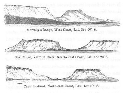
VIEWS OF MORESBY'S RANGE, SEA RANGE, AND CAPE BEDFORD.
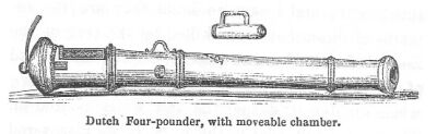
ANCIENT DUTCH GUN.
NATIVE DRAWINGS.
COEPANG FROM THE ANCHORAGE.
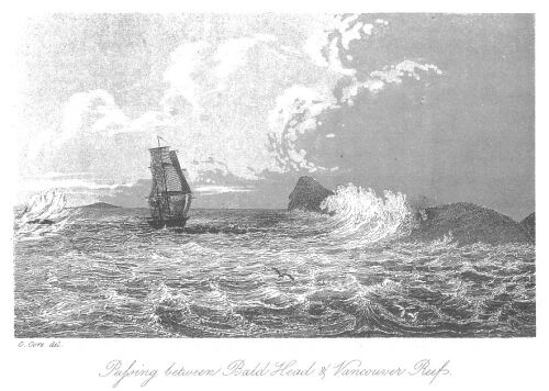
PASSING BETWEEN BALD HEAD AND VANCOUVER REEF.
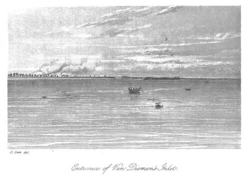
ENTRANCE OF VAN DIEMEN'S INLET.
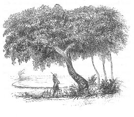
INTERESTING TREE.
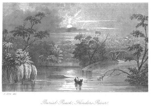
BURIAL REACH, FLINDERS RIVER.
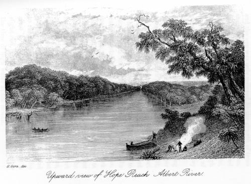
UPWARD VIEW OF HOPE REACH, ALBERT RIVER.
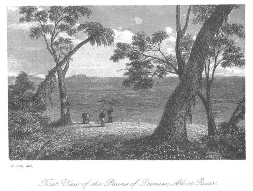
FIRST VIEW OF THE PLAINS OF PROMISE, ALBERT RIVER.
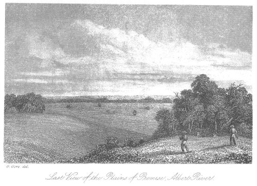
LAST VIEW OF THE PLAINS OF PROMISE, ALBERT RIVER.
APPROACH TO PORTLAND BAY.
DANGEROUS SITUATION OF BEAGLE.
DEVIL'S TOWER.
KILLING A KANGAROO.
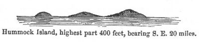
HUMMOCK ISLAND.
Leave Port Essington.
Clarence Strait.
Hope Inlet.
Shoal Bay.
Land for Observations.
Explore a new Opening.
Talc Head.
Port Darwin.
Continue Exploration.
Mosquitoes and Sandflies.
Nature of the Country.
Its parched appearance.
Large ant's nest.
Return to Shoal Bay.
Visit from the Natives.
Remarks.
Their teeth perfect.
Rite of Circumcision.
Observations on the Migrations of the Natives.
Theory of an Inland Sea.
Central Desert.
Salt water drunk by Natives.
Modes of procuring water.
Survey the harbour.
Natives on a raft.
Anecdote.
Bynoe Harbour.
Well.
Brilliant Meteors.
Natives on Point Emery.
Their surprise at the well.
Importance of water.
Anecdote.
Languages of Australia.
Specimens.
Remarks.
Leave Port Darwin.
Tides.
Squall.
Visit Port Patterson.
Leave.
Examine opening to the south-west.
Table Hill.
McAdam Range.
Adventure with an Alligator.
Exploring party.
Discovery of the Victoria.
Ascend the river.
Appearance of the Country.
Fitzmaurice River.
Indian Hill.
The Beagle taken up the river.
LEAVE PORT ESSINGTON.
Early on the morning of the 4th of September, 1839, the Beagle was once more slipping out of Port Essington before a light land wind. We had taken a hearty farewell of our friends at Victoria, in whose prosperity we felt all the interest that is due to those who pioneer the way for others in the formation of a new settlement. No doubt the hope that our discoveries might open a new field for British enterprise, and contribute to extend still more widely the blessings of civilization, increased the sympathy we felt for the young colony at Victoria. There is always a feeling of pride and pleasure engendered by the thought that we are in any way instrumental to the extension of man's influence over the world which has been given him to subdue. In the present instance, the success of our last cruise and the state of preparation in which we were now in for a longer one, caused us to take our departure from Port Essington in far higher spirits than on the former occasion.
PASS THROUGH CLARENCE STRAIT.
We again shaped our course for Clarence Strait, the western entrance of which was still unexamined. The wind, however, being light, we passed the night in Popham Bay; and on leaving next morning, had only six fathoms in some tide ripplings nearly two miles off its south point, Cape Don. We passed along the south side of Melville Island, where a large fire was still burning. Early in the evening we anchored in seven fathoms, to wait for a boat that had been sent to examine a shoal bay on the North-West side of Cape Keith. Green Ant Cliffs bore South-West two miles.
September 7.
Weighing at daylight we hauled up south, into the middle of the channel, crossing a ridge of 5 1/2 fathoms; Ant Cliffs bearing West-South-West five miles, and three or four from the shore. This ridge appears to be thrown up at the extremity of the flats fronting the shore. On deepening the water to 10 and 12 fathoms, the course was changed to West 1/2 South, passing midway between North Vernon Isle and Cape Gambier, where the width of the channel is seven miles, though the whole of it is not available for the purposes of navigation, a long detached reef lying three miles from the Cape, and a small one two miles from the North Vernon Isle.* The tide hurried the Beagle past between these reefs with some rapidity, the soundings at the time being 19 fathoms.
(*Footnote. These isles, three in number, lying quite in the centre of the western entrance of the Strait, are fringed with extensive coral reefs. There are, however, deep passages between them.)
Having cleared Clarence Strait, and found it to be perfectly navigable with common precaution (which in a slight degree enhanced the value of the discovery of the Adelaide) our course was directed for a bay to the southward, which Captain King had not examined. A very refreshing cool north-westerly seabreeze* had just succeeded a short calm. Passing four miles from the western extremity of the Vernon Isles, we had irregular soundings of ten and seven fathoms. The ripplings and discoloured water are a warning that they should be approached with caution on this side.
(*Footnote. The seabreeze prevailing from the westward through Clarence Strait, the passage to Port Essington from the westward, during the easterly monsoon, might be more easily made by passing through it, instead of working along the north side of Melville Island.)
The mouth of a considerable inlet came in sight at the head of a bay as we advanced towards it, steering South by East. This opening began to appear of consequence as we drew near, although the singularly gradual decrease in the soundings, on a sandy bottom materially diminished the probability of its being the mouth of a river. Still, when we anchored as near as we could approach, there remained a hope of its being so.
HOPE INLET. SHOAL BAY.
September 8.
Early in the morning Mr. Forsyth and myself started to explore the opening. We soon discovered that it was nothing more than a shallow creek at low-water. The tide here rising twenty feet, gave it the important appearance it had yesterday evening. A tall clump of naked trees was conspicuous at the east entrance point, towering above the insipid mangrove shore. We gave it the name of Hope Inlet, to commemorate the feelings it excited on its first discovery. From the south point of Clarence Strait it is distant eleven miles, and the bay in which it lies, from the shallow-water at the head of it, was called Shoal Bay.
The boat being provisioned for four days, we pushed on to explore another opening above fifteen miles to the westward. The seabreeze setting in early, we did not reach it till after dark, when we landed for observations at a cliffy projection near the eastern entrance point: this we found to be composed of a kind of pipeclay, mixed with calcareous matter. We had some difficulty in landing, and then in scrambling up the cliffs by the light of a lantern. If any of the watchful natives happened at the time to be on the lookout, they must have stood fixed with astonishment at beholding such strange persons, who at such a time of night, with no ostensible object were visiting their shores.
EXPLORE A NEW OPENING.
September 9.
Before the veil of darkness was quite removed, we could faintly distinguish the mouth of the opening; and the sight at daylight was most cheering. A wide bay appearing between two white cliffy heads, and stretching away within to a great distance, presented itself to our view. Far to the southward, between the heads, rose a small table-topped hill. As we pulled in towards the eastern entrance point, the river-like appearance began to wear off, more land making its appearance towards the head of the opening. On reaching this point Mr. Forsyth and myself climbed up the cliff, whilst the breakfast was cooking. From the summit we had a good view of the bay, and were delighted to find large openings in the south-east and south-west corners of it. The table hill before mentioned, stood on the point between them. To see the eastern part of it, however, it was necessary to cross to the opposite point, where some talc slate, pieces of which measured four inches in length, was found imbedded in quartz. The point was called in consequence, Talc Head.
PORT DARWIN.
The other rocks near it were of a fine-grained sandstone: a new feature in the geology of this part of the continent, which afforded us an appropriate opportunity of convincing an old shipmate and friend, that he still lived in our memory; and we accordingly named this sheet of water Port Darwin. A few small bamboos grew on this head; the other trees were chiefly white gums. I climbed to the top of one of them, and obtained thence a view of another opening in the eastern part of the harbour. It now being low-water, an extensive shoal was discovered, reaching from abreast of Talc Head to the point separating the South-East and South-West openings, an extent of nearly five miles. This somewhat diminished the value of our discovery, as it limited the capabilities of the bay as a harbour.
We now proceeded to explore the north-eastern and largest opening, distant six miles from our station. A large islet and a reef left the entrance only a mile wide. Expanding again, it formed two arms, one running south, the other East-South-East, between small groups of singular isolated haycock-shaped hills, about 250 feet high. Following the latter, being the largest, we found that it soon curved round, taking a southerly direction. A bank free from mangroves occurring in this bend, we availed ourselves of it, as the day was closing in, to secure some early stars for latitude and longitude. The intense pleasure afforded by traversing water that had never before been divided by any keel, in some measure compensated us for the annoyance from the mosquitoes and sandflies, that took the opportunity of assailing us while in the defenceless state of quiet necessary in making observations. Pushing out into the middle of the stream, and each wielding a beater, our tiny enemies were soon shaken off, and borne back to the shore by a refreshing North-West breeze.
We found it necessary to keep a sharp lookout here for the alligators, as they swarmed in dangerous numbers.
The scarcity of fish, and the shallowness of the water did not hold out much hope that the arm we were tracing would prove of great extent; still many speculations were hazarded on the termination of it. The temperature in the night was down to 78 degrees, and the dew sufficiently heavy to wet the boat's awning through.
CONTINUE EXPLORATION.
Anxious to know how far this piece of water was to carry us into the untrodden wilds of Australia, we moved off with the first streak of dawn. Ten miles in a South by East direction brought us to where the width and depth was not sufficient to induce us to proceed further. Besides, as we were then only fifteen miles from a bend of the upper part of the Adelaide, which must receive the drainage of all that part of the country, it seemed improbable that any other large river existed in the neighbourhood. Six miles from our furthest, which was about thirty miles from the entrance, we passed a small island. The banks on either side of the inlet were, as usual, a thick grove of mangroves, except in one spot, a mile lower down, where we landed on our return for observations. This we found to be a low cliffy projection of slate formation, whilst scattered over the face of the few miles of country, which we are able to explore, were small bits of quartz; large blocks also of which protruded occasionally through a light kind of mould.
APPEARANCE OF THE COUNTRY.
The country was a most thirsty-looking level, the low brushwood on which cracked and snapped as we walked through it, with a brittle dryness that testified how perfectly parched-up was everything. A single spark would instantly have wrapped the whole face of the country in one sheet of fire. Slight blasts of heated withering air, as if from an oven, would occasionally strike the face as we walked along; sometimes they were loaded with those peculiar and most agreeable odours that arise from different kinds of gums. Still the white eucalyptus and the palm, wore in comparison with the other vegetation, an extraordinary green appearance, derived probably from the nightly copious falls of dew, which is the only moisture this part of the continent receives during the present season. The birds we observed were common to other parts of the continent, being a few screaming cockatoos, parrots, and quails, and near the water a small white egret. There was nothing of interest to recall our memories to this first visit to a new part of Australia, save a very large ant's nest, measuring twenty feet in height. This object is always the first that presents itself whenever my thoughts wander to that locality.
As the boat was not provisioned for the time it would take to explore all the openings we had discovered, and as the capabilities of Port Darwin were sufficiently great to require the presence of the ship, I determined on returning immediately to Shoal Bay.
VISIT FROM THE NATIVES.
During the time we were absent, some of our people who had been on shore, received a visit from a party of natives, who evinced the most friendly disposition. This verifies what I have before observed, as to the remarkable differences of character that exist between many Australian tribes, though living in the immediate neighbourhood of each other; for, it will be remembered, that at no great distance we had experienced a very different reception.
Those people amounted in number, with their families, to twenty-seven, and came down to our party without any symptoms of hesitation. Both men and women were finer than those we had seen in Adam Bay. The tallest male measured five feet eleven, which is three inches less than a native Flinders measured in the Gulf of Carpentaria. The teeth of these people were ALL PERFECT, an additional proof that the ceremony of knocking them out, like others practised in Australia, is very partially diffused. The rite of circumcision, for instance, is only performed at King's Sound, on the west side of the Gulf of Carpentaria, and near the head of the Australian bight on the south. Mr. Eyre, who discovered the existence of the rite on the last-mentioned part of the continent, infers that the natives of the places I have mentioned must have had some communication with each other through the interior; but it is possible that at a distant period of time, circumcision may have been very generally practised, and that having become gradually disused, the custom is now only preserved at two or three points, widely separated from each other. I do not advance this as a theory, but simply as a suggestion, as there is some difficulty in supposing communication to have taken place across the continent.
MIGRATION OF THE NATIVES.
Some light may be thrown on the migration of the aboriginal inhabitants of Australia, by tracing the parts of the coast on which canoes are in use. It has already been mentioned, that we had not seen any westward of Clarence Strait, neither were they in use in the bottom of the Gulf of Carpentaria, nor on the south coast.* By the assistance of these and similar facts, we may hereafter be enabled to discover the exact direction in which the streams of population have flowed over the continent. But I am not prepared to agree entirely with Mr. Eyre when he concludes, as I have stated, from the fact of the rite of circumcision having been found on the south and north-west coasts, and on the Gulf of Carpentaria, that there exists any peculiar connection between the tribes inhabiting those several points. This enterprising traveller moreover thinks that the idea he has started goes far towards refuting the theory of an inland sea, another presumption against which he maintains to be the hot winds that blow from the interior.
(*Footnote. An inference may be drawn from the parts of the shore on which canoes are in use, to show that the migrations of the natives, so far southwards, have been along the coast. The raft they use is precisely the same in make and size on the whole extent of the North-west coast.)
THEORY OF AN INLAND SEA.
I confess that the theory of an inland sea has long since vanished from my mind, though I base my opinion on reasons different from those of Mr. Eyre. The intercourse between natives of opposite sides of the continent (though it is certainly possible) has never been established, and while it remains hypothetical, cannot be adduced to overthrow another hypothesis. The existence of hot winds also blowing from the interior is not conclusive, as we had, when in the Gulf of Carpentaria, very cold winds coming from the same direction. We know, however, that the temperature of winds depends much on the nature of the soil over which they sweep, for instance, in a cold clayey soil, the radiation of heat is very rapid.
Before quitting this subject it may be as well to mention that my own impression, which the most recent information bears out, is that instead of an inland sea, there is in the centre of Australia a vast desert, the head of which, near Lake Torrens, is not more than three hundred feet above the level of the sea. The coast being surrounded by hilly ranges, the great falls of rain that must occasionally occur in the interior, may convert a vast extent of the central and lowest portion, towards the north side of the continent, into a great morass, or lake, which, from the northerly dip, must discharge its waters slowly into the Gulf of Carpentaria, without possessing sufficient stability to mark either its bed or boundaries.
FRIENDLY NATIVES.
To return to the party of natives which has given rise to this digression. They had clearly never seen a white person before; for they stepped up to one man of fair complexion, who had his trousers turned up over his knees, and began rubbing his skin to see whether it was painted. They came fearlessly to our party, as they were collecting shells at the extremity of a long flat. One of the officers, who happened to be very thirsty, placed such confidence in their friendly manner, that he allowed them to conduct him alone to a small well near the beach, but the water was too salt to be drunk. The force of habit is astonishing: natives drink this brackish fluid and find it very refreshing. The small quantity that suffices them is also surprising, though they will drink enormously when they can get it.
MODES OF PROCURING WATER.
Their mode of procuring this necessary element is singular, and they exhibit in this particular much ingenuity and great fertility of resources. They are never harassed with the idea of being without any; which not only distresses but adds to the horror of thirst with the European explorer, who has not experienced the constant watchfulness of Providence, and does not know that he may collect from the leaves, with a sponge, on some mornings, as much as a pint of water. This has, however, been done, even on the south coast, where the dews are not so copious as on the north-west. The natives themselves are never at a loss for that indeed precious article, water. They sometimes procure it by digging up the lateral roots of the small gumtree, a dusty and fatiguing operation: they break them off in short bits, and set them up to drain into a piece of bark or a large shell. By tapping also the knotty excrescences of trees they find the fluid, which they suck out. Many of these modes of obtaining water are of course known to experienced bushmen, like Mr. Eyre, whose deeply interesting narrative of his hardships and perils has already enlisted the sympathy of the public.
September 12.
We moved the ship into Port Darwin, anchoring just within the eastern cliffy head which, to commemorate Lieutenant Emery's success in finding water by digging, we named after him.
SURVEY OF THE HARBOUR.
All the surveying force was now put in instant requisition; Captain Wickham went to examine an opening in the coast mentioned by Captain King, lying about twelve miles further to the westward, whilst the other boats explored the openings at the head of the harbour.
That on the eastern part, Mr. Fitzmaurice traced ten miles in a south-easterly direction, being the greatest distance it was navigable for a boat. The remaining branch in the large opening, in the south-eastern corner of the harbour, Mr. Forsyth and myself explored South-South-East three miles, and South-South-West five more, the extent to which it was possible to advance. Beyond, it was strewed with large blocks of granite; a fact, for which we were in some degree prepared, as in the vicinity of the Adelaide River we had proof of the primary formation of this part of the continent. As the boat lay scarcely afloat between two of these lumps of rock, numbers of white ibises, with black necks, kept flying over us from the southward, indicating that a swamp lay in that direction. We also disturbed several alligators, who slid off quietly into the water at our approach. There was no variety in the shores of this inlet, composed like all the others, of an impenetrable network of mangroves. A ridge of the same conical-shaped low hills before alluded to, as existing in this neighbourhood, rose upon our right as we came up, and bore from our furthest North by West two miles; from the highest part up the inlet in the south-west corner, east two miles.
The latter we found very tortuous, extending in a general direction south nine miles. No events occurred worthy of any remark during our examination, except one of a trifling character: the mosquitoes taking advantage of the calm, between the high mangroves on the banks, attacked us most cruelly, a circumstance we mention as trifling, as far as the reader is concerned, but of great moment to us.
After completing the survey of the southern and western portion of this harbour, we returned to the ship, where soon afterwards Captain Wickham also arrived, having found Patterson Bay to be a good port. It trended in south ten miles, and East-South-East the same distance, forming quite an inner haven, which was named after Mr. Bynoe.
NATIVES ON A RAFT.
At the turning leading from the outer to the inner harbour they came suddenly in view of a raft making across, a distance of three miles, on which were two women with several children, whilst four or five men were swimming alongside, towing it and supporting themselves by means of a log of wood across their chests. On perceiving the boat they instantly struck out for the land leaving the women on the raft. For some time the latter kept their position, waiting until the boat got quite near, when they gave utterance to a dreadful yell, and assuming at the same time a most demoniacal aspect, plunged into the water as if about to abandon the children to their fate.
MATERNAL AFFECTION AND FEAR.
Not so, however; despite the dreadful fear they appeared to entertain of the white man, maternal affection was strong within them, and risking all to save their offspring, they began to tow the raft with all their strength towards the shore. This devotion on the part of the women to their little ones, was in strong contrast with the utter want of feeling shown by the men towards both mothers and children.
Captain Wickham now, no doubt to their extreme consternation, pulled after the men, and drove them back to the raft. Some dived and tried thus to escape the boat, while others grinned ferociously, and appeared to hope, by dint of hideous grimaces--such as are only suggested even to a savage by the last stage of fear--to terrify the white men from approaching. At length, however, they were all driven back to the raft, which was then towed across the harbour for them; a measure which they only were able to approve of when they had landed, and fear had quite subsided.
Doubtless, the forbearance of our party surprised them, for from their terrified looks and manner, when swimming with all their strength from the raft, they must have apprehended a fate at least as terrible as that of being eaten.
The raft itself was quite a rude affair, being formed of small bundles of wood lashed together, without any shape or form, quite different from any we had seen before.
Bynoe Harbour was found to terminate in three deep creeks branching off between North-East and South-East, the largest of which led into fresh water, but in small detached pools, which are separated from the salt, by a shelf of red porous sandstone, and which two miles further became entirely lost in the rocks. The green appearance of the gumtrees and an occasional clump of palms, which had pleasingly succeeded the mangroves, as they advanced, assured Captain Wickham that there was fresh water near. Probably, if they had carried their researches further, they would have found these signs reappear again, doubtless proceeding from a swamp, the presence of which the reader will recollect I inferred from seeing the ibis flocking from the south-west up the south inlet in Port Darwin; the west inlet of which is only one mile distant from the north-east creek in the head of Bynoe Harbour. Doubtless when the country is not in its present parched and thirsty state, all these are fresh at their heads.
WELL AT PORT DARWIN.
The slow progress made in watering, from the soft nature of the soil in the bottom of the well, lengthened our stay considerably in Port Darwin. The water oozed through the sides, beginning to do so at a depth of twenty-five feet. The strata cut through varied considerably, in part consisting of ironstone mixed with a white kind of marl or pipeclay, for eight feet, then sandstone of a reddish colour and in a state of decomposition, with a darker kind of marl, in which were small bits of mica, for a depth of sixteen feet, the remaining portion of two or three being a sandy mud, apparently of the consistency of clay and of a light grey colour. The position of this well is in a small valley at the east end of the first sandy bay within Point Emery, in the centre of which the observations were made, placing it in latitude 12 degrees 27 minutes 45 seconds, longitude 1 degree 19 minutes 40 seconds, East of Port Essington.
On this beach several unsuccessful hauls were made with the seine, though a few rare and curious fish were taken, which Lieutenant Emery added to his collection of coloured drawings of Australian fish; some of them will be found in the appendix to this volume. Mr. Bynoe also obtained specimens of one or two rare birds; the large red-necked vampire of the Adelaide River, and the cream-coloured pigeon before alluded to, were also seen by him, being the farthest south the latter was met with by us.
BRILLIANT METEORS.
Some brilliant meteors were observed during our stay, one in particular on the evening of the 20th, in the West-North-West. It fell from the zenith at an angle of about twenty degrees from a vertical line. The descent was marked by a long train of light, visible ten seconds, while others of less brilliancy followed from the same place within an hour. Again on the 23rd, was the dark vault of heaven illumined about the same time in a similar manner, as well as on the 28th; the number of meteors being the same on each day.
We were rather surprised on the 24th, to experience a squall from the eastward about midnight, a regular occurrence on the North-west coast in January and February only.
VISITED BY NATIVES.
On the 24th a party of natives made their appearance on Point Emery. Their voices, shrill like those of all their fellows, were heard before they were seen. With these it was particularly so, though on all occasions the speaking, and hallooing of the Aborigines can be heard at a very considerable distance. They were found, when on shore, to be of the party we had before seen in Shoal Bay, with the addition of five strange men. All appeared actuated by the same friendly disposition, a very strong indication of which was their presenting themselves without spears.* Like most others on that coast, they had apiece of bamboo, eighteen inches long, run through the cartilage of the nose. Their astonishment at the size of the wells was highly amusing; sudden exclamations of surprise and admiration burst from their lips, while the varied expressions and play of countenance, showed how strongly their feelings were at work within.
(*Footnote. Speaking of natives appearing without spears, reminds me to mention for the information of future explorers, that their arms are always near at hand. They even trail them sometimes between their toes, a fact which travellers should ever bear in mind.)
It is very singular, and not very susceptible of explanation, that although they climb tall trees by merely resting their toes in a slight notch cut as they ascend, the natives will hesitate in alarm before looking over the edge of a precipice or height; it was, therefore, some time before this party could be induced to look down the well. At length by stretching their spare bodies and necks to the utmost, they caught sight of the water in the bottom.
SURPRISE OF NATIVES AT THE WELL.
The effect upon them was magical, and they stood at first as if electrified. At length their feelings gained vent, and from their lips proceeded an almost mad shout of delight. Nothing perhaps could have more decisively shown the superiority of the white men to these savages, than our being thus able to procure this necessary of life from so great a depth, there being moreover no outward appearance of any. Perhaps their delight may be considered a sign how scarce is water in this part of the country. I should certainly say from the immense quantity each man drank, which was two quarts, that this was the case. A further corroboration of the extreme importance of this element to the Western Australian is, that a native, in describing a fine country, always opens his narrative by stating the important fact--plenty water.
The deep interest which in the natives always succeeds to the discovery of this necessary article, must strongly impress the explorer, who will ever afterwards look upon streams, even in other countries, with far different feelings from any before experienced. In no land does the presence of water more rapidly enrich the landscape, changing it from a thirsty-looking plain to a rich green spot, than in Australia, and it is in journeying through such a country, when one suddenly meets with a luxuriant valley, that the eye naturally dwells with delight on the changing scene, and the impression, not easily forgotten, clings to us even when far away. When gazing on the superabundant water that flows in almost every corner of the earth, we cannot but reflect on the scantily supplied Australian, nor fail to wish him a more plentiful supply.
BLESSING OF WATER.
Naturally we are disposed to reflect but little on the great blessings of the most ordinary things. In the eyes of the civilized man, fire and water are matters scarcely worthy of thought; but it is the traveller who learns to appreciate how great blessings they are in reality.
An influenza appeared to be raging among the natives, all having the remnants of colds, coughing severely when we met them. Several attempts were made to induce them to come on board, but they proved vain. Sometimes, just as the boat was leaving the shore, they would enter the bow of it, as if about to accompany us; no sooner, however, was the boat in motion, than out they jumped, laughing and apparently delighted to deceive us, acting, in fact, exactly the part of noisy children.
"IRRU, IRRU."
Our friendly intercourse with these natives sustained a shock, which at first threatened to annihilate it, but which fortunately ended, as it began, in smoke. One of the officers used a common flint and steel, in order to procure a light for his cigar; at this new mode of procuring fire all eyes were open--for doubtless they procure it only by means of friction--but when he proceeded to place the lighted cigar between his lips, and roll forth from thence a thick and perfumed cloud, fright took full possession of them, and exclaiming "irru, irru," with the arm extended, and a slight vertical motion of the hand, they darted off most unceremoniously, clambering up the face of a precipitous cliff, with extraordinary agility. Their cry of "irru, irru," and their manner of delivering it, were identical with those of King's Sound, under somewhat similar circumstances. In a few days they had forgotten their fright, and had returned to renew the friendly relations this little incident had interrupted.
During the short time we passed with this people in Port Darwin, some words of their language were collected by many of us. Those that we all agreed in I have noted down, but the different names for things given by the same person, here and at Shoal Bay, will at once impress the reader with the conviction of how impossible it is for transient visitors to obtain a correct vocabulary. Those first made out at Port Essington, were found to be half Malay words, and of any meaning rather than what they were supposed to convey. The words given below are from Mr. Earl's vocabulary, the result of four years careful examination and experience.
COLUMN 1: ENGLISH.
COLUMN 2: SHOAL BAY.
COLUMN 3: PORT DARWIN.
COLUMN 4: PORT ESSINGTON.
COLUMN 5: SWAN RIVER.
Crab : Algaura : - : Meir : -.
Dog : Melinga : - : Mugki : Dudah.
Ear : Bangua : - : Alayjar : Zungah.
Eye : Ummera : Mical : Ira : Mael.
Hair : Brailma : Guarshiel : Angbal : Cutap.
Hand : - : Guian : - : -.
Stone : - : Lowheil : - : -.
Tree : Urmingua : - : Ojalli : Boono.
Teeth : Emburge : - : Aujije : Nalgo.
Water : - : Kararback : - : Kaaby.
DIFFICULTY OF UNDERSTANDING THE NATIVES.
The great difference between the words at Shoal Bay and Port Darwin, must now be apparent to the reader; a more extended acquaintance with the aboriginal inhabitants of Australia, has shown that many words put down by us as meaning a certain thing, signify in reality, "What do you mean?" "I do not understand"--which shows at once the great difficulty of arriving at the truth. This must often be the case; for what is more natural, than that when a savage is asked the meaning of a thing, and knows not, but that he should express his ignorance? How often this expression of ignorance has been registered as the denomination of some animal or thing, we leave the reader to conjecture. Moreover, there are many words totally obliterated from their dialects, which thus undergo constant alteration. This in part arises from the circumstance of their never mentioning the name of a deceased person, who has perhaps been called after a tree, bird, or animal; which then receives another appellation, the old one passing away. From the few words given of the respective dialects of Port Essington and Swan River, they would appear essentially to differ, and from what has since come under my own observation, as well as from facts collected by others, I feel confident that there are many distinct dialects spoken in Australia.
DIALECTS OF AUSTRALIA.
It is easy enough for those who hold to the theory that Australia produces few dialects, to create for themselves a resemblance in words by mutilation and addition; but on careful examination, the similarity will not be found to exist. The natives we took from Swan River, never could understand any of those we met on the North-west coast, though certainly Mr. Moore recognized a few words spoken by the natives on the West coast, about 200 miles north of Swan River, as being identical with the language used at the latter place.
It may here be as well to quote Strzelecki on this subject, ere we pursue our narrative:
"The circumstance of the three natives who accompanied Captain Flinders and Captain P.P. King, in the survey of New Holland, and of those who accompanied me amongst the different tribes of New South Wales, being unable to understand one word spoken by tribes of other districts, would lead to the belief that the dialects spoken in New Holland, are far from possessing those affinities, still less those identities of language, from which a common root might be inferred. Those European visitors or explorers who adduce, in support of a common root, some hundred words analogous in sound, construction and meaning, as being spoken all over New Holland, have jumped to the conclusion with, I fear, too much haste and eagerness. Besides many other insuperable difficulties, which an investigation of such a nature presents, there was one quite sufficient to defeat all attempts to fathom the subject, namely, the syntactic ignorance of the language to which the inquiry related. Indeed, to any man who knows and speaks four European languages, it will be at once apparent, that to seize upon, and note from the sound, a word belonging to one country, so as to compare its sound and accentuation with a word belonging to another country, needs a thorough knowledge of the genius of the two languages, and of their alphabet, through which alone the pronunciation can be discriminated."
Though, however, we may not attain to a knowledge of the truth at once, yet should we never lose an opportunity of making a vocabulary of such words as we know to be correct. This should be the case from one consideration alone; for how gratifying it is, when visiting an uncivilized people, to find that you know a word or two of their language! The satisfaction is mutual--there is at once a sympathetic link between you--you no longer appear as thorough strangers to each other, and this slight knowledge of their dialect may often be the means of making useful acquaintances.
To return, however, to the thread of our narrative.
LEAVE PORT DARWIN.
The opening to the westward, visited by Captain Wickham, requiring further examination, we left Port Darwin for that purpose, beating out on the morning of the 26th. Before taking leave, however, of this place, it will not be deemed irrelevant if we give some slight description of it. The entrance points, I have already said, are white cliffy projections, and distant from each other three miles. Just outside them lies a long four fathom bank, which, together with a very extensive flat of one, and two fathoms, nearly joining it from the eastern side, and another fronting the north side of the west entrance point, comprise all the dangers on entering this port; which, although of considerable size, is much occupied by shoal water, particularly on the western side, commencing from abreast of Talc Head. The best anchorage is near Point Emery. The extreme of the latter, and a clump of peaked bushes on the south point of the eastern arm of the harbour, when in one, make a good mark for leading out; passing on the west side of the four fathom bank, where the channel is a mile wide and 10 fathoms deep.
IRREGULARITY OF THE TIDES.
The tide is very irregular in Port Darwin, rising at springs 24 feet, and at neaps sometimes only two; its rate being from one and a half to three knots. The time of high-water at the full and change of moon, was half-past five, which being half an hour earlier than at Clarence Strait, fully bears out the opinion I have before expressed, that the flood-tide comes from the westward.
Having to beat out against the seabreeze, the flood-tide made before we could get round the point on the coast lying midway between Ports Darwin and Patterson, and we were compelled to pass the night in the neighbourhood, a circumstance rendered disagreeable by the recurrence of another midnight squall from East-North-East, so severe as to require the use of a second anchor. The rain was so bitterly cold and sudden, as well as violent, acting also on our frames with more severity from the lightness of our clothing, that it had all the effect of a shower-bath, momentarily taking away the power of speech. It caused a rapid fall in the thermometer of ten degrees, bringing it as low as 60 degrees. At Port Darwin it had been regularly 87 and 89 degrees in the day, and 80 degrees at night.
MIDNIGHT SQUALL.
The squall gave but slight warning of its approach, and four hours afterwards the mutinous assemblage of clouds had wholly disappeared from the heavens, leaving nothing to stay the advent of light which came pouring itself in floods of molten glory over the cloudless sky, as the morning broke. This was the signal of our again moving towards Port Patterson, which we entered, passing on the eastern side of the reef in the mouth, and anchoring close to the eastern shore of the outermost of a chain of sandy islets, forming the west entrance point of the harbour, and extending eight miles in a North-North-East 1/2 East direction from the land. This group is based on a great coral ledge that dries in part at low-water, thus affording the natives the means of going over easily to them, a circumstance of which they avail themselves, as we found them on the outer island. They would not, however, come near us, moving off as we landed. Doubtless the terror of some of their party, in a great measure arose from a vivid recollection of the raft interview, which was likely to dwell long in their minds; at all events, if not of the same party, they had heard of us, and it will readily be believed, that we had been painted in sufficiently terrible and exaggerated colours to render a second interview, in their minds, very undesirable.
QUAIL ISLAND.
Our discovering them in this place, which we named Quail Island, from that bird being found in great abundance, quite destroyed the hope we had previously entertained of procuring turtle there. It was the season for their incubation, and at that time the island swarmed with them; but our sable friends had abundantly availed themselves of this fact, as we saw the remains of several of their turtle feasts. Although low, and composed entirely of sand, we found a native well of excellent water near the middle of the island, which, having been enlarged, afforded an ample supply, a circumstance that at once renders this a spot of importance and value. Both on this and others of the group there were a few small trees and a sprinkling of brushwood.
We did not notice any of the singular detached hills seen at Port Darwin, and the greatest elevation any of the land in the neighbourhood attained was 200 feet; neither did we observe any primary rocks.
The observations were made at the South-East point of Quail Island, which by them is placed in latitude 12 degrees 30 9/10 minutes South, and longitude 1 degree 42 1/4 minutes West of Port Essington. The almost insulated character of this part of the coast, and the quantity of soundings the openings required detained us until the 6th of October, when we passed out on the western side of the large reef in the centre of the entrance, which is the proper one, and received the name of West Channel. The western entrance point of Bynoe's Harbour, bearing South 15 degrees East, leads through it. This guide is only, however, of service to a certain distance within the entrance, as it leads over a small patch that dries at low-water, distant two and a half miles from the above-mentioned point on the same bearing. To avoid this danger, it is therefore necessary to haul over towards Quail Island, when the highest hummock on it bears South-West 1/2 West. The tides follow the direction of the channel, varying in velocity from one to two knots. The ebb in the offing set West-North-West.
PORT PATTERSON.
The reader will be able to have an idea of the large sheet of water these united harbours form, by knowing that Port Patterson is twelve miles long and seven wide at the entrance; though at the upper part, forming the mouth of Bynoe Harbour, it is not half that width. The latter winds round to the South-East for a distance of 15 miles, with an average width of two, and a depth of nine fathoms. Thus terminated our exploration in this neighbourhood; the result having been to give this part of the coast quite an insulated character. The sheets of water creating this new feature, although monotonous with their mangrove-lined shores, still conveyed us many miles into various parts of the continent that had never before been seen by a civilized being.
Another opening of far greater magnitude, and promising in all probability to lead far into the interior now lay before us, at a distance of 140 miles further on the coast to the south-west. By the evening we had lost sight of the land near Port Patterson, and were steering towards the opening that promised so much. A gap in the coastline, 28 miles wide, with a strong tide passing to and fro, failed not to give birth to endless speculation as we approached the spot. I had always looked forward to the examination of this unexplored portion of the North-west coast, as one of the most interesting parts of our survey.
REACH POINT PEARCE.
In consequence of light north-west and westerly winds, our approach was tantalizingly slow, and we did not enter the opening until the evening of the 9th, when we passed four miles from the north point, called by Captain King, Point Pearce. His visit to this part of the coast was in September 1819, and under very adverse circumstances; his vessel had but one anchor left, and the strong easterly winds then prevailing, with thick hazy weather, rendered his progress into the opening both difficult and hazardous: after a trial of two days, and having several narrow escapes from getting on shore, he bore away to examine the coast to the south-west, where he was repaid for his disappointment by the discovery of Cambridge Gulf.
Thus did the exploration of this wide and interesting opening fall to our good fortune; as we proceeded inwards, several beautiful medusae passed the ship, and our hopes were roused to the highest pitch by the muddy appearance of the water. At sun set the anchor was dropped in five fathoms; Point Pearce, a cliffy level projection, bearing North-West by North five miles, and about one and a half from a low rocky point.
FOSSIL HEAD.
A bluff projection, bearing South 65 degrees East seven miles, bounded our view to the southward, and a range of sugarloaf hills, the highest being 350 feet, rose about eight miles in the rear of it.
October 10.
We were naturally very anxious to proceed, and as soon as there was sufficient light to read the division of the bearing compass, the ship was gently stealing onward in the direction of the bluff, and furthest land seen last evening to the South-East. We had not proceeded far before we discovered a distant level range, beginning to show itself to the right of this projection, adding still more to the zest with which we pursued our search. The tide, however, making against us, and the wind gradually failing, we were compelled to anchor abreast, and distant three quarters of a mile from the north-west point of a bay two miles wide.
The bluff headland, before alluded to, forms the south-east point of this bay, and to which Captain Wickham and myself hastened instantly the ship was secured.
We found a few fossils on the side of this ridge, as we ascended, which at once induced us to name it, Fossil Head. Our view was decisive of the fact, that all further progress eastward was at an end, but to the south sandbanks and patches of dark-coloured water bounding our view left still great hope. The high land terminated abruptly to the southward, whilst looking to the northward it appeared to subside in an East-North-East direction. The base of this range was fronted by a low piece of land, stretching out on its north-west side, and forming a point which bore South 35 degrees East five miles from Fossil Head.
TABLE HILL.
But the most remarkable feature in the scene was an isolated flat-topped hill, having all the appearance of a bastion or fortress, rising abruptly from the surrounding plain, to an elevation of 650 feet, the upper part being a line of cliffs, greatly adds to the appearance it presents, that of a complete fortification. It bore North 85 degrees East, fourteen miles from Fossil Head; and the country between was very low, and intersected by a creek about midway. This remarkable piece of land is called in the chart Table Hill; an inlet trended in towards the foot of it.
We noticed several old traces of natives; the country in the neighbourhood was of a stony desolate character, yet appeared to afford nourishment for a small growth of white gums. After examining two mangrove creeks of no importance, in the north-west corner of the bay fronting the ship, we returned.
Our hopes of finding a river of some magnitude were not in the least destroyed from what we had seen from Fossil Head, and the southerly direction of the flood-stream fostered our belief. Independent of these signs, we felt that we were again entering upon a new part of the continent, and the thoughts thus engendered acted like a powerful stimulant, so that we were not easily cast down.
The tide serving badly, and the day being far advanced, it was decided that we should not move the ship till next morning, when after getting abreast of Fossil Head, we steered from it on the bearing of the deep-water channel we had seen yesterday. We proceeded cautiously, feeling our way with the boats ahead. After passing some distance along the eastern side of a long dry sandbank, we were obliged again to anchor, both boats signalizing a depth of only two fathoms.
FIND A CHANNEL FOR THE SHIP.
Table Hill bore North 46 degrees East, fifteen miles, and Fossil Head North 15 degrees West. It was now necessary to find a channel for the ship, which I succeeded in doing the next day, and on that following, the 12th, Captain Wickham, Mr. Bynoe, and myself, went to visit the high table range, while Messrs. Fitzmaurice and Keys were to examine the large inlet running in towards the foot of Table Hill.
By following a creek we almost reached the foot of the high level range in the boat; a line of cliffs stretched along near the summit, beneath which it sloped down rapidly to the plain. We ascended by a slight valley, communicating with a break in the cliffs, but found on reaching the top that instead of being on a level, we were standing amidst a series of undulations or low hills, forming the crest of a platform, but so blended together, and of so nearly the same height as to appear in the distance one continuous plain. It was, therefore, with some difficulty that we could find the highest part, each, until we reached it, appearing to be so. Ultimately I was compelled to climb a tree, in order to obtain the necessary angles.
VIEW FROM TABLE HILL.
The view was very extensive, a wide inlet separating the range we stood on from other high land trending southward, with great irregularity, from the base of which stretched out a long plain, similar to that which lay at our feet. The latter was intersected by creeks that could be traced by the mangrove fringe which marked their course. Many parts of the low lands were covered with a salt incrustation, and here and there were scattered trees deposited by the overflows of the water, that still appeared to flow from the southward. The sight of this driftwood and many minor appearances, was indeed most welcome, and added full confirmation to the opinion that we were now within the mouth of a large river.
To the South-West, and distant thirteen miles, were two large islands, which from the remarkable shape of two patches of trees on their northern ends, we named Quoin and Clump Islands. A small patch of low land was discovered beyond them, between which and Quoin Island appeared the proper channel. That, however, lying between the islands seemed sufficiently large for the ship. Being moreover within our immediate reach, it was determined that we should proceed by it.
MACADAM RANGE.
A remarkable change here occurred in the character of the country, the hills being now composed of a white, and very compact kind of sandstone. In the cliffs the strata were very marked, dipping to the South-East at an angle of about thirty degrees with the horizon. The base and sides of these heights were thickly strewn with small fragments of sandstone. The appearance presented was precisely similar to that of a new road, after it had undergone the improving process invented by Mr. McAdam, in whose honour, therefore, we named this McAdam Range.
A large light-coloured kangaroo was the only living thing we saw. A short green-looking grass was thinly sprinkled over the country, imparting a freshness to it, which, in contrast with the aridity that had of late surrounded us, was quite delightful.
Crossing the flat on returning to the boat, I was much struck by one particular spot on the border of a creek. I came suddenly upon a number of flat stones placed in rows, one upon the other. Though altogether covering about ten yards of ground, there was no appearance of any shape in their arrangement. I am still puzzled, to determine whether they were merely the results of childish amusement, or had performed their part in some magical incantation or religious ceremony of the natives. I am the more inclined to think it was the latter, as there was a native grave near, covered with the same kind of flat stones, to the height of about three feet. We had not before observed anything like it, neither did we afterwards. Several flights of large curlews were seen passing over the boat, and resting on the flats in its neighbourhood. Whilst endeavouring to procure some of them, I was placed in a sufficiently awkward position, running the risk of becoming myself a fresh meal instead of procuring one.
NARROW ESCAPE FROM AN ALLIGATOR.
I had stripped to swim across a creek, and with gun in hand was stealthily crawling to the outer edge of the flat where my intended victims were, when an alligator rose close by, bringing his unpleasant countenance much nearer than was agreeable. My gun was charged with shot, and the primitive state of nudity to which I had just reduced myself, precluded the possibility of my having a second load. To fire therefore was useless, and to retreat difficult, for I had wandered from the boat some distance across the bank, on which the water was fast rising. Thought, there was no time for, and before my companions could have reached me, the tide would have flooded the place sufficiently to enable the alligator to attack me at a disadvantage. My only chance of escaping the monster was to hasten back to the boat, and to cross the last creek before the alligator, who appeared fully aware of my intentions. It was now, therefore, a mere matter of speed between us, and the race began. I started off with the utmost rapidity, the alligator keeping pace with me in the water. After a sharp and anxious race, I reached the last creek, which was now much swollen; while the difficulty of crossing was aggravated by my desire to save my gun. Plunging in I reached the opposite shore just in time to see the huge jaws of the alligator extended close above the spot where I had quitted the water. My deliverance was providential, and I could not refrain from shuddering as I sat gaining breath upon the bank after my escape, and watching the disappointed alligator lurking about as if still in hopes of making his supper upon me. Waiting till the monster came close, I took a deliberate aim at his eye, which had only the effect of frightening him a little.
The wind, which was light, blew from the North-East from sunset last evening until noon, being the first land-wind we had yet experienced. The temperature remained nearly the same as at Port Patterson, the maximum being here 86, and the minimum 81.
October 13.
We got on board about noon, and the next day Mr. Fitzmaurice returned. He had found Table Hill to be a perfect natural fortress, accessible only at the South-East corner by a slight break in the line of cliffs surrounding it; the large inlet terminated in a creek passing close at the southern foot of the hill, where it branched off in an east and north-east direction, and in the course of three miles, became lost at the western extremity of some low thickly-wooded plains, which extended eastward as far as the eye could reach. To the south lay McAdam Range, which declining to the eastward, was at length blended with the plain, the eye finding some difficulty in determining where the hills ended and the plain commenced.
HOPES OF DISCOVERING A RIVER.
All the soundings and other data for the chart, in the immediate neighbourhood, were collected by the 16th, when the ship was got underweigh, as soon as the tide, which here rose twenty feet, was high enough. After passing through a channel, six and seven fathoms deep, which the dry extreme of the sandbank fronting the flat, extending off McAdam Range, bearing South-South-East led through, we hauled over to the westward for a swash way in the sands, extending off the north-west end of Clump Island. In crossing the inlet, running under the south end of McAdam Range, we found as much as ten fathoms, a depth that led to the hope of its being of great importance, perhaps indeed the mouth of a river. Passing between Clump and Quoin Islands, we anchored midway between the latter and Driftwood Island, a proceeding which the approach of high-water rendered necessary, as from the great fall of the tide we were obliged at that time to have at least seven fathoms. We were now surrounded on all sides by flat shores, and from the masthead, I could trace the low land forming the western side of the principal channel. The high land south of McAdam Range, was found to terminate in a remarkable peak, which in the certainty of our search proving successful, we named River Peak. It was almost blended in one with a range beyond, yet the fact of the distance which really existed between them, did not escape our anxious observation; and it was indeed in the different shade of these two ranges, one being less distinct than the other, that we found ample confirmation of our hopes.
PREPARATIONS FOR EXPLORING.
It was soon arranged that Captain Wickham and myself, should at once dispel all doubts, and that next morning, Messrs. Fitzmaurice and Keys should start to explore the river-like opening, under the south end of McAdam Range, to which we have above alluded.
DISCOVERY OF THE VICTORIA.
Our preparations were rapidly made, a few days provisions were stowed away in the boat, and as the western sky glowed red in the expiring light of day, the gig was running before a north-west breeze, for the chasm in the distant high land, bearing South 20 degrees East, twelve miles from the ship. As we advanced, the separations in the range became more marked and distinct, as long as the light served us, but presently darkness wrapped all in impenetrable mystery. Still we ran on keeping close to the eastern low land, and just as we found that the course we held no longer appeared to follow the direction of the channel, out burst the moon above the hills in all its glory, shedding a silvery stream of light upon the water, and revealing to our anxious eyes the long looked-for river, rippling and swelling, as it forced its way between high rocky ranges. Under any circumstances the discovery would have been delightful, but the time, the previous darkness, the moon rising and spreading the whole before us like a panorama, made the scene so unusually exciting, that I forbear any attempt to describe the mingled emotions of that moment of triumph. As we ran in between the frowning heights, the lead gave a depth of eighteen and twenty fathoms, the velocity of the stream at the same time clearly showing how large a body of water was pouring through. "This is indeed a noble river!" burst from several lips at the same moment; "and worthy," continued I, "of being honoured with the name of her most gracious majesty the Queen:" which Captain Wickham fully concurred in, by at once bestowing upon it the name of Victoria River.
A glance at the map will show that we have not overrated its importance, or acted hastily in calling it the Victoria; and it must be admitted that as the Murray is to South-eastern Australia, so in value and importance is the great river Victoria, to the opposite side of the continent.
Pursuing our course between the rocky heights, in a south-east direction, the outline of a high peaked hill, standing between two ranges, became visible, appearing, even at that time, so remarkable as to be named Endeavour Hill.* The wind failing, we pushed into a small opening out of the stream, on the right hand, to pass the night.
(*Footnote. Afterwards found to be 690 feet, the highest in the neighbourhood.)
VIEW FROM LEADING HILL.
Anxious to trace further the course of the river, Captain Wickham and myself ascended the top of a neighbouring hill before early dawn. The view which presented itself when the day broke, was fraught with every charm of novelty. A rapid stream passing between barren rocky heights, here stealing along in calm silence, there eddying and boiling as it swept past, lay at our feet. By a sudden bend two miles east of where we stood, it was hid from our view; the ranges overlapping, however, still pointed out the further course of the Victoria. The boat lay in the mouth of a creek, which communicating with another four miles further down, formed an island on the eastern side of the river, which we called Entrance Isle.
The formation of this part was a sandstone of a reddish hue, and in a state of decomposition. A wiry grass and the never-failing eucalyptus were sparingly scattered over the face of the country, which round the entrance had a most unpromising and dreary appearance, showing at a glance its utterly sterile character.
EXPLORATION OF THE RIVER.
Taking a hasty breakfast, we pulled up the river; the tortuous nature of the first reaches, changing their directions suddenly from north to east-south-east with a depth of seventeen and twenty fathoms, produces violent eddies and whirlpools. Passing these, a splendid sheet of water lay before us, trending south-east by south, as far as the eye could reach from the boat, and more than a mile wide. In the first part of this we had a few shoal casts of the lead, but afterwards the depth was eight and ten fathoms, it being near low-water. In order to catch a glance at what was beyond, and to spell the oars, we landed at a point on the east side, from which Endeavour Hill bore West 1/2 South three miles. Here the river, by taking a slight turn more to the southward, was again lost sight of. We were sorry to perceive that it was much occupied by shoals, that showed themselves at this time of tide. The first began five miles beyond our station, commencing from abreast of a rugged ridge, on the west bank. The singular manner in which the blocks of sandstone were strewed over this height, caused it to bear a strong resemblance to old ruins. The appearance of the country had not as yet improved, though the sandstone had lost that reddish hue we had noticed in the morning, while preserving the very marked dip to the south-east.
Continuing we found the change in the direction of the river very slight, and at the end of sixteen miles it suddenly turned off to the eastward, which I was sorry to find, as its diverging from its original south-easterly direction, appeared likely to disappoint our expectation that the Victoria would prove a highroad to the interior of the continent. The width had hitherto been almost two miles, but there was not sufficient depth to give us any hope of bringing the ship up thus far.
APPEARANCE OF THE COUNTRY.
The country now began to assume a more cheerful aspect. The hills exhibited no longer the same rugged outline, and were better clothed with vegetation. From the top of one of a conical group, forming the north point of the river where it changes to the eastward, I could trace its direction but little further.
On the opposite side the hills receded, forming an amphitheatre round a level plain, through which ran a creek. On its banks, for the first time, we saw fires of the natives. Here, also for the first time, we noticed the gouty-stem trees; whilst the slope of the hill we ascended was covered with a tolerable sprinkling of grass. Kangaroos, likewise, were observed on every side springing along the turf; and a few great alligators passed up the stream, after reconnoitering our boat at the risk of a shot or two.
We were now nearly thirty miles from the ship; and a few stations were still necessary to be made to complete the survey so far. Our proceeding farther was therefore useless, especially as an exploring expedition must pass up the river; and retracing our steps we reached the ship near midnight on the 20th. The intelligence of the success of our cruise was received on board with an enthusiasm which explorers only can appreciate. Mr. Fitzmaurice had not returned, which favoured my surmises that he would find a river.
October 21.
Mr. Forsyth having collected all the necessary material for the survey near the ship, we shifted our berth this afternoon into deeper water, between the south end of Quoin Island and another small islet to the south-west, which from our operations on its south-eastern corner we called Observation Island. The weather was very remarkable in the evening--dark patches of clouds appearing in the western horizon, from which vivid lightnings flashed, and loud peals of thunder roared. The frightened stream of the sea-birds evinced how seldom nature puts on such an aspect in this place.
CAPTAIN WICKHAM ASCENDS THE VICTORIA.
Before proceeding further with the ship, it was necessary to feel our way with the boats. Whilst this was going on, Captain Wickham determined on pushing up the river in the gig to ascertain if it was fresh sufficiently near to water the ship from, when she had been taken as far up the Victoria as it was possible. He left next morning on this more than interesting trip.
FITZMAURICE RIVER.
The same afternoon Mr. Fitzmaurice returned, having, as we had suspected, discovered a river that carried his boat thirty miles in an east direction from the south end of McAdam Range. Towards the upper part it was scarcely half a mile wide; but for an Australian stream was remarkably free from bends, pursuing a straight course between rocky heights, with a depth varying from two to seven fathoms. Many shoals occurred towards the entrance, where in some places it was more than two miles wide. This river was named Fitzmaurice River after its discoverer; and the mouth or inlet of it, after his companion, Keys Inlet.
In sounding the channel, I found that when the hill Captain Wickham and myself were first on, behind Entrance Isle, was in a line with the north end of the high land at the south side of the entrance, it formed a good lead up. In consequence we named it Leading Hill, and the end of the range alluded to, Indian Hill, from our constantly seeing smoke near it. A flat of three or four fathoms at low-water extended across the channel, with River Peak bearing between North 35 East and North 64 East. I visited Indian Hill, but failed to meet with any of the natives, although I saw their fires not far off in the hills to the south-west. It is a ridge covered with blocks of sandstone, with a few trees here and there. From its summit I had an extensive view of the low land stretching away to the northward, and forming the western side of the channel. It appeared so cut up with creeks as to form a mass of islands and mud flats, which appeared from the quantity of drift timber, to be frequently overflowed, and partially so apparently at high spring tides. The farthest high land I saw bore west about twelve miles.
MEMORIAL ON INDIAN HILL.
I left here a paper in a bottle, giving an account of our proceedings, and should have been sorry to think, as Wallis did when he left a similar document on a mountain in the Strait of Magellan, that I was leaving a memorial that would remain untouched as long as the world lasts. No, I would fain hope that ere the sand of my life-glass has run out, other feet than mine will have trod these distant banks; that colonization will, ere many years have passed, have extended itself in this quarter; that cities and hamlets will have risen on the banks of the new-found river, that commerce will have directed her track thither, and that smoke may rise from Christian hearths where now alone the prowling heathen lights his fire. There is an inevitable tendency in man to create; and there is nothing which he contemplates with so much complacency as the work of his own hands. To civilize the world, to subdue the wilderness, is the proudest achievement to which he can look forward; and to share in this great work by opening new fields of enterprise, and leading, as it were, the van of civilisation, fills the heart with inexpressible delight. It is natural, therefore, as I traced the record of our visit and deposited it on Indian Hill, that I should look forward in a mood very far different from that of Wallis, to the speedy fruition of my hopes.
October 27.
The winds for the last few days had been from West-North-West to North-West, light after midnight to near noon, then moderate and sometimes fresh. The tides, as they approached the springs, increased their velocity, occasionally coming down in bores at the rate of four and five knots.
RETURN OF CAPTAIN WICKHAM.
Captain Wickham returned this morning, having discovered the river to be fresh about seventy miles above the ship. For some distance it had not decreased in size, which was very delightful news. I had been several times on the point of inquiring on this subject; but fearing an unfavourable reply, hesitated. Now my hopes were at their highest pitch, and I was quite impatient to start on an expedition up the river.
On the 29th the ship was taken under my guidance up the river, as far as the commencement of the long southerly reach. As the shoals in that part had not been sufficiently examined, we proceeded to do so in the evening, and two channels were discovered; one between a bank, dry at low-water, and a covered patch of one and a half and two fathoms, and the other between the covered bank and the east shore; the latter, although the narrower, I found to be the better. The tides set direct through it, and to keep close to the bank is a simple and sure guide. The least water is four fathoms, half a fathom more than was found in the other, the direction of which crossed the set of the tide when the bank on the west side became covered.
THE BEAGLE TAKEN UP THE VICTORIA.
Next morning we moved the ship three miles further up into a bight on the east side from which Endeavour Hill bore West 13 South two miles and a half.
The Beagle was now nearly fifty miles up the Victoria, and might have gone seven miles further, but a valley holding out a hope that we might find water by digging, and the distance at which the river was fresh being too great for us to think of completing our stock from it, we anchored abreast of it. Whilst on shore getting observations for the errors of the chronometers in the afternoon, I could not avoid soliloquising as I gazed on the ship lying surrounded by lofty rocky heights, that towered above her masts till they appeared mere sticks. The contrast forcibly presented itself between the comparative insignificance to which she was reduced by the elevation of the hills around, and the majestic appearance she was accustomed to bear when among the low lands of which we had seen so much. The sight reminded me of early years of wandering within the narrow arms of the sea in Tierra del Fuego, save and except there were not the forests of ages to hide the nakedness of the land, which even there was clothed to the water's edge.
My companion reporting the instruments in the boat broke the reverie I was indulging in; and on returning on board I found everyone busily preparing for the expedition up the river.
Exploration of the Victoria.
First appearance of Sea Range.
Curiosity Peak.
Appearance of Country from.
Whirlwind Plains.
Encounter with an Alligator.
His capture and description.
Cross Whirlwind Plains.
White and black ducks.
Kangaroos.
Enter hilly country.
Meet the boats.
Thunderstorm.
Carry boats over shoals.
New birds.
Reach Hopeless.
Progress of boats arrested.
Reconnoitre the river.
Prospect from View Hill.
Preparation for pedestrian excursion.
Leave Reach Hopeless to explore the upper part of the river.
Native village.
Squall.
Muscle Bend.
Meet Natives.
Successful fishing.
Party distressed.
Thirsty Flat.
Tortoise Reach.
Singular appearance of the ranges.
Effect of the great heat.
One man knocked up.
Approach of natives.
Preparation for defence.
Appearance of the natives.
Move further up the river.
Emu Plains.
Select position for night quarters.
Upward course of the Victoria.
Commence return.
Kangaroo shot.
Wickham Heights.
New Tortoise.
Lucky Valley.
Race was with a native.
Meet his tribe.
They make off.
Hard day's work.
Quarters for the night.
Return to Reach Hopeless.
EXPLORATION OF THE VICTORIA.
The expedition, consisting of the two large boats and gig, with Captain Wickham, who was to show them the watering place, left the ship early on the morning of the 31st of October. I was to follow in one of the whaleboats, and explore the upper parts in company with Captain Wickham; and after completing the survey near the ship, I was at last fairly off to explore the Victoria with the first glimmer of light the morning following, once more to revel in scenes where all was new. How amply is the explorer repaid by such sights for all his toils! To ascend a hill and say you are the first civilized man that has ever trod on this spot; to gaze around from its summit and behold a prospect over which no European eye has ever before wandered; to descry new mountains; to dart your eager glance down unexplored valleys, and unvisited glens; to trace the course of rivers whose waters no white man's boat has ever cleaved, and which tempt you onwards into the bosom of unknown lands: these are the charms of an explorer's life.
Mr. Forsyth accompanied me. We landed nearly opposite the rugged ridge I have before mentioned, for a few angles and bearings. Here we found two native rafts of precisely the same construction as those we had previously seen on the North-west coast, formed out of nine poles. The shape the reader will remember from the sketch in that part of the work, and with the exception of only two instances, where they appeared merely temporary affairs, we have noticed no other kind of rafts in use. Wherever this great similarity in their mode of water-conveyance prevails, we may infer the natives have had communication with each other.
FIRST APPEARANCE OF SEA RANGE.
We passed the night in the end of a crooked reach, near the only rocky islet in the river, lying four miles East-South-East from the furthest point I had before attained. With the exception of a squall from north-east in the afternoon, there was scarcely any wind, and the night was cloudy with some slight showers of rain. As the mosquitoes allowed us little rest, we were glad, when the day broke, to be again moving. We now found the river take a north-east direction for eight miles, averaging in width upwards of three-quarters of a mile, and in depth at low-water two fathoms. A sudden change in the trend of the reaches brought in sight the strange appearance of the country represented in the woodcut annexed.
CURIOSITY PEAK.
The peak on the right bank we named, from the passion it assisted us in gratifying, Curiosity Peak. Landing at the foot we were not long reaching the summit, although the thermometer was 90 degrees in the shade. The river formed a remarkable feature in the landscape before us, to the north-east; and behind it rose a high table-range of hills, from five to six hundred feet in elevation. These were capped with low reddish-coloured cliffs.
WHIRLWIND PLAINS.
At their feet stretched an extensive and seemingly boundless plain in a north-east direction, whilst on the south-east side, and distant about eighteen miles from where we stood, low ranges of hills were visible. Here and there over the plains were many small whirlwinds appearing in the distance like streaks of smoke curling upwards through the air. These, though affording relief to the eye in the wide prospect that opened before us, are fraught with danger when occurring on the river; for on one occasion they nearly upset the gig, and threatened to consign its crew to a watery grave. In the present instance they gave an impulse to our invention, suggesting the propriety of designating the level tract of country before us, Whirlwind Plains. The high land rising suddenly out of it, and bounding it very abruptly on the north-west side, we named Sea Range. We could trace the river passing along at its foot in an East-North-East direction for nine miles, when it appeared to cross the plain; a large island lying midway changed its course for a short distance.
I found a strange kind of fruit growing in a hollow, near the top of Curiosity Peak; the tree was small and leafless, with the fruit hanging in bunches about the size of a damascene plum, of the colour of a peach, and containing a large stone. I afterwards had a pie made of this fruit, which proved to be by no means bad eating.
Besides the sandstone of which the peak is composed, I found a kind of slate on the north-west side. Several banks showed themselves, leaving at that time of tide scarcely a boat channel, although the river was a mile wide at high-water. A great part of the day was occupied in collecting material for the chart of this part, and we passed the night near the foot of Curiosity Peak. On the grassy flat opposite, I killed five white ibises at a shot.
At sunset, I noticed large flocks of a rather small brown pigeon, constantly flying from Whirlwind Plains to the north-west, and back again in the morning. The mosquitoes did not give us any peace again this night.
ENCOUNTER AN ALLIGATOR.
November 3.
Starting early, we had just passed all the shoals in the neighbourhood of Curiosity Peak, and entered a narrow part of the river, when the leadsman in the bows of the boat reported, "A large alligator coming down the stream, sir." Elated by the expectation of sport, we instantly grounded the boat on the right bank to keep her steady, and waited anxiously for the monster's approach. It will readily be believed, that every eye was fixed upon him as he slowly advanced, scarcely disturbing the glassy surface of the water, and quite unconscious of the fate that impended over him. At length he came abreast, and about eighty yards off, only the flat crown of his head, and the partly serrated ridge along his back, appearing in sight. It was a moment of deep excitement for us all, and everyone held his breath in suspense as I pointed my gun at the brute's head.
EFFECT OF A SHOT.
I felt confident of hitting my mark; but judging from the little effect I had produced on former occasions, scarcely dreamt of the execution my ball actually did. It happened that to-day I was in excellent practice, and had just hit a large wild dog, a long shot, making him jump high off the ground; but this beast is as tenacious of life as a cat, and instead of falling dead, he limped off and escaped. But to resume: I fired, and never heard a ball strike with more satisfaction in my life. It laid the alligator sprawling, feet uppermost. There was no time to be lost in getting him on shore; two or three strokes with the oars brought us alongside of the monster, as he floated on the surface of the stream. The business was to attach a line to one of his legs; and as we knew that he was not dead, but only stunned, this was rather a nervous operation. I noticed indeed a hesitation among the men, as to who should venture, and fearing lest our prize should escape, I seized the line and made it fast to one of his fore-legs, when we proceeded to the shore, dragging him alongside. Before reaching it, however, our friend gave signs of reviving animation, and as we could not foresee to what extent he might regain his activity, we dropped him astern, clear of the boat, fearing lest in floundering about he might stave in her broadside. In doing so, moreover, and by way of a sedative, I fired a charge of large shot at his head, the muzzle of the gun not being a yard from it; and yet the only effect produced, was a slight stupor of the intellectual faculties, evinced by a momentary state of quiescence.
THE ALLIGATOR ON SHORE.
On reaching the shore, the men jumped out to haul the alligator up on the dry land, and began to pull away vigorously. It was a comic scene to witness. They expected to have some difficulty in performing their task; but suddenly they found the rope slacken, and looking round beheld the alligator walking up after them of his own accord, faster than was pleasant. In their haste, endeavouring to keep the rope taut, one fellow tripped up; and it was for a moment a question whether he would not be snapped in two; the feeling of alarm, however, soon gave way to a sense of the ludicrous, at beholding the manner in which he gathered himself up into a ball and rolled out of the alligator's way. I thought it now high time to take decisive measures, and with another shot altered the intentions of the monster, who endeavoured to back towards the water. Perhaps if he had been further away from it, I might have been tempted to try Waterton's experiment.
It was not before he had received six balls in the head, that he consented to be killed. During the operation he exhibited something of his savoir faire, by opening his mouth, that looked like a gigantic man-trap, and suddenly shutting it with a loud snap, which made us shudder, and forcibly recalled to mind the escape I had had a few days before, from having my body embraced by such a pair of jaws.
The reader will gather a good idea of their size from the woodcut; and their power of holding will be shown in the description accompanying. The view annexed represents the moment when the alligator received the first shot on shore; the singular character of Sea Range is also shown, and the small whirlwinds I have alluded to, as having the appearance of smoke.
DESCRIPTION OF THE ALLIGATOR.
HEAD AND FEET OF ALLIGATOR.
Length of Alligator, 15 feet. From base of head to extreme of nose 2 feet 2 inches. Across the base of head, 2 feet. Length of lower jaw, 2 feet. Teeth in both jaws, vary in size, and are variously disposed, as will be seen above; in upper jaw on each side of maxillary bone, 18, 2 incisors. Ditto in lower jaw, 15, 2 incisors. The largest teeth are 1 1/2 inch in length. The two lower incisors are stronger and longer than the upper, and project through two holes in front part of upper jaw.
Breadth across the animal, from extreme of one fore foot, across the shoulders to the other side, 5 feet 2 inches. The fore feet have each five perfect toes; the three inner or first, have long horny nails, slightly curved; the two outer toes have no nails, nor are they webbed. The third and fourth toes are deeply webbed, allowing a wide space between them, which is apparent even in their passive state. The hind feet have four long toes; the first two are webbed as far as the first joint, and the others are strongly webbed to the apex of last joint, the last or outer toe has no nail.
From the apex of tail, a central highly notched ridge runs up about midway of it, and there splits into two branches, which pass up on each side of the spine over the back, as far as the shoulders, gradually diminishing in height to their termination.
A central ridge runs down from the nape of the neck over the spinous processes of the vertebrae (being firmly attached to them by strong ligaments) as far down as the sacrum, diminishing to its termination likewise.
KILLING AN ALLIGATOR, VICTORIA RIVER.
G. Gore, del.
London, Published by T. & W. Boone, 1846.
CONTENTS OF ITS STOMACH.
All the alligator's stomach contained was about fourteen pounds of pebbles, some of them measuring four inches in diameter. We were some time skinning the monster, and after securing a little of the best part of the flesh for eating,* proceeded on our way.
(*Footnote. The writer supped off alligator steaks, and informs the reader that the meat is by no means bad, and has a white appearance like veal.)
The river, as I have already said, ran along the base of Sea Range for some distance, when it turned off across the plain in a south-east direction.
BANKS OF THE VICTORIA.
The high land quite overlooked the stream, and enhanced the picturesque effect of the trees that rose in rich green masses on the banks, which were here only about half a mile apart. The depth, however, was two fathoms, double what it had been for some distance before. We had now fairly turned our backs on Sea Range, and were crossing the plains in a south-east direction. On the part of the Victoria we had passed were a few white ducks, with black or very dark brown wings. I noticed that the bill and legs were of a very pale pink, and they had a pale yellow eye. They were evidently the same bird that I had seen at Port Essington.* They were scarce and not met with in other parts of the river. Kangaroos were numerous on the banks, as we entered the plain, and during the day were to be seen in numbers under the bushes near the water's edge. I added one to our stock of fresh provisions, which with alligator steaks and ducks, gave us a good supply to share with the other boats. We named this part of the river Long Reach, from its carrying us nine miles in a direct course, with a general width of a quarter of a mile, and a depth of two and three fathoms. The banks were well defined, in many places being a low line of cliffs six feet high, presenting to our view several feet of brown soil, resting on a compact clay. This is the general character of this extensive plain; and from the small size of the trees, chiefly white gums, that are thinly scattered over it, we may infer that it is land of recent formation. Two miles from the end of Long Reach, we passed a sandy head, where the tide rises from three to ten feet.
(*Footnote. Figured by Mr. Gould, as Tadorna radjah.)
The river now took a south by west direction, for nearly two miles, a little narrower, but three fathoms deep throughout. Towards the latter part the banks were fringed with mangroves of a small and singularly even growth, resembling a clipped garden shrubbery. Our course again changed to south-east, entering the low range of hills bounding the south-eastern side of Whirlwind Plains. It was long after dark when we reached so far. We had passed the watering boats some distance further down on their way to the ship. Our sudden meeting in the dark on the lonely river, had a singular and romantic effect. Being anxious to join the gig, we pushed on, and at midnight were surprised by a loud call from Captain Wickham, who lay beneath the shadow of a high bank. It was a strange sound, this English hail, to hear echoed in these wild hills, where only the shrill cry of the savage had been borne on the blast before!
THUNDERSTORM.
I was sorry to find, that the tide did not at present rise sufficient to admit the large boats into the fresh water, so that getting a load would have been a very long operation, had it not been for a tremendous fall of rain that followed a thunderstorm, deluging every pool, and at once affording the means of filling the casks. This storm began at South-East and drew round by east to North-West, from which quarter it blew strong for an hour. The torrents of rain lasted two hours, and cooled the air so rapidly, as in that time to reduce the thermometer from 92 to 82 degrees. This change was so sudden, that it made those who felt it shiver as if it were the depth of winter, and RUSH INTO THE RIVER WATER TO KEEP THEMSELVES WARM.
November 4.
Both boats proceeded up the river at daylight. We started from the end of Short Reach, trending East-North-East, and about four miles within the range of hills, on the South-East side of the Plains. The first reach led us a mile and a half in a South-East direction, and at the end of it a flat of large boulders extended; across this we dragged the boats easily. The river now took a turn from East-North-East to North, and at the end of a mile we came to another extensive flat, quite dry. There was a deep pool below it, with a precipitous hill, 350 feet high, on the eastern side. This we called Steep Head, and its singular dark cliffy face, frowning over the placid waters, gave an air of grandeur to the scenery. Stretched out on the face of these cliffs, we left the skin of our friend the alligator, to be taken to the ship by the watering boats when they returned.
SHOALS IN THE RIVER.
There was now heavy work before us, with the thermometer at 93 degrees in the shade: we had to drag the boats over the large flat that impeded our progress. The way was made as smooth as possible, and plenty of rollers laid, but an unlucky stone found its way through the thin plank of the gig. Captain Wickham acted as head carpenter in repairing the damage, which occupied so much time that it was dark before the boats were floated in the deep water beyond. We dined on the bank, by the light of a lantern hung on a tree. The tide at this place only rose two feet.
SCENERY ON ITS BANKS.
November 5.
Taking advantage of the cool of the morning, we moved off with the early dawn. A fine sheet of water lay before us, and everything promised well. The vegetation looked stronger and richer. Above the growth of acacias and drooping gums, that leant over the banks kissing their reflection in the limpid waters, rose on each side high broken ranges. Their heights had round summits, just beneath which, in some, could be traced a low line of cliffs, so singularly characteristic of Sea Range. The very marked dip in the strata did not extend beyond the latter, and here I could not detect any. Flights of large vampires, whistling ducks, many-coloured parakeets, and varieties of small birds, made the river quite alive, and their continued cry of alarm gave vivacity to the scene, and disturbed the stillness that had reigned there for years. Every living thing is terrified at the sight of man. This reach of the Victoria enabled Mr. Bynoe to add two new birds to his collection; one, a species of pigeon, but resembling a small quail in its habits and size; the cerae of the nose, the beak and the feet, were a pigeon's, but the flight and the manner of running along the ground, where it kept, were those of a quail. It was found in small families of eight or a dozen, very wild and scarce, and was only seen in this part of the river. The only one we were able to get, had a very long pointed crest. The colour was a light red, with a white chin and a black band across the throat; the tips of the wings were slightly bronzed. It is figured in Mr. Gould's work, from this specimen, as Geophaps plumifera.
SINGULAR BIRD.
The other bird was of a species, that at first sight appeared to be a teal. It went in small flocks, and as it got on the wing made a long shrill plaintive kind of note. The deep glossy rifle-green colour of their back, and the transparent streak of white across the wing, gave them a most beautiful appearance, as the sun's rays lit up their rich plumage in their circuitous flight round the boat. Their number did not exceed twenty, and they too were only seen on this part of the river. They were also very wary, which is singular in the inhabitants of a wilderness, almost totally unfrequented by man. We only got one specimen, by which we found that it had the head and bill of a goose. It was indeed quite a goose in miniature. Although we never before or afterwards met with this bird, it was seen at Port Essington, though of inferior plumage, some time in 1840, and a specimen was obtained, from which Mr. Gould has named it Nettapus pulchellas. The whistling duck of the Adelaide River, was also only seen on this part of the Victoria.
After proceeding north-east one mile and a half, and east two miles, we came to a pretty little islet covered with palms and acacias, and rich long grass. Numbers of large white waterlilies grew on its banks. The river was now only an eighth of a mile wide, and two fathoms deep. This still promised well. Scarcely, however, had we indulged in the hope that the Victoria might yet convey the boats many miles into the interior, when a shoal appeared.
PROGRESS OF THE BOATS ARRESTED.
Over this we got tolerably well, but at the end of two miles in an East-South-East direction from Palm Island, all hopes were at an end of proceeding farther in the boats, as for a great extent the river was impassable for them. We found there was a large sheet of water beyond, and then another dry patch. It would therefore have been useless labour to attempt dragging the boats over any more of the dry parts. Two conical-shaped hills, so much alike that we called them the Brothers, bore North by West 1/2 West one mile.
The thermometer was 101 degrees at noon in the shade. I shot some very large dark-coloured ducks in the afternoon. Kangaroos were numerous. The water was fresh soon after passing Palm Island.
That we were thus finally deterred from proceeding farther with the boats, was a source of deep mortification. Since the great flat we had experienced so much difficulty in getting over yesterday, all had gone well. Each turn in the river appeared more beautiful, and brought something new to increase our interest; and we fondly imagined that great discoveries were in store for us. But the fates had decreed otherwise, and we were compelled to pause, after having ascended in the boats from the ship above 75 miles. We named this reach, in consequence, Reach Hopeless.
November 6.
It being evidently impracticable to proceed higher up in the boats; a small party of us landed at daylight, in order to ascend a neighbouring height, and thence to trace as far as possible the upward course of the river, preparatory to a pedestrian excursion along its banks. Before sunrise we reached the summit of a narrow ridge, trending East-South-East 1/2 a mile east, from where the boats were lying: in this singular ridge I again noticed the dip to the south-east: it was composed of a variety of rocks, jasper, a greyish kind of flinty indifferent limestone, and greywacke.
SINGULAR APPEARANCE OF THE RIVER.
The view from it was very limited, the valley of the river turning short to the northward, two miles east by south of our position, to which we gave the name of Station Hill. Before I had finished my round of angles, the heat had become so great that some of our party were compelled to return to the boats, whilst myself, with two of the men, pushed on for nearly two miles in an easterly direction, along the foot of some table-topped hills, and were then gratified with another peep at the river, which had a very singular appearance, in some places nearly dry, discovering a wide bed of large pebbles: long narrow islands, whose shape attested the former rapidity of the currents, covered with reeds and acacias, and deep pools of standing water, were its most characteristic features. Several kangaroos, alarmed by our approach, hastily quitted their cool hidingplaces, presenting beautiful shots; but as the traces of natives were both recent and numerous, we thought it most prudent to reserve our fire, and shortly after, upon finding a native fire still alight, to keep the open ground as much as possible. We travelled for a long mile over a level flat of good soil, though now quite destitute of vegetation, save some beautiful specimens of the truly evergreen gumtree.
PROSPECT FROM VIEW HILL.
At length we reached the summit of View Hill, and no effervescing draught could have proved more really refreshing than the south-east breeze which greeted us there. It is separated from the ranges to the southward by a deep narrow valley. We noticed from it that the river evidently increased in size, as traced upwards, and I was very glad to find that the delight I experienced in making this discovery, was shared by my companions. We traced it east for two long miles--a deep broad and picturesque stream: beyond that limit it took a more southerly direction, apparently behind some high tableland (Table Hill) 200 feet high. Beyond, and on the eastern side of the valley of the river, rose a high peak, crowned by a remarkable block of stone, to which we gave the name of The Tower. I made a sketch of the scenery, and took a round of angles, and then we returned to the boats. On our arrival we found the thermometer had been as high as 110 degrees at one P.M. The afternoon was occupied in selecting a party of five out of the boats' crews, for a pedestrian excursion; and at night, jaded as we were, it was almost impossible to sleep, owing to the screeching noise of the vampires, and the howling of the native dogs.
PREPARATIONS FOR A PEDESTRIAN EXCURSION.
November 7.
Making slings and packing provisions for an early start to-morrow morning occupied the greater part of the day. Mr. Bynoe, as he had done yesterday, added to his valuable collection a few rare birds, and strange plants; while I took several readings of the barometer, morning and evening, for the elevation of the bed of the river: the mean gave a resulting height of thirty feet.
Our bivouac at Reach Hopeless, was under the shade of a cluster of drooping gumtrees, which secreted in their thick foliage, numbers of a bird figured by Mr. Gould as Tripidorhynchus argenticeps. These kept up a constant amusing chatter, in which we could frequently detect an exact imitation of the words Walk Up, when spoken sharply. A kangaroo Mr. Bynoe had shot, and hung on a tree, drew the attention of birds of prey, consisting of two kinds of hawks, one of a dark brown, almost black, and another a lighter shade of the same colour, resembling copper, with a great deal of white about the head; so that we were surrounded with feathered companions.
The wind as usual was East-North-East in the morning, and North-West in the evening. The thermometer ranged from 97 to 112 degrees during the day, and fell to 90 degrees at night; during which we noticed several meteors in the north and north-west falling perpendicularly.
November 8.
Our little band left the boats before daylight, the morning being agreeably cool (temperature 85 degrees). Captain Wickham had intended heading this most interesting expedition himself, but feeling indisposed, the party was eventually placed under my command, and in addition to myself, consisted of Mr. Bynoe, surgeon; Mr. Forsyth, mate; George Knox, Robert Gower, and William Willing, seamen; John Brown, and Richard Martin, marines. Besides provisions for six days, and arms, we had with us the following instruments: large sextant, small sextant, artificial horizon, chronometer, two compasses, spyglass, watch, lantern, and measuring tape.
Our route was that of yesterday to View Hill, and we reached the river a mile to the eastward by half-past seven A.M. We halted here for ten minutes to skin a kangaroo, which I had shot as we crossed the plain; a piece of good fortune that induced me to determine upon leaving a part of our provisions at the first convenient spot. We found the banks of the river thickly clothed with tall reeds, through which with some difficulty we forced our way. To the north-west the high land receded from the river, having an extensive, and apparently alluvial flat between its base and the course of the stream.
After a brief halt, we proceeded in an East 16 degrees South direction. Two miles good walking brought us to the head of a deep gully, the banks of which were covered with tall reeds; we followed its course nearly due north to the river, which it joined near the foot of the high land I have before spoken of. The bed of the stream was dry here in patches for half a mile. As none of our party had been recently accustomed to much pedestrian exercise, and we had been travelling for nearly five hours over a broken country, and in a temperature varying from 87 to 100 degrees in the shade, I thought it time to halt and dine. While dinner was being prepared, Mr. Bynoe and myself shot three brace of rare ducks, of a small light grey kind, in the pools near. I afterwards accompanied Mr. Forsyth to get some bearings from an elevation on the north side of the river.
COURSE OF THE VICTORIA.
Towards the south-east we perceived a very decided break in the hills, through which I hoped to trace the course of the Victoria, that being the direction of the centre of this vast continent: in this however we were disappointed, for the river turned short round to the north-east. The banks were so high, and so thickly covered with tall reeds, that it was only by the very green appearance of the trees about its banks that its course could be made out. The temperature at one P.M. in the sun was 127 degrees. Knowing how impossible it was to avoid being tracked by the natives, should they wish it, even upon the hardest ground, and that in the event of their doing so any buried stores would be forthwith discovered, and yet anxious to disencumber the party of any superfluous load, I directed one of the men to take the 8-pound canister of preserved meat and throw it into a thick cluster of reeds and palms, about thirty yards distant; and after taking a set of sights for longitude, recommenced our journey to half-past three P.M. in a north-east direction; passing through a lightly timbered plain, that had been evidently at no distant date exposed to the ravages of fire. At half-past four we came to a bend of the river, trending North 56 degrees East and South 22 degrees West. Passing several trees still on fire near the river, after another short halt, which the state of the atmosphere no less than the nature of the ground rendered desirable, we resumed our north-east course, but were compelled to make a considerable westerly detour, in order to clear the deep watercourses intersecting the banks at this place, and which, extending nearly to the base of the hills, rendered the fatigues and labours of the march additionally and needlessly heavy.
NATIVE VILLAGE.
Just before dark we came upon a native village, near the foot of a bare rocky hill, having a northern aspect, and lying about one mile south-west of the river. It contained thirteen huts of paper-bark, standing in a bare stony plain, and with no signs of being at this time inhabited. We found here considerable difficulty in forcing our way through the tall and thickly growing reeds which lined the bank. The next reach in the river trended North-West for about a mile, and then turned off North-North-East at the foot of a high rocky range. The next turn in the course brought us upon a yet burning native fire. Under ordinary circumstances such an indication of the near presence of natives, of whose intentions, whether hostile or otherwise, I had no means of judging, would have induced me to take up open quarters for the night, which was now closing in upon us; but the threatening aspect of the sky to the south-east led me to prefer a spot sheltered by the luxuriant foliage which here fringed the river's banks.
VIOLENT SQUALL.
The squall reached us at seven. The wind, which had been at south-east, veering to north, and the thermometer falling five degrees; it lasted for about an hour, during which time the harsh screams of the affrighted birds--the moaning of the wind--the awful roll of thunder, and the fearful brilliancy of the lightning, combined to supply all the terrible beauty which invests such scenes; especially when they surprise the startled adventurer upon his unknown path, and add their hostile influence to the unreckoned dangers that await his progress. The only means we had of preserving our only suit of clothes dry from the drenching showers of rain was by taking them off, and stuffing them into the hollow of a tree, which in the darkness of the night we could do with propriety.
Within an hour the weather had cleared up, and was as fine as before the squall. The change came just in time for me to secure a meridian altitude of Achernar, which, with a set of sights for time, completed the requisite observations. We noticed a singular meteor in the East-South-East about 8 o'clock this evening, darting perpendicularly UPWARDS: it lasted for ten seconds: between the hour mentioned and midnight, we saw a great many, passing chiefly from south-east to north-west. At nine, having set the watches for the night, we lay down to sleep, and passed a quiet night with a temperature of 85 degrees, and a north-west wind.
November 9.
We started early the following morning, after having obtained a set of bearings, and followed the bank of the river to the north-west for half a mile, then forded it and took a north-easterly direction, passing close to the foot of some hills forming the south side of the valley of the river, which at this place is scarcely a mile wide. High tableland formed the west side of it, and low broken ranges trending east, bounded it in that direction.
MUSSEL BEND.
The bend above where we slept we called Mussel Bend, from our finding several there: they appeared similar to those found by Oxley in the Macquarie. The country over which we travelled the first part of the day was exceedingly stony, and wore a most uninviting appearance.
While the party halted to skin a kangaroo I had been so fortunate as to shoot; I ascended the top of a neighbouring hill to make a sketch, and get some bearings. From this elevation I traced the river in a north-west direction for three miles, and I gazed with rapture, only known to the discoverer, upon a clear and magnificent expanse of water, yet greatly dismayed at its northerly direction. To the north-east was an extensive and apparently alluvial flat; while to the westward, the high land approached the river. It is worthy of remark, that so far as our observation extended, wherever the hills approach the river on one side they recede from it on the other.
DISCOVERED BY NATIVES.
Continuing in a more easterly direction in order to avoid the deep watercourses near the banks, we found the country wore a much less arid appearance, and changing our direction to North-North-West in order to ascend some high ranges distant two miles and a half, overlooking the east bank of the river, we came suddenly upon some native tracks, and presently surprised two children, who scampered down the bank in very natural alarm, and were soon lost among the tall reeds. A little further on we passed within 200 yards of three women carrying bundles of bark at their backs; their anxiety for their children had allowed us to approach thus close unseen; but no sooner were we discovered, than they raised a shout which was answered from the heights on our right, and from the banks of the river on our left, by parties evidently too numerous to render it prudent to attempt a nearer meeting. We therefore held on our way without appearing to notice them. They were quite naked, with the exception of a slight covering of bark round their waists. We halted at half-past ten A.M. in an open spot in the dry bed of the river, overlooked by a high table hill. Our party looked very much distressed from their half-day's work. The weather had been very close, and a good deal of the walking over broken ground; and these circumstances, coupled with the fact that the thermometer stood at 107 degrees in the shade, and that all had been for a long time cooped up in a small vessel, will fully explain and account for the general fatigue.
SUCCESSFUL FISHING.
In a pool of the river near our resting place, I caught, within an hour, some dozen good-sized fish: using a bait of kangaroo flesh. There were two sorts, one of the shape of a trout, and ten inches long; it had a dirty orange-yellow belly, and a muddy bronze back; the lower hole of the nose had a raised margin. The other measured seven inches, and resembled in shape a small fish at home, known to all schoolboys as the prickle-back; it was curiously marked, having five spots nearly black on each side, near the ridge of the back; the ground around them was a dark glossy brown; the belly was a slightly shining white, reaching as far up as the lower line of the eye and the margin of the spots.
While Mr. Bynoe was occupied in making sketches of them, which have been transmitted to Dr. Richardson, Mr. Forsyth and myself ascended a neighbouring hillock, and traced the river in a westerly direction for two miles; it then turned round to North-North-East: a deep narrow valley separated it from the higher land to the eastward. The bed of the river at this place, though partly dry, was wider than we had hitherto seen it, and the trees upon its banks still showed evident signs of being washed by a mountain torrent. After making a set of observations for longitude, we started again at 3 o'clock P.M. taking a north-west direction over a flat of tolerably fine light mould. Near here a party of natives crossed the river, in the direction of those we had first seen: perhaps to effect a junction of forces and demand the meaning of our strange intrusion. We took an East 1/2 North direction across the flat, but finding the ground very broken and stony, intersected by deep watercourses, and rendered additionally impracticable by high grass and thick reeds, we were compelled, after getting half across, to make the best of our way to the river.
FATIGUE OF THE PARTY.
It was intensely hot, not a breath of air stirring, and to add to our misfortunes, we had inadvertently dined off the contents of a canister of salt meat. We reached the river at half-past five, being all of us pretty well knocked up with heat, fatigue, and thirst: one of our party, I heard afterwards, drank nearly TWO QUARTS of water at a draught.
Further on in this reach, I determined to occupy quarters for the night; it was wide and deep, trending East by South, but shut in about a mile above our present position by a dry patch of stones, with clear banks on either side. As we were now in what appeared to be a rather thickly populated district of the country, it was requisite to choose a position beyond the reach of sudden attack. Having consulted our security as much as possible in this particular, I took, before dark, the necessary bearings and angles for the survey, and was delighted to observe that the valley of the river again trended away to the southward. We had a cool breeze after dark from the north-west, and the thermometer went down to 90 degrees. I had scarcely secured observations for latitude and longitude, before a squall from the south-east, accompanied by heavy rain, recalled the scene of last night.
CHARM OF DISCOVERY.
The same screams from the same kind of birds, disturbed in their roosting places, and the same mournful howling of the wind, as it swept fitfully through the trees that overshadowed us, broke the silence that had reigned around our solitary fire, and exercised their wondrous power over the imagination. In a few moments my thoughts were borne on to the very heart of this mysterious country, over many a dreary plain, where thirst, fatigue, and hunger were all forgotten. It is impossible to define the exact nature of the charm which particular minds find in the perils and adventures of discovery, whether on the shore or over the wave. Certain, however, it is, that scarce any motive of human exertion can compete with it in the powers of endurance it supplies to its votaries.
The squall served to clear the air, and was succeeded by a cool breeze from the north-west. The thermometer down to 87 degrees.
THIRSTY FLAT.
Yet cool, as comparatively speaking, the nights are here, still I could not but remark that the ground never became so; and this I imagine to be one of the principal causes of that fatigue from which some of our party suffered so much: during my watches I invariably noticed some poor fellow or another vainly trying to secure the rest of which he stood so much in need: rolling with restless anxiety from side to side, and sometimes in absolute despair, starting up on his feet: neither could I fail to note the wearying effect these broken slumbers produced, symptoms of which showed themselves more plainly each morning.
Having provided myself with the means of calculating the latitude, I worked the observations I had taken during the night. It placed the spot of our bivouac in 15 degrees 29 minutes South. We estimated our distance from the boats, having carefully timed ourselves each march, at 23 miles; 10 in an east, general direction, and 13 North-East by North.
November 10.
We pushed onwards in the cool of the morning, taking a South 20 degrees West direction, for three miles, crossing the eastern part of the flat to which we yesterday gave the name of Thirsty Flat, and found the soil a light mould, covered with long dry grass. This brought us to a bend in the river, trending in rather a tortuous manner east, and passing through a wide valley, with table ranges, varying from 5 to 600 feet on either side. Towards their summits there were perpendicular cliffs of some 30 or 40 feet, similar to the high land of Sea Range. The country just here was so thickly wooded that I was obliged to climb a tree in order to get the bearings. We noticed some very curious black horizontal streaks on the hills in our immediate vicinity. We crossed the river, or rather over its bed--a patch of stones--and found some shells of the water-tortoise at the remains of a native fire on the bank: we named the reach Tortoise Reach, in consequence. Here too Mr. Bynoe added some rare and beautiful specimens of finches to his collection.
ENERVATING EFFECT OF THE GREAT HEAT.
The cool north-west wind had now deserted us, and though yet scarcely nine o'clock A.M. the thermometer stood at 105 degrees. I had again the good fortune to shoot a kangaroo: it was a long cross-shot, the animal going at speed. Our route now lay across a barren stony plain, of which the vegetation it might once have boasted had been burnt off: the blackened ground, heated by the fierce rays of the sun, seemed still to us on fire. In crossing a creek which lay in our path, and which we managed to do by means of a fallen tree, Mr. Forsyth showed symptoms of being struck with the sun, but a little water, which I was happy enough to get from the creek, revived him. Several others of the party also complained of the trying effects of the great heat; after a short rest, I therefore determined on making for the river, which we arrived at in half an hour, near a bed of dry rocks, but with the reaches on either side wide and deep, and shut in by steep banks. By this time one of the men was seriously indisposed; all hopes, therefore, of proceeding much further upon this most interesting expedition I was compelled, though very reluctantly, to abandon. This was still the more a subject of deep regret, because the present width, and the south-easterly direction which the river now appeared to take, gave me just hopes that great progress might be made in the desired direction in the course of another day: while I felt satisfied that we were abandoning the course of a river whose undiminished magnitude made each mile's journey along its banks of increased interest, and which I felt convinced would, if followed out, conduct us far towards the heart of this terra incognita.
The weather continued calm and close; temperature at noon, in the shade 110 degrees. I noticed a difference in the bed of the river at the place where we prepared dinner: hitherto the dry spots, which from time to time we passed over, or halted upon, were strewn about with large boulders; here, however, we were encamping near a very remarkable rocky ledge, dipping to the south-east, and of the same character as the rocks on the sea coast, when seen at low-water.
APPROACH OF NATIVES.
Scarcely had we disposed of our invalid as comfortably as circumstances would admit, under a bank overshadowed by acacias and gumtrees, when we heard the shrill voices of an evidently large body of natives, concealed by the foliage on the opposite bank of the river, which was just here quite dry, and not more than eighty yards across.
PREPARATIONS FOR DEFENCE.
As I had no means of knowing either their number or intentions, it was necessary to make the best preparations that time and place would allow for defence, should it unhappily become necessary: a contingency which, in the debilitated condition of all the party, now too deprived altogether of the aid of one of its members, I could not contemplate without some anxiety. I directed the men to occupy such situations in the long grass as would give the most deceptive appearance to our numbers, and stationed Mr. Bynoe, Mr. Forsyth, and myself where, if required, we could act most effectually. These preparations were hardly complete, when two natives, accompanied by a large cream-coloured dog that howled mournfully, came down suddenly, shouting "Ho! ho!" upon the opposite bank, as though more clearly to reconnoitre our position. They were fine looking men, with bushy hair and spare limbs, quite naked, and apparently unarmed--a usual indication among the aborigines of Australia that their intentions are peaceful. They amused themselves for a time by making all sorts of gestures, shouting still "ho! ho!" to those of their body in concealment, from whom they had probably been detached for observation. What they thought of us, strange intruders as we must have appeared to them, it is not possible fully even to imagine; at any rate they seemed impressed with some sort of respect either for our appearance, jaded as we were, or our position, and forbore any nearer approach. I was of course very glad that no appeal to force was necessary: in the first place I should very reluctantly have resorted to it against those to whom we appeared in the character of invaders of a peaceful country, and in the second, had one of our party been wounded, the consequent delay would have rendered our return to the boats certainly a work of great difficulty, perhaps wholly impossible; for no considerations of expediency would in my mind have justified the abandonment of a defenceless comrade, wounded in the common cause, either to the natural dangers and privations of the country, or the barbarous revenge of its inhabitants. They continued in force, upon the opposite bank, for some time, and then gradually withdrew. I may remark that the condition and appearance of the two who made themselves visible, indicated their residence in a country fitted to supply abundantly all natural wants. I should also state that I could not perceive that extraordinary exaggeration of a certain Jewish ceremony, that prevailed in one part of King Sound.
APPEARANCE OF THE NATIVES.
It is to be regretted that our position would not allow us to seek the acquaintance of these people. I could not help comparing the bold, fearless manner in which they came towards us--their fine manly bearing, head erect, no crouching or quailing of eye--with the miserable objects I had seen at Sydney. I now beheld man in his wild state; and, reader, rest assured there is nothing can equal such a sight. Before me stood two of the aboriginal inhabitants of Australia who had never, until then, encountered the hitherto blighting look of a European.
After a long rest, we were enabled to move on again slowly in the cool of the evening, along the south bank of the river, followed by one of the native dogs, that differed only from those I had seen on other parts of the coast, in being rather larger.
EMU PLAINS.
Two miles further brought us into a fine open plain, over which two emus were going best pace; we therefore named it in their honour: while the valley to the southward was christened after the Beagle, and the ranges on either side bore the names of her former and present commander: those to the north-east and south-west were called, after the officers who accompanied me, Forsyth and Bynoe Ranges. The soil on Emu Plains was far superior to any we had seen since leaving the boat, and was lightly and picturesquely timbered with the white gum. We were very cautious in choosing our sleeping berth for the night, to avoid a surprise during the dark; we therefore selected a friendly hollow beneath the stem of a straggling and drooping old gumtree, large enough to conceal the whole party, near the centre of a great patch of pebbles, with the river, on one side, within a hundred yards of us, and on the other, distant about three hundred.
Those who are practically conversant with such positions as this, will readily call to mind what a safeguard from any nightly approach was afforded by the loose pebbles that surrounded us, upon which not even the unshod foot of a native could fall without so much of accompanying noise as would serve to put the watch with his ear to the ground upon the qui vive: this was proved to be the case during the night, when we distinctly heard the footsteps of the prowling savages. We had no squall, and except this interruption, the howling of native dogs, and the shrill peculiar whistle of a flock of vampires constantly flying backwards and forwards over our heads, we slept in peace in our comfortable little retreat.
UPWARD COURSE OF THE VICTORIA.
Our last regretful view of this part of the Victoria--for every member of our little band seemed to feel an equal interest in the subject--was taken from a position in latitude 15 degrees 36 minutes and longitude 130 degrees 52 minutes East; 140 miles distant from the sea: but still 500 miles from the centre of Australia. Its apparent direction continued most invitingly from the southward--the very line to the heart of this vast land, whose unknown interior has afforded so much scope for ingenious speculation, and which at one time I had hoped, that it was reserved for us to do yet more in reducing to certainty. And though from the point upon which I stood to pay it my last lingering farewell, the nearest reach of water was itself invisible, yet far, far away I could perceive the green and glistening valleys through which it wandered, or rather amid which it slept; and the refreshing verdure of which assured me, just as convincingly as actual observation could have done, of the constant presence of a large body of water; and left an indelible impression upon my mind, which subsequent consideration has only served to deepen, that the Victoria will afford a certain pathway far into the centre of that country, of which it is one of the largest known rivers.
When I had at length most reluctantly made up my mind that all further progress along the banks of the Victoria must be abandoned, I left the spot of our temporary encampment, and proceeded alone a short distance in the direction of the interior; as though partly to atone, by that single and solitary walk towards the object of my eager speculation, for the grievous disappointment I experienced at being compelled to return. It was something, even by this short distance, to precede my companions in the exciting work of discovery--to tread alone the solitary glades upon which, till now, no native of the civilized West had set his foot--and to muse in solemn and unbroken silence upon the ultimate results of the work to which the last few days had been devoted--to mark the gradual but certain progression of civilization and christianity--and to breathe forth, unwitnessed and uninterrupted, the scarce coherent words of thankful adoration for the providential care which had hitherto sustained and directed us.
RETURN HOMEWARDS.
November 12.
I found our invalid so much recovered to-day, that I determined on making a short march homewards in the cool of the early morning. We reached Tortoise Reach by 8 o'clock A.M. where we passed the day. During our morning's walk I again had the luck to knock over a kangaroo. It was a female, and had a very young one in its pouch. It is worthy of remark that most of those I killed were does, with young ones of different ages, which afforded Mr. Bynoe the means of making some interesting observations on the manner in which they are brought forth, which will be found further on in the part of the work relating to Houtman's Abrolhos, where more opportunities occurred of arriving at a satisfactory result. Mr. Bynoe added here to his collection of birds, to which also, I was so fortunate as to be able to contribute a beautiful specimen of a rifle-green glossy ibis, common in Europe. I tried the water with a very roughly manufactured fly: the fish rose repeatedly at it, though there was scarcely a ripple, and notwithstanding my own want of success under these unpropitious circumstances, I feel perfectly satisfied that with proper tackle, and on a favourable day, this prince of sports might be enjoyed on the Victoria.
WICKHAM HEIGHTS.
WICKHAM HEIGHTS FROM TORTOISE REACH.
I availed myself of the opportunity of our halt at this place to wash my only suit, piece by piece, and afterwards made a sketch of the north-eastern part of Wickham Heights from the dry flat in the reach. The woodcut annexed will convey at once to the reader, those singular features in the hills--the low line of cliffs resembling fortifications near their summit, and, still more remarkable, the horizontal black streaks near their base.
NEW TORTOISE.
We here found the back-shell of one of the largest of the water-tortoises, from which the reach was named. It measured ten inches, was very narrow at the fore part, where the continuous line of the margin was broken by an arch where the head protrudes, and was much expanded posteriorly. It resembled greatly the Chelidona oblonga, inhabiting Western Australia, with the exception of the arch and its more oval shape; and as in that kind, the last vertebral plate was divided by a suture. A shell of a Victoria River tortoise has been deposited in the British Museum. We here noticed many varieties of turbinated shells, and among them a small buccinum; beside mussels. At a native fireplace I saw heaps of the latter, as well as the bones of young alligators; portions of the jaws with teeth were picked up.
The temperature during the day ranged from 90 to 105 degrees in the shade. A light breeze from north-west in the evening succeeded a long calm. Before sunset I got a peep at the eastern side of a valley, before noticed, in the direction of our route back, and felt convinced that by crossing it we should avoid Thirsty Flat, and shorten the route to the boats.
LUCKY VALLEY.
November 13.
Our walk this morning fully realized all my expectations of the preceding evening, for by 8 o'clock A.M. we reached the dining place of the second day. To record the satisfaction we felt in escaping a second journey over Thirsty Flat, by following the valley we had seen yesterday evening, we named it Lucky Valley. After a brief halt, we pushed on, and by eleven, were at our old quarters in Mussel Bend. We heard the voices of natives in all directions, far and near, and as I found the party still astonishingly fresh, and eager to proceed, I thought it best to keep going. We therefore continued our journey, and just before dark reached the spot where we had dined the first day. Here, however, the cheerful excitement of our pleasant and shady walk through Lucky Valley having gone off, the men felt the effects of their long day's march, and were all more or less knocked up.
RACE WITH A NATIVE.
Near the river, as we were approaching our intended bivouac, we came upon a native walking leisurely across the plain, and so intently occupied in poising and straightening his spear, and fixing it in the throwing stick, that he allowed me, being in advance of the rest, to get within sixty yards of him: I then loudly hailed him. He cast one look of utter and indescribable astonishment at the strange being who thus interrupted his pathway over his native soil, and was off at the top of his speed. Little anticipating that I should soon have to test in earnest the fleetness of these people, I tried rates with him for a short distance, and remarked, with surprise, that he had not that superiority of speed which might have been expected. Perhaps fright deprived him of his full powers, for what must have been his sensations on finding himself almost cut off by a party of beings whose very existence was till then unknown to him? I have since half regretted that I did not see how much nearer I could have approached without discovery, but at the time I did not wish to frighten him too far. To have got so near as I did will seem almost incredible to those who recollect the wary character, and the peculiarly restless and vigilant eye of the savage: some strong emotion of love or hate had for the time perhaps rendered him quite unconscious of all surrounding objects!
We came on the river over a steep bank covered with high reeds, and as a party of natives were distinctly audible below, myself, Mr. Forsyth, and Mr. Bynoe led the way. The natives crossed immediately, and were visible for a few moments through the foliage on the other side: however, they appeared but to wait in order to verify the astonishing report just brought in by their breathless countryman; for as the foremost of our party emerged from the tall reeds, our opposite neighbours slowly drew off, and were soon hid in the dense obscurity their position afforded. They had evidently examined our old fireplace very minutely, but the precaution taken to preserve the meat canister had luckily been successful.
QUARTERS FOR THE NIGHT.
I selected the quarters for the night not without some anxiety, for the natives were evidently in force in our immediate neighbourhood, and their shrill cries kept us all awake, though the day's march had been an arduous one. We had made good upwards of twenty miles: the ground, except in Lucky Valley, was of a most trying character: the thermometer at noon 102 degrees, and with nearly 150 pounds weight among seven of us, for the sick hand was of course relieved as far as possible. I got the requisite observation for latitude during the night; and since necessity is ever the mother of invention, read off my sextant by a torch made for the occasion from pieces of paperbark. It will easily be believed, that I did not needlessly prolong the work; for the light of the torch rendered me a prominent mark for any prowling savage to hurl his spear at: however, His Eye, to whom the darkness and the light are both alike, watched over our safety, and we spent the night in security if not in silence.
November 14.
The morning broke, and we found ourselves apparently alone in the solitudes of the forest: no sound or sign indicated the presence of its more rightful proprietors. Did the savage so soon prepare to yield to the advancing movement of that hitherto fatal civilization before which his name, his race, nay, all traces of his rude existence may ere long pass into oblivion? or did the gathering of the night, and the apparent peaceful aspect of the morn, denote that one gallant struggle would be made ere a strange shout of triumph woke the silent echoes with the glorious name with which we had dignified our new discovery, and which throughout the world sounds as the appropriate title of the fair sovereign of its mightiest people?
RETURN TO REACH HOPELESS.
A rapid walk brought us to our old bivouac by ten o'clock, without anything of particular interest having occurred upon the route. We found only one boat at Reach Hopeless, Captain Wickham having gone down the river with the others in order to hasten the watering party. In another chapter will be found some more detailed remarks upon the peculiar and distinctive character of the Victoria; they will not be uninteresting to the reader who feels any of that curiosity which is in part an incitement to the discoverer.
We learnt from the party at the boat that a large body of the natives had been down watching their movements, and apparently intending if possible to surprise them. Though they had approached very near, they would not have been seen but for a shooting party, which got a view of them from an overlooking height, crawling along the ground with evident caution. They were probably the same party we had encountered higher up, and had traced our trail backwards, in order to see whence, and in what force we had entered their territory. Little did they imagine, as they gazed upon our small party and its solitary boat, that they had seen the harbingers of an approaching revolution in the fortunes of their country!
Proceed down the river from Reach Hopeless.
Meet watering party.
One of the men deserts.
Kangaroo shooting.
The writer left to complete survey of river.
Silk cotton-tree.
Fertility of Whirlwind Plains.
Attempt of one of the crew to jump overboard.
Reach the Ship.
Suffer from sore eyes.
Lieutenant Emery finds water.
Geological specimens.
Bird's Playhouse.
Tides.
Strange weather.
Range of Barometer.
Accounted for by proximity of Port Essington.
Hurricane.
Effects of the latter.
Dreary country behind Water Valley.
Fruitless attempt to weigh ship's anchors.
Obliged to slip from both of them.
Proceed down the river.
Complete survey of Main Channel.
Visit south Entrance Point of river.
Discover a number of dead turtles.
Cross over to Point Pearce.
Mr. Bynoe shoots a new finch.
The Author speared.
Pursued by natives.
Escape.
Flight of natives.
Armed party pursue them.
Night of suffering.
General description of the Victoria.
Gouty-stem tree and fruit.
REUNION OF THE BOATS.
November 13.
The day was devoted to fixing the position of several of the surrounding hills; and in the afternoon we obtained observations for rating the chronometers: I found that one by French, which I had worn in my pocket, had gone most admirably. Captain Wickham joined us in the gig after dark. The evening was cloudy, and we had a sharp squall at midnight from south-east.
November 14.
Both boats were moved off down the river at daylight, and ere it had passed away, the ford above Steep Head was left behind. We found that the watering boats had not got over the shallow below, so that we spent the night together; and a merry party we made. We talked over all we had seen, and the hills that rose around echoed back for the first time the laugh and the song of civilized man, and our strange language was repeated as glibly by the rocks of Australia as if they were those of our own native land. So true is it that nature is ever ready to commune familiarly with us, whereas by our very brethren we are looked upon as enemies to shun, and are incapable of making ourselves understood by them.
A DESERTER.
When the morning of the 15th broke it was discovered that one of the men belonging to the watering party had deserted during the night. He had been guilty of this offence once before, in order to steal the spirits which had been buried for the use of my exploring party. What however could have induced him to take this step a second time--risking, without any apparent motive, the danger of being left on a strange, and almost uninhabited coast, it would be difficult even to suggest. Parties were immediately despatched in quest of him, and at length, after an arduous search, he was found behind a large sandstone rock on the side of a hill; having revisited the spot where the provisions had been concealed for the use of my party, in the hope of obtaining possession of his god the rum-keg. He had evidently prepared for desertion: clothing, biscuit, and fishing-tackle being among the stores with which he had made off. This despicable wretch--for such must everyone consider the man who would steal his shipmates' provisions, when each had only his bare allowance--had nothing to say, either in extenuation or explanation of his conduct. Most fortunate for him was it that our humane exertions to discover his retreat were successful; he could not long have subsisted by himself, and even had he been so happy as to fall in with, and receive hospitable welcome from the natives, he must of necessity have lingered out a life of toilsome, cheerless hardship while a companion of their wanderings, and when unfitted for this by old age, he would, according to the custom of the country, have been left to die, unfriended and alone, upon the spot where his last weary efforts failed. The delay occasioned by this extraordinary and unlooked-for event, made it late by the time all the boats were fairly on their way down the river. The wind was light from the north-east, and the temperature about 90 degrees, at 9 o'clock.
NEW KANGAROO.
I pushed on to gain a station at the commencement of the hills on the eastern side of Whirlwind Plains, and also, if possible, to shoot a kangaroo to send to the ship:* I was so fortunate as to secure two; one of a new species, very small, and of a dark brown colour, with coarse hair, I found in rocky land, which it appears solely to inhabit, as it was also found near the ship. As, however, like the generality of kangaroos, this species only move of their own accord in the night time, they are rarely seen, and but one good specimen was obtained by Lieutenant Emery, who brought it to England, and submitted it to Mr. Gould, who has described it as Petrogale concinna. It is now in the British Museum.
(*Footnote. I had now become quite an adept in this kind of sport. My plan was to direct a man to walk along near the river, where they are generally found, whilst I kept considerably above him and a little in advance, so that all those that were started running up from the bank in the curved direction, habitual with all kangaroos, passed within shot.)
The height we visited was of coarse sandstone formation, and attained an elevation of 150 feet. As I was left to examine some parts of the river which had been passed in the night, I had a further opportunity of determining the value, and estimating the fertility of Whirlwind Plains. My examination only confirmed my previous conjectures in favour of the capabilities of the soil. From what I had seen at Port Essington, as ground considered favourable for the growth of cotton, there can be no doubt that on these plains it would thrive much better; but the soil on the Victoria is of too fertile a character to bear any comparison with that of Cobourg Peninsula.
SILK COTTON-TREE.
At Reach Hopeless, and at other points of the important stream I am describing we observed numerous specimens of a kind of silk cotton-tree (Bombax): the diameter was sometimes as great as twenty inches; and it not unfrequently rose to the height of twenty or thirty feet, though generally shorter. The pods were of an oval shape, and about two inches and a half in length; each pod was in three divisions and full of a silky cotton, with the seeds not imbedded but held at the extremity of the fibres. I brought home a specimen and presented it to Sir William Hooker, of the Royal Botanical Gardens at Kew, with whom I have since had some correspondence on the subject. He informs me that the plant is one hitherto undescribed; but that Sir Joseph Banks met with it in Captain Cook's voyage.
November 17.
We continued our descent of the river: stopping from time to time to complete the survey. In the end of Long Reach we noticed that the stream ran up two hours after high-water. After securing some observations for latitude under Station Peak in the early part of the night, we proceeded further down the river, delighted to escape from that mosquito-haunted neighbourhood.
EFFECTS OF DRINKING SALT-WATER.
November 18.
At day-break I was very much distressed and astonished to see one of the men on a sudden start up under the influence of delirium, and attempt to throw himself into the water, from which the combined strength of three or four of the crew with difficulty restrained him. He was one of the best men I had with me; his sudden and serious illness had doubtless been produced by the draughts of saltwater which he had swallowed during the night. He had been accustomed to indulge in very liberal potations while we were up the river, and now, when from necessity the allowance was restricted to a gallon per day, he had most foolishly attempted in the dark to quench his thirst with the salt waters of the advancing tide. In the afternoon we rejoined the ship, and he was placed under the care of Mr. Bynoe; but it was some time before he fully recovered from the effects of his rash experiment. The day was very oppressive, the thermometer being 105 degrees in the shade, and there was no wind. We were cordially greeted by our shipmates upon our return, and both Mr. Forsyth and myself enjoyed the luxury of a night's rest in our hammocks; a most agreeable change after the hot stones upon which we had generally been compelled to court repose during our exploration. We had both suffered much inconvenience from the attacks of flies upon our visual organs, necessarily exposed and undefended as they had been when we were occupied during the observations and in viewing the strange scenes of the last eighteen days. The irritation upon the lids produced a copious discharge, which fairly sealed them up at night; so that, at last, in order to have them ready for immediate use, I found it requisite to sleep with a wet linen cloth covering each eye.
We heard with great satisfaction that Lieutenant Emery's search for water had been completely successful, and that two large wells had been dug in the valley, abreast of which the ship was anchored. During our absence the barometer had ranged between 30.08 and 29.97; the minimum height being always at noon. There had been several sharp squalls from the eastward, beginning at south-east and ending at north-east, with a few showers of rain. North-west, or seabreezes, were regular near the changes of the moon, and of greater duration. No meteors were observed since the 16th, but between the 7th and 11th they were very numerous.
GEOLOGICAL SPECIMENS.
November 20.
I went ashore to collect a few geological specimens: the sandstone which prevailed everywhere was in a decomposed state, but there was a very decided dip in the strata to the south-east, of about 30 degrees. On the east side of Water Valley, I found the same kind of slate, noticed before at Curiosity Peak: but what most interested me was a bituminous substance found near the bottom of the wells recently dug, and 23 feet from the surface of the ground. It was apparently of a clayey nature when first brought up, but became hard and dark upon exposure to the air, and ignited quickly when put into the flame of a candle. The sides of Water Valley were very precipitous, and nearly 300 feet high: a growth of palms marked the spot, and served to indicate our wells. We here saw also the same fruit I had noticed on Curiosity Peak.
BIRD'S PLAYHOUSE.
I found matter for conjecture in noticing a number of twigs with their ends stuck into the ground, which was strewed over with shells, and their tops brought together so as to form a small bower; this was 2 1/2 feet long, 1 1/2 foot wide at either end. It was not until my next visit to Port Essington that I thought this anything but some Australian mother's toy to amuse her child: there I was asked, one day, to go and see the bird's playhouse, when I immediately recognised the same kind of construction I had seen at the Victoria River: the bird* was amusing itself by flying backwards and forwards, taking a shell alternately from each side, and carrying it through the archway in its mouth.
(*Footnote. Figured in Mr. Gould's work as Chlamydera nuchalis.)
November 22.
The moon being full to-day we noticed that the tides were very strong: particularly the flood-stream, which came in bores, and sometimes swept by the ship at the rate of 6 1/2 knots, while the ebb did not exceed 4 1/2: the greatest rise also to-day was 24 feet.
SINGULAR CHANGE OF WINDS.
November 25.
My journal of this day begins with remarking a very extraordinary change that took place in the winds. Instead of the usual fresh North-West breeze after ten A.M., there was a moderate one from East-South-East. This drew round gradually by east to north. At sunset the weather was very gloomy; but the barometer indicated nothing, ranging as usual. In the early part of the night the wind was light from North-North-West, changing suddenly at midnight to a fresh breeze from South-East with rain. When the morning broke, it had veered to East-South-East with squalls from East-North-East and heavy rain. Dense masses of clouds covered the sky, enveloping everything in gloom; which, though so far agreeable as to reduce the temperature to 75 degrees, had a most singular effect after the constant bright sunny days we had experienced. There was still no unusual change in the barometer, the maximum being 30.06, and the minimum 29.98 at two P.M. The night was squally without rain.
HURRICANE AT PORT ESSINGTON.
November 27.
The day broke with an appearance of fine weather; patches of blue sky peeped between the heavy masses of clouds, and expanding as the day advanced, left us at sunset with a cloudless vault of blue overhead. The barometer was lower throughout the whole of this day than it had been at all, being at two P.M. 29.91. When this strange weather first began I was disposed to consider it to be of the same character as that which I had before observed to occur within a few days of the change of the moon. But its duration and occasional violence led me to think otherwise, and I afterwards found my conclusions to be correct; as at this very time a hurricane visited Port Essington, distant 270 miles, in a North 30 degrees East direction.*
(*Footnote. The following account of the effects of this hurricane at Port Essington is from the pen of Captain Stanley, and has been published in the Nautical Magazine for September 1841.
Monday 25th.
A strong breeze set in from the south-east with drizzling rain, but as the barometer remained at 29.90, its usual point, and similar weather had been experienced at the change of the monsoon in 1838, nothing was apprehended, more particularly as the wind moderated (as had been expected) at sunset. Between seven and eight o'clock the wind drew round to the southward, and the barometer began to fall rapidly: at ten it blew furiously from the same quarter, and the barometer was as low as 29.10; many of the trees were blown down at this time. At midnight the wind drew round to the eastward, and blew a perfect hurricane, before which nearly everything gave way; the trees came down in every part of the settlement; the marines' houses were all blown down; the church, only finished a week, shared the same fate: the barometer fell to 28.52.
About two A.M. the wind shifted suddenly to the northward, from which point for about half-an-hour, its fury was tremendous; the government-house, built on stone piers, was blown away from them to a distance of nine feet; the sea rose ten feet and a half, by measurement afterwards, above the usual high-water mark. H.M.S. Pelorus, having parted her cables, was driven on shore, and thrown over on her beam ends, on the north-east point of the settlement, where heeling over 82 degrees, her starboard side was buried nine feet in the mud, leaving the keel three feet clear of the ground.**
At daylight the barometer rose slowly to 29.90, the gale moderated, and the sea went down so fast, that between seven and eight we were able to send a boat to the assistance of the Pelorus: after eight the breeze continued to blow strong from the northward for two days, with heavy rain.
The occurrence of such a hurricane must be very rare, as the natives were as much astonished as ourselves, and came to beg for shelter: they have no name for it, and no tradition of anything of the sort having happened before: the state in which the very extensive fences at Raffles Bay were in shortly before, must prove that the trees had never been blown down in the way they were on the 25th of November, since that settlement was abandoned in 1829.
The extent of the hurricane must have been very limited: at Coepang a strong gale from the south-west was experienced, and also between Java and Timor on the 26th, but the wind did not change. Even 18 miles north, at Vashon Head, the change of wind must have been greater though equal in force. There the first trees fell with the wind from West-South-West; a few fell when the wind was east, and most when the wind was north-west. The Malays have an idea that every fifth year the monsoon is stronger than usual, but can give no reason for thinking so. According to them this monsoon ought to have been a strong one.
(**Footnote. The Pelorus was dug out of the mud, and once more got afloat towards the middle of February following. This immense undertaking was accomplished by the indefatigable exertion and mechanical skill of her commander, Captain Kuper, C.B., assisted by Captain Stanley. J.L.S.))
COURSE OF THE STORM.
The bad weather in the Victoria then would appear to have been caused by the proximity of the southern edge of this storm as it passed to the westward. The fact of the time when the weather was the worst, having been the same at Port Essington, and in the Victoria; and of the French discovery ships meeting it in Torres Strait first, shows the westerly course of the storm. Its northern edge did not reach Coepang, but a strong gale from the south-west on the 26th showed that it was passing. Most probably it took a more southerly course before reaching Timor.*
(*Footnote. We were informed at Timor that hurricanes were never felt there, but occur once in four or five years to the southward of it. It may be added that a vessel lost her top-masts in the Port Essington hurricane, near Sandalwood Island, and that to the southward of Java hurricanes occur frequently.)
I passed the night on shore, making observations for latitude, and in the hope also of being able to obtain another specimen of the new small kangaroo, that being the time when it is generally to be found on the move. But I did not succeed in this object; and failed also in my expectation of knocking over one of a large kind seen in the interior. I left the observation spot for this purpose with the first grey of the morn, taking an East-North-East direction for about four miles.
DREARY COUNTRY.
The country was most dreary; vast ranges strewn over with huge blocks of sandstone, rose in desolate grandeur around; chasms, ravines, and thirsty stony valleys yawned on every side; all was broken, rugged, and arid, as if the curse of sterility had fallen on the land; in short, the contrast was complete between this desert place and the country we had so lately traversed up the river. I was able, accordingly, to procure nothing in the shape of a fresh meal, save a few black cockatoos and some of the pigeons of a dark brown colour, with a white patch on the extremity of the wing, which I have alluded to in the earlier part of the work relating to King's Sound, as always inhabiting rocky districts and making a whirring sound, like a partridge, on the wing.
LOSE TWO ANCHORS.
November 29.
This afternoon and the whole of the next day, when the tide suited, we were endeavouring to weigh the ship's anchors; but they were together with the cables so imbedded in the bottom, which must have been a quicksand, that this proved impossible. Had the ship been fitted with Captain Charles Phillips', R.N., capstan, there would have been a better chance of succeeding. As it was, after heaving down the ship nineteen inches by the head, and splitting the hawse pipes, we were ultimately obliged to leave both behind, and thirty fathoms of cable with one and fifteen with the other. This circumstance suggested the appropriate name of Holdfast Reach for this locality; and perhaps in some future generations, when this part of the world has undergone the changes that seems destined for it, the archaeologist of Victoria River may in vain puzzle his wits with speculations concerning the Beagle's anchors.
Whilst at this anchorage, just after dark, flocks of whistling ducks were constantly heard passing over our heads in a South-West by West direction, or towards the head of Cambridge Gulf, which led to the supposition that there was a river in that neighbourhood. We placed the south point of Water Valley in latitude 15 degrees 13 3/4 minutes South and longitude 2 degrees 22 minutes West of Port Essington, variation one degree easterly. Our tidal observation made the time of high-water, at the full and change of the moon, 9 o'clock, when the mean rise at springs was sixteen feet, and at neaps ten. The duration of the flood-stream was seven hours, being two greater than the ebb. The former ran 50 minutes after high-water, and the latter 30 minutes after low-water. Before leaving Holdfast Reach, Lieutenant Emery observed one or two natives, opposite Water Valley, being the only ones that had been seen from the ship. He endeavoured to obtain an interview, by going up alone towards them, but they drew off when he got near.
DROP DOWN THE RIVER.
December 1.
We slipped from our last anchor at daylight, and proceeded down the river. After pirouetting through Whirlpool Reach, we got as far down as the flats fronting River Peak, above which we anchored near noon. After having been shut up among rocky ranges for a month, the sight of the sea horizon was a novelty, and the cool, refreshing breeze, as it came sweeping over the unbroken expanse of waters, created in us very pleasing sensations.
Next morning we beat down the main channel, which was called the Queen's, the deep water varying from five to nine fathoms being on the west side. Some shoal patches of a quarter and two fathoms, lying midway between Observation Island, and the end of the long sand extending off its northern side, prevented our proceeding further. The boats completed the survey of the western side of the channel in the afternoon: the largest creek examined by Mr. Forsyth received his name.
REACH THE SEA.
December 3.
Dropping down the channel with a light air from the westward, and a boat in advance sounding, no impediment occurred after passing the sands extending off Observation Island, as a fine deep channel of six and eight fathoms followed the western side of Quoin Island, and the long sand stretching off its north end. When we had cleared this the anchor was dropped in eight fathoms, and the boats were again employed in sounding.
That the Beagle was once more anchored outside all the banks--to have touched on any of which, with the great strength of the tides that hurried us along would have been fatal--was a great relief to all of us, especially to me, in whom Captain Wickham had placed so much confidence as to trust the ship to my guidance, whilst exposed to the dangers I have mentioned.
December 4.
Moved the ship within three miles and a half of the south extreme point of the river, the highest part bearing South 40 degrees West. A party of us visited it, and, from a rather extraordinary sight we there beheld, it was called Turtle Point.
DEAD TURTLES ON THE SHORE.
Behind some very low scattered sandhills that form it, fronting a mangrove flat, we beheld great numbers of dead turtles, that seemed to have repaired thither of their own accord to die. They were lying on their bellies, with their shells for the most part uninjured, though some were turned over, and showed other signs of visits from the natives. A few skeletons of a large bustard* were also seen there, so that the place had quite the appearance of a cemetery, and reminded me of a spot on the River Gallegos in Patagonia, where the guanacos (a kind of llama) assemble to pay the debt of nature, and leave their bones to whiten the surface of the plain. Never before, on any occasion, had we seen dead turtles in any similar position; how they could have got there was a mystery, unless we suppose them to have been thrown up by some earthquake wave. They had evidently not been transported thither by the hand of man, though, as I have observed, some of the natives who thinly inhabit this district, finding them there, ready to their hand, had availed themselves of the gifts of fortune. I could not help, as I gazed on this remarkable scene, calling to mind the marvellous elephant cemetery described by Sinbad the Sailor. It is possible that the observation of some similar phenomenon may have suggested to the imagination of the authors of the Thousand and One Nights their romantic fiction. At any rate an air of mystery will always hang round Turtle Point until the facts I have mentioned shall have been explained.
(*Footnote. A specimen of one of them was brought away and deposited in the Museum at Sydney.)
The nature of this part of the country I have before described on my visit to Indian Hill. A ridge of breakers ran off north a couple of miles from our station; a low point, bearing West 16 degrees South about eight or nine miles, with an opening trending in south intervening, with some slightly elevated land bearing South 34 degrees West about four or five leagues, terminated our view to the westward. We found the tide much weaker on this side of the entrance, not exceeding three miles an hour; the stream ran up three-quarters of an hour after high-water. The times of high-water for the last three days had been most unaccountably the same.
December 5.
Crossed over to Point Pearce at daylight, but the wind being light all the morning did not reach an anchorage till the afternoon; the extreme of the point bearing North 41 degrees West three-quarters of a mile. A line of ripplings extended a couple of miles off to the south-west of it, in which we found there was only four fathoms. In standing across the entrance we passed first a bank of three fathoms, with six and seven on each side; Turtle Point bearing South 45 degrees West 11 miles; then two more, one of seven and eight fathoms, with twelve and seventeen on each side, the other of only two fathoms with twelve on the south, and twenty on the north side.
MERMAID BANK.
We subsequently found the latter to be a continuation of the bank on which Captain King had five fathoms, Point Pearce bearing North 22 degrees East 5 miles; and in order to record his visit we named it, after his vessel, Mermaid Bank.
VISIT THE SHORE FOR OBSERVATIONS.
December 7.
I left the ship in the morning to make some observations at Point Pearce for the errors of the chronometers. I was accompanied to the shore by Mr. Bynoe, who was going on a shooting excursion. It being high-water, I was obliged to select a spot near the cliffs forming the point, for carrying out my intention. That selected was about 60 yards from the wood-crowned cliff which rose behind; thinking such an intervening distance would secure me from the spear of the treacherous native. This caution rather resulted from what had before occurred at Escape Cliffs, where Messrs. Fitzmaurice and Keys so narrowly escaped, than from any idea that natives might be lurking about. Indeed, Mr. Bynoe had been shooting all over the ground yesterday, and had neither seen nor heard anything to indicate their existence in this neighbourhood; though doubtless, from what followed, they had been very busily watching him all the time, and were probably only deterred from making an attack, by the alarm with which his destructive gun, dealing death to the birds, must have filled them. Requiring equal altitudes, I was compelled to revisit the spot in the afternoon for the corresponding observations. The boat in which Mr. Bynoe returned to the ship, was to carry me on shore. We met at the gangway, and in answer to my inquiry, he informed me that he had seen no traces of the natives. He had shot a new and very beautiful bird of the finch tribe, in which the brilliant colours of verdigris green, lilac purple, and bright yellow, were admirably blended.* The time was short; half an hour would have sufficed for the observations, and we should have left the coast. As it was now low-water, and I had to traverse a coral reef half a mile in width, I resolved to lighten myself of my gun, which I had taken with me in the morning, that I might with greater safety carry the chronometer. On landing I directed Mr. Tarrant and one of the boat's crew to follow with the rest of the instruments. The walking was very bad, the reef being strewed with coral fragments, and interspersed with large pools. With my mind fully occupied by all we had seen of late, I hurried on without waiting, and reached the observation spot, just glancing towards the cliff, which presented nothing to the view except the silvery stems of the never-failing gumtrees.
(*Footnote. Figured by Mr. Gould from this specimen as Amadina gouldiae.)
THE AUTHOR SPEARED.
I had just turned my head round to look after my followers when I was suddenly staggered by a violent and piercing blow about the left shoulder:* and ere the dart had ceased to quiver in its destined mark, a loud long yell, such as the savage only can produce, told me by whom I had been speared.
(*Footnote. See the view annexed. )
CAPTAIN STOKES SPEARED AT POINT PEARCE.
C. Martens, del.
London, Published by T. & W. Boone, 1846.
PURSUED BY THE NATIVES.
One glance sufficed to show me the cliffs, so lately the abode of silence and solitude, swarming with the dusky forms of the natives, now indulging in all the exuberant action with which the Australian testifies his delight. One tall bushy-headed fellow led the group, and was evidently my successful assailant. I drew out the spear, which had entered the cavity of the chest, and retreated, with all the swiftness I could command, in the hope of reaching those who were coming up from the boat, and were then about halfway. I fully expected another spear while my back was turned; but fortunately the savages seemed only to think of getting down to the beach to complete their work. Onward I hurried, carrying the spear, which I had drawn from the wound, and determined if, as I expected, overtaken, to sell my life dearly. Each step, less steady than the former one, reminded me that I was fast losing blood: but I hurried on, still retaining the chronometer, and grasping my only weapon of defence. The savage cry behind soon told me that my pursuers had found their way to the beach: while at every respiration, the air escaping through the orifice of the wound, warned me that the strength by which I was still enabled to struggle through the deep pools and various other impediments in my path, must fail me soon. I had fallen twice: each disaster being announced by a shout of vindictive triumph, from the bloodhounds behind. To add to my distress, I now saw, with utter dismay, that Mr. Tarrant, and the man with the instruments, unconscious of the fact that I had been speared, and therefore believing that I could make good my escape, were moving off towards the boat. I gave up all hope, and with that rapid glance at the past, which in such an hour crowds the whole history of life upon the mind, and one brief mental act of supplication or rather submission to Him in whose hands are the issues of life and death, I prepared for the last dread struggle.
NARROW ESCAPE FROM DEATH.
At that moment the attention of the retreating party was aroused by a boat approaching hastily from the ship; the first long, loud, wild shriek of the natives having most providentially apprised those on board of our danger. They turned and perceived that I was completely exhausted. I spent the last struggling energy I possessed to join them. Supported on each side I had just strength to direct them to turn towards our savage enemies: who were hurrying on in a long file, shouting and waving their clubs, and were now only about thirty yards off. Our turning, momentarily checked their advance, whilst their force increased. During these very few and awfully anxious moments, a party, headed by Lieutenant Emery, hastened over the reef to our support. Another moment, and ours would have been the fate of so many other explorers; the hand of the savage almost grasped our throats--we should have fallen a sacrifice in the cause of discovery, and our bones left to moulder on this distant shore, would have been trodden heedlessly underfoot by the wandering native.
At the sight of Lieutenant Emery's party, the natives flew with the utmost rapidity, covering their flight, either from chance or skill, by my party; in a moment the air, so lately echoing with their ferocious yells, was silent, and the scene of their intended massacre, as lonely and deserted as before!
I was soon got down to the boat, lifted over the ship's side, and stretched on the poop cabin table, under the care of Mr. Bynoe, who on probing the wound gave me a cheering hope of its not proving fatal. The anxiety with which I watched his countenance, and listened to the words of life or death, the reader may imagine, but I cannot attempt to describe. The natives never throw a spear when the eye of the person they aim at is turned towards them, supposing that everyone, like themselves, can avoid it. This was most fortunate, as, my side being towards them, the spear had to pass through the thick muscles of the breast before reaching my lungs. Another circumstance in my favour was that I had been very much reduced by my late exertions.
NIGHT OF SUFFERING.
The sufferings of that night I will not fatigue my readers by describing; but I can never forget the anxiety with which Mr. Bynoe watched over me during the whole of it. Neither can I forget my feelings of gratitude to the Almighty when my sunken eyes the next morning once more caught the first rays of the sun. It seemed as though I could discover in these an assurance that my hour was not yet come, and that it would be my lot for some time longer to gaze with grateful pleasure on their splendour.
Several excursions were made during our stay in search of the natives, but without success. An encampment was found in the neighbourhood, near a small freshwater swamp, and by the things that were left behind it was evident that a hasty retreat had been made. It would have been as well if we could have punished these people in some way for their unprovoked attack; but to have followed them far into the bush would have been quite useless. A comparison of their conduct with that of the natives of Shoal Bay, confirms what I have before stated of the extraordinary contrast presented by the dispositions of the aboriginal inhabitants of Australia; for in both instances we were the first Europeans they had ever encountered.
TREACHERY BAY.
The observations, which nearly cost me my life in endeavouring to obtain, placed Point Pearce in latitude 14 degrees 25 minutes 50 seconds, South longitude 2 degrees 49 minutes West of Port Essington. The time of high-water, at the full and change, was seven o'clock, when the tides rose from twenty to twenty-six feet. The cliffs forming it are of a reddish hue, from the quantity of iron the rocks in the neighbourhood contain. To commemorate the accident which befell me, the bay within Point Pearce was called Treachery Bay, and a high hill over it Providence Hill.
In the nights of the 10th and 11th we had sharp squalls from the eastward, being early in the season for their repeated appearance. There was the usual gathering of clouds, the hard edges of which were lit up by the constant flashing of lightning. It is singular that all these squalls, wherever we have met them, should happen within five hours of the same time, between nine at night and two in the morning.
COURSE OF THE VICTORIA.
I have thus detailed the circumstances attending the discovery and partial exploration of the Victoria, that new and important addition to our geographical knowledge of one of the least known and most interesting portions of the globe. Its peculiar characteristics--for, like all Australian rivers, it has distinctive habits and scenery of its own--the nature of the country through which it flows--its present condition, its future destiny, are all subjects, to which, though I may have cursorily alluded before, I am under promise to the reader of returning. Of that promise, therefore, I now tender this in fulfilment.
The Victoria falls into the Indian Ocean in latitude 14 degrees 40 minutes South and longitude 129 degrees 21 minutes East, being at its confluence with the sea, between Turtle and Pearce Points, twenty-six miles wide. The land upon either side as you enter the river is bold and well defined, but from the margin of the western shore, an extensive mud and mangrove flat, not entirely above the level of high-water, and reaching to the base of a range of hills, about seventeen miles from the water's edge, seems to indicate that at one time the waters of the Victoria washed the high land on either side.
For the first thirty miles of the upward course, the character of the river undergoes but little change. The left side continues bold, with the exception of a few extensive flats, sometimes overflowed, and a remarkable rocky elevation, about twenty-five miles up, to which we gave the name of The Fort, as suggested by its bastion-like appearance, though now called Table Hill in the chart. To the right the shore remains low, studded with mangroves, and still, from appearance, subject to not unfrequent inundations: towards the mouth, indeed, it is partially flooded by each returning tide. Thirty-five miles from its mouth its whole appearance undergoes the most striking alteration. We now enter the narrow defile of a precipitous rocky range of compact sandstone, rising from 4 to 500 feet in height, and coming down to the river, in some places nearly two miles wide, in others not less than twenty fathoms deep, and hurrying through, as if to force a passage, with a velocity sometimes not less than six miles an hour.
NATURE OF THE COUNTRY.
It continues a rapid stream during its passage through this defile, an extent of some thirty miles, and beyond it is found slowly winding its way towards the sea across a rich alluvial plain, fifteen miles in width. Above this plain is found a second range of similar character and formation to that before mentioned; the stream, however, having of course somewhat less both of width and depth, and flowing with a decreased rapidity. The elevation of the hills on either side was at first entering considerably less than in the former range; they had also lost much of their steep and precipitous appearance; but as we gradually proceeded up, the former distinctive characteristics returned: the hills rose higher and more boldly, almost immediately from the water's edge, and continued each mile to present a loftier and more rugged front; never however attaining the extreme altitude of the former or Sea Range. Above Reach Hopeless the width of the alluvial land, lying between the immediate margin of the river and the hills which bound its valley, considerably increased; and just in proportion as the high bold land approached the channel on one shore, it receded from it on the opposite, and left an extensive alluvial flat between that bank and the retreating hills; the whole valley, too, widened out, so that, supposing the stream at one time to have filled it from the bases of the high land on either side, it must have had a breadth above Reach Hopeless of from three to five miles, and this still increased when I last traced its presumed course beyond Mount Regret.
The extreme altitude of Sea Range is from 7 to 800 feet, and of the hills last seen, near Mount Regret, from 4 to 500. The distinctive formation common to both consists in their level summits, within twenty feet of which a precipitous wall of rock, of a reddish hue, runs along the hillside.
VEGETABLE PRODUCTIONS.
The upper portion of the valley through which the river passes varies in its nature from treeless, stony plains to rich alluvial flats, lightly timbered with a white-stemmed gum. The banks are steep and high, thickly clothed with the acacia, drooping eucalyptus, and tall reeds. The various lake-like reaches had, of course, no perceptible stream, but their banks, no less than the dry patches in the bed of the river, satisfied us that the Victoria had recently been, and in all probability would soon again become, a large and rapid river.
GOUTY-STEM TREE.
Among the most curious vegetable productions along its banks are the silk cotton-tree and the gouty-stem tree. The latter has been already mentioned by Captains King and Grey, and here attains a great size: it bears a very fragrant white flower, not unlike the jasmine; the fruit is used by the natives, and found to be a very nutritious article of food, something similar to a coconut. Not having previously noticed it in this neighbourhood I conclude this to be the northern limit of its growth. The reader will remember my having before alluded to seeing it near the mouth of Fitzroy River, where I have also mentioned the extent of coast on which we found it, and given the limits of its indigenous empire, extending not quite over two degrees of latitude. The peculiar character of the tree I leave the reader to learn from the woodcuts annexed.
GOUTY-STEM TREE.
ITS FRUIT.
That containing the fruit* is from a specimen obtained near the Fitzroy, as it was in flower when I saw it in the month of November on the banks of the Victoria.
FRUIT OF GOUTY-STEM TREE.
(*Footnote. For description of this fruit, see Volume 1.)
I may here remind the reader, that among the results of our exploration of the Victoria was the addition of a new species of kangaroo, a freshwater tortoise, some fish, and several beautiful birds to the domains of natural history.
Leave Point Pearce.
Error in position of Cape Rulhieres.
Obtain soundings on supposed Sahul Shoal.
Discover a shoal patch on it.
Ascertain extent of bank of soundings off the Australian shore.
Strange winds in Monsoon.
See Scott's Reef.
Discover error in its position.
Make Depuch Island.
Prevalence of westerly winds near it.
Sperm whales.
Tedious passage.
Death and burial of the ship's cook.
Anecdotes of his life.
Good landfall.
Arrival at Swan River.
Find Colony improved.
Hospitality of Colonists.
Lieutenant Roe's account of his rescuing Captain Grey's party.
Burial of Mr. Smith.
Hurricane at Shark's Bay.
Observations on dry appearance of Upper Swan.
Unsuccessful cruise of Champion.
Visit Rottnest.
Fix on a hill for the site of a Lighthouse.
Aboriginal convicts.
Protectors of natives.
American whalers.
Miago.
Trees of Western Australia.
On the safety of Gage Roads.
SAIL FOR SWAN RIVER.
December 12.
By this day Mr. Bynoe thought I was sufficiently recovered to be able to bear the motion of the ship at sea, and we accordingly sailed in the morning for Swan River.
Standing out from Point Pearce we had a better view, than on our first approach, of the coast to the north of it; trending in a North 11 degrees East direction. It had a sandy appearance and was fronted with a rocky ledge at low-water, with one or two remarkable bare sand patches, four or five miles from the Point. We had a shoal cast of nine fathoms (eight at low-water) ten miles west from Point Pearce. In the afternoon we stood to the westward, in very even soundings of 15 fathoms.
On the 13th we saw the white cliffs of Cape Rulhieres, which, like Point Pearce, we found to be four miles and a half west of its assigned position. On the 14th and 15th we were beating to the westward with a light and variable wind.
SAHUL SHOAL.
Our progress was slow, the monsoon being light; we therefore stood to the northward, to find a more steady breeze, and in order, whilst making our westing, to get some soundings over a large dotted space in the chart, bearing the name of the Great Sahul Shoal. We desired also to ascertain the extent of the bank of soundings extending off this part of the Australian continent, which here approaches to within 245 miles of the south end of Timor. The soundings varied, according to the boards we made over it, from 30 to 60 fathoms; the bottom in the lesser depth being a kind of coral, with bits of ironstone mixed with sand; whilst in the greater depth, it was a green sandy mud.
On the 17th at 8 P.M., whilst standing on the north-west, near the centre of the eastern part of the supposed Sahul Shoal, the water shoaled suddenly to 16 fathoms, from 68, a mile to the south-east. The helm was put down, and when in stays there were only 14 1/2. The position of this patch is in latitude 11 degrees 8 1/2 minutes South, longitude 126 degrees 33 minutes East. Standing off South by East, in two miles the water deepened to 72 fathoms. It was not until we had gone about ten miles, that we again got into 60 fathoms, on the outer edge of the bank of green sandy mud, fronting the Australian shore, and approaching within a hundred miles of the south end of Timor. This bank appears to be separated from the collection of coral patches, forming the Sahul Shoal by a deep gap or gut, in which the depth generally was above 70 fathoms, with a rocky bottom; though in part of it, in latitude 11 degrees 36 minutes South and longitude 124 degrees 53 minutes East, there was no bottom with 207 fathoms.
Dr. Wilson, in his Voyage round the World, mentions that he crossed several parts of the Sahul Shoal on his passage from Timor to Raffles Bay, and never found less than 14 fathoms.
On the 20th, at noon, we had no bottom with 131 fathoms, latitude 11 degrees 34 minutes and longitude 124 degrees 52 minutes East. Our progress now appeared to improve. Strange to say, though apparently in the very heart of the monsoon, we were favoured with a light breeze from the south-east; and, to show how currents are governed by the wind, I may remark that the current experienced this day had changed its direction from North-North-East to West.
SCOTT'S REEF.
On the 24th, several water-snakes were seen, and in the afternoon, with a light north-west wind, we passed about six miles from the north end of Scott's Reef,* which we placed a few miles to the westward of its position in the chart, and of which we shall take another opportunity of speaking.
(*Footnote. One of the discoveries of Captain Peter Heywood, R.N.)
Through God's mercy I was now so far recovered as to be able to crawl on the poop to see this reef, but soon found that I had overrated my strength: my back became affected; all power appeared to have deserted my limbs; and I suffered dreadfully. Even to this day I feel the weakness in my back, particularly in cold weather, or when I attempt to lift any great weight suddenly.
Westerly winds, that increased as we got to the southward, brought us in sight of Depuch Island, a level lump of land, on the evening of New Year's Day, and at 7 P.M. we tacked in 15 fathoms, about twelve miles North-West 1/2 North from it. We spent a couple of days beating to westward in the neighbourhood of the coast, from which the bank appeared to extend sixty miles, with an equal number of fathoms on its edge.
January 14, 1840.
At noon, the same prevailing westerly winds brought us within fifty miles of the north point of Sharks Bay, bearing South-East by South. On the same evening we saw a herd of sperm whales. From that day we had a southerly wind, which drawing round to the east as we got to the south, forced us away from the land, so that from there our track to Swan River described two sides of an acute-angled triangle; the 24th placing us somewhat further than we were on the 14th, namely 700 miles west from our destination; but at length we got a favourable wind to take us in.
DEATH AND BURIAL OF THE COOK.
January 21.
I must refer back to this date to record that a gloom was cast over the ship in the morning, in consequence of the rigid hand of death having been laid on one of our men, the cook, by name Mitchell, worn out by old age and bodily infirmities. He breathed his last at midnight, and at 10 A.M. we committed his body to the deep. There is perhaps no place where the burial service has a more impressive effect than at sea; and in the present instance the grave demeanour of the whole crew attested that it was so. The day too was gloomy, and in keeping with the solemn scene; while a fresh breeze gave the ship a steady keel. Occasionally the beautiful prayers were interrupted by the roar of the foaming waters as the ship plunged onwards; then swelling on the breeze and mingling with its wailings they were wafted, we would fain hope, to that peaceful home to which we were sending our shipmate. A chilling plunge announced his passage into the mighty deep, leaving no trace to mark the spot on the wave, which swept on as before.
The wandering and strange life of the deceased became the theme of conversation during the day, and many interesting anecdotes were recalled. On one occasion he had passed a few days in a vessel that had been turned bottom up in a squall, but which, luckily, having a light and shifting cargo, floated. His only companions were two negroes, who, with the apathy of their race, spent the principal part of the time in sleep. It was by boring a small hole through the vessel's bottom, and pushing up a stick with a handkerchief attached, that they were enabled to attract the attention of a passing ship, by whose people they were cut out. Old Mitchell's propensity for fishing was very singular. Almost down to the last, when in his hammock under the forecastle, he would have a line passed to him whenever he heard fish playing about; and he would catch at it as it was drawn through his fingers, until exhausted nature failing he fell into a lethargic sleep. His situation latterly was peculiarly pitiable. Worldly affairs and a future state were so painfully mingled, that it was impossible to determine whether or not resignation predominated. He evidently recoiled from the awful contemplation of futurity, and sought refuge in the things of this life. Even whilst in the pangs of death he could not conceive why he should be so cold, and why his feet could not be kept up to a heat which nature, in obedience to the dictates of infinite wisdom, was gradually resigning.
We arrived at Swan River on the 31st, under circumstances which must forcibly illustrate to a landsman the precision with which a ship may be navigated. We had not seen land for fifty-two days, and were steering through a dense fog, which confined the circle of our vision to within a very short distance round the ship. Suddenly the vapour for a moment dispersed, and showed us, not more than a mile ahead, the shipping in Gage's Road.
We found a vast improvement in the colony of Western Australia since our last visit, and again experienced the greatest hospitality from the colonists. To the assiduous attentions of my much valued friend, the Surveyor-General, Lieutenant Roe, R.N., I in great measure ascribe my rapid recovery. He gave me a painfully interesting account of an excursion he had made in search of the party left behind by Captain Grey during his exploring expedition in the neighbourhood of Sharks Bay, with the sufferings and disastrous termination of which the public have already been made acquainted in the vivid language of the last-mentioned officer.
LIEUTENANT ROE'S ACCOUNT OF THE RESCUE OF CAPTAIN GREY'S PARTY.
It was on one of those soft beautiful evenings, so common in Australia, that I received this narrative from my friend. We had strolled from his cottage, at the western extremity of the town of Perth, and had just emerged from the patch of woodland, concealing it from the view of the Swan, which now lay at our feet. About a mile below, the broad shadow of Mount Eliza, nearly extended across the river; and in the darkness thus made, the snow-white sails of a tiny pleasure-boat flitted to and fro. Beyond lay the beautiful lake-like reach of the river, Melville Water, just ruffled by a breeze that came sweeping over its surface with all the delicious coolness of the sea. The beauty of the scene did not divert me from the events of my friend's story, serving rather to impress them the more vividly on my mind. I remember well the animated and affecting manner in which he delivered his narrative, and how his hard features became lit up as he proceeded by an expression of honest pride, fully justified by the fact that he had on that occasion been the means of saving the lives of several of his fellow-creatures. When he found them they were under a headland, which they had not sufficient strength left to ascend, nor were they able to round the sea face of it. One of them, finding all hope of proceeding further at an end, went down on his knees and prayed to the almighty for assistance; and just as another had bitterly remarked on the uselessness of proffering such a request, Mr. Roe and his party, as if directed by the hand of Providence, appeared on the ridge above them. It would be painful to describe minutely the condition to which these poor fellows had been reduced; it will be sufficient to state, that thirst had compelled them to resort to the most offensive substitute for pure and wholesome water.
DEATH OF MR. FREDERIC SMITH.
One of their party, Mr. Frederick Smith, had been left behind; and so bewildered were they in their despair, that they could give no definite account of what had become of him. Mr. Roe immediately went in search, and not many miles in the rear, found the poor fellow quite dead in a bush, with his blanket half rolled round him. It appeared that he had tried to scramble up a sandhill and had fallen back into the bush and died--a sad and melancholy fate for one so young. He had laboured under great disadvantages in walking, having cut his feet in very gallantly swimming out to save one of the boats during a hurricane in Sharks Bay. He was reduced to a perfect skeleton; having, in fact, been starved to death. The sight drew forth a tributary tear of affection even from the native who accompanied the party. Mr. Roe consigned poor young Smith's remains to the earth, and setting up a piece of board to mark the spot, smoothed down his lonely pillow, and moved with his companions in mournful silence towards the south.
It must have been an impressive scene; the sun, as if conscious that he was shining for the last time on the remains of the ill-fated young explorer, seemed to linger as if unwilling to descend into the western horizon; and his full red orb painted a number of light airy clouds that floated through the sky in the most brilliant colours, and shed a stream of fire over the water as it rolled with a mournful dirge-like sound on the strand close by. The howl of a wild dog now and then fell on their ears as they performed their melancholy task, and alone broke the stillness that reigned around, as they retreated slowly along the beach.
Whilst on this humane excursion, Mr. Roe witnessed a wondrous gift possessed by the natives. The one that accompanied him, perceiving footmarks on the sand, where some of his countrymen had been, was enabled by them to tell Mr. Roe, not only in what number they were, but THE NAME OF EACH. This account was verified on their return to Perth, from whence the natives had been sent during Mr. Roe's absence on the same errand.
HURRICANE IN SHARKS' BAY.
The hurricane I have mentioned, as encountered by Captain Grey in Sharks Bay, latitude 26 degrees South, occurred on February 28th, which, corresponding with the hurricane season of the Mauritius, leaves little doubt that at the same time the shores of New Holland are occasionally visited by more easterly ones, moving in nearly the same direction. The other two instances of hurricanes occurring in the neighbourhood are those of the Ceres, in 1839, in latitude 21 degrees South, above 300 miles North-North-West from Sharks Bay, and of the Maguashas towards the end of February,* 1843, in latitude 18 degrees South, about 400 miles north of the same place. Ships, therefore, passing along the North-west coast of New Holland at the season we have mentioned, should be prepared for bad weather. The hurricane experienced by Captain Grey began at South-east and ended at North-west. The lull in the centre of it showed that the focus of the storm must have passed over that locality. Captain Grey does not enter sufficiently into detail to enable us to trace the veering of the wind.
(*Footnote. In volume 1 will be found mention of the bad weather met with by the Beagle in this month on the north-west coast. For further information on this subject see Mr. Thom's interesting Inquiry into the Nature and Course of Storms London 1845.)
An observation I made on visiting this time the upper course of the Swan, is worth recording. Many parts were perfectly dry, more so than any I had seen on the Victoria, and yet I was informed that last year those very parts were running with a good stream. It seems reasonable to infer, therefore, that in certain seasons of the year the Victoria, though dry in some places when I visited it, is a full and rapid river.
During our stay the Colonial schooner, Champion, returned from an unsuccessful search for the mouth of the Hutt River, discovered by Captain Grey in the neighbourhood of Moresby's Flat-topped Range. Near the south end of it, however, they found a bay affording good anchorage.
ROTTNEST ISLAND.
March 25.
We moved the ship to Rottnest Island, to collect a little material for the chart, and select a hill for the site of a lighthouse. The one we chose lies towards the south-east end of the island, bearing North 76 degrees West (true) twelve miles and a quarter from Fremantle gaol. The Governor and Mr. Roe accompanied us to Rottnest, where we found that a penal establishment of Aboriginal prisoners had been formed during our absence.
ABORIGINAL CONVICTS.
No one would say that the Australian natives cannot work, if they could just see the nice cottages of which this settlement is composed. The Superintendent merely gives the convicts a little instruction at first, and they follow his directions with astonishing precision. They take great pride in showing visitors their own work. It is an interesting though sorrowful sight to see these poor fellows--some of them deprived of their liberty for life, perhaps for crimes into which they have been driven by the treatment they receive from those who have deprived them both of their land and of their liberty. Many, if not most of them, are in some measure unconscious of guilt; and they are almost incapable of appreciating the relation between what they have committed and the punishment which has fallen on them. Their minds are plunged in the darkest ignorance; or if they know anything beyond the means of satisfying their immediate wants, it is that they have been deprived of their rightful possessions by the men whose chains they wear. Surely this reflection should now and then present itself to the white man who is accustomed to treat them so harshly, and induce him to judge more leniently of their acts, and instead of confining himself to coersive measures for protection, make him resort to the means which are within his reach of raising the despised and oppressed savage more nearly to a level with himself in the scale of humanity.
The native prisoners at Rottnest collect salt from the lagoons, cut wood, and at present almost grow sufficient grain to keep them, so that in a short time they will be a source of profit rather than of loss to the crown. Some of them pine away and die; others appear happy. Generally, however, when a fresh prisoner comes among them, great discontent prevails; they enquire eagerly about their friends and families; and what they hear in reply recalls vividly to their minds their wild roving life, their corrobories, the delights of their homes; and of these, too, they are sometimes compelled to think when a blue streak of smoke stealing over the uplands, catches their restless eye, as it wanders instinctively forth in that direction from their island prison. They will often gaze on these mementos of their former free life, until their eyes grow dim with tears and their breasts swell with those feelings which, however debased they may appear, they share in common with us all. On these occasions they naturally turn with loathing to their food. Those who suffer most are the oldest; for they have ties to which the younger are strangers.
The rapidity with which the young ones grow up and improve in appearance, in consequence of their regular food and the care taken of them, is astonishing. They are allowed to have a common kind of spear, though without any throwing stick; and sometimes receive permission to go to the west end of the island to endeavour to kill wallaby, which are there rather numerous.
We were happy to find that the attention of the public, and the Government at home, had been drawn to the wrongs and sufferings of the Aborigines of Australia; and that a desire of preserving them from deterioration and ultimate destruction, had been evinced. Protectors had been sent out for the purpose of attending especially to their interests, so that it was evident that what was wanted was not goodwill towards them. It was easy, however, to perceive that the system was a bad one, and to foretell its failure. The most prominent feature in the plan adopted, was the gathering together of the natives in the neighbourhood of settlers without previously providing them with any means of subsistence, so that they were in a manner compelled to have recourse to depredations.
AMERICAN WHALERS.
To show to what extent whaling is carried on in these seas by foreigners, I may mention that during our stay at Swan River, I at one time counted as many as thirteen American whalers at anchor. It was to be regretted that this department of industry had been abandoned by the colonists, who however derived considerable advantage from the barter trade they carried on with the whale ships.
At Perth we found our old shipmate Miago, and were sorry to observe that he was as great a savage as ever. He had got into considerable disgrace among his fellows on account of his having performed one of these feats of which he was so continually boasting on the North-west coast, namely, carrying away a woman. He was hiding about, in momentary fear of being speared by those whom he had injured.
BOTANY OF WESTERN AUSTRALIA.
Among the information obtained this time at Swan River, was the following table, relating to the vegetable kingdom of Western Australia.
COLUMN 1: NAME COMMONLY GIVEN BY SETTLERS.
COLUMN 2: NATIVE NAME.
COLUMN 3: GENUS.
COLUMN 4: REMARKS.
Mahogany : Jarrail* : Eucalyptus : Grows on white sandy land.
Red gum : Kardan : Eucalyptus : On loamy land.
Bluegum : Co-lort : Eucalyptus : On river banks and flooded lands, a sure indication of vicinity of water.
White gum : Wando : Eucalyptus : On stiff clay lands, sometimes tapped for water contained in hollow trunk.
York gum : To-art : Eucalyptus : Abundant in York--on good soil.
Cable gum, these varieties all seen in the interior, not common at Perth: Gnardarup : Eucalyptus : Like several stems twisted together, abondant in interior.
Cable gum, these varieties all seen in the interior, not common at Perth: Wooruc : Eucalyptus : Brown glossy stem, smooth.
Cable gum, these varieties all seen in the interior, not common at Perth: Gnelarue : Eucalyptus : Nankeen-coloured stem.
Cable gum, these varieties all seen in the interior, not common at Perth: Mallat : Eucalyptus : Tall, straight, rough bark.
Cable gum, these varieties all seen in the interior, not common at Perth: Morrail : Eucalyptus : Nearly similar.
Cable gum, these varieties all seen in the interior, not common at Perth: Balwungar : Eucalyptus : Glaucus-leaved.
Honeysuckle : Mang-ghoyte : Banksia : Large flowering cones containinghoney.
Honeysuckle : Be-al-wra : Banksia : Large flowering cones containing
honey.
Black wattle : Kile-yung : Acacia : Indication of good soil--produces
gum.
Broom or Stinkwood : Cab-boor : - : Light sandy loam.
Holly : Tool-gan : Hakea : Sandy soil--produces gum.
Cabbage tree : Mote yar : Nuytsia floribella : Gum in abundance.
Beef tree or the oak : - : Casuarina.
Palm tree : Djir-jy or jirjy : Zamia media, gl. : Red fruit, nut, called baio, ripe in March, is considered a delicacy by the natives.
Raspberry jam : Maug-art : Acacia : Sweet scented--grows on good gruund.
Raspberry jam : Minnung : Acacia : Gum very abundant.
Blackboy : Balga : Zantha hast : Gum on the spear--resin on the trunk.
York nut : Madda : - : Smells like sandalwood.
Red apple : Quonni : - : Affects salt grounds.
Swamp oak : Yeymbac : - : Name applies rather to the paper-like bark--used to hold water, to cover houses, etc.
Rough-topped blackboy : Barro : Zantha : Resin makes a powerful cement.
Native yam : Werrang : - : Said to grow to a large size to the North.
Native potato : Tubuc : Orchis.
Native turnip : Canno.
New Zealand flax : - : Phormium tenax : This grows pretty abnndantly, I forget the native name.
(*Footnote. The letter a is sounded broad and full as in Father.)
SAFETY OF GAGE ROADS.
The result of our soundings between Rottnest Island and the main, showed that a bank extended out to the north-east, from the foul ground off the Stragglers, sufficiently to check, in some measure, the vast body of water rolling in from the north-west; and thereby adding to the safety of Gage Roads, provided vessels anchor in the proper berth, which is in seven or eight fathoms, on sandy mud, about a mile from the gaol, bearing East by North. A quarter of a mile nearer the shore the bottom shoals rapidly to four and three fathoms, on rocky ground slightly coated with sand. It is therefore not likely a ship, well found, can drag her anchor up a bank so steep as that inclination in the bottom forms. The wrecks that have occurred in this anchorage may be traced to vessels not selecting a proper berth. From their desire to be near the shore they get into the shoal rocky ground; a breeze comes on when they are in no way prepared, in the midst of discharging cargo; and in some cases, before a second anchor can be let go, the ship is driven on shore. Thus, through the want of judgment exhibited by a few individuals, has a whole community suffered in the manner I have alluded to, when speaking of the loss of the Orontes at Port Essington.*
(*Footnote. See volume 1.)
Sail from Swan River.
Search for the supposed Turtle-dove Shoal.
Approach to Houtman's Abrolhos.
Find an anchorage.
View of the Lagoon.
Guano.
Remnants of the wreck of the Batavia.
Pelsart Group.
Visit the Main.
Geelvink Channel.
Enter Champion Bay.
Appearance of the Country.
Striking resemblance of various portions of the coast of Australia.
Leave Champion Bay.
Coast to the northward.
Resume our examination of the Abrolhos.
Easter Group.
Good Friday Harbour.
Lizards on Rat Island.
Coral formation.
Snapper Bank.
Zeewyk Passage.
Discoveries on Gun Island.
The Mangrove Islets.
Singular Sunset.
Heavy gale.
Wallaby Islands.
Flag Hill.
Slaughter Point.
Observations of Mr. Bynoe on the Marsupiata.
General character of the reefs.
Tidal observations.
Visit North Island.
Leave Houtman's Abrolhos.
General observations.
Proceed to Depuch Island.
Drawings on the rocks.
Native youth.
New bird and kangaroo.
Effects of Mirage.
Examine coast to the Turtle Isles.
Geographe Shoals.
Number of turtles.
Bedout Island.
Scott's Reef.
Approach to Timor.
Pulo Douw.
Scene on entering Coepang Bay.
Surprise of Swan River native.
Visit to the Resident.
His stories.
Fort Concordia.
Second visit to the Resident.
The Timorees.
Arrive at Pritie.
Description of the country.
Muster of the shooting party.
Success of the excursion.
The Javanese Commandant.
Character of the Timorees.
Dutch settlement in New Guinea.
Leave Coepang.
Island of Rottee.
Tykal Inlet.
Inhabitants of Polo Douw.
SAIL FROM SWAN RIVER.
The improved state of the colony enabling us to get supplies, it was resolved that we should return to the North-west coast, examining on the way, Houtman's Abrolhos, a coral group that had very rarely been visited, since the Dutch ships were lost on them, one 120 and the other 220 years ago, and of which next to nothing was known.
Not being able to persuade Miago to accompany us, he being too much engaged with his new wife, we enlisted the services of a native youth who generally went by the name of Tom, and left Gage Roads on the afternoon of April 4th.
Off the west end of Rottnest a sail was seen, which we afterwards found, to our mortification, was H.M.S. Britomart, from Port Essington. We had another fruitless search for the bank reported to the northward of Rottnest. Steering North-North-West from the west end of it, the soundings increased gradually to 35 fathoms, till passing Cape Leschenault at the distance of twenty-two miles; but afterwards, no bottom with 50 fathoms, till reaching the latitude of 31 degrees 7 minutes South, where the coast projecting, brought us again within twenty miles of it, and into a depth of 45 fathoms. We continued in soundings till in latitude 30 degrees 36 minutes South, varying from 26 to 98 fathoms, seventeen miles from the land with the former, and twenty-five with the latter depth, which shows the extent and steepness of the bank of soundings fronting the coast, between the parallels I have mentioned.
THE ABROLHOS GROUP.
April 6.
There was unusual weather last night, overcast with a squally westerly wind. Just laying our course North-North-West, at noon we were in latitude 29 degrees 11 minutes South, on the position assigned to a reef called the Turtle Dove. From the masthead I could see nothing indicating a shoal. Captain King passed near this position, and also remarks not seeing it. The Colonial schooner Champion, in beating to the southward, has passed over and near its assigned position, and I think we may fairly infer that there is no such reef as the Turtle Dove, and that probably it originated from the south end of the Abrolhos reef, ten miles North-North-West of it, being seen. We found 29 fathoms on this supposed shoal, with 35, twelve miles South by East of it, and 127, twenty-eight miles in the same direction. Between it and the south end of the Abrolhos Group the water deepened to 35 fathoms. In approaching the nearest island we passed close round the south-east end of a reef, running out about a mile from the south point, and then trending away round in a North-west by North direction, so as to form one side of a lagoon, whilst the island I have mentioned--a long narrow strip trending North-east by North--forms the other. The weather looking unsettled, the wind being from the south-west, with slight rain squalls, we were glad to find shelter, so near the commencement of our work, in a bight on the east side of the island, three quarters of a mile from the south point, where we anchored in 13 fathoms, scarcely a quarter of a mile from the shore. A coral patch, of two and a half fathoms, with only two on its northern extreme, confines this anchorage, which affords shelter from South-South-East round by West to North-east by North. The tide rose here 32 inches.
From the masthead I got a tolerably good view of the island, in some places scarcely a cable wide, and a number of islets scattered to the north-west. The lagoon at this place was not more than three miles across, though marked twelve in the old charts; and I could trace the long line of white breakers rolling in on the other side in solemn grandeur, contrasting strongly in their foaming turbulence with the placid waters within the protection of the reef and island. I could clearly distinguish the limit of the danger in this direction, and that there was nothing to break the swell beyond. The surface of the lagoon was diversified by blue and grey patches, showing the alternations of shoal and deep water; near the centre there appeared to be a channel, which we afterwards found to be ten fathoms deep.
In the head of the bight where we were anchored, there was a narrow low sandy neck, placed by our observations in latitude 28 degrees 58 minutes 26 seconds South and longitude 1 degree 47 minutes 32 seconds west of Swan River,* over which we hauled a boat to examine the opposite side of the lagoon.
(*Footnote. As we shall refer all longitudes during this cruise to Scott's Jetty, Swan River, I may here state that the approximate longitude of that place is considered to be 115 degrees 47 minutes East of Greenwich.)
A few remarkable clumps of mangroves pointed out the position of some lagoons about a mile and a half from the south end of the island, which is fronted by a line of low overhanging cliffs of recent, cream-coloured limestone. Upon these rests a layer of a kind of soil, in some places eighteen inches deep, in others four feet, in which the seabirds burrow, and which, from what I have since seen of the much sought after guano, I believe to contain some of the valuable substance. In some of the islands forming Houtman's Abrolhos which we subsequently examined, I found similar signs of the presence of this manure, which I think worthy of being made the subject of enquiry.
On the south part of the island I found a block of scoria measuring three feet by two; which, though not appearing to possess the power of floating, must have been brought by the current from the volcanic island of St. Paul's. We saw a few hair-seals on the beach when we landed, and a rich kind of rock oyster was found at low-water.
PELSART GROUP.
On the south west point of the island the beams of a large vessel were discovered, and as the crew of the Zeewyk, lost in 1728, reported having seen the wreck of a ship on this part, there is little doubt that the remains were those of the Batavia, Commodore Pelsart, lost in 1627. We in consequence named our temporary anchorage Batavia Road, and the whole group Pelsart Group. It was the wreck of this Dutch ship that led to the discovery of this part of the continent of Australia, Commodore Pelsart himself having crossed over to it in a boat in search of water.
VISIT TO THE MAIN.
April 8.
In the afternoon we got underweigh, with a fresh south wind. The low neck over which the boat was hauled, and which appeared like a gap from the offing, bearing west, led clear to the northward of the two fathom patch. We steered across East by South 1/2 South for the main, losing sight of the island from the Beagle's poop (height 15 feet) at the distance of five miles and a half. Three miles further brought us in sight of the land, forming a high level range, with a knob or lump on its south extreme. Some five or six miles to the south-east were seen isolated peaks, which we rightly supposed to be the Wizard Hills of Captain King, whilst the lump above spoken of proved to be Mount Fairfax, the level range being Moresby's Flat-topped Range. As we neared them the Menai Hills began to show themselves.
Our soundings, after leaving the island, deepened quickly to 30 and 35 fathoms. Six miles from it the depth decreased to 23 fathoms. We stood off and on during the night, the current setting North-North-West a mile an hour. The space between the Abrolhos and the main bears the name of Geelvink Channel, after Vlaming's ship, the first that ever passed through (A.D. 1680).
The chief object of the Beagle's visit to the main was to ascertain the position of a good anchorage, before spoken of as reported at Swan River to be under the south-west end of Moresby's Flat-topped Range. The favourable account which Captain Grey had given of the country behind the range made the knowledge of a good anchorage in its neighbourhood of vast importance. Captain King missed this portion of the coast by crossing over to the Abrolhos, which he places some five miles too much to the westward, the lowness of the island deceiving him, as indeed it at first did us. The reef off the south-west end, however, he has rightly fixed.
April 9.
At daylight the ship was in 24 fathoms, fifteen miles from Wizard Hills, bearing South 70 degrees East. As we neared the shore, steering North-East by North we saw a low point, running out west from the south end of Moresby's Range, fronted by heavy breakers, particularly to the north-west. Behind, the water was quite smooth, and promised a snug anchorage. We passed round the reef in 13 1/2 fathoms, at the distance of a half, and three-quarters of a mile; but we did not haul into the bay until some suspicious spots had been sounded over by a boat. Finding not less than four and a half fathoms, we stood in, Mount Fairfax bearing east. The small table hill forming the north-west extreme of the Menai Hills, bearing North 11 degrees East, leads clear to the westward of the reef. Between this and the north point of the bay the water occasionally lifts suspiciously. Inside the depth is regular, five and six fathoms, fine white sand.
CHAMPION BAY.
To this anchorage was given the name of Champion Bay; whilst the projection sheltering it from the south-west was called Point Moore, after the Attorney-general at Swan River, who visited it in the Colonial schooner. We anchored early in the forenoon in four fathoms, Mount Fairfax bearing North 81 degrees East five miles and three-quarters; Point Moore South 49 degrees West one mile, the end of the reef North 60 degrees West also one mile, and a bare-topped brown sandhill, South 33 degrees East, three-quarters of a mile. Immediately under the last-mentioned the observations were made, placing that spot in latitude 28 degrees 47 minutes 8 seconds South and longitude 1 degree 9 minutes 20 seconds West of Swan River. A most singular ridge of very white sandhills lay a quarter of a mile to the eastward.
ELEVATION OF THE HILLS.
A plan of the bay was made, and the elevation of the neighbouring heights taken; Mount Fairfax proving to be 585 feet, and Wizard Peak 700 feet.
I regretted there was not time to visit Moresby's Flat-topped Range, as we might have got a glimpse of the good land reported by Captain Grey in the neighbourhood. The sides of the high lands look fertile over the sandhills of the bay; but through a spy-glass I found that they had a brown arid appearance and were destitute of timber.
I was forcibly struck with the resemblance between Moresby's Range, Sea Range on the Victoria, Cape Flattery on the north-east coast, and I may add, from Flinders' description, the cliffs forming the coast range at the head of the Australian Bight. The great similarity in the elevation, all being between 500 and 700 feet, is still more remarkable. To bring this great resemblance between opposite portions of the Australian continent before the reader, I have inserted sketches of those parts which were seen in the Beagle.
VIEWS OF MORESBY'S RANGE, SEA RANGE, AND CAPE BEDFORD.
The beach in the south corner of Champion Bay, having the appearance of being seldom visited by a surf, it is possible that a small vessel may be sheltered by the reef in north-west gales, which the anchorage is exposed to, and which, therefore, can only be considered safe in the summer season. Five miles to the southward of Point Moore there is another bay, which appeared much exposed to the prevailing winds. The shore between is rocky with outlying reefs.
LEAVE CHAMPION BAY.
April 10.
We left Champion Bay at daylight, with a moderatE south wind and fine weather, and passed over some uneven ground south-west of the north point, soundings varying from five to seven fathoms, sand and rock, which though at a quiet time, almost formed breakers.
APPEARANCE OF THE COAST.
As we ran along to the northward, the coast was lined with sandhills very partially dotted with vegetation. Behind these was a margin of brown arid-looking downs, receding to the foot of the uplands. Twenty miles of the coastline from Champion Bay trended North 29 degrees West.
At noon we were in latitude 28 degrees 26 minutes South; the Menai Hills, a group lying just off the north end of Moresby's Flat-topped Range, bearing South 73 degrees East ten miles. A valley or ravine, through which probably a rivulet* runs in the wet season, bore North 83 degrees East two miles, and a singular large patch of sand, 270 feet above the sea, North 22 degrees East two miles and a half. North of this patch the land changes its appearance; the bare sandhills cease, and a steep-sided down, 300 feet high, faces the coastline. Our track was from two to three miles from the shore, in 19 and 22 fathoms, fine white sand; a heavy surf washing the beach. South-east of the Menai Hills the country appeared much broken, with high table ranges of from 4 to 700 feet.
(*Footnote. This (in latitude 28 degrees 25 minutes South) may have been one of the rivers discovered by Captain Grey, but which it was impossible for us to determine, as no account of them had been left with the Surveyor-general, Mr. Roe.)
It was now necessary to resume our examination of the Abrolhos, and thirty-one miles on a West 1/4 South course, brought us between two groups of them, where we anchored for the night in 23 fathoms. The soundings in standing across Geelvink Channel, were 22 and 26 fathoms, fine white sand; the current ran North-North-West, a mile an hour.
April 11.
At daylight we found that the summit of a large island, in the centre of the group to the northward, bore North 21 1/2 degrees West about nine miles.
GOOD FRIDAY HARBOUR.
We now beat to the southward in search of a harbour, where the ship might lie in safety whilst we went to work with the boats, and were fortunate enough to discover one close to the north-east point of a large island lying in the centre of the group to the southward; which we named Easter Group, and the harbour Good Friday Harbour, to commemorate the season of the Christian year, at which we visited it. Perhaps at some future period, when the light of the gospel shall have penetrated to every part of the vast Australian continent, these sacred names, bestowed by us upon some of its outworks, may be pronounced with pleasure, as commemorative of the time when the darkness of ignorance and superstition was just beginning to disperse.
Good Friday Harbour, like all coral harbours, requires to be taken by eye, being full of coral knolls, which necessitate the utmost vigilance. In itself, however, it is an excellent port, capable of holding a large number of ships, and with a general depth, between the coral patches, of from 15 to 17 fathoms, with a fine muddy sandy bottom. The eastern extremity of the large island bearing South by East 1/2 East led into the harbour. As we threaded our way among the patches of coral, the view from the masthead of the submarine forests through the still pellucid water was very striking. The dark blue of the deep portions of the lagoon contrasted beautifully with the various patches of light colours interspersed.
We found to our surprise that the group into which we had penetrated was entirely distinct from that under which we had first anchored to the southward, so that we had already discovered the Abrolhos to form three separate groups.
RAT ISLAND.
The centre island we named Rat Island, from the quantity of that vermin with which it was infested. We also saw here a few seals, and numbers of a very pretty lizard (figured in the appendix) with its tail covered with spines. Several of these were brought away alive. I had two myself for nine months on board, and afterwards presented them to Lady Gipps. Of those taken by Lieutenant Emery, he was so fortunate as to bring one alive to England, in 1841. It is still in his possession, and thrives remarkably well. In one of his last letters he writes to me as follows on the subject: "The Abrolhos lizard is very docile, and knows Mrs. Emery quite well, and will eat and drink out of her hand; but is timid with strangers. Its habits are rather torpid, but it becomes active when in the sun or before the fire. It eats so very little that a piece of sponge cake about the size of a small bean will satisfy it for three or four weeks. It changes its skin twice a year."
The formation of Rat Island resembles that already noticed in Pelsart Group; there were the same low overhanging cream-coloured limestone cliffs, to the height of half the island; the greatest elevation of which was 13 feet, with a similar soil, mixed with guano, and filled with burrows of the sooty petrel, or mutton bird. Surrounding it is a low coral reef, trending northward to the outer edge of the group.
CORAL FORMATION.
This reef afforded me an opportunity of examining the coral formation of the Abrolhos, which, with the exception of Bermuda, is the place farthest removed from the equator where coral formation is found. The reef on which Rat Island rests extends off four hundred yards on the inner side, and has 12 fathoms just off it, on a grey sandy mud. The greater portion is composed of a variety of corals intermixed, and forming a consolidated mass, with brain-stones scattered over. It is nearly dry at low-water; but a portion does not rise so high, projecting out so as to form a narrow shelf, from the edge of which a wall descends almost sheer to the depth of 54 feet. The upper 20 feet are formed of a peculiar kind of coral, growing in the shape of huge fans, spreading out from stout stems overlapping each other in clusters, and having angular cavities between. The coral forming the lower 34 feet of the wall is of the common large branch kind.
Whilst in Good Friday Harbour the quarter-master reported smoke on one of the islands to the north-east. All eyes were instantly turned in that direction, in curiosity to find what could have caused it. And sure enough a long streak of smoke was curling upwards through the air. It soon however appeared that it rose from some fire on the main, distant about thirty-five miles, and that its being visible by us was owing to the extreme clearness of the atmosphere.
The observation spot on Rat Island was on the north-east end, which we placed in latitude 32 degrees 42 minutes 50 seconds South and longitude 1 degree 57 minutes 50 seconds West of Swan River. Having completed our work in the harbour, we left, for the purpose of securing the requisite material for the north-east part of this group, which we found to be a detached cluster with deep-water between, and to be also similarly separated from the extreme of the group--a small isle about five feet high, composed of sand and dead coral. The average depth surrounding the islands was 20 and 23 fathoms, being the same level as that of the great flat or plain on which they rest, and which extends out from the mainland, shelving off at the outer edge of the southern part of the Abrolhos almost precipitously to no bottom with 250 fathoms. We now proceeded southward, to examine the opening between Easter and Pelsart Groups, and to complete the extremity of the northern part of the latter.
SNAPPER BANK.
On our way we discovered a coral bank of 7 fathoms, a mile and a half long, seven miles East-South-East from the north-east end of Easter Group. We called it Snapper Bank, from the immense quantity of that fish which we found on it. In half an hour we caught more than we could cure, so that it became necessary to stop the sport. This shows what a lucrative trade might be carried on by the people of Swan River with the Mauritius; for the lake on the island of Rottnest affording a large supply of salt, any quantity of fish might easily be caught and cured. The whole group is abundantly supplied, though nowhere so plentifully as at Snapper Bank.
From near the south-east end of this bank the main was visible from the Beagle's poop. Here we anchored for the night in 24 fathoms, and next morning stood out to sea between Easter and Pelsart Groups to ascertain if there were any more reefs to the westward, though the long unbroken swell was almost sufficient to convince us that there were none.
SOUNDINGS BETWEEN THE GROUPS.
In a line between the outer reefs of the two groups the depth was 36 fathoms; a mile and a half further in we had 29; but outside it deepened off suddenly to no bottom with 70, and in two miles and a half to none with 170. Before returning we tried for bottom with 250; but, as has been already mentioned, without success. Outside the reef we felt a current setting a mile an hour North-North-West. In standing in again we passed close round the north-west end of the reef encircling Pelsart Group, in 31 fathoms, and anchored in 17, just without a line of discoloured water, which we found to have 5 fathoms in the outer part, extending across the mouth of the lagoon; the largest island bearing South by West one mile and three-quarters.
GUN ISLAND. DUTCH REMAINS.
April 24.
In the morning the boats were despatched on their ordinary work, and Captain Wickham and myself landed on the largest island, a quarter of a mile long, forming the north-western extreme of Pelsart Group, and which we named Gun Island, from our finding on it a small brass four-pounder of singular construction, now deposited in the United Service Museum (see the cut annexed) with quantities of ornamental brasswork for harness, on which the gilding was in a wonderful state of preservation; a number of glass bottles and pipes, and two Dutch doits, bearing date 1707 and 1720. This was a very interesting discovery, and left no doubt that we had found the island on which the crew of the Zeewyk were wrecked, in 1727, and where they remained so long, whilst building, from the fragments of their vessel, a sloop, in which they got to sea by the passage between Easter and Pelsart Groups, which has consequently been called Zeewyk Passage. The scene of their disaster must have been on the outer reef, a mile and three-quarters south-west from Gun Island, along which ran a white ridge of high breakers.
ANCIENT DUTCH GUN.
The glass bottles I have mentioned were of a short stout Dutch build, and were placed in rows, as if for the purpose of collecting water; some of them were very large, being capable of holding five or six gallons; they were in part buried in the sand, and the portion which was left exposed to the air presented a singular appearance, being covered with a white substance that had eaten away the glaze. A number of seal bones were noticed on this island; and I have no doubt they are the remains of those that were killed by the crew of the Zeewyk for their subsistence. On the north end of the island was a hole containing brackish water; when we dug it deeper the salt water poured in. The next small islet to the East-South-East we discovered to be that on which the Dutchmen had built their sloop. On the west side of it was a spot free from coral reefs, thus offering them facilities, nowhere else afforded, for launching the bark which ultimately carried them in safety to Batavia.
A mile and a half to the southward of Gun Island, opposite a singular-looking indentation in the outer side of the reefs, a small cluster of cliffy islets approaches within half a mile of them. It is rather singular that in another of the group--larger than Gun Island, lying in the centre of the lagoon, and the only one not visited by the Beagle's boats--water should have been found by a party who came from Swan River to save the wreck of a ship lost in 1843, close to the spot on which the Batavia struck more than two hundred years ago. This island is called in the chart Middle Island. The well is on the south point, and the water, which is very good, rises and falls with the tide. Doubtless this must have been the island on which the crew of Pelsart's ship found water, though for some time they were deterred from tasting it by observing its ebb and flow, from which they inferred it would prove salt. The north point of Gun Island, which our observations placed in latitude 28 degrees 53 minutes 10 seconds South, longitude 1 degree 53 minutes 35 seconds West of Swan River, is fronted for half a mile by a reef.
MANGROVE ISLETS.
The ship was now moved to the north-east extreme of the lagoon, to which we crossed in 17 fathoms--the depth we anchored in, a mile north-west from a cluster of islets covered in places with mangroves, from which they receive their name. To the southward the depth in the lagoon, as far as a square-looking island, was 15 and 16 fathoms. The north extreme of the south island lay three miles to the south east of the Mangrove Islets, by which we found that its length was nearly ten miles, with a general width of about a tenth of a mile.
One of the eastern Mangrove Islets was a mere caY, formed of large flat pieces of dead coral, of the same kind as that of which I have before spoken as resembling a fan, strewed over a limestone foundation one foot above the level of the sea, in the greatest possible confusion, to the height of five feet. In walking over them they yielded a metallic sound. Pelsart, like Easter Group, is marked by a detached islet lying a mile off its north-east extreme.
May 3.
We fetched in under the Lee of Easter Group as the north-west gale of this morning commenced. The barometer did not indicate the approach of the gale, falling with it, and acting as in those we had encountered at Swan River.
SINGULAR SUNSET.
The sunset of the two days preceding had presented a very lurid appearance, and the most fantastically shaped clouds had been scattered over the red western sky. It seemed as though nature had determined to entertain us with a series of dissolving views. Headlands and mountains with cloud-capped pinnacles appeared and faded away; ships under sail floated across the sky; towers and palaces reared their forms indistinctly amid the vapour, and then vanished, like the baseless fabric of a dream.
The winds since the 29th had been very easterly; but early on the 1st became fresh from north-east; a stagnant suspicious calm then succeeded, during the forenoon of the 2nd. At noon the glassy surface of the water began to darken here and there in patches with the first sighing of the breeze, which soon became steady at north-west, and troubled the whole expanse as far as the eye could reach.
HEAVY GALE.
It was not, however, as I have said, before daylight of the 3rd that the gale commenced in earnest, continuing with great violence, accompanied with heavy squalls of rain, till noon next day, when the wind had veered to South-South-West. During this time the whole aspect of the scene was changed; immense dark banks of clouds rested on the contracted horizon; the coral islands by which we were surrounded loomed indistinctly through the driving mist; and the decks were drenched by heavy showers that occurred at intervals. The wind blew hardest from West-North-West, and began to moderate about nine on the morning of the 4th, when it had got round to south-west. The current during this breeze set a mile and a half East-South-East, changing again to the northward as the wind veered round to the southward. This clearly shows how certainly, in this neighbourhood, the movements of the air influence those of the sea.
WATER-SPOUTS.
It was the evening of the 5th before all was again clear overhead. In the morning, however, we shifted our berth, which had been a mile from the south extreme of the detached cluster of islets forming the north-east end of Easter Group. Several small water-spouts formed near the ship as we were about to weigh, which induced us to wait a little until they passed.
On the 8th we bore away for the northern group in 26 and 27 fathoms; the space between was named Middle Passage.
WALLABY ISLANDS.
Passing outside of a patch of breakers, lying two miles to the northward of the eastern islet, we hauled up south-east, and by feeling our way with the boats got the ship into a snug harbour on the south-east side of the highest island of the Abrolhos, which was afterwards named East Wallaby Island; another large one, named West Wallaby Island, lying two miles to the West-South-West with three small flat islets just between. To these we gave the name of Pigeon Islands, the common bronze-winged pigeon being found there in great numbers. The harbour we named Recruit Harbour, from its affording fresh supplies of the small kangaroo, in addition to the fish found everywhere else. Like the other ports in the Abrolhos, it is full of coral patches; the south point of north Pigeon Island, in one with a bare sandhill on the South-East point of West Wallaby Island, bearing South 50 degrees West, leads into the harbour clear of the spit on the north-west side and some coral patches on the east. In entering we had 7 and 8 fathoms, but the depth inside is 11 and 12; it is perfectly sheltered on all sides.
These islands, after the others, of which the greatest height is 12 feet, appear of considerable altitude; though the loftiest point rising on the north-east extreme of East Wallaby Island, measures no more than 50 feet. This island is upwards of a mile each way; whilst the west one is two miles and a half long, and one broad. In the centre of the eastern is a low flat, with hills rising all around, with the exception of the south side.
FLAG HILL.
The loftiest, which is called Flag Hill, is, as I have mentioned, on the north-eastern extreme, and has a long finger-shaped point running out from its foot in a north-east direction, to which we gave the name of Fish Point, from the number of snappers we caught there. They were so voracious that they even allowed themselves to be taken with a small bit of paper for a bait. Flag Hill is a rock formed of sand and comminuted shells; while the flat which stretches to the south-west from its foot is of limestone formation. In it we found a kind of cavern, about 15 feet deep, with a sloping entrance, in which was some slightly brackish water, that in percolating through the roof had formed a number of stalactites.
A reef, which dries in patches at low-water, connects the east and west Wallaby Islands. On the south-west point of the latter are some sandhills 30 feet high; and on that side also is a dense scrub, in which the mutton birds burrow, so that it forms rather troublesome walking.
SLAUGHTER POINT. NEW SPECIES OF WALLABY.
The northern end is a level, stony flat, terminating towards the sea in projecting cliffs six or eight feet high; with patches of bushes large enough to serve as fuel here and there, all full of a new species of wallaby, which, being plentiful on both the large islands, suggested their name. The reader will obtain a good idea of the numbers in which these animals were found, when I state that on one day, within four hours, I shot 36, and that between three guns we killed 76, averaging in weight about seven pounds each; which gave rise to the name of Slaughter Point for the eastern extreme of the island.
As there is no record of the Dutch having visited the northern group, it is impossible to say whether wallaby were then found on it or not. How they could have got there is a mystery, as there were no large floating masses likely to have carried them from the main. The species has been described from a specimen we obtained, as Halmaturus houtmannii; it is distinct from Halmaturus derbyanis, found on most of the islands on the southern parts of the continent.
We shall now fulfil our promise to the reader by laying before him the result of Mr. Bynoe's interesting observations on the Marsupiata, which the number of wallaby killed at Houtman's Abrolhos afforded him the means of perfecting. I may preface his remarks by stating, that all the information I could gain from the colonists on the subject was, that the young of the kangaroo were born on the nipple, which my own experience appears to corroborate.
MR. BYNOE'S OBSERVATIONS ON THE MARSUPIATA.
"My first examination," says Mr. Bynoe, "of the kangaroo tribe, to any extent, occurred at the Abrolhos; there I had an extensive field for ascertaining the exact state of the uteri of the wallaby of those islands. I opened between two and three hundred, and never found even the rudiments of an embryo; but in the pouch I have seen the young adhering to the nipple from the weight of half a dram to eight ounces and upwards. On examination, the only substance found in the womb when the animal was young and full grown, was a cheese-like substance of a straw colour: I likewise found a similar substance in the pouch around the nipples, and in many instances where the nipples were much retracted, it completely covered them, but it was of a darker hue than that in the uterus, and of a saponaceous or greasy feel; the aperture of the pouch so much contracted as scarcely to admit two fingers; wombs with their cornua remarkably small, and nipples in the pouch scarcely pointing, and in many instances retracted.
"Animals with these appearances, I concluded, had never borne young. Examinations frequently took place immediately after they were shot. In those that had recently discarded their young from the pouch, one nipple and frequently two were found much lengthened, and very often one more than the other. I have seen them in the wallaby frequently two inches in length, and with pouches so large, that you could with ease thrust your hand into them; the uteri with their appendages enlarged and apparently very vascular, as well as thickened; but in no one instance at the Abrolhos could I detect a gravid uterus; but I have seen the young adhering to the nipples less than half an inch in length, and in a perfectly helpless state. It is generally supposed that the uterus in the adult animal is not supplied with much arterial blood, merely sufficient to nourish that viscus. If such be the case, can it have the power of retaining the germ in the womb, when on the most minute examination of the young, I could not detect, by cicatrice or line of abrasion on any part of the abdomen, that they ever possessed umbilical vessels, or had been in any way nourished by a placenta? Let us take into consideration the small size of the animal found in the pouch, its utter helplessness, its slight power of motion, and its firm attachment to the nipple. The more it is in the embryonic state the firmer is its attachment to the mother; to separate it from the nipple requires some force; the surrounding parts of the opening of the mouth, after separation, bleed profusely, and the animal has no power to close it; the opening remains gaping and circular, the animal lies on its side, and if very young, soon dies. On each side of the opening is a line showing the extent of the mouth. When arrived at greater maturity it can make no noise until the mouth is fully developed, and then a faint hissing note; it has no power to stand until very large, and the hair is about to shoot out from the skin. An animal in so helpless a situation could not possibly, with all the aids and contrivances of the mother, attach itself to the nipple and produce adhesion of the oral aperture, when even at a later period it has no motion of life or power to close that opening. The retention in the uterus must be of short duration. I have been led to these conclusions from examinations on the banks of the Victoria River. A flying doe, inhabiting the grass flats, of more than ordinary size, was killed. In thrusting my fingers into the pouch, I found that the mammary glands were remarkably enlarged, pressing forcibly into that cavity. I questioned the seaman who took up the animal, immediately after being shot, whether he had taken the young out, and received a negative answer. Finding the mammary glands so extremely enlarged, I was induced (although pressed for time) to examine the uterus, and posterior and internal parts of those glands--the cornua as well as the other parts of the uterus were much thickened, and apparently highly injected with blood. On opening the cavity I found it throughout thickly coated with slimy or mucal secretion (the only uterus found by me in this state.) I now extended my examination in front of the womb to the posterior part of the mammae, and in doing so discovered a small gelatinous mass, about twice the size of a pea. On a closer inspection, it appeared to be retained in a thin transparent tube. I watched the substance narrowly and could distinctly perceive the rudiments of an animal. The feet were not developed, but pulsation and motion were not only observed by me, but by two of the men with me, both exclaiming "look at the little animal!" although I feel convinced that they did not know what I was searching for. There was not time to examine further into its state. I carefully removed the uterus, the apparent embryo and the mammae, and put it in a wide-mouthed bottle with some spirits, and gave it in charge of the seaman who was to carry a portion of the animal for the dinner of that day. It was placed in a canvas bag, but on crossing a Deep watercourse he had the misfortune to break the bottle, which he never mentioned until the following day. The contents soon dried up and became an uniform mass. The intense heat had rendered it so firm that nothing could be made of it; all the gelatinous parts had adhered so firmly to the bag, that I was compelled to abandon it. My object was to ascertain if there was a communication in a greater state of development between the womb and posterior part of the mammae, during the period of gestation; and I was fancying I had arrived at some conclusion, but all my hopes were destroyed by one fatal smash! So many theories have been formed on that point--that to advance this as a fact, would be treading too firmly on tender ground. At the first view of the gelatinous mass I seriously considered whether it could have been a gland, and whether the pulsation might have been communicated from muscular twitchings; I took my eye off the substance for some time, and on again looking at it, felt more confident than ever, that it was not a glandular substance. Its peculiar configuration and want of solidity proved it indeed not to be gland; its motion, on touching it with the point of the finger, was so much that of an embryonic animal, that I at once, without further investigation, pronounced it a kangaroo.
"Might not the tube I discovered convey the animal to the posterior part of the mammae, where it might become attached to the nipple in an inverted state? At any rate it was not in the body of the uterus. Had the mass been saved I should have taken one more look of inquiry without attempting to alter its structure, and left the matter for the judicious decision of some of the professors of comparative anatomy at home."
It may here be remarked that the birds met with on Houtman's Abrolhos, with the exception of one, resembling in shape and colour a small quail,* were known and common on the mainland. The aquatic species were also familiar to us; but the habit of one kind, of a sooty-black colour, generally called noddies, was quite new--that of building their nests, which are constructed of seaweed and contain only one egg, in trees. There were not many varieties of fish, the most abundant being snappers; of those that were rare Lieutenant Emery made faithful sketches.
(*Footnote. Haemapodicus scintilans, Gould.)
Half a mile west from Slaughter Point we found two caverns similar to that on East Wallaby Island, from which we got three tons of excellent water.
APPEARANCE OF THE REEFS.
The reefs surrounding this group appeared very much broken; and even at Easter Group we had found them to be not so regular as at Pelsart's. This suggests the idea, which appears to be borne out by all we saw, that the reefs are compact in proportion to the exposed position of the islands; the shelter afforded by Pelsart Group, in fact, did not require the reefs to be so united round the other islands to the north.
From the highest part of East Wallaby Island we discovered a patch of land bearing North-West 1/2 North eleven miles. The outer reef extended in that direction from the south-west point of West Wallaby Island, though it could only be traced by detached patches of breakers. To the south-east of its commencement lies Evening Reef. The observations were made on the north end of the north-east Pigeon Island, bearing West by South half a mile from our anchorage, in latitude 32 degrees 27 minutes 21 seconds South and longitude 2 degrees 1 minute 10 seconds West of Swan River, variation 4 degrees 10 minutes westerly. The temperature of Houtman's Abrolhos is rendered equable by the fact that they lie at the limit of the land breezes; during the month we were there the thermometer averaged 71 degrees.
Our protracted stay enabled us to get a tolerable series of tidal observations, which present some singular results. The time of high-water at the full and change was six o'clock when the tide rose 30 inches. It appeared that during the night there was a short flood of six hours with a rise of seven inches, and an ebb of two hours with a fall of only five inches; but that during the day the flow and ebb were nearly equal, the former being eight hours and twenty minutes, the latter eight hours and five minutes, and the rise and fall in each being 25 and 26 inches respectively.
TIDAL OBSERVATIONS.
A difference was also noticed between the day and night tides at Rat Island, where the time of high-water at the full and change of the moon was ten o'clock, and the rise varied from 8 to 32 inches, from the result of twenty-five observations; by which I found, moreover, that the tides ebbed five hours and a half in the night, and six hours and a half during the day, and the water fell 9 inches with the night, and 18 with the day ebb. The difference between the length of the night and the day floods was an hour; the duration of the former being six hours, whilst that of the latter was seven; whilst the difference in the rise was 7 inches, the greatest general height, which was during the night tides, being 20 inches.
We were detained in Recruit Harbour until May 21st, determining the position of the number of small islands and detached reefs to the south-east of Wallaby Islands; but at length, after completing the soundings on the north-east and north side and ascertaining the extent of the reef to the north-west, we proceeded to the isolated patch of land before mentioned as seen from Flag Hill, and which, from its relative position to the remainder of Houtman's Abrolhos, we called North Island.
An anchorage was found in 12 fathoms, three quarters of a mile from a bay on the north-east side, and half a mile from the reef extending to the northward. The island was about a mile across, and nearly circular. It was surrounded by a range of hills, with a flat in the centre, covered with coarse grass, where a great many quails were flushed, affording good sport, but not a single wallaby.
RECORD HILL.
The highest hill on the south-west point, measuring 42 feet, received the name of Record Hill, from our leaving a paper in a bottle, giving an account of our cruise. A contiguous reef stretched out from the west side of the island for the distance of a mile, beyond which was the open sea. This reef extended two miles and a half to the North-North-West and four miles and a half to the southward. Our observations were made on a sandhill 36 feet high, immediately over the bay, which they placed in latitude 32 degrees 18 minutes 5 seconds South longitude 2 degrees 9 minutes West from Swan River.
LEAVE HOUTMAN'S ABROLHOS.
May 23.
From Record Hill we had perceived that the sea was quite clear to the north and west beyond the reef, and being satisfied that we had reached the extremity of Houtman's Abrolhos,* we weighed in the morning, and passed about a mile and a half from the reef to the north of the island in 26 fathoms; and hauling up South-South-West, along the western side of the reefs, gradually deepened the water to 42 fathoms over a rocky ground, Record Hill bearing North 70 degrees East six miles and a half. We then had no bottom with 50 and 60 fathoms until noon, when we had 122 fathoms, sand and coral; Record Hill then bearing North 52 degrees East eleven miles and a half, just barely visible from the poop. It is singular that we should have had bottom at that distance from the group, whereas, when we had not proceeded half so far from the southern portion we had no bottom with 200 fathoms.
(*Footnote. Their extent in latitude therefore nearly corresponded with the old chart; and the apparent confusion in the shape given them, no doubt arose from their extremes only having been seen and then extended towards each other.)
To ascertain if there were any more reefs to the westward, we now steered West-South-West, sounding occasionally with 200 and 220 fathoms unsuccessfully.
After running thirty-two miles without seeing any indication of further dangers, of which, moreover, the long ocean swell rolling in convinced us, we steered to the northward.
GENERAL OBSERVATIONS.
It may be proper to conclude our account of Houtman's Abrolhos with a few general remarks. They form three groups instead of one, as was formerly supposed; Pelsart Group being separated from Easter Group by a channel, the least width of which is four miles, whilst the middle passage between the latter and the Northern Group is six miles wide. The Abrolhos extend in a North-North-West direction forty-eight miles, diminishing in breadth towards the north; the greatest width of Easter and Pelsart Groups being twelve miles in a West-South-West direction. In Easter Group the outer reefs are most distant from the islands, being there four miles from the nearest, which is Rat Island. In the Northern Group the islands are more detached than in the others, and North Island is separated from them by a distance of ten miles.
We have already alluded to the regularity and sameness in the soundings in these groups, and between them and the main, clearly showing that they are not connected with each other, but rest on the outer extremity of a level or bank, stretching out from the main, and having a slight southerly inclination, the depth (29 fathoms) between the southern group and the coast being greater by four fathoms than between the coast and the northern group. On either side of the Abrolhos, at the same distance from land, the depth is more than 100 fathoms. The general nature of the bottom, in the quiet places between the reefs, is a fine grey sandy mud or marl, but in more exposed situations this is not so compact, whilst broken shells are more abundant. This bottom bears a striking resemblance to that within the Great Barrier Reefs.
After leaving the Abrolhos, as I have narrated, our progress to the northward was unusually slow, and between the parallels of 26 degrees 50 minutes South and 25 degrees 40 minutes South we again got into soundings varying from 187 to 81 fathoms, fine grey sand. At the greatest depth the ship was forty miles from the land, and twenty miles at the least, which was off Dirk Hartog's Island, at the south point of Sharks Bay. In passing round the north-west extremity of the continent we delayed, again endeavouring to get sight of Ritchie's Reef; but, on this occasion, as on our passage from the Victoria to Swan River, it was not seen, and as no bottom was obtained with 200 and 240 fathoms in its assigned position on the chart, it must either have a very different one or does not exist.
PROCEED TO THE COAST.
The part of the North-west coast that had not been seen by Captain King, commencing a short distance to the east of Depuch Island, it was resolved that our survey of that part should begin there, and on the 9th of June the Beagle reached an anchorage off a sandy bay on the north-east side of that island. As we drew near our progress was impeded by a fierce south-east breeze during the forenoons, which we found to prevail during our stay, being stronger at the full and change of the moon. Although coming directly from the land they quite made us shiver, reducing the temperature on one occasion to 59 degrees. These winds began about daylight at south, gradually veering and drawing round to the eastward as the day advanced, and subsiding again as rapidly after noon, leaving the evening and night generally calm.
SEARCH FOR WATER.
A search was immediately made for the stream of fresh water reported to have been found by the French, in Freycinet's voyage, on Depuch Island. As our stock was now very much reduced, and as our stay on the coast depended on the supply we could procure here, we were greatly concerned to find that our examination was in vain. Everything appeared parched up; wells were forthwith commenced, and we dug as many as eight, but at the depth of twenty-one feet the water that poured into them was salt. Fortunately Mr. Bynoe found a reservoir of water in the main valley leading up from the north end of the sandy beach, and about a mile from the sea. From this we got about six tons of tolerable water, although the labour of carrying it on the men's shoulders in seven-gallon barecas was very great, the only road lying through the valley, which, as may be inferred from the rounded stones it is strewed with, sometimes conveys a torrent to the sea. Large columnar blocks of the greenstone of which the island is composed, present, as the sun falls on their iron rusty surface, an appearance as if the sides of the valley were lined with red warriors. The section presented to our view, by the deepest well we sank at the mouth of this valley, consisted of a light kind of mould for six feet, then a layer of sand and shells of the same depth, resting on a coarse soft kind of reddish sandstone.
FORESTIER GROUP.
Depuch is the centre of a string of islands which bears the name of Forestier Group, fronting the coast at the distance of from one to three miles. It is much larger than the others, being about eight miles in circumference, and reaching an elevation of 514 feet; whereas the smaller islands, some of which are thickly covered with brushwood and coarse grass, are none of them above 50 feet high. They are of a formation totally different, being of a very coarse gritty yellow sandstone, in many places quite honeycombed, with some low sandhills superimposed.
DEPUCH ISLAND.
Although Depuch Island is one vast pile of reddish-coloured blocks, scattered about in the greatest possible confusion, sometimes resembling basaltic columns, its outline from seaward appears even. In the valleys, and on some of the more level spots near the summit, there are occasionally slight layers of soil, affording nourishment to a coarse grass, a few bushes, and several stunted eucalypti; but on the whole the vegetation of the island is extremely scanty. From the highest point we had a view over the main, extending inland for a great distance. It appeared to be flat, with the exception of some isolated rocky hills, of a formation similar to that of Depuch, from 200 to 500 feet in height, and about six miles from the shore. We could also see at a distance of twenty-eight miles a very remarkable pyramidal hill, surmounted by a tower-like piece of rock, bearing from our position South 30 degrees West. From the white appearance of many large patches of the level country, we inferred that they were covered with a salt efflorescence; and it is probable that a very great portion of it is occasionally flooded, being cut up by a number of creeks, which must overflow at spring tides, especially when they occur simultaneously with the north-west winds that prevail on this coast during the monsoon.
This group of islands is so connected with the main by extensive sandbanks, that at low-water it is possible to walk across to them; and of this facility the natives no doubt avail themselves to procure turtle. It appears indeed to be only on such occasions that they can visit Forestier Group, as we saw no traces of rafts on this portion of the coast. Depuch Island would seem to be their favourite resort; and we found several of their huts still standing. They were constructed of boughs and twigs fixed in the ground, and joined overhead in a circular shape. Over this was thrown a loose matting of twisted grass.
NATIVE DRAWINGS.
The natives are doubtless attracted to the place partly by the reservoirs of water they find among the rocks after rain, partly that they may enjoy the pleasure of delineating the various objects that attract their attention, on the smooth surface of the rocks. This they do by removing the hard red outer coating, and baring to view the natural colour of the greenstone, according to the outline they have traced. Much ability is displayed in many of these representations, the subjects of which could be discovered at a glance. The number of specimens was immense, so that the natives must have been in the habit of amusing themselves in this innocent manner for a long period of time. I could not help reflecting, as I examined with interest the various objects represented*--the human figures, the animals, the birds, the weapons, the domestic implements, the scenes of savage life--on the curious frame of mind that could induce these uncultivated people to repair, perhaps at stated seasons of the year, to this lonely picture gallery, surrounded by the ocean-wave, to admire and add to the productions of their forefathers. No doubt they expended on their works of art as much patience and labour and enthusiasm as ever was exhibited by a Raphael or a Michael Angelo in adorning the walls of St. Peter or the Vatican; and perhaps the admiration and applause of their fellow countrymen imparted as much pleasure to their minds as the patronage of popes and princes, and the laudation of the civilized world, to the great masters of Italy. There is in the human mind an irresistible tendency to indulge in a sort of minor creation--to tread humbly in the footsteps of the Maker--to reproduce the images that revolve within it, and to form, from its own ideas, a mimic representation of the actual world. This is the source of all art and all poetry; of every thing, in fact, which tends to adorn and refine our nature. It is this uncontrollable desire to work on and fashion the rough materials that lie under our hands that gives the first impulse to civilization, and impels us onward in the progress of improvement. And wherever we discern the faintest indication that such a principle is at work, there we may securely hope that development will ultimately take place. Until we find a nation which has never attempted to emerge from the circle of its mere animal wants--which has never exhibited the least inclination to develop the most ordinary arts--which not only rejects clothing, but is absolutely indifferent to ornament--which leaves its weapons uncarved, its skin unpainted, free from tattoo, we must not despair of the general efficacy of civilization. These savages of Australia, as we call them, who have adorned the rocks of Depuch Island with their drawings, have in one thing proved themselves superior to the Egyptian and the Etruscan, whose works have elicited so much admiration and afforded food to so many speculations--namely, there is not in them to be observed the slightest trace of indecency.
(*Footnote. See the accompanying lithographic impression of the copies made by Captain Wickham of the native drawings on Depuch Island.)
NATIVE DRAWINGS.
Lithographic impression of the copies made by Captain Wickham of the native drawings on Depuch Island. They have already appeared in the Royal Geographical Journal Volume 12. The following list will convey to the reader what the drawings are intended to represent.
1. A goose or duck.
2. A bird; probably the leipoa.
6. A beetle.
11. A fish over a quarter-moon; which has been considered to have some reference to fishing by moonlight.
61. A native dog.
16. A native, armed with spear and wommera, or throwing stick, probably relating his adventures, which is usually done by song, and accompanied with great action and flourishing of weapons, particularly when boasting of his prowess.
20. A duck and a gull.
34. A corrobory, or native dance.
65. A crab.
30. A native in a hut, with portion of the matting with which they cover their habitations.
67. A kangaroo.
71. Appears to be a bird of prey, having seized upon a kangaroo-rat.
32. Shark and pilot-fish.
During our stay we did not see any of the natives on the island; but on the main several of them were observed, though they would not allow us to communicate, moving off as soon as any attempt was made to get near them in the boats. On one occasion, when Mr. Fitzmaurice, in a whaleboat, was examining a part of the coast to the eastward of Depuch Island, he entered a creek, which soon, however, became too confined by the mud-banks for them to use the oars.
HOSTILITY OP THE NATIVES.
While in this position a shout attracted his attention, and he perceived a party of natives, armed with spears approaching the boat, with evident hostile designs. They of course naturally looked upon us as intruders; and as the point was not worth contesting, the creek being of no importance, Mr. Fitzmaurice thought it better to withdraw, rather than run the risk of a collision that could have led to no beneficial results.
TOM'S TERROR OF THEM.
The native youth we had brought with us from Swan River did not at all approve of these excursions. He was generally taken, with a view of giving confidence to any of his wild countrymen who might be encountered; but he exhibited the greatest possible repugnance to this service. His terror for the northern men fully equalled that of Miago, from whom doubtless he had received the most terrific accounts. It was only by giving him a gun that he could be at all induced to go. He evidently felt himself more secure with European arms than with his own rude ones; and appeared to have learnt their superiority by experience, for he was a very fair shot. When I first asked him why he did not prefer his spear, his simple reply was, "Can't look out;" meaning that the northern men could not see the contents of a gun coming, whereas if a spear were hurled at them they could avoid it. His bravery was of much the same complexion as that of Miago; and he threatened magnanimously to inflict the most condign punishment on the fellows who opposed Mr. Fitzmaurice's landing. He had a strong impression that these northern people were of gigantic stature; and in the midst of the silent and gaping interest with which he listened to Mr. Fitzmaurice's account of his adventure, the words big fella often escaped from his lips; and he appeared quite satisfied when assured that his opinion was correct.
The agility this native exhibited in spearing fish was astonishing. In shallow water he would actually course the fish till he got them within spearing depth, when, although his prey darted past, he struck it with the most surprising precision. The quiet, splashless manner in which he ran through the water was really singular. When his spear required new pointing, the sole of his foot was turned up and the spear's head pared down upon it with a knife. When the latter was not to be procured the teeth were made use of; and I may here remark that the constant use which some savages make of their teeth may have much to do in producing the projecting jaw. It seems almost evident to common sense that the constant employment of the teeth must have a material effect in causing a change in the facial angle.
ANCHORAGE AT DEPUCH ISLAND.
We found the anchorage at Depuch Island to form a tolerable port, being protected from the north-east by one of the group, distant about three miles, from which a reef extends to the West-North-West, leaving the mouth of the harbour exposed only between North-West by North and West-North-West. Our observations placed the centre of the sandy beach on the north-east side of the island in latitude 20 degrees 37 minutes 47 seconds South and longitude 2 degrees 0 minutes 20 seconds West of Swan River, variation 2 degrees westerly; and the time of high-water, at the full and change, at half past ten, when the tide rose 15 feet, but only 5 during neaps.
NEW BIRD AND KANGAROO.
Although Depuch Island had been visited before, there still remained something quite new to reward the diligent search that was made after objects of natural history: namely, a small kind of kangaroo, a land bird, and a shell, a species of Helix. The bird was shot by Mr. Bynoe; it was a finch,* and beautifully marked with stripes of crimson down the breast, on a black ground with white spots; the throat, and a patch round the stump of the tail, were crimson. It is remarkable that all the beauty and brilliancy of colour in this bird is underneath, the back being of a common earthy brown.
(*Footnote. Named by Mr. Gould from this specimen, Emblema picta.)
The kangaroo I had myself the good fortune to knock over on the summit of the island; it was the only one shot during many an excursion made over that dreary heap of desolation, the metallic sound the rocks yielded to our step giving ample warning of our approach to their quick ears. The colours of this specimen, the prettiest we had seen, were a dark grey, with a large angular patch of white down the side, extending from the top of the shoulders nearly to the hips. Down the centre of the back, ran a streak of black, which was also the colour of the extremity of its slightly bushy tail. The face and belly were likewise darker than other parts of the body, and the feet were black and well cushioned, giving it a firm hold of the rocks over which it bounded with surprising agility, through it never ran very far, always popping into the cavities caused by the loose manner in which the blocks forming the island are thrown together.*
(*Footnote. Mr. Gould has figured an animal very like this I have described, as Petrogale lateralis, or the Stripe-Sided Rock Wallaby, from a specimen he some time afterwards got from Western Australia; but he has not noticed the beautiful kangaroo of Depuch Island.)
The specimen of the species of Helix I have above mentioned was found by Mr. Dring, one of our most successful collectors in that department. In the Appendix are figured some of the new shells discovered during the voyage.
Leaving Depuch Island, we examined the coast to the eastward as far as the Turtle Isles, a distance of eighty-five miles, the first twenty-seven of which trended North 55 degrees East, and the remainder North 67 degrees East curving slightly inwards. As the French had obtained a distant view of this coast, it did not possess to us the interest of being a new portion of the continent.
EFFECTS OF MIRAGE.
Still the effect of the treacherous mirage, which has often deluded the way-worn thirsty traveller with the false appearance of water, raised many parts of the interior that had not before met the eye of an European. These presented a very level outline. The interior was, for a great distance, a vast plain, so low that we could scarcely see it from the ship's masthead over the sandhills, which did not exceed the height of 40 feet. Six or seven miles from the Turtle Isles this extensive level was interrupted by the presence of a group of hills, from 200 to 300 feet in elevation, apparently of the same character as the heights behind Depuch Island. As seen through the medium of mirage, they often had a most curious appearance: high continuous ranges, changing again to lofty islands, danced in the tremulous air. I should remark that when the land was subject to this distortion, it was always during the forenoon, and on those days the winds were invariably light.
APPEARANCE OF THE COAST.
The shore, for nearly fifteen miles from Depuch Island is very low, lined with mangroves, and intersected by creeks, which at high-water, when the tide rises sometimes 18 feet, are of some magnitude, and inundate much of the low land, leaving large portions of it whitened by a salt incrustation. Beyond, as far as the Turtle Isles, the coast is fronted with a ridge of sandhills, scantily covered with vegetation (the highest, as I have already said, rarely exceeding an elevation of 40 feet) forming a barrier between the sea and the low lands behind, which, from the masthead, appeared to be thickly covered with small trees, and slightly raised from three to seven miles from the coast. Several of the natives showed themselves at a distance, and from the numerous fires, it appeared to be a well inhabited part of the continent. Still we saw no appearance of a stream of fresh water; and, though there were several creeks, the only opening of any consequence was forty-three miles from Depuch Island. From its abounding with oysters we named it Oyster Inlet. Across the mouth of it lies an islet, just within the north-eastern end of which there was a sufficient depth for the Beagle. The formation of the island was a reddish porous sandstone. At a native fire-place I found a piece of quartz and a large pearl oyster-shell. The tide rose here 15 feet near full moon.
THE GEOGRAPHE SHOALS.
The only outlying dangers on this extent of coast were the Geographe Shoals, two rocky patches some distance from each other. The outer one was thirteen miles from the main, and bore North 22 degrees East twenty-three miles from Depuch Island.
TURTLE ISLANDS.
The shore fronting the north Turtle Island projects, leaving a space of only ten miles between, of which, on account of the shoals, only a small portion lying near the island is navigable. Nearly opposite the latter is another opening, of some extent at high-water; but from the impediments that offered to our examining it, we named it Breaker Inlet. During spring tides it must carry a large body of water over the very low land it intersects.
The South Turtle Isle is a mere bank of sand and white coral; the northern is about half a mile across, of the same formation precisely as the low isles of Forestier Group. It is fronted on all sides with a coral reef extending off from a mile to a mile and a half, which dries at low-water, leaving an abrupt wall of from two to three feet at the outer edge, with pools between it and the island, in which several luckless turtles, who had deferred leaving until too late, were found. Though we only took what was required for our own consumption, the number that could have been here obtained was enormous.
In the course of four hours thirty green turtles were brought on board, one of which, and not the largest, weighed 385 pounds. A small hawk's bill, the first and only one seen, was also taken. On this part of the coast grows a peculiar small kind of weed, on which they feed; it was first seen near Depuch Island. I have been informed that the turtles at Ascension Island, when fresh caught, have a large ball of a curious kind of weed in their stomach, and that as soon as it is consumed, they become watery and lose their flavour. Though many diligent inquiries have been made after this weed, it appears to be still unknown.
A sandhill on the south-east end of the North Isle our observations placed in latitude 19 degrees 53 minutes 48 seconds South, and longitude 3 degrees 09 minutes 10 seconds East of Swan River; variation 1 degree 0 minutes westerly. The tide ran between the island and the shore nearly two knots an hour; the flood stream came from the north-west; and the rise at springs was 18 feet, the time of high-water being 11 o'clock.
SEARCH FOR WATER.
A fruitless attempt was made to procure water on this island, by digging; and as we were now reduced to a supply for only ten days, it became necessary that we should immediately proceed to Timor in search of some. This was much to be regretted at the present moment, as the coast to the east had never been seen, and therefore possessed the charm of being a new part of the continent. We consoled ourselves for not being able to visit it by the reflection that it would hold out some inducement for us to return to this land of sterility.
On Turtle Island was found a broken jar, probably left by some of the Macassar people, who are occasionally blown in upon this part of the coast.
July 14.
The unusual fogs that had prevailed for three days dispersing, allowed us to leave our anchorage under the south-east side of North Turtle Isle, and soon after dark we occupied another near Bedout Island, having crossed some rocky ledges of seven fathoms on the way. When the Beagle was midway between these islands, they were both visible from the masthead. In the night, and during the early part of next day, it blew strong from south-east, causing a high-topping sea. Time being precious, we could not wait for a quiet day to land on Bedout; its position was therefore determined by observations with the sea horizon, and differs very materially from that given by the French.
We weighed early in the afternoon of the 15th, and passed round the north-west end of Bedout, where there is much uneven ground with ripplings. We carried soundings until abreast of the north end of Rowley Shoals and twenty-five miles from their inner side, in from 45 to 154 fathoms. These shoals, like the Abrolhos, appear to stand on the outer edge of a bank projecting off this portion of the coast, as we did not get bottom after leaving their parallel.
On the 20th, in the afternoon, we passed, having no soundings with 200 fathoms, along the western side of Scott's Reef, at the distance of three miles, and determined its position. It forms a large lagoon, with an opening, not appearing to be a ship passage, midway on its western side; marked by a dry bank just within it, in latitude 14 degrees 3 minutes 30 seconds South and longitude 6 degrees 4 minutes 45 seconds East of Swan River. The eastern extreme of the reef was not seen; the southern limit is in latitude 14 degrees 15 minutes South; and the north-west extreme being in 13 degrees 55 minutes South, and longitude 6 degrees 2 minutes East of Swan River, gives it an extent of twenty miles in a north and south direction.
SCOTT'S REEF.
Captain Owen Stanley, in March, 1840, discovered a shoal about sixteen miles to the North-North-East of Scott's Reef; he considered its extent from east to west to be about five miles; but from the masthead the south end of it could not be seen. It did not appear to have more than two or three feet water on it. The north point, Captain Stanley places in latitude 13 degrees 39 minutes South, longitude 121 degrees 56 minutes East; or 6 degrees 11 minutes East of Swan River.*
(*Footnote. This reef was seen by the Seringapatam merchant ship in 1842.)
We now began to feel a westerly current, which increased to a knot and a half as we got near Rottee; the winds being moderate, between East and East-South-East.
PULO DOUW.
July 23.
The weather was hazy: the high land of Rottee was seen in the forenoon, the highest part of the island, a rather pointed hill, bearing North 60 degrees East. At 1 P.M. we saw Pulo Douw, which we endeavoured to weather, but the current prevented us. It is a remarkable island, with a gap in the centre and a clump of trees, that looks like a sail when first seen, on the north-west end, which terminates in a low sandy point. This is also the case with the south-east extreme, off which a reef extends for about half a mile; indeed, there appeared to be no ship passage between the sandy islets that lie to the east of Pulo Douw and Rottee. We rounded the north-west end of the former at the distance of a mile and a half, passing through some heavy ripplings, apparently an eddy setting to the north-east round the island. Pulo Douw appeared to be thickly inhabited, and was encircled by a reef, except at its North-North-West point, where there is a cliffy projection. Angles were taken for fixing the position of the islets between Pulo Douw and Rottee, which we found to be wrongly placed. The Scotch Bonnet, a remarkable rocky lump, seen over the south-west end of Rottee, and in line with the south side of Pulo Douw, bore South 60 degrees East. During the night we had a fresh wind from East-South-East and sailed through several ripplings, our first entering suddenly upon which caused some anxiety, though the lead gave no bottom with 60 and 70 fathoms. We passed some distance from the western end of Samow Island in the morning; but the high peaks of Timor were not seen till near noon. The eager eyes of the native whom we had brought with us from Swan River were the first to descry them; and he exclaimed in tones of rapturous astonishment, "Land! big fella! all the same cloud!" I shall not easily forget the amazement of this savage, accustomed as he was to behold the level plains of his native land, when he saw, towering in alpine grandeur to the sky, the pinnacled heights of Timor. He seemed scarcely able to conceive, even when assured by the evidence of his own senses, that it was possible for mountains to be so high and ranges so vast as those that now developed themselves before him.
REACH TIMOR.
In crossing the mouth of Coepang Bay towards Samow, in the evening, the appearance was truly grand. A vast heap of vapour was slowly moving across the mountains, disclosing at intervals their jagged summits towering towards the sky, and occasionally allowing the eye to penetrate for a moment into the depths of mysterious valleys that seemed to stretch for unknown distances into the recesses of the great Timoree Range. Some wild flying clouds that rapidly traversed the heavens imparted a curious alternation of light and shadow to the lowlands that presented themselves to our view--chequering the whole with gloomy patches and light spots, and revealing or hiding in rapid succession the extensive woods and the patches of cultivation that lay within the bosom of the Bay. The dazzling white sand beaches, too, strongly marked by the dark blue sea, heightened the beauty of the scene; which to us, who had for some months seen nothing but the monotonous north-west coast of Australia, appeared truly enchanting.
During the first watch we beat up the bay, and at midnight anchored; the barking of dogs, the crowing of cocks, and the tolling of bells assuring us that we were once again in the vicinity of civilization. In the morning we found ourselves off the town of Coepang, when we shifted our berth farther in; the flagstaff of Fort Concordia bearing south a quarter of a mile.
SWAN RIVER NATIVE.
Our Swan River native came up to me after we had anchored, dressed in his best, shoes polished, and buttoned up to the chin in an old uniform jacket. "Look," said he, pointing to some Malay lads alongside in a canoe, "trousers no got 'um." A toss of the head supplied what was wanting to the completeness of this speech, and said as plainly as words could have done, "poor wretches!" I tried in vain to point out their superiority, by saying, "Malay boy, work, have house; Swan River boy, no work, bush walk." I then drew his attention to the country, the delicious fruits and other good things to eat (knowing that the surest road to an Australian's heart is through his mouth) but all was in vain! my simple friend shook his head, saying, "No good, stone, rock big fella, too much, can't walk." Home, after all, is home all the world over, and the dull arid shores of Australia were more beautiful in the eyes of this savage than the romantic scenery of Timor, which excited in him wonder not delight. It was amusing to see how frightened he was on going ashore the first time. With difficulty could he be kept from treading on our heels, always, I suppose, being in the habit, in his own country, of finding strangers to be enemies. He was instantly recognised by the Malays, who had occasionally seen natives of Australia returning with the Macassar proas from the north coast, as a marega,* much to his annoyance.
(*Footnote. I have never been able to learn the meaning of this word. They told us at Coepang it signified man-eater; which explains the native's annoyance; and may serve as a clue to the discovery that the aborigines of the northern part of the continent occasionally eat human bodies as they do in the south.)
LAND AT COEPANG.
Being anxious to make the acquaintance of the Resident, who bore the reputation of being a most intelligent person, a party of us paid him a visit the second day after our arrival. The narrow streets, lined with Chinese shops and pedlars of every description, from the long-tailed Chinaman to the thick, crisp-haired, athletic Timoree, were soon passed. We then entered a rich green valley, with some fine houses on the left: the sight was strange and new to us in every way. What we most enjoyed was the vegetation--a feast for our eyes, after the dull arid shores of North-western Australia: and we gazed with intense pleasure on the rich green spreading leaf of the banana and other tropical fruit-trees, above which towered, the graceful coconut. Is it possible, thought I, that Timor and Australia, so different in the character of their scenery, can be such near neighbours, that these luxuriant valleys, nestling among the roots of these gigantic hills, are only separated by a narrow expanse of sea from those shores over which nature has strewed, with so niggard a hand, a soil capable of bearing the productions characteristic of the latitudes within which they lie?
COEPANG FROM THE ANCHORAGE.
G. Gore, del.
London, Published by T. & W. Boone, 1846.
A meagre-looking apology for a soldier, leaning against a tree, suggested to us that we must be near the Resident's dwelling: we were so. It soon appeared that it was the last of the large houses before mentioned, and that the soldier was the sentinel.
VISIT THE RESIDENT.
We were speedily ushered into the presence of D.T. Vanden Dungen Gronovius. What sort of person, reader, do you picture to yourself with such a name? Great of course; and in truth such was he, not only in height and bulk, but as he soon informed us, in deeds likewise; he talked fast, and smoked faster, and possessed a general knowledge of all the recent discoveries. We learned from him that the Zelee and Astrolabe were laid on their beam ends for twenty-four hours in the hurricane of last November, when the Pelorus was lost at Port Essington. After listening to some strange and amusing stories about Borneo, where the Resident had been Superintendent for twelve years, we took our leave. I was glad to find that Mr. Gronovius entertained views more liberal than Dutchmen generally do. He had, as he told me, written to the Governor-General at Batavia, requesting that Coepang might be made a free port, and emigration allowed. He most kindly offered us horses and guides for riding or shooting.
FORT CONCORDIA.
The observations for latitude, longitude, etc. were made in Fort Concordia,* near the flagstaff. I was surprised to find this fort so much out of repair; the only guns fit to be fired out of were two brass six-pounders, the carriages indeed of which were not trustworthy. On these guns I noticed the same mark as on that we found at Houtman's Abrolhos, namely, two sides of a triangle bisecting two small circles. I never see an old fort without thinking of the anecdote of a party from the Beagle visiting one at Valdivia on the west coast of South America. The guns were very much out of repair, and when the remark was made to the old Spaniard who showed the fort, that they would not bear to be fired out of ONCE, with a shrug of his shoulders he replied that he thought they would bear it TWICE! But to return to Fort Concordia: it stands on a madreporic rocky eminence, about 60 feet in elevation, commanding the straggling town of Coepang, which, certainly, from the anchorage** does not impress the stranger with a favourable opinion of the industry of its inhabitants, though it improves in proportion as you retreat from the beach. The foot of the height on which the fort stands is washed by a small rapid stream that skirts the south side of the town. Its course from the eastward is marked by a deep gorge, on the sides of which a stranger might feast his eyes on the riches of tropical scenery. Here and there above the mass of humbler vegetation, a lofty tapering coconut tree would rear its graceful form, bowing gently in the passing breeze. On every hill was presented the contrast of redundant natural verdure, clothing its sides and summit, and of cultivated fields along the lower slopes. These by irrigation are turned into paddy plantations, the winds blowing over which give rise to those insidious fevers, intermittent, I am told, in their character, which are so prevalent at Coepang, as well as dysentery, from which indeed the crew of the Beagle afterwards suffered.
(*Footnote. Latitude 10 degrees 10 minutes 11 seconds South, and longitude 9 degrees 50 minutes 00 seconds West of Swan River.)
(**Footnote. See the view annexed.)
DUTCH MILITARY FORCE.
The whole force the Dutch have at Coepang is sixty soldiers, half of whom, too, are Javanese. Yet the subjection in which this small force keeps the natives, is beyond belief. A sergeant is the commandant at Rottee, and such power has he over the inhabitants, that he can at any time raise a thousand armed men in the course of a few hours. Many of the largest ponies used at Coepang, are brought from Rottee. Their origin no one could give me any information about; all agree in saying they were found with the island, and the natives have no traditions.
THE RESIDENT'S TALES.
My second visit to the Resident was for the purpose of accepting his offer of a guide, and of making arrangements for a day's shooting. I found him as usual, sitting smoking in a large cool room. We were soon in the interior of Borneo, the scene of his former exploits. Some of these were of so sanguinary a character, that they do him very little credit; and many of his tales partook of the marvellous. Among the Dyaks, natives of the interior, it is a custom, he said, that when a man wishes to marry, he must produce a certain number of human heads. He related that he had once seen a very handsome young woman, to whom a number of heads had been delivered, swimming about in some water, and playing with them. At another time he averred that he saw a woman mix human brains with water and drink it! Mr. Gronovius also informed me that the land on the western sides both of Timor and Borneo was gaining on the sea, particularly at the latter place; and a report prevailed that on some of the elevated parts of the former chama shells had been found. In answer to my inquiries about earthquakes, I was told that, only the last month the island of Ternate in 0 degrees 50 minutes North had been visited by one, which had thrown down all the houses, and that in 1690, the town of Coepang had also been destroyed. From the Resident also, I received accounts of three ports in Rottee, one on the north-west side, another on the south-east, and a third, on the north-east, opening into Rottee Strait.
THE TIMOREES.
Among the fresh information gained from Mr. Gronovius during this visit, was an account of the natives of Timor called Timorees. They are very superstitious, and when a person of consequence dies, a number of karabows (buffaloes) pigs, and ponies are killed and placed over his grave, as an offering to the evil spirit. Some, in case of sickness, imagine, that by eating a whole buffalo, even the horns and hoofs, by degrees, they can appease the anger of the demon to whom they attribute all their misfortunes.
Many of the Timorees have really handsome features, strikingly different from the Malays. Their hair, which is neither woolly nor straight, but crisp, and full of small waves, is worn long behind, and kept together by a curiously formed comb. There is altogether a degree of wildness in their appearance that ill accords with their situation; for nearly all the Timorees in Coepang are slaves sold by the Rajahs of the different districts, the value of a young man being fifty pounds.
A powerful Rajah, commonly called the Emperor of Timor, visited Coepang during our stay there. Unfortunately we all missed seeing him. He was attended by a large and well-armed guard, and appeared to be on very good terms with the merchants of the place, who made him several presents, no doubt through interested motives; probably he supplies them with slaves. His character is notoriously bad; it was only the other day that he had one of his wives cut to pieces, for some very trifling offence.
A SHOOTING EXCURSION.
On taking my leave of the Resident, I fixed the day for our shooting excursion. We were to go to a place called Pritie, on the northern shore of Babao Bay, and distant some fifteen miles from the ship, which rendered it necessary therefore to make an early start.
Daylight on Monday morning accordingly found us on the northern shore of the bay, but we soon ascertained that our guide knew very little about the matter; and what was still worse, there was no getting near the shore, a bank of soft mud fronting it for some distance, at this time of tide, and particularly in the vague direction our guide gave us of Pritie. The day was fast advancing; so we made our way back to a cliffy projection we had passed before light, where, after some difficulty, we got on shore. Whilst the breakfast was cooking, I made a sketch of the bay, and took a round of angles, all the charts and plans I had seen being very erroneous.
Our guide appeared to take our not going to Pritie greatly to heart; but we made the best of our way to some clear spots on the side of the high land seen from the boat. We met a few natives, who all agreed there were plenty of deer close by, which we believed, for we saw numbers of very recent tracks. But the jungle was impenetrable; so, after rambling for an hour or two, at the expense of nearly tearing the clothes off our backs, and emulating the folly of the wise man of Thessaly, we again determined to make for Pritie, or at least to try and find it. The tide too now served, and after a pull of some hours, carefully examining every creek and bight, we spied at length two canoes hauled up among a patch of mangroves. Landing, we soon found some houses, and a person to show us the road to Pritie; for we had still a walk of three miles across a well watered flat piece of country. We were highly pleased with this, to us, novel sight; and our enjoyment was heightened by beholding the tricks and grimaces of some impudent monkeys perched on the tops of the lofty trees, out of shot range, and too nimble to be hit with a ball.
VALE OF PRITIE.
We at last reached our destination, on the eastern side of a beautiful stream. Immediately to the northward some lofty peaks reared their rugged summits in an amphitheatre round the rich and picturesque vale of Pritie, which lay at the feet of their varied slopes, one mass of tropical vegetation. Trees of enormous height shot up by the waterside, and between them, as we approached, the little sharp-roofed houses of the village of Pritie could be seen scattered here and there amidst their gardens.
Our old guide, who had by this time recovered his serenity of mind, led us direct to the Commandant, a mild and very civil old Javanese, to whom orders had been sent by the Resident at Coepang to show us every attention. His room was adorned by a magnificent pair of antlers which, we were rejoiced to hear, had been lately taken from a deer shot within a hundred yards of the house. After a repast of young coconuts, and gula, a kind of honey; it was arranged that a party should be collected to go with us on the morrow to shoot deer and pigs.
Our host now took us to see the village, and then conducted us to the house we were to occupy during our sojourn at Pritie, which was a large homely-built edifice erected for the Resident's use when he visits this neighbourhood. We spent the dusk of the evening in pigeon-shooting, but did not meet with much success; for the birds perched for the most part on the summits of trees so lofty that they were quite out of shot-range. Many of these giants of the forest must have attained the height of at least two hundred feet. They formed a grand element in the landscape, especially when their huge trunks rose by the side of the limpid water of the stream that intersects the vale of Pritie. Between their topmost boughs, to the north, the amphitheatre of hills which I have mentioned lifted up their indistinct forms, round which the shades of night were gathering, towards the heavens, that soon began to glisten with a multitude of faint stars.
EVENING REPAST.
By the time we got within doors, after our unsuccessful stroll, we were quite tired, and well prepared to enjoy our dinner. The dignified air assumed by our guide, evidently for the purpose of showing off, and the ostentatious liberality with which he proffered the goodly viands sent by the commandant, amused us highly. An account of our fare may be acceptable to the gastronomic reader, who will thus be enabled to determine whether he should envy or pity the voyager to the distant shores of Timor. First came tea and coffee; then, in the course of an hour, followed fowls, cooked in all sorts of ways, with a proportion of rice. The good things were brought in by a train of domestics some fifty yards long, headed by a paunchy, elderly man, who greatly reminded us of Caleb Balderston. If there was a word said by any of the lookers-on--for many came to have a gaze at the lions--he was out in a moment, and brought the offender to account. In short, by his officious attention he afforded us much amusement, and greatly contributed to our proper enjoyment of the dinner. Our candles were original ones--a few threads of cotton drawn through a roll of bees' wax.
Dinner being over, we retired to pass as cold a night as we had felt for some time, having only a few coarse mats to cover us; so that long before daylight we were obliged to get up and walk about for the purpose of warming ourselves. The first of the morning we spent again pigeon-shooting; the birds were large and wild, yet we managed to get a few.
THE HILLS IN A MIST.
This excursion gave us an opportunity of beholding the mountains of Timor under a remarkable aspect. From various openings in the woody plain we could perceive their sides, clothed in grey mist, above which sometimes we caught a glimpse of a pinnacle rising through the clear air, and just touched by the rays of the morning sun. Here and there the slopes of the hills were dimly seen through the vapour, which in other places, however, rolled along in thick masses, completely hiding the uplands from view. Nearly every gorge and valley was filled with heavy volumes of fog, whilst in some, a slight steam only rising, allowed the trees to be faintly discovered. There is nothing more grand than the aspect of lofty peaks and crags and precipices imperfectly revealed through a morning mist. It seems as though the darkness of night, unwilling to depart, lingers still fondly around them. Their hollows and recesses are still wrapt in gloom, when all else around is beaming with light. Within the tropics the contrast thus afforded has a startling effect; but the influence of the sun is not long to be resisted; the mist soon begins to disperse; valley after valley opens its depths to the view; the outline of each rocky peak becomes more and more defined against the deep blue sky, and presently the whole scene appears before you clear and bright, with every line sharply drawn, every patch of colour properly discriminated, a splendid panorama of towering hills and waving forests.
Whilst I was gazing at this picture, the report of a fowling piece behind me drew my attention, and on turning I was surprised to see the old commandant out shooting likewise, and with him no less a person than Caleb Balderston, as we had christened his faithful domestic. In their company we returned to Pritie.
MUSTER OF THE PARTY.
Soon after breakfast our party began to muster, each man armed with a long-condemned Tower musket. On one of them I was surprised to recognize the name of a marine who had belonged to the Beagle in 1827. The powder they used was of the coarsest kind, carried in small pieces of bamboo, each containing a charge, and fitted in a case of skin, something like our cartouch boxes. As a substitute for balls they used BOLTS OF STONE, from two to three inches long. Besides a musket, each had a huge knife or chopper, stuck in his belt. I was much struck with the simple contrivance they had for shoes: a piece of the fan palm plaited together and tied under the foot. The number of uses to which this tree is applied is astonishing--for making water-buckets, for thatching houses, filling up the panel-work of doors, and a variety of others I could mention.
It was late before we could muster all our force; but we at length got away, commandant and all. I was much pleased with the respect everyone paid him, especially as he was one of those mild kind persons who require very little. Soon after leaving the village we halted in a shady spot, near a stream of water, some of our party being still missing. This gave me a good opportunity of comparing the features of the Malay and Timoree, for some of both were in attendance. The Malay has a much more open countenance than the Timoree, but is not so handsome, the latter having a more aquiline nose.
THE SHOOTING ARRANGEMENTS.
When they all arrived I counted fifty armed men. There were some whose grey hairs proclaimed their lengthened years; though there was a keenness in their eyes that revealed that the principle of vitality was strong within them yet; in others all the dash and vigour of youth was perceptible; many had a truly wild appearance, with their long bushy hair and ever restless eye. It was a picturesque sight to behold fifty such fine fellows scattered about in small groups in the deep shade of these solitudes.
All the necessary arrangements being made, we once more started. An hour's walk brought us to a rather large plain, where I and my companions were stationed, about a hundred yards asunder, whilst the rest of the party formed a circle, driving all the game in our direction. Unfortunately those on the left commenced hallooing before those on the right, in which latter direction the only three deer in the circle ran from the noise, instead of towards us. Two of them were shot, and by the stone bolts above mentioned. We now went to fresh ground, when, provoking to say, the same thing happened again, not without our suspicions being raised that this was purposely contrived; so that after all we were obliged to leave without a single shot. Each deer, the largest of which, a doe, must have weighed a hundred pounds, was shot STANDING, for the natives have a peculiar cry, which arrests the animal's progress for a moment, while they fire.
THE JAVANESE COMMANDANT.
The deer were all brought up to the commandant, who begged our acceptance of them. We thanked him, and took the two smallest. By the time we reached Pritie they were skinned and hung up, ready to be put into the boats. The persons who had shot them had received their stone bolts again very little injured; the hole they make is enormous. We rewarded these people; but to the commandant we were really at a loss how to express our obligations. At length we thought of giving him some powder and shot, which was a present he seemed right glad to receive. I afterwards learnt the history of this excellent old Javanese, and was surprised and grieved to hear that a person so universally esteemed had been banished from Java and his family for some trifling political offence. His property was sold to purchase his freedom, and the proceeds were entrusted to the captain of a ship, who ran off with the whole, thus at once ruining a most worthy family, and reducing my good friend the commandant to the necessity of remaining in exile. I was glad to hear, on my second visit to Timor, that he was still alive and well, though without any prospect of an alleviation to his condition.
Wishing him farewell, we left Pritie with some regret. By dark we had crossed Babao Bay, and reached the ship at half-past eight. It may be as well to mention that, looking from Coepang, the valley of Pritie is situated immediately under Timor Peak, the highest over the northern shore of Babao Bay. A small hut, on a projecting shingle point, close to the westward, marks the landing place, where several canoes are generally to be seen hauled up. At high tide a boat can get in; but, as we have already said, there is a long mud flat at low-water.
THE TIMOREES.
The Timorees do not bear the character of being very industrious; the small portion of land they cultivate is turned up in the following manner: a slight fence is placed round the part required for the purposes of agriculture and a drove of bullocks is driven furiously backwards and forwards over it; which very much resembles the mode adopted for thrashing corn in some parts of South America.
The Rajahs of the western portion of Timor receive their appointment from the Resident at Coepang; and their installation I am told is rather a grand affair. Nearly all the Timorees speak Malay, a soft pleasant-sounding tongue, apparently easy to be acquired; but there were few of the Coepang people that spoke the native language. Some of the Timor customs are singular: if a woman, for example, dies in childbirth, she is buried on the spot where she breathes her last.
DUTCH SETTLEMENT IN NEW GUINEA.
During our stay at Coepang I met the doctor of the Dutch settlement at Triton Bay, on the west coast of New Guinea. He gave me a very poor account of the inhabitants. The Dutch settlers, he says, can scarcely venture out of the fort; as the natives have bows and arrows, as well as muskets, with which they are excellent marksmen. Their firearms they obtain in exchange for birds of paradise, tortoise-shell and birds-nests, from vessels from the Arru, and other islands in the Eastern Archipelago. When a vessel arrives on the coast they flock down from the interior to trade, which cannot be done without an interpreter. It is even then attended with great risk, owing to the extreme treachery of the natives. Knives, stained blue, and cotton goods are in great request; but, although they of aware of the superiority of Europeans, they will not on any account allow them to live in their country. The inhabitants, however, are better disposed on the shores of Great Bay, a deep indentation on the north-east side of the island, where great quantities of nutmeg grow.
On the 5th the Mangles arrived from Sydney by the outer route through Torres Strait, having lost all her anchors, and been nearly wrecked in a south-east gale near Halfway Island. She was commanded by the same master, Mr. Carr, to whom I have before alluded as having given the first information concerning the survivors of the crew of the Charles Eaton.
ISLAND OF ROTTEE.
The next afternoon we weighed, and the following morning anchored, the water being deep, close in near Tykale Inlet, on the south-west side of Rottee, for observations,* and for the purpose of better determining the position of Pulo Douw, and the other islands in its neighbourhood.
(*Footnote. They placed the south point of the inlet in latitude 10 degrees 46 minutes 18 seconds South and longitude 0 degrees 43 minutes 50 seconds West of Coepang.)
An extensive coral flat fronts this part of Rottee, connecting it with the small islands lying off it.
We got from the natives some shells of a kind of small green mussel of a very peculiar shape. The old men from whom I got them was making a meal from some rare shell-fish. He did not understand the value of money; and, strange to say, not a word of the Malay language. The same was the case with all his companions. At the part of Samow I visited the people all understood it, which is very remarkable, as only a narrow strait separates the islands. In this state of ignorance they may perhaps be purposely kept.
I here recognised several Australian shrubs and palms. The rock of which this port of Rottee is formed appeared of a madreporic nature, scattered about in huge blocks. At a little distance from the water it formed low broken cliffs from twenty to thirty feet in length; these were everywhere undermined by the sea, from which the land here was evidently emerging. I noticed several deserted huts and broken walls or fences, which bore the appearance of having had much labour bestowed on them at some time or other. They added much to the lonely appearance of the place, for there is nothing that imparts so great an air of desolation to a scene as the signs that it has once been inhabited by man. Tracts which have never before been trodden by human foot may be gazed on with pleasurable emotions; but there are always melancholy associations connected with a spot which our fellow-creatures have once inhabited and abandoned.
The natives we saw belonged to the southern side of Tykale Inlet. They were occupied in looking after some weirs, from the size and number of which it would appear that they chiefly live on fish.
JEWELLERS OF PULO DOUW.
The inhabitants of Pulo Douw are a small wandering tribe from Savu, chiefly jewellers, as the Resident at Coepang informed me. It is a strange place for them to take up their abode in; perhaps they do not like the idea of living under a Rajah. They are, I believe, beautiful workmen; but with them all is not gold that glitters. There are plenty of coconuts in the island, but little water; the landing at all times is bad.
When at Coepang we saw some specimens of the gold, collected after heavy rains from the washings of the hills, and brought down for barter to the merchants in grains enclosed in small lengths of bamboo, containing each from six to eighteen drams. Thirty miles south-west of Diely, also, are some mines of virgin copper.
Sail from Rottee.
Search for shoal.
Dampier's Archipelago.
Examination of coast.
Strange weather.
Natives.
Passage between Delambre and Huiy Islands.
Proceed to Montebello Isles.
Description of them.
Barrow's Island.
Tryal Rocks.
New kangaroo.
Abundance of turtle.
New wallaby.
Sail for Swan River.
Find Ritchie's Reef.
Islands between Barrow's and North-West Cape.
Table of soundings.
Swan River Native.
Anchor under Rottnest.
Vocabulary.
Erect beacons.
Bad weather.
Habits of a native dog.
Geological observations.
Sail from Swan River.
Error in position of Cape Naturaliste.
King George's Sound.
Appearance of Bald Head.
Princess Royal Harbour.
Origin of settlement.
Town of Albany.
Salubrity of climate.
Excursion into interior.
Course a kangaroo.
Pitfalls.
Herds of kangaroos.
Rich country.
The Hay River.
Return to Albany.
Departure for South Australia.
Discover an Island.
Death of a seaman.
Position of Neptune Isles.
Kangaroo, Althorp and Quoin Islands.
Holdfast Road.
Adelaide.
Description of country.
Governor Gawler's policy.
Visit the Port.
Mr. Eyre's expedition.
Hardships of Overlanders.
Cannibalism.
Meet Captain Sturt.
Native schools.
System of education.
Sail for Sydney.
Squalls.
Error in coast.
Bass Strait.
Arrive at Sydney.
Leaving Rottee we passed, soon after dark, round the western end of Pulo Douw, and stood for the position of a shoal reported by Mr. Lewis of the Colonial schooner, Isabella, to be in latitude 14 degrees 43 minutes South, and longitude 119 degrees 20 minutes East. Our inducement to search for this shoal was the fact of its being supposed to lie in the direct route of vessels sailing between Timor and the West coast of Australia. But after searching from the 9th to the 14th, and sounding repeatedly without getting bottom, we came to the conclusion that it did not exist. Breakers could have been seen at least ten miles from the Beagle's masthead, as there was a considerable swell from the south-west.
LIGHT WINDS.
On the 15th we were in latitude 16 degrees 05 minutes South and longitude 118 degrees 16 minutes East. After one of those stagnant calms so frequently met with near the equator, we got a light westerly breeze on the morning of the 18th. Towards midnight it freshened, veering from South-West by South to West-South-West with some rather sharp rain squalls. It appears that the westerly winds had already set in, and that the calm we experienced on the 17th was an unoccupied space between the easterly and westerly winds. There are few parts of the globe where light winds prevail so much as on the North-west coast of New Holland, particularly between the latitudes of 13 and 17 degrees, and from one to two hundred miles from the land. They are, however, excepting in the months of January, February, and March, from the eastward, south-east in the morning and east in the afternoon. These winds prevented us from making the coast on the eastward of Depuch Island; and as we had failed in getting a supply of provisions at Timor, we were compelled to relinquish the plan of continuing the examination of that part of the coast between the Turtle Islands and Roebuck Bay.
BEZOUT ISLAND.
The Beagle was consequently anchored under Bezout Island, one of the eastern isles of Dampier's Archipelago, and boats were sent to examine the coast on the southward of Cape Lambert.
It may, perhaps, be worthy of remark, that should a vessel be brought by any chance to this dreary part of the world in May, June, or July, anchorages exposed to easterly winds should be left at or before daylight--that being the time they set in; by noon all is again quiet. Bezout Island is of the same formation as Depuch; and so are many of the broken ridges, with bare stony summits, of a dark brown hue, on the main near Cape Lambert, trending South-South-West. A more dreary sterile country can scarcely be seen; yet it still maintains inhabitants.
August 26.
The weather has been truly strange for the last four days. The winds, instead of being easterly have been from South-west to North-west, light with the former during the mornings, and moderate with the latter in the evenings. On this day they were from all quarters, with distant thunder in the north-west, and several rain squalls. In the night it settled at east, a fresh breeze bringing with it fine weather. In connection with our former remarks on striking vicissitudes in the weather occurring near the change of the moon, we should mention that it was new moon the day following.
The material for the chart collected in this part consists of the main from below Picard Island to nearly twenty miles west of Cape Lambert, with the neighbouring islands, an extent of nearly forty-five miles. The part near Picard Island was carefully examined by Mr. Forsyth. He reported the main to the South-South-West of that island, forming the head of the bay between Cape Lambert and Depuch, to be extensive flats of mud and sand, over which the sea sometimes passed. Between Picard and Cape Lambert the shore is cut up by mangrove creeks. On a hill up one of these, several small kangaroos were seen. Near the Cape Mr. Forsyth perceived twenty-seven natives, seven of whom were children, in one party.
DELAMBRE ISLAND.
On the 27th we crossed over to Delambre Island, on which a large party landed in the afternoon. A few turtle were here taken, of a different kind from any we had seen before, and apparently a cross between the Hawk's Bill and the Green Turtle; several nests were also found, in one of which were 138 eggs. This island terminates, like Bezout Island, to the northward, in cliffs about 90 feet high, with deep water close to; on the east and west sides it is fronted by a reef nearly a mile in extent; but we could see no traces of those lying three miles to the North-North-West of the North-West point, laid down by Captain King. The passage between Huiy Island and Delambre is five miles wide, though clear for two miles only, and in working out we found that it had a very uneven bottom, over which a two-knot tide causes heavy ripplings. We noticed that a hill, lying nine miles to the south-west of Bezout Island, called in the chart Round-backed Hill, bearing between South 5 degrees East, and South 15 degrees East, clears the reefs on either side the channel; and that the same hill bearing South 24 degrees West leads between Bezout and Delambre, and South 8 degrees West clears the reef off the eastern side of the latter.
THE MONTEBELLO GROUP.
From Delambre we proceeded to the Montebello Islands, principally in order to set at rest two points of great interest, namely, the position of Ritchie's Reef, and of the long lost Tryal Rocks. On the 31st, in the afternoon, we anchored in 6 fathoms on the eastern side of Tremouille Island, a cliffy islet off the south-east end of which bore South 42 degrees East two miles. The tide was ebbing and setting to the North-North-East two knots an hour. We found the Montebello Group to be confined by a coral reef encircling it. The two principal islands are Tremouille and Hermite Islands. The fact that these and their neighbours are not separated in the charts fully evinced the necessity of our visit. Leaving a boat to examine them, the ship proceeded towards the northern end of Barrow's Island, being anxious to avoid the southerly winds to which the anchorage off Tremouille is exposed. These usually commenced at midnight, blowing from south-west, freshening and veering to south by 8 A.M., and by about 10 moderating at South-South-East. On our way to Barrow's Island they were so violent as to cause the ship to drive with two anchors ahead, there appearing to be no holding ground, but simply a coating of sand over a rocky ledge. During the prevalence of these winds the temperature varied from 66 to 76 degrees.
Near Barrow's Island, on our passage, I shot (from the quarter-boat) the largest sea-snake ever killed. It is figured and described in the Appendix, by Mr. J.E. Gray, as Hydrus major, and measured eight feet one inch in length, by three inches broad; the colour was a dark yellow: several smaller ones striped brown and white were also seen.
BARROW'S ISLAND.
We found that from the Montebello Group a long series of reefs and small islands, the largest and most central of which is called Lowendal, extends towards Barrow's Island, leaving a winding channel* along the north side of the latter. Near the centre of the western side of the reef is a cluster which proved to be the long-lost Tryal Rocks; the middle and largest of which is in latitude 20 degrees 35 minutes South and longitude 0 degrees 17 minutes West of Swan River.** The reef continues along the eastern side of Barrow's Island, extending off three miles; our anchorage was consequently little more than that distance from the shore. We examined the northern and eastern sides; the former is composed of red sandstone cliffy projections, separated by sandy bays, fronted for nearly two miles by a coral reef, partly dry at low-water; but the south part of the eastern side becomes very low; and where the cliffs end there is a remarkable valley trending westwards. There were recent marks of the sea many feet above the ordinary reach of the tides, bespeaking occasional strong south-east winds. A number of stony-topped hills, from 150 to 200 feet in height, were scattered over the northern parts of the island. In the valleys was a little sandy soil, nourishing the spinifex, and a stunted kind of wood sufficiently large for fuel.
(*Footnote. Lowendal Island, bearing east, leads into it.)
(**Footnote. We recognised them from a sketch furnished by the Admiralty, and made in 1719 by a Dutch sloop sent in search of them from Batavia. They placed them eight degrees west from the coast of New Holland. If we take leagues instead of degrees it would bring them near their actual distance from the shore. Van Keulen says they were seen in the ship Vaderland Getrouw, and found to be in 20 degrees 30 seconds south. In 1777 they were seen by Captain Joss, of the Danish ship Frederisberg Castel, who places them in 20 degrees 40 minutes South. It was by his description that I recognised them beyond a doubt, although his longitude would place them thirteen degrees more to the westward, and near the position they have occupied for years in the charts. The centre of them bears North by East five miles and a quarter from Cape Dupuis, the north-west point of Barrow's Island.)
NEW KANGAROO.
We found a new kind of kangaroo and wallaby on Barrow's Island; but the only specimen obtained of the former was destroyed through the neglect of the person in whose charge it was left. It was a buck, weighing fifty pounds, of a cinnamon colour on the back and a dirty white on the belly; the hair was fine and long; the head of a peculiar shape, resembling a dog's, with a very blunt nose; the forearms were very short; the hind feet cushioned like those inhabiting rocky ground. The does appeared to be much lighter; but all were very wary and scarce. From the number of red sandhills, too, scattered over the island, they were difficult to be seen at a distance. From our description of this specimen it has been named Osphranter isabellinus. With the wallaby we were more fortunate, Mr. Bynoe and myself succeeding in knocking over four, weighing from five to eight pounds; they also had blunt noses, and were of a light brown colour, quite different from those on the Abrolhos.
Two iguanas, measuring seven feet in length, and nearly black, striped slightly with white, were also killed here.
We did not find any surface water; everything wore a dry parched appearance. No traces of natives were discovered, except some charred pieces of wood. Indeed I may remark that we saw signs of fire on every part of the continent we visited. From the south extremity of the island a long reef trended in the direction of the mainland, where Captain King traced it extending off some distance, thus connecting with the shore the whole of these islands, which seem to lie in a line with each other, like the various parts of a submerged piece of land. The small isles, especially between the Montebello Group and Barrow's Island, have all the same direction; so that it seems fair to conclude that they were once a part of the main, being in fact fragments of a promontory, forming a gulf similar to Exmouth Gulf, lying on the south-west of it. I had been led to expect this from the fact of our finding the flood-stream coming from the north-east, whereas the direction of it in the offing is North-North-West.
SUPPLY OF TURTLES.
Barrow's Island, being about twelve miles broad and twenty long, would, in the event of a penal settlement being formed in this neighbourhood, make a good second Norfolk Island. On leaving we brought away with us seven tons of turtles from the abundant supplies its shores afforded. Many of them we gave to our friends at Swan River on our arrival. We cannot quit this island without reminding our readers that it was named after the distinguished Secretary to the Admiralty, who has just retired from office after a period of service of nearly half a century, during which time he was the promoter of all geographical research, and mainly instrumental in founding a society which is of growing importance to Great Britain, and who has established a lasting reputation both by his travels and his literary productions.
On our return to Tremouille Island Mr. Fitzmaurice joined us, having completed the examination of the Montebello Group, a large proportion of chart material, in a very short space of time, considering the number of small islands, which would render it an endless labour to attempt any description, further than that they lie something in the shape of a scythe.
RITCHIE'S REEF.
A hill 145 feet high, the loftiest point of the group, rises near the centre of Tremouille, the north-east island, off the north-west end of which a ledge extends in the direction of an out-lying reef, bearing North 55 degrees West (magnetic) nine miles and a half, which places it in latitude 20 degrees 17 minutes South and longitude 0 degrees 26 minutes West of Swan River; or 115 degrees 21 minutes East. This could be no other than that which we had so often looked for as Ritchie's Reef, as our former tracks to the westward had assured us that it did not lie in that direction. In latitude it agreed with the position given to it on the charts, but in longitude it differed considerably, lying full half a degree to the eastward. It therefore appeared not to be a discovery of Lieutenant Ritchie's, as it had been not only seen previously by the French, who had considered it as a reef extending off Tremouille Island, but many years before by Captain Clerke, who placed it in latitude 20 degrees 18 minutes South, nine or ten miles North-West (magnetic) from what he thought to be Rosemary Island, but which it is very evident was Tremouille. The name then of Clerke's Reef should be given it instead of Ritchie's.
WALLABY SHOOTING.
Mr. Fitzmaurice having seen plenty of wallaby on the larger islands, a party of us went on shore in the evening, after securing observations for the rates of the chronometers on a small islet called Flag Islet, near the centre of the rocky cluster fronting the eastern side of Hermite Island. This can be recognised by it alone having a sandy point on the south-west end, which we placed in latitude 20 degrees 27 minutes 47 seconds South and longitude 0 degrees 8 minutes 20 seconds west of Swan River. The time of high-water here at full and change, was about 10 o'clock, when the tide rose fourteen feet; the flood-stream came from the northward.
We found that Tremouille was as scantily supplied with vegetation as Barrow's Island; in one or two places was growing a stunted kind of wood, sufficient for fuel for a small-sized ship; but there was no sign of water. The wallaby, which were very numerous, must have got their supply of moisture from the copious dews. They were found lying very close in the wiry prickly grass, allowing us to kick them out, when they went off at speed, affording excellent sport, quite equal to any rabbit shooting; among three guns we managed, in a couple of hours, to bag nearly twenty. It was quite a new kind of wallaby, and has been classed, from a specimen we brought away, as Lagorchester conspicillata. It had a blunt nose, similar to those at Barrow's Island, and was about the same size, though its colour was lighter, and it had a back exactly like a European hare. The tail tapered away like a rat's, and the flesh was by no means good to eat, tasting very strong; this was the only instance in which we found wallaby at all unpalatable.
Although our exploration in this neighbourhood did not lead to our finding any of the land fertile, yet from the new feature our chart will give to this part of the coast, the necessity of the Beagle's visit will be evident. Our object had been satisfactorily attained, inasmuch as we had cleared up the doubts respecting Ritchie's Reef, and the long-lost Tryal Rocks. We had also been so fortunate as to add to the stores of natural history a new kangaroo and two kinds of wallaby, besides a large water-snake.
RITCHIE'S REEF.
September 9.
We left Tremouille Island in the morning, and passing round the north side, soon came in sight of Clerke's, alias Ritchie's Reef. It was our intention to have gone round the northern end of it, but the tide setting two knots an hour forced us to the southward. In a line midway between it and Tremouille the depth was 17 and 20 fathoms. The reef was nearly three miles long, in a north-east and south-west direction, and one mile and a half wide; the centre being partly dry. Two miles and a half South-West by West of it we crossed a patch of 13 fathoms, with 22 and 25 fathoms on each side, the northern part of Hermite Island bearing South 62 degrees East fourteen miles, soon after which it was lost sight of from the poop.
The next afternoon a westerly wind brought us again in with the land; and in the evening we tacked in six fathoms, three miles and a half to the northward of Thevenard Island, which we found to be connected with a reef we discovered in the morning, lying eleven miles North by East from it; inside this reef the water looked deep and smooth. The island is a narrow strip lying east and west, about three miles; the west end we made in latitude 21 degrees 26 minutes South and longitude 114 degrees 54 minutes East. From the number of islands I saw to the south of Thevenard, I think the reef continues to Maison Island, near the North-west Cape. The outer one, seen from the Beagle, is in latitude 21 degrees 31 minutes South and longitude 114 degrees 42 minutes East. I myself believe the whole extent from Maison to Barrow's Island is occupied by islets and reefs, probably all connected. We know, in fact, from Captain King, that a reef extends sixteen miles off the south end of Barrow's Island.
RESULT OF SOUNDINGS.
Seventeen miles in a North-West by North direction from Thevenard Island we had 65 fathoms, fine white sand, having deepened gradually from six fathoms three miles north of it. In June of this year, working to the North-East we had 68 fathoms three miles West by South of that position, and 111 fathoms six miles North-West of it; beyond this no bottom was found with 120 and 150 fathoms.*
(*Footnote. The following table is the result of other outer soundings obtained in the Beagle, showing how far the bank of soundings extends off the Western coast of Australia.
COLUMN 1: LATITUDE SOUTH (DEGREES, MINUTES).
COLUMN 2: DEPTH IN FATHOMS.
COLUMN 3: QUALITY OF BOTTOM.
COLUMN 4: DISTANCE FROM NEAREST LAND.
32 02 : 70 : Fine white sand and rock : Rottnest or Garden Island 20 miles.
30 55 : 86 : Fine grey sand : Main abreast 34 miles.
29 38 : 127 : Fine grey sand : Main abreast 39 miles.
26 42 : 187 : Fine grey sand : South point of Shark's Bay 37 miles.
21 14 : 111 : Fine white sand : Thevenard Island 25 miles.
20 00 : 150 : Fine white sand : Tremouille Island 35 miles.
It would thus appear that a ship in less than 110 fathoms off the west shore of the continent would be within forty miles of the land; and nearly the same distance from the islands fronting it, when in about 200 fathoms between the latitudes of 19 degrees 50 minutes South and 20 degrees 10 minutes South. The bank of soundings extends further off the North-west coast, as eighty-five miles north of Depuch Island we had only 75 fathoms, fine white sand. In a south direction from that position the water shoaled rapidly to 40 fathoms in fifteen miles; but very gradually afterwards to 15 fathoms in fifty miles. This slope of the bank was determined by several boards in working to the westward.)
RETURN TO SWAN RIVER.
The glimpse we got of the string of islands lying between Barrow's Island and the North-west Cape, was quite unexpected, as the next land we had intended seeing was Swan River. After rounding the North-west Cape, we had the usual southerly winds, but a strong breeze from the north-west overtook us in latitude 30 degrees 40 minutes South and longitude 112 degrees 25 minutes East, and shortened the passage, bringing us on the 27th to an anchorage under the east end of Rottnest Island, where we found a current sweeping round to the southward, at the rate of nearly a knot an hour. There had not been any previously felt; but in latitude 30 degrees South and longitude 110 degrees East, two days before the north-wester, it set two knots to the northward; another instance of how entirely the currents are governed by the winds off this coast.
NATIVE TALENT.
Our Swan River native had not obtained so much information of his wild countrymen to the northward as Miago. Still he had made the most of what he saw; and his visit to Timor crowned all. The facility and rapidity with which he could make a song about anyone whom he might choose as the subject of his poetical fancy, was very amusing; he must have equalled many of the Italian improvisatori. He had also got a very good idea of where the ship had been since leaving Swan River, in his head. The drawings of his countrymen on Depuch Island had greatly hurt his vanity, whilst they excited his emulation; and always afterwards, whenever he could get hold of paper or pencil, he was trying to excel them, which, from the improvement he made, I have no doubt he would have shortly done.
During the time he and his townsman Miago were with us, the following vocabulary was made; the words from Port Essington have been furnished by Mr. Earl.
COLUMN 1: ENGLISH.
COLUMN 2: PORT ESSINGTON.
COLUMN 3: SWAN RIVER.
Crow : - : Woordang.
Emu : Angorok : Wadye.
Eggs : Olajuk : Noorago.
Shags : - : Mere.
Kangaroo : Abbugi : Yewart.
Female Kangaroo : - : Waroo.
Wallaby: - : Wallyo.
Bandicoot or rat : - : Condee.
Very small kangaroo, larger than a wallaby : - : Goora.
Ringtail possum : - : Gnoorah.
Large possum : - : Goomal.
--tailed possum : - : Mooroo.
Native dog : Nukakoin : Dudah.
The tail : - : Diar.
Black swan : - : Coolecha.
Duck : Cormoro : Oonanah.
Mountain duck : - : Kooracha.
Wombat : - : Koolemah.
Magpie : - : Gooraba.
Brown Chatterer : - : Telaho
Fishhawk : - : Undoorah.
Eagle : - : Mulurah.
Pigeon : - : Woodah.
Quail : Windalo : Barrabberry.
Tortoise : - : Booye, or Boorje.
Mullett : - : Kalkurrie.
Cobler : - : Corallia.
Small blue bird : - : Deldillia.
Snake : Ambeetj : Waggile.
Sun : Muree : Murgah.
Moon : Allee : Magee.
Stars : Argadba : Nungarah.
Clouds : - : Marah.
Wind : Mailo : Curajahl.
A bird : Aluk-aluk : Walta.
Sand : Onak : Coo-yah.
Head : Wokbok : Cuttah.
Eyes : Ira : Mael.
Nose : Anjinmul : Moolyah.
Ears : Alaijar : Tungah.
Mouth : Angaikbirig : Dah.
Chin : - : Nungah.
Face : Anmarura : Yoodah.
Hair : Angbal : Cutap.
Eyebrows : - : Mingart.
Eyelashes : - : Cunbah.
Teeth : Anjigi : Nalgo.
Tongue : - : Dalang.
Neck : - : Wardo.
Throat : - : Daragert.
Shoulders : - : Wundardah.
Arms : - : Wango.
Armpit : - : Nulyar.
Collar bone : - : Chelee wundardah.
Arm, upper : - : Maraga.
Arm, lower : - : Aye yung.
Wrist : - : Mardalliah.
Thumb : Gamar : Marang-unga.
First finger : - : Mara-mamal.
Second finger : - : Mara-cudejip.
Third finger : - : Mara-cudejip.
Little finger : - : Mara-colun.
Nails : - : Bere.
Back : - : Goon goh.
Loins : - : Moondo.
Hips : - : Corlge.
Buttocks : - : Mooro.
Hip joint : - : -.
Thigh : - : Dahwool.
Knee : - : Bonnet.
Leg : Adjirt-adjirt : Mattah.
Hams : - : Yallee.
Ankle : - : Bilgah
Heel : - : Geenang hooran.
Foot : Ingalmulbil : Geenang coongoh.
Instep : - : Geenang guerack.
Toes : Rujut-bullal : Chenang ungah.
Breast : - : Undoo.
Belly : Angonidjark : Cabollo.
Breast (woman) : - : Bebe.
Navel : - : Bilye.
Woman : Wari-comomo : Babelyah.
Man : Iwala : Medah.
To run, stoop, hide, crouch, when about to rain : Kiddi kit mya warra.
To go a long distance : Maran dugon bordeneuk.
To cut up an animal of any kind for roasting : Dedayah killa, kuirderkan, ki ti kit.
To cover up, to keep warm : Borga koorejalah kunah.
For roasting : Ki ti kit.
To cut up : Kurerkna.
Give me some water : Yahago cabe.
I'm very thirsty : Gangah.
To carry the pickaninee : Colanganee wandung.
Here carry the pickaninee (strong expression) : Colang maranga barang wandung.
Give me some money : Anyah (or ana) yunagh, uddah.
No money, go away : Neundoh barang gerangah.
You have money : Anyah yungagah uddah.
I go to sleep : Unyah begang undagah.
To sneeze : Neyetta.
A tree : Boono.
Vegetation generally : Jibbah.
Grass : Bobo.
Long grass : Bobo wal-yur-deg.
NAMES OF SNAKES OF SWAN RIVER.
Waggile.
Noo no.
Si Dubat.
Wang go.
Bije modo.
Cocongorun.
Beara.
Poolyar.
Uur-nah.
Iguana.
Aunderah.
LIZARDS OF ABROLHOS, AS WELL AS SWAN RIVER.
Uundung.
Jinerarah.
Jeregarah.
When the weather became fine, we ran over to Gage Road.
ERECT BEACONS AT ROTTNEST.
October 11.
We again visited Rottnest in the ship (Lieutenant Roe the Surveyor-General, accompanying us) for the purpose of erecting beacons on the rocks lying off the points of Thomson's Bay, as marks for leading clear to the eastward of the Champion Rock. We were happy to have an opportunity of rendering this important service to the colonists, who acknowledged it in a very handsome manner.
Another object in crossing over to Rottnest was to avoid a north-west breeze which came on the next day; on the 15th we again returned to Gage Road.
ANECDOTES OF A WILD DOG.
Whilst we were at Swan River this time, a wish I had long entertained of procuring a pup of the wild breed of dogs* of the country, was gratified. It was a bitch, and left in the hollow of a tree by her mother who had just escaped. Knowing that they hunt kangaroos in packs, and have excellent noses, I was anxious to try if something useful might not be made out of a cross with the fox-hound; and with this view on my arrival in England, I gave her to my cousin, Mr. G. Lort Phillips; but she died in a fit soon after coming into his possession. Whilst with me she had two litters of pups by a pointer, three each time, the first at two years, and the second after an interval of ten months. At these times she was particularly savage, and would take the opportunity of paying off any old grudge she might have against those who had ill-used her--for she never forgot an injury--by stealing after them and snapping at their heels. She was very much attached to her young; one day I took her on shore and she kept catching birds to bring to them, supplying them, as an over-fond mother will do, with a superfluity of good things.
(*Footnote. I am informed by Colonel Owen Phillips, 56th B.N.I., formerly Assistant-Resident at Macassar, that he saw four wild dogs brought to Sir Stamford Raffles at Java, which bore a very strong resemblance to the animals mentioned in the text.)
I was very much interested in this animal, and took a great deal of pains to tame her, though I never fully succeeded. Her nose, as I have said, was excellent; and though quite mute she could hunt very well, as I found by repeated trials when out rabbit shooting. She would never leave a hole, working at it with her feet and teeth until she got at the inmate. These qualities confirmed me in my opinion that a cross with the fox-hound would produce a good result. As an illustration of her keenness of smell, I may mention that one day when we were lying in the Tamar river, she winded some sheep on the bank, and was instantly overboard and after them, swimming so rapidly that she had reached the land, and, though herself only the size of a large dog-fox, had pulled down a fine ram before a party could get on shore to prevent her. When they landed, instead of trying to make her escape, she slunk into the boat. This freak of hers cost me five pounds.
PECULIARITIES OF THE WILD DOG.
In cold weather her coat was always best, and the brush on her tail most perfect. She was of a light tan colour, with a little white on the tip of the tail, and a few black hairs sprinkled in the brush; there was a little black also about her face. Her step was light and stealthy; and in her eye meekness and cunning were curiously blended. Though very shy of man, when once taken up in the arms she lay as quiet as a cat; but with all dogs she was very quarrelsome, fighting savagely with a greyhound bitch I had on board, and several times nearly killing a small dog. It was always difficult to catch her, as she would generally manage to escape either between the legs or by springing over the shoulders, except when we were going on shore; then she would allow herself very quietly to be put into the boat; but on our return the difficulty was how to get her off, and it became necessary to pounce upon her suddenly. She was never heard to bark, the only noise she ever made being the dismal howl peculiar to her breed, and this only when tied up, which consequently, for the sake of peace, was but of short duration, and always had to be done with a chain, as she would instantly bite through a rope. Her mischievous propensity was remarkable, as she often stole into the officers' cabin and pulled books down from the shelves, tearing the backs off and then destroying the leaves. As an instance of her sure-footedness and activity I may mention that I have seen her leap twice her own height from the stem of the midship boat, in endeavouring to seize fowls or meat that was hung on the mainstay, always alighting on the point she sprang from. At other times she would attempt to crawl up it like a cat, in order to steal what was there. Her proneness to thieving was very great; I have frequently seen her eating stolen things when she would refuse what was offered her; it was never safe to take her near poultry.
GEOLOGICAL OBSERVATIONS.
Whilst in this locality I may take the opportunity of introducing a few notes on the geological formation of the country in the neighbourhood of Swan River, furnished by Mr. Bynoe:
The most remarkable feature is the absence or scantiness of the secondary and transition rocks; all the tertiary appears to be of the newest kind, and to lie in juxtaposition with the primary. This character forms the sandy margin from the Darling Range, or chain of granite hills, nearly 2000 feet high to the sea, in the immediate vicinity of which the sand is bounded by a calcareous form of limestone, and, where jutting into the sea and forming perpendicular or overhanging cliffs, the faces are thrown into a beautiful kind of fretwork (See volume 1) of more compactness than the surrounding mass. In most places about the neighbourhood of Fremantle, shells are found of the existing species along the coast, firmly impacted in its substance, particularly a large species of buccinum, as well as the strombus. This calcareous formation has been traced as far north as Shark's Bay; it crosses over to the Abrolhos Group, there frequently lying over a coral formation, and forming in many places cavities of a cylindrical figure, of some few feet in depth. Beds of clays, varying in quality and colour, are to be met with on sandy margins, containing particles of gypsum.
On the Darling Range is found a red cellular structure capping the granite, assuming all the appearance of having been subjected to fire; it extends also in the low country about that neighbourhood.
Slate of a primitive character is found on the Canning River. The mountain chain or Darling Range runs nearly in the direction of north and south. On the eastern side of it, close to the base, are several groups of isolated conical hills, from a half to one mile apart, extending from the William River to the Tugee District, a distance of about one hundred and twenty miles, bearing on their summits strong evidences of ignition. The country farther on to the eastward falls into sandy plains, similar to those on the western side, and intersected by watercourses; during the summer, pools remain, and at that time become remarkably salt. On the mountains, as well as on the plains, scattered pebbles in patches are to be met with; they appear to contain iron, being highly magnetic.
SAIL FROM SWAN RIVER.
From the very debilitated state of some of the crew, from dysenteric affections contracted at Timor, we were not able to leave Swan River before the 25th of October. At noon on the 28th, Cape Naturaliste bore South 80 degrees East three miles; according to our observations it was in latitude 33 degrees 31 minutes 45 seconds South four miles further south than it is placed in the charts, though in longitude (0 degrees 47 minutes 30 seconds West of Swan River) it appeared pretty correct. Some reefs have been reported three or four miles off the north-east side of it: but we could see nothing of them, and had a depth of 25 and 26 fathoms. We got soundings of 23 and 25 fathoms in passing along a few miles from the coast towards Cape Leeuwin, in the neighbourhood of which we looked in vain for a rock called the Rambler, that had been supposed to be about twelve miles south-west of a remarkable white patch close to the northward of the Cape, the locality of which it always serves to show. Twenty miles west of Cape Leeuwin the depth was 47 fathoms.
Passing along the south coast we found the white-topped rocks near Cape Chatham to be in longitude 0 degrees 29 minutes 30 seconds East of Swan River. They are not only remarkable in themselves, but like the Eclipse Islands, are admirably situated for showing a ship's position when in with the coast.
PASSING BETWEEN BALD HEAD AND VANCOUVER REEF.
G. Gore, del.
London, Published by T. & W. Boone, 1846.
PEAKED HILL.
We entered King George's Sound on November 2nd. I should here observe that Bald Head is connected with the main by a low piece of land, in the centre of which stands a small peak; this gives the head, from the offing to the southward, the appearance of an island. In the view annexed the reader will perceive a representation of the conspicuous headland called Peaked Hill, with its peculiar profile outline, lying about five miles south-west of Bald Head.
Proceeding up the Sound we anchored in Princess Royal Harbour, Mount Clarence bearing North-North-East, and the south end of Michaelmas Island just open of Point Possession. The entrance to this great basin is by a narrow channel in the north-east corner; a long spit extending off the inner western entrance-point forms the chief impediment. Few vessels escape touching it; but although the passage is thus contracted the Beagle was worked through both ways. Inside, there is water sufficient for the largest ship in the navy; but only for a limited space, a short distance within the entrance--merely a hollow scooped out towards the north-west corner of the harbour.
ALBANY.
Here, just above a dazzling white sandy beach, a straggling village points out the township of Albany. Mounts Clarence and Melville reared their bare granitic heads on either side, and huge fantastically-shaped boulders were strewn over their slopes. The origin of this settlement may not be generally known: it was first planned, in consequence of a report that the French were about to establish themselves there; which turned out to be the truth, for they had actually formed and abandoned a settlement before Major Lockyer arrived from Sydney, in 1825. The gang of convicts he brought with him was withdrawn, when Albany became part of the government of Western Australia.
Among the few improvements that had taken place since our visit in 1836, were a jetty and a government storehouse. The latter was close to the spot where the observations were made, and where I noticed some trappean dykes intersecting the granite in a North-North-West direction. I observed the same circumstance at Simon's Bay, Cape of Good Hope.
I was sorry to see that the infant town of Albany had made so little progress, especially as it possesses by far the finest harbour in Western Australia. There is no doubt that ultimately its great natural advantages will be developed; but it is somewhat surprising that they have not already been turned to better account. Though there is not a very great extent of good land in the neighbourhood, there is amply sufficient to hold out encouragement to the settler; especially when we consider that this is one of the most healthy portions of the continent, that it is never visited by hot winds, and that the thermometer is rarely below 60 or above 85 degrees. This evenness of temperature at all times of the year is very remarkable, and renders the spot particularly suitable for invalids, many persons coming even from Swan River to renovate themselves. If our East Indians were aware of what a salubrious climate they might enjoy at King George's Sound, they would soon be seen flocking thither to repair the constitutions they have injured on the banks of the Ganges and the Indus.
Our object in visiting this place was to obtain a meridian distance; and between the observations for rating the chronometers I availed myself of an offer of Lieutenant Warburton, commanding the detachment of the 51st Regiment, doing duty there, to accompany him on a visit to the out-stations. We were joined by a person from the settlement, who owned some kangaroo dogs, and by three or four natives.
Leaving Albany, we reached the foot of a large clear piece of land called the Great Plain, about fifteen miles distant, and a little off the Swan River road.
BURNING THE BUSH.
On our way we met a party of natives engaged in burning the bush, which they do in sections every year. The dexterity with which they manage so proverbially a dangerous agent as fire is indeed astonishing. Those to whom this duty is especially entrusted, and who guide or stop the running flame, are armed with large green boughs, with which, if it moves in a wrong direction, they beat it out. Their only object in these periodical conflagrations seems to be the destruction of the various snakes, lizards, and small kangaroos, called wallaby, which with shouts and yells they thus force from their covert, to be despatched by the spears or throwing-sticks of the hunting division. The whole scene is a most animated one, and the eager savage, every muscle in action and every faculty called forth, then appears to the utmost advantage, and is indeed almost another being. I can conceive no finer subject for a picture than a party of these swarthy beings engaged in kindling, moderating, and directing the destructive element, which under their care seems almost to change its nature, acquiring, as it were, complete docility, instead of the ungovernable fury we are accustomed to ascribe to it. Dashing through the thick underwood, amidst volumes of smoke--their dark active limbs and excited features burnished by the fierce glow of the fire--they present a spectacle which it rarely falls to our lot to behold, and of which it is impossible to convey any adequate idea by words.
COURSE A KANGAROO.
After tethering out our horses and making our breakwind for the night, we went out in the evening to look for a kangaroo. I had never as yet seen one put fairly at his speed on open ground before a dog, but this evening I was fully gratified; for we soon found a couple lying out on our side of the plain, and by crawling up through the wood we managed to slip the dogs about five hundred yards from them. Away they went, leaving a stream of dust in their wake. Their habitual curving direction soon gave us a broadside view; and a splendid course it was. They ran horizontally, no leap or hop being perceptible. At first the dogs closed rapidly, but for some time afterwards no change in their relative positions took place, each doing his best. The kangaroos held their own well, until they had reached nearly the other side of the plain, a distance of about two miles, when the dogs began gradually to draw on them, and at length, after a turn or two, the smaller was run into just before entering the wood. It was a fine young buck, weighing about 60 pounds, and made a capital supper for our party. The natives cooked the tail for us in their own way, roasting it with the hair on, the best mode of dressing it, except in soup.
Next morning we found that our sable friends had eaten so much of the kangaroo that there was great difficulty in getting them to move. However, they at length consented to accompany us, and we proceeded five or six miles further on the Swan River road, to a place where a party of soldiers were stationed. Here the temptation of a fresh supply of kangaroo proved irresistible, and with the exception of one, who was Lieutenant Warburton's servant, the natives all left us to resume the pleasant occupation of eating. The gastronomic feats performed by these persons are really surprising; and in the work recently published by Mr. Eyre the reader will find some curious details on the subject.
We now took a westerly direction, for a tract of good country lying about thirty-five miles from the Sound, a little to the westward of the road to Swan River.
PITFALLS FOR KANGAROOS.
On our way we crossed several short trenches, cut by the natives for pitfalling kangaroos, which were here very numerous. They were dug across the runs of the animal, and covered with a slight layer of brush or grass, and were very narrow at the bottom, so that the prey could get no footing to bound out.
HERDS OF KANGAROOS.
I have never, at any other place, seen similar contrivances resorted to by the aborigines; in this neighbourhood they have probably been suggested by the great abundance in which the kangaroo is found. I am certain there could scarcely have been less than a hundred in a herd. It was curious to observe them hopping along over the grass or underneath the trees, with the large males bringing up the rear of a certain number of does. We had several very beautiful courses, but the dogs being footsore were beaten on all occasions.
I was very much pleased with this portion of the country: it quite resembles the park-like features of Port Phillip. We heard the kangaroos thumping the ground all night, as they hopped along round our bivouac, the heavier fall of the male being plainly distinguishable. It was now determined to shape a southward course for Ungerup, one of Lady Spencer's farms on the Hay River; and after laying down our position by a sort of dead reckoning I had kept to find the course, we started.
Soon after moving off, Lieutenant Warburton discovered that he had forgotten to leave some message or other at the station, and determined on sending back his native servant. But as he was out of the limits of his own tribe, it required some persuasion to induce him to go; and he was only prevailed on to do so by being allowed to carry his master's gun for protection.
Part of our road lay through a thick mahogany scrub; and as the horse I rode was a young unbroken one from the Cape, I might perhaps with less trouble have tried to take an elephant straight with a snaffle bit in his mouth. The sameness of the trees in this part being very great it is difficult to hold a direct course; and if, after having chosen one to steer by, my attention happened to be taken off by a kangaroo starting up, I was always obliged to refer to the compass.
We made the Hay a mile or two above Ungerup; it is there a small tortuous rivulet, with rich grassy banks, overhung by wide shady trees. The valley is narrow, sloping gently up on either side. If I had been pleased with the good piece of land just left, I was still more so with this; the mould was rich and fine: I did not believe there was land of such quality near the Sound.
LADY SPENCER'S FARMS.
In passing another of Lady Spencer's farms, seven miles farther down the same river, we were glad to pocket a large piece of damper for our evening meal, which we made at our old bivouac near the Great Plain, where we found the native under the break-wind, which he had covered with another bough or two. Next evening we got into Albany, and on the morning of the 15th the Beagle was running out of King George's Sound.
It was resolved that we should touch at South Australia, to secure a good meridian distance by short stages between Swan River and Sydney. Accordingly, on the morning of the 27th, we entered Investigator Strait, having been detained by strong easterly winds about a hundred and fifty miles to the westward of Kangaroo Island. Whilst contending with them we discovered a small high rocky island, the summit of which we found to be in latitude 34 degrees 49 minutes South and in longitude 19 degrees 4 minutes East of Swan River; it bore South 8 degrees East nine miles from the high peak on Greenly's Island. The name of the Beagle was bestowed upon it.
At noon, as we entered the Strait, we committed to the deep the body of Nicholas Lewis, seaman, who died of sickness contracted at Timor.
NEPTUNE ISLES.
We kept close to the Neptune Isles, a low rocky group, the southernmost of which we give the position of; Captain Flinders, who passed too far to the northward, having not exactly determined it: it lies in latitude 35 degrees 22 minutes 15 seconds South and longitude 20 degrees 22 minutes 15 seconds East of Swan River. These islands appear well adapted for a light-house.
There was a strong indraught of a knot an hour into Spencer's Gulf. Kangaroo Island has no remarkable features; whilst Althorpe and Quoin islands are sufficiently striking to be recognized by anyone who has once seen them.
On the morning of the 29th we anchored in Holdfast Road, in 4 1/2 fathoms, Mount Lofty,* a slight excrescence on the highest part of the range of hills eastwards, bearing North 80 degrees East; a flagstaff at a straggling village under it pointed out the township of Glenelg. At the foot of this we made our observations, which place it in latitude 34 degrees 58 minutes 30 seconds South and longitude 12 degrees 41 minutes 15 seconds West of Sydney.
(*Footnote. This hill, bearing east, is a guide to Holdfast Road.)
Landing at Glenelg we proceeded towards Adelaide, which lay about six miles to the northward, in the centre of a rich plain, stretching from the foot of Mount Lofty to the sea, and contracting gradually to the southward, where beyond Glenelg it rises into downs, increasing in height as they approach Cape Jervis, and ultimately blending with spurs thrown off from Mount Lofty range. Adelaide itself is situated on the banks of the Torrens, a very insignificant stream, or rather series of pools, in the dry season.
ADELAIDE.
I have spoken, in a former chapter, of my astonishment at first seeing Sydney; but certainly the same feeling was roused in a still greater degree by the first appearance of Adelaide; although I was prepared for something great by what I had heard of the multitudes that had flocked thither from the mother country. In truth a noble city had in the course of four years sprung, as if by magic, from the ground, wearing such an appearance of prosperity and wealth that it seemed almost incredible it could have existed but for so short a time.
GOVERNOR GAWLER'S POLICY.
The fact is that this was mainly owing to the liberal expenditure of the governor, Colonel Gawler, who saw the policy at the earliest possible opportunity of making adequate preparation for the stream of population that was so rapidly flowing in. Every public building was erected on a scale to suit the anticipated splendour of the colony, and in so substantial a manner, that it will be long ere another outlay becomes necessary. That this was the best line of conduct to adopt, most persons, on reflection, will acknowledge. In New Zealand, for example, much of the disturbances that have arisen may be attributed to the fact of so many settlers arriving before sufficient preparation had been made for their reception.
Much fault has been found with Colonel Gawler's military display, as it is called; in other words, with his raising a corps of volunteers. But the necessity of this may be presumed from the facts, that Sir Charles Napier, the conqueror of Scinde, as we learn from his own pen, refused the government, because a military force was not to be sent with him; and that it has been found advisable to place a body of troops at the disposal of Colonel Gawler's successor.
I paid a visit to the port, distant from the town about five miles, made easy by an excellent macadamized road, carried, in some places, on a causeway over a swamp, and forming a great and imperishable monument of the Governor's enterprising spirit. The port reminded me of one of the quiet mangrove creeks on the North coast, except that it had only one bend, changing from a northerly to a south-westerly direction, which at certain times of the day renders it navigable, with a fair wind, each way. For instance, the seabreeze will take a vessel out through the northerly part, and next morning she will have the land breeze to carry her the rest of the distance; whilst, alternating, the same breeze serves to take ships in. The mouth of the port is well marked with black and white buoys; and a light vessel is moored off the entrance, with pilots in attendance; a red buoy is on the bar, where at high-water there is sometimes 15 feet, but the tides are very irregular, being much higher with south-west winds; the general rise was about four feet.
MR. EYRE'S EXPEDITION.
We were very much pleased with the animated description we had of the departure of Mr. Eyre's expedition to the north; but what gave us particular satisfaction was the evidence afforded of how much the whole colony had the welfare of this enterprising little band at heart. I had not before seen in Australia any place where the progress of discovery was so liberally forwarded, as the readers will at once learn from Mr. Eyre's book. One cause of this we may discover in the fact that the richness of the country immediately surrounding Adelaide made them eager to ascertain its extent. Indeed until this was known they were necessarily unsettled, as few liked to locate themselves permanently until the extent of the field within which they were to make their choice was determined.
To what extent the colonists of South Australia are indebted to the sacrifice of property, the loss of time, the bodily fatigue, and unceasing exertions of Mr. Eyre, I also leave the reader to gather from his own lucid narrative. The country has now been found to be almost hemmed in by sterile districts; and the good lands, contrary to our experience of the rest of the continent, to be nearly all in one spot. A number of enterprising colonists, therefore, concentrated within comparatively narrow limits, could not fail of developing the resources of the country, and of discovering what mineral treasures it may contain. The good encouragement it has lately received has, to a certain extent, assisted in bringing it back to the position of one of the most thriving colonies in Australia; though we must attribute much of its present prosperity to the impulse originally given by the policy of Colonel Gawler, which, though it may have caused a temporary financial embarrassment, is now making its happy effects sensibly felt.
THE OVERLANDERS.
The eastern extent of the country of South Australia was determined by the Overlanders, as they call the gentlemen who bring stock from New South Wales. The first that came across were Messrs. Bonny and Horden. An interesting account of them will be found in Captain Grey's work. Many of these pioneers of civilization endure extraordinary hardships during their expeditions; as an example of which I may mention that Mr. Bonny, in endeavouring to find a new route, was compelled to kill a calf and drink its blood to save his life. On this occasion water was found by the cattle, turned loose for that purpose. Another gentleman, who had lost his way in the bush, had recourse to a curious expedient to assuage his burning thirst, namely, to bleed the horse he rode, which was the means of preserving both himself and the quadruped also.
On our arrival in Adelaide the town was full of the Overlanders, and everyone was engaged in buying or selling stock, which gave the place quite an animated appearance. From one of these gentlemen I learned undeniable proofs that the Australians indulge in cannibalism. He had seen in a woman's bag the hand of a child that had been partly eaten. Since that time the matter has been placed beyond a doubt by the report of the Protector, Mr. Sievewright, who witnessed with his own eyes a most horrible feast off the body of a young woman.* It is extraordinary that a custom so remarkable should have so long wanted confirmation.
(*Footnote. See Mr. Eyre's Discoveries in Central Australia.)
CAPTAIN STURT.
At Adelaide I had the pleasure of making the acquaintance of the intrepid traveller Captain Sturt, who has since again taken the field, endeavouring to penetrate to the interior of the Australian continent, and to remove the veil of mystery that now hangs over it. From him I learnt that the same strange kind of bird, a species of rail, that once visited Swan River, also made its appearance in South Australia on one occasion. I have already alluded to this remarkable circumstance in a former chapter.
During our stay we visited Mount Lofty, placed by our observations in latitude 34 degrees 58 minutes 20 seconds South, and longitude 12 degrees 30 minutes 20 seconds West of Sydney. The cool air of this range, the greatest elevation of which is 2200 feet, was very pleasant after a ride over the heated plain. I was agreeably surprised to find in the heart of the hills a most comfortable inn, where our party sat down to a luncheon of lamb chops and green peas, with a beautiful cool bottle of sherry. Such is the march of civilization! To the north of our road was a lead mine, which will ultimately be a source of great riches to the colony; for which, indeed, nature has done much in the way of mineral productions.
NATIVE SCHOOLS.
I was greatly pleased with the apparent success that had attended the schools of the German Missionaries; and especially with the aptitude for learning displayed by both boys and girls; but my pleasure would have been much increased had I not felt convinced that the system of education adopted, possessed many serious defects. In the first place, sufficient care did not seem to have been taken to recommend the schools to the natives, and to induce them to send their children voluntarily. That it was necessary to resort to some means of effecting this beyond mere persuasion, will be evident when we recollect how useful even the youngest member of an Australian family is to its parents. Almost as soon as the child begins to walk, certainly as soon as it is capable of receiving instruction, light tasks, even in the hunting expeditions, are allotted to it; so that, to remove either boys or girls, and take them to school, is, in reality, to deprive their friends of assistance, which to them is valuable. For this reason, some compensating advantage should be offered to the father, to prevail on him to send his children to school.
Again, when once pupils have been procured, it is exceedingly unwise to allow them to maintain a constant intercourse with their tribe, and be thus subjected to deteriorating influences that must almost irresistibly combat the beneficial effects of their education. But it is needless to dwell further on this subject, as Mr. Eyre has so completely stated the question in his late work.
REMARKS ON THE SYSTEM FOR CIVILISING THE NATIVES.
I cannot, however, refrain from alluding to another point in connection with this matter; namely, that when I visited South Australia, all instruction was communicated in the native language. My attention had already been drawn to the subject on visiting Tahiti, in 1835, when I perceived with regret, that the missionaries, instead of endeavouring to introduce the English tongue, persisted in imparting instruction in a kind of corrupted dialect, of which the words were for the most part native, whilst the syntax and construction were in exact conformity with our own; the observation of the same circumstance at New Zealand, had further induced me to reflect on the subject. How much more prudent would it have been to introduce, at once, the language of Great Britain into the islands of the Pacific; as, judging from every indication, it must ultimately prevail over the vast variety of primitive and imperfect dialects now spoken; and which serve as barriers between the various tribes. That the same mistake should have been made in South Australia was the more remarkable, as public opinion seems to run completely counter to it. It appears evident indeed, that if the object was to benefit and civilize the aboriginal inhabitant, the right course to take, was to give him an instrument which he could employ to enlarge his mind and extend his experience. It was wrong to expect that much good could be done by confining him within the sphere in which his thoughts had been accustomed to move; or at any rate, to limit the expansion of his knowledge, within the bounds of a dialect which was only imperfectly understood by the masters who taught it. I am aware that the excellent men who adopted this plan, were fearful of allowing the natives to acquire a facility of communicating with the vicious part of the white population; but had they taken a more enlarged view, and considered the absolute impossibility of preventing a certain amount of intercourse--had they had more confidence in the better part of their own race, and reflected on the immense advantage which the inquisitive savage would derive from being enabled to put questions to men who could enlighten him by their answers, they would more speedily have effected their benevolent intentions. I am of opinion that no surer method of raising the Australian in the scale of civilization could have been devised, than to put him in possession of the English language; and I am glad to hear that the opinion I so early formed has at length been partially acted upon. The natives will soon be open to an engagement on board a vessel, and may expect to emulate the New Zealanders, some of whom have risen to be mates; and to acquire the information and experience of which they stand so much in need. Whereas, were their knowledge confined to their own imperfect dialect, not only would they be unable to extend their acquaintance with other parts of the world, and with the arts of civilization, but they would remain, as many of them now are, actually incapable of communicating with many inhabitants of their own districts. For it must be borne in mind, that very frequently, a tribe inhabiting one valley is ignorant of the language spoken in the next. So that to instruct them only in their own forms of speech, is not only difficult, since, on the death of each master someone else has to learn the grammar and vocabulary to supply his place, but absolutely tends to perpetuate the isolation in which the natives now live; and which is the main cause of the little development of their minds, and the inferior position they occupy in the scale of civilization.
LEAVE HOLDFAST ROAD.
We sailed from Holdfast Road, on December 7th, but in consequence of light winds, with occasional very heavy squalls, it was not until the afternoon of the 10th, that we got out to sea by Backstairs Passage, between Cape Jervis and Kangaroo Island. On the morning of the 8th, we were obliged to shorten all sail to a very heavy squall from West-South-West, which announced its appearance by a distant roaring, some time before it was seen on the water. These squalls generally succeed the hot winds that prevail at this season in South Australia, coming from the interior.*
(*Footnote. During the hot winds we observed the thermometer, in the direct rays of the sun, to be 135 degrees.)
ARRIVE AT SYDNEY.
Easterly winds prevented us from entering Bass Strait until the 16th. In reaching in towards the coast, seven or eight miles west of Cape Otway, we found that it projected three or four miles too much on the charts. Bass Strait appeared under a different aspect from what it had been accustomed to wear; light winds, by no means in keeping with our impatience, detaining us till the 21st, when we got a kick out of the eastern entrance from a strong south-wester, and afterwards had a good run up to Sydney, where we arrived on the 23rd.
Land Sales.
Unsettled boundaries.
New Zealand.
Hunter River.
Midnight alarm.
Ludicrous scene.
Changes in Officers of ship.
Leave Sydney.
Port Stephens.
Corrobory.
Gale at Cape Upstart.
Magnetical Island.
Halifax Bay.
Astonish a Native.
Description of country.
Correct chart.
Restoration Island.
Picturesque arrival.
Interview with the Natives from Torres Strait.
Their weapons.
Shoal near Endeavour River.
Discover good passage through Endeavour Strait.
Booby Island.
New birds.
The Painted Quail.
LAND SALES.
No improvement had taken place in colonial affairs, and the sales of land, in consequence of the high price, were very limited. The fact was, the regulations that had recently been made gave very little satisfaction. By these the minimum price was fixed at one pound per acre; in consequence of which many predicted that millions of acres would be excluded from the market for ages to come, as it seemed not conceivable that any change could make them worth a quarter that sum, especially as on an average the natural grasses of the country will only support one sheep to four acres. The inevitable consequence was to prevent an augmentation of the emigration fund, which inflicted a serious evil on the colony, though by many the high price was considered a great boon, as it enabled them to enjoy, at a trifling charge, immense back runs, as safe from the intrusion of interlopers as if they had been granted by the Crown in perpetuity. It is my impression that the attempt to raise the largest sum of money by the sale of the smallest number of allotments is unwise, as it operates as a discouragement to small capitalists, who wish to occupy the land for themselves; it would in the end be more advantageous almost to give the land away, to a certain extent, in order to encourage people to go there. It may be worth remarking here, that on a rough calculation the pound per acre system would realise, supposing the whole continent were sold, the sum of about 1,679,616,000 pounds.
UNSETTLED BOUNDARIES.
The most curious circumstance connected with the division of land in New South Wales, is the uncertainty that prevails respecting the boundary line of estates, which must be the source of endless disputes and expensive litigation among the colonists. The whole arises from the system adopted of laying down the boundaries by the magnetic north instead of by the true. This is in itself no easy matter, owing to the local attraction and the difficulty of finding needles that agree. But the chief cause of endless change is the variation, which has progressively increased at Sydney since the colony was first formed, so as to make a difference in the boundary of a grant of land of one square mile in ten.
I will suppose a case in order to illustrate my meaning. In the early days of the colony a piece of land is obtained by a person who merely performs the location duties, and does nothing to his estate until the present time, when he or his successor goes to occupy it. When the land was purchased the direction of the boundary line was, by compass North 20 degrees East; but the proprietor finds that in consequence of the increase of variation during the interval, a North 20 degrees East line by compass at this time would differ from what it was when his title deeds were made out, one square mile in ten. As this change has at Sydney been progressive, and may indeed take a contrary direction, the boundary lines of grants of lands depending on it will vary accordingly, and afford endless food for the lawyers. A scientific friend of mine, who was once trying to remedy the evil in a particular instance, was entreated by one of that profession not to interfere, for by so doing he would be taking the bread out of the mouths of himself and his brethren.
NEW ZEALAND.
Since our last visit to Sydney the colonisation of New Zealand had taken place, but from what I heard of the loose system pursued by the Company of obtaining lands from the natives, I could not but form an opinion that those who bought lots of them must in the end be ruined; even their right to sell these lands at all was at the time much questioned. This being the case, the difficulty any Governor must have to contend with, who should attempt to solve the intricate problem involved in the land-question, was apparent, and it will be evident also that those who pretend to form a judgment on the conduct of Captain R. Fitzroy, must take into consideration the character of the people, both white and coloured, with whom he had to deal, and various other circumstances that are usually kept out of sight.
During our long stay at Sydney I visited the mouth of the Hunter, for the purpose of determining the position of Newcastle. The courthouse, according to my observations, is in latitude 32 degrees 55 minutes 50 seconds South and longitude 0 degrees 34 minutes 45 seconds East of Sydney. This is the district from which all the coal used in New South Wales is brought, and a good harbour is therefore of importance. A party of convicts were employed in building a breakwater, connecting a cliffy island at the entrance with the south point of the river, for the purpose of deepening the mouth, but I much question whether it will answer, as the silt that is washed down by the stream not finding its former exit may by meeting the sea form a bar.
In ascending the valley of the Hunter I saw sufficient to convince me that a railroad could easily be carried up from Newcastle to Maitland, and thence to Patrick's Plains.*
(*Footnote. It appears that a company having for its object the realization of this idea has just been formed.)
MIDNIGHT ALARM.
I cannot at this place resist the temptation of relating an anecdote, which, though it is not exactly connected with the subject of my work, may not be thought uninteresting by the reader. I was one night sleeping at a friend's house; all the family had retired to rest, and I have no doubt that a perfect stillness prevailed around. Suddenly, a noise like thunder startled me from my slumbers, and as soon as I was able to collect my scattered thoughts, I distinctly heard a series of violent blows against a door at the foot of the staircase leading up to my bedroom. Though the first impression might have been that the disturbance was caused by thieves breaking into the house, it appeared improbable that such characters should make their approach with so much clamour. I instantly leaped out of bed, and arrived in time to see a sight which I shall never forget.
LUDICROUS SCENE.
The owner of the house, who slept on the ground floor, equally astonished with myself at the noise, had also quitted his pillow, and, arming himself with a sword and taper, advanced, in the costumes of Iago, when he reappears upon the stage after stabbing Cassio and Rodorigo, towards the door against which the monotonous thumping still continued at regular intervals. It now appeared that the cause of his alarm was on the inside; and my host who believed that a party of robbers had introduced themselves into his premises, hailed them in a loud voice, promising that if they did not cease their hammering, and surrender, he would put them every one to death. So far from attending to his suggestion the thumps increased in rapidity and violence, and he had scarcely time to put himself in a defensive position when the door burst open and out rushed his assailants--a multitude of round figures of all sizes, without heads, legs, or arms! His first thought was that the supernatural existences of New South Wales had now for the first time revealed themselves to his eyes! Here was material for a fairytale! The genii of this country in which everything runs into leg were then it appeared all body! Such were the fancies that flashed through his mind as he made a desperate lunge at the advancing foe, one of whom he transfixed from breast to back, whilst the rest in an instant overthrew and trampled him under foot, if I may use the expression. And now arose a wild scream--of laughter from myself and the others who had witnessed this mortal combat, for the disturbers of our night's repose were no other than a number of huge pumpkins, which had been placed in a heap upon a press on the landing, and from having been perhaps carelessly piled had given way, and rolled, one by one, downstairs, accumulating at the bottom against the door, until by their weight they forced it open!
CHANGES ON BOARD THE BEAGLE.
During our stay at Sydney some important changes took place among the officers of the ship, the principal of which were the departure for England of Captain Wickham, who had never thoroughly recovered from the attack of dysentery he experienced on our first arrival at Swan River, and the promotion of the writer to the vacancy thus created. Lieutenants Emery and Eden also left for England; the former was succeeded by Lieutenant Graham Gore.
This almost total change in the arrangements of the ship requiring some delay, and the season for passing through Torres Strait, moreover, not having commenced, it was the 3rd of June 1841, before the Beagle again rounded Breaksea Spit, having touched on the way for a meridian distance at Port Stephens.*
(*Footnote. We ran out of Port Stephens before a westerly gale. After passing between Entrance Island and Soldier Point, we steered for Salamander Head, and then for Tomaree Summit, when it was over the centre of the first projection inside Nelson Head, which led over the south-west corner of the shoal patch lying abreast of Red Point in 4 fathoms. When Nelson Head just shut in Yacaba extreme, we steered for the former, and passing it hauled over North-East 1/2 East for the western part of Yacaba Head, keeping a white spot on the second point inside Nelson Head, just open of the latter, until the leading marks for running out (which I have before given in my former visit to Port Stephens) were on.)
SINGULAR CORROBORY.
Whilst at the latter place, I witnessed a corrobory presenting a peculiar feature. As soon as it was dark, a number of heaps of fuel scattered here and there were simultaneously ignited, and the whole surface of the green was speedily lighted up by the flames. When the illumination was complete, the men, painted with spots and lines of white commenced the dance, which consisted in running sideways or in file, stamping with great violence, and emitting an inharmonious grunt, gesticulating violently all the time, and brandishing and striking together their weapons. The peculiar feature in this corrobory, was the throwing of the kiley, or boomerang, lighted at one end; the remarkable flight and extraordinary convolutions of this weapon marked by a bright line of fire, had a singular and startling effect.
As we were rounding Breaksea Spit, we met four merchant ships, who gladly availed themselves of our convoy. On the 6th, being anxious to repeat our last meridian distance, and also the magnetic observations, we anchored under Cape Upstart. We likewise availed ourselves of the visit to complete the examination of the bay on the east side of the Cape. The 7th was a remarkably gloomy day, signalized by a very unusual fall in the barometer between 8 A.M., and 2 P.M., from 30.14 to 30.00, when the breeze which had been fresh in the morning, increased to a gale with squalls. At 3, the wind shifted to the southward, and at 8 when it moderated, the barometer again rose to 30.17. It is these sudden breezes that are so fatal to ships caught off the outer barrier without an opening to get within its shelter. No traces of natives were seen; but the supply of water was as abundant as before, and we took the opportunity of completing our stock.
MAGNETICAL ISLAND.
On the 8th in the evening we left for Magnetical Island, about half a mile off the west side of which we anchored next day in 5 fathoms. The depth from thence shoals in gradually to the head of the bay. A small rocky islet, to which our observations refer, bore south half a mile, in latitude 19 degrees 7 minutes 10 seconds South and longitude 4 degrees 29 minutes 12 seconds West of Sydney. On this I found a greyish kind of slate; but on Magnetical Island I discovered no local attraction affecting the needle, so as to warrant the name bestowed by Cook. It is a high piece of land, with an ill-defined peak in the centre, 1770 feet high.
A description and view of it have been given in the first volume. We remained there five days, in order to rate the chronometers, and to examine the head of Halifax Bay, where a large estuary had been reported by Captain King; but of this we could see nothing, and came to the conclusion that he must have been deceived by mirage. The land certainly was low in that direction, and trending in to the southward appeared afterwards to wind round to South-West, offering facilities for getting over the range before spoken of as 3,600 feet high, and bounding the shore of Halifax Bay. We were, however, glad of this opportunity of examining a portion of the continent, that had always excited the attention of those who passed, by its fertile aspect.
HALIFAX BAY.
A party landed in the south corner of Halifax Bay, on a long flat sandy beach, which at high-water is completely covered. Crossing some small sand dunes, bound together by a sort of spinifex, we got into a luxuriant growth of grass, rich and soft, with a springing sort of feel to the feet. A few wallaby were started in this, but we obtained none; and seeing a group of rich-looking eucalypti and tea-trees, some of us bent our steps thitherwards, and found a small stream of fresh water, which filtered itself through the sand towards the beach. There was no time to trace it; but for some distance inland we could follow its course with the eye, from the luxuriant vegetation it nourished. The soil was light and sandy, covered with dense creepers, and innumerable quantities of the Angustifolia in splendid flower, many of the clusters occupying a space of three feet in diameter, with a proportionate stem of about five feet from the earth. The hum of insects, and sudden disturbance of rich-coloured parrots, screaming and fluttering through the branches, and the strong, short, rapid flight of the dove, with its melancholy cooing, transported us in imagination a long way inland, whereas we were not three hundred yards from the beach. We now wended our way towards a small eminence, through long grass, in most places interwoven with creepers, compelling us to tear our way through them in the ascent.
ASTONISH A NATIVE.
In doing so Mr. Bynoe flushed a native; but before the rest of the party could come up, he had taken to flight. The simultaneous cries of "here's a native!" "where!" "here!" "there he goes stark naked," rose; and before ALL EYES could catch a glimpse, his dark figure insensibly blended with the waving branches of his wild solitude, and without a cry of fear or joy, he was lost to us, perhaps for ever! We burst through the same brushwood he had recently thrown aside, and entered a labyrinth of forest trees, without finding a clue to the direction he had taken.
The whole of the country appeared to be granitic; the eminence on which we stood bore that character, and some parts, near the beach, were thrown into massive blocks, at high-water, completely surrounded by the flux of tide. The view inland was intercepted by hills and trees, the former assuming the same appearance as the one we were on, but higher. Our game-bag was thinly lined with small curlews, oyster-catchers, and sanderlings.
A sandy spit connects Magnetical Island on the south side with the main, and must be sufficiently shoal at low water to allow the natives to ford over; for we found no canoes with those we met on the island, who were numerous and apparently very well disposed. Although not a large race, they were in very good condition; part of their food, is the native yam, called warran in Western Australia. The birds on the island are common to other parts; and the wallaby, of which Mr. Bynoe shot three, are light coloured.
CORRECT CHART.
On the evening of the 13th, we again proceeded on our passage; the night was hazy, with a few slight squalls, much resembling the weather which we had before experienced in the same place. Towards the close of the 15th, we anchored eight miles from Cape Tribulation, bearing North 11 degrees West. The summit of Snapper Island, bore South 7 degrees East six miles; by which we found that both it and the coast are placed on the charts too much to the eastward.
In passing Point Barrow I was very much struck with the similarity which the low line of cliffs, running along the summit of the high land, bears to that on the Victoria River.* We avoided the reef off Cape Flinders, by following the directions given in the first volume, and by making a detour to the southward round Princess Charlotte's Bay, were enabled to keep underweigh all night.
(*Footnote. See Sketches.)
RESTORATION ISLAND.
Continuing, we reached Restoration Island soon after dark on the 19th. It was rather a confined anchorage, to be taken up at that hour with five ships. Our arrival was under rather singular circumstances. The night being dark, we could not make out even the outline of the high rocky island, which appeared one dark mass; and the meeting of the land and sea was only occasionally distinguished by patches of white, where the water broke against the steep rocky sides of the island. Not a sound came from the shore as we drew near our berth; but no sooner did the heavy splash of the anchor, and the noise of the cable running out, resound among the heights, than one loud yell of startled natives seemed to rise from one end of the island to the other. The discharge of a signal rocket, however, that curved its flight over the island, instantaneously quieted the uproar, and a death-like silence succeeded.
NATIVES OF TORRES STRAIT.
In the morning we found that the island was occupied by a party of natives from Torres Strait. Their canoes, which were furnished with outriggers, were hauled up on the beach, and their spears were deposited in the bushes around, ready for immediate use; but, although they seemed to suspect our friendly intentions towards them at first, no disturbance occurred, and some were prevailed upon to come on board. Their presence forcibly reminded us of the melancholy fate of the crew of the Charles Eaton; and no doubt they had come to the southward on a wrecking expedition. They were a much finer race of men, than those met with on the shores of the continent; their voices sounded softer, and their language appeared quite different. They instantly recognized the drawing of a Murray Island canoe, in Flinders' Voyage, and constantly kept repeating the word toolic, meaning iron, in the Murray Island language. The lobe of their ears was perforated with a large piece of bone; and their hair was like that which I have before described as crisp. I noticed that their spears were all pointed with bone, and that the shafts in those used for fishing were large, with a coil of line attached, and a string also connecting the head, which came loose when a porpoise or turtle was struck; whilst the wood, floating, acted as a drag. At daylight on the 21st we proceeded on our passage.
About four or five miles to the southward of Endeavour River, we passed some discoloured patches near the shore; and thereabouts a shoal has since been discovered. Having before expressed an opinion that there was a safe passage through Endeavour Strait, I resolved to take this opportunity of setting the question at rest. Before passing between the Possession Isles, towards the entrance of it, I acquainted the rest of the convoy with my intentions, to give them the option of taking the chance of a passage with me, or of proceeding by the ordinary route. They chose the former, and we accordingly entered the Strait, which we found navigable for vessels drawing 18 feet, by passing about a mile and a half to the northward of the Wallis Islands, steering a westerly course. In crossing the ridge extending off Cape Cornwall, the least water was 3 1/2 fathoms at low tide; North Wallis Island bearing South 64 degrees East seven miles. There still, however, appeared to be more water to the southward, which determined me to examine this passage more minutely on my return from the Gulf. A course was now held for Booby Island, where we anchored in the evening (the 23rd).
PASSAGE THROUGH ENDEAVOUR STRAIT.
It was my intention, in order that we might commence our exploration of the Gulf with a good supply, to have searched for water in Port Lihou, on the south side of Cook Island, in Endeavour Strait; but the ships in company being able to supply us the delay was avoided. Since our last visit, the book at the Post Office, on Booby Island, had been destroyed by some mischievous visitors, and the box was in a very dilapidated state. We repaired the latter, and left a new book with a supply of pens and ink.
A ton or two of water was also procured from some holes in the rocks on the island. I have before spoken of the heaps of stone which Captain King concluded were erected by seamen; but Dr. Wilson, in his Voyage round the World, mentions some cairns of stone on certain islands to the northward, not previously visited by Europeans, and which must have therefore been the work of natives.
THE PAINTED QUAIL.
Mr. Bynoe was fortunate enough to procure two pigeons of a new species (Ptilinopus superbus) and of beautiful colours; the breast being dark purple, the crown of the head red, and the other parts green; besides one specimen of a bird, of the same genus as one on the Abrolhos, generally called a quail, but with this difference, that it only lays four eggs, whereas quails lay fourteen or fifteen. It is known to the colonists as the Painted Quail; and has been called by Mr. Gould, from the specimen we got on Booby Island, Haemipodius melinatus.
Leave Booby Island.
Eastern shore of Gulf.
Van Diemen's Inlet.
Exploration of.
Party of Natives.
Level country.
Tides.
Visit Bountiful Islands.
Description of them.
Sail for Sweers Island.
Investigator Road.
Natives.
Locusts.
Record of the Investigator's visit.
Dig a well.
Boats explore island and coast to the westward.
Sweers and Bentinck Islands.
Tides.
Take ship over to the main.
Another boat expedition leaves.
Ship proceeds to the head of the Gulf.
Discovery and exploration of Disaster Inlet.
Narrow escape.
Description of Interior.
Wild Fowl.
Explore coast to the eastward.
Inlets.
Discover the Flinders.
The Cuckoo.
Ascent of the river.
Night scene.
Burial tree.
Remarks.
Return to the ship.
Exploration of south-western part of Gulf.
Large inlets discovered.
June 26.
The vessels forming our convoy departed this morning, and soon disappeared in the western horizon, leaving the Beagle, that seemed destined to be a solitary roamer, once more alone at anchor under Booby Island.
On the same evening she was herself pursuing her lonely way towards the Gulf of Carpentaria, the eastern shore of which we saw on the morning of the 1st of July. In the afternoon we anchored in 3 1/4 fathoms; the north end of a very low sandy piece of coast, which we found to be in latitude 16 degrees 13 1/2 minutes South, longitude 9 degrees 10 East of Port Essington, bearing South 70 degrees East, six miles and a half. From this place the coast trended South 10 degrees West, and was fringed with mangroves; a few straggling casuarinas grew near the sandy parts, a feature which we constantly afterwards found to recur; their tall broom-like shapes form a remarkable element in the coast scenery of the Gulf.
SINGULAR TIDAL PHENOMENON.
A fruitless attempt was made to visit the shore, which was fronted for the distance of a mile by a bank of soft mud. We could therefore gain no information respecting the interior; but from the numerous fires, it appeared to be thickly inhabited. It was here that we first observed the singular phenomenon of the tides ebbing and flowing twelve hours.
GULF OF CARPENTARIA.
Next day the coast was examined for fifteen miles to the southward; its general character has already been given, which renders it unnecessary to dilate further here. North-east winds now forced us away from the land, and we did not see it again till the morning of the 3rd; when, finding as much as four fathoms within two miles and a half of a projection, we named it, in consequence, Bold Point. It is in latitude 17 degrees 0 minutes South, longitude 8 degrees 48 minutes East of Port Essington, and is rendered conspicuous by two clumps of trees. North 23 degrees West two miles from Bold Point, we observed an opening, and after anchoring the ship as near the entrance as possible, I left with the whaleboats, accompanied by Messrs. Forsyth, Fitzmaurice, and Tarrant, to examine it, early in the afternoon. The view annexed, taken by Lieutenant Gore, just after the boats had shoved off, will give the reader an excellent idea of the appearance of the south-eastern shore of the Gulf of Carpentaria, from a distance of only two miles. In this view, a gull, resting on the back of a sleeping turtle, will attract the attention of the reader.
ENTRANCE OF VAN DIEMEN'S INLET.
G. Gore, del.
London, Published by T. & W. Boone, 1846.
Proceeding, we crossed the bar, extending three quarters of a mile off the mouth of the inlet, on which we found only two feet at low-water. The coast on each side was sandy, with clumps of trees, and to the northward was fronted by an extensive flat of sand. The first reaches of the inlet promised well, having a depth of from 1 1/2 to 3 fathoms, and a width of from two to three hundred yards; but it ultimately became much narrower, and so torturous that, after following its windings for twenty-seven miles, we had only advanced eight miles in a South 60 degrees East direction from the entrance. It then divided--one branch trending south, and the other east; and each being only fifteen yards wide and two feet deep, the water quite salt, and the mangroves on either side, moreover, almost meeting, rendered it impossible to proceed further. Our hopes had been buoyed up as we advanced, an impression prevailing that we had discovered a river, from our finding that at low tide the water was simply brackish. I can only account for this by supposing that there was an imperceptible drainage of fresh water through the banks.
The highest part of the country we saw was on the south side of one of the reaches, six miles from the mouth; but even there the utmost elevation was only ten feet. This rise was marked by a growth of tolerable-sized eucalypti. Elsewhere the banks were scarcely three feet above high-water level, and generally fringed with mangroves, behind which in many places were extensive clear flats, reaching occasionally the sides of the inlet towards the upper parts, and forming at that time the resort of large flights of the bronze-winged pigeon.
In many of the reaches we met with flocks of wild ducks, of the white and brown, and also of the whistling kind. The birds we had not before seen were a large dark brown species of rail, so wary that I could never get within shot of it, and a rather small blackbird with a white crest. A few of the large species of crane, called the Native Companion, were also seen. The only kind of fish taken was the common catfish.
PARTY OF NATIVES.
Alligators were very numerous for the first fifteen miles as we ascended; and we saw a party of natives, but did not communicate with them. Their astonishment at the appearance of such strange beings as ourselves must have been very great. It could never before have fallen to their lot to behold any of the white race; and until our presence undeceived them, they must have been living in happy ignorance that they were not the only specimens of humanity upon the face of the earth.
There was little to interest us in our examination of this inlet, especially as the Dutch had probably visited it some two hundred years before; thus destroying the principal charm it would have possessed, namely, that of novelty. We inferred this from there being an opening laid down in this neighbourhood by them as Van Diemen's River. I, in consequence, continued the name, altering river to inlet; though, probably, at times, it may deserve the appellation of a river, as after heavy falls of rain it must contain fresh water. Our finding the water only brackish near the head favours this supposition.
The habitations of the natives were of a more substantial kind than we should have expected to meet with in these latitudes, being snug oval-shaped huts, thatched with coarse grass. The extremely low level nature of the country, the reader can imagine, as also how much it surprised us to find that from the boat at high-water our eyes could wander over miles. Occasionally on the plains, rendered warm from their colour reflecting the powerful beams of the sun, were to be seen whirling clouds of dust, towering upwards until their centrifugal force became exhausted. The temperature, however, was lower about four in the morning than we had noticed it since leaving Sydney, being only 65 degrees, when easterly or land winds prevailed; those in the afternoon were generally from seaward.
A slight rise, even of ten feet, in the water beyond the tidal change, must overflow a vast portion of such very low country; many evidences of this having taken place were observed.*
(*Footnote. At the entrance of Van Diemen's Inlet it is high-water on the full and change of the moon at a quarter to seven; but in the upper part the tides are three hours and a quarter later. The length of both flood and ebb is twelve hours, and the direction of the former stream from the northward, following the eastern shore of the Gulf.)
NATIVE WELL.
The formation of this part of the continent is of very recent date, as we did not observe any rock; and the soil is chiefly alluvial. The only fresh water found was at a native well, half a mile South-East from the eastern entrance point of the inlet.
In the morning of the 5th, the boats reached the ship. During our absence a few natives had made their appearance on the beach, attending some fires, it seemed, on a hunting excursion. Several grampuses were seen at the anchorage, also many dugongs and turtles.
In the evening the Beagle was standing across the Gulf towards Bountiful Islands. I found that with the winds we had experienced the last few days it would be the most expeditious way of completing our survey of the Gulf to proceed at once to the head of it, as we should then have a fair wind, to examine the coast back to Van Diemen's Inlet.
I also resolved to ascertain if the supply of water that Flinders found on Sweers Island was still to be obtained; and on our way thither determined on visiting Bountiful Islands, where we arrived accordingly on the morning of the 6th. The greatest depth we had in crossing the Gulf was 15 fathoms, the nature of the bottom being a fine dark sandy mud.
Bountiful Islands form the eastern part of a group called Wellesley Islands, and were so named by Flinders from the great supply of turtle he found there. As, however, it was two months before the season of their visiting the shores, we only caught twelve, for the most part females. Near the islands was noticed the same shrubby thick compact kind of seaweed, that had previously been seen on the parts of the North-west coast frequented by the turtle. Flinders speaks of finding here in one turtle as many as 1,940 eggs; and such is their fecundity that were it not for the destruction of the young by sharks and birds of prey, these temperate seas would absolutely swarm with them.
Our anchorage was in 7 fathoms, three quarters of a mile South-East from the highest hill, which I called Mount Flinders; it stands close to the beach, near the east end of the island, and is in latitude 16 degrees 40 minutes 0 seconds South, longitude 7 degrees 45 minutes 25 seconds East of Port Essington.
BOUNTIFUL ISLANDS.
Bountiful Islands, two in number, are distant a mile and a half in a North-East direction from each other. The northern and largest is two miles and a half long, and three-quarters of a mile wide; whilst the other is rather more than half a mile each way, and has at the northern end a mound with a remarkable casuarina tree on its summit. Both are fronted with coral reefs, particularly at the North-East extreme; there are some cliffs on the south-east side of the large island of sand and ironstone formation, the latter prevailing; and over the low north-western parts a ferruginous kind of gravel was scattered. The crests of the hills or hillocks were of a reddish sort of sandstone, and so honeycombed or pointed at the top that it was difficult to walk over them.
MOUNT FLINDERS.
Near the landing-place, at the foot of Mount Flinders, were a few isolated gum-trees, and small clusters of the casuarina, which were the only trees on the northern island. Some drift timber was on the south-east and north-west sides. On the latter was a tree of considerable size, doubtless brought from the shore of the Gulf by the North-West monsoon. Its whole surface was covered with a long brown kind of grass, interwoven with creepers. There were great quantities of a cinnamon-coloured bittern seen, as well as quails, doves, and large plovers, but not any of the bustards mentioned by Flinders. We saw no traces of land animals of any kind; neither did we of the natives. A flock of screaming white cockatoos had taken up their abode on the south island, where also some bulbs of the Angustifolia were found. A few small fish, besides sharks, were caught alongside the ship.
I was surprised to find the tides an hour later than at Van Diemen's Inlet; their velocity, likewise, was increased to two knots; the flood-stream came from the north-east at the anchorage.
FOWLER ISLAND.
July 7.
At daylight, we left for Sweers Island; but owing to light winds, chiefly easterly, did not reach Investigator Road, between Sweers and Bentinck Islands, before the afternoon of the 8th. The soundings on the way were generally 9 fathoms, fine sandy mud. A small islet, lying off the South-East side of Bentinck Island, and forming the immediate eastern side of the Road, I named after the first lieutenant of the Investigator, now Captain Fowler.
Under Mount Inspection, a hill 105 feet high, and the most remarkable feature hereabouts, on the South-East extreme of Sweers Island, a party of twelve natives was observed as we passed. They gazed silently at us, making no demonstration of joy, fear, anger, or surprise. It is possible they may have been stupefied by the appearance of that wonderful creation of man's ingenuity--a ship; in their eyes it must have seemed a being endowed with life walking the waters, for purposes to them incomprehensible, on a mission to the discovery of which they could not even apply the limited faculties they possessed. Fortunately or unfortunately for them--according as we determine on the value of civilization to the aboriginal races of the South--they did not possess the fatal, or salutary, curiosity that prompts most men to attempt fathoming the depth of whatever is mysterious. Restrained by their fears, or by their ignorant, or philosophical indifference, they did not again show themselves: and though when we landed we once or twice thought we heard sounds of life in our vicinity, the natives of the island never again came under our observation. It is remarkable that the same circumstance happened to Flinders. He also perceived human beings at a distance; but when he endeavoured to communicate with them, they retired, as he mentions, to some of the caverns that exist on the island, and were seen no more.
SWEERS ISLAND.
Sweers Island appeared to be very woody, and bounded by low dark cliffs on the north-east side. We found a long extent of foul ground, with a dry reef near its outer end, extending off two miles in a South 33 degrees East direction from the South-East extreme. Our anchorage was in 5 1/2 fathoms, nearly abreast of a remarkable and solitary sandy point on the above-mentioned island. As we beat up, the navigable width between this and Fowler Island was found to be one mile, and the depth 4 and 5 fathoms.
INVESTIGATOR'S WELL.
A party was immediately despatched in search of the Investigator's well. Previous to landing, the whole island appeared to be perfectly alive with a dense cloud of small flying animals, which, on our reaching the shore, proved to be locusts in countless numbers, forming a complete curtain over the island. They rose from the ground in such prodigious flights at each footstep that we were absolutely prevented from shooting any of the quails with which the island abounds. This annoyance, however, was only experienced for the first day or two, as the locusts winged their flight to Bentinck Island, leaving the trees only laden with them; out of these they started, when disturbed, with a rushing noise like surf on a pebbly beach.
FLINDERS' WELL.
The Investigator's old well was discovered half a mile eastward of the point, to which I gave the name of Point Inscription, from a very interesting discovery we made of the name of Flinders' ship cut on a tree near the well, and still perfectly legible, although nearly forty years old, as the reader will perceive from the woodcut annexed. On the opposite side of the trunk the Beagle's name and the date of our visit were cut.
INTERESTING TREE.
It was thus our good fortune to find at last some traces of the Investigator's voyage, which at once invested the place with all the charms of association, and gave it an interest in our eyes that words can ill express. All the adventures and sufferings of the intrepid Flinders vividly recurred to our memory; his discoveries on the shores of this great continent, his imprisonment on his way home, and cruel treatment by the French Governor of Mauritius, called forth renewed sympathies. I forthwith determined accordingly that the first river we discovered in the Gulf should be named the Flinders, as the tribute to his memory which it was best becoming in his humble follower to bestow, and that which would most successfully serve the purpose of recording his services on this side of the continent. Monuments may crumble, but a name endures as long as the world.
Being desirous of ascertaining if now, in the dry season, water could be obtained in other parts of the island, I ordered a well to be dug on the extreme of Point Inscription, a more convenient spot for watering a ship, and at a depth of 25 feet met excellent water, pouring through a rock of concreted sand, pebbles, and shells.
Our success may be attributed, as Flinders says, to the clayey consistence of the stratum immediately under the sand, and to the gravelly rock upon which that stratum rests; the one preventing the evaporation of the rains, and the other obstructing their further infiltration.
INVESTIGATOR ROAD.
This was a very important discovery, as Investigator Road is the only anchorage for vessels of all sizes at the head of the Gulf in either monsoon, and possesses an equal supply of wood, fish, and birds, with turtle close at hand on Bountiful Islands. Moreover, should an expedition be formed for the purpose of exploring the interior from the head of the Gulf, it is, as Flinders remarks, "particularly well adapted for a ship during the absence of the travellers." In addition to this, it is a point at which an expedition would first arrive to arrange plans for the future; and lastly, I should observe that in case of our being fortunate enough to find rivers or fertile country on the southern shores of the Gulf, we at once saw that we might look forward to the time when Investigator Road* should be the port from which all the produce of the neighbouring parts of the continent must be shipped, and when it should bear on its shores the habitations of civilized man, and the heavenward pointing spires of the Christian Church. The feeling that we might be the means of bringing about this happy state of things by discovering a country habitable by Europeans, greatly added to the zest with which we prosecuted our subsequent researches.
(*Footnote. This road fully deserves the name of a good port, being four miles in length by one in breadth, with a depth of from 4 to 6 fathoms, and sheltered at all points except from south to South-South-East, in which direction the shoalness of the water prevents any sea from getting up.)
SURVEY THE ANCHORAGE.
On duly weighing these considerations in my mind I determined to make an accurate survey of this anchorage, including Sweers and the eastern portion of Bentinck Island; and to despatch two boats to examine the group of islands to the north-west, and the mainland from thence to abreast of the south-west end of Bentinck Island. On the morning of the 9th, accordingly, Messrs. Forsyth and Parker proceeded with the whaleboats on this service.
Near Point Inscription, I found a native skull on the shore, with forearm, left tibia, and a portion of the inferior maxillary. They must have been exposed some time, as they were very nearly destroyed by the action of the air. How they could have come in this situation was a mystery, as there was nothing indicating a place of burial.
On the eastern Point of Bentinck Island a number of rafts were seen, which suggested the name of Raft Point. We also on one occasion perceived some natives at a distance.
Mount Inspection being the highest land in the neighbourhood, became the principal station of the survey. From it a glimpse was got of the mainland, bearing South 17 degrees West about eighteen miles. The north-eastern end of the island, also, could be seen, fronted with rocky ledges extending three quarters of a mile off. This hill is a mass of calcareous rock, similar to the high parts of Bountiful Island, with the same honeycombed surface, as if it had been exposed to the action of the sea. In other parts of the island there is a great quantity of ironstone; and the cliffs on the eastern side are mixed with this and pipe-clay; on the northern extreme are some lakes or swamps.
SOIL, ETC. OF BENTINCK ISLAND.
The soil is chiefly a mixture of sand and decomposed vegetable matter; but it cannot boast of fertility. The wood on the island, which consisted for the most part of gums, wattles, a few acacias, palms, and, near the beach, a straggling casuarina or two, bespoke this by its stunted appearance; but as cotton grows well at Port Essington, there can be little doubt that it will thrive here. Several of the bustards spoken of by Flinders, were noticed; but too wary to be killed. They were as large as those seen in the neighbourhood of Port Phillip, but much browner. The other birds, most common, will be found in an extract from the game book, given in a future page. We saw no animals, except some large iguanas.
Investigator Road is sheltered to the northward by shoal water stretching across between Sweers and Bentinck islands. The latter is slightly elevated, and thickly wooded; it is large in comparison with its neighbours, being about ten miles in extent either way. Its south side is much indented, and the projections as well as the extreme of Fowler Island, are lined with mangroves; they are fronted with coral ledges. Near the south-east point, I noticed large patches of the ferruginous sort of gravel, before alluded to in King's Sound.
On one occasion a party thought they heard a cooey--or cry peculiar to the natives of Port Jackson--uttered by some of the aborigines in the distance. It would have been exceedingly interesting to ascertain if this actually was the case; as the sound generally emitted by the natives of the northern coasts when they wish to communicate with each other afar off, is the monotonous "oh! oh!"
MR. FORSYTH'S REPORT.
On the 13th the boats returned, having completed the work that had been allotted them. Mr. Forsyth reported their proceedings as follows: Leaving the north point of Bentinck Island, off which a reef extends nearly three miles, they crossed over to the south end of Mornington Island, bearing North 60 degrees West twenty-three miles, the depth, midway between being 7 and 8 fathoms. The south shore of this island was found to be low and sandy, much indented, and fronted with reefs. From the south extreme, the nearest part of the main, called Point Bayley, bore South 32 degrees West eleven miles, the intervening space being occupied by four low isles, which I named after Mr. Forsyth. With the exception of 5 fathoms two miles south-west from the end of Mornington Island, the space between it and the main is only navigable for boats; and westward of Forsyth Islands, shoals, partly dry, extend off four miles from the main.
POINT PARKER.
From Point Bayley,* where we found a native well, the coast trended on one hand North 73 degrees West, in which direction, at the distance of two and four miles, were small openings in the low mangrove shore; whilst, on the other, it trended South 53 degrees East with inlets two, three, and six miles distant, and a point ten miles and a half from Point Bayley, which was named after the officer in charge of one of the boats, Point Parker. A hillock elevated about thirty feet, which was great for this part of the continent, rendered it conspicuous. Like Point Bayley, it is fronted with a rocky ledge, and has a sandy beach on the south side. From Point Parker the coast trended south ten miles, which was the furthest the boats reached; beyond, it appeared to take a more easterly direction.
(*Footnote. In latitude 16 degrees 35 minutes 10 seconds South, and longitude 6 degrees 55 minutes 30 seconds East of Port Essington. )
The hillock on Point Parker, afforded Mr. Forsyth a slight view of the interior: it was a vast plain with clumps of small trees interspersed here and there; a growth of gums rose close behind the fringe of mangroves that lined the coast to the southward, and in other places constituted the only vegetable production of the country that could be seen. Although there was little that could be called actually interesting in the vast level that stretched away to an indefinite distance from Point Parker, yet still, when the reflection presented itself that never before had the eye of a European wandered over it, the feelings of the exploring party were necessarily of a pleasing character.
This projection in the coast brought it within thirteen miles of the east end of Bentinck Island. Allen's Isle lay between at the distance of three miles and a half; on some ironstone cliffs at the south-east end of it, Mr. Forsyth, after leaving, saw some natives; he speaks of this island as being more fertile than any other part visited, being clothed with rich grass, and with small trees and shrubs of a very green appearance.
APPEARANCE OF THE NATIVES.
It was on a little island, two miles to the eastward of it, that Flinders succeeded in obtaining an interview with a party of natives; two of whom, he says, were of the great height of six feet three inches, but with features similar to those on the south and east coasts. They were deficient in two front teeth of the upper jaw; their hair was short but not curly; and with the exception of a fillet of network worn round the head of one of them, they had not a vestige of clothing. Two of the older men of the party, Flinders was surprised to find had undergone the rite of circumcision; they had rafts of precisely the same construction as those in use on the North-west coast.
On the 17th, very unusual gloomy weather was experienced, quite what we should have expected from the opposite monsoon; indeed the wind was light from the westward for a short time. The morning broke, however, with a moderate South-South-East breeze, accompanied by constant heavy rain; the temperature, before daylight, was 61 degrees.
(*Footnote. Our observations place Point Inscription in latitude 17 degrees 6 minutes 50 seconds South and longitude 7 degrees 28 minutes 30 seconds East of Port Essington; variation, 4 degrees 35 minutes easterly: the time of high-water at the full and change, was 8 A.M., when the tide rose 9 feet; the stream changes to the northward two hours before high-water. At other times the change takes place about one hour before. The direction of the flood is South by West and that of the ebb North; the strength of the former is from half a knot to one knot an hour, and of the latter, three quarters of a knot to one and a half. Near the full and change days there is no slack water; the northerly stream is then longer by two hours: during the neaps they are more equal, each being of twelve hours duration.)
Our operations were completed by the 19th, but in consequence of strong winds from the South-South-East we did not leave before the 21st; when, beating out against a fresh breeze,* we stood over towards the main to the south-west of Bentinck Island, but found the water so shallow that we could not approach within eight miles.
(*Footnote. The west point of Sweers Island, bearing North 10 degrees East and the east point of Bentinck Island, North 8 degrees East mark the limits of each board. The north-west part of Sweers Island just shut in with Point Inscription leads in, and the dry part of the reef off the south-east end of Sweers Island, bearing South 85 degrees East, clears the reef off the south end of Sweers and Fowler Islands. A white patch of cliff to the northward of Point Inscription, in one with it, leads over the extreme of the shoal off the south-east end of Fowler Island.)
PROCEED TO SURVEY THE MAIN.
The boats were again sent, with Messrs. Fitzmaurice and Pasco, to continue the examination of the shore of the Gulf, towards the head of it, where they were to meet the ship. We made the best of our way thither, after securing some soundings to the South-West of Sweers Island and carrying a line eastwards from it, midway across the gulf, where we found a very even dark sandy mud bottom, with a depth of 7 fathoms.
THE SANDHILL.
Strong south and south-east winds, which reduced the temperature, on one occasion, to 56 degrees about 4 A.M., generally prevailed, excepting for a few hours in the afternoon; quite reminding us of the winds we experienced at Depuch Island on the North-west coast, and preventing us from reaching our destination till the morning of the 24th, when we anchored two miles and a quarter from a particularly bare sand hillock, bearing South 53 degrees West. This was named The Sandhill, par excellence; there being no other on the shore of the Gulf. To the eastward there appeared an opening with a remarkable quoin-shaped clump of tall mangroves at the entrance. It being neap tide, we were enabled to take the ship thus close to the shore, and as it was the nearest approach we could make to the head of the Gulf, another boat expedition was set on foot to explore it, consisting of the yawl and gig, in which Lieutenant Gore and myself left the ship the same afternoon. The first spot visited was The Sandhill, which we found to be forty feet high, in latitude 17 degrees 38 minutes 20 seconds South, longitude 7 degrees 48 minutes 00 seconds East of Port Essington. From its summit we immediately perceived that our conjecture was right respecting the opening close to the eastward. The shore was sandy to the westward, a remarkable circumstance, considering that nearly everywhere else all was mangrove. Whatever we saw of the interior, appeared to be low patches of bare mud, which bespoke frequent inundations. We could also trace a low mangrove shore forming the head of the Gulf, without any appearance of a large opening, which was a bitter disappointment; in some measure, however, compensated by the fact that it was all new, Flinders having expressed himself doubtful how far back the shore lay.
DISASTER INLET.
The point on which The Sandhill is situated I called after Lieutenant Gore, and the inlet, which we entered just before dark, Disaster Inlet, from a circumstance of what may be called a tragical nature which happened in it. Like all the other inlets, as we afterwards found, it had a bar scarcely passable at low-water for boats; but within there was a depth of two and three fathoms. It appears that the streams passing out of these openings groove out a channel in the great flat fronting the shores for from one to three miles; but as the distance from their mouths increased, the velocity and consequent strength of the stream diminished in proportion, and, as we afterwards found, at this season was never strong enough to force a channel the entire way through the flat or bank at the entrance, which was thrown out in consequence further from the shore. The projection thus formed in the great flat indicated the importance of the inlet.
We passed the night a mile within the mouth of Disaster Inlet, and next morning, which was cool and bracing enough for a latitude twenty degrees further south, we followed its upward course, which was more westerly than suited our impatience to proceed direct into the interior. Four miles and a half from the entrance, in a straight line, though ten by the distance the boats had gone, we came on a reach trending south. This improvement in the course was equally felt by all, as was shown by the bending of the oars to the eager desire of the crew to push on; but scarcely had the boats glided midway through the hitherto untraversed piece of water, when the tragical event occurred, which the name of the inlet serves to recall, although it is too deeply engraven on the memories of both actors and spectators ever to be forgotten.
COCKATOOS.
The mangroves that in patches fringed the banks, whilst all besides was one flat grassy plain, were literally whitened with flocks of noisy cockatoos, giving the trees an appearance as if they were absolutely laden with huge flakes of snow--a somewhat remarkable aspect for a scene in such a clime to wear. It seemed as if the rigid hand of winter had for once been permitted to visit with its icy touch this tropical land; but the verdure of all around, the serenity of the heavens, warm with the fervid beams of the sun that gilded the rippling waters of the reach, dispelled the illusion. And soon the huge masses of white plumage began to float from tree to tree across the reach, whilst their screams as they flew by seemed a fair challenge to the sportsman. Mr. Gore accordingly resolved to secure a few of them for dinner, and put out his gun for the purpose.
NARROW ESCAPE.
The sudden arrest of the birds' flight--the flash of the gun--the volume of smoke--caught the eye as it closed at the explosion; with some of us it might have been for ever! Twas the affair of but a second. Death came to our sides, as it were, and departed ere the report of the gun had ceased to roll over the waters of the reach. Something whizzed past my ear, deafening and stupefying me for a moment--the next I saw my much-valued friend Gore stretched at his length in the bottom of the boat, and I perceived at a glance the danger we had incurred and providentially escaped.
ACCIDENT TO LIEUTENANT GORE.
His fowling piece had burst in his hand, and flown away in fragments, leaving only a small portion of the barrel at my feet. How it happened that the coxswain and myself were unhurt seemed a miracle. I was on the right of Mr. Gore, in the stern-sheets of the yawl, and the coxswain was a little on the left, and over him, steering. Our preservation can only be attributed to Him whose eye is on all his creatures and who disposes of our lives as it seemeth good in his sight. Without intending to be presumptuous, we may be permitted to believe that we were spared partly on account of the service in which we were engaged--so beneficial to humanity, so calculated to promote the spread of civilization, which must ever be the harbinger of Christianity. At any rate it is not, in my humble opinion, any impeachment of the wisdom of the Almighty, to imagine that he determines the fortunes of men according to the work in which they are engaged.
Mr. Gore's hand was dreadfully lacerated; but no bones were broken; and on recovering from his swoon, the first words he uttered were: "Killed the bird!"--an expression truly characteristic of a sportsman, and evincing how exactly the mind, when its perception has been momentarily suspended, reverts, on recovering, to the idea last present to it.
My first impulse was to return to the ship; but at the earnest request of Mr. Gore, who felt somewhat revived after I washed his hand in brandy and tied it up, we continued; but the utter silence and grave demeanour of all showed that each was occupied with thoughts of the danger some of us had escaped of being ushered unprepared into the presence of our Maker. A rustling in the bushes on the bank, as we wound round an island of some size at the extremity of this nearly fatal reach, broke the reverie in which we were indulging. Fancying it was a kangaroo, I fired at the spot, when a half-grown wild dog came rolling down into the water. It was of a dark brown colour, with large patches of white, differing from any of the kind I had ever seen before.
Above this island we pursued a general West-South-West direction; but to our great mortification there was water for the yawl only four miles further. In the gig I was able to ascend nearly two miles higher in a South-West by South direction. Our position was then nine miles South-West 1/2 West from the mouth in a direct line; but thrice that distance by the meandering course of the inlet through this vast level. The width had decreased from three hundred yards at the entrance to scarcely one hundred, and the depth from two fathoms to a quarter. The banks were, at intervals fringed with mangroves, the country behind being very open plains, with patches of dwarf gums scattered here and there.
DUCKS, PIGEONS, ETC.
The brown whistling wood-ducks were in great abundance at the yawl's furthest; and in three shots I bagged twenty. The native companions were also numerous, of two kinds, one with black on the back, and the other, which kept more on the plain, of a blue or slate colour. Pigeons, too, were abundant; and the rare large brown rail was frequently observed at low-water, running along the edge of the mangroves, too wary, however, as before, to be shot. There were few alligators seen; and the only fish caught was the catfish, common in the Adelaide and Victoria Rivers. Where the yawl lay the bank was clear, forming cliffs ten feet high, in which no stone or rock was found; neither had we seen any before.
ARRANGE FOR A PEDESTRIAN EXCURSION.
In the evening and early part of the night observations were made for our position.* A party was also arranged for a pedestrian excursion in the morning, as I was determined on seeing a few miles more of the interior than it was our good fortune to have obtained by water conveyance. I had ordered a gun to be fired in the evening to inform Mr. Fitzmaurice and his party of the ship's position; and we distinctly heard it booming over the plain, for the first time awakening the echoes to the sounds of warfare peculiar to civilized man. May many years elapse ere they be once more roused by the voice of cannon fired with a less peaceful intent!
(*Footnote. Latitude 17 degrees 42 minutes 55 seconds South, longitude 7 degrees 42 minutes 30 seconds East of Port Essington.)
July 25.
The first grey streaks of the morning were scarcely visible in the horizon, ere my party were scrambling up the eastern bank, eager to penetrate where no European foot had hitherto pressed. After leaving the inlet some distance behind, we took a South 1/2 East direction. The morning was deliciously cool for our purpose, the temperature being 56 degrees; and there was a most delightful elasticity in the air, quite in unison with the buoyant spirits that sustained us, as we stepped out over what we felt to be untrodden ground.
APPEARANCE OF THE COUNTRY.
It had often before been my lot to be placed in a similar position, and I have necessarily, therefore, given expression already to identical sentiments; but I cannot refrain from again reminding the reader how far inferior is the pleasure of perusing the descriptions of new lands, especially when attempted by an unskilled pen, to that which the explorer himself experiences. All are here on an equal footing; the most finished writer and the most imperfect scribbler are on the same level; they are equally capable of the exquisite enjoyment of discovery, they are equally susceptible of the feelings of delight that gush upon the heart as every forward step discloses fresh prospects, and brings a still more new horizon, if I may so speak, to view. And it may be added, that to the production of the emotions I allude to, beauty of landscape is scarcely necessary. We strain forward incited by curiosity, as eagerly over an untrodden heath, or untraversed desert, as through valleys of surpassing loveliness, and amid mountains of unexplored grandeur; or perhaps, I should say, more eagerly, for there is nothing on which the mind can repose, nothing to tempt it to linger, nothing to divert the current of its thoughts. Onward we move, with expectation at its highest, led by the irresistible charm of novelty, almost panting with excitement, even when every step seems to add certainty to the conviction that all that is beyond resembles all that has been seen. In the present case, with the exception of a clump of trees to the southward, there was nothing to break the vast level that stretched before us, its rim sharply defined against the morning sky. Here and there a charred stump, the relic of some conflagration, reared its blackened face, serving to keep us in the direction we had taken at starting, which was over a rich alluvial soil, that seemed to hold out a promise of a future brilliant destiny to this part of the continent. A partially dry lagoon communicating with another that was wet, to the eastward, and with a slight drain from the inlet to the westward, was crossed at the distance of four miles, when the direction we pursued was changed to South by West and a mile further we gained the raised patch of woodland already mentioned, where we put up a small light-coloured kangaroo. Descending from this we entered a low plain, the northern part of which is evidently at times under water. It is five miles across, surrounded with trees of small and open growth. Continuing over a clayey soil till we had made six miles from the boats, we turned off to the eastward, for the wood on that side, distant two miles, with the hope of getting a better view of the country around from the top of a tree; but there was nothing for my eager eyes to wander over but alternate plain and patches of stunted wood, stretching away in unbroken monotony on every side. The furthest we saw of this new country was in latitude 17 degrees 55 minutes South. It was with great reluctance that we turned our backs on a route so direct to the interior of the continent, now comparatively a proximate point; and the tide of animal spirits that flowed so high during our advance to the southward ebbed rapidly as soon as the retreat commenced; and our return appeared wearisome.
We now varied our track, and traced the head of the inlet, where we saw the smokes of the natives and heard them shouting to each other, though they did not come in sight; the prints of their feet also seemed quite recent. Near the partially dry lagoon a small freshwater lake was found, and the only rock formation yet seen; it was a sand and ironstone. About two miles south of the boats we discovered another freshwater lake, literally alive with waterfowl, whose varied colours contrasted charmingly with the bright verdure of the banks that seemed to repose on the silent waters, and were reflected on its glassy surface, now and then disturbed by the birds as they winged their way from one part to the other. Spoonbills and ibises, some white and some glossy rifle-green, and two kinds of a small grey duck, seen once only before on the Victoria, are among those worth enumerating. In the afternoon we got back to the boats. I may here mention, that as in Van Diemen's Inlet, the water appeared to be less salt at low tide.
RETURN TO THE SHIP.
July 26.
At daylight the boats moved off on their return; and soon after the sun's bright orb had sunk into the same vast dead level from which it rose, we reached the entrance. Being anxious that the surgeon should see Mr. Gore's hand, I sent the gig on with him to the ship; next morning, as we crossed the bar, he rejoined us, and I was very happy to find the ablution in brandy had been of great service to his wound.
After leaving Disaster Inlet, the coast was examined to the eastward, and at the distance of fifteen miles, in an East 5 degrees South direction, we came to a projection that we called Middle Point. The shore between fell back, forming a bight three miles deep, in latitude 17 degrees 44 minutes South, the most southern shore of the Gulf. A growth of mangroves prevented our landing at high-water, and at low, soft mud flat fronted the shore for the distance of a mile and more. Five miles from Disaster Inlet there was a small creek; with others, three, four, and six miles westward of Middle Point.
MORNING INLET.
Two miles south-east of it was another opening of more importance, almost forming a channel quite through the flat at the entrance, which extended three miles off the north-west side of Middle Point. I named this Morning Inlet, from the time at which I entered it; and after proceeding a mile in a southerly direction landed for observations, just within the mangroves that fringe the entire coast. My view of the interior was very limited: for some distance were patches of bare mud, whitened with a salt incrustation, which appeared the character of the country immediately behind the mangroves; afterwards it rose into plains, on which small gum-trees were to be seen in the distance.
From Morning Inlet the coast was slightly waving and trended East 20 degrees North. At the end of twelve miles we found a little opening on the south-east side of a small point which concealed the boats from two natives, who were out on the mud flats, till we got close to them. They gazed for a moment at the strange apparition, and then made off as fast as the nature of the ground would admit; they were quite naked, and we were not a little amused to see them floundering through the soft mud. Close to the westward of this opening are two clumps of tall mangroves, the only remarkable objects on the shore of the Gulf from Disaster Inlet. There was another small inlet four miles further on; and what is remarkable for this neighbourhood, a sandy beach midway between them.
EXPLORE AN OPENING.
On the evening of the 28th we entered a large and promising opening,* distant twenty-one miles from Morning Inlet; its importance was made manifest by its forming a channel of two feet at low-water through the flat at the entrance, which it threw out considerably.
(*Footnote. The mouth is in latitude 17 degrees 36 minutes 40 seconds South, and longitude 8 degrees 27 minutes 0 seconds East of Port Essington.)
The boats proceeded up the opening at daylight on the 29th; our hopes were considerably raised by finding a depth of three and, in some places, five fathoms, and a width of about a hundred and twenty yards. The banks were, as usual, lined with mangroves; behind which, on the eastern side, retreated vast plains, with trees of some size scattered over them. They extend to the coast eastward of the entrance, which is sandy for some distance, with casuarinae, acacias, and small gums, which was not only a pleasing change from the monotonous mangrove shore, but had also its utility, serving to show the mouth of the opening from the offing.
We pursued a general South-South-East direction, though from the windings, and the tide being against us, our progress was slow; and at the end of eleven miles were obliged to wait its changing. Here we landed in the mouth of a small creek at the end of a clear bank on the eastern side; the opposite one also began to wear the same character, and our eyes therefore were permitted to wander over an immense extent of very level open grassy country, dotted with clumps of trees.
The tides changing only twice in twenty-four hours presented a great impediment to our exploration, and it was evening before we could again move onwards.
AUSTRALIAN CUCKOO.
Whilst waiting the tide, the note of a bird resembling the cuckoo broke the deep stillness that prevailed. It was evening; all around was calm: the wide extended plain dimly stretching away on every side, the waters as they imperceptibly swelled between the curving banks, the heavens in which the last rays of the sun still lingered, gilding the few clouds that hovered near the horizon. A pleasing sadness stole over the heart as these familiar sounds--the note of this Australian cuckoo, if I may venture to name a bird from its voice--floated through the tranquil air. Recollections of the domestic hearth, and the latticed window shaded with vines and honeysuckles, and the distant meadows, and glades, and woodlands, covered with the bursting buds of spring; and--pervading all and giving a charm to all--the monotonous but ever welcome and thrilling note of the cuckoo sounding afar off: recollections of all these things, I say, rushed o'er each fancy, and bore us for a moment back in imagination to our island home.
DISCOVERY OF FLINDERS RIVER.
The more rapid flow of the tide and the announcement that there was now sufficient water for the boats to proceed, broke our reverie; and we were soon once more cleaving the moonlit reach. I may here mention that this bird, and another with a more mournful cry, the same before spoken of up the Victoria River, were heard again at eventide.
Avoiding a large shoal, which threatened to arrest our further progress, by a narrow channel close to the west bank, we continued to pursue the upward course of this inlet or river--we were yet uncertain what to call it--in a general southerly direction; though the reaches were singularly tortuous, resembling the folds of a snake. The depth was now only about one fathom, and our progress was much impeded by banks; but by the friendly aid of the moon we were able to proceed, and many of the sudden bends were revealed by the silvery stream of light it shed over the still waters as they lay between banks now overhung by mangrove thickets, now receding in plains dotted with gloomy clumps of gumtrees, as far as the eye, from our low position and by the imperfect light afforded, could reach. As we advanced, the measured plash of the oars frightened from their roosting places in the trees, a huge flock of screeching vampires, that disturbed for a time the serenity of the scene by their discordant notes; and a few reaches further up, noisy flights of our old friends, the whistling-ducks, greeted our ears. Their presence and cries were hailed with delight, not exactly because they gave rise to any romantic associations, but because they promised to recruit our victualling department, which had not been supplied with such dainties since leaving Disaster Inlet. Had our taste resembled that of some of the natives of the western coast of Africa, the vampires would have answered our purpose.
The yawl grounding repeatedly, occasioned so much delay, that after proceeding seven miles I pushed on with the gig alone. Our course was still South by East and the reaches were less crooked. Four miles further we were delighted to find our progress rendered hazardous by sunken trees, so much so indeed, that I was most reluctantly obliged to wait a few hours for daylight. There could now no longer be a doubt that we were in a river, and I immediately embraced the opportunity of gratifying my earnest and heartfelt desire of paying the promised tribute to our scientific predecessor; and accordingly named this, our first discovery, after him, The Flinders.
As soon as the blackened heads of the fallen trees, evidences of how fierce a torrent had borne them hither, could be discerned, we proceeded. The reaches became again tortuous, but we still made some progress. The mangroves were no longer to be seen fringing the banks with their garden shrubbery appearance. In a broad easterly reach, some natives were burning the country close to the west bank, but they did not show themselves. At the end of it the river expanded into a beautiful sheet of water a quarter of a mile in width, though only three feet deep.
ACCIDENT TO THE BOAT.
Some low grassy islets were scattered here and there, reposing in emerald verdure on the surface of the stream, which was reverting under the influence of the tide, towards its source, and now hurried the boat so rapidly through a narrow channel between the west side of a large island and a low line of earthy cliffs, as to carry her foul of a submerged tree and half fill and almost capsize her. In order to ascertain the extent of the damage, we landed on a small sandy beach, in which was the fresh print of a native's foot; but we neither heard nor saw him or his companions, although columns of smoke from their fires stole upwards through the calm still air on all sides. A fine sheet of water now lay before us, trending southwards for upwards of two miles, with a width of about a quarter; and it was with increasing interest and anxiety that we pulled up it.
APPEARANCE OF THE RIVER.
Passing a line of cliffs, twenty feet high, the banks became green and grassy, descending with an almost imperceptible slope into the stream, and blending with their vivid reflections so as to render it difficult to determine where was the point of contact. It seemed as if we were gliding through an indefinite expanse of limpid water reposing between two vast plains, that here rose higher than we had before seen the land on this part of the continent.
Hurrying on with a still favourable tide, but at a rate much too slow for our impatience, we passed two other small grassy islets, and a third was before us. The eastern bank had become steep, overhanging, and clothed with a mass of luxuriant creepers; whilst on the opposite side was a low woody patch, partly immersed by the lake-like glassy water of the river, into which one slender tree dipped its feathery crest, appearing like another Narcissus, to admire its own beauty in the stream. In front, the eye could penetrate far down the reach hemmed in as it was by trees that clustered thick on the water's brink.
NATIVE BURIAL TREE.
To the right was what might be called an open glade; in the midst of it rose a tree the branches of which were laden with a most singular looking bundle or roll of pieces of wood. Struck with its appearance, we rested on our oars to observe it;* but scarcely had we done so, when from a point higher up, that appeared to divide the river into two branches, rose a thick volume of smoke that soon filled the air, as if a huge black cloud had lighted on the earth in that direction. We endeavoured to proceed in order to satisfy our curiosity, but a rocky ledge extending across the river arrested our further progress at this time of the tide. Landing, accordingly, I advanced for nearer inspection, towards the huge bundle of sticks before mentioned. It seemed almost like the nest of some new bird, and greatly excited my curiosity. As I approached a most unpleasant smell assailed me; and on climbing up to examine it narrowly, I found that it contained the decaying body of a native.
(*Footnote. See the view annexed. )
BURIAL REACH, FLINDERS RIVER.
G. Gore, del.
London, Published by T. & W. Boone, 1846.
Within the outer covering of sticks was one of net, with an inner one of the bark of the papyrus tree enveloping the corpse. According to the singular practice of uncivilized people, of providing for the wants of those who have nothing more to do with earthly things, some weapons were deposited with the deceased in this novel kind of mortuary habitation; and a little beyond was a rill of water.
There was an air of loneliness in the spot, perfectly in keeping with the feelings this strange discovery naturally called forth; and from the few recent signs of the natives, it would appear that here, as in other parts of the continent, spots where the dead lie are kept sacred. Some dark brown and black hawks were perched on the trees near, looking like so many mutes stationed to show respect to the departed; but their intentions were of a different character, as they were waiting, I imagine, for some friendly gust of wind to shake off the covering of the deceased.
EXTENSIVE CONFLAGRATION.
While we were making these observations, the conflagration on the point above continued to rage with great fury; and I have no doubt that it was kindled in order to attract our attention and prevent us from visiting this sacred spot. Though we saw not the form of a living being, I am persuaded that the eyes of the natives were upon us, and that our every movement was watched. The method they adopted to lure us away from the neighbourhood of the dead was simple and ingenious, and might have proved successful had not the interposing ledge of rocks prevented our further progress. To effect their purpose they must have burnt up a very large space, as the smoke that arose obscured all that quarter of the heavens. We observed also that the ground about the burial tree had been submitted to the flames, as if to keep away the few kangaroos that visit this spot.
This singular mode of disposing of the dead among the aborigines of Australia, extends to the banks of the Murray River, on the south coast, as we learn from Mr. Eyre's vivid narrative; and as we know that it exists in New Guinea, we may fairly infer that so far we can trace the migration of the population of the fifth division of the globe.*
(*Footnote. It is a curious circumstance to observe that the same custom prevailed among the ancient Scythians, as we learn from Mr. St. John's History of the Manners and Customs of the Ancient Greeks volume 3 page 345.)
REMARKS ON NATIVE RITES.
I have always considered that Eastern and Western Australia were originally separated by the sea; and that when they were thus separated (which the narrow space, and as I conjecture, lowness of the country between the Gulf of Carpentaria and Lake Torrens fully bears out) the habits of what is now the northern side of the continent found their way to the southern. It is true I have in another place conjectured, that in cases where similar habits are found to prevail at widely distant points, they may be looked upon as relics of a former universal state of things, now preserved only in particular localities; yet without invalidating this general rule, I think that the facts of the mode of burial I have described, and likewise the rite of circumcision, existing in the bottom of the Gulf of Carpentaria, and on the south side of the continent, strongly support the opinion that there once existed water communication between them.
However this may be, the discovery we had made highly interested the whole party, and suggested the name of Burial Reach for that part of the river. Knowing, or at least feeling, that we were narrowly watched by those into whose territories we had penetrated, I did not venture far inland. In the few miles traversed there was little of interest, except that we felt the pleasure which almost surpasses that created by beauty of scenery, of traversing a country totally new to the European. It is astonishing how charming mere plains covered with clumps of trees appear under such circumstances. But this feeling can be enjoyed but once; for it is the explorer alone who can either experience or deserve it.
This part of the country, though to all appearance equally level with any other, was higher, and may perhaps have attained to the elevation of thirty-five feet above the level of the sea. Over the plains were scattered flocks of beautiful rose-coloured cockatoos, several of which I shot; they were precisely the same as those on the southern parts of the continent.
Beyond Burial Reach the river separates into two branches, one taking an easterly and the other a southerly direction; but neither of them, unfortunately, was it at that time in my power to explore. Here we again, for the second time only, met with a rocky formation: it was of a red ferruginous character. Our furthest position on the Flinders was in latitude 17 degrees 51 minutes South in a general South by East 1/2 East direction from the entrance, nearly thirty miles by the distance the boats had traversed.
MOVE DOWN THE RIVER.
After noon observations, the gig moved down the river. On passing the large island, I shot an animal resembling a water-rat, of large dimensions, particularly expanded across the loins, with stout hind legs and palmated feet, of a light slate colour and soft fine hair approaching fur, the colour gradually becoming lighter under the abdomen; the head was flatter than that of the usual tribe of water-rats, and resembled an otter.*
(*Footnote. There is a species of water-rat inhabiting the coast of Australia, called Hydromys chrysogaster; but this was the first time we met with anything like it.)
RETURN TO THE SHIP.
It was not until long after dark that we reached the mouth, where, meeting the yawl, both boats ran out of the river on their return to the ship, distant thirty-three miles. The prevalence of light winds made it noon before we got on board, when I found that in consequence of the tides approaching the springs and falling 12 instead of 6 feet, it had been necessary to move the ship farther off.
During our absence light winds had prevailed; on several days land and seabreezes. The cessation of strong southerly winds kept the temperature about 60 degrees. Mr. Fitzmaurice had returned and gave the following account of his examination.
MR. FITZMAURICE'S EXPLORATION.
Commencing at Mr. Forsyth's furthest, he found the southerly trend of the coast change in the course of nine miles to the eastward, forming a large shoal bay, which at low-water had a mud flat extending off nearly two miles. The east point of this bay, named Point Tarrant,* I had seen from the south-east end of Sweers Island, bearing South 17 degrees West eighteen miles. It is rendered remarkable by a slight rise in the land behind it, forming low mounds or hillocks. Two miles to the westward Mr. Fitzmaurice discovered an inlet, which he followed a league in a general south-west direction, when it had in no way lost the promising appearance it possessed from its breadth at the mouth, which was further increased by the manner in which the bank was thrown out off it.
(*Footnote. After one of the officers who had shared all the hard work, a practice generally adopted.)
Nine miles further westward were two other small openings. Mr. Fitzmaurice's exploration terminated seventeen miles South 56 degrees East from Point Tarrrant, where another inlet was found of still greater magnitude and importance. The coast between fell back slightly, forming two shallow bights with the usual low monotonous mangrove shores, and extensive frontage of mud. At the distance of six and ten miles from Point Tarrant were two other inlets, the latter of which was large and received Mr. Pasco's name. It was examined for a short distance in a South by West direction, and presented the usual low banks lined with mangroves. Near the entrance a native came down to the shore to look at the boat; he was very tall and quite naked, and would not allow our party to approach.
Boat expedition.
Explore an opening.
Discovery of the Albert.
Natives.
Picturesque Scenery.
Hope Reach.
Birds and Fishes.
Upper Branch.
Beauty of the Landscape.
Land excursion.
The Plains of Promise.
Halt the party and proceed alone.
Description of the country.
Return down the Albert.
Mouth of River.
Arrive at Van Diemen's Inlet.
Find Mr. Fitzmaurice severely wounded.
General result of the survey of the Gulf.
Winds and Temperature.
Booby Island.
Endeavour Strait.
Reach Port Essington.
ANOTHER BOAT EXPEDITION.
Mr. Fitzmaurice reported so favourably of the last opening he discovered, bearing West by South fifteen miles from the ship, that I determined on making up a party to explore it, while another expedition, consisting of the yawl and whaleboat, was to examine the coast to the eastward from Flinders River to Van Diemen's Inlet. My party, including Lieutenant Gore and Messrs. Forsyth and Dring, left the ship with the gig and the other whaleboat on the evening of the day we returned from the Flinders.
The prospect that lay before us raised our spirits to the highest; and the weather, clear, cool, and bracing, could not have been more favourable, the temperature being 60 degrees. The ripples rolled rapidly, expanding from the boat's bows over the glassy smooth surface of the water, whilst the men stretched out as if unconscious of the exertion of pulling, every one of them feeling his share of the excitement. From the western sky the last lingering rays of the sun shot athwart the wave, turning it, as it were, by the alchemy of light into a flood of gold. Overhead, the cope of heaven was gradually growing soberer in hue from the withdrawal of those influences which lately had warmed and brightened it; but in the west a brilliant halo encircled the declining ruler of the day. In these latitudes the sunset is as brief as it is beautiful. Night rapidly came on, and presently the masts of the ship could no longer be discerned, and we were pursuing our way in darkness towards the mouth of the opening.
After vainly endeavouring to get over the bank extending off the mouth of the opening, in the dark, we anchored the boats outside. The awnings were spread, and the kettle for our evening's meal was soon hissing over a blazing fire. Of all things tea is the most refreshing after a day of fatigue; there is nothing that so soon renovates the strength, and cheers the spirits; and on this occasion especially, we experienced a due portion of its invigorating effects. Grog was afterwards served out, pipes and cigars were lighted, the jest was uttered, the tale went round; some fished, though with little success; and the officers busied themselves with preparations for the morrow's work. But all things must end; the stories at length flagged; the fishermen grew tired; and getting into our blanket bags, with a hearty good night, we resigned ourselves, with the exception of the look-out, to the arms of slumber.
EXPLORE AN OPENING.
July 30.
The morning broke with a strong breeze from South-South-East and although the temperature was not below 52 degrees, we were all shivering with cold. Soon after daylight we entered the opening, which for three miles was almost straight, in a South by West direction, with a width of two hundred yards, and a depth of from 2 1/2 to 5 fathoms. The banks were fringed with mangroves, behind which stretched extensive mud flats, which from being encrusted with salt and glistening in the sun were mistaken at first for sheets of water.
The inlet now became slightly tortuous, pursuing a general South-West by South direction; but the width being greater our hopes rose as we proceeded. Eight miles from the mouth two islands were passed, and two others four miles further on. The breadth at this point was nearly a mile, but the depth was scarcely two fathoms; one less than we had before found it. The above-mentioned islets, one of which was of some size, lay at the upper end of a reach, trending south, where this inlet or river, as we anxiously hoped it would prove to be, divided into two branches, one continuing in a southerly direction, and the other turning short off to the westward.
EXAMINE THE SOUTHERN BRANCH.
Though the latter had a greater volume of water passing through it than the other, I still, from the direction and size of the south arm, decided on ascending it first. For some distance the banks had been less fringed with mangroves, leaving clear patches covered with coarse grass. The trees on the side of the first reach in the southerly arm were laden with the snowy plumage of a large flock of cockatoos. After proceeding about five miles further we rested a few hours, continuing again soon after midnight. As the tides run twelve hours each way, it was necessary that we should take advantage of the favourable stream, whatever might be the hour, though this plan kept the men for a very long time together at the oars.
The general direction we pursued was still south, for six miles by the windings of the stream, which was so reduced in breadth and volume, as to be scarcely a hundred yards wide, and not a fathom deep. There was now little hope that it would lead into fresh water, although, from the number of trials that were made, I am sure there was salt water enough drunk to have physicked a whole village.
APPEARANCE OF THE COUNTRY.
The banks were still of the same monotonous character. In one of the reaches I was fortunate enough to shoot a specimen of the large wary brown-coloured rail I have before mentioned. From this, the only one obtained, it has been described as Eulabeornis castaneoventris. It is doubtless the bird called by the Port Essington natives, Morduggera, the eggs only of which were found there, the bird itself not having been seen. They were equal in size to those of a guineafowl, of a dirty white, finely speckled with reddish brown.
Our course now changed to south-west, and as the width and tortuousness began to decrease--a sure indication that the country was rising--we soon made another six miles. But after this the boats could no further proceed--the inlet, in short, having become a mere ditch at low-water. The head of a large alligator was found on the bank near the upper part; where might be seen an occasional acacia mingled with the mangroves. Behind, the country was very open, consisting of plains covered with coarse grass, interspersed with patches of dwarf gums. About seven miles in an East by North direction the country was thickly wooded, and appeared to be a little higher--the only interruption to the level monotony of the portion of the continent by which we were surrounded. The soil was of a light brown colour void of sand, and of considerable depth.
Nothing now remained but to retrace our steps and try the other branch; and as our want of success in this case rather heightened our expectation we hurried back with some rapidity. It was dark before we reached the point of separation, where the boat's crew regaled themselves on some large brown hawks, in the absence of better fowl. There was this evening a beautiful eclipse of the moon. The temperature had again fallen to 60 degrees; at noon it was 87 degrees; and at four A.M. 52 degrees.
August 1.
As time and tide wait for no man we were obliged to move off at one in the morning. The earth's shadow having passed over the moon, the pale light of her full orb fell in a silvery stream on the tortuous reaches, as the waters swelled in silence between the growth of mangroves fringing the banks.
DISCOVERY OF THE ALBERT.
At the end of three miles in a West by South direction, nearly double by the windings, we passed an island on the left. The depth at low-water, so far, being nearly 2 fathoms, and the width about 250 yards, promised well. Water-tasting had now become rather out of fashion. However, it so happened that one of the whaler's crew put his hand over, and gave us the delightful news that the stream was quite fresh! A general tasting followed, each being anxious to get the first draught of the water of our new-found river; and the agreeable intelligence was confirmed. Of the importance of our discovery there could now no longer be any doubt, and the exhilarating effect it produced on all was quite magical, every arm stretching out as if the fatigue they had experienced had suddenly passed away.
There could be little difficulty in finding a name for our new discovery. We had already called two rivers, explored by the Beagle's officers, the Victoria and the Adelaide; and we were glad of such an opportunity of again showing our loyalty to Her Majesty, by conferring the name of her noble consort upon this important stream; it was accordingly christened The Albert.
The boats now glided rapidly onwards, and West by North another mile brought us to three islands, which we passed on the right; after landing for observations, with the stars Achernar and Aldebaran, at some earthy cliffs ten feet high on the left bank. The river now wound round a point to the westward, three-quarters of a mile wide; in the first bend we passed four islands on the right, with a creek on either side, and towards the end of the next, two more on the left.
CHANGE IN THE VEGETATION.
August 2.
Daylight now burst upon us with tropical rapidity. The banks had assumed a very different appearance; the monotonous mangroves had given place to gumtrees and acacias, which drooped over the stream, partly concealing a rich growth of large flags. This change in the character of the foliage was not only in itself a relief, but evinced that we had at length, in some sort, escaped the influence of the sea, and that we were in reality penetrating towards the interior of the continent.
Our course was now North-West 1/2 West for a mile and a half, with an increase in the width, and a depth of nine feet. Here we found the river suddenly turn round to the southward and eastward, bringing us back within five hundred yards of where we started from, which was one mile West by South 1/2 South from the morning's observation spot. Brown whistling wood-ducks now made their appearance, and being unaccustomed to man and his destructive weapons, allowed us to revel in wildfowl for some days afterwards.
PROCEED UP THE ALBERT.
The morning sun was hailed with delight, as sitting cramped up in a boat, with the unusually low temperature of 53 degrees made us very chilly, and brought flushing jackets and trousers into great request, whilst in midday the light clothing natural to the latitude was sufficient. We found the tides rise here four feet, and both flood and ebb ran from one to two knots. After following a reach, trending South-East 1/2 East a mile, with a string of islets in the upper part, our westerly progress became more rapid and direct, and with the exception of one bend to the northward we made three miles in a West-South-West direction.
But we were once more doomed to be interrupted by the sudden turning of the river short off to the northward, when it wound round a point a mile long, and a quarter wide, the extremity of which is low and sandy, a character only this once observed in the Albert; on the opposite side were cliffs thirty feet high.
NATIVES.
Near the sandy point we observed some fires; and on our return, by crawling up the bank, I got a peep at a small party of natives engaged intently in digging for the esculent called warran. As they were few in numbers our abrupt appearance would have too much terrified them to leave any chance of an interview; and we accordingly did not disturb them, but contented ourselves with watching their movements for a while. The spectacle was an interesting one. Both men and women were engaged in delving for their food, whilst a little beyond a few more were burning the bush, and looking out for game and snakes. It does not often fall to the lot of the white man to behold the wild people of the earth, engaged in their daily avocations, completely unconscious that the gaze of a superior class of beings is upon them. We have seen savages exhibited to us professedly in all the simplicity of the woods; but how can the children of nature retain their freedom of action and manners under the curious gaze of a civilized multitude? We may depend upon it that we gather nothing but erroneous ideas from such a display. If we would understand, truly, what our savage brethren are like, we must penetrate into the woods and the wilds where they are to be found; we must mingle with them in the exercise of their domestic avocations; we must see them as they are, in all their excusable degradation; and not invested with a fictitious dignity, or a theatrical simplicity; we must observe them, also, unawares, and see how they conduct themselves under the ordinary influences that beset them.
It was with great reluctance that I departed without making our presence known; but I could not refrain from leaving, at the place where we landed, the perplexing legacy of a few presents. With what curious anxiety must these people have traced our footmarks, from which alone they could gather evidence that we belonged to a different race!
After making two miles in a south and nearly three in a west direction, with but few interruptions from windings, we opened a splendid sheet of water, trending South-West 1/2 South. A mile back I had found, in a crooked reach, some native huts, built of sticks and neatly plastered over, with doors so narrow that none of our broad-shouldered fellows could enter.
At this place we saw the last whistling-ducks on our way up; further on, other species, to be hereafter mentioned, were found. A large alligator also afforded us sport, although we did not secure him.
PICTURESQUE SCENERY.
The country was gradually becoming perceptibly higher, and the scenery extremely picturesque. Tall palm-trees and bamboos were now to be seen among the rich foliage on the lower slope of the banks, that rose here to an elevation of fifty feet, and were much intersected with watercourses. Onwards we hurried; the influence of the tide being scarcely felt, and the river preserving its South-West 1/2 South direction, with a width of two hundred yards, and a depth of two fathoms and a half. At the end of three miles no change was perceptible, and we began to congratulate ourselves on, at last, having found a stream that would carry the boats far towards the point it was always the height of my ambition to reach, the centre of the continent.
HOPE REACH.
To this part of the Albert that had given rise to such expectations we gave the name of Hope Reach. A little higher up we landed on the right bank to cook a meal and examine the country. I shall here attempt, with the aid of Lieutenant Gore's sketch,* to give the reader some idea of the beauty of the scene that now presented itself to our anxious gaze.
(*Footnote. See the view annexed.)
UPWARD VIEW OF HOPE REACH, ALBERT RIVER.
G. Gore, del.
London, Published by T. & W. Boone, 1846.
It was in truth as glorious a prospect as could greet the eye. A magnificent sheet of water lay before us in one unbroken expanse, resembling a smooth translucent lake. Its gentle repose harmonized exquisitely with the slender motionless boughs of the drooping gums, palms, and acacias, that clustered on the banks, and dipped their feathery foliage in the limpid stream, that like a polished mirror bore, within its bosom, the image of the graceful vegetation by which it was bordered. The report of our guns, as they dealt destruction among the quails that here abounded, rolled for the first time along the waters of the Albert, breaking in on the hush of stillness that appeared to reign over all like the presence of a spirit. The country that stretched away from either bank was an extensive plain, covered with long coarse grass, above which was occasionally seen the head of a kangaroo, listening, with its acute ear, for our approach.
No high land presented itself in any direction, and the eye was only relieved by the growth of trees and shrubs that marked the line of the watercourses, the natural drains of the country, which had formed deep channels through the banks. The gumtrees, near the river, were of considerable size, though small on the plains. A light kind of mould of great depth, without a particle of stone of any kind, was the character of the soil.
BIRDS AND FISHES.
One of the boats tried the hooks and lines during our rambles over the country, and from the number of catfish and a dark kind of bream that was caught, we are enabled to state that this part of the Albert abounds with them. Besides quails, pigeons and a beautiful finch, before seen on the Victoria, are to be numbered among the land birds. Those of the water consisted of large brown, and small grey ducks, spoonbills, black and white geese, and a dark blue kind of rail, bearing a great resemblance to the English moor-fowl, that afforded us excellent sport, as they flew out in great numbers from the long flags that border the banks on the upper part of Hope Reach. We did not see any black swans, neither were they noticed by us on the north-west coast. I, myself, believe they are not to be found to the northward of latitude 27 degrees 0 minutes South. This part of the river is subject to a tidal influence, producing a slight rise, which takes place about four hours after the time of high-water at the mouth.
In our eagerness to proceed we moved off rapidly up the river, after a hasty meal. All beyond was mystery; and it seemed that we were destined to remain long in suspense; for the day soon closed in, leaving only the pale light of the moon to guide us. The depth continued regular, at two and a half fathoms, and the width two hundred yards. We hastened onwards; the night scenery being almost more beautiful than the day. The heavens seemed more deep, the water more glittering, the trees more graceful and feathery; and here and there a tall palm reared its thin and spectral form above the dense foliage through which the moonlight broke at intervals, and fell, as it were, in showers of silver on the placid waters.
Nearly seven miles had been traversed in the same South-West 1/2 South direction, when our hopes of proceeding further were suddenly for a time destroyed, by the appearance of a dense woody mass ahead. A little further on, the moon peering through the matted foliage showed one branch of the river turning off to the southward, whilst another, in the mouth of which we found ourselves, trended west. The lead giving the great depth of six fathoms, we were induced to follow the latter. Utter darkness soon surrounded us; the trees, on either side, over-shadowing the river, which in this branch was not eighty yards wide.
PROGRESS IMPEDED.
Our progress, also, at length began to be impeded by fallen or sunken trees, which not only rendered the ascent dangerous, but at the end of about two miles fairly brought us to a standstill, and forbade our further advance. This detention was a bitter disappointment to us all, and we crept into our blanket-bags with disgust, but with the hope that in the morning a passage might still be found.
August 4.
Daylight brought no better hopes of our taking the boats higher up by this branch, as a succession of large trees lay across it a quarter of a mile above. It was a gloomy corner we had got into, and so sheltered that it seemed as though a breath of wind had never swept through it; the leaves of the low-spreading palms that drooped over the water, damp with the morning dew, had unbroken edges, as if an eternal quietude had pervaded the spot.
BEAUTY OF THE LANDSCAPE.
This triste appearance wore off as the sun rose, and the scenery under his smiles was soon clothed with beauty. Trees with every variety of foliage overhung each other, connected, as it were, by bowers of creepers depending in festoons and concealing odd-shaped fragments of fallen timber, which here and there reared their blackened heads out of the water, the unruffled smoothness of which was occasionally disturbed by the splash of some wildfowl, and chequered with alternate spots of gold and gloom by the sun's rays, as they pierced through the dense surrounding foliage.
Returning, we entered the south branch; the opening of which was almost equal in beauty, as the reader will perceive from the view in the beginning of the first volume; but we were again stopped by fallen trees after proceeding about a mile and a half.
Here we observed driftwood and rushes in the trees, fifteen feet above our heads. It was now quite clear that all hopes of water carriage towards the interior were at an end. The boats were at this time above fifty miles from the entrance, and our provisions only admitting of the remainder of this day being spent in land exploration, a party was immediately selected for this service.
LAND EXCURSION.
Following up a short woody valley, on reaching the summit of the level a view burst upon me, the nature of which the reader may learn from the accompanying plate. A vast boundless plain lay before us, here and there dotted over with woodland isles. Whilst taking the bearings of one of these to guide us in the direction we were to steer, I sent a man up a tree to have a further view; but nothing beyond an extension of the plain was to be seen. The river could be traced to the southward by a waving line of green trees; the latter were larger at this spot than in any other part, and consisted of tall palms, and three kinds of gums. No trace of the western branch could be discovered.
FIRST VIEW OF THE PLAINS OF PROMISE, ALBERT RIVER.
G. Gore, del.
Time being, as I have before said, very precious, we moved off in a South-South-East direction, at the rate of almost four miles an hour, in spite of the long coarse grass lying on the ground and entangling our legs.
THE PLAINS OF PROMISE.
The soil* was still a light-coloured mould of great depth, and according to one so well qualified to judge as Sir W. Hooker, who kindly examined some that I brought to England, is of a rich quality, confirming the opinion I entertained of it, which suggested for this part of the continent, the name of The Plains of Promise.
LAST VIEW OF THE PLAINS OF PROMISE, ALBERT RIVER.
G. Gore, del.
London, Published by T. & W. Boone, 1846.
(*Footnote. My immediate visit to Port Essington afforded me an opportunity of comparing the qualities of the two soils; and the result was that the richest land I saw there, in spite of the aid of manure, etc. was very inferior to that on the Plains of Promise.)
We were now once more stepping out over a terra incognita; and though no alpine features greeted our eyes as they wandered eagerly over the vast level, all was clothed with the charm of novelty. The feelings of delight which are naturally aroused in those whose feet for the first time press a new and rich country, and which I have so often before endeavoured in vain to express, burst forth on this occasion with renewed intensity.
At the end of nearly four miles we turned off to the westward for a rise at a short distance, concealing the line of trees that marked the course of the river, from which we had been gradually receding. We found it to be on the opposite side of a watercourse twenty-five feet deep. From its summit we got a view of the country to the south-west, over the growth of trees at the margin of the river.*
(*Footnote. See the view annexed. )
On this rise we met an emu, which, after several bad shots, got away from the whole of us. This, in some measure was owing to our over-eagerness, as the bird was at first inclined to approach. Proceeding a little farther we observed a small lake bearing north half a mile. Attracted by the beauty of the vernal tints on its borders we went to taste the waters. On the same refreshing errand was a luckless beautiful slate-coloured egret, which Mr. Gore shot. Holding our west course we made the river at the end of another mile. Its size was reduced to a mere rivulet; being scarcely fifteen yards wide, with a depth of five feet. Yet it had greater velocity than we had before observed, running at the rate of a mile an hour, a clear babbling brook, over which, acacias and drooping gums formed a leafy tunnel; its course was still from the south.
HALT THE PARTY AND PROCEED ALONE.
Whilst the rest of the party halted I proceeded, with the freshest man,* in a southerly direction; urged on by what was, perhaps, now the unjustifiable hope of discovering some distant point rising above the far horizon as a definite result and reward of my exploration. It seemed, however, almost impossible that this same wearisome monotony could long continue; and I experienced much of that painful depressing excitement which is created by a series of similar impressions when we are longing for variety.
(*Footnote. A marine, of the name of John Brown, possessing great powers of endurance. He died in 1845, in a situation I got him under the Trinity House, on his obtaining a pension for long servitude.)
We soon gained almost another two miles, when I availed myself of the opportunity to satisfy a second time my ambition of outstripping my companions in approaching towards that land of mystery, Central Australia. Desiring Brown to make the river abreast, I ran a short distance further, when I again met the Albert, flowing on as before, with undiminished size. Even this short distance was something to gain in a new and untrodden country.
The line of verdure still pointed out the southerly course of the river across the endless plain; and it became natural to speculate on its source or origin; whether it was the drainage of a swamp, or the outlet of some lagoon, fed by the Cordillera to the eastward. But to speculation alone was I reduced, it not being permitted me to clear up this point. All I could do was to give one long lingering look to the southward before I returned. In that direction, however, no curling smoke denoted the presence of the savage; all was lonely and still; and yet even in these deserted plains, equally wanting in the redundance of animal, as in the luxuriance of vegetable life, I could discover the rudiments of future prosperity, and ample justification of the name which I had bestowed upon them. I gazed around, despite my personal disappointment, with feelings of hopeful gratitude to Him who had spread out so fair a dwelling place for his creatures; and could not refrain from breathing a prayer that ere long the now level horizon would be broken by a succession of tapering spires rising from the many christian hamlets that must ultimately stud this country, and pointing through the calm depths of the intensely blue and gloriously bright skies of Tropical Australia, to a still calmer and brighter and more glorious region beyond, to which all our sublimest aspirations tend, and where all our holiest desires may be satisfied.
The recent formation of this part of the country was very striking. We met no rocks during our walk; a porphyritic pebble or two being the only stones noticed; they were flattened, evidently showing that the water by which they were carried had a slow motion, which supports the view I have put forward in an early page of this volume, with reference to the gradual northerly discharge of the accumulated waters of Central Australia.
EXPLORATION OF THE INTERIOR.
My position was in latitude 17 degrees 58 1/2 minutes South longitude 7 degrees 12 1/2 East of Port Essington, or 139 degrees 25 minutes East of Greenwich; and within four hundred miles from the centre of the continent. What an admirable point of departure for exploring the interior! A few camels, with skins for conveying water, would be the means of effecting this great end in a very short time. In one month these ships of the desert, as they have been appropriately called, might accomplish, at a trifling expense, that which has been attempted in vain by the outlay of so much money. When we consider that Australia is our own continent, and that now, after sixty years of occupation, we are in total ignorance of the interior, though thousands are annually spent in geographical research, it seems not unreasonable to expect that so important a question should at length be set at rest.
RETURN DOWN THE ALBERT.
In the whole continent there exists no point of departure to be compared with the head of the Albert. The expedition should, as I have before remarked, go to Investigator Road, fulfilling my prediction of the ultimate importance of that port, which lies only twenty-seven miles North-North-West from the entrance. Here the flat-bottomed boats, taken out in frame, for the purpose of carrying up the camels, should be put together, and towed from thence to the river.
A shout from Brown, who, alarmed at my lengthened absence, had come in search of me, roused me from the reverie in which I was indulging, and which had carried me rolling along on the back of a camel, girded round with an anti-pleurisy belt, over many miles of the new lands of Australia. Returning with him I rejoined the rest of the party, and we all moved back in the silence that usually succeeds great excitement, towards the boats. Mr. Forsyth having made the necessary observations for latitude, we were soon following the downward course of the Albert.
KANGAROO POINT.
We reached the mouth before daylight on the 6th. This was the coldest morning we had experienced; the thermometer being at 51 degrees with a strong breeze from South-South-East, which rendered somewhat dangerous the task of collecting the requisite soundings on the bar at the mouth; the gig being once or twice nearly half filled in doing so. Behind the eastern entrance point, was seen a large light-coloured kangaroo, which, for want of a better, afforded us a name. Our observations refer to this spot, Kangaroo Point, which they place in latitude 17 degrees 35 minutes 10 seconds South and longitude 7 degrees 35 minutes 50 seconds East of Port Essington. Instead of the usual mangrove shore, the coast to the eastward was sandy; but the most remarkable feature, hereabouts, is a clump of tall mangroves, towering over their fellow evergreens, close to the western entrance point. They are called in the chart the High Trees of Flinders, having been noticed by that celebrated navigator whilst passing at a distance from the coast. Bearing South-West 1/2 South they guide a ship to the bar, which can only be taken at high-water springs, when the depth averages eleven feet.* When the eastern part of this clump of trees bears South 45 degrees West, and Kangaroo Point South 10 degrees West the bar will have been passed, and the depth, at the same time of tide, will be seventeen feet; when the bearing of Kangaroo Point, given, leads up the channel, which deepens in a quarter of a mile to twenty-three and soon after to thirty feet. The impetus given to the water, from the first reach of the Albert, being straight, forces a channel of two miles in extent; with a width of nearly a quarter of a mile, growing gradually shallower towards the outer part, and, ultimately, becoming lost in the great flat fronting the shore, which is thrown out in proportion to the length of the channel, beyond which the bar extends for above a mile. Part of its inner side, however, is intersected by a narrow channel of thirteen and seventeen feet; the guide through which, is the eastern edge of the clump of trees before mentioned, bearing South 45 degrees West. The Albert is navigable, for vessels of a draught suited to the bar, thirteen miles; and within five of where the water is fresh.
(*Footnote. The tides in the head of the Gulf of Carpentaria appear to be a compound of many others, obliterating the common daily difference, and producing only one tide in 24 hours. The direction of the flood stream commences at South-South-East, changing gradually to South-South-West as it terminates; that of the ebb changes from North-West to North-North-East. The strength of each is from a quarter to one knot. The rise at springs is from 9 to 12 feet, and at neaps from 3 to 8 feet.)
After observing the latitude, we took advantage of the afternoon's lull to make the best of our way to the ship, which we met underweigh, running down towards us; Mr. Parker, the master, having become anxious at our lengthened absence.
In the evening and next morning, we got more soundings off the mouth of the river; and found that there was only six feet at low-water springs, a mile and a quarter outside the bar. We afterwards carried a line along the south-eastern shore of the gulf; and at noon, on the 9th, anchored off Van Diemen's Inlet, where I had arranged to meet Mr. Fitzmaurice's party.
ACCIDENT TO MR. FITZMAURICE.
The whaleboat was soon seen hastening from the shore without the yawl, which made us suspect all was not right; and I was much distressed to hear that Mr. Fitzmaurice had been seriously wounded in the ankle by the discharge of a gun which had gone off within a few yards of it. Mr. Bynoe went on shore immediately to assist in bringing him on board. The accident having happened several days ago, and the whole charge of shot being buried in his foot, his sufferings were intense. It was thought for some time that amputation would be necessary; but though this was not the case, he was maimed for life; for which, in some measure, he has been compensated by promotion and a pension. By this melancholy accident the service sustained a great loss, which was at no time felt more than when it occurred.
COMPLETION OF THE SURVEY OF SOUTH SHORE OF THE GULF.
Mr. Fitzmaurice had fortunately, before he was disabled, completed his examination of the coast between the Flinders and Van Diemen's Inlet, with his usual praiseworthy activity. On leaving the former he found that the shore trended North 47 degrees East, with a large inlet at the end of ten miles. This was only examined a short distance in a south direction; but from the bank being thrown out six miles from its mouth, with a channel nearly halfway through, it evidently disembogues a large volume of water, and we may reasonably infer it to be a river. It is named in the chart Bynoe's Inlet. Seven miles beyond was another inlet, with a sandy beach extending for two miles to the south-west of it. Five miles further, the trend of the coast changed to North 4 degrees East, continuing almost straight in that direction to Van Diemen's Inlet, distant twenty-five miles; and, with the exception of the first five, is sandy throughout. Thirteen miles from Van Diemen's Inlet is an opening of some magnitude, near the south entrance point of which are ponds of fresh water. Two and four miles south of it were small openings; and two and seven miles north of it, two others.
During his excursion Mr. Fitzmaurice had killed one of the rare species of kangaroo, seen for the first time by us at King Sound, called Macropus unguifer; this was a somewhat important discovery, as it showed the extent to which the animal is diffused over the continent. I may here mention, that the night before we reached Van Diemen's Inlet a flight of rose-coloured cockatoos,* several of which were caught and kept alive for some time, alighted on the rigging.
(*Footnote. Cacatua eos.)
Thus terminated our exploration of the southern shores of the Gulf of Carpentaria, nearly two hundred miles of which had been minutely examined in the boats.* Twenty-six inlets had been discovered, of which two proved to be rivers, whilst three more were nearly as promising. That all the others may contain fresh water in the rainy season there is every reason for supposing, from the fact of deep channels being found in their banks; from what I have already observed regarding the water being less salt towards the heads at low tides; and from the report we afterwards heard at Port Essington that Malay proas occasionally visit the southern shores of the Gulf, and fill fresh water from alongside, some distance off the land. If we receive this statement as correct, we must suppose that at certain seasons the discharge from the various inlets and rivers we discovered is sufficiently powerful to force back the great body of seawater, as is the case at the embouchures of many large rivers.
(*Footnote. As the reader will perceive by a glance at the chart accompanying this work.)
The general appearance of the head of the Gulf is that of a low mangrove shore, between ten and thirty feet high, over which the interior is not visible from the offing.
OBSERVATIONS ON THE CLIMATE AND WINDS IN THE GULF.
During our visit to this part of the continent we found the climate well suited for Europeans; but what it might be in the middle of the north-west monsoon we had no opportunity of ascertaining. At its commencement in the month of November, Flinders found the thermometer to range on board between 81 and 90 degrees; but on shore, he says, that in the course of the day it might have been about seven degrees higher; the temperature, however, being alleviated by constant breezes either from sea or land, it was seldom oppressive. In July, as I have already stated, the thermometer, on one occasion, at 5 A.M., was down to 51 degrees; and on another, at noon, up to 87 degrees, being, in the first instance, six degrees lower than it was on board, and in the second, seven degrees higher, which gave an excess in the shore range of thirteen degrees. Generally on the land it was below 62 degrees before 7 A.M. and after 6 P.M. The range of the barometer in November was from 29.70 to 30.06; whilst with us, in July, its maximum height was 30.08, and minimum 30.02; the lowest being in both seasons with winds from the land, coinciding with what had been observed on other parts of the continent, that winds from the sea raise the mercury, and those from the land depress it.
The winds in July were fresh from South to South-East for about two days before and after the change in the moon. They began at midnight, increasing to almost a strong breeze between five and six in the morning, and dying away again towards noon, when a calm of five hours duration succeeded; at other times light land and seabreezes prevailed.
It will appear from this description of the winds in the Gulf of Carpentaria that they bear a great similarity to those experienced at the same season on the North-West coast, near Depuch Island; and the circumstance of the temperature being lowest when they were strongest from the land is also the same. This was there supposed to have been occasioned by the great radiation of heat from the land over which they blew; but as the country at the head of the Gulf of Carpentaria is not of a cold clayey nature, the idea is naturally suggested that there must be a great extent of swampy ground in the interior, which strengthens the opinion I have before expressed.
SUPPOSED ISLANDS.
After hoisting in the boats we shaped a course along the eastern shore of the Gulf towards Booby Island. Our being obliged to return thither, for a chronometric departure prevented our examining the middle of the upper part of the Gulf, where, according to certain vague reports, there exist islands. It is stated, for example, that after the south-west monsoon has set in strongly, numbers of coconuts are thrown on the north-west shore of the Gulf of Carpentaria. In the year 1839, moreover, a small proa was driven off the coast of Timor Laut during the north-west monsoon. The wind blowing hard drifted them to the South-East for three days and three nights, when they came to a low island, with no traces of inhabitants, and abounding in coconut trees, upon the fruit of which they lived until the monsoon changed, when they sailed back to Timor Laut. Flinders, when off Batavia River, on the North-East side of the Gulf, was led to suppose that an island existed to seaward of him, from seeing some flocks of geese coming from that direction one morning. Wilson, also, in his Voyage round the World, speaks of the Macassar people reporting an island in the Gulf of Carpentaria, with sandalwood growing on it.
EXAMINE ENDEAVOUR STRAIT.
Soon after daylight on the 13th, we anchored under Booby Island,* the flagstaff bearing East-South-East half a mile to the south. The weather looked unusually threatening the previous night. Between the observations for rating the chronometers I fulfilled my intention of making a cursory examination of the entrance of Endeavour Strait, and anchored a mile and three quarters off the North Wallis Island, bearing South 23 degrees East. It is a conical rocky isle, upwards of 70 feet high, of a coarse sandstone formation; an extensive coral reef fronts it on all sides, except the north. The result of a night's observations on shore placed the summit in latitude 10 degrees 51 minutes 25 seconds South; the true bearing of Booby Island was North 22 degrees 13 minutes West. The natives appear to make a cemetery of this island; for on a small sandy point on the north side we found a large grave, covered with turtle backs, and containing several skeletons. This is a very different mode of burial from that noticed in Flinders River.
(*Footnote. The result of the whole of our observations at this island are as follows: Latitude of the west point 10 degrees 36 minutes 42 seconds South, longitude, 141 degrees 57 minutes 45 seconds East; variation, 7 degrees 0 minutes East. The tides are equally strange here and in Endeavour Strait; the stream setting to the westward (West-South-West to West-North-West) from nineteen to twenty hours, and to the northward and eastward (North to North-East) only from four to five hours. The latter stream commences about an hour before high-water, which takes place at 4.30, on the full and change days, when the rise at springs is 12 feet, and at neaps 7; the length of flood and ebb is nearly six hours.)
Leaving our anchorage, we steered West 1/4 North, six miles, in soundings of 6 and 7 fathoms. We then crossed in 4 1/2 and 5 fathoms, North Wallis Island bearing South 75 minutes East, a ridge which appeared to be an elbow of the spit extending off the latter, and forming the south side of the channel. Continuing the same course, the depth soon increased to 6 and 7 fathoms. This was highly satisfactory, as it proved there was water for the largest vessels.* In the afternoon we anchored again under Booby Island.**
(*Footnote. Captain Blackwood's recent survey of this Strait confirms my opinion of its being the best passage through this part of Torres Strait.)
(**Footnote. The following is the extract from the game book referred to in a former page: Booby Island (June and August) 145 quails, 18 pigeons, 12 rails, of two kinds, 3 doves; Van Diemen's Inlet (July) 14 doves, 6 pigeons, 1 native companion; Bountiful Island (July) 8 quails, 11 doves, 1 pheasant, 3 plovers, 4 white cockatoos; Sweers Island (July) 151 quails, 87 doves, 20 pigeons, 3 pheasants, 8 white and 2 black cockatoos, 5 spurwing plovers; Disaster Inlet (July) 36 ducks, 9 white cockatoos, 2 native companions, 1 green ibis; on the coast (July) 10 curlews and plovers; Flinders River (July) 10 ducks, 5 rose-coloured cockatoos, 4 pigeons, 3 spurwing plovers, 1 rail of a new species, 1 white ibis, 1 spoonbill; Albert River (August) 20 ducks, 4 large water rails, 2 pheasants; between Van Diemen's Inlet and Flinders' River (August) 12 cockatoos, 1 kangaroo (Macropus unguifer); Wallis Isles (August) 6 quails, 6 doves, 1 pigeon.)
LOOK FOR CAPE WESSEL.
On the evening of the next day, the 17th, we weighed, and steered West by South across the Gulf; and in the afternoon of the 18th passed eleven miles from Cape Wessel, according to the position assigned to it in the chart: but as the weather was tolerably clear, and nothing was seen of it, there appeared to be some truth in the report I had previously heard of its being to the southward of the position given to it.
The wind freshened by midnight, and, as usual, became more southerly, that is to say, South-South-East, whilst during the day it was generally East-South-East and East, and very much lighter. The current was steady at North-West by West from half a knot to three-quarters per hour, maintaining about the same direction and strength as in 1839. On the evening of the 19th we crossed the meridian of the centre of New Year Island, which our observations placed in 8 degrees 52 minutes west of Booby Island, one mile less than Flinders.
RETURN TO PORT ESSINGTON.
It was late in the afternoon of the 20th before we reached an anchorage off the settlement of Victoria, where we met Captain Stanley, who had just returned in the Britomart from a cruise in the Arafura Sea, of which the reader will find an interesting account, from his own pen, in the following chapter.
Leave Port Essington.
Dobbo Island.
Visit from the Schoolmaster.
Church.
Trade of the Arrou Islands.
Their productions.
Visit from Natives.
The Banda Group.
Penal Settlement.
Adventures of a Javanese.
Captain de Stuers.
Native dance and sports.
Nutmeg Plantations.
Mode of preserving the fruit.
Amboyna.
Visit a natural grotto.
Sail from Amboyna.
Island of Kissa.
Village of Wauriti.
Missionary establishment.
Serwatty Group.
Return to Port Essington.
SAIL FOR DOBBO.
We sailed from Port Essington on the 19th of June, and found a very heavy confused sea running outside, which made the topsides leak so much that we were obliged to have recourse to the pump every hour. On the second day we made the south end of the Arrou Islands, the latitude of which agrees with the position assigned to it in the Admiralty Chart. On attempting to close the land, which is very low, we shoaled the water suddenly from 15 to 6 fathoms, when at some distance from the shore, and from the heavy sea running, and the appearance of the land, I did not think it prudent to stand in closer, but steered to the northward towards Dobbo. At sunset we anchored off the village of Maykor, situated at the entrance of a small inlet, and had a visit from an old man who had been lately appointed Orangtua by the Captain of a Dutch frigate, that had touched on the coast. He was very dirty, talked a great deal, and imbibed a considerable quantity of brandy and arrack. We allowed him to remain on board till daylight, when he returned to his village, leaving one of his boat's crew behind to pilot us round to Dobbo.
After leaving Maykor, we had very deep water until we came abreast the island of Babi, off which a shoal extends to the eastward two miles. We crossed the end of it in 8 fathoms, and immediately afterwards deepened our water to 15; and did not again strike soundings until we were close off the old Dutch fort, at the entrance of Dobbo harbour. Here we anchored, as I wished to see the native village close to it.
The anchor was hardly let go, when the monotonous sound of a tom-tom gave notice of the approach of some chief; and shortly afterwards, a boat, carrying a huge Dutch flag, was seen pulling towards the brig, with a great many round-bladed paddles.
VISIT FROM THE SCHOOLMASTER.
Seated in state, in the stern sheets, was an old man dressed in a long black serge coat and trousers, with a white shirt and handkerchief. His servant who sat behind him, attempted to protect him from a heavy shower by holding over his head, with very great care, an old Chinese umbrella that leaked like a sieve.
The old man, on coming on board, introduced himself as the schoolmaster of the village, and gave us a pressing invitation to land and inspect the church, of which he seemed to be very proud. A younger man, who accompanied him, he introduced as the Orang kaya of the village. As the rain still continued, I invited them into the cabin, where they were much delighted at all they saw; and, during the conference, they expressed much surprise at being told that all Englishmen were Christians. The chief of Wakan, an island which forms the other side of the entrance to Dobbo harbour, also favoured us with a visit. He came to request us to assist him in waging war against the chief of a neighbouring island, and did not at all understand our refusing his petition.
CHURCH AT DOBBO.
As soon as the rain cleared off, our visitors landed, and Mr. Earl and myself soon followed them to their village, where they were all drawn up to receive us, and saluted us with one musket. We were conducted to the village in state, and immediately taken to see the church, which had been a nice building, capable of holding all the inhabitants of the place; but it had latterly been allowed to get very much out of repair. In the font they had placed a saucer containing a small coin, as a hint that we should contribute something towards the restoration of the church, which was not thrown away, and most probably led to the largest donation the church had received for some time. After inspecting the church and village, we walked for some distance along the beach, and saw a great many parrots, parakeets, and large wood-pigeons, of varied and beautiful plumage, flying amongst the splendid kanari* trees, which, from all accounts, afford most valuable timber for ship-building.
(*Footnote. Cannarium commune.)
June 23.
Mr. Earl and myself visited the village of Dobbo. We found it very little changed since our last visit. The trading vessels had all sailed, but the village was occupied by a few Dutch traders from Macassar, some dozen Chinese, and about 300 Bughis and Macassars; the greater portion of whom were preparing to visit the eastern side of the group to collect the produce for the vessels expected to arrive at the setting-in of the westerly monsoon.
The only sea-going vessels in the harbour were two large Macassar proas and a Ceramese junk; which were to sail in a few days.
Whilst I was employed, making astronomical observations to determine the position of the point, Mr. Earl obtained considerable information from the traders.
TRADE OF THE ARROU ISLANDS.
The commerce of these islands appears to have increased considerably of late years, four or five ships and brigs, with a number of Macassar and Bughis proas, whose united crews were said to have amounted to 5,000 persons, having sailed with cargoes about two months previous to our visit.
The produce of the Arrou Islands consists chiefly of pearls, mother-of-pearl shell, tortoise-shell, birds of paradise, and Trepang; but the trade of Dobbo is not dependent on the productions of the Arrou Islands alone. The Bughis proas import large quantities of British calico, iron, hardware, muskets, gunpowder, etc. from Singapore, to obtain which Dobbo is visited by the natives of Ceram, Buru, New Guinea, and of all the adjacent islands, it being the only spot in this part of the world where British manufactures can at present be procured. The articles brought for sale from New Guinea consist of nutmegs, tortoise and mother-of-pearl shell, ambergris, birds-of-paradise, ebony, clove, and Massay bark, rosamala (an odoriferous wood) and Kayu-buku, a wood much prized for cabinet-work. British calicoes and iron are the principal articles taken in exchange for these by the proas from New Guinea.
The closeness with which the native traders conceal their commercial transactions, even from each other, rendered it impossible for me to learn the amount of exports and imports. Each Bughis proa imports to the amount of from 10,000 to 30,000 dollars, and at least one half of her cargo consists of British goods. Taking the yearly average of thirty proas, and the amount of her import cargo at the lowest above stated, this will give 150,000 dollars, or 32,500 pounds sterling, as the amount of British goods imported annually into Dobbo. This appears a large amount; but it will be found, upon examination, that it is rather under than above the actual value. In fact, the greater portion of our cotton manufactures sold at Singapore is consumed in the less civilized parts of the Indian Archipelago, where the natives prefer cheap goods and gaudy patterns; while the people of Java, Celebes, etc. prefer their own or Indian manufactures, which, although dearer, are far more durable than ours.
The value of a return cargo of a Bughis proa at Singapore is about 200 per cent on the outlay. Of the timber of the Arrou Islands there are several varieties, highly spoken of by the Bughis (who build and repair their proas there) for their durability, and the ease with which they are worked. Although of immense size, the trees are almost invariably sound; and as they can be felled within a few yards of the beach, it is not impossible that at some future period timber may form a valuable article of export.
The western islands of this group are very thinly inhabited. Wamma, though nearly forty miles in circumference, contains only between 200 and 300 inhabitants, who are scattered along the coast in little villages, each containing about half a dozen houses. The eastern islands are said to be more thickly inhabited. The natives appear to be a harmless race; and though their country is so rich in produce, the greater portion are in a state of poverty. This is to be attributed to the immoderate use of spirituous liquors, large quantities of which are brought by the traders from Java and Macassar. From their language and personal appearance, the natives appear to be a mixture between the Malayan race and the Polynesian negro.
PRODUCTIONS OF THE ISLANDS.
We also learnt that the emu and a small species of the kangaroo are found in the islands. From the varieties of birds, insects, butterflies, and parasitical plants, etc. that we saw, these islands promise a rich field to the naturalist and botanist.
We were shown some of the pearls that had been collected, some of which were very large, and highly prized by the Chinese; though from their irregular form and golden hue, they would not suit the European market. The smaller pearls, about the size of Number 1 shot, were very perfect in figure but tinged with colour.
As soon as the observations were concluded we returned on board, and got underway to proceed to the Ki Islands. On the 25th we passed the north end of the Great Ki, and along its western side, which appeared to be as steep as the eastern, and to afford no anchorage whatever. At 2 P.M. we were off the Lesser Ki, and anchored nearly in our old berth, in 14 fathoms. As soon as the brig was secured, Mr. Hill and myself commenced a survey of the harbour, with which we were rather disappointed, as on further examination the water proved to be too deep for convenient anchorage.
NATIVES ON BOARD.
June 27.
The natives came on board in great numbers, bringing abundance of yams, coconuts, bananas, pumpkins, and a few fowls. As our usual hour for divine service approached, Mr. Earl explained to them what we were going to do, and that they must go on shore till we had finished; but the chiefs requested so earnestly to be allowed to remain, that I permitted them to do so, upon the condition that they would be quite silent during the service. This they promised, and seating themselves on the hammock nettings all round the ship, remained the whole time most quiet and attentive spectators of the scene before them, which they seemed to understand and appreciate perfectly.
In the afternoon we landed, and accompanied by one of the chiefs, walked into the interior of the island for some distance. The country was very low, and covered with an impenetrable jungle, through which a path had been cut with considerable care; on each side, we noticed some patches of ground surrounded by stone walls, very neatly constructed. Our guide informed us that they had been farms, but the soil was exhausted. As only the underwood had been cleared away, the crop must have been produced beneath the shade of the large trees, through which the rays of the sun could scarcely penetrate. At Ki Doulan we saw nothing new. The inhabitants had sold nearly all their canoes to the Bughis, who had touched here on their return from Arrou to their own country.
THE BANDA GROUP.
June 29.
As soon as our survey was finished, we sailed for Banda, where I hoped to find some vessel in which our shipwrecked passengers* might find their way to a more civilized part of the world.
(*Footnote. Crew of the Montreal, lost in Torres Strait, who reached Port Essington in their boats.)
June 30.
At 8 A.M. we saw Banda, and at 11 entered the harbour; which is formed between the two islands of Great Banda and Banda Neira; and were here advised by the Resident to take the seamen on to Amboyna; where the papers requisite for their embarkation, in a Dutch merchant vessel, could be procured with less difficulty.
The Banda group consists of three large islands and two smaller ones. The nutmegs, which form the only export of the place, are all grown upon Great Banda, the largest of the three islands. It averages 500 feet in height, and is luxuriantly wooded.
BANDA NEIRA.
Banda Neira, the next in point of size, is the residence of the government officers, the troops, and the convicts. It is not so high as Great Banda, and does not produce a single nutmeg. The third island is called the Gounung Api, or Burning Mountain; and is, as its name implies, a volcano, from which more or less smoke, impregnated with sulphur, is constantly issuing; during the westerly monsoon, this smoke is blown over the town, which it renders very unhealthy. One of the small islands is inhabited entirely by lepers, who are sent there to prevent the disease from spreading among the inhabitants.
Banda is used as a penal settlement by the Dutch Government, and, at the period of our visit, there were from 3000 to 4000 convicts, guarded by about 300 soldiers, most of whom were natives of Celebes and Amboyna, being commanded by European officers. The town of Banda is clean, and contains, besides the houses of the Government officers, ample storehouses for the reception of the nutmegs grown upon Great Banda; together with very commodious barracks for the troops, and an airy and well appointed hospital. In addition to the Government officers and troops, a considerable number of Chinese have settled in Banda Neira. They reside in a part of the town by themselves; and some of them, judging from the appearance of their houses, seem to be prospering in the world.
The harbour is well sheltered in both monsoons, and is easy of access, but it is closed against foreign merchant vessels.* We found two merchant vessels under Dutch colours, at anchor; one was commanded by an Englishman, and the other, the property of a rich Chinaman living in Banda, by an old friend, who piloted us last year into Dobbo Harbour.
(*Footnote. A shoal extends from Great Banda towards the Gounung Api, leaving a deep passage of not more than a quarter of a mile wide. Upon this shoal, a considerable portion of which is dry at low-water, extensive bamboo fish-weirs are erected, which seem to be very productive. The natives also use fish-pots formed of bamboo, resembling in principle the common drum-net, which they leave down in shoal water during the night, and generally find a good supply in the morning. On another part of the shoal we observed a number of large stones, which are said to have been projected from the volcano, during a violent eruption some years ago.)
ADVENTURES OF A JAVANESE.
His history was a strange one. He was a half-caste, born in Java, who, after various adventures in different parts of the world, had been pressed into our naval service, and served some time on board a man-of-war, where he learned the English language. On his discharge from her, he was for some time in distress in London, and eventually he found his way back to his native country, where his enterprise, knowledge of seamanship, and facility in acquiring languages, of which he spoke seven or eight, soon got him employment.
The commandant of the troops, Captain De Stuers, nephew to the Governor-General of the Moluccas, who had very civilly pointed out the best anchorage to us, and given us every information in his power, on our first arrival, finding that we were interested in the manners and customs of the natives, very kindly invited us to see a menado dance performed by some of the native soldiers of the garrison. We landed with him in his Oram-bay, a large native boat, pulled by twelve men, who kept time by striking their round-bladed paddles against the gunwale between every stroke.
NATIVE DANCE.
On landing, the prettiest sight possible awaited us. The barrack-square, a green grass field of considerable extent, was covered with the native soldiers, all dressed in their gayest holiday costume, and decorated with scarves and handkerchiefs of the brightest colours, which streamed loosely from their elbows. Some of the men were armed with narrow bamboo shields, others with wooden swords, and the remainder with the light stems of the sago-palm, which were to be used as javelins. Each of these warriors came dancing up to us in turn, to make his obeisance, as we advanced to the spot where seats had been prepared for us. As soon as we were all seated the dance commenced. At first the spear-men advanced towards each other, holding the spear in the right hand, and the bamboo shields in the left, keeping time to the rude music of a couple of drums with very great accuracy, and dancing quite as much with their arms as their legs, in the most graceful manner possible. When they had approached sufficiently near to each other, one threw his spear with great force and dexterity, still keeping time to the music, and the other parried the weapon with his bamboo shield. I only saw one instance of failure, and then the unfortunate man received the blunt spear full on his breast with such force that it sent him rolling head-over-heels, much to the amusement of the spectators, and equally to his own discomfiture.
As one of the Port Essington natives, a very fine active man, had accompanied us on shore, we persuaded him, with some difficulty, to join in the dance, thinking that the quickness of eye, so common to all savages, would enable him to avoid the spear; but in this we were all disappointed, as he was struck nearly every time the spear was thrown.
NATIVE SPORTS.
After the dance was over sundry gymnastics followed, and the evening was wound up by an exhibition of the Ombres Chinoises, in which the soldiers seemed to take very great delight. The moving figures were very cleverly managed; and, to judge from the shouts of laughter which accompanied the storyteller in his tale, it must have been a very amusing one.
July 5.
The Resident having invited us to visit the nutmeg plantations on Great Banda, we accompanied him to the landing-place at Lontar, where we found chairs waiting for us, fitted with long poles, like those of a sedan, and were carried by eight men, who placed the poles on their shoulders, thus raising the chair, with its occupant, above their heads, a position which we found at first anything but pleasant.
In these conveyances we ascended to the summit of the island by a broad flight of stone steps, leading up from the landing-place, at the top of which we saw a ruined fort, and a church, that still retains traces of having been a fine building, though it had been much shaken by an earthquake. After passing the church, we entered the nutmeg plantations.
NUTMEG PLANTATIONS.
The scenery was most beautiful. Under the shade of large kanari trees, whose luxuriant foliage most effectually excluded the sun's rays, were thousands of nutmeg trees loaded with blossom and fruit in every stage of development. After passing through above a mile of these, we arrived at a house belonging to one of the planters, where we saw the process of curing the nutmeg.
In nine months from the opening of the blossom, the fruit, which resembles in appearance and shape an unripe peach, is gathered from the tree, by means of a long stick with an iron hook at the end. The outer covering, a tough fleshy skin which being opened divides in two halves, is then pulled off, and the mace, which is found partly enveloping the nut, is carefully separated and dried for two or three days in the sun. The nutmegs are then placed on long bamboo platforms, under sheds built for the purpose, where they are dried by means of wood fires. When sufficiently dry, they are handed over to the Government (who monopolize the whole produce of the island) and are then placed in the Government stores, where they are heated with quick-lime, which has the effect of preserving them from insects: they are then ready for exportation.
The annual produce of the island is said to average from 300,000 to 400,000 pounds of nutmegs; and about one-fourth that quantity of mace. Nutmegs are the only produce of Banda. Cloves are grown upon the island, but are considered to be so much inferior in quality to those produced at Amboyna, that they are not exported.
In returning to the ship, the bearers amused themselves by racing with each other, a proceeding far from agreeable to us who were carried, particularly when we came to the flight of steps, which they descended at full speed, shaking the chairs to such a degree that we had some trouble in keeping our seats. On arriving at the bottom we were most hospitably received by one of the nutmeg planters.
On the 6th July we sailed from Banda, passing out through the western entrance, between the shoal extending from Great Banda and the Gounung Api; though very narrow, it is quite safe, and by keeping over on the Gounung Api shore, which is very steep, we found plenty of water.
BAY OF AMBOYNA.
July 7.
We entered the bay of Amboyna; but light winds prevented our reaching the anchorage till noon on the 8th. We found a Dutch frigate, the Bellona, a 14-gun brig, and several merchant vessels under Dutch colours lying in the roads.
On landing, I was most kindly received by the Governor-General of the Moluccas, Colonel de Stuers, who gave me a most pressing invitation to take up my abode at his delightful residence a short distance out of the town, which was gladly accepted. During our stay at Amboyna the rain was almost incessant. This prevented our seeing the clove plantations, which were described as being very beautiful, and the cloves of Amboyna are as much prized as the nutmegs of Banda.
VISIT A NATURAL GROTTO.
The only fine day was devoted to an excursion some miles inland to visit a curious natural grotto. We started in chairs, borne on men's shoulders, similar to those at Banda, and which seem to be the usual conveyance of the country. Our party consisted of more than 100 natives, preceded by drums, gongs, and two large Dutch flags. The men who were not employed in carrying the chairs, ran by our side, and amused us by their songs and war-cry, which was the most thrilling yell I ever heard. The grotto itself, prettily situated on the side of a well wooded hill, was of considerable length but not otherwise curious.
July 20.
Having at last succeeded in getting a rate for the chronometers, which the unsettled state of the weather had rendered a matter of some difficulty, we sailed from Amboyna, much delighted with the kindness and attention we had all received. During the night we passed a small insulated volcano that was emitting a faint smoke, and in the morning made the north side of Wetter, which ranges from 3000 to 4000 feet in height, is very barren, and apparently thinly inhabited.
ISLAND OF KISSA.
We were beating to the eastward against a strong breeze and heavy swell from the south-east till the 25th, when we reached the small island of Kissa, off which we anchored, in 30 fathoms, a quarter of a mile from the shore, to the great delight of Mr. Earl's servant, who was a native of this place. His countrymen, on coming on board, received him with the most extravagant expressions of joy; and kept him up all night, relating the wonders he had seen since he left them; in doing which he talked to such a degree that when he came on board in the morning he could hardly speak from hoarseness. We found the natives had been suffering most severely from famine, occasioned by a long-continued drought that had dried up everything on the island, to such an extent, that the rice crops, upon which they chiefly depend for food, had entirely failed; but of livestock we found no difficulty in obtaining an abundant supply, and at a very moderate price. A couple of fowls were purchased for two feet of thin brass wire, highly prized by the natives for making fishhooks (which they prefer to our steel ones) and bracelets. A large pig was obtained for two fathoms of white calico, and everything else in proportion.
VILLAGE OF WAURITI.
On landing, we were met by a chief who had seen Mr. Earl on a previous visit. He promised to procure chairs to carry us up to Wauriti, the principal village on the island; and, while waiting for them, came on board and dined with us, behaving with great decorum, and appearing much interested in all he saw. After dinner we found the chairs waiting for us on the beach, and proceeded to the village, ascending a deep ravine with a streamlet running down the centre, overshadowed by the most luxuriant foliage.
After emerging from this ravine we found ourselves near the highest point of the island, of which we had a good view. Every part exhibited abundant signs of industry and cultivation, although parched up from want of rain. The chief of Wauriti received us with great hospitality, and offered refreshments of tea, rice cake, and a sort of beer, made from the Sago palm.
MISSIONARY ESTABLISHMENT.
He then escorted us round the village, which contains a very good church and schoolhouse, constructed under the direction of a Dutch Missionary, who had been for some years a resident on the island, with his family, and who appeared to have been very successful in converting the natives; but the distress occasioned by the want of rain was too great a trial of their faith; they declared that their old gods had sent the drought upon them as a punishment for deserting them, for they had never had such a visitation before Christianity had been introduced into the island. The poor Missionary's influence was over; he was obliged to quit the island, and went to Amboyna. A mile north of Wauriti we visited a smaller village inhabited by the descendants of some Dutch families, who had lived upon the island many years ago. They were quite different in appearance from the natives, and some of the women were very goodlooking. In returning to the ship, we examined an old Dutch fort built on the beach, but now in a very dilapidated state. It consisted simply of a square building, with bastions at the opposite angles. At sunset we made sail for Letti, off which we anchored the next day, in 13 fathoms; half a mile north of the Missionary establishment; where we found a resident minister and his family, and two others from another part of the island staying with them. A visit from Europeans was, to them, an event of rare occurrence, and must have been an interesting break in their monotonous lives; they had been very successful in their labours, and had converted many of the natives. They had several establishments on the island; the one we visited consisted of a church, schoolhouse, and house for the missionary; the church had been built more than 100 years, and was a very substantial edifice. The school appeared to be well attended by the native children.
The island of Letti, which is about 10 miles in extent, had also suffered much from the want of rain, but was fast recovering its green appearance. A high ridge of hills extends along the centre of the island from east to west; the sides of which, sloping gradually towards the sea, are covered with trees, and the whole island presents an appearance of great fertility. The anchorage off Letti, which we surveyed, is very good during the south-east monsoon, but affords no shelter when the wind blows in an opposite direction. There may be an anchorage on the south side of the island, which we did not visit, that would be available during the North-West monsoon.
SERWATTY GROUP.
After completing our survey at Letti we worked to the eastward, against the monsoon, keeping as close as possible under the lee of the Serwatty group, which enabled us to make a rough survey of the islands composing it. These proved to be very incorrectly laid down in the only chart we had, and from what we saw they require a far more detailed examination than we had time to devote to them; this would, I have no doubt, lead to the discovery of many anchoring-places, where vessels might carry on trade with the natives, with much greater ease and safety than they can do when obliged to stand off and on with the vessel while the boats are sent in to trade; since, by these means, the crew are necessarily divided, are liable to fall an easy prey to the natives, should the latter be inclined to treachery.
The various traders we met with, during this, as well as on our former visit to the islands, all agreed in warning us against the inhabitants of Timor Laut and Baba, as people not at all to be trusted. It is much to be hoped that if Port Essington should ever become a place of much trade, that these people will be more civilized, as from the easy communication, in either monsoon, Timor Laut will be much frequented by the settlers at Port Essington, in order to procure the tropical productions abounding there, which they would not find on the Australian coasts. The Arrou islands, for the same reason, will hold out great inducements to traders, as the timber found there is infinitely superior, for most purposes, to any found on the Cobourg peninsula.
RETURN TO PORT ESSINGTON.
As our provisions were running short, and the time had arrived when we were expected to return to the settlement, I had not time to stop to examine several places I wished to see, particularly the southern part of the island of Timor Laut, where from information we received at Banda, a very large and secure harbour is said to exist, available in both monsoons. The island of Serra was another point, as it is stated to be a very good place for obtaining supplies.
In crossing over to Australia we saw Timor Laut, off which we experienced a very fresh South-East breeze and a heavy sea, which continuing to prevail with a strong current setting to leeward, we were in consequence eight days reaching Port Essington, where we found that all had gone on well during our absence.
Appearance of Settlement.
Effects of climate.
Native mother.
Trade in teeth.
Macassar Proas.
Lieutenant Vallack visits the Alligator Rivers.
Interview with Natives.
Prospects of Port Essington.
Lieutenant Stewart's Route.
Climate.
Remarks of Mr. Bynoe.
Harbour of refuge.
Sail from Port Essington.
Sahul Shoal.
Arrive at Coepang.
Timorees.
Sail for North-west Coast.
Strong winds.
Cape Bossut.
Exploration of North-west Coast.
View of Interior.
Birds.
Solitary Island.
Visit the Shore.
Amphinome Shoals.
Bedout Island.
Breaker Inlet.
Exmouth Gulf.
Arrive at Swan River.
PORT ESSINGTON.
The period of our arrival at Port Essington had been looked forward to by all with deep interest, and, I may say, some anxiety. Two years had elapsed since our last visit, and various and contradictory were the reports in circulation respecting the welfare of the settlement. We were accordingly truly rejoiced to find it in a state of prosperity that will ever reflect the highest credit on the hardy few who have laboured so earnestly for its welfare. It was an emblem of the rapidity with which, in young countries, it is possible to recover from any disaster, that the trees which had been uprooted, shattered, and riven in fragments by the hurricane of 1839, were for the most part concealed by the fresh foliage of the year; there was scarcely anything left to commemorate that dreadful visitation, but the tombs of twelve brave fellows, of the Pelorus, who lost their lives at the time.
There was a care-worn, jaundiced appearance about the settlers, that plainly revealed how little suited was the climate for Europeans to labour in; and yet there had been, I was told, no positive sickness. The hospital, however, had been enlarged, and rendered a very substantial building. Captain Macarthur had built a strong and well-contrived blockhouse, of the excellent kind of wood, a species of teak, before alluded to. A new garden also had been laid out, in which the banana and pine, besides many other tropical fruits, were flourishing. The arrow-root and sugar-cane grown here are allowed by those who have seen these plants in the West Indies not to be surpassed in excellence; and the cotton from Pernambuco, and Bourbon seed, has been valued in England at sixpence-halfpenny a pound. The colonists were beginning to understand the seasons; they had taken out of the ground sweet potatoes nearly sufficient to last them until the next crop. This was the first time they had been tried. I have never seen any in South America half the size. In short, I may say that the settlement was fast approaching the state in which was that at Raffles Bay when it was abandoned.
Considering the few days given to sporting, our game-book contains a very tolerable list, comprising seven kangaroos, twenty quails, ten ducks, seven pigeons, two pheasants, and two ibises.
The natives in the neighbourhood of Port Essington are, like all others on the continent, very superstitious; they fancy that a large kind of tree, called the Imburra-burra, resembling the Adansonia, contains evil spirits. Here, also, as I have elsewhere observed, they fancy that after death they reappear as whites; the bones of the dead are frequently carried from place to place.
The reader will remember the native named Alligator, whom I have mentioned on a previous visit to Port Essington. I witnessed in his family an instance of affection for a departed child, which, though it exhibited itself in this peculiar manner, was extremely touching. The wife had treasured up the bones of the little one, and constantly carried them about with her, not as a memento mori, but as an object whereon to expend her tenderest emotions, whenever they swelled within her breast. At such times she would put together these bones with a rapidity that supposed a wonderful knowledge of osteology, and set them up that she might weep over them. Perhaps, in her imagination, as she performed this melancholy rite, the ghastly framework before her became indued with the comely form of infancy; bright eyes once more sparkled in those hollow cells, and a smile of ineffable delight hung where, in reality, was naught but the hideous grin of death. I exceedingly regret that the mother who could feel so finely was some time afterwards over-persuaded to part with the bones of her child.
I may here mention that the medical officer of the settlement was in the habit of extracting teeth for the natives, who found the European method much more easy than their own mode of knocking them out. The supercargo of a vessel, learning this fact, was anxious to become a purchaser of teeth to some extent for the London market, being persuaded that they would find a ready sale among the dentists; and it is more than probable that many of our fair ladies at home are indebted for the pearls on which the poets exhaust so much of their fancy to the rude natives of Australia.
Among the information I gained during this stay at Port Essington respecting the Macassar people, who periodically visit the coast, was that of their discovering a strait leading into the Gulf of Carpentaria, behind English Company's Islands. Passing Cape Wilberforce, called Udjung Turu, or Bearaway Point, they continue their course down the Gulf to the Wellesley Islands, named by them Pulo Tiga, or The Three Islands; this is the usual southern limit of their voyage. The Macassar proas that visit Port Essington, amounting in one season to fourteen, usually brought for barter tea, sugar, cloths, salt-fish, rice, etc. Several of the nakodhas, or masters, have expressed a wish to abandon fishing, and occupy themselves only in trade, if there is sufficient encouragement held out to them.
During our stay a report was brought into the settlement by the natives that there was a large vessel wrecked on the mainland, near the Alligator Rivers, which was accompanied by so many details of place and circumstance that Captain Stanley was induced to send Lieutenant Vallack, of the Britomart, away in the decked tender to procure information, and to render all assistance in his power. He was accompanied by several of the Port Essington natives; and on arriving at the Eastern River, found that there was no foundation for the report. But having got so far away from the settlement, he ascended the river some little distance, and towards sunset came on a tribe of natives. The anchor was let go, and signs were made to induce them to approach, for some time without success. At last, however, encouraged by seeing so many of their own countrymen, two or three of the more courageous ventured to draw near. The scene that followed was a curious illustration of the slight communication that exists between natives of different tribes, and also of the great difference in their language, as the strangers could hold no conversation with the people from Port Essington, who, when they found their own dialect was not understood, tried to explain themselves in such few words of broken English as were then used at the colony, and seemed very much surprised at their want of success. A large mess of boiled rice, which had been prepared by way of a feast for the newcomers, was then produced; but it was not before they saw their countrymen eagerly devouring it that they could be induced to eat, as they evidently did not know what it was. The result of Lieutenant Vallack's visit is hostile to the idea entertained that clothes given to natives at Port Essington pass into the interior, which I always much doubted. Had the fence before alluded to by me been run across the neck, and an out-station formed there, we should have had further acquaintance with the natives of the main, besides other advantages that would necessarily have accrued.
As it seemed extremely probable that the course of events would not again permit the Beagle to visit Port Essington, we naturally experienced some regret on our departure, and were led to speculate, with interest, on its future destiny. A young settlement, so remote and solitary, cannot fail to awaken the liveliest sympathy in the voyager. How small soever may be the circle of its present influence, the experience of the past teaches us confidently to expect that wherever a knot of Englishmen locate themselves, there are deposited the germs of future greatness. For Port Essington, a sphere of action, of great extent and importance, appears marked out by the hand of nature; though, to a careless observer, unskilled in discerning the undeveloped capabilities of geographical positions, it may appear in the light simply of an isolated military post. And, certainly, whatever may be its actual resources, little or nothing has, as yet, been done to ascertain them. We are still reduced to base our opinions on conjecture and hypothesis; we know nothing of the amount of commerce that might be carried on with the islands of the Indian Archipelago--nothing of the productions of the mainland--nothing of the extent to which colonization might be carried in the neighbourhood. Without data of this kind it is impossible, with any pretensions to accuracy, to estimate the probable future importance of our settlement at Port Essington, the value of which does not depend on the fertility of Cobourg Peninsula, any more than that of Gibraltar on the productiveness of the land within the Spanish lines. Victoria, if we regard its own intrinsic worth, might be blotted out of the list of our possessions without any material detriment to our interests; but its importance, as a commercial station, is incalculable. It is, indeed, to the country behind--at present unvisited, unexplored, a complete terra incognita--and to the islands within a radius of five hundred miles, that we must look if we would form a correct idea of the value of Port Essington to the Crown. At present it may seem idle, to some, to introduce these distant places as elements in the discussion of such a question; but no one who reflects on the power of trade to knit together even more distant points of the earth, will think it visionary to suppose that Victoria must one day--insignificant as may be the value of the districts in its immediate neighbourhood--be the centre of a vast system of commerce, the emporium, in fact, where will take place the exchange of the products of the Indian Archipelago for those of the vast plains of Australia. It may require some effort of the imagination, certainly, to discover the precursor of such a state of things in the miserable traffic now carried on by the Macassar proas; but still, I think, we possess some data on which to found such an opinion, and I am persuaded that Port Essington will ultimately hold the proud position I predict for it.
As steam communication, moreover, must soon be established between Singapore and our colonies on the south-eastern shores of Australia,* this port, the only really good one on the north coast, will be of vast importance as a coal depot.
(*Footnote. By this arrangement Sydney could be brought within nearly sixty days of England.)
As I have already observed, however, little pains have been taken to ascertain all the capabilities of the place, and to extend our acquaintance with the country behind. No European has ever yet penetrated any great distance beyond the neck that connects Cobourg Peninsula with the mainland; and even the report of the existence of the settlement has scarcely travelled farther. At least in 1841, when Lieutenant Vallack visited one of the Alligator rivers he found the natives completely ignorant that we had established ourselves in their neighbourhood.
From the account of Lieutenant P.B. Stewart,* of which I have given a brief abstract above, it appears that there is some good land on the Peninsula, though such is decidedly not the case near the settlement.
(*Footnote. This officer has since forwarded me his route. It appears that on leaving Victoria he proceeded to the south-west side of the Peninsula, and followed the shore to the neck, when taking an east direction he crossed it, and then pursuing a northerly course made his way to Middle Head, on the side of the harbour opposite the settlement. The frequent opportunities Lieutenant Stewart had of determining his positions by cross-bearings of the islands, leave no doubt as to the correctness of his route.)
The reports of late sent in respecting the climate have, in some measure, been unfavourable; and, as I have observed, the appearance of the garrison was rather sickly; but may not this arise partly from the indifferent manner in which they are housed? Small, low, thatched cottages, in a temperature much too warm for Europeans to labour in constantly, are apt to engender disease. There is, besides, a mangrove swamp immediately behind the settlement, which at present decreases its salubrity. With regard to the range of the thermometer, it has been known as low as 62 degrees, and it is never so high, by ten or twenty degrees, as I have seen it in South Australia during the hot winds: the average, however, is about 83 degrees. The fact that the site of Victoria lies so far from the entrance of the harbour is injurious to its prosperity, as it prevents many vessels from calling, and deprives it of the breezes that constantly prevail on the coast, and would of course conduce to its healthiness.*
(*Footnote. The following remarks from Mr. Bynoe, on the climate of Northern Australia, corroborate the views put forward in the text:
I find on a reference to the Medical Journals, as well as to a Meteorological table kept by me during a period of six years, on the coasts of Australia, and under every variety of climate, that we had no diseases peculiar to that continent, and I am led to believe it a remarkably healthy country. On the North and North-west coasts, where you find every bight and indentation of land fringed with mangroves, bordering mud flats, and ledges formed by corallines in every stage of decomposition, with a high temperature, no fevers or dysenteries were engendered.
Our ship's company were constantly exposed, in boats, to all the vicissitudes from wet to dry weather, sleeping in mangrove creeks for many months in succession, pestered by mosquitoes during the hours of repose, yet they still remained very healthy; and the only instance where the climate was at all prejudicial (if such a term can be applied) was in the Victoria River, on the north coast, where the heat was, at one period, very great, and the unavoidable exposure caused two of the crew to be attacked with Coup de Soleil.
Our casualties consisted of two deaths during our stay on the Australian coast, one from old age; and the other, a case of dysentery, contracted at Coepang.
It may not be uninteresting to state, that from the time that Port Essington was settled in 1838, up to the period of our last visit to that military post, and for some time after, no endemial form of disease had manifested itself, and the only complaints that the men had been suffering from were diseases such as were usually to be met with in a more temperate clime, and those were few. But we must take into consideration their isolated position, the constant sameness of their life, their small low thatched cottages, mostly with earthen floors; their inferior diet, and also the absence or scantiness of vegetables. Most of the men, moreover, experience a constant yearning for home, which, yearly increasing, terminates in despondency, and leaves them open to the attacks of disease. Scorbutic symptoms were at one period very prevalent, arising principally from the poor form of diet; similar cases occurred in a former settlement on that part of the coast, from the same causes; but although Port Essington has been of late visited by sickness, I do not consider it by any means an unhealthy spot.)
Considering Port Essington as a harbour of refuge for the crews of ships wrecked in Torres Strait, it is certainly far removed from the scene of distress; and looking upon it in this light only, a military station at Cape York would probably be attended with greater benefit and less expense, though, as it might be expected to meet with annoyance from the natives of the islands in Torres Strait, who are badly disposed and wander over a great space in search of plunder, the party should not be very small. There is, moreover, no real harbour; but, at the same time, as the post would be on a low narrow projection, with a seabreeze sweeping over it in either monsoon, it would doubtless be cooler than at Port Essington.
I may observe that the only instance that came under my immediate notice of the benefit of a harbour of refuge on the north coast, was that of a vessel wrecked too far to the westward to reach Cape York, the crew of which arrived at Port Essington in their boats.
It was in some measure at the request of the surgeon, in order to alleviate Mr. Fitzmaurice's great sufferings by a little rest, that our stay was lengthened to September 7th, when we left in the morning.*
(*Footnote. While steering North by East 1/2 East for Point Record, we discovered a bank of 4 1/2 fathoms, with 7 and 8 on each side. When just off it, to the northward, in 7 fathoms, the west extreme of Point Record bore North 19 1/4 East, and its east extreme North 35 1/4 East, and the north-east end of Spear Point North 59 degrees West.)
SAHUL SHOAL.
By noon we had cleared the heads of Port Essington, and a course was then shaped for the supposed Sahul Shoal, the northern and central parts of which we passed over without finding any remarkable decrease in the soundings.*
(*Footnote. This clearly proved that our knowledge of the extent of the Sahul Bank was very imperfect. It appears that between the latitudes 11 degrees 0 minutes South and 11 degrees 25 minutes South, and the longitudes 125 degrees 20 minutes East and 125 degrees 50 minutes East, there are no less than six patches of coral known, of 12 and 16 fathoms. It is my belief that the whole of this shoal, if it merit the name, lies between the latitudes of 11 degrees 15 minutes South and 11 degrees 35 minutes South, and the longitudes of 123 degrees 35 minutes East and 124 degrees 15 minutes East.)
ARRIVE AT TIMOR.
The winds were singularly light from the eastward, until we approached Timor, the South-West end of which we saw in the morning of the 15th,* when, after passing through Samow Strait,** we anchored in 13 fathoms off Coepang; the flagstaff of Fort Concordia bearing South-South-East a quarter of a mile.
(*Footnote. In passing the north-east end of Rottee a good lookout was kept for a 5-fathom patch, laid down in the Admiralty Chart as lying four miles east of it. Nothing, however, could be discovered of it; and close to the place we had 50 fathoms. In Flinders' Atlas we find 50 fathoms marked on this spot; and it is probable that the mistake has occurred in copying, the 0 being left out, and the space dotted round, to draw attention to the supposed shoal-water.)
(**Footnote. The tides in Samow Strait run from one to two knots an hour, eight hours to the northward, and four in the opposite direction. The time of high-water at Coepang at the full and change is half-past eleven, when the rise is twelve feet. On the north side of Timor, between it and Ombaye, the current sets to the westward at the rate of from two to four knots an hour, in the south-east monsoon; but close to the Timor shore it sets to windward. Ships make the passage to the eastward during its prevalence by keeping close to the north sides of the Lomblen, Pantar, and Ombaye Islands, where they find a favourable current, and winds from the southward drawing through the straits separating the islands. There is no anchorage between Pantar and Ombaye; but on the south side of Timor, at the mouth of the Naminie River, and twenty-five miles further eastward, and also at the east point, inside the small island of Pulo Jackie, there are good anchorages in from 10 to 15 fathoms. The southern coast of Timor is washed by heavy surf in either monsoon.)
Arrangements were immediately made for watering the ship, by having the barecas filled and carried to the boats by persons from the shore, thereby saving our crew from exposure in this, I believe at all times, unhealthy climate. When our stock was completed, with the additional casks procured at Port Essington, we had sufficient for eighty days.
We found the Resident, Mr. Gronovius, as usual, very communicative; he was much astonished at the size of some bananas I gave him from Port Essington.
TIMOREES.
I may take this opportunity of giving some additional information respecting the Timorees. It appears that after killing an enemy they, like the New Zealanders, preserve the head by baking it; and, during meals, place food in the mouth of their bodiless foe. On the death of a Rajah, a favourite slave or two is killed and buried with him; some weapons, also, are laid in the grave, in order that the deceased may not want for anything in the next world; this clearly shows that they have an idea of a future state.
The mode in which trade is carried on with the wild natives of Timor is extremely singular. The goods intended for barter are left in parcels on the shore; the natives come down and place against them, generally, bees' wax, and a kind of cotton cloth, to the amount which they conceive to be the value, when they also retire. The trader returns, and if satisfied, takes the native's goods, leaving his own; if not, he goes away without touching either. The natives again come down and weigh the relative value of the heaps of merchandize, and either consent to the proffered bargain or take away their own property. Neither party ever comes in sight of the other; and the strictest honour is preserved in the transaction. Most of my readers will recollect that a similar method of trading is attributed to one of the nations of antiquity.
A tribe of Sumbawa,* who call themselves the Danga people, have a custom worth mentioning. They are the only tribe on that island not Mahomedans, and worship the evil spirit, to appease whom they frequently leave a roasted pig, with rice, at a well near a tree, a species of wild mango; the priest, of course, reaps the benefit of this pious offering. A similar custom prevails among the natives of Eastern Patagonia.
(*Footnote. I may here mention, that when the great eruption took place on this island, the report of it was heard at Macassar, nearly three hundred miles distant, and the motion was felt by the ships at anchor there.)
SAIL FROM COEPANG.
By the morning of September 24th the rough charts were completed, and tracings, with other despatches, being deposited with the Resident, to be forwarded to England, we sailed from Coepang. On the 26th the first lieutenant, the surgeon, and the master, were seized with a violent attack of cholera, which lasted twenty-four hours--another evidence of the unhealthiness of Timor.
The work that now lay before us was, perhaps, one of the most interesting features of the North-West coast--a remarkable indentation, south of Roebuck Bay, many parts of which had never been seen. Its peculiar configuration naturally suggested the idea that a river must exist there; and it was accordingly with great anxiety that we looked forward to the result. I had intended to examine the eastern part of Scott's Reef in the way; but westerly winds, which were, however, favourable for reaching our destination, prevented us. The track we pursued was entirely new, and in order to see if any shoals existed, we sounded every twenty miles, without, however, getting bottom, at nearly 200 fathoms, until the 1st, when in latitude 14 degrees 24 minutes South, and longitude 123 degrees 23 minutes East we had 70 fathoms.*
(*Footnote. From the result of our soundings on the passage to the coast, it would appear that a ship in 60 or 70 fathoms would be about the same number of miles from the land between the latitude of 14 or 15 degrees South--quality of bottom, a greyish sand, which becomes coarser as the depth increases.)
After midnight on the 3rd and 4th we had strong breezes of short duration from South-East, and although a hundred miles from the nearest land to windward, a fine kind of dust was found on the rigging, which, on examination by a microscope, proved to consist of sand and wood ashes.
REACH THE NORTH-WEST COAST.
We saw the land to the southward of Roebuck Bay on October 8th, and at noon passed four miles from Cape Bossut, which we found to be in latitude 18 degrees 42 minutes South and longitude 121 degrees 45 minutes East.* On the south side opened a bay two miles deep, with a small high-water inlet at its head. From thence we held a general South by West 1/2 West course, passing along the land at the distance of from three to four miles, in soundings of 5 and 6 fathoms, and at sunset anchored four miles from a low sandy coast, on which the sea broke heavily. Cape Joubert,** distant sixteen miles, was the last projection of any kind we passed.
(*Footnote. The longitudes depend on the meridian of Coepang. which has been considered in 123 degrees 37 minutes 0 seconds East.)
(**Footnote. In latitude 18 degrees 58 minutes South and longitude 121 degrees 42 minutes East. It is crested with bare white sand, and although only forty-five feet high is a remarkable headland on this low coast.)
APPEARANCE OF NORTH-WEST COAST.
From that headland commenced a low, wearisome, sandy shore, which we traced for sixty-five miles in a South-West by West direction, looking in vain for some change in its character. Nothing beyond the coast sand-dunes, sprinkled with vegetation, and only twenty feet high, could be seen from the masthead, although the ship was within three miles of the beach. This cheerless aspect was heightened by the total absence of native fires, a fact we had never before observed in such an extent of country, and truly significant of its want of fertility. Still, in our sight it possessed a greater charm than it may, probably, in that of others; as every fresh mile of coast that disclosed itself, rewarding our enterprise whilst it disappointed our expectations, was so much added to the domains of geography. That such an extent of the Australian continent should have been left to be added to the portion of the globe discovered by the Beagle was remarkable; and although day by day our hopes of accomplishing any important discovery declined, a certain degree of excitement was kept alive throughout.
It was the 13th before we had made good the distance I have above mentioned, when a reddish hillock, of fifty-six feet in elevation, in latitude 19 degrees 48 minutes South, and longitude 120 degrees 36 minutes East, promising a view of the interior, we went to visit it. There was less surf on the beach than we expected, and we landed without much difficulty. Our old friend, the black and white red-bill, or oyster-catcher, was in readiness to greet us, accompanied by a few families of sanderlings, two or three batches of grey plovers, and a couple of small curlews. Crossing the beach, a line of reddish sandstone cliffs, twelve feet in height, was ascended, and found to face a bank of sand, held together by a sort of coarse spinifex. This bank, which ran parallel to the coast, was narrow, subsiding into a valley three quarters of a mile wide, on the opposite side of which rose a hummocky ridge of coarse ferruginous sandstone formation. The valley was covered with brown grass and detached stunted bushes. Water had recently lodged in it, as appeared from the saucer-like cakes of earth broken and curled up over the whole surface. The nature of the soil was shown by the heaps of earth thrown out at the entrances of the holes of iguanas, and other burrowing creatures; it was a mixture of sand, clay, and vegetable matter.
VIEW OF INTERIOR.
From the highest hillock beyond the valley a view of the interior was obtained: it presents, like most of the portions of the continent we had discovered, the aspect of a dreary plain, clothed with grass and detached clumps of green brushwood. "What a strange country!" was the exclamation that naturally burst from us all, on beholding this immense and apparently interminable expanse, with no rise to relieve the tired eye. As we gazed, our imaginations transported us to the Pampas of South America, which this vast level greatly resembled, except that the motions of no startled deer or ostriches scudding over the country, and leaving a train of dust behind, gave life and animation to the scene. No trace of kangaroos, or of natives, not even the sign of a fire, greeted us on this inhospitable coast. The evidences of animal were as scanty as those of vegetable life.
BIRDS.
Two brown bustards rose out of the grass; they were of the same size and colour as those seen in the Gulf of Carpentaria, and quite as wary, which was very singular. A couple of specimens of land birds were shot; one of them resembled a Meliphagus, although its stomach was filled with small beetles, finely broken up;* its head was covered with yellow pollen, out of a flower resembling the mallow, which is frequently resorted to by small beetles during the heat of the day, when the petal closing over them they are extracted, with some difficulty, by the bird. The other specimen was a brown grain-feeding kind; it invariably rested on the ground, where in its habits, head erect, tail down, and short, sudden run, it greatly resembled a tit-lark.
(*Footnote. Usually observed in the specimens of this species procured by Dr. Bynoe.)
At daylight on the 14th we continued our exploration from the spot where we visited the shore, marked on the chart as Red Hill; and found that the coast trended West by South to the part fronting the Amphinome Shoals, and that instead of the continued sandy beach were occasional low rocky projections. Eleven miles from Red Hill, a detached rocky ledge extended two miles from the shore, and at the end of twenty, commenced a line of low red sandstone cliffs five miles in extent. Here we, for the first time, saw native fires; and the country was evidently higher.
SOLITARY ISLAND.
October 15.
In the evening the ship was anchored five miles from a small island, bearing South-South-East, which we found to be in latitude 19 degrees 55 minutes South, longitude 120 degrees 55 minutes East; and which, from its lonely situation, was named Solitary Island. Six and nine miles North by East from it we had crossed several lines of ripplings and shoal patches of 4 and 5 fathoms. On visiting it next morning (16th) it was found to be of red sandstone formation, thirty feet high, and devoid of vegetation. Although lying a mile from the shore it is connected at low-water by a flat of sand. From its summit the view of the interior presented a slight change. At the distance of six miles there was a bank or rise in the country having rather a fertile aspect, above a hundred feet high, trending South-West with dense woodland intervening.
On the same afternoon the ship was moved fourteen miles further on. The many patches of ripplings we now saw in every direction westward, assured us that the Amphinome Shoals were close at hand; on patches one and two miles west and south of the ship there was only six and nine feet.
VISIT THE SHORE.
October 17.
In the morning another party visited the shore, landing under a low sandhill, sixty feet high, bearing South by East six miles, called Mount Blaze, in latitude 20 degrees 0 minutes South and longitude 119 degrees 40 minutes East. This was found to stand on a projection, with two small rocky islets on either side. Eastward from it cliffy points separating shoal mangrove bays, formed the character of the coast; whilst in the opposite direction extended a bay, fifteen miles wide, over the western point of which we recognised the sandhills seen on our visit to this part in July, 1840; the shores of this great bay were fronted for some distance by shoal water.
Behind Mount Blaze the country was swampy, with mangroves, for a few miles; it then gradually rose, and on the bearing of South 7 degrees East, distant nearly fifteen miles, were seen conical-sided flat-topped hills about two hundred feet high. This was the first remarkable elevation in the country we had seen during the two hundred miles of the coastline traced by the Beagle; it appears to be the North-East termination of the high land seen southward from the Turtle Isles.
Some small burrowing animal had so excavated the ground in the vicinity of Mount Blaze, that at each step we sunk in knee-deep; a few quails were shot, but no varieties of birds were seen beyond what had been already observed at the other points of the coast visited.
Weighing, we stood to the westward, after making a short stretch to the north-east; but shoal water, at the end of six miles, obliged us to go on the other tack. The change in the direction of the flood- tide, from westerly to northerly, did not leave much hope of our finding a passage to the westward. At sunset the anchor was dropped in 9 fathoms, with a shoal patch of 5 fathoms two miles to the eastward, Mount Blaze, just visible from the masthead, bearing south sixteen miles. During the afternoon we had crossed no less than five lines of ripplings, on which, at low-water, there was only from 2 to 5 fathoms.
October 19.
After the noon observation another attempt was made to find a passage to the westward; but at the end of eighteen miles we found ourselves embayed among patches of ripplings and breakers. The western sandhills, seen yesterday, bore at this time South by East fifteen miles. Two-thirds of the distance from the shore was a continued line of broken water. Finding, by sounding with the boats, that there was no passage for the ship, we retraced our track east; and in the evening anchored again in 7 fathoms, between two ridges of 4.
AMPHINOME SHOALS.
The outer breaker of the Amphinome Shoals bore North 37 degrees West three miles, which placed it in latitude 19 degrees 41 minutes South and longitude 119 degrees 24 minutes East; and as these shoals extend eighteen miles off such low land, they may fairly be considered dangerous.
BEDOUT ISLAND.
Next evening we anchored off the east side of Bedout Island, having, in the morning, nineteen miles to the east of it and twenty-two from the mainland, passed over a ridge of 5 fathoms.
October 21.
We spent the day on Bedout, the centre of which we found to be in latitude 19 degrees 35 minutes 45 seconds South, longitude 119 degrees 08 minutes 45 seconds East. It is a circular sand islet twenty feet high, and half a mile in extent. Off its western side ripplings and rocks extend nearly three miles; in other parts it is fronted by a circular reef a mile in extent, and of a different kind from the Turtle Isle reefs, being composed of live corallines and fan-like leaves, which giving way readily to the feet, we suddenly found ourselves immersed almost up to our necks; within fifty yards of the island this became worse. The reefs and beaches abounded with turtles of two kinds, the Mydas and a species of the Imbricated. We were in time for the noddy's eggs; but the other birds had hatched theirs, and left for sea, returning only at night. From their great abundance and constant visits they had formed a kind of guano on the island. Among the varieties of the feathered tribe was the golden plover.
On the following afternoon we stood over, South-South-East for the main; but were again prevented by shoal water from approaching within twelve miles of the nearest part, which was the western point of the bay seen from Mount Blaze. Broken water and dry sands extended between south and east, and to the south-west the entrance of Breaker Inlet and other parts of the last year's survey were readily distinguished.
October 22.
During the forenoon the boats completed the soundings, and in the evening the ship was anchored under the North Turtle Isle. Thus terminated the examination of this hitherto unexplored part of the coast, which had been the field of many years' speculation. One of the most remarkable points, is the great rise of twenty-eight feet in the tide, which can only be accounted for by the fact of the water being heaped up in the concavity formed by the coast; on the first part of the bight the direction of the flood was from West, and on the latter from West-North-West. We had found that no river or other interesting feature existed; and that it was the most dull and uniform portion of the continent we had seen, or that could possibly be imagined.
BREAKER INLET.
While I have no reason to believe that an examination of Breaker Inlet, which, from the numerous sandbanks forming the Amphinome Shoals, has probably a considerable outlet, would lead to a discovery of any importance, nevertheless, I regret that the heavy surf which breaks across its entrance at this season of the year entirely prevented my exploring it.
The winds we had experienced on this part of the coast were light, from the eastward, during the night, and moderate from North-North-West to West-South-West towards the latter part of the day, the morning being frequently calm. On one or two occasions in the night we had slight squalls from South-East accompanied by lightning; but, commonly speaking, the weather was very fine, the temperature on board being generally 77, the maximum being 82 and the minimum 75 degrees. On shore it was about five degrees higher.
EXMOUTH GULF.
The necessary chronometric and magnetic observations were completed, and a supply of turtles taken on board by the evening of the 26th, when after leaving a paper in a bottle, recording our visit and describing the nature of the coast eastwards, we left with the intention of exploring Exmouth Gulf, which was the only remaining portion of the north-western shore of the continent that had not been visited by Captain King or ourselves. But as we were forced away from the land by southerly winds as we approached the North-West Cape, and as there was no certainty of procuring water, I have been obliged to content myself with the report of a whaler who went in there and found it to be the mouth of a large inlet conveying a vast body of water into the interior, occasionally, I imagine, even as far as the neighbourhood of the north-east shore of Shark's Bay, as Captain Grey speaks of finding there extensive plains of mud and sand, at times evidently flooded by the sea and presenting no limit in a north-east direction.
Continuing our passage we arrived at Swan River on November 23rd.
Reported Harbour.
Set out for Australind.
The Grass-tree.
Correspondence with Mr. Clifton, etc.
Sail from Gage Road.
Examination of coast.
Reach Champion Bay.
Visit Mount Fairfax and Wizard Peak.
Arid nature of country.
Want of water.
Native Grave.
The Greenough river.
Natives.
Leave Champion Bay.
Koombanah Bay.
Naturaliste Reef.
Reach South Australia.
Port Adelaide.
Proposed Railroad.
Visit Mount Barker.
Encounter Bay.
Native fishing.
Return to Adelaide.
Sail from South Australia.
Portland Bay.
Squatters.
Tour in the interior.
Fertile country.
View from the Sugarloaf.
Visit Cape Bridgewater.
Sail for Hobart.
Liberality of Sir John Franklin.
Atmospheric changes.
Arrive at Sydney.
REPORTED HARBOUR.
Among the news that most interested us on our arrival at Swan River, was the report of the discovery of a harbour on the west coast, near Moresby's Flat-topped Range. In the Surveyor General's office I was shown a map of that portion of Western Australia by Mr. Arrowsmith, "from the surveys of Captain Grey," whose name the port bore; and the united authorities of this talented explorer, and this celebrated geographer, would have removed all doubt from my mind as to the correctness of the report to which I have alluded, even if the alleged discovery had not taken place on a portion of the coast unvisited by Captain King or myself. In the colony, however, very different opinions were held; and it was confidently maintained that Port Grey, although placed, by accident or otherwise, twelve miles to the southward, was no other than the bay we had previously visited, called by us Champion Bay. It is true I could trace a resemblance between their southern parts; but they differed so widely in their northern--Port Grey being represented in the chart, and printed description, to be perfectly safe, and sheltered in that quarter by a point and a reef--that I saw no grounds for giving credence to the opinion industriously circulated at Swan River, that the reef and point, or perhaps the whole port, had been fabricated by the land-jobbers at home. Such an opinion, however, was quite a disinterested one on their part; as an extension of the colony northwards, and the establishment of a settlement near Moresby's Flat-topped Range, would have led to a result much desired by them, the occupancy, namely, of the intervening country. It was in the neighbourhood of the harbour, the existence or identity of which was thus called in question, that Captain Grey had reported to have seen a fertile district; and a company had actually arrived from England for the purpose of forming a settlement there. Mr. Clifton, the Chief Commissioner, however, on hearing the opinion prevalent in the colony, did not think proper to risk the lives of the people under his charge, by conveying them to a port that might be fabulous, and to a country the fertility of which was absolutely denied; and the destination of the new settlement was, accordingly, provisionally changed to the shores of the Leschenault Inlet, which held out a prospect of solid, if not brilliant, success, and possessed advantages, which, if not dazzling, were at least exempt from the suspicion of being visionary.
Anxious to have further information on this subject through a personal interview with Mr. Clifton, I accompanied His Excellency Governor Hutt and the Surveyor General on a tour in the direction of the new settlement, whilst the ship underwent a slight refit, and the men had a run ashore. The survey of the Swan, from the entrance to Perth, was, meanwhile, undertaken by Mr. Forsyth.
THE GRASS-TREE.
Leaving Fremantle, the first part of the road lay between low ranges of limestone hills, and through quite a forest of grass-trees, gums (Xanthorroea) some knobby, old and crooked, others erect and reaching the height, occasionally, of perhaps seventeen feet, with their tufted and overarching crests towering above those of smaller growth that were scattered over the earth around.*
(*Footnote. These trees, called Blackboys by the colonists, from the resemblance they bear, in the distance, to natives, attain, it is said, a great age, and there is a vague report that when fifty years old they are only a foot above ground.)
ROAD TO AUSTRALIND.
The road passes through the township of Pinjarra, on the fertile banks of the Murray. Where it crosses the river, the first and only great affray took place with the natives, whose blood on that unfortunate occasion stained the waters of the reach that now slept in peaceful beauty, as if strife had never polluted its banks.* Here we met Mr. Clifton, who accompanied us to his new township of Australind, to plant the germs of which, in the wilds of Western Australia, he and his worthy family had left England and all the comforts of society. This interesting spot is situated on the east side of Leschenault Inlet; the approach is laid out with much taste, the road leading along the foot of a hill covered with wood, whilst on the right is an open growth of trees, affording every now and then a glimpse of the beautiful estuary, with its surface just ruffled and glittering in the rays of the setting sun. I was much struck with the beauty of the scenery during this evening's and the morrow's excursion, having had no idea that there was such a fertile, well watered, and heavily timbered district so near the coast in Western Australia.**
(*Footnote. A spirited painting of this encounter I saw ornamenting the walls of Captain Mears' cottage at Guildford.)
(**Footnote. Her Majesty's dockyards are now availing themselves of this supply of excellent timber; and its proximity to the sea must greatly enhance the value of this part of the continent.)
CORRESPONDENCE WITH MR. CLIFTON, ETC.
Having conversed with Mr. Clifton on the subject of the settlement he had intended to make near Port Grey, and been made acquainted with his reasons for doubting the existence of the harbour, and the fertility of the surrounding country, as well as with his desire to have the question satisfactorily set at rest, I requested him to write to me on the subject; and on the receipt of his letter,* I communicated, also in writing, with his Excellency, Governor Hutt, and the Surveyor-General, Mr. Roe; the result of which correspondence was, that I determined to examine that portion of the coast; and to afford Mr. Clifton the opportunity of accompanying me, and with his own eyes convincing himself of the policy or impolicy of the course he had adopted.
(*Footnote. From which the following is an extract: Your arrival at Gage Roads, in her Majesty's surveying vessel, Beagle, under your command, affords me an opportunity of soliciting your able assistance towards the solution of a question of great interest, not only to the Western Australian Company, whom I represent, but to this colony at large; and I feel assured that your known zeal in the cause of Geographical and Hydrographical research will induce you, if it be within your power, to comply with the request which I now take the liberty to make. Under these feelings I proceed to state to you, that the Western Australian Company, after all their plans had been formed for founding their intended Colony of Australind, in Leschenault inlet, were led under circumstances which occurred, and information which reached them, to abandon that intention and to determine to fix their settlement at a port discovered by Captain Grey, designated in England by the appellation of Port Grey, and lying on the North-West coast of this colony, in or about the latitude of 29 degrees south, within the limits of the district between Gantheaume Bay and the River Arrowsmith, in which district her Majesty's Government had permitted the Company to take possession of extensive tracts of land in lieu of their property in other parts of Western Australia.
Upon my arrival, however, in March last, at Port Leschenault, with the intention of conveying in the Parkfield, with the first body of settlers and emigrants to the new district, the Company's surveying establishment already employed in this neighbourhood, I received such communications from his Excellency the Governor, and such information respecting the supposed Port Grey, and the country in its vicinity, together with a tracing of the partial survey made by you in Champion Bay, lying in latitude 28 degrees 47 minutes South which is presumed to be identical with Port Grey, that I was induced, after full consultation with his Excellency, to unite with him in opinion, that it would be proper for me to depart from my instructions, and to found the colony under my charge on the spot originally contemplated in Leschenault Inlet, instead of at Port Grey, which determination I accordingly carried into effect under the Governor's sanction.
It naturally was my most anxious wish, as it would have been my duty, if it had been practicable, to visit myself the supposed port, before I took, in conjunction with his Excellency, a step involving so great a personal responsibility, and so seriously affecting all the predetermined plans of the company, settlers, and emigrants. I have since made every practical endeavour, but without success, to obtain means of proceeding to the district in question, in order to establish the fact by actual observation and research, whether that district does or does not afford a proper site for the establishment of a new settlement on an extensive scale, or is totally inapplicable for it, according to the information which led to the decision come to. And as the result of such examination involves measures which may prove of very great importance to the local interests of this colony, and even to the interests of the mother-country, I venture to submit to your consideration, whether you would not deem that inquiry of sufficient importance to justify your proceeding to Champion Bay, in her Majesty's sloop, Beagle, under your command, to ascertain fully the capabilities of the country in its immediate vicinity, and to determine whether there be another harbour or not at the place assigned to Port Grey on the map recently published by Arrowsmith.
If your proceeding to that part of this coast should be within the scope of the service assigned to you by the Lords Commissioners of the Admiralty, or the importance of the solution of these questions, on which such extensive interests and operations depend, should induce you to take upon yourself the responsibility of going there, I earnestly request you will allow me the honour of accompanying you, for the purpose of fulfilling my duty to the Directors of the Company, and to the very numerous body of persons interested in the formation of the intended settlement under them.)
EXAMINATION OF COAST.
On the 12th, accordingly, we sailed from Gage Roads, and next morning closed with the land in latitude 29 degrees 13 minutes South being thirteen miles south of the position assigned to Port Grey in Arrowsmith's map, before alluded to. From thence we followed the shore at a distance of between three and five miles, in soundings of 7 and 12 fathoms; the first part trended North by West two miles, and then North-West 1/2 West to Point Grey, lying five miles South by East of Point Moore (a bight of that width being formed between) without any sign of the sought-for harbour. The general appearance of the coast was that of high sandhills, partly covered with vegetation; immediately in the rear of which there appeared a range rather higher, and of a less barren appearance; behind these again, at a distance of eight or nine miles, rose a series of singular table-topped broken ranges, terminating southwards in about latitude 29 degrees 5 minutes South. Mount Fairfax and Wizard Peak are the most conspicuous objects in this range.
REACH CHAMPION BAY.
Owing to the water being very smooth, we found ourselves embayed on approaching the point of the above mentioned bight, by a reef, the outer part of which bore South 37 degrees West fifteen miles from Mount Fairfax. The delay caused in clearing this danger, made it evening by the time we reached Champion Bay, in latitude 28 degrees 47 minutes South, from whence we had previously examined the coast northward for nearly thirty miles. We had, therefore, now satisfactorily ascertained that, excepting Champion Bay, there was no good anchorage on the coast between the latitudes of 28 degrees 20 minutes South and 29 degrees 20 minutes South.*
(*Footnote. For a description of Champion Bay, see above.)
From what I have said it will appear, that the point represented in Arrowsmith's map, as sheltering the north side, has no real existence. It is probable, that the following passage from Mr. Moore's Journal, may have had some share in suggesting the contrivance.
"To the south of the tongue of land which forms the bay, there is also another bay, which would be completely sheltered from all northerly winds, so as to combine, between the two bays, perfect shelter at all seasons of the year."
VISIT MOUNT FAIRFAX.
This point being set at rest, we proceeded with a large armed party at daylight on the morning of the 15th, to examine the country. Landing, we took an East by South direction for Mount Fairfax, the nearest and most commanding point. About one mile and a half from the beach, we crossed the dry bed of a stream, trending South by East about twenty yards wide, with banks from twenty to thirty feet high, composed of reddish earth and sand, having considerable portions of ironstone in it. A few small tea-trees of the colonists grew in the sand that formed the dry bed of the stream. Our course continued afterwards uninterrupted, over a gradually rising plain, of a sandy scrubby nature, until reaching the foot of Mount Fairfax, when we crossed another small watercourse, trending South by West where, for the first time, we noticed a solitary stunted casuarina. Mount Fairfax is the southern and most elevated part of an isolated block, forming Moresby's Flat-topped Range. It rests on a reddish, sandy, sloping plain, on which were occasionally noticed fragments of quartz and ironstone, which latter formation is the character of Mount Fairfax, and apparently of the neighbouring heights. Having completed our observations, which place Mount Fairfax 582 feet above the level of the sea, we continued our journey to the south-east, in the direction of Wizard Peak. Two miles, over a scrubby sandy plain, brought us again to the Chapman or Greenough. Here, for the first time, there was an appearance of fertility; but only in the valley of the river, which was about a quarter of a mile wide.
With the exception of a few brackish pools, the bed, as where we before crossed it, was dry, and formed of white sand, growing in which was a small crooked kind of drooping gum, besides a species of wattle and tea-tree. Its course was about South by West and appeared to come from the valleys, formed by the ranges in the rear of Mount Fairfax, and north of Wizard Peak. Continuing our journey, we proceeded over an undulating plain, on the higher parts of which a reddish sand and ironstone gravel universally prevailed; in the lower parts, and near the watercourses, the soil approached a light mould, and produced the warran, so much sought after by the natives. In all this district the vegetation was of the worst description--the trees, which grew only in the valleys, were small kinds of banksia, wattles, and drooping gums--not large enough to furnish building materials.
ASCEND WIZARD PEAK.
In the course of the afternoon we reached the summit of that remarkable and almost solitary pyramidal hill, Wizard Peak,* which we found composed of large blocks of ironstone, having a most powerful effect on the needle, and changing its direction in different places ten degrees. Here we noticed two or three stunted xanthorrhoeas growing on the South-West side of the hill; and a few small casuarinas, and wattles were thinly scattered on its summit, which, by barometric measurement, was found to be 715 feet above the level of the sea. Part of the range lying immediately north was absolutely a mass of bare ironstone. This view was very commanding--to the North-North-West and North-East lay extensive valleys, all of which appeared through a spy-glass to be of the same arid nature; for a few miles to the eastward, and a great many to the northward, the formation of the country was of the same flat, broken, and irregular character, but no part visible appeared to be of greater elevation than that on which we stood; to seawards the appearance of the country was that of an undulating plain, with patches of stunted woodland widely scattered.
(*Footnote. Distant eleven miles from Champion Bay.)
APPEARANCE OF COUNTRY FROM WIZARD PEAK.
After attentively examining with my glass, resting on the ground, all that lay within the extensive range of vision afforded by Wizard Peak,* I could not help congratulating Mr. Clifton on his display of judgment, in taking the responsible step I have mentioned; and it is to be deeply regretted, that one so energetic, and so well adapted for the duty he had undertaken, should have been totally abandoned by those who sent him out. It was now clear that this part of the country was not fit for the settler, being deficient in the three most necessary articles, water, timber for building, and food for stock.** It was also now clear that the opinion expressed at Swan River, regarding both the harbour and the quality of the country was substantially correct. But it was not until it became apparent to my own eyes, that I could believe anyone could be so reckless as to induce a large number of individuals, including women and children, by false, or at least exaggerated representations, to sever the ties of kindred and of friendship, and become voluntary exiles to a far country, in search of a new and more prosperous home; whilst in lieu of the promised streams and fertile plains, nothing in reality awaited them but sterility--the certain loss of property, and the imminent risk of their lives.
(*Footnote. The reader will see my position, at this time, together with the track of the Beagle's party, and that of Captain Grey's, laid down in one of the charts accompanying this work.)
(**Footnote. Mr. Moore's description of the country near Champion Bay, is as follows: "Judging by the eye at that distance, the entire space, as far as we had any opportunity of seeing, after going a little way back from the coast, on the slope to the hills, upon the hills, among the hills, beyond the hills, and, in short, everywhere, as far as the eye could discern, appeared a grassy country, thinly sprinkled with some low trees or shrubs, perhaps acacias. If this be the case, and there be water sufficient, of which there is no reason to doubt, this may certainly turn out to be the finest district for sheep pasture that this colony can possess." This testimony, one would have thought, was much too vague to justify the expression of any decided opinion as to the capabilities of the country. Mr. Moore judged entirely from a distant view with the naked eye: he could not discern the nature of the trees, does not assert positively that the land was grassy, is unable to speak with certainty as to the existence of sufficient water, and ventures only to draw the conditional conclusion that this district MAY turn out to be the finest the colony can possess.
Mr. Bynoe, who accompanied me in my excursion over this part of the continent, writes as follows respecting it: "There can be but one opinion of the country in the vicinity of the supposed Port Grey, namely, that it is comparatively sterile. All the soil passed over, during our two days' journey, was of a sandy nature; and the gumtrees, particularly in the open country, were stunted and gnarled. Isolated clumps, however, of a taller, straighter, and smoother character, were met with in the dried watercourses. Near Wizard Peak, the warran, or native yam seemed to grow in great abundance, and to some considerable depth. There the soil could be pretty well judged of; and the deeper the holes had been dug by the natives to obtain the root, the more pure was the sand; it was only the surface soil that held decayed vegetable matter. Twice during the trip, near the bases of cliffs, I saw a few acres of alluvial deposit, two very circumscribed beds, which were lost in the bottom of a watercourse, sliding, as it were, gradually under the sand. Near Moresby's Range, where the soil became freely mixed with ironstone and pebbles, the vegetation was more stunted, consisting principally of a prickly bush, mingled with coarse brown grass. During the whole time of our ramble, we saw only three kangaroos, and five emus; and in some parts of the tall scrub were wallaby tracks.")
Descending, we found the party left below in the dry bed of a watercourse had failed in their endeavour to procure water by digging; we, therefore, as we supposed, had no resource but to return, exhausted as we were, to the brackish water-pools we had seen in the Chapman or Greenough.
NATIVE WELL AND BURIAL PLACE.
Happily, however, our dog discovered a deep hole under a drooping gum, which proved to be a native well, and after clearing and digging deeper, afforded our thirst relief. The soil through which this well was sunk was a light alluvial deposit, based on sand six feet below the surface. Numerous native paths and deep holes, from which the warran root had been extracted, encircle this spot; some neighbouring huts of a superior structure gave us snug quarters for the night; Wizard Peak bearing South 50 seconds East about a mile distant.
At break of dawn we resumed our exploration. The morning was dull and cloudy, thermometer 59 degrees; on the previous day its greatest height had been 85 degrees. Two miles from our bivouac, we fell in with a recent native grave--a circular pit three yards in diameter, filled within a foot of the surface with sand, carefully smoothed over. Small sticks, some with red horizontal marks painted on them, and others scraped, with the shavings tastefully twisted round, ornamented the edge of the grave; a large semicircular fence fronted the south-east side; and the neighbourhood bore evidence, in the shape of several destroyed huts, of its having been deserted by the companions of the dead. After walking at least five miles, we again made the Chapman or Greenough, above a mile south of the point at which we before met it, and pursuing its usual course between South and South-South-West. The bed was still dry sand, but we found a small hole of brackish water in a hollow. Crossing, we continued our west direction, and were surprised to find ourselves again on the river; a line of red cliffs thirty feet high, forming the south bend, had changed its course to the northward. We subsequently again crossed two dry parts of it; from an elevation on the South-West side of the last, Mount Fairfax bore North 50 degrees East and Wizard Peak South 58 degrees East.
RECOGNITION BEND.
Hitherto I had been in doubt whether this was the Chapman or Greenough of Captain Grey; but here finding that a branch trended southwards, I was convinced it was the latter, and gave this part the name of Recognition Bend, as it further led to my discovering that Captain Grey had mistaken the hills in Captain King's chart,* and that, therefore, his description of the country refers to another portion; and it is only justice to him to state, that considering he was travelling for his life, and the great hardships he endured, it is surprising how the information collected was obtained.
(*Footnote. This error Captain Grey candidly acknowledged in the following letter to me, afterwards published by his authority in the South Australian Register.
Government House, Adelaide, January 28th, 1842.
My dear Sir,
I have attentively read your letter to the Honourable the Surveyor-General of Western Australia; I have also considered the observations made by you to me, relative to the error you suppose I have fallen into in mistaking the Wizard Peak of Captain King for the hill named by him Mount Fairfax; and I find that I have certainly fallen into this error, a by no means unlikely one, considering the very similar character of the singular group of hills, called Moresby's Flat-topped Range, and the circumstances under which I was journeying. Consequently the country I have described as lying near Mount Fairfax, lies near some other hill to the north of Mount Fairfax, and the country I have described as lying near Wizard Hill lies near Mount Fairfax, being placed from ten to twelve miles south of its true latitude.
The mistake arose thus: I carried Captain King's chart, and having only a Kater's compass with me, on recognizing what I considered to be Mount Fairfax, I assumed the latitude of that hill as laid down on the chart to be my true latitude, and made an entry in my journal accordingly.
On substituting the name of Mount Fairfax for Wizard Hill, the description of the small portions of the country traversed by us in common, will be found to coincide almost exactly...I am, my dear Sir, yours faithfully, G. GREY.
I need scarcely add, that Captain Grey having been obliged to assume his latitude, none of his positions, during this harassing journey, can be expected to be accurate.)
MOUTH OF THE GREENOUGH.
From this point we proceeded one mile west over a dry, arid plain, covered with yellow and white everlasting flowers of small growth: a little patch of woodland, consisting of a species of wattle and a very small kind of gum, here delayed our progress. The ground beneath these trees was entirely barren of vegetation; but emerging from them, we came upon the only piece of grass of a useful nature seen in the route; it was, however, quite parched, and occupied a space only of three or four acres. From thence to the coast dunes, to reach which we made a detour to the South-West walking over about six miles of country, all was scrub and sand. On the low ridge, lying immediately behind the coast range of sandhills, limestone occasionally cropped out. Embarking, we proceeded in a boat to examine a small estuary, seen from Mount Fairfax, at the northern part of the bay. This we found to be separated from the sea by a low bank of sand, thirty feet wide and five high, over which the sea appeared in gales to enter; but from the manner in which the sandhills overlapped at the mouth, it was not possible to detect the entrance from seawards. We landed and traced it for a mile in an east direction, until we proved it to be the mouth of the Greenough; the water was entirely salt, and the banks, in some places seventy feet high, were composed of limestone. Near the head of this estuary we discovered the place where Captain Grey crossed it, as described in the following extract from his notes communicated to Lord John Russell, then Secretary for the Colonies.
CHARACTER OF COUNTRY.
"The character of the country again changed, and for the next two miles and a half the plains were sandy, and covered with scrub. At the end of another mile we reached a river, about twenty-five yards wide; it was salt where we made it, and it was so shallow, that we soon found a place where, by jumping from rock to rock, we could cross it. This river discharged itself into a bay;* it ran rather from the South of East. [East of South?] Four miles further, South by East, were sandy plains, with scrub, etc."
(*Footnote. This was doubtless Champion Bay; but in our examination of the coast, we did not see anything of the bay or harbour which Captain Grey speaks of in his work (volume 2 page 35) about nine miles north of the Greenough, and which he supposed to be Champion Bay, "since denominated," he says, "Port Grey." According to the true latitude of Champion Bay, the bay in question would be in about 28 degrees 38 minutes South or nearly twenty-two miles north of the position assigned to Port Grey in Arrowsmith's map, before alluded to.)
Thus terminated our exploration of this part of the country, called, by Captain Grey, the Province of Victoria; and certainly all we had seen of it deserved the character of sterility, which in some measure it appears to retain further northward, as we learn from the report of Lieutenant Helpman, who has recently visited it in the colonial schooner Champion. We did not, on our route, fall in with any native, but on reaching the boat, found that a party of five men had approached the beach, and held friendly communication with Mr. Pasco, who, in exchange for a handkerchief or two, had obtained from them a hunger belt, composed of wallaby furs, a throwing stick, and a nose-piece of kangaroo bone. They were entirely naked, and slightly scarred, but were not smeared with the red pigment called wilgy, and had their hair knotted upon the crown of their head, like the natives of the neighbourhood of King's Sound.
SAIL FROM CHAMPION BAY.
On the morning of the 16th we were again on our way southwards, with, strange to say at that season of the year, westerly winds, which prevailed for the three succeeding days.
KOOMBANAH BAY.
After touching at Swan River (where, finding His Excellency the Governor still absent, an account of our cruise was left with the Surveyor-General) we reached Koombanah Bay on the 27th. Mr. Forsyth, whom I had sent overland, had completed the survey of this anchorage, and Leschenault Inlet, which it joins in the south corner by a narrow boat channel. The wreck of a large whale ship in the head of the bay shows the folly of attempting to ride out the winter gales to which it is exposed; but this may be remedied by a breakwater thrown out from Point Casuarina, of which nature has laid the foundation in the reef that extends out across the bay in the desired direction. The strong outset from the estuary during the rainy season materially lessens the strain upon the cables of ships caught there by a gale. The peculiarity in the formation of this neighbourhood consists in some basaltic columns on the coast close to Point Casuarina.
We devoted the 28th to making observations,* etc.; and I was surprised to find that this part of the coast was laid down four miles too much to the northward.
(*Footnote. These observations were made on the beach, midway between Point Casuarina and the mouth of the estuary, which spot they place in latitude 33 degrees 19 minutes 10 seconds South and longitude 0 degrees 7 minutes 00 seconds West of Swan River. From a sandhill, 190 feet high, bearing South 11 degrees West, six-tenths of a mile from that spot, I found that the highest part of the Darling Range, Mount William, bore North 40 degrees 6 minutes East thirty-three miles, and was in height 1720 feet; and that Mount Leonard, another excrescence on this range bore South 81 degrees 44 minutes East distant thirteen miles and seven-tenths, and was of an elevation of 1270 feet; whilst the summit of Cape Naturaliste bore South 65 degrees West and the visible extreme South 66 degrees 50 minutes West which confirmed the error I had before remarked in the position assigned it in the chart, being four miles too far north. All the above bearings are true. The rise of the tide, and the time of high-water, are the same as at Swan River.
ARRIVE AT SOUTH AUSTRALIA.
Daylight, on the 29th, found us outside Koombanah Bay, running to the westward before a light land breeze. From the offing, this part of the western shore of the continent was much more prepossessing than any we had before seen. The outline of the Darling Range, here approaching within fourteen miles of the sea, and broken only by Mount Leonard and the gorge of the Harvey, was sharply pencilled against the eastern sky that glowed with the pure light of morning; whilst the country between was clothed with trees of such magnitude that their verdant summits could be seen, over the coast sandhills, stretching away in one sea of foliage as far as the eye could reach.
The course we held led us within five miles of the north side of Naturaliste Reef,* in 29 fathoms; the depth we found sixteen miles west of it was 60 fathoms, and half a mile south of it 26 fathoms. It partakes of the error in latitude previously discovered in Cape Naturaliste, which is distant sixteen miles, and bears, when over the centre of it, South 2 1/2 degrees West (true).
(*Footnote. A circular patch of breakers half a mile in extent, with, according to report, six and nine feet water on it.)
Being desirous of confirming our meridian distances along the south coast, we visited for the purpose King George's Sound and South Australia, at which latter place we arrived on the morning of January 26th, 1842. Since our former visit, a change had taken place in the governorship of the colony; and though it was with great regret that we learnt Colonel Gawler had left for England, we were glad he had found a worthy successor in our brother explorer Captain Grey.
His Excellency and the merchants expressing a wish that the Beagle should visit the port, no man of war having yet done so; and being anxious myself to examine the capabilities of the place, as well as to complete our survey of twenty-three miles of the eastern shore of Spencer's Gulf, on the afternoon of the 29th the Beagle was running into Port Adelaide.* The ladies of the Governor, the Surveyor-General, and others, honoured us with their presence on the passage round.**
(*Footnote. Besides the light vessel off the bar at Port Adelaide, a flagstaff close to the southward at the pilot station serves to point out the entrance to strangers.)
(**Footnote. I have already given some account of this port; and here, therefore, I need do no more than refer the reader to the accompanying chart.)
PROPOSED RAILROAD.
It was the examination I made on this occasion of Colonel Gawler's excellent road between the port and Adelaide, which convinced me that a portion of it might easily be converted into a railroad, as there is sufficient width for a single line of rails without detracting from its present value. That such an undertaking would prove of great advantage to the colony there can be no doubt; and it is equally certain that it would be profitable to those engaged in it. The exports and imports of South Australia are, year by year, rapidly increasing; and now that its vast mineral resources have been discovered, and are in progress of development, no bounds can be set to its probable wealth and prosperity. A railroad would be sure to attract a large amount of traffic even at present. As, however, the Port of Adelaide only admits vessels of moderate draught, large ships must discharge part of their cargo outside, or at Holdfast Roads; between which place and Adelaide a railroad might also be carried without any difficulty, there being a complete level the whole way.
VISIT MOUNT BARKER.
Being desirous of seeing a little more of this fertile part of the continent, I left Adelaide accordingly, after sunset, on January 31st, for Mount Barker,* and before sunrise next day visited its summit, nearly 1700 feet high, in order, if possible, to obtain a view in the clear atmosphere of early morning of Lake Alexandrina, or Victoria, and the river Murray. In this, however, I was disappointed, the weather being hazy in that direction, so that nothing could be seen but the extensive scrub on the eastern side of the river, stretching away like a brown-coloured sea. Mount Barker, which may be recognised by a saddle-shaped hill to the south of it, lies about thirty miles South-East by East from Adelaide; the latter part of the road between is hilly; from its foot a strip of very rich land, about one mile wide and three long, extends to the south-west, in the direction of Willunga, on our way to which I noticed several similar blocks. Following the southerly course of the Finnis, at that time a dry rich flat, we entered a hilly picturesque country with deep fertile valleys. Tracks of wild cattle were numerous on the ridges, but we saw none, and were again disappointed by the haze that prevailed throughout the day, of a view of the surrounding country. In the evening we reached Willunga, distant thirty-five miles from Mount Barker; though sight-seeing had taken us, during the day, over fifty miles of country. This township is prettily situated at the western foot of the hills on a woodland slope, bordered by the waters of the Gulf, at a distance of about six miles.
(*Footnote. Named after the unfortunate Captain Barker by his friend Captain Sturt.)
ENCOUNTER BAY.
Our party was to have been here joined by Governor Grey, who, however, did not arrive till late next morning; when, after examining the slate quarries in the neighbourhood, where the cleavage and quality equalled any I have seen in Wales, we left for Encounter Bay, bearing nearly south-east. The first three miles of the road lay over stony ridges; and the next eighteen traversed the worst part of the province, a sandy, scrubby, slightly undulating country, about five hundred feet above the sea. We were glad to find ourselves descending from this wearisome sterile tract upon some rich flats at the head of the river Hindmarsh, named after the first governor of the colony. These we followed four miles in a South-South-East direction, where meeting the river, its tortuous course led to the southward for about five miles. Where it joins the sea, in the north-western corner of Encounter Bay, a township, also named Hindmarsh, had been laid out, which will, doubtless, be a pleasant summer residence, as we felt a great change in the temperature; indeed the evening was quite bleak, with a moderate breeze from seaward.
I was naturally much interested in this part of my journey, being anxious to see if the shelter here existing merited the name, given in the chart, of Victor Harbour; but the only protection, excepting for a small vessel in the north-west corner, and from northerly and westerly winds, is under a little island, where it is possible one or two vessels may lie. From Hindmarsh I saw the entrance of Lake Alexandrina, among some sandhills at the entrance of which Captain Barker was murdered by the natives; a circumstance which gave rise to the name of Encounter Bay, and attached a melancholy interest to the spot.
NATIVE MODE OF FISHING.
Here for the first time, I met a Murray River native among a party of others. He was certainly the finest Australian in make I had ever seen, being robust and stout, like a South Sea Islander. A German Missionary, who had a native school at Hindmarsh, took us to see a curious method of catching fish resorted to at this place, which, as it has not been noticed by Mr. Eyre, I shall describe. A party of natives, each provided with a large square piece of net, rolled up, with a stick at either end, swam out to a certain distance from shore, and spread themselves into a semicircle. Every man then relinquished one of the sticks round which his piece of net was rolled, to his right-hand neighbour, and received another from his left; when, bringing the two together, a great seine was formed. They now swam in, followed by other natives, who, by throwing stones and splashing the water, frightened the fish, and prevented them from getting out.
VISIT RAPID BAY.
Leaving Encounter Bay, we for some distance followed the left bank of the Inman, when the road turned off to the westward. The country was good in patches, till we made a cattle-station of Mr. Hacks, near Yankalilla Bay; when, instead of a succession of forested hills and dales, we passed over extensive treeless downs, contrasting strikingly in appearance with the woody country around. Here we pitched our tents for the night: and next morning were deprived of the company of His Excellency, who was obliged to return to Adelaide; whilst Messrs. Macfarlane, Burr, and myself, who were mounted from the station, went to Rapid Bay, lying about fifteen miles South-West by West. As there was some difficulty in catching the horses, it was 10 A.M. before we got away. I was by no means pleased with my mount; I had suspected that all was not right by an exchange of looks, I caught the overseer and stockman indulging in, as I threw my leg over as ugly a hammer-headed, standing-over brute as ever man crossed; but with the aid of a severe bit and a sharp pair of spurs I kept him alive, and he only came down twice during the journey, which, although over a very hilly country, was performed in four hours. After taking some refreshment, we started at 4 P.M. for Adelaide, distant nearly sixty miles.
MOUNT TERRIBLE.
We crossed the Myponga; and led our horses down a winding path on the almost precipitous side of Mount Terrible, well worthy its name, just as the sun was shedding his last rays over the waters of the Gulf, that stretched away westward, apparently, from our feet; the white sails of a coaster here and there dotting the blue expanse. Hitherto the road had been over a succession of hills and dales, with occasionally a patch of pretty scenery; but from the foot of Mount Terrible a level, lightly-timbered piece of country extended to the Unkaparinga, which we crossed, passing through the township of Noarlinga, on its north bank.
After stopping to bait the horses, we continued our ride; but it was now so very dark that I lost all the beauty of this part of the country, and from the undulations in the road I could easily imagine that many a pretty glen was veiled from us by the darkness. Getting off the track, we became entangled among some high five-railed fences, from which we were extricated by the sagacity of my horse, belonging to the mounted police; on being given his head, he soon brought us back upon the road to Adelaide, where we arrived about midnight, having ridden, since 10 A.M., nearly ninety miles. We had scarcely reached the town before a hot wind set in, which lasted forty-eight hours, when a squall from seaward relieved the gasping inhabitants: at one time the thermometer at the public offices was 158 degrees.
SAIL FROM SOUTH AUSTRALIA.
We sailed from South Australia on February 7th, but it was not until the forenoon of the 9th that we cleared Backstairs Passage, passing half a mile from the reef fronting the east end of Kangaroo Island, in 16 fathoms; the south-eastern part of this island is a steep rocky shore, with few sinuosities. Southerly winds brought us in sight of the land at daylight on the 11th. The most remarkable features were Mounts Gambier and Schanck; the summit of the latter, the least conspicuous, is flat, with a hollow in the centre. According to my observations, it is in longitude 10 degrees 29 minutes West of Sydney. The ship's position, just before dark, was ten miles North 65 degrees West from Cape Bridgewater, which is a hummocky cliff-faced point of land, separated from the main by a low neck.
ARRIVE AT PORTLAND BAY.
February 12.
Finding ourselves still off this part of the coast, which was laid down three miles too much to the northward, I resolved, for the better means of determining this fact by observations on shore, to go to the nearest anchorage, Portland Bay, where we arrived in the evening. I had another object in visiting this place, namely, that of helping to determine the 141st meridian, which had been fixed on as the western boundary of the colony of New South Wales.
The approach to this anchorage is remarkable, and cannot escape the memory of anyone who has seen it; for the information of those who have not, I give a woodcut.*
(*Footnote. Lawrence Isles lie off the point forming the south side of Portland Bay.)
APPROACH TO PORTLAND BAY.
Cape Nelson, Cape Grant, Lawrence Isles East-North-East nine miles.
Our anchorage was in 7 fathoms, midway between the bluff on either side of the settlement, which we were surprised to find had already assumed the appearance of a town, lying in the western corner of the bay, on a sloping grassy bank.
Here I met Mr. C.J. Tyers, government surveyor, who had laid out the township of Portland. As he had also made an accurate survey of the Bay, little remained for us except to test its qualities, which the prevalence of easterly winds gave us an opportunity of doing. They at first caused a little anxiety, as the anchorage was exposed in this quarter; but this feeling rapidly subsided on our discovering the excellence of the holding ground--mud with a coating of sand, out of which we had some difficulty in weighing our anchors.
NEW SOUTH WALES BOUNDARY. SQUATTERS.
At Portland I had the pleasure of making the acquaintance of Mr. Stephen Henty,* the leader of an enterprising family who had been the hardy pioneers of civilization, in discovering and laying open the fertile districts of this part of the continent, and under whose fostering care Portland has risen from a mere whaling station to its present prosperity. Such being the case, it is with regret that I am obliged to say that Mr. Henty received no consideration from Government when the land was put up for sale, being obliged to bid against the public for ground he had brought under notice, and spent years of labour in getting into cultivation.**
(*Footnote. My observations refer to this gentleman's new house, which they place in latitude 38 degrees 20 minutes 45 seconds South and longitude 9 degrees 36 minutes 22 seconds West of Sydney, by satisfactory meridian distances to the latter place, and from South Australia. Preferring Mr. Tyers' difference of longitude by triangulation to the east entrance point of the Glenelg River, 37 minutes 29 seconds, which is 1 minute 27 seconds more than his chronometric measurement; the mouth of the Glenelg will be 10 degrees 13 minutes 51 seconds West of Sydney. By Mr. Tyers' triangulation, calculated by Captain Owen Stanley from Port Phillip, Batman's Hill, with my longitude of the latter 6 degrees 16 minutes 17 seconds West of Sydney, the Glenelg is West of Sydney 10 degrees 14 minutes 02 seconds, which is 57 seconds less than Mr. Tyers' calculation. The longitude of Sydney, by different observers, ranges between 151 degrees 12 minutes 0 seconds and 151 degrees 17 minutes 0 seconds; but, as I myself believe 151 degrees 16 minutes to be within a minute of the truth, the Glenelg will, accordingly, by my observations be in 141 degrees 02 minutes 09 seconds East and therefore within the New South Wales territory, the limit of which it had been supposed to mark. If the 141st degree had been selected as the boundary of the colony, with reference to the longitude of Sydney, there would not be much difficulty attending its determination.)
(**Footnote. The squatter, who often at great risk locates himself in a remote spot, and renders such essential service to the mother country by finding new lands, yea new homes, for the surplus population, merits much greater encouragement than he receives, particularly in instances similar to that of Mr. Henty, whose station at Portland was, for years, hundreds of miles removed from other occupied parts. This gentleman's case makes it clear at once that something ought to be done for the squatter. His comfortable house and garden he was obliged to leave to make room for a street of the new township; but this would not have been very hard had he been given an allotment in lieu; which, however, as I have stated, was not done; and he was compelled to witness the labour of his hands entirely swept away, and found himself, after years of toil, placed exactly in the same position with those who came to enjoy the fruits of his enterprise.
But the greatest hardship sustained by the squatter is the Special Survey system, according to which, anyone desirous to become a purchaser to the extent of twenty thousand acres may choose his land where he pleases. A party clubs together and finds out spots, that have been improved by squatters, with a view of purchasing them when able; many of these are often included in one special survey block: and even if the squatter is able to purchase the rich and hardly-won small patch he occupies, the special survey party, generally a knot of jobbers, have the preference. This is apparently for the benefit of the crown, twenty thousand pounds being thus added to the revenue under the pound per acre system; but it is certainly not advantageous to the country, as the large purchasers seldom buy for occupation, but for sale; and the smallholder, the squatter, is driven from the land in distress. I have seen instances of persons being utterly ruined in this way. My own opinion is, that the squatter ought to be allowed to purchase the land he occupies by private contract from government; or that an allowance should be made him, equivalent to his improvements.)
The detention we had experienced afforded me an opportunity of visiting the country; and having just seen between two and three hundred miles of the Province of South Australia, I was glad of the chance of comparing these two parts of the continent. Accordingly, after making a series of magnetical observations, and others for the errors of the chronometers, I left Portland one morning in company with Mr. Tyers. Taking Mr. Henty's road to the northward we soon passed the rich land surrounding Portland, and entered a stringybark forest, eight miles in extent. Then crossing a heathy tract we came to the Fitzroy, distant fifteen miles from Portland. Here, as elsewhere, the presence of water improves the soil, for along the banks of the river there was some good land. This was also the case near a hill just beyond it, called Mount Eckersley. where I saw Sir Thomas Mitchell's initials cut in a tree at the time when he explored this country, and found to his surprise that Mr. Henty had a station in Portland Bay.
EXCURSION INTO THE INTERIOR.
With the exception of the flats near the Crawford, twenty miles from the Fitzroy, the road lies through a poor country, until it approaches Mr. J. Henty's station, fifteen miles further. Here we appeared to have turned our backs on the bad land; and entered a tract of country in which the herbage is so excellent that an acre is capable of feeding one sheep, whereas in other parts three or four are required.
From a pointed hill, called the Sugarloaf, fifty-eight miles from Portland, I had an extensive view of this fertile district: the outlines of those magnificent mountains, the Victoria and Grampian ranges, that completed the distant part of the landscape, to the eastward, were distinctly defined against the clear morning sky; whilst, in the foreground, grassy round-topped hills, rose on either side of wide valleys sparingly dotted with trees, marking the course of the streams that meander through them, and the margin of the singular circular waterholes, with sides so steep as to render it necessary to cut through them to enable the cattle to drink, that were distributed around as if formed by art, rather than by nature. Westward, I saw the winding course of the Glenelg, and was told that some of the squatters had located themselves on its banks, and that others were even talking of stations (which they have since made) as far as the volcanic mountains, Schanck and Gambier, where there is some rich country, recently visited from Adelaide, by Governor Grey, who has discovered that the barrier of desert between New South Wales and South Australia, is less marked than was supposed; there being patches of good land intervening, so that at no very distant day, we may hope to see the whole of the coast, from Port Phillip to Spencer's Gulf, supporting a scattered white population.
I noticed that there was a vast superiority in the soil on the north-west side of the hills; but saw none equal in richness to the five-mile patch at Mount Eckersley.
The steep sides of a part of the valley of the Wannon, however, a few miles to the eastward of the Sugarloaf, are very fertile, and being clothed with patches of woodland, form extremely pretty scenery. The rocks of this part of the country are chiefly trappean; in the immediate neighbourhood of Portland, they consist of limestone, ferruginous sandstone, and trap.
CAPE BRIDGEWATER.
After having extended our ride to above seventy miles, we returned, having satisfied ourselves, from what we had seen and heard, that there was a greater extent of good land here, than at South Australia; though it was more scattered, and farther from the sea. On our way, we met a party of natives; and seeing a bundle of spears leaning against a tree, I rode up to examine them, but the owner instantly ran and seized them, in a manner that confirmed the report I had before heard, to the effect, that the settlers and the aborigines of this part, either through the mismanagement of the one, or the evil disposition of the other, are not on very good terms.
February 17.
I went this day to Cape Bridgewater, to make a sketch of the coast, and visit some caves lying four miles north of it. These we found to be from forty to fifty feet high, and of the same depth; the ceilings were encrusted with stalactites and the mouths overlooked some pretty freshwater lakes, three miles in extent separated from the sea by a narrow chain of sandhills; upon these were a few swans, and a black and white kind of goose, one of which Mr. Bynoe shot; it resembled the species we had seen flying over the Albert in the Gulf of Carpentaria.
ARRIVE AT HOBART.
February 20.
A slight cessation of the easterly wind allowed us to leave Portland Bay in the morning; but scarcely had we got outside, when it blew strong again from the same quarter: accordingly, it being highly desirable that I should consult with His Excellency, Sir John Franklin, before we commenced the survey of Bass Strait, we proceeded direct to Hobart, where we arrived on the 26th. The latitude of the south-west cape was determined on the passage to be 42 degrees 35 minutes South: and a running survey was made of the south coast of Tasmania.
Our stay in the Derwent, during which land and seabreezes prevailed, afforded me an opportunity of comparing our compasses at the magnetic observatory, established since our last visit by the Antarctic expedition, and left in charge of Lieutenant Key and Messrs. Dayman and Scott, officers belonging to it. This place His Excellency, who took part in the observations made there, named after the leader of the expedition, Ross Bank Observatory: I found it to be 20 seconds west, and 1 minute 10 seconds, north of the Beagle's observation spot in Fort Mulgrave.
Sir John Franklin, who has always taken great interest in the Beagle's voyage, testified every wish to afford me assistance: and in the most liberal manner placed at my disposal the colonial cutter, Vansittart, to assist in the survey of the Strait. Messrs. Forsyth and Pascoe were selected for the service, the former being in command. After giving the Vansittart a slight refit, and a few alterations which were expedited in a most praiseworthy manner by Captain Booth, commandant at Port Arthur, she was to proceed to the scene of operations near Banks Strait. In the meantime the Beagle sailed for Sydney to receive the stores we expected from England.
ATMOSPHERIC CHANGES.
March 10.
This was our second day from the Derwent; but owing to the prevalence of North-East winds we had not made further progress than to be at noon, thirty miles east from Cape Pillar. The atmospheric changes during this day were curious. The morning broke hazy, with a moderate breeze from North-North-East, which gradually subsiding and veering at the same time to East-South-East, left us becalmed for three or four hours; thick impenetrable fogs meanwhile passed at intervals to the South-West; and whenever this obstruction to our vision was removed, could be seen a dark heap of clouds collecting, some of which detaching themselves passed rapidly over our heads. About three P.M. there was the sighing of a breeze from that quarter. The barometer, also, at this time, ceased falling and stood at 29.57, being as much as two-tenths lower than what it was an hour before, and having fallen since eight A.M. four-tenths.
The rapid depression of the mercury was quite perceptible to the eye. Under reduced sail the ship, like the petrel with closed wing, waited the coming blast. A dense fog enveloped us; but an hour after the barometer had ceased falling, it lifted up and revealed a long sheet of hissing foam crowning the troubled waters that were rolling, urged by the tempest, tumultuously towards us from the south-west.
RETURN TO SYDNEY.
For a while the heavy reduced canvas still flapped with a lazy swag against the masts; but suddenly it was filled by a violent gust; and the Beagle was hurried swiftly onwards, careering over the waves like the misty spectre in a storm. Two hours after (six P.M.) the barometer had risen a tenth. We now expected our passage to Sydney to be short: but the ill luck of foul winds again attending us, it was the fifteenth before we arrived.
Exploration of Interior.
Twofold Bay.
Survey of Bass Strait.
Dangerous situation of the Beagle.
Kent and Hogan Groups.
Gipps Land.
Wilson's Promontory.
The Tamar.
Eastern entrance of Strait.
Steam communication between India and Australia.
New Guinea.
Straitsmen.
North coast of Tasmania.
Aborigines.
Port Phillip.
Directions for ships passing King Island.
Complete survey of Bass Strait.
Farewell to Sydney.
Moreton Bay.
The Comet.
State of Tasmania, or Van Diemen's Land.
Lighthouses in Bass Strait.
EXPLORATION OF INTERIOR.
The most interesting topic of conversation on our arrival at Sydney was the projected expedition into the interior. Two candidates for this important and deeply interesting undertaking had presented themselves--Mr. E.J. Eyre and Sir Thomas Mitchell, both experienced Australian explorers. The latter proposed to start from Fort Bourke on the Darling; and the former from Moreton Bay. In my own humble opinion, strengthened by recent experience, neither of these are practicable routes;* or at any rate, they are not the best that could be selected. The centre of the continent must be reached by the shortest possible journey; it being advisable to avoid the despondency that seizes on a party during a protracted expedition, and to keep up throughout a certain degree of excitement. As, therefore, the greatest indentation on the shores of the continent is the Gulf of Carpentaria, the head of the Albert River, which discharges its waters into the bottom of it, is unquestionably the best point of departure that could be selected, being one-half the distance of Fort Bourke from the centre, and two-thirds nearer than Moreton Bay.
(*Footnote. Whilst this sheet was going through the press, the report of our greatest Australian traveller, Captain Sturt, reached England; wherein he writes, speaking of his furthest (February 1845) in latitude 28 degrees South and longitude about 141 degrees 22 minutes East having apparently entered the central desert, as follows: "I could see no change in the terrible desert to which I had penetrated. The horizon was unbroken by a single mound, from north round to north again, and it was as level as that of the ocean. My view to the north extended about eight miles, but I did not venture to compass that distance, only perhaps to have overlooked a similar heart-rending and desolate scene." This bears out the opinion expressed in the text. I do not hesitate, however, in the face of the interesting evidence brought forward by Captain Sturt, still to doubt the existence of an inland sea. I think the high temperature he experienced contradicts such an hypothesis; and I believe the large expanse of water, reported by the natives, to be the Gulf of Carpentaria, which bore about north (true) six hundred miles from his position, Moreton Bay being nearly equidistant on an east bearing, whilst Adelaide bore South by West 1/2 West about four hundred and thirty miles.
SUGGESTED ROUTE.
I have before recommended the use of camels, with skins for carrying water, in an undertaking of this kind; and I may here add, that they might be procured in the neighbourhood of the Gulf of Cutch,* which place the vessel should leave in the North-East monsoon, in time to have the latter end of the North-West monsoon to take her to the Gulf of Carpentaria, where at Sweers Island the final arrangements for disembarking, before alluded to,** could be made.
(*Footnote. Camels are to be procured in this neighbourhood, when they are not required for war service, for about five pounds a head. Besides, the natives of that part are more easily to be obtained as attendants than Arabs.
(*Footnote. See above.)
In a country like Australia, with so varied a surface, it is certainly impossible to indicate with confidence anything beyond the point of departure for an exploring party. Their direction must, of course, depend on the country they find; but I think it may be said from the most recent, and I much fear melancholy, experience, that the routes from neither Moreton Bay nor Fort Bourke are practicable. That from the head of the Albert is, I believe, much superior, and I consider, after mature deliberation, that the plan I have recommended is at once the most expeditious and the most economical way of solving a question of daily increasing interest, and of removing an imputation on English enterprise which is daily becoming more serious.
The other routes of exploration which appear to me both practicable and useful are from Halifax Bay to the Albert,* a distance of above four hundred miles, and from Limmens Bight to the Victoria, about three hundred. These will be found marked in the chart accompanying this work.
(*Footnote. This route I suggested to his Excellency Sir George Gipps, in March, 1842.)
TWOFOLD BAY.
After leaving Sydney we had a succession of south-easterly gales, of three or four days' duration, and equal in severity to any we had experienced since leaving England. To avoid one from the westward we put into Twofold Bay;* a remarkable high-peaked hill, Mount Imlay, lying behind the head of it, bearing South-West 1/2 West, leads in.
(*Footnote. This we found to be a very convenient anchorage; and the constant resort of coasters. From its proximity to the southern parts of the Manero country, it is likely to become a very thriving place, under the auspices of Mr. Boyd, who is erecting a town there. This gentleman, I am happy to say, employs the natives as part of the crew of his yacht; they are also constantly engaged in the boats of the whaling station, where their excellent eye renders them extremely useful in seeing and harpooning the fish; and being particularly well-disposed, they might he made something of.)
I was surprised to find by my observations* here that this part of the coast is laid down ten miles too much to the eastward of Sydney, an error I subsequently found to be continued to Jervis Bay; so that the course from thence to Sydney, instead of being, according to the chart, North 1/4 East magnetic is North by East, a fact that should be borne in mind by masters of vessels, until this part of the coast is properly surveyed.
(*Footnote. Which placed Point Brierly in latitude 37 degrees 6 minutes 40 seconds South, longitude 1 degree 18 minutes 18 seconds west of Sydney; or 149 degrees 57 minutes 42 seconds east of Greenwich, according to what I consider the meridian of Sydney.)
The error I found in the position of Twofold Bay induced me to commence our survey there, for the purpose of ascertaining the position of Cape Howe," which I discovered to be rather more out in longitude; while the islet, instead of lying off it, lies four miles to the south-west.
(*Footnote. This Cape, in latitude 38 degrees 31 minutes 00 seconds South and longitude 1 degree 14 minutes 15 seconds West of Sydney, although rather low, is of bold approach, and admirably situated for a lighthouse. Others erected on Montague Island and Point Perpendicular, would light the whole coast as far as Sydney.)
FLINDERS ISLAND.
Leaving, we again spent several days under a close-reefed main-topsail and a reefed fore-sail; but at length reached an anchorage on the eastern shore of Flinders Island within the north-east side of a granitic lump called Babel Islet. The flood tide came from the north-east at this anchorage, which can only be used in easterly winds. There is a curious dome on the inner side of Babel, which is connected by a sandy spit with the large island. Within the eastern point of the latter are the remarkable pyramidal hills, called the Patriarchs, rising out of a scrubby plain, much cut up with lagoons, which forms the character of this side of Flinders. We were enabled to fix the eastern shore of the island, from Babel Islet and the outer Patriarch, whence the view was commanding. A range of bare-topped hills lies to the west, whilst to the south-west, through a mass of clouds, we occasionally caught glimpses of some high peaks, which I named after my friend Count Strzelecki. A heathy valley stretches across the island to the westward, through which I saw the sea on the opposite side; on the northern part the hills are more rounded and lower.
TO KENT GROUP.
From Babel Islet we proceeded towards Kent Group, passing, in 11 or 12 fathoms, along the eastern shore of Flinders Island, where we discovered a dangerous sandy spit extending five miles off; from its extreme the eastern part of the outer Sister bore North 64 degrees West, six miles and a half. After rounding the latter the wind changed in a violent squall to the westward, and gave us a long beat of a day to reach Kent Group, during which we discovered a reef,* just awash at high-water, and bearing East 8 degrees South, five miles and a half from Wright's Rock.**
(*Footnote. Beagle's Reef.)
(**Footnote. A pyramidal lump, three hundred feet high, resembling a cutter under sail.)
This, Endeavour Reef, and a sunken rock, about a mile east of Craggy Island, constitute the chief dangers between Kent Group and Flinders. The extremes are marked to the north and south by Wright's Rock and Craggy Island, between which ships should not pass, although there is a channel close to the south side of the former. It should also be particularly borne in mind that the tides, which here sometimes run two knots, set rather across the channel South-West by South and North-East by North. The north-easterly stream beginning a quarter before noon at the full and change of the moon.
DANGEROUS SITUATION
The Beagle passed half a mile from the north-west side of Wright's Rock, in 29 fathoms, in the evening; and having spent the night standing to-and-fro between it and Kent Group, in the morning was abreast of the opening between the islands called Murray Pass, when we steered towards it. The weather, for the season, was fine; and the sun, although weak, shone brightly from a clear wintry sky--it well-nigh happened for the last time--upon the poor old Beagle!
DANGEROUS SITUATION OF BEAGLE.
A.J. Mason Sc.
The sea, still vexed and chafing from the breeze of yesterday, rolled in with solemn grandeur on the storm-beaten sides of the islands; each heaving swell carrying the ship nearer towards the almost fatal opening. Her motions, however, as if she was conscious of the fate that threatened her, were sluggish and slow, and she seemed unwillingly to obey the impulse of the light southerly breeze that aided her progress. Indeed there appeared to be an opposing tide until we drew in between the high rocky sides of the channel, when suddenly the ship was hurried onwards with such rapidity that to prevent our being swept past a cove on the right it was necessary to close with its outer point, towards which a merciless eddy flung the ship's head so rapidly, that before the thrown-aback sails checked her way, her jib-boom was almost over the rocks.* During the few awful moments that succeeded, a breathless silence prevailed; and naught was heard but the din of waters that foamed in fury around, as if impatient to engulf us in their giddy whirl. Still, it must be confessed, that our hearts sickened within at the thought that our little bark, after having braved so many storms, and done so much good service to the state, might be left to whiten a foreign shore with her timbers. Providence, however, decreed it should be otherwise; and the next moment the Beagle's head was slowly paying off from the shore. But her broadside becoming exposed to the swell, she was again driven in towards the point, and so close, that before the well-trimmed sails gave her way, as her stern went down with the swell, the assurance that she must strike, pervaded every shuddering frame. To myself, the sensation was just as if my feet were under the keel; and I almost expected to feel the bones crushing. Still we clung to hope, which can find a place even in the narrowest interval of danger; and our eyes and hearts were lifted up in supplication to Him who had already so miraculously reprieved us. Scarcely, however, had the prayer been formed and preferred, when the peril was past: in the course of an hour we were safely moored in East Cove, Kent Group.
(*Footnote. See the view annexed.)
LIGHTHOUSE HILL.
In this wild and confined anchorage we were detained by constant westerly gales for a fortnight, during the whole of which there was only one really clear day, when I got angles to all the distant points from a hill near the south-east extreme of the group, nine hundred and ten feet high and quite precipitous on its seaward face. We named it Lighthouse Hill, its admirably conspicuous situation suggesting the purpose to which it might be devoted; the materials for building, moreover, are all at hand.
DEAL ISLAND.
The principal islands of Kent Group have been named Deal and Erith; they occupy a square of four miles, and are separated by Murray Pass, a channel half a mile wide. Conical granitic hills, in some cases clothed to their very summits with an impervious scrub, are scattered over them. On Deal, the eastern isle, there are charred stumps of a few large eucalypti: but otherwise the trees are small, the largest being a few casuarinas over the head of East Cove. The valleys on the north side are rich; and in one leading from Garden Cove we found a quantity of fine carrots, planted by some sealers; their seed had been carried by the wind until the whole valley was filled with them; fresh water also is abundant on that side of Deal Island; and as limestone crops out at the head of East Cove, a small party of convicts might be kept here and advantageously employed in erecting the lighthouse and cultivating the soil. By holding out to them a slight reward, many of the islands in Bass Strait might be brought under cultivation, and supply grain, potatoes, etc., for the consumption of the prisoners in Tasmania. This plan of dispersing the convicts would also be beneficial in producing a change for the better in themselves; for whilst together they are certainly more likely to brood mischief.
ERITH ISLAND.
Besides East Cove there are others on the north-east and south-east sides of Deal Island; whilst on Erith there is only one called West Cove, in the north part of Murray Pass; it is subject to violent gusts that do not reach East Cove.
The formation of this group is a little singular, the calcareous limestone on Deal occurring two hundred feet above the sea and between granite; whilst on Erith vesicular lava was found. These islands are connected with Flinders by a sand ridge, on which the depth is 28 and 30 fathoms; but the islets and rocks between would appear, from the evidence of upheaval we have just cited, to be elevated portions of a submerged piece of land about to disclose itself.*
(*Footnote. The observations on the tides at these islands make the time of high-water on the full and change of the moon a quarter past eleven, when it rises eight feet. The stream in Murray Pass, which runs from two to five knots, changes to the northward twenty minutes after high-water.)
In a valley behind East Cove there was a stream of water, which strange to say was quite salt and came from the middle of the island. In the same neighbourhood I turned loose about a dozen rabbits for the benefit of any unfortunate voyagers who might be thrown hungry ashore in this locality. During the few days that we were there they appeared to thrive very well, and I have no doubt that if not disturbed the island will soon be overrun with them, there being no wallabies to offer molestation.
HOGAN GROUP.
We were not sorry to find ourselves one fine morning turning our backs on the scene of one of the Beagle's many narrow escapes; so favourable did the weather continue, that, although in the first week in June, we were able to pass both the following nights at anchor in the middle of the strait;* on the first occasion between the Devil's Tower and Curtis's Island;** and on the second, five miles to the southward of Hogan Group.
DEVIL'S TOWER.
350 feet high, West, two miles.
(*Footnote. I gladly seized these opportunities of ascertaining exactly the set of the tides. At the first anchorage they ran East-North-East and South-East only from half to a quarter of a knot, the latter beginning half an hour before low-water at Kent Group; at the second the tide set North-East by East, one knot, and South-South-West a knot and a half; the southerly stream began one hour and a half after low-water at Kent Group: on both occasions there was a light westerly wind.
(**Footnote. The central position of this island renders it quite a finger-post for ships passing through the Strait. It has at the south end a square summit 1060 feet high, in latitude 39 degrees 28 minutes 20 seconds South, and longitude 4 degrees 33 minutes 45 seconds West of Sydney; towards the north it slopes away something in the shape of a shoe, from which it is called by the sealers The Slipper. Two sugarloaf rocks, each 350 feet high, lie two miles and a half off its southern end.)
I landed on the largest island;* which I found to be a mile and a half in extent, inhabited by a number of dogs left by sealers, that had become quite wild; in a cave on the south-east point were some fur seals. Two small islets front a boat-cove on the north-east side, where there is fresh water; and outside these there is a rock just awash. The summit of the large island was a most important station; and with Lighthouse Hill at Kent Group, formed an astronomical base for the survey.
(*Footnote. The highest point I found to be in latitude 39 degrees 13 minutes 04 seconds South, and longitude 4 degrees 13 minutes 15 seconds west of Sydney; and 430 feet high.)
CORNER INLET.
From Hogan Group we stood to the northward, and were able to pass another night at anchor six miles from a low sandy shore, and fourteen to the eastward of Corner Inlet, which we found on examination had a bar extending off six miles from the entrance, on which at low tide there is water for vessels drawing sixteen and eighteen feet. A group of islets, named from their utility Direction Isles, lies in the fairway, a few miles outside the bar.
During the examination of this great useless sheet of water, the ship lay near a small islet close to the Promontory about seven miles from the entrance, which, from the abundance of rabbits, we called Rabbit Island;* I have since learnt that these animals had multiplied from a single pair turned loose by a praiseworthy sealer six years before; and the sight of their number did not a little encourage me to expect a similar result from the gift I had bestowed on Kent Group.
(*Footnote. The outer extreme of this island, in one with Cape Wellington, forms a leading mark into Corner Inlet, but vessels should get them on within a mile of the island. These marks are of use until the eastern and highest of the Direction Isles opens out just clear of the others, when by keeping it in that position, or steering for the middle of the entrance, a ship may be taken safely in. The tide rises eight feet at springs, when the time of high-water is twenty minutes before noon.)
GIPPS' LAND.
From the highest hill on the south-eastern point I had obtained a most excellent view of Corner Inlet, which bore a great resemblance to a basin. I have before called it useless, from its being only navigable a mile or two within the entrance and that chiefly on the northern side, the rest being occupied by mud flats. It was a bitter cold day; but between the sleet squalls I was able to trace the coast westward as far as Cape Liptrap over the low neck connecting Wilson's Promontory with the main, and forming the south-western shore of Corner Basin; and eastward beyond Shallow Inlet,* where the Clonmel steamer was lost. About six miles to the north-east the masts of some vessels pointed out the approach to Alberton. The intervening space was filled with islands and mud banks; which character the shore appeared to retain further eastward, being fronted by a margin of low sandy land, sometimes broken by the pressure of the sea from without or of the waters from within, when the streams that add to the fertility of Gipps' Land are swollen by the melting of the snows on the Australian Alps.
(*Footnote. Vessels bound to Alberton, the capital of Gipps' Land, generally pass through this inlet, but as the water is shallow, and breaks across the entrance, if there is any swell, it is more prudent to enter by Corner Inlet, and take the second opening on the right within the entrance.)
STRZELECKI.
To commemorate my friend Count Strzelecki's discovery of this important and valuable district, which he named in honour of His Excellency the Governor, I called the summit of a woody range 2110 feet high, over the north shore of Corner Inlet, Mount Fatigue.* The only vegetation this part of the promontory supports is a wiry grass, stunted gums and banksias in the valleys, and a few grass-trees near the crests of the hills which are generally bare masses of granite. Behind a sandy beach on the east side beneath where I stood were sinuous lines of low sandhills, remarkable for their regularity, resembling the waves that rolled in on the shore.
(*Footnote. It was in the rear of this range that Count Strzelecki and his companions, on their way to Western Port, experienced the sufferings related in the Port Phillip Herald, June 1840, from which I extract the following: "The party was now in a most deplorable condition. Messrs. MacArthur and Riley and their attendants had become so exhausted as to be unable to cope with the difficulties which beset their progress. The Count, being more inured to the fatigues and privations attendant upon a pedestrian journey through the wilds of our inhospitable interior, alone retained possession of his strength, and although burdened with a load of instruments and papers of forty-five pounds weight, continued to pioneer his exhausted companions day after day through an almost impervious tea-tree scrub, closely interwoven with climbing grasses, vines, willows, fern and reeds. Here the Count was to be seen breaking a passage with his hands and knees through the centre of the scrub; there throwing himself at full length among the dense underwood, and thus opening by the weight of his body a pathway for his companions in distress. Thus the party inch by inch forced their way; the incessant rains preventing them from taking rest by night or day. Their provisions, during the last eighteen days of their journey, consisted of a very scanty supply of the flesh of the native bear or monkey, but for which, the only game the country afforded, the travellers must have perished from utter starvation...On the twenty-second day after they had abandoned their horses, the travellers came in sight of Western Port.")
SEALER'S COVE.
Water and fuel are abundant on the point abreast of Rabbit Island. Southward from this projection a sandy beach extends five miles, with a rivulet at either end, and separated from a small deep bay* open to the east, by a remarkable bluff, the abrupt termination of a high-woody ridge. The trees on the south-west side were large and measured eight feet in diameter. In the humid shelter they afforded the tree and a variety of other kinds of fern were growing in great luxuriance, with a profusion of creepers matted together in a dense mass of rich foliage. From thence southwards the shore is rocky and the water deep.
(*Footnote. This bay is evidently Sealer's Cove in the old charts; but this part of the Strait is so much in error that it is hardly possible to recognize any particular point.)
REFUGE COVE.
Refuge Cove, lying seven miles South 1/4 West from Rabbit Island, was our next anchorage. It was so named from its being the only place a vessel can find shelter in from the eastward on this side of the Promontory. Of this we ourselves felt the benefit; for although in the middle of June east winds prevailed the first few days we stayed there, with thick hazy weather, whilst at Rabbit Island we had constant westerly gales with a great deal of hail and sleet. This small cove, being only a cable wide at the entrance may be recognized by Kersop Peak, which rises over the south part, and from its lying between Cape Wellington and Horn Point,* and also from its being the first sandy beach that opens north of the former.
(*Footnote. This projection has two pointed hummocks on it resembling horns.)
Such of us as had been in Tierra del Fuego were particularly struck with the resemblance of the scenery in Refuge Cove; the smooth quiet sand beaches, and dense forests reaching the water's edge, the mist-capped hills, and the gusts that swept down the valleys and roared through the rigging, forcibly recalled to our recollection that region of storms.
We found a whaling establishment in the south-east corner,* and the houses for the boats and their crews formed quite a little village. The person in charge, with one or two others, remains during the summer. These people had a novel safeguard against the attacks of the natives: a horrible looking figure, dressed so as to represent the evil spirit, of which the Australian aborigines are so much afraid, was placed in a conspicuous place; but whether it would have had the desired effect was not proved, as the natives had never been seen in those parts. There can, indeed, be little to tempt them to wander thither; for there are neither kangaroos nor wallabies, and but few birds. Among the most curious of those belonging to the land, is a kind of finch, with a black head, yellow beak, a dark brown back, and dirty white belly; across the wings and arching over the back, at the stump of the tail, was a stripe of white.
(*Footnote. Our observations made this spot in latitude 39 degrees 02 minutes 30 seconds South, and longitude 4 degrees 44 minutes 45 seconds West of Sydney. High-water on the full and change of the moon, takes place at 12 hours 5 minutes when the tide rises eight feet; a mile in the offing the northern and ebb stream, which runs from one to two knots, begins at 11 hours 40 minutes. Past the south end of the promontory the same stream sweeps round from the westward, sometimes at the rate of two knots and a half.)
WATERLOO BAY.
Cape Wellington, the eastern projection of the Promontory, forms the north point of Waterloo Bay, which is wide and spacious. These names were suggested by the fact that the day of our anchoring there was the anniversary of one of the greatest triumphs ever achieved by British arms. At the head of the bay, lies the low valley, three miles in length, which stretches across the promontory and forms a very conspicuous break in the high land. On the northern side of it, the highest hill, Mount Wilson, rises abruptly until its woody crest reaches an elevation of 2350 feet. On the southern, was a ridge strewn over with immense boulders of granite, one, near where I stood, measuring eighty feet in height, and resting with such apparent insecurity, that little seemed required to send it rolling and crashing into the valley below, along which a rivulet winds, and falls into the sea at the north end of a sandy beach, forming the head of Waterloo Bay. The depth in the middle of the latter is 12 fathoms, muddy bottom; it lies four miles from the south end of the Promontory, and there is no good anchorage between.
SAIL FOR PORT DALRYMPLE.
From a small flattened sugarloaf, forming the summit of Cape Wellington, I got an angle to the Crocodile Rock,* and with others from the south-west end of the Promontory, and from the ship on passing, I determined the position of this danger most satisfactorily.
(*Footnote. This rock, in latitude 39 degrees 21 minutes 30 seconds South, and longitude 4 degrees 41 minutes 45 seconds West of Sydney, lies in a line midway between the western extremities of Curtis and Rodondo Islands, nearly nine miles from each. It is a smooth round-topped granite boulder, just protruding above the surface; and in fine weather the sea runs over it without breaking. The depth being 43 fathoms close to it, if the waters of the Strait were drawn off the shape of it would be that of a column nearly 260 feet high.)
As we had not, as I expected, met the Vansittart, I was anxious to learn something of her, and crossing over to the south side of the Strait, for the purpose, entered Port Dalrymple, where I found that Mr. Forsyth and his party had preceded our arrival by a day or two. The Vansittart's employment had been the examination of the north-east extreme of Tasmania, some portions of which were found to be nine miles out in latitude; the greater part was fronted with kelp and rocky patches. The work, also, included a portion of Banks' Strait, and the southern part of the western side of Flinders Island, among the islets fronting which were discovered several good anchorages: the best in westerly winds being under Goose or Western Chappell Island, where a lighthouse was in course of construction.
YORK TOWN.
His Excellency, Sir John Franklin, requesting that I would send the Vansittart round to Macquarie Harbour, on the west coast, after a party of runaway convicts, we were for a time deprived of her services. As the rise of the tide in the Tamar was sufficient for laying the ship ashore, I took the opportunity of doing so on the west bank, just above Garden Island, to examine her bottom, and found it so defective that 130 sheets of copper were required to make good the damage; in some places the two-inch sheathing was completely destroyed. The original settlement, York Town, was at the head of a shoal bight just above us; I found it almost quite in ruins, though there were one or two of the original settlers there; the chief part of the inhabitants were a lawless set, who were said to live, chiefly, by plunder.
LAUNCESTON.
Whilst the ship underwent these repairs, the triangulation was extended to Launceston,* at the head of the Tamar, thirty miles from the sea. Large vessels are prevented from approaching close to the town by a bar. The greatest difficulty found in navigating the river is Whirlpool Reach; near the middle of this lies a rock, an attempt to remove which, by blasting, was made; the top was blown off, so that now vessels are liable to be carried upon it, whereas, before, when it broke the surface, such was not the case.
(*Footnote. The latitude of the Port office I found to be 41 degrees 26 minutes 5 seconds South longitude 4 degrees 42 minutes 24 seconds West of Sydney. High water 3 hours 35 minutes; springs rise 12 feet. During the winter, after rains, the stream sets down for days together at the rate of from one to three knots.)
The valley, through which the Tamar winds, is narrow, with sides generally steep and densely wooded; in some places, the reaches are wide, and the hills recede; on their lower slopes, near Launceston, are situated many pretty villas, peeping through garden shrubberies; whilst further down are the straggling habitations of the more recent settlers, surrounded by clear patches, with difficulty won from the forest by the axe and the firebrand. On the whole, therefore, it may be said that art and nature combine to render beautiful the scenery on the banks of this important stream.
The first view of Launceston, the second town in Tasmania, is very pretty. The valley of the river expands as you approach, and over a low tract of land on the east bank, the straggling mass of buildings forming the town is descried. Though very healthy it lies on a kind of flat, backed with open woodland undulations at the junction of the North and South Esks; and, during the winter, is subject to fogs so dense that many persons well acquainted with the town frequently lose themselves. Where the streams unite, they become the Tamar, one of the principal rivers in Tasmania. At the distance of half a mile from the confluence, the North Esk makes a by no means insignificant waterfall. This forms one of the first sights to which strangers arriving at Launceston are conducted, by a path which, winding along the face of a precipice, suddenly brings the cataract in sight, tumbling and roaring over the rocks into the pool, which seethes like a cauldron below, and sends up a steaming mist into the air. From the waters of the South Esk, the country around Launceston derives its fertility; and perhaps there is no part of our southern colonies that more resembles England. The number of gentlemen's seats, before alluded to, thickly scattered over an undulating country cleared of all timber, save a few monumental trees, and well cultivated, strongly suggested thoughts of home.
GEORGE TOWN.
When the weather permitted, the boats were employed in continuing the survey of Port Dalrymple. Observations were made at the flagstaff in George Town,* which we found to be in latitude 41 degrees 6 minutes 20 seconds South and longitude 4 degrees 23 minutes 44 seconds West of Sydney; variation 9 3/4 East. This place is only a straggling village, situated on the east bank, about three miles and a half from the mouth of the Tamar, upon a flat, forming the north side of a snug cove at the western foot of a group of conical hills; on one of them is a signal station, by means of which, with another intervening, communication is kept up with Launceston.
(*Footnote. The geological formation in the neighbourhood of this place will be found in Volume 1.)
CRAGGY ISLAND.
The entire month of July was occupied by the repairs of the ship, and the surveying operations; when we sailed from the Tamar and examined the passage at the eastern entrance of the strait, between Craggy Island and Flinders, which we found perfectly free from danger--a fact of great importance, as it had, hitherto, been reported full of sunken rocks. The Beagle passed a mile and a half from the south side of Craggy Island in 25 and 28 fathoms. This passage has a depth of 26 and 27 fathoms, and is six miles wide, whilst between Wright's Rock and Kent Group the width is nearly eleven miles. There appears, by the ripplings, to be foul ground between Craggy Island and Endeavour Reef, and the space intervening has, accordingly, been marked as one shoal in the chart.
THE BEAGLE ORDERED HOME.
Leaving the eastern entrance of the strait, we ran up to Sydney, for the supplies that had not arrived from England on our last visit; we now found them waiting for us, together with orders for the Beagle to return to England. Fortunately, however, the survey of Bass Strait was in such a forward state, thanks to Sir John Franklin's kind assistance in lending the Vansittart, that I could take upon myself the responsibility of waiting a few months to complete it.* I was, however, compelled by the brief interval of time allowed me, and the urgent demand that existed for a correct chart of the whole strait, to work on a smaller scale than I could have wished. It seemed to me that detached portions on a very large scale would be of far inferior utility to a complete survey on a comparatively small one.
(*Footnote. This step was approved of by the Commander in chief.)
It was not, however, my being prevented from completing Bass Strait in the manner most satisfactory to myself that occasioned the greatest part of the regret that accompanied this summons for the old Beagle to wend her way homewards; for we were thus also deprived of the opportunity of gratifying our desire to explore the southern parts of New Guinea, which we had always looked forward to as one of the most interesting parts of our voyage, containing elements of excitement sufficient to cheer the hearts that were yearning for home, and a character of novelty that would have amply compensated for whatever fatigue and exertion we might have experienced. On many occasions, during the heavy and monotonous part of our labours, the anticipated delights of discovery refreshed our imaginations and elevated our spirits, imparting to our most irksome occupations an interest that did not belong to them, but was borrowed from those hoped-for scenes of adventure on the unvisited shores of New Guinea to which we believed that each dull day's hard work brought us nearer. But it was not destined to be our lot to add any more new lands to the geography of this part of the world; and H.M.S. Fly and Bramble had been commissioned at home for surveying service in Australasia. This expedition, under the command of Captain F.P. Blackwood, arrived at Sydney on the 10th of October, whilst we were there, and sailed soon after our departure, to commence tracing the outer Barrier Reefs, a service attended with no ordinary risk, but which has been happily completed, and a beacon erected to show vessels the best entrance, without a mishap.
Since the early part of this work was written this valuable addition to the survey of New Holland has induced an enterprising master of a merchant vessel to try the eastward passage through Torres Strait. As a proof of the practicability of this route I may state, that the above vessel passed through Torres Strait in January, went to Sydney, and returned for another cargo to Ballytown, in Allas Strait, by the May following. This passage, an account of which has been published in the Nautical Magazine, was made through the Barrier Reef by Captain Blackwood's Beacon on Raines Islet; but as this is out of the limits of the westerly monsoon, a better passage, doubtless, would have been effected by following a more northerly route, as recommended by Captain Blackwood.*
(*Footnote. See Nautical Magazine for December 1845.)
STEAM COMMUNICATION BETWEEN INDIA AND AUSTRALIA.
With reference, however, to the anticipated steam communication* between India and Australia, which will bring Sydney within nearly sixty days of England, I think with Captain Blackwood that steamers should at all times use Captain King's inner route;** and much of the delay occasioned by anchoring at night would be obviated by cautiously approaching, at reduced speed, the reefs, the position of which might be distinguished by means of a powerful light at the vessel's head or bowsprit end; when a course might be shaped for the next and so on. As the smooth water within the shelter of the Great Barrier Reefs affords facilities for steering with great nicety, a steamer, with care, might effect a saving of fuel as well as time by passing through Torres Strait without anchoring.
(*Footnote. Steam communication between Sydney and Singapore would require three vessels of six hundred tons, one of which should leave Sydney and Singapore on the 1st of each month. Their engines should be of 200 horse-power, and furnished with tubular boilers, which consume a fifth less fuel than the others; they must carry at the least 200 tons, which, at the rate of 14 tons per diem, is sufficient for fourteen days fullspeed steaming, in which time, at the rate of 7 knots an hour, 2,352 miles will have been traversed, which is about 100 miles more than the distance between Sydney and Port Essington, and about 420 miles more than between the latter place and Singapore. This clearly shows that Port Essington is, as I have before stated, the best place for a coal-depot; and that one there would suffice for the whole line of communication. As, moreover, it is necessary that such a station should have protection against the natives, it further enhances the value of the settlement at Port Essington. This depot might be economically made, from the cheapness and abundance of coals in New South Wales; and the number of ships that are constantly passing Port Essington in ballast would be glad of the freight so far. The cost of steam vessels of the size mentioned would be about 20,000 pounds, if built of wood, and 16,000 pounds, if of iron; and the annual expense of running one would be between 3,000 and 4000 pounds.)
(**Footnote. On this inshore track steamers would be able to replace with wood any deficiency in their fuel. I take this opportunity of saying that vessels carrying troops from Sydney to India should be compelled to use it, the chances of the loss of life being much less. On one occasion a ship called the Ferguson sailed from Sydney with part of a regiment, whilst we were there. The master ridiculed the advice given him by one of the Beagle's officers, to take the inner passage. The next news we heard of her was, that she had been wrecked on the outer Barrier at four in the morning; no observation having been taken since the previous noon, by which they might have found a current drifting them to the northward. Fortunately, another ship was in company, and saved the loss of life, but that of property was great. The fact that the lives of so many souls should be placed at the mercy of careless masters of ships, who run such risks, in spite of the warnings of experience, deserves the serious attention of Government.)
NEW GUINEA.
The part of New Guinea above alluded to, which had often afforded us the materials of interesting speculation, also formed part of the survey of Captain Blackwood, who writes as follows: "On the coast of New Guinea we found a delta of fine rivers, and a numerous population, all indicating a rich and fruitful country. It is true that we found the inhabitants very hostile; but it must be considered that we were the first Europeans that they had ever seen; and I have no doubt that, on a further acquaintance, and convinced of our power, they might be easily conciliated. Their houses, arms, and cultivation, all indicate a considerable degree of civilization, and no small intelligence in the construction of their canoes; and I think it probable that a trade might be opened with this hitherto perfectly unknown people and country."* The people inhabiting the islands fronting the coast, Captain Blackwood found to be highly inclined to trade, readily bartering a valuable species of tortoise-shell for European articles of hardware.
(*Footnote. See Nautical Magazine for December 1845.)
H.M.S. FAVOURITE.
During our stay at Sydney we also met H.M.S. Favourite, Captain T.R. Sullivan, just returned from visiting the Eastern Polynesian Isles, having succeeded in rescuing the guns that were lost from the ship in a melancholy and much to be lamented affray with the natives of Tongataboo, previous to the command of Captain Sullivan, whose adventure in this affair was very interesting, and cleverly managed.
HURRICANE.
The Favourite had experienced a hurricane* off Mangaia Island, the natives of which gave notice of its approach; and at Tahiti Captain Sullivan was also told that he might expect a hurricane before long. From this, and the experience of other navigators, it appears that rotatory gales are prevalent in the Pacific as well as in the Indian Ocean.
(*Footnote. Although this hurricane has been noticed, and the Favourite's Log published in the Nautical Magazine, I think it will be useful to continue the practice of entering into some detail respecting every hurricane that came under my observation. This storm, it appears, was encountered off Mangaia, one of the Harvey Isles, lying about midway between the Society and Hapai Groups. The Favourite was in latitude 21 degrees 58 minutes South, longitude 158 degrees 02 minutes West, five miles South-West by West from Mangaia, at noon on the 17th December, 1842, steering West by South 1/2 South before a moderate gale from East-North-East, with cloudy rainy weather. At 3 P.M. she had gone 27 miles, when the wind, which had increased to a strong gale, veering to North-East, the course before it was now South-West; but at the end of another hour, having run eight miles, the wind increased to a storm, and veering again to the eastward, the ship was brought to the wind on the port tack under a main trysail. For the hours 5 and 6, she headed from South to South-West, which would give for the direction of the wind about South-East by East. At 6.30 a man was washed away with the lee quarter-boat. At 8, the wind had veered to South by West, having blown a hurricane, with constant rain for the last hour; at 9 most of the half-ports were washed away, the sea making a clean sweep over the decks. By midnight the wind had subsided to a whole gale; but still veering had reached the West-South-West point, and at 3 the next morning it was blowing only a moderate breeze from West-North-West, with tolerably clear weather. Sail was now made, and a South-West by South course held for 28 miles, when by the noon observation the latitude was 22 degrees 1 minute South, longitude, by chronometer, 158 degrees 44 minutes West. The day following the hurricane the wind was moderate from the westward; and on that previous to it of about the same strength from the northward. The ship's position at noon of the latter day was about 130 miles to the North-East by East of Mangaia Island. The duration of this storm, then, may be considered to have been from 4 P.M. to midnight, in which eight hours the wind had veered gradually from East round by South to West-South-West. The veering being much more rapid between 8 and 9 P.M. when the storm was at its height, the ship must at that time, have been nearer the focus. The tack on which the Favourite was hove to carried her into the course of the hurricane, or rather placed her in a position to be overtaken by it, as it passed along to the southward and westward; but as the ship broke off to the westward and northward, she fell out of its north-western edge. Doubtless, if a West-North-West course had been pursued in the first instance, or at noon on the 17th, the Favourite would have avoided the storm. It is to be regretted that the barometer was broken in the commencement of the hurricane, when it was unusually low, having been falling for some time before. Besides this, there was ample warning in the unusually gloomy lurid appearance of the sky; the weather also was misty, with showers of rain as the ship approached the course of the storm.)
BANKS STRAIT.
Leaving Sydney, we resumed our work to the southward; and towards the end of October anchored under Swan Island, lying midway on the south side of Banks Strait, which trends West by North, with a width of twelve miles, a length of seventeen, and a depth of from 16 to 25 fathoms; it is formed by the north-east point of Tasmania and the islands lying to the south of Flinders. Barren Island, one of the latter, has a remarkable peak at its south-eastern end, and some high rounded hills on the north-western; it is twenty-two miles in extent, lying in an east and west direction. It is separated from Flinders by a channel, which I named after Sir John Franklin, four miles wide, thickly strewed with islands and shoals. The eastern entrance is almost blocked up by sandbanks, extending off five miles and a half from a large island (called by us after the Vansittart, but known to the sealers by the name of Gun-carriage Island) and leaving only a narrow, shifting passage of 2 and 4 fathoms between their northern side and Flinders Island. The anchorages which lie in the western part of Franklin Channel are not so sheltered as those between Barren and Clarke Islands. The latter has two rounded summits, the highest 690 feet, resembling a saddle, either from west or east. The rugged peaks of Strzelecki, reaching an elevation of 2,550 feet, rise immediately over the northern point of the west entrance of Franklin Channel.
BLACK REEF.
The north-east extreme of Tasmania is singularly low, with a coastline of sandhills. Out of this level tract rise Mounts William and Cameron; the latter, 1,730 feet high, is the highest of a group of peaks, cresting a ridge, whilst the former is a solitary pyramidal hill, 730 feet high, used as a guide for craft in working through the strait. When it bears South by West, vessels may close with the south shore, being then past the Black Reef,* and the rocks that lie off the coast to the eastward, as far as Eddystone Point. The most outlying and remarkable are the St. George's Rocks, a cluster of grey granite boulders, 66 feet high; a patch of moored kelp, however, on which the water sometimes breaks, lies three miles East-South-East from the Black Reef. The principal danger on the northern side of the eastern entrance of the strait is Moriarty Bank, which extends off four miles and a half east from the south-east point of Clarke Island; there is, however, a narrow passage of 16 fathoms close to the latter. This Bank, which has a couple of rocks near its north-eastern part, is steep to, and may be avoided by keeping the south point of Clarke Island, to bear to the southward of West 12 degrees North. Mount William, also, bearing South 7 degrees West clears the outer end of it.
(*Footnote. This reef is a low, dark, rocky islet, with reefs extending off North 45 degrees West three quarters of a mile, and South 56 degrees East, one mile. There is a passage of 7 fathoms, a mile wide, between it and the main, through which the highest St. George's Rock, bearing South 52 degrees East, leads. Black Reef bears from the latter North 45 degrees West, six miles and a half, and from the summit of Swan Island, South 53 degrees East, eight miles and three-quarters. Mount William, also, bears from it South 22 degrees West.)
I may here mention, that the importance of Banks Strait is great, as all the trade between Hobart, Launceston, and Port Phillip, passes through it.
SWAN ISLAND.
Swan Island is a narrow hummocky strip of land, a mile and a half long, trending South-West by West; the loftiest part, 90 feet high, near the north end,* was selected by Sir John Franklin for the site of a lighthouse, the foundation of which he laid, after resigning the reins of government; it was the last benefit he was able to confer on the colony.
(*Footnote. In latitude 40 degrees 43 minutes 36 seconds South, longitude 3 degrees 5 minutes 50 seconds West of Sydney, and 148 degrees 10 minutes 10 seconds East of Greenwich; variation, 10 east.)
A well of indifferent water was found near the north-west end of the island; and some sealers had recently turned loose a couple of pigs, to which I added a third.
Two small islets lie one mile and a half West-North-West from Swan Island, and a dangerous patch of rocks, one and a quarter North-West by West from the summit; they are all connected with the large island by shoal water.
TIDES.
We found the best anchorage to be a quarter of a mile off the south point of a sandy bay, near the outer end of the island. During the time we lay here for the purpose of obtaining a series of tidal observations,* and verifying a few of the principal points of Messrs. Forsyth and Pasco's survey, constant strong westerly gales prevailed; and from all the local information obtained it appeared that such was generally the case.
(*Footnote. The result of these observations makes the time of high-water at the full and change of the moon 9 hours 36 minutes when the rise of the tide is six feet and three at neaps. The flood-stream comes from the eastward; and both it and the ebb is of 6 hours 15 minutes duration at springs; but during neaps the flood runs 7 hours 0 minutes and the ebb 5 hours 30 minutes. The interval of slack-water never exceeded a quarter of an hour, and the western stream begins 0 hours 30 minutes after low-water at springs, and 0 hours 50 minutes after it at neaps; whilst the eastern begins 0 hours 40 minutes after high-water at springs, and 0 hours 10 minutes before it at neaps. The velocity of the stream was from one to three knots, the strongest being the ebb, which at springs and with a strong westerly breeze attains a strength in the middle of the strait of nearly four knots, and causes, when opposed to the wind, a high-topping sea, dangerous for small craft.
Whilst in other respects the tides are the same, the time of high-water at Preservation Island, though only at the northern side of the strait, is 1 hour 15 minutes later than at Swan Island. This great difference is caused by the influence of the flood-stream out of Franklin Channel and from the northward along the west side of Flinders Island. The flood-streams setting to the westward through Banks Strait, and to the south-westward past the north-west end of Flinders, meet about ten miles to the westward of the Chappell Isles, when their united stream curves round by south to west, becoming gradually weaker, and soon after passing the mouth of the Tamar ceasing to be felt at all, leaving in the middle of Bass Strait a large space free from tidal influence as far as the production of progressive motion is concerned, that given to it from the entrances being neutralized by their mutual opposition. There is, however, an easterly current of nearly a knot an hour, in strong westerly winds. The meeting of the tides on the west side of Flinders also leaves a space, close to the shore near the centre, free from any stream. At the eastern entrance of Franklin Channel there is also a meeting of the flood-streams, one coming from North-North-East and the other from South-East.)
Whilst at this anchorage two boats belonging to the whaling station on Wilson's Promontory passed on their way to Hobart, which they reached in safety. They made the passage, hazardous for boats, across the strait by touching at Hogan and Kent Groups and so over to Flinders Island.
CAPE PORTLAND.
Leaving, we beat through between Swan Islands and the main, which we found to be a good channel,* a mile and a half wide, with an average depth of ten fathoms. After passing the western islet the south side of the strait should be given a wide berth, particularly on approaching Cape Portland, off which some islets with foul ground and a sunken rock at their extreme, extend two miles and a half. The summit of Swan Island, bears South 75 degrees East and Mount Cameron South 2 degrees East from the outer edge of this danger; which masters of vessels should remember, both in reaching to the southward in the strait, and in running for it from the westward.
(*Footnote. Mount William bearing South 40 degrees East leads into the western entrance.)
PRESERVATION ISLAND.
Crossing Banks Strait we anchored under Preservation Island, lying between the western extreme of Clarke and Barren Islands; it owes its name to the preservation of the crew of a ship run ashore upon it in a sinking state. The value of the shelter this anchorage affords is in some measure destroyed by the presence of a sandbank extending off three miles from the eastern side of Preservation Island. Two small rocky islets lie a mile and a half off the western side of the latter, and several ugly rocks are scattered along the face of Barren Island, and as far as Chappell Group; on the outer isle of this group, which is low and level, the lighthouse bearing North 60 degrees West fifteen miles and a half forms a very conspicuous object, and is visible to the eye in clear weather from the top of Preservation Island. Over the northern point of the latter, towers the summit of Barren Island, forming a sort of double mount 2300 feet high.
STRAITSMEN.
I found Preservation Island inhabited by an old sealer of the name of James Monro, generally known as the King of the Eastern Straitsmen. Another man and three or four native women completed the settlement, if such a term may be applied. They lived in a few rude huts on a bleak flat, with scarce a tree near, but sheltered from the west by some low granite hills; a number of dogs, goats and fowls constituted their livestock. In this desolate place Monro had been for upwards of twenty-three years; and many others have lived in similar situations an equally long period. It is astonishing what a charm such a wild mode of existence possesses for these men, whom no consideration could induce to abandon their free, though laborious and somewhat lawless state.
The term sealers is no longer so appropriate as it was formerly; none of them confining themselves to sealing, in consequence of the increasing scarcity of the object of their original pursuit. Straitsmen is the name by which those who inhabit the eastern and western entrance of Bass Strait are known; they class themselves into Eastern and Western Straitsmen, and give the following account of their origin: Between the years 1800 and 1805, the islands in Bass Strait and those fronting the south coast of Australia, as far westward as the Gulfs of St. Vincent and Spencer were frequented by sealing vessels from the old and the new country, if I may use this expression for England and Australia. Many of their crews became so attached to the islands they were in the habit of visiting, that when their vessels were about to leave the neighbourhood, they preferred to remain, taking with them a boat and other stores as payment for their work. There can be no doubt, however, that their numbers were afterwards recruited by runaway convicts.
NATIVE WIVES.
On one island reside seldom more than two families. The latter word will at once satisfy the reader that these people were not deprived of the pleasures of female companionship: man was never born to be satisfied with his own society; and the Straitsmen of course found beauties suitable to their taste in the natives of the shores* of Bass Strait. It appears that a party of them were sealing St. George's Rocks when a tribe came down on the main opposite and made a signal for them to approach. They went, taking with them the carcasses of two or three seals, for which the natives gave as many women. These, perhaps, were glad of the change, as the aborigines of Tasmania often treat them shamefully. The sealers took their new-bought sweethearts to an island in Banks Strait, and there left them to go on another sealing excursion. Returning one day, they were surprised to find their huts well supplied with wallaby by the native women. Interest cemented a love that might otherwise have been but temporary. Visions of fortunes accumulated by the sale of wallaby skins flashed across the minds of the sealers; who, however, to their credit be it spoken, generally treated their savage spouses with anything but unkindness; though in some instances the contrary was the case. It must be confessed, at the same time, that having once discovered the utility of the native women, they did not confine themselves to obtaining them by the lawful way of barter; making excursions, principally to the shores of Australia, for the express purpose of obtaining by violence or stealth such valuable partners.
(*Footnote. The islands were never inhabited by the aborigines until the remnant of the original population of Tasmania was sent by government to Flinders.)
HALF-CASTE CHILDREN.
Thus commenced a population likely to be of great service to shipping, particularly as they make excellent sailors, and excel as headsmen in whalers, where the keenness of their half-savage eyes, and their dexterity in throwing the spear, render them most formidable harpooners. The young half-castes I saw were very interesting, having a ruddy dark complexion, with fine eyes and teeth. On Preservation, and the islands in the neighbourhood, there were twenty-five children; among whom were some fine-looking boys. Had the survey just been commenced I should have taken one of them in the Beagle. Their fathers, I am happy to say, give them all the instruction in their power: many can read the Bible, and a few write.
The common native belief in the transmigration of souls did not extend, I was glad to find, beyond the mothers, whom nothing could induce to think otherwise. When we were at Preservation Island, there was a young woman on her way, in company with her father, to Port Dalrymple, to be married to a European; and I afterwards learned from the clergyman there, that he had not for some time seen a young person who appeared to be so well aware of the solemn vow she was making.
MUTTON BIRDS.
The principal trade of the Straitsmen is in the feathers of mutton birds (Sooty Petrels) which annually visit the islands, between the 15th and 20th of November, for the purposes of incubation. Each bird lays only two eggs, about the size of that of a goose, and almost as good in flavour. The male sits by day and the female by night, each going to sea in turn to feed. As soon as the young take wing they leave the islands. Their nests are two or three feet underground, and so close that it is scarcely possible to walk without falling. The collection of the eggs and birds, which is the business of the women, is frequently attended with great risk, as venomous snakes are often found in the holes. When the sealers wish to catch them in large quantities they build a hedge a little above the beach, sometimes half a mile in length. Towards daylight, when the birds are about to put to sea, the men station themselves at the extremities, and their prey, not being able to take flight off the ground, run down towards the water until obstructed by the hedge, when they are driven towards the centre, where a hole about five feet deep is prepared to receive them; in this they effectually smother each other. The birds are then plucked and their carcasses generally thrown in a heap to waste, whilst the feathers are pressed in bags and taken to Launceston for sale.* The feathers of twenty birds weigh one pound; and the cargoes of two boats I saw, consisted of thirty bags, each weighing nearly thirty pounds--the spoil of eighteen thousand birds! I may add, that unless great pains are taken in curing, the smell will always prevent a bed made of them from being mistaken for one composed of the Orkney goose feathers. Some of the birds are preserved by smoking, and form the principal food of the Straitsmen, resembling mutton, according to their taste, though none of us could perceive the similarity.
(*Footnote. They now fetch 3 pence a pound; formerly the price was 1 shilling.)
PRODUCE OF ISLANDS.
The habitations of these people are generally slab and plaster, of very rude and uninviting exterior, but tolerably clean and comfortable within. They generally take what they may have for the market to Launceston twice in the year, lay in stores for the next six months, and return home, never, I believe, bringing back any spirits, so that while on the islands, they lead, from necessity, a temperate life.
It is sometimes in the power of these men to be of infinite service to vessels who are strangers in the strait, when driven into difficulties by westerly gales. Portions of the islands on which they reside are brought into cultivation; but at Gun Carriage they complain of their crops having been very backward since they were disturbed by the natives, with Mr. Robinson, as they destroyed with fire all the shelter that was afforded. The water throughout the islands is not always very good; grain, however, thrives tolerably, and potatoes do very well indeed. The latter are taken, with peas and other garden produce, to Port Dalrymple. This is an evident proof of what these islands are capable of producing, and is worthy the attention of Government, in case the idea, which I have suggested, is entertained, of sending convicts thither from Tasmania.
WATERHOUSE ISLAND.
Taking advantage of a very unexpected breeze from the eastward we left Preservation Island for Port Dalrymple, which was made after a night's run, on the morning of the 26th November. Eighteen miles from the entrance of Banks Strait, and as far as abreast of Waterhouse Island,* and nine miles from it, we had soundings of from 18 to 20 fathoms; afterwards the depth was 30 and 40; whilst in the fairway nine miles from the opposite entrance of the Strait we had 37.
(*Footnote. This island lies about a mile and a half from the main, and affords shelter for ships in westerly winds. They should anchor in 6 fathoms, midway in a line between the north points of the island and of the bay lying to the south-east. This anchorage being not so far to leeward as those on the western side of Flinders, is the best place of refuge for strangers arriving in a westerly gale off Port Dalrymple, where, as they can get no assistance from the pilots, they may not like to run in, on account of its treacherous appearance. Tenth Island (a mere white rock) and Ninth Island, are admirably situated for guiding a ship to Waterhouse; the first, bears North-East 1/2 East, twelve miles from the entrance of Port Dalrymple; the course from it to Ninth Island (which should be passed on the outside) is North 52 degrees East, fourteen miles; and from Ninth Island to Waterhouse, North 69 degrees East, seventeen miles. The latter islands are very much alike in the distance, being both rather low, with cliffy faces to the westward, and sloping away in the opposite direction. Mount Cameron, bearing South 61 degrees East, is also a distant guide for Waterhouse Island. The great advantage of running for this place, instead of for an anchorage on the western side of Flinders, is that, in the event of missing it, Banks Strait will be open to run through; and should the Anchorage under Swan Island not be tried, shelter will be found in about 15 fathoms under the main to the southward.)
MR. FORSYTH.
Mr. Forsyth, in the Vansittart, had again preceded our arrival in the river Tamar by a few days. His visit to the west coast had been attended with considerable risk.* Still, with his usual zeal, he had not lost sight of the important branch of the service in which he was employed, and had made a survey of Port Davy and the coast to the South-west Cape, which completed our chart of the south-western shores of Tasmania.
(*Footnote. Mr. Forsyth entered and examined Macquarie Harbour in his boat, and found on an island, in the head of it, two men in a state of starvation. These he took with him and returned to the mouth of the harbour; but a gale of wind having set in in the meantime, the Vansittart had sought shelter in Port Davy, lying ninety miles to the southward. Day after day passed away without any sign of the cutter. The increase of two, requiring much more than could be afforded, to their small party, soon consumed their stock of provisions, sparingly dealt out; so that, to preserve the lives of his party, Mr. Forsyth was obliged to risk a boat-passage, in the depth of winter, and along a storm-beaten coast, to Port Davy, which he most providentially reached in safety; though, at one time, in spite of the precaution taken to raise the gunwale by strips of blanket, the sea was so great that they expected each moment would be their last.)
The coast on either side of the Tamar still remained to be surveyed, and accordingly I undertook the examination of that to the eastward, whilst Mr. Fitzmaurice, although even now scarcely convalescent, proceeded to the westward.
DESCRIPTION OF COAST.
Without entering into details, I may briefly say, that to the eastward the coast trended North 62 degrees East to Cape Portland, distant fifty-eight miles; and that at the distance of eight, eighteen, twenty-nine, forty-eight, and fifty-three miles, the rivers Currie, Piper, Forestier, Tomahawk, and Ringarooma, empty themselves into wide bays, which increase in depth as they advance eastwards. That formed by the point opposite Waterhouse Island and Cape Portland,* which receives the two last-mentioned rivers, and bears the name of the larger Ringarooma Bay, is seven miles deep and fifteen miles wide. Mount Cameron lies behind the head of it, where there is a vast extent of boggy land; this is also the case in the next bay to the westward, Anderson Bay, which receives the waters of the Forestier River.** The only good soil seen was on the large Piper River, so that the disproportion of land fit for cultivation on this part of the northern shore of Tasmania, with that which is not, is very great. Behind the coast the eye wanders over interminable woody ranges of various heights, thrown together in irregular groups, called by the colonists Tiers. They are seldom separated by valleys of any width, but rather by gullies, and are generally covered with an impervious scrub. The most conspicuous points, in addition to Mount Cameron, are Mounts Barrow and Arthur, two peaks about 4,500 feet high, very much alike, and lying nine miles in a north-west direction from each other. Mount Barrow bears, from Launceston, East-North-East, thirteen miles.
(*Footnote. Small vessels anchor behind an island on the west side of this cape, to take away the wool from the sheep-stations in the neighbourhood. The rivers mentioned in the text are only navigable for boats, and by them only at high-water.)
(**Footnote. A small bay, with some outlying rocks off its points, bearing South-South-East, seven miles from Ninth Island, affords shelter for small vessels in its north-west corner. The passage inside that island should be used with caution.)
DON TOMAS.
At the large Piper River I passed a night at the station of a gentleman of the name of Noland, whom I found to be the nephew of a person of remarkable talent and great influence with the Peruvian Government, known only, at Lima, by the name of Don Tomas. There was a good deal of mystery about his character and position, nobody being able to explain who he was, whence he came, or what was the source of his influence; and it was rather a curious circumstance that I should learn the explanation of what had so much puzzled me in South America, at a solitary sheep-station in Van Diemen's Land.
Shortly before we crossed the Great Piper River a party of convicts had run away with a fishing boat. Although only three in number they made the fishermen take them to Banks Strait, where they forced a party of sealers to pass them over to Wilson's Promontory. Notwithstanding they were several weeks on the passage, waiting for fine weather at the different islands (the sealers, too, being twice their number) such was their vigilance that they never allowed them a chance of escape. These men were afterwards seen near Sydney.
CONVICTS' STORY.
The most remarkable coast-feature, between Waterhouse Island and the Tamar, is Stony Head, a bluff three hundred feet high,* lying twelve miles from Port Dalrymple. A small sandy bay separates it from a point to the westward, and it is the nearest part of the main to Tenth Island. In the neighbourhood of this headland I was induced to enter a hut at a sheep-station, by seeing stuck round a fence a number of the heads of an animal called by the colonists a hyena, from the resemblance it bears in shape and colour, though not in ferocity, to that beast.** My object was to obtain a few of these heads, which the hut-keeper, who was the only inmate, instantly gave, along with an unsolicited history of his own life. In the early part we instantly discovered that this loquacious personage was, what he afterwards mildly confessed to be, a government man, in other words a convict, sent out of course, according to the usual story, through mistake. It appears that he had been a drover, and that a few beasts were one morning found (quite by accident) among a herd he was driving through the West of England. He had spent the early part of his servitude at Circular Head, where he was for some time in charge of the native woman caught stealing flour at a shepherd's hut, belonging to the Van Diemen's Land Agricultural Company--a fact mentioned in a former chapter.***
(*Footnote. Of basaltic formation; whilst the rocks that prevail to the eastward are of primary character. But as Strzelecki has written so largely on the geology of Tasmania, it will be needless for me to enter further into the subject, except to say, that the raised beaches found on the western side of Flinders, are evidences of an upheaval having recently taken place.)
(**Footnote. This is the only animal the Tasmanian sheep-farmer is annoyed with; and from its paucity, they have not, as in New South Wales, the trouble of securing their flocks in yards or folds every night.)
(***Footnote. See Volume 1.)
INHUMAN CONDUCT.
I was curious to know how he managed to procure the obedience of this aboriginal victim; and the inhuman wretch confessed, without a blush--which must rise instead to the cheeks of my readers, when they hear of what barbarities their countrymen have been guilty--that he kept the poor creature chained up like a wild beast; and whenever he wanted her to do anything, applied a burning stick, a fire-brand snatched from the hearth, to her skin! This was enough. I could listen to no more, and hurried from the spot, leaving my brutal informant to guess at the cause of my abrupt departure. It is possible that the emotion I allowed to appear may have introduced some glimmering of the truth into his mind, that he may have faintly perceived how disgusted I was with his narrative; but such is the perversion of feeling among a portion of the colonists, that they cannot conceive how anyone can sympathize with the black race as their fellow men. In theory and practice they regard them as wild beasts whom it is lawful to extirpate. There are of course honourable exceptions, although such is a very common sentiment. As an instance, I may mention that a friend of mine, who was once travelling in Tasmania, with two natives of Australia, was asked, by almost everyone, where he had CAUGHT them? This expression will enable the reader better to appreciate the true state of the case than many instances of ferocity I could enumerate. It shows that the natives occupy a wrong position in the minds of the whites; and that a radical defect exists in their original conception of their character, and of the mode in which they ought to be treated.
CAPTURE OF NATIVES.
Soon after I returned to the ship at Port Dalrymple, a party of natives was sent on board, with a request that I would allow the Vansittart to take them to Flinders Island; it consisted of an elderly woman and man, two young men, and a little boy. These were the remainder of the small tribe to which belonged the woman who received, as I have related, such cruel treatment from her keeper. I should here state, that when she was removed to Flinders Island, none of the natives there could understand her--a fact somewhat hostile to the theory of those who hold that there is little or no variety in the aboriginal languages of Australasia.
The party of natives in question were taken by some sealers on the western coast, near Arthur's River, and not far from the Van Diemen's Land Agricultural Company's station at Point Woolnorth, to which place they were first brought. A reward of 50 pounds had been offered for their apprehension, on account of some depredations they were said to have from time to time committed. A countrywoman of their own, the wife of one of the sealers, was instrumental in their capture. Pretence was made that the boat would carry them to some good hunting ground; but when they were all afloat, and prostrated by sea-sickness, the sealers made sail for the Company's station at Point Woolnorth, with a freight more valuable than seal-skins.
THE LAST MAN.
These were supposed to be the last of the aboriginal inhabitants of Tasmania; though a report at one time prevailed that a solitary young man had been left behind. If this be the case, his position must be truly lamentable. Alone of all his race on that vast island, belonging to a people against whom the deepest prejudices are entertained, who have been hunted down like wild beasts by the new population, professing a religion which should teach them to act otherwise towards their brethren, no resource must have been left to him but to fly to the most inaccessible fastnesses, to hide in the gloomiest forests and darkest caverns, and to pass the remainder of his miserable life in constant struggles to prolong it, and in ceaseless endeavours to stave off that final consummation which could alone ensure him peace, and safety, and rest. Whether or not the report of the existence of this Last Man was true I cannot say; but, certainly, his story, imaginary or real, suggests numerous reflections, and opens a wide field for conjecture and speculation. What was the character of his thoughts, what importance he attached to the prolongation of his life, cut off as he was from the world, a solitary being, with no future prospect of the enjoyment of society, with no hope of seeing his race continued, we cannot tell. But his fate, at least, must force upon us the questions--have we dealt justly by these wild people? have we nothing to answer for, now that we have driven them from their native land, leaving no remnant, save one single individual, whose existence even is problematical? Without wishing to press too hard on any body of my countrymen, I must say I regret that that page of history which records our colonization of Australia must reach the eyes of posterity.
The woman, whose capture I have more than once alluded to, was, doubtless, the wife of one of the young men taken by the sealers, and mother of the boy who accompanied him. The prospect of meeting her probably lightened the hours of his captivity. But what a tale of suffering she had to relate! What had she not undergone as the penalty of an attempt to procure food for her family. With the narrative of her sorrows fresh in my memory, I could not but sympathize deeply with the last five of the aboriginal Tasmanians that now stood before me.
CHARACTERISTICS AND REMOVAL OF NATIVES.
These natives differed even more than others I had seen as the wives of sealers, from the inhabitants of the Australian continent, possessing quite the negro cast of countenance, and hair precisely of their woolly character. These characteristics are nowhere to be found on the continent, natives from every part of which have come under my observation. The difference existing is so great, that I feel warranted in pronouncing them to be a distinct race. Excellent likenesses of Tasmanian natives will be found in Strzelecki's work on New South Wales, where the truth of these remarks will be perceived at a glance.
Having thus been engaged in the removal of the last of the natives to Flinders Island, I feel that it is incumbent on me to give a short account of the causes which led to it. In the first place, history teaches us that whenever civilized man comes in contact with a savage race, the latter almost inevitably begins to decrease, and to approach by more or less gradual steps towards extinction. Whether this catastrophe is the result of political, moral, or physical causes, the ablest writers have not been able to decide; and most men seem willing to content themselves with the belief that the event is in accordance with some mysterious dispensation of Providence; and the purest philanthropy can only teach us to alleviate their present condition, and to smooth, as it were, the pillow of an expiring people. For my own part I am not willing to believe, that in this conflict of races, there is an absence of moral responsibility on the part of the whites; I must deny that it is in obedience to some all-powerful law, the inevitable operation of which exempts us from blame, that the depopulation of the countries we colonize goes on.
WAR OF EXTERMINATION.
There appear to me to be the means of tracing this national crime to the individuals who perpetrate it; and it is with the deepest sorrow that I am obliged to confess that my countrymen have not, in Tasmania, exhibited that magnanimity which has often been the prominent feature in their character. They have sternly and systematically trampled on the fallen. I have before remarked that they started with an erroneous theory, which they found to tally with their interests, and to relieve them from the burden of benevolence and charity. That the aborigines were not men, but brutes, was their avowed opinion; and what cruelties flowed from such a doctrine! It is not my purpose to enter into details; I will only add that the treatment of the poor captive native by her inhuman keeper was in accordance with the sentiments prevailing, at one time, in the colony, and would not have received the condemnation of public opinion.
The natural consequence of such conduct by the whites, commenced in the very infancy of the colony, was a system of frightful retaliation on the part of the natives. These led to counter-reprisals, every year accumulating the debt of crime and vengeance on either hand, until the memory of the first provocation was lost, and a war of extermination, the success of which was, in the end, complete, began to be carried on.
ATTEMPTED CAPTURE OF NATIVES.
It was not until exasperation, on either side, rose to its highest, that measures were taken to prevent the complete destruction of the aborigines. The first method selected was not characterized by prudence; being the result of the passionate counsels of the great body of colonists, who were smarting under evils entailed upon them by their own violent conduct. As is natural in all these cases, they looked only to the necessity of protecting their property and their lives; and did not take into account the massacres, the cruelties of every description, which had been at one time encouraged, or at least not condemned by the general voice. The casuistry of the human heart, in most instances, concealed the true state of the case, and many, if not the majority, felt the virtuous indignation which some only affected. At any rate, they set about the hunting down and capture of the aborigines, as a duty which they owed to themselves and their families. Government, with the best intentions, lent them every assistance in its power. The whole colony rose to a man; and military operations on a most extensive scale were undertaken. Cordons were established, marches and countermarches performed, complicated manoeuvres planned and executed, and every method resorted to, which in a different country and against a different enemy must have been rewarded with complete success. But in this instance, the impenetrable forests of Tasmania baffled the generalship and the tactics that were displayed; and an expedition attended with immense expense, and carried on with the greatest enthusiasm, ended in the capture of a single native.
REMOVAL OF ABORIGINES TO FLINDERS ISLAND.
It was now evident that means of another character must be tried, and the plan which Mr. Robinson had laid before Government for the capture of the natives in the meshes of persuasion was adopted. This enterprising person, accordingly, went alone and unattended among the aborigines, endured great privations, ran much risk, but finally, partly by his eloquence, partly by stratagem, contrived to bring in the tribes one by one, and to transport them quietly to the islands in the eastern entrance of Bass Strait. Mr. Bateman, commanding the colonial brig, Tamar, who took them across, describes them as reconciled to their fate, though during the whole passage they sat on the vessel's bulwark, shaking little bags of human bones, apparently as a charm against the danger to which they felt exposed.
They were first taken to Swan Island, but that not being found convenient, they were landed on the west side of Flinders Island, under the superintendence of Mr. Robinson. This place, also, was discovered to be ill-adapted for a permanent settlement; and a removal again took place to Vansittart or Gun-carriage Island, at the eastern extremity of Franklin Channel, where a number of sealers had been resident for some years; as, however, they could not show any title to the land they cultivated, except that of original occupancy--a title which I think should be respected, as it is the only true basis of the right of property--they were obliged to vacate, leaving their huts and crops to be laid waste. In the course of a few weeks, when considerable mischief had been effected, this position, likewise, was abandoned, and a location made once more on the west side of Flinders, about sixteen miles to the northward of Franklin Inlet.
SETTLEMENT.
The Home Government directed that in this their place of banishment every attention should be paid to the wants of the aborigines, and a liberal scale of necessaries provided. The officers of the establishment originally consisted of the superintendent, medical officer, catechist and storekeeper; but when the buildings, etc. for the settlement, were completed, the convicts were withdrawn, which diminished the number so much, that it was deemed practicable to reduce the staff of officers, and the whole duties of the four departments above alluded to devolved on one person, under the name of Surgeon-Superintendent. The combination of so many duties has, unfortunately, necessitated the neglect of some portion or another, possibly of the most material. The Sabbath afternoon is the only time that can be set apart for the religious instruction of the natives. This is to be regretted, as we have ample evidence of how capable they are of receiving it, in the lasting effects produced by Mr. Clarke, who sometime since filled the office of storekeeper; and for whom they all continue to feel great veneration, and to exhibit that respect which is due to a parent. On our visit in 1842 we heard all the natives of both sexes, old and young, sing several hymns, taught them by this excellent person. A few comprehended the full meaning of the words they uttered; and all, no doubt, might be brought to do so if proper instructions were again granted them.
Walter and Mary Ann, a married couple, who had recently returned from Port Phillip, where they had been living in the family of the former superintendent, Mr. Robinson, were so civilized, and proficient in all the plain parts of education, that they possessed great influence over their countrymen, who, incited by the contemplation of their superiority, were apparently desirous of acquiring knowledge. The barracks in which the natives dwell form a square of good stone buildings; but Walter and his wife have a separate cottage, with a piece of land attached. Mary Ann is a very tolerable needlewoman, and capable of teaching the others; some of whom, encouraged by the prizes that are awarded to industry, already assist in making their own dresses.
MORTALITY AMONG NATIVES.
The men, to whom inducements are also held out to labour in farming, etc., are, however, generally indolent. They still retain a taste for their original wild habits, taking to the bush, occasionally, for several days together; and in order to enjoy all the freedom of limb to which they had been accustomed, throwing off their European clothing. This practice has been expressly prohibited, as from the sudden resumption of savage habits, and the abandonment of the covering to which they had become accustomed, severe illness resulted. To this may in part be attributable the rapid mortality which exists among them, and which leads us to suppose that at no distant period their utter extinction must take place. Out of two hundred who were originally taken to Flinders Island, more than one hundred and fifty had perished in 1842, to replace which loss, an addition of only fourteen by births, besides seven brought in the Vansittart, had been made. It seems, in truth, impossible that a race transported from their country, suddenly compelled to change all their habits and modes of life, kept under restraint, however mild and paternal, obliged to repress all the powerful instincts which lead them to desire a renewal of their wild and unfettered life, tormented by the memory of the freedom they once enjoyed, and galled by the moral chain which they now wear, constantly sighing in secret for the perilous charms of the wilderness, for their hunts, and their corrobberies, for the hills and mountains and streams of their native land--it is impossible, I say, that a people whose life has undergone such a change, who cherish such reminiscences and such regrets, should increase and multiply and replenish the face of the land.
TREATMENT OF NATIVES.
Their destiny is accomplished. In obedience to a necessity--of man's creating certainly, but still a necessity--they have been expatriated for their own preservation; to restore them, would be but to ensure their speedier destruction; and all we can do is to soothe their declining years, to provide that they shall advance gently, surrounded by all the comforts of civilization, and by all the consolations of religion, to their inevitable doom; and to draw a great lesson from their melancholy history, namely, that we should not leave, until it is too late, the aborigines of the countries we colonize exposed to the dangers of an unregulated intercourse with the whites; that, without giving them any undue preference, without falling into the dangerous extreme of favouritism--an error of which the most high-minded and generous are susceptible in the case of a depressed race--we should consider, that in entering their country we incur a great responsibility, and that it behoves us at once to establish distinctly the relation in which they stand to the government, the colonists, and the soil!
COAST FROM THE TAMAR TO EMU BAY.
Mr. Fitzmaurice's examination of the coast to the westward extended to Dial Point, distant twenty-nine miles from the Tamar. In this space there are no less than five rivers, all with very short courses, and not navigable except by boats and small craft; and by these only, on account of the surf on their bars, in fine weather. The first empties itself into an estuary, called Port Sorel; but it is difficult to detect the mouths of the others in the low sandy shore, which is deceptive, as the hills rising immediately in the rear give the coast a bold striking appearance from the offing. These rivers, namely, the Sorel, the Mersey,* the Don, the Frith, and the Leven, are distant from the Tamar, eleven, eighteen, twenty, twenty-three and twenty-seven miles.
(*Footnote. A horse-shoe reef, extending nearly two miles from the shore, lies two miles to the eastward.)
A range of hills, nearly 2000 feet high, in which asbestos is found, lies midway between Port Sorel and the Tamar; and immediately over Dial Point rises a peaked range, of the same name; whilst Valentine Peak,* 4000 feet in height, is situated twenty-three miles South 40 degrees West from the above point. This peak is a bare mass of granite, and as it glistens in the first beams of the morning sun like an immense spire, forms the most remarkable hill-feature in the north side of Tasmania. High level ranges extend to the eastward of it for some distance.
(*Footnote. In latitude 41 degrees 17 minutes South and longitude 5 degrees 28 1/2 minutes West of Sydney, and when bearing South by West is a distant guide to Emu Bay.)
From Dial Point to Circular Head the coast trends North 72 degrees West, and as far as Rocky Point the shore is steep and woody. Emu Bay* lies at the end of the first ten miles; it is a confined anchorage, affording shelter in westerly winds. A river of the same name runs into it, and another called the Blyth joins the sea a mile and a half on the Tamar side of the east point, which has a remarkable round hill on it: nearly four and five and a half miles to the westward of this bay are other small streams. An islet lies at the mouth of the eastern one; and in its neighbourhood only the shore, which falls back a little, is sandy and faced with rocks.
(*Footnote. The North-West or Blackman's Point is low, and in latitude 41 degrees 2 minutes 45 seconds South, longitude 5 degrees 18 minutes 50 seconds West of Sydney.)
ROCKY CAPE.
The River Inglis is of a good size; but a reef extends off the mouth and some distance to the eastward; it is two miles and a half to the South-South-East of a headland, called Table Cape, the distances between which, Rocky Cape, Circular Head, and Emu Bay, are equal, namely, eleven miles and a half. Rocky Cape has a high pointed summit, with other peaks in the rear; a sunken rock is said to lie a mile and a half north of it; and the coast from thence to Circular Head falls back, forming a bight; five miles to the south-east of it is a sandy bay with a small rivulet running into it. The Sisters, two round hills, 870 feet high, renders the east point remarkable; an islet with a reef of considerable extent fronts it for some distance.
ESCAPED CONVICTS.
One of the pilots at Port Dalrymple, I found, had travelled along the west coast of Tasmania, from Macquarie Harbour to Point Woolnorth. He crossed four or five small rivers; but the country was covered with a low scrub, growing in an impenetrable network along the surface of the soil, so that he could only make progress by keeping the shore. He was landed from a colonial vessel, by a party of convicts who had taken possession of it, and afterwards succeeded in reaching Valdivia, on the west coast of South America. They scuttled the vessel off the harbour's mouth, and came in in the boat, reporting it to have foundered. Being useful artificers in such an out of the way place, few inquiries were made about them, and they were received by the governor as a very acceptable addition to the population. Singular to say, when at Valdivia in 1835, I saw some of these men; they were married, and continued to be regarded as a very great acquisition, although a kind of mystery was attached to them. However, their enjoyment of liberty and repose was destined to be but short. Their whereabouts became known, and a man of war was sent to take them. All but one again effected their escape, in a boat they had just finished for the governor; and they have not since been heard of. The remaining delinquent was afterwards hanged at Hobart, where he gave a detailed and interesting narrative of the whole affair.
DIRECTIONS FOR THE NAVIGATION OF THE MOUTH OF THE TAMAR.
The few quiet days we had during our stay at Port Dalrymple, enabled us satisfactorily to complete the soundings at the entrance. Beacons were also erected on the shore by the Beagle's crew, for guiding vessels through the channels; they, however, require to be kept white, in order to show well against the dark ground behind. I furnished Lieutenant M. Friend, R.N. the port officer, with a few notes on the navigation of the Tamar, which, for the sake of the nautical reader, I give below.*
(*Footnote. The most formidable shoal in the mouth of the Tamar, bearing the name of the Middle Ground, is a rocky patch, with, according to report, only 9 feet on one spot at low-water, spring tides, but the least depth found on it by the (Beagle's) boats was 12 feet. The north extreme of Low Head, in one with the first black cliffy projection to the eastward of it, or the flagstaff on Low Head, open northward of the lighthouse, clears the northern edge of it. The leading marks for entering eastward of the Middle Ground, generally called the Eastern Channel, are the Shear and West Beacons. The latter stands in front of Dr. Browne's house, which is the first inside Point Friend, the western entrance point. The Shear Beacon must be kept a little open to the left or eastward of the West Beacon, until you get abreast of the lighthouse; after which, both beacons should be kept in one. When within two cables and a half of the Shear Beacon, the course should be changed in the direction of the Red Beacon on the Barrel Rock, the first on the eastern side, to avoid a patch of kelp, extending one cable and a half in an easterly direction from the Shear Beacon, the depth, there, at low-water is 9 fathoms, and the least in the channel is 4 fathoms, on a ledge, apparently extending from Low Head to the Middle Ground.
The Western Channel is two cables wide, with a depth, in the shoalest part, of 10 fathoms; it is formed by the Middle Ground on the eastern side, and the Yellow Rock Reef on the western; the latter is an extensive patch of kelp, with a double light-coloured rock near its extremity. The least water on it at low-water is 6 feet; from the Shear Beacon, it bears North 50 degrees West five-tenths of a mile, and from the lighthouse, South 52 degrees West eight-tenths of a mile. The Shear Beacon and the flagstaff at George Town in a line lead over the outer extreme. There is generally a white buoy in its vicinity, and a black one on the western edge of the Middle Ground. The Barrel Rock red beacon, and the high and low white beacons, erected by the Beagle's crew on the shore over Lagoon Bay, kept in one, lead through the Western Channel. When abreast of the Shear Beacon, steer for the next beyond on the west side of the channel, to avoid a long patch of kelp, with three and five fathoms in it, extending two cables and a half to the South-South-West of the Barrel Rock.
The high part of the Western Reef, bearing South by East leads into the fairway of the Western Channel, when will be seen the white beacons over Lagoon Bay. The latter is the second sandy beach inside the lighthouse on the eastern shore. The Western Reefs are those fronting Point Friend; the part above-mentioned, the only spot uncovered at high-water, is a black patch of rocks near their northern extreme.
The only danger near the entrance of the Tamar is the Hebe Reef, named after a ship lost on it in 1808; it occupies a space of a quarter of a mile, chiefly in an east direction. A small portion of its centre is nearly dry at low-water; this part bears South 89 degrees West, three miles and three-tenths from the lighthouse on Low Head; inside it there is a channel of 7 fathoms. The guide for passing northward of it, is a white spot on the North-West extreme of Low Head in one with the lighthouse; the latter will then bear East 16 degrees South.
The shoals, on either side, within the entrance of the river, are marked with beacons. Those on the western shore, have a letter V sideways with a vertical bar on the top; and those on the eastern a dagger. Shoals marked with chequered buoys, may be passed on either side; a red or black buoy, signifies that the danger extends from the eastern shore; and a white one, that it extends from the western.
The result of 115 tidal observations, taken three miles within the entrance, gives 12 hours 06 minutes for the time of high-water on the full and change day. The rise of tide was irregular, the least being 4, and the greatest 10 feet. The highest noticed in the Beagle was during the neaps, caused by a strong North-West gale forcing the water into the river. The tides flow 5 hours 50 minutes, and ebb 6 hours 25 minutes, with a velocity varying from two to five miles an hour, according as the river is confined or open. The ebb-stream setting round Low Head into the bay to the eastward, is apt to drift vessels in that direction. Three miles in the offing the flood-stream runs from one to two knots to the West-North-West.
The position of the lighthouse on Low Head is as follows: latitude 41 degrees 03 minutes 26 seconds South, longitude 4 degrees 25 minutes 44 seconds West, of Sydney; or 146 degrees 50 minutes 16 seconds East of Greenwich, variation 10 degrees 05 minutes easterly. The light is elevated 140 feet above the sea-level, and may be seen, in clear weather, sixteen miles from the decks of small vessels, revolving once in fifty seconds.)
THE GLENNIE ISLES.
On December 19th both vessels left the Tamar; the Vansittart for Flinders Island, to land the unfortunate natives; whilst the Beagle crossed the strait to Wilson's Promontory, anchoring behind an island two miles long, trending north and south, with a hollow in the centre, forming a saddle, the highest part being 450 feet high. It is the northernmost of a group called the Glennie Islands, fronting the south-western face of the Promontory; and is strewn over with blocks of granite, which give it a castellated appearance. We did not find this anchorage very good, the depth being 20 fathoms, and the bottom sand over rock. Three small islets lie close to the south-west point, and a reef extends a cable's length off the northern. There is a passage nearly four miles wide, and 23 fathoms deep, between this part of Glennie's Group and the Promontory. The singular break in the high land on the latter, bearing East 1/2 North is a distant guide to the anchorage, in which the flood-tide sets to the northward, and when aided by the current, attains a strength of a knot and a half; the time of high-water, is a quarter of an hour later than at Refuge Cove.
We found on this, the largest of the group, a small black dog, that had been left behind by some visitor, recently I should say, from his anxiety to be taken on board, which was done. It was, also, on this island that the intrepid Bass met a number of runaway convicts, who had been treacherously left by their companions one night when asleep, the party being too large for the boat they had run away with from Sydney, with the intention of plundering the wreck of the Sydney Cove, at Preservation Island in Banks Strait. Thus they were actually the first to traverse this part of the Strait, which has received its name from the enterprising Mr. Bass.
CAPE LIPTRAP.
Leaving the Glennie Isles we examined the coast beyond Cape Liptrap;* and from thence made the best of our way to Western Port. There I availed myself of the kind offer of Mr. Anderson--a settler on the Bass River, who was going to Cape Patterson, to shoot wild cattle, the produce of the stock left behind when the old settlement was abandoned--to give Mr. Fitzmaurice, and a small party, conveyance in his bullock dray to that projection, for the purpose of determining its position. A party was also landed on the eastern entrance of Grant Island, to collect tidal observations.
(*Footnote. The next headland to Wilson's Promontory, from the extreme of which it bears North-West by West, twenty-four miles; the shore between recedes, forming a bay nine miles deep. The Cape lies in latitude 38 degrees 55 minutes South, longitude 5 degrees 17 minutes West of Sydney, 145 degrees 57 minutes East, and is the extreme of a tableland three hundred and fifty feet high. A small islet lies close to the shore, about two miles northward from the extreme, where there is a boat cove. Where the rocky coast ceases to the eastward, the shore falls back, affording shelter for vessels in north-west winds; a rock lies off the southern point of this anchorage.)
CORIO HARBOUR.
Having made these arrangements, we left for Port Phillip, where, after landing another party at Shortland's Bluff, also to make tidal observations, we pursued our course round Indented Head towards Corio Harbour, anchoring off Point Henry--where no less than four vessels were lading with wool for England--early on the morning of the 27th. We devoted the remainder of this day and the next to making a plan of the harbour; and from the result of our survey I feel more than ever convinced that the bar (through the northern part of which a channel winds for vessels of eight feet at low-water) might be removed, and the entrance rendered fit for vessels of any draught. There is deep water in the south-western part, close to the northern side of Geelong, where, by erecting wharfs, large ships might discharge alongside, an advantage which can never be obtained at Melbourne,* and of so great importance that I am induced to believe Geelong will ultimately be the capital of Australia Felix. In this event communication will be held with Melbourne by railroad, for which the country intervening is admirably adapted, being a complete level the entire way. At present a steamer plies daily between the two places; and when we consider that on our last visit, only two years before, Geelong consisted of a few sheds at its north end only, and now stretched across from Corio Harbour to the River Barwon, a space of more than a mile, the belief seems warranted that at no distant period the line of rail I allude to must be laid down. The township is now divided into North and South Geelong; the latter lies on a slope, reaching the river's edge.
(*Footnote. Corio Harbour is in fact the best anchorage in Port Phillip, that at Hobson's Bay being very confined, and scarcely affording any shelter from southerly winds for large ships. Moreover, Corio Harbour lies more convenient for the western districts, there being no other place where the sheep-farmers of those parts can, with safety, ship their wool, except Portland Bay.)
CAPTAIN FYANS.
Located in a snug house, with a garden teeming with flowers, that reminded one of home, and overlooking a still reach of the Barwon, I found Captain Fyans, of whom I have before spoken.
ENCOUNTER WITH A NATIVE.
In the course of conversation, pointing to a weapon used by the natives, called a Lliangle, resembling a miner's pick, he said, "I had that driven through my horse's nose, a short time since, by a native, of whom I was in pursuit." As I expressed a desire to be made acquainted with the circumstance, he informed me, that being out with a party of mounted police, in search of some natives who had been committing depredations on the flocks of the settlers, in the neighbourhood of Port Fairey, he suddenly, whilst crossing a valley in advance of his men, came upon the chief of those of whom he was in chase. He, too, was alone; an attack immediately commenced. The native threw his spears, but without effect; and Captain Fyans, finding that the rain had wetted the priming of his pistols, charged to cut him down; but such was his antagonist's dexterity in defending himself with his shield, only a narrow piece of wood, that beyond a few nicks on the fingers, Captain Fyans' sword-cuts were of no avail. Several times he attempted to ride over the native; who, however, doubled himself up in a ball under his shield, and was saved by the natural reluctance of a horse to trample on a prostrate man in going over him. After having been apparently more than once ridden down, the chief managed to drive his lliangle through the horse's nose, and so firmly that he was unable to withdraw it. The wound inflicted bled so freely that Captain Fyans was obliged to pull up, and the native made his escape. He was not only a fine fellow in conduct, but in person, having a chest, as Captain Fyans expressed it, like a bullock's. I afterwards learned that he displayed the sword-cuts upon his shield in triumph at some of the sheep-stations.
From Corio Harbour* we proceeded to Hobson's Bay, for a meridian distance, the result of which was highly satisfactory, differing from our former measurement only five seconds. The longitude, therefore, of Batman's Hill, 6 degrees 16 minutes 17 seconds West of Sydney, or (approximately) 144 degrees 59 minutes 43 seconds East of Greenwich, may be relied on.
(*Footnote. The approach to this harbour would be vastly improved by a buoy placed at the end of the spit extending nearly across from Point Wilson on the north shore.)
MELBOURNE.
A great improvement had been made since our last visit in the approach to the anchorage, by the erection of a light on Point Gellibrand.* This we found to be a small lamp fixed at the top of a kind of wooden framework, thirty feet high, suggested by the superintendent, Mr. LaTrobe; and for a temporary economical affair, until a more expensive light can be afforded, it is certainly a clever contrivance.
(*Footnote. This light may be seen from a ship's deck, in clear weather, seven miles off. Vessels intending to anchor in Hobson's Bay should keep the light bearing North-West by North until the water shoals to 6 fathoms; then steer North by West. When the lights of William Town open out, bearing South-West by West, haul in West-South-West for the anchorage. The best berth is in 3 1/2 fathoms, with the light bearing South 1/4 East and the jetty at William Town South-West 1/2 West.)
The last three years had also made great additions to the buildings of William Town; but Melbourne had so increased that we hardly knew it again. Wharfs and stores fronted the banks of the Yarra-yarra; whilst further down, tanners and soap-boilers had established themselves on either side, where, formerly, had been tea-tree thickets, from which the cheerful pipe of the bell-bird greeted the visitor. Very different, however, were now the sights, and sounds, and smells, that assailed our senses; the picturesque wilderness had given place to the unromantic realities of industry; and the reign of business had superseded that of poetry and romance.
MANNA.
Near Melbourne I again noticed the manna mentioned above, but had no opportunity of making further observations upon it. Mr. Bynoe, however, having since visited Australia, has turned his attention to the subject, and the result of his experience, which will be found below, tends to overthrow the opinion I have previously expressed, to the effect, that this substance is the exudation of a tree, not the deposit of an insect.*
(*Footnote. There is a prevailing opinion in some parts of New Holland, particularly on the east side, that the gumtrees distil a peculiar form of manna, which drops at certain seasons of the year. I have heard it from many of the inhabitants, who, on a close investigation, could only say, that it was to be found adhering to the old and young bark of the trees, as well as strewed on the ground beneath.
In the month of December, about the warmest period of the year, during my rambles through the forest in search of insects, I met with this manna in the above-mentioned state, but could never find in any part of the bark a fissure or break whence such a substance could flow. Wherever it appeared, moreover, the red-eyed cicadae were in abundance. I was inclined to think that the puncture produced by these suctorial insects into the tender shoots for juice, would in all probability give an exit for such a substance; but by wounding the tender branches with a sharp-pointed knife, I could never obtain a saccharine fluid or substance. It was the season when the cicadae were abundantly collected together for reproduction; and on warm, clear, still days, they clung to the more umbrageous parts, particularly to trees that, having been deprived of old limbs, shot forth vigorous stems, thickly clustered with leaves. To one of these, in which the male insects were making an intolerable noise, I directed my steps, and quietly sheltered myself from a hot wind that was crossing the harbour, bringing with it a dense column of smoke, which for a short time shut out the powerful rays of the sun. I found that the ground about the root of the tree was thinly covered with the sugar-like substance, and in a few minutes I felt that a fluid was dropping, which soon congealed on my clothes into a white substance. On rising cautiously to ascertain from whence it came, with a full determination not to disturb the insects but to watch their pursuits, I observed that it was passing of a syrup-like consistence per anum from the cicadae. As it ran down the smooth branches of the gumtree and over the leaves it gradually congealed, and formed a white efflorescence. Whilst ejecting this fluid, the insect raised the lower part of the abdomen and passed off three or four drops in sudden jets, which either streamed down the stem, or fell on the leaves or ground.
I watched them for nearly half an hour, and in that space of time observed between twenty and thirty distil this fluid, which gradually concreted into a white substance. I collected above three ounces, some of which I still have in my possession. The natives gather it in their rush baskets and use it as a part of their food.)
RED BLUFF.
Leaving Hobson's Bay we passed along the east shore of Port Phillip in search of a ledge of rocks, reported to lie about three miles off Red Bluff, which is eight miles to the southward of the above-mentioned bay. We, however, found this danger to be nothing more than the extreme of the reef fronting that bluff for a distance of half a mile, in a West by North direction, and which has three feet on it at low-water, with three fathoms just outside. As the soundings gradually decrease to this depth, the lead will always keep a ship clear of it.
Anchoring under Arthur's Seat, I delivered the letters with which Mr. Powlett, Commissioner of Crown Lands at Melbourne, had kindly furnished me, to the different settlers in the neighbourhood, requesting them to afford me every assistance in my contemplated visit to Cape Shanck, for the purpose of determining its position.
DR. BARKER.
One of them was addressed to a gentleman residing close to the Cape, Dr. Barker, to whom it was forwarded, and who returned with the messenger to welcome me to his station, and in the most liberal manner placed at my disposal, his horses and his services.
ARTHUR'S SEAT.
Early the following morning, a well mounted party of us started for Arthur's Seat. I wished to get a few angles from its summit, and to show to Captain Bunbury, R.N., Superintendent of Water Police at Melbourne, the banks at the eastern entrance of the South Channel. Dr. Barker had brought his dogs over with him, to show us some sport on our way to Cape Shanck. They formed quite a pack; and among them were two bloodhounds of a celebrated Duke's breed at home. Their deep rich notes as they wound round the foot of Arthur's Seat, after a kangaroo, were quite cheering to the heart; but the ground was too hilly for the fast dogs, and too dry for the scent to lie.
I was disappointed in not seeing Port Western from Arthur's Seat, which had one of those unsatisfactory woody summits, of which it is difficult exactly to ascertain the highest part. We passed a spring of water near the south-eastern foot, and in a level beyond were some large lagoons.
Our course was now bent towards Cape Shanck, lying eight miles to the south. The first part lay over a level open woodland country; low hills then made their appearance, becoming more numerous as we neared our destination. At their commencement we turned off the road to look for a kangaroo; a herd was soon found; but all, after a sharp burst of a few miles, got away from us.
KILLING A KANGAROO.
When both horses and dogs had regained their wind we went to better ground, and came suddenly on a fine herd. A large male, called an Old Man by the colonists, loitering to protect the does under his care, was singled out by the fastest dog; and a splendid run ensued; the country, however, being rather woody, and strewed with fallen timber which was concealed by long grass, only those who risked the pace over it enjoyed the sport. The dogs stuck well to their game, and coming at last to an open piece of ground, the fleetest began to close with the Old Man, who was covering an immense space in each bound. At length the dog reached the kangaroo's quarters, and burying his teeth in them, made him face about, cutting at his pursuer, who kept out of reach, with his hind feet, and then turning round and endeavouring to escape. But the same liberty being again taken with his haunches he was once more brought to bay. The rest of the pack now came up, and a fine half-bloodhound rushed in and seized the kangaroo* by the throat; whilst the latter, in return, fiercely clutched the dog round the neck; a violent struggle ensued, each trying to choke the other. Although the dog that had first reached the Old Man was biting his quarters, the danger that the game hound would be laid open by a cut from the kangaroo's hind feet, determined Dr. Barker and myself to watch an opportunity of creeping up behind a tree to assist in the struggle. We accordingly did so, and managed to seize the animal by his monstrous tail, so that by keeping a strain on it he was prevented from lifting his hind leg, as if he had we should have pulled him over.
(*Footnote. Although these animals have a most innocent countenance, the large males are very dangerous when brought to bay. I know an instance of a gentleman, who was endeavouring to assist his dog in killing one of them, having his clothes severed in front and the skin of his body just scratched by a cut from the hind leg. Had this person been any nearer the kangaroo, his bowels would have been torn open. The middle toe projecting and being armed with a strong nail, enable them to inflict dreadful wounds, and frequently to kill dogs. It is seldom, indeed, that they will attack a kangaroo in front; old dogs never do, but have a very clever way of throwing the smaller kind by the stump of the tail when running.)
The dogs, thus protected from injury, were at last victorious; and the kangaroo, a great beast, weighing nearly two hundred pounds, was soon stretched on the ground.
KILLING A KANGAROO.
A.J. Mason Sc.
CAPE SHANCK.
Having secured the tail and hind feet we continued our road to Dr. Barker's station, situated in one of the rich valleys I have spoken of, in an early part of the work, as lying a mile and a half to the North-East of Cape Shanck.
On account of the state of the weather we were obliged to tax this gentleman's hospitality for two nights, both the early parts of which were passed on Cape Shanck, watching between the clouds for observations. This cape is a narrow projection of calcareous formation, rendered remarkable by a pulpit-shaped rock lying close off it. About a mile to the north is a hill 190 feet high, which has been selected for the site of a lighthouse for showing vessels their position off the entrance of Port Phillip. Being so distant, however, it is of more service for Port Western.
From Dr. Barker I received some curious information respecting the Aborigines. It appears that there is great hostility between the Port Phillip and Gipps' Land natives, who occasionally visit each other's territory for the purposes of war. So great is the feeling of enmity between them, that they will frequently take a piece of the flesh of their foes and pass it through the skin of their thighs or arms, where they leave it until it withers.
SOUTH CHANNEL.
Returning to the ship we placed a buoy* on the five-fathom bar at the eastern entrance of the South Channel, the bearings from which are Whale Head South 33 degrees West, and Arthur's Seat South 79 degrees East; Points Nepean and Lonsdale being a little open. Passing through this channel,** we spent an afternoon within the heads for the purpose of visiting the lighthouse just built on Shortland's Bluff.*** This I found to be 108 feet high; the lantern, to contain a fixed light, had not been established. The position of this light being so far within the entrance it is only visible between South-West 1/2 West, and South 1/4 West; and a light placed at the extremity of the rocky ledge off Point Nepean would be of infinitely more service in showing vessels the entrance of the port.
(*Footnote. Another buoy at the east extremity of the bank on the north side of the channel, which is very steep to, and one at the west end of the bank on the south side, would render the navigation free from difficulty, as the banks on either side can be readily made out.)
(**Footnote. The directions for entering by this line-of-battle ship channel are as follows. After passing Point Nepean steer for Arthur's Seat, keeping Point Flinders open south of Lonsdale Point until the last cliffy projection is passed and bears South 1/4 West. Then steer half a point to the left of Arthur's Seat, shutting in Point Flinders with Point Nepean, and keeping Point Lonsdale a little open of the latter. The buoy at the eastern entrance will now soon be made out, and should be kept in line with Arthur's Seat. Pass on the north side of the buoy and then haul up South-East until the water shoals to five fathoms, or until Whale Head bears South-West by West; then steer North-East by East for Mount Martha, the next hill north of Arthur's Seat, until the latter bears South-East, when a course may be shaped for Hobson's Bay.)
(***Footnote. The patch of dark bushes, breaking the sand beach to the northward, and forming one of the leading marks in, had been so thinned that it was very indistinct. Mr. LaTrobe, however, was going to remedy this evil by erecting a beacon on that spot.)
Whilst we were at Port Phillip this time, a schooner left in a somewhat mysterious manner, on board of which was the Honourable Mr. Murray, who fell afterwards in a conflict with the pirates at Borneo. The particulars of this gallant affair must be fresh in the recollection of my readers.
TIDES AT PORT PHILLIP.
Leaving Port Phillip,* we returned to Port Western to pick up the party we had left there. Mr. Fitzmaurice found Cape Patterson, of which I have before spoken, to lie fourteen miles South-West by West 1/2 West from the eastern entrance of Port Western,** and twenty-one miles North 55 degrees West from Cape Liptrap, the next headland to the eastward.
(*Footnote. The result of the tidal observations made at Shortland's Bluff, gives 12 hours 20 minutes for the time of high-water on the full and change days. The simultaneous ones made in other parts of this great sheet of water during our stay, gave the times of high-water later as follows:
At William Town: 1 hour 0 minutes.
Under Arthur's Seat: 1 hour 45 minutes.
At Corio Harbour: 2 hours 30 minutes.
At the entrance of Port Phillip the rise at springs is only three feet and a half, when the stream makes in at 2 hours 0 minutes. It also continues to run out from one to two hours after the water begins to rise by the shore. The outward and inward streams differ considerably; the latter being from 5 to 5 1/2 hours' duration, whereas the former is from 6 to 6 1/2 and 7. The outward stream between the heads sometimes attains a strength of nearly 7 knots, and when opposed to a southerly gale, causes a sea dangerous to small craft; these gales heap the water up in all parts of the bay, particularly at William Town in the northern corner. On such occasions there is scarcely any fall of tide perceptible near the entrance; the outward stream is then also much weaker. In the West Channel the flood and ebb-streams have a velocity of from 1 to 2 1/2 knots; but in the south it seldom exceeds two. Above the banks or in the inlet leading to Corio harbour there is scarcely any stream of tide perceptible; but through the channel over the bar at the latter the flood runs nearly three quarters of a knot. Outside the entrance the ebb sets between South by East and South-South-West for seven miles, when its strength is weakened to about a knot; from thence it trends more westerly towards the mouth of the Strait.)
CAPE PATTERSON.
Five and seven miles to the westward of Cape Patterson there are two rivulets, near the former of which an inferior kind of coal crops out; it occurs in beds of the carboniferous series. Between the two headlands above mentioned the shore falls back, forming a bight six miles deep, at the head of which is Anderson's Inlet, six miles in extent, full of mud banks, and available for boats only. A river, called Toluncan by the natives, empties itself into the head of it.
(*Footnote. The observations on the tides at this place make the time of high-water at the full and change days 1 hour 10 minutes, when the rise is 8 feet. The stream in the main channel runs upwards of 2 knots, and off the North-East end of Grant Island it makes to the eastward about two hours before the time of high-water; this difference is to be attributed to the flood entering round both ends of the island.)
From Port Western we carried a line of soundings across the Strait to Circular Head,* the greatest depth midway between being 40 fathoms. Here, according to arrangement, we met the Vansittart. Bad weather had prevented Mr. Forsyth from completing the work allotted the cutter. We found the management of the Van Diemen's Land Agricultural Company in the hands of Mr. Gibson, from whom we received great attention. The new system of letting lands, recently adopted by this Company, was working well; and it certainly appeared to be a very fair mode of getting their lands occupied.
DIRECTIONS FOR THE WESTERN ENTRANCE OF BASS STRAIT.
(*Footnote. My intention of getting some more soundings in the western entrance of Bass Strait was frustrated; but as I have entered into detail respecting the eastern entrance, I am induced to devote some space to a few directions, which may aid in averting a repetition of such terrible catastrophes as the late wreck of the Cataraqui on the western side of King Island. The western entrance, formed by the islands off the north-west point of Tasmania and the projection on the Australian continent called Cape Otway, is 108 miles wide. King Island, lying nearly midway, occupies 35 miles of this space, and leaves to the north of it a passage of 47 miles in width, and to the south one of 37 miles. The latter, however, is impeded by Reid's Rocks, the Conway and Bell sunken rocks, with Albatross Island and the Black Pyramid; the tide also sets across it at the rate of from one to three knots, as I have already mentioned in the first volume; consequently, the entrance between King Island and Cape Otway is much safer, the chief danger being the Harbinger Rocks, two granite boulders, with deep water between, one lying North 74 degrees West three miles and a half, and the other North 88 degrees West, nearly four miles and a half from the north point of King Island, Cape Wickham, which may be recognized by a round hill, 595 feet high, over it. The southern Harbinger is a few feet only out of the water, and the other scarcely awash. These, with the Navarin Rock, lying North 25 degrees West, one mile and a half from the same cape, and the reef lying half a mile off Cape Otway, constitute the sole dangers in this entrance.
Masters of vessels should endeavour, if possible, to make the land in the neighbourhood of Cape Otway; but if the weather be thick they may know they are in the fairway of the Strait when they get into sixty fathoms, fine grey sand; in the same depth, with a rocky bottom, ships will be to the southward, and off the west side of King Island, which, as I have before described, is a rocky dangerous coast. There is a doubtful position of a sunken rock, ten miles West 1/2 North of the south point, which is low and rocky, and in latitude 40 degrees 10 minutes South, longitude 143 degrees 58 minutes East; whilst Cape Wickham is in latitude 39 degrees 35 minutes South, longitude 143 degrees 59 1/2 minutes, East; and Cape Otway in latitude 38 degrees 51 minutes South, longitude 143 degrees 35 1/2 minutes East of Greenwich, considering Sydney, to which these longitudes refer, to be in 151 degrees 16 minutes East.
Various opinions have been expressed as to the best position for a lighthouse at this entrance of the Strait, some recommending Cape Wickham; others, Cape Otway. I, however, hold to the latter, for this simple reason, that it will avoid bringing ships in the neighbourhood of the Harbinger Rocks and the western side of King Island. If a light were erected on Cape Wickham, and a vessel running for it should be to the southward of her position, she would risk sharing the fate of the Cataraqui,* unless more caution were used than is generally the case, I regret to say, in merchant vessels. Whereas, if the light were on Cape Otway, a ship to the southward of her position would have the Strait open to run through, and to the northward, would discover her error, by falling in with the land. The lead, also, would inform the master that his ship was near it, there being 30 fathoms ten miles from the land thirty-five miles to the westward of Cape Otway; the trend of the coast besides is too westerly to make it a lee shore.
(*Footnote. In consequence of a letter of mine that appeared in the Times, the owners of the Cataraqui have communicated with me, stating that they have reason to believe the Beagle's chart of Bass Strait was among those with which the ship was furnished, and that with regard to leads and lines she was well supplied.)
From the middle of the entrance between Cape Wickham and Cape Otway, in 57 fathoms, fine grey sand, and in latitude 39 degrees 13 minutes South, longitude 143 degrees 48 minutes East, the course to the entrance of Port Phillip, is North-East 1/2 North seventy miles; the soundings will be found, at first, to decrease rapidly, and in the parallel of Cape Otway the depth will be 47 fathoms, fine sand and shells. Further particulars respecting the quality of the bottom off this part of the coast will be found in the first volume.
A South-East 1/2 East course 176 miles, from the same position, will take a ship to Port Dalrymple. In the first twenty-nine miles of this distance, the soundings will have decreased to nearly 30 fathoms, and the ship's place should be then abreast of the North-East end of King Island, distant ten miles. The sight of this and, further on, of the Hunter Group, which should be passed at a distance of 20 miles to the South-West, will show if the right allowance has been made for the set of the tides. In the courses given in this note, the tidal influence has not been noticed; but I have above noticed the direction of the streams, and the allowance to be made will of course depend on what stream the ship enters or leaves the Strait with.
Again, from the same position, an east course, 136 miles, will place a ship four miles to the south of the Curtis Isles. The soundings will be found to decrease to 40 fathoms thirty miles to the eastward of King Island, and will continue within a fathom or two of that depth for the remainder of the distance.
Two hundred and four miles from the above position, on a North-East 1/4 East course, will take a ship to abreast of Cape Howe, distant twenty miles; passing midway between Hogan and Kent Groups, distant nearly nine miles from each, at which time twenty-eight miles will have been run on the above course. In passing the latter group, attention should be paid to the set of the tides; as with the flood-stream and a northerly wind vessels may be obliged to pass on the south side of it. Cape Howe bears from Kent Group, North 36 degrees East, 170 miles. When a ship gets into 30 fathoms she will be within 8 miles of the North-East side of these islands; and on the opposite she will have that depth half the distance off.
It only now remains to notice the tides in the passage north of King Island. It is high-water on the full and change days at 1 o'clock; the stream begins to set to the South-West three hours and a half before high-water, running with a velocity of from 1 to 2 knots; past the Harbinger Rocks, however, it sweeps round to the South-South-West, sometimes at the rate of nearly two knots and a half.
Having alluded to the entrance south of King Island in an earlier part of the work, and as it is a passage I do not recommend, I shall not here enter into many details respecting it, further than to say that if a ship is obliged to enter Bass Strait by that entrance, she should keep to the southward of Reid's Rocks, passing close to the Black Pyramid, a dark rocky lump, 240 feet high, in latitude 40 degrees 28 minutes South, longitude 144 degrees 18 1/2 minutes East. This should be made bearing North-East 3/4 East, which would keep ships clear of the Conway and Bell sunken rocks, the former and outermost of which lies fifteen miles North 83 degrees West from it. The cross set of the tides should be particularly borne in mind, and likewise their strength, which is sometimes 3 knots. The stream to the South-West by South begins at 3 P.M. on the full and change days, or three hours and a half before high-water. The depth in the south entrance varies from 35 to 38 fathoms.
I shall perhaps make this note more useful by stating that January and February are the best months for making a passage to the westward through Bass Strait; although easterly winds blow on some rare occasions at other times, but these are mostly gales, and generally terminate in a breeze from the opposite quarter, having much the character of a rotatory gale, one of which I have described in an early part of the work. The gales that chiefly prevail in this Strait begin at North-North-West, and gradually draw round by West to South-West, at which point they subside; but if the wind, before it has so much southing, veer again to the northward of west--or backs, as it is expressed--the gale will continue; but its duration may be told by the barometer, as it is seldom fine when it registers less than 29.95, and bad weather is certain if it falls to 29.70.
N.B. The courses recommended in this note are marked in the chart accompanying the work.)
Our anchorage this time was on the south side of the singular natural fortification I have before described; and whilst there we were placed in some anxiety by being caught in a gale from the eastward. The holding-ground, however, being very good, and a strong outset sweeping out of the bay round the south side of the head, lessened the strain on the cables. The sudden appearance of this breeze, and the manner in which it was succeeded by another from the westward, afforded additional evidence of how necessary it is for anchorages in this strait to be sheltered from both quarters. A jetty, which has been run out by the Company, forms available shelter at high-water for vessels of nine and ten feet draught.
On the 20th of January, having made a valuable set of tidal* and other observations, and arranged with Mr. Forsyth to meet him at Hobart, we sailed in the afternoon, and next morning passed half a mile from the south side of the Pyramid, in 35 fathoms. It is a light-coloured mass, worthy of its name, 300 feet high. From thence we steered towards Cape Frankland, the North-West point of Flinders Island, which we had still to examine, decreasing the soundings gradually to 26 fathoms within two miles and a half to the West-North-West of it. We could see nothing of the sunken rock said to lie two miles west from the above headland; yet, as we have not exactly gone over the spot, it has been marked in the chart with a p.d. against it.
(*Footnote. The line of high-water at the full and change is 11 hours 40 minutes, when the rise is 9 feet.)
HUMMOCK ISLAND.
I was also anxious to obtain a distant seaward view of Hummock Island,* which affords the best shelter for ships in westerly winds.
HUMMOCK ISLAND.
Highest part 400 feet, bearing South-East 20 miles.
(*Footnote. This island, which affords a plentiful supply of fuel, is between five and six miles long, and scarcely half a mile in width, with a North by East trend. The anchorage lies abreast of the middle Hummock, where the depth is six fathoms, and may be approached by passing round either the north or south end of the island. Some low islets lie a mile and a half off the latter, with a narrow passage between; and a reef extends three quarters of a mile off the north point, which is in latitude 40 degrees 1 minute South, longitude 3 degrees 27 minutes West of Sydney, or 147 degrees 49 minutes East. It is distant three miles and a half from the nearest point of Flinders, where is situated the settlement of Tasmanian natives. A tide of from half to one knot sets through between, and the flood-stream comes from the northward. The outline of Hummock Island is so remarkable that it cannot fail of being recognised. In thick weather the navigator may know he is approaching this, and the other islands fronting the western side of Flinders, by having a depth of less than thirty fathoms.)
The north-west part of Flinders Island has a bold rugged outline. From our position off Cape Frankland, we carried a line of soundings across the passage south of Craggy Island, passing two miles to the eastward of it in twenty-seven fathoms. We then ran out of the strait and up to Sydney, to leave what stores were not absolutely required during the passage to England, for the use of the ships on the station.
RAILROADS FROM SYDNEY.
Having spoken of the feasibility of railroads in other parts of New South Wales, I cannot leave Sydney without suggesting what appear to me to be the most practicable directions for lines leading from that capital. As the country between Parramatta and Sydney is very hilly, I would recommend that part of the journey should be performed in a steamer; and that the railroad should commence on the right bank, about seven miles from the town. An extension of this line would lead into the north-western interior. Towards the south, and in the direction of the Manero district, the line ought to pass round the head of Botany Bay, and by following some of the valleys trending southwards, might reach nearly to Illawarra, the garden of New South Wales. In this manner, the rich Manero corn country, and the coalfields of Illawarra, might be brought into connection with Sydney, and a prodigious development imparted to the whole colony.
MORETON BAY.
I regretted being obliged to leave this part of Australia without visiting Moreton Bay, as a survey of the mouth of the Brisbane River would have enabled the settlers of that district, now rapidly increasing, to have sent their produce direct from thence to England; whereas, until a chart of it is published, masters of large ships do not like to go there. The residents are in consequence obliged to submit to the expense of first shipping their merchandise to Sydney. The Moreton Bay district is perhaps one of the most fertile on the continent, combining the advantages of great partial elevation and of proximity to the equator, so that, within a comparatively short distance, the productions of both the tropical and the temperate zones may be found. Corn grows on the high plains; bananas, raisins, etc., on the lowlands; in short, as in Mexico, the traveller finds, in ascending from the sea-coast to the summit of the hills, almost the same successive gradations of climate as in passing from the tropics towards the poles.
FAREWELL TO SYDNEY.
Our final arrangements were soon made; and on the 18th of February, the Beagle was turning out between the heads.* I cannot for the last time bid adieu to a place, which had become to us as it were a second home, without once more alluding to the reception I had experienced from its inhabitants. To enumerate any particular instances would be invidious; space forbids me to pay due acknowledgments to all. In general, therefore, I must say, that every attention which kindness and hospitality could suggest, was paid to the officers of the Beagle, and a debt of gratitude accumulated which it will be difficult to repay.
(*Footnote. It is worthy of mention, that vessels working in against the ebb-tide, should get close under the inner south head before making a board across the entrance, as the stream sets round the north head a knot an hour to the northward, but has a southerly direction from one to two miles off.)
Fresh easterly winds in the first instance, and light northerly ones latterly, carried us rapidly to the southward, and towards midnight of the 21st, we crossed the parallel of 39 degrees 31 minutes South,* steering South by West 1/2 West.
(*Footnote. In this latitude a shoal was reported to have been seen by a vessel bound to Sydney, from Banks Strait, in 1838. The master of her states, that he sounded on it in seven fathoms, and saw moored kelp occupying the space of about half a mile. As this vessel's latitude, by her run from Banks Strait, was twenty miles further south, we cannot place much confidence in this report, in which it is stated, that when Cape Barren bore West eight miles, they steered North-East for sixty miles, when finding themselves, near noon, close to broken water, they wore the vessel's head round to the southward, and sounded in seven fathoms in kelp; the latitude by observation being 39 degrees 31 minutes South. As it was blowing strong at the time from the North-West with a high sea, and as there was only one cast of the lead taken, in the confusion of wearing, it is possible they might have been deceived. The kelp might have been adrift, and the sea, in that neighbourhood, often breaks irregularly as if on foul ground. The position of this supposed shoal, by the run from Banks Strait would be, latitude 39 degrees 51 minutes South, longitude 149 degrees 40 minutes East; but as this gives a difference of twenty miles in the latitude by observation, and as the Beagle has crossed those parallels ten times between the meridians of 148 degrees 4 minutes and 150 degrees 13 minutes, and, moreover, as the position assigned this shoal lies so much in the track of vessels running between Hobart and Sydney, there is every reason to doubt its existence.)
EAST COAST OF TASMANIA.
On the 23rd, we passed along the east coast of Tasmania, at the distance of eight miles. The weather being fine and the water smooth, we had frequent opportunities of testing the accuracy of the present chart, which we found to be about three miles in error both in latitude and longitude; the latter with respect to the meridian of Fort Mulgrave.*
(*Footnote. Strange to say, the position assigned this place in the chart, 147 degrees 28 minutes East is much in error with regard to longitude, as Fort Mulgrave is 3 degrees 52 minutes 35 seconds West of Sydney, or 147 degrees 23 minutes 25 seconds East; this, with the error I have already alluded to in the east coast of Tasmania, the most available one for shipping, points out the necessity of having the survey of that island completed.)
JOURNEY TO LAUNCESTON.
Next afternoon we entered the Derwent and anchored off Hobart. Finding that his Excellency Sir John Franklin had just left for Launceston, I proceeded thither to wait on him. Our stay in the Derwent depending on a favourable change in the weather, it was necessary that we should be always in readiness to leave, and accordingly I travelled by the fastest conveyance, the mail-cart, a sort of gig drawn by one horse, which, however, by means of frequent changes and good cattle, manages to average nine miles an hour. It leaves Hobart, at half-past seven P.M., and reaches Launceston a little before eleven the following morning. It was a cold, bleak night; but as the road was excellent, and I was well muffled up, with my feet in a bag, the time passed cheerily. The general topic of conversation during the journey was about some three desperate bushrangers,* who appeared to keep all the innkeepers in dread of a visit. At one place we stopped at, the host came up with a rueful countenance, and told us that it was only the previous night that he had been stuck up, with a pistol at his head, while they took what they wanted from his larder.
(*Footnote. The most notorious of these characters was one Michael Howe, who became a bushranger in 1812. In 1817 he separated from his party, taking with him a native girl, whom he shot when hotly pursued, because he imagined she might occasion delay. He twice surrendered on condition that his life should be spared; but soon resumed his predatory habits. In 1818 he was killed by three men who had planned his capture; having been nearly seven years in the bush, part of the time entirely alone. He committed several murders, and robberies innumerable. His head was conveyed to Hobart. In his knapsack was found a sort of journal of his dreams written with blood, and strongly indicative of the horrors of his mind.)
The first half of the journey was over a rather hilly and gradually rising country; the road then winds through almost one continued vale, bounded on either side by broken ranges of mountains. The noble Ben Lomond appears quite close on the right as you approach Launceston. I was much pleased with the comfortable inns on this line of road, the greater part of which is as smooth as a gravel walk.
RAILROADS IN TASMANIA.
I could not avoid, during this journey, being forcibly struck with the great facilities afforded by the road from Hobart to Launceston for a railway; and I have since heard and seen enough to convince me, that not only would such an undertaking be practicable, but that it would greatly conduce to the prosperity of Tasmania. At present, most of the productions of the northern part of the island are necessarily, on account of the expense of land-carriage, shipped at Launceston or Port Dalrymple, whereas the Derwent affords such superior facilities for the purposes of commerce, that if a means of cheap and rapid intercourse with it existed, nearly the whole export and import traffic of the coasts would be drawn thither. I have already observed that large vessels at Launceston cannot discharge alongside the wharfs. Besides, on the whole of the northern coast, with the exception of the Hunter Islands, there is no place of safety for a ship in all winds that a stranger would like to run into, the mouth of the Tamar being too much occupied with shoals. On the other hand, Hobart lies on that part of the island which may be approached with the greatest safety, being on a weather shore, whereas the northern side is partly a lee one. In saying thus much, I do not mean to imply that a private company, under ordinary circumstances, could construct a line with immediate advantage to itself, though I will go so far as to say, that in a very few years, comparatively, an ample remunerative return might be expected. What I especially desire to insist upon, is the fact, that a railroad traversing Tasmania from north to south would be a great benefit to the community, would stimulate trade, and consequently production, and would aid in restoring the prosperity which it once enjoyed.
LABOUR MARKET.
This being granted, let us take into consideration the condition of the labour market in that country, and observe what an opportunity now presents itself of executing a work of prodigious magnitude at a comparatively trifling cost. It will be seen at once that I allude to the population of probationers, pass-holders, ticket-of-leave men, who now compete with the free inhabitants, and cause the whole land to throng with people in want of work, with paupers and with thieves.
The great evil at present complained of by the settlers of Tasmania, is the superabundance of labour. In most other colonies the contrary complaint is made; and were it not for peculiar circumstances, the great demand in one place would soon relieve the pressure in the other. But it must be remembered, that the glut in the Tasmanian labour market is produced by the presence of crowds of convicts, in various stages of restraint, all prevented from leaving the island, and forced to remain and seek employment there; so that as soon as the demand for labour falls off, or the supply of it becomes disproportionately large, it is the free population that is necessarily displaced.
The effect, therefore, of the gradual pouring of a superabundance of convict labour into this island, must naturally be, first, to check free immigration; and secondly, to drive away those who have actually established themselves on it as their second home, and may perhaps have abandoned comfort in England in hopes of affluence there. So great is the number actually leaving the place every year, that it is calculated that in six years, at the same ratio, there will be absolutely none left.
COMMERCIAL DISTRESS.
And yet, no further back than 1841, the Legislative Council voted 60,000 pounds to encourage immigration, thus needlessly taxing the colony to aid in producing a disastrous result, which certainly, however, no one seems to have foreseen.
Who, indeed, four years ago, could have believed that, above all other things, there should arrive a glut in the labour market? Such an event was looked upon as absolutely impossible in the full tide of prosperity that covered the island. Everything wore a smiling aspect. The fields were heavy with harvests, the roads crowded with traffic; gay equipages filled the streets; the settler's cottage or villa was well supplied with comfort, and even with luxuries; crime, in a population of which the majority were convicts or their descendants, was less in proportion than in England; in short, for the first time, in 1840 the exports exceeded the imports; trade was brisk, agriculture increasing, new settlers were arriving; everything betokened progress; no one dreamed of retrogression or decay.
In four years all this has been reversed. We now look in vain for the signs of prosperity that before existed. In their place, we hear of complaints loud and deep; of insolvency, of reduction in the Government expenditure; of a falling off of trade; of many beggars, where none before were known; of large agricultural estates allowed partially to return to their natural wildness; of cattle and all stock sold at half their original cost, and of every symptom of agricultural and commercial distress. I may further add, that the funds derived from the sale of Crown lands in Tasmania in the year 1841, amounted to 58,000 pounds; in 1844, to 2000 pounds; and in 1845, to nothing. The revenue, in the same time, has decreased one half; and, to close the financial account, at the end of 1844 the colony was in debt to the Treasury, 100,000 pounds.
REMARKS ON CONVICT DISCIPLINE.
Though many other causes may have co-operated in producing this change, it seems acknowledged by most persons, that the result is chiefly traceable to the disproportionate increase of the convict population, acting in the manner I have already described; and this is itself encouragement to reconsider the system of 1842. But if, as some maintain, this plan has inflicted serious evils, in a moral point of view, both on the free population and on the convicts themselves, there is still greater inducement to examine whether some better mode could not be devised.
I do not intend, however, to enter into the question of convict discipline. It would be beside my purpose to do so; and want of space, moreover, forbids it. But I cannot refrain from observing, that one feature in the new plan--that of congregating criminals during one period of their punishment in probation gangs, almost isolated from the free settlers--seems productive of anything but good. Under the system of assignment, whatever other objections there may have been to it, the convict had at least an excellent chance of becoming a better man, especially when drafted to a pastoral or agricultural district. Whereas, now that the well-disposed and the irreclaimably bad are often brought constantly together in the same class, it is much more difficult for them to regain that self-command and those moral sentiments, the loss of which brought them to their degraded position of prisoners. Having constantly before their eyes the garb and stamp of their infamy, reformation, if not impossible, is extremely difficult. Pass them on the highways at any time; and, in obedience to an irresistible impulse, they will leave off their work to look at you, and the comparison of your dress and condition, with their own distinctive costume and forced occupation, instead of awakening a spirit of hope and a determination to regain freedom, induces melancholy and despair. A dogged and sullen silence soon becomes the characteristic of these men; their features are stamped with the worst passions of our nature; and in many cases despondency is triumphant, and they make no proper or continued efforts to reclaim themselves.
Even when a probation pass has been obtained, it is grievous to reflect that, in numerous instances, except in the single quality of industry, not only has no improvement taken place in the character of the prisoner, but that he has become more hardened and corrupt than when he left England. The horrible scenes of depravity he has witnessed in the barracks whence he has emerged, must have produced their natural effect on his mind. I cannot help thinking that this system of concentration is extremely impolitic. We all know what a detrimental influence the associating of men, punished for an offence comparatively trifling, with others convicted of the most flagrant outrages upon society, exerts upon the former. The experience of our prisons testifies to the fact. Can it be expected, then, that the same agglomeration of bad characters in Tasmania should be harmless? I foretell that this part of the new system will be shortly abandoned, and that at any rate the men will be provided with separate cabins for sleeping berths. The granting the prisoners occasional holidays of a week, would have a great effect in whetting their desire to finally obtain their liberty; and a change or improvement in their apparel, in proportion to their good conduct, would also be very beneficial.
In my opinion, however, the system of concentration is radically defective. It supposes the existence in the breasts of criminals of a principle of action, and a desire of improvement and of a change in their condition sufficiently powerful to enable them to resist the temptations to vice held out by habitual intercourse with the depraved. No doubt there are individuals to be found, even among those who have incurred the penalty of banishment from their native country, of firm character and strong sympathy for virtue; but the majority must of course consist of men almost incapable of resisting momentary impulses, of weak or perverted understandings, of strong animal passions, naturally or from habit averse to what is good, and prone to that which is bad. In such cases association must inevitably be pernicious; and pardon can only be obtained by comparative, not absolute reformation. By the dispersion of convicts, under the assignment system or otherwise, the effects of evil communication will be guarded against, and those of intercourse with the virtuous and the honest substituted.
I am not of course, as I have said, prepared here even to sketch a new plan of convict discipline; but I think that the suggestion I have made with reference to the employment of prisoners in the construction of railroads, the capital to be supplied by a private company, would afford a temporary relief to the labour market, whilst it would confer a lasting benefit on the colony. During the diversion thus created, time would be afforded for digesting a plan of convict discipline, which should be consistent with economy, with a due regard to the interests of the settlers, and with the moral improvement of the prisoners.
LIGHTHOUSES IN BASS STRAIT.
I would also suggest another mode of employing the probationers. They might be dispersed through the islands in Bass Strait, and engaged in constructing the lighthouses which are so much wanted there. Six years ago his Excellency Sir John Franklin drew the attention of the Government of New South Wales to the necessity existing for these lighthouses. On this occasion a mass of evidence was given before the Legislative Council as to which would be the most eligible sites; but up to this period only two have been founded, both by the Tasmanian Government, one on the Chappell Isles, another in Banks Strait. The important ones for the eastern and western entrances of the Strait have been neglected, although the fullest information was obtained on the subject. Opinions concur in representing Kent Group as the best position for a light at the eastern entrance, where certainly one is most required, the Strait being there so much impeded with rocks and islands. I gave my opinion to this effect before the Legislative Council, in September, 1842. At the same time, for the western entrance, I recommended Cape Otway in preference to the north end of King Island, for reasons already assigned.* The melancholy wrecks that have of late occurred in Bass Strait will, it is to be hoped, direct immediate attention to the construction of these lighthouses, and I think that the collateral benefits to be derived from the dispersion of the convicts ought to be given their due weight. The expense would, in consequence of the ample supply of labour, be small; some of the islands afford stone in abundance; and the convicts might raise part of their food in the vicinity of the proposed buildings. I cannot but think that this, in the end, will prove a lucrative undertaking for Government; as on the number of vessels that pass, light-dues of about a penny a ton might be levied.
(*Footnote. The following is the Report of the Committee of the Legislative Council of New South Wales, on lighthouses proposed to be erected in Bass Strait: Your Committee have the honour to report, that having been favoured with the attendance of Captain Stokes, of her Majesty's ship Beagle, lately returned from a survey of Bass Strait, and ascertained his ideas as to the best position for placing a lighthouse at the western entrance thereof, they are induced to change their opinion as set forth in their Report of the 1st September, 1841, and to coincide with him in thinking that Cape Otway would be a better site for a lighthouse than King Island, as being equally advantageous to the trade at large, and much more so to that of Port Phillip.
It would appear, too, that no danger could accrue to vessels endeavouring to make the former, while much mischief might arise in trying to sight the latter, should there be any error in their reckoning; and that it is therefore desirable to keep them as far as possible to the northward of King Island, instead of inducing them to risk the danger of approaching it, to ascertain their true position.
Captain Stokes perfectly coincides with the Committee, in the opinion formerly expressed by them, that the eastern island of Kent Group, is the best position for a light at the eastern entrance of Bass Strait; and they beg leave respectfully to recommend to your Excellency and honourable Council, that immediate steps may be taken for commencing so desirable an undertaking as the erection of a lighthouse on that spot.
(Signed) J. GIBBES, Chairman. Council Chamber, 6th September, 1842.)
In another part of this work I have adverted to the desirability of forming other convict establishments than those at present existing, particularly on the north-west and north-east coasts; and I would especially recommend the neighbourhood of Hanover Bay on the former, and Halifax Bay on the latter.* By these means many hitherto untrodden lands may speedily be adapted to the purposes of colonization, and reclaimed from their present unprofitable state. In a country like Australia, where the proportion of bad land predominates, it is almost necessary, in the first instance, to force settlements by means of convict labour. A number of buildings is always a cheering sight to a settler on his first arrival, and gives him encouragement to exertion; whereas, if the country wears its natural arid, desolate, uninviting appearance, dejection and despondency ensue.
(*Footnote. We have just learned that it is the intention of Government to form a settlement of the kind mentioned in the text on the north-east coast; and that the province is to be called North Australia, the southern boundary of which is to be the 26th parallel. I have already expressed my opinion, that convicts should not be sent to Port Essington, as the proximity of the islands would afford them facilities of escape.)
COMET.
During our stay in the Derwent, perhaps one of the most splendid comets that has ever appeared, illuminated the southern hemisphere for several nights. We did not see it until the evening of the 5th of March; but it was observed on the 2nd at Launceston; and by a ship at sea, off Cape Leeuwin, on the 27th of February. Several observations were made with it, when the nucleus, which was of a deep red colour, somewhat resembling the planet Mars, was visible.* The length of the tail (on the 5th) measured forty degrees; but was afterwards ten degrees longer. Towards its centre it showed great intensity of light, becoming visible in the crepusculum before stars of the second magnitude. Through its more attenuated extremity, the stars were plainly seen, the coma seeming to be much less dense, showing the sky through the centre like a dark line.
(*Footnote. On the evening of the 5th its right ascension was found to be about 0 hours 13 minutes 0 seconds, and declination about 13 degrees 0 minutes South. The following evening it was observed to have had a motion of above three degrees and a half in the direction of the constellation Orion; the right ascension being 0 hours 26 minutes 0 seconds, and the declination 12 degrees 50 minutes South. On the following night it was found to have had a further motion in the same direction, and with much the same velocity. Its position, shortly before setting, was as follows: right ascension 0 hours 41 minutes 0 seconds, declination 12 degrees 30 minutes South.)
COLONIAL CORN.
Whilst we were in the Derwent, a ship was loading with corn for England; and I could not help regretting that, although grain from these colonies, on account of its dry nature, is well adapted for a long voyage, the heavy duty almost shut it out from the English market. It was impossible not to feel, that justice as well as policy should have dictated the admission of Australian wheat on the same terms as Canadian. The injury inflicted by the exclusive system pursued, is, that less land is put under cultivation, and fewer people are encouraged to go there; both the colony and the mother country are sufferers thereby.
Sail from Tasmania.
The South-west Cape.
Monument to Flinders.
Rottnest Island.
Lighthouse.
Penal Establishment.
Longitude of Fremantle.
Final departure from Western Australia.
Rodrigue Island.
Effects of a hurricane at Mauritius.
The crew and passengers of a foundered vessel saved.
Bourbon.
Madagascar.
Simon's Bay.
Deep sea soundings.
Arrival in England.
Take leave of the Beagle.
The Surveying service.
The barometer, which had been rising gradually within the last three days, now standing at 30.20, showed that the opportunity of getting round the South-West Cape, had at length arrived. We therefore left Sullivan Cove on the morning of the 15th; and by the following midnight passed the above-mentioned storm-beaten headland with a fine northerly wind. Previous, however, to so doing, we had soundings in 84 fathoms, six miles South-West of the Mew Stone. From the result of others we had obtained at different times off the south coast of Tasmania, it appears that soundings of a moderate depth extend out only a short distance, and that a ship in 60 fathoms will be within ten miles of the land.
MONUMENT TO FLINDERS.
It had been my intention, on our passage to the westward, to have examined the south and west sides of Kangaroo Island, with the rocks lying off the former. I was also anxious to visit South Australia for another meridian distance, those already obtained not being satisfactory, I wished, moreover, to comply with Sir John Franklin's desire, that we should set up a monument, dedicated to the memory of poor Flinders, which he had sent to Port Lincoln, the centre of his honoured commander's most important discoveries on the south coast of Australia.* The performance of such a task would have constituted an appropriate conclusion to our labours on the shores of this great continent; and certainly nothing could have been more agreeable to our feelings than to be instrumental in paying a tribute of respect to our distinguished predecessor in the career of discovery. I shall always regret that we were prevented from doing so. At the same time I must say, that it will reflect great discredit on the colony of South Australia, if some portion of its wealth be not devoted to the erection of a suitable monument to the memory of Flinders in one of the squares of Adelaide.
(*Footnote. Sir John Franklin was a midshipman with Captain Flinders when he discovered this part of Australia.)
Strong northerly winds prevented us, as I have above hinted, from closing with the land, we consequently continued our course to the westward; and on the twenty-third day arrived at King George's Sound, whence, after completing our wooding and watering, we sailed on the morning of the 21st of April. At noon we passed between Bald Head and Vancouver Reef.*
(*Footnote. See plate.)
ROTTNEST LIGHTHOUSE.
In the forenoon of the 23rd we saw the lighthouse of Rottnest; and regarded it with great interest, as the work of the aborigines imprisoned on the island. I could not avoid indulging in melancholy reflections as I gazed upon this building, erected by the hands of a people which seemed destined to perish from the face of the earth without being able to leave any durable monuments of their existence, except such fabrics as this, constructed under the control of a conquering race. The time indeed, if we may judge from past experience, seems not far distant when the stranger, on approaching the shores of Western Australia, and asking who erected that lighthouse to guide him in safety to the shore, will be told it was the work of a people that once were and are now no longer.
Passing over the foul ground extending off the Stragglers, we ran into Owen's anchorage during the first watch. Whilst waiting to rate the chronometers several soundings were added to our plan of this place, and a three-fathom patch, about a quarter of a mile in extent, was discovered, with nine on either side of it, lying nearly two miles and a quarter North 39 degrees West from Fremantle gaol.
PENAL ESTABLISHMENT.
We also visited Rottnest to inspect the establishment. It had now been a penal settlement for four years; besides erecting the buildings, the aboriginal labourers had cleared thirty-four acres of land, chiefly in detached valleys. These grew thirty-five bushels of wheat to the acre (in the Port Phillip district the return is about five more to the acre) and from thirty-four to forty bushels of barley. There are about two thousand acres of available land in the whole island. The average number of native convicts is about seventeen, and the expense of the whole establishment to Government is about 200 pounds per annum; but, under the good management of superintendent Vincent, it has realized 1500 pounds by the sale of corn and salt, and allowing for the value of the buildings erected.
His Excellency Governor Hutt had done a great deal for the improvement of the natives; the schools established for their instruction work exceedingly well; and I am happy to see that a most important step towards civilizing them has since been made, a white having taken a native woman as his wife. This may be regarded as in a great measure the result of the notice bestowed on them.
No opportunity occurred during our stay of adding to the observations I had previously made for the longitude of Fremantle (Scott's Jetty); which, however, is the only part of the continent absolutely determined during the Beagle's voyage. It is considered to be in longitude 115 degrees 47 minutes 50 seconds East.
Before leaving we received a letter of thanks from his Excellency and the members of the Legislative Council for the services we had rendered the colony. My friend Lieutenant Roe presented me, also, with two specimens of the Spined Lizard Moloch horridus, which I intended to present to Her Majesty; but, unfortunately, I did not succeed in bringing either of them alive to England; one, however, lived beyond the Western Islands.
DEPARTURE FROM WESTERN AUSTRALIA.
We left Swan River on the evening of the 6th of May, 1843, running out with a moderate North-East breeze. Everything seemed auspicious. The water was smooth, and the sails, as they slept in the breeze, echoed back the sounds of the well-known song, We are homeward bound, that was sung with an earnestness that could not be mistaken. I fancied I could discern, in the rough tones of the crew under my command, the existence of the same emotions that swelled in my own breast at this moment. For seamen, high and low, though content to pass the greater portion of their lives upon the world of waters, can never entirely suppress that yearning for home, which, perhaps, after all, is one of the finest traits in human nature. And now that it might be legitimately indulged, I was not sorry to see such strong evidences of its existence.
Ere the last vestige of day had passed, the coast of Australia had faded from our sight, though not from our memory; for, however much thoughts of the land to which we were returning crowded on our minds, they could not as yet entirely obliterate the recollection of that we were quitting. The Swan River colony--its history, its state, its prospects--naturally occupied much of our mind. What a change had come over it even since our visit! From a happy little family, if I may use the expression, it had grown into a populous colony, in which all the passions, the rivalries, the loves and the hates of the mother country were in some sort represented. And yet there remained still much of that old English hospitality, which rendered our first stay so pleasant, and which almost made us desire to prolong our last. The alteration that had taken place was rather to be referred to the increasing number of settlers, which rendered inevitable the formation of circles more or less exclusive, and which, with the forms of European society, promised to introduce many of its defects.
But our thoughts wandered, from time to time, over the whole of this extraordinary continent, which we saw for the first time in November 1837, at the point from which we took our departure, in May, 1843. The strange contrasts to the rest of the world which it affords were enumerated and commented upon--its cherries with their stones growing outside--its trees, which shed their bark instead of their leaves--its strange animals--its still stranger population--its mushroom cities--and, finally, the fact that the approach to human habitations is not announced by the barking of dogs, but by the barking of trees!*
(*Footnote. The trees in the vicinity of houses are generally barked to obtain a covering for the roofs.)
Westerly winds carried us into the South-East trade by the 13th, in latitude 22 degrees 30 minutes South four hundred miles from the North-west Cape, when our course was directed for the Mauritius. We found the trade very squally, and on one or two occasions managed to screw as much as eleven knots out of the old craft.
RODRIGUE ISLAND.
A little after noon on the 27th we saw Rodrigue Island sooner than we expected, in consequence of our finding it placed seven miles to the westward of its true position, even with reference to the meridian of the Mauritius. Our observations, in passing to southward, made the eastern end of it 5 degrees 59 minutes East of Port Louis, and 63 degrees 31 3/4 East of Greenwich, latitude 19 degrees 42 minutes South. I was rather surprised to find this error in the position of Rodrigue, as it is quite a finger-post for ships on their voyage from India to Great Britain. It trends east and west for seventeen miles, and is in width about six. For a volcanic island its features are not very remarkable; the highest part is a peak or excrescence, 1700 feet high, rising towards the eastern end out of a rather level ridge.
On the morning of the 29th, the high land of the Mauritius was seen breaking through the mass of clouds. Passing round the north end of the island, in the evening we reached Port Louis, where we found a French man-of-war that had just brought in the crew of a vessel foundered at sea. Their escape had been one of the most remarkable on record. The ship was from Liverpool, and was rounding the south-eastern point of Africa with a strong north-west wind, when she sprang a leak, which increased so fast, that the crew were ultimately obliged to abandon her and take to the boats. The sea was so great that they were compelled to run before the wind, with the prospect only of prolonging their lives for a brief space, no land lying in that direction.
PROVIDENTIAL ESCAPE.
Providentially, the morning following they found themselves alongside a French frigate; but the boats were so low in the water that for some time they escaped observation, and were nearly passed. At length, by waving a lady's shawl in the air, they attracted the attention of the Frenchmen, and were taken on board, and treated with an attentive kindness, which entitled their preservers to the thanks of all who would wish to be so received under such circumstances. I regret that the name of the captain of the ship has escaped me; though I remember it being said, that he had himself been saved on a previous occasion by a Liverpool ship in the China Sea.
Not long before the arrival of the Beagle in Port Louis, a fleet of crippled vessels, the victims of a recent hurricane, might have been seen making their way into the harbour, some dismasted, others kept afloat with difficulty, firing guns of distress, or giving other signs of their helpless condition. The monotony of colonial life was suddenly disturbed, by no means disagreeably to some, as the telegraph told off a succession of lame ducks, as they were jocularly called, such as seldom or ever had been witnessed, even at that place. It required but a visit to the bell buoy, to see at a glance the destructive effects of the storm on the unfortunate ships.
EFFECTS OF HURRICANE AT MAURITIUS.
On the tranquil surface of the harbour lay a group of shattered vessels, presenting the appearance of floating wrecks. In almost all, the bulwarks, boats, and everything on deck had been swept away; some, that were towed in, had lost all their masts, others more or less of their spars; one had her poop and all its cabins swept away; many had four or five feet water in the hold, and the clank of the pumps was still kept up by the weary crew.
Such was the description given me of the circumstances under which the crowd of vessels that lay at anchor in Port Louis had arrived. I had anticipated that I should here be enabled to make some important additions to the notices of hurricanes that have occasionally appeared in this work; and certainly ample opportunity now presented itself. But I found that this interesting subject was in more able hands, those, namely, of Mr. Alexander Thom, of H.M. 86th Regiment, whose valuable observations have been laid before the public, in a work called, An Inquiry into the Nature and Course of Storms; a volume that embraces many important considerations for seamen, to whom, indeed, and to the ship-owner, Mr. Thom, by his scientific investigations, has proved himself a true friend.
It is curious that military men should have been the first to study the causes of hurricanes, and to tell sailors how to avoid their effects; but that such is the case, the works of Colonel Reid and of my friend Mr. Thom will testify.
I had the pleasure of making the acquaintance of the latter gentleman in Port Louis. What he considered to be the grand sources of rotatory storms--winds charged with opposite kinds of electricity and blowing in opposite directions--appeared to account satisfactorily for the occurrence of hurricanes in the Pacific, where there are no continents or chains of mountains to produce them and guide their courses.
As so much has been already written about this interesting island, the Mauritius, and as, moreover, space forbids, I do not here make use of the mass of information with which Mr. Thom has kindly furnished me, respecting its history and resources, and the subject of Coolie labour; but on some future occasion I may be able to lay it before the public.
During my stay at Port Louis I received much hospitality, particularly from the family of Colonel Staveley, Commander of the Forces, which I take this opportunity of acknowledging.
We sailed from the Mauritius on the 10th of June, and on the following day passed about 20 miles south-east of the Island of Bourbon. It resembles a large cone emerging from the water; and its features are strikingly different from those of the Mauritius; the outline is not softened by luxuriant vegetation, but is sudden and steep and massive.
MADAGASCAR.
Southerly and westerly winds brought us in sight of Madagascar on the 16th, and on the same evening, aided by a southerly current of 2 knots an hour, we were just able to weather its South-East extreme. The features of this great island that were presented to our view approached the Alpine, and from a passing glimpse of the small hills near the shore, it appeared to be a fertile country. This portion of the globe is one of great interest to the world at large, especially when we know that, if considered as a naval or military station, it is scarcely equalled by any in the Indian Ocean; besides having a soil of the best description, and abounding also in mineral wealth, with timber fit for any purposes, and thousands of cattle running wild in its valleys. On the afternoon of the 27th we were within seven or eight miles of the land, near the great Fish River, on the south-eastern coast of Africa, having apparently got within the eddy of the westerly current, which sweeps round that part of the coast at the distance of thirty miles with a velocity of from two to five miles an hour, which we entirely lost after passing Algoa Bay. Within thirty miles of the latter place we had a strong gale from the southward of twenty-four hours duration; and on the morning of the 1st of July arrived at Simon's Bay, in company with Her Majesty's ship Belleisle, which sailed two days before us from the Mauritius. Nearly six years had elapsed since our last visit, and little improvement had taken place in colonial affairs.
(*Footnote. The little difficulty that strangers found in recognizing this anchorage at night, is now overcome by a light-vessel being placed near the Roman Rocks; but the streaks of sand, resembling snow, down the sides of the hills over Simons Bay, and the remarkable break in the high land over another bay, just to the northward, are sufficient guides of themselves in clear weather.)
On the 9th we were again on our way homeward. Touching at St. Helena* and Ascension, we crossed the equator on the forenoon of the 15th, in longitude 19 degrees 45 minutes West, where we endeavoured to obtain soundings with 2000 fathoms of line, which parted at 1600 fathoms. Respecting deep-sea soundings, there are some sceptical persons who, in consequence of the bottom not being brought up from the great depths reported to have been found, are inclined to doubt that soundings were actually obtained on those occasions.
(*Footnote. This place is famed for its large flying-fish, of which some are from 18 to 24 inches in length: and not a little so, for those monsters of the finny tribe called sharks. In the Admiralty book of directions, the fact is related of an artillery-man being found fully accoutred in the stomach of one taken there.)
ARRIVAL IN ENGLAND.
On the 24th a continuation of westerly winds* brought us in sight of St. Jago and Bravo, of the Cape de Verd Group; on passing which we got the North-East trade, and, after staying a part of the 10th and 11th at Fayal, where we met Her Majesty's Steamer Styx, Captain Vidal, who, on parting, gave us three hearty farewell cheers, we did not, in consequence of easterly winds, arrive at Spithead until the 30th day of September, after an absence of upwards of six years. During this period we only lost two men, and preserved throughout almost the same spars** and boats,*** we left Plymouth with in 1831. From Portsmouth we proceeded round to Woolwich, where the ship was paid off on the 18th of October, 1843.
(*Footnote. Ships availing themselves of these winds, when, also, the westerly current ceases near the equator, might, by running away to the eastward in them, shorten the passage to either Ascension or St. Helena.)
(**Footnote. I have already mentioned that the Beagle was fitted with Mr. Snow Harris's lightning conductors; the fact mentioned in the text is ample proof that they do not weaken even the smallest spars.)
(***Footnote. It is in justice due to say, that the boats were chiefly built by Mr. Johns, of Plymouth Dockyard.)
TAKE LEAVE OF THE BEAGLE.
After giving the men their certificates, I loitered a short time to indulge in those feelings that naturally arose on taking a final leave of the poor old Beagle at the same place where I first joined her in 1825. Many events have occurred since my first trip to sea in her: I have seen her under every variety of circumstances, placed in peculiar situations and fearful positions, from nearly the antarctic to the tropic, cooled by the frigid clime of the extreme of South America, or parched by the heats of North Australia; under every vicissitude, from the grave to the gay, I have struggled along with her; and after wandering together for eighteen years, a fact unprecedented in the service, I naturally parted from her with regret. Her movements, latterly, have been anxiously watched, and the chances are that her ribs will separate, and that she will perish in the river* where she was first put together. She has made herself as notorious as during the war did her namesake, that reaped golden opinions from her success in prize-making; while my old friend has extensively contributed to our geographical knowledge.
(*Footnote. The Beagle, now employed in the Preventive Service, is moored in Crouch Creek, near South End.)
THE SURVEYING SERVICE. CONCLUSION.
There was only one drawback to the pleasure I experienced on arriving in England--namely, that Lieutenant G. Gore did not obtain his promotion, but was compelled to seek it by a second voyage to the North Pole. All the mates were, in the course of a short time, promoted, and the ship's company received the favour of having half of their slop bill deducted, an indulgence which the Lords of the Admiralty, from the kindest and most considerate motives, have in some instances bestowed upon the crews of surveying vessels, on their return from distant voyages. This boon, however, in some instances, operates unfairly. In the first place, it often happens, in spite of the strictest surveillance, that the worst characters will, if they can, take up the greatest quantity of slops, which they convert either into money or grog, whenever an opportunity presents itself. The really steady men generally look clean and neat as long as possible, without much assistance from the purser. Then again, the boats' crews of all surveying vessels are necessarily so much more exposed, that they not only the sooner wear out their ordinary clothing, but absolutely require additional comforts in that way. I am therefore strongly of opinion that, in this department (and I speak from experience) the Captain should be allowed a certain portion of slops, to be placed at his disposal, and distributed under his sole authority; or might not he be enabled to recommend a certain number of the best men for a small increase upon their regular pay? This judicious exercise of discretion would be the means of retaining in this important branch of the service, a class of men who would become most valuable to their officers when engaged in the arduous and responsible duties of a survey.
As in the Royal Engineers, a great deal of the superior talent of the officers might be better bestowed, by abandoning to the petty officers the rougher part of the surveying work, in which calculation is not required. For this purpose, a kind of instruction might be imparted, which that class of men, if encouraged by extra pay, is capable of receiving, particularly those who have had the advantage of a Greenwich education.
To strengthen the suggestions I have made regarding the surveying service, I cannot refrain from alluding--and I do so with honest pride--both to the actions in China, and the very recent gallant destruction of the Argentine batteries in the River Parana, as instances of the importance of this branch of the profession in time of war. During peace the new countries that are explored, and the new fields of commerce that are opened to the world, will speak for themselves.
The winds on the western coast of Australia, are, for the most part, from some southern point--chiefly between South-South-West and South-South-East.
During the summer, or from the early part of October to the beginning of April, they are almost constant from this quarter; but in the winter their regularity is broken in upon by occasional winds between north and west that at times blow with great violence, and are accompanied by heavy rain, and thick dirty weather.
Near the shore, land and seabreezes appear to be regular, the former generally dying away towards the middle of the day, after having reached as far as East from about South-East at sunrise; then follows a short interval of calm, after which, the seabreeze sets in, mostly at South-South-West, and draws to the eastward of south in the evening.
At times the land wind veers round the compass, and is then generally stronger than usual; blowing fresh for a short time from North-East, and bringing a parching heat from the land; upon these occasions the seabreeze comes in from a more western point, and is lighter.
At Swan River, in the months of December, January, and February, the seabreezes are very strong, for intervals of from three to five days; during which time they blow fresh throughout the night--drawing to the southward after midnight, and towards sunrise to South-South-East and South-East, but more moderate. In the middle of the day, they back again to the southward, and soon to South-South-West, from which quarter they blow very fresh until midnight.
Intervals of such weather are from three to five days' duration, and are followed by the like number of days of moderate weather, with winds mostly off the land; sometimes strong gusts from the east, for a few hours, with oppressively hot weather.
I have noticed, that when the seabreeze sets in from a point to the westward of South-West, it does not blow so strong, and generally lulls at sunset; but if more southerly, or from South-South-West, it is a fiery breeze, and often lasts until midnight.
During the prevalence of these strong seabreezes, communication between Gage Road and the shore is very inconvenient--particularly for laden boats.
In March, the seabreezes are not nearly so strong, but are generally moderate, and not unfrequently bring in thick misty weather from southwards, with drizzling rain.
Generally speaking, when the seabreezes are the strongest, the land winds are light, and vice versa.
I cannot speak from experience of the winds or weather during the month of April, at Swan River, but have been told that the seabreezes are moderate, and the land winds of longer duration; calms are frequent--and the weather altogether seems to indicate the breaking up of the summer season; light winds are occasionally felt from the northward, with a dull, gloomy appearance between that point and South-West.
May is the month in which the winter weather fairly sets in, and it rarely happens that the middle of this month passes without the rains having commenced. This season seems to vary but little as to the time and manner of setting in--it is ushered in by blowing weather, from about North-North-East, the wind gradually veering round to the westward, as it increases in strength. The first of this weather usually lasts from a week to fourteen days; then comes an interval of fine weather, generally of a fortnight's duration, and sometimes a month; after which the rains set in more constant, and the intervals of fine weather are shorter; this weather lasts until October, and at times throughout that month.
During the intervals of fine weather the climate is delightful, and the country has a fresh and pleasing appearance; land and seabreezes are as regular as in summer, with the exception, that the latter are much more moderate.
The North-West gales that occasionally occur during the winter months, on the southern parts of the west coast of Australia, are probably felt as far north as Shark's Bay. They blow with great violence, and are accompanied by dark, gloomy weather, and rain. It is then unsafe to be near the land--as the gale that commences at North-North-East, invariably veers to the westward, making a lee shore of the whole line of coast, and between West-North-West and West-South-West blows the hardest.
Fortunately these gales give ample warning; the barometer always foretells their approach, and generally begins to fall three or four days before the commencement of the gale--besides which, there are other never-failing indications of a northerly wind, such as, the change of the current, which (owing to the prevailing southerly winds) usually sets to the northward, but runs strong to the southward during northerly winds--frequently preceding them, and giving more timely notice than the barometer.
A rising of the water is likewise a certain prognostic of a northerly wind; and has been invariably noticed, at Swan River, to precede all gales from that quarter--this, of course, can only be observed while at anchor on the coast.
Another, and perhaps equally certain sign of approaching bad weather, during the winter season (and which is almost certain to be from the northward) is the strength of the North-East winds--as it has been observed, that when the land winds blow strong, particularly from the North-East and the seabreezes are light, with a falling barometer, a gale from the northward will follow. Perhaps these latter remarks, are only applicable to that distance from the shore, where a ship will be within the influence of the land and seabreezes; but as I conceive the limit of that distance to be full 30 miles off shore, a notice of such a symptom of approaching bad weather, may not be altogether useless. I am of opinion, that land winds are at times felt as far off shore as the edge of soundings, which is not less than 30 miles, and generally between that and 40.
(In latitude 30 degrees 25 minutes South and 65 miles from the land, soundings were got from the Beagle, with 185 fathoms of line, upon a coral bottom. Between Swan River and Houtman's Abrolhos, soundings may be had at a greater distance from the land, than off any other part of the west coast.)
The North-West gales are of longer duration, in the latitude of Swan River, and south of that, than they are to the northward; they do not appear to be entirely confined to the winter months, as I am told that a very heavy one was experienced at Swan River, early in March, 1832, and on the 13th December, 1839, the Beagle experienced a strong breeze from the northward, while at anchor in Gage Road, in consequence of which, it was considered necessary to let go an extra anchor.
As it may be satisfactory to know more particularly the progress of these gales, and the effect they have upon the barometer and sympiesometer, I give the details of two that were experienced in H.M.S. Beagle, one at Swan River, in the beginning of June 1838, the other at Houtman's Abrolhos, in the beginning of May 1840; they may be taken as fair criterions of the strength and duration of these gales, the latter having been experienced, probably, within 5 degrees of their northern limit, and the former near the southern extreme of the west coast.
As our barometer had been broken in March 1838, the register of a sympiesometer will be given in describing the gale of June in that year; but as this instrument had been found (by comparison with the barometer) to act exceedingly well, it will be sufficient for our purpose; the GENERAL use of a marine barometer being merely that of a weather glass, for which purpose a sympiesometer is equally good, and more sensitive.
For the gale of 1840, the register of a barometer is shown, which, although 0.2 too low, will serve to show the effect upon the mercury.
At Swan River, on the 24th of May, 1838, the wind was strong and squally from North-East by North; sympiesometer standing at 30.74. During the day the oil commenced to fall, and continued falling slowly until the 30th, when it was 30.16; during the greater part of this interval, the winds were light, generally from some eastern point in the morning, and going round the compass, by north and west, during the day; the nights were mostly calm, a heavy bank of clouds was collecting between North-North-East and South-West and the whole western horizon had a gloomy appearance. On the evening of the 30th, the water had risen considerably at the anchorage, and the stream ran to the southward; a fresh breeze also set in from North-East and gradually veered to the northward, as it increased in strength. On the 31st it blew hard all day, between North-North-East and North-North-West, with dark squally weather, much lightning in South-West and heavy rain, that continued all night. On June the 1st, the gale was at its height, and at 8 A.M. (the sympiesometer having fallen to 29.93) was blowing a hard gale, with heavy squalls and rain, from North-West; towards noon the wind veered to west, but still blew very hard; the sympiesometer now began to rise, and in the evening the wind was West-South-West and had moderated considerably, the weather was also clearer, although heavy clouds still hung on the western horizon.
The next morning (the 2nd) the sympiesometer had risen to 30.26; but this was much too sudden a rise (0.33 in 24 hours) to allow us to suppose, that the favourable change in the weather was to be of long continuance; during the day the oil began to fall again, and the wind veered to West and North-West and on the 3rd blew harder than ever, with heavy rain, thunder, and lightning; and, with the exception of occasional intervals, when the wind moderated, this weather continued until the 10th. The wind during this time was variable, between North-North-West and West-South-West, the sympiesometer between 29.81 and 30.16--falling with the North-West winds, and rising as the wind veered to west and West-South-West.
This gale, which may be said to have been of ten days' continuance, caused a very heavy sea upon the coast; the oldest residents at Swan River said they had never experienced so heavy a sea before. On the 10th the glass commenced to rise steadily, and the weather was fine, with light variable winds, until the Beagle sailed (on the 20th).
Owing to the security of Owen's anchorage, and the good quality of the bottom, the Beagle rode out this bad weather, without causing the slightest apprehension to anyone on board; but had a merchant vessel been in Gage Road, in all probability, she would have added one more to the list of wrecks, that have already done too much in prejudicing strangers against the Swan River settlement.
The gale of May, 1840, at Houtman's Abrolhos, commenced in a similar manner with that already described, but being in a lower latitude, was of shorter duration, and the indications did not precede it such a length of time; still they were in every respect similar.
This gale commenced on the 2nd of May, in the evening, and lasted until the evening of the 4th. on April the 29th, the barometer stood at 30.17 (having been some days steadily high); it then commenced to fall, and on the evening of May the 2nd, was 29.86; during this interval we daily experienced strong East-North-East and North-East winds; they generally commenced after midnight, and lasted until noon; a bank of clouds was also collecting in the North-West and there was occasional lightning in that quarter; the early part of May the 2nd was nearly calm, and there was a heavy bank of clouds between North and South-West. After noon a light breeze sprang up from North-West which gradually freshened; and during the night the barometer fell 17-hundredths.
At sunrise on May the 3rd, there was a fresh breeze from North-North-West and the weather had a very dull and gloomy appearance, the wind increasing rapidly, and by noon it blew a heavy gale at West-North-West; the barometer had fallen to 29.58, at which it continued until midnight, when the wind drew to the southward of west, and the mercury began to rise. The gale continued unabated, with squalls and rain, until noon of the 4th, although the barometer had been rising since the previous midnight; in the afternoon the wind moderated, and the weather became fine.
From this it would appear that the barometer gives ample warning of an approaching North-West gale, as it had been falling nearly four days before the commencement of the bad weather, this alone ought to be sufficient to put a man upon his guard if near the shore. Between April the 29th (the first day of the fresh north-easterly winds) and May the 3rd (when the gale was at its height, and the wind began to draw to the southward of west) the mercury had fallen 6-tenths. The change of current did not precede the wind, but changed with it; when the gale was strong from North-West and West-North-West the current ran a knot an hour to the South-East, and when the wind changed to South-West it ran with the same velocity to the North-East.
The west coast of New Holland is at times visited by sudden squalls, resembling hurricanes. I was told by the master of an American whaler, that in March 1839, when in company with several whalers off Sharks' Bay, he experienced some very bad weather, which came on suddenly, without having given any previous warning, but it was not of long continuance; the gusts of wind were very violent, shifting suddenly to all points of the compass. Some of the ships suffered considerable damage, in loss of topmasts, etc. others in sails, but all more or less. I think the first squall was from North-East off the land.
The American whalers that resort to the west coast of Australia, are upon different parts of it at all seasons of the year; their range is between the parallel of 10 and 50 degrees of south latitude. In the summer they fish to the southward, and at that season visit Swan River and King George's Sound, for refreshments; but during the winter months they are rarely to the southward of Sharks' Bay; numbers are to be met off the North-West Cape.
Between the parallels of 40 and 45 degrees they meet much bad weather, as it is generally blowing strong with a heavy sea; but between 45 and 50 degrees the weather is much more settled, and finer. November is said to be generally the finest of the summer months, the winds are mostly moderate, and the weather more settled than at other periods.
Two gales that were experienced by the Beagle in November 1837, between the islands of St. Paul and Amsterdam and Swan River, will serve to show the different effects upon the barometer by gales from opposite quarters, one being from North-West and the other from South-East.
On November the 1st, the barometer stood at 29.90, having been gradually rising for some days previous to that, and the wind had been fresh between north and west. After 8 P.M. on the 1st, the mercury began to fall, and on the 2nd, the wind was strong from North-North-West--barometer falling all day. During the night it blew a heavy gale, and the barometer fell to 29.34. On the morning of the 3rd the wind veered to the westward, and the mercury began to rise, the weather also became more moderate, and gradually fine.
On the 8th of the same month, the barometer was 30.05 at 8 P.M. with fine weather, wind South-East by East, it then commenced to fall, and at 8 P.M. on the 9th was 29.80, and blowing a heavy gale at South-East, which continued all night, and until 8 P.M. on the 10th, at which time it became more moderate, and the barometer began to rise.
What a different effect these gales had on the barometer; that from the North-West causing the mercury to fall nearly 6-tenths, whereas, the last, from South-East only lowered it 2-tenths, and 5-hundredths; they were of equal strength and duration, and both accompanied by heavy rain.
The great extent of the North-West coast of Australia, lying as it does between the parallels of 12 and 22 degrees of south latitude, no doubt subjects it to a variety of winds and weather, that is not experienced on the north coast; although, on that part of it north of the parallel of 15 degrees, there is probably much similarity.
As I cannot speak with certainty of the winds and weather that prevail on this extent of coast, at all seasons of the year, the following remarks will be confined to such portions of it as were visited by the Beagle, and will apply only to the particular seasons in which she was employed there.
To the eastward of the meridian of 123 degrees east longitude, and at a short distance from the land, the east and west monsoons will be found regular; but the easterly monsoon is very light to the southward of 13 degrees latitude.
Between Clarence Straits and Cambridge Gulf, and during the months of September, October, November, and December, the wind during the day is a seabreeze between North-West and West. In September, and until the middle of October, we found the wind as follows: About sunrise, a light breeze sprang up from South-East or East which gradually drew to the northward towards the middle of the day, in the afternoon, a seabreeze from North-West or west, becoming light towards sunset, but freshening again soon after that, and blowing a moderate and pleasant breeze between North-West and South-West all night.
During the latter part of the period (November and December) the winds were more constantly from the West or West-North-West, blowing from that quarter throughout the twenty-four hours, but much more moderate at night than during the day; at full and change of the moon, the breezes were much stronger than at other times, and upon one or two occasions, at the time of the moon's quartering, there was a light breeze from South-East in the morning.
During the month of November, the ship was at anchor, twelve miles within the entrance to Victoria River, and sixty-five from Point Pearce, on the sea coast. For the first three weeks of this time, the seabreeze was regular from North-West or West-North-West, generally setting in about noon, and lasting the greater part of the night; in the mornings, and until noon, it was mostly calm, or very light winds from the northward. In the last week of this month the weather was very unsettled and squally, with much thunder and lightning, and rain, the wind mostly between South-East and North-East; after which, the westerly breezes set in again, and continued until we left the coast in the middle of December.
During the whole of this period the westerly winds did not appear to come from any distance, but to be merely local seabreezes, as they did not cause any sea upon the coast, nor did they reach far in shore; as we frequently observed smoke at no great distance from the coast, rising perpendicularly, or influenced by a light south-easterly wind, and this at times when the seabreeze was strong. From this it would appear, that the westerly monsoon had not reached so far to the southward, nor did we find, after sailing from Point Pearce, that the winds were at all steady from the westward, until we had reached to the northward of Cape Londonderry, which is in latitude 13 degrees 45 minutes South. To the northward of this, the winds were from the westward, accompanied by fine weather during the day to the southward of that point--sometimes as far as South-West--and at night inclining to the northward of west, but generally speaking, we found the wind to the southward of west, and the current running from half a mile to a mile an hour to the North or North-North-East.
The currents between New Holland and Timor, are said to run to the westward, during the easterly monsoon--and in the opposite direction with the westerly; but they seem to be influenced by every trifling change of wind--as on the 20th, 21st, 22nd, and 23rd of December (when the westerly monsoon might be supposed at its height) we experienced light, variable winds, between South-East and East-North-East--during which period the current ran to the westward--at times, a knot an hour. We were then between the parallels of 11 1/2 and 13 degrees, south of which we experienced winds between South-South-West and West until we were to the southward of the North-West Cape, when they became more southerly, and at times South-South-East (in January). Throughout all this period, the weather was fine, and different from what was expected during the westerly monsoon.
All that part of the North-West coast of New Holland, between the North-West Cape, and Cape Londonderry, appears to be very much subjected to light winds, particularly during the easterly monsoon, the strength of which is not felt to the southward of 13 or 14 degrees of south latitude. During the westerly monsoon, strong winds and gales from the North-West at times blow upon the coast, but they do not appear to be frequent. The strongest winds at this season, are the heavy squalls between East-South-East and North-East (and which may with propriety be termed hurricane squalls); fortunately they are not of long duration, rarely lasting over two hours. They give ample warning of their approach, by the gathering of a heavy bank of clouds between North-East and South-East, and much lightning in that quarter. Appearances such as these frequently precede the squall some days, but coming gradually nearer (to the westward). The barometer shows no indication of approaching bad weather, being only acted upon by the immediate change; these squalls mostly occur in the night, or between sunset and sunrise.
During the latter part of the westerly monsoon, on that part of the coast between Cape Villaret and Point Swan, we found the weather remarkably fine, with the exception of an occasional short, but severe squall, from the eastward. During the day there was generally a moderate seabreeze between North-West and South-West commencing in the forenoon, and lasting sometimes nearly until midnight--on which occasions it blew strongest during the night); during the other part of the twenty-four hours the wind was light from the eastward or calm. Captain King experienced similar weather in August.
It was not until we had reached Point Swan, in latitude 16 degrees 20 minutes South that we experienced any of the bad weather that is usually met with, at this season of the year, a few degrees to the northward; it commenced in the last week of January, and continued until the middle of February, during which period, there were some strong gales from the westward, between North-West and South-West accompanied by heavy rain, thunder and lightning; but although there was a good deal of dirty weather, it was by no means constant, as there were occasional intervals of fine weather, with moderate westerly winds. This was the only bad weather on this part of the coast, during the season, that could be said to be caused by the westerly monsoon, if we except the East-South-East squalls, that do not occur in the easterly monsoon.
While this weather lasted, the easterly squalls were quite suspended, and the heavy bank of clouds that had generally been noticed in the South-East had dispersed for the time; but after the strong westerly winds had ceased, the weather was generally fine, and the wind mostly from some western point; there were occasional showers, and the clouds in the eastern horizon resumed their threatening appearance, bringing some hard squalls, and rain from that quarter. In the middle of March (being the time when equinoctial gales are looked for in most parts of the world) there were two or three days of squally, unsettled weather, with rain, that seemed to terminate the season of the westerly monsoon. After the 1st of April, the weather was invariably fine, and the easterly squalls had ceased to trouble us; land and seabreezes became regular, and the easterly monsoon had no doubt set in to the northward; the strongest breezes now were from South-East but, generally speaking, the winds were very light near the land.
It does not appear that the westerly monsoon blows with any degree of regularity, to the southward of the 13th degree of south latitude; although for some degrees south of that, the weather is influenced by it, and winds between West-North-West and South-West will be experienced, and from the appearances on many parts of the coast, there are no doubt strong gales at times from the westward, that send in a very heavy sea. During the easterly monsoon, the weather is fine on the North-West coast, particularly in the months of May, June, July, and August; this is undoubtedly the best time for visiting it; land and seabreezes are regular, and the temperature is very agreeable.
The average range of the thermometer on that part of the coast, between the North-West Cape, and the meridian of 120 degrees east longitude, during the above-mentioned period, was between 75 degrees in the middle of the day, and 60 degrees at night, on board the ship, and the general course of the wind as follows, viz.
About sunrise, or sometimes a little before that, a breeze springs up between South and South-South-East and draws to the eastward as the sun rises, rapidly increasing in strength, and between 8 and 11 A.M. often blows a fiery breeze; towards noon it moderates, and rarely lasts until 2 P.M., after which there is a light breeze from North-East which at times reaches to north; the nights are mostly calm, or a light breeze from the south-westward; at the full and change of the moon, we found the south-easterly winds stronger than at other times; dews at times very copious.
All this part of the coast is subject to the effects of mirage, by which its outline is at times very much distorted, but generally speaking it ceases with the strength of the breeze, and as the sun attains a little altitude. When the effects of mirage was observed in the morning, I noticed that the winds were much lighter throughout the day, than usual.
During this part of the year, the atmosphere is clear, with a cloudless sky, and the coast is exempted from the violent East-South-East squalls, that are of frequent occurrence, while the sun is in the southern hemisphere, and the land consequently very much heated.
Towards the latter end of August, and in September, the winds are not quite so regular, and there are occasional intervals of two or three days of westerly winds.
That part of the North-West coast between the North-West Cape, and the 116th degree of east longitude, seems to be subject to westerly winds at all times of the year. The prevailing southerly winds that blow along the west coast, appear to draw round the Cape, and follow the direction of the land. Between April and October (when the easterly monsoon is blowing to the northward) they are generally to the southward of west, or between that point and South-West, but during the westerly monsoon between West and North-West.
Upon getting to the westward of the North-West Cape, the wind becomes more southerly, and draws to the eastward of south as the distance from the land increases, and will be found varying between South-South-East and East-South-East, generally speaking as far south as the parallel of 30 degrees of south latitude, after which it is mostly to the westward of south, so that ships making a passage to the southward, along the west coast of New Holland, will rarely be able to make any easting, before reaching that latitude, particularly during the summer months. In the winter a ship may occasionally make a quick passage to the southward, if happening to be upon the coast during a northerly gale; and as all these gales are preceded by North-East winds, a sufficient offing may be gained to enable her to run on, when the wind gets to the southward of west.
That part of the coast of New Holland from Cape York to Cape Van Diemen, and extending as far south as the parallel of 12 degrees south latitude, may be said to be within the limit of the east and west monsoons, as at a short distance from the coast, these periodical winds will be found to blow with great regularity.
Near the land, the easterly monsoon sets in between the 1st and middle of April, and the westerly monsoon in October, and sometimes not until November. At a distance from the land they are probably more regular, as the changes of the monsoons are said to take place about the first week in April and October.
In the month of July, we found the winds between Booby Island and Port Essington, fresh from the eastward, veering at times to East-South-East and occasionally to South-East but rarely to the northward of east. Close to the land these winds are not so constant, but take more the character of land and seabreezes, and the nights are mostly calm; this we found to be the case during part of the months of July and August, while at anchor in Port Essington. The general course of the winds during that period was as follows. A little before sunrise, a breeze sprang up from South or South-South-East which gradually became more easterly as the sun approached the meridian; sometimes in the middle of the day, it was light from the eastward, or calm, and at other times veered gradually to North-East, from which quarter there came a fresh seabreeze every afternoon; this breeze lasted until sunset, and at times later, but the nights were always calm.
We experienced similar winds between Melville Island and Port Essington, but being a short distance from the land, the nights were not calm, although the winds were very light.
During the easterly monsoon, it is difficult to get to the eastward, as at a few miles from the land the current is always running to the westward, and runs strong past the projecting points; but by contriving to be near the land at daylight, at which time the wind is always more southerly, something may be gained.
At Port Essington, the rainy season can scarcely be said to set in before the middle of November; there is then, squally, dirty weather, with rain from the westward and North-West, and at this season, there are at times heavy squalls from South-East accompanied by rain, thunder, and lightning.
In 1838, the westerly monsoon set in at Port Essington, in the first week in November; there had been no rain before that.
End of the Project Gutenberg EBook of Discoveries in Australia, Volume 2
by John Lort Stokes

*** END OF THIS PROJECT GUTENBERG EBOOK DISCOVERIES IN AUSTRALIA, VOLUME 2 ***

***** This file should be named 12146.txt or 12146.zip *****
This and all associated files of various formats will be found in:
        https://www.gutenberg.org/1/2/1/4/12146/

Produced by Sue Asscher

Updated editions will replace the previous one--the old editions
will be renamed.

Creating the works from public domain print editions means that no
one owns a United States copyright in these works, so the Foundation
(and you!) can copy and distribute it in the United States without
permission and without paying copyright royalties.  Special rules,
set forth in the General Terms of Use part of this license, apply to
copying and distributing Project Gutenberg-tm electronic works to
protect the PROJECT GUTENBERG-tm concept and trademark.  Project
Gutenberg is a registered trademark, and may not be used if you
charge for the eBooks, unless you receive specific permission.  If you
do not charge anything for copies of this eBook, complying with the
rules is very easy.  You may use this eBook for nearly any purpose
such as creation of derivative works, reports, performances and
research.  They may be modified and printed and given away--you may do
practically ANYTHING with public domain eBooks.  Redistribution is
subject to the trademark license, especially commercial
redistribution.


*** START: FULL LICENSE ***

THE FULL PROJECT GUTENBERG LICENSE
PLEASE READ THIS BEFORE YOU DISTRIBUTE OR USE THIS WORK

To protect the Project Gutenberg-tm mission of promoting the free
distribution of electronic works, by using or distributing this work
(or any other work associated in any way with the phrase "Project
Gutenberg"), you agree to comply with all the terms of the Full Project
Gutenberg-tm License (available with this file or online at
https://gutenberg.org/license).


Section 1.  General Terms of Use and Redistributing Project Gutenberg-tm
electronic works

1.A.  By reading or using any part of this Project Gutenberg-tm
electronic work, you indicate that you have read, understand, agree to
and accept all the terms of this license and intellectual property
(trademark/copyright) agreement.  If you do not agree to abide by all
the terms of this agreement, you must cease using and return or destroy
all copies of Project Gutenberg-tm electronic works in your possession.
If you paid a fee for obtaining a copy of or access to a Project
Gutenberg-tm electronic work and you do not agree to be bound by the
terms of this agreement, you may obtain a refund from the person or
entity to whom you paid the fee as set forth in paragraph 1.E.8.

1.B.  "Project Gutenberg" is a registered trademark.  It may only be
used on or associated in any way with an electronic work by people who
agree to be bound by the terms of this agreement.  There are a few
things that you can do with most Project Gutenberg-tm electronic works
even without complying with the full terms of this agreement.  See
paragraph 1.C below.  There are a lot of things you can do with Project
Gutenberg-tm electronic works if you follow the terms of this agreement
and help preserve free future access to Project Gutenberg-tm electronic
works.  See paragraph 1.E below.

1.C.  The Project Gutenberg Literary Archive Foundation ("the Foundation"
or PGLAF), owns a compilation copyright in the collection of Project
Gutenberg-tm electronic works.  Nearly all the individual works in the
collection are in the public domain in the United States.  If an
individual work is in the public domain in the United States and you are
located in the United States, we do not claim a right to prevent you from
copying, distributing, performing, displaying or creating derivative
works based on the work as long as all references to Project Gutenberg
are removed.  Of course, we hope that you will support the Project
Gutenberg-tm mission of promoting free access to electronic works by
freely sharing Project Gutenberg-tm works in compliance with the terms of
this agreement for keeping the Project Gutenberg-tm name associated with
the work.  You can easily comply with the terms of this agreement by
keeping this work in the same format with its attached full Project
Gutenberg-tm License when you share it without charge with others.

1.D.  The copyright laws of the place where you are located also govern
what you can do with this work.  Copyright laws in most countries are in
a constant state of change.  If you are outside the United States, check
the laws of your country in addition to the terms of this agreement
before downloading, copying, displaying, performing, distributing or
creating derivative works based on this work or any other Project
Gutenberg-tm work.  The Foundation makes no representations concerning
the copyright status of any work in any country outside the United
States.

1.E.  Unless you have removed all references to Project Gutenberg:

1.E.1.  The following sentence, with active links to, or other immediate
access to, the full Project Gutenberg-tm License must appear prominently
whenever any copy of a Project Gutenberg-tm work (any work on which the
phrase "Project Gutenberg" appears, or with which the phrase "Project
Gutenberg" is associated) is accessed, displayed, performed, viewed,
copied or distributed:

This eBook is for the use of anyone anywhere at no cost and with
almost no restrictions whatsoever.  You may copy it, give it away or
re-use it under the terms of the Project Gutenberg License included
with this eBook or online at www.gutenberg.org

1.E.2.  If an individual Project Gutenberg-tm electronic work is derived
from the public domain (does not contain a notice indicating that it is
posted with permission of the copyright holder), the work can be copied
and distributed to anyone in the United States without paying any fees
or charges.  If you are redistributing or providing access to a work
with the phrase "Project Gutenberg" associated with or appearing on the
work, you must comply either with the requirements of paragraphs 1.E.1
through 1.E.7 or obtain permission for the use of the work and the
Project Gutenberg-tm trademark as set forth in paragraphs 1.E.8 or
1.E.9.

1.E.3.  If an individual Project Gutenberg-tm electronic work is posted
with the permission of the copyright holder, your use and distribution
must comply with both paragraphs 1.E.1 through 1.E.7 and any additional
terms imposed by the copyright holder.  Additional terms will be linked
to the Project Gutenberg-tm License for all works posted with the
permission of the copyright holder found at the beginning of this work.

1.E.4.  Do not unlink or detach or remove the full Project Gutenberg-tm
License terms from this work, or any files containing a part of this
work or any other work associated with Project Gutenberg-tm.

1.E.5.  Do not copy, display, perform, distribute or redistribute this
electronic work, or any part of this electronic work, without
prominently displaying the sentence set forth in paragraph 1.E.1 with
active links or immediate access to the full terms of the Project
Gutenberg-tm License.

1.E.6.  You may convert to and distribute this work in any binary,
compressed, marked up, nonproprietary or proprietary form, including any
word processing or hypertext form.  However, if you provide access to or
distribute copies of a Project Gutenberg-tm work in a format other than
"Plain Vanilla ASCII" or other format used in the official version
posted on the official Project Gutenberg-tm web site (www.gutenberg.org),
you must, at no additional cost, fee or expense to the user, provide a
copy, a means of exporting a copy, or a means of obtaining a copy upon
request, of the work in its original "Plain Vanilla ASCII" or other
form.  Any alternate format must include the full Project Gutenberg-tm
License as specified in paragraph 1.E.1.

1.E.7.  Do not charge a fee for access to, viewing, displaying,
performing, copying or distributing any Project Gutenberg-tm works
unless you comply with paragraph 1.E.8 or 1.E.9.

1.E.8.  You may charge a reasonable fee for copies of or providing
access to or distributing Project Gutenberg-tm electronic works provided
that

- You pay a royalty fee of 20% of the gross profits you derive from
     the use of Project Gutenberg-tm works calculated using the method
     you already use to calculate your applicable taxes.  The fee is
     owed to the owner of the Project Gutenberg-tm trademark, but he
     has agreed to donate royalties under this paragraph to the
     Project Gutenberg Literary Archive Foundation.  Royalty payments
     must be paid within 60 days following each date on which you
     prepare (or are legally required to prepare) your periodic tax
     returns.  Royalty payments should be clearly marked as such and
     sent to the Project Gutenberg Literary Archive Foundation at the
     address specified in Section 4, "Information about donations to
     the Project Gutenberg Literary Archive Foundation."

- You provide a full refund of any money paid by a user who notifies
     you in writing (or by e-mail) within 30 days of receipt that s/he
     does not agree to the terms of the full Project Gutenberg-tm
     License.  You must require such a user to return or
     destroy all copies of the works possessed in a physical medium
     and discontinue all use of and all access to other copies of
     Project Gutenberg-tm works.

- You provide, in accordance with paragraph 1.F.3, a full refund of any
     money paid for a work or a replacement copy, if a defect in the
     electronic work is discovered and reported to you within 90 days
     of receipt of the work.

- You comply with all other terms of this agreement for free
     distribution of Project Gutenberg-tm works.

1.E.9.  If you wish to charge a fee or distribute a Project Gutenberg-tm
electronic work or group of works on different terms than are set
forth in this agreement, you must obtain permission in writing from
both the Project Gutenberg Literary Archive Foundation and Michael
Hart, the owner of the Project Gutenberg-tm trademark.  Contact the
Foundation as set forth in Section 3 below.

1.F.

1.F.1.  Project Gutenberg volunteers and employees expend considerable
effort to identify, do copyright research on, transcribe and proofread
public domain works in creating the Project Gutenberg-tm
collection.  Despite these efforts, Project Gutenberg-tm electronic
works, and the medium on which they may be stored, may contain
"Defects," such as, but not limited to, incomplete, inaccurate or
corrupt data, transcription errors, a copyright or other intellectual
property infringement, a defective or damaged disk or other medium, a
computer virus, or computer codes that damage or cannot be read by
your equipment.

1.F.2.  LIMITED WARRANTY, DISCLAIMER OF DAMAGES - Except for the "Right
of Replacement or Refund" described in paragraph 1.F.3, the Project
Gutenberg Literary Archive Foundation, the owner of the Project
Gutenberg-tm trademark, and any other party distributing a Project
Gutenberg-tm electronic work under this agreement, disclaim all
liability to you for damages, costs and expenses, including legal
fees.  YOU AGREE THAT YOU HAVE NO REMEDIES FOR NEGLIGENCE, STRICT
LIABILITY, BREACH OF WARRANTY OR BREACH OF CONTRACT EXCEPT THOSE
PROVIDED IN PARAGRAPH F3.  YOU AGREE THAT THE FOUNDATION, THE
TRADEMARK OWNER, AND ANY DISTRIBUTOR UNDER THIS AGREEMENT WILL NOT BE
LIABLE TO YOU FOR ACTUAL, DIRECT, INDIRECT, CONSEQUENTIAL, PUNITIVE OR
INCIDENTAL DAMAGES EVEN IF YOU GIVE NOTICE OF THE POSSIBILITY OF SUCH
DAMAGE.

1.F.3.  LIMITED RIGHT OF REPLACEMENT OR REFUND - If you discover a
defect in this electronic work within 90 days of receiving it, you can
receive a refund of the money (if any) you paid for it by sending a
written explanation to the person you received the work from.  If you
received the work on a physical medium, you must return the medium with
your written explanation.  The person or entity that provided you with
the defective work may elect to provide a replacement copy in lieu of a
refund.  If you received the work electronically, the person or entity
providing it to you may choose to give you a second opportunity to
receive the work electronically in lieu of a refund.  If the second copy
is also defective, you may demand a refund in writing without further
opportunities to fix the problem.

1.F.4.  Except for the limited right of replacement or refund set forth
in paragraph 1.F.3, this work is provided to you 'AS-IS' WITH NO OTHER
WARRANTIES OF ANY KIND, EXPRESS OR IMPLIED, INCLUDING BUT NOT LIMITED TO
WARRANTIES OF MERCHANTIBILITY OR FITNESS FOR ANY PURPOSE.

1.F.5.  Some states do not allow disclaimers of certain implied
warranties or the exclusion or limitation of certain types of damages.
If any disclaimer or limitation set forth in this agreement violates the
law of the state applicable to this agreement, the agreement shall be
interpreted to make the maximum disclaimer or limitation permitted by
the applicable state law.  The invalidity or unenforceability of any
provision of this agreement shall not void the remaining provisions.

1.F.6.  INDEMNITY - You agree to indemnify and hold the Foundation, the
trademark owner, any agent or employee of the Foundation, anyone
providing copies of Project Gutenberg-tm electronic works in accordance
with this agreement, and any volunteers associated with the production,
promotion and distribution of Project Gutenberg-tm electronic works,
harmless from all liability, costs and expenses, including legal fees,
that arise directly or indirectly from any of the following which you do
or cause to occur: (a) distribution of this or any Project Gutenberg-tm
work, (b) alteration, modification, or additions or deletions to any
Project Gutenberg-tm work, and (c) any Defect you cause.


Section  2.  Information about the Mission of Project Gutenberg-tm

Project Gutenberg-tm is synonymous with the free distribution of
electronic works in formats readable by the widest variety of computers
including obsolete, old, middle-aged and new computers.  It exists
because of the efforts of hundreds of volunteers and donations from
people in all walks of life.

Volunteers and financial support to provide volunteers with the
assistance they need, is critical to reaching Project Gutenberg-tm's
goals and ensuring that the Project Gutenberg-tm collection will
remain freely available for generations to come.  In 2001, the Project
Gutenberg Literary Archive Foundation was created to provide a secure
and permanent future for Project Gutenberg-tm and future generations.
To learn more about the Project Gutenberg Literary Archive Foundation
and how your efforts and donations can help, see Sections 3 and 4
and the Foundation web page at https://www.pglaf.org.


Section 3.  Information about the Project Gutenberg Literary Archive
Foundation

The Project Gutenberg Literary Archive Foundation is a non profit
501(c)(3) educational corporation organized under the laws of the
state of Mississippi and granted tax exempt status by the Internal
Revenue Service.  The Foundation's EIN or federal tax identification
number is 64-6221541.  Its 501(c)(3) letter is posted at
https://pglaf.org/fundraising.  Contributions to the Project Gutenberg
Literary Archive Foundation are tax deductible to the full extent
permitted by U.S. federal laws and your state's laws.

The Foundation's principal office is located at 4557 Melan Dr. S.
Fairbanks, AK, 99712., but its volunteers and employees are scattered
throughout numerous locations.  Its business office is located at
809 North 1500 West, Salt Lake City, UT 84116, (801) 596-1887, email
business@pglaf.org.  Email contact links and up to date contact
information can be found at the Foundation's web site and official
page at https://pglaf.org

For additional contact information:
     Dr. Gregory B. Newby
     Chief Executive and Director
     gbnewby@pglaf.org

Section 4.  Information about Donations to the Project Gutenberg
Literary Archive Foundation

Project Gutenberg-tm depends upon and cannot survive without wide
spread public support and donations to carry out its mission of
increasing the number of public domain and licensed works that can be
freely distributed in machine readable form accessible by the widest
array of equipment including outdated equipment.  Many small donations
($1 to $5,000) are particularly important to maintaining tax exempt
status with the IRS.

The Foundation is committed to complying with the laws regulating
charities and charitable donations in all 50 states of the United
States.  Compliance requirements are not uniform and it takes a
considerable effort, much paperwork and many fees to meet and keep up
with these requirements.  We do not solicit donations in locations
where we have not received written confirmation of compliance.  To
SEND DONATIONS or determine the status of compliance for any
particular state visit https://pglaf.org

While we cannot and do not solicit contributions from states where we
have not met the solicitation requirements, we know of no prohibition
against accepting unsolicited donations from donors in such states who
approach us with offers to donate.

International donations are gratefully accepted, but we cannot make
any statements concerning tax treatment of donations received from
outside the United States.  U.S. laws alone swamp our small staff.

Please check the Project Gutenberg Web pages for current donation
methods and addresses.  Donations are accepted in a number of other
ways including including checks, online payments and credit card
donations.  To donate, please visit: https://pglaf.org/donate


Section 5.  General Information About Project Gutenberg-tm electronic
works.

Professor Michael S. Hart was the originator of the Project Gutenberg-tm
concept of a library of electronic works that could be freely shared
with anyone.  For thirty years, he produced and distributed Project
Gutenberg-tm eBooks with only a loose network of volunteer support.

Project Gutenberg-tm eBooks are often created from several printed
editions, all of which are confirmed as Public Domain in the U.S.
unless a copyright notice is included.  Thus, we do not necessarily
keep eBooks in compliance with any particular paper edition.

Each eBook is in a subdirectory of the same number as the eBook's
eBook number, often in several formats including plain vanilla ASCII,
compressed (zipped), HTML and others.

Corrected EDITIONS of our eBooks replace the old file and take over
the old filename and etext number.  The replaced older file is renamed.
VERSIONS based on separate sources are treated as new eBooks receiving
new filenames and etext numbers.

Most people start at our Web site which has the main PG search facility:

     https://www.gutenberg.org

This Web site includes information about Project Gutenberg-tm,
including how to make donations to the Project Gutenberg Literary
Archive Foundation, how to help produce our new eBooks, and how to
subscribe to our email newsletter to hear about new eBooks.

EBooks posted prior to November 2003, with eBook numbers BELOW #10000,
are filed in directories based on their release date.  If you want to
download any of these eBooks directly, rather than using the regular
search system you may utilize the following addresses and just
download by the etext year.

     https://www.gutenberg.org/etext06

    (Or /etext 05, 04, 03, 02, 01, 00, 99,
     98, 97, 96, 95, 94, 93, 92, 92, 91 or 90)

EBooks posted since November 2003, with etext numbers OVER #10000, are
filed in a different way.  The year of a release date is no longer part
of the directory path.  The path is based on the etext number (which is
identical to the filename).  The path to the file is made up of single
digits corresponding to all but the last digit in the filename.  For
example an eBook of filename 10234 would be found at:

     https://www.gutenberg.org/1/0/2/3/10234

or filename 24689 would be found at:
     https://www.gutenberg.org/2/4/6/8/24689

An alternative method of locating eBooks:
     https://www.gutenberg.org/GUTINDEX.ALL