The Project Gutenberg EBook of The Cornish Riviera, by Sidney Heath

This eBook is for the use of anyone anywhere at no cost and with
almost no restrictions whatsoever.  You may copy it, give it away or
re-use it under the terms of the Project Gutenberg License included
with this eBook or online at www.gutenberg.org


Title: The Cornish Riviera

Author: Sidney Heath

Illustrator: E. W. Haslehust

Release Date: April 25, 2009 [EBook #28609]

Language: English

Character set encoding: ISO-8859-1

*** START OF THIS PROJECT GUTENBERG EBOOK THE CORNISH RIVIERA ***


Produced by Martin Pettit and the Online Distributed
Proofreading Team at https://www.pgdp.net (This file was
produced from images generously made available by The
Internet Archive/American Libraries.)
The majority of our English counties possess some special feature, some particular attraction which acts as a lodestone for tourists, in the form of a stately cathedral, striking physical beauty, or a wealth of historical or literary associations. There are large districts of rural England that would have remained practically unknown to the multitude had it not been for their possession of some superb architectural creation, or for the fame bestowed upon the district by the makers of literature and art. The Bard of Avon was perhaps the unconscious pioneer in the way of providing his native town and county with a valuable asset of this kind. The novels of Scott drew thousands of his[Pg 6] readers to the North Country, and those of R. D. Blackmore did the same for the scenes so graphically depicted in Lorna Doone; while Thomas Hardy is probably responsible for half the number of tourists who visit Dorset.
Cornwall, on the contrary, is unique, in that, despite its wealth of Celtic saints, crosses, and holy wells, it does not possess any overwhelming attractions in the way of physical beauty (the coast line excepted), literary associations, beautiful and fashionable spas, or mediæval cathedrals.
History, legends, folklore, and traditions it has in abundance, while probably no portion of south-west England is so rich in memorials of the Celtic era. At the same time one can quite understand how it was that, until comparatively recent years, the Duchy land was visited by few tourists, as we count them to-day; and why the natives should think and speak of England as a distant, and indeed a foreign, country. Certain is it that less than a quarter of a century ago those who crossed the Tamar and journeyed westward into the sparsely populated Cornish towns and villages, were hailed as "visitors from England".
Bounded on the north and south by the sea, cut off on the east by the Tamar, the delectable Duchy was a singularly isolated strip of land until the magic connecting link was forged by Brunel. Indeed it is[Pg 7] not too much to say that Cornwall owes its present favourable position as a health resort almost entirely to the genius of Brunel and the enterprise of the Great Western Railway.
The lateness of the railway development of Cornwall is somewhat remarkable when we remember that the county contained, in the picturesque Bodmin and Wadebridge Railway, the third line opened for passenger traffic in the kingdom. A quarter of a century later Plymouth was connected with the outer world, but for long after the historic ports and towns of the southern seaboard had been gradually linked up, the splendid isolation of the northern coast remained until comparatively recent years. It is but a short time ago that the only way of reaching Newquay was by means of a single mineral line that ran from Par Junction. Contrast this with the present day, when there is a choice of no less than five trains by which passengers can travel from Paddington to Newquay, to say nothing of the morning coach which meets the South Western train from Waterloo at Wadebridge. The famous Cornish Riviera expresses, that do the journey from Paddington to Penzance in a few hours, have become a familiar feature to those who live in the western counties, and few seaside resorts, situated three hundred miles from London, are so favoured by railway enterprise as the beauty spots of Cornwall.
This is essentially a county that is best toured by railway. The places and towns most worth visiting lie far apart, and are divided by a good deal of pleasant but not very interesting country, and one can obtain a more than sufficient amount of walking along the vast stretch of seaboard.
The line from Plymouth to Truro crosses the fine estuary of the Tamar upon the Albert Bridge, one of Brunel's triumphs, and runs along the northern bank of the river Lynher. Almost at the head of the river is St. Germans, where, for those who can spare the time, a stay of a few hours may be profitably made. According to tradition it derives its name from St. Germanus, Bishop of Auxerre, who visited Britain in 429, and again in 447. From 850 to 1049 the town was the seat of the bishopric of Cornwall, which was afterwards incorporated in the see of Devon. The church is a good one with an ancient porch highly enriched with carvings and traceries. The greater part of the present building dates from 1261, and it occupies the site of the ancient Cornish cathedral.
The fine ancestral home of Port Eliot, the residence of Lord St. Germans, was formerly called Porth Prior, from an Anglo-Saxon religious house granted to Richard Eliot in 1565, but of this original building no trace whatever remains above the ground. Within[Pg 9] the house are some good portraits of the Eliots, including a large number by Sir Joshua Reynolds.
From St. Germans our journey lies through pleasant vales and wooded hills to Liskeard, a quiet little market town situated partly on the slope of a steep hill, and partly in a valley traversed by the Looe and Liskeard Canal. The district abounds in mysterious piles of rock such as the Trethevy Stone, and the Hurlers; while the student of folklore will not fail to be attracted by the sacred wells of St. Keyne and St. Cleer. The latter was used formerly as a Bowssening Pool, and held in great repute for its efficacy in restoring the insane to "mens sana in corpore sano". Not far away is the interesting church of St. Neots', with a quantity of very fine mediæval glass.
The site of the old castle of Liskeard is preserved to some extent in a tree-planted public walk, while in the ancient Grammar School, "Peter Pindar" (Dr. Wolcot) and the learned Dean Prideaux received their education. St. Martin's Church has a set of curious gargoyles, while portions of a nunnery, dedicated to St. Clare, are said to have been built into the walls of one of the houses. In 1644, during the Civil War, Charles I was here, and again in the following year.
From Liskeard, Looe may be reached either by[Pg 10] rail, road, or canal. The road passes St. Keyne, where the waters of the well are said to possess a remarkable property, according to Thomas Fuller, who says, "whether husband or wife came first to drink thereof, they get the mastery thereby". The well has been immortalized in Southey's well-known ballad, The Well of St. Keyne.
The ballad goes on to relate that a traveller, sitting beside the well, met a countryman, with whom he had a long chat about its tradition:
St. Keyne or St. Keyna, the tutelary saint of this well, is said to have been a pious virgin, the daughter of Braganus, Prince of Brecknockshire, who lived about the year 490. She is also said to have made a pilgrimage to St. Michael's Mount, and to have founded a religious establishment there.
Two miles in a southerly direction is Duloe, where some upright stones have been conjectured to be portions of a druidical circle some twenty-eight feet in diameter. A little to the west of the twin villages of East and West Looe is Trelawne, an ancient seat of the Trelawny family; but the house is not shown to visitors, although a request to view the fine collection of pictures, which includes a portrait by Kneller, is generally granted. Kneller's portrait is of the famous bishop, Sir Jonathan Trelawny, whose counterfeit presentment recalls the stirring times when every Cornish village echoed with the defiant strain:
The villages of East and West Looe are among the most picturesque on the southern seaboard. The estuary on the sides of which they are situated, is confined between lofty hills whose slopes are covered with allotment gardens and orchards. The bridge that crosses the creek a quarter of a mile from the haven mouth, was erected in 1855, when it displaced a remarkable old bridge of fifteen arches. In the days of the third Edward the combined Looes[Pg 12] furnished twenty ships and a contingent of 315 men for the siege of Calais.
Some delightful boating excursions may be made from Looe, the one most in favour being that to Watergate up the West Looe river, which unites with the main stream half a mile above the town. The stream winds among lofty hills, covered with rich and abundant verdure.
The ancient Guildhall of West Looe, said to have been built originally as a monastic chapel, is a picturesque old building, the framework of which is composed of ships' beams. The cage for scolds has disappeared, but the stocks, of a very barbarous kind, have been placed across an open gable. The building was re-consecrated in 1852, since when services have been regularly held within it.
The eleven miles that separate Fowey from Looe should be traversed on foot by way of Talland, Polperro, and Polruan. Talland Church is delightfully placed, while its tower is connected with the main building by means of a porch. The bench ends within are very interesting, particularly a set with finials in the form of winged figures administering the Eucharist. These pew ends are quite unlike any others in the country, and they are somewhat of an ecclesiastical puzzle. From Talland a rocky coast walk of less than two miles leads to Polperro,[Pg 13] with the narrowest of all the narrow little ravines that offer shelter to the mariner on this exposed portion of the coast. The antiquary Leland describes it as "a little fischar towne with a peere". It is an extraordinary jumble of habitations which press upon each other so closely that it is only by wriggling through the narrow streets and turnings that one can make any progress at all.
There is no coast track west of Polperro and both the roads to Fowey are very hilly. The pedestrian should proceed by way of Lansallos, where the church in the Perpendicular style forms a conspicuous sea-mark. From Polruan the descent to Fowey is very steep, but the view of the harbour from the high land is one of great charm.
As we look at the little stranded and sunlit port to-day, it is difficult to realize that Fowey once shared with Plymouth and Dartmouth the maritime honours of the south-west coast. In those days Looe, Penryn, and Truro were regarded as creeks under Fowey. The harbour, which is navigable as far as Lostwithiel, a distance of eight miles, is formed mainly by the estuary of the river Fowey, the town stretching along the western bank of the harbour for a mile.
Seen for the first time Fowey is a revelation. Much known and rather too much visited, it is yet one of Cornwall's most picturesque and interesting[Pg 14] towns. Nature and art have combined to make it so; the art of the old village builder, not the so-called art of to-day. A modern element exists, but it is of small proportions. May it always remain so.
Standing on the heights one looks down upon the river below. On either side is a jumble of ancient houses with leaning and weather-stained walls. It is doubtful if we ought to admire such ill-ventilated and out-of-date dwelling houses, in this essentially scientific age. But the general effect of line, of light and shade produced by a mass of broken and highly unconventional contours—gables where there should be chimneys, and chimneys where one is accustomed to look for doorposts—is highly satisfactory and pleasing from the artist's point of view.
Steep hills and zigzag roads, at every alarming angle of declivity, intercept the labyrinth of houses, which stand on each other's heads, or peep over each other's shoulders, and settle down on the ledges of the river bank.
As the principal Cornish seaport, the town sent Edward III no less than forty-seven ships and 770 mariners for the Calais expedition—a quota exceeded only by the eastern port of Yarmouth. Leland tells us that the place rose rapidly into importance "partely by feates of warre, partely by pyracie; and so waxing riche felle all to marchaundize, so that the towne[Pg 15] was hauntid with shippes of diverse nations, and their shippes went to all nations". When the Cinque Ports of Rye and Winchelsea threatened to oust Fowey from its position as the premier Channel port, the Cornishmen defeated the mariners of Kent in a desperate sea fight, when they quartered the arms of the Cinque Ports on their own scutcheon, and assumed the title of "Fowey Gallaunts". They then made war on their own account against the French, and became little better than pirates ready to attack the ships of their own and every country, in port or on the high seas. They became such a thorn in the side of the king, Edward IV, by reason of their continuing to capture French ships after peace had been concluded, that the angry monarch caused them to be enticed to Lostwithiel, where their ringleaders were taken and hanged. From this period Fowey's maritime position began to decline. The inhabitants were compelled to pay a heavy fine, and the whole of their shipping was handed over to the port of Dartmouth.
Carew tells us that sixty ships belonged to Fowey at that period. The twin forts of Fowey were erected in the reign of Edward IV to protect the roadstead from the ravages of the French. Standing something like those below Dartmouth, on each side of the water, a thick boom or chain stretched across the mouth of the river would be sufficient protection against vessels[Pg 16] propelled by sails. The last gallant action performed by these forts was in 1666, when they were assisted by the then almost new fort of St. Catherine. A Dutch fleet of eighty sail of the line was off the town in the hope of capturing an English fleet bound for Virginia, which had put into Fowey for shelter. A Dutch frigate of 74 guns attempted to force the entrance, but after being under the crossfire of the forts for two hours, was forced to tack about and regain the open sea.
Sir A. T. Quiller-Couch writes thus of Fowey in Troy Town. "The visitor," says he, "if he be of my mind, will find a charm in Fowey over and above its natural beauty, and what I may call its holiday conveniences, for the yachtsman, for the sea-fisherman, or for one content to idle in peaceful waters. It has a history, and carries the marks of it. It has also a flourishing trade and a life of its own."
The church of St. Fimbarrus, almost hidden from view except from the harbour side, is mainly of fifteenth-century date, although portions may well be a century earlier. The roof of the tall tower is richly decorated, and the north aisle is undoubtedly the remnant of a much earlier edifice. There are two good brasses and some interesting monuments, also a memorial to Sir John Treffry, who captured the French standard at the battle of Poictiers.
The most important piece of domestic architecture in the neighbourhood is Place House, the seat of the Treffry family. This is a fine Tudor mansion, that is said to occupy the site of a royal palace, reputed to have been the residence of the Earls of Cornwall. Leland records that on one occasion, when the French attempted to take the town, "the wife of Thomas Treffry with her servants, repelled their enemies out of the house, in her husband's absence; whereupon he builded a right faire and strong embattled tower in his house, and embattled it to the walls of his house". The ancient church also is worth a visit, and among its many memorials is an elaborate monument to one of the Rashleigh family, another of the old Cornish families, whose history seems to be as ancient as the legends of the county. The inscription on the tomb reads:—
For the yachting man Fowey is very attractive, although during the season the small harbour is rather too crowded with craft. The entrance presents difficulties to the unexperienced amateur, but once inside the headlands there is usually no difficulty in securing a safe and convenient berth.
The favourite anchorage is off Polruan, but there is deep water for a considerable distance beyond that straggling village.
The river excursions from Fowey are full of charm, but so much depends on the state of the tide. The short trip by boat to Golant, a distance of two miles, should not be missed. The village occupies a cleft on the hillside, where the gardens and orchards reach down to the water's edge. Luxulyan, with its deep sylvan valley and large perched blocks of stone, is another favourite spot for excursions.
At the head of the river stands Lostwithiel, with a church whose tower the late Mr. G. Street, R.A., was wont to designate "the pre-eminent glory of Cornwall". Near the church are the ruins of Restormel Castle, while the Fowey and the little river Lerryn are good fishing streams where plenty of salmon and trout fishing may be enjoyed.
For the pedestrian there is a large choice of walks within a moderate distance, to Par Harbour, St. Blazey, and St. Austell, the last with a fine church, on the walls of which is a well sculptured representation of the Veronica. The shore rambles are equally numerous and attractive.
Cornwall may be said to possess three capitals. Launceston the historic capital, Bodmin the town of Assize, and Truro the ecclesiastical and commercial centre. To reach the last named for the purposes of our present journey, the visitor cannot do better than take train at Par Junction. Truro itself cannot be said to possess much in the way of civic beauty or historical interest, although it is an excellent centre for touring purposes. Moreover it has, pending the completion of the fine structure in the course of erection on the banks of the Mersey, the honour of possessing the only Protestant Cathedral erected in this country since the Reformation. The name "Truro" is thought to be derived either from Tru-ru, the three streets, or Tre-rhiw, the village on the slope (of the river). There is a general impression that Truro is on the river Fal, but the truth is that the triangular piece of land on which the city stands, is washed on the east by the river Allen, and on the west by the Kenwyn. Between these two streams lies modern Truro, with its stately cathedral rising high above[Pg 20] the houses that surround it. Truro's most eminent son, Samuel Foote, was born in 1720 at the town house of his father's family, the Footes of Lambesso. The house, now the Red Lion Hotel in Boscawen Street, has retained a good many of its original features, including a very fine oak staircase. Foote is generally considered to be the greatest of the dramatic authors of his class, while in power of mimicry and broad humour he had few equals. In late life he lost his leg through an accident in riding, a circumstance that led to his producing a play, The Lame Lover, in which his loss of a limb might be made a positive advantage. In all, his plays and dramatic pieces number about twenty, and he boasted at the close of his life that he had enriched the English stage with sixteen quite new characters.
Truro was also the birthplace of the brothers Richard and John Lander, the explorers; Bode, a painter of some merit; and Richard Polwhele, the historian of Devon and Cornwall.
The cathedral is not entirely a modern building, for it has incorporated with it the south aisle of the old parish church of St. Mary, with its long associations with the municipality. The narrow lanes and streets surrounding the stately pile of buildings differ essentially from the gardens and canonical residences that are the pride of so many of our [Pg 21]mediæval cathedrals; but they make a fitting environment for the mother church of a working ecclesiastical centre.
Of several interesting houses in the neighbourhood the most important is Tregothnan, the residence of Lord Falmouth. The mansion is beautifully placed upon high ground, the views from which include the numerous wooded creeks of the lovely Fal, and the wide expanse of Falmouth Harbour, studded with the shipping of many nations. The house was designed by Wilkins, the architect of the National Gallery, and is in the Early English and Tudor styles.
The gatehouse of Tregothnan is situated at Tresilian Bridge, the spot where the struggle between Charles I and Cromwell was brought to a close in Cornwall, by the surrender of the Royalists to General Fairfax.
The ecclesiologist will find many interesting old churches in this neighbourhood, of which perhaps that at Probus is the most important, as it is the least known. The tower is over one hundred feet in height, being the highest in the county, and is exceptionally rich in delicate carvings and clustered pinnacles. The present building is mainly Perpendicular, but the foundation of a church here is attributed by tradition to Athelstan, who is said to have established a college of secular canons dedicated to[Pg 22] St. Probus. The chancel screen is modern with the exception of the lower portion, which has been made up of the old fifteenth-century bench ends. A full and highly interesting account of this church, by Canon Fox Harvey, appeared in the Truro Diocesan Magazine for 1905. Above the woods of Tregothnan, on the left bank of the Truro, stands the fourteenth-century church of St. Michael Penkivel, with numerous brasses to the memory of the Boscawens; while on the right bank of the Fal is Trelissic, a classical building whose portico is an exact reproduction of the temple of Erectheus at Athens.
All visitors to Truro make their way to the historic port of Falmouth by water, when they travel along a length of river scenery that possesses no equal in beauty with the exception perhaps of a somewhat similar reach of the romantic Dart, in the adjoining county of Devon. Any mention of the Dart, however, as a possible rival to the Fal, is much resented by Cornishmen, and one that had better be left unsaid within the boundaries of the delectable Duchy.
The old port of Falmouth is situated in a sheltered bay with the glittering sea beyond. Landward lie the villages of Mabe and Constantine, with their great granite quarries, and beyond them wide [Pg 23]expanses of undulating and treeless land that is not devoid of beauty. Here the climate is so mild that hydrangeas become large bushes, and the eucalyptus attains the proportions of a forest tree. The port rose perhaps to its greatest height of prosperity in the days of the fourth George, when the famous Falmouth packets—ten-gun brigs officered by naval men—carried the mails to various Mediterranean ports, and to the North American and West Indian stations. A well preserved relic of these good old days may be seen at Swanpool, where, in a cottage built by Commander Bull, may be observed a chiselled relief of the old "Marlborough" packet at the top angle of the façade. As a port Falmouth has not kept pace with the steady growth in the size of steamships, although the opening of the railway to Truro set Falmouth cogitating great schemes in the way of spacious docks and large hotels. Some of us do not regret that the town's maritime ambitions have been but partially realized. We have many busy and flourishing seaports, but there is only one Falmouth, with its quaint little alleys leading to the waterside, inconvenient and hopelessly behind the times, yet picturesque beyond description and redolent of the spirit of the past. One of the most pleasing views of Falmouth is that obtained from the little township of Flushing across the harbour, once a quite[Pg 24] fashionable suburb, but now a rather poor little fishing village.
The excursions from Falmouth, and the places of interest that lie within easy reach are too numerous to mention, for their very names are an attraction to the inquisitive topographer. Mylor lies over the hills of Flushing on the beautiful waters of the Fal; St. Mawes and the fishing town of Gerrans are equally near; while the most hardened tourist could not fail to wish to visit a village endowed with the charming name of St. Just in Roseland.
A reference should be made to the fine promontory of Pendennis, almost surrounded by the sea, on the summit of which stands the historic castle that has played no small part in our island story.
There are two road routes from Falmouth to the Lizard—the regular route through Helston, and the other, a trifle longer, by way of the woods of Trelowarren, the seat of the Cornish Vyvyans. The most enjoyable way, however, of viewing this well-known promontory is to sail from Falmouth. Those who would woo the charms of the Cornish coast from the water should remember that even on the calmest day sailing along this exposed seaboard is no child's play, but a serious business. As a matter of fact no one who is not intimately acquainted with the coast should take a boat out of the harbour without[Pg 25] an experienced man on board, and no amateurs should attempt unaided, to sail the lugsail boats in general use among the fishermen. The best boat for yachting in these waters is a ten or fifteen ton cutter or yawl, such as can be hired at Falmouth for quite a moderate sum. But the coast is a dangerous one, for although the morning run past the dreaded Manacles, Helford river, St. Keverne's, and right down to the Lizard, may present no difficulties, the return evening journey, with a stiff breeze from the land making a choppy sea, and the puzzling lights at the complicated entrance to the anchorage, are disturbing elements that make one feel thankful to have the skipper on board to guide the little craft through the maze of shipping, and pick up her moorings. For small boat sailing the waters of the Fal are ideal, but here also, as on the salt waters beyond the river mouth, great care is required by reason of the wind cutting down the creeks and gullies with practically no warning. What a halo of tragedy lies over the dreaded Manacles! and what wonderful escapes some fortunate vessels have had. The author once saw a schooner of five hundred tons thread the narrow channels of the needle-pointed rocks in safety, but the feat was regarded by his companion, an old sailor of Falmouth, as little short of a miracle. As a matter of fact captains who get their ships among[Pg 26] the Manacles are so anxious to keep the news from reaching the owners that they hang a sail over the names of their ships.
By a glance at the map it is obvious to anyone that no vessel going up or down the Channel need be within a dozen or more miles of the Manacles. Yet many still get there; and few are fortunate enough to get away without becoming total wrecks. Not only on account of nearness of time do the Mohegan and the Paris disasters take undoubted precedence in the Manacles' victims, but on one occasion the loss of life was appalling. The Mohegan was a steamship of 7000 tons in charge of Captain Griffiths, the commodore of the Atlantic Transport Company. At half-past two on her second day out she signalled "All well" at Prawle Point. Four and a half hours later, when the light was good and the wind not high, she dashed into the Vase Rock, one of the outer Manacles, and within twenty minutes all except the upper portions of her masts and funnels were beneath the water. How the City of Paris got on the rocks is equally a mystery, for she is computed to have been twenty miles out of her proper course when she struck, and the weather was fine and the night clear.
As Mr. Albert Bluett says: "We have the uncontradicted statements of seamen of all classes, that the bell-buoy, fixed to one of the outer Manacles, is utterly[Pg 27] inadequate to warn vessels of their nearness to danger. And when the sounds of that bell came in the landward breeze to where I stood looking across the reef, they seemed, not a message of warning to those who cross the deep, but as the death-knell of the hundreds of men, women, and children who have breathed their last in the sea around the Manacles."
There is no doubt that generations of smugglers and wreckers existed all along this exposed and dangerous coast, and the lawlessness of the Cornish folk in such matters as smuggling, and pilfering from wrecks, earned for them a very unenviable reputation. The deeds of Jack Rattenbury, of Beer, and the daring exploits of Harry Paye, of Poole, fade into insignificance by comparison with the doings of John Carter, who was known and feared all along the wild Cornish seaboard. He was known locally as the "King of Prussia", owing, it is said, to his resemblance to Frederick the Great. Be this as it may, Bessy's Cove, a small bay a few miles to the west of Helston, has, since Carter's day, been known as Prussia Cove, a striking tribute to the power of the smuggler. At this cove Carter widened the harbour, fortified the promontory that overlooks it, and adopted the numerous caves for the storage of illicit cargoes. These splendid and natural storehouses may still be seen, together with the "King of Prussia's" house, and[Pg 28] the remains of the battery he erected; for this intrepid smuggler did not hesitate to open fire on any of the king's ships that ventured within range of his guns. Carter flourished in the middle of the eighteenth century, and it is difficult for us to realize to-day that such a state of lawlessness could have existed in the days of our great-grandparents.
The difficulties of patrolling the coast in the days before steamships, and the passive assistance he must have received from the people, enabled Carter to carry on a very profitable trade, although he naturally had many escapes from capture.
Even when arrested in the act of conveying kegs of brandy to his customers, he appears to have found no difficulty in proving an alibi. The reason for this of course is that smuggling was regarded with more than toleration by the people and the gentry alike, while even the local administrators of justice had an interest in the ventures. The result was that it was impossible for the Revenue officers to obtain a conviction, for the magistrates regarded the flimsiest alibi as excuse sufficient for them to set the "King of Prussia" at liberty.
At length the authorities appear to have realized that the ordinary legal methods, as administered by the local magistracy, were quite useless. Accordingly a strongly armed Revenue cutter sailed for Prussia[Pg 29] Cove with orders to storm the stronghold and destroy the battery. As the cutter's instructions were not sent through the usual local channels, there was no leakage of the commander's intentions, and having received no warning of the expedition, the smugglers were taken completely by surprise. As soon as the hostile intentions of the cutter were revealed, Carter opened a heavy fire on the small boats that conveyed the landing party; but after a fierce fight, in which there were heavy casualties on both sides, a landing was effected, and the fortress carried by storm. The work of dismantling the fort was considered of more importance than the immediate capture of the smugglers, and nothing seems to be known as to whether they were ever arrested and tried.
For the exploration of the Lizard and Kynance districts there is no better centre than Helston, although those who find little to interest them in the interior of the peninsula may be advised to proceed direct to Lizard Town, as being in closer proximity to such attractive spots as Mullion and Cadgwith. Helston itself is an oldfashioned town that has not many attractions for the modern tourist. It is a borough of some antiquity, and once possessed a Norman castle which fell into ruin in the reign of Edward IV. The annual festival known as Helston Flora Day is generally considered to be a survival[Pg 30] of an old Roman custom. It was originally held on the 8th of May, but in recent years has taken place on any convenient date. The greatest attraction of the place to-day is the Loo or Loe Pool, a large sheet of water two miles in length and five in circumference. This is quite one of the largest natural lakes in the south of England, and is a favourite resort for anglers. It is separated from the sea by a bar of shingle, scarcely three hundred yards wide at low tide. On this bar, in 1807, the Anson, a 40-gun ship, was wrecked, with a loss of sixty lives. One of the small inlets of this lake, Penrose Creek, is well known to botanists as the home of the little plant Nitella hyalina. The weed is found in four feet of water, occupying less than twelve square yards, and is not known to exist in any other locality in Great Britain.
Mullion Cove is considered by many people to be the most beautiful spot along the Cornish Riviera. It certainly has many attractions for the artist, and its caves and crags have been photographed, sketched, and painted ad nauseam.
No one with antiquarian tastes should neglect to visit the church of Mullion Church-town, a good Perpendicular building that was restored in 1870. The many features of interest include portions of the old rood screen, and a very fine set of carved bench ends[Pg 31] which are justly considered to be the richest in carving of any in the west of England.
The view from the high land above the cove is one of great beauty, with St. Michael's Mount rising abruptly from the waters of the bay, and beyond it the clustered houses of Penzance.
Kynance Cove is an equally charming place that lies one and a half miles to the north-west of the Lizard. The bay is studded with a quantity of scattered rocks, which rejoice in such curious names as Devil's Bellows, Devil's Throat, the Letter Box, &c. At Landewednack in the parish of Lizard Point, the last sermon in the ancient Cornish language is said to have been preached in 1678. The church is one of the most beautifully situated along these wild southern shores.
The first view of Penzance from Marazion (known locally as Market Jew) is one that is never forgotten. Right before us, rises the famous St. Michael's Mount, capped with its architectural adornment; to the right the bay swings round in a semicircle to Penzance, beyond which is the harbour of Newlyn, the village that has played so great a part in the history of our modern school of painting.
Certainly nowhere else in England is found the like of St. Michael's Mount, with its curious mingling of a mediæval fortress and modern residence; of[Pg 32] antiquarian treasures and up-to-date conveniences. At the foot of the rock is a tiny harbour and a cluster of cottages, and here also is a kind of station for the railway, which carries coal, provisions, and luggage up to the top of the Mount. When the tide is out the Mount can be reached along a causeway, but the road is very rough for walking, as one would expect from its peculiar position on the bed of the sea.
The Mount is really a pyramidical mass of granite, a mile in circumference, capped by a cluster of castellated buildings. The steep ascent up the side of the rock is commanded by a cross-wall pierced with embrasures, and a platform mounting two small batteries. The house itself has a few interesting points and an excellent chapel with some good details of the Decorated and Perpendicular periods. From the summit of the rock a superb panorama of the Cornish coast and the wide-spreading Channel may be obtained. The mythical legends and traditions that have grown up around this solitary rock bear much resemblance to those that are told about its French counterpart, the Mont St. Michel of Normandy. The romantic legends of both concern great heroes and super-terrestrial beings doing battle with evil dragons and fiendish monsters.
The Mount is certainly a very attractive spot, and, by the kindness of the owner, access to the castle[Pg 33] is generally allowed. The building has been much modernized during recent years, but many of its original features remain. Some alterations at the chapel led to the discovery of a blocked-up Gothic doorway, which, being opened, revealed a flight of stone steps terminating in a dark vault, wherein lay the skeleton of a man. The old refectory of the monks is the most distinctive feature of the present house. The Mount is a parish without a public-house, the only one which ever existed there having been closed a few years ago.
In an old volume on Cornwall, published in 1824, we learn that "Turbot are caught in great plenty during the Summer Season. In Mount's Bay there have been instances of 30 being taken in an evening with the hook and line. When plentiful, they are sold from 4d. to 6d. per pound." Leland writes: "Penzantes about a mile from Mousehold, standing fast in the shore of Mount Bay, is the Westest Market Town of all Cornwall, Socur for botes or shypes, but a forced pere or Key. Theyr is but a Chapel yn the sayd towne, as ys in Newlyn, for theyr paroche Chyrches be more than a mile off."
The neighbourhood of Penzance is rendered very attractive by the variety of its scenery, and the glorious bay offers unlimited opportunities for boating and fishing. The mother church of Penzance is[Pg 34] that of Madron a short distance away. The building stands 350 feet above the sea and contains some old memorials, including a tombstone to the memory of George Daniell, a local benefactor. His epitaph reads:
Madron Well is a chalybeate spring once in much esteem for its curative properties, and its prophetical powers in respect to love and marriage. The holy well here, situated on the moor about a mile to the north-west of the church, was partially destroyed during the Parliamentary wars, by Major Ceely of St. Ives.
One of the most delightful excursions from Penzance is that to Mousehole and Lamorna Cove, and one for which the whole of a day should be allotted.
While in the neighbourhood of Penzance the visitor who is fortunate enough to be a good sailor should not fail to make the trip to the Scilly Isles, although the passage is generally a trying one. The islands consist mainly of low rocks, covered with gorse and heather where their slopes are not given over to flower growing, that great industry of these solitary isles. The coastward sides of the downs terminate in granitic rocks which are a terror to navigators.[Pg 35] Even under the guard of three lighthouses and a lightship, thousands of lives have been lost on the Scillies, and there is a prodigious litter of wreckage wedged in among the granite boulders. Probably the worst disasters were the wreck of Sir Cloudesley Shovell's fleet in 1707, and that of the Schiller in 1875. Of the hundreds of lesser calamities there is no record. St. Agnes is perhaps the worst offender, and the lighthouse keeper there is a gloomy man. It has been fittingly said that his landscape of rocks must be about as enlivening to him as a square mile or so of tombstones.
Penzance itself is a town of many attractions of the civilized order, and the whole of the neighbourhood is lovely. It is the most westerly town in England, and one that has a good deal of ancient history. The older part of the town, lying between Market Jew Street and the harbour, has retained a good deal of its ancient domestic architecture, but the churches have no features of any particular interest.
The fishing village of Newlyn is a picturesque but ill-built group of old cottages, fish-cellars, bungalows, and artists' studios. As an art centre it has played, and is still playing, a very considerable part, while many of the native models of the place look out from gilded frames in half the picture galleries of[Pg 36] Europe. It must unquestionably be the most painted spot in the British Isles, and it would be difficult to find a single nook or corner that has not been depicted on paper or canvas. One of the curious little streets bears the exotic name of "Rue des Beaux Arts", a reminder of the fact that it was in a dwelling of this street that Frank Bramley painted his dramatic picture "A Hopeless Dawn", now in the Tate Gallery. There is a considerable artists' colony still resident here, although a good many of those who first brought the place into fame have migrated to pastures new, and particularly to the neighbouring port of St. Ives. At the same time Newlyn is still, and always will be, a magic word in art circles, for here such painters as Stanhope Forbes, Frank Bramley, J. A. Gotch, Walter Langley, Sydney Grier, Chevalier Tayler, to mention but a few, introduced a new if somewhat exotic phase into the traditions of British art. Mr. A. Stanhope Forbes, A.R.A., writes: "I had come from France, where I had been studying, and wandering down into Cornwall, came one spring morning along that dusty road by which Newlyn is approached from Penzance. Little did I think that the cluster of grey-roofed houses which I saw before me against the hillside would be my home for so many years. What lodestone of artistic metal the place contains I know not, but its effects were strongly felt, in the studios of[Pg 37] Paris and Antwerp particularly, by a number of young English painters studying there, who just about then, by some common impulse, seemed drawn towards this corner of their native land.... It was part of our creed to paint our pictures directly from nature, and not merely to rely upon sketches and studies which we could afterwards amplify in the comfort of a studio."
The road from Penzance to Land's End being rather dull and devoid of interest, the best way to reach the outlying promontory is by one of the G.W.R. motors that make the regular journey. A stay of a short time is usually made at the Logan Rock, perched on the summit of a pile of crags. To reach it involves rather a breakneck scramble down and stiff climb up, and it is doubtful if the satisfaction of having done the feat is equal to the amount of fatigue involved. The stone rocks to a considerable degree, but less than it did before it was upset in 1824 by Lieutenant Goldsmith, who was commanded to replace it by the Admiralty. St. Buryan Church and Cross are both worth inspection. The former has a tower ninety feet in height, while the latter has been attributed to the Romano-British period. It is a plain little erection of stone standing on a base of five steps. On one side is carved in low relief a fully clothed figure of the Saviour with hands extended horizontally.
The first aspect of Land's End, with its covering of turf, worn smooth by the feet of many trippers, is disappointing; and it is only when we begin to wander about the lesser used trackways that it is possible to realize that this is no ordinary promontory, but a lonely headland broken into a hundred beetling crags, with huge granite boulders piled one on another, forming a stalwart bulwark against the onrushing waves of the Atlantic. In the crevices of these miniature precipices purple heather and golden gorse have set them here and there, while the silver lichens have clothed the scarred surfaces of rock with a tender grace. The wind-swept downs that cap the lonely headland are also not without a certain beauty, from the very nature of the surrounding waste of wild grey sea.
As we gaze over the waters from the top of this lonely rock, we think instinctively of the lost land of Lyonesse, that antiquaries and geologists tell us once stretched from our feet to the Scillies.
That such a denudation actually occurred is of course within the bounds of geological possibility, if we take the precaution to date the incident far enough back, to remote and prehistoric days. There is little credence to be attached to the local traditions, which affirm that fishermen on a calm, clear day, have seen the ruins of house and castle, cottage and farm, covered[Pg 39] with dulse instead of stonecrop; or the shattered spires of one or two of the reputed "hundred and twenty churches". If such a kingdom ever existed it was long before the mediæval era, and a spired church belongs to the Gothic period.
Sir Richard Carew, the friend and contemporary of Raleigh and of Campden, assures us not only that proofs of the lost kingdom remained in his day, but that the fishermen's nets frequently brought up portions of "doors and windows" from the submerged houses.
At the same time there is probably a certain rough truth in the old legends, the details having been added from time to time. As Mr. Arthur Salmon says: "When we speak of a lost Lyonesse we are not dealing with absurdities. We must only be careful to date it far enough backward, or rather to leave it without date. It is an alluring vision on which we can linger without the sense of being actually unhistoric."
Certain is it that if we examine The Life and Death of Prince Arthur, the History of Merlin, or the Mort d'Arthur, we shall find "Cornewaile" and "The Lyonesse" spoken of with an airy indifference as to their geographical limits. Thus it may possibly be that, by the title of Lyonesse, Leonois, or any other of the various renderings of the name, it was[Pg 40] intended to cover such portion of the west country as lay beyond that part of Devonshire, which, down to so late as the year 410 of the Anglo-Saxon Chronicle, continued to be known as Cornwall.
It is well worth while to stay the night at the little hostel near the Land's End for the purpose of viewing this westernmost piece of England under the magic spell of a stormy sunset or a misty dawn. The sun sinks beyond the vast expanse of open, wide, and illimitable sea, heaving with a deep and mysterious ground swell as the long waves roll shorewards. Between the great pinnacles of rock blue chasms yawn and pass away, and the bases of the nearer rocks are momentarily hidden by the foam of the surging waves.
Far out, far beyond where the Longships lighthouse blinks its warning light over the waste of waters, a solitary ship goes down into the western horizon; and the golden clouds of summer follow her, one by one, into the bosom of the night.
The holiday season, with its bands of health-seeking and somewhat noisy tourists, is not the best time of the year for a visit to Land's End. As a show place it has been compelled to provide certain conveniences for the traveller, and these jarring notes of modernity are rather aggressive. There is much to be said for Mr. W. H. Hudson's plea for a [Pg 41]national fund that shall purchase the Land's End; but one fears much water will have flowed around the historic headland before a "Society for the Preservation of Noble Landscape" becomes an accomplished fact.
About a mile from the cliffs stands the rocky little islet of Carn Brâs, whereon is situated the Longships lighthouse. Although such a short distance away this lighthouse, and that on the Wolf Rock seven miles off, are frequently cut off from all communication with the mainland by stress of weather. The submerged crags that fringe this portion of the coast are many, while the larger of those whose jagged points appear above the water, are the Armed Knight, the Irish Lady, and Enys Dodman, the last being pierced by a fine natural arch about forty feet in height. The Cornish name for the Armed Knight was "An Marogeth Arvowed", and it was also called Guela or Guelaz, the "rock easily seen".
To enjoy fully these western cliffs, one should stay in the locality for some days; be on the spot at all hours, see the mists of morning and the mellow tints of evening when all is calm and peaceful. At such times those who love the sea breezes, and the hoary rocks bearded with moss and lichen; those who are fond of the legends and traditions of the past, will find much to interest them at the Land's[Pg 42] End. It is a favourite spot with artists, many of whom come year after year to depict its frowning cliffs and heaving belt of sea, for, curiously enough, the grandest effects of the waves are frequently seen in calm weather, when the heavy ground swell causes the waves to break with great force on the rocks.
In his criticism on Turner's picture of the Land's End, Ruskin wrote:
"At the Land's End there is to be seen the entire disorder of the surges, when every one of them, divided and entangled among promontories as it rolls, and beaten back post by post from walls of rock on this side and that side, recoils like the defeated division of a great army, throwing all behind it into disorder, breaking up the succeeding waves into vertical ridges, which, in their turn, yet more totally shattered upon the shore, retire in more hopeless confusion, until the whole surface of the sea becomes one dizzy whirl of rushing, writhing, tortured, undirected rage, bounding and crashing, and coiling in an anarchy of enormous power, subdivided into myriads of waves, of which every one is not, be it remembered, a separate surge, but part and portion of a vast one, actuated by eternal power, and giving in every direction the mighty undulation of impetuous line, which glides over the rocks and writhes in the wind, overwhelming the one and piercing the other with the form, fury, and swiftness of lambent fire."
No visitor to Cornwall can fail to notice the remarkable number of wells, situated near stone circles, dolmens, cromlechs, or churches that have replaced them in more modern times, for well-worship was undoubtedly one of the most persistent of the pagan customs with which the early Christian missionaries had to deal. Sir Norman Lockyer writes:—"It seems to be accepted now that well-worship in Britain originated long before the Christian era; that it was not introduced by the Christian missionaries, but rather they found it in vogue on their arrival, and tolerated it at first and utilized it afterwards, as they did a great many other pagan customs."
It is of course quite easy to understand how a once devout custom degenerated into mere superstition, how some wells came to be called "wishing wells", &c., in which the modern village maidens drop their pins, in much the same way as their pagan ancestors left offerings to invoke the aid of the tutelary saint.
The superstitions attached to the wells of [Pg 44]Cornwall are as strong to-day as ever they were in the past, and there seems little reason to doubt that the good condition of wells, cromlechs, and other antiquities in the county, is due to the widespread traditions that dreadful harm will befall those who disturb or mutilate any ancient remains.
Sennen Cove lying immediately to the north of Land's End is a very charming little spot that shows signs of becoming a fashionable watering-place. The church, situated a mile inland, is dedicated to St. Senan or Senannus, one of those numerous Irish saints who showed such a predilection for the land of Cornwall. It is a low, weather-beaten structure with a good tower, and standing nearly 400 feet above the level of the sea, it forms a conspicuous land- and sea-mark. Within, there is a mutilated alabaster figure that is thought to have represented the Virgin and Child, and a small piece of mural painting. East of the church, a few yards from the roadside, and near the end of a small cottage, is the stone known as the Table Mên, a block of granite nearly eight feet in length, and three feet high. The word "main", or "mên", is the old Cornish for "stone". Here, according to tradition, a great battle took place between King Arthur and some Danish invaders, and the stone is also said to have been used as a royal dining table, when the number of kings who dined[Pg 45] here is given by some old topographers as three, while others speak of seven. Hals gives their names as follows: "Ethelbert, fifth king of Kent; Cissa, second king of the South Saxons; Kingills, sixth king of the West Saxons; Sebert, third king of the East Saxons; Ethelfred, seventh king of the Northumbers; Penda, ninth king of the Mercians; and Sigebert, fifth king of the East Angles; who all flourished about the year 600". Merlin, the Wizard, who appears to have prophesied something about every nook in the kingdom, foretold that a yet larger number of kings will assemble around this rock for a similar purpose on the destruction of the world. A rock near Lanyon Cromlêh claims a similar honour, and the same story is attached to another at Bosavern in the parish of St. Just.
Sennen Cove is situated on the curve of Whitesand Bay, which terminates to the northward in the fine bluff headland of Cape Cornwall. It was once a favourite spot for smugglers and wreckers, and here Athelstan, after his final defeat of the Cornish, started to conquer the Scilly Isles. Stephen landed here on his first arrival in England, as did Perkin Warbeck when he sought to seize the crown he claimed. King John is also said to have landed here on his return from Ireland. Cape Cornwall, a mile and a half from the village, is one of the most prominent headlands[Pg 46] of the western coast, but being in the neighbourhood of the great mining district it is somewhat neglected by visitors, a remark that applies to the whole of this portion of the coast as far as St. Ives, the great exception being Gurnards' Head. The inland country is bleak and barren, with a number of mining shafts capping the hillocks, with the result that the uninviting hinterland has inspired few people with the desire to explore a really grand and rocky piece of coast.
Nearly a mile south-west of Cape Cornwall are the Brisons, two fearful and dangerous rocks, rising about seventy feet above high-water mark. Brison is Cornish for prison, and tradition affirms that these rocks were once used as prisons.
North of the cape is Kenidjack headland, Porthleden being the name of the cove that divides the promontories. Skirting the coast from Kenidjack many fine bits of rocky scenery are passed. Botallack Head, with its old engine houses perched on its rocky crags, has a singularly savage appearance. The mine is one of the oldest in Cornwall, and the ancient workings continued for a considerable distance under the bed of the sea. The Levant, another submarine mine to the north, has also considerable workings beneath the sea.
The next point of interest is Pendeen, or Pendinas, the "castled headland", near to which is Pendeen[Pg 47] House, now a farm, but once a seventeenth-century manor house, in which the celebrated Cornish historian and antiquary, Dr. William Borlase, was born in 1695. He corresponded with Pope to whom on one occasion he sent a Cornish diamond, which was thus acknowledged by the poet: "I have received your gift, and have so placed it in my grotto, that it will resemble the donor, in the shade, but shining". The famous cave called the Pendeen Vau, was discovered a few yards from his home. For his day he was quite an enlightened antiquary, and although modern research has shown his Antiquities of Cornwall to be full of pitfalls for the unwary, it is a book that has formed the basis for many an interesting volume on the county. The church of Pendeen occupies as bleak a site as could anywhere be found in England. It was designed and built by Robert Aitken the famous Cornish missioner. It was fashioned on the plan of the ancient cathedral of Iona, and was built almost entirely by the people themselves.
A little eastward of Pendeen is the church town of Morvah, "the place by the sea", which has traditions relating to mermaids. Northward is Porthmorna, or Porth Moina, the Monk's Port, formed on one side by the fine cliff of Bosigran, where the rocks of granite have a pale reddish tint; so that when lit up by the sun they have a very brilliant appearance. A few[Pg 48] years ago the bleak hills and towering cliffs in this locality were a favourite haunt of the peregrine falcon, the cliff hawk, while the blue rock dove, and Baillon's crake have been found in the district. Bosigran lies just under Cairn Galva, whose boldly-formed outline is a conspicuous landmark. Just beyond Porthmeor is the Gurnard's Head, the finest and most romantic point on the north side of the Land's End, and one of the show places of the county. The ancient name for the headland was Treryn Dinas. Portions of a small chapel remain on the isthmus, and there was once a holy well close by.
The village of Zennor, about a quarter of a mile distant, lies in a wild and stony district. Within the very interesting church are some quaint bench ends, one of which depicts a mermaid, complete with comb, mirror, and fishy tail, but the carving is of a very primitive order. On Zennor Beacon is the famous Zennor Quoit or Cromlech, the largest in Cornwall, and one of the finest in the country. Between Zennor and St. Ives a wild tract of country forms the parish of Towednack with an ancient church within which is a true chancel arch, a constructional feature that is of rare occurrence in Cornish churches.
The irregularly built little town of St. Ives, which has not inaptly been called the "Art Centre of England", is made up of two distinct parts. The older[Pg 49] portion, which consists of oldfashioned houses, and narrow tortuous streets, is situated on a low spit of land called the "island", while "up-along" on the higher ground above the station, is the favourite and fashionable holiday resort. The ancient name of the place, Porth Ia, perpetuates the memory of another Irish saint, Ia, who is claimed as a convert of St. Patrick, and who is said to have floated from the shores of the Emerald Isle to those of Cornwall on a miraculous leaf, "by which", Mr. Arthur Salmon tells us, "is clearly meant a coracle of the kind still to be seen in parts of Wales". The cell of St. Ia stood on the site of the present parish church, which is said to contain her bones, and this saint is not to be confounded with those of St. Ive, near Liskeard, or St. Ives in Huntingdonshire. The position of St. Ives, on the western slope of an extensive bay, and with two remarkably fine sandy beaches, is one of uncommon beauty. The finest views of the town and the neighbourhood are those obtained from the grounds of the Tregenna Castle Hotel, and from the Battery Rocks.
A lofty hill to the south of the town, has a pyramidical erection of granite in memory of John Knill, born in 1733. The obelisk bears three inscriptions: "Johannes Knill, 1782"; "I know that my Redeemer liveth"; and "Resurgam". After serving his [Pg 50]apprenticeship to a solicitor, Knill became Collector of Customs, and afterwards Mayor of St. Ives. Long before his death, which took place in 1811, he erected this mausoleum on Worvas Hill, but it was never applied to its purpose, as he was buried in London. Among the provisions of a curious will he ordained that "certain ceremonies should be observed once every five years, on the festival of St. James the Apostle; ten pounds to be spent in a dinner for the mayor, collector of Customs, and clergyman, and two friends to be invited by each of them, making a party of nine persons, to dine at some tavern in the borough; five pounds to be equally divided amongst ten girls, natives of the borough and daughters of seamen, fishermen, or tinners, each of them not exceeding ten years of age, who shall, between ten and twelve o'clock of the forenoon of that day, dance for a quarter of an hour at least, on the ground adjoining the mausoleum, and after the dance sing the 100th Psalm of the old version, to the fine old tune to which the same was then sung in St. Ives Church; one pound to a fiddler who shall play to the girls while dancing and singing at the mausoleum, and also before them on their return home therefrom; two pounds to two widows of seamen, fishers, or tinners of the borough, being sixty-four years old or upwards, who shall attend the dancing and singing of the girls,[Pg 51] and walk before them immediately after the fiddler, and certify to the mayor, collector of Customs, and clergyman, that the ceremonies have been duly performed; one pound to be laid out in white ribbons for breast-knots for the girls and widows, and a cockade for the fiddler, to be worn by them respectively on that day and on the Sunday following". The observances have been duly carried out since the death of John Knill. The next observance will be in 1911, and when once at St. Ives the present writer was fortunate enough to witness the quaint ceremonies that are enacted every five years around the mausoleum of John Knill, who has succeeded in making a posthumous name for himself at a very trifling cost.
It was at St. Ives that Anders Zorn, the celebrated Swedish artist, painted his first picture with oils, a fine work that now hangs on the walls of the Luxembourg. The sketcher from nature who clambers along this rocky coast in search of colour notes or impressions, will perpetually experience the difficulty of not knowing where to halt, always a difficult problem for a painter in a new territory. Many are they who have seen the day draw to a close with nothing accomplished. This is not the result of idleness, but on account of the feeling of expectancy, the ever-alluring idea, that by going a little farther something really uncommon will be found. Points of interest [Pg 52]innumerable will be passed in the pursuit of this beautiful will-o'-the-wisp, this perfect composition which never can, and never will, materialize on paper or on canvas.
Hayle and Lelant are both worth visiting. The former has a fine beach for bathing, and the latter is renowned for its golf course. Lelant is a very ancient town whose fine old church is the mother church of both Towednack and St. Ives.
Redruth and Camborne are important mining towns to which no one would go in search of the picturesque, and the bleak and barren surroundings may not inaptly be called the "Black Country" of Cornwall. Gwennap Pit, near Redruth, was the natural amphitheatre where John Wesley preached with marked success to thousands of Cornish miners. For the antiquary there are many interesting remains at Carn Brea, a rocky eminence overlooking the town, and capped with a monument, erected in 1836, to Francis, Baron de Dunstanville and Basset, of Tehidy.
The best mine to explore, should one's tastes run in that direction, is the Dolcoath Mine, near Camborne station. The mine yields both copper and tin, and has reached the depth of 2250 feet. Portreath is to a certain extent the port of Redruth. The cliffs are rather fine and the seas exceptionally so in rough weather, but as a good deal of refuse water from the mines is discharged here the result[Pg 53] is that the sea for a considerable distance is frequently tinged with a thick reddish colour.
Between Portreath and St. Agnes the coast scenery is rendered very attractive by reason of the number of coves into which it is broken, such as Porth Towan, a very favourite spot with visitors.
The little town of St. Agnes is steadily growing in popularity, while St. Agnes Beacon is of great geological interest, and from the summit a fine view is obtained of the Cornish coast from Trevose Head to St. Ives.
Opie, the painter, was a native of St. Agnes, where he was born in 1761. The house is passed on the way to Perranporth, and is known as "Harmony Cottage". Opie's artistic talent is said to have been first recognized by "Peter Pindar", when that worthy resided at Truro. A large number of his early paintings may still be seen in many of the houses in the vicinity of his birthplace, although a considerable number have been carried off by discerning collectors.
A few years ago Perranporth was nothing but a small cluster of fishermen's cottages, but the fine stretches of golden sand and some imposing masses of arched rocks have brought many visitors, for whom increased accommodation has had to be found. One and a half miles from Perran Round, an ancient[Pg 54] amphitheatre, are portions of an old church, long hidden in the sand, over which St. Piran, or St. Piranus officiated in the sixth century. The church of Perranporth is a chapel of ease to Perranzabuloe, i.e., Piran-in-sabulo.
Although Max Müller satisfied himself that St. Piran was a purely mythical figure, and that the word "Piran" meant merely a "digger", others assure us that there is enough evidence to satisfy a court of law that Piran was connected with the school founded by Patrick, and that in the fifth century he was a missionary in Cornwall. Excavations are being made constantly around this little church half-buried in the fine sand, and many important discoveries have resulted. There appears to be little doubt that the church shares with Gwithian oratory the distinction of being the earliest Christian edifice of which any considerable portions remain in England. At the same time it is as well to bear in mind that the part of the material structure revealed by the spade is some two centuries later in date than St. Piran, the patron saint of the Tinners.
"There is a charm in the Cornish coast which belongs to no other coast in the world." So wrote Dean Alford many years ago, and no portion of Cornwall possesses greater charm than the section as seen from Newquay Beacon. Like so many of[Pg 55] its neighbouring holiday resorts, Newquay was a very small and not very well known little place until the Great Western Railway gave it four trains a day from London, advertised its charms in the press, and depicted them in glowing colours on innumerable posters. The result is that Newquay has boomed to such an extent that it is now the great centre of attraction on the north coast. Twenty years ago Newquay was little more than a cluster of cottages, but so rapid has been its development that we seem to be centuries away from the days when there was no fashionable hotel on the Headland, and when the place was reached along a jolting little mineral line from Par Junction.
The town itself is not old enough to be interesting, and as it possesses no "front" but few of its streets command a view of the bold promontories, fine beaches, tidal inlets, and the singularly blue sea, that make it such an attractive place for a holiday.
As Mr. J. Henwood Thomas says: "One of the chief glories of Newquay is its grand headland. Running right out into the Atlantic it forms a bold, natural pier, in comparison with which the costly artificial piers which are to be found at most watering-places of repute are mere toys. Nothing can be more exhilarating than a walk to the extreme end of this jagged promontory. It is like breathing a vitalizing essence."
Here, on the beaches of Newquay and Fistral Bay, one may go to the verge of the waves, and breathe the ozone that rises from the line of breakers, without the necessity of making detours to avoid fruit-stalls and bathing-saloons. Fortunately the fine sands around Newquay have not yet become a mart for sweetmeats and cocoanuts, nor are they the happy hunting ground of the negro minstrel and other troupes of fantastic entertainers.
The chief, and one might say the only glory of North Cornwall, is the magnificent line of coast, particularly that portion of it bounded by Bedruthan Steps on the one hand, and Watergate Bay on the other, with Mawgan Porth and Beacon Cove lying between.
At low tides Watergate Bay has a splendid stretch of sands, more than two miles in length, and along the cliffs here sea-pinks, sea-lavender, and golden samphire may be found, although the last named is becoming extremely rare. The cliffs along this portion of the coast are pierced by numerous shady caves and caverns, some of which, like the Cathedral Cavern and the one known as the Banqueting Hall, are of vast extent, and are not infrequently used for concerts and other entertainments held in aid of local charities.
In spite of the necessary changes and improvements due to the ever increasing number of visitors,[Pg 57] there is still much that is primitive to be seen around Newquay. Almost every ruin, rock, and church has its legend, more or less ancient and authentic, and once off the beaten track there is much that will interest the lovers of saint and folklore, as well as the admirers of coast scenery of a bold and broken kind.
All visitors to Newquay make their way to Crantock "churchtown", situated on the western side of the Gannel, a small tidal stream which is crossed by means of a plank bridge. The village of Crantock is ancient and interesting, but the great attraction of the place is the church. Less than a dozen years ago the fabric was in a ruinous condition until the vicar succeeded in raising sufficient funds with which to preserve the building. In his appeal for help, an appeal that was well responded to by the visitors to Newquay, the vicar explained that "the foundation dates from the sixth century, when the Celtic Bishop, Carantoc—or Cairnech—whose name the church bears and who was a companion of St. Patrick, first founded a religious cell here. The church became collegiate before the time of King Edward the Confessor, and continued so, with large endowment, until it was utterly despoiled, and its community scattered by King Henry VIII."
The circular font bears the date 1473, and many[Pg 58] portions of early work, including the twelfth century walls and arches, are likewise to be seen within the building. The font, which is thought to be late Norman, bears a date cut in bold relief on the side:—
"ANNO DOMINI MILLESIMO CCCCo Lxxiij (1473)."
There were once small columns supporting the heads still to be seen at each angle, but these have disappeared.
Mr. Arthur Salmon tells us that tradition speaks of Crantock as having been once part of a large town or district named Langarrow, or sometimes Languna, most of which now lies beneath the sand-towans. "This town is said to have had many fine churches and buildings, vying with the best cities in the Britain of that day, which seems to have been the tenth century."
Be this as it may, and there is no doubt a good deal of truth in the tradition, we do know that until comparatively recent years the now sand-choked estuary of the Gannel had a sufficient depth of water for fishing craft and coasting schooners; while old historians assure us that the channel could at one time be navigated by ships of large tonnage. It is quite possible that the "new quay" of the now fashionable watering-place owes its existence to the[Pg 59] silting-up of the estuary that gave access to the old quay at Crantock. In Carew's Survey of Cornwall reference is made to "newe Kaye, a place in the north coast of this Hundred (Pider), so called, because in former times, the neighbours attempted, to supplie the defect of nature, by art, in making there a Kay, for the Rode of shipping".
An old well in the centre of the village is said to be a "holy" one, but this has been disputed by antiquaries.
The weird and uncanny cry of the "Gannel Crake" is heard by everyone who woos the charms of a romantic coast after the sun has set beyond the western sea. It is said to be the cry of some species of night gull, but is traditionally referred to by the superstitious natives as the cry of a troubled spirit that ever haunts the scene.
A short distance inland from the porth is St. Columb Minor, the church of which, together with that of St. Columb Major some six miles farther inland is said to be dedicated to Columba, a maiden saint who is not to be confounded with the great Irish saint of the same name. St. Columb Minor is the mother parish of Newquay and possesses a fine late Decorated church with a remarkably good western tower, said to be the second highest tower in the county. The village is quite a large one from which[Pg 60] some fine views of the coast may be obtained. Close at hand is Rialton, from which the statesman Sidney Godolphin took his title, and where, in the surrounding park and dells, many sketches were made by Stansfield, when he visited the district with his friend Charles Dickens.
Rialton Priory is a much desecrated building that once belonged to the priory of Bodmin, it having been erected towards the end of the fifteenth century by Thomas Vivian, prior of Bodmin. In 1840 someone carried off a large amount of the priory's ancient stonework to Somerset, where it was placed in private grounds, but the Crown made an order for it to be returned and re-erected at Rialton.
St. Columb Major occupies the crown of an eminence, the conjectured site of a Danish fortress. The church is large, mainly early Decorated, and of much beauty. In the chancel is the pre-Reformation stone altar, marked with the five crosses, and supported on slabs of granite. This had been buried beneath the floor and was discovered during some restorations in 1846. Other noteworthy features are the window of the south transept and the grotesque carvings that adorn the font. There are also three good brasses commemorating members of the Arundell family.
The whole of this neighbourhood is famous for its[Pg 61] "hurlers" and "wrestlers", a memento of which could be seen at the Red Lion a few years ago, for here the landlord used to exhibit with pride the silver punchbowl given to his grandfather (Polkinhorne) when that worthy escaped defeat in a wrestling bout with Cann, the champion of the adjoining county of Devon.
The art of wrestling appears to have died out, but the once popular game of hurling is revived once a year, either in the village itself or along the sands towards Newquay. The ball used is about the size of a cricket ball, and after being coated with silver is inscribed:—
At one time the game was very common throughout Cornwall, and many interesting records relating to it are in existence; but at the present day only the two parishes of St. Columb keep up a survival of this ancient game.
The whole of the St. Columb district is rich in large tracts of wild and picturesque country, which include such heights as Denzell Downs, St. Issey Beacon, and St. Breock Downs, near which last stand the "Naw Mean", or, in modern English, the Nine Maidens. At the present time there are but[Pg 62] eight of these upright stones, which tradition asserts were originally maidens who were turned into stone for dancing on Sunday to the strains of a fiddler, who shared the same fate, as witness a tall pillar of rock near by called the "Fiddler".
On the drive from Newquay to Bedruthan Steps no one should fail to make a halt at Mawgan, or, to be strictly accurate, St. Mawgan in Pydar, either on the outward or the return journey. The village is a pretty one that lies in the centre of the beautiful Vale of Mawgan, or Lanherne, which stretches from St. Columb to the porth, or cove on the coast. Mawgan possesses an ancient parish church and a Roman Catholic convent and chapel. The church is a very fine Perpendicular building with a tower 70 feet in height. The building was restored by Butterfield, but contains some interesting old screenwork and a number of well-carved bench ends. The brasses include that of a priest, circa 1420; Cecily Arundell, 1578; a civilian, circa 1580; and Jane, daughter of Sir John Arundell, circa 1580. This last is a palimpsest, made up of portions of two Flemish brasses, circa 1375. The churchyard contains a beautifully sculptured fourteenth-century lantern cross, of mediæval date, in the form of an octagonal shaft. Under four niches at the summit are sculptured representations of: God the Father with the Dove bearing a[Pg 63] crucifix; an Abbot; an Abbess; and a King and Queen. The height of the cross is 5 feet 2 inches, the breadth of the head being 1 foot 1 inch.
The convent, the "lone manse" of Lanherne, was originally the manor house of the Arundells, which was, in the last years of the eighteenth century, presented by a Lord Arundell of Wardour to a sisterhood of Carmelite nuns who had fled from Antwerp in 1794. One or two of the pictures in the convent chapel are attributed to Rubens. Strangers may attend service in the chapel, but the nuns, like those of the order of St. Bridget at Syon Abbey, Chudleigh, are recluses of the strictest kind.
While at Mawgan a stroll should be taken through the groves of Carnanton, the old-time abode of William Noye, the "crabbed" Attorney-General to Charles I, whose heart, we are told by his biographers, was found at his death to have become shrivelled up into the form of a leather purse.
A mile beyond Mawgan Porth are the far-famed Bedruthan Steps seven miles from Newquay. Here the visitor will find a fine stretch of cliff scenery, with a succession of sandy beaches strewn with confused and broken masses of rock, and some large caverns that are well worth exploring should the state of the tide permit. The largest of these caverns is of vast extent and is said to be unrivalled in this[Pg 64] respect along the whole of the Cornish seaboard. At low tide the great spurs of rock embedded in the sand have a fantastic beauty, while one of the largest of them bears a more than fancied resemblance to Queen Elizabeth, and is named after her. Another is known as the Good Samaritan, as against these jagged points an East Indiaman of this name once came to grief, when the local women folk are said to have replenished their wardrobes with a quantity of fine silks and satins.
The coast beyond Bedruthan, by Trevose and Pentire Heads, Padstow, Tintagel, Boscastle, Bude, and Morwenstowe, although abounding in wild and rugged scenery, and full of romantic and literary associations, is beyond our present limits. This being so we may conclude with the words of J. D. Blight, one of the most learned of the older school of Cornish antiquaries:
"Those who wish to behold nature in her grandest aspect, those who love the sea breezes, and the flowers which grow by the cliffs, the cairns and monumental rocks, all hoary and bearded with moss, those who are fond of the legends and traditions of old, and desire to tread on ground sacred to the peculiar rites and warlike deeds of remote ages, should visit the land of Old Cornwall."
End of the Project Gutenberg EBook of The Cornish Riviera, by Sidney Heath

*** END OF THIS PROJECT GUTENBERG EBOOK THE CORNISH RIVIERA ***

***** This file should be named 28609-h.htm or 28609-h.zip *****
This and all associated files of various formats will be found in:
        https://www.gutenberg.org/2/8/6/0/28609/

Produced by Martin Pettit and the Online Distributed
Proofreading Team at https://www.pgdp.net (This file was
produced from images generously made available by The
Internet Archive/American Libraries.)


Updated editions will replace the previous one--the old editions
will be renamed.

Creating the works from public domain print editions means that no
one owns a United States copyright in these works, so the Foundation
(and you!) can copy and distribute it in the United States without
permission and without paying copyright royalties.  Special rules,
set forth in the General Terms of Use part of this license, apply to
copying and distributing Project Gutenberg-tm electronic works to
protect the PROJECT GUTENBERG-tm concept and trademark.  Project
Gutenberg is a registered trademark, and may not be used if you
charge for the eBooks, unless you receive specific permission.  If you
do not charge anything for copies of this eBook, complying with the
rules is very easy.  You may use this eBook for nearly any purpose
such as creation of derivative works, reports, performances and
research.  They may be modified and printed and given away--you may do
practically ANYTHING with public domain eBooks.  Redistribution is
subject to the trademark license, especially commercial
redistribution.


*** START: FULL LICENSE ***

THE FULL PROJECT GUTENBERG LICENSE
PLEASE READ THIS BEFORE YOU DISTRIBUTE OR USE THIS WORK

To protect the Project Gutenberg-tm mission of promoting the free
distribution of electronic works, by using or distributing this work
(or any other work associated in any way with the phrase "Project
Gutenberg"), you agree to comply with all the terms of the Full Project
Gutenberg-tm License (available with this file or online at
https://gutenberg.org/license).


Section 1.  General Terms of Use and Redistributing Project Gutenberg-tm
electronic works

1.A.  By reading or using any part of this Project Gutenberg-tm
electronic work, you indicate that you have read, understand, agree to
and accept all the terms of this license and intellectual property
(trademark/copyright) agreement.  If you do not agree to abide by all
the terms of this agreement, you must cease using and return or destroy
all copies of Project Gutenberg-tm electronic works in your possession.
If you paid a fee for obtaining a copy of or access to a Project
Gutenberg-tm electronic work and you do not agree to be bound by the
terms of this agreement, you may obtain a refund from the person or
entity to whom you paid the fee as set forth in paragraph 1.E.8.

1.B.  "Project Gutenberg" is a registered trademark.  It may only be
used on or associated in any way with an electronic work by people who
agree to be bound by the terms of this agreement.  There are a few
things that you can do with most Project Gutenberg-tm electronic works
even without complying with the full terms of this agreement.  See
paragraph 1.C below.  There are a lot of things you can do with Project
Gutenberg-tm electronic works if you follow the terms of this agreement
and help preserve free future access to Project Gutenberg-tm electronic
works.  See paragraph 1.E below.

1.C.  The Project Gutenberg Literary Archive Foundation ("the Foundation"
or PGLAF), owns a compilation copyright in the collection of Project
Gutenberg-tm electronic works.  Nearly all the individual works in the
collection are in the public domain in the United States.  If an
individual work is in the public domain in the United States and you are
located in the United States, we do not claim a right to prevent you from
copying, distributing, performing, displaying or creating derivative
works based on the work as long as all references to Project Gutenberg
are removed.  Of course, we hope that you will support the Project
Gutenberg-tm mission of promoting free access to electronic works by
freely sharing Project Gutenberg-tm works in compliance with the terms of
this agreement for keeping the Project Gutenberg-tm name associated with
the work.  You can easily comply with the terms of this agreement by
keeping this work in the same format with its attached full Project
Gutenberg-tm License when you share it without charge with others.

1.D.  The copyright laws of the place where you are located also govern
what you can do with this work.  Copyright laws in most countries are in
a constant state of change.  If you are outside the United States, check
the laws of your country in addition to the terms of this agreement
before downloading, copying, displaying, performing, distributing or
creating derivative works based on this work or any other Project
Gutenberg-tm work.  The Foundation makes no representations concerning
the copyright status of any work in any country outside the United
States.

1.E.  Unless you have removed all references to Project Gutenberg:

1.E.1.  The following sentence, with active links to, or other immediate
access to, the full Project Gutenberg-tm License must appear prominently
whenever any copy of a Project Gutenberg-tm work (any work on which the
phrase "Project Gutenberg" appears, or with which the phrase "Project
Gutenberg" is associated) is accessed, displayed, performed, viewed,
copied or distributed:

This eBook is for the use of anyone anywhere at no cost and with
almost no restrictions whatsoever.  You may copy it, give it away or
re-use it under the terms of the Project Gutenberg License included
with this eBook or online at www.gutenberg.org

1.E.2.  If an individual Project Gutenberg-tm electronic work is derived
from the public domain (does not contain a notice indicating that it is
posted with permission of the copyright holder), the work can be copied
and distributed to anyone in the United States without paying any fees
or charges.  If you are redistributing or providing access to a work
with the phrase "Project Gutenberg" associated with or appearing on the
work, you must comply either with the requirements of paragraphs 1.E.1
through 1.E.7 or obtain permission for the use of the work and the
Project Gutenberg-tm trademark as set forth in paragraphs 1.E.8 or
1.E.9.

1.E.3.  If an individual Project Gutenberg-tm electronic work is posted
with the permission of the copyright holder, your use and distribution
must comply with both paragraphs 1.E.1 through 1.E.7 and any additional
terms imposed by the copyright holder.  Additional terms will be linked
to the Project Gutenberg-tm License for all works posted with the
permission of the copyright holder found at the beginning of this work.

1.E.4.  Do not unlink or detach or remove the full Project Gutenberg-tm
License terms from this work, or any files containing a part of this
work or any other work associated with Project Gutenberg-tm.

1.E.5.  Do not copy, display, perform, distribute or redistribute this
electronic work, or any part of this electronic work, without
prominently displaying the sentence set forth in paragraph 1.E.1 with
active links or immediate access to the full terms of the Project
Gutenberg-tm License.

1.E.6.  You may convert to and distribute this work in any binary,
compressed, marked up, nonproprietary or proprietary form, including any
word processing or hypertext form.  However, if you provide access to or
distribute copies of a Project Gutenberg-tm work in a format other than
"Plain Vanilla ASCII" or other format used in the official version
posted on the official Project Gutenberg-tm web site (www.gutenberg.org),
you must, at no additional cost, fee or expense to the user, provide a
copy, a means of exporting a copy, or a means of obtaining a copy upon
request, of the work in its original "Plain Vanilla ASCII" or other
form.  Any alternate format must include the full Project Gutenberg-tm
License as specified in paragraph 1.E.1.

1.E.7.  Do not charge a fee for access to, viewing, displaying,
performing, copying or distributing any Project Gutenberg-tm works
unless you comply with paragraph 1.E.8 or 1.E.9.

1.E.8.  You may charge a reasonable fee for copies of or providing
access to or distributing Project Gutenberg-tm electronic works provided
that

- You pay a royalty fee of 20% of the gross profits you derive from
     the use of Project Gutenberg-tm works calculated using the method
     you already use to calculate your applicable taxes.  The fee is
     owed to the owner of the Project Gutenberg-tm trademark, but he
     has agreed to donate royalties under this paragraph to the
     Project Gutenberg Literary Archive Foundation.  Royalty payments
     must be paid within 60 days following each date on which you
     prepare (or are legally required to prepare) your periodic tax
     returns.  Royalty payments should be clearly marked as such and
     sent to the Project Gutenberg Literary Archive Foundation at the
     address specified in Section 4, "Information about donations to
     the Project Gutenberg Literary Archive Foundation."

- You provide a full refund of any money paid by a user who notifies
     you in writing (or by e-mail) within 30 days of receipt that s/he
     does not agree to the terms of the full Project Gutenberg-tm
     License.  You must require such a user to return or
     destroy all copies of the works possessed in a physical medium
     and discontinue all use of and all access to other copies of
     Project Gutenberg-tm works.

- You provide, in accordance with paragraph 1.F.3, a full refund of any
     money paid for a work or a replacement copy, if a defect in the
     electronic work is discovered and reported to you within 90 days
     of receipt of the work.

- You comply with all other terms of this agreement for free
     distribution of Project Gutenberg-tm works.

1.E.9.  If you wish to charge a fee or distribute a Project Gutenberg-tm
electronic work or group of works on different terms than are set
forth in this agreement, you must obtain permission in writing from
both the Project Gutenberg Literary Archive Foundation and Michael
Hart, the owner of the Project Gutenberg-tm trademark.  Contact the
Foundation as set forth in Section 3 below.

1.F.

1.F.1.  Project Gutenberg volunteers and employees expend considerable
effort to identify, do copyright research on, transcribe and proofread
public domain works in creating the Project Gutenberg-tm
collection.  Despite these efforts, Project Gutenberg-tm electronic
works, and the medium on which they may be stored, may contain
"Defects," such as, but not limited to, incomplete, inaccurate or
corrupt data, transcription errors, a copyright or other intellectual
property infringement, a defective or damaged disk or other medium, a
computer virus, or computer codes that damage or cannot be read by
your equipment.

1.F.2.  LIMITED WARRANTY, DISCLAIMER OF DAMAGES - Except for the "Right
of Replacement or Refund" described in paragraph 1.F.3, the Project
Gutenberg Literary Archive Foundation, the owner of the Project
Gutenberg-tm trademark, and any other party distributing a Project
Gutenberg-tm electronic work under this agreement, disclaim all
liability to you for damages, costs and expenses, including legal
fees.  YOU AGREE THAT YOU HAVE NO REMEDIES FOR NEGLIGENCE, STRICT
LIABILITY, BREACH OF WARRANTY OR BREACH OF CONTRACT EXCEPT THOSE
PROVIDED IN PARAGRAPH F3.  YOU AGREE THAT THE FOUNDATION, THE
TRADEMARK OWNER, AND ANY DISTRIBUTOR UNDER THIS AGREEMENT WILL NOT BE
LIABLE TO YOU FOR ACTUAL, DIRECT, INDIRECT, CONSEQUENTIAL, PUNITIVE OR
INCIDENTAL DAMAGES EVEN IF YOU GIVE NOTICE OF THE POSSIBILITY OF SUCH
DAMAGE.

1.F.3.  LIMITED RIGHT OF REPLACEMENT OR REFUND - If you discover a
defect in this electronic work within 90 days of receiving it, you can
receive a refund of the money (if any) you paid for it by sending a
written explanation to the person you received the work from.  If you
received the work on a physical medium, you must return the medium with
your written explanation.  The person or entity that provided you with
the defective work may elect to provide a replacement copy in lieu of a
refund.  If you received the work electronically, the person or entity
providing it to you may choose to give you a second opportunity to
receive the work electronically in lieu of a refund.  If the second copy
is also defective, you may demand a refund in writing without further
opportunities to fix the problem.

1.F.4.  Except for the limited right of replacement or refund set forth
in paragraph 1.F.3, this work is provided to you 'AS-IS' WITH NO OTHER
WARRANTIES OF ANY KIND, EXPRESS OR IMPLIED, INCLUDING BUT NOT LIMITED TO
WARRANTIES OF MERCHANTIBILITY OR FITNESS FOR ANY PURPOSE.

1.F.5.  Some states do not allow disclaimers of certain implied
warranties or the exclusion or limitation of certain types of damages.
If any disclaimer or limitation set forth in this agreement violates the
law of the state applicable to this agreement, the agreement shall be
interpreted to make the maximum disclaimer or limitation permitted by
the applicable state law.  The invalidity or unenforceability of any
provision of this agreement shall not void the remaining provisions.

1.F.6.  INDEMNITY - You agree to indemnify and hold the Foundation, the
trademark owner, any agent or employee of the Foundation, anyone
providing copies of Project Gutenberg-tm electronic works in accordance
with this agreement, and any volunteers associated with the production,
promotion and distribution of Project Gutenberg-tm electronic works,
harmless from all liability, costs and expenses, including legal fees,
that arise directly or indirectly from any of the following which you do
or cause to occur: (a) distribution of this or any Project Gutenberg-tm
work, (b) alteration, modification, or additions or deletions to any
Project Gutenberg-tm work, and (c) any Defect you cause.


Section  2.  Information about the Mission of Project Gutenberg-tm

Project Gutenberg-tm is synonymous with the free distribution of
electronic works in formats readable by the widest variety of computers
including obsolete, old, middle-aged and new computers.  It exists
because of the efforts of hundreds of volunteers and donations from
people in all walks of life.

Volunteers and financial support to provide volunteers with the
assistance they need are critical to reaching Project Gutenberg-tm's
goals and ensuring that the Project Gutenberg-tm collection will
remain freely available for generations to come.  In 2001, the Project
Gutenberg Literary Archive Foundation was created to provide a secure
and permanent future for Project Gutenberg-tm and future generations.
To learn more about the Project Gutenberg Literary Archive Foundation
and how your efforts and donations can help, see Sections 3 and 4
and the Foundation web page at https://www.pglaf.org.


Section 3.  Information about the Project Gutenberg Literary Archive
Foundation

The Project Gutenberg Literary Archive Foundation is a non profit
501(c)(3) educational corporation organized under the laws of the
state of Mississippi and granted tax exempt status by the Internal
Revenue Service.  The Foundation's EIN or federal tax identification
number is 64-6221541.  Its 501(c)(3) letter is posted at
https://pglaf.org/fundraising.  Contributions to the Project Gutenberg
Literary Archive Foundation are tax deductible to the full extent
permitted by U.S. federal laws and your state's laws.

The Foundation's principal office is located at 4557 Melan Dr. S.
Fairbanks, AK, 99712., but its volunteers and employees are scattered
throughout numerous locations.  Its business office is located at
809 North 1500 West, Salt Lake City, UT 84116, (801) 596-1887, email
business@pglaf.org.  Email contact links and up to date contact
information can be found at the Foundation's web site and official
page at https://pglaf.org

For additional contact information:
     Dr. Gregory B. Newby
     Chief Executive and Director
     gbnewby@pglaf.org


Section 4.  Information about Donations to the Project Gutenberg
Literary Archive Foundation

Project Gutenberg-tm depends upon and cannot survive without wide
spread public support and donations to carry out its mission of
increasing the number of public domain and licensed works that can be
freely distributed in machine readable form accessible by the widest
array of equipment including outdated equipment.  Many small donations
($1 to $5,000) are particularly important to maintaining tax exempt
status with the IRS.

The Foundation is committed to complying with the laws regulating
charities and charitable donations in all 50 states of the United
States.  Compliance requirements are not uniform and it takes a
considerable effort, much paperwork and many fees to meet and keep up
with these requirements.  We do not solicit donations in locations
where we have not received written confirmation of compliance.  To
SEND DONATIONS or determine the status of compliance for any
particular state visit https://pglaf.org

While we cannot and do not solicit contributions from states where we
have not met the solicitation requirements, we know of no prohibition
against accepting unsolicited donations from donors in such states who
approach us with offers to donate.

International donations are gratefully accepted, but we cannot make
any statements concerning tax treatment of donations received from
outside the United States.  U.S. laws alone swamp our small staff.

Please check the Project Gutenberg Web pages for current donation
methods and addresses.  Donations are accepted in a number of other
ways including including checks, online payments and credit card
donations.  To donate, please visit: https://pglaf.org/donate


Section 5.  General Information About Project Gutenberg-tm electronic
works.

Professor Michael S. Hart was the originator of the Project Gutenberg-tm
concept of a library of electronic works that could be freely shared
with anyone.  For thirty years, he produced and distributed Project
Gutenberg-tm eBooks with only a loose network of volunteer support.


Project Gutenberg-tm eBooks are often created from several printed
editions, all of which are confirmed as Public Domain in the U.S.
unless a copyright notice is included.  Thus, we do not necessarily
keep eBooks in compliance with any particular paper edition.


Most people start at our Web site which has the main PG search facility:

     https://www.gutenberg.org

This Web site includes information about Project Gutenberg-tm,
including how to make donations to the Project Gutenberg Literary
Archive Foundation, how to help produce our new eBooks, and how to
subscribe to our email newsletter to hear about new eBooks.
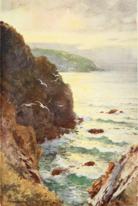
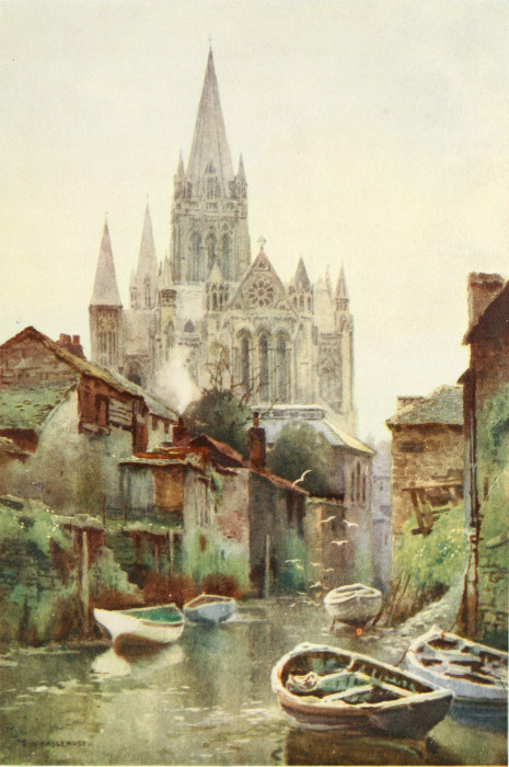
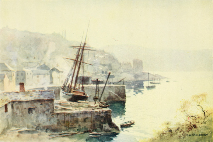
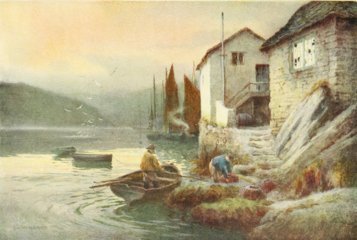
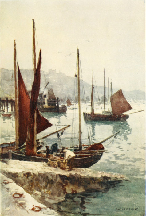
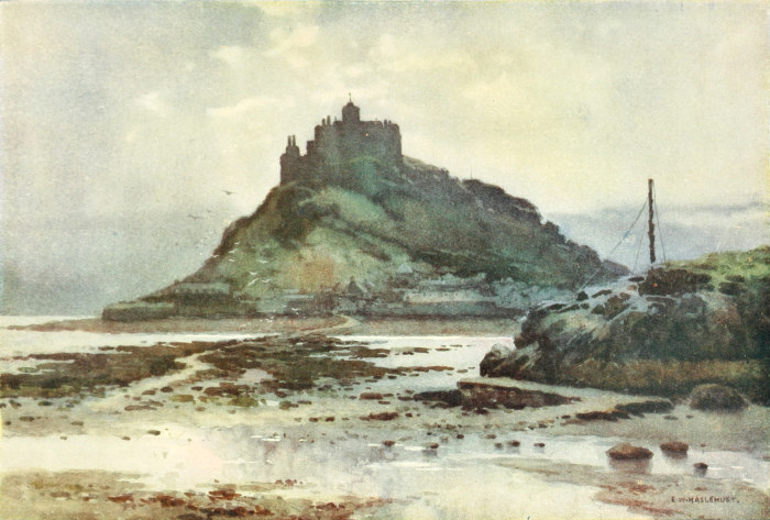
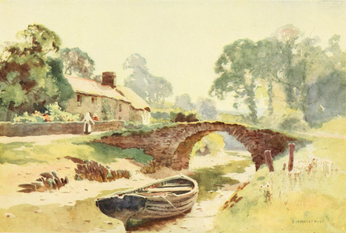
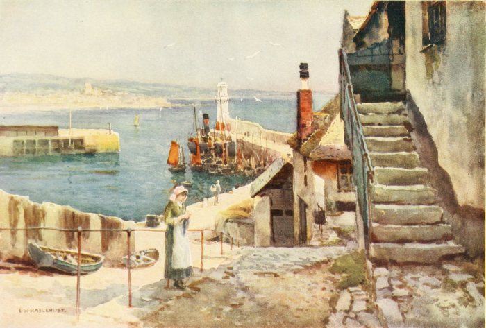
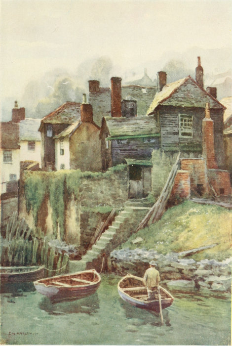
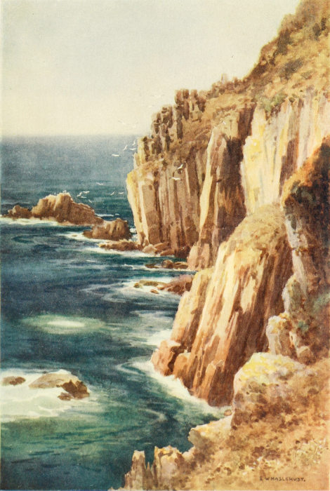
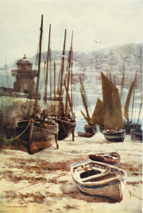
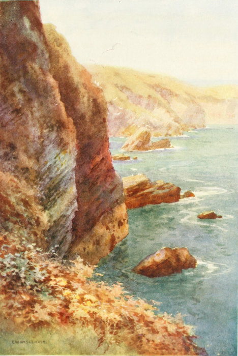