The Project Gutenberg eBook of The Greatest Highway in the World, by
Anonymous
This eBook is for the use of anyone anywhere at no cost and with
almost no restrictions whatsoever.  You may copy it, give it away or
re-use it under the terms of the Project Gutenberg License included
with this eBook or online at www.gutenberg.org
Title: The Greatest Highway in the World
Historical, Industrial and Descriptive Information of the Towns, Cities and Country Passed Through Between New York and Chicago Via the New York Central Lines. Based on the Encyclopaedia Britannica.
Author: Anonymous
Release Date: January 4, 2009 [eBook #27701]
Language: English
Character set encoding: ISO-8859-1
***START OF THE PROJECT GUTENBERG EBOOK THE GREATEST HIGHWAY IN THE WORLD***
E-text prepared by Juliet Sutherland, David Cortesi,
and the Project Gutenberg Online Distributed Proofreading Team
(http://www.pgdp.net)
Transcriber's Note
Minor typographical errors have been corrected:
employes to employees on p. 1, 129, and 130;
nagivation to navigation on p. 48; conferation to confederation on p. 46.
Inconsistent hyphenation in the original has been retained.
Owing to the method used to scan this work, in a few cases the first or
last letters of a line were lost and had to be found from other sources
or inferred from context. Where an inference is not certain, the
presumed missing letters are in parentheses with a question mark, for
example "p(art?)" on page 100. In the table on
page 130 ("Passengers carried annually," etc.)
the final digit of each number in the column on the right
cannot be read and has been replaced with 0.
This HTML edition should be readable at any width, but
will most closely resemble the original
page layout in a window of 800 pixels or narrower.
THE
GREATEST HIGHWAY
IN
THE WORLD
Historical, Industrial and Descriptive Information
of the Towns, Cities and
Country passed through between
New York and Chicago via The
New York Central Lines
Illustrated
Based on the
Encyclopaedia Britannica
Contents
(Supplied by Transcriber)
[1]
Foreword
In furtherance of giving the utmost service to the public, the New
York Central Lines asked the editors of the Encyclopædia Britannica to
prepare this booklet descriptive of and vivifying the historical development
of what has been termed "The Greatest Highway in the World."
It is presented to you in the hope that it may prove a pleasant companion
on a journey over our Lines. The information will afford a new
appreciation of the historical significance and industrial importance of the
cities, towns and country which the New York Central Lines serve.
The New York Central Lines enter twelve states and serve territory
containing 51,530,784 inhabitants or 50.3 per cent of the nation's population.
This rich and busy territory produces 64 per cent of the country's
manufactured products and mines a similar proportion of its coal.
This system does approximately 10 per cent of the railroad transportation
business of the United States, although its main-track mileage is
only 6 per cent. In other words the business it handles exceeds that
of the average railroad, mile for mile, by nearly 100 per cent. The New
York Central carries 52 per cent of all through passengers between New
York and Chicago, the remaining 48 per cent being divided among five
other lines. The freight traffic of the New York Central Lines in 1920
was greater than that carried by all the railroads of France and England
combined.
The scenes that stretch before the eyes of passengers on these Lines
are rich with historic interest. Few persons know that the second settlement
in the United States was at Albany and that it antedated Plymouth
by several years. Probably fewer persons know that the first United
States flag was carried in battle at Fort Stanwix, now the city of Rome,
N.Y. We hope that the reader will discover in the following pages
more than one historic shrine which he will wish to visit.
It has been said that the history of a country's civilization is the history
of its highways. Certainly the development of a great system such
as the New York Central is an important element in the progress and
prosperity of the country which it serves. This railroad is, in fact, a
public institution, and it will prosper to the extent that it gives
service to the public.
The New York Central Lines have the initial advantage that they
follow the great natural routes along which the first trails were blazed by
the red men, and are almost free from grades, sharp curves and other
hindrances to comfortable and efficient transportation. Thus the road owes
its superiority primarily to the fact that it lends itself to a maximum degree
of efficiency.
But service as it is conceived by the New York Central, involves many
aspects. One is the careful provision for the comfort and convenience
of passengers; another is adequate and efficient facilities for serving the
interests of shippers. In other words, New York Central service means
not only fast and luxurious passenger trains, but also the rapid handling
of freight. To give such service requires the highest class of equipment—the
best rails, the finest cars, the most powerful locomotives,
etc.—but it
also requires an operating force of loyal, highly trained employees. In
both respects the New York Central Lines excel.
The inspiring record of the system's growth through public approval
and patronage is fundamentally a tribute to the service rendered,
constantly advanced and developed in pace with public requirements. The
accompanying booklet is in one sense an expression of past achievement,
but it is also an earnest of greater accomplishment to come.
[3]
New York to Albany
NEW YORK, Pop. 5,261,151. Grand Central Terminal.
(Train 51 leaves 8:31;
No. 3, 8:46;
No. 41, 1:01;
No. 25, 2:46;
No. 19, 5:31.
Eastbound: train 6 arrives 9:22;
No. 26, 9:40;
No. 16, 4:00;
No. 22, 5:25.)[1]
[1. Throughout this handbook the time is given at which trains
are scheduled to leave or pass through the cities or towns mentioned.
From New York to Chicago, Train No. 51 is the Empire State Express; No.
3, the Chicago Express; No. 41, The Number Forty-one; No. 25, the
Twentieth Century, and No. 19, the Lake Shore Limited. In the reverse
route, from Chicago to New York, No. 6 is the Fifth Avenue Special; No.
26 is the Twentieth Century; No. 16, the New York and New England
Special, and No. 22, the Lake Shore Limited. The time given is Eastern
Standard Time at all points east of Toledo, and Central Standard Time,
which is one hour slower, at Toledo and all points west. (When Daylight
Saving Time is adopted during the summer it is one hour faster than
Standard time, but all time given in this booklet is Standard time.)
The time between 12.01 o'clock midnight and 12.00 o'clock noon is
indicated by light face type; between 12.01 o'clock noon and 12.00
o'clock midnight by dark face type. The use of an asterisk (*) indicates
places recommended as especially worth visiting. Population figures are
those of the 1920 U.S. Census.]
Fifty years ago when Commodore
Vanderbilt began the first Grand Central Station—depot,
they called it, in the language of the day—he made one error
of judgment. His choice of a site proved to be magnificently
right, though he selected a spot that was practically open
country, then technically known as 42nd St. The story goes—it
is a typically American story—that his friends laughed at
him, remarking that a person might as well walk to Boston
or Albany as go away up to 42nd St. to take a train for those
cities. But the people did come, and they admired the commodore's
new station, which is perhaps not surprising, since
the commodore had set himself to build the greatest terminal in
the world. Many Americans considered the new "depot" as
only second to the capitol at Washington, and it served as an
excellent show place when visitors came to town. Europe
might have its cathedrals, but it had no Grand Central Station!
The commodore's one mistake lay in thinking that his
fine new station would last a century. Within ten years an
addition had to be built; in 1898 it had to be entirely remodeled
and enlarged, and fifteen years later it was entirely
demolished to make way for the present building which would
be adequate for handling the city's ever-increasing millions.
There seems to be little doubt that the city of N.Y. and its environs
has become within the last decade larger even than London.
The population of greater London (including all the separate
[4]administrative entities within the Metropolitan Police District) is estimated at
7,435,379. Jersey City, Hoboken, and the other N.J. cities on the west,
as well as Yonkers, Mt. Vernon, New Rochelle, etc., on the north, although
politically detached, are included in the "city" of N.Y. in the
larger sense, their political detachment being in a certain sense accidental.
Including these, the population of N.Y. area corresponding
to the Metropolitan London area is 7,583,607. The population
of N.Y. City proper is 5,261,151. The London area comparable
with this, viz., the part of London governed by the London County
Council has a population of 5,028,974. Comparing the areas of the two—N.Y.C.
with 327 sq. miles and London with 692 sq. miles, it is
hard to understand how the respective populations should approximate
each other so nearly until it is remembered that New York grows perpendicularly
instead of horizontally, that it usurps more air rather than
more land. In some of the downtown business streets, such as Wall
or Rector, the buildings tower so high above the narrow thoroughfare
that they form a kind of deep canyon along which the wind is drawn
as through a tunnel.
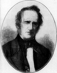
Commodore Vanderbilt
Cornelius Vanderbilt (1794-1877) at the age of 16
bought a sailboat in which he carried farm produce and
passengers between Staten Island, where he lived, and
N.Y. He was soon doing so profitable a business that in
1817, realizing the superiority of steam over sailing
vessels, he was able to sell his sloops and schooners,
and became the captain of a steam ferry between N.Y.
and New Brunswick. His projects grew enormously. He
inaugurated steamship lines between N.Y. and San
Francisco, N.Y. and Havre, and other places. In
1857-1862 he sold his steamships and turned his
attention more and more to the development of railways,
with the result that before his death he had built up
and was a majority share owner in the N.Y. Central &
Hudson River, the Lake Shore and Michigan Southern, the
Harlem, and the Michigan Central & Canada Southern
railways, and had holdings in many others. He died at
N.Y. in 1877.
In the colonial period Philadelphia was the most important city,
commercially, politically and socially, while just before the War of
Independence, Boston, with a population of 20,000 was the most
flourishing town in all the colonies. During the Revolutionary War,
N.Y.C. had fallen to a population of 10,000 and in 1790 it had barely
gained a position of leadership with 33,131, but by 1840 N.Y.C. had
grown to be a city of 313,000 while Philadelphia had 95,000 and Boston
93,000.
Today one of the most remarkable features of New York
is the Grand Central Terminal. The exterior finish is granite
and Indiana lime-stone; the style somewhat Doric, modified
by the French Renaissance. Over the entrance to the main
[5]building is a great arch surmounted by a statuary group
wherein Mercury, symbolizing the glory of commerce, is supported
by Minerva and Hercules who represent mental and
moral force.
Within, the main concourse of the station proper is an
immense room with a floor space of 37,625 sq. ft. where the
New York City Hall might be set and yet leave room to spare.
It is covered with a vaulted ceiling 125 ft. high, painted a
soft cloudy blue and starred over with the constellations of
heaven. Great dome-shaped windows, three each at the east
and west ends, furnish light.
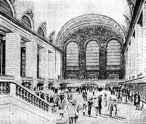
The Main Concourse, Grand Central Station
The entire site of the Grand Central Terminal comprises
30 blocks and 80 acres which above the surface are covered
with a great variety of buildings, making almost a city in
itself. Moreover, there is direct subway entrance to three
large hotels, capable of housing as many as 10,000 persons, and
to all these conveniences is added that of comfortable temperature
throughout the terminal, no matter how cold the weather.
[6]
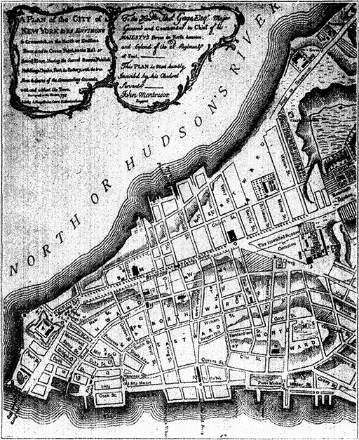
Map of New York City, 1775
This survey, made in the winter of 1775, shows the city
proper as it existed during the Revolutionary War.
Places indicated by the lettering are described under
the original as follows: A, Fort George. B, Batteries
[at the two points of the island]. C, Military Hospital
[south of Pearl St.]. D, Secretary's Office [near Fort
George]. E, [Not Shown]. F, Soldiers' Barracks [at
extreme right]. G, Ship Yards [lower right hand corner].
H, City Hall [Broad and Wall streets, site of present
Sub-Treasury building]. I, Exchange. J, K, Jail and
Workhouse [both situated on the "intended square or
common," now City Hall Square]. L, College [Church
and Murray streets; this was King's College, now
Columbia University]. M, Trinity Church [the present
Trinity was built on 1839-46, though it stands on the
site of the old church built in 1696]. N, St. George's
Chapel. O, St. Paul's Chapel [built in 1756, the oldest
edifice still standing in N.Y.C.]. P to Z, various churches.
[7]
As distinctively "New York" as the sky-scrapers, are the hotels
and apartment houses. Of the latter, there are more than in any other
city in the world, and the number of persons who are giving up their
houses and adopting this manner of life is steadily increasing. The
first thing, in fact, that impresses a visitor on his arrival is the seemingly
endless amount of buildings adopted for transients. A few of
the largest hotels have space for several thousand persons at one time.
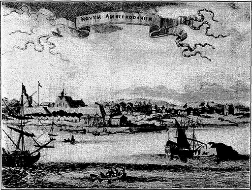
New Amsterdam (Now New York City) in 1671
The point of land in the foreground is now known as the
Battery. The large building inside the stockade is a
church. In the middle foreground is a gallows. The hills
in the background form the approach to the present
Morningside Heights.
The old station in 1903-'12 was torn down, brick by brick,
while at the same time the new building was being erected—and
all without disturbing the traffic or hindering the
75,000 to 125,000 people that passed through the station each
day. This was an extraordinary engineering feat, for not
only were 3,000,000 yards of earth and rock taken out to
provide for the underground development, but hundreds of
tons of dynamite were used for blasting. Among the improvements
introduced in the new station are ramps instead
of stairways, the division of out-going from in-going traffic
[8]and the elimination of the cold trainshed. The substitution
of electricity for steam as a motive power in the metropolitan
area made possible the reclamation of Park Avenue and the
cross streets from 45th St. to 46th St.—about 20 blocks in all—by
depressing and covering the tracks.
At 56th St. the tracks begin to rise from the long tunnel
and pass through the tenement district of the upper East
Side. The side streets seem filled with nothing but children
and vegetable carts, while along the pavements shrill women
with shawls over their heads are bargaining for food with
street-vendors. As the railroad tracks rise higher still, we
run on the level with the upper-story windows out of which
the tenants lean and gossip with one another.
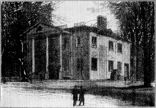
The Jumel Mansion, New York City
4 M. HARLEM STATION (125th St.).
(Train 51 passes 8:41;
No 3, 8:57;
No. 41, 1:12;
No. 25, 2:56;
No. 19, 5:41.
Eastbound: No. 6 passes 9:11;
No. 26 9:29;
No. 16, 3:49;
No. 22, 5:25.)
Old Harlem was "Nieuw Haerlem," a settlement
established in 1658 by Gov. Peter Stuyvesant in the
northeastern part of Manhattan Island. It existed for 200
years but is now lost under modern Harlem, which centers
about 125th St.
In this neighborhood to the west occurred
[9]the battle of Harlem Heights—a lively skirmish fought Sept.
16, 1776, opposite the west front of the present Columbia
University, and resulting in a victory for the forces of Gen.
Washington, who up to that time had suffered a number of
reverses on Long Island and elsewhere. The battle was directed
by Washington from the Jumel mansion*, 160th St.
and Amsterdam Ave., the most famous house, historically, on
the island of Manhattan. It is still standing.
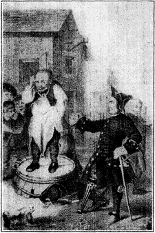
Peter Stuyvesant and the Cobbler
Peter Stuyvesant, Dutch Governor of N.Y. from 1647 to
1664 and a valiant member of the Reformed Church, had an
intense prejudice against all other sects. At Flushing a
Baptist cobbler, William Wickendam, ventured to preach
"and even went with the people into the river and dipped
them." He was fined 12,500 guilders ($5,000) and ordered
to be banished. As he was a poor man the debt was
remitted, but he was obliged to leave the province.
The house was built in 1763 by Roger Morris for his bride, Mary
Philipse of Yonkers, for whose hand, it is said, Washington had
been an unsuccessful suitor. The house was subsequently owned by
John Jacob Astor and then passed into the hands of Stephen Jumel, a
French merchant, who, with his wife Eliza, added new fame to the
old house. They entertained here Lafayette, Louis Napoleon, Joseph
Bonaparte and Jerome Bonaparte. Aaron Burr (1756-1836) in his old
age, appeared at the mansion with a clergyman, and married Mme.
Jumel, then a widow. She divorced him shortly afterward, and he
died in poverty on Staten Island, 1836. Alexander Hamilton whom
Burr killed in the famous duel at Weehawken, N.J. (July 11, 1804)
owned a country place in the neighborhood, "Hamilton Grange," which
now stands at 140th St. and Convent Ave.
Leaving Manhattan, that
extraordinary island which
Peter Minuit, director-general
of New Netherlands,
bought in 1626 from the Indians
for sixty guilders'
worth of goods (about $24),
we cross the Harlem River
to the Borough of the Bronx,
named for Jonas Bronck, the
first white settler, who made
his home in 1639 near the
Bronx Kills (where the Harlem
River flows into Long
Island Sound).
The original price paid for the Bronx—or
a large share of it—was[10] "2 gunns, 2 kettles, 2 coats, 2 shirts, 2 adzes, 1 barrel of cider,
and 6 bitts of money." The assessed value of Manhattan today is
$5,116,000,000 and that of the Bronx $732,000,000 (realty).
The Hudson River Division of the New York Central
turns to the left and follows the course of the Harlem River,
7 M. long, which separates Manhattan Island from the mainland
and connects the Hudson with the East River. On the
south bank of the Harlem are Washington Heights, with
the Speedway on the immediate bank, and Fort George (near
193d Street) named from a Revolutionary redoubt. The
Speedway was built at a cost of $3,000,000 for the special use
of drivers of fast horses. On the right, after passing the High
Bridge, which carries the old Croton aqueduct, one of the
feeders of the city water supply, and the Washington Bridge,
are University Heights and (farther to the west) the township
of Fordham, where the cottage in which Edgar Allen Poe lived
from 1844 to 1849 and wrote Ulalume and Annabel Lee, is still
preserved.
New York University, on University Heights, was founded in
1832; the principal buildings include Gould Hall, a dormitory; the
library, designed by Stanford White, and the Hall of Fame, extending
around the library in the form of an open colonnade, 500 ft long, in
which are preserved the names of great Americans.
11 M. SPUYTEN DUYVIL.
(Train 51 passes 8:51;
No. 3, 9:09;
No. 41, 1:23;
No. 25, 3:06;
No. 19, 5:53.
Eastbound: No. 6 passes 8:57;
No. 26, 9:17;
No. 16, 3:37;
No. 22,
5:02.)
Spuyten Duyvil is situated on Spuyten Duyvil Creek,
celebrated by Washington Irving, which connects the Harlem
and Hudson Rivers. In recent years the creek has been enlarged
into a ship canal.
The town and stream receive their curious name from the following
story, according to Irving. In 1664, when the Dutch were being
threatened by the British, Anthony van Corlear, Dutch trumpeter to
Gov. Stuyvesant, was despatched to sound the alarm. It was a stormy
night and the creek was impassable. Anthony "swore most valourously
that he would swim across it 'in spite of the devil' (en spuyt
den duyvil) but unfortunately sank forever to the bottom." The
"duyvil" had got him. "His ghost still haunts the neighborhood, and
his trumpet has often been heard of a stormy night."
Across the Hudson, along which our route now lies for
nearly 150 M., can be seen the Palisades, an extraordinary
ridge of basaltic rock rising picturesquely to a height of between
300 and 500 ft. and extending along the west bank of
the Hudson about 12 M. from a point north of Ft. Lee, N.J.,
to Palisades, N.Y.
The peculiar hexagonal jointing of the rock, which has given rise
to the name Palisades, is an unusual geological formation; the only
[11]other important places where it is found are at Fingal's Cave in Scotland
and the Giant's Causeway in Ireland. The beauty of the Palisades
was threatened by quarrying and blasting operations until N.Y.
and N.J. agreed to the establishment of the Palisades Interstate Park
which comprises 36,000 acres (1,000 acres in New Jersey and 35,000
in New York State).
"The spacious and stately characteristics of the Hudson from the
Palisades to the Catskills are as epical as the loveliness of the Rhine
is lyrical. The Hudson implies a continent beyond. No European
river is so lordly in its bearing, none flows in such state to the sea.
Of all the rivers that I know, the Hudson, with this grandeur, has the
most exquisite episodes."—George William Curtis.
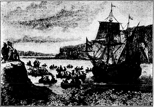
The Half Moon at Yonkers
In September, 1609, Henry Hudson started up the Hudson in the "Half Moon,"
which attracted frequent visits from the natives along the route.
To the right, just north of Spuyten Duyvil, is a high
promontory, upon which stands a lofty monument to Henry
Hudson, who had his first skirmish here with the Indians
after entering N.Y. Bay in Sept. 1609. With an excellent
harbour at its mouth, and navigable waters leading 150 M.
into a fertile interior, the Hudson River began to attract explorers
and settlers soon after the discovery of America. Verrazano,
the Florentine navigator, sent out by the French king,
Francis I, ventured a short distance up the Hudson in 1524,
almost 100 years before the Pilgrim Fathers, and in 1609
Henry Hudson sailing in the "Half Moon" nearly up to the
[12]site of Albany demonstrated the extent and importance of
the river that bears his name.
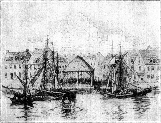
New York Slave-Market—About 1730
Slaves were introduced into N.Y. as early as 1626 when the West
India Co. (a Dutch company), which had large establishments on the
coast of Guinea, brought negroes to Manhattan, and practiced the
slave trade here "without remorse." It is said that in proportion
to population N.Y. imported as many Africans as Virginia. That New
York did not become a slave-state like Carolina was, according to
Bancroft, "due to climate and not to the superior humanity of its
founders. [Gov.] Stuyvesant was instructed to use every exertion
to promote the sale of negroes. They were imported sometimes by
way of the West Indies, often directly from Guinea, and were sold
at auction to the highest bidder. The average price was less than
$140." With the extension of English rule to N.Y. in 1664 the
slave trade in this colony passed into the hands of the British.
It is estimated that the total import of slaves into all the
British colonies of America and the West Indies from 1680 to 1786
was 2,130,000. The traffic was then carried on principally from
Liverpool, London and other English ports; the entire number of
ships sailing from these ports then engaged in the slave traffic
was 192, and in them space was provided for the transport of
47,146 negroes. The native chiefs on the African coasts took up
the hunt for human beings and engaged in forays, sometimes even on
their own subjects, for the purpose of procuring slaves to be
exchanged for western commodities. They often set fire to a
village by night and captured the inhabitants when trying to
escape. Out of every lot of 100 shipped from Africa, about 17 died
either during the passage or before the sale at Jamaica, while not
more than 50 lived through the "seasoning" process and became
effective plantation laborers. Slavery in N.Y. was continued till
1827. It was then abolished by terms of an act passed by the N.Y.
Assembly ten years earlier.
[13]
Henry Hudson, English navigator, made four important voyages
to find a passage to China by the northeast or northwest route; it was
on the third venture undertaken at the instance of the Dutch East
India Co., that he found the Hudson, probably a greater discovery
than the one he undertook to make. With a mixed crew of 18 or 20
men he started on his voyage in the "Half Moon," April 6, 1609, and
soon was among the ice towards the northern part of Barents Sea.
His men mutinied and he was forced to seek the passage farther south.
Thus eventually he entered the fine bay of what is now N.Y. harbour,
Sept. 3, 1609. John Fiske says: "In all that he attempted he failed,
and yet he achieved great results that were not contemplated in his
schemes. He started two immense industries, the Spitzbergen whale
fisheries and the Hudson Bay fur trade; and he brought the Dutch to
Manhattan Island. No realization of his dreams could have approached
the astonishing reality which would have greeted him could
he have looked through the coming centuries and caught a glimpse of
what the voyager now beholds in sailing up the bay of New York."
The Dutch called the Hudson the North River (a name which is still
used) in contra-distinction to the Delaware which they called the
South River.
The lower Hudson is really a fiord—a river valley into
which ocean water has been admitted by the sinking of the
land, transforming a large part of the valley into an inlet,
and thus opening it to commerce as far as Troy (about 150
M.), up to which point the river is tidal and, therefore, partly
salt. The Hudson extends above Troy for 150 M. farther,
but navigation is interrupted by shallows and swift currents.
Below Troy the fall is only five feet in a distance of 145 M.
This lower, navigable portion of the Hudson was the only
feasible route through the Atlantic highlands, and in consequence
it has been one of the most significant factors in the
development of the United States. New York City likewise
owes its phenomenal development largely to this great highway
of commerce.
The invention and successful operation of the steamboat,
the first line of which was established on the Hudson by Fulton
in 1807, gave early impetus to the importance of N.Y.C.,
and the building of the Hudson River R.R., one of the first
successful railways, now a part of the New York Central
Lines, and the opening of the Erie Canal (1825) connecting
the Hudson with the Great Lakes and the far interior, were
among other contributory factors in the city's growth.
15 M. YONKERS, Pop. 100,226.
(Train 51 passes 8:56;
No. 3, 9:15;
No. 41, 1:29;
No. 25, 3:11;
No. 19, 5:59.
Eastbound No. 6 passes 8:52;
No. 26, 9:12;
No. 16, 3:31, No. 22,
4:56.)
When the Dutch founded New Netherlands, the present
site of Yonkers was occupied by an Indian village, known
[14]as Nappeckamack, or "town of the rapid water," and a great
rock near the mouth of the Nepperhan creek (to the north of
the station) was long a place of Indian Worship.
In the early days, the Hudson River Valley from Manhattan to Albany
was occupied by Algonquin tribes, while the central part of the
state along the Mohawk Valley had been conquered by the famous Iroquois
Confederation, of which the Mohawks were the most warlike.
The Mohawks soon drove out the Mohicans, who claimed as their
territory the east bank of the Hudson. On the whole, the Dutch lived
peaceably with their Indian neighbors, but an attempt of Gov. Kieft to
collect tribute from them led to an Indian war (1641), which resulted
in the destruction of most of the outlying settlements. Later a treaty
of alliance was made with the Iroquois Confederation, which protected
the early settlements in N.Y. from those attacks which occurred so
frequently elsewhere in this period. The treaty was renewed when the
British took possession of New Netherlands, and lasted until the
Revolutionary War.
The land where Yonkers now stands was part of an estate
granted in 1646 by the Dutch government to Adrian Van Der
Donck, the first lawyer and historian of New Netherlands.
The settlement was called the "De Jonkheer's land" or "De
Yonkeer's"—meaning the estate of the young lord—- and afterwards
Yonkers. Subsequently the tract passed into the hands
of Frederick Philipse, the "Dutch millionaire," as the English
called him, some of whom alleged that he owed a large part
of his fortune to piratical and contraband ventures. The suspicion
was strong enough to force Philipse out of the governing
council of the colony, and he returned to his manor
where he died (1702) at the age of 76.
It was even charged that he was one of the backers of Capt.
William Kidd (1645-1701), for whose buried treasure search has been
made along the Hudson, as well as in countless places along the
Atlantic Coast. Capt. Kidd began the career which made him notorious
under a commission from the British Government to apprehend
pirates. He sailed from Plymouth, England, in May 1696, filled
up his crew in N.Y. in the following year, and then set out for Madagascar,
the principal rendezvous of the buccaneers. Deserting his ship,
he threw in his lot with theirs and captured several rich booties. Returning
to N.Y., he was arrested, sent to London, found guilty and
hanged. Of his "treasure" about £14,000 was recovered from his ship
and from Gardner's Island, off the east end of Long Island. The
stories of large hoards still undiscovered are probably mythical.
The Philipse manor house*, one of the best examples of
Dutch colonial architecture in America, erected in 1682 and
enlarged in 1745, was the second residence built by the Philipses
(the other is at Tarrytown) and is now maintained as
a museum for colonial and Revolutionary relics. It was
confiscated by the legislature in 1779 in reprisal for the
[15]suspected "Toryism" of the third Frederick Philipse, the great
grandson of the first lord of the manor and his second successor.
Before being converted into a museum it served for
many years as the City Hall of Yonkers.
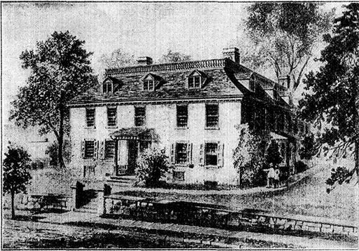
Philipse Manor House, Yonkers, 1682
This famous old house, said to be one of the best
examples of Dutch colonial architecture in America, was
built by Frederick Philipse, first lord of the manor of
Philipsburg. It was confiscated by the State of New York
after the Revolutionary War and for many years served as
the City Hall of Yonkers. It is now a museum.
Yonkers has some important manufactures with an annual
production of $75,000,000 and 15,000 wage earners; its
output includes passenger and freight elevators, foundry and
machine shop products, refined sugar, carpets, rugs and hats.
It has one of the largest carpet factories in the world.
The country round Yonkers is dotted with fine estates.
Conspicuous to the right, 2 M. north of the station, is the
battlemented tower of "Greystone," once the home of Samuel
J. Tilden and now owned by Samuel Untermyer, the N.Y.
lawyer.
Samuel J. Tilden (1814-1886), a lawyer and reformer, served one
term as governor of N.Y., and was later candidate for the presidency
against Rutherford B. Hayes. He had become famous for his attacks
[16]on the notorious Tweed ring of N.Y.C., and later for his exposure of
the "Canal ring," a set of plunderers who had been engaged in exploiting
the N.Y. canal system. He was given the Democratic nomination
for president in recognition of his services as a reformer. The
Republicans nominated Hayes, and the result was the disputed election
of 1876, when two sets of returns were sent to Washington from the
States of Florida, Louisiana, South Carolina and Oregon. As the
Federal Constitution contains no provision for settling a dispute of
this kind, the two houses of Congress agreed to the appointment of an
extra-Constitutional Body, the Electoral Commission, which decided
all the contests in favor of the Republican candidates. Tilden's friends
charged that they had been made a victim of a political "steam roller,"
but he advised them to make no protests. Tilden left more than
$2,000,000 for a library in N.Y. (now consolidated with the N.Y.
Public Library).
Across the Hudson River from Hastings (19 M.) can be
seen Indian Head, the highest point on the Palisades, near
which (about ½ M. farther north) is the boundary between
N.J. and N.Y.; from this point northward both shores belong
to N.Y.
20 M. DOBBS FERRY, Pop. 4,401.
(Train 51 passes 8:58;
No. 3, 9:23;
No. 41, 1:37;
No. 25, 3:18;
No. 19, 6:07.
Eastbound: No. 6 passes 8:45;
No. 26, 9:05;
No. 16, 3:23;
No. 22, 4:48.)
About the time of the Revolutionary War, a
Swede named Jeremiah Dobbs, established a ferry here connecting
with the northern end of the Palisades (visible on the
left across the river). Originally only a dugout or skiff, it
was the first ferry north of Manhattan, and was kept up by
the Dobbs family for a century. In times past the residents
have often tried to change the name of the town to something
more "distinguished," but the old name could not be displaced.
The story goes that 50 years ago a mass meeting was held in
the village at which it was proposed to name the town after one of the
captors of Maj. André—either Paulding or Van Wart. The meeting
came to nothing when an old resident suggested Wart-on-Hudson.
The strategic position of Dobbs Ferry gave it importance
during the War of Independence. It was the rendezvous of
the British after the battle of White Plains in Nov. 1775 and
a continental division under Gen. Lincoln was stationed here
in Jan. 1777. The American army under Washington encamped
near Dobbs Ferry on the 4th of July, 1781, and started
in the following month for Yorktown, Va., where the final
story of the war took place. Two years later (May 6, 1783)
Washington and Sir Guy Carleton met at Dobbs Ferry to
negotiate for the evacuation of all British troops, and to make
[17]terms for the final settlement recognizing American Independence.
Their meeting place was the old Van Brugh Livingston
house.
Peter Van Brugh Livingston (1710-1792), prominent merchant and
Whig political leader in N.Y., was one of the founders of the College
of N.J. (now Princeton), and was president of the first Provincial
Congress of N.Y. (1775). His brother, William, was the first governor
of N.J.
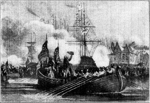
Reception of President Washington at New York, April 23rd, 1789
After the ratifying of the federal constitution, Washington, in 1788, was
unanimously elected president. On April 23, 1789, he arrived from Virginia at
New York, where he was received with a frenzy of gratitude and praise, and was
inaugurated at the Senate hall which stood on the site of the present U.S.
Sub-Treasury building. The stone whereon Washington stood when he came out of
the house is preserved in the south wall of this building. He is described as
wearing suit of homespun so finely woven that "it was universally mistaken for
a foreign manufactured superfine cloth." This, of course, was a high tribute to
domestic industry.
22 M. IRVINGTON, Pop. 2,701.
(Train 51 passes 9:06;
No. 3, 9:25;
No. 41, 1:39;
No. 25, 3:21;
No. 19, 6:11.
Eastbound: No. 6 passes 8:43;
No. 26, 9:03;
No. 16, 3:21;
No. 22, 4:46.)
"Sunnyside," a stone building "as full of angles and
corners as a cocked hat"* and situated behind a screen of trees
a little north of the station, was the home of Washington
Irving, for whom the town was named. First erected by
[18]
Wolfert Acker in 1656, it was considerably enlarged by
Irving in 1835.
[19]
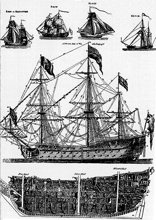
War and Merchant Ships of Revolutionary Days
These are authentic pictures, showing actual details, of the ships used
by the Americans and British at the time of the Revolutionary War. They
were originally engraved for the First Edition of the Encyclopædia
Britannica (1768). In the centre is a first rate ship of war, "the
noblest machine that ever was invented," to quote the First Edition; and
the illustration below shows the interior construction of the hull. It
will be noticed that there are three gun decks, below which is the poop,
or storage deck. "A common first rate man of war," says the First
Edition, "Has its gun deck from 159 to 178 ft. in length, and from 44 to
51 broad. It contains from 1313 to 2000 tons; has from 706 to 1000 men,
and carries from 96 to 100 guns. The expense of building a common first
rate, with guns, tackling and rigging is computed at 60,000 £ sterling."
The east end is covered with ivy said to be grown from
a slip given to Irving when he visited Scott at Abbotsford.
At Irvington we come to Tappan Zee (to be seen on the left),
where the Hudson widens into a lake-like expanse, 10 M.
long and 3 to 4 M. wide. It is a favorite cruising place for
ghosts and goblins, according to popular legend.
There is, for example, Rambout van Dam, the roystering youth
from Spuyten Duyvil, who was doomed to journey on the river till
Judgment Day—all because he started to row home after midnight
from a Saturday night quilting frolic at Kakiat. "Often in the still twilight
the low sound of his oars is heard, though neither he nor his
boat is ever seen." Another phantom that haunts the Tappan Zee is
the "Storm Ship," a marvellous boat that fled past the astonished
burghers at New Amsterdam without stopping—a flagrant violation of
the customs regulation, which caused those worthy officials to fire
several ineffectual shots at her.
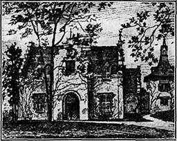
“Sunnyside,” Irving's Home After 1835
After a long sojourn abroad, Washington
Irving returned in 1835 to "Sunnyside"
said to have been built originally
in 1656. It was considerably
enlarged by Irving, who spent the remainder
of his life here. "Sunnyside"
is now owned by Irving's descendants.
Across the river from Irvington is Piermont, and 2 M.
to the southwest of Piermont is the village of Tappan, where
Maj. André was executed Oct. 2, 1780. Lyndehurst, with its
lofty tower, the home of Helen Gould Sheppard, the philanthropist,
a daughter of Jay Gould, is passed on the right just
before reaching Tarrytown.
24½ M. TARRYTOWN, Pop. 5,807.
(Train 51 passes 9:08;
No. 3, 9:27;
No. 41, 1:41;
No. 25, 3:23;
No. 19, 6:13.
Eastbound: No. 6 passes 8:40;
No. 26, 9:00;
No. 16, 3:18;
No. 22, 4:43.)
Situated on a sloping hill that rises to a considerable
height above the Tappan Zee, historic Tarrytown stands
on the site of an Indian village, Alipoonk (place of elms),
burned by the Dutch in 1644. Irving explains that the housewives
of the countryside gave the town its name because their
[20]husbands were inclined to linger at the village tavern, but
literal minded historians think it was more likely that the
name came from Tarwen dorp or Tarwetown, "wheat town."
There were perhaps a dozen Dutch families here in 1680 when
Frederick Philipse acquired title to Philipse Manor, several
thousand acres, in what is now Westchester county. Just
above Tarrytown is the valley of the Pocantico creek, the
mouth of which is marked by the projection of Kingsland
Point.
This is the "Sleepy Hollow" of Irving's legend, where Ichabod
Crane, the long, thin school-master, whose conspicuous bones clattered
at any mention of ghosts, encountered the Headless Horseman pounding
by night through the little Dutch village. It was after a quilting
bee at Farmer Van Tassel's, where his daughter Katrina and what
would come with her in the shape of fat farm-lands and well-stocked
barns, aroused Ichabod's affections to the boiling point. He had a
[21]rival, however, "Brom Bones," a young black-headed sprig, who
watched Ichabod's advances uneasily. After the party Ichabod
mounted his old horse, Gunpowder, as bony as he, but no sooner was
he well under way than he heard hoof beats on the road behind him
and saw, glimmering in the dark, a white headless figure on horseback,
carrying in its arms a round object like a head.... Never before or
since was there such a chase in Sleepy Hollow. Perhaps the hapless
school-teacher might have escaped, had not the Huntsman, just as
they reached the Sleepy Hollow bridge, hurled his head square at his
victim. The next morning no Ichabod, only a pumpkin lying on the
road by the bridge, where the hoofmarks ceased. He had completely
disappeared. Some weeks later Brom Bones led Katrina to the altar.
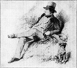
Washington Irving
Washington Irving (1783-1859) was intended for a legal profession, but
although called to the bar preferred to amuse himself with literary
ventures. The first of these, with the exception of the satirical
miscellany, "Salmagundi," was the delightful "Knickerbocker History of
New York," wherein the pedantry of local antiquaries is laughed at, and
the solid Dutch burgher established as a definite comedy type. When the
commercial house established by his father and run by his brother began
to go under in 1815, Irving went to England to look into the affairs of
the Liverpool house, and as it was soon necessary to declare bankruptcy,
his misfortune forced him to write for his living. Returning to America
in 1832 after 17 years' absence, he found his name a household word. The
only interruption to his literary career was the four years (1842-1846)
he spent as ambassador to Spain. For the rest, he passed some little
time travelling, but in the main kept retreat at "Sunnyside," where he
died, Nov. 28, 1859.
Through this valley, we get a glimpse of the site where
Philipse erected, partly of brick brought from Holland, a
manor house,* a mill,* and a church,* all of which are still
standing.
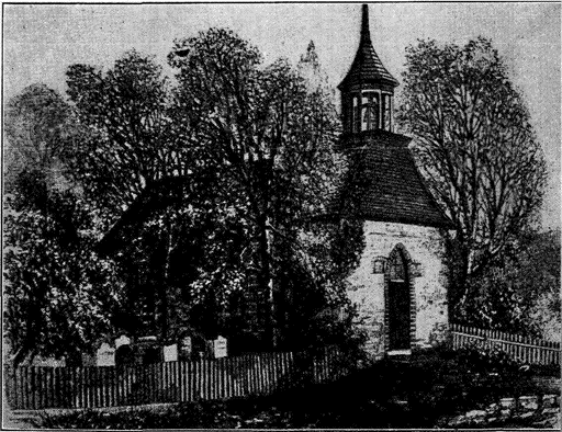
Old Dutch Church (Built About 1686) at Tarrytown, N.Y.
Irving says: "The sequestered situation of the church seems always to
have made it a favorite haunt of troubled spirits. It stands on a knoll,
surrounded by locust trees and lofty elms, from among which its
white-washed walls shine modestly forth, like Christian purity beaming
through the shades of retirement." The church is still standing.
"There is probably no other locality in America, taking into account
history, tradition, the old church, the manor house, and the
mill, which so entirely conserves the form and spirit of Dutch civilization
in the New World.... This group of buildings ranks in historic
[22]
interest if not in historic importance with Faneuil Hall, Independence
Hall, the ruined church tower at Jamestown, the old gateway at St.
Augustine, and the Spanish cabildo on Jackson Square in New Orleans.
And the time will come when pilgrimages will be made to this ancient
beautiful home of some of those ideals and habits of life which
have given form and structure to American civilization."—Hamilton
Wright Mabie.
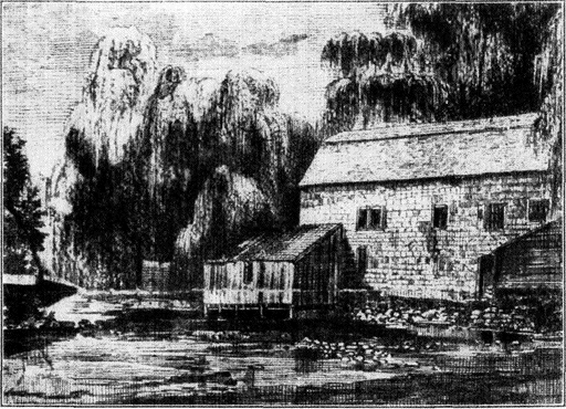
Old Mill at Tarrytown Built in 1686
The Manor House, the Old Church and the Mill were erected by Frederick
Philipse, the lord of several thousand acres, in what is now Westchester
County. The mill, much dilapidated, still exists.
During the War of Independence, Tarrytown was the
scene of numerous conflicts between the "cowboys" and "skinners,"
bands of unorganized partisans who carried on a kind
of guerilla warfare, the former acting in the interest of the
colonists, and the latter in that of the king. On the old post
road on Sept. 24, 1780, Maj. André was captured by three
Continentals, John Paulding, David Williams, and Isaac van
Wart. The spot where André was captured is now marked
with a monument—a marble shaft surmounted by a statue of
a Continental soldier.
Tarrytown lies principally along either side of a broad and winding
highway, laid out in 1723, from N.Y.C. to Albany. It was called
the King's Highway till the War of Independence, then called Albany
Post Road, and the section of it in Tarrytown is known now as
[23]
Broadway. The delights of traveling in the days when the road was
first laid out are suggested in the following description: "The coach
was without springs, and the seats were hard, and often backless.
The horses were jaded and worn, the roads were rough with boulders
and stumps of trees, or furrowed with ruts and quagmires. The
journey was usually begun at 3 o'clock in the morning, and after
18 hours of jogging over the rough roads the weary traveler was
put down at a country inn whose bed and board were such as to
win little praise. Long before daybreak the next morning a blast
from the driver's horn summoned him to the renewal of his journey.
If the coach stuck fast in a mire, as it often did, the passengers must
alight and help lift it out."
Many of the stirring incidents of Fenimore Cooper's novel,
The Spy, occurred in this neighborhood, and the town is particularly
described in The Sketch Book of Washington Irving
who was for many years the warden of the old church
and is buried in the old Sleepy Hollow burying ground.
With Cooper and Washington Irving (1783-1859) American literature
first began to exist for the world outside our own boundaries.
The Knickerbocker History of New York, in which the Dutch founders
were satirized, was practically the first American book to win appreciation
abroad. This and later books "created the legend of the
Hudson, and Irving alone has linked his memory locally with his
country so that it hangs over the landscape and blends with it forever."
Harvey Birch, the hero of The Spy, is a portrait from the life of
a revolutionary patriot who appears in the book as a peddler with a
keen eye to trade as well as to the movements of the enemy. One
of the best known incidents in the book is that in which Harvey, by
a clever stratagem, assists Capt. Wharton to escape. James Fenimore
Cooper (1789-1851) was born at Burlington, N.J., but was
reared in the wild country around Otsego Lake, in central N.Y., on
the yet unsettled estates of his father. It was here he learned the
backwoods lore, which in combination with his romantic genius, made
him one of the most popular of authors.
Among the literary residents of Tarrytown have been
Mrs. E. D. E. N. Southworth, well known to a previous generation
for her romantic novels, John Kendrick Bangs, the
humorist, and Hamilton Wright Mabie, editor and essayist.
Carl Schurz (1829-1906) is buried here in the Sleepy Hollow
churchyard. Tarrytown is the trading center of a prosperous
agricultural region; it also has about 100 manufacturing establishments
with a large output. Just north of Kingsland
Point (seen at the left, on the east bank of the river), the seat
of William Rockefeller comes into view on the right, and
behind it, among the hills, is the estate of his brother, John
D. Rockefeller.
John D. Rockefeller was born in 1839 at Richford, Tioga Co.,
N.Y., but his family moved to Cleveland while he was still a boy,
and his career was begun there. In 1858 he went into the produce
[24]commission business, and 4 years later his company invested in an
oil refinery. Mr. Rockefeller kept constantly adding to his influence
and possessions in this field until by 1872 the Standard Oil Co. was organized
with him as president, and a practical control of oil production
in America was secured. This was the first great American "trust."
Mr. Rockefeller himself retired from active business in 1895. While
his wealth is enormous, his benefactions have been on an equal scale,
comprising gifts to the Baptist Church, the founding of educational
institutions and the supporting of those already existent. Scientific
research in medical fields has been a particular object of his generosity.
Mr. Rockefeller's country estate is called "Kijkuit," meaning look-out—a
name given by the early Dutch settlers to the beautiful hill on
which it stands, and which, rising to a height of 500 ft., gives a lovely
view up and down the Hudson, across to the distant mountain ridges
of N.J., and inland over Westchester County. The house and gardens
are famous not only for their splendour, but for the priceless
works of art they contain. Among the treasures which have been
worked in as details of the landscape gardening is a fountain which
for years has been considered unrivalled by experts. The huge basin,
20 ft. 8 in. in diameter, was cut from a single block of granite weighing
50 tons and brought on the deck of a schooner from an island
on the Maine coast to the dock at Tarrytown. The heroic figure at
the top represents Neptune, and the figures below symbolize the
Atlantic, Pacific and Indian Oceans.
In the "morning garden" at the rear of the house is a bronze
Victory (a facsimile of the Pompeiian Victory at Naples), which
stands on a marble column with a Byzantine capital brought from
Greece. The 13th century relief set in the wall of the pergola at
the left came from a church in Venice.
Descending a flight of steps to the westward, one comes upon the
Aphrodite temple. The style of this is Graeco-Roman, with columns
of marble supporting a dome decorated after the fashion of the portico
niches in the Massimi palace in Rome, which was designed in the
16th century by Baldassare Peruzzi. Under a roof of copper and
bronze, on a high pedestal, stands "Aphrodite," resembling the Venus
de Medici, but so superior to her in line and proportion that many
critics believe it to be a Praxitilean original from which the Venus
de Medici was clumsily copied. This is the greatest art-treasure in
the garden.
30 M. OSSINING, Pop. 10,739.
(Train 51 passes 9:15;
No. 3, 9:34;
No. 41, 1:48;
No. 25, 3:30;
No. 19, 6:21.
Eastbound: No. 6, passes 8:34;
No. 26, 8:54;
No. 16, 3:11;
No. 22, 4:36.)
Ossining was first settled in 1700, when it was part of
Philipse Manor. It was originally called Sing Sing, taking its
name from the Sin Sinck Indians, but in 1901 the name was
changed to Ossining, on account of its association with the
Sing Sing prison, which can be seen to the left near the water's
edge. The prison is a low white-marble building, built in
1826. Ossining has a public library, several private schools,
the Roman Catholic Foreign Missionary Seminary of America,
and a soldiers' monument.
[25]Passing the Croton aqueduct (on the right), which is carried
over a stone arch with an 80-foot span, the train crosses
the mouth of the Croton River and intersects Croton Point.
It was at the extremity of this peninsula that the British
sloop-of-war "Vulture" anchored when she brought André to
visit Benedict Arnold at West Point. Six miles up the Croton
River is the Croton Reservoir, which supplies a large share
of N.Y. City's water. Across the river is Haverstraw Bay.
At the north end of Haverstraw Bay, on the west bank, is Stony
Point Lighthouse, the site of a fort which was the scene of one of
the most daring exploits of the Revolutionary War. Gen. Anthony
Wayne (1745-1796) had been forced, through political necessity, to
relinquish his regular command, and on the recommendation of
Washington, he organized a new Light Infantry Corps, with which
on the night of July 15, 1779, he stormed the fort and recaptured it
from the British at the point of the bayonet. This well-planned
enterprise aroused the greatest enthusiasm through the country, and
won for him the popular name of "Mad Anthony." Later, in war
with the Indians on the frontier, Gen. Wayne further distinguished
himself.
At this point is the greatest width (4 M.) in the river's
course. Shortly before reaching Peekskill we pass Verplanck's
Point (on the left), near which the "Half Moon"
dropped anchor, Sept. 14, 1609.
40½ M. PEEKSKILL, Pop. 15,868.
(Train 51 passes 9:36;
No. 3, 9:55;
No. 41, 2:09;
No. 25, 3:50;
No. 19, 6:43.
Eastbound: No. 6 passes 8:13;
No. 26, 8:33;
No. 16, 2:47;
No. 22, 4:14.)
Peekskill means Peek's creek, and was named from
the Dutch mariner, Jans Peek, who established a trading post
here in 1760. It will be noticed that the Hudson turns abruptly
to the left at this point, while the creek branches off to
the right. According to tradition, the adventurous Jans, who
had been voyaging up the Hudson, became confused and
turned to the right, following the creek with the idea that it
was the main river, until his boat ran aground. As a result
of this accident he chose the spot to set up a trading post.
During the latter part of the Revolutionary War Peekskill
was an important post of the Continental Army; and in Sept.
1777, the village was sacked and burned by the British. To
the north of Peekskill are Manito Mts., where the N.Y. National
Guard has its summer encampment on a high cliff overlooking
the river. The summer home of Henry Ward Beecher
was in Peekskill, and ex-Senator Chauncey M. Depew was born here.
Peekskill on the east side of the Hudson, and Dunderberg
Mt. (865 ft.) on the west, stand at the lower gate of the
[26]Highlands, so named from the steeply rising hills which border
both sides of the river for the next 16 M. At the foot
of Dunderberg Mt. is Kidd's Point, one of the numerous places
where the notorious pirate is supposed to have concealed treasure.
Our train passes too close to the hills on the east bank
to give a perspective, but on the west, where the Highlands
are visible across the Hudson, the outlook is very beautiful.
This part of the Hudson, often compared to the Rhine, has
always been a source of artistic and poetic inspiration.
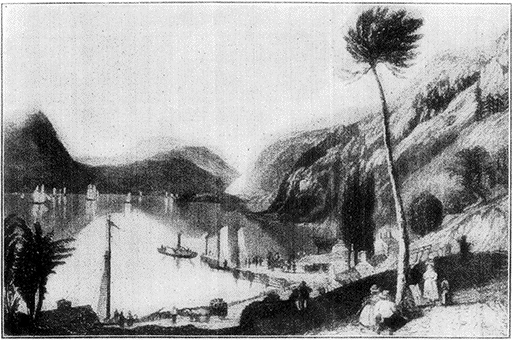
Peekskill Landing—About 1815
Close to Dunderberg Mt. the river takes a sharp turn to
the left, and just beyond the mountain can be seen Iona Island
(near the west bank), now occupied by the U.S. Government
as a naval arsenal and supply depot. Between the island and
the eastern shore the river is so narrow that this stretch is
spoken of by boatmen as "The Race." A short distance farther
on the west bank is Bear Mt. Park, originally the gift
of Mrs. E. H. Harriman, which has been set aside by the
Interstate Palisade Park Commissioners as a vacation resort
for the poor. Our train presently passes by tunnel under the
mountain known as "Anthony's Nose" (900 ft.), so named,
[27]according to Diedrich Knickerbocker, from the "refulgent nose"
of Anthony van Corlear, Peter Stuyvesant's trumpeter.
Across the river is visible the mouth of Poplopen creek, on
the north side, Ft. Clinton.
These two forts were involved in the important maneuvers of 1777,
when the British, under Sir Henry Clinton, executed a brilliant
enterprise northward up the Hudson; they broke through the chains
which the Americans had stretched across the river in the hope of
checking the advance of British warships, captured Ft. Clinton
and Ft. Montgomery and destroyed the fleets which the Americans
had been forming on the river.
Three M. farther (on the right) is Sugar Loaf Mt. (765 ft.), noteworthy
as the place from which Benedict Arnold, whose headquarters were in the
Beverley Robinson House, near the south base of the mountain, made his
escape to the British man-of-war "Vulture" (1780) after receiving news
of André's capture. On the west shore near Highland Falls stands the
residence of the late J. Pierpont Morgan, standing somewhat back from
the river and partly hidden by trees.
John Pierpont Morgan (1837-1913) was born in Hartford, Conn., a
son of Junius S. Morgan, who was a partner of George Peabody and
the founder of the house of J. S. Morgan & Co. in London. After
his university training at Göttingen, he began his career in the
financial world, and by 1895, as the head of J. P. Morgan & Co.,
was the greatest American financier. His banking house became one
of the most powerful in the world, carrying through the formation
of the U.S. Steel Corporation, harmonizing the coal and railway
interests of Pennsylvania, purchasing the Leyland line of
Atlantic steamships and other British lines in 1902, effecting an
Atlantic shipping combine, reorganizing many large railways, and
in 1895 supplying the U.S. government with $62,000,000 in gold to
float a bond issue and restore the treasury surplus of
$100,000,000. Mr. Pierpont Morgan was a prominent member of the
Episcopal church, a keen yachtsman, a generous patron of
charitable and educational institutions, and a notable art and
book collector. As president of the Metropolitan Museum he gave
or loaned to it many rare and beautiful pictures, statues, and
art objects of all kinds. A memorial tablet was recently unveiled
in his honour at the museum.
Buttermilk Falls (100 ft.) are visible on the west bank
after a heavy rain; the buildings on the bluff above belong
to Lady Cliff, a school for girls.
49 M. WEST POINT (Garrison).
(Train 51 passes 9:46;
No. 3, 10:04;
No. 41, 2:19;
No. 25, 4:00;
No. 19, 6:55.
Eastbound: No. 6 passes 8:01;
No. 26, 8:20;
No. 16, 2:34;
No. 22, 4:00.)
Across the river from Garrison, the imposing buildings
of West Point, the "Gibraltar of the Hudson," come into
view. The name "West Point" properly belongs to the village
located here, but in ordinary usage it refers to the U.S.
[28]Military Academy,* America's training school for officers,
which at the present time has about 1,000 cadets.
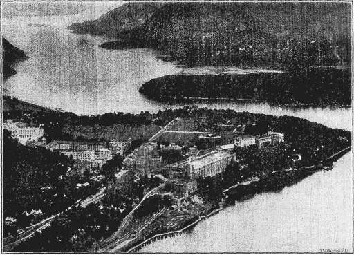
Photo Brown Bros.
West Point from an Aeroplane
The academy furnishes for those who wish to become army
officers a splendid education of a standard equal to the best colleges
and without cost to the student. Each cadet is paid $1,028.20 a year,
an amount which, with proper economy, is sufficient for his support.
West Point, therefore, offers an excellent opportunity for those who
can meet the requirements and are capable of successfully undergoing
the mental and physical discipline of the school. Each senator and
congressman is entitled to nominate two candidates, who are appointed
as cadets by the Secretary of War after passing the prescribed
examination. There are also 82 appointments at large, and
the law of 1916 authorized the president to appoint cadets to the
academy from among the enlisted of the Regular Army and National
Guard, though not more than 180 at any one time. This law
was passed with the idea of introducing a greater degree of democracy
into army life. Candidates for admission must be between 17 and
22 years, unmarried, free from physical infirmity and capable of
passing a somewhat rigorous examination in high school or preparatory
school subjects. The course of instruction, which requires three
years, is largely mathematical and professional. From about the
middle of June to the end of August the cadets live in camp, engaged
only in military duties and receiving military instruction. In general
the education and discipline are so excellent that the business
world is always ready with its high pecuniary rewards to tempt men
away from their military vocation. The result is that graduates
frequently resign their commissions, and the army loses what is
gained by the world of affairs.
[29]The academy occupies a commanding position on a plateau
150 ft. above the river. As we approach, the power house
is in the foreground, with the riding school, a massive building
just beyond, while the square tower of the Administration
Building dominates the scene on the level of the parade
ground above. West Point was first occupied as a military
post during the Revolutionary War. In Jan. 1778, a huge
chain, part of which is still preserved on the parade ground,
was stretched across the river in the hope of blocking the
progress of the British men-of-war, and a series of fortifications,
planned by the great Polish soldier, Kosciusko, were
erected on the site of the present academy.
Thaddeus Kosciusko (1746-1817) had a romantic and picturesque
career.
An intended elopement with Ludwika, daughter of the Grand
Hetman, Sosnowski of Sosnowica, was discovered by the Hetman's
retainers. In the fight that followed, Kosciusko was badly wounded
and flung from the house. Shortly afterwards he left for America,
where, as he had been well grounded in military science, Washington
soon promoted him to the rank of colonel of artillery and made
him his adjutant. Kosciusko especially distinguished himself in the
operations about N.Y.C. and at Yorktown, and Congress conferred
upon him a number of substantial rewards. He returned to his
native land to participate in the gallant but unsuccessful effort to free
Poland (1794), and is now celebrated among the Poles as one of their
greatest heroes.
At West Point were the fortifications that Benedict Arnold,
their commander in 1780, agreed to betray into British hands.
Benedict Arnold (1741-1801) was, before his disgrace, perhaps
the most brilliant officer and one of the most honored in the American
army. It is true that shortly before he took command at West
Point a court martial had directed Washington to reprimand him for
two trivial offenses, but Washington couched the reprimand in words
that were almost praise. The court martial had been ordered by
Congress, against which Arnold had expressed his indignation for
what he regarded as its mistaken policies in respect to the war.
This conflict with Congress, together with certain vexatious
circumstances, rising out of his command in Philadelphia—he had gone
heavily into debt—led him into a secret correspondence with the
British general, Sir Henry Clinton, and he asked for the assignment
to West Point for the very purpose of betraying this strategic post
into the hands of the British.
In order to perfect the details of the plot, Clinton's adjutant-general,
Maj. John André, met him near Stony Point on the night
of the 21st of Sept. In the meantime, the man-of-war, "Vulture,"
[30]upon which André had arrived, was forced to move farther downstream
to avoid an impromptu bombardment by American patriots.
As a result André had to start back to N.Y. by land. He bore a
pass issued by Arnold, but he made the fatal mistake of changing
to civilian clothes. Technically, therefore, he was a spy. At
Tarrytown he was challenged by three Continentals; he offered them a
purse of gold, a valuable watch, or anything they might name if they
would permit him to proceed to N.Y.C. His offers were rejected
and the incriminating papers were found in his boots. He was carried
before the commanding officer of the lines, who, not suspecting his
superior could be involved, notified Arnold. The latter was at
breakfast with Washington's aides; pretending he had an immediate call
from across the river, he jumped from the table, told his wife enough
to cause her the greatest consternation, mounted a horse and rode
to a barge which took him to the "Vulture." In spite of the protest
and entreaties of Sir Henry Clinton and the threats of Arnold the
unfortunate André, against whose character no suspicion was ever
uttered, was hanged at Tappan, Oct. 2, 1780.
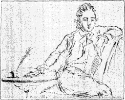
Maj. André
The picture was drawn by André without the aid of a looking-glass on
the morning of the day fixed for his execution. A respite of twenty-four
hours was, however, given. To Maj. Tomlinson, then acting as officer of the
guard, André presented the sketch.
Maj. André was 29 years old at the time, and his fate aroused
universal sympathy. It is said that Washington himself, whom some
historians censure because he did not save André, wept upon hearing
the circumstances of his death, but under military law his execution
was inevitable. Arnold, however, escaped the punishment he so
richly merited. He was commissioned brigadier-general in the British
army and received £6,315 for his property losses. He was employed
in several operations during the remaining period of the war but
later when he went to England he met with neglect and scorn that
probably hastened his death. In 1821 André's remains were taken to
England and interred there; at the same time a memorial was erected
in Westminster Abbey.
Some time later Washington recommended West Point
to Congress as a site for a military school, but it was not until
1802 that the academy was established. There are many
notable memorials of early days and distinguished soldiers here.
By far the greater number of America's distinguished generals
and soldiers since the War of Independence have been graduates of
[31]West Point. These include U. S. Grant, Philip Henry Sheridan,
William Sherman, George P. McClellan, Thomas J. (Stonewall)
Jackson (Confederate), Robert E. Lee (Confederate) and Richard
Henry Anderson (Confederate). Grant was appointed to West Point
in 1839; he was a good horseman and good in mathematics, but
graduated in 21st place in a class of 39. Sherman, on the other hand,
stood near the head of his class when he graduated in 1839. Lee
was commissioned in the engineering corps upon his graduation in
1829. The most notable commanding officers in the American army
during the World War, including, of course, Gen. Pershing, were
West Point graduates; the most conspicuous exception, perhaps, was
Maj.-Gen. Leonard Wood, who began his career as a surgeon.
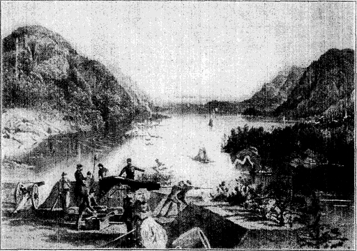
West Point and the Highlands, 1868
This picture, published shortly after the Civil War, gives a good idea
of the dress and uniform of the period, as well as a typical battery.
Note the lady's hoop skirt and the bearded officer to whom she is
speaking. The gun is one of the old muzzle-loaders, and there is a
mortar in the foreground.
Above the cliff and towards the north and east of the
plain is Fort Clinton; on its east front stands a monument
erected in 1828 by the Corps of Cadets to Kosciusko, while
"Flirtation Walk," on the river side of the academy, leads to
Kosciusko Garden, so named because it was much frequented
by the Polish hero. On the parade ground is Victory Monument
(78 ft. high), erected in 1874 as a Civil War memorial.
The library—one of the finest military libraries in
[32]
existence—contains interesting memorials by Saint Gaudens to J. McNeil
Whistler and Edgar Allan Poe, both of whom were cadets at
the academy and both of whom were virtually expelled.
Poe's neurotic temperament had led him into a number of escapades,
but he gave evidence of improvement after he enlisted in
the American Army at Boston in 1827. He served two years, and
was promoted sergeant-major. He was then 20 years old, and on
the basis of his army record, his uncle, John Allan, obtained for him
an appointment to West Point. As a student he showed considerable
facility for mathematics, but he incurred the displeasure of his superiors
by neglect of duty, and was expelled in 1830, one year after
he had been admitted. His temperament was of course unsuited to
West Point discipline. The military discipline of the academy was
equally odious to Whistler, the painter (1834-1903), who was dismissed
and transferred to the United States coast survey. In his
third year Whistler failed in chemistry. Col. Larned, one of his instructors,
gives the incident thus—"Whistler was called up for examination
in the subject of chemistry, which also covered the studies
of mineralogy and geology, and given silicon to discuss. He began:
'I am required to discuss the subject of silicon. Silicon is a gas,'
'That will do, Mr. Whistler,' and he retired quickly to private life.
Whistler later said: 'Had silicon been a gas, I would have been a
major-general.'"
High above the academy on Mount Independence (490 ft.)
still stands the ruins of old Ft. Putnam, one of the
original fortifications, from which a magnificent view can be
obtained of the academy, the river, and the surrounding country.
Our route now lies across a peninsula called Constitution
Island, which is the site of a preparatory school for West Point.
For many years the Island was the home of the Misses Anna
and Susan Warner, authors of "The Wide, Wide World," and other
stories popular with children. Through the generosity of Miss
Susan Warner, who survived her sister, and Mrs. Russell Sage, the
island was presented to the government a few years ago, and is now
part of West Point.
We pass on the west bank Crow's Nest Mt. (1,396 ft.)
associated with Joseph Rodman Drake's fanciful poem, The
Culprit Fay. Two M. farther we leave the Highlands through
the "Golden Gate," where Storm King Mt. rises to a height
of 1,340 ft. on the west side of the Hudson, and Breakneck
Mt. to a height of 1,365 ft. on the other. Near Storm King
a tunnel of the great new Catskill aqueduct, carrying water
to N.Y.C., passes under the Hudson at a depth of 1,100 ft.—a
depth made necessary to reach solid rock at the bottom.
N.Y. City's Catskill Mt. water supply system is the greatest of
waterworks, modern or ancient. Three-quarters of the project has
been completed. The waters of the Esopus Creek in the Catskills
are stored in the Ashokan reservoir, an artificial lake twelve miles
[33]long, situated about 14 miles west of the Hudson River at Kings Mt.
From this reservoir the aqueduct extends 92 M. to the city's
northern boundary, and supplies about 375,000,000 gallons daily.
From the Croton watershed New York receives a supply almost
as large—336,000,000 gallons daily. Construction on the Catskill
supply system was begun in 1907, and the total cost will be about
$177,000,000.
The river now widens and turns to the west; on the
further bank is Cornwall, near which is the estate of
E. P. Roe, the writer, and "Idlewild," the former home of N. P.
Willis, likewise a writer of importance in his day. The
home of Lyman Abbott, editor of the Outlook is also here.
The proprietor of Bannerman's Island, which we now pass,
is a dealer in obsolete war material; he has built on the island
a number of castle-like store-houses of old paving stones taken
from the streets of New York.
58 M. BEACON, Pop. 10,996 & NEWBURGH, Pop. 30,366.
(Train 51 passes 9:56;
No. 3, 10:17;
No. 41, 2:29;
No. 25, 4:10;
No. 19, 7:06.
Eastbound: No. 6 passes 7:50;
No. 26 8:09;
No. 16, 2:22;
No. 22, 3:48.)
Beacon was incorporated
in May, 1913, by merging the villages of Matteawan and
Fishkill Landing, the latter of which lay closer to the west.
The first settlement in the township was made in 1690. During
the Revolutionary War it was an important military base
for the Northern Continental Army. At Fishkill Landing on
May 13, 1783, Gen. Knox organized the Society of the Cincinnati.
The Society of the Cincinnati was an organization of U.S.
officers who had served in the Revolutionary War. Besides the general
society of which Washington was president, another was organized
for each state. (The name is in reference to Cincinnati, the
Roman patriot who left the plough to serve his country.) Membership
was limited to officers, native or foreign, of the Continental
army who had either served with honour for three years or had been
honorably discharged for disability, and to their descendants.
Because it included several European nobles, such as Lafayette
and Steuben, and because it was founded on the principle of heredity
the new society was denounced as the beginning of an aristocracy
and therefore a menace, by such Revolutionary leaders as Franklin,
Adams, and Jefferson, who were ineligible for membership because
they had not been in the army. There was perhaps a real fear
that it might become a military hierarchy which would appropriate
the important offices of the new republic. At any rate, several states
adopted resolutions against it and so great was the antagonism
at the first general meeting in 1784 Washington persuaded the members
to abolish the hereditary feature. In spite of this condition,
the excitement did not die, and in 1789 the Tammany Society was
founded in N.Y.C. in opposition to the Cincinnati, and as a
[34]wherein "true equality" should govern. This was the origin of Tammany
Hall, which became conspicuous in N.Y. politics.
Alexander Hamilton succeeded Washington as president, but by
1824 most of the state branches of the Cincinnati and the general society
itself were dead or dying. For a long time little was left but
a traditional dinner held each year in N.Y.C. In 1893 the general
society made an effort to revive the state organizations, with some
little success. The hereditary feature has been restored and the living
members number about 980. The motto is "Omnia relinquit
servare rem publicam." (He abandons everything to serve the republic.)
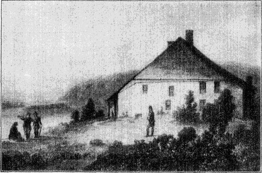
Washington's Headquarters at Newburgh
An early picture showing American soldiers on guard at the headquarters of
Gen. Washington at Newburgh. The house itself was built about 1760 and was
occupied by Washington from the spring of 1782 to August, 1783. It is now open
to the public as a museum.
Back of Matteawan are seen Beacon Mts., their name
recalling Revolutionary days when beacon fires were lighted
as signals on their summits. The summit of the highest of the
group, Beacon Hill* (1,635 ft.) can now be reached by means
of a cable railway, making possible a very pleasant excursion.
The Matteawan State Hospital for the Insane is at Beacon
on the north side of Fishkill Creek. Beacon's products include
hats, silks, woolens, rubber goods, engines, brick and
tile; the total annual value of manufactures is about $4,500,000.
Four miles to the northwest on Fishkill Creek is the village
[35]of Fishkill, notable for two quaint old churches, both still
standing, and interesting enough to repay a visit: the First
Dutch Reformed (1731), in which the New York Provincial
Congress met in Aug. and Sept., 1776, and Trinity (1769).
After Congress moved elsewhere, Trinity was used as a hospital,
and the Dutch church, being constructed of stone, was converted into
a prison. Its most famous prisoner was Enoch Crosby (who served
as the original for Cooper's hero in The Spy), a patriot who twice
escaped with the help of the Committee of Safety, the only persons
who knew his true character.
Across the river Newburgh is visible rising above the
Hudson. From the Spring of 1782 to Aug. 1783 Washington
made his headquarters in the Jonathan Hasbrouck house* (to
the south of the city), built between 1750 and 1770. The
house, a one story stone building with a timber roof, has
been purchased by the State of N.Y. and is open to visitors.
It contains many interesting Revolutionary weapons, documents
and other relics. Here in May, 1782, Washington
wrote his famous letter of rebuke to Lewis Nicola, who had
written in behalf of a coterie of officers suggesting that he
assume the title of king.
Washington's reply was peremptory and indignant. They could
not have found, he said, "a person to whom their schemes were more
disagreeable," and charged them, "if you have any regard for yourself
or posterity, or respect for me, to banish these thoughts from
your mind, and never communicate, as from yourself or any one else,
a sentiment of like nature." Here also he made his reply to the so-called
Newburgh addresses written by John Armstrong and calling
for action on the part of the army to redress its grievances.
Newburgh was still his headquarters when Washington
by the force of his influence secured the quiet disbandment
of the Continental Army at the close of the war. Upon the
occasion of the centennial celebration (1883) of this event,
a monument called the Tower of Victory, 53 ft. high with a
statue of Washington, was erected.
Newburgh is the center of a rich agricultural region, but
it is a manufacturing center as well; its output comprises
machine shop products, plaster, cotton, woolen and silk goods,
felt hats, furniture, flour, lumber and cigars. Above Newburgh
can be seen the lighthouse (on the west bank) called
the Devil's Danskammer, or Devil's Dance Hall, recalling the
time when Henry Hudson and his crew landed here to witness
an Indian pow-wow. The Dutch, who were considerably
startled by the affair, thought that it could be nothing less
than a diabolical dance; hence the name.
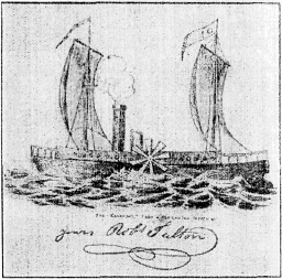
Robert Fulton's First Steamboat
(From Fulton's own Sketch)
On Sept. 1, 1807, the Albany "Gazette"
announced that the "North River
Steamboat [i.e., the "Clermont"] will
leave Paulus's Hook [Jersey City] on
Friday, the 4th of September, at 6 in
the morning and arrive at Albany on
Saturday at 6 in the afternoon." The
New York Central train now takes only
a few minutes more than three hours
to make the trip. The same paper on
Oct. 5, 1807, announced that "Mr.
Fulton's new steamboat left New York
against a strong tide, very rough water,
and a violent gale from the north.
She made headway against the most
sanguine expectations, and without being
rocked by the waves."
73 M. POUGHKEEPSIE, Pop. 35,000.
[36](Train 51 passes 10:14;
No. 3, 10:38;
No. 41, 2:48;
No. 25, 4:27;
No. 19, 7:24.
Eastbound: No. 6 passes 7:32;
No. 26, 7:51;
No. 16, 2:02;
No. 22, 3:29.)
Poughkeepsie was the Apokeepsing
of the Indians—"the pleasant and safe harbour" made by the
rocky bluffs projecting into the river, where canoes were sheltered
from wind and wave. The city is built partly on terraces
rising 200 ft. above the river, and partly on the level
plateau above. Poughkeepsie was settled by the Dutch in
1698. The most momentous event in Poughkeepsie's history
and one of the most important in that of the whole Union,
was the convention held here in 1788 at which the state of
N.Y. decided to ratify the federal constitution. The decision
was carried by three votes.
The credit for bringing N.Y. into the Union must go largely
to Alexander Hamilton and his supporters, John Jay and Chancellor
Robert R. Livingston. Of the three N.Y. delegates to the federal
convention, Hamilton was the only one to sign its report, and when
the state convention was called at Poughkeepsie, June 17, 1788, two-thirds
of its members voted against the proposed U.S. constitution.
The opposition was led by Gov. George Clinton and his party, known
as the "Clintonians." Clinton, though he here fought bitterly the
proposed new constitution and government, lived to be a Vice President
of the U.S. (He should not be confused with the DeWitt
Clinton who later built the Erie Canal.) The eloquence of Hamilton,
Jay and Livingston, however, coupled with the news that New
Hampshire and Virginia had ratified, finally carried the day, and the
N.Y. Convention gave its approval of the new Constitution by a
vote of 30 to 27.
Vassar College, the oldest women's college in America,
and one of the most famous, occupies extensive grounds to
the east of the city.
[37]
Vassar was founded in 1861 by Matthew Vassar (1791-1868), an
Englishman who had established in Poughkeepsie in 1801 a brewery
from which he became rich. He got the idea of founding a woman's
college from his niece, Lydia Booth, a school teacher. His total
gifts to the institution amounted to about $800,000. His nephew,
Matthew Vassar, Jr., became manager of the brewery after his uncle's
death, and gave in all about $500,000 to the college. Vassar now has
a campus and farm of about 800 acres, and possesses an endowment
of $2,440,000. Its students number about 1,100.
The Hudson near Poughkeepsie furnishes the course
for the intercollegiate races in which American college crews,
with the exception of Harvard and Yale (which row on the
Thames at New London) have rowed practically every year
since 1895. The river is spanned at this point by one of the
largest cantilever bridges in the world. It is 2,260 ft. long
and 200 ft. above the water, and is the only bridge over the
Hudson south of Albany.
It required 4 years to build the bridge, which was finished in 1889
at a cost of $3,500,000. It connects New England directly with the
coal fields of Pennsylvania.
Poughkeepsie has more than 50 lines of manufacture, with
products of a total annual value of $15,000,000, including mill
supplies, clothing, cigars, candied fruit and preserves, cream
separators, foundry products, knit goods, ivory buttons, and
piano and organ players.
Two miles beyond Poughkeepsie the red brick buildings
of the Hudson River State Hospital are passed on the right,
and presently our route skirts Hyde Park (79 M.) near which,
to the north, can be seen the estate of Frederick W. Vanderbilt.
There are many beautiful country-places in the district.
A little beyond Hyde Park on the west bank of the river is
"Slabsides," the cabin home of John Burroughs, the poet,
philosopher, and widely known writer on natural history.
John Burroughs was born in 1837 at Roxbury, N.Y., the fifth
son of a farmer. His first books were bought with money he earned
from tapping maple trees, boiling the sap and selling the sugar.
One season, he tells us, he made twelve silver quarters, and has
never been so proud since. Although he has lived much in the world
and has travelled widely, the greater part of his time has been divided
between Riverby, in the little town of West Park, N.Y., the famous
"Slabsides," his cabin in the wooded hills back of the Hudson, and,
since 1908, an old farm house which he has christened Woodchuck
Lodge, ½ M. from the Burroughs homestead in Roxbury. In his
retreat at "Slabsides" he wrote some of his most intimate and appealing
studies of nature.
Esopus Island is now passed, on the high left bank of
which, near the water, stands the home of Alton B. Parker,
Democratic candidate for the presidency against Roosevelt
[38]in 1904. We now pass the estates of D. Ogden Mills and
W.B. Dinsmore, former president of the Adams Express
Company (on the right). Esopus Lighthouse is on the west
bank where the river curves sharply to the left. On the high
ground on the east bank is the country home of the late Levi
P. Morton.
Levi P. Morton (1824-1920), American banker and politician, was
born at Shoreham, Vt. After some years in business at Hanover,
N.H., Boston and N.Y.C., he established in 1862 the banking house
of L. P. Morton & Co. (dissolved in 1899), with a London branch.
The American firm assisted in funding the national debt at the time
of the resumption of specie payments, and the London house were
fiscal agents of the U.S. government in 1873-1884, and as such received
the $15,500,000 awarded by the Geneva Arbitration court in
settlement of the "Alabama Claims" against Great Britain. In 1899
Morton became president of the Morton Trust Co. of N.Y.C. He
was a Republican representative in Congress from 1879 to 1881,
U.S. minister to France (1881-1885), vice-president of the U.S. during
the administration of Benjamin Harrison (1889-1893) and governor
of N.Y. state (1895-1896) signing in that capacity the "Greater
New York" bill and the liquor-tax measure known as the "Raines
law." In 1896 he was a candidate for the presidential nomination in
the Republican national convention.
88 M. RHINECLIFF, Pop. 1,300.
(Train 51 passes at 10:32;
No. 3, 10:56;
No. 41, 3:07;
No. 25, 4:46;
No. 19, 9:39.
Eastbound: No. 6 passes 7:13;
No. 26, 7:31;
No. 16, 1:37;
No. 22, 3:09.)
Across the river from Rhinecliff is Kingston (Pop.
26,688), most of which lies on a plateau 150 ft. above the river.
Rondout, once a separate town, is now a part of the city of
Kingston, the center of which lies 3 M. inland. To the northwest
is the noble scenery of the Catskills, to the southwest are
the Shawangunk Mts. and Lake Mohonk, and in the distance
on our right (that is, on the Rhinecliff side) are the Berkshire Hills.
Kingston is one of the oldest towns in the state. In 1658
a stockade was built here by order of Gov. Peter Stuyvesant,
and although the Dutch had built a fort here as early as 1614,
it is from this event that the founding of the city is generally
dated. The town suffered a number of murderous Indian
attacks before it was taken over by the British in 1664.
The early history of Kingston reached a climax during
the Revolution, when the British under Sir John Vaughan
sacked the town and burned the buildings Oct. 17, 1777. The
"Senate House"* erected in 1676, was the meeting-place of the
first State Senate during the early months of 1777. At the
time of the British occupation the interior was burnt but the
walls were left standing. The building is now the property
[39]of the state and is used as a colonial museum. The present
Court House, built in 1818, stands on the site of the old Court
House, where New York's first governor, George Clinton,
was inaugurated, and in which Chief Justice John Jay held
the first term of the N.Y. Supreme Court in Sept. 1777.
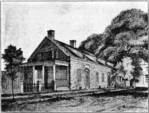
The 'Senate House' (1676), Kingston, N.Y.
Erected in 1676 as a private residence, the "Senate House" was one of
the few buildings left standing when the British sacked the town of
Kingston in October, 1777. It had been the meeting place of the first
State Senate in the earlier part of that year. The house is now
maintained as a colonial museum.
John Jay (1745-1829), son of Peter Jay, a successful N.Y. merchant,
had a notable career. He was Chairman of the Commission
which drafted the N.Y. State Constitution in 1777. In the same
year he was made Chief Justice of the State. In negotiating peace
with Great Britain (1783) he acted with Benjamin Franklin, John
Adams, Jefferson and Henry Laurens, and he is credited with having
been influential in obtaining favorable terms for the former colonies.
In 1789 Washington appointed him chief justice of the U.S. Supreme
Court, in which capacity he served for six years. In the meantime,
1794, he negotiated the famous Jay Treaty with Great Britain, which
averted a dangerous crisis in the relations between the two countries,
and settled such questions as the withdrawal of British troops from
the northwestern frontier, compensation for the seizure of American
[40]vessels during the Franco-British war of 1793, and the refusal of the
British up to that time to enter into a commercial treaty with the
U.S. From 1795 to 1798 he served as Governor of N.Y. Daniel
Webster said: "When the spotless ermine of the judicial robe fell
on John Jay, it touched nothing less spotless than itself."
Less than a mile beyond Rhinecliff we pass "Ferncliff,"
the beautiful country-place of Vincent Astor, son of the late
John Jacob Astor III, who lost his life in the "Titanic" disaster.
The large white building on a hill nearby is the Astor
squash court.
John Jacob Astor III (1864-1912) was the son of William B.
Astor II. The latter was the son of William B. Astor (1792-1875),
known as "the landlord of New York," because of his extensive real
estate holdings in New York City. He was the son of the founder of
the Astor fortune, John Jacob Astor (1763-1828). The latter was born
near Heidelberg, Germany, worked for a time in London, came to
N.Y.C. and took up fur trading, in which he amassed an enormous
fortune, the largest up to that time made by any American.
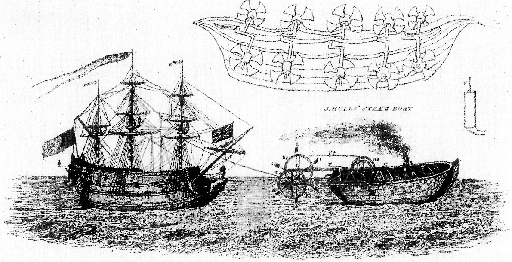
Steps in the Development of the Steam-boat
The top figure represents a boat of the 15th Century propelled by paddle
wheels. Below is a steam tug, the design of Jonathan Hulls, who received
a patent on his invention from the British government in 1736. It
appears that some time later, in 1802, Robert Fulton, who was then in
England, actually rode in a tug of similar design built by William
Symington. Fulton, however, was the first to construct a steam-boat in
the modern sense of the term. The illustrations used above were taken
from the Supplement to the Sixth Edition of the Encyclopædia
Britannica.
Six miles above Rhinecliff we pass Anandale on the right,
the former home of Gen. Richard Montgomery (b. 1736), who
was killed Dec. 31, 1775, while conducting the American attack
on Quebec.
[41]
It is not always remembered that the Americans undertook an
expedition against Quebec during the first year of the Revolutionary
War. Gen. Montgomery was joined near Quebec by Benedict
Arnold, then a colonel, and they pushed on towards their objective
with barely 800 men. The assault met a complete defeat; almost at
the first discharge, Montgomery was killed, and many of his men
were taken prisoners. In 1818 Mrs. Montgomery, then a gray-haired
widow, sat alone on the porch of the house while the remains of
Gen. Montgomery were brought down the Hudson on the steamer
"Richmond" with great funeral pomp. A monument has been erected
in St. Paul's Chapel, N.Y.C., where his remains were finally interred.
General and Mrs. Montgomery, who was a daughter of Robert
R. Livingston, had been married only two years when he went
away on his expedition.
Just north of Tivoli (98 M.) is the site of the Manor
House of the Livingston family, "Clermont," after which Robert
Fulton named his first steamboat.
The Livingston Manor comprised the greater part of what are
now Dutchess and Columbia Counties. The founder of the family
was Robert Livingston (1654-1725) who was born at Ancrum, Scotland,
emigrated to America about 1673 and received these manorial
grants in 1686. He was a member of the N.Y. Assembly for several
terms. The Livingston Manor was involved in anti-rent troubles
which began in the Rensselaer Manor.
109 M. GREENDALE, Pop. 1,650.
(Train 51 passes 10:54;
No. 3, 11:19;
No. 41, 3:32;
No. 25, 5:08;
No. 19, 8:10.
Eastbound: No. 6 passes 6:49;
No. 26, 7:09;
No. 16, 1:07;
No. 22, 2:44.)
From Greendale a very fine view is obtained of the
noble scenery of the Catskill Mountains. The village of Catskill
(Pop. 4,461) across the river, was at one time the only
point of entrance for visitors to the mountains—now reached
chiefly by railway from Kingston. Catskill Station, however,
is still a point of departure for this favorite summer resort. In
clear weather it is possible to get a glimpse of the deep gorge
of the Kaaterskill Cove (about one mile west of Catskill village)
where Rip Winkle strayed into the mountains, discovered
Hendrick Hudson playing at skittles, and, bewitched by
the wine supplied by the ghostly sportsmen, slept for 20 years.
On the high crest back of the station (about 10 M. from the
river) the Mountain House (Alt. 2,225 ft.) and Kaaterskill
House, famous old hotels, can be seen in clear weather.
The Catskill Mts.,* a group possessing much charm and beauty,
run parallel with the Hudson for about 15 miles, at a distance of from
5 to 9 miles from the shore line, on the west bank; they cover an
area of about 500 Sq. M. On the side visible from the train
they rise steeply to a height of 2,000 to 3,000 feet though on the other
sides the slopes are gradual. The highest summits are those of
Slide Mt. (4,205 ft.) and Hunter Mt. (4,025 ft.). The summits of
several of these mountains are reached by inclined railways that
[42]afford splendid views. A number of deep ravines known as "cloves,"
a word derived from the Dutch, have been cut into the mountains by
streams. The name Catskill, formerly Kaatskill, is a word of Dutch
origin, referring, it is said, to the catamounts, or wild cats, formerly
found here. The Indians called the mountains "Onti Ora" or Mts.
of the Sky. Washington Irving in his introduction to the story of
Rip Van Winkle says, "Whoever has made a voyage up the Hudson
must remember the Kaatskill Mts. They are a dismembered branch
of the great Appalachian family, and are seen away to the west of
the river, swelling up to a noble height, and lording it over the
surrounding country. Every change of season, every change of
weather, indeed every hour of the day, produces some change in
the magical hues and shapes of these mountains, and they are regarded
by all the good housewives far and near as perfect barometers.
When the weather is fair and settled, they are clothed in blue and
purple, and print their bold outlines on the clear evening sky; but
sometimes when the rest of the landscape is cloudless, they will
gather a hood of gray vapors about their summits, which in the last
rays of the setting sun, will glow and light up like a crown of glory."
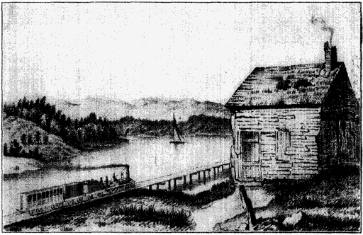
Hudson, N.Y. (1835)
Showing one of the early passenger trains on what is now the New
York Central route.
114 M. HUDSON, Pop. 11,745.
(Train 51 passes 11:00;
No. 3, 11:26;
No. 41, 3:37;
No. 25, 5:14;
No. 19, 8:16.
Eastbound No. 6 passes 6:44;
No. 26, 7:04;
No. 16, 1:02;
No. 22, 2:39.)
Hudson, picturesquely situated on the slope of a hill
and commanding a fine view of the river and the Catskill Mts.,
[43]was originally known as Claverack Landing, and for many
years it was nothing more than a landing with two rude wharfs
and two small storehouses, to which the farmers in the neighborhood
brought their produce for shipment on the river. Late
in 1783, the place was settled by an association of merchants
and fishermen, mostly Quakers, from Rhode Island, Nantucket,
and Martha's Vineyard. These enterprising people had been
engaged in whaling and other marine ventures, but when
these industries were crippled by British cruisers during the
War of Independence, they came to Hudson to find a more
secluded haven. They were methodical and industrious; they
even brought their houses, framed and ready for immediate
erection, on their brig, the "Comet." The settlers opened
clay pits, burned bricks and built a first class wharf. In 1785
the port was the second in the state in the extent of its shipping.
Two shipyards were established and a large ship, the
"Hudson" was launched. Toward the end of the 18th century
it was the third city in the state, and had one of the
three banks then existing in N.Y. State.
The War of 1812 caused a decline, but modern industry
has revived the town, and its manufactures include Portland
cement (one of the largest manufactories of that product in
the United States is here), knit goods, foundry and machine
shop products, ice machinery, brick and furniture.
Huge ice houses are seen along this part of the Hudson River,
and the question sometimes arises why the river, being partly salt,
can yield ice fit for domestic or commercial use. The explanation is
that the water, in freezing, rejects four-fifths or more of its content
of salt.
Four miles above Hudson we pass the estuary of Stockport,
on the north bank of which, at Kinderhook, once lived
Martin Van Buren, eighth president of the U.S.
The son of a farmer and tavern keeper, Van Buren (1782-1862)
was born at Kinderhook, N.Y., of Dutch descent. He obtained a
scanty education, and it is said that as late as 1829, when he became
secretary of state, he wrote crudely and incorrectly. He was admitted
to the bar in 1803 in N.Y., allied himself with the "Clintonians"
in politics and later became a leading member of the powerful coterie
of Democratic politicians known as the "Albany regency," which
ruled N.Y. politics for more than a generation, and was largely responsible
for the introduction of the "Spoils System" into state and
national affairs. Van Buren's proficiency in this variety of politics
earned him the nickname of "Little Magician." In 1821 he was elected
to the U.S. Senate, and in 1828 governor of N.Y., and in the following
year was made secretary of state by President Jackson, who used
his influence to obtain the nomination of Van Buren for president
in 1836. William Henry Harrison, the Whig candidate, was his principal
opponent, and the popular vote showed a plurality of less than
[44]25,000 for Van Buren. Van Buren's administration was compelled
to bear the weight of errors committed by Jackson, his predecessor,
and though he showed unexpected ability and firmness in his administration,
he was defeated for re-election by Harrison.
130 M. SCHODACK LANDING, Pop. 1,215.
(Train 51 passes 11:17;
No. 3, 11:45;
No. 41, 3:55;
No. 25, 5:30;
No. 19, 8:37.
Eastbound: No. 6 passes 6:24;
No. 26, 6:45;
No. 16, 12:41;
No. 22, 2:20.)
Schodack was the Dutch rendering of
the Indian word "Esquatack," meaning "the fireplace of the
nation." The island opposite the station was the site of the
first council fire of the Mohican Indians, who were grouped
about their "fire place" in 40 villages. They inhabited the
Hudson Valley and their domain extended into Mass.
In consequence of attacks by the Mohawks the Mohicans moved
from their council fire to what is now Stockbridge, Mass., in 1664.
Later many migrated to the Susquehanna Valley and became absorbed
into the Delawares. The descendants of those who were left at
Stockbridge are now assembled with some of the Munsees on a
reservation at Green Bay, Wis. They are truly the "last of the
Mohicans." Cooper's story of that name dealt with the earlier period
of their dispersal.
In the early days Douw's Point on the right bank, a few
miles below Albany, was the head of steamboat navigation.
Passengers for Albany used to transfer at this point to the
stage. It was here that the "Half Moon" reached its farthest
point on its northward trip up the Hudson.
Theodore Roosevelt in his History of New York says: "During
the "Half Moon's" inland voyage her course had lain through scenery
singularly wild, grand and lonely. She had passed the long line of
frowning battlemented rock walls that we know by the name of the
Palisades; she had threaded her way round the bends where the
curving river sweeps in and out among cold peaks—Storm King,
Crow's Nest, and their brethren; she had sailed in front of the Catskill
Mts., perhaps thus early in the season crowned with shining
snow. From her decks the lookouts scanned with their watchful
eyes dim shadowy wastes, stretching for countless leagues on every
hand; for all the land was shrouded in one vast forest, where red
hunters who had never seen a white face followed wild beasts, upon
whose kind no white man had ever gazed."
In modern days the channel has been enlarged, deepened
and protected by concrete dykes, which are seen at intervals
along the upper river, so that the Hudson is now utilized for
navigation as far as Troy. On the left bank just above Parr's
Island is the estuary of the Normans Kill, which flows through
the valley of Tawasentha, where, according to Indian tradition,
once lived the "mighty Hiawatha."
Hiawatha (the word means "he makes rivers") was a legendary
chief, about 1450, of the Onondaga Tribe of Indians. The formation
of the League of Five Nations, known as the Iroquois, is attributed
[45]to him by Indian tradition. He was regarded as a sort of divinity—the
incarnation of human progress and civilization. Longfellow's
poem "Hiawatha" embodies the more poetical ideas of Indian nature-worship.
In this version of the story, Hiawatha was the Son of
Mudjekeewis (the West Wind) and Wenonah, the daughter of Nakomis,
who fell from the moon.
142 M. RENSSELAER, Pop, 10,823.
(Train 51 passes 11:30;
No. 3, 12:02;
No. 41, 4:12;
No. 25, 5:44;
No. 19, 8:53.
Eastbound: No. 6 passes 6:00;
No. 26, 6:32;
No. 16, 12:27;
No. 22, 2:07.)
Rensselaer, originally called Greenbush, lies
directly across from Albany. It was first settled in 1631 and
the site formed part of a large tract of land bought from the
Indians by agents of Killiaen Van Rensselaer. On the lower
edge of the town Ft. Cralo,* built in 1642 for protection against
the Indians, still stands; the fort has a special interest in being
connected with the origin of Yankee Doodle.
Some writers claim that Cralo is the oldest fort still preserved
in the U.S. Its white oak beams are said to be 18 inches square;
its walls are 2 to 3 ft. thick, and some of the old portholes still remain.
According to tradition there were once secret passages connecting
the fort with the river. About 1770, during the French and
Indian Wars, Maj. James Abercrombie had his headquarters here.
Yankee Doodle is said to have been composed at the fort by Dr.
Schuckburgh, a British surgeon, as a satire on the provincial troops,
who did not show to advantage among the smartly dressed British
soldiers. The Yankees, however, adopted the words and the tune,
and less than 20 years later the captured soldiers of Burgoyne marched
behind the lines of the victorious Continentals to the same melody.
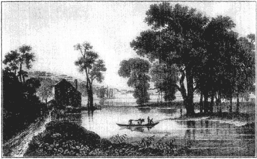
Albany from Van Rensselaer Island in 1831
[46]
Albany to Syracuse
142 M. ALBANY, Pop. 113,344.
(Train 51 passes 11:32;
No, 3, 12:05;
No. 41, 4:15;
No. 25, 5:46;
No. 19, 8:55.
Eastbound: No. 6 passes 5:58;
No. 26,6:30;
No. 16, 12:25;
No. 22, 2:05.)
Across the river from Rensselaer on sharply mounting
hills is the city of Albany. We cross the river by a suspension
bridge, passing over Rensselaer Island and seeing ahead
of us the handsome new freight houses of the D. & H.R.R.,
and to right and left the boats of the Hudson River Steamship
lines lying against the wharves. Once over the bridge
the tracks swerve to the right, and soon lead into the Union
Station.
Almost under the shadow of the present Capitol, on a
meadow to the north, Ft. Orange was built in 1624, when 18
families of Dutch Walloons selected this site for a permanent
settlement in the New World. The history of Albany, however
is usually dated from ten years earlier when Dutch
traders built Ft. Nassau on Castle Island, the present Rensselaer
Island.
According to some writers a temporary trading post was established
here by the French as early as 1540—80 years before the
Pilgrims landed at Plymouth. But it is on the date 1614 that Albany
lays claim to being the second oldest settlement in the colonies,
Jamestown, founded in 1607 by Capt. John Smith and Christopher
Newport, being the first. It is interesting to note that the Pilgrim
Fathers narrowly missed making a settlement somewhere along the
Hudson River. William Bradford, second governor of the Plymouth
colony, tells in his history, how, at one point in the Mayflower's voyage,
they determined "to find some place about Hudson's river for their
habitation." But, after sailing half a day, "they fell amongst dangerous
shoulds and roving breakers," and so decided to bear up again
for Cape Cod.
During the early days Albany held high rank among
American settlements. As a center of trade and civilization
it rivalled Jamestown, Manhattan and Quebec. In 1618 the
Dutch negotiated here the first treaty with the Iroquois,
which tended to preserve friendly relations with the Indians
for more than a century to come.
The territory of the Iroquois, or Six Nations, the most celebrated
of Indian confederations, extended from Albany to Buffalo, that is,
over just the country through which the New York Central runs.
The name is that given to them by the French and is said to be
formed of two ceremonial words constantly used by the tribesmen
meaning "real adders." The league was originally composed of five
tribes or nations—the Mohawks, Oneidas, Onondagas, Senecas and
Cayugas. The confederation probably took place about 1580. In 1722
the Tuscaroras were admitted, the league then being called that of
the Six Nations. Without realizing the far-reaching effect of his
[47]action, Samuel D. Champlain (1567-1635), the French explorer, probably
changed the entire course of history by joining the Algonquins
and Hurons in an attack in 1608 on the Iroquois near the present
town of Ticonderoga. The Iroquois never forgave the French for
the part they played in this battle and naturally turned first to the
Dutch and then to the English for allies. "Thus did New France,"
says Parkman, "rush into collision with the redoubted warriors of
the Five Nations. Here was the beginning, and in some measure
doubtless the cause, of a long series of murderous conflicts, bearing
havoc and flame to generations yet unborn." Parkman estimates that
in the period after the Tuscaroras joined the Iroquois, the Six Nations
had a population of about 12,000 with not more than 2,150 fighting
men. It is a matter of some surprise that so small a fighting
force could wield so great a power in the early days. But Theodore
Roosevelt, in speaking of the Indians as warriors, says: "On their
own ground they were far more formidable than the best European
troops. It is to this day doubtful whether the superb British regulars
at Braddock's battle or the Highlanders at Grant's defeat a few
years later, were able to so much as kill one Indian for every hundred
of their own men who fell." Although up to that time they
had been loyal friends of the colonists, in the War of Independence
the Iroquois fought on the English side, and by repeated battles
their power was nearly destroyed. From very early times a silver
"covenant chain" was used as a symbol of their treaties with the
Whites, and each time a new treaty was signed the covenant chain
was renewed or reburnished. There are perhaps 17,000 descendants
of the Iroquois now living in reservations in New York State, Oklahoma,
Wisconsin and Canada.
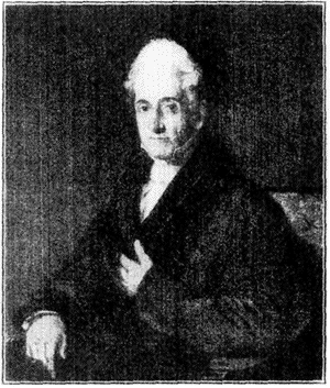
Stephen Van Rensselaer
Stephen Van Rensselaer was the eighth patroon and fifth in descent
from Killiaen, the first lord of the Manor. He was lieutenant
governor of N.Y., an ardent promoter of the Erie Canal, a major
general in the War of 1812 (during which he was defeated in the
Battle of Queenstown Heights), and represented N.Y. in Congress
from 1822 to 1829. In 1824 he founded a school in Troy, which was
incorporated two years later as the Rensselaer Polytechnic
institute.
In 1629 the Dutch government granted to Killiaen van
Rensselaer, an Amsterdam diamond merchant, a tract of land,
[48]24 Sq. M., centering at Ft. Orange, over which he was given
the feudal powers of a patroon.
The patroons, under the Dutch régime, were members of the
Dutch West India Co., who received large grants of land, called
Manors, in New Netherlands. These grants carried with them semifeudal
rights, and the patroon could exercise practically autocratic
powers in his domain. The first of the patroons, Killiaen van Rensselaer
(1580-1645), never came to this country, but he sent over numerous
settlers as tenants. The Manor was called Rensselaerswyck, and
comprised all of the present counties of Albany and Rensselaer, and
part of Columbia.
This was the first manorial grant in New Netherlands
and was destined to endure the longest. The colonists sent
to this country by van Rensselaer were industrious and the
town prospered, although in 1644, it was described by Father
Jogues, a Jesuit priest, as "a miserable little fort called Fort
Orange, built of logs, with four or five pieces of Breteuil cannon
and as many swivels; and some 25 or 30 houses built of
boards, and having thatched roofs." On account of its favorable
commercial and strategic position at the head of navigation
on the Hudson and at the gateway of the Iroquois country
and the far west, it maintained its importance among
colonial settlements for a century and a half. Its early name,
Beverwyck, was changed to Albany—one of the titles of the
Duke of York, afterwards James II.—when New Netherlands
was transferred to the English (1644). Albany was granted
a charter in 1686, and the first mayor (appointed by Gov. Dongan)
was Peter Schuyler, who was likewise chairman of the
Board of Indian Commissioners.
Peter Schuyler (1657-1724) was a son of Philip Pieterse Schuyler
(d. 1683), who migrated from Amsterdam in 1650. The family was
one of the wealthiest and most influential in the colony, and it was
closely related by marriage to the van Rensselaers, the van Cortlandts
and other representatives of the old Dutch aristocracy.
Representatives of Mass., R.I., N.H., Conn., N.Y., Pa.,
and Md., met in Albany in June, 1754, for the purpose of confirming
and establishing a close league of friendship with the
Iroquois and of arranging for a permanent union of the colonies.
This was the first important effort to bring about a
Colonial confederation.
The Indian affairs having been satisfactorily adjusted, the convention,
after considerable debate, in which Benjamin Franklin, Stephen
Hopkins and Thomas Hutchinson took a leading part, adopted a plan
for a union of the colonies on the basis of a scheme submitted by
Franklin. This plan provided for a representative governing body to
be known as the Grand Council, to which each colony should elect
delegates for a term of three years. Neither the British government
nor the growing party in the Colonies which was clamoring for
[49]colonial rights received the plan with favor—the former holding that
it gave the colonies too much independence and the latter that it gave
them too little.
At about this time a Swedish naturalist, Peter Kalm,
visiting Albany, reported that "there is not a place in all the
British colonies, the Hudson Bay settlement excepted, where
such quantities of furs and skins are bought of the Indians
as at Albany." Most of the houses at this time were built
of brick and stood with gable ends to the street; each house
had a garden and a stoep, where the family were accustomed
to sit summer evenings, the burgher with his pipe and his
"vrouw" with her knitting. Well-to-do families owned slaves,
but according to Mrs. Anne Grant, an English writer of the
day who spent part of her childhood in Albany, "it was slavery
softened into a smile."
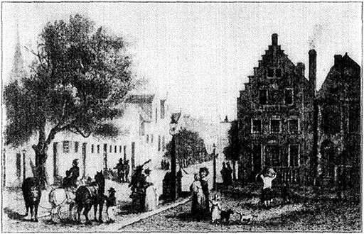
North Pearl St., Albany (About 1780)
Looking North from State St. to Maiden Lane
(From an old French print in the N.Y. Public Library)
In the left foreground is the south end of the Livingston house. Just beyond,
with two high gables facing the street, is the Vanderheyden Palace, erected 1725.
The square building at the rear, corner of Maiden Lane, is the residence of Dr.
Hunloke Woodruff. In the right foreground (on the corner) is the Lydius House,
erected in 1657.
It was here that the English from all the colonies, before
and during the French and Indian wars met to consult with
the Indians and make treaties with them. It was the gathering
[50]place of armies where troops from all the colonies assembled
and the objective of hostile French forces and their
Indian allies on several occasions, yet was never taken by
an enemy and never saw an armed foe. Even during the
Revolutionary War, when its strategic importance was fully
recognized by both armies, it remained immune, though at
one time the objective against which Burgoyne's unsuccessful
expedition was directed.
In 1777 the English general, John Burgoyne (1722-1792), was
placed at the head of British and Hessian forces gathered for the invasion
of the Colonies from Canada and the cutting off of New England
from the rest of the Colonies. He gained possession of Ticonderoga
and Ft. Edward; but pushing on, was cut off from his communications
with Canada and hemmed in by a superior force at
Saratoga Springs, 30 M. north of Albany. On the 17th of Oct. his
troops, about 3,500 in number, laid down their arms, surrendering to
Gen. Horatio Gates. This success was the greatest the colonists had
yet achieved and proved the turning-point in the war.
In 1797 Albany became the permanent state capital. The
election of Martin Van Buren as governor in 1828 marked
the beginning of the long ascendancy in the state of the
"Albany Regency," a political coterie of Democrats in which
Van Buren, W.L. Marcy, Benjamin Franklin Butler and
Silas Wright were among the leaders.
Thurlow Weed (1797-1882), the bitterest enemy of this coterie,
and the man who gave them their name, declared of them that he
"had never known a body of men who possessed so much power and
used it so well." Until the election of William H. Seward (the Whig
candidate) as governor in 1838, New York had usually been Democratic,
largely through the predominating influence of Van Buren and
the "Regency." Weed had an important share in bringing about their
defeat. He owed his early political advancement to the introduction
into state politics of the Anti-Masonic issue; for a time he edited the
Anti-Masonic Enquirer. In 1830 he established and became editor of
the Albany Evening Journal, which he controlled for thirty-five years.
The anti-rent war, precipitated by the death of Stephen
van Rensselaer (1764-1839), the "last of the patroons," centered
about Albany. The final settlement of this outbreak,
which began with rioting and murder, and ended with the
election of a governor favorable to the tenants (1846), disposed
of feudal privilege in New York State which had flourished
here until well into the 19th century, though it had
disappeared elsewhere.
The anti-rent agitation began in the Hudson River counties during
the first administration of Gov. Seward (1839). The greater part
of the land in this section was comprised in vast estates such as the
Rensselaerswyck, Livingston, Scarsdale, Philipse, Pelham and Van
Cortlandt manors, and on these the leasehold system, with perpetual
leases, and leases for 99 years (or the equivalent), had become
[51]general. Besides rents, many of the tenants were required to render
certain services to the proprietor, and in case a tenant sold his interest
in a farm to some one else he was required to pay the proprietor one-tenth
to one-third of the amount received, as an alienation fee.
Stephen van Rensselaer had permitted his rents, especially those
from poorer tenants, to fall much in arrears, and the effort of his
heirs to collect them—they amounted to about $200,000—was met
with armed opposition. In Rensselaer county a man was murdered,
and Gov. Seward was forced to call out the militia. The tenants,
however, formed anti-rent associations in all the affected counties,
and in 1844 began a reign of terror, in which, disguised as Indians,
they resorted to flogging, tarring and feathering, and boycotting, as
weapons against all who dealt with the landlords. This culminated
[52]in the murder of a deputy sheriff in Delaware county. In 1846 the
anti-rent associations secured the election of Gov. John Young as
well as several legislators favorable to their cause, and promoted the
adoption of a new constitution abolishing feudal tenures and limiting
future agricultural leases to twelve years. Under the pressure of
public opinion the great landlords rapidly sold their farms.
Stephen van Rensselaer was the 8th patroon and 5th in descent
from Killiaen, the first lord of the manor. He was lieutenant-governor
of New York, an ardent promoter of the Erie canal, a major-general
in the War of 1812 (during which he was defeated at the
battle of Queenstown Heights) and represented New York in congress
from 1822 to 1829. In 1824 he founded a school in Troy which was
incorporated two years later as the Rensselaer Polytechnic Institute.
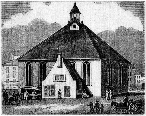
Ancient Dutch Church, Albany (1714)
(From an old print in the N.Y. Public Library)
This church, built of bricks brought from Holland, stood for about 92
years in the open area formed by the angle of State, Market and Court
streets. It was erected in less than four weeks. The early Dutch felt
that without the church they could not hope to prosper. The old church
was of Gothic style, one story high, and the glass of its antique
windows was richly ornamented with coats of arms. In 1806 the church was
taken down and its brick employed in the erection of the South Dutch
Church, between Hudson and Beaver streets, which in turn was later
replaced by a newer structure.
Comparatively few ancient landmarks remain in Albany,
though there are some fine specimens of the Dutch and later
colonial architecture still standing. Of these the best known
is the Schuyler mansion,* built by Gen. Philip Schuyler, in
1760, which, after serving for many years as an orphan asylum,
was recently purchased by the state and converted into
a museum.
Having served in the French and Indian wars, Philip Schuyler
(1733-1804) was chosen one of the four major-generals in the Continental
service at the outbreak of the Revolutionary War and was
placed in command of the northern department of New York with
headquarters at Albany. The necessary withdrawal of the army from
Crown Point in 1776 and the evacuation of Ticonderoga in 1777 were
magnified by his enemies into a disgraceful retreat, and he was tried
by court martial but acquitted on every charge. He was a delegate
from N.Y. to the Continental Congress in 1779, and later joined
his son-in-law, Alexander Hamilton, John Jay and others in the movement
for the ratification by New York of the Federal constitution.
In 1790 he was elected to the U.S. senate. "For bravery and generosity"
says John Fiske, "he was like the paladin of some mediæval romance."
The Van Rensselaer manor-house, built in 1765, was
pulled down in 1893 and reconstructed on the campus of Williams
College, Williamstown, Mass., where it forms the Sigma
Phi fraternity house. In the Albany Academy, built in 1813
by Philip Hooker, architect of the old State Capitol, Prof.
Joseph Henry demonstrated (1831) the theory of the magnetic
telegraph by ringing an electric bell at the end of a
mile of wire strung around the room. Bret Harte, the writer,
was born in 1839 in Albany, where his father was teacher of
Greek in the Albany College, a small seminary.
Bret Harte lived in Albany until his 17th year. In 1896, lured by
the gold rush, he left for California with his mother, then a widow.
Once there, the rough but fascinating chaos engulfed him, and from
it, at first hand, he drew the stage properties—Spaniards, Greasers,
gambling houses—the humor, sin and chivalry of the '49—which color
all his stories. After some little journalism and clerking, he was
[53]made secretary to the Supt. of the Mint, a position which was not too
exacting to allow a great deal of leisure for writing. Later he returned
to the East with his family, made his home in N.Y.C. and
gave all his time to authorship. Apparently his success somewhat
turned his head. He lived beyond his means, passing his summers
at Newport, Lenox and other expensive places, until his unbusinesslike
habits and chronic indebtedness became notorious. In 1878 he
accepted a consulate at Crefeld, Prussia. He spent the rest of his
life abroad and died in England in 1902.
Modern buildings of interest include the City Hall,* a
beautiful French Gothic building; the State Educational
Building, with its valuable library; the Albany Institute, with
its art galleries; the Cathedral of the Immaculate Conception,
built of brownstone, with spires 210 ft. high; the Cathedral
of All Saints, a fine specimen of Gothic architecture, said to
be the first regularly organized Protestant Episcopal cathedral
erected in the United States (1883), St. Peter's Church, and,
most important, the State Capitol.*
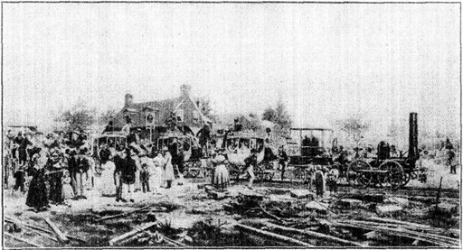
The First Passenger Train in N.Y. State Leaving
Schenectady for Albany, July 30, 1831
On its first trip this train, now preserved on the right balcony of the
Grand Central Terminal, attained a speed of nine miles an hour. The
route between Albany and Schenectady was practically identical with that
of the present New York Central lines.
The Capitol occupies a commanding position in Capitol Square.
It is built of white Maine granite, and cost about $25,000,000. Millions
were spent in alteration and reconstruction, due to the use of
inferior materials and to mistakes in engineering design. The cornerstone
was laid 1871, and the building was completed, with the exception
of the central tower, in 1904. The legislature first met here in
[54]1879. The original designs were by Thomas Fuller, who also designed
the parliamentary building at Ottawa, but they were considerably
altered. The beautiful Western staircase of red sandstone
(from plans by Isaac Gale Perry) and the senate chamber (designed
by H. H. Richardson) are the most striking features of the building.
The present capitol suffered a heavy loss in the burning of its library
in 1911, by which many unreplaceable books and original documents
were destroyed.
The city has 11 parks, comprising 402 acres; the most
notable is Washington Park, which contains two well known
statues—one of Robert Burns, by Charles Caverley, and the
bronze and rock fountain, "Moses at the Rock of Horeb," by
J. Massey Rhind. The city's filtration system is of special
interest to engineers; it occupies 20 acres, has eight filter
beds, and filters 15,000,000 gallons of water daily.
Albany's key position with respect to New York, Boston
and Buffalo ensured its commercial development. The first
passenger railroad in America was operated between Albany
and Schenectady.
The first train in the state, consisting of the locomotive "De Witt
Clinton," named for the seventh governor, and three coaches (resembling
early stage coaches), was built for the Mohawk and Hudson
Railroad Co., the original unit of the present New York Central Lines,
and was chartered in 1826 to run from Albany to Schenectady—a distance
of 16 M. The locomotive was constructed at the West Point
foundry and taken to Albany by boat. It had its first trial on rails,
July 30, 1831, burning anthracite coal and attaining a speed of 7 M.
an hour. After remodeling, it made the trip from Albany to Schenectady
in one hour and 45 minutes, using pine wood for fuel. On Aug.
9, 1831, two trips were made, during which a speed of 30 M. an hour
was reached. The train ran on iron "straps" nailed to wooden
"stringers." As originally built the locomotive weighed 6,758
pounds, which, in remodeling, was increased to 9,420 pounds—less
than the weight of one pair of wheels of a modern locomotive. At
a banquet on the occasion of the formal opening of the line (Aug. 13,
1831), President Camberling of the railroad gave the following toast:
"The Buffalo Railroad! May we soon breakfast at Utica, dine at
Rochester, and sup with our friends on Lake Erie." The original
train is still preserved and may be seen in the right balcony of the
Grand Central Station, N.Y.C.
The first steamboat in the United States made its initial
trips between N.Y. and Albany, and the first canal connected
Albany with Buffalo.
The original Erie Canal was one of the greatest of early engineering
projects in America, and its importance in the development of
N.Y. State, and of the country to the west, can hardly be overestimated.
Construction was begun in 1817, under a commission including
Gouverneur Morris, De Witt Clinton, Robert Fulton, and Robert
R. Livingston, and in 1825 the main channel, 363 miles in length, was
opened between Albany and Buffalo, the total cost being $7,143,790.
Three branches were added later. At the close of 1882, when tolls
[55]were abolished, the total revenues derived from the canal had been
$121,461,871, while expenditures had amounted to $78,862,154. Various
factors, including the competition of the railroads, caused a considerable
decline in canal traffic in the last quarter of a century. The old
canal was a ditch following the line of the Mohawk and other rivers
and creeks. The new barge canal system has four branches, the Erie,
from Albany to Buffalo; the Champlain, from Albany to Lake Champlain
the Oswego, which starts north midway on the line of the Erie
Canal and reaches Lake Ontario, and the Cayuga and Seneca, which
leaves the Erie canal a little to the west of the Oswego junction and
extends south, first to Cayuga Lake and then to Seneca Lake. The
new canal system was first intended for 1,000 ton barges, but its capacity
has been made much larger. Various sections of the improved
canal were completed between 1916 and 1918, and the total cost has
been about $150,000,000.
Within 35 years Albany has increased fivefold in size,
and is today the intersecting point of the principal water
routes of the Eastern States, for besides being near the head
of navigation for large steamers on the Hudson, it is virtually
the terminus of the N.Y. State barge canal. It is also the
key point in the transportation system of the state, for here
the B. & A. and the D. & H. railroads meet the New York
Central, so that one can take train for Buffalo and Chicago,
the Thousand Islands, the Adirondacks, Saratoga, Lakes
George and Champlain, Montreal, Vermont and the Green
Mts., the Berkshires, and Boston. It is the second largest express
and third largest mail transfer point in the United
States. The forests of the Adirondacks and of Canada have
made it a great lumber post. Its manufactures have an annual
value of $30,000,000 or more; they include iron goods, stoves,
wood and brass products, carriages and wagons, brick and
tile, shirts, collars and cuffs, clothing and knit goods, shoes,
flour, tobacco, cigars, billiard balls, dominoes and checkers.
Leaving Albany, we follow closely the path of the old
Iroquois Trail, which was in early days, as now, the chief
highway to the Great Lakes.
The Indian trail began at Albany and led directly across the country
to Schenectady; from this point to Rome there were two trails,
one on either side of the Mohawk. That on the south side had the
most travel as it led through three Mohawk "castles" or villages, one
at the mouth of the Schoharie Creek, one at Canajoharie, and the
third at the town of Danube, opposite the mouth of East Canada
Creek. Farther on, the trail passed through the present towns of
Fort Plain, Utica and Whitesboro. The trail on the north bank led
through Tribes Hill, Johnstown, Fonda and Little Falls, where it
united with the main traveled route.
At West Albany are extensive shops of the New York Central
Lines. When working full capacity about 1,400 men are employed
here. The machines are all of modern design and electrically driven.
There are large freight yards having a trackage of nearly 100 M. The
[56]passenger car shops include two great buildings which are used for
making general repairs and one for construction of steel equipment.
One of the repair buildings is 42 ft. by 200 ft. and has a track capacity
of 100 cars, and the other, 400 ft. by 80 ft., a capacity of 180 cars.
There are two enormous paint shops, a blacksmith shop, where numerous
forgings are made for other departments, a woodmill, a
machine-shop with a floor space of 13,000 sq. ft., and cabinet, upholstering,
brass and plating shops. The truck shop covers 1,800 sq. ft.,
and is used for building and general repairs of trucks of wood, built-up
steel, and cast-iron. From the tin and pipe shop is supplied all the
light metal ware needed by the railroad.
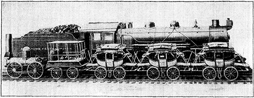
1831-1921
Showing the dimensions of the first equipment of the present New York Central
Lines—the DeWitt Clinton and three coaches—in comparison with the modern
locomotive used to draw the Twentieth Century and other fast trains.
159 M. SCHENECTADY, Pop. 88,723.
(Train 51 passes 11:57;
No. 3, 12:47;
No. 41, 4:57;
No. 25, 6:12;
No. 19, 9:32.
Eastbound: No. 6 passes 5:24;
No. 26, 5:56;
No. 16, 11:35;
No. 22, 1:24.)
At this point we first enter the historic Mohawk
Valley, and on this site, according to tradition, once
stood the chief village of the Mohawk Indians.
The Mohawk River rises in Lewis County (northwestern N.Y.),
flows south to Rome, then east to the Hudson River which it
enters at Cohoes. It is 160 miles long. There are rapids and falls
at Little Falls and Oriskany which have been utilized to develop electric
power. The Mohawk valley is noted for its beauty and the fertility
of its soil. The name Mohawk is probably derived from an Indian
word meaning "man-eaters"; but the Mohawks' own name for their
tribe was Kaniengehaga, "people of the flint." They lived in the region
bounded on the north by the Lake of Corlear, on the east by the Falls
of Cohoes, on the south by the sources of the Susquehanna, and on the
west by the country of the Oneidas. The dividing line between the
Mohawk and Oneida tribes passed through the present town of Utica.
The Mohawks had the reputation of being the bravest of the Iroquois;
they furnished the war chief for the Six Nations and exercised the
right to collect tribute in the form of wampum from the Long Island
tribes and to extend their conquests along the sea coast. The tribes,
[57]along both banks of the Hudson River, it is said, shrank before their
war cry. In the War of Independence they fought with the English,
and finally took refuge in Canada, where most of them have remained.
The first settlement at Schenectady was made in 1642 by
Arendt Van Corlear and a band of immigrants who had become
dissatisfied with conditions on the Manor of Rennselaerwyck
where Corlear was manager of the estates of his
cousin, Killiaen van Rennselaer.
Van Corlear had emigrated to America about 1630 and while manager
of Rennselaerwyck he earned the confidence of the Indians,
among whom "Corlear" became a generic term for the English governors
and especially the governors of N.Y. The name Kora,
derived from the same source, is said to be used even today by surviving
Iroquois in Canada to designate the English king.
To each of the 15 original proprietors, except Van Corlear
who was to receive a double portion, was assigned a
village lot of 200 sq. ft., a tract of bottom land for farming
purposes, a strip of woodland, and common pasture rights.
Many of the early settlers were well-to-do and brought their
slaves with them, and for many years the settlement, originally
known as Dorp, was reputed the richest in the colony.
Schenectady was spelled in a great variety of ways in the
early records. Its Indian equivalent signified "Back Door"
of the Long House—the territory occupied by the Six Nations.
In an early map (1655) the name appears as Scanacthade. As late
as 1700 the spelling was still uncertain, as the following minutes from
the record of the common council of September 3, of that year show:
"The Church wardens of Shinnechtady doe make application that two
persons be appointed to go around among the inhabitants of the City
to see if they can obtain any Contributions to make up ye Sellary due
their minister." Other ways of spelling the name were Schanechtade
and Schoneghterdie.
In 1690 the young village received a setback which very
nearly brought its early history to an end; on Feb. 9 of that
year, the French and Indians surprised and burned the village,
massacred 60 of the inhabitants and carried 30 into captivity.
An old tradition says that an Indian squaw had been sent to warn
the inhabitants, under cover of selling brooms. In the afternoon of
Feb. 8, 1690, Dominic Tassomacher was being entertained with chocolate
at the home of a charming widow of his parish when the squaw
entered to deliver her message. The widow became indignant at the
sight of snow on her newly scrubbed floor, and rebuked her unexpected
guest. The Indian woman replied angrily, "It shall be soiled
enough before to-morrow," and left the house. The massacre occurred
that night.
Schenectady was rebuilt in the following years, but an
outlying settlement was again the scene of a murderous
[58]French and Indian attack in 1748. In the land along the
river, the old part of the town, Indian skulls and arrow heads
are still found.
English settlers arrived in considerable numbers about
1700. About 1774 a number of Shaker settlements were made
in the lower Mohawk valley.
The Shakers, a celibate and communistic sect—officially the
United Society of Believers in Christ's Second Appearance—received
their common name from the fact that originally they writhed and
trembled in seeking to free "the soul from the power of sin and a
worldly life." They had trances and visions, and there was much
jumping and dancing. The founder of the sect was Mother Ann Lee
(1736-1784) of Manchester, England, who came to N.Y. with a
number of relatives in 1774 and bought land in the lower Mohawk
Valley. The first Shaker settlement was at Watervliet, not far from
Troy. The settlers established a communistic organization with
branches in Mass., and Conn. As a matter of practice they do not
forbid marriage, but refuse to recognize it; they consider there are
four virtues: virgin purity, Christian communism, confession of sin,
and separation from the world. The women wear uniform costumes
and the men have long hair. The sect is diminishing. There
are now less than 1,000 members in 17 societies in Mass., N.H.,
Maine, Conn., and Ohio, though at its most flourishing period it had
nearly 5,000.
Schenectady was chartered as a borough in 1765 and as a
city in 1798, and from that period date many quaint examples
of colonial architecture. In Scotia, a suburb to the northwest
of the city, still stands the Glen-Sanders mansion (built 1713)
described as "a veritable museum of antiquity, furnished from
cellar to garret with strongly built, elegant furniture, two
centuries old." Descendants of the original owners are still
living there. A fine specimen of Dutch architecture is the
so-called Abraham Yates house (1710) at No. 109 Union
Street. The Christopher Yates house at No. 26 Front Street
was the birth place of Joseph C. Yates, first mayor of Utica
(1788) and governor of the state in 1823. Governor Yates
afterwards lived, until his death, in the large colonial house
at No. 17 Front Street. The old "depot" of the Mohawk &
Hudson Railroad, the first steam passenger railway in America
now incorporated with the New York Central, is still
standing in Crane Street.
Schenectady is the seat of Union College, which grew out
of the Schenectady Academy (established in 1784) and many
of the buildings dating back to the early 19th century are
still in excellent preservation. They were designed by a
French architect, Jacques Ramé, and the original plans are
still in the Louvre, in Paris. At one of the entrances to the
college on Union Street is the Payne Gate, built as a
[59]memorial to John Howard Payne (1791-1852), author of "Home,
Sweet Home," who was at one time a student at Union College
The college comprises the academic and engineering
departments of Union University. The other departments of
the university—medicine, law, and pharmacy, as well as the
Dudley observatory—are at Albany.
Up to the time of the building of the Erie Canal,
Schenectady had been an important depot of the Mohawk
River boat trade to the westward, but after the completion
of the canal it suffered a decline. The modern manufacturing
era, beginning about 1880, brought Schenectady growth
and prosperity. To-day the city can boast that its products
"light and haul the world." As we enter the town we pass
on the left the main establishment of the General Electric
Co., the largest electrical manufacturing plant in the world,
with 200 buildings and 26,000 employees.
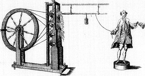
“Dr. Watson's Electrical Machine”
In 1768, when this picture, reproduced here from the First Edition of
the Encyclopædia Britannica, was published, only the most elementary
principles of electricity had been discovered. Benjamin Franklin's
discovery, made with the aid of a kite, that lightning is an electrical
phenomenon, was the greatest advance in electrical science up to that
time. "Electrical machines," such as that shown, were, designed to
produce frictional or "static" electricity, of which the quantity is
usually small, and is therefore now produced chiefly for laboratory
experiments. When the wheel at the left was turned sufficient
electricity was generated to cause a spark to jump between the two hands
at the right. This machine paved the way for the invention of the dynamo
electric machines for which Schenectady is world famous.
In the years before 1886 Schenectady had been suffering from a
long period of stagnation. In that year an official of the Edison
Machine Works of N.Y.C. happened to pass through Schenectady
and noticed two empty factories, the former Jones Car Works. The
[60]Edison Company had been established in N.Y.C. about 1882
by Thomas A. Edison, and it was now looking for an opportunity to
remove elsewhere. Accordingly Schenectady was chosen, and in 1892
the Edison Co.—which had been renamed the Edison General
Electric Co.—and the Thompson Houston Electric Co. of Lynn,
Mass., were consolidated and formed the General Electric Co.
The main plant was at Schenectady, but other plants were retained
at Lynn, Mass., and Harrison, N.J. The early electrical apparatus
was crude and the output of the factory was small, but this consolidation
marked the beginning of a world-wide business. In 1893,
the book value of the General Electric Co. factory was less than
$4,000,000. Since then the company has spent more than $150,000,000
improving and enlarging its plant. Branch factories are now maintained
at Lynn, Pittsville, and East Boston, Mass.; Harrison and
Newark, N.J.; Erie, Pa.; Fort Wayne, Ind.; Toledo and Cleveland,
Ohio. At Schenectady one may see the latest development in practically
every variety of electrical apparatus. There are in the General
Electric plant individual factories devoted to generators, motors, turbines,
transformers, switchboards, rheostats, wire and cable, and
searchlights, as well as pattern shops, machine shops, brass and iron
foundries, and testing, shipping and power stations. The company
pays considerable attention to welfare work among its employees and
free instruction in electrical engineering is given on a large scale.
The American Locomotive Co., which likewise has a
factory here, with 5,000 employees, turns out some of the
largest and fastest locomotives produced in America or abroad.
During the last 35 years Schenectady has become one of the
greatest industrial centers in the United States; its total annual
output has a value of nearly $100,000,000, the output of
the General Electric Co, alone being about $75,000,000.
We now cross the Mohawk River, and Erie Canal, and our
route ascends the valley of the Mohawk as far as Rome. To
the south the Catskill Mts. are visible in the distance, and the
outline of the Adirondack Mts. can be faintly seen to the
north.
This beautiful group of mountains was once covered, all but the
highest peaks, by the Laurentian glacier, whose erosion, while perhaps
having little effect on the large features of the region, has greatly
modified it in detail, producing lakes and ponds to the number of more
than 1,300 and causing many falls and rapids in the streams. In the
Adirondacks are some of the best hunting and fishing grounds in the
United States, which are so carefully preserved that there are quantities
of deer and small game in the woods, and black bass and trout
in the lakes. Some 3,000,000 acres are preserved. The scenery is
wonderfully fine and the air so clear that many sanatoriums have been
established for tuberculosis patients.
175 M. AMSTERDAM, Pop. 33,524.
(Train 51 passes 12:15;
No. 3, 1:12;
No. 41, 5:20;
No. 25, 6:30;
No. 19, 9:52.
Eastbound: No. 6 passes 5:07;
No. 26, 5:39;
No. 16, 11:10;
No. 22, 1:03.)
[61]
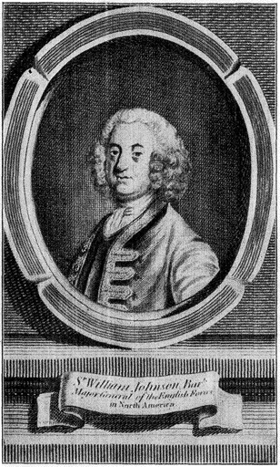
Sir William Johnson (1715-1774)
Sir William was a remarkable figure in early N.Y. history. He is said
to have been the father of 100 children, chiefly by native mothers,
either young squaws or wives of Indians who thought it an honor to
surrender them to the king's agent. According to an early historian, the
Indians of the Six Nations "carried their hospitality so far as to allow
distinguished strangers the choice of a young squaw from among the
prettiest of the neighborhood, as a companion during his sojourn with
them."
[62]Amsterdam was settled about 1775 and was
called Veedersburg until 1804 when its present name was
adopted. It was for some time the home of Elisha Arnold,
father of Benedict Arnold, but the latter was born in Norwich,
Conn. (Jan. 14, 1741.) The so-called Guy Park Mansion
built in 1763, by Guy Johnson, nephew of Sir William Johnson
is still used as a private residence. Today Amsterdam
ranks as the first city in the United States in the manufacture
of carpets and second in the manufacturing of hosiery
and knit goods. It has one of the largest pearl button factories
in the country; other products are brushes, brooms,
silk gloves, paper boxes, electrical supplies, dyeing machines,
cigars, wagon and automobile springs; the total value of the
output being about $30,000,000 annually.
178 M. FORT JOHNSON, Pop. 680.
(Train 51 passes 12:18;
No. 3, 1:15;
No. 41, 5:23;
No. 25, 6:33;
No. 19, 9:56.
Eastbound: No. 6 passes 5:03;
No. 26, 5:36;
No. 16, 11:03;
No. 22, 12:59.)
This village is named for the house* and fort erected
here in 1742, by Sir William Johnson, one of the most remarkable
of the early pioneers.
Sir William Johnson (1715-1774) distinguished himself not only
for the prosperous settlements which he built up along the valley of
the Mohawk, but also for his military ability and his remarkable influence
with the Iroquois Indians. Born in Ireland, he came to America
in 1738 for the purpose of managing a tract of land in this valley
belonging to his uncle, Admiral Sir Peter Warren. The fort which he
built on the site of the present village bearing his name soon became
the center of trade with the Indians, and likewise a strategic point for
Johnson's military ventures. The Mohawks adopted him and elected
him a sachem. He was at various times superintendent of the affairs
of the Six Nations, commissary of the province for Indian affairs, and
major-general in the British army. As a commanding officer he directed
the expedition against Crown Point (1755) and in September
of that year defeated the French and Indians, at the battle of Lake
George. For his success he received the thanks of parliament and was
created a baronet. He took part in a number of other expeditions
against the French and Indians, and as a reward for his services the
king granted him a tract of 100,000 acres of land north of the Mohawk
River. It was in a great measure due to his influence that the Iroquois
remained faithful to the cause of the colonies up to the time of
the Revolutionary War. In 1739 Johnson married Catherine Wisenberg,
by whom he had three children. After her death he had various
mistresses, including a niece of the Indian chief Hendrick, and Molly
Brant, a sister of the famous chief, Joseph Brant. It is said that he
was the father of 100 children in all. After the French and Indian
War he retired to the present Johnstown.
[63]
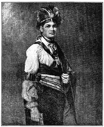
Joseph Brant, “Thayendanegea” (1742-1807)
(From original painting by Romney in collection of Earl of Warwick)
Chief Thayendanegea (Joseph Brant) of the Mohawk tribe was an unusual
character, combining the savage traits of an Indian Warrior and the more
civilized qualities of a politician and diplomat. Born on the banks of
the Ohio River, he was sent to an Indian charity school (now Dartmouth
College) at Lebanon, Conn., by Sir William Johnson. He fought with the
English in the French and Indian War and with the Iroquois against
Pontiac in 1763. Subsequently he became a devout churchman and settled
at Canajoharie or Upper Mohawk castle, where he devoted himself to
missionary work and translated the Prayer Book and St. Mark's Gospel
into the Mohawk tongue. In the Revolutionary War he led the Mohawks and
other Indians friendly to the British against the settlements on the
N.Y. frontier, even taking part, despite his religion, in the Cherry
Valley Massacre. After the war he aided the U.S. in securing treaties of
peace with the Miamis and other western tribes. Subsequently he went to
Canada as a missionary, and in 1786 visited England, where he raised
funds with which was erected the first Episcopal Church in Upper Canada.
Brant sat for his picture several times in England, once in 1776, at the
request of Boswell (the author of the "Life of Johnson"), and during the
same visit for the Romney portrait, at Warwick's request. In 1786 he was
painted for the Duke of Northumberland and for a miniature to present to
his daughter.
[64]After 1763 the fort was occupied by his son Sir John, who,
during the War of Independence organized a loyalist regiment
known as the "Queen's Royal Greens," which he led at the
battle of Oriskany, and in raids on Cherry Valley (1778-1780)
and on the Mohawk Valley. The house, once used as a fort,
is described by an early writer thus: "Col. Johnson's mansion
is situated on the border of the north bank of the River
Moack. It is three stories high (two with an attic) built of
stone, with port-holes and a parapet, and flanked with four
bastions on which are some small guns. In the yard, on both
sides of the mansion, are two small houses; that on the right
of the entrance is a store, and that on the left is designed for
workmen, negroes and other domestics. The yard gate is a
heavy swing-gate, well ironed; it is on the Moack River side;
from this gate to the river is about two hundred paces of
level ground. The high road passes there." The place, now
somewhat remodeled, is owned by the Montgomery County
Historical Society and many curious historic relics are on exhibition
here. It is open to the public daily.
181 M. TRIBES HILL, Pop. 900.
(Train 51 passes 12:21;
No. 3, 1:18;
No. 41, 5:27;
No. 25, 6:36;
No. 19, 10:00.
Eastbound: No. 6 passes 5:00;
No. 26, 5:33;
No. 16, 11:00;
No. 22, 12:56.)
Tribes Hill received its name from the fact
that it was an old meeting place of the Indians. Across the
river, in the estuary at the junction of Schoharie Creek with
the Mohawk, once stood Ft. Hunter, which was the lower
Mohawk castle, the upper castle being at Canajoharie.
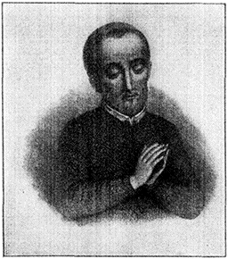
Father Isaac Jogues
Isaac Jogues (1607-1646), a French
missionary, came to this country to
preach among the Hurons and Algonquins.
In 1642 he was captured by the
Mohawks, who tortured him and kept
him as a slave until the following summer,
when he escaped. Father Jogues
returned in 1646 to establish a mission
among his former tormentors. About
this time a contagious disease broke
out amongst the Indians, and to make
matters worse their crops failed. For
these misfortunes they blamed the
French priest, tortured him as a sorcerer
and finally put him to death.
A contemporary description says: "Ft. Hunter, known by the
Indians as Ticonderoga, is one of the same form as that of
[65]Canajoharie except that it is twice as large. It likewise has a house
at each corner. The cannon at each bastion are seven and nine
pounders. The pickets of this fort are higher than those at Canajoharie
There is a church or temple in the middle of the fort, while
in its inclosure are also some thirty cabins of Mohawk Indians, which
is their most considerable village. This fort, like that of Canajoharie,
has no ditch and has a large swing-gate at the entrance. There are
some houses outside, though under the protection of the fort, in which
the country people seek shelter when an Indian or French war party
is looked for."
About two miles farther at the little village of Auriesville
on the left side of the Mohawk, where the river is joined by
Auries Creek, there is a shrine (visible on the left from the
train) marking the spot where Father Jogues, a Jesuit Priest,
was killed in 1646.
186 M. FONDA, Pop. 747.
(Train 51 passes 12:27;
No. 3, 1:25;
No. 41, 5:39;
No. 25, 6:42;
No. 19, 10:05.
Eastbound: No. 6 passes 4:55;
No. 26, 5.28;
No. 16, 10:55;
No. 22, 12:51.)
The town of Fonda was named for Jelles Fonda, said to have
been the first merchant west of Schenectady. Fonda established
a prosperous store here about 1760, and his old accounts
(still preserved) disclose that he had among his customers
"Young Baron of the Hill," "Wide Mouth Jacob," "Young
Moses," "Snuffers David," and the "Squinty Cayuga."
Following is a bill from Jelles Fonda's accounts:
| Young Moses, Dr. |
| Sept. 20, 1762 | £ | s. | d. |
| To one French blanket | 0 | 16 | 0 |
| " one small blanket | 0 | 12 | 0 |
| " 4 Ells White linnen | 0 | 8 | 0 |
| " 1 pair Indian stockings | 0 | 6 | 0 |
| " 1 hat | 0 | 8 | 0 |
| " 1 pt. of rum and one dram | 0 | 1 | 4 |
| " 1 qt. rum | 0 | 2 | 0 |
| I leave in pledge two silver wrist-bands. |
| [In other words, the wrist-bands were put up as
security for the debt.] |
Six miles north of Fonda is Johnstown (Pop. 10,908)
where Sir William Johnson built his second residence (1762)
now in the custody of the Johnstown Historical Society. It
is a fine old baronial mansion.
Sir William called this residence Johnson Hall and lived here with
all the state of an English country gentleman. He devoted himself to
colonizing his extensive lands and is said to have been the first to
introduce sheep and pedigreed horses into the province.
Sir William also built the Fulton County Court House
with its jail (1772), used during the Revolutionary War as a
[66]civil and military prison. A free school, probably the first in
N.Y. State, was established at Johnstown by Sir William
Johnson in 1764 in his residence. In 1766 he organized
a Masonic Lodge, one of the oldest in the U.S. In
1781, during the War of Independence, Col. Marinus Willett
defeated here a force of British and Indians. The city is
one of the principal glove making centers in the U.S. The
total products are valued at about $3,000,000 annually. The
manufacture of gloves in commercial quantities was introduced
into the U.S. at Johnstown in 1809 by Talmadge Edwards,
who was buried here in the Colonial Cemetery.
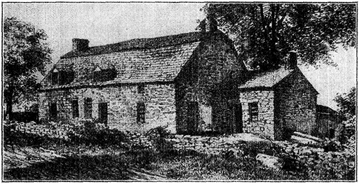
Old Ft. Van Rensselaer at Canajoharie (Built 1749)
This building had originally been the home of Martin Janse Van Alstyn,
and was so well built that it had withstood the attacks of the Indians
under Brant in 1780. It was therefore appropriated in 1781 by the
American government, adopted as a fort, and placed under the control of
Col. Marinus Willet, a competent officer chosen by Washington to handle
the district in which Ft. Van Rensselaer and Ft. Plain were the military
headquarters. (Still standing.)
197 M. CANAJOHARIE (Palatine Bridge), Pop. 2,415.
(Train 51 passes 12:40;
No. 3, 1:39;
No. 41, 5:55;
No. 25, 7:43;
No. 19, 10:20.
Eastbound: No. 6 passes 4:42;
No. 26, 5:45;
No. 16, 10:44;
No. 22 12:36.)
Passing the villages
of Yosts and Sprakers we arrive in the town of Canajoharie,
which in early days was the site of the upper Mohawk castle.
The upper Mohawk castle, sometimes called Ft. Canajoharie, was
described by an early writer as consisting of "a square of 4 bastions
of upright pickets joined with lintels 15 ft. high and about 1
ft. square, with port-holes, and a stage all around to fire from. The
fort was 100 paces on each side, had small cannon in its bastions,
[67]and houses to serve as a store and barracks. Five or 6 families of
Mohawks reside outside the pickets. From Ft. Canajoharie to Ft.
Hunter (the lower Mohawk castle) is about twelve league, with a
good carriage road along the bank of the river."
In 1749 a fortified dwelling was built here known as Ft.
Rensselaer, which was utilized as a place of defence during
the Revolutionary War. Canajoharie was the home of the
famous Indian leader, Joseph Brant.
On the left, a little beyond Palatine Bridge, can be seen
the red brick Herkimer mansion, near which a monument has
been erected to Nicholas Herkimer, who died in 1777 from
wounds received at Oriskany. We pass the village of Ft.
Plain, St. Johnsville and East Creek.
216 M. LITTLE FALLS, Pop. 13,029.
(Train 51 passes 12:58;
No. 6, 1:59;
No. 41, 6:17;
No. 25, 7:14;
No. 19, 10:39.
Eastbound: No. 6 passes 4:22;
No. 26, 4:55;
No. 16, 10:22;
No. 22, 12:16.)
Our route here lies through a ravine cut by
the Mohawk River through a spur of the Adirondack Mts.
The town is picturesquely situated on the sides of the gorge
overlooking the rapids and falls. The Mohawk here descends
45 ft. in ½ M.
In the gorge, there are crystalline rocks which are of
interest as belonging to the Laurentian formation, the oldest
rock formation on the face of the globe.
According to geological classification, these rocks belong to the
Archæan system. They represent formations of the very earliest
period of the earth's history—probably before there was any animal
or vegetable life whatsoever. The Archæan rocks have sometimes
been spoken of as the original crust of the earth, but this is disputed
by many geologists.
Little Falls dates from about 1750. In 1782 there was an
influx of German settlers into the village, and almost immediately
thereafter the town was destroyed by Indians and
"Tories.". It was resettled in 1790. Two and a half miles
east of the town was the boyhood home of Gen. Nicholas Herkimer.
Gen. Herkimer (1728-1777) was the son of John Jost Herkimer
(d. 1775), one of the original group of German settlers in this section
of the Mohawk Valley. Gen. Herkimer was colonel of the Tyrone
County Militia in 1775, and was made brigadier general of the state
militia in 1776. He was mortally wounded at the battle of Oriskany.
It is planned to establish an Historical Museum at the
old Herkimer homestead. Near the city is the grave of Gen.
Herkimer, to whom a monument was erected in 1896.
[68]The water power derived from the falls has stimulated
manufacturing in the city; its output includes cotton yarns,
hosiery, knit goods, leather, etc., valued at $15,000,000 annually.
The city is one of the largest cheese markets in the U.S.
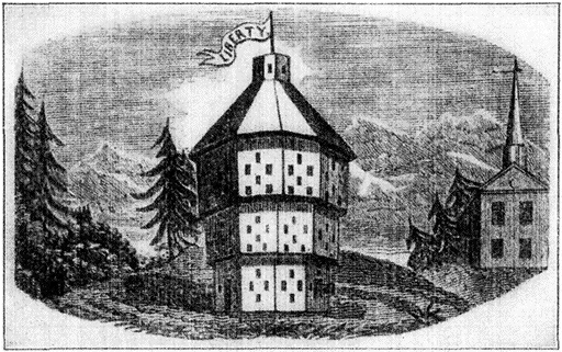
Fort Plain (1777)
(From an old print in the N.Y. Public Library)
This was built in place of another unsatisfactory fort by the American
government early in the Revolution, and was designed by an experienced
French engineer. "As a piece of architecture, it was well wrought and neatly
finished and surpassed all the forts in that region."
223 M. HERKIMER, Pop. 10,453.
(Train 51 passes 1:07;
No. 3, 2:06;
No. 41, 6:25;
No. 25, 7:22;
No. 19, 10:47.
Eastbound: No. 6 passes 4:15;
No. 26, 4:49;
No. 16, 10:12;
No. 22, 12:08.)
Herkimer was settled about 1725 by Palatine
Germans, who bought from the Mohawk Indians a large tract
of land, including the present site of the village. They established
several settlements which became known collectively
as "German Flats."
These settlers came from the Palatinate, a province of the kingdom
of Bavaria, lying west of the Rhine. The district had been torn
by a succession of wars, culminating in the carnage wrought by the
French in 1707. In the following year, more than 13,000 Palatines
emigrated to America, settling first on the Livingston Manor, and
later along the Mohawk and elsewhere.
In 1756 a stone house (built in 1740 by John Jost Herkimer),
a stone church, and other buildings, standing within
what is now Herkimer Village, were enclosed in a stockade
[69]by Sir William Johnson. This post, at first known as Ft.
Kouari (the Indian name), was subsequently called Ft. Herkimer.
Another fort (Ft. Dayton) was built within the limits
of the present village in 1776 by Col. Elias Dayton (1737-1807),
who later became a brigadier-general and served in
Congress in 1787-1788. During the French and Indian War
the settlement was attacked (Nov. 12, 1757) and practically
destroyed, many of the settlers being killed or taken prisoners;
and it was again attacked on April 30, 1758. In the War
of Independence, Gen. Herkimer assembled here the force
which on Aug. 6th, 1777, was ambushed near Oriskany on
its march from Ft. Dayton to the relief of Ft. Schuyler. The
settlement was again attacked by Indians and "Tories" in
Sept. 1778, and still again in June, 1782. The township of
Herkimer was organized in 1788, and in 1807 the village was
incorporated. Herkimer is situated in a rich dairying region
and has manufactures with an output of $4,000,000 annually.
225 M. ILION, Pop. 10,169.
(Train 51 passes 1:10;
No. 3, 2:10;
No. 41, 6:29;
No. 25, 7:25;
No. 19, 10:51.
Eastbound: No. 6 passes 4:12;
No. 26, 4:46;
No. 16, 10:07;
No. 22, 12:05.)
This village, the main part of which is situated on the south
bank of the Mohawk, owed its origin to a settlement made
here in 1725 by Palatine Germans, but the village as such
really dates from the completion of the Erie Canal in 1825.
In 1828 Eliphalet Remington (1793-1861) established here a
small factory for the manufacture of rifles. He invented, and
with the assistance of his sons, Philo, Samuel and Eliphalet,
improved the famous Remington rifle.
In 1856 the company added to its business the manufacture
of farming tools, in 1870 of sewing machines and in
1874 of typewriters. The last-named industry was sold to another
company in 1886, and soon afterwards, on the failure
of the original Remington company, the fire arms factory
was bought by a N.Y.C. firm, though the Remington
name was retained. The spot where Eliphalet had his primitive
forge on the Ilion gorge road, just south of the town, is
marked by a tablet placed there by the Daughters of the
American Revolution. The principal manufactures today are
typewriters, fire-arms, cartridges, and filing cabinets and office
furniture. The annual output is valued at about $10,000,000.
237 M. UTICA, Pop. 94,156.
(Train 51 passes 1:22;
No. 3, 2:31;
No. 41, 6:42;
No. 25, 7:41;
No. 19, 11:08.
Eastbound: No. 6 passes 3:57;
No. 26, 4:31;
No. 16, 9:53;
No. 22, 11:50.)
[70]
The territory on which Utica is built was originally part of
the 22,000 acre tract granted in 1734 by George II. to William
Cosby (1695-1736), colonial governor of New York in 1732-36,
and his associates. It was then known as Cosby's Manor.
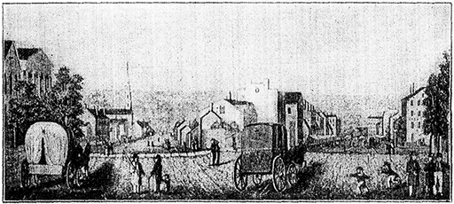
Washington and Genesee Streets, Utica, in 1835
Washington Street, with the Presbyterian Church, is seen on the
left; the bridge across the Erie Canal is seen on the right, down
Genesee Street, and at its extremity the depot of the Utica and
Schenectady (now the New York Central) Railroad then recently
built.
Sir William Cosby served originally as colonel in the British
army, then, after being governor of Minorca and later of the Leeward
Islands, he was sent to New York. Before leaving England, he obtained
a good deal of money for colonizing expenses, and his refusal
to share this with Van Dam, his predecessor and colleague, gave
rise to a law suit between the two which came to nothing but was the
cause of much bitterness between Cosby and his friends on the one
hand, and Van Dam and the people's party on the other. His administration
was turbulent and unpopular. The grant made to Cosby
was one of a number of colonizing ventures made by the British
government during this period.
During the Seven Years' War a palisaded fort was
erected on the south bank of the Mohawk at the ford where
Utica later sprang up. It was named Ft. Schuyler in honor
of Col. Peter Schuyler, an uncle of Gen. Philip Schuyler of
the Continental Army.
This should not be confused with the fort of the same name at
Rome which was built later. In order to distinguish the two, the fort
at Utica is often referred to as Old Ft. Schuyler.
The main trail of the Iroquois which became later the
most used route to the western country, crossed the Mohawk
here and continued to Ft. Stanwix, now Rome. A branch
trail turned slightly to the southwest, then more directly west
[71]to Oneida Castle. Cosby's Manor was sold at a sheriff's sale
for arrears of rent in 1792 and was bid in by Gen. Philip
Schuyler, Gen. John Bradstreet, John Morin Scott and others
for £1387 (about 15 cents an acre). The first bridge across
the Mohawk at Utica was built in 1792. Soon after the close
of the War of Independence, a large number of new settlers
arrived, most of them Germans from the lower Mohawk Valley.
About 1788 there was an influx of New Englanders,
among whom was Peter Smith (1768-1837), later a partner
of John Jacob Astor, and father of Gerrit Smith, a political
and religious radical, who was born here in 1797.
After graduating from Hamilton College in 1818, Gerrit Smith
(1797-1874) assumed the management of the vast estate of his father,
and greatly increased the family fortune, but he soon turned his attention
to reform and philanthropy. He first became an active temperance
worker, and then, after seeing an anti-slavery meeting at
Utica broken up by a mob, took up the cause of abolition. He was
one of the leading organizers of the Liberty party (1840), and later
was nominated for president by various reform parties, notably the
Free Soil Party (1848 & 1852). He was likewise the candidate of the
anti-slavery party for governor of New York in 1840 and 1858. In
1853 he was elected to Congress as an independent, whereupon he
issued an address declaring that all men have an equal right to the
soil; that wars are brutal and unnecessary; that slavery could not
be sanctioned by any constitution, state or federal; that free trade is
essential to human brotherhood; that women should have full political
rights, and that alcoholic liquors should be prohibited by state and
federal enactments. He resigned at the end of his first session and
gave away numerous farms of 50 acres each to indigent families;
attempted to colonize tracts in Northern N.Y. with free negroes;
assisted fugitive slaves to escape—Peterboro, his home village, 22
miles southwest of Utica, became a station on the "Underground
railroad"—and established a nonsectarian church, open to all Christians
of whatever shade of belief, in Peterboro. He was an intimate
friend of John Brown of Osawatomie, to whom he gave a farm in
Essex County. His total benefactions probably exceeded $8,000,000.
Utica is situated on ground rising gradually from the
river. There are many fine business and public buildings,
especially on Genesee St., the principal thoroughfare, and the
city is known for the number of its institutions, public and
private. It has some fine parks. In the Forest Hill Cemetery
are the graves of Horatio Seymour and Roscoe Conkling.
Horatio Seymour (1810-1886) was a member of the N.Y. Assembly
(1842-1845), Mayor of Utica (1843) and Governor of the State
(1854-1855). In 1854 he vetoed a bill prohibiting intoxicating liquors
in the state. In 1863-1865 he was again governor and opposed Lincoln's
policy in respect to emancipation, military arrests and conscription.
He was nominated as the Democratic presidential candidate
against Grant in 1868, but carried only eight states. He died at
Utica at the home of his sister, who was the wife of Roscoe Conkling.
[72]Roscoe Conkling (1829-1888) was a lawyer and political leader
who attracted attention in public life because of his keenness and
eloquence in debate, his aggressive leadership, and his striking personality.
He was born in Albany and was admitted to the bar at
Utica in 1850. Having joined the Republican party at the time of its
formation, he served for several years as representative in Congress,
and in 1867 was elected senator from N.Y. He labored for the impeachment
of President Johnson and was one of the senatorial
coterie that influenced Grant. He was disappointed in his ambition
to be nominated for president in 1876, and in 1880 he was one of the
leaders of the unsuccessful movement to nominate Grant for a third
presidential term.
Here also is the famous Oneida stone of the Oneida Indians
on which the warriors used to have their ears slit to
prepare them for battle, and on which, too, they used to place
the scalps of their enemies. The stone was brought here
from Oneida Castle.
Utica has varied and extensive manufactures (17,000 employees),
with a total annual output of about $60,000,000.
Among its products are hosiery and knit goods, cotton goods,
men's clothing, foundry products, plumbing and heating apparatus
lumber products, food preparation, boots and shoes,
and brick, tile and pottery, as well as a number of others.
Utica is the shipping point for a rich agricultural region,
from which are shipped dairy products (especially cheese),
nursery products, flowers (especially roses), small fruits and
vegetables, honey and hops.
We pass on the right, a short distance north of the river,
the picturesque Deerfield Hills, a beginning of the scenic
highlands which stretch away towards the Adirondack Mts.
Fifteen miles north of Utica on West Canada Creek, are Trenton
Falls,* which descend 312 feet in two miles through a
sandstone chasm, in a series of cataracts, some of them having
an 80-foot fall. The falls are reached on the branch line of
the New York Central leading from Utica to the Adirondacks.
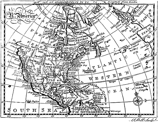
North America as It Was Known in 1768
This map was first printed in the First Edition of the
Encyclopædia Britannica in 1768. Note that all of Canada west of
Hudson's Bay (including Alaska) and a section of the United States
west of Lake Superior and as far south as the present states of
South Dakota, Wyoming, Idaho and Oregon were then "Parts
Undiscovered." The central part of the continent was New France,
and the extreme southwest was New Spain. Considering the meagre
geographical knowledge of the day, the map was remarkably
accurate.
244 M. ORISKANY, Pop. 1,101.
(Train 51 passes 1:30;
No. 3, 2:39;
No. 41, 6:56;
No. 25, 7:49;
No. 25, 11:17.
Eastbound No. 6 passes 3:36;
No. 26, 4:21;
No. 16, 9:36;
No. 22, 11:32.)
The battle of Oriskany, an important minor engagement
of the Revolutionary War, was fought in a little ravine
about 2 M. west of Oriskany, Aug. 6, 1777. Two days before,
Gen. Nicholas Herkimer had gathered about 800 militiamen at
Ft. Dayton (on the site of the present city of Herkimer) for
the relief of Ft. Schuyler which was being besieged by British
and Indians under Col. Barry St. Leger and Joseph Brant.
[73]On the 6th, Herkimer's force, on its march to Ft. Schuyler,
was ambushed by a force of 650 British under Sir John Johnson
and 800 Indians under Joseph Brant, in the ravine west
of the village. The rear portion of Herkimer's troops escaped
from the trap, but were pursued by the Indians, and
many of them were overtaken and killed. Between the remainder
and the British and Indians there was a desperate
hand-to-hand conflict, interrupted by a violent thunderstorm,
with no quarter shown by either side. About this time a
sortie was made from Ft. Schuyler and the British withdrew,
after about 200 Americans had been killed and as many taken
prisoner. The loss of the British was about the same. Gen.
Herkimer, though his leg had been broken by a shot at the
beginning of the action, continued to direct the fighting on
[74]the American side, but died on Aug. 16 as a result of the
clumsy amputation of his leg.
Before the engagement, Gen. Herkimer, realizing that the British
had a superior force, pleaded for delay, hoping for a signal that the
American forces at Ft. Schuyler were ready to co-operate in the
battle. His subordinate officers, however, retorted that they "came
to fight, not to see others fight" and finally accused Herkimer of
being a "Tory and a coward." Gen. Herkimer, thoroughly enraged,
gave the order to march.
The battle, though indecisive, had an important influence
in preventing St. Leger from effecting a junction with Gen.
Burgoyne, which would have materially assisted the latter's
intention to cut off New England from the rest of the colonies.
An obelisk on the hill to the left marks the spot where
the battle took place.
251 M. ROME. Pop. 26,341.
(Train 51 passes 1:37;
No. 3, 2:47;
No. 41, 7:07;
No. 25, 7:57;
No. 19, 11:23.
Eastbound: No. 6 passes 3:28;
No. 26, 4:15;
No. 16, 9:28;
No. 22, 11:24.)
The portage at this place, between the Mohawk River
and Wood Creek (to the northwest), which are about a mile
apart, gave the site its Indian name, De-i-wain-sta, "place
where canoes are carried from one stream to another," and its
earliest English name, "The Great (or Oneida) Carrying
Place." Its location made it of strategic value as a key between
the Mohawk Valley and Lake Ontario. Wood Creek
flows into Oneida Lake, and thus formed part of a nearly
continuous waterway from the Hudson to the Great Lakes.
Two primitive forts were built in 1725 to protect the carrying
place, but these were superseded by Ft. Stanwix, erected about
1760 by Gen. John Stanwix, at an expense of £60,000. The
first permanent settlement dates from this time. In Oct. and
Nov. of 1768, Sir William Johnson and representatives of Virginia
and Pennsylvania met 3,200 Indians of the Six Nations
here and made a treaty with them, under which, for £10,460
in money and provisions, they surrendered to the crown their
claims to what is now Kentucky, West Virginia and the
western part of Pennsylvania.
This treaty, the last great act of Sir William Johnson, probably
averted another Indian war. Great preparations were made for feasting
the Indians who attended the council. It is said that 60 barrels
of flour, 50 barrels of port, 6 barrels of rice and 70 barrels of other
provisions were sent to the meeting place. There was a prolonged
period of speech making, but the treaty was finally signed on Nov.
5, 1768. One of the features of this treaty was the sale to Thomas
Penn (1702-1775) and Richard Penn (1706-1771), second and third sons
[75]of William Penn (founder of Pa.), of the remaining land in the province
of Pa., to which they claimed title. This transaction involved
£2,000 of the total payment made to the Indians.
The fort was immediately dismantled, but was repaired
by the Continentals after 1776 and renamed Ft. Schuyler, in
honor of Gen. Philip Schuyler and so is sometimes confused
with Old Ft. Schuyler at Utica. The 3rd Regiment of New
York line troops under Col. Peter Gansevoort, occupied the
fort in 1777. The first U.S. flag made according to the law
of June 14, 1777, was raised over Ft. Schuyler on Aug. 3rd
of that same year, one month before the official announcement
by Congress of the design of the flag, and was almost immediately
used in action. The first fight under the colors was
the battle of Oriskany in which the soldiers of the fort became
involved.
The basic idea of the present flag was evolved by a committee
composed of George Washington, Robert Morris, and Col. George
Ross with the assistance of Betsy Ross. The flag made by Mrs.
Ross, though it is sometimes referred to as the first U.S. flag, was
actually prepared as a tentative design or pattern for submission to
Congress. On the 14th of June, 1777, Congress resolved "that the
flag of the U.S. be thirteen stripes, alternates red and white, that the
Union be thirteen stars, white in a blue field, representing a new
constellation." This was the original of the national flag. The flag at
Ft. Stanwix was a hasty makeshift put together under direction of
Col. Marinus Willet, who found it difficult to obtain materials because
the fort was hemmed in by the British. In his diary Col. Willet
relates that "white stripes were cut out of an ammunition shirt; the
blue out of a camlet cloak taken from the enemy at Peekskill, while
the red stripes were made of different pieces of stuff procured from
one and another of the garrison."
After the War of Independence, three commissioners for
the U.S. made a new treaty with the chiefs of the Six Nations
at Ft. Schuyler (1784). In 1796 a canal was built across
the old portage between Wood Creek and the Mohawk. In
the same year the township of Rome was formed, receiving
its name, says Schoolcraft, "from the heroic defence of the
republic made here." The country surrounding Rome is devoted
largely to farming, especially vegetables, gardening and
to dairying. Among the manufactures are brass and copper
products, wire for electrical uses, foundry and machine-shop
products, locomotives, knit goods, tin cans and canned goods
(especially vegetables).
264 M. ONEIDA, Pop. 10,541.
(Train 51 passes 1:53;
No. 3, 3:05;
No. 41, 7:25;
No. 25, 8:12;
No. 19, 11:42.
Eastbound: No. 6 passes 3:15;
No. 26, 4:02;
No. 16, 9:11;
No. 22, 11:10.)
The city of Oneida is comparatively modern, but the
[76]village of Oneida Castle across the river to the south dates
back to the time when this was the chief settlement of the
Oneida Indians, who moved here about 1600 from the site of
what is now Stockbridge in the same county.
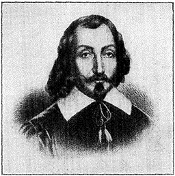
Samuel de Champlain
Samuel de Champlain (1567-1635), born at the little port Brouage in the
Bay of Biscay, made his first trip to Canada in 1603, and five years
later established the first white settlement at Quebec. In the spring he
joined a war party of Algonquins and Hurons, discovered the great lake
that bears his name, and with his arquebus took an important part in the
victory which his savage friends obtained over the Iroquois. In 1615,
with another expedition of Indians, he crossed the eastern ends of Lakes
Huron and Ontario and made a fierce but unsuccessful attack on an
Onondaga town near Lake Oneida. Parkman says: "In Champlain alone was
the life of New France. By instinct and temperament he was more impelled
to the adventurous toils of exploration than to the duller task of
building colonies. The profits of trade had value in his eyes only as a
means to these ends, and settlements were important chiefly as a base of
discovery. Two great objects eclipsed all others—to find a route to the
Indies and to bring the heathen tribes into the embrace of the Church,
since, while he cared little for their bodies, his solicitude for their
souls knew no bounds."
The name Oneida is a corruption of the name Oneyotka-ono or
"people of Stone," in allusion to the Oneida stone, a granite boulder
near Oneida Castle which was held sacred by this tribe of the Iroquois.
An early traveler who visited the castle in 1677 wrote that
the "Onyades have but one town, doubly stockaded, of about one hundred
houses." The rest of the tribe lived around Oneida Lake, in the
region southward to the Susquehanna. They were not loyal to the
Iroquois League's policy of friendliness to the English, but inclined
towards the French, and were practically the only Iroquois who fought
for the Americans in the War of Independence. As a consequence
they were attacked by others of the Iroquois under Joseph Brant and
took refuge within the American settlements till the war ended, when
the majority returned to their former home, while some migrated to
the Thames River district, Ontario. Early in the 19th century they
sold their lands, and most of them settled on a reservation at Green
Bay, Wis., some few remaining in N.Y. State. The tribe now numbers
more than 3,000, of whom about two-thirds are in Wisconsin, a
few hundred in N.Y. State and about 800 in Ontario. They are
civilized and prosperous.
The history of the modern city of Oneida goes back to
1829, when the present site was purchased by Sands Higinbotham,
who is regarded as the founder of the town and in
[77]honor of whom one of the municipal parks is named. In the
southeastern part of the city is the headquarters of the Oneida
Community, originally a communistic society but now a business
corporation, which controls important industries here, at
Niagara Falls and elsewhere.
The Oneida Community was founded in 1847 by John Humphrey
Noyes (1811-1866), and attracted wide interest because of its pecuniary
success and its peculiar religious and social principles. Noyes was
originally a clergyman, but broke away from orthodox religion to
found a sect of his own in Putney, Vt., where he lived. This sect
was known as the "Association of Perfectionists" and formed the
nucleus of the community which Noyes later established at Oneida.
The principles of the new community were based on the idea that
true Christianity was incompatible with individual property, either in
things or in persons. Consequently the new community held all its
property in common. Marriage in the conventional sense of the word
was abolished. The community was much interested in the question
of race improvement by scientific means, and maintained that at least
as much scientific attention should be given to the physical improvement
of human beings as is given to the improvement of domestic
animals. The members claimed to have solved among themselves
the labor question by regarding all kinds of service as equally honorable,
and respecting every person in accordance with the development
of his character.
The members had some peculiarities of dress, mostly confined,
however, to the women, whose costumes included a short dress and
pantalets, which were appreciated for their convenience if not for
their beauty. The women also adopted the practice of wearing short
hair, which it was claimed saved time and vanity. Tobacco, intoxicants,
profanity, obscenity, found no place in the community. The
diet consisted largely of vegetables and fruits, while meat, tea and
coffee were served only occasionally.
For good order and the improvement of the members, the community
placed much reliance upon a very peculiar system of plain
speaking they termed mutual criticism. Under Mr. Noyes' supervision
it became in the Oneida Community a principal means of discipline
and government.
The community had its first financial success when it undertook
the manufacture of a steel trap invented by one of its members. Later
the community engaged in a number of other enterprises, both agricultural
and manufacturing. In the meantime they were subjected to
bitter attacks on account of the radical beliefs of its members, especially
regarding marriage. Noyes, the founder, recognized that in
deference to public opinion it would be necessary to recede from their
social principles, and accordingly the community was transformed
into a commercial corporation in 1881.
Among the manufactures of Oneida are furniture, silver-plated
ware, engines and machinery, pulley, steel vaults and
hosiery. About 6 M. to the northwest is Oneida Lake, a small
lake of considerable beauty, 18 M. long and 5 M. wide.
[78]
Syracuse to Buffalo
290 M. SYRACUSE, Pop. 171,717.
(Train 51 passes 2:31;
No. 3, 3:45;
No. 41, 8:10;
No. 25, 8:50;
No. 19, 12:25.
Eastbound: No. 6 passes 2:40;
No. 26, 3:28;
No. 16, 8:30;
No. 22, 10:35.)
The Syracuse region first became known to Europeans
through its salt deposits along the shore of Onondaga
Lake which had been discovered and used by the Indians.
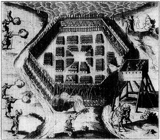
Champlain's Attack on an Iroquois Fort
(From Champlain's "Nouvelle France," 1619)
Of this Indian fort which stood near Lake Oneida, Champlain says:
"Their village was enclosed with strong quadruple palisades of
large timber, 30 ft. high, interlocked the one with the other,
with an interval of not more than half a foot between them; with
galleries in the form of parapets, defended with double pieces of
timber, proof against our Arquebuses, and on one side they had a
pond with a never-failing supply of water, from which proceeded a
number of gutters which they had laid along the intermediate
space, throwing the water without and rendering it effectual
inside for extinguishing fire."
Syracuse lies within the ancient tribal headquarters of the Onondaga
Indians, one of the six tribes forming the League of the
[79]Iroquois. Their territory extended northward to Lake Ontario and
southward to the Susquehanna River. They were the official
guardians of the council fire of the Iroquois, and their chief town,
near the site of the present Onondaga (a few miles south of Syracuse)
consisted of some 140 houses. This was in the middle of the
17th century, when the tribe was estimated as numbering between
1,500 and 1,700. Later the tribe divided, some of them migrating to
the Catholic Iroquois settlements in Canada. About 500 Onondagas
still live on a reservation south of Syracuse.
Although situated in a favorable trading location at the
foot of the valley of Onondaga Creek where the latter joins
Onondaga Lake, no settlement was made here until several
years after the close of the War of Independence. The first
white settler was Ephraim Webster, who built a trading post
near the mouth of the creek in 1786. The village grew slowly.
Between 1800 and 1805 a dozen families settled here, and the
place received the name of Bogardus's Corners from the name
of the proprietor of a local inn. In order to obtain money
for the construction of a public road, the state government,
which had assumed control of the salt fields, sold in 1809 some
250 acres embracing the district now occupied by Syracuse's
business centre to Abraham Walton of Albany for $6,550—about
$26.50 an acre. The town went under various names—Milan,
South Saline, Cossitt's Corner, etc.—until 1824 when
the present name was adopted. In 1818 Joshua Forman
bought an interest in the Walton tract, had a village plotted
and became the "founder" of the city.
Several political events of national importance have occurred
in Syracuse. The Free Soil movement in N.Y. began
at the Democratic State convention held here in 1847,
when the split occurred between the "Barnburner" and
"Hunker", factions of the Democratic party.
These factions grew out of a dispute over questions involving
the Erie Canal. The "Barnburners" were the radical element, determined
to oust the "reactionaries" in office no matter at what cost to
the party, and were given their name from the old instance of the
Pennsylvania farmer who burned his barns to get rid of the rats.
The "Barnburners" opposed the extension of the Erie Canal and, after
1846, the extension of slavery in the Territories. The "Hunkers,"
conservative and influential, were so called from the Dutch "honk,"
which signifies "station" or "home." Thus, "honker" or "hunker"
meant one who "stayed put," and was opposed to progress.
The famous "Jerry Rescue," manifesting the strong anti-slavery
sentiment in Syracuse, took place in 1851, following
the enactment of the Fugitive Slave Law in 1850.
In the winter of 1849-50 an intelligent slave arrived in Syracuse
traveling from Mississippi to Canada. He decided to remain, and
after having for a while worked under Charles F. Williston, a cabinet
[80]maker, he opened a little shop of his own. On Oct. 1, 1851, the
slave-hunters pounced on him and shut him up in a building then standing
on the site of what is now known as the Jerry Rescue Block. When,
later in the day he was taken before William H. Sabine, the United
States Commissioner, the room was so crowded that Jerry, taking
advantage of the fact, succeeded in making a break for freedom.
Running eastward, he was pursued, captured in a hole near the railway
tunnel, and taken back to the police office. By the time evening
came, the fever of the mob was high, and Democrats and Whigs joined
in planning the slave's rescue. A crowd gathered and soon upon
walls and doors fell the blows of stones, axes, and timbers until the
unhappy captors in the police office were concerned not for Jerry's
retention, but for their own safety. One of them jumped from a
window on the north side of the building, and broke his arm in the
fall. Finally the official who had immediate charge of Jerry, pushed
him out into the arms of the rescuers, saying: "Get out of here, you
damned nigger, if you are making all this muss." The slave was
safely hidden in the city for ten days, and then driven on the first
stage of his journey to Canada, where he found at length a haven.
The act was in bold defiance of the law, and 18 of the Jerry rescue
party were indicted, though never convicted. For some years, Jerry's
rescue was celebrated annually in Syracuse.
Present day Syracuse is built on high ground in an
amphitheatre of hills surrounding Onondaga Lake—a beautiful
body of clear water 5 M. long and 1½ M, wide at its
broadest point. James St. in the northeastern part of the
city is a fine residence street, and the principal business thoroughfare
is Saline St. The most noteworthy parks in Syracuse
are Barnet Park (100 acres) on high land in the western
part of the city, and Lincoln Park, occupying a heavily wooded
ridge to the east.
Syracuse University, with a campus of 100 acres, is situated
on the highlands in the southeastern part of the city
where it commands a fine view of Onondaga Lake. The university
was opened in 1871, when the faculty and students
of Genesee College (1850) removed from Lima, N.Y., to Syracuse;
one year later the Geneva medical college likewise removed
to Syracuse and became part of the university. The
university has a number of excellent buildings and a fine
athletic field. It is a co-educational institution under control
of the Methodist Episcopal Church. There are about 4,000
students. The N.Y. State Fair, a civic event of considerable
importance, takes place yearly (in Sept.) in grounds situated
on the western border of the city. The "plant" covers 100
acres and there is an excellent race track where famous horses
are run.
Salt works were established in Syracuse as early as 1788
[81]and the production of salt and sodium derivatives still constitutes
an important industry.
For many years Syracuse was the principal seat of the salt industry
in the United States, but the development of salt deposits in other
parts of N.Y. State and in Michigan caused a decline in the Onondaga
product, though Syracuse still produced 2,000,000 bushels of
salt a year. The Onondaga deposits were mentioned in the journal
of the French Jesuit Lemoyne in 1653, and before the Revolutionary
War the Indians marketed salt at Albany and Quebec. In 1788 the
state undertook, by treaty with the Onondaga Indians, to care for
the salt springs and manage them for the benefit of both the whites
and the Indians. By another treaty (1795) the state bought the salt
lands, covering about 10 Sq. M., paying the Indians $1,000 outright,
supplemented by an annual payment of $700 and 150 bushels of salt.
Subsequently the state leased the lands, charging at various times a
royalty of 4 to 12½ cents a bushel. It was stipulated in 1797 that the
lessees should not sell the product for more than 60 cents a bushel.
In 1898, after the royalty had been reduced to 1 cent a bushel, the
state ordered the sale of the salt lands because the revenue was less
than the expense of keeping up the works. The actual sale, however,
did not take place till 1908. Annual production reached its highest
point in 1862, with 9,000,000 bushels.
The salt deposits supplied the basis for the manufacture
of soda-ash, and at the village of Solvay, adjoining Syracuse
on the west, is one of the largest factories for this purpose
in the world. Besides soda-ash it produces bicarbonate of
soda, caustic soda and crystals, the total output being about
1,000 tons daily. Syracuse ranks among the leading cities of
the state in the number and variety of its manufactures.
There are 760 establishments employing 25,000 workers, with
an annual output of the value of about $75,000,000. The manufacture
of typewriters is an important industry (annual production
$10,000,000). Other products include automobiles and
accessories, tool steel, candles, farm implements, clothing,
chinaware, cement, chemicals and mining machinery.
348 M. PALMYRA, Pop. 2,480.
(Train 51 passes 3:38;
No. 3, 4:57;
No. 41, 9:30;
No. 25, 9:56;
No. 19, 1:42.
Eastbound No. 6 passes 1:25;
No. 26, 2:17;
No. 16, 6:46;
No. 22, 9:14.)
The town of Palmyra is intimately connected with the
early history of the Mormons or "Church of Jesus Christ of
Latter-Day Saints." Joseph Smith (1805-1844), the founder,
lived a few miles south of Palmyra at the village of Manchester
near which, in the "hill of Cumorah," he said he found
the plates of gold upon which was inscribed the book of Mormon.
Smith had the book printed in 1830 in Palmyra.
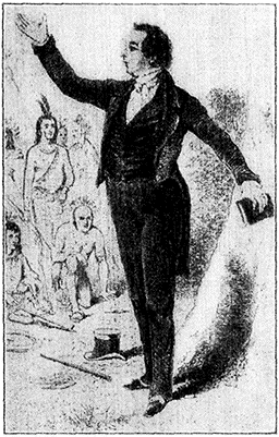
Joseph Smith Preaching
(From an old Mormon print)
Joseph Smith (1805-1877) early began
to gather his proselytes about him,
and even succeeded in interesting a
few bewildered Indians, but the new
sect had great difficulties, aggravated,
it is said, by the licentiousness of the
founder. Persecuted in N.Y. State,
Smith sought to found his New Jerusalem
in Ohio, where, however, the
natives objected with such definiteness
to his way of salvation that he and one
of his followers were tarred and feathered
in Hiram, O. Missouri was chosen
as the next place of refuge, but here,
too, Smith's profligacy aroused the
hostility of the Missourians, which was
increased by propaganda among the
Mormons for a "war of extermination
against the Gentiles." In Illinois,
whither many of the "Saints" now
removed, Smith had a revelation approving
polygamy, which pleased him
very much, but which roused opposition
among his followers as well as
his persecutors. In 1844 he and his
brother Hyrum were arrested on a
charge of treason in the town of Nauvoo
which they had founded and imprisoned
at Carthage. On the night of
June 27, a mob, with the collusion of
the militia guard, broke into the jail
and shot the two men dead. In the meantime
there had arisen a leader of considerable genius,
Brigham Young (1801-1877), who probably saved the
sect from dissolution, and led them to Salt Lake City
in 1844.
Joseph Smith was born at Sharon, Vt., Dec. 23, 1805, from which
place in 1815 his parents removed to N.Y. State, settling first
[82]near Palmyra and later at Manchester. Both his parents and grandparents
were superstitious, neurotic, seers of visions, and believers
in miraculous cures, heavenly voices and direct revelation. The boy's
father was a digger for hidden treasure, and used a divining rod to
find the proper place to dig wells. He taught his son crystal gazing
and the use of the "peepstone" to discover hidden treasure. Young
Joseph was good-natured and lazy. Early in life he began to have
visions which were accompanied by epileptic "seizures." One night
in 1823, according to his story, the angel Moroni appeared to him
three times, and told him that the Bible of the western continent,
the supplement to the New Testament, was buried on a hill called
Cumorah, now commonly known as Mormon Hill. It was not until
1827, however, that he discovered this new Bible. Smith's story was
that on the 22nd of September of that year, he dug up on the hill
near Manchester a stone box in which was a volume 6 inches thick
made of thin gold plates, 8 inches by 8 inches, fastened together by
three gold rings. The plates were covered with small writing in
characters of the "reformed Egyptian tongue." With the golden book
Smith claimed he found a breastplate of gold and a pair of supernatural
spectacles, consisting of two crystals set in a silver bow, by
[83]the aid of which he could read the mystic characters. Being himself
unable to read or write fluently, Smith dictated a translation of the
book from behind a screen. Soon afterwards, according to Smith, the
plates were taken away by the angel Moroni.
370 M. ROCHESTER, Pop. 295,750.
(Train 51 passes 4:05;
No. 3, 5:25;
No. 41, 9:56;
No. 25, 10:23;
No. 19, 2:11.
Eastbound: No. 6 passes 12:59;
No. 26, 1:51;
No. 16, 6:18;
No. 22, 8:47.)
Rochester is built around the Falls of the Genesee
River, about 7 M. above the place where the river empties
into Lake Ontario.
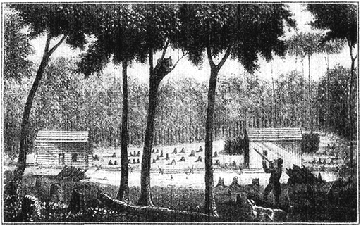
Rochester in 1812
Settlers from New England made a clearing at the site of Rochester about 1810,
but growth was slow until the railroad—now the New York Central—was built
connecting it with Albany and Buffalo.
The Genesee River rises in Pennsylvania and flows nearly 200
miles in a northerly direction through western New York. Within a
distance of 7 M. between Rochester and Lake Ontario the river has a
fall of 263 ft. The principal falls consist of three cataracts, 96, 26
and 83 ft., respectively. The banks of the first fall, which is in the
heart of the city, rise to a height of 200 ft. above the river. The river,
in fact, cuts through the center of the city in a deep gorge, the banks
of which vary in height from 50 to 200 ft. The Genesee Valley south
of Rochester is a very fertile and beautiful stretch of country where
the river flows between meadows that rise gradually to high hills.
The appearance of the country here, with its immense pasture-land
dotted with oak and elm, is distinctly English. Besides being exceedingly
productive both for crops and pasturage, the Genesee
[84]Valley is famous as riding country, although the hunting interest has of
late somewhat waned. But foxes are still found, and the flats along
the river give wonderful opportunities for the chase.
The modern city, however, has spread north until it now
embraces the large village of Charlotte on the western side
of the mouth of the river. The region about Rochester was
visited about 1650 by Jesuit missionaries who worked among
the Seneca Indians in the neighborhood, and in 1687 the
Marquis de Denonville fought a battle with the Iroquois near
the Falls.
The Senecas were members of the League of the Iroquois and
eventually became one of the most important tribes of that league.
Their territory lay between the Seneca Lake and the Genesee River
and they were the official guardians of the league's western frontier.
At the height of their power they extended their range to the country
west of Lake Erie and south along the Alleghany River to Pennsylvania
They fought on the English side in the War of Independence.
About 2,800 are now on reservations in New York State.
Jacques René de Bresay, marquis of Denonville, succeeded La
Barre, who succeeded Frontenac, as governor of Canada in 1689.
La Barre, an inefficient leader against the insurgent Iroquois, held
the administration for only one year. Denonville was of great courage
and ability, but in his campaign against the Indians treated them
so cruelly that they were angered, not intimidated. The terrible
massacre of the French by the Iroquois at Lachine, Quebec, in 1689,
must be regarded as one of the results of his expedition. In 1687
he built Fort Denonville, which was abandoned during the following
year when an epidemic wiped out its garrison.
Although by 1710 the French had established a post on
Irondequoit Bay not far from the mouth of the Genesee, it
was not until Ebenezer Allan (called "Indian Allan") built
a small saw and grist mill near the falls that a settlement began
to grow up. In 1802 three Maryland proprietors, Charles
Carroll, William Fitzhugh and Nathaniel Rochester acquired
a large tract of land which included the site of the present city.
Rochester, from whom the city took its name, established a
settlement, largely of New Englanders, at the falls in 1810-12,
but growth was slow, as it was not at that time on the direct
road between Albany and Buffalo, and the region was malarial.
Nathaniel Rochester (1752-1831) was a native of Virginia. He
had been a manufacturer of Hagerstown, Md., and after settling in
Rochester in 1818 was elected to the N.Y. Assembly (1822).
The completion of the Rochester and Lockport section of
the Erie Canal gave Rochester the impetus which made it a
city, and the building of the railroad a few years later placed
it on the direct route between the Hudson and Lake Erie.
The course of the old Erie Canal lay through the heart of the
city. It crossed the Genesee River by means of an aqueduct of seven
[85]
arches, 850 ft. long, with a channel 45 ft. wide. The aqueduct cost
$600,000. The new barge canal passes through the city about three
miles south of the old canal, and has a harbor in connection with the
Genesee River, which is dammed for that purpose.
Rochester, between 1828 and 1830, was the centre of the
anti-Masonic movement and here Thurlow Weed published his
Anti-Masonic Enquirer.
The Anti-Masonic party arose after the disappearance in 1826 of
William Morgan (1776-1826), a Freemason of Batavia, N.Y., who had
become dissatisfied with the order and had planned to publish its
secrets. When his purpose became known, Morgan was subjected to
frequent annoyances, and finally in September, 1826, he was seized
and conveyed by stealth to Ft. Niagara, where he disappeared. His
ultimate fate was never known, though it was believed at the time
that he had been murdered. The event created great excitement, and
furnished the occasion for the formation of a new party in N.Y.
This new party was in fact a rehabilitation of the Adams wing of the
Democratic-Republican party, a feeble organization, into which shrewd
political leaders breathed new life by utilizing the Anti-Masonic feeling.
The party spread into other middle states and into New England;
in 1827 the N.Y. leaders tried, unsuccessfully, to persuade Henry
Clay, though a Mason, to renounce the order and become the party's
candidate for president. In 1831 the Anti-Masons nominated William
Wirt of Maryland, and in the election they secured the seven electoral
votes of Vermont. In the following year the organization grew moribund,
most of its members joining the Whigs. Its last act in national
politics was to nominate William Henry Harrison for president in
Nov. 1838.
Subsequently, Rochester became the centre of the Abolitionist
movement in New York State and for many years before
the Civil War it was a busy station on the "Underground
railroad," by which fugitive slaves were assisted in escaping
to Canada. The fervor of the movement gave prominence
to Frederick Douglass (1817-1895), the mulatto orator and
editor, who established a newspaper in Rochester in 1847, and
to whom a monument has been erected near the approach of
the New York Central Station. The city was a gathering
place for suffragists from the time when Susan B. Anthony
settled here in 1846.
Susan Brownell Anthony (1820-1906), born at Adams, Mass., was
the daughter of Quaker parents. Her family moved to N.Y. State
where, from the time she was 17 until she was 32, she taught school.
She took a prominent part in the Anti-slavery and Temperance movements
in New York, and after 1854 devoted herself almost exclusively
to the agitation for women's rights. She was vice-president-at-large
of the National Women's Suffragist Association from 1869-1892,
when she became president. She was arrested and fined $100
(which she never paid) for casting a vote at the presidential election
in 1872. She contended that the 14th Amendment entitled her to
vote, and when she told the court she would not pay her fine, the
judge simply let her go. The case created much comment.
[86]In Rochester also lived the famous Fox Sisters, Margaret
(1836-1893) and Katharine, whose spiritualistic "demonstrations"
became known in 1850 as the "Rochester Rappings."
The city has been a centre for American spiritualists ever since.
Kate Fox
(From a daguerreotype)
The demonstrations of the famous Fox sisters began in the
following way: in 1847 the Fox family moved to a house near
Rochester believed to be haunted, from which tenant after tenant
had moved out, alarmed by mysterious rappings. The Foxes did not
hear these sounds until 1848, and then Kate, hardly more than a
child, began questioning the rappings, and having opened what
seemed to be intelligent communication, suggested the use of the
alphabet. That was the beginning of what spiritualists call the
"science of materialization." The exhibitions consisted of the
usual phenomena, table turning, spirit rapping and the moving of
large bodies by invisible means. The two young women gave public
séances throughout the country, arousing an interest that spread
to England. In 1888 Margaret made a confession of imposture which
she later retracted. Claiming to be the wife of Dr. Elisha Kent
Kane, the Arctic explorer, she published a book of his letters
under the "Love Life of Dr. Kane." He had met her between voyages
of exploration, fallen in love with her, and in one of the
published letters addressed her as "my wife," but even she admits
that there never was a formal wedding. He died at Havana in 1857.
Modern spiritualism is generally dated from the "demonstrations"
produced by the Fox Sisters. These exhibitions consisted of the
usual spiritualistic phenomena: table turning, spirit rapping and the
moving of large bodies by invisible means. The sisters gave public
séances through the country, and interest in spiritualism spread to
England. In 1888 Margaret made a confession of imposture, which
she later retracted. She claimed to be the wife of Dr. Elisha Kent
Kane, the Arctic explorer, and published a book of his letters under
the title of the "Love Life of Dr. Kane." Kane had begun his career
as an explorer when he was appointed surgeon and naturalist for
the Grinnell expedition in 1850, which set out to search for Sir John
Franklin, who was lost somewhere in the North. After spending 16
fruitless months of search, they returned, but Kane fitted out a new
expedition of which he was given command, and spent two winters in
polar exploration and collection of scientific data. The voyage lasted
years and brought him fame. It was between these voyages that
he met Margaret Fox, and in one of the published letters he addressed
her as "my wife," though there seems never to have been a formal
wedding. He died in 1857 at Havana.
[87]Rochester is an attractive city, with a park system comprising
1,649 acres. The largest parks are the Durand-Eastman,
the Genesee Valley, Seneca, Maplewood and Highland.
The Durand-Eastman Park occupies a beautiful tract
of wooded ground on Lake Ontario.
The University of Rochester, founded 1851 as a Baptist
institution, but now non-sectarian, occupies a tract of 24 acres
on University Ave. in the eastern part of the city. Notable
men who have been connected with the university include
Henry Augustus Ward, professor of natural history from 1860
to 1875; Martin Brewer Anderson, president from 1854 to
1888, and David Jayne Hill, president from 1888 to 1896.
David Jayne Hill was born at Plainfield, N.J., June 16, 1850.
After obtaining his first degree at the University of Bucknell, Pa.,
he studied for his A.M. in Berlin and Paris. He was president of
the University of Rochester from 1888 to 1896, then spent 3 years in
the study of the public law of Europe. As one peculiarly fitted by
education and training for a diplomatic career, he was minister first
to Switzerland (1903-1905), then to the Netherlands (1905) and from
1908 to 1911 ambassador to Germany. His numerous writings cover
a wide field in biography, rhetoric, diplomacy, history and philosophy.
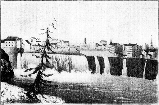
Falls of the Genesee River at Rochester About 1850
(From a print in the N.Y. Public Library)
For many years Rochester was the most important flour milling centre in the
country, owing to the valuable water power furnished by the falls
and the fertility of the wheat fields of the Genesee Valley.
[88]Rochester Theological Seminary prepares students for the
ministry of the Baptist Church, and has no organic connection
with the university. The Mechanics' Institute, founded
in 1885 by Henry Lomb of the Bausch-Lomb Optical Co., is
an unusually successful school of trades and handicrafts. It
occupies a large building, the gift of George Eastman of the
Eastman Kodak Co.
For many years Rochester was the most important flour
milling centre in the country, owing to the valuable water
furnished by the falls and the fertility of the wheat fields of
the Genesee Valley. Flour milling is no longer so important
an industry here—Minneapolis having taken first rank in this
respect—but Rochester ranks high among the great manufacturing
cities of the country. Its total output is valued at more
than $250,000,000 annually. It leads the world in the manufacture
of cameras, lenses, and photographic materials, and it
is one of the principal cities of the country in the distribution
of seeds, bulbs and plants, and in the manufacture of clothing
and shoes. Other important products are machinery of
various kinds, lubricating oil, candied fruits, syrups and confectionery
clothing, tobacco and cigars, enameled tanks and
filing devices.
403 M. BATAVIA, Pop. 13,541.
(Train 51 passes 4:45;
No. 3, 6:18;
No. 41, 10:45;
No. 25, 11:04;
No. 19, 3:03.
Eastbound: No. 6 passes 12:17;
No. 26, 1:12;
No. 16, 5:32;
No. 22, 8:04.)
Batavia, situated on Tonawanda Creek, was
laid out in 1801 by Joseph Ellicott (1760-1826), the engineer
who had been engaged in surveying the land known as the
"Holland Purchase" of which Batavia was a part.
The so-called "Holland Purchase" comprised nearly all the land
in Western N.Y. west of the Genesee River. Its history is associated
with Robert Morris (1734-1806), the Revolutionary merchant and
banker whose financial assistance had been invaluable to the Colonies
during the War of Independence. Morris acquired the Holland Purchase
from the Indians in 1791, after having obtained permission from
the State of Mass. which then claimed sovereignty over this territory.
The following year, however, he began to be involved in financial
misfortunes and was compelled to sell this property to a group
of Dutch capitalists, who undertook to dispose of the land to settlers.
It thus became known as the Holland Purchase, and the Holland Land
Office in Batavia was one of the centers from which the operations
of the Dutch Land company were directed. The slow development
of Morris's other property and the failure of a London bank in which
he had funds invested, finally drove him into bankruptcy, and he was
confined in a debtor's prison for more than three years (1798-1801).
The old Holland Land Office was dedicated as a memorial to Robert
Morris in 1894.
[89]Here lived William Morgan whose supposed murder in
1826 by Freemasons led to the organization of the Anti-Masonic
party. Batavia was the home of Dean Richmond
(1804-1866), a capitalist, successful shipper and wholesale
dealer in farm produce, who became vice-president (1853-1864)
and later president (1864-1866) of the New York Central
Lines. He was likewise a prominent leader of the Democratic
party in N.Y. State. In 1899 his widow, Mary E.
Richmond, erected here in memory of a son a library which
contains about 15,000 volumes.
Among the education institutions here are the N.Y.
State School for the Blind and St. Joseph's Academy (Roman
Catholic). The historical museum in the old Holland Land
Office* contains a good collection of early state relics. The
two old guns in front were cast in the N.Y. State Arsenal,
which manufactured arms for use in the War of 1812.
Among the manufactures are harvesters, ploughs, threshers and other
agricultural implements, firearms, rubber tires, shoes, shell goods,
paper-boxes, and inside woodwork.
We now approach Buffalo, beyond which our route closely parallels Lake
Erie. We thus get our first view of one of America's great inland seas
in this part of the route, although at certain points between Syracuse
and Buffalo (notably at Rochester) our train has passed only a few miles
south of Lake Ontario.
The five Great Lakes—Superior, Michigan, Huron, Erie and
Ontario—lie between the U.S. and Canada and form the headwaters
of the St. Lawrence River system. They cover an area of 94,000 Sq.
M. The Great Lakes date back to Glacial period or before, but it
is probable that a "warping" of the earth's crust and a consequent
reversal of drainage areas have been among the most potent causes
of the formation of these great inland seas. Some of the most
salient facts about the Great Lakes are given in the following
table:
| The Great Lakes |
| |
Superior |
Michigan |
Huron |
Erie |
Ontario |
| Greatest Length (M.) | 360 | 307 | 206 | 241 | 193 |
| Greatest Breadth (M.) | 160 | 118 | 101 | 57 | 53 |
| Deepest Soundings (Ft.) | 1,012 | 870 | 750 | 210 | 738 |
| Area (Sq. M.) | 32,060 | 22,336 | 22,978 | 9,968 | 7,243 |
| Above sea level (Ft.) | 602 | 581 | 581 | 572 | 246 |
| U.S. shore line (M.) | 735 | 1,200 | 470 | 350 | 230 |
The population of the states and provinces bordering on the
Great Lakes is estimated to be 50,000,000 or more. In Pennsylvania
and Ohio, south of Lake Erie, there are large coal fields. Surrounding
Lake Michigan and west of Lake Superior are vast grain growing
plains, and the prairies of the Canadian northwest are constantly
[90]
increasing the area and quantity of wheat grown; while both north and
south of Lake Superior are the most extensive iron mines in the
world, from which approximately 55,000,000 tons of ore are shipped
annually. The Great Lakes provide a natural highway for the shipment
of all these products.
Buffalo to Cleveland
439 M. BUFFALO, Pop. 506,775.
(Train 51 arrives 5:30;
No. 3, passes 7:15;
No. 41, 11:45;
No. 25, 11:51;
No. 19, 3:55.
Eastbound: No. 6 passes 11:31;
No. 26, 12:27;
No. 16, 4:35;
No. 22, 7:15.)
French trappers and Jesuit missionaries
were the first white men to visit the site of Buffalo, and
near here, on the east bank of the Niagara River at the mouth
of Cayuga Creek, La Salle in 1679 built the "Griffin," with
which he sailed up the Great Lakes to Green Bay, Wis. He
also built Ft. Conti at the mouth of the river, but this was
burned in the following year. Seven years later the marquis
of Denonville in behalf of the French built here another fort,
the predecessor of the various fortifications in this locality
which were subsequently called Ft. Niagara.
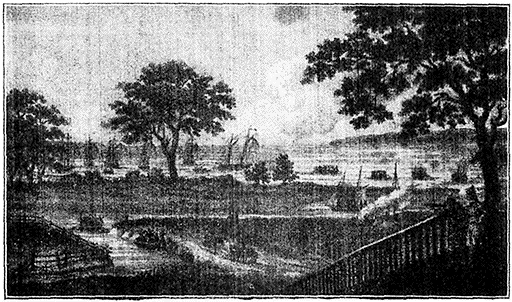
Port of Buffalo on Lake Erie, 1815
Although the neighborhood was the scene of various operations
during the War of Independence, not a single white
settler was living on the site of the present city when the
federal constitution was adopted in 1787, and the town was
[91]not laid out till after the second presidency of Washington.
In 1801 Joseph Ellicott, sometimes called the "Father of
Buffalo," plotted the site for a town, calling it New Amsterdam
but the name of Buffalo Creek or Buffalo proved more
popular. Ellicott was the agent of a group of Dutch capitalists
called the Holland Land Co., who purchased a large
tract of land for speculative purposes in the neighborhood of
Buffalo (1792).
At an early period (1784) the present site of the city of Buffalo
had come to be known as the "Buffalo Creek region," either from
the herds of buffalo or bison, which, according to Indian tradition,
had frequented the salt licks of the creek, or more probably for some
Indian chief.
During the War of 1812 Buffalo was a frontier town,
and, owing to its position on Lake Erie, very close to an important
theater of operations. The first gun of the war is
said to have been fired on Aug. 13, by a battery at Black
Rock, then a rival, now a suburb of Buffalo, and shortly afterwards
British soldiers from the Canadian garrison at Ft.
Erie (directly across the Niagara River from Buffalo) made
a raid into Buffalo harbour and captured the schooner "Connecticut."
The Americans replied with a brilliant exploit in
which Lieut. Jesse D. Elliott (1782-1845) crossed the river
and captured the "Detroit" and the "Caledonia" under the
guns of Ft. Erie.
The ruins of Ft. Erie are among the most picturesque features of
the region about Buffalo. The fort was captured in 1814 by an American
force under Gen. Winfield Scott, and was held by the Americans
till the end of the war, despite the efforts of a British besieging force
to dislodge them. At the close of hostilities the Americans blew up
the fort.
In the following spring (1812) five of the gunboats used
by Capt. Perry at the Battle of Lake Erie were fitted out in
the harbour at Buffalo. Perry's victory, however, did not
save the little settlement from an attack in Dec. of that year
in which Gen. Sir Phineas Riall and a force of 1,200 British
and Indians captured the town and almost completely destroyed
it. After the war the town was rebuilt, and grew
rapidly. In 1818, near where La Salle in 1679 built his little
sailing vessel, the "Griffin," a group of N.Y. capitalists completed
the "Walk-in-the-Water," the first steamboat on the
Great Lakes. The completion of the Erie Canal, seven years
later, with Buffalo as its western terminus, greatly increased
the city's importance. At Buffalo in 1848 met the Free Soil
convention that nominated Martin Van Buren for the presidency
and Charles Francis Adams for the vice-presidency.
[92]Grover Cleveland lived in Buffalo from 1855 until 1884, when
he was elected president.
Stephen Grover Cleveland (1837-1908) was born, fifth in a family
of nine children, in the town of Caldwell, Essex County, N.J. He
came of good colonial stock, but the death of his father prevented
his receiving a college education. About 1855 he drifted westward
with $25 in his pocket, and not long afterward began to read law in
a law office in Buffalo, where he was admitted to the bar in 1859.
He was assistant district attorney of Erie County, of which Buffalo
is the chief city, in 1863, was elected sheriff on the Democratic ticket
in 1869, and mayor of Buffalo in 1881, although the city was normally
Republican. As mayor he attracted wide attention by his independence
and business-like methods—qualities which distinguished his
entire career. After his election as governor in the following year,
the Democratic party chose him as their candidate against James G.
Blaine. He was the first Democrat to be elected president for 24
years. His administration was marked by firmness and justice; he
stood staunchly by the new civil service law, and during his first term
vetoed 413 bills, more than two-thirds of which were private pension
bills. He vigorously attacked the high tariff laws then in effect, but
the administration tariff bill was blocked by his Republican opponents.
In 1888 Cleveland was defeated for re-election by Benjamin
Harrison, but in 1892 he was again nominated and defeated President
Harrison by a large majority. The most important event of his second
administration was the repeal of the silver legislation which had
been a growing menace for 15 years. The panic of 1893 was accompanied
by an outbreak of labor troubles, the most serious of which
was the Pullman strike at Chicago (1894). When Gov. Altgeld of
Illinois failed to act, President Cleveland sent troops to Chicago to
clear the way for mail trains, and the strike was settled within a
week. He also acted decisively in the Venezuela affair, with the
result that Great Britain agreed to arbitrate on terms which safeguarded
the national dignity on both sides. At the end of his term,
Cleveland retired to Princeton, N.J.
The Pan-American Exposition in celebration of the progress
of the Western Hemisphere in the 19th century, was
held here May 1-Nov. 2, 1901. It was during a reception in
the Temple of Music on the Exposition grounds that President
McKinley was assassinated on Sept. 6. He died at the
home of John A. Milburn, the president of the exposition.
President McKinley's assassin was Leon Czolgosz, a young man
of Polish parentage, who shot the president with a revolver at close
range. For a while it was thought that the president would recover,
but he collapsed and died on Sept. 14, 1901. Czolgosz professed to
belong to the school of anarchists who believe in violence. He was
executed in October, 1901.
Buffalo today has broad and spacious streets and a park
system (1,229 acres) of unusual beauty. The largest park is
Delaware Park (362 acres), on the north side of the city.
This park is adjoined on the south by the Forest Lawn Cemetery
which contains monuments to Millard Fillmore and the
Indian chief "Red Jacket."
[93]
Millard Fillmore (1800-1874), 13th president of the U.S., was
born in East Aurora, a little village 14 M. from Buffalo, and practiced
law in Buffalo. He served several terms as member of Congress
and in 1848 was elected vice-president on the Whig ticket,
with Zachery Taylor as president. President Taylor died July 9,
1850, and on the next day Fillmore took the oath of office as his
successor. He favored the "Compromise Measures," designed to
pacify the South, and signed the Fugitive Slave Law. In 1852 he
was an unsuccessful candidate for nomination for the presidency at
the Whig National Convention.
Red Jacket (1751-1830) was a famous Seneca chief and friend of
the whites. He was faithful to the whites when approached by
Tecumseh and the "Prophet" in their scheme to combine all of the
Indians from Canada to Florida in a great Confederacy. In the War
of 1812, he assisted the Americans. By many he was considered the
greatest orator of his race.
To the west of the park are the grounds of the Buffalo
State Hospital for the Insane. Overlooking the lake on a
cliff 60 ft. high, is the park known as "The Front," the site
of Ft. Porter, which has a garrison of U.S. Soldiers.
The University of Buffalo, organized in 1845, has about
1,000 students and comprises schools of medicine, law, dentistry
and pharmacy. Other educational institutions of Buffalo
are the Canisius College, a Roman Catholic (Jesuit) institution
for men, and the Martin Luther Seminary, a
[94]Theological seminary of the Evangelical Lutheran Church. Buffalo
has several fine public buildings, including the Albright
Art Gallery (white marble), the Buffalo Historical Society
Building (in Delaware Park), the Public Library (valued at
$1,000,000), and the City Hall and County Building ($1,500,000).
Since 1914 Buffalo has been under the commission
form of government.
Almost equidistant from Chicago and N.Y.C., the city
of Buffalo, by reason of its favorable location in respect to
lake transportation and its position on the principal northern
trade route between the East and the West, has become one
of the important commercial and industrial centres in the
Union. Originally, the harbour was only the shallow mouth
of the Buffalo River, but it has been greatly enlarged and
improved by extensive federal work. The Welland Canal,
about 25 M. west of Buffalo, connects Lake Erie with the
St. Lawrence River. The annual tonnage of the port of
Buffalo is upwards of 20,000,000 tons. The total export trade
is close to $100,000,000. Besides being the first port in the
country in handling horses, sheep, cattle and hogs, it receives
immense quantities of lumber, pig iron and ore and
has more than a score of huge grain elevators with a capacity
of about 30,000,000 bushels.
In the manufacturing field it has two great advantages:
a supply of natural gas and almost unlimited electric power
from Niagara Falls. Its total annual output is valued at
approximately $400,000,000, and its manufactures include
meat packing, foundry and machine shop products, flour,
steel, linseed oil, railroad cars, clothing, chemicals, furniture,
automobiles, jewelry, confectionery and tobacco.
Buffalo is connected with the Canadian shore by ferry
and by the International Bridge, completed in 1873 at a cost
of $1,500,000.
Niagara Falls, while it is not on the main route to Chicago
is best reached from Buffalo, from which it is only 32
miles distant, and travellers so easily can stop over to make
the little side trip that it is virtually a part of the journey
westward.
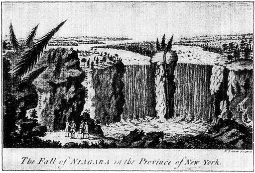
A Colonial Print (1762) in the N.Y. Public Library
Niagara Falls.
Of the seven natural wonders of the
American world, which are given as Yellowstone Park, Garden
of the Gods, Mammoth Cave, Niagara Falls, the Natural
Bridge, Yosemite Valley, and the Giant Trees of California,
by far the greatest spectacle is Niagara. The name means
"thunder of the waters," and was given by the early Indians
[95]
who regarded the falls with a quite comprehensible religious
awe. Today there are more than a million and a half visitors
annually.
Probably the first white man to discover the Falls was
Etienne Brulé, an associate and trusted comrade of Champlain;
but the first chronicler and the man to whom honour of discovery
is usually given, is Father Hennepin, founder of the
monastery at Ft. Frontenac in Quebec, who in 1678 joined
La Salle's Mississippi expedition, and pushing on a few days
journey ahead of his commander, came upon the wonderful
waters described in his Louisiane Nouvelle (1698). The
French built some trading posts here and their influence prevailed
until 1759, when the British, driving the French northward
overthrew their fortifications and took possession of
the land. When the Revolution broke out some years later,
the Indians, terrible and unscrupulous wagers of guerilla
warfare, fought on the British side.
The Niagara River, upon which the Falls are situated,
22 M. from its head in Lake Erie, and 14 M. from its mouth
in Lake Ontario, forms the outlet of four of the five Great
Lakes (Erie, Huron, Michigan and Superior). It descends
about 330 ft. in its course of 36 M. About 15 M. from
Lake Erie the river narrows and the rapids begin. In the
last three quarters of a mile above the falls, the water descends
55 ft. and the velocity is enormous. The basin of the
Falls has a depth of from 100 to 192 ft. During cold winters
the spray covers the grass and trees in the park along
the cliff with a delicate veneer of ice, while below the Falls
it is tossed up and frozen into a solid arch. Adjoining the
left (Canadian) bank is the greater division, Horseshoe Fall,
155 ft. high and curving to a breadth of 2,600 ft. The American
Fall, adjoining the right bank, is 162 ft. high and about
1,400 ft. broad. In recognition of their æsthetic value the
province of Ontario and the State of New York have reserved
the adjacent land as public parks. In the midst of the
Rapids lies a little group of islands, among them the famous
Goat Island. Besides the wonderful view it affords, its western
end gives a unique example of absolutely virgin forest.
The Indians used to fish and hunt, crossing the Rapids on foot
and supporting their steps with tall wooden poles spiked with iron.
The necessity, on one occasion, of saving two marooned comrades
on the island, taught them this means of crossing, which they had
never before attempted.
The Niagara River runs half its length on an upper plain,
then drops at the falls into a narrow gorge through which
[96]it courses seven miles to the escarpment, the crest of which
is a bed of limestone—60 ft. thick at the falls. The water
plunges into a deep basin hollowed out of soft shale, which,
as well as the escarpment, is being constantly worn away.
The site of the cataract retreats upstream and the gorge is
lengthened at a rate of about five ft. a year. It is evident
that the whole gorge has been dug out by the river, and many
attempts have been made to determine the time consumed in
the work. The solution of the problem would aid in establishing
a relation between the periods and ages of geologic
time and the centuries of human chronology. The Horseshoe
Fall wore its cliff back 335 ft. in about 63 years. Geologists
have computed 25,000 years as a lower limit for plausible
estimates of the river, but have been able to set no upper
limit.
The Canadian and American shores are connected by
three bridges, one of which a suspension carrying all classes
of traffic, is 1,240 ft. long. The flow of water in the river
averages 222,000 cubic ft. per second, though it sometimes
falls as low as 176,000 cubic ft.
On March 29, 1848, Niagara ran dry, and persons walked in the
rocky channel bed of the American Rapids between Goat Island and
the mainland. This phenomenon, never known before or since, was
due to these facts. Lake Erie was full of floating ice flowing to its
outlet, the source of Niagara River. During the previous afternoon
a heavy northeast wind had driven the ice back into the lake, and
during the night the wind, suddenly veering, blew a gale from the
west which forced the ice floe sharply into a mass in the narrow
channel of the river, where it froze. Thus, when the water on the
lower side of the barrier drained off, the Niagara River and the
American Fall were dry, and the Canadian Fall a mere trickle. This
extraordinary condition lasted for a whole day.
Thus the descent of this stream at the Falls and in the
Rapids just above them gives in theory a water-power of
nearly 4,000,000 lip., three-fourths of which is estimated as
available.
This maximum could be obtained only by sacrificing the beauty
of the Falls—in fact diverting the river from its channel so that the
cataract as a scenic feature would be destroyed. To combat this
commercial vandalism an association for the protection of the Falls
has been formed.
There were before 1918 several companies with power-producing
plants, the largest of which was the Niagara Falls
Hydraulic Power and Manufacturing Company.
This company had made an extensive beginning in utilization
of the water fall by a tunnel 29 ft. deep and 18 ft. wide, passing about
200 ft.. below the surface of the city from a point 1¼ M. above the
Falls to the upper steel arch bridge.
[97]In 1918, when added power was needed for the more
rapid production of war materials, the various companies
consolidated with the Niagara Falls Power Company. In
May of that year the intake from the Niagara River and the
hydraulic canal were deepened, and three hydro-electric units—the
largest in the world today—were installed, with the
result that an extension of 100,000 hp. was developed, making
the total of the station 250,000 hp.
510 M. DUNKIRK, Pop. 19,366.
(Train 3 passes 8:23;
No. 41, 1:00;
No. 25, 12:45;
No. 19, 4:57.
Eastbound: No. 6 passes 10:24;
No. 26, 11:26;
No. 16, 3:10;
No. 22, 6:08.)
Dunkirk, settled about 1805, has a fine harbour and extensive
lake trade, and lies, moreover, in fertile agricultural and grape-growing
country. The property of the town, assessed at
$10,000,000 is chiefly in factories producing locomotives, radiators
and other steel and iron products, wagons, silk gloves,
and concrete blocks. There are several pleasant parks, of
which Gratiot and Washington are the largest. Brocton
(519 M.) and Westfield (526 M.) are junctions for travellers
bound for Chautauqua (about 20 M. south of Brocton on
Chautauqua Lake), the principal seat of the Chautauqua educational
movement.
The Chautauqua movement, instituted more than 46 years ago
in the west, has here its largest station. Each summer 15,000 or
20,000 people from all over the country assemble here to take courses
in a great variety of subjects, from Italian Primitivism to Camp
Cookery. Chautauqua makes its chief appeal, perhaps, to the middle-aged
and elderly who in their youth were working too hard to have
had any opportunities for study.
Just beyond Ripley (534 M.) we cross the state line into
Pennsylvania.
557 M. ERIE, Pop. 93,372.
(Train 3 passes 9:30;
No. 41, 2:06;
No. 25, 1:36;
No. 19, 5:59.
Eastbound No. 6 passes 9:25;
No. 26, 10:30;
No. 16, 2:03;
No. 22, 5:08.)
Erie stands
on the site of the old French fort Presque Isle, built in 1753
and surrounded by a village of a few hundred inhabitants.
Although Washington protested on behalf of the Governor of
Va. against the French occupation of this territory, it remained
in French hands until 1758 when an epidemic of small-pox
broke out, making the fort untenable. Two years later the
British seized it, and three years after the Indians, rising
against their white rulers in the Conspiracy of Pontiac, took
possession. In 1765 the British recaptured the fort and kept
it until 1785, when it passed into the possession of the U.S.
Gen. Anthony Wayne, who was given the task of occupying
[98]the lake posts delivered up by the English, came here soon
after to negotiate the famous
treaty of Greenville with the
Indians in 1795. He died in
1796 at Erie.
Certain hostile tribes in northwest
of Ohio who had defeated
Gen. St. Clair in 1791, sent away
in scorn a mission asking permission
for white men to
settle beyond the Ohio (1793).
Wayne, angry at this insolence,
gathered together some troops
of the recently organized American
army and after having given
the Indians one more chance of
a peaceable settlement, defeated
them thoroughly in the battle of
Fallen Timbers, 80 miles north of Cincinnati. By the resulting treaty
of Greenville, he opened up the northwest to civilization.
In spite of the necessary severity of the punishment meted
out to the Indians by the new government through the agency
of Wayne, no part of Washington's administration, domestic
or foreign, was more original or more benign than the policy
he constantly urged toward them. To save them from the
frauds of traders a national system of trade was adopted, and
a number of laws were passed to protect them from the aggressions
of borderers, as well as to secure them in the rights
allowed them in their treaties.
The battle of Lake Erie (1813) was closely associated
with the city. Here were Perry's headquarters during the
War of 1812, and here he built in less than six months many
of the vessels with which he won his naval victory over the
British.
Erie is now an important manufacturing centre, the products
of which are valued at between $40,000,000 and $50,000,000.
A large branch of the General Electric Co. is here,
besides important factories for flour and grist mill products,
paper and wood pulp, organs, petroleum, etc. The leading
articles of shipment are lumber, coal, grain and iron ore.
Over 1,400 ships a year enter and clear the broad, landlocked
harbour. On a bluff overlooking lake and city, is the
State Soldiers' and Sailors' Home, and nearby, a monument
to Gen. Wayne. Between Springfield (577 M.) and Conneaut
we cross the state line into Ohio.
584 M. CONNEAUT, Pop. 9,000.
(Train 3 passes 10:08;
No. 41, 2:39;
No. 25, 2:04;
No. 19, 6:34.
[99]Eastbound: No. 6 passes 8:50;
No. 26, 9:59;
No. 16, 1:20;
No. 22, 4:32.)
The first permanent settlement was made here in 1799 though
a preliminary surveying party composed of Moses Cleaveland,
the founder of the city of Cleveland, and 50 associates, two
of whom were women, had arrived in 1796 and found 20 or
30 cabins of the Massauga tribe.
In his journal Cleaveland gives a description of the arrival here,
"on the creek Conneaugh, in New Connecticut Land," July 4, 1796.
"We gave three cheers," he continues, "and christened the place Ft.
Independence, and, after many difficulties, perplexities and hardships
were surmounted and we were on the good and promised land, felt
that a just tribute of respect to the day ought to be paid. There
were in all, including women and children, 50 in number. The men
under Capt. Tinker, ranged themselves on the beach and fired a
Federal Salute of 15 rounds, and then the 16th in honor of New
Conn. Drank several toasts. Closed with three cheers. Drank
several pints of grog. Supped and returned in good order."
After the whites had established themselves, the Indians
were driven out for having murdered a settler. The country
of Ashtabula in which Conneaut stands was not only the first
settled on the Western Reserve, but the first in Northern
Ohio, and the town is sometimes called the "Plymouth" of
the Western Reserve.
Conneaut, which means in the Seneca language "many
fish," is built at the mouth of Conneaut Creek in what is now
a thriving agricultural and dairying region on Lake Erie.
Besides being an excellent harbour to which coal and ore
are shipped, the city has flour and planing mills, tanneries,
canneries, and other factories.
595 M. ASHTABULA, Pop. 22,082.
(Train 3 passes 10:29;
No. 41, 3:06;
No. 25, 2:19;
No. 19, 6:50.
Eastbound: No. 6 passes 8:34;
No. 26, 9:44;
No. 16, 1:00;
No. 22, 4:16.)
Settlers were attracted to the site of the present town of Ashtabula
(an Indian word said to mean "fish river") in 1801 by
the excellent harbour here, formed by the mouth of the Ashtabula
River. The city is built on the high bank of the river
about 75 ft. above the lake and commands some fine views.
There are large green-houses under glass from which forced
fruit and vegetables are shipped to Pittsburgh and other
large cities. It is the centre of a prosperous agricultural
and dairying region which has been largely settled by Finns.
Ashtabula is one of the most important ports in America
for the shipment of iron ore and coal. Iron ore especially,
is brought here in enormous quantities by boat and trans-shipped
to Pittsburgh. The shipyards and drydocks in the
harbour, and the huge machines for loading coal and unloading
[100]ore are of great interest. The city has large manufactories
of leather, worsted goods, agricultural implements,
foundry and machine shop products; and the total value of
its output is close to $10,000,000 annually.
602 M. GENEVA, Pop. 3,081.
(Train 3 passes, 10:42;
No. 41, 3:18;
No. 25, 2:29;
No. 19, 7:03.
Eastbound: No. 6 passes 8:22;
No. 26, 9:32;
No. 16, 12:39;
No. 22, 4:02.)
Geneva is built close to the site of the early Indian village
Kanadasaga, burnt in 1779.
In that year Gen. Sullivan was despatched at the head of an
expedition against the Indians of Western N.Y., who had taken up
arms for the British and had been guilty of the terrible Wyoming
and Cherry Valley massacres. Kanadasaga was one of the Indian
"council hearths" destroyed, and tribes in this region were driven
westward, never to recover their old power.
In addition to the lake, there are good mineral springs.
According to Duncan Ingraham, a Massachusetts traveller
who wrote an account of a journey in 1792, the town then
consisted "of about 20 log houses, three or four frame buildings,
and as many idle persons as can live in them." Some
of these old houses along the main street are of pure Colonial
type, and really beautiful. Hobart College, founded
1822, is situated here. Malt, tinware, flour, stoves, wall-paper,
etc., are manufactured, and there are also extensive nurseries.
622 M. PAINESVILLE, Pop. 7,272.
(Train 3 passes, 11:06;
No. 41, 3:40;
No. 25, 2:46;
No. 19, 7:27.
Eastbound: No. 6 passes 8:05;
No. 26, 9:16;
No. 16, 12:18;
No. 22, 3:43.)
Painesville was founded in 1800 by settlers from Conn. and
N.Y., the chief among whom was Gen. Edward Paine (1745-1841),
an ex-officer of the Continental Army. It contains one
of the early women's colleges of the country—Lake Erie College,
founded in 1859 as the successor to Willoughby Seminary
at Willoughby, Ohio, the buildings of which were burned
in 1846.
The history of this part of the State includes early episodes
of Mormonism. In Painesville was published a book
by E.D. Howe purporting to show that "the historical p(art?)
of the book of Mormon" was plagiarized from a romance
called The Manuscript Found written by Solomon Spalding of
Conneaut (about 1809). This claim has not been fully verified
by later research.
Nine miles southwest of Painesville at Kirtland was (one?)
of the early settlements made by Joseph Smith and his
[101]Mormon followers. They built here a $40,000 temple (still standing),
a teacher's seminary and a bank. The bank failed and
Smith had to leave the state to avoid the sheriff. Most of
his disciples followed him to Missouri. At Mentor (which
we now pass 4 M. west of Painesville) lived Sidney Rigdon,
who later became one of the Mormon leaders.
Rigdon (1793-1876) began his preaching career as a Baptist,
then helped in establishing a society called the "reformers," and
before being converted to Mormonism was pastor of a church in
Mentor. He became a Mormon leader, and published a new translation
of the Bible, with inserted prophecies of the coming of Joseph
Smith. With Hyrum and Joseph Smith and Brigham Young, he
moved westward in 1831 preaching, being "persecuted" and establishing
an occasional temple. At Far West, a town in Missouri where
the Mormons established themselves in 1838, Rigdon preached his
"salt sermon," from the Matt. V. 13, urging his hearer to wage a
"war of extermination" against all who disturbed them. Following
his advice, the Mormons involved themselves in such broils with
the "gentiles" that the state militia was called out against them.
Smith and Rigdon were arrested, but the former escaped custody
and with 15,000 followers, fled to Illinois. When the latter was
freed, he joined the "Saints" in the city of Nauvoo which they had
founded and was made a professor at their university. After Smith's
arrest and murder by a mob in 1849 and the breaking up of Nauvoo,
Rigdon disputed with Young for Smith's place. Not only failing
to secure it, but being in addition tried for treason in wanting it, the
disciple of Mormon returned to the East and spent his last days at
Friendship, N.Y. Howe, in the book mentioned above, asserted
that Sidney Rigdon was the original "author and proprietor of the
Mormon conspiracy."
Near Mentor, also is Lawnfield, the former home of
James A. Garfield.
James Abram Garfield (1831-1881), 20th president of the U.S.,
was born in a log cabin at Orange, Ohio, and began life as a farm
hand. He attended for a time the Western Reserve Eclectic Institute,
afterwards Hiram College, finally entering Williams College
from which he graduated, becoming a teacher of ancient languages
and literature. Entering politics as a Republican, he was elected to
the Ohio Senate in 1859. His Civil War record was striking, and
he was made major-general for gallantry at the battle of Chickamauga.
He was elected to Congress in 1863, where he attracted attention
as a hard worker and ready speaker, and where later he became
leader of the Republican party in the House. He was an advocate
of drastic measures against the South and considered Lincoln's
policies too lenient. At the presidential convention of the Republican
Party in 1880, he was nominated on the 36th ballot as a compromise
candidate, and in the same year was elected president. On
the 2d of July, 1881, while on his way to attend commencement
exercises at Williams College, he was shot by Charles G. Giteau, a
disappointed office seeker who waylaid him in the Washington Railroad
Station. He died Sept. 19, 1881, at Elberon, N.J.
[102]
Cleveland to Chicago
623 M. CLEVELAND, Pop. 796,836.
(Train 3 passes 11:55;
No. 41, 4:35;
No. 25,3:30;
No. 19, 8:20.
Eastbound: No. 6 passes 7:20;
No. 26, 8:35;
No. 16, 11:30;
No. 22, 2:56.)
A trading post was established on the present site of Cleveland
as early as 1785 and ten years later Capt. Moses Cleaveland,
leader of a small band of pioneers and agent of the
Connecticut Land Co., surveyed the ground and planted the
nucleus of the present thriving city—now fifth in size in the
country. Capt. Cleaveland, in travelling from Connecticut into
the Northwest, followed closely the present route of the New
York Central Lines, crossing N.Y. State to Buffalo and then
from Buffalo along the shore of Lake Erie.
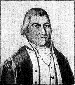
Moses Cleaveland
Moses Cleaveland (1754-1806) was
born at Canterbury, Conn., and graduated
from Yale. After serving in the
U.S. Army, where he attained the
rank of captain, he practiced law and
entered the Connecticut legislature.
Later, he organized the Connecticut
Land Co., which in 1795 purchased a
large portion of the Western Reserve.
At that time the southern shore of Lake Erie was part
of the famous Western Reserve territory, consisting of
3,250,000 acres of land, certain parts of which Connecticut
ceded to her citizens as compensation for their losses from
"fire and damage" at the hands of the British during the
Revolutionary War. These lands were sometimes known as
"Fire Lands."
The Western Reserve was a part of the territory immediately
west of the Pennsylvania line, and extending westward therefrom
120 M. Connecticut held and "reserved" this territory to herself
in 1780, when she ceded to the general government all her rights
and claims to the other lands in the West. Later Conn. ceded the
Reserve itself, but not before she had sold much of it to the Conn.
Land Co., and the latter had begun the sale and disposition of all
the lands so acquired, east of the Cuyahoga River. Until after 1815
[103]no lands west of that river were open to entrance or survey, and
settlers ventured there at their own risk. This was the Indian
Boundary Line, established in 1795, and beyond it the aborigines had
exclusive right of occupancy.
It was for the purpose of surveying and developing these
lands that Capt. Cleaveland undertook his expeditions into
the Western Reserve. The first of these expeditions (1795)
was composed of 50 men, women and children who arrived
at Ft. Independence (now Conneaut) on Lake Erie, July 4,
1796. Pushing on further, they arrived at the present site
of Cleveland, and in a few days the first log cabin was erected
at the mouth of the Cuyahoga River.
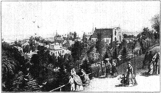
City of Cleveland from Reservoir Walk (1873)
To keep the commissary supplied was no easy problem in the
new settlement. Sometimes they ate boiled rattlesnake in default
of anything better. On one occasion, while the little band of
settlers was assembled in prayer in one of the log cabins, someone
espied a bear swimming across the Cuyahoga River. The coming
of the bear was looked upon as providential, and the congregation
suspended the prayer-meeting, killed the bear, and then returned
to their devotions.
Capt. Cleaveland's plans for his new settlement were
ambitious, and he built a number of substantial roads through
the forests, usually following the old Indian trails, now the
right of way of the New York Central and other lines. With
the opening of the Ohio Canal to the Ohio River (1832),
Cleveland became the natural outlet on Lake Erie for Ohio's
[104]extensive agricultural and mineral products. The discovery
and commercial exploitation (beginning about 1840) of large
deposits of iron ore in the Lake Superior region placed Cleveland
in a strategic position between these vast ore fields and
the coal and oil resources of Ohio, Pa., and W. Va., and it is
from this time that the city's great commercial importance
really dates.
In 1836 Cleveland had been chartered as a city. The
name, though chosen in honour of Capt. Cleaveland, had been
abbreviated to its present form some years before. Tradition
credits the changed form to a newspaper which left out
the letter "a" in order to make the word fit a headline.
The building of the railways during the decade 1850-1860,
and the stimulus to industry during the Civil War,
when Cleveland supplied large quantities of iron products
and clothing to the government, gave impetus to the city's
growth. With a population of only 1,076 in 1830 and 6,071
in 1840, Cleveland had become in 1870 a city of 92,829 (more
than double its population in 1860). Thirty years later
(1900) the population had grown to 381,768 and in 1920 it
was 796,836, an increase of 42 per cent over 1910.
The later history of Cleveland has been distinguished
for some notable experiments in city planning, popular
education and municipal ownership (particularly with respect to
street railways). The street railway situation had been a
source of trouble ever since 1899, when a strike of serious
proportions occurred. Mobs attacked the cars, some of which
were blown up with dynamite. In 1901 Tom Johnson was
first elected mayor, and, largely as a result of his advocacy,
municipal ownership became a greater issue in Cleveland
than in any other great city in the country.
Tom Johnson (1854-1911) was a successful business man who
entered politics on a reform platform. He was an ardent single-taxer,
and in spite of the fact that he was financially interested in
street railways, steel plants and other industries, a staunch advocate
of municipal ownership. He served as mayor of Cleveland for 4
successive terms (from 1901 to 1909) and was later elected to
Congress. Single Taxers were much pleased by his strategy in getting
an entire book—Henry George's Progress and Poverty—printed in
the Congressional Record.
Johnson and his followers demanded a 3-cent fare on the
street railways and in 1906 it was actually put into effect.
The private owners were compelled in 1908 to lease their
property to a municipal holding company, but in 1910 (after
Johnson's defeat for re-election in the preceding year), the
street railway system was leased to a new corporation, the
[105]rate of fare under the new arrangement to be based on an
adequate return to the investors.
Cleveland was the home of Mark Hanna who became
famous in national Republican politics.
Marcus A. Hanna was born in Lisbon, Ohio, in 1837, removed
with his father in 1852 to Cleveland, where he graduated from
Western Reserve University, and in 1867 entered into partnership with
his father-in-law (Daniel P. Rhodes) in the coal and iron business.
Under Hanna's guidance the business prospered enormously, but
it was not till somewhat late in life that he became prominent in
Republican affairs in Cleveland. As chairman of the National
Republican Committee in 1896 he managed with great skill the
campaign against Bryan and free silver, and came to be acknowledged
as a leader of great adroitness, tact, and resource. He entered the
U.S. Senate from Ohio in 1898, and was one of the principal advisers
of the McKinley administration. He took a vital interest in
problems affecting labor and capital and was one of the organizers
in 1901 and first president of the National Civic Federation. He
died in 1904 at Washington.
The Cleveland Chamber of Commerce has done much in
the betterment of local politics. It was also instrumental in
1902 in securing the adoption of the "Group Plan" by which
some of the principal public buildings are arranged in a
quadrangle on the bluff overlooking Lake Erie. Cleveland
appropriated $25,000,000 to promote the plan. On one side
of the quadrangle (nearest the lake) are the courthouse and
city hall; on the opposite side and 2,000 ft. south are the
post office and library ($2,500,000). There is to be a Mall
600 ft. wide, with public buildings on either side, connecting
the court-house and city hall with the post office and library.
The granite buildings forming this quadrangle were designed
under the supervision of Arnold Brunner, John M. Carrere
and D.H. Burnham.
In education the city has made an innovation known as
the "Cleveland plan" which seeks to minimize school routine,
red tape and frequent examinations. Great stress is put on
domestic and manual training courses, and promotion in the
grammar schools is made dependent on the general knowledge
and development of the pupil as estimated by a teacher
who is supposed to make a careful study of the individual.
There are in Cleveland 120 public schools and 44 public
libraries. The principal institutions of higher education are
the Western Reserve University with 2,800 students, St.
Ignatius College (Roman Catholic), and the Case School of
Applied Science.
With its 12 M. of shore line on Lake Erie, a fine park
system (1,500 acres), and wide residential streets, well shaded
[106]by maples and elms, Cleveland possesses many aspects of
unusual beauty. The city is situated on bluffs rising from
74 to 200 ft. above the water and commands pleasant views
of Lake Erie, while the surface of the plateau upon which
the town is built is deeply cut by the Cuyahoga River, which
here pursues a meandering course through a valley half a
mile wide. Other streams, notably Dean Brook on the east
border, add to the picturesque character of the municipal
setting. A chain of parks* connected by driveways follows
the valley of the Dean Brook, at the mouth of which, on the
lake front, is the beautiful Gordon Park, formerly the private
estate of William J. Gordon, but given by him to the city in
1893; from this extends up the Dean Valley the large Rockefeller
Park, given to the city in 1896 by John D. Rockefeller
and others. It adjoins Wade Park, where are a zoological
garden and a lake.
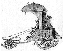
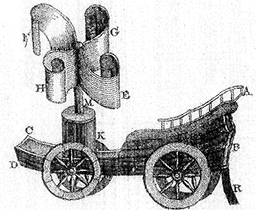
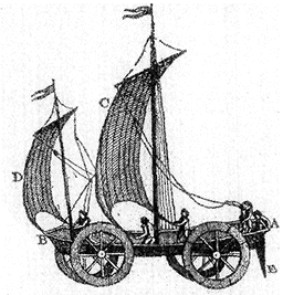
The First Automobile (1798)
"By means of wheels," says the Third Edition of the Encyclopædia
Britannica (1798), from which this illustration was taken, "some people
have contrived carriages to go without horses. One of these [the vehicle
to the left] is moved by the footman behind it; and the forewheels,
which act as a rudder, are guided by the person who sits in the
carriage. Between the hind-wheels is placed a box, in which is concealed
the machinery that moves the carriage. A machine of this kind will
afford a salutary recreation in a garden or park, or on any plain
ground; but in a rough or deep road must be attended with more pain than
pleasure.... Another contrivance for being carried without draught, is
by means of a sailing chariot or boat fixed on four wheels, as A/B [the
figure to the right], which is driven before the wind by the sails C/D
and guided by the rudder E. Its velocity with a strong wind is said to
be so great that it would carry eight or ten persons from Scheveling to
Putten, which is 42 English miles distant, in two hours." The figure in
the centre represents a modified sailing vehicle designed to sail
against the wind as well as with it.
Of the several cemeteries in Cleveland, Lake View (300
acres), on an elevated site on the east border of the city is
[107]the most noteworthy; here are buried President Garfield
(the Garfield memorial is a sandstone tower 165 ft. high with
a chapel and crypt at its base), Mark Hanna and John Hay.
John Hay (1838-1905) was a native of Salem, Ind., and a graduate
of Brown University. He studied law in the office of Abraham
Lincoln, and, after being admitted to the bar at Springfield, Ill.,
became one of Lincoln's private secretaries, serving until the
president's death. He then acted as secretary to various U.S. Legations
abroad—Paris, Vienna, Madrid—and on returning to America became
assistant secretary of State under W. M. Evarts. President
McKinley appointed him ambassador to Great Britain in 1897, and
the following year Secretary of State. Hay was prominent in many
important international negotiations, such as the treaty with Spain
(1898), the "open door" in China, and the Russo-Japanese peace settlement.
He negotiated the Hay-Pauncefote treaty concerning the
Panama Canal; also settled difficulties with Germany over the Samoan
question and with Great Britain over the Alaskan boundary.
As an author, Hay is best known for his Pike County Ballads, in which
Little Breeches first appeared, and for the monumental life of Lincoln
written by Nicolay and himself.
Other notable monuments in Cleveland are a statue of
Senator Hanna by Saint Gaudens (in University Circle), a
marble statue of Commodore Perry in commemoration of the
battle of Lake Erie (in Wade Park), a soldiers' and sailors'
monument—a granite shaft rising from a memorial room to
a height of 125 ft. (in the Public Square), and a bronze statue
of Moses Cleaveland, the founder of the city (likewise in the
Public Square). This latter monument is said to stand on
the very spot selected by Cleaveland for the centre of his new
settlement.
The Public Square, or Monumental Park, is in the business
centre of the city, about ½ M. from the lake and the
same distance east of the Cuyahoga River. From this park
the principal thoroughfares radiate. Euclid Ave., once
famous for its private residences, but now the chief retail
street of the city, begins at the southeast corner of the square.
Cleveland's newest residence district is on the heights in the
eastern part of the city.
Cleveland sometimes has been called the "Sheffield of
America." Its prosperity is founded chiefly on its accessibility
to oil, coal and iron. It is the largest ore market in the
world. Forty million tons of iron ore valued at $125,000,000
are received annually in the Cleveland district, and the ore
docks where much of this ore is handled, are of great interest.
Cleveland also has extensive docking facilities,* said
to be the finest in the country, for handling its immense trade
in coal and grain. Cleveland's oil refineries, among the largest
[108]in the world, receive enormous quantities of crude oil by
pipe line, rail and water.
The city has 2,500 manufacturing plants with 125,000
workers, producing annually goods worth about $375,000,000,
of which $100,000,000 represents the products of its foundries
and machine shops. Cleveland is the first city in America
in the making of wire products and automobile parts, second
in the manufacture of clothing and sewing machines and one
of the leading cities in the production of complete automobiles.
Shipbuilding (there are five large shipyards* here)
is likewise an important industry, and Cleveland controls the
larger share of the tonnage on the Great Lakes.
673 M. ELYRIA, Pop. 20,474.
(Train 3 passes 12:52;
No. 41, 5:27;
No. 25, 4:07;
No. 19, 9:12.
Eastbound: No. 6 passes 6:22;
No. 26, 7:57;
No. 16, 10:34;
No. 22, 2:04.)
Elyria
was founded about 1819 by Herman Ely in whose honour it
was named. Ely came from West Springfield, Mass., built a
cabin on the site of the present town, and later erected the
[109]first frame house in the township. The city lies at the junction
of the two forks of the Black River, each of which falls
about 50 feet here, furnishing considerable water-power.
There are sandstone quarries about the town. The chief manufactures
of the city are automobile supplies, telephones, electric
apparatus, flour, feed, canned goods, machine parts and
iron pipe; the annual output is valued at about $10,000,000.
Eight miles to the southwest is Oberlin (Pop. 5,000), the seat
of Oberlin College.
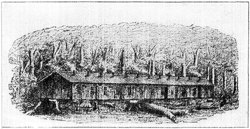
“Slab Hall,” Oberlin College (1832)
Oberlin College was founded in 1832 "to give equal advantages to whites and
blacks, and to give education to women as well as to men." Other objects were
"to establish universal liberty by the abolition of every form of sin" and "to
avoid the debasing association of the heathen classics and make the Bible a text
book in all departments of education." The traditions of Oberlin are strongly religious,
and from Charles Grandison Finney, revivalist and president of the college
from 1851 to 1866, sprang what is called the "Oberlin Theology," a compound of
free-will and Calvinism. Before the Civil War the village was a station on the
"underground railway," and the influence of the college made it a centre of
extreme abolitionist sentiment.
704 M. SANDUSKY, Pop. 22,897.
(Train 3 passes 1:35;
No. 41, 6:12;
No. 25, 4:44;
No. 19, 9:55.
Eastbound: No. 6 passes 5:38;
No. 26, 7:13;
No. 16, 9:45;
No. 22, 1:16.)
English
traders visited Sandusky Bay, upon which the city of Sandusky
is situated, as early as 1748, and by 1763 a fort had been
erected for protection against the French and Indians. On
May 16th of that year, during the Pontiac rising, the Wyandot
Indians burned the fort. A permanent settlement was established
in 1817.
At the entrance to Sandusky Bay is Cedar Point, with
a beach for bathing. This is an attractive summer resort.
Outside Sandusky Bay are a number of islands, most of which
belong to Ohio, but the largest, Point Pelee, is British. At
the mouth of the harbour is Johnson's Island, where many
Confederate prisoners were confined during the Civil War.
There is a soldiers' and sailors' home here with accommodations
for 1,600 persons. A few miles farther north are several
fishing resorts, among them Lakeside and Put-in-Bay (South
Bass Island), where the government maintains a fish hatchery.
Out of this bay Oliver Hazard Perry and his fleet sailed
on the morning of Sept. 10, 1813, for the battle of Lake Erie.
Having worked up in the U.S. Navy from midshipman to captain
during which time he saw service against the Barbary pirates,
Capt. Oliver Hazard Perry (1785-1819) was at the beginning of the
War of 1812 placed in command of a flotilla at Newport, but soon
transferred to the lakes. There, with the help of a strong detachment
of officers and men from the Atlantic coast, he equipped a
squadron of a brig, six schooners, and a sloop. In July 1813 he
concentrated the Lake Erie fleet at Presque Isle (now Erie). In
Aug. he took his squadron to Put-in-Bay, in South Bass Island.
On Sept. 10, Perry met the British squadron, under Capt. Barclay
off Amherstburg, Ont., in the Battle of Lake Erie. Capt. Barclay,
after a hot engagement in which Perry's flagship, the "Lawrence,"
was so severely shattered that he had to leave her, was
completely defeated. "The important fact," says Theodore Roosevelt
"was that though we had nine guns less [than the enemy] yet at
a broadside, they threw half as much metal again as our antagonist.
With such odds in our favor, it would have been a disgrace to have
[110]been beaten. The chief merit of the American Commander and his followers
were indomitable courage and determination not to be beaten.
This is no slight merit; but it may well be doubted if it would have
insured victory had Barclay's force been as strong as Perry's....
It must always be remembered that when Perry fought this battle
he was but 27 years old; and the commanders of his other vessels
were younger still." Another distinction which Perry won on this
occasion is that he enriched our diction when in writing to Gen.
Harrison to announce his victory, he said, "We have met the enemy,
and they are ours."
Perry commanded the "Java" in the Mediterranean expedition
of 1815-16 and died of yellow fever at Trinidad in 1819.
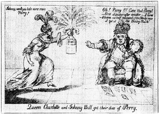
An American Cartoon (1813)
Queen Charlotte is represented as saying, "Johnny, won't you take some more
Perry?" while "Johnny Bull" replies: "Oh! Perry!!! Curse that Perry! One
disaster after another. I have not half recovered of the Bloody Nose
I got at the Boxing Match." In a ballad of the day the verse occurs:
"On Erie's wave, while Barclay brave,
With Charlotte making merry,
He chanced to take the belly-ache,
We drenched him so with Perry."
"Perry" was a kind of indigestible drink made from pear-juice.
The "boxing-match" refers to the capture of the "Boxer"
by the American schooner "Enterprise."
Sandusky had a spacious landlocked harbour, much improved
by government works and its trade in coal, lumber,
stone, cement, fish, ice, fruit and grape juice is extensive. Its
manufactures include tools, iron and steel products, chemicals,
paper, agricultural implements, lumber products, gasoline
engines, dynamos, glass and cement, with a total value
annually of some $20,000,000.
757 M. TOLEDO, Pop. 243,109.
(Train 3 passes 2:45;
No. 41, 7:25;
No. 25, 5:45;
No. 19, 11:05.
Eastbound: No. 6 passes 3:35;
No. 26, 5:15;
No. 16, 7:30;
No. 22, 11:08.)[2]
[2. Note that westbound trains here change to Central time;
while eastbound trains change to Eastern time at next station (Sandusky).]
Toledo
was built on the site of Ft. Industry, erected in 1800. It
lies within an immense tract of land, constituting several reservations
bought by the U.S. government from several Indian
tribes in 1795. Upon that part of the tract farthest upstream
the town of Port Lawrence was laid out in 1807. In 1832 a
rival company laid out the town of Vistula immediately below
and a year later the two united and were named Toledo.
This district was the storm-centre for the more or less
ridiculous episodes of the "Toledo War" in 1835, a dispute
over the boundary line between Ohio and Michigan. This
boundary, named the "Harris Line" (1817) after its surveyor,
left in dispute a strip of land from 5 to 8 M. wide, a rich
agricultural region within which lay Toledo. Gov. Lucas of
Ohio, by authority of the State Legislature (1835), sent three
commissioners out to re-mark the Harris line so as to include
the bone of contention. When Gov. Mason, appointed by
President Jackson as administrator of the territory of Michigan
heard about this, he dispatched a division of militia to
occupy Toledo.
Gov. Mason over-ran all the watermelon patches, stole the
chickens, burst in the front door of a certain Maj. Stickney's house,
and proudly carried him off as a prisoner of war, after demolishing
his ice house.
[111]Lucas responded by sending out the Ohio militia who
occupied a post at Perrysburg, 10 M. to the south. No
fighting took place in this most genteel of wars, although
there were several arrests and much confusion.
A Dr. Russ, who was with Mason's forces on their march to
Toledo gives a description of the soldiers' jumpy nerves. Various
jokers had circulated dark stories of the number of sharp-shooting
Buckeyes waiting for them at Toledo, which so alarmed this amateur
legion that nearly one half of those who had marched boldly from
Monroe availed themselves of the road-side bushes to withdraw
from such a dangerous enterprise.
President Jackson put an end to the dispute by requesting
Michigan to stop interfering with the re-marking of the
boundary line, but slight outbreaks continued until he presently
[112]
removed Gov. Mason from office, and until Congress in
1836 decided in favor of Ohio.
The city administration became famous for its efficient
honesty after 1897, when Samuel Milton Jones (1846-1904)
a manufacturer of oil machinery, was elected mayor by the
Republican party. The Independent movement which he began
was carried on by Brand Whitlock.
Mayor Jones was re-elected on the non-partisan ticket in 1(899?),
1901 and 1903, and introduced business methods into the city government.
His integrity in business and politics gained him the nickname
"Golden Rule Jones."
Brand Whitlock was born in Urbana, Ohio, in 1869. He began
his career as a journalist, but decided to practice law instead.
After four years of study in Springfield, Ohio, he was admitted (to?)
the bar in 1897, when he removed to Toledo. In 1905 he was elected
mayor of that city as an Independent, running against four other
candidates, and was re-elected in 1907-1909 and 1911 under similar
conditions. President Wilson in 1913 sent him as minister to Belgium
where he made a distinguished record during the War. In
1919 he was appointed ambassador to that country. His Memoires
of Belgium under the German Occupation, published in 1918, gives an
excellent description of "frightfulness" in actual operation.
The park system includes about 1,000 acres, connected
by a boulevard 18 M. long. Toledo University (2,100 students),
which include Toledo Medical College, was founded in 1880.
The advantages of Toledo as a lake port have always
been recognized, and its growth has been rapid. It is situated
about 4 M. from Lake Erie, and is connected with it
by a channel 400 ft. wide and 21 ft. deep—sufficient to admit
the largest vessels from the lake to the 25 M. of docks. Toledo
is a shipping point for the iron and copper ores and lumber
of the Lake Superior and Michigan regions, and for petroleum,
coal, fruit, grain and clover seed. There are factories
for motor-cars, plate and cut-glass, tobacco, spices, and beverages,
also lumber and planing-mills, flour and grist mills,
etc., with products of an annual value of $200,000,000 or more.
At Butler (367 M.) we enter Indiana.
880 M. GOSHEN, Pop. 9,525.
(Train 3 passes 4:4(9?);
No. 41, 9:45;
No. 25, 2:07;
No. 19, 12:52.
Eastbound; No. 6 passes 1:06;
No. 26, 2:59;
No. 16, 4:28;
No. 22, 8:32.)
Situated
on the Elkhart River, Goshen was first settled about
1828 by pioneers from New England. It is the seat of Goshen
College, the only Mennonite institution of higher education in
the U.S. The college was founded as Elkhart Institute in
Elkhart in 1895, and was removed to Goshen in 1903.
[113]
The Mennonites are a religious body who nominally follow the
teaching of Menno Simons (born in Friesland, a province of Holland,
1492; died 1559), a religious leader, who insisted that true Christianity
can recognize no authority outside of the Bible and an enlightened
conscience. There are Mennonite colonies in Holland,
France, Russia and Germany, as well as in the U.S. The American
Mennonites have been largely emigrants from Holland and Prussia.
The principal American colony is at Germantown, Pa. (first settled 1683).
There is a Carnegie library, a city hospital and a fine high
school building in the town. Goshen is an important agricultural
and lumber market. Its manufactures include flour,
lumber goods, ladders, iron, wagons, steel tanks, underwear,
machinery, furniture and farm implements.
900 M. ELKHART, Pop. 24,277.
(Train 3 passes 5:00;
No. 41, 10:05;
No. 25, 7:21;
No. 19, 1:10.
Eastbound: No. 6 passes at 12:50;
No. 26, 2:45;
No. 16, 4:10;
No. 22, 8:15.)
Elkhart, originally "Elkheart" (the translation of an Indian word),
is so named by the Indians from the shape of an island, near
the centre of the city, formed by the junction of the two
rivers, the St. Joe and the Elkhart, which make many turns
and windings here. There are several parks, in one of which,
McNaughton Park, a Chautauqua assembly is held annually.
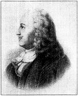
La Salle (1643-1687)
René Robert Cavelier, Sieur de La
Salle, was born at Rouen, France, and
began his explorations from Montreal
in 1669. Discovering the Ohio River,
he travelled down possibly as far as
(its?) junction with the Mississippi and
then returned. The winter of 1679
La Salle passed at a post above Niagra
Falls, where he built his famous
(ship?), the "Griffin," in which he sailed
the Great Lakes to Lake Michigan,
(and?) which he sent back laden with
(furs?) in the hope of satisfying the
loans of his creditors, while he himself
proceeded westward. In 1682,
(after?) many adventures, he floated down
(to?) the mouth of the Mississippi, where
he erected a monument and cross, took
possession of the region in the name of
Louis XIV and named it Louisiana.
When he returned there two years
(later?) with four vessels he mistook the
waters of Matagorda Bay, in the present
state of Texas, for the mouth of a
branch of the Mississippi and landed there. Fruitlessly wandering through the
wilderness in search of the Mississippi River, the Illinois country and Canada,
he was killed by his followers in March, 1687.
[114]Elkhart is a city of factories. Band instruments, furniture,
telephone supplies, drugs, carriages, and many other
products are included among its manufactures, which have
an annual value of more than $15,000,000. Two Mennonite
papers are published here.
915 M. SOUTH BEND, Pop. 70,983.
(Train 3 passes 5:30;
No. 41, 10:38;
No. 25, 7:45;
No. 19, 1:43.
Eastbound: No. 6 passes 12:20;
No. 26, 2:22;
No. 16, 3:32;
No. 22, 7:45.)
South Bend is situated on the St. Joseph River. Just north
of the city is the portage between the St. Joseph and the
Kankakee Rivers, by means of which Père Marquette in 1675
and La Salle in 1679 made their way into what is now the state
of Illinois.
This portage was part of the long land and water highway by
which the mound-builders in pre-historic times conveyed copper
from the Lake Superior to points as distant as Mexico and South
America.
As there is no place in the U.S. but the south shore of Lake
Superior where native copper can be mined, its presence in the
mounds, at remote points is an infallible guide in tracing the
commercial intercourse of the Mound-builders. Copper boulders are
also found on the shore, and even as far south as Indiana and
Illinois. That the whole extent of the copper-bearing region was
mined in remote times by a race of whom the Indians preserve
no tradition there is abundant evidence, such as numerous excavations
in the solid rock, heaps of rubble and dirt along the courses
of the veins, copper utensils such as knives, chisels, spears,
arrowheads, stone hammers creased for the attachment of withes, wooden
bowls for boiling water from the mines, wooden shovels, ladders,
and levers for raising and supporting masses of copper. The high
antiquity of this mining is inferred from these facts: that the trenches
and pits were filled level with the surrounding surface so that their
existence was not suspected; that on the piles of rubbish were found
growing trees of great age, such as hemlock trees having annual
rings showing that they began before the coming of Columbus.
Copper wrought into utensils is found in the mounds all the way
from Wisconsin to the Gulf Coast, and the supply is too abundant to
authorize the supposition that it was derived from boulder drift.
So expert were these miners that on the site of the Minnesota mine
they lifted a copper mass weighing 6 tons, supporting on a frame
of wood 5 ft. high.
The earliest white settler was Pierre Navarre, one of
the fraternity of the coureurs de bois—a wild, rascally,
fearless crew of half-breeds and renegade whites, who were the
first to invade this famous hunting country. The succession
of sheltered prairies, rounded sand-hills, and reedy marches
cut by sluggish streams widening into lakes, made a good
haunt for all game, especially beaver. Now the water is
[115]mostly drained away and the land reclaimed, but at one time
much of the region could be passed over in canoes.
Pierre Navarre (1785-1874) was the son of a French army officer.
Besides Canadian French, he could speak the Pottowattomie Indian
dialect, and had some knowledge of woodcraft and nature signs. In
his calling of fur trader he made friends with the Miamis and their
chief, Little Turtle, and when the War of 1812 broke out, offered the
services of the tribe to Gen. Hull, as well as his own. The offers were
declined, so the flouted Miamis transferred their allegiance to the
British under Gen. Proctor. So good a scout was Navarre that a
reward of $1,000 for his head or scalp was promised by Proctor.
"He used to say," writes an old chronicler who knew him, "that the
worst night he ever spent was as bearer of a despatch from Gen.
Harrison, then at Ft. Meigs, to Ft. Stephenson (now Fremont).
Amid a thunderstorm of great fury and fall of water, he made the
trip of thirty miles through the unbroken wilderness and the morning
following delivered to Gen. Harrison a reply." He died in his
89th year at East Toledo.
The University of Notre Dame, in South Bend, with 1,200
students, is the largest Catholic school for boys and young
men in the country, and the American headquarters of the
worldwide Order of the Holy Cross. Notre Dame was
founded in 1842 by Father Sorin, a Frenchman, who
accomplished his object under great difficulties.
Jacques Marquette
Jacques Marquette was born at Laon,
France, and as a Jesuit priest went to
Canada in 1666, where he was chosen
to explore the Mississippi River with
Joliet, a young Canadian explorer, in
1673, the French having begun to gain
knowledge of the prairies from the
Indians. Following a route through
Green Bay and up the Fox River to
a point where they made a portage to
the Wisconsin, Marquette and Joliet
finally reached the Mississippi. On
their return to Michigan, Marquette
fell ill, and his attempt in the following
year to found a mission among the
Indians of the Illinois River proved too
much for his broken strength. On the
way home he died beside a little stream
which enters Marquette Bay on Lake Michigan.
When Father Sorin arrived in Indiana in 1841, leaving behind a
comfortable life in France for missionary work among the Indians,
he found on the present site of Notre Dame only waste land covered
[116]with snow, and only one building, a tumble down log hut. With $5
to begin work of erecting a school, he started in courageously, and
spent five days repairing the hut and fitting it up so that one half
served as a chapel and the other as a dwelling for himself and 6 lay-brothers.
In 1844 his little college was chartered as a university by
the legislature of Indiana. Father Sorin was elected superior-general
of the Order of the Holy Cross for life. Besides Notre Dame,
he founded many other schools and colleges in the United States
and Canada. He died at South Bend in 1893. His co-worker, Father
Badin, was the first priest consecrated in the United States.
The mural frescoes of the main university building are
by Luigi Gregori, who was sent from the Vatican for this
purpose, and who spent twenty years on this work and on
the adjacent Church of the Sacred Heart. The latter is
famous for its decoration, especially the beautiful altar. St.
Mary's, a large girls' school conducted by the Sisters of the
Holy Cross, has also fine buildings of more modern type than
Notre Dame.
Schuyler Colfax at one time vice-president of the U.S.
and for years an intimate and trusted friend of Lincoln's,
lived here in his youth, as did the late James Whitcomb Riley.
The soldier who, during the Great War, fired the first gun of
the American army in France against the Germans was Alex
Arch, a native of this city.
Though born in N.Y., Schuyler Colfax (1823-1885) passed his
early years first in New Carlisle, Ind., then in South Bend, where
his step-father was county auditor. After doing some journalistic
work, he began his public career by making campaign speeches for
Henry Clay in 1844. In 1852 he joined the newly formed Republican
party, and served in Congress from 1854 to 1869. His name
was widely mentioned for the office of postmaster-general in Lincoln's
cabinet, but the president selected another man on the ground
that Colfax "was a young man, running a brilliant career, and sure
of a bright future in any event." In 1863 Colfax was elected Speaker
of the House, and in 1868 vice-president. Four years later Colfax
was implicated in a corruption charge, which though found groundless
by the Senate Judiciary Committee, cast a shadow over the
latter part of his life.
James Whitcomb Riley was born in 1853 in Greenfield, Ind. He
spent several years as a strolling sign-painter, actor, and musician,
during which time he revised plays and composed songs, and grew
closely in touch with the life of the Indiana farmer. About 1873 he
first contributed verses, especially in the Hoosier dialect, to the
papers, and before long had attained a recognized position as poet-laureate
of the Western country folk. His materials are the incidents
and aspects of village life, especially of the Indiana villages.
These he interprets in a manner as acceptable to the naïve as to the
sophisticated, which is saying a good deal for this type of verse.
Some of his best known books are The Rubaiyat of Doc Sifers,
Home Folks, A Defective Santa Claus,
The Old Swimmin' Hole, An Old Sweetheart of Mine,
and Out to Old Aunt Mary's.
[117]Among the important manufactories of South Bend are
plows, sewing-machines, underwear, and motor-cars. The
annual value of the combined output is around $60,000,000.
942 M. LA PORTE, Pop. 15,158.
(Train 3 passes 6:06;
No. 41, 11:22;
No. 25, 8:17;
No. 19, 2:22.
Eastbound: No. 6 passes 11:46;
No. 26, 1:53;
No. 16, 2:57;
No. 22, 7:07.)
The
name La Porte, which in French means "door" or "gate," took
its origin from a natural opening through the timber that here
interrupted the wide stretch of prairie. The main street of
the town is built on an old Indian trail between Detroit and
points in Illinois. La Porte was first settled in 1830. It is
situated in the heart of a region of beautiful lakes—Clear,
Pine, Stone and others—which have given it a wide reputation
as a summer resort. The lakes furnish a large supply
of natural ice which is shipped to Chicago. The soil about
La Porte consists of sandy "timber" loam and vegetable mold,
especially adapted to growing potatoes, wheat and corn.
Farm and orchard products were early sources of the town's
prosperity. There are now numerous manufactures—woolen
goods, agricultural engines and implements, lumber and
furniture, foundry products, musical instruments, radiators,
pianos, blankets, bicycles and flour.
975 M. GARY, Pop. 55,378.
(Train 3 passes 6:47;
No. 41, 12:06;
No. 25, 8:55;
No. 19, 3:08.
Eastbound: No. 6 passes 11:06;
No. 26, 1:17;
No. 16, 2:12;
No. 22, 6:23.)
The city of
Gary was built to order. Fifteen years ago the site of the
present town was nothing but a waste of sand-dunes and
swamps intersected from east to west by the Grand Calumet
and Little Calumet Rivers. In 1906 the United States Steel
Corporation broke ground here for a series of enormous foundries
and factories, first laying sewers, water mains, gas pipes
and conduits for electric wires, as well as providing other improvements
necessary for life of the city. The Steel Corporation
had chosen this site partly because of its direct connection
by water with the Lake Superior ore region, partly
because of its proximity to Chicago, and partly because it was
accessible to Virginia coal and Michigan limestone. The town
was named Gary in honour of Elbert H. Gary (b. 1846), chairman
of the Board of Directors of the Steel Corporation, and in
succeeding years there came an influx of inhabitants which has
made Gary the largest city in Northern Indiana. In 1906
the city was non-existent; in 1910 it had a population of 16,802;
in 1916, 40,000; and the Federal census of 1920 showed that
Gary now has more than 55,000 inhabitants.
[118]Gary lies 30 ft. above Lake Michigan on a deep layer
of sand, once the bed of the lake, which in prehistoric time
extended several miles farther inland. The city has a splendid
harbour which has been extended by the use of the two
rivers—the Grand and the Little Calumet—both of which
have been dredged and enlarged. The heart of the town is
at the intersection of Broadway and Fifth Ave., which are
lined with handsome buildings, and it is said that within
radius of 10 M. of this point, there is a population of 125,000
people, most of whom are engaged in the industries of the
Calumet region surrounding Gary.
The early growth of the town was so rapid that facilities
for taking care of the new population were inadequate. The
congestion was extreme, and real estate speculators did
thriving business. Today it is said that Gary has constructed
public utilities and other improvements adequate for a city
of a quarter of a million people, and there is little doubt that
the population will reach that figure before many years have
passed. The city has fine public schools (the Gary system
has become famous throughout the United States), a Y.M.C.A.
(costing $250,000), and an excellent library. The City
Hall and the Union station are likewise notable for the scale
on which they are built.
Although Gary was built to order by the Steel Corporation, its
officials did not undertake to control or direct the civic affairs of
the town. Thus, the development of the Gary system of education
was a natural, rather than an artificial one. There was every opportunity
for an altogether new departure, in view of the inadequacy
of school facilities for the fast growing population. The new system
was introduced into the Gary schools by William Wirt, who
had already made some experiments in this direction before 1907
(when he was called to Gary) at Bluffton, Ind., where he had been
in charge of the public schools. Some of the fundamental principles
of Mr. Wirt's plan are that "students learn best by doing" and that
"all knowledge can be applied." Latin, for example, is not studied for
mental discipline, but for actual use. The system also involves
keeping the school buildings in use for entertainment or instruction
throughout the entire day and evening, and numerous courses are
provided for adults. It has been said that in Gary "every third person
goes to school." The overcrowded condition in the N.Y.C.
Schools led to an invitation to Mr. Wirt to introduce the Gary plan
into several school districts in the boroughs of Bronx and Brooklyn
in 1914-15. The experiment aroused bitter opposition on the part
of those who suspected it was a sort of "conspiracy" to educate the
poorer children for mechanical rather than clerical occupations in
the interest of "capitalistic industry," and a year or two later N.Y.
returned to the old methods of education.
The plant of the United States Steel Corporation, located
between the Grand Calumet River and the Lake, have
[119]the most complete system of steel mills west of Pittsburgh.
Within the first ten years after the founding of Gary the
Steel Corporation had spent $85,000,000 in building furnaces,
ovens, various foundries and shops, pumping stations, electric
power plants, benzol plants, Portland cement works, and ore
docks. Since that time the Steel Corporation's investment
here has practically been doubled, and a number of subsidiary
companies have built up great industries in Gary. The
Universal Portland Cement here, for example, is said to be
the largest plant of its kind in the world (daily capacity 30,000
barrels).
The United States Steel Corporation, organized in 1901 with a
capitalization of about $1,400,000, was an amalgamation of ten independent
companies, of which the Carnegie Steel Co. and the Federal
Steel Co. (of which Elbert H. Gary was president) were perhaps
the most important. The consolidation was effected under the auspices
of the late J. Pierpont Morgan, who negotiated the purchase
of Andrew Carnegie's properties for $303,450,000 in 5 per cent steel
corporation bonds and $188,556,160 in common and preferred stock.
"The Value of the Carnegie Steel Co.," says A. Cotter in The Authentic
History of the U.S. Steel Corporation, "was $75,000,000, though
as a going concern it was worth $250,000,000. Its earnings in a
single year had been as much as $40,000,000." Mr. Carnegie thereupon
retired from business.
On Jan. 1, 1920, the corporation had a surplus of $493,048,000,
and the book value of the tangible assets was $1,917,730,000. There
were then outstanding $568,728,000 in bonds and $868,583,000 in common
and preferred stock. In 1919 strikes and other causes reduced
the production of finished steel to about 75 per cent of capacity,
and at the beginning of 1920 the corporation had unfilled orders
amounting to more than 8,000,000 tons. The gross business of the
corporation amounted to $1,448,557,835 in 1919 as against $1,744,312,163
the year before. The corporation's income for 1919, less operating
expenses and taxes, was in the neighborhood of $150,000,000.
Statistics of production for 1918 and 1919 are given below:
| | Production in Tons |
| |
1919 |
1918 |
| Iron ore mined | 25,423,000 | 28,332,000 |
| Coal | 28,893,000 | 31,748,000 |
| Pig iron | 13,481,738 | 15,700,561 |
| Steel ingots | 17,200,000 | 19,583,000 |
| Finished steel | 11,997,000 | 13,849,483 |
| Cement | 9,112,000 | 7,287,000 |
| | | |
| No. of employees | 252,106 | 268,710 |
| Total wages | $479,548,040 | $452,663,524 |
The average wage per day (excluding general administration and
selling force) was $6.12 in 1919 and $5.33 the year before. In 1919
the corporation spent $1,131,446 for safety work and the like, and
(1?)5 hospitals, with a staff of 162 physicians and surgeons, were maintained.
[120]
The various works controlled by the Steel Corporation include
the Carnegie Steel Co, the Illinois Steel Co., the Universal Portland
Cement Co., the Indiana Steel Co., the Minnesota Steel Co., the Lorain
Steel Co., the National Tube Co., the American Steel and Wire Co.,
the American Sheet and Tin Plate Co., the Sharon Tin Plate Co., the
American Bridge Co., the Union Steel Co., the Clairton Steel Co.,
the Clairton By-Product Co., the Canadian Steel Corporation, the Tennessee
Coal, Iron & Railroad Co., the Fairfield Steel Co. and the
Chickasaw Shipbuilding & Car Co.
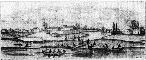
Chicago in 1820
1001 M. CHICAGO, Pop. 2,701,705.
(Train 3 arrives 7:40;
No. 41, 1:00;
No. 25, 9:45;
No. 19, 4:00.
Eastbound: No. 6 leaves 10:25;
No. 26, 12:40;
No. 16, 1:30;
No. 22, 5:30.)
The old Chicago portage was used by the Indians in travelling
by canoe from the Great Lakes to the Mississippi and then to
the Gulf of Mexico, long before any white man had visited the
site of the present city on the shore of Lake Michigan. The
portage connected the Chicago River, then flowing into Lake
Michigan, with the Des Plaines River, flowing into the Illinois
River, which in turn discharges into the Mississippi opposite
a point not far from St. Louis. It is probable that the
first white men to visit the city of Chicago were Father Marquette
(1637-1675) and Louis Joliet, though La Salle may
have used the portage at an earlier date in the course of one
of his journeys of exploration. It is certain, however, that
La Salle established a fort at Starved Rock, some miles south
of the present city of Chicago, in 1682; and it is in the journal
of one of La Salle's followers, Joutel, that we find the
first explanation of the name "Chicago." Joutel says that
Chicago took its name from the profusion of garlic growing
in the surrounding woods.
[121]
Joutel and his party were in Chicago in March, 1688, when lack
of provision forced them to rely on whatever they could find in
the woods. It appears that Providence furnished them with a "kind
of manna" to eat with their meal. This seems to have been maple
sap. They also procured in the woods garlic and other plants.
The name Chicago may have come from the Indian word ske-kog-ong,
wild onion place.
After the departure of Father Marquette several other
mission settlements were attempted at Chicago, but these
were all abandoned in 1700 and for almost a century Chicago
ceased to be a place of residence for white men.
The strategic value of Chicago as a centre of control for
the regions of the Great Lakes and the Mississippi River had
long been recognized, but it was not until after the Battle of
Fallen Timbers (1794), that the government took active steps
to establish a fort here. The treaty made by Gen. Wayne
with the Indians after that battle provided for the cession
to the American government of a tract of land at the southern
end of Lake Michigan including the site of the present
city. In 1803 Ft. Dearborn, a block-house and stockade, was
constructed by the government on the southern bank of the
Chicago River near the present site of the Michigan bridge.
In 1812, during the Indian War of Tecumseh, the Ft.
Dearborn massacre occurred. The garrison, 93 persons in
all, including several women and children, were attempting
to escape to Ft. Wayne, when they were set upon by some 500
Indians about a mile and a half south of the fort (southern
part of the present Grant Park). The Americans killed included
39 soldiers, 2 women and 12 children. The survivors
were captured by the Indians and though some were tortured
and put to death, the majority finally escaped to civilization
A tablet now marks the site of the old fort and a
monument has been erected near Grant Park commemorating
the massacre. In 1816 the fort was rebuilt and a settlement
rapidly grew up around it. By 1837 the Federal government
had begun the improvement of the harbor and had
started the Illinois and Michigan Canal. The lake trade grew
to enormous proportions, and the building of the railways,
especially the New York Central Lines connecting Chicago
with the East, as well as other lines connecting it with the
Northwest, and the South, gave the city an extraordinary impetus.
At the Republican convention held at Chicago in 1860,
Abraham Lincoln was nominated for the presidency and
during the Civil War, Camp Douglas, a large prison camp
for Confederate prisoners, was maintained here.
[122]
The Republican national convention, which made "extension of
slavery" the essential plank of the party platform, met at Chicago
on the 26th of May, 1860. At this time William H. Seward was the
most conspicuous Republican in national politics; Salmon P. Chase
also had long been in the forefront of the political contest against
slavery. Both had won greater fame than Lincoln, and each hoped
to be nominated for president. Chase, however, had little chance,
and the contest was virtually between Seward and Lincoln, who by
many was considered more "available" because he could, and Seward
could not, carry the votes of certain doubtful states. Lincoln's
name was presented by Illinois and seconded by Indiana. At first
Seward had the stronger support, but on the fourth ballot Lincoln
was given 334 (233 being necessary) and the nomination was then
made unanimous. The convention was singularly tumultuous and
noisy: large claques were hired by both Lincoln's and Seward's
managers.
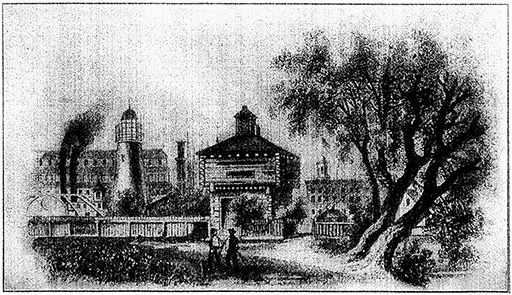
Block House at Chicago in 1856
The great fire in 1871 was the most serious check to the
city's constantly increasing prosperity, but recovery from
this disaster was rapid. The solidity of this prosperity was
demonstrated during the financial panic of 1873, when Chicago
banks alone among those of the large cities of the country
continued steadily to pay out current funds.
The precise cause of the great fire is not known, but it is popularly
attributed to Mrs. O'Leary's cow, which according to tradition
"kicked over the lamp" and started the flames. The fire spread
over an area of 3-1/3 Sq. M., and destroyed 1,700 buildings and
property valued at $196,000,000. Almost 100,000 people were made
homeless, and 250 lost their lives. The relief contributions from the
United States and abroad amounted to nearly $5,000,000, of which
[123]about $500,000 was contributed in England. The fire at least gave an
opportunity to rebuild the old wooden city with brick and stone.
The later history has been marked on the one hand by
serious labor troubles and on the other by the remarkable
achievement of the World's Columbian Exposition (1893).
The labor outbreaks included several strikes in the packing
industry, the Haymarket Riot in 1886, and the Pullman Strike
in 1894.
The Haymarket Riot grew out of a strike in the McCormick harvester
works. Hostility against the employers had been fomented
by a group of so-called International Anarchists and the struggle
culminated at the Anarchist meeting at the Haymarket Square.
When the authorities said that the speeches were too revolutionary
to be allowed to continue and the police undertook to disperse the
meeting, a bomb was thrown and seven policemen were killed. Seven
anarchists were ultimately convicted as being conspirators and accomplices
and were condemned to death. Four were hanged, one
committed suicide, two had their death sentences commuted to life
imprisonment, and eight anarchists were sentenced to imprisonment
for 15 years. In 1893 Gov. Altgeld pardoned those still in prison.
The leader of the Pullman strike, which began in the Pullman
car works, was Eugene Debs (1855), who was the Socialist candidate
for President in the election of 1920, although he was then in
the penitentiary at Atlanta for violating the Espionage Act during
the World War. The strike spread to the railways, and caused great
disorder until President Cleveland dispatched federal troops to Chicago.
The exposition was an artistic and educational triumph,
and its influence on the progress of the city cannot be overestimated
The exposition gave Chicago an artistic conscience
one of the direct results of which was the organization
of the City Plan Commission, a body which is at work
reshaping the city in the interests of greater beauty and
utility.
The exposition commemorated the 400th anniversary of the
discovery of America by Columbus. It was held in Jackson Park,
on the south side of the city, and covered an area of 686 acres.
The buildings (planned by a commission of architects of which D.H.
Burnham was the chief) formed a collection of remarkable beauty,
to which the grounds (planned by F.L. Olmsted), intersected by
lagoons and bordered by a lake, lent an appropriate setting. The
fair was opened to the public May 1, 1893, and the total number of
admissions was 27,500,000. The total cost was more than $33,000,000.
Owing largely to its central position and to its excellent
railroad facilities, Chicago has been a favorite city for national
political conventions ever since the nomination of Lincoln
Others nominated here have been Grant (1866 and
1872), Garfield (1880), Cleveland (1884 and 1892). Harrison
(1888), Roosevelt (1904), Taft (1908) and Harding (1920);
[124]and in addition a number of candidates who were unsuccessful
including Blaine (1884), Harrison (1892), Bryan (1896),
Taft (1912), Roosevelt (1912), and Hughes (1916).
To most foreign visitors and even to many Americans
the growth of Chicago is its most impressive feature. Within
a little more than 100 years Chicago has grown from a settlement
of 14 houses, a frontier military post among the Indians
to a great metropolis, the second city in America and
fourth in size among the cities of the world. In 1829 what
is now the business centre was fenced in as a pasture; in
1831 the Chicago mail was deposited in a dry goods box; the
tax levy of 1834 was $48.90, and a well that constituted the
city's water-system was sunk at a cost of $95.50. In 1843
hogs were by ordinance barred from the streets.
There are residents of Chicago still living who can remember
the early days when the first village school stood on the ground
now occupied by the Boston Store at Dearborn and Madison Sts.
Some even insist they remember when wolves were trapped on the
site of the present Tribune building. In the early period the streets
of the little town were thick with mire in the rainy season, and it is
said that signs were placed at appropriate points with inscriptions
such as "No Bottom Here," "Stage Dropped Here," etc. The first
improvement of note in Chicago was an inclined plank road in Lake
St., arranged with a gutter in the center for drainage. It was the only
safe route over which stage coaches from the west could enter the town.
In 1830 with a population of less than 100, in 1840 with
4,479, the increase by percentages in succeeding decades was
as follows: 507, 265, 174, 68, 119, 54, 29, and (1910 to 1920)
23. Approximately 75 per cent of Chicago's population is of
foreign birth or parentage. This foreign population is made
up principally of Germans, about 50 per cent, Irish 12, Austrian
13, Russian 10, Swedish 6, Italian 4, Canadian, including
French Canadians, 4, and English 4.
It has been said that Chicago is "the second largest Bohemian
city in the world, the third Swedish, the fourth Norwegian,
the fifth Polish and the fifth German (New York
being the fourth)." This ought not to be construed, however,
as a reflection on the fundamental Americanism of Chicago's
citizens.
The growth in area has kept pace with the growth in
population. As originally plotted in 1830, the town had an
area of a little less than half a square mile; today it covers
an area of practically 200 Sq.M. Its greatest length (north
and south) is 26 M., and the greatest width (east and west)
is 9 M.
[125]The Chicago River with its three, branches divides the
city into three sections—the North, South and West sides.
Technically the downtown or "loop" district (so-called because
of the elevated railway which encircles the central business
section) belongs to the south side, though usually it is
classified separately.
The Chicago River formerly flowed into Lake Michigan. It
was then an exceedingly dirty stream and a menace to health. In
order to improve the character of the river and also to give the Chicago
adequate sanitary drainage, dredging operations to reverse the
direction of flow of the river were undertaken, and canals were
constructed connecting it with the Illinois River. This great engineering
feat was begun in 1892 and completed in 1900. The total
expenditure on the drainage canals since 1892 has been more than
$100,000,000.
In no other great city is the business district so concentrated
as is the case in Chicago. Within an area of a little
more than 1 Sq. M. are located the principal office buildings,
department stores, shops, hotels and theatres. Not far from
the centre of this district is the new City Hall and County
Building, an 11-story structure costing $5,000,000.
Chicago is generally credited with being the original home
of the steel frame sky-scraper, though there are now many
higher buildings in New York and elsewhere. The height
of buildings in Chicago is limited by city ordinance to about
22 stories.
At La Salle St., where it is crossed by the southern arm
of the elevated "loop" is the New York Central Station, an
impressive building which stands closer to heart of Chicago's
financial and business section than any other railway station
in the city.
Michigan Ave., just to the east of the business centre,
possesses a truly noble aspect, and the visitor could not
select a better place to begin his tour of the city. Due to the
monotonous regularity of the streets and the all-pervading
soft coal smoke, Chicago presents on the whole a somewhat
drab appearance, but the view from Grant Park or from the
lake front (with Michigan Ave. in the foreground) is nearly,
if not quite, as fine as anything N.Y. has to offer. In Michigan
Ave. are the Public Library (with a beautiful interior),
the Art Institute (with fine collections of pictures and one
of the largest art schools in the country), Orchestra Hall
(the home of the Chicago Symphony Orchestra), the "Blackstone"
Hotel and a number of fine shops.
Michigan Ave., by way of Lake Shore Drive on the north,
and by way of Midway Plaisance on the south, connects
[126]with Chicago's fine park system. The principal parks are
joined by beautiful boulevards encircling the entire city, and
a delightful two hours' motor trip (45 M.) will enable the
tourist to visit Lincoln Park on the north, Humboldt, Garfield
and Douglas parks on the west, and Washington and
Jackson parks on the south.
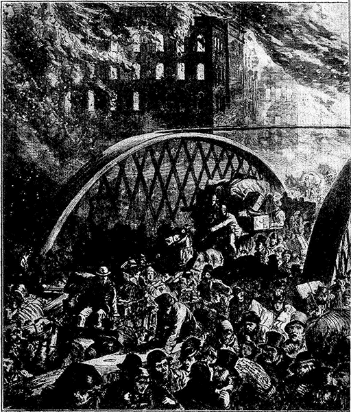
Chicago Fire (1871): Randolph Street Bridge
For reference a general summary of Chicago's "points of
interest" exclusive of those already mentioned is here given.
[127]
North Side
Lincoln Park: Academy of Sciences Museum; botanical
conservatories and a zoological garden with a splendid Lion
House. Also the fine Saint Gaudens Statue of Lincoln at
the entrance and other monuments in the park.
Chicago Historical Society Library and Collection, Dearborn
Ave. and Ontario St.; an interesting collection of historic
relics and documents.
The Municipal pier, at the foot of Grand Ave., built by
the city at a cost of $4,000,000; devoted to recreational activities
as well as to commercial purposes. Excursion steamers
may be taken here to various points on the lake.
The Newberry Library, a free reference library, Clark
St. and Walton Place.
Northwestern University, in Evanston (at the extreme
North of the city—actually outside the city limits). Northwestern
University is a Methodist-Episcopal institution of
about 5,000 students.
Ft. Sheridan. A U.S. military post north of Evanston.
Lake Forest, a fashionable suburb north of Ft. Sheridan.
South Side
Life Saving Station at the mouth of the Chicago River.
Tablet marking site of Ft. Dearborn, River St., opposite
the old Rush St. Bridge.
Crerar Library, East Randolph St., a reference library
devoted chiefly to scientific subjects; open to the public.
Board of Trade, La Salle and Jackson Sts.; visitors may
obtain admission to gallery overlooking the famous wheat
pit.
Auditorium hotel and theatre building, Michigan Ave.
at Congress St.; view of city from tower.
The Coliseum building, 16th St. and Wabash Ave.; all
the national Republican conventions of recent years have
been held here.
Field Museum of Natural History (founded by Marshall
Field), in Grant Park; a fine anthropological and historical
collection. The Museum, originally housed in a temporary
building in Jackson Park, was made possible by the gift of
$1,000,000 by Marshall Field, who on his death (1906) bequeathed
a further $8,000,000 of which $4,000,000 has been
used for the new building.
Ft. Dearborn Massacre Monument, 18th St., near the
lake.
[128]Armour Institute of Technology, founded by the Armour
family, 3300 Federal St.
Douglas Monument, 35th St. near Lake Michigan;
Stephen A. Douglas is buried here.
Stephen A. Douglas (1813-1861) was born in Vermont, but in
1833 he went west and settled in Jacksonville, Ill., where he was
admitted to the bar in 1834. He identified himself with the Jackson
Democrats and his political rise was rapid even for the west. Among
other offices, he held those of Judge of the Supreme Court of Illinois,
representative in Congress and senator from Illinois. Although
he did more perhaps than other men, except Henry Clay, to secure
the adoption of the Compromise Measures of 1850, he seems never
to have had any moral antipathy against slavery. His wife and children
were by inheritance owners of slaves. In 1858 he engaged in
a close and exciting contest for the senatorship with Abraham Lincoln,
the Republican Candidate, whom he met in a series of debates
over slavery that soon became famous and brought Lincoln prominently
into public favor, though he was defeated in this particular
contest.
The Stockyards, Halsted and Root St. In area the yards
exceed 400 acres; they have facilities for taking care of 50,000
cattle, 20,000 hogs, 30,000 sheep and 5,000 horses. The
great packing plants are clustered around the stockyards.
The University of Chicago, Ellis Ave., south of 51st
St. This university was established under Baptist auspices
and opened in 1892. The words "founded by John D. Rockefeller"
(whose donations to the institution form the largest
part of its endowment) follow the title of the university on
all its letter heads and official documents. Mr. Rockefeller's
benefactions to the university have been very large. The
grounds, however, were given in part by Marshall Field.
The buildings are mostly of grey limestone, in Gothic style
and grouped in quadrangles. With the exception of the
divinity school, the institution is non-sectarian and has about
8,700 students of both sexes.
West Side
The "Ghetto" District on South Canal, Jefferson, and
Maxwell Sts.; Fish Market on Jefferson St. from 12th St. to
Maxwell.
Hull House, 800 South Halsted St. This famous settlement
house was established in 1899 by Miss Jane Addams;
who became head resident, and Miss Ellen Gates Starr. It
includes a gymnasium, a crêche and a diet kitchen, and supports
classes, lectures and concerts.
Haymarket Square, Randolph and Des Plaines Sts.;
scene of the anarchist riots.
[129]Sears, Roebuck & Co., a great mail order house which
does a business of over $250,000,000 a year retail. Guides
are provided to show visitors around the establishment, which
is easily reached on the elevated railway.
Western Electric Co., 22nd St. and Forty-eighth Ave.
This company supplies the chief part of the equipment of the
Bell telephone companies of the U.S. and has about 17,000
employees.
McCormick Harvester Works of the International Harvester
Co. This is one of the 23 plants of the greatest manufacturers
of agricultural machinery in the world.
Chicago's position at the head of the most southwestern
of the Great Lakes was the primary factor in determining its
remarkable growth and prosperity. But with the decline of
water transportation the city has not suffered, for it stands
at one of the natural cross roads of trade and travel. Today
it is the chief railroad centre not only in the U.S. but in the
world. Not counting subsidiary divisions there are 27 railroads
entering Chicago, which is the western terminus of
the great New York Central System.
Chicago is thus the focus of the activities of half a continent.
It is the financial centre of the west and the metropolis
of the richest agricultural section in the country. These
circumstances have contributed to make it the greatest grain
and live stock market in the world. But its accessibility to
the raw materials of industrial development has also made
it a great manufacturing city. Chicago has more than 10,000
factories and the output of its manufacturing zone is probably
more than $3,000,000,000 annually. The principal industries
and manufactures are meat packing, foundry and machine
shop products, clothing, cars and railway construction,
agricultural implements, furniture, and (formerly) malt
liquors.
Facts About The New York Central Railroad Company
The New York Central Lines comprise 14,242 miles of
track. As part of the track equipment, there are 40,000,000
wooden ties, worth about $1 each. On these
ties are 1,727,000 tons of steel rail, worth $96,000,000. There
[130]are 32 tunnels, costing $10,000,000, and 19,000 bridges and
culverts, costing $60,000,000. In the principal cities the New
York Central's terminals cover about 4,800 acres, assessed at
more than $100,000,000. The deeds for right-of-way for the
section east of Buffalo alone number more than 30,000.
| Passengers carried annually | 66,063,480 |
| Freight carried annually (tons) | 113,534,840 |
| No. of employees (1919) | 95,340 |
| No. of locomotives | 3,840 |
| No. of passenger cars | 3,500 |
| No. of dining cars | 70 |
| No. of freight cars | 144,840 |
| Operating Revenues, 1910 | $ 153,383,590 |
| Amount paid employees (1919) | 148,244,390 |
| Taxes paid | 17,376,120 |
| Funded debt (bonds) | 748,354,470 |
| Stock issued | 249,849,360 |
| Actual investment | 1,134,500,940 |
| Excess of investment over outstanding securities | 136,297,110 |
| Operating Revenues, 1880 | 51,925,370 |
| Operating Revenues, 1890 | 59,484,870 |
| Operating Revenues, 1900 | 81,029,460 |
| Operating Revenues, 1910 | 153,383,590 |
| Operating Revenues, 1920 | 338,624,450 |
[131]
This booklet is based on The Encyclopædia Britannica.
If you have found it interesting and entertaining, you
will find the Britannica a source of inexhaustible interest
and enjoyment. This booklet contains sixty-five thousand
words; the Britannica over forty-four million. This
booklet is a guide to a single trip; the Britannica will be your
guide to any trip you want to take to any part of the world.
And the best part of it is that you don't have to leave your
own fireside to go to the four corners of the globe.
With the Britannica you may make your tours as extensive
as you like, without effort and without expense. You
may visit the great capitals of Europe—London, Paris, Rome,—or
the venerable cities of the east—Bokhara, Calcutta, Pekin,
to name a few,—or even such out-of-the-way places as Kamchatka
and Tahiti. But you will also wish to use the Encyclopædia
Britannica as a guide in your business, your profession
or your hobby. In every activity of life, whether it pertains
to industry, commerce, science, art, sport or recreation,
the Encyclopædia Britannica will furnish you on demand, at
the very moment when you want it, the most readable, entertaining
and authoritative information available in English or
any other language.
"The Encyclopædia Britannica is as necessary in your
home as electric light, and more useful, day in and day out, than
an automobile. It is as necessary for your children as for
yourself. It will teach them to find their own way in the great
realm of knowledge. It will answer their questions, stimulate
their interest in everything that goes to make up what we call
education, and, not least important, assist them to choose intelligently
their life work. From childhood to old age, a man's
life is a kind of journey, and for this greatest of all journeys
there could be no more interesting companion and no more
trustworthy guide than the Encyclopædia Britannica."
***END OF THE PROJECT GUTENBERG EBOOK THE GREATEST HIGHWAY IN THE WORLD***
******* This file should be named 27701-h.txt or 27701-h.zip *******
This and all associated files of various formats will be found in:
http://www.gutenberg.org/2/7/7/0/27701
Updated editions will replace the previous one--the old editions
will be renamed.
Creating the works from public domain print editions means that no
one owns a United States copyright in these works, so the Foundation
(and you!) can copy and distribute it in the United States without
permission and without paying copyright royalties. Special rules,
set forth in the General Terms of Use part of this license, apply to
copying and distributing Project Gutenberg-tm electronic works to
protect the PROJECT GUTENBERG-tm concept and trademark. Project
Gutenberg is a registered trademark, and may not be used if you
charge for the eBooks, unless you receive specific permission. If you
do not charge anything for copies of this eBook, complying with the
rules is very easy. You may use this eBook for nearly any purpose
such as creation of derivative works, reports, performances and
research. They may be modified and printed and given away--you may do
practically ANYTHING with public domain eBooks. Redistribution is
subject to the trademark license, especially commercial
redistribution.
*** START: FULL LICENSE ***

THE FULL PROJECT GUTENBERG LICENSE
PLEASE READ THIS BEFORE YOU DISTRIBUTE OR USE THIS WORK

To protect the Project Gutenberg-tm mission of promoting the free
distribution of electronic works, by using or distributing this work
(or any other work associated in any way with the phrase "Project
Gutenberg"), you agree to comply with all the terms of the Full Project
Gutenberg-tm License (available with this file or online at
http://www.gutenberg.org/license).


Section 1.  General Terms of Use and Redistributing Project Gutenberg-tm
electronic works

1.A.  By reading or using any part of this Project Gutenberg-tm
electronic work, you indicate that you have read, understand, agree to
and accept all the terms of this license and intellectual property
(trademark/copyright) agreement.  If you do not agree to abide by all
the terms of this agreement, you must cease using and return or destroy
all copies of Project Gutenberg-tm electronic works in your possession.
If you paid a fee for obtaining a copy of or access to a Project
Gutenberg-tm electronic work and you do not agree to be bound by the
terms of this agreement, you may obtain a refund from the person or
entity to whom you paid the fee as set forth in paragraph 1.E.8.

1.B.  "Project Gutenberg" is a registered trademark.  It may only be
used on or associated in any way with an electronic work by people who
agree to be bound by the terms of this agreement.  There are a few
things that you can do with most Project Gutenberg-tm electronic works
even without complying with the full terms of this agreement.  See
paragraph 1.C below.  There are a lot of things you can do with Project
Gutenberg-tm electronic works if you follow the terms of this agreement
and help preserve free future access to Project Gutenberg-tm electronic
works.  See paragraph 1.E below.

1.C.  The Project Gutenberg Literary Archive Foundation ("the Foundation"
or PGLAF), owns a compilation copyright in the collection of Project
Gutenberg-tm electronic works.  Nearly all the individual works in the
collection are in the public domain in the United States.  If an
individual work is in the public domain in the United States and you are
located in the United States, we do not claim a right to prevent you from
copying, distributing, performing, displaying or creating derivative
works based on the work as long as all references to Project Gutenberg
are removed.  Of course, we hope that you will support the Project
Gutenberg-tm mission of promoting free access to electronic works by
freely sharing Project Gutenberg-tm works in compliance with the terms of
this agreement for keeping the Project Gutenberg-tm name associated with
the work.  You can easily comply with the terms of this agreement by
keeping this work in the same format with its attached full Project
Gutenberg-tm License when you share it without charge with others.

1.D.  The copyright laws of the place where you are located also govern
what you can do with this work.  Copyright laws in most countries are in
a constant state of change.  If you are outside the United States, check
the laws of your country in addition to the terms of this agreement
before downloading, copying, displaying, performing, distributing or
creating derivative works based on this work or any other Project
Gutenberg-tm work.  The Foundation makes no representations concerning
the copyright status of any work in any country outside the United
States.

1.E.  Unless you have removed all references to Project Gutenberg:

1.E.1.  The following sentence, with active links to, or other immediate
access to, the full Project Gutenberg-tm License must appear prominently
whenever any copy of a Project Gutenberg-tm work (any work on which the
phrase "Project Gutenberg" appears, or with which the phrase "Project
Gutenberg" is associated) is accessed, displayed, performed, viewed,
copied or distributed:

This eBook is for the use of anyone anywhere at no cost and with
almost no restrictions whatsoever.  You may copy it, give it away or
re-use it under the terms of the Project Gutenberg License included
with this eBook or online at www.gutenberg.org

1.E.2.  If an individual Project Gutenberg-tm electronic work is derived
from the public domain (does not contain a notice indicating that it is
posted with permission of the copyright holder), the work can be copied
and distributed to anyone in the United States without paying any fees
or charges.  If you are redistributing or providing access to a work
with the phrase "Project Gutenberg" associated with or appearing on the
work, you must comply either with the requirements of paragraphs 1.E.1
through 1.E.7 or obtain permission for the use of the work and the
Project Gutenberg-tm trademark as set forth in paragraphs 1.E.8 or
1.E.9.

1.E.3.  If an individual Project Gutenberg-tm electronic work is posted
with the permission of the copyright holder, your use and distribution
must comply with both paragraphs 1.E.1 through 1.E.7 and any additional
terms imposed by the copyright holder.  Additional terms will be linked
to the Project Gutenberg-tm License for all works posted with the
permission of the copyright holder found at the beginning of this work.

1.E.4.  Do not unlink or detach or remove the full Project Gutenberg-tm
License terms from this work, or any files containing a part of this
work or any other work associated with Project Gutenberg-tm.

1.E.5.  Do not copy, display, perform, distribute or redistribute this
electronic work, or any part of this electronic work, without
prominently displaying the sentence set forth in paragraph 1.E.1 with
active links or immediate access to the full terms of the Project
Gutenberg-tm License.

1.E.6.  You may convert to and distribute this work in any binary,
compressed, marked up, nonproprietary or proprietary form, including any
word processing or hypertext form.  However, if you provide access to or
distribute copies of a Project Gutenberg-tm work in a format other than
"Plain Vanilla ASCII" or other format used in the official version
posted on the official Project Gutenberg-tm web site (www.gutenberg.org),
you must, at no additional cost, fee or expense to the user, provide a
copy, a means of exporting a copy, or a means of obtaining a copy upon
request, of the work in its original "Plain Vanilla ASCII" or other
form.  Any alternate format must include the full Project Gutenberg-tm
License as specified in paragraph 1.E.1.

1.E.7.  Do not charge a fee for access to, viewing, displaying,
performing, copying or distributing any Project Gutenberg-tm works
unless you comply with paragraph 1.E.8 or 1.E.9.

1.E.8.  You may charge a reasonable fee for copies of or providing
access to or distributing Project Gutenberg-tm electronic works provided
that

- You pay a royalty fee of 20% of the gross profits you derive from
     the use of Project Gutenberg-tm works calculated using the method
     you already use to calculate your applicable taxes.  The fee is
     owed to the owner of the Project Gutenberg-tm trademark, but he
     has agreed to donate royalties under this paragraph to the
     Project Gutenberg Literary Archive Foundation.  Royalty payments
     must be paid within 60 days following each date on which you
     prepare (or are legally required to prepare) your periodic tax
     returns.  Royalty payments should be clearly marked as such and
     sent to the Project Gutenberg Literary Archive Foundation at the
     address specified in Section 4, "Information about donations to
     the Project Gutenberg Literary Archive Foundation."

- You provide a full refund of any money paid by a user who notifies
     you in writing (or by e-mail) within 30 days of receipt that s/he
     does not agree to the terms of the full Project Gutenberg-tm
     License.  You must require such a user to return or
     destroy all copies of the works possessed in a physical medium
     and discontinue all use of and all access to other copies of
     Project Gutenberg-tm works.

- You provide, in accordance with paragraph 1.F.3, a full refund of any
     money paid for a work or a replacement copy, if a defect in the
     electronic work is discovered and reported to you within 90 days
     of receipt of the work.

- You comply with all other terms of this agreement for free
     distribution of Project Gutenberg-tm works.

1.E.9.  If you wish to charge a fee or distribute a Project Gutenberg-tm
electronic work or group of works on different terms than are set
forth in this agreement, you must obtain permission in writing from
both the Project Gutenberg Literary Archive Foundation and Michael
Hart, the owner of the Project Gutenberg-tm trademark.  Contact the
Foundation as set forth in Section 3 below.

1.F.

1.F.1.  Project Gutenberg volunteers and employees expend considerable
effort to identify, do copyright research on, transcribe and proofread
public domain works in creating the Project Gutenberg-tm
collection.  Despite these efforts, Project Gutenberg-tm electronic
works, and the medium on which they may be stored, may contain
"Defects," such as, but not limited to, incomplete, inaccurate or
corrupt data, transcription errors, a copyright or other intellectual
property infringement, a defective or damaged disk or other medium, a
computer virus, or computer codes that damage or cannot be read by
your equipment.

1.F.2.  LIMITED WARRANTY, DISCLAIMER OF DAMAGES - Except for the "Right
of Replacement or Refund" described in paragraph 1.F.3, the Project
Gutenberg Literary Archive Foundation, the owner of the Project
Gutenberg-tm trademark, and any other party distributing a Project
Gutenberg-tm electronic work under this agreement, disclaim all
liability to you for damages, costs and expenses, including legal
fees.  YOU AGREE THAT YOU HAVE NO REMEDIES FOR NEGLIGENCE, STRICT
LIABILITY, BREACH OF WARRANTY OR BREACH OF CONTRACT EXCEPT THOSE
PROVIDED IN PARAGRAPH F3.  YOU AGREE THAT THE FOUNDATION, THE
TRADEMARK OWNER, AND ANY DISTRIBUTOR UNDER THIS AGREEMENT WILL NOT BE
LIABLE TO YOU FOR ACTUAL, DIRECT, INDIRECT, CONSEQUENTIAL, PUNITIVE OR
INCIDENTAL DAMAGES EVEN IF YOU GIVE NOTICE OF THE POSSIBILITY OF SUCH
DAMAGE.

1.F.3.  LIMITED RIGHT OF REPLACEMENT OR REFUND - If you discover a
defect in this electronic work within 90 days of receiving it, you can
receive a refund of the money (if any) you paid for it by sending a
written explanation to the person you received the work from.  If you
received the work on a physical medium, you must return the medium with
your written explanation.  The person or entity that provided you with
the defective work may elect to provide a replacement copy in lieu of a
refund.  If you received the work electronically, the person or entity
providing it to you may choose to give you a second opportunity to
receive the work electronically in lieu of a refund.  If the second copy
is also defective, you may demand a refund in writing without further
opportunities to fix the problem.

1.F.4.  Except for the limited right of replacement or refund set forth
in paragraph 1.F.3, this work is provided to you 'AS-IS,' WITH NO OTHER
WARRANTIES OF ANY KIND, EXPRESS OR IMPLIED, INCLUDING BUT NOT LIMITED TO
WARRANTIES OF MERCHANTIBILITY OR FITNESS FOR ANY PURPOSE.

1.F.5.  Some states do not allow disclaimers of certain implied
warranties or the exclusion or limitation of certain types of damages.
If any disclaimer or limitation set forth in this agreement violates the
law of the state applicable to this agreement, the agreement shall be
interpreted to make the maximum disclaimer or limitation permitted by
the applicable state law.  The invalidity or unenforceability of any
provision of this agreement shall not void the remaining provisions.

1.F.6.  INDEMNITY - You agree to indemnify and hold the Foundation, the
trademark owner, any agent or employee of the Foundation, anyone
providing copies of Project Gutenberg-tm electronic works in accordance
with this agreement, and any volunteers associated with the production,
promotion and distribution of Project Gutenberg-tm electronic works,
harmless from all liability, costs and expenses, including legal fees,
that arise directly or indirectly from any of the following which you do
or cause to occur: (a) distribution of this or any Project Gutenberg-tm
work, (b) alteration, modification, or additions or deletions to any
Project Gutenberg-tm work, and (c) any Defect you cause.


Section  2.  Information about the Mission of Project Gutenberg-tm

Project Gutenberg-tm is synonymous with the free distribution of
electronic works in formats readable by the widest variety of computers
including obsolete, old, middle-aged and new computers.  It exists
because of the efforts of hundreds of volunteers and donations from
people in all walks of life.

Volunteers and financial support to provide volunteers with the
assistance they need are critical to reaching Project Gutenberg-tm's
goals and ensuring that the Project Gutenberg-tm collection will
remain freely available for generations to come.  In 2001, the Project
Gutenberg Literary Archive Foundation was created to provide a secure
and permanent future for Project Gutenberg-tm and future generations.
To learn more about the Project Gutenberg Literary Archive Foundation
and how your efforts and donations can help, see Sections 3 and 4
and the Foundation web page at http://www.gutenberg.org/fundraising/pglaf.


Section 3.  Information about the Project Gutenberg Literary Archive
Foundation

The Project Gutenberg Literary Archive Foundation is a non profit
501(c)(3) educational corporation organized under the laws of the
state of Mississippi and granted tax exempt status by the Internal
Revenue Service.  The Foundation's EIN or federal tax identification
number is 64-6221541.  Contributions to the Project Gutenberg
Literary Archive Foundation are tax deductible to the full extent
permitted by U.S. federal laws and your state's laws.

The Foundation's principal office is located at 4557 Melan Dr. S.
Fairbanks, AK, 99712., but its volunteers and employees are scattered
throughout numerous locations.  Its business office is located at
809 North 1500 West, Salt Lake City, UT 84116, (801) 596-1887, email
business@pglaf.org.  Email contact links and up to date contact
information can be found at the Foundation's web site and official
page at http://www.gutenberg.org/about/contact

For additional contact information:
     Dr. Gregory B. Newby
     Chief Executive and Director
     gbnewby@pglaf.org

Section 4.  Information about Donations to the Project Gutenberg
Literary Archive Foundation

Project Gutenberg-tm depends upon and cannot survive without wide
spread public support and donations to carry out its mission of
increasing the number of public domain and licensed works that can be
freely distributed in machine readable form accessible by the widest
array of equipment including outdated equipment.  Many small donations
($1 to $5,000) are particularly important to maintaining tax exempt
status with the IRS.

The Foundation is committed to complying with the laws regulating
charities and charitable donations in all 50 states of the United
States.  Compliance requirements are not uniform and it takes a
considerable effort, much paperwork and many fees to meet and keep up
with these requirements.  We do not solicit donations in locations
where we have not received written confirmation of compliance.  To
SEND DONATIONS or determine the status of compliance for any
particular state visit http://www.gutenberg.org/fundraising/pglaf

While we cannot and do not solicit contributions from states where we
have not met the solicitation requirements, we know of no prohibition
against accepting unsolicited donations from donors in such states who
approach us with offers to donate.

International donations are gratefully accepted, but we cannot make
any statements concerning tax treatment of donations received from
outside the United States.  U.S. laws alone swamp our small staff.

Please check the Project Gutenberg Web pages for current donation
methods and addresses.  Donations are accepted in a number of other
ways including checks, online payments and credit card donations.
To donate, please visit: http://www.gutenberg.org/fundraising/donate


Section 5.  General Information About Project Gutenberg-tm electronic
works.

Professor Michael S. Hart is the originator of the Project Gutenberg-tm
concept of a library of electronic works that could be freely shared
with anyone.  For thirty years, he produced and distributed Project
Gutenberg-tm eBooks with only a loose network of volunteer support.

Project Gutenberg-tm eBooks are often created from several printed
editions, all of which are confirmed as Public Domain in the U.S.
unless a copyright notice is included.  Thus, we do not necessarily
keep eBooks in compliance with any particular paper edition.

Each eBook is in a subdirectory of the same number as the eBook's
eBook number, often in several formats including plain vanilla ASCII,
compressed (zipped), HTML and others.

Corrected EDITIONS of our eBooks replace the old file and take over
the old filename and etext number.  The replaced older file is renamed.
VERSIONS based on separate sources are treated as new eBooks receiving
new filenames and etext numbers.

Most people start at our Web site which has the main PG search facility:

http://www.gutenberg.org

This Web site includes information about Project Gutenberg-tm,
including how to make donations to the Project Gutenberg Literary
Archive Foundation, how to help produce our new eBooks, and how to
subscribe to our email newsletter to hear about new eBooks.

EBooks posted prior to November 2003, with eBook numbers BELOW #10000,
are filed in directories based on their release date.  If you want to
download any of these eBooks directly, rather than using the regular
search system you may utilize the following addresses and just
download by the etext year.

http://www.gutenberg.org/dirs/etext06/

    (Or /etext 05, 04, 03, 02, 01, 00, 99,
     98, 97, 96, 95, 94, 93, 92, 92, 91 or 90)

EBooks posted since November 2003, with etext numbers OVER #10000, are
filed in a different way.  The year of a release date is no longer part
of the directory path.  The path is based on the etext number (which is
identical to the filename).  The path to the file is made up of single
digits corresponding to all but the last digit in the filename.  For
example an eBook of filename 10234 would be found at:

http://www.gutenberg.org/dirs/1/0/2/3/10234

or filename 24689 would be found at:
http://www.gutenberg.org/dirs/2/4/6/8/24689

An alternative method of locating eBooks:
http://www.gutenberg.org/dirs/GUTINDEX.ALL

*** END: FULL LICENSE ***


